

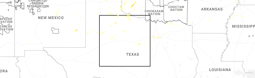
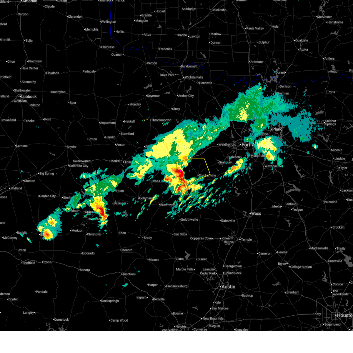
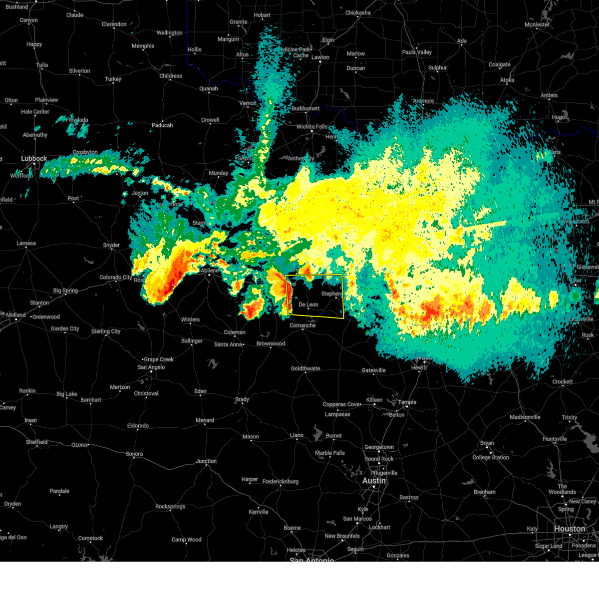
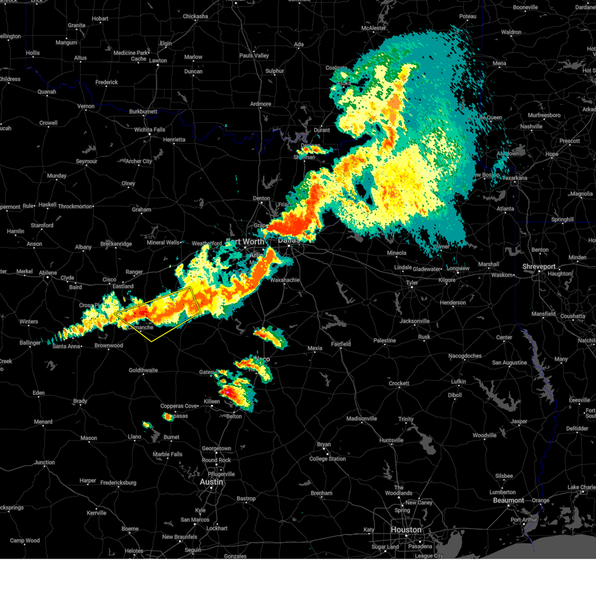
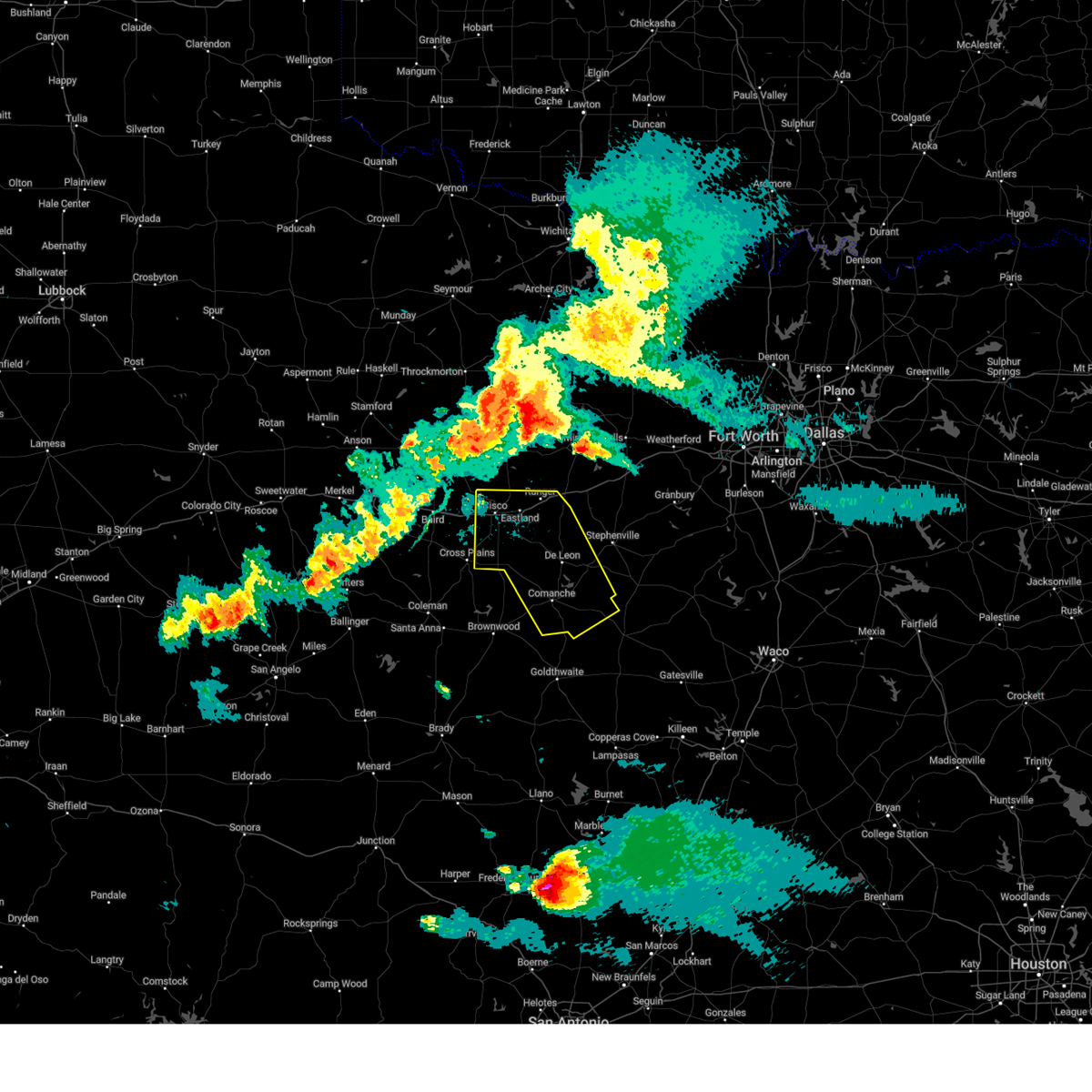
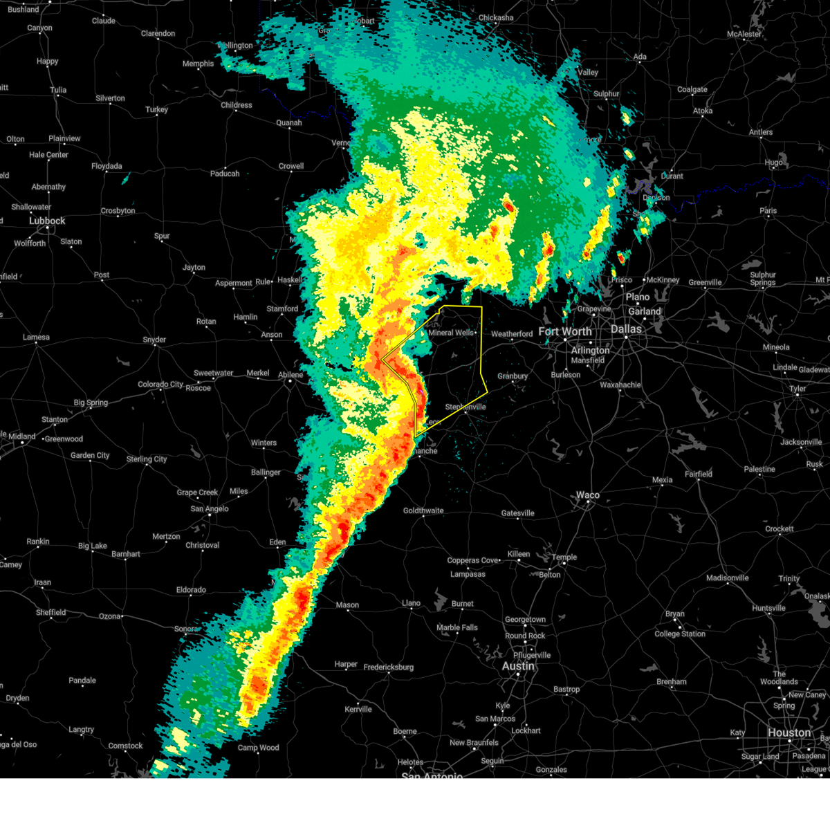
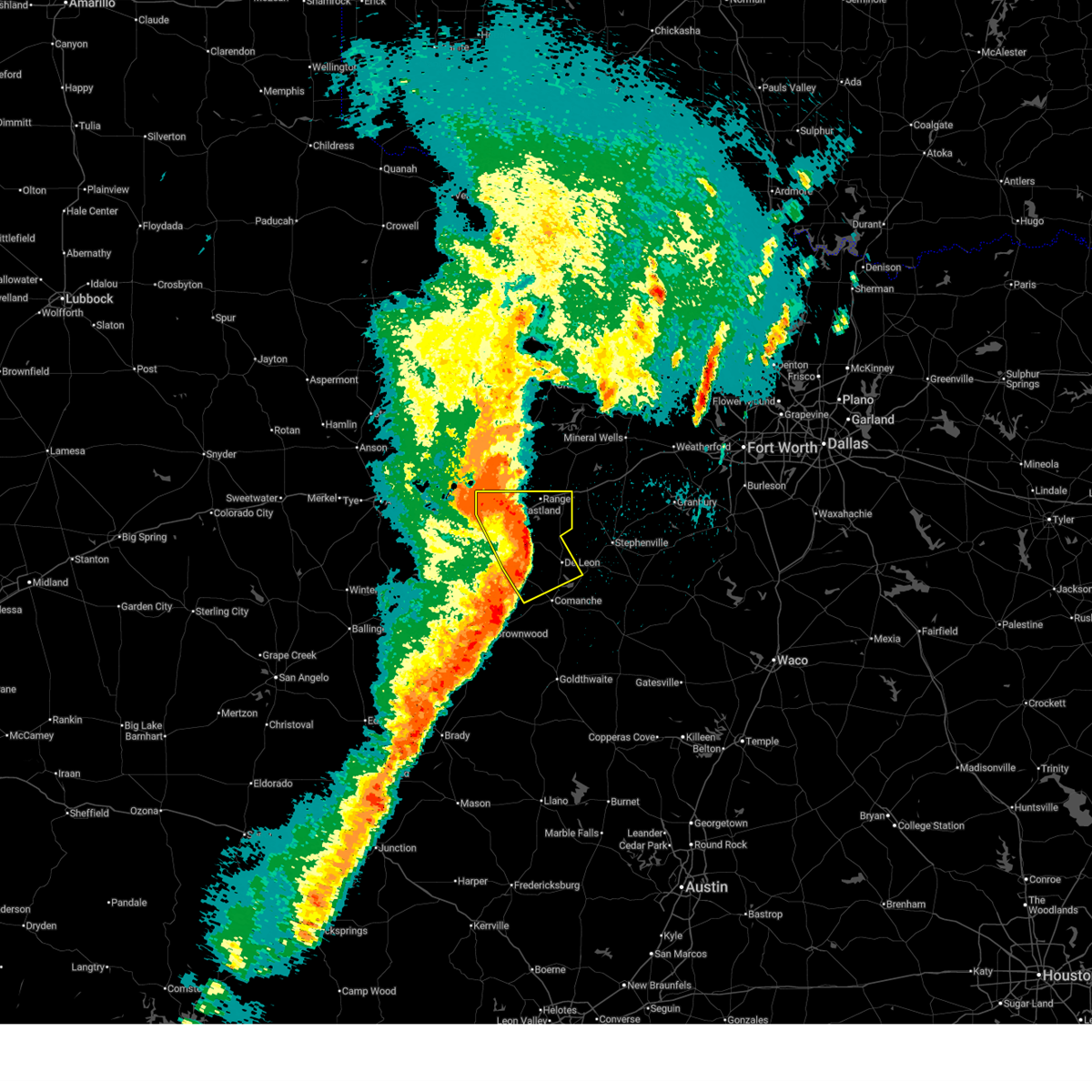
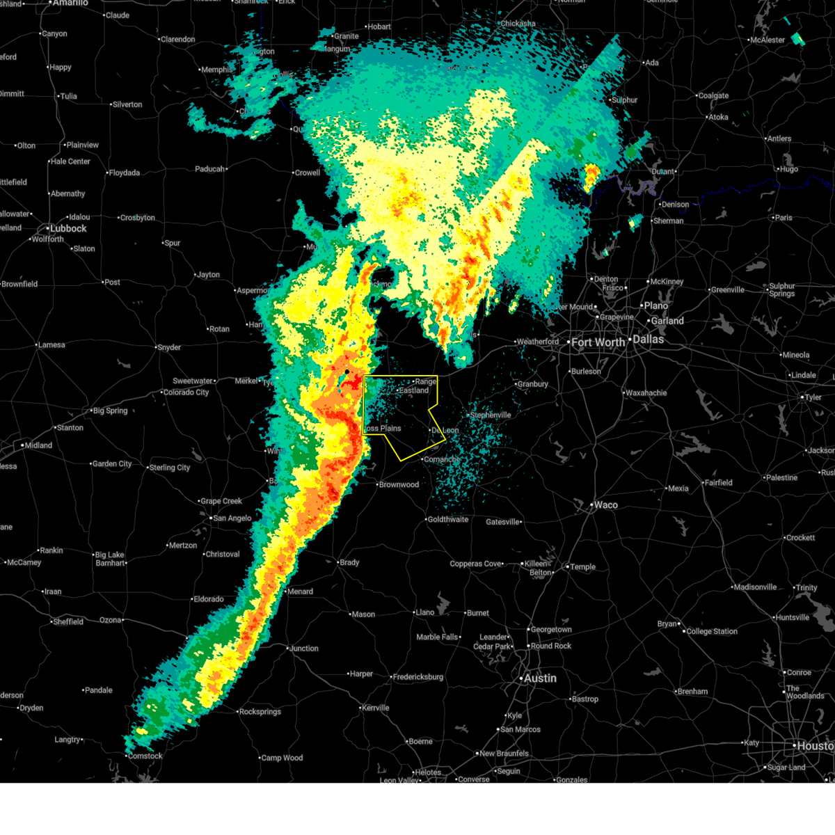
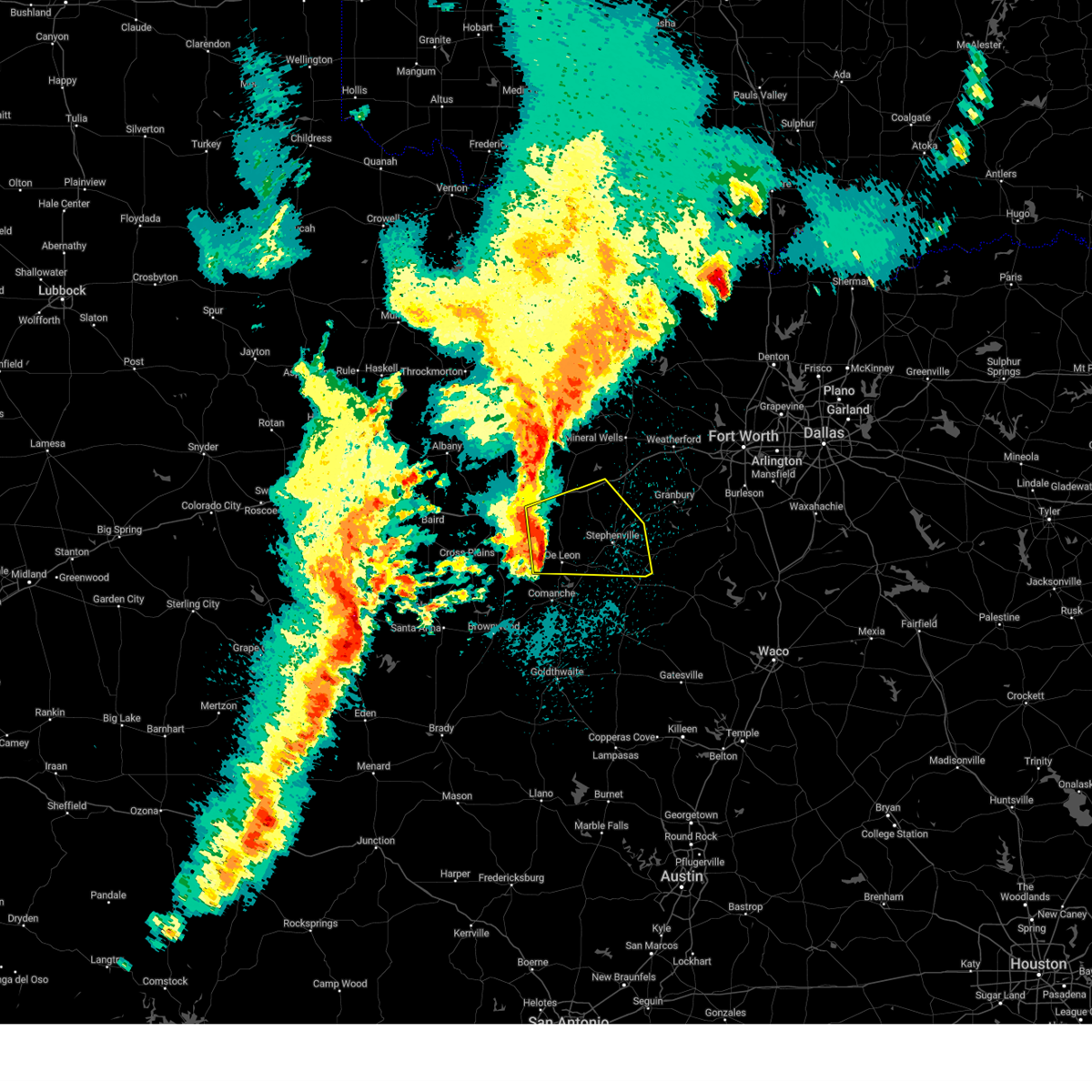
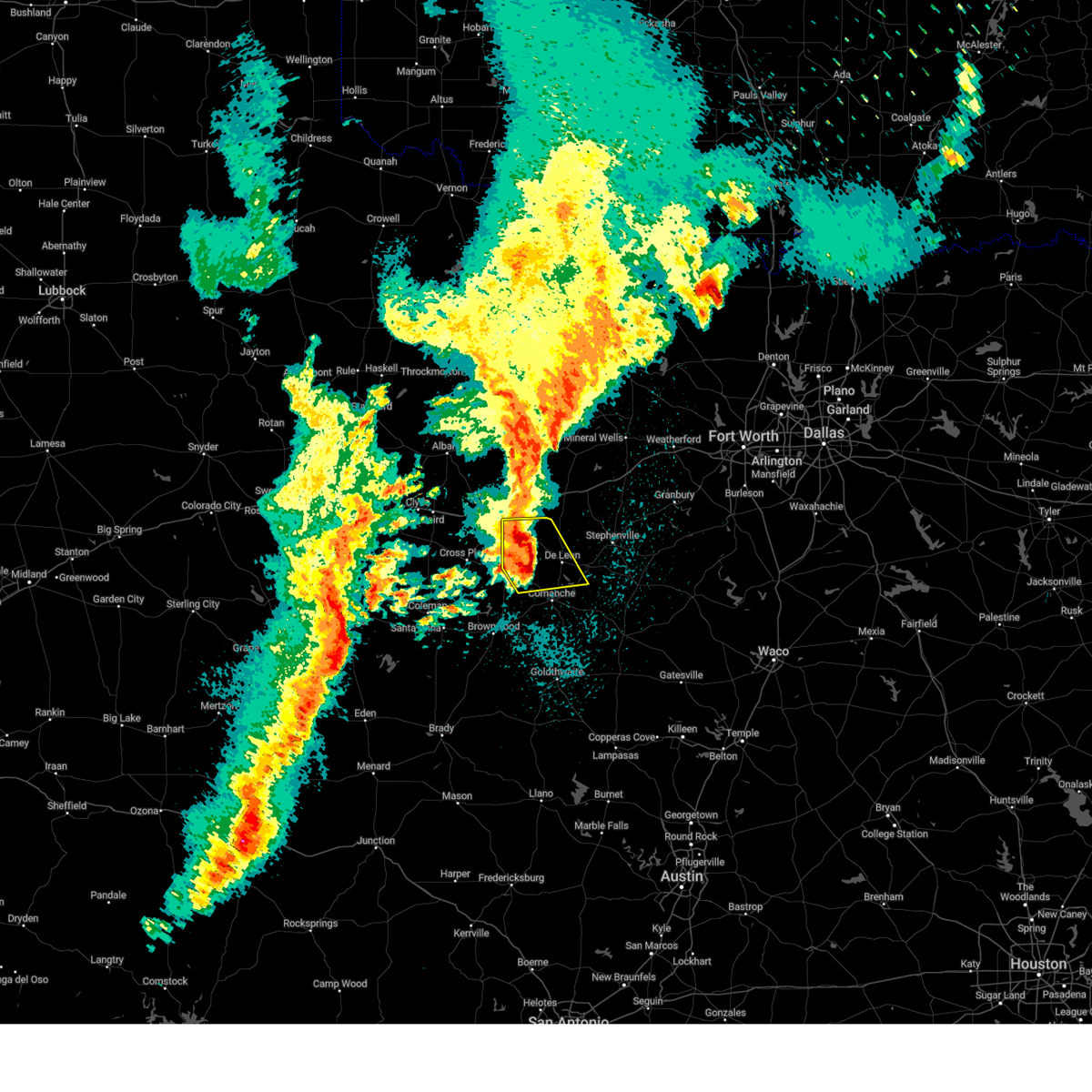
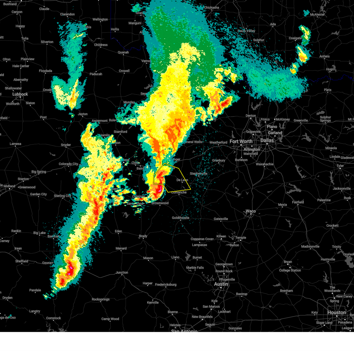
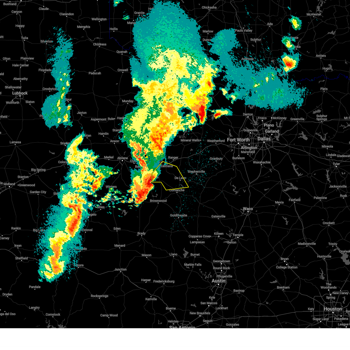
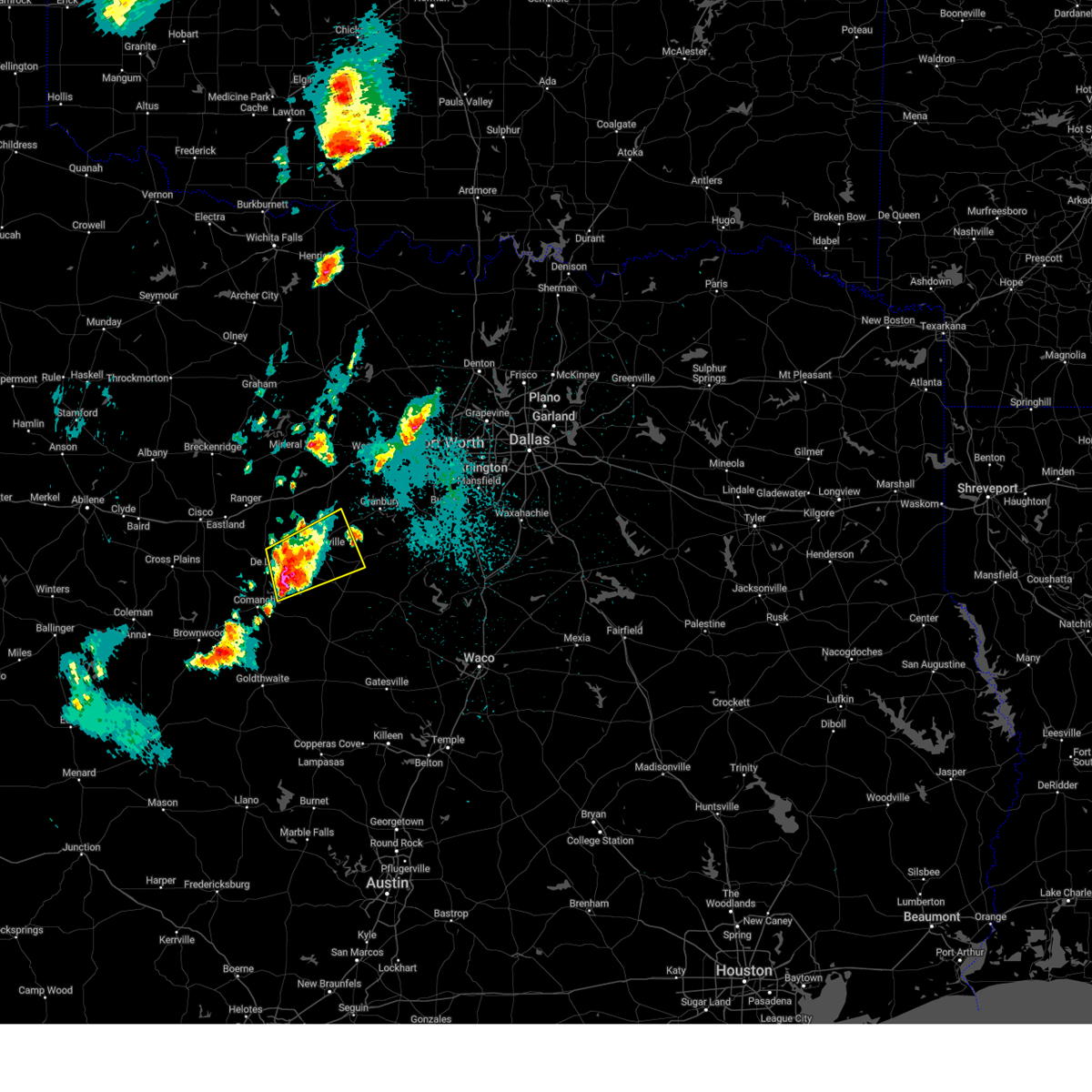
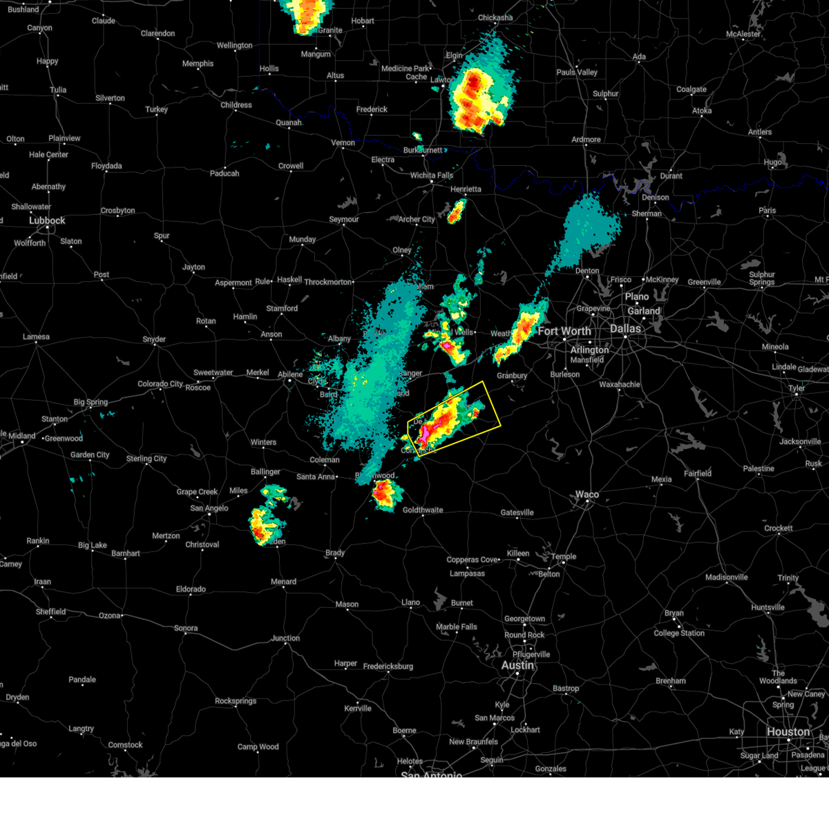
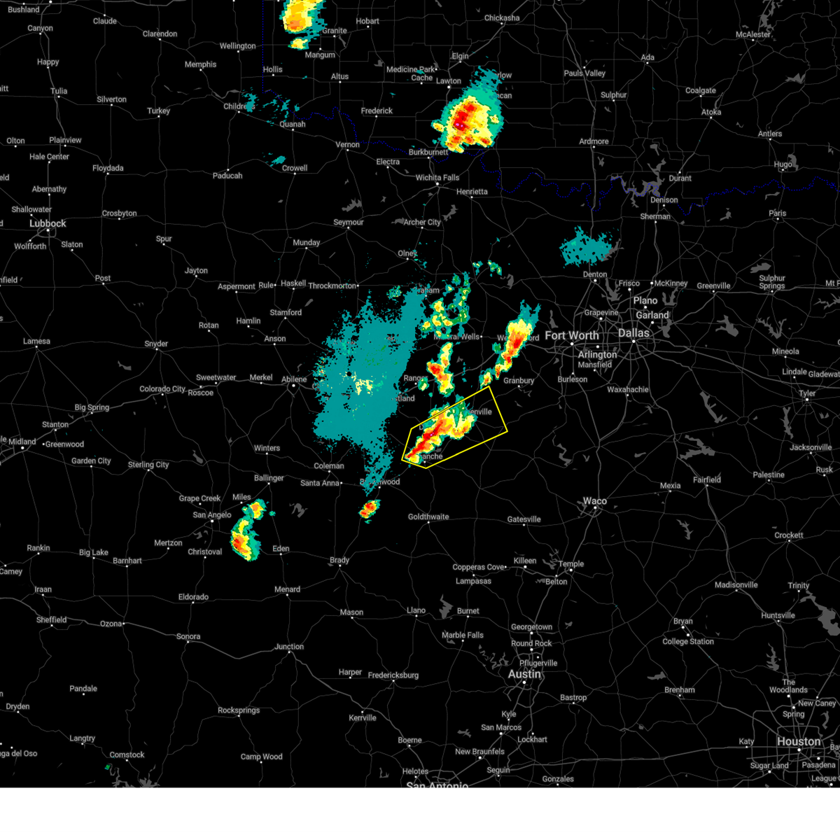
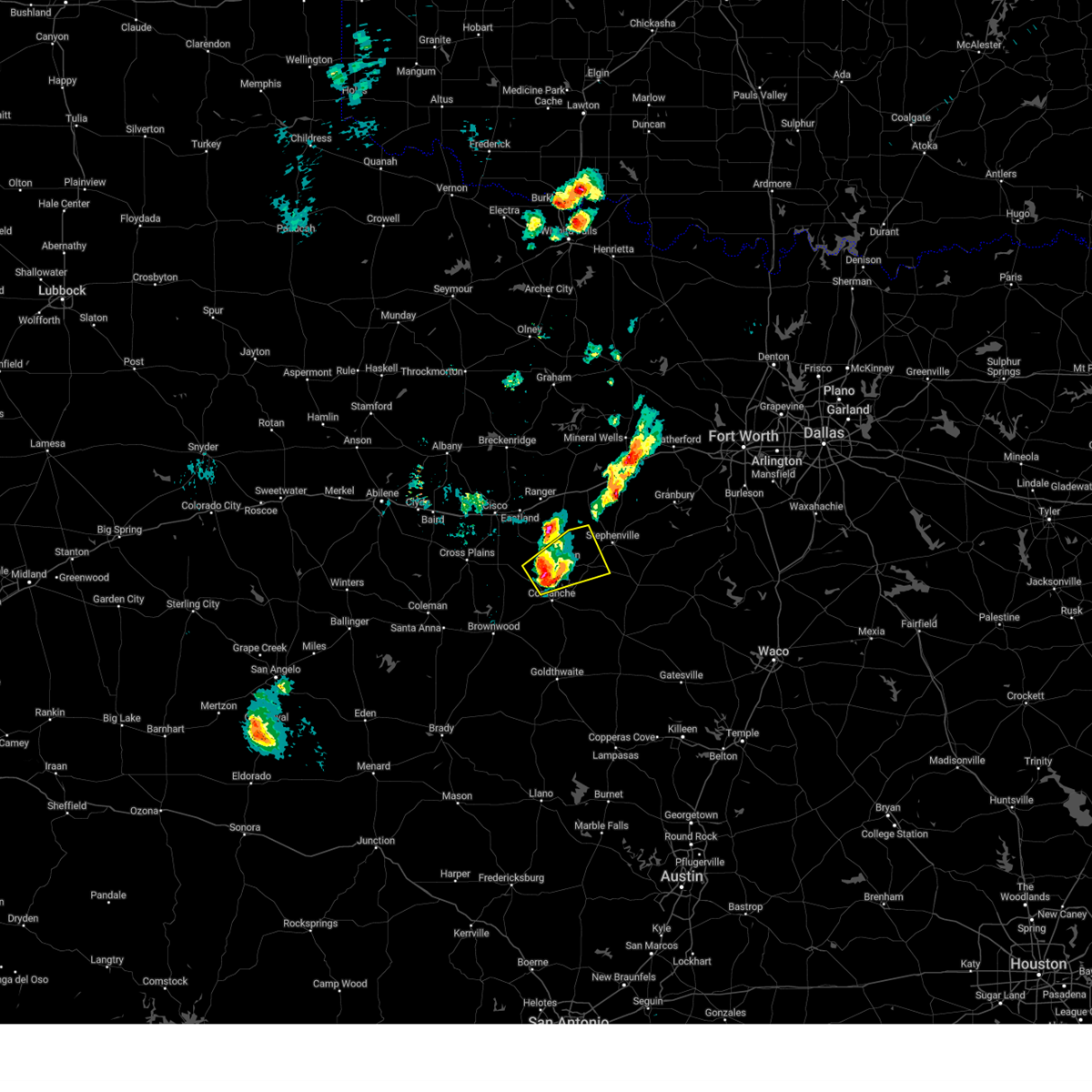
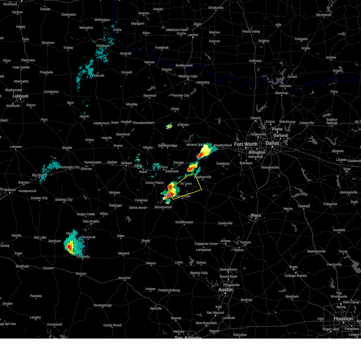
Hail Map for De Leon, TX
The De Leon, TX area has had 19 reports of on-the-ground hail by trained spotters, and has been under severe weather warnings 8 times during the past 12 months. Doppler radar has detected hail at or near De Leon, TX on 103 occasions, including 7 occasions during the past year.
| Name: | De Leon, TX |
| Where Located: | 74.3 miles ESE of Abilene, TX |
| Map: | Google Map for De Leon, TX |
| Population: | 2246 |
| Housing Units: | 1094 |
| More Info: | Search Google for De Leon, TX |
1
The Top Recent Hail Date for De Leon, TX is Tuesday, July 8, 2025 (39th out of 103)
Hail and Wind Damage Spotted near De Leon, TX
| Date / Time | Report Details |
|---|---|
| 4/18/2026 7:43 AM CDT |
 Svrfwd the national weather service in fort worth has issued a * severe thunderstorm warning for, erath county in north central texas, northeastern eastland county in north central texas, north central comanche county in central texas, * until 830 am cdt. * at 743 am cdt, a severe thunderstorm was located 7 miles southwest of huckabay, or 15 miles west of stephenville, moving east at 55 mph (radar indicated). Hazards include 60 mph wind gusts and penny size hail. Expect damage to roofs, siding, and trees. this severe thunderstorm will be near, huckabay around 750 am cdt. morgan mill around 755 am cdt. bluff dale around 805 am cdt. Other locations impacted by this severe thunderstorm include comyn, patillo, hannibal, lingleville, desdemona, bunyan, highland, and harbin. Svrfwd the national weather service in fort worth has issued a * severe thunderstorm warning for, erath county in north central texas, northeastern eastland county in north central texas, north central comanche county in central texas, * until 830 am cdt. * at 743 am cdt, a severe thunderstorm was located 7 miles southwest of huckabay, or 15 miles west of stephenville, moving east at 55 mph (radar indicated). Hazards include 60 mph wind gusts and penny size hail. Expect damage to roofs, siding, and trees. this severe thunderstorm will be near, huckabay around 750 am cdt. morgan mill around 755 am cdt. bluff dale around 805 am cdt. Other locations impacted by this severe thunderstorm include comyn, patillo, hannibal, lingleville, desdemona, bunyan, highland, and harbin.
|
| 10/24/2025 7:20 PM CDT | The storms which prompted the warning have moved out of the area. therefore the warning will be allowed to expire. however gusty winds and heavy rain are still possible with these thunderstorms. a severe thunderstorm watch remains in effect until midnight cdt for central and north central texas. |
| 10/24/2025 6:56 PM CDT | At 656 pm cdt, severe thunderstorms were located along a line extending from near ranger to near gustine, moving east at 30 mph (radar indicated). Hazards include 60 mph wind gusts. Expect damage to roofs, siding, and trees. these severe storms will be near, de leon, gustine, and proctor lake around 700 pm cdt. Other locations impacted by these severe thunderstorms include lamkin, kokomo, proctor, staff, hasse, duster, morton valley, comyn, newburg, and downing. |
| 10/24/2025 6:42 PM CDT | At 641 pm cdt, severe thunderstorms were located along a line extending from near gunsight to comanche, moving northeast at 30 mph (radar indicated). Hazards include 60 mph wind gusts. Expect damage to roofs, siding, and trees. these severe storms will be near, eastland, gorman, lake leon, lake olden, and proctor lake around 645 pm cdt. de leon and gustine around 650 pm cdt. ranger around 655 pm cdt. Other locations impacted by these severe thunderstorms include lamkin, kokomo, proctor, staff, hasse, sidney, carbon, okra, duster, and morton valley. |
| 10/24/2025 6:22 PM CDT | Svrfwd the national weather service in fort worth has issued a * severe thunderstorm warning for, eastland county in north central texas, comanche county in central texas, * until 730 pm cdt. * at 622 pm cdt, severe thunderstorms were located along a line extending from near cisco to zephyr, moving northeast at 30 mph (radar indicated). Hazards include 60 mph wind gusts. Expect damage to roofs, siding, and trees. severe thunderstorms will be near, comanche, cisco, and lake cisco around 625 pm cdt. eastland around 630 pm cdt. gorman, lake leon, lake olden, and proctor lake around 640 pm cdt. ranger, de leon, and gustine around 650 pm cdt. other locations impacted by these severe thunderstorms include nimrod, kokomo, staff, okra, duster, morton valley, comyn, energy, sipe springs, and scranton. This includes interstate 20 between mile markers 324 and 362. |
| 9/21/2025 7:11 PM CDT | The storm which prompted the warning has weakened below severe limits. therefore the warning will be allowed to expire. however small hail and gusty winds are still possible with this thunderstorm. |
| 9/21/2025 6:54 PM CDT | At 654 pm cdt, a severe thunderstorm was located near dublin, moving southeast at 15 mph (radar indicated). Hazards include 60 mph wind gusts and quarter size hail. Hail damage to vehicles is expected. expect wind damage to roofs, siding, and trees. this severe storm will be near, dublin around 700 pm cdt. Other locations impacted by this severe thunderstorm include comyn, alexander, proctor, harbin, lingleville, purves, bunyan, highland, and edna hill. |
| 9/21/2025 6:35 PM CDT | Svrfwd the national weather service in fort worth has issued a * severe thunderstorm warning for, southwestern erath county in north central texas, central comanche county in central texas, * until 715 pm cdt. * at 635 pm cdt, a severe thunderstorm was located near de leon, or 7 miles northwest of dublin, moving southeast at 15 mph (radar indicated). Hazards include ping pong ball size hail and 65 mph wind gusts. People and animals outdoors will be injured. expect hail damage to roofs, siding, windows, and vehicles. expect wind damage to roofs, siding, and trees. this severe thunderstorm will be near, dublin around 645 pm cdt. Other locations impacted by this severe thunderstorm include comyn, alexander, proctor, harbin, lingleville, purves, bunyan, highland, and edna hill. |
| 6/9/2025 12:49 AM CDT |
 Svrfwd the national weather service in fort worth has issued a * severe thunderstorm warning for, western erath county in north central texas, eastern eastland county in north central texas, northwestern comanche county in central texas, * until 145 am cdt. * at 1249 am cdt, a severe thunderstorm was located near gorman, or 9 miles southeast of eastland, moving east at 40 mph (radar indicated). Hazards include 65 mph wind gusts and quarter size hail. Hail damage to vehicles is expected. Expect wind damage to roofs, siding, and trees. Svrfwd the national weather service in fort worth has issued a * severe thunderstorm warning for, western erath county in north central texas, eastern eastland county in north central texas, northwestern comanche county in central texas, * until 145 am cdt. * at 1249 am cdt, a severe thunderstorm was located near gorman, or 9 miles southeast of eastland, moving east at 40 mph (radar indicated). Hazards include 65 mph wind gusts and quarter size hail. Hail damage to vehicles is expected. Expect wind damage to roofs, siding, and trees.
|
| 6/3/2025 11:04 PM CDT |
 At 1104 pm cdt, severe thunderstorms were located along a line extending from stephenville to near comanche, moving southeast at 25 mph (radar indicated). Hazards include 60 mph wind gusts and quarter size hail. Hail damage to vehicles is expected. expect wind damage to roofs, siding, and trees. Locations impacted include, alexander, clairette, harbin, dublin, duffau, duster, edna hill, comyn, stephenville, johnsville, sipe springs, gustine, comanche, highland, proctor, hasse, bunyan, downing, rucker, and van dyke. At 1104 pm cdt, severe thunderstorms were located along a line extending from stephenville to near comanche, moving southeast at 25 mph (radar indicated). Hazards include 60 mph wind gusts and quarter size hail. Hail damage to vehicles is expected. expect wind damage to roofs, siding, and trees. Locations impacted include, alexander, clairette, harbin, dublin, duffau, duster, edna hill, comyn, stephenville, johnsville, sipe springs, gustine, comanche, highland, proctor, hasse, bunyan, downing, rucker, and van dyke.
|
| 6/3/2025 11:04 PM CDT |
 the severe thunderstorm warning has been cancelled and is no longer in effect the severe thunderstorm warning has been cancelled and is no longer in effect
|
| 6/3/2025 10:30 PM CDT |
 Svrfwd the national weather service in fort worth has issued a * severe thunderstorm warning for, erath county in north central texas, southeastern eastland county in north central texas, comanche county in central texas, * until 1130 pm cdt. * at 1030 pm cdt, severe thunderstorms were located along a line extending from near morgan mill to rising star, moving southeast at 20 mph (radar indicated). Hazards include 60 mph wind gusts and quarter size hail. Hail damage to vehicles is expected. Expect wind damage to roofs, siding, and trees. Svrfwd the national weather service in fort worth has issued a * severe thunderstorm warning for, erath county in north central texas, southeastern eastland county in north central texas, comanche county in central texas, * until 1130 pm cdt. * at 1030 pm cdt, severe thunderstorms were located along a line extending from near morgan mill to rising star, moving southeast at 20 mph (radar indicated). Hazards include 60 mph wind gusts and quarter size hail. Hail damage to vehicles is expected. Expect wind damage to roofs, siding, and trees.
|
| 5/22/2025 10:15 PM CDT |
 the severe thunderstorm warning has been cancelled and is no longer in effect the severe thunderstorm warning has been cancelled and is no longer in effect
|
| 5/22/2025 10:15 PM CDT |
 At 1014 pm cdt, a severe thunderstorm was located 10 miles east of may, or 12 miles northwest of comanche, moving south at 25 mph (radar indicated). Hazards include 70 mph wind gusts and quarter size hail. Hail damage to vehicles is expected. expect considerable tree damage. wind damage is also likely to mobile homes, roofs, and outbuildings. This severe thunderstorm will remain over mainly rural areas of southern eastland and comanche counties, including the following locations, kokomo, hasse, sidney, carbon, okra, duster, newburg, downing, pleasant hill, and rucker. At 1014 pm cdt, a severe thunderstorm was located 10 miles east of may, or 12 miles northwest of comanche, moving south at 25 mph (radar indicated). Hazards include 70 mph wind gusts and quarter size hail. Hail damage to vehicles is expected. expect considerable tree damage. wind damage is also likely to mobile homes, roofs, and outbuildings. This severe thunderstorm will remain over mainly rural areas of southern eastland and comanche counties, including the following locations, kokomo, hasse, sidney, carbon, okra, duster, newburg, downing, pleasant hill, and rucker.
|
| 5/22/2025 9:49 PM CDT |
 At 947 pm cdt, a severe thunderstorm was located from eastland to rising star, moving southeast at 35 mph. a 75 mph wind gust was reported at ketn (radar indicated). Hazards include 70 mph wind gusts and quarter size hail. Hail damage to vehicles is expected. expect considerable tree damage. wind damage is also likely to mobile homes, roofs, and outbuildings. this severe storm will be near, de leon around 1000 pm cdt. proctor lake around 1005 pm cdt. gustine around 1030 pm cdt. Other locations impacted by this severe thunderstorm include nimrod, kokomo, staff, okra, duster, edna hill, morton valley, comyn, energy, and sipe springs. At 947 pm cdt, a severe thunderstorm was located from eastland to rising star, moving southeast at 35 mph. a 75 mph wind gust was reported at ketn (radar indicated). Hazards include 70 mph wind gusts and quarter size hail. Hail damage to vehicles is expected. expect considerable tree damage. wind damage is also likely to mobile homes, roofs, and outbuildings. this severe storm will be near, de leon around 1000 pm cdt. proctor lake around 1005 pm cdt. gustine around 1030 pm cdt. Other locations impacted by this severe thunderstorm include nimrod, kokomo, staff, okra, duster, edna hill, morton valley, comyn, energy, and sipe springs.
|
| 5/22/2025 9:38 PM CDT |
 Svrfwd the national weather service in fort worth has issued a * severe thunderstorm warning for, southwestern erath county in north central texas, eastland county in north central texas, comanche county in central texas, * until 1030 pm cdt. * at 937 pm cdt, a line of severe thunderstorms was located from ranger to rising star, moving southeast at 40 mph (radar indicated). Hazards include 65 mph wind gusts and quarter size hail. Hail damage to vehicles is expected. expect wind damage to roofs, siding, and trees. this severe thunderstorm will be near, gorman around 940 pm cdt. de leon around 945 pm cdt. proctor lake around 955 pm cdt. gustine around 1015 pm cdt. other locations impacted by this severe thunderstorm include nimrod, kokomo, staff, lingleville, okra, duster, edna hill, morton valley, comyn, and energy. This includes interstate 20 between mile markers 324 and 358. Svrfwd the national weather service in fort worth has issued a * severe thunderstorm warning for, southwestern erath county in north central texas, eastland county in north central texas, comanche county in central texas, * until 1030 pm cdt. * at 937 pm cdt, a line of severe thunderstorms was located from ranger to rising star, moving southeast at 40 mph (radar indicated). Hazards include 65 mph wind gusts and quarter size hail. Hail damage to vehicles is expected. expect wind damage to roofs, siding, and trees. this severe thunderstorm will be near, gorman around 940 pm cdt. de leon around 945 pm cdt. proctor lake around 955 pm cdt. gustine around 1015 pm cdt. other locations impacted by this severe thunderstorm include nimrod, kokomo, staff, lingleville, okra, duster, edna hill, morton valley, comyn, and energy. This includes interstate 20 between mile markers 324 and 358.
|
| 4/20/2025 2:11 AM CDT |
 Svrfwd the national weather service in fort worth has issued a * severe thunderstorm warning for, northern erath county in north central texas, northeastern eastland county in north central texas, southeastern stephens county in north central texas, palo pinto county in north central texas, north central comanche county in central texas, * until 245 am cdt. * at 210 am cdt, severe thunderstorms were located along a line extending from near necessity to palo pinto mountains state park to 10 miles west of huckabay to near de leon, moving northeast at 70 mph (radar indicated). Hazards include 60 mph wind gusts and quarter size hail. Hail damage to vehicles is expected. expect wind damage to roofs, siding, and trees. severe thunderstorms will be near, gordon, caddo, and palo pinto mountains state park around 215 am cdt. lake palo pinto, huckabay, and possum kingdom lake around 220 am cdt. palo pinto around 225 am cdt. morgan mill around 230 am cdt. graford and mineral wells around 235 am cdt. other locations impacted by these severe thunderstorms include santo, patillo, lingleville, mingus, rucker, oran, new salem, thurber, hannibal, and brazos. This includes interstate 20 between mile markers 349 and 389. Svrfwd the national weather service in fort worth has issued a * severe thunderstorm warning for, northern erath county in north central texas, northeastern eastland county in north central texas, southeastern stephens county in north central texas, palo pinto county in north central texas, north central comanche county in central texas, * until 245 am cdt. * at 210 am cdt, severe thunderstorms were located along a line extending from near necessity to palo pinto mountains state park to 10 miles west of huckabay to near de leon, moving northeast at 70 mph (radar indicated). Hazards include 60 mph wind gusts and quarter size hail. Hail damage to vehicles is expected. expect wind damage to roofs, siding, and trees. severe thunderstorms will be near, gordon, caddo, and palo pinto mountains state park around 215 am cdt. lake palo pinto, huckabay, and possum kingdom lake around 220 am cdt. palo pinto around 225 am cdt. morgan mill around 230 am cdt. graford and mineral wells around 235 am cdt. other locations impacted by these severe thunderstorms include santo, patillo, lingleville, mingus, rucker, oran, new salem, thurber, hannibal, and brazos. This includes interstate 20 between mile markers 349 and 389.
|
| 4/20/2025 2:00 AM CDT |
 At 200 am cdt, severe thunderstorms were located along a line extending from near gunsight to lake olden to near gorman to 11 miles northwest of comanche, moving northeast at 60 mph (radar indicated). Hazards include 60 mph wind gusts and quarter size hail. Hail damage to vehicles is expected. expect wind damage to roofs, siding, and trees. these severe storms will be near, lake leon, ranger, de leon, and gorman around 205 am cdt. Other locations impacted by these severe thunderstorms include kokomo, staff, sidney, carbon, okra, duster, morton valley, downing, comyn, and pleasant hill. At 200 am cdt, severe thunderstorms were located along a line extending from near gunsight to lake olden to near gorman to 11 miles northwest of comanche, moving northeast at 60 mph (radar indicated). Hazards include 60 mph wind gusts and quarter size hail. Hail damage to vehicles is expected. expect wind damage to roofs, siding, and trees. these severe storms will be near, lake leon, ranger, de leon, and gorman around 205 am cdt. Other locations impacted by these severe thunderstorms include kokomo, staff, sidney, carbon, okra, duster, morton valley, downing, comyn, and pleasant hill.
|
| 4/20/2025 1:29 AM CDT |
 Svrfwd the national weather service in fort worth has issued a * severe thunderstorm warning for, eastland county in north central texas, northwestern comanche county in central texas, * until 215 am cdt. * at 129 am cdt, severe thunderstorms were located along a line extending from near rowden to near cross plains to near cross cut to lake brownwood near thrifty, moving northeast at 60 mph (radar indicated). Hazards include 60 mph wind gusts and quarter size hail. Hail damage to vehicles is expected. expect wind damage to roofs, siding, and trees. severe thunderstorms will be near, rising star around 135 am cdt. cisco around 145 am cdt. lake cisco and eastland around 150 am cdt. lake leon, gorman, and lake olden around 155 am cdt. ranger around 200 am cdt. de leon around 205 am cdt. other locations impacted by these severe thunderstorms include nimrod, kokomo, staff, sidney, carbon, okra, duster, morton valley, downing, and comyn. This includes interstate 20 between mile markers 324 and 363. Svrfwd the national weather service in fort worth has issued a * severe thunderstorm warning for, eastland county in north central texas, northwestern comanche county in central texas, * until 215 am cdt. * at 129 am cdt, severe thunderstorms were located along a line extending from near rowden to near cross plains to near cross cut to lake brownwood near thrifty, moving northeast at 60 mph (radar indicated). Hazards include 60 mph wind gusts and quarter size hail. Hail damage to vehicles is expected. expect wind damage to roofs, siding, and trees. severe thunderstorms will be near, rising star around 135 am cdt. cisco around 145 am cdt. lake cisco and eastland around 150 am cdt. lake leon, gorman, and lake olden around 155 am cdt. ranger around 200 am cdt. de leon around 205 am cdt. other locations impacted by these severe thunderstorms include nimrod, kokomo, staff, sidney, carbon, okra, duster, morton valley, downing, and comyn. This includes interstate 20 between mile markers 324 and 363.
|
| 4/20/2025 12:43 AM CDT |
 Svrfwd the national weather service in fort worth has issued a * severe thunderstorm warning for, erath county in north central texas, eastern eastland county in north central texas, south central palo pinto county in north central texas, north central comanche county in central texas, * until 130 am cdt. * at 1242 am cdt, a severe thunderstorm was located near gorman, or 16 miles south of ranger, moving east at 45 mph (radar indicated). Hazards include 65 mph wind gusts and quarter size hail. Hail damage to vehicles is expected. expect wind damage to roofs, siding, and trees. this severe thunderstorm will be near, huckabay around 105 am cdt. bluff dale around 120 am cdt. other locations impacted by this severe thunderstorm include alexander, kokomo, patillo, clairette, harbin, staff, lingleville, duffau, duster, and bunyan. This includes interstate 20 between mile markers 344 and 352, and between mile markers 361 and 377. Svrfwd the national weather service in fort worth has issued a * severe thunderstorm warning for, erath county in north central texas, eastern eastland county in north central texas, south central palo pinto county in north central texas, north central comanche county in central texas, * until 130 am cdt. * at 1242 am cdt, a severe thunderstorm was located near gorman, or 16 miles south of ranger, moving east at 45 mph (radar indicated). Hazards include 65 mph wind gusts and quarter size hail. Hail damage to vehicles is expected. expect wind damage to roofs, siding, and trees. this severe thunderstorm will be near, huckabay around 105 am cdt. bluff dale around 120 am cdt. other locations impacted by this severe thunderstorm include alexander, kokomo, patillo, clairette, harbin, staff, lingleville, duffau, duster, and bunyan. This includes interstate 20 between mile markers 344 and 352, and between mile markers 361 and 377.
|
| 4/20/2025 12:34 AM CDT |
 At 1233 am cdt, a severe thunderstorm was located over gorman, or 13 miles southeast of eastland, moving northeast at 50 mph (radar indicated). Hazards include 65 mph wind gusts and half dollar size hail. Hail damage to vehicles is expected. expect wind damage to roofs, siding, and trees. This severe thunderstorm will remain over mainly rural areas of central eastland and northwestern comanche counties, including the following locations, kokomo, proctor, carbon, okra, duster, downing, comyn, rucker, van dyke, and beattie. At 1233 am cdt, a severe thunderstorm was located over gorman, or 13 miles southeast of eastland, moving northeast at 50 mph (radar indicated). Hazards include 65 mph wind gusts and half dollar size hail. Hail damage to vehicles is expected. expect wind damage to roofs, siding, and trees. This severe thunderstorm will remain over mainly rural areas of central eastland and northwestern comanche counties, including the following locations, kokomo, proctor, carbon, okra, duster, downing, comyn, rucker, van dyke, and beattie.
|
| 4/20/2025 12:21 AM CDT |
 At 1221 am cdt, a severe thunderstorm was located 9 miles northeast of rising star, or 13 miles south of eastland, moving northeast at 35 mph (radar indicated). Hazards include ping pong ball size hail and 60 mph wind gusts. People and animals outdoors will be injured. expect hail damage to roofs, siding, windows, and vehicles. expect wind damage to roofs, siding, and trees. this severe storm will be near, lake leon around 1235 am cdt. Other locations impacted by this severe thunderstorm include nimrod, kokomo, proctor, staff, carbon, okra, duster, downing, comyn, and pleasant hill. At 1221 am cdt, a severe thunderstorm was located 9 miles northeast of rising star, or 13 miles south of eastland, moving northeast at 35 mph (radar indicated). Hazards include ping pong ball size hail and 60 mph wind gusts. People and animals outdoors will be injured. expect hail damage to roofs, siding, windows, and vehicles. expect wind damage to roofs, siding, and trees. this severe storm will be near, lake leon around 1235 am cdt. Other locations impacted by this severe thunderstorm include nimrod, kokomo, proctor, staff, carbon, okra, duster, downing, comyn, and pleasant hill.
|
| 4/19/2025 11:48 PM CDT |
 Svrfwd the national weather service in fort worth has issued a * severe thunderstorm warning for, central eastland county in north central texas, northwestern comanche county in central texas, * until 1245 am cdt. * at 1148 pm cdt, a severe thunderstorm was located over cross cut, or 22 miles northeast of coleman, moving northeast at 35 mph (radar indicated). Hazards include two inch hail and 60 mph wind gusts. People and animals outdoors will be injured. expect hail damage to roofs, siding, windows, and vehicles. expect wind damage to roofs, siding, and trees. this severe thunderstorm will be near, rising star around 1200 am cdt. lake leon around 1235 am cdt. other locations impacted by this severe thunderstorm include nimrod, kokomo, proctor, staff, carbon, okra, duster, downing, comyn, and pleasant hill. This includes interstate 20 between mile markers 332 and 343. Svrfwd the national weather service in fort worth has issued a * severe thunderstorm warning for, central eastland county in north central texas, northwestern comanche county in central texas, * until 1245 am cdt. * at 1148 pm cdt, a severe thunderstorm was located over cross cut, or 22 miles northeast of coleman, moving northeast at 35 mph (radar indicated). Hazards include two inch hail and 60 mph wind gusts. People and animals outdoors will be injured. expect hail damage to roofs, siding, windows, and vehicles. expect wind damage to roofs, siding, and trees. this severe thunderstorm will be near, rising star around 1200 am cdt. lake leon around 1235 am cdt. other locations impacted by this severe thunderstorm include nimrod, kokomo, proctor, staff, carbon, okra, duster, downing, comyn, and pleasant hill. This includes interstate 20 between mile markers 332 and 343.
|
| 3/29/2025 9:33 PM CDT |
 At 932 pm cdt, a severe thunderstorm was located over dublin, moving northeast at 35 mph. this is a destructive storm for dublin, tx and harbin, tx (radar indicated). Hazards include baseball size hail and 65 mph wind gusts. People and animals outdoors will be severely injured. expect shattered windows, extensive damage to roofs, siding, and vehicles. this severe storm will be near, stephenville around 940 pm cdt. bluff dale around 1010 pm cdt. Other locations impacted by this severe thunderstorm include alexander, comyn, proctor, johnsville, selden, harbin, chalk mountain, lingleville, purves, and duffau. At 932 pm cdt, a severe thunderstorm was located over dublin, moving northeast at 35 mph. this is a destructive storm for dublin, tx and harbin, tx (radar indicated). Hazards include baseball size hail and 65 mph wind gusts. People and animals outdoors will be severely injured. expect shattered windows, extensive damage to roofs, siding, and vehicles. this severe storm will be near, stephenville around 940 pm cdt. bluff dale around 1010 pm cdt. Other locations impacted by this severe thunderstorm include alexander, comyn, proctor, johnsville, selden, harbin, chalk mountain, lingleville, purves, and duffau.
|
| 3/29/2025 9:17 PM CDT |
 At 917 pm cdt, a severe thunderstorm was located near dublin, moving northeast at 40 mph (radar indicated). Hazards include golf ball size hail and 65 mph wind gusts. People and animals outdoors will be injured. expect hail damage to roofs, siding, windows, and vehicles. expect wind damage to roofs, siding, and trees. this severe storm will be near, stephenville around 925 pm cdt. bluff dale around 950 pm cdt. Other locations impacted by this severe thunderstorm include alexander, proctor, harbin, hasse, lingleville, duffau, duster, bunyan, downing, and comyn. At 917 pm cdt, a severe thunderstorm was located near dublin, moving northeast at 40 mph (radar indicated). Hazards include golf ball size hail and 65 mph wind gusts. People and animals outdoors will be injured. expect hail damage to roofs, siding, windows, and vehicles. expect wind damage to roofs, siding, and trees. this severe storm will be near, stephenville around 925 pm cdt. bluff dale around 950 pm cdt. Other locations impacted by this severe thunderstorm include alexander, proctor, harbin, hasse, lingleville, duffau, duster, bunyan, downing, and comyn.
|
| 3/29/2025 8:58 PM CDT |
 Svrfwd the national weather service in fort worth has issued a * severe thunderstorm warning for, erath county in north central texas, central comanche county in central texas, * until 1000 pm cdt. * at 857 pm cdt, a severe thunderstorm was located over de leon, or 11 miles west of dublin, moving northeast at 35 mph (radar indicated). Hazards include 60 mph wind gusts and quarter size hail. Hail damage to vehicles is expected. expect wind damage to roofs, siding, and trees. this severe thunderstorm will be near, stephenville around 920 pm cdt. bluff dale around 945 pm cdt. Other locations impacted by this severe thunderstorm include alexander, proctor, clairette, harbin, hasse, sidney, lingleville, duffau, duster, and edna hill. Svrfwd the national weather service in fort worth has issued a * severe thunderstorm warning for, erath county in north central texas, central comanche county in central texas, * until 1000 pm cdt. * at 857 pm cdt, a severe thunderstorm was located over de leon, or 11 miles west of dublin, moving northeast at 35 mph (radar indicated). Hazards include 60 mph wind gusts and quarter size hail. Hail damage to vehicles is expected. expect wind damage to roofs, siding, and trees. this severe thunderstorm will be near, stephenville around 920 pm cdt. bluff dale around 945 pm cdt. Other locations impacted by this severe thunderstorm include alexander, proctor, clairette, harbin, hasse, sidney, lingleville, duffau, duster, and edna hill.
|
| 3/29/2025 8:23 PM CDT |
 At 823 pm cdt, a severe thunderstorm was located near de leon, or 12 miles north of comanche, moving northeast at 35 mph (radar indicated). Hazards include 60 mph wind gusts and half dollar size hail. Hail damage to vehicles is expected. expect wind damage to roofs, siding, and trees. this severe storm will be near, de leon around 830 pm cdt. Other locations impacted by this severe thunderstorm include downing, comyn, rucker, van dyke, harbin, beattie, sipe springs, lingleville, duster, and bunyan. At 823 pm cdt, a severe thunderstorm was located near de leon, or 12 miles north of comanche, moving northeast at 35 mph (radar indicated). Hazards include 60 mph wind gusts and half dollar size hail. Hail damage to vehicles is expected. expect wind damage to roofs, siding, and trees. this severe storm will be near, de leon around 830 pm cdt. Other locations impacted by this severe thunderstorm include downing, comyn, rucker, van dyke, harbin, beattie, sipe springs, lingleville, duster, and bunyan.
|
| 3/29/2025 7:59 PM CDT |
 Svrfwd the national weather service in fort worth has issued a * severe thunderstorm warning for, southwestern erath county in north central texas, central comanche county in central texas, * until 900 pm cdt. * at 758 pm cdt, a severe thunderstorm was located near may, or 14 miles northwest of comanche, moving northeast at 35 mph (radar indicated). Hazards include golf ball size hail and 60 mph wind gusts. People and animals outdoors will be injured. expect hail damage to roofs, siding, windows, and vehicles. expect wind damage to roofs, siding, and trees. this severe thunderstorm will be near, de leon around 825 pm cdt. Other locations impacted by this severe thunderstorm include harbin, sidney, lingleville, duster, bunyan, downing, comyn, rucker, van dyke, and beattie. Svrfwd the national weather service in fort worth has issued a * severe thunderstorm warning for, southwestern erath county in north central texas, central comanche county in central texas, * until 900 pm cdt. * at 758 pm cdt, a severe thunderstorm was located near may, or 14 miles northwest of comanche, moving northeast at 35 mph (radar indicated). Hazards include golf ball size hail and 60 mph wind gusts. People and animals outdoors will be injured. expect hail damage to roofs, siding, windows, and vehicles. expect wind damage to roofs, siding, and trees. this severe thunderstorm will be near, de leon around 825 pm cdt. Other locations impacted by this severe thunderstorm include harbin, sidney, lingleville, duster, bunyan, downing, comyn, rucker, van dyke, and beattie.
|
| 1/30/2025 2:26 AM CST |
 The storm which prompted the warning has weakened below severe limits and the warning will be allowed to expire. however small hail and gusty winds are still possible with this thunderstorm. The storm which prompted the warning has weakened below severe limits and the warning will be allowed to expire. however small hail and gusty winds are still possible with this thunderstorm.
|
| 1/30/2025 2:10 AM CST |
 At 209 am cst, a severe thunderstorm was located near de leon, or 13 miles west of dublin, moving northeast at 60 mph (radar indicated). Hazards include 60 mph wind gusts and quarter size hail. Hail damage to vehicles is expected. expect wind damage to roofs, siding, and trees. this severe storm will be near, huckabay around 225 am cst. Other locations impacted by this severe thunderstorm include downing, rucker, patillo, thurber, hannibal, lingleville, duster, desdemona, and highland. At 209 am cst, a severe thunderstorm was located near de leon, or 13 miles west of dublin, moving northeast at 60 mph (radar indicated). Hazards include 60 mph wind gusts and quarter size hail. Hail damage to vehicles is expected. expect wind damage to roofs, siding, and trees. this severe storm will be near, huckabay around 225 am cst. Other locations impacted by this severe thunderstorm include downing, rucker, patillo, thurber, hannibal, lingleville, duster, desdemona, and highland.
|
| 1/30/2025 1:57 AM CST |
 Svrfwd the national weather service in fort worth has issued a * severe thunderstorm warning for, northwestern erath county in north central texas, eastern eastland county in north central texas, northwestern comanche county in central texas, * until 230 am cst. * at 156 am cst, a severe thunderstorm was located 11 miles northwest of comanche, moving northeast at 60 mph (radar indicated). Hazards include 60 mph wind gusts and quarter size hail. Hail damage to vehicles is expected. expect wind damage to roofs, siding, and trees. this severe thunderstorm will remain over mainly rural areas of northwestern erath, eastern eastland and northwestern comanche counties, including the following locations, kokomo, patillo, staff, sidney, lingleville, duster, downing, rucker, thurber, and hannibal. This includes interstate 20 between mile markers 352 and 368. Svrfwd the national weather service in fort worth has issued a * severe thunderstorm warning for, northwestern erath county in north central texas, eastern eastland county in north central texas, northwestern comanche county in central texas, * until 230 am cst. * at 156 am cst, a severe thunderstorm was located 11 miles northwest of comanche, moving northeast at 60 mph (radar indicated). Hazards include 60 mph wind gusts and quarter size hail. Hail damage to vehicles is expected. expect wind damage to roofs, siding, and trees. this severe thunderstorm will remain over mainly rural areas of northwestern erath, eastern eastland and northwestern comanche counties, including the following locations, kokomo, patillo, staff, sidney, lingleville, duster, downing, rucker, thurber, and hannibal. This includes interstate 20 between mile markers 352 and 368.
|
| 5/31/2024 2:07 AM CDT |
 the severe thunderstorm warning has been cancelled and is no longer in effect the severe thunderstorm warning has been cancelled and is no longer in effect
|
| 5/31/2024 2:07 AM CDT |
 At 206 am cdt, a severe thunderstorm was located over proctor lake, or 8 miles southwest of dublin, moving east at 45 mph (radar indicated). Hazards include 60 mph wind gusts and penny size hail. Expect damage to roofs, siding, and trees. This severe thunderstorm will remain over mainly rural areas of southwestern erath and comanche counties, including the following locations, lamkin, alexander, proctor, harbin, hasse, lingleville, edna hill, bunyan, newburg, and downing. At 206 am cdt, a severe thunderstorm was located over proctor lake, or 8 miles southwest of dublin, moving east at 45 mph (radar indicated). Hazards include 60 mph wind gusts and penny size hail. Expect damage to roofs, siding, and trees. This severe thunderstorm will remain over mainly rural areas of southwestern erath and comanche counties, including the following locations, lamkin, alexander, proctor, harbin, hasse, lingleville, edna hill, bunyan, newburg, and downing.
|
| 5/31/2024 1:39 AM CDT |
 Svrfwd the national weather service in fort worth has issued a * severe thunderstorm warning for, southwestern erath county in north central texas, southeastern eastland county in north central texas, comanche county in central texas, * until 230 am cdt. * at 139 am cdt, a severe thunderstorm was located 8 miles east of rising star, or 18 miles northwest of comanche, moving east at 35 mph (radar indicated). Hazards include 60 mph wind gusts. Expect damage to roofs, siding, and trees. this severe thunderstorm will be near, proctor lake around 205 am cdt. Other locations impacted by this severe thunderstorm include lamkin, alexander, kokomo, proctor, harbin, hasse, sidney, lingleville, carbon, and okra. Svrfwd the national weather service in fort worth has issued a * severe thunderstorm warning for, southwestern erath county in north central texas, southeastern eastland county in north central texas, comanche county in central texas, * until 230 am cdt. * at 139 am cdt, a severe thunderstorm was located 8 miles east of rising star, or 18 miles northwest of comanche, moving east at 35 mph (radar indicated). Hazards include 60 mph wind gusts. Expect damage to roofs, siding, and trees. this severe thunderstorm will be near, proctor lake around 205 am cdt. Other locations impacted by this severe thunderstorm include lamkin, alexander, kokomo, proctor, harbin, hasse, sidney, lingleville, carbon, and okra.
|
| 5/30/2024 10:14 PM CDT |
 the severe thunderstorm warning has been cancelled and is no longer in effect the severe thunderstorm warning has been cancelled and is no longer in effect
|
| 5/30/2024 10:14 PM CDT |
 At 1013 pm cdt, severe thunderstorms were located along a line extending from stephenville to gustine, moving east at 40 mph (radar indicated). Hazards include 65 mph wind gusts and penny size hail. Expect damage to roofs, siding, and trees. these severe storms will be near, stephenville and hico around 1020 pm cdt. iredell around 1035 pm cdt. Other locations impacted by these severe thunderstorms include lamkin, alexander, proctor, clairette, olin, harbin, hasse, lingleville, duffau, and edna hill. At 1013 pm cdt, severe thunderstorms were located along a line extending from stephenville to gustine, moving east at 40 mph (radar indicated). Hazards include 65 mph wind gusts and penny size hail. Expect damage to roofs, siding, and trees. these severe storms will be near, stephenville and hico around 1020 pm cdt. iredell around 1035 pm cdt. Other locations impacted by these severe thunderstorms include lamkin, alexander, proctor, clairette, olin, harbin, hasse, lingleville, duffau, and edna hill.
|
| 5/30/2024 9:40 PM CDT |
 Svrfwd the national weather service in fort worth has issued a * severe thunderstorm warning for, northern hamilton county in central texas, erath county in north central texas, eastern eastland county in north central texas, west central bosque county in central texas, comanche county in central texas, * until 1045 pm cdt. * at 939 pm cdt, severe thunderstorms were located along a line extending from near gorman to near comanche, moving east at 40 mph (radar indicated). Hazards include 65 mph wind gusts and penny size hail. Expect damage to roofs, siding, and trees. severe thunderstorms will be near, de leon and proctor lake around 945 pm cdt. dublin around 950 pm cdt. stephenville around 1000 pm cdt. hico around 1015 pm cdt. bluff dale around 1025 pm cdt. iredell around 1030 pm cdt. other locations impacted by these severe thunderstorms include alexander, kokomo, clairette, olin, staff, harbin, lingleville, duster, duffau, and edna hill. This includes interstate 20 between mile markers 340 and 347. Svrfwd the national weather service in fort worth has issued a * severe thunderstorm warning for, northern hamilton county in central texas, erath county in north central texas, eastern eastland county in north central texas, west central bosque county in central texas, comanche county in central texas, * until 1045 pm cdt. * at 939 pm cdt, severe thunderstorms were located along a line extending from near gorman to near comanche, moving east at 40 mph (radar indicated). Hazards include 65 mph wind gusts and penny size hail. Expect damage to roofs, siding, and trees. severe thunderstorms will be near, de leon and proctor lake around 945 pm cdt. dublin around 950 pm cdt. stephenville around 1000 pm cdt. hico around 1015 pm cdt. bluff dale around 1025 pm cdt. iredell around 1030 pm cdt. other locations impacted by these severe thunderstorms include alexander, kokomo, clairette, olin, staff, harbin, lingleville, duster, duffau, and edna hill. This includes interstate 20 between mile markers 340 and 347.
|
| 5/30/2024 8:43 PM CDT |
 Svrfwd the national weather service in fort worth has issued a * severe thunderstorm warning for, eastland county in north central texas, comanche county in central texas, * until 945 pm cdt. * at 841 pm cdt, severe thunderstorms were located along a line extending from near atwell to near santa anna, moving east at 40 mph (radar indicated). Hazards include 65 mph wind gusts and quarter size hail. Hail damage to vehicles is expected. expect wind damage to roofs, siding, and trees. severe thunderstorms will be near, rising star around 900 pm cdt. gorman around 920 pm cdt. comanche and de leon around 935 pm cdt. proctor lake around 940 pm cdt. other locations impacted by these severe thunderstorms include nimrod, kokomo, staff, hasse, sidney, carbon, okra, duster, newburg, and downing. This includes interstate 20 between mile markers 324 and 352. Svrfwd the national weather service in fort worth has issued a * severe thunderstorm warning for, eastland county in north central texas, comanche county in central texas, * until 945 pm cdt. * at 841 pm cdt, severe thunderstorms were located along a line extending from near atwell to near santa anna, moving east at 40 mph (radar indicated). Hazards include 65 mph wind gusts and quarter size hail. Hail damage to vehicles is expected. expect wind damage to roofs, siding, and trees. severe thunderstorms will be near, rising star around 900 pm cdt. gorman around 920 pm cdt. comanche and de leon around 935 pm cdt. proctor lake around 940 pm cdt. other locations impacted by these severe thunderstorms include nimrod, kokomo, staff, hasse, sidney, carbon, okra, duster, newburg, and downing. This includes interstate 20 between mile markers 324 and 352.
|
| 5/26/2024 3:49 AM CDT |
 At 349 am cdt, severe thunderstorms were located along a line extending from 6 miles east of gorman to near de leon to near proctor lake to blanket, moving east at 45 mph (radar indicated). Hazards include 60 mph wind gusts and penny size hail. Expect damage to roofs, siding, and trees. these severe storms will be near, comanche and proctor lake around 355 am cdt. Other locations impacted by these severe thunderstorms include lamkin, proctor, hasse, priddy, sidney, duster, newburg, downing, comyn, and energy. At 349 am cdt, severe thunderstorms were located along a line extending from 6 miles east of gorman to near de leon to near proctor lake to blanket, moving east at 45 mph (radar indicated). Hazards include 60 mph wind gusts and penny size hail. Expect damage to roofs, siding, and trees. these severe storms will be near, comanche and proctor lake around 355 am cdt. Other locations impacted by these severe thunderstorms include lamkin, proctor, hasse, priddy, sidney, duster, newburg, downing, comyn, and energy.
|
| 5/26/2024 3:25 AM CDT |
 Svrfwd the national weather service in fort worth has issued a * severe thunderstorm warning for, north central mills county in central texas, comanche county in central texas, * until 430 am cdt. * at 324 am cdt, severe thunderstorms were located along a line extending from near rising star to near may to near early to near bangs, moving east at 45 mph (radar indicated). Hazards include 60 mph wind gusts and nickel size hail. Expect damage to roofs, siding, and trees. severe thunderstorms will be near, comanche around 345 am cdt. de leon and proctor lake around 350 am cdt. gustine around 405 am cdt. Other locations impacted by these severe thunderstorms include lamkin, proctor, hasse, priddy, sidney, duster, newburg, downing, comyn, and energy. Svrfwd the national weather service in fort worth has issued a * severe thunderstorm warning for, north central mills county in central texas, comanche county in central texas, * until 430 am cdt. * at 324 am cdt, severe thunderstorms were located along a line extending from near rising star to near may to near early to near bangs, moving east at 45 mph (radar indicated). Hazards include 60 mph wind gusts and nickel size hail. Expect damage to roofs, siding, and trees. severe thunderstorms will be near, comanche around 345 am cdt. de leon and proctor lake around 350 am cdt. gustine around 405 am cdt. Other locations impacted by these severe thunderstorms include lamkin, proctor, hasse, priddy, sidney, duster, newburg, downing, comyn, and energy.
|
| 5/25/2024 6:48 PM CDT |
 At 648 pm cdt, a severe thunderstorm was located near de leon, or 12 miles northwest of dublin, moving east at 25 mph (public). Hazards include ping pong ball size hail and 60 mph wind gusts. People and animals outdoors will be injured. expect hail damage to roofs, siding, windows, and vehicles. expect wind damage to roofs, siding, and trees. this severe storm will be near, dublin around 710 pm cdt. stephenville around 720 pm cdt. Other locations impacted by this severe thunderstorm include alexander, comyn, rucker, clairette, harbin, lingleville, duster, bunyan, highland, and purves. At 648 pm cdt, a severe thunderstorm was located near de leon, or 12 miles northwest of dublin, moving east at 25 mph (public). Hazards include ping pong ball size hail and 60 mph wind gusts. People and animals outdoors will be injured. expect hail damage to roofs, siding, windows, and vehicles. expect wind damage to roofs, siding, and trees. this severe storm will be near, dublin around 710 pm cdt. stephenville around 720 pm cdt. Other locations impacted by this severe thunderstorm include alexander, comyn, rucker, clairette, harbin, lingleville, duster, bunyan, highland, and purves.
|
| 5/25/2024 6:43 PM CDT |
 the tornado warning has been cancelled and is no longer in effect the tornado warning has been cancelled and is no longer in effect
|
| 5/25/2024 6:42 PM CDT |
 Svrfwd the national weather service in fort worth has issued a * severe thunderstorm warning for, southwestern erath county in north central texas, north central comanche county in central texas, * until 745 pm cdt. * at 641 pm cdt, a severe thunderstorm was located near de leon, or 15 miles west of dublin, moving east at 25 mph (radar indicated). Hazards include 60 mph wind gusts and half dollar size hail. Hail damage to vehicles is expected. expect wind damage to roofs, siding, and trees. this severe thunderstorm will be near, de leon around 645 pm cdt. dublin around 710 pm cdt. stephenville around 720 pm cdt. Other locations impacted by this severe thunderstorm include alexander, comyn, rucker, clairette, harbin, lingleville, duster, bunyan, highland, and purves. Svrfwd the national weather service in fort worth has issued a * severe thunderstorm warning for, southwestern erath county in north central texas, north central comanche county in central texas, * until 745 pm cdt. * at 641 pm cdt, a severe thunderstorm was located near de leon, or 15 miles west of dublin, moving east at 25 mph (radar indicated). Hazards include 60 mph wind gusts and half dollar size hail. Hail damage to vehicles is expected. expect wind damage to roofs, siding, and trees. this severe thunderstorm will be near, de leon around 645 pm cdt. dublin around 710 pm cdt. stephenville around 720 pm cdt. Other locations impacted by this severe thunderstorm include alexander, comyn, rucker, clairette, harbin, lingleville, duster, bunyan, highland, and purves.
|
| 5/25/2024 6:36 PM CDT |
 the tornado warning has been cancelled and is no longer in effect the tornado warning has been cancelled and is no longer in effect
|
| 5/25/2024 6:36 PM CDT |
 At 636 pm cdt, a severe thunderstorm capable of producing a tornado was located near gorman, or 17 miles north of comanche, moving east at 25 mph (radar indicated rotation). Hazards include tornado and ping pong ball size hail. Flying debris will be dangerous to those caught without shelter. mobile homes will be damaged or destroyed. damage to roofs, windows, and vehicles will occur. tree damage is likely. this dangerous storm will be near, de leon around 645 pm cdt. Other locations impacted by this tornadic thunderstorm include rucker, comyn, and duster. At 636 pm cdt, a severe thunderstorm capable of producing a tornado was located near gorman, or 17 miles north of comanche, moving east at 25 mph (radar indicated rotation). Hazards include tornado and ping pong ball size hail. Flying debris will be dangerous to those caught without shelter. mobile homes will be damaged or destroyed. damage to roofs, windows, and vehicles will occur. tree damage is likely. this dangerous storm will be near, de leon around 645 pm cdt. Other locations impacted by this tornadic thunderstorm include rucker, comyn, and duster.
|
| 5/25/2024 6:11 PM CDT |
 Torfwd the national weather service in fort worth has issued a * tornado warning for, southeastern eastland county in north central texas, northwestern comanche county in central texas, * until 715 pm cdt. * at 611 pm cdt, a severe thunderstorm capable of producing a tornado was located 7 miles east of rising star, or 19 miles south of eastland, moving east at 25 mph (radar indicated rotation). Hazards include tornado and hail up to two inches in diameter. Flying debris will be dangerous to those caught without shelter. mobile homes will be damaged or destroyed. damage to roofs, windows, and vehicles will occur. tree damage is likely. this dangerous storm will be near, de leon around 645 pm cdt. Other locations impacted by this tornadic thunderstorm include downing, rucker, beattie, sipe springs, okra, duster, and comyn. Torfwd the national weather service in fort worth has issued a * tornado warning for, southeastern eastland county in north central texas, northwestern comanche county in central texas, * until 715 pm cdt. * at 611 pm cdt, a severe thunderstorm capable of producing a tornado was located 7 miles east of rising star, or 19 miles south of eastland, moving east at 25 mph (radar indicated rotation). Hazards include tornado and hail up to two inches in diameter. Flying debris will be dangerous to those caught without shelter. mobile homes will be damaged or destroyed. damage to roofs, windows, and vehicles will occur. tree damage is likely. this dangerous storm will be near, de leon around 645 pm cdt. Other locations impacted by this tornadic thunderstorm include downing, rucker, beattie, sipe springs, okra, duster, and comyn.
|
| 5/9/2024 4:13 PM CDT |
 Svrfwd the national weather service in fort worth has issued a * severe thunderstorm warning for, central erath county in north central texas, north central comanche county in central texas, * until 515 pm cdt. * at 413 pm cdt, a severe thunderstorm was located near dublin, moving east at 25 mph (radar indicated). Hazards include ping pong ball size hail and 60 mph wind gusts. People and animals outdoors will be injured. expect hail damage to roofs, siding, windows, and vehicles. expect wind damage to roofs, siding, and trees. this severe thunderstorm will be near, stephenville around 425 pm cdt. Other locations impacted by this severe thunderstorm include alexander, comyn, clairette, johnsville, selden, harbin, chalk mountain, lingleville, duffau, and bunyan. Svrfwd the national weather service in fort worth has issued a * severe thunderstorm warning for, central erath county in north central texas, north central comanche county in central texas, * until 515 pm cdt. * at 413 pm cdt, a severe thunderstorm was located near dublin, moving east at 25 mph (radar indicated). Hazards include ping pong ball size hail and 60 mph wind gusts. People and animals outdoors will be injured. expect hail damage to roofs, siding, windows, and vehicles. expect wind damage to roofs, siding, and trees. this severe thunderstorm will be near, stephenville around 425 pm cdt. Other locations impacted by this severe thunderstorm include alexander, comyn, clairette, johnsville, selden, harbin, chalk mountain, lingleville, duffau, and bunyan.
|
| 2/11/2024 2:54 AM CST |
 The severe thunderstorm warning for northwestern comanche county will expire at 300 am cst, the storm which prompted the warning has moved out of the area. therefore the warning will be allowed to expire. a severe thunderstorm watch remains in effect until 400 am cst for central and north central texas. The severe thunderstorm warning for northwestern comanche county will expire at 300 am cst, the storm which prompted the warning has moved out of the area. therefore the warning will be allowed to expire. a severe thunderstorm watch remains in effect until 400 am cst for central and north central texas.
|
| 2/11/2024 2:42 AM CST |
 At 241 am cst, a severe thunderstorm was located over de leon, or 9 miles west of dublin, moving east at 65 mph (radar indicated). Hazards include quarter size hail. Damage to vehicles is possible. locations impacted include, de leon, proctor lake, comyn, downing, rucker, beattie, sipe springs, and duster. hail threat, radar indicated max hail size, 1. 00 in wind threat, radar indicated max wind gust, <50 mph. At 241 am cst, a severe thunderstorm was located over de leon, or 9 miles west of dublin, moving east at 65 mph (radar indicated). Hazards include quarter size hail. Damage to vehicles is possible. locations impacted include, de leon, proctor lake, comyn, downing, rucker, beattie, sipe springs, and duster. hail threat, radar indicated max hail size, 1. 00 in wind threat, radar indicated max wind gust, <50 mph.
|
| 2/11/2024 2:05 AM CST |
 At 205 am cst, a severe thunderstorm was located near may, or 19 miles north of early, moving east at 25 mph (radar indicated). Hazards include ping pong ball size hail. People and animals outdoors will be injured. expect damage to roofs, siding, windows, and vehicles. this severe thunderstorm will remain over mainly rural areas of central comanche county, including the following locations, downing, comyn, proctor, rucker, van dyke, beattie, hasse, sipe springs, sidney, and duster. hail threat, radar indicated max hail size, 1. 50 in wind threat, radar indicated max wind gust, <50 mph. At 205 am cst, a severe thunderstorm was located near may, or 19 miles north of early, moving east at 25 mph (radar indicated). Hazards include ping pong ball size hail. People and animals outdoors will be injured. expect damage to roofs, siding, windows, and vehicles. this severe thunderstorm will remain over mainly rural areas of central comanche county, including the following locations, downing, comyn, proctor, rucker, van dyke, beattie, hasse, sipe springs, sidney, and duster. hail threat, radar indicated max hail size, 1. 50 in wind threat, radar indicated max wind gust, <50 mph.
|
| 9/9/2023 4:40 PM CDT |
 At 439 pm cdt, a severe thunderstorm was located near de leon, or 11 miles north of comanche, moving south at 10 mph (radar indicated). Hazards include 60 mph wind gusts and quarter size hail. Hail damage to vehicles is expected. expect wind damage to roofs, siding, and trees. locations impacted include, comanche, dublin, de leon, proctor lake, comyn, downing, proctor, van dyke, and hasse. hail threat, radar indicated max hail size, 1. 00 in wind threat, radar indicated max wind gust, 60 mph. At 439 pm cdt, a severe thunderstorm was located near de leon, or 11 miles north of comanche, moving south at 10 mph (radar indicated). Hazards include 60 mph wind gusts and quarter size hail. Hail damage to vehicles is expected. expect wind damage to roofs, siding, and trees. locations impacted include, comanche, dublin, de leon, proctor lake, comyn, downing, proctor, van dyke, and hasse. hail threat, radar indicated max hail size, 1. 00 in wind threat, radar indicated max wind gust, 60 mph.
|
| 9/9/2023 4:28 PM CDT | Quarter sized hail reported 0.6 miles NNE of De Leon, TX, public call reports hail ranging from peas to quarters. time estimated by caller. |
| 9/9/2023 4:22 PM CDT |
 At 422 pm cdt, a severe thunderstorm was located over de leon, or 12 miles west of dublin, moving southeast at 10 mph (radar indicated). Hazards include 60 mph wind gusts. expect damage to roofs, siding, and trees At 422 pm cdt, a severe thunderstorm was located over de leon, or 12 miles west of dublin, moving southeast at 10 mph (radar indicated). Hazards include 60 mph wind gusts. expect damage to roofs, siding, and trees
|
| 6/12/2023 8:44 PM CDT | Tennis Ball sized hail reported 4.8 miles N of De Leon, TX, tennis ball size hail along highway 16 north of comanche. |
| 6/12/2023 8:44 PM CDT |
 At 844 pm cdt, a severe thunderstorm was located near dublin, moving northeast at 40 mph (radar indicated). Hazards include half dollar size hail. damage to vehicles is possible At 844 pm cdt, a severe thunderstorm was located near dublin, moving northeast at 40 mph (radar indicated). Hazards include half dollar size hail. damage to vehicles is possible
|
| 6/12/2023 8:36 PM CDT |
 At 836 pm cdt, a severe thunderstorm was located over de leon, or 9 miles west of dublin, moving northeast at 40 mph (radar indicated). Hazards include ping pong ball size hail. People and animals outdoors will be injured. expect damage to roofs, siding, windows, and vehicles. locations impacted include, comanche, de leon, proctor lake, comyn, downing, proctor, rucker, van dyke, hasse, beattie and duster. hail threat, radar indicated max hail size, 1. 50 in wind threat, radar indicated max wind gust, <50 mph. At 836 pm cdt, a severe thunderstorm was located over de leon, or 9 miles west of dublin, moving northeast at 40 mph (radar indicated). Hazards include ping pong ball size hail. People and animals outdoors will be injured. expect damage to roofs, siding, windows, and vehicles. locations impacted include, comanche, de leon, proctor lake, comyn, downing, proctor, rucker, van dyke, hasse, beattie and duster. hail threat, radar indicated max hail size, 1. 50 in wind threat, radar indicated max wind gust, <50 mph.
|
| 6/12/2023 8:23 PM CDT | Tennis Ball sized hail reported 6 miles NE of De Leon, TX, picture on social media of 2.5" hail 10 n of comanche (delayed report). |
| 6/12/2023 8:15 PM CDT |
 At 814 pm cdt, a severe thunderstorm was located 8 miles northwest of comanche, moving northeast at 40 mph (radar indicated). Hazards include tennis ball size hail. People and animals outdoors will be injured. expect damage to roofs, siding, windows, and vehicles. locations impacted include, comanche, de leon, proctor lake, comyn, proctor, hasse, sidney, duster, downing, rucker, van dyke, beattie and sipe springs. thunderstorm damage threat, considerable hail threat, radar indicated max hail size, 2. 50 in wind threat, radar indicated max wind gust, <50 mph. At 814 pm cdt, a severe thunderstorm was located 8 miles northwest of comanche, moving northeast at 40 mph (radar indicated). Hazards include tennis ball size hail. People and animals outdoors will be injured. expect damage to roofs, siding, windows, and vehicles. locations impacted include, comanche, de leon, proctor lake, comyn, proctor, hasse, sidney, duster, downing, rucker, van dyke, beattie and sipe springs. thunderstorm damage threat, considerable hail threat, radar indicated max hail size, 2. 50 in wind threat, radar indicated max wind gust, <50 mph.
|
| 6/12/2023 7:59 PM CDT |
 At 759 pm cdt, a severe thunderstorm was located near blanket, or 13 miles west of comanche, moving northeast at 40 mph (radar indicated). Hazards include golf ball size hail. People and animals outdoors will be injured. Expect damage to roofs, siding, windows, and vehicles. At 759 pm cdt, a severe thunderstorm was located near blanket, or 13 miles west of comanche, moving northeast at 40 mph (radar indicated). Hazards include golf ball size hail. People and animals outdoors will be injured. Expect damage to roofs, siding, windows, and vehicles.
|
| 5/19/2023 8:49 PM CDT |
 At 849 pm cdt, a severe thunderstorm was located 8 miles east of rising star, or 19 miles northwest of comanche, moving northeast at 25 mph (radar indicated). Hazards include ping pong ball size hail and 60 mph wind gusts. People and animals outdoors will be injured. expect hail damage to roofs, siding, windows, and vehicles. Expect wind damage to roofs, siding, and trees. At 849 pm cdt, a severe thunderstorm was located 8 miles east of rising star, or 19 miles northwest of comanche, moving northeast at 25 mph (radar indicated). Hazards include ping pong ball size hail and 60 mph wind gusts. People and animals outdoors will be injured. expect hail damage to roofs, siding, windows, and vehicles. Expect wind damage to roofs, siding, and trees.
|
| 5/19/2023 8:15 PM CDT |
 At 815 pm cdt, a severe thunderstorm was located 7 miles northeast of de leon, or 9 miles northwest of dublin, moving east at 15 mph (radar indicated). Hazards include 60 mph wind gusts and quarter size hail. Hail damage to vehicles is expected. expect wind damage to roofs, siding, and trees. locations impacted include, dublin, de leon, comyn, rucker, lingleville, bunyan and highland. hail threat, radar indicated max hail size, 1. 00 in wind threat, radar indicated max wind gust, 60 mph. At 815 pm cdt, a severe thunderstorm was located 7 miles northeast of de leon, or 9 miles northwest of dublin, moving east at 15 mph (radar indicated). Hazards include 60 mph wind gusts and quarter size hail. Hail damage to vehicles is expected. expect wind damage to roofs, siding, and trees. locations impacted include, dublin, de leon, comyn, rucker, lingleville, bunyan and highland. hail threat, radar indicated max hail size, 1. 00 in wind threat, radar indicated max wind gust, 60 mph.
|
| 5/19/2023 7:59 PM CDT |
 At 759 pm cdt, a severe thunderstorm was located near de leon, or 12 miles northwest of dublin, moving east at 15 mph (radar indicated). Hazards include 60 mph wind gusts and half dollar size hail. Hail damage to vehicles is expected. Expect wind damage to roofs, siding, and trees. At 759 pm cdt, a severe thunderstorm was located near de leon, or 12 miles northwest of dublin, moving east at 15 mph (radar indicated). Hazards include 60 mph wind gusts and half dollar size hail. Hail damage to vehicles is expected. Expect wind damage to roofs, siding, and trees.
|
| 5/6/2023 7:47 PM CDT |
 At 747 pm cdt, a severe thunderstorm was located 9 miles south of gorman, or 13 miles northwest of comanche, moving east at 20 mph (radar indicated). Hazards include 60 mph wind gusts and penny size hail. Expect damage to roofs, siding, and trees. locations impacted include, comanche, de leon, gorman, proctor lake, comyn, proctor, hasse, sidney, okra, duster, downing, rucker, van dyke, beattie, sipe springs and desdemona. hail threat, radar indicated max hail size, 0. 75 in wind threat, radar indicated max wind gust, 60 mph. At 747 pm cdt, a severe thunderstorm was located 9 miles south of gorman, or 13 miles northwest of comanche, moving east at 20 mph (radar indicated). Hazards include 60 mph wind gusts and penny size hail. Expect damage to roofs, siding, and trees. locations impacted include, comanche, de leon, gorman, proctor lake, comyn, proctor, hasse, sidney, okra, duster, downing, rucker, van dyke, beattie, sipe springs and desdemona. hail threat, radar indicated max hail size, 0. 75 in wind threat, radar indicated max wind gust, 60 mph.
|
| 5/6/2023 7:30 PM CDT |
 At 730 pm cdt, a severe thunderstorm was located 8 miles northeast of may, or 16 miles northwest of comanche, moving east at 20 mph (radar indicated). Hazards include 65 mph wind gusts and quarter size hail. Hail damage to vehicles is expected. expect wind damage to roofs, siding, and trees. locations impacted include, comanche, de leon, gorman, rising star, proctor lake, comyn, sabanno, proctor, hasse, sidney, okra, duster, downing, rucker, pioneer, van dyke, beattie, sipe springs and desdemona. hail threat, radar indicated max hail size, 1. 00 in wind threat, radar indicated max wind gust, 65 mph. At 730 pm cdt, a severe thunderstorm was located 8 miles northeast of may, or 16 miles northwest of comanche, moving east at 20 mph (radar indicated). Hazards include 65 mph wind gusts and quarter size hail. Hail damage to vehicles is expected. expect wind damage to roofs, siding, and trees. locations impacted include, comanche, de leon, gorman, rising star, proctor lake, comyn, sabanno, proctor, hasse, sidney, okra, duster, downing, rucker, pioneer, van dyke, beattie, sipe springs and desdemona. hail threat, radar indicated max hail size, 1. 00 in wind threat, radar indicated max wind gust, 65 mph.
|
| 5/6/2023 7:12 PM CDT |
 At 712 pm cdt, a severe thunderstorm was located over may, or 17 miles north of early, moving east at 20 mph (radar indicated). Hazards include 65 mph wind gusts and half dollar size hail. Hail damage to vehicles is expected. Expect wind damage to roofs, siding, and trees. At 712 pm cdt, a severe thunderstorm was located over may, or 17 miles north of early, moving east at 20 mph (radar indicated). Hazards include 65 mph wind gusts and half dollar size hail. Hail damage to vehicles is expected. Expect wind damage to roofs, siding, and trees.
|
| 5/5/2023 5:58 PM CDT |
 At 558 pm cdt, a severe thunderstorm was located over de leon, or 10 miles west of dublin, moving northeast at 25 mph (radar indicated). Hazards include 60 mph wind gusts and quarter size hail. Hail damage to vehicles is expected. Expect wind damage to roofs, siding, and trees. At 558 pm cdt, a severe thunderstorm was located over de leon, or 10 miles west of dublin, moving northeast at 25 mph (radar indicated). Hazards include 60 mph wind gusts and quarter size hail. Hail damage to vehicles is expected. Expect wind damage to roofs, siding, and trees.
|
| 5/5/2023 5:33 PM CDT |
 At 532 pm cdt, a severe thunderstorm was located 11 miles south of gorman, or 12 miles northwest of comanche, moving northeast at 25 mph (radar indicated). Hazards include golf ball size hail and 65 mph wind gusts. People and animals outdoors will be injured. expect hail damage to roofs, siding, windows, and vehicles. expect wind damage to roofs, siding, and trees. locations impacted include, comanche, de leon, proctor lake, comyn, proctor, hasse, sidney, duster, downing, rucker, van dyke, beattie and sipe springs. thunderstorm damage threat, considerable hail threat, observed max hail size, 1. 75 in wind threat, radar indicated max wind gust, 65 mph. At 532 pm cdt, a severe thunderstorm was located 11 miles south of gorman, or 12 miles northwest of comanche, moving northeast at 25 mph (radar indicated). Hazards include golf ball size hail and 65 mph wind gusts. People and animals outdoors will be injured. expect hail damage to roofs, siding, windows, and vehicles. expect wind damage to roofs, siding, and trees. locations impacted include, comanche, de leon, proctor lake, comyn, proctor, hasse, sidney, duster, downing, rucker, van dyke, beattie and sipe springs. thunderstorm damage threat, considerable hail threat, observed max hail size, 1. 75 in wind threat, radar indicated max wind gust, 65 mph.
|
| 5/5/2023 5:07 PM CDT |
 At 506 pm cdt, a severe thunderstorm was located near may, or 11 miles north of early, moving northeast at 25 mph (radar indicated). Hazards include 65 mph wind gusts and half dollar size hail. Hail damage to vehicles is expected. Expect wind damage to roofs, siding, and trees. At 506 pm cdt, a severe thunderstorm was located near may, or 11 miles north of early, moving northeast at 25 mph (radar indicated). Hazards include 65 mph wind gusts and half dollar size hail. Hail damage to vehicles is expected. Expect wind damage to roofs, siding, and trees.
|
| 4/26/2023 5:42 PM CDT |
 At 542 pm cdt, a severe thunderstorm was located near dublin, moving east at 40 mph. this is a destructive storm for eastern comanche and western erath counties (trained weather spotters. at 540 pm, softball size hail was reported in de leon). Hazards include softball size hail and 65 mph wind gusts. People and animals outdoors will be severely injured. Expect shattered windows, extensive damage to roofs, siding, and vehicles. At 542 pm cdt, a severe thunderstorm was located near dublin, moving east at 40 mph. this is a destructive storm for eastern comanche and western erath counties (trained weather spotters. at 540 pm, softball size hail was reported in de leon). Hazards include softball size hail and 65 mph wind gusts. People and animals outdoors will be severely injured. Expect shattered windows, extensive damage to roofs, siding, and vehicles.
|
| 4/26/2023 5:39 PM CDT | Grapefruit sized hail reported 0.2 miles ESE of De Leon, TX, softball sized hail in de leon. |
| 4/26/2023 5:30 PM CDT |
 At 530 pm cdt, a severe thunderstorm was located near de leon, or 12 miles north of comanche, moving east at 35 mph. this is a destructive storm for de leon and northeast comanche county (emergency management). Hazards include baseball size hail and 65 mph wind gusts. People and animals outdoors will be severely injured. expect shattered windows, extensive damage to roofs, siding, and vehicles. locations impacted include, de leon, proctor lake, comyn, downing, proctor, rucker, van dyke, beattie and duster. thunderstorm damage threat, destructive hail threat, observed max hail size, 2. 75 in wind threat, radar indicated max wind gust, 65 mph. At 530 pm cdt, a severe thunderstorm was located near de leon, or 12 miles north of comanche, moving east at 35 mph. this is a destructive storm for de leon and northeast comanche county (emergency management). Hazards include baseball size hail and 65 mph wind gusts. People and animals outdoors will be severely injured. expect shattered windows, extensive damage to roofs, siding, and vehicles. locations impacted include, de leon, proctor lake, comyn, downing, proctor, rucker, van dyke, beattie and duster. thunderstorm damage threat, destructive hail threat, observed max hail size, 2. 75 in wind threat, radar indicated max wind gust, 65 mph.
|
| 4/26/2023 5:29 PM CDT | Baseball sized hail reported 0.8 miles SSE of De Leon, TX, baseball sized hail in de leon. |
| 4/26/2023 5:21 PM CDT |
 At 520 pm cdt, a severe thunderstorm was located 9 miles south of gorman, or 14 miles northwest of comanche, moving east at 30 mph (radar indicated). Hazards include golf ball size hail and 65 mph wind gusts. People and animals outdoors will be injured. expect hail damage to roofs, siding, windows, and vehicles. expect wind damage to roofs, siding, and trees. locations impacted include, de leon, proctor lake, comyn, downing, proctor, rucker, van dyke, beattie, sipe springs, duster and sidney. thunderstorm damage threat, considerable hail threat, radar indicated max hail size, 1. 75 in wind threat, radar indicated max wind gust, 65 mph. At 520 pm cdt, a severe thunderstorm was located 9 miles south of gorman, or 14 miles northwest of comanche, moving east at 30 mph (radar indicated). Hazards include golf ball size hail and 65 mph wind gusts. People and animals outdoors will be injured. expect hail damage to roofs, siding, windows, and vehicles. expect wind damage to roofs, siding, and trees. locations impacted include, de leon, proctor lake, comyn, downing, proctor, rucker, van dyke, beattie, sipe springs, duster and sidney. thunderstorm damage threat, considerable hail threat, radar indicated max hail size, 1. 75 in wind threat, radar indicated max wind gust, 65 mph.
|
| 4/26/2023 5:05 PM CDT |
 At 505 pm cdt, a severe thunderstorm was located near rising star, or 20 miles south of eastland, moving east at 30 mph (radar indicated). Hazards include 65 mph wind gusts and half dollar size hail. Hail damage to vehicles is expected. Expect wind damage to roofs, siding, and trees. At 505 pm cdt, a severe thunderstorm was located near rising star, or 20 miles south of eastland, moving east at 30 mph (radar indicated). Hazards include 65 mph wind gusts and half dollar size hail. Hail damage to vehicles is expected. Expect wind damage to roofs, siding, and trees.
|
| 4/26/2023 4:59 PM CDT |
 At 458 pm cdt, a severe thunderstorm was located 8 miles northwest of dublin, moving east at 35 mph. this is a destructive storm for western erath county and far eastern comanche county (radar indicated). Hazards include baseball size hail and 65 mph wind gusts. People and animals outdoors will be severely injured. expect shattered windows, extensive damage to roofs, siding, and vehicles. this severe storm will be near, dublin around 510 pm cdt. stephenville around 515 pm cdt. other locations impacted by this severe thunderstorm include comyn, proctor, lingleville, bunyan, highland and harbin. thunderstorm damage threat, destructive hail threat, observed max hail size, 2. 75 in wind threat, radar indicated max wind gust, 65 mph. At 458 pm cdt, a severe thunderstorm was located 8 miles northwest of dublin, moving east at 35 mph. this is a destructive storm for western erath county and far eastern comanche county (radar indicated). Hazards include baseball size hail and 65 mph wind gusts. People and animals outdoors will be severely injured. expect shattered windows, extensive damage to roofs, siding, and vehicles. this severe storm will be near, dublin around 510 pm cdt. stephenville around 515 pm cdt. other locations impacted by this severe thunderstorm include comyn, proctor, lingleville, bunyan, highland and harbin. thunderstorm damage threat, destructive hail threat, observed max hail size, 2. 75 in wind threat, radar indicated max wind gust, 65 mph.
|
| 4/26/2023 4:43 PM CDT |
 At 442 pm cdt, a severe thunderstorm was located 7 miles east of gorman, or 15 miles northwest of dublin, moving east at 35 mph. this is a destructive storm for northeastern comanche county and western erath county (emergency management. at 4:40, baseball size hail was reported near gorman). Hazards include baseball size hail and 65 mph wind gusts. People and animals outdoors will be severely injured. expect shattered windows, extensive damage to roofs, siding, and vehicles. this severe storm will be near, de leon around 445 pm cdt. dublin around 510 pm cdt. stephenville around 515 pm cdt. other locations impacted by this severe thunderstorm include downing, comyn, proctor, rucker, van dyke, harbin, lingleville, bunyan and highland. thunderstorm damage threat, destructive hail threat, observed max hail size, 2. 75 in wind threat, radar indicated max wind gust, 65 mph. At 442 pm cdt, a severe thunderstorm was located 7 miles east of gorman, or 15 miles northwest of dublin, moving east at 35 mph. this is a destructive storm for northeastern comanche county and western erath county (emergency management. at 4:40, baseball size hail was reported near gorman). Hazards include baseball size hail and 65 mph wind gusts. People and animals outdoors will be severely injured. expect shattered windows, extensive damage to roofs, siding, and vehicles. this severe storm will be near, de leon around 445 pm cdt. dublin around 510 pm cdt. stephenville around 515 pm cdt. other locations impacted by this severe thunderstorm include downing, comyn, proctor, rucker, van dyke, harbin, lingleville, bunyan and highland. thunderstorm damage threat, destructive hail threat, observed max hail size, 2. 75 in wind threat, radar indicated max wind gust, 65 mph.
|
| 4/26/2023 4:24 PM CDT |
 At 422 pm cdt, a severe thunderstorm was located near gorman, or 9 miles southeast of eastland, moving east at 35 mph (radar indicated). Hazards include tennis ball size hail and 65 mph wind gusts. People and animals outdoors will be injured. expect hail damage to roofs, siding, windows, and vehicles. expect wind damage to roofs, siding, and trees. this severe thunderstorm will be near, gorman around 435 pm cdt. de leon around 445 pm cdt. dublin around 510 pm cdt. stephenville around 515 pm cdt. this storm produced baseball-sized hail in carbon in eastland county. the damaging winds will preced the hail core, primarily impacting comanche county. thunderstorm damage threat, considerable hail threat, radar indicated max hail size, 2. 50 in wind threat, radar indicated max wind gust, 65 mph. At 422 pm cdt, a severe thunderstorm was located near gorman, or 9 miles southeast of eastland, moving east at 35 mph (radar indicated). Hazards include tennis ball size hail and 65 mph wind gusts. People and animals outdoors will be injured. expect hail damage to roofs, siding, windows, and vehicles. expect wind damage to roofs, siding, and trees. this severe thunderstorm will be near, gorman around 435 pm cdt. de leon around 445 pm cdt. dublin around 510 pm cdt. stephenville around 515 pm cdt. this storm produced baseball-sized hail in carbon in eastland county. the damaging winds will preced the hail core, primarily impacting comanche county. thunderstorm damage threat, considerable hail threat, radar indicated max hail size, 2. 50 in wind threat, radar indicated max wind gust, 65 mph.
|
| 3/27/2023 4:45 PM CDT |
 At 445 pm cdt, a severe thunderstorm was located over de leon, or 10 miles west of dublin, moving east at 45 mph (radar indicated). Hazards include quarter size hail. damage to vehicles is possible At 445 pm cdt, a severe thunderstorm was located over de leon, or 10 miles west of dublin, moving east at 45 mph (radar indicated). Hazards include quarter size hail. damage to vehicles is possible
|
| 3/24/2023 4:01 AM CDT |
 At 401 am cdt, a severe thunderstorm was located near de leon, or 14 miles north of comanche, moving east at 45 mph (radar indicated). Hazards include 65 mph wind gusts and half dollar size hail. Hail damage to vehicles is expected. expect wind damage to roofs, siding, and trees. Locations impacted include, stephenville, comanche, eastland, dublin, ranger, de leon, gorman, lake leon, huckabay, lake olden, proctor lake, carbon, staff, purves, comyn, kokomo, harbin, alexander, lingleville and okra. At 401 am cdt, a severe thunderstorm was located near de leon, or 14 miles north of comanche, moving east at 45 mph (radar indicated). Hazards include 65 mph wind gusts and half dollar size hail. Hail damage to vehicles is expected. expect wind damage to roofs, siding, and trees. Locations impacted include, stephenville, comanche, eastland, dublin, ranger, de leon, gorman, lake leon, huckabay, lake olden, proctor lake, carbon, staff, purves, comyn, kokomo, harbin, alexander, lingleville and okra.
|
| 3/24/2023 3:30 AM CDT |
 At 329 am cdt, a severe thunderstorm was located near cross cut, or 21 miles north of early, moving east at 50 mph (radar indicated). Hazards include 65 mph wind gusts and half dollar size hail. Hail damage to vehicles is expected. Expect wind damage to roofs, siding, and trees. At 329 am cdt, a severe thunderstorm was located near cross cut, or 21 miles north of early, moving east at 50 mph (radar indicated). Hazards include 65 mph wind gusts and half dollar size hail. Hail damage to vehicles is expected. Expect wind damage to roofs, siding, and trees.
|
| 3/2/2023 5:15 PM CST |
 At 515 pm cst, a severe thunderstorm was located near blanket, or 8 miles west of comanche, moving east at 45 mph (radar indicated). Hazards include 60 mph wind gusts and quarter size hail. Hail damage to vehicles is expected. Expect wind damage to roofs, siding, and trees. At 515 pm cst, a severe thunderstorm was located near blanket, or 8 miles west of comanche, moving east at 45 mph (radar indicated). Hazards include 60 mph wind gusts and quarter size hail. Hail damage to vehicles is expected. Expect wind damage to roofs, siding, and trees.
|
| 12/13/2022 6:08 AM CST |
 At 608 am cst, a severe thunderstorm capable of producing a tornado was located near may, or 18 miles northwest of comanche, moving northeast at 35 mph (radar indicated rotation). Hazards include tornado. Flying debris will be dangerous to those caught without shelter. mobile homes will be damaged or destroyed. damage to roofs, windows, and vehicles will occur. tree damage is likely. this dangerous storm will be near, de leon and gorman around 640 am cst. Other locations impacted by this tornadic thunderstorm include comyn, rucker, beattie, sipe springs, duster, bunyan, highland and downing. At 608 am cst, a severe thunderstorm capable of producing a tornado was located near may, or 18 miles northwest of comanche, moving northeast at 35 mph (radar indicated rotation). Hazards include tornado. Flying debris will be dangerous to those caught without shelter. mobile homes will be damaged or destroyed. damage to roofs, windows, and vehicles will occur. tree damage is likely. this dangerous storm will be near, de leon and gorman around 640 am cst. Other locations impacted by this tornadic thunderstorm include comyn, rucker, beattie, sipe springs, duster, bunyan, highland and downing.
|
| 3/21/2022 4:20 PM CDT |
 At 420 pm cdt, a severe thunderstorm was located near dublin, moving northeast at 50 mph (radar indicated). Hazards include 60 mph wind gusts and quarter size hail. Hail damage to vehicles is expected. Expect wind damage to roofs, siding, and trees. At 420 pm cdt, a severe thunderstorm was located near dublin, moving northeast at 50 mph (radar indicated). Hazards include 60 mph wind gusts and quarter size hail. Hail damage to vehicles is expected. Expect wind damage to roofs, siding, and trees.
|
| 3/21/2022 3:12 PM CDT |
 At 311 pm cdt, a severe thunderstorm was located near gorman, or 16 miles south of ranger, moving northeast at 50 mph (radar indicated). Hazards include 60 mph wind gusts and quarter size hail. Hail damage to vehicles is expected. expect wind damage to roofs, siding, and trees. locations impacted include, de leon, gorman and gordon. hail threat, radar indicated max hail size, 1. 00 in wind threat, radar indicated max wind gust, 60 mph. At 311 pm cdt, a severe thunderstorm was located near gorman, or 16 miles south of ranger, moving northeast at 50 mph (radar indicated). Hazards include 60 mph wind gusts and quarter size hail. Hail damage to vehicles is expected. expect wind damage to roofs, siding, and trees. locations impacted include, de leon, gorman and gordon. hail threat, radar indicated max hail size, 1. 00 in wind threat, radar indicated max wind gust, 60 mph.
|
| 3/21/2022 3:02 PM CDT |
 At 302 pm cdt, a severe thunderstorm was located near gorman, or 16 miles north of comanche, moving northeast at 50 mph (radar indicated). Hazards include 60 mph wind gusts and quarter size hail. Hail damage to vehicles is expected. expect wind damage to roofs, siding, and trees. locations impacted include, de leon, gorman and gordon. hail threat, radar indicated max hail size, 1. 00 in wind threat, radar indicated max wind gust, 60 mph. At 302 pm cdt, a severe thunderstorm was located near gorman, or 16 miles north of comanche, moving northeast at 50 mph (radar indicated). Hazards include 60 mph wind gusts and quarter size hail. Hail damage to vehicles is expected. expect wind damage to roofs, siding, and trees. locations impacted include, de leon, gorman and gordon. hail threat, radar indicated max hail size, 1. 00 in wind threat, radar indicated max wind gust, 60 mph.
|
| 3/21/2022 2:49 PM CDT |
 At 249 pm cdt, a severe thunderstorm was located 10 miles northwest of comanche, moving northeast at 50 mph (radar indicated). Hazards include 60 mph wind gusts and quarter size hail. Hail damage to vehicles is expected. Expect wind damage to roofs, siding, and trees. At 249 pm cdt, a severe thunderstorm was located 10 miles northwest of comanche, moving northeast at 50 mph (radar indicated). Hazards include 60 mph wind gusts and quarter size hail. Hail damage to vehicles is expected. Expect wind damage to roofs, siding, and trees.
|
| 10/10/2021 7:42 PM CDT |
 At 742 pm cdt, severe thunderstorms were located along a line extending from 7 miles south of eastland to may to near bangs, moving east at 55 mph (radar indicated). Hazards include 60 mph wind gusts and quarter size hail. Hail damage to vehicles is expected. Expect wind damage to roofs, siding, and trees. At 742 pm cdt, severe thunderstorms were located along a line extending from 7 miles south of eastland to may to near bangs, moving east at 55 mph (radar indicated). Hazards include 60 mph wind gusts and quarter size hail. Hail damage to vehicles is expected. Expect wind damage to roofs, siding, and trees.
|
| 5/31/2021 3:04 PM CDT |
 At 303 pm cdt, severe thunderstorms were located along a line extending from de leon to near blanket, moving east at 20 mph (radar indicated). Hazards include 60 mph wind gusts and penny size hail. expect damage to roofs, siding, and trees At 303 pm cdt, severe thunderstorms were located along a line extending from de leon to near blanket, moving east at 20 mph (radar indicated). Hazards include 60 mph wind gusts and penny size hail. expect damage to roofs, siding, and trees
|
| 5/31/2021 2:30 PM CDT |
 At 230 pm cdt, severe thunderstorms were located along a line extending from 6 miles southeast of necessity to near gorman, moving east at 25 mph (radar indicated). Hazards include 65 mph wind gusts. expect damage to roofs, siding, and trees At 230 pm cdt, severe thunderstorms were located along a line extending from 6 miles southeast of necessity to near gorman, moving east at 25 mph (radar indicated). Hazards include 65 mph wind gusts. expect damage to roofs, siding, and trees
|
| 4/28/2021 10:50 PM CDT |
 At 1050 pm cdt, a severe thunderstorm was located near dublin, moving northeast at 30 mph (radar indicated). Hazards include 60 mph wind gusts and quarter size hail. Hail damage to vehicles is expected. expect wind damage to roofs, siding, and trees. locations impacted include, de leon and gustine. A tornado watch remains in effect until 200 am cdt for central texas. At 1050 pm cdt, a severe thunderstorm was located near dublin, moving northeast at 30 mph (radar indicated). Hazards include 60 mph wind gusts and quarter size hail. Hail damage to vehicles is expected. expect wind damage to roofs, siding, and trees. locations impacted include, de leon and gustine. A tornado watch remains in effect until 200 am cdt for central texas.
|
| 4/28/2021 10:30 PM CDT |
 At 1029 pm cdt, a severe thunderstorm was located near comanche, moving northeast at 30 mph (radar indicated). Hazards include 60 mph wind gusts and quarter size hail. Hail damage to vehicles is expected. expect wind damage to roofs, siding, and trees. locations impacted include, comanche, de leon and gustine. A tornado watch remains in effect until 200 am cdt for central and north central texas. At 1029 pm cdt, a severe thunderstorm was located near comanche, moving northeast at 30 mph (radar indicated). Hazards include 60 mph wind gusts and quarter size hail. Hail damage to vehicles is expected. expect wind damage to roofs, siding, and trees. locations impacted include, comanche, de leon and gustine. A tornado watch remains in effect until 200 am cdt for central and north central texas.
|
| 4/28/2021 10:01 PM CDT |
 At 1000 pm cdt, a severe thunderstorm was located near blanket, or 10 miles west of comanche, moving northeast at 35 mph (radar indicated). Hazards include 60 mph wind gusts and quarter size hail. Hail damage to vehicles is expected. Expect wind damage to roofs, siding, and trees. At 1000 pm cdt, a severe thunderstorm was located near blanket, or 10 miles west of comanche, moving northeast at 35 mph (radar indicated). Hazards include 60 mph wind gusts and quarter size hail. Hail damage to vehicles is expected. Expect wind damage to roofs, siding, and trees.
|
| 4/28/2021 5:02 PM CDT |
 At 501 pm cdt, a severe thunderstorm was located near eastland, moving east at 30 mph (radar indicated). Hazards include 60 mph wind gusts and penny size hail. Expect damage to roofs, siding, and trees. locations impacted include, eastland, cisco, ranger, de leon, gorman, rising star and carbon. A tornado watch remains in effect until 900 pm cdt for central and north central texas. At 501 pm cdt, a severe thunderstorm was located near eastland, moving east at 30 mph (radar indicated). Hazards include 60 mph wind gusts and penny size hail. Expect damage to roofs, siding, and trees. locations impacted include, eastland, cisco, ranger, de leon, gorman, rising star and carbon. A tornado watch remains in effect until 900 pm cdt for central and north central texas.
|
| 4/28/2021 4:45 PM CDT |
 At 444 pm cdt, a severe thunderstorm was located near cisco, moving east at 35 mph. another severe storm was located near rising star, moving east at 35 mph (radar indicated). Hazards include 60 mph wind gusts and quarter size hail. Hail damage to vehicles is expected. expect wind damage to roofs, siding, and trees. locations impacted include, eastland, cisco, ranger, de leon, gorman, rising star and carbon. A tornado watch remains in effect until 900 pm cdt for central and north central texas. At 444 pm cdt, a severe thunderstorm was located near cisco, moving east at 35 mph. another severe storm was located near rising star, moving east at 35 mph (radar indicated). Hazards include 60 mph wind gusts and quarter size hail. Hail damage to vehicles is expected. expect wind damage to roofs, siding, and trees. locations impacted include, eastland, cisco, ranger, de leon, gorman, rising star and carbon. A tornado watch remains in effect until 900 pm cdt for central and north central texas.
|
| 4/28/2021 4:33 PM CDT |
 At 432 pm cdt, a severe thunderstorm was located near rising star, moving east at 30 mph. another severe storm is located just west of cisco, moving east at 30 mph (radar indicated). Hazards include 60 mph wind gusts and half dollar size hail. Hail damage to vehicles is expected. Expect wind damage to roofs, siding, and trees. At 432 pm cdt, a severe thunderstorm was located near rising star, moving east at 30 mph. another severe storm is located just west of cisco, moving east at 30 mph (radar indicated). Hazards include 60 mph wind gusts and half dollar size hail. Hail damage to vehicles is expected. Expect wind damage to roofs, siding, and trees.
|
| 3/24/2021 7:33 PM CDT |
 At 732 pm cdt, a severe thunderstorm was located near blanket, or 8 miles east of early, moving northeast at 20 mph (radar indicated). Hazards include ping pong ball size hail and 60 mph wind gusts. People and animals outdoors will be injured. expect hail damage to roofs, siding, windows, and vehicles. Expect wind damage to roofs, siding, and trees. At 732 pm cdt, a severe thunderstorm was located near blanket, or 8 miles east of early, moving northeast at 20 mph (radar indicated). Hazards include ping pong ball size hail and 60 mph wind gusts. People and animals outdoors will be injured. expect hail damage to roofs, siding, windows, and vehicles. Expect wind damage to roofs, siding, and trees.
|
| 3/17/2021 3:10 AM CDT |
 At 308 am cdt, severe thunderstorms were located along a line extending from ranger to goldthwaite, moving east at 50 mph (radar indicated. 60 to 65 mph winds have been measured with this storm). Hazards include 65 mph wind gusts and quarter size hail. Hail damage to vehicles is expected. expect wind damage to roofs, siding, and trees. Locations impacted include, stephenville, comanche, eastland, dublin, hamilton, ranger, de leon, hico, gorman, gustine, huckabay and carbon. At 308 am cdt, severe thunderstorms were located along a line extending from ranger to goldthwaite, moving east at 50 mph (radar indicated. 60 to 65 mph winds have been measured with this storm). Hazards include 65 mph wind gusts and quarter size hail. Hail damage to vehicles is expected. expect wind damage to roofs, siding, and trees. Locations impacted include, stephenville, comanche, eastland, dublin, hamilton, ranger, de leon, hico, gorman, gustine, huckabay and carbon.
|
| 3/17/2021 2:50 AM CDT |
 At 249 am cdt, severe thunderstorms were located along a line extending from cisco to zephyr, moving northeast at 55 mph (radar indicated. 63 mph winds were measured in brownwood). Hazards include 65 mph wind gusts and half dollar size hail. Hail damage to vehicles is expected. expect wind damage to roofs, siding, and trees. Locations impacted include, stephenville, comanche, eastland, cisco, dublin, hamilton, ranger, de leon, hico, gorman, rising star, gustine, mullin, huckabay, carbon and i-20 near the callahan-eastland county line. At 249 am cdt, severe thunderstorms were located along a line extending from cisco to zephyr, moving northeast at 55 mph (radar indicated. 63 mph winds were measured in brownwood). Hazards include 65 mph wind gusts and half dollar size hail. Hail damage to vehicles is expected. expect wind damage to roofs, siding, and trees. Locations impacted include, stephenville, comanche, eastland, cisco, dublin, hamilton, ranger, de leon, hico, gorman, rising star, gustine, mullin, huckabay, carbon and i-20 near the callahan-eastland county line.
|
| 3/17/2021 2:26 AM CDT |
 At 224 am cdt, severe thunderstorms were located along a line extending from near cross plains to brookesmith, moving northeast at 55 mph (radar indicated). Hazards include 60 mph wind gusts and quarter size hail. Hail damage to vehicles is expected. Expect wind damage to roofs, siding, and trees. At 224 am cdt, severe thunderstorms were located along a line extending from near cross plains to brookesmith, moving northeast at 55 mph (radar indicated). Hazards include 60 mph wind gusts and quarter size hail. Hail damage to vehicles is expected. Expect wind damage to roofs, siding, and trees.
|
| 5/27/2020 5:53 PM CDT |
 At 552 pm cdt, a severe thunderstorm was located near deleon, or 7 miles southwest of dublin, moving southeast at 35 mph (trained weather spotters reported quarter size hail near deleon around 545 pm). Hazards include 60 mph wind gusts and half dollar size hail. Hail damage to vehicles is expected. expect wind damage to roofs, siding, and trees. Locations impacted include, dublin, deleon, hico and gustine. At 552 pm cdt, a severe thunderstorm was located near deleon, or 7 miles southwest of dublin, moving southeast at 35 mph (trained weather spotters reported quarter size hail near deleon around 545 pm). Hazards include 60 mph wind gusts and half dollar size hail. Hail damage to vehicles is expected. expect wind damage to roofs, siding, and trees. Locations impacted include, dublin, deleon, hico and gustine.
|
| 5/27/2020 5:44 PM CDT | Quarter sized hail reported 0.2 miles ESE of De Leon, TX, dime to quarter size hail. |
| 5/27/2020 5:37 PM CDT |
 At 536 pm cdt, a severe thunderstorm was located over deleon, or 10 miles west of dublin, moving southeast at 25 mph (radar indicated). Hazards include 60 mph wind gusts and half dollar size hail. Hail damage to vehicles is expected. expect wind damage to roofs, siding, and trees. Locations impacted include, dublin, deleon, hico, rucker and gustine. At 536 pm cdt, a severe thunderstorm was located over deleon, or 10 miles west of dublin, moving southeast at 25 mph (radar indicated). Hazards include 60 mph wind gusts and half dollar size hail. Hail damage to vehicles is expected. expect wind damage to roofs, siding, and trees. Locations impacted include, dublin, deleon, hico, rucker and gustine.
|
| 5/27/2020 5:21 PM CDT |
 At 520 pm cdt, a severe thunderstorm was located near de leon, or 15 miles west of dublin, moving southeast at 40 mph (radar indicated). Hazards include 60 mph wind gusts and half dollar size hail. Hail damage to vehicles is expected. Expect wind damage to roofs, siding, and trees. At 520 pm cdt, a severe thunderstorm was located near de leon, or 15 miles west of dublin, moving southeast at 40 mph (radar indicated). Hazards include 60 mph wind gusts and half dollar size hail. Hail damage to vehicles is expected. Expect wind damage to roofs, siding, and trees.
|
| 5/15/2020 9:49 PM CDT |
 At 949 pm cdt, a severe thunderstorm was located 7 miles southeast of ranger, moving east at 25 mph (radar indicated). Hazards include 60 mph wind gusts. expect damage to roofs, siding, and trees At 949 pm cdt, a severe thunderstorm was located 7 miles southeast of ranger, moving east at 25 mph (radar indicated). Hazards include 60 mph wind gusts. expect damage to roofs, siding, and trees
|
| 4/29/2020 12:26 AM CDT |
 The severe thunderstorm warning for southeastern eastland and comanche counties will expire at 1230 am cdt, the storm which prompted the warning has weakened below severe limits. therefore the warning will be allowed to expire. a severe thunderstorm watch remains in effect until 400 am cdt for central and north central texas. The severe thunderstorm warning for southeastern eastland and comanche counties will expire at 1230 am cdt, the storm which prompted the warning has weakened below severe limits. therefore the warning will be allowed to expire. a severe thunderstorm watch remains in effect until 400 am cdt for central and north central texas.
|
| 4/28/2020 11:55 PM CDT |
 At 1155 pm cdt, a severe thunderstorm was located near gorman, or 18 miles south of eastland, moving south at 25 mph (trained weather spotters). Hazards include ping pong ball size hail and 60 mph wind gusts. People and animals outdoors will be injured. expect hail damage to roofs, siding, windows, and vehicles. expect wind damage to roofs, siding, and trees. Locations impacted include, comanche, de leon, gorman and carbon. At 1155 pm cdt, a severe thunderstorm was located near gorman, or 18 miles south of eastland, moving south at 25 mph (trained weather spotters). Hazards include ping pong ball size hail and 60 mph wind gusts. People and animals outdoors will be injured. expect hail damage to roofs, siding, windows, and vehicles. expect wind damage to roofs, siding, and trees. Locations impacted include, comanche, de leon, gorman and carbon.
|
| 4/28/2020 11:26 PM CDT |
 At 1126 pm cdt, a severe thunderstorm was located 8 miles south of eastland, moving southeast at 25 mph. at 1117 pm cdt, trained spotters reported egg size hail in eastland (trained weather spotters). Hazards include two inch hail and 60 mph wind gusts. People and animals outdoors will be injured. expect hail damage to roofs, siding, windows, and vehicles. Expect wind damage to roofs, siding, and trees. At 1126 pm cdt, a severe thunderstorm was located 8 miles south of eastland, moving southeast at 25 mph. at 1117 pm cdt, trained spotters reported egg size hail in eastland (trained weather spotters). Hazards include two inch hail and 60 mph wind gusts. People and animals outdoors will be injured. expect hail damage to roofs, siding, windows, and vehicles. Expect wind damage to roofs, siding, and trees.
|
| 10/21/2019 12:09 AM CDT |
 At 1208 am cdt, a line of severe thunderstorms extends from near dublin to comanche, moving east at 55 mph. very strong winds may pass across the southern part of the city of stephenville (radar indicated). Hazards include 70 mph wind gusts. Expect considerable tree damage. damage is likely to mobile homes, roofs, and outbuildings. locations impacted include, stephenville, comanche, dublin and de leon. A tornado watch remains in effect until 200 am cdt for central and north central texas. At 1208 am cdt, a line of severe thunderstorms extends from near dublin to comanche, moving east at 55 mph. very strong winds may pass across the southern part of the city of stephenville (radar indicated). Hazards include 70 mph wind gusts. Expect considerable tree damage. damage is likely to mobile homes, roofs, and outbuildings. locations impacted include, stephenville, comanche, dublin and de leon. A tornado watch remains in effect until 200 am cdt for central and north central texas.
|
| 10/20/2019 11:56 PM CDT |
 At 1156 pm cdt, a severe thunderstorm was located over de leon, or 10 miles west of dublin, moving east at 40 mph (radar indicated). Hazards include 65 mph wind gusts and penny size hail. Expect damage to roofs, siding, and trees. locations impacted include, stephenville, comanche, dublin, de leon and gorman. A tornado watch remains in effect until 200 am cdt for central and north central texas. At 1156 pm cdt, a severe thunderstorm was located over de leon, or 10 miles west of dublin, moving east at 40 mph (radar indicated). Hazards include 65 mph wind gusts and penny size hail. Expect damage to roofs, siding, and trees. locations impacted include, stephenville, comanche, dublin, de leon and gorman. A tornado watch remains in effect until 200 am cdt for central and north central texas.
|
| 10/20/2019 11:39 PM CDT |
 At 1138 pm cdt, a line of severe thunderstorms was located from near gorman to lake brownwood, moving east at 40 mph (radar indicated). Hazards include 60 mph wind gusts and quarter size hail. Hail damage to vehicles is expected. Expect wind damage to roofs, siding, and trees. At 1138 pm cdt, a line of severe thunderstorms was located from near gorman to lake brownwood, moving east at 40 mph (radar indicated). Hazards include 60 mph wind gusts and quarter size hail. Hail damage to vehicles is expected. Expect wind damage to roofs, siding, and trees.
|
| 10/10/2019 9:09 PM CDT |
 The severe thunderstorm warning for central erath and north central comanche counties will expire at 915 pm cdt, the storm which prompted the warning has moved out of the area. therefore the warning will be allowed to expire. a severe thunderstorm watch remains in effect until 100 am cdt for central and north central texas. remember, a severe thunderstorm warning still remains in effect for southeastern erath county until 1000 pm cdt. The severe thunderstorm warning for central erath and north central comanche counties will expire at 915 pm cdt, the storm which prompted the warning has moved out of the area. therefore the warning will be allowed to expire. a severe thunderstorm watch remains in effect until 100 am cdt for central and north central texas. remember, a severe thunderstorm warning still remains in effect for southeastern erath county until 1000 pm cdt.
|
| 10/10/2019 8:36 PM CDT | Quarter sized hail reported 1.1 miles SE of De Leon, TX, mping report of 1 inch hail near de leon |
| 10/10/2019 8:22 PM CDT |
 At 821 pm cdt, a severe thunderstorm was located near de leon, or 11 miles northwest of dublin, moving east at 25 mph (radar indicated). Hazards include 60 mph wind gusts and quarter size hail. Hail damage to vehicles is expected. Expect wind damage to roofs, siding, and trees. At 821 pm cdt, a severe thunderstorm was located near de leon, or 11 miles northwest of dublin, moving east at 25 mph (radar indicated). Hazards include 60 mph wind gusts and quarter size hail. Hail damage to vehicles is expected. Expect wind damage to roofs, siding, and trees.
|
| 10/10/2019 8:00 PM CDT |
 At 759 pm cdt, a severe thunderstorm was located near gorman, or 16 miles north of comanche, moving northeast at 30 mph (radar indicated). Hazards include 60 mph wind gusts and quarter size hail. Hail damage to vehicles is expected. expect wind damage to roofs, siding, and trees. Locations impacted include, stephenville, dublin, ranger, de leon, gorman, rising star and carbon. At 759 pm cdt, a severe thunderstorm was located near gorman, or 16 miles north of comanche, moving northeast at 30 mph (radar indicated). Hazards include 60 mph wind gusts and quarter size hail. Hail damage to vehicles is expected. expect wind damage to roofs, siding, and trees. Locations impacted include, stephenville, dublin, ranger, de leon, gorman, rising star and carbon.
|
| 10/6/2019 5:35 PM CDT |
 The severe thunderstorm warning for west central erath, northeastern eastland and north central comanche counties will expire at 545 pm cdt, the storm which prompted the warning has weakened below severe limits. therefore the warning will be allowed to expire. however small hail and gusty winds are still possible with this thunderstorm. The severe thunderstorm warning for west central erath, northeastern eastland and north central comanche counties will expire at 545 pm cdt, the storm which prompted the warning has weakened below severe limits. therefore the warning will be allowed to expire. however small hail and gusty winds are still possible with this thunderstorm.
|
| 10/6/2019 5:14 PM CDT |
 At 514 pm cdt, a severe thunderstorm was located 7 miles north of gorman, or 10 miles south of ranger, moving southeast at 25 mph (radar indicated). Hazards include 60 mph wind gusts and quarter size hail. Hail damage to vehicles is expected. expect wind damage to roofs, siding, and trees. Locations impacted include, de leon and gorman. At 514 pm cdt, a severe thunderstorm was located 7 miles north of gorman, or 10 miles south of ranger, moving southeast at 25 mph (radar indicated). Hazards include 60 mph wind gusts and quarter size hail. Hail damage to vehicles is expected. expect wind damage to roofs, siding, and trees. Locations impacted include, de leon and gorman.
|
| 10/6/2019 4:41 PM CDT |
 At 441 pm cdt, a severe thunderstorm was located 8 miles south of ranger, moving southeast at 15 mph (emergency management). Hazards include 60 mph wind gusts and quarter size hail. Hail damage to vehicles is expected. Expect wind damage to roofs, siding, and trees. At 441 pm cdt, a severe thunderstorm was located 8 miles south of ranger, moving southeast at 15 mph (emergency management). Hazards include 60 mph wind gusts and quarter size hail. Hail damage to vehicles is expected. Expect wind damage to roofs, siding, and trees.
|
| 6/18/2019 6:52 AM CDT |
 The severe thunderstorm warning for southwestern erath and central comanche counties will expire at 700 am cdt, the storm which prompted the warning has weakened below severe limits. therefore the warning will be allowed to expire. gusty winds are still possible with this thunderstorm. The severe thunderstorm warning for southwestern erath and central comanche counties will expire at 700 am cdt, the storm which prompted the warning has weakened below severe limits. therefore the warning will be allowed to expire. gusty winds are still possible with this thunderstorm.
|
| 6/18/2019 6:27 AM CDT |
 At 627 am cdt, a severe thunderstorm was located near de leon, or 8 miles west of dublin, moving southeast at 35 mph (radar indicated). Hazards include 60 mph wind gusts and penny size hail. Expect damage to roofs, siding, and trees. Locations impacted include, comanche, dublin, de leon and gustine. At 627 am cdt, a severe thunderstorm was located near de leon, or 8 miles west of dublin, moving southeast at 35 mph (radar indicated). Hazards include 60 mph wind gusts and penny size hail. Expect damage to roofs, siding, and trees. Locations impacted include, comanche, dublin, de leon and gustine.
|
| 6/18/2019 6:07 AM CDT |
 At 607 am cdt, a severe thunderstorm was located near de leon, or 15 miles northwest of dublin, moving southeast at 50 mph (radar indicated). Hazards include 65 mph wind gusts and quarter size hail. Hail damage to vehicles is expected. Expect wind damage to roofs, siding, and trees. At 607 am cdt, a severe thunderstorm was located near de leon, or 15 miles northwest of dublin, moving southeast at 50 mph (radar indicated). Hazards include 65 mph wind gusts and quarter size hail. Hail damage to vehicles is expected. Expect wind damage to roofs, siding, and trees.
|
| 5/3/2019 4:25 PM CDT |
 At 424 pm cdt, a severe thunderstorm was located near dublin, moving east at 25 mph (radar indicated). Hazards include 65 mph wind gusts and half dollar size hail. Hail damage to vehicles is expected. Expect wind damage to roofs, siding, and trees. At 424 pm cdt, a severe thunderstorm was located near dublin, moving east at 25 mph (radar indicated). Hazards include 65 mph wind gusts and half dollar size hail. Hail damage to vehicles is expected. Expect wind damage to roofs, siding, and trees.
|
| 5/3/2019 4:04 PM CDT |
 At 404 pm cdt, a severe thunderstorm was located near de leon, or 9 miles west of dublin, moving east at 15 mph (radar indicated). Hazards include 60 mph wind gusts and quarter size hail. Hail damage to vehicles is expected. expect wind damage to roofs, siding, and trees. Locations impacted include, de leon. At 404 pm cdt, a severe thunderstorm was located near de leon, or 9 miles west of dublin, moving east at 15 mph (radar indicated). Hazards include 60 mph wind gusts and quarter size hail. Hail damage to vehicles is expected. expect wind damage to roofs, siding, and trees. Locations impacted include, de leon.
|
| 5/3/2019 4:01 PM CDT |
 At 401 pm cdt, a severe thunderstorm was located over de leon, or 10 miles west of dublin, moving east at 15 mph (radar indicated). Hazards include quarter size hail. Damage to vehicles is possible. Locations impacted include, de leon. At 401 pm cdt, a severe thunderstorm was located over de leon, or 10 miles west of dublin, moving east at 15 mph (radar indicated). Hazards include quarter size hail. Damage to vehicles is possible. Locations impacted include, de leon.
|
| 5/3/2019 3:26 PM CDT |
 At 325 pm cdt, a severe thunderstorm was located near de leon, or 14 miles north of comanche, moving east at 15 mph (radar indicated). Hazards include quarter size hail. damage to vehicles is possible At 325 pm cdt, a severe thunderstorm was located near de leon, or 14 miles north of comanche, moving east at 15 mph (radar indicated). Hazards include quarter size hail. damage to vehicles is possible
|
| 5/2/2019 1:42 PM CDT | Quarter sized hail reported 1.1 miles SE of De Leon, TX, quarter size hail reported in de leon |
| 5/2/2019 1:37 PM CDT |
 At 136 pm cdt, severe thunderstorms were located along a line extending from 9 miles northwest of dublin to near comanche, moving southeast at 25 mph (radar indicated). Hazards include quarter size hail. damage to vehicles is possible At 136 pm cdt, severe thunderstorms were located along a line extending from 9 miles northwest of dublin to near comanche, moving southeast at 25 mph (radar indicated). Hazards include quarter size hail. damage to vehicles is possible
|
| 5/2/2019 1:22 PM CDT | Quarter sized hail reported 5.1 miles SE of De Leon, TX, hams report via phone call. quarter size hail reported on hwy 6 between gorman and de leon |
| 5/2/2019 1:13 PM CDT |
 At 113 pm cdt, a severe thunderstorm was located near de leon, or 9 miles north of comanche, moving southeast at 40 mph (radar indicated). Hazards include quarter size hail. Damage to vehicles is possible. Locations impacted include, de leon, gorman, rising star and carbon. At 113 pm cdt, a severe thunderstorm was located near de leon, or 9 miles north of comanche, moving southeast at 40 mph (radar indicated). Hazards include quarter size hail. Damage to vehicles is possible. Locations impacted include, de leon, gorman, rising star and carbon.
|
| 5/2/2019 12:36 PM CDT |
 At 1236 pm cdt, a severe thunderstorm was located 8 miles north of rising star, or 12 miles south of cisco, moving southeast at 40 mph (radar indicated). Hazards include 60 mph wind gusts and quarter size hail. Hail damage to vehicles is expected. Expect wind damage to roofs, siding, and trees. At 1236 pm cdt, a severe thunderstorm was located 8 miles north of rising star, or 12 miles south of cisco, moving southeast at 40 mph (radar indicated). Hazards include 60 mph wind gusts and quarter size hail. Hail damage to vehicles is expected. Expect wind damage to roofs, siding, and trees.
|
| 4/23/2019 10:17 PM CDT |
 At 1017 pm cdt, a severe thunderstorm was located near dublin, moving northeast at 30 mph (radar indicated). Hazards include 60 mph wind gusts and quarter size hail. Hail damage to vehicles is expected. expect wind damage to roofs, siding, and trees. Locations impacted include, stephenville, dublin, de leon, huckabay and morgan mill. At 1017 pm cdt, a severe thunderstorm was located near dublin, moving northeast at 30 mph (radar indicated). Hazards include 60 mph wind gusts and quarter size hail. Hail damage to vehicles is expected. expect wind damage to roofs, siding, and trees. Locations impacted include, stephenville, dublin, de leon, huckabay and morgan mill.
|
| 4/23/2019 10:01 PM CDT |
 At 1001 pm cdt, a severe thunderstorm was located over de leon, or 11 miles west of dublin, moving east at 20 mph (radar indicated). Hazards include 60 mph wind gusts and quarter size hail. Hail damage to vehicles is expected. Expect wind damage to roofs, siding, and trees. At 1001 pm cdt, a severe thunderstorm was located over de leon, or 11 miles west of dublin, moving east at 20 mph (radar indicated). Hazards include 60 mph wind gusts and quarter size hail. Hail damage to vehicles is expected. Expect wind damage to roofs, siding, and trees.
|
| 4/23/2019 9:48 PM CDT |
 At 948 pm cdt, a severe thunderstorm was located near de leon, or 14 miles north of comanche, moving east at 35 mph (radar indicated). Hazards include 60 mph wind gusts and quarter size hail. Hail damage to vehicles is expected. expect wind damage to roofs, siding, and trees. Locations impacted include, de leon and gorman. At 948 pm cdt, a severe thunderstorm was located near de leon, or 14 miles north of comanche, moving east at 35 mph (radar indicated). Hazards include 60 mph wind gusts and quarter size hail. Hail damage to vehicles is expected. expect wind damage to roofs, siding, and trees. Locations impacted include, de leon and gorman.
|
| 4/23/2019 9:31 PM CDT |
 At 930 pm cdt, a severe thunderstorm was located 10 miles east of rising star, or 17 miles northwest of comanche, moving east at 35 mph (radar indicated). Hazards include 60 mph wind gusts and quarter size hail. Hail damage to vehicles is expected. expect wind damage to roofs, siding, and trees. Locations impacted include, eastland, cisco, ranger, de leon, gorman, rising star and carbon. At 930 pm cdt, a severe thunderstorm was located 10 miles east of rising star, or 17 miles northwest of comanche, moving east at 35 mph (radar indicated). Hazards include 60 mph wind gusts and quarter size hail. Hail damage to vehicles is expected. expect wind damage to roofs, siding, and trees. Locations impacted include, eastland, cisco, ranger, de leon, gorman, rising star and carbon.
|
| 4/23/2019 9:02 PM CDT |
 At 902 pm cdt, a severe thunderstorm was located near rising star, or 19 miles south of cisco, moving east at 35 mph (radar indicated). Hazards include 60 mph wind gusts and quarter size hail. Hail damage to vehicles is expected. Expect wind damage to roofs, siding, and trees. At 902 pm cdt, a severe thunderstorm was located near rising star, or 19 miles south of cisco, moving east at 35 mph (radar indicated). Hazards include 60 mph wind gusts and quarter size hail. Hail damage to vehicles is expected. Expect wind damage to roofs, siding, and trees.
|
| 4/17/2019 9:04 PM CDT |
 At 903 pm cdt, a severe thunderstorm was located near dublin, moving northeast at 40 mph (radar indicated). Hazards include 60 mph wind gusts and half dollar size hail. Hail damage to vehicles is expected. expect wind damage to roofs, siding, and trees. Locations impacted include, comanche, de leon, gorman, gustine and mullin. At 903 pm cdt, a severe thunderstorm was located near dublin, moving northeast at 40 mph (radar indicated). Hazards include 60 mph wind gusts and half dollar size hail. Hail damage to vehicles is expected. expect wind damage to roofs, siding, and trees. Locations impacted include, comanche, de leon, gorman, gustine and mullin.
|
| 4/17/2019 8:19 PM CDT |
 At 817 pm cdt, a cluster of severe thunderstorms was located from a rising star to comanche to regency line, moving northeast at 40 mph (radar indicated). Hazards include 60 mph wind gusts and half dollar size hail. Hail damage to vehicles is expected. Expect wind damage to roofs, siding, and trees. At 817 pm cdt, a cluster of severe thunderstorms was located from a rising star to comanche to regency line, moving northeast at 40 mph (radar indicated). Hazards include 60 mph wind gusts and half dollar size hail. Hail damage to vehicles is expected. Expect wind damage to roofs, siding, and trees.
|
| 10/13/2018 9:56 AM CDT |
 At 955 am cdt, a severe thunderstorm capable of producing a tornado was located 7 miles east of rising star, or 19 miles south of eastland, moving east at 35 mph (radar indicated rotation). Hazards include tornado. Flying debris will be dangerous to those caught without shelter. mobile homes will be damaged or destroyed. damage to roofs, windows, and vehicles will occur. Tree damage is likely. At 955 am cdt, a severe thunderstorm capable of producing a tornado was located 7 miles east of rising star, or 19 miles south of eastland, moving east at 35 mph (radar indicated rotation). Hazards include tornado. Flying debris will be dangerous to those caught without shelter. mobile homes will be damaged or destroyed. damage to roofs, windows, and vehicles will occur. Tree damage is likely.
|
| 6/2/2018 9:52 PM CDT |
 At 951 pm cdt, a severe thunderstorm was located near gorman, or 10 miles north of de leon, moving south at 15 to 20 mph (radar indicated). Hazards include 60 mph wind gusts and nickel size hail. expect damage to roofs, siding, and trees At 951 pm cdt, a severe thunderstorm was located near gorman, or 10 miles north of de leon, moving south at 15 to 20 mph (radar indicated). Hazards include 60 mph wind gusts and nickel size hail. expect damage to roofs, siding, and trees
|
| 5/25/2018 7:12 PM CDT |
 At 711 pm cdt, a severe thunderstorm was located near comanche, moving southwest at 25 mph. this storm has a history of producing very large hail! this is a very dangerous storm (trained weather spotters). Hazards include baseball size hail and 65 mph wind gusts. People and animals outdoors will be severely injured. expect shattered windows, extensive damage to roofs, siding, and vehicles. Locations impacted include, comanche, de leon and gustine. At 711 pm cdt, a severe thunderstorm was located near comanche, moving southwest at 25 mph. this storm has a history of producing very large hail! this is a very dangerous storm (trained weather spotters). Hazards include baseball size hail and 65 mph wind gusts. People and animals outdoors will be severely injured. expect shattered windows, extensive damage to roofs, siding, and vehicles. Locations impacted include, comanche, de leon and gustine.
|
| 5/25/2018 7:00 PM CDT |
 At 658 pm cdt, a severe thunderstorm was located 7 miles south of de leon, or 8 miles north of comanche, moving southwest at 25 mph. at 637 pm cdt, a trained spotter reported baseball size hail 4 miles north of de leon. this storm has a history of producing very large hail. this is a very dangerous storm (trained weather spotters). Hazards include baseball size hail and 65 mph wind gusts. People and animals outdoors will be severely injured. expect shattered windows, extensive damage to roofs, siding, and vehicles. Locations impacted include, comanche, dublin, de leon and gustine. At 658 pm cdt, a severe thunderstorm was located 7 miles south of de leon, or 8 miles north of comanche, moving southwest at 25 mph. at 637 pm cdt, a trained spotter reported baseball size hail 4 miles north of de leon. this storm has a history of producing very large hail. this is a very dangerous storm (trained weather spotters). Hazards include baseball size hail and 65 mph wind gusts. People and animals outdoors will be severely injured. expect shattered windows, extensive damage to roofs, siding, and vehicles. Locations impacted include, comanche, dublin, de leon and gustine.
|
| 5/25/2018 6:40 PM CDT |
 At 639 pm cdt, a severe thunderstorm was located over de leon, or 10 miles west of dublin, moving southwest at 25 mph. a trained spotter reported baseball size hail 4 miles north of de leon. this is a very dangerous storm (trained weather spotters). Hazards include baseball size hail and 65 mph wind gusts. People and animals outdoors will be severely injured. expect shattered windows, extensive damage to roofs, siding, and vehicles. Locations impacted include, comanche, dublin, de leon and gustine. At 639 pm cdt, a severe thunderstorm was located over de leon, or 10 miles west of dublin, moving southwest at 25 mph. a trained spotter reported baseball size hail 4 miles north of de leon. this is a very dangerous storm (trained weather spotters). Hazards include baseball size hail and 65 mph wind gusts. People and animals outdoors will be severely injured. expect shattered windows, extensive damage to roofs, siding, and vehicles. Locations impacted include, comanche, dublin, de leon and gustine.
|
| 5/25/2018 6:39 PM CDT | Grapefruit sized hail reported 4.9 miles S of De Leon, TX, baseball with some softball size hail on hwy 16 4 miles north of de leon |
| 5/25/2018 6:24 PM CDT |
 The national weather service in fort worth has issued a * severe thunderstorm warning for. southwestern erath county in north central texas. east central eastland county in north central texas. central comanche county in central texas. Until 730 pm cdt. The national weather service in fort worth has issued a * severe thunderstorm warning for. southwestern erath county in north central texas. east central eastland county in north central texas. central comanche county in central texas. Until 730 pm cdt.
|
| 5/3/2018 9:32 AM CDT |
 At 932 am cdt, a severe thunderstorm was located over mullin, or 20 miles southeast of early, moving east at 35 mph (radar indicated). Hazards include 65 mph wind gusts and half dollar size hail. Hail damage to vehicles is expected. expect wind damage to roofs, siding, and trees. Locations impacted include, comanche, de leon, goldthwaite, gustine and mullin. At 932 am cdt, a severe thunderstorm was located over mullin, or 20 miles southeast of early, moving east at 35 mph (radar indicated). Hazards include 65 mph wind gusts and half dollar size hail. Hail damage to vehicles is expected. expect wind damage to roofs, siding, and trees. Locations impacted include, comanche, de leon, goldthwaite, gustine and mullin.
|
| 5/3/2018 8:47 AM CDT |
 At 846 am cdt, a severe thunderstorm was located over camp bowie, or near early, moving east at 40 mph (radar indicated). Hazards include 65 mph wind gusts and half dollar size hail. Hail damage to vehicles is expected. Expect wind damage to roofs, siding, and trees. At 846 am cdt, a severe thunderstorm was located over camp bowie, or near early, moving east at 40 mph (radar indicated). Hazards include 65 mph wind gusts and half dollar size hail. Hail damage to vehicles is expected. Expect wind damage to roofs, siding, and trees.
|
| 3/27/2018 8:58 PM CDT |
 At 858 pm cdt, a severe thunderstorm was located near blanket, or 12 miles west of comanche, moving northeast at 55 mph (radar indicated). Hazards include 65 mph wind gusts and half dollar size hail. Hail damage to vehicles is expected. Expect wind damage to roofs, siding, and trees. At 858 pm cdt, a severe thunderstorm was located near blanket, or 12 miles west of comanche, moving northeast at 55 mph (radar indicated). Hazards include 65 mph wind gusts and half dollar size hail. Hail damage to vehicles is expected. Expect wind damage to roofs, siding, and trees.
|
| 3/17/2018 3:12 PM CDT |
 At 310 pm cdt, a severe thunderstorm was located over may, or 18 miles north of early, moving northeast at 30 mph. another cluster of strong to possibly severe storms was located near rising star and will move northward along the comanche-eastland county line (radar indicated). Hazards include 60 mph wind gusts and quarter size hail. Hail damage to vehicles is expected. expect wind damage to roofs, siding, and trees. Locations impacted include, comanche, de leon, gorman, rising star and carbon. At 310 pm cdt, a severe thunderstorm was located over may, or 18 miles north of early, moving northeast at 30 mph. another cluster of strong to possibly severe storms was located near rising star and will move northward along the comanche-eastland county line (radar indicated). Hazards include 60 mph wind gusts and quarter size hail. Hail damage to vehicles is expected. expect wind damage to roofs, siding, and trees. Locations impacted include, comanche, de leon, gorman, rising star and carbon.
|
| 3/17/2018 2:53 PM CDT |
 At 253 pm cdt, a severe thunderstorm was located over byrds, or 14 miles north of early, moving northeast at 25 mph (radar indicated). Hazards include golf ball size hail and 65 mph wind gusts. People and animals outdoors will be injured. expect hail damage to roofs, siding, windows, and vehicles. Expect wind damage to roofs, siding, and trees. At 253 pm cdt, a severe thunderstorm was located over byrds, or 14 miles north of early, moving northeast at 25 mph (radar indicated). Hazards include golf ball size hail and 65 mph wind gusts. People and animals outdoors will be injured. expect hail damage to roofs, siding, windows, and vehicles. Expect wind damage to roofs, siding, and trees.
|
| 5/23/2017 1:40 AM CDT |
 At 139 am cdt, a severe thunderstorm was located near eastland, moving east at 40 mph (radar indicated). Hazards include 60 mph wind gusts and quarter size hail. Hail damage to vehicles is expected. Expect wind damage to roofs, siding, and trees. At 139 am cdt, a severe thunderstorm was located near eastland, moving east at 40 mph (radar indicated). Hazards include 60 mph wind gusts and quarter size hail. Hail damage to vehicles is expected. Expect wind damage to roofs, siding, and trees.
|
| 5/19/2017 9:55 PM CDT |
 At 955 pm cdt, severe thunderstorms were located along a line extending from 8 miles northeast of de leon to 8 miles south of gustine, moving northeast at 25 mph (radar indicated). Hazards include 65 mph wind gusts and half dollar size hail. Hail damage to vehicles is expected. Expect wind damage to roofs, siding, and trees. At 955 pm cdt, severe thunderstorms were located along a line extending from 8 miles northeast of de leon to 8 miles south of gustine, moving northeast at 25 mph (radar indicated). Hazards include 65 mph wind gusts and half dollar size hail. Hail damage to vehicles is expected. Expect wind damage to roofs, siding, and trees.
|
| 5/18/2017 9:52 PM CDT |
 At 952 pm cdt, a severe thunderstorm was located over comanche, moving southeast at 15 mph (radar indicated). Hazards include 65 mph wind gusts and half dollar size hail. Hail damage to vehicles is expected. expect wind damage to roofs, siding, and trees. locations impacted include, comanche and gustine. A tornado watch remains in effect until 1000 pm cdt for central and north central texas. At 952 pm cdt, a severe thunderstorm was located over comanche, moving southeast at 15 mph (radar indicated). Hazards include 65 mph wind gusts and half dollar size hail. Hail damage to vehicles is expected. expect wind damage to roofs, siding, and trees. locations impacted include, comanche and gustine. A tornado watch remains in effect until 1000 pm cdt for central and north central texas.
|
| 5/18/2017 9:40 PM CDT |
 At 939 pm cdt, a severe thunderstorm was located near comanche, moving southeast at 25 mph (radar indicated). Hazards include golf ball size hail and 60 mph wind gusts. People and animals outdoors will be injured. expect hail damage to roofs, siding, windows, and vehicles. Expect wind damage to roofs, siding, and trees. At 939 pm cdt, a severe thunderstorm was located near comanche, moving southeast at 25 mph (radar indicated). Hazards include golf ball size hail and 60 mph wind gusts. People and animals outdoors will be injured. expect hail damage to roofs, siding, windows, and vehicles. Expect wind damage to roofs, siding, and trees.
|
| 5/18/2017 9:16 PM CDT |
 At 915 pm cdt, a severe thunderstorm was located 11 miles south of gorman, or 12 miles northwest of comanche, moving northeast at 20 mph (radar indicated). Hazards include tennis ball size hail and 70 mph wind gusts. People and animals outdoors will be injured. expect hail damage to roofs, siding, windows, and vehicles. expect considerable tree damage. wind damage is also likely to mobile homes, roofs, and outbuildings. locations impacted include, de leon. A tornado watch remains in effect until 1000 pm cdt for central and north central texas. At 915 pm cdt, a severe thunderstorm was located 11 miles south of gorman, or 12 miles northwest of comanche, moving northeast at 20 mph (radar indicated). Hazards include tennis ball size hail and 70 mph wind gusts. People and animals outdoors will be injured. expect hail damage to roofs, siding, windows, and vehicles. expect considerable tree damage. wind damage is also likely to mobile homes, roofs, and outbuildings. locations impacted include, de leon. A tornado watch remains in effect until 1000 pm cdt for central and north central texas.
|
| 5/18/2017 9:02 PM CDT |
 At 901 pm cdt, a severe thunderstorm was located 10 miles northeast of may, or 15 miles northwest of comanche, moving east at 15 mph (radar indicated). Hazards include golf ball size hail and 70 mph wind gusts. People and animals outdoors will be injured. expect hail damage to roofs, siding, windows, and vehicles. expect considerable tree damage. wind damage is also likely to mobile homes, roofs, and outbuildings. locations impacted include, de leon. A tornado watch remains in effect until 1000 pm cdt for central and north central texas. At 901 pm cdt, a severe thunderstorm was located 10 miles northeast of may, or 15 miles northwest of comanche, moving east at 15 mph (radar indicated). Hazards include golf ball size hail and 70 mph wind gusts. People and animals outdoors will be injured. expect hail damage to roofs, siding, windows, and vehicles. expect considerable tree damage. wind damage is also likely to mobile homes, roofs, and outbuildings. locations impacted include, de leon. A tornado watch remains in effect until 1000 pm cdt for central and north central texas.
|
| 5/18/2017 8:43 PM CDT |
 At 843 pm cdt, a severe thunderstorm was located near may, or 18 miles northwest of comanche, moving east at 15 mph (radar indicated). Hazards include golf ball size hail and 70 mph wind gusts. People and animals outdoors will be injured. expect hail damage to roofs, siding, windows, and vehicles. expect considerable tree damage. Wind damage is also likely to mobile homes, roofs, and outbuildings. At 843 pm cdt, a severe thunderstorm was located near may, or 18 miles northwest of comanche, moving east at 15 mph (radar indicated). Hazards include golf ball size hail and 70 mph wind gusts. People and animals outdoors will be injured. expect hail damage to roofs, siding, windows, and vehicles. expect considerable tree damage. Wind damage is also likely to mobile homes, roofs, and outbuildings.
|
| 4/21/2017 8:18 PM CDT |
 At 818 pm cdt, a severe thunderstorm was located 9 miles northeast of gorman, or 12 miles southeast of ranger, moving southeast at 30 mph (radar indicated). Hazards include ping pong ball size hail and 60 mph wind gusts. People and animals outdoors will be injured. expect hail damage to roofs, siding, windows, and vehicles. Expect wind damage to roofs, siding, and trees. At 818 pm cdt, a severe thunderstorm was located 9 miles northeast of gorman, or 12 miles southeast of ranger, moving southeast at 30 mph (radar indicated). Hazards include ping pong ball size hail and 60 mph wind gusts. People and animals outdoors will be injured. expect hail damage to roofs, siding, windows, and vehicles. Expect wind damage to roofs, siding, and trees.
|
| 4/1/2017 10:59 PM CDT |
 At 1059 pm cdt, a severe thunderstorm was located near blanket, or 8 miles north of early, moving east at 15 mph (radar indicated). Hazards include 60 mph wind gusts and quarter size hail. Hail damage to vehicles is expected. expect wind damage to roofs, siding, and trees. This severe thunderstorm will be near, comanche around 1200 am cdt. At 1059 pm cdt, a severe thunderstorm was located near blanket, or 8 miles north of early, moving east at 15 mph (radar indicated). Hazards include 60 mph wind gusts and quarter size hail. Hail damage to vehicles is expected. expect wind damage to roofs, siding, and trees. This severe thunderstorm will be near, comanche around 1200 am cdt.
|
| 1/2/2017 2:53 AM CST |
 At 252 am cst, a severe thunderstorm was located near comanche, moving northeast at 45 mph (radar indicated). Hazards include 60 mph wind gusts and quarter size hail. Hail damage to vehicles is expected. expect wind damage to roofs, siding, and trees. this severe thunderstorm will be near, gustine around 300 am cst. Dublin around 320 am cst. At 252 am cst, a severe thunderstorm was located near comanche, moving northeast at 45 mph (radar indicated). Hazards include 60 mph wind gusts and quarter size hail. Hail damage to vehicles is expected. expect wind damage to roofs, siding, and trees. this severe thunderstorm will be near, gustine around 300 am cst. Dublin around 320 am cst.
|
| 5/26/2016 9:12 PM CDT | The tornado warning for central comanche county will expire at 915 pm cdt, the tornadic thunderstorm which prompted the warning has weakened. therefore the warning will be allowed to expire. however large hail and 65 to 70 mph winds are still possible with this thunderstorm. a severe thunderstorm watch remains in effect until 100 am cdt for central texas. |
| 5/26/2016 9:05 PM CDT |
 At 905 pm cdt, a severe thunderstorm capable of producing a tornado was located near de leon, or 10 miles west of dublin, moving northeast at 30 mph (radar indicated rotation). Hazards include tornado and quarter size hail. Flying debris will be dangerous to those caught without shelter. mobile homes will be damaged or destroyed. damage to roofs, windows, and vehicles will occur. tree damage is likely. Locations impacted include, de leon. At 905 pm cdt, a severe thunderstorm capable of producing a tornado was located near de leon, or 10 miles west of dublin, moving northeast at 30 mph (radar indicated rotation). Hazards include tornado and quarter size hail. Flying debris will be dangerous to those caught without shelter. mobile homes will be damaged or destroyed. damage to roofs, windows, and vehicles will occur. tree damage is likely. Locations impacted include, de leon.
|
| 5/26/2016 8:58 PM CDT |
 At 858 pm cdt, a severe thunderstorm was located near comanche, moving east at 35 mph (radar indicated). Hazards include 70 mph wind gusts and half dollar size hail. Hail damage to vehicles is expected. expect considerable tree damage. wind damage is also likely to mobile homes, roofs, and outbuildings. This severe thunderstorm will remain over mainly rural areas of comanche and southwestern erath counties. At 858 pm cdt, a severe thunderstorm was located near comanche, moving east at 35 mph (radar indicated). Hazards include 70 mph wind gusts and half dollar size hail. Hail damage to vehicles is expected. expect considerable tree damage. wind damage is also likely to mobile homes, roofs, and outbuildings. This severe thunderstorm will remain over mainly rural areas of comanche and southwestern erath counties.
|
| 5/26/2016 8:49 PM CDT |
 At 849 pm cdt, a severe thunderstorm was located near gorman, or 16 miles northwest of comanche, moving northeast at 35 mph (radar indicated). Hazards include 70 mph wind gusts and half dollar size hail. Hail damage to vehicles is expected. expect considerable tree damage. wind damage is also likely to mobile homes, roofs, and outbuildings. Locations impacted include, de leon, gorman, rising star and carbon. At 849 pm cdt, a severe thunderstorm was located near gorman, or 16 miles northwest of comanche, moving northeast at 35 mph (radar indicated). Hazards include 70 mph wind gusts and half dollar size hail. Hail damage to vehicles is expected. expect considerable tree damage. wind damage is also likely to mobile homes, roofs, and outbuildings. Locations impacted include, de leon, gorman, rising star and carbon.
|
| 5/26/2016 8:38 PM CDT |
 At 838 pm cdt, a severe thunderstorm capable of producing a tornado was located 7 miles northwest of comanche, moving northeast at 35 mph (radar indicated rotation). Hazards include tornado and quarter size hail. Flying debris will be dangerous to those caught without shelter. mobile homes will be damaged or destroyed. damage to roofs, windows, and vehicles will occur. Tree damage is likely. At 838 pm cdt, a severe thunderstorm capable of producing a tornado was located 7 miles northwest of comanche, moving northeast at 35 mph (radar indicated rotation). Hazards include tornado and quarter size hail. Flying debris will be dangerous to those caught without shelter. mobile homes will be damaged or destroyed. damage to roofs, windows, and vehicles will occur. Tree damage is likely.
|
| 5/26/2016 8:10 PM CDT |
 At 808 pm cdt, a severe thunderstorm was located over may, or 13 miles north of early, moving northeast at 20 mph. another severe thunderstorms was noted near carbon, also moving northeast at 20 mph (radar indicated). Hazards include 60 mph wind gusts and half dollar size hail. Hail damage to vehicles is expected. expect wind damage to roofs, siding, and trees. Locations impacted include, de leon, gorman, rising star and carbon. At 808 pm cdt, a severe thunderstorm was located over may, or 13 miles north of early, moving northeast at 20 mph. another severe thunderstorms was noted near carbon, also moving northeast at 20 mph (radar indicated). Hazards include 60 mph wind gusts and half dollar size hail. Hail damage to vehicles is expected. expect wind damage to roofs, siding, and trees. Locations impacted include, de leon, gorman, rising star and carbon.
|
| 5/26/2016 7:58 PM CDT |
 At 757 pm cdt, a severe thunderstorm was located 7 miles northeast of rising star, or 14 miles south of cisco, moving northeast at 25 mph. another severe thunderstorm was developing near the community of may in northeastern brown county. this storm will move to the northeast at 25 mph and will likely impacts portions of comanche county (radar indicated). Hazards include 60 mph wind gusts and half dollar size hail. Hail damage to vehicles is expected. expect wind damage to roofs, siding, and trees. This severe thunderstorm will remain over mainly rural areas of northwestern comanche and southern eastland counties, including the following locations: carbon. At 757 pm cdt, a severe thunderstorm was located 7 miles northeast of rising star, or 14 miles south of cisco, moving northeast at 25 mph. another severe thunderstorm was developing near the community of may in northeastern brown county. this storm will move to the northeast at 25 mph and will likely impacts portions of comanche county (radar indicated). Hazards include 60 mph wind gusts and half dollar size hail. Hail damage to vehicles is expected. expect wind damage to roofs, siding, and trees. This severe thunderstorm will remain over mainly rural areas of northwestern comanche and southern eastland counties, including the following locations: carbon.
|
| 5/12/2016 3:13 AM CDT | The severe thunderstorm warning for western comanche and eastland counties will expire at 315 am cdt, the storm which prompted the warning has weakened below severe limits and exited the warned area. therefore the warning will be allowed to expire. however one additional storm near rising star may still produce gusty winds and heavy rain. |
| 5/12/2016 2:13 AM CDT |
 At 212 am cdt, a severe thunderstorm was located over rising star, or 19 miles south of cisco, moving southeast at 20 mph (radar indicated). Hazards include ping pong ball size hail and 60 mph wind gusts. People and animals outdoors will be injured. expect hail damage to roofs, siding, windows, and vehicles. expect wind damage to roofs, siding, and trees. this severe thunderstorm will be near, comanche around 315 am cdt. other locations impacted by this severe thunderstorm include carbon. This includes interstate 20 between mile markers 324 and 342. At 212 am cdt, a severe thunderstorm was located over rising star, or 19 miles south of cisco, moving southeast at 20 mph (radar indicated). Hazards include ping pong ball size hail and 60 mph wind gusts. People and animals outdoors will be injured. expect hail damage to roofs, siding, windows, and vehicles. expect wind damage to roofs, siding, and trees. this severe thunderstorm will be near, comanche around 315 am cdt. other locations impacted by this severe thunderstorm include carbon. This includes interstate 20 between mile markers 324 and 342.
|
| 5/10/2016 5:15 PM CDT |
 At 514 pm cdt, a severe thunderstorm was located over de leon, or 8 miles west of dublin, moving northeast at 35 mph (radar indicated). Hazards include golf ball size hail and 65 mph wind gusts. People and animals outdoors will be injured. expect hail damage to roofs, siding, windows, and vehicles. Expect wind damage to roofs, siding, and trees. At 514 pm cdt, a severe thunderstorm was located over de leon, or 8 miles west of dublin, moving northeast at 35 mph (radar indicated). Hazards include golf ball size hail and 65 mph wind gusts. People and animals outdoors will be injured. expect hail damage to roofs, siding, windows, and vehicles. Expect wind damage to roofs, siding, and trees.
|
| 5/10/2016 4:59 PM CDT |
 At 458 pm cdt, a severe thunderstorm was located over comanche, moving northeast at 25 mph. this storm produced a 62 mph wind gust at comanche over the last few minutes (radar indicated). Hazards include hen egg size hail and 65 mph wind gusts. People and animals outdoors will be injured. expect hail damage to roofs, siding, windows, and vehicles. expect wind damage to roofs, siding, and trees. Locations impacted include, comanche, de leon, gustine and mullin. At 458 pm cdt, a severe thunderstorm was located over comanche, moving northeast at 25 mph. this storm produced a 62 mph wind gust at comanche over the last few minutes (radar indicated). Hazards include hen egg size hail and 65 mph wind gusts. People and animals outdoors will be injured. expect hail damage to roofs, siding, windows, and vehicles. expect wind damage to roofs, siding, and trees. Locations impacted include, comanche, de leon, gustine and mullin.
|
| 5/10/2016 4:35 PM CDT |
 At 434 pm cdt, two severe thunderstorms were located near blanket and also 7 miles north of mullin, moving northeast at 25 mph (radar indicated). Hazards include hen egg size hail and 60 mph wind gusts. People and animals outdoors will be injured. expect hail damage to roofs, siding, windows, and vehicles. expect wind damage to roofs, siding, and trees. Locations impacted include, comanche, de leon, gustine and mullin. At 434 pm cdt, two severe thunderstorms were located near blanket and also 7 miles north of mullin, moving northeast at 25 mph (radar indicated). Hazards include hen egg size hail and 60 mph wind gusts. People and animals outdoors will be injured. expect hail damage to roofs, siding, windows, and vehicles. expect wind damage to roofs, siding, and trees. Locations impacted include, comanche, de leon, gustine and mullin.
|
| 5/10/2016 4:25 PM CDT |
 At 425 pm cdt, a severe thunderstorm was located near mullin, or 15 miles east of early, moving northeast at 10 mph (radar indicated). Hazards include 60 mph wind gusts and half dollar size hail. Hail damage to vehicles is expected. expect wind damage to roofs, siding, and trees. This severe thunderstorm will remain over mainly rural areas of comanche and northwestern mills counties. At 425 pm cdt, a severe thunderstorm was located near mullin, or 15 miles east of early, moving northeast at 10 mph (radar indicated). Hazards include 60 mph wind gusts and half dollar size hail. Hail damage to vehicles is expected. expect wind damage to roofs, siding, and trees. This severe thunderstorm will remain over mainly rural areas of comanche and northwestern mills counties.
|
| 4/29/2016 5:18 PM CDT |
 At 518 pm cdt, a severe thunderstorm was located near comanche, moving northeast at 45 mph (radar indicated). Hazards include ping pong ball size hail and 60 mph wind gusts. People and animals outdoors will be injured. expect hail damage to roofs, siding, windows, and vehicles. expect wind damage to roofs, siding, and trees. this severe storm will be near, gustine around 530 pm cdt. A tornado watch remains in effect until 1000 pm cdt for north central texas. At 518 pm cdt, a severe thunderstorm was located near comanche, moving northeast at 45 mph (radar indicated). Hazards include ping pong ball size hail and 60 mph wind gusts. People and animals outdoors will be injured. expect hail damage to roofs, siding, windows, and vehicles. expect wind damage to roofs, siding, and trees. this severe storm will be near, gustine around 530 pm cdt. A tornado watch remains in effect until 1000 pm cdt for north central texas.
|
| 4/29/2016 4:58 PM CDT |
 At 458 pm cdt, a severe thunderstorm was located over blanket, or 10 miles east of early, moving northeast at 25 mph (radar indicated). Hazards include 60 mph wind gusts and quarter size hail. Hail damage to vehicles is expected. expect wind damage to roofs, siding, and trees. this severe thunderstorm will be near, comanche around 530 pm cdt. A tornado watch remains in effect until 1000 pm cdt for north central texas. At 458 pm cdt, a severe thunderstorm was located over blanket, or 10 miles east of early, moving northeast at 25 mph (radar indicated). Hazards include 60 mph wind gusts and quarter size hail. Hail damage to vehicles is expected. expect wind damage to roofs, siding, and trees. this severe thunderstorm will be near, comanche around 530 pm cdt. A tornado watch remains in effect until 1000 pm cdt for north central texas.
|
| 4/29/2016 2:30 PM CDT |
 At 230 pm cdt, a severe thunderstorm was located near may, or 15 miles west of comanche, moving northeast at 40 mph (radar indicated). Hazards include 60 mph wind gusts and quarter size hail. Hail damage to vehicles is expected. expect wind damage to roofs, siding, and trees. this severe thunderstorm will be near, gorman around 300 pm cdt. A tornado watch remains in effect until 1000 pm cdt for north central texas. At 230 pm cdt, a severe thunderstorm was located near may, or 15 miles west of comanche, moving northeast at 40 mph (radar indicated). Hazards include 60 mph wind gusts and quarter size hail. Hail damage to vehicles is expected. expect wind damage to roofs, siding, and trees. this severe thunderstorm will be near, gorman around 300 pm cdt. A tornado watch remains in effect until 1000 pm cdt for north central texas.
|
| 4/26/2016 8:43 PM CDT |
 At 843 pm cdt, severe thunderstorms were located along a line extending from gorman to 7 miles northeast of may, moving east at 45 mph (radar indicated). Hazards include 60 mph wind gusts and nickel size hail. Expect damage to roofs. siding. and trees. severe thunderstorms will be near, de leon around 905 pm cdt. huckabay around 910 pm cdt. stephenville, dublin and morgan mill around 920 pm cdt. A tornado watch remains in effect until midnight cdt for north central texas. At 843 pm cdt, severe thunderstorms were located along a line extending from gorman to 7 miles northeast of may, moving east at 45 mph (radar indicated). Hazards include 60 mph wind gusts and nickel size hail. Expect damage to roofs. siding. and trees. severe thunderstorms will be near, de leon around 905 pm cdt. huckabay around 910 pm cdt. stephenville, dublin and morgan mill around 920 pm cdt. A tornado watch remains in effect until midnight cdt for north central texas.
|
| 3/30/2016 4:46 PM CDT |
 At 446 pm cdt, a severe thunderstorm was located 9 miles northeast of gorman, or 14 miles southeast of ranger, moving northeast at 35 mph (radar indicated). Hazards include 60 mph wind gusts and half dollar size hail. Hail damage to vehicles is expected. expect wind damage to roofs, siding, and trees. Locations impacted include, de leon and gorman. At 446 pm cdt, a severe thunderstorm was located 9 miles northeast of gorman, or 14 miles southeast of ranger, moving northeast at 35 mph (radar indicated). Hazards include 60 mph wind gusts and half dollar size hail. Hail damage to vehicles is expected. expect wind damage to roofs, siding, and trees. Locations impacted include, de leon and gorman.
|
| 3/30/2016 4:13 PM CDT |
 At 412 pm cdt, a severe thunderstorm was located 10 miles northeast of rising star, or 15 miles south of eastland, moving northeast at 35 mph (radar indicated). Hazards include 60 mph wind gusts and half dollar size hail. Hail damage to vehicles is expected. Expect wind damage to roofs, siding, and trees. At 412 pm cdt, a severe thunderstorm was located 10 miles northeast of rising star, or 15 miles south of eastland, moving northeast at 35 mph (radar indicated). Hazards include 60 mph wind gusts and half dollar size hail. Hail damage to vehicles is expected. Expect wind damage to roofs, siding, and trees.
|
| 8/25/2015 6:34 PM CDT |
 At 634 pm cdt, severe thunderstorms were located along a line extending from 7 miles north of dublin to near gorman to 7 miles south of cisco, moving southwest at 35 mph (radar indicated). Hazards include 60 mph wind gusts. Expect damage to roofs. siding and trees. Locations impacted include, stephenville, eastland, cisco, dublin, de leon, gorman, rising star and carbon. At 634 pm cdt, severe thunderstorms were located along a line extending from 7 miles north of dublin to near gorman to 7 miles south of cisco, moving southwest at 35 mph (radar indicated). Hazards include 60 mph wind gusts. Expect damage to roofs. siding and trees. Locations impacted include, stephenville, eastland, cisco, dublin, de leon, gorman, rising star and carbon.
|
| 8/25/2015 6:00 PM CDT |
 At 559 pm cdt, a severe thunderstorm was located 10 miles southeast of ranger, moving southwest at 35 mph (radar indicated). Hazards include 60 mph wind gusts. Expect damage to roofs. Siding and trees. At 559 pm cdt, a severe thunderstorm was located 10 miles southeast of ranger, moving southwest at 35 mph (radar indicated). Hazards include 60 mph wind gusts. Expect damage to roofs. Siding and trees.
|
| 5/26/2015 10:00 PM CDT | At 1000 pm cdt, severe thunderstorms were located along a line extending from near dinosaur valley state park to 6 miles west of glen rose to 8 miles west of hico to 6 miles west of gustine, moving southeast at 20 mph (trained weather spotters). Hazards include golf ball size hail and 60 mph wind gusts. People and animals outdoors will be injured. expect hail damage to roofs, siding, windows and vehicles. expect wind damage to roofs, siding and trees. locations impacted include, stephenville, comanche, dublin, de leon, gustine, huckabay and morgan mill. This includes interstate 20 between mile markers 364 and 367. |
| 5/26/2015 9:43 PM CDT | At 943 pm cdt, severe thunderstorms were located along a line extending from 8 miles east of stephenville to near gorman to 6 miles east of rising star, moving east at 20 mph (radar indicated). Hazards include 60 mph wind gusts and half dollar size hail. Hail damage to vehicles is expected. Expect wind damage to roofs, siding and trees. |
| 5/25/2015 12:27 PM CDT | At 1227 pm cdt, a severe thunderstorm was located 9 miles southwest of gorman, or 19 miles northwest of comanche, moving northeast at 60 mph (radar indicated). Hazards include 60 mph wind gusts. Expect damage to roofs. Siding and trees. |
| 5/10/2015 4:44 AM CDT | At 444 am cdt, severe thunderstorms were located along a line extending from 10 miles east of ranger to near de leon to 5 miles southwest of comanche, moving east at 35 mph (radar indicated). Hazards include 60 mph wind gusts. Expect damage to roofs. Siding and trees. |
| 5/10/2015 4:00 AM CDT | At 358 am cdt, severe thunderstorms were located along a line extending from near putnam to near rising star to near brownwood, moving east at 50 mph. a 69 mph wind gust was measured west of coleman with these storms. the strongest winds are likely to affect the rising star and carbon areas in the next few minutes (radar indicated). Hazards include 70 mph wind gusts. Expect considerable tree damage. damage is likely to mobile homes, roofs and outbuildings. locations impacted include, comanche, eastland, cisco, ranger, de leon, gorman, rising star, gustine and carbon. this includes interstate 20 between mile markers 324 and 362. 75in. |
| 5/10/2015 3:39 AM CDT | At 339 am cdt, severe thunderstorms were located along a line extending from near baird to near cross plains to near trickham, moving east at 45 mph (radar indicated). Hazards include 60 mph wind gusts. Expect damage to roofs. siding and trees. severe thunderstorms will be near, rising star around 400 am cdt. cisco around 415 am cdt. gorman around 425 am cdt. eastland and de leon around 430 am cdt. ranger around 435 am cdt. other locations impacted by these severe thunderstorms include carbon. this includes interstate 20 between mile markers 324 and 362. 75in. |
| 5/7/2015 9:57 PM CDT | At 956 pm cdt, severe thunderstorms were located along a line extending from 7 miles west of stephenville to near de leon to 6 miles north of blanket, moving east at 15 mph (radar indicated). Hazards include ping pong ball size hail and 60 mph wind gusts. People and animals outdoors will be injured. expect hail damage to roofs, siding, windows and vehicles. Expect wind damage to roofs, siding and trees. |
| 5/7/2015 9:39 PM CDT | At 938 pm cdt, severe thunderstorms were located along a line extending from 6 miles south of morgan mill to near dublin to 6 miles south of may, moving southeast at 25 mph (radar indicated). Hazards include tennis ball size hail and 60 mph wind gusts. People and animals outdoors will be injured. expect hail damage to roofs, siding, windows and vehicles. expect wind damage to roofs, siding and trees. locations impacted include, stephenville, comanche, dublin, de leon, gorman and huckabay. 2. 50in. |
| 5/7/2015 9:30 PM CDT | At 929 pm cdt, severe thunderstorms were located along a line extending from near lipan to 6 miles north of dublin to near may, moving southeast at 25 mph (radar indicated). Hazards include tennis ball size hail and 60 mph wind gusts. People and animals outdoors will be injured. expect hail damage to roofs, siding, windows and vehicles. expect wind damage to roofs, siding and trees. locations impacted include, stephenville, granbury, comanche, dublin, de leon, gorman, lipan, huckabay, morgan mill, oak trail shores and tolar. this includes interstate 20 between mile markers 364 and 367. 2. 50in. |
| 5/7/2015 8:57 PM CDT | At 857 pm cdt, severe thunderstorms were located along a line extending from 7 miles east of gordon to 9 miles northeast of gorman to near cross cut, moving southeast at 25 mph (radar indicated). Hazards include 60 mph wind gusts and quarter size hail. Hail damage to vehicles is expected. Expect wind damage to roofs, siding and trees. |
| 4/26/2015 9:18 PM CDT | At 917 pm cdt, a severe thunderstorm was located near rising star, or 15 miles south of cisco, moving northeast at 60 mph (radar indicated). Hazards include 60 mph wind gusts and quarter size hail. Hail damage to vehicles is expected. Expect wind damage to roofs, siding and trees. |
| 4/26/2015 7:16 PM CDT | At 716 pm cdt, a severe thunderstorm was located near de leon, or near dublin, moving northeast at 35 mph (radar indicated). Hazards include golf ball size hail and 70 mph wind gusts. People and animals outdoors will be injured. expect hail damage to roofs, siding, windows and vehicles. expect considerable tree damage. Wind damage is also likely to mobile homes, roofs and outbuildings. |
| 4/26/2015 6:14 PM CDT | At 613 pm cdt, a severe thunderstorm was located 8 miles northeast of de leon, or 11 miles northwest of dublin, moving east at 35 mph (radar indicated). Hazards include golf ball size hail and 70 mph wind gusts. People and animals outdoors will be injured. expect hail damage to roofs, siding, windows and vehicles. expect considerable tree damage. wind damage is also likely to mobile homes, roofs and outbuildings. locations impacted include, stephenville, dublin, de leon, morgan mill and huckabay. a tornado watch remains in effect until 1100 pm cdt for north central texas. 1. 75in. |
| 4/26/2015 5:58 PM CDT | At 555 pm cdt, a severe thunderstorm was located near gorman, or 16 miles northwest of dublin, moving east at 35 mph (radar indicated). Hazards include golf ball size hail and 70 mph wind gusts. People and animals outdoors will be injured. expect hail damage to roofs, siding, windows and vehicles. expect considerable tree damage. Wind damage is also likely to mobile homes, roofs and outbuildings. |
| 4/26/2015 5:43 PM CDT | At 542 pm cdt, a severe thunderstorm was located over gorman, or 15 miles southeast of eastland, moving east at 40 mph (radar indicated). Hazards include two inch hail and 70 mph wind gusts. People and animals outdoors will be injured. expect hail damage to roofs, siding, windows and vehicles. expect considerable tree damage. wind damage is also likely to mobile homes, roofs and outbuildings. locations impacted include, de leon, gorman and carbon. this includes interstate 20 between mile markers 356 and 357. a tornado watch remains in effect until 1100 pm cdt for north central texas. 2. 00in. |
| 4/26/2015 5:29 PM CDT | At 529 pm cdt, a severe thunderstorm was located 8 miles west of gorman, or 13 miles south of eastland, moving northeast at 30 mph (radar indicated). Hazards include two inch hail and 60 mph wind gusts. People and animals outdoors will be injured. expect hail damage to roofs, siding, windows and vehicles. expect wind damage to roofs, siding and trees. locations impacted include, eastland, cisco, ranger, de leon, gorman and carbon. this includes interstate 20 between mile markers 332 and 359. a tornado watch remains in effect until 1100 pm cdt for north central texas. 2. 00in. |
| 4/26/2015 5:24 PM CDT | Golf Ball sized hail reported 2.8 miles WNW of De Leon, TX, hail around 2 inches deep on hwy 6 at eastland/erath county line. |
| 4/26/2015 5:15 PM CDT | At 514 pm cdt, a severe thunderstorm was located over rising star, or 17 miles south of cisco, moving northeast at 30 mph (radar indicated). Hazards include two inch hail and 60 mph wind gusts. People and animals outdoors will be injured. expect hail damage to roofs, siding, windows and vehicles. expect wind damage to roofs, siding and trees. locations impacted include, eastland, cisco, ranger, de leon, gorman, rising star and carbon. this includes interstate 20 between mile markers 327 and 359. a tornado watch remains in effect until 1100 pm cdt for north central texas. 2. 00in. |
| 4/26/2015 5:03 PM CDT | At 503 pm cdt, a severe thunderstorm was located over rising star, or 20 miles south of cisco, moving northeast at 30 mph (radar indicated). Hazards include 60 mph wind gusts and quarter size hail. Hail damage to vehicles is expected. Expect wind damage to roofs, siding and trees. |
| 4/26/2015 4:38 PM CDT | The tornado warning for central comanche county will expire at 445 pm cdt, the storm which prompted the warning has moved out of the area. therefore the warning will be allowed to expire. a tornado watch remains in effect until 800 pm cdt for north central texas. |
| 4/26/2015 4:25 PM CDT | At 424 pm cdt, a severe thunderstorm was located near dublin, moving east at 25 mph. this is a very dangerous storm (radar indicated). Hazards include softball size hail and 70 mph wind gusts. People and animals outdoors will be severely injured. expect shattered windows, extensive damage to roofs, siding and vehicles. locations impacted include, stephenville, dublin, de leon and huckabay. a tornado watch remains in effect until 800 pm cdt for north central texas. 4. 25in. |
| 4/26/2015 4:11 PM CDT | At 410 pm cdt, a severe thunderstorm was located 7 miles northeast of de leon, or 9 miles northwest of dublin, moving east at 35 mph. this is a very dangerous storm (radar indicated). Hazards include softball size hail and 70 mph wind gusts. People and animals outdoors will be severely injured. expect shattered windows, extensive damage to roofs, siding and vehicles. locations impacted include, stephenville, dublin, de leon, gorman, morgan mill and huckabay. a tornado watch remains in effect until 800 pm cdt for north central texas. 4. 25in. |
| 4/26/2015 4:09 PM CDT | At 408 pm cdt, a severe thunderstorm capable of producing a tornado was located near de leon, or 10 miles west of dublin, moving east at 30 mph (radar indicated rotation). Hazards include tornado and softball size hail. Flying debris will be dangerous to those caught without shelter. mobile homes will be damaged or destroyed. damage to roofs, windows and vehicles will occur. tree damage is likely. this tornadic thunderstorm may impact de leon. Radar indicated. |
| 4/26/2015 3:56 PM CDT | At 356 pm cdt, a confirmed large and extremely dangerous tornado was located 7 miles northwest of comanche, moving east at 30 mph. this is a particularly dangerous situation (weather spotters confirmed tornado). Hazards include damaging tornado. You are in a life threatening situation. flying debris may be deadly to those caught without shelter. mobile homes will be destroyed. considerable damage to homes, businesses and vehicles is likely and complete destruction is possible. the tornado will be near, comanche around 405 pm cdt. Observed tornado damage threat, considerable. |
| 4/26/2015 3:52 PM CDT | At 351 pm cdt, a severe thunderstorm was located near gorman, or 17 miles west of dublin, moving east at 35 mph. this is a very dangerous storm (radar indicated). Hazards include softball size hail and 70 mph wind gusts. People and animals outdoors will be severely injured. expect shattered windows, extensive damage to roofs, siding and vehicles. locations impacted include, stephenville, comanche, dublin, de leon, gorman, huckabay, morgan mill and carbon. a tornado watch remains in effect until 800 pm cdt for north central texas. 4. 25in. |
| 4/26/2015 3:48 PM CDT | At 348 pm cdt, a confirmed large and extremely dangerous tornado was located 9 miles northwest of comanche, moving east at 30 mph. this is a particularly dangerous situation (weather spotters confirmed tornado). Hazards include damaging tornado. You are in a life threatening situation. flying debris may be deadly to those caught without shelter. mobile homes will be destroyed. considerable damage to homes, businesses and vehicles is likely and complete destruction is possible. locations impacted include, comanche and de leon. Observed tornado damage threat, considerable. |
| 4/26/2015 3:45 PM CDT | At 345 pm cdt, a severe thunderstorm was located near gorman, or 17 miles north of comanche, moving east at 35 mph. this is a very dangerous storm (radar indicated). Hazards include baseball size hail and 70 mph wind gusts. People and animals outdoors will be severely injured. Expect shattered windows, extensive damage to roofs, siding and vehicles. |
| 4/26/2015 3:34 PM CDT | At 333 pm cdt, a severe thunderstorm was located 8 miles southwest of gorman, or 18 miles south of eastland, moving east at 25 mph. this is a very dangerous storm (radar indicated). Hazards include baseball size hail and 70 mph wind gusts. People and animals outdoors will be severely injured. expect shattered windows, extensive damage to roofs, siding and vehicles. locations impacted include, comanche, de leon, gorman, rising star and carbon. a tornado watch remains in effect until 800 pm cdt for north central texas. Possible. |
| 4/26/2015 3:34 PM CDT | At 334 pm cdt, a confirmed large and extremely dangerous tornado was located near may, or 16 miles northwest of comanche, moving east at 25 mph. this is a particularly dangerous situation (weather spotters confirmed tornado). Hazards include damaging tornado. You are in a life threatening situation. flying debris may be deadly to those caught without shelter. mobile homes will be destroyed. considerable damage to homes, businesses and vehicles is likely and complete destruction is possible. locations impacted include, comanche and de leon. Observed tornado damage threat, considerable. |
| 4/26/2015 3:17 PM CDT | At 316 pm cdt, a severe thunderstorm capable of producing a tornado was located near may, or 18 miles north of early, moving east at 30 mph (radar indicated rotation). Hazards include tornado and baseball size hail. Flying debris will be dangerous to those caught without shelter. mobile homes will be damaged or destroyed. damage to roofs, windows and vehicles will occur. Tree damage is likely. |
| 4/26/2015 3:09 PM CDT | At 308 pm cdt, a severe thunderstorm was located over rising star, or 17 miles south of cisco, moving east at 45 mph. this is a very dangerous storm (radar indicated). Hazards include baseball size hail and 60 mph wind gusts. People and animals outdoors will be severely injured. expect shattered windows, extensive damage to roofs, siding and vehicles. locations impacted include, comanche, de leon, gorman, rising star and carbon. a tornado watch remains in effect until 800 pm cdt for north central texas. Possible. |
| 4/26/2015 3:00 PM CDT | At 258 pm cdt, a severe thunderstorm was located near cross plains, or 20 miles south of cisco, moving east at 40 mph (radar indicated). Hazards include golf ball size hail and 60 mph wind gusts. People and animals outdoors will be injured. expect hail damage to roofs, siding, windows and vehicles. expect wind damage to roofs, siding and trees. locations impacted include, comanche, de leon, gorman, rising star and carbon. a tornado watch remains in effect until 800 pm cdt for north central texas. Possible. |
| 4/26/2015 2:42 PM CDT | At 241 pm cdt, a severe thunderstorm was located over cross plains, or 23 miles southeast of baird, moving east at 35 mph (radar indicated). Hazards include ping pong ball size hail and 60 mph wind gusts. People and animals outdoors will be injured. expect hail damage to roofs, siding, windows and vehicles. Expect wind damage to roofs, siding and trees. |
| 4/24/2015 5:13 PM CDT | At 513 pm cdt, a severe thunderstorm was located near de leon, or 10 miles northwest of dublin, moving east at 50 mph (radar indicated). Hazards include 70 mph wind gusts and ping pong ball size hail. People and animals outdoors will be injured. expect hail damage to roofs, siding, windows and vehicles. expect considerable tree damage. wind damage is also likely to mobile homes, roofs and outbuildings. locations impacted include, de leon. this includes interstate 20 between mile markers 361 and 363. a tornado watch remains in effect until 1000 pm cdt for north central texas. Possible. |
| 4/24/2015 5:11 PM CDT | The tornado warning for northwestern comanche and southeastern eastland counties will expire at 515 pm cdt, the tornado threat has diminished, therefore the tornado warning has been cancelled. however, large hail and damaging winds remain likely and a severe thunderstorm warning remains in effect for the area. a tornado watch remains in effect until 1000 pm cdt for north central texas. to report severe weather, contact your nearest law enforcement agency. they will relay your report to the national weather service fort worth. remember, a severe thunderstorm warning still remains in effect for northern comanche county. |
| 4/24/2015 5:10 PM CDT | 70-80 mph winds blew down trees in comanche county TX, 1.1 miles SE of De Leon, TX |
| 4/24/2015 4:58 PM CDT | At 457 pm cdt, a severe thunderstorm was located over gorman, or 14 miles southeast of eastland, moving east at 55 mph (radar indicated). Hazards include 70 mph wind gusts and ping pong ball size hail. People and animals outdoors will be injured. expect hail damage to roofs, siding, windows and vehicles. expect considerable tree damage. wind damage is also likely to mobile homes, roofs and outbuildings. locations impacted include, eastland, ranger, de leon, gorman and carbon. this includes interstate 20 between mile markers 339 and 353, between mile markers 357 and 358, and between mile markers 361 and 363. a tornado watch remains in effect until 1000 pm cdt for north central texas. Possible. |
| 4/24/2015 4:50 PM CDT | At 450 pm cdt, a severe thunderstorm capable of producing a tornado was located 9 miles east of rising star, or 19 miles south of eastland, moving east at 50 mph (radar indicated rotation). Hazards include tornado and hail up to two inches in diameter. Flying debris will be dangerous to those caught without shelter. mobile homes will be damaged or destroyed. damage to roofs, windows and vehicles will occur. tree damage is likely. this dangerous storm will be near, gorman around 500 pm cdt. de leon around 510 pm cdt. Radar indicated. |
| 4/24/2015 4:27 PM CDT | At 426 pm cdt, a severe thunderstorm was located near cross cut, or 22 miles northeast of coleman, moving east at 45 mph (radar indicated). Hazards include golf ball size hail and 60 mph wind gusts. People and animals outdoors will be injured. expect hail damage to roofs, siding, windows and vehicles. Expect wind damage to roofs, siding and trees. |
| 4/18/2015 5:47 PM CDT | At 546 pm cdt, severe thunderstorms were located along a line extending from near de leon to near gustine, moving east at 30 mph (radar indicated). Hazards include 60 mph wind gusts and quarter size hail. Hail damage to vehicles is expected. expect wind damage to roofs, siding and trees. locations impacted include, comanche, de leon and gorman. 1. 00in. |
| 4/18/2015 5:45 PM CDT | 3-6 inch tree limbs down in de leon in comanche county TX, 1.1 miles SE of De Leon, TX |
| 4/18/2015 5:07 PM CDT | At 506 pm cdt, a severe thunderstorm was located near comanche, moving northeast at 25 mph (radar indicated). Hazards include 60 mph wind gusts and quarter size hail. Hail damage to vehicles is expected. Expect wind damage to roofs, siding and trees. |
| 4/13/2014 6:20 PM CDT | Golf Ball sized hail reported 3.2 miles SSW of De Leon, TX, golfball hail covering the ground |
| 4/13/2014 5:54 PM CDT | Golf Ball sized hail reported 6.9 miles SE of De Leon, TX |
| 3/30/2013 7:27 PM CDT | Golf Ball sized hail reported 4.1 miles N of De Leon, TX, golfball sized hail was reported 5 miles south of deleon. |
| 1/1/0001 12:00 AM | Spotter reports 60 mph wind gust east of deleo in comanche county TX, 1.3 miles SW of De Leon, TX |
| 1/1/0001 12:00 AM | 60 mph wind gust reported by spotters nw of d in comanche county TX, 2 miles SE of De Leon, TX |
| 1/1/0001 12:00 AM | Half Dollar sized hail reported 1.1 miles SE of De Leon, TX, quarter to half dollar in de leon |
| 1/1/0001 12:00 AM | Golf Ball sized hail reported 1.6 miles SSE of De Leon, TX |
| 1/1/0001 12:00 AM | Trees down at fm 679 2s gorman and at hwy 16 4s de leon. trees also down in downtown de leo in comanche county TX, 1.1 miles SE of De Leon, TX |
| 1/1/0001 12:00 AM | Golf Ball sized hail reported 1.1 miles SE of De Leon, TX |
| 1/1/0001 12:00 AM | Quarter sized hail reported 1.1 miles SE of De Leon, TX, quarter size hail in deleon. no wind and little lightning. |
| 1/1/0001 12:00 AM | Half Dollar sized hail reported 4.9 miles E of De Leon, TX, half dollar hail 4 miles w of deleon |
| 1/1/0001 12:00 AM | Trees and limbs of varying sizes were down in and around deleon in comanche county TX, 1.1 miles SE of De Leon, TX |
Hail Maps for De Leon, TX
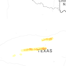
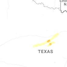


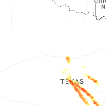
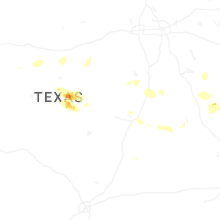

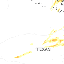
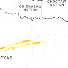

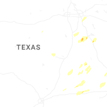


Connect with Interactive Hail Maps