

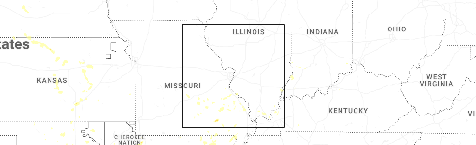
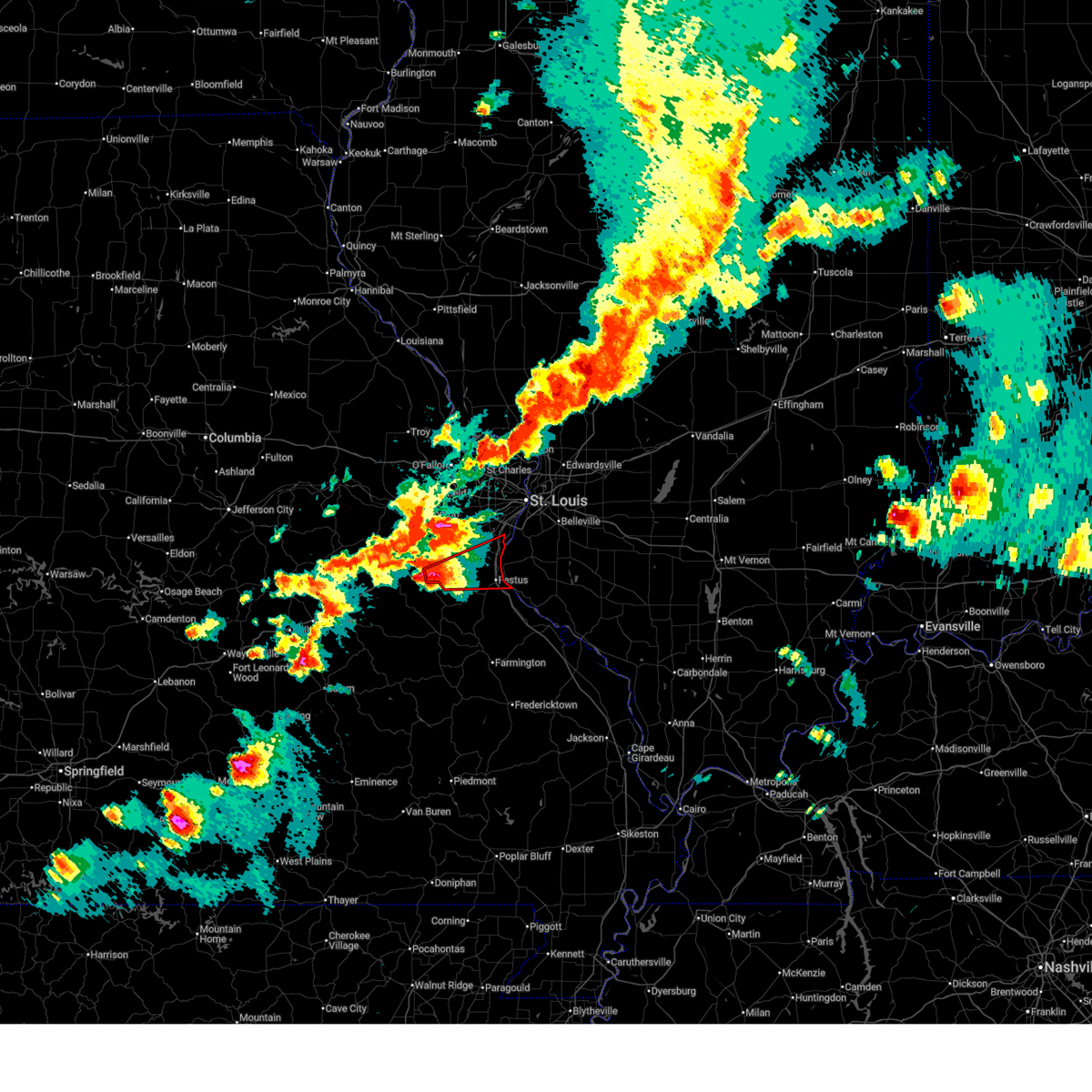
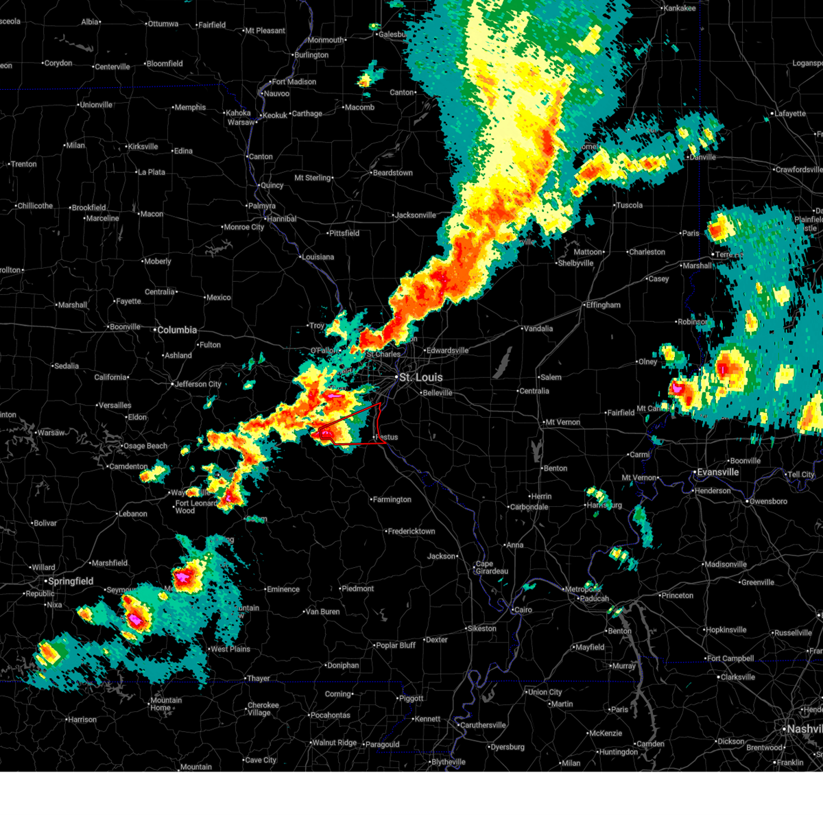
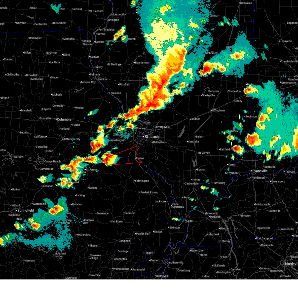
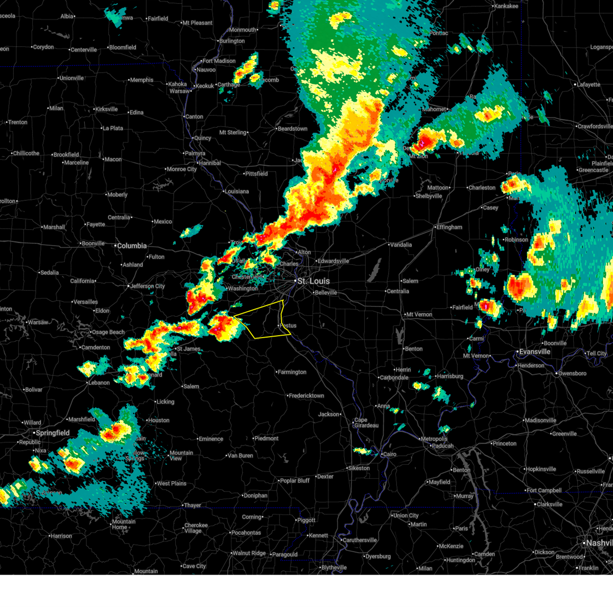
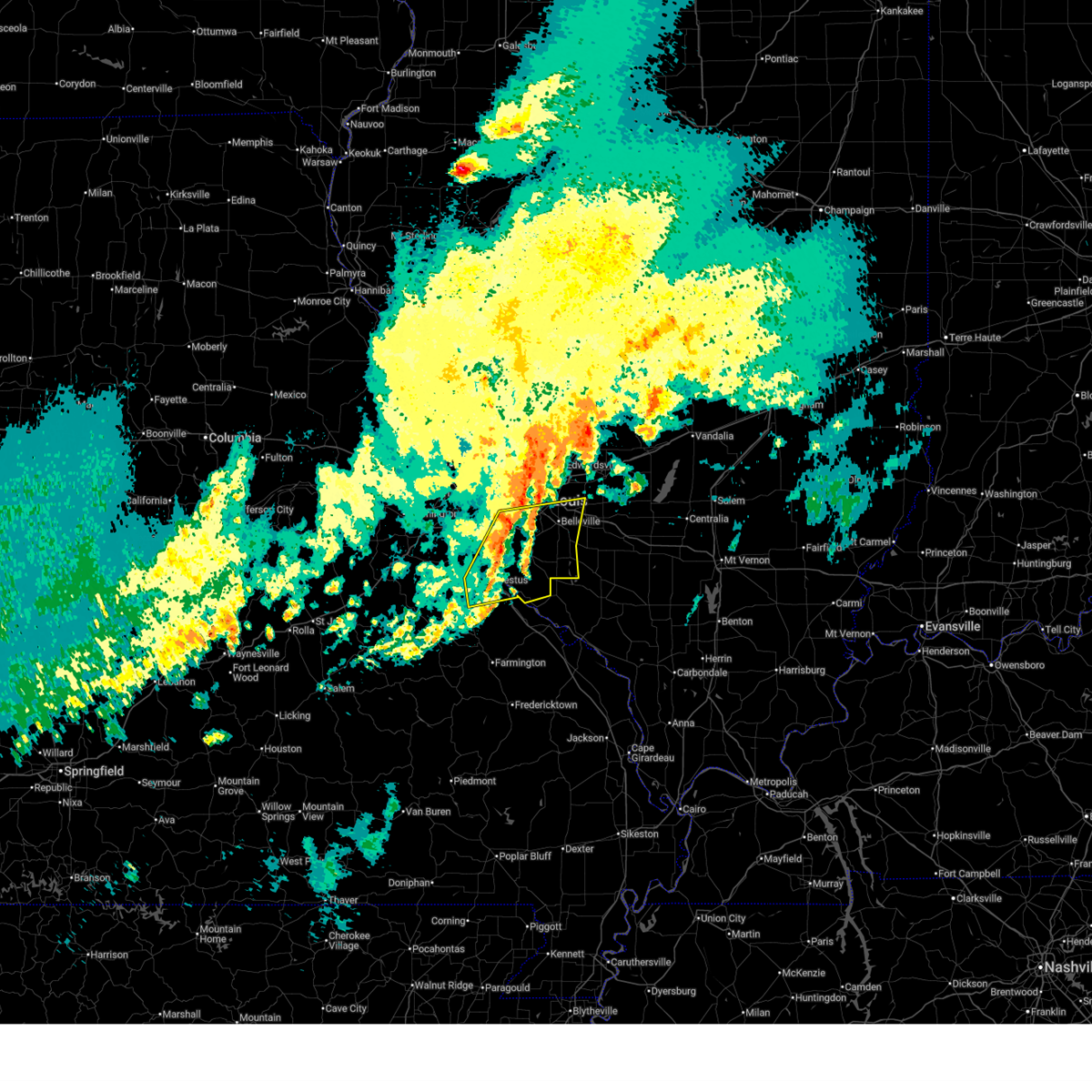
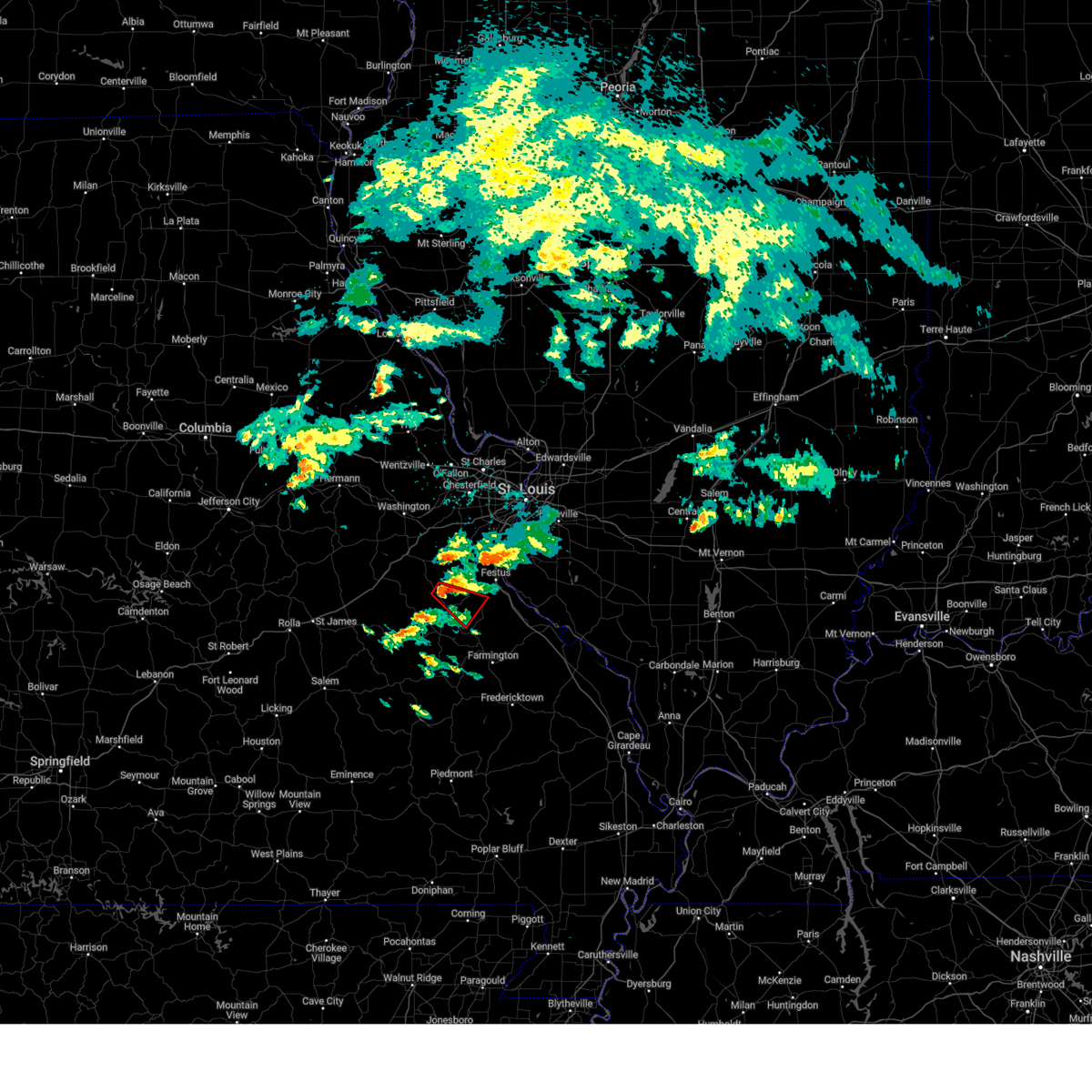
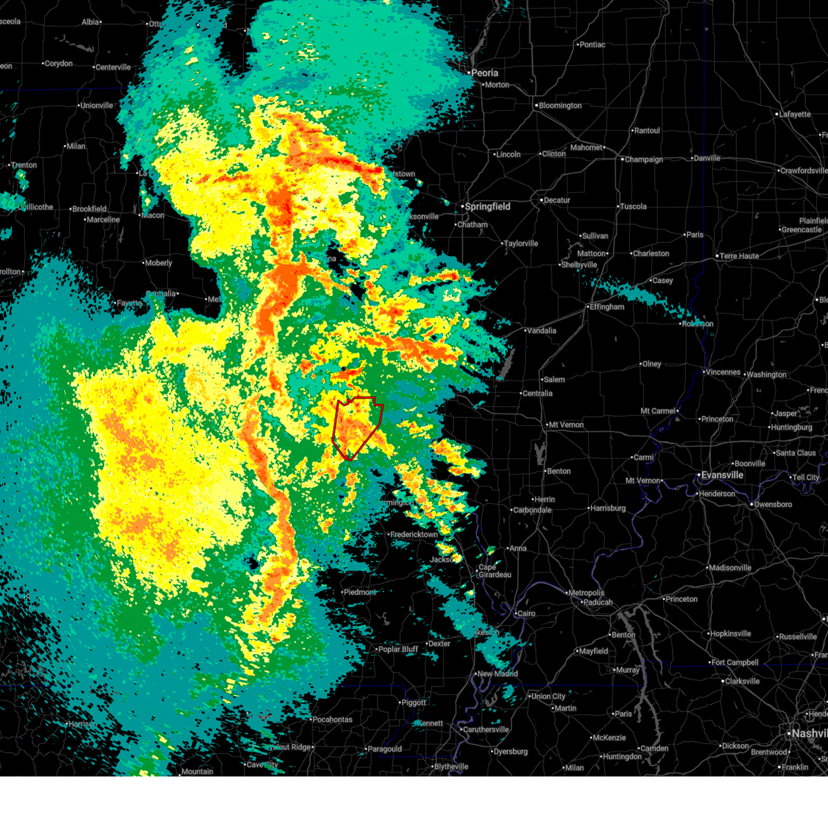
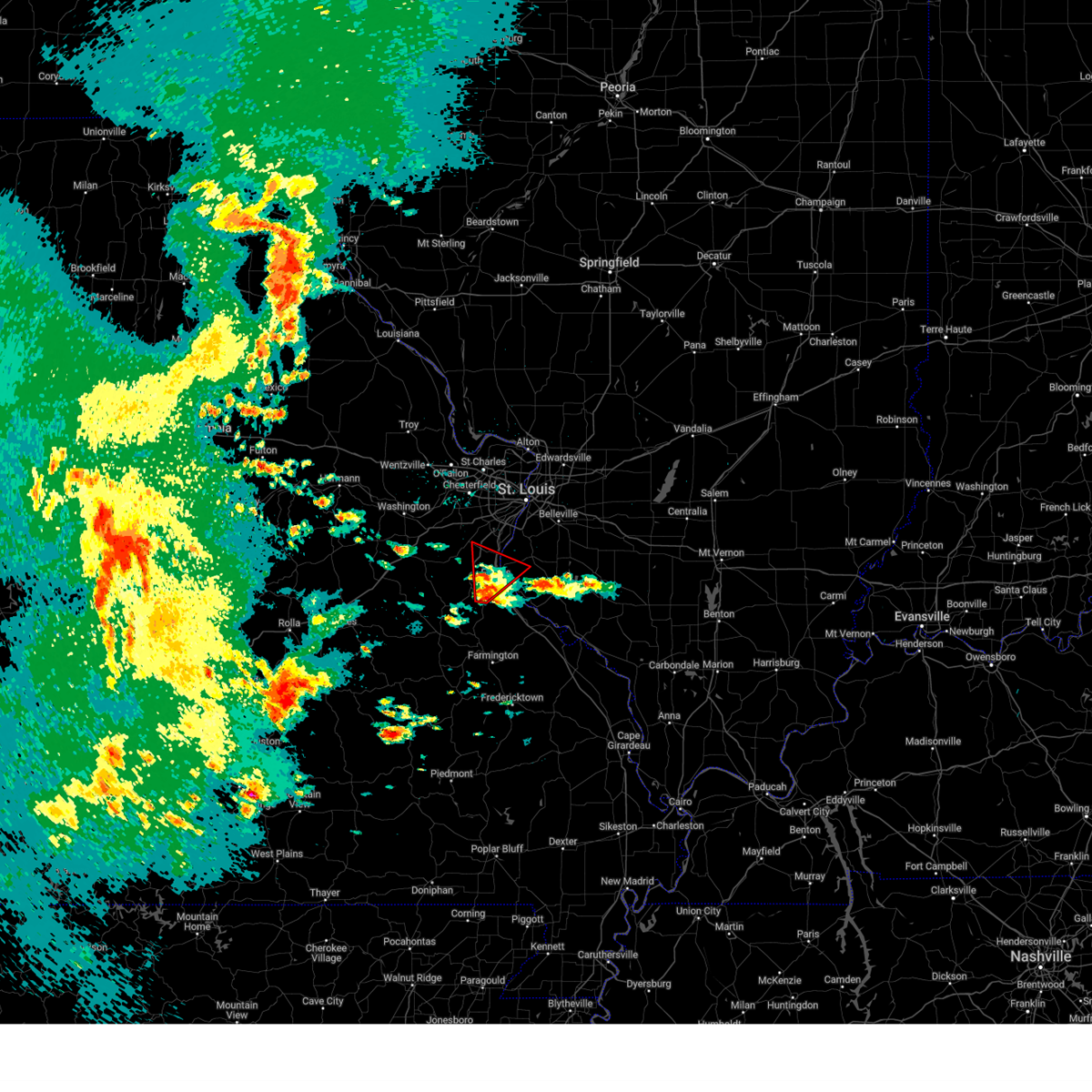
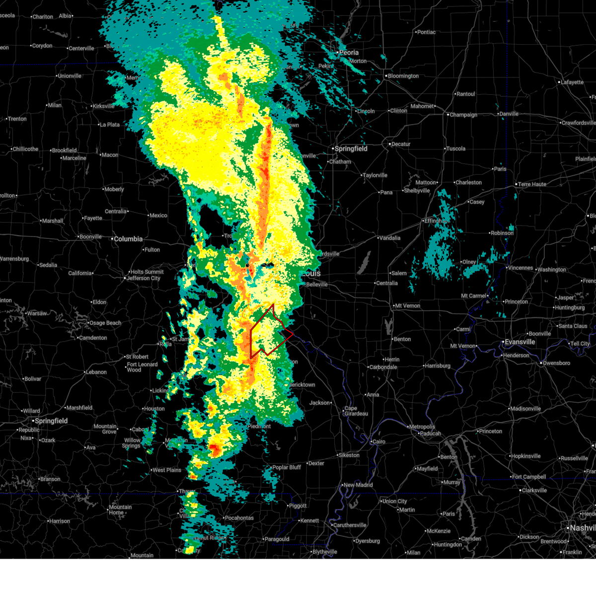
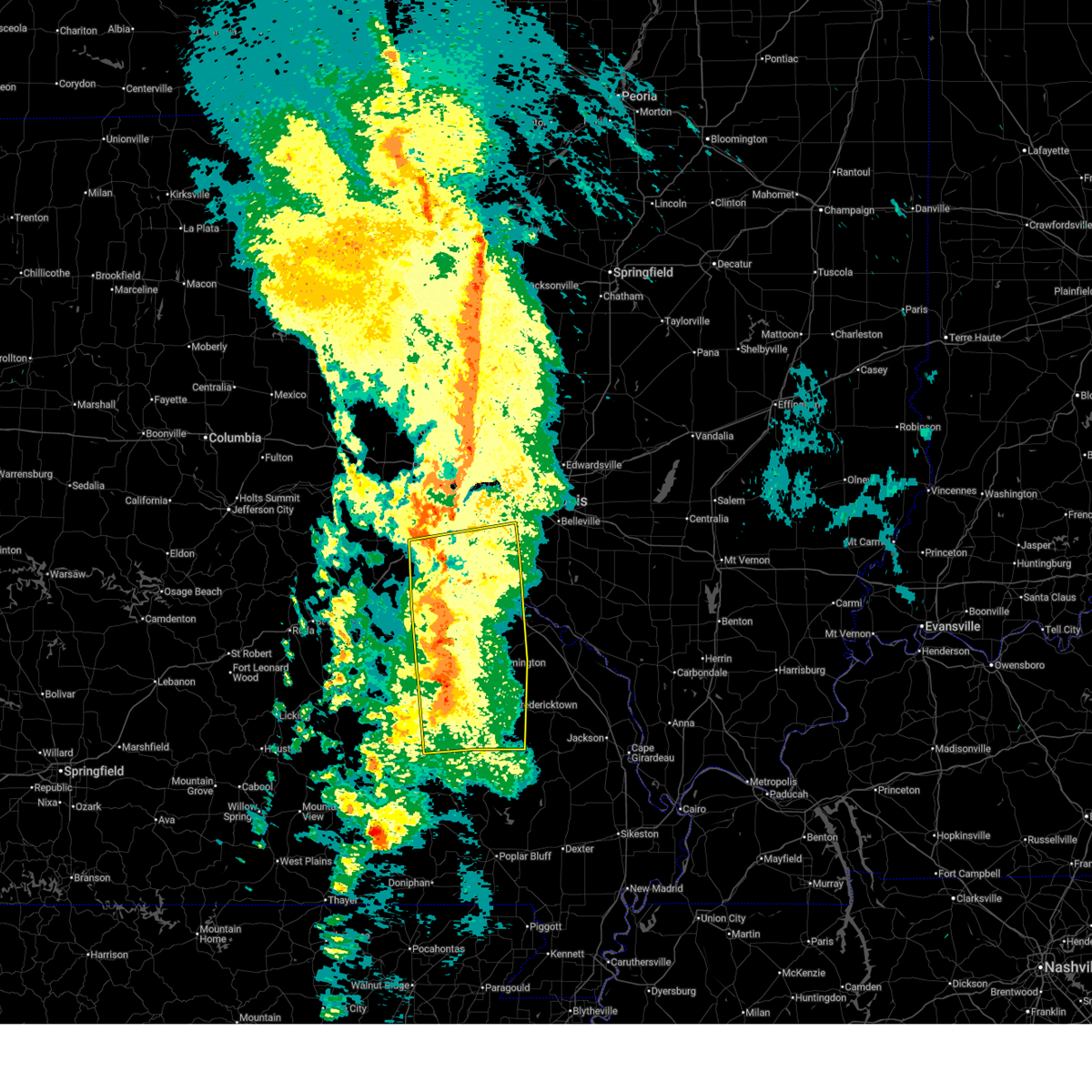
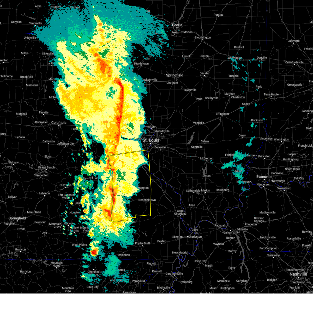
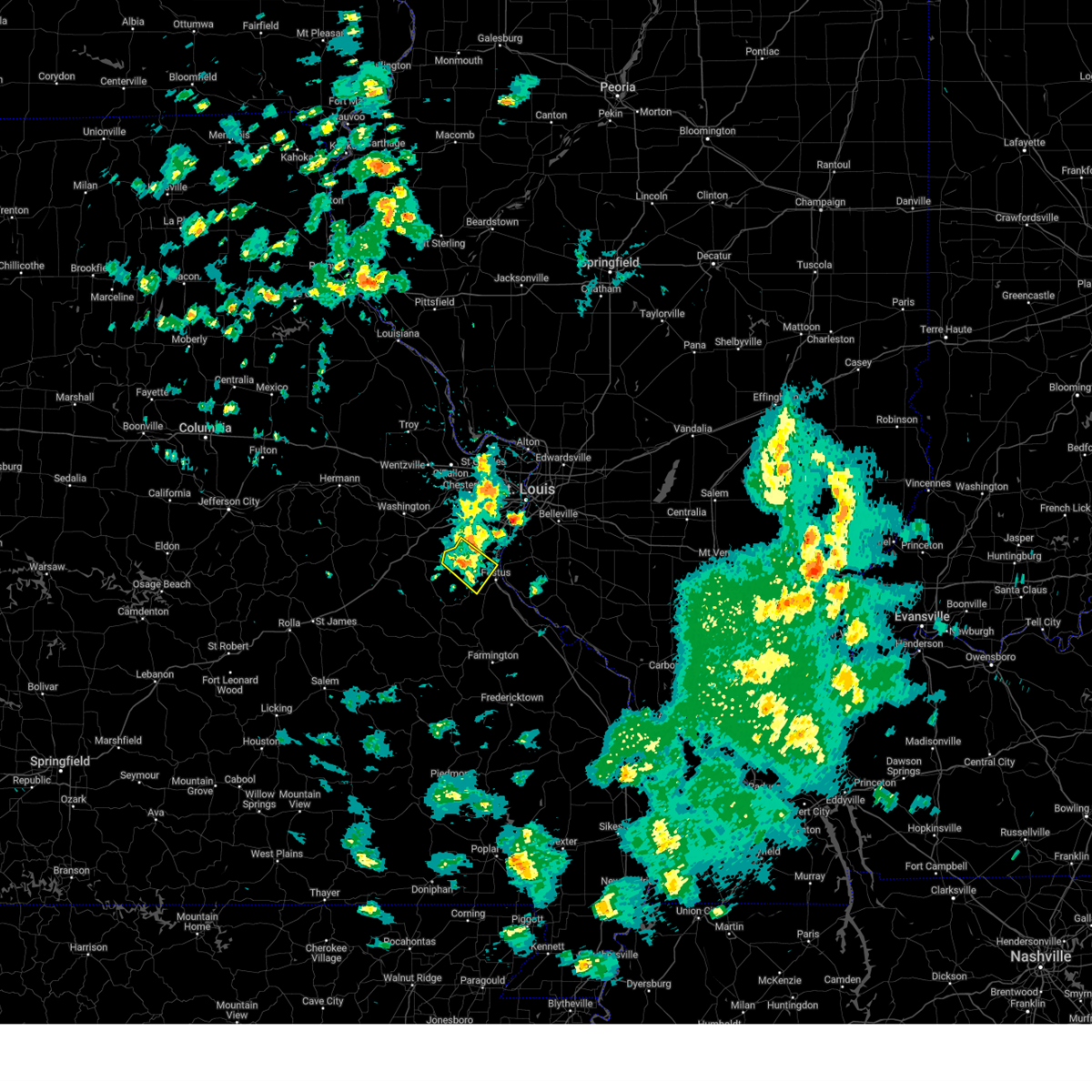
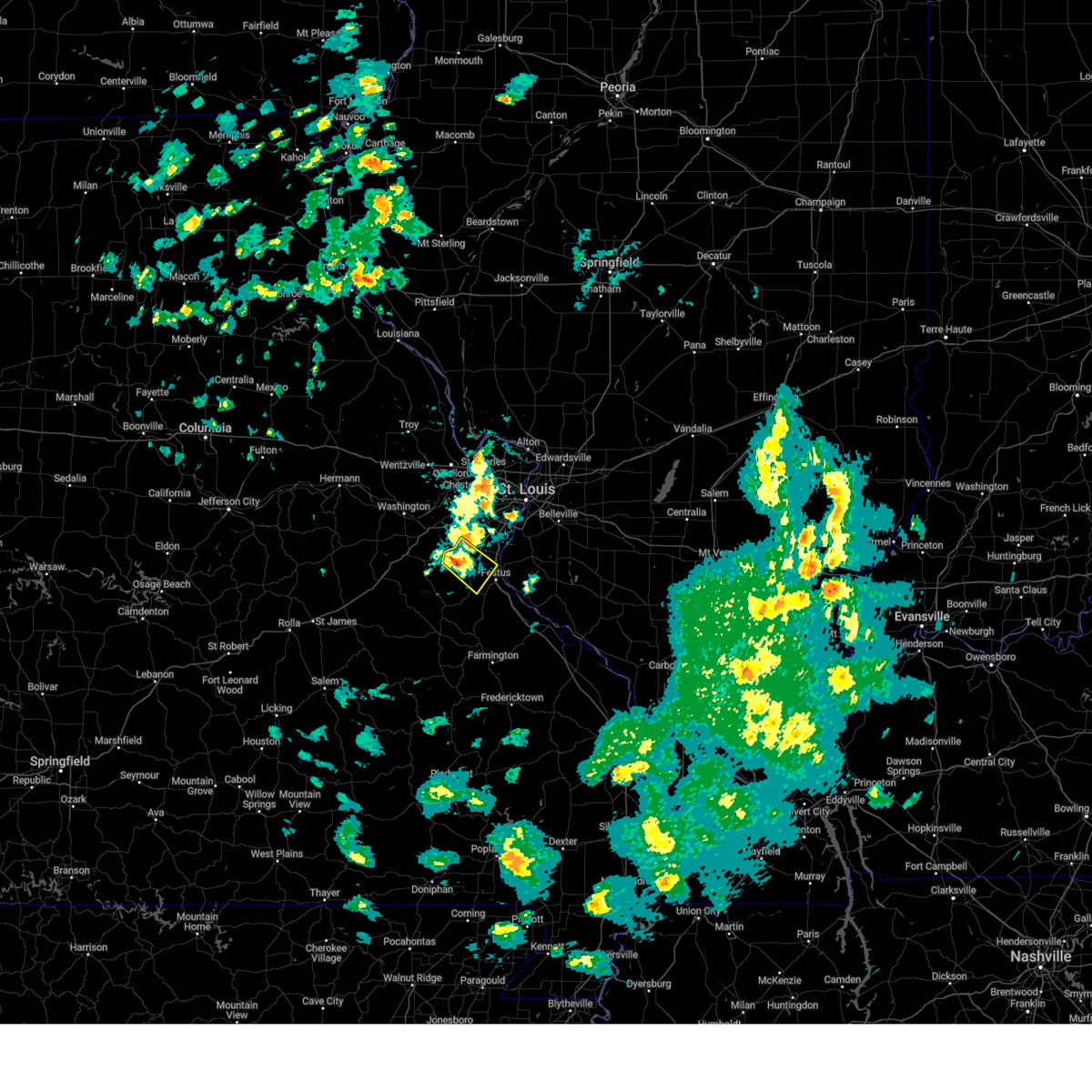
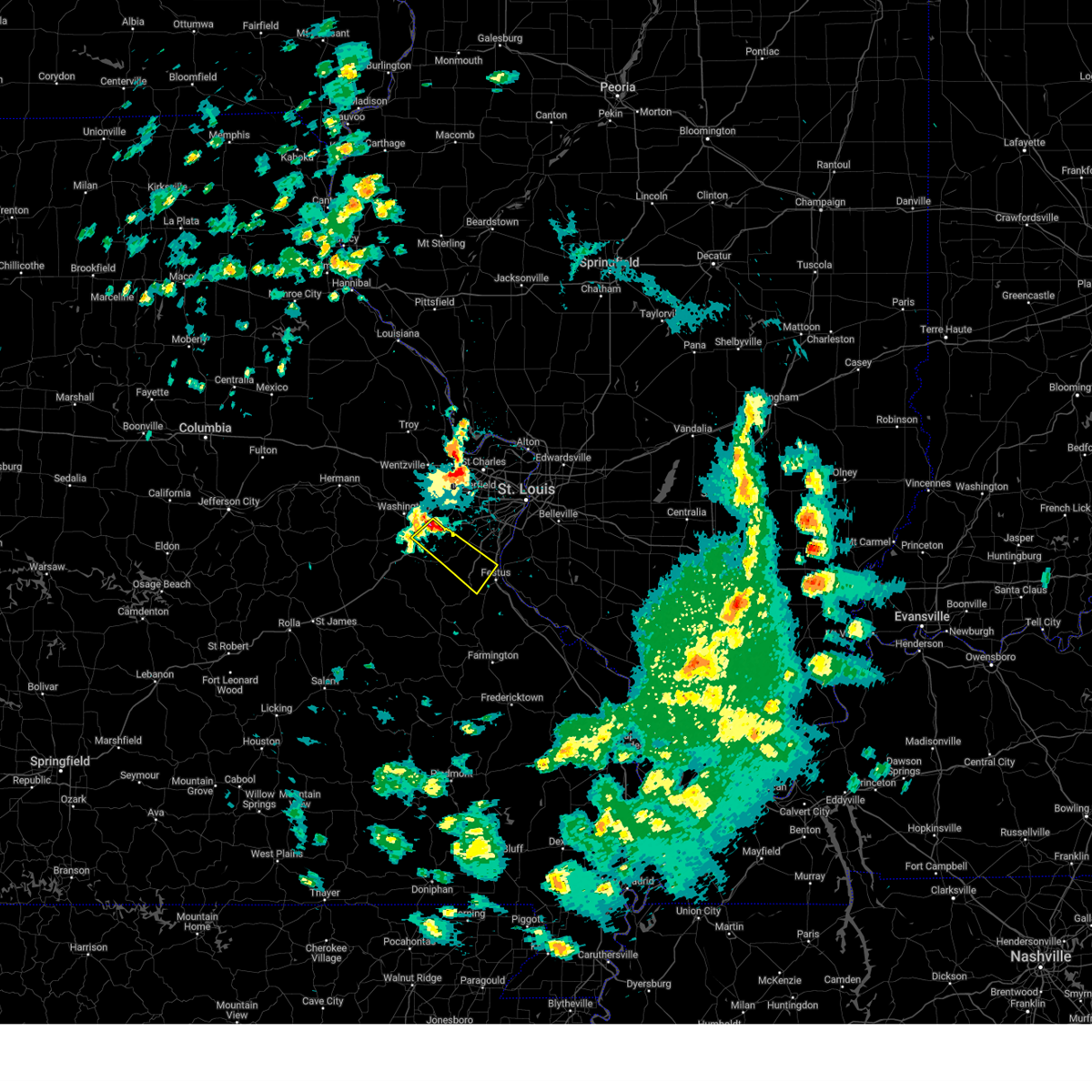
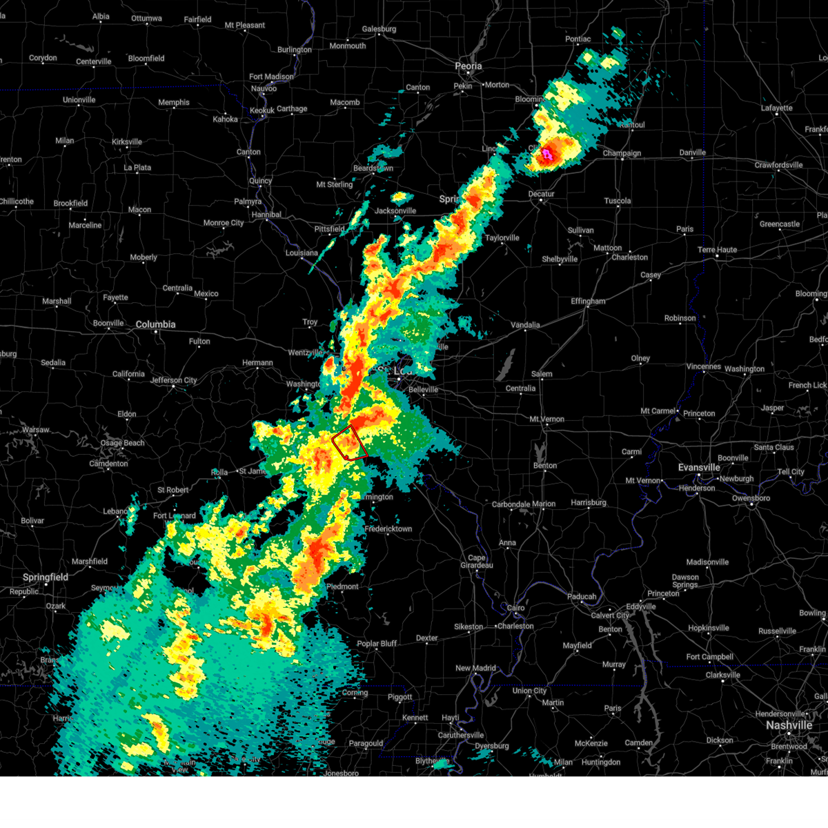
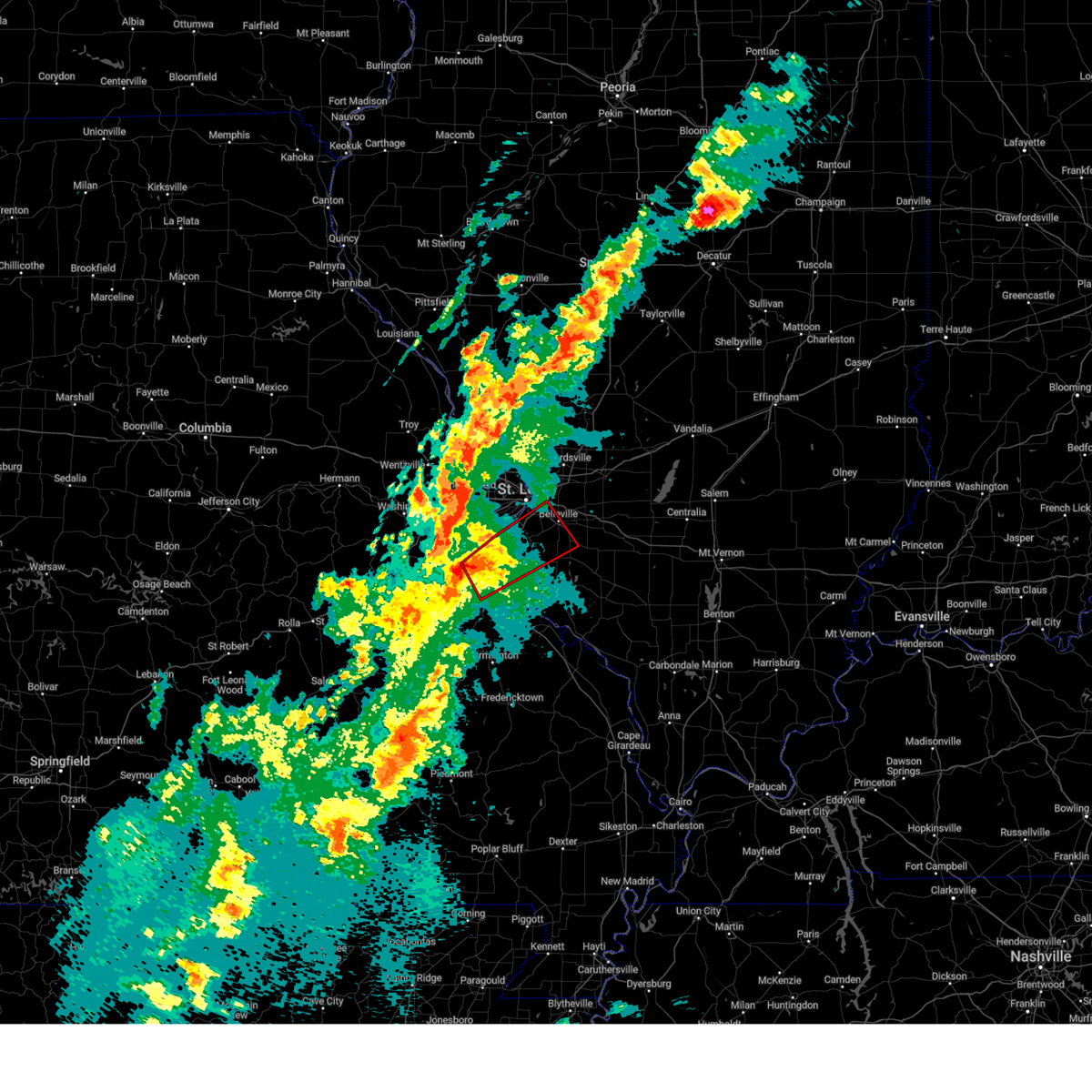
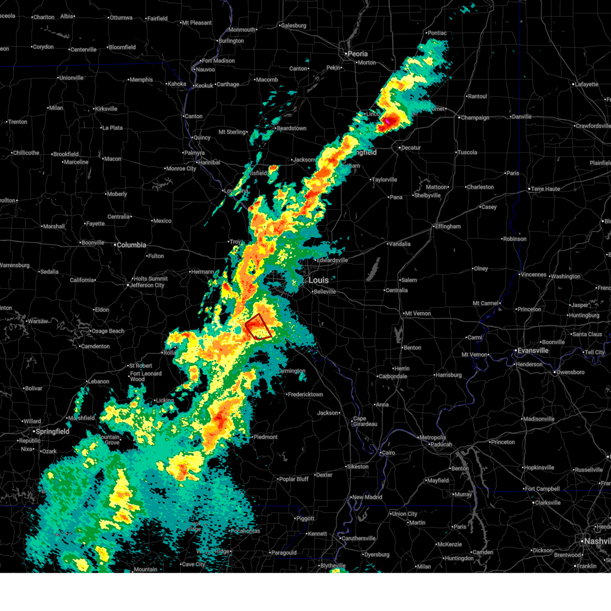
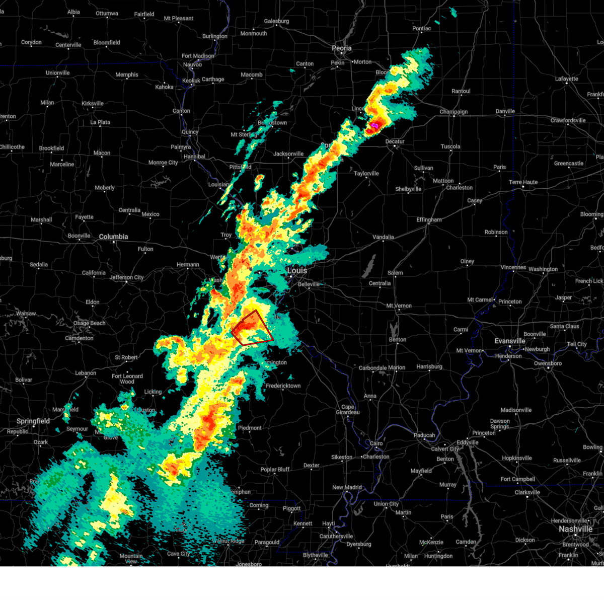
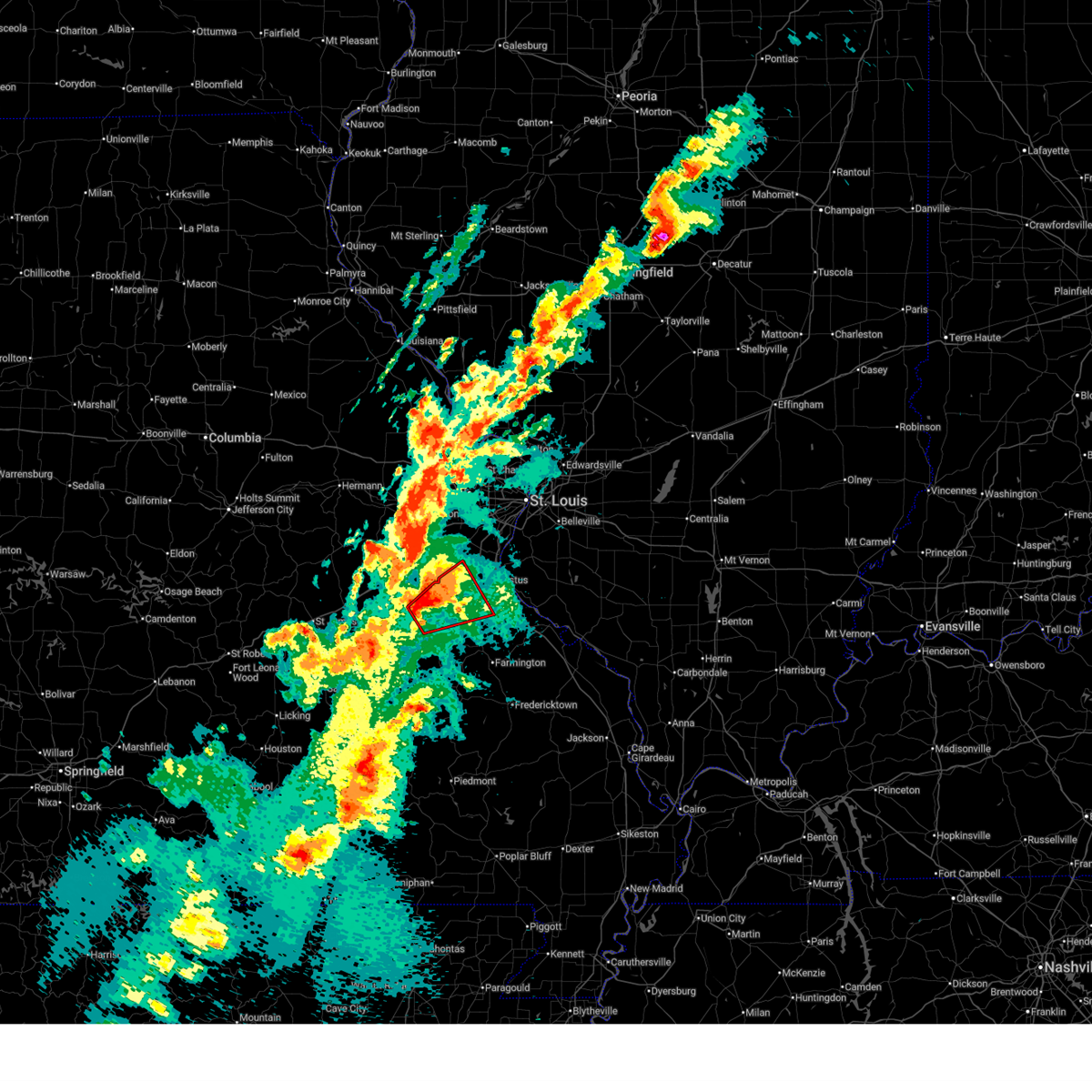
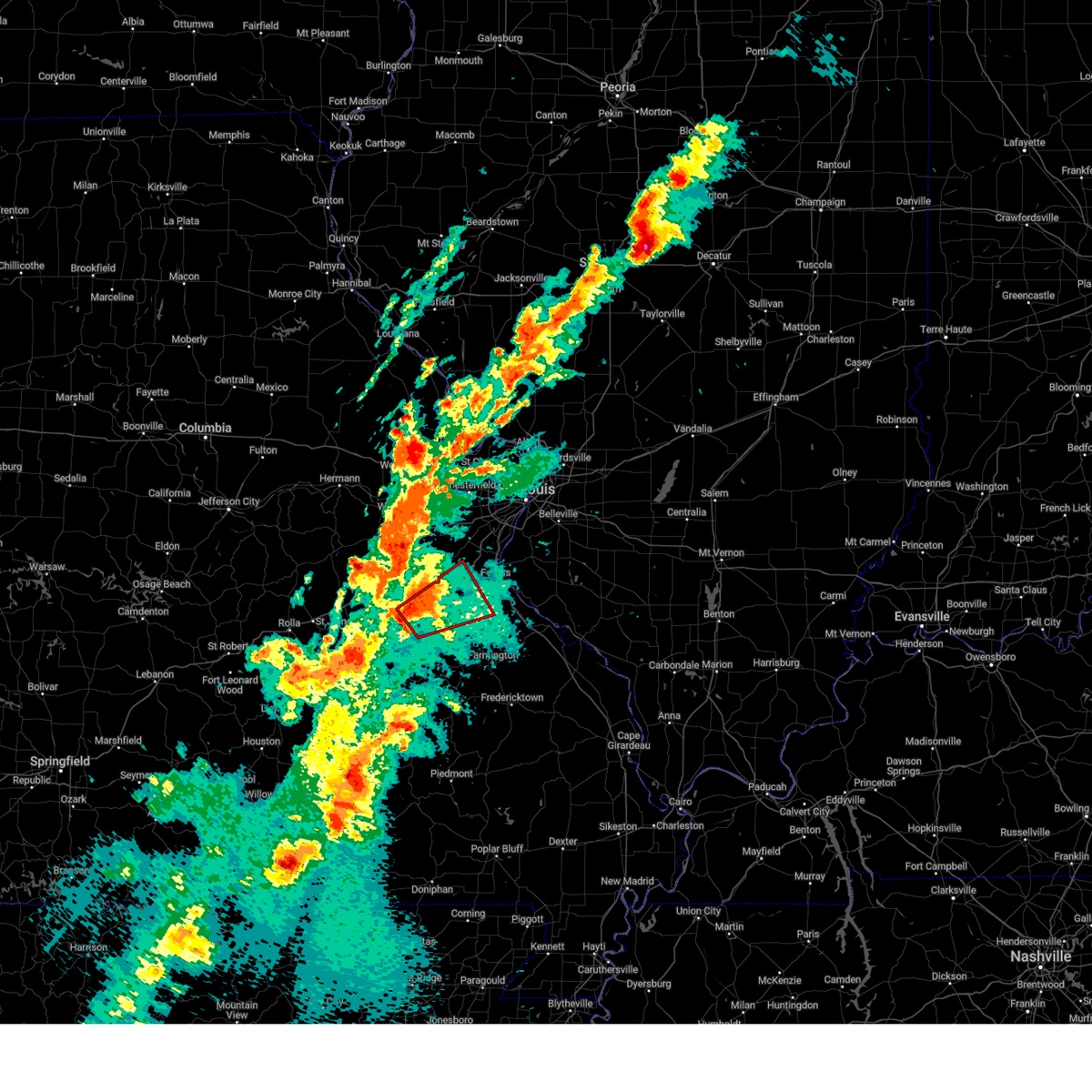
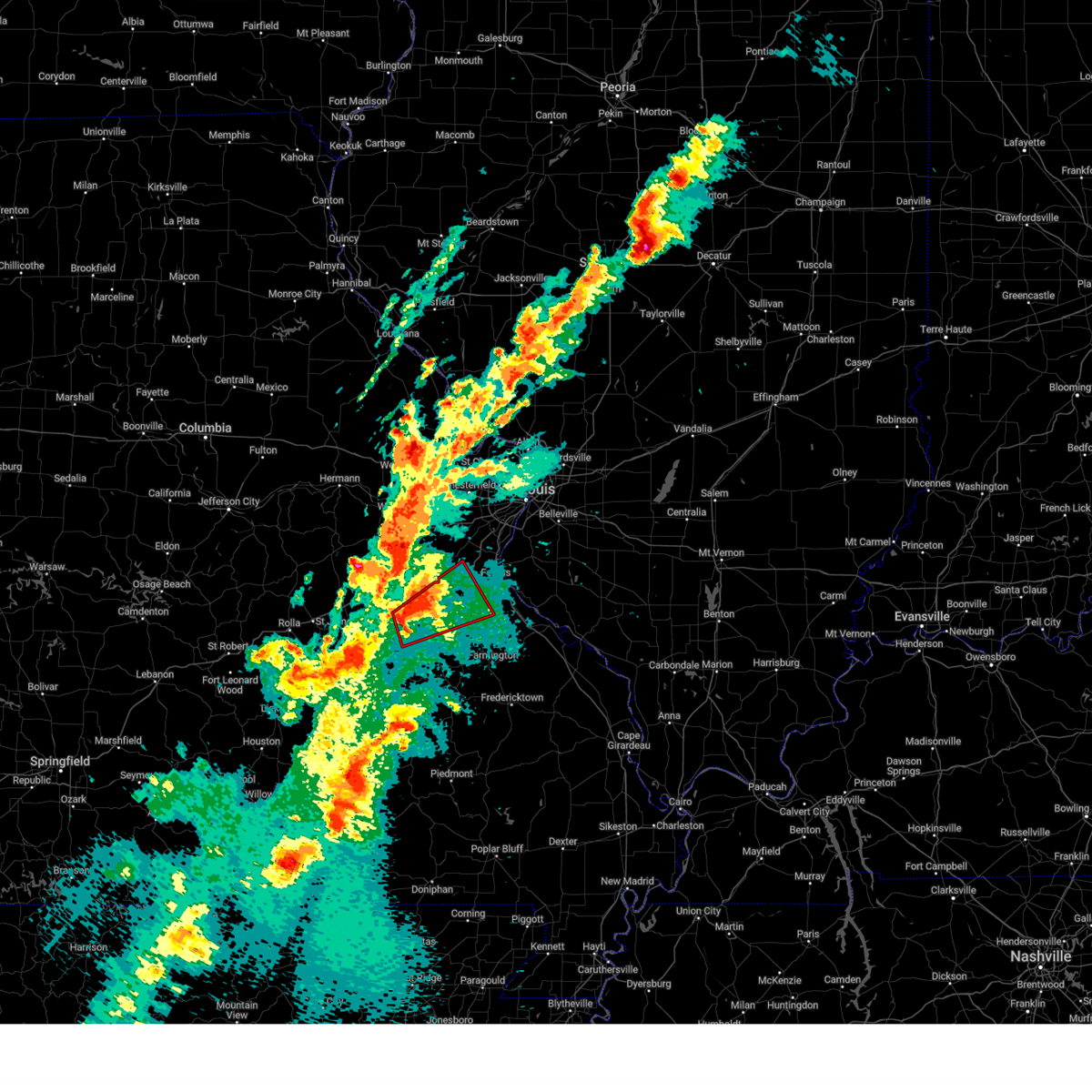
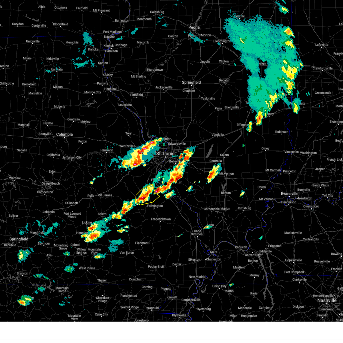
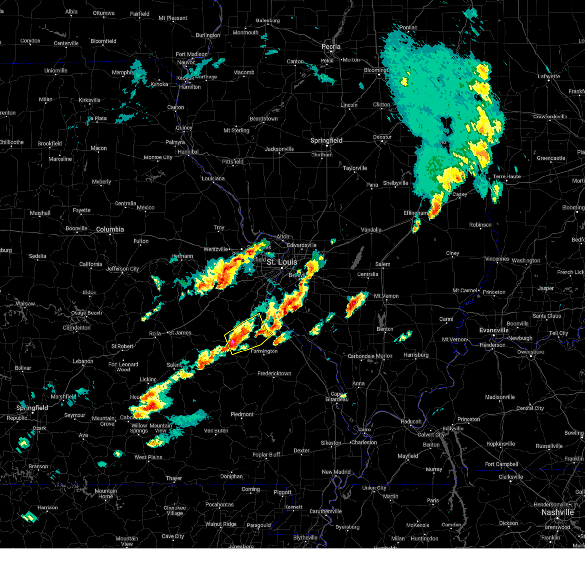
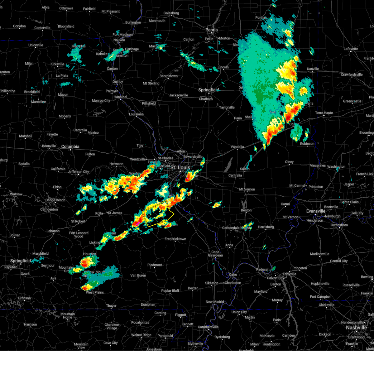
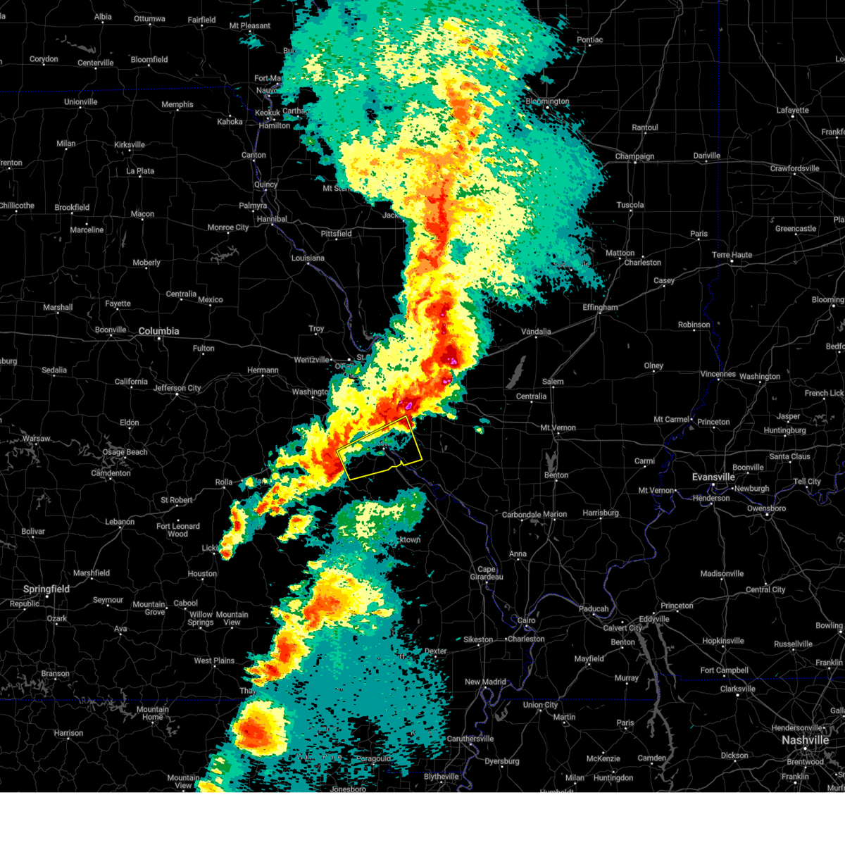
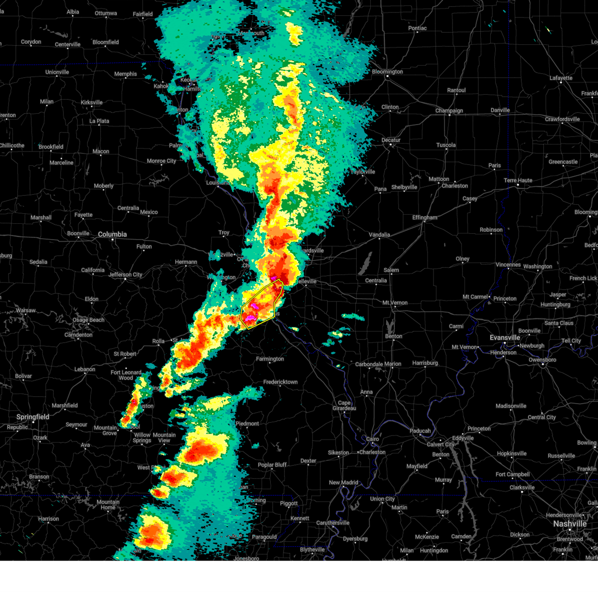
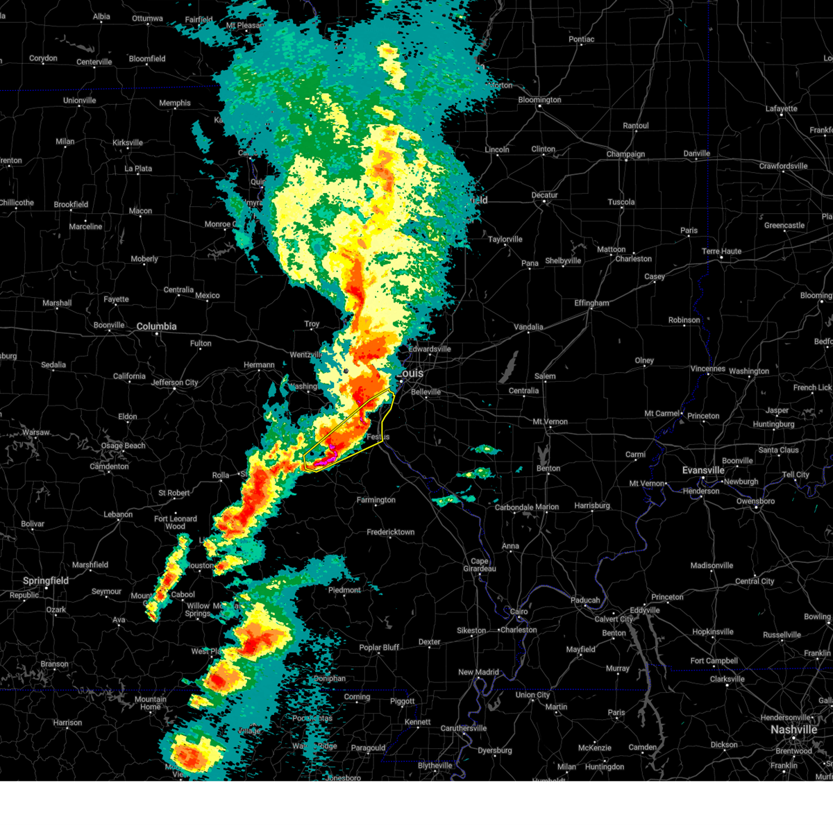
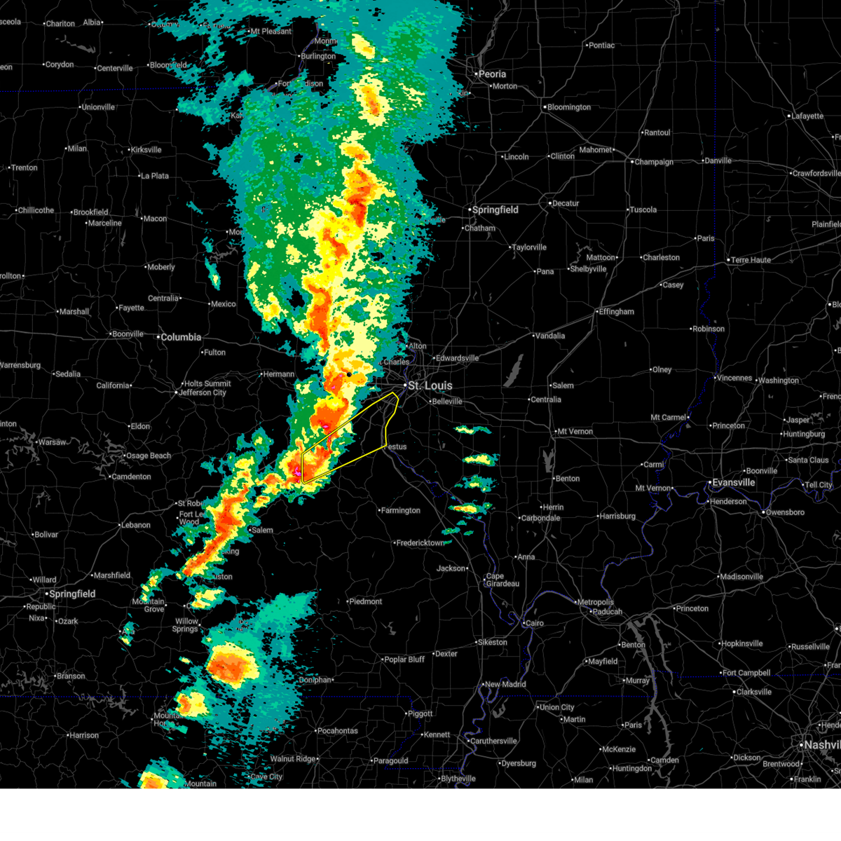
Hail Map for De Soto, MO
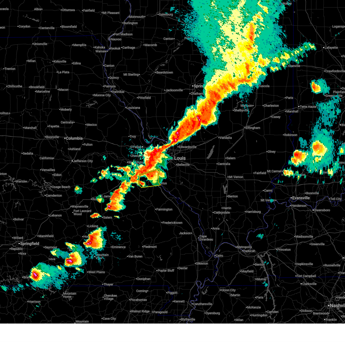
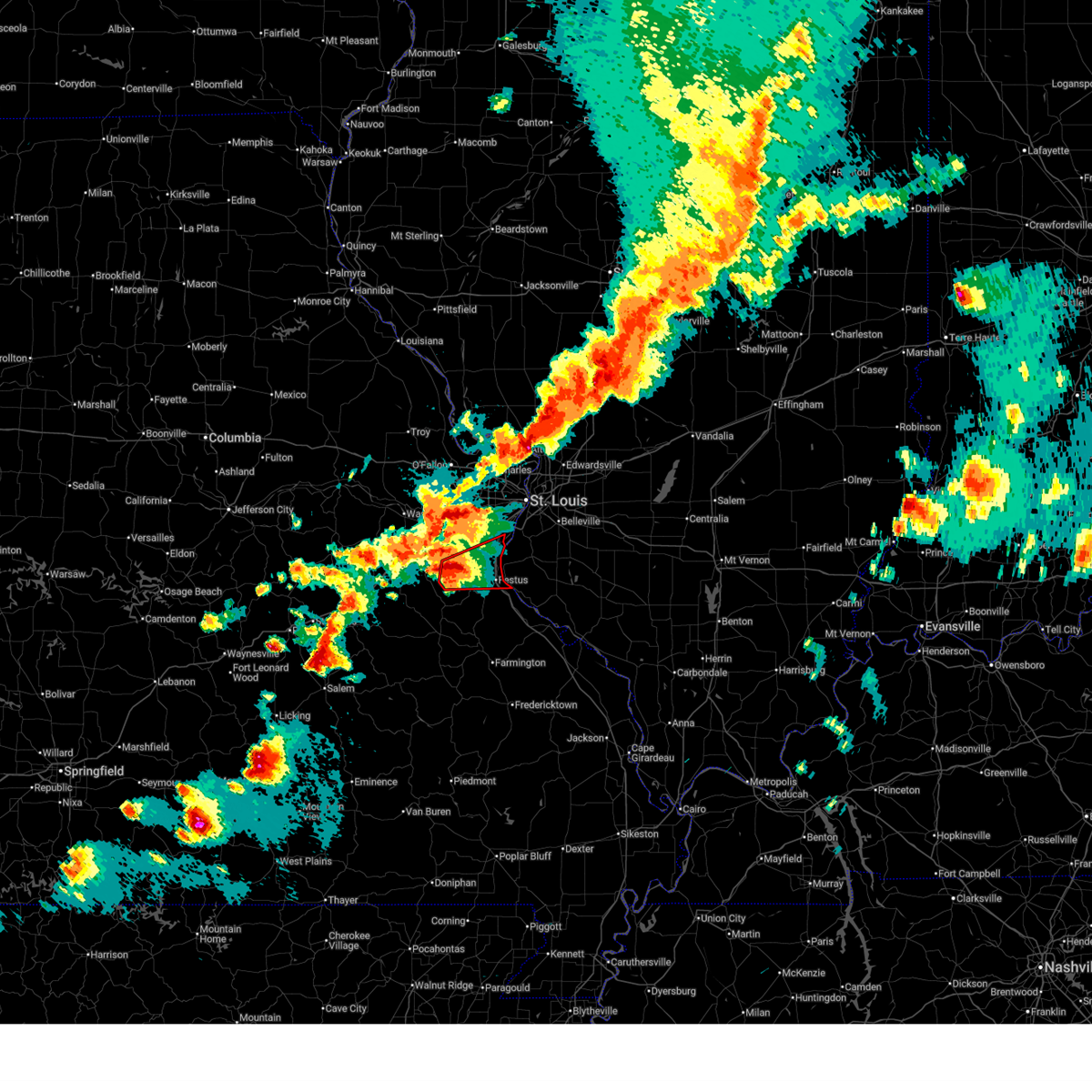
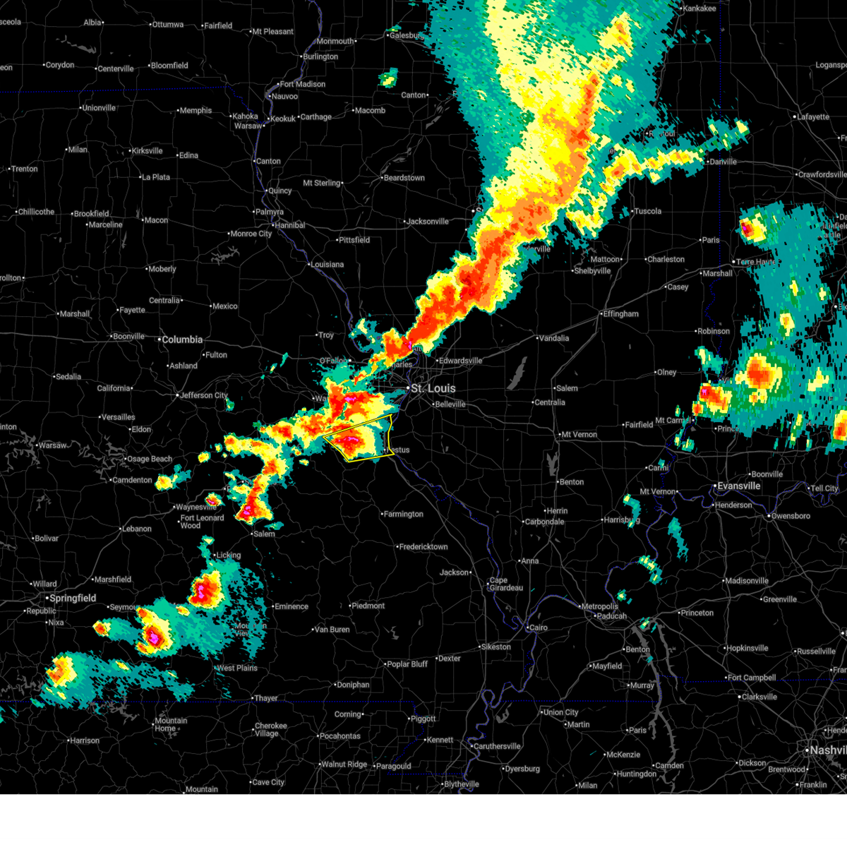
The De Soto, MO area has had 20 reports of on-the-ground hail by trained spotters, and has been under severe weather warnings 9 times during the past 12 months. Doppler radar has detected hail at or near De Soto, MO on 75 occasions, including 4 occasions during the past year.
| Name: | De Soto, MO |
| Where Located: | 38.7 miles SSW of Saint Louis, MO |
| Map: | Google Map for De Soto, MO |
| Population: | 6400 |
| Housing Units: | 2927 |
| More Info: | Search Google for De Soto, MO |
1
The Top Recent Hail Date for De Soto, MO is Tuesday, August 19, 2025 (30th out of 75)
Hail and Wind Damage Spotted near De Soto, MO
| Date / Time | Report Details |
|---|---|
| 4/27/2026 7:14 PM CDT |
 the severe thunderstorm warning has been cancelled and is no longer in effect the severe thunderstorm warning has been cancelled and is no longer in effect
|
| 4/27/2026 7:14 PM CDT |
 At 714 pm cdt, a severe thunderstorm was located over pevely, moving east at 50 mph (radar indicated). Hazards include 60 mph wind gusts and quarter size hail. Hail damage to vehicles is expected. expect wind damage to roofs, siding, and trees. this severe thunderstorm will be near, pevely, horine, herculaneum, barnhart, crystal city, festus and antonia around 715 pm cdt. imperial, arnold and oakville around 720 pm cdt. other locations impacted by the severe thunderstorm include mapaville, hematite, otto and kimmswick. this includes the following state parks, mastodon historic site, sandy creek covered bridge historic site and gov. dunklin's grave historic site. This includes interstate 55 in missouri between exits 174 and 190. At 714 pm cdt, a severe thunderstorm was located over pevely, moving east at 50 mph (radar indicated). Hazards include 60 mph wind gusts and quarter size hail. Hail damage to vehicles is expected. expect wind damage to roofs, siding, and trees. this severe thunderstorm will be near, pevely, horine, herculaneum, barnhart, crystal city, festus and antonia around 715 pm cdt. imperial, arnold and oakville around 720 pm cdt. other locations impacted by the severe thunderstorm include mapaville, hematite, otto and kimmswick. this includes the following state parks, mastodon historic site, sandy creek covered bridge historic site and gov. dunklin's grave historic site. This includes interstate 55 in missouri between exits 174 and 190.
|
| 4/27/2026 6:59 PM CDT |
 At 659 pm cdt, a severe thunderstorm capable of producing a tornado was located near cedar hill lakes, or 6 miles northwest of hillsboro, moving east at 50 mph (radar indicated rotation). Hazards include tornado and quarter size hail. Flying debris will be dangerous to those caught without shelter. mobile homes will be damaged or destroyed. damage to roofs, windows and vehicles will occur. tree damage is likely. this tornado will be near, cedar hill lakes and dittmer around 700 pm cdt. hillsboro and cedar hill around 705 pm cdt. barnhart, antonia, pevely, horine, festus and crystal city around 715 pm cdt. other locations impacted by the tornado include morse mill, oermann, grubville, mapaville, otto and kimmswick. this includes the following state parks, mastodon historic site, sandy creek covered bridge historic site and gov. dunklin's grave historic site. This includes interstate 55 in missouri between exits 174 and 190. At 659 pm cdt, a severe thunderstorm capable of producing a tornado was located near cedar hill lakes, or 6 miles northwest of hillsboro, moving east at 50 mph (radar indicated rotation). Hazards include tornado and quarter size hail. Flying debris will be dangerous to those caught without shelter. mobile homes will be damaged or destroyed. damage to roofs, windows and vehicles will occur. tree damage is likely. this tornado will be near, cedar hill lakes and dittmer around 700 pm cdt. hillsboro and cedar hill around 705 pm cdt. barnhart, antonia, pevely, horine, festus and crystal city around 715 pm cdt. other locations impacted by the tornado include morse mill, oermann, grubville, mapaville, otto and kimmswick. this includes the following state parks, mastodon historic site, sandy creek covered bridge historic site and gov. dunklin's grave historic site. This includes interstate 55 in missouri between exits 174 and 190.
|
| 4/27/2026 6:56 PM CDT |
 At 656 pm cdt, a severe thunderstorm was located 6 miles south of cedar hill lakes, or 6 miles west of hillsboro, moving east at 50 mph (radar indicated). Hazards include 60 mph wind gusts and quarter size hail. Hail damage to vehicles is expected. expect wind damage to roofs, siding, and trees. this severe thunderstorm will be near, cedar hill lakes, de soto, dittmer and cedar hill around 700 pm cdt. hillsboro around 705 pm cdt. pevely, horine, herculaneum, barnhart, crystal city, festus and antonia around 715 pm cdt. other locations impacted by the severe thunderstorm include morse mill, oermann, grubville, victoria, mapaville, hematite, otto and kimmswick. this includes the following state parks, mastodon historic site, sandy creek covered bridge historic site and gov. dunklin's grave historic site. This includes interstate 55 in missouri between exits 174 and 190. At 656 pm cdt, a severe thunderstorm was located 6 miles south of cedar hill lakes, or 6 miles west of hillsboro, moving east at 50 mph (radar indicated). Hazards include 60 mph wind gusts and quarter size hail. Hail damage to vehicles is expected. expect wind damage to roofs, siding, and trees. this severe thunderstorm will be near, cedar hill lakes, de soto, dittmer and cedar hill around 700 pm cdt. hillsboro around 705 pm cdt. pevely, horine, herculaneum, barnhart, crystal city, festus and antonia around 715 pm cdt. other locations impacted by the severe thunderstorm include morse mill, oermann, grubville, victoria, mapaville, hematite, otto and kimmswick. this includes the following state parks, mastodon historic site, sandy creek covered bridge historic site and gov. dunklin's grave historic site. This includes interstate 55 in missouri between exits 174 and 190.
|
| 4/27/2026 6:53 PM CDT |
 At 653 pm cdt, a severe thunderstorm capable of producing a tornado was located 8 miles south of dittmer, or 8 miles west of hillsboro, moving east at 50 mph (radar indicated rotation). Hazards include tornado and two inch hail. Flying debris will be dangerous to those caught without shelter. mobile homes will be damaged or destroyed. damage to roofs, windows and vehicles will occur. tree damage is likely. this tornado will be near, de soto, cedar hill lakes, dittmer and cedar hill around 700 pm cdt. hillsboro around 705 pm cdt. pevely, horine, herculaneum, crystal city, festus and antonia around 715 pm cdt. other locations impacted by the tornado include fletcher, grubville, oermann, morse mill, victoria, mapaville, hematite, otto and kimmswick. this includes the following state parks, mastodon historic site, sandy creek covered bridge historic site and gov. dunklin's grave historic site. This includes interstate 55 in missouri between exits 174 and 190. At 653 pm cdt, a severe thunderstorm capable of producing a tornado was located 8 miles south of dittmer, or 8 miles west of hillsboro, moving east at 50 mph (radar indicated rotation). Hazards include tornado and two inch hail. Flying debris will be dangerous to those caught without shelter. mobile homes will be damaged or destroyed. damage to roofs, windows and vehicles will occur. tree damage is likely. this tornado will be near, de soto, cedar hill lakes, dittmer and cedar hill around 700 pm cdt. hillsboro around 705 pm cdt. pevely, horine, herculaneum, crystal city, festus and antonia around 715 pm cdt. other locations impacted by the tornado include fletcher, grubville, oermann, morse mill, victoria, mapaville, hematite, otto and kimmswick. this includes the following state parks, mastodon historic site, sandy creek covered bridge historic site and gov. dunklin's grave historic site. This includes interstate 55 in missouri between exits 174 and 190.
|
| 4/27/2026 6:53 PM CDT |
 the tornado warning has been cancelled and is no longer in effect the tornado warning has been cancelled and is no longer in effect
|
| 4/27/2026 6:31 PM CDT |
 Torlsx the national weather service in st louis has issued a * tornado warning for, southeastern franklin county in east central missouri, jefferson county in east central missouri, northern washington county in east central missouri, * until 730 pm cdt. * at 631 pm cdt, a severe thunderstorm capable of producing a tornado was located 6 miles south of miramiguoa park, or 6 miles northeast of anthonies mill, moving east at 50 mph (radar indicated rotation). Hazards include tornado and two inch hail. Flying debris will be dangerous to those caught without shelter. mobile homes will be damaged or destroyed. damage to roofs, windows and vehicles will occur. tree damage is likely. this tornado will be near, miramiguoa park around 635 pm cdt. richwoods around 645 pm cdt. lonedell around 650 pm cdt. other locations impacted by the tornado include fletcher, grubville, oermann, morse mill, victoria, mapaville, hematite, otto and kimmswick. this includes the following state parks, mastodon historic site, sandy creek covered bridge historic site and gov. dunklin's grave historic site. This includes interstate 55 in missouri between exits 170 and 190. Torlsx the national weather service in st louis has issued a * tornado warning for, southeastern franklin county in east central missouri, jefferson county in east central missouri, northern washington county in east central missouri, * until 730 pm cdt. * at 631 pm cdt, a severe thunderstorm capable of producing a tornado was located 6 miles south of miramiguoa park, or 6 miles northeast of anthonies mill, moving east at 50 mph (radar indicated rotation). Hazards include tornado and two inch hail. Flying debris will be dangerous to those caught without shelter. mobile homes will be damaged or destroyed. damage to roofs, windows and vehicles will occur. tree damage is likely. this tornado will be near, miramiguoa park around 635 pm cdt. richwoods around 645 pm cdt. lonedell around 650 pm cdt. other locations impacted by the tornado include fletcher, grubville, oermann, morse mill, victoria, mapaville, hematite, otto and kimmswick. this includes the following state parks, mastodon historic site, sandy creek covered bridge historic site and gov. dunklin's grave historic site. This includes interstate 55 in missouri between exits 170 and 190.
|
| 4/27/2026 6:26 PM CDT |
 Svrlsx the national weather service in st louis has issued a * severe thunderstorm warning for, southeastern franklin county in east central missouri, jefferson county in east central missouri, * until 730 pm cdt. * at 626 pm cdt, a severe thunderstorm was located near anthonies mill, moving east at 50 mph (radar indicated). Hazards include two inch hail and 60 mph wind gusts. People and animals outdoors will be injured. expect hail damage to roofs, siding, windows, and vehicles. expect wind damage to roofs, siding, and trees. this severe thunderstorm will be near, lonedell around 650 pm cdt. other locations impacted by the severe thunderstorm include fletcher, grubville, oermann, morse mill, victoria, mapaville, hematite, otto and kimmswick. this includes the following state parks, mastodon historic site, sandy creek covered bridge historic site and gov. dunklin's grave historic site. This includes interstate 55 in missouri between exits 170 and 190. Svrlsx the national weather service in st louis has issued a * severe thunderstorm warning for, southeastern franklin county in east central missouri, jefferson county in east central missouri, * until 730 pm cdt. * at 626 pm cdt, a severe thunderstorm was located near anthonies mill, moving east at 50 mph (radar indicated). Hazards include two inch hail and 60 mph wind gusts. People and animals outdoors will be injured. expect hail damage to roofs, siding, windows, and vehicles. expect wind damage to roofs, siding, and trees. this severe thunderstorm will be near, lonedell around 650 pm cdt. other locations impacted by the severe thunderstorm include fletcher, grubville, oermann, morse mill, victoria, mapaville, hematite, otto and kimmswick. this includes the following state parks, mastodon historic site, sandy creek covered bridge historic site and gov. dunklin's grave historic site. This includes interstate 55 in missouri between exits 170 and 190.
|
| 4/15/2026 10:15 PM CDT |
 Svrlsx the national weather service in st louis has issued a * severe thunderstorm warning for, monroe county in southwestern illinois, central saint clair county in southwestern illinois, central jefferson county in east central missouri, south central saint louis county in east central missouri, southern saint louis city in east central missouri, * until 1100 pm cdt. * at 1015 pm cdt, severe thunderstorms were located along a line from over east carondelet to over olympian village, or along a line from near st. louis to 6 miles south of festus, moving east at 45 mph (radar indicated). Hazards include 60 mph wind gusts. expect damage to roofs, siding, and trees Svrlsx the national weather service in st louis has issued a * severe thunderstorm warning for, monroe county in southwestern illinois, central saint clair county in southwestern illinois, central jefferson county in east central missouri, south central saint louis county in east central missouri, southern saint louis city in east central missouri, * until 1100 pm cdt. * at 1015 pm cdt, severe thunderstorms were located along a line from over east carondelet to over olympian village, or along a line from near st. louis to 6 miles south of festus, moving east at 45 mph (radar indicated). Hazards include 60 mph wind gusts. expect damage to roofs, siding, and trees
|
| 6/7/2025 7:24 PM CDT |
 The storm which prompted the warning has weakened below severe limits, and no longer appears capable of producing a tornado. therefore, the warning will be allowed to expire. The storm which prompted the warning has weakened below severe limits, and no longer appears capable of producing a tornado. therefore, the warning will be allowed to expire.
|
| 6/7/2025 7:17 PM CDT |
 At 717 pm cdt, a confirmed tornado was located near de soto, moving east at 30 mph (weather spotters confirmed tornado). Hazards include damaging tornado and quarter size hail. Flying debris will be dangerous to those caught without shelter. mobile homes will be damaged or destroyed. damage to roofs, windows and vehicles will occur. tree damage is likely. Locations impacted include, de soto. At 717 pm cdt, a confirmed tornado was located near de soto, moving east at 30 mph (weather spotters confirmed tornado). Hazards include damaging tornado and quarter size hail. Flying debris will be dangerous to those caught without shelter. mobile homes will be damaged or destroyed. damage to roofs, windows and vehicles will occur. tree damage is likely. Locations impacted include, de soto.
|
| 6/7/2025 7:17 PM CDT |
 the tornado warning has been cancelled and is no longer in effect the tornado warning has been cancelled and is no longer in effect
|
| 6/7/2025 7:14 PM CDT | Quarter sized hail reported 2.8 miles NE of De Soto, MO |
| 6/7/2025 7:10 PM CDT | Minor damage to homes reported. possible tornado damage... survey will be planne in jefferson county MO, 5.8 miles ENE of De Soto, MO |
| 6/7/2025 7:10 PM CDT |
 At 710 pm cdt, a tornado producing storm was located near de soto, moving east at 30 mph (radar confirmed tornado). Hazards include damaging tornado and quarter size hail. Flying debris will be dangerous to those caught without shelter. mobile homes will be damaged or destroyed. damage to roofs, windows and vehicles will occur. tree damage is likely. locations impacted include, de soto and blackwell. This includes the following state parks, washington state park. At 710 pm cdt, a tornado producing storm was located near de soto, moving east at 30 mph (radar confirmed tornado). Hazards include damaging tornado and quarter size hail. Flying debris will be dangerous to those caught without shelter. mobile homes will be damaged or destroyed. damage to roofs, windows and vehicles will occur. tree damage is likely. locations impacted include, de soto and blackwell. This includes the following state parks, washington state park.
|
| 6/7/2025 7:08 PM CDT |
 At 708 pm cdt, a severe thunderstorm capable of producing a tornado was located 6 miles southwest of de soto, moving east at 30 mph (radar indicated rotation). Hazards include tornado and quarter size hail. Flying debris will be dangerous to those caught without shelter. mobile homes will be damaged or destroyed. damage to roofs, windows and vehicles will occur. tree damage is likely. locations impacted include, de soto and blackwell. This includes the following state parks, washington state park. At 708 pm cdt, a severe thunderstorm capable of producing a tornado was located 6 miles southwest of de soto, moving east at 30 mph (radar indicated rotation). Hazards include tornado and quarter size hail. Flying debris will be dangerous to those caught without shelter. mobile homes will be damaged or destroyed. damage to roofs, windows and vehicles will occur. tree damage is likely. locations impacted include, de soto and blackwell. This includes the following state parks, washington state park.
|
| 6/7/2025 6:56 PM CDT |
 Torlsx the national weather service in st louis has issued a * tornado warning for, southwestern jefferson county in east central missouri, northeastern washington county in east central missouri, northwestern saint francois county in southeastern missouri, * until 730 pm cdt. * at 656 pm cdt, a severe thunderstorm capable of producing a tornado was located 5 miles southeast of richwoods, or 10 miles west of de soto, moving east at 30 mph (radar indicated rotation). Hazards include tornado. Flying debris will be dangerous to those caught without shelter. mobile homes will be damaged or destroyed. damage to roofs, windows and vehicles will occur. Tree damage is likely. Torlsx the national weather service in st louis has issued a * tornado warning for, southwestern jefferson county in east central missouri, northeastern washington county in east central missouri, northwestern saint francois county in southeastern missouri, * until 730 pm cdt. * at 656 pm cdt, a severe thunderstorm capable of producing a tornado was located 5 miles southeast of richwoods, or 10 miles west of de soto, moving east at 30 mph (radar indicated rotation). Hazards include tornado. Flying debris will be dangerous to those caught without shelter. mobile homes will be damaged or destroyed. damage to roofs, windows and vehicles will occur. Tree damage is likely.
|
| 5/19/2025 11:59 PM CDT |
 At 1159 pm cdt, severe thunderstorms capable of producing a tornado were located along a line from near olympian village to 5 miles southwest of weingarten, or along a line from 8 miles southeast of de soto to 8 miles northeast of farmington, moving northeast at 45 mph (radar indicated rotation). Hazards include tornado. Flying debris will be dangerous to those caught without shelter. mobile homes will be damaged or destroyed. damage to roofs, windows and vehicles will occur. tree damage is likely. this tornado will be near, knob lick around 1145 pm cdt. other locations impacted by the tornado include valles mill, french village, victoria and river aux vases. this includes the following state parks, hawn state park and felix valle house state park. This includes interstate 55 in missouri between exits 141 and 175. At 1159 pm cdt, severe thunderstorms capable of producing a tornado were located along a line from near olympian village to 5 miles southwest of weingarten, or along a line from 8 miles southeast of de soto to 8 miles northeast of farmington, moving northeast at 45 mph (radar indicated rotation). Hazards include tornado. Flying debris will be dangerous to those caught without shelter. mobile homes will be damaged or destroyed. damage to roofs, windows and vehicles will occur. tree damage is likely. this tornado will be near, knob lick around 1145 pm cdt. other locations impacted by the tornado include valles mill, french village, victoria and river aux vases. this includes the following state parks, hawn state park and felix valle house state park. This includes interstate 55 in missouri between exits 141 and 175.
|
| 5/19/2025 11:33 PM CDT |
 Torlsx the national weather service in st louis has issued a * tornado warning for, southern jefferson county in east central missouri, sainte genevieve county in southeastern missouri, saint francois county in southeastern missouri, * until 1215 am cdt. * at 1133 pm cdt, severe thunderstorms capable of producing a tornado were located along a line from over old mines to over iron mountain lake, or along a line from 7 miles north of potosi to near ironton, moving east at 45 mph (radar indicated rotation). Hazards include tornado. Flying debris will be dangerous to those caught without shelter. mobile homes will be damaged or destroyed. damage to roofs, windows and vehicles will occur. tree damage is likely. this tornado will be near, bismarck around 1135 pm cdt. park hills, leadwood, bonne terre and desloge around 1140 pm cdt. other locations impacted by the tornado include frankclay, doe run, blackwell, leadington, valles mill, french village, libertyville, victoria, river aux vases and minnith. this includes the following state parks, st. joe state park, st. francois state park, hawn state park, felix valle house state park and missouri mines historic site. This includes interstate 55 in missouri between exits 141 and 175. Torlsx the national weather service in st louis has issued a * tornado warning for, southern jefferson county in east central missouri, sainte genevieve county in southeastern missouri, saint francois county in southeastern missouri, * until 1215 am cdt. * at 1133 pm cdt, severe thunderstorms capable of producing a tornado were located along a line from over old mines to over iron mountain lake, or along a line from 7 miles north of potosi to near ironton, moving east at 45 mph (radar indicated rotation). Hazards include tornado. Flying debris will be dangerous to those caught without shelter. mobile homes will be damaged or destroyed. damage to roofs, windows and vehicles will occur. tree damage is likely. this tornado will be near, bismarck around 1135 pm cdt. park hills, leadwood, bonne terre and desloge around 1140 pm cdt. other locations impacted by the tornado include frankclay, doe run, blackwell, leadington, valles mill, french village, libertyville, victoria, river aux vases and minnith. this includes the following state parks, st. joe state park, st. francois state park, hawn state park, felix valle house state park and missouri mines historic site. This includes interstate 55 in missouri between exits 141 and 175.
|
| 5/19/2025 10:59 PM CDT |
 At 1059 pm cdt, a severe thunderstorm capable of producing a tornado was located 5 miles northeast of hillsboro, moving northeast at 60 mph (radar indicated rotation). Hazards include tornado. Flying debris will be dangerous to those caught without shelter. mobile homes will be damaged or destroyed. damage to roofs, windows and vehicles will occur. tree damage is likely. locations impacted include, arnold, eureka, de soto, pevely, hillsboro, byrnes mill, antonia, cedar hill, high ridge, barnhart, murphy, oakville, cedar hill lakes, house springs, horine, dittmer, imperial, scotsdale, parkdale and kimmswick. this includes the following state parks, mastodon historic site and sandy creek covered bridge historic site. This includes interstate 55 in missouri between exits 185 and 191. At 1059 pm cdt, a severe thunderstorm capable of producing a tornado was located 5 miles northeast of hillsboro, moving northeast at 60 mph (radar indicated rotation). Hazards include tornado. Flying debris will be dangerous to those caught without shelter. mobile homes will be damaged or destroyed. damage to roofs, windows and vehicles will occur. tree damage is likely. locations impacted include, arnold, eureka, de soto, pevely, hillsboro, byrnes mill, antonia, cedar hill, high ridge, barnhart, murphy, oakville, cedar hill lakes, house springs, horine, dittmer, imperial, scotsdale, parkdale and kimmswick. this includes the following state parks, mastodon historic site and sandy creek covered bridge historic site. This includes interstate 55 in missouri between exits 185 and 191.
|
| 5/19/2025 10:52 PM CDT |
 the tornado warning has been cancelled and is no longer in effect the tornado warning has been cancelled and is no longer in effect
|
| 5/19/2025 10:52 PM CDT |
 At 1052 pm cdt, a severe thunderstorm capable of producing a tornado was located over hillsboro, moving northeast at 60 mph (radar indicated rotation). Hazards include tornado. Flying debris will be dangerous to those caught without shelter. mobile homes will be damaged or destroyed. damage to roofs, windows and vehicles will occur. tree damage is likely. locations impacted include, arnold, eureka, de soto, pevely, hillsboro, byrnes mill, cedar hill, antonia, high ridge, barnhart, murphy, oakville, cedar hill lakes, house springs, dittmer, horine, imperial, scotsdale, parkdale and kimmswick. this includes the following state parks, mastodon historic site and sandy creek covered bridge historic site. This includes interstate 55 in missouri between exits 180 and 191. At 1052 pm cdt, a severe thunderstorm capable of producing a tornado was located over hillsboro, moving northeast at 60 mph (radar indicated rotation). Hazards include tornado. Flying debris will be dangerous to those caught without shelter. mobile homes will be damaged or destroyed. damage to roofs, windows and vehicles will occur. tree damage is likely. locations impacted include, arnold, eureka, de soto, pevely, hillsboro, byrnes mill, cedar hill, antonia, high ridge, barnhart, murphy, oakville, cedar hill lakes, house springs, dittmer, horine, imperial, scotsdale, parkdale and kimmswick. this includes the following state parks, mastodon historic site and sandy creek covered bridge historic site. This includes interstate 55 in missouri between exits 180 and 191.
|
| 5/19/2025 10:43 PM CDT |
 Torlsx the national weather service in st louis has issued a * tornado warning for, jefferson county in east central missouri, northeastern washington county in east central missouri, * until 1115 pm cdt. * at 1043 pm cdt, a severe thunderstorm capable of producing a tornado was located 7 miles northeast of old mines, or 7 miles southwest of de soto, moving northeast at 60 mph (radar indicated rotation). Hazards include tornado. Flying debris will be dangerous to those caught without shelter. mobile homes will be damaged or destroyed. damage to roofs, windows and vehicles will occur. Tree damage is likely. Torlsx the national weather service in st louis has issued a * tornado warning for, jefferson county in east central missouri, northeastern washington county in east central missouri, * until 1115 pm cdt. * at 1043 pm cdt, a severe thunderstorm capable of producing a tornado was located 7 miles northeast of old mines, or 7 miles southwest of de soto, moving northeast at 60 mph (radar indicated rotation). Hazards include tornado. Flying debris will be dangerous to those caught without shelter. mobile homes will be damaged or destroyed. damage to roofs, windows and vehicles will occur. Tree damage is likely.
|
| 5/19/2025 8:25 PM CDT |
 the severe thunderstorm warning has been cancelled and is no longer in effect the severe thunderstorm warning has been cancelled and is no longer in effect
|
| 5/19/2025 8:09 PM CDT |
 At 809 pm cdt, a severe thunderstorm was located over olympian village, or near de soto, moving north at 20 mph (radar indicated). Hazards include 60 mph wind gusts and quarter size hail. Hail damage to vehicles is expected. expect wind damage to roofs, siding, and trees. this severe thunderstorm will be near, olympian village around 805 pm cdt. other locations impacted by the severe thunderstorm include victoria, hematite, mapaville, harrisonville and otto. this includes the following state parks, sandy creek covered bridge historic site and gov. dunklin's grave historic site. This includes interstate 55 in missouri between exits 170 and 185. At 809 pm cdt, a severe thunderstorm was located over olympian village, or near de soto, moving north at 20 mph (radar indicated). Hazards include 60 mph wind gusts and quarter size hail. Hail damage to vehicles is expected. expect wind damage to roofs, siding, and trees. this severe thunderstorm will be near, olympian village around 805 pm cdt. other locations impacted by the severe thunderstorm include victoria, hematite, mapaville, harrisonville and otto. this includes the following state parks, sandy creek covered bridge historic site and gov. dunklin's grave historic site. This includes interstate 55 in missouri between exits 170 and 185.
|
| 5/19/2025 8:00 PM CDT |
 Torlsx the national weather service in st louis has issued a * tornado warning for, west central monroe county in southwestern illinois, central jefferson county in east central missouri, * until 845 pm cdt. * at 800 pm cdt, a severe thunderstorm capable of producing a tornado was located over olympian village, or 7 miles south of festus, moving northeast at 20 mph (radar indicated rotation). Hazards include tornado and quarter size hail. Flying debris will be dangerous to those caught without shelter. mobile homes will be damaged or destroyed. damage to roofs, windows and vehicles will occur. tree damage is likely. this tornado will be near, olympian village and de soto around 800 pm cdt. other locations impacted by the tornado include victoria, hematite, mapaville, harrisonville, monroe city, madonnaville and wartburg. this includes the following state parks, sandy creek covered bridge historic site and gov. dunklin's grave historic site. This includes interstate 55 in missouri between exits 170 and 185. Torlsx the national weather service in st louis has issued a * tornado warning for, west central monroe county in southwestern illinois, central jefferson county in east central missouri, * until 845 pm cdt. * at 800 pm cdt, a severe thunderstorm capable of producing a tornado was located over olympian village, or 7 miles south of festus, moving northeast at 20 mph (radar indicated rotation). Hazards include tornado and quarter size hail. Flying debris will be dangerous to those caught without shelter. mobile homes will be damaged or destroyed. damage to roofs, windows and vehicles will occur. tree damage is likely. this tornado will be near, olympian village and de soto around 800 pm cdt. other locations impacted by the tornado include victoria, hematite, mapaville, harrisonville, monroe city, madonnaville and wartburg. this includes the following state parks, sandy creek covered bridge historic site and gov. dunklin's grave historic site. This includes interstate 55 in missouri between exits 170 and 185.
|
| 5/19/2025 7:53 PM CDT |
 Svrlsx the national weather service in st louis has issued a * severe thunderstorm warning for, southwestern monroe county in southwestern illinois, central jefferson county in east central missouri, * until 845 pm cdt. * at 753 pm cdt, a severe thunderstorm was located near olympian village, or 5 miles southeast of de soto, moving north at 20 mph (radar indicated). Hazards include 60 mph wind gusts and quarter size hail. Hail damage to vehicles is expected. expect wind damage to roofs, siding, and trees. this severe thunderstorm will be near, olympian village and de soto around 805 pm cdt. other locations impacted by the severe thunderstorm include victoria, hematite, mapaville and harrisonville. this includes the following state parks, sandy creek covered bridge historic site and gov. dunklin's grave historic site. This includes interstate 55 in missouri between exits 170 and 185. Svrlsx the national weather service in st louis has issued a * severe thunderstorm warning for, southwestern monroe county in southwestern illinois, central jefferson county in east central missouri, * until 845 pm cdt. * at 753 pm cdt, a severe thunderstorm was located near olympian village, or 5 miles southeast of de soto, moving north at 20 mph (radar indicated). Hazards include 60 mph wind gusts and quarter size hail. Hail damage to vehicles is expected. expect wind damage to roofs, siding, and trees. this severe thunderstorm will be near, olympian village and de soto around 805 pm cdt. other locations impacted by the severe thunderstorm include victoria, hematite, mapaville and harrisonville. this includes the following state parks, sandy creek covered bridge historic site and gov. dunklin's grave historic site. This includes interstate 55 in missouri between exits 170 and 185.
|
| 4/20/2025 8:05 PM CDT |
 the tornado warning has been cancelled and is no longer in effect the tornado warning has been cancelled and is no longer in effect
|
| 4/20/2025 7:46 PM CDT |
 At 746 pm cdt, a severe thunderstorm capable of producing a tornado was located near olympian village, or 9 miles southeast of de soto, moving northeast at 55 mph (radar indicated rotation). Hazards include tornado. Flying debris will be dangerous to those caught without shelter. mobile homes will be damaged or destroyed. damage to roofs, windows and vehicles will occur. tree damage is likely. locations impacted include, festus, bonne terre, de soto, pevely, desloge, crystal city, herculaneum, barnhart, olympian village, bloomsdale, horine, french village, valles mill, hematite and victoria. this includes the following state parks, st. francois state park and gov. dunklin's grave historic site. This includes interstate 55 in missouri between exits 157 and 180. At 746 pm cdt, a severe thunderstorm capable of producing a tornado was located near olympian village, or 9 miles southeast of de soto, moving northeast at 55 mph (radar indicated rotation). Hazards include tornado. Flying debris will be dangerous to those caught without shelter. mobile homes will be damaged or destroyed. damage to roofs, windows and vehicles will occur. tree damage is likely. locations impacted include, festus, bonne terre, de soto, pevely, desloge, crystal city, herculaneum, barnhart, olympian village, bloomsdale, horine, french village, valles mill, hematite and victoria. this includes the following state parks, st. francois state park and gov. dunklin's grave historic site. This includes interstate 55 in missouri between exits 157 and 180.
|
| 4/20/2025 7:40 PM CDT |
 At 740 pm cdt, severe thunderstorms were located along a line from over high ridge to near roselle, or along a line from over high ridge to 7 miles southeast of ironton, moving east at 40 mph (radar indicated). Hazards include 60 mph wind gusts and small hail. Expect damage to roofs, siding, and trees. locations impacted include, arnold, farmington, festus, columbia, bonne terre, de soto, pevely, desloge, crystal city, fredericktown, herculaneum, hillsboro, byrnes mill, bismarck, ironton, leadwood, barnhart, antonia, cedar hill and high ridge. this includes the following state parks, washington state park, st. joe state park, st. francois state park, hawn state park, fort davidson historic site, elephant rocks state park, mastodon historic site, sandy creek covered bridge historic site, missouri mines historic site and gov. dunklin's grave historic site. This includes interstate 55 in missouri between exits 157 and 191. At 740 pm cdt, severe thunderstorms were located along a line from over high ridge to near roselle, or along a line from over high ridge to 7 miles southeast of ironton, moving east at 40 mph (radar indicated). Hazards include 60 mph wind gusts and small hail. Expect damage to roofs, siding, and trees. locations impacted include, arnold, farmington, festus, columbia, bonne terre, de soto, pevely, desloge, crystal city, fredericktown, herculaneum, hillsboro, byrnes mill, bismarck, ironton, leadwood, barnhart, antonia, cedar hill and high ridge. this includes the following state parks, washington state park, st. joe state park, st. francois state park, hawn state park, fort davidson historic site, elephant rocks state park, mastodon historic site, sandy creek covered bridge historic site, missouri mines historic site and gov. dunklin's grave historic site. This includes interstate 55 in missouri between exits 157 and 191.
|
| 4/20/2025 7:40 PM CDT |
 the severe thunderstorm warning has been cancelled and is no longer in effect the severe thunderstorm warning has been cancelled and is no longer in effect
|
| 4/20/2025 7:36 PM CDT |
 At 736 pm cdt, a severe thunderstorm capable of producing a tornado was located near bonne terre, moving northeast at 60 mph (radar indicated rotation). Hazards include tornado. Flying debris will be dangerous to those caught without shelter. mobile homes will be damaged or destroyed. damage to roofs, windows and vehicles will occur. tree damage is likely. locations impacted include, festus, bonne terre, de soto, pevely, desloge, crystal city, herculaneum, leadwood, barnhart, olympian village, bloomsdale, horine, valles mill, french village, victoria, hematite, blackwell and frankclay. this includes the following state parks, st. francois state park and gov. dunklin's grave historic site. This includes interstate 55 in missouri between exits 157 and 180. At 736 pm cdt, a severe thunderstorm capable of producing a tornado was located near bonne terre, moving northeast at 60 mph (radar indicated rotation). Hazards include tornado. Flying debris will be dangerous to those caught without shelter. mobile homes will be damaged or destroyed. damage to roofs, windows and vehicles will occur. tree damage is likely. locations impacted include, festus, bonne terre, de soto, pevely, desloge, crystal city, herculaneum, leadwood, barnhart, olympian village, bloomsdale, horine, valles mill, french village, victoria, hematite, blackwell and frankclay. this includes the following state parks, st. francois state park and gov. dunklin's grave historic site. This includes interstate 55 in missouri between exits 157 and 180.
|
| 4/20/2025 7:36 PM CDT |
 the tornado warning has been cancelled and is no longer in effect the tornado warning has been cancelled and is no longer in effect
|
| 4/20/2025 7:28 PM CDT |
 Torlsx the national weather service in st louis has issued a * tornado warning for, southeastern jefferson county in east central missouri, east central washington county in east central missouri, northwestern sainte genevieve county in southeastern missouri, northwestern saint francois county in southeastern missouri, * until 815 pm cdt. * at 728 pm cdt, a severe thunderstorm capable of producing a tornado was located near leadwood, moving northeast at 65 mph (radar indicated rotation). Hazards include tornado. Flying debris will be dangerous to those caught without shelter. mobile homes will be damaged or destroyed. damage to roofs, windows and vehicles will occur. Tree damage is likely. Torlsx the national weather service in st louis has issued a * tornado warning for, southeastern jefferson county in east central missouri, east central washington county in east central missouri, northwestern sainte genevieve county in southeastern missouri, northwestern saint francois county in southeastern missouri, * until 815 pm cdt. * at 728 pm cdt, a severe thunderstorm capable of producing a tornado was located near leadwood, moving northeast at 65 mph (radar indicated rotation). Hazards include tornado. Flying debris will be dangerous to those caught without shelter. mobile homes will be damaged or destroyed. damage to roofs, windows and vehicles will occur. Tree damage is likely.
|
| 4/20/2025 7:24 PM CDT |
 the severe thunderstorm warning has been cancelled and is no longer in effect the severe thunderstorm warning has been cancelled and is no longer in effect
|
| 4/20/2025 7:24 PM CDT |
 At 724 pm cdt, severe thunderstorms were located along a line from 6 miles south of pacific to 6 miles south of annapolis, or along a line from 6 miles northwest of cedar hill to 23 miles south of ironton, moving east at 40 mph (radar indicated). Hazards include 60 mph wind gusts and small hail. Expect damage to roofs, siding, and trees. locations impacted include, arnold, farmington, festus, union, columbia, bonne terre, de soto, pevely, desloge, crystal city, st. clair, fredericktown, herculaneum, hillsboro, byrnes mill, potosi, bismarck, ironton, leadwood and cedar hill. this includes the following state parks, washington state park, st. joe state park, st. francois state park, johnsons shut-ins state park, hawn state park, fort davidson historic site, elephant rocks state park, mastodon historic site, taum sauk mountain state park, sandy creek covered bridge historic site, missouri mines historic site, gov. dunklin's grave historic site and robertsville state park. this includes the following highways, interstate 44 in missouri near exit 242. Interstate 55 in missouri between exits 157 and 191. At 724 pm cdt, severe thunderstorms were located along a line from 6 miles south of pacific to 6 miles south of annapolis, or along a line from 6 miles northwest of cedar hill to 23 miles south of ironton, moving east at 40 mph (radar indicated). Hazards include 60 mph wind gusts and small hail. Expect damage to roofs, siding, and trees. locations impacted include, arnold, farmington, festus, union, columbia, bonne terre, de soto, pevely, desloge, crystal city, st. clair, fredericktown, herculaneum, hillsboro, byrnes mill, potosi, bismarck, ironton, leadwood and cedar hill. this includes the following state parks, washington state park, st. joe state park, st. francois state park, johnsons shut-ins state park, hawn state park, fort davidson historic site, elephant rocks state park, mastodon historic site, taum sauk mountain state park, sandy creek covered bridge historic site, missouri mines historic site, gov. dunklin's grave historic site and robertsville state park. this includes the following highways, interstate 44 in missouri near exit 242. Interstate 55 in missouri between exits 157 and 191.
|
| 4/20/2025 6:58 PM CDT |
 Svrlsx the national weather service in st louis has issued a * severe thunderstorm warning for, western monroe county in southwestern illinois, northeastern crawford county in east central missouri, southeastern franklin county in east central missouri, jefferson county in east central missouri, southwestern saint louis county in east central missouri, washington county in east central missouri, iron county in southeastern missouri, madison county in southeastern missouri, reynolds county in southeastern missouri, western sainte genevieve county in southeastern missouri, saint francois county in southeastern missouri, * until 800 pm cdt. * at 658 pm cdt, severe thunderstorms were located along a line from near st. clair to over ellington, or along a line from near st. clair to 33 miles southwest of ironton, moving east at 40 mph (radar indicated). Hazards include 60 mph wind gusts and small hail. expect damage to roofs, siding, and trees Svrlsx the national weather service in st louis has issued a * severe thunderstorm warning for, western monroe county in southwestern illinois, northeastern crawford county in east central missouri, southeastern franklin county in east central missouri, jefferson county in east central missouri, southwestern saint louis county in east central missouri, washington county in east central missouri, iron county in southeastern missouri, madison county in southeastern missouri, reynolds county in southeastern missouri, western sainte genevieve county in southeastern missouri, saint francois county in southeastern missouri, * until 800 pm cdt. * at 658 pm cdt, severe thunderstorms were located along a line from near st. clair to over ellington, or along a line from near st. clair to 33 miles southwest of ironton, moving east at 40 mph (radar indicated). Hazards include 60 mph wind gusts and small hail. expect damage to roofs, siding, and trees
|
| 4/10/2025 2:45 PM CDT |
 the severe thunderstorm warning has been cancelled and is no longer in effect the severe thunderstorm warning has been cancelled and is no longer in effect
|
| 4/10/2025 2:38 PM CDT |
 the severe thunderstorm warning has been cancelled and is no longer in effect the severe thunderstorm warning has been cancelled and is no longer in effect
|
| 4/10/2025 2:38 PM CDT |
 At 238 pm cdt, a severe thunderstorm was located near cedar hill, moving southeast at 40 mph (radar indicated). Hazards include golf ball size hail and 60 mph wind gusts. People and animals outdoors will be injured. expect hail damage to roofs, siding, windows, and vehicles. expect wind damage to roofs, siding, and trees. other locations impacted by the severe thunderstorm include oermann, scotsdale, morse mill, mapaville and hematite. this includes the following state parks, sandy creek covered bridge historic site. This includes interstate 55 in missouri near exit 180. At 238 pm cdt, a severe thunderstorm was located near cedar hill, moving southeast at 40 mph (radar indicated). Hazards include golf ball size hail and 60 mph wind gusts. People and animals outdoors will be injured. expect hail damage to roofs, siding, windows, and vehicles. expect wind damage to roofs, siding, and trees. other locations impacted by the severe thunderstorm include oermann, scotsdale, morse mill, mapaville and hematite. this includes the following state parks, sandy creek covered bridge historic site. This includes interstate 55 in missouri near exit 180.
|
| 4/10/2025 2:17 PM CDT |
 Svrlsx the national weather service in st louis has issued a * severe thunderstorm warning for, east central franklin county in east central missouri, northwestern jefferson county in east central missouri, * until 300 pm cdt. * at 217 pm cdt, a severe thunderstorm was located over pacific, moving southeast at 40 mph (trained spotters reported. trained spotters reported golf ball sized hail in pacific). Hazards include golf ball size hail and 60 mph wind gusts. People and animals outdoors will be injured. expect hail damage to roofs, siding, windows, and vehicles. expect wind damage to roofs, siding, and trees. this severe thunderstorm will be near, pacific, gray summit and villa ridge around 220 pm cdt. other locations impacted by the severe thunderstorm include catawissa, robertsville, oermann, scotsdale, morse mill, mapaville and hematite. this includes the following state parks, sandy creek covered bridge historic site and robertsville state park. this includes the following highways, interstate 44 in missouri between exits 247 and 257. Interstate 55 in missouri near exit 180. Svrlsx the national weather service in st louis has issued a * severe thunderstorm warning for, east central franklin county in east central missouri, northwestern jefferson county in east central missouri, * until 300 pm cdt. * at 217 pm cdt, a severe thunderstorm was located over pacific, moving southeast at 40 mph (trained spotters reported. trained spotters reported golf ball sized hail in pacific). Hazards include golf ball size hail and 60 mph wind gusts. People and animals outdoors will be injured. expect hail damage to roofs, siding, windows, and vehicles. expect wind damage to roofs, siding, and trees. this severe thunderstorm will be near, pacific, gray summit and villa ridge around 220 pm cdt. other locations impacted by the severe thunderstorm include catawissa, robertsville, oermann, scotsdale, morse mill, mapaville and hematite. this includes the following state parks, sandy creek covered bridge historic site and robertsville state park. this includes the following highways, interstate 44 in missouri between exits 247 and 257. Interstate 55 in missouri near exit 180.
|
| 4/2/2025 4:01 PM CDT |
 the tornado warning has been cancelled and is no longer in effect the tornado warning has been cancelled and is no longer in effect
|
| 4/2/2025 3:55 PM CDT |
 Torlsx the national weather service in st louis has issued a * tornado warning for, northwestern monroe county in southwestern illinois, western saint clair county in southwestern illinois, central jefferson county in east central missouri, south central saint louis county in east central missouri, * until 445 pm cdt. * at 355 pm cdt, a severe thunderstorm capable of producing a tornado was located near de soto, moving northeast at 50 mph (radar indicated rotation). Hazards include tornado and quarter size hail. Flying debris will be dangerous to those caught without shelter. mobile homes will be damaged or destroyed. damage to roofs, windows and vehicles will occur. tree damage is likely. this tornado will be near, hillsboro and olympian village around 400 pm cdt. festus around 405 pm cdt. other locations impacted by the tornado include hematite, victoria, mapaville, harrisonville, kimmswick, monroe city, foster pond, wartburg, madonnaville and new hanover. this includes the following state parks, mastodon historic site, sandy creek covered bridge historic site and gov. dunklin's grave historic site. This includes interstate 55 in missouri between exits 174 and 191. Torlsx the national weather service in st louis has issued a * tornado warning for, northwestern monroe county in southwestern illinois, western saint clair county in southwestern illinois, central jefferson county in east central missouri, south central saint louis county in east central missouri, * until 445 pm cdt. * at 355 pm cdt, a severe thunderstorm capable of producing a tornado was located near de soto, moving northeast at 50 mph (radar indicated rotation). Hazards include tornado and quarter size hail. Flying debris will be dangerous to those caught without shelter. mobile homes will be damaged or destroyed. damage to roofs, windows and vehicles will occur. tree damage is likely. this tornado will be near, hillsboro and olympian village around 400 pm cdt. festus around 405 pm cdt. other locations impacted by the tornado include hematite, victoria, mapaville, harrisonville, kimmswick, monroe city, foster pond, wartburg, madonnaville and new hanover. this includes the following state parks, mastodon historic site, sandy creek covered bridge historic site and gov. dunklin's grave historic site. This includes interstate 55 in missouri between exits 174 and 191.
|
| 4/2/2025 3:50 PM CDT |
 the tornado warning has been cancelled and is no longer in effect the tornado warning has been cancelled and is no longer in effect
|
| 4/2/2025 3:50 PM CDT |
 At 350 pm cdt, a severe thunderstorm capable of producing a tornado was located near de soto, moving northeast at 55 mph (radar indicated rotation). Hazards include tornado and quarter size hail. Flying debris will be dangerous to those caught without shelter. mobile homes will be damaged or destroyed. damage to roofs, windows and vehicles will occur. tree damage is likely. This tornadic storm will remain over mainly rural areas of southwestern jefferson county. At 350 pm cdt, a severe thunderstorm capable of producing a tornado was located near de soto, moving northeast at 55 mph (radar indicated rotation). Hazards include tornado and quarter size hail. Flying debris will be dangerous to those caught without shelter. mobile homes will be damaged or destroyed. damage to roofs, windows and vehicles will occur. tree damage is likely. This tornadic storm will remain over mainly rural areas of southwestern jefferson county.
|
| 4/2/2025 3:42 PM CDT |
 At 342 pm cdt, a confirmed tornado was located near old mines, or 10 miles north of potosi, moving northeast at 55 mph (emergency management confirmed tornado). Hazards include damaging tornado and half dollar size hail. Flying debris will be dangerous to those caught without shelter. mobile homes will be damaged or destroyed. damage to roofs, windows and vehicles will occur. tree damage is likely. this tornadic storm will remain over mainly rural areas of southwestern jefferson and northeastern washington counties in east central missouri and northwestern saint francois county in southeastern missouri. This includes the following state parks, washington state park. At 342 pm cdt, a confirmed tornado was located near old mines, or 10 miles north of potosi, moving northeast at 55 mph (emergency management confirmed tornado). Hazards include damaging tornado and half dollar size hail. Flying debris will be dangerous to those caught without shelter. mobile homes will be damaged or destroyed. damage to roofs, windows and vehicles will occur. tree damage is likely. this tornadic storm will remain over mainly rural areas of southwestern jefferson and northeastern washington counties in east central missouri and northwestern saint francois county in southeastern missouri. This includes the following state parks, washington state park.
|
| 4/2/2025 3:35 PM CDT |
 At 335 pm cdt, a confirmed and extremely dangerous tornado was located near old mines, or 6 miles northwest of potosi, moving northeast at 50 mph. this is a particularly dangerous situation. take cover now! (emergency management confirmed tornado). Hazards include damaging tornado and half dollar size hail. You are in a life-threatening situation. flying debris may be deadly to those caught without shelter. mobile homes will be destroyed. considerable damage to homes, businesses, and vehicles is likely and complete destruction is possible. this tornadic storm will remain over mainly rural areas of southwestern jefferson and northeastern washington counties in east central missouri and northwestern saint francois county in southeastern missouri. This includes the following state parks, washington state park. At 335 pm cdt, a confirmed and extremely dangerous tornado was located near old mines, or 6 miles northwest of potosi, moving northeast at 50 mph. this is a particularly dangerous situation. take cover now! (emergency management confirmed tornado). Hazards include damaging tornado and half dollar size hail. You are in a life-threatening situation. flying debris may be deadly to those caught without shelter. mobile homes will be destroyed. considerable damage to homes, businesses, and vehicles is likely and complete destruction is possible. this tornadic storm will remain over mainly rural areas of southwestern jefferson and northeastern washington counties in east central missouri and northwestern saint francois county in southeastern missouri. This includes the following state parks, washington state park.
|
| 4/2/2025 3:30 PM CDT |
 At 330 pm cdt, a confirmed tornado was located 8 miles northwest of potosi, moving northeast at 50 mph (emergency management confirmed tornado). Hazards include damaging tornado and half dollar size hail. Flying debris will be dangerous to those caught without shelter. mobile homes will be damaged or destroyed. damage to roofs, windows and vehicles will occur. tree damage is likely. this tornado will be near, potosi around 335 pm cdt. other locations impacted by the tornado include shirley, latty, cadet, fletcher, blackwell, valles mill and victoria. This includes the following state parks, washington state park. At 330 pm cdt, a confirmed tornado was located 8 miles northwest of potosi, moving northeast at 50 mph (emergency management confirmed tornado). Hazards include damaging tornado and half dollar size hail. Flying debris will be dangerous to those caught without shelter. mobile homes will be damaged or destroyed. damage to roofs, windows and vehicles will occur. tree damage is likely. this tornado will be near, potosi around 335 pm cdt. other locations impacted by the tornado include shirley, latty, cadet, fletcher, blackwell, valles mill and victoria. This includes the following state parks, washington state park.
|
| 4/2/2025 3:25 PM CDT |
 Torlsx the national weather service in st louis has issued a * tornado warning for, southwestern jefferson county in east central missouri, central washington county in east central missouri, northwestern saint francois county in southeastern missouri, * until 415 pm cdt. * at 325 pm cdt, a severe thunderstorm capable of producing a tornado was located 10 miles west of potosi, moving northeast at 55 mph (radar indicated rotation). Hazards include tornado and half dollar size hail. Flying debris will be dangerous to those caught without shelter. mobile homes will be damaged or destroyed. damage to roofs, windows and vehicles will occur. tree damage is likely. this tornado will be near, old mines, potosi and mineral point around 335 pm cdt. other locations impacted by the tornado include shirley, latty, cadet, blackwell, valles mill and victoria. This includes the following state parks, washington state park. Torlsx the national weather service in st louis has issued a * tornado warning for, southwestern jefferson county in east central missouri, central washington county in east central missouri, northwestern saint francois county in southeastern missouri, * until 415 pm cdt. * at 325 pm cdt, a severe thunderstorm capable of producing a tornado was located 10 miles west of potosi, moving northeast at 55 mph (radar indicated rotation). Hazards include tornado and half dollar size hail. Flying debris will be dangerous to those caught without shelter. mobile homes will be damaged or destroyed. damage to roofs, windows and vehicles will occur. tree damage is likely. this tornado will be near, old mines, potosi and mineral point around 335 pm cdt. other locations impacted by the tornado include shirley, latty, cadet, blackwell, valles mill and victoria. This includes the following state parks, washington state park.
|
| 3/30/2025 2:17 PM CDT |
 At 217 pm cdt, a severe thunderstorm was located near mineral point, or 6 miles east of potosi, moving east at 35 mph (radar indicated). Hazards include 60 mph wind gusts and quarter size hail. Hail damage to vehicles is expected. expect wind damage to roofs, siding, and trees. locations impacted include, bonne terre, de soto, desloge, potosi, leadwood, olympian village, mineral point, old mines, blackwell, cadet, valles mill, frankclay and french village. this includes the following state parks, washington state park and st. Francois state park. At 217 pm cdt, a severe thunderstorm was located near mineral point, or 6 miles east of potosi, moving east at 35 mph (radar indicated). Hazards include 60 mph wind gusts and quarter size hail. Hail damage to vehicles is expected. expect wind damage to roofs, siding, and trees. locations impacted include, bonne terre, de soto, desloge, potosi, leadwood, olympian village, mineral point, old mines, blackwell, cadet, valles mill, frankclay and french village. this includes the following state parks, washington state park and st. Francois state park.
|
| 3/30/2025 2:11 PM CDT |
 At 211 pm cdt, a severe thunderstorm was located near mineral point, or 6 miles west of bonne terre, moving east at 45 mph (radar indicated). Hazards include 60 mph wind gusts and half dollar size hail. Hail damage to vehicles is expected. expect wind damage to roofs, siding, and trees. locations impacted include, bonne terre, de soto, desloge, potosi, leadwood, park hills, olympian village, irondale, mineral point, old mines, cadet, blackwell, frankclay, valles mill and french village. this includes the following state parks, washington state park and st. Francois state park. At 211 pm cdt, a severe thunderstorm was located near mineral point, or 6 miles west of bonne terre, moving east at 45 mph (radar indicated). Hazards include 60 mph wind gusts and half dollar size hail. Hail damage to vehicles is expected. expect wind damage to roofs, siding, and trees. locations impacted include, bonne terre, de soto, desloge, potosi, leadwood, park hills, olympian village, irondale, mineral point, old mines, cadet, blackwell, frankclay, valles mill and french village. this includes the following state parks, washington state park and st. Francois state park.
|
| 3/30/2025 1:50 PM CDT |
 Svrlsx the national weather service in st louis has issued a * severe thunderstorm warning for, south central jefferson county in east central missouri, southeastern washington county in east central missouri, northwestern saint francois county in southeastern missouri, * until 230 pm cdt. * at 150 pm cdt, a severe thunderstorm was located 10 miles southwest of potosi, moving east at 45 mph (radar indicated). Hazards include golf ball size hail and 60 mph wind gusts. People and animals outdoors will be injured. expect hail damage to roofs, siding, windows, and vehicles. Expect wind damage to roofs, siding, and trees. Svrlsx the national weather service in st louis has issued a * severe thunderstorm warning for, south central jefferson county in east central missouri, southeastern washington county in east central missouri, northwestern saint francois county in southeastern missouri, * until 230 pm cdt. * at 150 pm cdt, a severe thunderstorm was located 10 miles southwest of potosi, moving east at 45 mph (radar indicated). Hazards include golf ball size hail and 60 mph wind gusts. People and animals outdoors will be injured. expect hail damage to roofs, siding, windows, and vehicles. Expect wind damage to roofs, siding, and trees.
|
| 3/14/2025 10:14 PM CDT |
 Svrlsx the national weather service in st louis has issued a * severe thunderstorm warning for, western monroe county in southwestern illinois, southern jefferson county in east central missouri, northeastern washington county in east central missouri, northern saint francois county in southeastern missouri, * until 1100 pm cdt. * at 1014 pm cdt, a severe thunderstorm was located 7 miles west of de soto, moving east at 55 mph (radar indicated). Hazards include 70 mph wind gusts and quarter size hail. Hail damage to vehicles is expected. expect considerable tree damage. Wind damage is also likely to mobile homes, roofs, and outbuildings. Svrlsx the national weather service in st louis has issued a * severe thunderstorm warning for, western monroe county in southwestern illinois, southern jefferson county in east central missouri, northeastern washington county in east central missouri, northern saint francois county in southeastern missouri, * until 1100 pm cdt. * at 1014 pm cdt, a severe thunderstorm was located 7 miles west of de soto, moving east at 55 mph (radar indicated). Hazards include 70 mph wind gusts and quarter size hail. Hail damage to vehicles is expected. expect considerable tree damage. Wind damage is also likely to mobile homes, roofs, and outbuildings.
|
| 3/14/2025 9:44 PM CDT |
 the severe thunderstorm warning has been cancelled and is no longer in effect the severe thunderstorm warning has been cancelled and is no longer in effect
|
| 3/14/2025 9:44 PM CDT |
 At 944 pm cdt, a severe thunderstorm was located near hillsboro, moving northeast at 60 mph (radar indicated). Hazards include 70 mph wind gusts and ping pong ball size hail. People and animals outdoors will be injured. expect hail damage to roofs, siding, windows, and vehicles. expect considerable tree damage. wind damage is also likely to mobile homes, roofs, and outbuildings. other locations impacted by the severe thunderstorm include fletcher, morse mill, oermann, grubville, victoria, hematite, mapaville, otto and kimmswick. this includes the following state parks, mastodon historic site, sandy creek covered bridge historic site and gov. dunklin's grave historic site. This includes interstate 55 in missouri between exits 175 and 191. At 944 pm cdt, a severe thunderstorm was located near hillsboro, moving northeast at 60 mph (radar indicated). Hazards include 70 mph wind gusts and ping pong ball size hail. People and animals outdoors will be injured. expect hail damage to roofs, siding, windows, and vehicles. expect considerable tree damage. wind damage is also likely to mobile homes, roofs, and outbuildings. other locations impacted by the severe thunderstorm include fletcher, morse mill, oermann, grubville, victoria, hematite, mapaville, otto and kimmswick. this includes the following state parks, mastodon historic site, sandy creek covered bridge historic site and gov. dunklin's grave historic site. This includes interstate 55 in missouri between exits 175 and 191.
|
| 3/14/2025 9:34 PM CDT |
 At 934 pm cdt, a severe thunderstorm was located 6 miles west of hillsboro, moving northeast at 60 mph (radar indicated). Hazards include 70 mph wind gusts and ping pong ball size hail. People and animals outdoors will be injured. expect hail damage to roofs, siding, windows, and vehicles. expect considerable tree damage. wind damage is also likely to mobile homes, roofs, and outbuildings. this severe thunderstorm will be near, richwoods around 925 pm cdt. other locations impacted by the severe thunderstorm include fletcher, morse mill, oermann, grubville, victoria, hematite, mapaville, otto and kimmswick. this includes the following state parks, mastodon historic site, sandy creek covered bridge historic site and gov. dunklin's grave historic site. This includes interstate 55 in missouri between exits 175 and 191. At 934 pm cdt, a severe thunderstorm was located 6 miles west of hillsboro, moving northeast at 60 mph (radar indicated). Hazards include 70 mph wind gusts and ping pong ball size hail. People and animals outdoors will be injured. expect hail damage to roofs, siding, windows, and vehicles. expect considerable tree damage. wind damage is also likely to mobile homes, roofs, and outbuildings. this severe thunderstorm will be near, richwoods around 925 pm cdt. other locations impacted by the severe thunderstorm include fletcher, morse mill, oermann, grubville, victoria, hematite, mapaville, otto and kimmswick. this includes the following state parks, mastodon historic site, sandy creek covered bridge historic site and gov. dunklin's grave historic site. This includes interstate 55 in missouri between exits 175 and 191.
|
| 3/14/2025 9:13 PM CDT |
 Svrlsx the national weather service in st louis has issued a * severe thunderstorm warning for, southeastern franklin county in east central missouri, jefferson county in east central missouri, south central saint louis county in east central missouri, northern washington county in east central missouri, * until 1000 pm cdt. * at 913 pm cdt, a severe thunderstorm was located near anthonies mill, moving northeast at 65 mph (at 859 pm, trained spotters reported two inch hail in steelville). Hazards include golf ball size hail and 70 mph wind gusts. People and animals outdoors will be injured. expect hail damage to roofs, siding, windows, and vehicles. expect considerable tree damage. wind damage is also likely to mobile homes, roofs, and outbuildings. this severe thunderstorm will be near, anthonies mill around 915 pm cdt. richwoods around 925 pm cdt. other locations impacted by the severe thunderstorm include grubville, fletcher, morse mill, oermann, scotsdale, mapaville, otto and kimmswick. this includes the following state parks, mastodon historic site, sandy creek covered bridge historic site and gov. dunklin's grave historic site. This includes interstate 55 in missouri between exits 175 and 191. Svrlsx the national weather service in st louis has issued a * severe thunderstorm warning for, southeastern franklin county in east central missouri, jefferson county in east central missouri, south central saint louis county in east central missouri, northern washington county in east central missouri, * until 1000 pm cdt. * at 913 pm cdt, a severe thunderstorm was located near anthonies mill, moving northeast at 65 mph (at 859 pm, trained spotters reported two inch hail in steelville). Hazards include golf ball size hail and 70 mph wind gusts. People and animals outdoors will be injured. expect hail damage to roofs, siding, windows, and vehicles. expect considerable tree damage. wind damage is also likely to mobile homes, roofs, and outbuildings. this severe thunderstorm will be near, anthonies mill around 915 pm cdt. richwoods around 925 pm cdt. other locations impacted by the severe thunderstorm include grubville, fletcher, morse mill, oermann, scotsdale, mapaville, otto and kimmswick. this includes the following state parks, mastodon historic site, sandy creek covered bridge historic site and gov. dunklin's grave historic site. This includes interstate 55 in missouri between exits 175 and 191.
|
| 7/16/2024 12:29 PM CDT |
 the tornado warning has been cancelled and is no longer in effect the tornado warning has been cancelled and is no longer in effect
|
| 7/16/2024 12:14 PM CDT |
 At 1213 pm cdt, a severe thunderstorm capable of producing a tornado was located near hillsboro, moving southeast at 40 mph (radar indicated rotation). Hazards include tornado. Flying debris will be dangerous to those caught without shelter. mobile homes will be damaged or destroyed. damage to roofs, windows, and vehicles will occur. tree damage is likely. this dangerous storm will be near, festus, hillsboro, and horine around 1220 pm cdt. crystal city and herculaneum around 1225 pm cdt. other locations in the path of this tornadic thunderstorm include olympian village. this also includes sandy creek covered bridge historic site and gov. dunklin's grave historic site. This includes interstate 55 in missouri between exits 170 and 185. At 1213 pm cdt, a severe thunderstorm capable of producing a tornado was located near hillsboro, moving southeast at 40 mph (radar indicated rotation). Hazards include tornado. Flying debris will be dangerous to those caught without shelter. mobile homes will be damaged or destroyed. damage to roofs, windows, and vehicles will occur. tree damage is likely. this dangerous storm will be near, festus, hillsboro, and horine around 1220 pm cdt. crystal city and herculaneum around 1225 pm cdt. other locations in the path of this tornadic thunderstorm include olympian village. this also includes sandy creek covered bridge historic site and gov. dunklin's grave historic site. This includes interstate 55 in missouri between exits 170 and 185.
|
| 7/16/2024 12:13 PM CDT |
 the severe thunderstorm warning has been cancelled and is no longer in effect the severe thunderstorm warning has been cancelled and is no longer in effect
|
| 7/16/2024 12:13 PM CDT |
 At 1212 pm cdt, a severe thunderstorm was located over cedar hill lakes, moving southeast at 35 mph (radar indicated). Hazards include 60 mph wind gusts. Expect damage to roofs, siding, and trees. locations impacted include, arnold, de soto, pevely, herculaneum, hillsboro, barnhart, oakville, murphy, antonia, high ridge, horine, imperial, kimmswick, otto, morse mill, fletcher, and mapaville. this also includes mastodon historic site, sandy creek covered bridge historic site, and gov. dunklin's grave historic site. This includes interstate 55 in missouri between exits 178 and 191. At 1212 pm cdt, a severe thunderstorm was located over cedar hill lakes, moving southeast at 35 mph (radar indicated). Hazards include 60 mph wind gusts. Expect damage to roofs, siding, and trees. locations impacted include, arnold, de soto, pevely, herculaneum, hillsboro, barnhart, oakville, murphy, antonia, high ridge, horine, imperial, kimmswick, otto, morse mill, fletcher, and mapaville. this also includes mastodon historic site, sandy creek covered bridge historic site, and gov. dunklin's grave historic site. This includes interstate 55 in missouri between exits 178 and 191.
|
| 7/16/2024 12:06 PM CDT |
 At 1206 pm cdt, a confirmed tornado was located over cedar hill, moving southeast at 45 mph (radar confirmed tornado). Hazards include damaging tornado. Flying debris will be dangerous to those caught without shelter. mobile homes will be damaged or destroyed. damage to roofs, windows, and vehicles will occur. tree damage is likely. this tornado will be near, hillsboro around 1210 pm cdt. horine around 1215 pm cdt. festus, crystal city, and herculaneum around 1220 pm cdt. other locations in the path of this tornadic thunderstorm include olympian village. this also includes sandy creek covered bridge historic site and gov. dunklin's grave historic site. This includes interstate 55 in missouri between exits 170 and 185. At 1206 pm cdt, a confirmed tornado was located over cedar hill, moving southeast at 45 mph (radar confirmed tornado). Hazards include damaging tornado. Flying debris will be dangerous to those caught without shelter. mobile homes will be damaged or destroyed. damage to roofs, windows, and vehicles will occur. tree damage is likely. this tornado will be near, hillsboro around 1210 pm cdt. horine around 1215 pm cdt. festus, crystal city, and herculaneum around 1220 pm cdt. other locations in the path of this tornadic thunderstorm include olympian village. this also includes sandy creek covered bridge historic site and gov. dunklin's grave historic site. This includes interstate 55 in missouri between exits 170 and 185.
|
| 7/16/2024 12:05 PM CDT |
 At 1205 pm cdt, a severe thunderstorm was located over cedar hill, moving southeast at 35 mph (radar indicated). Hazards include 60 mph wind gusts. Expect damage to roofs, siding, and trees. locations impacted include, arnold, sunset hills, valley park, pevely, fenton, herculaneum, hillsboro, byrnes mill, high ridge, barnhart, cedar hill, murphy, oakville, antonia, cedar hill lakes, house springs, dittmer, horine, lonedell, and imperial. this also includes mastodon historic site, sandy creek covered bridge historic site, and gov. dunklin's grave historic site. this includes the following highways, interstate 44 in missouri between exits 272 and 274. Interstate 55 in missouri between exits 178 and 191. At 1205 pm cdt, a severe thunderstorm was located over cedar hill, moving southeast at 35 mph (radar indicated). Hazards include 60 mph wind gusts. Expect damage to roofs, siding, and trees. locations impacted include, arnold, sunset hills, valley park, pevely, fenton, herculaneum, hillsboro, byrnes mill, high ridge, barnhart, cedar hill, murphy, oakville, antonia, cedar hill lakes, house springs, dittmer, horine, lonedell, and imperial. this also includes mastodon historic site, sandy creek covered bridge historic site, and gov. dunklin's grave historic site. this includes the following highways, interstate 44 in missouri between exits 272 and 274. Interstate 55 in missouri between exits 178 and 191.
|
| 7/16/2024 12:01 PM CDT |
 Torlsx the national weather service in st louis has issued a * tornado warning for, jefferson county in east central missouri, * until 1245 pm cdt. * at 1201 pm cdt, a severe thunderstorm capable of producing a tornado was located over cedar hill, moving southeast at 50 mph (radar indicated rotation). Hazards include tornado. Flying debris will be dangerous to those caught without shelter. mobile homes will be damaged or destroyed. damage to roofs, windows, and vehicles will occur. tree damage is likely. this dangerous storm will be near, hillsboro, cedar hill, and cedar hill lakes around 1205 pm cdt. festus around 1215 pm cdt. crystal city and olympian village around 1220 pm cdt. this also includes sandy creek covered bridge historic site and gov. dunklin's grave historic site. This includes interstate 55 in missouri between exits 170 and 185. Torlsx the national weather service in st louis has issued a * tornado warning for, jefferson county in east central missouri, * until 1245 pm cdt. * at 1201 pm cdt, a severe thunderstorm capable of producing a tornado was located over cedar hill, moving southeast at 50 mph (radar indicated rotation). Hazards include tornado. Flying debris will be dangerous to those caught without shelter. mobile homes will be damaged or destroyed. damage to roofs, windows, and vehicles will occur. tree damage is likely. this dangerous storm will be near, hillsboro, cedar hill, and cedar hill lakes around 1205 pm cdt. festus around 1215 pm cdt. crystal city and olympian village around 1220 pm cdt. this also includes sandy creek covered bridge historic site and gov. dunklin's grave historic site. This includes interstate 55 in missouri between exits 170 and 185.
|
| 7/16/2024 11:52 AM CDT |
 Svrlsx the national weather service in st louis has issued a * severe thunderstorm warning for, jefferson county in east central missouri, southeastern franklin county in east central missouri, southwestern st. louis county in east central missouri, * until 1230 pm cdt. * at 1152 am cdt, a severe thunderstorm was located over pacific, moving southeast at 35 mph (radar indicated). Hazards include 60 mph wind gusts. expect damage to roofs, siding, and trees Svrlsx the national weather service in st louis has issued a * severe thunderstorm warning for, jefferson county in east central missouri, southeastern franklin county in east central missouri, southwestern st. louis county in east central missouri, * until 1230 pm cdt. * at 1152 am cdt, a severe thunderstorm was located over pacific, moving southeast at 35 mph (radar indicated). Hazards include 60 mph wind gusts. expect damage to roofs, siding, and trees
|
| 5/26/2024 6:41 PM CDT |
 At 641 pm cdt, a severe thunderstorm was located near bloomsdale, moving east at 60 mph (radar indicated). Hazards include 70 mph wind gusts and quarter size hail. Hail damage to vehicles is expected. expect considerable tree damage. wind damage is also likely to mobile homes, roofs, and outbuildings. locations impacted include, festus, pevely, crystal city, herculaneum, olympian village, bloomsdale, maeystown, fults, madonnaville, chalfin bridge, monroe city, harrisonville, valles mill, and wartburg. This includes interstate 55 in missouri between exits 162 and 178. At 641 pm cdt, a severe thunderstorm was located near bloomsdale, moving east at 60 mph (radar indicated). Hazards include 70 mph wind gusts and quarter size hail. Hail damage to vehicles is expected. expect considerable tree damage. wind damage is also likely to mobile homes, roofs, and outbuildings. locations impacted include, festus, pevely, crystal city, herculaneum, olympian village, bloomsdale, maeystown, fults, madonnaville, chalfin bridge, monroe city, harrisonville, valles mill, and wartburg. This includes interstate 55 in missouri between exits 162 and 178.
|
| 5/26/2024 6:30 PM CDT |
 At 629 pm cdt, a severe thunderstorm was located near crystal city, moving east at 60 mph (radar indicated). Hazards include 70 mph wind gusts and quarter size hail. Hail damage to vehicles is expected. expect considerable tree damage. wind damage is also likely to mobile homes, roofs, and outbuildings. locations impacted include, festus, de soto, pevely, crystal city, herculaneum, olympian village, bloomsdale, horine, maeystown, fults, hematite, madonnaville, chalfin bridge, wartburg, monroe city, harrisonville, and valles mill. this also includes gov. dunklin's grave historic site. This includes interstate 55 in missouri between exits 162 and 180. At 629 pm cdt, a severe thunderstorm was located near crystal city, moving east at 60 mph (radar indicated). Hazards include 70 mph wind gusts and quarter size hail. Hail damage to vehicles is expected. expect considerable tree damage. wind damage is also likely to mobile homes, roofs, and outbuildings. locations impacted include, festus, de soto, pevely, crystal city, herculaneum, olympian village, bloomsdale, horine, maeystown, fults, hematite, madonnaville, chalfin bridge, wartburg, monroe city, harrisonville, and valles mill. this also includes gov. dunklin's grave historic site. This includes interstate 55 in missouri between exits 162 and 180.
|
| 5/26/2024 6:14 PM CDT |
 Svrlsx the national weather service in st louis has issued a * severe thunderstorm warning for, southwestern monroe county in southwestern illinois, southeastern jefferson county in east central missouri, northwestern ste. genevieve county in southeastern missouri, northwestern st. francois county in southeastern missouri, * until 700 pm cdt. * at 614 pm cdt, a severe thunderstorm was located near de soto, moving east at 35 mph (radar indicated). Hazards include 60 mph wind gusts and quarter size hail. Hail damage to vehicles is expected. Expect wind damage to roofs, siding, and trees. Svrlsx the national weather service in st louis has issued a * severe thunderstorm warning for, southwestern monroe county in southwestern illinois, southeastern jefferson county in east central missouri, northwestern ste. genevieve county in southeastern missouri, northwestern st. francois county in southeastern missouri, * until 700 pm cdt. * at 614 pm cdt, a severe thunderstorm was located near de soto, moving east at 35 mph (radar indicated). Hazards include 60 mph wind gusts and quarter size hail. Hail damage to vehicles is expected. Expect wind damage to roofs, siding, and trees.
|
| 5/24/2024 10:22 PM CDT |
 the severe thunderstorm warning has been cancelled and is no longer in effect the severe thunderstorm warning has been cancelled and is no longer in effect
|
| 5/24/2024 10:10 PM CDT |
 Svrlsx the national weather service in st louis has issued a * severe thunderstorm warning for, southwestern monroe county in southwestern illinois, southeastern jefferson county in east central missouri, northwestern ste. genevieve county in southeastern missouri, * until 1100 pm cdt. * at 1009 pm cdt, a severe thunderstorm was located near hillsboro, moving southeast at 20 mph (radar indicated). Hazards include 60 mph wind gusts and quarter size hail. Hail damage to vehicles is expected. expect wind damage to roofs, siding, and trees. this severe thunderstorm will be near, festus and olympian village around 1015 pm cdt. crystal city around 1020 pm cdt. This includes interstate 55 in missouri between exits 162 and 178. Svrlsx the national weather service in st louis has issued a * severe thunderstorm warning for, southwestern monroe county in southwestern illinois, southeastern jefferson county in east central missouri, northwestern ste. genevieve county in southeastern missouri, * until 1100 pm cdt. * at 1009 pm cdt, a severe thunderstorm was located near hillsboro, moving southeast at 20 mph (radar indicated). Hazards include 60 mph wind gusts and quarter size hail. Hail damage to vehicles is expected. expect wind damage to roofs, siding, and trees. this severe thunderstorm will be near, festus and olympian village around 1015 pm cdt. crystal city around 1020 pm cdt. This includes interstate 55 in missouri between exits 162 and 178.
|
| 5/24/2024 10:03 PM CDT |
 Svrlsx the national weather service in st louis has issued a * severe thunderstorm warning for, central jefferson county in east central missouri, * until 1045 pm cdt. * at 1003 pm cdt, a severe thunderstorm was located over hillsboro, moving southeast at 20 mph (radar indicated). Hazards include 60 mph wind gusts and quarter size hail. Hail damage to vehicles is expected. Expect wind damage to roofs, siding, and trees. Svrlsx the national weather service in st louis has issued a * severe thunderstorm warning for, central jefferson county in east central missouri, * until 1045 pm cdt. * at 1003 pm cdt, a severe thunderstorm was located over hillsboro, moving southeast at 20 mph (radar indicated). Hazards include 60 mph wind gusts and quarter size hail. Hail damage to vehicles is expected. Expect wind damage to roofs, siding, and trees.
|
| 5/24/2024 9:47 PM CDT |
 At 947 pm cdt, a severe thunderstorm was located near hillsboro, moving southeast at 20 mph (trained weather spotters. at 9:32 pm, quarter sized hail was reported in cedar hill, mo). Hazards include 60 mph wind gusts and quarter size hail. Hail damage to vehicles is expected. expect wind damage to roofs, siding, and trees. locations impacted include, de soto, pevely, hillsboro, barnhart, cedar hill, cedar hill lakes, horine, imperial, scotsdale, victoria, morse mill, mapaville, and hematite. this also includes sandy creek covered bridge historic site. This includes interstate 55 in missouri near exit 180. At 947 pm cdt, a severe thunderstorm was located near hillsboro, moving southeast at 20 mph (trained weather spotters. at 9:32 pm, quarter sized hail was reported in cedar hill, mo). Hazards include 60 mph wind gusts and quarter size hail. Hail damage to vehicles is expected. expect wind damage to roofs, siding, and trees. locations impacted include, de soto, pevely, hillsboro, barnhart, cedar hill, cedar hill lakes, horine, imperial, scotsdale, victoria, morse mill, mapaville, and hematite. this also includes sandy creek covered bridge historic site. This includes interstate 55 in missouri near exit 180.
|
| 5/24/2024 9:26 PM CDT |
 Svrlsx the national weather service in st louis has issued a * severe thunderstorm warning for, northwestern jefferson county in east central missouri, * until 1015 pm cdt. * at 926 pm cdt, a severe thunderstorm was located near dittmer, moving southeast at 20 mph (radar indicated). Hazards include 60 mph wind gusts and quarter size hail. Hail damage to vehicles is expected. Expect wind damage to roofs, siding, and trees. Svrlsx the national weather service in st louis has issued a * severe thunderstorm warning for, northwestern jefferson county in east central missouri, * until 1015 pm cdt. * at 926 pm cdt, a severe thunderstorm was located near dittmer, moving southeast at 20 mph (radar indicated). Hazards include 60 mph wind gusts and quarter size hail. Hail damage to vehicles is expected. Expect wind damage to roofs, siding, and trees.
|
| 5/8/2024 5:29 PM CDT |
 the severe thunderstorm warning has been cancelled and is no longer in effect the severe thunderstorm warning has been cancelled and is no longer in effect
|
| 5/8/2024 5:12 PM CDT |
 At 511 pm cdt, a severe thunderstorm was located near horine, moving northeast at 45 mph (law enforcement reported quarter size hail in hillsboro). Hazards include 60 mph wind gusts and quarter size hail. Hail damage to vehicles is expected. expect wind damage to roofs, siding, and trees. locations impacted include, festus, de soto, pevely, crystal city, herculaneum, hillsboro, barnhart, olympian village, horine, imperial, kimmswick, hematite, victoria, fletcher, and mapaville. this also includes sandy creek covered bridge historic site and gov. dunklin's grave historic site. This includes interstate 55 in missouri between exits 174 and 187. At 511 pm cdt, a severe thunderstorm was located near horine, moving northeast at 45 mph (law enforcement reported quarter size hail in hillsboro). Hazards include 60 mph wind gusts and quarter size hail. Hail damage to vehicles is expected. expect wind damage to roofs, siding, and trees. locations impacted include, festus, de soto, pevely, crystal city, herculaneum, hillsboro, barnhart, olympian village, horine, imperial, kimmswick, hematite, victoria, fletcher, and mapaville. this also includes sandy creek covered bridge historic site and gov. dunklin's grave historic site. This includes interstate 55 in missouri between exits 174 and 187.
|
| 5/8/2024 5:09 PM CDT |
 At 509 pm cdt, a severe thunderstorm was located near hillsboro, moving northeast at 45 mph (radar indicated). Hazards include 60 mph wind gusts and quarter size hail. Hail damage to vehicles is expected. expect wind damage to roofs, siding, and trees. locations impacted include, festus, de soto, pevely, crystal city, herculaneum, hillsboro, barnhart, olympian village, horine, imperial, kimmswick, hematite, victoria, fletcher, and mapaville. this also includes sandy creek covered bridge historic site and gov. dunklin's grave historic site. This includes interstate 55 in missouri between exits 174 and 187. At 509 pm cdt, a severe thunderstorm was located near hillsboro, moving northeast at 45 mph (radar indicated). Hazards include 60 mph wind gusts and quarter size hail. Hail damage to vehicles is expected. expect wind damage to roofs, siding, and trees. locations impacted include, festus, de soto, pevely, crystal city, herculaneum, hillsboro, barnhart, olympian village, horine, imperial, kimmswick, hematite, victoria, fletcher, and mapaville. this also includes sandy creek covered bridge historic site and gov. dunklin's grave historic site. This includes interstate 55 in missouri between exits 174 and 187.
|
| 5/8/2024 5:00 PM CDT |
 Svrlsx the national weather service in st louis has issued a * severe thunderstorm warning for, west central monroe county in southwestern illinois, central jefferson county in east central missouri, * until 545 pm cdt. * at 500 pm cdt, a severe thunderstorm was located near de soto, moving northeast at 45 mph (radar indicated). Hazards include 60 mph wind gusts and quarter size hail. Hail damage to vehicles is expected. Expect wind damage to roofs, siding, and trees. Svrlsx the national weather service in st louis has issued a * severe thunderstorm warning for, west central monroe county in southwestern illinois, central jefferson county in east central missouri, * until 545 pm cdt. * at 500 pm cdt, a severe thunderstorm was located near de soto, moving northeast at 45 mph (radar indicated). Hazards include 60 mph wind gusts and quarter size hail. Hail damage to vehicles is expected. Expect wind damage to roofs, siding, and trees.
|
| 5/8/2024 1:13 PM CDT |
 Svrlsx the national weather service in st louis has issued a * severe thunderstorm warning for, south central monroe county in southwestern illinois, western randolph county in southwestern illinois, southeastern jefferson county in east central missouri, northern ste. genevieve county in southeastern missouri, northwestern st. francois county in southeastern missouri, * until 200 pm cdt. * at 113 pm cdt, a severe thunderstorm was located near olympian village, moving east at 30 mph (radar indicated). Hazards include two inch hail and 60 mph wind gusts. People and animals outdoors will be injured. expect hail damage to roofs, siding, windows, and vehicles. Expect wind damage to roofs, siding, and trees. Svrlsx the national weather service in st louis has issued a * severe thunderstorm warning for, south central monroe county in southwestern illinois, western randolph county in southwestern illinois, southeastern jefferson county in east central missouri, northern ste. genevieve county in southeastern missouri, northwestern st. francois county in southeastern missouri, * until 200 pm cdt. * at 113 pm cdt, a severe thunderstorm was located near olympian village, moving east at 30 mph (radar indicated). Hazards include two inch hail and 60 mph wind gusts. People and animals outdoors will be injured. expect hail damage to roofs, siding, windows, and vehicles. Expect wind damage to roofs, siding, and trees.
|
| 5/8/2024 1:09 PM CDT | Hen Egg sized hail reported 0.2 miles NNE of De Soto, MO, time estimated from radar. social media photo showed approximately two inch hail. |
| 5/8/2024 12:54 PM CDT | Golf Ball sized hail reported 3.3 miles S of De Soto, MO, via twitter: size estimated from picture and time estimated from radar. |
| 5/8/2024 12:54 PM CDT | Baseball sized hail reported 4 miles S of De Soto, MO, via twitter: report of baseball sized hail time estimated from radar. |
| 5/8/2024 12:51 PM CDT |
 At 1251 pm cdt, a severe thunderstorm capable of producing a tornado was located over olympian village, moving east at 35 mph (radar indicated rotation). Hazards include tornado and golf ball size hail. Flying debris will be dangerous to those caught without shelter. mobile homes will be damaged or destroyed. damage to roofs, windows, and vehicles will occur. tree damage is likely. locations impacted include, festus, de soto, pevely, crystal city, herculaneum, hillsboro, barnhart, cedar hill, olympian village, cedar hill lakes, horine, imperial, hematite, victoria, morse mill, and mapaville. this also includes sandy creek covered bridge historic site and gov. dunklin's grave historic site. This includes interstate 55 in missouri between exits 170 and 185. At 1251 pm cdt, a severe thunderstorm capable of producing a tornado was located over olympian village, moving east at 35 mph (radar indicated rotation). Hazards include tornado and golf ball size hail. Flying debris will be dangerous to those caught without shelter. mobile homes will be damaged or destroyed. damage to roofs, windows, and vehicles will occur. tree damage is likely. locations impacted include, festus, de soto, pevely, crystal city, herculaneum, hillsboro, barnhart, cedar hill, olympian village, cedar hill lakes, horine, imperial, hematite, victoria, morse mill, and mapaville. this also includes sandy creek covered bridge historic site and gov. dunklin's grave historic site. This includes interstate 55 in missouri between exits 170 and 185.
|
| 5/8/2024 12:37 PM CDT |
 the tornado warning has been cancelled and is no longer in effect the tornado warning has been cancelled and is no longer in effect
|
| 5/8/2024 12:37 PM CDT |
 At 1236 pm cdt, a severe thunderstorm capable of producing a tornado was located near de soto, moving east at 30 mph (radar indicated rotation. baseball size hail was reported just west of hillsboro). Hazards include tornado and baseball size hail. Flying debris will be dangerous to those caught without shelter. mobile homes will be damaged or destroyed. damage to roofs, windows, and vehicles will occur. tree damage is likely. locations impacted include, festus, de soto, pevely, crystal city, herculaneum, hillsboro, barnhart, cedar hill, antonia, olympian village, cedar hill lakes, dittmer, horine, imperial, kimmswick, hematite, otto, victoria, morse mill, and oermann. this also includes mastodon historic site, sandy creek covered bridge historic site, and gov. dunklin's grave historic site. This includes interstate 55 in missouri between exits 170 and 187. At 1236 pm cdt, a severe thunderstorm capable of producing a tornado was located near de soto, moving east at 30 mph (radar indicated rotation. baseball size hail was reported just west of hillsboro). Hazards include tornado and baseball size hail. Flying debris will be dangerous to those caught without shelter. mobile homes will be damaged or destroyed. damage to roofs, windows, and vehicles will occur. tree damage is likely. locations impacted include, festus, de soto, pevely, crystal city, herculaneum, hillsboro, barnhart, cedar hill, antonia, olympian village, cedar hill lakes, dittmer, horine, imperial, kimmswick, hematite, otto, victoria, morse mill, and oermann. this also includes mastodon historic site, sandy creek covered bridge historic site, and gov. dunklin's grave historic site. This includes interstate 55 in missouri between exits 170 and 187.
|
| 5/8/2024 12:24 PM CDT |
 At 1224 pm cdt, a severe thunderstorm capable of producing a tornado was located near richwoods, moving east at 25 mph (radar indicated rotation). Hazards include tornado and baseball size hail. Flying debris will be dangerous to those caught without shelter. mobile homes will be damaged or destroyed. damage to roofs, windows, and vehicles will occur. tree damage is likely. locations impacted include, de soto, hillsboro, festus, olympian village and herculaneum. this also includes mastodon historic site, sandy creek covered bridge historic site, and gov. dunklin's grave historic site. This includes interstate 55 in missouri between exits 170 and 187. At 1224 pm cdt, a severe thunderstorm capable of producing a tornado was located near richwoods, moving east at 25 mph (radar indicated rotation). Hazards include tornado and baseball size hail. Flying debris will be dangerous to those caught without shelter. mobile homes will be damaged or destroyed. damage to roofs, windows, and vehicles will occur. tree damage is likely. locations impacted include, de soto, hillsboro, festus, olympian village and herculaneum. this also includes mastodon historic site, sandy creek covered bridge historic site, and gov. dunklin's grave historic site. This includes interstate 55 in missouri between exits 170 and 187.
|
| 5/8/2024 12:11 PM CDT |
 Torlsx the national weather service in st louis has issued a * tornado warning for, jefferson county in east central missouri, northeastern washington county in east central missouri, southeastern franklin county in east central missouri, * until 100 pm cdt. * at 1210 pm cdt, a severe thunderstorm capable of producing a tornado was located over richwoods, moving east at 35 mph (radar indicated rotation). Hazards include tornado and baseball size hail. Flying debris will be dangerous to those caught without shelter. mobile homes will be damaged or destroyed. damage to roofs, windows, and vehicles will occur. tree damage is likely. this dangerous storm will be near, richwoods around 1215 pm cdt. hillsboro around 1230 pm cdt. other locations in the path of this tornadic thunderstorm include de soto, festus, pevely, herculaneum, horine and crystal city. this also includes washington state park, mastodon historic site, sandy creek covered bridge historic site, and gov. dunklin's grave historic site. This includes interstate 55 in missouri between exits 170 and 187. Torlsx the national weather service in st louis has issued a * tornado warning for, jefferson county in east central missouri, northeastern washington county in east central missouri, southeastern franklin county in east central missouri, * until 100 pm cdt. * at 1210 pm cdt, a severe thunderstorm capable of producing a tornado was located over richwoods, moving east at 35 mph (radar indicated rotation). Hazards include tornado and baseball size hail. Flying debris will be dangerous to those caught without shelter. mobile homes will be damaged or destroyed. damage to roofs, windows, and vehicles will occur. tree damage is likely. this dangerous storm will be near, richwoods around 1215 pm cdt. hillsboro around 1230 pm cdt. other locations in the path of this tornadic thunderstorm include de soto, festus, pevely, herculaneum, horine and crystal city. this also includes washington state park, mastodon historic site, sandy creek covered bridge historic site, and gov. dunklin's grave historic site. This includes interstate 55 in missouri between exits 170 and 187.
|
| 5/7/2024 4:05 AM CDT |
 Svrlsx the national weather service in st louis has issued a * severe thunderstorm warning for, western monroe county in southwestern illinois, st. louis city in east central missouri, jefferson county in east central missouri, st. louis county in east central missouri, * until 445 am cdt. * at 405 am cdt, severe thunderstorms were located along a line extending from near washington to lonedell to near potosi, moving northeast at 55 mph (radar indicated). Hazards include 60 mph wind gusts. Expect damage to roofs, siding, and trees. severe thunderstorms will be near, dittmer around 410 am cdt. wildwood, eureka, pacific, de soto, cedar hill, and cedar hill lakes around 415 am cdt. hillsboro, byrnes mill, and house springs around 420 am cdt. chesterfield, ballwin, ellisville, weldon spring, clarkson valley, murphy, high ridge, spirit of st. louis airport, and olympian village around 425 am cdt. other locations in the path of these severe thunderstorms include arnold, manchester, festus, town and country, sunset hills, valley park, pevely, crystal city, fenton, herculaneum, kirkwood, maryland heights, creve coeur, crestwood, des peres, glendale, frontenac, warson woods, oakland, mehlville, webster groves, ladue and green park. this includes the following highways, interstate 44 in missouri between exits 261 and 277. interstate 55 in missouri between exits 170 and 191. interstate 70 in missouri near exit 231. this also includes babler memorial state park, scott joplin historic site, route 66 state park, castlewood state park, mastodon historic site, sandy creek covered bridge historic site, and gov. Dunklin's grave historic site. Svrlsx the national weather service in st louis has issued a * severe thunderstorm warning for, western monroe county in southwestern illinois, st. louis city in east central missouri, jefferson county in east central missouri, st. louis county in east central missouri, * until 445 am cdt. * at 405 am cdt, severe thunderstorms were located along a line extending from near washington to lonedell to near potosi, moving northeast at 55 mph (radar indicated). Hazards include 60 mph wind gusts. Expect damage to roofs, siding, and trees. severe thunderstorms will be near, dittmer around 410 am cdt. wildwood, eureka, pacific, de soto, cedar hill, and cedar hill lakes around 415 am cdt. hillsboro, byrnes mill, and house springs around 420 am cdt. chesterfield, ballwin, ellisville, weldon spring, clarkson valley, murphy, high ridge, spirit of st. louis airport, and olympian village around 425 am cdt. other locations in the path of these severe thunderstorms include arnold, manchester, festus, town and country, sunset hills, valley park, pevely, crystal city, fenton, herculaneum, kirkwood, maryland heights, creve coeur, crestwood, des peres, glendale, frontenac, warson woods, oakland, mehlville, webster groves, ladue and green park. this includes the following highways, interstate 44 in missouri between exits 261 and 277. interstate 55 in missouri between exits 170 and 191. interstate 70 in missouri near exit 231. this also includes babler memorial state park, scott joplin historic site, route 66 state park, castlewood state park, mastodon historic site, sandy creek covered bridge historic site, and gov. Dunklin's grave historic site.
|
| 4/29/2024 1:44 AM CDT |
 The storm which prompted the warning has weakened below severe limits, and no longer appears capable of producing a tornado. therefore, the warning will be allowed to expire. however, gusty winds and heavy rain are still possible with this thunderstorm. The storm which prompted the warning has weakened below severe limits, and no longer appears capable of producing a tornado. therefore, the warning will be allowed to expire. however, gusty winds and heavy rain are still possible with this thunderstorm.
|
| 4/29/2024 1:33 AM CDT |
 the tornado warning has been cancelled and is no longer in effect the tornado warning has been cancelled and is no longer in effect
|
| 4/29/2024 1:33 AM CDT |
 At 133 am cdt, a severe thunderstorm capable of producing a tornado was located over hillsboro, moving east at 45 mph (radar indicated rotation). Hazards include tornado. Flying debris will be dangerous to those caught without shelter. mobile homes will be damaged or destroyed. damage to roofs, windows, and vehicles will occur. tree damage is likely. locations impacted include, festus, de soto, pevely, herculaneum, hillsboro, barnhart, olympian village, horine, imperial, hematite, victoria, morse mill, and mapaville. this also includes sandy creek covered bridge historic site. This includes interstate 55 in missouri between exits 175 and 185. At 133 am cdt, a severe thunderstorm capable of producing a tornado was located over hillsboro, moving east at 45 mph (radar indicated rotation). Hazards include tornado. Flying debris will be dangerous to those caught without shelter. mobile homes will be damaged or destroyed. damage to roofs, windows, and vehicles will occur. tree damage is likely. locations impacted include, festus, de soto, pevely, herculaneum, hillsboro, barnhart, olympian village, horine, imperial, hematite, victoria, morse mill, and mapaville. this also includes sandy creek covered bridge historic site. This includes interstate 55 in missouri between exits 175 and 185.
|
| 4/29/2024 1:24 AM CDT |
 At 124 am cdt, a severe thunderstorm capable of producing a tornado was located near de soto, moving northeast at 40 mph (radar indicated rotation). Hazards include tornado. Flying debris will be dangerous to those caught without shelter. mobile homes will be damaged or destroyed. damage to roofs, windows, and vehicles will occur. tree damage is likely. locations impacted include, festus, de soto, pevely, herculaneum, hillsboro, barnhart, olympian village, horine, imperial, hematite, blackwell, victoria, cadet, morse mill, fletcher, mapaville, and valles mill. this also includes washington state park and sandy creek covered bridge historic site. This includes interstate 55 in missouri between exits 175 and 185. At 124 am cdt, a severe thunderstorm capable of producing a tornado was located near de soto, moving northeast at 40 mph (radar indicated rotation). Hazards include tornado. Flying debris will be dangerous to those caught without shelter. mobile homes will be damaged or destroyed. damage to roofs, windows, and vehicles will occur. tree damage is likely. locations impacted include, festus, de soto, pevely, herculaneum, hillsboro, barnhart, olympian village, horine, imperial, hematite, blackwell, victoria, cadet, morse mill, fletcher, mapaville, and valles mill. this also includes washington state park and sandy creek covered bridge historic site. This includes interstate 55 in missouri between exits 175 and 185.
|
| 4/29/2024 1:24 AM CDT |
 the tornado warning has been cancelled and is no longer in effect the tornado warning has been cancelled and is no longer in effect
|
| 4/29/2024 1:11 AM CDT |
 At 111 am cdt, a severe thunderstorm capable of producing a tornado was located near richwoods, moving northeast at 30 mph (radar indicated rotation). Hazards include tornado. Flying debris will be dangerous to those caught without shelter. mobile homes will be damaged or destroyed. damage to roofs, windows, and vehicles will occur. tree damage is likely. locations impacted include, de soto, hillsboro, festus, horine and herculaneum. this also includes washington state park and sandy creek covered bridge historic site. This includes interstate 55 in missouri between exits 175 and 185. At 111 am cdt, a severe thunderstorm capable of producing a tornado was located near richwoods, moving northeast at 30 mph (radar indicated rotation). Hazards include tornado. Flying debris will be dangerous to those caught without shelter. mobile homes will be damaged or destroyed. damage to roofs, windows, and vehicles will occur. tree damage is likely. locations impacted include, de soto, hillsboro, festus, horine and herculaneum. this also includes washington state park and sandy creek covered bridge historic site. This includes interstate 55 in missouri between exits 175 and 185.
|
| 4/29/2024 1:08 AM CDT |
 At 108 am cdt, a severe thunderstorm was located near richwoods, moving northeast at 30 mph (radar indicated). Hazards include 60 mph wind gusts. Expect damage to roofs, siding, and trees. locations impacted include, arnold, festus, bonne terre, de soto, pevely, desloge, crystal city, herculaneum, hillsboro, potosi, leadwood, barnhart, cedar hill, antonia, oakville, park hills, olympian village, irondale, mineral point, and cedar hill lakes. this also includes washington state park, st. francois state park, mastodon historic site, sandy creek covered bridge historic site, missouri mines historic site, and gov. dunklin's grave historic site. This includes interstate 55 in missouri between exits 174 and 191. At 108 am cdt, a severe thunderstorm was located near richwoods, moving northeast at 30 mph (radar indicated). Hazards include 60 mph wind gusts. Expect damage to roofs, siding, and trees. locations impacted include, arnold, festus, bonne terre, de soto, pevely, desloge, crystal city, herculaneum, hillsboro, potosi, leadwood, barnhart, cedar hill, antonia, oakville, park hills, olympian village, irondale, mineral point, and cedar hill lakes. this also includes washington state park, st. francois state park, mastodon historic site, sandy creek covered bridge historic site, missouri mines historic site, and gov. dunklin's grave historic site. This includes interstate 55 in missouri between exits 174 and 191.
|
| 4/29/2024 1:01 AM CDT |
 Torlsx the national weather service in st louis has issued a * tornado warning for, southwestern jefferson county in east central missouri, northeastern washington county in east central missouri, southeastern franklin county in east central missouri, northwestern st. francois county in southeastern missouri, * until 145 am cdt. * at 101 am cdt, a severe thunderstorm capable of producing a tornado was located near richwoods, moving east at 45 mph (radar indicated rotation). Hazards include tornado. Flying debris will be dangerous to those caught without shelter. mobile homes will be damaged or destroyed. damage to roofs, windows, and vehicles will occur. tree damage is likely. this dangerous storm will be near, de soto and hillsboro around 120 am cdt. other locations in the path of this tornadic thunderstorm include festus, herculaneum, pevely and horine. this also includes washington state park and sandy creek covered bridge historic site. This includes interstate 55 in missouri between exits 175 and 185. Torlsx the national weather service in st louis has issued a * tornado warning for, southwestern jefferson county in east central missouri, northeastern washington county in east central missouri, southeastern franklin county in east central missouri, northwestern st. francois county in southeastern missouri, * until 145 am cdt. * at 101 am cdt, a severe thunderstorm capable of producing a tornado was located near richwoods, moving east at 45 mph (radar indicated rotation). Hazards include tornado. Flying debris will be dangerous to those caught without shelter. mobile homes will be damaged or destroyed. damage to roofs, windows, and vehicles will occur. tree damage is likely. this dangerous storm will be near, de soto and hillsboro around 120 am cdt. other locations in the path of this tornadic thunderstorm include festus, herculaneum, pevely and horine. this also includes washington state park and sandy creek covered bridge historic site. This includes interstate 55 in missouri between exits 175 and 185.
|
| 4/29/2024 12:48 AM CDT |
 Svrlsx the national weather service in st louis has issued a * severe thunderstorm warning for, jefferson county in east central missouri, washington county in east central missouri, southeastern franklin county in east central missouri, northwestern st. francois county in southeastern missouri, * until 130 am cdt. * at 1248 am cdt, a severe thunderstorm was located 8 miles southeast of anthonies mill, moving northeast at 55 mph (radar indicated). Hazards include 60 mph wind gusts. expect damage to roofs, siding, and trees Svrlsx the national weather service in st louis has issued a * severe thunderstorm warning for, jefferson county in east central missouri, washington county in east central missouri, southeastern franklin county in east central missouri, northwestern st. francois county in southeastern missouri, * until 130 am cdt. * at 1248 am cdt, a severe thunderstorm was located 8 miles southeast of anthonies mill, moving northeast at 55 mph (radar indicated). Hazards include 60 mph wind gusts. expect damage to roofs, siding, and trees
|
| 4/18/2024 6:13 PM CDT |
 Svrlsx the national weather service in st louis has issued a * severe thunderstorm warning for, monroe county in southwestern illinois, washington county in south central illinois, randolph county in southwestern illinois, southeastern st. clair county in southwestern illinois, iron county in southeastern missouri, southeastern jefferson county in east central missouri, ste. genevieve county in southeastern missouri, reynolds county in southeastern missouri, madison county in southeastern missouri, southern washington county in east central missouri, st. francois county in southeastern missouri, * until 730 pm cdt. * at 613 pm cdt, severe thunderstorms were located along a line extending from waterloo to 6 miles northwest of bonne terre to 7 miles north of bunker, moving southeast at 35 mph (radar indicated). Hazards include 60 mph wind gusts and quarter size hail. Hail damage to vehicles is expected. Expect wind damage to roofs, siding, and trees. Svrlsx the national weather service in st louis has issued a * severe thunderstorm warning for, monroe county in southwestern illinois, washington county in south central illinois, randolph county in southwestern illinois, southeastern st. clair county in southwestern illinois, iron county in southeastern missouri, southeastern jefferson county in east central missouri, ste. genevieve county in southeastern missouri, reynolds county in southeastern missouri, madison county in southeastern missouri, southern washington county in east central missouri, st. francois county in southeastern missouri, * until 730 pm cdt. * at 613 pm cdt, severe thunderstorms were located along a line extending from waterloo to 6 miles northwest of bonne terre to 7 miles north of bunker, moving southeast at 35 mph (radar indicated). Hazards include 60 mph wind gusts and quarter size hail. Hail damage to vehicles is expected. Expect wind damage to roofs, siding, and trees.
|
| 4/18/2024 5:51 PM CDT |
 At 550 pm cdt, severe thunderstorms were located along a line extending from near antonia to 7 miles east of richwoods to 9 miles southwest of cherryville, moving southeast at 30 mph (radar indicated). Hazards include 70 mph wind gusts. Expect considerable tree damage. damage is likely to mobile homes, roofs, and outbuildings. locations impacted include, festus, waterloo, de soto, pevely, crystal city, herculaneum, hillsboro, byrnes mill, potosi, steelville, anthonies mill, antonia, barnhart, cedar hill, valmeyer, olympian village, viburnum, mineral point, cedar hill lakes, and house springs. this also includes washington state park, dillard mill historic site, sandy creek covered bridge historic site, and gov. dunklin's grave historic site. This includes interstate 55 in missouri between exits 170 and 185. At 550 pm cdt, severe thunderstorms were located along a line extending from near antonia to 7 miles east of richwoods to 9 miles southwest of cherryville, moving southeast at 30 mph (radar indicated). Hazards include 70 mph wind gusts. Expect considerable tree damage. damage is likely to mobile homes, roofs, and outbuildings. locations impacted include, festus, waterloo, de soto, pevely, crystal city, herculaneum, hillsboro, byrnes mill, potosi, steelville, anthonies mill, antonia, barnhart, cedar hill, valmeyer, olympian village, viburnum, mineral point, cedar hill lakes, and house springs. this also includes washington state park, dillard mill historic site, sandy creek covered bridge historic site, and gov. dunklin's grave historic site. This includes interstate 55 in missouri between exits 170 and 185.
|
| 4/18/2024 5:37 PM CDT |
 Svrlsx the national weather service in st louis has issued a * severe thunderstorm warning for, southwestern monroe county in southwestern illinois, southern crawford county in east central missouri, northwestern iron county in southeastern missouri, jefferson county in east central missouri, washington county in east central missouri, southeastern franklin county in east central missouri, northwestern st. francois county in southeastern missouri, * until 630 pm cdt. * at 536 pm cdt, severe thunderstorms were located along a line extending from byrnes mill to near richwoods to 10 miles north of salem, moving southeast at 30 mph (radar indicated). Hazards include 70 mph wind gusts. Expect considerable tree damage. Damage is likely to mobile homes, roofs, and outbuildings. Svrlsx the national weather service in st louis has issued a * severe thunderstorm warning for, southwestern monroe county in southwestern illinois, southern crawford county in east central missouri, northwestern iron county in southeastern missouri, jefferson county in east central missouri, washington county in east central missouri, southeastern franklin county in east central missouri, northwestern st. francois county in southeastern missouri, * until 630 pm cdt. * at 536 pm cdt, severe thunderstorms were located along a line extending from byrnes mill to near richwoods to 10 miles north of salem, moving southeast at 30 mph (radar indicated). Hazards include 70 mph wind gusts. Expect considerable tree damage. Damage is likely to mobile homes, roofs, and outbuildings.
|
| 4/16/2024 3:41 PM CDT |
 the severe thunderstorm warning has been cancelled and is no longer in effect the severe thunderstorm warning has been cancelled and is no longer in effect
|
| 4/16/2024 3:41 PM CDT |
 At 341 pm cdt, a severe thunderstorm was located over hillsboro, moving northeast at 70 mph (radar indicated). Hazards include 60 mph wind gusts and quarter size hail. Hail damage to vehicles is expected. expect wind damage to roofs, siding, and trees. locations impacted include, arnold, festus, waterloo, columbia, de soto, pevely, crystal city, herculaneum, hillsboro, lakeshire, barnhart, affton, lemay, mehlville, oakville, antonia, green park, st. george, valmeyer, and bella villa. this also includes mastodon historic site, sandy creek covered bridge historic site, and gov. dunklin's grave historic site. This includes interstate 55 in missouri between exits 174 and 191. At 341 pm cdt, a severe thunderstorm was located over hillsboro, moving northeast at 70 mph (radar indicated). Hazards include 60 mph wind gusts and quarter size hail. Hail damage to vehicles is expected. expect wind damage to roofs, siding, and trees. locations impacted include, arnold, festus, waterloo, columbia, de soto, pevely, crystal city, herculaneum, hillsboro, lakeshire, barnhart, affton, lemay, mehlville, oakville, antonia, green park, st. george, valmeyer, and bella villa. this also includes mastodon historic site, sandy creek covered bridge historic site, and gov. dunklin's grave historic site. This includes interstate 55 in missouri between exits 174 and 191.
|
| 4/16/2024 3:29 PM CDT |
 Svrlsx the national weather service in st louis has issued a * severe thunderstorm warning for, northwestern monroe county in southwestern illinois, central jefferson county in east central missouri, northeastern washington county in east central missouri, south central st. louis county in east central missouri, * until 415 pm cdt. * at 329 pm cdt, a severe thunderstorm was located near richwoods, moving northeast at 75 mph (radar indicated). Hazards include 60 mph wind gusts and quarter size hail. Hail damage to vehicles is expected. Expect wind damage to roofs, siding, and trees. Svrlsx the national weather service in st louis has issued a * severe thunderstorm warning for, northwestern monroe county in southwestern illinois, central jefferson county in east central missouri, northeastern washington county in east central missouri, south central st. louis county in east central missouri, * until 415 pm cdt. * at 329 pm cdt, a severe thunderstorm was located near richwoods, moving northeast at 75 mph (radar indicated). Hazards include 60 mph wind gusts and quarter size hail. Hail damage to vehicles is expected. Expect wind damage to roofs, siding, and trees.
|
| 4/2/2024 2:00 AM CDT |
 The storms which prompted the warning have moved out of the area. therefore, the warning has been allowed to expire. however, small hail and gusty winds are still possible with these thunderstorms. a tornado watch remains in effect until 300 am cdt for southwestern illinois, and east central missouri. The storms which prompted the warning have moved out of the area. therefore, the warning has been allowed to expire. however, small hail and gusty winds are still possible with these thunderstorms. a tornado watch remains in effect until 300 am cdt for southwestern illinois, and east central missouri.
|
| 4/2/2024 1:40 AM CDT |
 the severe thunderstorm warning has been cancelled and is no longer in effect the severe thunderstorm warning has been cancelled and is no longer in effect
|
| 4/2/2024 1:40 AM CDT |
 At 139 am cdt, a severe thunderstorm was located 7 miles west of bloomsdale, moving east at 55 mph (radar indicated). Hazards include 60 mph wind gusts. Expect damage to roofs, siding, and trees. locations impacted include, belleville, arnold, farmington, festus, waterloo, columbia, bonne terre, de soto, pevely, desloge, crystal city, ste. genevieve, millstadt, red bud, herculaneum, hillsboro, byrnes mill, bismarck, leadwood, and antonia. this also includes st. joe state park, st. francois state park, hawn state park, felix valle house state park, mastodon historic site, sandy creek covered bridge historic site, missouri mines historic site, and gov. dunklin's grave historic site. This includes interstate 55 in missouri between exits 141 and 191. At 139 am cdt, a severe thunderstorm was located 7 miles west of bloomsdale, moving east at 55 mph (radar indicated). Hazards include 60 mph wind gusts. Expect damage to roofs, siding, and trees. locations impacted include, belleville, arnold, farmington, festus, waterloo, columbia, bonne terre, de soto, pevely, desloge, crystal city, ste. genevieve, millstadt, red bud, herculaneum, hillsboro, byrnes mill, bismarck, leadwood, and antonia. this also includes st. joe state park, st. francois state park, hawn state park, felix valle house state park, mastodon historic site, sandy creek covered bridge historic site, missouri mines historic site, and gov. dunklin's grave historic site. This includes interstate 55 in missouri between exits 141 and 191.
|
| 4/2/2024 1:18 AM CDT |
 Svrlsx the national weather service in st louis has issued a * severe thunderstorm warning for, monroe county in southwestern illinois, western randolph county in southwestern illinois, southwestern st. clair county in southwestern illinois, northwestern iron county in southeastern missouri, jefferson county in east central missouri, ste. genevieve county in southeastern missouri, washington county in east central missouri, southeastern franklin county in east central missouri, st. francois county in southeastern missouri, * until 200 am cdt. * at 117 am cdt, a severe thunderstorm was located near de soto, moving east at 55 mph (radar indicated). Hazards include 60 mph wind gusts. expect damage to roofs, siding, and trees Svrlsx the national weather service in st louis has issued a * severe thunderstorm warning for, monroe county in southwestern illinois, western randolph county in southwestern illinois, southwestern st. clair county in southwestern illinois, northwestern iron county in southeastern missouri, jefferson county in east central missouri, ste. genevieve county in southeastern missouri, washington county in east central missouri, southeastern franklin county in east central missouri, st. francois county in southeastern missouri, * until 200 am cdt. * at 117 am cdt, a severe thunderstorm was located near de soto, moving east at 55 mph (radar indicated). Hazards include 60 mph wind gusts. expect damage to roofs, siding, and trees
|
| 4/2/2024 1:12 AM CDT |
 Svrlsx the national weather service in st louis has issued a * severe thunderstorm warning for, northwestern monroe county in southwestern illinois, jefferson county in east central missouri, southeastern franklin county in east central missouri, southwestern st. louis county in east central missouri, * until 200 am cdt. * at 112 am cdt, severe thunderstorms were located along a line extending from near union to near lonedell to 7 miles east of richwoods, moving northeast at 45 mph (radar indicated). Hazards include 60 mph wind gusts and quarter size hail. Hail damage to vehicles is expected. Expect wind damage to roofs, siding, and trees. Svrlsx the national weather service in st louis has issued a * severe thunderstorm warning for, northwestern monroe county in southwestern illinois, jefferson county in east central missouri, southeastern franklin county in east central missouri, southwestern st. louis county in east central missouri, * until 200 am cdt. * at 112 am cdt, severe thunderstorms were located along a line extending from near union to near lonedell to 7 miles east of richwoods, moving northeast at 45 mph (radar indicated). Hazards include 60 mph wind gusts and quarter size hail. Hail damage to vehicles is expected. Expect wind damage to roofs, siding, and trees.
|
| 3/14/2024 7:07 PM CDT |
 The storms which prompted the warning have weakened below severe limits, and no longer pose an immediate threat to life or property. therefore, the warning will be allowed to expire. a tornado watch remains in effect until 900 pm cdt for southwestern illinois, and southeastern and east central missouri. The storms which prompted the warning have weakened below severe limits, and no longer pose an immediate threat to life or property. therefore, the warning will be allowed to expire. a tornado watch remains in effect until 900 pm cdt for southwestern illinois, and southeastern and east central missouri.
|
| 3/14/2024 6:44 PM CDT |
 At 644 pm cdt, severe thunderstorms were located along a line extending from near de soto to 6 miles northeast of desloge to near womac to near cobalt to lodi, moving east at 50 mph (law enforcement reported power lines down in iron county). Hazards include 60 mph wind gusts. Expect damage to roofs, siding, and trees. locations impacted include, farmington, festus, bonne terre, de soto, pevely, desloge, crystal city, ste. genevieve, fredericktown, herculaneum, hillsboro, barnhart, park hills, olympian village, bloomsdale, st. mary, junction city, cobalt, marquand, and knob lick. this also includes st. joe state park, st. francois state park, hawn state park, felix valle house state park, sandy creek covered bridge historic site, missouri mines historic site, and gov. dunklin's grave historic site. This includes interstate 55 in missouri between exits 141 and 185. At 644 pm cdt, severe thunderstorms were located along a line extending from near de soto to 6 miles northeast of desloge to near womac to near cobalt to lodi, moving east at 50 mph (law enforcement reported power lines down in iron county). Hazards include 60 mph wind gusts. Expect damage to roofs, siding, and trees. locations impacted include, farmington, festus, bonne terre, de soto, pevely, desloge, crystal city, ste. genevieve, fredericktown, herculaneum, hillsboro, barnhart, park hills, olympian village, bloomsdale, st. mary, junction city, cobalt, marquand, and knob lick. this also includes st. joe state park, st. francois state park, hawn state park, felix valle house state park, sandy creek covered bridge historic site, missouri mines historic site, and gov. dunklin's grave historic site. This includes interstate 55 in missouri between exits 141 and 185.
|
| 3/14/2024 6:37 PM CDT |
 At 637 pm cdt, severe thunderstorms were located along a line extending from near richwoods to desloge to knob lick to near cobalt to sam a. baker state park, moving northeast at 65 mph (law enforcement). Hazards include 60 mph wind gusts. Expect damage to roofs, siding, and trees. locations impacted include, farmington, festus, bonne terre, de soto, pevely, desloge, crystal city, ste. genevieve, fredericktown, herculaneum, hillsboro, bismarck, leadwood, barnhart, park hills, olympian village, iron mountain lake, bloomsdale, st. mary, and junction city. this also includes st. joe state park, st. francois state park, hawn state park, felix valle house state park, sandy creek covered bridge historic site, missouri mines historic site, and gov. dunklin's grave historic site. This includes interstate 55 in missouri between exits 141 and 185. At 637 pm cdt, severe thunderstorms were located along a line extending from near richwoods to desloge to knob lick to near cobalt to sam a. baker state park, moving northeast at 65 mph (law enforcement). Hazards include 60 mph wind gusts. Expect damage to roofs, siding, and trees. locations impacted include, farmington, festus, bonne terre, de soto, pevely, desloge, crystal city, ste. genevieve, fredericktown, herculaneum, hillsboro, bismarck, leadwood, barnhart, park hills, olympian village, iron mountain lake, bloomsdale, st. mary, and junction city. this also includes st. joe state park, st. francois state park, hawn state park, felix valle house state park, sandy creek covered bridge historic site, missouri mines historic site, and gov. dunklin's grave historic site. This includes interstate 55 in missouri between exits 141 and 185.
|
| 3/14/2024 6:18 PM CDT |
 Svrlsx the national weather service in st louis has issued a * severe thunderstorm warning for, southern jefferson county in east central missouri, ste. genevieve county in southeastern missouri, madison county in southeastern missouri, st. francois county in southeastern missouri, * until 715 pm cdt. * at 617 pm cdt, severe thunderstorms were located along a line extending from near anthonies mill to 9 miles northwest of belleview to near ironton to annapolis to near garwood, moving east at 50 mph (law enforcement reported a tree down across the highway in centerville). Hazards include 60 mph wind gusts. expect damage to roofs, siding, and trees Svrlsx the national weather service in st louis has issued a * severe thunderstorm warning for, southern jefferson county in east central missouri, ste. genevieve county in southeastern missouri, madison county in southeastern missouri, st. francois county in southeastern missouri, * until 715 pm cdt. * at 617 pm cdt, severe thunderstorms were located along a line extending from near anthonies mill to 9 miles northwest of belleview to near ironton to annapolis to near garwood, moving east at 50 mph (law enforcement reported a tree down across the highway in centerville). Hazards include 60 mph wind gusts. expect damage to roofs, siding, and trees
|
| 3/14/2024 4:38 PM CDT |
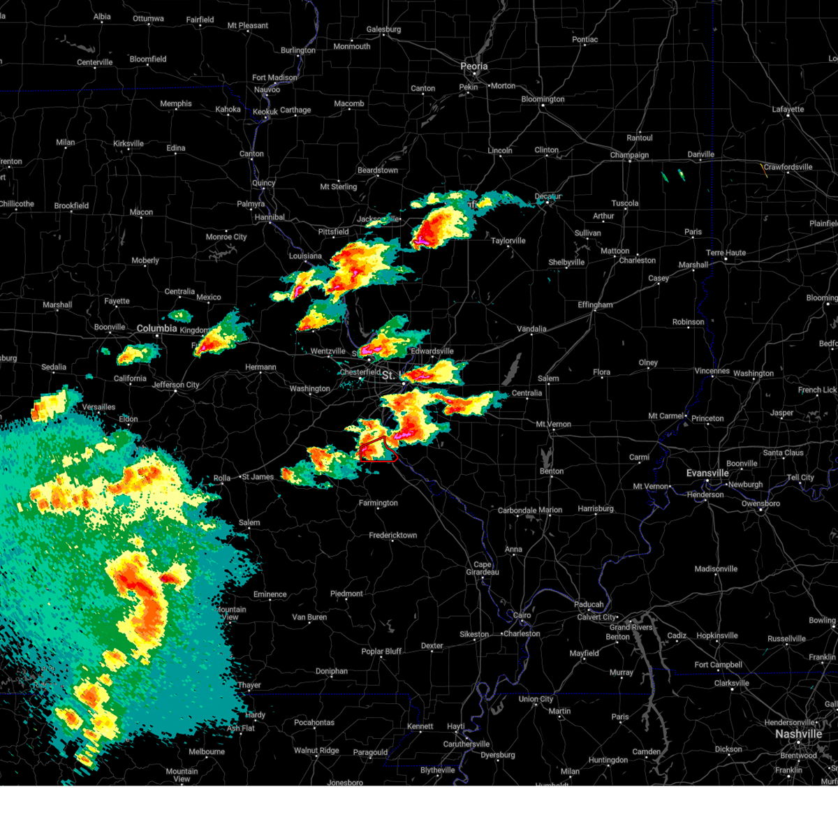 Torlsx the national weather service in st louis has issued a * tornado warning for, southeastern jefferson county in east central missouri, * until 530 pm cdt. * at 438 pm cdt, a severe thunderstorm capable of producing a tornado was located over de soto, moving east at 35 mph (radar indicated rotation). Hazards include tornado and quarter size hail. Flying debris will be dangerous to those caught without shelter. mobile homes will be damaged or destroyed. damage to roofs, windows, and vehicles will occur. tree damage is likely. this dangerous storm will be near, festus, crystal city, and olympian village around 445 pm cdt. This includes interstate 55 in missouri between exits 170 and 178. Torlsx the national weather service in st louis has issued a * tornado warning for, southeastern jefferson county in east central missouri, * until 530 pm cdt. * at 438 pm cdt, a severe thunderstorm capable of producing a tornado was located over de soto, moving east at 35 mph (radar indicated rotation). Hazards include tornado and quarter size hail. Flying debris will be dangerous to those caught without shelter. mobile homes will be damaged or destroyed. damage to roofs, windows, and vehicles will occur. tree damage is likely. this dangerous storm will be near, festus, crystal city, and olympian village around 445 pm cdt. This includes interstate 55 in missouri between exits 170 and 178.
|
| 3/14/2024 3:57 PM CDT |
 Svrlsx the national weather service in st louis has issued a * severe thunderstorm warning for, northwestern monroe county in southwestern illinois, central jefferson county in east central missouri, south central st. louis county in east central missouri, * until 500 pm cdt. * at 356 pm cdt, a severe thunderstorm was located near hillsboro, moving east at 25 mph (radar indicated). Hazards include golf ball size hail. People and animals outdoors will be injured. Expect damage to roofs, siding, windows, and vehicles. Svrlsx the national weather service in st louis has issued a * severe thunderstorm warning for, northwestern monroe county in southwestern illinois, central jefferson county in east central missouri, south central st. louis county in east central missouri, * until 500 pm cdt. * at 356 pm cdt, a severe thunderstorm was located near hillsboro, moving east at 25 mph (radar indicated). Hazards include golf ball size hail. People and animals outdoors will be injured. Expect damage to roofs, siding, windows, and vehicles.
|
| 3/14/2024 3:30 PM CDT |
 At 330 pm cdt, a severe thunderstorm was located near richwoods, moving northeast at 35 mph (radar indicated). Hazards include golf ball size hail and 60 mph wind gusts. People and animals outdoors will be injured. expect hail damage to roofs, siding, windows, and vehicles. expect wind damage to roofs, siding, and trees. Locations impacted include, de soto, hillsboro, byrnes mill, cedar hill, cedar hill lakes, richwoods, dittmer, lonedell, scotsdale, morse mill, oermann, fletcher, and grubville. At 330 pm cdt, a severe thunderstorm was located near richwoods, moving northeast at 35 mph (radar indicated). Hazards include golf ball size hail and 60 mph wind gusts. People and animals outdoors will be injured. expect hail damage to roofs, siding, windows, and vehicles. expect wind damage to roofs, siding, and trees. Locations impacted include, de soto, hillsboro, byrnes mill, cedar hill, cedar hill lakes, richwoods, dittmer, lonedell, scotsdale, morse mill, oermann, fletcher, and grubville.
|
| 3/14/2024 3:20 PM CDT |
 Svrlsx the national weather service in st louis has issued a * severe thunderstorm warning for, northwestern jefferson county in east central missouri, northern washington county in east central missouri, southeastern franklin county in east central missouri, * until 400 pm cdt. * at 320 pm cdt, a severe thunderstorm was located near miramiguoa park, moving northeast at 40 mph (radar indicated). Hazards include 60 mph wind gusts and quarter size hail. Hail damage to vehicles is expected. Expect wind damage to roofs, siding, and trees. Svrlsx the national weather service in st louis has issued a * severe thunderstorm warning for, northwestern jefferson county in east central missouri, northern washington county in east central missouri, southeastern franklin county in east central missouri, * until 400 pm cdt. * at 320 pm cdt, a severe thunderstorm was located near miramiguoa park, moving northeast at 40 mph (radar indicated). Hazards include 60 mph wind gusts and quarter size hail. Hail damage to vehicles is expected. Expect wind damage to roofs, siding, and trees.
|
| 3/13/2024 4:29 PM CDT | Quarter sized hail reported 4.8 miles W of De Soto, MO |
| 3/13/2024 4:12 PM CDT |
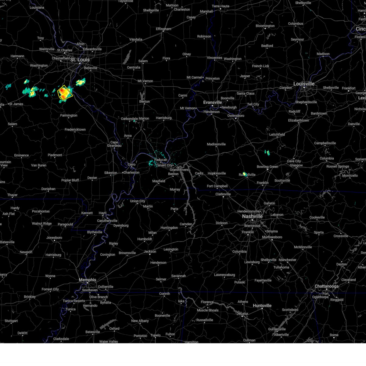 At 412 pm cdt, a severe thunderstorm was located over de soto, moving northeast at 30 mph (radar indicated). Hazards include 60 mph wind gusts and quarter size hail. Hail damage to vehicles is expected. expect wind damage to roofs, siding, and trees. Locations impacted include, festus, de soto, hillsboro, olympian village, hematite, victoria, and mapaville. At 412 pm cdt, a severe thunderstorm was located over de soto, moving northeast at 30 mph (radar indicated). Hazards include 60 mph wind gusts and quarter size hail. Hail damage to vehicles is expected. expect wind damage to roofs, siding, and trees. Locations impacted include, festus, de soto, hillsboro, olympian village, hematite, victoria, and mapaville.
|
| 3/13/2024 4:00 PM CDT |
 At 400 pm cdt, a severe thunderstorm was located near de soto, moving northeast at 25 mph (radar indicated). Hazards include 60 mph wind gusts and quarter size hail. Hail damage to vehicles is expected. expect wind damage to roofs, siding, and trees. Locations impacted include, festus, de soto, hillsboro, olympian village, hematite, victoria, and mapaville. At 400 pm cdt, a severe thunderstorm was located near de soto, moving northeast at 25 mph (radar indicated). Hazards include 60 mph wind gusts and quarter size hail. Hail damage to vehicles is expected. expect wind damage to roofs, siding, and trees. Locations impacted include, festus, de soto, hillsboro, olympian village, hematite, victoria, and mapaville.
|
| 3/13/2024 4:00 PM CDT |
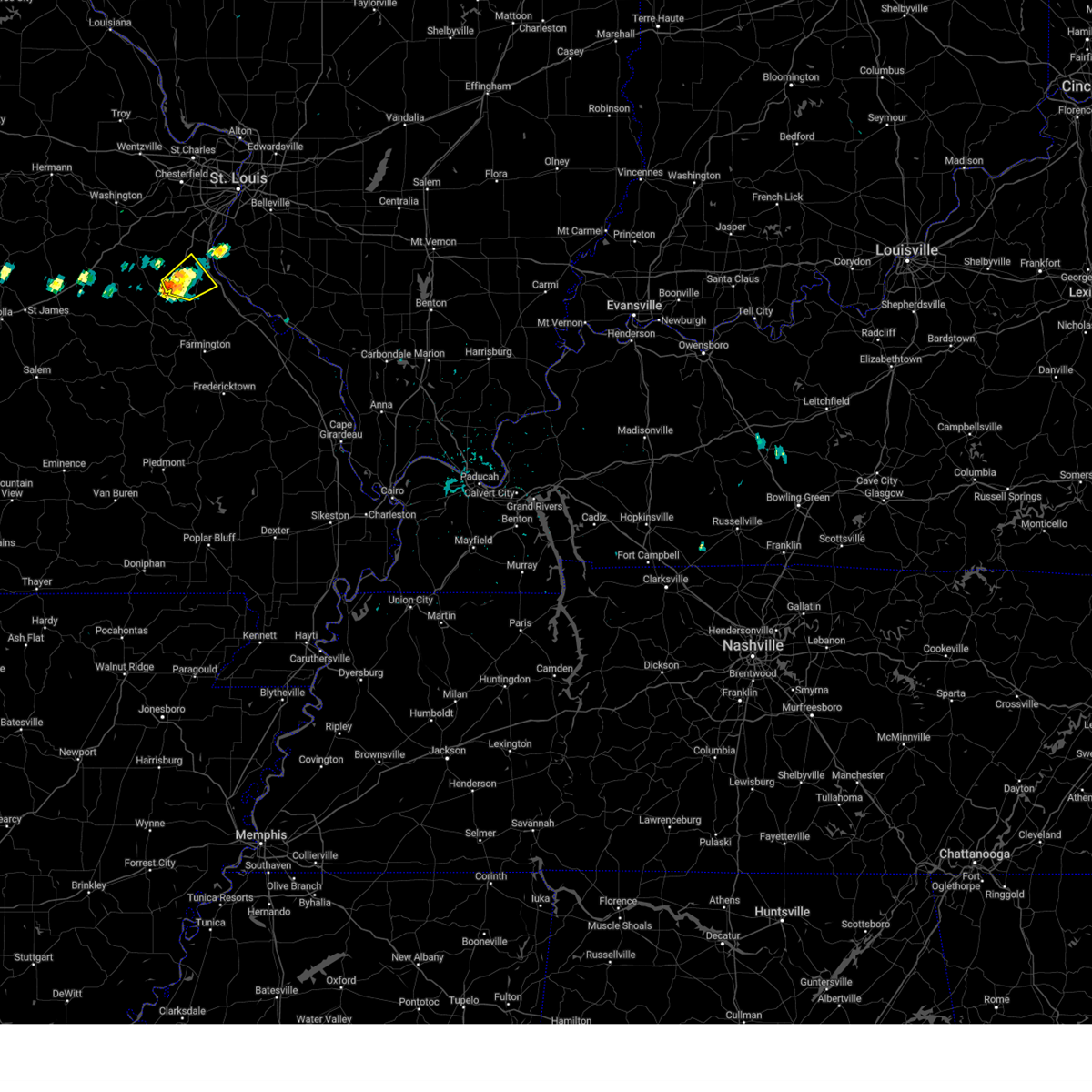 the severe thunderstorm warning has been cancelled and is no longer in effect the severe thunderstorm warning has been cancelled and is no longer in effect
|
| 3/13/2024 3:41 PM CDT |
 Svrlsx the national weather service in st louis has issued a * severe thunderstorm warning for, southwestern jefferson county in east central missouri, northeastern washington county in east central missouri, northwestern st. francois county in southeastern missouri, * until 430 pm cdt. * at 341 pm cdt, a severe thunderstorm was located near old mines, moving northeast at 25 mph (radar indicated). Hazards include 60 mph wind gusts and quarter size hail. Hail damage to vehicles is expected. Expect wind damage to roofs, siding, and trees. Svrlsx the national weather service in st louis has issued a * severe thunderstorm warning for, southwestern jefferson county in east central missouri, northeastern washington county in east central missouri, northwestern st. francois county in southeastern missouri, * until 430 pm cdt. * at 341 pm cdt, a severe thunderstorm was located near old mines, moving northeast at 25 mph (radar indicated). Hazards include 60 mph wind gusts and quarter size hail. Hail damage to vehicles is expected. Expect wind damage to roofs, siding, and trees.
|
| 8/12/2023 5:38 AM CDT |
 The severe thunderstorm warning for monroe, st. clair, jefferson and southeastern franklin counties will expire at 545 am cdt, the storms which prompted the warning have weakened below severe limits, and no longer pose an immediate threat to life or property. therefore, the warning will be allowed to expire. however, gusty winds and heavy rain are still possible with these thunderstorms. a severe thunderstorm watch remains in effect until 1000 am cdt for south central and southwestern illinois, and southeastern and east central missouri. The severe thunderstorm warning for monroe, st. clair, jefferson and southeastern franklin counties will expire at 545 am cdt, the storms which prompted the warning have weakened below severe limits, and no longer pose an immediate threat to life or property. therefore, the warning will be allowed to expire. however, gusty winds and heavy rain are still possible with these thunderstorms. a severe thunderstorm watch remains in effect until 1000 am cdt for south central and southwestern illinois, and southeastern and east central missouri.
|
| 8/12/2023 5:26 AM CDT |
 At 526 am cdt, severe thunderstorms were located along a line extending from near mascoutah to near new athens to near new design to 6 miles southwest of hillsboro, moving southeast at 45 mph (radar indicated). Hazards include 60 mph wind gusts. Expect damage to roofs, siding, and trees. locations impacted include, belleville, o`fallon, swansea, shiloh, festus, waterloo, mascoutah, de soto, pevely, crystal city, lebanon, freeburg, red bud, herculaneum, new baden, hillsboro, scott afb, smithton, new athens, and marissa. this also includes sandy creek covered bridge historic site and gov. dunklin`s grave historic site. this includes the following highways, interstate 64 in illinois between exits 19 and 27. interstate 55 in missouri between exits 170 and 180. hail threat, radar indicated max hail size, <. 75 in wind threat, radar indicated max wind gust, 60 mph. At 526 am cdt, severe thunderstorms were located along a line extending from near mascoutah to near new athens to near new design to 6 miles southwest of hillsboro, moving southeast at 45 mph (radar indicated). Hazards include 60 mph wind gusts. Expect damage to roofs, siding, and trees. locations impacted include, belleville, o`fallon, swansea, shiloh, festus, waterloo, mascoutah, de soto, pevely, crystal city, lebanon, freeburg, red bud, herculaneum, new baden, hillsboro, scott afb, smithton, new athens, and marissa. this also includes sandy creek covered bridge historic site and gov. dunklin`s grave historic site. this includes the following highways, interstate 64 in illinois between exits 19 and 27. interstate 55 in missouri between exits 170 and 180. hail threat, radar indicated max hail size, <. 75 in wind threat, radar indicated max wind gust, 60 mph.
|
| 8/12/2023 5:18 AM CDT |
 At 517 am cdt, severe thunderstorms were located along a line extending from near lebanon to smithton to valmeyer to near lonedell, moving southeast at 50 mph (radar indicated). Hazards include 60 mph wind gusts. Expect damage to roofs, siding, and trees. locations impacted include, belleville, o`fallon, east st. louis, collinsville, arnold, fairview heights, cahokia, swansea, shiloh, festus, eureka, waterloo, columbia, mascoutah, pacific, de soto, pevely, centreville, crystal city, and lebanon. this also includes mastodon historic site, sandy creek covered bridge historic site, gov. dunklin`s grave historic site, and robertsville state park. this includes the following highways, interstate 64 in illinois between exits 9 and 27. interstate 44 in missouri between exits 251 and 253. interstate 55 in missouri between exits 170 and 191. hail threat, radar indicated max hail size, <. 75 in wind threat, radar indicated max wind gust, 60 mph. At 517 am cdt, severe thunderstorms were located along a line extending from near lebanon to smithton to valmeyer to near lonedell, moving southeast at 50 mph (radar indicated). Hazards include 60 mph wind gusts. Expect damage to roofs, siding, and trees. locations impacted include, belleville, o`fallon, east st. louis, collinsville, arnold, fairview heights, cahokia, swansea, shiloh, festus, eureka, waterloo, columbia, mascoutah, pacific, de soto, pevely, centreville, crystal city, and lebanon. this also includes mastodon historic site, sandy creek covered bridge historic site, gov. dunklin`s grave historic site, and robertsville state park. this includes the following highways, interstate 64 in illinois between exits 9 and 27. interstate 44 in missouri between exits 251 and 253. interstate 55 in missouri between exits 170 and 191. hail threat, radar indicated max hail size, <. 75 in wind threat, radar indicated max wind gust, 60 mph.
|
| 8/12/2023 4:46 AM CDT |
 At 446 am cdt, severe thunderstorms were located along a line extending from glasgow village to fenton to villa ridge, moving southeast at 60 mph (trained weather spotters). Hazards include 60 mph wind gusts. expect damage to roofs, siding, and trees At 446 am cdt, severe thunderstorms were located along a line extending from glasgow village to fenton to villa ridge, moving southeast at 60 mph (trained weather spotters). Hazards include 60 mph wind gusts. expect damage to roofs, siding, and trees
|
| 8/3/2023 5:13 AM CDT |
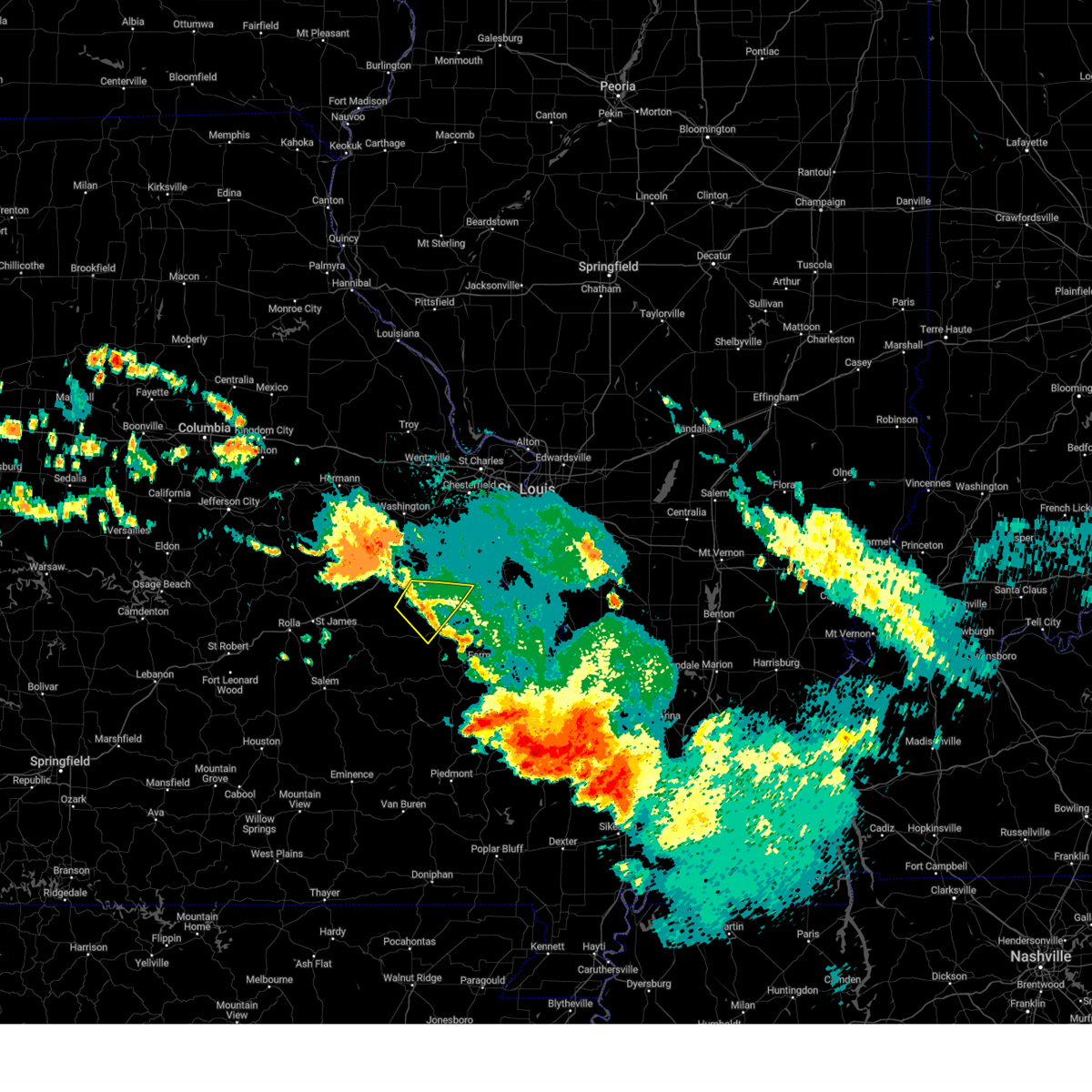 At 512 am cdt, a severe thunderstorm was located near richwoods, moving southeast at 55 mph (radar indicated). Hazards include 60 mph wind gusts and nickel size hail. Expect damage to roofs, siding, and trees. locations impacted include, de soto, potosi, old mines, richwoods, latty, and fletcher. this also includes washington state park. hail threat, radar indicated max hail size, 0. 88 in wind threat, radar indicated max wind gust, 60 mph. At 512 am cdt, a severe thunderstorm was located near richwoods, moving southeast at 55 mph (radar indicated). Hazards include 60 mph wind gusts and nickel size hail. Expect damage to roofs, siding, and trees. locations impacted include, de soto, potosi, old mines, richwoods, latty, and fletcher. this also includes washington state park. hail threat, radar indicated max hail size, 0. 88 in wind threat, radar indicated max wind gust, 60 mph.
|
| 8/3/2023 5:06 AM CDT |
 At 506 am cdt, a severe thunderstorm was located 7 miles west of richwoods, moving southeast at 55 mph (radar indicated). Hazards include 60 mph wind gusts and nickel size hail. Expect damage to roofs, siding, and trees. locations impacted include, sullivan, de soto, st. clair, hillsboro, potosi, anthonies mill, parkway, miramiguoa park, richwoods, old mines, lonedell, morse mill, oermann, latty, fletcher, mapaville, grubville, and piney park. this also includes washington state park and meramec state park. this includes interstate 44 in missouri near exit 239. hail threat, radar indicated max hail size, 0. 88 in wind threat, radar indicated max wind gust, 60 mph. At 506 am cdt, a severe thunderstorm was located 7 miles west of richwoods, moving southeast at 55 mph (radar indicated). Hazards include 60 mph wind gusts and nickel size hail. Expect damage to roofs, siding, and trees. locations impacted include, sullivan, de soto, st. clair, hillsboro, potosi, anthonies mill, parkway, miramiguoa park, richwoods, old mines, lonedell, morse mill, oermann, latty, fletcher, mapaville, grubville, and piney park. this also includes washington state park and meramec state park. this includes interstate 44 in missouri near exit 239. hail threat, radar indicated max hail size, 0. 88 in wind threat, radar indicated max wind gust, 60 mph.
|
| 8/3/2023 4:52 AM CDT |
 At 452 am cdt, a severe thunderstorm was located near sullivan, moving southeast at 55 mph (radar indicated). Hazards include 60 mph wind gusts and nickel size hail. expect damage to roofs, siding, and trees At 452 am cdt, a severe thunderstorm was located near sullivan, moving southeast at 55 mph (radar indicated). Hazards include 60 mph wind gusts and nickel size hail. expect damage to roofs, siding, and trees
|
| 7/17/2023 6:55 PM CDT |
 At 654 pm cdt, a severe thunderstorm was located over crystal city, moving east at 30 mph (radar indicated). Hazards include 60 mph wind gusts and quarter size hail. Hail damage to vehicles is expected. expect wind damage to roofs, siding, and trees. locations impacted include, festus, de soto, pevely, crystal city, herculaneum, hillsboro, barnhart, olympian village, horine, hematite, victoria, and mapaville. this also includes sandy creek covered bridge historic site and gov. dunklin`s grave historic site. this includes interstate 55 in missouri between exits 170 and 180. hail threat, radar indicated max hail size, 1. 00 in wind threat, radar indicated max wind gust, 60 mph. At 654 pm cdt, a severe thunderstorm was located over crystal city, moving east at 30 mph (radar indicated). Hazards include 60 mph wind gusts and quarter size hail. Hail damage to vehicles is expected. expect wind damage to roofs, siding, and trees. locations impacted include, festus, de soto, pevely, crystal city, herculaneum, hillsboro, barnhart, olympian village, horine, hematite, victoria, and mapaville. this also includes sandy creek covered bridge historic site and gov. dunklin`s grave historic site. this includes interstate 55 in missouri between exits 170 and 180. hail threat, radar indicated max hail size, 1. 00 in wind threat, radar indicated max wind gust, 60 mph.
|
| 7/17/2023 6:41 PM CDT |
 At 641 pm cdt, a severe thunderstorm was located over horine, moving east at 35 mph (radar indicated). Hazards include 60 mph wind gusts and quarter size hail. Hail damage to vehicles is expected. expect wind damage to roofs, siding, and trees. locations impacted include, festus, de soto, pevely, crystal city, herculaneum, hillsboro, barnhart, olympian village, horine, hematite, victoria, and mapaville. this also includes sandy creek covered bridge historic site and gov. dunklin`s grave historic site. this includes interstate 55 in missouri between exits 170 and 180. hail threat, radar indicated max hail size, 1. 00 in wind threat, radar indicated max wind gust, 60 mph. At 641 pm cdt, a severe thunderstorm was located over horine, moving east at 35 mph (radar indicated). Hazards include 60 mph wind gusts and quarter size hail. Hail damage to vehicles is expected. expect wind damage to roofs, siding, and trees. locations impacted include, festus, de soto, pevely, crystal city, herculaneum, hillsboro, barnhart, olympian village, horine, hematite, victoria, and mapaville. this also includes sandy creek covered bridge historic site and gov. dunklin`s grave historic site. this includes interstate 55 in missouri between exits 170 and 180. hail threat, radar indicated max hail size, 1. 00 in wind threat, radar indicated max wind gust, 60 mph.
|
| 7/17/2023 6:33 PM CDT |
 At 633 pm cdt, a severe thunderstorm was located over hillsboro, moving east at 30 mph (radar indicated). Hazards include 60 mph wind gusts and half dollar size hail. Hail damage to vehicles is expected. expect wind damage to roofs, siding, and trees. locations impacted include, festus, de soto, pevely, crystal city, herculaneum, hillsboro, barnhart, olympian village, cedar hill lakes, dittmer, horine, hematite, victoria, morse mill, oermann, fletcher, mapaville, and grubville. this also includes sandy creek covered bridge historic site and gov. dunklin`s grave historic site. this includes interstate 55 in missouri between exits 170 and 180. hail threat, radar indicated max hail size, 1. 25 in wind threat, radar indicated max wind gust, 60 mph. At 633 pm cdt, a severe thunderstorm was located over hillsboro, moving east at 30 mph (radar indicated). Hazards include 60 mph wind gusts and half dollar size hail. Hail damage to vehicles is expected. expect wind damage to roofs, siding, and trees. locations impacted include, festus, de soto, pevely, crystal city, herculaneum, hillsboro, barnhart, olympian village, cedar hill lakes, dittmer, horine, hematite, victoria, morse mill, oermann, fletcher, mapaville, and grubville. this also includes sandy creek covered bridge historic site and gov. dunklin`s grave historic site. this includes interstate 55 in missouri between exits 170 and 180. hail threat, radar indicated max hail size, 1. 25 in wind threat, radar indicated max wind gust, 60 mph.
|
| 7/17/2023 6:23 PM CDT |
 At 623 pm cdt, a severe thunderstorm was located near hillsboro, moving east at 35 mph (radar indicated). Hazards include 60 mph wind gusts and quarter size hail. Hail damage to vehicles is expected. Expect wind damage to roofs, siding, and trees. At 623 pm cdt, a severe thunderstorm was located near hillsboro, moving east at 35 mph (radar indicated). Hazards include 60 mph wind gusts and quarter size hail. Hail damage to vehicles is expected. Expect wind damage to roofs, siding, and trees.
|
| 7/16/2023 3:40 PM CDT | Report from mping: 3-inch tree limbs broken; power poles broke in jefferson county MO, 1 miles NNW of De Soto, MO |
| 7/16/2023 3:39 PM CDT | Report from mping: 3-inch tree limbs broken; power poles broke in washington county MO, 7.6 miles ENE of De Soto, MO |
| 7/16/2023 3:27 PM CDT | In tow in jefferson county MO, 0.2 miles NNE of De Soto, MO |
| 7/16/2023 3:27 PM CDT |
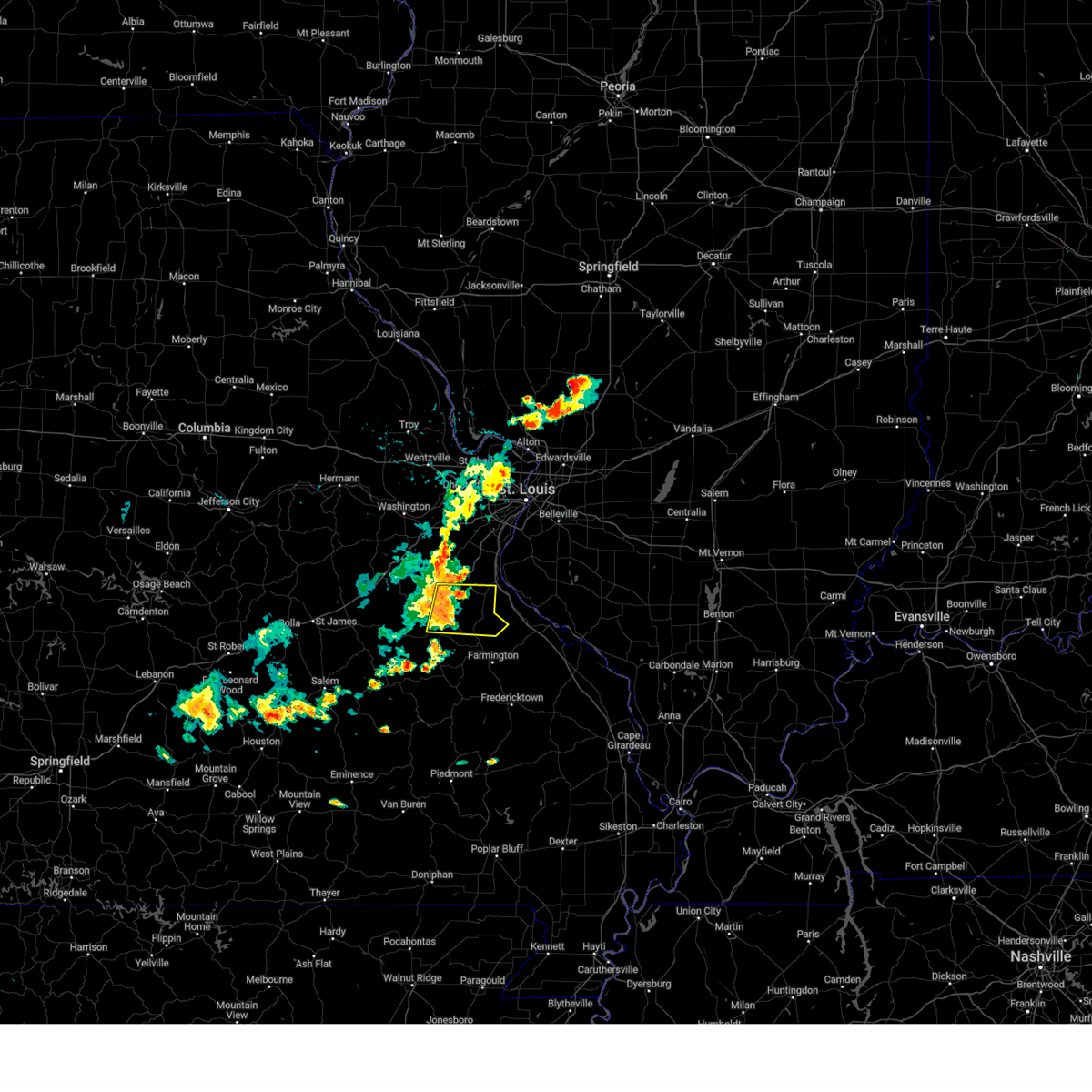 At 327 pm cdt, a severe thunderstorm was located near old mines, moving east at 35 mph (radar indicated). Hazards include 60 mph wind gusts and penny size hail. Expect damage to roofs, siding, and trees. locations impacted include, bonne terre, de soto, potosi, olympian village, mineral point, old mines, blackwell, victoria, cadet, fletcher, valles mill, and french village. this also includes washington state park and st. francois state park. hail threat, radar indicated max hail size, 0. 75 in wind threat, radar indicated max wind gust, 60 mph. At 327 pm cdt, a severe thunderstorm was located near old mines, moving east at 35 mph (radar indicated). Hazards include 60 mph wind gusts and penny size hail. Expect damage to roofs, siding, and trees. locations impacted include, bonne terre, de soto, potosi, olympian village, mineral point, old mines, blackwell, victoria, cadet, fletcher, valles mill, and french village. this also includes washington state park and st. francois state park. hail threat, radar indicated max hail size, 0. 75 in wind threat, radar indicated max wind gust, 60 mph.
|
| 7/16/2023 3:06 PM CDT |
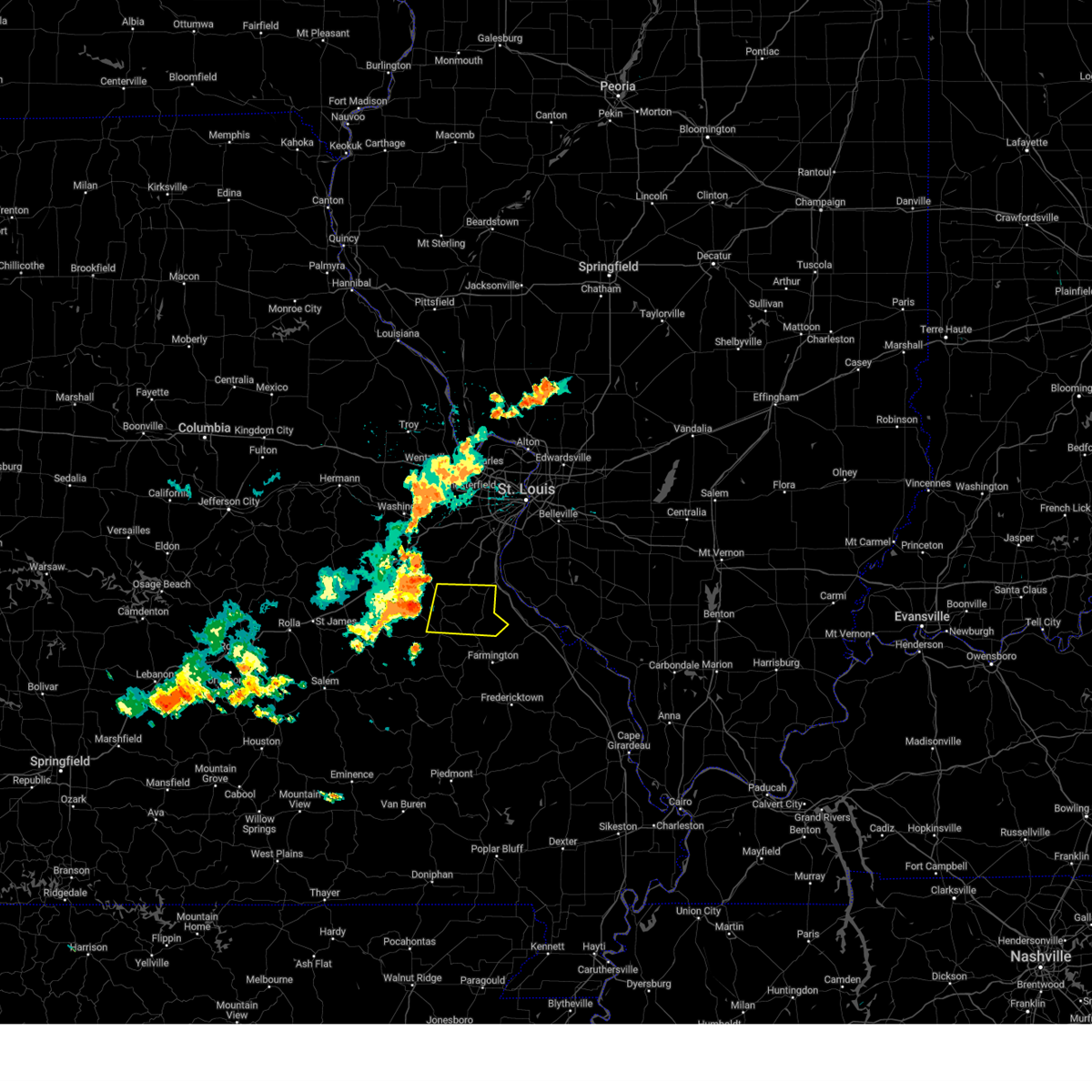 At 306 pm cdt, a severe thunderstorm was located near old mines, moving east at 45 mph (radar indicated). Hazards include 60 mph wind gusts and penny size hail. expect damage to roofs, siding, and trees At 306 pm cdt, a severe thunderstorm was located near old mines, moving east at 45 mph (radar indicated). Hazards include 60 mph wind gusts and penny size hail. expect damage to roofs, siding, and trees
|
| 4/15/2023 6:23 PM CDT |
 At 622 pm cdt, severe thunderstorms were located along a line extending from near bonne terre to near bismarck, moving east at 50 mph (radar indicated). Hazards include 60 mph wind gusts. expect damage to roofs, siding, and trees At 622 pm cdt, severe thunderstorms were located along a line extending from near bonne terre to near bismarck, moving east at 50 mph (radar indicated). Hazards include 60 mph wind gusts. expect damage to roofs, siding, and trees
|
| 4/15/2023 5:52 PM CDT |
 At 552 pm cdt, severe thunderstorms were located along a line extending from near union to near lonedell to 7 miles southeast of anthonies mill, moving east at 35 mph (radar indicated). Hazards include 60 mph wind gusts and quarter size hail. Hail damage to vehicles is expected. Expect wind damage to roofs, siding, and trees. At 552 pm cdt, severe thunderstorms were located along a line extending from near union to near lonedell to 7 miles southeast of anthonies mill, moving east at 35 mph (radar indicated). Hazards include 60 mph wind gusts and quarter size hail. Hail damage to vehicles is expected. Expect wind damage to roofs, siding, and trees.
|
| 4/5/2023 9:20 AM CDT |
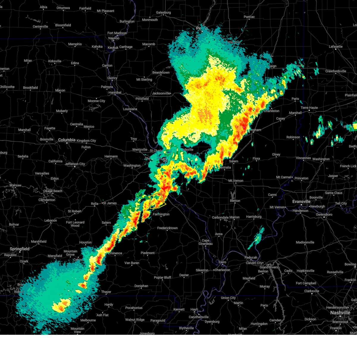 The severe thunderstorm warning for south central jefferson and northwestern st. francois counties will expire at 930 am cdt, the storm which prompted the warning has moved out of the area. therefore, the warning will be allowed to expire. a severe thunderstorm watch remains in effect until 1100 am cdt for southeastern and east central missouri. The severe thunderstorm warning for south central jefferson and northwestern st. francois counties will expire at 930 am cdt, the storm which prompted the warning has moved out of the area. therefore, the warning will be allowed to expire. a severe thunderstorm watch remains in effect until 1100 am cdt for southeastern and east central missouri.
|
| 4/5/2023 9:08 AM CDT | Quarter sized hail reported 4.8 miles W of De Soto, MO, reported via spotternetwork. |
| 4/5/2023 9:04 AM CDT |
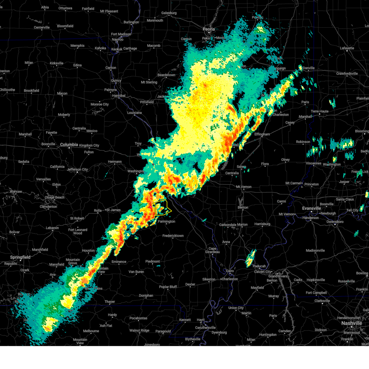 At 903 am cdt, a severe thunderstorm was located over bonne terre, moving east at 60 mph (radar indicated). Hazards include 60 mph wind gusts and nickel size hail. Expect damage to roofs, siding, and trees. this severe thunderstorm will remain over mainly rural areas of south central jefferson and northwestern st. francois counties, including the following locations, valles mill, french village and blackwell. this also includes st. francois state park. hail threat, radar indicated max hail size, 0. 88 in wind threat, radar indicated max wind gust, 60 mph. At 903 am cdt, a severe thunderstorm was located over bonne terre, moving east at 60 mph (radar indicated). Hazards include 60 mph wind gusts and nickel size hail. Expect damage to roofs, siding, and trees. this severe thunderstorm will remain over mainly rural areas of south central jefferson and northwestern st. francois counties, including the following locations, valles mill, french village and blackwell. this also includes st. francois state park. hail threat, radar indicated max hail size, 0. 88 in wind threat, radar indicated max wind gust, 60 mph.
|
| 4/5/2023 8:55 AM CDT |
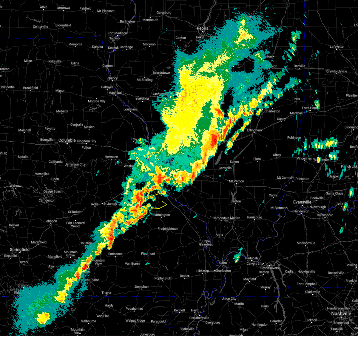 At 854 am cdt, a severe thunderstorm was located near old mines, moving east at 60 mph (radar indicated). Hazards include 60 mph wind gusts and nickel size hail. Expect damage to roofs, siding, and trees. locations impacted include, bonne terre. this also includes washington state park and st. francois state park. hail threat, radar indicated max hail size, 0. 88 in wind threat, radar indicated max wind gust, 60 mph. At 854 am cdt, a severe thunderstorm was located near old mines, moving east at 60 mph (radar indicated). Hazards include 60 mph wind gusts and nickel size hail. Expect damage to roofs, siding, and trees. locations impacted include, bonne terre. this also includes washington state park and st. francois state park. hail threat, radar indicated max hail size, 0. 88 in wind threat, radar indicated max wind gust, 60 mph.
|
| 4/5/2023 8:41 AM CDT |
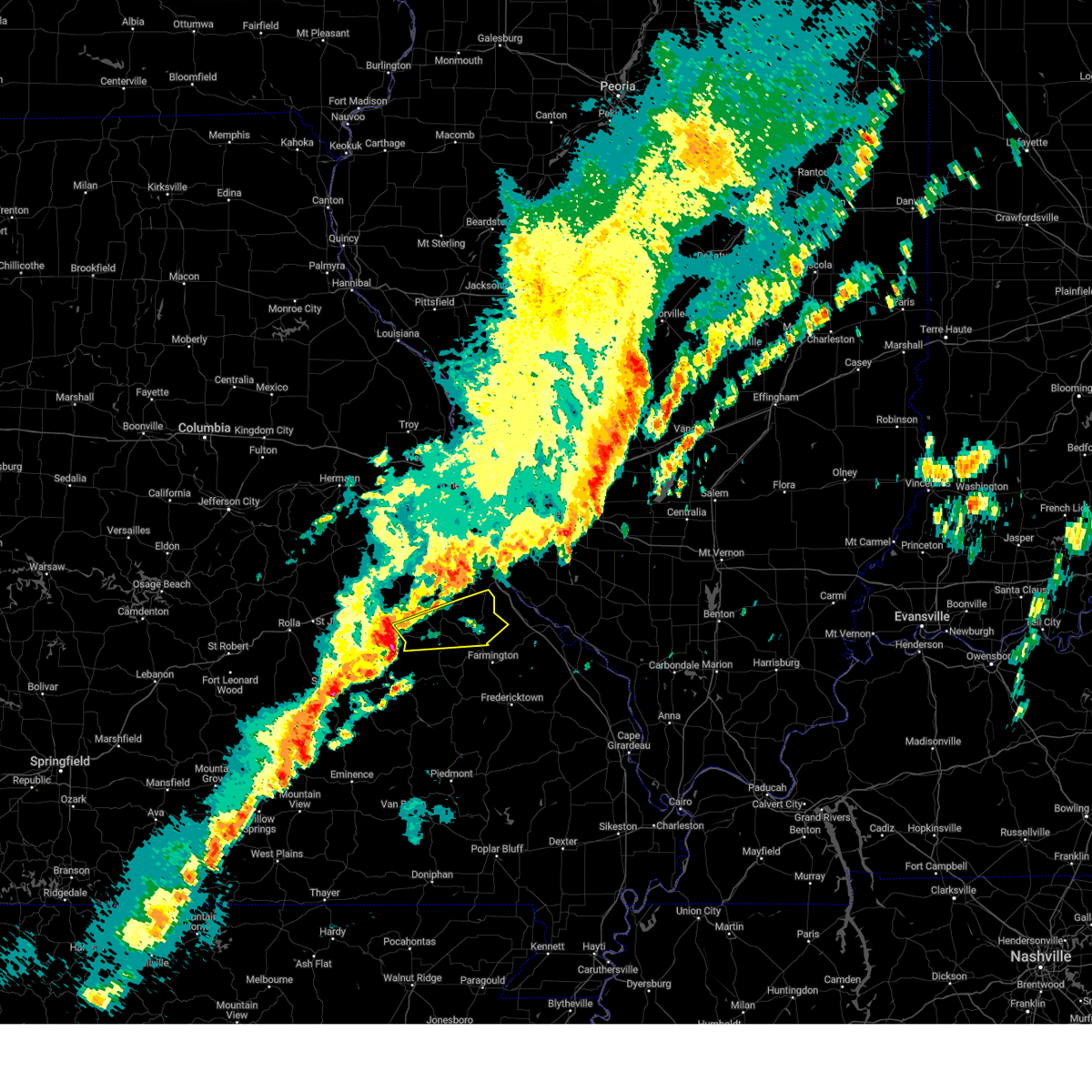 At 841 am cdt, a severe thunderstorm was located 10 miles northeast of courtois, moving east at 60 mph (radar indicated). Hazards include 60 mph wind gusts and penny size hail. Expect damage to roofs, siding, and trees. this severe thunderstorm will be near, potosi, mineral point and old mines around 855 am cdt. leadwood around 900 am cdt. other locations in the path of this severe thunderstorm include bonne terre and desloge. this also includes washington state park and st. francois state park. hail threat, radar indicated max hail size, 0. 75 in wind threat, radar indicated max wind gust, 60 mph. At 841 am cdt, a severe thunderstorm was located 10 miles northeast of courtois, moving east at 60 mph (radar indicated). Hazards include 60 mph wind gusts and penny size hail. Expect damage to roofs, siding, and trees. this severe thunderstorm will be near, potosi, mineral point and old mines around 855 am cdt. leadwood around 900 am cdt. other locations in the path of this severe thunderstorm include bonne terre and desloge. this also includes washington state park and st. francois state park. hail threat, radar indicated max hail size, 0. 75 in wind threat, radar indicated max wind gust, 60 mph.
|
| 3/31/2023 6:20 PM CDT | Quarter sized hail reported 2.2 miles NW of De Soto, MO |
| 3/31/2023 6:10 PM CDT | Quarter sized hail reported 1 miles NNW of De Soto, MO, delayed report... time estimated from radar. |
| 8/3/2022 5:35 PM CDT | Tree blown over onto hwy v just northwest of town. via twitter with pictur in jefferson county MO, 7.8 miles NNW of De Soto, MO |
| 8/3/2022 5:30 PM CDT |
 At 530 pm cdt, a severe thunderstorm was located near olympian village, moving southeast at 40 mph (radar indicated). Hazards include 60 mph wind gusts. Expect damage to roofs, siding, and trees. locations impacted include, festus, de soto, crystal city, ste. genevieve, hillsboro, olympian village, bloomsdale, rocky ridge, prairie du rocher, fults, hematite, renault, kellogg, ames, blackwell, victoria, chalfin bridge, valles mill, french village and kidd. this also includes felix valle house state park. this includes interstate 55 in missouri between exits 150 and 175. hail threat, radar indicated max hail size, <. 75 in wind threat, radar indicated max wind gust, 60 mph. At 530 pm cdt, a severe thunderstorm was located near olympian village, moving southeast at 40 mph (radar indicated). Hazards include 60 mph wind gusts. Expect damage to roofs, siding, and trees. locations impacted include, festus, de soto, crystal city, ste. genevieve, hillsboro, olympian village, bloomsdale, rocky ridge, prairie du rocher, fults, hematite, renault, kellogg, ames, blackwell, victoria, chalfin bridge, valles mill, french village and kidd. this also includes felix valle house state park. this includes interstate 55 in missouri between exits 150 and 175. hail threat, radar indicated max hail size, <. 75 in wind threat, radar indicated max wind gust, 60 mph.
|
| 8/3/2022 5:20 PM CDT | Corrects previous tstm wnd dmg report from de soto. large tree branches blown down around town. via facebook post with pictur in jefferson county MO, 0.2 miles NNE of De Soto, MO |
| 8/3/2022 5:16 PM CDT |
 At 516 pm cdt, a severe thunderstorm was located over olympian village, moving east at 45 mph (radar indicated). Hazards include 60 mph wind gusts. expect damage to roofs, siding, and trees At 516 pm cdt, a severe thunderstorm was located over olympian village, moving east at 45 mph (radar indicated). Hazards include 60 mph wind gusts. expect damage to roofs, siding, and trees
|
| 8/3/2022 5:15 PM CDT | Large tree branches blown down around town. via facebook post with pictur in jefferson county MO, 0.2 miles NNE of De Soto, MO |
| 6/17/2022 5:49 AM CDT |
 At 549 am cdt, severe thunderstorms were located along a line extending from near red bud to near de soto, moving east at 60 mph (radar indicated). Hazards include 60 mph wind gusts and penny size hail. Expect damage to roofs, siding, and trees. locations impacted include, festus, bonne terre, de soto, crystal city, red bud, herculaneum, hillsboro, olympian village, evansville, bloomsdale, baldwin, mineral point, old mines, richwoods, rocky ridge, horine, prairie du rocher, prairie, ruma and maeystown. this also includes washington state park and st. francois state park. this includes interstate 55 in missouri between exits 154 and 178. hail threat, radar indicated max hail size, 0. 75 in wind threat, radar indicated max wind gust, 60 mph. At 549 am cdt, severe thunderstorms were located along a line extending from near red bud to near de soto, moving east at 60 mph (radar indicated). Hazards include 60 mph wind gusts and penny size hail. Expect damage to roofs, siding, and trees. locations impacted include, festus, bonne terre, de soto, crystal city, red bud, herculaneum, hillsboro, olympian village, evansville, bloomsdale, baldwin, mineral point, old mines, richwoods, rocky ridge, horine, prairie du rocher, prairie, ruma and maeystown. this also includes washington state park and st. francois state park. this includes interstate 55 in missouri between exits 154 and 178. hail threat, radar indicated max hail size, 0. 75 in wind threat, radar indicated max wind gust, 60 mph.
|
| 6/17/2022 5:33 AM CDT |
 At 533 am cdt, severe thunderstorms were located along a line extending from near valmeyer to near richwoods, moving east at 60 mph (radar indicated). Hazards include 60 mph wind gusts and penny size hail. Expect damage to roofs, siding, and trees. locations impacted include, de soto, red bud, olympian village, evansville, baldwin, bloomsdale and rocky ridge. this also includes washington state park and st. francois state park. this includes interstate 55 in missouri between exits 154 and 178. hail threat, radar indicated max hail size, 0. 75 in wind threat, radar indicated max wind gust, 60 mph. At 533 am cdt, severe thunderstorms were located along a line extending from near valmeyer to near richwoods, moving east at 60 mph (radar indicated). Hazards include 60 mph wind gusts and penny size hail. Expect damage to roofs, siding, and trees. locations impacted include, de soto, red bud, olympian village, evansville, baldwin, bloomsdale and rocky ridge. this also includes washington state park and st. francois state park. this includes interstate 55 in missouri between exits 154 and 178. hail threat, radar indicated max hail size, 0. 75 in wind threat, radar indicated max wind gust, 60 mph.
|
| 6/17/2022 5:23 AM CDT |
 At 523 am cdt, severe thunderstorms were located along a line extending from near antonia to near miramiguoa park, moving east at 60 mph (radar indicated). Hazards include 60 mph wind gusts and penny size hail. Expect damage to roofs, siding, and trees. severe thunderstorms will be near, festus, crystal city, herculaneum and horine around 530 am cdt. old mines around 540 am cdt. other locations in the path of these severe thunderstorms include de soto, red bud, olympian village, evansville and baldwin. this includes interstate 55 in missouri between exits 154 and 178. this also includes washington state park and st. francois state park. hail threat, radar indicated max hail size, 0. 75 in wind threat, radar indicated max wind gust, 60 mph. At 523 am cdt, severe thunderstorms were located along a line extending from near antonia to near miramiguoa park, moving east at 60 mph (radar indicated). Hazards include 60 mph wind gusts and penny size hail. Expect damage to roofs, siding, and trees. severe thunderstorms will be near, festus, crystal city, herculaneum and horine around 530 am cdt. old mines around 540 am cdt. other locations in the path of these severe thunderstorms include de soto, red bud, olympian village, evansville and baldwin. this includes interstate 55 in missouri between exits 154 and 178. this also includes washington state park and st. francois state park. hail threat, radar indicated max hail size, 0. 75 in wind threat, radar indicated max wind gust, 60 mph.
|
| 4/11/2022 5:20 AM CDT |
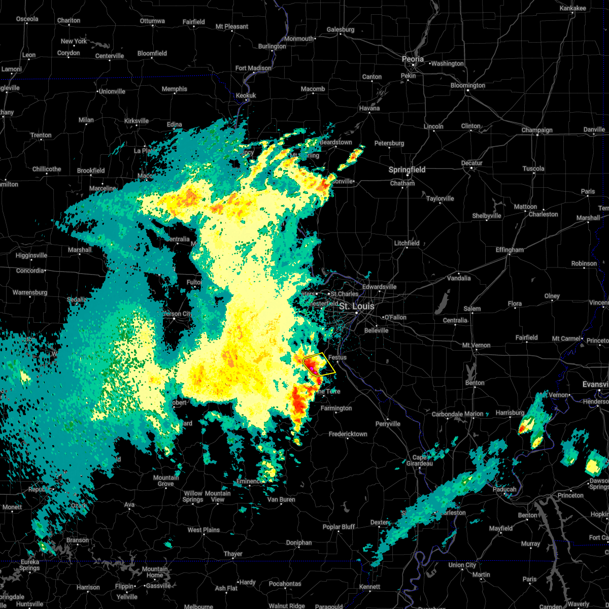 At 519 am cdt, a severe thunderstorm was located near de soto, moving northeast at 45 mph (radar indicated). Hazards include 60 mph wind gusts and quarter size hail. Hail damage to vehicles is expected. expect wind damage to roofs, siding, and trees. this severe storm will be near, hillsboro around 525 am cdt. olympian village around 530 am cdt. hail threat, radar indicated max hail size, 1. 00 in wind threat, radar indicated max wind gust, 60 mph. At 519 am cdt, a severe thunderstorm was located near de soto, moving northeast at 45 mph (radar indicated). Hazards include 60 mph wind gusts and quarter size hail. Hail damage to vehicles is expected. expect wind damage to roofs, siding, and trees. this severe storm will be near, hillsboro around 525 am cdt. olympian village around 530 am cdt. hail threat, radar indicated max hail size, 1. 00 in wind threat, radar indicated max wind gust, 60 mph.
|
| 4/11/2022 5:18 AM CDT |
 At 518 am cdt, a severe thunderstorm was located near de soto, moving northeast at 45 mph (radar indicated). Hazards include 60 mph wind gusts and quarter size hail. Hail damage to vehicles is expected. expect wind damage to roofs, siding, and trees. locations impacted include, olympian village. this also includes washington state park. hail threat, radar indicated max hail size, 1. 00 in wind threat, radar indicated max wind gust, 60 mph. At 518 am cdt, a severe thunderstorm was located near de soto, moving northeast at 45 mph (radar indicated). Hazards include 60 mph wind gusts and quarter size hail. Hail damage to vehicles is expected. expect wind damage to roofs, siding, and trees. locations impacted include, olympian village. this also includes washington state park. hail threat, radar indicated max hail size, 1. 00 in wind threat, radar indicated max wind gust, 60 mph.
|
| 4/11/2022 5:15 AM CDT |
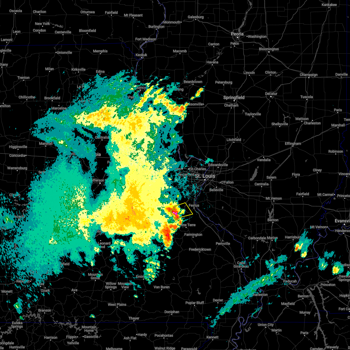 At 515 am cdt, a severe thunderstorm was located near de soto, moving northeast at 45 mph (radar indicated). Hazards include 60 mph wind gusts and quarter size hail. Hail damage to vehicles is expected. expect wind damage to roofs, siding, and trees. this severe thunderstorm will be near, de soto around 520 am cdt. hillsboro around 525 am cdt. olympian village around 530 am cdt. this also includes washington state park. hail threat, radar indicated max hail size, 1. 00 in wind threat, radar indicated max wind gust, 60 mph. At 515 am cdt, a severe thunderstorm was located near de soto, moving northeast at 45 mph (radar indicated). Hazards include 60 mph wind gusts and quarter size hail. Hail damage to vehicles is expected. expect wind damage to roofs, siding, and trees. this severe thunderstorm will be near, de soto around 520 am cdt. hillsboro around 525 am cdt. olympian village around 530 am cdt. this also includes washington state park. hail threat, radar indicated max hail size, 1. 00 in wind threat, radar indicated max wind gust, 60 mph.
|
| 4/11/2022 4:52 AM CDT |
 At 451 am cdt, a severe thunderstorm was located 7 miles east of anthonies mill, moving east at 45 mph (radar indicated). Hazards include 60 mph wind gusts and quarter size hail. Hail damage to vehicles is expected. expect wind damage to roofs, siding, and trees. this severe thunderstorm will be near, richwoods and old mines around 505 am cdt. other locations in the path of this severe thunderstorm include de soto, hillsboro and olympian village. this also includes washington state park. hail threat, radar indicated max hail size, 1. 00 in wind threat, radar indicated max wind gust, 60 mph. At 451 am cdt, a severe thunderstorm was located 7 miles east of anthonies mill, moving east at 45 mph (radar indicated). Hazards include 60 mph wind gusts and quarter size hail. Hail damage to vehicles is expected. expect wind damage to roofs, siding, and trees. this severe thunderstorm will be near, richwoods and old mines around 505 am cdt. other locations in the path of this severe thunderstorm include de soto, hillsboro and olympian village. this also includes washington state park. hail threat, radar indicated max hail size, 1. 00 in wind threat, radar indicated max wind gust, 60 mph.
|
| 10/24/2021 7:52 PM CDT |
 At 752 pm cdt, a severe thunderstorm was located over bonne terre, moving northeast at 35 mph (radar indicated). Hazards include 60 mph wind gusts and quarter size hail. Hail damage to vehicles is expected. expect wind damage to roofs, siding, and trees. locations impacted include, bloomsdale. this also includes st. francois state park. This includes interstate 55 in missouri between exits 157 and 174. At 752 pm cdt, a severe thunderstorm was located over bonne terre, moving northeast at 35 mph (radar indicated). Hazards include 60 mph wind gusts and quarter size hail. Hail damage to vehicles is expected. expect wind damage to roofs, siding, and trees. locations impacted include, bloomsdale. this also includes st. francois state park. This includes interstate 55 in missouri between exits 157 and 174.
|
| 10/24/2021 7:39 PM CDT |
 At 739 pm cdt, a severe thunderstorm was located near irondale, moving northeast at 35 mph (radar indicated). Hazards include 60 mph wind gusts and quarter size hail. Hail damage to vehicles is expected. expect wind damage to roofs, siding, and trees. this severe thunderstorm will be near, leadwood around 750 pm cdt. bonne terre and desloge around 755 pm cdt. other locations in the path of this severe thunderstorm include olympian village. this includes interstate 55 in missouri between exits 157 and 174. this also includes st. Francois state park. At 739 pm cdt, a severe thunderstorm was located near irondale, moving northeast at 35 mph (radar indicated). Hazards include 60 mph wind gusts and quarter size hail. Hail damage to vehicles is expected. expect wind damage to roofs, siding, and trees. this severe thunderstorm will be near, leadwood around 750 pm cdt. bonne terre and desloge around 755 pm cdt. other locations in the path of this severe thunderstorm include olympian village. this includes interstate 55 in missouri between exits 157 and 174. this also includes st. Francois state park.
|
| 8/12/2021 7:14 PM CDT |
 At 712 pm cdt, severe thunderstorms were located along a line extending from shiloh to new design to near de soto, moving southeast at 50 mph (this line of storms has a history of damaging wind gusts). Hazards include 70 mph wind gusts. Expect considerable tree damage. damage is likely to mobile homes, roofs, and outbuildings. severe thunderstorms will be near, mascoutah, lebanon, red bud and scott afb around 720 pm cdt. new baden around 725 pm cdt. albers, evansville, baldwin and new memphis around 730 pm cdt. other locations in the path of these severe thunderstorms include bloomsdale, rocky ridge, sparta, okawville, weingarten, ste. genevieve, nashville, steeleville, percy, chester and st. mary. this includes the following highways, interstate 64 in illinois between exits 14 and 61. interstate 55 in missouri between exits 141 and 174. this also includes hawn state park and felix valle house state park. thunderstorm damage threat, considerable hail threat, radar indicated max hail size, <. 75 in wind threat, radar indicated max wind gust, 70 mph. At 712 pm cdt, severe thunderstorms were located along a line extending from shiloh to new design to near de soto, moving southeast at 50 mph (this line of storms has a history of damaging wind gusts). Hazards include 70 mph wind gusts. Expect considerable tree damage. damage is likely to mobile homes, roofs, and outbuildings. severe thunderstorms will be near, mascoutah, lebanon, red bud and scott afb around 720 pm cdt. new baden around 725 pm cdt. albers, evansville, baldwin and new memphis around 730 pm cdt. other locations in the path of these severe thunderstorms include bloomsdale, rocky ridge, sparta, okawville, weingarten, ste. genevieve, nashville, steeleville, percy, chester and st. mary. this includes the following highways, interstate 64 in illinois between exits 14 and 61. interstate 55 in missouri between exits 141 and 174. this also includes hawn state park and felix valle house state park. thunderstorm damage threat, considerable hail threat, radar indicated max hail size, <. 75 in wind threat, radar indicated max wind gust, 70 mph.
|
| 8/12/2021 6:37 PM CDT |
 At 636 pm cdt, severe thunderstorms were located along a line extending from east alton to near valley park to near st. clair, moving southeast at 40 mph (this line of storms has a history of damaging wind gusts). Hazards include 60 mph wind gusts and penny size hail. Expect damage to roofs, siding, and trees. severe thunderstorms will be near, st. louis, kirkwood, sunset hills, des peres, valley park, fenton, byrnes mill, oakland, murphy and high ridge around 640 pm cdt. granite city, crestwood, madison, affton, south roxana, grantwood village, sappington and concord around 645 pm cdt. edwardsville, arnold, pontoon beach, lakeshire, mehlville, antonia, green park and st. george around 650 pm cdt. collinsville, maryville, oakville, barnhart, imperial and dittmer around 655 pm cdt. other locations in the path of these severe thunderstorms include glen carbon, troy, columbia, caseyville, cedar hill lakes, fountain, o`fallon, valmeyer, waterloo, hillsboro, st. jacob, de soto, lebanon and scott afb. this includes the following highways, interstate 64 in illinois between exits 9 and 41. interstate 44 in missouri between exits 239 and 247, and between exits 257 and 277. interstate 55 in missouri between exits 170 and 191. this also includes scott joplin historic site, route 66 state park, castlewood state park, confluence state park, mastodon historic site, sandy creek covered bridge historic site, gov. dunklin`s grave historic site, robertsville state park, and horseshoe lake state park. hail threat, radar indicated max hail size, 0. 75 in wind threat, radar indicated max wind gust, 60 mph. At 636 pm cdt, severe thunderstorms were located along a line extending from east alton to near valley park to near st. clair, moving southeast at 40 mph (this line of storms has a history of damaging wind gusts). Hazards include 60 mph wind gusts and penny size hail. Expect damage to roofs, siding, and trees. severe thunderstorms will be near, st. louis, kirkwood, sunset hills, des peres, valley park, fenton, byrnes mill, oakland, murphy and high ridge around 640 pm cdt. granite city, crestwood, madison, affton, south roxana, grantwood village, sappington and concord around 645 pm cdt. edwardsville, arnold, pontoon beach, lakeshire, mehlville, antonia, green park and st. george around 650 pm cdt. collinsville, maryville, oakville, barnhart, imperial and dittmer around 655 pm cdt. other locations in the path of these severe thunderstorms include glen carbon, troy, columbia, caseyville, cedar hill lakes, fountain, o`fallon, valmeyer, waterloo, hillsboro, st. jacob, de soto, lebanon and scott afb. this includes the following highways, interstate 64 in illinois between exits 9 and 41. interstate 44 in missouri between exits 239 and 247, and between exits 257 and 277. interstate 55 in missouri between exits 170 and 191. this also includes scott joplin historic site, route 66 state park, castlewood state park, confluence state park, mastodon historic site, sandy creek covered bridge historic site, gov. dunklin`s grave historic site, robertsville state park, and horseshoe lake state park. hail threat, radar indicated max hail size, 0. 75 in wind threat, radar indicated max wind gust, 60 mph.
|
| 8/8/2021 3:56 PM CDT | Tree down onto wires; via faceboook vide in jefferson county MO, 0.2 miles NNE of De Soto, MO |
| 7/10/2021 1:26 AM CDT |
 At 126 am cdt, severe thunderstorms were located along a line extending from crystal city to near olympian village to 6 miles east of old mines, moving east at 50 mph (radar indicated). Hazards include 60 mph wind gusts and quarter size hail. Hail damage to vehicles is expected. expect wind damage to roofs, siding, and trees. locations impacted include, crystal city, bonne terre, bloomsdale, ste. genevieve, red bud, rocky ridge, weingarten, evansville, baldwin and st. mary. this also includes washington state park, st. joe state park, st. francois state park, hawn state park, felix valle house state park, sandy creek covered bridge historic site, and missouri mines historic site. This includes interstate 55 in missouri between exits 141 and 178. At 126 am cdt, severe thunderstorms were located along a line extending from crystal city to near olympian village to 6 miles east of old mines, moving east at 50 mph (radar indicated). Hazards include 60 mph wind gusts and quarter size hail. Hail damage to vehicles is expected. expect wind damage to roofs, siding, and trees. locations impacted include, crystal city, bonne terre, bloomsdale, ste. genevieve, red bud, rocky ridge, weingarten, evansville, baldwin and st. mary. this also includes washington state park, st. joe state park, st. francois state park, hawn state park, felix valle house state park, sandy creek covered bridge historic site, and missouri mines historic site. This includes interstate 55 in missouri between exits 141 and 178.
|
| 7/10/2021 1:08 AM CDT |
 At 108 am cdt, severe thunderstorms were located along a line extending from near cedar hill lakes to 7 miles west of de soto to 6 miles southwest of richwoods, moving east at 50 mph (radar indicated). Hazards include 60 mph wind gusts and half dollar size hail. Hail damage to vehicles is expected. expect wind damage to roofs, siding, and trees. severe thunderstorms will be near, de soto and hillsboro around 115 am cdt. pevely, olympian village and horine around 120 am cdt. festus, crystal city, herculaneum and mineral point around 125 am cdt. other locations in the path of these severe thunderstorms include bonne terre, bloomsdale, ste. genevieve, red bud, evansville, rocky ridge, weingarten, baldwin and st. mary. this includes interstate 55 in missouri between exits 141 and 178. this also includes washington state park, st. joe state park, st. Francois state park, hawn state park, felix valle house state park, sandy creek covered bridge historic site, and missouri mines historic site. At 108 am cdt, severe thunderstorms were located along a line extending from near cedar hill lakes to 7 miles west of de soto to 6 miles southwest of richwoods, moving east at 50 mph (radar indicated). Hazards include 60 mph wind gusts and half dollar size hail. Hail damage to vehicles is expected. expect wind damage to roofs, siding, and trees. severe thunderstorms will be near, de soto and hillsboro around 115 am cdt. pevely, olympian village and horine around 120 am cdt. festus, crystal city, herculaneum and mineral point around 125 am cdt. other locations in the path of these severe thunderstorms include bonne terre, bloomsdale, ste. genevieve, red bud, evansville, rocky ridge, weingarten, baldwin and st. mary. this includes interstate 55 in missouri between exits 141 and 178. this also includes washington state park, st. joe state park, st. Francois state park, hawn state park, felix valle house state park, sandy creek covered bridge historic site, and missouri mines historic site.
|
| 4/7/2021 6:15 PM CDT |
 At 614 pm cdt, a severe thunderstorm was located over hillsboro, moving northeast at 45 mph (radar indicated). Hazards include 60 mph wind gusts and nickel size hail. Expect damage to roofs, siding, and trees. locations impacted include, arnold, festus, de soto, pevely, crystal city, herculaneum, hillsboro, byrnes mill, high ridge, barnhart, cedar hill, murphy, antonia, oakville, olympian village, cedar hill lakes, house springs, dittmer, horine and imperial. this also includes mastodon historic site, sandy creek covered bridge historic site, and gov. dunklin`s grave historic site. This includes interstate 55 in missouri between exits 170 and 191. At 614 pm cdt, a severe thunderstorm was located over hillsboro, moving northeast at 45 mph (radar indicated). Hazards include 60 mph wind gusts and nickel size hail. Expect damage to roofs, siding, and trees. locations impacted include, arnold, festus, de soto, pevely, crystal city, herculaneum, hillsboro, byrnes mill, high ridge, barnhart, cedar hill, murphy, antonia, oakville, olympian village, cedar hill lakes, house springs, dittmer, horine and imperial. this also includes mastodon historic site, sandy creek covered bridge historic site, and gov. dunklin`s grave historic site. This includes interstate 55 in missouri between exits 170 and 191.
|
| 4/7/2021 6:05 PM CDT |
 At 605 pm cdt, a severe thunderstorm was located near de soto, moving northeast at 45 mph (radar indicated). Hazards include 60 mph wind gusts and nickel size hail. Expect damage to roofs, siding, and trees. locations impacted include, arnold, festus, bonne terre, de soto, pevely, crystal city, herculaneum, hillsboro, byrnes mill, bismarck, leadwood, high ridge, barnhart, cedar hill, murphy, antonia, oakville, olympian village, cedar hill lakes and house springs. this also includes st. francois state park, mastodon historic site, sandy creek covered bridge historic site, and gov. dunklin`s grave historic site. This includes interstate 55 in missouri between exits 170 and 191. At 605 pm cdt, a severe thunderstorm was located near de soto, moving northeast at 45 mph (radar indicated). Hazards include 60 mph wind gusts and nickel size hail. Expect damage to roofs, siding, and trees. locations impacted include, arnold, festus, bonne terre, de soto, pevely, crystal city, herculaneum, hillsboro, byrnes mill, bismarck, leadwood, high ridge, barnhart, cedar hill, murphy, antonia, oakville, olympian village, cedar hill lakes and house springs. this also includes st. francois state park, mastodon historic site, sandy creek covered bridge historic site, and gov. dunklin`s grave historic site. This includes interstate 55 in missouri between exits 170 and 191.
|
| 4/7/2021 5:58 PM CDT |
 At 558 pm cdt, a severe thunderstorm was located near old mines, moving northeast at 50 mph (radar indicated). Hazards include 60 mph wind gusts and nickel size hail. Expect damage to roofs, siding, and trees. locations impacted include, arnold, festus, pacific, bonne terre, de soto, pevely, desloge, crystal city, herculaneum, hillsboro, byrnes mill, potosi, bismarck, leadwood, high ridge, murphy, antonia, barnhart, cedar hill and gray summit. this also includes washington state park, st. francois state park, mastodon historic site, sandy creek covered bridge historic site, gov. dunklin`s grave historic site, and robertsville state park. this includes the following highways, interstate 44 in missouri exit 247 and near exit 257. Interstate 55 in missouri between exits 170 and 191. At 558 pm cdt, a severe thunderstorm was located near old mines, moving northeast at 50 mph (radar indicated). Hazards include 60 mph wind gusts and nickel size hail. Expect damage to roofs, siding, and trees. locations impacted include, arnold, festus, pacific, bonne terre, de soto, pevely, desloge, crystal city, herculaneum, hillsboro, byrnes mill, potosi, bismarck, leadwood, high ridge, murphy, antonia, barnhart, cedar hill and gray summit. this also includes washington state park, st. francois state park, mastodon historic site, sandy creek covered bridge historic site, gov. dunklin`s grave historic site, and robertsville state park. this includes the following highways, interstate 44 in missouri exit 247 and near exit 257. Interstate 55 in missouri between exits 170 and 191.
|
| 4/7/2021 5:37 PM CDT |
 The national weather service in st louis has issued a * severe thunderstorm warning for. jefferson county in east central missouri. washington county in east central missouri. southeastern franklin county in east central missouri. northwestern st. Francois county in southeastern missouri. The national weather service in st louis has issued a * severe thunderstorm warning for. jefferson county in east central missouri. washington county in east central missouri. southeastern franklin county in east central missouri. northwestern st. Francois county in southeastern missouri.
|
| 8/10/2020 6:12 PM CDT |
 At 612 pm cdt, severe thunderstorms were located along a line extending from near hartford to near fountain to de soto, moving east at 40 mph (trained weather spotters reported trees and power lines down in arnold). Hazards include 60 mph wind gusts. Expect damage to roofs, siding, and trees. locations impacted include, st. louis, belleville, university city, granite city, o`fallon, east st. louis, collinsville, edwardsville, webster groves, ferguson, arnold, fairview heights, clayton, cahokia, jennings, swansea, glen carbon, shiloh, crestwood and festus. this also includes scott joplin historic site, mastodon historic site, gov. dunklin`s grave historic site, carlyle lake recreational area, and horseshoe lake state park. this includes the following highways, interstate 70 in illinois between exits 21 and 30. interstate 55 in illinois near exit 23. interstate 64 in illinois between exits 9 and 61. Interstate 55 in missouri between exits 170 and 191. At 612 pm cdt, severe thunderstorms were located along a line extending from near hartford to near fountain to de soto, moving east at 40 mph (trained weather spotters reported trees and power lines down in arnold). Hazards include 60 mph wind gusts. Expect damage to roofs, siding, and trees. locations impacted include, st. louis, belleville, university city, granite city, o`fallon, east st. louis, collinsville, edwardsville, webster groves, ferguson, arnold, fairview heights, clayton, cahokia, jennings, swansea, glen carbon, shiloh, crestwood and festus. this also includes scott joplin historic site, mastodon historic site, gov. dunklin`s grave historic site, carlyle lake recreational area, and horseshoe lake state park. this includes the following highways, interstate 70 in illinois between exits 21 and 30. interstate 55 in illinois near exit 23. interstate 64 in illinois between exits 9 and 61. Interstate 55 in missouri between exits 170 and 191.
|
| 8/10/2020 5:59 PM CDT |
 At 559 pm cdt, severe thunderstorms were located along a line extending from black jack to near antonia to near de soto, moving east at 40 mph (trained weather spotters). Hazards include 60 mph wind gusts. expect damage to roofs, siding, and trees At 559 pm cdt, severe thunderstorms were located along a line extending from black jack to near antonia to near de soto, moving east at 40 mph (trained weather spotters). Hazards include 60 mph wind gusts. expect damage to roofs, siding, and trees
|
| 5/28/2020 5:56 PM CDT |
 The severe thunderstorm warning for southwestern jefferson and northeastern washington counties will expire at 600 pm cdt, the storm which prompted the warning has weakened below severe limits, and no longer poses an immediate threat to life or property. therefore, the warning will be allowed to expire. however gusty winds and heavy rain are still possible with this thunderstorm. The severe thunderstorm warning for southwestern jefferson and northeastern washington counties will expire at 600 pm cdt, the storm which prompted the warning has weakened below severe limits, and no longer poses an immediate threat to life or property. therefore, the warning will be allowed to expire. however gusty winds and heavy rain are still possible with this thunderstorm.
|
| 5/28/2020 5:46 PM CDT |
 At 545 pm cdt, a severe thunderstorm was located near richwoods, moving northeast at 20 mph (trained weather spotters). Hazards include estimated ping pong ball size hail and 60 mph wind gusts. People and animals outdoors will be injured. expect hail damage to roofs, siding, windows, and vehicles. expect wind damage to roofs, siding, and trees. locations impacted include, de soto and fletcher. This also includes washington state park. At 545 pm cdt, a severe thunderstorm was located near richwoods, moving northeast at 20 mph (trained weather spotters). Hazards include estimated ping pong ball size hail and 60 mph wind gusts. People and animals outdoors will be injured. expect hail damage to roofs, siding, windows, and vehicles. expect wind damage to roofs, siding, and trees. locations impacted include, de soto and fletcher. This also includes washington state park.
|
| 5/28/2020 5:40 PM CDT | Ping Pong Ball sized hail reported 10 miles E of De Soto, MO |
| 5/28/2020 5:28 PM CDT |
 At 527 pm cdt, a severe thunderstorm was located near richwoods, moving northeast at 20 mph (radar indicated). Hazards include 60 mph wind gusts and nickel size hail. expect damage to roofs, siding, and trees At 527 pm cdt, a severe thunderstorm was located near richwoods, moving northeast at 20 mph (radar indicated). Hazards include 60 mph wind gusts and nickel size hail. expect damage to roofs, siding, and trees
|
| 10/21/2019 4:27 AM CDT |
 The severe thunderstorm warning for monroe, randolph and jefferson counties will expire at 430 am cdt, the storms which prompted the warning have weakened below severe limits, or have exited the warned area. therefore, the warning will be allowed to expire. a tornado watch remains in effect until 900 am cdt for south central and southwestern illinois, and southeastern and east central missouri. The severe thunderstorm warning for monroe, randolph and jefferson counties will expire at 430 am cdt, the storms which prompted the warning have weakened below severe limits, or have exited the warned area. therefore, the warning will be allowed to expire. a tornado watch remains in effect until 900 am cdt for south central and southwestern illinois, and southeastern and east central missouri.
|
| 10/21/2019 4:16 AM CDT |
 At 415 am cdt, severe thunderstorms were located along a line extending from near arnold to near red bud to 6 miles northeast of perryville, moving east at 75 mph (radar indicated). Hazards include 60 mph wind gusts. Expect damage to roofs, siding, and trees. locations impacted include, arnold, festus, waterloo, columbia, chester, de soto, pevely, crystal city, sparta, red bud, herculaneum, hillsboro, byrnes mill, high ridge, antonia, barnhart, cedar hill, oakville, murphy and mehlville. this also includes mastodon historic site, sandy creek covered bridge historic site, and gov. dunklin`s grave historic site. This includes interstate 55 in missouri between exits 170 and 190. At 415 am cdt, severe thunderstorms were located along a line extending from near arnold to near red bud to 6 miles northeast of perryville, moving east at 75 mph (radar indicated). Hazards include 60 mph wind gusts. Expect damage to roofs, siding, and trees. locations impacted include, arnold, festus, waterloo, columbia, chester, de soto, pevely, crystal city, sparta, red bud, herculaneum, hillsboro, byrnes mill, high ridge, antonia, barnhart, cedar hill, oakville, murphy and mehlville. this also includes mastodon historic site, sandy creek covered bridge historic site, and gov. dunklin`s grave historic site. This includes interstate 55 in missouri between exits 170 and 190.
|
| 10/21/2019 4:00 AM CDT | Large tree down just east of desoto at highway 110 and upper plattin road. time estimated from rada in jefferson county MO, 3.7 miles W of De Soto, MO |
| 10/21/2019 3:57 AM CDT | Large tree down at the intersection of hardin road and silver springs road near cole lake. time estimated from rada in jefferson county MO, 8.5 miles N of De Soto, MO |
| 10/21/2019 3:44 AM CDT |
 At 344 am cdt, severe thunderstorms were located along a line extending from 7 miles east of anthonies mill to leadwood to 6 miles south of cobalt, moving northeast at 75 mph (radar indicated). Hazards include 60 mph wind gusts. expect damage to roofs, siding, and trees At 344 am cdt, severe thunderstorms were located along a line extending from 7 miles east of anthonies mill to leadwood to 6 miles south of cobalt, moving northeast at 75 mph (radar indicated). Hazards include 60 mph wind gusts. expect damage to roofs, siding, and trees
|
| 8/30/2019 6:47 PM CDT |
 At 647 pm cdt, a severe thunderstorm was located near hillsboro, moving northeast at 25 mph (radar indicated). Hazards include 60 mph wind gusts and penny size hail. Expect damage to roofs, siding, and trees. locations impacted include, festus, de soto, crystal city, hillsboro, olympian village, horine, hematite, victoria, fletcher, mapaville and morse mill. this also includes washington state park and sandy creek covered bridge historic site. This includes interstate 55 in missouri between exits 170 and 175. At 647 pm cdt, a severe thunderstorm was located near hillsboro, moving northeast at 25 mph (radar indicated). Hazards include 60 mph wind gusts and penny size hail. Expect damage to roofs, siding, and trees. locations impacted include, festus, de soto, crystal city, hillsboro, olympian village, horine, hematite, victoria, fletcher, mapaville and morse mill. this also includes washington state park and sandy creek covered bridge historic site. This includes interstate 55 in missouri between exits 170 and 175.
|
| 8/30/2019 6:34 PM CDT |
 At 633 pm cdt, a severe thunderstorm was located 7 miles northeast of old mines, moving northeast at 30 mph (radar indicated). Hazards include 60 mph wind gusts and quarter size hail. Hail damage to vehicles is expected. Expect wind damage to roofs, siding, and trees. At 633 pm cdt, a severe thunderstorm was located 7 miles northeast of old mines, moving northeast at 30 mph (radar indicated). Hazards include 60 mph wind gusts and quarter size hail. Hail damage to vehicles is expected. Expect wind damage to roofs, siding, and trees.
|
| 8/26/2019 3:31 PM CDT |
 At 331 pm cdt, severe thunderstorms were located along a line extending from near miramiguoa park to near old mines to 8 miles west of belleview to 8 miles southwest of bunker, moving east at 55 mph (radar indicated). Hazards include 60 mph wind gusts. Expect damage to roofs, siding, and trees. locations impacted include, sullivan, bonne terre, de soto, desloge, hillsboro, potosi, bismarck, ironton, leadwood, anthonies mill, park hills, reynolds, ellington, pilot knob, iron mountain lake, arcadia, irondale, mineral point, annapolis and cedar hill lakes. this also includes washington state park, st. francois state park, johnsons shut-ins state park, fort davidson historic site, elephant rocks state park, taum sauk mountain state park, sandy creek covered bridge historic site, meramec state park, and clearwater lake recreational area. This includes interstate 44 in missouri near exit 230. At 331 pm cdt, severe thunderstorms were located along a line extending from near miramiguoa park to near old mines to 8 miles west of belleview to 8 miles southwest of bunker, moving east at 55 mph (radar indicated). Hazards include 60 mph wind gusts. Expect damage to roofs, siding, and trees. locations impacted include, sullivan, bonne terre, de soto, desloge, hillsboro, potosi, bismarck, ironton, leadwood, anthonies mill, park hills, reynolds, ellington, pilot knob, iron mountain lake, arcadia, irondale, mineral point, annapolis and cedar hill lakes. this also includes washington state park, st. francois state park, johnsons shut-ins state park, fort davidson historic site, elephant rocks state park, taum sauk mountain state park, sandy creek covered bridge historic site, meramec state park, and clearwater lake recreational area. This includes interstate 44 in missouri near exit 230.
|
| 8/26/2019 3:04 PM CDT |
 At 303 pm cdt, severe thunderstorms were located along a line extending from near rosebud to near leasburg to near cherryville to 8 miles east of licking, moving east at 55 mph (radar indicated). Hazards include 60 mph wind gusts. expect damage to roofs, siding, and trees At 303 pm cdt, severe thunderstorms were located along a line extending from near rosebud to near leasburg to near cherryville to 8 miles east of licking, moving east at 55 mph (radar indicated). Hazards include 60 mph wind gusts. expect damage to roofs, siding, and trees
|
| 7/17/2019 6:46 PM CDT |
 At 645 pm cdt, severe thunderstorms were located along a line extending from near new athens to near de soto, moving south at 30 mph (radar indicated). Hazards include 60 mph wind gusts. Expect damage to roofs, siding, and trees. locations impacted include, festus, waterloo, columbia, de soto, pevely, crystal city, red bud, herculaneum, hillsboro, barnhart, valmeyer, olympian village, fountain, old mines, new design, horine, imperial, maeystown, kimmswick and fults. this also includes washington state park, sandy creek covered bridge historic site, and gov. dunklin`s grave historic site. This includes interstate 55 in missouri between exits 170 and 187. At 645 pm cdt, severe thunderstorms were located along a line extending from near new athens to near de soto, moving south at 30 mph (radar indicated). Hazards include 60 mph wind gusts. Expect damage to roofs, siding, and trees. locations impacted include, festus, waterloo, columbia, de soto, pevely, crystal city, red bud, herculaneum, hillsboro, barnhart, valmeyer, olympian village, fountain, old mines, new design, horine, imperial, maeystown, kimmswick and fults. this also includes washington state park, sandy creek covered bridge historic site, and gov. dunklin`s grave historic site. This includes interstate 55 in missouri between exits 170 and 187.
|
| 7/17/2019 6:41 PM CDT |
 The severe thunderstorm warning for monroe, southwestern st. clair, jefferson, northeastern washington, eastern franklin and st. louis counties and southwestern st. louis city will expire at 645 pm cdt, the storms which prompted the warning have moved out of most of the area. a new warning has replaced southern portions of this warning. a severe thunderstorm watch remains in effect until 900 pm cdt for southwestern illinois, and southeastern and east central missouri. The severe thunderstorm warning for monroe, southwestern st. clair, jefferson, northeastern washington, eastern franklin and st. louis counties and southwestern st. louis city will expire at 645 pm cdt, the storms which prompted the warning have moved out of most of the area. a new warning has replaced southern portions of this warning. a severe thunderstorm watch remains in effect until 900 pm cdt for southwestern illinois, and southeastern and east central missouri.
|
| 7/17/2019 6:37 PM CDT |
 At 637 pm cdt, severe thunderstorms were located along a line extending from near new athens to near de soto, moving south at 35 mph (radar indicated). Hazards include 60 mph wind gusts. expect damage to roofs, siding, and trees At 637 pm cdt, severe thunderstorms were located along a line extending from near new athens to near de soto, moving south at 35 mph (radar indicated). Hazards include 60 mph wind gusts. expect damage to roofs, siding, and trees
|
| 7/17/2019 6:18 PM CDT |
 At 618 pm cdt, severe thunderstorms were located along a line extending from cahokia parks airport to near parkway, moving southeast at 65 mph (radar indicated). Hazards include 60 mph wind gusts. Expect damage to roofs, siding, and trees. locations impacted include, st. louis, st. charles, chesterfield, wildwood, university city, ballwin, kirkwood, maryland heights, webster groves, arnold, manchester, creve coeur, overland, clayton, washington, crestwood, festus, town and country, union and eureka. this also includes babler memorial state park, washington state park, route 66 state park, castlewood state park, mastodon historic site, sandy creek covered bridge historic site, gov. dunklin`s grave historic site, and robertsville state park. this includes the following highways, interstate 44 in missouri between exits 247 and 277. interstate 55 in missouri between exits 170 and 191. Interstate 70 in missouri near exit 231. At 618 pm cdt, severe thunderstorms were located along a line extending from cahokia parks airport to near parkway, moving southeast at 65 mph (radar indicated). Hazards include 60 mph wind gusts. Expect damage to roofs, siding, and trees. locations impacted include, st. louis, st. charles, chesterfield, wildwood, university city, ballwin, kirkwood, maryland heights, webster groves, arnold, manchester, creve coeur, overland, clayton, washington, crestwood, festus, town and country, union and eureka. this also includes babler memorial state park, washington state park, route 66 state park, castlewood state park, mastodon historic site, sandy creek covered bridge historic site, gov. dunklin`s grave historic site, and robertsville state park. this includes the following highways, interstate 44 in missouri between exits 247 and 277. interstate 55 in missouri between exits 170 and 191. Interstate 70 in missouri near exit 231.
|
| 7/17/2019 6:01 PM CDT |
 The national weather service in st louis has issued a * severe thunderstorm warning for. monroe county in southwestern illinois. southwestern st. clair county in southwestern illinois. southwestern st. louis city in east central missouri. southwestern st. Charles county in east central missouri. The national weather service in st louis has issued a * severe thunderstorm warning for. monroe county in southwestern illinois. southwestern st. clair county in southwestern illinois. southwestern st. louis city in east central missouri. southwestern st. Charles county in east central missouri.
|
| 7/17/2019 6:01 PM CDT |
 At 601 pm cdt, severe thunderstorms were located along a line extending from overland to near beaufort, moving southeast at 65 mph (radar indicated). Hazards include 60 mph wind gusts. expect damage to roofs, siding, and trees At 601 pm cdt, severe thunderstorms were located along a line extending from overland to near beaufort, moving southeast at 65 mph (radar indicated). Hazards include 60 mph wind gusts. expect damage to roofs, siding, and trees
|
| 6/1/2019 10:53 PM CDT |
 At 1053 pm cdt, severe thunderstorms were located along a line extending from 7 miles south of dittmer to near richwoods to near leasburg, moving southeast at 40 mph (radar indicated). Hazards include 60 mph wind gusts and quarter size hail. Hail damage to vehicles is expected. expect wind damage to roofs, siding, and trees. locations impacted include, sullivan, de soto, hillsboro, bourbon, anthonies mill, cedar hill, olympian village, leasburg, cedar hill lakes, miramiguoa park, richwoods, old mines, dittmer, lonedell, st. cloud, japan, victoria, stanton, morse mill and oermann. this also includes washington state park, onondaga cave state park, and meramec state park. This includes interstate 44 in missouri between exits 214 and 230. At 1053 pm cdt, severe thunderstorms were located along a line extending from 7 miles south of dittmer to near richwoods to near leasburg, moving southeast at 40 mph (radar indicated). Hazards include 60 mph wind gusts and quarter size hail. Hail damage to vehicles is expected. expect wind damage to roofs, siding, and trees. locations impacted include, sullivan, de soto, hillsboro, bourbon, anthonies mill, cedar hill, olympian village, leasburg, cedar hill lakes, miramiguoa park, richwoods, old mines, dittmer, lonedell, st. cloud, japan, victoria, stanton, morse mill and oermann. this also includes washington state park, onondaga cave state park, and meramec state park. This includes interstate 44 in missouri between exits 214 and 230.
|
| 6/1/2019 10:38 PM CDT |
 At 1038 pm cdt, severe thunderstorms were located along a line extending from near dittmer to 7 miles northwest of richwoods to 7 miles south of gerald, moving southeast at 35 mph (radar indicated). Hazards include 60 mph wind gusts and quarter size hail. Hail damage to vehicles is expected. expect wind damage to roofs, siding, and trees. locations impacted include, union, sullivan, pacific, de soto, st. clair, hillsboro, bourbon, gray summit, villa ridge, cedar hill, anthonies mill, gerald, olympian village, parkway, leasburg, cedar hill lakes, miramiguoa park, old mines, richwoods and beaufort. this also includes washington state park, onondaga cave state park, robertsville state park, and meramec state park. This includes interstate 44 in missouri between exits 214 and 253. At 1038 pm cdt, severe thunderstorms were located along a line extending from near dittmer to 7 miles northwest of richwoods to 7 miles south of gerald, moving southeast at 35 mph (radar indicated). Hazards include 60 mph wind gusts and quarter size hail. Hail damage to vehicles is expected. expect wind damage to roofs, siding, and trees. locations impacted include, union, sullivan, pacific, de soto, st. clair, hillsboro, bourbon, gray summit, villa ridge, cedar hill, anthonies mill, gerald, olympian village, parkway, leasburg, cedar hill lakes, miramiguoa park, old mines, richwoods and beaufort. this also includes washington state park, onondaga cave state park, robertsville state park, and meramec state park. This includes interstate 44 in missouri between exits 214 and 253.
|
| 6/1/2019 10:24 PM CDT |
 At 1024 pm cdt, a line of severe thunderstorms were located along a line extending from near lonedell to near parkway to rosebud, moving southeast at 25 mph (radar indicated). Hazards include 60 mph wind gusts and quarter size hail. Hail damage to vehicles is expected. Expect wind damage to roofs, siding, and trees. At 1024 pm cdt, a line of severe thunderstorms were located along a line extending from near lonedell to near parkway to rosebud, moving southeast at 25 mph (radar indicated). Hazards include 60 mph wind gusts and quarter size hail. Hail damage to vehicles is expected. Expect wind damage to roofs, siding, and trees.
|
| 5/21/2019 2:07 PM CDT |
 The severe thunderstorm warning for iron county in southeastern missouri, jefferson county in east central missouri, west central ste. genevieve, northeastern reynolds and western madison counties in southeastern missouri, eastern washington, southeastern franklin counties in east central missouri and st. francois counties in southeastern missouri will expire at 715 pm cdt, the storms which prompted the warning have moved out of the area. therefore, the warning will be allowed to expire. a tornado watch remains in effect until 1000 pm cdt for southeastern and east central missouri. remember, a severe thunderstorm warning still remains in effect for portions of these counties. The severe thunderstorm warning for iron county in southeastern missouri, jefferson county in east central missouri, west central ste. genevieve, northeastern reynolds and western madison counties in southeastern missouri, eastern washington, southeastern franklin counties in east central missouri and st. francois counties in southeastern missouri will expire at 715 pm cdt, the storms which prompted the warning have moved out of the area. therefore, the warning will be allowed to expire. a tornado watch remains in effect until 1000 pm cdt for southeastern and east central missouri. remember, a severe thunderstorm warning still remains in effect for portions of these counties.
|
| 5/21/2019 1:34 PM CDT |
 At 634 pm cdt, severe thunderstorms were located along a line extending from byrnes mill to near sam a. baker state park, moving east at 35 mph (radar indicated). Hazards include 60 mph wind gusts and penny size hail. Expect damage to roofs, siding, and trees. locations impacted include, farmington, festus, bonne terre, de soto, pevely, desloge, herculaneum, hillsboro, byrnes mill, potosi, bismarck, ironton, leadwood, high ridge, antonia, cedar hill, barnhart, murphy, park hills and olympian village. this also includes washington state park, st. joe state park, st. Francois state park, fort davidson historic site, elephant rocks state park, taum sauk mountain state park, sandy creek covered bridge historic site, and missouri mines historic site. At 634 pm cdt, severe thunderstorms were located along a line extending from byrnes mill to near sam a. baker state park, moving east at 35 mph (radar indicated). Hazards include 60 mph wind gusts and penny size hail. Expect damage to roofs, siding, and trees. locations impacted include, farmington, festus, bonne terre, de soto, pevely, desloge, herculaneum, hillsboro, byrnes mill, potosi, bismarck, ironton, leadwood, high ridge, antonia, cedar hill, barnhart, murphy, park hills and olympian village. this also includes washington state park, st. joe state park, st. Francois state park, fort davidson historic site, elephant rocks state park, taum sauk mountain state park, sandy creek covered bridge historic site, and missouri mines historic site.
|
| 5/21/2019 1:32 PM CDT |
 At 631 pm cdt, severe thunderstorms were located along a line extending from clarkson valley to near sam a. baker state park, moving east at 45 mph (radar indicated). Hazards include 60 mph wind gusts and penny size hail. expect damage to roofs, siding, and trees At 631 pm cdt, severe thunderstorms were located along a line extending from clarkson valley to near sam a. baker state park, moving east at 45 mph (radar indicated). Hazards include 60 mph wind gusts and penny size hail. expect damage to roofs, siding, and trees
|
| 5/21/2019 12:59 PM CDT |
 The national weather service in st louis has issued a * severe thunderstorm warning for. iron county in southeastern missouri. eastern crawford county in east central missouri. jefferson county in east central missouri. west central ste. Genevieve county in southeastern missouri. The national weather service in st louis has issued a * severe thunderstorm warning for. iron county in southeastern missouri. eastern crawford county in east central missouri. jefferson county in east central missouri. west central ste. Genevieve county in southeastern missouri.
|
| 3/24/2019 5:55 PM CDT | Golf Ball sized hail reported 9 miles NW of De Soto, MO |
| 3/24/2019 5:35 PM CDT | Golf Ball sized hail reported 8.6 miles NNE of De Soto, MO, late report. |
| 3/24/2019 5:25 PM CDT | Golf Ball sized hail reported 8.8 miles NE of De Soto, MO, mping report. |
| 6/28/2018 8:33 AM CDT |
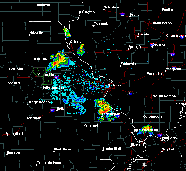 At 832 am cdt, a severe thunderstorm was located over olympian village, moving southeast at 25 mph (radar indicated). Hazards include quarter size hail. Damage to vehicles is expected. locations impacted include, festus, crystal city, herculaneum and olympian village. This includes interstate 55 in missouri between exits 170 and 175. At 832 am cdt, a severe thunderstorm was located over olympian village, moving southeast at 25 mph (radar indicated). Hazards include quarter size hail. Damage to vehicles is expected. locations impacted include, festus, crystal city, herculaneum and olympian village. This includes interstate 55 in missouri between exits 170 and 175.
|
| 6/28/2018 8:03 AM CDT |
 At 803 am cdt, a severe thunderstorm was located over cedar hill lakes, moving southeast at 25 mph (radar indicated). Hazards include quarter size hail. damage to vehicles is expected At 803 am cdt, a severe thunderstorm was located over cedar hill lakes, moving southeast at 25 mph (radar indicated). Hazards include quarter size hail. damage to vehicles is expected
|
| 6/26/2018 5:34 AM CDT |
 At 533 am cdt, a severe thunderstorm was located near olympian village, moving northeast at 25 mph (radar indicated). Hazards include 60 mph wind gusts and quarter size hail. Hail damage to vehicles is expected. Expect wind damage to roofs, siding, and trees. At 533 am cdt, a severe thunderstorm was located near olympian village, moving northeast at 25 mph (radar indicated). Hazards include 60 mph wind gusts and quarter size hail. Hail damage to vehicles is expected. Expect wind damage to roofs, siding, and trees.
|
| 6/14/2018 6:45 PM CDT | Tree limbs down and lawn furniture tosse in jefferson county MO, 8 miles NNW of De Soto, MO |
| 6/14/2018 6:42 PM CDT |
 At 641 pm cdt, severe thunderstorms were located along a line extending from near house springs to horine to near old mines, moving southeast at 30 mph (radar indicated). Hazards include 60 mph wind gusts and quarter size hail. Hail damage to vehicles is expected. Expect wind damage to roofs, siding, and trees. At 641 pm cdt, severe thunderstorms were located along a line extending from near house springs to horine to near old mines, moving southeast at 30 mph (radar indicated). Hazards include 60 mph wind gusts and quarter size hail. Hail damage to vehicles is expected. Expect wind damage to roofs, siding, and trees.
|
| 5/14/2018 7:17 PM CDT |
 At 717 pm cdt, severe thunderstorms were located along a line extending from near mascoutah to 7 miles north of bonne terre, moving southeast at 30 mph (radar indicated). Hazards include 60 mph wind gusts. Expect damage to roofs, siding, and trees. locations impacted include, festus, waterloo, de soto, crystal city, freeburg, red bud, herculaneum, smithton, new athens, marissa, valmeyer, olympian village, new design, st. libory, lenzburg, hecker, fayetteville, maeystown, fults and madonnaville. This includes interstate 55 in missouri between exits 170 and 178. At 717 pm cdt, severe thunderstorms were located along a line extending from near mascoutah to 7 miles north of bonne terre, moving southeast at 30 mph (radar indicated). Hazards include 60 mph wind gusts. Expect damage to roofs, siding, and trees. locations impacted include, festus, waterloo, de soto, crystal city, freeburg, red bud, herculaneum, smithton, new athens, marissa, valmeyer, olympian village, new design, st. libory, lenzburg, hecker, fayetteville, maeystown, fults and madonnaville. This includes interstate 55 in missouri between exits 170 and 178.
|
| 5/14/2018 7:04 PM CDT |
 At 703 pm cdt, severe thunderstorms were located along a line extending from near freeburg to near bonne terre, moving southeast at 30 mph (radar indicated). Hazards include 60 mph wind gusts. Expect damage to roofs, siding, and trees. locations impacted include, belleville, o`fallon, fairview heights, swansea, shiloh, festus, waterloo, columbia, mascoutah, de soto, pevely, crystal city, lebanon, freeburg, millstadt, red bud, herculaneum, new baden, hillsboro and scott afb. this also includes sandy creek covered bridge historic site and gov. dunklin`s grave historic site. this includes the following highways, interstate 64 in illinois between exits 14 and 27. Interstate 55 in missouri between exits 170 and 185. At 703 pm cdt, severe thunderstorms were located along a line extending from near freeburg to near bonne terre, moving southeast at 30 mph (radar indicated). Hazards include 60 mph wind gusts. Expect damage to roofs, siding, and trees. locations impacted include, belleville, o`fallon, fairview heights, swansea, shiloh, festus, waterloo, columbia, mascoutah, de soto, pevely, crystal city, lebanon, freeburg, millstadt, red bud, herculaneum, new baden, hillsboro and scott afb. this also includes sandy creek covered bridge historic site and gov. dunklin`s grave historic site. this includes the following highways, interstate 64 in illinois between exits 14 and 27. Interstate 55 in missouri between exits 170 and 185.
|
| 5/14/2018 7:04 PM CDT |
 A severe thunderstorm warning remains in effect until 730 pm cdt for monroe. st. clair and southern jefferson counties. at 703 pm cdt, severe thunderstorms were located along a line extending from near freeburg to near bonne terre, moving southeast at 30 mph. hazard. 60 mph wind gusts. A severe thunderstorm warning remains in effect until 730 pm cdt for monroe. st. clair and southern jefferson counties. at 703 pm cdt, severe thunderstorms were located along a line extending from near freeburg to near bonne terre, moving southeast at 30 mph. hazard. 60 mph wind gusts.
|
| 5/14/2018 6:29 PM CDT |
 At 629 pm cdt, severe thunderstorms were located along a line extending from near centreville to near richwoods, moving southeast at 30 mph (radar indicated). Hazards include 60 mph wind gusts. expect damage to roofs, siding, and trees At 629 pm cdt, severe thunderstorms were located along a line extending from near centreville to near richwoods, moving southeast at 30 mph (radar indicated). Hazards include 60 mph wind gusts. expect damage to roofs, siding, and trees
|
| 4/13/2018 10:13 PM CDT |
 At 1013 pm cdt, severe thunderstorms were located along a line extending from near marthasville to gray summit to near cedar hill lakes to near de soto to desloge, moving northeast at 50 mph (radar indicated). Hazards include 60 mph wind gusts. Expect damage to roofs, siding, and trees. locations impacted include, st. louis, o`fallon, st. charles, st. peters, florissant, chesterfield, belleville, wildwood, university city, ballwin, granite city, wentzville, kirkwood, maryland heights, east st. louis, hazelwood, webster groves, ferguson, arnold and manchester. this also includes babler memorial state park, scott joplin historic site, route 66 state park, castlewood state park, mastodon historic site, sandy creek covered bridge historic site, gov. dunklin`s grave historic site, first missouri state capitol historic site, and robertsville state park. this includes the following highways, interstate 44 in missouri between exits 251 and 277. interstate 55 in missouri between exits 170 and 191. interstate 70 in missouri between exits 203 and 231. A tornado watch remains in effect until 100 am cdt for southwestern illinois, and southeastern and east central missouri. At 1013 pm cdt, severe thunderstorms were located along a line extending from near marthasville to gray summit to near cedar hill lakes to near de soto to desloge, moving northeast at 50 mph (radar indicated). Hazards include 60 mph wind gusts. Expect damage to roofs, siding, and trees. locations impacted include, st. louis, o`fallon, st. charles, st. peters, florissant, chesterfield, belleville, wildwood, university city, ballwin, granite city, wentzville, kirkwood, maryland heights, east st. louis, hazelwood, webster groves, ferguson, arnold and manchester. this also includes babler memorial state park, scott joplin historic site, route 66 state park, castlewood state park, mastodon historic site, sandy creek covered bridge historic site, gov. dunklin`s grave historic site, first missouri state capitol historic site, and robertsville state park. this includes the following highways, interstate 44 in missouri between exits 251 and 277. interstate 55 in missouri between exits 170 and 191. interstate 70 in missouri between exits 203 and 231. A tornado watch remains in effect until 100 am cdt for southwestern illinois, and southeastern and east central missouri.
|
| 4/13/2018 9:53 PM CDT |
 At 953 pm cdt, severe thunderstorms were located along a line extending from near washington to near lonedell to old mines to near belleview, moving northeast at 50 mph (radar indicated). Hazards include 60 mph wind gusts. expect damage to roofs, siding, and trees At 953 pm cdt, severe thunderstorms were located along a line extending from near washington to near lonedell to old mines to near belleview, moving northeast at 50 mph (radar indicated). Hazards include 60 mph wind gusts. expect damage to roofs, siding, and trees
|
| 11/5/2017 4:30 PM CDT |
 At 330 pm cst, a severe thunderstorm was located over hillsboro, moving east at 40 mph (radar indicated). Hazards include two inch hail and 60 mph wind gusts. People and animals outdoors will be injured. expect hail damage to roofs, siding, windows, and vehicles. expect wind damage to roofs, siding, and trees. locations impacted include, festus, de soto, pevely, crystal city, herculaneum, hillsboro, barnhart, cedar hill lakes, horine, imperial, kimmswick, hematite, victoria, morse mill, oermann, mapaville and grubville. this also includes sandy creek covered bridge historic site and gov. dunklin`s grave historic site. this includes interstate 55 in missouri between exits 170 and 185. A tornado watch remains in effect until 700 pm cst for southwestern illinois, and east central missouri. At 330 pm cst, a severe thunderstorm was located over hillsboro, moving east at 40 mph (radar indicated). Hazards include two inch hail and 60 mph wind gusts. People and animals outdoors will be injured. expect hail damage to roofs, siding, windows, and vehicles. expect wind damage to roofs, siding, and trees. locations impacted include, festus, de soto, pevely, crystal city, herculaneum, hillsboro, barnhart, cedar hill lakes, horine, imperial, kimmswick, hematite, victoria, morse mill, oermann, mapaville and grubville. this also includes sandy creek covered bridge historic site and gov. dunklin`s grave historic site. this includes interstate 55 in missouri between exits 170 and 185. A tornado watch remains in effect until 700 pm cst for southwestern illinois, and east central missouri.
|
| 11/5/2017 4:22 PM CDT |
 At 322 pm cst, a severe thunderstorm was located near hillsboro, moving east at 40 mph (radar indicated). Hazards include golf ball size hail and 60 mph wind gusts. People and animals outdoors will be injured. expect hail damage to roofs, siding, windows, and vehicles. expect wind damage to roofs, siding, and trees. locations impacted include, festus, de soto, pevely, crystal city, herculaneum, hillsboro, barnhart, cedar hill lakes, horine, imperial, kimmswick, hematite, victoria, morse mill, oermann, mapaville and grubville. this also includes sandy creek covered bridge historic site and gov. dunklin`s grave historic site. this includes interstate 55 in missouri between exits 170 and 185. A tornado watch remains in effect until 700 pm cst for southwestern illinois, and east central missouri. At 322 pm cst, a severe thunderstorm was located near hillsboro, moving east at 40 mph (radar indicated). Hazards include golf ball size hail and 60 mph wind gusts. People and animals outdoors will be injured. expect hail damage to roofs, siding, windows, and vehicles. expect wind damage to roofs, siding, and trees. locations impacted include, festus, de soto, pevely, crystal city, herculaneum, hillsboro, barnhart, cedar hill lakes, horine, imperial, kimmswick, hematite, victoria, morse mill, oermann, mapaville and grubville. this also includes sandy creek covered bridge historic site and gov. dunklin`s grave historic site. this includes interstate 55 in missouri between exits 170 and 185. A tornado watch remains in effect until 700 pm cst for southwestern illinois, and east central missouri.
|
| 11/5/2017 4:14 PM CDT |
 At 314 pm cst, a severe thunderstorm was located near richwoods, moving east at 40 mph (radar indicated). Hazards include 60 mph wind gusts and quarter size hail. Hail damage to vehicles is expected. Expect wind damage to roofs, siding, and trees. At 314 pm cst, a severe thunderstorm was located near richwoods, moving east at 40 mph (radar indicated). Hazards include 60 mph wind gusts and quarter size hail. Hail damage to vehicles is expected. Expect wind damage to roofs, siding, and trees.
|
| 10/10/2017 2:41 PM CDT |
 At 241 pm cdt, a severe thunderstorm was located over de soto, moving northeast at 40 mph (radar indicated). Hazards include 60 mph wind gusts and quarter size hail. Hail damage to vehicles is expected. Expect wind damage to roofs, siding, and trees. At 241 pm cdt, a severe thunderstorm was located over de soto, moving northeast at 40 mph (radar indicated). Hazards include 60 mph wind gusts and quarter size hail. Hail damage to vehicles is expected. Expect wind damage to roofs, siding, and trees.
|
| 5/19/2017 5:02 AM CDT |
 At 502 am cdt, severe thunderstorms were located along a line extending from near st. paul to 9 miles southeast of crystal city, moving east at 55 mph (radar indicated). Hazards include 70 mph wind gusts. Expect considerable tree damage. damage is likely to mobile homes, roofs, and outbuildings. locations impacted include, st. louis, o`fallon, st. charles, st. peters, florissant, chesterfield, wildwood, university city, ballwin, wentzville, kirkwood, maryland heights, hazelwood, webster groves, ferguson, arnold, manchester, creve coeur, overland and clayton. this also includes babler memorial state park, scott joplin historic site, route 66 state park, castlewood state park, confluence state park, mastodon historic site, sandy creek covered bridge historic site, gov. dunklin`s grave historic site, first missouri state capitol historic site, and robertsville state park. this includes the following highways, interstate 44 in missouri between exits 251 and 277. interstate 55 in missouri between exits 170 and 191. Interstate 70 in missouri between exits 203 and 231. At 502 am cdt, severe thunderstorms were located along a line extending from near st. paul to 9 miles southeast of crystal city, moving east at 55 mph (radar indicated). Hazards include 70 mph wind gusts. Expect considerable tree damage. damage is likely to mobile homes, roofs, and outbuildings. locations impacted include, st. louis, o`fallon, st. charles, st. peters, florissant, chesterfield, wildwood, university city, ballwin, wentzville, kirkwood, maryland heights, hazelwood, webster groves, ferguson, arnold, manchester, creve coeur, overland and clayton. this also includes babler memorial state park, scott joplin historic site, route 66 state park, castlewood state park, confluence state park, mastodon historic site, sandy creek covered bridge historic site, gov. dunklin`s grave historic site, first missouri state capitol historic site, and robertsville state park. this includes the following highways, interstate 44 in missouri between exits 251 and 277. interstate 55 in missouri between exits 170 and 191. Interstate 70 in missouri between exits 203 and 231.
|
| 5/19/2017 4:39 AM CDT |
 At 439 am cdt, severe thunderstorms were located along a line extending from near truesdale to near de soto, moving east at 55 mph (radar indicated). Hazards include 70 mph wind gusts. Expect considerable tree damage. Damage is likely to mobile homes, roofs, and outbuildings. At 439 am cdt, severe thunderstorms were located along a line extending from near truesdale to near de soto, moving east at 55 mph (radar indicated). Hazards include 70 mph wind gusts. Expect considerable tree damage. Damage is likely to mobile homes, roofs, and outbuildings.
|
| 4/5/2017 12:30 AM CDT |
 At 1230 am cdt, severe thunderstorms were located along a line extending from near eureka to near hillsboro to 8 miles northeast of bonne terre, moving northeast at 45 mph (radar indicated). Hazards include 60 mph wind gusts and nickel size hail. Expect damage to roofs, siding, and trees. locations impacted include, st. louis, chesterfield, wildwood, university city, ballwin, kirkwood, east st. louis, webster groves, arnold, manchester, creve coeur, overland, clayton, cahokia, jennings, crestwood, festus, bellefontaine neighbors, town and country and eureka. this also includes scott joplin historic site, route 66 state park, castlewood state park, mastodon historic site, sandy creek covered bridge historic site, and gov. dunklin`s grave historic site. this includes the following highways, interstate 44 in missouri between exits 261 and 277. Interstate 55 in missouri between exits 154 and 191. At 1230 am cdt, severe thunderstorms were located along a line extending from near eureka to near hillsboro to 8 miles northeast of bonne terre, moving northeast at 45 mph (radar indicated). Hazards include 60 mph wind gusts and nickel size hail. Expect damage to roofs, siding, and trees. locations impacted include, st. louis, chesterfield, wildwood, university city, ballwin, kirkwood, east st. louis, webster groves, arnold, manchester, creve coeur, overland, clayton, cahokia, jennings, crestwood, festus, bellefontaine neighbors, town and country and eureka. this also includes scott joplin historic site, route 66 state park, castlewood state park, mastodon historic site, sandy creek covered bridge historic site, and gov. dunklin`s grave historic site. this includes the following highways, interstate 44 in missouri between exits 261 and 277. Interstate 55 in missouri between exits 154 and 191.
|
| 4/5/2017 12:20 AM CDT |
 At 1220 am cdt, severe thunderstorms were located along a line extending from near pacific to near hillsboro to near bonne terre, moving northeast at 45 mph (radar indicated). Hazards include 60 mph wind gusts and nickel size hail. expect damage to roofs, siding, and trees At 1220 am cdt, severe thunderstorms were located along a line extending from near pacific to near hillsboro to near bonne terre, moving northeast at 45 mph (radar indicated). Hazards include 60 mph wind gusts and nickel size hail. expect damage to roofs, siding, and trees
|
| 3/7/2017 12:34 AM CST |
 At 1233 am cst, a severe thunderstorm capable of producing a tornado was located over dittmer, moving east at 40 mph (radar indicated rotation). Hazards include tornado. Flying debris will be dangerous to those caught without shelter. mobile homes will be damaged or destroyed. damage to roofs, windows, and vehicles will occur. Tree damage is likely. At 1233 am cst, a severe thunderstorm capable of producing a tornado was located over dittmer, moving east at 40 mph (radar indicated rotation). Hazards include tornado. Flying debris will be dangerous to those caught without shelter. mobile homes will be damaged or destroyed. damage to roofs, windows, and vehicles will occur. Tree damage is likely.
|
| 2/28/2017 5:16 PM CST |
 At 515 pm cst, a severe thunderstorm was located 7 miles west of old mines, moving northeast at 45 mph (radar indicated). Hazards include 60 mph wind gusts and quarter size hail. Hail damage to vehicles is expected. Expect wind damage to roofs, siding, and trees. At 515 pm cst, a severe thunderstorm was located 7 miles west of old mines, moving northeast at 45 mph (radar indicated). Hazards include 60 mph wind gusts and quarter size hail. Hail damage to vehicles is expected. Expect wind damage to roofs, siding, and trees.
|
| 2/28/2017 5:12 PM CST |
 The severe thunderstorm warning for jefferson county will expire at 515 pm cst, the storm which prompted the warning has moved out of the area. therefore the warning will be allowed to expire. a tornado watch remains in effect until 900 pm cst for southwestern illinois, and southeastern and east central missouri. remember, a severe thunderstorm warning still remains in effect for portions of jefferson county until 600 pm cst. The severe thunderstorm warning for jefferson county will expire at 515 pm cst, the storm which prompted the warning has moved out of the area. therefore the warning will be allowed to expire. a tornado watch remains in effect until 900 pm cst for southwestern illinois, and southeastern and east central missouri. remember, a severe thunderstorm warning still remains in effect for portions of jefferson county until 600 pm cst.
|
| 2/28/2017 4:59 PM CST |
 At 459 pm cst, a severe thunderstorm was located near hillsboro, moving northeast at 85 mph (radar indicated). Hazards include golf ball size hail and 60 mph wind gusts. People and animals outdoors will be injured. expect hail damage to roofs, siding, windows, and vehicles. expect wind damage to roofs, siding, and trees. locations impacted include, festus, de soto, pevely, crystal city, herculaneum, hillsboro, byrnes mill, high ridge, barnhart, cedar hill, murphy, antonia, olympian village, cedar hill lakes, house springs, dittmer, horine, imperial, scotsdale and parkdale. this also includes mastodon historic site, sandy creek covered bridge historic site, and gov. dunklin`s grave historic site. this includes interstate 55 in missouri between exits 174 and 187. A tornado watch remains in effect until 900 pm cst for southwestern illinois, and southeastern and east central missouri. At 459 pm cst, a severe thunderstorm was located near hillsboro, moving northeast at 85 mph (radar indicated). Hazards include golf ball size hail and 60 mph wind gusts. People and animals outdoors will be injured. expect hail damage to roofs, siding, windows, and vehicles. expect wind damage to roofs, siding, and trees. locations impacted include, festus, de soto, pevely, crystal city, herculaneum, hillsboro, byrnes mill, high ridge, barnhart, cedar hill, murphy, antonia, olympian village, cedar hill lakes, house springs, dittmer, horine, imperial, scotsdale and parkdale. this also includes mastodon historic site, sandy creek covered bridge historic site, and gov. dunklin`s grave historic site. this includes interstate 55 in missouri between exits 174 and 187. A tornado watch remains in effect until 900 pm cst for southwestern illinois, and southeastern and east central missouri.
|
| 2/28/2017 4:41 PM CST |
 At 440 pm cst, a severe thunderstorm was located near richwoods, moving northeast at 70 mph (radar indicated). Hazards include golf ball size hail and 60 mph wind gusts. People and animals outdoors will be injured. expect hail damage to roofs, siding, windows, and vehicles. Expect wind damage to roofs, siding, and trees. At 440 pm cst, a severe thunderstorm was located near richwoods, moving northeast at 70 mph (radar indicated). Hazards include golf ball size hail and 60 mph wind gusts. People and animals outdoors will be injured. expect hail damage to roofs, siding, windows, and vehicles. Expect wind damage to roofs, siding, and trees.
|
| 2/28/2017 4:22 PM CST |
 The severe thunderstorm warning for southeastern jefferson, northwestern ste. genevieve and northwestern st. francois counties will expire at 430 pm cst, the storm which prompted the warning has moved out of the area. therefore the warning will be allowed to expire. a tornado watch remains in effect until 900 pm cst for southwestern illinois, and southeastern and east central missouri. remember, a severe thunderstorm warning still remains in effect for portions of ste. genevieve county until 445 pm cst. The severe thunderstorm warning for southeastern jefferson, northwestern ste. genevieve and northwestern st. francois counties will expire at 430 pm cst, the storm which prompted the warning has moved out of the area. therefore the warning will be allowed to expire. a tornado watch remains in effect until 900 pm cst for southwestern illinois, and southeastern and east central missouri. remember, a severe thunderstorm warning still remains in effect for portions of ste. genevieve county until 445 pm cst.
|
| 2/28/2017 3:58 PM CST |
 At 357 pm cst, a severe thunderstorm was located near olympian village, moving east at 40 mph (trained weather spotters). Hazards include golf ball size hail and 60 mph wind gusts. People and animals outdoors will be injured. expect hail damage to roofs, siding, windows, and vehicles. expect wind damage to roofs, siding, and trees. locations impacted include, festus, bonne terre, de soto, crystal city, olympian village, bloomsdale, rocky ridge, valles mill and french village. this also includes st. francois state park. this includes interstate 55 in missouri between exits 154 and 174. A tornado watch remains in effect until 900 pm cst for southwestern illinois, and southeastern and east central missouri. At 357 pm cst, a severe thunderstorm was located near olympian village, moving east at 40 mph (trained weather spotters). Hazards include golf ball size hail and 60 mph wind gusts. People and animals outdoors will be injured. expect hail damage to roofs, siding, windows, and vehicles. expect wind damage to roofs, siding, and trees. locations impacted include, festus, bonne terre, de soto, crystal city, olympian village, bloomsdale, rocky ridge, valles mill and french village. this also includes st. francois state park. this includes interstate 55 in missouri between exits 154 and 174. A tornado watch remains in effect until 900 pm cst for southwestern illinois, and southeastern and east central missouri.
|
| 2/28/2017 3:55 PM CST | Quarter sized hail reported 7.8 miles NNW of De Soto, MO, public report relayed via the media from valles mines |
| 2/28/2017 3:47 PM CST |
 At 346 pm cst, a severe thunderstorm was located 7 miles northeast of mineral point, moving east at 40 mph (trained weather spotters. golf ball hail was recently reported near cadet). Hazards include golf ball size hail and 60 mph wind gusts. People and animals outdoors will be injured. expect hail damage to roofs, siding, windows, and vehicles. expect wind damage to roofs, siding, and trees. locations impacted include, festus, bonne terre, de soto, crystal city, olympian village, bloomsdale, rocky ridge, blackwell, cadet, valles mill and french village. this also includes washington state park and st. francois state park. this includes interstate 55 in missouri between exits 154 and 174. A tornado watch remains in effect until 900 pm cst for southwestern illinois, and southeastern and east central missouri. At 346 pm cst, a severe thunderstorm was located 7 miles northeast of mineral point, moving east at 40 mph (trained weather spotters. golf ball hail was recently reported near cadet). Hazards include golf ball size hail and 60 mph wind gusts. People and animals outdoors will be injured. expect hail damage to roofs, siding, windows, and vehicles. expect wind damage to roofs, siding, and trees. locations impacted include, festus, bonne terre, de soto, crystal city, olympian village, bloomsdale, rocky ridge, blackwell, cadet, valles mill and french village. this also includes washington state park and st. francois state park. this includes interstate 55 in missouri between exits 154 and 174. A tornado watch remains in effect until 900 pm cst for southwestern illinois, and southeastern and east central missouri.
|
| 2/28/2017 3:38 PM CST |
 At 337 pm cst, a severe thunderstorm was located over old mines, moving east at 40 mph (radar indicated). Hazards include 60 mph wind gusts and quarter size hail. Hail damage to vehicles is expected. Expect wind damage to roofs, siding, and trees. At 337 pm cst, a severe thunderstorm was located over old mines, moving east at 40 mph (radar indicated). Hazards include 60 mph wind gusts and quarter size hail. Hail damage to vehicles is expected. Expect wind damage to roofs, siding, and trees.
|
| 7/13/2016 4:00 PM CDT | Three reports of trees on structures in jefferson county MO, 0.2 miles NNE of De Soto, MO |
| 7/13/2016 3:39 PM CDT |
 At 338 pm cdt, severe thunderstorms were located along a line extending from near new berlin to crystal city, moving east at 60 mph (trained weather spotters. numerous reports of wind damage and measured winds of 60 to 70 mph. one gust to 72 mph). Hazards include 70 mph wind gusts. Expect considerable tree damage. damage is likely to mobile homes, roofs, and outbuildings. locations impacted include, st. louis, o`fallon, st. charles, st. peters, florissant, belleville, wildwood, university city, ballwin, granite city, alton, kirkwood, maryland heights, east st. louis, hazelwood, collinsville, edwardsville, webster groves, ferguson and arnold. this also includes babler memorial state park, scott joplin historic site, route 66 state park, castlewood state park, confluence state park, mastodon historic site, sandy creek covered bridge historic site, gov. dunklin`s grave historic site, first missouri state capitol historic site, pere marquette state park, beaver dam state park, and horseshoe lake state park. this includes the following highways, interstate 64 in illinois between exits 9 and 12. interstate 44 in missouri between exits 261 and 277. interstate 55 in missouri between exits 174 and 191. Interstate 70 in missouri between exits 220 and 231. At 338 pm cdt, severe thunderstorms were located along a line extending from near new berlin to crystal city, moving east at 60 mph (trained weather spotters. numerous reports of wind damage and measured winds of 60 to 70 mph. one gust to 72 mph). Hazards include 70 mph wind gusts. Expect considerable tree damage. damage is likely to mobile homes, roofs, and outbuildings. locations impacted include, st. louis, o`fallon, st. charles, st. peters, florissant, belleville, wildwood, university city, ballwin, granite city, alton, kirkwood, maryland heights, east st. louis, hazelwood, collinsville, edwardsville, webster groves, ferguson and arnold. this also includes babler memorial state park, scott joplin historic site, route 66 state park, castlewood state park, confluence state park, mastodon historic site, sandy creek covered bridge historic site, gov. dunklin`s grave historic site, first missouri state capitol historic site, pere marquette state park, beaver dam state park, and horseshoe lake state park. this includes the following highways, interstate 64 in illinois between exits 9 and 12. interstate 44 in missouri between exits 261 and 277. interstate 55 in missouri between exits 174 and 191. Interstate 70 in missouri between exits 220 and 231.
|
| 7/13/2016 3:25 PM CDT | 6 tree limbs down in jefferson county MO, 0.2 miles NNE of De Soto, MO |
| 7/13/2016 3:15 PM CDT |
 At 314 pm cdt, severe thunderstorms were located along a line extending from near chapin to near richwoods, moving east at 55 mph (trained weather spotters. numeruus reports of trees down and winds in excess of 60 mph). Hazards include 70 mph wind gusts. Expect considerable tree damage. damage is likely to mobile homes, roofs, and outbuildings. locations impacted include, st. louis, o`fallon, st. charles, st. peters, florissant, belleville, wildwood, university city, ballwin, granite city, wentzville, alton, kirkwood, maryland heights, east st. louis, hazelwood, collinsville, edwardsville, webster groves and ferguson. this also includes babler memorial state park, scott joplin historic site, route 66 state park, castlewood state park, confluence state park, mastodon historic site, sandy creek covered bridge historic site, gov. dunklin`s grave historic site, first missouri state capitol historic site, robertsville state park, meramec state park, pere marquette state park, beaver dam state park, and horseshoe lake state park. this includes the following highways, interstate 64 in illinois between exits 9 and 12. interstate 44 in missouri between exits 230 and 277. interstate 55 in missouri between exits 174 and 191. Interstate 70 in missouri between exits 208 and 231. At 314 pm cdt, severe thunderstorms were located along a line extending from near chapin to near richwoods, moving east at 55 mph (trained weather spotters. numeruus reports of trees down and winds in excess of 60 mph). Hazards include 70 mph wind gusts. Expect considerable tree damage. damage is likely to mobile homes, roofs, and outbuildings. locations impacted include, st. louis, o`fallon, st. charles, st. peters, florissant, belleville, wildwood, university city, ballwin, granite city, wentzville, alton, kirkwood, maryland heights, east st. louis, hazelwood, collinsville, edwardsville, webster groves and ferguson. this also includes babler memorial state park, scott joplin historic site, route 66 state park, castlewood state park, confluence state park, mastodon historic site, sandy creek covered bridge historic site, gov. dunklin`s grave historic site, first missouri state capitol historic site, robertsville state park, meramec state park, pere marquette state park, beaver dam state park, and horseshoe lake state park. this includes the following highways, interstate 64 in illinois between exits 9 and 12. interstate 44 in missouri between exits 230 and 277. interstate 55 in missouri between exits 174 and 191. Interstate 70 in missouri between exits 208 and 231.
|
| 7/13/2016 3:13 PM CDT |
 At 312 pm cdt, a severe thunderstorm was located 9 miles southwest of potosi, moving east at 35 mph (trained weather spotters). Hazards include 60 mph wind gusts. wind damage reported in crawford county. Expect damage to roofs. siding. And trees. At 312 pm cdt, a severe thunderstorm was located 9 miles southwest of potosi, moving east at 35 mph (trained weather spotters). Hazards include 60 mph wind gusts. wind damage reported in crawford county. Expect damage to roofs. siding. And trees.
|
| 7/13/2016 2:58 PM CDT |
 At 258 pm cdt, severe thunderstorms were located along a line extending from naples to near miramiguoa park, moving east at 55 mph (trained weather spotters). Hazards include 70 mph wind gusts. Expect considerable tree damage. Damage is likely to mobile homes, roofs, and outbuildings. At 258 pm cdt, severe thunderstorms were located along a line extending from naples to near miramiguoa park, moving east at 55 mph (trained weather spotters). Hazards include 70 mph wind gusts. Expect considerable tree damage. Damage is likely to mobile homes, roofs, and outbuildings.
|
| 7/13/2016 2:38 PM CDT |
 At 237 pm cdt, severe thunderstorms were located along a line extending from near barry to troy to 8 miles northwest of bourbon, moving east at 40 mph (trained weather spotters). Hazards include 70 mph wind gusts and penny size hail. Expect considerable tree damage. damage is likely to mobile homes, roofs, and outbuildings. locations impacted include, st. louis, o`fallon, st. charles, st. peters, florissant, chesterfield, wildwood, university city, ballwin, granite city, wentzville, alton, kirkwood, maryland heights, east st. louis, hazelwood, webster groves, ferguson, arnold and manchester. this also includes babler memorial state park, scott joplin historic site, route 66 state park, cuivre river state park, castlewood state park, mastodon historic site, sandy creek covered bridge historic site, gov. dunklin`s grave historic site, first missouri state capitol historic site, robertsville state park, meramec state park, and pere marquette state park. this includes the following highways, interstate 72 between exits 20 and 35. interstate 44 in missouri between exits 225 and 277. interstate 55 in missouri between exits 170 and 191. Interstate 70 in missouri between exits 188 and 231. At 237 pm cdt, severe thunderstorms were located along a line extending from near barry to troy to 8 miles northwest of bourbon, moving east at 40 mph (trained weather spotters). Hazards include 70 mph wind gusts and penny size hail. Expect considerable tree damage. damage is likely to mobile homes, roofs, and outbuildings. locations impacted include, st. louis, o`fallon, st. charles, st. peters, florissant, chesterfield, wildwood, university city, ballwin, granite city, wentzville, alton, kirkwood, maryland heights, east st. louis, hazelwood, webster groves, ferguson, arnold and manchester. this also includes babler memorial state park, scott joplin historic site, route 66 state park, cuivre river state park, castlewood state park, mastodon historic site, sandy creek covered bridge historic site, gov. dunklin`s grave historic site, first missouri state capitol historic site, robertsville state park, meramec state park, and pere marquette state park. this includes the following highways, interstate 72 between exits 20 and 35. interstate 44 in missouri between exits 225 and 277. interstate 55 in missouri between exits 170 and 191. Interstate 70 in missouri between exits 188 and 231.
|
| 7/13/2016 2:06 PM CDT |
 At 206 pm cdt, severe thunderstorms were located along a line extending from near hannibal to bellflower to near belle, moving east at 50 mph (trained weather spotters). Hazards include 70 mph wind gusts and penny size hail. Expect considerable tree damage. Damage is likely to mobile homes, roofs, and outbuildings. At 206 pm cdt, severe thunderstorms were located along a line extending from near hannibal to bellflower to near belle, moving east at 50 mph (trained weather spotters). Hazards include 70 mph wind gusts and penny size hail. Expect considerable tree damage. Damage is likely to mobile homes, roofs, and outbuildings.
|
| 7/7/2016 8:54 AM CDT |
 At 853 am cdt, severe thunderstorms were located along a line extending from 6 miles west of alsey to st. peters to near anthonies mill, moving east at 50 mph (radar indicated). Hazards include 60 mph wind gusts. Expect damage to roofs. siding. and trees. locations impacted include, o`fallon, st. charles, st. peters, florissant, chesterfield, wildwood, university city, ballwin, wentzville, kirkwood, maryland heights, hazelwood, webster groves, ferguson, arnold, manchester, godfrey, creve coeur, overland and clayton. this also includes babler memorial state park, washington state park, route 66 state park, onondaga cave state park, cuivre river state park, castlewood state park, mastodon historic site, sandy creek covered bridge historic site, first missouri state capitol historic site, robertsville state park, meramec state park, and pere marquette state park. this includes the following highways, interstate 44 in missouri between exits 203 and 277. interstate 55 in missouri between exits 175 and 191. Interstate 70 in missouri between exits 203 and 231. At 853 am cdt, severe thunderstorms were located along a line extending from 6 miles west of alsey to st. peters to near anthonies mill, moving east at 50 mph (radar indicated). Hazards include 60 mph wind gusts. Expect damage to roofs. siding. and trees. locations impacted include, o`fallon, st. charles, st. peters, florissant, chesterfield, wildwood, university city, ballwin, wentzville, kirkwood, maryland heights, hazelwood, webster groves, ferguson, arnold, manchester, godfrey, creve coeur, overland and clayton. this also includes babler memorial state park, washington state park, route 66 state park, onondaga cave state park, cuivre river state park, castlewood state park, mastodon historic site, sandy creek covered bridge historic site, first missouri state capitol historic site, robertsville state park, meramec state park, and pere marquette state park. this includes the following highways, interstate 44 in missouri between exits 203 and 277. interstate 55 in missouri between exits 175 and 191. Interstate 70 in missouri between exits 203 and 231.
|
| 7/7/2016 8:36 AM CDT |
 At 835 am cdt, severe thunderstorms were located along a line extending from near pittsfield to wentzville to cuba, moving east at 30 mph (radar indicated). Hazards include 60 mph wind gusts. Expect damage to roofs. siding. and trees. locations impacted include, o`fallon, st. charles, st. peters, florissant, chesterfield, wildwood, university city, ballwin, wentzville, kirkwood, maryland heights, hazelwood, webster groves, ferguson, arnold, manchester, godfrey, creve coeur, overland and clayton. this also includes babler memorial state park, washington state park, route 66 state park, onondaga cave state park, cuivre river state park, castlewood state park, mastodon historic site, sandy creek covered bridge historic site, first missouri state capitol historic site, robertsville state park, meramec state park, and pere marquette state park. this includes the following highways, interstate 44 in missouri between exits 203 and 277. interstate 55 in missouri between exits 175 and 191. Interstate 70 in missouri between exits 188 and 231. At 835 am cdt, severe thunderstorms were located along a line extending from near pittsfield to wentzville to cuba, moving east at 30 mph (radar indicated). Hazards include 60 mph wind gusts. Expect damage to roofs. siding. and trees. locations impacted include, o`fallon, st. charles, st. peters, florissant, chesterfield, wildwood, university city, ballwin, wentzville, kirkwood, maryland heights, hazelwood, webster groves, ferguson, arnold, manchester, godfrey, creve coeur, overland and clayton. this also includes babler memorial state park, washington state park, route 66 state park, onondaga cave state park, cuivre river state park, castlewood state park, mastodon historic site, sandy creek covered bridge historic site, first missouri state capitol historic site, robertsville state park, meramec state park, and pere marquette state park. this includes the following highways, interstate 44 in missouri between exits 203 and 277. interstate 55 in missouri between exits 175 and 191. Interstate 70 in missouri between exits 188 and 231.
|
| 7/7/2016 8:11 AM CDT |
 At 811 am cdt, severe thunderstorms were located along a line extending from 6 miles southwest of barry to warrenton to 8 miles southeast of owensville, moving east at 40 mph (radar indicated). Hazards include 70 mph wind gusts. Expect considerable tree damage. damage is likely to mobile homes, roofs, and outbuildings. locations impacted include, o`fallon, st. charles, st. peters, florissant, chesterfield, wildwood, university city, ballwin, wentzville, kirkwood, maryland heights, hazelwood, webster groves, ferguson, arnold, manchester, godfrey, creve coeur, overland and clayton. this also includes babler memorial state park, washington state park, route 66 state park, onondaga cave state park, deutschheim historic site, cuivre river state park, castlewood state park, mastodon historic site, sandy creek covered bridge historic site, first missouri state capitol historic site, robertsville state park, meramec state park, and pere marquette state park. this includes the following highways, interstate 44 in missouri between exits 203 and 277. interstate 55 in missouri between exits 175 and 191. Interstate 70 in missouri between exits 175 and 231. At 811 am cdt, severe thunderstorms were located along a line extending from 6 miles southwest of barry to warrenton to 8 miles southeast of owensville, moving east at 40 mph (radar indicated). Hazards include 70 mph wind gusts. Expect considerable tree damage. damage is likely to mobile homes, roofs, and outbuildings. locations impacted include, o`fallon, st. charles, st. peters, florissant, chesterfield, wildwood, university city, ballwin, wentzville, kirkwood, maryland heights, hazelwood, webster groves, ferguson, arnold, manchester, godfrey, creve coeur, overland and clayton. this also includes babler memorial state park, washington state park, route 66 state park, onondaga cave state park, deutschheim historic site, cuivre river state park, castlewood state park, mastodon historic site, sandy creek covered bridge historic site, first missouri state capitol historic site, robertsville state park, meramec state park, and pere marquette state park. this includes the following highways, interstate 44 in missouri between exits 203 and 277. interstate 55 in missouri between exits 175 and 191. Interstate 70 in missouri between exits 175 and 231.
|
| 7/7/2016 7:59 AM CDT |
 At 758 am cdt, severe thunderstorms were located along a line extending from 9 miles southeast of hannibal to jonesburg to near bland, moving east at 65 mph (radar indicated). Hazards include 70 mph wind gusts. Expect considerable tree damage. Damage is likely to mobile homes, roofs, and outbuildings. At 758 am cdt, severe thunderstorms were located along a line extending from 9 miles southeast of hannibal to jonesburg to near bland, moving east at 65 mph (radar indicated). Hazards include 70 mph wind gusts. Expect considerable tree damage. Damage is likely to mobile homes, roofs, and outbuildings.
|
| 5/28/2016 9:25 PM CDT |
 At 925 pm cdt, a severe thunderstorm was located near richwoods, moving east at 25 mph (radar indicated). Hazards include ping pong ball size hail and 60 mph wind gusts. People and animals outdoors will be injured. expect hail damage to roofs, siding, windows, and vehicles. expect wind damage to roofs, siding, and trees. Locations impacted include, de soto, cedar hill, cedar hill lakes, lonedell, richwoods, dittmer, morse mill, piney park, fletcher, grubville and oermann. At 925 pm cdt, a severe thunderstorm was located near richwoods, moving east at 25 mph (radar indicated). Hazards include ping pong ball size hail and 60 mph wind gusts. People and animals outdoors will be injured. expect hail damage to roofs, siding, windows, and vehicles. expect wind damage to roofs, siding, and trees. Locations impacted include, de soto, cedar hill, cedar hill lakes, lonedell, richwoods, dittmer, morse mill, piney park, fletcher, grubville and oermann.
|
| 5/28/2016 9:06 PM CDT |
 At 906 pm cdt, a severe thunderstorm was located near miramiguoa park, moving east at 20 mph (radar indicated). Hazards include ping pong ball size hail and 60 mph wind gusts. People and animals outdoors will be injured. expect hail damage to roofs, siding, windows, and vehicles. Expect wind damage to roofs, siding, and trees. At 906 pm cdt, a severe thunderstorm was located near miramiguoa park, moving east at 20 mph (radar indicated). Hazards include ping pong ball size hail and 60 mph wind gusts. People and animals outdoors will be injured. expect hail damage to roofs, siding, windows, and vehicles. Expect wind damage to roofs, siding, and trees.
|
| 5/11/2016 9:29 PM CDT |
 At 929 pm cdt, severe thunderstorms were located along a line extending from near red bud to 10 miles south of anthonies mill, moving east at 35 mph (radar indicated). Hazards include 60 mph wind gusts and quarter size hail. Hail damage to vehicles is expected. Expect wind damage to roofs, siding, and trees. At 929 pm cdt, severe thunderstorms were located along a line extending from near red bud to 10 miles south of anthonies mill, moving east at 35 mph (radar indicated). Hazards include 60 mph wind gusts and quarter size hail. Hail damage to vehicles is expected. Expect wind damage to roofs, siding, and trees.
|
| 5/11/2016 7:57 PM CDT |
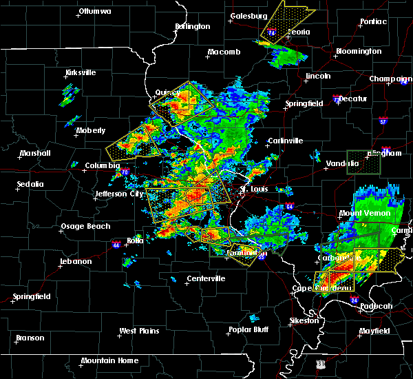 At 756 pm cdt, a severe thunderstorm was located near old mines, moving east at 25 mph (trained weather spotters have reported hail to the size of at least 1 inch with this storm. in addition, persistent rotation has been seen). Hazards include ping pong ball size hail and 60 mph wind gusts. People and animals outdoors will be injured. expect hail damage to roofs, siding, windows, and vehicles. Expect wind damage to roofs, siding, and trees. At 756 pm cdt, a severe thunderstorm was located near old mines, moving east at 25 mph (trained weather spotters have reported hail to the size of at least 1 inch with this storm. in addition, persistent rotation has been seen). Hazards include ping pong ball size hail and 60 mph wind gusts. People and animals outdoors will be injured. expect hail damage to roofs, siding, windows, and vehicles. Expect wind damage to roofs, siding, and trees.
|
| 5/11/2016 3:38 PM CDT |
 At 337 pm cdt, a severe thunderstorm was located over red bud, moving east at 15 mph (trained weather spotters reported two inch hail at red bud. larger hail is likely with this storm). Hazards include tennis ball size hail and 60 mph wind gusts. People and animals outdoors will be injured. expect hail damage to roofs, siding, windows, and vehicles. expect wind damage to roofs, siding, and trees. locations impacted include, festus, de soto, crystal city, sparta, red bud, new athens, marissa, olympian village, evansville, bloomsdale, baldwin, new design, preston, blair, prairie du rocher, prairie, lenzburg, ellis grove, ruma and houston. This includes interstate 55 in missouri between exits 157 and 175. At 337 pm cdt, a severe thunderstorm was located over red bud, moving east at 15 mph (trained weather spotters reported two inch hail at red bud. larger hail is likely with this storm). Hazards include tennis ball size hail and 60 mph wind gusts. People and animals outdoors will be injured. expect hail damage to roofs, siding, windows, and vehicles. expect wind damage to roofs, siding, and trees. locations impacted include, festus, de soto, crystal city, sparta, red bud, new athens, marissa, olympian village, evansville, bloomsdale, baldwin, new design, preston, blair, prairie du rocher, prairie, lenzburg, ellis grove, ruma and houston. This includes interstate 55 in missouri between exits 157 and 175.
|
| 5/11/2016 3:15 PM CDT |
 At 315 pm cdt, a severe thunderstorm was located near olympian village, moving east at 65 mph (radar indicated). Hazards include 60 mph wind gusts and quarter size hail. Hail damage to vehicles is expected. Expect wind damage to roofs, siding, and trees. At 315 pm cdt, a severe thunderstorm was located near olympian village, moving east at 65 mph (radar indicated). Hazards include 60 mph wind gusts and quarter size hail. Hail damage to vehicles is expected. Expect wind damage to roofs, siding, and trees.
|
| 5/11/2016 12:41 PM CDT |
 At 1241 pm cdt, a severe thunderstorm was located near lonedell, moving east at 30 mph (radar indicated). Hazards include 60 mph wind gusts and quarter size hail. Hail damage to vehicles is expected. expect wind damage to roofs, siding, and trees. locations impacted include, festus, de soto, pevely, hillsboro, cedar hill, antonia, barnhart, olympian village, cedar hill lakes, lonedell, horine, dittmer, richwoods, scotsdale, victoria, grubville, mapaville, hematite, morse mill and piney park. This also includes sandy creek covered bridge historic site. At 1241 pm cdt, a severe thunderstorm was located near lonedell, moving east at 30 mph (radar indicated). Hazards include 60 mph wind gusts and quarter size hail. Hail damage to vehicles is expected. expect wind damage to roofs, siding, and trees. locations impacted include, festus, de soto, pevely, hillsboro, cedar hill, antonia, barnhart, olympian village, cedar hill lakes, lonedell, horine, dittmer, richwoods, scotsdale, victoria, grubville, mapaville, hematite, morse mill and piney park. This also includes sandy creek covered bridge historic site.
|
| 5/11/2016 12:29 PM CDT |
 At 1228 pm cdt, a severe thunderstorm was located near miramiguoa park, moving east at 30 mph (radar indicated). Hazards include 60 mph wind gusts and quarter size hail. Hail damage to vehicles is expected. Expect wind damage to roofs, siding, and trees. At 1228 pm cdt, a severe thunderstorm was located near miramiguoa park, moving east at 30 mph (radar indicated). Hazards include 60 mph wind gusts and quarter size hail. Hail damage to vehicles is expected. Expect wind damage to roofs, siding, and trees.
|
| 4/30/2016 8:02 PM CDT |
 At 802 pm cdt, a severe thunderstorm was located over antonia, moving east at 20 mph (trained weather spotters). Hazards include quarter size hail. Damage to vehicles is expected. locations impacted include, belleville, east st. louis, arnold, cahokia, festus, waterloo, columbia, sunset hills, de soto, pevely, centreville, crystal city, washington park, dupo, fenton, millstadt, herculaneum, hillsboro, byrnes mill and lakeshire. this also includes mastodon historic site, sandy creek covered bridge historic site, and gov. dunklin`s grave historic site. This includes interstate 55 in missouri between exits 174 and 191. At 802 pm cdt, a severe thunderstorm was located over antonia, moving east at 20 mph (trained weather spotters). Hazards include quarter size hail. Damage to vehicles is expected. locations impacted include, belleville, east st. louis, arnold, cahokia, festus, waterloo, columbia, sunset hills, de soto, pevely, centreville, crystal city, washington park, dupo, fenton, millstadt, herculaneum, hillsboro, byrnes mill and lakeshire. this also includes mastodon historic site, sandy creek covered bridge historic site, and gov. dunklin`s grave historic site. This includes interstate 55 in missouri between exits 174 and 191.
|
| 4/30/2016 7:43 PM CDT |
 At 743 pm cdt, a severe thunderstorm was located near house springs, moving east at 20 mph (trained weather spotters). Hazards include quarter size hail. damage to vehicles is expected At 743 pm cdt, a severe thunderstorm was located near house springs, moving east at 20 mph (trained weather spotters). Hazards include quarter size hail. damage to vehicles is expected
|
| 2/20/2016 8:41 PM CST |
 The severe thunderstorm warning for central jefferson county will expire at 845 pm cst, the storm which prompted the warning has weakened below severe limits, and no longer pose an immediate threat to life or property. therefore the warning will be allowed to expire. however small hail and gusty winds are still possible with this thunderstorm. The severe thunderstorm warning for central jefferson county will expire at 845 pm cst, the storm which prompted the warning has weakened below severe limits, and no longer pose an immediate threat to life or property. therefore the warning will be allowed to expire. however small hail and gusty winds are still possible with this thunderstorm.
|
| 2/20/2016 8:18 PM CST |
 At 818 pm cst, a severe thunderstorm was located near cedar hill lakes, moving east at 35 mph (radar indicated). Hazards include quarter size hail. Damage to vehicles is expected. locations impacted include, festus, de soto, pevely, crystal city, herculaneum, hillsboro, cedar hill, barnhart, olympian village, cedar hill lakes, horine, dittmer, scotsdale, victoria, grubville, mapaville, hematite, morse mill and oermann. this warning also includes sandy creek covered bridge historic site and gov. dunklin`s grave historic site. This includes interstate 55 in missouri between exits 170 and 180. At 818 pm cst, a severe thunderstorm was located near cedar hill lakes, moving east at 35 mph (radar indicated). Hazards include quarter size hail. Damage to vehicles is expected. locations impacted include, festus, de soto, pevely, crystal city, herculaneum, hillsboro, cedar hill, barnhart, olympian village, cedar hill lakes, horine, dittmer, scotsdale, victoria, grubville, mapaville, hematite, morse mill and oermann. this warning also includes sandy creek covered bridge historic site and gov. dunklin`s grave historic site. This includes interstate 55 in missouri between exits 170 and 180.
|
| 2/20/2016 7:59 PM CST |
 At 759 pm cst, a severe thunderstorm was located over lonedell, moving east at 35 mph (radar indicated). Hazards include quarter size hail. damage to vehicles is expected At 759 pm cst, a severe thunderstorm was located over lonedell, moving east at 35 mph (radar indicated). Hazards include quarter size hail. damage to vehicles is expected
|
| 2/20/2016 6:58 PM CST | The severe thunderstorm warning for central jefferson, southeastern franklin and north central washington counties will expire at 700 pm cst, the storm which prompted the warning has weakened below severe limits, and no longer pose an immediate threat to life or property. therefore the warning will be allowed to expire. to report severe weather, contact your nearest law enforcement agency. they will relay your report to the national weather service st louis. |
| 2/20/2016 6:18 PM CST |
 At 617 pm cst, a severe thunderstorm was located near lonedell, moving east at 30 mph (radar indicated). Hazards include 60 mph wind gusts and quarter size hail. Hail damage to vehicles is expected. Expect wind damage to roofs, siding and trees. At 617 pm cst, a severe thunderstorm was located near lonedell, moving east at 30 mph (radar indicated). Hazards include 60 mph wind gusts and quarter size hail. Hail damage to vehicles is expected. Expect wind damage to roofs, siding and trees.
|
| 8/9/2015 10:23 PM CDT |
 At 1022 pm cdt, a severe thunderstorm was located near old mines, moving southeast at 25 mph (radar indicated). Hazards include 60 mph wind gusts. Expect damage to roofs. Siding and trees. At 1022 pm cdt, a severe thunderstorm was located near old mines, moving southeast at 25 mph (radar indicated). Hazards include 60 mph wind gusts. Expect damage to roofs. Siding and trees.
|
| 8/9/2015 7:28 PM CDT |
 At 727 pm cdt, severe thunderstorms were located along a line extending from near house springs to de soto to near potosi, moving east at 45 mph (radar indicated). Hazards include 60 mph wind gusts. Expect damage to roofs. siding and trees. locations impacted include, festus, bonne terre, de soto, pevely, hillsboro, byrnes mill, potosi, bismarck, leadwood, cedar hill, antonia, high ridge, barnhart, olympian village, irondale, mineral point, cedar hill lakes, dittmer, house springs and old mines. this warning also includes , washington state park, st. Francois state park, and sandy creek covered bridge historic site. At 727 pm cdt, severe thunderstorms were located along a line extending from near house springs to de soto to near potosi, moving east at 45 mph (radar indicated). Hazards include 60 mph wind gusts. Expect damage to roofs. siding and trees. locations impacted include, festus, bonne terre, de soto, pevely, hillsboro, byrnes mill, potosi, bismarck, leadwood, cedar hill, antonia, high ridge, barnhart, olympian village, irondale, mineral point, cedar hill lakes, dittmer, house springs and old mines. this warning also includes , washington state park, st. Francois state park, and sandy creek covered bridge historic site.
|
| 8/9/2015 7:27 PM CDT | Large tree limb blocking clement street and third street in jefferson county MO, 0.2 miles NNE of De Soto, MO |
| 8/9/2015 7:25 PM CDT | Trees down in jefferson county MO, 0.2 miles NNE of De Soto, MO |
| 8/9/2015 7:20 PM CDT |
 At 719 pm cdt, severe thunderstorms were located along a line extending from house springs to near de soto to 6 miles southwest of potosi, moving east at 50 mph (radar indicated). Hazards include 60 mph wind gusts. Expect damage to roofs. siding and trees. locations impacted include, festus, pacific, bonne terre, de soto, pevely, hillsboro, byrnes mill, potosi, bismarck, leadwood, cedar hill, antonia, high ridge, villa ridge, barnhart, olympian village, irondale, mineral point, cedar hill lakes and lonedell. this warning also includes , washington state park, st. Francois state park, sandy creek covered bridge historic site, and robertsville state park. At 719 pm cdt, severe thunderstorms were located along a line extending from house springs to near de soto to 6 miles southwest of potosi, moving east at 50 mph (radar indicated). Hazards include 60 mph wind gusts. Expect damage to roofs. siding and trees. locations impacted include, festus, pacific, bonne terre, de soto, pevely, hillsboro, byrnes mill, potosi, bismarck, leadwood, cedar hill, antonia, high ridge, villa ridge, barnhart, olympian village, irondale, mineral point, cedar hill lakes and lonedell. this warning also includes , washington state park, st. Francois state park, sandy creek covered bridge historic site, and robertsville state park.
|
| 8/9/2015 7:02 PM CDT |
 At 702 pm cdt, severe thunderstorms were located along a line extending from villa ridge to near richwoods to 9 miles northeast of cherryville, moving east at 45 mph (radar indicated). Hazards include 60 mph wind gusts. Expect damage to roofs. Siding and trees. At 702 pm cdt, severe thunderstorms were located along a line extending from villa ridge to near richwoods to 9 miles northeast of cherryville, moving east at 45 mph (radar indicated). Hazards include 60 mph wind gusts. Expect damage to roofs. Siding and trees.
|
| 7/1/2015 9:46 PM CDT |
 At 946 pm cdt, a severe thunderstorm was located over olympian village, moving southeast at 25 mph (trained weather spotters). Hazards include 60 mph wind gusts and quarter size hail. Hail damage to vehicles is expected. Expect wind damage to roofs, siding and trees. At 946 pm cdt, a severe thunderstorm was located over olympian village, moving southeast at 25 mph (trained weather spotters). Hazards include 60 mph wind gusts and quarter size hail. Hail damage to vehicles is expected. Expect wind damage to roofs, siding and trees.
|
| 7/1/2015 9:43 PM CDT |
 At 943 pm cdt, a severe thunderstorm was located over olympian village, moving southeast at 25 mph (trained weather spotters estimated wind speeds of 60 mph in victoria at 940 pm. this storm has also produced hail from pea to penny size). Hazards include 60 mph wind gusts and penny size hail. Expect damage to roofs. siding and trees. locations impacted include, festus, de soto, crystal city, herculaneum, olympian village, maeystown, fults, victoria, chalfin bridge and hematite. This includes interstate 55 in missouri between exits 170 and 178. At 943 pm cdt, a severe thunderstorm was located over olympian village, moving southeast at 25 mph (trained weather spotters estimated wind speeds of 60 mph in victoria at 940 pm. this storm has also produced hail from pea to penny size). Hazards include 60 mph wind gusts and penny size hail. Expect damage to roofs. siding and trees. locations impacted include, festus, de soto, crystal city, herculaneum, olympian village, maeystown, fults, victoria, chalfin bridge and hematite. This includes interstate 55 in missouri between exits 170 and 178.
|
| 7/1/2015 9:42 PM CDT | Storm damage reported in jefferson county MO, 3.2 miles SW of De Soto, MO |
| 7/1/2015 9:32 PM CDT |
 At 932 pm cdt, a severe thunderstorm was located near hillsboro, moving southeast at 20 mph (radar indicated). Hazards include 60 mph wind gusts and quarter size hail. Hail damage to vehicles is expected. expect wind damage to roofs, siding and trees. locations impacted include, festus, de soto, pevely, crystal city, herculaneum, hillsboro, olympian village, horine, maeystown, fults, victoria, mapaville, chalfin bridge and hematite. This includes interstate 55 in missouri between exits 170 and 180. At 932 pm cdt, a severe thunderstorm was located near hillsboro, moving southeast at 20 mph (radar indicated). Hazards include 60 mph wind gusts and quarter size hail. Hail damage to vehicles is expected. expect wind damage to roofs, siding and trees. locations impacted include, festus, de soto, pevely, crystal city, herculaneum, hillsboro, olympian village, horine, maeystown, fults, victoria, mapaville, chalfin bridge and hematite. This includes interstate 55 in missouri between exits 170 and 180.
|
| 7/1/2015 9:18 PM CDT |
 At 918 pm cdt, a severe thunderstorm was located over hillsboro, moving southeast at 20 mph (radar indicated). Hazards include 60 mph wind gusts and quarter size hail. Hail damage to vehicles is expected. Expect wind damage to roofs, siding and trees. At 918 pm cdt, a severe thunderstorm was located over hillsboro, moving southeast at 20 mph (radar indicated). Hazards include 60 mph wind gusts and quarter size hail. Hail damage to vehicles is expected. Expect wind damage to roofs, siding and trees.
|
| 4/9/2015 6:47 PM CDT | A severe thunderstorm warning remains in effect for northern washington. western jefferson and southeastern franklin counties until 715 pm cdt. at 643 pm cdt. a severe thunderstorm was located near anthonies mill. and moving east at 45 mph. hazard. 60 mph wind gusts and quarter size hail. |
| 4/9/2015 6:17 PM CDT | The national weather service in st louis has issued a * severe thunderstorm warning for. northern crawford county in east central missouri. southern franklin county in east central missouri. western jefferson county in east central missouri. northern st. Francois county in southeast missouri. |
| 4/8/2015 3:05 PM CDT | The national weather service in st louis has issued a * severe thunderstorm warning for. crawford county in east central missouri. southern franklin county in east central missouri. gasconade county in east central missouri. Iron county in southeast missouri. |
| 4/7/2015 10:14 AM CDT | A severe thunderstorm warning remains in effect for jefferson and southeastern franklin counties until 1045 am cdt. at 1013 am cdt. a severe thunderstorm was located near lonedell. and moving east at 25 mph. hazard. 60 mph wind gusts and quarter size hail. source. Radar indicated. |
| 4/7/2015 9:58 AM CDT | The national weather service in st louis has issued a * severe thunderstorm warning for. southeastern franklin county in east central missouri. jefferson county in east central missouri. until 1045 am cdt * at 956 am cdt. A severe thunderstorm was located near lonedell. |
| 10/17/2012 5:38 PM CDT | Storm damage reported in jefferson county MO, 0.2 miles NNE of De Soto, MO |
| 4/28/2012 8:53 PM CDT | Half Dollar sized hail reported 7.8 miles NNW of De Soto, MO |
| 4/28/2012 6:11 PM CDT | Tennis Ball sized hail reported 0.2 miles NNE of De Soto, MO, hail covering ground. 55mph wind gusts measured as well. |
| 4/28/2012 6:05 PM CDT | Golf Ball sized hail reported 0.2 miles NNE of De Soto, MO |
| 1/1/0001 12:00 AM | Quarter sized hail reported 7.8 miles NNE of De Soto, MO |
| 1/1/0001 12:00 AM | Corrugated vinyl roof torn off a chicken coop. chicken coop overturned. several three to four inch diameter tree limbs dow in washington county MO, 9 miles NNE of De Soto, MO |
| 1/1/0001 12:00 AM | Uprooted tree in jefferson county MO, 0.2 miles NNE of De Soto, MO |
| 1/1/0001 12:00 AM | Quarter sized hail reported 7.8 miles NNE of De Soto, MO, lasted approximately 10 minutes |
| 1/1/0001 12:00 AM | Golf Ball sized hail reported 6.9 miles NE of De Soto, MO, est 60 mph gusts...in washington county near big river |
| 1/1/0001 12:00 AM | Baseball sized hail reported 0.2 miles NNE of De Soto, MO |
Hail Maps for De Soto, MO

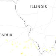
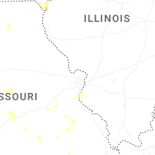
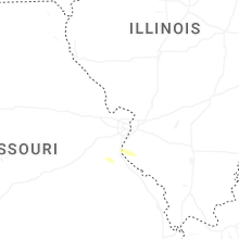
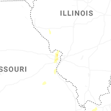
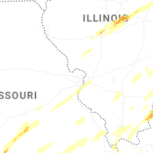


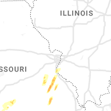


Connect with Interactive Hail Maps