

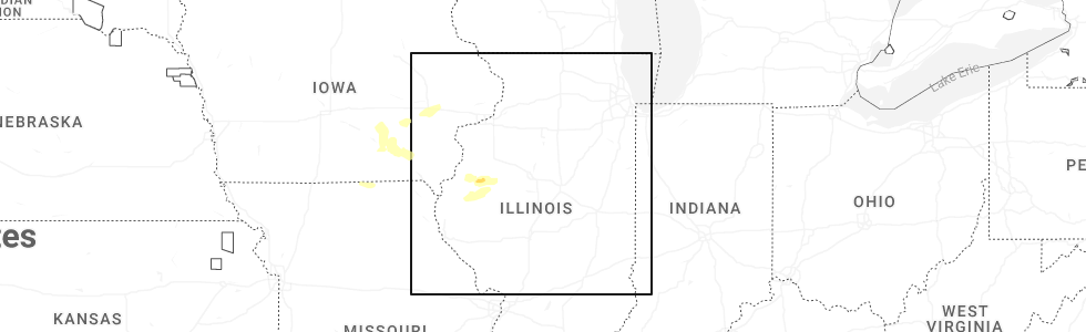
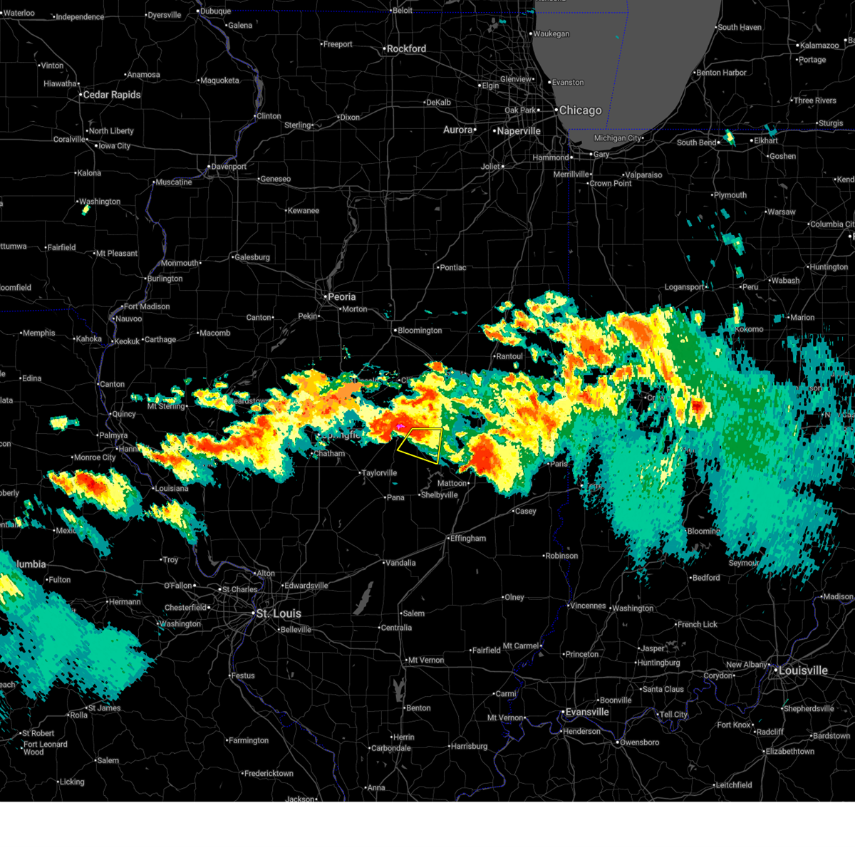
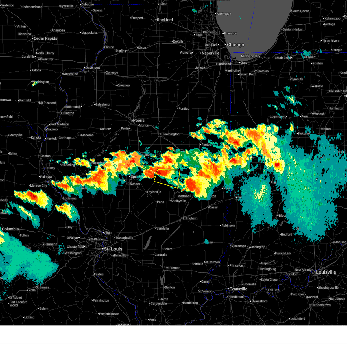
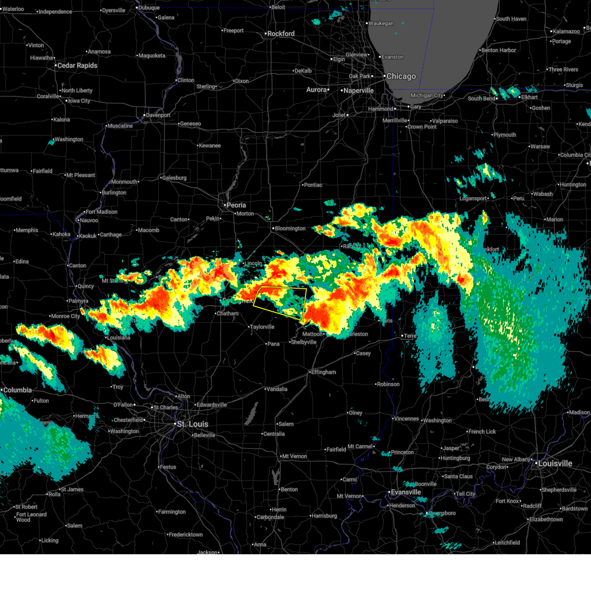
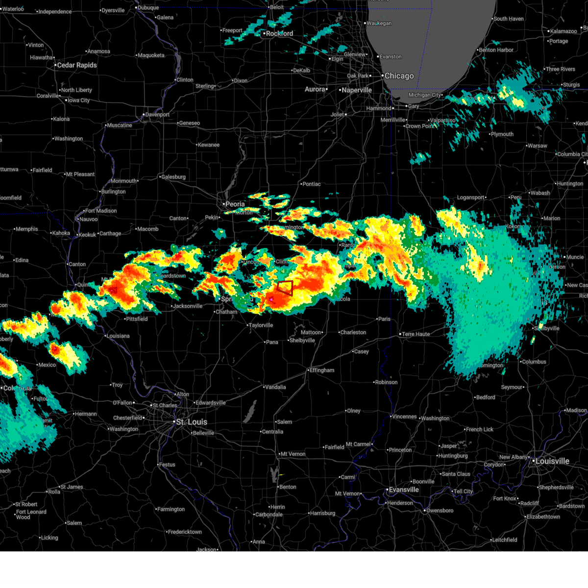
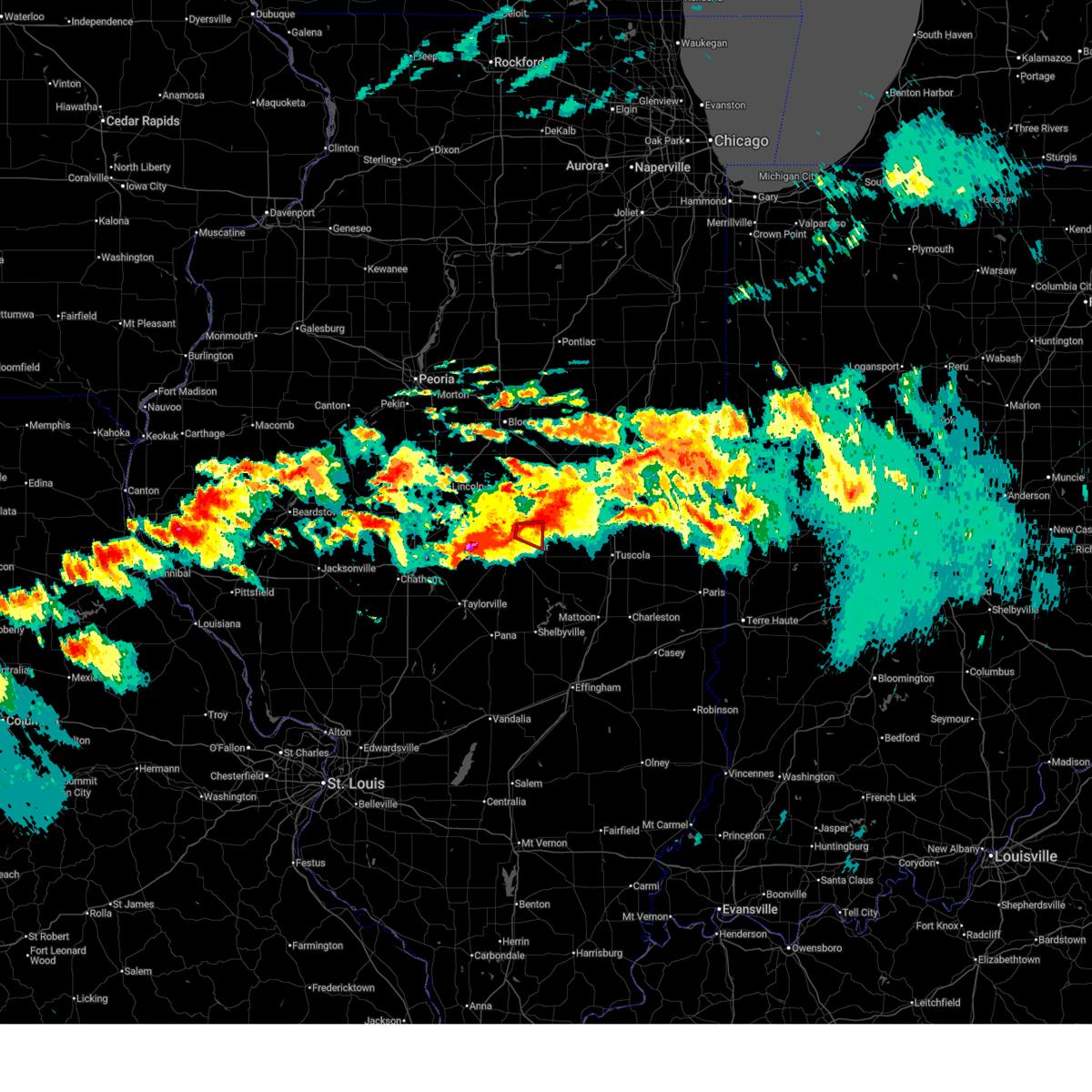
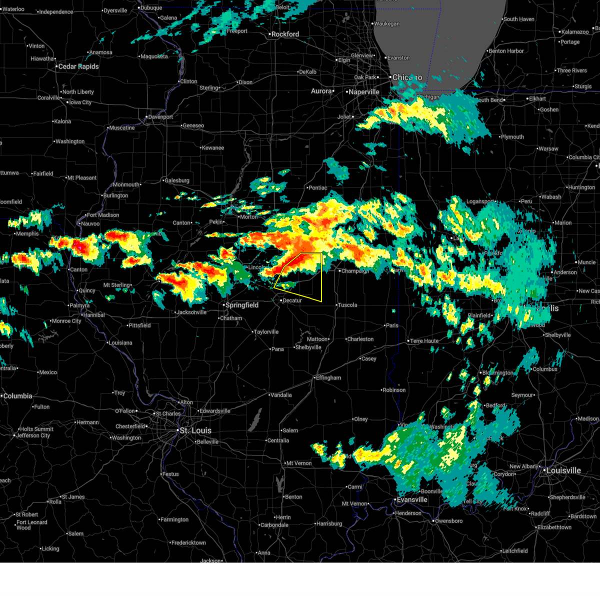
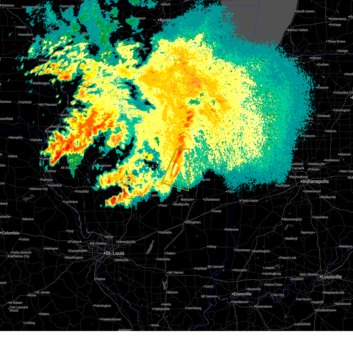
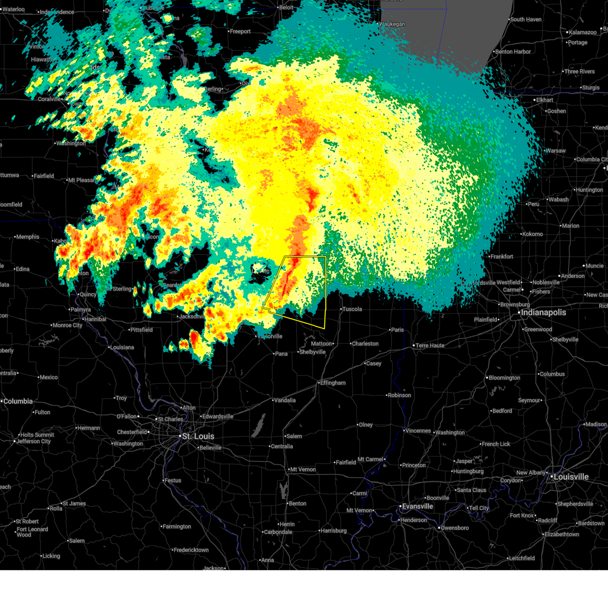
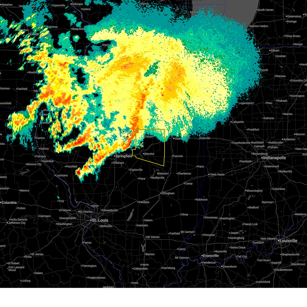
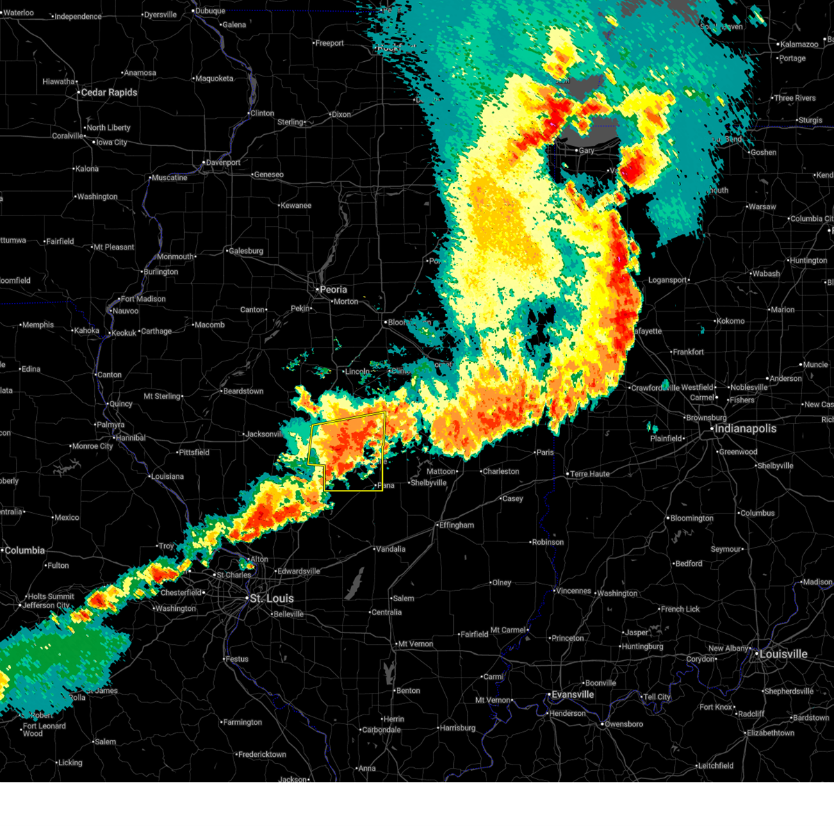
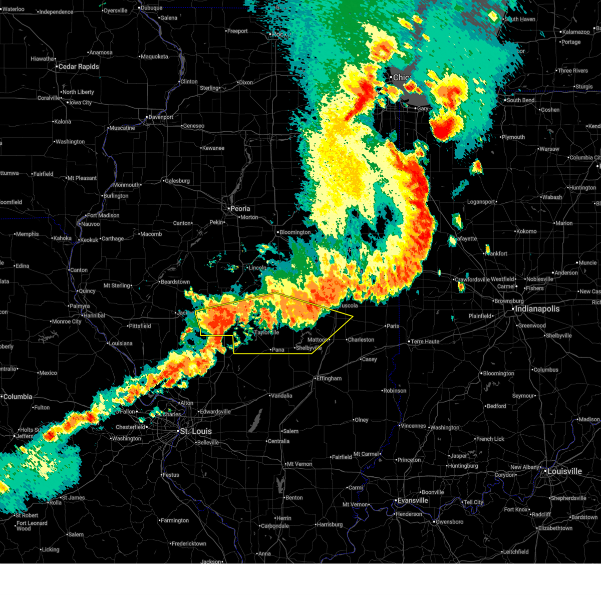
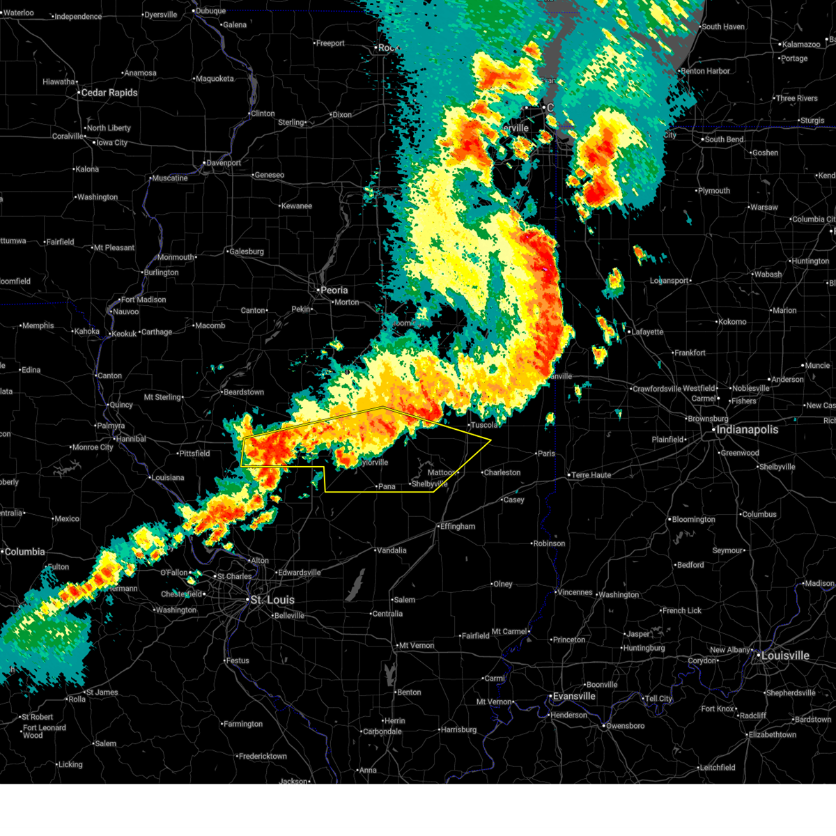
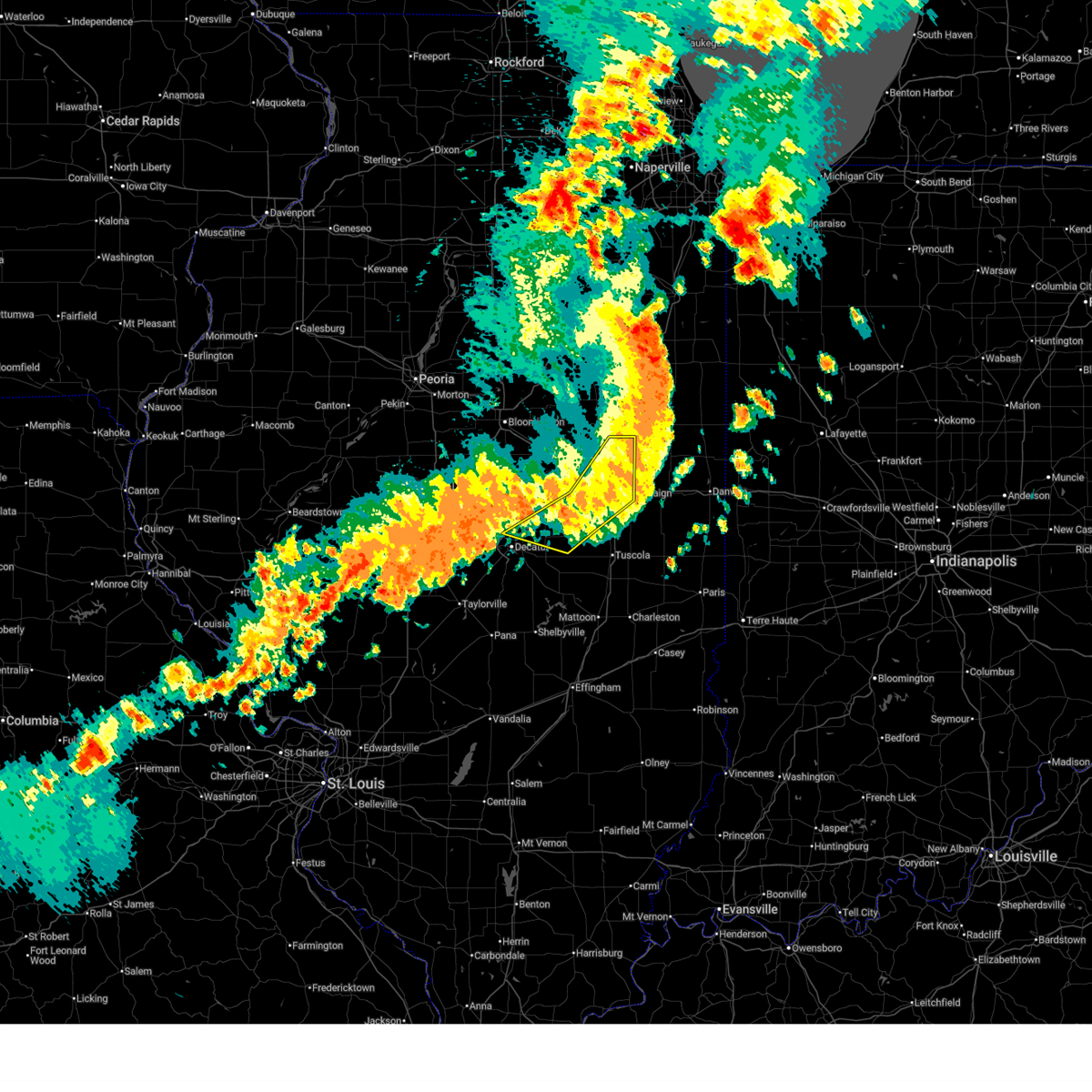
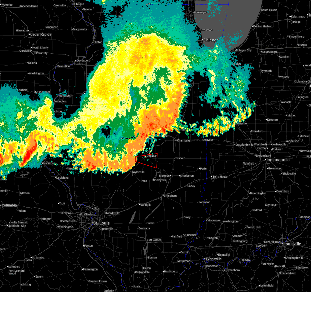
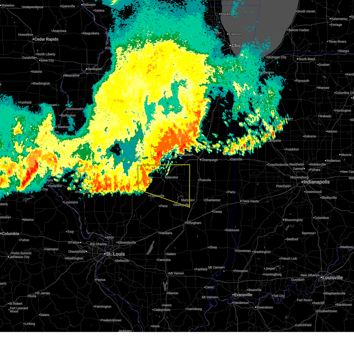
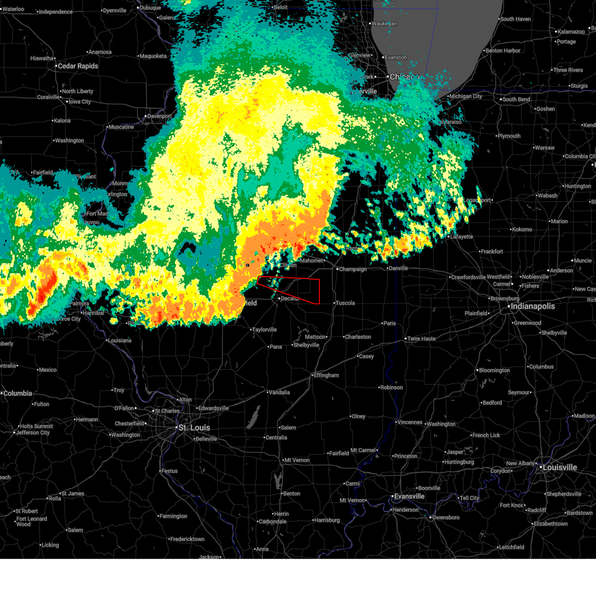
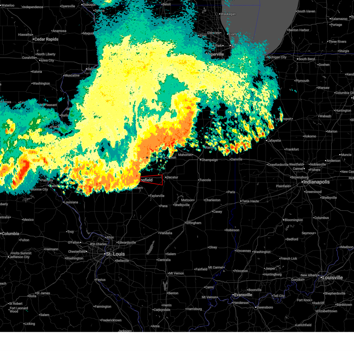
Hail Map for Decatur, IL
The Decatur, IL area has had 19 reports of on-the-ground hail by trained spotters, and has been under severe weather warnings 97 times during the past 12 months. Doppler radar has detected hail at or near Decatur, IL on 98 occasions, including 8 occasions during the past year.
| Name: | Decatur, IL |
| Where Located: | 39.4 miles NW of Mattoon, IL |
| Map: | Google Map for Decatur, IL |
| Population: | 76122 |
| Housing Units: | 36134 |
| More Info: | Search Google for Decatur, IL |
2
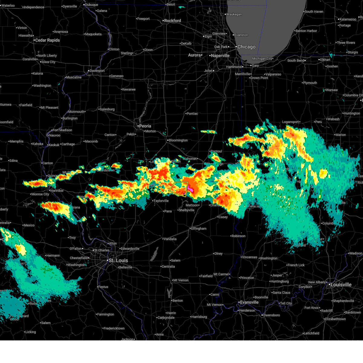
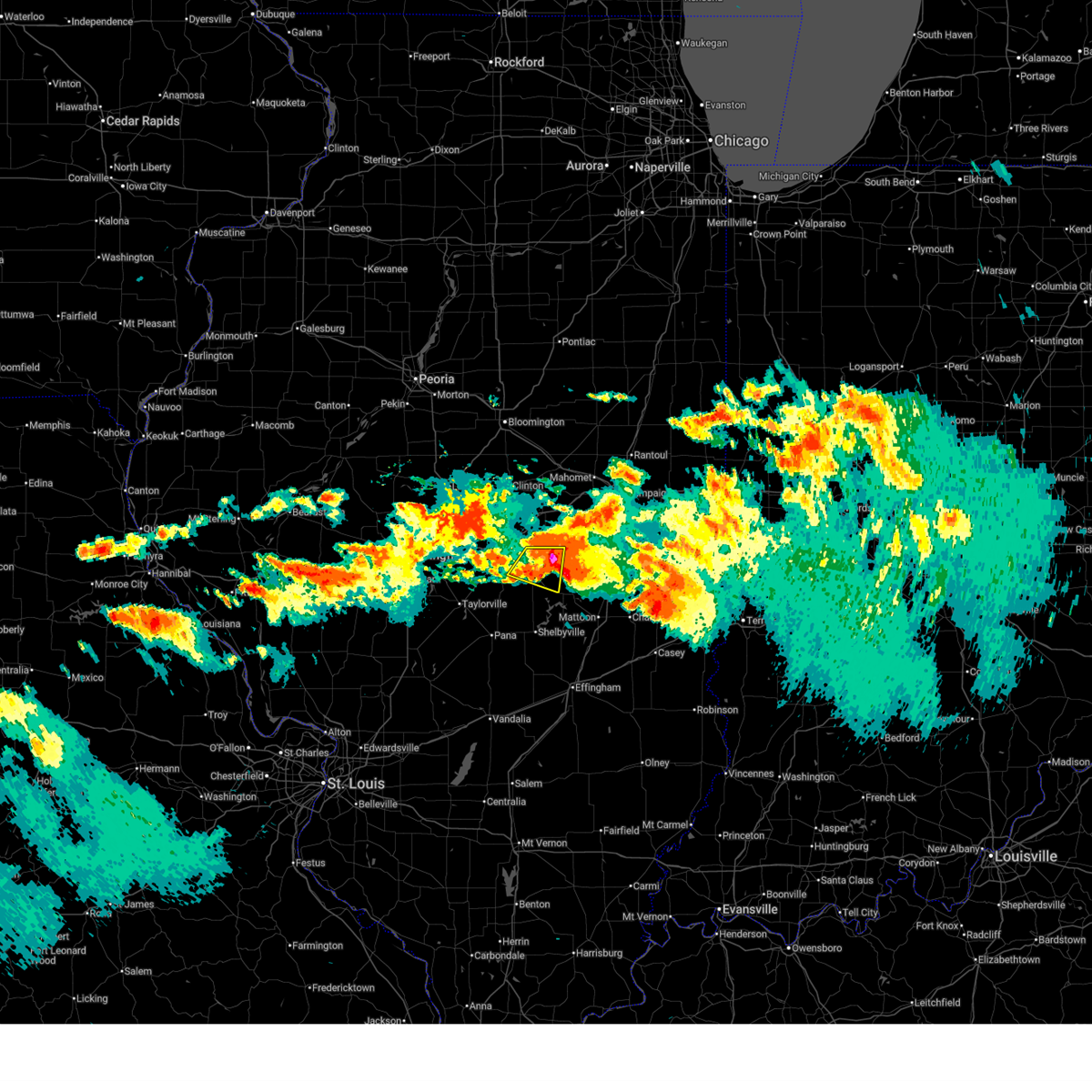
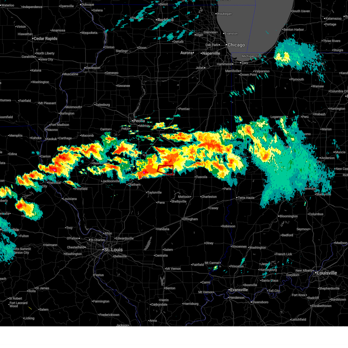
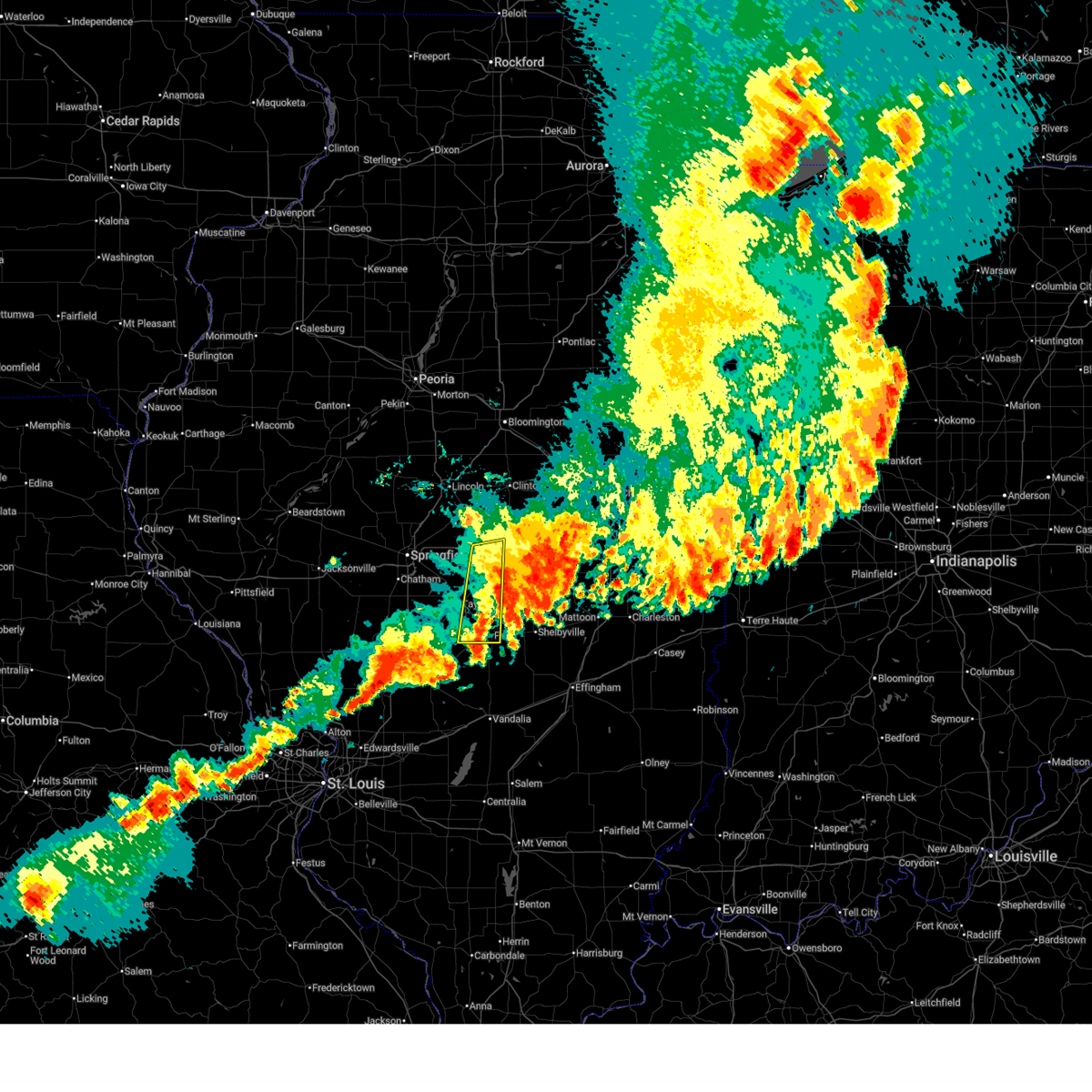
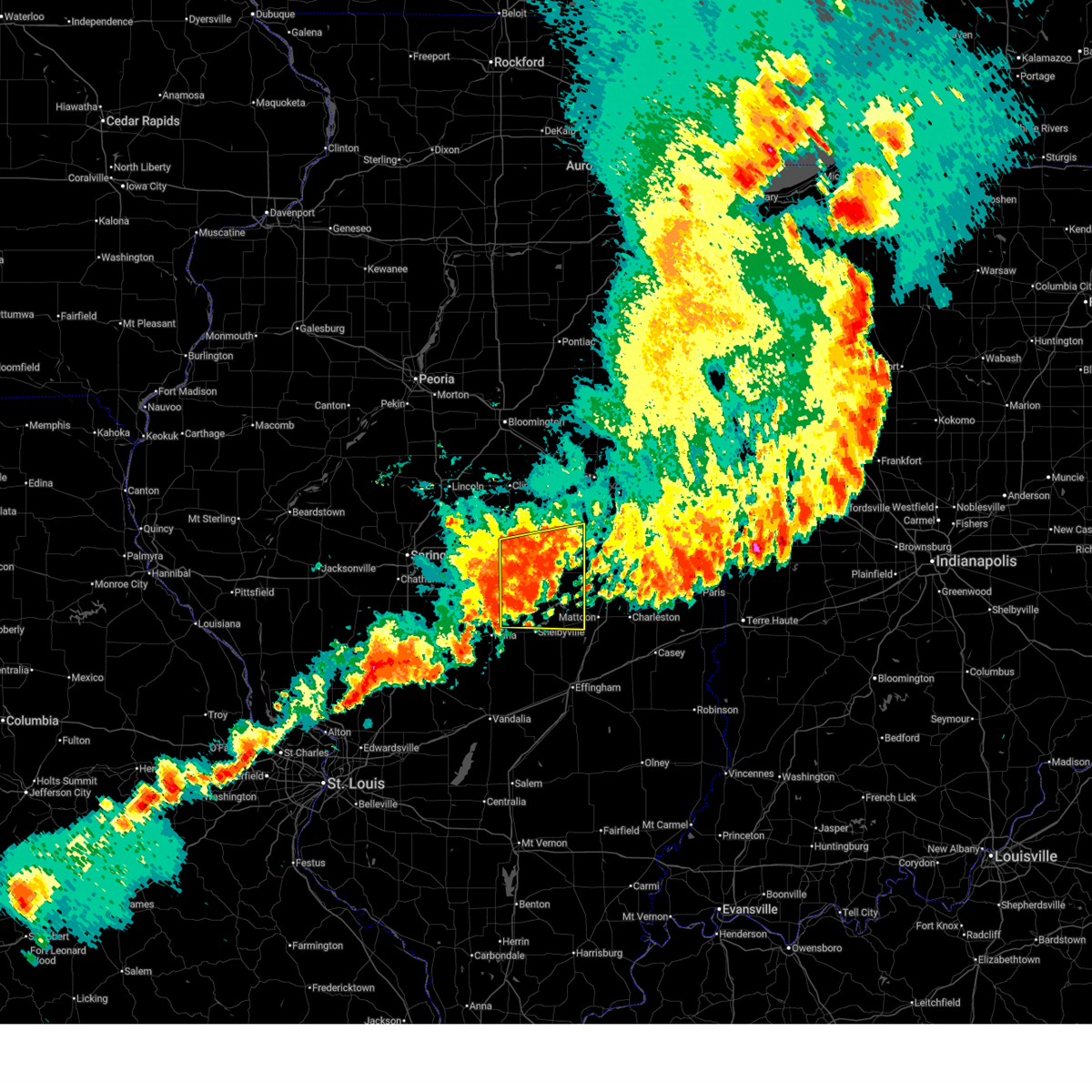
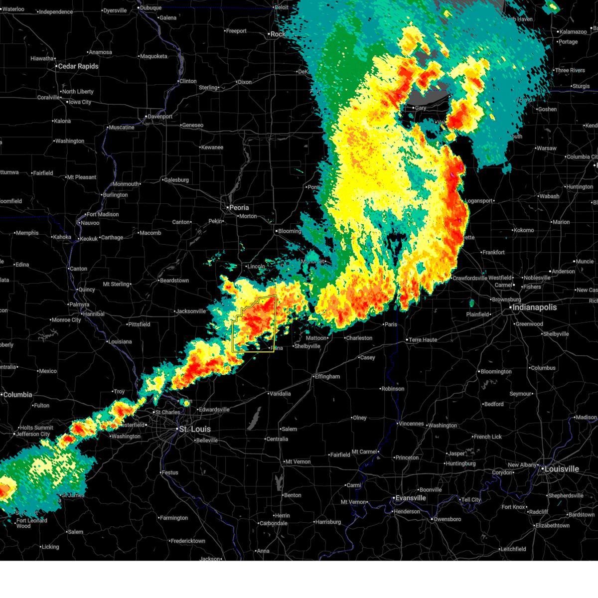
The Top Recent Hail Date for Decatur, IL is Wednesday, June 17, 2026 (4th out of 98)
Hail and Wind Damage Spotted near Decatur, IL
| Date / Time | Report Details |
|---|---|
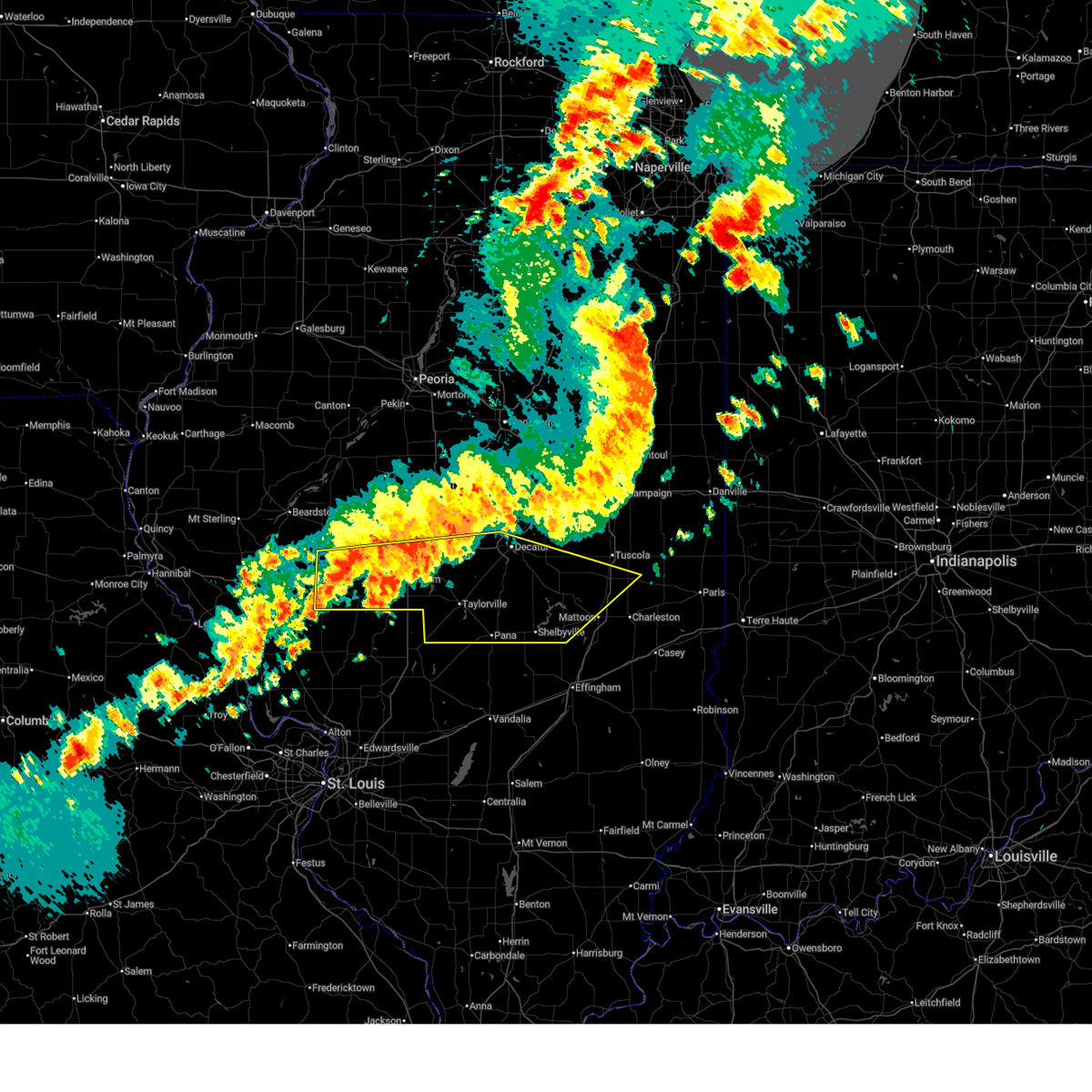
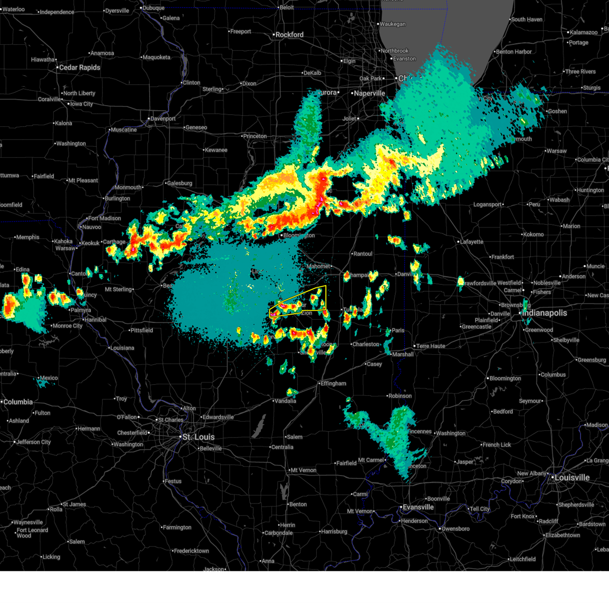
| 6/17/2026 7:08 PM CDT |
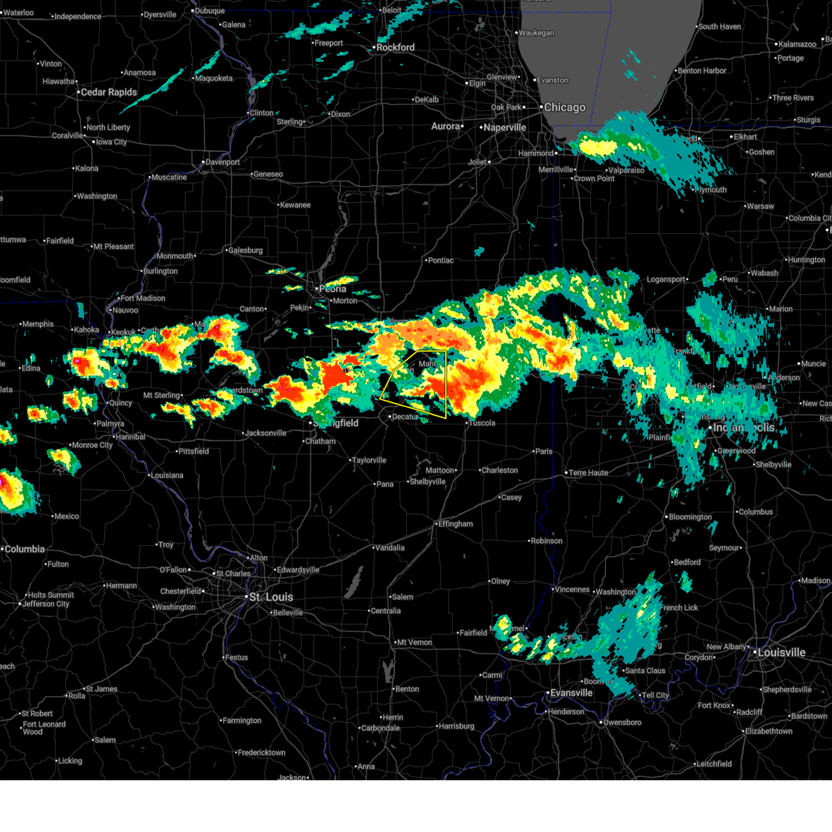
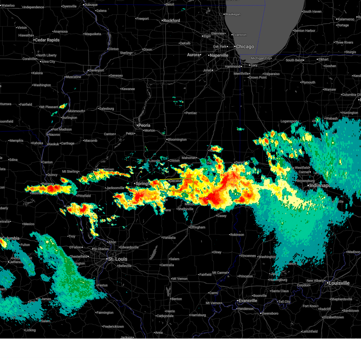 Svrilx the national weather service in lincoln has issued a * severe thunderstorm warning for, northern moultrie county in central illinois, southern piatt county in central illinois, southern macon county in central illinois, * until 800 pm cdt. * at 708 pm cdt, a severe thunderstorm was located near harristown, or near decatur, moving east at 45 mph (radar indicated). Hazards include 60 mph wind gusts and quarter size hail. Hail damage to vehicles is expected. expect wind damage to roofs, siding, and trees. this severe thunderstorm will be near, decatur, mount zion, long creek, and decatur airport around 715 pm cdt. other locations in the path of this severe thunderstorm include lovington, hammond, arthur and atwood. this includes interstate 72 between mile markers 129 and 135. This also includes lincoln trail homestead state park & memorial and spitler woods state natural area. Svrilx the national weather service in lincoln has issued a * severe thunderstorm warning for, northern moultrie county in central illinois, southern piatt county in central illinois, southern macon county in central illinois, * until 800 pm cdt. * at 708 pm cdt, a severe thunderstorm was located near harristown, or near decatur, moving east at 45 mph (radar indicated). Hazards include 60 mph wind gusts and quarter size hail. Hail damage to vehicles is expected. expect wind damage to roofs, siding, and trees. this severe thunderstorm will be near, decatur, mount zion, long creek, and decatur airport around 715 pm cdt. other locations in the path of this severe thunderstorm include lovington, hammond, arthur and atwood. this includes interstate 72 between mile markers 129 and 135. This also includes lincoln trail homestead state park & memorial and spitler woods state natural area.
|
| 6/17/2026 6:27 PM CDT |
 the severe thunderstorm warning has been cancelled and is no longer in effect the severe thunderstorm warning has been cancelled and is no longer in effect
|
| 6/17/2026 6:11 PM CDT |
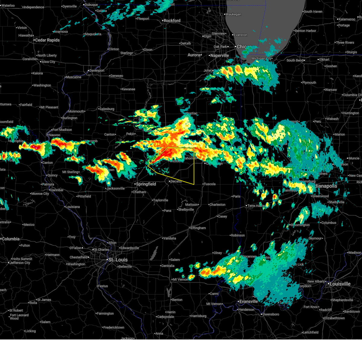
 At 611 pm cdt, a severe thunderstorm was located near dalton city, or 11 miles southeast of decatur, moving east at 55 mph (emergency management. at 6:09 pm, the emergency manager reported several power lines down across macon county. additionally, hail up to the size of quarters was reported across decatur). Hazards include two inch hail and 70 mph wind gusts. People and animals outdoors will be injured. expect hail damage to roofs, siding, windows, and vehicles. expect considerable tree damage. wind damage is also likely to mobile homes, roofs, and outbuildings. this severe storm will be near, lovington around 615 pm cdt. other locations impacted by this severe thunderstorm include hervey city, la place, and lake city. This also includes spitler woods state natural area. At 611 pm cdt, a severe thunderstorm was located near dalton city, or 11 miles southeast of decatur, moving east at 55 mph (emergency management. at 6:09 pm, the emergency manager reported several power lines down across macon county. additionally, hail up to the size of quarters was reported across decatur). Hazards include two inch hail and 70 mph wind gusts. People and animals outdoors will be injured. expect hail damage to roofs, siding, windows, and vehicles. expect considerable tree damage. wind damage is also likely to mobile homes, roofs, and outbuildings. this severe storm will be near, lovington around 615 pm cdt. other locations impacted by this severe thunderstorm include hervey city, la place, and lake city. This also includes spitler woods state natural area.
|
| 6/17/2026 6:08 PM CDT |
 At 606 pm cdt, a severe thunderstorm was located over long creek, or 7 miles southeast of decatur, moving east at 50 mph (radar indicated). Hazards include two inch hail and 60 mph wind gusts. People and animals outdoors will be injured. expect hail damage to roofs, siding, windows, and vehicles. expect wind damage to roofs, siding, and trees. this severe storm will be near, dalton city around 610 pm cdt. lovington around 615 pm cdt. other locations impacted by this severe thunderstorm include hervey city, la place, and lake city. This also includes spitler woods state natural area. At 606 pm cdt, a severe thunderstorm was located over long creek, or 7 miles southeast of decatur, moving east at 50 mph (radar indicated). Hazards include two inch hail and 60 mph wind gusts. People and animals outdoors will be injured. expect hail damage to roofs, siding, windows, and vehicles. expect wind damage to roofs, siding, and trees. this severe storm will be near, dalton city around 610 pm cdt. lovington around 615 pm cdt. other locations impacted by this severe thunderstorm include hervey city, la place, and lake city. This also includes spitler woods state natural area.
|
| 6/17/2026 6:00 PM CDT | Storm damage reported in macon county IL, 4.3 miles WNW of Decatur, IL |
| 6/17/2026 6:00 PM CDT | Numerous powerlines blown down across macon count in macon county IL, 1.5 miles NE of Decatur, IL |
| 6/17/2026 5:58 PM CDT | Quarter sized hail reported 3 miles E of Decatur, IL, report from mping: quarter (1.00 in.). |
| 6/17/2026 5:56 PM CDT |
 the severe thunderstorm warning has been cancelled and is no longer in effect the severe thunderstorm warning has been cancelled and is no longer in effect
|
| 6/17/2026 5:56 PM CDT |
 At 555 pm cdt, a severe thunderstorm was located near decatur, moving east at 50 mph (radar indicated). Hazards include two inch hail and 60 mph wind gusts. People and animals outdoors will be injured. expect hail damage to roofs, siding, windows, and vehicles. expect wind damage to roofs, siding, and trees. this severe storm will be near, decatur, mount zion, long creek, and decatur airport around 600 pm cdt. other locations impacted by this severe thunderstorm include boody, elwin, hervey city, la place, lake city, and oakley. this also includes spitler woods state natural area. This includes interstate 72 between mile markers 132 and 141. At 555 pm cdt, a severe thunderstorm was located near decatur, moving east at 50 mph (radar indicated). Hazards include two inch hail and 60 mph wind gusts. People and animals outdoors will be injured. expect hail damage to roofs, siding, windows, and vehicles. expect wind damage to roofs, siding, and trees. this severe storm will be near, decatur, mount zion, long creek, and decatur airport around 600 pm cdt. other locations impacted by this severe thunderstorm include boody, elwin, hervey city, la place, lake city, and oakley. this also includes spitler woods state natural area. This includes interstate 72 between mile markers 132 and 141.
|
| 6/17/2026 5:53 PM CDT | Quarter sized hail reported 2.3 miles ENE of Decatur, IL |
| 6/17/2026 5:51 PM CDT | Quarter sized hail reported 4.3 miles WNW of Decatur, IL |
| 6/17/2026 5:48 PM CDT |
 At 548 pm cdt, a severe thunderstorm was located over harristown, or 8 miles west of decatur, moving east at 55 mph (radar indicated). Hazards include two inch hail and 60 mph wind gusts. People and animals outdoors will be injured. expect hail damage to roofs, siding, windows, and vehicles. expect wind damage to roofs, siding, and trees. this severe storm will be near, decatur, mount zion, harristown, long creek, and decatur airport around 555 pm cdt. other locations impacted by this severe thunderstorm include boody, milmine, hervey city, la place, lake city, elwin, and oakley. this also includes lincoln trail homestead state park & memorial and spitler woods state natural area. This includes interstate 72 between mile markers 126 and 146. At 548 pm cdt, a severe thunderstorm was located over harristown, or 8 miles west of decatur, moving east at 55 mph (radar indicated). Hazards include two inch hail and 60 mph wind gusts. People and animals outdoors will be injured. expect hail damage to roofs, siding, windows, and vehicles. expect wind damage to roofs, siding, and trees. this severe storm will be near, decatur, mount zion, harristown, long creek, and decatur airport around 555 pm cdt. other locations impacted by this severe thunderstorm include boody, milmine, hervey city, la place, lake city, elwin, and oakley. this also includes lincoln trail homestead state park & memorial and spitler woods state natural area. This includes interstate 72 between mile markers 126 and 146.
|
| 6/17/2026 5:15 PM CDT | 10 trees snappe in macon county IL, 6 miles NE of Decatur, IL |
| 6/17/2026 5:14 PM CDT |
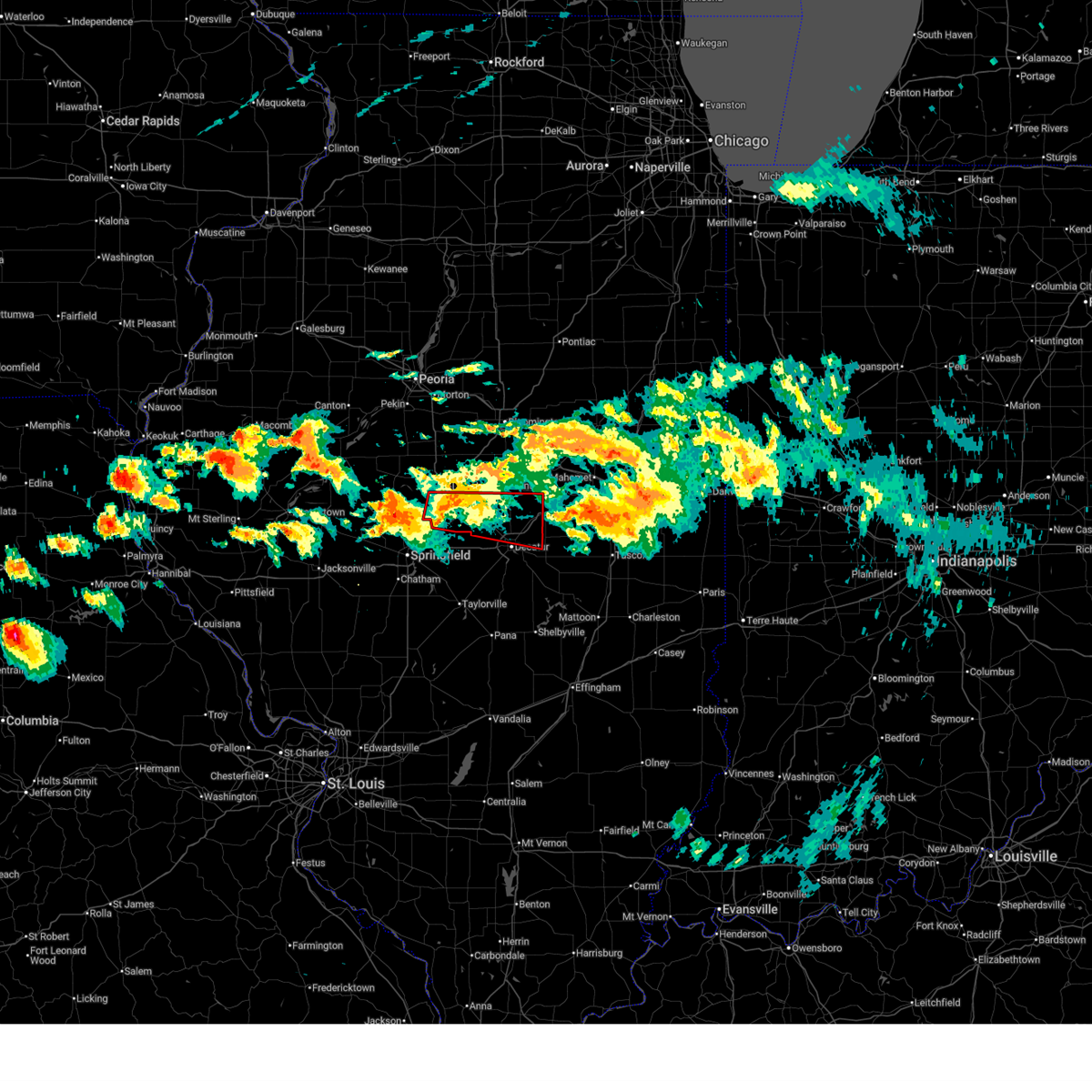
 At 514 pm cdt, a severe thunderstorm capable of producing a tornado was located over macon, or 12 miles south of decatur, moving east at 50 mph (radar indicated rotation). Hazards include tornado and baseball size hail. Flying debris will be dangerous to those caught without shelter. mobile homes will be damaged or destroyed. damage to roofs, windows, and vehicles will occur. tree damage is likely. this tornadic thunderstorm will remain over mainly rural areas of northeastern christian and southern macon counties, including the following locations, boody, elwin, hervey city, and oakley. this also includes lincoln trail homestead state park & memorial and spitler woods state natural area. This includes interstate 72 between mile markers 130 and 139. At 514 pm cdt, a severe thunderstorm capable of producing a tornado was located over macon, or 12 miles south of decatur, moving east at 50 mph (radar indicated rotation). Hazards include tornado and baseball size hail. Flying debris will be dangerous to those caught without shelter. mobile homes will be damaged or destroyed. damage to roofs, windows, and vehicles will occur. tree damage is likely. this tornadic thunderstorm will remain over mainly rural areas of northeastern christian and southern macon counties, including the following locations, boody, elwin, hervey city, and oakley. this also includes lincoln trail homestead state park & memorial and spitler woods state natural area. This includes interstate 72 between mile markers 130 and 139.
|
| 6/17/2026 5:12 PM CDT |
 The tornado threat has moved out of the warned area. however, large hail and damaging winds remain possible and a severe thunderstorm warning remains in effect for the area. a tornado watch remains in effect until 1000 pm cdt for central illinois. The tornado threat has moved out of the warned area. however, large hail and damaging winds remain possible and a severe thunderstorm warning remains in effect for the area. a tornado watch remains in effect until 1000 pm cdt for central illinois.
|
| 6/17/2026 5:10 PM CDT | Ping Pong Ball sized hail reported 5.9 miles NNE of Decatur, IL, ping pong size hail. |
| 6/17/2026 5:10 PM CDT | Powerline line blown down at shadow ridge in decatu in macon county IL, 1.5 miles NE of Decatur, IL |
| 6/17/2026 5:02 PM CDT |
 At 502 pm cdt, a severe thunderstorm capable of producing a tornado was located near oreana, or 7 miles northeast of decatur, moving east at 50 mph (radar indicated rotation). Hazards include tornado and quarter size hail. Flying debris will be dangerous to those caught without shelter. mobile homes will be damaged or destroyed. damage to roofs, windows, and vehicles will occur. tree damage is likely. this tornadic thunderstorm will remain over mainly rural areas of east central macon county, including the following locations, oakley. This includes interstate 72 between mile markers 144 and 150. At 502 pm cdt, a severe thunderstorm capable of producing a tornado was located near oreana, or 7 miles northeast of decatur, moving east at 50 mph (radar indicated rotation). Hazards include tornado and quarter size hail. Flying debris will be dangerous to those caught without shelter. mobile homes will be damaged or destroyed. damage to roofs, windows, and vehicles will occur. tree damage is likely. this tornadic thunderstorm will remain over mainly rural areas of east central macon county, including the following locations, oakley. This includes interstate 72 between mile markers 144 and 150.
|
| 6/17/2026 4:54 PM CDT |
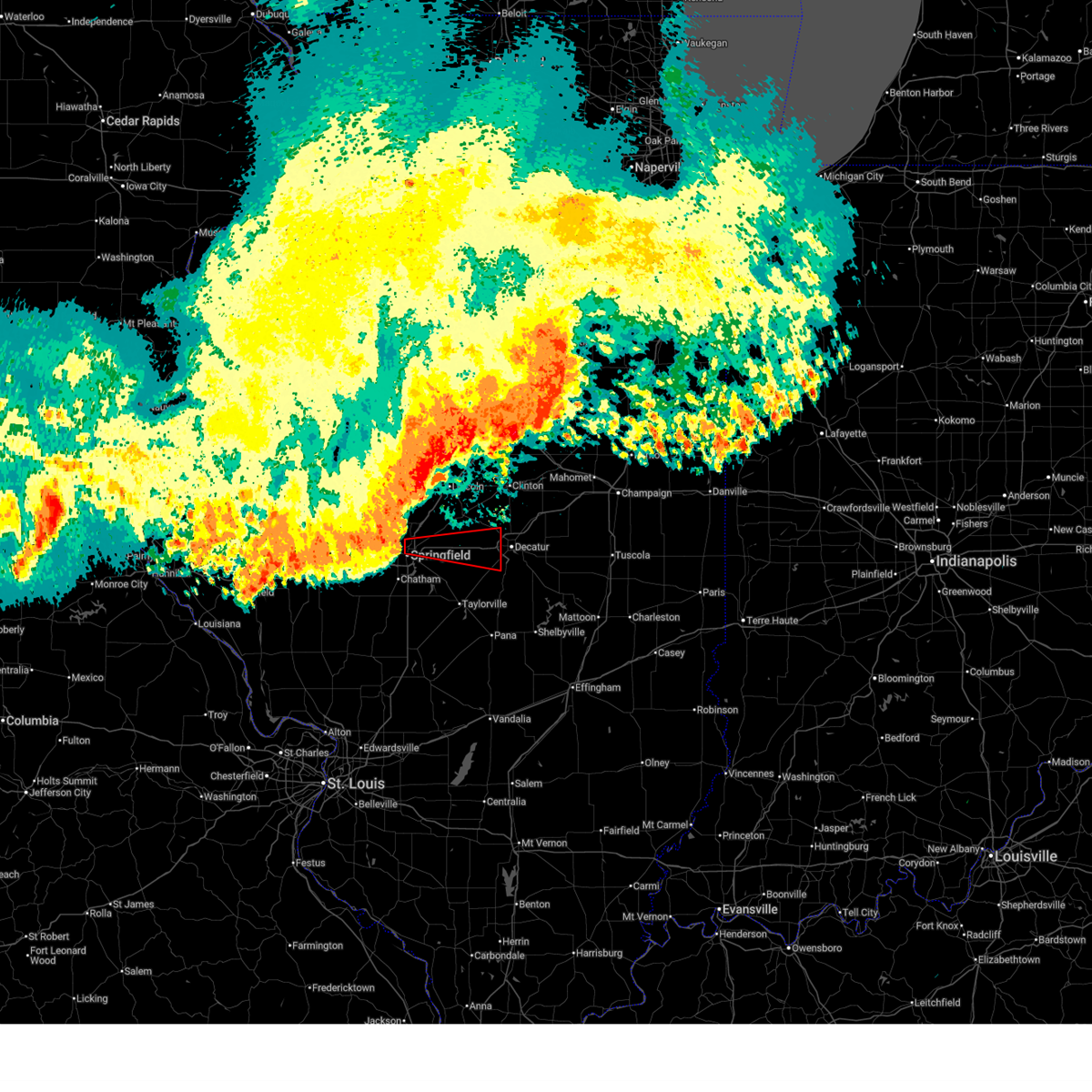
 Torilx the national weather service in lincoln has issued a * tornado warning for, northeastern christian county in central illinois, southern macon county in central illinois, * until 600 pm cdt. * at 454 pm cdt, a severe thunderstorm capable of producing a tornado was located near mechanicsburg, or 17 miles east of springfield, moving east at 35 mph (radar indicated rotation). Hazards include tornado and baseball size hail. Flying debris will be dangerous to those caught without shelter. mobile homes will be damaged or destroyed. damage to roofs, windows, and vehicles will occur. tree damage is likely. this dangerous storm will be near, mount auburn around 500 pm cdt. niantic around 505 pm cdt. harristown around 510 pm cdt. other locations in the path of this tornadic thunderstorm include decatur, mount zion, long creek, decatur airport and dalton city. this also includes lincoln trail homestead state park & memorial and spitler woods state natural area. This includes interstate 72 between mile markers 125 and 139. Torilx the national weather service in lincoln has issued a * tornado warning for, northeastern christian county in central illinois, southern macon county in central illinois, * until 600 pm cdt. * at 454 pm cdt, a severe thunderstorm capable of producing a tornado was located near mechanicsburg, or 17 miles east of springfield, moving east at 35 mph (radar indicated rotation). Hazards include tornado and baseball size hail. Flying debris will be dangerous to those caught without shelter. mobile homes will be damaged or destroyed. damage to roofs, windows, and vehicles will occur. tree damage is likely. this dangerous storm will be near, mount auburn around 500 pm cdt. niantic around 505 pm cdt. harristown around 510 pm cdt. other locations in the path of this tornadic thunderstorm include decatur, mount zion, long creek, decatur airport and dalton city. this also includes lincoln trail homestead state park & memorial and spitler woods state natural area. This includes interstate 72 between mile markers 125 and 139.
|
| 6/17/2026 4:52 PM CDT |
 At 452 pm cdt, a severe thunderstorm capable of producing a tornado was located over forsyth, or near decatur, moving east at 50 mph (radar indicated rotation). Hazards include tornado and quarter size hail. Flying debris will be dangerous to those caught without shelter. mobile homes will be damaged or destroyed. damage to roofs, windows, and vehicles will occur. tree damage is likely. this dangerous storm will be near, decatur, forsyth, and oreana around 455 pm cdt. other locations impacted by this tornadic thunderstorm include oakley. This includes interstate 72 between mile markers 137 and 152. At 452 pm cdt, a severe thunderstorm capable of producing a tornado was located over forsyth, or near decatur, moving east at 50 mph (radar indicated rotation). Hazards include tornado and quarter size hail. Flying debris will be dangerous to those caught without shelter. mobile homes will be damaged or destroyed. damage to roofs, windows, and vehicles will occur. tree damage is likely. this dangerous storm will be near, decatur, forsyth, and oreana around 455 pm cdt. other locations impacted by this tornadic thunderstorm include oakley. This includes interstate 72 between mile markers 137 and 152.
|
| 6/17/2026 4:49 PM CDT |
 Svrilx the national weather service in lincoln has issued a * severe thunderstorm warning for, northeastern christian county in central illinois, northeastern sangamon county in central illinois, moultrie county in central illinois, northwestern shelby county in central illinois, piatt county in central illinois, south central de witt county in central illinois, macon county in central illinois, * until 545 pm cdt. * at 449 pm cdt, severe thunderstorms were located along a line extending from near maroa to near niantic to near dawson, moving east at 50 mph (radar indicated). Hazards include 60 mph wind gusts and quarter size hail. Hail damage to vehicles is expected. expect wind damage to roofs, siding, and trees. severe thunderstorms will be near, decatur, forsyth, harristown, argenta, illiopolis, oreana, niantic, mechanicsburg, mount auburn, and cisco around 455 pm cdt. mount zion, cerro gordo, long creek, and decatur airport around 500 pm cdt. monticello around 505 pm cdt. other locations in the path of these severe thunderstorms include bement, blue mound, macon, hammond, ivesdale, dalton city, atwood, lovington and arthur. this includes interstate 72 between mile markers 107 and 168. This also includes lincoln trail homestead state park & memorial, spitler woods state natural area, and shelbyville state fish and wildlife area. Svrilx the national weather service in lincoln has issued a * severe thunderstorm warning for, northeastern christian county in central illinois, northeastern sangamon county in central illinois, moultrie county in central illinois, northwestern shelby county in central illinois, piatt county in central illinois, south central de witt county in central illinois, macon county in central illinois, * until 545 pm cdt. * at 449 pm cdt, severe thunderstorms were located along a line extending from near maroa to near niantic to near dawson, moving east at 50 mph (radar indicated). Hazards include 60 mph wind gusts and quarter size hail. Hail damage to vehicles is expected. expect wind damage to roofs, siding, and trees. severe thunderstorms will be near, decatur, forsyth, harristown, argenta, illiopolis, oreana, niantic, mechanicsburg, mount auburn, and cisco around 455 pm cdt. mount zion, cerro gordo, long creek, and decatur airport around 500 pm cdt. monticello around 505 pm cdt. other locations in the path of these severe thunderstorms include bement, blue mound, macon, hammond, ivesdale, dalton city, atwood, lovington and arthur. this includes interstate 72 between mile markers 107 and 168. This also includes lincoln trail homestead state park & memorial, spitler woods state natural area, and shelbyville state fish and wildlife area.
|
| 6/17/2026 4:23 PM CDT |
 the severe thunderstorm warning has been cancelled and is no longer in effect the severe thunderstorm warning has been cancelled and is no longer in effect
|
| 6/17/2026 4:23 PM CDT |
 Torilx the national weather service in lincoln has issued a * tornado warning for, southern logan county in central illinois, southwestern de witt county in central illinois, northern macon county in central illinois, * until 515 pm cdt. * at 423 pm cdt, a severe thunderstorm capable of producing a tornado was located near elkhart, or 9 miles south of lincoln, moving east at 50 mph (radar indicated rotation). Hazards include tornado and quarter size hail. Flying debris will be dangerous to those caught without shelter. mobile homes will be damaged or destroyed. damage to roofs, windows, and vehicles will occur. tree damage is likely. this dangerous storm will be near, mount pulaski around 430 pm cdt. latham and chestnut around 435 pm cdt. other locations in the path of this tornadic thunderstorm include maroa, argenta and oreana. this includes the following highways, interstate 55 between mile markers 112 and 122. Interstate 72 between mile markers 137 and 156. Torilx the national weather service in lincoln has issued a * tornado warning for, southern logan county in central illinois, southwestern de witt county in central illinois, northern macon county in central illinois, * until 515 pm cdt. * at 423 pm cdt, a severe thunderstorm capable of producing a tornado was located near elkhart, or 9 miles south of lincoln, moving east at 50 mph (radar indicated rotation). Hazards include tornado and quarter size hail. Flying debris will be dangerous to those caught without shelter. mobile homes will be damaged or destroyed. damage to roofs, windows, and vehicles will occur. tree damage is likely. this dangerous storm will be near, mount pulaski around 430 pm cdt. latham and chestnut around 435 pm cdt. other locations in the path of this tornadic thunderstorm include maroa, argenta and oreana. this includes the following highways, interstate 55 between mile markers 112 and 122. Interstate 72 between mile markers 137 and 156.
|
| 6/17/2026 3:59 PM CDT |
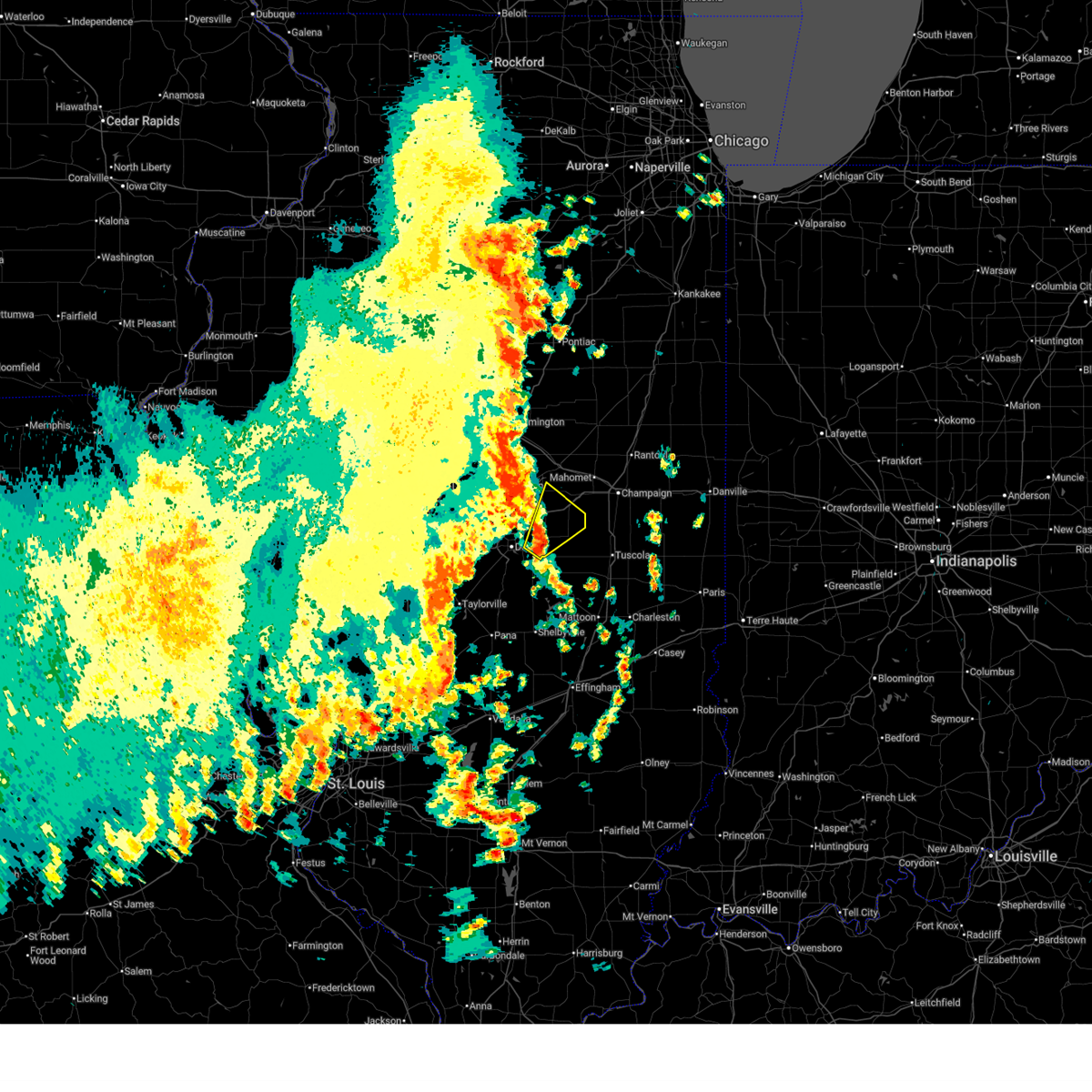
 At 358 pm cdt, severe thunderstorms were located along a line extending from near farmer city to near maroa, moving east at 60 mph (radar indicated). Hazards include 60 mph wind gusts and half dollar size hail. Hail damage to vehicles is expected. expect wind damage to roofs, siding, and trees. these severe storms will be near, monticello, mansfield, de land, cisco, and white heath around 405 pm cdt. bement and ivesdale around 415 pm cdt. other locations impacted by these severe thunderstorms include milmine, clinton power station, weldon springs state park, lane, de witt, galesville, and lodge. this also includes clinton lake state recreation area and weldon springs state park. this includes the following highways, interstate 72 between mile markers 147 and 173. Interstate 74 between mile markers 156 and 168. At 358 pm cdt, severe thunderstorms were located along a line extending from near farmer city to near maroa, moving east at 60 mph (radar indicated). Hazards include 60 mph wind gusts and half dollar size hail. Hail damage to vehicles is expected. expect wind damage to roofs, siding, and trees. these severe storms will be near, monticello, mansfield, de land, cisco, and white heath around 405 pm cdt. bement and ivesdale around 415 pm cdt. other locations impacted by these severe thunderstorms include milmine, clinton power station, weldon springs state park, lane, de witt, galesville, and lodge. this also includes clinton lake state recreation area and weldon springs state park. this includes the following highways, interstate 72 between mile markers 147 and 173. Interstate 74 between mile markers 156 and 168.
|
| 6/17/2026 3:42 PM CDT |
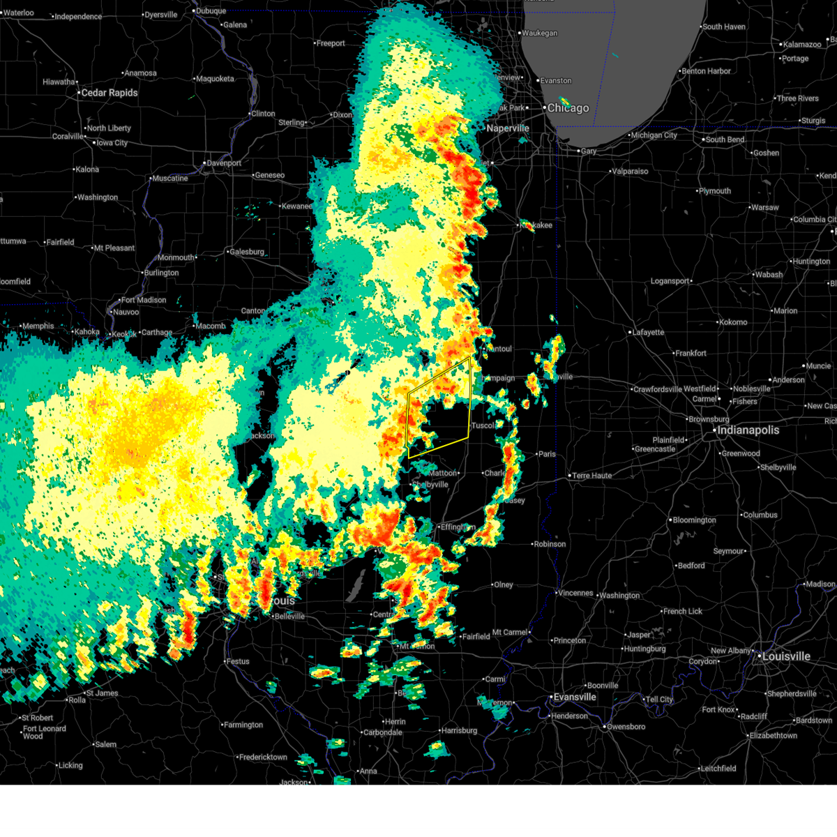
 Svrilx the national weather service in lincoln has issued a * severe thunderstorm warning for, southeastern logan county in central illinois, piatt county in central illinois, de witt county in central illinois, southeastern mclean county in central illinois, northern macon county in central illinois, * until 445 pm cdt. * at 341 pm cdt, severe thunderstorms were located along a line extending from near heyworth to near beason, moving east at 55 mph (radar indicated). Hazards include 60 mph wind gusts and quarter size hail. Hail damage to vehicles is expected. expect wind damage to roofs, siding, and trees. severe thunderstorms will be near, clinton, wapella, kenney, chestnut, and beason around 345 pm cdt. farmer city, maroa, and weldon around 355 pm cdt. de land around 400 pm cdt. other locations in the path of these severe thunderstorms include argenta, mansfield, cisco, monticello, white heath, bement and ivesdale. this includes the following highways, interstate 72 between mile markers 142 and 173. interstate 74 between mile markers 148 and 168. This also includes clinton lake state recreation area and weldon springs state park. Svrilx the national weather service in lincoln has issued a * severe thunderstorm warning for, southeastern logan county in central illinois, piatt county in central illinois, de witt county in central illinois, southeastern mclean county in central illinois, northern macon county in central illinois, * until 445 pm cdt. * at 341 pm cdt, severe thunderstorms were located along a line extending from near heyworth to near beason, moving east at 55 mph (radar indicated). Hazards include 60 mph wind gusts and quarter size hail. Hail damage to vehicles is expected. expect wind damage to roofs, siding, and trees. severe thunderstorms will be near, clinton, wapella, kenney, chestnut, and beason around 345 pm cdt. farmer city, maroa, and weldon around 355 pm cdt. de land around 400 pm cdt. other locations in the path of these severe thunderstorms include argenta, mansfield, cisco, monticello, white heath, bement and ivesdale. this includes the following highways, interstate 72 between mile markers 142 and 173. interstate 74 between mile markers 148 and 168. This also includes clinton lake state recreation area and weldon springs state park.
|
| 6/17/2026 10:51 AM CDT |
 At 1051 am cdt, severe thunderstorms were located along a line extending from de land to near decatur airport, moving east at 40 mph (radar indicated). Hazards include 60 mph wind gusts and penny size hail. Expect damage to roofs, siding, and trees. these severe storms will be near, monticello, cerro gordo, and de land around 1055 am cdt. bement and white heath around 1100 am cdt. hammond around 1105 am cdt. ivesdale around 1110 am cdt. atwood around 1115 am cdt. other locations impacted by these severe thunderstorms include milmine, hervey city, cadwell, la place, lake city, elwin, galesville, lodge, and oakley. this also includes spitler woods state natural area. this includes the following highways, interstate 72 between mile markers 143 and 173. Interstate 74 between mile markers 156 and 168. At 1051 am cdt, severe thunderstorms were located along a line extending from de land to near decatur airport, moving east at 40 mph (radar indicated). Hazards include 60 mph wind gusts and penny size hail. Expect damage to roofs, siding, and trees. these severe storms will be near, monticello, cerro gordo, and de land around 1055 am cdt. bement and white heath around 1100 am cdt. hammond around 1105 am cdt. ivesdale around 1110 am cdt. atwood around 1115 am cdt. other locations impacted by these severe thunderstorms include milmine, hervey city, cadwell, la place, lake city, elwin, galesville, lodge, and oakley. this also includes spitler woods state natural area. this includes the following highways, interstate 72 between mile markers 143 and 173. Interstate 74 between mile markers 156 and 168.
|
| 6/17/2026 10:37 AM CDT |
 At 1037 am cdt, severe thunderstorms were located along a line extending from near weldon to near decatur, moving east at 40 mph (radar indicated). Hazards include 60 mph wind gusts and penny size hail. Expect damage to roofs, siding, and trees. these severe storms will be near, decatur, mount zion, forsyth, long creek, argenta, oreana, weldon, and decatur airport around 1040 am cdt. de land and cisco around 1045 am cdt. cerro gordo around 1050 am cdt. monticello around 1055 am cdt. bement and white heath around 1100 am cdt. hammond around 1105 am cdt. ivesdale around 1110 am cdt. atwood around 1115 am cdt. other locations impacted by these severe thunderstorms include boody, clinton power station, weldon springs state park, lake city, lane, elwin, milmine, hervey city, cadwell, and la place. This also includes clinton lake state recreation area, lincoln trail homestead state park & memorial, spitler woods state natural area, and weldon springs state park. At 1037 am cdt, severe thunderstorms were located along a line extending from near weldon to near decatur, moving east at 40 mph (radar indicated). Hazards include 60 mph wind gusts and penny size hail. Expect damage to roofs, siding, and trees. these severe storms will be near, decatur, mount zion, forsyth, long creek, argenta, oreana, weldon, and decatur airport around 1040 am cdt. de land and cisco around 1045 am cdt. cerro gordo around 1050 am cdt. monticello around 1055 am cdt. bement and white heath around 1100 am cdt. hammond around 1105 am cdt. ivesdale around 1110 am cdt. atwood around 1115 am cdt. other locations impacted by these severe thunderstorms include boody, clinton power station, weldon springs state park, lake city, lane, elwin, milmine, hervey city, cadwell, and la place. This also includes clinton lake state recreation area, lincoln trail homestead state park & memorial, spitler woods state natural area, and weldon springs state park.
|
| 6/17/2026 10:09 AM CDT |
 Svrilx the national weather service in lincoln has issued a * severe thunderstorm warning for, northern moultrie county in central illinois, piatt county in central illinois, de witt county in central illinois, macon county in central illinois, * until 1115 am cdt. * at 1008 am cdt, severe thunderstorms were located along a line extending from waynesville to near cornland, moving east at 45 mph (radar indicated). Hazards include 60 mph wind gusts and penny size hail. Expect damage to roofs, siding, and trees. severe thunderstorms will be near, wapella and kenney around 1015 am cdt. clinton, warrensburg, and niantic around 1020 am cdt. decatur, forsyth, maroa, and harristown around 1025 am cdt. other locations in the path of these severe thunderstorms include argenta, oreana, weldon, decatur airport, mount zion, long creek, de land, cisco, monticello, cerro gordo, bement, white heath and hammond. this includes the following highways, interstate 72 between mile markers 125 and 173. interstate 74 between mile markers 156 and 168. This also includes clinton lake state recreation area, lincoln trail homestead state park & memorial, spitler woods state natural area, and weldon springs state park. Svrilx the national weather service in lincoln has issued a * severe thunderstorm warning for, northern moultrie county in central illinois, piatt county in central illinois, de witt county in central illinois, macon county in central illinois, * until 1115 am cdt. * at 1008 am cdt, severe thunderstorms were located along a line extending from waynesville to near cornland, moving east at 45 mph (radar indicated). Hazards include 60 mph wind gusts and penny size hail. Expect damage to roofs, siding, and trees. severe thunderstorms will be near, wapella and kenney around 1015 am cdt. clinton, warrensburg, and niantic around 1020 am cdt. decatur, forsyth, maroa, and harristown around 1025 am cdt. other locations in the path of these severe thunderstorms include argenta, oreana, weldon, decatur airport, mount zion, long creek, de land, cisco, monticello, cerro gordo, bement, white heath and hammond. this includes the following highways, interstate 72 between mile markers 125 and 173. interstate 74 between mile markers 156 and 168. This also includes clinton lake state recreation area, lincoln trail homestead state park & memorial, spitler woods state natural area, and weldon springs state park.
|
| 6/11/2026 8:54 PM CDT |
 At 854 pm cdt, a severe thunderstorm was located near findlay, or 11 miles north of shelbyville, moving east at 60 mph (radar indicated). Hazards include 60 mph wind gusts and quarter size hail. Hail damage to vehicles is expected. expect wind damage to roofs, siding, and trees. this severe thunderstorm will remain over mainly rural areas of eastern christian and southwestern macon counties, including the following locations, rosamond, boody, and willeys. This includes interstate 72 between mile markers 125 and 136. At 854 pm cdt, a severe thunderstorm was located near findlay, or 11 miles north of shelbyville, moving east at 60 mph (radar indicated). Hazards include 60 mph wind gusts and quarter size hail. Hail damage to vehicles is expected. expect wind damage to roofs, siding, and trees. this severe thunderstorm will remain over mainly rural areas of eastern christian and southwestern macon counties, including the following locations, rosamond, boody, and willeys. This includes interstate 72 between mile markers 125 and 136.
|
| 6/11/2026 8:45 PM CDT |
 Svrilx the national weather service in lincoln has issued a * severe thunderstorm warning for, moultrie county in central illinois, northern shelby county in central illinois, southern piatt county in central illinois, southeastern macon county in central illinois, * until 930 pm cdt. * at 845 pm cdt, a severe thunderstorm was located near bethany, or 11 miles west of sullivan, moving east at 75 mph (radar indicated). Hazards include 60 mph wind gusts and quarter size hail. Hail damage to vehicles is expected. expect wind damage to roofs, siding, and trees. this severe thunderstorm will be near, sullivan and bethany around 850 pm cdt. allenville around 855 pm cdt. This includes interstate 72 near mile marker 137. Svrilx the national weather service in lincoln has issued a * severe thunderstorm warning for, moultrie county in central illinois, northern shelby county in central illinois, southern piatt county in central illinois, southeastern macon county in central illinois, * until 930 pm cdt. * at 845 pm cdt, a severe thunderstorm was located near bethany, or 11 miles west of sullivan, moving east at 75 mph (radar indicated). Hazards include 60 mph wind gusts and quarter size hail. Hail damage to vehicles is expected. expect wind damage to roofs, siding, and trees. this severe thunderstorm will be near, sullivan and bethany around 850 pm cdt. allenville around 855 pm cdt. This includes interstate 72 near mile marker 137.
|
| 6/11/2026 8:39 PM CDT |
 At 838 pm cdt, a severe thunderstorm was located near stonington, or 8 miles northeast of taylorville, moving east at 60 mph (radar indicated). Hazards include 60 mph wind gusts and quarter size hail. Hail damage to vehicles is expected. expect wind damage to roofs, siding, and trees. this severe storm will be near, moweaqua around 845 pm cdt. other locations impacted by this severe thunderstorm include sangchris lake state park, boody, palmer, willeys, sharpsburg, rosamond, taylorville municipal airport, bulpitt, langleyville, and tovey. This includes interstate 72 between mile markers 125 and 136. At 838 pm cdt, a severe thunderstorm was located near stonington, or 8 miles northeast of taylorville, moving east at 60 mph (radar indicated). Hazards include 60 mph wind gusts and quarter size hail. Hail damage to vehicles is expected. expect wind damage to roofs, siding, and trees. this severe storm will be near, moweaqua around 845 pm cdt. other locations impacted by this severe thunderstorm include sangchris lake state park, boody, palmer, willeys, sharpsburg, rosamond, taylorville municipal airport, bulpitt, langleyville, and tovey. This includes interstate 72 between mile markers 125 and 136.
|
| 6/11/2026 8:28 PM CDT |
 Svrilx the national weather service in lincoln has issued a * severe thunderstorm warning for, christian county in central illinois, central sangamon county in central illinois, southwestern macon county in central illinois, * until 915 pm cdt. * at 828 pm cdt, a severe thunderstorm was located over jeisyville, or near taylorville, moving east at 60 mph (radar indicated). Hazards include 60 mph wind gusts and quarter size hail. Hail damage to vehicles is expected. expect wind damage to roofs, siding, and trees. this severe thunderstorm will be near, taylorville and stonington around 835 pm cdt. moweaqua around 840 pm cdt. this includes the following highways, interstate 55 between mile markers 78 and 89, and between mile markers 93 and 96. Interstate 72 between mile markers 99 and 102, and between mile markers 121 and 136. Svrilx the national weather service in lincoln has issued a * severe thunderstorm warning for, christian county in central illinois, central sangamon county in central illinois, southwestern macon county in central illinois, * until 915 pm cdt. * at 828 pm cdt, a severe thunderstorm was located over jeisyville, or near taylorville, moving east at 60 mph (radar indicated). Hazards include 60 mph wind gusts and quarter size hail. Hail damage to vehicles is expected. expect wind damage to roofs, siding, and trees. this severe thunderstorm will be near, taylorville and stonington around 835 pm cdt. moweaqua around 840 pm cdt. this includes the following highways, interstate 55 between mile markers 78 and 89, and between mile markers 93 and 96. Interstate 72 between mile markers 99 and 102, and between mile markers 121 and 136.
|
| 6/11/2026 8:10 PM CDT |
 At 810 pm cdt, severe thunderstorms were located along a line extending from near tuscola to near taylorville, moving east at 60 mph (radar indicated). Hazards include 60 mph wind gusts. Expect damage to roofs, siding, and trees. these severe storms will be near, sullivan, arcola, arthur, moweaqua, bethany, assumption, lovington, and owaneco around 815 pm cdt. findlay, humboldt, allenville, and cooks mill around 825 pm cdt. mattoon and windsor around 840 pm cdt. other locations impacted by these severe thunderstorms include sangchris lake state park, willeys, wolf creek state park, curran, glenarm, lake city, thayer, southern view, elwin, and la place. this includes the following highways, interstate 55 between mile markers 77 and 98. interstate 57 between mile markers 194 and 207. Interstate 72 between mile markers 80 and 106, and between mile markers 110 and 140. At 810 pm cdt, severe thunderstorms were located along a line extending from near tuscola to near taylorville, moving east at 60 mph (radar indicated). Hazards include 60 mph wind gusts. Expect damage to roofs, siding, and trees. these severe storms will be near, sullivan, arcola, arthur, moweaqua, bethany, assumption, lovington, and owaneco around 815 pm cdt. findlay, humboldt, allenville, and cooks mill around 825 pm cdt. mattoon and windsor around 840 pm cdt. other locations impacted by these severe thunderstorms include sangchris lake state park, willeys, wolf creek state park, curran, glenarm, lake city, thayer, southern view, elwin, and la place. this includes the following highways, interstate 55 between mile markers 77 and 98. interstate 57 between mile markers 194 and 207. Interstate 72 between mile markers 80 and 106, and between mile markers 110 and 140.
|
| 6/11/2026 7:58 PM CDT |
 At 758 pm cdt, severe thunderstorms were located along a line extending from near atwood to near pawnee, moving east at 60 mph (radar indicated). Hazards include 60 mph wind gusts. Expect damage to roofs, siding, and trees. these severe storms will be near, taylorville, arthur, moweaqua, kincaid, bethany, macon, lovington, stonington, dalton city, and jeisyville around 805 pm cdt. arcola around 810 pm cdt. sullivan, assumption, and owaneco around 815 pm cdt. findlay, humboldt, allenville, and cooks mill around 825 pm cdt. mattoon and windsor around 840 pm cdt. other locations impacted by these severe thunderstorms include sangchris lake state park, willeys, wolf creek state park, curran, glenarm, lake city, thayer, southern view, elwin, and nortonville. this includes the following highways, interstate 55 between mile markers 77 and 98. interstate 57 between mile markers 194 and 207. Interstate 72 between mile markers 65 and 68, between mile markers 75 and 107, and between mile markers 110 and 140. At 758 pm cdt, severe thunderstorms were located along a line extending from near atwood to near pawnee, moving east at 60 mph (radar indicated). Hazards include 60 mph wind gusts. Expect damage to roofs, siding, and trees. these severe storms will be near, taylorville, arthur, moweaqua, kincaid, bethany, macon, lovington, stonington, dalton city, and jeisyville around 805 pm cdt. arcola around 810 pm cdt. sullivan, assumption, and owaneco around 815 pm cdt. findlay, humboldt, allenville, and cooks mill around 825 pm cdt. mattoon and windsor around 840 pm cdt. other locations impacted by these severe thunderstorms include sangchris lake state park, willeys, wolf creek state park, curran, glenarm, lake city, thayer, southern view, elwin, and nortonville. this includes the following highways, interstate 55 between mile markers 77 and 98. interstate 57 between mile markers 194 and 207. Interstate 72 between mile markers 65 and 68, between mile markers 75 and 107, and between mile markers 110 and 140.
|
| 6/11/2026 7:52 PM CDT | Social media photo showing a large tree limb blown down onto main street. time estimated by rada in macon county IL, 2.7 miles ENE of Decatur, IL |
| 6/11/2026 7:36 PM CDT |
 At 736 pm cdt, severe thunderstorms were located along a line extending from near rankin to near thomasboro to ivesdale, moving east at 55 mph (radar indicated). Hazards include 70 mph wind gusts and quarter size hail. Hail damage to vehicles is expected. expect considerable tree damage. wind damage is also likely to mobile homes, roofs, and outbuildings. these severe storms will be near, champaign, urbana, savoy, sadorus, ivesdale, and willard airport around 740 pm cdt. other locations impacted by these severe thunderstorms include milmine, lodge, oakley, dewey, and ludlow. this includes the following highways, interstate 57 between mile markers 226 and 256. interstate 72 between mile markers 140 and 182. Interstate 74 between mile markers 168 and 187. At 736 pm cdt, severe thunderstorms were located along a line extending from near rankin to near thomasboro to ivesdale, moving east at 55 mph (radar indicated). Hazards include 70 mph wind gusts and quarter size hail. Hail damage to vehicles is expected. expect considerable tree damage. wind damage is also likely to mobile homes, roofs, and outbuildings. these severe storms will be near, champaign, urbana, savoy, sadorus, ivesdale, and willard airport around 740 pm cdt. other locations impacted by these severe thunderstorms include milmine, lodge, oakley, dewey, and ludlow. this includes the following highways, interstate 57 between mile markers 226 and 256. interstate 72 between mile markers 140 and 182. Interstate 74 between mile markers 168 and 187.
|
| 6/11/2026 7:28 PM CDT |
 Svrilx the national weather service in lincoln has issued a * severe thunderstorm warning for, northwestern coles county in east central illinois, christian county in central illinois, sangamon county in central illinois, moultrie county in central illinois, central shelby county in central illinois, southwestern piatt county in central illinois, southwestern douglas county in east central illinois, macon county in central illinois, eastern morgan county in west central illinois, * until 830 pm cdt. * at 728 pm cdt, severe thunderstorms were located along a line extending from near harristown to near franklin, moving east at 60 mph (radar indicated). Hazards include 60 mph wind gusts. Expect damage to roofs, siding, and trees. severe thunderstorms will be near, springfield, decatur, chatham, mount zion, auburn, rochester, harristown, long creek, waverly, and loami around 735 pm cdt. pawnee and edinburg around 740 pm cdt. divernon, blue mound, and macon around 745 pm cdt. other locations in the path of these severe thunderstorms include kincaid, stonington, dalton city, hammond, lovington, jeisyville, taylorville, arthur, moweaqua, bethany and arcola. this includes the following highways, interstate 55 between mile markers 77 and 102. interstate 57 between mile markers 194 and 207. Interstate 72 between mile markers 64 and 140. Svrilx the national weather service in lincoln has issued a * severe thunderstorm warning for, northwestern coles county in east central illinois, christian county in central illinois, sangamon county in central illinois, moultrie county in central illinois, central shelby county in central illinois, southwestern piatt county in central illinois, southwestern douglas county in east central illinois, macon county in central illinois, eastern morgan county in west central illinois, * until 830 pm cdt. * at 728 pm cdt, severe thunderstorms were located along a line extending from near harristown to near franklin, moving east at 60 mph (radar indicated). Hazards include 60 mph wind gusts. Expect damage to roofs, siding, and trees. severe thunderstorms will be near, springfield, decatur, chatham, mount zion, auburn, rochester, harristown, long creek, waverly, and loami around 735 pm cdt. pawnee and edinburg around 740 pm cdt. divernon, blue mound, and macon around 745 pm cdt. other locations in the path of these severe thunderstorms include kincaid, stonington, dalton city, hammond, lovington, jeisyville, taylorville, arthur, moweaqua, bethany and arcola. this includes the following highways, interstate 55 between mile markers 77 and 102. interstate 57 between mile markers 194 and 207. Interstate 72 between mile markers 64 and 140.
|
| 6/11/2026 6:45 PM CDT |
 Svrilx the national weather service in lincoln has issued a * severe thunderstorm warning for, piatt county in central illinois, eastern de witt county in central illinois, southeastern mclean county in central illinois, western champaign county in east central illinois, northeastern macon county in central illinois, * until 745 pm cdt. * at 645 pm cdt, severe thunderstorms were located along a line extending from near lexington to heyworth to near mount pulaski, moving east at 55 mph (radar indicated). Hazards include 70 mph wind gusts and quarter size hail. Hail damage to vehicles is expected. expect considerable tree damage. wind damage is also likely to mobile homes, roofs, and outbuildings. severe thunderstorms will be near, farmer city and saybrook around 700 pm cdt. weldon around 705 pm cdt. other locations in the path of these severe thunderstorms include argenta, mansfield, oreana, de land, mahomet, fisher, cisco, lake of the woods, monticello, seymour, white heath, champaign, rantoul, bement, thomasboro, bondville, urbana, savoy, ivesdale, sadorus and willard airport. this includes the following highways, interstate 57 between mile markers 226 and 256. interstate 72 between mile markers 140 and 182. Interstate 74 between mile markers 153 and 187. Svrilx the national weather service in lincoln has issued a * severe thunderstorm warning for, piatt county in central illinois, eastern de witt county in central illinois, southeastern mclean county in central illinois, western champaign county in east central illinois, northeastern macon county in central illinois, * until 745 pm cdt. * at 645 pm cdt, severe thunderstorms were located along a line extending from near lexington to heyworth to near mount pulaski, moving east at 55 mph (radar indicated). Hazards include 70 mph wind gusts and quarter size hail. Hail damage to vehicles is expected. expect considerable tree damage. wind damage is also likely to mobile homes, roofs, and outbuildings. severe thunderstorms will be near, farmer city and saybrook around 700 pm cdt. weldon around 705 pm cdt. other locations in the path of these severe thunderstorms include argenta, mansfield, oreana, de land, mahomet, fisher, cisco, lake of the woods, monticello, seymour, white heath, champaign, rantoul, bement, thomasboro, bondville, urbana, savoy, ivesdale, sadorus and willard airport. this includes the following highways, interstate 57 between mile markers 226 and 256. interstate 72 between mile markers 140 and 182. Interstate 74 between mile markers 153 and 187.
|
| 6/11/2026 12:23 AM CDT |
 The storms which prompted the warning have weakened below severe limits, and no longer pose an immediate threat to life or property. therefore, the warning will be allowed to expire. however, gusty winds and heavy rain are still possible with these thunderstorms. a severe thunderstorm watch remains in effect until 300 am cdt for central and east central illinois. The storms which prompted the warning have weakened below severe limits, and no longer pose an immediate threat to life or property. therefore, the warning will be allowed to expire. however, gusty winds and heavy rain are still possible with these thunderstorms. a severe thunderstorm watch remains in effect until 300 am cdt for central and east central illinois.
|
| 6/10/2026 11:49 PM CDT |
 At 1148 pm cdt, severe thunderstorms were located along a line extending from near maroa to near stonington, moving east at 55 mph (radar indicated). Hazards include 60 mph wind gusts and penny size hail. Expect damage to roofs, siding, and trees. these severe storms will be near, decatur, mount zion, moweaqua, long creek, macon, argenta, oreana, cisco, and decatur airport around 1155 pm cdt. cerro gordo and dalton city around 1200 am cdt. monticello, bement, and bethany around 1205 am cdt. lovington and hammond around 1210 am cdt. sullivan and ivesdale around 1215 am cdt. arthur and atwood around 1220 am cdt. other locations impacted by these severe thunderstorms include boody, milmine, wolf creek state park, hervey city, cadwell, westervelt, kirksville, gays, la place, and lake city. This includes interstate 72 between mile markers 133 and 164. At 1148 pm cdt, severe thunderstorms were located along a line extending from near maroa to near stonington, moving east at 55 mph (radar indicated). Hazards include 60 mph wind gusts and penny size hail. Expect damage to roofs, siding, and trees. these severe storms will be near, decatur, mount zion, moweaqua, long creek, macon, argenta, oreana, cisco, and decatur airport around 1155 pm cdt. cerro gordo and dalton city around 1200 am cdt. monticello, bement, and bethany around 1205 am cdt. lovington and hammond around 1210 am cdt. sullivan and ivesdale around 1215 am cdt. arthur and atwood around 1220 am cdt. other locations impacted by these severe thunderstorms include boody, milmine, wolf creek state park, hervey city, cadwell, westervelt, kirksville, gays, la place, and lake city. This includes interstate 72 between mile markers 133 and 164.
|
| 6/10/2026 11:45 PM CDT |
 Torilx the national weather service in lincoln has issued a * tornado warning for, northeastern christian county in central illinois, northwestern moultrie county in central illinois, northern shelby county in central illinois, southwestern piatt county in central illinois, southern macon county in central illinois, * until 1230 am cdt. * at 1145 pm cdt, a severe thunderstorm capable of producing a tornado was located near blue mound, or 10 miles southwest of decatur, moving east at 45 mph (radar indicated rotation). Hazards include tornado. Flying debris will be dangerous to those caught without shelter. mobile homes will be damaged or destroyed. damage to roofs, windows, and vehicles will occur. tree damage is likely. this dangerous storm will be near, decatur and macon around 1150 pm cdt. mount zion around 1155 pm cdt. long creek and dalton city around 1200 am cdt. This includes interstate 72 between mile markers 129 and 133. Torilx the national weather service in lincoln has issued a * tornado warning for, northeastern christian county in central illinois, northwestern moultrie county in central illinois, northern shelby county in central illinois, southwestern piatt county in central illinois, southern macon county in central illinois, * until 1230 am cdt. * at 1145 pm cdt, a severe thunderstorm capable of producing a tornado was located near blue mound, or 10 miles southwest of decatur, moving east at 45 mph (radar indicated rotation). Hazards include tornado. Flying debris will be dangerous to those caught without shelter. mobile homes will be damaged or destroyed. damage to roofs, windows, and vehicles will occur. tree damage is likely. this dangerous storm will be near, decatur and macon around 1150 pm cdt. mount zion around 1155 pm cdt. long creek and dalton city around 1200 am cdt. This includes interstate 72 between mile markers 129 and 133.
|
| 6/10/2026 11:30 PM CDT |
 Svrilx the national weather service in lincoln has issued a * severe thunderstorm warning for, southern logan county in central illinois, northern christian county in central illinois, northeastern sangamon county in central illinois, moultrie county in central illinois, northern shelby county in central illinois, southern piatt county in central illinois, northwestern cumberland county in east central illinois, macon county in central illinois, * until 1230 am cdt. * at 1130 pm cdt, severe thunderstorms were located along a line extending from near mount pulaski to edinburg, moving east at 50 mph (radar indicated). Hazards include 60 mph wind gusts and penny size hail. Expect damage to roofs, siding, and trees. severe thunderstorms will be near, warrensburg, stonington, illiopolis, niantic, mount auburn, and latham around 1135 pm cdt. decatur, forsyth, harristown, and blue mound around 1140 pm cdt. moweaqua and macon around 1145 pm cdt. mount zion, long creek, oreana, and decatur airport around 1150 pm cdt. other locations in the path of these severe thunderstorms include cerro gordo, dalton city, bement, bethany, lovington, findlay, sullivan, hammond, arthur, atwood and allenville. this includes the following highways, interstate 55 between mile markers 112 and 115. Interstate 72 between mile markers 109 and 164. Svrilx the national weather service in lincoln has issued a * severe thunderstorm warning for, southern logan county in central illinois, northern christian county in central illinois, northeastern sangamon county in central illinois, moultrie county in central illinois, northern shelby county in central illinois, southern piatt county in central illinois, northwestern cumberland county in east central illinois, macon county in central illinois, * until 1230 am cdt. * at 1130 pm cdt, severe thunderstorms were located along a line extending from near mount pulaski to edinburg, moving east at 50 mph (radar indicated). Hazards include 60 mph wind gusts and penny size hail. Expect damage to roofs, siding, and trees. severe thunderstorms will be near, warrensburg, stonington, illiopolis, niantic, mount auburn, and latham around 1135 pm cdt. decatur, forsyth, harristown, and blue mound around 1140 pm cdt. moweaqua and macon around 1145 pm cdt. mount zion, long creek, oreana, and decatur airport around 1150 pm cdt. other locations in the path of these severe thunderstorms include cerro gordo, dalton city, bement, bethany, lovington, findlay, sullivan, hammond, arthur, atwood and allenville. this includes the following highways, interstate 55 between mile markers 112 and 115. Interstate 72 between mile markers 109 and 164.
|
| 6/10/2026 11:28 PM CDT |
 Torilx the national weather service in lincoln has issued a * tornado warning for, eastern logan county in central illinois, southern piatt county in central illinois, northern macon county in central illinois, * until 1215 am cdt. * at 1128 pm cdt, a severe thunderstorm capable of producing a tornado was located near chestnut, or 13 miles southwest of clinton, moving east at 55 mph (radar indicated rotation). Hazards include tornado. Flying debris will be dangerous to those caught without shelter. mobile homes will be damaged or destroyed. damage to roofs, windows, and vehicles will occur. tree damage is likely. this dangerous storm will be near, maroa around 1135 pm cdt. forsyth and oreana around 1140 pm cdt. argenta around 1145 pm cdt. other locations in the path of this tornadic thunderstorm include cerro gordo, bement and ivesdale. This includes interstate 72 between mile markers 142 and 160. Torilx the national weather service in lincoln has issued a * tornado warning for, eastern logan county in central illinois, southern piatt county in central illinois, northern macon county in central illinois, * until 1215 am cdt. * at 1128 pm cdt, a severe thunderstorm capable of producing a tornado was located near chestnut, or 13 miles southwest of clinton, moving east at 55 mph (radar indicated rotation). Hazards include tornado. Flying debris will be dangerous to those caught without shelter. mobile homes will be damaged or destroyed. damage to roofs, windows, and vehicles will occur. tree damage is likely. this dangerous storm will be near, maroa around 1135 pm cdt. forsyth and oreana around 1140 pm cdt. argenta around 1145 pm cdt. other locations in the path of this tornadic thunderstorm include cerro gordo, bement and ivesdale. This includes interstate 72 between mile markers 142 and 160.
|
| 6/10/2026 11:24 PM CDT |
 At 1123 pm cdt, a confirmed tornado was located over mechanicsburg, or 13 miles east of springfield, moving east at 55 mph (radar confirmed tornado). Hazards include damaging tornado. Flying debris will be dangerous to those caught without shelter. mobile homes will be damaged or destroyed. damage to roofs, windows, and vehicles will occur. tree damage is likely. this tornado will be near, mount auburn around 1130 pm cdt. other locations impacted by this tornadic thunderstorm include boody. This includes interstate 72 between mile markers 112 and 136. At 1123 pm cdt, a confirmed tornado was located over mechanicsburg, or 13 miles east of springfield, moving east at 55 mph (radar confirmed tornado). Hazards include damaging tornado. Flying debris will be dangerous to those caught without shelter. mobile homes will be damaged or destroyed. damage to roofs, windows, and vehicles will occur. tree damage is likely. this tornado will be near, mount auburn around 1130 pm cdt. other locations impacted by this tornadic thunderstorm include boody. This includes interstate 72 between mile markers 112 and 136.
|
| 6/10/2026 11:12 PM CDT |
 Torilx the national weather service in lincoln has issued a * tornado warning for, southeastern logan county in central illinois, north central christian county in central illinois, northeastern sangamon county in central illinois, southwestern macon county in central illinois, * until midnight cdt. * at 1111 pm cdt, a tornado producing storm was located over riverton, or near springfield, moving east at 50 mph (radar confirmed tornado). Hazards include damaging tornado. Flying debris will be dangerous to those caught without shelter. mobile homes will be damaged or destroyed. damage to roofs, windows, and vehicles will occur. tree damage is likely. this tornadic storm will be near, riverton and dawson around 1115 pm cdt. mechanicsburg and buffalo around 1120 pm cdt. illiopolis around 1130 pm cdt. other locations in the path of this tornadic thunderstorm include niantic and harristown. this includes the following highways, interstate 55 between mile markers 98 and 103. Interstate 72 between mile markers 104 and 137. Torilx the national weather service in lincoln has issued a * tornado warning for, southeastern logan county in central illinois, north central christian county in central illinois, northeastern sangamon county in central illinois, southwestern macon county in central illinois, * until midnight cdt. * at 1111 pm cdt, a tornado producing storm was located over riverton, or near springfield, moving east at 50 mph (radar confirmed tornado). Hazards include damaging tornado. Flying debris will be dangerous to those caught without shelter. mobile homes will be damaged or destroyed. damage to roofs, windows, and vehicles will occur. tree damage is likely. this tornadic storm will be near, riverton and dawson around 1115 pm cdt. mechanicsburg and buffalo around 1120 pm cdt. illiopolis around 1130 pm cdt. other locations in the path of this tornadic thunderstorm include niantic and harristown. this includes the following highways, interstate 55 between mile markers 98 and 103. Interstate 72 between mile markers 104 and 137.
|
| 5/18/2026 10:20 AM CDT |
 Svrilx the national weather service in lincoln has issued a * severe thunderstorm warning for, northern moultrie county in central illinois, piatt county in central illinois, southwestern champaign county in east central illinois, western douglas county in east central illinois, southeastern macon county in central illinois, * until 1100 am cdt. * at 1020 am cdt, severe thunderstorms were located along a line extending from near cisco to near long creek to near bethany, moving northeast at 45 mph (radar indicated). Hazards include 60 mph wind gusts and quarter size hail. Hail damage to vehicles is expected. expect wind damage to roofs, siding, and trees. severe thunderstorms will be near, cerro gordo, bethany, lovington, hammond, and cisco around 1025 am cdt. monticello and bement around 1030 am cdt. arthur, atwood, ivesdale, and white heath around 1035 am cdt. seymour around 1040 am cdt. other locations in the path of these severe thunderstorms include mahomet, bondville, sadorus, lake of the woods, champaign, tuscola, tolono, pesotum and willard airport. this includes the following highways, interstate 57 between mile markers 207 and 208, and between mile markers 220 and 237. interstate 72 between mile markers 151 and 182. Interstate 74 between mile markers 173 and 179. Svrilx the national weather service in lincoln has issued a * severe thunderstorm warning for, northern moultrie county in central illinois, piatt county in central illinois, southwestern champaign county in east central illinois, western douglas county in east central illinois, southeastern macon county in central illinois, * until 1100 am cdt. * at 1020 am cdt, severe thunderstorms were located along a line extending from near cisco to near long creek to near bethany, moving northeast at 45 mph (radar indicated). Hazards include 60 mph wind gusts and quarter size hail. Hail damage to vehicles is expected. expect wind damage to roofs, siding, and trees. severe thunderstorms will be near, cerro gordo, bethany, lovington, hammond, and cisco around 1025 am cdt. monticello and bement around 1030 am cdt. arthur, atwood, ivesdale, and white heath around 1035 am cdt. seymour around 1040 am cdt. other locations in the path of these severe thunderstorms include mahomet, bondville, sadorus, lake of the woods, champaign, tuscola, tolono, pesotum and willard airport. this includes the following highways, interstate 57 between mile markers 207 and 208, and between mile markers 220 and 237. interstate 72 between mile markers 151 and 182. Interstate 74 between mile markers 173 and 179.
|
| 5/18/2026 10:13 AM CDT |
 At 1012 am cdt, severe thunderstorms were located along a line extending from near macon to near assumption to near herrick, moving east at 40 mph (radar indicated). Hazards include 60 mph wind gusts. Expect damage to roofs, siding, and trees. these severe storms will be near, decatur, mount zion, long creek, and tower hill around 1020 am cdt. shelbyville around 1025 am cdt. Other locations impacted by these severe thunderstorms include hervey city, westervelt, and elwin. At 1012 am cdt, severe thunderstorms were located along a line extending from near macon to near assumption to near herrick, moving east at 40 mph (radar indicated). Hazards include 60 mph wind gusts. Expect damage to roofs, siding, and trees. these severe storms will be near, decatur, mount zion, long creek, and tower hill around 1020 am cdt. shelbyville around 1025 am cdt. Other locations impacted by these severe thunderstorms include hervey city, westervelt, and elwin.
|
| 5/18/2026 9:49 AM CDT |
 Svrilx the national weather service in lincoln has issued a * severe thunderstorm warning for, eastern christian county in central illinois, northwestern shelby county in central illinois, southern macon county in central illinois, * until 1030 am cdt. * at 949 am cdt, severe thunderstorms were located along a line extending from near mount auburn to owaneco to near nokomis, moving east at 40 mph (radar indicated). Hazards include 60 mph wind gusts. Expect damage to roofs, siding, and trees. severe thunderstorms will be near, pana, blue mound, and stonington around 955 am cdt. moweaqua and assumption around 1000 am cdt. macon and tower hill around 1005 am cdt. Other locations in the path of these severe thunderstorms include mount zion. Svrilx the national weather service in lincoln has issued a * severe thunderstorm warning for, eastern christian county in central illinois, northwestern shelby county in central illinois, southern macon county in central illinois, * until 1030 am cdt. * at 949 am cdt, severe thunderstorms were located along a line extending from near mount auburn to owaneco to near nokomis, moving east at 40 mph (radar indicated). Hazards include 60 mph wind gusts. Expect damage to roofs, siding, and trees. severe thunderstorms will be near, pana, blue mound, and stonington around 955 am cdt. moweaqua and assumption around 1000 am cdt. macon and tower hill around 1005 am cdt. Other locations in the path of these severe thunderstorms include mount zion.
|
| 5/18/2026 9:36 AM CDT |
 Svrilx the national weather service in lincoln has issued a * severe thunderstorm warning for, southern piatt county in central illinois, southeastern de witt county in central illinois, northeastern macon county in central illinois, * until 1015 am cdt. * at 936 am cdt, a severe thunderstorm was located near long creek, or 8 miles east of decatur, moving northeast at 45 mph (radar indicated). Hazards include 60 mph wind gusts. Expect damage to roofs, siding, and trees. this severe thunderstorm will be near, cerro gordo around 940 am cdt. monticello around 955 am cdt. This includes interstate 72 between mile markers 152 and 167. Svrilx the national weather service in lincoln has issued a * severe thunderstorm warning for, southern piatt county in central illinois, southeastern de witt county in central illinois, northeastern macon county in central illinois, * until 1015 am cdt. * at 936 am cdt, a severe thunderstorm was located near long creek, or 8 miles east of decatur, moving northeast at 45 mph (radar indicated). Hazards include 60 mph wind gusts. Expect damage to roofs, siding, and trees. this severe thunderstorm will be near, cerro gordo around 940 am cdt. monticello around 955 am cdt. This includes interstate 72 between mile markers 152 and 167.
|
| 5/4/2026 9:42 PM CDT |
 At 942 pm cdt, a severe thunderstorm was located over mount zion, or near decatur, moving east at 45 mph (radar indicated). Hazards include 60 mph wind gusts and quarter size hail. Hail damage to vehicles is expected. expect wind damage to roofs, siding, and trees. this severe storm will be near, decatur, mount zion, long creek, and decatur airport around 945 pm cdt. hammond around 1000 pm cdt. atwood around 1010 pm cdt. Other locations impacted by this severe thunderstorm include elwin and la place. At 942 pm cdt, a severe thunderstorm was located over mount zion, or near decatur, moving east at 45 mph (radar indicated). Hazards include 60 mph wind gusts and quarter size hail. Hail damage to vehicles is expected. expect wind damage to roofs, siding, and trees. this severe storm will be near, decatur, mount zion, long creek, and decatur airport around 945 pm cdt. hammond around 1000 pm cdt. atwood around 1010 pm cdt. Other locations impacted by this severe thunderstorm include elwin and la place.
|
| 5/4/2026 9:33 PM CDT |
 At 933 pm cdt, a severe thunderstorm was located over decatur, moving east at 60 mph (radar indicated). Hazards include 60 mph wind gusts and quarter size hail. Hail damage to vehicles is expected. expect wind damage to roofs, siding, and trees. this severe storm will be near, decatur, cerro gordo, long creek, and decatur airport around 940 pm cdt. bement around 950 pm cdt. other locations impacted by this severe thunderstorm include boody, elwin, milmine, la place, and oakley. This includes interstate 72 near mile marker 133. At 933 pm cdt, a severe thunderstorm was located over decatur, moving east at 60 mph (radar indicated). Hazards include 60 mph wind gusts and quarter size hail. Hail damage to vehicles is expected. expect wind damage to roofs, siding, and trees. this severe storm will be near, decatur, cerro gordo, long creek, and decatur airport around 940 pm cdt. bement around 950 pm cdt. other locations impacted by this severe thunderstorm include boody, elwin, milmine, la place, and oakley. This includes interstate 72 near mile marker 133.
|
| 5/4/2026 9:24 PM CDT |
 the severe thunderstorm warning has been cancelled and is no longer in effect the severe thunderstorm warning has been cancelled and is no longer in effect
|
| 5/4/2026 9:24 PM CDT |
 At 923 pm cdt, a severe thunderstorm was located near harristown, or 10 miles west of decatur, moving east at 50 mph (radar indicated). Hazards include 60 mph wind gusts and quarter size hail. Hail damage to vehicles is expected. expect wind damage to roofs, siding, and trees. this severe storm will be near, decatur, mount zion, and harristown around 930 pm cdt. long creek and decatur airport around 935 pm cdt. cerro gordo around 945 pm cdt. bement around 955 pm cdt. other locations impacted by this severe thunderstorm include boody, elwin, milmine, la place, and oakley. This includes interstate 72 between mile markers 126 and 149. At 923 pm cdt, a severe thunderstorm was located near harristown, or 10 miles west of decatur, moving east at 50 mph (radar indicated). Hazards include 60 mph wind gusts and quarter size hail. Hail damage to vehicles is expected. expect wind damage to roofs, siding, and trees. this severe storm will be near, decatur, mount zion, and harristown around 930 pm cdt. long creek and decatur airport around 935 pm cdt. cerro gordo around 945 pm cdt. bement around 955 pm cdt. other locations impacted by this severe thunderstorm include boody, elwin, milmine, la place, and oakley. This includes interstate 72 between mile markers 126 and 149.
|
| 5/4/2026 9:12 PM CDT |
 Svrilx the national weather service in lincoln has issued a * severe thunderstorm warning for, north central christian county in central illinois, east central sangamon county in central illinois, southern piatt county in central illinois, central macon county in central illinois, * until 1000 pm cdt. * at 912 pm cdt, a severe thunderstorm was located over niantic, or 12 miles west of decatur, moving east at 60 mph (radar indicated). Hazards include 60 mph wind gusts and quarter size hail. Hail damage to vehicles is expected. expect wind damage to roofs, siding, and trees. this severe thunderstorm will be near, decatur and harristown around 920 pm cdt. mount zion, long creek, and decatur airport around 925 pm cdt. cerro gordo around 930 pm cdt. other locations in the path of this severe thunderstorm include bement. This includes interstate 72 between mile markers 119 and 150. Svrilx the national weather service in lincoln has issued a * severe thunderstorm warning for, north central christian county in central illinois, east central sangamon county in central illinois, southern piatt county in central illinois, central macon county in central illinois, * until 1000 pm cdt. * at 912 pm cdt, a severe thunderstorm was located over niantic, or 12 miles west of decatur, moving east at 60 mph (radar indicated). Hazards include 60 mph wind gusts and quarter size hail. Hail damage to vehicles is expected. expect wind damage to roofs, siding, and trees. this severe thunderstorm will be near, decatur and harristown around 920 pm cdt. mount zion, long creek, and decatur airport around 925 pm cdt. cerro gordo around 930 pm cdt. other locations in the path of this severe thunderstorm include bement. This includes interstate 72 between mile markers 119 and 150.
|
| 4/27/2026 6:52 PM CDT |
 Svrilx the national weather service in lincoln has issued a * severe thunderstorm warning for, northern coles county in east central illinois, northeastern christian county in central illinois, moultrie county in central illinois, northwestern shelby county in central illinois, piatt county in central illinois, eastern de witt county in central illinois, southeastern mclean county in central illinois, champaign county in east central illinois, douglas county in east central illinois, macon county in central illinois, * until 745 pm cdt. * at 652 pm cdt, severe thunderstorms were located along a line extending from 6 miles northeast of le roy to near oreana to near taylorville, moving east at 55 mph (radar indicated). Hazards include 70 mph wind gusts. Expect considerable tree damage. damage is likely to mobile homes, roofs, and outbuildings. severe thunderstorms will be near, decatur, mount zion, farmer city, moweaqua, cerro gordo, long creek, macon, saybrook, de land, and weldon around 655 pm cdt. monticello, bement, assumption, mansfield, and dalton city around 700 pm cdt. mahomet, fisher, seymour, and white heath around 705 pm cdt. bethany, lovington, hammond, bondville, ivesdale, and lake of the woods around 710 pm cdt. other locations in the path of these severe thunderstorms include champaign, atwood, sadorus, willard airport, urbana, rantoul, sullivan, savoy, tolono, arthur, thomasboro, pesotum, tuscola, philo, st. joseph, villa grove, sidney, gifford and allenville. this includes the following highways, interstate 57 between mile markers 193 and 257. interstate 72 between mile markers 132 and 182. Interstate 74 between mile markers 150 and 197. Svrilx the national weather service in lincoln has issued a * severe thunderstorm warning for, northern coles county in east central illinois, northeastern christian county in central illinois, moultrie county in central illinois, northwestern shelby county in central illinois, piatt county in central illinois, eastern de witt county in central illinois, southeastern mclean county in central illinois, champaign county in east central illinois, douglas county in east central illinois, macon county in central illinois, * until 745 pm cdt. * at 652 pm cdt, severe thunderstorms were located along a line extending from 6 miles northeast of le roy to near oreana to near taylorville, moving east at 55 mph (radar indicated). Hazards include 70 mph wind gusts. Expect considerable tree damage. damage is likely to mobile homes, roofs, and outbuildings. severe thunderstorms will be near, decatur, mount zion, farmer city, moweaqua, cerro gordo, long creek, macon, saybrook, de land, and weldon around 655 pm cdt. monticello, bement, assumption, mansfield, and dalton city around 700 pm cdt. mahomet, fisher, seymour, and white heath around 705 pm cdt. bethany, lovington, hammond, bondville, ivesdale, and lake of the woods around 710 pm cdt. other locations in the path of these severe thunderstorms include champaign, atwood, sadorus, willard airport, urbana, rantoul, sullivan, savoy, tolono, arthur, thomasboro, pesotum, tuscola, philo, st. joseph, villa grove, sidney, gifford and allenville. this includes the following highways, interstate 57 between mile markers 193 and 257. interstate 72 between mile markers 132 and 182. Interstate 74 between mile markers 150 and 197.
|
| 4/27/2026 6:36 PM CDT | 12 inch live tree with top blown of in macon county IL, 2.7 miles NNE of Decatur, IL |
| 4/27/2026 6:31 PM CDT |
 At 631 pm cdt, severe thunderstorms were located along a line extending from near mechanicsburg to pawnee, moving east at 60 mph (radar indicated). Hazards include 70 mph wind gusts and quarter size hail. Hail damage to vehicles is expected. expect considerable tree damage. wind damage is also likely to mobile homes, roofs, and outbuildings. these severe storms will be near, pawnee, kincaid, edinburg, illiopolis, mechanicsburg, buffalo, and jeisyville around 635 pm cdt. niantic and mount auburn around 640 pm cdt. taylorville, harristown, and stonington around 645 pm cdt. decatur and blue mound around 650 pm cdt. macon around 655 pm cdt. moweaqua around 700 pm cdt. other locations impacted by these severe thunderstorms include sangchris lake state park, boody, willeys, sharpsburg, taylorville municipal airport, bulpitt, elwin, langleyville, and tovey. this includes the following highways, interstate 55 between mile markers 77 and 79. Interstate 72 between mile markers 113 and 143. At 631 pm cdt, severe thunderstorms were located along a line extending from near mechanicsburg to pawnee, moving east at 60 mph (radar indicated). Hazards include 70 mph wind gusts and quarter size hail. Hail damage to vehicles is expected. expect considerable tree damage. wind damage is also likely to mobile homes, roofs, and outbuildings. these severe storms will be near, pawnee, kincaid, edinburg, illiopolis, mechanicsburg, buffalo, and jeisyville around 635 pm cdt. niantic and mount auburn around 640 pm cdt. taylorville, harristown, and stonington around 645 pm cdt. decatur and blue mound around 650 pm cdt. macon around 655 pm cdt. moweaqua around 700 pm cdt. other locations impacted by these severe thunderstorms include sangchris lake state park, boody, willeys, sharpsburg, taylorville municipal airport, bulpitt, elwin, langleyville, and tovey. this includes the following highways, interstate 55 between mile markers 77 and 79. Interstate 72 between mile markers 113 and 143.
|
| 4/27/2026 6:20 PM CDT |
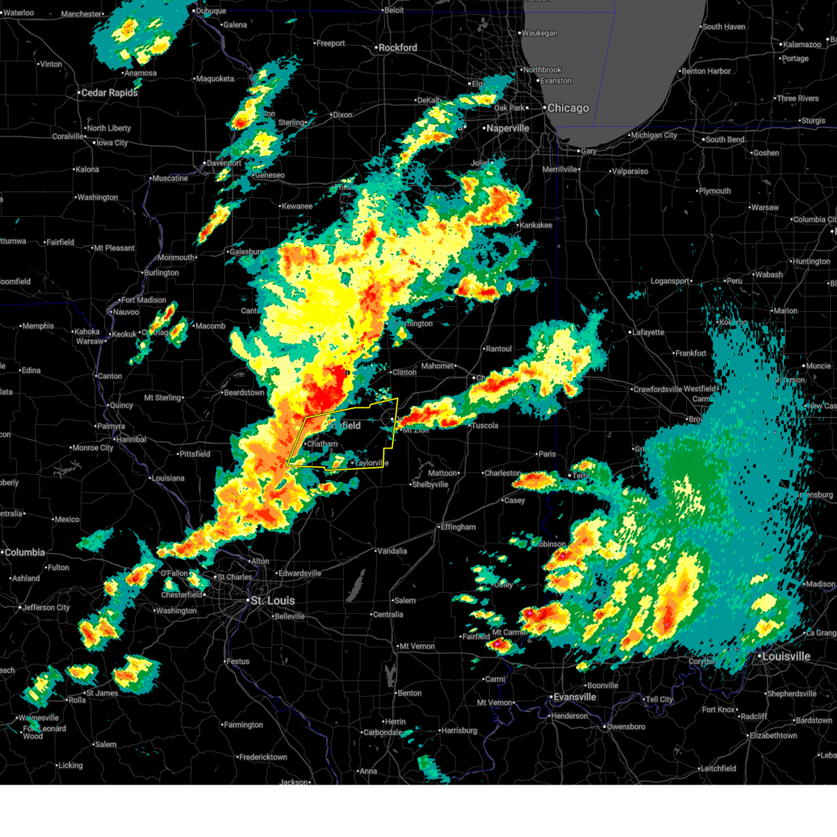 Svrilx the national weather service in lincoln has issued a * severe thunderstorm warning for, central christian county in central illinois, central sangamon county in central illinois, western macon county in central illinois, * until 700 pm cdt. * at 620 pm cdt, severe thunderstorms were located along a line extending from springfield to auburn, moving east at 55 mph (radar indicated). Hazards include 70 mph wind gusts and quarter size hail. Hail damage to vehicles is expected. expect considerable tree damage. wind damage is also likely to mobile homes, roofs, and outbuildings. severe thunderstorms will be near, springfield, rochester, riverton, pawnee, divernon, and dawson around 625 pm cdt. mechanicsburg and buffalo around 630 pm cdt. kincaid, edinburg, and jeisyville around 635 pm cdt. taylorville, illiopolis, and mount auburn around 640 pm cdt. other locations in the path of these severe thunderstorms include stonington, niantic, decatur, harristown and blue mound. this includes the following highways, interstate 55 between mile markers 77 and 101. Interstate 72 between mile markers 93 and 143. Svrilx the national weather service in lincoln has issued a * severe thunderstorm warning for, central christian county in central illinois, central sangamon county in central illinois, western macon county in central illinois, * until 700 pm cdt. * at 620 pm cdt, severe thunderstorms were located along a line extending from springfield to auburn, moving east at 55 mph (radar indicated). Hazards include 70 mph wind gusts and quarter size hail. Hail damage to vehicles is expected. expect considerable tree damage. wind damage is also likely to mobile homes, roofs, and outbuildings. severe thunderstorms will be near, springfield, rochester, riverton, pawnee, divernon, and dawson around 625 pm cdt. mechanicsburg and buffalo around 630 pm cdt. kincaid, edinburg, and jeisyville around 635 pm cdt. taylorville, illiopolis, and mount auburn around 640 pm cdt. other locations in the path of these severe thunderstorms include stonington, niantic, decatur, harristown and blue mound. this includes the following highways, interstate 55 between mile markers 77 and 101. Interstate 72 between mile markers 93 and 143.
|
| 4/27/2026 6:15 PM CDT |
 Svrilx the national weather service in lincoln has issued a * severe thunderstorm warning for, piatt county in central illinois, southwestern champaign county in east central illinois, east central macon county in central illinois, * until 700 pm cdt. * at 615 pm cdt, a severe thunderstorm was located near decatur airport, or 7 miles east of decatur, moving northeast at 45 mph (radar indicated). Hazards include 60 mph wind gusts and quarter size hail. Hail damage to vehicles is expected. expect wind damage to roofs, siding, and trees. this severe thunderstorm will be near, cerro gordo around 620 pm cdt. monticello around 630 pm cdt. other locations in the path of this severe thunderstorm include white heath, seymour, mahomet, bondville and lake of the woods. this includes the following highways, interstate 57 between mile markers 220 and 238. interstate 72 between mile markers 157 and 182. Interstate 74 between mile markers 164 and 180. Svrilx the national weather service in lincoln has issued a * severe thunderstorm warning for, piatt county in central illinois, southwestern champaign county in east central illinois, east central macon county in central illinois, * until 700 pm cdt. * at 615 pm cdt, a severe thunderstorm was located near decatur airport, or 7 miles east of decatur, moving northeast at 45 mph (radar indicated). Hazards include 60 mph wind gusts and quarter size hail. Hail damage to vehicles is expected. expect wind damage to roofs, siding, and trees. this severe thunderstorm will be near, cerro gordo around 620 pm cdt. monticello around 630 pm cdt. other locations in the path of this severe thunderstorm include white heath, seymour, mahomet, bondville and lake of the woods. this includes the following highways, interstate 57 between mile markers 220 and 238. interstate 72 between mile markers 157 and 182. Interstate 74 between mile markers 164 and 180.
|
| 4/27/2026 11:12 AM CDT |
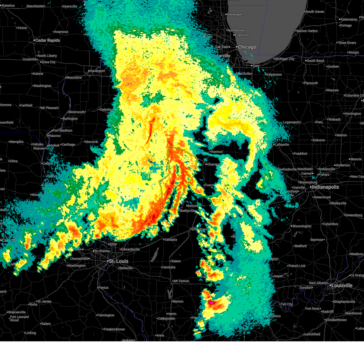 At 1112 am cdt, severe thunderstorms were located along a line extending from near wapella to 6 miles northeast of maroa to near decatur airport to near macon to near assumption, moving northeast at 50 mph (radar indicated). Hazards include 60 mph wind gusts. Expect damage to roofs, siding, and trees. these severe storms will be near, decatur, mount zion, moweaqua, cerro gordo, long creek, macon, argenta, oreana, weldon, and cisco around 1115 am cdt. le roy, farmer city, dalton city, and de land around 1120 am cdt. monticello, bement, and bethany around 1125 am cdt. mansfield and white heath around 1130 am cdt. other locations impacted by these severe thunderstorms include boody, clinton power station, weldon springs state park, lake city, lane, elwin, milmine, hervey city, la place, and de witt. this includes the following highways, interstate 72 between mile markers 127 and 174. Interstate 74 between mile markers 148 and 169. At 1112 am cdt, severe thunderstorms were located along a line extending from near wapella to 6 miles northeast of maroa to near decatur airport to near macon to near assumption, moving northeast at 50 mph (radar indicated). Hazards include 60 mph wind gusts. Expect damage to roofs, siding, and trees. these severe storms will be near, decatur, mount zion, moweaqua, cerro gordo, long creek, macon, argenta, oreana, weldon, and cisco around 1115 am cdt. le roy, farmer city, dalton city, and de land around 1120 am cdt. monticello, bement, and bethany around 1125 am cdt. mansfield and white heath around 1130 am cdt. other locations impacted by these severe thunderstorms include boody, clinton power station, weldon springs state park, lake city, lane, elwin, milmine, hervey city, la place, and de witt. this includes the following highways, interstate 72 between mile markers 127 and 174. Interstate 74 between mile markers 148 and 169.
|
| 4/27/2026 10:52 AM CDT |
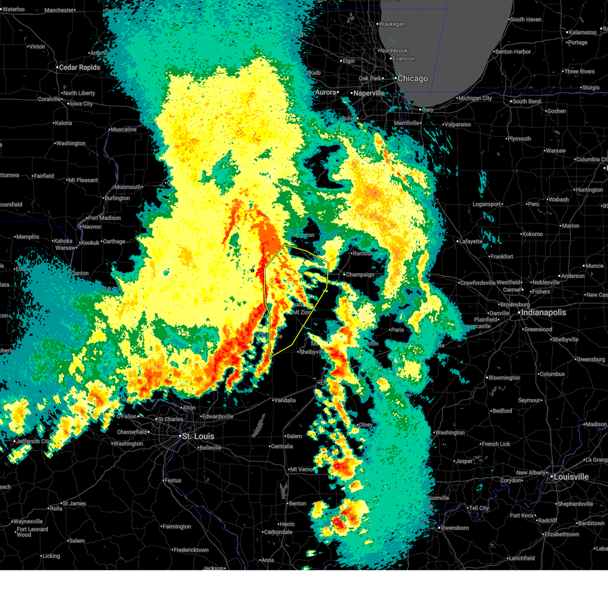 Svrilx the national weather service in lincoln has issued a * severe thunderstorm warning for, southeastern logan county in central illinois, eastern christian county in central illinois, northwestern moultrie county in central illinois, northwestern shelby county in central illinois, piatt county in central illinois, de witt county in central illinois, south central mclean county in central illinois, west central champaign county in east central illinois, macon county in central illinois, * until 1130 am cdt. * at 1052 am cdt, severe thunderstorms were located along a line extending from beason to near latham to near mount auburn to near stonington to near morrisonville, moving northeast at 55 mph (radar indicated). Hazards include 60 mph wind gusts. Expect damage to roofs, siding, and trees. severe thunderstorms will be near, decatur, harristown, warrensburg, blue mound, niantic, and kenney around 1055 am cdt. clinton, forsyth, maroa, macon, and wapella around 1100 am cdt. mount zion, moweaqua, long creek, assumption, argenta, oreana, and decatur airport around 1105 am cdt. cerro gordo and weldon around 1110 am cdt. other locations in the path of these severe thunderstorms include le roy, dalton city, de land, cisco, monticello, farmer city, bethany, bement, mansfield and white heath. this includes the following highways, interstate 72 between mile markers 127 and 174. Interstate 74 between mile markers 148 and 169. Svrilx the national weather service in lincoln has issued a * severe thunderstorm warning for, southeastern logan county in central illinois, eastern christian county in central illinois, northwestern moultrie county in central illinois, northwestern shelby county in central illinois, piatt county in central illinois, de witt county in central illinois, south central mclean county in central illinois, west central champaign county in east central illinois, macon county in central illinois, * until 1130 am cdt. * at 1052 am cdt, severe thunderstorms were located along a line extending from beason to near latham to near mount auburn to near stonington to near morrisonville, moving northeast at 55 mph (radar indicated). Hazards include 60 mph wind gusts. Expect damage to roofs, siding, and trees. severe thunderstorms will be near, decatur, harristown, warrensburg, blue mound, niantic, and kenney around 1055 am cdt. clinton, forsyth, maroa, macon, and wapella around 1100 am cdt. mount zion, moweaqua, long creek, assumption, argenta, oreana, and decatur airport around 1105 am cdt. cerro gordo and weldon around 1110 am cdt. other locations in the path of these severe thunderstorms include le roy, dalton city, de land, cisco, monticello, farmer city, bethany, bement, mansfield and white heath. this includes the following highways, interstate 72 between mile markers 127 and 174. Interstate 74 between mile markers 148 and 169.
|
| 4/27/2026 10:09 AM CDT |
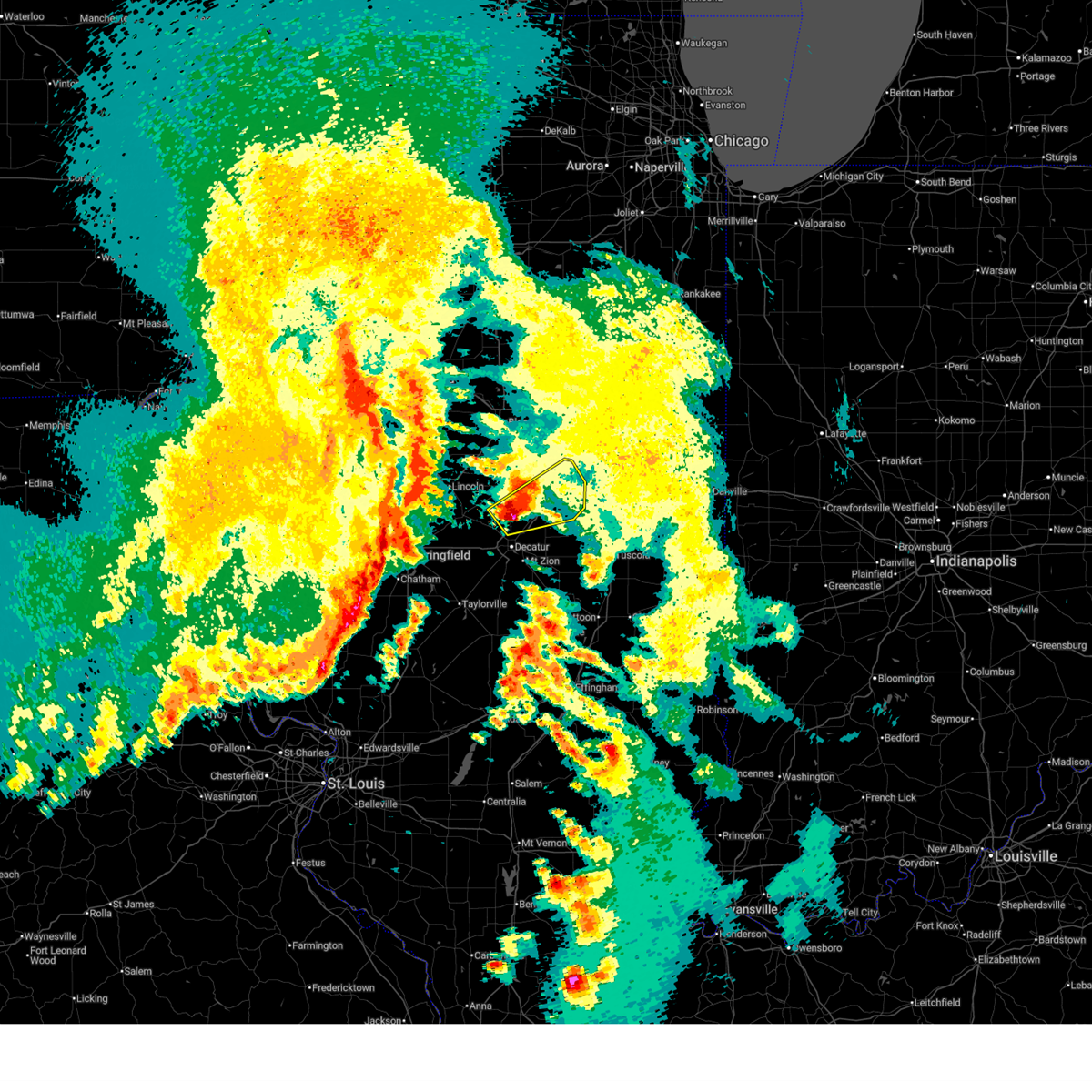 Svrilx the national weather service in lincoln has issued a * severe thunderstorm warning for, central piatt county in central illinois, central de witt county in central illinois, northeastern macon county in central illinois, * until 1045 am cdt. * at 1009 am cdt, a severe thunderstorm was located over maroa, or 9 miles north of decatur, moving northeast at 45 mph (radar indicated). Hazards include ping pong ball size hail and 60 mph wind gusts. People and animals outdoors will be injured. expect hail damage to roofs, siding, windows, and vehicles. expect wind damage to roofs, siding, and trees. this severe thunderstorm will be near, argenta around 1015 am cdt. weldon around 1025 am cdt. other locations in the path of this severe thunderstorm include de land. this includes the following highways, interstate 72 between mile markers 140 and 142, and between mile markers 148 and 173. Interstate 74 between mile markers 158 and 166. Svrilx the national weather service in lincoln has issued a * severe thunderstorm warning for, central piatt county in central illinois, central de witt county in central illinois, northeastern macon county in central illinois, * until 1045 am cdt. * at 1009 am cdt, a severe thunderstorm was located over maroa, or 9 miles north of decatur, moving northeast at 45 mph (radar indicated). Hazards include ping pong ball size hail and 60 mph wind gusts. People and animals outdoors will be injured. expect hail damage to roofs, siding, windows, and vehicles. expect wind damage to roofs, siding, and trees. this severe thunderstorm will be near, argenta around 1015 am cdt. weldon around 1025 am cdt. other locations in the path of this severe thunderstorm include de land. this includes the following highways, interstate 72 between mile markers 140 and 142, and between mile markers 148 and 173. Interstate 74 between mile markers 158 and 166.
|
| 4/27/2026 9:10 AM CDT |
 At 910 am cdt, a severe thunderstorm was located over macon, or 10 miles south of decatur, moving east at 50 mph (radar indicated). Hazards include 60 mph wind gusts and quarter size hail. Hail damage to vehicles is expected. expect wind damage to roofs, siding, and trees. this severe storm will be near, mount zion around 915 am cdt. other locations impacted by this severe thunderstorm include boody, willeys, elwin, and hervey city. This includes interstate 72 between mile markers 127 and 140. At 910 am cdt, a severe thunderstorm was located over macon, or 10 miles south of decatur, moving east at 50 mph (radar indicated). Hazards include 60 mph wind gusts and quarter size hail. Hail damage to vehicles is expected. expect wind damage to roofs, siding, and trees. this severe storm will be near, mount zion around 915 am cdt. other locations impacted by this severe thunderstorm include boody, willeys, elwin, and hervey city. This includes interstate 72 between mile markers 127 and 140.
|
| 4/27/2026 8:38 AM CDT |
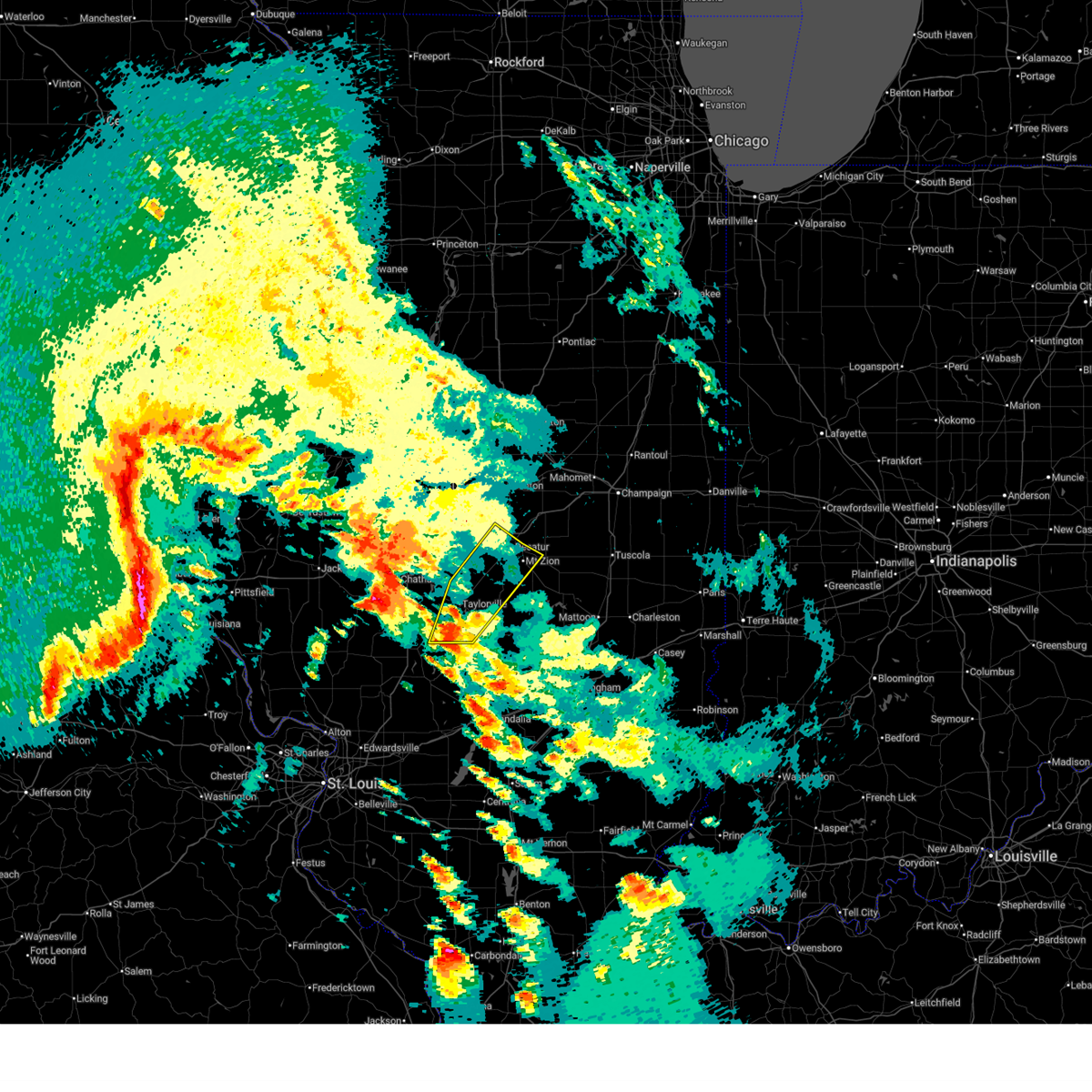 Svrilx the national weather service in lincoln has issued a * severe thunderstorm warning for, christian county in central illinois, northwestern shelby county in central illinois, southern macon county in central illinois, * until 930 am cdt. * at 838 am cdt, a severe thunderstorm was located 7 miles southwest of owaneco, or 7 miles south of taylorville, moving northeast at 50 mph (radar indicated). Hazards include 60 mph wind gusts and quarter size hail. Hail damage to vehicles is expected. expect wind damage to roofs, siding, and trees. this severe thunderstorm will be near, taylorville and owaneco around 845 am cdt. stonington around 855 am cdt. other locations in the path of this severe thunderstorm include moweaqua, blue mound, macon, decatur, mount zion, long creek and decatur airport. This includes interstate 72 between mile markers 127 and 140. Svrilx the national weather service in lincoln has issued a * severe thunderstorm warning for, christian county in central illinois, northwestern shelby county in central illinois, southern macon county in central illinois, * until 930 am cdt. * at 838 am cdt, a severe thunderstorm was located 7 miles southwest of owaneco, or 7 miles south of taylorville, moving northeast at 50 mph (radar indicated). Hazards include 60 mph wind gusts and quarter size hail. Hail damage to vehicles is expected. expect wind damage to roofs, siding, and trees. this severe thunderstorm will be near, taylorville and owaneco around 845 am cdt. stonington around 855 am cdt. other locations in the path of this severe thunderstorm include moweaqua, blue mound, macon, decatur, mount zion, long creek and decatur airport. This includes interstate 72 between mile markers 127 and 140.
|
| 4/17/2026 9:42 PM CDT | Storm damage reported in macon county IL, 4.3 miles WNW of Decatur, IL |
| 4/17/2026 9:27 PM CDT |
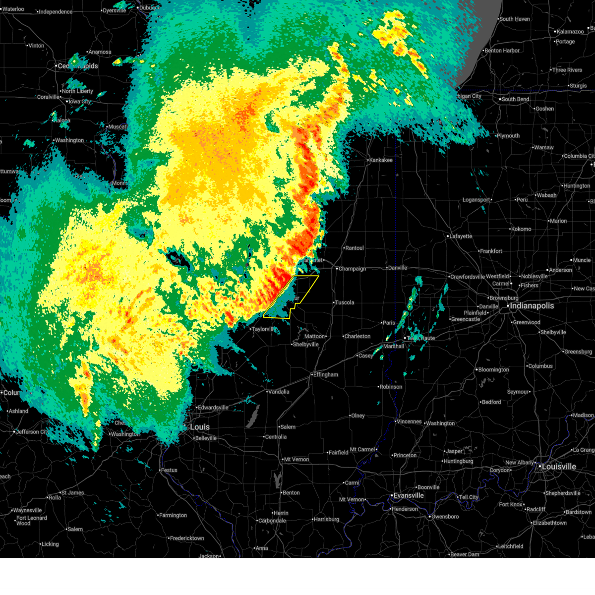 Svrilx the national weather service in lincoln has issued a * severe thunderstorm warning for, southern piatt county in central illinois, eastern macon county in central illinois, * until 1015 pm cdt. * at 927 pm cdt, severe thunderstorms were located along a line extending from near cisco to near edinburg, moving east at 40 mph (radar indicated). Hazards include 60 mph wind gusts. Expect damage to roofs, siding, and trees. severe thunderstorms will be near, decatur, blue mound, argenta, oreana, and cisco around 930 pm cdt. monticello, mount zion, long creek, macon, and decatur airport around 935 pm cdt. cerro gordo around 940 pm cdt. other locations in the path of these severe thunderstorms include bement. This includes interstate 72 between mile markers 144 and 165. Svrilx the national weather service in lincoln has issued a * severe thunderstorm warning for, southern piatt county in central illinois, eastern macon county in central illinois, * until 1015 pm cdt. * at 927 pm cdt, severe thunderstorms were located along a line extending from near cisco to near edinburg, moving east at 40 mph (radar indicated). Hazards include 60 mph wind gusts. Expect damage to roofs, siding, and trees. severe thunderstorms will be near, decatur, blue mound, argenta, oreana, and cisco around 930 pm cdt. monticello, mount zion, long creek, macon, and decatur airport around 935 pm cdt. cerro gordo around 940 pm cdt. other locations in the path of these severe thunderstorms include bement. This includes interstate 72 between mile markers 144 and 165.
|
| 4/17/2026 9:17 PM CDT |
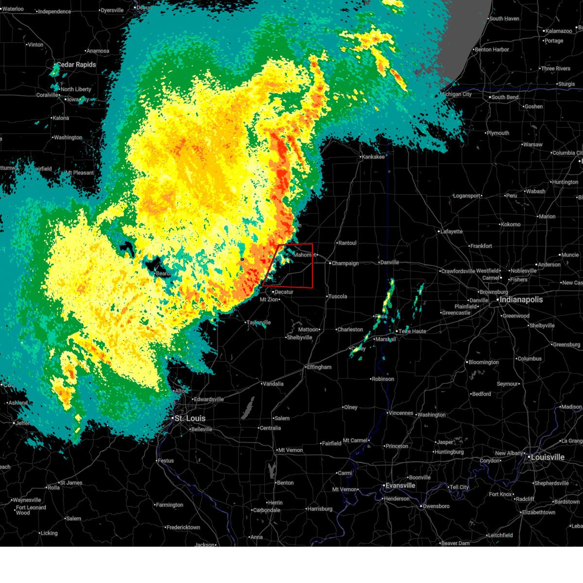 At 917 pm cdt, a confirmed tornado was located near maroa, or near clinton, moving east at 50 mph (radar confirmed tornado). Hazards include damaging tornado. Flying debris will be dangerous to those caught without shelter. mobile homes will be damaged or destroyed. damage to roofs, windows, and vehicles will occur. tree damage is likely. this tornado will be near, weldon around 920 pm cdt. de land around 930 pm cdt. white heath around 935 pm cdt. other locations impacted by this tornadic thunderstorm include milmine, clinton power station, weldon springs state park, lane, de witt, galesville, and lodge. this includes the following highways, interstate 72 between mile markers 139 and 173. Interstate 74 between mile markers 154 and 168. At 917 pm cdt, a confirmed tornado was located near maroa, or near clinton, moving east at 50 mph (radar confirmed tornado). Hazards include damaging tornado. Flying debris will be dangerous to those caught without shelter. mobile homes will be damaged or destroyed. damage to roofs, windows, and vehicles will occur. tree damage is likely. this tornado will be near, weldon around 920 pm cdt. de land around 930 pm cdt. white heath around 935 pm cdt. other locations impacted by this tornadic thunderstorm include milmine, clinton power station, weldon springs state park, lane, de witt, galesville, and lodge. this includes the following highways, interstate 72 between mile markers 139 and 173. Interstate 74 between mile markers 154 and 168.
|
| 4/17/2026 9:16 PM CDT |
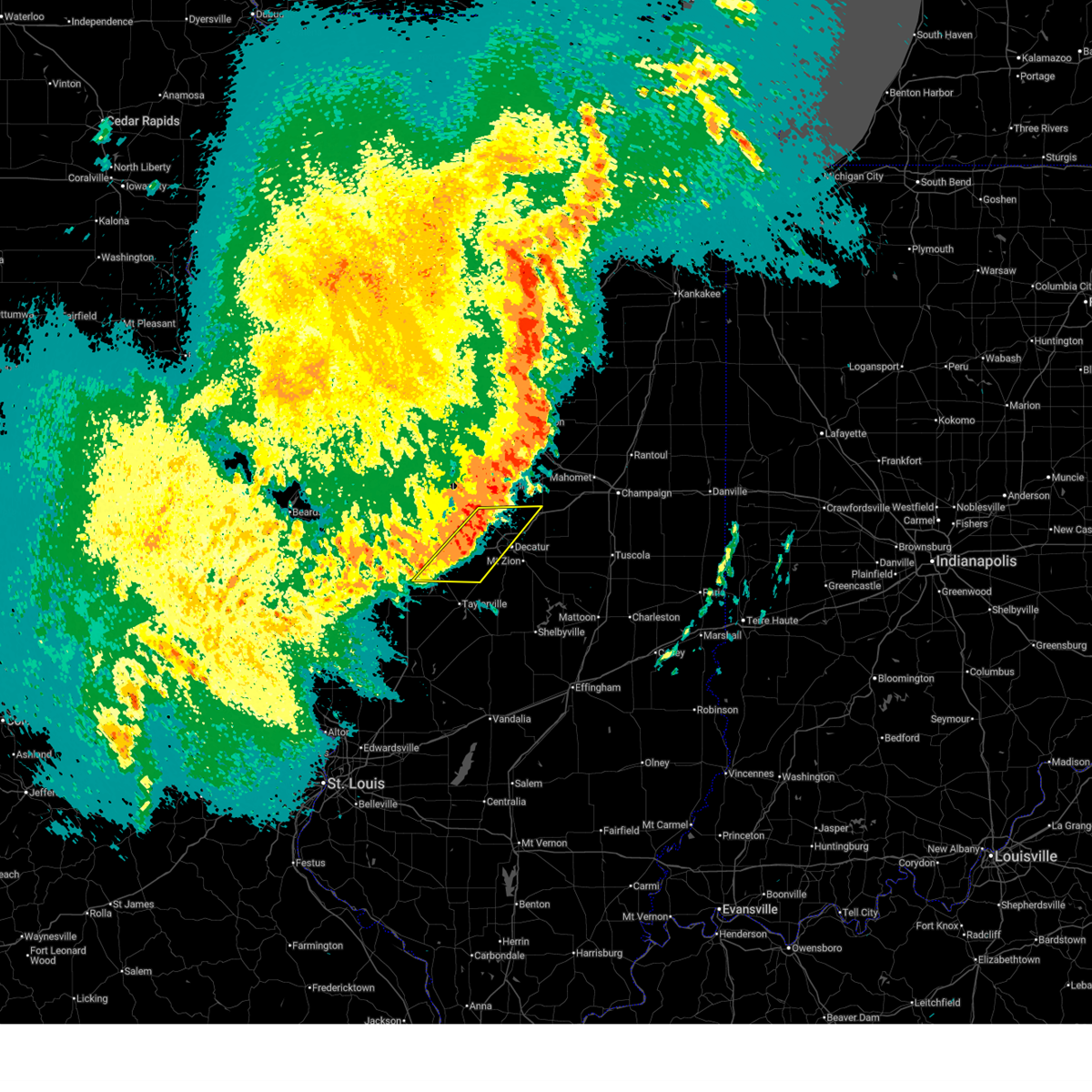 At 916 pm cdt, severe thunderstorms were located along a line extending from maroa to near edinburg, moving east at 65 mph (radar indicated). Hazards include 60 mph wind gusts. Expect damage to roofs, siding, and trees. these severe storms will be near, decatur, forsyth, maroa, harristown, warrensburg, argenta, illiopolis, niantic, and mount auburn around 920 pm cdt. blue mound and oreana around 925 pm cdt. This includes interstate 72 between mile markers 115 and 144. At 916 pm cdt, severe thunderstorms were located along a line extending from maroa to near edinburg, moving east at 65 mph (radar indicated). Hazards include 60 mph wind gusts. Expect damage to roofs, siding, and trees. these severe storms will be near, decatur, forsyth, maroa, harristown, warrensburg, argenta, illiopolis, niantic, and mount auburn around 920 pm cdt. blue mound and oreana around 925 pm cdt. This includes interstate 72 between mile markers 115 and 144.
|
| 4/17/2026 9:08 PM CDT |
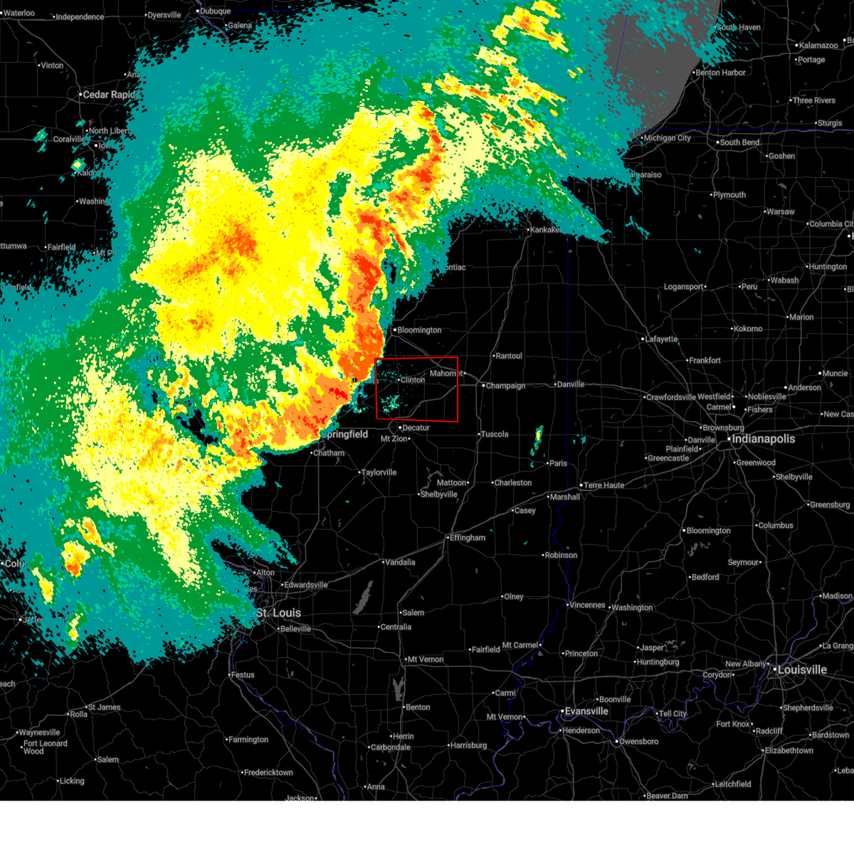 Torilx the national weather service in lincoln has issued a * tornado warning for, east central logan county in central illinois, piatt county in central illinois, de witt county in central illinois, southeastern mclean county in central illinois, northern macon county in central illinois, * until 945 pm cdt. * at 907 pm cdt, a confirmed tornado was located near kenney, or 8 miles southwest of clinton, moving east at 65 mph (weather spotters confirmed tornado). Hazards include damaging tornado. Flying debris will be dangerous to those caught without shelter. mobile homes will be damaged or destroyed. damage to roofs, windows, and vehicles will occur. tree damage is likely. the tornado will be near, maroa around 915 pm cdt. cisco around 920 pm cdt. monticello around 925 pm cdt. other locations in the path of this tornadic thunderstorm include white heath. this includes the following highways, interstate 72 between mile markers 139 and 173. Interstate 74 between mile markers 154 and 168. Torilx the national weather service in lincoln has issued a * tornado warning for, east central logan county in central illinois, piatt county in central illinois, de witt county in central illinois, southeastern mclean county in central illinois, northern macon county in central illinois, * until 945 pm cdt. * at 907 pm cdt, a confirmed tornado was located near kenney, or 8 miles southwest of clinton, moving east at 65 mph (weather spotters confirmed tornado). Hazards include damaging tornado. Flying debris will be dangerous to those caught without shelter. mobile homes will be damaged or destroyed. damage to roofs, windows, and vehicles will occur. tree damage is likely. the tornado will be near, maroa around 915 pm cdt. cisco around 920 pm cdt. monticello around 925 pm cdt. other locations in the path of this tornadic thunderstorm include white heath. this includes the following highways, interstate 72 between mile markers 139 and 173. Interstate 74 between mile markers 154 and 168.
|
| 4/17/2026 8:53 PM CDT |
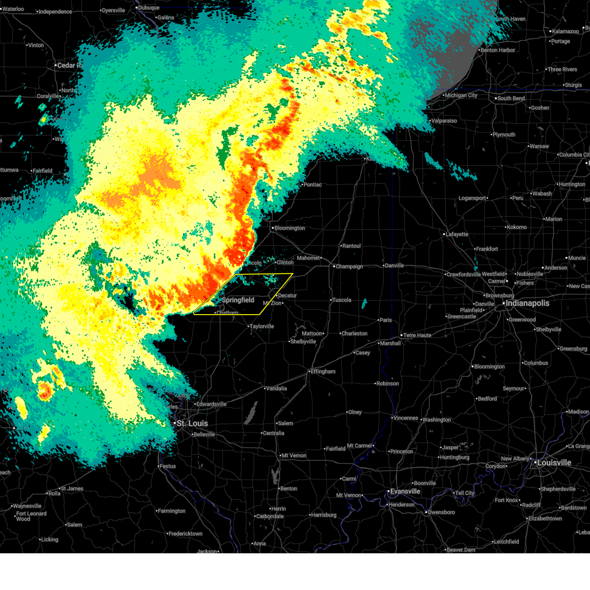 Svrilx the national weather service in lincoln has issued a * severe thunderstorm warning for, southern logan county in central illinois, northern christian county in central illinois, central sangamon county in central illinois, northwestern macon county in central illinois, * until 945 pm cdt. * at 853 pm cdt, severe thunderstorms were located along a line extending from near elkhart to near new berlin, moving east at 55 mph (radar indicated). Hazards include 70 mph wind gusts. Expect considerable tree damage. damage is likely to mobile homes, roofs, and outbuildings. severe thunderstorms will be near, springfield, chatham, sherman, rochester, riverton, mount pulaski, loami, dawson, buffalo, and cornland around 900 pm cdt. mechanicsburg and latham around 905 pm cdt. illiopolis around 910 pm cdt. other locations in the path of these severe thunderstorms include warrensburg, niantic, decatur, forsyth, maroa, harristown, edinburg, mount auburn, argenta, oreana and blue mound. this includes the following highways, interstate 55 between mile markers 87 and 113. Interstate 72 between mile markers 86 and 144. Svrilx the national weather service in lincoln has issued a * severe thunderstorm warning for, southern logan county in central illinois, northern christian county in central illinois, central sangamon county in central illinois, northwestern macon county in central illinois, * until 945 pm cdt. * at 853 pm cdt, severe thunderstorms were located along a line extending from near elkhart to near new berlin, moving east at 55 mph (radar indicated). Hazards include 70 mph wind gusts. Expect considerable tree damage. damage is likely to mobile homes, roofs, and outbuildings. severe thunderstorms will be near, springfield, chatham, sherman, rochester, riverton, mount pulaski, loami, dawson, buffalo, and cornland around 900 pm cdt. mechanicsburg and latham around 905 pm cdt. illiopolis around 910 pm cdt. other locations in the path of these severe thunderstorms include warrensburg, niantic, decatur, forsyth, maroa, harristown, edinburg, mount auburn, argenta, oreana and blue mound. this includes the following highways, interstate 55 between mile markers 87 and 113. Interstate 72 between mile markers 86 and 144.
|
| 3/26/2026 8:22 PM CDT |
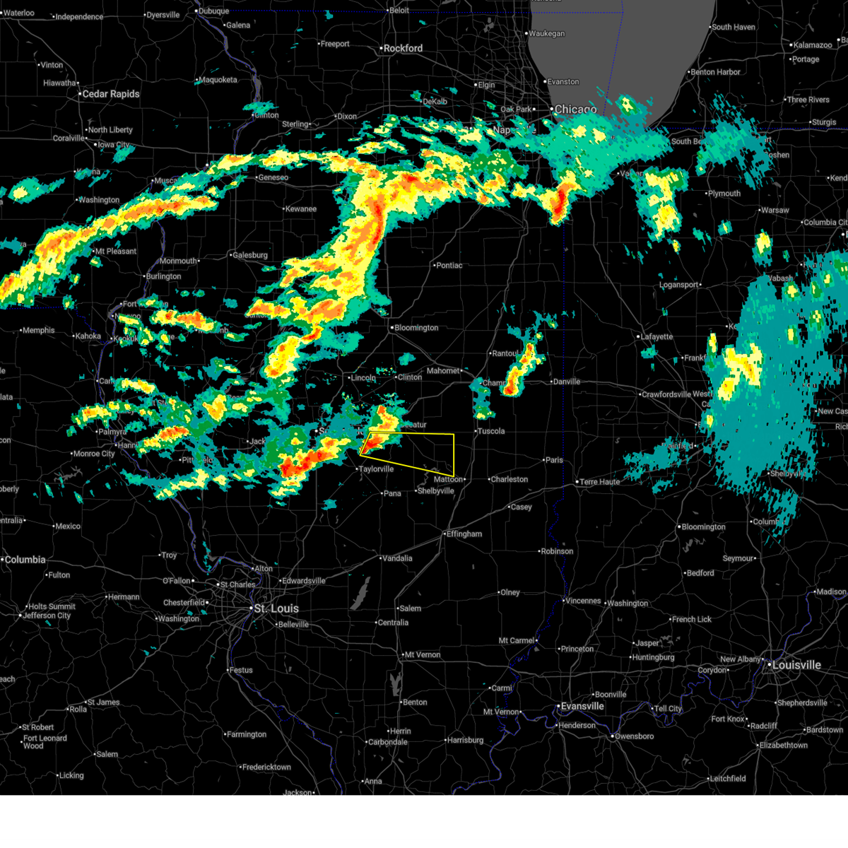 Svrilx the national weather service in lincoln has issued a * severe thunderstorm warning for, northeastern christian county in central illinois, moultrie county in central illinois, north central shelby county in central illinois, southern macon county in central illinois, * until 915 pm cdt. * at 822 pm cdt, a severe thunderstorm was located over blue mound, or 13 miles southwest of decatur, moving east at 55 mph (radar indicated). Hazards include quarter size hail. Damage to vehicles is expected. this severe thunderstorm will be near, dalton city around 835 pm cdt. bethany around 840 pm cdt. Other locations in the path of this severe thunderstorm include lovington and sullivan. Svrilx the national weather service in lincoln has issued a * severe thunderstorm warning for, northeastern christian county in central illinois, moultrie county in central illinois, north central shelby county in central illinois, southern macon county in central illinois, * until 915 pm cdt. * at 822 pm cdt, a severe thunderstorm was located over blue mound, or 13 miles southwest of decatur, moving east at 55 mph (radar indicated). Hazards include quarter size hail. Damage to vehicles is expected. this severe thunderstorm will be near, dalton city around 835 pm cdt. bethany around 840 pm cdt. Other locations in the path of this severe thunderstorm include lovington and sullivan.
|
| 3/15/2026 6:28 PM CDT |
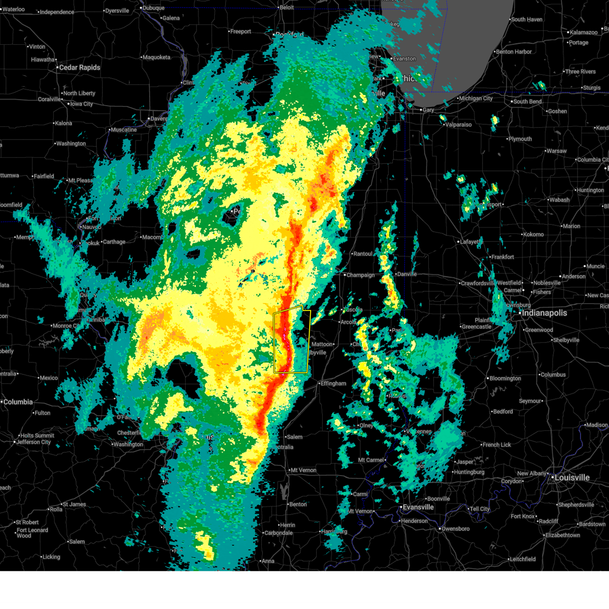 At 628 pm cdt, severe thunderstorms were located along a line extending from near cerro gordo to near wrights corner, moving east at 55 mph (radar indicated). Hazards include 60 mph wind gusts and nickel size hail. Expect damage to roofs, siding, and trees. These severe thunderstorms will remain over mainly rural areas of southeastern christian, western moultrie, shelby and southeastern macon counties, including the following locations, boody, clarksburg, wolf creek state park, hervey city, westervelt, kirksville, lake city, mode, elwin, and lakewood. At 628 pm cdt, severe thunderstorms were located along a line extending from near cerro gordo to near wrights corner, moving east at 55 mph (radar indicated). Hazards include 60 mph wind gusts and nickel size hail. Expect damage to roofs, siding, and trees. These severe thunderstorms will remain over mainly rural areas of southeastern christian, western moultrie, shelby and southeastern macon counties, including the following locations, boody, clarksburg, wolf creek state park, hervey city, westervelt, kirksville, lake city, mode, elwin, and lakewood.
|
| 3/15/2026 6:26 PM CDT |
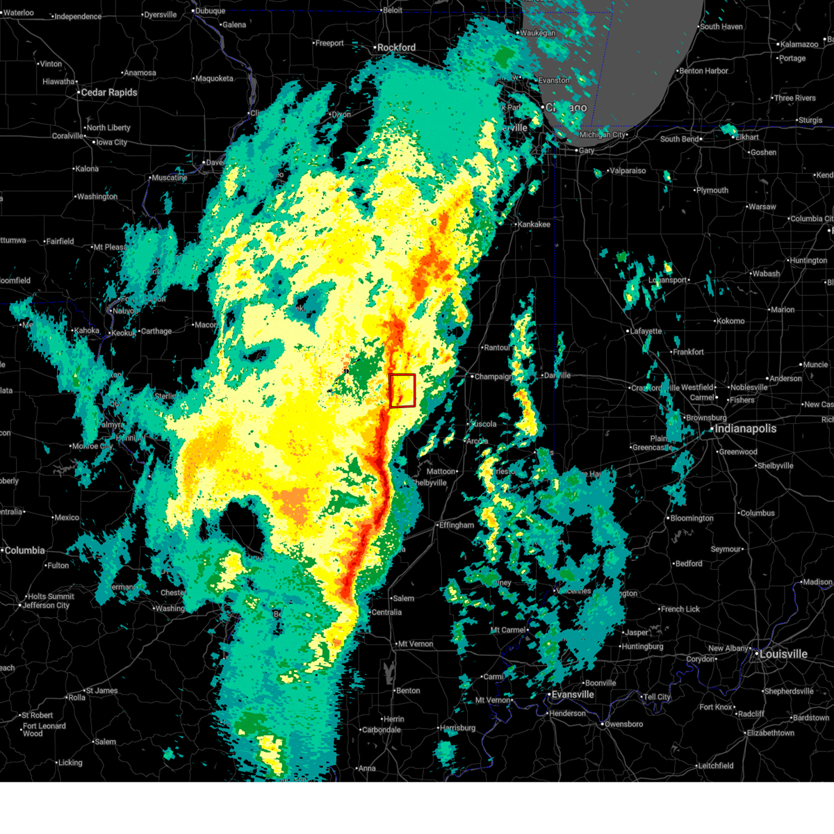 At 625 pm cdt, a severe squall line capable of producing both tornadoes and extensive straight line wind damage was located near maroa, or 9 miles southeast of clinton, moving east at 45 mph (radar indicated rotation). Hazards include tornado. Flying debris will be dangerous to those caught without shelter. mobile homes will be damaged or destroyed. damage to roofs, windows, and vehicles will occur. tree damage is likely. these dangerous storms will be near, argenta around 630 pm cdt. weldon around 635 pm cdt. other locations impacted by this tornadic thunderstorm include lane and weldon springs state park. This includes interstate 72 between mile markers 147 and 156. At 625 pm cdt, a severe squall line capable of producing both tornadoes and extensive straight line wind damage was located near maroa, or 9 miles southeast of clinton, moving east at 45 mph (radar indicated rotation). Hazards include tornado. Flying debris will be dangerous to those caught without shelter. mobile homes will be damaged or destroyed. damage to roofs, windows, and vehicles will occur. tree damage is likely. these dangerous storms will be near, argenta around 630 pm cdt. weldon around 635 pm cdt. other locations impacted by this tornadic thunderstorm include lane and weldon springs state park. This includes interstate 72 between mile markers 147 and 156.
|
| 3/15/2026 6:22 PM CDT |
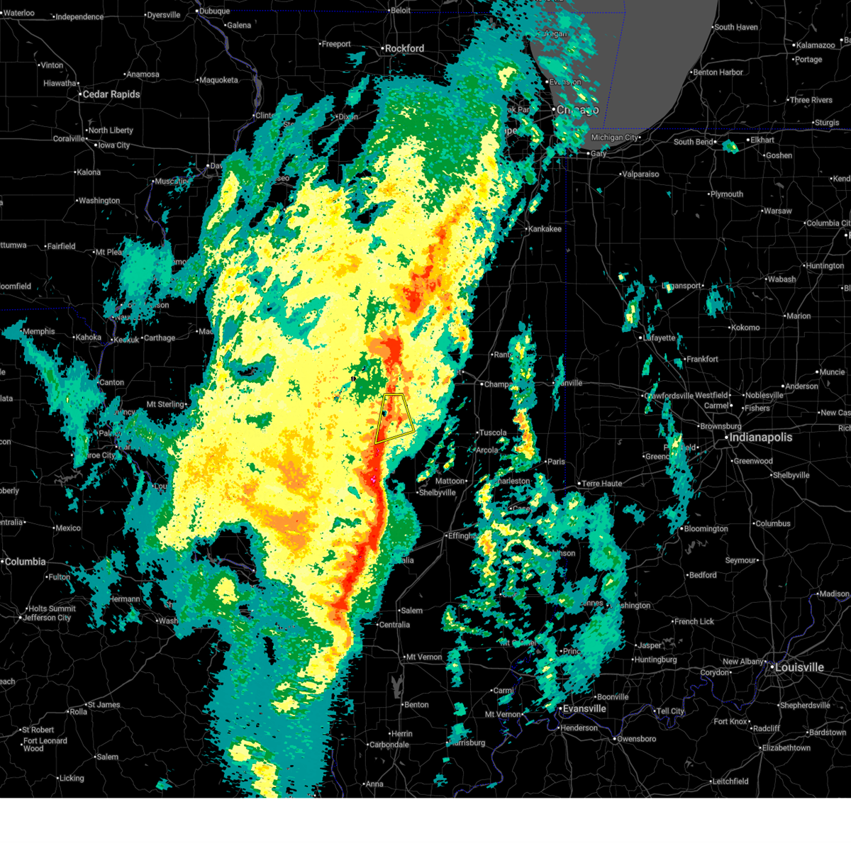 the severe thunderstorm warning has been cancelled and is no longer in effect the severe thunderstorm warning has been cancelled and is no longer in effect
|
| 3/15/2026 6:22 PM CDT |
 At 622 pm cdt, severe thunderstorms were located along a line extending from downs to near argenta, moving east at 55 mph (radar indicated). Hazards include 60 mph wind gusts and nickel size hail. Expect damage to roofs, siding, and trees. these severe thunderstorms will remain over mainly rural areas of northern christian and central macon counties, including the following locations, boody and elwin. This includes interstate 72 between mile markers 130 and 146. At 622 pm cdt, severe thunderstorms were located along a line extending from downs to near argenta, moving east at 55 mph (radar indicated). Hazards include 60 mph wind gusts and nickel size hail. Expect damage to roofs, siding, and trees. these severe thunderstorms will remain over mainly rural areas of northern christian and central macon counties, including the following locations, boody and elwin. This includes interstate 72 between mile markers 130 and 146.
|
| 3/15/2026 6:21 PM CDT |
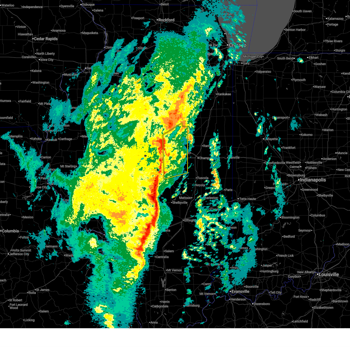 Svrilx the national weather service in lincoln has issued a * severe thunderstorm warning for, piatt county in central illinois, de witt county in central illinois, southeastern mclean county in central illinois, northeastern macon county in central illinois, * until 700 pm cdt. * at 621 pm cdt, severe thunderstorms were located along a line extending from downs to near decatur, moving northeast at 45 mph (radar indicated). Hazards include 60 mph wind gusts and nickel size hail. Expect damage to roofs, siding, and trees. severe thunderstorms will be near, decatur, le roy, long creek, downs, argenta, oreana, and decatur airport around 625 pm cdt. cerro gordo, weldon, and cisco around 630 pm cdt. farmer city and de land around 635 pm cdt. monticello and colfax around 640 pm cdt. other locations in the path of these severe thunderstorms include bement, mansfield, saybrook, white heath and ivesdale. this includes the following highways, interstate 72 between mile markers 142 and 173. Interstate 74 between mile markers 137 and 168. Svrilx the national weather service in lincoln has issued a * severe thunderstorm warning for, piatt county in central illinois, de witt county in central illinois, southeastern mclean county in central illinois, northeastern macon county in central illinois, * until 700 pm cdt. * at 621 pm cdt, severe thunderstorms were located along a line extending from downs to near decatur, moving northeast at 45 mph (radar indicated). Hazards include 60 mph wind gusts and nickel size hail. Expect damage to roofs, siding, and trees. severe thunderstorms will be near, decatur, le roy, long creek, downs, argenta, oreana, and decatur airport around 625 pm cdt. cerro gordo, weldon, and cisco around 630 pm cdt. farmer city and de land around 635 pm cdt. monticello and colfax around 640 pm cdt. other locations in the path of these severe thunderstorms include bement, mansfield, saybrook, white heath and ivesdale. this includes the following highways, interstate 72 between mile markers 142 and 173. Interstate 74 between mile markers 137 and 168.
|
| 3/15/2026 6:10 PM CDT |
 At 609 pm cdt, a severe squall line capable of producing both tornadoes and extensive straight line wind damage was located near latham, or 11 miles southwest of clinton, moving east at 35 mph (radar indicated rotation). Hazards include tornado. Flying debris will be dangerous to those caught without shelter. mobile homes will be damaged or destroyed. damage to roofs, windows, and vehicles will occur. tree damage is likely. these dangerous storms will be near, maroa around 615 pm cdt. argenta around 625 pm cdt. other locations impacted by this tornadic thunderstorm include lane and weldon springs state park. This includes interstate 72 between mile markers 147 and 156. At 609 pm cdt, a severe squall line capable of producing both tornadoes and extensive straight line wind damage was located near latham, or 11 miles southwest of clinton, moving east at 35 mph (radar indicated rotation). Hazards include tornado. Flying debris will be dangerous to those caught without shelter. mobile homes will be damaged or destroyed. damage to roofs, windows, and vehicles will occur. tree damage is likely. these dangerous storms will be near, maroa around 615 pm cdt. argenta around 625 pm cdt. other locations impacted by this tornadic thunderstorm include lane and weldon springs state park. This includes interstate 72 between mile markers 147 and 156.
|
| 3/15/2026 6:10 PM CDT |
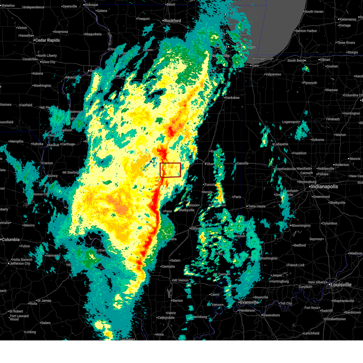 the tornado warning has been cancelled and is no longer in effect the tornado warning has been cancelled and is no longer in effect
|
| 3/15/2026 6:02 PM CDT |
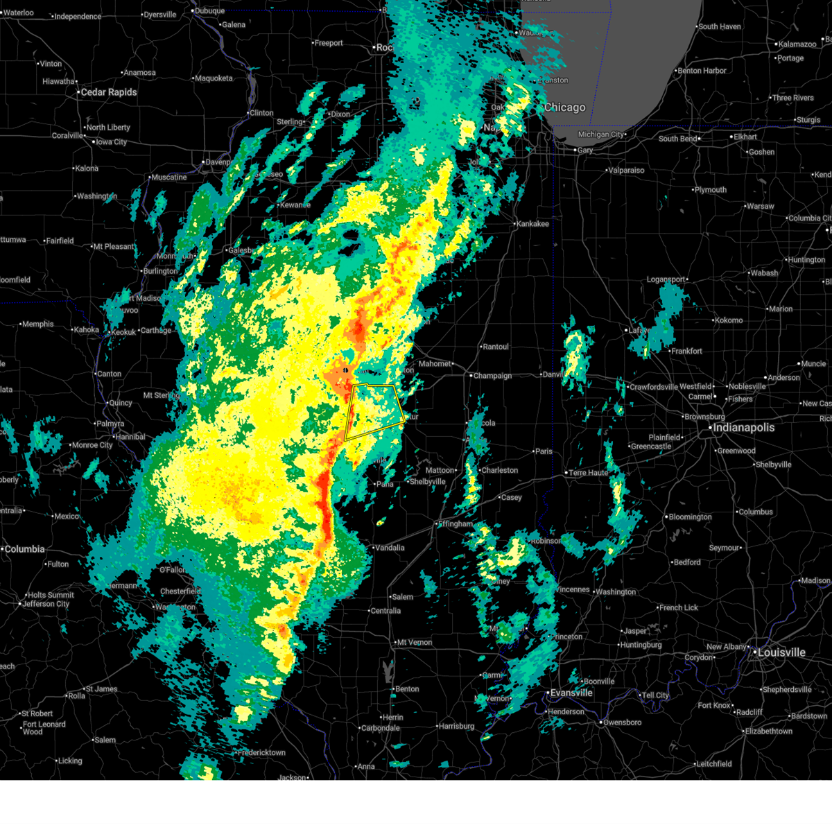 At 601 pm cdt, severe thunderstorms were located along a line extending from near waynesville to near harristown, moving northeast at 55 mph (radar indicated). Hazards include 60 mph wind gusts and nickel size hail. Expect damage to roofs, siding, and trees. these severe storms will be near, decatur, forsyth, harristown, and warrensburg around 605 pm cdt. maroa around 610 pm cdt. oreana around 615 pm cdt. other locations impacted by these severe thunderstorms include boody and elwin. This includes interstate 72 between mile markers 120 and 146. At 601 pm cdt, severe thunderstorms were located along a line extending from near waynesville to near harristown, moving northeast at 55 mph (radar indicated). Hazards include 60 mph wind gusts and nickel size hail. Expect damage to roofs, siding, and trees. these severe storms will be near, decatur, forsyth, harristown, and warrensburg around 605 pm cdt. maroa around 610 pm cdt. oreana around 615 pm cdt. other locations impacted by these severe thunderstorms include boody and elwin. This includes interstate 72 between mile markers 120 and 146.
|
| 3/15/2026 6:00 PM CDT |
 Svrilx the national weather service in lincoln has issued a * severe thunderstorm warning for, christian county in central illinois, western moultrie county in central illinois, shelby county in central illinois, southern macon county in central illinois, * until 645 pm cdt. * at 559 pm cdt, severe thunderstorms were located along a line extending from mount auburn to near van burensburg, moving northeast at 55 mph (radar indicated). Hazards include 60 mph wind gusts and nickel size hail. Expect damage to roofs, siding, and trees. severe thunderstorms will be near, pana, blue mound, stonington, and owaneco around 605 pm cdt. moweaqua, assumption, and macon around 610 pm cdt. decatur, mount zion, long creek, tower hill, and herrick around 615 pm cdt. Other locations in the path of these severe thunderstorms include dalton city, shelbyville, bethany, findlay and cowden. Svrilx the national weather service in lincoln has issued a * severe thunderstorm warning for, christian county in central illinois, western moultrie county in central illinois, shelby county in central illinois, southern macon county in central illinois, * until 645 pm cdt. * at 559 pm cdt, severe thunderstorms were located along a line extending from mount auburn to near van burensburg, moving northeast at 55 mph (radar indicated). Hazards include 60 mph wind gusts and nickel size hail. Expect damage to roofs, siding, and trees. severe thunderstorms will be near, pana, blue mound, stonington, and owaneco around 605 pm cdt. moweaqua, assumption, and macon around 610 pm cdt. decatur, mount zion, long creek, tower hill, and herrick around 615 pm cdt. Other locations in the path of these severe thunderstorms include dalton city, shelbyville, bethany, findlay and cowden.
|
| 3/15/2026 6:00 PM CDT |
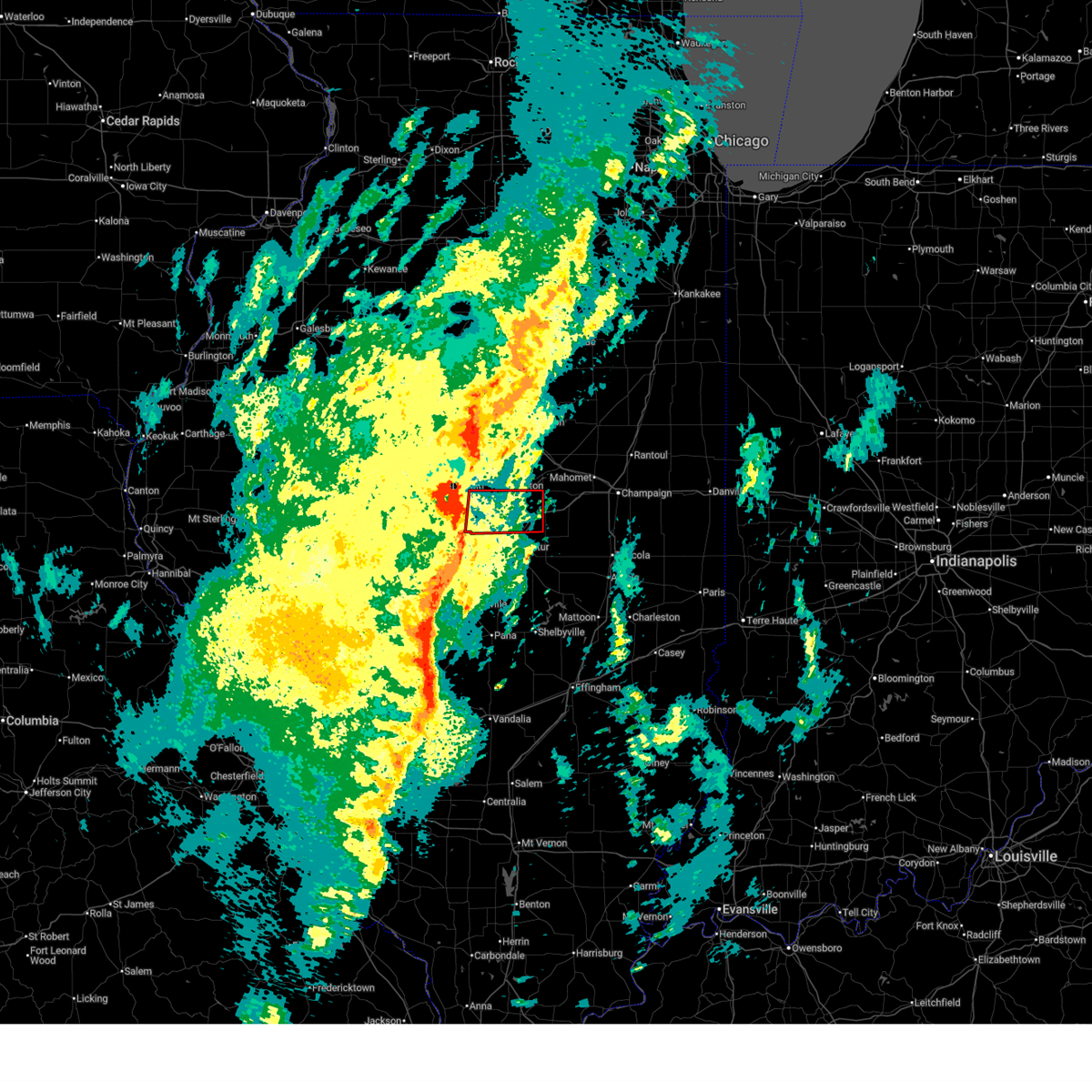 Torilx the national weather service in lincoln has issued a * tornado warning for, southeastern logan county in central illinois, southwestern de witt county in central illinois, northern macon county in central illinois, * until 645 pm cdt. * at 600 pm cdt, severe thunderstorms capable of producing both tornadoes and extensive straight line wind damage were located over latham, or 14 miles southeast of lincoln, moving east at 45 mph (radar indicated rotation). Hazards include tornado. Flying debris will be dangerous to those caught without shelter. mobile homes will be damaged or destroyed. damage to roofs, windows, and vehicles will occur. tree damage is likely. these dangerous storms will be near, maroa around 610 pm cdt. argenta around 620 pm cdt. This includes interstate 72 between mile markers 147 and 156. Torilx the national weather service in lincoln has issued a * tornado warning for, southeastern logan county in central illinois, southwestern de witt county in central illinois, northern macon county in central illinois, * until 645 pm cdt. * at 600 pm cdt, severe thunderstorms capable of producing both tornadoes and extensive straight line wind damage were located over latham, or 14 miles southeast of lincoln, moving east at 45 mph (radar indicated rotation). Hazards include tornado. Flying debris will be dangerous to those caught without shelter. mobile homes will be damaged or destroyed. damage to roofs, windows, and vehicles will occur. tree damage is likely. these dangerous storms will be near, maroa around 610 pm cdt. argenta around 620 pm cdt. This includes interstate 72 between mile markers 147 and 156.
|
| 3/15/2026 5:44 PM CDT |
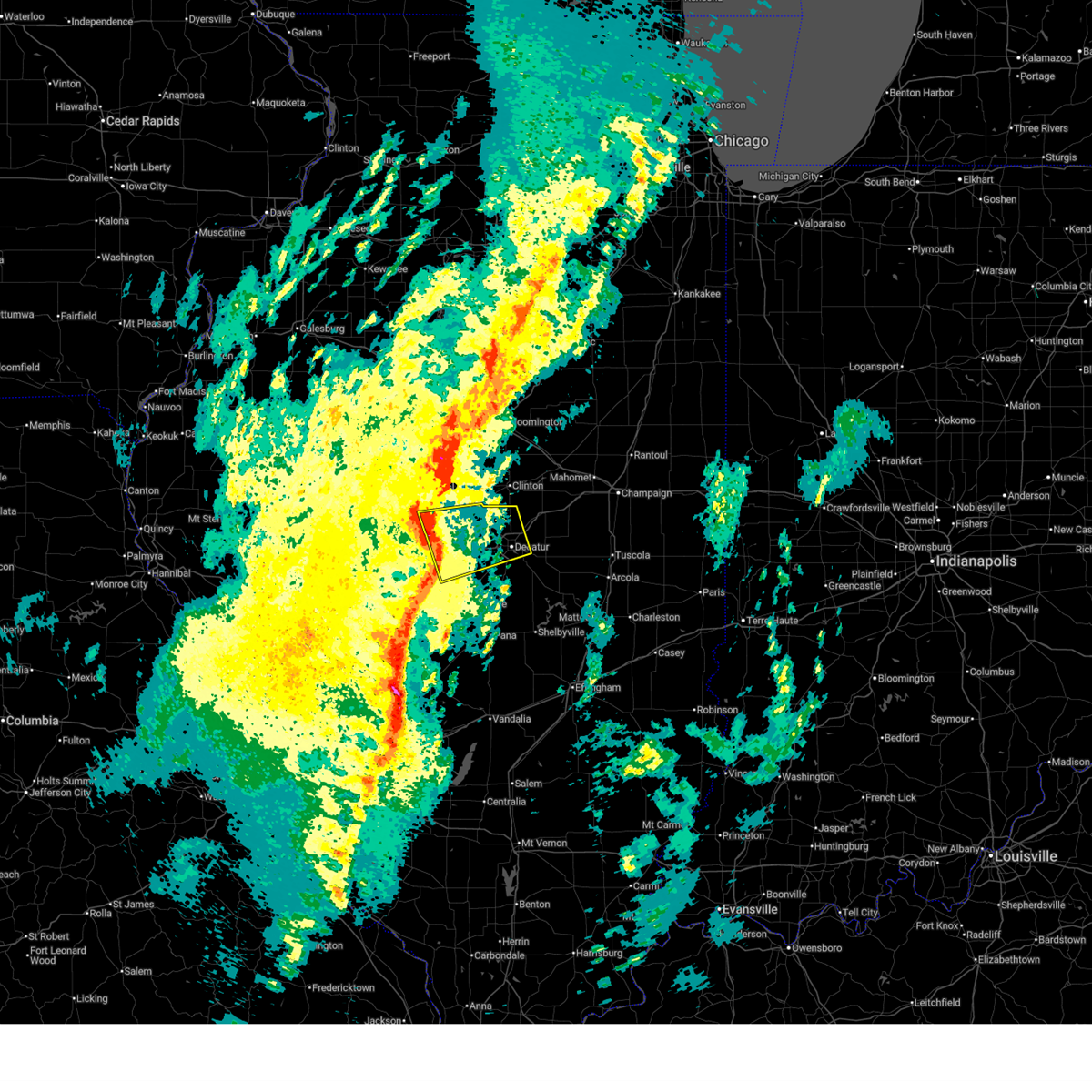 Svrilx the national weather service in lincoln has issued a * severe thunderstorm warning for, southern logan county in central illinois, northwestern christian county in central illinois, northeastern sangamon county in central illinois, central macon county in central illinois, * until 630 pm cdt. * at 544 pm cdt, severe thunderstorms were located along a line extending from near elkhart to near edinburg, moving northeast at 55 mph (radar indicated). Hazards include 60 mph wind gusts and nickel size hail. Expect damage to roofs, siding, and trees. severe thunderstorms will be near, mount pulaski, illiopolis, niantic, and mount auburn around 550 pm cdt. harristown, latham, and chestnut around 555 pm cdt. decatur and warrensburg around 600 pm cdt. other locations in the path of these severe thunderstorms include forsyth, maroa and oreana. this includes the following highways, interstate 55 between mile markers 110 and 115. Interstate 72 between mile markers 111 and 146. Svrilx the national weather service in lincoln has issued a * severe thunderstorm warning for, southern logan county in central illinois, northwestern christian county in central illinois, northeastern sangamon county in central illinois, central macon county in central illinois, * until 630 pm cdt. * at 544 pm cdt, severe thunderstorms were located along a line extending from near elkhart to near edinburg, moving northeast at 55 mph (radar indicated). Hazards include 60 mph wind gusts and nickel size hail. Expect damage to roofs, siding, and trees. severe thunderstorms will be near, mount pulaski, illiopolis, niantic, and mount auburn around 550 pm cdt. harristown, latham, and chestnut around 555 pm cdt. decatur and warrensburg around 600 pm cdt. other locations in the path of these severe thunderstorms include forsyth, maroa and oreana. this includes the following highways, interstate 55 between mile markers 110 and 115. Interstate 72 between mile markers 111 and 146.
|
| 3/11/2026 1:55 AM CDT | Ping Pong Ball sized hail reported 2.7 miles SSE of Decatur, IL |
| 3/11/2026 1:47 AM CDT | Power lines down on florida court. time estimated by rada in macon county IL, 1.9 miles N of Decatur, IL |
| 3/11/2026 1:27 AM CDT |
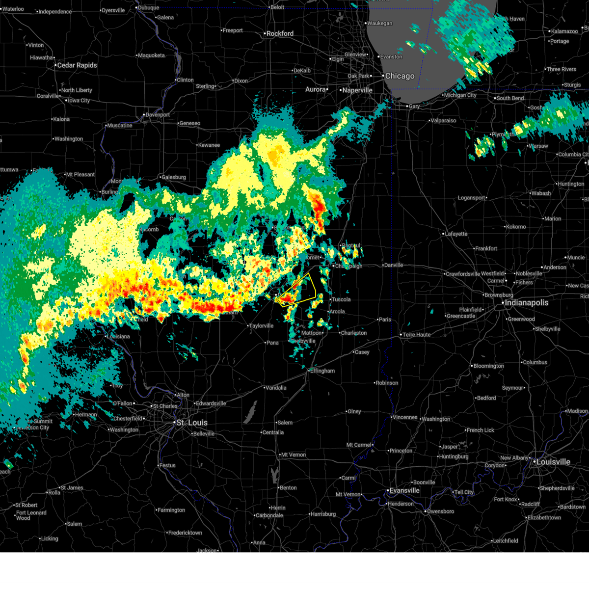 Svrilx the national weather service in lincoln has issued a * severe thunderstorm warning for, north central moultrie county in central illinois, southern piatt county in central illinois, southeastern macon county in central illinois, * until 200 am cdt. * at 127 am cdt, a severe thunderstorm was located over long creek, or 7 miles southeast of decatur, moving northeast at 50 mph (radar indicated). Hazards include 60 mph wind gusts and quarter size hail. Hail damage to vehicles is expected. expect wind damage to roofs, siding, and trees. this severe thunderstorm will be near, cerro gordo around 135 am cdt. Bement around 140 am cdt. Svrilx the national weather service in lincoln has issued a * severe thunderstorm warning for, north central moultrie county in central illinois, southern piatt county in central illinois, southeastern macon county in central illinois, * until 200 am cdt. * at 127 am cdt, a severe thunderstorm was located over long creek, or 7 miles southeast of decatur, moving northeast at 50 mph (radar indicated). Hazards include 60 mph wind gusts and quarter size hail. Hail damage to vehicles is expected. expect wind damage to roofs, siding, and trees. this severe thunderstorm will be near, cerro gordo around 135 am cdt. Bement around 140 am cdt.
|
| 3/3/2026 6:15 PM CST |
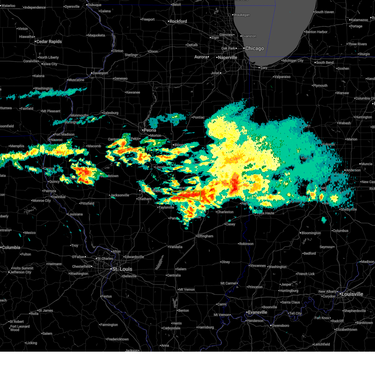 The storm which prompted the warning has weakened below severe limits, and no longer poses an immediate threat to life or property. therefore, the warning has been allowed to expire. to report severe weather, contact your nearest law enforcement agency. they will relay your report to the national weather service lincoln. The storm which prompted the warning has weakened below severe limits, and no longer poses an immediate threat to life or property. therefore, the warning has been allowed to expire. to report severe weather, contact your nearest law enforcement agency. they will relay your report to the national weather service lincoln.
|
| 3/3/2026 6:04 PM CST |
 the severe thunderstorm warning has been cancelled and is no longer in effect the severe thunderstorm warning has been cancelled and is no longer in effect
|
| 3/3/2026 6:04 PM CST |
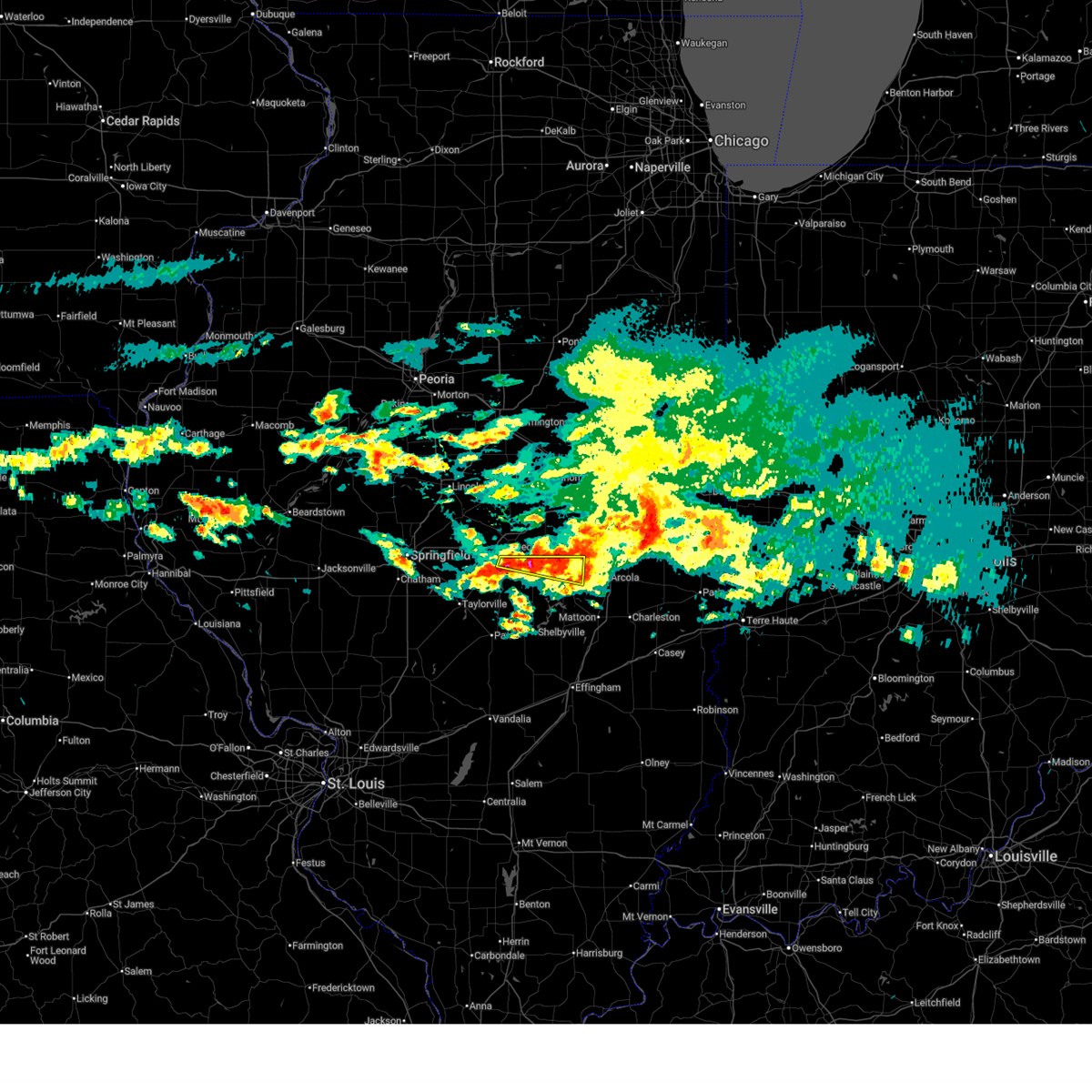 At 604 pm cst, a severe thunderstorm was located near atwood, or near tuscola, moving east at 55 mph (radar indicated). Hazards include quarter size hail. Damage to vehicles is expected. This severe thunderstorm will remain over mainly rural areas of northern moultrie, western douglas and southeastern macon counties, including the following locations, elwin, hervey city, cadwell, and lake city. At 604 pm cst, a severe thunderstorm was located near atwood, or near tuscola, moving east at 55 mph (radar indicated). Hazards include quarter size hail. Damage to vehicles is expected. This severe thunderstorm will remain over mainly rural areas of northern moultrie, western douglas and southeastern macon counties, including the following locations, elwin, hervey city, cadwell, and lake city.
|
| 3/3/2026 5:48 PM CST |
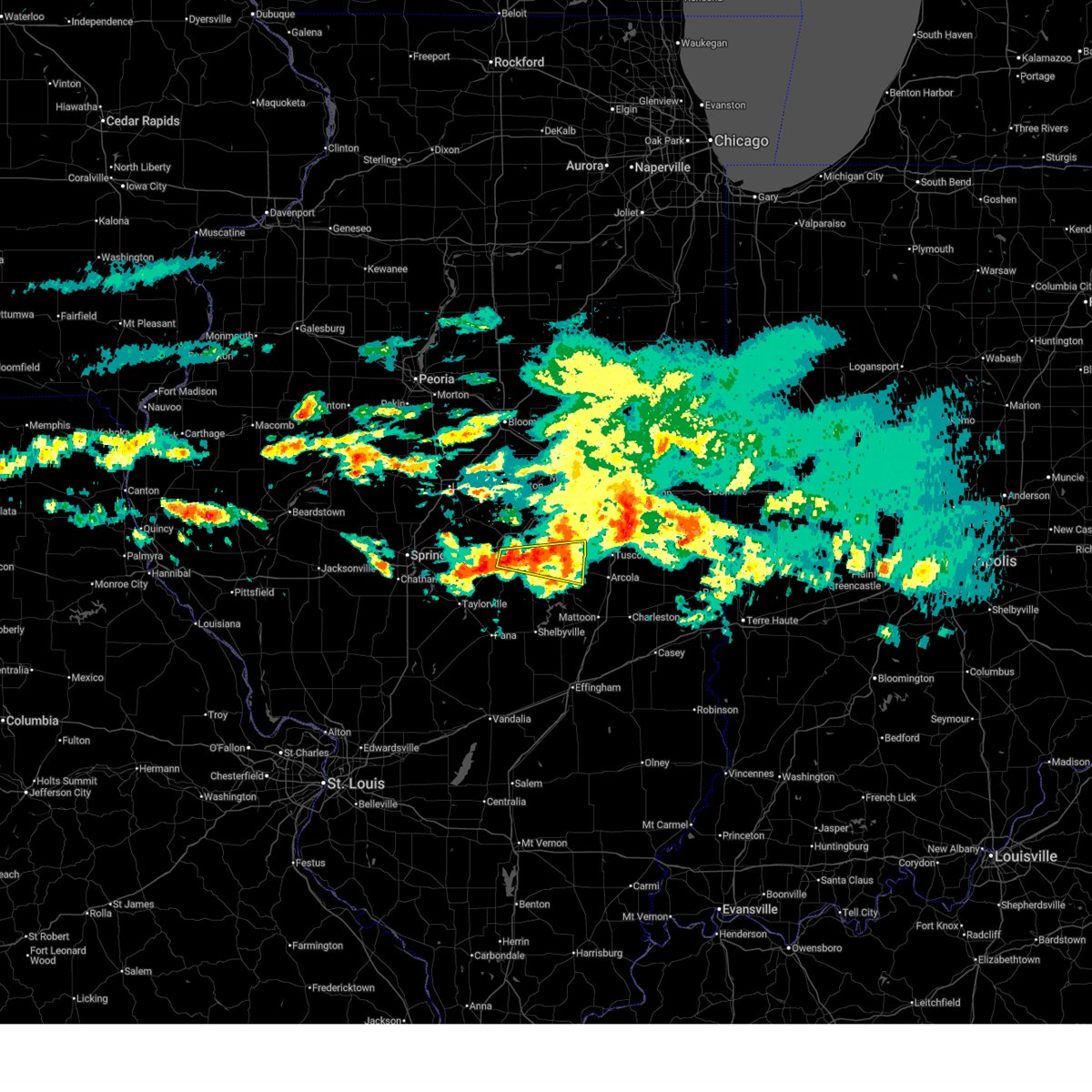 At 547 pm cst, a severe thunderstorm was located near hammond, or 13 miles east of decatur, moving east at 55 mph (radar indicated). Hazards include quarter size hail. Damage to vehicles is expected. this severe storm will be near, atwood and hammond around 555 pm cst. arthur around 600 pm cst. Other locations impacted by this severe thunderstorm include elwin, hervey city, cadwell, la place, and lake city. At 547 pm cst, a severe thunderstorm was located near hammond, or 13 miles east of decatur, moving east at 55 mph (radar indicated). Hazards include quarter size hail. Damage to vehicles is expected. this severe storm will be near, atwood and hammond around 555 pm cst. arthur around 600 pm cst. Other locations impacted by this severe thunderstorm include elwin, hervey city, cadwell, la place, and lake city.
|
| 3/3/2026 5:34 PM CST |
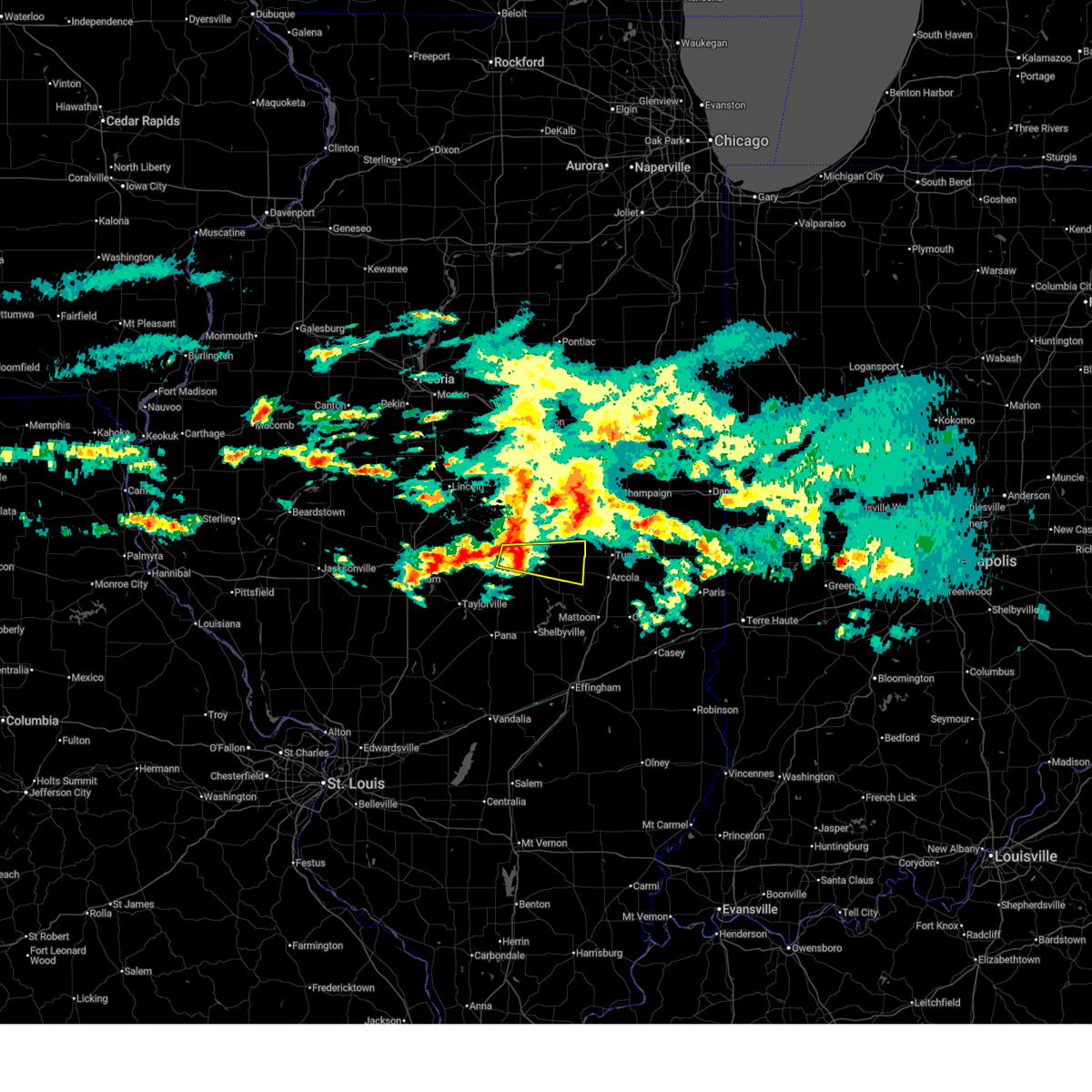 Svrilx the national weather service in lincoln has issued a * severe thunderstorm warning for, northern moultrie county in central illinois, southern piatt county in central illinois, western douglas county in east central illinois, southeastern macon county in central illinois, * until 615 pm cst. * at 534 pm cst, a severe thunderstorm was located over mount zion, or near decatur, moving east at 50 mph (radar indicated). Hazards include quarter size hail. Damage to vehicles is expected. this severe thunderstorm will be near, mount zion, long creek, and decatur airport around 540 pm cst. hammond around 550 pm cst. Other locations in the path of this severe thunderstorm include arthur and atwood. Svrilx the national weather service in lincoln has issued a * severe thunderstorm warning for, northern moultrie county in central illinois, southern piatt county in central illinois, western douglas county in east central illinois, southeastern macon county in central illinois, * until 615 pm cst. * at 534 pm cst, a severe thunderstorm was located over mount zion, or near decatur, moving east at 50 mph (radar indicated). Hazards include quarter size hail. Damage to vehicles is expected. this severe thunderstorm will be near, mount zion, long creek, and decatur airport around 540 pm cst. hammond around 550 pm cst. Other locations in the path of this severe thunderstorm include arthur and atwood.
|
| 12/28/2025 3:44 PM CST |
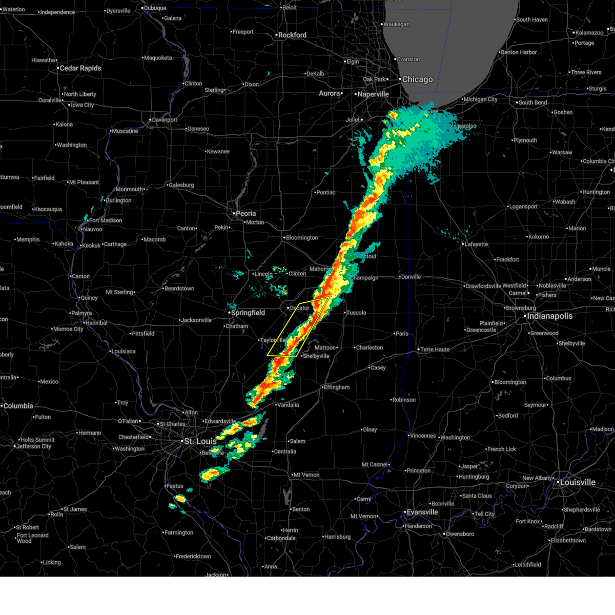 The storms which prompted the warning have weakened below severe limits. therefore, the warning will be allowed to expire. a tornado watch remains in effect until 800 pm cst for central illinois. remember, a tornado warning still remains in effect for southern piatt county!. The storms which prompted the warning have weakened below severe limits. therefore, the warning will be allowed to expire. a tornado watch remains in effect until 800 pm cst for central illinois. remember, a tornado warning still remains in effect for southern piatt county!.
|
| 12/28/2025 3:28 PM CST |
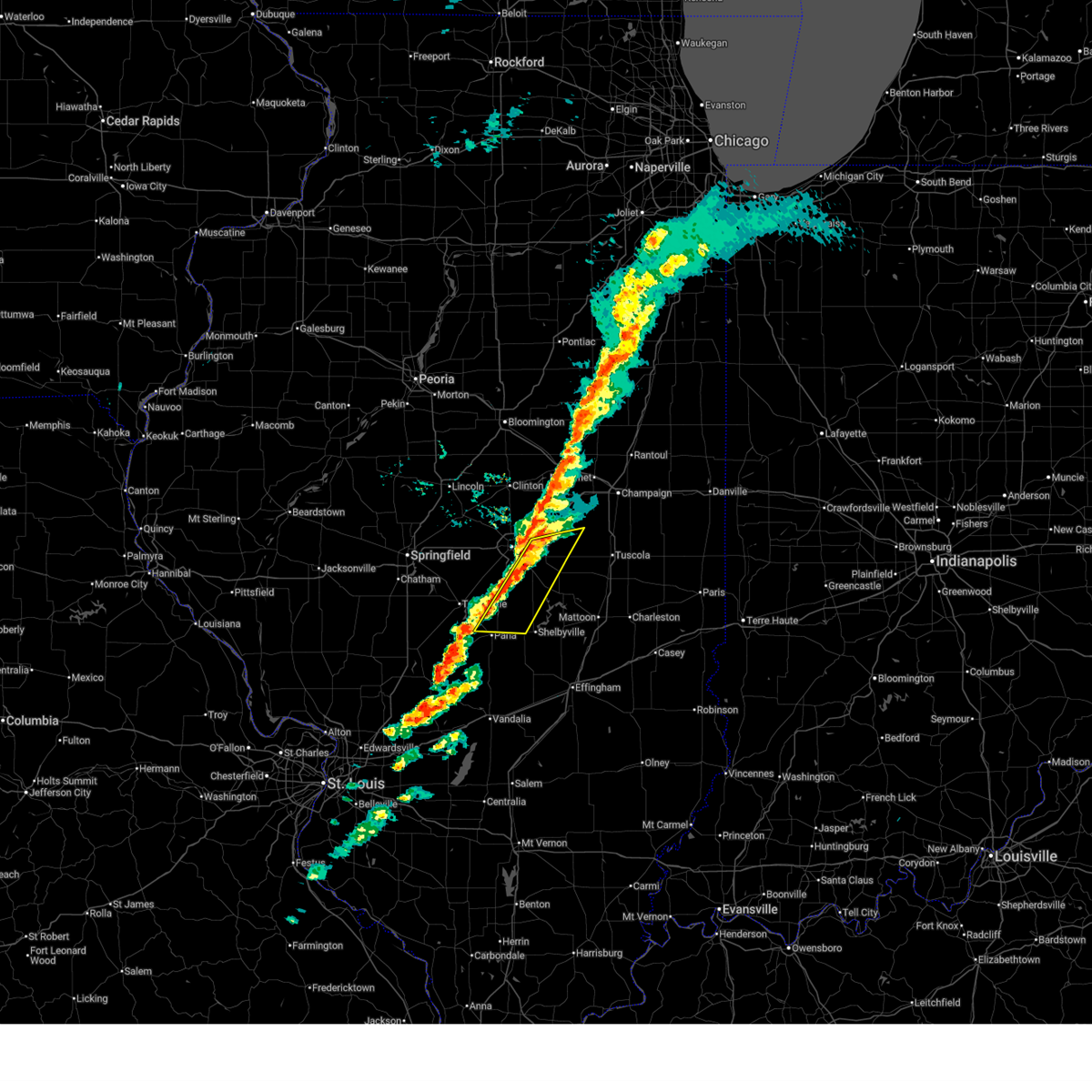 At 328 pm cst, severe thunderstorms were located along a line extending from near hammond to near assumption, moving east at 50 mph (radar indicated). Hazards include 60 mph wind gusts. Expect damage to roofs, siding, and trees. these severe storms will be near, bethany, lovington, and hammond around 335 pm cst. Other locations impacted by these severe thunderstorms include milmine, hervey city, westervelt, la place, lake city, and oakley. At 328 pm cst, severe thunderstorms were located along a line extending from near hammond to near assumption, moving east at 50 mph (radar indicated). Hazards include 60 mph wind gusts. Expect damage to roofs, siding, and trees. these severe storms will be near, bethany, lovington, and hammond around 335 pm cst. Other locations impacted by these severe thunderstorms include milmine, hervey city, westervelt, la place, lake city, and oakley.
|
| 12/28/2025 3:20 PM CST | Multiple trees snapped. possible tornado. twitter repor in macon county IL, 5.5 miles NNW of Decatur, IL |
| 12/28/2025 3:19 PM CST |
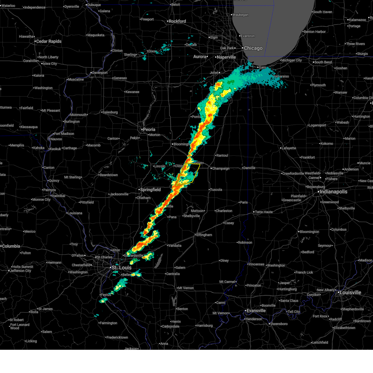 the severe thunderstorm warning has been cancelled and is no longer in effect the severe thunderstorm warning has been cancelled and is no longer in effect
|
| 12/28/2025 3:19 PM CST |
 At 319 pm cst, severe thunderstorms were located along a line extending from near farmer city to decatur airport, moving east at 55 mph (radar indicated). Hazards include 60 mph wind gusts. Expect damage to roofs, siding, and trees. these severe storms will be near, monticello, cerro gordo, de land, cisco, and white heath around 325 pm cst. other locations impacted by these severe thunderstorms include galesville, lodge, and milmine. This includes interstate 72 between mile markers 145 and 171. At 319 pm cst, severe thunderstorms were located along a line extending from near farmer city to decatur airport, moving east at 55 mph (radar indicated). Hazards include 60 mph wind gusts. Expect damage to roofs, siding, and trees. these severe storms will be near, monticello, cerro gordo, de land, cisco, and white heath around 325 pm cst. other locations impacted by these severe thunderstorms include galesville, lodge, and milmine. This includes interstate 72 between mile markers 145 and 171.
|
| 12/28/2025 3:18 PM CST |
 At 318 pm cst, a confirmed tornado was located about 5 miles west of mount zion, moving east at 45 mph (radar confirmed tornado). Hazards include damaging tornado. Flying debris will be dangerous to those caught without shelter. mobile homes will be damaged or destroyed. damage to roofs, windows, and vehicles will occur. tree damage is likely. this tornado will be near, decatur, long creek, and decatur airport around 325 pm cst. Other locations impacted by this tornadic thunderstorm include hervey city and elwin. At 318 pm cst, a confirmed tornado was located about 5 miles west of mount zion, moving east at 45 mph (radar confirmed tornado). Hazards include damaging tornado. Flying debris will be dangerous to those caught without shelter. mobile homes will be damaged or destroyed. damage to roofs, windows, and vehicles will occur. tree damage is likely. this tornado will be near, decatur, long creek, and decatur airport around 325 pm cst. Other locations impacted by this tornadic thunderstorm include hervey city and elwin.
|
| 12/28/2025 3:11 PM CST |
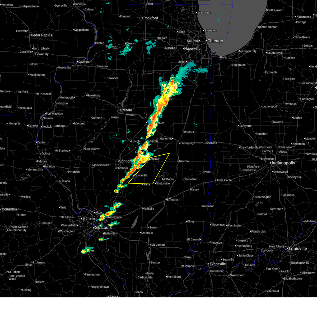 Svrilx the national weather service in lincoln has issued a * severe thunderstorm warning for, southeastern christian county in central illinois, northwestern moultrie county in central illinois, northwestern shelby county in central illinois, southern piatt county in central illinois, southeastern macon county in central illinois, * until 345 pm cst. * at 311 pm cst, severe thunderstorms were located along a line extending from near the decatur airport to near taylorville, moving east at 50 mph (radar indicated). Hazards include 60 mph wind gusts. Expect damage to roofs, siding, and trees. severe thunderstorms will be near, decatur, mount zion, moweaqua, long creek, assumption, macon, owaneco, and decatur airport around 315 pm cst. cerro gordo and dalton city around 320 pm cst. Bethany, lovington, and hammond around 330 pm cst. Svrilx the national weather service in lincoln has issued a * severe thunderstorm warning for, southeastern christian county in central illinois, northwestern moultrie county in central illinois, northwestern shelby county in central illinois, southern piatt county in central illinois, southeastern macon county in central illinois, * until 345 pm cst. * at 311 pm cst, severe thunderstorms were located along a line extending from near the decatur airport to near taylorville, moving east at 50 mph (radar indicated). Hazards include 60 mph wind gusts. Expect damage to roofs, siding, and trees. severe thunderstorms will be near, decatur, mount zion, moweaqua, long creek, assumption, macon, owaneco, and decatur airport around 315 pm cst. cerro gordo and dalton city around 320 pm cst. Bethany, lovington, and hammond around 330 pm cst.
|
| 12/28/2025 3:03 PM CST |
 Torilx the national weather service in lincoln has issued a * tornado warning for, southern macon county in central illinois, * until 330 pm cst. * at 303 pm cst, a severe thunderstorm capable of producing a tornado was located near blue mound, or 13 miles southwest of decatur, moving east at 40 mph (radar indicated rotation). Hazards include tornado. Flying debris will be dangerous to those caught without shelter. mobile homes will be damaged or destroyed. damage to roofs, windows, and vehicles will occur. tree damage is likely. this dangerous storm will be near, decatur and macon around 310 pm cst. mount zion and long creek around 315 pm cst. Decatur airport around 320 pm cst. Torilx the national weather service in lincoln has issued a * tornado warning for, southern macon county in central illinois, * until 330 pm cst. * at 303 pm cst, a severe thunderstorm capable of producing a tornado was located near blue mound, or 13 miles southwest of decatur, moving east at 40 mph (radar indicated rotation). Hazards include tornado. Flying debris will be dangerous to those caught without shelter. mobile homes will be damaged or destroyed. damage to roofs, windows, and vehicles will occur. tree damage is likely. this dangerous storm will be near, decatur and macon around 310 pm cst. mount zion and long creek around 315 pm cst. Decatur airport around 320 pm cst.
|
| 12/28/2025 3:02 PM CST |
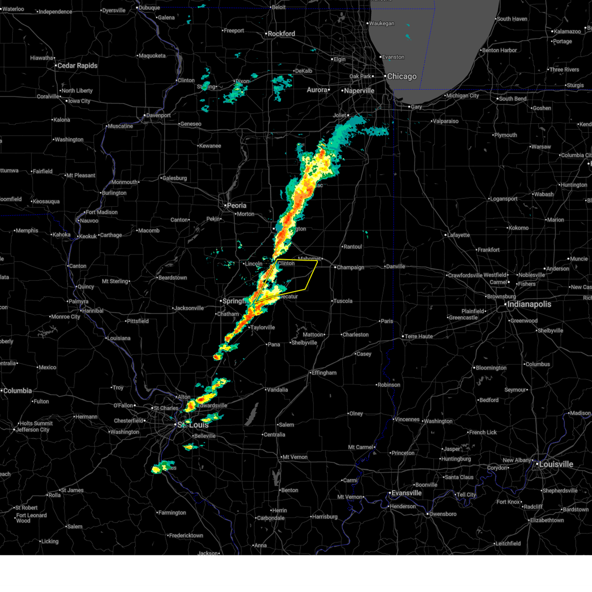 Svrilx the national weather service in lincoln has issued a * severe thunderstorm warning for, north central christian county in central illinois, central piatt county in central illinois, southeastern de witt county in central illinois, northern macon county in central illinois, * until 345 pm cst. * at 302 pm cst, severe thunderstorms were located along a line extending from near clinton to niantic, moving east at 55 mph (radar indicated). Hazards include 60 mph wind gusts. Expect damage to roofs, siding, and trees. severe thunderstorms will be near, decatur, clinton, forsyth, maroa, harristown, warrensburg, and niantic around 305 pm cst. oreana and weldon around 310 pm cst. argenta and de land around 315 pm cst. cisco around 320 pm cst. other locations in the path of these severe thunderstorms include cerro gordo, monticello and white heath. This includes interstate 72 between mile markers 127 and 171. Svrilx the national weather service in lincoln has issued a * severe thunderstorm warning for, north central christian county in central illinois, central piatt county in central illinois, southeastern de witt county in central illinois, northern macon county in central illinois, * until 345 pm cst. * at 302 pm cst, severe thunderstorms were located along a line extending from near clinton to niantic, moving east at 55 mph (radar indicated). Hazards include 60 mph wind gusts. Expect damage to roofs, siding, and trees. severe thunderstorms will be near, decatur, clinton, forsyth, maroa, harristown, warrensburg, and niantic around 305 pm cst. oreana and weldon around 310 pm cst. argenta and de land around 315 pm cst. cisco around 320 pm cst. other locations in the path of these severe thunderstorms include cerro gordo, monticello and white heath. This includes interstate 72 between mile markers 127 and 171.
|
| 11/18/2025 1:46 PM CST | the severe thunderstorm warning has been cancelled and is no longer in effect |
| 11/18/2025 1:20 PM CST | Svrilx the national weather service in lincoln has issued a * severe thunderstorm warning for, northern moultrie county in central illinois, southern piatt county in central illinois, southwestern champaign county in east central illinois, northwestern douglas county in east central illinois, southeastern macon county in central illinois, * until 200 pm cst. * at 120 pm cst, a severe thunderstorm was located over decatur, moving east at 45 mph (radar indicated). Hazards include quarter size hail. Damage to vehicles is expected. this severe thunderstorm will be near, decatur, long creek, and decatur airport around 125 pm cst. cerro gordo around 130 pm cst. bement around 140 pm cst. other locations in the path of this severe thunderstorm include ivesdale. this includes the following highways, interstate 57 between mile markers 211 and 227. Interstate 72 between mile markers 133 and 151. |
| 8/19/2025 3:14 AM CDT |
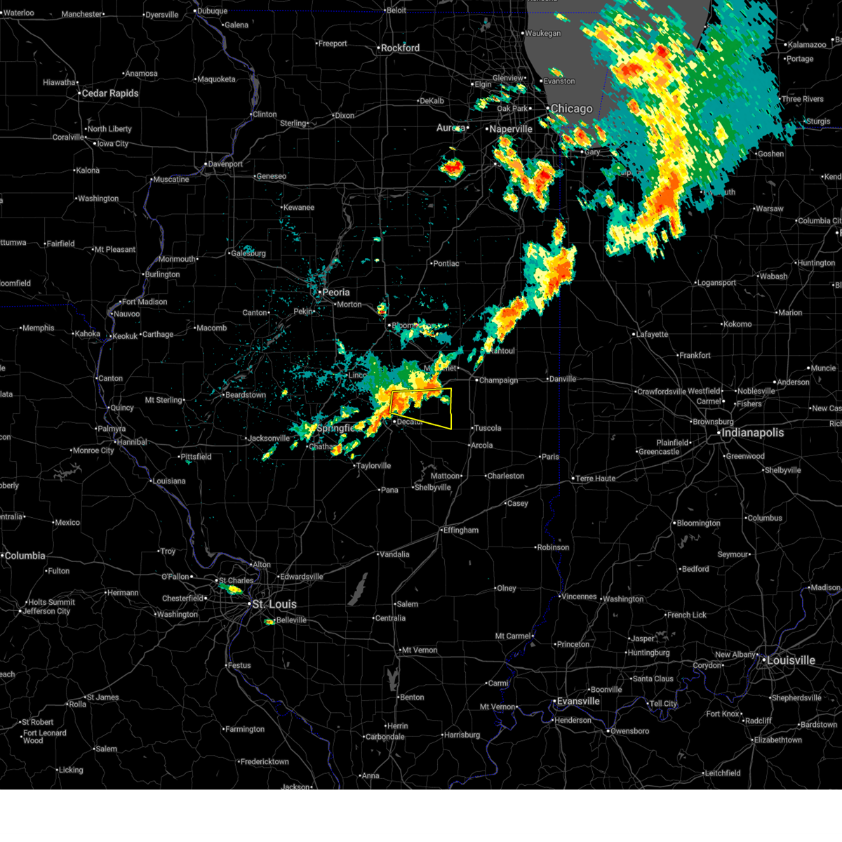 Svrilx the national weather service in lincoln has issued a * severe thunderstorm warning for, southern piatt county in central illinois, northeastern macon county in central illinois, * until 345 am cdt. * at 313 am cdt, a severe thunderstorm was located over forsyth, or near decatur, moving east at 35 mph (radar indicated). Hazards include 60 mph wind gusts. Expect damage to roofs, siding, and trees. this severe thunderstorm will be near, decatur, argenta, and oreana around 320 am cdt. cerro gordo around 330 am cdt. This includes interstate 72 between mile markers 140 and 166. Svrilx the national weather service in lincoln has issued a * severe thunderstorm warning for, southern piatt county in central illinois, northeastern macon county in central illinois, * until 345 am cdt. * at 313 am cdt, a severe thunderstorm was located over forsyth, or near decatur, moving east at 35 mph (radar indicated). Hazards include 60 mph wind gusts. Expect damage to roofs, siding, and trees. this severe thunderstorm will be near, decatur, argenta, and oreana around 320 am cdt. cerro gordo around 330 am cdt. This includes interstate 72 between mile markers 140 and 166.
|
| 8/19/2025 3:07 AM CDT |
 At 307 am cdt, a severe thunderstorm was located near maroa, or 10 miles south of clinton, moving east at 30 mph (radar indicated). Hazards include 60 mph wind gusts. Expect damage to roofs, siding, and trees. this severe storm will be near, maroa around 315 am cdt. argenta and oreana around 320 am cdt. other locations impacted by this severe thunderstorm include oakley and weldon springs state park. This includes interstate 72 between mile markers 139 and 154. At 307 am cdt, a severe thunderstorm was located near maroa, or 10 miles south of clinton, moving east at 30 mph (radar indicated). Hazards include 60 mph wind gusts. Expect damage to roofs, siding, and trees. this severe storm will be near, maroa around 315 am cdt. argenta and oreana around 320 am cdt. other locations impacted by this severe thunderstorm include oakley and weldon springs state park. This includes interstate 72 between mile markers 139 and 154.
|
| 8/19/2025 3:07 AM CDT |
 the severe thunderstorm warning has been cancelled and is no longer in effect the severe thunderstorm warning has been cancelled and is no longer in effect
|
| 8/19/2025 2:39 AM CDT |
 Svrilx the national weather service in lincoln has issued a * severe thunderstorm warning for, southeastern logan county in central illinois, southwestern de witt county in central illinois, northern macon county in central illinois, * until 315 am cdt. * at 239 am cdt, a severe thunderstorm was located over mount pulaski, or 10 miles southeast of lincoln, moving east at 30 mph (radar indicated). Hazards include 60 mph wind gusts. Expect damage to roofs, siding, and trees. this severe thunderstorm will be near, latham and chestnut around 245 am cdt. other locations in the path of this severe thunderstorm include maroa. this includes the following highways, interstate 55 between mile markers 120 and 122. Interstate 72 between mile markers 139 and 154. Svrilx the national weather service in lincoln has issued a * severe thunderstorm warning for, southeastern logan county in central illinois, southwestern de witt county in central illinois, northern macon county in central illinois, * until 315 am cdt. * at 239 am cdt, a severe thunderstorm was located over mount pulaski, or 10 miles southeast of lincoln, moving east at 30 mph (radar indicated). Hazards include 60 mph wind gusts. Expect damage to roofs, siding, and trees. this severe thunderstorm will be near, latham and chestnut around 245 am cdt. other locations in the path of this severe thunderstorm include maroa. this includes the following highways, interstate 55 between mile markers 120 and 122. Interstate 72 between mile markers 139 and 154.
|
| 8/12/2025 4:36 PM CDT |
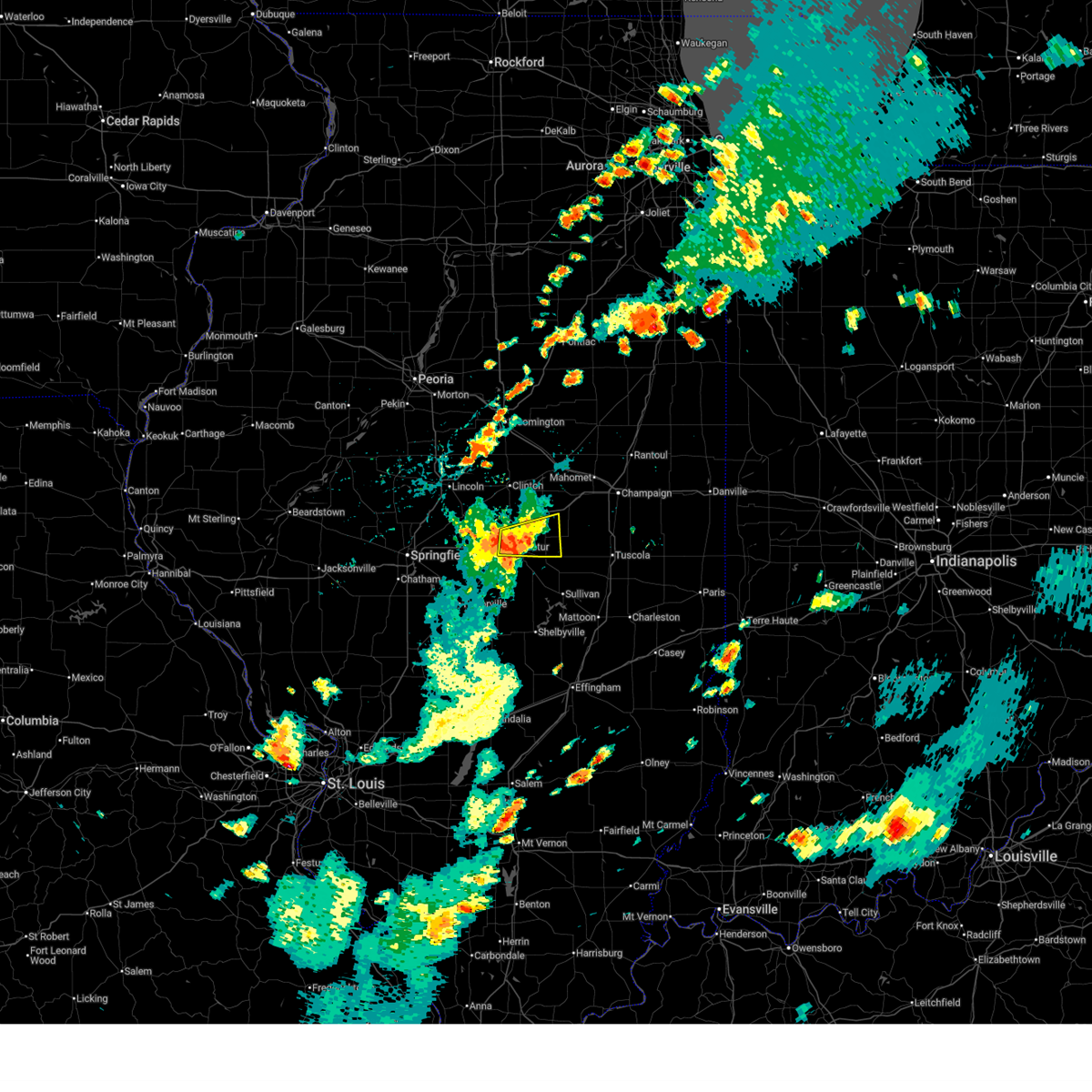 The storm which prompted the warning has weakened below severe limits, and no longer poses an immediate threat to life or property. therefore, the warning will be allowed to expire. however, heavy rain is still occuring with this thunderstorm. The storm which prompted the warning has weakened below severe limits, and no longer poses an immediate threat to life or property. therefore, the warning will be allowed to expire. however, heavy rain is still occuring with this thunderstorm.
|
| 8/12/2025 4:25 PM CDT |
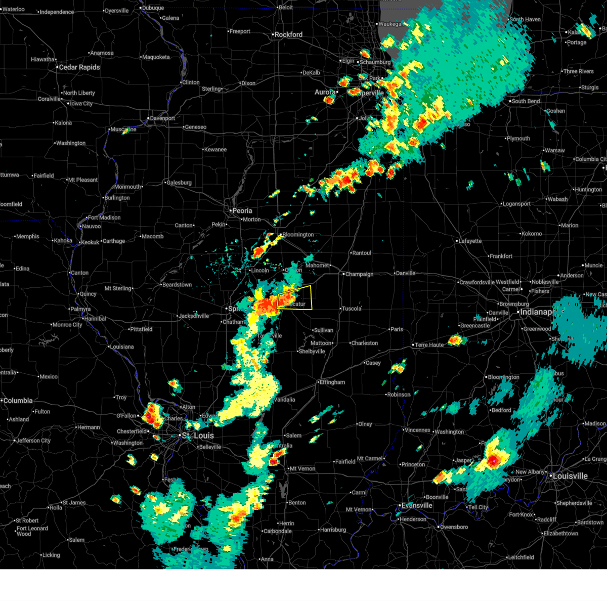 At 425 pm cdt, a severe thunderstorm was located over cerro gordo, or 9 miles northeast of decatur, moving east at 25 mph (radar indicated). Hazards include 60 mph wind gusts and nickel size hail. Expect damage to roofs, siding, and trees. this severe storm will be near, cerro gordo around 430 pm cdt. other locations impacted by this severe thunderstorm include la place, milmine, and oakley. This includes interstate 72 between mile markers 137 and 151. At 425 pm cdt, a severe thunderstorm was located over cerro gordo, or 9 miles northeast of decatur, moving east at 25 mph (radar indicated). Hazards include 60 mph wind gusts and nickel size hail. Expect damage to roofs, siding, and trees. this severe storm will be near, cerro gordo around 430 pm cdt. other locations impacted by this severe thunderstorm include la place, milmine, and oakley. This includes interstate 72 between mile markers 137 and 151.
|
| 8/12/2025 4:12 PM CDT |
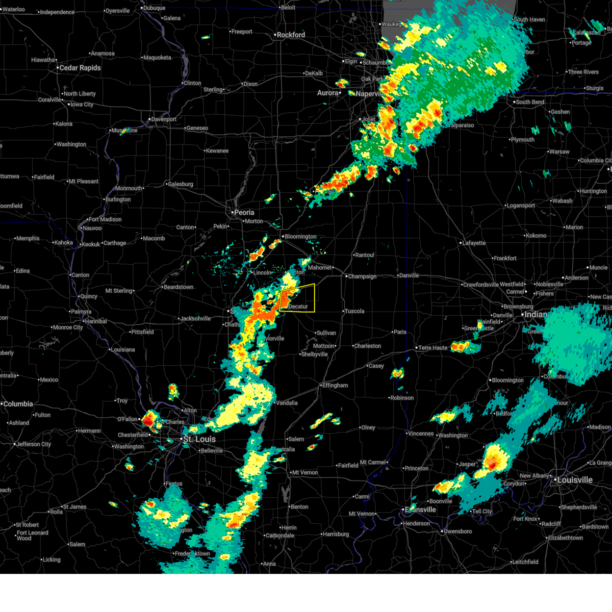 Svrilx the national weather service in lincoln has issued a * severe thunderstorm warning for, southwestern piatt county in central illinois, northeastern macon county in central illinois, * until 445 pm cdt. * at 412 pm cdt, a severe thunderstorm was located over oreana, or near decatur, moving east at 25 mph (radar indicated). Hazards include 60 mph wind gusts and nickel size hail. Expect damage to roofs, siding, and trees. this severe thunderstorm will be near, cerro gordo around 420 pm cdt. This includes interstate 72 between mile markers 137 and 162. Svrilx the national weather service in lincoln has issued a * severe thunderstorm warning for, southwestern piatt county in central illinois, northeastern macon county in central illinois, * until 445 pm cdt. * at 412 pm cdt, a severe thunderstorm was located over oreana, or near decatur, moving east at 25 mph (radar indicated). Hazards include 60 mph wind gusts and nickel size hail. Expect damage to roofs, siding, and trees. this severe thunderstorm will be near, cerro gordo around 420 pm cdt. This includes interstate 72 between mile markers 137 and 162.
|
| 8/12/2025 3:59 PM CDT |
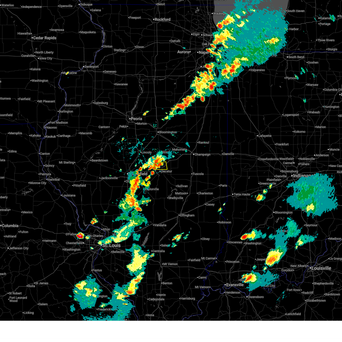 At 359 pm cdt, a severe thunderstorm was located over forsyth, or near decatur, moving east at 20 mph (radar indicated). Hazards include 60 mph wind gusts and quarter size hail. Hail damage to vehicles is expected. expect wind damage to roofs, siding, and trees. this severe storm will be near, argenta and oreana around 405 pm cdt. other locations impacted by this severe thunderstorm include oakley. This includes interstate 72 between mile markers 136 and 150. At 359 pm cdt, a severe thunderstorm was located over forsyth, or near decatur, moving east at 20 mph (radar indicated). Hazards include 60 mph wind gusts and quarter size hail. Hail damage to vehicles is expected. expect wind damage to roofs, siding, and trees. this severe storm will be near, argenta and oreana around 405 pm cdt. other locations impacted by this severe thunderstorm include oakley. This includes interstate 72 between mile markers 136 and 150.
|
| 8/12/2025 3:55 PM CDT |
 At 354 pm cdt, a severe thunderstorm was located over forsyth, or near decatur, moving east at 20 mph (radar indicated). Hazards include 60 mph wind gusts and quarter size hail. Hail damage to vehicles is expected. expect wind damage to roofs, siding, and trees. this severe storm will be near, decatur, forsyth, and oreana around 400 pm cdt. argenta around 410 pm cdt. other locations impacted by this severe thunderstorm include oakley. This includes interstate 72 between mile markers 136 and 150. At 354 pm cdt, a severe thunderstorm was located over forsyth, or near decatur, moving east at 20 mph (radar indicated). Hazards include 60 mph wind gusts and quarter size hail. Hail damage to vehicles is expected. expect wind damage to roofs, siding, and trees. this severe storm will be near, decatur, forsyth, and oreana around 400 pm cdt. argenta around 410 pm cdt. other locations impacted by this severe thunderstorm include oakley. This includes interstate 72 between mile markers 136 and 150.
|
| 8/12/2025 3:45 PM CDT |
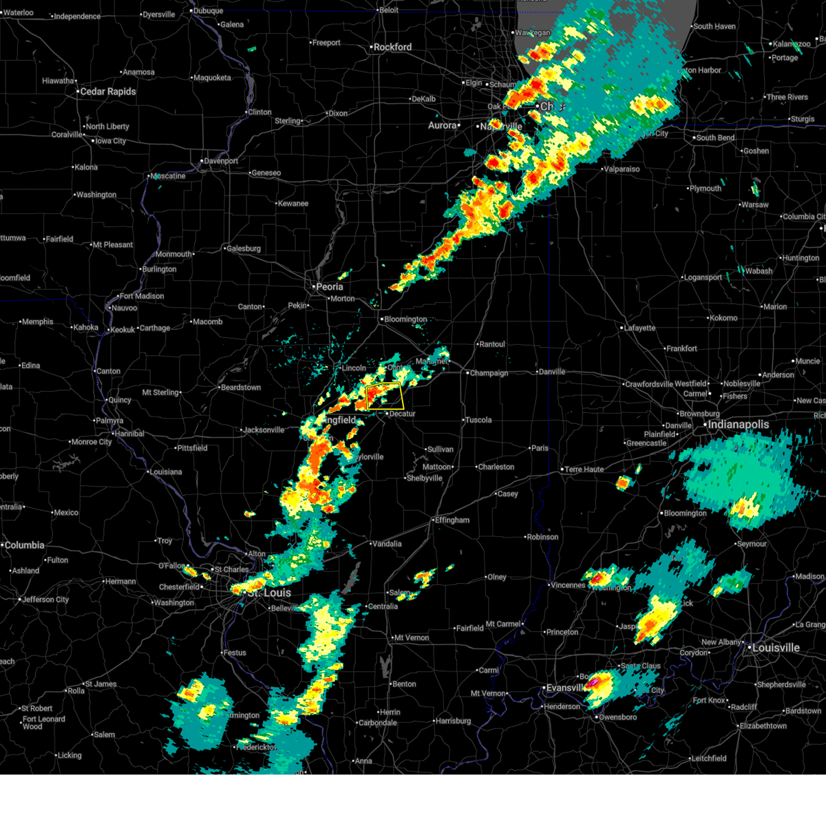 Svrilx the national weather service in lincoln has issued a * severe thunderstorm warning for, northern macon county in central illinois, * until 415 pm cdt. * at 345 pm cdt, a severe thunderstorm was located over warrensburg, or 8 miles northwest of decatur, moving east at 20 mph (radar indicated). Hazards include 60 mph wind gusts and quarter size hail. Hail damage to vehicles is expected. expect wind damage to roofs, siding, and trees. this severe thunderstorm will be near, decatur and forsyth around 350 pm cdt. oreana around 400 pm cdt. This includes interstate 72 between mile markers 136 and 150. Svrilx the national weather service in lincoln has issued a * severe thunderstorm warning for, northern macon county in central illinois, * until 415 pm cdt. * at 345 pm cdt, a severe thunderstorm was located over warrensburg, or 8 miles northwest of decatur, moving east at 20 mph (radar indicated). Hazards include 60 mph wind gusts and quarter size hail. Hail damage to vehicles is expected. expect wind damage to roofs, siding, and trees. this severe thunderstorm will be near, decatur and forsyth around 350 pm cdt. oreana around 400 pm cdt. This includes interstate 72 between mile markers 136 and 150.
|
| 6/8/2025 5:01 PM CDT |
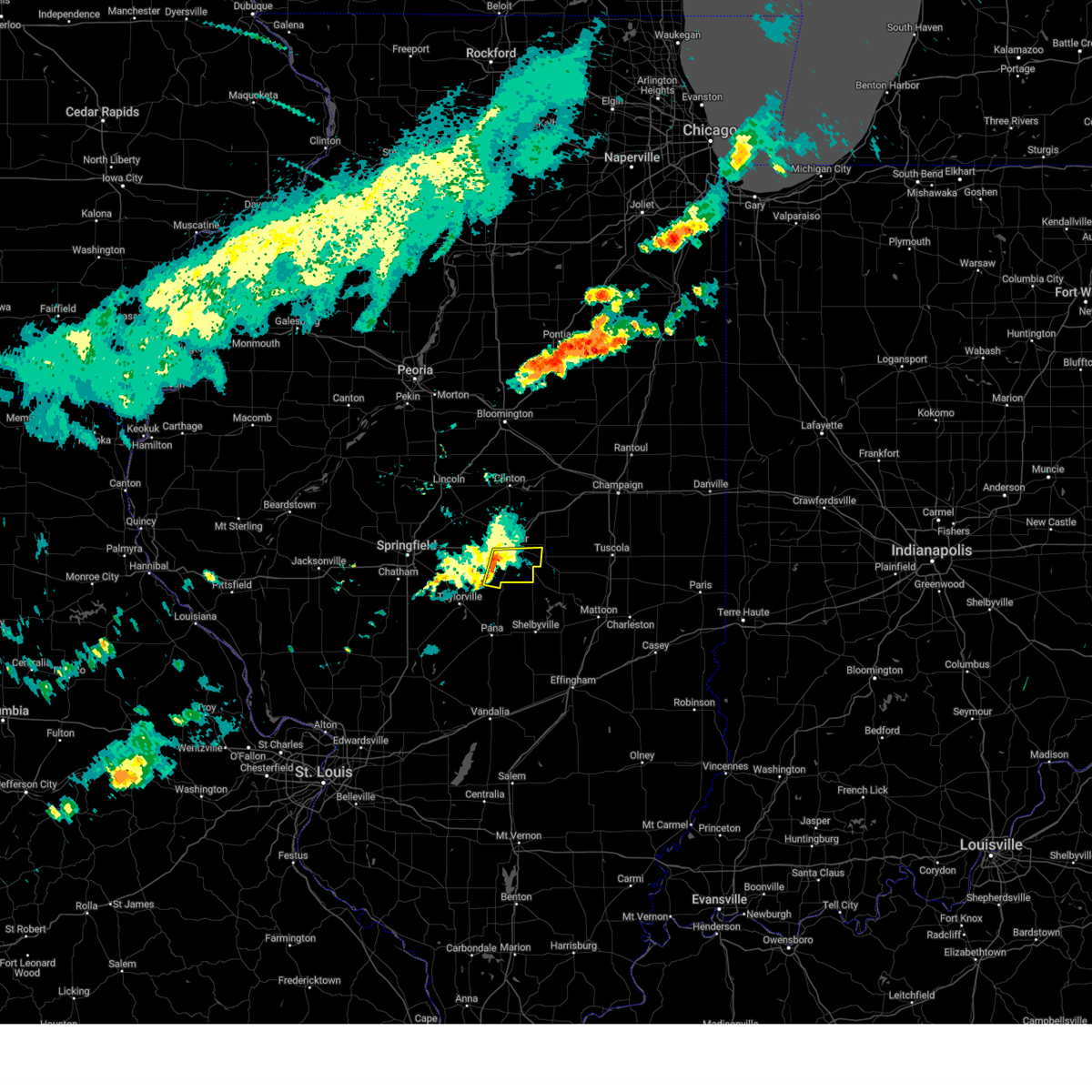 the severe thunderstorm warning has been cancelled and is no longer in effect the severe thunderstorm warning has been cancelled and is no longer in effect
|
| 6/8/2025 4:54 PM CDT |
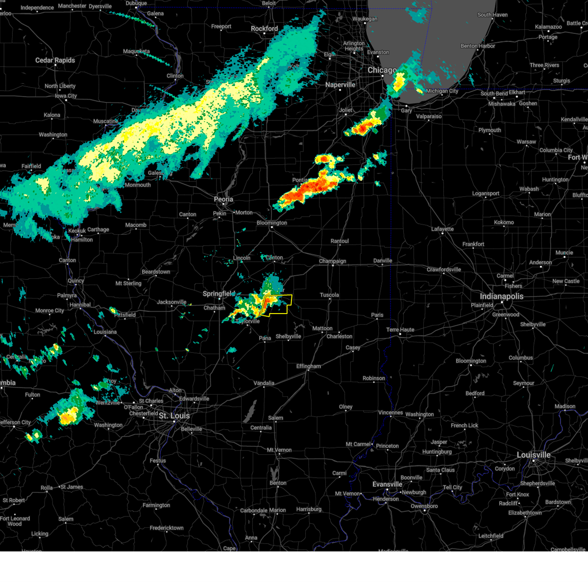 At 454 pm cdt, a severe thunderstorm was located near macon, or 8 miles southwest of decatur, moving east at 30 mph (radar indicated). Hazards include 60 mph wind gusts and penny size hail. Expect damage to roofs, siding, and trees. this severe storm will be near, decatur, mount zion, and macon around 500 pm cdt. long creek around 505 pm cdt. dalton city around 510 pm cdt. Other locations impacted by this severe thunderstorm include hervey city, boody, and elwin. At 454 pm cdt, a severe thunderstorm was located near macon, or 8 miles southwest of decatur, moving east at 30 mph (radar indicated). Hazards include 60 mph wind gusts and penny size hail. Expect damage to roofs, siding, and trees. this severe storm will be near, decatur, mount zion, and macon around 500 pm cdt. long creek around 505 pm cdt. dalton city around 510 pm cdt. Other locations impacted by this severe thunderstorm include hervey city, boody, and elwin.
|
| 6/8/2025 4:44 PM CDT |
 the severe thunderstorm warning has been cancelled and is no longer in effect the severe thunderstorm warning has been cancelled and is no longer in effect
|
| 6/8/2025 4:44 PM CDT |
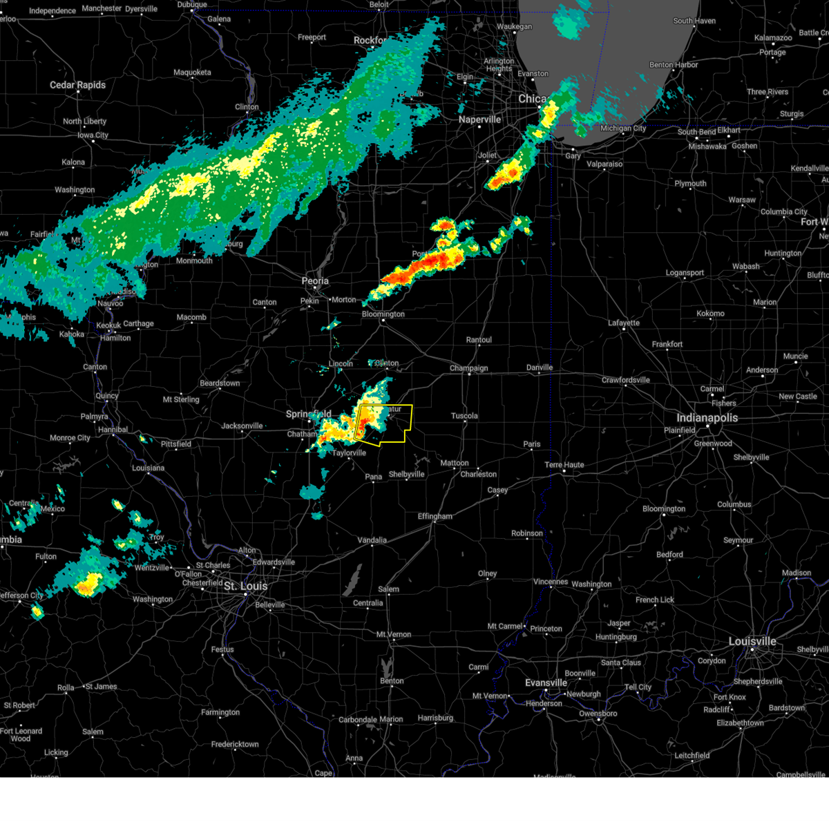 At 444 pm cdt, a severe thunderstorm was located near niantic, or 11 miles southwest of decatur, moving east at 30 mph (radar indicated). Hazards include 60 mph wind gusts and quarter size hail. Hail damage to vehicles is expected. expect wind damage to roofs, siding, and trees. this severe storm will be near, decatur around 450 pm cdt. macon around 455 pm cdt. mount zion around 500 pm cdt. long creek around 505 pm cdt. dalton city around 510 pm cdt. other locations impacted by this severe thunderstorm include boody, elwin, hervey city, and oakley. This includes interstate 72 between mile markers 126 and 144. At 444 pm cdt, a severe thunderstorm was located near niantic, or 11 miles southwest of decatur, moving east at 30 mph (radar indicated). Hazards include 60 mph wind gusts and quarter size hail. Hail damage to vehicles is expected. expect wind damage to roofs, siding, and trees. this severe storm will be near, decatur around 450 pm cdt. macon around 455 pm cdt. mount zion around 500 pm cdt. long creek around 505 pm cdt. dalton city around 510 pm cdt. other locations impacted by this severe thunderstorm include boody, elwin, hervey city, and oakley. This includes interstate 72 between mile markers 126 and 144.
|
| 6/8/2025 4:30 PM CDT |
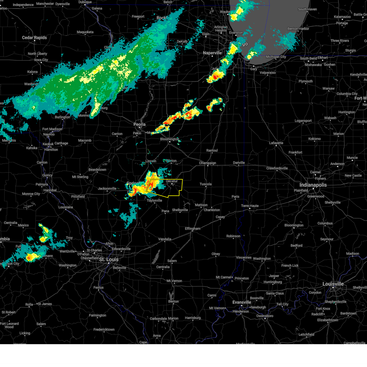 Svrilx the national weather service in lincoln has issued a * severe thunderstorm warning for, northeastern christian county in central illinois, northeastern sangamon county in central illinois, macon county in central illinois, * until 515 pm cdt. * at 429 pm cdt, a severe thunderstorm was located near mount auburn, or 19 miles north of taylorville, moving east at 35 mph (radar indicated). Hazards include 60 mph wind gusts and quarter size hail. Hail damage to vehicles is expected. expect wind damage to roofs, siding, and trees. this severe thunderstorm will be near, illiopolis and mount auburn around 435 pm cdt. other locations in the path of this severe thunderstorm include decatur, macon, mount zion and long creek. This includes interstate 72 between mile markers 115 and 144. Svrilx the national weather service in lincoln has issued a * severe thunderstorm warning for, northeastern christian county in central illinois, northeastern sangamon county in central illinois, macon county in central illinois, * until 515 pm cdt. * at 429 pm cdt, a severe thunderstorm was located near mount auburn, or 19 miles north of taylorville, moving east at 35 mph (radar indicated). Hazards include 60 mph wind gusts and quarter size hail. Hail damage to vehicles is expected. expect wind damage to roofs, siding, and trees. this severe thunderstorm will be near, illiopolis and mount auburn around 435 pm cdt. other locations in the path of this severe thunderstorm include decatur, macon, mount zion and long creek. This includes interstate 72 between mile markers 115 and 144.
|
| 5/20/2025 3:57 PM CDT |
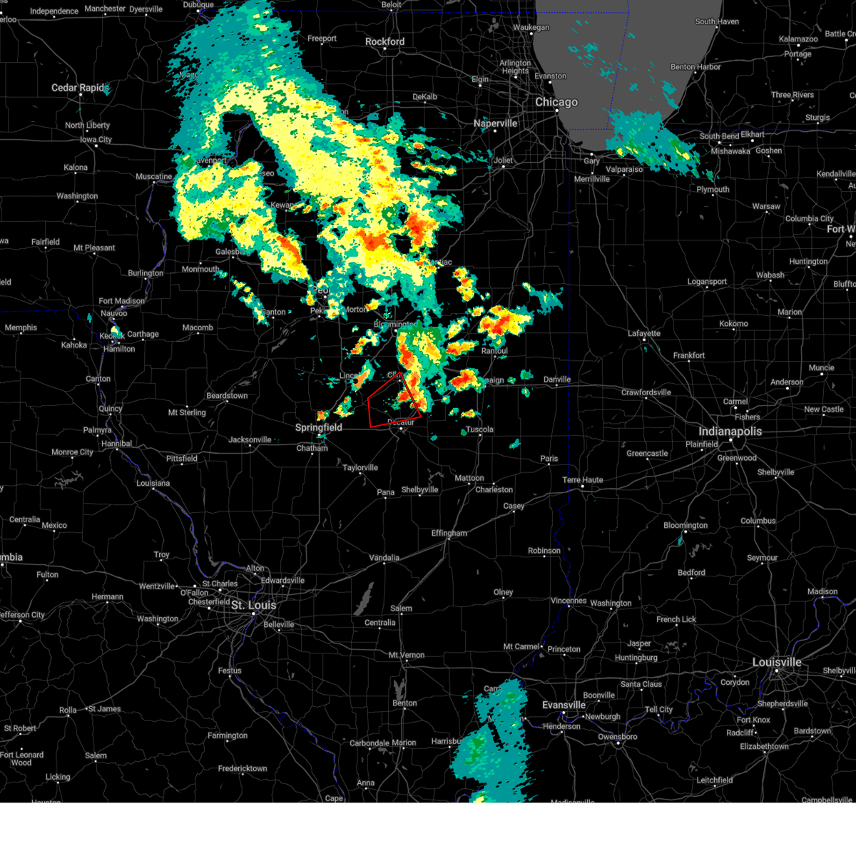 The storm which prompted the warning has moved out of the area. therefore, the warning will be allowed to expire. a tornado warning remains in effect further east for northeastern macon county into southern and eastern dewitt county. a tornado watch remains in effect until 800 pm cdt for central illinois. The storm which prompted the warning has moved out of the area. therefore, the warning will be allowed to expire. a tornado warning remains in effect further east for northeastern macon county into southern and eastern dewitt county. a tornado watch remains in effect until 800 pm cdt for central illinois.
|
| 5/20/2025 3:37 PM CDT |
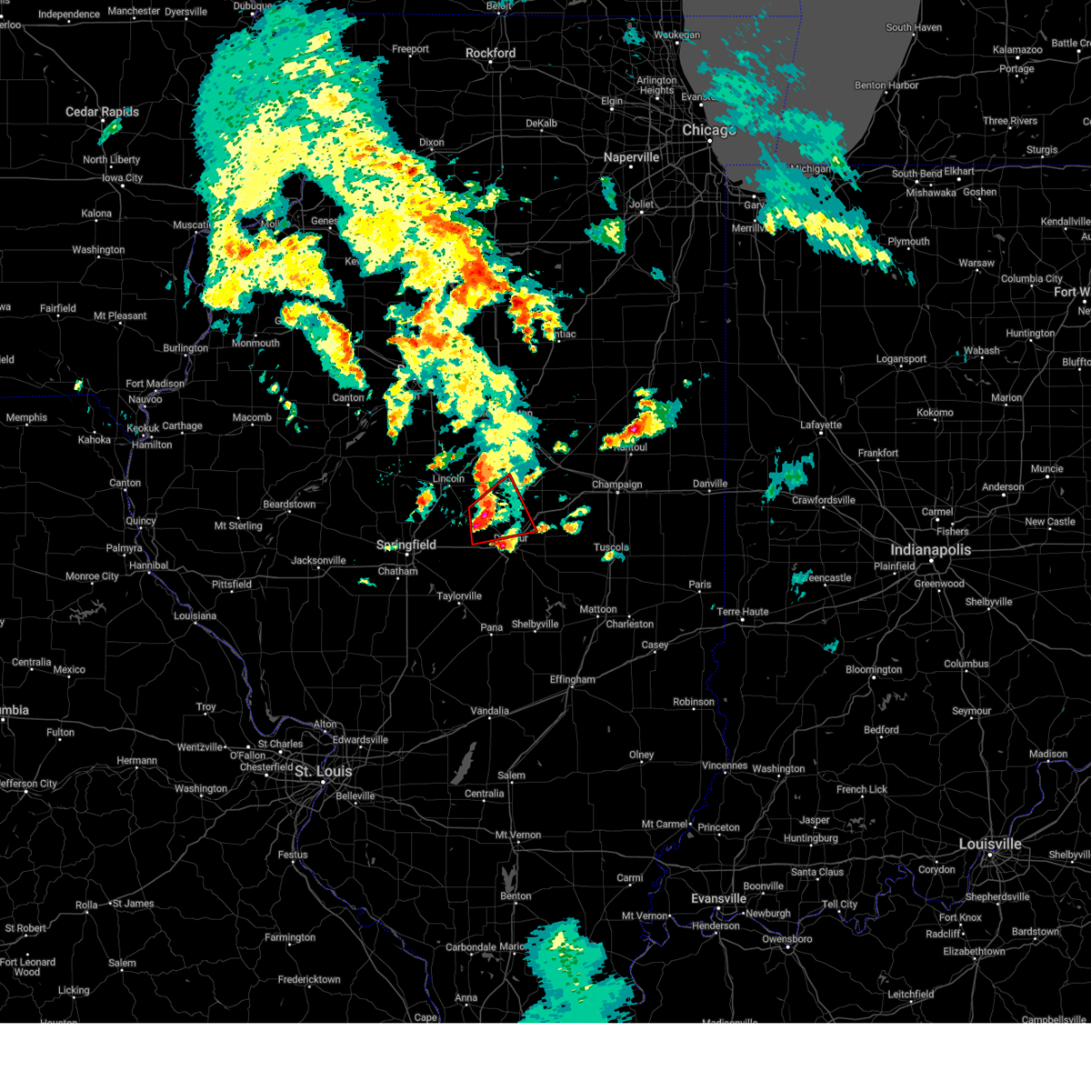 At 336 pm cdt, a confirmed rain-wrapped tornado was located just south of latham, or 12 miles northwest of decatur, moving northeast at 35 mph (emergency management confirmed tornado). Hazards include damaging tornado and golf ball size hail. Flying debris will be dangerous to those caught without shelter. mobile homes will be damaged or destroyed. damage to roofs, windows, and vehicles will occur. tree damage is likely. this tornado will be near, warrensburg around 340 pm cdt. forsyth around 350 pm cdt. maroa around 355 pm cdt. argenta around 410 pm cdt. other locations impacted by this tornadic thunderstorm include weldon springs state park. This includes interstate 72 between mile markers 138 and 151. At 336 pm cdt, a confirmed rain-wrapped tornado was located just south of latham, or 12 miles northwest of decatur, moving northeast at 35 mph (emergency management confirmed tornado). Hazards include damaging tornado and golf ball size hail. Flying debris will be dangerous to those caught without shelter. mobile homes will be damaged or destroyed. damage to roofs, windows, and vehicles will occur. tree damage is likely. this tornado will be near, warrensburg around 340 pm cdt. forsyth around 350 pm cdt. maroa around 355 pm cdt. argenta around 410 pm cdt. other locations impacted by this tornadic thunderstorm include weldon springs state park. This includes interstate 72 between mile markers 138 and 151.
|
| 5/20/2025 3:30 PM CDT |
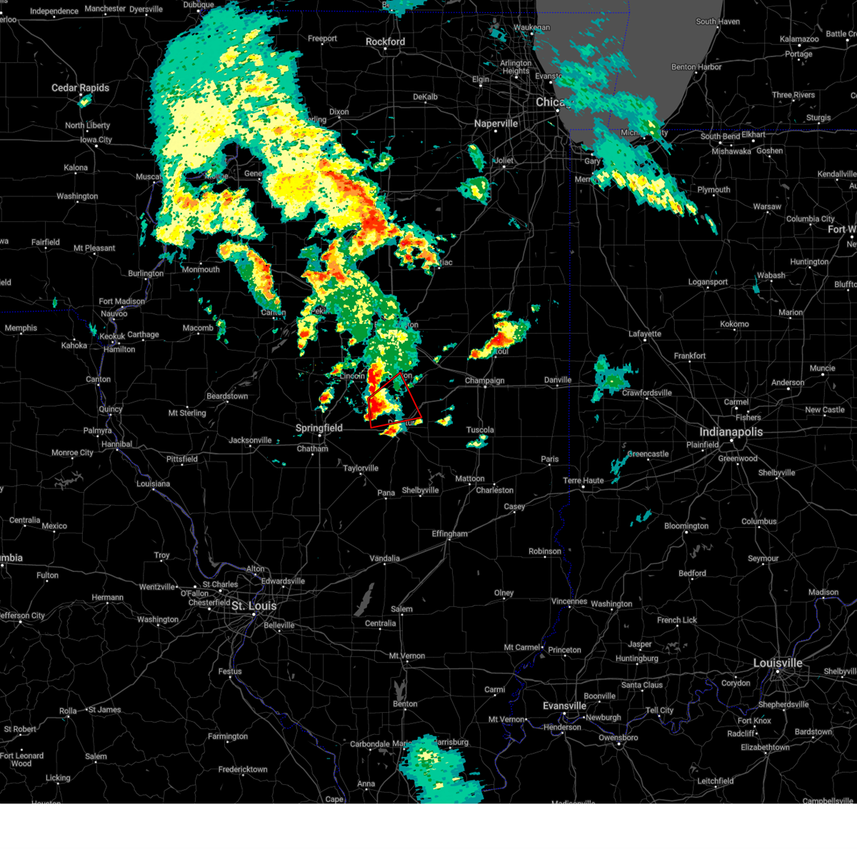 the tornado warning has been cancelled and is no longer in effect the tornado warning has been cancelled and is no longer in effect
|
| 5/20/2025 3:30 PM CDT |
 At 329 pm cdt, a severe thunderstorm capable of producing a tornado was located over latham, or 12 miles northwest of decatur, moving northeast at 35 mph (radar indicated rotation). Hazards include tornado and golf ball size hail. Flying debris will be dangerous to those caught without shelter. mobile homes will be damaged or destroyed. damage to roofs, windows, and vehicles will occur. tree damage is likely. this dangerous storm will be near, forsyth and warrensburg around 335 pm cdt. maroa around 340 pm cdt. argenta around 350 pm cdt. other locations impacted by this tornadic thunderstorm include weldon springs state park. This includes interstate 72 between mile markers 138 and 151. At 329 pm cdt, a severe thunderstorm capable of producing a tornado was located over latham, or 12 miles northwest of decatur, moving northeast at 35 mph (radar indicated rotation). Hazards include tornado and golf ball size hail. Flying debris will be dangerous to those caught without shelter. mobile homes will be damaged or destroyed. damage to roofs, windows, and vehicles will occur. tree damage is likely. this dangerous storm will be near, forsyth and warrensburg around 335 pm cdt. maroa around 340 pm cdt. argenta around 350 pm cdt. other locations impacted by this tornadic thunderstorm include weldon springs state park. This includes interstate 72 between mile markers 138 and 151.
|
| 5/20/2025 3:11 PM CDT |
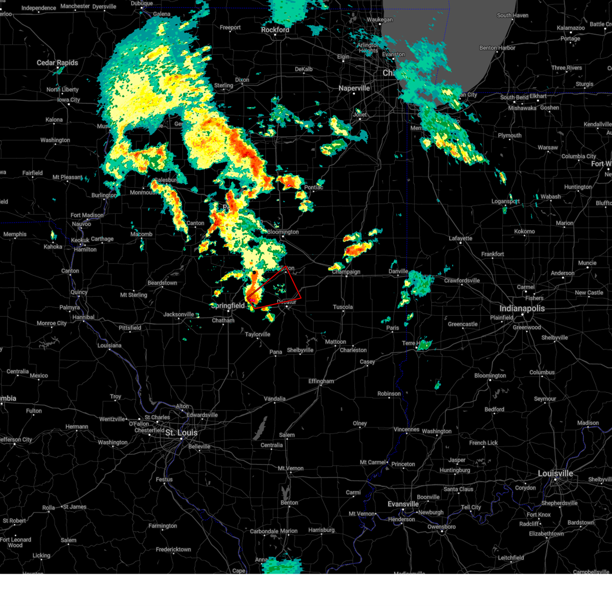 Torilx the national weather service in lincoln has issued a * tornado warning for, southeastern logan county in central illinois, northeastern sangamon county in central illinois, southwestern de witt county in central illinois, northern macon county in central illinois, * until 400 pm cdt. * at 311 pm cdt, a severe thunderstorm capable of producing a tornado was located near buffalo, or 18 miles northeast of springfield, moving northeast at 35 mph (radar indicated rotation). Hazards include tornado and golf ball size hail. Flying debris will be dangerous to those caught without shelter. mobile homes will be damaged or destroyed. damage to roofs, windows, and vehicles will occur. tree damage is likely. this dangerous storm will be near, illiopolis around 315 pm cdt. latham around 325 pm cdt. warrensburg around 330 pm cdt. other locations in the path of this tornadic thunderstorm include forsyth, maroa and argenta. This includes interstate 72 between mile markers 118 and 123, and between mile markers 137 and 151. Torilx the national weather service in lincoln has issued a * tornado warning for, southeastern logan county in central illinois, northeastern sangamon county in central illinois, southwestern de witt county in central illinois, northern macon county in central illinois, * until 400 pm cdt. * at 311 pm cdt, a severe thunderstorm capable of producing a tornado was located near buffalo, or 18 miles northeast of springfield, moving northeast at 35 mph (radar indicated rotation). Hazards include tornado and golf ball size hail. Flying debris will be dangerous to those caught without shelter. mobile homes will be damaged or destroyed. damage to roofs, windows, and vehicles will occur. tree damage is likely. this dangerous storm will be near, illiopolis around 315 pm cdt. latham around 325 pm cdt. warrensburg around 330 pm cdt. other locations in the path of this tornadic thunderstorm include forsyth, maroa and argenta. This includes interstate 72 between mile markers 118 and 123, and between mile markers 137 and 151.
|
| 5/16/2025 4:22 PM CDT |
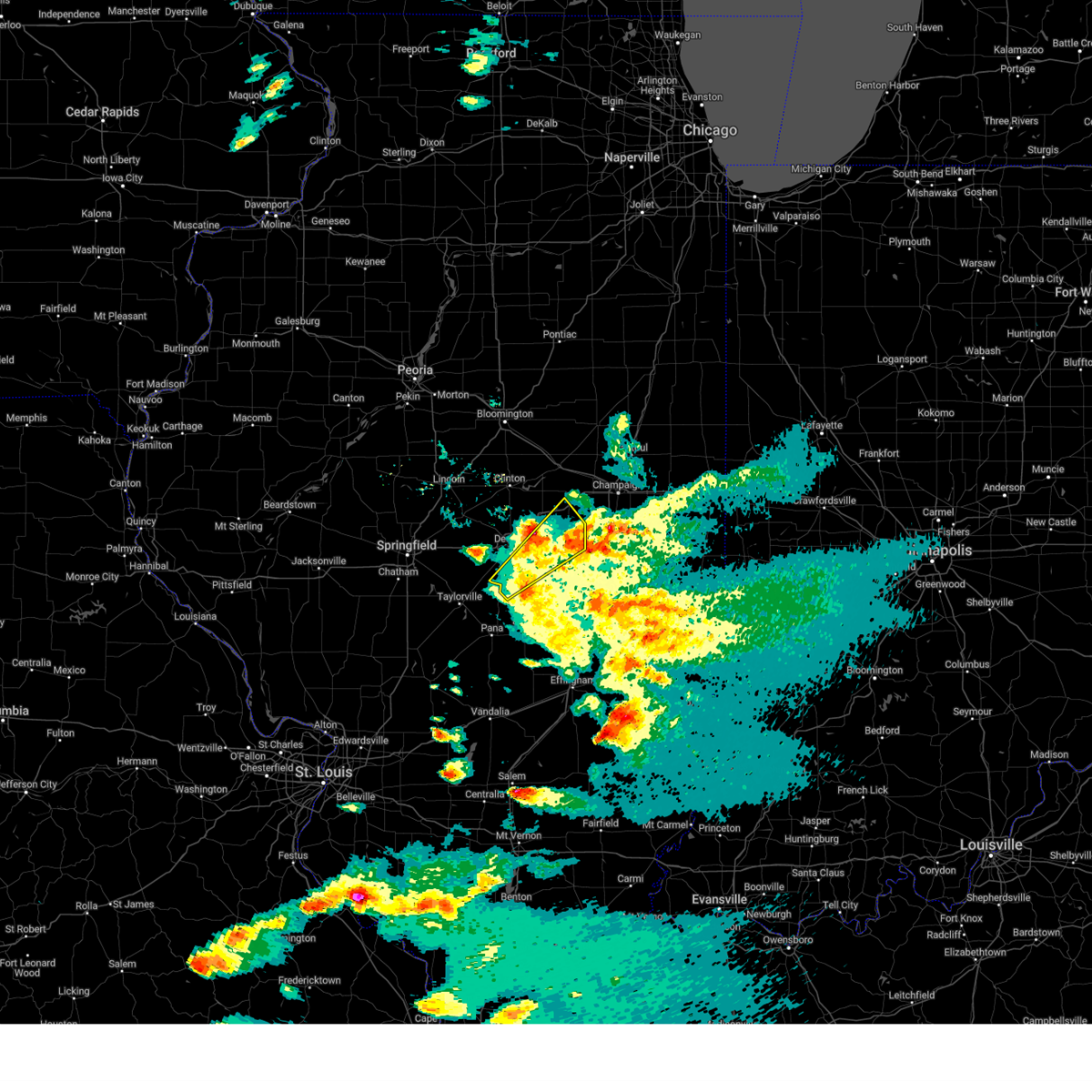 the severe thunderstorm warning has been cancelled and is no longer in effect the severe thunderstorm warning has been cancelled and is no longer in effect
|
| 5/16/2025 4:19 PM CDT |
 Svrilx the national weather service in lincoln has issued a * severe thunderstorm warning for, piatt county in central illinois, southeastern de witt county in central illinois, northeastern macon county in central illinois, * until 445 pm cdt. * at 419 pm cdt, a severe thunderstorm was located near oreana, or near decatur, moving northeast at 65 mph (radar indicated). Hazards include 60 mph wind gusts and quarter size hail. Hail damage to vehicles is expected. expect wind damage to roofs, siding, and trees. this severe thunderstorm will be near, argenta and cisco around 425 pm cdt. monticello around 430 pm cdt. white heath around 435 pm cdt. this includes the following highways, interstate 72 between mile markers 141 and 173. Interstate 74 between mile markers 165 and 168. Svrilx the national weather service in lincoln has issued a * severe thunderstorm warning for, piatt county in central illinois, southeastern de witt county in central illinois, northeastern macon county in central illinois, * until 445 pm cdt. * at 419 pm cdt, a severe thunderstorm was located near oreana, or near decatur, moving northeast at 65 mph (radar indicated). Hazards include 60 mph wind gusts and quarter size hail. Hail damage to vehicles is expected. expect wind damage to roofs, siding, and trees. this severe thunderstorm will be near, argenta and cisco around 425 pm cdt. monticello around 430 pm cdt. white heath around 435 pm cdt. this includes the following highways, interstate 72 between mile markers 141 and 173. Interstate 74 between mile markers 165 and 168.
|
| 5/16/2025 4:15 PM CDT | Numerous tree branches and power lines were blown down across decatu in macon county IL, 1 miles ENE of Decatur, IL |
| 5/16/2025 4:15 PM CDT | Multiple trees were blown down near lake decatu in macon county IL, 3.3 miles N of Decatur, IL |
| 5/16/2025 4:14 PM CDT | *** 1 inj *** a tree fell onto a house on bayview drive. one person sustained a head injur in macon county IL, 2.1 miles WNW of Decatur, IL |
| 5/16/2025 4:02 PM CDT |
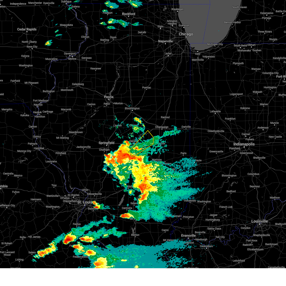 Svrilx the national weather service in lincoln has issued a * severe thunderstorm warning for, northwestern moultrie county in central illinois, north central shelby county in central illinois, southern piatt county in central illinois, southeastern macon county in central illinois, * until 445 pm cdt. * at 402 pm cdt, a severe thunderstorm was located over macon, or 12 miles south of decatur, moving northeast at 55 mph (radar indicated). Hazards include 60 mph wind gusts and quarter size hail. Hail damage to vehicles is expected. expect wind damage to roofs, siding, and trees. this severe thunderstorm will be near, mount zion and macon around 405 pm cdt. decatur, long creek, and dalton city around 410 pm cdt. cerro gordo around 420 pm cdt. other locations in the path of this severe thunderstorm include bement, monticello and ivesdale. This includes interstate 72 between mile markers 161 and 166. Svrilx the national weather service in lincoln has issued a * severe thunderstorm warning for, northwestern moultrie county in central illinois, north central shelby county in central illinois, southern piatt county in central illinois, southeastern macon county in central illinois, * until 445 pm cdt. * at 402 pm cdt, a severe thunderstorm was located over macon, or 12 miles south of decatur, moving northeast at 55 mph (radar indicated). Hazards include 60 mph wind gusts and quarter size hail. Hail damage to vehicles is expected. expect wind damage to roofs, siding, and trees. this severe thunderstorm will be near, mount zion and macon around 405 pm cdt. decatur, long creek, and dalton city around 410 pm cdt. cerro gordo around 420 pm cdt. other locations in the path of this severe thunderstorm include bement, monticello and ivesdale. This includes interstate 72 between mile markers 161 and 166.
|
| 5/15/2025 7:57 PM CDT |
 The storm which prompted the warning has moved out of the area. therefore, the warning will be allowed to expire. however, a new tornado warning has been issued for east central macon county until 830 pm. a tornado watch remains in effect until 1000 pm cdt for central illinois. to report severe weather, contact your nearest law enforcement agency. they will relay your report to the national weather service lincoln. The storm which prompted the warning has moved out of the area. therefore, the warning will be allowed to expire. however, a new tornado warning has been issued for east central macon county until 830 pm. a tornado watch remains in effect until 1000 pm cdt for central illinois. to report severe weather, contact your nearest law enforcement agency. they will relay your report to the national weather service lincoln.
|
| 5/15/2025 7:56 PM CDT |
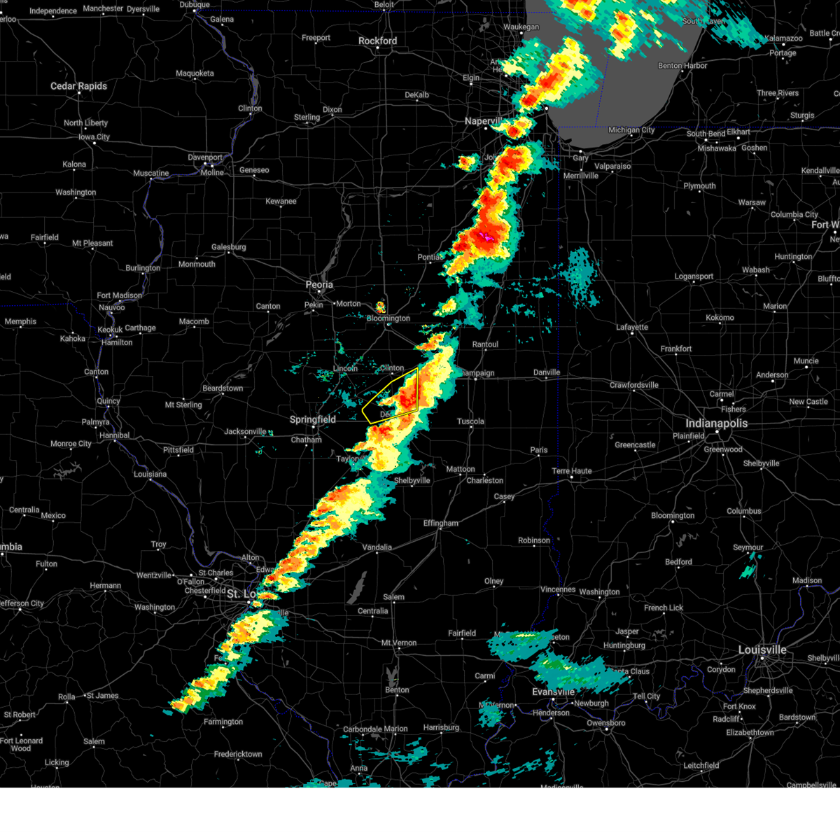 The storms which prompted the warning have moved out of the area. therefore, the warning will be allowed to expire. a tornado watch remains in effect until 1000 pm cdt for central illinois. a tornado warning is in effect for east central macon county until 830 pm. The storms which prompted the warning have moved out of the area. therefore, the warning will be allowed to expire. a tornado watch remains in effect until 1000 pm cdt for central illinois. a tornado warning is in effect for east central macon county until 830 pm.
|
| 5/15/2025 7:54 PM CDT |
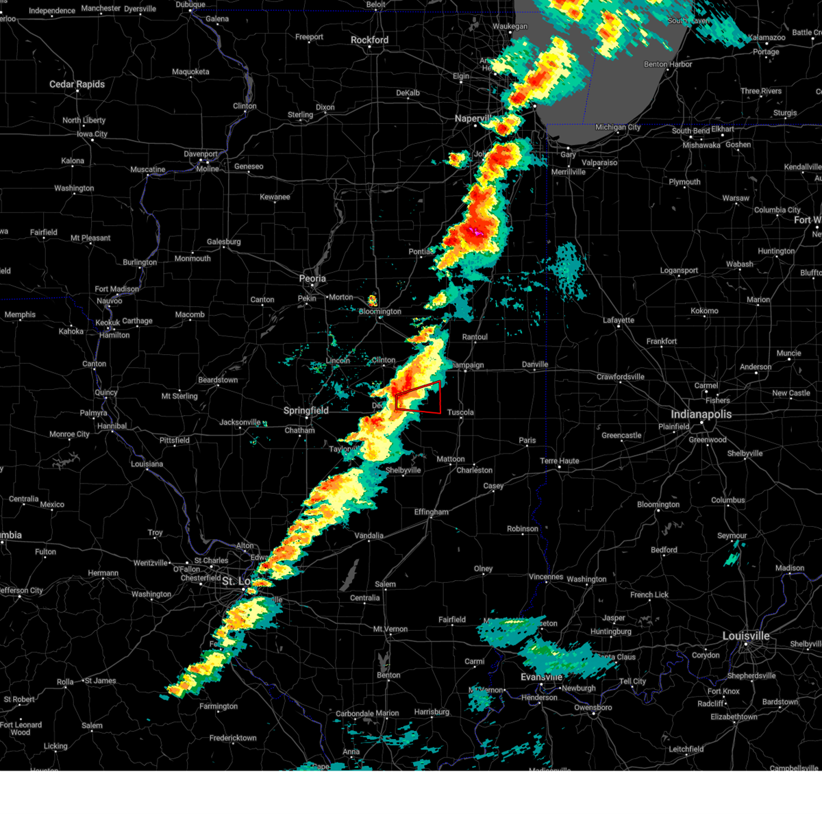 Torilx the national weather service in lincoln has issued a * tornado warning for, southern piatt county in central illinois, northeastern macon county in central illinois, * until 830 pm cdt. * at 753 pm cdt, a severe thunderstorm capable of producing a tornado was located near oreana, or 7 miles northeast of decatur, moving east at 45 mph (weather spotters reported funnel cloud. at 750 pm, funnel clouds were reported near oreana by emergency management and illinois state police). Hazards include tornado and quarter size hail. Flying debris will be dangerous to those caught without shelter. mobile homes will be damaged or destroyed. damage to roofs, windows, and vehicles will occur. tree damage is likely. this dangerous storm will be near, cerro gordo around 800 pm cdt. bement around 805 pm cdt. This includes interstate 72 between mile markers 148 and 150. Torilx the national weather service in lincoln has issued a * tornado warning for, southern piatt county in central illinois, northeastern macon county in central illinois, * until 830 pm cdt. * at 753 pm cdt, a severe thunderstorm capable of producing a tornado was located near oreana, or 7 miles northeast of decatur, moving east at 45 mph (weather spotters reported funnel cloud. at 750 pm, funnel clouds were reported near oreana by emergency management and illinois state police). Hazards include tornado and quarter size hail. Flying debris will be dangerous to those caught without shelter. mobile homes will be damaged or destroyed. damage to roofs, windows, and vehicles will occur. tree damage is likely. this dangerous storm will be near, cerro gordo around 800 pm cdt. bement around 805 pm cdt. This includes interstate 72 between mile markers 148 and 150.
|
| 5/15/2025 7:50 PM CDT |
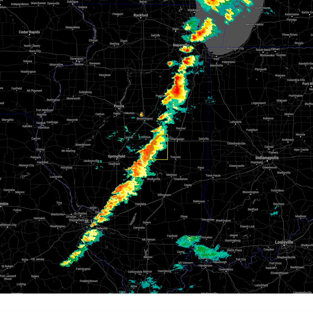 Svrilx the national weather service in lincoln has issued a * severe thunderstorm warning for, piatt county in central illinois, southeastern de witt county in central illinois, northeastern macon county in central illinois, * until 815 pm cdt. * at 749 pm cdt, severe thunderstorms were located along a line extending from near weldon to long creek, moving east at 40 mph (radar indicated). Hazards include 60 mph wind gusts and quarter size hail. Hail damage to vehicles is expected. expect wind damage to roofs, siding, and trees. severe thunderstorms will be near, monticello, cerro gordo, long creek, de land, and cisco around 755 pm cdt. bement and white heath around 800 pm cdt. hammond around 805 pm cdt. this includes the following highways, interstate 72 between mile markers 146 and 173. Interstate 74 between mile markers 164 and 168. Svrilx the national weather service in lincoln has issued a * severe thunderstorm warning for, piatt county in central illinois, southeastern de witt county in central illinois, northeastern macon county in central illinois, * until 815 pm cdt. * at 749 pm cdt, severe thunderstorms were located along a line extending from near weldon to long creek, moving east at 40 mph (radar indicated). Hazards include 60 mph wind gusts and quarter size hail. Hail damage to vehicles is expected. expect wind damage to roofs, siding, and trees. severe thunderstorms will be near, monticello, cerro gordo, long creek, de land, and cisco around 755 pm cdt. bement and white heath around 800 pm cdt. hammond around 805 pm cdt. this includes the following highways, interstate 72 between mile markers 146 and 173. Interstate 74 between mile markers 164 and 168.
|
| 5/15/2025 7:46 PM CDT | Large tree branch broken east of decatur... and power lines down. time estimated from rada in macon county IL, 4 miles W of Decatur, IL |
| 5/15/2025 7:43 PM CDT | Power lines down and large tree branch broken off on west side of decatu in macon county IL, 4.2 miles ENE of Decatur, IL |
| 5/15/2025 7:43 PM CDT |
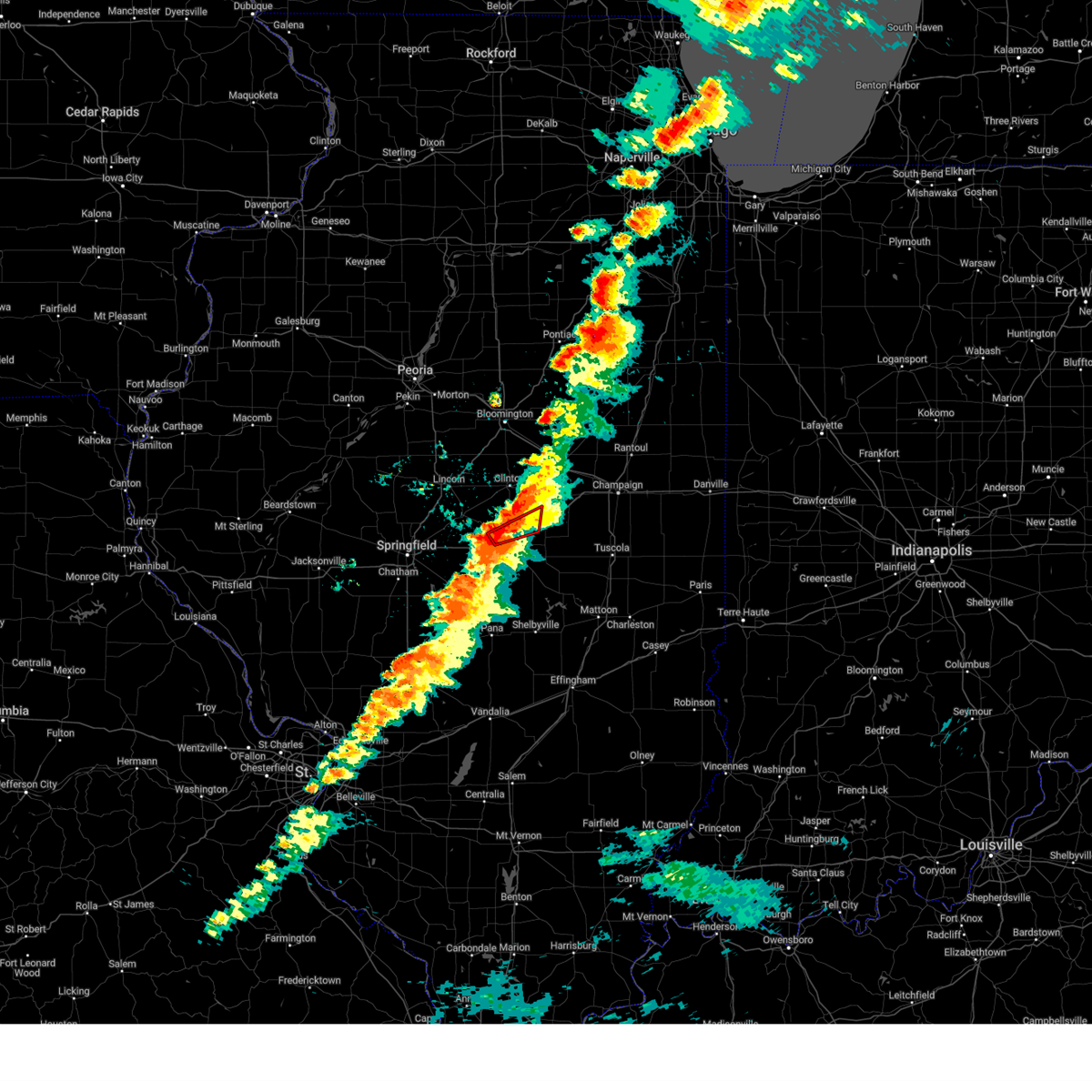 At 742 pm cdt, a severe thunderstorm capable of producing a tornado was located over forsyth, moving east at 30 mph (radar indicated rotation. at 742 pm, broadcast media reported a funnel cloud and strong rotation near decatur). Hazards include tornado and quarter size hail. Flying debris will be dangerous to those caught without shelter. mobile homes will be damaged or destroyed. damage to roofs, windows, and vehicles will occur. tree damage is likely. this dangerous storm will be near, decatur, forsyth, and oreana around 750 pm cdt. argenta around 800 pm cdt. This includes interstate 72 between mile markers 135 and 155. At 742 pm cdt, a severe thunderstorm capable of producing a tornado was located over forsyth, moving east at 30 mph (radar indicated rotation. at 742 pm, broadcast media reported a funnel cloud and strong rotation near decatur). Hazards include tornado and quarter size hail. Flying debris will be dangerous to those caught without shelter. mobile homes will be damaged or destroyed. damage to roofs, windows, and vehicles will occur. tree damage is likely. this dangerous storm will be near, decatur, forsyth, and oreana around 750 pm cdt. argenta around 800 pm cdt. This includes interstate 72 between mile markers 135 and 155.
|
| 5/15/2025 7:38 PM CDT |
 At 737 pm cdt, severe thunderstorms were located along a line extending from near maroa to harristown, moving east at 45 mph (radar indicated). Hazards include 60 mph wind gusts and quarter size hail. Hail damage to vehicles is expected. expect wind damage to roofs, siding, and trees. these severe storms will be near, decatur, forsyth, argenta, oreana, and weldon around 745 pm cdt. other locations impacted by these severe thunderstorms include lane and weldon springs state park. This includes interstate 72 between mile markers 128 and 131, and between mile markers 134 and 156. At 737 pm cdt, severe thunderstorms were located along a line extending from near maroa to harristown, moving east at 45 mph (radar indicated). Hazards include 60 mph wind gusts and quarter size hail. Hail damage to vehicles is expected. expect wind damage to roofs, siding, and trees. these severe storms will be near, decatur, forsyth, argenta, oreana, and weldon around 745 pm cdt. other locations impacted by these severe thunderstorms include lane and weldon springs state park. This includes interstate 72 between mile markers 128 and 131, and between mile markers 134 and 156.
|
| 5/15/2025 7:33 PM CDT |
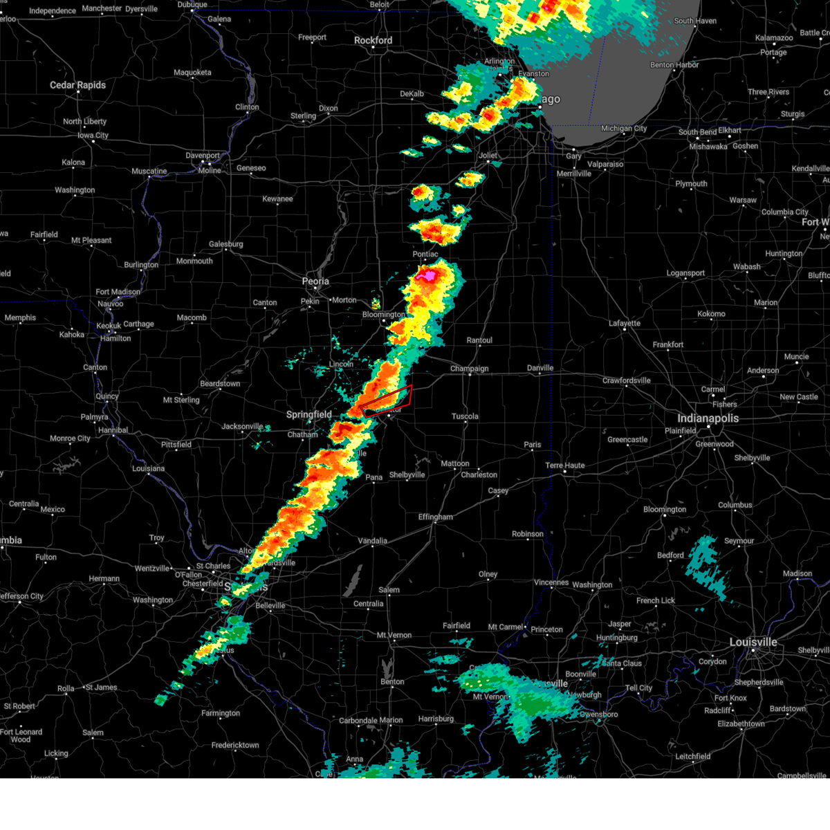 Torilx the national weather service in lincoln has issued a * tornado warning for, northern macon county in central illinois, * until 800 pm cdt. * at 733 pm cdt, a severe thunderstorm capable of producing a tornado was located 3 miles north of niantic, or 8 miles west of decatur, moving east at 45 mph (radar indicated rotation). Hazards include tornado and quarter size hail. Flying debris will be dangerous to those caught without shelter. mobile homes will be damaged or destroyed. damage to roofs, windows, and vehicles will occur. tree damage is likely. this dangerous storm will be near, decatur and forsyth around 740 pm cdt. oreana around 745 pm cdt. argenta around 750 pm cdt. This includes interstate 72 between mile markers 135 and 155. Torilx the national weather service in lincoln has issued a * tornado warning for, northern macon county in central illinois, * until 800 pm cdt. * at 733 pm cdt, a severe thunderstorm capable of producing a tornado was located 3 miles north of niantic, or 8 miles west of decatur, moving east at 45 mph (radar indicated rotation). Hazards include tornado and quarter size hail. Flying debris will be dangerous to those caught without shelter. mobile homes will be damaged or destroyed. damage to roofs, windows, and vehicles will occur. tree damage is likely. this dangerous storm will be near, decatur and forsyth around 740 pm cdt. oreana around 745 pm cdt. argenta around 750 pm cdt. This includes interstate 72 between mile markers 135 and 155.
|
| 5/15/2025 7:19 PM CDT |
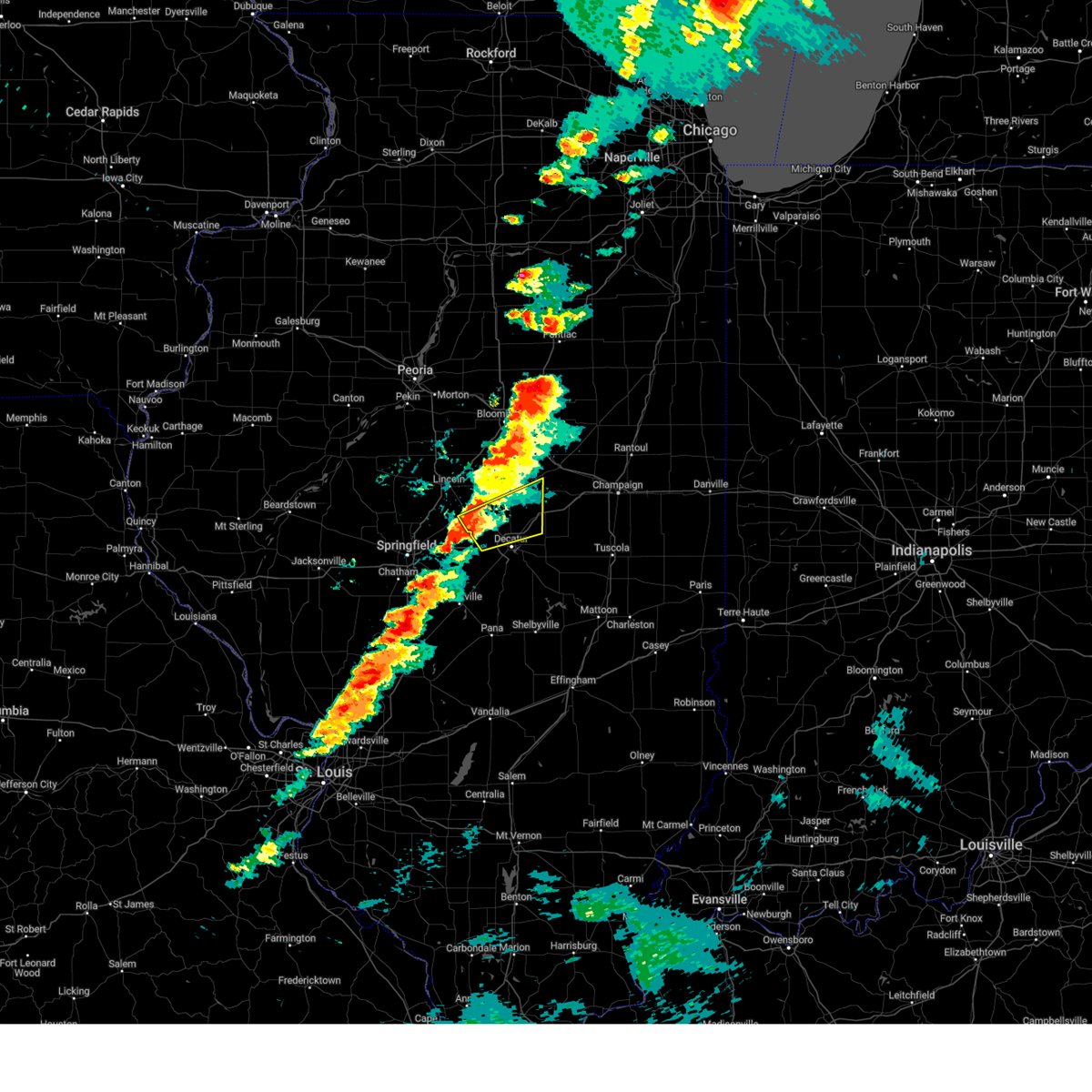 Svrilx the national weather service in lincoln has issued a * severe thunderstorm warning for, southeastern logan county in central illinois, southwestern de witt county in central illinois, northern macon county in central illinois, * until 800 pm cdt. * at 719 pm cdt, a severe thunderstorm was located near warrensburg, or 11 miles northwest of decatur, moving east at 70 mph (radar indicated). Hazards include 60 mph wind gusts and quarter size hail. Hail damage to vehicles is expected. expect wind damage to roofs, siding, and trees. this severe thunderstorm will be near, decatur, forsyth, and warrensburg around 725 pm cdt. maroa, argenta, and oreana around 730 pm cdt. This includes interstate 72 between mile markers 128 and 131, and between mile markers 134 and 156. Svrilx the national weather service in lincoln has issued a * severe thunderstorm warning for, southeastern logan county in central illinois, southwestern de witt county in central illinois, northern macon county in central illinois, * until 800 pm cdt. * at 719 pm cdt, a severe thunderstorm was located near warrensburg, or 11 miles northwest of decatur, moving east at 70 mph (radar indicated). Hazards include 60 mph wind gusts and quarter size hail. Hail damage to vehicles is expected. expect wind damage to roofs, siding, and trees. this severe thunderstorm will be near, decatur, forsyth, and warrensburg around 725 pm cdt. maroa, argenta, and oreana around 730 pm cdt. This includes interstate 72 between mile markers 128 and 131, and between mile markers 134 and 156.
|
| 4/2/2025 4:53 PM CDT |
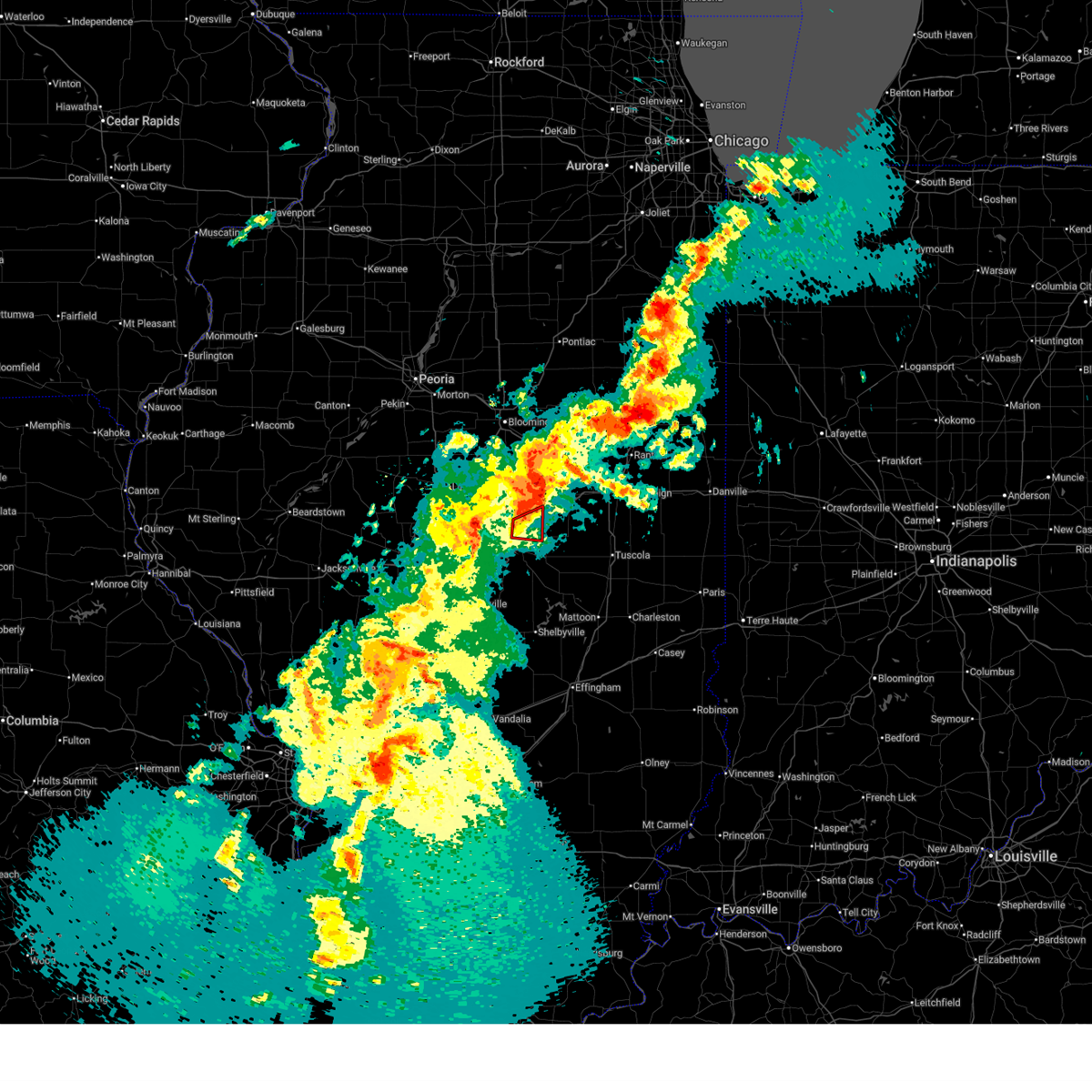 the tornado warning has been cancelled and is no longer in effect the tornado warning has been cancelled and is no longer in effect
|
| 4/2/2025 4:47 PM CDT |
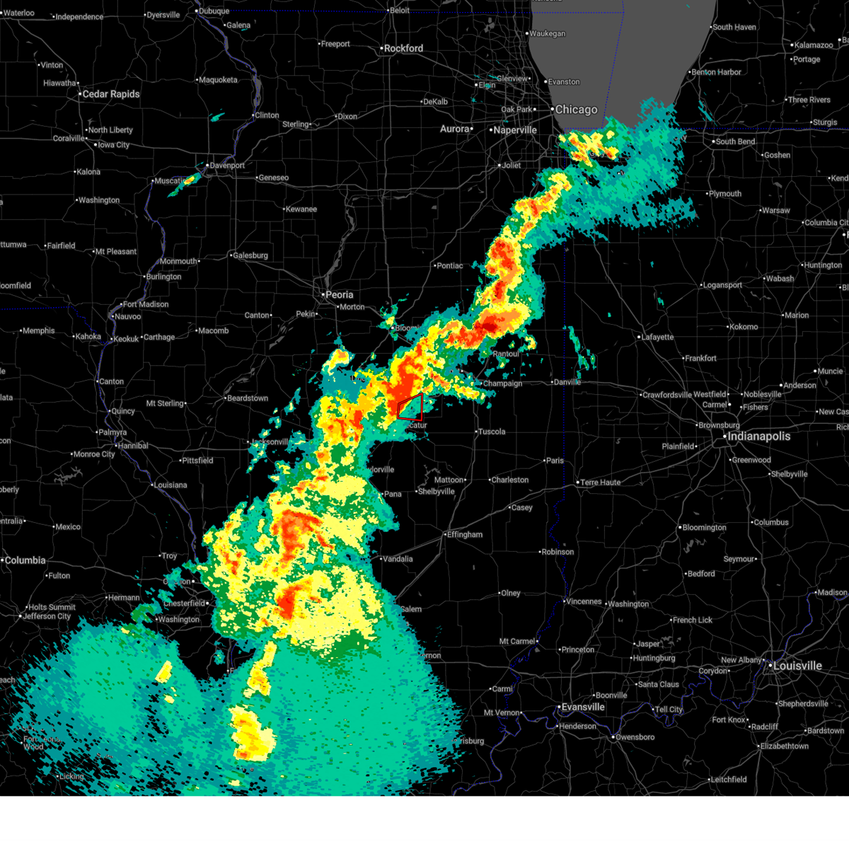 At 446 pm cdt, a severe squall line capable of producing both tornadoes and extensive straight line wind damage was located over oreana, or north of decatur, moving east at 50 mph (radar indicated rotation). Hazards include tornado. Flying debris will be dangerous to those caught without shelter. mobile homes will be damaged or destroyed. damage to roofs, windows, and vehicles will occur. tree damage is likely. these dangerous storms will be near, argenta around 450 pm cdt. other locations impacted by this tornadic thunderstorm include oakley. This includes interstate 72 between mile markers 142 and 156. At 446 pm cdt, a severe squall line capable of producing both tornadoes and extensive straight line wind damage was located over oreana, or north of decatur, moving east at 50 mph (radar indicated rotation). Hazards include tornado. Flying debris will be dangerous to those caught without shelter. mobile homes will be damaged or destroyed. damage to roofs, windows, and vehicles will occur. tree damage is likely. these dangerous storms will be near, argenta around 450 pm cdt. other locations impacted by this tornadic thunderstorm include oakley. This includes interstate 72 between mile markers 142 and 156.
|
| 4/2/2025 4:42 PM CDT |
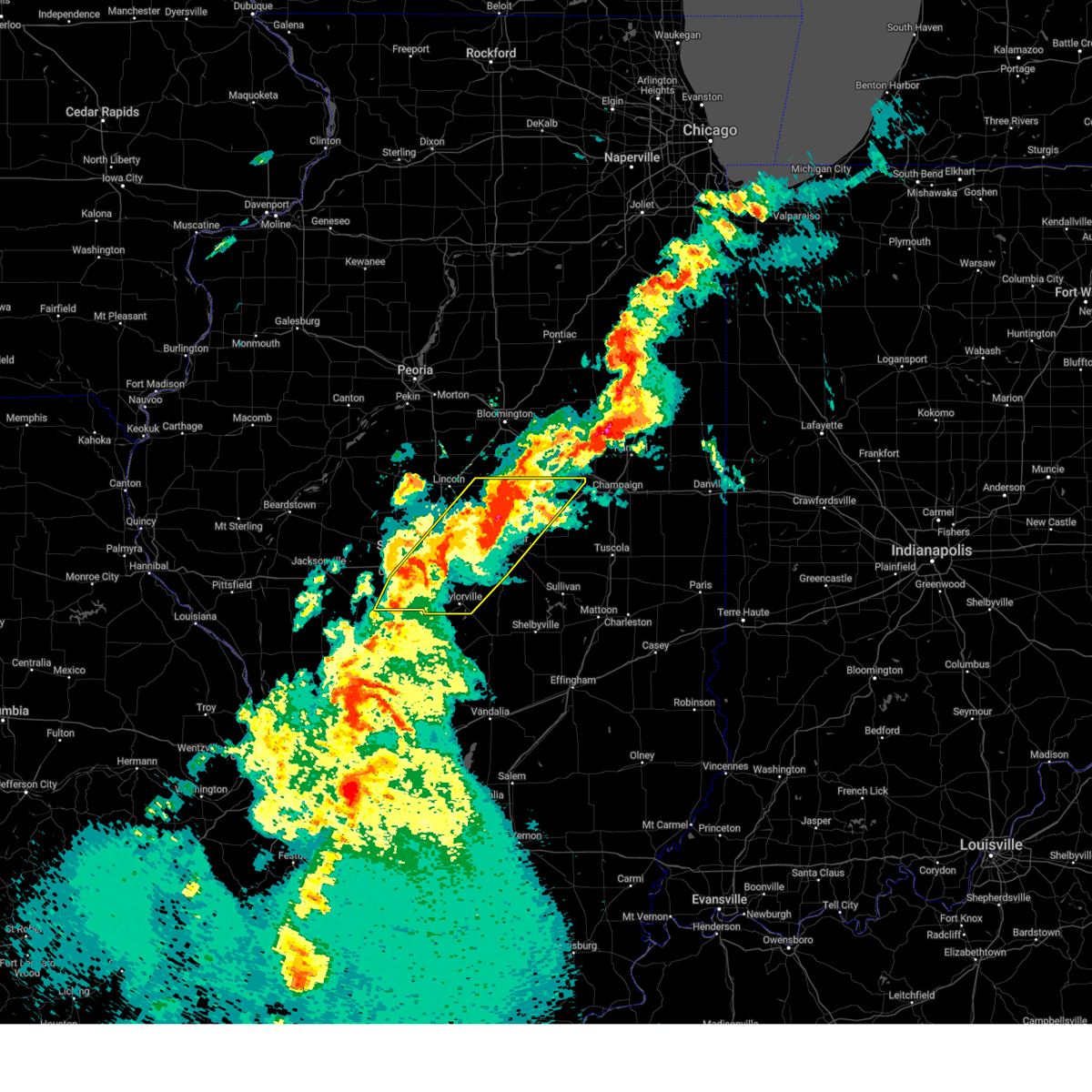 At 442 pm cdt, severe thunderstorms were located along a line extending from near weldon to near taylorville, moving northeast at 50 mph (radar indicated). Hazards include 70 mph wind gusts and quarter size hail. Hail damage to vehicles is expected. expect considerable tree damage. wind damage is also likely to mobile homes, roofs, and outbuildings. these severe storms will be near, stonington, oreana, blue mound, weldon, forsyth, taylorville, decatur, argenta, and harristown around 445 pm cdt. de land, mount zion, decatur airport, macon, and cisco around 450 pm cdt. long creek around 455 pm cdt. other locations impacted by these severe thunderstorms include sangchris lake state park, willeys, clinton power station, weldon springs state park, glenarm, thayer, southern view, elwin, clear lake, and lodge. this includes the following highways, interstate 55 between mile markers 77 and 99. Interstate 72 between mile markers 95 and 163. At 442 pm cdt, severe thunderstorms were located along a line extending from near weldon to near taylorville, moving northeast at 50 mph (radar indicated). Hazards include 70 mph wind gusts and quarter size hail. Hail damage to vehicles is expected. expect considerable tree damage. wind damage is also likely to mobile homes, roofs, and outbuildings. these severe storms will be near, stonington, oreana, blue mound, weldon, forsyth, taylorville, decatur, argenta, and harristown around 445 pm cdt. de land, mount zion, decatur airport, macon, and cisco around 450 pm cdt. long creek around 455 pm cdt. other locations impacted by these severe thunderstorms include sangchris lake state park, willeys, clinton power station, weldon springs state park, glenarm, thayer, southern view, elwin, clear lake, and lodge. this includes the following highways, interstate 55 between mile markers 77 and 99. Interstate 72 between mile markers 95 and 163.
|
| 4/2/2025 4:30 PM CDT |
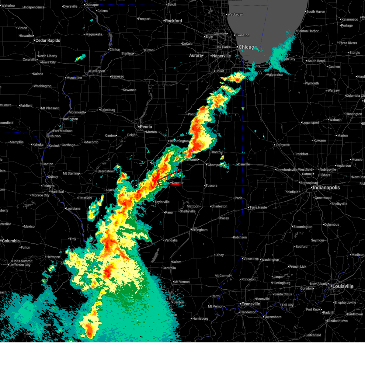 Torilx the national weather service in lincoln has issued a * tornado warning for, central macon county in central illinois, * until 515 pm cdt. * at 429 pm cdt, severe thunderstorms capable of producing both tornadoes and extensive straight line wind damage were located over niantic, or 10 miles west of decatur, moving east at 50 mph (radar indicated rotation). Hazards include tornado. Flying debris will be dangerous to those caught without shelter. mobile homes will be damaged or destroyed. damage to roofs, windows, and vehicles will occur. tree damage is likely. these dangerous storms will be near, forsyth, warrensburg, decatur, and harristown around 435 pm cdt. oreana around 440 pm cdt. other locations in the path of this tornadic thunderstorm include argenta. This includes interstate 72 between mile markers 126 and 156. Torilx the national weather service in lincoln has issued a * tornado warning for, central macon county in central illinois, * until 515 pm cdt. * at 429 pm cdt, severe thunderstorms capable of producing both tornadoes and extensive straight line wind damage were located over niantic, or 10 miles west of decatur, moving east at 50 mph (radar indicated rotation). Hazards include tornado. Flying debris will be dangerous to those caught without shelter. mobile homes will be damaged or destroyed. damage to roofs, windows, and vehicles will occur. tree damage is likely. these dangerous storms will be near, forsyth, warrensburg, decatur, and harristown around 435 pm cdt. oreana around 440 pm cdt. other locations in the path of this tornadic thunderstorm include argenta. This includes interstate 72 between mile markers 126 and 156.
|
| 4/2/2025 4:24 PM CDT |
 Svrilx the national weather service in lincoln has issued a * severe thunderstorm warning for, southeastern logan county in central illinois, central christian county in central illinois, central sangamon county in central illinois, central piatt county in central illinois, southern de witt county in central illinois, macon county in central illinois, * until 515 pm cdt. * at 423 pm cdt, severe thunderstorms were located along a line extending from near wapella to near pawnee, moving northeast at 65 mph (radar indicated). Hazards include 60 mph wind gusts and quarter size hail. Hail damage to vehicles is expected. expect wind damage to roofs, siding, and trees. severe thunderstorms will be near, edinburg, mount auburn, maroa, latham, clinton, warrensburg, jeisyville, niantic, kincaid, and illiopolis around 430 pm cdt. forsyth, decatur, and harristown around 435 pm cdt. weldon around 440 pm cdt. other locations in the path of these severe thunderstorms include oreana, blue mound, argenta, de land, mount zion, decatur airport, long creek and cisco. this includes the following highways, interstate 55 between mile markers 77 and 100. Interstate 72 between mile markers 95 and 163. Svrilx the national weather service in lincoln has issued a * severe thunderstorm warning for, southeastern logan county in central illinois, central christian county in central illinois, central sangamon county in central illinois, central piatt county in central illinois, southern de witt county in central illinois, macon county in central illinois, * until 515 pm cdt. * at 423 pm cdt, severe thunderstorms were located along a line extending from near wapella to near pawnee, moving northeast at 65 mph (radar indicated). Hazards include 60 mph wind gusts and quarter size hail. Hail damage to vehicles is expected. expect wind damage to roofs, siding, and trees. severe thunderstorms will be near, edinburg, mount auburn, maroa, latham, clinton, warrensburg, jeisyville, niantic, kincaid, and illiopolis around 430 pm cdt. forsyth, decatur, and harristown around 435 pm cdt. weldon around 440 pm cdt. other locations in the path of these severe thunderstorms include oreana, blue mound, argenta, de land, mount zion, decatur airport, long creek and cisco. this includes the following highways, interstate 55 between mile markers 77 and 100. Interstate 72 between mile markers 95 and 163.
|
| 3/19/2025 6:07 PM CDT |
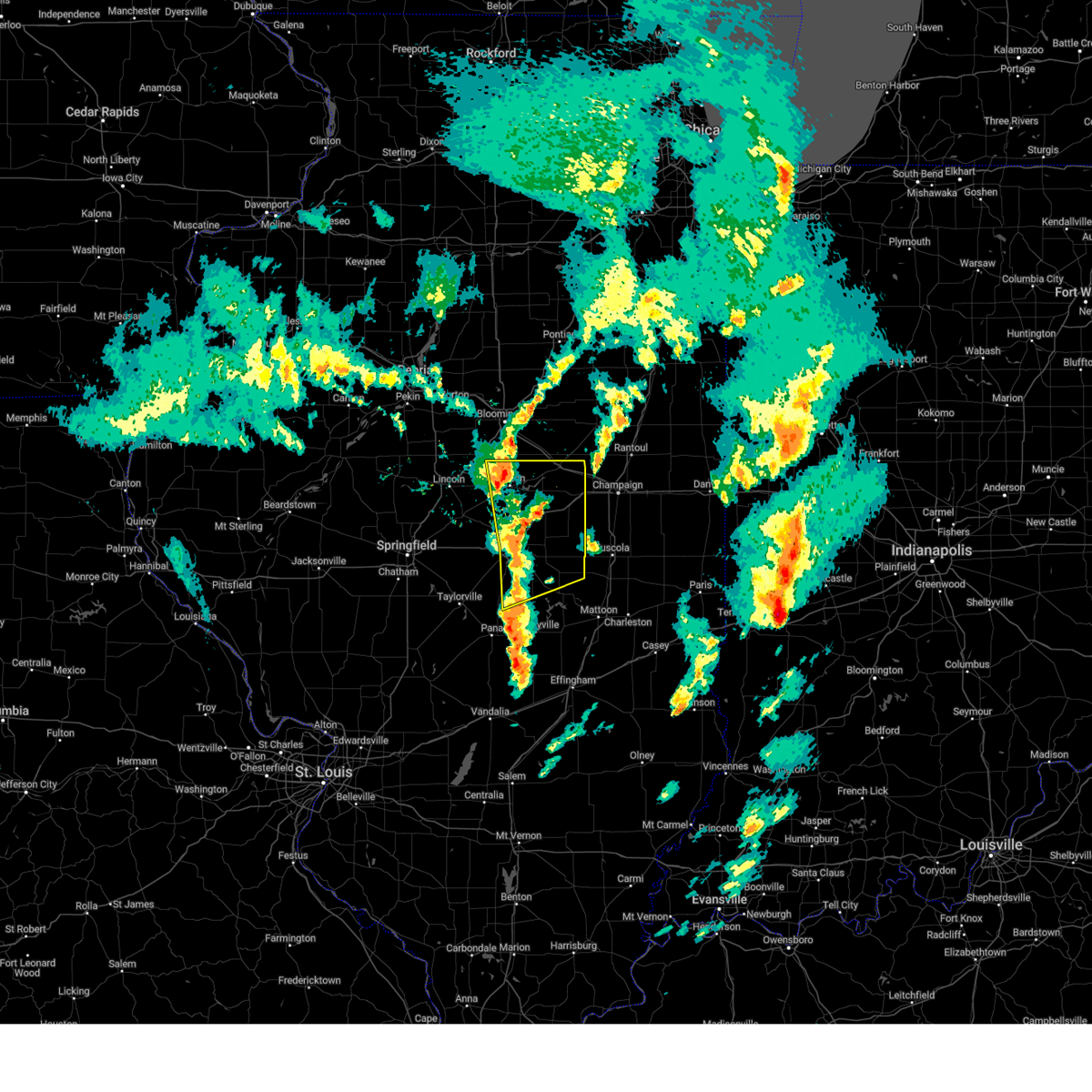 the severe thunderstorm warning has been cancelled and is no longer in effect the severe thunderstorm warning has been cancelled and is no longer in effect
|
| 3/19/2025 6:07 PM CDT |
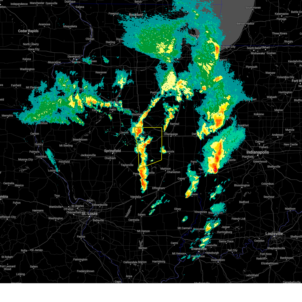 At 607 pm cdt, severe thunderstorms were located along a line extending from near wapella to near oreana to 6 miles southeast of moweaqua, moving northeast at 50 mph (radar indicated). Hazards include 60 mph wind gusts and quarter size hail. Hail damage to vehicles is expected. expect wind damage to roofs, siding, and trees. these severe storms will be near, oreana, wapella, mount zion, decatur airport, clinton, long creek, dalton city, decatur, and argenta around 610 pm cdt. cerro gordo, bethany, weldon, and cisco around 615 pm cdt. lovington around 620 pm cdt. de land, monticello, hammond, bement, and farmer city around 625 pm cdt. white heath around 630 pm cdt. ivesdale, mansfield, arthur, and atwood around 635 pm cdt. other locations impacted by these severe thunderstorms include clinton power station, weldon springs state park, lake city, lane, elwin, milmine, hervey city, cadwell, la place, and hallsville. this includes the following highways, interstate 72 between mile markers 136 and 173. Interstate 74 between mile markers 156 and 168. At 607 pm cdt, severe thunderstorms were located along a line extending from near wapella to near oreana to 6 miles southeast of moweaqua, moving northeast at 50 mph (radar indicated). Hazards include 60 mph wind gusts and quarter size hail. Hail damage to vehicles is expected. expect wind damage to roofs, siding, and trees. these severe storms will be near, oreana, wapella, mount zion, decatur airport, clinton, long creek, dalton city, decatur, and argenta around 610 pm cdt. cerro gordo, bethany, weldon, and cisco around 615 pm cdt. lovington around 620 pm cdt. de land, monticello, hammond, bement, and farmer city around 625 pm cdt. white heath around 630 pm cdt. ivesdale, mansfield, arthur, and atwood around 635 pm cdt. other locations impacted by these severe thunderstorms include clinton power station, weldon springs state park, lake city, lane, elwin, milmine, hervey city, cadwell, la place, and hallsville. this includes the following highways, interstate 72 between mile markers 136 and 173. Interstate 74 between mile markers 156 and 168.
|
| 3/19/2025 5:50 PM CDT |
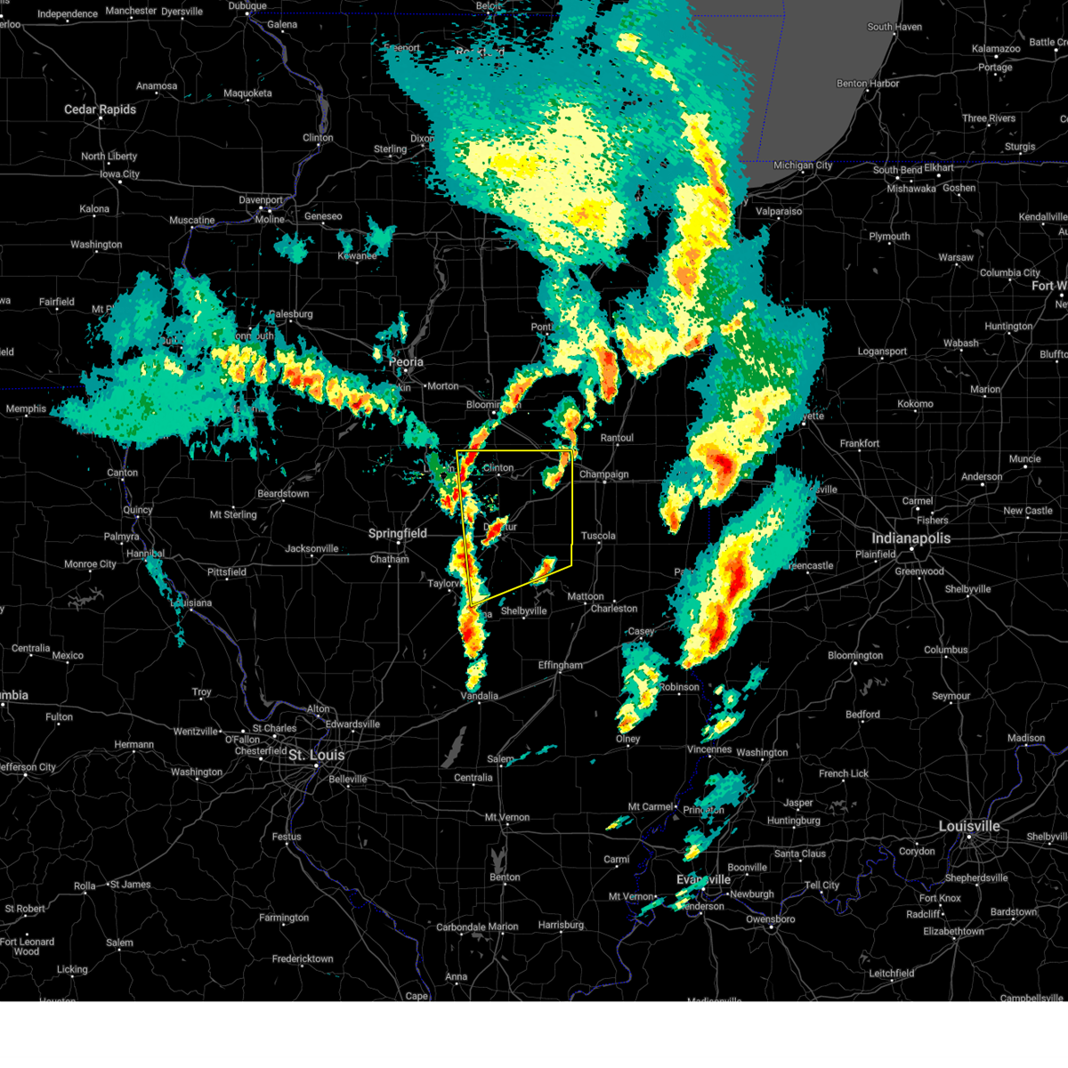 Svrilx the national weather service in lincoln has issued a * severe thunderstorm warning for, eastern logan county in central illinois, northeastern christian county in central illinois, northern moultrie county in central illinois, northwestern shelby county in central illinois, piatt county in central illinois, de witt county in central illinois, macon county in central illinois, * until 645 pm cdt. * at 549 pm cdt, severe thunderstorms were located along a line extending from near atlanta to near latham to near owaneco, moving northeast at 50 mph (radar indicated). Hazards include 60 mph wind gusts and quarter size hail. Hail damage to vehicles is expected. expect wind damage to roofs, siding, and trees. severe thunderstorms will be near, kenney, assumption, moweaqua, forsyth, clinton, warrensburg, macon, decatur, waynesville, and harristown around 555 pm cdt. wapella, mount zion, and maroa around 600 pm cdt. oreana, decatur airport, long creek, and argenta around 605 pm cdt. other locations in the path of these severe thunderstorms include bethany, dalton city, cerro gordo, weldon, cisco, de land, lovington, farmer city, monticello, hammond, bement, mansfield and white heath. this includes the following highways, interstate 55 between mile markers 139 and 141. interstate 72 between mile markers 126 and 173. Interstate 74 between mile markers 156 and 168. Svrilx the national weather service in lincoln has issued a * severe thunderstorm warning for, eastern logan county in central illinois, northeastern christian county in central illinois, northern moultrie county in central illinois, northwestern shelby county in central illinois, piatt county in central illinois, de witt county in central illinois, macon county in central illinois, * until 645 pm cdt. * at 549 pm cdt, severe thunderstorms were located along a line extending from near atlanta to near latham to near owaneco, moving northeast at 50 mph (radar indicated). Hazards include 60 mph wind gusts and quarter size hail. Hail damage to vehicles is expected. expect wind damage to roofs, siding, and trees. severe thunderstorms will be near, kenney, assumption, moweaqua, forsyth, clinton, warrensburg, macon, decatur, waynesville, and harristown around 555 pm cdt. wapella, mount zion, and maroa around 600 pm cdt. oreana, decatur airport, long creek, and argenta around 605 pm cdt. other locations in the path of these severe thunderstorms include bethany, dalton city, cerro gordo, weldon, cisco, de land, lovington, farmer city, monticello, hammond, bement, mansfield and white heath. this includes the following highways, interstate 55 between mile markers 139 and 141. interstate 72 between mile markers 126 and 173. Interstate 74 between mile markers 156 and 168.
|
| 3/14/2025 11:59 PM CDT |
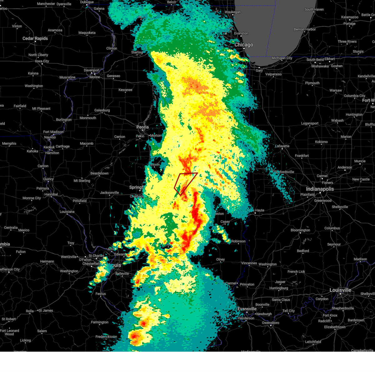 The storm which prompted the warning has moved out of the area. therefore, the warning will be allowed to expire. however, gusty winds are still possible with this thunderstorm. a tornado watch remains in effect until 300 am cdt for central illinois. The storm which prompted the warning has moved out of the area. therefore, the warning will be allowed to expire. however, gusty winds are still possible with this thunderstorm. a tornado watch remains in effect until 300 am cdt for central illinois.
|
| 3/14/2025 11:54 PM CDT |
 Svrilx the national weather service in lincoln has issued a * severe thunderstorm warning for, northern moultrie county in central illinois, piatt county in central illinois, southeastern de witt county in central illinois, southeastern mclean county in central illinois, champaign county in east central illinois, douglas county in east central illinois, northeastern macon county in central illinois, * until 100 am cdt. * at 1153 pm cdt, severe thunderstorms were located along a line extending from near bement to near arthur to near mattoon, moving northeast at 65 mph (radar indicated). Hazards include 70 mph wind gusts. Expect considerable tree damage. damage is likely to mobile homes, roofs, and outbuildings. severe thunderstorms will be near, sadorus, arcola, monticello, ivesdale, white heath, atwood, and tuscola around 1200 am cdt. camargo, mahomet, savoy, willard airport, seymour, champaign, lake of the woods, pesotum, tolono, and bondville around 1205 am cdt. villa grove, philo, and urbana around 1210 am cdt. other locations in the path of these severe thunderstorms include broadlands, rantoul, st. joseph, sidney, thomasboro, homer, gifford and ogden. this includes the following highways, interstate 57 between mile markers 202 and 257. interstate 72 between mile markers 152 and 182. Interstate 74 between mile markers 160 and 197. Svrilx the national weather service in lincoln has issued a * severe thunderstorm warning for, northern moultrie county in central illinois, piatt county in central illinois, southeastern de witt county in central illinois, southeastern mclean county in central illinois, champaign county in east central illinois, douglas county in east central illinois, northeastern macon county in central illinois, * until 100 am cdt. * at 1153 pm cdt, severe thunderstorms were located along a line extending from near bement to near arthur to near mattoon, moving northeast at 65 mph (radar indicated). Hazards include 70 mph wind gusts. Expect considerable tree damage. damage is likely to mobile homes, roofs, and outbuildings. severe thunderstorms will be near, sadorus, arcola, monticello, ivesdale, white heath, atwood, and tuscola around 1200 am cdt. camargo, mahomet, savoy, willard airport, seymour, champaign, lake of the woods, pesotum, tolono, and bondville around 1205 am cdt. villa grove, philo, and urbana around 1210 am cdt. other locations in the path of these severe thunderstorms include broadlands, rantoul, st. joseph, sidney, thomasboro, homer, gifford and ogden. this includes the following highways, interstate 57 between mile markers 202 and 257. interstate 72 between mile markers 152 and 182. Interstate 74 between mile markers 160 and 197.
|
| 3/14/2025 11:43 PM CDT |
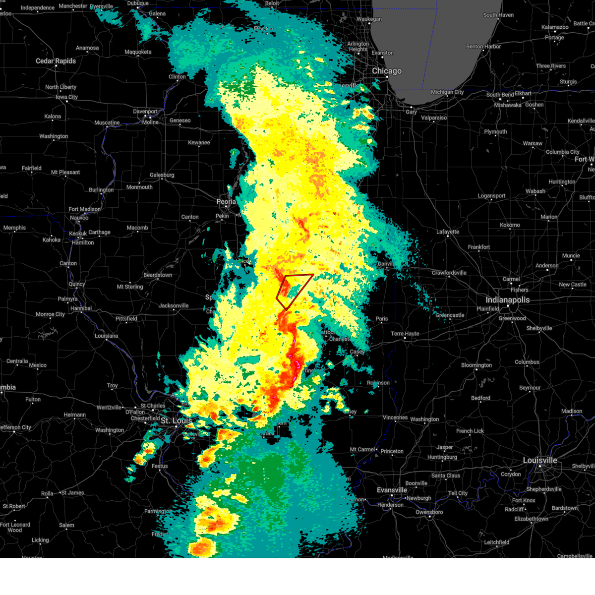 At 1143 pm cdt, a severe thunderstorm capable of producing a tornado was located over decatur airport, or near decatur, moving northeast at 40 mph (radar indicated rotation). Hazards include tornado and quarter size hail. Flying debris will be dangerous to those caught without shelter. mobile homes will be damaged or destroyed. damage to roofs, windows, and vehicles will occur. tree damage is likely. this dangerous storm will be near, cerro gordo around 1150 pm cdt. monticello around 1205 am cdt. other locations impacted by this tornadic thunderstorm include hervey city and oakley. This includes interstate 72 between mile markers 143 and 167. At 1143 pm cdt, a severe thunderstorm capable of producing a tornado was located over decatur airport, or near decatur, moving northeast at 40 mph (radar indicated rotation). Hazards include tornado and quarter size hail. Flying debris will be dangerous to those caught without shelter. mobile homes will be damaged or destroyed. damage to roofs, windows, and vehicles will occur. tree damage is likely. this dangerous storm will be near, cerro gordo around 1150 pm cdt. monticello around 1205 am cdt. other locations impacted by this tornadic thunderstorm include hervey city and oakley. This includes interstate 72 between mile markers 143 and 167.
|
| 3/14/2025 11:31 PM CDT |
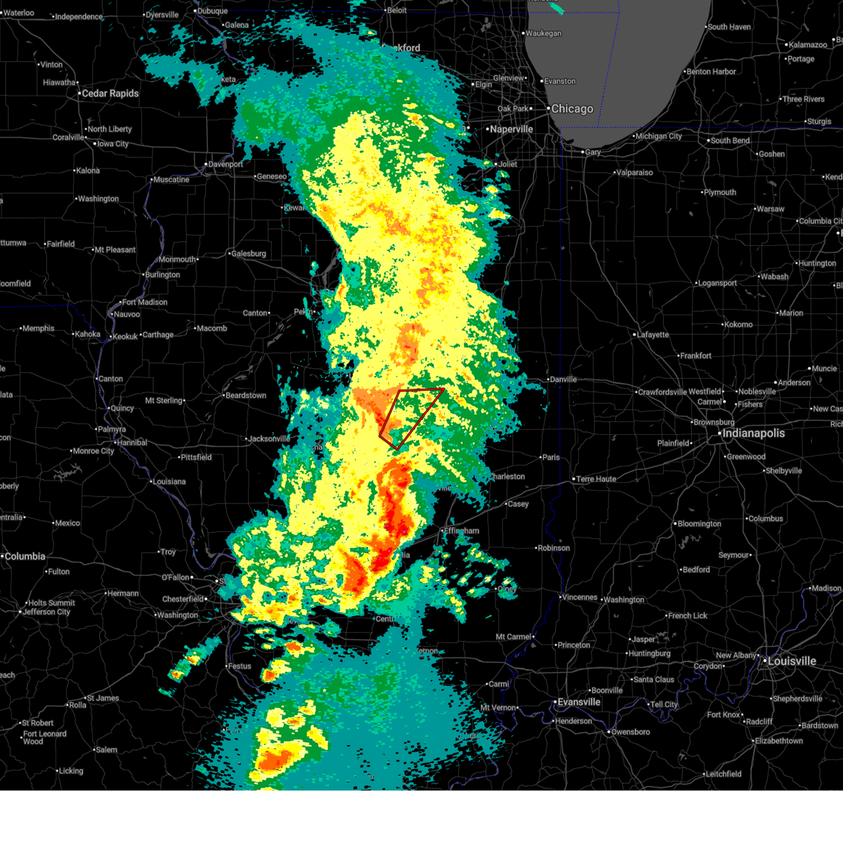 Torilx the national weather service in lincoln has issued a * tornado warning for, west central piatt county in central illinois, eastern macon county in central illinois, * until midnight cdt. * at 1131 pm cdt, a severe thunderstorm capable of producing a tornado was located near mount zion, or near decatur, moving northeast at 50 mph (radar indicated rotation). Hazards include tornado and ping pong ball size hail. Flying debris will be dangerous to those caught without shelter. mobile homes will be damaged or destroyed. damage to roofs, windows, and vehicles will occur. tree damage is likely. this dangerous storm will be near, mount zion, decatur airport, long creek, and decatur around 1135 pm cdt. oreana around 1140 pm cdt. cerro gordo and argenta around 1145 pm cdt. cisco around 1150 pm cdt. This includes interstate 72 between mile markers 140 and 167. Torilx the national weather service in lincoln has issued a * tornado warning for, west central piatt county in central illinois, eastern macon county in central illinois, * until midnight cdt. * at 1131 pm cdt, a severe thunderstorm capable of producing a tornado was located near mount zion, or near decatur, moving northeast at 50 mph (radar indicated rotation). Hazards include tornado and ping pong ball size hail. Flying debris will be dangerous to those caught without shelter. mobile homes will be damaged or destroyed. damage to roofs, windows, and vehicles will occur. tree damage is likely. this dangerous storm will be near, mount zion, decatur airport, long creek, and decatur around 1135 pm cdt. oreana around 1140 pm cdt. cerro gordo and argenta around 1145 pm cdt. cisco around 1150 pm cdt. This includes interstate 72 between mile markers 140 and 167.
|
| 3/14/2025 10:41 PM CDT |
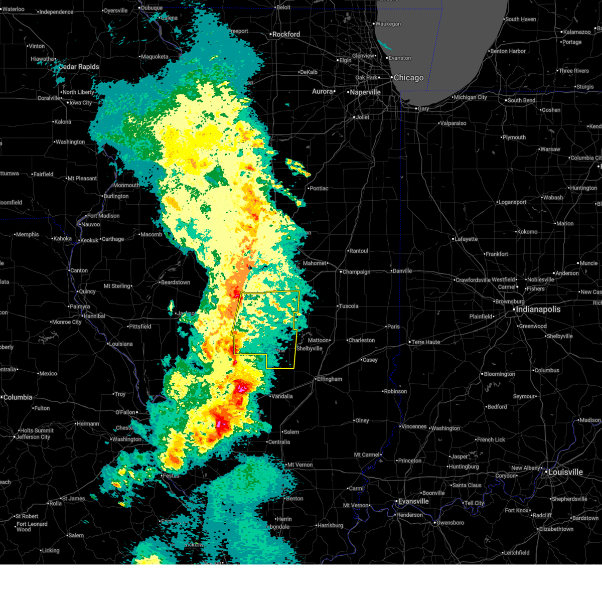 Svrilx the national weather service in lincoln has issued a * severe thunderstorm warning for, christian county in central illinois, eastern sangamon county in central illinois, western shelby county in central illinois, macon county in central illinois, * until 1145 pm cdt. * at 1041 pm cdt, severe thunderstorms were located along a line extending from near cornland to near white oak to near van burensburg, moving northeast at 60 mph (radar indicated). Hazards include 70 mph wind gusts. Expect considerable tree damage. damage is likely to mobile homes, roofs, and outbuildings. severe thunderstorms will be near, edinburg, morrisonville, mechanicsburg, jeisyville, buffalo, and kincaid around 1045 pm cdt. mount auburn, taylorville, and illiopolis around 1050 pm cdt. owaneco and niantic around 1055 pm cdt. stonington and pana around 1100 pm cdt. other locations in the path of these severe thunderstorms include blue mound, warrensburg, harristown, herrick, assumption, tower hill, decatur, cowden, moweaqua, forsyth, macon and shelbyville. This includes interstate 72 between mile markers 112 and 148. Svrilx the national weather service in lincoln has issued a * severe thunderstorm warning for, christian county in central illinois, eastern sangamon county in central illinois, western shelby county in central illinois, macon county in central illinois, * until 1145 pm cdt. * at 1041 pm cdt, severe thunderstorms were located along a line extending from near cornland to near white oak to near van burensburg, moving northeast at 60 mph (radar indicated). Hazards include 70 mph wind gusts. Expect considerable tree damage. damage is likely to mobile homes, roofs, and outbuildings. severe thunderstorms will be near, edinburg, morrisonville, mechanicsburg, jeisyville, buffalo, and kincaid around 1045 pm cdt. mount auburn, taylorville, and illiopolis around 1050 pm cdt. owaneco and niantic around 1055 pm cdt. stonington and pana around 1100 pm cdt. other locations in the path of these severe thunderstorms include blue mound, warrensburg, harristown, herrick, assumption, tower hill, decatur, cowden, moweaqua, forsyth, macon and shelbyville. This includes interstate 72 between mile markers 112 and 148.
|
| 9/27/2024 8:36 PM CDT | Report from mping: 3-inch tree limbs broke in macon county IL, 4 miles NW of Decatur, IL |
| 9/27/2024 8:34 PM CDT | Report from mping: 3-inch tree limbs broke in macon county IL, 4 miles NW of Decatur, IL |
| 8/30/2024 5:31 PM CDT |
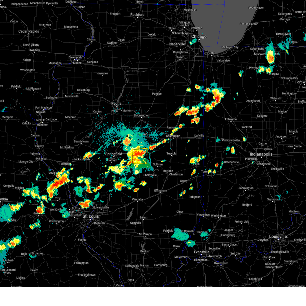 The storm which prompted the warning has weakened below severe limits, and no longer poses an immediate threat to life or property. therefore, the warning has been allowed to expire. The storm which prompted the warning has weakened below severe limits, and no longer poses an immediate threat to life or property. therefore, the warning has been allowed to expire.
|
| 8/30/2024 5:13 PM CDT |
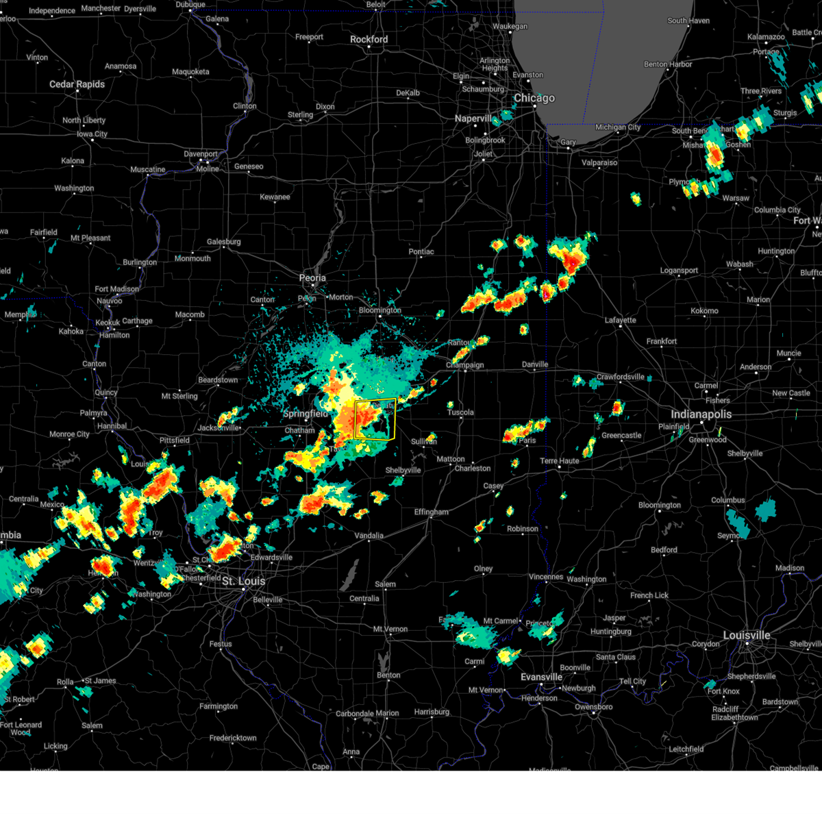 At 512 pm cdt, a severe thunderstorm was located near macon, or 8 miles southwest of decatur, moving east at 25 mph (radar indicated). Hazards include 60 mph wind gusts and quarter size hail. Hail damage to vehicles is expected. expect wind damage to roofs, siding, and trees. this severe storm will be near, decatur, mount zion, and macon around 520 pm cdt. long creek around 525 pm cdt. other locations impacted by this severe thunderstorm include boody and elwin. This includes interstate 72 between mile markers 125 and 146. At 512 pm cdt, a severe thunderstorm was located near macon, or 8 miles southwest of decatur, moving east at 25 mph (radar indicated). Hazards include 60 mph wind gusts and quarter size hail. Hail damage to vehicles is expected. expect wind damage to roofs, siding, and trees. this severe storm will be near, decatur, mount zion, and macon around 520 pm cdt. long creek around 525 pm cdt. other locations impacted by this severe thunderstorm include boody and elwin. This includes interstate 72 between mile markers 125 and 146.
|
| 8/30/2024 4:59 PM CDT |
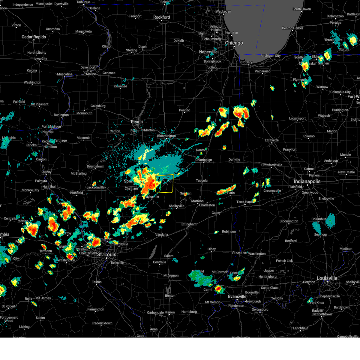 Svrilx the national weather service in lincoln has issued a * severe thunderstorm warning for, northeastern christian county in central illinois, southwestern macon county in central illinois, * until 530 pm cdt. * at 458 pm cdt, a severe thunderstorm was located near blue mound, or 12 miles southwest of decatur, moving east at 25 mph (radar indicated). Hazards include 60 mph wind gusts and quarter size hail. Hail damage to vehicles is expected. expect wind damage to roofs, siding, and trees. this severe thunderstorm will be near, decatur and macon around 510 pm cdt. other locations in the path of this severe thunderstorm include mount zion. This includes interstate 72 between mile markers 125 and 146. Svrilx the national weather service in lincoln has issued a * severe thunderstorm warning for, northeastern christian county in central illinois, southwestern macon county in central illinois, * until 530 pm cdt. * at 458 pm cdt, a severe thunderstorm was located near blue mound, or 12 miles southwest of decatur, moving east at 25 mph (radar indicated). Hazards include 60 mph wind gusts and quarter size hail. Hail damage to vehicles is expected. expect wind damage to roofs, siding, and trees. this severe thunderstorm will be near, decatur and macon around 510 pm cdt. other locations in the path of this severe thunderstorm include mount zion. This includes interstate 72 between mile markers 125 and 146.
|
| 7/30/2024 3:51 PM CDT |
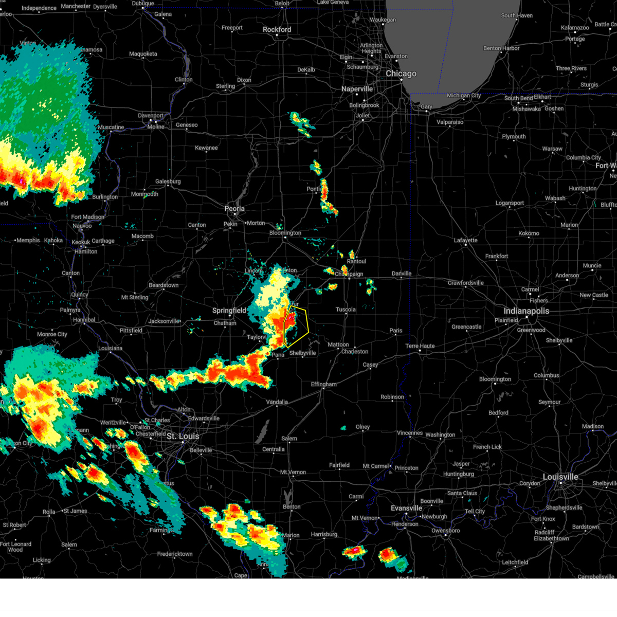 At 351 pm cdt, severe thunderstorms were located along a line extending from near long creek to near dalton city to near moweaqua, moving east at 45 mph (radar indicated). Hazards include 60 mph wind gusts and quarter size hail. Hail damage to vehicles is expected. expect wind damage to roofs, siding, and trees. Locations impacted include, decatur, mount zion, moweaqua, bethany, long creek, macon, dalton city, decatur airport, and hervey city. At 351 pm cdt, severe thunderstorms were located along a line extending from near long creek to near dalton city to near moweaqua, moving east at 45 mph (radar indicated). Hazards include 60 mph wind gusts and quarter size hail. Hail damage to vehicles is expected. expect wind damage to roofs, siding, and trees. Locations impacted include, decatur, mount zion, moweaqua, bethany, long creek, macon, dalton city, decatur airport, and hervey city.
|
| 7/30/2024 3:51 PM CDT |
 the severe thunderstorm warning has been cancelled and is no longer in effect the severe thunderstorm warning has been cancelled and is no longer in effect
|
| 7/30/2024 3:48 PM CDT |
 Svrilx the national weather service in lincoln has issued a * severe thunderstorm warning for, western coles county in east central illinois, moultrie county in central illinois, central shelby county in central illinois, southwestern douglas county in east central illinois, southeastern macon county in central illinois, * until 430 pm cdt. * at 348 pm cdt, severe thunderstorms were located along a line extending from long creek to near dalton city to near moweaqua, moving east at 45 mph (radar indicated). Hazards include 60 mph wind gusts and quarter size hail. Hail damage to vehicles is expected. expect wind damage to roofs, siding, and trees. severe thunderstorms will be near, bethany and dalton city around 355 pm cdt. lovington and findlay around 400 pm cdt. sullivan around 405 pm cdt. other locations in the path of these severe thunderstorms include arthur, allenville, windsor, arcola and cooks mill. This includes interstate 57 between mile markers 193 and 205. Svrilx the national weather service in lincoln has issued a * severe thunderstorm warning for, western coles county in east central illinois, moultrie county in central illinois, central shelby county in central illinois, southwestern douglas county in east central illinois, southeastern macon county in central illinois, * until 430 pm cdt. * at 348 pm cdt, severe thunderstorms were located along a line extending from long creek to near dalton city to near moweaqua, moving east at 45 mph (radar indicated). Hazards include 60 mph wind gusts and quarter size hail. Hail damage to vehicles is expected. expect wind damage to roofs, siding, and trees. severe thunderstorms will be near, bethany and dalton city around 355 pm cdt. lovington and findlay around 400 pm cdt. sullivan around 405 pm cdt. other locations in the path of these severe thunderstorms include arthur, allenville, windsor, arcola and cooks mill. This includes interstate 57 between mile markers 193 and 205.
|
| 7/30/2024 3:41 PM CDT |
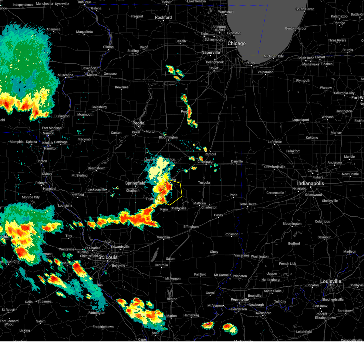 At 341 pm cdt, severe thunderstorms were located along a line extending from decatur to macon to near moweaqua, moving east at 45 mph (radar indicated). Hazards include 60 mph wind gusts and quarter size hail. Hail damage to vehicles is expected. expect wind damage to roofs, siding, and trees. locations impacted include, decatur, mount zion, moweaqua, harristown, bethany, long creek, assumption, blue mound, macon, stonington, dalton city, decatur airport, boody, elwin, hervey city, and willeys. This includes interstate 72 near mile marker 137. At 341 pm cdt, severe thunderstorms were located along a line extending from decatur to macon to near moweaqua, moving east at 45 mph (radar indicated). Hazards include 60 mph wind gusts and quarter size hail. Hail damage to vehicles is expected. expect wind damage to roofs, siding, and trees. locations impacted include, decatur, mount zion, moweaqua, harristown, bethany, long creek, assumption, blue mound, macon, stonington, dalton city, decatur airport, boody, elwin, hervey city, and willeys. This includes interstate 72 near mile marker 137.
|
| 7/30/2024 3:28 PM CDT |
 the severe thunderstorm warning has been cancelled and is no longer in effect the severe thunderstorm warning has been cancelled and is no longer in effect
|
| 7/30/2024 3:28 PM CDT |
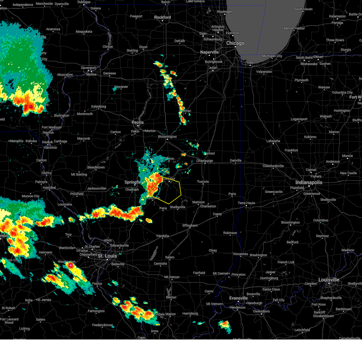 At 328 pm cdt, severe thunderstorms were located along a line extending from near harristown to near blue mound to near stonington, moving east at 40 mph (radar indicated). Hazards include 60 mph wind gusts. Expect damage to roofs, siding, and trees. these severe thunderstorms will remain over mainly rural areas of northeastern christian, northwestern moultrie, northwestern shelby and southern macon counties, including the following locations: boody, willeys, elwin and hervey city. This includes interstate 72 between mile markers 126 and 138. At 328 pm cdt, severe thunderstorms were located along a line extending from near harristown to near blue mound to near stonington, moving east at 40 mph (radar indicated). Hazards include 60 mph wind gusts. Expect damage to roofs, siding, and trees. these severe thunderstorms will remain over mainly rural areas of northeastern christian, northwestern moultrie, northwestern shelby and southern macon counties, including the following locations: boody, willeys, elwin and hervey city. This includes interstate 72 between mile markers 126 and 138.
|
| 7/30/2024 3:17 PM CDT |
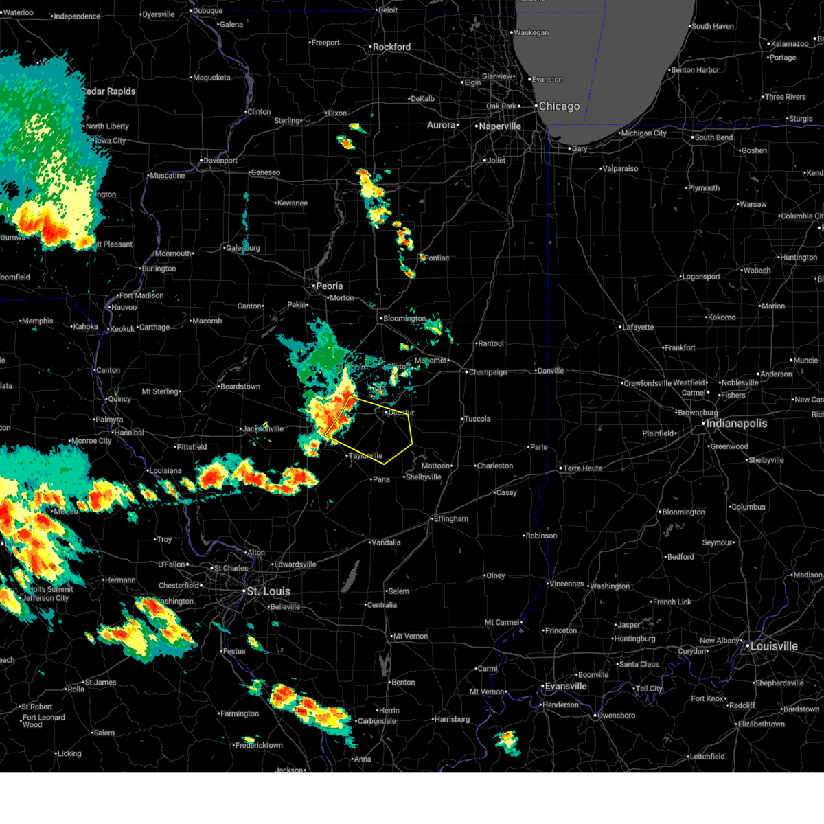 Svrilx the national weather service in lincoln has issued a * severe thunderstorm warning for, southern logan county in central illinois, northern christian county in central illinois, east central sangamon county in central illinois, northwestern moultrie county in central illinois, northwestern shelby county in central illinois, southern macon county in central illinois, * until 400 pm cdt. * at 317 pm cdt, severe thunderstorms were located along a line extending from near latham to mount auburn to edinburg, moving east at 45 mph (radar indicated). Hazards include 60 mph wind gusts. Expect damage to roofs, siding, and trees. these severe thunderstorms will remain over mainly rural areas of southern logan, northern christian, east central sangamon, northwestern moultrie, northwestern shelby and southern macon counties, including the following locations, boody, willeys, elwin, and hervey city. This includes interstate 72 between mile markers 118 and 137. Svrilx the national weather service in lincoln has issued a * severe thunderstorm warning for, southern logan county in central illinois, northern christian county in central illinois, east central sangamon county in central illinois, northwestern moultrie county in central illinois, northwestern shelby county in central illinois, southern macon county in central illinois, * until 400 pm cdt. * at 317 pm cdt, severe thunderstorms were located along a line extending from near latham to mount auburn to edinburg, moving east at 45 mph (radar indicated). Hazards include 60 mph wind gusts. Expect damage to roofs, siding, and trees. these severe thunderstorms will remain over mainly rural areas of southern logan, northern christian, east central sangamon, northwestern moultrie, northwestern shelby and southern macon counties, including the following locations, boody, willeys, elwin, and hervey city. This includes interstate 72 between mile markers 118 and 137.
|
| 7/30/2024 8:36 AM CDT |
 Svrilx the national weather service in lincoln has issued a * severe thunderstorm warning for, western coles county in east central illinois, southeastern christian county in central illinois, moultrie county in central illinois, shelby county in central illinois, western cumberland county in east central illinois, northeastern effingham county in south central illinois, southeastern macon county in central illinois, * until 900 am cdt. * at 835 am cdt, severe thunderstorms were located along a line extending from near macon to near herrick, moving southeast at 70 mph (radar indicated). Hazards include 60 mph wind gusts. Expect damage to roofs, siding, and trees. severe thunderstorms will be near, cowden and tower hill around 840 am cdt. shelbyville and findlay around 845 am cdt. shumway around 855 am cdt. this includes the following highways, interstate 57 between mile markers 162 and 187. Interstate 70 between mile markers 96 and 105. Svrilx the national weather service in lincoln has issued a * severe thunderstorm warning for, western coles county in east central illinois, southeastern christian county in central illinois, moultrie county in central illinois, shelby county in central illinois, western cumberland county in east central illinois, northeastern effingham county in south central illinois, southeastern macon county in central illinois, * until 900 am cdt. * at 835 am cdt, severe thunderstorms were located along a line extending from near macon to near herrick, moving southeast at 70 mph (radar indicated). Hazards include 60 mph wind gusts. Expect damage to roofs, siding, and trees. severe thunderstorms will be near, cowden and tower hill around 840 am cdt. shelbyville and findlay around 845 am cdt. shumway around 855 am cdt. this includes the following highways, interstate 57 between mile markers 162 and 187. Interstate 70 between mile markers 96 and 105.
|
| 7/30/2024 8:27 AM CDT |
 At 826 am cdt, a severe thunderstorm was located near blue mound, or 14 miles northeast of taylorville, moving east at 45 mph (trained weather spotters). Hazards include 60 mph wind gusts. Expect damage to roofs, siding, and trees. this severe storm will be near, moweaqua around 830 am cdt. other locations impacted by this severe thunderstorm include boody, willeys, hervey city, sharpsburg, taylorville municipal airport, elwin, and langleyville. This includes interstate 72 between mile markers 127 and 134. At 826 am cdt, a severe thunderstorm was located near blue mound, or 14 miles northeast of taylorville, moving east at 45 mph (trained weather spotters). Hazards include 60 mph wind gusts. Expect damage to roofs, siding, and trees. this severe storm will be near, moweaqua around 830 am cdt. other locations impacted by this severe thunderstorm include boody, willeys, hervey city, sharpsburg, taylorville municipal airport, elwin, and langleyville. This includes interstate 72 between mile markers 127 and 134.
|
| 7/30/2024 8:27 AM CDT |
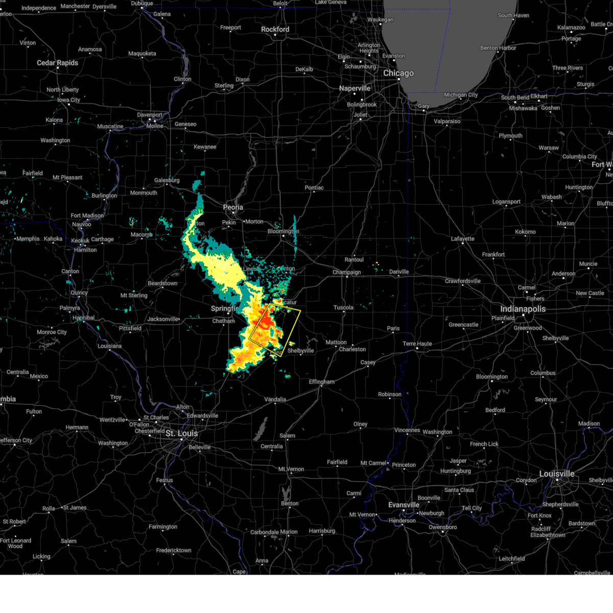 the severe thunderstorm warning has been cancelled and is no longer in effect the severe thunderstorm warning has been cancelled and is no longer in effect
|
| 7/30/2024 8:14 AM CDT |
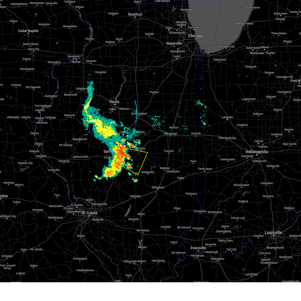 At 813 am cdt, a severe thunderstorm was located near mount auburn, or 13 miles north of taylorville, moving east at 45 mph (trained weather spotters. at 745 am, springfield reported wind gusts over 55 mph and broken tree branches). Hazards include 60 mph wind gusts. Expect damage to roofs, siding, and trees. this severe storm will be near, blue mound and stonington around 820 am cdt. moweaqua around 825 am cdt. other locations impacted by this severe thunderstorm include sangchris lake state park, boody, willeys, hervey city, sharpsburg, taylorville municipal airport, elwin, bulpitt, langleyville, and tovey. This includes interstate 72 between mile markers 113 and 134. At 813 am cdt, a severe thunderstorm was located near mount auburn, or 13 miles north of taylorville, moving east at 45 mph (trained weather spotters. at 745 am, springfield reported wind gusts over 55 mph and broken tree branches). Hazards include 60 mph wind gusts. Expect damage to roofs, siding, and trees. this severe storm will be near, blue mound and stonington around 820 am cdt. moweaqua around 825 am cdt. other locations impacted by this severe thunderstorm include sangchris lake state park, boody, willeys, hervey city, sharpsburg, taylorville municipal airport, elwin, bulpitt, langleyville, and tovey. This includes interstate 72 between mile markers 113 and 134.
|
| 7/30/2024 8:05 AM CDT |
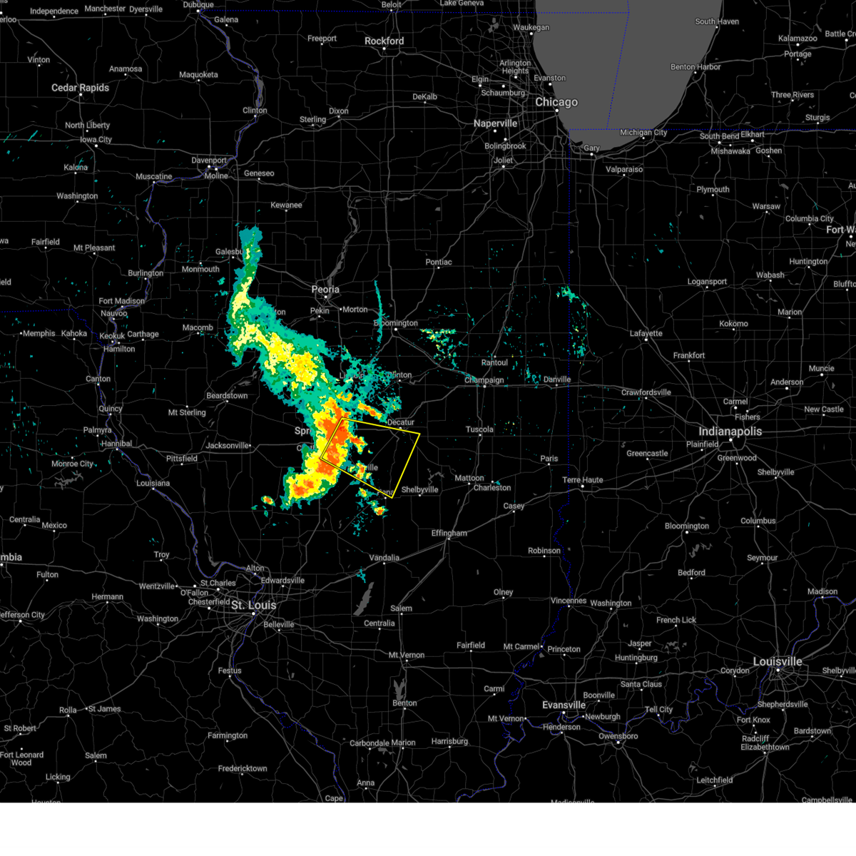 Svrilx the national weather service in lincoln has issued a * severe thunderstorm warning for, christian county in central illinois, eastern sangamon county in central illinois, northwestern shelby county in central illinois, southern macon county in central illinois, * until 845 am cdt. * at 804 am cdt, a severe thunderstorm was located near mechanicsburg, or 14 miles east of springfield, moving east at 45 mph (radar indicated). Hazards include 60 mph wind gusts. Expect damage to roofs, siding, and trees. this severe thunderstorm will be near, mount auburn around 810 am cdt. blue mound and stonington around 820 am cdt. other locations in the path of this severe thunderstorm include moweaqua and macon. This includes interstate 72 between mile markers 110 and 134. Svrilx the national weather service in lincoln has issued a * severe thunderstorm warning for, christian county in central illinois, eastern sangamon county in central illinois, northwestern shelby county in central illinois, southern macon county in central illinois, * until 845 am cdt. * at 804 am cdt, a severe thunderstorm was located near mechanicsburg, or 14 miles east of springfield, moving east at 45 mph (radar indicated). Hazards include 60 mph wind gusts. Expect damage to roofs, siding, and trees. this severe thunderstorm will be near, mount auburn around 810 am cdt. blue mound and stonington around 820 am cdt. other locations in the path of this severe thunderstorm include moweaqua and macon. This includes interstate 72 between mile markers 110 and 134.
|
| 7/29/2024 8:05 PM CDT |
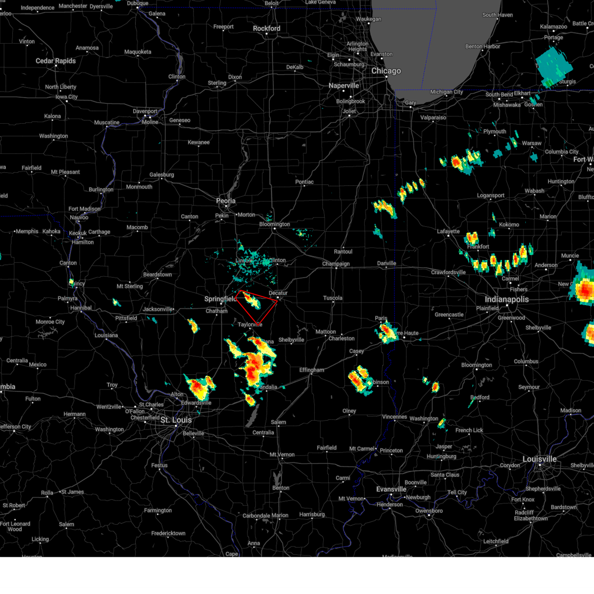 Torilx the national weather service in lincoln has issued a * tornado warning for, northeastern christian county in central illinois, northeastern sangamon county in central illinois, southwestern macon county in central illinois, * until 845 pm cdt. * at 804 pm cdt, a severe thunderstorm capable of producing a tornado was located over buffalo, or 16 miles east of springfield, moving southeast at 20 mph (radar indicated rotation). Hazards include tornado and quarter size hail. Flying debris will be dangerous to those caught without shelter. mobile homes will be damaged or destroyed. damage to roofs, windows, and vehicles will occur. tree damage is likely. this dangerous storm will be near, mechanicsburg around 810 pm cdt. illiopolis around 815 pm cdt. mount auburn around 820 pm cdt. This includes interstate 72 between mile markers 111 and 132. Torilx the national weather service in lincoln has issued a * tornado warning for, northeastern christian county in central illinois, northeastern sangamon county in central illinois, southwestern macon county in central illinois, * until 845 pm cdt. * at 804 pm cdt, a severe thunderstorm capable of producing a tornado was located over buffalo, or 16 miles east of springfield, moving southeast at 20 mph (radar indicated rotation). Hazards include tornado and quarter size hail. Flying debris will be dangerous to those caught without shelter. mobile homes will be damaged or destroyed. damage to roofs, windows, and vehicles will occur. tree damage is likely. this dangerous storm will be near, mechanicsburg around 810 pm cdt. illiopolis around 815 pm cdt. mount auburn around 820 pm cdt. This includes interstate 72 between mile markers 111 and 132.
|
| 7/15/2024 10:15 PM CDT |
 the severe thunderstorm warning has been cancelled and is no longer in effect the severe thunderstorm warning has been cancelled and is no longer in effect
|
| 7/15/2024 10:15 PM CDT |
 At 1013 pm cdt, severe thunderstorms were located along a line extending from 7 miles north of fithian to near villa grove to near arthur, moving east at 70 mph (radar indicated). Hazards include 70 mph wind gusts. Expect considerable tree damage. damage is likely to mobile homes, roofs, and outbuildings. these severe storms will be near, arcola, homer, and camargo around 1020 pm cdt. other locations impacted by these severe thunderstorms include longview, lake city, dewey, ludlow, flatville, royal, chesterville, milmine, cadwell, and la place. this includes the following highways, interstate 57 between mile markers 203 and 257. interstate 72 between mile markers 160 and 182. Interstate 74 between mile markers 168 and 197. At 1013 pm cdt, severe thunderstorms were located along a line extending from 7 miles north of fithian to near villa grove to near arthur, moving east at 70 mph (radar indicated). Hazards include 70 mph wind gusts. Expect considerable tree damage. damage is likely to mobile homes, roofs, and outbuildings. these severe storms will be near, arcola, homer, and camargo around 1020 pm cdt. other locations impacted by these severe thunderstorms include longview, lake city, dewey, ludlow, flatville, royal, chesterville, milmine, cadwell, and la place. this includes the following highways, interstate 57 between mile markers 203 and 257. interstate 72 between mile markers 160 and 182. Interstate 74 between mile markers 168 and 197.
|
| 7/15/2024 9:59 PM CDT | Report from mping: 1-inch tree limbs broken; shingles blown of in macon county IL, 3.3 miles SE of Decatur, IL |
| 7/15/2024 9:43 PM CDT |
 At 941 pm cdt, severe thunderstorms were located along a line extending from gibson city to near farmer city to forsyth, moving east at 55 mph (radar indicated. several reports of 70 mph or higher winds have been observed with this line of storms). Hazards include 70 mph wind gusts and penny size hail. Expect considerable tree damage. damage is likely to mobile homes, roofs, and outbuildings. these severe storms will be near, decatur, monticello, mahomet, fisher, argenta, mansfield, oreana, de land, cisco, and white heath around 945 pm cdt. cerro gordo, bondville, seymour, decatur airport, and lake of the woods around 950 pm cdt. champaign, rantoul, bement, and thomasboro around 955 pm cdt. urbana, savoy, gifford, hammond, sadorus, ivesdale, and willard airport around 1000 pm cdt. tolono and atwood around 1005 pm cdt. st. joseph, philo, sidney, and pesotum around 1010 pm cdt. tuscola, villa grove, homer, and ogden around 1015 pm cdt. arcola and camargo around 1020 pm cdt. other locations impacted by these severe thunderstorms include clinton power station, longview, weldon springs state park, lake city, dewey, cooksville, ludlow, flatville, royal, and ellsworth. this includes the following highways, interstate 55 between mile markers 184 and 185. interstate 57 between mile markers 203 and 257. interstate 72 between mile markers 137 and 182. Interstate 74 between mile markers 143 and 197. At 941 pm cdt, severe thunderstorms were located along a line extending from gibson city to near farmer city to forsyth, moving east at 55 mph (radar indicated. several reports of 70 mph or higher winds have been observed with this line of storms). Hazards include 70 mph wind gusts and penny size hail. Expect considerable tree damage. damage is likely to mobile homes, roofs, and outbuildings. these severe storms will be near, decatur, monticello, mahomet, fisher, argenta, mansfield, oreana, de land, cisco, and white heath around 945 pm cdt. cerro gordo, bondville, seymour, decatur airport, and lake of the woods around 950 pm cdt. champaign, rantoul, bement, and thomasboro around 955 pm cdt. urbana, savoy, gifford, hammond, sadorus, ivesdale, and willard airport around 1000 pm cdt. tolono and atwood around 1005 pm cdt. st. joseph, philo, sidney, and pesotum around 1010 pm cdt. tuscola, villa grove, homer, and ogden around 1015 pm cdt. arcola and camargo around 1020 pm cdt. other locations impacted by these severe thunderstorms include clinton power station, longview, weldon springs state park, lake city, dewey, cooksville, ludlow, flatville, royal, and ellsworth. this includes the following highways, interstate 55 between mile markers 184 and 185. interstate 57 between mile markers 203 and 257. interstate 72 between mile markers 137 and 182. Interstate 74 between mile markers 143 and 197.
|
| 7/15/2024 9:43 PM CDT |
 the severe thunderstorm warning has been cancelled and is no longer in effect the severe thunderstorm warning has been cancelled and is no longer in effect
|
| 7/15/2024 9:11 PM CDT |
 Svrilx the national weather service in lincoln has issued a * severe thunderstorm warning for, northwestern coles county in east central illinois, east central logan county in central illinois, northern moultrie county in central illinois, piatt county in central illinois, de witt county in central illinois, west central vermilion county in east central illinois, eastern mclean county in central illinois, champaign county in east central illinois, douglas county in east central illinois, northern macon county in central illinois, * until 1030 pm cdt. * at 911 pm cdt, severe thunderstorms were located along a line extending from near lexington to 6 miles northwest of heyworth to lincoln, moving southeast at 60 mph. these are destructive storms (radar indicated). Hazards include 80 mph wind gusts and penny size hail. Flying debris will be dangerous to those caught without shelter. mobile homes will be heavily damaged. expect considerable damage to roofs, windows, and vehicles. extensive tree damage and power outages are likely. severe thunderstorms will be near, lexington, downs, chestnut, and beason around 915 pm cdt. clinton, le roy, colfax, wapella, and kenney around 920 pm cdt. maroa and latham around 925 pm cdt. forsyth, farmer city, warrensburg, saybrook, and weldon around 930 pm cdt. other locations in the path of these severe thunderstorms include decatur, argenta, oreana, de land, monticello, mahomet, fisher, long creek, mansfield, cisco, decatur airport, white heath, mount zion, cerro gordo, seymour, lake of the woods, champaign, rantoul, bement, thomasboro, bondville and ivesdale. this includes the following highways, interstate 55 between mile markers 173 and 187. interstate 57 between mile markers 203 and 257. interstate 72 between mile markers 137 and 182. Interstate 74 between mile markers 140 and 197. Svrilx the national weather service in lincoln has issued a * severe thunderstorm warning for, northwestern coles county in east central illinois, east central logan county in central illinois, northern moultrie county in central illinois, piatt county in central illinois, de witt county in central illinois, west central vermilion county in east central illinois, eastern mclean county in central illinois, champaign county in east central illinois, douglas county in east central illinois, northern macon county in central illinois, * until 1030 pm cdt. * at 911 pm cdt, severe thunderstorms were located along a line extending from near lexington to 6 miles northwest of heyworth to lincoln, moving southeast at 60 mph. these are destructive storms (radar indicated). Hazards include 80 mph wind gusts and penny size hail. Flying debris will be dangerous to those caught without shelter. mobile homes will be heavily damaged. expect considerable damage to roofs, windows, and vehicles. extensive tree damage and power outages are likely. severe thunderstorms will be near, lexington, downs, chestnut, and beason around 915 pm cdt. clinton, le roy, colfax, wapella, and kenney around 920 pm cdt. maroa and latham around 925 pm cdt. forsyth, farmer city, warrensburg, saybrook, and weldon around 930 pm cdt. other locations in the path of these severe thunderstorms include decatur, argenta, oreana, de land, monticello, mahomet, fisher, long creek, mansfield, cisco, decatur airport, white heath, mount zion, cerro gordo, seymour, lake of the woods, champaign, rantoul, bement, thomasboro, bondville and ivesdale. this includes the following highways, interstate 55 between mile markers 173 and 187. interstate 57 between mile markers 203 and 257. interstate 72 between mile markers 137 and 182. Interstate 74 between mile markers 140 and 197.
|
| 6/25/2024 12:27 PM CDT |
 The storms which prompted the warning have weakened below severe limits, and no longer pose an immediate threat to life or property. therefore, the warning will be allowed to expire. however, gusty winds up to 55 mph are still possible with these thunderstorms. a severe thunderstorm watch remains in effect until 700 pm cdt for central illinois. The storms which prompted the warning have weakened below severe limits, and no longer pose an immediate threat to life or property. therefore, the warning will be allowed to expire. however, gusty winds up to 55 mph are still possible with these thunderstorms. a severe thunderstorm watch remains in effect until 700 pm cdt for central illinois.
|
| 6/25/2024 12:13 PM CDT |
 At 1213 pm cdt, severe thunderstorms were located along a line extending from near petersburg to near niantic to near monticello, moving southeast at 25 mph (radar indicated). Hazards include 60 mph wind gusts and penny size hail. Expect damage to roofs, siding, and trees. these severe storms will be near, decatur, forsyth, williamsville, cerro gordo, harristown, illiopolis, oreana, niantic, and cornland around 1220 pm cdt. bement and decatur airport around 1225 pm cdt. other locations impacted by these severe thunderstorms include milmine and oakley. this includes the following highways, interstate 55 between mile markers 107 and 117. Interstate 72 between mile markers 122 and 163. At 1213 pm cdt, severe thunderstorms were located along a line extending from near petersburg to near niantic to near monticello, moving southeast at 25 mph (radar indicated). Hazards include 60 mph wind gusts and penny size hail. Expect damage to roofs, siding, and trees. these severe storms will be near, decatur, forsyth, williamsville, cerro gordo, harristown, illiopolis, oreana, niantic, and cornland around 1220 pm cdt. bement and decatur airport around 1225 pm cdt. other locations impacted by these severe thunderstorms include milmine and oakley. this includes the following highways, interstate 55 between mile markers 107 and 117. Interstate 72 between mile markers 122 and 163.
|
| 6/25/2024 12:13 PM CDT |
 the severe thunderstorm warning has been cancelled and is no longer in effect the severe thunderstorm warning has been cancelled and is no longer in effect
|
| 6/25/2024 12:01 PM CDT |
 Svrilx the national weather service in lincoln has issued a * severe thunderstorm warning for, central menard county in central illinois, southern logan county in central illinois, northeastern sangamon county in central illinois, southern piatt county in central illinois, southern de witt county in central illinois, south central mason county in central illinois, macon county in central illinois, * until 1230 pm cdt. * at 1201 pm cdt, severe thunderstorms were located along a line extending from near petersburg to near latham to near de land, moving southeast at 25 mph (trained weather spotters. at 11:50 am, a trained spotter reported 60 mph winds in chestnut). Hazards include 60 mph wind gusts and penny size hail. Expect damage to roofs, siding, and trees. severe thunderstorms will be near, decatur, petersburg, forsyth, williamsville, warrensburg, argenta, oreana, greenview, niantic, and elkhart around 1205 pm cdt. athens, harristown, and illiopolis around 1210 pm cdt. this includes the following highways, interstate 55 between mile markers 103 and 122. Interstate 72 between mile markers 122 and 163. Svrilx the national weather service in lincoln has issued a * severe thunderstorm warning for, central menard county in central illinois, southern logan county in central illinois, northeastern sangamon county in central illinois, southern piatt county in central illinois, southern de witt county in central illinois, south central mason county in central illinois, macon county in central illinois, * until 1230 pm cdt. * at 1201 pm cdt, severe thunderstorms were located along a line extending from near petersburg to near latham to near de land, moving southeast at 25 mph (trained weather spotters. at 11:50 am, a trained spotter reported 60 mph winds in chestnut). Hazards include 60 mph wind gusts and penny size hail. Expect damage to roofs, siding, and trees. severe thunderstorms will be near, decatur, petersburg, forsyth, williamsville, warrensburg, argenta, oreana, greenview, niantic, and elkhart around 1205 pm cdt. athens, harristown, and illiopolis around 1210 pm cdt. this includes the following highways, interstate 55 between mile markers 103 and 122. Interstate 72 between mile markers 122 and 163.
|
| 5/19/2024 8:49 PM CDT | Quarter sized hail reported 5.9 miles NW of Decatur, IL, relayed via broadcast media. image of quarter sized hail in long creek. |
| 5/19/2024 8:45 PM CDT | Ping Pong Ball sized hail reported 5.2 miles NW of Decatur, IL, image of hailstone next to measuring device via social media at 121 and bentonville rd. |
| 5/19/2024 8:44 PM CDT |
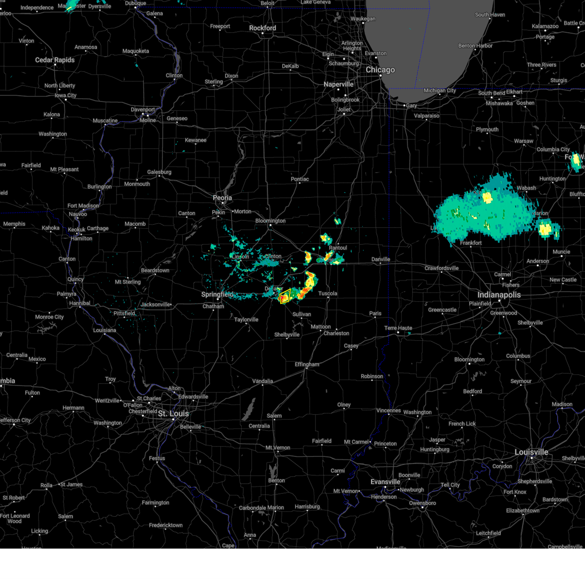 The storm which prompted the warning has weakened below severe limits, and no longer poses an immediate threat to life or property. therefore, the warning will be allowed to expire. however, very heavy rain is still possible with this thunderstorm. The storm which prompted the warning has weakened below severe limits, and no longer poses an immediate threat to life or property. therefore, the warning will be allowed to expire. however, very heavy rain is still possible with this thunderstorm.
|
| 5/19/2024 8:13 PM CDT |
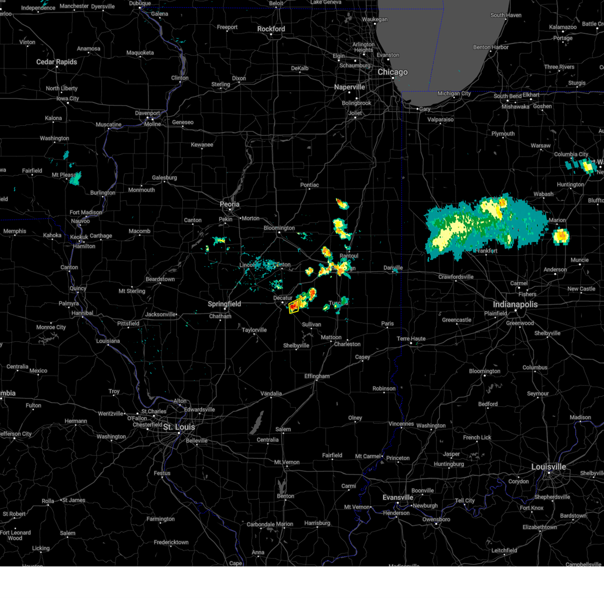 Svrilx the national weather service in lincoln has issued a * severe thunderstorm warning for, southeastern macon county in central illinois, * until 845 pm cdt. * at 812 pm cdt, a severe thunderstorm was located over long creek, or near decatur, and is nearly stationary (radar indicated). Hazards include 60 mph wind gusts and nickel size hail. Expect damage to roofs, siding, and trees. This severe thunderstorm will be near, long creek around 820 pm cdt. Svrilx the national weather service in lincoln has issued a * severe thunderstorm warning for, southeastern macon county in central illinois, * until 845 pm cdt. * at 812 pm cdt, a severe thunderstorm was located over long creek, or near decatur, and is nearly stationary (radar indicated). Hazards include 60 mph wind gusts and nickel size hail. Expect damage to roofs, siding, and trees. This severe thunderstorm will be near, long creek around 820 pm cdt.
|
| 5/19/2024 8:02 PM CDT | Storm damage reported in macon county IL, 3.9 miles WNW of Decatur, IL |
| 4/18/2024 7:52 PM CDT |
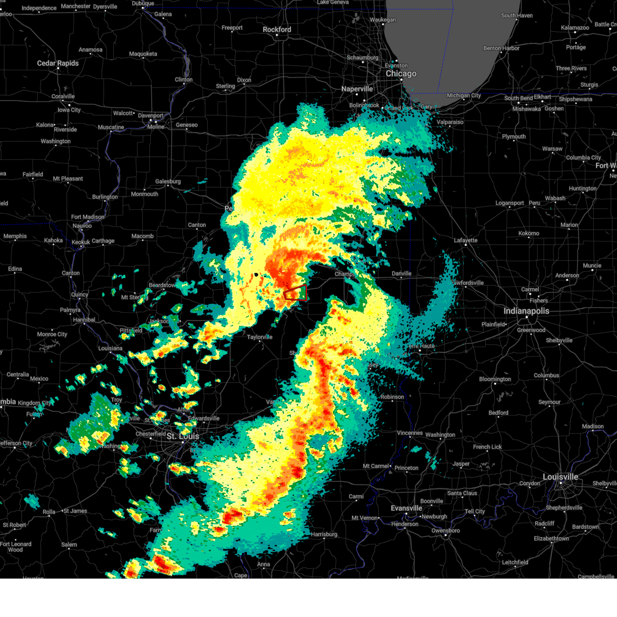 The storm circulation which prompted the warning has weakened, and no longer appears capable of producing a tornado. therefore, the warning will be allowed to expire. to report severe weather, contact your nearest law enforcement agency. they will relay your report to the national weather service lincoln. The storm circulation which prompted the warning has weakened, and no longer appears capable of producing a tornado. therefore, the warning will be allowed to expire. to report severe weather, contact your nearest law enforcement agency. they will relay your report to the national weather service lincoln.
|
| 4/18/2024 7:42 PM CDT |
 At 742 pm cdt, severe thunderstorms were located along a line extending from near maroa to near oreana to decatur, moving east at 45 mph (trained weather spotters). Hazards include 70 mph wind gusts. Expect considerable tree damage. damage is likely to mobile homes, roofs, and outbuildings. these severe storms will be near, decatur, maroa, argenta, oreana, and decatur airport around 745 pm cdt. cerro gordo and cisco around 750 pm cdt. weldon around 755 pm cdt. monticello, bement, and de land around 800 pm cdt. white heath around 810 pm cdt. other locations impacted by these severe thunderstorms include milmine, weldon springs state park, la place, lane, elwin, galesville, lodge, and oakley. This includes interstate 72 between mile markers 142 and 170. At 742 pm cdt, severe thunderstorms were located along a line extending from near maroa to near oreana to decatur, moving east at 45 mph (trained weather spotters). Hazards include 70 mph wind gusts. Expect considerable tree damage. damage is likely to mobile homes, roofs, and outbuildings. these severe storms will be near, decatur, maroa, argenta, oreana, and decatur airport around 745 pm cdt. cerro gordo and cisco around 750 pm cdt. weldon around 755 pm cdt. monticello, bement, and de land around 800 pm cdt. white heath around 810 pm cdt. other locations impacted by these severe thunderstorms include milmine, weldon springs state park, la place, lane, elwin, galesville, lodge, and oakley. This includes interstate 72 between mile markers 142 and 170.
|
| 4/18/2024 7:40 PM CDT |
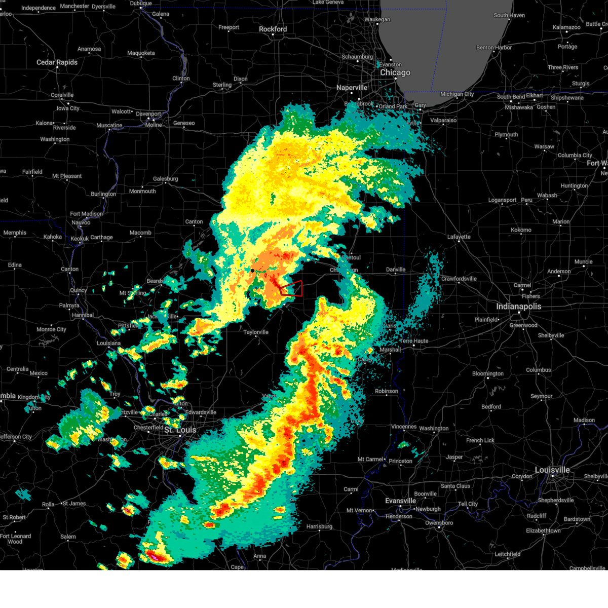 At 739 pm cdt, a severe squall line capable of producing both tornadoes and extensive straight line wind damage was located near forsyth, or 8 miles north of decatur, moving east at 45 mph (radar indicated rotation). Hazards include tornado. Flying debris will be dangerous to those caught without shelter. mobile homes will be damaged or destroyed. damage to roofs, windows, and vehicles will occur. tree damage is likely. these dangerous storms will be near, argenta and oreana around 745 pm cdt. This includes interstate 72 between mile markers 148 and 155. At 739 pm cdt, a severe squall line capable of producing both tornadoes and extensive straight line wind damage was located near forsyth, or 8 miles north of decatur, moving east at 45 mph (radar indicated rotation). Hazards include tornado. Flying debris will be dangerous to those caught without shelter. mobile homes will be damaged or destroyed. damage to roofs, windows, and vehicles will occur. tree damage is likely. these dangerous storms will be near, argenta and oreana around 745 pm cdt. This includes interstate 72 between mile markers 148 and 155.
|
| 4/18/2024 7:33 PM CDT |
 At 733 pm cdt, a severe squall line capable of producing both tornadoes and extensive straight line wind damage was located near warrensburg, or 9 miles northwest of decatur, moving east at 40 mph (radar indicated rotation). Hazards include tornado. Flying debris will be dangerous to those caught without shelter. mobile homes will be damaged or destroyed. damage to roofs, windows, and vehicles will occur. tree damage is likely. these dangerous storms will be near, forsyth and oreana around 740 pm cdt. argenta around 745 pm cdt. This includes interstate 72 between mile markers 144 and 155. At 733 pm cdt, a severe squall line capable of producing both tornadoes and extensive straight line wind damage was located near warrensburg, or 9 miles northwest of decatur, moving east at 40 mph (radar indicated rotation). Hazards include tornado. Flying debris will be dangerous to those caught without shelter. mobile homes will be damaged or destroyed. damage to roofs, windows, and vehicles will occur. tree damage is likely. these dangerous storms will be near, forsyth and oreana around 740 pm cdt. argenta around 745 pm cdt. This includes interstate 72 between mile markers 144 and 155.
|
| 4/18/2024 7:33 PM CDT |
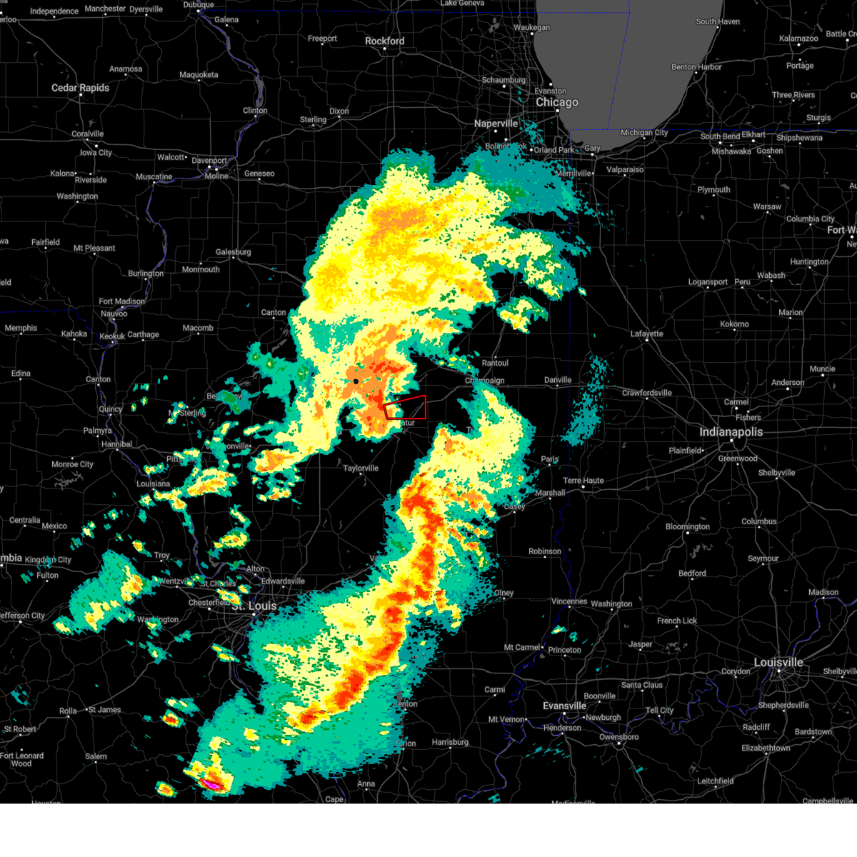 the tornado warning has been cancelled and is no longer in effect the tornado warning has been cancelled and is no longer in effect
|
| 4/18/2024 7:31 PM CDT |
 Svrilx the national weather service in lincoln has issued a * severe thunderstorm warning for, piatt county in central illinois, southern de witt county in central illinois, macon county in central illinois, * until 815 pm cdt. * at 731 pm cdt, severe thunderstorms were located along a line extending from kenney to warrensburg to near harristown, moving east at 45 mph (trained weather spotters). Hazards include 70 mph wind gusts. Expect considerable tree damage. damage is likely to mobile homes, roofs, and outbuildings. severe thunderstorms will be near, decatur, clinton, mount zion, forsyth, maroa, harristown, oreana, and kenney around 735 pm cdt. long creek, argenta, and decatur airport around 740 pm cdt. cerro gordo, weldon, and cisco around 750 pm cdt. monticello, bement, hammond, and de land around 800 pm cdt. white heath around 805 pm cdt. other locations impacted by these severe thunderstorms include boody, milmine, weldon springs state park, la place, lane, elwin, galesville, lodge, and oakley. This includes interstate 72 between mile markers 129 and 170. Svrilx the national weather service in lincoln has issued a * severe thunderstorm warning for, piatt county in central illinois, southern de witt county in central illinois, macon county in central illinois, * until 815 pm cdt. * at 731 pm cdt, severe thunderstorms were located along a line extending from kenney to warrensburg to near harristown, moving east at 45 mph (trained weather spotters). Hazards include 70 mph wind gusts. Expect considerable tree damage. damage is likely to mobile homes, roofs, and outbuildings. severe thunderstorms will be near, decatur, clinton, mount zion, forsyth, maroa, harristown, oreana, and kenney around 735 pm cdt. long creek, argenta, and decatur airport around 740 pm cdt. cerro gordo, weldon, and cisco around 750 pm cdt. monticello, bement, hammond, and de land around 800 pm cdt. white heath around 805 pm cdt. other locations impacted by these severe thunderstorms include boody, milmine, weldon springs state park, la place, lane, elwin, galesville, lodge, and oakley. This includes interstate 72 between mile markers 129 and 170.
|
| 4/18/2024 7:26 PM CDT |
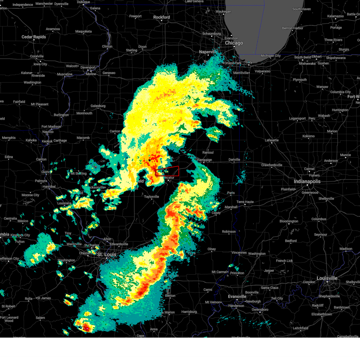 Torilx the national weather service in lincoln has issued a * tornado warning for, southeastern logan county in central illinois, northern macon county in central illinois, * until 800 pm cdt. * at 726 pm cdt, a severe thunderstorm capable of producing a tornado was located over latham, or 12 miles northwest of decatur, moving east at 40 mph (radar indicated rotation). Hazards include tornado. Flying debris will be dangerous to those caught without shelter. mobile homes will be damaged or destroyed. damage to roofs, windows, and vehicles will occur. tree damage is likely. this dangerous storm will be near, forsyth and warrensburg around 730 pm cdt. maroa around 735 pm cdt. oreana around 740 pm cdt. argenta around 745 pm cdt. This includes interstate 72 between mile markers 144 and 155. Torilx the national weather service in lincoln has issued a * tornado warning for, southeastern logan county in central illinois, northern macon county in central illinois, * until 800 pm cdt. * at 726 pm cdt, a severe thunderstorm capable of producing a tornado was located over latham, or 12 miles northwest of decatur, moving east at 40 mph (radar indicated rotation). Hazards include tornado. Flying debris will be dangerous to those caught without shelter. mobile homes will be damaged or destroyed. damage to roofs, windows, and vehicles will occur. tree damage is likely. this dangerous storm will be near, forsyth and warrensburg around 730 pm cdt. maroa around 735 pm cdt. oreana around 740 pm cdt. argenta around 745 pm cdt. This includes interstate 72 between mile markers 144 and 155.
|
| 4/1/2024 6:34 PM CDT |
 Svrilx the national weather service in lincoln has issued a * severe thunderstorm warning for, northeastern christian county in central illinois, northwestern shelby county in central illinois, southwestern macon county in central illinois, * until 700 pm cdt. * at 634 pm cdt, a severe thunderstorm was located over stonington, or 9 miles northeast of taylorville, moving northeast at 35 mph (radar indicated). Hazards include 60 mph wind gusts and quarter size hail. Hail damage to vehicles is expected. expect wind damage to roofs, siding, and trees. this severe thunderstorm will be near, moweaqua and blue mound around 640 pm cdt. Macon around 645 pm cdt. Svrilx the national weather service in lincoln has issued a * severe thunderstorm warning for, northeastern christian county in central illinois, northwestern shelby county in central illinois, southwestern macon county in central illinois, * until 700 pm cdt. * at 634 pm cdt, a severe thunderstorm was located over stonington, or 9 miles northeast of taylorville, moving northeast at 35 mph (radar indicated). Hazards include 60 mph wind gusts and quarter size hail. Hail damage to vehicles is expected. expect wind damage to roofs, siding, and trees. this severe thunderstorm will be near, moweaqua and blue mound around 640 pm cdt. Macon around 645 pm cdt.
|
| 3/31/2024 8:05 PM CDT | Golf Ball sized hail reported 3.2 miles NE of Decatur, IL |
| 3/31/2024 8:03 PM CDT | Half Dollar sized hail reported 3.8 miles NW of Decatur, IL, report from mping: half dollar (1.25 in.). |
| 3/31/2024 8:01 PM CDT |
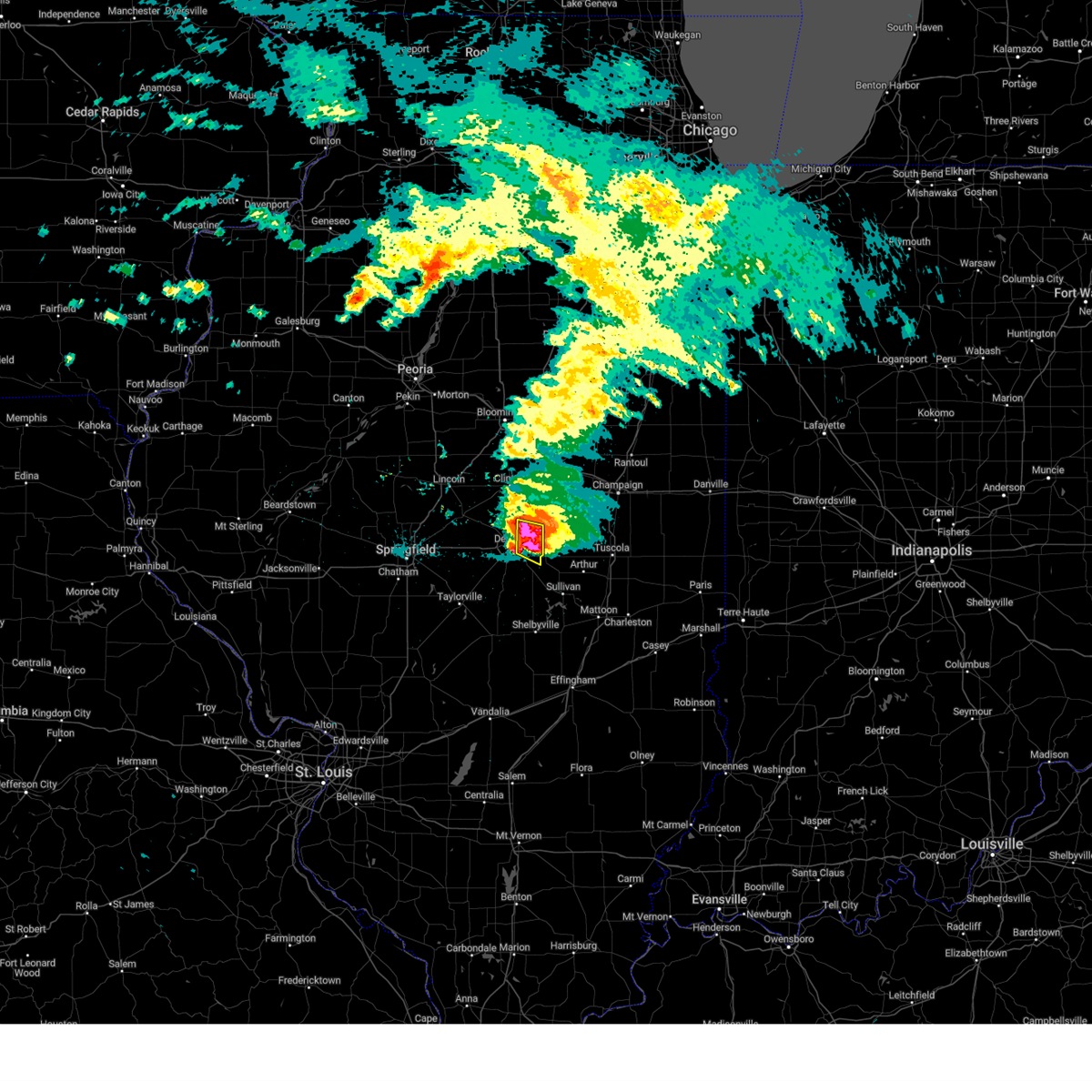 At 801 pm cdt, a severe thunderstorm was located over long creek, or 7 miles southeast of decatur, moving southeast at 50 mph (broadcast media). Hazards include golf ball size hail and 60 mph wind gusts. People and animals outdoors will be injured. expect hail damage to roofs, siding, windows, and vehicles. expect wind damage to roofs, siding, and trees. this severe thunderstorm will remain over mainly rural areas of northeastern macon county, including the following locations, oakley. This includes interstate 72 between mile markers 144 and 150. At 801 pm cdt, a severe thunderstorm was located over long creek, or 7 miles southeast of decatur, moving southeast at 50 mph (broadcast media). Hazards include golf ball size hail and 60 mph wind gusts. People and animals outdoors will be injured. expect hail damage to roofs, siding, windows, and vehicles. expect wind damage to roofs, siding, and trees. this severe thunderstorm will remain over mainly rural areas of northeastern macon county, including the following locations, oakley. This includes interstate 72 between mile markers 144 and 150.
|
| 3/31/2024 8:00 PM CDT | Ping Pong Ball sized hail reported 1.4 miles NNW of Decatur, IL, ping pong size hail at decatur zoo with photo. |
| 3/31/2024 7:55 PM CDT |
 Svrilx the national weather service in lincoln has issued a * severe thunderstorm warning for, moultrie county in central illinois, southern piatt county in central illinois, southeastern macon county in central illinois, * until 845 pm cdt. * at 754 pm cdt, a severe thunderstorm was located over decatur airport, or near decatur, moving southeast at 40 mph (emergency management). Hazards include golf ball size hail and 60 mph wind gusts. People and animals outdoors will be injured. expect hail damage to roofs, siding, windows, and vehicles. expect wind damage to roofs, siding, and trees. this severe thunderstorm will be near, mount zion and long creek around 800 pm cdt. lovington around 810 pm cdt. other locations in the path of this severe thunderstorm include arthur. This includes interstate 72 between mile markers 141 and 147. Svrilx the national weather service in lincoln has issued a * severe thunderstorm warning for, moultrie county in central illinois, southern piatt county in central illinois, southeastern macon county in central illinois, * until 845 pm cdt. * at 754 pm cdt, a severe thunderstorm was located over decatur airport, or near decatur, moving southeast at 40 mph (emergency management). Hazards include golf ball size hail and 60 mph wind gusts. People and animals outdoors will be injured. expect hail damage to roofs, siding, windows, and vehicles. expect wind damage to roofs, siding, and trees. this severe thunderstorm will be near, mount zion and long creek around 800 pm cdt. lovington around 810 pm cdt. other locations in the path of this severe thunderstorm include arthur. This includes interstate 72 between mile markers 141 and 147.
|
| 3/31/2024 7:52 PM CDT | Tennis Ball sized hail reported 3.2 miles NE of Decatur, IL, photo from public of tennis ball size hail. |
| 3/31/2024 7:52 PM CDT | Half Dollar sized hail reported 2.7 miles ENE of Decatur, IL |
| 3/31/2024 7:50 PM CDT | Ping Pong Ball sized hail reported 3.2 miles NE of Decatur, IL, ping pong size hail on west side of decatur. |
| 3/31/2024 7:50 PM CDT | Hen Egg sized hail reported 3.5 miles SSE of Decatur, IL, picture via social media; wolf road. |
| 3/31/2024 7:50 PM CDT | Quarter sized hail reported 2.5 miles SE of Decatur, IL, report from mping: quarter (1.00 in.). |
| 3/31/2024 7:42 PM CDT |
 the severe thunderstorm warning has been cancelled and is no longer in effect the severe thunderstorm warning has been cancelled and is no longer in effect
|
| 3/31/2024 7:42 PM CDT |
 At 741 pm cdt, a severe thunderstorm was located over warrensburg, or 7 miles northwest of decatur, moving east at 40 mph (emergency management). Hazards include golf ball size hail and 60 mph wind gusts. People and animals outdoors will be injured. expect hail damage to roofs, siding, windows, and vehicles. expect wind damage to roofs, siding, and trees. this severe storm will be near, decatur, forsyth, and oreana around 745 pm cdt. cerro gordo around 800 pm cdt. other locations impacted by this severe thunderstorm include oakley. This includes interstate 72 between mile markers 136 and 156. At 741 pm cdt, a severe thunderstorm was located over warrensburg, or 7 miles northwest of decatur, moving east at 40 mph (emergency management). Hazards include golf ball size hail and 60 mph wind gusts. People and animals outdoors will be injured. expect hail damage to roofs, siding, windows, and vehicles. expect wind damage to roofs, siding, and trees. this severe storm will be near, decatur, forsyth, and oreana around 745 pm cdt. cerro gordo around 800 pm cdt. other locations impacted by this severe thunderstorm include oakley. This includes interstate 72 between mile markers 136 and 156.
|
| 3/31/2024 7:36 PM CDT |
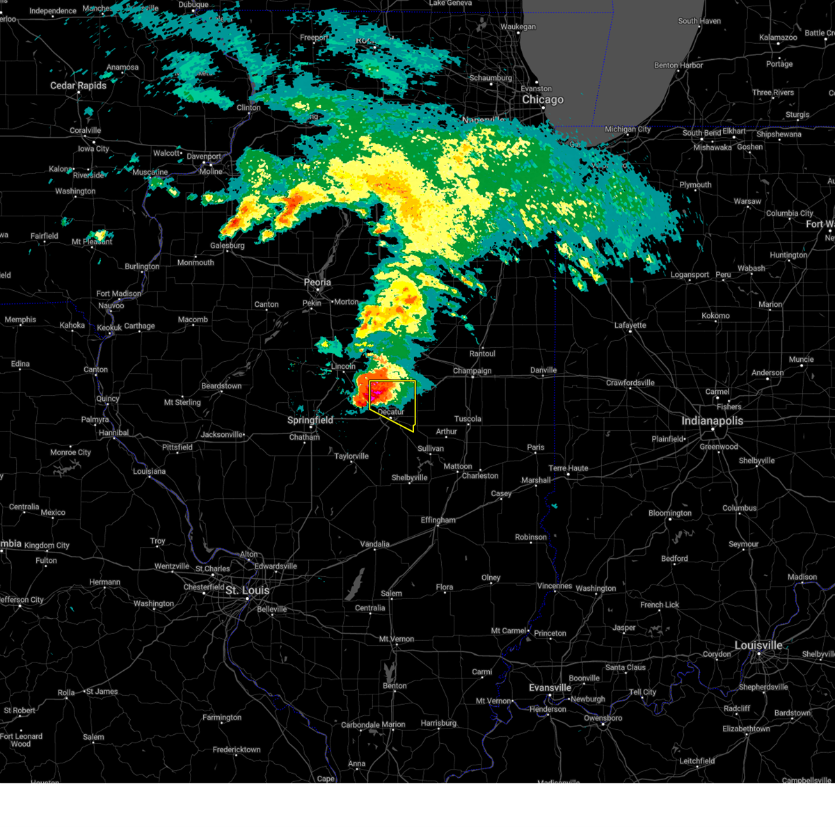 At 736 pm cdt, a severe thunderstorm was located over warrensburg, or 10 miles northwest of decatur, moving east at 40 mph (emergency management). Hazards include golf ball size hail and 60 mph wind gusts. People and animals outdoors will be injured. expect hail damage to roofs, siding, windows, and vehicles. expect wind damage to roofs, siding, and trees. this severe storm will be near, decatur, forsyth, and warrensburg around 740 pm cdt. oreana around 745 pm cdt. decatur airport around 755 pm cdt. cerro gordo around 800 pm cdt. other locations impacted by this severe thunderstorm include oakley. This includes interstate 72 between mile markers 136 and 156. At 736 pm cdt, a severe thunderstorm was located over warrensburg, or 10 miles northwest of decatur, moving east at 40 mph (emergency management). Hazards include golf ball size hail and 60 mph wind gusts. People and animals outdoors will be injured. expect hail damage to roofs, siding, windows, and vehicles. expect wind damage to roofs, siding, and trees. this severe storm will be near, decatur, forsyth, and warrensburg around 740 pm cdt. oreana around 745 pm cdt. decatur airport around 755 pm cdt. cerro gordo around 800 pm cdt. other locations impacted by this severe thunderstorm include oakley. This includes interstate 72 between mile markers 136 and 156.
|
| 3/31/2024 7:36 PM CDT |
 the severe thunderstorm warning has been cancelled and is no longer in effect the severe thunderstorm warning has been cancelled and is no longer in effect
|
| 3/31/2024 7:23 PM CDT |
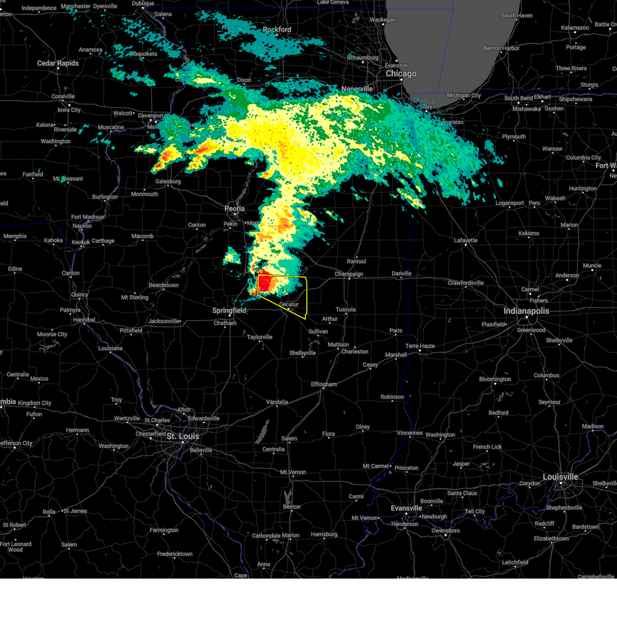 Svrilx the national weather service in lincoln has issued a * severe thunderstorm warning for, southeastern logan county in central illinois, southwestern de witt county in central illinois, northern macon county in central illinois, * until 830 pm cdt. * at 722 pm cdt, a severe thunderstorm was located over mount pulaski, or 12 miles southeast of lincoln, moving east at 40 mph (emergency management). Hazards include golf ball size hail and 60 mph wind gusts. People and animals outdoors will be injured. expect hail damage to roofs, siding, windows, and vehicles. expect wind damage to roofs, siding, and trees. this severe thunderstorm will be near, latham around 730 pm cdt. warrensburg around 735 pm cdt. decatur and forsyth around 740 pm cdt. other locations in the path of this severe thunderstorm include oreana, decatur airport and cerro gordo. This includes interstate 72 between mile markers 136 and 156. Svrilx the national weather service in lincoln has issued a * severe thunderstorm warning for, southeastern logan county in central illinois, southwestern de witt county in central illinois, northern macon county in central illinois, * until 830 pm cdt. * at 722 pm cdt, a severe thunderstorm was located over mount pulaski, or 12 miles southeast of lincoln, moving east at 40 mph (emergency management). Hazards include golf ball size hail and 60 mph wind gusts. People and animals outdoors will be injured. expect hail damage to roofs, siding, windows, and vehicles. expect wind damage to roofs, siding, and trees. this severe thunderstorm will be near, latham around 730 pm cdt. warrensburg around 735 pm cdt. decatur and forsyth around 740 pm cdt. other locations in the path of this severe thunderstorm include oreana, decatur airport and cerro gordo. This includes interstate 72 between mile markers 136 and 156.
|
| 3/14/2024 9:21 AM CDT |
 the severe thunderstorm warning has been cancelled and is no longer in effect the severe thunderstorm warning has been cancelled and is no longer in effect
|
| 3/14/2024 8:57 AM CDT |
 The storms which prompted the warning have moved out of the area. therefore, the warning will be allowed to expire. however, gusty winds are still possible with these thunderstorms. a severe thunderstorm watch remains in effect until 1000 am cdt for central illinois. a severe thunderstorm watch also remains in effect until noon cdt for central illinois. The storms which prompted the warning have moved out of the area. therefore, the warning will be allowed to expire. however, gusty winds are still possible with these thunderstorms. a severe thunderstorm watch remains in effect until 1000 am cdt for central illinois. a severe thunderstorm watch also remains in effect until noon cdt for central illinois.
|
| 3/14/2024 8:54 AM CDT |
 Svrilx the national weather service in lincoln has issued a * severe thunderstorm warning for, northern moultrie county in central illinois, piatt county in central illinois, eastern macon county in central illinois, * until 945 am cdt. * at 854 am cdt, severe thunderstorms were located along a line extending from near oreana to moweaqua, moving east at 55 mph (radar indicated). Hazards include 60 mph wind gusts and quarter size hail. Hail damage to vehicles is expected. expect wind damage to roofs, siding, and trees. severe thunderstorms will be near, decatur, mount zion, cerro gordo, long creek, argenta, oreana, cisco, and decatur airport around 900 am cdt. dalton city around 905 am cdt. monticello around 910 am cdt. other locations in the path of these severe thunderstorms include bement, hammond, white heath and atwood. This includes interstate 72 between mile markers 140 and 173. Svrilx the national weather service in lincoln has issued a * severe thunderstorm warning for, northern moultrie county in central illinois, piatt county in central illinois, eastern macon county in central illinois, * until 945 am cdt. * at 854 am cdt, severe thunderstorms were located along a line extending from near oreana to moweaqua, moving east at 55 mph (radar indicated). Hazards include 60 mph wind gusts and quarter size hail. Hail damage to vehicles is expected. expect wind damage to roofs, siding, and trees. severe thunderstorms will be near, decatur, mount zion, cerro gordo, long creek, argenta, oreana, cisco, and decatur airport around 900 am cdt. dalton city around 905 am cdt. monticello around 910 am cdt. other locations in the path of these severe thunderstorms include bement, hammond, white heath and atwood. This includes interstate 72 between mile markers 140 and 173.
|
| 3/14/2024 8:34 AM CDT |
 At 834 am cdt, severe thunderstorms were located along a line extending from near illiopolis to near taylorville, moving east at 40 mph (radar indicated). Hazards include 60 mph wind gusts and quarter size hail. Hail damage to vehicles is expected. expect wind damage to roofs, siding, and trees. these severe storms will be near, taylorville, blue mound, stonington, and niantic around 840 am cdt. harristown and owaneco around 845 am cdt. decatur around 850 am cdt. moweaqua and assumption around 855 am cdt. other locations impacted by these severe thunderstorms include boody, willeys, palmer, oconee, sharpsburg, rosamond, taylorville municipal airport, bulpitt, langleyville, and tovey. This includes interstate 72 between mile markers 116 and 137. At 834 am cdt, severe thunderstorms were located along a line extending from near illiopolis to near taylorville, moving east at 40 mph (radar indicated). Hazards include 60 mph wind gusts and quarter size hail. Hail damage to vehicles is expected. expect wind damage to roofs, siding, and trees. these severe storms will be near, taylorville, blue mound, stonington, and niantic around 840 am cdt. harristown and owaneco around 845 am cdt. decatur around 850 am cdt. moweaqua and assumption around 855 am cdt. other locations impacted by these severe thunderstorms include boody, willeys, palmer, oconee, sharpsburg, rosamond, taylorville municipal airport, bulpitt, langleyville, and tovey. This includes interstate 72 between mile markers 116 and 137.
|
| 3/14/2024 8:13 AM CDT |
 Svrilx the national weather service in lincoln has issued a * severe thunderstorm warning for, christian county in central illinois, central sangamon county in central illinois, western shelby county in central illinois, southwestern macon county in central illinois, * until 900 am cdt. * at 812 am cdt, severe thunderstorms were located along a line extending from riverton to near farmersville, moving east at 40 mph (radar indicated). Hazards include 60 mph wind gusts and quarter size hail. Hail damage to vehicles is expected. expect wind damage to roofs, siding, and trees. severe thunderstorms will be near, kincaid, edinburg, mechanicsburg, dawson, and buffalo around 820 am cdt. jeisyville around 825 am cdt. taylorville, illiopolis, and mount auburn around 830 am cdt. other locations in the path of these severe thunderstorms include blue mound, stonington, niantic, harristown and owaneco. this includes the following highways, interstate 55 between mile markers 77 and 102. Interstate 72 between mile markers 98 and 137. Svrilx the national weather service in lincoln has issued a * severe thunderstorm warning for, christian county in central illinois, central sangamon county in central illinois, western shelby county in central illinois, southwestern macon county in central illinois, * until 900 am cdt. * at 812 am cdt, severe thunderstorms were located along a line extending from riverton to near farmersville, moving east at 40 mph (radar indicated). Hazards include 60 mph wind gusts and quarter size hail. Hail damage to vehicles is expected. expect wind damage to roofs, siding, and trees. severe thunderstorms will be near, kincaid, edinburg, mechanicsburg, dawson, and buffalo around 820 am cdt. jeisyville around 825 am cdt. taylorville, illiopolis, and mount auburn around 830 am cdt. other locations in the path of these severe thunderstorms include blue mound, stonington, niantic, harristown and owaneco. this includes the following highways, interstate 55 between mile markers 77 and 102. Interstate 72 between mile markers 98 and 137.
|
| 8/25/2023 9:04 PM CDT | Storm damage reported in macon county IL, 3 miles S of Decatur, IL |
| 8/25/2023 8:59 PM CDT |
 At 859 pm cdt, a severe thunderstorm was located over long creek, or near decatur, moving southeast at 45 mph (radar indicated). Hazards include 60 mph wind gusts and quarter size hail. Hail damage to vehicles is expected. expect wind damage to roofs, siding, and trees. this severe thunderstorm will be near, dalton city around 905 pm cdt. bethany, lovington and hammond around 915 pm cdt. other locations in the path of this severe thunderstorm include sullivan, arthur, allenville, cooks mill and humboldt. this includes the following highways, interstate 57 between mile markers 196 and 207. interstate 72 between mile markers 131 and 137, and between mile markers 141 and 147. hail threat, radar indicated max hail size, 1. 00 in wind threat, radar indicated max wind gust, 60 mph. At 859 pm cdt, a severe thunderstorm was located over long creek, or near decatur, moving southeast at 45 mph (radar indicated). Hazards include 60 mph wind gusts and quarter size hail. Hail damage to vehicles is expected. expect wind damage to roofs, siding, and trees. this severe thunderstorm will be near, dalton city around 905 pm cdt. bethany, lovington and hammond around 915 pm cdt. other locations in the path of this severe thunderstorm include sullivan, arthur, allenville, cooks mill and humboldt. this includes the following highways, interstate 57 between mile markers 196 and 207. interstate 72 between mile markers 131 and 137, and between mile markers 141 and 147. hail threat, radar indicated max hail size, 1. 00 in wind threat, radar indicated max wind gust, 60 mph.
|
| 8/25/2023 8:55 PM CDT | 6 inch tree limbs dow in macon county IL, 3 miles E of Decatur, IL |
| 8/25/2023 8:37 PM CDT |
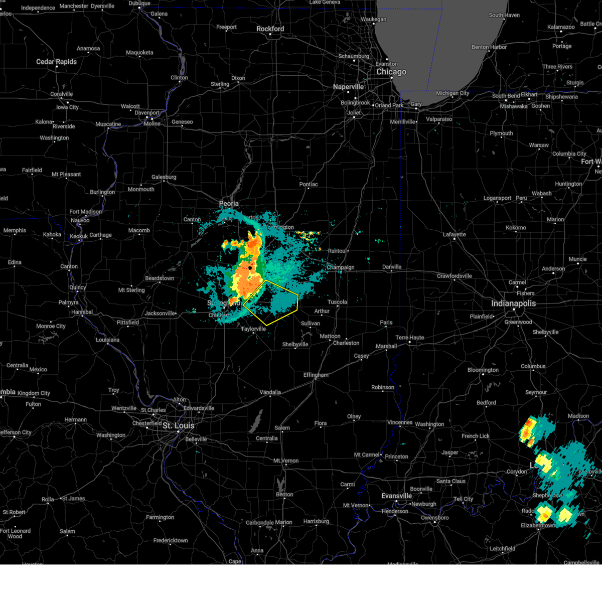 At 836 pm cdt, a severe thunderstorm was located over illiopolis, or 18 miles west of decatur, moving southeast at 25 mph (radar indicated). Hazards include 60 mph wind gusts and quarter size hail. Hail damage to vehicles is expected. expect wind damage to roofs, siding, and trees. locations impacted include, illiopolis, mount auburn, niantic, harristown, blue mound, macon, mount zion and long creek. this includes interstate 72 between mile markers 116 and 147. hail threat, radar indicated max hail size, 1. 00 in wind threat, radar indicated max wind gust, 60 mph. At 836 pm cdt, a severe thunderstorm was located over illiopolis, or 18 miles west of decatur, moving southeast at 25 mph (radar indicated). Hazards include 60 mph wind gusts and quarter size hail. Hail damage to vehicles is expected. expect wind damage to roofs, siding, and trees. locations impacted include, illiopolis, mount auburn, niantic, harristown, blue mound, macon, mount zion and long creek. this includes interstate 72 between mile markers 116 and 147. hail threat, radar indicated max hail size, 1. 00 in wind threat, radar indicated max wind gust, 60 mph.
|
| 8/25/2023 8:10 PM CDT |
 At 810 pm cdt, a severe thunderstorm was located over mount pulaski, or 10 miles south of lincoln, moving southeast at 45 mph (radar indicated). Hazards include 60 mph wind gusts and quarter size hail. Hail damage to vehicles is expected. expect wind damage to roofs, siding, and trees. this severe thunderstorm will be near, chestnut around 815 pm cdt. illiopolis and latham around 820 pm cdt. niantic around 825 pm cdt. harristown and warrensburg around 830 pm cdt. other locations in the path of this severe thunderstorm include decatur, forsyth, mount zion and long creek. this includes the following highways, interstate 55 between mile markers 106 and 124, and between mile markers 129 and 131. interstate 72 between mile markers 112 and 148. hail threat, radar indicated max hail size, 1. 00 in wind threat, radar indicated max wind gust, 60 mph. At 810 pm cdt, a severe thunderstorm was located over mount pulaski, or 10 miles south of lincoln, moving southeast at 45 mph (radar indicated). Hazards include 60 mph wind gusts and quarter size hail. Hail damage to vehicles is expected. expect wind damage to roofs, siding, and trees. this severe thunderstorm will be near, chestnut around 815 pm cdt. illiopolis and latham around 820 pm cdt. niantic around 825 pm cdt. harristown and warrensburg around 830 pm cdt. other locations in the path of this severe thunderstorm include decatur, forsyth, mount zion and long creek. this includes the following highways, interstate 55 between mile markers 106 and 124, and between mile markers 129 and 131. interstate 72 between mile markers 112 and 148. hail threat, radar indicated max hail size, 1. 00 in wind threat, radar indicated max wind gust, 60 mph.
|
| 8/11/2023 9:02 AM CDT |
 At 902 am cdt, severe thunderstorms were located along a line extending from forsyth to near niantic, moving southeast at 40 mph (emergency management). Hazards include 60 mph wind gusts. Expect damage to roofs, siding, and trees. these severe storms will be near, decatur around 910 am cdt. mount zion and long creek around 915 am cdt. other locations in the path of these severe thunderstorms include macon. this includes interstate 72 between mile markers 121 and 146. hail threat, radar indicated max hail size, <. 75 in wind threat, observed max wind gust, 60 mph. At 902 am cdt, severe thunderstorms were located along a line extending from forsyth to near niantic, moving southeast at 40 mph (emergency management). Hazards include 60 mph wind gusts. Expect damage to roofs, siding, and trees. these severe storms will be near, decatur around 910 am cdt. mount zion and long creek around 915 am cdt. other locations in the path of these severe thunderstorms include macon. this includes interstate 72 between mile markers 121 and 146. hail threat, radar indicated max hail size, <. 75 in wind threat, observed max wind gust, 60 mph.
|
| 8/11/2023 8:55 AM CDT |
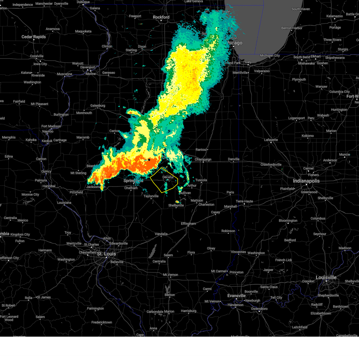 At 855 am cdt, severe thunderstorms were located along a line extending from near forsyth to niantic, moving southeast at 45 mph (emergency management). Hazards include 60 mph wind gusts. Expect damage to roofs, siding, and trees. severe thunderstorms will be near, decatur and forsyth around 900 am cdt. mount zion, long creek and blue mound around 910 am cdt. macon around 915 am cdt. this includes interstate 72 between mile markers 122 and 146. hail threat, radar indicated max hail size, <. 75 in wind threat, observed max wind gust, 60 mph. At 855 am cdt, severe thunderstorms were located along a line extending from near forsyth to niantic, moving southeast at 45 mph (emergency management). Hazards include 60 mph wind gusts. Expect damage to roofs, siding, and trees. severe thunderstorms will be near, decatur and forsyth around 900 am cdt. mount zion, long creek and blue mound around 910 am cdt. macon around 915 am cdt. this includes interstate 72 between mile markers 122 and 146. hail threat, radar indicated max hail size, <. 75 in wind threat, observed max wind gust, 60 mph.
|
| 6/29/2023 12:55 PM CDT | Report from mping: trees uprooted or snappe in macon county IL, 1.3 miles W of Decatur, IL |
| 6/29/2023 12:55 PM CDT | Several tree limbs blown down. time estimated by rada in macon county IL, 5.7 miles ENE of Decatur, IL |
| 6/29/2023 12:54 PM CDT | Storm damage reported in macon county IL, 4.3 miles WNW of Decatur, IL |
| 6/29/2023 12:51 PM CDT |
 At 1250 pm cdt, severe thunderstorms were located along a line extending from near wapella to near pana, moving east at 65 mph. these are destructive storms for eastern de witt and northern piatt county (radar indicated). Hazards include 80 mph wind gusts and half dollar size hail. Flying debris will be dangerous to those caught without shelter. mobile homes will be heavily damaged. expect considerable damage to roofs, windows, and vehicles. extensive tree damage and power outages are likely. severe thunderstorms will be near, weldon around 1255 pm cdt. farmer city and de land around 100 pm cdt. shelbyville and cowden around 105 pm cdt. mansfield and seymour around 110 pm cdt. other locations in the path of these severe thunderstorms include mahomet, fisher, windsor, stewardson, bondville, lake of the woods, champaign, urbana, mattoon, rantoul, neoga, thomasboro, toledo, st. joseph, gifford, lerna and janesville. this includes the following highways, interstate 57 between mile markers 168 and 250. interstate 70 between mile markers 108 and 124. interstate 72 between mile markers 133 and 182. Interstate 74 between mile markers 155 and 200. At 1250 pm cdt, severe thunderstorms were located along a line extending from near wapella to near pana, moving east at 65 mph. these are destructive storms for eastern de witt and northern piatt county (radar indicated). Hazards include 80 mph wind gusts and half dollar size hail. Flying debris will be dangerous to those caught without shelter. mobile homes will be heavily damaged. expect considerable damage to roofs, windows, and vehicles. extensive tree damage and power outages are likely. severe thunderstorms will be near, weldon around 1255 pm cdt. farmer city and de land around 100 pm cdt. shelbyville and cowden around 105 pm cdt. mansfield and seymour around 110 pm cdt. other locations in the path of these severe thunderstorms include mahomet, fisher, windsor, stewardson, bondville, lake of the woods, champaign, urbana, mattoon, rantoul, neoga, thomasboro, toledo, st. joseph, gifford, lerna and janesville. this includes the following highways, interstate 57 between mile markers 168 and 250. interstate 70 between mile markers 108 and 124. interstate 72 between mile markers 133 and 182. Interstate 74 between mile markers 155 and 200.
|
| 6/29/2023 12:50 PM CDT | Report from mping: 3-inch tree limbs broke in macon county IL, 1.6 miles S of Decatur, IL |
| 6/29/2023 12:50 PM CDT | Three inch diameter branch snapped. time estimated by rada in macon county IL, 1.5 miles NE of Decatur, IL |
| 6/29/2023 12:50 PM CDT | Downed tree took out power lines near enterprise schoo in macon county IL, 3.5 miles NE of Decatur, IL |
| 6/29/2023 12:50 PM CDT | Four inch diameter tree limb down off of healthy tree... west of millikin university. time estimated by rada in macon county IL, 2.7 miles ENE of Decatur, IL |
| 6/29/2023 12:10 PM CDT |
 At 1209 pm cdt, severe thunderstorms were located along a line extending from san jose to near waverly, moving east at 70 mph (emergency management). Hazards include 70 mph wind gusts and half dollar size hail. Hail damage to vehicles is expected. expect considerable tree damage. wind damage is also likely to mobile homes, roofs, and outbuildings. severe thunderstorms will be near, san jose and emden around 1215 pm cdt. hartsburg around 1220 pm cdt. auburn and divernon around 1225 pm cdt. other locations in the path of these severe thunderstorms include pawnee, atlanta, waynesville, bulpitt, taylorville, kincaid, edinburg, jeisyville, stonington and moweaqua. this includes the following highways, interstate 155 between mile markers 0 and 11. interstate 55 between mile markers 77 and 141. Interstate 72 between mile markers 77 and 146. At 1209 pm cdt, severe thunderstorms were located along a line extending from san jose to near waverly, moving east at 70 mph (emergency management). Hazards include 70 mph wind gusts and half dollar size hail. Hail damage to vehicles is expected. expect considerable tree damage. wind damage is also likely to mobile homes, roofs, and outbuildings. severe thunderstorms will be near, san jose and emden around 1215 pm cdt. hartsburg around 1220 pm cdt. auburn and divernon around 1225 pm cdt. other locations in the path of these severe thunderstorms include pawnee, atlanta, waynesville, bulpitt, taylorville, kincaid, edinburg, jeisyville, stonington and moweaqua. this includes the following highways, interstate 155 between mile markers 0 and 11. interstate 55 between mile markers 77 and 141. Interstate 72 between mile markers 77 and 146.
|
| 4/20/2023 6:55 PM CDT |
 At 655 pm cdt, severe thunderstorms were located along a line extending from near cerro gordo to near macon, moving northeast at 55 mph (radar indicated). Hazards include 60 mph wind gusts and quarter size hail. Hail damage to vehicles is expected. expect wind damage to roofs, siding, and trees. these severe storms will be near, cerro gordo around 700 pm cdt. other locations in the path of these severe thunderstorms include monticello, hammond and bement. this includes interstate 72 between mile markers 148 and 150. hail threat, radar indicated max hail size, 1. 00 in wind threat, radar indicated max wind gust, 60 mph. At 655 pm cdt, severe thunderstorms were located along a line extending from near cerro gordo to near macon, moving northeast at 55 mph (radar indicated). Hazards include 60 mph wind gusts and quarter size hail. Hail damage to vehicles is expected. expect wind damage to roofs, siding, and trees. these severe storms will be near, cerro gordo around 700 pm cdt. other locations in the path of these severe thunderstorms include monticello, hammond and bement. this includes interstate 72 between mile markers 148 and 150. hail threat, radar indicated max hail size, 1. 00 in wind threat, radar indicated max wind gust, 60 mph.
|
| 4/20/2023 6:48 PM CDT |
 At 648 pm cdt, severe thunderstorms were located along a line extending from long creek to near moweaqua, moving northeast at 55 mph (radar indicated). Hazards include 60 mph wind gusts and quarter size hail. Hail damage to vehicles is expected. expect wind damage to roofs, siding, and trees. these severe storms will be near, cerro gordo around 655 pm cdt. other locations in the path of these severe thunderstorms include bement, lovington, monticello and hammond. this includes interstate 72 between mile markers 147 and 150. hail threat, radar indicated max hail size, 1. 00 in wind threat, radar indicated max wind gust, 60 mph. At 648 pm cdt, severe thunderstorms were located along a line extending from long creek to near moweaqua, moving northeast at 55 mph (radar indicated). Hazards include 60 mph wind gusts and quarter size hail. Hail damage to vehicles is expected. expect wind damage to roofs, siding, and trees. these severe storms will be near, cerro gordo around 655 pm cdt. other locations in the path of these severe thunderstorms include bement, lovington, monticello and hammond. this includes interstate 72 between mile markers 147 and 150. hail threat, radar indicated max hail size, 1. 00 in wind threat, radar indicated max wind gust, 60 mph.
|
| 4/20/2023 6:35 PM CDT |
 At 635 pm cdt, severe thunderstorms were located along a line extending from near macon to near stonington, moving northeast at 55 mph (radar indicated). Hazards include 60 mph wind gusts and quarter size hail. Hail damage to vehicles is expected. expect wind damage to roofs, siding, and trees. severe thunderstorms will be near, harristown around 640 pm cdt. decatur and mount zion around 645 pm cdt. macon around 650 pm cdt. oreana around 655 pm cdt. other locations in the path of these severe thunderstorms include long creek, dalton city, monticello, cerro gordo and bement. this includes interstate 72 between mile markers 144 and 150. hail threat, radar indicated max hail size, 1. 00 in wind threat, radar indicated max wind gust, 60 mph. At 635 pm cdt, severe thunderstorms were located along a line extending from near macon to near stonington, moving northeast at 55 mph (radar indicated). Hazards include 60 mph wind gusts and quarter size hail. Hail damage to vehicles is expected. expect wind damage to roofs, siding, and trees. severe thunderstorms will be near, harristown around 640 pm cdt. decatur and mount zion around 645 pm cdt. macon around 650 pm cdt. oreana around 655 pm cdt. other locations in the path of these severe thunderstorms include long creek, dalton city, monticello, cerro gordo and bement. this includes interstate 72 between mile markers 144 and 150. hail threat, radar indicated max hail size, 1. 00 in wind threat, radar indicated max wind gust, 60 mph.
|
| 1/3/2023 6:19 PM CST |
 At 618 pm cst, a severe thunderstorm capable of producing a tornado was located near argenta in northeast macon county, moving northeast at 35 mph (radar indicated rotation). Hazards include tornado. Flying debris will be dangerous to those caught without shelter. mobile homes will be damaged or destroyed. damage to roofs, windows, and vehicles will occur. Tree damage is likely. At 618 pm cst, a severe thunderstorm capable of producing a tornado was located near argenta in northeast macon county, moving northeast at 35 mph (radar indicated rotation). Hazards include tornado. Flying debris will be dangerous to those caught without shelter. mobile homes will be damaged or destroyed. damage to roofs, windows, and vehicles will occur. Tree damage is likely.
|
| 1/3/2023 6:14 PM CST |
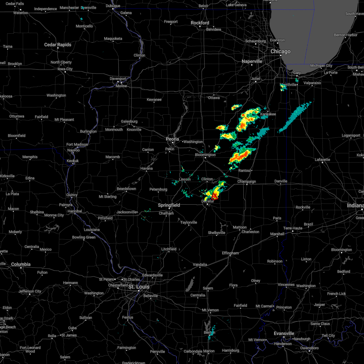 At 613 pm cst, a severe thunderstorm capable of producing a tornado was located near oreana in northeast macon county, moving northeast at 25 mph (radar indicated rotation). Hazards include tornado and quarter size hail. Flying debris will be dangerous to those caught without shelter. mobile homes will be damaged or destroyed. damage to roofs, windows, and vehicles will occur. tree damage is likely. this tornadic thunderstorm will remain over mainly rural areas of northeastern macon county. This includes interstate 72 between mile markers 147 and 150. At 613 pm cst, a severe thunderstorm capable of producing a tornado was located near oreana in northeast macon county, moving northeast at 25 mph (radar indicated rotation). Hazards include tornado and quarter size hail. Flying debris will be dangerous to those caught without shelter. mobile homes will be damaged or destroyed. damage to roofs, windows, and vehicles will occur. tree damage is likely. this tornadic thunderstorm will remain over mainly rural areas of northeastern macon county. This includes interstate 72 between mile markers 147 and 150.
|
| 1/3/2023 6:06 PM CST |
 At 605 pm cst, a severe thunderstorm capable of producing a tornado was located in northern portions of decatur, moving northeast at 25 mph (radar indicated rotation). Hazards include tornado and quarter size hail. Flying debris will be dangerous to those caught without shelter. mobile homes will be damaged or destroyed. damage to roofs, windows, and vehicles will occur. tree damage is likely. locations impacted include, oreana. This includes interstate 72 between mile markers 143 and 150. At 605 pm cst, a severe thunderstorm capable of producing a tornado was located in northern portions of decatur, moving northeast at 25 mph (radar indicated rotation). Hazards include tornado and quarter size hail. Flying debris will be dangerous to those caught without shelter. mobile homes will be damaged or destroyed. damage to roofs, windows, and vehicles will occur. tree damage is likely. locations impacted include, oreana. This includes interstate 72 between mile markers 143 and 150.
|
| 1/3/2023 5:54 PM CST |
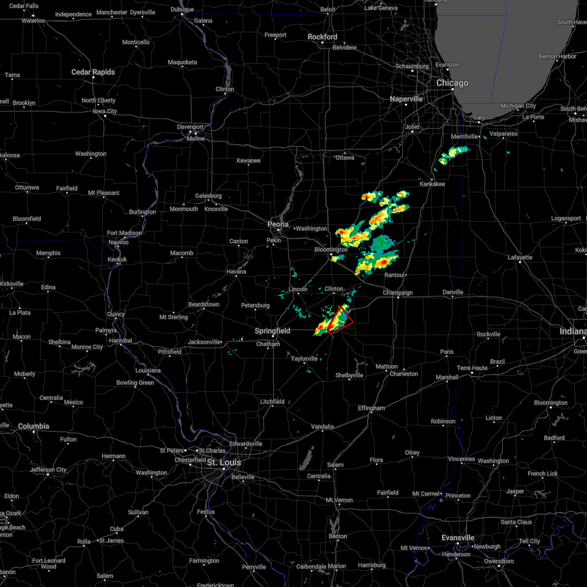 At 554 pm cst, a severe thunderstorm capable of producing a tornado was located over decatur, moving northeast at 25 mph (radar indicated rotation). Hazards include tornado and quarter size hail. Flying debris will be dangerous to those caught without shelter. mobile homes will be damaged or destroyed. damage to roofs, windows, and vehicles will occur. tree damage is likely. this dangerous storm will be near, decatur around 600 pm cst. forsyth around 610 pm cst. other locations in the path of this tornadic thunderstorm include oreana. This includes interstate 72 between mile markers 140 and 150. At 554 pm cst, a severe thunderstorm capable of producing a tornado was located over decatur, moving northeast at 25 mph (radar indicated rotation). Hazards include tornado and quarter size hail. Flying debris will be dangerous to those caught without shelter. mobile homes will be damaged or destroyed. damage to roofs, windows, and vehicles will occur. tree damage is likely. this dangerous storm will be near, decatur around 600 pm cst. forsyth around 610 pm cst. other locations in the path of this tornadic thunderstorm include oreana. This includes interstate 72 between mile markers 140 and 150.
|
| 1/3/2023 5:24 PM CST |
 The tornado warning for west central macon county will expire at 530 pm cst, the storm which prompted the warning has weakened below severe limits, and no longer appears capable of producing a tornado. therefore, the warning will be allowed to expire. The tornado warning for west central macon county will expire at 530 pm cst, the storm which prompted the warning has weakened below severe limits, and no longer appears capable of producing a tornado. therefore, the warning will be allowed to expire.
|
| 1/3/2023 5:08 PM CST |
 At 508 pm cst, a confirmed tornado was located near harristown, or 9 miles west of decatur, moving northeast at 30 mph (weather spotters confirmed tornado). Hazards include damaging tornado. Flying debris will be dangerous to those caught without shelter. mobile homes will be damaged or destroyed. damage to roofs, windows, and vehicles will occur. tree damage is likely. locations impacted include, decatur, harristown, elwin and boody. This includes interstate 72 between mile markers 127 and 139. At 508 pm cst, a confirmed tornado was located near harristown, or 9 miles west of decatur, moving northeast at 30 mph (weather spotters confirmed tornado). Hazards include damaging tornado. Flying debris will be dangerous to those caught without shelter. mobile homes will be damaged or destroyed. damage to roofs, windows, and vehicles will occur. tree damage is likely. locations impacted include, decatur, harristown, elwin and boody. This includes interstate 72 between mile markers 127 and 139.
|
| 1/3/2023 4:54 PM CST |
 At 453 pm cst, a severe thunderstorm capable of producing a tornado was located over mount auburn, or 15 miles north of taylorville, moving northeast at 30 mph (radar indicated rotation). Hazards include tornado. Flying debris will be dangerous to those caught without shelter. mobile homes will be damaged or destroyed. damage to roofs, windows, and vehicles will occur. Tree damage is likely. At 453 pm cst, a severe thunderstorm capable of producing a tornado was located over mount auburn, or 15 miles north of taylorville, moving northeast at 30 mph (radar indicated rotation). Hazards include tornado. Flying debris will be dangerous to those caught without shelter. mobile homes will be damaged or destroyed. damage to roofs, windows, and vehicles will occur. Tree damage is likely.
|
| 11/5/2022 10:20 AM CDT | Storm damage reported in macon county IL, 3.9 miles WNW of Decatur, IL |
| 8/29/2022 8:01 PM CDT |
 At 800 pm cdt, a severe thunderstorm was located over mainly rural areas of eastern macon and western piatt counties moving southeast at 20 mph (law enforcement reported power poles snapped in argenta that occurred just after 7:30 pm). Hazards include 60 mph wind gusts and quarter size hail. Hail damage to vehicles is expected. expect wind damage to roofs, siding, and trees. locations impacted include, bement and hammond. this includes interstate 72 between mile markers 145 and 157. hail threat, radar indicated max hail size, 1. 00 in wind threat, radar indicated max wind gust, 60 mph. At 800 pm cdt, a severe thunderstorm was located over mainly rural areas of eastern macon and western piatt counties moving southeast at 20 mph (law enforcement reported power poles snapped in argenta that occurred just after 7:30 pm). Hazards include 60 mph wind gusts and quarter size hail. Hail damage to vehicles is expected. expect wind damage to roofs, siding, and trees. locations impacted include, bement and hammond. this includes interstate 72 between mile markers 145 and 157. hail threat, radar indicated max hail size, 1. 00 in wind threat, radar indicated max wind gust, 60 mph.
|
| 8/29/2022 7:58 PM CDT |
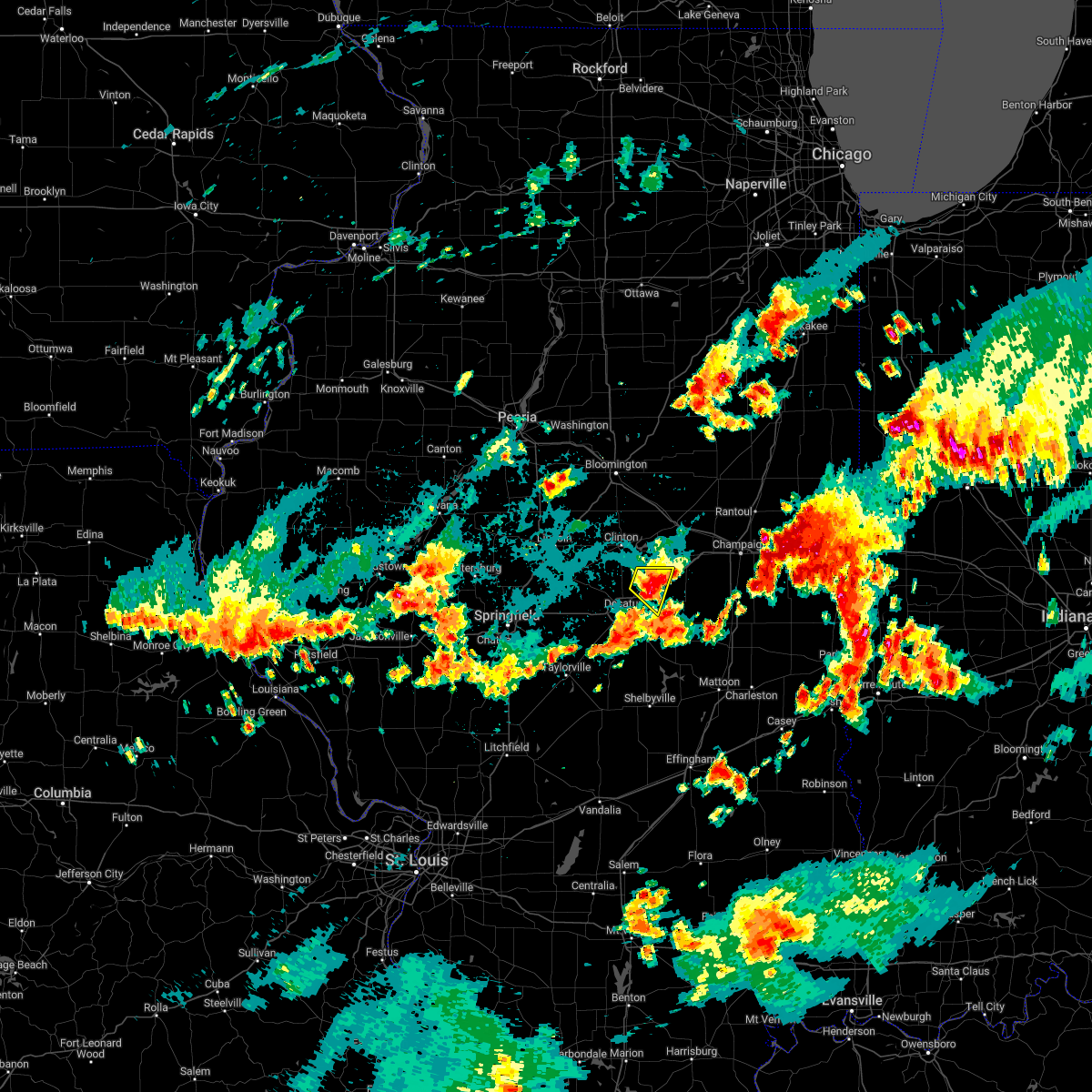 At 757 pm cdt, a severe thunderstorm was located over mainly rural areas of macon county moving east at 20 mph (radar indicated). Hazards include 60 mph wind gusts and quarter size hail. Hail damage to vehicles is expected. expect wind damage to roofs, siding, and trees. this severe thunderstorm will remain over mainly rural areas of west central piatt and northeastern macon counties, including the following locations, cisco. this includes interstate 72 between mile markers 147 and 160. hail threat, radar indicated max hail size, 1. 00 in wind threat, radar indicated max wind gust, 60 mph. At 757 pm cdt, a severe thunderstorm was located over mainly rural areas of macon county moving east at 20 mph (radar indicated). Hazards include 60 mph wind gusts and quarter size hail. Hail damage to vehicles is expected. expect wind damage to roofs, siding, and trees. this severe thunderstorm will remain over mainly rural areas of west central piatt and northeastern macon counties, including the following locations, cisco. this includes interstate 72 between mile markers 147 and 160. hail threat, radar indicated max hail size, 1. 00 in wind threat, radar indicated max wind gust, 60 mph.
|
| 8/29/2022 7:52 PM CDT |
 At 751 pm cdt, a severe thunderstorm was located over mainly rural areas of eastern macon county moving southeast at 25 mph (radar indicated). Hazards include 60 mph wind gusts and half dollar size hail. Hail damage to vehicles is expected. expect wind damage to roofs, siding, and trees. this severe thunderstorm will be near, bement around 805 pm cdt. other locations in the path of this severe thunderstorm include hammond and lovington. this includes interstate 72 between mile markers 145 and 157. hail threat, radar indicated max hail size, 1. 25 in wind threat, radar indicated max wind gust, 60 mph. At 751 pm cdt, a severe thunderstorm was located over mainly rural areas of eastern macon county moving southeast at 25 mph (radar indicated). Hazards include 60 mph wind gusts and half dollar size hail. Hail damage to vehicles is expected. expect wind damage to roofs, siding, and trees. this severe thunderstorm will be near, bement around 805 pm cdt. other locations in the path of this severe thunderstorm include hammond and lovington. this includes interstate 72 between mile markers 145 and 157. hail threat, radar indicated max hail size, 1. 25 in wind threat, radar indicated max wind gust, 60 mph.
|
| 8/29/2022 7:31 PM CDT |
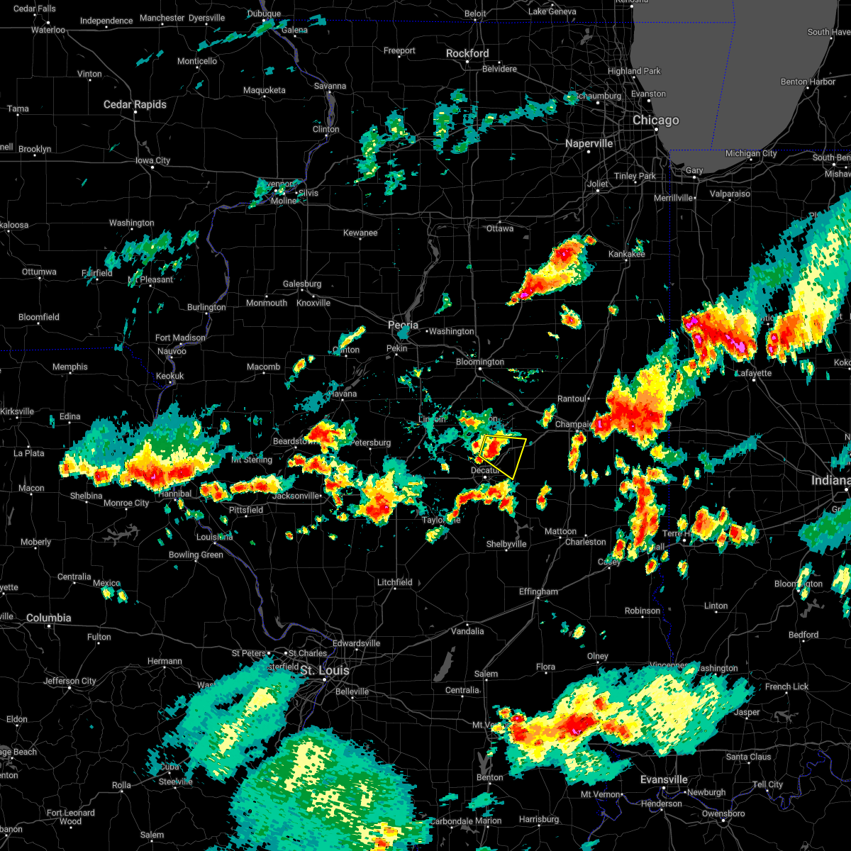 At 731 pm cdt, a severe thunderstorm was located over mainly rural areas of dewitt and macon counties moving southeast at 15 mph (radar indicated). Hazards include 60 mph wind gusts and quarter size hail. Hail damage to vehicles is expected. expect wind damage to roofs, siding, and trees. this severe thunderstorm will be near, oreana around 735 pm cdt. argenta around 745 pm cdt. other locations in the path of this severe thunderstorm include cerro gordo. this includes interstate 72 between mile markers 145 and 160. hail threat, radar indicated max hail size, 1. 00 in wind threat, radar indicated max wind gust, 60 mph. At 731 pm cdt, a severe thunderstorm was located over mainly rural areas of dewitt and macon counties moving southeast at 15 mph (radar indicated). Hazards include 60 mph wind gusts and quarter size hail. Hail damage to vehicles is expected. expect wind damage to roofs, siding, and trees. this severe thunderstorm will be near, oreana around 735 pm cdt. argenta around 745 pm cdt. other locations in the path of this severe thunderstorm include cerro gordo. this includes interstate 72 between mile markers 145 and 160. hail threat, radar indicated max hail size, 1. 00 in wind threat, radar indicated max wind gust, 60 mph.
|
| 8/3/2022 4:08 PM CDT |
 At 407 pm cdt, severe thunderstorms were located along a line extending from tolono to near lovington, moving east at 35 mph (radar indicated). Hazards include 70 mph wind gusts and penny size hail. Expect considerable tree damage. damage is likely to mobile homes, roofs, and outbuildings. locations impacted include, champaign, decatur, monticello, savoy, mount zion, tolono, arthur, bement, philo, cerro gordo, long creek, atwood, macon, lovington, pesotum, dalton city, hammond, oakley, sadorus and ivesdale. this includes the following highways, interstate 57 between mile markers 220 and 231. interstate 72 between mile markers 161 and 168. thunderstorm damage threat, considerable hail threat, radar indicated max hail size, 0. 75 in wind threat, radar indicated max wind gust, 70 mph. At 407 pm cdt, severe thunderstorms were located along a line extending from tolono to near lovington, moving east at 35 mph (radar indicated). Hazards include 70 mph wind gusts and penny size hail. Expect considerable tree damage. damage is likely to mobile homes, roofs, and outbuildings. locations impacted include, champaign, decatur, monticello, savoy, mount zion, tolono, arthur, bement, philo, cerro gordo, long creek, atwood, macon, lovington, pesotum, dalton city, hammond, oakley, sadorus and ivesdale. this includes the following highways, interstate 57 between mile markers 220 and 231. interstate 72 between mile markers 161 and 168. thunderstorm damage threat, considerable hail threat, radar indicated max hail size, 0. 75 in wind threat, radar indicated max wind gust, 70 mph.
|
| 8/3/2022 4:00 PM CDT | Tree and power line down near decatur airport. time estimate in macon county IL, 2 miles NNW of Decatur, IL |
| 8/3/2022 3:59 PM CDT | Storm damage reported in macon county IL, 4.3 miles WNW of Decatur, IL |
| 8/3/2022 3:53 PM CDT |
 At 353 pm cdt, severe thunderstorms were located along a line extending from near monticello to near mount zion, moving east at 30 mph (radar indicated). Hazards include 70 mph wind gusts and penny size hail. Expect considerable tree damage. damage is likely to mobile homes, roofs, and outbuildings. locations impacted include, tolono, pesotum, savoy, lovington, hammond, arthur, philo and atwood. this includes the following highways, interstate 57 between mile markers 220 and 232. interstate 72 between mile markers 144 and 153, and between mile markers 156 and 168. thunderstorm damage threat, considerable hail threat, radar indicated max hail size, 0. 75 in wind threat, radar indicated max wind gust, 70 mph. At 353 pm cdt, severe thunderstorms were located along a line extending from near monticello to near mount zion, moving east at 30 mph (radar indicated). Hazards include 70 mph wind gusts and penny size hail. Expect considerable tree damage. damage is likely to mobile homes, roofs, and outbuildings. locations impacted include, tolono, pesotum, savoy, lovington, hammond, arthur, philo and atwood. this includes the following highways, interstate 57 between mile markers 220 and 232. interstate 72 between mile markers 144 and 153, and between mile markers 156 and 168. thunderstorm damage threat, considerable hail threat, radar indicated max hail size, 0. 75 in wind threat, radar indicated max wind gust, 70 mph.
|
| 8/3/2022 3:49 PM CDT |
 At 348 pm cdt, severe thunderstorms were located along a line extending from near monticello to near macon, moving east at 30 mph (radar indicated). Hazards include 60 mph wind gusts and penny size hail. Expect damage to roofs, siding, and trees. severe thunderstorms will be near, monticello and bement around 355 pm cdt. other locations in the path of these severe thunderstorms include tolono, pesotum, savoy, lovington, philo, hammond, arthur and atwood. this includes the following highways, interstate 57 between mile markers 220 and 232. interstate 72 between mile markers 144 and 153, and between mile markers 156 and 168. hail threat, radar indicated max hail size, 0. 75 in wind threat, radar indicated max wind gust, 60 mph. At 348 pm cdt, severe thunderstorms were located along a line extending from near monticello to near macon, moving east at 30 mph (radar indicated). Hazards include 60 mph wind gusts and penny size hail. Expect damage to roofs, siding, and trees. severe thunderstorms will be near, monticello and bement around 355 pm cdt. other locations in the path of these severe thunderstorms include tolono, pesotum, savoy, lovington, philo, hammond, arthur and atwood. this includes the following highways, interstate 57 between mile markers 220 and 232. interstate 72 between mile markers 144 and 153, and between mile markers 156 and 168. hail threat, radar indicated max hail size, 0. 75 in wind threat, radar indicated max wind gust, 60 mph.
|
| 8/3/2022 3:05 PM CDT |
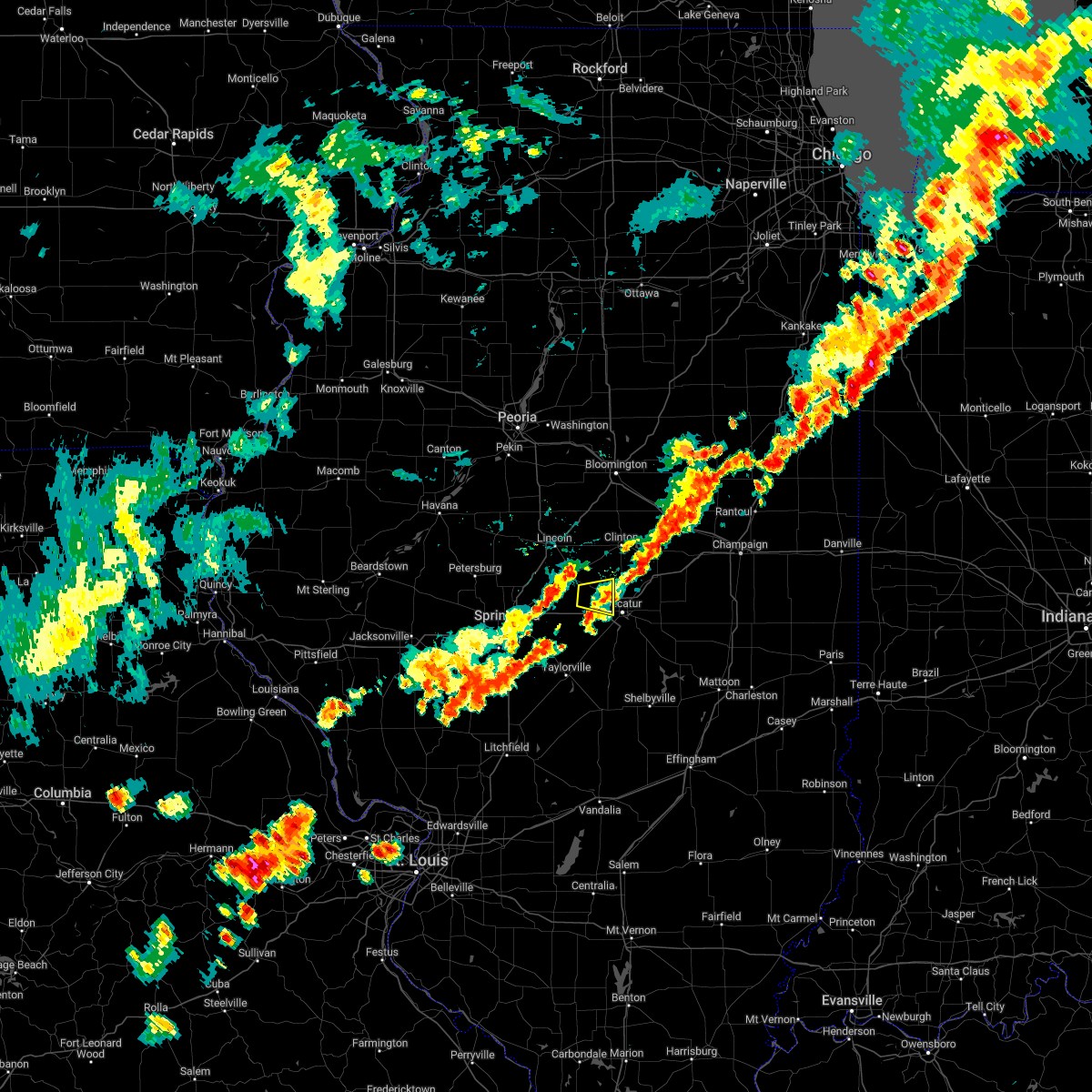 The severe thunderstorm warning for southeastern logan, eastern sangamon and northwestern macon counties will expire at 315 pm cdt, the storm which prompted the warning has weakened below severe limits, and no longer poses an immediate threat to life or property. therefore, the warning will be allowed to expire. however gusty winds are still possible with this thunderstorm. a severe thunderstorm watch remains in effect until 900 pm cdt for central illinois. The severe thunderstorm warning for southeastern logan, eastern sangamon and northwestern macon counties will expire at 315 pm cdt, the storm which prompted the warning has weakened below severe limits, and no longer poses an immediate threat to life or property. therefore, the warning will be allowed to expire. however gusty winds are still possible with this thunderstorm. a severe thunderstorm watch remains in effect until 900 pm cdt for central illinois.
|
| 8/3/2022 2:50 PM CDT |
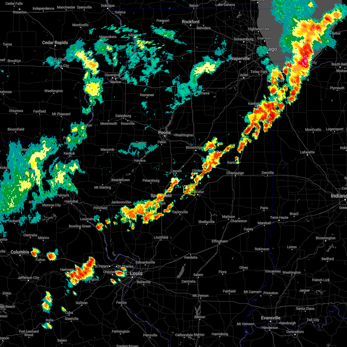 At 249 pm cdt, a severe thunderstorm was located over warrensburg, or 9 miles northwest of decatur, moving east at 15 mph (radar indicated). Hazards include 60 mph wind gusts and penny size hail. Expect damage to roofs, siding, and trees. locations impacted include, harristown, warrensburg and decatur. this includes interstate 72 between mile markers 134 and 138. hail threat, radar indicated max hail size, 0. 75 in wind threat, radar indicated max wind gust, 60 mph. At 249 pm cdt, a severe thunderstorm was located over warrensburg, or 9 miles northwest of decatur, moving east at 15 mph (radar indicated). Hazards include 60 mph wind gusts and penny size hail. Expect damage to roofs, siding, and trees. locations impacted include, harristown, warrensburg and decatur. this includes interstate 72 between mile markers 134 and 138. hail threat, radar indicated max hail size, 0. 75 in wind threat, radar indicated max wind gust, 60 mph.
|
| 8/3/2022 2:33 PM CDT |
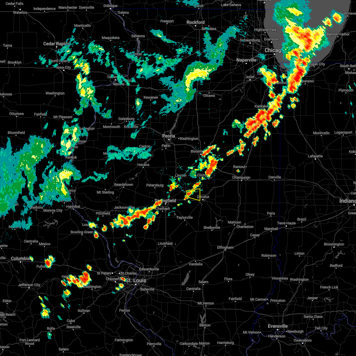 At 232 pm cdt, a severe thunderstorm was located near latham, or 13 miles west of decatur, moving east at 15 mph (radar indicated). Hazards include 60 mph wind gusts and quarter size hail. Hail damage to vehicles is expected. expect wind damage to roofs, siding, and trees. this severe thunderstorm will be near, latham around 235 pm cdt. harristown around 250 pm cdt. other locations in the path of this severe thunderstorm include warrensburg and decatur. this includes interstate 72 between mile markers 134 and 138. hail threat, radar indicated max hail size, 1. 00 in wind threat, radar indicated max wind gust, 60 mph. At 232 pm cdt, a severe thunderstorm was located near latham, or 13 miles west of decatur, moving east at 15 mph (radar indicated). Hazards include 60 mph wind gusts and quarter size hail. Hail damage to vehicles is expected. expect wind damage to roofs, siding, and trees. this severe thunderstorm will be near, latham around 235 pm cdt. harristown around 250 pm cdt. other locations in the path of this severe thunderstorm include warrensburg and decatur. this includes interstate 72 between mile markers 134 and 138. hail threat, radar indicated max hail size, 1. 00 in wind threat, radar indicated max wind gust, 60 mph.
|
| 8/2/2022 9:10 AM CDT | Large tree broken on east mound rd. near highway 4 in macon county IL, 2.6 miles SSW of Decatur, IL |
| 8/2/2022 9:05 AM CDT | Power lines downed from high wind in macon county IL, 1 miles ENE of Decatur, IL |
| 8/2/2022 9:05 AM CDT | Power lines blown dow in macon county IL, 7.8 miles E of Decatur, IL |
| 8/2/2022 8:50 AM CDT |
 At 849 am cdt, a severe thunderstorm was located near chestnut, or 10 miles southwest of clinton, moving southeast at 60 mph (radar indicated). Hazards include 60 mph wind gusts. expect damage to roofs, siding, and trees At 849 am cdt, a severe thunderstorm was located near chestnut, or 10 miles southwest of clinton, moving southeast at 60 mph (radar indicated). Hazards include 60 mph wind gusts. expect damage to roofs, siding, and trees
|
| 8/1/2022 5:46 AM CDT | Storm damage reported in macon county IL, 4.3 miles WNW of Decatur, IL |
| 8/1/2022 5:40 AM CDT |
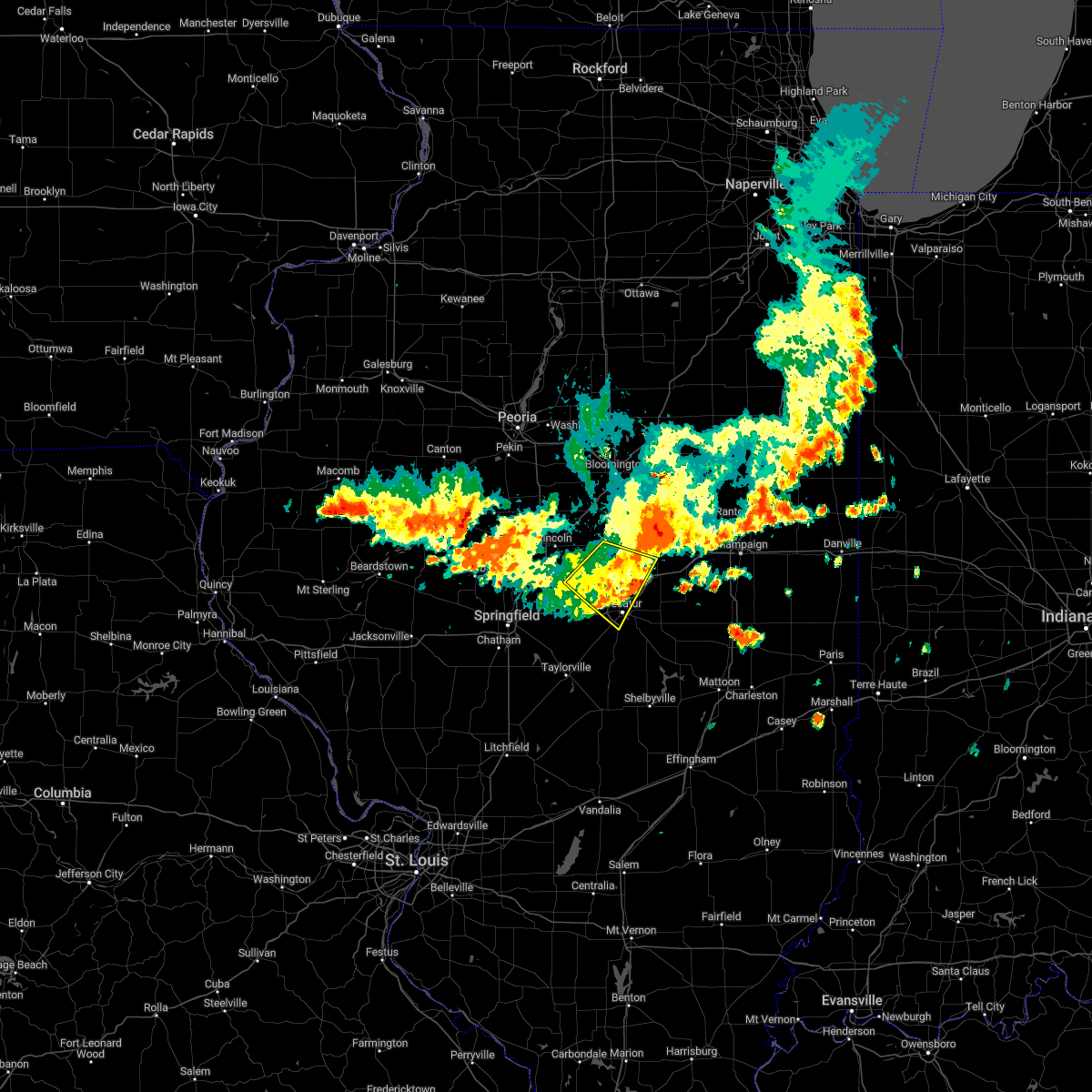 The severe thunderstorm warning for southeastern logan, southwestern de witt and northern macon counties will expire at 545 am cdt, the storm which prompted the warning has moved out of the area. therefore, the warning will be allowed to expire. The severe thunderstorm warning for southeastern logan, southwestern de witt and northern macon counties will expire at 545 am cdt, the storm which prompted the warning has moved out of the area. therefore, the warning will be allowed to expire.
|
| 8/1/2022 5:26 AM CDT |
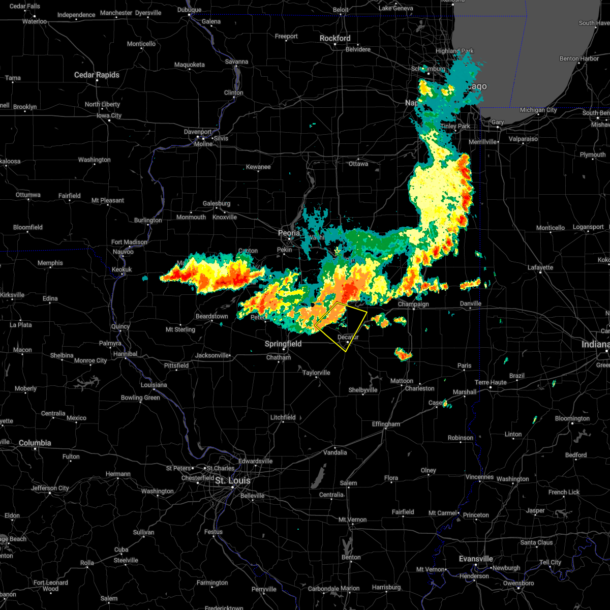 At 526 am cdt, a severe thunderstorm was located near kenney, or 10 miles southwest of clinton, moving southeast at 50 mph (radar indicated). Hazards include 60 mph wind gusts. Expect damage to roofs, siding, and trees. locations impacted include, decatur, clinton, forsyth, maroa, mount pulaski, harristown, warrensburg, argenta, oreana, latham, kenney, chestnut, weldon springs state park, rowell, elwin and hallsville. this includes interstate 72 between mile markers 132 and 145. hail threat, radar indicated max hail size, <. 75 in wind threat, radar indicated max wind gust, 60 mph. At 526 am cdt, a severe thunderstorm was located near kenney, or 10 miles southwest of clinton, moving southeast at 50 mph (radar indicated). Hazards include 60 mph wind gusts. Expect damage to roofs, siding, and trees. locations impacted include, decatur, clinton, forsyth, maroa, mount pulaski, harristown, warrensburg, argenta, oreana, latham, kenney, chestnut, weldon springs state park, rowell, elwin and hallsville. this includes interstate 72 between mile markers 132 and 145. hail threat, radar indicated max hail size, <. 75 in wind threat, radar indicated max wind gust, 60 mph.
|
| 8/1/2022 5:11 AM CDT |
 At 510 am cdt, a severe thunderstorm was located near lincoln, moving southeast at 50 mph (radar indicated). Hazards include 60 mph wind gusts. expect damage to roofs, siding, and trees At 510 am cdt, a severe thunderstorm was located near lincoln, moving southeast at 50 mph (radar indicated). Hazards include 60 mph wind gusts. expect damage to roofs, siding, and trees
|
| 7/15/2022 11:01 PM CDT |
 At 1100 pm cdt, a severe thunderstorm was located near lovington, or 11 miles north of sullivan, moving southeast at 30 mph (radar indicated). Hazards include 60 mph wind gusts and quarter size hail. Hail damage to vehicles is expected. expect wind damage to roofs, siding, and trees. this severe thunderstorm will be near, sullivan and arthur around 1115 pm cdt. other locations in the path of this severe thunderstorm include allenville, arcola, cooks mill and humboldt. this includes the following highways, interstate 57 between mile markers 197 and 211. interstate 72 between mile markers 135 and 152. hail threat, radar indicated max hail size, 1. 00 in wind threat, radar indicated max wind gust, 60 mph. At 1100 pm cdt, a severe thunderstorm was located near lovington, or 11 miles north of sullivan, moving southeast at 30 mph (radar indicated). Hazards include 60 mph wind gusts and quarter size hail. Hail damage to vehicles is expected. expect wind damage to roofs, siding, and trees. this severe thunderstorm will be near, sullivan and arthur around 1115 pm cdt. other locations in the path of this severe thunderstorm include allenville, arcola, cooks mill and humboldt. this includes the following highways, interstate 57 between mile markers 197 and 211. interstate 72 between mile markers 135 and 152. hail threat, radar indicated max hail size, 1. 00 in wind threat, radar indicated max wind gust, 60 mph.
|
| 4/30/2022 7:23 PM CDT |
 At 722 pm cdt, a severe thunderstorm was located over hammond, or 13 miles south of monticello, moving northeast at 40 mph (trained weather spotters). Hazards include 60 mph wind gusts and quarter size hail. Hail damage to vehicles is expected. expect wind damage to roofs, siding, and trees. this severe storm will be near, atwood around 730 pm cdt. This includes interstate 72 between mile markers 162 and 173. At 722 pm cdt, a severe thunderstorm was located over hammond, or 13 miles south of monticello, moving northeast at 40 mph (trained weather spotters). Hazards include 60 mph wind gusts and quarter size hail. Hail damage to vehicles is expected. expect wind damage to roofs, siding, and trees. this severe storm will be near, atwood around 730 pm cdt. This includes interstate 72 between mile markers 162 and 173.
|
| 4/30/2022 7:11 PM CDT |
 At 710 pm cdt, a severe thunderstorm was located near cerro gordo, or 9 miles east of decatur, moving northeast at 45 mph (trained weather spotters reported a funnel cloud and visibile rotation). Hazards include 60 mph wind gusts and half dollar size hail. Hail damage to vehicles is expected. expect wind damage to roofs, siding, and trees. this severe storm will be near, hammond around 720 pm cdt. other locations in the path of this severe thunderstorm include bement. This includes interstate 72 between mile markers 162 and 173. At 710 pm cdt, a severe thunderstorm was located near cerro gordo, or 9 miles east of decatur, moving northeast at 45 mph (trained weather spotters reported a funnel cloud and visibile rotation). Hazards include 60 mph wind gusts and half dollar size hail. Hail damage to vehicles is expected. expect wind damage to roofs, siding, and trees. this severe storm will be near, hammond around 720 pm cdt. other locations in the path of this severe thunderstorm include bement. This includes interstate 72 between mile markers 162 and 173.
|
| 4/30/2022 7:04 PM CDT |
 At 704 pm cdt, a severe thunderstorm was located over long creek, or 7 miles southeast of decatur, moving northeast at 40 mph (radar indicated). Hazards include 60 mph wind gusts and half dollar size hail. Hail damage to vehicles is expected. expect wind damage to roofs, siding, and trees. this severe storm will be near, cerro gordo around 715 pm cdt. other locations in the path of this severe thunderstorm include hammond and bement. This includes interstate 72 between mile markers 162 and 173. At 704 pm cdt, a severe thunderstorm was located over long creek, or 7 miles southeast of decatur, moving northeast at 40 mph (radar indicated). Hazards include 60 mph wind gusts and half dollar size hail. Hail damage to vehicles is expected. expect wind damage to roofs, siding, and trees. this severe storm will be near, cerro gordo around 715 pm cdt. other locations in the path of this severe thunderstorm include hammond and bement. This includes interstate 72 between mile markers 162 and 173.
|
| 4/30/2022 7:02 PM CDT |
 At 701 pm cdt, a severe thunderstorm was located over mount zion, or near decatur, moving northeast at 40 mph (radar indicated). Hazards include 60 mph wind gusts and quarter size hail. Hail damage to vehicles is expected. expect wind damage to roofs, siding, and trees. locations impacted include, decatur, taylorville, moweaqua, harristown, assumption, blue mound, macon, stonington, westervelt, owaneco, boody, willeys and elwin. hail threat, radar indicated max hail size, 1. 00 in wind threat, radar indicated max wind gust, 60 mph. At 701 pm cdt, a severe thunderstorm was located over mount zion, or near decatur, moving northeast at 40 mph (radar indicated). Hazards include 60 mph wind gusts and quarter size hail. Hail damage to vehicles is expected. expect wind damage to roofs, siding, and trees. locations impacted include, decatur, taylorville, moweaqua, harristown, assumption, blue mound, macon, stonington, westervelt, owaneco, boody, willeys and elwin. hail threat, radar indicated max hail size, 1. 00 in wind threat, radar indicated max wind gust, 60 mph.
|
| 4/30/2022 6:58 PM CDT |
 At 658 pm cdt, a severe thunderstorm was located over mount zion, or near decatur, moving northeast at 40 mph (radar indicated). Hazards include 60 mph wind gusts and quarter size hail. Hail damage to vehicles is expected. expect wind damage to roofs, siding, and trees. this severe thunderstorm will be near, cerro gordo around 715 pm cdt. other locations in the path of this severe thunderstorm include hammond and bement. this includes interstate 72 between mile markers 162 and 173. hail threat, radar indicated max hail size, 1. 00 in wind threat, radar indicated max wind gust, 60 mph. At 658 pm cdt, a severe thunderstorm was located over mount zion, or near decatur, moving northeast at 40 mph (radar indicated). Hazards include 60 mph wind gusts and quarter size hail. Hail damage to vehicles is expected. expect wind damage to roofs, siding, and trees. this severe thunderstorm will be near, cerro gordo around 715 pm cdt. other locations in the path of this severe thunderstorm include hammond and bement. this includes interstate 72 between mile markers 162 and 173. hail threat, radar indicated max hail size, 1. 00 in wind threat, radar indicated max wind gust, 60 mph.
|
| 4/30/2022 6:44 PM CDT |
 At 643 pm cdt, a severe thunderstorm was located over macon, or 12 miles southwest of decatur, moving northeast at 40 mph (radar indicated). Hazards include 60 mph wind gusts and quarter size hail. Hail damage to vehicles is expected. expect wind damage to roofs, siding, and trees. this severe thunderstorm will remain over mainly rural areas of central christian, western moultrie, northwestern shelby and southwestern macon counties, including the following locations, boody, willeys, palmer, sharpsburg, vanderville, elwin, owaneco and taylorville airport. this includes interstate 72 between mile markers 127 and 136. hail threat, radar indicated max hail size, 1. 00 in wind threat, radar indicated max wind gust, 60 mph. At 643 pm cdt, a severe thunderstorm was located over macon, or 12 miles southwest of decatur, moving northeast at 40 mph (radar indicated). Hazards include 60 mph wind gusts and quarter size hail. Hail damage to vehicles is expected. expect wind damage to roofs, siding, and trees. this severe thunderstorm will remain over mainly rural areas of central christian, western moultrie, northwestern shelby and southwestern macon counties, including the following locations, boody, willeys, palmer, sharpsburg, vanderville, elwin, owaneco and taylorville airport. this includes interstate 72 between mile markers 127 and 136. hail threat, radar indicated max hail size, 1. 00 in wind threat, radar indicated max wind gust, 60 mph.
|
| 4/30/2022 6:29 PM CDT |
 At 629 pm cdt, a severe thunderstorm was located over stonington, or 7 miles northeast of taylorville, moving northeast at 40 mph (radar indicated). Hazards include 60 mph wind gusts and quarter size hail. Hail damage to vehicles is expected. expect wind damage to roofs, siding, and trees. this severe thunderstorm will be near, blue mound around 645 pm cdt. other locations in the path of this severe thunderstorm include moweaqua and macon. this includes interstate 72 between mile markers 126 and 136. hail threat, radar indicated max hail size, 1. 00 in wind threat, radar indicated max wind gust, 60 mph. At 629 pm cdt, a severe thunderstorm was located over stonington, or 7 miles northeast of taylorville, moving northeast at 40 mph (radar indicated). Hazards include 60 mph wind gusts and quarter size hail. Hail damage to vehicles is expected. expect wind damage to roofs, siding, and trees. this severe thunderstorm will be near, blue mound around 645 pm cdt. other locations in the path of this severe thunderstorm include moweaqua and macon. this includes interstate 72 between mile markers 126 and 136. hail threat, radar indicated max hail size, 1. 00 in wind threat, radar indicated max wind gust, 60 mph.
|
| 3/5/2022 11:57 PM CST |
 The severe thunderstorm warning for southern piatt and east central macon counties will expire at midnight cst, the storm which prompted the warning has moved out of the area. therefore, the warning will be allowed to expire. a severe thunderstorm watch remains in effect until 200 am cst for central and east central illinois. to report severe weather, contact your nearest law enforcement agency. they will relay your report to the national weather service lincoln. The severe thunderstorm warning for southern piatt and east central macon counties will expire at midnight cst, the storm which prompted the warning has moved out of the area. therefore, the warning will be allowed to expire. a severe thunderstorm watch remains in effect until 200 am cst for central and east central illinois. to report severe weather, contact your nearest law enforcement agency. they will relay your report to the national weather service lincoln.
|
| 3/5/2022 11:46 PM CST |
 At 1146 pm cst, a severe thunderstorm was located near de land, or near monticello, moving northeast at 60 mph (decatur airport observation). Hazards include 70 mph wind gusts. Expect considerable tree damage. damage is likely to mobile homes, roofs, and outbuildings. this severe thunderstorm will remain over mainly rural areas of southern piatt and east central macon counties, including the following locations, milmine, lodge, oakley and ivesdale. this includes interstate 72 between mile markers 159 and 169. thunderstorm damage threat, considerable hail threat, radar indicated max hail size, <. 75 in wind threat, radar indicated max wind gust, 70 mph. At 1146 pm cst, a severe thunderstorm was located near de land, or near monticello, moving northeast at 60 mph (decatur airport observation). Hazards include 70 mph wind gusts. Expect considerable tree damage. damage is likely to mobile homes, roofs, and outbuildings. this severe thunderstorm will remain over mainly rural areas of southern piatt and east central macon counties, including the following locations, milmine, lodge, oakley and ivesdale. this includes interstate 72 between mile markers 159 and 169. thunderstorm damage threat, considerable hail threat, radar indicated max hail size, <. 75 in wind threat, radar indicated max wind gust, 70 mph.
|
| 3/5/2022 11:38 PM CST | Asos station kdec decatur a in macon county IL, 4.8 miles WNW of Decatur, IL |
| 3/5/2022 11:31 PM CST |
 At 1131 pm cst, a severe thunderstorm was located over moweaqua, or 14 miles northeast of taylorville, moving east at 65 mph (radar indicated). Hazards include 60 mph wind gusts. Expect damage to roofs, siding, and trees. this severe thunderstorm will be near, bethany and dalton city around 1145 pm cst. lovington around 1150 pm cst. Other locations in the path of this severe thunderstorm include hammond, arthur and atwood. At 1131 pm cst, a severe thunderstorm was located over moweaqua, or 14 miles northeast of taylorville, moving east at 65 mph (radar indicated). Hazards include 60 mph wind gusts. Expect damage to roofs, siding, and trees. this severe thunderstorm will be near, bethany and dalton city around 1145 pm cst. lovington around 1150 pm cst. Other locations in the path of this severe thunderstorm include hammond, arthur and atwood.
|
| 3/5/2022 11:19 PM CST |
 At 1118 pm cst, a severe thunderstorm was located over warrensburg, or 8 miles west of decatur, moving northeast at 60 mph (radar indicated). Hazards include 60 mph wind gusts. Expect damage to roofs, siding, and trees. this severe thunderstorm will be near, decatur and forsyth around 1125 pm cst. maroa and oreana around 1130 pm cst. argenta around 1135 pm cst. other locations in the path of this severe thunderstorm include weldon, monticello and de land. this includes the following highways, interstate 72 between mile markers 128 and 169. interstate 74 near mile marker 160. hail threat, radar indicated max hail size, <. 75 in wind threat, radar indicated max wind gust, 60 mph. At 1118 pm cst, a severe thunderstorm was located over warrensburg, or 8 miles west of decatur, moving northeast at 60 mph (radar indicated). Hazards include 60 mph wind gusts. Expect damage to roofs, siding, and trees. this severe thunderstorm will be near, decatur and forsyth around 1125 pm cst. maroa and oreana around 1130 pm cst. argenta around 1135 pm cst. other locations in the path of this severe thunderstorm include weldon, monticello and de land. this includes the following highways, interstate 72 between mile markers 128 and 169. interstate 74 near mile marker 160. hail threat, radar indicated max hail size, <. 75 in wind threat, radar indicated max wind gust, 60 mph.
|
| 10/24/2021 10:08 PM CDT |
 At 1008 pm cdt, a severe thunderstorm capable of producing a tornado was located over macon, or 12 miles south of decatur, moving northeast at 50 mph (radar indicated rotation). Hazards include tornado. Flying debris will be dangerous to those caught without shelter. mobile homes will be damaged or destroyed. damage to roofs, windows, and vehicles will occur. tree damage is likely. This tornadic thunderstorm will remain over mainly rural areas of north central shelby and south central macon counties, including the following locations, elwin. At 1008 pm cdt, a severe thunderstorm capable of producing a tornado was located over macon, or 12 miles south of decatur, moving northeast at 50 mph (radar indicated rotation). Hazards include tornado. Flying debris will be dangerous to those caught without shelter. mobile homes will be damaged or destroyed. damage to roofs, windows, and vehicles will occur. tree damage is likely. This tornadic thunderstorm will remain over mainly rural areas of north central shelby and south central macon counties, including the following locations, elwin.
|
| 10/24/2021 9:57 PM CDT |
 At 957 pm cdt, a severe thunderstorm capable of producing a tornado was located near stonington, or 9 miles northeast of taylorville, moving northeast at 55 mph (radar indicated rotation). Hazards include tornado. Flying debris will be dangerous to those caught without shelter. mobile homes will be damaged or destroyed. damage to roofs, windows, and vehicles will occur. tree damage is likely. this dangerous storm will be near, blue mound around 1000 pm cdt. moweaqua around 1005 pm cdt. Macon around 1010 pm cdt. At 957 pm cdt, a severe thunderstorm capable of producing a tornado was located near stonington, or 9 miles northeast of taylorville, moving northeast at 55 mph (radar indicated rotation). Hazards include tornado. Flying debris will be dangerous to those caught without shelter. mobile homes will be damaged or destroyed. damage to roofs, windows, and vehicles will occur. tree damage is likely. this dangerous storm will be near, blue mound around 1000 pm cdt. moweaqua around 1005 pm cdt. Macon around 1010 pm cdt.
|
| 10/11/2021 5:34 PM CDT |
 At 534 pm cdt, severe thunderstorms were located along a line extending from weldon to near cerro gordo, moving east at 40 mph (radar indicated). Hazards include 60 mph wind gusts. Expect damage to roofs, siding, and trees. locations impacted include, monticello, bement, cerro gordo, argenta, de land, weldon, oakley, cisco and milmine. This includes interstate 72 between mile markers 151 and 164. At 534 pm cdt, severe thunderstorms were located along a line extending from weldon to near cerro gordo, moving east at 40 mph (radar indicated). Hazards include 60 mph wind gusts. Expect damage to roofs, siding, and trees. locations impacted include, monticello, bement, cerro gordo, argenta, de land, weldon, oakley, cisco and milmine. This includes interstate 72 between mile markers 151 and 164.
|
| 10/11/2021 5:18 PM CDT |
 At 518 pm cdt, severe thunderstorms were located along a line extending from maroa to near decatur, moving east at 40 mph (radar indicated). Hazards include 60 mph wind gusts. Expect damage to roofs, siding, and trees. locations impacted include, cerro gordo, argenta, weldon, bement, de land and monticello. This includes interstate 72 between mile markers 138 and 164. At 518 pm cdt, severe thunderstorms were located along a line extending from maroa to near decatur, moving east at 40 mph (radar indicated). Hazards include 60 mph wind gusts. Expect damage to roofs, siding, and trees. locations impacted include, cerro gordo, argenta, weldon, bement, de land and monticello. This includes interstate 72 between mile markers 138 and 164.
|
| 10/11/2021 4:56 PM CDT |
 At 456 pm cdt, severe thunderstorms were located along a line extending from near latham to near harristown, moving east at 40 mph (radar indicated). Hazards include 60 mph wind gusts. Expect damage to roofs, siding, and trees. severe thunderstorms will be near, harristown and warrensburg around 500 pm cdt. decatur around 505 pm cdt. forsyth and maroa around 515 pm cdt. other locations in the path of these severe thunderstorms include oreana, cerro gordo, argenta, weldon, bement, de land and monticello. This includes interstate 72 between mile markers 129 and 164. At 456 pm cdt, severe thunderstorms were located along a line extending from near latham to near harristown, moving east at 40 mph (radar indicated). Hazards include 60 mph wind gusts. Expect damage to roofs, siding, and trees. severe thunderstorms will be near, harristown and warrensburg around 500 pm cdt. decatur around 505 pm cdt. forsyth and maroa around 515 pm cdt. other locations in the path of these severe thunderstorms include oreana, cerro gordo, argenta, weldon, bement, de land and monticello. This includes interstate 72 between mile markers 129 and 164.
|
| 6/26/2021 4:30 PM CDT | Apple tree snapped. tree had previously been damaged by storms. time estimated by rada in macon county IL, 7.3 miles E of Decatur, IL |
| 6/25/2021 10:18 PM CDT |
 At 1017 pm cdt, severe thunderstorms were located along a line extending from weldon to near cerro gordo to long creek to near mount zion, moving east at 30 mph (decatur asos). Hazards include 70 mph wind gusts. Expect considerable tree damage. damage is likely to mobile homes, roofs, and outbuildings. severe thunderstorms will be near, de land and weldon around 1025 pm cdt. monticello around 1030 pm cdt. other locations in the path of these severe thunderstorms include bement, white heath, lovington, hammond, seymour, atwood, bondville, champaign, urbana, savoy, tolono, arthur and pesotum. this includes the following highways, interstate 57 between mile markers 202 and 237. interstate 72 between mile markers 148 and 182. Interstate 74 between mile markers 179 and 183. At 1017 pm cdt, severe thunderstorms were located along a line extending from weldon to near cerro gordo to long creek to near mount zion, moving east at 30 mph (decatur asos). Hazards include 70 mph wind gusts. Expect considerable tree damage. damage is likely to mobile homes, roofs, and outbuildings. severe thunderstorms will be near, de land and weldon around 1025 pm cdt. monticello around 1030 pm cdt. other locations in the path of these severe thunderstorms include bement, white heath, lovington, hammond, seymour, atwood, bondville, champaign, urbana, savoy, tolono, arthur and pesotum. this includes the following highways, interstate 57 between mile markers 202 and 237. interstate 72 between mile markers 148 and 182. Interstate 74 between mile markers 179 and 183.
|
| 6/25/2021 10:08 PM CDT | Asos station kdec decatur a in macon county IL, 4.8 miles WNW of Decatur, IL |
| 6/19/2021 7:56 AM CDT |
 The severe thunderstorm warning for northeastern christian, northwestern shelby and southern macon counties will expire at 800 am cdt, the storm which prompted the warning has weakened below severe limits, and has exited the warned area. therefore, the warning will be allowed to expire. to report severe weather, contact your nearest law enforcement agency. they will relay your report to the national weather service lincoln. The severe thunderstorm warning for northeastern christian, northwestern shelby and southern macon counties will expire at 800 am cdt, the storm which prompted the warning has weakened below severe limits, and has exited the warned area. therefore, the warning will be allowed to expire. to report severe weather, contact your nearest law enforcement agency. they will relay your report to the national weather service lincoln.
|
| 6/19/2021 7:29 AM CDT |
 At 729 am cdt, a severe thunderstorm was located near mount auburn, or 14 miles north of taylorville, moving east at 50 mph (radar indicated). Hazards include 70 mph wind gusts and nickel size hail. Expect considerable tree damage. damage is likely to mobile homes, roofs, and outbuildings. this severe thunderstorm will be near, blue mound around 735 am cdt. moweaqua and macon around 745 am cdt. This includes interstate 72 between mile markers 125 and 134. At 729 am cdt, a severe thunderstorm was located near mount auburn, or 14 miles north of taylorville, moving east at 50 mph (radar indicated). Hazards include 70 mph wind gusts and nickel size hail. Expect considerable tree damage. damage is likely to mobile homes, roofs, and outbuildings. this severe thunderstorm will be near, blue mound around 735 am cdt. moweaqua and macon around 745 am cdt. This includes interstate 72 between mile markers 125 and 134.
|
| 5/27/2021 1:55 PM CDT |
 The severe thunderstorm warning for southeastern christian, northwestern shelby and central macon counties will expire at 200 pm cdt, the storms which prompted the warning have weakened below severe limits, and no longer pose an immediate threat to life or property. therefore, the warning will be allowed to expire. a severe thunderstorm watch remains in effect until 700 pm cdt for central illinois. The severe thunderstorm warning for southeastern christian, northwestern shelby and central macon counties will expire at 200 pm cdt, the storms which prompted the warning have weakened below severe limits, and no longer pose an immediate threat to life or property. therefore, the warning will be allowed to expire. a severe thunderstorm watch remains in effect until 700 pm cdt for central illinois.
|
| 5/27/2021 1:41 PM CDT |
 At 141 pm cdt, severe thunderstorms were located along a line extending from maroa to near mount zion to near pana, moving east at 40 mph (radar indicated). Hazards include 60 mph wind gusts and quarter size hail. Hail damage to vehicles is expected. expect wind damage to roofs, siding, and trees. these severe storms will be near, mount zion, maroa and long creek around 145 pm cdt. assumption around 150 pm cdt. shelbyville and westervelt around 205 pm cdt. other locations impacted by these severe thunderstorms include rosamond, elwin, hervey city, decatur airport and owaneco. This includes interstate 72 between mile markers 137 and 146. At 141 pm cdt, severe thunderstorms were located along a line extending from maroa to near mount zion to near pana, moving east at 40 mph (radar indicated). Hazards include 60 mph wind gusts and quarter size hail. Hail damage to vehicles is expected. expect wind damage to roofs, siding, and trees. these severe storms will be near, mount zion, maroa and long creek around 145 pm cdt. assumption around 150 pm cdt. shelbyville and westervelt around 205 pm cdt. other locations impacted by these severe thunderstorms include rosamond, elwin, hervey city, decatur airport and owaneco. This includes interstate 72 between mile markers 137 and 146.
|
| 5/27/2021 1:28 PM CDT |
 At 127 pm cdt, severe thunderstorms were located along a line extending from near kenney to near macon to near nokomis, moving east at 40 mph (radar indicated). Hazards include 60 mph wind gusts and quarter size hail. Hail damage to vehicles is expected. expect wind damage to roofs, siding, and trees. these severe storms will be near, moweaqua, warrensburg, macon and kenney around 135 pm cdt. forsyth and maroa around 140 pm cdt. mount zion, long creek and oreana around 145 pm cdt. assumption around 150 pm cdt. tower hill around 155 pm cdt. westervelt around 205 pm cdt. shelbyville around 210 pm cdt. other locations impacted by these severe thunderstorms include boody, hervey city, weldon springs state park, vanderville, rosamond, rowell, elwin, owaneco and decatur airport. This includes interstate 72 between mile markers 126 and 146. At 127 pm cdt, severe thunderstorms were located along a line extending from near kenney to near macon to near nokomis, moving east at 40 mph (radar indicated). Hazards include 60 mph wind gusts and quarter size hail. Hail damage to vehicles is expected. expect wind damage to roofs, siding, and trees. these severe storms will be near, moweaqua, warrensburg, macon and kenney around 135 pm cdt. forsyth and maroa around 140 pm cdt. mount zion, long creek and oreana around 145 pm cdt. assumption around 150 pm cdt. tower hill around 155 pm cdt. westervelt around 205 pm cdt. shelbyville around 210 pm cdt. other locations impacted by these severe thunderstorms include boody, hervey city, weldon springs state park, vanderville, rosamond, rowell, elwin, owaneco and decatur airport. This includes interstate 72 between mile markers 126 and 146.
|
| 5/27/2021 1:05 PM CDT |
 At 103 pm cdt, severe thunderstorms were located along a line extending from near cornland to near edinburg to near nokomis, moving east at 40 mph (radar indicated). Hazards include 60 mph wind gusts and quarter size hail. Hail damage to vehicles is expected. expect wind damage to roofs, siding, and trees. severe thunderstorms will be near, mount auburn around 110 pm cdt. mount pulaski and stonington around 115 pm cdt. blue mound, latham and chestnut around 120 pm cdt. pana and moweaqua around 125 pm cdt. warrensburg, macon and kenney around 130 pm cdt. mount zion and tower hill around 135 pm cdt. forsyth, maroa and long creek around 140 pm cdt. shelbyville, oreana and westervelt around 145 pm cdt. other locations impacted by these severe thunderstorms include boody, willeys, weldon springs state park, sharpsburg, rowell, elwin, decatur airport, roby, hervey city and vanderville. This includes interstate 72 between mile markers 113 and 146. At 103 pm cdt, severe thunderstorms were located along a line extending from near cornland to near edinburg to near nokomis, moving east at 40 mph (radar indicated). Hazards include 60 mph wind gusts and quarter size hail. Hail damage to vehicles is expected. expect wind damage to roofs, siding, and trees. severe thunderstorms will be near, mount auburn around 110 pm cdt. mount pulaski and stonington around 115 pm cdt. blue mound, latham and chestnut around 120 pm cdt. pana and moweaqua around 125 pm cdt. warrensburg, macon and kenney around 130 pm cdt. mount zion and tower hill around 135 pm cdt. forsyth, maroa and long creek around 140 pm cdt. shelbyville, oreana and westervelt around 145 pm cdt. other locations impacted by these severe thunderstorms include boody, willeys, weldon springs state park, sharpsburg, rowell, elwin, decatur airport, roby, hervey city and vanderville. This includes interstate 72 between mile markers 113 and 146.
|
| 5/3/2021 7:05 PM CDT |
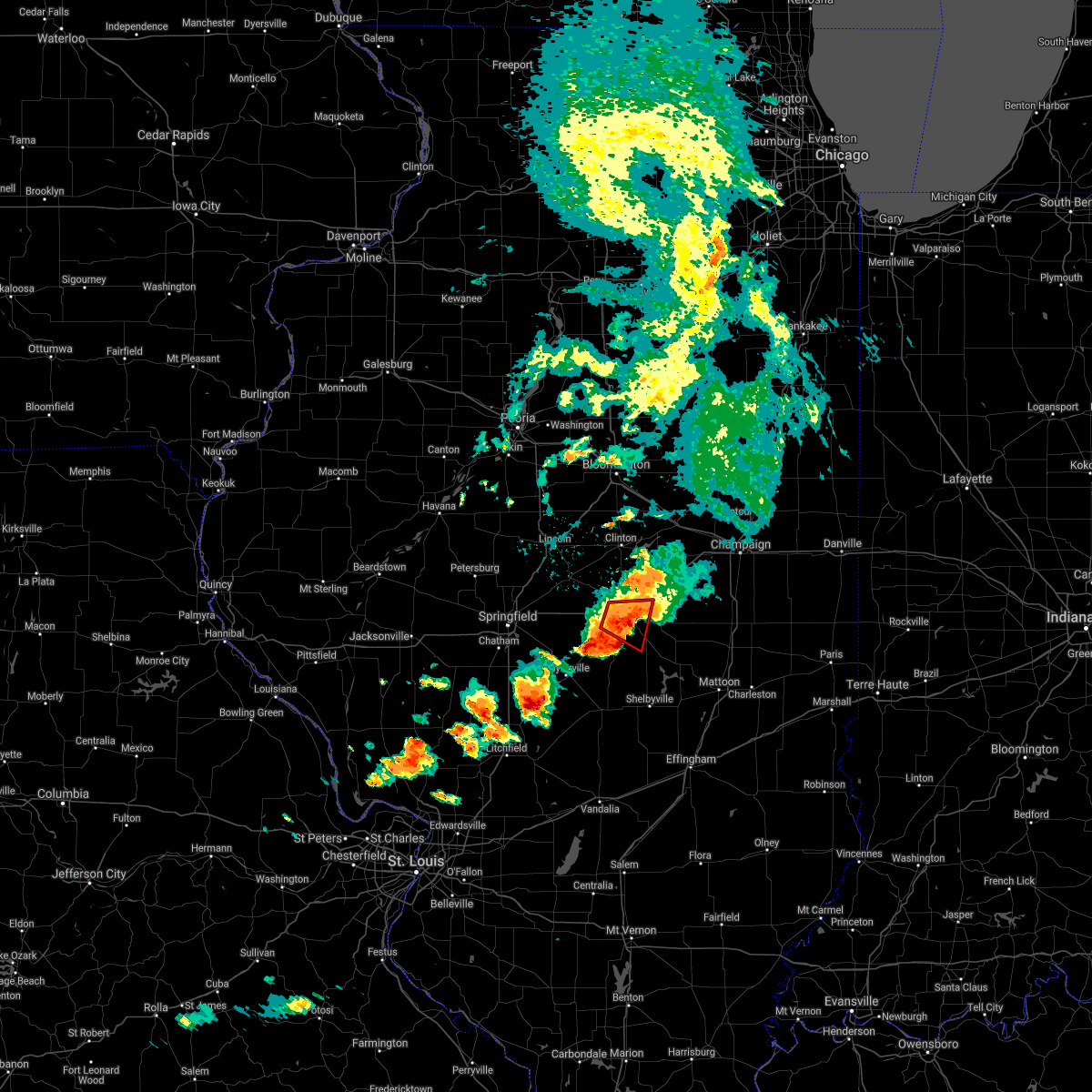 At 704 pm cdt, a confirmed tornado was located over mount zion, or near decatur, moving east at 30 mph (weather spotters confirmed tornado). Hazards include damaging tornado and golf ball size hail. Flying debris will be dangerous to those caught without shelter. mobile homes will be damaged or destroyed. damage to roofs, windows, and vehicles will occur. tree damage is likely. this tornadic thunderstorm will remain over mainly rural areas of southeastern macon county, including the following locations, boody, elwin, hervey city, decatur airport and oakley. This includes interstate 72 between mile markers 133 and 138. At 704 pm cdt, a confirmed tornado was located over mount zion, or near decatur, moving east at 30 mph (weather spotters confirmed tornado). Hazards include damaging tornado and golf ball size hail. Flying debris will be dangerous to those caught without shelter. mobile homes will be damaged or destroyed. damage to roofs, windows, and vehicles will occur. tree damage is likely. this tornadic thunderstorm will remain over mainly rural areas of southeastern macon county, including the following locations, boody, elwin, hervey city, decatur airport and oakley. This includes interstate 72 between mile markers 133 and 138.
|
| 5/3/2021 6:42 PM CDT |
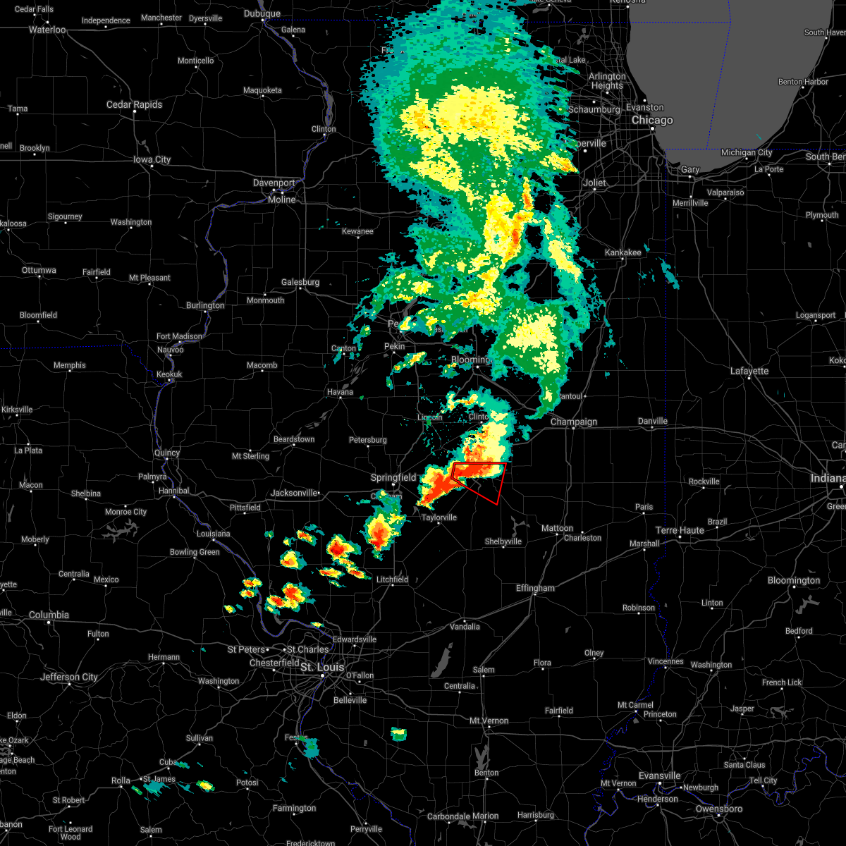 At 642 pm cdt, a confirmed tornado was located near harristown, or 9 miles west of decatur, moving east at 30 mph (weather spotters confirmed tornado). Hazards include damaging tornado and golf ball size hail. Flying debris will be dangerous to those caught without shelter. mobile homes will be damaged or destroyed. damage to roofs, windows, and vehicles will occur. tree damage is likely. the tornado will be near, harristown around 645 pm cdt. decatur around 650 pm cdt. mount zion and long creek around 705 pm cdt. other locations impacted by this tornadic thunderstorm include boody, elwin, hervey city, decatur airport and oakley. This includes interstate 72 between mile markers 127 and 144. At 642 pm cdt, a confirmed tornado was located near harristown, or 9 miles west of decatur, moving east at 30 mph (weather spotters confirmed tornado). Hazards include damaging tornado and golf ball size hail. Flying debris will be dangerous to those caught without shelter. mobile homes will be damaged or destroyed. damage to roofs, windows, and vehicles will occur. tree damage is likely. the tornado will be near, harristown around 645 pm cdt. decatur around 650 pm cdt. mount zion and long creek around 705 pm cdt. other locations impacted by this tornadic thunderstorm include boody, elwin, hervey city, decatur airport and oakley. This includes interstate 72 between mile markers 127 and 144.
|
| 8/10/2020 4:23 PM CDT | Storm damage reported in macon county IL, 3.9 miles WNW of Decatur, IL |
| 8/10/2020 4:10 PM CDT | 12 inch limb down. time estimated by rada in macon county IL, 0.5 miles NNW of Decatur, IL |
| 7/21/2020 5:14 PM CDT |
 At 514 pm cdt, a severe thunderstorm was located near long creek, or near decatur, moving northeast at 50 mph (radar indicated). Hazards include 60 mph wind gusts. expect damage to roofs, siding, and trees At 514 pm cdt, a severe thunderstorm was located near long creek, or near decatur, moving northeast at 50 mph (radar indicated). Hazards include 60 mph wind gusts. expect damage to roofs, siding, and trees
|
| 7/21/2020 5:10 PM CDT | Storm damage reported in macon county IL, 5.9 miles NW of Decatur, IL |
| 7/21/2020 5:00 PM CDT |
 At 500 pm cdt, severe thunderstorms were located along a line extending from near warrensburg to near moweaqua, moving east at 55 mph (radar indicated). Hazards include 60 mph wind gusts. Expect damage to roofs, siding, and trees. locations impacted include, decatur, mount zion, forsyth, moweaqua, harristown, long creek, macon, niantic, boody, hervey city, elwin and decatur airport. This includes interstate 72 between mile markers 128 and 144. At 500 pm cdt, severe thunderstorms were located along a line extending from near warrensburg to near moweaqua, moving east at 55 mph (radar indicated). Hazards include 60 mph wind gusts. Expect damage to roofs, siding, and trees. locations impacted include, decatur, mount zion, forsyth, moweaqua, harristown, long creek, macon, niantic, boody, hervey city, elwin and decatur airport. This includes interstate 72 between mile markers 128 and 144.
|
| 7/21/2020 4:39 PM CDT |
 At 438 pm cdt, severe thunderstorms were located along a line extending from near mechanicsburg to taylorville, moving east at 45 mph (radar indicated). Hazards include 60 mph wind gusts. expect damage to roofs, siding, and trees At 438 pm cdt, severe thunderstorms were located along a line extending from near mechanicsburg to taylorville, moving east at 45 mph (radar indicated). Hazards include 60 mph wind gusts. expect damage to roofs, siding, and trees
|
| 7/11/2020 10:25 PM CDT |
 The severe thunderstorm warning for piatt, central champaign and central macon counties will expire at 1030 pm cdt, the storms which prompted the warning have moved out of the area. therefore, the warning will be allowed to expire. a severe thunderstorm watch remains in effect until midnight cdt for central and east central illinois. The severe thunderstorm warning for piatt, central champaign and central macon counties will expire at 1030 pm cdt, the storms which prompted the warning have moved out of the area. therefore, the warning will be allowed to expire. a severe thunderstorm watch remains in effect until midnight cdt for central and east central illinois.
|
| 7/11/2020 10:11 PM CDT |
 At 1010 pm cdt, severe thunderstorms were located along a line extending from near rankin to pesotum to dalton city, moving southeast at 50 mph (radar indicated). Hazards include 60 mph wind gusts and quarter size hail. Hail damage to vehicles is expected. Expect wind damage to roofs, siding, and trees. At 1010 pm cdt, severe thunderstorms were located along a line extending from near rankin to pesotum to dalton city, moving southeast at 50 mph (radar indicated). Hazards include 60 mph wind gusts and quarter size hail. Hail damage to vehicles is expected. Expect wind damage to roofs, siding, and trees.
|
| 7/11/2020 10:00 PM CDT |
 At 959 pm cdt, severe thunderstorms were located along a line extending from near paxton to seymour to near harristown, moving southeast at 45 mph (radar indicated). Hazards include 60 mph wind gusts. Expect damage to roofs, siding, and trees. locations impacted include, champaign, decatur, rantoul, monticello, urbana, savoy, mahomet, mount zion, forsyth, fisher, bement, cerro gordo, harristown, long creek, warrensburg, thomasboro, gifford, argenta, oreana and niantic. this includes the following highways, interstate 57 between mile markers 226 and 257. interstate 72 between mile markers 129 and 182. Interstate 74 between mile markers 167 and 187. At 959 pm cdt, severe thunderstorms were located along a line extending from near paxton to seymour to near harristown, moving southeast at 45 mph (radar indicated). Hazards include 60 mph wind gusts. Expect damage to roofs, siding, and trees. locations impacted include, champaign, decatur, rantoul, monticello, urbana, savoy, mahomet, mount zion, forsyth, fisher, bement, cerro gordo, harristown, long creek, warrensburg, thomasboro, gifford, argenta, oreana and niantic. this includes the following highways, interstate 57 between mile markers 226 and 257. interstate 72 between mile markers 129 and 182. Interstate 74 between mile markers 167 and 187.
|
| 7/11/2020 9:50 PM CDT | Numerous trees and power lines down across tow in macon county IL, 0.5 miles NNW of Decatur, IL |
| 7/11/2020 9:23 PM CDT |
 At 923 pm cdt, severe thunderstorms were located along a line extending from 7 miles east of colfax to 6 miles west of farmer city to near mount pulaski, moving southeast at 45 mph (radar indicated). Hazards include 60 mph wind gusts. expect damage to roofs, siding, and trees At 923 pm cdt, severe thunderstorms were located along a line extending from 7 miles east of colfax to 6 miles west of farmer city to near mount pulaski, moving southeast at 45 mph (radar indicated). Hazards include 60 mph wind gusts. expect damage to roofs, siding, and trees
|
| 6/22/2020 5:10 PM CDT |
 The severe thunderstorm warning for eastern macon county will expire at 515 pm cdt, the storm which prompted the warning has weakened below severe limits, and no longer poses an immediate threat to life or property. therefore, the warning will be allowed to expire. however heavy rain is still possible with this thunderstorm. a severe thunderstorm watch remains in effect until 900 pm cdt for central illinois. The severe thunderstorm warning for eastern macon county will expire at 515 pm cdt, the storm which prompted the warning has weakened below severe limits, and no longer poses an immediate threat to life or property. therefore, the warning will be allowed to expire. however heavy rain is still possible with this thunderstorm. a severe thunderstorm watch remains in effect until 900 pm cdt for central illinois.
|
| 6/22/2020 4:53 PM CDT |
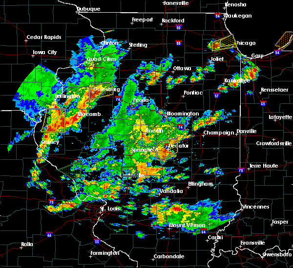 At 453 pm cdt, a severe thunderstorm was located over decatur, moving northeast at 25 mph (radar indicated). Hazards include 60 mph wind gusts. Expect damage to roofs, siding, and trees. locations impacted include, decatur, mount zion, forsyth, cerro gordo, harristown, long creek, macon, argenta, oreana, oakley, elwin, decatur airport and hervey city. This includes interstate 72 near mile marker 134, and between mile markers 139 and 155. At 453 pm cdt, a severe thunderstorm was located over decatur, moving northeast at 25 mph (radar indicated). Hazards include 60 mph wind gusts. Expect damage to roofs, siding, and trees. locations impacted include, decatur, mount zion, forsyth, cerro gordo, harristown, long creek, macon, argenta, oreana, oakley, elwin, decatur airport and hervey city. This includes interstate 72 near mile marker 134, and between mile markers 139 and 155.
|
| 6/22/2020 4:34 PM CDT |
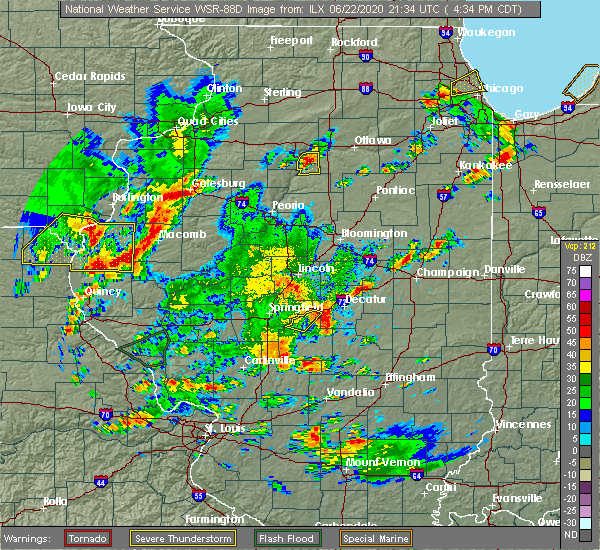 At 434 pm cdt, a severe thunderstorm was located near macon, or 9 miles southwest of decatur, moving northeast at 20 mph (radar indicated). Hazards include 60 mph wind gusts. expect damage to roofs, siding, and trees At 434 pm cdt, a severe thunderstorm was located near macon, or 9 miles southwest of decatur, moving northeast at 20 mph (radar indicated). Hazards include 60 mph wind gusts. expect damage to roofs, siding, and trees
|
| 6/22/2020 3:03 PM CDT |
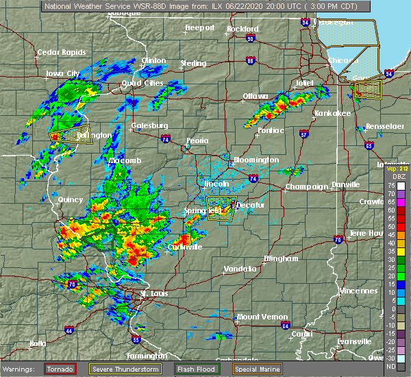 At 303 pm cdt, a severe thunderstorm was located near niantic, or 9 miles west of decatur, moving north at 20 mph (radar indicated). Hazards include 60 mph wind gusts. Expect damage to roofs, siding, and trees. locations impacted include, decatur, forsyth, maroa, mount pulaski, harristown, warrensburg, illiopolis, niantic and latham. This includes interstate 72 between mile markers 120 and 140. At 303 pm cdt, a severe thunderstorm was located near niantic, or 9 miles west of decatur, moving north at 20 mph (radar indicated). Hazards include 60 mph wind gusts. Expect damage to roofs, siding, and trees. locations impacted include, decatur, forsyth, maroa, mount pulaski, harristown, warrensburg, illiopolis, niantic and latham. This includes interstate 72 between mile markers 120 and 140.
|
| 6/22/2020 2:41 PM CDT |
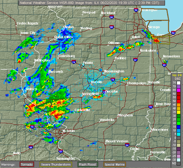 At 241 pm cdt, a severe thunderstorm was located near harristown, or 10 miles southwest of decatur, moving north at 20 mph (radar indicated). Hazards include 60 mph wind gusts and quarter size hail. Hail damage to vehicles is expected. Expect wind damage to roofs, siding, and trees. At 241 pm cdt, a severe thunderstorm was located near harristown, or 10 miles southwest of decatur, moving north at 20 mph (radar indicated). Hazards include 60 mph wind gusts and quarter size hail. Hail damage to vehicles is expected. Expect wind damage to roofs, siding, and trees.
|
| 5/17/2020 4:21 PM CDT |
 At 421 pm cdt, a confirmed tornado was located over decatur, moving northeast at 30 mph (weather spotters confirmed tornado). Hazards include damaging tornado. Flying debris will be dangerous to those caught without shelter. mobile homes will be damaged or destroyed. damage to roofs, windows, and vehicles will occur. tree damage is likely. This tornadic thunderstorm will remain over mainly rural areas of southeastern macon county. At 421 pm cdt, a confirmed tornado was located over decatur, moving northeast at 30 mph (weather spotters confirmed tornado). Hazards include damaging tornado. Flying debris will be dangerous to those caught without shelter. mobile homes will be damaged or destroyed. damage to roofs, windows, and vehicles will occur. tree damage is likely. This tornadic thunderstorm will remain over mainly rural areas of southeastern macon county.
|
| 5/17/2020 4:09 PM CDT |
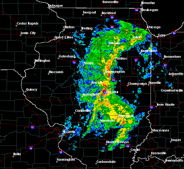 At 409 pm cdt, a severe thunderstorm capable of producing a tornado was located over macon, or 7 miles south of decatur, moving northeast at 20 mph (radar indicated rotation). Hazards include tornado. Flying debris will be dangerous to those caught without shelter. mobile homes will be damaged or destroyed. damage to roofs, windows, and vehicles will occur. tree damage is likely. this dangerous storm will be near, mount zion around 425 pm cdt. long creek around 430 pm cdt. decatur around 435 pm cdt. Other locations impacted by this tornadic thunderstorm include elwin. At 409 pm cdt, a severe thunderstorm capable of producing a tornado was located over macon, or 7 miles south of decatur, moving northeast at 20 mph (radar indicated rotation). Hazards include tornado. Flying debris will be dangerous to those caught without shelter. mobile homes will be damaged or destroyed. damage to roofs, windows, and vehicles will occur. tree damage is likely. this dangerous storm will be near, mount zion around 425 pm cdt. long creek around 430 pm cdt. decatur around 435 pm cdt. Other locations impacted by this tornadic thunderstorm include elwin.
|
| 5/2/2020 10:01 PM CDT |
 At 1000 pm cdt, a severe thunderstorm was located 5 miles southeast of mount auburn, or 13 miles southwest of decatur, moving east at 45 mph (radar indicated). Hazards include 60 mph wind gusts and quarter size hail. Hail damage to vehicles is expected. expect wind damage to roofs, siding, and trees. locations impacted include, decatur, mount zion, moweaqua, harristown, long creek, blue mound, macon, stonington, niantic, mount auburn, boody, elwin, decatur airport and hervey city. This includes interstate 72 between mile markers 127 and 134. At 1000 pm cdt, a severe thunderstorm was located 5 miles southeast of mount auburn, or 13 miles southwest of decatur, moving east at 45 mph (radar indicated). Hazards include 60 mph wind gusts and quarter size hail. Hail damage to vehicles is expected. expect wind damage to roofs, siding, and trees. locations impacted include, decatur, mount zion, moweaqua, harristown, long creek, blue mound, macon, stonington, niantic, mount auburn, boody, elwin, decatur airport and hervey city. This includes interstate 72 between mile markers 127 and 134.
|
| 5/2/2020 9:49 PM CDT |
 At 948 pm cdt, a severe thunderstorm was located near mechanicsburg, or 16 miles east of springfield, moving east at 45 mph (radar indicated). Hazards include 60 mph wind gusts and quarter size hail. Hail damage to vehicles is expected. expect wind damage to roofs, siding, and trees. locations impacted include, decatur, mount zion, rochester, moweaqua, harristown, long creek, blue mound, macon, edinburg, stonington, illiopolis, niantic, mechanicsburg, mount auburn, dawson, buffalo, berry, boody, elwin and decatur airport. This includes interstate 72 between mile markers 111 and 134. At 948 pm cdt, a severe thunderstorm was located near mechanicsburg, or 16 miles east of springfield, moving east at 45 mph (radar indicated). Hazards include 60 mph wind gusts and quarter size hail. Hail damage to vehicles is expected. expect wind damage to roofs, siding, and trees. locations impacted include, decatur, mount zion, rochester, moweaqua, harristown, long creek, blue mound, macon, edinburg, stonington, illiopolis, niantic, mechanicsburg, mount auburn, dawson, buffalo, berry, boody, elwin and decatur airport. This includes interstate 72 between mile markers 111 and 134.
|
| 5/2/2020 9:38 PM CDT |
 At 936 pm cdt, a severe thunderstorm was located near rochester, moving east at 45 mph (radar indicated. at 935 pm, 50 mph wind gusts were reported near the north edge of lake springfield, and nickel size hail occurred as the storm passed through downtown springfield). Hazards include 60 mph wind gusts and quarter size hail. Hail damage to vehicles is expected. Expect wind damage to roofs, siding, and trees. At 936 pm cdt, a severe thunderstorm was located near rochester, moving east at 45 mph (radar indicated. at 935 pm, 50 mph wind gusts were reported near the north edge of lake springfield, and nickel size hail occurred as the storm passed through downtown springfield). Hazards include 60 mph wind gusts and quarter size hail. Hail damage to vehicles is expected. Expect wind damage to roofs, siding, and trees.
|
| 4/28/2020 8:00 PM CDT |
 At 759 pm cdt, a severe thunderstorm was located near macon, or 9 miles south of decatur, moving east at 30 mph (radar indicated). Hazards include 60 mph wind gusts. expect damage to roofs, siding, and trees At 759 pm cdt, a severe thunderstorm was located near macon, or 9 miles south of decatur, moving east at 30 mph (radar indicated). Hazards include 60 mph wind gusts. expect damage to roofs, siding, and trees
|
| 4/28/2020 7:41 PM CDT |
 At 740 pm cdt, a severe thunderstorm was located near macon, or 7 miles southwest of decatur, moving east at 35 mph (radar indicated). Hazards include 60 mph wind gusts. Expect damage to roofs, siding, and trees. locations impacted include, decatur, taylorville, moweaqua, harristown, blue mound, macon, stonington, illiopolis, niantic, boody, willeys and elwin. This includes interstate 72 between mile markers 123 and 135. At 740 pm cdt, a severe thunderstorm was located near macon, or 7 miles southwest of decatur, moving east at 35 mph (radar indicated). Hazards include 60 mph wind gusts. Expect damage to roofs, siding, and trees. locations impacted include, decatur, taylorville, moweaqua, harristown, blue mound, macon, stonington, illiopolis, niantic, boody, willeys and elwin. This includes interstate 72 between mile markers 123 and 135.
|
| 4/28/2020 7:07 PM CDT |
 At 707 pm cdt, a severe thunderstorm was located over mechanicsburg, or 14 miles east of springfield, moving east at 35 mph (radar indicated). Hazards include 60 mph wind gusts. expect damage to roofs, siding, and trees At 707 pm cdt, a severe thunderstorm was located over mechanicsburg, or 14 miles east of springfield, moving east at 35 mph (radar indicated). Hazards include 60 mph wind gusts. expect damage to roofs, siding, and trees
|
| 4/8/2020 6:17 PM CDT |
 At 614 pm cdt, severe thunderstorms were located along a line extending from near white heath to near mount zion to near jeisyville, moving east at 45 mph (radar indicated). Hazards include 70 mph wind gusts and quarter size hail. Hail damage to vehicles is expected. expect considerable tree damage. wind damage is also likely to mobile homes, roofs, and outbuildings. locations impacted include, decatur, taylorville, tuscola, sullivan, mount zion, tolono, villa grove, arthur, moweaqua, bement, kincaid, cerro gordo, bethany, long creek, atwood, assumption, blue mound, macon, lovington and morrisonville. This includes interstate 57 between mile markers 208 and 226. At 614 pm cdt, severe thunderstorms were located along a line extending from near white heath to near mount zion to near jeisyville, moving east at 45 mph (radar indicated). Hazards include 70 mph wind gusts and quarter size hail. Hail damage to vehicles is expected. expect considerable tree damage. wind damage is also likely to mobile homes, roofs, and outbuildings. locations impacted include, decatur, taylorville, tuscola, sullivan, mount zion, tolono, villa grove, arthur, moweaqua, bement, kincaid, cerro gordo, bethany, long creek, atwood, assumption, blue mound, macon, lovington and morrisonville. This includes interstate 57 between mile markers 208 and 226.
|
| 4/8/2020 5:56 PM CDT |
 At 556 pm cdt, severe thunderstorms were located along a line extending from near monticello to near macon to near pawnee, moving east at 45 mph (radar indicated). Hazards include 70 mph wind gusts and quarter size hail. Hail damage to vehicles is expected. expect considerable tree damage. Wind damage is also likely to mobile homes, roofs, and outbuildings. At 556 pm cdt, severe thunderstorms were located along a line extending from near monticello to near macon to near pawnee, moving east at 45 mph (radar indicated). Hazards include 70 mph wind gusts and quarter size hail. Hail damage to vehicles is expected. expect considerable tree damage. Wind damage is also likely to mobile homes, roofs, and outbuildings.
|
| 4/8/2020 5:55 PM CDT | A 66 mph gust was observed at the decatur airpor in macon county IL, 0.5 miles NNW of Decatur, IL |
| 4/8/2020 5:55 PM CDT | A 66 mph gust was observed at the decatur airpor in macon county IL, 0.5 miles NNW of Decatur, IL |
| 4/8/2020 5:54 PM CDT | Thunderstorm wind gust at decatur airport of 60 mph at 554p in macon county IL, 0.5 miles NNW of Decatur, IL |
| 4/8/2020 5:54 PM CDT | Thunderstorm wind gust at decatur airport of 60 mph at 554p in macon county IL, 0.5 miles NNW of Decatur, IL |
| 4/8/2020 5:44 PM CDT |
 At 543 pm cdt, a severe thunderstorm was located over niantic, or 11 miles west of decatur, moving east at 50 mph (radar indicated). Hazards include 70 mph wind gusts and quarter size hail. Hail damage to vehicles is expected. expect considerable tree damage. wind damage is also likely to mobile homes, roofs, and outbuildings. locations impacted include, springfield, decatur, sherman, rochester, forsyth, riverton, harristown, warrensburg, blue mound, stonington, illiopolis, niantic, mechanicsburg, mount auburn, grandview, spaulding, dawson, buffalo, clear lake and boody. this includes the following highways, interstate 55 between mile markers 96 and 105. Interstate 72 between mile markers 102 and 141. At 543 pm cdt, a severe thunderstorm was located over niantic, or 11 miles west of decatur, moving east at 50 mph (radar indicated). Hazards include 70 mph wind gusts and quarter size hail. Hail damage to vehicles is expected. expect considerable tree damage. wind damage is also likely to mobile homes, roofs, and outbuildings. locations impacted include, springfield, decatur, sherman, rochester, forsyth, riverton, harristown, warrensburg, blue mound, stonington, illiopolis, niantic, mechanicsburg, mount auburn, grandview, spaulding, dawson, buffalo, clear lake and boody. this includes the following highways, interstate 55 between mile markers 96 and 105. Interstate 72 between mile markers 102 and 141.
|
| 4/8/2020 5:37 PM CDT |
 At 536 pm cdt, a severe thunderstorm was located near maroa, or 10 miles north of decatur, moving southeast at 70 mph. this is a very dangerous storm (radar indicated). Hazards include 80 mph wind gusts and quarter size hail. Flying debris will be dangerous to those caught without shelter. mobile homes will be heavily damaged. expect considerable damage to roofs, windows, and vehicles. extensive tree damage and power outages are likely. locations impacted include, decatur, clinton, monticello, mount zion, forsyth, maroa, mount pulaski, cerro gordo, harristown, long creek, warrensburg, argenta, mansfield, oreana, wapella, de land, weldon, latham, kenney and chestnut. This includes interstate 72 between mile markers 134 and 168. At 536 pm cdt, a severe thunderstorm was located near maroa, or 10 miles north of decatur, moving southeast at 70 mph. this is a very dangerous storm (radar indicated). Hazards include 80 mph wind gusts and quarter size hail. Flying debris will be dangerous to those caught without shelter. mobile homes will be heavily damaged. expect considerable damage to roofs, windows, and vehicles. extensive tree damage and power outages are likely. locations impacted include, decatur, clinton, monticello, mount zion, forsyth, maroa, mount pulaski, cerro gordo, harristown, long creek, warrensburg, argenta, mansfield, oreana, wapella, de land, weldon, latham, kenney and chestnut. This includes interstate 72 between mile markers 134 and 168.
|
| 4/8/2020 5:16 PM CDT |
 At 515 pm cdt, a severe thunderstorm was located near hartsburg, or near lincoln, moving east at 65 mph. this is a very dangerous storm (radar indicated). Hazards include 80 mph wind gusts and golf ball size hail. Flying debris will be dangerous to those caught without shelter. mobile homes will be heavily damaged. expect considerable damage to roofs, windows, and vehicles. Extensive tree damage and power outages are likely. At 515 pm cdt, a severe thunderstorm was located near hartsburg, or near lincoln, moving east at 65 mph. this is a very dangerous storm (radar indicated). Hazards include 80 mph wind gusts and golf ball size hail. Flying debris will be dangerous to those caught without shelter. mobile homes will be heavily damaged. expect considerable damage to roofs, windows, and vehicles. Extensive tree damage and power outages are likely.
|
| 4/8/2020 5:10 PM CDT |
 At 509 pm cdt, a severe thunderstorm was located over athens, or 10 miles north of springfield, moving east at 50 mph (radar indicated). Hazards include ping pong ball size hail and 60 mph wind gusts. People and animals outdoors will be injured. expect hail damage to roofs, siding, windows, and vehicles. Expect wind damage to roofs, siding, and trees. At 509 pm cdt, a severe thunderstorm was located over athens, or 10 miles north of springfield, moving east at 50 mph (radar indicated). Hazards include ping pong ball size hail and 60 mph wind gusts. People and animals outdoors will be injured. expect hail damage to roofs, siding, windows, and vehicles. Expect wind damage to roofs, siding, and trees.
|
| 3/28/2020 12:13 PM CDT |
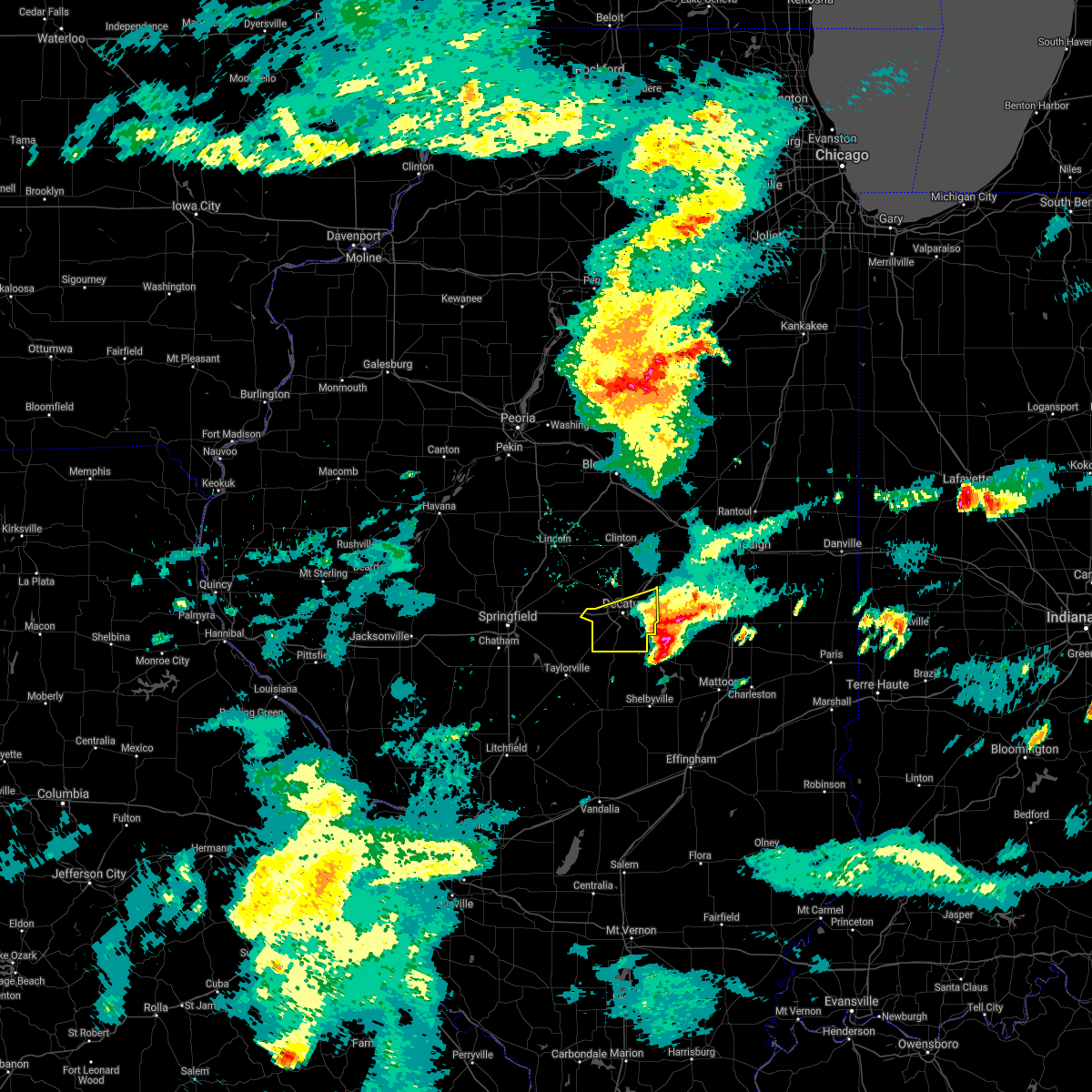 The severe thunderstorm warning for southern macon county will expire at 1215 pm cdt, the storm which prompted the warning has moved out of the area. therefore, the warning will be allowed to expire. The severe thunderstorm warning for southern macon county will expire at 1215 pm cdt, the storm which prompted the warning has moved out of the area. therefore, the warning will be allowed to expire.
|
| 3/28/2020 11:34 AM CDT |
 At 1133 am cdt, a severe thunderstorm was located over blue mound, or 12 miles southwest of decatur, moving east at 45 mph (law enforcement). Hazards include golf ball size hail. People and animals outdoors will be injured. Expect damage to roofs, siding, windows, and vehicles. At 1133 am cdt, a severe thunderstorm was located over blue mound, or 12 miles southwest of decatur, moving east at 45 mph (law enforcement). Hazards include golf ball size hail. People and animals outdoors will be injured. Expect damage to roofs, siding, windows, and vehicles.
|
| 9/29/2019 7:04 PM CDT |
 At 703 pm cdt, a severe thunderstorm was located near oakley, or 7 miles east of decatur, moving east at 25 mph (radar indicated). Hazards include 60 mph wind gusts and quarter size hail. Hail damage to vehicles is expected. Expect wind damage to roofs, siding, and trees. At 703 pm cdt, a severe thunderstorm was located near oakley, or 7 miles east of decatur, moving east at 25 mph (radar indicated). Hazards include 60 mph wind gusts and quarter size hail. Hail damage to vehicles is expected. Expect wind damage to roofs, siding, and trees.
|
| 8/20/2019 10:48 AM CDT |
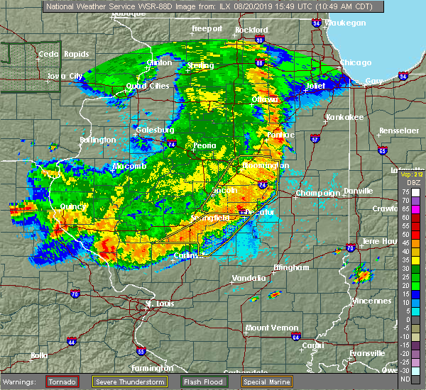 A severe thunderstorm warning remains in effect until 1100 am cdt for northern piatt. eastern de witt. southeastern mclean and northeastern macon counties. At 1048 am cdt, severe thunderstorms were located along a line extending from 7 miles south of fairbury to near weldon to forsyth, moving east at 50 mph. A severe thunderstorm warning remains in effect until 1100 am cdt for northern piatt. eastern de witt. southeastern mclean and northeastern macon counties. At 1048 am cdt, severe thunderstorms were located along a line extending from 7 miles south of fairbury to near weldon to forsyth, moving east at 50 mph.
|
| 8/20/2019 10:46 AM CDT |
 At 1046 am cdt, severe thunderstorms were located along a line extending from near decatur to near stonington to near girard, moving east at 50 mph (radar indicated). Hazards include 70 mph wind gusts and quarter size hail. Hail damage to vehicles is expected. expect considerable tree damage. wind damage is also likely to mobile homes, roofs, and outbuildings. locations impacted include, decatur, taylorville, mount zion, kincaid, harristown, blue mound, macon, morrisonville, stonington, jeisyville, palmer, boody, willeys, sharpsburg, elwin, decatur airport and taylorville airport. This includes interstate 72 between mile markers 132 and 135. At 1046 am cdt, severe thunderstorms were located along a line extending from near decatur to near stonington to near girard, moving east at 50 mph (radar indicated). Hazards include 70 mph wind gusts and quarter size hail. Hail damage to vehicles is expected. expect considerable tree damage. wind damage is also likely to mobile homes, roofs, and outbuildings. locations impacted include, decatur, taylorville, mount zion, kincaid, harristown, blue mound, macon, morrisonville, stonington, jeisyville, palmer, boody, willeys, sharpsburg, elwin, decatur airport and taylorville airport. This includes interstate 72 between mile markers 132 and 135.
|
| 8/20/2019 10:45 AM CDT | Tree limbs down. reported by off-duty nws employee. delayed repor in macon county IL, 0.5 miles NNW of Decatur, IL |
| 8/20/2019 10:42 AM CDT |
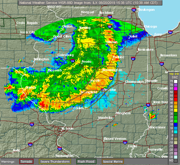 At 1042 am cdt, severe thunderstorms were located along a line extending from 7 miles east of colfax to near de land to near moweaqua, moving east at 50 mph (radar indicated). Hazards include 70 mph wind gusts and quarter size hail. Hail damage to vehicles is expected. expect considerable tree damage. Wind damage is also likely to mobile homes, roofs, and outbuildings. At 1042 am cdt, severe thunderstorms were located along a line extending from 7 miles east of colfax to near de land to near moweaqua, moving east at 50 mph (radar indicated). Hazards include 70 mph wind gusts and quarter size hail. Hail damage to vehicles is expected. expect considerable tree damage. Wind damage is also likely to mobile homes, roofs, and outbuildings.
|
| 8/20/2019 10:31 AM CDT |
 At 1030 am cdt, severe thunderstorms were located along a line extending from near lexington to wapella to near latham, moving east at 45 mph (radar indicated). Hazards include 60 mph wind gusts and quarter size hail. Hail damage to vehicles is expected. expect wind damage to roofs, siding, and trees. locations impacted include, bloomington, decatur, clinton, normal, le roy, forsyth, heyworth, lexington, farmer city, maroa, mount pulaski, warrensburg, colfax, downs, argenta, mansfield, oreana, saybrook, wapella and towanda. this includes the following highways, interstate 55 between mile markers 169 and 181. interstate 72 between mile markers 139 and 161. Interstate 74 between mile markers 135 and 166. At 1030 am cdt, severe thunderstorms were located along a line extending from near lexington to wapella to near latham, moving east at 45 mph (radar indicated). Hazards include 60 mph wind gusts and quarter size hail. Hail damage to vehicles is expected. expect wind damage to roofs, siding, and trees. locations impacted include, bloomington, decatur, clinton, normal, le roy, forsyth, heyworth, lexington, farmer city, maroa, mount pulaski, warrensburg, colfax, downs, argenta, mansfield, oreana, saybrook, wapella and towanda. this includes the following highways, interstate 55 between mile markers 169 and 181. interstate 72 between mile markers 139 and 161. Interstate 74 between mile markers 135 and 166.
|
| 8/20/2019 10:17 AM CDT |
 At 1016 am cdt, severe thunderstorms were located along a line extending from near cornland to rochester to near palmyra, moving east at 55 mph (radar indicated). Hazards include 70 mph wind gusts and quarter size hail. Hail damage to vehicles is expected. expect considerable tree damage. Wind damage is also likely to mobile homes, roofs, and outbuildings. At 1016 am cdt, severe thunderstorms were located along a line extending from near cornland to rochester to near palmyra, moving east at 55 mph (radar indicated). Hazards include 70 mph wind gusts and quarter size hail. Hail damage to vehicles is expected. expect considerable tree damage. Wind damage is also likely to mobile homes, roofs, and outbuildings.
|
| 8/20/2019 10:06 AM CDT |
 At 1005 am cdt, severe thunderstorms were located along a line extending from hudson to near atlanta to elkhart, moving east at 35 mph (radar indicated). Hazards include 60 mph wind gusts and quarter size hail. Hail damage to vehicles is expected. Expect wind damage to roofs, siding, and trees. At 1005 am cdt, severe thunderstorms were located along a line extending from hudson to near atlanta to elkhart, moving east at 35 mph (radar indicated). Hazards include 60 mph wind gusts and quarter size hail. Hail damage to vehicles is expected. Expect wind damage to roofs, siding, and trees.
|
| 8/12/2019 9:29 PM CDT |
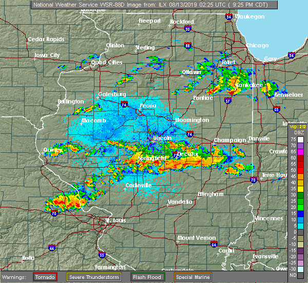 At 929 pm cdt, a severe thunderstorm was located near dalton city, or 11 miles south of decatur, moving east at 25 mph (radar indicated). Hazards include 60 mph wind gusts and quarter size hail. Hail damage to vehicles is expected. expect wind damage to roofs, siding, and trees. Locations impacted include, decatur, mount zion, long creek, macon, boody, hervey city and elwin. At 929 pm cdt, a severe thunderstorm was located near dalton city, or 11 miles south of decatur, moving east at 25 mph (radar indicated). Hazards include 60 mph wind gusts and quarter size hail. Hail damage to vehicles is expected. expect wind damage to roofs, siding, and trees. Locations impacted include, decatur, mount zion, long creek, macon, boody, hervey city and elwin.
|
| 8/12/2019 8:52 PM CDT |
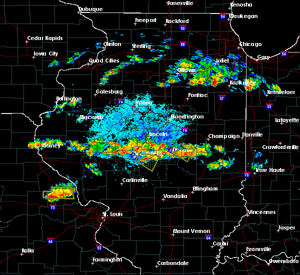 At 852 pm cdt, a severe thunderstorm was located near harristown, or 9 miles west of decatur, moving southeast at 20 mph (radar indicated). Hazards include 60 mph wind gusts and quarter size hail. Hail damage to vehicles is expected. Expect wind damage to roofs, siding, and trees. At 852 pm cdt, a severe thunderstorm was located near harristown, or 9 miles west of decatur, moving southeast at 20 mph (radar indicated). Hazards include 60 mph wind gusts and quarter size hail. Hail damage to vehicles is expected. Expect wind damage to roofs, siding, and trees.
|
| 8/12/2019 8:39 PM CDT |
 At 839 pm cdt, a severe thunderstorm was located near cerro gordo, or 11 miles east of decatur, moving east at 20 mph (radar indicated). Hazards include 60 mph wind gusts and quarter size hail. Hail damage to vehicles is expected. expect wind damage to roofs, siding, and trees. Locations impacted include, decatur, bement, cerro gordo, long creek, lovington, hammond, oakley, milmine, la place, lake city and decatur airport. At 839 pm cdt, a severe thunderstorm was located near cerro gordo, or 11 miles east of decatur, moving east at 20 mph (radar indicated). Hazards include 60 mph wind gusts and quarter size hail. Hail damage to vehicles is expected. expect wind damage to roofs, siding, and trees. Locations impacted include, decatur, bement, cerro gordo, long creek, lovington, hammond, oakley, milmine, la place, lake city and decatur airport.
|
| 8/12/2019 8:22 PM CDT |
 The national weather service in lincoln has issued a * severe thunderstorm warning for. north central moultrie county in central illinois. southern piatt county in central illinois. east central macon county in central illinois. Until 900 pm cdt. The national weather service in lincoln has issued a * severe thunderstorm warning for. north central moultrie county in central illinois. southern piatt county in central illinois. east central macon county in central illinois. Until 900 pm cdt.
|
| 6/30/2019 4:58 PM CDT | Storm damage reported in macon county IL, 5.9 miles NW of Decatur, IL |
| 5/26/2019 1:01 AM CDT |
 At 101 am cdt, severe thunderstorms were located along a line extending from near weldon to cerro gordo, moving east at 45 mph (radar indicated. at 1252 am, a 52 mph wind gust was reported at the decatur airport). Hazards include 60 mph wind gusts and nickel size hail. Expect damage to roofs, siding, and trees. locations impacted include, monticello, farmer city, bement, cerro gordo, long creek, atwood, argenta, mansfield, oreana, hammond, de land, weldon, white heath, oakley, ivesdale, cisco, de witt, lane and clinton lake dam. this includes the following highways, interstate 72 between mile markers 146 and 173. Interstate 74 between mile markers 156 and 168. At 101 am cdt, severe thunderstorms were located along a line extending from near weldon to cerro gordo, moving east at 45 mph (radar indicated. at 1252 am, a 52 mph wind gust was reported at the decatur airport). Hazards include 60 mph wind gusts and nickel size hail. Expect damage to roofs, siding, and trees. locations impacted include, monticello, farmer city, bement, cerro gordo, long creek, atwood, argenta, mansfield, oreana, hammond, de land, weldon, white heath, oakley, ivesdale, cisco, de witt, lane and clinton lake dam. this includes the following highways, interstate 72 between mile markers 146 and 173. Interstate 74 between mile markers 156 and 168.
|
| 5/26/2019 12:50 AM CDT |
 At 1250 am cdt, severe thunderstorms were located along a line extending from 6 miles northwest of weldon to near oreana, moving east at 45 mph (radar indicated). Hazards include 60 mph wind gusts and nickel size hail. expect damage to roofs, siding, and trees At 1250 am cdt, severe thunderstorms were located along a line extending from 6 miles northwest of weldon to near oreana, moving east at 45 mph (radar indicated). Hazards include 60 mph wind gusts and nickel size hail. expect damage to roofs, siding, and trees
|
| 5/26/2019 12:45 AM CDT | Tree down on a house in macon county IL, 0.5 miles NNW of Decatur, IL |
| 5/23/2019 1:48 AM CDT |
 At 146 am cdt, a severe thunderstorm was located over arthur to pana, moving east at 35 mph (radar indicated). Hazards include 60 mph wind gusts. brief tornados are possible with this storm. Expect damage to roofs, siding, and trees. locations impacted include, decatur, taylorville, shelbyville, tuscola, sullivan, pana, mount zion, arcola, villa grove, arthur, moweaqua, cerro gordo, bethany, long creek, atwood, assumption, macon, lovington, morrisonville and stonington. This includes interstate 57 between mile markers 204 and 217. At 146 am cdt, a severe thunderstorm was located over arthur to pana, moving east at 35 mph (radar indicated). Hazards include 60 mph wind gusts. brief tornados are possible with this storm. Expect damage to roofs, siding, and trees. locations impacted include, decatur, taylorville, shelbyville, tuscola, sullivan, pana, mount zion, arcola, villa grove, arthur, moweaqua, cerro gordo, bethany, long creek, atwood, assumption, macon, lovington, morrisonville and stonington. This includes interstate 57 between mile markers 204 and 217.
|
| 5/23/2019 1:25 AM CDT |
 At 125 am cdt, a severe thunderstorm was located near dalton city, or 12 miles northwest of sullivan, moving east at 35 mph (radar indicated). Hazards include 60 mph wind gusts. expect damage to roofs, siding, and trees At 125 am cdt, a severe thunderstorm was located near dalton city, or 12 miles northwest of sullivan, moving east at 35 mph (radar indicated). Hazards include 60 mph wind gusts. expect damage to roofs, siding, and trees
|
| 5/23/2019 1:17 AM CDT |
 At 116 am cdt, a severe thunderstorm was located over mount zion, or 8 miles southeast of decatur, moving east at 45 mph (radar indicated). Hazards include 60 mph wind gusts. Expect damage to roofs, siding, and trees. locations impacted include, decatur, taylorville, mount zion, moweaqua, cerro gordo, harristown, bethany, long creek, assumption, blue mound, macon, stonington, findlay, dalton city, westervelt, oakley, owaneco, boody, willeys and elwin. This includes interstate 72 between mile markers 142 and 146. At 116 am cdt, a severe thunderstorm was located over mount zion, or 8 miles southeast of decatur, moving east at 45 mph (radar indicated). Hazards include 60 mph wind gusts. Expect damage to roofs, siding, and trees. locations impacted include, decatur, taylorville, mount zion, moweaqua, cerro gordo, harristown, bethany, long creek, assumption, blue mound, macon, stonington, findlay, dalton city, westervelt, oakley, owaneco, boody, willeys and elwin. This includes interstate 72 between mile markers 142 and 146.
|
| 5/23/2019 1:13 AM CDT |
 At 113 am cdt, a severe thunderstorm was located near monticello, moving east at 55 mph (radar indicated). Hazards include 70 mph wind gusts and quarter size hail. brief tornados are possible with this storm. Hail damage to vehicles is expected. expect considerable tree damage. Wind damage is also likely to mobile homes, roofs, and outbuildings. At 113 am cdt, a severe thunderstorm was located near monticello, moving east at 55 mph (radar indicated). Hazards include 70 mph wind gusts and quarter size hail. brief tornados are possible with this storm. Hail damage to vehicles is expected. expect considerable tree damage. Wind damage is also likely to mobile homes, roofs, and outbuildings.
|
| 5/23/2019 1:05 AM CDT | Trees down on a house on harper avenu in macon county IL, 0.5 miles NNW of Decatur, IL |
| 5/23/2019 12:44 AM CDT |
 At 1244 am cdt, a severe thunderstorm was located near mount auburn, or 14 miles north of taylorville, moving east at 45 mph (radar indicated). Hazards include 60 mph wind gusts. several brief tornados are possible with this storm. expect damage to roofs, siding, and trees At 1244 am cdt, a severe thunderstorm was located near mount auburn, or 14 miles north of taylorville, moving east at 45 mph (radar indicated). Hazards include 60 mph wind gusts. several brief tornados are possible with this storm. expect damage to roofs, siding, and trees
|
| 5/8/2019 8:55 PM CDT | Semi trailer blown over. relayed via wand-t in macon county IL, 7.1 miles S of Decatur, IL |
| 12/1/2018 6:13 PM CST |
 At 612 pm cst, a severe thunderstorm capable of producing a tornado was located over warrensburg, or near decatur, moving northeast at 35 mph (radar indicated rotation). Hazards include tornado and quarter size hail. Flying debris will be dangerous to those caught without shelter. mobile homes will be damaged or destroyed. damage to roofs, windows, and vehicles will occur. tree damage is likely. this dangerous storm will be near, forsyth around 620 pm cst. maroa around 630 pm cst. other locations impacted by this tornadic thunderstorm include rowell. This includes interstate 72 between mile markers 133 and 142. At 612 pm cst, a severe thunderstorm capable of producing a tornado was located over warrensburg, or near decatur, moving northeast at 35 mph (radar indicated rotation). Hazards include tornado and quarter size hail. Flying debris will be dangerous to those caught without shelter. mobile homes will be damaged or destroyed. damage to roofs, windows, and vehicles will occur. tree damage is likely. this dangerous storm will be near, forsyth around 620 pm cst. maroa around 630 pm cst. other locations impacted by this tornadic thunderstorm include rowell. This includes interstate 72 between mile markers 133 and 142.
|
| 12/1/2018 5:43 PM CST |
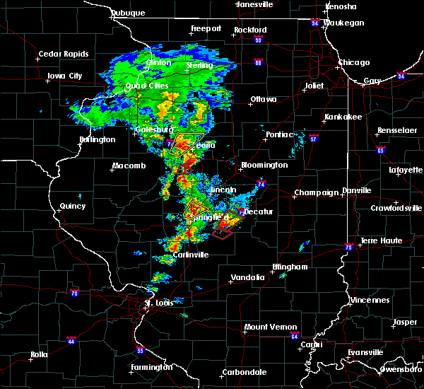 At 543 pm cst, a confirmed large and extremely dangerous tornado was located near blue mound, or 13 miles north of taylorville, moving northeast at 30 mph. this is a particularly dangerous situation. take cover now! (radar confirmed tornado). Hazards include damaging tornado. You are in a life-threatening situation. flying debris may be deadly to those caught without shelter. mobile homes will be destroyed. considerable damage to homes, businesses, and vehicles is likely and complete destruction is possible. the tornado will be near, harristown and niantic around 605 pm cst. decatur around 615 pm cst. other locations impacted by this tornadic thunderstorm include boody. This includes interstate 72 between mile markers 126 and 138. At 543 pm cst, a confirmed large and extremely dangerous tornado was located near blue mound, or 13 miles north of taylorville, moving northeast at 30 mph. this is a particularly dangerous situation. take cover now! (radar confirmed tornado). Hazards include damaging tornado. You are in a life-threatening situation. flying debris may be deadly to those caught without shelter. mobile homes will be destroyed. considerable damage to homes, businesses, and vehicles is likely and complete destruction is possible. the tornado will be near, harristown and niantic around 605 pm cst. decatur around 615 pm cst. other locations impacted by this tornadic thunderstorm include boody. This includes interstate 72 between mile markers 126 and 138.
|
| 8/7/2018 2:13 AM CDT |
 At 212 am cdt, severe thunderstorms were located along a line extending from near bloomington to atlanta to near beason to near cornland, moving east at 35 mph (radar indicated). Hazards include 60 mph wind gusts and nickel size hail. expect damage to roofs, siding, and trees At 212 am cdt, severe thunderstorms were located along a line extending from near bloomington to atlanta to near beason to near cornland, moving east at 35 mph (radar indicated). Hazards include 60 mph wind gusts and nickel size hail. expect damage to roofs, siding, and trees
|
| 6/28/2018 5:35 PM CDT |
 At 535 pm cdt, severe thunderstorms were located along a line extending from mount zion to near assumption to near pana, moving east at 50 mph (radar indicated). Hazards include 70 mph wind gusts. Expect considerable tree damage. damage is likely to mobile homes, roofs, and outbuildings. locations impacted include, decatur, shelbyville, pana, mount zion, forsyth, moweaqua, cerro gordo, harristown, bethany, long creek, warrensburg, assumption, macon, argenta, oreana, findlay, cowden, tower hill, dalton city and westervelt. This includes interstate 72 between mile markers 131 and 156. At 535 pm cdt, severe thunderstorms were located along a line extending from mount zion to near assumption to near pana, moving east at 50 mph (radar indicated). Hazards include 70 mph wind gusts. Expect considerable tree damage. damage is likely to mobile homes, roofs, and outbuildings. locations impacted include, decatur, shelbyville, pana, mount zion, forsyth, moweaqua, cerro gordo, harristown, bethany, long creek, warrensburg, assumption, macon, argenta, oreana, findlay, cowden, tower hill, dalton city and westervelt. This includes interstate 72 between mile markers 131 and 156.
|
| 6/28/2018 5:27 PM CDT |
 At 526 pm cdt, severe thunderstorms were located along a line extending from near decatur to near assumption to 6 miles northeast of nokomis, moving southeast at 45 mph (radar indicated). Hazards include 70 mph wind gusts. Expect considerable tree damage. damage is likely to mobile homes, roofs, and outbuildings. locations impacted include, decatur, shelbyville, pana, mount zion, forsyth, moweaqua, cerro gordo, harristown, bethany, long creek, warrensburg, assumption, blue mound, macon, argenta, oreana, findlay, cowden, tower hill and dalton city. This includes interstate 72 between mile markers 129 and 156. At 526 pm cdt, severe thunderstorms were located along a line extending from near decatur to near assumption to 6 miles northeast of nokomis, moving southeast at 45 mph (radar indicated). Hazards include 70 mph wind gusts. Expect considerable tree damage. damage is likely to mobile homes, roofs, and outbuildings. locations impacted include, decatur, shelbyville, pana, mount zion, forsyth, moweaqua, cerro gordo, harristown, bethany, long creek, warrensburg, assumption, blue mound, macon, argenta, oreana, findlay, cowden, tower hill and dalton city. This includes interstate 72 between mile markers 129 and 156.
|
| 6/28/2018 5:14 PM CDT |
 At 514 pm cdt, severe thunderstorms were located along a line extending from harristown to near stonington to 7 miles north of nokomis, moving east at 60 mph (radar indicated). Hazards include 70 mph wind gusts. Expect considerable tree damage. Damage is likely to mobile homes, roofs, and outbuildings. At 514 pm cdt, severe thunderstorms were located along a line extending from harristown to near stonington to 7 miles north of nokomis, moving east at 60 mph (radar indicated). Hazards include 70 mph wind gusts. Expect considerable tree damage. Damage is likely to mobile homes, roofs, and outbuildings.
|
| 6/19/2018 6:10 PM CDT | Large tree snapped in 1400 block of west riverview st. relayed via wand-tv social medi in macon county IL, 0.5 miles NNW of Decatur, IL |
| 6/10/2018 3:10 PM CDT | Power lines blown donw on meridian street north of old route 36. from county sherif in macon county IL, 7 miles ENE of Decatur, IL |
| 6/10/2018 2:53 PM CDT |
 The severe thunderstorm warning for piatt, southwestern champaign, northwestern douglas and east central macon counties will expire at 300 pm cdt, the storm which prompted the warning has weakened below severe limits, and no longer poses an immediate threat to life or property. therefore the warning will be allowed to expire. however gusty winds and heavy rain are still possible with this thunderstorm. a severe thunderstorm watch remains in effect until 800 pm cdt for central and east central illinois. The severe thunderstorm warning for piatt, southwestern champaign, northwestern douglas and east central macon counties will expire at 300 pm cdt, the storm which prompted the warning has weakened below severe limits, and no longer poses an immediate threat to life or property. therefore the warning will be allowed to expire. however gusty winds and heavy rain are still possible with this thunderstorm. a severe thunderstorm watch remains in effect until 800 pm cdt for central and east central illinois.
|
| 6/10/2018 2:44 PM CDT |
 A severe thunderstorm warning remains in effect until 300 pm cdt for piatt. southwestern champaign. northwestern douglas and east central macon counties. at 243 pm cdt, a severe thunderstorm was located over tuscola, moving southeast at 55 mph. hazard. 60 mph wind gusts. A severe thunderstorm warning remains in effect until 300 pm cdt for piatt. southwestern champaign. northwestern douglas and east central macon counties. at 243 pm cdt, a severe thunderstorm was located over tuscola, moving southeast at 55 mph. hazard. 60 mph wind gusts.
|
| 6/10/2018 2:12 PM CDT |
 At 212 pm cdt, a severe thunderstorm was located over argenta, or 11 miles west of monticello, moving southeast at 45 mph (radar indicated). Hazards include 60 mph wind gusts. expect damage to roofs, siding, and trees At 212 pm cdt, a severe thunderstorm was located over argenta, or 11 miles west of monticello, moving southeast at 45 mph (radar indicated). Hazards include 60 mph wind gusts. expect damage to roofs, siding, and trees
|
| 9/4/2017 5:28 PM CDT | Quarter sized hail reported 5.9 miles NW of Decatur, IL, time estimated by radar |
| 9/4/2017 5:22 PM CDT |
 At 522 pm cdt, a severe thunderstorm was located over mount zion, or near decatur, moving east at 30 mph (radar indicated). Hazards include 60 mph wind gusts and quarter size hail. Hail damage to vehicles is expected. Expect wind damage to roofs, siding, and trees. At 522 pm cdt, a severe thunderstorm was located over mount zion, or near decatur, moving east at 30 mph (radar indicated). Hazards include 60 mph wind gusts and quarter size hail. Hail damage to vehicles is expected. Expect wind damage to roofs, siding, and trees.
|
| 7/11/2017 9:33 AM CDT |
 At 933 am cdt, a severe thunderstorm was located near cerro gordo, or 9 miles northeast of decatur, moving east at 55 mph (radar indicated). Hazards include 60 mph wind gusts. expect damage to roofs, siding, and trees At 933 am cdt, a severe thunderstorm was located near cerro gordo, or 9 miles northeast of decatur, moving east at 55 mph (radar indicated). Hazards include 60 mph wind gusts. expect damage to roofs, siding, and trees
|
| 7/10/2017 9:25 PM CDT |
 The severe thunderstorm warning for moultrie, southern piatt and macon counties will expire at 930 pm cdt, the storms which prompted the warning have weakened below severe limits, and no longer pose an immediate threat to life or property. therefore the warning will be allowed to expire. however gusty winds and heavy rain are still possible with these thunderstorms. a severe thunderstorm watch remains in effect until 1100 pm cdt for central illinois. The severe thunderstorm warning for moultrie, southern piatt and macon counties will expire at 930 pm cdt, the storms which prompted the warning have weakened below severe limits, and no longer pose an immediate threat to life or property. therefore the warning will be allowed to expire. however gusty winds and heavy rain are still possible with these thunderstorms. a severe thunderstorm watch remains in effect until 1100 pm cdt for central illinois.
|
| 7/10/2017 9:05 PM CDT |
 At 905 pm cdt, severe thunderstorms were located along a line extending from near monticello to near mount zion to near macon, moving southeast at 35 mph (radar indicated). Hazards include 60 mph wind gusts. Expect damage to roofs, siding, and trees. locations impacted include, decatur, monticello, sullivan, mount zion, forsyth, maroa, bement, cerro gordo, harristown, bethany, long creek, warrensburg, lovington, argenta, oreana, dalton city, hammond, oakley, cisco and lake city. This includes interstate 72 between mile markers 129 and 165. At 905 pm cdt, severe thunderstorms were located along a line extending from near monticello to near mount zion to near macon, moving southeast at 35 mph (radar indicated). Hazards include 60 mph wind gusts. Expect damage to roofs, siding, and trees. locations impacted include, decatur, monticello, sullivan, mount zion, forsyth, maroa, bement, cerro gordo, harristown, bethany, long creek, warrensburg, lovington, argenta, oreana, dalton city, hammond, oakley, cisco and lake city. This includes interstate 72 between mile markers 129 and 165.
|
| 7/10/2017 8:44 PM CDT |
 At 843 pm cdt, severe thunderstorms were located along a line extending from near weldon to near harristown to niantic, moving southeast at 55 mph (radar indicated). Hazards include 60 mph wind gusts. expect damage to roofs, siding, and trees At 843 pm cdt, severe thunderstorms were located along a line extending from near weldon to near harristown to niantic, moving southeast at 55 mph (radar indicated). Hazards include 60 mph wind gusts. expect damage to roofs, siding, and trees
|
| 7/10/2017 8:28 PM CDT |
 A severe thunderstorm warning remains in effect until 845 pm cdt for logan. western de witt and northern macon counties. at 827 pm cdt, a severe thunderstorm was located over chestnut, or 8 miles southeast of lincoln, moving southeast at 35 mph. hazard. 70 mph wind gusts and penny size hail. source. radar indicated. At 827 pm, winds continue to gust to over. A severe thunderstorm warning remains in effect until 845 pm cdt for logan. western de witt and northern macon counties. at 827 pm cdt, a severe thunderstorm was located over chestnut, or 8 miles southeast of lincoln, moving southeast at 35 mph. hazard. 70 mph wind gusts and penny size hail. source. radar indicated. At 827 pm, winds continue to gust to over.
|
| 7/10/2017 8:14 PM CDT |
 At 813 pm cdt, a severe thunderstorm was located from lincoln to beason, moving southeast at 40 mph (radar indicated. at 813 pm, multiple power lines were blown down in lincoln, and a 62 mph wind gust was reported at the national weather service office at the logan county airport). Hazards include 70 mph wind gusts and penny size hail. Expect considerable tree damage. damage is likely to mobile homes, roofs, and outbuildings. locations impacted include, decatur, lincoln, clinton, forsyth, maroa, atlanta, mount pulaski, warrensburg, mclean, emden, waynesville, latham, kenney, hartsburg, chestnut, beason, lawndale, broadwell, weldon springs state park and midland city. this includes the following highways, interstate 155 between mile markers 0 and 11. interstate 55 between mile markers 119 and 145. Interstate 72 between mile markers 136 and 140. At 813 pm cdt, a severe thunderstorm was located from lincoln to beason, moving southeast at 40 mph (radar indicated. at 813 pm, multiple power lines were blown down in lincoln, and a 62 mph wind gust was reported at the national weather service office at the logan county airport). Hazards include 70 mph wind gusts and penny size hail. Expect considerable tree damage. damage is likely to mobile homes, roofs, and outbuildings. locations impacted include, decatur, lincoln, clinton, forsyth, maroa, atlanta, mount pulaski, warrensburg, mclean, emden, waynesville, latham, kenney, hartsburg, chestnut, beason, lawndale, broadwell, weldon springs state park and midland city. this includes the following highways, interstate 155 between mile markers 0 and 11. interstate 55 between mile markers 119 and 145. Interstate 72 between mile markers 136 and 140.
|
| 7/10/2017 8:02 PM CDT |
 At 802 pm cdt, a severe thunderstorm was located near hartsburg, or 6 miles north of lincoln, moving southeast at 45 mph (radar indicated). Hazards include 70 mph wind gusts and penny size hail. Expect considerable tree damage. Damage is likely to mobile homes, roofs, and outbuildings. At 802 pm cdt, a severe thunderstorm was located near hartsburg, or 6 miles north of lincoln, moving southeast at 45 mph (radar indicated). Hazards include 70 mph wind gusts and penny size hail. Expect considerable tree damage. Damage is likely to mobile homes, roofs, and outbuildings.
|
| 5/10/2017 7:50 PM CDT |
 At 750 pm cdt, a severe thunderstorm capable of producing a tornado was located over argenta, or 10 miles northeast of decatur, moving east at 45 mph (radar indicated rotation). Hazards include tornado. Expect damage to mobile homes, roofs, and vehicles. this dangerous storm will be near, cerro gordo around 755 pm cdt. bement and hammond around 805 pm cdt. atwood around 815 pm cdt. other locations impacted by this tornadic thunderstorm include milmine, cisco, ivesdale and oakley. This includes interstate 72 between mile markers 146 and 154. At 750 pm cdt, a severe thunderstorm capable of producing a tornado was located over argenta, or 10 miles northeast of decatur, moving east at 45 mph (radar indicated rotation). Hazards include tornado. Expect damage to mobile homes, roofs, and vehicles. this dangerous storm will be near, cerro gordo around 755 pm cdt. bement and hammond around 805 pm cdt. atwood around 815 pm cdt. other locations impacted by this tornadic thunderstorm include milmine, cisco, ivesdale and oakley. This includes interstate 72 between mile markers 146 and 154.
|
| 5/10/2017 7:43 PM CDT |
 At 743 pm cdt, a severe thunderstorm capable of producing a tornado was located over oreana, or 7 miles north of decatur, moving east at 40 mph (radar indicated rotation). Hazards include tornado. Expect damage to mobile homes, roofs, and vehicles. this dangerous storm will be near, cerro gordo around 755 pm cdt. bement and hammond around 810 pm cdt. atwood around 815 pm cdt. other locations impacted by this tornadic thunderstorm include cisco, milmine, la place, oakley and ivesdale. This includes interstate 72 between mile markers 137 and 158. At 743 pm cdt, a severe thunderstorm capable of producing a tornado was located over oreana, or 7 miles north of decatur, moving east at 40 mph (radar indicated rotation). Hazards include tornado. Expect damage to mobile homes, roofs, and vehicles. this dangerous storm will be near, cerro gordo around 755 pm cdt. bement and hammond around 810 pm cdt. atwood around 815 pm cdt. other locations impacted by this tornadic thunderstorm include cisco, milmine, la place, oakley and ivesdale. This includes interstate 72 between mile markers 137 and 158.
|
| 4/29/2017 6:14 PM CDT |
 At 613 pm cdt, severe thunderstorms were located along a line extending from near maroa to near sullivan to near kinmundy, moving northeast at 40 mph (radar indicated). Hazards include 60 mph wind gusts and quarter size hail. Hail damage to vehicles is expected. Expect wind damage to roofs, siding, and trees. At 613 pm cdt, severe thunderstorms were located along a line extending from near maroa to near sullivan to near kinmundy, moving northeast at 40 mph (radar indicated). Hazards include 60 mph wind gusts and quarter size hail. Hail damage to vehicles is expected. Expect wind damage to roofs, siding, and trees.
|
| 4/29/2017 5:54 PM CDT | Quarter sized hail reported 0.5 miles NNW of Decatur, IL, 1 mile southwest of millikin university |
| 4/29/2017 5:26 PM CDT |
 At 526 pm cdt, severe thunderstorms were located along a line extending from mount auburn to 8 miles north of ramsey, moving northeast at 50 mph (trained weather spotters). Hazards include 60 mph wind gusts and quarter size hail. Hail damage to vehicles is expected. Expect wind damage to roofs, siding, and trees. At 526 pm cdt, severe thunderstorms were located along a line extending from mount auburn to 8 miles north of ramsey, moving northeast at 50 mph (trained weather spotters). Hazards include 60 mph wind gusts and quarter size hail. Hail damage to vehicles is expected. Expect wind damage to roofs, siding, and trees.
|
| 4/29/2017 5:02 PM CDT |
 At 502 pm cdt, severe thunderstorms were located along a line extending from near pawnee to near witt to near reno, moving northeast at 50 mph (trained weather spotters). Hazards include 60 mph wind gusts and quarter size hail. Hail damage to vehicles is expected. expect wind damage to roofs, siding, and trees. locations impacted include, decatur, taylorville, pana, moweaqua, kincaid, harristown, warrensburg, assumption, blue mound, macon, edinburg, morrisonville, stonington, niantic, tower hill, mount auburn, bulpitt, jeisyville, tovey and herrick. This includes interstate 72 between mile markers 125 and 139. At 502 pm cdt, severe thunderstorms were located along a line extending from near pawnee to near witt to near reno, moving northeast at 50 mph (trained weather spotters). Hazards include 60 mph wind gusts and quarter size hail. Hail damage to vehicles is expected. expect wind damage to roofs, siding, and trees. locations impacted include, decatur, taylorville, pana, moweaqua, kincaid, harristown, warrensburg, assumption, blue mound, macon, edinburg, morrisonville, stonington, niantic, tower hill, mount auburn, bulpitt, jeisyville, tovey and herrick. This includes interstate 72 between mile markers 125 and 139.
|
| 4/29/2017 4:46 PM CDT |
 At 445 pm cdt, severe thunderstorms were located along a line extending from near virden to litchfield to near alhambra, moving northeast at 50 mph (radar indicated). Hazards include 60 mph wind gusts and quarter size hail. Hail damage to vehicles is expected. Expect wind damage to roofs, siding, and trees. At 445 pm cdt, severe thunderstorms were located along a line extending from near virden to litchfield to near alhambra, moving northeast at 50 mph (radar indicated). Hazards include 60 mph wind gusts and quarter size hail. Hail damage to vehicles is expected. Expect wind damage to roofs, siding, and trees.
|
| 3/7/2017 1:16 AM CST |
 At 115 am cst, severe thunderstorms were located along a line extending from de land to 7 miles northeast of nokomis, moving east at 75 mph (radar indicated). Hazards include 60 mph wind gusts and quarter size hail. Hail damage to vehicles is expected. Expect wind damage to roofs, siding, and trees. At 115 am cst, severe thunderstorms were located along a line extending from de land to 7 miles northeast of nokomis, moving east at 75 mph (radar indicated). Hazards include 60 mph wind gusts and quarter size hail. Hail damage to vehicles is expected. Expect wind damage to roofs, siding, and trees.
|
| 3/7/2017 12:56 AM CST |
 At 1252 am cst, severe thunderstorms were located along a line extending from near kenney to white oak, moving east at 55 mph (radar indicated). Hazards include 70 mph wind gusts and quarter size hail. Hail damage to vehicles is expected. expect considerable tree damage. wind damage is also likely to mobile homes, roofs, and outbuildings. locations impacted include, springfield, decatur, taylorville, auburn, rochester, forsyth, pawnee, maroa, kincaid, harristown, warrensburg, divernon, blue mound, edinburg, morrisonville, stonington, illiopolis, niantic, mechanicsburg and mount auburn. this includes the following highways, interstate 55 between mile markers 77 and 85. interstate 72 between mile markers 112 and 144. A tornado watch remains in effect until 400 am cst for sangamon county, and a severe thunderstorm watch remains in effect until 500 am cst for logan county, christian county, macon county and dewitt county. At 1252 am cst, severe thunderstorms were located along a line extending from near kenney to white oak, moving east at 55 mph (radar indicated). Hazards include 70 mph wind gusts and quarter size hail. Hail damage to vehicles is expected. expect considerable tree damage. wind damage is also likely to mobile homes, roofs, and outbuildings. locations impacted include, springfield, decatur, taylorville, auburn, rochester, forsyth, pawnee, maroa, kincaid, harristown, warrensburg, divernon, blue mound, edinburg, morrisonville, stonington, illiopolis, niantic, mechanicsburg and mount auburn. this includes the following highways, interstate 55 between mile markers 77 and 85. interstate 72 between mile markers 112 and 144. A tornado watch remains in effect until 400 am cst for sangamon county, and a severe thunderstorm watch remains in effect until 500 am cst for logan county, christian county, macon county and dewitt county.
|
| 3/7/2017 12:30 AM CST |
 At 1229 am cst, severe thunderstorms were located along a line extending from near williamsville to near waverly, moving east at 65 mph (radar indicated). Hazards include 70 mph wind gusts and quarter size hail. Hail damage to vehicles is expected. expect considerable tree damage. Wind damage is also likely to mobile homes, roofs, and outbuildings. At 1229 am cst, severe thunderstorms were located along a line extending from near williamsville to near waverly, moving east at 65 mph (radar indicated). Hazards include 70 mph wind gusts and quarter size hail. Hail damage to vehicles is expected. expect considerable tree damage. Wind damage is also likely to mobile homes, roofs, and outbuildings.
|
| 11/2/2016 5:52 PM CDT | Tree limbs and power lines down on the south side of town in macon county IL, 0.5 miles NNW of Decatur, IL |
| 11/2/2016 5:43 PM CDT |
 At 542 pm cdt, a severe squall line capable of producing both tornadoes and extensive straight line wind damage was located along a line extending from near maroa to near harristown, moving east at 35 mph. rotations are seen on radar about 3 miles southeast of maroa, between forsyth and oreana, and between harristown and elwin (radar indicated rotation). Hazards include tornado. Expect damage to mobile homes. roofs. and vehicles. these dangerous storms will be near, decatur and forsyth around 545 pm cdt. oreana around 550 pm cdt. mount zion and argenta around 555 pm cdt. other locations impacted by these tornadic storms include elwin. This includes interstate 72 between mile markers 133 and 154. At 542 pm cdt, a severe squall line capable of producing both tornadoes and extensive straight line wind damage was located along a line extending from near maroa to near harristown, moving east at 35 mph. rotations are seen on radar about 3 miles southeast of maroa, between forsyth and oreana, and between harristown and elwin (radar indicated rotation). Hazards include tornado. Expect damage to mobile homes. roofs. and vehicles. these dangerous storms will be near, decatur and forsyth around 545 pm cdt. oreana around 550 pm cdt. mount zion and argenta around 555 pm cdt. other locations impacted by these tornadic storms include elwin. This includes interstate 72 between mile markers 133 and 154.
|
| 11/2/2016 5:31 PM CDT |
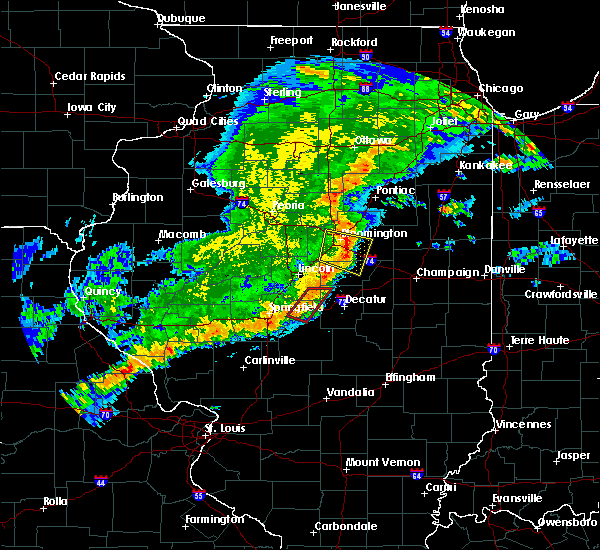 At 530 pm cdt, severe thunderstorms capable of producing both tornadoes and straight line wind damage were located along a line extending from near latham to near illiopolis, moving east at 35 mph (radar indicated rotation. at 528 pm...storm spotters south of latham reported a rain wrapped funnel cloud). Hazards include tornado. Expect damage to mobile homes. roofs. and vehicles. these dangerous storms will be near, warrensburg around 535 pm cdt. maroa and harristown around 540 pm cdt. forsyth around 545 pm cdt. decatur and oreana around 550 pm cdt. argenta around 555 pm cdt. mount zion around 600 pm cdt. other locations impacted by these tornadic storms include elwin. This includes interstate 72 between mile markers 125 and 154. At 530 pm cdt, severe thunderstorms capable of producing both tornadoes and straight line wind damage were located along a line extending from near latham to near illiopolis, moving east at 35 mph (radar indicated rotation. at 528 pm...storm spotters south of latham reported a rain wrapped funnel cloud). Hazards include tornado. Expect damage to mobile homes. roofs. and vehicles. these dangerous storms will be near, warrensburg around 535 pm cdt. maroa and harristown around 540 pm cdt. forsyth around 545 pm cdt. decatur and oreana around 550 pm cdt. argenta around 555 pm cdt. mount zion around 600 pm cdt. other locations impacted by these tornadic storms include elwin. This includes interstate 72 between mile markers 125 and 154.
|
| 7/13/2016 4:58 PM CDT | Tree uprooted on north summit ave. obtained from social medi in macon county IL, 0.5 miles NNW of Decatur, IL |
| 7/13/2016 4:58 PM CDT |
 At 457 pm cdt, severe thunderstorms were located along a line extending from near forsyth to near moweaqua to 7 miles northeast of ramsey, moving east at 40 mph (radar indicated). Hazards include 60 mph wind gusts. Expect damage to roofs. siding. And trees. At 457 pm cdt, severe thunderstorms were located along a line extending from near forsyth to near moweaqua to 7 miles northeast of ramsey, moving east at 40 mph (radar indicated). Hazards include 60 mph wind gusts. Expect damage to roofs. siding. And trees.
|
| 7/13/2016 4:47 PM CDT |
 At 447 pm cdt, severe thunderstorms were located along a line extending from near latham to near moweaqua to near nokomis, moving east at 50 mph (radar indicated). Hazards include 60 mph wind gusts. Expect damage to roofs. siding. and trees. locations impacted include, decatur, taylorville, shelbyville, pana, mount zion, forsyth, moweaqua, harristown, long creek, warrensburg, assumption, blue mound, macon, edinburg, stonington, illiopolis, niantic, cowden, tower hill and mechanicsburg. This includes interstate 72 between mile markers 112 and 145. At 447 pm cdt, severe thunderstorms were located along a line extending from near latham to near moweaqua to near nokomis, moving east at 50 mph (radar indicated). Hazards include 60 mph wind gusts. Expect damage to roofs. siding. and trees. locations impacted include, decatur, taylorville, shelbyville, pana, mount zion, forsyth, moweaqua, harristown, long creek, warrensburg, assumption, blue mound, macon, edinburg, stonington, illiopolis, niantic, cowden, tower hill and mechanicsburg. This includes interstate 72 between mile markers 112 and 145.
|
| 7/13/2016 4:24 PM CDT |
 At 423 pm cdt, severe thunderstorms were located along a line extending from near riverton to near pawnee to near litchfield, moving east at 45 mph (radar indicated). Hazards include 60 mph wind gusts. Expect damage to roofs. siding. And trees. At 423 pm cdt, severe thunderstorms were located along a line extending from near riverton to near pawnee to near litchfield, moving east at 45 mph (radar indicated). Hazards include 60 mph wind gusts. Expect damage to roofs. siding. And trees.
|
| 6/20/2016 10:14 PM CDT |
 At 1012 pm cdt, a severe thunderstorm was located over sidney, or 10 miles southeast of champaign, moving east at 40 mph (champaign emergency manager reported a tree down across the intersection of mattis and healy, just south of springfield avenue in champaign). Hazards include 60 mph wind gusts and penny size hail. Expect damage to roofs. siding. and trees. locations impacted include, champaign, decatur, monticello, urbana, savoy, mahomet, st. joseph, forsyth, tolono, farmer city, fisher, maroa, bement, philo, sidney, warrensburg, homer, thomasboro, argenta and mansfield. this includes the following highways, interstate 57 between mile markers 219 and 246. interstate 72 between mile markers 145 and 182. Interstate 74 between mile markers 160 and 199. At 1012 pm cdt, a severe thunderstorm was located over sidney, or 10 miles southeast of champaign, moving east at 40 mph (champaign emergency manager reported a tree down across the intersection of mattis and healy, just south of springfield avenue in champaign). Hazards include 60 mph wind gusts and penny size hail. Expect damage to roofs. siding. and trees. locations impacted include, champaign, decatur, monticello, urbana, savoy, mahomet, st. joseph, forsyth, tolono, farmer city, fisher, maroa, bement, philo, sidney, warrensburg, homer, thomasboro, argenta and mansfield. this includes the following highways, interstate 57 between mile markers 219 and 246. interstate 72 between mile markers 145 and 182. Interstate 74 between mile markers 160 and 199.
|
| 6/20/2016 9:53 PM CDT |
 At 952 pm cdt, a severe thunderstorm was located over mahomet, or 8 miles northwest of champaign, moving east at 45 mph (radar indicated). Hazards include 60 mph wind gusts and nickel size hail. Expect damage to roofs. siding. and trees. locations impacted include, champaign, decatur, monticello, urbana, savoy, mahomet, st. joseph, forsyth, tolono, farmer city, fisher, maroa, bement, philo, sidney, warrensburg, homer, thomasboro, argenta and mansfield. this includes the following highways, interstate 57 between mile markers 219 and 246. interstate 72 between mile markers 145 and 182. Interstate 74 between mile markers 160 and 199. At 952 pm cdt, a severe thunderstorm was located over mahomet, or 8 miles northwest of champaign, moving east at 45 mph (radar indicated). Hazards include 60 mph wind gusts and nickel size hail. Expect damage to roofs. siding. and trees. locations impacted include, champaign, decatur, monticello, urbana, savoy, mahomet, st. joseph, forsyth, tolono, farmer city, fisher, maroa, bement, philo, sidney, warrensburg, homer, thomasboro, argenta and mansfield. this includes the following highways, interstate 57 between mile markers 219 and 246. interstate 72 between mile markers 145 and 182. Interstate 74 between mile markers 160 and 199.
|
| 6/20/2016 9:36 PM CDT |
 At 936 pm cdt, a severe thunderstorm was located near argenta, or 8 miles southeast of clinton, moving east at 35 mph (radar indicated). Hazards include 60 mph wind gusts and quarter size hail. Hail damage to vehicles is expected. Expect wind damage to roofs, siding, and trees. At 936 pm cdt, a severe thunderstorm was located near argenta, or 8 miles southeast of clinton, moving east at 35 mph (radar indicated). Hazards include 60 mph wind gusts and quarter size hail. Hail damage to vehicles is expected. Expect wind damage to roofs, siding, and trees.
|
| 5/26/2016 7:46 AM CDT |
 At 744 am cdt, a severe thunderstorm was located over cerro gordo, or 10 miles southwest of monticello, moving east at 40 mph (radar indicated). Hazards include 60 mph wind gusts and quarter size hail. Hail damage to vehicles is expected. Expect wind damage to roofs, siding, and trees. At 744 am cdt, a severe thunderstorm was located over cerro gordo, or 10 miles southwest of monticello, moving east at 40 mph (radar indicated). Hazards include 60 mph wind gusts and quarter size hail. Hail damage to vehicles is expected. Expect wind damage to roofs, siding, and trees.
|
| 5/13/2016 8:06 PM CDT |
 At 805 pm cdt, a severe thunderstorm was located over forsyth, or near decatur, moving east at 55 mph (radar indicated). Hazards include 60 mph wind gusts. Expect damage to roofs. siding. and trees. locations impacted include, decatur, mount zion, forsyth, cerro gordo, harristown, long creek, warrensburg, argenta, oreana, niantic, oakley and decatur airport. This includes interstate 72 between mile markers 125 and 156. At 805 pm cdt, a severe thunderstorm was located over forsyth, or near decatur, moving east at 55 mph (radar indicated). Hazards include 60 mph wind gusts. Expect damage to roofs. siding. and trees. locations impacted include, decatur, mount zion, forsyth, cerro gordo, harristown, long creek, warrensburg, argenta, oreana, niantic, oakley and decatur airport. This includes interstate 72 between mile markers 125 and 156.
|
| 5/13/2016 7:41 PM CDT |
 At 740 pm cdt, a severe thunderstorm was located over cornland, or 13 miles south of lincoln, moving east at 55 mph (trained weather spotters reported a 65 mph wind gust just north of williamsville in northern sangamon county at 732 pm cdt). Hazards include 60 mph wind gusts. Expect damage to roofs. siding. And trees. At 740 pm cdt, a severe thunderstorm was located over cornland, or 13 miles south of lincoln, moving east at 55 mph (trained weather spotters reported a 65 mph wind gust just north of williamsville in northern sangamon county at 732 pm cdt). Hazards include 60 mph wind gusts. Expect damage to roofs. siding. And trees.
|
| 5/11/2016 2:58 PM CDT |
 At 258 pm cdt, a severe thunderstorm was located over argenta, or 11 miles northeast of decatur, moving east at 35 mph (radar indicated). Hazards include 60 mph wind gusts. Expect damage to roofs. siding. and trees. locations impacted include, argenta, oreana, cisco and milmine. This includes interstate 72 between mile markers 148 and 163. At 258 pm cdt, a severe thunderstorm was located over argenta, or 11 miles northeast of decatur, moving east at 35 mph (radar indicated). Hazards include 60 mph wind gusts. Expect damage to roofs. siding. and trees. locations impacted include, argenta, oreana, cisco and milmine. This includes interstate 72 between mile markers 148 and 163.
|
| 5/11/2016 2:48 PM CDT |
 At 247 pm cdt, a severe thunderstorm was located near maroa, or 10 miles north of decatur, moving east at 30 mph (radar indicated). Hazards include 60 mph wind gusts. Expect damage to roofs. siding. And trees. At 247 pm cdt, a severe thunderstorm was located near maroa, or 10 miles north of decatur, moving east at 30 mph (radar indicated). Hazards include 60 mph wind gusts. Expect damage to roofs. siding. And trees.
|
| 3/30/2016 3:16 PM CDT |
 At 315 pm cdt, a severe thunderstorm was located over mechanicsburg, or 12 miles east of springfield, moving northeast at 50 mph (radar indicated). Hazards include quarter size hail. Damage to vehicles is expected. locations impacted include, springfield, decatur, chatham, mount zion, rochester, riverton, pawnee, mount pulaski, harristown, long creek, warrensburg, blue mound, edinburg, illiopolis, niantic, mechanicsburg, mount auburn, latham, cornland and jerome. this includes the following highways, interstate 55 between mile markers 84 and 99. Interstate 72 between mile markers 95 and 138. At 315 pm cdt, a severe thunderstorm was located over mechanicsburg, or 12 miles east of springfield, moving northeast at 50 mph (radar indicated). Hazards include quarter size hail. Damage to vehicles is expected. locations impacted include, springfield, decatur, chatham, mount zion, rochester, riverton, pawnee, mount pulaski, harristown, long creek, warrensburg, blue mound, edinburg, illiopolis, niantic, mechanicsburg, mount auburn, latham, cornland and jerome. this includes the following highways, interstate 55 between mile markers 84 and 99. Interstate 72 between mile markers 95 and 138.
|
| 3/30/2016 3:06 PM CDT |
 At 305 pm cdt, a severe thunderstorm was located near rochester, or 7 miles southeast of springfield, moving northeast at 50 mph (radar indicated). Hazards include quarter size hail. damage to vehicles is expected At 305 pm cdt, a severe thunderstorm was located near rochester, or 7 miles southeast of springfield, moving northeast at 50 mph (radar indicated). Hazards include quarter size hail. damage to vehicles is expected
|
| 12/23/2015 10:13 AM CST | The severe thunderstorm warning for piatt, western coles, moultrie, southeastern macon, northern cumberland, eastern shelby and western douglas counties will expire at 1015 am cst, the storms which prompted the warning have weakened below severe limits, and no longer pose an immediate threat to life or property. therefore the warning will be allowed to expire. however gusty winds are still possible with these thunderstorms. a tornado watch remains in effect until 500 pm cst for east central illinois. |
| 12/23/2015 9:59 AM CST | A severe thunderstorm warning remains in effect until 1015 am cst for piatt. western coles. moultrie. southeastern macon. northern cumberland. eastern shelby and western douglas counties. at 959 am cst. severe thunderstorms were located along a line extending from near cerro gordo to 5 miles northwest of stewardson. Moving northeast at 55 mph. |
| 12/23/2015 9:48 AM CST | At 947 am cst, severe thunderstorms were located along a line extending from near mount zion to near cowden, moving northeast at 55 mph (radar indicated). Hazards include 60 mph wind gusts. Expect damage to roofs. Siding and trees. |
| 7/11/2015 10:09 PM CDT |
 At 1009 pm cdt, a severe thunderstorm was located over long creek, or 6 miles southeast of decatur, moving southeast at 15 mph (radar indicated). Hazards include 60 mph wind gusts. Expect damage to roofs. Siding and trees. At 1009 pm cdt, a severe thunderstorm was located over long creek, or 6 miles southeast of decatur, moving southeast at 15 mph (radar indicated). Hazards include 60 mph wind gusts. Expect damage to roofs. Siding and trees.
|
| 7/11/2015 10:02 PM CDT | Storm damage reported in macon county IL, 3.9 miles WNW of Decatur, IL |
| 6/20/2015 10:45 PM CDT | Tree down on grand ave. from wand-t in macon county IL, 0.5 miles NNW of Decatur, IL |
| 6/20/2015 10:32 PM CDT |
 At 1032 pm cdt, severe thunderstorms were located along a line extending from near warrensburg to near stonington to 5 miles northeast of morrisonville, moving east at 45 mph (trained weather spotters). Hazards include 60 mph wind gusts. Expect damage to roofs. siding and trees. locations impacted include, decatur, taylorville, pana, mount zion, forsyth, moweaqua, maroa, harristown, long creek, warrensburg, assumption, blue mound, macon, morrisonville, argenta, stonington, oreana, niantic, dalton city and oakley. this includes interstate 72 between mile markers 127 and 156. A tornado watch remains in effect until 1100 pm cdt for central illinois. At 1032 pm cdt, severe thunderstorms were located along a line extending from near warrensburg to near stonington to 5 miles northeast of morrisonville, moving east at 45 mph (trained weather spotters). Hazards include 60 mph wind gusts. Expect damage to roofs. siding and trees. locations impacted include, decatur, taylorville, pana, mount zion, forsyth, moweaqua, maroa, harristown, long creek, warrensburg, assumption, blue mound, macon, morrisonville, argenta, stonington, oreana, niantic, dalton city and oakley. this includes interstate 72 between mile markers 127 and 156. A tornado watch remains in effect until 1100 pm cdt for central illinois.
|
| 6/20/2015 10:16 PM CDT |
 At 1016 pm cdt, severe thunderstorms were located along a line extending from near chestnut to near edinburg to 4 miles south of pawnee, moving east at 40 mph (trained weather spotters). Hazards include 60 mph wind gusts. Expect damage to roofs. Siding and trees. At 1016 pm cdt, severe thunderstorms were located along a line extending from near chestnut to near edinburg to 4 miles south of pawnee, moving east at 40 mph (trained weather spotters). Hazards include 60 mph wind gusts. Expect damage to roofs. Siding and trees.
|
| 6/7/2015 9:10 PM CDT | At 909 pm cdt, severe thunderstorms were located along a line extending from lake of the woods to near atwood to near dalton city, moving east at 50 mph (radar indicated). Hazards include 60 mph wind gusts and quarter size hail. Hail damage to vehicles is expected. expect wind damage to roofs, siding and trees. locations impacted include, champaign, decatur, urbana, rantoul, monticello, tuscola, savoy, mahomet, mount zion, st. joseph, tolono, arcola, villa grove, arthur, fisher, bement, philo, cerro gordo, long creek and sidney. this includes the following highways, interstate 57 between mile markers 202 and 256. interstate 72 between mile markers 157 and 182. Interstate 74 between mile markers 161 and 198. |
| 6/7/2015 8:54 PM CDT | At 854 pm cdt, severe thunderstorms were located along a line extending from 5 miles north of mansfield to near cerro gordo to near decatur, moving east at 50 mph (radar indicated). Hazards include 60 mph wind gusts. Expect damage to roofs. Siding and trees. |
| 5/24/2015 11:29 PM CDT | At 1129 pm cdt, a severe thunderstorm was located over blue mound, or 14 miles northeast of taylorville, moving northeast at 70 mph (radar indicated). Hazards include 70 mph wind gusts. Expect considerable tree damage. Damage is likely to mobile homes, roofs and outbuildings. |
| 5/15/2015 4:54 PM CDT | Tree limbs down on mlk drive. time estimated. from wand-t in macon county IL, 0.5 miles NNW of Decatur, IL |
| 4/9/2015 8:13 PM CDT | The national weather service in lincoln has issued a * tornado warning for. east central christian county in central illinois. southern macon county in central illinois. west central moultrie county in central illinois. North central shelby county in central illinois. |
| 4/9/2015 8:13 PM CDT | The national weather service in lincoln has issued a * tornado warning for. east central christian county in central illinois. southern macon county in central illinois. west central moultrie county in central illinois. North central shelby county in central illinois. |
| 4/9/2015 8:13 PM CDT | The national weather service in lincoln has issued a * tornado warning for. east central christian county in central illinois. southern macon county in central illinois. west central moultrie county in central illinois. North central shelby county in central illinois. |
| 10/13/2014 4:19 PM CDT | Storm damage reported in macon county IL, 3.9 miles WNW of Decatur, IL |
| 3/27/2014 3:02 PM CDT | Golf Ball sized hail reported 7.5 miles ENE of Decatur, IL, hail covering the ground (eax) - commentary from ihm: this report has a bogus location fro |
| 6/18/2013 2:00 PM CDT | Quarter sized hail reported 0.5 miles NNW of Decatur, IL, approximately 1 mile south of tv station wand. |
| 5/31/2013 10:15 PM CDT | Storm damage reported in macon county IL, 6.2 miles W of Decatur, IL |
| 5/31/2013 10:03 PM CDT | Storm damage reported in macon county IL, 0.5 miles NNW of Decatur, IL |
| 5/31/2013 10:00 PM CDT | Numerous large tree limbs down. estimated 70 mph wind spee in macon county IL, 0.5 miles NNW of Decatur, IL |
| 5/27/2013 3:35 PM CDT | Multiple tree limbs down on regal avenue. time estimate in macon county IL, 0.5 miles NNW of Decatur, IL |
| 5/27/2013 3:35 PM CDT | Storm damage reported in macon county IL, 0.5 miles NNW of Decatur, IL |
Hail Maps for Decatur, IL

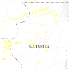
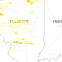

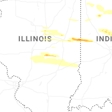
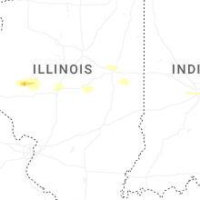
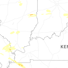
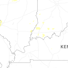
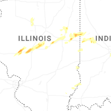


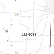


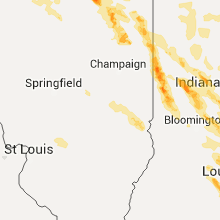


Connect with Interactive Hail Maps