

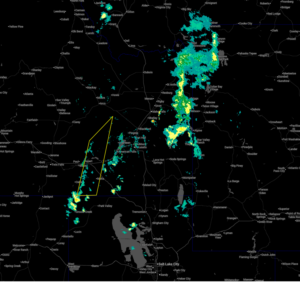
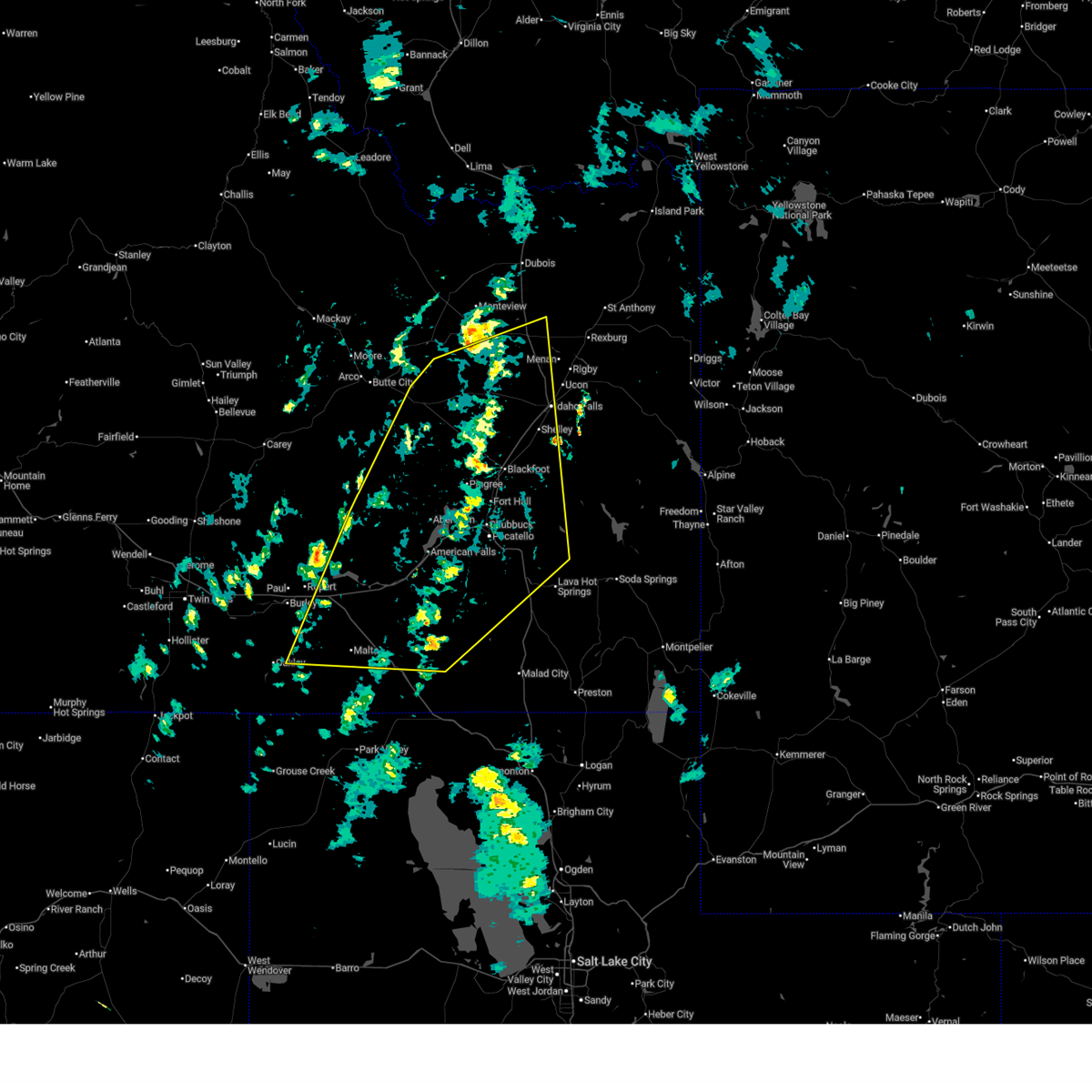
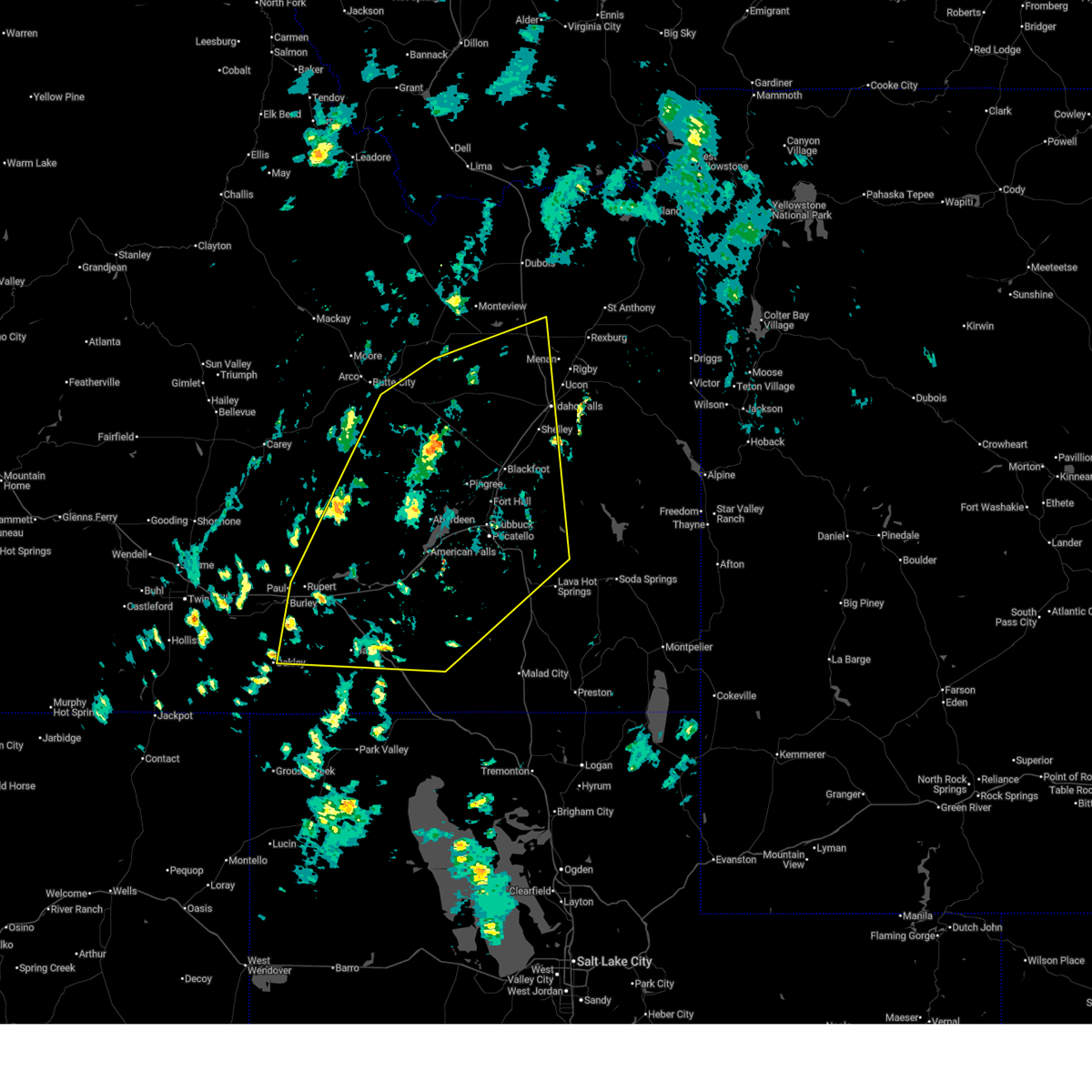
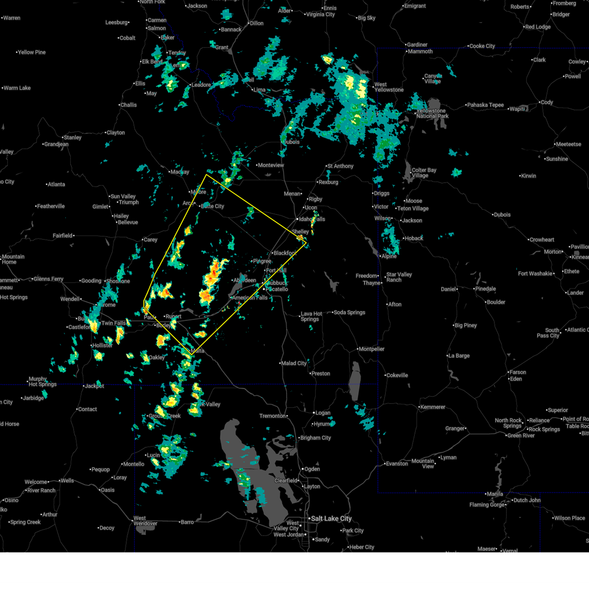
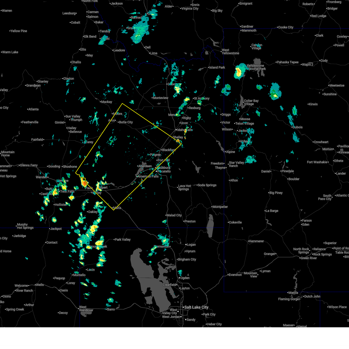
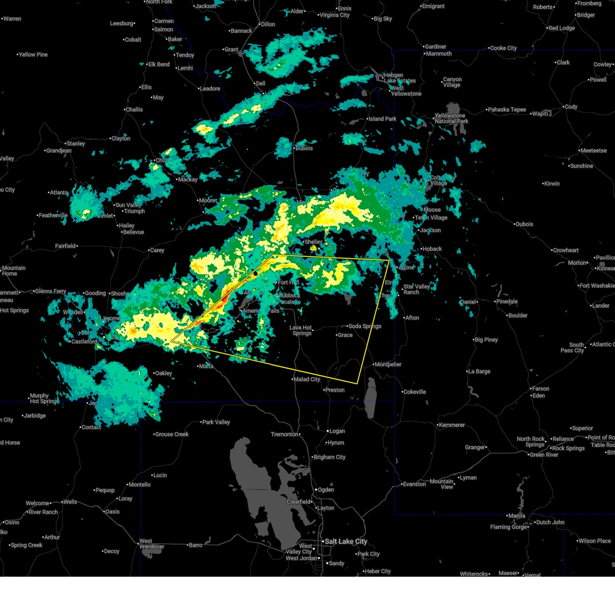
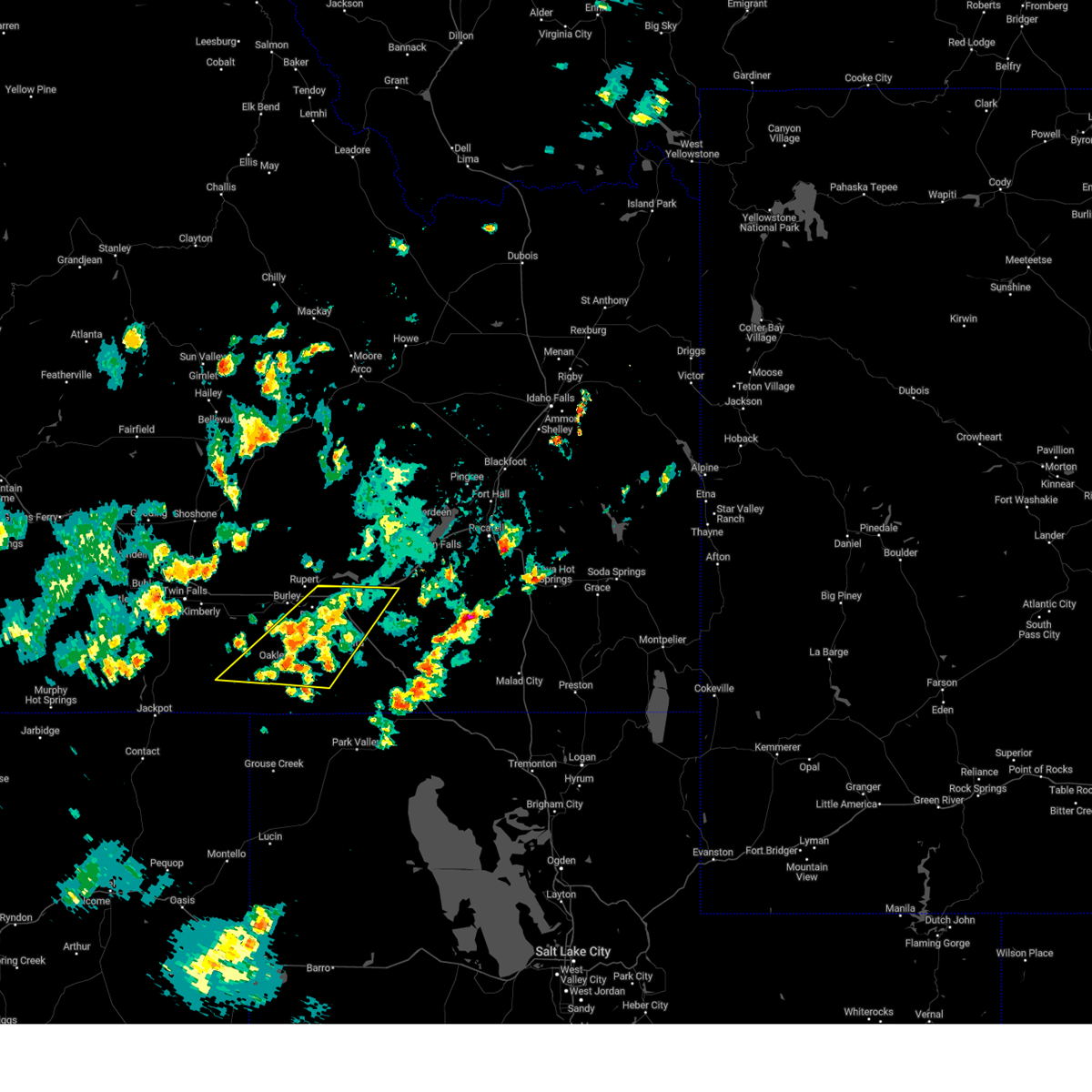
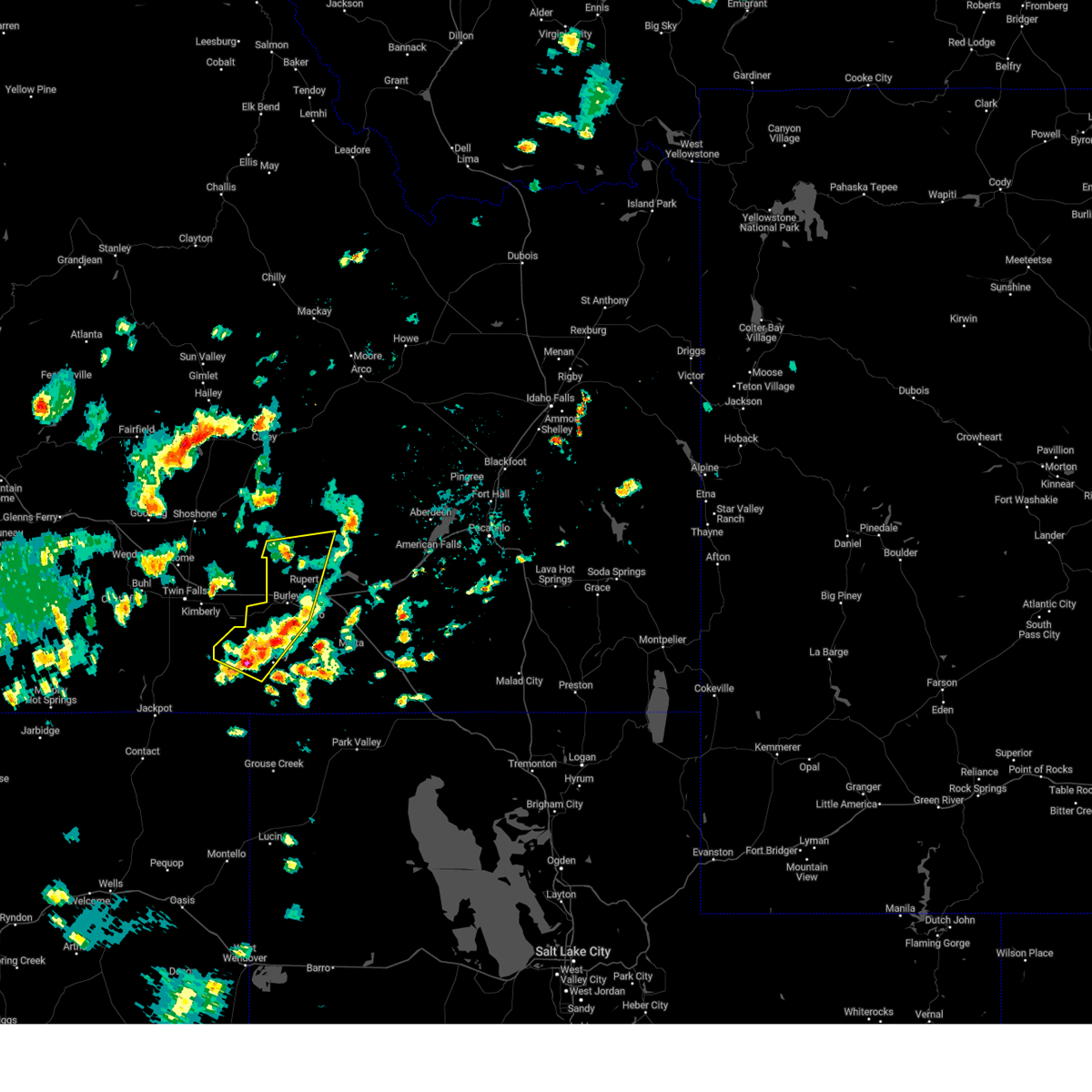
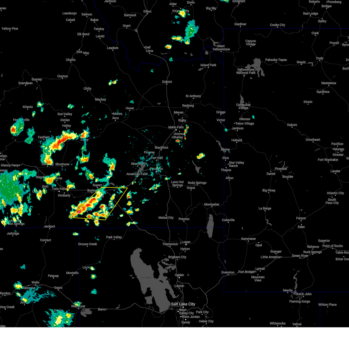
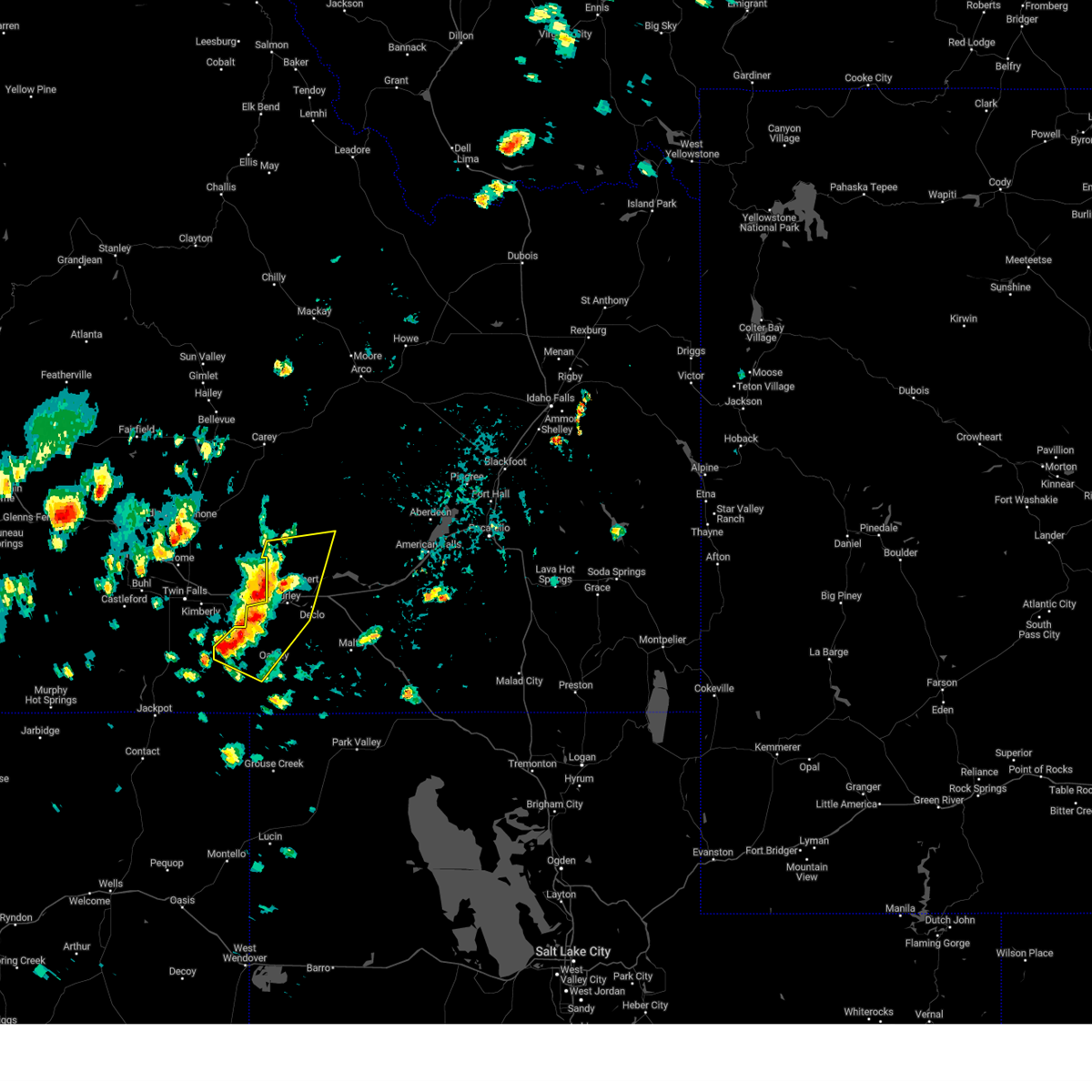
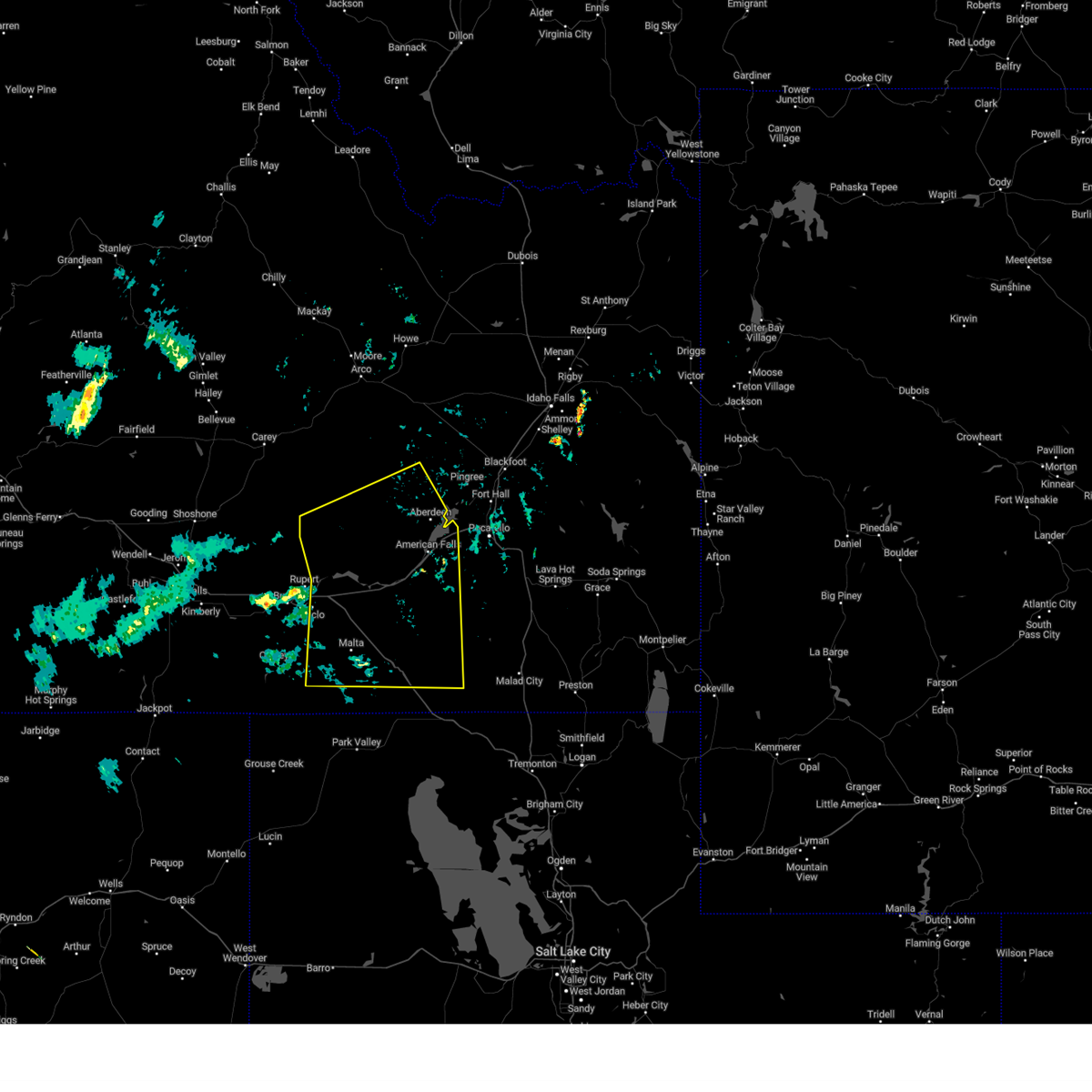
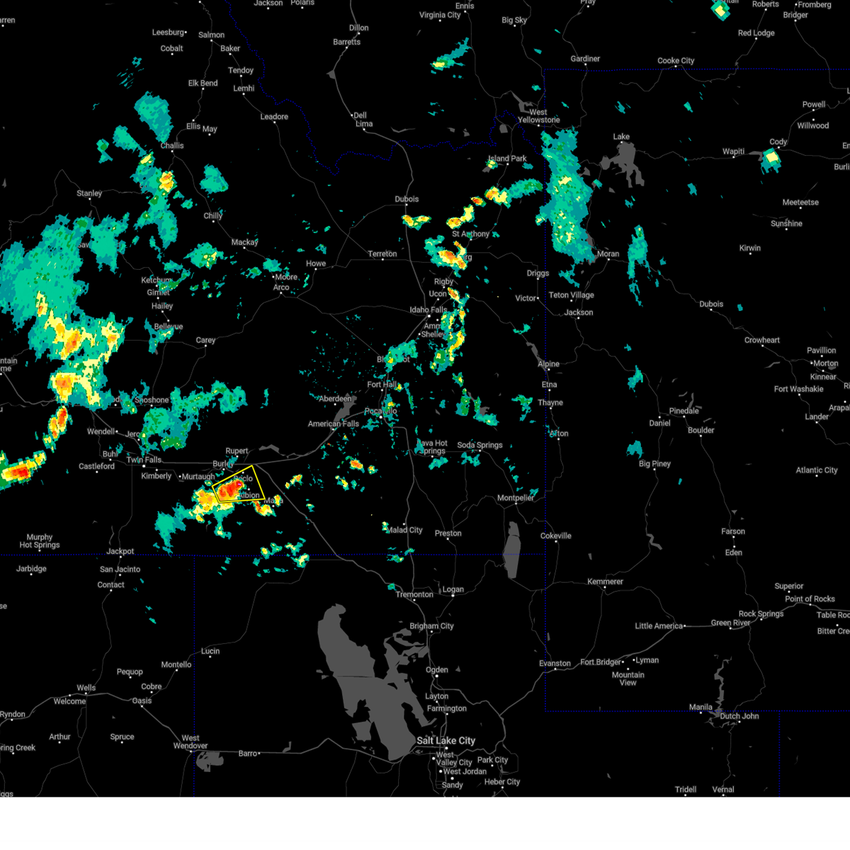
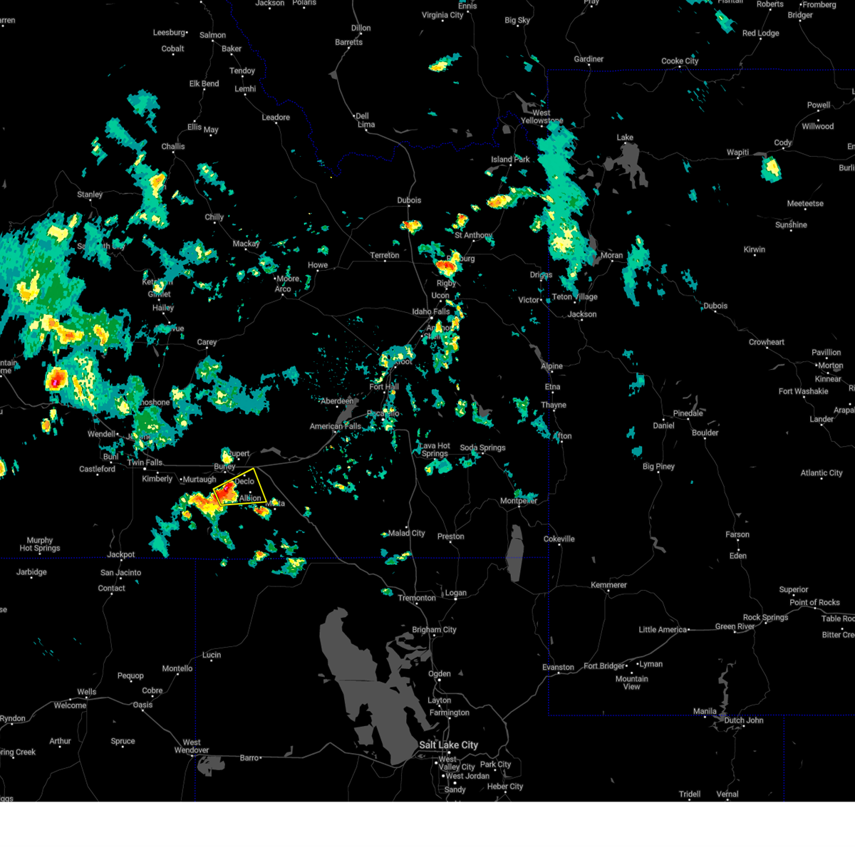
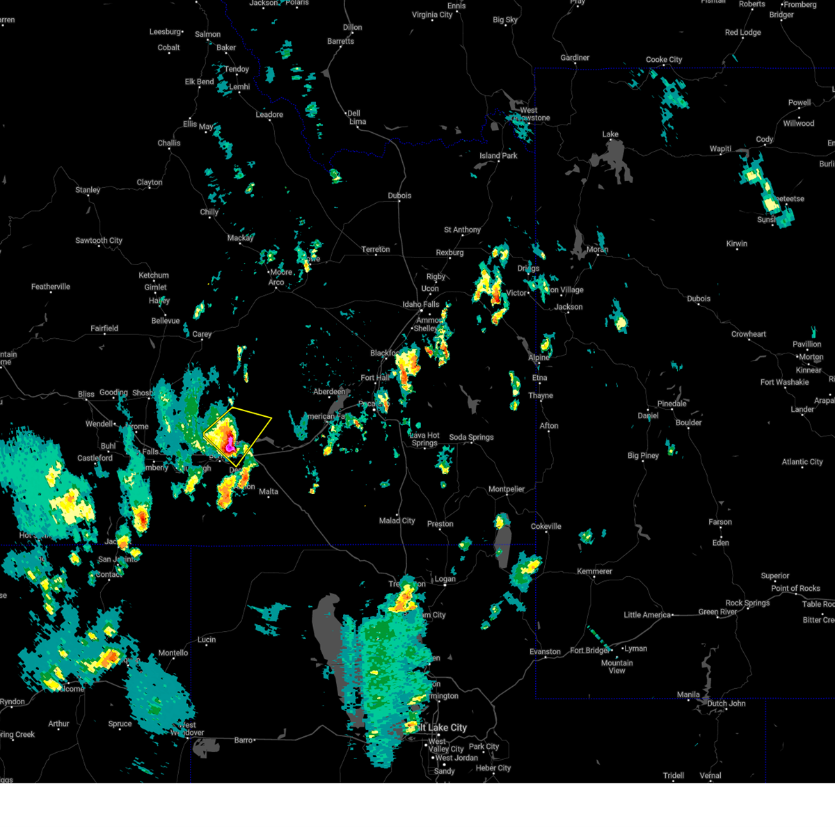
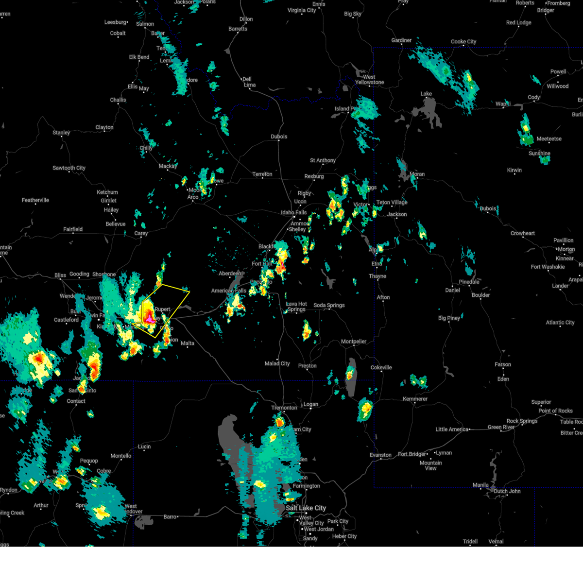
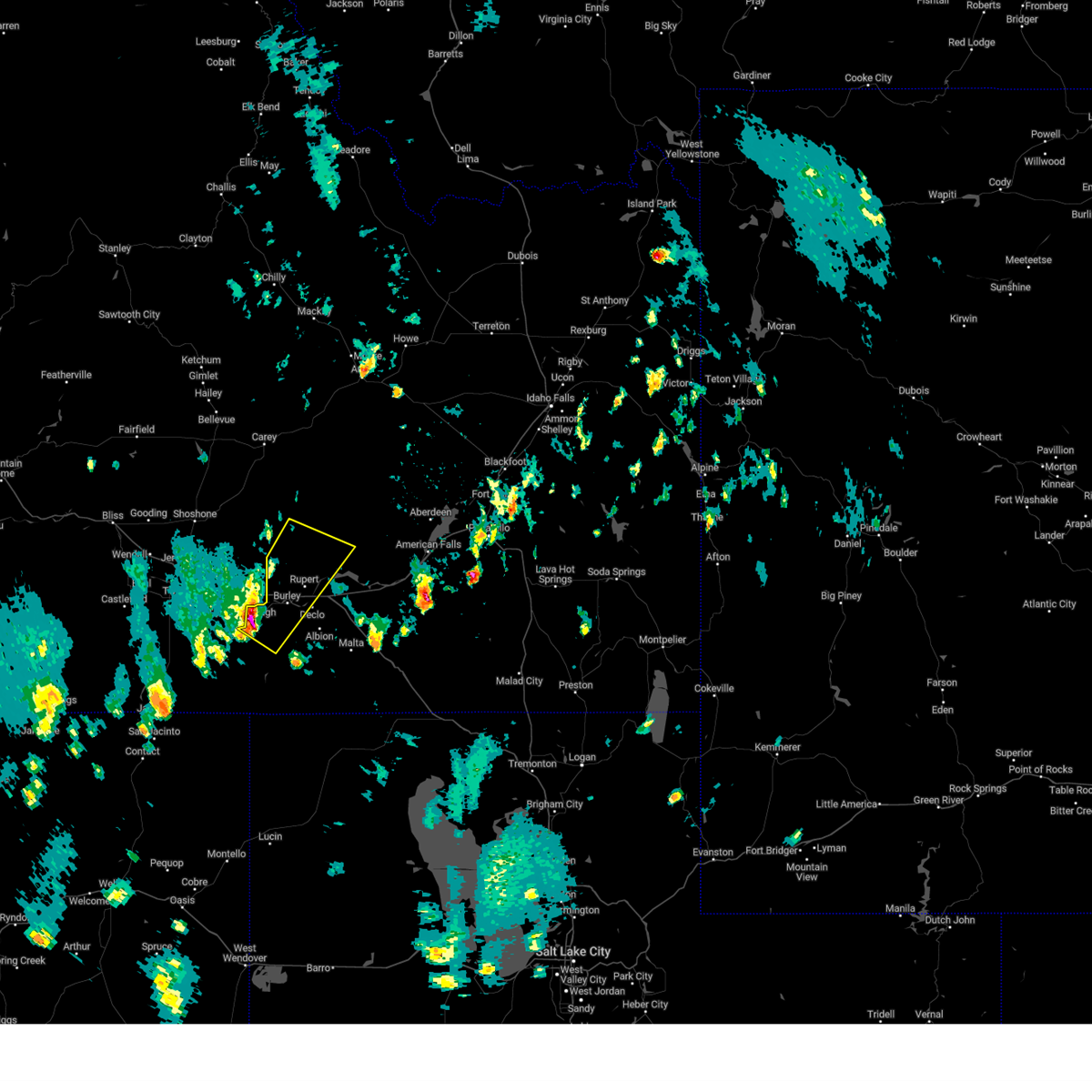
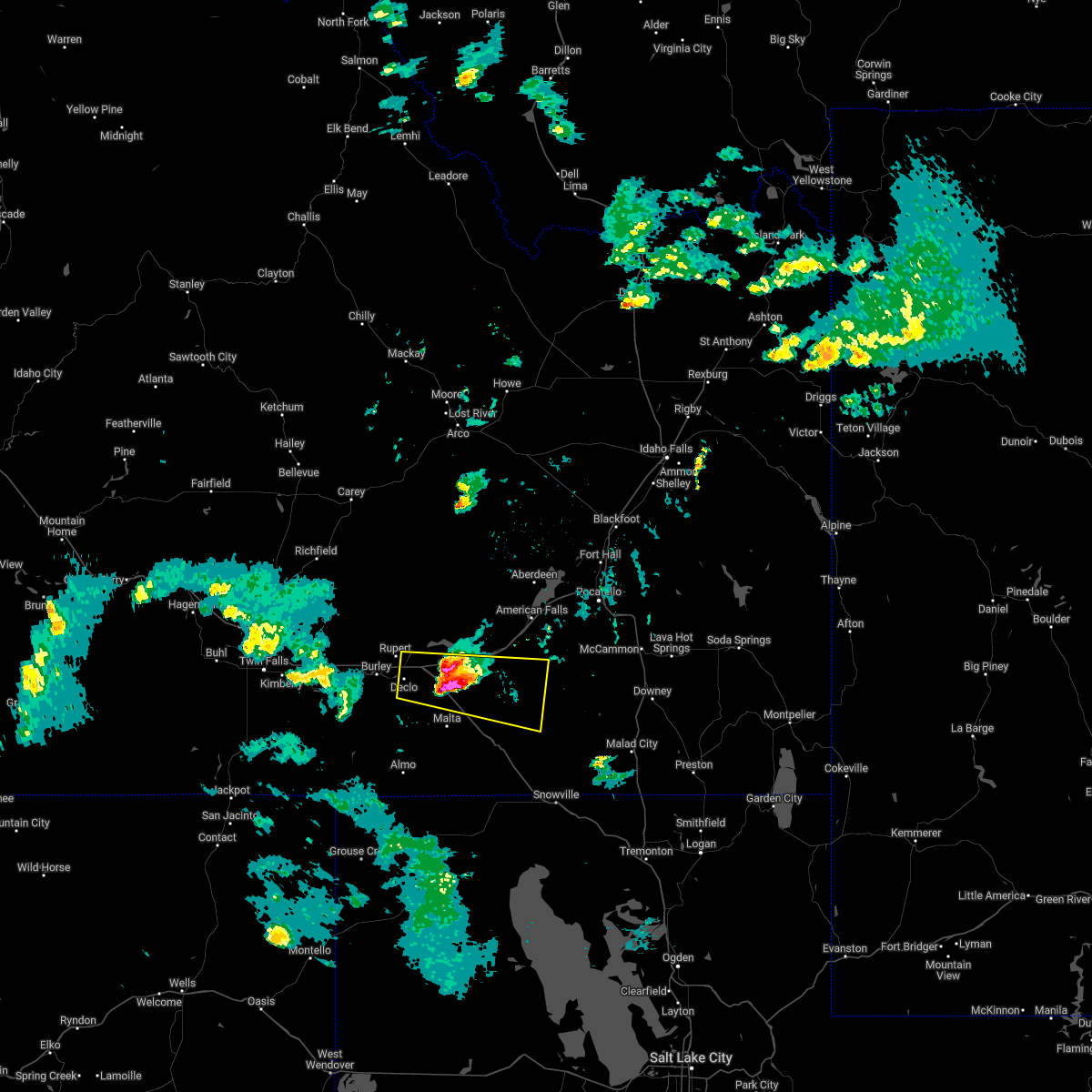
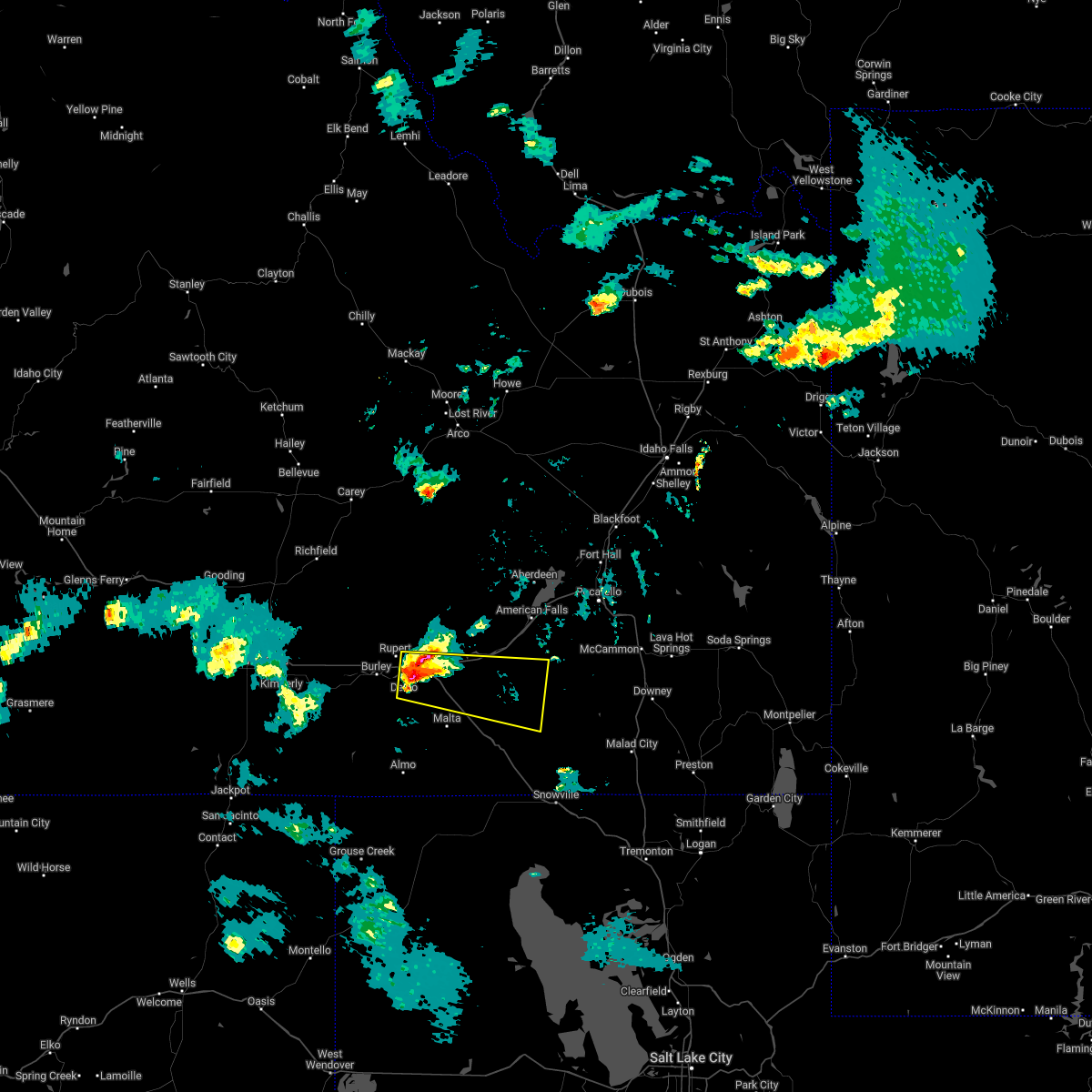
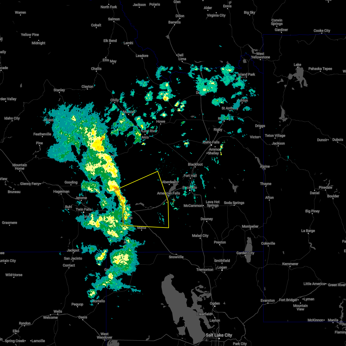
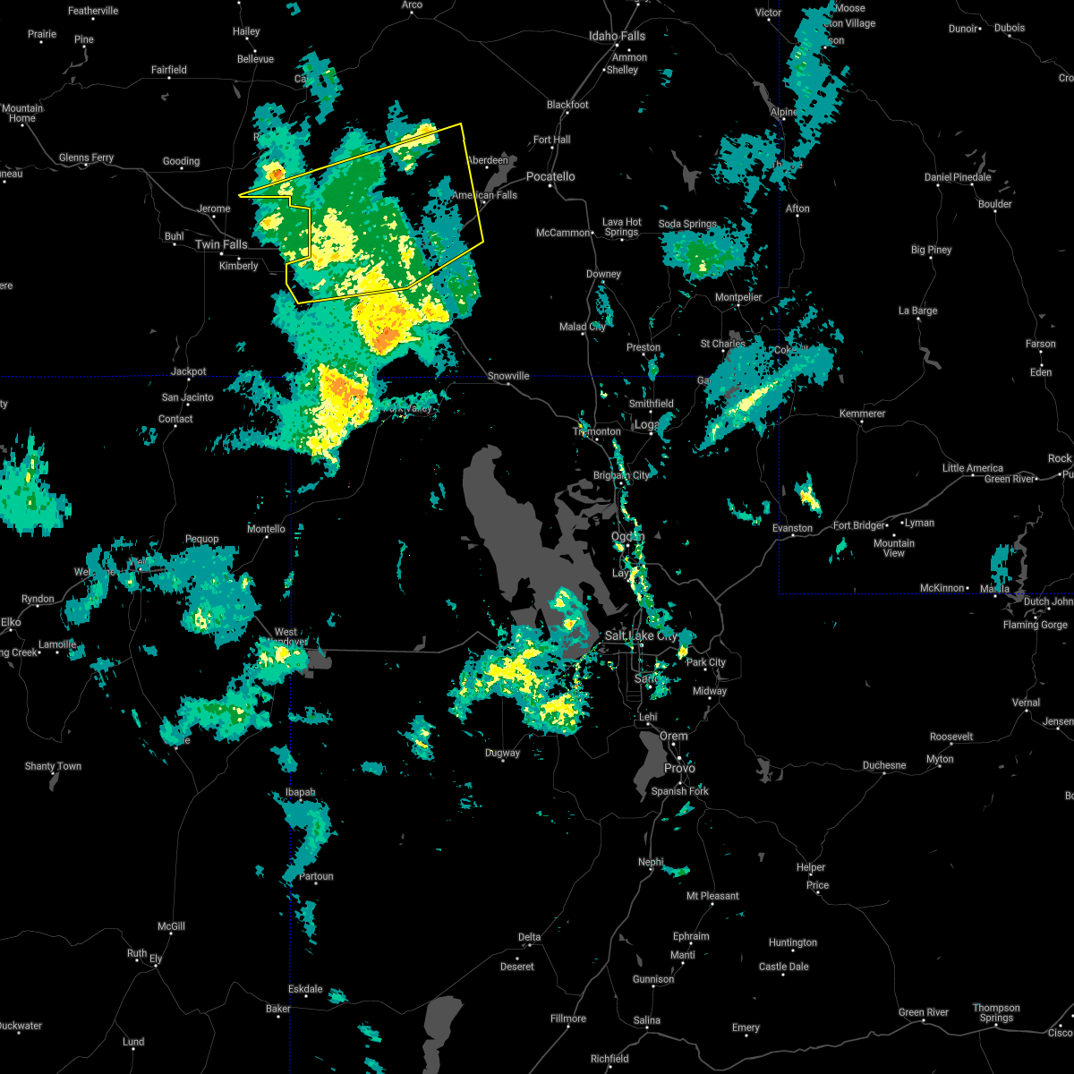
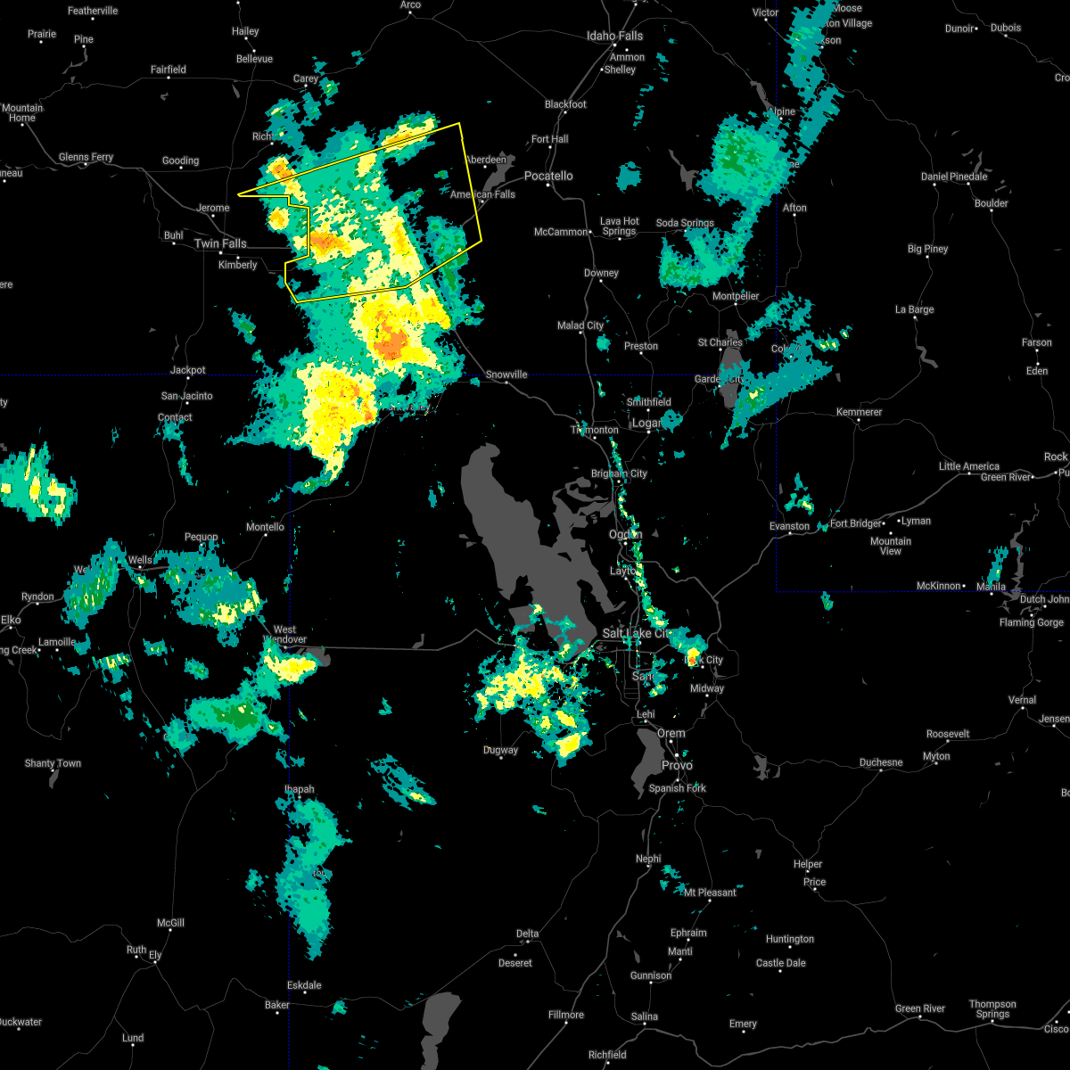
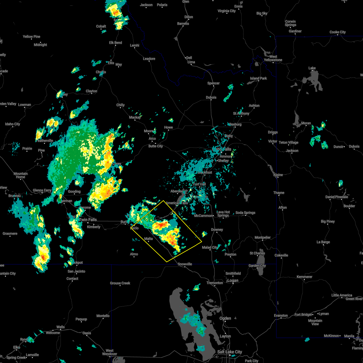
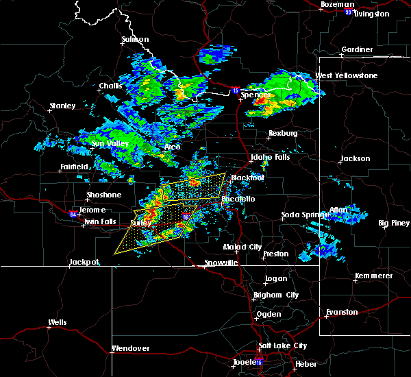
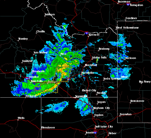
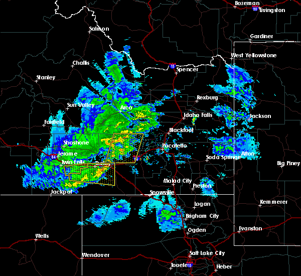
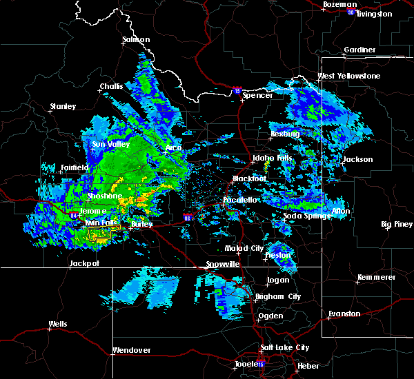
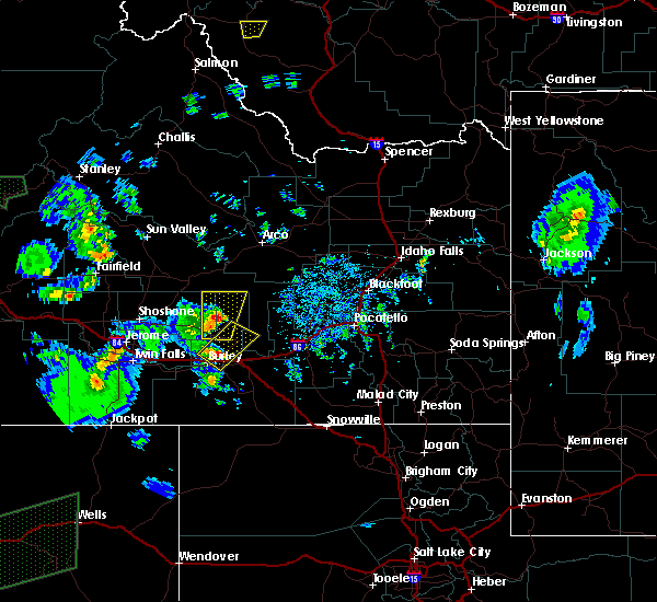
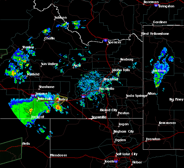
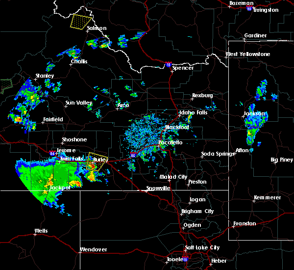
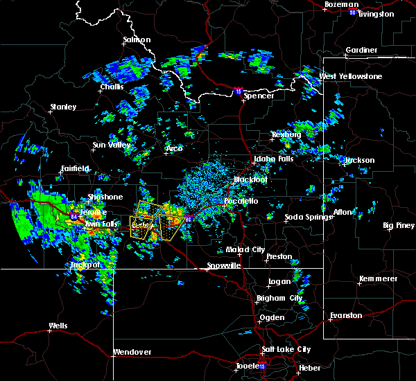
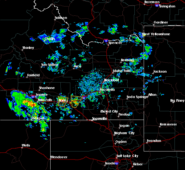
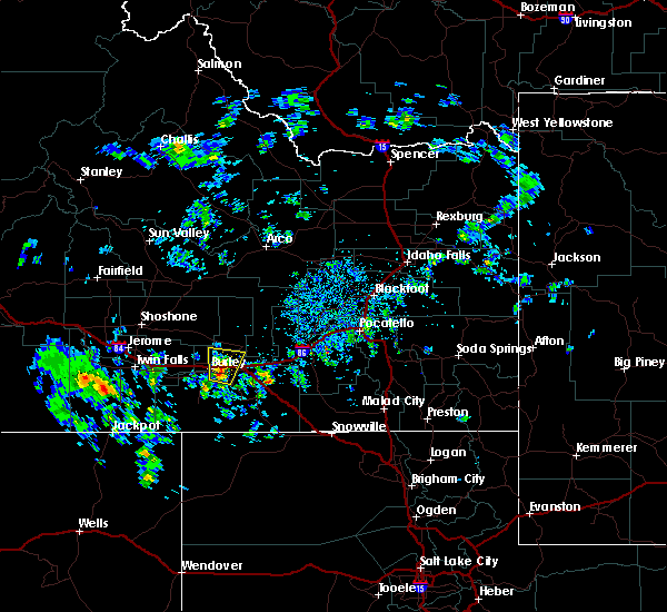
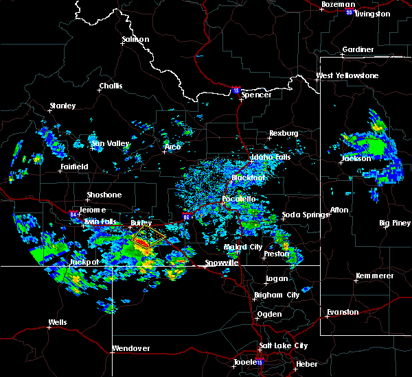
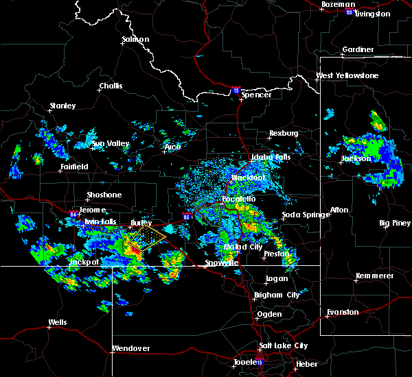
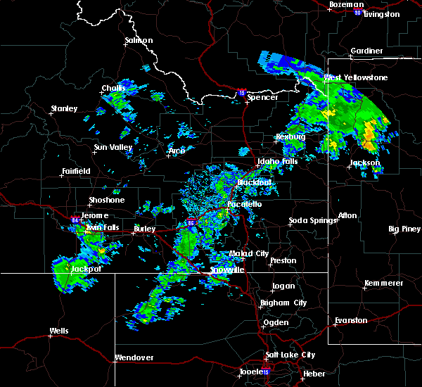
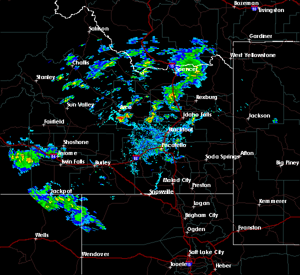
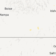
Hail Map for Declo, ID
The Declo, ID area has had 0 reports of on-the-ground hail by trained spotters, and has been under severe weather warnings 6 times during the past 12 months. Doppler radar has detected hail at or near Declo, ID on 9 occasions.
| Name: | Declo, ID |
| Where Located: | 43 miles E of Twin Falls, ID |
| Map: | Google Map for Declo, ID |
| Population: | 343 |
| Housing Units: | 127 |
| More Info: | Search Google for Declo, ID |
0
The Top Recent Hail Date for Declo, ID is Monday, August 19, 2024 (7th out of 9)

Hail and Wind Damage Spotted near Declo, ID
| Date / Time | Report Details |
|---|---|
| 5/13/2026 5:45 PM MDT | Itd mesonet near yale itd1 in cassia county ID, 11.8 miles W of Declo, ID |
| 5/13/2026 5:15 PM MDT |
 Svrpih the national weather service in pocatello has issued a * severe thunderstorm warning for, southeastern blaine county in central idaho, south central butte county in southeastern idaho, northwestern power county in southeastern idaho, central cassia county in southeastern idaho, southeastern minidoka county in south central idaho, * until 600 pm mdt. * at 515 pm mdt, severe thunderstorms were located along a line extending from 15 miles north of minidoka to 7 miles northwest of almo, moving northeast at 40 mph (radar indicated). Hazards include 60 mph wind gusts. expect damage to roofs, siding, and trees Svrpih the national weather service in pocatello has issued a * severe thunderstorm warning for, southeastern blaine county in central idaho, south central butte county in southeastern idaho, northwestern power county in southeastern idaho, central cassia county in southeastern idaho, southeastern minidoka county in south central idaho, * until 600 pm mdt. * at 515 pm mdt, severe thunderstorms were located along a line extending from 15 miles north of minidoka to 7 miles northwest of almo, moving northeast at 40 mph (radar indicated). Hazards include 60 mph wind gusts. expect damage to roofs, siding, and trees
|
| 5/13/2026 3:15 PM MDT |
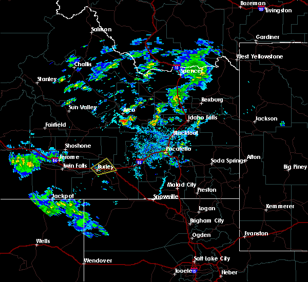
 At 312 pm mdt, the leading edge of severe thunderstorms and associated outflow was located from near mud lake to hear juniper, moving northeast at 55 mph. another line of severe thunderstorms and associated outflow extended the south of end craters of the moon to near elba, also moving northeast at 55 mph (radar indicated and mesonet observations. multiple observations over 60 mph have been reported). Hazards include 70 mph wind gusts. Expect considerable tree damage. damage is likely to mobile homes, roofs, and outbuildings. Locations impacted include, idaho falls, pocatello, blackfoot, american falls, mccammon, malta, lake walcott, neeley, chesterfield reservoir, goshen, american falls reservoir, chubbuck, shelley, aberdeen, inkom, roberts, firth, declo, rockland, and albion. At 312 pm mdt, the leading edge of severe thunderstorms and associated outflow was located from near mud lake to hear juniper, moving northeast at 55 mph. another line of severe thunderstorms and associated outflow extended the south of end craters of the moon to near elba, also moving northeast at 55 mph (radar indicated and mesonet observations. multiple observations over 60 mph have been reported). Hazards include 70 mph wind gusts. Expect considerable tree damage. damage is likely to mobile homes, roofs, and outbuildings. Locations impacted include, idaho falls, pocatello, blackfoot, american falls, mccammon, malta, lake walcott, neeley, chesterfield reservoir, goshen, american falls reservoir, chubbuck, shelley, aberdeen, inkom, roberts, firth, declo, rockland, and albion.
|
| 5/13/2026 2:43 PM MDT |
 Svrpih the national weather service in pocatello has issued a * severe thunderstorm warning for, southeastern blaine county in central idaho, northwestern caribou county in southeastern idaho, northwestern oneida county in southeastern idaho, southwestern jefferson county in southeastern idaho, bannock county in southeastern idaho, southeastern butte county in southeastern idaho, power county in southeastern idaho, northwestern bonneville county in southeastern idaho, bingham county in southeastern idaho, northeastern cassia county in southeastern idaho, southeastern minidoka county in south central idaho, * until 345 pm mdt. * at 240 pm mdt, a line of severe thunderstorms and associated outflow extends from near atomic city to sublett. another line of severe thunderstorms and associated outflow extends from near arco to near oakley , moving northeast at 50 mph (radar indicated and mesonet observations. multiple reports of gusts over 60 mph have been reported). Hazards include 70 mph wind gusts. Expect considerable tree damage. Damage is likely to mobile homes, roofs, and outbuildings. Svrpih the national weather service in pocatello has issued a * severe thunderstorm warning for, southeastern blaine county in central idaho, northwestern caribou county in southeastern idaho, northwestern oneida county in southeastern idaho, southwestern jefferson county in southeastern idaho, bannock county in southeastern idaho, southeastern butte county in southeastern idaho, power county in southeastern idaho, northwestern bonneville county in southeastern idaho, bingham county in southeastern idaho, northeastern cassia county in southeastern idaho, southeastern minidoka county in south central idaho, * until 345 pm mdt. * at 240 pm mdt, a line of severe thunderstorms and associated outflow extends from near atomic city to sublett. another line of severe thunderstorms and associated outflow extends from near arco to near oakley , moving northeast at 50 mph (radar indicated and mesonet observations. multiple reports of gusts over 60 mph have been reported). Hazards include 70 mph wind gusts. Expect considerable tree damage. Damage is likely to mobile homes, roofs, and outbuildings.
|
| 5/13/2026 2:27 PM MDT |
 At 225 pm mdt, the leading of severe thunderstorms extend from near howe to coldwater, moving northeast at 60 mph (radar indicated and mesonet observations. multiple gusts of 60-70 mph have been observed). Hazards include 70 mph wind gusts. Expect considerable tree damage. damage is likely to mobile homes, roofs, and outbuildings. Locations impacted include, western pocatello, blackfoot, rupert, american falls, arco, malta, lake walcott, neeley, goshen, american falls reservoir, chubbuck, shelley, aberdeen, paul, firth, declo, minidoka, atomic city, southeast inl, and pingree. At 225 pm mdt, the leading of severe thunderstorms extend from near howe to coldwater, moving northeast at 60 mph (radar indicated and mesonet observations. multiple gusts of 60-70 mph have been observed). Hazards include 70 mph wind gusts. Expect considerable tree damage. damage is likely to mobile homes, roofs, and outbuildings. Locations impacted include, western pocatello, blackfoot, rupert, american falls, arco, malta, lake walcott, neeley, goshen, american falls reservoir, chubbuck, shelley, aberdeen, paul, firth, declo, minidoka, atomic city, southeast inl, and pingree.
|
| 5/13/2026 1:46 PM MDT |
 Svrpih the national weather service in pocatello has issued a * severe thunderstorm warning for, southeastern blaine county in central idaho, southwestern jefferson county in southeastern idaho, northwestern bannock county in southeastern idaho, southeastern butte county in southeastern idaho, eastern lincoln county in south central idaho, northern power county in southeastern idaho, western bonneville county in southeastern idaho, bingham county in southeastern idaho, northeastern cassia county in southeastern idaho, minidoka county in south central idaho, * until 245 pm mdt. * at 143 pm mdt, the leading edge of severe thunderstorms extends from near malta to near dietrich, moving northeast at 60 mph (radar indicated and mesonet observations. the mesonet site at minidoka reported gusts to 60 mph). Hazards include 70 mph wind gusts. Expect considerable tree damage. Damage is likely to mobile homes, roofs, and outbuildings. Svrpih the national weather service in pocatello has issued a * severe thunderstorm warning for, southeastern blaine county in central idaho, southwestern jefferson county in southeastern idaho, northwestern bannock county in southeastern idaho, southeastern butte county in southeastern idaho, eastern lincoln county in south central idaho, northern power county in southeastern idaho, western bonneville county in southeastern idaho, bingham county in southeastern idaho, northeastern cassia county in southeastern idaho, minidoka county in south central idaho, * until 245 pm mdt. * at 143 pm mdt, the leading edge of severe thunderstorms extends from near malta to near dietrich, moving northeast at 60 mph (radar indicated and mesonet observations. the mesonet site at minidoka reported gusts to 60 mph). Hazards include 70 mph wind gusts. Expect considerable tree damage. Damage is likely to mobile homes, roofs, and outbuildings.
|
| 4/12/2026 1:45 PM MDT | Yale itd mesonet sit in cassia county ID, 10.1 miles W of Declo, ID |
| 12/17/2025 9:52 AM MST |
 Svrpih the national weather service in pocatello has issued a * severe thunderstorm warning for, southeastern blaine county in central idaho, caribou county in southeastern idaho, northeastern oneida county in southeastern idaho, bannock county in southeastern idaho, power county in southeastern idaho, southeastern bonneville county in southeastern idaho, northern franklin county in southeastern idaho, northwestern bear lake county in southeastern idaho, southern bingham county in southeastern idaho, northeastern cassia county in southeastern idaho, * until 1045 am mst. * at 950 am mst, a line of severe thunderstorms was located from near blackfoot to raft river, moving east at 70 mph (radar indicated). Hazards include 80 mph wind gusts. Flying debris will be dangerous to those caught without shelter. mobile homes will be heavily damaged. expect considerable damage to roofs, windows, and vehicles. Extensive tree damage and power outages are likely. Svrpih the national weather service in pocatello has issued a * severe thunderstorm warning for, southeastern blaine county in central idaho, caribou county in southeastern idaho, northeastern oneida county in southeastern idaho, bannock county in southeastern idaho, power county in southeastern idaho, southeastern bonneville county in southeastern idaho, northern franklin county in southeastern idaho, northwestern bear lake county in southeastern idaho, southern bingham county in southeastern idaho, northeastern cassia county in southeastern idaho, * until 1045 am mst. * at 950 am mst, a line of severe thunderstorms was located from near blackfoot to raft river, moving east at 70 mph (radar indicated). Hazards include 80 mph wind gusts. Flying debris will be dangerous to those caught without shelter. mobile homes will be heavily damaged. expect considerable damage to roofs, windows, and vehicles. Extensive tree damage and power outages are likely.
|
| 12/17/2025 9:45 AM MST | The idaho transportation department has closed i-84 eastbound between i-86 eastbound and milepost 245 due to multiple commercial vehicle rollovers associated with high in cassia county ID, 12.5 miles WNW of Declo, ID |
| 9/16/2024 5:45 PM MDT | Mesonet station mali 2 nw idahom in cassia county ID, 12.5 miles WNW of Declo, ID |
| 7/25/2024 6:06 PM MDT |
 The storms which prompted the warning have weakened below severe limits, and no longer pose an immediate threat to life or property. therefore, the warning will be allowed to expire. however, small hail, gusty winds and heavy rain are still possible with these thunderstorms. The storms which prompted the warning have weakened below severe limits, and no longer pose an immediate threat to life or property. therefore, the warning will be allowed to expire. however, small hail, gusty winds and heavy rain are still possible with these thunderstorms.
|
| 7/25/2024 5:30 PM MDT |
 The northern portions of this warning will be allowed to expire. the storms in the southern portion of the warning have redeveloped, and a new warning is expected. The northern portions of this warning will be allowed to expire. the storms in the southern portion of the warning have redeveloped, and a new warning is expected.
|
| 7/25/2024 5:30 PM MDT |
 Svrpih the national weather service in pocatello has issued a * severe thunderstorm warning for, southwestern power county in southeastern idaho, central cassia county in southeastern idaho, south central minidoka county in south central idaho, * until 615 pm mdt. * at 530 pm mdt, severe thunderstorms were located along a line extending from declo to 10 miles west of oakley reservoir, moving northeast at 35 mph (radar indicated). Hazards include 60 mph wind gusts and nickel size hail. expect damage to roofs, siding, and trees Svrpih the national weather service in pocatello has issued a * severe thunderstorm warning for, southwestern power county in southeastern idaho, central cassia county in southeastern idaho, south central minidoka county in south central idaho, * until 615 pm mdt. * at 530 pm mdt, severe thunderstorms were located along a line extending from declo to 10 miles west of oakley reservoir, moving northeast at 35 mph (radar indicated). Hazards include 60 mph wind gusts and nickel size hail. expect damage to roofs, siding, and trees
|
| 7/25/2024 4:41 PM MDT |
 Svrpih the national weather service in pocatello has issued a * severe thunderstorm warning for, southeastern lincoln county in south central idaho, northwestern cassia county in southeastern idaho, southern minidoka county in south central idaho, * until 530 pm mdt. * at 441 pm mdt, severe thunderstorms were located along a line extending from 12 miles north of paul to 11 miles southwest of burley to 16 miles south of hansen, moving east at 15 mph (radar indicated). Hazards include 60 mph wind gusts and penny size hail. expect damage to roofs, siding, and trees Svrpih the national weather service in pocatello has issued a * severe thunderstorm warning for, southeastern lincoln county in south central idaho, northwestern cassia county in southeastern idaho, southern minidoka county in south central idaho, * until 530 pm mdt. * at 441 pm mdt, severe thunderstorms were located along a line extending from 12 miles north of paul to 11 miles southwest of burley to 16 miles south of hansen, moving east at 15 mph (radar indicated). Hazards include 60 mph wind gusts and penny size hail. expect damage to roofs, siding, and trees
|
| 5/13/2024 5:00 PM MDT | Itd yal in cassia county ID, 10.1 miles W of Declo, ID |
| 5/13/2024 5:00 PM MDT | Itd idahom in cassia county ID, 14.5 miles WNW of Declo, ID |
| 5/13/2024 4:59 PM MDT | Private weather station on yale r in cassia county ID, 21.2 miles WSW of Declo, ID |
| 5/13/2024 4:45 PM MDT | Mesonet station mal in cassia county ID, 12.5 miles WNW of Declo, ID |
| 5/13/2024 4:45 PM MDT | Itd idahom in cassia county ID, 14.5 miles WNW of Declo, ID |
| 5/13/2024 4:34 PM MDT |
 Svrpih the national weather service in pocatello has issued a * severe thunderstorm warning for, southeastern blaine county in central idaho, northwestern oneida county in southeastern idaho, power county in southeastern idaho, southwestern bingham county in southeastern idaho, eastern cassia county in southeastern idaho, southeastern minidoka county in south central idaho, * until 530 pm mdt. * at 433 pm mdt, severe thunderstorms were located along a line extending from 13 miles northwest of minidoka to 6 miles east of rupert to near elba, moving east at 45 mph (radar indicated). Hazards include 60 mph wind gusts. expect damage to roofs, siding, and trees Svrpih the national weather service in pocatello has issued a * severe thunderstorm warning for, southeastern blaine county in central idaho, northwestern oneida county in southeastern idaho, power county in southeastern idaho, southwestern bingham county in southeastern idaho, eastern cassia county in southeastern idaho, southeastern minidoka county in south central idaho, * until 530 pm mdt. * at 433 pm mdt, severe thunderstorms were located along a line extending from 13 miles northwest of minidoka to 6 miles east of rupert to near elba, moving east at 45 mph (radar indicated). Hazards include 60 mph wind gusts. expect damage to roofs, siding, and trees
|
| 1/9/2024 3:00 PM MST | Snow squall wind gust at mesonet station mali 2 nw idahom in cassia county ID, 12.5 miles WNW of Declo, ID |
| 6/13/2023 7:50 PM MDT |
 The severe thunderstorm warning for central cassia county will expire at 800 pm mdt, the storm which prompted the warning has weakened below severe limits, and no longer poses an immediate threat to life or property. therefore, the warning will be allowed to expire. however small hail and heavy rain are still possible with this thunderstorm. The severe thunderstorm warning for central cassia county will expire at 800 pm mdt, the storm which prompted the warning has weakened below severe limits, and no longer poses an immediate threat to life or property. therefore, the warning will be allowed to expire. however small hail and heavy rain are still possible with this thunderstorm.
|
| 6/13/2023 7:31 PM MDT |
 At 730 pm mdt, a severe thunderstorm was located near declo, or near burley, moving northeast at 25 mph (radar indicated). Hazards include quarter size hail. damage to vehicles is expected At 730 pm mdt, a severe thunderstorm was located near declo, or near burley, moving northeast at 25 mph (radar indicated). Hazards include quarter size hail. damage to vehicles is expected
|
| 5/24/2023 3:52 PM MDT |
 At 352 pm mdt, a severe thunderstorm was located over rupert, moving northeast at 25 mph (radar indicated). Hazards include ping pong ball size hail and 60 mph wind gusts. People and animals outdoors will be injured. expect hail damage to roofs, siding, windows, and vehicles. expect wind damage to roofs, siding, and trees. locations impacted include, rupert, paul, declo, minidoka and acequia. hail threat, radar indicated max hail size, 1. 50 in wind threat, radar indicated max wind gust, 60 mph. At 352 pm mdt, a severe thunderstorm was located over rupert, moving northeast at 25 mph (radar indicated). Hazards include ping pong ball size hail and 60 mph wind gusts. People and animals outdoors will be injured. expect hail damage to roofs, siding, windows, and vehicles. expect wind damage to roofs, siding, and trees. locations impacted include, rupert, paul, declo, minidoka and acequia. hail threat, radar indicated max hail size, 1. 50 in wind threat, radar indicated max wind gust, 60 mph.
|
| 5/24/2023 3:31 PM MDT |
 At 330 pm mdt, a severe thunderstorm was located over heyburn, moving northeast at 20 mph (radar indicated). Hazards include ping pong ball size hail and 60 mph wind gusts. People and animals outdoors will be injured. expect hail damage to roofs, siding, windows, and vehicles. expect wind damage to roofs, siding, and trees. Locations impacted include, burley, rupert, heyburn, paul, minidoka and acequia. At 330 pm mdt, a severe thunderstorm was located over heyburn, moving northeast at 20 mph (radar indicated). Hazards include ping pong ball size hail and 60 mph wind gusts. People and animals outdoors will be injured. expect hail damage to roofs, siding, windows, and vehicles. expect wind damage to roofs, siding, and trees. Locations impacted include, burley, rupert, heyburn, paul, minidoka and acequia.
|
| 5/24/2023 3:14 PM MDT |
 At 314 pm mdt, a severe thunderstorm was located near burley, moving northeast at 25 mph (radar indicated). Hazards include 60 mph wind gusts and half dollar size hail. Hail damage to vehicles is expected. expect wind damage to roofs, siding, and trees. locations impacted include, burley, rupert, heyburn, paul, minidoka and acequia. hail threat, radar indicated max hail size, 1. 25 in wind threat, radar indicated max wind gust, 60 mph. At 314 pm mdt, a severe thunderstorm was located near burley, moving northeast at 25 mph (radar indicated). Hazards include 60 mph wind gusts and half dollar size hail. Hail damage to vehicles is expected. expect wind damage to roofs, siding, and trees. locations impacted include, burley, rupert, heyburn, paul, minidoka and acequia. hail threat, radar indicated max hail size, 1. 25 in wind threat, radar indicated max wind gust, 60 mph.
|
| 5/24/2023 2:57 PM MDT |
 At 257 pm mdt, a severe thunderstorm was located 8 miles southeast of hazelton, or 12 miles west of burley, moving northeast at 30 mph (radar indicated). Hazards include 60 mph wind gusts and half dollar size hail. Hail damage to vehicles is expected. Expect wind damage to roofs, siding, and trees. At 257 pm mdt, a severe thunderstorm was located 8 miles southeast of hazelton, or 12 miles west of burley, moving northeast at 30 mph (radar indicated). Hazards include 60 mph wind gusts and half dollar size hail. Hail damage to vehicles is expected. Expect wind damage to roofs, siding, and trees.
|
| 5/4/2023 2:45 PM MDT | Malta agrimet mal in cassia county ID, 12.5 miles WNW of Declo, ID |
| 9/21/2022 6:19 PM MDT | Raft river raw in cassia county ID, 21.4 miles W of Declo, ID |
| 6/5/2022 8:31 PM MDT |
 At 831 pm mdt, a severe thunderstorm was located 8 miles southwest of cold water rest area, or 14 miles southeast of lake walcott, moving east at 45 mph (radar indicated. nickel size hail has been reported in declo). Hazards include 60 mph wind gusts and penny size hail. Expect damage to roofs, siding, and trees. locations impacted include, declo, rockland, albion, cold water rest area, yale rest area, idahome, sublett reservoir, interstate 84 and 86 junction and roy. hail threat, observed max hail size, 0. 75 in wind threat, radar indicated max wind gust, 60 mph. At 831 pm mdt, a severe thunderstorm was located 8 miles southwest of cold water rest area, or 14 miles southeast of lake walcott, moving east at 45 mph (radar indicated. nickel size hail has been reported in declo). Hazards include 60 mph wind gusts and penny size hail. Expect damage to roofs, siding, and trees. locations impacted include, declo, rockland, albion, cold water rest area, yale rest area, idahome, sublett reservoir, interstate 84 and 86 junction and roy. hail threat, observed max hail size, 0. 75 in wind threat, radar indicated max wind gust, 60 mph.
|
| 6/5/2022 8:09 PM MDT |
 At 808 pm mdt, a severe thunderstorm was located near declo, or 10 miles southeast of rupert, moving east at 45 mph (radar indicated). Hazards include 60 mph wind gusts and penny size hail. expect damage to roofs, siding, and trees At 808 pm mdt, a severe thunderstorm was located near declo, or 10 miles southeast of rupert, moving east at 45 mph (radar indicated). Hazards include 60 mph wind gusts and penny size hail. expect damage to roofs, siding, and trees
|
| 5/15/2022 11:45 PM MDT | Mesonet station 3258 d4 - yal in cassia county ID, 10.6 miles W of Declo, ID |
| 5/2/2022 4:31 PM MDT |
 At 431 pm mdt, severe thunderstorms were located along a line extending from 19 miles southeast of richfield to near rupert to 7 miles southwest of declo, moving east at 60 mph (radar indicated). Hazards include 60 mph wind gusts and penny size hail. expect damage to roofs, siding, and trees At 431 pm mdt, severe thunderstorms were located along a line extending from 19 miles southeast of richfield to near rupert to 7 miles southwest of declo, moving east at 60 mph (radar indicated). Hazards include 60 mph wind gusts and penny size hail. expect damage to roofs, siding, and trees
|
| 9/10/2021 3:40 PM MDT | Irrigation wheel line blown across the road and into the next field. time estimated via rada in cassia county ID, 4.3 miles SSW of Declo, ID |
| 8/5/2021 4:24 PM MDT | Public reports a measured wind gust to 78.7 mph on yale rd just south of 400 n. corroborated by nearby 67 mph gust at the raft river raws 5 minutes earlie in cassia county ID, 21.2 miles WSW of Declo, ID |
| 8/5/2021 4:19 PM MDT | Mesonet station rfti1 - raft river raw in cassia county ID, 18.9 miles W of Declo, ID |
| 5/16/2021 7:54 PM MDT |
 The severe thunderstorm warning for southeastern blaine, northwestern power, southeastern lincoln, northern cassia, southwestern bingham and minidoka counties will expire at 800 pm mdt, the storms which prompted the warning have weakened below severe limits, and no longer pose an immediate threat to life or property. therefore, the warning will be allowed to expire. however gusty winds are still possible with these thunderstorms. The severe thunderstorm warning for southeastern blaine, northwestern power, southeastern lincoln, northern cassia, southwestern bingham and minidoka counties will expire at 800 pm mdt, the storms which prompted the warning have weakened below severe limits, and no longer pose an immediate threat to life or property. therefore, the warning will be allowed to expire. however gusty winds are still possible with these thunderstorms.
|
| 5/16/2021 7:38 PM MDT |
 At 736 pm mdt, severe thunderstorms were located along a line extending from taber to 14 miles north of hazelton, moving north at 35 mph (trained weather spotters). Hazards include 60 mph wind gusts. Expect damage to roofs, siding, and trees. Locations impacted include, burley, rupert, heyburn, lake walcott, paul, declo, albion, minidoka, cold water rest area, acequia, yale rest area, massacre rocks, bear trap airport, kimama, pilar butte, idahome and interstate 84 and 86 junction. At 736 pm mdt, severe thunderstorms were located along a line extending from taber to 14 miles north of hazelton, moving north at 35 mph (trained weather spotters). Hazards include 60 mph wind gusts. Expect damage to roofs, siding, and trees. Locations impacted include, burley, rupert, heyburn, lake walcott, paul, declo, albion, minidoka, cold water rest area, acequia, yale rest area, massacre rocks, bear trap airport, kimama, pilar butte, idahome and interstate 84 and 86 junction.
|
| 5/16/2021 6:54 PM MDT |
 At 652 pm mdt, very strong winds associated with thunderstorm outflows were located along a line extending from near chubbuck to 10 miles southwest of burley, moving north at 35 mph (trained weather spotters). Hazards include 60 mph wind gusts. Expect damage to roofs, siding, and trees. Blowing dust may suddenly reduce visibility to near zero. At 652 pm mdt, very strong winds associated with thunderstorm outflows were located along a line extending from near chubbuck to 10 miles southwest of burley, moving north at 35 mph (trained weather spotters). Hazards include 60 mph wind gusts. Expect damage to roofs, siding, and trees. Blowing dust may suddenly reduce visibility to near zero.
|
| 1/4/2021 10:19 PM MST | Mesonet station rfti1 raft river raw in cassia county ID, 18.9 miles W of Declo, ID |
| 8/25/2020 3:56 PM MDT |
 The severe thunderstorm warning for southeastern blaine, northwestern oneida, southwestern power and northeastern cassia counties will expire at 400 pm mdt, the storms which prompted the warning have moved out of the area and are progressing to the northeast. a new warning has been issued. therefore, this warning will be allowed to expire. The severe thunderstorm warning for southeastern blaine, northwestern oneida, southwestern power and northeastern cassia counties will expire at 400 pm mdt, the storms which prompted the warning have moved out of the area and are progressing to the northeast. a new warning has been issued. therefore, this warning will be allowed to expire.
|
| 8/25/2020 3:45 PM MDT | Itd yale observation system in cassia county ID, 4.2 miles WSW of Declo, ID |
| 8/25/2020 3:38 PM MDT |
 At 338 pm mdt, severe thunderstorms were located along a line extending from 7 miles northeast of albion to near juniper, moving east at 50 mph (radar indicated). Hazards include 60 mph wind gusts and nickel size hail. Expect damage to roofs, siding, and trees. Locations impacted include, malta, lake walcott, declo, rockland, albion, cold water rest area, juniper, yale rest area, massacre rocks, sweetzer summit, idahome, sublett reservoir, interstate 84 and 86 junction and roy. At 338 pm mdt, severe thunderstorms were located along a line extending from 7 miles northeast of albion to near juniper, moving east at 50 mph (radar indicated). Hazards include 60 mph wind gusts and nickel size hail. Expect damage to roofs, siding, and trees. Locations impacted include, malta, lake walcott, declo, rockland, albion, cold water rest area, juniper, yale rest area, massacre rocks, sweetzer summit, idahome, sublett reservoir, interstate 84 and 86 junction and roy.
|
| 8/25/2020 3:20 PM MDT |
 At 319 pm mdt, severe thunderstorms were located along a line extending from near albion to 11 miles west of juniper, moving east at 50 mph (radar indicated). Hazards include 60 mph wind gusts and nickel size hail. expect damage to roofs, siding, and trees At 319 pm mdt, severe thunderstorms were located along a line extending from near albion to 11 miles west of juniper, moving east at 50 mph (radar indicated). Hazards include 60 mph wind gusts and nickel size hail. expect damage to roofs, siding, and trees
|
| 4/30/2020 5:40 PM MDT |
 At 539 pm mdt, severe thunderstorms were located along a line extending from 10 miles south of craters of the moon to 6 miles northeast of minidoka to 7 miles southwest of albion, moving northeast at 55 mph. gusts in excess of 50 mph have been reported by wind sensors in this area (radar indicated). Hazards include 60 mph wind gusts. Expect damage to roofs, siding, and trees. Locations impacted include, burley, rupert, american falls, heyburn, lake walcott, neeley, oakley reservoir, western american falls reservoir, oakley, declo, albion, minidoka, cold water rest area, acequia, yale rest area, massacre rocks, mt harrison, idahome and interstate 84 and 86 junction. At 539 pm mdt, severe thunderstorms were located along a line extending from 10 miles south of craters of the moon to 6 miles northeast of minidoka to 7 miles southwest of albion, moving northeast at 55 mph. gusts in excess of 50 mph have been reported by wind sensors in this area (radar indicated). Hazards include 60 mph wind gusts. Expect damage to roofs, siding, and trees. Locations impacted include, burley, rupert, american falls, heyburn, lake walcott, neeley, oakley reservoir, western american falls reservoir, oakley, declo, albion, minidoka, cold water rest area, acequia, yale rest area, massacre rocks, mt harrison, idahome and interstate 84 and 86 junction.
|
| 4/30/2020 5:17 PM MDT |
 At 516 pm mdt, severe thunderstorms were located along a line extending from 13 miles southeast of carey to 6 miles west of minidoka to near oakley, moving northeast at 55 mph (radar indicated). Hazards include 60 mph wind gusts. expect damage to roofs, siding, and trees At 516 pm mdt, severe thunderstorms were located along a line extending from 13 miles southeast of carey to 6 miles west of minidoka to near oakley, moving northeast at 55 mph (radar indicated). Hazards include 60 mph wind gusts. expect damage to roofs, siding, and trees
|
| 10/19/2019 3:11 PM MDT |
 The severe thunderstorm warning for central cassia and southwestern minidoka counties will expire at 315 pm mdt, the storms which prompted the warning have moved out of the area. therefore, the warning will be allowed to expire. however gusty winds are still possible with these thunderstorms. The severe thunderstorm warning for central cassia and southwestern minidoka counties will expire at 315 pm mdt, the storms which prompted the warning have moved out of the area. therefore, the warning will be allowed to expire. however gusty winds are still possible with these thunderstorms.
|
| 10/19/2019 3:03 PM MDT |
 At 302 pm mdt, severe thunderstorms were located along a line extending from near rupert to 10 miles west of oakley, moving east at 50 mph (radar indicated and ground observation confirmed. the valley interchange itd weather station west of burley recorded a wind gust to 67 mph at 230pm mdt). Hazards include 60 mph wind gusts. Expect damage to roofs, siding, and trees. Locations impacted include, burley, rupert, heyburn, paul, oakley, declo, albion, elba, yale rest area, mt harrison, interstate 84 and 86 junction and idahome. At 302 pm mdt, severe thunderstorms were located along a line extending from near rupert to 10 miles west of oakley, moving east at 50 mph (radar indicated and ground observation confirmed. the valley interchange itd weather station west of burley recorded a wind gust to 67 mph at 230pm mdt). Hazards include 60 mph wind gusts. Expect damage to roofs, siding, and trees. Locations impacted include, burley, rupert, heyburn, paul, oakley, declo, albion, elba, yale rest area, mt harrison, interstate 84 and 86 junction and idahome.
|
| 10/19/2019 2:35 PM MDT |
 At 234 pm mdt, a severe thunderstorm was located 13 miles south of hazelton or 15 miles southwest of burley, moving east at 50 mph (radar indicated and twin falls airport re corded a wind gust to 63 mph). Hazards include 65 mph wind gusts. expect damage to roofs, siding, and trees At 234 pm mdt, a severe thunderstorm was located 13 miles south of hazelton or 15 miles southwest of burley, moving east at 50 mph (radar indicated and twin falls airport re corded a wind gust to 63 mph). Hazards include 65 mph wind gusts. expect damage to roofs, siding, and trees
|
| 5/26/2018 4:36 PM MDT |
 At 436 pm mdt, a severe thunderstorm was located over rupert, moving north at 40 mph (radar indicated). Hazards include 60 mph wind gusts and quarter size hail. Hail damage to vehicles is expected. Expect wind damage to roofs, siding, and trees. At 436 pm mdt, a severe thunderstorm was located over rupert, moving north at 40 mph (radar indicated). Hazards include 60 mph wind gusts and quarter size hail. Hail damage to vehicles is expected. Expect wind damage to roofs, siding, and trees.
|
| 5/26/2018 3:45 PM MDT |
 At 344 pm mdt, a severe thunderstorm was located over heyburn, moving north at 25 mph (radar indicated). Hazards include 60 mph wind gusts and quarter size hail. Hail damage to vehicles is expected. expect wind damage to roofs, siding, and trees. locations impacted include, burley, rupert, heyburn, paul, declo and acequia. This includes interstate 84 at the heyburn interchange. At 344 pm mdt, a severe thunderstorm was located over heyburn, moving north at 25 mph (radar indicated). Hazards include 60 mph wind gusts and quarter size hail. Hail damage to vehicles is expected. expect wind damage to roofs, siding, and trees. locations impacted include, burley, rupert, heyburn, paul, declo and acequia. This includes interstate 84 at the heyburn interchange.
|
| 5/26/2018 3:27 PM MDT |
 At 327 pm mdt, a severe thunderstorm was located near burley, moving north at 25 mph (radar indicated). Hazards include 60 mph wind gusts and quarter size hail. Hail damage to vehicles is expected. Expect wind damage to roofs, siding, and trees. At 327 pm mdt, a severe thunderstorm was located near burley, moving north at 25 mph (radar indicated). Hazards include 60 mph wind gusts and quarter size hail. Hail damage to vehicles is expected. Expect wind damage to roofs, siding, and trees.
|
| 5/20/2018 2:22 PM MDT |
 The severe thunderstorm warning for southeastern blaine, north central cassia and southeastern minidoka counties will expire at 230 pm mdt, the storm which prompted the warning has moved out of the area. therefore the warning will be allowed to expire. remember, a severe thunderstorm warning still remains in effect for central minidoka county til 245 pm mdt. The severe thunderstorm warning for southeastern blaine, north central cassia and southeastern minidoka counties will expire at 230 pm mdt, the storm which prompted the warning has moved out of the area. therefore the warning will be allowed to expire. remember, a severe thunderstorm warning still remains in effect for central minidoka county til 245 pm mdt.
|
| 5/20/2018 1:43 PM MDT |
 At 141 pm mdt, a severe thunderstorm was located east of heyburn along interstate 84, moving north at 10 mph (public). Hazards include quarter size hail and very heavy rain. Damage to vehicles is expected along with hazardous driving conditions. motorists along interstate 84 near heyburn are advised to slow down. Locations impacted include, burley, rupert, heyburn, paul, declo and acequia. At 141 pm mdt, a severe thunderstorm was located east of heyburn along interstate 84, moving north at 10 mph (public). Hazards include quarter size hail and very heavy rain. Damage to vehicles is expected along with hazardous driving conditions. motorists along interstate 84 near heyburn are advised to slow down. Locations impacted include, burley, rupert, heyburn, paul, declo and acequia.
|
| 5/20/2018 1:23 PM MDT |
 At 122 pm mdt, a severe thunderstorm was located near declo moving north at 10 mph (radar indicated). Hazards include quarter size hail and very heavy rain. damage to vehicles is expected At 122 pm mdt, a severe thunderstorm was located near declo moving north at 10 mph (radar indicated). Hazards include quarter size hail and very heavy rain. damage to vehicles is expected
|
| 8/23/2017 4:24 PM MDT |
 At 424 pm mdt, a severe thunderstorm was located near albion or 11 miles northwest of malta, moving northeast at 35 mph (radar indicated). Hazards include 60 mph wind gusts and quarter size hail. Hail damage to vehicles is expected. expect wind damage to roofs, siding, and trees. Locations impacted include, declo, albion, mt harrison and idahome. At 424 pm mdt, a severe thunderstorm was located near albion or 11 miles northwest of malta, moving northeast at 35 mph (radar indicated). Hazards include 60 mph wind gusts and quarter size hail. Hail damage to vehicles is expected. expect wind damage to roofs, siding, and trees. Locations impacted include, declo, albion, mt harrison and idahome.
|
| 8/23/2017 4:07 PM MDT |
 At 406 pm mdt, a severe thunderstorm was located near elba or 13 miles west of malta, moving northeast at 35 mph (radar indicated). Hazards include 60 mph wind gusts and quarter size hail. Hail damage to vehicles is expected. Expect wind damage to roofs, siding, and trees. At 406 pm mdt, a severe thunderstorm was located near elba or 13 miles west of malta, moving northeast at 35 mph (radar indicated). Hazards include 60 mph wind gusts and quarter size hail. Hail damage to vehicles is expected. Expect wind damage to roofs, siding, and trees.
|
| 8/14/2015 9:26 PM MDT |
 At 925 pm mdt, doppler radar indicated a line of severe thunderstorms capable of producing damaging winds in excess of 60 mph. these storms were located along a line extending from 14 miles south of richfield to 6 miles northwest of paul to 7 miles southeast of oakley, moving east at 40 mph. locations impacted include, burley, rupert, heyburn, malta, oakley reservoir, lake walcott, paul, oakley, richfield, declo, albion, minidoka, elba, almo, dietrich, acequia, interstate 84 and 86 junction, bridge, kimama and mt harrison. At 925 pm mdt, doppler radar indicated a line of severe thunderstorms capable of producing damaging winds in excess of 60 mph. these storms were located along a line extending from 14 miles south of richfield to 6 miles northwest of paul to 7 miles southeast of oakley, moving east at 40 mph. locations impacted include, burley, rupert, heyburn, malta, oakley reservoir, lake walcott, paul, oakley, richfield, declo, albion, minidoka, elba, almo, dietrich, acequia, interstate 84 and 86 junction, bridge, kimama and mt harrison.
|
| 8/14/2015 9:00 PM MDT |
 At 858 pm mdt, doppler radar indicated a line of severe thunderstorms capable of producing damaging winds in excess of 60 mph. these storms were located along a line extending from near jerome to eden to 10 miles southwest of oakley reservoir, and moving east at 40 mph. 61 mph winds were reported in twin falls at 853 pm. At 858 pm mdt, doppler radar indicated a line of severe thunderstorms capable of producing damaging winds in excess of 60 mph. these storms were located along a line extending from near jerome to eden to 10 miles southwest of oakley reservoir, and moving east at 40 mph. 61 mph winds were reported in twin falls at 853 pm.
|
| 6/29/2015 7:21 PM MDT |
 At 720 pm mdt, doppler radar indicated a severe thunderstorm capable of producing damaging winds in excess of 60 mph. this storm was located over rupert, moving northeast at 15 mph. in addition, around 7 pm winds in excess of 60 mph along with wind damage was reported in burley. locations impacted include, burley, rupert, heyburn, paul, declo, acequia and interstate 84 and 86 junction. At 720 pm mdt, doppler radar indicated a severe thunderstorm capable of producing damaging winds in excess of 60 mph. this storm was located over rupert, moving northeast at 15 mph. in addition, around 7 pm winds in excess of 60 mph along with wind damage was reported in burley. locations impacted include, burley, rupert, heyburn, paul, declo, acequia and interstate 84 and 86 junction.
|
| 6/29/2015 7:07 PM MDT |
 At 706 pm mdt, doppler radar indicated a severe thunderstorm capable of producing damaging winds in excess of 60 mph. this storm was located over heyburn, and moving northeast at 15 mph. At 706 pm mdt, doppler radar indicated a severe thunderstorm capable of producing damaging winds in excess of 60 mph. this storm was located over heyburn, and moving northeast at 15 mph.
|
| 5/31/2015 6:53 PM MDT | The severe thunderstorm warning for southeastern lincoln, northwestern cassia and southwestern minidoka counties will expire at 700 pm mdt, the storm which prompted the warning has weakened below severe limits, and no longer poses an immediate threat to life or property. therefore the warning will be allowed to expire. however small. |
| 5/31/2015 6:40 PM MDT | The severe thunderstorm warning for southeastern blaine, northeastern cassia, west central power and southeastern minidoka counties will expire at 645 pm mdt, the storm which prompted the warning has weakened below severe limits, and no longer poses an immediate threat to life or property. therefore the warning will be allowed to expire. however small. |
| 5/31/2015 6:32 PM MDT | At 631 pm mdt, doppler radar indicated a severe thunderstorm capable of producing damaging winds in excess of 60 mph. this storm was located 7 miles east of hazelton, or 10 miles west of burley, moving east at 25 mph. penny size hail may also accompany the damaging winds. locations impacted include, burley, rupert, heyburn, paul and declo. |
| 5/31/2015 6:08 PM MDT | At 607 pm mdt, doppler radar indicated a severe thunderstorm capable of producing quarter size hail and damaging winds in excess of 60 mph. this storm was located 7 miles east of declo, or 11 miles southwest of lake walcott, and moving northeast at 30 mph. |
| 5/31/2015 5:57 PM MDT | At 556 pm mdt, doppler radar indicated a severe thunderstorm capable of producing quarter size hail and damaging winds in excess of 60 mph. this storm was located near hansen, or 12 miles east of twin falls, and moving east at 30 mph. |
Hail Maps for Declo, ID


Connect with Interactive Hail Maps