

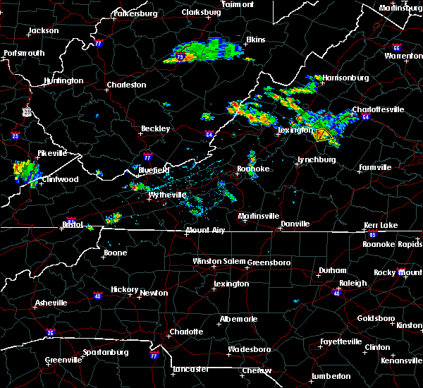
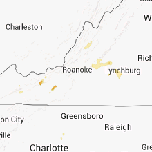
Hail Map for Deerfield, VA
The Deerfield, VA area has had 4 reports of on-the-ground hail by trained spotters, and has been under severe weather warnings 5 times during the past 12 months. Doppler radar has detected hail at or near Deerfield, VA on 20 occasions, including 1 occasion during the past year.
| Name: | Deerfield, VA |
| Where Located: | 55.2 miles SSE of Elkins, WV |
| Map: | Google Map for Deerfield, VA |
| Population: | 132 |
| Housing Units: | 78 |
| More Info: | Search Google for Deerfield, VA |
0
The Top Recent Hail Date for Deerfield, VA is Monday, August 7, 2023 (12th out of 20)

Hail and Wind Damage Spotted near Deerfield, VA
| Date / Time | Report Details |
|---|---|
| 4/2/2024 12:48 PM EDT | Trees reported down on cowpasture river roa in highland county VA, 9.2 miles S of Deerfield, VA |
| 8/7/2023 3:51 PM EDT |
 At 351 pm edt, a severe thunderstorm was located near bells valley, or 9 miles northeast of goshen, moving east at 40 mph (radar indicated). Hazards include 70 mph wind gusts and ping pong ball size hail. Damaging winds will cause some trees and large branches to fall. this could injure those outdoors, as well as damage homes and vehicles. roadways may become blocked by downed trees. localized power outages are possible. unsecured light objects may become projectiles. locations impacted include, craigsville, augusta springs, middlebrook, deerfield, west augusta, buffalo gap, summerdean, trimbles mill, christian, mint spring and swoope. thunderstorm damage threat, considerable hail threat, radar indicated max hail size, 1. 50 in wind threat, radar indicated max wind gust, 70 mph. At 351 pm edt, a severe thunderstorm was located near bells valley, or 9 miles northeast of goshen, moving east at 40 mph (radar indicated). Hazards include 70 mph wind gusts and ping pong ball size hail. Damaging winds will cause some trees and large branches to fall. this could injure those outdoors, as well as damage homes and vehicles. roadways may become blocked by downed trees. localized power outages are possible. unsecured light objects may become projectiles. locations impacted include, craigsville, augusta springs, middlebrook, deerfield, west augusta, buffalo gap, summerdean, trimbles mill, christian, mint spring and swoope. thunderstorm damage threat, considerable hail threat, radar indicated max hail size, 1. 50 in wind threat, radar indicated max wind gust, 70 mph.
|
| 8/7/2023 3:37 PM EDT |
 At 336 pm edt, a severe thunderstorm was located near burnsville, or 10 miles northwest of goshen, moving northeast at 40 mph (radar indicated). Hazards include 70 mph wind gusts and quarter size hail. Damaging winds will cause some trees and large branches to fall. this could injure those outdoors, as well as damage homes and vehicles. roadways may become blocked by downed trees. localized power outages are possible. Unsecured light objects may become projectiles. At 336 pm edt, a severe thunderstorm was located near burnsville, or 10 miles northwest of goshen, moving northeast at 40 mph (radar indicated). Hazards include 70 mph wind gusts and quarter size hail. Damaging winds will cause some trees and large branches to fall. this could injure those outdoors, as well as damage homes and vehicles. roadways may become blocked by downed trees. localized power outages are possible. Unsecured light objects may become projectiles.
|
| 7/28/2023 6:58 PM EDT |
 The severe thunderstorm warning for west central rockingham and western augusta counties will expire at 700 pm edt, the storms which prompted the warning have moved out of the area. therefore, the warning will be allowed to expire. a severe thunderstorm watch remains in effect until 1100 pm edt for western virginia. to report severe weather, contact your nearest law enforcement agency. they will relay your report to the national weather service sterling virginia. The severe thunderstorm warning for west central rockingham and western augusta counties will expire at 700 pm edt, the storms which prompted the warning have moved out of the area. therefore, the warning will be allowed to expire. a severe thunderstorm watch remains in effect until 1100 pm edt for western virginia. to report severe weather, contact your nearest law enforcement agency. they will relay your report to the national weather service sterling virginia.
|
| 7/28/2023 6:37 PM EDT |
 At 637 pm edt, severe thunderstorms were located along a line extending from 8 miles southeast of brandywine to near bells valley, moving east at 15 mph (radar indicated). Hazards include 60 mph wind gusts. Damaging winds will cause some trees and large branches to fall. this could injure those outdoors, as well as damage homes and vehicles. roadways may become blocked by downed trees. localized power outages are possible. unsecured light objects may become projectiles. locations impacted include, bridgewater, broadway, timberville, dale enterprise, dayton, craigsville, augusta springs, middlebrook, churchville, deerfield, moscow, buffalo gap, clover hill, hinton, cherry grove, singers glen, rawley springs, west augusta, summerdean and montezuma. hail threat, radar indicated max hail size, <. 75 in wind threat, radar indicated max wind gust, 60 mph. At 637 pm edt, severe thunderstorms were located along a line extending from 8 miles southeast of brandywine to near bells valley, moving east at 15 mph (radar indicated). Hazards include 60 mph wind gusts. Damaging winds will cause some trees and large branches to fall. this could injure those outdoors, as well as damage homes and vehicles. roadways may become blocked by downed trees. localized power outages are possible. unsecured light objects may become projectiles. locations impacted include, bridgewater, broadway, timberville, dale enterprise, dayton, craigsville, augusta springs, middlebrook, churchville, deerfield, moscow, buffalo gap, clover hill, hinton, cherry grove, singers glen, rawley springs, west augusta, summerdean and montezuma. hail threat, radar indicated max hail size, <. 75 in wind threat, radar indicated max wind gust, 60 mph.
|
| 7/28/2023 6:04 PM EDT |
 At 604 pm edt, severe thunderstorms were located along a line extending from near brandywine to near burnsville, moving east at 15 mph (radar indicated). Hazards include 60 mph wind gusts. Damaging winds will cause some trees and large branches to fall. this could injure those outdoors, as well as damage homes and vehicles. roadways may become blocked by downed trees. localized power outages are possible. Unsecured light objects may become projectiles. At 604 pm edt, severe thunderstorms were located along a line extending from near brandywine to near burnsville, moving east at 15 mph (radar indicated). Hazards include 60 mph wind gusts. Damaging winds will cause some trees and large branches to fall. this could injure those outdoors, as well as damage homes and vehicles. roadways may become blocked by downed trees. localized power outages are possible. Unsecured light objects may become projectiles.
|
| 6/17/2022 4:14 PM EDT |
 At 414 pm edt, a severe thunderstorm was located near monterey, moving southeast at 30 mph (radar indicated). Hazards include 60 mph wind gusts. Damaging winds will cause some trees and large branches to fall. this could injure those outdoors, as well as damage homes and vehicles. roadways may become blocked by downed trees. localized power outages are possible. Unsecured light objects may become projectiles. At 414 pm edt, a severe thunderstorm was located near monterey, moving southeast at 30 mph (radar indicated). Hazards include 60 mph wind gusts. Damaging winds will cause some trees and large branches to fall. this could injure those outdoors, as well as damage homes and vehicles. roadways may become blocked by downed trees. localized power outages are possible. Unsecured light objects may become projectiles.
|
| 8/29/2021 2:26 PM EDT |
 The severe thunderstorm warning for west central augusta and southeastern highland counties will expire at 230 pm edt, the storms which prompted the warning have weakened below severe limits, and no longer pose an immediate threat to life or property. therefore, the warning will be allowed to expire. The severe thunderstorm warning for west central augusta and southeastern highland counties will expire at 230 pm edt, the storms which prompted the warning have weakened below severe limits, and no longer pose an immediate threat to life or property. therefore, the warning will be allowed to expire.
|
| 8/29/2021 2:03 PM EDT |
 At 203 pm edt, severe thunderstorms were located along a line extending from 13 miles west of staunton to 11 miles east of burnsville, moving southeast at 10 mph (radar indicated). Hazards include 60 mph wind gusts. Damaging winds will cause some trees and large branches to fall. this could injure those outdoors, as well as damage homes and vehicles. roadways may become blocked by downed trees. localized power outages are possible. unsecured light objects may become projectiles. locations impacted include, augusta springs, churchville, deerfield, west augusta, williamsville, buffalo gap, head waters and liberty. hail threat, radar indicated max hail size, <. 75 in wind threat, radar indicated max wind gust, 60 mph. At 203 pm edt, severe thunderstorms were located along a line extending from 13 miles west of staunton to 11 miles east of burnsville, moving southeast at 10 mph (radar indicated). Hazards include 60 mph wind gusts. Damaging winds will cause some trees and large branches to fall. this could injure those outdoors, as well as damage homes and vehicles. roadways may become blocked by downed trees. localized power outages are possible. unsecured light objects may become projectiles. locations impacted include, augusta springs, churchville, deerfield, west augusta, williamsville, buffalo gap, head waters and liberty. hail threat, radar indicated max hail size, <. 75 in wind threat, radar indicated max wind gust, 60 mph.
|
| 8/29/2021 1:43 PM EDT |
 At 143 pm edt, a severe thunderstorm was located 12 miles northeast of burnsville, or 13 miles southeast of monterey, moving southeast at 10 mph (radar indicated). Hazards include 60 mph wind gusts. Damaging winds will cause some trees and large branches to fall. this could injure those outdoors, as well as damage homes and vehicles. roadways may become blocked by downed trees. localized power outages are possible. Unsecured light objects may become projectiles. At 143 pm edt, a severe thunderstorm was located 12 miles northeast of burnsville, or 13 miles southeast of monterey, moving southeast at 10 mph (radar indicated). Hazards include 60 mph wind gusts. Damaging winds will cause some trees and large branches to fall. this could injure those outdoors, as well as damage homes and vehicles. roadways may become blocked by downed trees. localized power outages are possible. Unsecured light objects may become projectiles.
|
| 5/25/2021 4:49 PM EDT | A single tree was blown down in the 8200 block of deerfield road. time estimated by rada in bath county VA, 5 miles NE of Deerfield, VA |
| 7/5/2020 6:08 PM EDT |
 The severe thunderstorm warning for west central augusta county will expire at 615 pm edt, the storm which prompted the warning has weakened below severe limits, and no longer poses an immediate threat to life or property. therefore, the warning will be allowed to expire. The severe thunderstorm warning for west central augusta county will expire at 615 pm edt, the storm which prompted the warning has weakened below severe limits, and no longer poses an immediate threat to life or property. therefore, the warning will be allowed to expire.
|
| 7/5/2020 5:41 PM EDT | Two trees were down in the deerfield are in augusta county VA, 3.2 miles WSW of Deerfield, VA |
| 7/5/2020 5:23 PM EDT |
 At 523 pm edt, a severe thunderstorm was located 16 miles southeast of monterey, moving southeast at 5 mph (radar indicated). Hazards include 60 mph wind gusts and quarter size hail. Damaging winds will cause some trees and large branches to fall. this could injure those outdoors, as well as damage homes and vehicles. roadways may become blocked by downed trees. localized power outages are possible. Unsecured light objects may become projectiles. At 523 pm edt, a severe thunderstorm was located 16 miles southeast of monterey, moving southeast at 5 mph (radar indicated). Hazards include 60 mph wind gusts and quarter size hail. Damaging winds will cause some trees and large branches to fall. this could injure those outdoors, as well as damage homes and vehicles. roadways may become blocked by downed trees. localized power outages are possible. Unsecured light objects may become projectiles.
|
| 4/9/2020 3:44 AM EDT |
 At 344 am edt, severe thunderstorms were located along a line extending from 14 miles northwest of staunton to near brownsburg, moving east at 65 mph (radar indicated). Hazards include 60 mph wind gusts. Damaging winds will cause some trees and large branches to fall. this could injure those outdoors, as well as damage homes and vehicles. roadways may become blocked by downed trees. localized power outages are possible. unsecured light objects may become projectiles. Locations impacted include, staunton, waynesboro, stuarts draft, grottoes, crimora, sherando, fishersville, verona, weyers cave, lyndhurst, craigsville, greenville, new hope, mount sidney, augusta springs, middlebrook, churchville, deerfield, hermitage and moscow. At 344 am edt, severe thunderstorms were located along a line extending from 14 miles northwest of staunton to near brownsburg, moving east at 65 mph (radar indicated). Hazards include 60 mph wind gusts. Damaging winds will cause some trees and large branches to fall. this could injure those outdoors, as well as damage homes and vehicles. roadways may become blocked by downed trees. localized power outages are possible. unsecured light objects may become projectiles. Locations impacted include, staunton, waynesboro, stuarts draft, grottoes, crimora, sherando, fishersville, verona, weyers cave, lyndhurst, craigsville, greenville, new hope, mount sidney, augusta springs, middlebrook, churchville, deerfield, hermitage and moscow.
|
| 4/9/2020 3:14 AM EDT |
 At 314 am edt, severe thunderstorms were located along a line extending from near burnsville to near nimrod hall, moving east at 65 mph (radar indicated). Hazards include 60 mph wind gusts and quarter size hail. Damaging winds will cause some trees and large branches to fall. this could injure those outdoors, as well as damage homes and vehicles. roadways may become blocked by downed trees. localized power outages are possible. Unsecured light objects may become projectiles. At 314 am edt, severe thunderstorms were located along a line extending from near burnsville to near nimrod hall, moving east at 65 mph (radar indicated). Hazards include 60 mph wind gusts and quarter size hail. Damaging winds will cause some trees and large branches to fall. this could injure those outdoors, as well as damage homes and vehicles. roadways may become blocked by downed trees. localized power outages are possible. Unsecured light objects may become projectiles.
|
| 4/8/2020 5:32 AM EDT |
 At 532 am edt, a severe thunderstorm was located 15 miles northwest of staunton, moving southeast at 70 mph (radar indicated). Hazards include 60 mph wind gusts and quarter size hail. Damaging winds will cause some trees and large branches to fall. this could injure those outdoors, as well as damage homes and vehicles. roadways may become blocked by downed trees. localized power outages are possible. Unsecured light objects may become projectiles. At 532 am edt, a severe thunderstorm was located 15 miles northwest of staunton, moving southeast at 70 mph (radar indicated). Hazards include 60 mph wind gusts and quarter size hail. Damaging winds will cause some trees and large branches to fall. this could injure those outdoors, as well as damage homes and vehicles. roadways may become blocked by downed trees. localized power outages are possible. Unsecured light objects may become projectiles.
|
| 4/7/2020 9:54 PM EDT |
 At 954 pm edt, a severe thunderstorm was located near bells valley, or 8 miles northeast of goshen, moving southeast at 35 mph (radar indicated). Hazards include 60 mph wind gusts and quarter size hail. Damaging winds will cause some trees and large branches to fall. this could injure those outdoors, as well as damage homes and vehicles. roadways may become blocked by downed trees. localized power outages are possible. Unsecured light objects may become projectiles. At 954 pm edt, a severe thunderstorm was located near bells valley, or 8 miles northeast of goshen, moving southeast at 35 mph (radar indicated). Hazards include 60 mph wind gusts and quarter size hail. Damaging winds will cause some trees and large branches to fall. this could injure those outdoors, as well as damage homes and vehicles. roadways may become blocked by downed trees. localized power outages are possible. Unsecured light objects may become projectiles.
|
| 7/21/2019 4:11 PM EDT |
 At 411 pm edt, severe thunderstorms were located along a line extending from near grottoes to 15 miles north of bells valley, moving east at 5 mph (radar indicated). Hazards include 60 mph wind gusts and quarter size hail. Damaging winds will cause some trees and large branches to fall. this could injure those outdoors, as well as damage homes and vehicles. roadways may become blocked by downed trees. localized power outages are possible. unsecured light objects may become projectiles. Locations impacted include, weyers cave, mount sidney, augusta springs, churchville, deerfield, moscow, west augusta, williamsville, buffalo gap, mount solon, sangerville, christian and staunton airport. At 411 pm edt, severe thunderstorms were located along a line extending from near grottoes to 15 miles north of bells valley, moving east at 5 mph (radar indicated). Hazards include 60 mph wind gusts and quarter size hail. Damaging winds will cause some trees and large branches to fall. this could injure those outdoors, as well as damage homes and vehicles. roadways may become blocked by downed trees. localized power outages are possible. unsecured light objects may become projectiles. Locations impacted include, weyers cave, mount sidney, augusta springs, churchville, deerfield, moscow, west augusta, williamsville, buffalo gap, mount solon, sangerville, christian and staunton airport.
|
| 7/21/2019 3:53 PM EDT |
 At 352 pm edt, severe thunderstorms were located along a line extending from 9 miles north of staunton to 14 miles northeast of bells valley, moving slowly eastward (radar indicated). Hazards include 60 mph wind gusts and quarter size hail. Damaging winds will cause some trees and large branches to fall. this could injure those outdoors, as well as damage homes and vehicles. roadways may become blocked by downed trees. localized power outages are possible. Unsecured light objects may become projectiles. At 352 pm edt, severe thunderstorms were located along a line extending from 9 miles north of staunton to 14 miles northeast of bells valley, moving slowly eastward (radar indicated). Hazards include 60 mph wind gusts and quarter size hail. Damaging winds will cause some trees and large branches to fall. this could injure those outdoors, as well as damage homes and vehicles. roadways may become blocked by downed trees. localized power outages are possible. Unsecured light objects may become projectiles.
|
| 7/15/2019 3:45 PM EDT |
 At 345 pm edt, a severe thunderstorm was located 11 miles northeast of burnsville, or 12 miles southeast of monterey, moving east at 10 mph (radar indicated). Hazards include 60 mph wind gusts and quarter size hail. Damaging winds will cause some trees and large branches to fall. this could injure those outdoors, as well as damage homes and vehicles. roadways may become blocked by downed trees. localized power outages are possible. Unsecured light objects may become projectiles. At 345 pm edt, a severe thunderstorm was located 11 miles northeast of burnsville, or 12 miles southeast of monterey, moving east at 10 mph (radar indicated). Hazards include 60 mph wind gusts and quarter size hail. Damaging winds will cause some trees and large branches to fall. this could injure those outdoors, as well as damage homes and vehicles. roadways may become blocked by downed trees. localized power outages are possible. Unsecured light objects may become projectiles.
|
| 5/31/2019 5:02 PM EDT |
 At 501 pm edt, a severe thunderstorm was located over goshen, moving northeast at 15 mph (radar indicated). Hazards include 60 mph wind gusts and quarter size hail. Damaging winds will cause some trees and large branches to fall. this could injure those outdoors, as well as damage homes and vehicles. roadways may become blocked by downed trees. localized power outages are possible. Unsecured light objects may become projectiles. At 501 pm edt, a severe thunderstorm was located over goshen, moving northeast at 15 mph (radar indicated). Hazards include 60 mph wind gusts and quarter size hail. Damaging winds will cause some trees and large branches to fall. this could injure those outdoors, as well as damage homes and vehicles. roadways may become blocked by downed trees. localized power outages are possible. Unsecured light objects may become projectiles.
|
| 8/12/2018 12:55 PM EDT |
 At 1255 pm edt, severe thunderstorms were located along a line extending from near timberville to 12 miles west of bridgewater, moving east at 25 mph (radar indicated). Hazards include 60 mph wind gusts. Damaging winds will cause some trees and large branches to fall. this could injure those outdoors, as well as damage homes and vehicles. roadways may become blocked by downed trees. localized power outages are possible. Unsecured light objects may become projectiles. At 1255 pm edt, severe thunderstorms were located along a line extending from near timberville to 12 miles west of bridgewater, moving east at 25 mph (radar indicated). Hazards include 60 mph wind gusts. Damaging winds will cause some trees and large branches to fall. this could injure those outdoors, as well as damage homes and vehicles. roadways may become blocked by downed trees. localized power outages are possible. Unsecured light objects may become projectiles.
|
| 5/14/2018 5:42 PM EDT |
 At 542 pm edt, severe thunderstorms were located along a line extending from bridgewater to 7 miles northeast of bells valley, moving southeast at 30 mph (radar indicated). Hazards include 60 mph wind gusts and quarter size hail. Damaging winds will cause some trees and large branches to fall. this could injure those outdoors, as well as damage homes and vehicles. roadways may become blocked by downed trees. localized power outages are possible. Unsecured light objects may become projectiles. At 542 pm edt, severe thunderstorms were located along a line extending from bridgewater to 7 miles northeast of bells valley, moving southeast at 30 mph (radar indicated). Hazards include 60 mph wind gusts and quarter size hail. Damaging winds will cause some trees and large branches to fall. this could injure those outdoors, as well as damage homes and vehicles. roadways may become blocked by downed trees. localized power outages are possible. Unsecured light objects may become projectiles.
|
| 4/15/2018 7:50 PM EDT |
 At 749 pm edt, a line of severe thunderstorms were located along a line extending from 14 miles southeast of monterey to 7 miles southwest of staunton to near lowesville, moving north at 40 mph (radar indicated). Hazards include 60 mph wind gusts and quarter size hail. Damaging winds will cause some trees and large branches to fall. this could injure those outdoors, as well as damage homes and vehicles. roadways may become blocked by downed trees. localized power outages are possible. unsecured light objects may become projectiles. Locations impacted include, staunton, waynesboro, stuarts draft, sherando, shipman, schuyler, wintergreen, montebello, fishersville, verona, lyndhurst, nellysford, craigsville, greenville, arrington, lovingston, augusta springs, middlebrook, churchville and deerfield. At 749 pm edt, a line of severe thunderstorms were located along a line extending from 14 miles southeast of monterey to 7 miles southwest of staunton to near lowesville, moving north at 40 mph (radar indicated). Hazards include 60 mph wind gusts and quarter size hail. Damaging winds will cause some trees and large branches to fall. this could injure those outdoors, as well as damage homes and vehicles. roadways may become blocked by downed trees. localized power outages are possible. unsecured light objects may become projectiles. Locations impacted include, staunton, waynesboro, stuarts draft, sherando, shipman, schuyler, wintergreen, montebello, fishersville, verona, lyndhurst, nellysford, craigsville, greenville, arrington, lovingston, augusta springs, middlebrook, churchville and deerfield.
|
| 4/15/2018 7:10 PM EDT |
 At 708 pm edt, a line of severe thunderstorms were located along a line extending from near goshen to cornwall to near madison heights, moving north at 50 mph (radar indicated). Hazards include 60 mph wind gusts and quarter size hail. Damaging winds will cause some trees and large branches to fall. this could injure those outdoors, as well as damage homes and vehicles. roadways may become blocked by downed trees. localized power outages are possible. Unsecured light objects may become projectiles. At 708 pm edt, a line of severe thunderstorms were located along a line extending from near goshen to cornwall to near madison heights, moving north at 50 mph (radar indicated). Hazards include 60 mph wind gusts and quarter size hail. Damaging winds will cause some trees and large branches to fall. this could injure those outdoors, as well as damage homes and vehicles. roadways may become blocked by downed trees. localized power outages are possible. Unsecured light objects may become projectiles.
|
| 3/1/2017 12:08 PM EST |
 At 1208 pm est, severe thunderstorms were located along a line extending from near mathias to near bells valley, moving east at 50 mph (radar indicated). Hazards include 60 mph wind gusts. Damaging winds will cause some trees and large branches to fall. this could injure those outdoors, as well as damage homes and vehicles. roadways may become blocked by downed trees. localized power outages are possible. unsecured light objects may become projectiles. Locations impacted include, harrisonburg, staunton, waynesboro, front royal, strasburg, woodstock, stuarts draft, bridgewater, crozet, luray, broadway, grottoes, timberville, shenandoah, massanutten, crimora, mount jackson, stanley, sherando and wintergreen. At 1208 pm est, severe thunderstorms were located along a line extending from near mathias to near bells valley, moving east at 50 mph (radar indicated). Hazards include 60 mph wind gusts. Damaging winds will cause some trees and large branches to fall. this could injure those outdoors, as well as damage homes and vehicles. roadways may become blocked by downed trees. localized power outages are possible. unsecured light objects may become projectiles. Locations impacted include, harrisonburg, staunton, waynesboro, front royal, strasburg, woodstock, stuarts draft, bridgewater, crozet, luray, broadway, grottoes, timberville, shenandoah, massanutten, crimora, mount jackson, stanley, sherando and wintergreen.
|
| 3/1/2017 11:56 AM EST |
 At 1156 am est, severe thunderstorms were located along a line extending from near rough run to near yost, moving east at 50 mph (radar indicated). Hazards include 60 mph wind gusts. Damaging winds will cause some trees and large branches to fall. this could injure those outdoors, as well as damage homes and vehicles. roadways may become blocked by downed trees. localized power outages are possible. Unsecured light objects may become projectiles. At 1156 am est, severe thunderstorms were located along a line extending from near rough run to near yost, moving east at 50 mph (radar indicated). Hazards include 60 mph wind gusts. Damaging winds will cause some trees and large branches to fall. this could injure those outdoors, as well as damage homes and vehicles. roadways may become blocked by downed trees. localized power outages are possible. Unsecured light objects may become projectiles.
|
| 6/16/2016 7:22 PM EDT |
 At 722 pm edt, severe thunderstorms were located along a line extending from 7 miles southeast of wardensville to near broadway to 12 miles west of staunton, moving east at 45 mph (radar indicated). Hazards include 60 mph wind gusts and quarter size hail. Damaging winds will cause some trees and large branches to fall. this could injure those outdoors, as well as damage homes and vehicles. roadways may become blocked by downed trees. localized power outages are possible. unsecured light objects may become projectiles. Locations impacted include, harrisonburg, staunton, waynesboro, stuarts draft, bridgewater, luray, broadway, grottoes, timberville, shenandoah, massanutten, crimora, mount jackson, stanley, dale enterprise, big meadows, basye-bryce mountain, fishersville, woodstock and verona. At 722 pm edt, severe thunderstorms were located along a line extending from 7 miles southeast of wardensville to near broadway to 12 miles west of staunton, moving east at 45 mph (radar indicated). Hazards include 60 mph wind gusts and quarter size hail. Damaging winds will cause some trees and large branches to fall. this could injure those outdoors, as well as damage homes and vehicles. roadways may become blocked by downed trees. localized power outages are possible. unsecured light objects may become projectiles. Locations impacted include, harrisonburg, staunton, waynesboro, stuarts draft, bridgewater, luray, broadway, grottoes, timberville, shenandoah, massanutten, crimora, mount jackson, stanley, dale enterprise, big meadows, basye-bryce mountain, fishersville, woodstock and verona.
|
| 6/16/2016 6:55 PM EDT |
 At 654 pm edt, severe thunderstorms were located along a line extending from 6 miles east of moorefield to near brandywine to 6 miles northeast of burnsville, moving east at 45 mph (radar indicated). Hazards include 60 mph wind gusts and quarter size hail. Damaging winds will cause some trees and large branches to fall. this could injure those outdoors, as well as damage homes and vehicles. roadways may become blocked by downed trees. localized power outages are possible. Unsecured light objects may become projectiles. At 654 pm edt, severe thunderstorms were located along a line extending from 6 miles east of moorefield to near brandywine to 6 miles northeast of burnsville, moving east at 45 mph (radar indicated). Hazards include 60 mph wind gusts and quarter size hail. Damaging winds will cause some trees and large branches to fall. this could injure those outdoors, as well as damage homes and vehicles. roadways may become blocked by downed trees. localized power outages are possible. Unsecured light objects may become projectiles.
|
| 7/18/2015 5:55 PM EDT |
 The severe thunderstorm warning for west central augusta and southeastern highland counties will expire at 600 pm edt, the storm which prompted the warning has weakened below severe limits, and no longer poses an immediate threat to life or property. therefore the warning will be allowed to expire. The severe thunderstorm warning for west central augusta and southeastern highland counties will expire at 600 pm edt, the storm which prompted the warning has weakened below severe limits, and no longer poses an immediate threat to life or property. therefore the warning will be allowed to expire.
|
| 7/18/2015 5:35 PM EDT |
 At 535 pm edt, doppler radar indicated a severe thunderstorm capable of producing quarter size hail and damaging winds in excess of 60 mph. this storm was located 13 miles northeast of burnsville, or 19 miles north of goshen, moving south at 15 mph. locations impacted include, liberty and deerfield. At 535 pm edt, doppler radar indicated a severe thunderstorm capable of producing quarter size hail and damaging winds in excess of 60 mph. this storm was located 13 miles northeast of burnsville, or 19 miles north of goshen, moving south at 15 mph. locations impacted include, liberty and deerfield.
|
| 7/18/2015 5:13 PM EDT |
 At 512 pm edt, doppler radar indicated a severe thunderstorm capable of producing quarter size hail and damaging winds in excess of 60 mph. this storm was located 14 miles northeast of burnsville, or 21 miles east of greenbank, and moving south at 10 mph. At 512 pm edt, doppler radar indicated a severe thunderstorm capable of producing quarter size hail and damaging winds in excess of 60 mph. this storm was located 14 miles northeast of burnsville, or 21 miles east of greenbank, and moving south at 10 mph.
|
| 6/11/2014 12:06 AM EDT | One tree down near fish hatchery. time from rada in bath county VA, 9.7 miles E of Deerfield, VA |
| 8/1/2012 4:25 PM EDT | Half Dollar sized hail reported 9 miles ESE of Deerfield, VA |
| 7/30/2012 8:00 PM EDT | Trees down on indian draft roa in bath county VA, 10.6 miles ENE of Deerfield, VA |
| 8/21/2011 12:06 PM EDT | Quarter sized hail reported 9 miles ESE of Deerfield, VA, leaves were shredded by hail |
| 1/1/0001 12:00 AM | Trees were down in deerfiel in augusta county VA, 0.2 miles SW of Deerfield, VA |
| 1/1/0001 12:00 AM | Quarter sized hail reported 9.1 miles S of Deerfield, VA |
| 1/1/0001 12:00 AM | Many branches down from thunderstorm wind gusts in heavy rain in augusta county VA, 7.4 miles SW of Deerfield, VA |
| 1/1/0001 12:00 AM | Quarter sized hail reported 4.9 miles SW of Deerfield, VA |
Hail Maps for Deerfield, VA


Connect with Interactive Hail Maps