

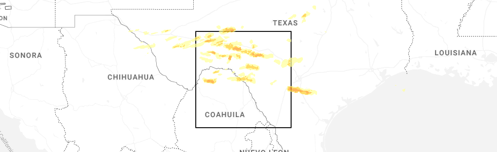
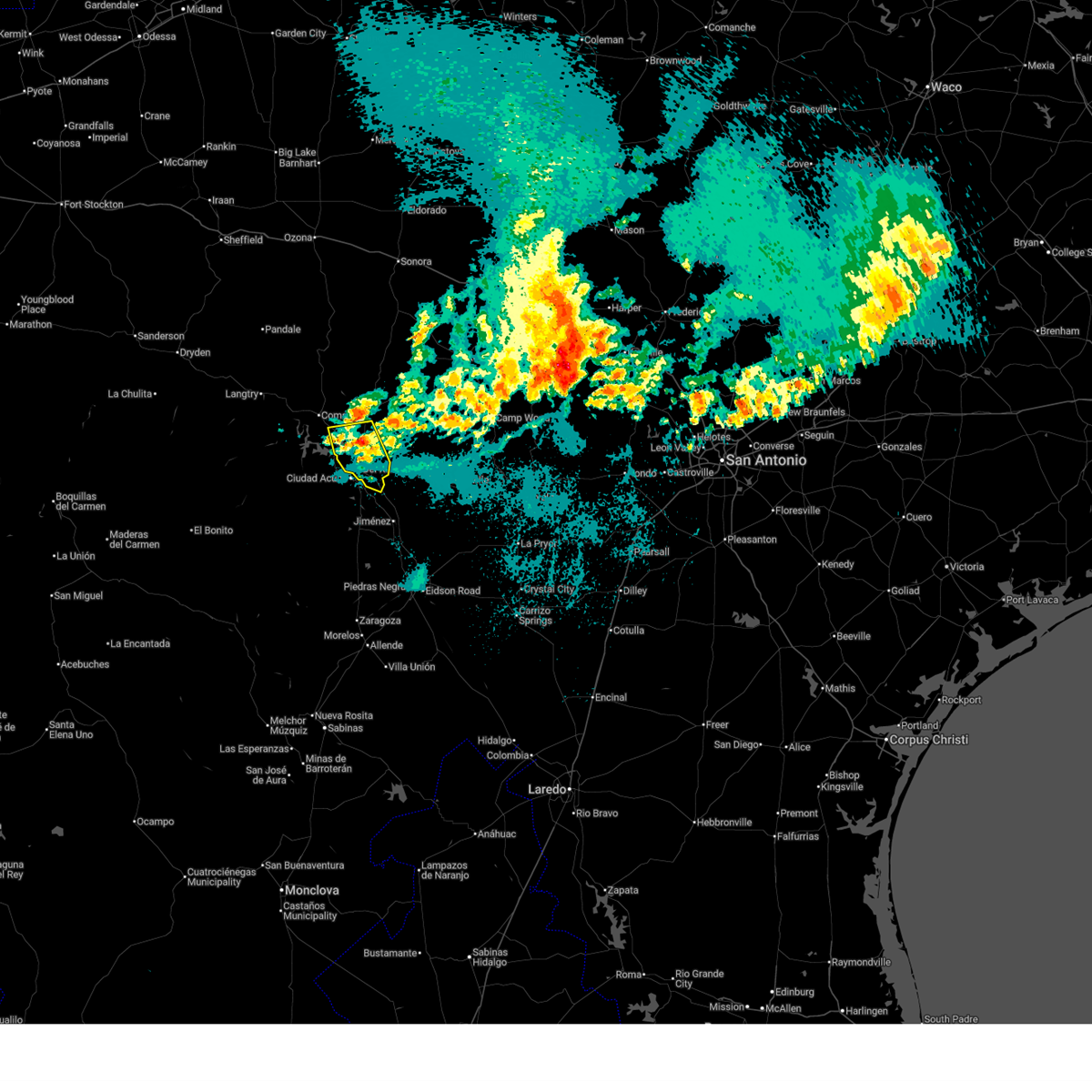
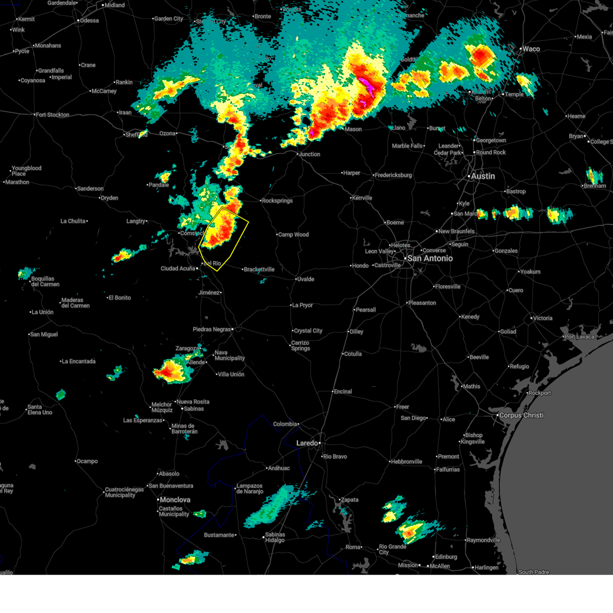
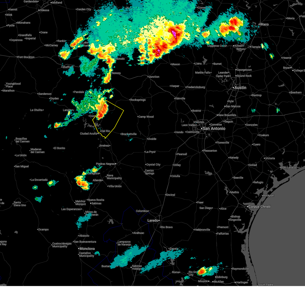
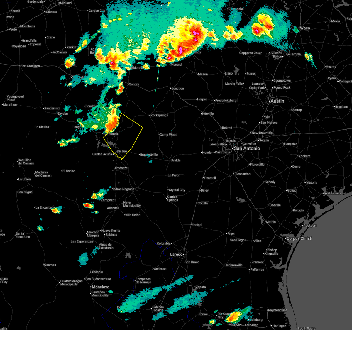
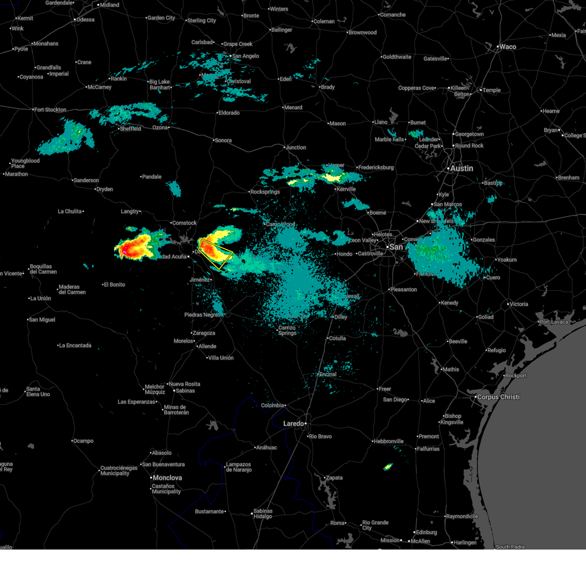
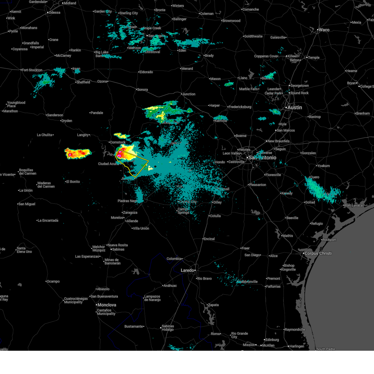
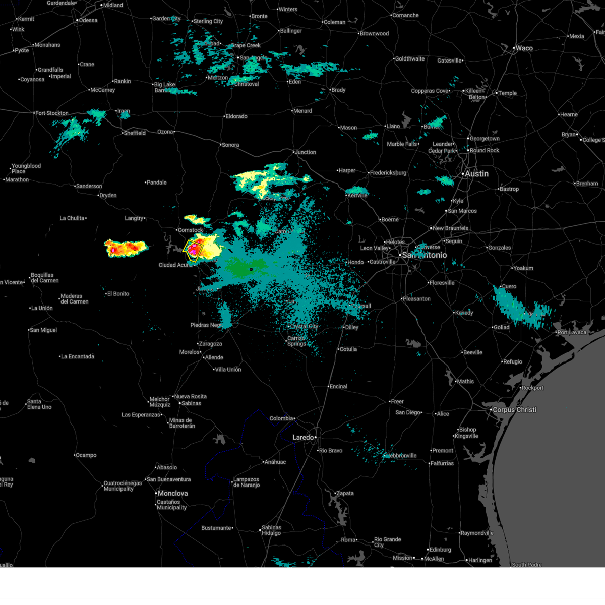
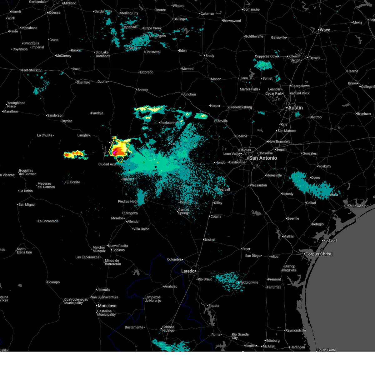
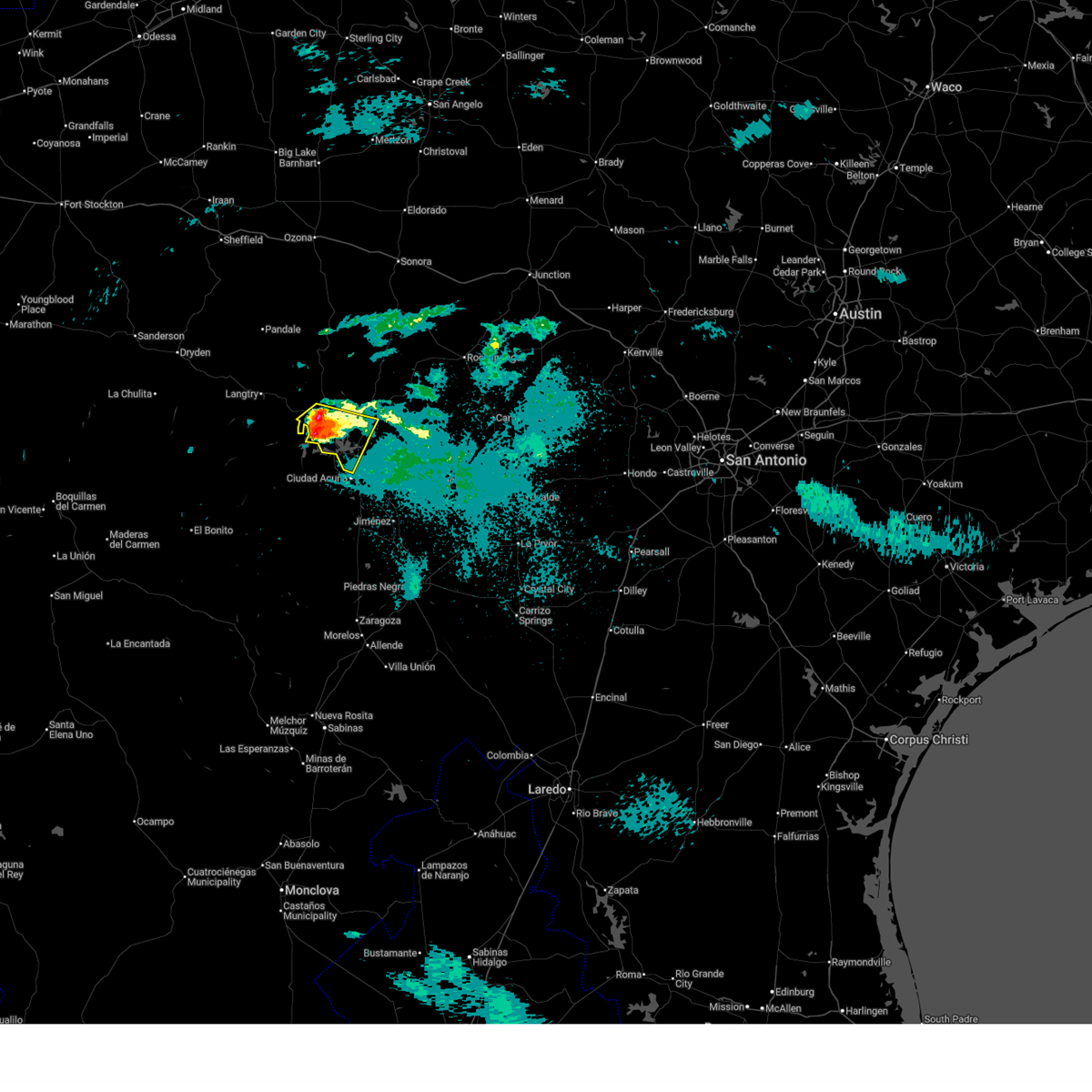
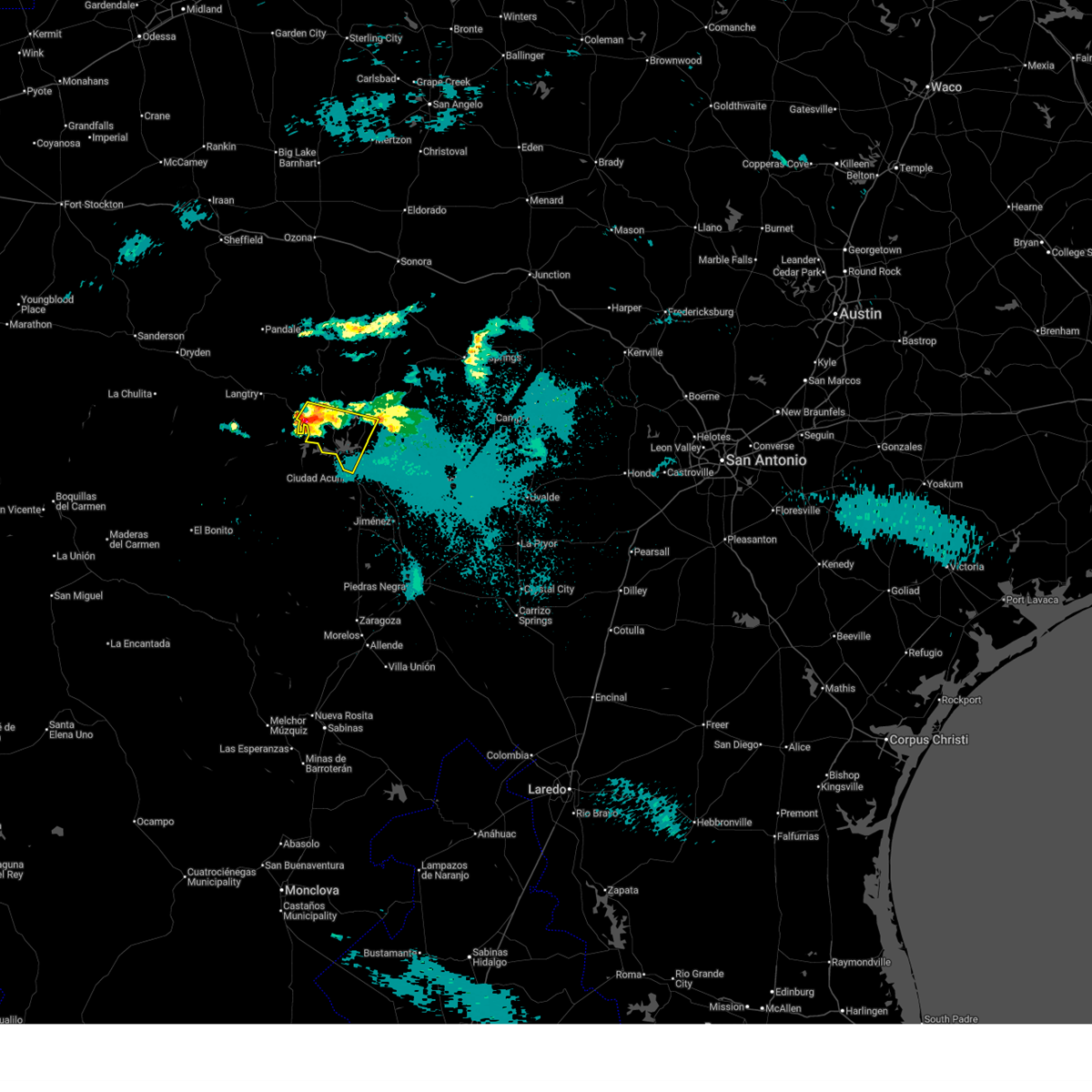
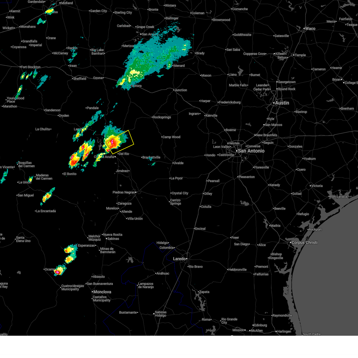
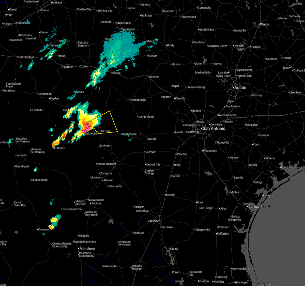
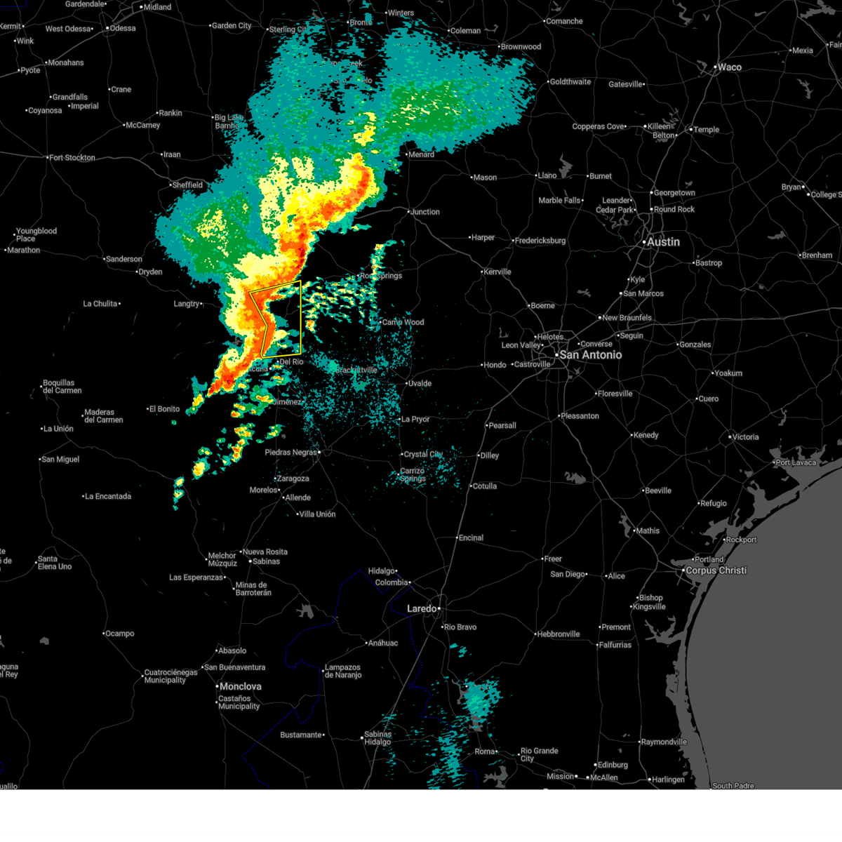
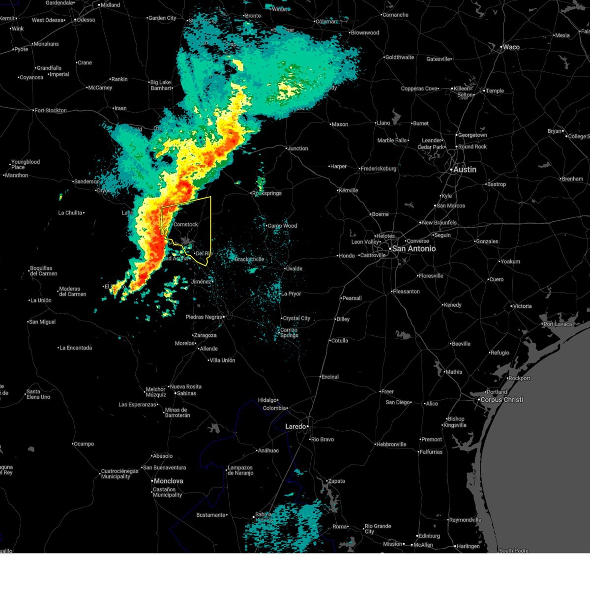
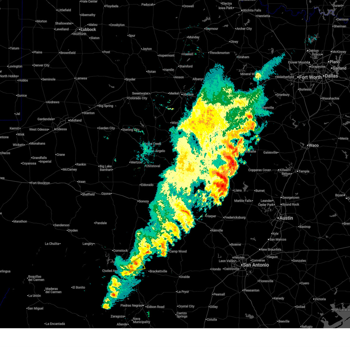
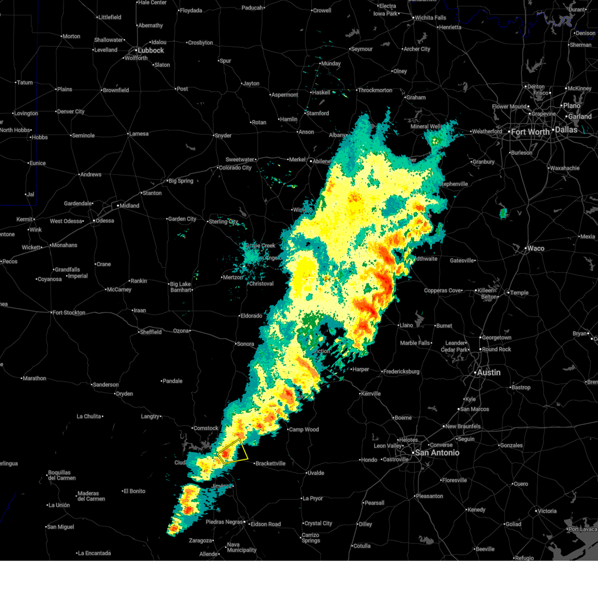
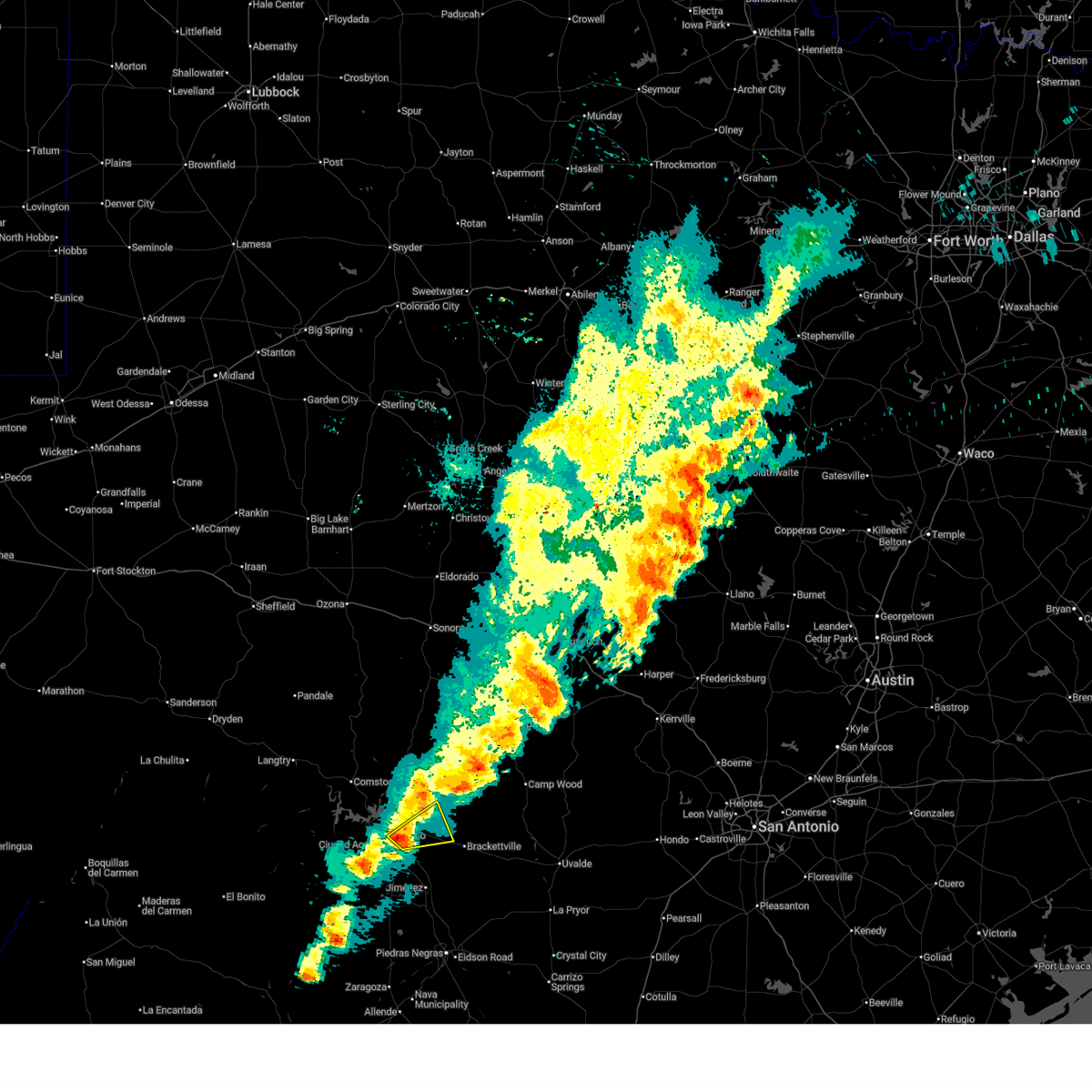
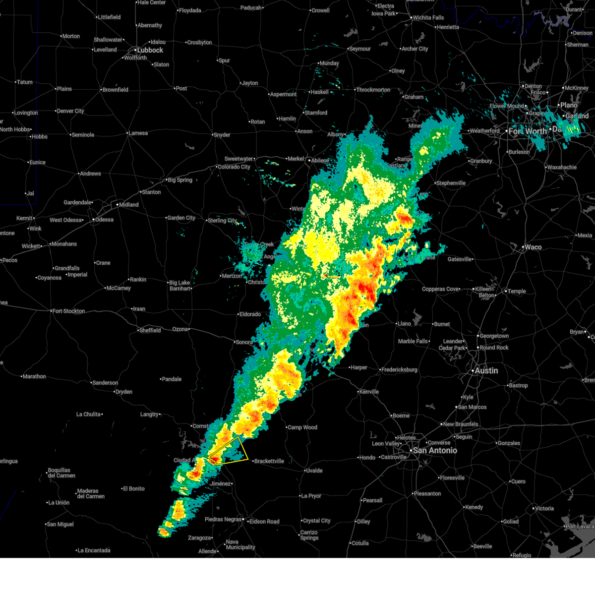
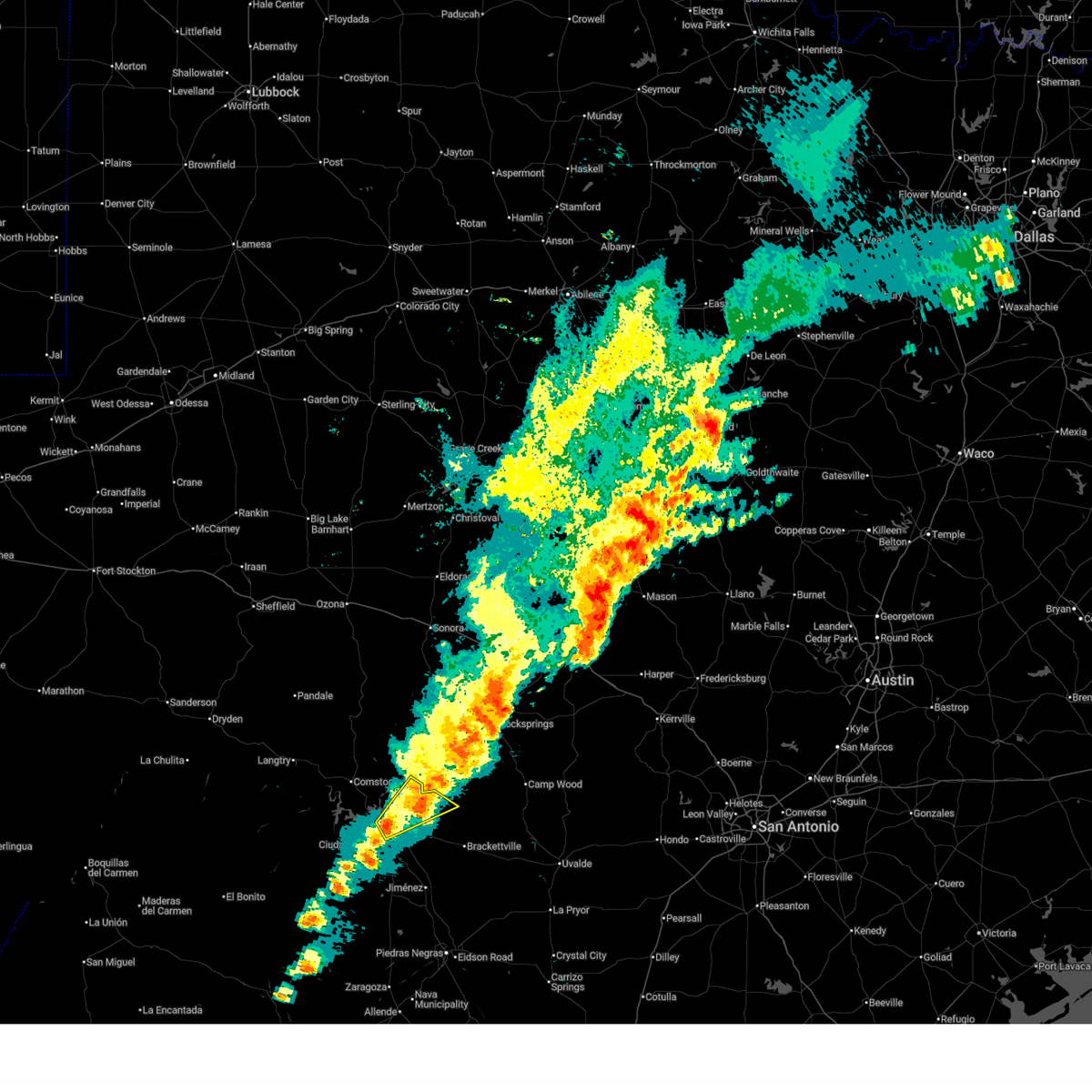
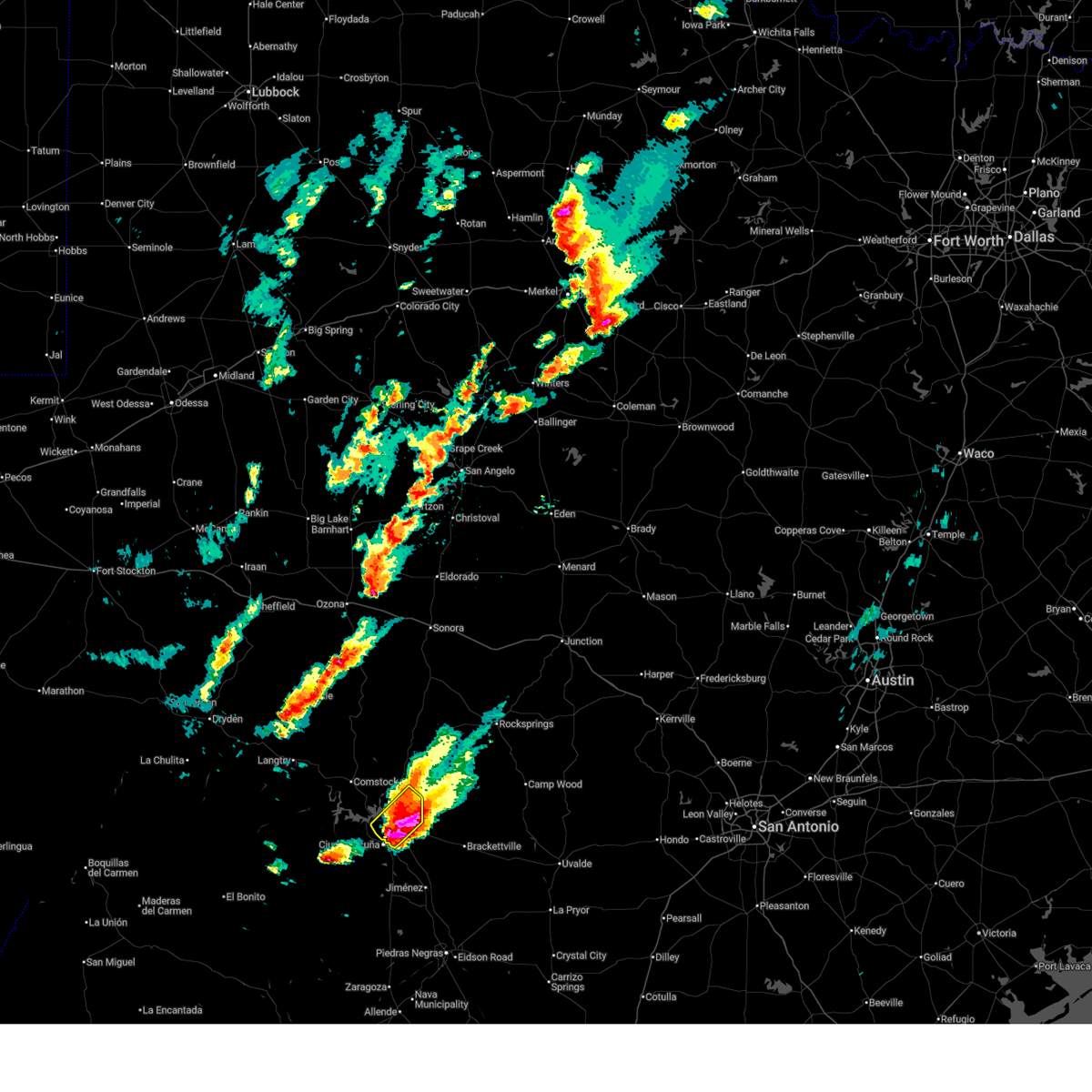
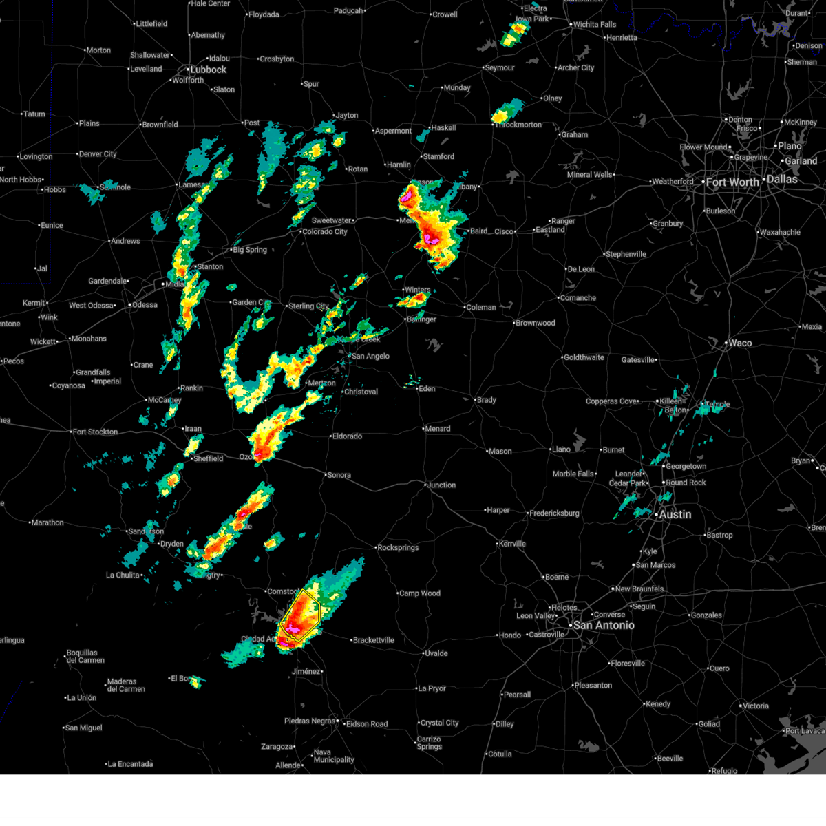
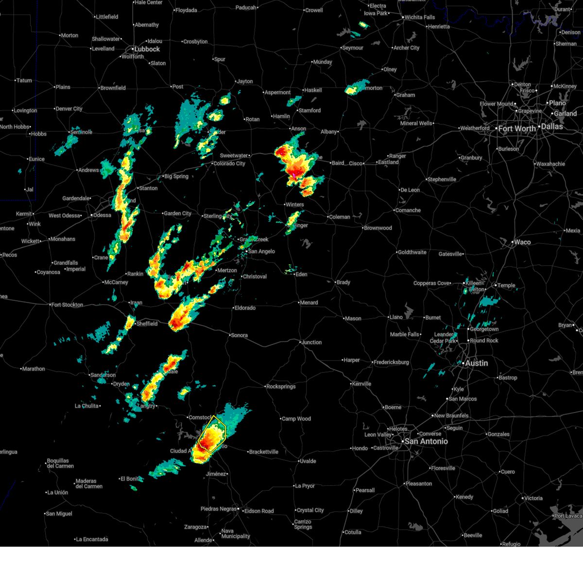
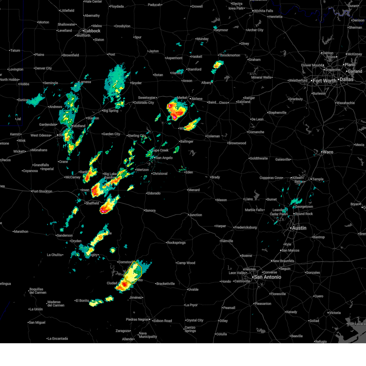
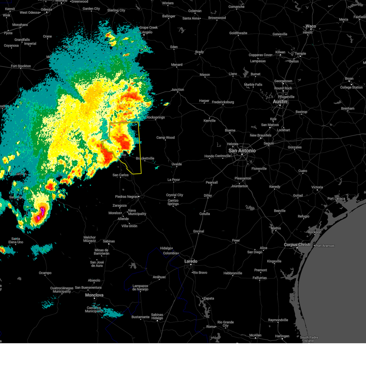
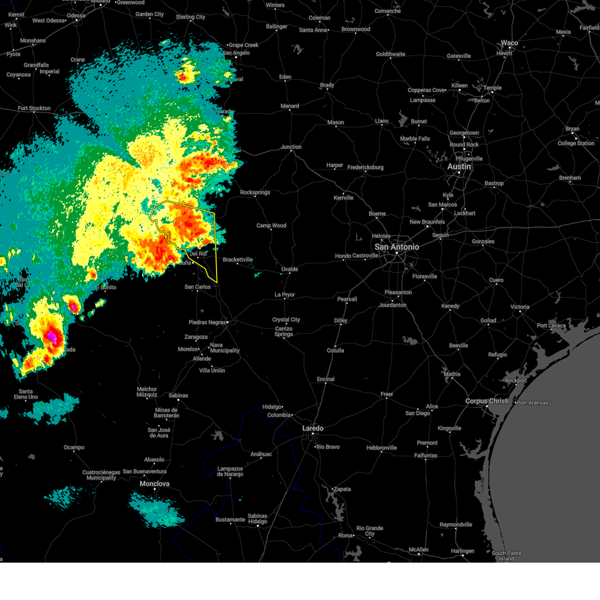
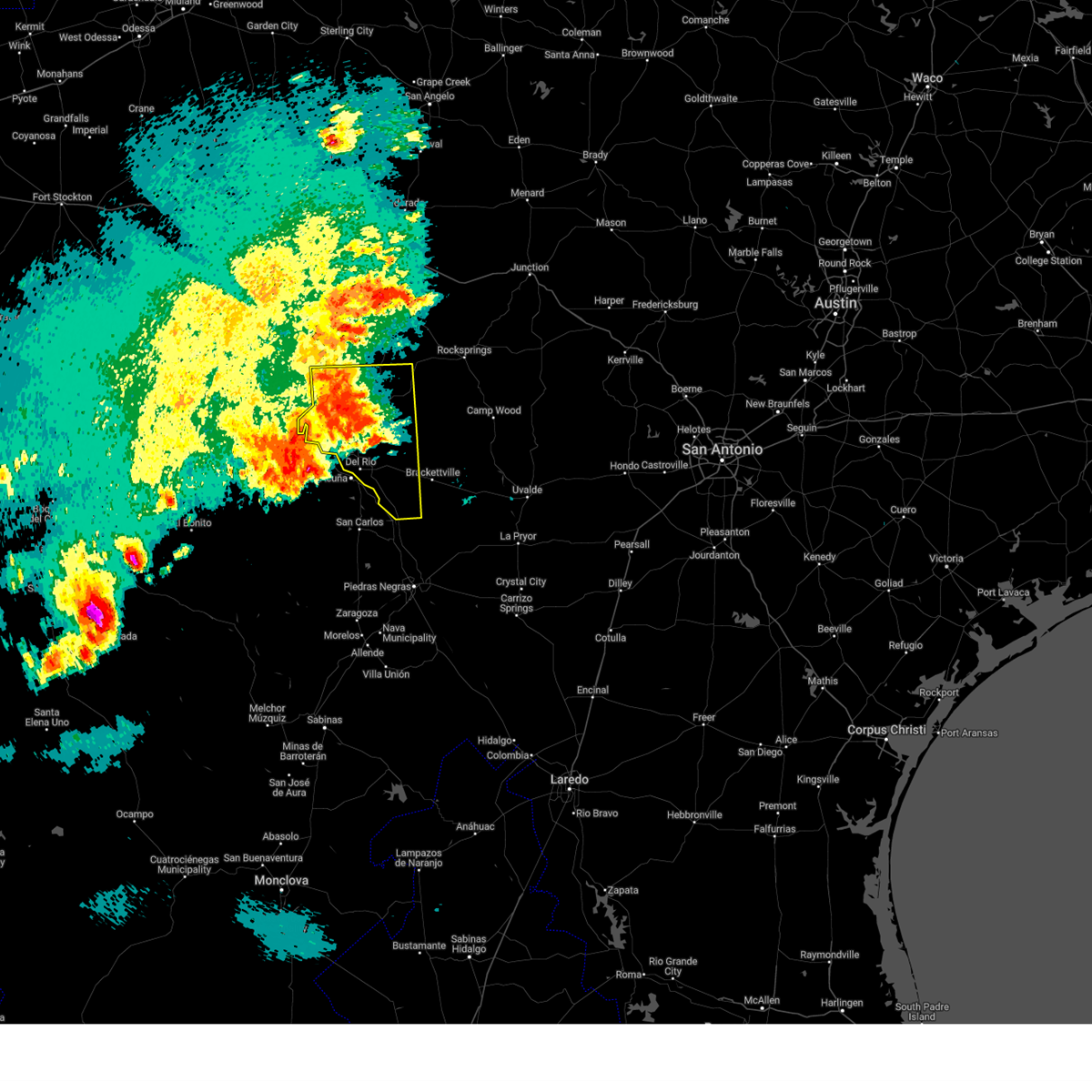
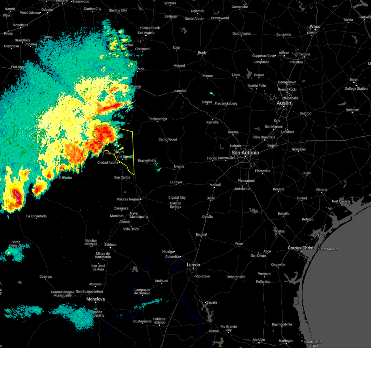
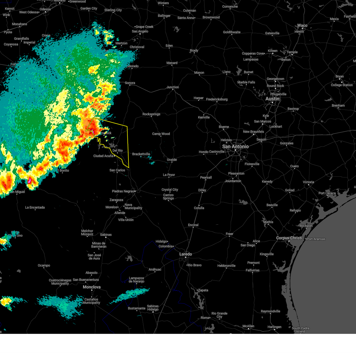
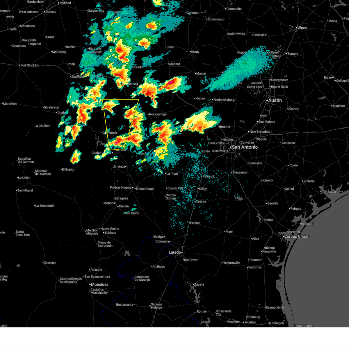
Hail Map for Del Rio, TX
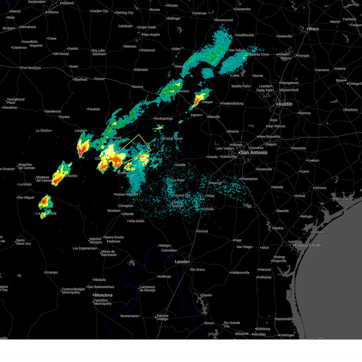
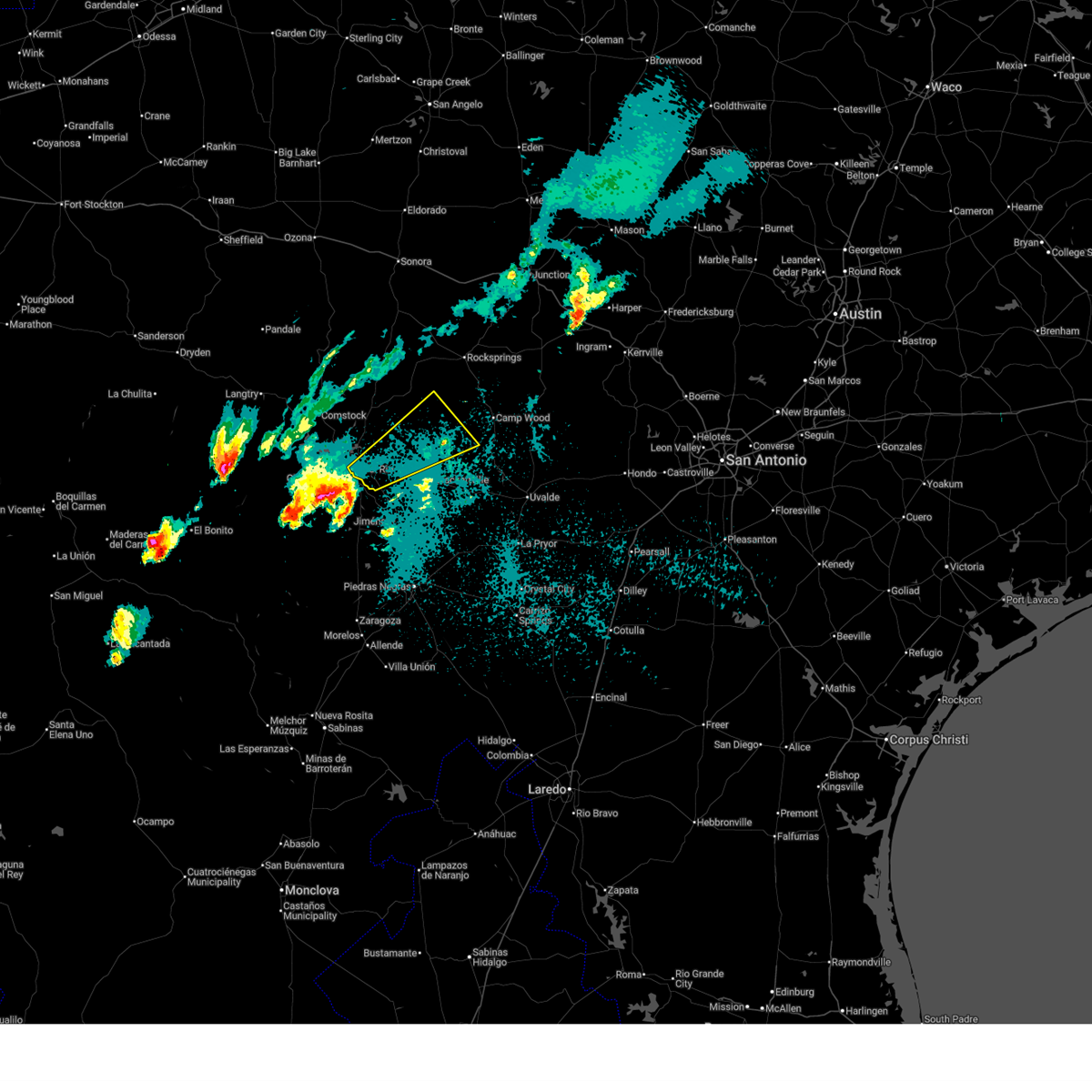
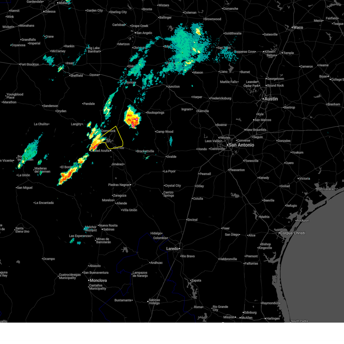
The Del Rio, TX area has had 52 reports of on-the-ground hail by trained spotters, and has been under severe weather warnings 43 times during the past 12 months. Doppler radar has detected hail at or near Del Rio, TX on 79 occasions, including 10 occasions during the past year.
| Name: | Del Rio, TX |
| Where Located: | 0.9 miles E of Del Rio, TX |
| Map: | Google Map for Del Rio, TX |
| Population: | 35591 |
| Housing Units: | 12958 |
| More Info: | Search Google for Del Rio, TX |
2
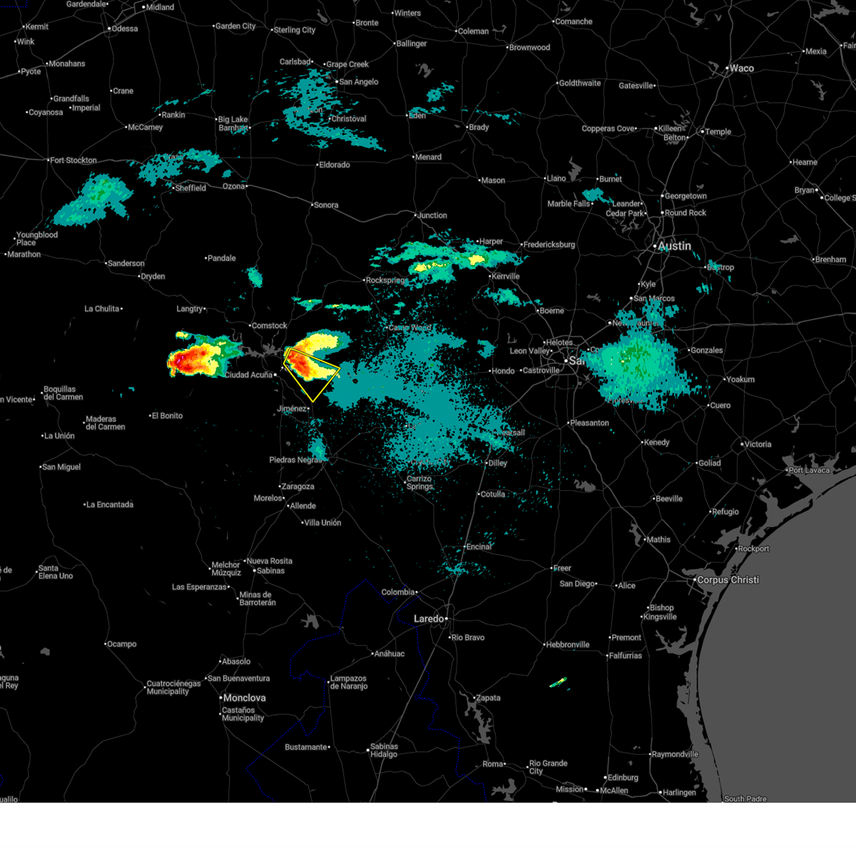
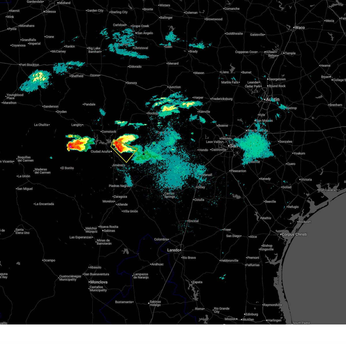
The Top Recent Hail Date for Del Rio, TX is Friday, October 24, 2025 (7th out of 79)
Hail and Wind Damage Spotted near Del Rio, TX
| Date / Time | Report Details |
|---|---|
| 5/19/2026 11:03 PM CDT |
 At 1103 pm cdt, a severe thunderstorm was located over laughlin afb, or 7 miles east of del rio, moving southeast at 15 mph (radar indicated). Hazards include 60 mph wind gusts and half dollar size hail. Hail damage to vehicles is expected. expect wind damage to roofs, siding, and trees. Locations impacted include, del rio, laughlin afb, val verde park, and escondido estates. At 1103 pm cdt, a severe thunderstorm was located over laughlin afb, or 7 miles east of del rio, moving southeast at 15 mph (radar indicated). Hazards include 60 mph wind gusts and half dollar size hail. Hail damage to vehicles is expected. expect wind damage to roofs, siding, and trees. Locations impacted include, del rio, laughlin afb, val verde park, and escondido estates.
|
| 5/19/2026 10:50 PM CDT |
 Svrewx the national weather service in austin san antonio has issued a * severe thunderstorm warning for, southwestern kinney county in south central texas, southeastern val verde county in south central texas, * until 1145 pm cdt. * at 1050 pm cdt, a severe thunderstorm was located over laughlin afb, or near del rio, moving southeast at 15 mph (radar indicated). Hazards include 60 mph wind gusts and half dollar size hail. Hail damage to vehicles is expected. Expect wind damage to roofs, siding, and trees. Svrewx the national weather service in austin san antonio has issued a * severe thunderstorm warning for, southwestern kinney county in south central texas, southeastern val verde county in south central texas, * until 1145 pm cdt. * at 1050 pm cdt, a severe thunderstorm was located over laughlin afb, or near del rio, moving southeast at 15 mph (radar indicated). Hazards include 60 mph wind gusts and half dollar size hail. Hail damage to vehicles is expected. Expect wind damage to roofs, siding, and trees.
|
| 5/19/2026 10:40 PM CDT | Quarter sized hail reported 2.6 miles W of Del Rio, TX, social media picture; val verde estates. |
| 5/19/2026 10:36 PM CDT |
 At 1036 pm cdt, a severe thunderstorm was located over del rio, moving southeast at 15 mph (radar indicated). Hazards include 60 mph wind gusts and half dollar size hail. Hail damage to vehicles is expected. expect wind damage to roofs, siding, and trees. Locations impacted include, del rio, lake view, val verde park, cienegas terrace, laughlin afb, escondido estates, lake ridge ranch, 277 south boat ramp, and san pedro canyon. At 1036 pm cdt, a severe thunderstorm was located over del rio, moving southeast at 15 mph (radar indicated). Hazards include 60 mph wind gusts and half dollar size hail. Hail damage to vehicles is expected. expect wind damage to roofs, siding, and trees. Locations impacted include, del rio, lake view, val verde park, cienegas terrace, laughlin afb, escondido estates, lake ridge ranch, 277 south boat ramp, and san pedro canyon.
|
| 5/19/2026 10:17 PM CDT |
 Svrewx the national weather service in austin san antonio has issued a * severe thunderstorm warning for, southeastern val verde county in south central texas, * until 1115 pm cdt. * at 1016 pm cdt, a severe thunderstorm was located near lake view, or near del rio, moving southeast at 10 mph (radar indicated). Hazards include 60 mph wind gusts and quarter size hail. Hail damage to vehicles is expected. Expect wind damage to roofs, siding, and trees. Svrewx the national weather service in austin san antonio has issued a * severe thunderstorm warning for, southeastern val verde county in south central texas, * until 1115 pm cdt. * at 1016 pm cdt, a severe thunderstorm was located near lake view, or near del rio, moving southeast at 10 mph (radar indicated). Hazards include 60 mph wind gusts and quarter size hail. Hail damage to vehicles is expected. Expect wind damage to roofs, siding, and trees.
|
| 5/10/2026 7:35 PM CDT |
 At 734 pm cdt, severe thunderstorms were located along a line extending from 14 miles southeast of carta valley to 14 miles north of amanda to 7 miles northeast of val verde park, moving southeast at 30 mph (radar indicated). Hazards include 70 mph wind gusts and quarter size hail. Hail damage to vehicles is expected. expect considerable tree damage. wind damage is also likely to mobile homes, roofs, and outbuildings. Locations impacted include, del rio, val verde park, carta valley, amanda, laughlin afb, 277 north campground, escondido estates, 277 south boat ramp, kickapoo cavern state park and farm to market road 2523. At 734 pm cdt, severe thunderstorms were located along a line extending from 14 miles southeast of carta valley to 14 miles north of amanda to 7 miles northeast of val verde park, moving southeast at 30 mph (radar indicated). Hazards include 70 mph wind gusts and quarter size hail. Hail damage to vehicles is expected. expect considerable tree damage. wind damage is also likely to mobile homes, roofs, and outbuildings. Locations impacted include, del rio, val verde park, carta valley, amanda, laughlin afb, 277 north campground, escondido estates, 277 south boat ramp, kickapoo cavern state park and farm to market road 2523.
|
| 5/10/2026 7:08 PM CDT |
 At 707 pm cdt, severe thunderstorms were located along a line extending from near carta valley to 17 miles south of loma alta to near long point, moving southeast at 30 mph (radar indicated). Hazards include 70 mph wind gusts and quarter size hail. Hail damage to vehicles is expected. expect considerable tree damage. wind damage is also likely to mobile homes, roofs, and outbuildings. Locations impacted include, del rio, loma alta, lake view, black brush point, amanda, laughlin afb, val verde park, diablo east, carta valley, cienegas terrace, long point, governors landing, devils shores, pafford crossing, 277 south boat ramp, 277 north campground, san pedro canyon, rough canyon recreation area, spur 406 campground, vinegarone and state highways 277 and 377. At 707 pm cdt, severe thunderstorms were located along a line extending from near carta valley to 17 miles south of loma alta to near long point, moving southeast at 30 mph (radar indicated). Hazards include 70 mph wind gusts and quarter size hail. Hail damage to vehicles is expected. expect considerable tree damage. wind damage is also likely to mobile homes, roofs, and outbuildings. Locations impacted include, del rio, loma alta, lake view, black brush point, amanda, laughlin afb, val verde park, diablo east, carta valley, cienegas terrace, long point, governors landing, devils shores, pafford crossing, 277 south boat ramp, 277 north campground, san pedro canyon, rough canyon recreation area, spur 406 campground, vinegarone and state highways 277 and 377.
|
| 5/10/2026 6:51 PM CDT |
 Svrewx the national weather service in austin san antonio has issued a * severe thunderstorm warning for, northwestern kinney county in south central texas, southwestern edwards county in south central texas, southeastern val verde county in south central texas, * until 745 pm cdt. * at 650 pm cdt, severe thunderstorms were located along a line extending from near loma alta to 12 miles west of carta valley to 6 miles southeast of comstock, moving southeast at 30 mph (radar indicated). Hazards include 60 mph wind gusts and quarter size hail. Hail damage to vehicles is expected. Expect wind damage to roofs, siding, and trees. Svrewx the national weather service in austin san antonio has issued a * severe thunderstorm warning for, northwestern kinney county in south central texas, southwestern edwards county in south central texas, southeastern val verde county in south central texas, * until 745 pm cdt. * at 650 pm cdt, severe thunderstorms were located along a line extending from near loma alta to 12 miles west of carta valley to 6 miles southeast of comstock, moving southeast at 30 mph (radar indicated). Hazards include 60 mph wind gusts and quarter size hail. Hail damage to vehicles is expected. Expect wind damage to roofs, siding, and trees.
|
| 4/29/2026 10:49 PM CDT |
 At 1048 pm cdt, a severe thunderstorm was located over amanda, or 11 miles east of del rio, moving east at 25 mph (radar indicated). Hazards include 60 mph wind gusts and half dollar size hail. Hail damage to vehicles is expected. expect wind damage to roofs, siding, and trees. this severe storm will be near, standart and amanda around 1055 pm cdt. Other locations impacted by this severe thunderstorm include escondido estates. At 1048 pm cdt, a severe thunderstorm was located over amanda, or 11 miles east of del rio, moving east at 25 mph (radar indicated). Hazards include 60 mph wind gusts and half dollar size hail. Hail damage to vehicles is expected. expect wind damage to roofs, siding, and trees. this severe storm will be near, standart and amanda around 1055 pm cdt. Other locations impacted by this severe thunderstorm include escondido estates.
|
| 4/29/2026 10:40 PM CDT |
 At 1040 pm cdt, a severe thunderstorm was located over laughlin afb, or near del rio, moving southeast at 25 mph (radar indicated). Hazards include two inch hail and 60 mph wind gusts. People and animals outdoors will be injured. expect hail damage to roofs, siding, windows, and vehicles. expect wind damage to roofs, siding, and trees. this severe storm will be near, laughlin afb around 1045 pm cdt. amanda around 1050 pm cdt. standart around 1055 pm cdt. Other locations impacted by this severe thunderstorm include escondido estates. At 1040 pm cdt, a severe thunderstorm was located over laughlin afb, or near del rio, moving southeast at 25 mph (radar indicated). Hazards include two inch hail and 60 mph wind gusts. People and animals outdoors will be injured. expect hail damage to roofs, siding, windows, and vehicles. expect wind damage to roofs, siding, and trees. this severe storm will be near, laughlin afb around 1045 pm cdt. amanda around 1050 pm cdt. standart around 1055 pm cdt. Other locations impacted by this severe thunderstorm include escondido estates.
|
| 4/29/2026 10:33 PM CDT |
 At 1033 pm cdt, a severe thunderstorm was located over val verde park, or near del rio, moving southeast at 25 mph. this is a destructive storm for laughlin air force base (law enforcement. at 1030 pm cdt, golf ball sized hail was reported on the north side of del rio). Hazards include baseball size hail and 60 mph wind gusts. People and animals outdoors will be severely injured. expect shattered windows, extensive damage to roofs, siding, and vehicles. this severe storm will be near, del rio and laughlin afb around 1040 pm cdt. amanda around 1050 pm cdt. standart around 1055 pm cdt. Other locations impacted by this severe thunderstorm include 277 north campground, escondido estates, lake ridge ranch, 277 south boat ramp, and san pedro canyon. At 1033 pm cdt, a severe thunderstorm was located over val verde park, or near del rio, moving southeast at 25 mph. this is a destructive storm for laughlin air force base (law enforcement. at 1030 pm cdt, golf ball sized hail was reported on the north side of del rio). Hazards include baseball size hail and 60 mph wind gusts. People and animals outdoors will be severely injured. expect shattered windows, extensive damage to roofs, siding, and vehicles. this severe storm will be near, del rio and laughlin afb around 1040 pm cdt. amanda around 1050 pm cdt. standart around 1055 pm cdt. Other locations impacted by this severe thunderstorm include 277 north campground, escondido estates, lake ridge ranch, 277 south boat ramp, and san pedro canyon.
|
| 4/29/2026 10:23 PM CDT | Hen Egg sized hail reported 4 miles SSE of Del Rio, TX, via facebook. |
| 4/29/2026 10:23 PM CDT |
 At 1022 pm cdt, a severe thunderstorm was located near del rio, moving southeast at 25 mph. this is a destructive storm for del rio (public. at 1020 pm cdt, large hail was reported on the north side of del rio). Hazards include three inch hail and 60 mph wind gusts. People and animals outdoors will be severely injured. expect shattered windows, extensive damage to roofs, siding, and vehicles. this severe storm will be near, del rio, val verde park, and laughlin afb around 1025 pm cdt. amanda around 1050 pm cdt. standart around 1055 pm cdt. Other locations impacted by this severe thunderstorm include 277 north campground, san pedro canyon, escondido estates, lake ridge ranch, and 277 south boat ramp. At 1022 pm cdt, a severe thunderstorm was located near del rio, moving southeast at 25 mph. this is a destructive storm for del rio (public. at 1020 pm cdt, large hail was reported on the north side of del rio). Hazards include three inch hail and 60 mph wind gusts. People and animals outdoors will be severely injured. expect shattered windows, extensive damage to roofs, siding, and vehicles. this severe storm will be near, del rio, val verde park, and laughlin afb around 1025 pm cdt. amanda around 1050 pm cdt. standart around 1055 pm cdt. Other locations impacted by this severe thunderstorm include 277 north campground, san pedro canyon, escondido estates, lake ridge ranch, and 277 south boat ramp.
|
| 4/29/2026 10:21 PM CDT | Golf Ball sized hail reported 6.3 miles SE of Del Rio, TX, report of numerous hail stones size of golf balls via phone call to the office. |
| 4/29/2026 10:11 PM CDT |
 Svrewx the national weather service in austin san antonio has issued a * severe thunderstorm warning for, southwestern kinney county in south central texas, southeastern val verde county in south central texas, * until 1115 pm cdt. * at 1011 pm cdt, a severe thunderstorm was located over lake view, or 7 miles northwest of del rio, moving southeast at 25 mph. this is a destructive storm for del rio (broadcast media. at 1008 pm cdt, 3 inch hail was reported near amistad reservoir). Hazards include three inch hail and 60 mph wind gusts. People and animals outdoors will be severely injured. expect shattered windows, extensive damage to roofs, siding, and vehicles. this severe thunderstorm will be near, del rio, lake view, and cienegas terrace around 1015 pm cdt. val verde park around 1020 pm cdt. laughlin afb around 1025 pm cdt. standart around 1055 pm cdt. Other locations impacted by this severe thunderstorm include 277 north campground, san pedro canyon, escondido estates, lake ridge ranch, and 277 south boat ramp. Svrewx the national weather service in austin san antonio has issued a * severe thunderstorm warning for, southwestern kinney county in south central texas, southeastern val verde county in south central texas, * until 1115 pm cdt. * at 1011 pm cdt, a severe thunderstorm was located over lake view, or 7 miles northwest of del rio, moving southeast at 25 mph. this is a destructive storm for del rio (broadcast media. at 1008 pm cdt, 3 inch hail was reported near amistad reservoir). Hazards include three inch hail and 60 mph wind gusts. People and animals outdoors will be severely injured. expect shattered windows, extensive damage to roofs, siding, and vehicles. this severe thunderstorm will be near, del rio, lake view, and cienegas terrace around 1015 pm cdt. val verde park around 1020 pm cdt. laughlin afb around 1025 pm cdt. standart around 1055 pm cdt. Other locations impacted by this severe thunderstorm include 277 north campground, san pedro canyon, escondido estates, lake ridge ranch, and 277 south boat ramp.
|
| 4/29/2026 10:08 PM CDT |
 At 1007 pm cdt, a severe thunderstorm was located over black brush point, or 8 miles northwest of del rio, moving southeast at 25 mph. this is a destructive storm for lake view (radar indicated). Hazards include three inch hail and 60 mph wind gusts. People and animals outdoors will be severely injured. expect shattered windows, extensive damage to roofs, siding, and vehicles. Locations impacted include, del rio, lake view, amistad village, black brush point, diablo east, cienegas terrace, governors landing, long point, 277 south boat ramp, 277 north campground, san pedro canyon, spur 406 campground, rock quarry campground, and lake ridge ranch. At 1007 pm cdt, a severe thunderstorm was located over black brush point, or 8 miles northwest of del rio, moving southeast at 25 mph. this is a destructive storm for lake view (radar indicated). Hazards include three inch hail and 60 mph wind gusts. People and animals outdoors will be severely injured. expect shattered windows, extensive damage to roofs, siding, and vehicles. Locations impacted include, del rio, lake view, amistad village, black brush point, diablo east, cienegas terrace, governors landing, long point, 277 south boat ramp, 277 north campground, san pedro canyon, spur 406 campground, rock quarry campground, and lake ridge ranch.
|
| 4/29/2026 9:59 PM CDT |
 At 957 pm cdt, a severe thunderstorm was located over governors landing, or 13 miles northwest of del rio, moving southeast at 30 mph. this is a destructive storm for lake view! (radar indicated). Hazards include three inch hail and 60 mph wind gusts. People and animals outdoors will be severely injured. expect shattered windows, extensive damage to roofs, siding, and vehicles. Locations impacted include, del rio, lake view, amistad village, black brush point, amistad acres, box canyon, diablo east, cienegas terrace, governors landing, long point, devils shores, pafford crossing, 277 south boat ramp, 277 north campground, san pedro canyon, rough canyon recreation area, spur 406 campground, rock quarry campground, salem point, and lake ridge ranch. At 957 pm cdt, a severe thunderstorm was located over governors landing, or 13 miles northwest of del rio, moving southeast at 30 mph. this is a destructive storm for lake view! (radar indicated). Hazards include three inch hail and 60 mph wind gusts. People and animals outdoors will be severely injured. expect shattered windows, extensive damage to roofs, siding, and vehicles. Locations impacted include, del rio, lake view, amistad village, black brush point, amistad acres, box canyon, diablo east, cienegas terrace, governors landing, long point, devils shores, pafford crossing, 277 south boat ramp, 277 north campground, san pedro canyon, rough canyon recreation area, spur 406 campground, rock quarry campground, salem point, and lake ridge ranch.
|
| 4/29/2026 9:42 PM CDT |
 At 941 pm cdt, a severe thunderstorm was located near box canyon, or near comstock, moving southeast at 25 mph (radar indicated). Hazards include two inch hail and 60 mph wind gusts. People and animals outdoors will be injured. expect hail damage to roofs, siding, windows, and vehicles. expect wind damage to roofs, siding, and trees. Locations impacted include, del rio, comstock, lake view, amistad village, black brush point, amistad acres, box canyon, diablo east, cienegas terrace, governors landing, long point, seminole canyon state park, devils shores, pafford crossing, 277 south boat ramp, 277 north campground, san pedro canyon, rough canyon recreation area, spur 406 campground, and rock quarry campground. At 941 pm cdt, a severe thunderstorm was located near box canyon, or near comstock, moving southeast at 25 mph (radar indicated). Hazards include two inch hail and 60 mph wind gusts. People and animals outdoors will be injured. expect hail damage to roofs, siding, windows, and vehicles. expect wind damage to roofs, siding, and trees. Locations impacted include, del rio, comstock, lake view, amistad village, black brush point, amistad acres, box canyon, diablo east, cienegas terrace, governors landing, long point, seminole canyon state park, devils shores, pafford crossing, 277 south boat ramp, 277 north campground, san pedro canyon, rough canyon recreation area, spur 406 campground, and rock quarry campground.
|
| 4/29/2026 9:28 PM CDT |
 Svrewx the national weather service in austin san antonio has issued a * severe thunderstorm warning for, southeastern val verde county in south central texas, * until 1030 pm cdt. * at 927 pm cdt, a severe thunderstorm was located near comstock, moving southeast at 25 mph (radar indicated). Hazards include 60 mph wind gusts and half dollar size hail. Hail damage to vehicles is expected. Expect wind damage to roofs, siding, and trees. Svrewx the national weather service in austin san antonio has issued a * severe thunderstorm warning for, southeastern val verde county in south central texas, * until 1030 pm cdt. * at 927 pm cdt, a severe thunderstorm was located near comstock, moving southeast at 25 mph (radar indicated). Hazards include 60 mph wind gusts and half dollar size hail. Hail damage to vehicles is expected. Expect wind damage to roofs, siding, and trees.
|
| 4/14/2026 11:01 PM CDT |
 At 1101 pm cdt, a severe thunderstorm was located near laughlin afb, or 9 miles northeast of del rio, moving northeast at 35 mph (radar indicated). Hazards include 60 mph wind gusts and penny size hail. Expect damage to roofs, siding, and trees. Locations impacted include, del rio, val verde park, standart, alamo village, cienegas terrace, amanda, laughlin afb, escondido estates, and kickapoo cavern state park. At 1101 pm cdt, a severe thunderstorm was located near laughlin afb, or 9 miles northeast of del rio, moving northeast at 35 mph (radar indicated). Hazards include 60 mph wind gusts and penny size hail. Expect damage to roofs, siding, and trees. Locations impacted include, del rio, val verde park, standart, alamo village, cienegas terrace, amanda, laughlin afb, escondido estates, and kickapoo cavern state park.
|
| 4/14/2026 10:41 PM CDT |
 Svrewx the national weather service in austin san antonio has issued a * severe thunderstorm warning for, northern kinney county in south central texas, south central edwards county in south central texas, southeastern val verde county in south central texas, * until 1145 pm cdt. * at 1040 pm cdt, a severe thunderstorm was located over del rio, moving northeast at 50 mph (radar indicated). Hazards include 60 mph wind gusts and quarter size hail. Hail damage to vehicles is expected. Expect wind damage to roofs, siding, and trees. Svrewx the national weather service in austin san antonio has issued a * severe thunderstorm warning for, northern kinney county in south central texas, south central edwards county in south central texas, southeastern val verde county in south central texas, * until 1145 pm cdt. * at 1040 pm cdt, a severe thunderstorm was located over del rio, moving northeast at 50 mph (radar indicated). Hazards include 60 mph wind gusts and quarter size hail. Hail damage to vehicles is expected. Expect wind damage to roofs, siding, and trees.
|
| 4/14/2026 8:25 PM CDT |
 Svrewx the national weather service in austin san antonio has issued a * severe thunderstorm warning for, southeastern val verde county in south central texas, * until 930 pm cdt. * at 825 pm cdt, a severe thunderstorm was located 8 miles southwest of amistad acres, or 18 miles south of comstock, moving northeast at 30 mph (radar indicated). Hazards include 60 mph wind gusts and half dollar size hail. Hail damage to vehicles is expected. Expect wind damage to roofs, siding, and trees. Svrewx the national weather service in austin san antonio has issued a * severe thunderstorm warning for, southeastern val verde county in south central texas, * until 930 pm cdt. * at 825 pm cdt, a severe thunderstorm was located 8 miles southwest of amistad acres, or 18 miles south of comstock, moving northeast at 30 mph (radar indicated). Hazards include 60 mph wind gusts and half dollar size hail. Hail damage to vehicles is expected. Expect wind damage to roofs, siding, and trees.
|
| 4/14/2026 7:20 PM CDT |
 At 719 pm cdt, a severe thunderstorm was located near long point, or 14 miles north of del rio, moving east at 35 mph (radar indicated). Hazards include ping pong ball size hail and 60 mph wind gusts. People and animals outdoors will be injured. expect hail damage to roofs, siding, windows, and vehicles. expect wind damage to roofs, siding, and trees. Locations impacted include, del rio, lake view, amistad village, black brush point, diablo east, governors landing, long point, devils shores, 277 south boat ramp, 277 north campground, san pedro canyon, rough canyon recreation area, spur 406 campground, rock quarry campground, lake ridge ranch, salem point, and devils river state nat area big satan. At 719 pm cdt, a severe thunderstorm was located near long point, or 14 miles north of del rio, moving east at 35 mph (radar indicated). Hazards include ping pong ball size hail and 60 mph wind gusts. People and animals outdoors will be injured. expect hail damage to roofs, siding, windows, and vehicles. expect wind damage to roofs, siding, and trees. Locations impacted include, del rio, lake view, amistad village, black brush point, diablo east, governors landing, long point, devils shores, 277 south boat ramp, 277 north campground, san pedro canyon, rough canyon recreation area, spur 406 campground, rock quarry campground, lake ridge ranch, salem point, and devils river state nat area big satan.
|
| 4/14/2026 6:54 PM CDT | Ping Pong Ball sized hail reported 18.2 miles ESE of Del Rio, TX, ping pong ball size hail on lake amistad. time estimated from radar. |
| 4/14/2026 6:54 PM CDT | The emergency manager reported 60 mph wind gusts estimated on lake amistad. time estimated from rada in val verde county TX, 16.6 miles ESE of Del Rio, TX |
| 4/14/2026 6:50 PM CDT |
 Svrewx the national weather service in austin san antonio has issued a * severe thunderstorm warning for, northwestern kinney county in south central texas, southwestern edwards county in south central texas, southeastern val verde county in south central texas, * until 745 pm cdt. * at 649 pm cdt, a severe thunderstorm was located near amistad acres, or 17 miles south of comstock, moving east at 35 mph (radar indicated). Hazards include ping pong ball size hail and 60 mph wind gusts. People and animals outdoors will be injured. expect hail damage to roofs, siding, windows, and vehicles. Expect wind damage to roofs, siding, and trees. Svrewx the national weather service in austin san antonio has issued a * severe thunderstorm warning for, northwestern kinney county in south central texas, southwestern edwards county in south central texas, southeastern val verde county in south central texas, * until 745 pm cdt. * at 649 pm cdt, a severe thunderstorm was located near amistad acres, or 17 miles south of comstock, moving east at 35 mph (radar indicated). Hazards include ping pong ball size hail and 60 mph wind gusts. People and animals outdoors will be injured. expect hail damage to roofs, siding, windows, and vehicles. Expect wind damage to roofs, siding, and trees.
|
| 4/11/2026 10:55 PM CDT |
 At 1055 pm cdt, severe thunderstorms were located along a line extending from 13 miles west of loma alta to 12 miles northeast of long point to near lake view, moving east at 45 mph (radar indicated). Hazards include 60 mph wind gusts. Expect damage to roofs, siding, and trees. Locations impacted include, del rio, loma alta, lake view, amistad village, black brush point, diablo east, governors landing, long point, devils shores, pafford crossing, 277 south boat ramp, 277 north campground, san pedro canyon, rough canyon recreation area, vinegarone, devils river state nat area big satan, lake ridge ranch, and devils river state nat area del norte. At 1055 pm cdt, severe thunderstorms were located along a line extending from 13 miles west of loma alta to 12 miles northeast of long point to near lake view, moving east at 45 mph (radar indicated). Hazards include 60 mph wind gusts. Expect damage to roofs, siding, and trees. Locations impacted include, del rio, loma alta, lake view, amistad village, black brush point, diablo east, governors landing, long point, devils shores, pafford crossing, 277 south boat ramp, 277 north campground, san pedro canyon, rough canyon recreation area, vinegarone, devils river state nat area big satan, lake ridge ranch, and devils river state nat area del norte.
|
| 4/11/2026 10:43 PM CDT |
 At 1043 pm cdt, severe thunderstorms were located along a line extending from 12 miles north of comstock to 8 miles north of long point to near amistad village, moving east at 45 mph (radar indicated). Hazards include 60 mph wind gusts. Expect damage to roofs, siding, and trees. Locations impacted include, del rio, comstock, loma alta, lake view, amistad acres, cienegas terrace, amistad village, black brush point, val verde park, diablo east, governors landing, long point, box canyon, laughlin afb, 277 south boat ramp, 277 north campground, rough canyon recreation area, spur 406 campground, rock quarry campground, and salem point. At 1043 pm cdt, severe thunderstorms were located along a line extending from 12 miles north of comstock to 8 miles north of long point to near amistad village, moving east at 45 mph (radar indicated). Hazards include 60 mph wind gusts. Expect damage to roofs, siding, and trees. Locations impacted include, del rio, comstock, loma alta, lake view, amistad acres, cienegas terrace, amistad village, black brush point, val verde park, diablo east, governors landing, long point, box canyon, laughlin afb, 277 south boat ramp, 277 north campground, rough canyon recreation area, spur 406 campground, rock quarry campground, and salem point.
|
| 4/11/2026 10:20 PM CDT |
 Svrewx the national weather service in austin san antonio has issued a * severe thunderstorm warning for, southeastern val verde county in south central texas, * until 1115 pm cdt. * at 1020 pm cdt, severe thunderstorms were located along a line extending from 6 miles northeast of seminole canyon state park to 20 miles southwest of amistad acres, moving east at 35 mph (radar indicated). Hazards include 60 mph wind gusts. expect damage to roofs, siding, and trees Svrewx the national weather service in austin san antonio has issued a * severe thunderstorm warning for, southeastern val verde county in south central texas, * until 1115 pm cdt. * at 1020 pm cdt, severe thunderstorms were located along a line extending from 6 miles northeast of seminole canyon state park to 20 miles southwest of amistad acres, moving east at 35 mph (radar indicated). Hazards include 60 mph wind gusts. expect damage to roofs, siding, and trees
|
| 3/10/2026 11:08 PM CDT |
 The storm which prompted the warning has weakened below severe limits, and no longer poses an immediate threat to life or property. therefore, the warning will be allowed to expire. however small hail, gusty winds and heavy rain are still possible with this thunderstorm. a severe thunderstorm watch remains in effect until 200 am cdt for south central texas. The storm which prompted the warning has weakened below severe limits, and no longer poses an immediate threat to life or property. therefore, the warning will be allowed to expire. however small hail, gusty winds and heavy rain are still possible with this thunderstorm. a severe thunderstorm watch remains in effect until 200 am cdt for south central texas.
|
| 3/10/2026 10:55 PM CDT |
 At 1055 pm cdt, a severe thunderstorm was located near laughlin afb, or 7 miles east of del rio, moving northeast at 30 mph (radar indicated). Hazards include 60 mph wind gusts and half dollar size hail. Hail damage to vehicles is expected. expect wind damage to roofs, siding, and trees. Locations impacted include, del rio, standart, amanda, laughlin afb, val verde park, and escondido estates. At 1055 pm cdt, a severe thunderstorm was located near laughlin afb, or 7 miles east of del rio, moving northeast at 30 mph (radar indicated). Hazards include 60 mph wind gusts and half dollar size hail. Hail damage to vehicles is expected. expect wind damage to roofs, siding, and trees. Locations impacted include, del rio, standart, amanda, laughlin afb, val verde park, and escondido estates.
|
| 3/10/2026 10:46 PM CDT | Half Dollar sized hail reported 3.2 miles W of Del Rio, TX, photo received on social media from the val verde park area. time estimated via radar. |
| 3/10/2026 10:45 PM CDT |
 At 1045 pm cdt, a severe thunderstorm was located over val verde park, or near del rio, moving northeast at 30 mph (radar indicated). Hazards include golf ball size hail and 60 mph wind gusts. People and animals outdoors will be injured. expect hail damage to roofs, siding, windows, and vehicles. expect wind damage to roofs, siding, and trees. Locations impacted include, del rio, val verde park, standart, amanda, laughlin afb, cienegas terrace, and escondido estates. At 1045 pm cdt, a severe thunderstorm was located over val verde park, or near del rio, moving northeast at 30 mph (radar indicated). Hazards include golf ball size hail and 60 mph wind gusts. People and animals outdoors will be injured. expect hail damage to roofs, siding, windows, and vehicles. expect wind damage to roofs, siding, and trees. Locations impacted include, del rio, val verde park, standart, amanda, laughlin afb, cienegas terrace, and escondido estates.
|
| 3/10/2026 10:40 PM CDT |
 Svrewx the national weather service in austin san antonio has issued a * severe thunderstorm warning for, northwestern kinney county in south central texas, southeastern val verde county in south central texas, * until 1115 pm cdt. * at 1040 pm cdt, a severe thunderstorm was located over del rio, moving northeast at 30 mph (radar indicated). Hazards include 60 mph wind gusts and quarter size hail. Hail damage to vehicles is expected. Expect wind damage to roofs, siding, and trees. Svrewx the national weather service in austin san antonio has issued a * severe thunderstorm warning for, northwestern kinney county in south central texas, southeastern val verde county in south central texas, * until 1115 pm cdt. * at 1040 pm cdt, a severe thunderstorm was located over del rio, moving northeast at 30 mph (radar indicated). Hazards include 60 mph wind gusts and quarter size hail. Hail damage to vehicles is expected. Expect wind damage to roofs, siding, and trees.
|
| 3/10/2026 10:19 PM CDT |
 Svrewx the national weather service in austin san antonio has issued a * severe thunderstorm warning for, northwestern kinney county in south central texas, southeastern val verde county in south central texas, * until 1115 pm cdt. * at 1019 pm cdt, a severe thunderstorm was located near lake view, or near del rio, moving northeast at 25 mph (radar indicated). Hazards include 60 mph wind gusts and quarter size hail. Hail damage to vehicles is expected. Expect wind damage to roofs, siding, and trees. Svrewx the national weather service in austin san antonio has issued a * severe thunderstorm warning for, northwestern kinney county in south central texas, southeastern val verde county in south central texas, * until 1115 pm cdt. * at 1019 pm cdt, a severe thunderstorm was located near lake view, or near del rio, moving northeast at 25 mph (radar indicated). Hazards include 60 mph wind gusts and quarter size hail. Hail damage to vehicles is expected. Expect wind damage to roofs, siding, and trees.
|
| 3/10/2026 8:09 PM CDT |
 At 808 pm cdt, a severe thunderstorm was located over val verde park, or near del rio, moving northeast at 40 mph (radar indicated). Hazards include ping pong ball size hail and 60 mph wind gusts. People and animals outdoors will be injured. expect hail damage to roofs, siding, windows, and vehicles. expect wind damage to roofs, siding, and trees. this severe storm will be near, laughlin afb around 815 pm cdt. Other locations impacted by this severe thunderstorm include kickapoo cavern state park and escondido estates. At 808 pm cdt, a severe thunderstorm was located over val verde park, or near del rio, moving northeast at 40 mph (radar indicated). Hazards include ping pong ball size hail and 60 mph wind gusts. People and animals outdoors will be injured. expect hail damage to roofs, siding, windows, and vehicles. expect wind damage to roofs, siding, and trees. this severe storm will be near, laughlin afb around 815 pm cdt. Other locations impacted by this severe thunderstorm include kickapoo cavern state park and escondido estates.
|
| 3/10/2026 8:05 PM CDT | Quarter sized hail reported 1.9 miles NNE of Del Rio, TX, hail size estimated from photo. |
| 3/10/2026 7:55 PM CDT |
 Svrewx the national weather service in austin san antonio has issued a * severe thunderstorm warning for, northern kinney county in south central texas, southwestern edwards county in south central texas, southeastern val verde county in south central texas, * until 900 pm cdt. * at 754 pm cdt, a severe thunderstorm was located 7 miles south of cienegas terrace, or 9 miles southwest of del rio, moving northeast at 40 mph (radar indicated). Hazards include ping pong ball size hail and 60 mph wind gusts. People and animals outdoors will be injured. expect hail damage to roofs, siding, windows, and vehicles. expect wind damage to roofs, siding, and trees. this severe thunderstorm will be near, del rio around 800 pm cdt. val verde park and laughlin afb around 805 pm cdt. Other locations impacted by this severe thunderstorm include kickapoo cavern state park and escondido estates. Svrewx the national weather service in austin san antonio has issued a * severe thunderstorm warning for, northern kinney county in south central texas, southwestern edwards county in south central texas, southeastern val verde county in south central texas, * until 900 pm cdt. * at 754 pm cdt, a severe thunderstorm was located 7 miles south of cienegas terrace, or 9 miles southwest of del rio, moving northeast at 40 mph (radar indicated). Hazards include ping pong ball size hail and 60 mph wind gusts. People and animals outdoors will be injured. expect hail damage to roofs, siding, windows, and vehicles. expect wind damage to roofs, siding, and trees. this severe thunderstorm will be near, del rio around 800 pm cdt. val verde park and laughlin afb around 805 pm cdt. Other locations impacted by this severe thunderstorm include kickapoo cavern state park and escondido estates.
|
| 3/10/2026 5:23 PM CDT | Golf Ball sized hail reported 4 miles SW of Del Rio, TX, report from mping. golf ball 1.75 in. |
| 3/10/2026 5:18 PM CDT |
 Svrewx the national weather service in austin san antonio has issued a * severe thunderstorm warning for, northern kinney county in south central texas, southwestern edwards county in south central texas, southeastern val verde county in south central texas, * until 630 pm cdt. * at 516 pm cdt, a severe thunderstorm was located near laughlin afb, or 8 miles northeast of del rio, moving northeast at 30 mph. this is a destructive storm for laughlin air force base and kickapoo cavern state park (observed. 74 mph wind gust at del rio international airport). Hazards include 80 mph wind gusts and tennis ball size hail. Flying debris will be dangerous to those caught without shelter. mobile homes will be heavily damaged. expect considerable damage to roofs, windows, and vehicles. Extensive tree damage and power outages are likely. Svrewx the national weather service in austin san antonio has issued a * severe thunderstorm warning for, northern kinney county in south central texas, southwestern edwards county in south central texas, southeastern val verde county in south central texas, * until 630 pm cdt. * at 516 pm cdt, a severe thunderstorm was located near laughlin afb, or 8 miles northeast of del rio, moving northeast at 30 mph. this is a destructive storm for laughlin air force base and kickapoo cavern state park (observed. 74 mph wind gust at del rio international airport). Hazards include 80 mph wind gusts and tennis ball size hail. Flying debris will be dangerous to those caught without shelter. mobile homes will be heavily damaged. expect considerable damage to roofs, windows, and vehicles. Extensive tree damage and power outages are likely.
|
| 3/10/2026 5:14 PM CDT |
 At 513 pm cdt, a severe thunderstorm was located near val verde park, or near del rio, moving northeast at 20 mph. this is a destructive storm for del rio and laughlin air force base (radar indicated). Hazards include 80 mph wind gusts and tennis ball size hail. Flying debris will be dangerous to those caught without shelter. mobile homes will be heavily damaged. expect considerable damage to roofs, windows, and vehicles. extensive tree damage and power outages are likely. Locations impacted include, del rio, lake view, black brush point, val verde park, cienegas terrace, long point, diablo east, laughlin afb, 277 north campground, san pedro canyon, lake ridge ranch, and 277 south boat ramp. At 513 pm cdt, a severe thunderstorm was located near val verde park, or near del rio, moving northeast at 20 mph. this is a destructive storm for del rio and laughlin air force base (radar indicated). Hazards include 80 mph wind gusts and tennis ball size hail. Flying debris will be dangerous to those caught without shelter. mobile homes will be heavily damaged. expect considerable damage to roofs, windows, and vehicles. extensive tree damage and power outages are likely. Locations impacted include, del rio, lake view, black brush point, val verde park, cienegas terrace, long point, diablo east, laughlin afb, 277 north campground, san pedro canyon, lake ridge ranch, and 277 south boat ramp.
|
| 3/10/2026 5:12 PM CDT | Half Dollar sized hail reported 4.6 miles SSE of Del Rio, TX, report from mping. half dollar 1.25 in. |
| 3/10/2026 5:01 PM CDT | Quarter sized hail reported 4.6 miles SSE of Del Rio, TX, report from mping. quarter (1.00 in.). |
| 3/10/2026 4:54 PM CDT |
 At 453 pm cdt, a severe thunderstorm was located near cienegas terrace, or near del rio, moving northeast at 20 mph. this is a destructive storm for del rio and lake view (radar indicated). Hazards include 80 mph wind gusts and tennis ball size hail. Flying debris will be dangerous to those caught without shelter. mobile homes will be heavily damaged. expect considerable damage to roofs, windows, and vehicles. extensive tree damage and power outages are likely. Locations impacted include, del rio, lake view, black brush point, val verde park, diablo east, cienegas terrace, long point, laughlin afb, 277 north campground, san pedro canyon, lake ridge ranch, and 277 south boat ramp. At 453 pm cdt, a severe thunderstorm was located near cienegas terrace, or near del rio, moving northeast at 20 mph. this is a destructive storm for del rio and lake view (radar indicated). Hazards include 80 mph wind gusts and tennis ball size hail. Flying debris will be dangerous to those caught without shelter. mobile homes will be heavily damaged. expect considerable damage to roofs, windows, and vehicles. extensive tree damage and power outages are likely. Locations impacted include, del rio, lake view, black brush point, val verde park, diablo east, cienegas terrace, long point, laughlin afb, 277 north campground, san pedro canyon, lake ridge ranch, and 277 south boat ramp.
|
| 3/10/2026 4:53 PM CDT | Asos station kdrt del rio intl airpor in val verde county TX, 2.9 miles ESE of Del Rio, TX |
| 3/10/2026 4:44 PM CDT |
 At 443 pm cdt, a severe thunderstorm was located over cienegas terrace, or near del rio, moving northeast at 20 mph (radar indicated). Hazards include golf ball size hail and 60 mph wind gusts. People and animals outdoors will be injured. expect hail damage to roofs, siding, windows, and vehicles. expect wind damage to roofs, siding, and trees. Locations impacted include, del rio, lake view, black brush point, val verde park, cienegas terrace, long point, diablo east, laughlin afb, 277 north campground, san pedro canyon, lake ridge ranch, and 277 south boat ramp. At 443 pm cdt, a severe thunderstorm was located over cienegas terrace, or near del rio, moving northeast at 20 mph (radar indicated). Hazards include golf ball size hail and 60 mph wind gusts. People and animals outdoors will be injured. expect hail damage to roofs, siding, windows, and vehicles. expect wind damage to roofs, siding, and trees. Locations impacted include, del rio, lake view, black brush point, val verde park, cienegas terrace, long point, diablo east, laughlin afb, 277 north campground, san pedro canyon, lake ridge ranch, and 277 south boat ramp.
|
| 3/10/2026 4:30 PM CDT |
 Svrewx the national weather service in austin san antonio has issued a * severe thunderstorm warning for, southeastern val verde county in south central texas, * until 530 pm cdt. * at 430 pm cdt, a severe thunderstorm was located near cienegas terrace, or 8 miles west of del rio, moving northeast at 20 mph (radar indicated). Hazards include 60 mph wind gusts and quarter size hail. Hail damage to vehicles is expected. Expect wind damage to roofs, siding, and trees. Svrewx the national weather service in austin san antonio has issued a * severe thunderstorm warning for, southeastern val verde county in south central texas, * until 530 pm cdt. * at 430 pm cdt, a severe thunderstorm was located near cienegas terrace, or 8 miles west of del rio, moving northeast at 20 mph (radar indicated). Hazards include 60 mph wind gusts and quarter size hail. Hail damage to vehicles is expected. Expect wind damage to roofs, siding, and trees.
|
| 10/25/2025 12:41 AM CDT | Svrewx the national weather service in austin san antonio has issued a * severe thunderstorm warning for, northwestern kinney county in south central texas, southeastern val verde county in south central texas, * until 130 am cdt. * at 1241 am cdt, a severe thunderstorm was located over val verde park, or near del rio, moving east at 30 mph (radar indicated). Hazards include 60 mph wind gusts and quarter size hail. Hail damage to vehicles is expected. Expect wind damage to roofs, siding, and trees. |
| 10/24/2025 10:48 PM CDT | At 1048 pm cdt, a severe thunderstorm was located near laughlin afb, or 9 miles east of del rio, moving east at 30 mph (radar indicated). Hazards include 70 mph wind gusts and quarter size hail. Hail damage to vehicles is expected. expect considerable tree damage. wind damage is also likely to mobile homes, roofs, and outbuildings. Locations impacted include, del rio, standart, amanda, laughlin afb, val verde park, and escondido estates. |
| 10/24/2025 10:36 PM CDT | At 1036 pm cdt, a severe thunderstorm was located over val verde park, or near del rio, moving east at 30 mph (radar indicated). Hazards include 70 mph wind gusts and half dollar size hail. Hail damage to vehicles is expected. expect considerable tree damage. wind damage is also likely to mobile homes, roofs, and outbuildings. Locations impacted include, del rio, val verde park, standart, cienegas terrace, amanda, laughlin afb, escondido estates, and lake ridge ranch. |
| 10/24/2025 10:13 PM CDT | Svrewx the national weather service in austin san antonio has issued a * severe thunderstorm warning for, southwestern kinney county in south central texas, southeastern val verde county in south central texas, * until 1115 pm cdt. * at 1013 pm cdt, a severe thunderstorm was located near cienegas terrace, or 7 miles west of del rio, moving east at 30 mph (radar indicated). Hazards include golf ball size hail and 70 mph wind gusts. People and animals outdoors will be injured. expect hail damage to roofs, siding, windows, and vehicles. expect considerable tree damage. Wind damage is also likely to mobile homes, roofs, and outbuildings. |
| 10/24/2025 10:04 PM CDT | At 1004 pm cdt, severe thunderstorms were located along a line extending from 11 miles southwest of telegraph to 8 miles west of barksdale to near amanda, moving east at 45 mph (radar indicated). Hazards include 70 mph wind gusts and penny size hail. Expect considerable tree damage. damage is likely to mobile homes, roofs, and outbuildings. Locations impacted include, del rio, brackettville, rocksprings, leakey, spofford, camp wood, lake view, laguna, barksdale, tuff, concan, vance, laughlin afb, cline, anacacho, reagan wells, alamo village, cienegas terrace, amistad village, and blewett. |
| 10/24/2025 9:31 PM CDT | Svrewx the national weather service in austin san antonio has issued a * severe thunderstorm warning for, northwestern kerr county in south central texas, kinney county in south central texas, western uvalde county in south central texas, edwards county in south central texas, southeastern val verde county in south central texas, real county in south central texas, * until 1030 pm cdt. * at 931 pm cdt, severe thunderstorms were located along a line extending from 22 miles southeast of sonora to 6 miles southeast of carta valley to 7 miles southwest of amistad village, moving east at 45 mph (radar indicated). Hazards include 70 mph wind gusts and penny size hail. Expect considerable tree damage. Damage is likely to mobile homes, roofs, and outbuildings. |
| 10/24/2025 8:51 PM CDT | Svrewx the national weather service in austin san antonio has issued a * severe thunderstorm warning for, northwestern kinney county in south central texas, western edwards county in south central texas, val verde county in south central texas, * until 945 pm cdt. * at 851 pm cdt, severe thunderstorms were located along a line extending from 12 miles northeast of juno to 17 miles west of loma alta to near seminole canyon state park to 18 miles west of box canyon, moving east at 25 mph (radar indicated). Hazards include 70 mph wind gusts and penny size hail. Expect considerable tree damage. Damage is likely to mobile homes, roofs, and outbuildings. |
| 6/10/2025 8:23 PM CDT | Asos station kdrt del rio intl airpor in val verde county TX, 2.9 miles ESE of Del Rio, TX |
| 6/10/2025 8:06 PM CDT |
 At 806 pm cdt, a severe thunderstorm was located near long point, or 11 miles north of del rio, moving southeast at 30 mph (radar indicated). Hazards include two inch hail and 70 mph wind gusts. People and animals outdoors will be injured. expect hail damage to roofs, siding, windows, and vehicles. expect considerable tree damage. wind damage is also likely to mobile homes, roofs, and outbuildings. Locations impacted include, del rio, loma alta, lake view, amistad acres, laughlin afb, carta valley, cienegas terrace, amistad village, black brush point, amanda, box canyon, val verde park, standart, diablo east, governors landing, long point, 277 south boat ramp, 277 north campground, rough canyon recreation area, and spur 406 campground. At 806 pm cdt, a severe thunderstorm was located near long point, or 11 miles north of del rio, moving southeast at 30 mph (radar indicated). Hazards include two inch hail and 70 mph wind gusts. People and animals outdoors will be injured. expect hail damage to roofs, siding, windows, and vehicles. expect considerable tree damage. wind damage is also likely to mobile homes, roofs, and outbuildings. Locations impacted include, del rio, loma alta, lake view, amistad acres, laughlin afb, carta valley, cienegas terrace, amistad village, black brush point, amanda, box canyon, val verde park, standart, diablo east, governors landing, long point, 277 south boat ramp, 277 north campground, rough canyon recreation area, and spur 406 campground.
|
| 6/10/2025 7:44 PM CDT |
 The storm which prompted the warning has moved out of the area. therefore, the warning will be allowed to expire. a severe thunderstorm watch remains in effect until 200 am cdt for south central texas. remember, a severe thunderstorm warning still remains in effect for val verde through 845 pm cdt. The storm which prompted the warning has moved out of the area. therefore, the warning will be allowed to expire. a severe thunderstorm watch remains in effect until 200 am cdt for south central texas. remember, a severe thunderstorm warning still remains in effect for val verde through 845 pm cdt.
|
| 6/10/2025 7:43 PM CDT |
 Svrewx the national weather service in austin san antonio has issued a * severe thunderstorm warning for, western kinney county in south central texas, southwestern edwards county in south central texas, southeastern val verde county in south central texas, * until 845 pm cdt. * at 742 pm cdt, a severe thunderstorm was located 10 miles east of comstock, moving southeast at 30 mph (radar indicated). Hazards include 70 mph wind gusts and ping pong ball size hail. People and animals outdoors will be injured. expect hail damage to roofs, siding, windows, and vehicles. expect considerable tree damage. Wind damage is also likely to mobile homes, roofs, and outbuildings. Svrewx the national weather service in austin san antonio has issued a * severe thunderstorm warning for, western kinney county in south central texas, southwestern edwards county in south central texas, southeastern val verde county in south central texas, * until 845 pm cdt. * at 742 pm cdt, a severe thunderstorm was located 10 miles east of comstock, moving southeast at 30 mph (radar indicated). Hazards include 70 mph wind gusts and ping pong ball size hail. People and animals outdoors will be injured. expect hail damage to roofs, siding, windows, and vehicles. expect considerable tree damage. Wind damage is also likely to mobile homes, roofs, and outbuildings.
|
| 6/10/2025 7:12 PM CDT |
 At 712 pm cdt, a severe thunderstorm was located near comstock, moving east at 40 mph (radar indicated). Hazards include two inch hail and 70 mph wind gusts. People and animals outdoors will be injured. expect hail damage to roofs, siding, windows, and vehicles. expect considerable tree damage. wind damage is also likely to mobile homes, roofs, and outbuildings. Locations impacted include, del rio, comstock, lake view, amistad acres, laughlin afb, shumla, cienegas terrace, amistad village, black brush point, seminole canyon state park, box canyon, val verde park, diablo east, governors landing, long point, pecos river boat ramp, 277 south boat ramp, 277 north campground, rough canyon recreation area, and spur 406 campground. At 712 pm cdt, a severe thunderstorm was located near comstock, moving east at 40 mph (radar indicated). Hazards include two inch hail and 70 mph wind gusts. People and animals outdoors will be injured. expect hail damage to roofs, siding, windows, and vehicles. expect considerable tree damage. wind damage is also likely to mobile homes, roofs, and outbuildings. Locations impacted include, del rio, comstock, lake view, amistad acres, laughlin afb, shumla, cienegas terrace, amistad village, black brush point, seminole canyon state park, box canyon, val verde park, diablo east, governors landing, long point, pecos river boat ramp, 277 south boat ramp, 277 north campground, rough canyon recreation area, and spur 406 campground.
|
| 6/10/2025 6:52 PM CDT |
 Svrewx the national weather service in austin san antonio has issued a * severe thunderstorm warning for, western kinney county in south central texas, southern val verde county in south central texas, * until 745 pm cdt. * at 651 pm cdt, a severe thunderstorm was located over seminole canyon state park, or 10 miles west of comstock, moving east at 40 mph (radar indicated). Hazards include two inch hail and 70 mph wind gusts. People and animals outdoors will be injured. expect hail damage to roofs, siding, windows, and vehicles. expect considerable tree damage. Wind damage is also likely to mobile homes, roofs, and outbuildings. Svrewx the national weather service in austin san antonio has issued a * severe thunderstorm warning for, western kinney county in south central texas, southern val verde county in south central texas, * until 745 pm cdt. * at 651 pm cdt, a severe thunderstorm was located over seminole canyon state park, or 10 miles west of comstock, moving east at 40 mph (radar indicated). Hazards include two inch hail and 70 mph wind gusts. People and animals outdoors will be injured. expect hail damage to roofs, siding, windows, and vehicles. expect considerable tree damage. Wind damage is also likely to mobile homes, roofs, and outbuildings.
|
| 5/17/2025 10:48 PM CDT |
 the severe thunderstorm warning has been cancelled and is no longer in effect the severe thunderstorm warning has been cancelled and is no longer in effect
|
| 5/17/2025 10:32 PM CDT |
 Svrewx the national weather service in austin san antonio has issued a * severe thunderstorm warning for, central kinney county in south central texas, southeastern val verde county in south central texas, * until 1130 pm cdt. * at 1032 pm cdt, a severe thunderstorm was located over laughlin afb, or near del rio, moving east at 30 mph (radar indicated). Hazards include 60 mph wind gusts and quarter size hail. Hail damage to vehicles is expected. Expect wind damage to roofs, siding, and trees. Svrewx the national weather service in austin san antonio has issued a * severe thunderstorm warning for, central kinney county in south central texas, southeastern val verde county in south central texas, * until 1130 pm cdt. * at 1032 pm cdt, a severe thunderstorm was located over laughlin afb, or near del rio, moving east at 30 mph (radar indicated). Hazards include 60 mph wind gusts and quarter size hail. Hail damage to vehicles is expected. Expect wind damage to roofs, siding, and trees.
|
| 4/5/2025 12:54 AM CDT |
 the severe thunderstorm warning has been cancelled and is no longer in effect the severe thunderstorm warning has been cancelled and is no longer in effect
|
| 4/5/2025 12:40 AM CDT |
 Svrewx the national weather service in austin san antonio has issued a * severe thunderstorm warning for, northwestern kinney county in south central texas, western edwards county in south central texas, eastern val verde county in south central texas, * until 115 am cdt. * at 1240 am cdt, a severe thunderstorm was located 7 miles east of long point, or 11 miles north of del rio, moving north at 45 mph (radar indicated). Hazards include quarter size hail. damage to vehicles is expected Svrewx the national weather service in austin san antonio has issued a * severe thunderstorm warning for, northwestern kinney county in south central texas, western edwards county in south central texas, eastern val verde county in south central texas, * until 115 am cdt. * at 1240 am cdt, a severe thunderstorm was located 7 miles east of long point, or 11 miles north of del rio, moving north at 45 mph (radar indicated). Hazards include quarter size hail. damage to vehicles is expected
|
| 6/11/2024 7:47 PM CDT |
 At 747 pm cdt, a severe thunderstorm was located 10 miles west of spofford, moving southeast at 30 mph (radar indicated). Hazards include 60 mph wind gusts and half dollar size hail. Hail damage to vehicles is expected. expect wind damage to roofs, siding, and trees. Locations impacted include, del rio, spofford, quemado, normandy, darling, laughlin afb, escondido estates, and laughlin afb aux field. At 747 pm cdt, a severe thunderstorm was located 10 miles west of spofford, moving southeast at 30 mph (radar indicated). Hazards include 60 mph wind gusts and half dollar size hail. Hail damage to vehicles is expected. expect wind damage to roofs, siding, and trees. Locations impacted include, del rio, spofford, quemado, normandy, darling, laughlin afb, escondido estates, and laughlin afb aux field.
|
| 6/11/2024 7:37 PM CDT |
 Svrewx the national weather service in austin san antonio has issued a * severe thunderstorm warning for, southwestern kinney county in south central texas, northern maverick county in south central texas, southeastern val verde county in south central texas, * until 830 pm cdt. * at 737 pm cdt, a severe thunderstorm was located 9 miles south of standart, or 11 miles west of spofford, moving southeast at 35 mph (radar indicated). Hazards include 60 mph wind gusts and quarter size hail. Hail damage to vehicles is expected. Expect wind damage to roofs, siding, and trees. Svrewx the national weather service in austin san antonio has issued a * severe thunderstorm warning for, southwestern kinney county in south central texas, northern maverick county in south central texas, southeastern val verde county in south central texas, * until 830 pm cdt. * at 737 pm cdt, a severe thunderstorm was located 9 miles south of standart, or 11 miles west of spofford, moving southeast at 35 mph (radar indicated). Hazards include 60 mph wind gusts and quarter size hail. Hail damage to vehicles is expected. Expect wind damage to roofs, siding, and trees.
|
| 6/11/2024 7:28 PM CDT |
 At 728 pm cdt, a severe thunderstorm was located near standart, or 11 miles southwest of brackettville, moving southeast at 30 mph (radar indicated). Hazards include 60 mph wind gusts and quarter size hail. Hail damage to vehicles is expected. expect wind damage to roofs, siding, and trees. Locations impacted include, brackettville, standart, alamo village, amanda, laughlin afb, val verde park, fort clark springs, and escondido estates. At 728 pm cdt, a severe thunderstorm was located near standart, or 11 miles southwest of brackettville, moving southeast at 30 mph (radar indicated). Hazards include 60 mph wind gusts and quarter size hail. Hail damage to vehicles is expected. expect wind damage to roofs, siding, and trees. Locations impacted include, brackettville, standart, alamo village, amanda, laughlin afb, val verde park, fort clark springs, and escondido estates.
|
| 6/11/2024 7:16 PM CDT |
 At 716 pm cdt, a severe thunderstorm was located over amanda, or 14 miles northwest of brackettville, moving southeast at 25 mph (radar indicated). Hazards include 60 mph wind gusts and half dollar size hail. Hail damage to vehicles is expected. expect wind damage to roofs, siding, and trees. Locations impacted include, brackettville, standart, alamo village, amanda, laughlin afb, val verde park, fort clark springs, and escondido estates. At 716 pm cdt, a severe thunderstorm was located over amanda, or 14 miles northwest of brackettville, moving southeast at 25 mph (radar indicated). Hazards include 60 mph wind gusts and half dollar size hail. Hail damage to vehicles is expected. expect wind damage to roofs, siding, and trees. Locations impacted include, brackettville, standart, alamo village, amanda, laughlin afb, val verde park, fort clark springs, and escondido estates.
|
| 6/11/2024 7:16 PM CDT |
 the severe thunderstorm warning has been cancelled and is no longer in effect the severe thunderstorm warning has been cancelled and is no longer in effect
|
| 6/11/2024 6:57 PM CDT |
 Svrewx the national weather service in austin san antonio has issued a * severe thunderstorm warning for, central kinney county in south central texas, southwestern edwards county in south central texas, southeastern val verde county in south central texas, * until 800 pm cdt. * at 656 pm cdt, a severe thunderstorm was located 10 miles northeast of val verde park, or 12 miles northeast of del rio, moving southeast at 25 mph (radar indicated). Hazards include 60 mph wind gusts and half dollar size hail. Hail damage to vehicles is expected. Expect wind damage to roofs, siding, and trees. Svrewx the national weather service in austin san antonio has issued a * severe thunderstorm warning for, central kinney county in south central texas, southwestern edwards county in south central texas, southeastern val verde county in south central texas, * until 800 pm cdt. * at 656 pm cdt, a severe thunderstorm was located 10 miles northeast of val verde park, or 12 miles northeast of del rio, moving southeast at 25 mph (radar indicated). Hazards include 60 mph wind gusts and half dollar size hail. Hail damage to vehicles is expected. Expect wind damage to roofs, siding, and trees.
|
| 5/28/2024 6:53 PM CDT | Asos station kdrt del rio intl airpor in val verde county TX, 2.9 miles ESE of Del Rio, TX |
| 3/15/2024 5:06 PM CDT |
 At 506 pm cdt, a severe thunderstorm was located near laughlin afb, or 8 miles northeast of del rio, moving north at 40 mph (trained weather spotters). Hazards include two inch hail and 60 mph wind gusts. People and animals outdoors will be injured. expect hail damage to roofs, siding, windows, and vehicles. expect wind damage to roofs, siding, and trees. Locations impacted include, del rio, val verde park, laughlin afb, and escondido estates. At 506 pm cdt, a severe thunderstorm was located near laughlin afb, or 8 miles northeast of del rio, moving north at 40 mph (trained weather spotters). Hazards include two inch hail and 60 mph wind gusts. People and animals outdoors will be injured. expect hail damage to roofs, siding, windows, and vehicles. expect wind damage to roofs, siding, and trees. Locations impacted include, del rio, val verde park, laughlin afb, and escondido estates.
|
| 3/15/2024 5:02 PM CDT |
 At 502 pm cdt, a severe thunderstorm was located over laughlin afb, or near del rio, moving north at 30 mph (trained weather spotters). Hazards include golf ball size hail and 60 mph wind gusts. People and animals outdoors will be injured. expect hail damage to roofs, siding, windows, and vehicles. expect wind damage to roofs, siding, and trees. Locations impacted include, del rio, amanda, laughlin afb, val verde park, and escondido estates. At 502 pm cdt, a severe thunderstorm was located over laughlin afb, or near del rio, moving north at 30 mph (trained weather spotters). Hazards include golf ball size hail and 60 mph wind gusts. People and animals outdoors will be injured. expect hail damage to roofs, siding, windows, and vehicles. expect wind damage to roofs, siding, and trees. Locations impacted include, del rio, amanda, laughlin afb, val verde park, and escondido estates.
|
| 3/15/2024 4:44 PM CDT |
 Svrewx the national weather service in austin san antonio has issued a * severe thunderstorm warning for, northwestern kinney county in south central texas, southeastern val verde county in south central texas, * until 545 pm cdt. * at 444 pm cdt, a severe thunderstorm was located 9 miles south of laughlin afb, or 9 miles south of del rio, moving north at 25 mph (radar indicated). Hazards include 60 mph wind gusts and quarter size hail. Hail damage to vehicles is expected. Expect wind damage to roofs, siding, and trees. Svrewx the national weather service in austin san antonio has issued a * severe thunderstorm warning for, northwestern kinney county in south central texas, southeastern val verde county in south central texas, * until 545 pm cdt. * at 444 pm cdt, a severe thunderstorm was located 9 miles south of laughlin afb, or 9 miles south of del rio, moving north at 25 mph (radar indicated). Hazards include 60 mph wind gusts and quarter size hail. Hail damage to vehicles is expected. Expect wind damage to roofs, siding, and trees.
|
| 2/2/2024 5:51 PM CST |
 At 551 pm cst, a severe thunderstorm was located near standart, or 13 miles southeast of del rio, moving east at 30 mph (radar indicated). Hazards include 60 mph wind gusts and quarter size hail. Hail damage to vehicles is expected. Expect wind damage to roofs, siding, and trees. At 551 pm cst, a severe thunderstorm was located near standart, or 13 miles southeast of del rio, moving east at 30 mph (radar indicated). Hazards include 60 mph wind gusts and quarter size hail. Hail damage to vehicles is expected. Expect wind damage to roofs, siding, and trees.
|
| 9/14/2023 9:17 PM CDT |
 At 916 pm cdt, a severe thunderstorm was located near amanda, or 12 miles northeast of del rio, moving southeast at 25 mph (radar indicated). Hazards include 70 mph wind gusts and quarter size hail. Hail damage to vehicles is expected. expect considerable tree damage. Wind damage is also likely to mobile homes, roofs, and outbuildings. At 916 pm cdt, a severe thunderstorm was located near amanda, or 12 miles northeast of del rio, moving southeast at 25 mph (radar indicated). Hazards include 70 mph wind gusts and quarter size hail. Hail damage to vehicles is expected. expect considerable tree damage. Wind damage is also likely to mobile homes, roofs, and outbuildings.
|
| 6/8/2023 1:54 AM CDT |
 At 154 am cdt, a severe thunderstorm was located near standart, or 11 miles west of brackettville, moving southeast at 30 mph (radar indicated). Hazards include 60 mph wind gusts and penny size hail. Expect damage to roofs, siding, and trees. locations impacted include, brackettville, spofford, anacacho, standart, amanda, laughlin afb, fort clark springs, escondido estates and laughlin afb aux field. hail threat, radar indicated max hail size, 0. 75 in wind threat, radar indicated max wind gust, 60 mph. At 154 am cdt, a severe thunderstorm was located near standart, or 11 miles west of brackettville, moving southeast at 30 mph (radar indicated). Hazards include 60 mph wind gusts and penny size hail. Expect damage to roofs, siding, and trees. locations impacted include, brackettville, spofford, anacacho, standart, amanda, laughlin afb, fort clark springs, escondido estates and laughlin afb aux field. hail threat, radar indicated max hail size, 0. 75 in wind threat, radar indicated max wind gust, 60 mph.
|
| 6/8/2023 1:28 AM CDT |
 At 128 am cdt, a severe thunderstorm was located near laughlin afb, or 9 miles east of del rio, moving southeast at 25 mph (radar indicated). Hazards include 60 mph wind gusts and penny size hail. expect damage to roofs, siding, and trees At 128 am cdt, a severe thunderstorm was located near laughlin afb, or 9 miles east of del rio, moving southeast at 25 mph (radar indicated). Hazards include 60 mph wind gusts and penny size hail. expect damage to roofs, siding, and trees
|
| 6/2/2023 10:08 PM CDT |
 At 1008 pm cdt, a severe thunderstorm was located 10 miles north of val verde park, or 11 miles northeast of del rio, moving east at 30 mph (radar indicated). Hazards include 60 mph wind gusts and quarter size hail. Hail damage to vehicles is expected. expect wind damage to roofs, siding, and trees. locations impacted include, del rio, laughlin afb, val verde park, cienegas terrace and escondido estates. hail threat, radar indicated max hail size, 1. 00 in wind threat, radar indicated max wind gust, 60 mph. At 1008 pm cdt, a severe thunderstorm was located 10 miles north of val verde park, or 11 miles northeast of del rio, moving east at 30 mph (radar indicated). Hazards include 60 mph wind gusts and quarter size hail. Hail damage to vehicles is expected. expect wind damage to roofs, siding, and trees. locations impacted include, del rio, laughlin afb, val verde park, cienegas terrace and escondido estates. hail threat, radar indicated max hail size, 1. 00 in wind threat, radar indicated max wind gust, 60 mph.
|
| 6/2/2023 10:04 PM CDT |
 At 1003 pm cdt, severe thunderstorms were located along a line extending from barksdale to 11 miles east of alamo village to near spofford to 15 miles south of cienegas terrace, moving south at 30 mph (radar indicated). Hazards include 70 mph wind gusts and half dollar size hail. Hail damage to vehicles is expected. expect considerable tree damage. wind damage is also likely to mobile homes, roofs, and outbuildings. severe thunderstorms will be near, spofford around 1010 pm cdt. anacacho around 1015 pm cdt. cline around 1025 pm cdt. montell around 1030 pm cdt. darling and reagan wells around 1035 pm cdt. dabney and blewett around 1040 pm cdt. laguna around 1045 pm cdt. paloma around 1050 pm cdt. other locations impacted by these severe thunderstorms include turkey mountain, fort clark springs, escondido estates, laughlin afb aux field and kickapoo cavern state park. thunderstorm damage threat, considerable hail threat, radar indicated max hail size, 1. 25 in wind threat, radar indicated max wind gust, 70 mph. At 1003 pm cdt, severe thunderstorms were located along a line extending from barksdale to 11 miles east of alamo village to near spofford to 15 miles south of cienegas terrace, moving south at 30 mph (radar indicated). Hazards include 70 mph wind gusts and half dollar size hail. Hail damage to vehicles is expected. expect considerable tree damage. wind damage is also likely to mobile homes, roofs, and outbuildings. severe thunderstorms will be near, spofford around 1010 pm cdt. anacacho around 1015 pm cdt. cline around 1025 pm cdt. montell around 1030 pm cdt. darling and reagan wells around 1035 pm cdt. dabney and blewett around 1040 pm cdt. laguna around 1045 pm cdt. paloma around 1050 pm cdt. other locations impacted by these severe thunderstorms include turkey mountain, fort clark springs, escondido estates, laughlin afb aux field and kickapoo cavern state park. thunderstorm damage threat, considerable hail threat, radar indicated max hail size, 1. 25 in wind threat, radar indicated max wind gust, 70 mph.
|
| 6/2/2023 9:37 PM CDT |
 At 937 pm cdt, a severe thunderstorm was located near governors landing, or 13 miles southeast of comstock, moving east at 30 mph (radar indicated). Hazards include ping pong ball size hail and 60 mph wind gusts. People and animals outdoors will be injured. expect hail damage to roofs, siding, windows, and vehicles. expect wind damage to roofs, siding, and trees. this severe thunderstorm will be near, lake view around 945 pm cdt. long point around 950 pm cdt. other locations impacted by this severe thunderstorm include devils shores, san pedro canyon, 277 north campground, pafford crossing, rough canyon recreation area, spur 406 campground, rock quarry campground, salem point, escondido estates and devils river state nat area big satan. hail threat, radar indicated max hail size, 1. 50 in wind threat, radar indicated max wind gust, 60 mph. At 937 pm cdt, a severe thunderstorm was located near governors landing, or 13 miles southeast of comstock, moving east at 30 mph (radar indicated). Hazards include ping pong ball size hail and 60 mph wind gusts. People and animals outdoors will be injured. expect hail damage to roofs, siding, windows, and vehicles. expect wind damage to roofs, siding, and trees. this severe thunderstorm will be near, lake view around 945 pm cdt. long point around 950 pm cdt. other locations impacted by this severe thunderstorm include devils shores, san pedro canyon, 277 north campground, pafford crossing, rough canyon recreation area, spur 406 campground, rock quarry campground, salem point, escondido estates and devils river state nat area big satan. hail threat, radar indicated max hail size, 1. 50 in wind threat, radar indicated max wind gust, 60 mph.
|
| 5/28/2023 12:08 AM CDT |
 At 1208 am cdt, severe thunderstorms were located along a line extending from 9 miles northwest of alamo village to darling to 22 miles southwest of el indio, moving east at 45 mph (radar indicated). Hazards include 60 mph wind gusts. expect damage to roofs, siding, and trees At 1208 am cdt, severe thunderstorms were located along a line extending from 9 miles northwest of alamo village to darling to 22 miles southwest of el indio, moving east at 45 mph (radar indicated). Hazards include 60 mph wind gusts. expect damage to roofs, siding, and trees
|
| 5/12/2023 7:18 PM CDT | Reported at kdr in val verde county TX, 2.2 miles E of Del Rio, TX |
| 5/12/2023 6:58 PM CDT | 68 mph wind gust measured. time estimated just prior to 7 p in val verde county TX, 7.5 miles SSE of Del Rio, TX |
| 5/12/2023 6:54 PM CDT | Reports of tree branches greater than 3 inches in diameter down across northern areas of del rio. time estimated via rada in val verde county TX, 2.8 miles SE of Del Rio, TX |
| 5/12/2023 6:53 PM CDT |
 At 652 pm cdt, severe thunderstorms were located along a line extending from 13 miles southeast of pandale to 11 miles east of comstock to 7 miles south of del rio, moving northeast at 30 mph (nws observation. at 6:28 pm a 62 mph gust was measured at del rio international airport). Hazards include 60 mph wind gusts and penny size hail. expect damage to roofs, siding, and trees At 652 pm cdt, severe thunderstorms were located along a line extending from 13 miles southeast of pandale to 11 miles east of comstock to 7 miles south of del rio, moving northeast at 30 mph (nws observation. at 6:28 pm a 62 mph gust was measured at del rio international airport). Hazards include 60 mph wind gusts and penny size hail. expect damage to roofs, siding, and trees
|
| 5/12/2023 6:48 PM CDT | Corrects previous tstm wnd gst report from 2 wnw del rio... updated time. reported at kdr in val verde county TX, 2.2 miles E of Del Rio, TX |
| 5/12/2023 6:38 PM CDT |
 At 637 pm cdt, severe thunderstorms were located along a line extending from 14 miles south of del rio to 17 miles northwest of normandy to 9 miles west of quemado, moving northeast at 35 mph (radar indicated). Hazards include 70 mph wind gusts and penny size hail. Expect considerable tree damage. Damage is likely to mobile homes, roofs, and outbuildings. At 637 pm cdt, severe thunderstorms were located along a line extending from 14 miles south of del rio to 17 miles northwest of normandy to 9 miles west of quemado, moving northeast at 35 mph (radar indicated). Hazards include 70 mph wind gusts and penny size hail. Expect considerable tree damage. Damage is likely to mobile homes, roofs, and outbuildings.
|
| 5/12/2023 6:34 PM CDT |
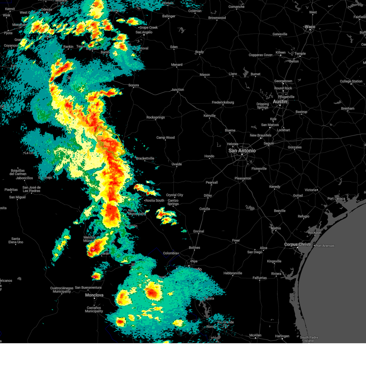 At 633 pm cdt, severe thunderstorms were located along a line extending from seminole canyon state park to 6 miles southeast of comstock to near del rio, moving northeast at 20 mph (public. at 6:21, a 62 mph wind gust was measured near lake view). Hazards include 60 mph wind gusts and penny size hail. Expect damage to roofs, siding, and trees. Locations impacted include, del rio, comstock, lake view, amistad acres, shumla, amistad village, black brush point, seminole canyon state park, box canyon, diablo east, governors landing, long point, cienegas terrace, pecos river boat ramp, 277 south boat ramp, 277 north campground, rough canyon recreation area, spur 406 campground, rock quarry campground and salem point. At 633 pm cdt, severe thunderstorms were located along a line extending from seminole canyon state park to 6 miles southeast of comstock to near del rio, moving northeast at 20 mph (public. at 6:21, a 62 mph wind gust was measured near lake view). Hazards include 60 mph wind gusts and penny size hail. Expect damage to roofs, siding, and trees. Locations impacted include, del rio, comstock, lake view, amistad acres, shumla, amistad village, black brush point, seminole canyon state park, box canyon, diablo east, governors landing, long point, cienegas terrace, pecos river boat ramp, 277 south boat ramp, 277 north campground, rough canyon recreation area, spur 406 campground, rock quarry campground and salem point.
|
| 5/12/2023 6:28 PM CDT | Reported at kdr in val verde county TX, 2.2 miles E of Del Rio, TX |
| 5/12/2023 6:21 PM CDT | A 62 mph thunderstorm wind gust report came in from the lake view area north of the city of del ri in val verde county TX, 7.5 miles SSE of Del Rio, TX |
| 5/12/2023 6:15 PM CDT | Downed/uprooted tree with winds also estimated to around 70 mph. time estimated via rada in val verde county TX, 20.2 miles ESE of Del Rio, TX |
| 5/12/2023 6:07 PM CDT |
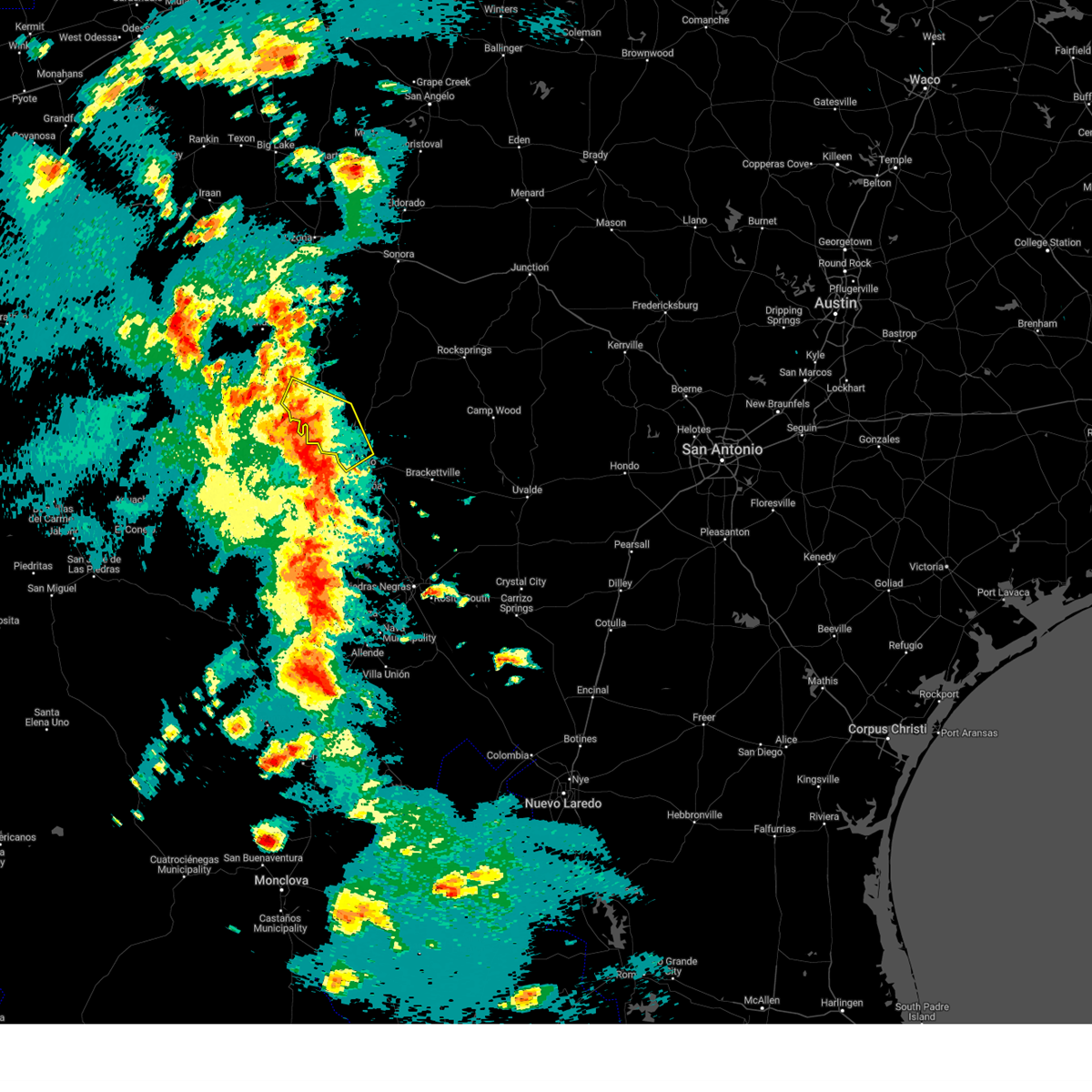 At 607 pm cdt, severe thunderstorms were located along a line extending from 6 miles southwest of seminole canyon state park to near box canyon to 9 miles southwest of cienegas terrace, moving northeast at 15 mph (radar indicated). Hazards include 60 mph wind gusts and nickel size hail. expect damage to roofs, siding, and trees At 607 pm cdt, severe thunderstorms were located along a line extending from 6 miles southwest of seminole canyon state park to near box canyon to 9 miles southwest of cienegas terrace, moving northeast at 15 mph (radar indicated). Hazards include 60 mph wind gusts and nickel size hail. expect damage to roofs, siding, and trees
|
| 4/23/2023 3:36 AM CDT |
 The severe thunderstorm warning for northwestern kinney and southeastern val verde counties will expire at 345 am cdt, the storms which prompted the warning have weakened below severe limits, and no longer pose an immediate threat to life or property. therefore, the warning will be allowed to expire. however small hail, gusty winds and heavy rain are still possible with these thunderstorms. a severe thunderstorm watch remains in effect until 500 am cdt for south central texas. The severe thunderstorm warning for northwestern kinney and southeastern val verde counties will expire at 345 am cdt, the storms which prompted the warning have weakened below severe limits, and no longer pose an immediate threat to life or property. therefore, the warning will be allowed to expire. however small hail, gusty winds and heavy rain are still possible with these thunderstorms. a severe thunderstorm watch remains in effect until 500 am cdt for south central texas.
|
| 4/23/2023 3:28 AM CDT |
 At 328 am cdt, severe thunderstorms were located along a line extending from long point to near amanda, moving north at 30 mph (radar indicated). Hazards include ping pong ball size hail and 60 mph wind gusts. People and animals outdoors will be injured. expect hail damage to roofs, siding, windows, and vehicles. expect wind damage to roofs, siding, and trees. these severe thunderstorms will remain over mainly rural areas of northwestern kinney and southeastern val verde counties, including the following locations, devils shores, san pedro canyon, 277 north campground, rough canyon recreation area, escondido estates, 277 south boat ramp, lake ridge ranch and devils river state nat area big satan. hail threat, radar indicated max hail size, 1. 50 in wind threat, radar indicated max wind gust, 60 mph. At 328 am cdt, severe thunderstorms were located along a line extending from long point to near amanda, moving north at 30 mph (radar indicated). Hazards include ping pong ball size hail and 60 mph wind gusts. People and animals outdoors will be injured. expect hail damage to roofs, siding, windows, and vehicles. expect wind damage to roofs, siding, and trees. these severe thunderstorms will remain over mainly rural areas of northwestern kinney and southeastern val verde counties, including the following locations, devils shores, san pedro canyon, 277 north campground, rough canyon recreation area, escondido estates, 277 south boat ramp, lake ridge ranch and devils river state nat area big satan. hail threat, radar indicated max hail size, 1. 50 in wind threat, radar indicated max wind gust, 60 mph.
|
| 4/23/2023 3:15 AM CDT | Half Dollar sized hail reported 5.8 miles WNW of Del Rio, TX |
| 4/23/2023 3:14 AM CDT |
 At 313 am cdt, severe thunderstorms were located along a line extending from near cienegas terrace to 6 miles southeast of laughlin afb, moving north at 30 mph (trained weather spotters reported golf ball size hail with this storm 5 miles south of del rio at 3:12am). Hazards include two inch hail and 60 mph wind gusts. People and animals outdoors will be injured. expect hail damage to roofs, siding, windows, and vehicles. expect wind damage to roofs, siding, and trees. these severe storms will be near, lake view and diablo east around 320 am cdt. amanda and black brush point around 325 am cdt. long point around 330 am cdt. other locations impacted by these severe thunderstorms include devils shores, san pedro canyon, 277 north campground, rough canyon recreation area, escondido estates, 277 south boat ramp, lake ridge ranch and devils river state nat area big satan. thunderstorm damage threat, considerable hail threat, radar indicated max hail size, 2. 00 in wind threat, radar indicated max wind gust, 60 mph. At 313 am cdt, severe thunderstorms were located along a line extending from near cienegas terrace to 6 miles southeast of laughlin afb, moving north at 30 mph (trained weather spotters reported golf ball size hail with this storm 5 miles south of del rio at 3:12am). Hazards include two inch hail and 60 mph wind gusts. People and animals outdoors will be injured. expect hail damage to roofs, siding, windows, and vehicles. expect wind damage to roofs, siding, and trees. these severe storms will be near, lake view and diablo east around 320 am cdt. amanda and black brush point around 325 am cdt. long point around 330 am cdt. other locations impacted by these severe thunderstorms include devils shores, san pedro canyon, 277 north campground, rough canyon recreation area, escondido estates, 277 south boat ramp, lake ridge ranch and devils river state nat area big satan. thunderstorm damage threat, considerable hail threat, radar indicated max hail size, 2. 00 in wind threat, radar indicated max wind gust, 60 mph.
|
| 4/23/2023 3:12 AM CDT | Golf Ball sized hail reported 3.9 miles N of Del Rio, TX |
| 4/23/2023 3:02 AM CDT |
 At 301 am cdt, severe thunderstorms were located along a line extending from near cienegas terrace to 10 miles south of laughlin afb, moving north at 30 mph (radar indicated). Hazards include 60 mph wind gusts and half dollar size hail. Hail damage to vehicles is expected. expect wind damage to roofs, siding, and trees. severe thunderstorms will be near, cienegas terrace around 310 am cdt. del rio and val verde park around 315 am cdt. lake view, diablo east and laughlin afb around 320 am cdt. amanda and black brush point around 325 am cdt. long point around 330 am cdt. other locations impacted by these severe thunderstorms include devils shores, san pedro canyon, 277 north campground, rough canyon recreation area, escondido estates, 277 south boat ramp, lake ridge ranch and devils river state nat area big satan. hail threat, radar indicated max hail size, 1. 25 in wind threat, radar indicated max wind gust, 60 mph. At 301 am cdt, severe thunderstorms were located along a line extending from near cienegas terrace to 10 miles south of laughlin afb, moving north at 30 mph (radar indicated). Hazards include 60 mph wind gusts and half dollar size hail. Hail damage to vehicles is expected. expect wind damage to roofs, siding, and trees. severe thunderstorms will be near, cienegas terrace around 310 am cdt. del rio and val verde park around 315 am cdt. lake view, diablo east and laughlin afb around 320 am cdt. amanda and black brush point around 325 am cdt. long point around 330 am cdt. other locations impacted by these severe thunderstorms include devils shores, san pedro canyon, 277 north campground, rough canyon recreation area, escondido estates, 277 south boat ramp, lake ridge ranch and devils river state nat area big satan. hail threat, radar indicated max hail size, 1. 25 in wind threat, radar indicated max wind gust, 60 mph.
|
| 8/22/2022 4:56 PM CDT | Measured wind gust at del rio international airpor in val verde county TX, 2.8 miles E of Del Rio, TX |
| 6/4/2022 2:50 AM CDT | Del rio aso in val verde county TX, 2.9 miles ESE of Del Rio, TX |
| 5/24/2022 11:17 PM CDT |
 At 1117 pm cdt, severe thunderstorms were located along a line extending from reagan wells to 8 miles northeast of amanda, moving southeast at 45 mph (radar indicated). Hazards include 60 mph wind gusts and half dollar size hail. Hail damage to vehicles is expected. expect wind damage to roofs, siding, and trees. locations impacted include, del rio, uvalde, brackettville, spofford, camp wood, laguna, barksdale, concan, laughlin afb, uvalde estates, dabney, cline, anacacho, reagan wells, alamo village, knippa, blewett, rio frio, amanda and montell. hail threat, radar indicated max hail size, 1. 25 in wind threat, radar indicated max wind gust, 60 mph. At 1117 pm cdt, severe thunderstorms were located along a line extending from reagan wells to 8 miles northeast of amanda, moving southeast at 45 mph (radar indicated). Hazards include 60 mph wind gusts and half dollar size hail. Hail damage to vehicles is expected. expect wind damage to roofs, siding, and trees. locations impacted include, del rio, uvalde, brackettville, spofford, camp wood, laguna, barksdale, concan, laughlin afb, uvalde estates, dabney, cline, anacacho, reagan wells, alamo village, knippa, blewett, rio frio, amanda and montell. hail threat, radar indicated max hail size, 1. 25 in wind threat, radar indicated max wind gust, 60 mph.
|
| 5/24/2022 10:55 PM CDT |
 At 1055 pm cdt, severe thunderstorms were located along a line extending from near camp wood to 12 miles northeast of long point, moving southeast at 45 mph (radar indicated). Hazards include 60 mph wind gusts and half dollar size hail. Hail damage to vehicles is expected. Expect wind damage to roofs, siding, and trees. At 1055 pm cdt, severe thunderstorms were located along a line extending from near camp wood to 12 miles northeast of long point, moving southeast at 45 mph (radar indicated). Hazards include 60 mph wind gusts and half dollar size hail. Hail damage to vehicles is expected. Expect wind damage to roofs, siding, and trees.
|
| 5/11/2022 12:38 AM CDT |
 The severe thunderstorm warning for western kinney and southeastern val verde counties will expire at 1245 am cdt, the storm which prompted the warning has weakened below severe limits, and has exited the warned area. therefore, the warning will be allowed to expire. however small hail and gusty winds are still possible with these thunderstorms in northwest kinney county. a flood advisory remains in effect for portions of the area until 330 am cdt. The severe thunderstorm warning for western kinney and southeastern val verde counties will expire at 1245 am cdt, the storm which prompted the warning has weakened below severe limits, and has exited the warned area. therefore, the warning will be allowed to expire. however small hail and gusty winds are still possible with these thunderstorms in northwest kinney county. a flood advisory remains in effect for portions of the area until 330 am cdt.
|
| 5/11/2022 12:20 AM CDT |
 At 1219 am cdt, a severe thunderstorm was located over laughlin afb, or 7 miles east of del rio, moving northwest at 30 mph. a 62 mph wind gust was measured at laughlin afb (automated weather observing system). Hazards include 60 mph wind gusts and quarter size hail. Hail damage to vehicles is expected. expect wind damage to roofs, siding, and trees. locations impacted include, del rio, lake view, val verde park, standart, cienegas terrace, amanda, laughlin afb, escondido estates and lake ridge ranch. hail threat, radar indicated max hail size, 1. 00 in wind threat, observed max wind gust, 60 mph. At 1219 am cdt, a severe thunderstorm was located over laughlin afb, or 7 miles east of del rio, moving northwest at 30 mph. a 62 mph wind gust was measured at laughlin afb (automated weather observing system). Hazards include 60 mph wind gusts and quarter size hail. Hail damage to vehicles is expected. expect wind damage to roofs, siding, and trees. locations impacted include, del rio, lake view, val verde park, standart, cienegas terrace, amanda, laughlin afb, escondido estates and lake ridge ranch. hail threat, radar indicated max hail size, 1. 00 in wind threat, observed max wind gust, 60 mph.
|
| 5/11/2022 12:05 AM CDT |
 At 1204 am cdt, a severe thunderstorm was located near laughlin afb, or 11 miles southeast of del rio, moving north at 45 mph (radar indicated). Hazards include 60 mph wind gusts and quarter size hail. Hail damage to vehicles is expected. expect wind damage to roofs, siding, and trees. locations impacted include, del rio, lake view, val verde park, standart, cienegas terrace, amanda, laughlin afb, escondido estates and lake ridge ranch. hail threat, radar indicated max hail size, 1. 00 in wind threat, radar indicated max wind gust, 60 mph. At 1204 am cdt, a severe thunderstorm was located near laughlin afb, or 11 miles southeast of del rio, moving north at 45 mph (radar indicated). Hazards include 60 mph wind gusts and quarter size hail. Hail damage to vehicles is expected. expect wind damage to roofs, siding, and trees. locations impacted include, del rio, lake view, val verde park, standart, cienegas terrace, amanda, laughlin afb, escondido estates and lake ridge ranch. hail threat, radar indicated max hail size, 1. 00 in wind threat, radar indicated max wind gust, 60 mph.
|
| 5/10/2022 11:42 PM CDT |
 At 1141 pm cdt, a severe thunderstorm was located near quemado, moving northwest at 30 mph (radar indicated). Hazards include 60 mph wind gusts and quarter size hail. Hail damage to vehicles is expected. Expect wind damage to roofs, siding, and trees. At 1141 pm cdt, a severe thunderstorm was located near quemado, moving northwest at 30 mph (radar indicated). Hazards include 60 mph wind gusts and quarter size hail. Hail damage to vehicles is expected. Expect wind damage to roofs, siding, and trees.
|
| 5/10/2022 8:18 PM CDT |
 At 818 pm cdt, a severe thunderstorm was located over standart, or 12 miles west of brackettville, moving north at 35 mph (radar indicated). Hazards include golf ball size hail and 60 mph wind gusts. People and animals outdoors will be injured. expect hail damage to roofs, siding, windows, and vehicles. expect wind damage to roofs, siding, and trees. locations impacted include, del rio, val verde park, standart, alamo village, carta valley, amanda, laughlin afb, escondido estates and kickapoo cavern state park. thunderstorm damage threat, considerable hail threat, radar indicated max hail size, 1. 75 in wind threat, radar indicated max wind gust, 60 mph. At 818 pm cdt, a severe thunderstorm was located over standart, or 12 miles west of brackettville, moving north at 35 mph (radar indicated). Hazards include golf ball size hail and 60 mph wind gusts. People and animals outdoors will be injured. expect hail damage to roofs, siding, windows, and vehicles. expect wind damage to roofs, siding, and trees. locations impacted include, del rio, val verde park, standart, alamo village, carta valley, amanda, laughlin afb, escondido estates and kickapoo cavern state park. thunderstorm damage threat, considerable hail threat, radar indicated max hail size, 1. 75 in wind threat, radar indicated max wind gust, 60 mph.
|
| 5/10/2022 8:03 PM CDT |
 At 803 pm cdt, a severe thunderstorm was located 7 miles south of standart, or 15 miles west of spofford, moving north at 35 mph (radar indicated). Hazards include 60 mph wind gusts and quarter size hail. Hail damage to vehicles is expected. Expect wind damage to roofs, siding, and trees. At 803 pm cdt, a severe thunderstorm was located 7 miles south of standart, or 15 miles west of spofford, moving north at 35 mph (radar indicated). Hazards include 60 mph wind gusts and quarter size hail. Hail damage to vehicles is expected. Expect wind damage to roofs, siding, and trees.
|
| 5/4/2022 8:09 PM CDT |
 At 808 pm cdt, a severe thunderstorm was located near standart, or 13 miles southeast of del rio, moving east at 45 mph (radar indicated). Hazards include golf ball size hail and 70 mph wind gusts. People and animals outdoors will be injured. expect hail damage to roofs, siding, windows, and vehicles. expect considerable tree damage. wind damage is also likely to mobile homes, roofs, and outbuildings. locations impacted include, del rio, brackettville, spofford, anacacho, standart, alamo village, amanda, laughlin afb, turkey mountain, escondido estates, and fort clark springs. thunderstorm damage threat, considerable hail threat, radar indicated max hail size, 1. 75 in wind threat, radar indicated max wind gust, 70 mph. At 808 pm cdt, a severe thunderstorm was located near standart, or 13 miles southeast of del rio, moving east at 45 mph (radar indicated). Hazards include golf ball size hail and 70 mph wind gusts. People and animals outdoors will be injured. expect hail damage to roofs, siding, windows, and vehicles. expect considerable tree damage. wind damage is also likely to mobile homes, roofs, and outbuildings. locations impacted include, del rio, brackettville, spofford, anacacho, standart, alamo village, amanda, laughlin afb, turkey mountain, escondido estates, and fort clark springs. thunderstorm damage threat, considerable hail threat, radar indicated max hail size, 1. 75 in wind threat, radar indicated max wind gust, 70 mph.
|
| 5/4/2022 8:00 PM CDT |
 At 759 pm cdt, a severe thunderstorm was located 7 miles south of laughlin afb, or 9 miles southeast of del rio, moving east at 45 mph (radar indicated). Hazards include 70 mph wind gusts and quarter size hail. Hail damage to vehicles is expected. expect considerable tree damage. Wind damage is also likely to mobile homes, roofs, and outbuildings. At 759 pm cdt, a severe thunderstorm was located 7 miles south of laughlin afb, or 9 miles southeast of del rio, moving east at 45 mph (radar indicated). Hazards include 70 mph wind gusts and quarter size hail. Hail damage to vehicles is expected. expect considerable tree damage. Wind damage is also likely to mobile homes, roofs, and outbuildings.
|
| 5/4/2022 7:57 PM CDT |
 The severe thunderstorm warning for northwestern kinney and southeastern val verde counties will expire at 800 pm cdt, the storm which prompted the warning has weakened below severe limits, and no longer poses an immediate threat to life or property. therefore, the warning will be allowed to expire. however small hail and gusty winds are still possible with this thunderstorm. a tornado watch remains in effect until 1000 pm cdt for south central texas. The severe thunderstorm warning for northwestern kinney and southeastern val verde counties will expire at 800 pm cdt, the storm which prompted the warning has weakened below severe limits, and no longer poses an immediate threat to life or property. therefore, the warning will be allowed to expire. however small hail and gusty winds are still possible with this thunderstorm. a tornado watch remains in effect until 1000 pm cdt for south central texas.
|
| 5/4/2022 7:37 PM CDT |
 At 736 pm cdt, a severe thunderstorm was located over standart, or 12 miles west of brackettville, moving east at 40 mph (radar indicated). Hazards include golf ball size hail and 60 mph wind gusts. People and animals outdoors will be injured. expect hail damage to roofs, siding, windows, and vehicles. expect wind damage to roofs, siding, and trees. locations impacted include, del rio, brackettville, val verde park, standart, alamo village, cienegas terrace, amanda, laughlin afb, escondido estates, fort clark springs, kickapoo cavern state park, and lake ridge ranch. thunderstorm damage threat, considerable hail threat, radar indicated max hail size, 1. 75 in wind threat, radar indicated max wind gust, 60 mph. At 736 pm cdt, a severe thunderstorm was located over standart, or 12 miles west of brackettville, moving east at 40 mph (radar indicated). Hazards include golf ball size hail and 60 mph wind gusts. People and animals outdoors will be injured. expect hail damage to roofs, siding, windows, and vehicles. expect wind damage to roofs, siding, and trees. locations impacted include, del rio, brackettville, val verde park, standart, alamo village, cienegas terrace, amanda, laughlin afb, escondido estates, fort clark springs, kickapoo cavern state park, and lake ridge ranch. thunderstorm damage threat, considerable hail threat, radar indicated max hail size, 1. 75 in wind threat, radar indicated max wind gust, 60 mph.
|
| 5/4/2022 7:33 PM CDT | Corrects previous tstm wnd gst report from 1 nw laughlin afb. laughlin air force base asos measures a thunderstorm wind gust of 59 knots (68 mph) at 7:33 pm cd in val verde county TX, 5 miles W of Del Rio, TX |
| 5/4/2022 7:33 PM CDT | Laughlin air force base asos measures a thunderstorm wind gust of 59 knots (68 mph) at 7:33 pm cd in val verde county TX, 5 miles W of Del Rio, TX |
| 5/4/2022 7:26 PM CDT |
 At 726 pm cdt, a severe thunderstorm was located near laughlin afb, or 9 miles east of del rio, moving east at 40 mph (radar indicated). Hazards include golf ball size hail and 60 mph wind gusts. People and animals outdoors will be injured. expect hail damage to roofs, siding, windows, and vehicles. expect wind damage to roofs, siding, and trees. locations impacted include, del rio, brackettville, val verde park, standart, alamo village, cienegas terrace, amanda, laughlin afb, escondido estates, fort clark springs, kickapoo cavern state park, and lake ridge ranch. thunderstorm damage threat, considerable hail threat, radar indicated max hail size, 1. 75 in wind threat, radar indicated max wind gust, 60 mph. At 726 pm cdt, a severe thunderstorm was located near laughlin afb, or 9 miles east of del rio, moving east at 40 mph (radar indicated). Hazards include golf ball size hail and 60 mph wind gusts. People and animals outdoors will be injured. expect hail damage to roofs, siding, windows, and vehicles. expect wind damage to roofs, siding, and trees. locations impacted include, del rio, brackettville, val verde park, standart, alamo village, cienegas terrace, amanda, laughlin afb, escondido estates, fort clark springs, kickapoo cavern state park, and lake ridge ranch. thunderstorm damage threat, considerable hail threat, radar indicated max hail size, 1. 75 in wind threat, radar indicated max wind gust, 60 mph.
|
| 5/4/2022 7:25 PM CDT | Public report of roof damage in del rio received via twitte in val verde county TX, 2.8 miles WSW of Del Rio, TX |
| 5/4/2022 7:25 PM CDT | Quarter sized hail reported 0.8 miles WSW of Del Rio, TX, public report of quarter sized hail received via social media. time estimated from radar. |
| 5/4/2022 7:16 PM CDT | Ping Pong Ball sized hail reported 1.1 miles ENE of Del Rio, TX |
| 5/4/2022 7:04 PM CDT |
 At 704 pm cdt, a severe thunderstorm was located near cienegas terrace, or 8 miles southwest of del rio, moving east at 40 mph (radar indicated). Hazards include golf ball size hail and 60 mph wind gusts. People and animals outdoors will be injured. expect hail damage to roofs, siding, windows, and vehicles. Expect wind damage to roofs, siding, and trees. At 704 pm cdt, a severe thunderstorm was located near cienegas terrace, or 8 miles southwest of del rio, moving east at 40 mph (radar indicated). Hazards include golf ball size hail and 60 mph wind gusts. People and animals outdoors will be injured. expect hail damage to roofs, siding, windows, and vehicles. Expect wind damage to roofs, siding, and trees.
|
| 5/2/2022 2:17 AM CDT |
 At 217 am cdt, a severe thunderstorm was located over amanda, or 12 miles east of del rio, moving east at 25 mph (radar indicated). Hazards include 60 mph wind gusts and quarter size hail. Hail damage to vehicles is expected. Expect wind damage to roofs, siding, and trees. At 217 am cdt, a severe thunderstorm was located over amanda, or 12 miles east of del rio, moving east at 25 mph (radar indicated). Hazards include 60 mph wind gusts and quarter size hail. Hail damage to vehicles is expected. Expect wind damage to roofs, siding, and trees.
|
| 5/2/2022 2:00 AM CDT | Quarter sized hail reported 2.5 miles SSE of Del Rio, TX |
| 5/2/2022 1:49 AM CDT |
 At 149 am cdt, a severe thunderstorm was located over val verde park, or over del rio, moving east at 20 mph (radar indicated). Hazards include 60 mph wind gusts and quarter size hail. Hail damage to vehicles is expected. Expect wind damage to roofs, siding, and trees. At 149 am cdt, a severe thunderstorm was located over val verde park, or over del rio, moving east at 20 mph (radar indicated). Hazards include 60 mph wind gusts and quarter size hail. Hail damage to vehicles is expected. Expect wind damage to roofs, siding, and trees.
|
| 4/19/2022 1:53 PM CDT |
 At 153 pm cdt, severe thunderstorms were located along a line extending from 11 miles northeast of long point to near del rio to 6 miles southwest of cienegas terrace, moving east at 35 mph (radar indicated). Hazards include 60 mph wind gusts and quarter size hail. Hail damage to vehicles is expected. Expect wind damage to roofs, siding, and trees. At 153 pm cdt, severe thunderstorms were located along a line extending from 11 miles northeast of long point to near del rio to 6 miles southwest of cienegas terrace, moving east at 35 mph (radar indicated). Hazards include 60 mph wind gusts and quarter size hail. Hail damage to vehicles is expected. Expect wind damage to roofs, siding, and trees.
|
| 4/19/2022 1:50 PM CDT |
 At 150 pm cdt, a severe thunderstorm was located over lake view, or 7 miles north of del rio, moving east at 35 mph (radar indicated). Hazards include 60 mph wind gusts and quarter size hail. Hail damage to vehicles is expected. expect wind damage to roofs, siding, and trees. locations impacted include, del rio, lake view, black brush point, val verde park, laughlin afb, long point, diablo east, san pedro canyon, 277 north campground, lake ridge ranch, 277 south boat ramp and escondido estates. hail threat, radar indicated max hail size, 1. 00 in wind threat, radar indicated max wind gust, 60 mph. At 150 pm cdt, a severe thunderstorm was located over lake view, or 7 miles north of del rio, moving east at 35 mph (radar indicated). Hazards include 60 mph wind gusts and quarter size hail. Hail damage to vehicles is expected. expect wind damage to roofs, siding, and trees. locations impacted include, del rio, lake view, black brush point, val verde park, laughlin afb, long point, diablo east, san pedro canyon, 277 north campground, lake ridge ranch, 277 south boat ramp and escondido estates. hail threat, radar indicated max hail size, 1. 00 in wind threat, radar indicated max wind gust, 60 mph.
|
| 4/19/2022 1:40 PM CDT | Quarter sized hail reported 16.3 miles SE of Del Rio, TX, quarter sized hail off castle canyon estate road. |
| 4/19/2022 1:30 PM CDT |
 At 129 pm cdt, a severe thunderstorm was located over box canyon, or 9 miles south of comstock, moving east at 30 mph (radar indicated). Hazards include quarter size hail. damage to vehicles is expected At 129 pm cdt, a severe thunderstorm was located over box canyon, or 9 miles south of comstock, moving east at 30 mph (radar indicated). Hazards include quarter size hail. damage to vehicles is expected
|
| 4/10/2022 8:15 PM CDT | A wind gust measured at 58 mph tore a 10 foot by 20 foot section of the roof off a house which damaged power lines resulting in a power outag in val verde county TX, 8.5 miles SSE of Del Rio, TX |
| 4/4/2022 6:58 PM CDT |
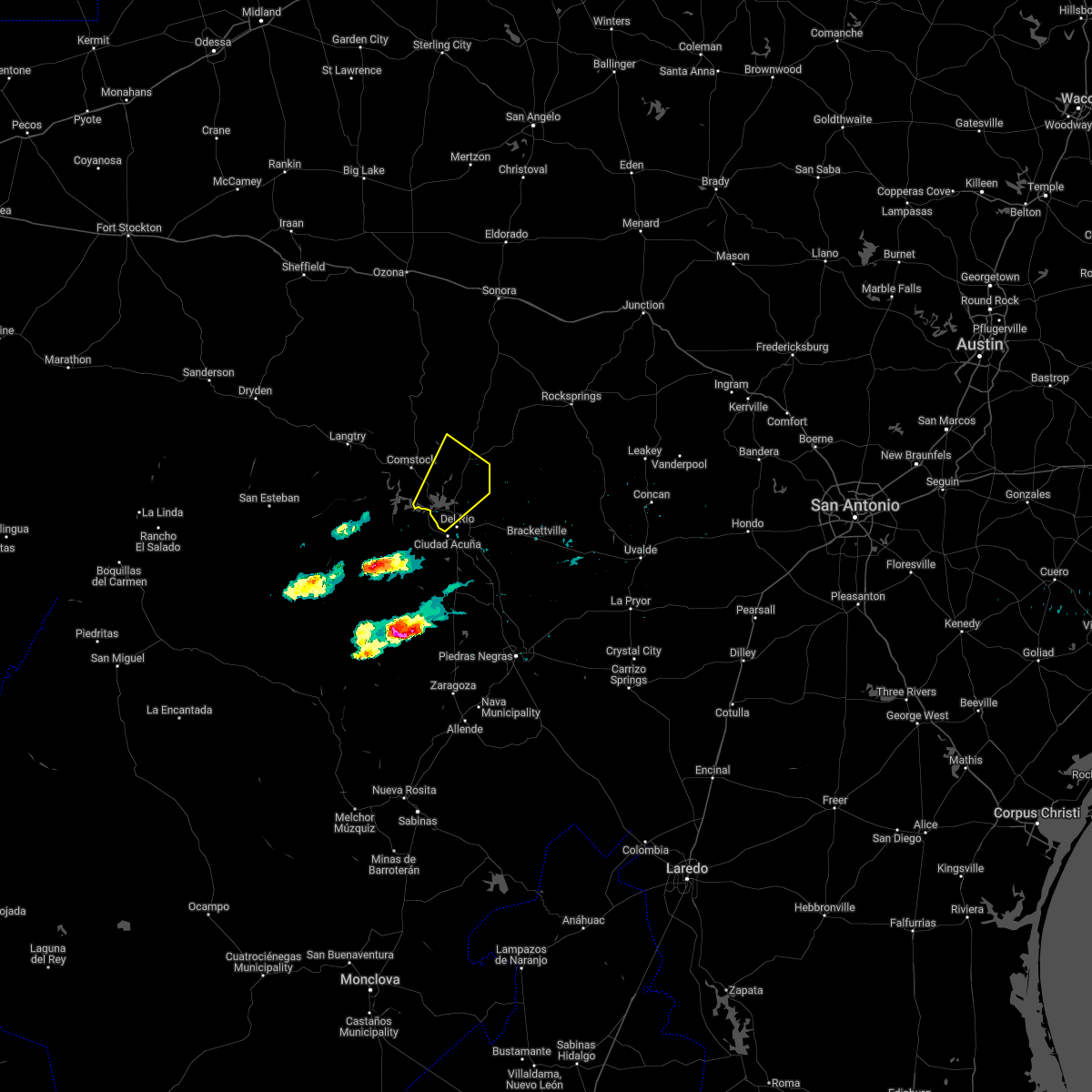 At 658 pm cdt, a severe thunderstorm was located over long point, or 8 miles northwest of del rio, moving northeast at 35 mph (radar indicated). Hazards include tennis ball size hail and 60 mph wind gusts. People and animals outdoors will be injured. expect hail damage to roofs, siding, windows, and vehicles. expect wind damage to roofs, siding, and trees. locations impacted include, del rio, lake view, amistad village, black brush point, diablo east, governors landing, long point, cienegas terrace, amistad acres, devils shores, pafford crossing, 277 south boat ramp, 277 north campground, san pedro canyon, rough canyon recreation area, spur 406 campground, rock quarry campground, salem point, devils river state nat area big satan and lake ridge ranch. thunderstorm damage threat, considerable hail threat, radar indicated max hail size, 2. 50 in wind threat, radar indicated max wind gust, 60 mph. At 658 pm cdt, a severe thunderstorm was located over long point, or 8 miles northwest of del rio, moving northeast at 35 mph (radar indicated). Hazards include tennis ball size hail and 60 mph wind gusts. People and animals outdoors will be injured. expect hail damage to roofs, siding, windows, and vehicles. expect wind damage to roofs, siding, and trees. locations impacted include, del rio, lake view, amistad village, black brush point, diablo east, governors landing, long point, cienegas terrace, amistad acres, devils shores, pafford crossing, 277 south boat ramp, 277 north campground, san pedro canyon, rough canyon recreation area, spur 406 campground, rock quarry campground, salem point, devils river state nat area big satan and lake ridge ranch. thunderstorm damage threat, considerable hail threat, radar indicated max hail size, 2. 50 in wind threat, radar indicated max wind gust, 60 mph.
|
| 4/4/2022 6:55 PM CDT | Quarter sized hail reported 7.5 miles SSE of Del Rio, TX |
| 4/4/2022 6:55 PM CDT | Half Dollar sized hail reported 10.4 miles SE of Del Rio, TX |
| 4/4/2022 6:54 PM CDT |
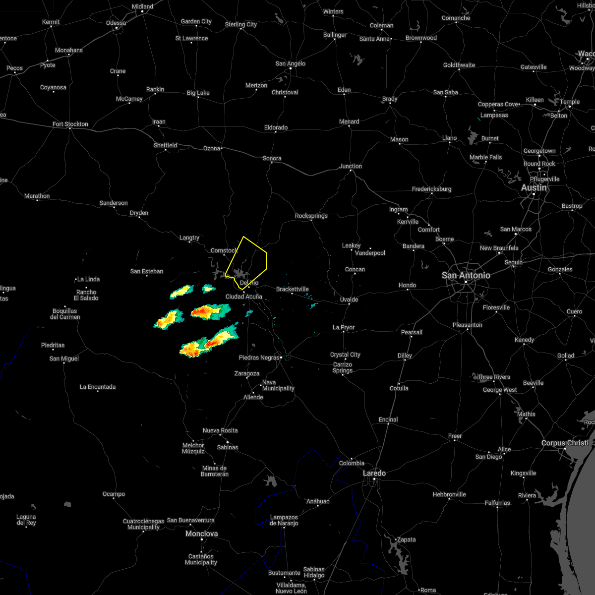 At 653 pm cdt, a severe thunderstorm was located over black brush point, or 8 miles northwest of del rio, moving northeast at 35 mph (radar indicated). Hazards include golf ball size hail and 60 mph wind gusts. People and animals outdoors will be injured. expect hail damage to roofs, siding, windows, and vehicles. expect wind damage to roofs, siding, and trees. locations impacted include, del rio, lake view, amistad village, black brush point, diablo east, governors landing, long point, cienegas terrace, amistad acres, devils shores, pafford crossing, 277 south boat ramp, 277 north campground, san pedro canyon, rough canyon recreation area, spur 406 campground, rock quarry campground, salem point, devils river state nat area big satan and lake ridge ranch. thunderstorm damage threat, considerable hail threat, radar indicated max hail size, 1. 75 in wind threat, radar indicated max wind gust, 60 mph. At 653 pm cdt, a severe thunderstorm was located over black brush point, or 8 miles northwest of del rio, moving northeast at 35 mph (radar indicated). Hazards include golf ball size hail and 60 mph wind gusts. People and animals outdoors will be injured. expect hail damage to roofs, siding, windows, and vehicles. expect wind damage to roofs, siding, and trees. locations impacted include, del rio, lake view, amistad village, black brush point, diablo east, governors landing, long point, cienegas terrace, amistad acres, devils shores, pafford crossing, 277 south boat ramp, 277 north campground, san pedro canyon, rough canyon recreation area, spur 406 campground, rock quarry campground, salem point, devils river state nat area big satan and lake ridge ranch. thunderstorm damage threat, considerable hail threat, radar indicated max hail size, 1. 75 in wind threat, radar indicated max wind gust, 60 mph.
|
| 4/4/2022 6:39 PM CDT |
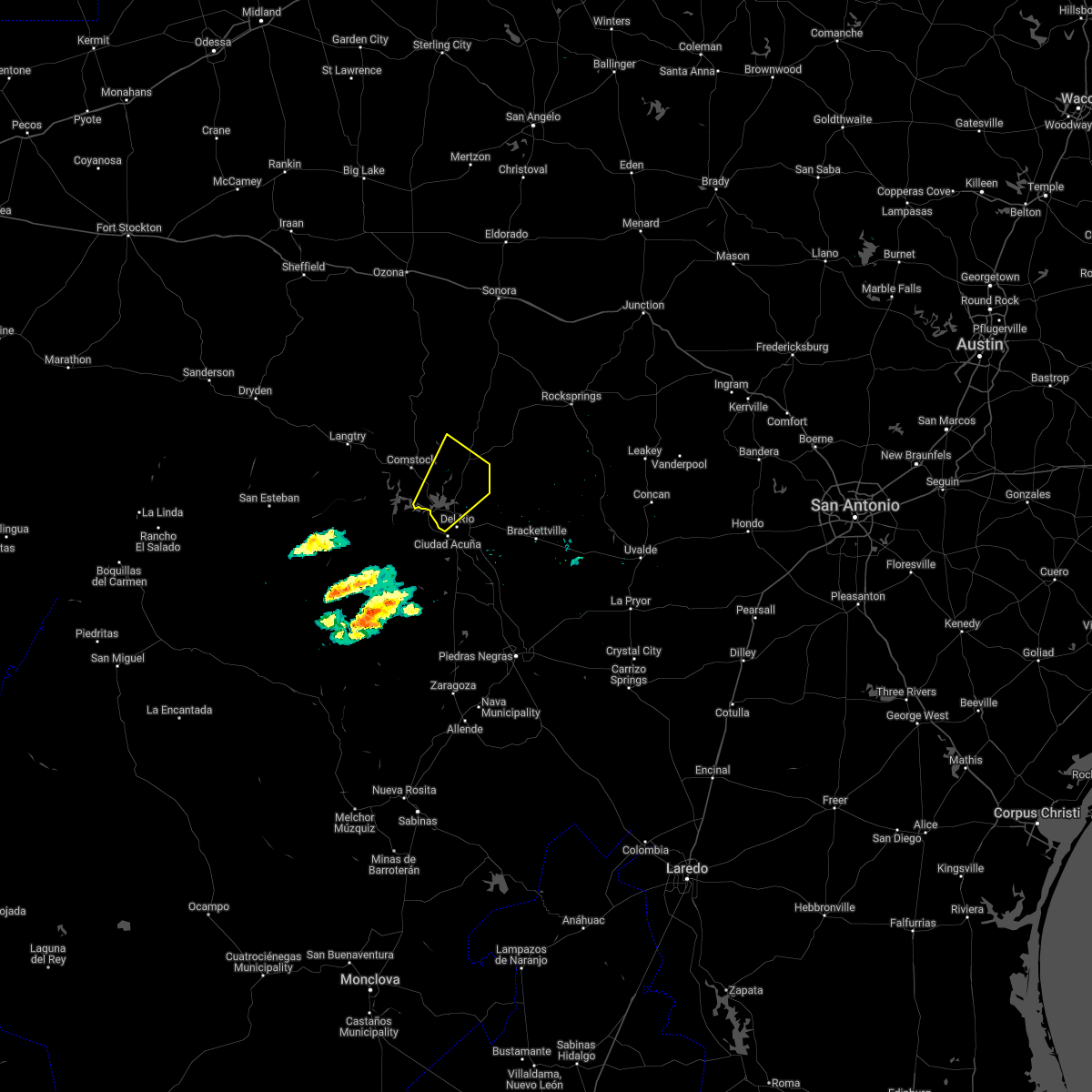 At 639 pm cdt, a severe thunderstorm was located near amistad village, or 11 miles west of del rio, moving northeast at 35 mph (radar indicated). Hazards include 60 mph wind gusts and half dollar size hail. Hail damage to vehicles is expected. Expect wind damage to roofs, siding, and trees. At 639 pm cdt, a severe thunderstorm was located near amistad village, or 11 miles west of del rio, moving northeast at 35 mph (radar indicated). Hazards include 60 mph wind gusts and half dollar size hail. Hail damage to vehicles is expected. Expect wind damage to roofs, siding, and trees.
|
| 5/31/2021 9:56 PM CDT |
 At 956 pm cdt, a severe thunderstorm was located near lake view, or near del rio, moving east at 5 mph (radar indicated). Hazards include 60 mph wind gusts and quarter size hail. Hail damage to vehicles is expected. expect wind damage to roofs, siding, and trees. Locations impacted include, del rio, lake view, amistad village, black brush point, laughlin afb, val verde park, diablo east, cienegas terrace, governors landing, long point, 277 south boat ramp, 277 north campground, san pedro canyon, spur 406 campground, escondido estates and lake ridge ranch. At 956 pm cdt, a severe thunderstorm was located near lake view, or near del rio, moving east at 5 mph (radar indicated). Hazards include 60 mph wind gusts and quarter size hail. Hail damage to vehicles is expected. expect wind damage to roofs, siding, and trees. Locations impacted include, del rio, lake view, amistad village, black brush point, laughlin afb, val verde park, diablo east, cienegas terrace, governors landing, long point, 277 south boat ramp, 277 north campground, san pedro canyon, spur 406 campground, escondido estates and lake ridge ranch.
|
| 5/31/2021 9:23 PM CDT |
 At 923 pm cdt, a severe thunderstorm was located over lake view, or 8 miles northwest of del rio, moving east at 10 mph (radar indicated). Hazards include 60 mph wind gusts and quarter size hail. Hail damage to vehicles is expected. Expect wind damage to roofs, siding, and trees. At 923 pm cdt, a severe thunderstorm was located over lake view, or 8 miles northwest of del rio, moving east at 10 mph (radar indicated). Hazards include 60 mph wind gusts and quarter size hail. Hail damage to vehicles is expected. Expect wind damage to roofs, siding, and trees.
|
| 5/29/2021 4:42 AM CDT |
 The severe thunderstorm warning for western kinney, northwestern maverick, southwestern edwards and southeastern val verde counties will expire at 445 am cdt, the storms which prompted the warning have weakened below severe limits, and no longer pose an immediate threat to life or property. therefore, the warning will be allowed to expire. however gusty winds and heavy rain are still possible with these thunderstorms. The severe thunderstorm warning for western kinney, northwestern maverick, southwestern edwards and southeastern val verde counties will expire at 445 am cdt, the storms which prompted the warning have weakened below severe limits, and no longer pose an immediate threat to life or property. therefore, the warning will be allowed to expire. however gusty winds and heavy rain are still possible with these thunderstorms.
|
| 5/29/2021 4:24 AM CDT |
 At 424 am cdt, severe thunderstorms were located along a line extending from 8 miles north of amanda to near laughlin afb, moving southeast at 35 mph (radar indicated). Hazards include 60 mph wind gusts and quarter size hail. Hail damage to vehicles is expected. expect wind damage to roofs, siding, and trees. Locations impacted include, del rio, brackettville, val verde park, standart, alamo village, cienegas terrace, amanda, laughlin afb, escondido estates, fort clark springs, laughlin afb aux field and kickapoo cavern state park. At 424 am cdt, severe thunderstorms were located along a line extending from 8 miles north of amanda to near laughlin afb, moving southeast at 35 mph (radar indicated). Hazards include 60 mph wind gusts and quarter size hail. Hail damage to vehicles is expected. expect wind damage to roofs, siding, and trees. Locations impacted include, del rio, brackettville, val verde park, standart, alamo village, cienegas terrace, amanda, laughlin afb, escondido estates, fort clark springs, laughlin afb aux field and kickapoo cavern state park.
|
| 5/29/2021 4:06 AM CDT |
 At 406 am cdt, severe thunderstorms were located along a line extending from 7 miles south of carta valley to 6 miles northeast of val verde park to 8 miles southwest of cienegas terrace, moving southeast at 35 mph (radar indicated). Hazards include 60 mph wind gusts and quarter size hail. Hail damage to vehicles is expected. expect wind damage to roofs, siding, and trees. Locations impacted include, del rio, brackettville, lake view, laughlin afb, alamo village, carta valley, cienegas terrace, amistad village, black brush point, amanda, val verde park, standart, diablo east, governors landing, long point, kickapoo cavern state park, 277 south boat ramp, 277 north campground, rough canyon recreation area and escondido estates. At 406 am cdt, severe thunderstorms were located along a line extending from 7 miles south of carta valley to 6 miles northeast of val verde park to 8 miles southwest of cienegas terrace, moving southeast at 35 mph (radar indicated). Hazards include 60 mph wind gusts and quarter size hail. Hail damage to vehicles is expected. expect wind damage to roofs, siding, and trees. Locations impacted include, del rio, brackettville, lake view, laughlin afb, alamo village, carta valley, cienegas terrace, amistad village, black brush point, amanda, val verde park, standart, diablo east, governors landing, long point, kickapoo cavern state park, 277 south boat ramp, 277 north campground, rough canyon recreation area and escondido estates.
|
| 5/29/2021 3:44 AM CDT |
 At 344 am cdt, severe thunderstorms were located along a line extending from near loma alta to 9 miles northeast of long point to near box canyon, moving southeast at 35 mph (radar indicated). Hazards include ping pong ball size hail and 60 mph wind gusts. People and animals outdoors will be injured. expect hail damage to roofs, siding, windows, and vehicles. expect wind damage to roofs, siding, and trees. Locations impacted include, del rio, brackettville, comstock, loma alta, lake view, amistad acres, laughlin afb, alamo village, carta valley, cienegas terrace, amistad village, black brush point, amanda, box canyon, val verde park, standart, diablo east, governors landing, long point and kickapoo cavern state park. At 344 am cdt, severe thunderstorms were located along a line extending from near loma alta to 9 miles northeast of long point to near box canyon, moving southeast at 35 mph (radar indicated). Hazards include ping pong ball size hail and 60 mph wind gusts. People and animals outdoors will be injured. expect hail damage to roofs, siding, windows, and vehicles. expect wind damage to roofs, siding, and trees. Locations impacted include, del rio, brackettville, comstock, loma alta, lake view, amistad acres, laughlin afb, alamo village, carta valley, cienegas terrace, amistad village, black brush point, amanda, box canyon, val verde park, standart, diablo east, governors landing, long point and kickapoo cavern state park.
|
| 5/29/2021 3:27 AM CDT |
 At 327 am cdt, severe thunderstorms were located along a line extending from near loma alta to 13 miles east of comstock to near seminole canyon state park, moving southeast at 35 mph (radar indicated). Hazards include ping pong ball size hail and 60 mph wind gusts. People and animals outdoors will be injured. expect hail damage to roofs, siding, windows, and vehicles. expect wind damage to roofs, siding, and trees. Locations impacted include, del rio, brackettville, comstock, loma alta, lake view, amistad acres, laughlin afb, alamo village, carta valley, cienegas terrace, amistad village, black brush point, seminole canyon state park, amanda, box canyon, val verde park, standart, diablo east, governors landing and long point. At 327 am cdt, severe thunderstorms were located along a line extending from near loma alta to 13 miles east of comstock to near seminole canyon state park, moving southeast at 35 mph (radar indicated). Hazards include ping pong ball size hail and 60 mph wind gusts. People and animals outdoors will be injured. expect hail damage to roofs, siding, windows, and vehicles. expect wind damage to roofs, siding, and trees. Locations impacted include, del rio, brackettville, comstock, loma alta, lake view, amistad acres, laughlin afb, alamo village, carta valley, cienegas terrace, amistad village, black brush point, seminole canyon state park, amanda, box canyon, val verde park, standart, diablo east, governors landing and long point.
|
| 5/29/2021 3:16 AM CDT |
 At 315 am cdt, severe thunderstorms were located along a line extending from 10 miles northwest of loma alta to 13 miles northeast of comstock to near seminole canyon state park, moving southeast at 35 mph (radar indicated). Hazards include 60 mph wind gusts and quarter size hail. Hail damage to vehicles is expected. Expect wind damage to roofs, siding, and trees. At 315 am cdt, severe thunderstorms were located along a line extending from 10 miles northwest of loma alta to 13 miles northeast of comstock to near seminole canyon state park, moving southeast at 35 mph (radar indicated). Hazards include 60 mph wind gusts and quarter size hail. Hail damage to vehicles is expected. Expect wind damage to roofs, siding, and trees.
|
| 5/29/2021 2:39 AM CDT |
 At 238 am cdt, severe thunderstorms were located along a line extending from 9 miles northwest of sonora to 11 miles southwest of juno to 7 miles west of pumpville, moving south at 60 mph (radar indicated). Hazards include 60 mph wind gusts and quarter size hail. Hail damage to vehicles is expected. expect wind damage to roofs, siding, and trees. Locations impacted include, del rio, comstock, juno, loma alta, langtry, lake view, pandale, amistad acres, shumla, carta valley, amistad village, black brush point, pumpville, seminole canyon state park, box canyon, diablo east, governors landing, long point, cienegas terrace and pecos river boat ramp. At 238 am cdt, severe thunderstorms were located along a line extending from 9 miles northwest of sonora to 11 miles southwest of juno to 7 miles west of pumpville, moving south at 60 mph (radar indicated). Hazards include 60 mph wind gusts and quarter size hail. Hail damage to vehicles is expected. expect wind damage to roofs, siding, and trees. Locations impacted include, del rio, comstock, juno, loma alta, langtry, lake view, pandale, amistad acres, shumla, carta valley, amistad village, black brush point, pumpville, seminole canyon state park, box canyon, diablo east, governors landing, long point, cienegas terrace and pecos river boat ramp.
|
| 5/29/2021 2:21 AM CDT |
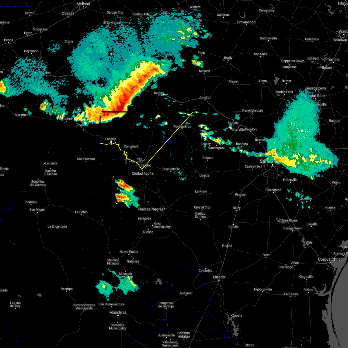 At 221 am cdt, severe thunderstorms were located along a line extending from 17 miles northeast of ozona to 17 miles northwest of juno to 8 miles west of pandale, moving south at 60 mph (radar indicated). Hazards include 60 mph wind gusts and quarter size hail. Hail damage to vehicles is expected. Expect wind damage to roofs, siding, and trees. At 221 am cdt, severe thunderstorms were located along a line extending from 17 miles northeast of ozona to 17 miles northwest of juno to 8 miles west of pandale, moving south at 60 mph (radar indicated). Hazards include 60 mph wind gusts and quarter size hail. Hail damage to vehicles is expected. Expect wind damage to roofs, siding, and trees.
|
| 5/19/2021 2:30 PM CDT | Quarter sized hail reported 6.8 miles SE of Del Rio, TX, delayed report of quarter sized hail. |
| 4/28/2021 7:19 PM CDT |
 At 719 pm cdt, a severe thunderstorm was located near brackettville, moving east at 70 mph (radar indicated). Hazards include 60 mph wind gusts and half dollar size hail. Hail damage to vehicles is expected. expect wind damage to roofs, siding, and trees. Locations impacted include, del rio, brackettville, val verde park, standart, amanda, laughlin afb, escondido estates and fort clark springs. At 719 pm cdt, a severe thunderstorm was located near brackettville, moving east at 70 mph (radar indicated). Hazards include 60 mph wind gusts and half dollar size hail. Hail damage to vehicles is expected. expect wind damage to roofs, siding, and trees. Locations impacted include, del rio, brackettville, val verde park, standart, amanda, laughlin afb, escondido estates and fort clark springs.
|
| 4/28/2021 7:04 PM CDT |
 At 704 pm cdt, a severe thunderstorm was located near laughlin afb, or 9 miles southeast of del rio, moving northeast at 40 mph (radar indicated). Hazards include 60 mph wind gusts and half dollar size hail. Hail damage to vehicles is expected. expect wind damage to roofs, siding, and trees. Locations impacted include, del rio, brackettville, val verde park, standart, cienegas terrace, amanda, laughlin afb, escondido estates and fort clark springs. At 704 pm cdt, a severe thunderstorm was located near laughlin afb, or 9 miles southeast of del rio, moving northeast at 40 mph (radar indicated). Hazards include 60 mph wind gusts and half dollar size hail. Hail damage to vehicles is expected. expect wind damage to roofs, siding, and trees. Locations impacted include, del rio, brackettville, val verde park, standart, cienegas terrace, amanda, laughlin afb, escondido estates and fort clark springs.
|
| 4/28/2021 6:47 PM CDT |
 At 646 pm cdt, a severe thunderstorm was located 11 miles south of del rio, moving northeast at 40 mph (radar indicated). Hazards include ping pong ball size hail and 60 mph wind gusts. People and animals outdoors will be injured. expect hail damage to roofs, siding, windows, and vehicles. Expect wind damage to roofs, siding, and trees. At 646 pm cdt, a severe thunderstorm was located 11 miles south of del rio, moving northeast at 40 mph (radar indicated). Hazards include ping pong ball size hail and 60 mph wind gusts. People and animals outdoors will be injured. expect hail damage to roofs, siding, windows, and vehicles. Expect wind damage to roofs, siding, and trees.
|
| 4/28/2021 5:49 PM CDT |
 At 549 pm cdt, a severe thunderstorm was located near standart, or 9 miles west of brackettville, moving east at 50 mph (radar indicated). Hazards include golf ball size hail and 60 mph wind gusts. People and animals outdoors will be injured. expect hail damage to roofs, siding, windows, and vehicles. expect wind damage to roofs, siding, and trees. Locations impacted include, del rio, brackettville, standart, alamo village, amanda, laughlin afb, escondido estates and fort clark springs. At 549 pm cdt, a severe thunderstorm was located near standart, or 9 miles west of brackettville, moving east at 50 mph (radar indicated). Hazards include golf ball size hail and 60 mph wind gusts. People and animals outdoors will be injured. expect hail damage to roofs, siding, windows, and vehicles. expect wind damage to roofs, siding, and trees. Locations impacted include, del rio, brackettville, standart, alamo village, amanda, laughlin afb, escondido estates and fort clark springs.
|
| 4/28/2021 5:38 PM CDT |
 At 538 pm cdt, a severe thunderstorm was located near laughlin afb, or 10 miles east of del rio, moving east at 45 mph (radar indicated). Hazards include 60 mph wind gusts and half dollar size hail. Hail damage to vehicles is expected. Expect wind damage to roofs, siding, and trees. At 538 pm cdt, a severe thunderstorm was located near laughlin afb, or 10 miles east of del rio, moving east at 45 mph (radar indicated). Hazards include 60 mph wind gusts and half dollar size hail. Hail damage to vehicles is expected. Expect wind damage to roofs, siding, and trees.
|
| 4/28/2021 4:53 PM CDT |
 At 453 pm cdt, a severe thunderstorm was located near amanda, or 9 miles east of del rio, moving east at 35 mph. this is a very dangerous storm (public). Hazards include three inch hail and 60 mph wind gusts. People and animals outdoors will be severely injured. expect shattered windows, extensive damage to roofs, siding, and vehicles. Locations impacted include, del rio, brackettville, spofford, lake view, amanda, laughlin afb, val verde park, anacacho, standart, alamo village, cienegas terrace, kickapoo cavern state park, escondido estates, fort clark springs and lake ridge ranch. At 453 pm cdt, a severe thunderstorm was located near amanda, or 9 miles east of del rio, moving east at 35 mph. this is a very dangerous storm (public). Hazards include three inch hail and 60 mph wind gusts. People and animals outdoors will be severely injured. expect shattered windows, extensive damage to roofs, siding, and vehicles. Locations impacted include, del rio, brackettville, spofford, lake view, amanda, laughlin afb, val verde park, anacacho, standart, alamo village, cienegas terrace, kickapoo cavern state park, escondido estates, fort clark springs and lake ridge ranch.
|
| 4/28/2021 4:50 PM CDT | Hen Egg sized hail reported 1.5 miles NE of Del Rio, TX, public report of large hail via social media. |
| 4/28/2021 4:47 PM CDT | Tea Cup sized hail reported 4.6 miles NW of Del Rio, TX, public reported 3 inch diameter hail near the intersection of u.s. highway 277 and spur 317. the largest hail occurred between 4:47 and 4:50 pm. |
| 4/28/2021 4:45 PM CDT | Golf Ball sized hail reported 2 miles W of Del Rio, TX, public reported golf ball sized hail on highway 90. |
| 4/28/2021 4:43 PM CDT |
 At 443 pm cdt, a severe thunderstorm was located over val verde park, or near del rio, moving east at 35 mph (radar indicated). Hazards include tennis ball size hail and 60 mph wind gusts. People and animals outdoors will be injured. expect hail damage to roofs, siding, windows, and vehicles. expect wind damage to roofs, siding, and trees. Locations impacted include, del rio, brackettville, spofford, lake view, amanda, laughlin afb, val verde park, anacacho, standart, alamo village, cienegas terrace, kickapoo cavern state park, escondido estates, fort clark springs and lake ridge ranch. At 443 pm cdt, a severe thunderstorm was located over val verde park, or near del rio, moving east at 35 mph (radar indicated). Hazards include tennis ball size hail and 60 mph wind gusts. People and animals outdoors will be injured. expect hail damage to roofs, siding, windows, and vehicles. expect wind damage to roofs, siding, and trees. Locations impacted include, del rio, brackettville, spofford, lake view, amanda, laughlin afb, val verde park, anacacho, standart, alamo village, cienegas terrace, kickapoo cavern state park, escondido estates, fort clark springs and lake ridge ranch.
|
| 4/28/2021 4:41 PM CDT | Ping Pong Ball sized hail reported 1.6 miles E of Del Rio, TX, 1.5 inch hail reported near the airport via social media. |
| 4/28/2021 4:29 PM CDT |
 At 429 pm cdt, a severe thunderstorm was located near cienegas terrace, or 7 miles southwest of del rio, moving east at 35 mph (radar indicated). Hazards include golf ball size hail and 60 mph wind gusts. People and animals outdoors will be injured. expect hail damage to roofs, siding, windows, and vehicles. Expect wind damage to roofs, siding, and trees. At 429 pm cdt, a severe thunderstorm was located near cienegas terrace, or 7 miles southwest of del rio, moving east at 35 mph (radar indicated). Hazards include golf ball size hail and 60 mph wind gusts. People and animals outdoors will be injured. expect hail damage to roofs, siding, windows, and vehicles. Expect wind damage to roofs, siding, and trees.
|
| 3/25/2021 12:34 AM CDT |
 At 1234 am cdt, a severe thunderstorm was located 13 miles west of barksdale, or 23 miles south of rocksprings, moving east at 30 mph (radar indicated). Hazards include 60 mph wind gusts and quarter size hail. Hail damage to vehicles is expected. expect wind damage to roofs, siding, and trees. Locations impacted include, del rio, brackettville, spofford, barksdale, amanda, laughlin afb, val verde park, anacacho, standart, alamo village, cienegas terrace, kickapoo cavern state park, turkey mountain, escondido estates and fort clark springs. At 1234 am cdt, a severe thunderstorm was located 13 miles west of barksdale, or 23 miles south of rocksprings, moving east at 30 mph (radar indicated). Hazards include 60 mph wind gusts and quarter size hail. Hail damage to vehicles is expected. expect wind damage to roofs, siding, and trees. Locations impacted include, del rio, brackettville, spofford, barksdale, amanda, laughlin afb, val verde park, anacacho, standart, alamo village, cienegas terrace, kickapoo cavern state park, turkey mountain, escondido estates and fort clark springs.
|
| 3/25/2021 12:12 AM CDT |
 At 1212 am cdt, a severe thunderstorm was located 17 miles north of alamo village, or 24 miles north of brackettville, moving east at 25 mph (radar indicated). Hazards include 60 mph wind gusts and quarter size hail. Hail damage to vehicles is expected. expect wind damage to roofs, siding, and trees. Locations impacted include, del rio, brackettville, spofford, lake view, barksdale, amanda, laughlin afb, val verde park, anacacho, standart, alamo village, cienegas terrace, kickapoo cavern state park, 277 south boat ramp, 277 north campground, san pedro canyon, turkey mountain, escondido estates, fort clark springs and lake ridge ranch. At 1212 am cdt, a severe thunderstorm was located 17 miles north of alamo village, or 24 miles north of brackettville, moving east at 25 mph (radar indicated). Hazards include 60 mph wind gusts and quarter size hail. Hail damage to vehicles is expected. expect wind damage to roofs, siding, and trees. Locations impacted include, del rio, brackettville, spofford, lake view, barksdale, amanda, laughlin afb, val verde park, anacacho, standart, alamo village, cienegas terrace, kickapoo cavern state park, 277 south boat ramp, 277 north campground, san pedro canyon, turkey mountain, escondido estates, fort clark springs and lake ridge ranch.
|
| 3/24/2021 11:58 PM CDT | Quarter sized hail reported 7.3 miles SE of Del Rio, TX, 1 inch hail reported to the southeast of lake amistad. |
| 3/24/2021 11:51 PM CDT |
 At 1150 pm cdt, a severe thunderstorm was located 11 miles southeast of carta valley, or 21 miles southeast of loma alta, moving east at 30 mph (radar indicated). Hazards include 60 mph wind gusts and quarter size hail. Hail damage to vehicles is expected. Expect wind damage to roofs, siding, and trees. At 1150 pm cdt, a severe thunderstorm was located 11 miles southeast of carta valley, or 21 miles southeast of loma alta, moving east at 30 mph (radar indicated). Hazards include 60 mph wind gusts and quarter size hail. Hail damage to vehicles is expected. Expect wind damage to roofs, siding, and trees.
|
| 5/20/2020 7:22 PM CDT |
 At 722 pm cdt, a severe thunderstorm was located over standart, or 11 miles west of brackettville, moving east at 30 mph (radar indicated). Hazards include 60 mph wind gusts and quarter size hail. Hail damage to vehicles is expected. expect wind damage to roofs, siding, and trees. Locations impacted include, del rio, standart, amanda, laughlin afb, val verde park and escondido estates. At 722 pm cdt, a severe thunderstorm was located over standart, or 11 miles west of brackettville, moving east at 30 mph (radar indicated). Hazards include 60 mph wind gusts and quarter size hail. Hail damage to vehicles is expected. expect wind damage to roofs, siding, and trees. Locations impacted include, del rio, standart, amanda, laughlin afb, val verde park and escondido estates.
|
| 5/20/2020 6:35 PM CDT |
 At 634 pm cdt, a severe thunderstorm was located 7 miles southwest of cienegas terrace, or 10 miles southwest of del rio, moving east at 30 mph (radar indicated). Hazards include 60 mph wind gusts and quarter size hail. Hail damage to vehicles is expected. Expect wind damage to roofs, siding, and trees. At 634 pm cdt, a severe thunderstorm was located 7 miles southwest of cienegas terrace, or 10 miles southwest of del rio, moving east at 30 mph (radar indicated). Hazards include 60 mph wind gusts and quarter size hail. Hail damage to vehicles is expected. Expect wind damage to roofs, siding, and trees.
|
| 5/15/2020 7:41 PM CDT |
 At 738 pm cdt, a severe thunderstorm was located over del rio, moving east at 35 mph (radar indicated. at 7:29 pm, a wind gust of 61 mph was reported at del rio). Hazards include 60 mph wind gusts and quarter size hail. Hail damage to vehicles is expected. expect wind damage to roofs, siding, and trees. Locations impacted include, del rio, brackettville, lake view, val verde park, standart, amanda, cienegas terrace, laughlin afb, fort clark springs, escondido estates, and lake ridge ranch. At 738 pm cdt, a severe thunderstorm was located over del rio, moving east at 35 mph (radar indicated. at 7:29 pm, a wind gust of 61 mph was reported at del rio). Hazards include 60 mph wind gusts and quarter size hail. Hail damage to vehicles is expected. expect wind damage to roofs, siding, and trees. Locations impacted include, del rio, brackettville, lake view, val verde park, standart, amanda, cienegas terrace, laughlin afb, fort clark springs, escondido estates, and lake ridge ranch.
|
| 5/15/2020 7:29 PM CDT | Drt asos measured 61 mph wind gus in val verde county TX, 2.9 miles ESE of Del Rio, TX |
| 5/15/2020 7:23 PM CDT |
 At 722 pm cdt, a severe thunderstorm was located 7 miles southwest of cienegas terrace, or 10 miles southwest of del rio, moving east at 35 mph (radar indicated). Hazards include 60 mph wind gusts and quarter size hail. Hail damage to vehicles is expected. Expect wind damage to roofs, siding, and trees. At 722 pm cdt, a severe thunderstorm was located 7 miles southwest of cienegas terrace, or 10 miles southwest of del rio, moving east at 35 mph (radar indicated). Hazards include 60 mph wind gusts and quarter size hail. Hail damage to vehicles is expected. Expect wind damage to roofs, siding, and trees.
|
| 4/27/2020 9:27 PM CDT |
 The severe thunderstorm warning for northwestern kinney, southwestern edwards and southeastern val verde counties will expire at 930 pm cdt, the storm which prompted the warning has moved out of the val verde and northwest kinney county. therefore, the warning will be allowed to expire. however damaging winds will remain possible from kickapoo caverns to brackettville to spofford where a severe thunderstorm warning remains in effect through 10 pm cdt. The severe thunderstorm warning for northwestern kinney, southwestern edwards and southeastern val verde counties will expire at 930 pm cdt, the storm which prompted the warning has moved out of the val verde and northwest kinney county. therefore, the warning will be allowed to expire. however damaging winds will remain possible from kickapoo caverns to brackettville to spofford where a severe thunderstorm warning remains in effect through 10 pm cdt.
|
| 4/27/2020 8:49 PM CDT |
 At 849 pm cdt, a severe thunderstorm was located 10 miles north of amanda, or 17 miles northeast of del rio, moving east at 40 mph (radar indicated). Hazards include 70 mph wind gusts and quarter size hail. Hail damage to vehicles is expected. expect considerable tree damage. wind damage is also likely to mobile homes, roofs, and outbuildings. Locations impacted include, del rio, lake view, black brush point, amanda, laughlin afb, val verde park, standart, cienegas terrace, long point, diablo east, kickapoo cavern state park, 277 south boat ramp, 277 north campground, san pedro canyon, escondido estates and lake ridge ranch. At 849 pm cdt, a severe thunderstorm was located 10 miles north of amanda, or 17 miles northeast of del rio, moving east at 40 mph (radar indicated). Hazards include 70 mph wind gusts and quarter size hail. Hail damage to vehicles is expected. expect considerable tree damage. wind damage is also likely to mobile homes, roofs, and outbuildings. Locations impacted include, del rio, lake view, black brush point, amanda, laughlin afb, val verde park, standart, cienegas terrace, long point, diablo east, kickapoo cavern state park, 277 south boat ramp, 277 north campground, san pedro canyon, escondido estates and lake ridge ranch.
|
| 4/27/2020 8:41 PM CDT | Pictures of a few trees down...a large section of backyard fence missing...and an outdoor shed blow over shared via social media. reports of power outages around del ri in val verde county TX, 2.8 miles SE of Del Rio, TX |
| 4/27/2020 8:39 PM CDT | Mping report of 1-inch tree limbs broken and shingles blown off of a hom in val verde county TX, 1.3 miles SE of Del Rio, TX |
| 4/27/2020 8:38 PM CDT | Public report of sustained 60 mph winds with higher gusts from their private weather statio in val verde county TX, 4.2 miles SSE of Del Rio, TX |
| 4/27/2020 8:36 PM CDT |
 At 835 pm cdt, a severe thunderstorm was located over black brush point, or 9 miles northwest of del rio, moving southeast at 35 mph (radar indicated). Hazards include 70 mph wind gusts and quarter size hail. Hail damage to vehicles is expected. expect considerable tree damage. Wind damage is also likely to mobile homes, roofs, and outbuildings. At 835 pm cdt, a severe thunderstorm was located over black brush point, or 9 miles northwest of del rio, moving southeast at 35 mph (radar indicated). Hazards include 70 mph wind gusts and quarter size hail. Hail damage to vehicles is expected. expect considerable tree damage. Wind damage is also likely to mobile homes, roofs, and outbuildings.
|
| 4/27/2020 8:35 PM CDT | 77 mph wind gust (67 knots) reported at the del rio international airpor in val verde county TX, 2.2 miles E of Del Rio, TX |
| 4/11/2020 8:27 PM CDT | Baseball sized hail reported 3.8 miles W of Del Rio, TX, trained spotter reports baseball size hail at the intersection of north loop 79 and highway 90. |
| 4/11/2020 8:26 PM CDT |
 At 825 pm cdt, a severe thunderstorm was located near laughlin afb, or 9 miles east of del rio, moving northeast at 30 mph. this is a very dangerous storm (trained weather spotters). Hazards include baseball size hail and 60 mph wind gusts. People and animals outdoors will be severely injured. expect shattered windows, extensive damage to roofs, siding, and vehicles. Locations impacted include, del rio, lake view, amistad village, black brush point, laughlin afb, val verde park, diablo east, cienegas terrace, governors landing, long point, 277 south boat ramp, 277 north campground, san pedro canyon, escondido estates and lake ridge ranch. At 825 pm cdt, a severe thunderstorm was located near laughlin afb, or 9 miles east of del rio, moving northeast at 30 mph. this is a very dangerous storm (trained weather spotters). Hazards include baseball size hail and 60 mph wind gusts. People and animals outdoors will be severely injured. expect shattered windows, extensive damage to roofs, siding, and vehicles. Locations impacted include, del rio, lake view, amistad village, black brush point, laughlin afb, val verde park, diablo east, cienegas terrace, governors landing, long point, 277 south boat ramp, 277 north campground, san pedro canyon, escondido estates and lake ridge ranch.
|
| 4/11/2020 8:25 PM CDT | Grapefruit sized hail reported 1.5 miles NE of Del Rio, TX |
| 4/11/2020 8:25 PM CDT | Grapefruit sized hail reported 1.6 miles E of Del Rio, TX |
| 4/11/2020 8:19 PM CDT | Baseball sized hail reported 3.7 miles ESE of Del Rio, TX, picture of baseball size hail on twitter. |
| 4/11/2020 8:19 PM CDT |
 At 819 pm cdt, a severe thunderstorm was located over val verde park, or near del rio, moving east at 25 mph (radar indicated). Hazards include two inch hail and 60 mph wind gusts. People and animals outdoors will be injured. expect hail damage to roofs, siding, windows, and vehicles. expect wind damage to roofs, siding, and trees. Locations impacted include, del rio, lake view, amistad village, black brush point, laughlin afb, val verde park, diablo east, cienegas terrace, governors landing, long point, 277 south boat ramp, 277 north campground, san pedro canyon, escondido estates and lake ridge ranch. At 819 pm cdt, a severe thunderstorm was located over val verde park, or near del rio, moving east at 25 mph (radar indicated). Hazards include two inch hail and 60 mph wind gusts. People and animals outdoors will be injured. expect hail damage to roofs, siding, windows, and vehicles. expect wind damage to roofs, siding, and trees. Locations impacted include, del rio, lake view, amistad village, black brush point, laughlin afb, val verde park, diablo east, cienegas terrace, governors landing, long point, 277 south boat ramp, 277 north campground, san pedro canyon, escondido estates and lake ridge ranch.
|
| 4/11/2020 8:15 PM CDT | Tea Cup sized hail reported 0.4 miles ESE of Del Rio, TX, several reports of 3 inch hail in del rio. |
| 4/11/2020 8:13 PM CDT | Ping Pong Ball sized hail reported 2.5 miles SSE of Del Rio, TX, ping pong ball (1.50 in.) size hail in del rio. from mping. |
| 4/11/2020 8:10 PM CDT | Baseball sized hail reported 2.7 miles SE of Del Rio, TX, public reports many locations across del rio have received up to baseball size hail. |
| 4/11/2020 8:06 PM CDT |
 At 805 pm cdt, a severe thunderstorm was located near del rio, moving east at 30 mph (trained weather spotters). Hazards include golf ball size hail and 60 mph wind gusts. People and animals outdoors will be injured. expect hail damage to roofs, siding, windows, and vehicles. expect wind damage to roofs, siding, and trees. Locations impacted include, del rio, lake view, amistad village, black brush point, laughlin afb, val verde park, diablo east, cienegas terrace, governors landing, long point, amistad acres, box canyon, devils shores, 277 south boat ramp, 277 north campground, san pedro canyon, rough canyon recreation area, spur 406 campground, rock quarry campground and escondido estates. At 805 pm cdt, a severe thunderstorm was located near del rio, moving east at 30 mph (trained weather spotters). Hazards include golf ball size hail and 60 mph wind gusts. People and animals outdoors will be injured. expect hail damage to roofs, siding, windows, and vehicles. expect wind damage to roofs, siding, and trees. Locations impacted include, del rio, lake view, amistad village, black brush point, laughlin afb, val verde park, diablo east, cienegas terrace, governors landing, long point, amistad acres, box canyon, devils shores, 277 south boat ramp, 277 north campground, san pedro canyon, rough canyon recreation area, spur 406 campground, rock quarry campground and escondido estates.
|
| 4/11/2020 8:05 PM CDT | Quarter sized hail reported 2.5 miles SSE of Del Rio, TX, quarter size hail in del rio. report received on mping. |
| 4/11/2020 8:02 PM CDT | Golf Ball sized hail reported 4.1 miles SE of Del Rio, TX, golf ball size hail reported by cooperative observer. |
| 4/11/2020 8:00 PM CDT | Golf Ball sized hail reported 11.5 miles ESE of Del Rio, TX, golf ball size hail on lake amistad north of del rio. |
| 4/11/2020 7:57 PM CDT |
 At 756 pm cdt, a severe thunderstorm was located over amistad village, or 9 miles northwest of del rio, moving northeast at 30 mph (radar indicated). Hazards include 60 mph wind gusts and half dollar size hail. Hail damage to vehicles is expected. Expect wind damage to roofs, siding, and trees. At 756 pm cdt, a severe thunderstorm was located over amistad village, or 9 miles northwest of del rio, moving northeast at 30 mph (radar indicated). Hazards include 60 mph wind gusts and half dollar size hail. Hail damage to vehicles is expected. Expect wind damage to roofs, siding, and trees.
|
| 4/3/2020 1:06 PM CDT |
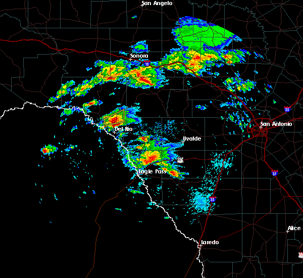 At 106 pm cdt, a severe thunderstorm was located 7 miles northeast of lake view, or 10 miles north of del rio, moving east at 30 mph (radar indicated). Hazards include half dollar size hail. damage to vehicles is expected At 106 pm cdt, a severe thunderstorm was located 7 miles northeast of lake view, or 10 miles north of del rio, moving east at 30 mph (radar indicated). Hazards include half dollar size hail. damage to vehicles is expected
|
| 3/19/2020 2:32 AM CDT |
 At 231 am cdt, a severe thunderstorm was located near long point, or 13 miles north of del rio, moving northeast at 45 mph (radar indicated). Hazards include tennis ball size hail and 60 mph wind gusts. People and animals outdoors will be injured. expect hail damage to roofs, siding, windows, and vehicles. Expect wind damage to roofs, siding, and trees. At 231 am cdt, a severe thunderstorm was located near long point, or 13 miles north of del rio, moving northeast at 45 mph (radar indicated). Hazards include tennis ball size hail and 60 mph wind gusts. People and animals outdoors will be injured. expect hail damage to roofs, siding, windows, and vehicles. Expect wind damage to roofs, siding, and trees.
|
| 3/19/2020 2:23 AM CDT |
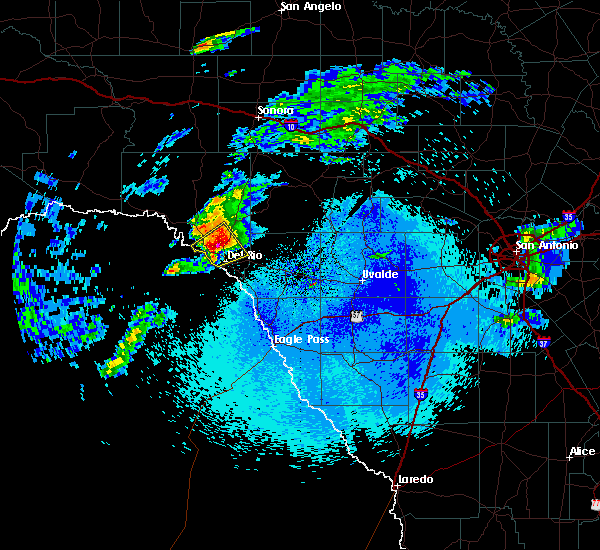 At 222 am cdt, a severe thunderstorm was located over long point, or 10 miles northwest of del rio, moving northeast at 45 mph (radar indicated). Hazards include tennis ball size hail and 60 mph wind gusts. People and animals outdoors will be injured. expect hail damage to roofs, siding, windows, and vehicles. expect wind damage to roofs, siding, and trees. Locations impacted include, lake view, amistad village, black brush point, amistad acres, box canyon, diablo east, cienegas terrace, governors landing, long point, devils shores, 277 south boat ramp, 277 north campground, san pedro canyon, rough canyon recreation area, spur 406 campground, rock quarry campground, salem point, lake ridge ranch and devils river state nat area big satan. At 222 am cdt, a severe thunderstorm was located over long point, or 10 miles northwest of del rio, moving northeast at 45 mph (radar indicated). Hazards include tennis ball size hail and 60 mph wind gusts. People and animals outdoors will be injured. expect hail damage to roofs, siding, windows, and vehicles. expect wind damage to roofs, siding, and trees. Locations impacted include, lake view, amistad village, black brush point, amistad acres, box canyon, diablo east, cienegas terrace, governors landing, long point, devils shores, 277 south boat ramp, 277 north campground, san pedro canyon, rough canyon recreation area, spur 406 campground, rock quarry campground, salem point, lake ridge ranch and devils river state nat area big satan.
|
| 3/19/2020 2:14 AM CDT | Golf Ball sized hail reported 14 miles SE of Del Rio, TX, general public reports golf ball size hail near lake amistad dam. |
| 3/19/2020 2:01 AM CDT |
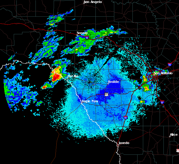 At 200 am cdt, a severe thunderstorm was located 13 miles southwest of amistad acres, or 21 miles west of del rio, moving northeast at 35 mph (radar indicated). Hazards include two inch hail and 60 mph wind gusts. People and animals outdoors will be injured. expect hail damage to roofs, siding, windows, and vehicles. Expect wind damage to roofs, siding, and trees. At 200 am cdt, a severe thunderstorm was located 13 miles southwest of amistad acres, or 21 miles west of del rio, moving northeast at 35 mph (radar indicated). Hazards include two inch hail and 60 mph wind gusts. People and animals outdoors will be injured. expect hail damage to roofs, siding, windows, and vehicles. Expect wind damage to roofs, siding, and trees.
|
| 3/4/2020 1:53 AM CST |
 At 152 am cst, severe thunderstorms were located along a line extending from near carta valley to 12 miles north of amanda to laughlin afb, moving east at 30 mph (radar indicated). Hazards include 60 mph wind gusts. expect damage to roofs, siding, and trees At 152 am cst, severe thunderstorms were located along a line extending from near carta valley to 12 miles north of amanda to laughlin afb, moving east at 30 mph (radar indicated). Hazards include 60 mph wind gusts. expect damage to roofs, siding, and trees
|
| 6/21/2019 9:45 PM CDT |
 At 944 pm cdt, severe thunderstorms were located along a line extending from near amistad recreation area - long point to laughlin afb to 9 miles southwest of standart to 8 miles north of quemado, moving northeast at 20 mph (a 70 mph wind gust was measured at laughlin air force base at 9:34 pm). Hazards include 70 mph wind gusts and nickel size hail. Expect considerable tree damage. damage is likely to mobile homes, roofs, and outbuildings. Locations impacted include, del rio, quemado, lake view, amistad village, amistad recreation area - governors landing, amistad recreation area - diablo east, amistad recreation area - black brush point, amanda, laughlin afb, amistad recreation area - long point, val verde park, standart, cienegas terrace, devils shores, amistad recreation area - rock quarry campground, amistad recreation area - san pedro canyon, amistad recreation area - rough canyon, amistad recreation area - 277 north campground, amistad recreation area - 277 south boat ramp and amistad recreation area - spur 406 campground. At 944 pm cdt, severe thunderstorms were located along a line extending from near amistad recreation area - long point to laughlin afb to 9 miles southwest of standart to 8 miles north of quemado, moving northeast at 20 mph (a 70 mph wind gust was measured at laughlin air force base at 9:34 pm). Hazards include 70 mph wind gusts and nickel size hail. Expect considerable tree damage. damage is likely to mobile homes, roofs, and outbuildings. Locations impacted include, del rio, quemado, lake view, amistad village, amistad recreation area - governors landing, amistad recreation area - diablo east, amistad recreation area - black brush point, amanda, laughlin afb, amistad recreation area - long point, val verde park, standart, cienegas terrace, devils shores, amistad recreation area - rock quarry campground, amistad recreation area - san pedro canyon, amistad recreation area - rough canyon, amistad recreation area - 277 north campground, amistad recreation area - 277 south boat ramp and amistad recreation area - spur 406 campground.
|
| 6/21/2019 9:34 PM CDT |
 At 933 pm cdt, severe thunderstorms were located along a line extending from near amistad recreation area - long point to near laughlin afb to 12 miles southwest of standart to 6 miles north of quemado, moving northeast at 20 mph (a 64 mph wind gust was recorded at del rio international airport at 9:24 pm). Hazards include 60 mph wind gusts and quarter size hail. Hail damage to vehicles is expected. expect wind damage to roofs, siding, and trees. Locations impacted include, del rio, quemado, lake view, amistad village, amistad recreation area - governors landing, amistad recreation area - diablo east, amistad recreation area - black brush point, amanda, laughlin afb, amistad recreation area - long point, val verde park, standart, cienegas terrace, devils shores, amistad recreation area - rock quarry campground, amistad recreation area - san pedro canyon, amistad recreation area - rough canyon, amistad recreation area - 277 north campground, amistad recreation area - 277 south boat ramp and amistad recreation area - spur 406 campground. At 933 pm cdt, severe thunderstorms were located along a line extending from near amistad recreation area - long point to near laughlin afb to 12 miles southwest of standart to 6 miles north of quemado, moving northeast at 20 mph (a 64 mph wind gust was recorded at del rio international airport at 9:24 pm). Hazards include 60 mph wind gusts and quarter size hail. Hail damage to vehicles is expected. expect wind damage to roofs, siding, and trees. Locations impacted include, del rio, quemado, lake view, amistad village, amistad recreation area - governors landing, amistad recreation area - diablo east, amistad recreation area - black brush point, amanda, laughlin afb, amistad recreation area - long point, val verde park, standart, cienegas terrace, devils shores, amistad recreation area - rock quarry campground, amistad recreation area - san pedro canyon, amistad recreation area - rough canyon, amistad recreation area - 277 north campground, amistad recreation area - 277 south boat ramp and amistad recreation area - spur 406 campground.
|
| 6/21/2019 9:24 PM CDT | Measured at kdr in val verde county TX, 2.2 miles E of Del Rio, TX |
| 6/21/2019 9:18 PM CDT |
 At 918 pm cdt, severe thunderstorms were located along a line extending from amistad village to 7 miles south of del rio to 15 miles south of laughlin afb to near quemado, moving northeast at 20 mph (radar indicated). Hazards include 60 mph wind gusts and quarter size hail. Hail damage to vehicles is expected. Expect wind damage to roofs, siding, and trees. At 918 pm cdt, severe thunderstorms were located along a line extending from amistad village to 7 miles south of del rio to 15 miles south of laughlin afb to near quemado, moving northeast at 20 mph (radar indicated). Hazards include 60 mph wind gusts and quarter size hail. Hail damage to vehicles is expected. Expect wind damage to roofs, siding, and trees.
|
| 6/9/2019 11:14 PM CDT |
 The national weather service in austin san antonio has issued a * severe thunderstorm warning for. western kinney county in south central texas. southeastern val verde county in south central texas. until 1215 am cdt. At 1114 pm cdt, a severe thunderstorm was located over laughlin. The national weather service in austin san antonio has issued a * severe thunderstorm warning for. western kinney county in south central texas. southeastern val verde county in south central texas. until 1215 am cdt. At 1114 pm cdt, a severe thunderstorm was located over laughlin.
|
| 5/19/2019 4:30 AM CDT |
 At 430 am cdt, a severe thunderstorm was located near amanda, or 10 miles east of del rio, moving north at 10 mph (radar indicated). Hazards include 60 mph wind gusts and quarter size hail. Hail damage to vehicles is expected. Expect wind damage to roofs, siding, and trees. At 430 am cdt, a severe thunderstorm was located near amanda, or 10 miles east of del rio, moving north at 10 mph (radar indicated). Hazards include 60 mph wind gusts and quarter size hail. Hail damage to vehicles is expected. Expect wind damage to roofs, siding, and trees.
|
| 5/3/2019 1:42 AM CDT |
 At 142 am cdt, a severe thunderstorm was located near del rio, moving east at 30 mph (radar indicated). Hazards include 60 mph wind gusts and quarter size hail. Hail damage to vehicles is expected. Expect wind damage to roofs, siding, and trees. At 142 am cdt, a severe thunderstorm was located near del rio, moving east at 30 mph (radar indicated). Hazards include 60 mph wind gusts and quarter size hail. Hail damage to vehicles is expected. Expect wind damage to roofs, siding, and trees.
|
| 5/3/2019 12:00 AM CDT |
 At 1200 am cdt, a severe thunderstorm was located 7 miles southeast of laughlin afb, or 12 miles southeast of del rio, moving southeast at 15 mph (radar indicated). Hazards include quarter size hail. damage to vehicles is expected At 1200 am cdt, a severe thunderstorm was located 7 miles southeast of laughlin afb, or 12 miles southeast of del rio, moving southeast at 15 mph (radar indicated). Hazards include quarter size hail. damage to vehicles is expected
|
| 5/2/2019 11:17 PM CDT |
 At 1117 pm cdt, a severe thunderstorm was located over val verde park, or near del rio, moving southeast at 15 mph (radar indicated). Hazards include ping pong ball size hail and 60 mph wind gusts. People and animals outdoors will be injured. expect hail damage to roofs, siding, windows, and vehicles. expect wind damage to roofs, siding, and trees. Locations impacted include, del rio, standart, cienegas terrace, amanda, laughlin afb and val verde park. At 1117 pm cdt, a severe thunderstorm was located over val verde park, or near del rio, moving southeast at 15 mph (radar indicated). Hazards include ping pong ball size hail and 60 mph wind gusts. People and animals outdoors will be injured. expect hail damage to roofs, siding, windows, and vehicles. expect wind damage to roofs, siding, and trees. Locations impacted include, del rio, standart, cienegas terrace, amanda, laughlin afb and val verde park.
|
| 5/2/2019 10:56 PM CDT |
 At 1056 pm cdt, a severe thunderstorm was located near lake view, or near del rio, moving southeast at 25 mph (radar indicated). Hazards include golf ball size hail and 60 mph wind gusts. People and animals outdoors will be injured. expect hail damage to roofs, siding, windows, and vehicles. Expect wind damage to roofs, siding, and trees. At 1056 pm cdt, a severe thunderstorm was located near lake view, or near del rio, moving southeast at 25 mph (radar indicated). Hazards include golf ball size hail and 60 mph wind gusts. People and animals outdoors will be injured. expect hail damage to roofs, siding, windows, and vehicles. Expect wind damage to roofs, siding, and trees.
|
| 5/2/2019 10:44 PM CDT |
 At 1043 pm cdt, a severe thunderstorm was located over lake view, or 7 miles north of del rio, moving southeast at 30 mph (radar indicated). Hazards include golf ball size hail and 60 mph wind gusts. People and animals outdoors will be injured. expect hail damage to roofs, siding, windows, and vehicles. expect wind damage to roofs, siding, and trees. Locations impacted include, del rio, lake view, amistad village, amistad recreation area - governors landing, amistad recreation area - diablo east, amistad recreation area - black brush point, laughlin afb, amistad recreation area - long point, val verde park, cienegas terrace, devils shores, amistad recreation area - rock quarry campground, amistad recreation area - san pedro canyon, amistad recreation area - rough canyon, amistad recreation area - spur 406 campground, salem point, amistad recreation area - 277 north campground and amistad recreation area - 277 south boat ramp. At 1043 pm cdt, a severe thunderstorm was located over lake view, or 7 miles north of del rio, moving southeast at 30 mph (radar indicated). Hazards include golf ball size hail and 60 mph wind gusts. People and animals outdoors will be injured. expect hail damage to roofs, siding, windows, and vehicles. expect wind damage to roofs, siding, and trees. Locations impacted include, del rio, lake view, amistad village, amistad recreation area - governors landing, amistad recreation area - diablo east, amistad recreation area - black brush point, laughlin afb, amistad recreation area - long point, val verde park, cienegas terrace, devils shores, amistad recreation area - rock quarry campground, amistad recreation area - san pedro canyon, amistad recreation area - rough canyon, amistad recreation area - spur 406 campground, salem point, amistad recreation area - 277 north campground and amistad recreation area - 277 south boat ramp.
|
| 5/2/2019 10:20 PM CDT |
 At 1020 pm cdt, a severe thunderstorm was located near amistad recreation area - long point, or 13 miles southeast of comstock, moving southeast at 15 mph. this is a very dangerous storm (radar indicated). Hazards include three inch hail and 60 mph wind gusts. People and animals outdoors will be severely injured. expect shattered windows, extensive damage to roofs, siding, and vehicles. Locations impacted include, del rio, lake view, amistad village, amistad recreation area - governors landing, amistad recreation area - diablo east, amistad recreation area - black brush point, laughlin afb, amistad recreation area - long point, val verde park, cienegas terrace, devils shores, amistad recreation area - rock quarry campground, amistad recreation area - san pedro canyon, amistad recreation area - rough canyon, amistad recreation area - spur 406 campground, salem point, amistad recreation area - 277 north campground and amistad recreation area - 277 south boat ramp. At 1020 pm cdt, a severe thunderstorm was located near amistad recreation area - long point, or 13 miles southeast of comstock, moving southeast at 15 mph. this is a very dangerous storm (radar indicated). Hazards include three inch hail and 60 mph wind gusts. People and animals outdoors will be severely injured. expect shattered windows, extensive damage to roofs, siding, and vehicles. Locations impacted include, del rio, lake view, amistad village, amistad recreation area - governors landing, amistad recreation area - diablo east, amistad recreation area - black brush point, laughlin afb, amistad recreation area - long point, val verde park, cienegas terrace, devils shores, amistad recreation area - rock quarry campground, amistad recreation area - san pedro canyon, amistad recreation area - rough canyon, amistad recreation area - spur 406 campground, salem point, amistad recreation area - 277 north campground and amistad recreation area - 277 south boat ramp.
|
| 5/2/2019 9:58 PM CDT |
 At 957 pm cdt, a severe thunderstorm was located 9 miles east of comstock, moving southeast at 25 mph. this is a very dangerous storm (radar indicated). Hazards include baseball size hail and 70 mph wind gusts. People and animals outdoors will be severely injured. Expect shattered windows, extensive damage to roofs, siding, and vehicles. At 957 pm cdt, a severe thunderstorm was located 9 miles east of comstock, moving southeast at 25 mph. this is a very dangerous storm (radar indicated). Hazards include baseball size hail and 70 mph wind gusts. People and animals outdoors will be severely injured. Expect shattered windows, extensive damage to roofs, siding, and vehicles.
|
| 5/2/2019 9:51 PM CDT |
 At 951 pm cdt, a severe thunderstorm was located 7 miles east of comstock, moving southeast at 25 mph. this is a very dangerous storm (radar indicated). Hazards include three inch hail and 70 mph wind gusts. People and animals outdoors will be severely injured. expect shattered windows, extensive damage to roofs, siding, and vehicles. Locations impacted include, del rio, comstock, lake view, amistad village, amistad recreation area - governors landing, amistad recreation area - diablo east, amistad recreation area - black brush point, amistad acres, laughlin afb, box canyon, amistad recreation area - long point, val verde park, cienegas terrace, devils shores, amistad recreation area - rock quarry campground, amistad recreation area - san pedro canyon, amistad recreation area - rough canyon, amistad recreation area - spur 406 campground, salem point and amistad recreation area - 277 north campground. At 951 pm cdt, a severe thunderstorm was located 7 miles east of comstock, moving southeast at 25 mph. this is a very dangerous storm (radar indicated). Hazards include three inch hail and 70 mph wind gusts. People and animals outdoors will be severely injured. expect shattered windows, extensive damage to roofs, siding, and vehicles. Locations impacted include, del rio, comstock, lake view, amistad village, amistad recreation area - governors landing, amistad recreation area - diablo east, amistad recreation area - black brush point, amistad acres, laughlin afb, box canyon, amistad recreation area - long point, val verde park, cienegas terrace, devils shores, amistad recreation area - rock quarry campground, amistad recreation area - san pedro canyon, amistad recreation area - rough canyon, amistad recreation area - spur 406 campground, salem point and amistad recreation area - 277 north campground.
|
| 5/2/2019 9:34 PM CDT |
 At 934 pm cdt, a severe thunderstorm was located 8 miles northeast of comstock, moving southeast at 15 mph (radar indicated). Hazards include golf ball size hail and 70 mph wind gusts. People and animals outdoors will be injured. expect hail damage to roofs, siding, windows, and vehicles. expect considerable tree damage. Wind damage is also likely to mobile homes, roofs, and outbuildings. At 934 pm cdt, a severe thunderstorm was located 8 miles northeast of comstock, moving southeast at 15 mph (radar indicated). Hazards include golf ball size hail and 70 mph wind gusts. People and animals outdoors will be injured. expect hail damage to roofs, siding, windows, and vehicles. expect considerable tree damage. Wind damage is also likely to mobile homes, roofs, and outbuildings.
|
| 4/17/2019 9:14 PM CDT |
 At 913 pm cdt, a severe thunderstorm was located 8 miles north of val verde park, or 10 miles northeast of del rio, moving east at 30 mph (radar indicated). Hazards include tennis ball size hail and 60 mph wind gusts. People and animals outdoors will be injured. expect hail damage to roofs, siding, windows, and vehicles. Expect wind damage to roofs, siding, and trees. At 913 pm cdt, a severe thunderstorm was located 8 miles north of val verde park, or 10 miles northeast of del rio, moving east at 30 mph (radar indicated). Hazards include tennis ball size hail and 60 mph wind gusts. People and animals outdoors will be injured. expect hail damage to roofs, siding, windows, and vehicles. Expect wind damage to roofs, siding, and trees.
|
| 4/17/2019 9:08 PM CDT |
 At 906 pm cdt, a severe thunderstorm was located 8 miles northeast of amistad recreation area - long point, or 13 miles north of del rio, moving east at 40 mph (radar indicated). Hazards include two inch hail and 60 mph wind gusts. People and animals outdoors will be injured. expect hail damage to roofs, siding, windows, and vehicles. expect wind damage to roofs, siding, and trees. Locations impacted include, del rio, lake view, amistad village, amistad recreation area - governors landing, amistad recreation area - diablo east, amistad recreation area - black brush point, amistad recreation area - long point, devils shores, pafford crossing, amistad recreation area - rock quarry campground, devils river sna - big satan, amistad recreation area - san pedro canyon, amistad recreation area - rough canyon, amistad recreation area - spur 406 campground, amistad recreation area - 277 north campground and amistad recreation area - 277 south boat ramp. At 906 pm cdt, a severe thunderstorm was located 8 miles northeast of amistad recreation area - long point, or 13 miles north of del rio, moving east at 40 mph (radar indicated). Hazards include two inch hail and 60 mph wind gusts. People and animals outdoors will be injured. expect hail damage to roofs, siding, windows, and vehicles. expect wind damage to roofs, siding, and trees. Locations impacted include, del rio, lake view, amistad village, amistad recreation area - governors landing, amistad recreation area - diablo east, amistad recreation area - black brush point, amistad recreation area - long point, devils shores, pafford crossing, amistad recreation area - rock quarry campground, devils river sna - big satan, amistad recreation area - san pedro canyon, amistad recreation area - rough canyon, amistad recreation area - spur 406 campground, amistad recreation area - 277 north campground and amistad recreation area - 277 south boat ramp.
|
| 4/17/2019 8:34 PM CDT |
 At 833 pm cdt, severe thunderstorms were located along a line extending from 23 miles northwest of rocksprings to 10 miles southeast of carta valley to 7 miles northeast of box canyon to 9 miles west of amistad acres, moving east at 35 mph (radar indicated). Hazards include two inch hail and 60 mph wind gusts. People and animals outdoors will be injured. expect hail damage to roofs, siding, windows, and vehicles. expect wind damage to roofs, siding, and trees. Locations impacted include, del rio, comstock, loma alta, lake view, amistad recreation area - diablo east, amistad acres, laughlin afb, amistad recreation area - long point, carta valley, cienegas terrace, amistad village, amistad recreation area - governors landing, amistad recreation area - black brush point, seminole canyon state park, box canyon, val verde park, amistad recreation area - san pedro canyon, amistad recreation area - rough canyon, amistad recreation area - spur 406 campground and salem point. At 833 pm cdt, severe thunderstorms were located along a line extending from 23 miles northwest of rocksprings to 10 miles southeast of carta valley to 7 miles northeast of box canyon to 9 miles west of amistad acres, moving east at 35 mph (radar indicated). Hazards include two inch hail and 60 mph wind gusts. People and animals outdoors will be injured. expect hail damage to roofs, siding, windows, and vehicles. expect wind damage to roofs, siding, and trees. Locations impacted include, del rio, comstock, loma alta, lake view, amistad recreation area - diablo east, amistad acres, laughlin afb, amistad recreation area - long point, carta valley, cienegas terrace, amistad village, amistad recreation area - governors landing, amistad recreation area - black brush point, seminole canyon state park, box canyon, val verde park, amistad recreation area - san pedro canyon, amistad recreation area - rough canyon, amistad recreation area - spur 406 campground and salem point.
|
| 4/17/2019 8:21 PM CDT |
 At 820 pm cdt, severe thunderstorms were located along a line extending from 20 miles south of sonora to 9 miles southwest of carta valley to near box canyon to 34 miles southwest of amistad acres, moving east at 45 mph. the storm near lake amistad will have the largest hail (radar indicated). Hazards include two inch hail and 60 mph wind gusts. People and animals outdoors will be injured. expect hail damage to roofs, siding, windows, and vehicles. expect wind damage to roofs, siding, and trees. Locations impacted include, del rio, comstock, juno, loma alta, lake view, amistad recreation area - diablo east, amistad acres, laughlin afb, amistad recreation area - long point, carta valley, cienegas terrace, amistad village, amistad recreation area - governors landing, amistad recreation area - black brush point, seminole canyon state park, box canyon, val verde park, amistad recreation area - san pedro canyon, amistad recreation area - rough canyon and amistad recreation area - spur 406 campground. At 820 pm cdt, severe thunderstorms were located along a line extending from 20 miles south of sonora to 9 miles southwest of carta valley to near box canyon to 34 miles southwest of amistad acres, moving east at 45 mph. the storm near lake amistad will have the largest hail (radar indicated). Hazards include two inch hail and 60 mph wind gusts. People and animals outdoors will be injured. expect hail damage to roofs, siding, windows, and vehicles. expect wind damage to roofs, siding, and trees. Locations impacted include, del rio, comstock, juno, loma alta, lake view, amistad recreation area - diablo east, amistad acres, laughlin afb, amistad recreation area - long point, carta valley, cienegas terrace, amistad village, amistad recreation area - governors landing, amistad recreation area - black brush point, seminole canyon state park, box canyon, val verde park, amistad recreation area - san pedro canyon, amistad recreation area - rough canyon and amistad recreation area - spur 406 campground.
|
| 4/17/2019 8:11 PM CDT |
 At 810 pm cdt, severe thunderstorms were located along a line extending from 14 miles northeast of juno to 10 miles northeast of amistad recreation area - long point to near box canyon to 40 miles south of langtry, moving east at 35 mph (radar indicated). Hazards include 60 mph wind gusts and half dollar size hail. Hail damage to vehicles is expected. Expect wind damage to roofs, siding, and trees. At 810 pm cdt, severe thunderstorms were located along a line extending from 14 miles northeast of juno to 10 miles northeast of amistad recreation area - long point to near box canyon to 40 miles south of langtry, moving east at 35 mph (radar indicated). Hazards include 60 mph wind gusts and half dollar size hail. Hail damage to vehicles is expected. Expect wind damage to roofs, siding, and trees.
|
| 4/13/2019 7:30 AM CDT |
 At 729 am cdt, severe thunderstorms were located along a line extending from 14 miles north of amanda to 9 miles south of laughlin afb, moving east at 45 mph (radar indicated). Hazards include 60 mph wind gusts and quarter size hail. Hail damage to vehicles is expected. Expect wind damage to roofs, siding, and trees. At 729 am cdt, severe thunderstorms were located along a line extending from 14 miles north of amanda to 9 miles south of laughlin afb, moving east at 45 mph (radar indicated). Hazards include 60 mph wind gusts and quarter size hail. Hail damage to vehicles is expected. Expect wind damage to roofs, siding, and trees.
|
| 12/26/2018 7:58 PM CST |
 The severe thunderstorm warning for northwestern kinney, southwestern edwards and southeastern val verde counties will expire at 800 pm cst, the storm which prompted the warning has weakened below severe limits, and has exited the warned area. therefore, the warning will be allowed to expire. a tornado watch remains in effect until 200 am cst for south central texas. The severe thunderstorm warning for northwestern kinney, southwestern edwards and southeastern val verde counties will expire at 800 pm cst, the storm which prompted the warning has weakened below severe limits, and has exited the warned area. therefore, the warning will be allowed to expire. a tornado watch remains in effect until 200 am cst for south central texas.
|
| 12/26/2018 7:32 PM CST |
 At 732 pm cst, a severe thunderstorm was located 12 miles southeast of carta valley, or 22 miles southeast of loma alta, moving northeast at 40 mph (radar indicated). Hazards include 60 mph wind gusts and quarter size hail. Hail damage to vehicles is expected. expect wind damage to roofs, siding, and trees. locations impacted include, del rio, lake view, amistad village, amistad recreation area - diablo east, amistad recreation area - black brush point, amanda, laughlin afb, amistad recreation area - long point, val verde park, standart, carta valley, cienegas terrace, amistad recreation area - san pedro canyon, kickapoo cavern state park, amistad recreation area - 277 north campground and amistad recreation area - 277 south boat ramp. A tornado watch remains in effect until 200 am cst for south central texas. At 732 pm cst, a severe thunderstorm was located 12 miles southeast of carta valley, or 22 miles southeast of loma alta, moving northeast at 40 mph (radar indicated). Hazards include 60 mph wind gusts and quarter size hail. Hail damage to vehicles is expected. expect wind damage to roofs, siding, and trees. locations impacted include, del rio, lake view, amistad village, amistad recreation area - diablo east, amistad recreation area - black brush point, amanda, laughlin afb, amistad recreation area - long point, val verde park, standart, carta valley, cienegas terrace, amistad recreation area - san pedro canyon, kickapoo cavern state park, amistad recreation area - 277 north campground and amistad recreation area - 277 south boat ramp. A tornado watch remains in effect until 200 am cst for south central texas.
|
| 12/26/2018 7:06 PM CST |
 At 706 pm cst, a severe thunderstorm was located near lake view, or 7 miles north of del rio, moving northeast at 30 mph (radar indicated). Hazards include 60 mph wind gusts and quarter size hail. Hail damage to vehicles is expected. Expect wind damage to roofs, siding, and trees. At 706 pm cst, a severe thunderstorm was located near lake view, or 7 miles north of del rio, moving northeast at 30 mph (radar indicated). Hazards include 60 mph wind gusts and quarter size hail. Hail damage to vehicles is expected. Expect wind damage to roofs, siding, and trees.
|
| 10/9/2018 4:05 AM CDT |
 At 404 am cdt, a severe thunderstorm was located over amanda, or 14 miles east of del rio, moving northeast at 20 mph (radar indicated). Hazards include 70 mph wind gusts and quarter size hail. Hail damage to vehicles is expected. expect considerable tree damage. wind damage is also likely to mobile homes, roofs, and outbuildings. Locations impacted include, del rio, amanda, laughlin afb, val verde park and standart. At 404 am cdt, a severe thunderstorm was located over amanda, or 14 miles east of del rio, moving northeast at 20 mph (radar indicated). Hazards include 70 mph wind gusts and quarter size hail. Hail damage to vehicles is expected. expect considerable tree damage. wind damage is also likely to mobile homes, roofs, and outbuildings. Locations impacted include, del rio, amanda, laughlin afb, val verde park and standart.
|
| 10/9/2018 4:02 AM CDT |
 At 402 am cdt, a severe thunderstorm capable of producing a tornado was located over amanda, or 13 miles east of del rio, moving northeast at 25 mph (radar indicated rotation). Hazards include tornado and quarter size hail. Flying debris will be dangerous to those caught without shelter. mobile homes will be damaged or destroyed. damage to roofs, windows, and vehicles will occur. tree damage is likely. Locations impacted include, del rio, standart, amanda, laughlin afb and val verde park. At 402 am cdt, a severe thunderstorm capable of producing a tornado was located over amanda, or 13 miles east of del rio, moving northeast at 25 mph (radar indicated rotation). Hazards include tornado and quarter size hail. Flying debris will be dangerous to those caught without shelter. mobile homes will be damaged or destroyed. damage to roofs, windows, and vehicles will occur. tree damage is likely. Locations impacted include, del rio, standart, amanda, laughlin afb and val verde park.
|
| 10/9/2018 3:41 AM CDT |
 At 341 am cdt, a severe thunderstorm capable of producing a tornado was located near laughlin afb, or near del rio, moving northeast at 25 mph (radar indicated rotation). Hazards include tornado and quarter size hail. Flying debris will be dangerous to those caught without shelter. mobile homes will be damaged or destroyed. damage to roofs, windows, and vehicles will occur. Tree damage is likely. At 341 am cdt, a severe thunderstorm capable of producing a tornado was located near laughlin afb, or near del rio, moving northeast at 25 mph (radar indicated rotation). Hazards include tornado and quarter size hail. Flying debris will be dangerous to those caught without shelter. mobile homes will be damaged or destroyed. damage to roofs, windows, and vehicles will occur. Tree damage is likely.
|
| 10/9/2018 3:10 AM CDT |
 At 309 am cdt, a severe thunderstorm was located near del rio, moving northeast at 20 mph (radar indicated). Hazards include 70 mph wind gusts and quarter size hail. Hail damage to vehicles is expected. expect considerable tree damage. Wind damage is also likely to mobile homes, roofs, and outbuildings. At 309 am cdt, a severe thunderstorm was located near del rio, moving northeast at 20 mph (radar indicated). Hazards include 70 mph wind gusts and quarter size hail. Hail damage to vehicles is expected. expect considerable tree damage. Wind damage is also likely to mobile homes, roofs, and outbuildings.
|
| 5/3/2018 9:11 PM CDT |
 At 911 pm cdt, a severe thunderstorm was located over del rio, moving north at 25 mph (radar indicated). Hazards include 60 mph wind gusts and nickel size hail. Expect damage to roofs, siding, and trees. Locations impacted include, del rio, lake view, amistad village, amistad recreation area - governors landing, amistad recreation area - diablo east, amistad recreation area - black brush point, amanda, laughlin afb, amistad recreation area - long point, val verde park, cienegas terrace, amistad recreation area - rock quarry campground, amistad recreation area - san pedro canyon, amistad recreation area - rough canyon, amistad recreation area - spur 406 campground, amistad recreation area - 277 north campground and amistad recreation area - 277 south boat ramp. At 911 pm cdt, a severe thunderstorm was located over del rio, moving north at 25 mph (radar indicated). Hazards include 60 mph wind gusts and nickel size hail. Expect damage to roofs, siding, and trees. Locations impacted include, del rio, lake view, amistad village, amistad recreation area - governors landing, amistad recreation area - diablo east, amistad recreation area - black brush point, amanda, laughlin afb, amistad recreation area - long point, val verde park, cienegas terrace, amistad recreation area - rock quarry campground, amistad recreation area - san pedro canyon, amistad recreation area - rough canyon, amistad recreation area - spur 406 campground, amistad recreation area - 277 north campground and amistad recreation area - 277 south boat ramp.
|
| 5/3/2018 8:43 PM CDT |
 At 843 pm cdt, a severe thunderstorm was located 9 miles south of cienegas terrace, or 9 miles southwest of del rio, moving north at 25 mph (radar indicated). Hazards include 60 mph wind gusts and half dollar size hail. Hail damage to vehicles is expected. Expect wind damage to roofs, siding, and trees. At 843 pm cdt, a severe thunderstorm was located 9 miles south of cienegas terrace, or 9 miles southwest of del rio, moving north at 25 mph (radar indicated). Hazards include 60 mph wind gusts and half dollar size hail. Hail damage to vehicles is expected. Expect wind damage to roofs, siding, and trees.
|
| 8/5/2017 7:42 PM CDT |
 The severe thunderstorm warning for northwestern kinney and southeastern val verde counties will expire at 745 pm cdt, the storms which prompted the warning have weakened below severe limits, and no longer pose an immediate threat to life or property. therefore the warning will be allowed to expire. however gusty winds are still possible with these thunderstorms. please see the latest special weather statement for information on these storms. to report severe weather, contact your nearest law enforcement agency. they will relay your report to the national weather service austin san antonio. The severe thunderstorm warning for northwestern kinney and southeastern val verde counties will expire at 745 pm cdt, the storms which prompted the warning have weakened below severe limits, and no longer pose an immediate threat to life or property. therefore the warning will be allowed to expire. however gusty winds are still possible with these thunderstorms. please see the latest special weather statement for information on these storms. to report severe weather, contact your nearest law enforcement agency. they will relay your report to the national weather service austin san antonio.
|
| 8/5/2017 7:34 PM CDT |
 At 733 pm cdt, a severe thunderstorm was located 12 miles northeast of lake view, or 15 miles north of del rio, moving northeast at 25 mph (radar indicated). Hazards include 60 mph wind gusts and penny size hail. Expect damage to roofs, siding, and trees. Locations impacted include, laughlin afb and val verde park. At 733 pm cdt, a severe thunderstorm was located 12 miles northeast of lake view, or 15 miles north of del rio, moving northeast at 25 mph (radar indicated). Hazards include 60 mph wind gusts and penny size hail. Expect damage to roofs, siding, and trees. Locations impacted include, laughlin afb and val verde park.
|
| 8/5/2017 7:22 PM CDT |
 At 720 pm cdt, a severe thunderstorm was located 7 miles northeast of lake view, or 10 miles north of del rio, moving northeast at 25 mph. this storm has a history of producing damaging winds, resulting in trees down in the city of del rio (emergency manager). Hazards include 60 mph wind gusts and penny size hail. Expect damage to roofs, siding, and trees. Locations impacted include, del rio, lake view, cienegas terrace, laughlin afb and val verde park. At 720 pm cdt, a severe thunderstorm was located 7 miles northeast of lake view, or 10 miles north of del rio, moving northeast at 25 mph. this storm has a history of producing damaging winds, resulting in trees down in the city of del rio (emergency manager). Hazards include 60 mph wind gusts and penny size hail. Expect damage to roofs, siding, and trees. Locations impacted include, del rio, lake view, cienegas terrace, laughlin afb and val verde park.
|
| 8/5/2017 7:05 PM CDT |
 At 704 pm cdt, a severe thunderstorm was located near lake view, or near del rio, moving northeast at 20 mph. the val verde county emergency manager reported trees down in the city of del rio along with small hail (emergency manager). Hazards include 60 mph wind gusts and penny size hail. Expect damage to roofs, siding, and trees. Locations impacted include, del rio, amistad village, lake view, val verde park, cienegas terrace, laughlin afb, devils shores and rough canyon rec area. At 704 pm cdt, a severe thunderstorm was located near lake view, or near del rio, moving northeast at 20 mph. the val verde county emergency manager reported trees down in the city of del rio along with small hail (emergency manager). Hazards include 60 mph wind gusts and penny size hail. Expect damage to roofs, siding, and trees. Locations impacted include, del rio, amistad village, lake view, val verde park, cienegas terrace, laughlin afb, devils shores and rough canyon rec area.
|
| 8/5/2017 7:01 PM CDT | Emergency manager reports trees down and pea size hail in del ri in val verde county TX, 1 miles E of Del Rio, TX |
| 8/5/2017 6:56 PM CDT |
 At 655 pm cdt, a severe thunderstorm was located over del rio, moving northeast at 20 mph. the del rio airport observation reported a wind gust to 54 mph with this storm. wind gusts over 60 mph will continue to be possible (radar indicated). Hazards include 60 mph wind gusts and quarter size hail. Hail damage to vehicles is expected. expect wind damage to roofs, siding, and trees. Locations impacted include, del rio, amistad village, lake view, val verde park, cienegas terrace, laughlin afb, devils shores and rough canyon rec area. At 655 pm cdt, a severe thunderstorm was located over del rio, moving northeast at 20 mph. the del rio airport observation reported a wind gust to 54 mph with this storm. wind gusts over 60 mph will continue to be possible (radar indicated). Hazards include 60 mph wind gusts and quarter size hail. Hail damage to vehicles is expected. expect wind damage to roofs, siding, and trees. Locations impacted include, del rio, amistad village, lake view, val verde park, cienegas terrace, laughlin afb, devils shores and rough canyon rec area.
|
| 8/5/2017 6:55 PM CDT | Quarter sized hail reported 2.7 miles SE of Del Rio, TX, report of quarter size hail via social media post. |
| 8/5/2017 6:38 PM CDT |
 At 637 pm cdt, a severe thunderstorm was located over cienegas terrace, or over del rio, moving northeast at 25 mph (radar indicated). Hazards include 60 mph wind gusts and quarter size hail. Hail damage to vehicles is expected. Expect wind damage to roofs, siding, and trees. At 637 pm cdt, a severe thunderstorm was located over cienegas terrace, or over del rio, moving northeast at 25 mph (radar indicated). Hazards include 60 mph wind gusts and quarter size hail. Hail damage to vehicles is expected. Expect wind damage to roofs, siding, and trees.
|
| 6/24/2017 12:27 AM CDT |
 At 1226 am cdt, a severe thunderstorm was located near lake view, or 7 miles north of del rio, moving south at 10 mph (radar indicated). Hazards include 60 mph wind gusts and quarter size hail. Hail damage to vehicles is expected. Expect wind damage to roofs, siding, and trees. At 1226 am cdt, a severe thunderstorm was located near lake view, or 7 miles north of del rio, moving south at 10 mph (radar indicated). Hazards include 60 mph wind gusts and quarter size hail. Hail damage to vehicles is expected. Expect wind damage to roofs, siding, and trees.
|
| 6/3/2017 2:41 AM CDT |
 At 240 am cdt, severe thunderstorms were located along a line extending from 14 miles southeast of carta valley to near amanda to 7 miles southwest of laughlin afb, moving southeast at 35 mph (radar indicated. at 2:35 am a 52 mph wind gust was reported at laughlin afb). Hazards include 60 mph wind gusts and penny size hail. Expect damage to roofs, siding, and trees. Locations impacted include, del rio, val verde park, standart, cienegas terrace, laughlin afb, amanda, and kickapoo cavern state park. At 240 am cdt, severe thunderstorms were located along a line extending from 14 miles southeast of carta valley to near amanda to 7 miles southwest of laughlin afb, moving southeast at 35 mph (radar indicated. at 2:35 am a 52 mph wind gust was reported at laughlin afb). Hazards include 60 mph wind gusts and penny size hail. Expect damage to roofs, siding, and trees. Locations impacted include, del rio, val verde park, standart, cienegas terrace, laughlin afb, amanda, and kickapoo cavern state park.
|
| 6/3/2017 2:31 AM CDT |
 At 231 am cdt, severe thunderstorms were located along a line extending from 9 miles south of carta valley to 6 miles north of laughlin afb to near cienegas terrace, moving southeast at 35 mph (radar indicated). Hazards include 70 mph wind gusts and penny size hail. Expect considerable tree damage. damage is likely to mobile homes, roofs, and outbuildings. Locations impacted include, del rio, val verde park, standart, cienegas terrace, laughlin afb, amanda, and kickapoo cavern state park. At 231 am cdt, severe thunderstorms were located along a line extending from 9 miles south of carta valley to 6 miles north of laughlin afb to near cienegas terrace, moving southeast at 35 mph (radar indicated). Hazards include 70 mph wind gusts and penny size hail. Expect considerable tree damage. damage is likely to mobile homes, roofs, and outbuildings. Locations impacted include, del rio, val verde park, standart, cienegas terrace, laughlin afb, amanda, and kickapoo cavern state park.
|
| 6/3/2017 2:12 AM CDT |
 At 212 am cdt, severe thunderstorms were located along a line extending from 6 miles southwest of carta valley to near lake view to near amistad village, moving southeast at 35 mph (radar indicated). Hazards include 70 mph wind gusts and penny size hail. Expect considerable tree damage. Damage is likely to mobile homes, roofs, and outbuildings. At 212 am cdt, severe thunderstorms were located along a line extending from 6 miles southwest of carta valley to near lake view to near amistad village, moving southeast at 35 mph (radar indicated). Hazards include 70 mph wind gusts and penny size hail. Expect considerable tree damage. Damage is likely to mobile homes, roofs, and outbuildings.
|
| 6/3/2017 1:55 AM CDT |
 At 154 am cdt, severe thunderstorms were located along a line extending from 12 miles east of comstock to 12 miles north of lake view to 8 miles north of amistad village, moving southeast at 40 mph (radar indicated). Hazards include 70 mph wind gusts and penny size hail. Expect considerable tree damage. damage is likely to mobile homes, roofs, and outbuildings. Locations impacted include, comstock, lake view, val verde park, laughlin afb, amistad village, box canyon-amistad, devils shores, pafford crossing, and rough canyon recreation area. At 154 am cdt, severe thunderstorms were located along a line extending from 12 miles east of comstock to 12 miles north of lake view to 8 miles north of amistad village, moving southeast at 40 mph (radar indicated). Hazards include 70 mph wind gusts and penny size hail. Expect considerable tree damage. damage is likely to mobile homes, roofs, and outbuildings. Locations impacted include, comstock, lake view, val verde park, laughlin afb, amistad village, box canyon-amistad, devils shores, pafford crossing, and rough canyon recreation area.
|
| 6/3/2017 1:32 AM CDT |
 At 131 am cdt, severe thunderstorms were located along a line extending from 12 miles east of shumla to near comstock to 6 miles southeast of seminole canyon state park, moving southeast at 40 mph (radar indicated). Hazards include 70 mph wind gusts and penny size hail. Expect considerable tree damage. Damage is likely to mobile homes, roofs, and outbuildings. At 131 am cdt, severe thunderstorms were located along a line extending from 12 miles east of shumla to near comstock to 6 miles southeast of seminole canyon state park, moving southeast at 40 mph (radar indicated). Hazards include 70 mph wind gusts and penny size hail. Expect considerable tree damage. Damage is likely to mobile homes, roofs, and outbuildings.
|
| 5/28/2017 6:26 PM CDT |
 At 625 pm cdt, a severe thunderstorm was located near laughlin afb, or 10 miles east of del rio, moving south at 10 mph (radar indicated). Hazards include golf ball size hail and 60 mph wind gusts. People and animals outdoors will be injured. expect hail damage to roofs, siding, windows, and vehicles. expect wind damage to roofs, siding, and trees. Locations impacted include, brackettville, standart, laughlin afb, amanda and val verde park. At 625 pm cdt, a severe thunderstorm was located near laughlin afb, or 10 miles east of del rio, moving south at 10 mph (radar indicated). Hazards include golf ball size hail and 60 mph wind gusts. People and animals outdoors will be injured. expect hail damage to roofs, siding, windows, and vehicles. expect wind damage to roofs, siding, and trees. Locations impacted include, brackettville, standart, laughlin afb, amanda and val verde park.
|
| 5/28/2017 6:01 PM CDT |
 At 600 pm cdt, a severe thunderstorm was located near laughlin afb, or 10 miles northeast of del rio, moving south at 10 mph. this is a very dangerous storm (radar indicated). Hazards include baseball size hail and 60 mph wind gusts. People and animals outdoors will be severely injured. expect shattered windows, extensive damage to roofs, siding, and vehicles. Locations impacted include, del rio, brackettville, standart, laughlin afb, amanda and val verde park. At 600 pm cdt, a severe thunderstorm was located near laughlin afb, or 10 miles northeast of del rio, moving south at 10 mph. this is a very dangerous storm (radar indicated). Hazards include baseball size hail and 60 mph wind gusts. People and animals outdoors will be severely injured. expect shattered windows, extensive damage to roofs, siding, and vehicles. Locations impacted include, del rio, brackettville, standart, laughlin afb, amanda and val verde park.
|
| 5/28/2017 5:41 PM CDT |
 At 541 pm cdt, a severe thunderstorm was located 8 miles northeast of val verde park, or 11 miles northeast of del rio, and is nearly stationary (radar indicated). Hazards include tennis ball size hail and 60 mph wind gusts. People and animals outdoors will be injured. expect hail damage to roofs, siding, windows, and vehicles. Expect wind damage to roofs, siding, and trees. At 541 pm cdt, a severe thunderstorm was located 8 miles northeast of val verde park, or 11 miles northeast of del rio, and is nearly stationary (radar indicated). Hazards include tennis ball size hail and 60 mph wind gusts. People and animals outdoors will be injured. expect hail damage to roofs, siding, windows, and vehicles. Expect wind damage to roofs, siding, and trees.
|
| 5/28/2017 5:02 PM CDT |
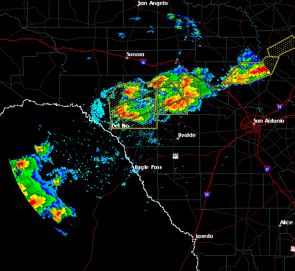 At 501 pm cdt, a severe thunderstorm was located 14 miles south of carta valley, or 19 miles northeast of del rio, moving northwest at 5 mph (radar indicated). Hazards include golf ball size hail and 60 mph wind gusts. People and animals outdoors will be injured. expect hail damage to roofs, siding, windows, and vehicles. expect wind damage to roofs, siding, and trees. Locations impacted include, rocksprings, loma alta, flour mills, alamo village, carta valley, vinegarone and kickapoo cavern state park. At 501 pm cdt, a severe thunderstorm was located 14 miles south of carta valley, or 19 miles northeast of del rio, moving northwest at 5 mph (radar indicated). Hazards include golf ball size hail and 60 mph wind gusts. People and animals outdoors will be injured. expect hail damage to roofs, siding, windows, and vehicles. expect wind damage to roofs, siding, and trees. Locations impacted include, rocksprings, loma alta, flour mills, alamo village, carta valley, vinegarone and kickapoo cavern state park.
|
| 5/28/2017 4:39 PM CDT | Golf Ball sized hail reported 24.5 miles S of Del Rio, TX, del rio coop observer relayed golf ball hail report at the texas border patrol station near the intersection of us 277 and us 377. |
| 5/28/2017 4:31 PM CDT |
 At 431 pm cdt, a severe thunderstorm was located 13 miles north of amanda, or 19 miles northwest of brackettville, moving northeast at 15 mph (radar indicated). Hazards include two inch hail and 60 mph wind gusts. People and animals outdoors will be injured. expect hail damage to roofs, siding, windows, and vehicles. Expect wind damage to roofs, siding, and trees. At 431 pm cdt, a severe thunderstorm was located 13 miles north of amanda, or 19 miles northwest of brackettville, moving northeast at 15 mph (radar indicated). Hazards include two inch hail and 60 mph wind gusts. People and animals outdoors will be injured. expect hail damage to roofs, siding, windows, and vehicles. Expect wind damage to roofs, siding, and trees.
|
| 5/10/2017 11:00 PM CDT |
 At 1059 pm cdt, a confirmed tornado was located near val verde park, or 4 miles north of laughlin air force base, moving northeast at 20 mph (weather spotters confirmed tornado 4 miles north of laughlin air force base). Hazards include damaging tornado and golf ball size hail. Flying debris will be dangerous to those caught without shelter. mobile homes will be damaged or destroyed. damage to roofs, windows, and vehicles will occur. tree damage is likely. This tornadic thunderstorm will remain over mainly rural areas of southeastern val verde county. At 1059 pm cdt, a confirmed tornado was located near val verde park, or 4 miles north of laughlin air force base, moving northeast at 20 mph (weather spotters confirmed tornado 4 miles north of laughlin air force base). Hazards include damaging tornado and golf ball size hail. Flying debris will be dangerous to those caught without shelter. mobile homes will be damaged or destroyed. damage to roofs, windows, and vehicles will occur. tree damage is likely. This tornadic thunderstorm will remain over mainly rural areas of southeastern val verde county.
|
| 5/10/2017 10:48 PM CDT |
 At 1048 pm cdt, a severe thunderstorm capable of producing a tornado was located over del rio, moving northeast at 25 mph (radar indicated rotation). Hazards include tornado and golf ball size hail. Flying debris will be dangerous to those caught without shelter. mobile homes will be damaged or destroyed. damage to roofs, windows, and vehicles will occur. tree damage is likely. Locations impacted include, del rio, lake view and val verde park. At 1048 pm cdt, a severe thunderstorm capable of producing a tornado was located over del rio, moving northeast at 25 mph (radar indicated rotation). Hazards include tornado and golf ball size hail. Flying debris will be dangerous to those caught without shelter. mobile homes will be damaged or destroyed. damage to roofs, windows, and vehicles will occur. tree damage is likely. Locations impacted include, del rio, lake view and val verde park.
|
| 5/10/2017 10:36 PM CDT | Quarter sized hail reported 1.6 miles E of Del Rio, TX, public report of quarter size hail via twitter observed on the west side of del rio. |
| 5/10/2017 10:35 PM CDT |
 At 1035 pm cdt, a severe thunderstorm capable of producing a tornado was located over cienegas terrace, or near del rio, moving northeast at 30 mph (radar indicated rotation). Hazards include tornado and quarter size hail. Flying debris will be dangerous to those caught without shelter. mobile homes will be damaged or destroyed. damage to roofs, windows, and vehicles will occur. Tree damage is likely. At 1035 pm cdt, a severe thunderstorm capable of producing a tornado was located over cienegas terrace, or near del rio, moving northeast at 30 mph (radar indicated rotation). Hazards include tornado and quarter size hail. Flying debris will be dangerous to those caught without shelter. mobile homes will be damaged or destroyed. damage to roofs, windows, and vehicles will occur. Tree damage is likely.
|
| 5/10/2017 7:50 PM CDT | Quarter sized hail reported 5.1 miles W of Del Rio, TX |
| 5/10/2017 7:48 PM CDT |
 At 747 pm cdt, a severe thunderstorm was located near val verde park, or near the south side of del rio, moving east at 15 mph (radar indicated). Hazards include tennis ball size hail and 60 mph wind gusts. People and animals outdoors will be injured. expect hail damage to roofs, siding, windows, and vehicles. expect wind damage to roofs, siding, and trees. Locations impacted include, standart, laughlin afb, amanda and val verde park. At 747 pm cdt, a severe thunderstorm was located near val verde park, or near the south side of del rio, moving east at 15 mph (radar indicated). Hazards include tennis ball size hail and 60 mph wind gusts. People and animals outdoors will be injured. expect hail damage to roofs, siding, windows, and vehicles. expect wind damage to roofs, siding, and trees. Locations impacted include, standart, laughlin afb, amanda and val verde park.
|
| 5/10/2017 7:38 PM CDT |
 At 738 pm cdt, a severe thunderstorm was located on the south side of del rio, moving east at 20 mph (radar indicated). Hazards include ping pong ball size hail and 60 mph wind gusts. People and animals outdoors will be injured. expect hail damage to roofs, siding, windows, and vehicles. Expect wind damage to roofs, siding, and trees. At 738 pm cdt, a severe thunderstorm was located on the south side of del rio, moving east at 20 mph (radar indicated). Hazards include ping pong ball size hail and 60 mph wind gusts. People and animals outdoors will be injured. expect hail damage to roofs, siding, windows, and vehicles. Expect wind damage to roofs, siding, and trees.
|
| 4/2/2017 3:12 AM CDT |
 At 311 am cdt, a severe thunderstorm was located 10 miles south of laughlin afb, or 14 miles southeast of del rio, moving north at 35 mph (radar indicated). Hazards include 60 mph wind gusts and quarter size hail. Hail damage to vehicles is expected. Expect wind damage to roofs, siding, and trees. At 311 am cdt, a severe thunderstorm was located 10 miles south of laughlin afb, or 14 miles southeast of del rio, moving north at 35 mph (radar indicated). Hazards include 60 mph wind gusts and quarter size hail. Hail damage to vehicles is expected. Expect wind damage to roofs, siding, and trees.
|
| 4/2/2017 2:54 AM CDT |
 At 253 am cdt, severe thunderstorms were located along a line extending from 8 miles southwest of carta valley to near amanda, moving north at 35 mph (radar indicated). Hazards include 60 mph wind gusts and nickel size hail. Expect damage to roofs, siding, and trees. locations impacted include, standart, laughlin afb, and amanda. A tornado watch remains in effect until 600 am cdt for south central texas. At 253 am cdt, severe thunderstorms were located along a line extending from 8 miles southwest of carta valley to near amanda, moving north at 35 mph (radar indicated). Hazards include 60 mph wind gusts and nickel size hail. Expect damage to roofs, siding, and trees. locations impacted include, standart, laughlin afb, and amanda. A tornado watch remains in effect until 600 am cdt for south central texas.
|
| 4/2/2017 2:29 AM CDT |
 At 228 am cdt, severe thunderstorms were located along a line extending from 6 miles northeast of lake view to near amanda to 10 miles southwest of standart, moving north at 35 mph (radar indicated). Hazards include 60 mph wind gusts and nickel size hail. expect damage to roofs, siding, and trees At 228 am cdt, severe thunderstorms were located along a line extending from 6 miles northeast of lake view to near amanda to 10 miles southwest of standart, moving north at 35 mph (radar indicated). Hazards include 60 mph wind gusts and nickel size hail. expect damage to roofs, siding, and trees
|
| 4/2/2017 1:43 AM CDT |
 At 142 am cdt, a severe thunderstorm was located 10 miles north of lake view, or 16 miles north of del rio, moving north at 25 mph (trained weather spotters. at 122 am one inch hail was reported north of del rio). Hazards include quarter size hail. Damage to vehicles is expected. locations impacted include, del rio, amistad village, lake view, box canyon-amistad, val verde park, cienegas terrace, laughlin afb, and rough canyon rec area. A tornado watch remains in effect until 600 am cdt for south central texas. At 142 am cdt, a severe thunderstorm was located 10 miles north of lake view, or 16 miles north of del rio, moving north at 25 mph (trained weather spotters. at 122 am one inch hail was reported north of del rio). Hazards include quarter size hail. Damage to vehicles is expected. locations impacted include, del rio, amistad village, lake view, box canyon-amistad, val verde park, cienegas terrace, laughlin afb, and rough canyon rec area. A tornado watch remains in effect until 600 am cdt for south central texas.
|
| 4/2/2017 1:15 AM CDT | Quarter sized hail reported 3.7 miles SE of Del Rio, TX, laughlin afb relayed a report by del rio em of nickel to quarter size hail in the buena vista park part of del rio. |
| 4/2/2017 1:15 AM CDT |
 At 114 am cdt, a severe thunderstorm was located near lake view, or near del rio, moving north at 25 mph (trained weather spotters). Hazards include quarter size hail. damage to vehicles is expected At 114 am cdt, a severe thunderstorm was located near lake view, or near del rio, moving north at 25 mph (trained weather spotters). Hazards include quarter size hail. damage to vehicles is expected
|
| 3/28/2017 10:38 PM CDT |
 At 1037 pm cdt, severe thunderstorms were located along a line extending from 18 miles northwest of rocksprings to 6 miles southwest of loma alta to 10 miles north of lake view to 19 miles south of cienegas terrace, moving east at 70 mph (radar indicated). Hazards include 60 mph wind gusts and quarter size hail. Hail damage to vehicles is expected. expect wind damage to roofs, siding, and trees. Locations impacted include, del rio, loma alta, juno, comstock, amistad village, box canyon- amistad, seminole canyon state park, laughlin afb, amanda, lake view, flour mills, val verde park, standart, carta valley, cienegas terrace, devils shores, pafford crossing, bakers crossing, us- 277 near the sutton-edwards county line and rough canyon rec area. At 1037 pm cdt, severe thunderstorms were located along a line extending from 18 miles northwest of rocksprings to 6 miles southwest of loma alta to 10 miles north of lake view to 19 miles south of cienegas terrace, moving east at 70 mph (radar indicated). Hazards include 60 mph wind gusts and quarter size hail. Hail damage to vehicles is expected. expect wind damage to roofs, siding, and trees. Locations impacted include, del rio, loma alta, juno, comstock, amistad village, box canyon- amistad, seminole canyon state park, laughlin afb, amanda, lake view, flour mills, val verde park, standart, carta valley, cienegas terrace, devils shores, pafford crossing, bakers crossing, us- 277 near the sutton-edwards county line and rough canyon rec area.
|
| 3/28/2017 10:02 PM CDT |
 At 1001 pm cdt, severe thunderstorms were located along a line extending from 6 miles north of juno to 9 miles north of shumla to near seminole canyon state park to 19 miles southwest of box canyon-amistad, moving east at 50 mph (radar indicated). Hazards include 60 mph wind gusts and quarter size hail. Hail damage to vehicles is expected. Expect wind damage to roofs, siding, and trees. At 1001 pm cdt, severe thunderstorms were located along a line extending from 6 miles north of juno to 9 miles north of shumla to near seminole canyon state park to 19 miles southwest of box canyon-amistad, moving east at 50 mph (radar indicated). Hazards include 60 mph wind gusts and quarter size hail. Hail damage to vehicles is expected. Expect wind damage to roofs, siding, and trees.
|
| 3/28/2017 7:15 PM CDT | Hen Egg sized hail reported 17.6 miles S of Del Rio, TX, 2 inch hail fell near devils shores. size estimated from social media photo. time estimated from radar. |
| 3/28/2017 6:42 PM CDT |
 At 641 pm cdt, a severe thunderstorm was located near box canyon-amistad, or 7 miles south of comstock, moving east at 30 mph (radar indicated). Hazards include 60 mph wind gusts and quarter size hail. Hail damage to vehicles is expected. expect wind damage to roofs, siding, and trees. Locations impacted include, comstock, amistad village, lake view, box canyon-amistad, devils shores, pafford crossing, devils river state natural area and rough canyon rec area. At 641 pm cdt, a severe thunderstorm was located near box canyon-amistad, or 7 miles south of comstock, moving east at 30 mph (radar indicated). Hazards include 60 mph wind gusts and quarter size hail. Hail damage to vehicles is expected. expect wind damage to roofs, siding, and trees. Locations impacted include, comstock, amistad village, lake view, box canyon-amistad, devils shores, pafford crossing, devils river state natural area and rough canyon rec area.
|
| 3/28/2017 6:26 PM CDT |
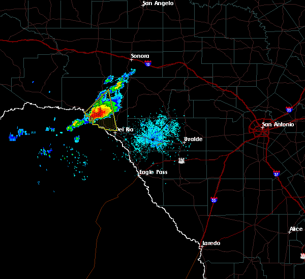 At 624 pm cdt, a severe thunderstorm was located near comstock, moving east at 25 mph (radar indicated). Hazards include golf ball size hail and 60 mph wind gusts. People and animals outdoors will be injured. expect hail damage to roofs, siding, windows, and vehicles. expect wind damage to roofs, siding, and trees. Locations impacted include, comstock, amistad village, lake view, box canyon-amistad, devils shores, pafford crossing, devils river state natural area and rough canyon rec area. At 624 pm cdt, a severe thunderstorm was located near comstock, moving east at 25 mph (radar indicated). Hazards include golf ball size hail and 60 mph wind gusts. People and animals outdoors will be injured. expect hail damage to roofs, siding, windows, and vehicles. expect wind damage to roofs, siding, and trees. Locations impacted include, comstock, amistad village, lake view, box canyon-amistad, devils shores, pafford crossing, devils river state natural area and rough canyon rec area.
|
| 3/28/2017 6:01 PM CDT |
 At 600 pm cdt, a severe thunderstorm was located 7 miles south of seminole canyon state park, or 12 miles southwest of comstock, moving east at 30 mph (radar indicated). Hazards include golf ball size hail and 60 mph wind gusts. People and animals outdoors will be injured. expect hail damage to roofs, siding, windows, and vehicles. Expect wind damage to roofs, siding, and trees. At 600 pm cdt, a severe thunderstorm was located 7 miles south of seminole canyon state park, or 12 miles southwest of comstock, moving east at 30 mph (radar indicated). Hazards include golf ball size hail and 60 mph wind gusts. People and animals outdoors will be injured. expect hail damage to roofs, siding, windows, and vehicles. Expect wind damage to roofs, siding, and trees.
|
| 1/15/2017 5:03 PM CST | Quarter sized hail reported 24.6 miles S of Del Rio, TX, nickel to quarter size hail reported by border patrol agents one mile south of the 277 and 377 highway intersection |
| 6/1/2016 10:59 PM CDT |
 At 1059 pm cdt, severe thunderstorms were located along a line extending from lake view to 11 miles south of del rio, moving southeast at 30 mph (radar indicated). Hazards include 60 mph wind gusts and quarter size hail. Hail damage to vehicles is expected. expect wind damage to roofs, siding, and trees. Locations impacted include, del rio, lake view, amanda, val verde park, cienegas terrace, laughlin afb and amistad village. At 1059 pm cdt, severe thunderstorms were located along a line extending from lake view to 11 miles south of del rio, moving southeast at 30 mph (radar indicated). Hazards include 60 mph wind gusts and quarter size hail. Hail damage to vehicles is expected. expect wind damage to roofs, siding, and trees. Locations impacted include, del rio, lake view, amanda, val verde park, cienegas terrace, laughlin afb and amistad village.
|
| 6/1/2016 10:38 PM CDT |
 At 1038 pm cdt, severe thunderstorms were located along a line extending from 7 miles southeast of comstock to 12 miles southwest of cienegas terrace, moving southeast at 30 mph (radar indicated). Hazards include 60 mph wind gusts and quarter size hail. Hail damage to vehicles is expected. Expect wind damage to roofs, siding, and trees. At 1038 pm cdt, severe thunderstorms were located along a line extending from 7 miles southeast of comstock to 12 miles southwest of cienegas terrace, moving southeast at 30 mph (radar indicated). Hazards include 60 mph wind gusts and quarter size hail. Hail damage to vehicles is expected. Expect wind damage to roofs, siding, and trees.
|
| 5/17/2016 10:53 PM CDT |
 At 1053 pm cdt, a severe thunderstorm was located over lake view, or 9 miles northwest of del rio, moving southeast at 10 mph (radar indicated). Hazards include golf ball size hail and 60 mph wind gusts. People and animals outdoors will be injured. expect hail damage to roofs, siding, windows, and vehicles. expect wind damage to roofs, siding, and trees. Locations impacted include, cienegas terrace, amistad village, lake view, rough canyon rec area and devils shores. At 1053 pm cdt, a severe thunderstorm was located over lake view, or 9 miles northwest of del rio, moving southeast at 10 mph (radar indicated). Hazards include golf ball size hail and 60 mph wind gusts. People and animals outdoors will be injured. expect hail damage to roofs, siding, windows, and vehicles. expect wind damage to roofs, siding, and trees. Locations impacted include, cienegas terrace, amistad village, lake view, rough canyon rec area and devils shores.
|
| 5/17/2016 10:40 PM CDT |
 At 1040 pm cdt, a severe thunderstorm was located near laughlin afb, or 10 miles southeast of del rio, moving east at 10 mph (radar indicated). Hazards include 60 mph wind gusts and quarter size hail. Hail damage to vehicles is expected. Expect wind damage to roofs, siding, and trees. At 1040 pm cdt, a severe thunderstorm was located near laughlin afb, or 10 miles southeast of del rio, moving east at 10 mph (radar indicated). Hazards include 60 mph wind gusts and quarter size hail. Hail damage to vehicles is expected. Expect wind damage to roofs, siding, and trees.
|
| 5/17/2016 10:19 PM CDT |
 At 1018 pm cdt, severe thunderstorms were located along a line extending from 12 miles southwest of carta valley to near box canyon-amistad, moving southeast at 15 mph (radar indicated). Hazards include 60 mph wind gusts and quarter size hail. Hail damage to vehicles is expected. Expect wind damage to roofs, siding, and trees. At 1018 pm cdt, severe thunderstorms were located along a line extending from 12 miles southwest of carta valley to near box canyon-amistad, moving southeast at 15 mph (radar indicated). Hazards include 60 mph wind gusts and quarter size hail. Hail damage to vehicles is expected. Expect wind damage to roofs, siding, and trees.
|
| 5/1/2016 6:28 PM CDT | The severe thunderstorm warning for southeastern val verde and western kinney counties will expire at 630 pm cdt, the storm which prompted the warning has weakened below severe limits, and no longer pose an immediate threat to life or property. therefore the warning will be allowed to expire. however small. |
| 5/1/2016 6:04 PM CDT |
 At 603 pm cdt, a severe thunderstorm was located over val verde park, or near del rio, moving east at 15 mph. this storm will move to the east along highway 90, passing near laughlin afb (radar indicated). Hazards include 60 mph wind gusts and quarter size hail. Hail damage to vehicles is expected. expect wind damage to roofs, siding, and trees. Locations impacted include, del rio, standart, laughlin afb, amanda and val verde park. At 603 pm cdt, a severe thunderstorm was located over val verde park, or near del rio, moving east at 15 mph. this storm will move to the east along highway 90, passing near laughlin afb (radar indicated). Hazards include 60 mph wind gusts and quarter size hail. Hail damage to vehicles is expected. expect wind damage to roofs, siding, and trees. Locations impacted include, del rio, standart, laughlin afb, amanda and val verde park.
|
| 5/1/2016 5:42 PM CDT |
 At 539 pm cdt, a severe thunderstorm was located over del rio, moving east at 20 mph. this storm will move to the east along highway 90, passing near laughlin afb (radar indicated). Hazards include 60 mph wind gusts and quarter size hail. Hail damage to vehicles is expected. expect wind damage to roofs, siding, and trees. Locations impacted include, del rio, standart, lake view, amanda, val verde park, cienegas terrace, laughlin afb and amistad village. At 539 pm cdt, a severe thunderstorm was located over del rio, moving east at 20 mph. this storm will move to the east along highway 90, passing near laughlin afb (radar indicated). Hazards include 60 mph wind gusts and quarter size hail. Hail damage to vehicles is expected. expect wind damage to roofs, siding, and trees. Locations impacted include, del rio, standart, lake view, amanda, val verde park, cienegas terrace, laughlin afb and amistad village.
|
| 5/1/2016 5:27 PM CDT |
 At 527 pm cdt, a severe thunderstorm was located near cienegas terrace, or near del rio, moving east at 30 mph (radar indicated). Hazards include 60 mph wind gusts and quarter size hail. Hail damage to vehicles is expected. Expect wind damage to roofs, siding, and trees. At 527 pm cdt, a severe thunderstorm was located near cienegas terrace, or near del rio, moving east at 30 mph (radar indicated). Hazards include 60 mph wind gusts and quarter size hail. Hail damage to vehicles is expected. Expect wind damage to roofs, siding, and trees.
|
| 4/18/2016 3:09 AM CDT |
 At 308 am cdt, a severe thunderstorm was located near amanda, or 13 miles east of del rio, moving northeast at 25 mph (radar indicated). Hazards include quarter size hail. Damage to vehicles is expected. Locations impacted include, del rio, standart, lake view, amanda, val verde park, cienegas terrace and laughlin afb. At 308 am cdt, a severe thunderstorm was located near amanda, or 13 miles east of del rio, moving northeast at 25 mph (radar indicated). Hazards include quarter size hail. Damage to vehicles is expected. Locations impacted include, del rio, standart, lake view, amanda, val verde park, cienegas terrace and laughlin afb.
|
| 4/18/2016 2:50 AM CDT |
 At 248 am cdt, a severe thunderstorm was located over del rio, moving northeast at 20 mph (radar indicated). Hazards include 60 mph wind gusts and quarter size hail. Hail damage to vehicles is expected. expect wind damage to roofs, siding, and trees. Locations impacted include, del rio, alamo village, standart, lake view, amanda, val verde park, cienegas terrace and laughlin afb. At 248 am cdt, a severe thunderstorm was located over del rio, moving northeast at 20 mph (radar indicated). Hazards include 60 mph wind gusts and quarter size hail. Hail damage to vehicles is expected. expect wind damage to roofs, siding, and trees. Locations impacted include, del rio, alamo village, standart, lake view, amanda, val verde park, cienegas terrace and laughlin afb.
|
| 4/18/2016 2:32 AM CDT |
 At 231 am cdt, a severe thunderstorm was located over laughlin afb, or near del rio, moving northeast at 25 mph (radar indicated). Hazards include 60 mph wind gusts and quarter size hail. Hail damage to vehicles is expected. Expect wind damage to roofs, siding, and trees. At 231 am cdt, a severe thunderstorm was located over laughlin afb, or near del rio, moving northeast at 25 mph (radar indicated). Hazards include 60 mph wind gusts and quarter size hail. Hail damage to vehicles is expected. Expect wind damage to roofs, siding, and trees.
|
| 4/10/2016 8:31 PM CDT |
 At 830 pm cdt, a severe thunderstorm was located 14 miles north of quemado, moving east at 35 mph (radar indicated). Hazards include two inch hail and 60 mph wind gusts. People and animals outdoors will be injured. expect hail damage to roofs, siding, windows, and vehicles. expect wind damage to roofs, siding, and trees. Locations impacted include, brackettville, spofford, standart, laughlin afb and amanda. At 830 pm cdt, a severe thunderstorm was located 14 miles north of quemado, moving east at 35 mph (radar indicated). Hazards include two inch hail and 60 mph wind gusts. People and animals outdoors will be injured. expect hail damage to roofs, siding, windows, and vehicles. expect wind damage to roofs, siding, and trees. Locations impacted include, brackettville, spofford, standart, laughlin afb and amanda.
|
| 4/10/2016 8:11 PM CDT |
 At 809 pm cdt, a severe thunderstorm was located near laughlin afb, or 11 miles southeast of del rio, moving east at 25 mph (radar indicated). Hazards include 60 mph wind gusts and quarter size hail. Hail damage to vehicles is expected. expect wind damage to roofs, siding, and trees. Locations impacted include, brackettville, spofford, standart, laughlin afb and amanda. At 809 pm cdt, a severe thunderstorm was located near laughlin afb, or 11 miles southeast of del rio, moving east at 25 mph (radar indicated). Hazards include 60 mph wind gusts and quarter size hail. Hail damage to vehicles is expected. expect wind damage to roofs, siding, and trees. Locations impacted include, brackettville, spofford, standart, laughlin afb and amanda.
|
| 4/10/2016 7:48 PM CDT |
 At 748 pm cdt, a severe thunderstorm was located 8 miles south of cienegas terrace, or 9 miles south of del rio, moving east at 35 mph (radar indicated). Hazards include 60 mph wind gusts and quarter size hail. Hail damage to vehicles is expected. Expect wind damage to roofs, siding, and trees. At 748 pm cdt, a severe thunderstorm was located 8 miles south of cienegas terrace, or 9 miles south of del rio, moving east at 35 mph (radar indicated). Hazards include 60 mph wind gusts and quarter size hail. Hail damage to vehicles is expected. Expect wind damage to roofs, siding, and trees.
|
| 3/24/2016 12:26 AM CDT |
 The severe thunderstorm warning for southeastern val verde and northwestern kinney counties will expire at 1230 am cdt, the storm which prompted the warning has weakened below severe limits, and no longer pose an immediate threat to life or property. therefore the warning will be allowed to expire. however small. The severe thunderstorm warning for southeastern val verde and northwestern kinney counties will expire at 1230 am cdt, the storm which prompted the warning has weakened below severe limits, and no longer pose an immediate threat to life or property. therefore the warning will be allowed to expire. however small.
|
| 3/24/2016 12:04 AM CDT |
 At 1203 am cdt, a severe thunderstorm was located near lake view, or near del rio, moving east at 35 mph (radar indicated). Hazards include 60 mph wind gusts and quarter size hail. Hail damage to vehicles is expected. expect wind damage to roofs, siding, and trees. Locations impacted include, del rio, standart, lake view, amanda, val verde park, cienegas terrace, laughlin afb, amistad village and box canyon-amistad. At 1203 am cdt, a severe thunderstorm was located near lake view, or near del rio, moving east at 35 mph (radar indicated). Hazards include 60 mph wind gusts and quarter size hail. Hail damage to vehicles is expected. expect wind damage to roofs, siding, and trees. Locations impacted include, del rio, standart, lake view, amanda, val verde park, cienegas terrace, laughlin afb, amistad village and box canyon-amistad.
|
| 3/24/2016 12:01 AM CDT | Quarter sized hail reported 5.9 miles SE of Del Rio, TX, quarter sized hail was reported at san pedro estates near lake amistad. |
| 3/23/2016 11:46 PM CDT |
 At 1145 pm cdt, a severe thunderstorm was located over amistad village, or 11 miles northwest of del rio, moving east at 40 mph (radar indicated). Hazards include golf ball size hail and 60 mph wind gusts. People and animals outdoors will be injured. expect hail damage to roofs, siding, windows, and vehicles. Expect wind damage to roofs, siding, and trees. At 1145 pm cdt, a severe thunderstorm was located over amistad village, or 11 miles northwest of del rio, moving east at 40 mph (radar indicated). Hazards include golf ball size hail and 60 mph wind gusts. People and animals outdoors will be injured. expect hail damage to roofs, siding, windows, and vehicles. Expect wind damage to roofs, siding, and trees.
|
| 2/22/2016 10:33 PM CST |
 At 1032 pm cst, a severe thunderstorm was located near laughlin afb, or 9 miles east of del rio, moving southeast at 50 mph (radar indicated). Hazards include 60 mph wind gusts and quarter size hail. Hail damage to vehicles is expected. expect wind damage to roofs, siding, and trees. Locations impacted include, del rio, brackettville, alamo village, standart, lake view, amanda, val verde park, cienegas terrace, laughlin afb and kickapoo cavern state park. At 1032 pm cst, a severe thunderstorm was located near laughlin afb, or 9 miles east of del rio, moving southeast at 50 mph (radar indicated). Hazards include 60 mph wind gusts and quarter size hail. Hail damage to vehicles is expected. expect wind damage to roofs, siding, and trees. Locations impacted include, del rio, brackettville, alamo village, standart, lake view, amanda, val verde park, cienegas terrace, laughlin afb and kickapoo cavern state park.
|
| 2/22/2016 10:25 PM CST | Quarter sized hail reported 1.3 miles SE of Del Rio, TX, quarter size hail observed by public at corner of veterans blvd and 15th st. |
| 2/22/2016 10:25 PM CST | Windows blown out of house...ground also covered in quarter size hai in val verde county TX, 3.1 miles SSE of Del Rio, TX |
| 2/22/2016 10:25 PM CST | Ping Pong Ball sized hail reported 3.1 miles SSE of Del Rio, TX, ping pong size hail reported in north del rio |
| 2/22/2016 10:15 PM CST |
 At 1015 pm cst, a severe thunderstorm was located near lake view, or 12 miles northwest of del rio, moving east at 40 mph (radar indicated). Hazards include 60 mph wind gusts and quarter size hail. Hail damage to vehicles is expected. expect wind damage to roofs, siding, and trees. Locations impacted include, del rio, brackettville, alamo village, standart, lake view, amanda, val verde park, cienegas terrace, laughlin afb, amistad village, box canyon-amistad, pafford crossing, rough canyon rec area, devils shores and kickapoo cavern state park. At 1015 pm cst, a severe thunderstorm was located near lake view, or 12 miles northwest of del rio, moving east at 40 mph (radar indicated). Hazards include 60 mph wind gusts and quarter size hail. Hail damage to vehicles is expected. expect wind damage to roofs, siding, and trees. Locations impacted include, del rio, brackettville, alamo village, standart, lake view, amanda, val verde park, cienegas terrace, laughlin afb, amistad village, box canyon-amistad, pafford crossing, rough canyon rec area, devils shores and kickapoo cavern state park.
|
| 2/22/2016 10:08 PM CST |
 At 1007 pm cst, a severe thunderstorm was located near box canyon-amistad, or 10 miles southeast of comstock, moving east at 35 mph (radar indicated). Hazards include quarter size hail. damage to vehicles is expected At 1007 pm cst, a severe thunderstorm was located near box canyon-amistad, or 10 miles southeast of comstock, moving east at 35 mph (radar indicated). Hazards include quarter size hail. damage to vehicles is expected
|
| 12/27/2015 12:06 AM CST |
 At 1205 am cst, severe thunderstorms were located along a line extending from 14 miles north of flour mills to 10 miles south of laughlin afb, moving east at 35 mph (radar indicated). Hazards include 60 mph wind gusts and nickel size hail. Expect damage to roofs. Siding and trees. At 1205 am cst, severe thunderstorms were located along a line extending from 14 miles north of flour mills to 10 miles south of laughlin afb, moving east at 35 mph (radar indicated). Hazards include 60 mph wind gusts and nickel size hail. Expect damage to roofs. Siding and trees.
|
| 10/30/2015 10:52 PM CDT |
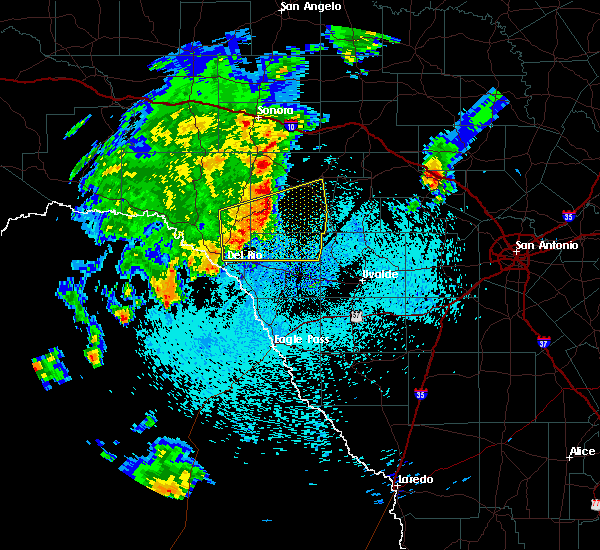 At 1051 pm cdt, severe thunderstorms were located along a line extending from 11 miles southeast of flour mills to 12 miles south of carta valley to 6 miles northeast of val verde park, moving east at 40 mph (radar indicated). Hazards include 70 mph wind gusts and nickel size hail. Expect considerable tree damage. damage is likely to mobile homes, roofs and outbuildings. Locations impacted include, rocksprings, alamo village, carta valley, devils sinkhole state natural area, kickapoo cavern state park and devils shores. At 1051 pm cdt, severe thunderstorms were located along a line extending from 11 miles southeast of flour mills to 12 miles south of carta valley to 6 miles northeast of val verde park, moving east at 40 mph (radar indicated). Hazards include 70 mph wind gusts and nickel size hail. Expect considerable tree damage. damage is likely to mobile homes, roofs and outbuildings. Locations impacted include, rocksprings, alamo village, carta valley, devils sinkhole state natural area, kickapoo cavern state park and devils shores.
|
| 10/30/2015 10:27 PM CDT |
 At 1026 pm cdt, severe thunderstorms were located along a line extending from 11 miles west of carta valley to near lake view, moving east at 45 mph (radar indicated). Hazards include 70 mph wind gusts and nickel size hail. Expect considerable tree damage. Damage is likely to mobile homes, roofs and outbuildings. At 1026 pm cdt, severe thunderstorms were located along a line extending from 11 miles west of carta valley to near lake view, moving east at 45 mph (radar indicated). Hazards include 70 mph wind gusts and nickel size hail. Expect considerable tree damage. Damage is likely to mobile homes, roofs and outbuildings.
|
| 10/30/2015 10:11 PM CDT |
 At 1010 pm cdt, severe thunderstorms were located along a line extending from 14 miles northeast of shumla to 8 miles north of comstock to 8 miles northeast of box canyon-amistad to amistad village, moving northeast at 45 mph (radar indicated). Hazards include 60 mph wind gusts and nickel size hail. Expect damage to roofs. siding and trees. Locations impacted include, del rio, comstock, langtry, shumla, lake view, seminole canyon state park, val verde park, cienegas terrace, amistad village, box canyon-amistad, laughlin afb, pafford crossing, rough canyon rec area, devils shores, bakers crossing and devils river state natural area. At 1010 pm cdt, severe thunderstorms were located along a line extending from 14 miles northeast of shumla to 8 miles north of comstock to 8 miles northeast of box canyon-amistad to amistad village, moving northeast at 45 mph (radar indicated). Hazards include 60 mph wind gusts and nickel size hail. Expect damage to roofs. siding and trees. Locations impacted include, del rio, comstock, langtry, shumla, lake view, seminole canyon state park, val verde park, cienegas terrace, amistad village, box canyon-amistad, laughlin afb, pafford crossing, rough canyon rec area, devils shores, bakers crossing and devils river state natural area.
|
| 10/30/2015 9:53 PM CDT |
 At 952 pm cdt, severe thunderstorms were located along a line extending from near shumla to near seminole canyon state park to 6 miles west of box canyon-amistad to 13 miles southwest of amistad village, moving northeast at 45 mph (radar indicated). Hazards include 70 mph wind gusts and quarter size hail. Hail damage to vehicles is expected. expect considerable tree damage. wind damage is also likely to mobile homes, roofs and outbuildings. Locations impacted include, del rio, comstock, langtry, shumla, lake view, seminole canyon state park, val verde park, cienegas terrace, amistad village, box canyon-amistad, laughlin afb, pafford crossing, rough canyon rec area, devils shores, bakers crossing and devils river state natural area. At 952 pm cdt, severe thunderstorms were located along a line extending from near shumla to near seminole canyon state park to 6 miles west of box canyon-amistad to 13 miles southwest of amistad village, moving northeast at 45 mph (radar indicated). Hazards include 70 mph wind gusts and quarter size hail. Hail damage to vehicles is expected. expect considerable tree damage. wind damage is also likely to mobile homes, roofs and outbuildings. Locations impacted include, del rio, comstock, langtry, shumla, lake view, seminole canyon state park, val verde park, cienegas terrace, amistad village, box canyon-amistad, laughlin afb, pafford crossing, rough canyon rec area, devils shores, bakers crossing and devils river state natural area.
|
| 10/30/2015 9:50 PM CDT |
 At 949 pm cdt, severe thunderstorms were located along a line extending from near langtry to near seminole canyon state park to 8 miles west of box canyon-amistad to 15 miles southwest of amistad village, moving northeast at 50 mph (radar indicated). Hazards include 70 mph wind gusts and quarter size hail. Hail damage to vehicles is expected. expect considerable tree damage. Wind damage is also likely to mobile homes, roofs and outbuildings. At 949 pm cdt, severe thunderstorms were located along a line extending from near langtry to near seminole canyon state park to 8 miles west of box canyon-amistad to 15 miles southwest of amistad village, moving northeast at 50 mph (radar indicated). Hazards include 70 mph wind gusts and quarter size hail. Hail damage to vehicles is expected. expect considerable tree damage. Wind damage is also likely to mobile homes, roofs and outbuildings.
|
| 10/30/2015 6:51 PM CDT |
 At 648 pm cdt, a severe thunderstorm was located near lake view, or 7 miles north of del rio, moving east at 30 mph. this storm will move along highway 90 along and just south of lake amistad to across the intersection with highway 277 (radar indicated). Hazards include 70 mph wind gusts and half dollar size hail. Hail damage to vehicles is expected. expect considerable tree damage. wind damage is also likely to mobile homes, roofs and outbuildings. Locations impacted include, del rio, lake view, val verde park, cienegas terrace, amistad village, laughlin afb, box canyon-amistad, pafford crossing, rough canyon rec area and devils shores. At 648 pm cdt, a severe thunderstorm was located near lake view, or 7 miles north of del rio, moving east at 30 mph. this storm will move along highway 90 along and just south of lake amistad to across the intersection with highway 277 (radar indicated). Hazards include 70 mph wind gusts and half dollar size hail. Hail damage to vehicles is expected. expect considerable tree damage. wind damage is also likely to mobile homes, roofs and outbuildings. Locations impacted include, del rio, lake view, val verde park, cienegas terrace, amistad village, laughlin afb, box canyon-amistad, pafford crossing, rough canyon rec area and devils shores.
|
| 10/30/2015 6:50 PM CDT | Quarter sized hail reported 9.1 miles SE of Del Rio, TX, also had wind gusts to 48mph |
| 10/30/2015 6:34 PM CDT |
 At 633 pm cdt, a severe thunderstorm was located over lake view, or 7 miles northwest of del rio, moving east at 35 mph. this storm will move across the lake amistad dam and then move toward the northern parts of del rio along highway 90 (radar indicated). Hazards include 60 mph wind gusts and quarter size hail. Hail damage to vehicles is expected. expect wind damage to roofs, siding and trees. Locations impacted include, del rio, lake view, val verde park, cienegas terrace, amistad village, laughlin afb, box canyon-amistad, pafford crossing, rough canyon rec area and devils shores. At 633 pm cdt, a severe thunderstorm was located over lake view, or 7 miles northwest of del rio, moving east at 35 mph. this storm will move across the lake amistad dam and then move toward the northern parts of del rio along highway 90 (radar indicated). Hazards include 60 mph wind gusts and quarter size hail. Hail damage to vehicles is expected. expect wind damage to roofs, siding and trees. Locations impacted include, del rio, lake view, val verde park, cienegas terrace, amistad village, laughlin afb, box canyon-amistad, pafford crossing, rough canyon rec area and devils shores.
|
| 10/30/2015 6:10 PM CDT |
 The national weather service in austin san antonio has issued a * severe thunderstorm warning for. southeastern val verde county in south central texas. until 715 pm cdt * at 609 pm cdt. a severe thunderstorm was located 9 miles south of box canyon-amistad. or 16 miles west of del rio. Moving east at. The national weather service in austin san antonio has issued a * severe thunderstorm warning for. southeastern val verde county in south central texas. until 715 pm cdt * at 609 pm cdt. a severe thunderstorm was located 9 miles south of box canyon-amistad. or 16 miles west of del rio. Moving east at.
|
| 10/8/2015 7:37 PM CDT |
 At 731 pm cdt, a line of strong to severe thunderstorms is moving northeast at 20 mph. the stronger winds shown on radar are across the southwest of kinney county. this area of strong to severe thunderstorm winds will move the northweast and affect central kinney county within the next several minutes. also, very heavy rain is falling and localized flash flooding is possible. an areal flood advisory is in effect for the area through 1015 pm (radar indicated). Hazards include 60 mph wind gusts and quarter size hail. Hail damage to vehicles is expected. expect wind damage to roofs, siding and trees. Locations impacted include, del rio, brackettville, spofford, quemado, darling, standart, lake view, val verde park, amanda, cienegas terrace, laughlin afb, normandy and laughlin afb aux field. At 731 pm cdt, a line of strong to severe thunderstorms is moving northeast at 20 mph. the stronger winds shown on radar are across the southwest of kinney county. this area of strong to severe thunderstorm winds will move the northweast and affect central kinney county within the next several minutes. also, very heavy rain is falling and localized flash flooding is possible. an areal flood advisory is in effect for the area through 1015 pm (radar indicated). Hazards include 60 mph wind gusts and quarter size hail. Hail damage to vehicles is expected. expect wind damage to roofs, siding and trees. Locations impacted include, del rio, brackettville, spofford, quemado, darling, standart, lake view, val verde park, amanda, cienegas terrace, laughlin afb, normandy and laughlin afb aux field.
|
| 10/8/2015 6:53 PM CDT |
 At 652 pm cdt, a severe thunderstorm was located 10 miles southwest of laughlin afb, or 10 miles south of del rio, moving northeast at 25 mph (radar indicated). Hazards include 60 mph wind gusts and quarter size hail. Hail damage to vehicles is expected. Expect wind damage to roofs, siding and trees. At 652 pm cdt, a severe thunderstorm was located 10 miles southwest of laughlin afb, or 10 miles south of del rio, moving northeast at 25 mph (radar indicated). Hazards include 60 mph wind gusts and quarter size hail. Hail damage to vehicles is expected. Expect wind damage to roofs, siding and trees.
|
| 8/12/2015 4:32 PM CDT |
 At 432 pm cdt, a severe thunderstorm was located 11 miles southwest of cienegas terrace, or 13 miles southwest of del rio, moving southwest at 25 mph (radar indicated). Hazards include 60 mph wind gusts. Expect damage to roofs. Siding and trees. At 432 pm cdt, a severe thunderstorm was located 11 miles southwest of cienegas terrace, or 13 miles southwest of del rio, moving southwest at 25 mph (radar indicated). Hazards include 60 mph wind gusts. Expect damage to roofs. Siding and trees.
|
| 6/23/2015 7:55 PM CDT |
 At 755 pm cdt, a severe thunderstorm was located near val verde park, or 7 miles northeast of del rio, moving northwest at 35 mph (radar indicated). Hazards include 60 mph wind gusts. Expect damage to roofs. Siding and trees. At 755 pm cdt, a severe thunderstorm was located near val verde park, or 7 miles northeast of del rio, moving northwest at 35 mph (radar indicated). Hazards include 60 mph wind gusts. Expect damage to roofs. Siding and trees.
|
| 6/13/2015 11:49 PM CDT |
 At 1148 pm cdt, a severe thunderstorm was located 14 miles east of comstock, moving east at 20 mph (radar indicated). Hazards include 60 mph wind gusts and penny size hail. Expect damage to roofs. Siding and trees. At 1148 pm cdt, a severe thunderstorm was located 14 miles east of comstock, moving east at 20 mph (radar indicated). Hazards include 60 mph wind gusts and penny size hail. Expect damage to roofs. Siding and trees.
|
| 6/12/2015 10:24 PM CDT |
 The severe thunderstorm warning for northwestern kinney and southeastern val verde counties will expire at 1030 pm cdt. the storm which prompted the warning has weakened below severe limits. and no longer pose an immediate threat to life or property. therefore the warning will be allowed to expire. However gusty winds and heavy rain are still possible with this thunderstorm. The severe thunderstorm warning for northwestern kinney and southeastern val verde counties will expire at 1030 pm cdt. the storm which prompted the warning has weakened below severe limits. and no longer pose an immediate threat to life or property. therefore the warning will be allowed to expire. However gusty winds and heavy rain are still possible with this thunderstorm.
|
| 6/12/2015 10:10 PM CDT |
 At 1008 pm cdt, doppler radar continues to detect a severe thundersotrm 7 miles northeast of del rio, moving east at 20 mph (radar indicated). Hazards include 60 mph wind gusts and penny size hail are possible with this storm. Expect damage to roofs. siding and trees. Locations impacted include, del rio, standart, lake view, amanda, val verde park, cienegas terrace and laughlin afb. At 1008 pm cdt, doppler radar continues to detect a severe thundersotrm 7 miles northeast of del rio, moving east at 20 mph (radar indicated). Hazards include 60 mph wind gusts and penny size hail are possible with this storm. Expect damage to roofs. siding and trees. Locations impacted include, del rio, standart, lake view, amanda, val verde park, cienegas terrace and laughlin afb.
|
| 6/12/2015 9:48 PM CDT |
 At 947 pm cdt, a severe thunderstorm was located over lake view, or near del rio, moving east at 20 mph (radar indicated). Hazards include 60 mph wind gusts and penny size hail. Expect damage to roofs. Siding and trees. At 947 pm cdt, a severe thunderstorm was located over lake view, or near del rio, moving east at 20 mph (radar indicated). Hazards include 60 mph wind gusts and penny size hail. Expect damage to roofs. Siding and trees.
|
| 5/30/2015 1:15 PM CDT | Trees blown down on plaza ave in val verde county TX, 1.3 miles SE of Del Rio, TX |
| 5/30/2015 12:15 PM CDT | Large tree blown down onto road at east 10th street. time estimated from rada in val verde county TX, 1.3 miles SE of Del Rio, TX |
| 5/30/2015 12:15 PM CDT | Trees blown down on plaza ave in val verde county TX, 1.3 miles SE of Del Rio, TX |
| 5/30/2015 12:05 PM CDT | At 1202 pm cdt, a severe thunderstorm was located over val verde park, or near del rio, moving east at 15 mph (radar indicated heavy rain with strong wind gusts up to 60 mph). Hazards include 60 mph wind gusts and penny size hail. Expect damage to roofs. Siding and trees. |
| 5/28/2015 11:05 PM CDT | At 1104 pm cdt, severe thunderstorms were located along a line extending from 7 miles northwest of lost maples state park to near barksdale to 15 miles north of alamo village to 11 miles northeast of lake view to near box canyon-amistad, moving southeast at 40 mph (radar indicated). Hazards include 60 mph wind gusts and penny size hail. Expect damage to roofs. siding and trees. Locations impacted include, del rio, brackettville, leakey, langtry, loma alta, comstock, camp wood, laguna, montell, alamo village, concan, standart, lake view, amanda, val verde park, seminole canyon state park, box canyon-amistad, osman, garner state park and vance. |
| 5/28/2015 10:35 PM CDT | At 1035 pm cdt, severe thunderstorms were located along a line extending from 10 miles northwest of lost maples state park to near vance to 20 miles north of alamo village to 12 miles southwest of carta valley to near comstock, moving southeast at 40 mph (radar indicated). Hazards include 60 mph wind gusts and penny size hail. Expect damage to roofs. siding and trees. Locations impacted include, del rio, brackettville, leakey, langtry, loma alta, comstock, juno, camp wood, laguna, montell, alamo village, concan, standart, lake view, amanda, pumpville, val verde park, seminole canyon state park, box canyon-amistad and osman. |
| 5/28/2015 9:57 PM CDT | At 954 pm cdt, severe thunderstorms were located along a line extending from near telegraph to 7 miles northwest of rocksprings to near flour mills to 14 miles south of juno to 11 miles north of shumla, moving southeast at 40 mph. * the strongest winds near 70 mph will be in northwest val verde and crossing into west, southwest and south central edwards county over the next half hour. these strong winds will likely be in northern uvalde and kinney country within the next hour (radar indicated). Hazards include 70 mph wind gusts and nickel size hail. Expect considerable tree damage. Damage is likely to mobile homes, roofs and outbuildings. |
| 5/25/2015 6:36 AM CDT | At 636 am cdt, a severe thunderstorm capable of producing a tornado was located over del rio, moving northeast at 10 mph (radar indicated rotation). Hazards include tornado and quarter size hail. Flying debris will be dangerous to those caught without shelter. mobile homes will be damaged or destroyed. damage to roofs, windows and vehicles will occur. tree damage is likely. This dangerous storm will be near, val verde park and laughlin afb around 700 am cdt. |
| 5/25/2015 6:29 AM CDT | At 629 am cdt, a severe thunderstorm was located over del rio, moving northeast at 15 mph (radar indicated). Hazards include ping pong ball size hail and 60 mph wind gusts. People and animals outdoors will be injured. expect hail damage to roofs, siding, windows and vehicles. expect wind damage to roofs, siding and trees. Locations impacted include, del rio, cienegas terrace, laughlin afb, val verde park and lake view. |
| 5/25/2015 6:22 AM CDT | At 621 am cdt, a severe thunderstorm capable of producing a tornado was located near cienegas terrace, or near del rio, moving northeast at 10 mph (radar indicated rotation). Hazards include tornado. Flying debris will be dangerous to those caught without shelter. mobile homes will be damaged or destroyed. damage to roofs, windows and vehicles will occur. tree damage is likely. this dangerous storm will be near, del rio around 640 am cdt. Val verde park and laughlin afb around 700 am cdt. |
| 5/25/2015 6:19 AM CDT | Quarter sized hail reported 1.6 miles E of Del Rio, TX, upper air observer reported quarter sized hail in del rio |
| 5/25/2015 6:08 AM CDT | At 607 am cdt, a severe thunderstorm was located over del rio, moving northeast at 25 mph (radar indicated). Hazards include ping pong ball size hail and 60 mph wind gusts. People and animals outdoors will be injured. expect hail damage to roofs, siding, windows and vehicles. expect wind damage to roofs, siding and trees. Locations impacted include, del rio, cienegas terrace, laughlin afb, amistad village, lake view and val verde park. |
| 5/25/2015 5:37 AM CDT | At 537 am cdt, a severe thunderstorm was located 10 miles southwest of cienegas terrace, or 13 miles southwest of del rio, moving northeast at 25 mph (radar indicated). Hazards include ping pong ball size hail and 60 mph wind gusts. People and animals outdoors will be injured. expect hail damage to roofs, siding, windows and vehicles. Expect wind damage to roofs, siding and trees. |
| 5/23/2015 2:40 PM CDT | At 239 pm cdt, a severe thunderstorm was located 22 miles southwest of box canyon-amistad, or 28 miles southwest of comstock, moving east at 20 mph (radar indicated). Hazards include 60 mph wind gusts and quarter size hail. Hail damage to vehicles is expected. Expect wind damage to roofs, siding and trees. |
| 5/11/2015 4:27 PM CDT | At 426 pm cdt, a severe thunderstorm was located over lake view, or near del rio, moving north at 30 mph (radar indicated). Hazards include quarter size hail. Damage to vehicles is expected. locations impacted include, del rio, cienegas terrace, amistad village, lake view, box canyon-amistad and rough canyon rec area. 1. 00in. |
| 5/11/2015 4:08 PM CDT | At 408 pm cdt, a severe thunderstorm was located near amistad village, or 7 miles west of del rio, moving northwest at 60 mph (radar indicated). Hazards include quarter size hail. damage to vehicles is expected |
| 4/26/2015 11:14 PM CDT | At 1114 pm cdt, severe thunderstorms were located along a line extending from 15 miles north of alamo village to near lake view to 14 miles northwest of quemado, moving east at 20 mph (radar indicated). Hazards include 60 mph wind gusts and quarter size hail. Hail damage to vehicles is expected. Expect wind damage to roofs, siding and trees. |
| 4/26/2015 11:10 PM CDT | Powerlines down on train tracks. time estimated from radar in val verde county TX, 0.8 miles WSW of Del Rio, TX |
| 4/24/2015 4:38 AM CDT | At 438 am cdt, a severe thunderstorm was located near laughlin afb, or 7 miles southeast of del rio, moving northeast at 50 mph (radar indicated). Hazards include 60 mph wind gusts and half dollar size hail. Hail damage to vehicles is expected. Expect wind damage to roofs, siding and trees. |
| 4/12/2015 7:32 PM CDT | A severe thunderstorm warning remains in effect until 745 pm cdt for southwestern edwards. western kinney and southeastern val verde counties. at 731 pm cdt. severe thunderstorms were located along a line extending from 9 miles northeast of flour mills to 6 miles south of standart. moving east at 25 mph. These storms continue to weaken. |
| 4/12/2015 6:46 PM CDT | The national weather service in austin san antonio has issued a * severe thunderstorm warning for. southwestern edwards county in south central texas. western kinney county in south central texas. southeastern val verde county in south central texas. Until 745 pm cdt. |
| 4/12/2015 6:16 PM CDT | A severe thunderstorm warning remains in effect until 645 pm cdt for val verde county. at 615 pm cdt. severe thunderstorms were located along a line extending from 7 miles east of pandale to 21 miles southwest of box canyon-amistad. moving east at 25 mph. hazard. 70 mph wind gusts and quarter size hail. |
| 4/12/2015 5:49 PM CDT | The national weather service in austin san antonio has issued a * severe thunderstorm warning for. val verde county in south central texas. until 645 pm cdt * at 548 pm cdt. Severe thunderstorms were located along a line extending from near pandale to 30 miles southwest of box. |
| 5/29/2013 12:39 AM CDT | Delayed report...del rio asos measured wind gust of 63 mph from thunderstorm outflow in val verde county TX, 3.1 miles SE of Del Rio, TX |
| 5/29/2013 12:39 AM CDT | Corrected wind speed...wind gust of 63 mph from thunderstorm outflow damaged buildings at weather service office...delayed report in val verde county TX, 2.2 miles SE of Del Rio, TX |
| 5/29/2013 12:39 AM CDT | Wind gust of 64 mph from thunderstorm outflow damaged buildings at weather service office...delayed report in val verde county TX, 2.2 miles SE of Del Rio, TX |
| 5/10/2013 5:45 PM CDT | Quarter sized hail reported 4.1 miles SE of Del Rio, TX, one inch hail |
| 3/31/2013 7:33 PM CDT | Quarter sized hail reported 8.5 miles SSE of Del Rio, TX |
| 3/19/2012 3:10 PM CDT | Quarter sized hail reported 62.4 miles S of Del Rio, TX |
| 1/1/0001 12:00 AM | Quarter sized hail reported 24.6 miles S of Del Rio, TX |
| 1/1/0001 12:00 AM | Quarter sized hail reported 36.6 miles S of Del Rio, TX, devils river st pk |
| 1/1/0001 12:00 AM | Del rio asos measured a wind gust to 55 mph and there was some tree limbs blown dow in val verde county TX, 1.8 miles ESE of Del Rio, TX |
| 1/1/0001 12:00 AM | Quarter sized hail reported 16.3 miles SE of Del Rio, TX, quarter size hail reported by border patrol. |
Hail Maps for Del Rio, TX
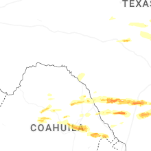
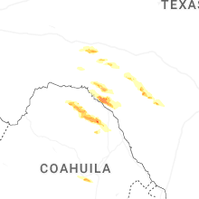
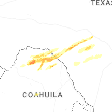
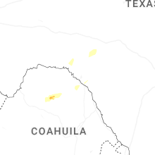
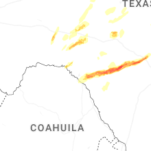
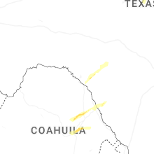
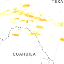
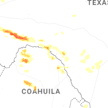
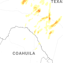


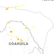

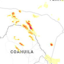


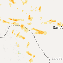


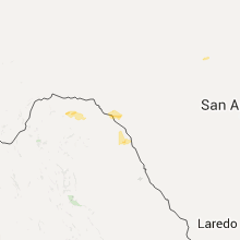


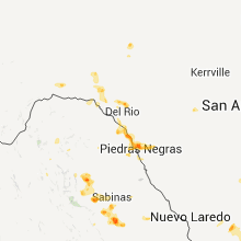


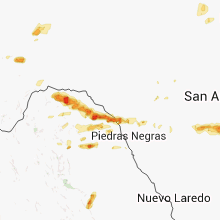


Connect with Interactive Hail Maps