

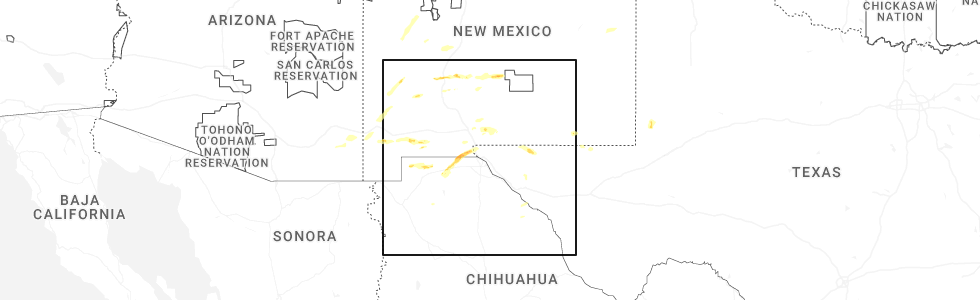
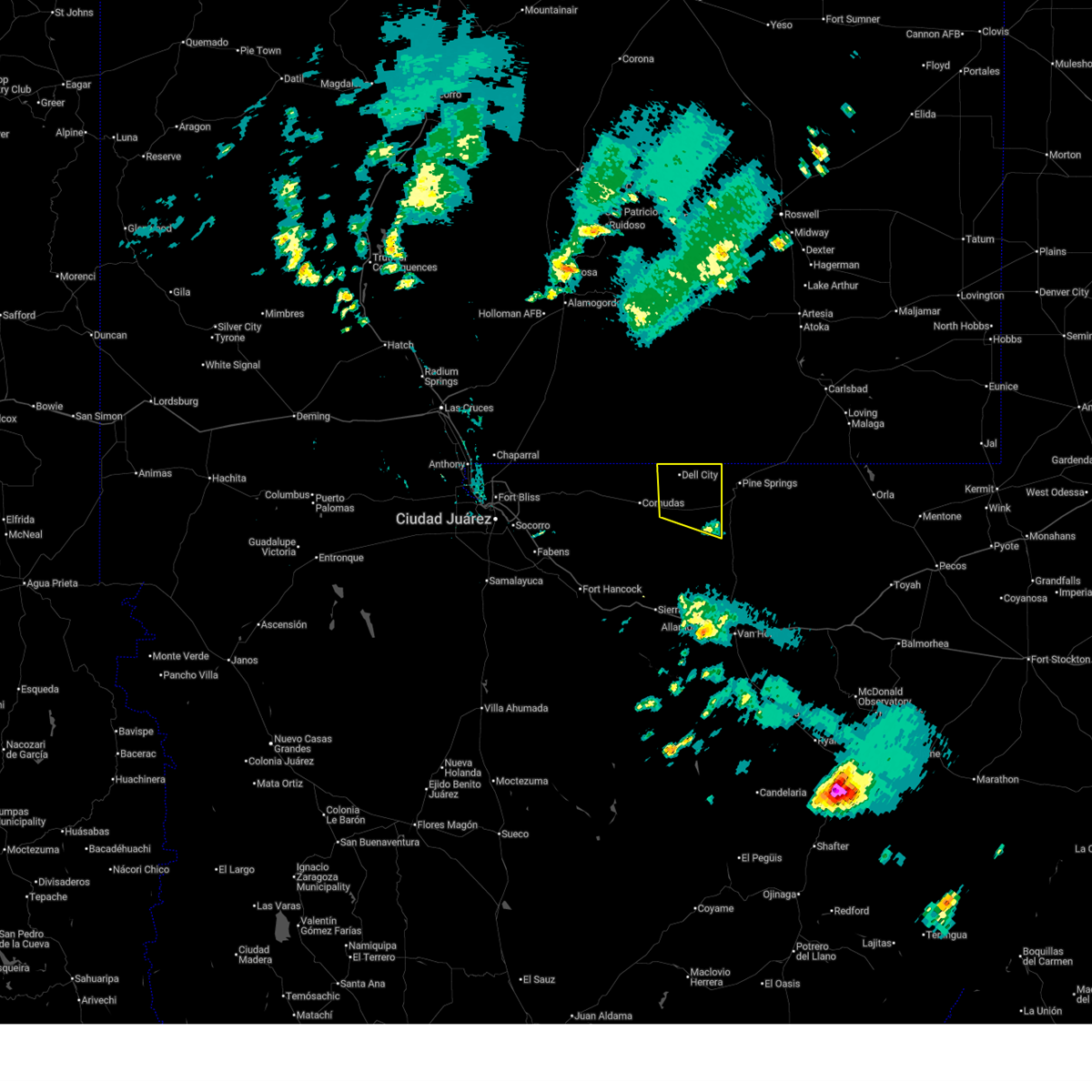
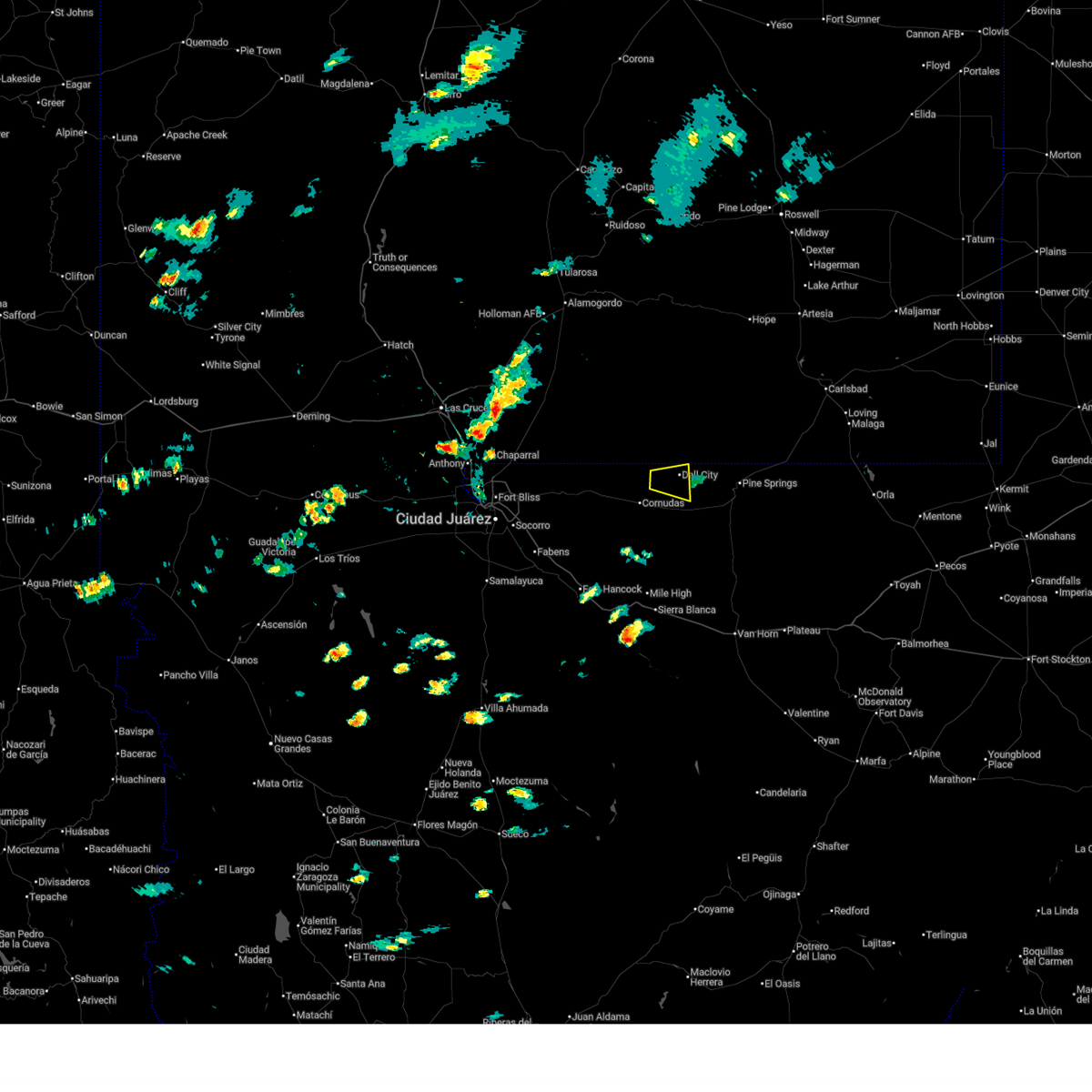
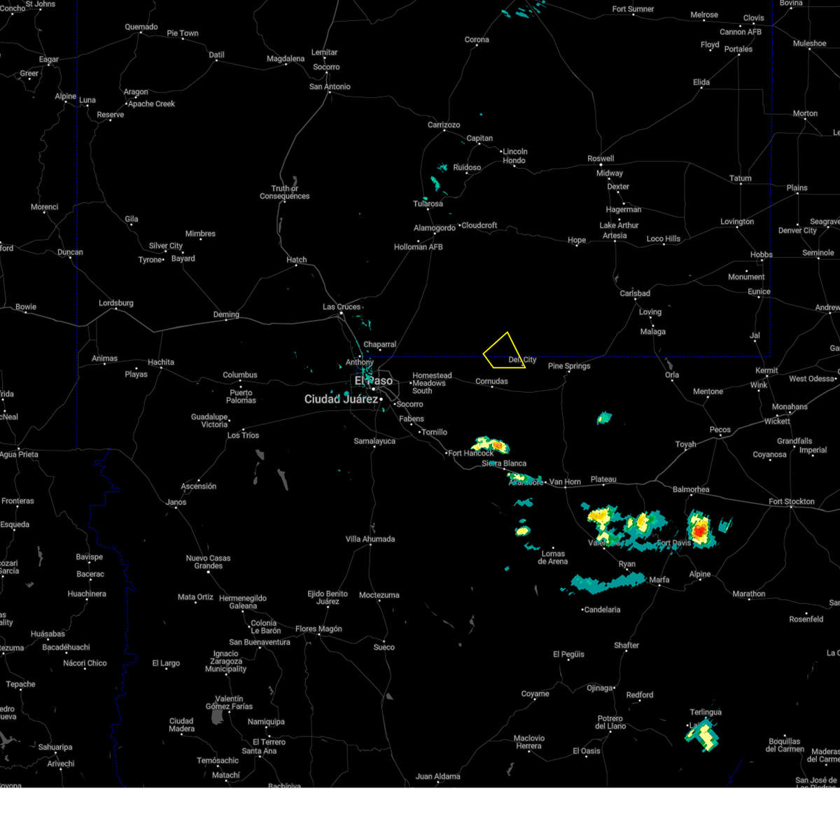
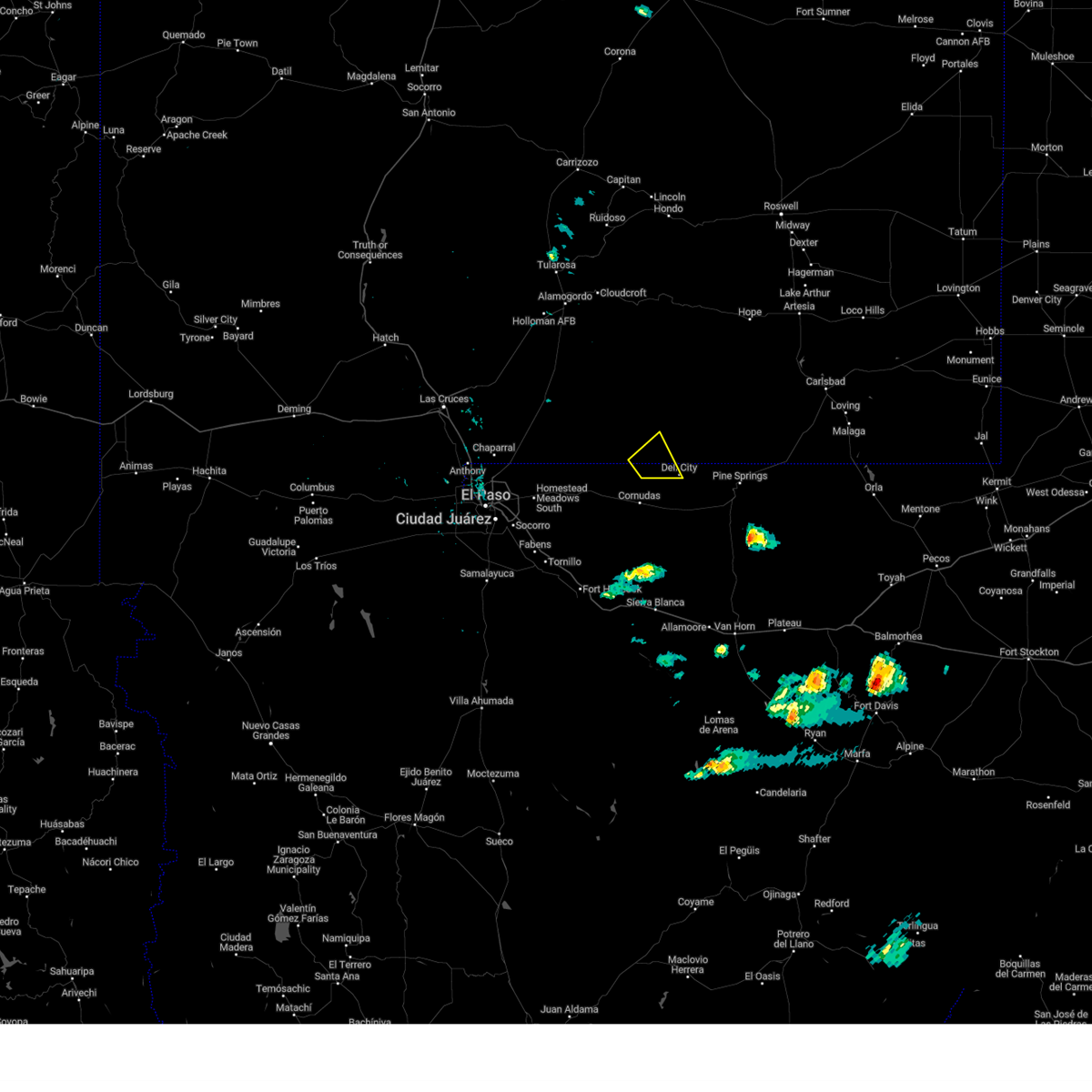
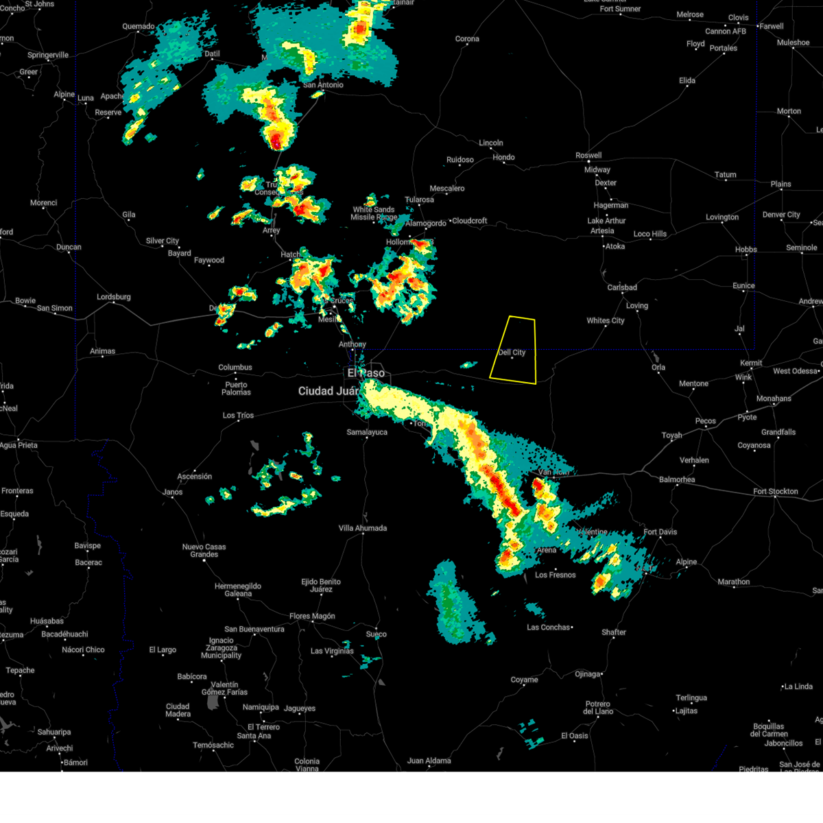
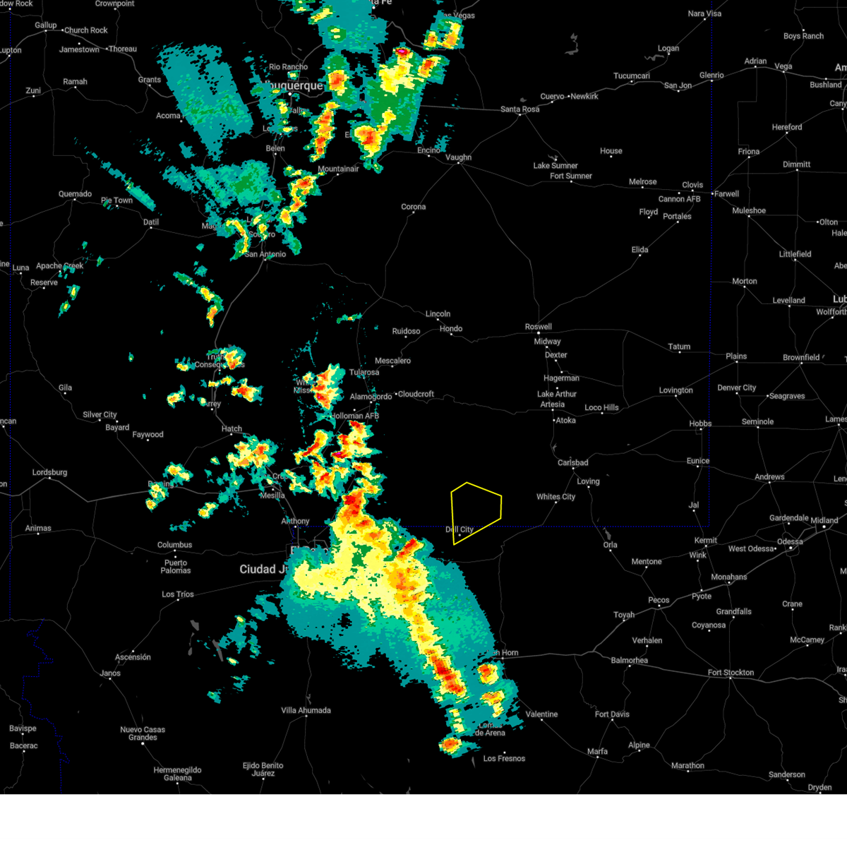
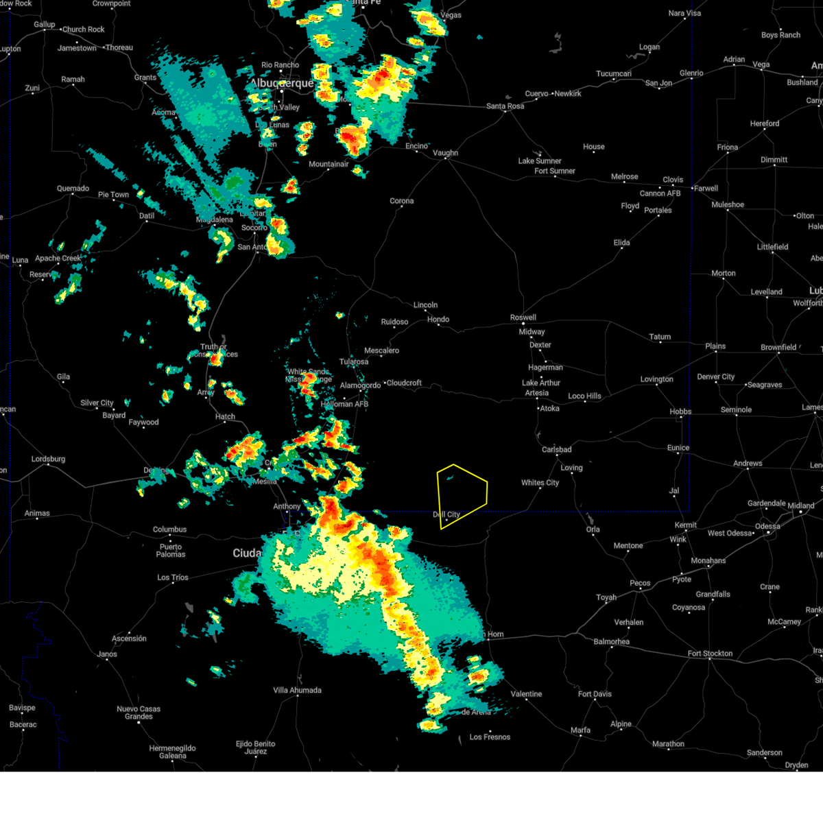
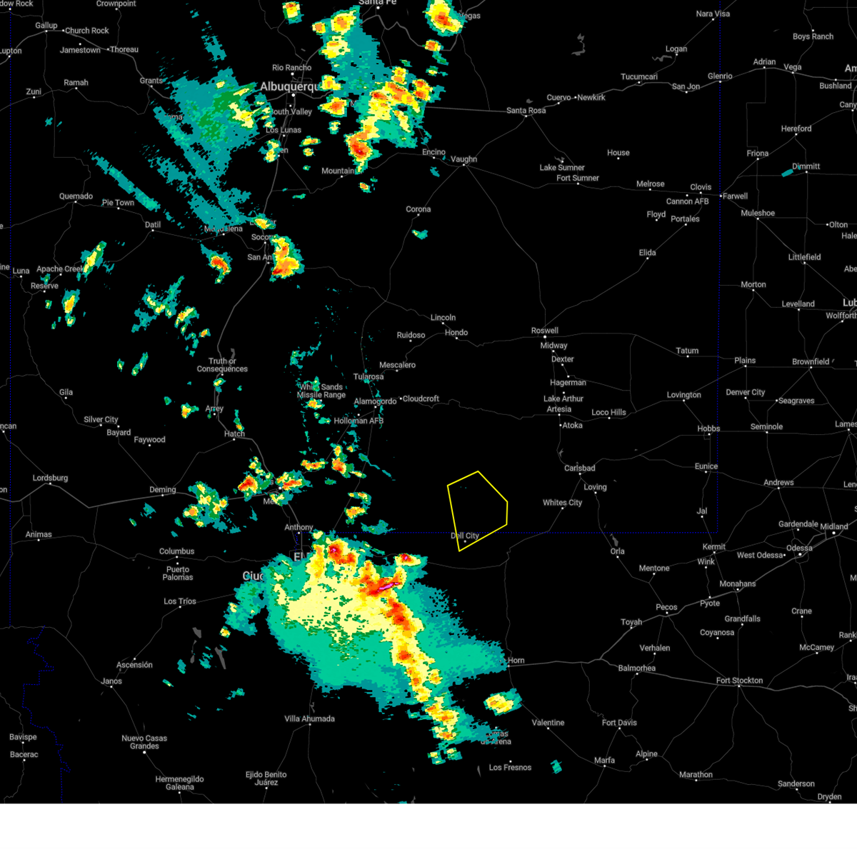
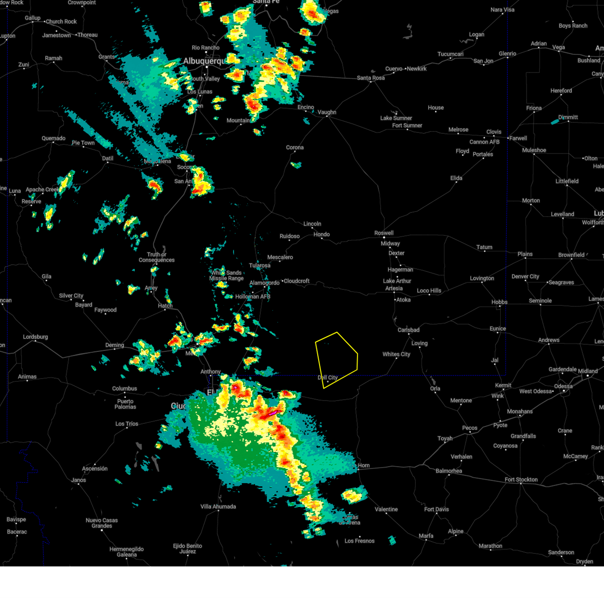
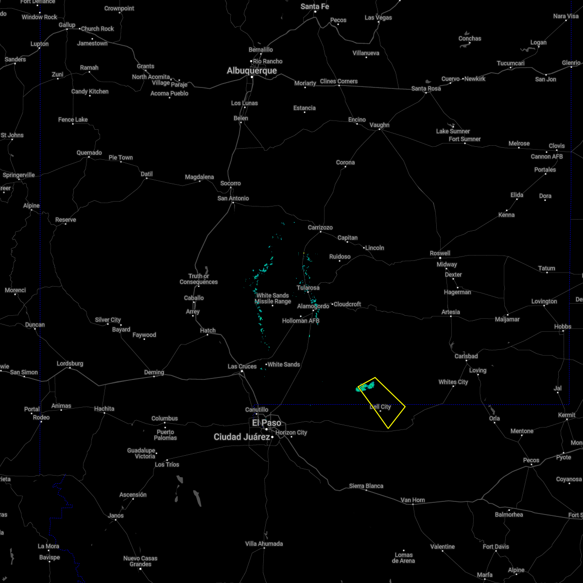
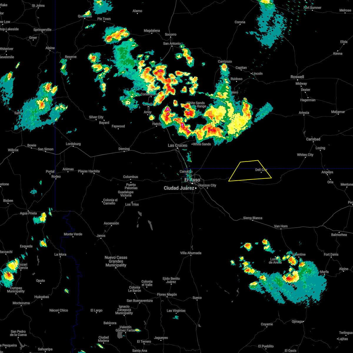
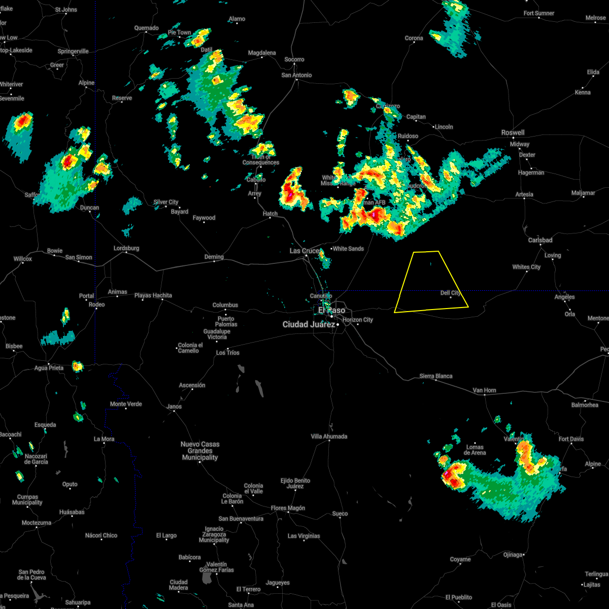
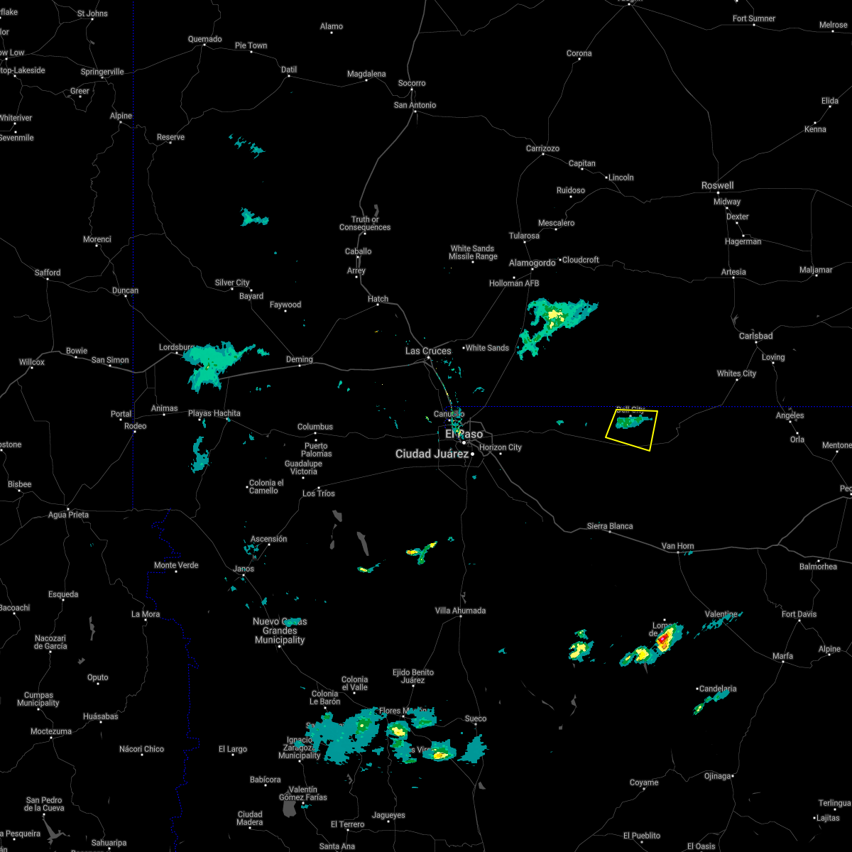
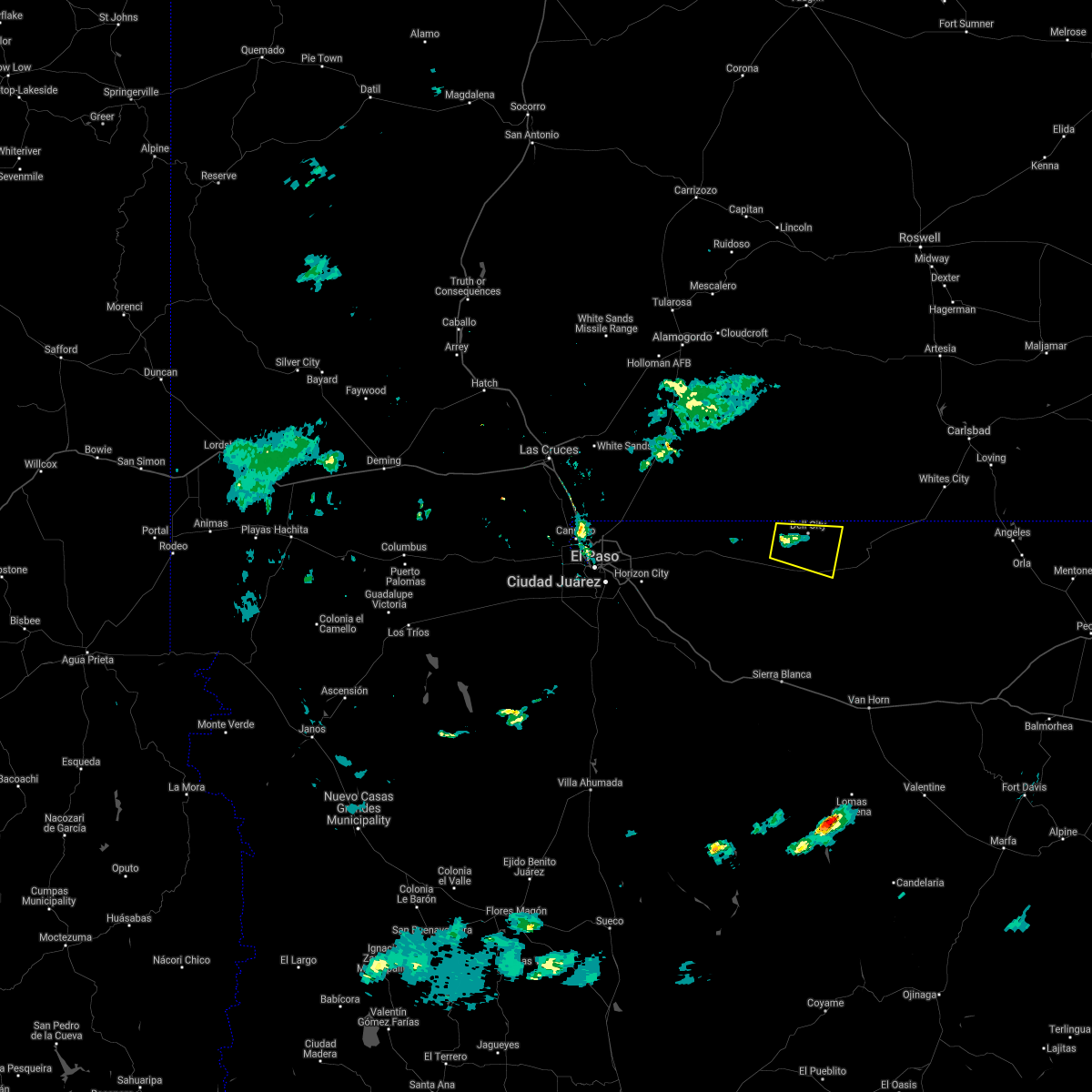
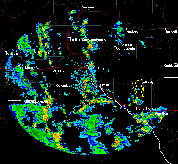
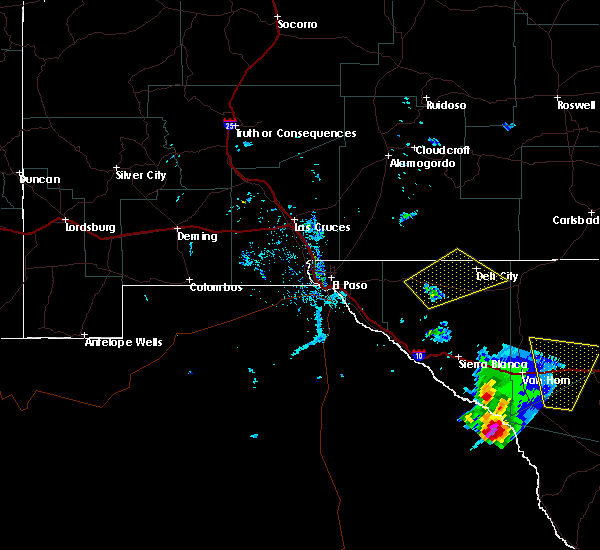
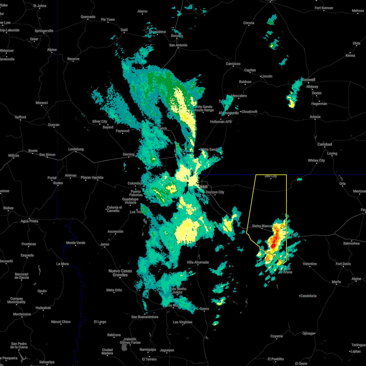
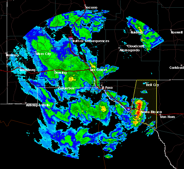
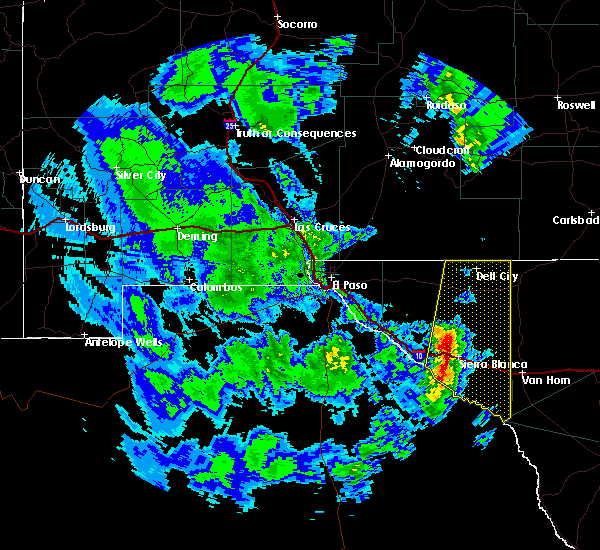
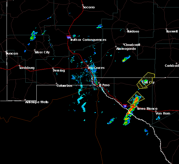
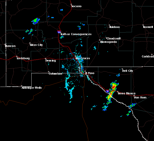
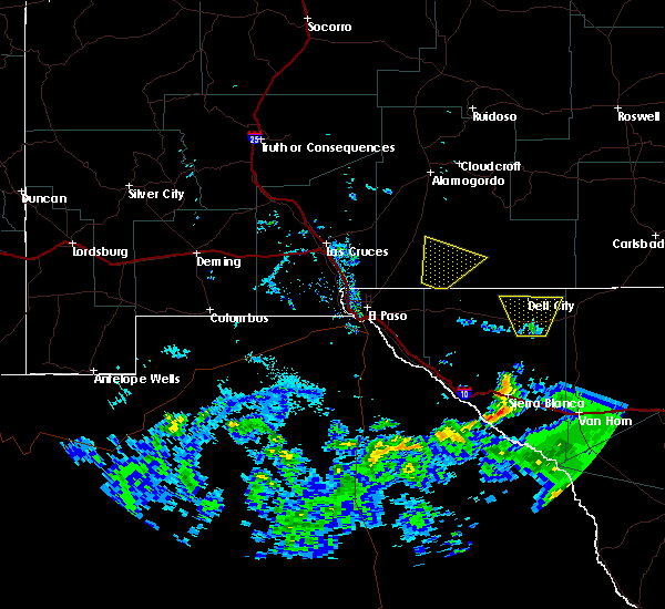
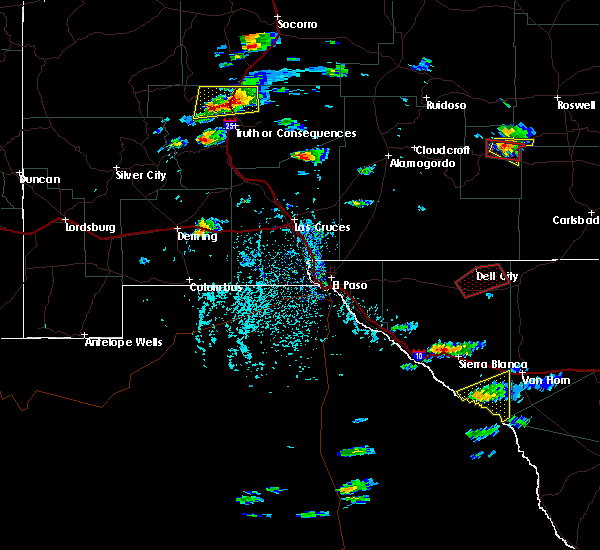
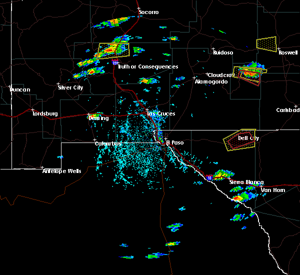
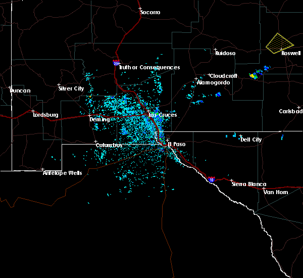
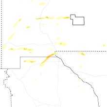
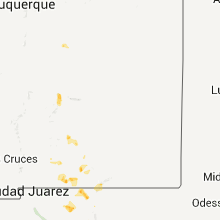
Hail Map for Dell City, TX
The Dell City, TX area has had 3 reports of on-the-ground hail by trained spotters, and has been under severe weather warnings 5 times during the past 12 months. Doppler radar has detected hail at or near Dell City, TX on 5 occasions, including 1 occasion during the past year.
| Name: | Dell City, TX |
| Where Located: | 76.9 miles E of El Paso, TX |
| Map: | Google Map for Dell City, TX |
| Population: | 365 |
| Housing Units: | 187 |
| More Info: | Search Google for Dell City, TX |
0
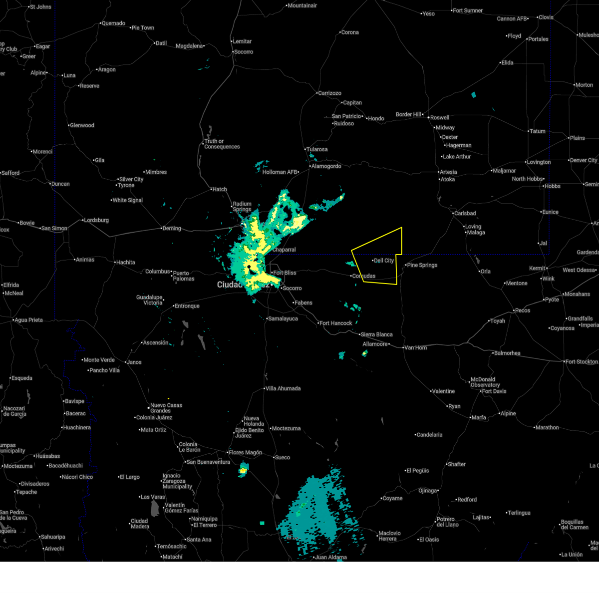
The Top Recent Hail Date for Dell City, TX is Saturday, September 13, 2025 (4th out of 5)
Hail and Wind Damage Spotted near Dell City, TX
| Date / Time | Report Details |
|---|---|
| 6/4/2026 1:57 AM MDT |
 Svrepz the national weather service in el paso has issued a * severe thunderstorm warning for, southeastern otero county in south central new mexico, northeastern hudspeth county in western texas, * until 245 am mdt. * at 156 am mdt, a severe thunderstorm was located 7 miles west of dell city, moving northeast at 25 mph (radar indicated). Hazards include 60 mph wind gusts. expect damage to roofs, siding, and trees Svrepz the national weather service in el paso has issued a * severe thunderstorm warning for, southeastern otero county in south central new mexico, northeastern hudspeth county in western texas, * until 245 am mdt. * at 156 am mdt, a severe thunderstorm was located 7 miles west of dell city, moving northeast at 25 mph (radar indicated). Hazards include 60 mph wind gusts. expect damage to roofs, siding, and trees
|
| 6/2/2026 5:53 PM MDT |
 Svrepz the national weather service in el paso has issued a * severe thunderstorm warning for, northeastern hudspeth county in western texas, * until 630 pm mdt. * at 553 pm mdt, a severe thunderstorm was located 10 miles south of dell city, moving north at 20 mph (radar indicated). Hazards include ping pong ball size hail. People and animals outdoors will be injured. Expect damage to roofs, siding, windows, and vehicles. Svrepz the national weather service in el paso has issued a * severe thunderstorm warning for, northeastern hudspeth county in western texas, * until 630 pm mdt. * at 553 pm mdt, a severe thunderstorm was located 10 miles south of dell city, moving north at 20 mph (radar indicated). Hazards include ping pong ball size hail. People and animals outdoors will be injured. Expect damage to roofs, siding, windows, and vehicles.
|
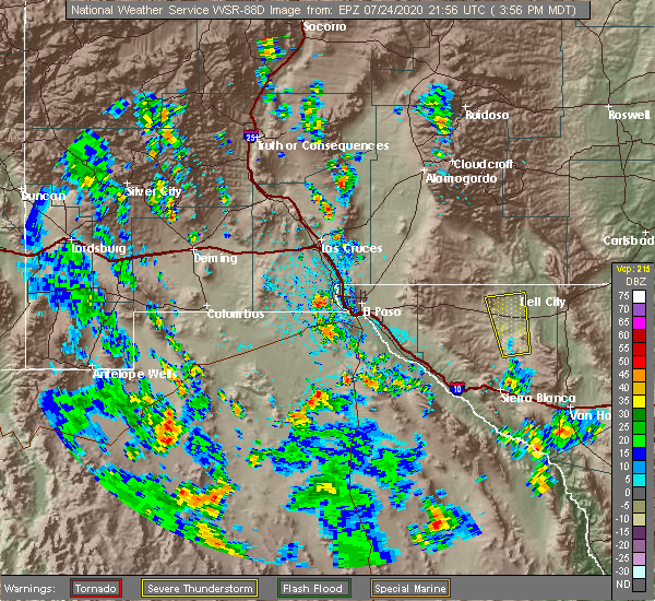
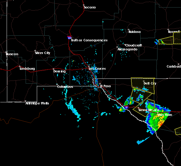
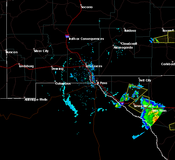
| 9/13/2025 8:33 PM MDT | Svrepz the national weather service in el paso has issued a * severe thunderstorm warning for, northeastern hudspeth county in western texas, * until 900 pm mdt. * at 833 pm mdt, a severe thunderstorm was located near dell city, moving east at 30 mph (radar indicated). Hazards include 60 mph wind gusts and quarter size hail. Hail damage to vehicles is expected. Expect wind damage to roofs, siding, and trees. |
| 9/13/2025 6:33 PM MDT |
 the severe thunderstorm warning has been cancelled and is no longer in effect the severe thunderstorm warning has been cancelled and is no longer in effect
|
| 9/13/2025 5:54 PM MDT | Svrepz the national weather service in el paso has issued a * severe thunderstorm warning for, north central hudspeth county in western texas, * until 645 pm mdt. * at 554 pm mdt, a severe thunderstorm was located 9 miles west of dell city, moving east at 15 mph (radar indicated). Hazards include 60 mph wind gusts and quarter size hail. Hail damage to vehicles is expected. Expect wind damage to roofs, siding, and trees. |
| 8/4/2024 5:45 PM MDT | Between 5:30 and 6:00pm mdt on august 4th... 2024... a severe microburst occurred a few miles ne of dell city... tx. nws assessed a thunderstorm moving south-southwest in hudspeth county TX, 1.7 miles SW of Dell City, TX |
| 6/1/2024 4:33 PM MDT |
 the severe thunderstorm warning has been cancelled and is no longer in effect the severe thunderstorm warning has been cancelled and is no longer in effect
|
| 6/1/2024 4:21 PM MDT | Mesonet station 91 dell city (ttu/wtm in hudspeth county TX, 0.8 miles SSE of Dell City, TX |
| 6/1/2024 3:58 PM MDT |
 Svrepz the national weather service in el paso has issued a * severe thunderstorm warning for, south central otero county in south central new mexico, north central hudspeth county in western texas, * until 445 pm mdt. * at 358 pm mdt, a severe thunderstorm was located 12 miles west of dell city, moving northeast at 10 mph (radar indicated). Hazards include 60 mph wind gusts and quarter size hail. Hail damage to vehicles is expected. Expect wind damage to roofs, siding, and trees. Svrepz the national weather service in el paso has issued a * severe thunderstorm warning for, south central otero county in south central new mexico, north central hudspeth county in western texas, * until 445 pm mdt. * at 358 pm mdt, a severe thunderstorm was located 12 miles west of dell city, moving northeast at 10 mph (radar indicated). Hazards include 60 mph wind gusts and quarter size hail. Hail damage to vehicles is expected. Expect wind damage to roofs, siding, and trees.
|
| 6/6/2023 6:58 PM MDT |
 At 657 pm mdt, a severe thunderstorm was located 10 miles northeast of dell city, moving south at 25 mph (radar indicated). Hazards include ping pong ball size hail and 60 mph wind gusts. People and animals outdoors will be injured. expect hail damage to roofs, siding, windows, and vehicles. Expect wind damage to roofs, siding, and trees. At 657 pm mdt, a severe thunderstorm was located 10 miles northeast of dell city, moving south at 25 mph (radar indicated). Hazards include ping pong ball size hail and 60 mph wind gusts. People and animals outdoors will be injured. expect hail damage to roofs, siding, windows, and vehicles. Expect wind damage to roofs, siding, and trees.
|
| 6/6/2023 6:44 PM MDT |
 At 644 pm mdt, a severe thunderstorm was located 14 miles southwest of lincoln national forest, moving southeast at 20 mph (radar indicated). Hazards include ping pong ball size hail and 60 mph wind gusts. People and animals outdoors will be injured. expect hail damage to roofs, siding, windows, and vehicles. expect wind damage to roofs, siding, and trees. locations impacted include, dell city, lincoln national forest, crow flats and brokeoff mountains. hail threat, radar indicated max hail size, 1. 50 in wind threat, radar indicated max wind gust, 60 mph. At 644 pm mdt, a severe thunderstorm was located 14 miles southwest of lincoln national forest, moving southeast at 20 mph (radar indicated). Hazards include ping pong ball size hail and 60 mph wind gusts. People and animals outdoors will be injured. expect hail damage to roofs, siding, windows, and vehicles. expect wind damage to roofs, siding, and trees. locations impacted include, dell city, lincoln national forest, crow flats and brokeoff mountains. hail threat, radar indicated max hail size, 1. 50 in wind threat, radar indicated max wind gust, 60 mph.
|
| 6/6/2023 6:28 PM MDT |
 At 628 pm mdt, a severe thunderstorm was located 14 miles southwest of lincoln national forest, moving southeast at 20 mph (radar indicated). Hazards include ping pong ball size hail and 60 mph wind gusts. People and animals outdoors will be injured. expect hail damage to roofs, siding, windows, and vehicles. expect wind damage to roofs, siding, and trees. locations impacted include, dell city, lincoln national forest, crow flats and brokeoff mountains. hail threat, radar indicated max hail size, 1. 50 in wind threat, radar indicated max wind gust, 60 mph. At 628 pm mdt, a severe thunderstorm was located 14 miles southwest of lincoln national forest, moving southeast at 20 mph (radar indicated). Hazards include ping pong ball size hail and 60 mph wind gusts. People and animals outdoors will be injured. expect hail damage to roofs, siding, windows, and vehicles. expect wind damage to roofs, siding, and trees. locations impacted include, dell city, lincoln national forest, crow flats and brokeoff mountains. hail threat, radar indicated max hail size, 1. 50 in wind threat, radar indicated max wind gust, 60 mph.
|
| 6/6/2023 6:11 PM MDT |
 At 611 pm mdt, a severe thunderstorm was located 15 miles west of lincoln national forest, moving southeast at 20 mph (radar indicated). Hazards include ping pong ball size hail and 60 mph wind gusts. People and animals outdoors will be injured. expect hail damage to roofs, siding, windows, and vehicles. Expect wind damage to roofs, siding, and trees. At 611 pm mdt, a severe thunderstorm was located 15 miles west of lincoln national forest, moving southeast at 20 mph (radar indicated). Hazards include ping pong ball size hail and 60 mph wind gusts. People and animals outdoors will be injured. expect hail damage to roofs, siding, windows, and vehicles. Expect wind damage to roofs, siding, and trees.
|
| 8/29/2022 3:34 PM MDT | Mesonet station 91 dell city (ttu/wtm). trained spotter also reported damage across dell city including a trampoline into powerlines and damage to the fire statio in hudspeth county TX, 0.8 miles SSE of Dell City, TX |
| 6/2/2022 10:15 PM MDT |
 At 1015 pm mdt, a severe thunderstorm was located 14 miles north of dell city, moving southeast at 45 mph (radar indicated). Hazards include 60 mph wind gusts and quarter size hail. Hail damage to vehicles is expected. Expect wind damage to roofs, siding, and trees. At 1015 pm mdt, a severe thunderstorm was located 14 miles north of dell city, moving southeast at 45 mph (radar indicated). Hazards include 60 mph wind gusts and quarter size hail. Hail damage to vehicles is expected. Expect wind damage to roofs, siding, and trees.
|
| 7/11/2021 6:54 PM MDT |
 At 654 pm mdt, severe thunderstorms were located along a line extending from near dell city to 12 miles north of cornudas to 13 miles northeast of loma linda, moving south at 10 mph (radar indicated). Hazards include 60 mph wind gusts. expect damage to roofs, siding, and trees At 654 pm mdt, severe thunderstorms were located along a line extending from near dell city to 12 miles north of cornudas to 13 miles northeast of loma linda, moving south at 10 mph (radar indicated). Hazards include 60 mph wind gusts. expect damage to roofs, siding, and trees
|
| 7/11/2021 6:39 PM MDT |
 At 639 pm mdt, a severe thunderstorm was located 11 miles north of cornudas, moving south at 35 mph (radar indicated). Hazards include 60 mph wind gusts and penny size hail. Expect damage to roofs, siding, and trees. Locations impacted include, dell city and cornudas mountains. At 639 pm mdt, a severe thunderstorm was located 11 miles north of cornudas, moving south at 35 mph (radar indicated). Hazards include 60 mph wind gusts and penny size hail. Expect damage to roofs, siding, and trees. Locations impacted include, dell city and cornudas mountains.
|
| 7/11/2021 6:08 PM MDT |
 At 608 pm mdt, a severe thunderstorm was located 24 miles northwest of dell city, moving south at 35 mph (radar indicated). Hazards include two inch hail and 60 mph wind gusts. People and animals outdoors will be injured. expect hail damage to roofs, siding, windows, and vehicles. Expect wind damage to roofs, siding, and trees. At 608 pm mdt, a severe thunderstorm was located 24 miles northwest of dell city, moving south at 35 mph (radar indicated). Hazards include two inch hail and 60 mph wind gusts. People and animals outdoors will be injured. expect hail damage to roofs, siding, windows, and vehicles. Expect wind damage to roofs, siding, and trees.
|
| 6/1/2021 7:50 PM MDT |
 At 750 pm mdt, a severe thunderstorm was located 5 miles southwest of dell city, moving east at 15 mph (radar indicated). Hazards include ping pong ball size hail and 60 mph wind gusts. People and animals outdoors will be injured. expect hail damage to roofs, siding, windows, and vehicles. expect wind damage to roofs, siding, and trees. Locations impacted include, dell city, salt flat, guadalupe mountains national park, far western portions of guadalupe mountains national park and gypsum dunes at guadalupe national park. At 750 pm mdt, a severe thunderstorm was located 5 miles southwest of dell city, moving east at 15 mph (radar indicated). Hazards include ping pong ball size hail and 60 mph wind gusts. People and animals outdoors will be injured. expect hail damage to roofs, siding, windows, and vehicles. expect wind damage to roofs, siding, and trees. Locations impacted include, dell city, salt flat, guadalupe mountains national park, far western portions of guadalupe mountains national park and gypsum dunes at guadalupe national park.
|
| 6/1/2021 7:36 PM MDT |
 At 735 pm mdt, a severe thunderstorm was located 8 miles west of dell city, moving east at 15 mph (radar indicated). Hazards include 60 mph wind gusts and quarter size hail. Hail damage to vehicles is expected. Expect wind damage to roofs, siding, and trees. At 735 pm mdt, a severe thunderstorm was located 8 miles west of dell city, moving east at 15 mph (radar indicated). Hazards include 60 mph wind gusts and quarter size hail. Hail damage to vehicles is expected. Expect wind damage to roofs, siding, and trees.
|
| 7/24/2020 4:13 PM MDT |
 At 413 pm mdt, a severe thunderstorm was located 11 miles southeast of cornudas, moving northwest at 30 mph (radar indicated). Hazards include 60 mph wind gusts and quarter size hail. Hail damage to vehicles is expected. expect wind damage to roofs, siding, and trees. Locations impacted include, dell city. At 413 pm mdt, a severe thunderstorm was located 11 miles southeast of cornudas, moving northwest at 30 mph (radar indicated). Hazards include 60 mph wind gusts and quarter size hail. Hail damage to vehicles is expected. expect wind damage to roofs, siding, and trees. Locations impacted include, dell city.
|
| 7/24/2020 3:55 PM MDT |
 At 355 pm mdt, a severe thunderstorm was located 17 miles southwest of salt flat, moving northwest at 30 mph (radar indicated). Hazards include 60 mph wind gusts and quarter size hail. Hail damage to vehicles is expected. Expect wind damage to roofs, siding, and trees. At 355 pm mdt, a severe thunderstorm was located 17 miles southwest of salt flat, moving northwest at 30 mph (radar indicated). Hazards include 60 mph wind gusts and quarter size hail. Hail damage to vehicles is expected. Expect wind damage to roofs, siding, and trees.
|
| 6/23/2020 9:01 PM MDT |
 At 901 pm mdt, severe thunderstorms were located along a line extending from near dell city to 8 miles southeast of desert haven, moving southeast at 65 mph (radar indicated). Hazards include 60 mph wind gusts. expect damage to roofs, siding, and trees At 901 pm mdt, severe thunderstorms were located along a line extending from near dell city to 8 miles southeast of desert haven, moving southeast at 65 mph (radar indicated). Hazards include 60 mph wind gusts. expect damage to roofs, siding, and trees
|
| 3/13/2020 6:13 PM MDT |
 At 612 pm mdt, a severe thunderstorm was located 8 miles north of dell city, moving northeast at 50 mph (radar indicated). Hazards include 60 mph wind gusts and half dollar size hail. Hail damage to vehicles is expected. Expect wind damage to roofs, siding, and trees. At 612 pm mdt, a severe thunderstorm was located 8 miles north of dell city, moving northeast at 50 mph (radar indicated). Hazards include 60 mph wind gusts and half dollar size hail. Hail damage to vehicles is expected. Expect wind damage to roofs, siding, and trees.
|
| 6/2/2019 5:58 PM MDT |
 At 556 pm mdt, a severe thunderstorm was located 6 miles southeast of cornudas, moving northeast at 40 mph (radar indicated). Hazards include 60 mph wind gusts and half dollar size hail. Hail damage to vehicles is expected. Expect wind damage to roofs, siding, and trees. At 556 pm mdt, a severe thunderstorm was located 6 miles southeast of cornudas, moving northeast at 40 mph (radar indicated). Hazards include 60 mph wind gusts and half dollar size hail. Hail damage to vehicles is expected. Expect wind damage to roofs, siding, and trees.
|
| 5/31/2019 7:34 PM MDT | Golf Ball sized hail reported 21 miles ESE of Dell City, TX, reports of golf ball sized hail and strong winds. windows broken as a result. |
| 5/31/2019 6:44 PM MDT |
 At 643 pm mdt, a severe thunderstorm was located 7 miles west of cornudas, moving northeast at 30 mph (radar indicated). Hazards include 60 mph wind gusts and quarter size hail. Hail damage to vehicles is expected. Expect wind damage to roofs, siding, and trees. At 643 pm mdt, a severe thunderstorm was located 7 miles west of cornudas, moving northeast at 30 mph (radar indicated). Hazards include 60 mph wind gusts and quarter size hail. Hail damage to vehicles is expected. Expect wind damage to roofs, siding, and trees.
|
| 3/12/2019 5:13 PM MDT |
 The severe thunderstorm warning for hudspeth county will expire at 515 pm mdt, the storms which prompted the warning continue to push east across far eastern hudspeth county but most have weakened. therefore, the warning will be allowed to expire. however small hail and gusty winds are still possible with these with the remains storms that are tracking east just south of the interstate over rural locations. all thunderstorms should be ending, or moving out of hudspeth county by 530 pm mdt. The severe thunderstorm warning for hudspeth county will expire at 515 pm mdt, the storms which prompted the warning continue to push east across far eastern hudspeth county but most have weakened. therefore, the warning will be allowed to expire. however small hail and gusty winds are still possible with these with the remains storms that are tracking east just south of the interstate over rural locations. all thunderstorms should be ending, or moving out of hudspeth county by 530 pm mdt.
|
| 3/12/2019 4:31 PM MDT |
 At 427 pm mdt, severe thunderstorms were located along a line extending from 5 miles southwest of dell city to near sierra blanca to 15 miles west of indian hot springs, moving northeast at 40 mph. the strongest of these storms was located over interstate 10 about 5 miles west of sierra blanca. hudspeth sheriff reported hail covering the highway around mile marker 95. road conditions were icy. this wtorm will move into sierra blanca before 445 pm mdt (law enforcement). Hazards include 60 mph wind gusts and quarter size hail. Hail damage to vehicles is expected. expect wind damage to roofs, siding, and trees. Locations impacted include, dell city, sierra blanca, allamoore, indian hot springs, fort quitman, cornudas, frenchman canyon, indio mountains research station, green river, salt flat, bosque bonita, guadalupe mountains national park, quitman canyon, sunset ranches, far western portions of guadalupe mountains national park, round top mountain, little box, big box, and gypsum dunes at guadalupe national park. At 427 pm mdt, severe thunderstorms were located along a line extending from 5 miles southwest of dell city to near sierra blanca to 15 miles west of indian hot springs, moving northeast at 40 mph. the strongest of these storms was located over interstate 10 about 5 miles west of sierra blanca. hudspeth sheriff reported hail covering the highway around mile marker 95. road conditions were icy. this wtorm will move into sierra blanca before 445 pm mdt (law enforcement). Hazards include 60 mph wind gusts and quarter size hail. Hail damage to vehicles is expected. expect wind damage to roofs, siding, and trees. Locations impacted include, dell city, sierra blanca, allamoore, indian hot springs, fort quitman, cornudas, frenchman canyon, indio mountains research station, green river, salt flat, bosque bonita, guadalupe mountains national park, quitman canyon, sunset ranches, far western portions of guadalupe mountains national park, round top mountain, little box, big box, and gypsum dunes at guadalupe national park.
|
| 3/12/2019 4:20 PM MDT |
 At 418 pm mdt, severe thunderstorms were located along a line extending from 9 miles northeast of cornudas to 5 miles southwest of sierra blanca to 20 miles west of indian hot springs, moving northeast at 40 mph (radar indicated). Hazards include 60 mph wind gusts and quarter size hail. Hail damage to vehicles is expected. Expect wind damage to roofs, siding, and trees. At 418 pm mdt, severe thunderstorms were located along a line extending from 9 miles northeast of cornudas to 5 miles southwest of sierra blanca to 20 miles west of indian hot springs, moving northeast at 40 mph (radar indicated). Hazards include 60 mph wind gusts and quarter size hail. Hail damage to vehicles is expected. Expect wind damage to roofs, siding, and trees.
|
| 8/18/2018 2:51 PM MDT | Apparent microburst at dell city west texas mesonet sit in hudspeth county TX, 0.8 miles SSE of Dell City, TX |
| 9/23/2017 5:20 PM MDT | Downed power lines reported by sherif in hudspeth county TX, 0.2 miles ESE of Dell City, TX |
| 9/23/2017 4:51 PM MDT |
 At 451 pm mdt, a severe thunderstorm was located 5 miles south of dell city, or 17 miles west of guadalupe mountains national park, moving northeast at 35 mph (radar indicated). Hazards include tennis ball size hail and 60 mph wind gusts. People and animals outdoors will be injured. expect hail damage to roofs, siding, windows, and vehicles. Expect wind damage to roofs, siding, and trees. At 451 pm mdt, a severe thunderstorm was located 5 miles south of dell city, or 17 miles west of guadalupe mountains national park, moving northeast at 35 mph (radar indicated). Hazards include tennis ball size hail and 60 mph wind gusts. People and animals outdoors will be injured. expect hail damage to roofs, siding, windows, and vehicles. Expect wind damage to roofs, siding, and trees.
|
| 9/23/2017 4:46 PM MDT |
 At 445 pm mdt, a severe thunderstorm was located 9 miles west of salt flat, or 13 miles east of cornudas, moving northeast at 25 mph (radar indicated). Hazards include tennis ball size hail and 60 mph wind gusts. People and animals outdoors will be injured. expect hail damage to roofs, siding, windows, and vehicles. expect wind damage to roofs, siding, and trees. This severe thunderstorm will remain over mainly rural areas of northeastern hudspeth county near and south of dell city. At 445 pm mdt, a severe thunderstorm was located 9 miles west of salt flat, or 13 miles east of cornudas, moving northeast at 25 mph (radar indicated). Hazards include tennis ball size hail and 60 mph wind gusts. People and animals outdoors will be injured. expect hail damage to roofs, siding, windows, and vehicles. expect wind damage to roofs, siding, and trees. This severe thunderstorm will remain over mainly rural areas of northeastern hudspeth county near and south of dell city.
|
| 9/23/2017 4:29 PM MDT |
 At 429 pm mdt, a severe thunderstorm was located 7 miles east of cornudas, moving east at 20 mph (radar indicated). Hazards include ping pong ball size hail and 60 mph wind gusts. People and animals outdoors will be injured. expect hail damage to roofs, siding, windows, and vehicles. expect wind damage to roofs, siding, and trees. This severe thunderstorm will remain over mainly rural areas of northeastern hudspeth county. At 429 pm mdt, a severe thunderstorm was located 7 miles east of cornudas, moving east at 20 mph (radar indicated). Hazards include ping pong ball size hail and 60 mph wind gusts. People and animals outdoors will be injured. expect hail damage to roofs, siding, windows, and vehicles. expect wind damage to roofs, siding, and trees. This severe thunderstorm will remain over mainly rural areas of northeastern hudspeth county.
|
| 7/1/2017 7:32 PM MDT |
 At 730 pm mdt, a severe thunderstorm was located 7 miles west of salt flat, or 15 miles east of cornudas, and is moving north around 10 mph (radar indicated). Hazards include 60 mph wind gusts and quarter size hail. Hail damage to vehicles is expected. Expect wind damage to roofs, siding, and trees. At 730 pm mdt, a severe thunderstorm was located 7 miles west of salt flat, or 15 miles east of cornudas, and is moving north around 10 mph (radar indicated). Hazards include 60 mph wind gusts and quarter size hail. Hail damage to vehicles is expected. Expect wind damage to roofs, siding, and trees.
|
| 11/5/2016 8:56 PM MDT | Quarter sized hail reported 19.5 miles NE of Dell City, TX, cornudas cafe... hail had jagged shape... fell for about 10 minutes. |
| 9/15/2016 2:51 PM MDT |
 At 249 pm mdt, a severe thunderstorm capable of producing a tornado was located 7 miles east of cornudas, moving east southeast around 10 mph (radar indicated rotation). Hazards include tornado and half dollar size hail. Flying debris will be dangerous to those caught without shelter. mobile homes will be damaged or destroyed. damage to roofs, windows, and vehicles will occur. tree damage is likely. This tornadic thunderstorm is weakening and will remain over mainly rural areas of northeastern hudspeth county, including the following locations: gypsum dunes at guadalupe national park and far western portions of guadalupe mountains national park. At 249 pm mdt, a severe thunderstorm capable of producing a tornado was located 7 miles east of cornudas, moving east southeast around 10 mph (radar indicated rotation). Hazards include tornado and half dollar size hail. Flying debris will be dangerous to those caught without shelter. mobile homes will be damaged or destroyed. damage to roofs, windows, and vehicles will occur. tree damage is likely. This tornadic thunderstorm is weakening and will remain over mainly rural areas of northeastern hudspeth county, including the following locations: gypsum dunes at guadalupe national park and far western portions of guadalupe mountains national park.
|
| 9/15/2016 2:28 PM MDT |
 At 227 pm mdt, a severe thunderstorm capable of producing a tornado 5 miles east of cornudas (radar indicated rotation). Hazards include tornado and half dollar size hail. Flying debris will be dangerous to those caught without shelter. mobile homes will be damaged or destroyed. damage to roofs, windows, and vehicles will occur. tree damage is likely. this dangerous storm will be near, dell city around 235 pm mdt. Other locations impacted by this tornadic thunderstorm include gypsum dunes at guadalupe national park and far western portions of guadalupe mountains national park. At 227 pm mdt, a severe thunderstorm capable of producing a tornado 5 miles east of cornudas (radar indicated rotation). Hazards include tornado and half dollar size hail. Flying debris will be dangerous to those caught without shelter. mobile homes will be damaged or destroyed. damage to roofs, windows, and vehicles will occur. tree damage is likely. this dangerous storm will be near, dell city around 235 pm mdt. Other locations impacted by this tornadic thunderstorm include gypsum dunes at guadalupe national park and far western portions of guadalupe mountains national park.
|
| 9/15/2016 2:05 PM MDT |
 At 204 pm mdt, a severe thunderstorm was located 9 miles southwest of dell city, moving northeast at 10 mph (radar indicated). Hazards include 60 mph wind gusts and quarter size hail. Hail damage to vehicles is expected. Expect wind damage to roofs, siding, and trees. At 204 pm mdt, a severe thunderstorm was located 9 miles southwest of dell city, moving northeast at 10 mph (radar indicated). Hazards include 60 mph wind gusts and quarter size hail. Hail damage to vehicles is expected. Expect wind damage to roofs, siding, and trees.
|
| 9/23/2015 4:36 PM MDT |
 At 436 pm mdt, a severe thunderstorm was located near dell city, or 15 miles northeast of cornudas, moving east at 25 mph (radar indicated). Hazards include 60 mph wind gusts and quarter size hail. Hail damage to vehicles is expected. Expect wind damage to roofs, siding and trees. At 436 pm mdt, a severe thunderstorm was located near dell city, or 15 miles northeast of cornudas, moving east at 25 mph (radar indicated). Hazards include 60 mph wind gusts and quarter size hail. Hail damage to vehicles is expected. Expect wind damage to roofs, siding and trees.
|
| 9/23/2015 1:27 PM MDT |
 At 127 pm mdt, a severe thunderstorm was located 5 miles west of dell city, or 15 miles northeast of cornudas, moving east at 15 mph (radar indicated). Hazards include 60 mph wind gusts and penny size hail. Expect damage to roofs. Siding and trees. At 127 pm mdt, a severe thunderstorm was located 5 miles west of dell city, or 15 miles northeast of cornudas, moving east at 15 mph (radar indicated). Hazards include 60 mph wind gusts and penny size hail. Expect damage to roofs. Siding and trees.
|
| 7/7/2015 5:35 PM MDT | Golf Ball sized hail reported 19.5 miles NE of Dell City, TX |
| 5/4/2015 3:24 PM MDT | At 321 pm mdt, national weather service meteorologists detected a severe thunderstorm capable of producing quarter size hail, and damaging winds in excess of 60 mph. this storm was located 20 miles west of pine springs, moving east at 20 mph. locations impacted include, dell city,. |
| 5/4/2015 2:57 PM MDT | At 253 pm mdt, national weather service meteorologists detected a severe thunderstorm capable of producing ping pong ball size. |
| 1/1/0001 12:00 AM | Measured 60 mph wind gust by gdp aso in culberson county TX, 20.4 miles WNW of Dell City, TX |
| 1/1/0001 12:00 AM | Unfilled 20 foot above ground pool blown ove in hudspeth county TX, 5.8 miles WNW of Dell City, TX |
Hail Maps for Dell City, TX


Connect with Interactive Hail Maps