

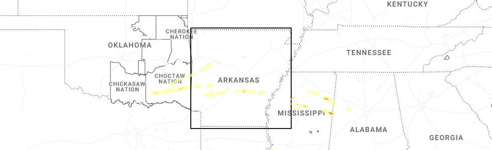
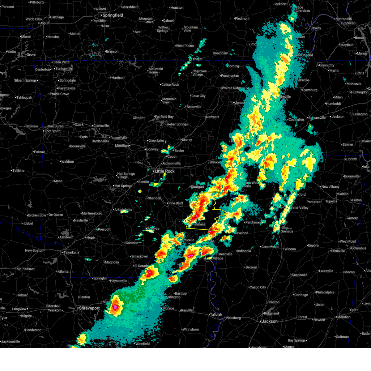
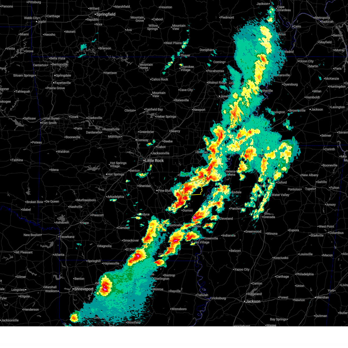
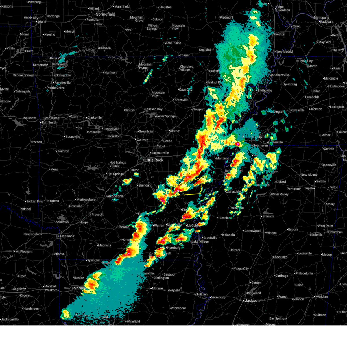
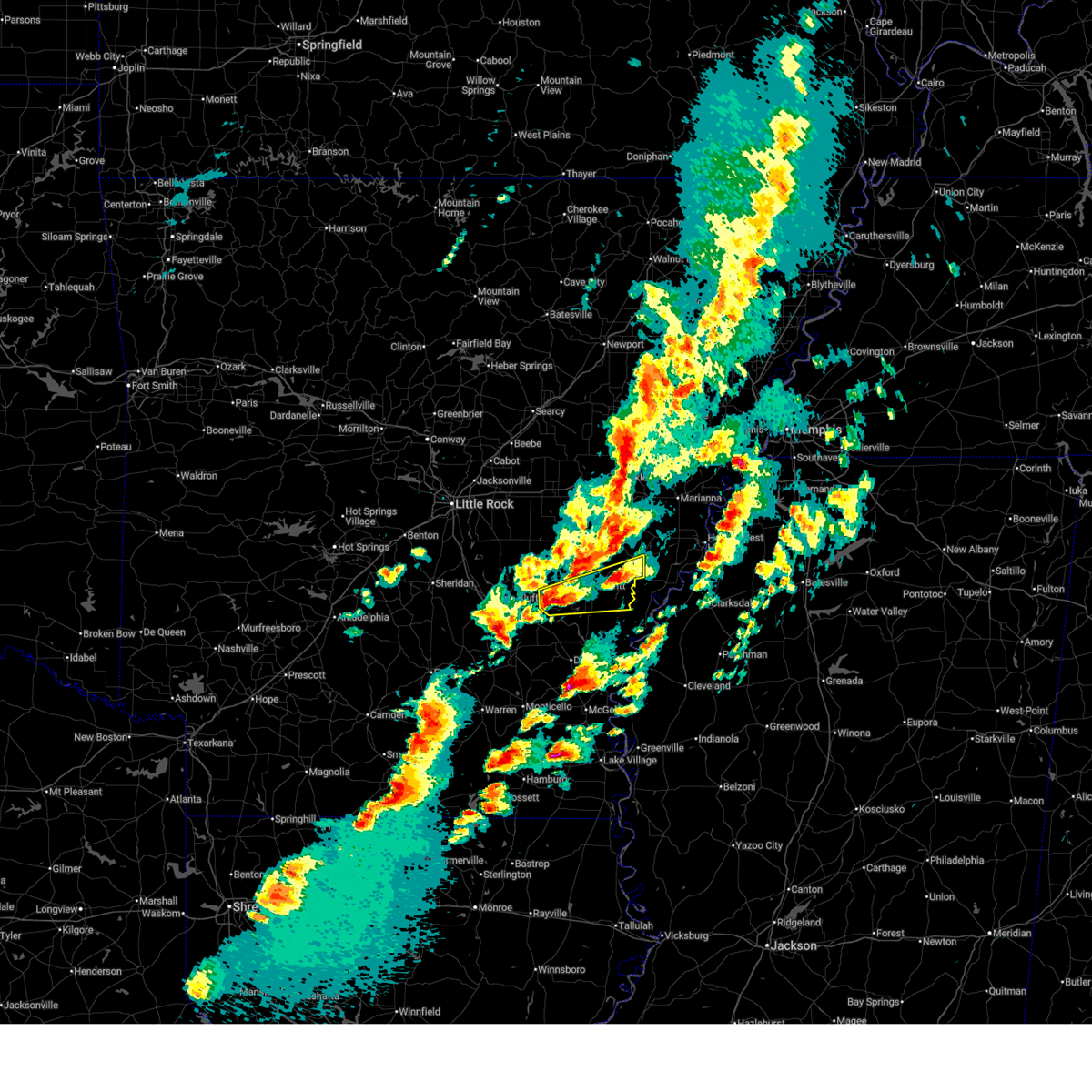
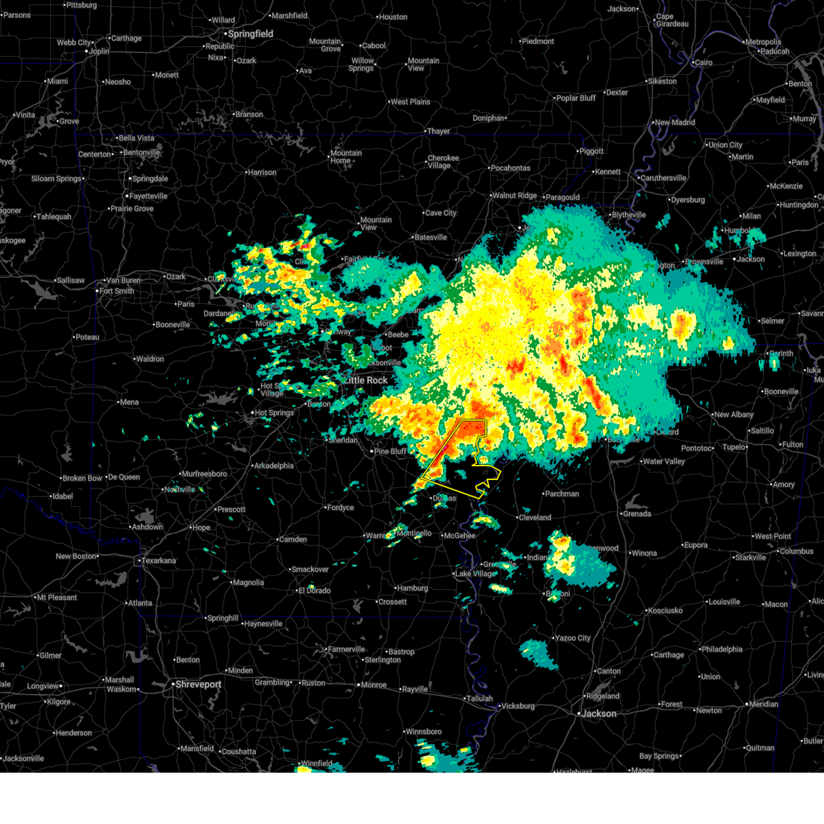
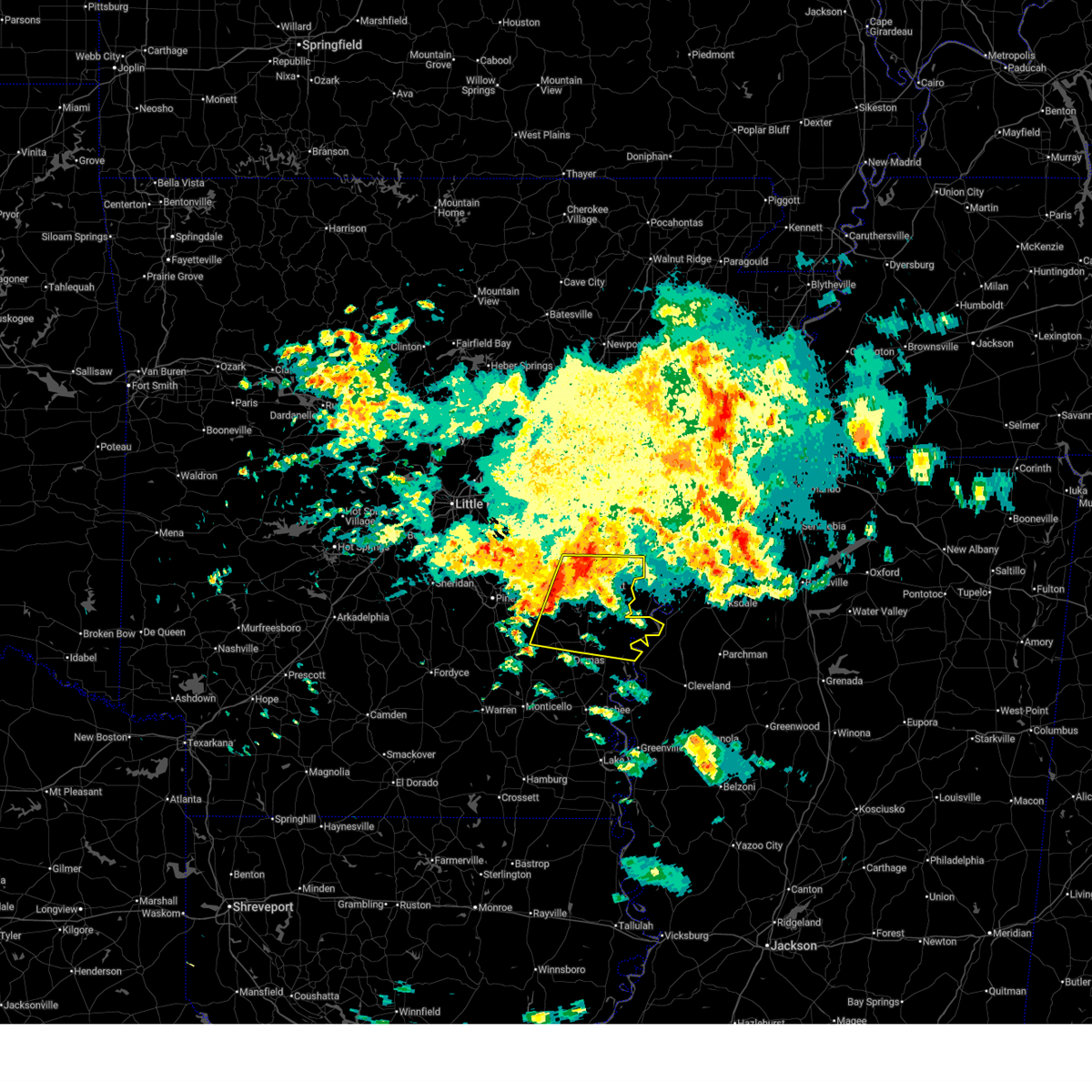
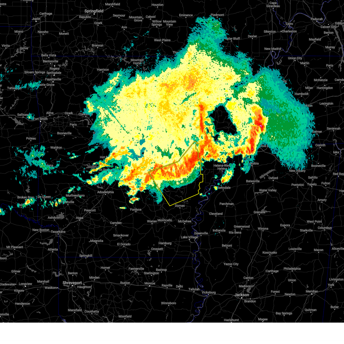
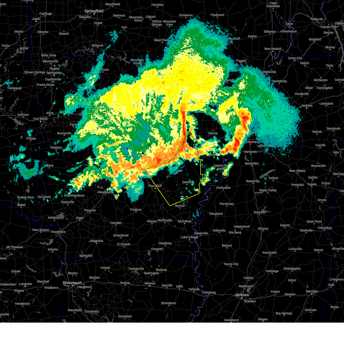
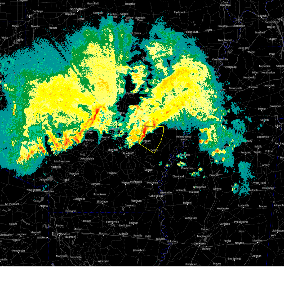
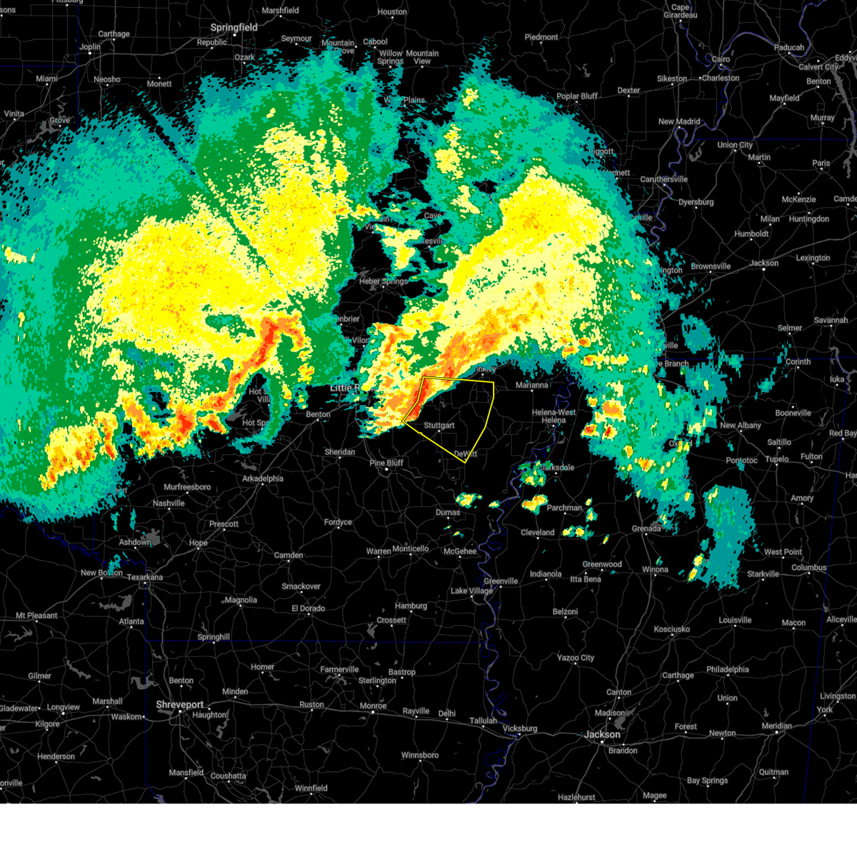
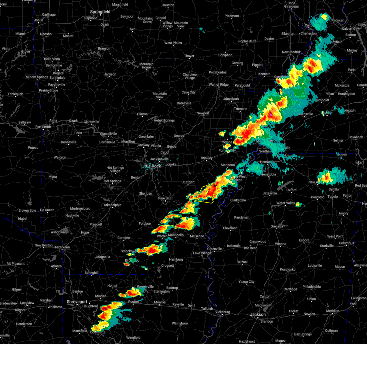
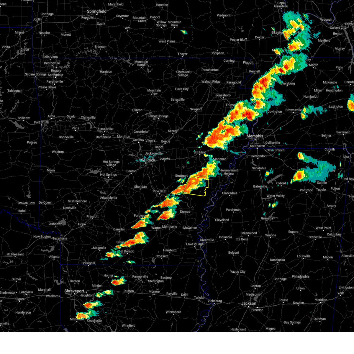
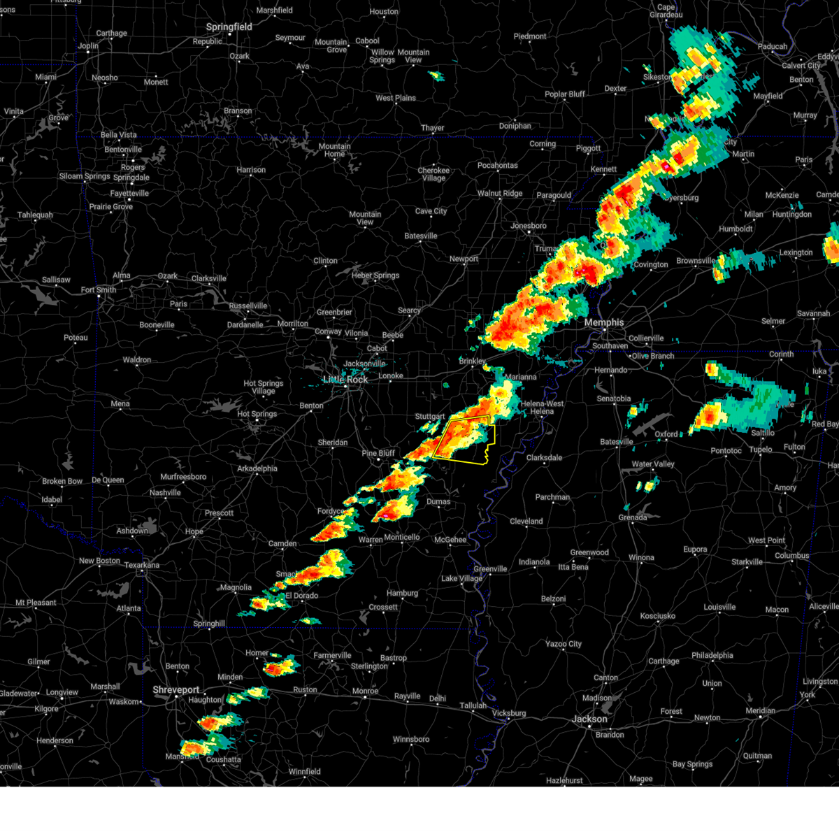
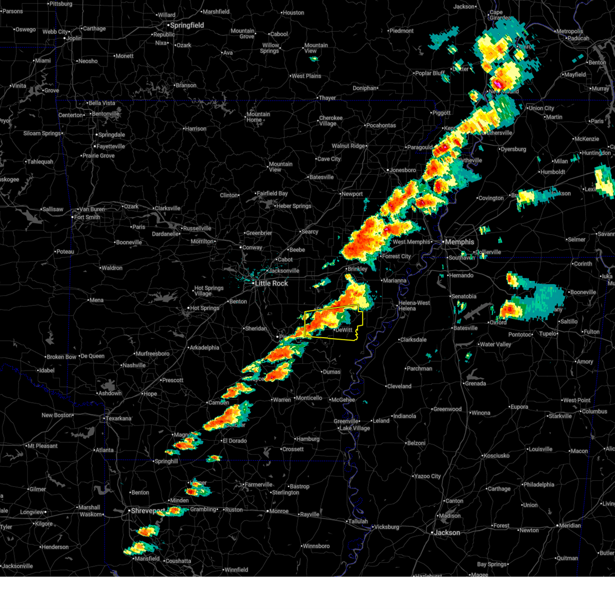
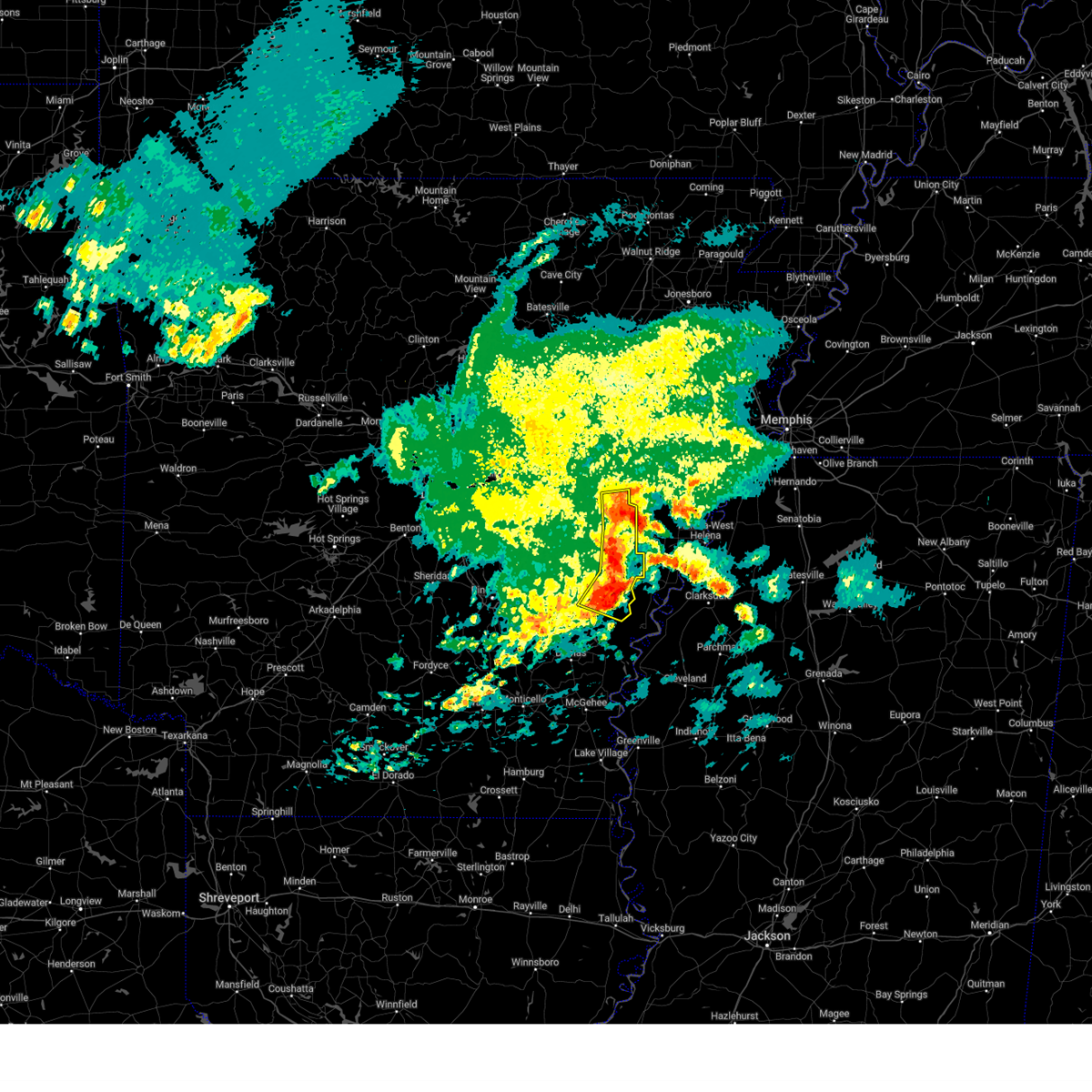
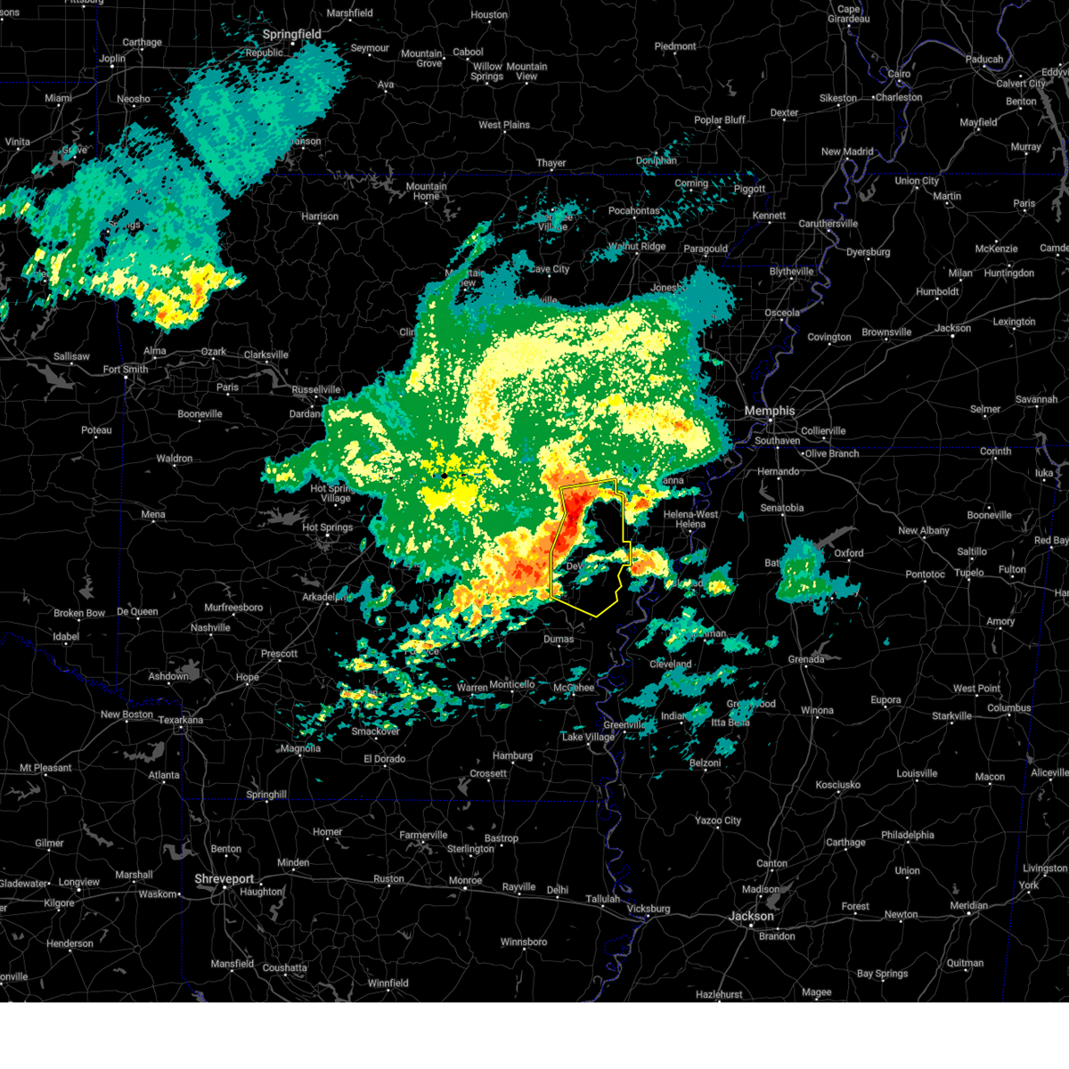
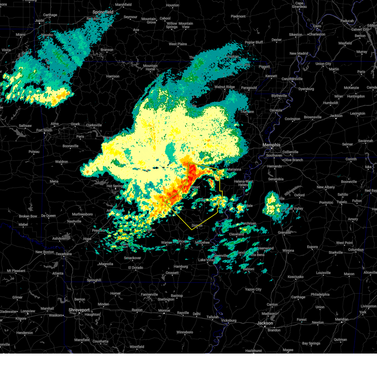
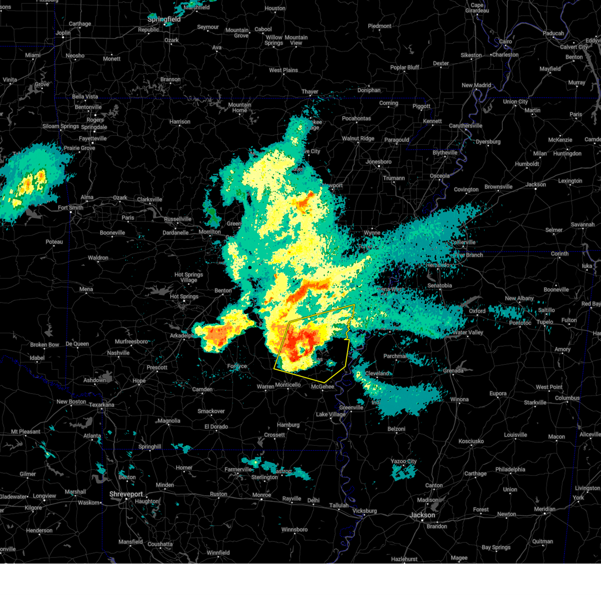
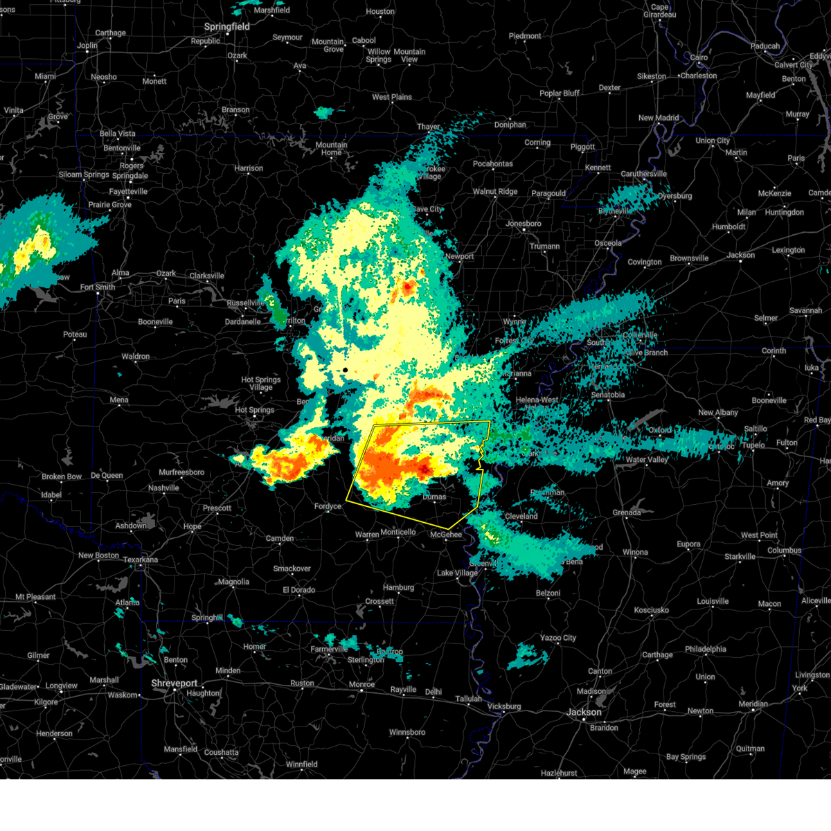
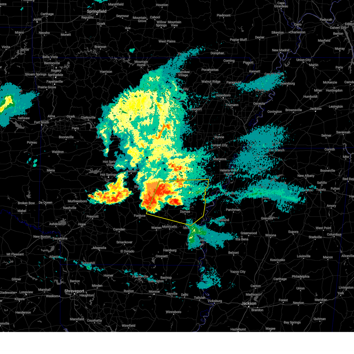
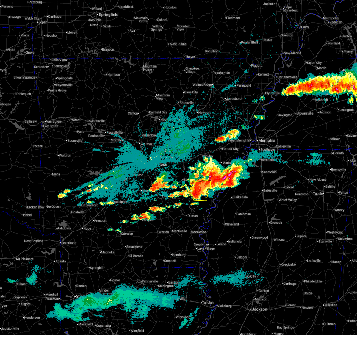
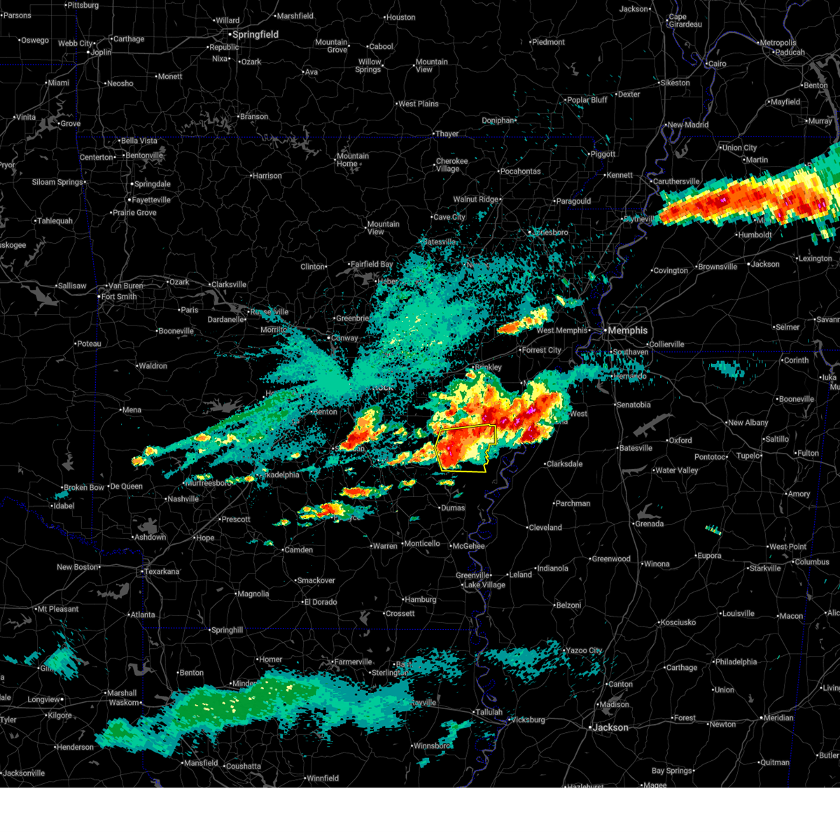
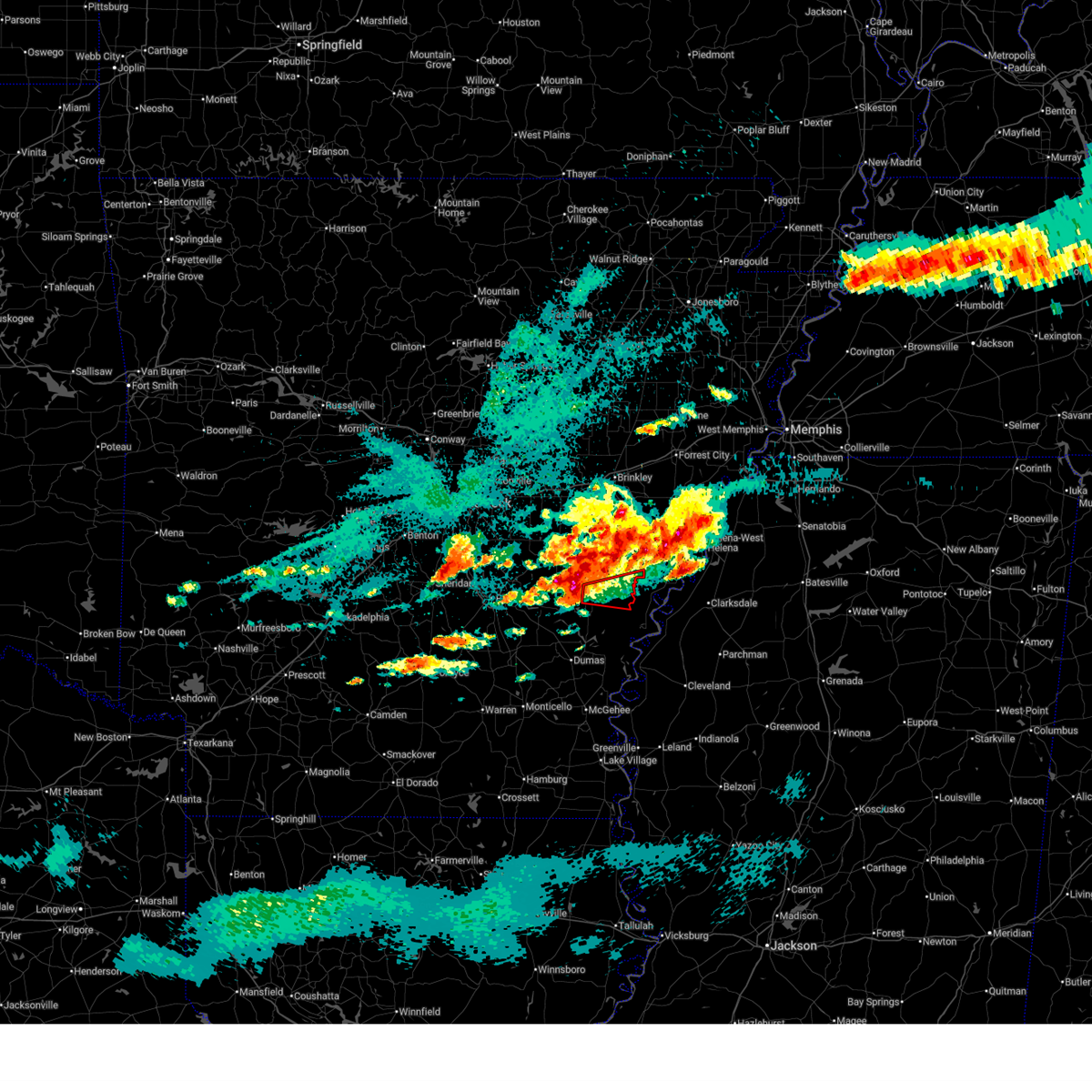
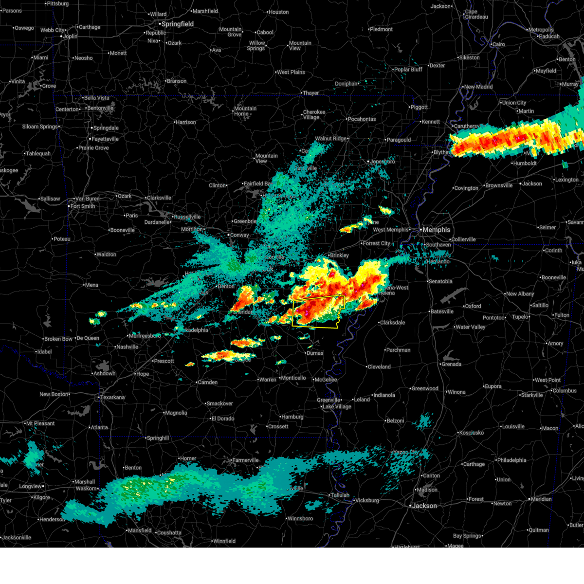
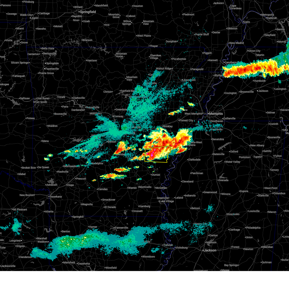
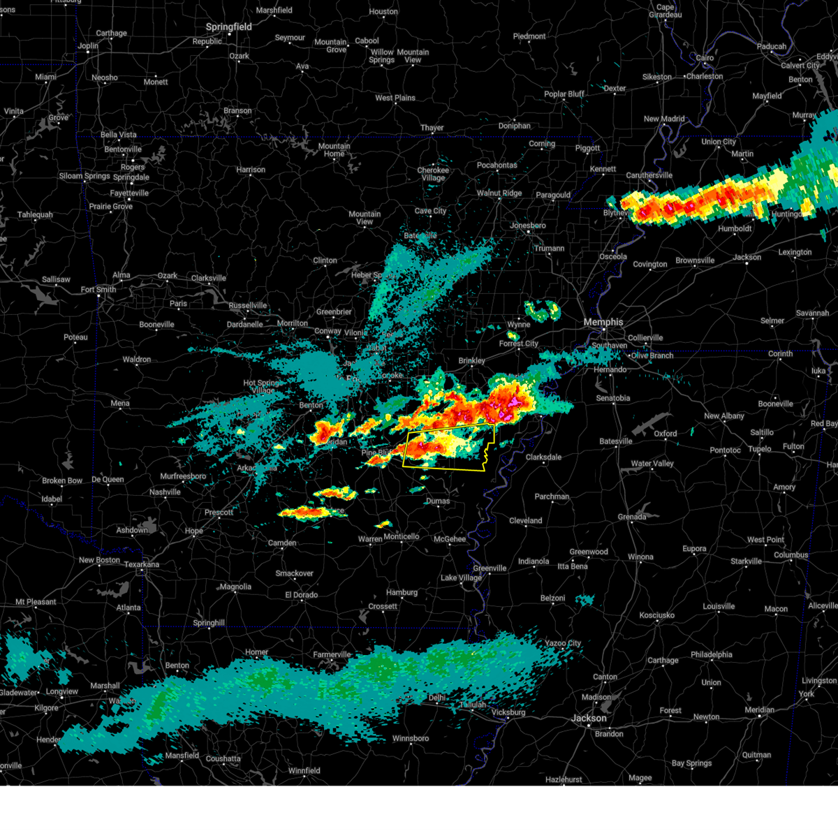
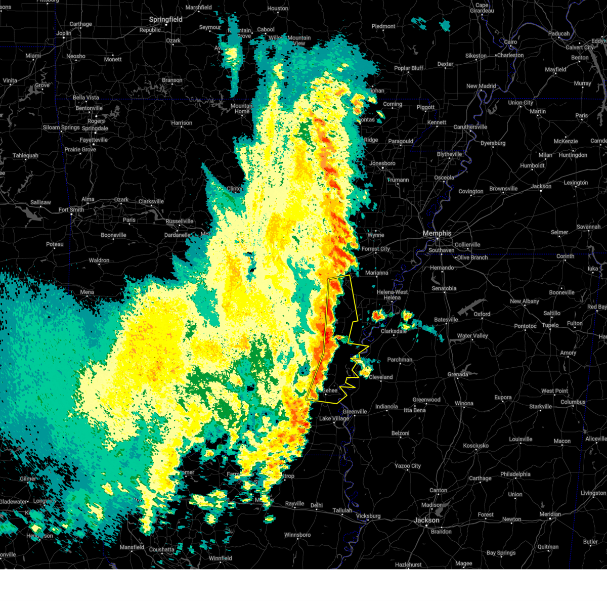
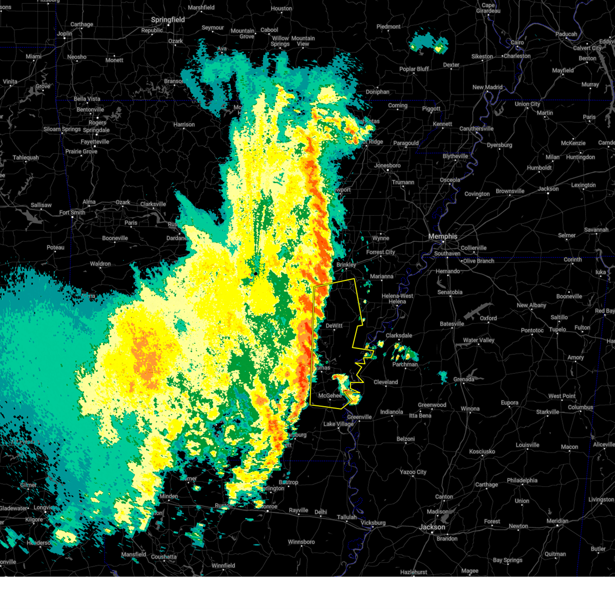
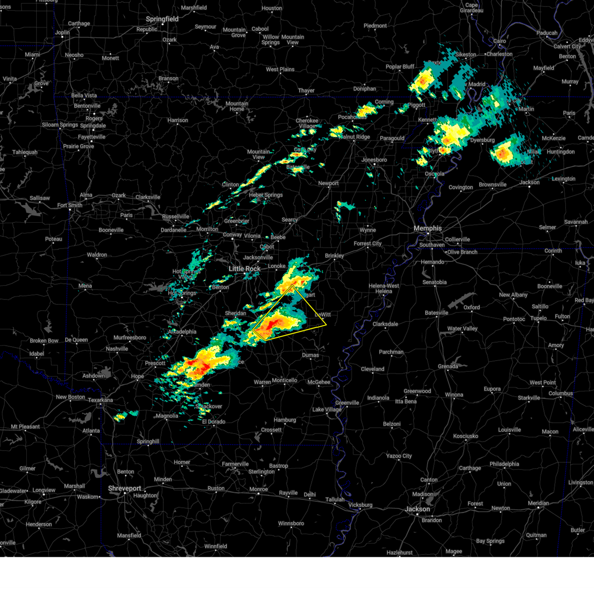
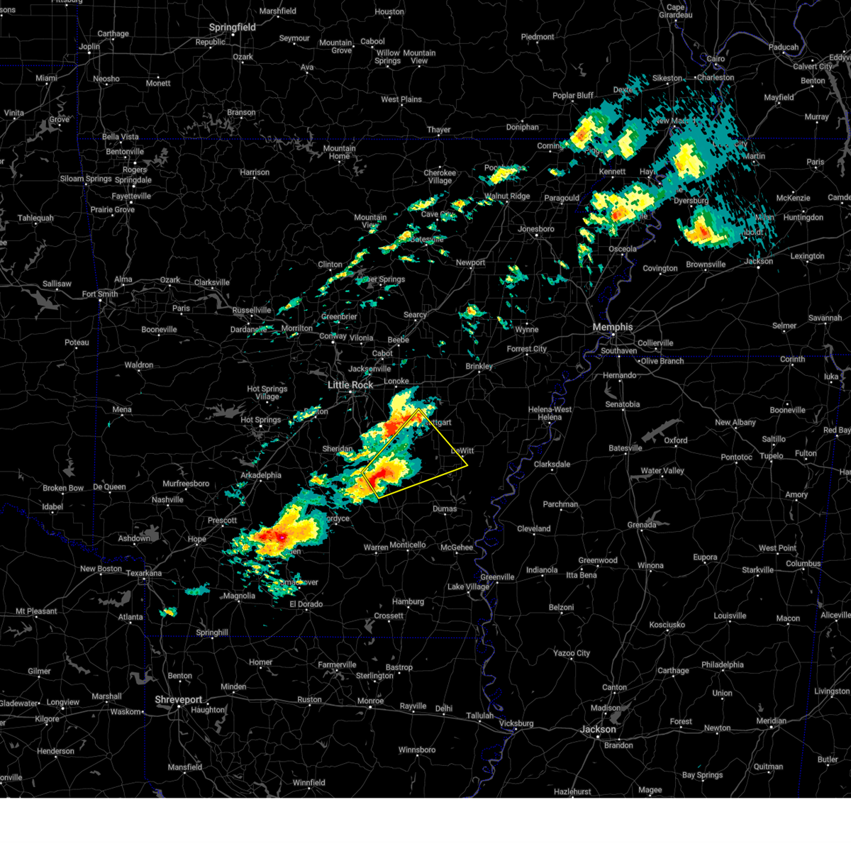
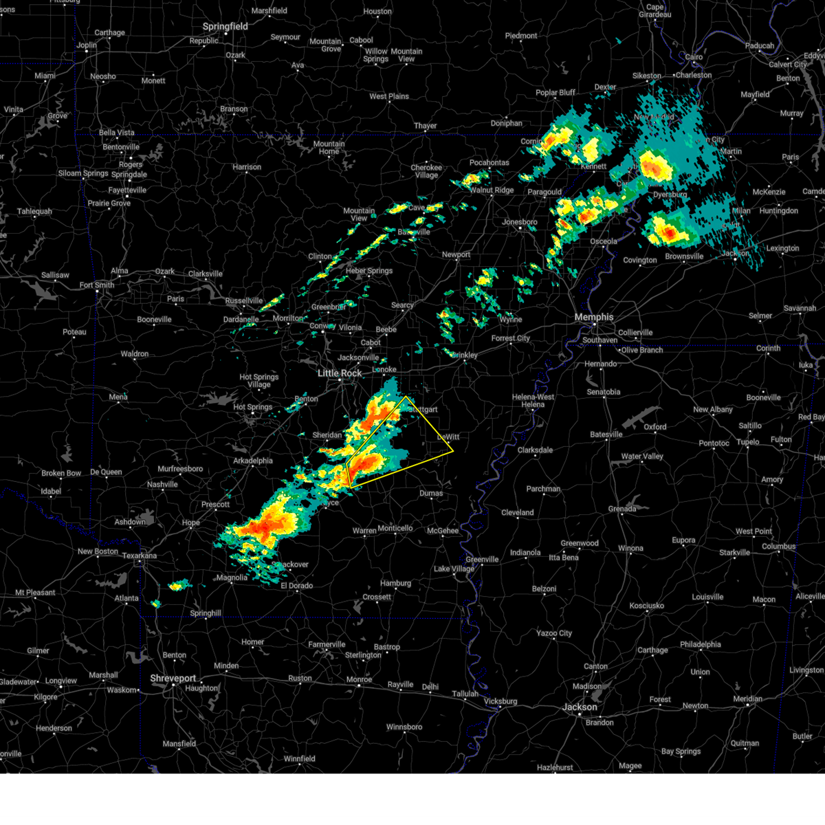
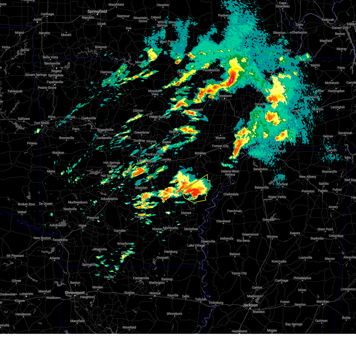
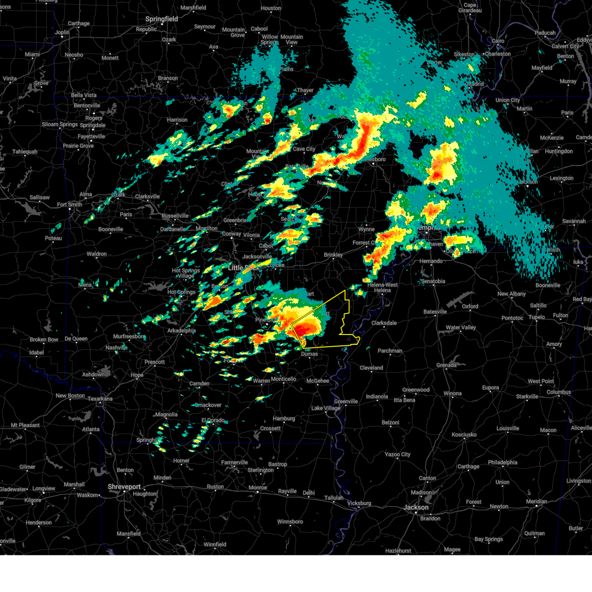
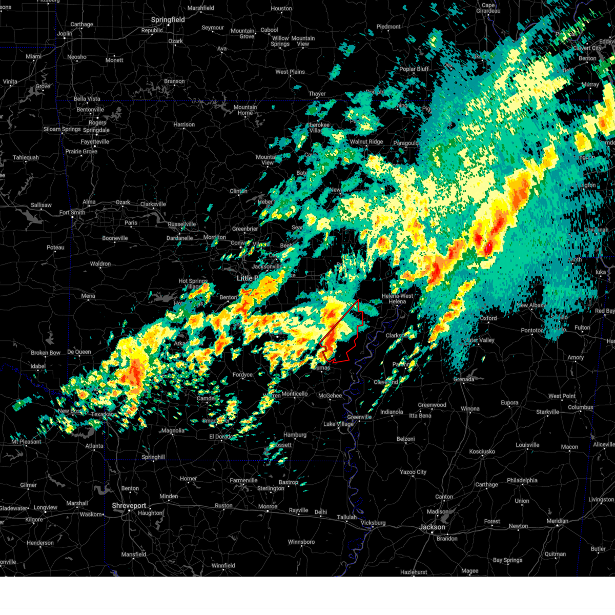
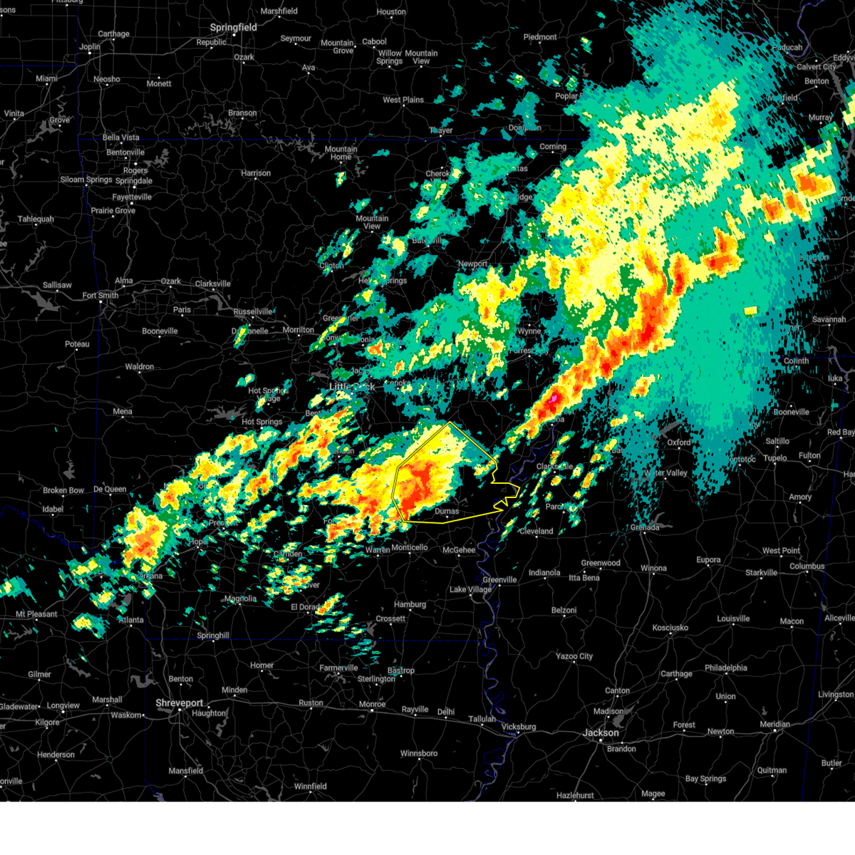
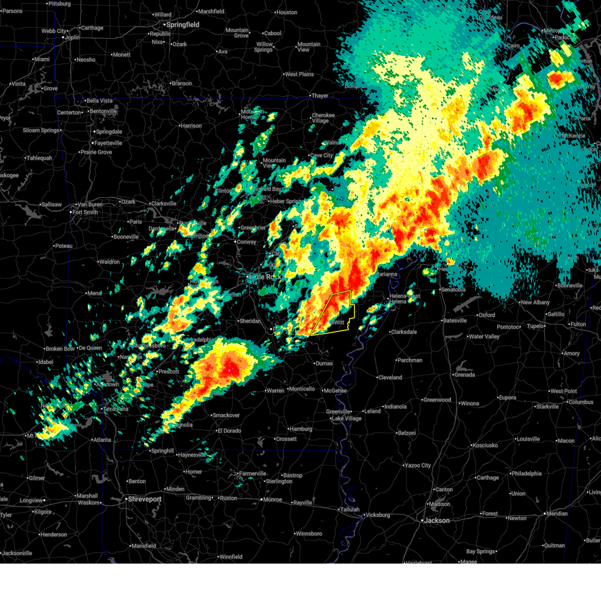
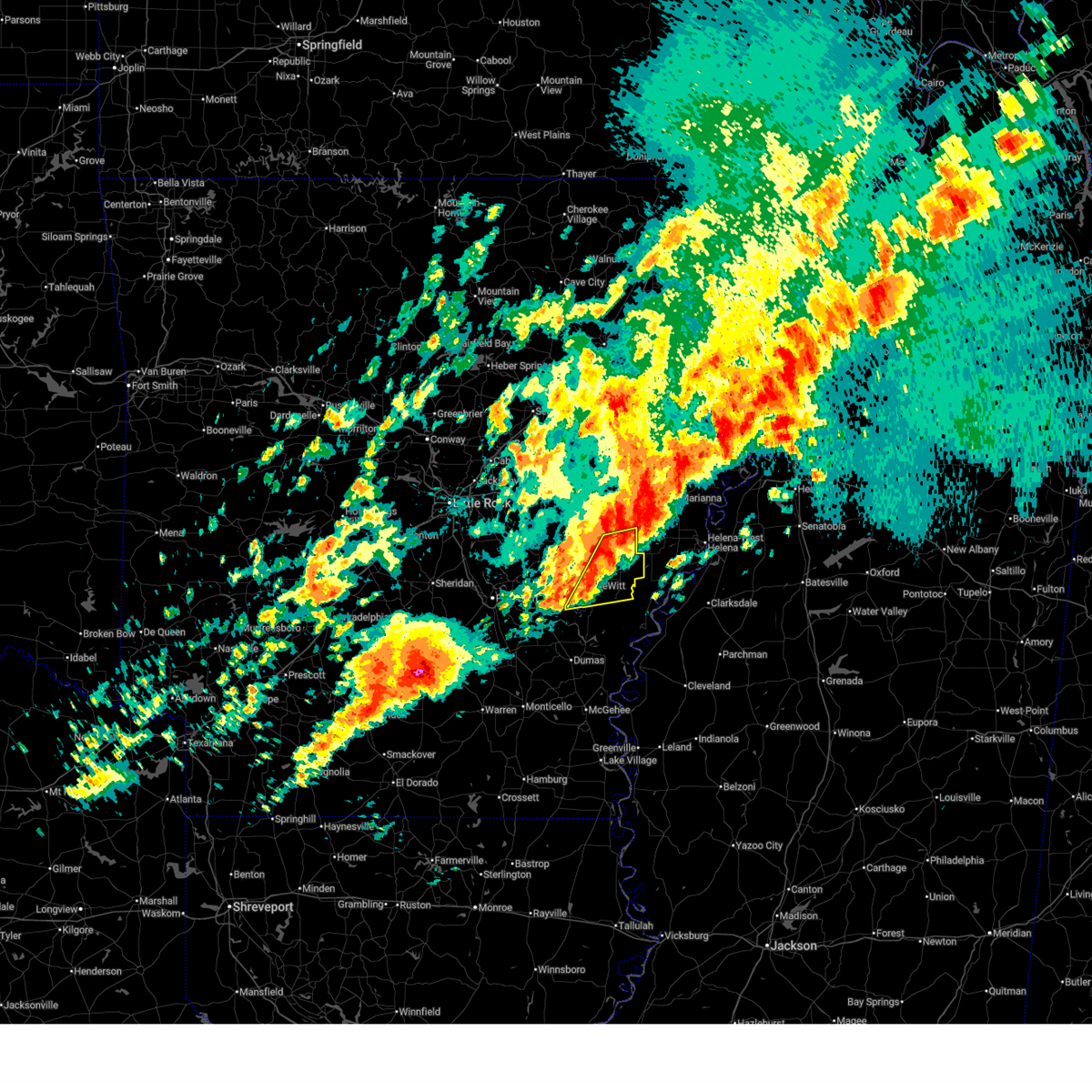
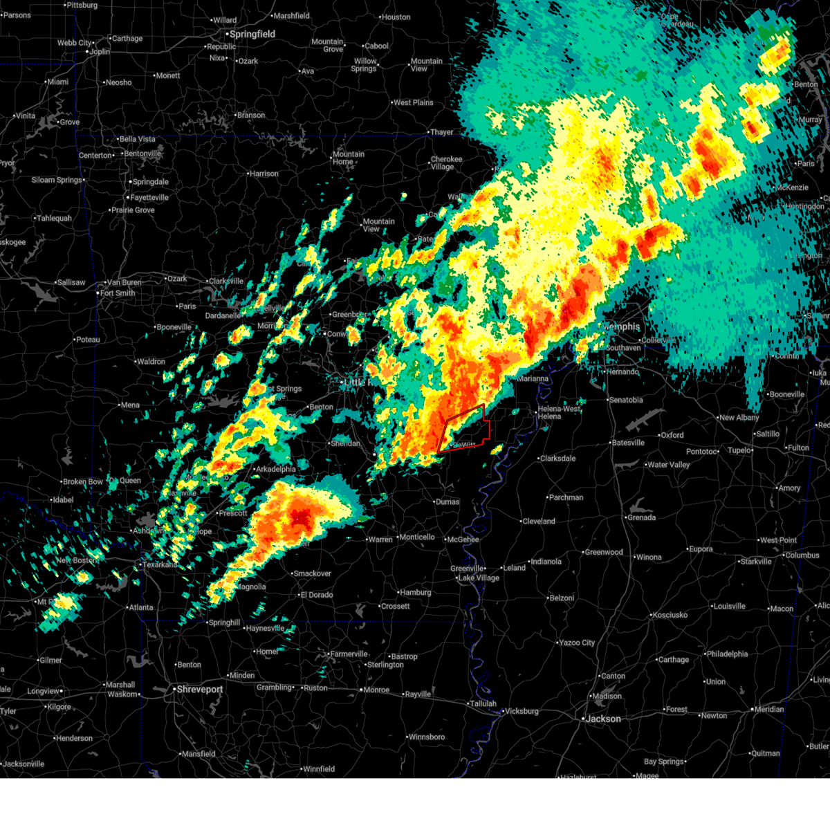
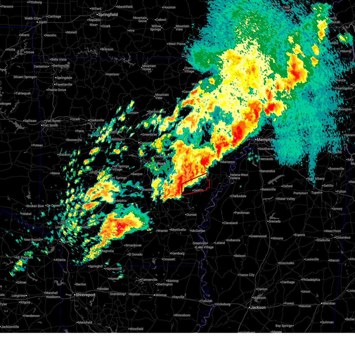
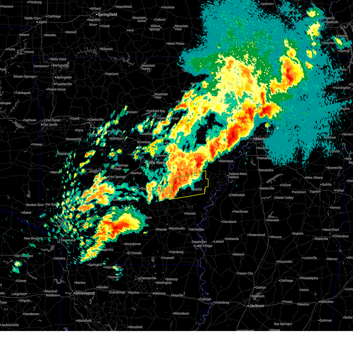
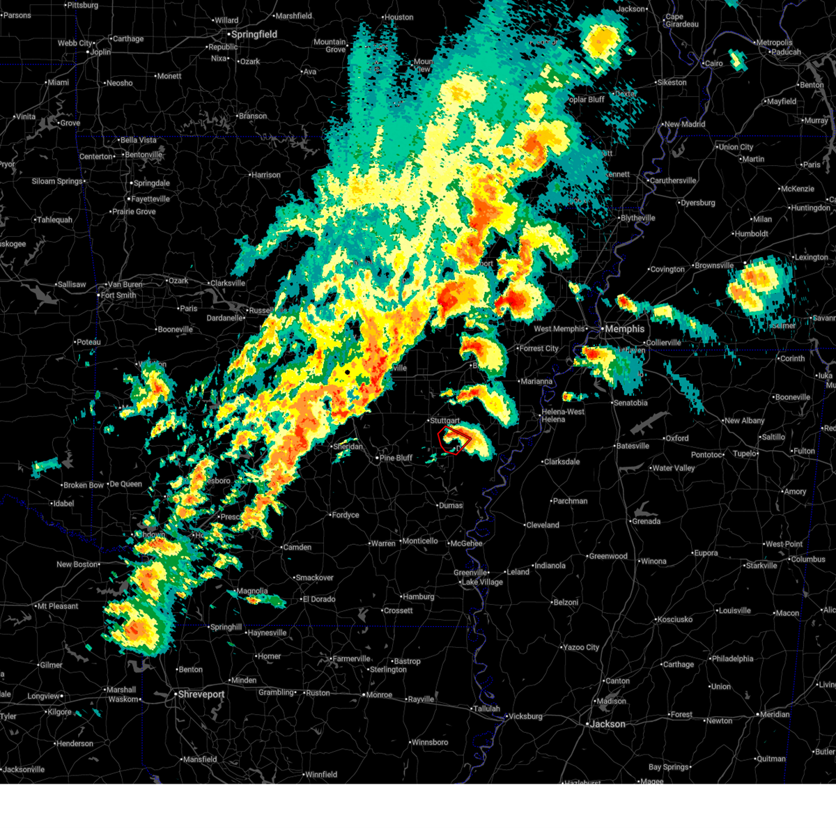
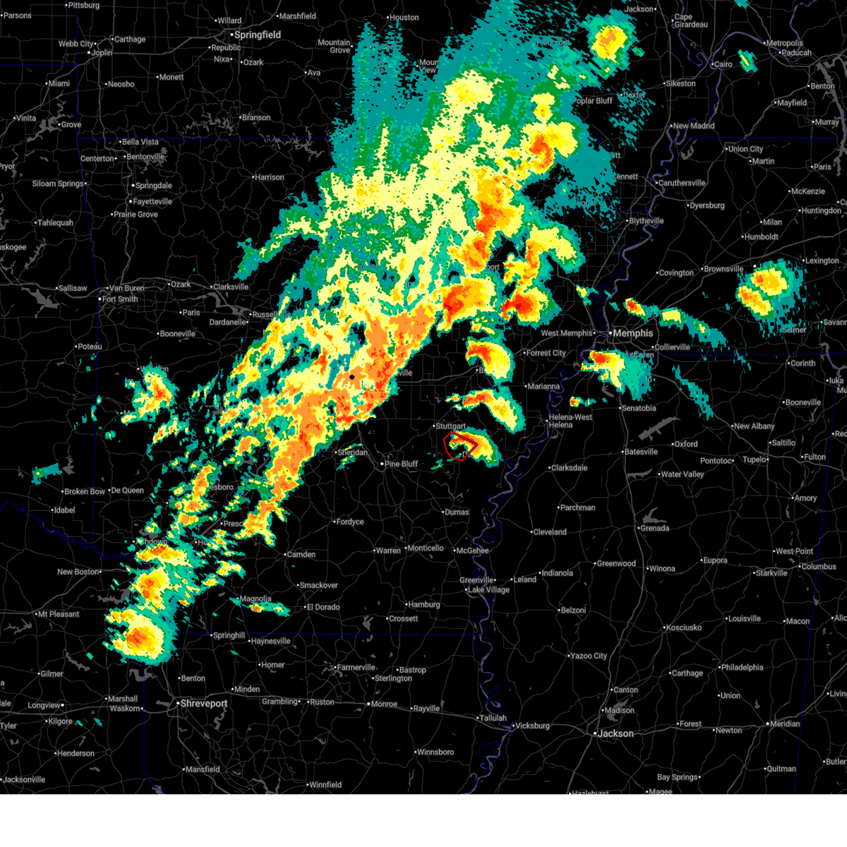
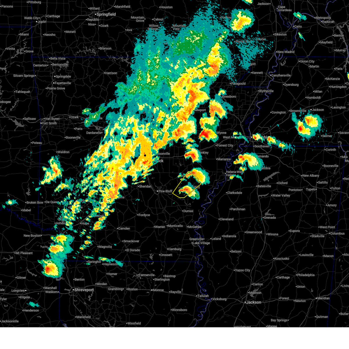
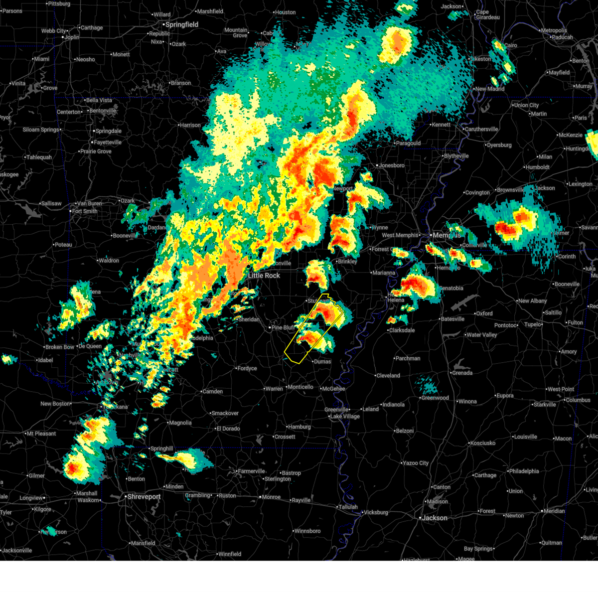
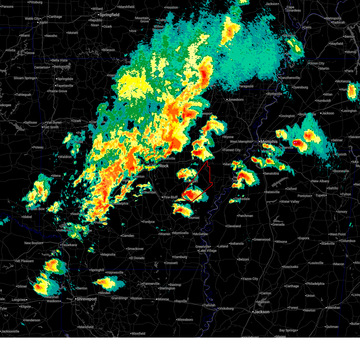
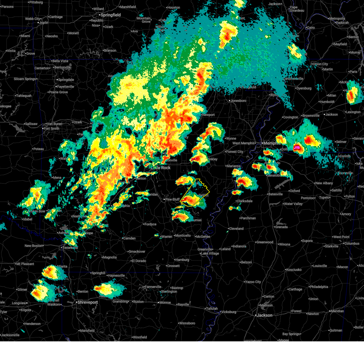
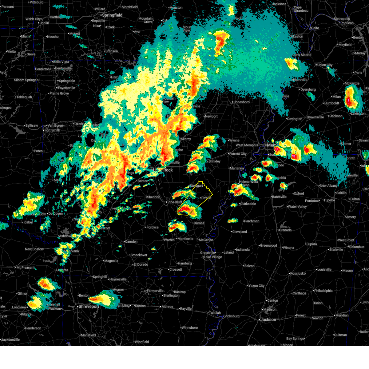
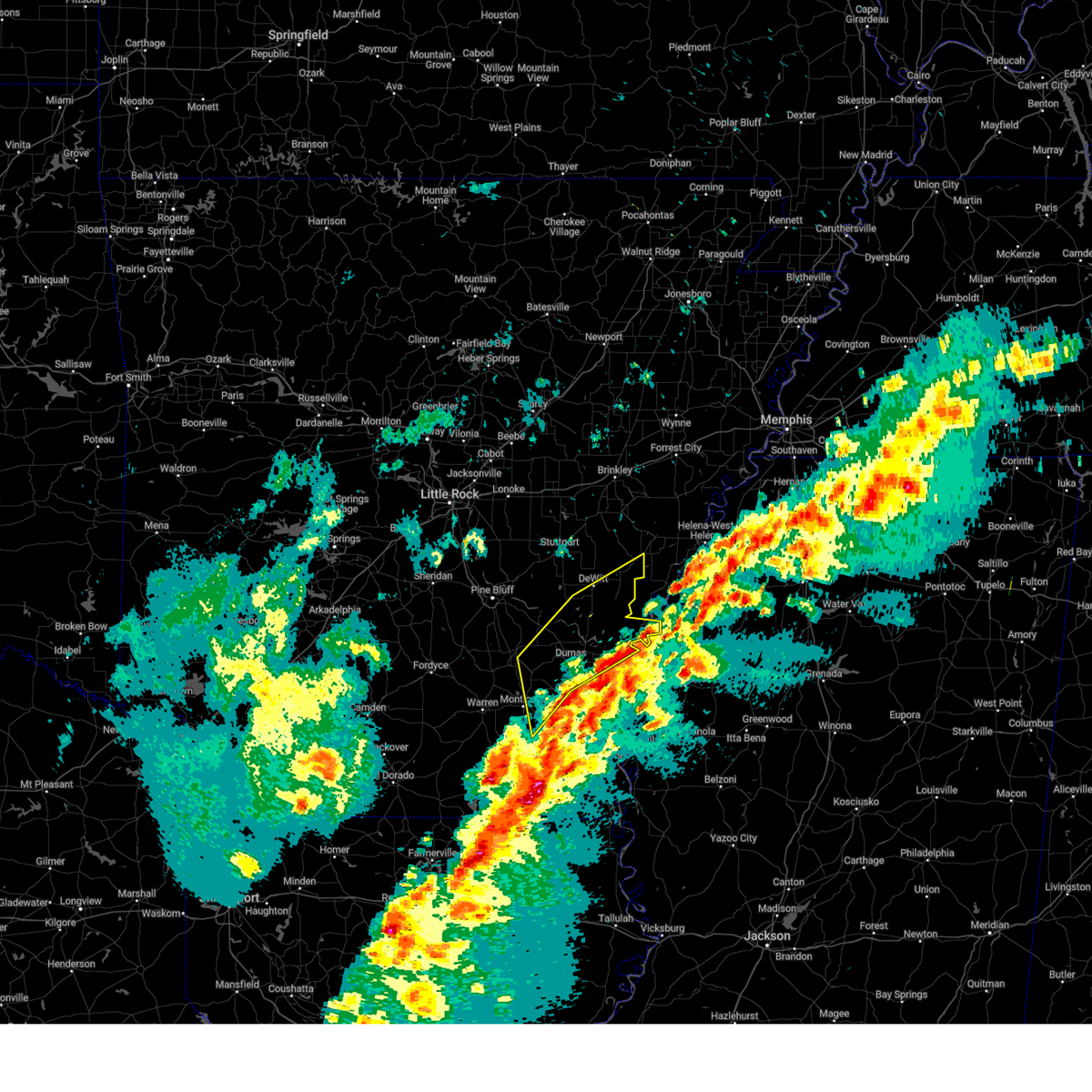
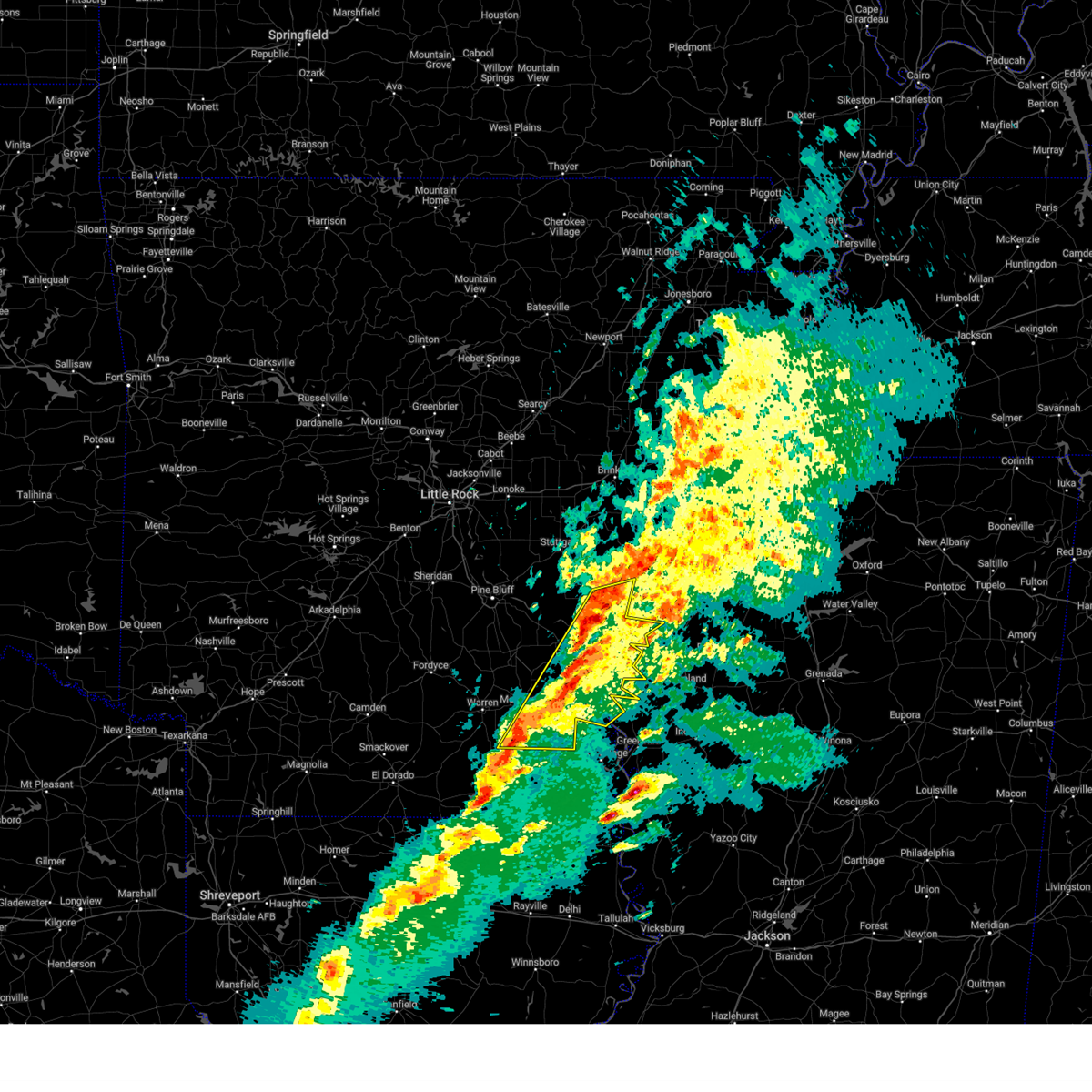
Hail Map for DeWitt, AR
The DeWitt, AR area has had 7 reports of on-the-ground hail by trained spotters, and has been under severe weather warnings 10 times during the past 12 months. Doppler radar has detected hail at or near DeWitt, AR on 55 occasions, including 4 occasions during the past year.
| Name: | DeWitt, AR |
| Where Located: | 62.1 miles ESE of Little Rock, AR |
| Map: | Google Map for DeWitt, AR |
| Population: | 3292 |
| Housing Units: | 1546 |
| More Info: | Search Google for DeWitt, AR |
2
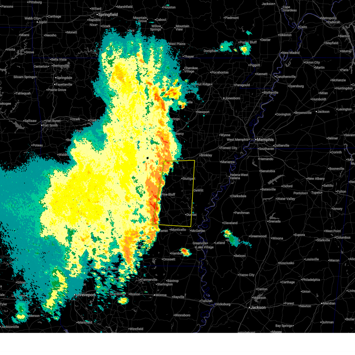
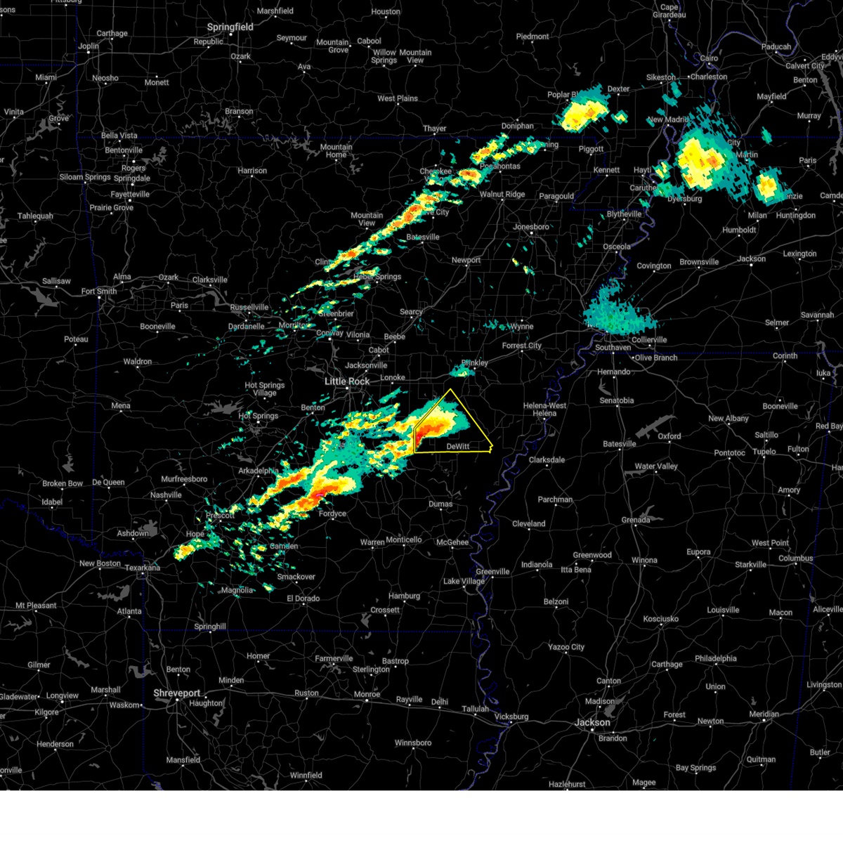
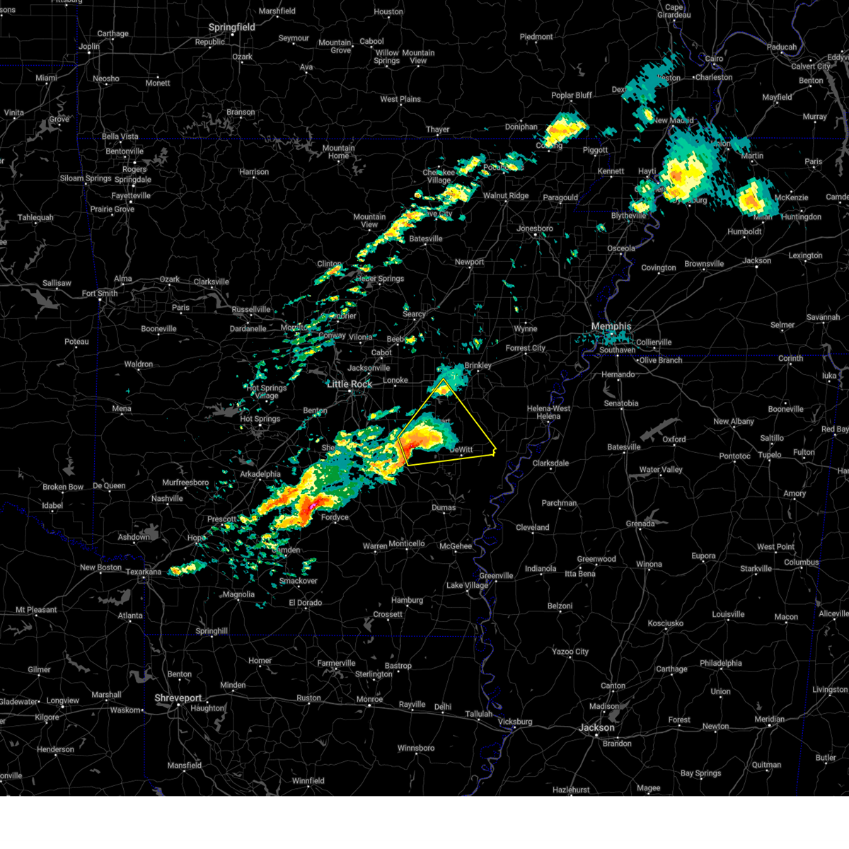
The Top Recent Hail Date for DeWitt, AR is Monday, March 9, 2026 (15th out of 55)
Hail and Wind Damage Spotted near DeWitt, AR
| Date / Time | Report Details |
|---|---|
| 4/28/2026 11:34 PM CDT |
 Svrlzk the national weather service in little rock has issued a * severe thunderstorm warning for, southeastern monroe county in eastern arkansas, southeastern jefferson county in southeastern arkansas, central arkansas county in southeastern arkansas, * until 1215 am cdt. * at 1134 pm cdt, a severe thunderstorm was located near langford, or 18 miles south of stuttgart, moving east at 50 mph (radar indicated). Hazards include 60 mph wind gusts and quarter size hail. Hail damage to vehicles is expected. Expect wind damage to roofs, siding, and trees. Svrlzk the national weather service in little rock has issued a * severe thunderstorm warning for, southeastern monroe county in eastern arkansas, southeastern jefferson county in southeastern arkansas, central arkansas county in southeastern arkansas, * until 1215 am cdt. * at 1134 pm cdt, a severe thunderstorm was located near langford, or 18 miles south of stuttgart, moving east at 50 mph (radar indicated). Hazards include 60 mph wind gusts and quarter size hail. Hail damage to vehicles is expected. Expect wind damage to roofs, siding, and trees.
|
| 4/28/2026 3:20 PM CDT |
 Svrlzk the national weather service in little rock has issued a * severe thunderstorm warning for, northern desha county in southeastern arkansas, southeastern jefferson county in southeastern arkansas, east central lincoln county in southeastern arkansas, southeastern arkansas county in southeastern arkansas, * until 400 pm cdt. * at 320 pm cdt, severe thunderstorms were located along a line extending from de witt to near douglas, moving east at 55 mph (radar indicated). Hazards include 60 mph wind gusts and quarter size hail. Hail damage to vehicles is expected. Expect wind damage to roofs, siding, and trees. Svrlzk the national weather service in little rock has issued a * severe thunderstorm warning for, northern desha county in southeastern arkansas, southeastern jefferson county in southeastern arkansas, east central lincoln county in southeastern arkansas, southeastern arkansas county in southeastern arkansas, * until 400 pm cdt. * at 320 pm cdt, severe thunderstorms were located along a line extending from de witt to near douglas, moving east at 55 mph (radar indicated). Hazards include 60 mph wind gusts and quarter size hail. Hail damage to vehicles is expected. Expect wind damage to roofs, siding, and trees.
|
| 3/15/2026 7:25 PM CDT |
 A tornado watch remains in effect until 900 pm cdt for eastern and southeastern arkansas. remember, a severe thunderstorm warning still remains in effect for arkansas county until 8pm cdt. A tornado watch remains in effect until 900 pm cdt for eastern and southeastern arkansas. remember, a severe thunderstorm warning still remains in effect for arkansas county until 8pm cdt.
|
| 3/15/2026 7:13 PM CDT |
 Svrlzk the national weather service in little rock has issued a * severe thunderstorm warning for, northern desha county in southeastern arkansas, southeastern monroe county in eastern arkansas, southeastern jefferson county in southeastern arkansas, southeastern lincoln county in southeastern arkansas, southeastern arkansas county in southeastern arkansas, * until 800 pm cdt. * at 713 pm cdt, severe thunderstorms were located along a line extending from 6 miles east of gillett to dumas, moving east at 55 mph (radar indicated). Hazards include 60 mph wind gusts and quarter size hail. Hail damage to vehicles is expected. Expect wind damage to roofs, siding, and trees. Svrlzk the national weather service in little rock has issued a * severe thunderstorm warning for, northern desha county in southeastern arkansas, southeastern monroe county in eastern arkansas, southeastern jefferson county in southeastern arkansas, southeastern lincoln county in southeastern arkansas, southeastern arkansas county in southeastern arkansas, * until 800 pm cdt. * at 713 pm cdt, severe thunderstorms were located along a line extending from 6 miles east of gillett to dumas, moving east at 55 mph (radar indicated). Hazards include 60 mph wind gusts and quarter size hail. Hail damage to vehicles is expected. Expect wind damage to roofs, siding, and trees.
|
| 3/15/2026 7:06 PM CDT |
 At 705 pm cdt, a severe thunderstorm was located near de witt, or 19 miles west of white river national wildlife refuge, moving east at 35 mph (radar indicated). Hazards include 60 mph wind gusts and quarter size hail. Hail damage to vehicles is expected. expect wind damage to roofs, siding, and trees. locations impacted include, st. Charles, de witt, indian bay, ethel, de luce, cross roads in monroe county,. At 705 pm cdt, a severe thunderstorm was located near de witt, or 19 miles west of white river national wildlife refuge, moving east at 35 mph (radar indicated). Hazards include 60 mph wind gusts and quarter size hail. Hail damage to vehicles is expected. expect wind damage to roofs, siding, and trees. locations impacted include, st. Charles, de witt, indian bay, ethel, de luce, cross roads in monroe county,.
|
| 3/15/2026 7:06 PM CDT |
 the severe thunderstorm warning has been cancelled and is no longer in effect the severe thunderstorm warning has been cancelled and is no longer in effect
|
| 3/15/2026 6:50 PM CDT |
 At 649 pm cdt, a severe thunderstorm was located near langford, or 18 miles south of stuttgart, moving east at 40 mph (radar indicated). Hazards include golf ball size hail and 70 mph wind gusts. People and animals outdoors will be injured. expect hail damage to roofs, siding, windows, and vehicles. expect considerable tree damage. wind damage is also likely to mobile homes, roofs, and outbuildings. locations impacted include, st. Charles, little bayou meto park, de witt, langford, bayou meteo state game area, indian bay, ethel, de luce, lodge corner, reydell, cross roads in monroe county,. At 649 pm cdt, a severe thunderstorm was located near langford, or 18 miles south of stuttgart, moving east at 40 mph (radar indicated). Hazards include golf ball size hail and 70 mph wind gusts. People and animals outdoors will be injured. expect hail damage to roofs, siding, windows, and vehicles. expect considerable tree damage. wind damage is also likely to mobile homes, roofs, and outbuildings. locations impacted include, st. Charles, little bayou meto park, de witt, langford, bayou meteo state game area, indian bay, ethel, de luce, lodge corner, reydell, cross roads in monroe county,.
|
| 3/15/2026 6:43 PM CDT |
 Svrlzk the national weather service in little rock has issued a * severe thunderstorm warning for, southeastern monroe county in eastern arkansas, southeastern jefferson county in southeastern arkansas, central arkansas county in southeastern arkansas, * until 730 pm cdt. * at 643 pm cdt, a severe thunderstorm was located over langford, or 19 miles south of stuttgart, moving east at 40 mph (radar indicated). Hazards include 60 mph wind gusts and quarter size hail. Hail damage to vehicles is expected. Expect wind damage to roofs, siding, and trees. Svrlzk the national weather service in little rock has issued a * severe thunderstorm warning for, southeastern monroe county in eastern arkansas, southeastern jefferson county in southeastern arkansas, central arkansas county in southeastern arkansas, * until 730 pm cdt. * at 643 pm cdt, a severe thunderstorm was located over langford, or 19 miles south of stuttgart, moving east at 40 mph (radar indicated). Hazards include 60 mph wind gusts and quarter size hail. Hail damage to vehicles is expected. Expect wind damage to roofs, siding, and trees.
|
| 3/9/2026 1:30 PM CDT |
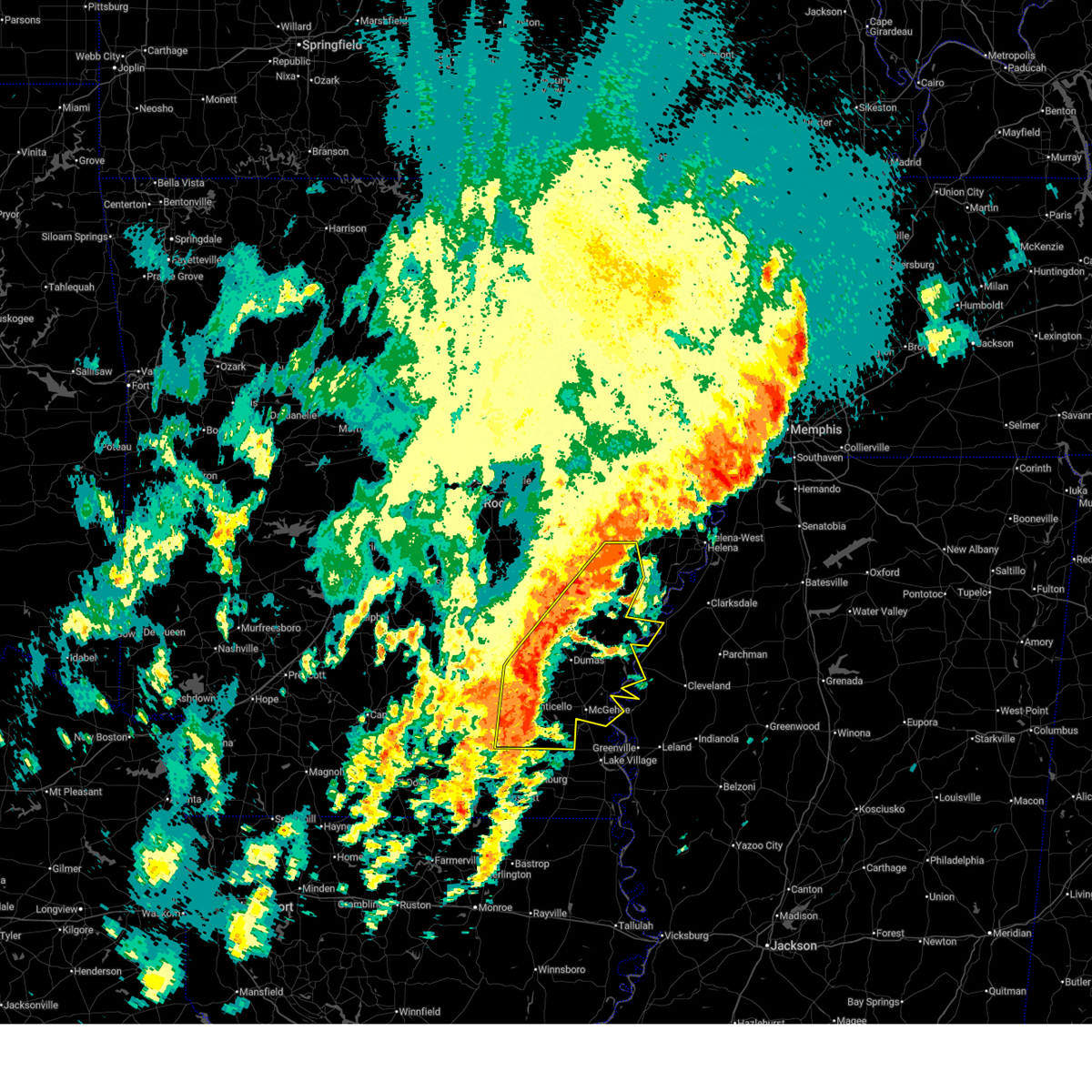
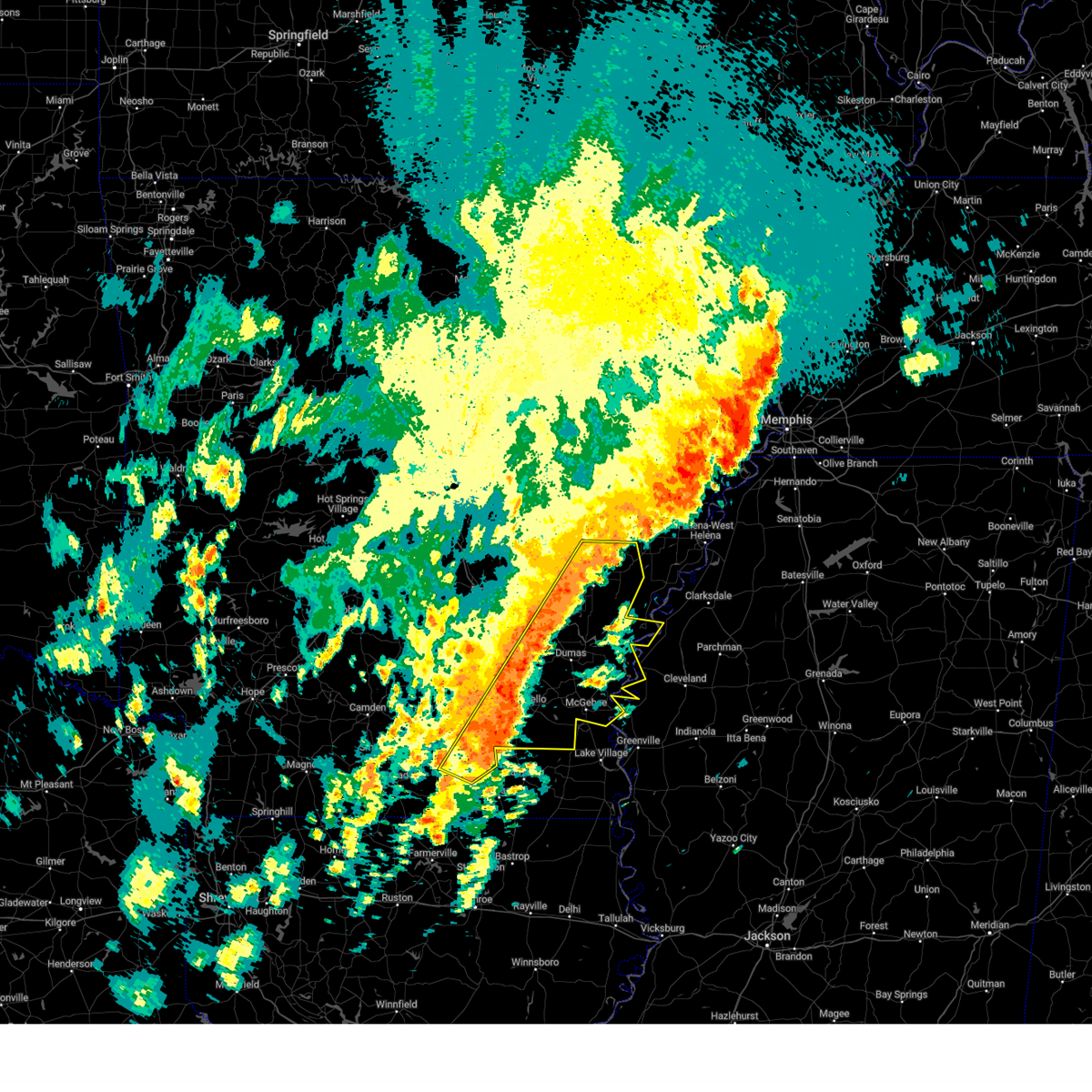
 At 130 pm cdt, severe thunderstorms were located along a line extending from near st. charles to near de witt to near gillett, moving east at 35 mph (radar indicated). Hazards include 60 mph wind gusts and quarter size hail. Hail damage to vehicles is expected. expect wind damage to roofs, siding, and trees. locations impacted include, gillett, st. Charles, yancopin, douglas, trusten holder wma, merrisach lake, de witt, arkansas post, pendleton, ethel, de luce, tichnor, morgan point recreation area, indian bay, weber, cross roads in monroe county, crocketts bluff,. At 130 pm cdt, severe thunderstorms were located along a line extending from near st. charles to near de witt to near gillett, moving east at 35 mph (radar indicated). Hazards include 60 mph wind gusts and quarter size hail. Hail damage to vehicles is expected. expect wind damage to roofs, siding, and trees. locations impacted include, gillett, st. Charles, yancopin, douglas, trusten holder wma, merrisach lake, de witt, arkansas post, pendleton, ethel, de luce, tichnor, morgan point recreation area, indian bay, weber, cross roads in monroe county, crocketts bluff,.
|
| 3/9/2026 1:08 PM CDT |
 Svrlzk the national weather service in little rock has issued a * severe thunderstorm warning for, northern desha county in southeastern arkansas, southeastern monroe county in eastern arkansas, southeastern jefferson county in southeastern arkansas, northeastern lincoln county in southeastern arkansas, arkansas county in southeastern arkansas, * until 200 pm cdt. * at 108 pm cdt, severe thunderstorms were located along a line extending from near almyra to near grady, moving east at 45 mph (radar indicated). Hazards include 60 mph wind gusts and quarter size hail. Hail damage to vehicles is expected. Expect wind damage to roofs, siding, and trees. Svrlzk the national weather service in little rock has issued a * severe thunderstorm warning for, northern desha county in southeastern arkansas, southeastern monroe county in eastern arkansas, southeastern jefferson county in southeastern arkansas, northeastern lincoln county in southeastern arkansas, arkansas county in southeastern arkansas, * until 200 pm cdt. * at 108 pm cdt, severe thunderstorms were located along a line extending from near almyra to near grady, moving east at 45 mph (radar indicated). Hazards include 60 mph wind gusts and quarter size hail. Hail damage to vehicles is expected. Expect wind damage to roofs, siding, and trees.
|
| 6/7/2025 9:50 AM CDT |
 At 949 am cdt, severe thunderstorms were located along a line extending from near garret grove to 8 miles northeast of almyra to altheimer, moving southeast at 55 mph (radar indicated). Hazards include 60 mph wind gusts and nickel size hail. Expect damage to roofs, siding, and trees. Locations impacted include, dobbs landing, de luce, slovak, aberdeen, almyra airport, sherrill, england, louisiana purchase state park, whitefield, casscoe, tichnor, lodge corner, little bayou meto park, fargo, ulm, weber, seaton, humnoke, humphrey, woodville,. At 949 am cdt, severe thunderstorms were located along a line extending from near garret grove to 8 miles northeast of almyra to altheimer, moving southeast at 55 mph (radar indicated). Hazards include 60 mph wind gusts and nickel size hail. Expect damage to roofs, siding, and trees. Locations impacted include, dobbs landing, de luce, slovak, aberdeen, almyra airport, sherrill, england, louisiana purchase state park, whitefield, casscoe, tichnor, lodge corner, little bayou meto park, fargo, ulm, weber, seaton, humnoke, humphrey, woodville,.
|
| 6/7/2025 9:25 AM CDT |
 Svrlzk the national weather service in little rock has issued a * severe thunderstorm warning for, southern woodruff county in eastern arkansas, eastern prairie county in central arkansas, southern lonoke county in central arkansas, monroe county in eastern arkansas, jefferson county in southeastern arkansas, northeastern lincoln county in southeastern arkansas, southeastern pulaski county in central arkansas, arkansas county in southeastern arkansas, * until 1015 am cdt. * at 925 am cdt, severe thunderstorms were located along a line extending from 10 miles southeast of hurricane lake wma to near hazen to near estes, moving southeast at 55 mph (radar indicated). Hazards include 60 mph wind gusts and quarter size hail. Hail damage to vehicles is expected. Expect wind damage to roofs, siding, and trees. Svrlzk the national weather service in little rock has issued a * severe thunderstorm warning for, southern woodruff county in eastern arkansas, eastern prairie county in central arkansas, southern lonoke county in central arkansas, monroe county in eastern arkansas, jefferson county in southeastern arkansas, northeastern lincoln county in southeastern arkansas, southeastern pulaski county in central arkansas, arkansas county in southeastern arkansas, * until 1015 am cdt. * at 925 am cdt, severe thunderstorms were located along a line extending from 10 miles southeast of hurricane lake wma to near hazen to near estes, moving southeast at 55 mph (radar indicated). Hazards include 60 mph wind gusts and quarter size hail. Hail damage to vehicles is expected. Expect wind damage to roofs, siding, and trees.
|
| 5/24/2025 10:34 AM CDT |
 the severe thunderstorm warning has been cancelled and is no longer in effect the severe thunderstorm warning has been cancelled and is no longer in effect
|
| 5/24/2025 10:16 AM CDT |
 At 1016 am cdt, severe thunderstorms were located along a line extending from near hazen to near stuttgart municipal airport to brummitt, moving east at 30 mph (radar indicated). Hazards include 60 mph wind gusts and quarter size hail. Hail damage to vehicles is expected. expect wind damage to roofs, siding, and trees. Locations impacted include, dobbs landing, slovak, peppers landing, aberdeen, alfrey, almyra airport, stuttgart, de valls bluff, casscoe, brummitt, hazen, holly grove, ulm, center point, tollville, fredonia, monroe, roe, brasfield, clarendon,. At 1016 am cdt, severe thunderstorms were located along a line extending from near hazen to near stuttgart municipal airport to brummitt, moving east at 30 mph (radar indicated). Hazards include 60 mph wind gusts and quarter size hail. Hail damage to vehicles is expected. expect wind damage to roofs, siding, and trees. Locations impacted include, dobbs landing, slovak, peppers landing, aberdeen, alfrey, almyra airport, stuttgart, de valls bluff, casscoe, brummitt, hazen, holly grove, ulm, center point, tollville, fredonia, monroe, roe, brasfield, clarendon,.
|
| 5/24/2025 10:04 AM CDT |
 Svrlzk the national weather service in little rock has issued a * severe thunderstorm warning for, southeastern prairie county in central arkansas, southeastern lonoke county in central arkansas, central monroe county in eastern arkansas, northwestern arkansas county in southeastern arkansas, * until 1045 am cdt. * at 1004 am cdt, severe thunderstorms were located along a line extending from near hazen to near parkers corner to near humnoke, moving east at 25 mph (radar indicated). Hazards include 60 mph wind gusts and penny size hail. expect damage to roofs, siding, and trees Svrlzk the national weather service in little rock has issued a * severe thunderstorm warning for, southeastern prairie county in central arkansas, southeastern lonoke county in central arkansas, central monroe county in eastern arkansas, northwestern arkansas county in southeastern arkansas, * until 1045 am cdt. * at 1004 am cdt, severe thunderstorms were located along a line extending from near hazen to near parkers corner to near humnoke, moving east at 25 mph (radar indicated). Hazards include 60 mph wind gusts and penny size hail. expect damage to roofs, siding, and trees
|
| 5/20/2025 3:21 PM CDT |
 At 321 pm cdt, severe thunderstorms were located along a line extending from 6 miles northeast of st. charles to 6 miles northwest of white river national wildlife refuge, moving east at 40 mph (radar indicated). Hazards include 60 mph wind gusts and quarter size hail. Hail damage to vehicles is expected. expect wind damage to roofs, siding, and trees. locations impacted include, indian bay, ethel, white river national wildlife r, st. Charles, crocketts bluff, de witt, cross roads in monroe county, de luce,. At 321 pm cdt, severe thunderstorms were located along a line extending from 6 miles northeast of st. charles to 6 miles northwest of white river national wildlife refuge, moving east at 40 mph (radar indicated). Hazards include 60 mph wind gusts and quarter size hail. Hail damage to vehicles is expected. expect wind damage to roofs, siding, and trees. locations impacted include, indian bay, ethel, white river national wildlife r, st. Charles, crocketts bluff, de witt, cross roads in monroe county, de luce,.
|
| 5/20/2025 3:01 PM CDT |
 At 300 pm cdt, severe thunderstorms were located along a line extending from 6 miles northeast of almyra to near de witt, moving east at 45 mph (radar indicated). Hazards include 60 mph wind gusts and penny size hail. Expect damage to roofs, siding, and trees. locations impacted include, indian bay, ethel, de luce, white river national wildlife r, st. Charles, almyra, crocketts bluff, lawrenceville, de witt, cross roads in monroe county,. At 300 pm cdt, severe thunderstorms were located along a line extending from 6 miles northeast of almyra to near de witt, moving east at 45 mph (radar indicated). Hazards include 60 mph wind gusts and penny size hail. Expect damage to roofs, siding, and trees. locations impacted include, indian bay, ethel, de luce, white river national wildlife r, st. Charles, almyra, crocketts bluff, lawrenceville, de witt, cross roads in monroe county,.
|
| 5/20/2025 3:01 PM CDT |
 the severe thunderstorm warning has been cancelled and is no longer in effect the severe thunderstorm warning has been cancelled and is no longer in effect
|
| 5/20/2025 2:50 PM CDT |
 Svrlzk the national weather service in little rock has issued a * severe thunderstorm warning for, southeastern monroe county in eastern arkansas, east central jefferson county in southeastern arkansas, arkansas county in southeastern arkansas, * until 330 pm cdt. * at 250 pm cdt, a severe thunderstorm was located 7 miles southwest of almyra, or 10 miles south of stuttgart, moving east at 40 mph (radar indicated). Hazards include 60 mph wind gusts and quarter size hail. Hail damage to vehicles is expected. Expect wind damage to roofs, siding, and trees. Svrlzk the national weather service in little rock has issued a * severe thunderstorm warning for, southeastern monroe county in eastern arkansas, east central jefferson county in southeastern arkansas, arkansas county in southeastern arkansas, * until 330 pm cdt. * at 250 pm cdt, a severe thunderstorm was located 7 miles southwest of almyra, or 10 miles south of stuttgart, moving east at 40 mph (radar indicated). Hazards include 60 mph wind gusts and quarter size hail. Hail damage to vehicles is expected. Expect wind damage to roofs, siding, and trees.
|
| 5/18/2025 8:17 AM CDT |
 the severe thunderstorm warning has been cancelled and is no longer in effect the severe thunderstorm warning has been cancelled and is no longer in effect
|
| 5/18/2025 8:17 AM CDT |
 At 817 am cdt, severe thunderstorms were located along a line extending from 8 miles south of garret grove to 6 miles south of palmer to 7 miles west of white river national wildlife refuge to near gillett, moving east at 60 mph (radar indicated). Hazards include 60 mph wind gusts and quarter size hail. Hail damage to vehicles is expected. expect wind damage to roofs, siding, and trees. locations impacted include, ethel, de luce, louisiana purchase state park, monroe, crocketts bluff, tichnor, ragtown, blackton, indian bay, palmer, pine city, keevil, st. Charles, holly grove, weber, lawrenceville, de witt, duncan, cross roads in monroe county,. At 817 am cdt, severe thunderstorms were located along a line extending from 8 miles south of garret grove to 6 miles south of palmer to 7 miles west of white river national wildlife refuge to near gillett, moving east at 60 mph (radar indicated). Hazards include 60 mph wind gusts and quarter size hail. Hail damage to vehicles is expected. expect wind damage to roofs, siding, and trees. locations impacted include, ethel, de luce, louisiana purchase state park, monroe, crocketts bluff, tichnor, ragtown, blackton, indian bay, palmer, pine city, keevil, st. Charles, holly grove, weber, lawrenceville, de witt, duncan, cross roads in monroe county,.
|
| 5/18/2025 8:03 AM CDT |
 At 803 am cdt, severe thunderstorms were located along a line extending from near allendale to 7 miles northwest of st. charles to 6 miles southwest of de witt to whitefield, moving southeast at 45 mph (radar indicated). Hazards include 60 mph wind gusts and quarter size hail. Hail damage to vehicles is expected. expect wind damage to roofs, siding, and trees. Locations impacted include, dobbs landing, de luce, peppers landing, aberdeen, almyra airport, gillett, louisiana purchase state park, casscoe, tichnor, blackton, lodge corner, holly grove, ulm, weber, cross roads in monroe county, ethel, monroe, roe, crocketts bluff, ragtown,. At 803 am cdt, severe thunderstorms were located along a line extending from near allendale to 7 miles northwest of st. charles to 6 miles southwest of de witt to whitefield, moving southeast at 45 mph (radar indicated). Hazards include 60 mph wind gusts and quarter size hail. Hail damage to vehicles is expected. expect wind damage to roofs, siding, and trees. Locations impacted include, dobbs landing, de luce, peppers landing, aberdeen, almyra airport, gillett, louisiana purchase state park, casscoe, tichnor, blackton, lodge corner, holly grove, ulm, weber, cross roads in monroe county, ethel, monroe, roe, crocketts bluff, ragtown,.
|
| 5/18/2025 8:03 AM CDT |
 the severe thunderstorm warning has been cancelled and is no longer in effect the severe thunderstorm warning has been cancelled and is no longer in effect
|
| 5/18/2025 7:42 AM CDT |
 Svrlzk the national weather service in little rock has issued a * severe thunderstorm warning for, central prairie county in central arkansas, southeastern lonoke county in central arkansas, northwestern desha county in southeastern arkansas, monroe county in eastern arkansas, central jefferson county in southeastern arkansas, central lincoln county in southeastern arkansas, arkansas county in southeastern arkansas, * until 830 am cdt. * at 741 am cdt, severe thunderstorms were located along a line extending from near fredonia to near ulm to near humphrey to near pine bluff, moving southeast at 45 mph (radar indicated). Hazards include 60 mph wind gusts and quarter size hail. Hail damage to vehicles is expected. Expect wind damage to roofs, siding, and trees. Svrlzk the national weather service in little rock has issued a * severe thunderstorm warning for, central prairie county in central arkansas, southeastern lonoke county in central arkansas, northwestern desha county in southeastern arkansas, monroe county in eastern arkansas, central jefferson county in southeastern arkansas, central lincoln county in southeastern arkansas, arkansas county in southeastern arkansas, * until 830 am cdt. * at 741 am cdt, severe thunderstorms were located along a line extending from near fredonia to near ulm to near humphrey to near pine bluff, moving southeast at 45 mph (radar indicated). Hazards include 60 mph wind gusts and quarter size hail. Hail damage to vehicles is expected. Expect wind damage to roofs, siding, and trees.
|
| 5/18/2025 12:46 AM CDT |
 At 1245 am cdt, severe thunderstorms were located along a line extending from near little bayou meto park to near mills, moving east at 60 mph (radar indicated). Hazards include 60 mph wind gusts and quarter size hail. Hail damage to vehicles is expected. expect wind damage to roofs, siding, and trees. locations impacted include, de luce, cornerville, florence, whitefield, tyro, watson, tichnor, reedville, morgan point recreation area, pea ridge, lodge corner, little bayou meto park, weber, star city, relfs bluff, woodville, fresno, douglas, st. Charles, reydell,. At 1245 am cdt, severe thunderstorms were located along a line extending from near little bayou meto park to near mills, moving east at 60 mph (radar indicated). Hazards include 60 mph wind gusts and quarter size hail. Hail damage to vehicles is expected. expect wind damage to roofs, siding, and trees. locations impacted include, de luce, cornerville, florence, whitefield, tyro, watson, tichnor, reedville, morgan point recreation area, pea ridge, lodge corner, little bayou meto park, weber, star city, relfs bluff, woodville, fresno, douglas, st. Charles, reydell,.
|
| 5/18/2025 12:46 AM CDT |
 the severe thunderstorm warning has been cancelled and is no longer in effect the severe thunderstorm warning has been cancelled and is no longer in effect
|
| 5/18/2025 12:31 AM CDT |
 At 1231 am cdt, severe thunderstorms were located along a line extending from linwood to 7 miles northwest of nebo to feenyville to 7 miles northeast of herbine, moving east at 45 mph (radar indicated). Hazards include 60 mph wind gusts and quarter size hail. Hail damage to vehicles is expected. expect wind damage to roofs, siding, and trees. Locations impacted include, de luce, pastoria, almyra airport, cornerville, florence, sherrill, whitefield, tyro, watson, tichnor, reedville, morgan point recreation area, pea ridge, lodge corner, little bayou meto park, weber, star city, glendale in lincoln county, humphrey, woodville,. At 1231 am cdt, severe thunderstorms were located along a line extending from linwood to 7 miles northwest of nebo to feenyville to 7 miles northeast of herbine, moving east at 45 mph (radar indicated). Hazards include 60 mph wind gusts and quarter size hail. Hail damage to vehicles is expected. expect wind damage to roofs, siding, and trees. Locations impacted include, de luce, pastoria, almyra airport, cornerville, florence, sherrill, whitefield, tyro, watson, tichnor, reedville, morgan point recreation area, pea ridge, lodge corner, little bayou meto park, weber, star city, glendale in lincoln county, humphrey, woodville,.
|
| 5/18/2025 12:21 AM CDT |
 Svrlzk the national weather service in little rock has issued a * severe thunderstorm warning for, northeastern cleveland county in southeastern arkansas, northwestern desha county in southeastern arkansas, southeastern monroe county in eastern arkansas, northeastern drew county in southeastern arkansas, jefferson county in southeastern arkansas, lincoln county in southeastern arkansas, arkansas county in southeastern arkansas, * until 115 am cdt. * at 1221 am cdt, severe thunderstorms were located along a line extending from cottondale to 7 miles south of pine bluff to 6 miles east of kedron to near toledo, moving east at 40 mph (radar indicated). Hazards include 60 mph wind gusts and nickel size hail. expect damage to roofs, siding, and trees Svrlzk the national weather service in little rock has issued a * severe thunderstorm warning for, northeastern cleveland county in southeastern arkansas, northwestern desha county in southeastern arkansas, southeastern monroe county in eastern arkansas, northeastern drew county in southeastern arkansas, jefferson county in southeastern arkansas, lincoln county in southeastern arkansas, arkansas county in southeastern arkansas, * until 115 am cdt. * at 1221 am cdt, severe thunderstorms were located along a line extending from cottondale to 7 miles south of pine bluff to 6 miles east of kedron to near toledo, moving east at 40 mph (radar indicated). Hazards include 60 mph wind gusts and nickel size hail. expect damage to roofs, siding, and trees
|
| 5/16/2025 11:49 PM CDT |
 At 1149 pm cdt, a severe thunderstorm was located over de witt, or 14 miles northwest of white river national wildlife refuge, moving east at 35 mph (radar indicated). Hazards include 60 mph wind gusts and half dollar size hail. Hail damage to vehicles is expected. expect wind damage to roofs, siding, and trees. locations impacted include, indian bay, ethel, de luce, white river national wildlife r, st. Charles, weber, crocketts bluff, de witt, cross roads in monroe county,. At 1149 pm cdt, a severe thunderstorm was located over de witt, or 14 miles northwest of white river national wildlife refuge, moving east at 35 mph (radar indicated). Hazards include 60 mph wind gusts and half dollar size hail. Hail damage to vehicles is expected. expect wind damage to roofs, siding, and trees. locations impacted include, indian bay, ethel, de luce, white river national wildlife r, st. Charles, weber, crocketts bluff, de witt, cross roads in monroe county,.
|
| 5/16/2025 11:42 PM CDT |
 the severe thunderstorm warning has been cancelled and is no longer in effect the severe thunderstorm warning has been cancelled and is no longer in effect
|
| 5/16/2025 11:42 PM CDT |
 At 1142 pm cdt, a severe thunderstorm was located over de witt, or 16 miles southeast of stuttgart, moving east at 40 mph (radar indicated). Hazards include 60 mph wind gusts and half dollar size hail. Hail damage to vehicles is expected. expect wind damage to roofs, siding, and trees. locations impacted include, indian bay, ethel, de luce, white river national wildlife r, st. Charles, almyra airport, almyra, weber, crocketts bluff, de witt, cross roads in monroe county,. At 1142 pm cdt, a severe thunderstorm was located over de witt, or 16 miles southeast of stuttgart, moving east at 40 mph (radar indicated). Hazards include 60 mph wind gusts and half dollar size hail. Hail damage to vehicles is expected. expect wind damage to roofs, siding, and trees. locations impacted include, indian bay, ethel, de luce, white river national wildlife r, st. Charles, almyra airport, almyra, weber, crocketts bluff, de witt, cross roads in monroe county,.
|
| 5/16/2025 11:39 PM CDT |
 Torlzk the national weather service in little rock has issued a * tornado warning for, southeastern monroe county in eastern arkansas, east central arkansas county in southeastern arkansas, * until 1215 am cdt. * at 1138 pm cdt, a severe thunderstorm capable of producing a tornado was located over de witt, or 16 miles west of white river national wildlife refuge, moving east at 35 mph (radar indicated rotation). Hazards include tornado. Flying debris will be dangerous to those caught without shelter. mobile homes will be damaged or destroyed. damage to roofs, windows, and vehicles will occur. Tree damage is likely. Torlzk the national weather service in little rock has issued a * tornado warning for, southeastern monroe county in eastern arkansas, east central arkansas county in southeastern arkansas, * until 1215 am cdt. * at 1138 pm cdt, a severe thunderstorm capable of producing a tornado was located over de witt, or 16 miles west of white river national wildlife refuge, moving east at 35 mph (radar indicated rotation). Hazards include tornado. Flying debris will be dangerous to those caught without shelter. mobile homes will be damaged or destroyed. damage to roofs, windows, and vehicles will occur. Tree damage is likely.
|
| 5/16/2025 11:35 PM CDT |
 the severe thunderstorm warning has been cancelled and is no longer in effect the severe thunderstorm warning has been cancelled and is no longer in effect
|
| 5/16/2025 11:35 PM CDT |
 At 1134 pm cdt, a severe thunderstorm was located near de witt, or 14 miles south of stuttgart, moving east at 45 mph (radar indicated). Hazards include 60 mph wind gusts and half dollar size hail. Hail damage to vehicles is expected. expect wind damage to roofs, siding, and trees. locations impacted include, ethel, de luce, white river national wildlife r, almyra airport, crocketts bluff, langford, indian bay, lodge corner, st. Charles, almyra, weber, de witt, cross roads in monroe county, reydell, bayou meteo state game area,. At 1134 pm cdt, a severe thunderstorm was located near de witt, or 14 miles south of stuttgart, moving east at 45 mph (radar indicated). Hazards include 60 mph wind gusts and half dollar size hail. Hail damage to vehicles is expected. expect wind damage to roofs, siding, and trees. locations impacted include, ethel, de luce, white river national wildlife r, almyra airport, crocketts bluff, langford, indian bay, lodge corner, st. Charles, almyra, weber, de witt, cross roads in monroe county, reydell, bayou meteo state game area,.
|
| 5/16/2025 11:23 PM CDT |
 Svrlzk the national weather service in little rock has issued a * severe thunderstorm warning for, southeastern monroe county in eastern arkansas, northeastern jefferson county in southeastern arkansas, north central lincoln county in southeastern arkansas, arkansas county in southeastern arkansas, * until 1230 am cdt. * at 1122 pm cdt, a severe thunderstorm was located near richardson, or 15 miles southwest of stuttgart, moving east at 30 mph (radar indicated). Hazards include 60 mph wind gusts and quarter size hail. Hail damage to vehicles is expected. Expect wind damage to roofs, siding, and trees. Svrlzk the national weather service in little rock has issued a * severe thunderstorm warning for, southeastern monroe county in eastern arkansas, northeastern jefferson county in southeastern arkansas, north central lincoln county in southeastern arkansas, arkansas county in southeastern arkansas, * until 1230 am cdt. * at 1122 pm cdt, a severe thunderstorm was located near richardson, or 15 miles southwest of stuttgart, moving east at 30 mph (radar indicated). Hazards include 60 mph wind gusts and quarter size hail. Hail damage to vehicles is expected. Expect wind damage to roofs, siding, and trees.
|
| 4/30/2025 8:01 PM CDT |
 the severe thunderstorm warning has been cancelled and is no longer in effect the severe thunderstorm warning has been cancelled and is no longer in effect
|
| 4/30/2025 8:01 PM CDT |
 At 801 pm cdt, severe thunderstorms were located along a line extending from near garret grove to near rohwer, moving east at 40 mph (radar indicated). Hazards include 60 mph wind gusts. Expect damage to roofs, siding, and trees. Locations impacted include, yancopin, de luce, aberdeen, gillett, casscoe, watson, tichnor, omega, blackton, lucca landing, morgan point recreation area, masonville, yukon, pea ridge, mcgehee, reed, holly grove, tillar, weber, merrisach lake,. At 801 pm cdt, severe thunderstorms were located along a line extending from near garret grove to near rohwer, moving east at 40 mph (radar indicated). Hazards include 60 mph wind gusts. Expect damage to roofs, siding, and trees. Locations impacted include, yancopin, de luce, aberdeen, gillett, casscoe, watson, tichnor, omega, blackton, lucca landing, morgan point recreation area, masonville, yukon, pea ridge, mcgehee, reed, holly grove, tillar, weber, merrisach lake,.
|
| 4/30/2025 7:28 PM CDT |
 Svrlzk the national weather service in little rock has issued a * severe thunderstorm warning for, southeastern prairie county in central arkansas, desha county in southeastern arkansas, monroe county in eastern arkansas, northeastern drew county in southeastern arkansas, southeastern jefferson county in southeastern arkansas, eastern lincoln county in southeastern arkansas, arkansas county in southeastern arkansas, * until 830 pm cdt. * at 728 pm cdt, severe thunderstorms were located along a line extending from near peppers landing to 8 miles east of monticello, moving east at 40 mph (radar indicated). Hazards include 60 mph wind gusts. expect damage to roofs, siding, and trees Svrlzk the national weather service in little rock has issued a * severe thunderstorm warning for, southeastern prairie county in central arkansas, desha county in southeastern arkansas, monroe county in eastern arkansas, northeastern drew county in southeastern arkansas, southeastern jefferson county in southeastern arkansas, eastern lincoln county in southeastern arkansas, arkansas county in southeastern arkansas, * until 830 pm cdt. * at 728 pm cdt, severe thunderstorms were located along a line extending from near peppers landing to 8 miles east of monticello, moving east at 40 mph (radar indicated). Hazards include 60 mph wind gusts. expect damage to roofs, siding, and trees
|
| 4/30/2025 6:43 PM CDT |
 Svrlzk the national weather service in little rock has issued a * severe thunderstorm warning for, eastern cleveland county in southeastern arkansas, southeastern prairie county in central arkansas, southeastern lonoke county in central arkansas, northwestern desha county in southeastern arkansas, west central monroe county in eastern arkansas, northern drew county in southeastern arkansas, jefferson county in southeastern arkansas, lincoln county in southeastern arkansas, western arkansas county in southeastern arkansas, * until 730 pm cdt. * at 642 pm cdt, severe thunderstorms were located along a line extending from near sisemore to herbine, moving east at 30 mph (radar indicated). Hazards include 60 mph wind gusts. expect damage to roofs, siding, and trees Svrlzk the national weather service in little rock has issued a * severe thunderstorm warning for, eastern cleveland county in southeastern arkansas, southeastern prairie county in central arkansas, southeastern lonoke county in central arkansas, northwestern desha county in southeastern arkansas, west central monroe county in eastern arkansas, northern drew county in southeastern arkansas, jefferson county in southeastern arkansas, lincoln county in southeastern arkansas, western arkansas county in southeastern arkansas, * until 730 pm cdt. * at 642 pm cdt, severe thunderstorms were located along a line extending from near sisemore to herbine, moving east at 30 mph (radar indicated). Hazards include 60 mph wind gusts. expect damage to roofs, siding, and trees
|
| 4/5/2025 2:26 PM CDT |
 At 225 pm cdt, severe thunderstorms were located along a line extending from 7 miles south of watkins corner to 6 miles west of white river national wildlife refuge to near arkansas city, moving northeast at 50 mph (radar indicated). Hazards include 60 mph wind gusts and quarter size hail. Hail damage to vehicles is expected. expect wind damage to roofs, siding, and trees. Locations impacted include, yancopin, de luce, gillett, watson, tichnor, lucca landing, morgan point recreation area, masonville, pea ridge, mcgehee, reed, weber, merrisach lake, kelso, cross roads in monroe county, pendleton, ethel, rohwer, halley, crocketts bluff,. At 225 pm cdt, severe thunderstorms were located along a line extending from 7 miles south of watkins corner to 6 miles west of white river national wildlife refuge to near arkansas city, moving northeast at 50 mph (radar indicated). Hazards include 60 mph wind gusts and quarter size hail. Hail damage to vehicles is expected. expect wind damage to roofs, siding, and trees. Locations impacted include, yancopin, de luce, gillett, watson, tichnor, lucca landing, morgan point recreation area, masonville, pea ridge, mcgehee, reed, weber, merrisach lake, kelso, cross roads in monroe county, pendleton, ethel, rohwer, halley, crocketts bluff,.
|
| 4/5/2025 2:26 PM CDT |
 the severe thunderstorm warning has been cancelled and is no longer in effect the severe thunderstorm warning has been cancelled and is no longer in effect
|
| 4/5/2025 2:10 PM CDT |
 Svrlzk the national weather service in little rock has issued a * severe thunderstorm warning for, desha county in southeastern arkansas, southeastern monroe county in eastern arkansas, northeastern drew county in southeastern arkansas, southeastern jefferson county in southeastern arkansas, eastern lincoln county in southeastern arkansas, arkansas county in southeastern arkansas, * until 300 pm cdt. * at 209 pm cdt, severe thunderstorms were located along a line extending from near st. charles to near gillett to near mcgehee, moving northeast at 50 mph (radar indicated). Hazards include 60 mph wind gusts and quarter size hail. Hail damage to vehicles is expected. Expect wind damage to roofs, siding, and trees. Svrlzk the national weather service in little rock has issued a * severe thunderstorm warning for, desha county in southeastern arkansas, southeastern monroe county in eastern arkansas, northeastern drew county in southeastern arkansas, southeastern jefferson county in southeastern arkansas, eastern lincoln county in southeastern arkansas, arkansas county in southeastern arkansas, * until 300 pm cdt. * at 209 pm cdt, severe thunderstorms were located along a line extending from near st. charles to near gillett to near mcgehee, moving northeast at 50 mph (radar indicated). Hazards include 60 mph wind gusts and quarter size hail. Hail damage to vehicles is expected. Expect wind damage to roofs, siding, and trees.
|
| 4/5/2025 2:05 PM CDT |
 At 205 pm cdt, severe thunderstorms were located along a line extending from near watkins corner to 6 miles northwest of pea ridge to 8 miles southwest of dermott, moving northeast at 50 mph (radar indicated). Hazards include 60 mph wind gusts and quarter size hail. Hail damage to vehicles is expected. expect wind damage to roofs, siding, and trees. Locations impacted include, de luce, florence, tyro, watson, tichnor, reedville, selma, lucca landing, morgan point recreation area, pea ridge, mcgehee, reed, tillar, little bayou meto park, weber, baxter, halley, fresno, collins, douglas,. At 205 pm cdt, severe thunderstorms were located along a line extending from near watkins corner to 6 miles northwest of pea ridge to 8 miles southwest of dermott, moving northeast at 50 mph (radar indicated). Hazards include 60 mph wind gusts and quarter size hail. Hail damage to vehicles is expected. expect wind damage to roofs, siding, and trees. Locations impacted include, de luce, florence, tyro, watson, tichnor, reedville, selma, lucca landing, morgan point recreation area, pea ridge, mcgehee, reed, tillar, little bayou meto park, weber, baxter, halley, fresno, collins, douglas,.
|
| 4/5/2025 1:47 PM CDT |
 At 147 pm cdt, severe thunderstorms were located along a line extending from near st. charles to near mills to near ladelle, moving east at 45 mph (radar indicated). Hazards include 60 mph wind gusts and quarter size hail. Hail damage to vehicles is expected. expect wind damage to roofs, siding, and trees. Locations impacted include, de luce, florence, tyro, watson, wilmar, tichnor, reedville, selma, plantersville, lucca landing, morgan point recreation area, pea ridge, mcgehee, reed, tillar, little bayou meto park, weber, star city, relfs bluff, baxter,. At 147 pm cdt, severe thunderstorms were located along a line extending from near st. charles to near mills to near ladelle, moving east at 45 mph (radar indicated). Hazards include 60 mph wind gusts and quarter size hail. Hail damage to vehicles is expected. expect wind damage to roofs, siding, and trees. Locations impacted include, de luce, florence, tyro, watson, wilmar, tichnor, reedville, selma, plantersville, lucca landing, morgan point recreation area, pea ridge, mcgehee, reed, tillar, little bayou meto park, weber, star city, relfs bluff, baxter,.
|
| 4/5/2025 1:47 PM CDT |
 the severe thunderstorm warning has been cancelled and is no longer in effect the severe thunderstorm warning has been cancelled and is no longer in effect
|
| 4/5/2025 1:28 PM CDT |
 Svrlzk the national weather service in little rock has issued a * severe thunderstorm warning for, bradley county in southeastern arkansas, southeastern cleveland county in southeastern arkansas, desha county in southeastern arkansas, southeastern monroe county in eastern arkansas, drew county in southeastern arkansas, southeastern jefferson county in southeastern arkansas, lincoln county in southeastern arkansas, arkansas county in southeastern arkansas, * until 215 pm cdt. * at 128 pm cdt, severe thunderstorms were located along a line extending from near st. charles to near mills to 6 miles west of old milo, moving northeast at 50 mph (radar indicated). Hazards include 60 mph wind gusts and nickel size hail. expect damage to roofs, siding, and trees Svrlzk the national weather service in little rock has issued a * severe thunderstorm warning for, bradley county in southeastern arkansas, southeastern cleveland county in southeastern arkansas, desha county in southeastern arkansas, southeastern monroe county in eastern arkansas, drew county in southeastern arkansas, southeastern jefferson county in southeastern arkansas, lincoln county in southeastern arkansas, arkansas county in southeastern arkansas, * until 215 pm cdt. * at 128 pm cdt, severe thunderstorms were located along a line extending from near st. charles to near mills to 6 miles west of old milo, moving northeast at 50 mph (radar indicated). Hazards include 60 mph wind gusts and nickel size hail. expect damage to roofs, siding, and trees
|
| 4/4/2025 12:53 AM CDT |
 the severe thunderstorm warning has been cancelled and is no longer in effect the severe thunderstorm warning has been cancelled and is no longer in effect
|
| 4/4/2025 12:53 AM CDT |
 At 1253 am cdt, a severe thunderstorm was located near humphrey, or 7 miles southwest of stuttgart, moving northeast at 40 mph (radar indicated). Hazards include 60 mph wind gusts and half dollar size hail. Hail damage to vehicles is expected. expect wind damage to roofs, siding, and trees. locations impacted include, aberdeen, almyra airport, stuttgart, humphrey, roe, casscoe, crocketts bluff, lodge corner, st. Charles, almyra, ulm, lawrenceville, de witt, bayou meteo state game area,. At 1253 am cdt, a severe thunderstorm was located near humphrey, or 7 miles southwest of stuttgart, moving northeast at 40 mph (radar indicated). Hazards include 60 mph wind gusts and half dollar size hail. Hail damage to vehicles is expected. expect wind damage to roofs, siding, and trees. locations impacted include, aberdeen, almyra airport, stuttgart, humphrey, roe, casscoe, crocketts bluff, lodge corner, st. Charles, almyra, ulm, lawrenceville, de witt, bayou meteo state game area,.
|
| 4/4/2025 12:38 AM CDT |
 Svrlzk the national weather service in little rock has issued a * severe thunderstorm warning for, southeastern prairie county in central arkansas, southeastern lonoke county in central arkansas, southwestern monroe county in eastern arkansas, north central jefferson county in southeastern arkansas, northern arkansas county in southeastern arkansas, * until 130 am cdt. * at 1238 am cdt, a severe thunderstorm was located near altheimer, or 15 miles southwest of stuttgart, moving northeast at 40 mph (radar indicated). Hazards include 60 mph wind gusts and half dollar size hail. Hail damage to vehicles is expected. Expect wind damage to roofs, siding, and trees. Svrlzk the national weather service in little rock has issued a * severe thunderstorm warning for, southeastern prairie county in central arkansas, southeastern lonoke county in central arkansas, southwestern monroe county in eastern arkansas, north central jefferson county in southeastern arkansas, northern arkansas county in southeastern arkansas, * until 130 am cdt. * at 1238 am cdt, a severe thunderstorm was located near altheimer, or 15 miles southwest of stuttgart, moving northeast at 40 mph (radar indicated). Hazards include 60 mph wind gusts and half dollar size hail. Hail damage to vehicles is expected. Expect wind damage to roofs, siding, and trees.
|
| 4/4/2025 12:19 AM CDT |
 the severe thunderstorm warning has been cancelled and is no longer in effect the severe thunderstorm warning has been cancelled and is no longer in effect
|
| 4/4/2025 12:19 AM CDT |
 At 1219 am cdt, a severe thunderstorm was located near pine bluff, moving northeast at 35 mph (radar indicated). Hazards include 60 mph wind gusts and quarter size hail. Hail damage to vehicles is expected. expect wind damage to roofs, siding, and trees. Locations impacted include, cornerstone, cottondale, sherrill, brummitt, moscow, linwood, glenlake, lodge corner, watson chapel, sulphur springs, madding, rob roy, humnoke, gethsemane, wabbaseka, warbritton, allport, humphrey, pinebergen, langford,. At 1219 am cdt, a severe thunderstorm was located near pine bluff, moving northeast at 35 mph (radar indicated). Hazards include 60 mph wind gusts and quarter size hail. Hail damage to vehicles is expected. expect wind damage to roofs, siding, and trees. Locations impacted include, cornerstone, cottondale, sherrill, brummitt, moscow, linwood, glenlake, lodge corner, watson chapel, sulphur springs, madding, rob roy, humnoke, gethsemane, wabbaseka, warbritton, allport, humphrey, pinebergen, langford,.
|
| 4/4/2025 12:07 AM CDT |
 At 1207 am cdt, a severe thunderstorm was located over pine bluff, moving northeast at 45 mph (radar indicated). Hazards include 60 mph wind gusts and half dollar size hail. Hail damage to vehicles is expected. expect wind damage to roofs, siding, and trees. Locations impacted include, tarry, cornerstone, cottondale, sherrill, tamo, brummitt, moscow, linwood, glenlake, lodge corner, watson chapel, sulphur springs, madding, sarassa, rob roy, humnoke, gethsemane, wabbaseka, warbritton, allport,. At 1207 am cdt, a severe thunderstorm was located over pine bluff, moving northeast at 45 mph (radar indicated). Hazards include 60 mph wind gusts and half dollar size hail. Hail damage to vehicles is expected. expect wind damage to roofs, siding, and trees. Locations impacted include, tarry, cornerstone, cottondale, sherrill, tamo, brummitt, moscow, linwood, glenlake, lodge corner, watson chapel, sulphur springs, madding, sarassa, rob roy, humnoke, gethsemane, wabbaseka, warbritton, allport,.
|
| 4/4/2025 12:01 AM CDT |
 Svrlzk the national weather service in little rock has issued a * severe thunderstorm warning for, northeastern cleveland county in southeastern arkansas, south central prairie county in central arkansas, southeastern lonoke county in central arkansas, jefferson county in southeastern arkansas, northwestern lincoln county in southeastern arkansas, northwestern arkansas county in southeastern arkansas, * until 1245 am cdt. * at 1200 am cdt, a severe thunderstorm was located near pine bluff, moving northeast at 45 mph (radar indicated). Hazards include 60 mph wind gusts and quarter size hail. Hail damage to vehicles is expected. Expect wind damage to roofs, siding, and trees. Svrlzk the national weather service in little rock has issued a * severe thunderstorm warning for, northeastern cleveland county in southeastern arkansas, south central prairie county in central arkansas, southeastern lonoke county in central arkansas, jefferson county in southeastern arkansas, northwestern lincoln county in southeastern arkansas, northwestern arkansas county in southeastern arkansas, * until 1245 am cdt. * at 1200 am cdt, a severe thunderstorm was located near pine bluff, moving northeast at 45 mph (radar indicated). Hazards include 60 mph wind gusts and quarter size hail. Hail damage to vehicles is expected. Expect wind damage to roofs, siding, and trees.
|
| 4/3/2025 7:39 PM CDT |
 the severe thunderstorm warning has been cancelled and is no longer in effect the severe thunderstorm warning has been cancelled and is no longer in effect
|
| 4/3/2025 7:39 PM CDT |
 At 739 pm cdt, a severe thunderstorm was located near de witt, or 13 miles west of white river national wildlife refuge, moving northeast at 60 mph (radar indicated). Hazards include 60 mph wind gusts and quarter size hail. Hail damage to vehicles is expected. expect wind damage to roofs, siding, and trees. locations impacted include, ethel, de luce, crocketts bluff, tichnor, indian bay, lodge corner, st. Charles, weber, de witt, cross roads in monroe county, gillett, ragtown, lawrenceville,. At 739 pm cdt, a severe thunderstorm was located near de witt, or 13 miles west of white river national wildlife refuge, moving northeast at 60 mph (radar indicated). Hazards include 60 mph wind gusts and quarter size hail. Hail damage to vehicles is expected. expect wind damage to roofs, siding, and trees. locations impacted include, ethel, de luce, crocketts bluff, tichnor, indian bay, lodge corner, st. Charles, weber, de witt, cross roads in monroe county, gillett, ragtown, lawrenceville,.
|
| 4/3/2025 7:23 PM CDT |
 Svrlzk the national weather service in little rock has issued a * severe thunderstorm warning for, northern desha county in southeastern arkansas, southeastern monroe county in eastern arkansas, southeastern jefferson county in southeastern arkansas, northeastern lincoln county in southeastern arkansas, arkansas county in southeastern arkansas, * until 815 pm cdt. * at 723 pm cdt, a severe thunderstorm was located over little bayou meto park, or 17 miles north of dumas, moving northeast at 55 mph (radar indicated). Hazards include ping pong ball size hail and 60 mph wind gusts. People and animals outdoors will be injured. expect hail damage to roofs, siding, windows, and vehicles. Expect wind damage to roofs, siding, and trees. Svrlzk the national weather service in little rock has issued a * severe thunderstorm warning for, northern desha county in southeastern arkansas, southeastern monroe county in eastern arkansas, southeastern jefferson county in southeastern arkansas, northeastern lincoln county in southeastern arkansas, arkansas county in southeastern arkansas, * until 815 pm cdt. * at 723 pm cdt, a severe thunderstorm was located over little bayou meto park, or 17 miles north of dumas, moving northeast at 55 mph (radar indicated). Hazards include ping pong ball size hail and 60 mph wind gusts. People and animals outdoors will be injured. expect hail damage to roofs, siding, windows, and vehicles. Expect wind damage to roofs, siding, and trees.
|
| 4/2/2025 10:37 PM CDT |
 Torlzk the national weather service in little rock has issued a * tornado warning for, southeastern monroe county in eastern arkansas, east central lincoln county in southeastern arkansas, eastern arkansas county in southeastern arkansas, * until 1115 pm cdt. * at 1037 pm cdt, a severe thunderstorm capable of producing a tornado was located over gillett, or 14 miles north of pea ridge, moving northeast at 60 mph (radar indicated rotation). Hazards include tornado. Flying debris will be dangerous to those caught without shelter. mobile homes will be damaged or destroyed. damage to roofs, windows, and vehicles will occur. Tree damage is likely. Torlzk the national weather service in little rock has issued a * tornado warning for, southeastern monroe county in eastern arkansas, east central lincoln county in southeastern arkansas, eastern arkansas county in southeastern arkansas, * until 1115 pm cdt. * at 1037 pm cdt, a severe thunderstorm capable of producing a tornado was located over gillett, or 14 miles north of pea ridge, moving northeast at 60 mph (radar indicated rotation). Hazards include tornado. Flying debris will be dangerous to those caught without shelter. mobile homes will be damaged or destroyed. damage to roofs, windows, and vehicles will occur. Tree damage is likely.
|
| 4/2/2025 10:05 PM CDT |
 Svrlzk the national weather service in little rock has issued a * severe thunderstorm warning for, northern desha county in southeastern arkansas, southeastern jefferson county in southeastern arkansas, lincoln county in southeastern arkansas, arkansas county in southeastern arkansas, * until 1045 pm cdt. * at 1004 pm cdt, a severe thunderstorm was located over woodville, or 15 miles northeast of star city, moving northeast at 45 mph (radar indicated). Hazards include 60 mph wind gusts and quarter size hail. Hail damage to vehicles is expected. Expect wind damage to roofs, siding, and trees. Svrlzk the national weather service in little rock has issued a * severe thunderstorm warning for, northern desha county in southeastern arkansas, southeastern jefferson county in southeastern arkansas, lincoln county in southeastern arkansas, arkansas county in southeastern arkansas, * until 1045 pm cdt. * at 1004 pm cdt, a severe thunderstorm was located over woodville, or 15 miles northeast of star city, moving northeast at 45 mph (radar indicated). Hazards include 60 mph wind gusts and quarter size hail. Hail damage to vehicles is expected. Expect wind damage to roofs, siding, and trees.
|
| 4/2/2025 9:03 PM CDT |
 the severe thunderstorm warning has been cancelled and is no longer in effect the severe thunderstorm warning has been cancelled and is no longer in effect
|
| 4/2/2025 9:03 PM CDT |
 At 902 pm cdt, a severe thunderstorm was located 7 miles northeast of de witt, or 17 miles northwest of white river national wildlife refuge, moving east at 45 mph (radar indicated). Hazards include 60 mph wind gusts and quarter size hail. Hail damage to vehicles is expected. expect wind damage to roofs, siding, and trees. locations impacted include, indian bay, ethel, de luce, palmer, pine city, st. Charles, crocketts bluff, lawrenceville, de witt, ragtown, cross roads in monroe county,. At 902 pm cdt, a severe thunderstorm was located 7 miles northeast of de witt, or 17 miles northwest of white river national wildlife refuge, moving east at 45 mph (radar indicated). Hazards include 60 mph wind gusts and quarter size hail. Hail damage to vehicles is expected. expect wind damage to roofs, siding, and trees. locations impacted include, indian bay, ethel, de luce, palmer, pine city, st. Charles, crocketts bluff, lawrenceville, de witt, ragtown, cross roads in monroe county,.
|
| 4/2/2025 8:58 PM CDT |
 the tornado warning has been cancelled and is no longer in effect the tornado warning has been cancelled and is no longer in effect
|
| 4/2/2025 8:44 PM CDT |
 At 844 pm cdt, a severe thunderstorm capable of producing a tornado was located near almyra, or 13 miles southeast of stuttgart, moving east at 45 mph (radar indicated rotation). Hazards include tornado. Flying debris will be dangerous to those caught without shelter. mobile homes will be damaged or destroyed. damage to roofs, windows, and vehicles will occur. tree damage is likely. locations impacted include, indian bay, ethel, palmer, st. Charles, crocketts bluff, lawrenceville, de witt, ragtown, cross roads in monroe county,. At 844 pm cdt, a severe thunderstorm capable of producing a tornado was located near almyra, or 13 miles southeast of stuttgart, moving east at 45 mph (radar indicated rotation). Hazards include tornado. Flying debris will be dangerous to those caught without shelter. mobile homes will be damaged or destroyed. damage to roofs, windows, and vehicles will occur. tree damage is likely. locations impacted include, indian bay, ethel, palmer, st. Charles, crocketts bluff, lawrenceville, de witt, ragtown, cross roads in monroe county,.
|
| 4/2/2025 8:31 PM CDT |
 Torlzk the national weather service in little rock has issued a * tornado warning for, southeastern monroe county in eastern arkansas, northern arkansas county in southeastern arkansas, * until 915 pm cdt. * at 830 pm cdt, a severe thunderstorm capable of producing a tornado was located 8 miles southwest of almyra, or 11 miles south of stuttgart, moving east at 45 mph (radar indicated rotation). Hazards include tornado. Flying debris will be dangerous to those caught without shelter. mobile homes will be damaged or destroyed. damage to roofs, windows, and vehicles will occur. Tree damage is likely. Torlzk the national weather service in little rock has issued a * tornado warning for, southeastern monroe county in eastern arkansas, northern arkansas county in southeastern arkansas, * until 915 pm cdt. * at 830 pm cdt, a severe thunderstorm capable of producing a tornado was located 8 miles southwest of almyra, or 11 miles south of stuttgart, moving east at 45 mph (radar indicated rotation). Hazards include tornado. Flying debris will be dangerous to those caught without shelter. mobile homes will be damaged or destroyed. damage to roofs, windows, and vehicles will occur. Tree damage is likely.
|
| 4/2/2025 8:25 PM CDT |
 Svrlzk the national weather service in little rock has issued a * severe thunderstorm warning for, southern prairie county in central arkansas, southeastern monroe county in eastern arkansas, eastern jefferson county in southeastern arkansas, north central lincoln county in southeastern arkansas, arkansas county in southeastern arkansas, * until 930 pm cdt. * at 824 pm cdt, a severe thunderstorm was located near richardson, or 15 miles east of pine bluff, moving east at 45 mph (radar indicated). Hazards include 60 mph wind gusts and quarter size hail. Hail damage to vehicles is expected. Expect wind damage to roofs, siding, and trees. Svrlzk the national weather service in little rock has issued a * severe thunderstorm warning for, southern prairie county in central arkansas, southeastern monroe county in eastern arkansas, eastern jefferson county in southeastern arkansas, north central lincoln county in southeastern arkansas, arkansas county in southeastern arkansas, * until 930 pm cdt. * at 824 pm cdt, a severe thunderstorm was located near richardson, or 15 miles east of pine bluff, moving east at 45 mph (radar indicated). Hazards include 60 mph wind gusts and quarter size hail. Hail damage to vehicles is expected. Expect wind damage to roofs, siding, and trees.
|
| 4/2/2025 6:20 PM CDT |
 At 620 pm cdt, a severe thunderstorm capable of producing a tornado was located near de witt, or 14 miles southeast of stuttgart, moving northeast at 50 mph (radar indicated rotation). Hazards include tornado. Flying debris will be dangerous to those caught without shelter. mobile homes will be damaged or destroyed. damage to roofs, windows, and vehicles will occur. tree damage is likely. Locations impacted include, de witt, almyra, almyra airport,. At 620 pm cdt, a severe thunderstorm capable of producing a tornado was located near de witt, or 14 miles southeast of stuttgart, moving northeast at 50 mph (radar indicated rotation). Hazards include tornado. Flying debris will be dangerous to those caught without shelter. mobile homes will be damaged or destroyed. damage to roofs, windows, and vehicles will occur. tree damage is likely. Locations impacted include, de witt, almyra, almyra airport,.
|
| 4/2/2025 6:20 PM CDT |
 the tornado warning has been cancelled and is no longer in effect the tornado warning has been cancelled and is no longer in effect
|
| 4/2/2025 6:07 PM CDT |
 The severe thunderstorm which prompted the warning has moved out of the warned area. therefore, the warning will be allowed to expire. a tornado watch remains in effect until midnight cdt for eastern and southeastern arkansas. remember, a tornado warning still remains in effect. The severe thunderstorm which prompted the warning has moved out of the warned area. therefore, the warning will be allowed to expire. a tornado watch remains in effect until midnight cdt for eastern and southeastern arkansas. remember, a tornado warning still remains in effect.
|
| 4/2/2025 6:05 PM CDT |
 At 605 pm cdt, a severe thunderstorm capable of producing a tornado was located near langford, or 20 miles south of stuttgart, moving northeast at 50 mph (radar indicated rotation). Hazards include tornado. Flying debris will be dangerous to those caught without shelter. mobile homes will be damaged or destroyed. damage to roofs, windows, and vehicles will occur. tree damage is likely. Locations impacted include, de witt, lodge corner, almyra airport, almyra, reydell, bayou meteo state game area,. At 605 pm cdt, a severe thunderstorm capable of producing a tornado was located near langford, or 20 miles south of stuttgart, moving northeast at 50 mph (radar indicated rotation). Hazards include tornado. Flying debris will be dangerous to those caught without shelter. mobile homes will be damaged or destroyed. damage to roofs, windows, and vehicles will occur. tree damage is likely. Locations impacted include, de witt, lodge corner, almyra airport, almyra, reydell, bayou meteo state game area,.
|
| 4/2/2025 6:05 PM CDT |
 the tornado warning has been cancelled and is no longer in effect the tornado warning has been cancelled and is no longer in effect
|
| 4/2/2025 6:05 PM CDT |
 the severe thunderstorm warning has been cancelled and is no longer in effect the severe thunderstorm warning has been cancelled and is no longer in effect
|
| 4/2/2025 5:58 PM CDT |
 At 558 pm cdt, a confirmed large and extremely dangerous tornado was located over almyra, or 12 miles southeast of stuttgart, moving northeast at 60 mph. this is a particularly dangerous situation. take cover now! (weather spotters confirmed tornado). Hazards include damaging tornado. You are in a life-threatening situation. flying debris may be deadly to those caught without shelter. mobile homes will be destroyed. considerable damage to homes, businesses, and vehicles is likely and complete destruction is possible. locations impacted include, almyra airport, louisiana purchase state park, monroe, casscoe, crocketts bluff, ragtown, blackton, palmer, pine city, lodge corner, st. Charles, almyra, holly grove, lawrenceville, de witt, duncan, cross roads in monroe county, indian bay, bayou meteo state game area,. At 558 pm cdt, a confirmed large and extremely dangerous tornado was located over almyra, or 12 miles southeast of stuttgart, moving northeast at 60 mph. this is a particularly dangerous situation. take cover now! (weather spotters confirmed tornado). Hazards include damaging tornado. You are in a life-threatening situation. flying debris may be deadly to those caught without shelter. mobile homes will be destroyed. considerable damage to homes, businesses, and vehicles is likely and complete destruction is possible. locations impacted include, almyra airport, louisiana purchase state park, monroe, casscoe, crocketts bluff, ragtown, blackton, palmer, pine city, lodge corner, st. Charles, almyra, holly grove, lawrenceville, de witt, duncan, cross roads in monroe county, indian bay, bayou meteo state game area,.
|
| 4/2/2025 5:54 PM CDT |
 Torlzk the national weather service in little rock has issued a * tornado warning for, southeastern jefferson county in southeastern arkansas, northeastern lincoln county in southeastern arkansas, central arkansas county in southeastern arkansas, * until 630 pm cdt. * at 554 pm cdt, a severe thunderstorm capable of producing a tornado was located over little bayou meto park, or 17 miles northwest of dumas, moving northeast at 60 mph (radar indicated rotation). Hazards include tornado. Flying debris will be dangerous to those caught without shelter. mobile homes will be damaged or destroyed. damage to roofs, windows, and vehicles will occur. Tree damage is likely. Torlzk the national weather service in little rock has issued a * tornado warning for, southeastern jefferson county in southeastern arkansas, northeastern lincoln county in southeastern arkansas, central arkansas county in southeastern arkansas, * until 630 pm cdt. * at 554 pm cdt, a severe thunderstorm capable of producing a tornado was located over little bayou meto park, or 17 miles northwest of dumas, moving northeast at 60 mph (radar indicated rotation). Hazards include tornado. Flying debris will be dangerous to those caught without shelter. mobile homes will be damaged or destroyed. damage to roofs, windows, and vehicles will occur. Tree damage is likely.
|
| 4/2/2025 5:45 PM CDT |
 Torlzk the national weather service in little rock has issued a * tornado warning for, southeastern monroe county in eastern arkansas, east central jefferson county in southeastern arkansas, central arkansas county in southeastern arkansas, * until 630 pm cdt. * at 545 pm cdt, a severe thunderstorm capable of producing a tornado was located near langford, or 17 miles south of stuttgart, moving northeast at 60 mph (radar indicated rotation). Hazards include tornado and golf ball size hail. Flying debris will be dangerous to those caught without shelter. mobile homes will be damaged or destroyed. damage to roofs, windows, and vehicles will occur. Tree damage is likely. Torlzk the national weather service in little rock has issued a * tornado warning for, southeastern monroe county in eastern arkansas, east central jefferson county in southeastern arkansas, central arkansas county in southeastern arkansas, * until 630 pm cdt. * at 545 pm cdt, a severe thunderstorm capable of producing a tornado was located near langford, or 17 miles south of stuttgart, moving northeast at 60 mph (radar indicated rotation). Hazards include tornado and golf ball size hail. Flying debris will be dangerous to those caught without shelter. mobile homes will be damaged or destroyed. damage to roofs, windows, and vehicles will occur. Tree damage is likely.
|
| 4/2/2025 5:42 PM CDT |
 Svrlzk the national weather service in little rock has issued a * severe thunderstorm warning for, south central monroe county in eastern arkansas, southeastern jefferson county in southeastern arkansas, central lincoln county in southeastern arkansas, central arkansas county in southeastern arkansas, * until 630 pm cdt. * at 542 pm cdt, a severe thunderstorm was located near cane creek state park, or near star city, moving northeast at 60 mph (radar indicated). Hazards include golf ball size hail and 60 mph wind gusts. People and animals outdoors will be injured. expect hail damage to roofs, siding, windows, and vehicles. Expect wind damage to roofs, siding, and trees. Svrlzk the national weather service in little rock has issued a * severe thunderstorm warning for, south central monroe county in eastern arkansas, southeastern jefferson county in southeastern arkansas, central lincoln county in southeastern arkansas, central arkansas county in southeastern arkansas, * until 630 pm cdt. * at 542 pm cdt, a severe thunderstorm was located near cane creek state park, or near star city, moving northeast at 60 mph (radar indicated). Hazards include golf ball size hail and 60 mph wind gusts. People and animals outdoors will be injured. expect hail damage to roofs, siding, windows, and vehicles. Expect wind damage to roofs, siding, and trees.
|
| 4/2/2025 5:40 PM CDT |
 At 540 pm cdt, a severe thunderstorm was located near langford, or 19 miles south of stuttgart, moving northeast at 55 mph (radar indicated). Hazards include golf ball size hail and 60 mph wind gusts. People and animals outdoors will be injured. expect hail damage to roofs, siding, windows, and vehicles. expect wind damage to roofs, siding, and trees. locations impacted include, lodge corner, st. Charles, almyra airport, almyra, little bayou meto park, reydell, casscoe, crocketts bluff, de witt, langford, bayou meteo state game area,. At 540 pm cdt, a severe thunderstorm was located near langford, or 19 miles south of stuttgart, moving northeast at 55 mph (radar indicated). Hazards include golf ball size hail and 60 mph wind gusts. People and animals outdoors will be injured. expect hail damage to roofs, siding, windows, and vehicles. expect wind damage to roofs, siding, and trees. locations impacted include, lodge corner, st. Charles, almyra airport, almyra, little bayou meto park, reydell, casscoe, crocketts bluff, de witt, langford, bayou meteo state game area,.
|
| 4/2/2025 5:40 PM CDT |
 the severe thunderstorm warning has been cancelled and is no longer in effect the severe thunderstorm warning has been cancelled and is no longer in effect
|
| 4/2/2025 5:28 PM CDT |
 Svrlzk the national weather service in little rock has issued a * severe thunderstorm warning for, south central monroe county in eastern arkansas, southeastern jefferson county in southeastern arkansas, northeastern lincoln county in southeastern arkansas, central arkansas county in southeastern arkansas, * until 615 pm cdt. * at 528 pm cdt, a severe thunderstorm was located over grady, or 13 miles northeast of star city, moving northeast at 55 mph (radar indicated). Hazards include tennis ball size hail and 60 mph wind gusts. People and animals outdoors will be injured. expect hail damage to roofs, siding, windows, and vehicles. Expect wind damage to roofs, siding, and trees. Svrlzk the national weather service in little rock has issued a * severe thunderstorm warning for, south central monroe county in eastern arkansas, southeastern jefferson county in southeastern arkansas, northeastern lincoln county in southeastern arkansas, central arkansas county in southeastern arkansas, * until 615 pm cdt. * at 528 pm cdt, a severe thunderstorm was located over grady, or 13 miles northeast of star city, moving northeast at 55 mph (radar indicated). Hazards include tennis ball size hail and 60 mph wind gusts. People and animals outdoors will be injured. expect hail damage to roofs, siding, windows, and vehicles. Expect wind damage to roofs, siding, and trees.
|
| 3/15/2025 7:06 AM CDT |
 Svrlzk the national weather service in little rock has issued a * severe thunderstorm warning for, northern desha county in southeastern arkansas, southeastern monroe county in eastern arkansas, eastern drew county in southeastern arkansas, southeastern jefferson county in southeastern arkansas, central lincoln county in southeastern arkansas, southeastern arkansas county in southeastern arkansas, * until 800 am cdt. * at 706 am cdt, severe thunderstorms were located along a line extending from near yancopin to winchester to 6 miles southeast of monticello, moving north at 30 mph (radar indicated). Hazards include 60 mph wind gusts and quarter size hail. Hail damage to vehicles is expected. Expect wind damage to roofs, siding, and trees. Svrlzk the national weather service in little rock has issued a * severe thunderstorm warning for, northern desha county in southeastern arkansas, southeastern monroe county in eastern arkansas, eastern drew county in southeastern arkansas, southeastern jefferson county in southeastern arkansas, central lincoln county in southeastern arkansas, southeastern arkansas county in southeastern arkansas, * until 800 am cdt. * at 706 am cdt, severe thunderstorms were located along a line extending from near yancopin to winchester to 6 miles southeast of monticello, moving north at 30 mph (radar indicated). Hazards include 60 mph wind gusts and quarter size hail. Hail damage to vehicles is expected. Expect wind damage to roofs, siding, and trees.
|
| 1/5/2025 2:27 PM CST |
 Svrlzk the national weather service in little rock has issued a * severe thunderstorm warning for, desha county in southeastern arkansas, drew county in southeastern arkansas, southeastern jefferson county in southeastern arkansas, southeastern lincoln county in southeastern arkansas, southeastern arkansas county in southeastern arkansas, * until 330 pm cst. * at 226 pm cst, severe thunderstorms were located along a line extending from near douglas to near monticello, moving east at 55 mph (radar indicated). Hazards include 60 mph wind gusts and quarter size hail. Hail damage to vehicles is expected. Expect wind damage to roofs, siding, and trees. Svrlzk the national weather service in little rock has issued a * severe thunderstorm warning for, desha county in southeastern arkansas, drew county in southeastern arkansas, southeastern jefferson county in southeastern arkansas, southeastern lincoln county in southeastern arkansas, southeastern arkansas county in southeastern arkansas, * until 330 pm cst. * at 226 pm cst, severe thunderstorms were located along a line extending from near douglas to near monticello, moving east at 55 mph (radar indicated). Hazards include 60 mph wind gusts and quarter size hail. Hail damage to vehicles is expected. Expect wind damage to roofs, siding, and trees.
|
| 6/3/2024 7:28 PM CDT |
 the severe thunderstorm warning has been cancelled and is no longer in effect the severe thunderstorm warning has been cancelled and is no longer in effect
|
| 6/3/2024 7:20 PM CDT |
 the severe thunderstorm warning has been cancelled and is no longer in effect the severe thunderstorm warning has been cancelled and is no longer in effect
|
| 6/3/2024 7:20 PM CDT |
 At 719 pm cdt, severe thunderstorms were located along a line extending from near stuttgart to near douglas to near monticello to 8 miles southeast of ingalls, moving east at 35 mph (radar indicated). Hazards include 60 mph wind gusts. Expect damage to roofs, siding, and trees. Locations impacted include, monticello, pea ridge, dumas, dermott, rosedale, rohwer, gould, gillett, wilmar, grady, arkansas city, mitchellville, tillar, watson, winchester, ingalls, plantersville, lucca landing, mcgehee, little bayou meto park,. At 719 pm cdt, severe thunderstorms were located along a line extending from near stuttgart to near douglas to near monticello to 8 miles southeast of ingalls, moving east at 35 mph (radar indicated). Hazards include 60 mph wind gusts. Expect damage to roofs, siding, and trees. Locations impacted include, monticello, pea ridge, dumas, dermott, rosedale, rohwer, gould, gillett, wilmar, grady, arkansas city, mitchellville, tillar, watson, winchester, ingalls, plantersville, lucca landing, mcgehee, little bayou meto park,.
|
| 6/3/2024 7:11 PM CDT |
 Svrlzk the national weather service in little rock has issued a * severe thunderstorm warning for, southeastern bradley county in southeastern arkansas, desha county in southeastern arkansas, southeastern monroe county in eastern arkansas, drew county in southeastern arkansas, southeastern jefferson county in southeastern arkansas, central lincoln county in southeastern arkansas, arkansas county in southeastern arkansas, * until 800 pm cdt. * at 711 pm cdt, severe thunderstorms were located along a line extending from near stuttgart to douglas to near monticello to 6 miles south of ingalls, moving east at 35 mph (radar indicated). Hazards include 60 mph wind gusts. expect damage to roofs, siding, and trees Svrlzk the national weather service in little rock has issued a * severe thunderstorm warning for, southeastern bradley county in southeastern arkansas, desha county in southeastern arkansas, southeastern monroe county in eastern arkansas, drew county in southeastern arkansas, southeastern jefferson county in southeastern arkansas, central lincoln county in southeastern arkansas, arkansas county in southeastern arkansas, * until 800 pm cdt. * at 711 pm cdt, severe thunderstorms were located along a line extending from near stuttgart to douglas to near monticello to 6 miles south of ingalls, moving east at 35 mph (radar indicated). Hazards include 60 mph wind gusts. expect damage to roofs, siding, and trees
|
| 5/24/2024 7:56 PM CDT |
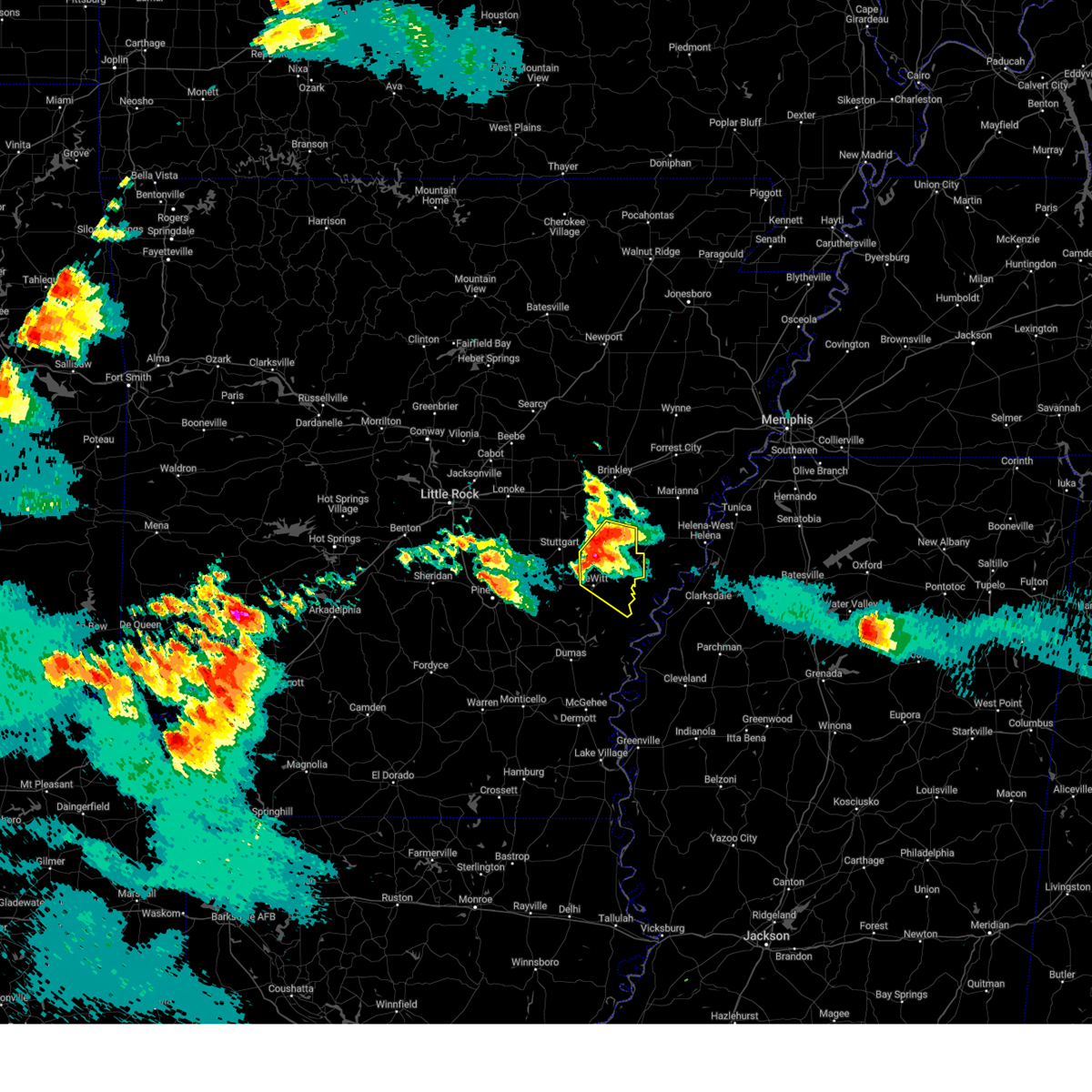 Svrlzk the national weather service in little rock has issued a * severe thunderstorm warning for, southeastern monroe county in eastern arkansas, northeastern arkansas county in southeastern arkansas, * until 845 pm cdt. * at 756 pm cdt, a severe thunderstorm was located 7 miles east of almyra, or 16 miles east of stuttgart, moving southeast at 30 mph (radar indicated). Hazards include quarter size hail. damage to vehicles is expected Svrlzk the national weather service in little rock has issued a * severe thunderstorm warning for, southeastern monroe county in eastern arkansas, northeastern arkansas county in southeastern arkansas, * until 845 pm cdt. * at 756 pm cdt, a severe thunderstorm was located 7 miles east of almyra, or 16 miles east of stuttgart, moving southeast at 30 mph (radar indicated). Hazards include quarter size hail. damage to vehicles is expected
|
| 5/5/2024 10:30 PM CDT |
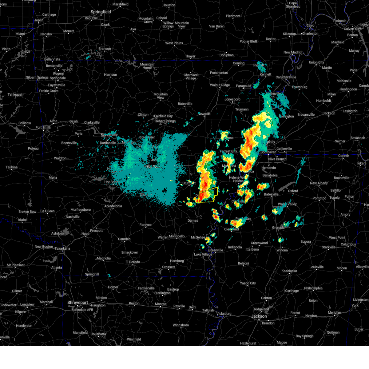 At 1030 pm cdt, a severe thunderstorm was located near de witt, or 12 miles northwest of white river national wildlife refuge, moving east at 35 mph (radar indicated). Hazards include 60 mph wind gusts. Expect damage to roofs, siding, and trees. locations impacted include, st. Charles, de witt, indian bay, ethel, cross roads in monroe county,. At 1030 pm cdt, a severe thunderstorm was located near de witt, or 12 miles northwest of white river national wildlife refuge, moving east at 35 mph (radar indicated). Hazards include 60 mph wind gusts. Expect damage to roofs, siding, and trees. locations impacted include, st. Charles, de witt, indian bay, ethel, cross roads in monroe county,.
|
| 5/5/2024 10:16 PM CDT |
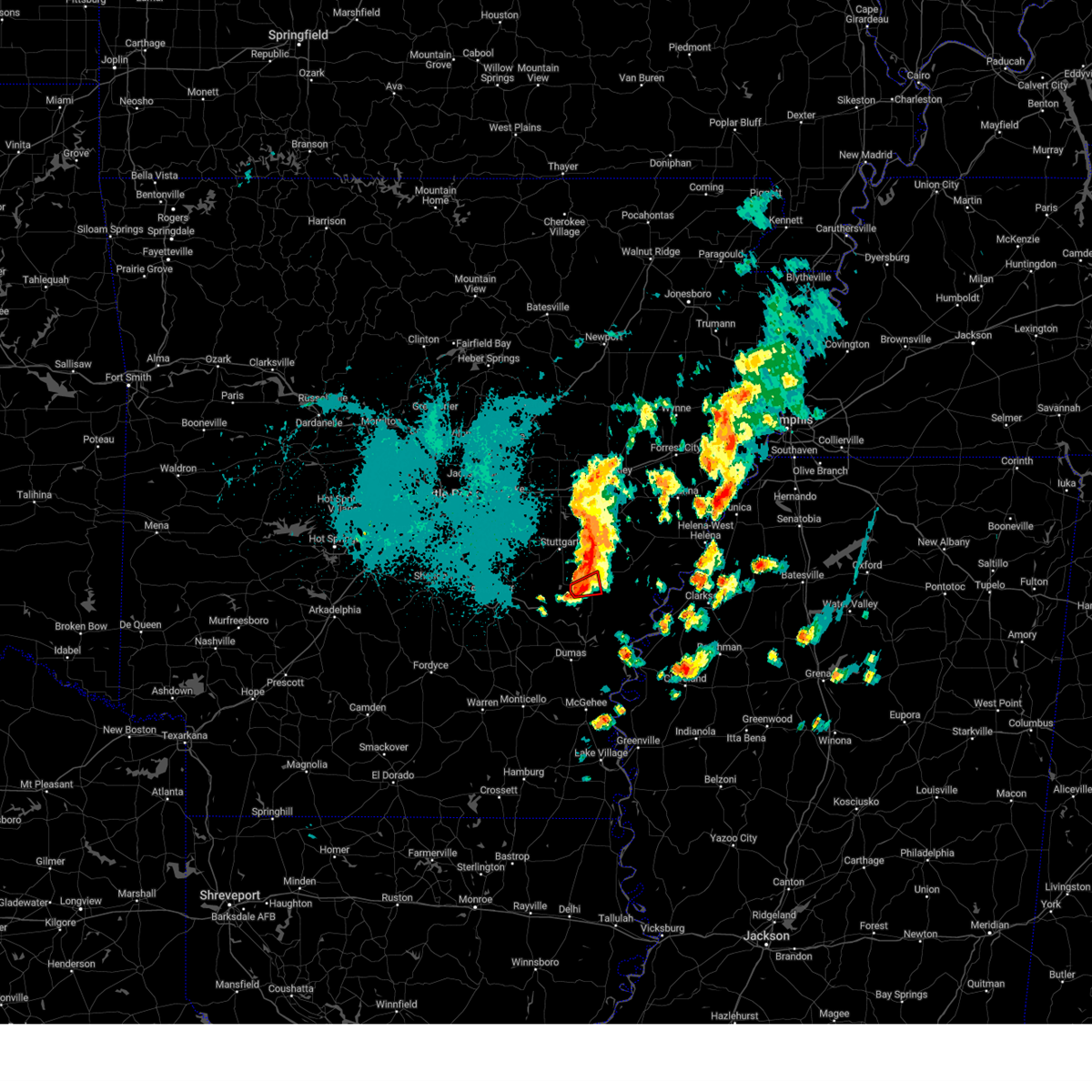 the tornado warning has been cancelled and is no longer in effect the tornado warning has been cancelled and is no longer in effect
|
| 5/5/2024 10:14 PM CDT |
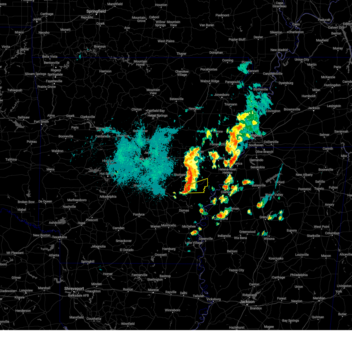 Svrlzk the national weather service in little rock has issued a * severe thunderstorm warning for, southeastern monroe county in eastern arkansas, east central arkansas county in southeastern arkansas, * until 1100 pm cdt. * at 1014 pm cdt, a severe thunderstorm was located over de witt, or 16 miles northwest of white river national wildlife refuge, moving east at 40 mph (radar indicated). Hazards include 60 mph wind gusts and penny size hail. expect damage to roofs, siding, and trees Svrlzk the national weather service in little rock has issued a * severe thunderstorm warning for, southeastern monroe county in eastern arkansas, east central arkansas county in southeastern arkansas, * until 1100 pm cdt. * at 1014 pm cdt, a severe thunderstorm was located over de witt, or 16 miles northwest of white river national wildlife refuge, moving east at 40 mph (radar indicated). Hazards include 60 mph wind gusts and penny size hail. expect damage to roofs, siding, and trees
|
| 5/5/2024 10:10 PM CDT |
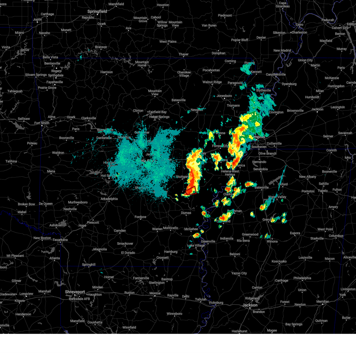 At 1010 pm cdt, a severe thunderstorm capable of producing a tornado was located near de witt, or 16 miles southeast of stuttgart, moving east at 30 mph (radar indicated rotation). Hazards include tornado and quarter size hail. Flying debris will be dangerous to those caught without shelter. mobile homes will be damaged or destroyed. damage to roofs, windows, and vehicles will occur. tree damage is likely. Locations impacted include, de witt,. At 1010 pm cdt, a severe thunderstorm capable of producing a tornado was located near de witt, or 16 miles southeast of stuttgart, moving east at 30 mph (radar indicated rotation). Hazards include tornado and quarter size hail. Flying debris will be dangerous to those caught without shelter. mobile homes will be damaged or destroyed. damage to roofs, windows, and vehicles will occur. tree damage is likely. Locations impacted include, de witt,.
|
| 5/5/2024 10:06 PM CDT |
 At 1006 pm cdt, a severe thunderstorm capable of producing a tornado was located 7 miles west of de witt, or 16 miles south of stuttgart, moving east at 30 mph (radar indicated rotation). Hazards include tornado and quarter size hail. Flying debris will be dangerous to those caught without shelter. mobile homes will be damaged or destroyed. damage to roofs, windows, and vehicles will occur. tree damage is likely. Locations impacted include, de witt,. At 1006 pm cdt, a severe thunderstorm capable of producing a tornado was located 7 miles west of de witt, or 16 miles south of stuttgart, moving east at 30 mph (radar indicated rotation). Hazards include tornado and quarter size hail. Flying debris will be dangerous to those caught without shelter. mobile homes will be damaged or destroyed. damage to roofs, windows, and vehicles will occur. tree damage is likely. Locations impacted include, de witt,.
|
| 5/5/2024 10:00 PM CDT |
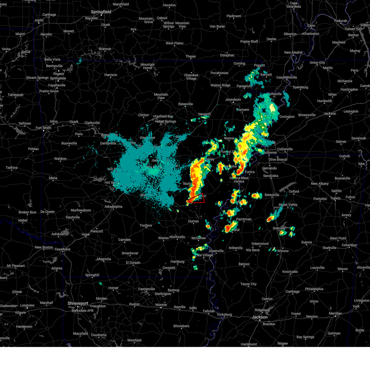 Torlzk the national weather service in little rock has issued a * tornado warning for, central arkansas county in southeastern arkansas, * until 1030 pm cdt. * at 1000 pm cdt, a severe thunderstorm capable of producing a tornado was located 8 miles northeast of langford, or 16 miles south of stuttgart, moving east at 30 mph (radar indicated rotation). Hazards include tornado and quarter size hail. Flying debris will be dangerous to those caught without shelter. mobile homes will be damaged or destroyed. damage to roofs, windows, and vehicles will occur. Tree damage is likely. Torlzk the national weather service in little rock has issued a * tornado warning for, central arkansas county in southeastern arkansas, * until 1030 pm cdt. * at 1000 pm cdt, a severe thunderstorm capable of producing a tornado was located 8 miles northeast of langford, or 16 miles south of stuttgart, moving east at 30 mph (radar indicated rotation). Hazards include tornado and quarter size hail. Flying debris will be dangerous to those caught without shelter. mobile homes will be damaged or destroyed. damage to roofs, windows, and vehicles will occur. Tree damage is likely.
|
| 3/4/2024 5:27 PM CST |
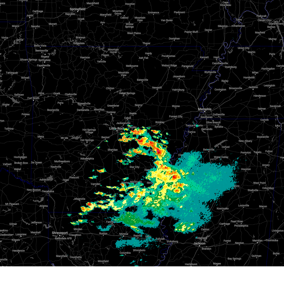 At 527 pm cst, a severe thunderstorm was located near st. charles, or 13 miles northwest of white river national wildlife refuge, moving northeast at 35 mph (radar indicated). Hazards include 60 mph wind gusts and quarter size hail. Hail damage to vehicles is expected. expect wind damage to roofs, siding, and trees. locations impacted include, st. Charles, de witt, indian bay, ethel, crocketts bluff, cross roads in monroe county,. At 527 pm cst, a severe thunderstorm was located near st. charles, or 13 miles northwest of white river national wildlife refuge, moving northeast at 35 mph (radar indicated). Hazards include 60 mph wind gusts and quarter size hail. Hail damage to vehicles is expected. expect wind damage to roofs, siding, and trees. locations impacted include, st. Charles, de witt, indian bay, ethel, crocketts bluff, cross roads in monroe county,.
|
| 3/4/2024 5:22 PM CST |
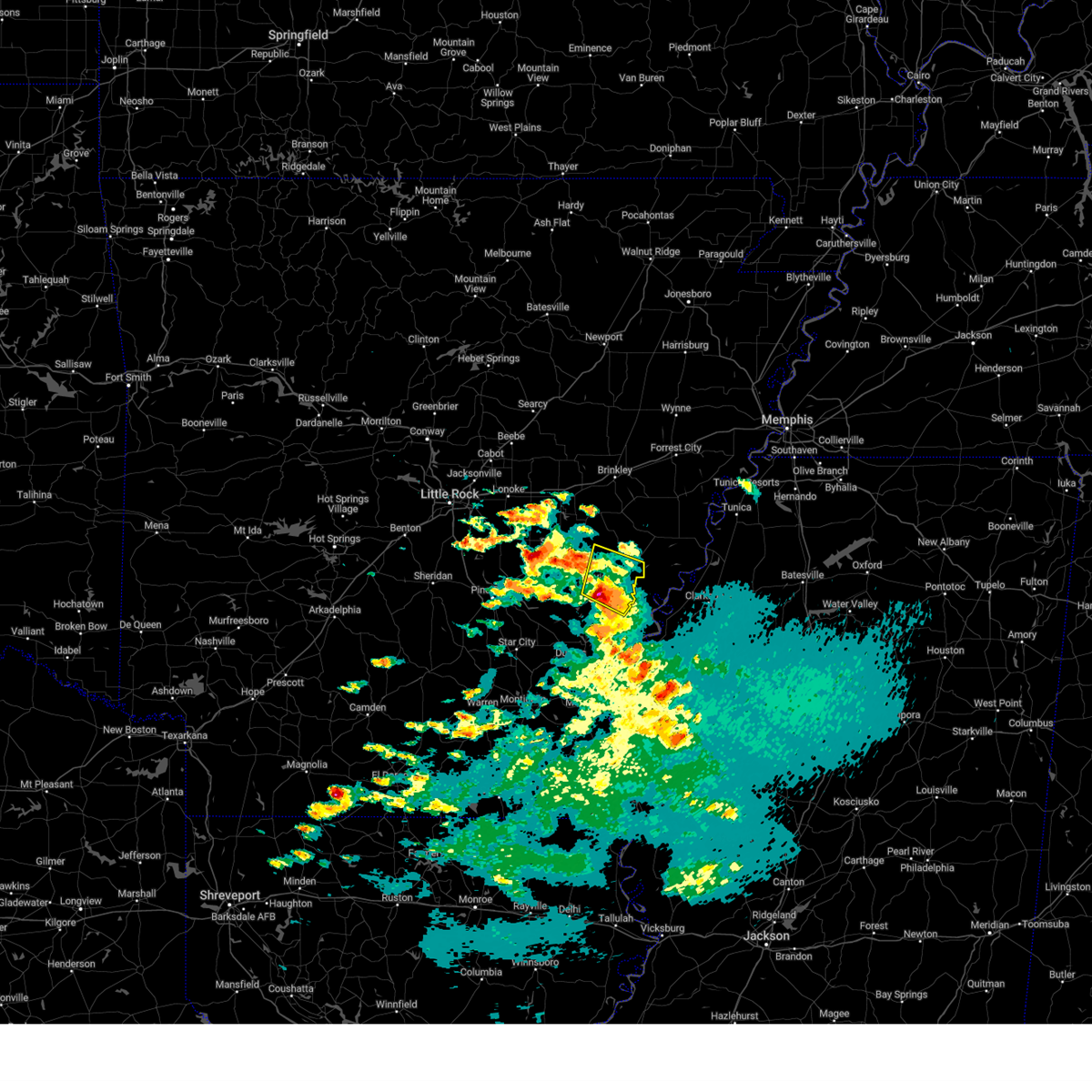 At 522 pm cst, a severe thunderstorm was located near de witt, or 12 miles northwest of white river national wildlife refuge, moving northeast at 35 mph (radar indicated). Hazards include 60 mph wind gusts and quarter size hail. Hail damage to vehicles is expected. expect wind damage to roofs, siding, and trees. locations impacted include, white river national wildlife r, st. Charles, de witt, indian bay, ethel, de luce, crocketts bluff, cross roads in monroe county,. At 522 pm cst, a severe thunderstorm was located near de witt, or 12 miles northwest of white river national wildlife refuge, moving northeast at 35 mph (radar indicated). Hazards include 60 mph wind gusts and quarter size hail. Hail damage to vehicles is expected. expect wind damage to roofs, siding, and trees. locations impacted include, white river national wildlife r, st. Charles, de witt, indian bay, ethel, de luce, crocketts bluff, cross roads in monroe county,.
|
| 3/4/2024 5:11 PM CST |
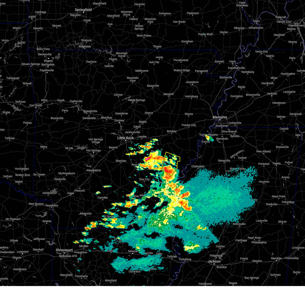 At 510 pm cst, a severe thunderstorm was located near gillett, or 13 miles west of white river national wildlife refuge, moving northeast at 30 mph (radar indicated). Hazards include 60 mph wind gusts and quarter size hail. Hail damage to vehicles is expected. expect wind damage to roofs, siding, and trees. locations impacted include, white river national wildlife r, st. Charles, de witt, indian bay, ethel, de luce, weber, crocketts bluff, tichnor, cross roads in monroe county,. At 510 pm cst, a severe thunderstorm was located near gillett, or 13 miles west of white river national wildlife refuge, moving northeast at 30 mph (radar indicated). Hazards include 60 mph wind gusts and quarter size hail. Hail damage to vehicles is expected. expect wind damage to roofs, siding, and trees. locations impacted include, white river national wildlife r, st. Charles, de witt, indian bay, ethel, de luce, weber, crocketts bluff, tichnor, cross roads in monroe county,.
|
| 3/4/2024 5:00 PM CST |
 Svrlzk the national weather service in little rock has issued a * severe thunderstorm warning for, southeastern monroe county in eastern arkansas, southeastern jefferson county in southeastern arkansas, northeastern lincoln county in southeastern arkansas, eastern arkansas county in southeastern arkansas, * until 545 pm cst. * at 500 pm cst, a severe thunderstorm was located near gillett, or 10 miles north of pea ridge, moving northeast at 30 mph (radar indicated). Hazards include 60 mph wind gusts and quarter size hail. Hail damage to vehicles is expected. Expect wind damage to roofs, siding, and trees. Svrlzk the national weather service in little rock has issued a * severe thunderstorm warning for, southeastern monroe county in eastern arkansas, southeastern jefferson county in southeastern arkansas, northeastern lincoln county in southeastern arkansas, eastern arkansas county in southeastern arkansas, * until 545 pm cst. * at 500 pm cst, a severe thunderstorm was located near gillett, or 10 miles north of pea ridge, moving northeast at 30 mph (radar indicated). Hazards include 60 mph wind gusts and quarter size hail. Hail damage to vehicles is expected. Expect wind damage to roofs, siding, and trees.
|
| 2/22/2024 7:30 PM CST | Powerlines were blown dow in arkansas county AR, 1.7 miles E of DeWitt, AR |
| 1/12/2024 6:06 AM CST |
 At 606 am cst, severe thunderstorms were located along a line extending from near st. charles to 7 miles northwest of dermott, moving northeast at 65 mph (radar indicated). Hazards include 70 mph wind gusts and quarter size hail. Hail damage to vehicles is expected. expect considerable tree damage. Wind damage is also likely to mobile homes, roofs, and outbuildings. At 606 am cst, severe thunderstorms were located along a line extending from near st. charles to 7 miles northwest of dermott, moving northeast at 65 mph (radar indicated). Hazards include 70 mph wind gusts and quarter size hail. Hail damage to vehicles is expected. expect considerable tree damage. Wind damage is also likely to mobile homes, roofs, and outbuildings.
|
| 1/12/2024 6:05 AM CST |
 At 558 am cst, severe thunderstorms were located along a line extending from near holly grove to near de witt to near mitchellville, moving east at 65 mph (radar indicated). Hazards include 70 mph wind gusts and penny size hail. Expect considerable tree damage. damage is likely to mobile homes, roofs, and outbuildings. locations impacted include, dumas, gould, gillett, mitchellville, almyra, st. Charles, watson, roe, yancopin, mills, merrisach lake, trusten holder wma, de witt, douglas, aberdeen, arkansas post, de luce, gourd, casscoe, tichnor,. At 558 am cst, severe thunderstorms were located along a line extending from near holly grove to near de witt to near mitchellville, moving east at 65 mph (radar indicated). Hazards include 70 mph wind gusts and penny size hail. Expect considerable tree damage. damage is likely to mobile homes, roofs, and outbuildings. locations impacted include, dumas, gould, gillett, mitchellville, almyra, st. Charles, watson, roe, yancopin, mills, merrisach lake, trusten holder wma, de witt, douglas, aberdeen, arkansas post, de luce, gourd, casscoe, tichnor,.
|
| 1/12/2024 5:43 AM CST |
 A severe thunderstorm warning remains in effect until 615 am cst for southeastern prairie. northwestern desha. southwestern monroe. southeastern jefferson. lincoln and arkansas counties. At 543 am cst, severe thunderstorms were located along a line extending from near ulm to 6 miles northeast of langford to near cane creek state park, moving east at 50 mph. A severe thunderstorm warning remains in effect until 615 am cst for southeastern prairie. northwestern desha. southwestern monroe. southeastern jefferson. lincoln and arkansas counties. At 543 am cst, severe thunderstorms were located along a line extending from near ulm to 6 miles northeast of langford to near cane creek state park, moving east at 50 mph.
|
| 1/12/2024 5:32 AM CST |
 The national weather service in little rock has issued a * severe thunderstorm warning for. northeastern cleveland county in southeastern arkansas. southeastern prairie county in central arkansas. southeastern lonoke county in central arkansas. Northwestern desha county in southeastern arkansas. The national weather service in little rock has issued a * severe thunderstorm warning for. northeastern cleveland county in southeastern arkansas. southeastern prairie county in central arkansas. southeastern lonoke county in central arkansas. Northwestern desha county in southeastern arkansas.
|
| 1/12/2024 5:32 AM CST |
 At 532 am cst, severe thunderstorms were located along a line extending from near brummitt to woodville to plantersville, moving east at 65 mph (radar indicated). Hazards include 70 mph wind gusts and penny size hail. Expect considerable tree damage. Damage is likely to mobile homes, roofs, and outbuildings. At 532 am cst, severe thunderstorms were located along a line extending from near brummitt to woodville to plantersville, moving east at 65 mph (radar indicated). Hazards include 70 mph wind gusts and penny size hail. Expect considerable tree damage. Damage is likely to mobile homes, roofs, and outbuildings.
|
| 6/25/2023 7:12 PM CDT |
 At 711 pm cdt, severe thunderstorms were located along a line extending from 6 miles southwest of watkins corner to 9 miles north of merrisach lake to near gillett, moving southeast at 55 mph (radar indicated). Hazards include 70 mph wind gusts and penny size hail. Expect considerable tree damage. damage is likely to mobile homes, roofs, and outbuildings. locations impacted include, dumas, gould, gillett, holly grove, mitchellville, almyra, st. Charles, watson, yancopin, omega, little bayou meto park, mills, merrisach lake, kelso, langford, palmer, douglas, trusten holder wma, de witt, blackton,. At 711 pm cdt, severe thunderstorms were located along a line extending from 6 miles southwest of watkins corner to 9 miles north of merrisach lake to near gillett, moving southeast at 55 mph (radar indicated). Hazards include 70 mph wind gusts and penny size hail. Expect considerable tree damage. damage is likely to mobile homes, roofs, and outbuildings. locations impacted include, dumas, gould, gillett, holly grove, mitchellville, almyra, st. Charles, watson, yancopin, omega, little bayou meto park, mills, merrisach lake, kelso, langford, palmer, douglas, trusten holder wma, de witt, blackton,.
|
| 6/25/2023 7:05 PM CDT |
 At 705 pm cdt, severe thunderstorms were located along a line extending from near st. charles to 7 miles southeast of de witt to near gillett, moving southeast at 45 mph (radar indicated). Hazards include 70 mph wind gusts and penny size hail. Expect considerable tree damage. damage is likely to mobile homes, roofs, and outbuildings. locations impacted include, dumas, rosedale, rohwer, gould, gillett, holly grove, arkansas city, mitchellville, almyra, st. Charles, tillar, watson, winchester, lucca landing, mcgehee, little bayou meto park, douglas, trusten holder wma, yancopin, omega,. At 705 pm cdt, severe thunderstorms were located along a line extending from near st. charles to 7 miles southeast of de witt to near gillett, moving southeast at 45 mph (radar indicated). Hazards include 70 mph wind gusts and penny size hail. Expect considerable tree damage. damage is likely to mobile homes, roofs, and outbuildings. locations impacted include, dumas, rosedale, rohwer, gould, gillett, holly grove, arkansas city, mitchellville, almyra, st. Charles, tillar, watson, winchester, lucca landing, mcgehee, little bayou meto park, douglas, trusten holder wma, yancopin, omega,.
|
| 6/25/2023 7:04 PM CDT | Trees and powerlines down in de wit in arkansas county AR, 0.1 miles S of DeWitt, AR |
| 6/25/2023 6:49 PM CDT |
 At 648 pm cdt, severe thunderstorms were located along a line extending from near roe to 7 miles southwest of almyra to richardson, moving east at 55 mph (radar indicated). Hazards include 70 mph wind gusts and penny size hail. Expect considerable tree damage. damage is likely to mobile homes, roofs, and outbuildings. locations impacted include, stuttgart, dumas, rosedale, clarendon, rohwer, altheimer, gould, gillett, holly grove, humphrey, grady, arkansas city, mitchellville, almyra, st. Charles, tillar, watson, ulm, winchester, roe,. At 648 pm cdt, severe thunderstorms were located along a line extending from near roe to 7 miles southwest of almyra to richardson, moving east at 55 mph (radar indicated). Hazards include 70 mph wind gusts and penny size hail. Expect considerable tree damage. damage is likely to mobile homes, roofs, and outbuildings. locations impacted include, stuttgart, dumas, rosedale, clarendon, rohwer, altheimer, gould, gillett, holly grove, humphrey, grady, arkansas city, mitchellville, almyra, st. Charles, tillar, watson, ulm, winchester, roe,.
|
| 6/25/2023 6:42 PM CDT |
 At 642 pm cdt, severe thunderstorms were located along a line extending from near roe to 7 miles southwest of almyra to richardson, moving southeast at 55 mph (radar indicated). Hazards include 70 mph wind gusts and penny size hail. Expect considerable tree damage. Damage is likely to mobile homes, roofs, and outbuildings. At 642 pm cdt, severe thunderstorms were located along a line extending from near roe to 7 miles southwest of almyra to richardson, moving southeast at 55 mph (radar indicated). Hazards include 70 mph wind gusts and penny size hail. Expect considerable tree damage. Damage is likely to mobile homes, roofs, and outbuildings.
|
| 6/25/2023 6:29 PM CDT |
 At 628 pm cdt, severe thunderstorms were located along a line extending from near stuttgart municipal airport to near brummitt to near humphrey, moving southeast at 50 mph (radar indicated). Hazards include 70 mph wind gusts and nickel size hail. Expect considerable tree damage. damage is likely to mobile homes, roofs, and outbuildings. locations impacted include, pine bluff, stuttgart, lonoke, star city, clarendon, hazen, de valls bluff, white hall, england, carlisle, wrightsville, redfield, altheimer, holly grove, humphrey, grady, fredonia, humnoke, almyra, keo, thunderstorm damage threat, considerable hail threat, radar indicated max hail size, 0. 88 in wind threat, radar indicated max wind gust, 70 mph. At 628 pm cdt, severe thunderstorms were located along a line extending from near stuttgart municipal airport to near brummitt to near humphrey, moving southeast at 50 mph (radar indicated). Hazards include 70 mph wind gusts and nickel size hail. Expect considerable tree damage. damage is likely to mobile homes, roofs, and outbuildings. locations impacted include, pine bluff, stuttgart, lonoke, star city, clarendon, hazen, de valls bluff, white hall, england, carlisle, wrightsville, redfield, altheimer, holly grove, humphrey, grady, fredonia, humnoke, almyra, keo, thunderstorm damage threat, considerable hail threat, radar indicated max hail size, 0. 88 in wind threat, radar indicated max wind gust, 70 mph.
|
| 6/25/2023 6:07 PM CDT |
 At 605 pm cdt, severe thunderstorms were located along a line extending from near barrettsville to near lonoke to near keo, moving southeast at 50 mph. these are destructive storms for england and humnoke (radar indicated). Hazards include 80 mph wind gusts and nickel size hail. Flying debris will be dangerous to those caught without shelter. mobile homes will be heavily damaged. expect considerable damage to roofs, windows, and vehicles. Extensive tree damage and power outages are likely. At 605 pm cdt, severe thunderstorms were located along a line extending from near barrettsville to near lonoke to near keo, moving southeast at 50 mph. these are destructive storms for england and humnoke (radar indicated). Hazards include 80 mph wind gusts and nickel size hail. Flying debris will be dangerous to those caught without shelter. mobile homes will be heavily damaged. expect considerable damage to roofs, windows, and vehicles. Extensive tree damage and power outages are likely.
|
| 6/18/2023 3:56 AM CDT |
 The severe thunderstorm warning for east central bradley, western desha, drew, southeastern jefferson, lincoln and central arkansas counties will expire at 400 am cdt, the storms which prompted the warning have mostly weakened. therefore, the warning will be allowed to expire. a severe thunderstorm watch remains in effect until 600 am cdt for southeastern arkansas. &&. The severe thunderstorm warning for east central bradley, western desha, drew, southeastern jefferson, lincoln and central arkansas counties will expire at 400 am cdt, the storms which prompted the warning have mostly weakened. therefore, the warning will be allowed to expire. a severe thunderstorm watch remains in effect until 600 am cdt for southeastern arkansas. &&.
|
| 6/18/2023 3:34 AM CDT |
 At 333 am cdt, severe thunderstorms were located along a line extending from 6 miles north of richardson to 6 miles southwest of mills to near fountain hill, moving east at 50 mph (radar indicated). Hazards include 70 mph wind gusts and penny size hail. Expect considerable tree damage. damage is likely to mobile homes, roofs, and outbuildings. locations impacted include, monticello, dumas, dermott, star city, rohwer, gould, gillett, wilmar, grady, mitchellville, almyra, tillar, watson, winchester, whitefield, mcgehee, little bayou meto park, woodville, douglas, nebo, thunderstorm damage threat, considerable hail threat, radar indicated max hail size, 0. 75 in wind threat, radar indicated max wind gust, 70 mph. At 333 am cdt, severe thunderstorms were located along a line extending from 6 miles north of richardson to 6 miles southwest of mills to near fountain hill, moving east at 50 mph (radar indicated). Hazards include 70 mph wind gusts and penny size hail. Expect considerable tree damage. damage is likely to mobile homes, roofs, and outbuildings. locations impacted include, monticello, dumas, dermott, star city, rohwer, gould, gillett, wilmar, grady, mitchellville, almyra, tillar, watson, winchester, whitefield, mcgehee, little bayou meto park, woodville, douglas, nebo, thunderstorm damage threat, considerable hail threat, radar indicated max hail size, 0. 75 in wind threat, radar indicated max wind gust, 70 mph.
|
| 6/18/2023 3:02 AM CDT |
 At 302 am cdt, severe thunderstorms were located along a line extending from 6 miles west of white hall to herbine to near ingalls, moving east at 55 mph (radar indicated). Hazards include 70 mph wind gusts and penny size hail. Expect considerable tree damage. Damage is likely to mobile homes, roofs, and outbuildings. At 302 am cdt, severe thunderstorms were located along a line extending from 6 miles west of white hall to herbine to near ingalls, moving east at 55 mph (radar indicated). Hazards include 70 mph wind gusts and penny size hail. Expect considerable tree damage. Damage is likely to mobile homes, roofs, and outbuildings.
|
| 6/14/2023 6:57 PM CDT |
 At 657 pm cdt, a severe thunderstorm was located over little bayou meto park, or 18 miles north of dumas, moving east at 40 mph (radar indicated). Hazards include 60 mph wind gusts and quarter size hail. Hail damage to vehicles is expected. expect wind damage to roofs, siding, and trees. locations impacted include, gould, gillett, douglas, little bayou meto park, de witt, langford, pendleton, lodge corner, reydell, varner, sarassa, bayou meteo state game area, hail threat, radar indicated max hail size, 1. 00 in wind threat, radar indicated max wind gust, 60 mph. At 657 pm cdt, a severe thunderstorm was located over little bayou meto park, or 18 miles north of dumas, moving east at 40 mph (radar indicated). Hazards include 60 mph wind gusts and quarter size hail. Hail damage to vehicles is expected. expect wind damage to roofs, siding, and trees. locations impacted include, gould, gillett, douglas, little bayou meto park, de witt, langford, pendleton, lodge corner, reydell, varner, sarassa, bayou meteo state game area, hail threat, radar indicated max hail size, 1. 00 in wind threat, radar indicated max wind gust, 60 mph.
|
| 6/14/2023 6:41 PM CDT |
 At 641 pm cdt, a severe thunderstorm was located over richardson, or 14 miles east of pine bluff, moving east at 30 mph (radar indicated). Hazards include 60 mph wind gusts and quarter size hail. Hail damage to vehicles is expected. expect wind damage to roofs, siding, and trees. locations impacted include, gould, gillett, grady, almyra, cottondale, whitefield, linwood, little bayou meto park, madding, woodville, langford, douglas, richardson, de witt, cornerstone, tamo, moscow, lodge corner, sarassa, pendleton, hail threat, radar indicated max hail size, 1. 00 in wind threat, radar indicated max wind gust, 60 mph. At 641 pm cdt, a severe thunderstorm was located over richardson, or 14 miles east of pine bluff, moving east at 30 mph (radar indicated). Hazards include 60 mph wind gusts and quarter size hail. Hail damage to vehicles is expected. expect wind damage to roofs, siding, and trees. locations impacted include, gould, gillett, grady, almyra, cottondale, whitefield, linwood, little bayou meto park, madding, woodville, langford, douglas, richardson, de witt, cornerstone, tamo, moscow, lodge corner, sarassa, pendleton, hail threat, radar indicated max hail size, 1. 00 in wind threat, radar indicated max wind gust, 60 mph.
|
| 6/14/2023 6:23 PM CDT |
 At 622 pm cdt, a severe thunderstorm was located near altheimer, or 9 miles northeast of pine bluff, moving east at 35 mph (radar indicated). Hazards include 60 mph wind gusts and quarter size hail. Hail damage to vehicles is expected. Expect wind damage to roofs, siding, and trees. At 622 pm cdt, a severe thunderstorm was located near altheimer, or 9 miles northeast of pine bluff, moving east at 35 mph (radar indicated). Hazards include 60 mph wind gusts and quarter size hail. Hail damage to vehicles is expected. Expect wind damage to roofs, siding, and trees.
|
| 6/14/2023 1:27 AM CDT |
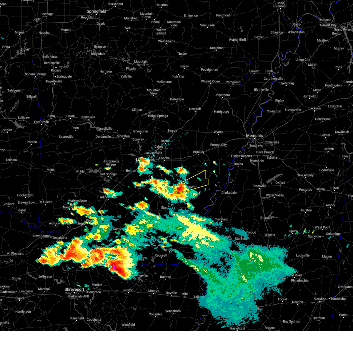 At 126 am cdt, a severe thunderstorm was located 10 miles southeast of humphrey, or 12 miles south of stuttgart, moving northeast at 45 mph (radar indicated). Hazards include quarter size hail. damage to vehicles is expected At 126 am cdt, a severe thunderstorm was located 10 miles southeast of humphrey, or 12 miles south of stuttgart, moving northeast at 45 mph (radar indicated). Hazards include quarter size hail. damage to vehicles is expected
|
| 6/11/2023 7:11 PM CDT |
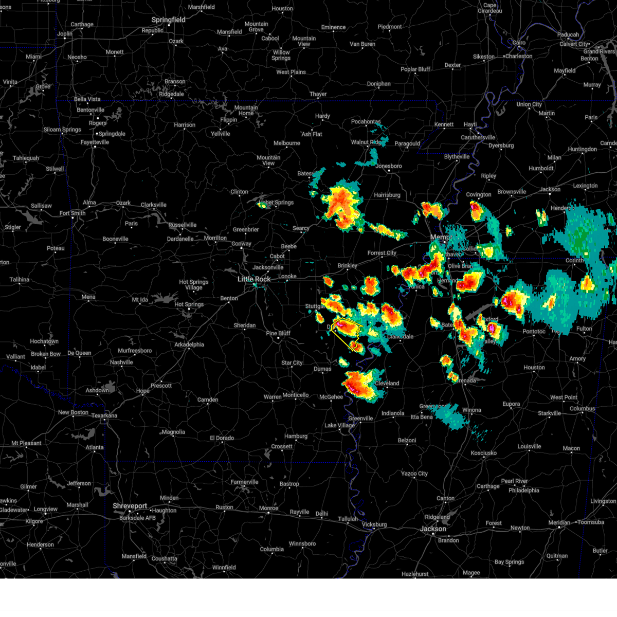 At 711 pm cdt, a severe thunderstorm was located near de witt, or 16 miles southeast of stuttgart, moving southeast at 30 mph (radar indicated). Hazards include golf ball size hail and 60 mph wind gusts. People and animals outdoors will be injured. expect hail damage to roofs, siding, windows, and vehicles. expect wind damage to roofs, siding, and trees. locations impacted include, st. charles, de witt, weber, ethel, de luce, thunderstorm damage threat, considerable hail threat, radar indicated max hail size, 1. 75 in wind threat, radar indicated max wind gust, 60 mph. At 711 pm cdt, a severe thunderstorm was located near de witt, or 16 miles southeast of stuttgart, moving southeast at 30 mph (radar indicated). Hazards include golf ball size hail and 60 mph wind gusts. People and animals outdoors will be injured. expect hail damage to roofs, siding, windows, and vehicles. expect wind damage to roofs, siding, and trees. locations impacted include, st. charles, de witt, weber, ethel, de luce, thunderstorm damage threat, considerable hail threat, radar indicated max hail size, 1. 75 in wind threat, radar indicated max wind gust, 60 mph.
|
| 6/11/2023 6:58 PM CDT |
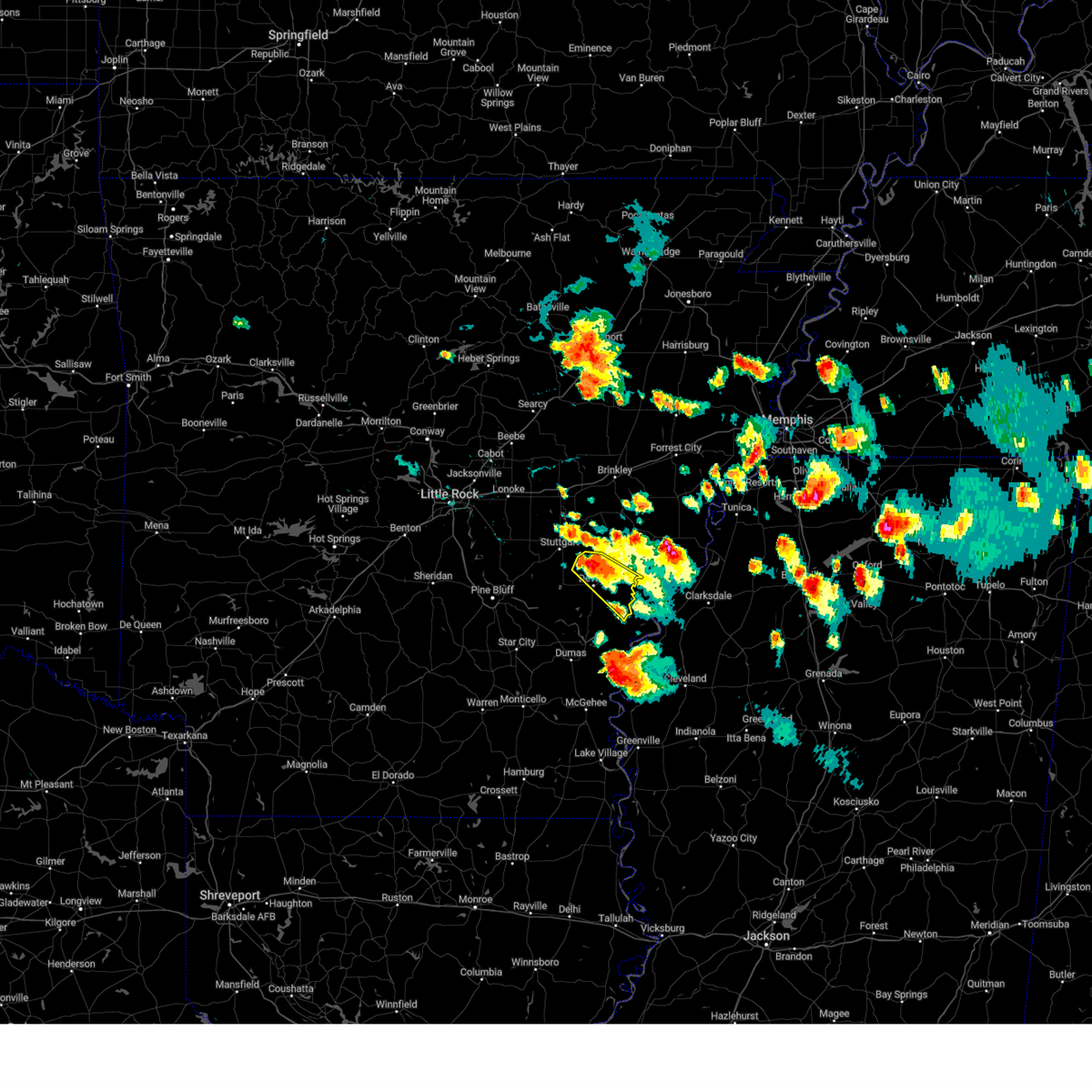 At 658 pm cdt, a severe thunderstorm was located over almyra, or 10 miles southeast of stuttgart, moving southeast at 30 mph (radar indicated). Hazards include 60 mph wind gusts and quarter size hail. Hail damage to vehicles is expected. Expect wind damage to roofs, siding, and trees. At 658 pm cdt, a severe thunderstorm was located over almyra, or 10 miles southeast of stuttgart, moving southeast at 30 mph (radar indicated). Hazards include 60 mph wind gusts and quarter size hail. Hail damage to vehicles is expected. Expect wind damage to roofs, siding, and trees.
|
| 6/11/2023 6:51 PM CDT |
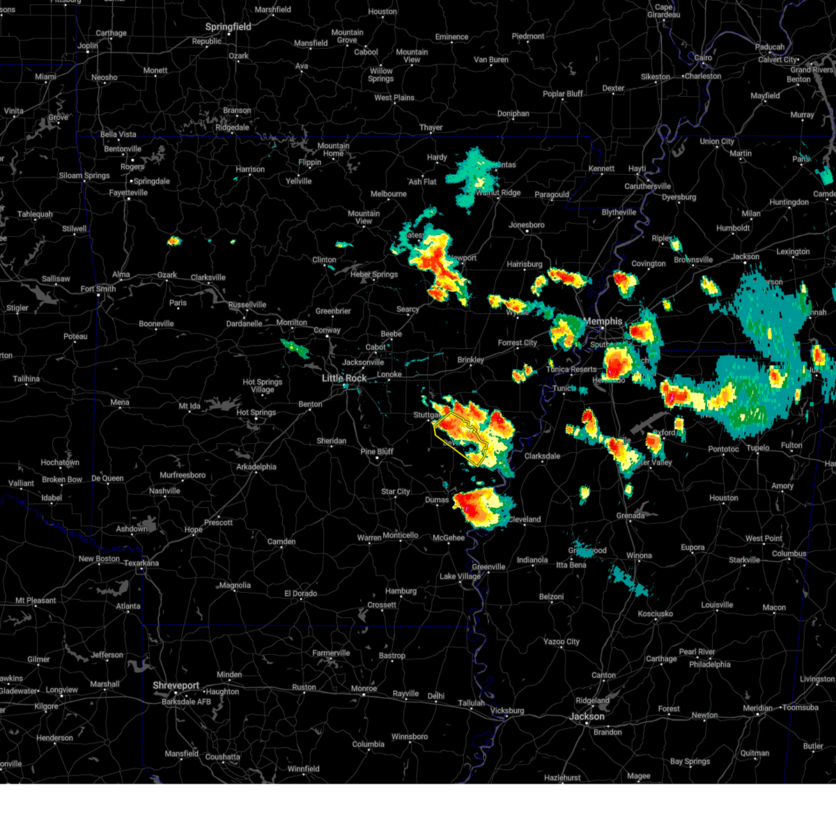 At 651 pm cdt, a severe thunderstorm was located over almyra, or 9 miles southeast of stuttgart, moving southeast at 35 mph (radar indicated). Hazards include 60 mph wind gusts and quarter size hail. Hail damage to vehicles is expected. expect wind damage to roofs, siding, and trees. locations impacted include, almyra, st. charles, de witt, ethel, almyra airport, casscoe, crocketts bluff, hail threat, radar indicated max hail size, 1. 00 in wind threat, radar indicated max wind gust, 60 mph. At 651 pm cdt, a severe thunderstorm was located over almyra, or 9 miles southeast of stuttgart, moving southeast at 35 mph (radar indicated). Hazards include 60 mph wind gusts and quarter size hail. Hail damage to vehicles is expected. expect wind damage to roofs, siding, and trees. locations impacted include, almyra, st. charles, de witt, ethel, almyra airport, casscoe, crocketts bluff, hail threat, radar indicated max hail size, 1. 00 in wind threat, radar indicated max wind gust, 60 mph.
|
| 6/11/2023 6:31 PM CDT | Quarter sized hail reported 6.7 miles SW of DeWitt, AR, report from mping: quarter (1.00 in.). |
| 6/11/2023 6:27 PM CDT |
 At 626 pm cdt, a severe thunderstorm was located near almyra, or 14 miles southeast of stuttgart, moving southeast at 35 mph (radar indicated). Hazards include 60 mph wind gusts and quarter size hail. Hail damage to vehicles is expected. expect wind damage to roofs, siding, and trees. locations impacted include, stuttgart, almyra, st. charles, ulm, stuttgart municipal airport, brummitt, de witt, ethel, almyra airport, casscoe, crocketts bluff, slovak, hail threat, radar indicated max hail size, 1. 00 in wind threat, radar indicated max wind gust, 60 mph. At 626 pm cdt, a severe thunderstorm was located near almyra, or 14 miles southeast of stuttgart, moving southeast at 35 mph (radar indicated). Hazards include 60 mph wind gusts and quarter size hail. Hail damage to vehicles is expected. expect wind damage to roofs, siding, and trees. locations impacted include, stuttgart, almyra, st. charles, ulm, stuttgart municipal airport, brummitt, de witt, ethel, almyra airport, casscoe, crocketts bluff, slovak, hail threat, radar indicated max hail size, 1. 00 in wind threat, radar indicated max wind gust, 60 mph.
|
| 6/11/2023 6:01 PM CDT |
 At 601 pm cdt, a severe thunderstorm was located over stuttgart, moving southeast at 35 mph (radar indicated). Hazards include 60 mph wind gusts and quarter size hail. Hail damage to vehicles is expected. Expect wind damage to roofs, siding, and trees. At 601 pm cdt, a severe thunderstorm was located over stuttgart, moving southeast at 35 mph (radar indicated). Hazards include 60 mph wind gusts and quarter size hail. Hail damage to vehicles is expected. Expect wind damage to roofs, siding, and trees.
|
| 4/15/2023 10:07 PM CDT |
 The severe thunderstorm warning for northern desha, northeastern lincoln and southeastern arkansas counties will expire at 1015 pm cdt, the storms which prompted the warning have moved out of the area. therefore, the warning will be allowed to expire. The severe thunderstorm warning for northern desha, northeastern lincoln and southeastern arkansas counties will expire at 1015 pm cdt, the storms which prompted the warning have moved out of the area. therefore, the warning will be allowed to expire.
|
| 4/15/2023 9:45 PM CDT |
 At 944 pm cdt, severe thunderstorms were located along a line extending from 7 miles southeast of de witt to near merrisach lake to 8 miles south of gillett, moving east at 50 mph (radar indicated). Hazards include 60 mph wind gusts and quarter size hail. Hail damage to vehicles is expected. expect wind damage to roofs, siding, and trees. locations impacted include, gillett, merrisach lake, trusten holder wma, de witt, arkansas post, ethel, de luce, weber, tichnor, hail threat, radar indicated max hail size, 1. 00 in wind threat, radar indicated max wind gust, 60 mph. At 944 pm cdt, severe thunderstorms were located along a line extending from 7 miles southeast of de witt to near merrisach lake to 8 miles south of gillett, moving east at 50 mph (radar indicated). Hazards include 60 mph wind gusts and quarter size hail. Hail damage to vehicles is expected. expect wind damage to roofs, siding, and trees. locations impacted include, gillett, merrisach lake, trusten holder wma, de witt, arkansas post, ethel, de luce, weber, tichnor, hail threat, radar indicated max hail size, 1. 00 in wind threat, radar indicated max wind gust, 60 mph.
|
| 4/15/2023 9:38 PM CDT |
 At 937 pm cdt, severe thunderstorms were located along a line extending from 6 miles southeast of de witt to merrisach lake to near gould, moving east at 50 mph (radar indicated). Hazards include 60 mph wind gusts and quarter size hail. Hail damage to vehicles is expected. expect wind damage to roofs, siding, and trees. locations impacted include, dumas, gould, gillett, mitchellville, watson, yancopin, mills, merrisach lake, trusten holder wma, de witt, douglas, arkansas post, garrett bridge, pendleton, ethel, de luce, rose hill, tichnor, reedville, morgan point recreation area, hail threat, radar indicated max hail size, 1. 00 in wind threat, radar indicated max wind gust, 60 mph. At 937 pm cdt, severe thunderstorms were located along a line extending from 6 miles southeast of de witt to merrisach lake to near gould, moving east at 50 mph (radar indicated). Hazards include 60 mph wind gusts and quarter size hail. Hail damage to vehicles is expected. expect wind damage to roofs, siding, and trees. locations impacted include, dumas, gould, gillett, mitchellville, watson, yancopin, mills, merrisach lake, trusten holder wma, de witt, douglas, arkansas post, garrett bridge, pendleton, ethel, de luce, rose hill, tichnor, reedville, morgan point recreation area, hail threat, radar indicated max hail size, 1. 00 in wind threat, radar indicated max wind gust, 60 mph.
|
| 4/15/2023 9:25 PM CDT |
 At 925 pm cdt, severe thunderstorms were located along a line extending from 6 miles northwest of gillett to near douglas to near cane creek state park, moving east at 50 mph (radar indicated). Hazards include 60 mph wind gusts and quarter size hail. Hail damage to vehicles is expected. Expect wind damage to roofs, siding, and trees. At 925 pm cdt, severe thunderstorms were located along a line extending from 6 miles northwest of gillett to near douglas to near cane creek state park, moving east at 50 mph (radar indicated). Hazards include 60 mph wind gusts and quarter size hail. Hail damage to vehicles is expected. Expect wind damage to roofs, siding, and trees.
|
| 4/5/2023 11:22 AM CDT |
 At 1122 am cdt, severe thunderstorms were located along a line extending from near parkers corner to brummitt to near altheimer, moving east at 60 mph (radar indicated). Hazards include 60 mph wind gusts and quarter size hail. Hail damage to vehicles is expected. Expect wind damage to roofs, siding, and trees. At 1122 am cdt, severe thunderstorms were located along a line extending from near parkers corner to brummitt to near altheimer, moving east at 60 mph (radar indicated). Hazards include 60 mph wind gusts and quarter size hail. Hail damage to vehicles is expected. Expect wind damage to roofs, siding, and trees.
|
| 3/12/2023 1:04 AM CDT |
 At 1204 am cst, severe thunderstorms were located along a line extending from merrisach lake to near rohwer to near dermott to ladelle, moving east at 55 mph (radar indicated). Hazards include 60 mph wind gusts and quarter size hail. Hail damage to vehicles is expected. expect wind damage to roofs, siding, and trees. locations impacted include, monticello, warren, dumas, dermott, rosedale, hampton, rohwer, gould, hermitage, gillett, wilmar, arkansas city, mitchellville, harrell, tillar, watson, winchester, ingalls, lucca landing, hampton municipal airport, hail threat, radar indicated max hail size, 1. 00 in wind threat, radar indicated max wind gust, 60 mph. At 1204 am cst, severe thunderstorms were located along a line extending from merrisach lake to near rohwer to near dermott to ladelle, moving east at 55 mph (radar indicated). Hazards include 60 mph wind gusts and quarter size hail. Hail damage to vehicles is expected. expect wind damage to roofs, siding, and trees. locations impacted include, monticello, warren, dumas, dermott, rosedale, hampton, rohwer, gould, hermitage, gillett, wilmar, arkansas city, mitchellville, harrell, tillar, watson, winchester, ingalls, lucca landing, hampton municipal airport, hail threat, radar indicated max hail size, 1. 00 in wind threat, radar indicated max wind gust, 60 mph.
|
| 3/12/2023 12:49 AM CDT |
 At 1148 pm cst, severe thunderstorms were located along a line extending from douglas to near winchester to near monticello to 7 miles east of hermitage, moving east at 55 mph (radar indicated). Hazards include 60 mph wind gusts and quarter size hail. Hail damage to vehicles is expected. expect wind damage to roofs, siding, and trees. locations impacted include, camden, monticello, warren, dumas, dermott, rosedale, hampton, rohwer, gould, hermitage, gillett, wilmar, grady, arkansas city, mitchellville, harrell, tillar, watson, winchester, ingalls, hail threat, radar indicated max hail size, 1. 00 in wind threat, radar indicated max wind gust, 60 mph. At 1148 pm cst, severe thunderstorms were located along a line extending from douglas to near winchester to near monticello to 7 miles east of hermitage, moving east at 55 mph (radar indicated). Hazards include 60 mph wind gusts and quarter size hail. Hail damage to vehicles is expected. expect wind damage to roofs, siding, and trees. locations impacted include, camden, monticello, warren, dumas, dermott, rosedale, hampton, rohwer, gould, hermitage, gillett, wilmar, grady, arkansas city, mitchellville, harrell, tillar, watson, winchester, ingalls, hail threat, radar indicated max hail size, 1. 00 in wind threat, radar indicated max wind gust, 60 mph.
|
| 3/12/2023 12:25 AM CDT |
 At 1125 pm cst, severe thunderstorms were located along a line extending from cottondale to near star city to near warren to 6 miles north of harrell, moving east at 55 mph (radar indicated). Hazards include 60 mph wind gusts and quarter size hail. Hail damage to vehicles is expected. Expect wind damage to roofs, siding, and trees. At 1125 pm cst, severe thunderstorms were located along a line extending from cottondale to near star city to near warren to 6 miles north of harrell, moving east at 55 mph (radar indicated). Hazards include 60 mph wind gusts and quarter size hail. Hail damage to vehicles is expected. Expect wind damage to roofs, siding, and trees.
|
| 1/3/2023 3:39 AM CST |
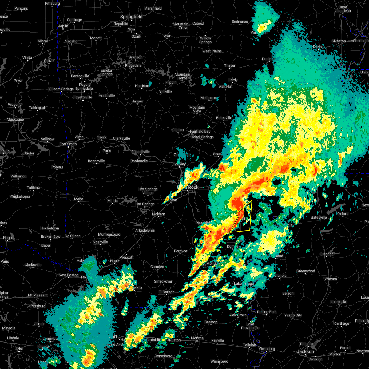 At 339 am cst, a severe thunderstorm was located 8 miles northwest of st. charles, or 17 miles east of stuttgart, moving east at 50 mph (radar indicated). Hazards include 60 mph wind gusts. Expect damage to roofs, siding, and trees. locations impacted include, almyra, de witt, de luce, crocketts bluff, lawrenceville, hail threat, radar indicated max hail size, <. 75 in wind threat, radar indicated max wind gust, 60 mph. At 339 am cst, a severe thunderstorm was located 8 miles northwest of st. charles, or 17 miles east of stuttgart, moving east at 50 mph (radar indicated). Hazards include 60 mph wind gusts. Expect damage to roofs, siding, and trees. locations impacted include, almyra, de witt, de luce, crocketts bluff, lawrenceville, hail threat, radar indicated max hail size, <. 75 in wind threat, radar indicated max wind gust, 60 mph.
|
| 1/3/2023 3:23 AM CST |
 At 322 am cst, a severe thunderstorm was located near almyra, or 9 miles south of stuttgart, moving northeast at 60 mph (radar indicated). Hazards include 60 mph wind gusts. Expect damage to roofs, siding, and trees. locations impacted include, gillett, almyra, little bayou meto park, de witt, langford, de luce, lodge corner, reydell, crocketts bluff, lawrenceville, tichnor, bayou meteo state game area, hail threat, radar indicated max hail size, <. 75 in wind threat, radar indicated max wind gust, 60 mph. At 322 am cst, a severe thunderstorm was located near almyra, or 9 miles south of stuttgart, moving northeast at 60 mph (radar indicated). Hazards include 60 mph wind gusts. Expect damage to roofs, siding, and trees. locations impacted include, gillett, almyra, little bayou meto park, de witt, langford, de luce, lodge corner, reydell, crocketts bluff, lawrenceville, tichnor, bayou meteo state game area, hail threat, radar indicated max hail size, <. 75 in wind threat, radar indicated max wind gust, 60 mph.
|
| 1/3/2023 3:07 AM CST |
 At 307 am cst, a severe thunderstorm was located near linwood, or 15 miles northeast of star city, moving northeast at 55 mph (radar indicated). Hazards include 60 mph wind gusts and quarter size hail. Hail damage to vehicles is expected. Expect wind damage to roofs, siding, and trees. At 307 am cst, a severe thunderstorm was located near linwood, or 15 miles northeast of star city, moving northeast at 55 mph (radar indicated). Hazards include 60 mph wind gusts and quarter size hail. Hail damage to vehicles is expected. Expect wind damage to roofs, siding, and trees.
|
| 1/3/2023 12:06 AM CST |
 The severe thunderstorm warning for northern desha, southern monroe, southeastern jefferson, northeastern lincoln and arkansas counties will expire at 1215 am cst, the storms which prompted the warning have moved out of the area. therefore, the warning will be allowed to expire. however gusty winds and heavy rain are still possible with these thunderstorms. a tornado watch remains in effect until 300 am cst for eastern and southeastern arkansas. a tornado watch also remains in effect until 300 am cst for southeastern arkansas. The severe thunderstorm warning for northern desha, southern monroe, southeastern jefferson, northeastern lincoln and arkansas counties will expire at 1215 am cst, the storms which prompted the warning have moved out of the area. therefore, the warning will be allowed to expire. however gusty winds and heavy rain are still possible with these thunderstorms. a tornado watch remains in effect until 300 am cst for eastern and southeastern arkansas. a tornado watch also remains in effect until 300 am cst for southeastern arkansas.
|
| 1/2/2023 11:48 PM CST |
 At 1148 pm cst, severe thunderstorms were located along a line extending from near holly grove to near st. charles to near de witt, moving northeast at 55 mph (radar indicated). Hazards include 60 mph wind gusts. Expect damage to roofs, siding, and trees. locations impacted include, gould, gillett, holly grove, almyra, st. charles, merrisach lake, palmer, douglas, de witt, blackton, aberdeen, arkansas post, de luce, casscoe, tichnor, lodge corner, weber, cross roads in monroe county, ethel, monroe, hail threat, radar indicated max hail size, <. 75 in wind threat, radar indicated max wind gust, 60 mph. At 1148 pm cst, severe thunderstorms were located along a line extending from near holly grove to near st. charles to near de witt, moving northeast at 55 mph (radar indicated). Hazards include 60 mph wind gusts. Expect damage to roofs, siding, and trees. locations impacted include, gould, gillett, holly grove, almyra, st. charles, merrisach lake, palmer, douglas, de witt, blackton, aberdeen, arkansas post, de luce, casscoe, tichnor, lodge corner, weber, cross roads in monroe county, ethel, monroe, hail threat, radar indicated max hail size, <. 75 in wind threat, radar indicated max wind gust, 60 mph.
|
| 1/2/2023 11:38 PM CST |
 At 1138 pm cst, severe thunderstorms were located along a line extending from near almyra to near de witt to 6 miles north of gillett to near douglas, moving northeast at 65 mph (radar indicated). Hazards include 60 mph wind gusts. expect damage to roofs, siding, and trees At 1138 pm cst, severe thunderstorms were located along a line extending from near almyra to near de witt to 6 miles north of gillett to near douglas, moving northeast at 65 mph (radar indicated). Hazards include 60 mph wind gusts. expect damage to roofs, siding, and trees
|
| 1/2/2023 11:30 PM CST |
 At 1130 pm cst, severe thunderstorms were located along a line extending from 7 miles southwest of almyra to near langford to near douglas to near cane creek state park, moving northeast at 70 mph (radar indicated). Hazards include 60 mph wind gusts. Expect damage to roofs, siding, and trees. locations impacted include, stuttgart, dumas, star city, gould, gillett, grady, mitchellville, almyra, ulm, whitefield, little bayou meto park, woodville, douglas, herbine, nebo, feenyville, linwood, cane creek state park, mills, langford, hail threat, radar indicated max hail size, <. 75 in wind threat, radar indicated max wind gust, 60 mph. At 1130 pm cst, severe thunderstorms were located along a line extending from 7 miles southwest of almyra to near langford to near douglas to near cane creek state park, moving northeast at 70 mph (radar indicated). Hazards include 60 mph wind gusts. Expect damage to roofs, siding, and trees. locations impacted include, stuttgart, dumas, star city, gould, gillett, grady, mitchellville, almyra, ulm, whitefield, little bayou meto park, woodville, douglas, herbine, nebo, feenyville, linwood, cane creek state park, mills, langford, hail threat, radar indicated max hail size, <. 75 in wind threat, radar indicated max wind gust, 60 mph.
|
| 1/2/2023 11:14 PM CST |
 At 1113 pm cst, severe thunderstorms were located along a line extending from linwood to near whitefield to cane creek state park to near plantersville, moving northeast at 70 mph (radar indicated). Hazards include 60 mph wind gusts. Expect damage to roofs, siding, and trees. locations impacted include, pine bluff, stuttgart, dumas, star city, altheimer, gould, gillett, humphrey, grady, mitchellville, almyra, ulm, whitefield, little bayou meto park, woodville, douglas, stuttgart municipal airport, herbine, nebo, feenyville, hail threat, radar indicated max hail size, <. 75 in wind threat, radar indicated max wind gust, 60 mph. At 1113 pm cst, severe thunderstorms were located along a line extending from linwood to near whitefield to cane creek state park to near plantersville, moving northeast at 70 mph (radar indicated). Hazards include 60 mph wind gusts. Expect damage to roofs, siding, and trees. locations impacted include, pine bluff, stuttgart, dumas, star city, altheimer, gould, gillett, humphrey, grady, mitchellville, almyra, ulm, whitefield, little bayou meto park, woodville, douglas, stuttgart municipal airport, herbine, nebo, feenyville, hail threat, radar indicated max hail size, <. 75 in wind threat, radar indicated max wind gust, 60 mph.
|
| 1/2/2023 10:57 PM CST |
 At 1056 pm cst, severe thunderstorms were located along a line extending from kedron to near toledo to herbine to 8 miles north of warren, moving northeast at 60 mph (radar indicated). Hazards include 60 mph wind gusts. expect damage to roofs, siding, and trees At 1056 pm cst, severe thunderstorms were located along a line extending from kedron to near toledo to herbine to 8 miles north of warren, moving northeast at 60 mph (radar indicated). Hazards include 60 mph wind gusts. expect damage to roofs, siding, and trees
|
| 1/2/2023 10:23 PM CST |
 At 1022 pm cst, severe thunderstorms were located along a line extending from near gillett to near trusten holder wma to near kelso, moving northeast at 60 mph (radar indicated). Hazards include 60 mph wind gusts. expect damage to roofs, siding, and trees At 1022 pm cst, severe thunderstorms were located along a line extending from near gillett to near trusten holder wma to near kelso, moving northeast at 60 mph (radar indicated). Hazards include 60 mph wind gusts. expect damage to roofs, siding, and trees
|
| 1/2/2023 12:23 PM CST |
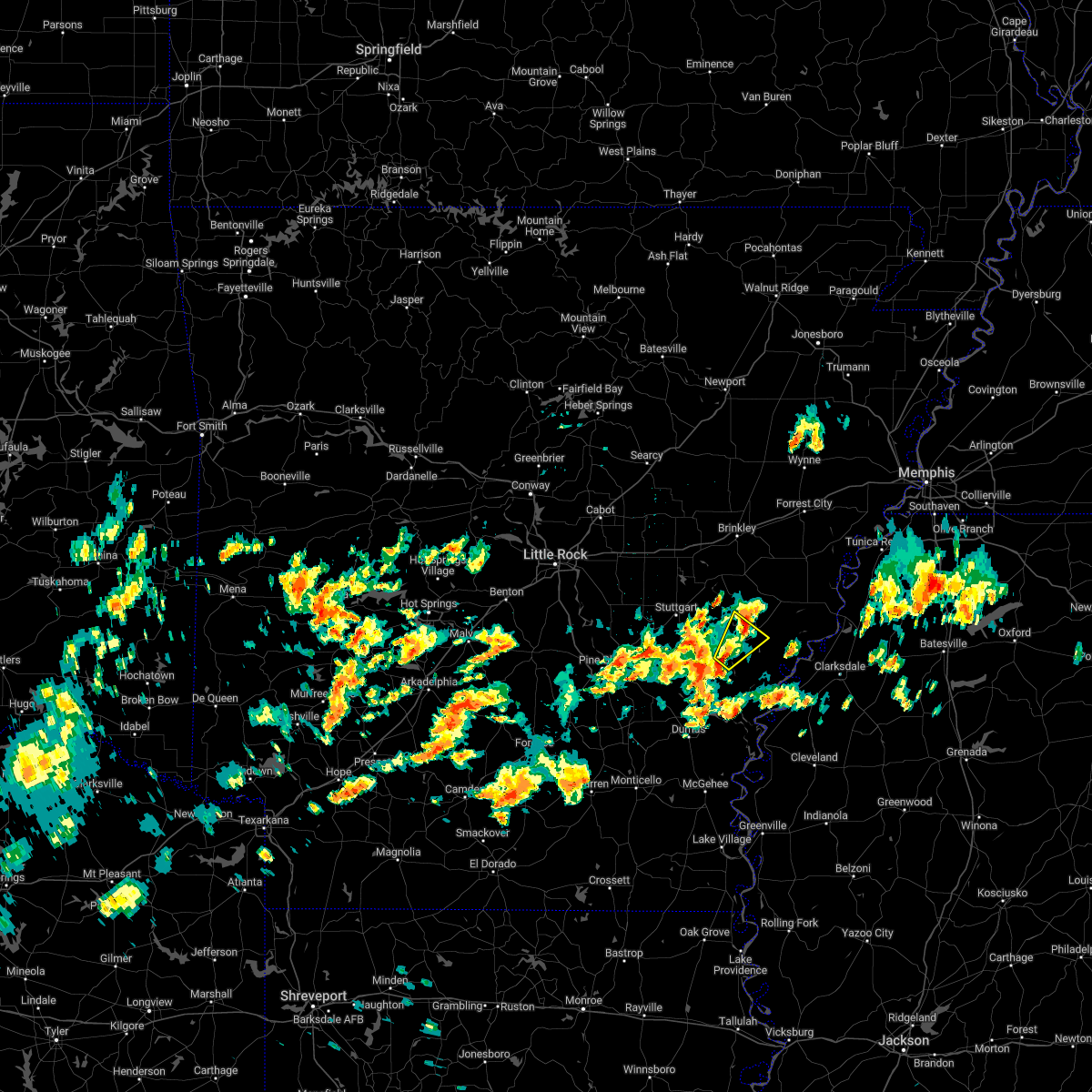 A severe thunderstorm warning remains in effect until 1245 pm cst for southeastern monroe and northeastern arkansas counties. at 1222 pm cst, a severe thunderstorm was located near de witt, or 14 miles northwest of white river national wildlife refuge, moving northeast at 40 mph. hazard. 60 mph wind gusts and quarter size hail. A severe thunderstorm warning remains in effect until 1245 pm cst for southeastern monroe and northeastern arkansas counties. at 1222 pm cst, a severe thunderstorm was located near de witt, or 14 miles northwest of white river national wildlife refuge, moving northeast at 40 mph. hazard. 60 mph wind gusts and quarter size hail.
|
| 1/2/2023 11:58 AM CST |
 At 1158 am cst, a severe thunderstorm was located near gillett, or 19 miles north of dumas, moving northeast at 40 mph (radar indicated). Hazards include 60 mph wind gusts and quarter size hail. Hail damage to vehicles is expected. Expect wind damage to roofs, siding, and trees. At 1158 am cst, a severe thunderstorm was located near gillett, or 19 miles north of dumas, moving northeast at 40 mph (radar indicated). Hazards include 60 mph wind gusts and quarter size hail. Hail damage to vehicles is expected. Expect wind damage to roofs, siding, and trees.
|
| 11/29/2022 7:19 PM CST |
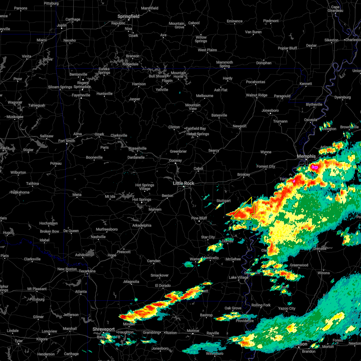 At 718 pm cst, a severe thunderstorm was located over st. charles, or 12 miles north of white river national wildlife refuge, moving northeast at 50 mph (radar indicated). Hazards include 60 mph wind gusts and quarter size hail. Hail damage to vehicles is expected. expect wind damage to roofs, siding, and trees. locations impacted include, st. charles, de witt, palmer, indian bay, ethel, crocketts bluff, ragtown, cross roads in monroe county, hail threat, radar indicated max hail size, 1. 00 in wind threat, radar indicated max wind gust, 60 mph. At 718 pm cst, a severe thunderstorm was located over st. charles, or 12 miles north of white river national wildlife refuge, moving northeast at 50 mph (radar indicated). Hazards include 60 mph wind gusts and quarter size hail. Hail damage to vehicles is expected. expect wind damage to roofs, siding, and trees. locations impacted include, st. charles, de witt, palmer, indian bay, ethel, crocketts bluff, ragtown, cross roads in monroe county, hail threat, radar indicated max hail size, 1. 00 in wind threat, radar indicated max wind gust, 60 mph.
|
| 11/29/2022 6:58 PM CST |
 At 657 pm cst, a severe thunderstorm was located near de witt, or 14 miles west of white river national wildlife refuge, moving northeast at 50 mph (radar indicated). Hazards include 60 mph wind gusts and quarter size hail. Hail damage to vehicles is expected. Expect wind damage to roofs, siding, and trees. At 657 pm cst, a severe thunderstorm was located near de witt, or 14 miles west of white river national wildlife refuge, moving northeast at 50 mph (radar indicated). Hazards include 60 mph wind gusts and quarter size hail. Hail damage to vehicles is expected. Expect wind damage to roofs, siding, and trees.
|
| 11/5/2022 12:26 AM CDT |
 At 1225 am cdt, severe thunderstorms were located along a line extending from near richardson to 9 miles southeast of moro bay state park, moving east at 55 mph (radar indicated). Hazards include 60 mph wind gusts and penny size hail. expect damage to roofs, siding, and trees At 1225 am cdt, severe thunderstorms were located along a line extending from near richardson to 9 miles southeast of moro bay state park, moving east at 55 mph (radar indicated). Hazards include 60 mph wind gusts and penny size hail. expect damage to roofs, siding, and trees
|
| 11/4/2022 11:44 PM CDT |
 At 1143 pm cdt, a severe thunderstorm was located near pine bluff arsenal, or 9 miles north of pine bluff, moving east at 50 mph (radar indicated). Hazards include 60 mph wind gusts. expect damage to roofs, siding, and trees At 1143 pm cdt, a severe thunderstorm was located near pine bluff arsenal, or 9 miles north of pine bluff, moving east at 50 mph (radar indicated). Hazards include 60 mph wind gusts. expect damage to roofs, siding, and trees
|
| 11/4/2022 11:05 PM CDT |
 At 1104 pm cdt, a severe thunderstorm was located near pine bluff arsenal, or 11 miles east of sheridan, moving east at 45 mph (radar indicated). Hazards include 60 mph wind gusts. expect damage to roofs, siding, and trees At 1104 pm cdt, a severe thunderstorm was located near pine bluff arsenal, or 11 miles east of sheridan, moving east at 45 mph (radar indicated). Hazards include 60 mph wind gusts. expect damage to roofs, siding, and trees
|
| 7/18/2022 3:23 AM CDT |
 At 323 am cdt, severe thunderstorms were located along a line extending from near clarendon to 7 miles east of almyra to near de witt, moving east at 40 mph (radar indicated). Hazards include 60 mph wind gusts. Expect damage to roofs, siding, and trees. locations impacted include, gillett, st. charles, de witt, merrisach lake, ethel, de luce, casscoe, crocketts bluff, tichnor, ragtown, indian bay, weber, lawrenceville, cross roads in monroe county, hail threat, radar indicated max hail size, <. 75 in wind threat, radar indicated max wind gust, 60 mph. At 323 am cdt, severe thunderstorms were located along a line extending from near clarendon to 7 miles east of almyra to near de witt, moving east at 40 mph (radar indicated). Hazards include 60 mph wind gusts. Expect damage to roofs, siding, and trees. locations impacted include, gillett, st. charles, de witt, merrisach lake, ethel, de luce, casscoe, crocketts bluff, tichnor, ragtown, indian bay, weber, lawrenceville, cross roads in monroe county, hail threat, radar indicated max hail size, <. 75 in wind threat, radar indicated max wind gust, 60 mph.
|
| 7/18/2022 2:56 AM CDT |
 At 256 am cdt, severe thunderstorms were located along a line extending from near roe to near stuttgart to 8 miles northeast of richardson, moving east at 40 mph (radar indicated). Hazards include 60 mph wind gusts. expect damage to roofs, siding, and trees At 256 am cdt, severe thunderstorms were located along a line extending from near roe to near stuttgart to 8 miles northeast of richardson, moving east at 40 mph (radar indicated). Hazards include 60 mph wind gusts. expect damage to roofs, siding, and trees
|
| 5/21/2022 11:05 PM CDT |
 At 1104 pm cdt, severe thunderstorms were located along a line extending from 9 miles southwest of almyra to near nebo to near hebron to near harlow to near chidester, moving southeast at 30 mph (radar indicated). Hazards include 60 mph wind gusts and quarter size hail. Hail damage to vehicles is expected. Expect wind damage to roofs, siding, and trees. At 1104 pm cdt, severe thunderstorms were located along a line extending from 9 miles southwest of almyra to near nebo to near hebron to near harlow to near chidester, moving southeast at 30 mph (radar indicated). Hazards include 60 mph wind gusts and quarter size hail. Hail damage to vehicles is expected. Expect wind damage to roofs, siding, and trees.
|
| 5/21/2022 10:29 PM CDT |
 At 1029 pm cdt, severe thunderstorms were located along a line extending from near humnoke to near white hall, moving southeast at 40 mph (radar indicated). Hazards include 60 mph wind gusts and quarter size hail. Hail damage to vehicles is expected. Expect wind damage to roofs, siding, and trees. At 1029 pm cdt, severe thunderstorms were located along a line extending from near humnoke to near white hall, moving southeast at 40 mph (radar indicated). Hazards include 60 mph wind gusts and quarter size hail. Hail damage to vehicles is expected. Expect wind damage to roofs, siding, and trees.
|
| 5/15/2022 5:51 PM CDT |
 The severe thunderstorm warning for northeastern cleveland, southeastern grant, southeastern monroe, southern jefferson, northwestern lincoln and arkansas counties will expire at 600 pm cdt, the storms which prompted the warning are exiting into areas to the south. therefore, the warning will be allowed to expire. a severe thunderstorm watch remains in effect until 600 pm cdt for central, eastern and southeastern arkansas. a severe thunderstorm watch also remains in effect until 900 pm cdt for southeastern arkansas. &&. The severe thunderstorm warning for northeastern cleveland, southeastern grant, southeastern monroe, southern jefferson, northwestern lincoln and arkansas counties will expire at 600 pm cdt, the storms which prompted the warning are exiting into areas to the south. therefore, the warning will be allowed to expire. a severe thunderstorm watch remains in effect until 600 pm cdt for central, eastern and southeastern arkansas. a severe thunderstorm watch also remains in effect until 900 pm cdt for southeastern arkansas. &&.
|
| 5/15/2022 5:25 PM CDT |
 At 524 pm cdt, severe thunderstorms were located along a line extending from near palmer to 9 miles west of de witt to near lamont, moving southeast at 40 mph (radar indicated). Hazards include 60 mph wind gusts and nickel size hail. Expect damage to roofs, siding, and trees. locations impacted include, pine bluff, rison, white hall, altheimer, grady, almyra, st. charles, whitefield, little bayou meto park, woodville, cottondale, lamont, linwood, madding, kedron, langford, palmer, richardson, de witt, warbritton, this includes interstate 530 between mile markers 35 and 46. hail threat, radar indicated max hail size, 0. 88 in wind threat, radar indicated max wind gust, 60 mph. At 524 pm cdt, severe thunderstorms were located along a line extending from near palmer to 9 miles west of de witt to near lamont, moving southeast at 40 mph (radar indicated). Hazards include 60 mph wind gusts and nickel size hail. Expect damage to roofs, siding, and trees. locations impacted include, pine bluff, rison, white hall, altheimer, grady, almyra, st. charles, whitefield, little bayou meto park, woodville, cottondale, lamont, linwood, madding, kedron, langford, palmer, richardson, de witt, warbritton, this includes interstate 530 between mile markers 35 and 46. hail threat, radar indicated max hail size, 0. 88 in wind threat, radar indicated max wind gust, 60 mph.
|
| 5/15/2022 4:59 PM CDT |
 At 459 pm cdt, severe thunderstorms were located along a line extending from garret grove to humphrey to near sheridan, moving southeast at 40 mph (radar indicated). Hazards include 60 mph wind gusts and quarter size hail. Hail damage to vehicles is expected. Expect wind damage to roofs, siding, and trees. At 459 pm cdt, severe thunderstorms were located along a line extending from garret grove to humphrey to near sheridan, moving southeast at 40 mph (radar indicated). Hazards include 60 mph wind gusts and quarter size hail. Hail damage to vehicles is expected. Expect wind damage to roofs, siding, and trees.
|
| 5/5/2022 2:43 PM CDT | Large tree fell on a truck in de wit in arkansas county AR, 0.1 miles S of DeWitt, AR |
| 5/5/2022 2:37 PM CDT |
 At 237 pm cdt, a severe thunderstorm was located near gillett, or 19 miles west of white river national wildlife refuge, moving east at 40 mph (radar indicated). Hazards include 60 mph wind gusts and quarter size hail. Hail damage to vehicles is expected. Expect wind damage to roofs, siding, and trees. At 237 pm cdt, a severe thunderstorm was located near gillett, or 19 miles west of white river national wildlife refuge, moving east at 40 mph (radar indicated). Hazards include 60 mph wind gusts and quarter size hail. Hail damage to vehicles is expected. Expect wind damage to roofs, siding, and trees.
|
| 5/5/2022 2:27 PM CDT |
 At 227 pm cdt, a severe thunderstorm was located near little bayou meto park, or 18 miles north of dumas, moving east at 45 mph (radar indicated). Hazards include 60 mph wind gusts and quarter size hail. Hail damage to vehicles is expected. expect wind damage to roofs, siding, and trees. locations impacted include, gillett, douglas, little bayou meto park, merrisach lake, de witt, langford, arkansas post, de luce, reydell, tichnor, bayou meteo state game area, hail threat, radar indicated max hail size, 1. 00 in wind threat, radar indicated max wind gust, 60 mph. At 227 pm cdt, a severe thunderstorm was located near little bayou meto park, or 18 miles north of dumas, moving east at 45 mph (radar indicated). Hazards include 60 mph wind gusts and quarter size hail. Hail damage to vehicles is expected. expect wind damage to roofs, siding, and trees. locations impacted include, gillett, douglas, little bayou meto park, merrisach lake, de witt, langford, arkansas post, de luce, reydell, tichnor, bayou meteo state game area, hail threat, radar indicated max hail size, 1. 00 in wind threat, radar indicated max wind gust, 60 mph.
|
| 5/5/2022 2:03 PM CDT |
 At 203 pm cdt, severe thunderstorms were located along a line extending from linwood to nebo, moving east at 40 mph (radar indicated). Hazards include 60 mph wind gusts and quarter size hail. Hail damage to vehicles is expected. Expect wind damage to roofs, siding, and trees. At 203 pm cdt, severe thunderstorms were located along a line extending from linwood to nebo, moving east at 40 mph (radar indicated). Hazards include 60 mph wind gusts and quarter size hail. Hail damage to vehicles is expected. Expect wind damage to roofs, siding, and trees.
|
| 5/5/2022 1:19 PM CDT |
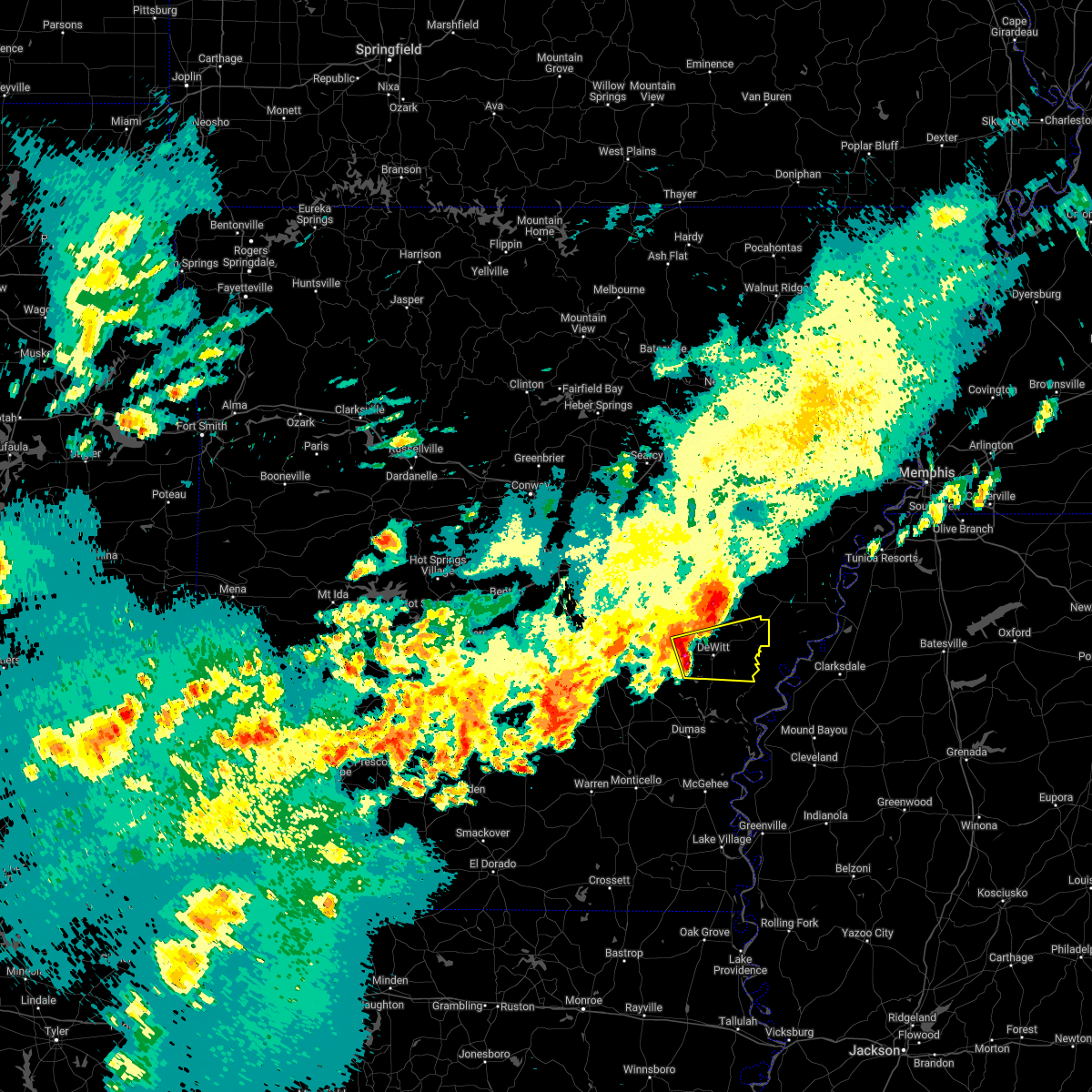 At 118 pm cdt, a severe thunderstorm was located 7 miles west of de witt, or 14 miles south of stuttgart, moving east at 40 mph (radar indicated). Hazards include 60 mph wind gusts and half dollar size hail. Hail damage to vehicles is expected. expect wind damage to roofs, siding, and trees. locations impacted include, almyra, st. charles, de witt, indian bay, ethel, de luce, lodge corner, crocketts bluff, cross roads in monroe county, hail threat, radar indicated max hail size, 1. 25 in wind threat, radar indicated max wind gust, 60 mph. At 118 pm cdt, a severe thunderstorm was located 7 miles west of de witt, or 14 miles south of stuttgart, moving east at 40 mph (radar indicated). Hazards include 60 mph wind gusts and half dollar size hail. Hail damage to vehicles is expected. expect wind damage to roofs, siding, and trees. locations impacted include, almyra, st. charles, de witt, indian bay, ethel, de luce, lodge corner, crocketts bluff, cross roads in monroe county, hail threat, radar indicated max hail size, 1. 25 in wind threat, radar indicated max wind gust, 60 mph.
|
| 5/5/2022 1:09 PM CDT |
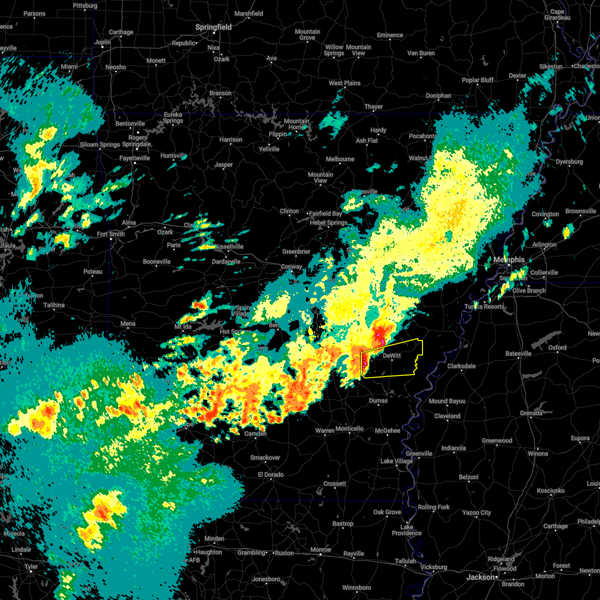 At 109 pm cdt, a severe thunderstorm was located 7 miles north of langford, or 15 miles south of stuttgart, moving east at 40 mph (radar indicated). Hazards include 60 mph wind gusts and half dollar size hail. Hail damage to vehicles is expected. Expect wind damage to roofs, siding, and trees. At 109 pm cdt, a severe thunderstorm was located 7 miles north of langford, or 15 miles south of stuttgart, moving east at 40 mph (radar indicated). Hazards include 60 mph wind gusts and half dollar size hail. Hail damage to vehicles is expected. Expect wind damage to roofs, siding, and trees.
|
| 5/5/2022 1:02 PM CDT |
 At 102 pm cdt, a severe thunderstorm was located near richardson, or 16 miles south of stuttgart, moving east at 25 mph (radar indicated). Hazards include 60 mph wind gusts and quarter size hail. Hail damage to vehicles is expected. expect wind damage to roofs, siding, and trees. locations impacted include, white river national wildlife r, gillett, grady, yancopin, woodville, langford, douglas, little bayou meto park, merrisach lake, trusten holder wma, de witt, arkansas post, ethel, de luce, tichnor, morgan point recreation area, bayou meteo state game area, lodge corner, reydell, weber, hail threat, radar indicated max hail size, 1. 00 in wind threat, radar indicated max wind gust, 60 mph. At 102 pm cdt, a severe thunderstorm was located near richardson, or 16 miles south of stuttgart, moving east at 25 mph (radar indicated). Hazards include 60 mph wind gusts and quarter size hail. Hail damage to vehicles is expected. expect wind damage to roofs, siding, and trees. locations impacted include, white river national wildlife r, gillett, grady, yancopin, woodville, langford, douglas, little bayou meto park, merrisach lake, trusten holder wma, de witt, arkansas post, ethel, de luce, tichnor, morgan point recreation area, bayou meteo state game area, lodge corner, reydell, weber, hail threat, radar indicated max hail size, 1. 00 in wind threat, radar indicated max wind gust, 60 mph.
|
| 5/5/2022 12:43 PM CDT |
 At 1243 pm cdt, severe thunderstorms were located along a line extending from 7 miles southeast of humphrey to 7 miles northwest of feenyville, moving east at 50 mph (radar indicated). Hazards include 60 mph wind gusts and penny size hail. Expect damage to roofs, siding, and trees. locations impacted include, white river national wildlife r, gould, gillett, grady, watson, yancopin, cottondale, whitefield, linwood, little bayou meto park, madding, merrisach lake, woodville, langford, douglas, richardson, trusten holder wma, de witt, arkansas post, tarry, hail threat, radar indicated max hail size, 0. 75 in wind threat, radar indicated max wind gust, 60 mph. At 1243 pm cdt, severe thunderstorms were located along a line extending from 7 miles southeast of humphrey to 7 miles northwest of feenyville, moving east at 50 mph (radar indicated). Hazards include 60 mph wind gusts and penny size hail. Expect damage to roofs, siding, and trees. locations impacted include, white river national wildlife r, gould, gillett, grady, watson, yancopin, cottondale, whitefield, linwood, little bayou meto park, madding, merrisach lake, woodville, langford, douglas, richardson, trusten holder wma, de witt, arkansas post, tarry, hail threat, radar indicated max hail size, 0. 75 in wind threat, radar indicated max wind gust, 60 mph.
|
| 5/5/2022 12:07 PM CDT |
 At 1207 pm cdt, severe thunderstorms were located along a line extending from near warbritton to near lamont, moving east at 55 mph (radar indicated). Hazards include 60 mph wind gusts and penny size hail. expect damage to roofs, siding, and trees At 1207 pm cdt, severe thunderstorms were located along a line extending from near warbritton to near lamont, moving east at 55 mph (radar indicated). Hazards include 60 mph wind gusts and penny size hail. expect damage to roofs, siding, and trees
|
| 4/13/2022 4:32 PM CDT | Powerlines and powerpoles downed by thunderstorm winds. there was also a tornado warning in effect at the time... but will have to wait for water to recede and road con in arkansas county AR, 2.6 miles N of DeWitt, AR |
| 4/13/2022 4:32 PM CDT |
 At 431 pm cdt, severe thunderstorms were located along a line extending from near holly grove to near de witt to near gould, moving east at 65 mph (radar indicated). Hazards include 70 mph wind gusts and penny size hail. Expect considerable tree damage. damage is likely to mobile homes, roofs, and outbuildings. locations impacted include, gould, gillett, holly grove, grady, almyra, st. Charles, cane creek state park, little bayou meto park, merrisach lake, woodville, langford, palmer, douglas, de witt, arkansas post, de luce, almyra airport, casscoe, tichnor, crigler,. At 431 pm cdt, severe thunderstorms were located along a line extending from near holly grove to near de witt to near gould, moving east at 65 mph (radar indicated). Hazards include 70 mph wind gusts and penny size hail. Expect considerable tree damage. damage is likely to mobile homes, roofs, and outbuildings. locations impacted include, gould, gillett, holly grove, grady, almyra, st. Charles, cane creek state park, little bayou meto park, merrisach lake, woodville, langford, palmer, douglas, de witt, arkansas post, de luce, almyra airport, casscoe, tichnor, crigler,.
|
| 4/13/2022 4:26 PM CDT | At 426 pm cdt, a severe thunderstorm capable of producing a tornado was located 7 miles southwest of de witt, or 18 miles south of stuttgart, moving east at 60 mph (radar indicated rotation). Hazards include tornado. Flying debris will be dangerous to those caught without shelter. mobile homes will be damaged or destroyed. damage to roofs, windows, and vehicles will occur. Tree damage is likely. |
| 4/13/2022 3:57 PM CDT |
 At 356 pm cdt, severe thunderstorms were located along a line extending from near hensley island to near pine bluff to near toledo, moving east at 65 mph (radar indicated). Hazards include 70 mph wind gusts and penny size hail. Expect considerable tree damage. Damage is likely to mobile homes, roofs, and outbuildings. At 356 pm cdt, severe thunderstorms were located along a line extending from near hensley island to near pine bluff to near toledo, moving east at 65 mph (radar indicated). Hazards include 70 mph wind gusts and penny size hail. Expect considerable tree damage. Damage is likely to mobile homes, roofs, and outbuildings.
|
| 3/7/2022 2:17 AM CST |
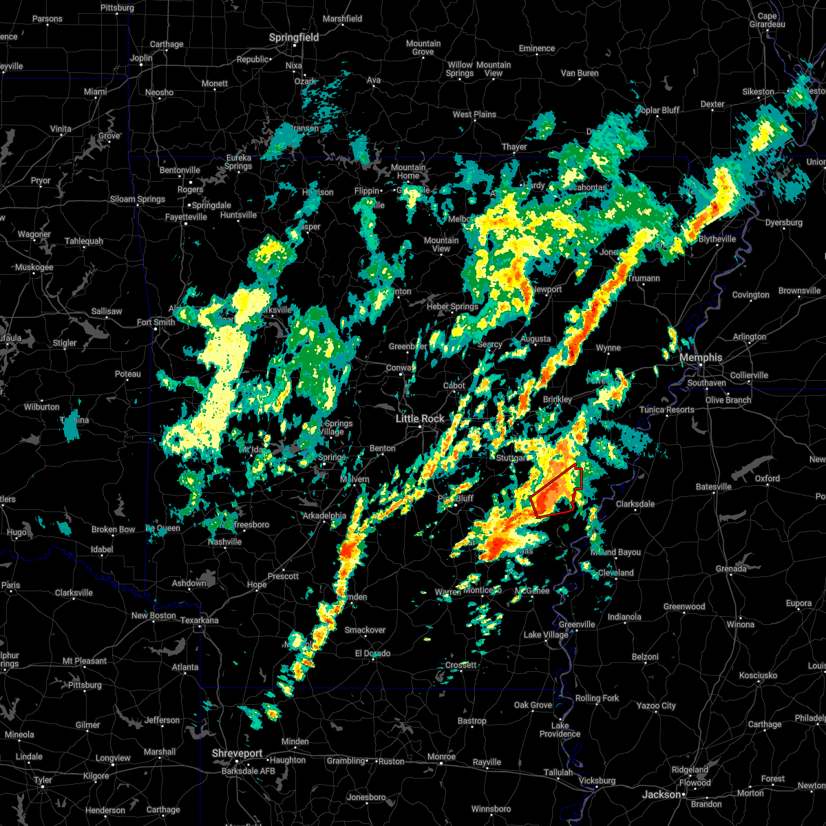 At 217 am cst, a severe thunderstorm capable of producing a tornado was located near de witt, or 12 miles west of white river national wildlife refuge, moving east at 45 mph (radar indicated rotation). Hazards include tornado and quarter size hail. Flying debris will be dangerous to those caught without shelter. mobile homes will be damaged or destroyed. damage to roofs, windows, and vehicles will occur. tree damage is likely. locations impacted include, white river national wildlife r, st. Charles, de witt, indian bay, ethel, de luce, cross roads in monroe county,. At 217 am cst, a severe thunderstorm capable of producing a tornado was located near de witt, or 12 miles west of white river national wildlife refuge, moving east at 45 mph (radar indicated rotation). Hazards include tornado and quarter size hail. Flying debris will be dangerous to those caught without shelter. mobile homes will be damaged or destroyed. damage to roofs, windows, and vehicles will occur. tree damage is likely. locations impacted include, white river national wildlife r, st. Charles, de witt, indian bay, ethel, de luce, cross roads in monroe county,.
|
| 3/7/2022 2:12 AM CST |
 At 212 am cst, a severe thunderstorm capable of producing a tornado was located near de witt, or 15 miles west of white river national wildlife refuge, moving east at 45 mph (radar indicated rotation). Hazards include tornado and quarter size hail. Flying debris will be dangerous to those caught without shelter. mobile homes will be damaged or destroyed. damage to roofs, windows, and vehicles will occur. tree damage is likely. locations impacted include, white river national wildlife r, gillett, st. Charles, de witt, indian bay, ethel, de luce, weber, tichnor, cross roads in monroe county,. At 212 am cst, a severe thunderstorm capable of producing a tornado was located near de witt, or 15 miles west of white river national wildlife refuge, moving east at 45 mph (radar indicated rotation). Hazards include tornado and quarter size hail. Flying debris will be dangerous to those caught without shelter. mobile homes will be damaged or destroyed. damage to roofs, windows, and vehicles will occur. tree damage is likely. locations impacted include, white river national wildlife r, gillett, st. Charles, de witt, indian bay, ethel, de luce, weber, tichnor, cross roads in monroe county,.
|
| 3/7/2022 1:54 AM CST |
 At 153 am cst, a severe thunderstorm capable of producing a tornado was located over little bayou meto park, or 17 miles north of dumas, moving east at 45 mph (radar indicated rotation). Hazards include tornado and quarter size hail. Flying debris will be dangerous to those caught without shelter. mobile homes will be damaged or destroyed. damage to roofs, windows, and vehicles will occur. Tree damage is likely. At 153 am cst, a severe thunderstorm capable of producing a tornado was located over little bayou meto park, or 17 miles north of dumas, moving east at 45 mph (radar indicated rotation). Hazards include tornado and quarter size hail. Flying debris will be dangerous to those caught without shelter. mobile homes will be damaged or destroyed. damage to roofs, windows, and vehicles will occur. Tree damage is likely.
|
| 2/17/2022 11:42 AM CST |
 At 1141 am cst, a severe thunderstorm was located over richardson, or 18 miles east of pine bluff, moving northeast at 60 mph (radar indicated). Hazards include 60 mph wind gusts and penny size hail. Expect damage to roofs, siding, and trees. locations impacted include, stuttgart, almyra, ulm, roe, cottondale, woodville, langford, linwood, richardson, madding, de witt, little bayou meto park, ethel, almyra airport, cornerstone, tamo, casscoe, moscow, bayou meteo state game area, lodge corner, hail threat, radar indicated max hail size, 0. 75 in wind threat, radar indicated max wind gust, 60 mph. At 1141 am cst, a severe thunderstorm was located over richardson, or 18 miles east of pine bluff, moving northeast at 60 mph (radar indicated). Hazards include 60 mph wind gusts and penny size hail. Expect damage to roofs, siding, and trees. locations impacted include, stuttgart, almyra, ulm, roe, cottondale, woodville, langford, linwood, richardson, madding, de witt, little bayou meto park, ethel, almyra airport, cornerstone, tamo, casscoe, moscow, bayou meteo state game area, lodge corner, hail threat, radar indicated max hail size, 0. 75 in wind threat, radar indicated max wind gust, 60 mph.
|
| 2/17/2022 11:24 AM CST |
 At 1123 am cst, a severe thunderstorm was located 8 miles northwest of feenyville, or 8 miles south of pine bluff, moving northeast at 55 mph (radar indicated). Hazards include 60 mph wind gusts and penny size hail. expect damage to roofs, siding, and trees At 1123 am cst, a severe thunderstorm was located 8 miles northwest of feenyville, or 8 miles south of pine bluff, moving northeast at 55 mph (radar indicated). Hazards include 60 mph wind gusts and penny size hail. expect damage to roofs, siding, and trees
|
| 6/8/2021 2:22 PM CDT |
 At 220 pm cdt, severe thunderstorms were located along a line extending from 8 miles northeast of langford to gould to 10 miles northeast of monticello, moving east at 35 mph (radar indicated). Hazards include 60 mph wind gusts. Expect damage to roofs, siding, and trees. Locations impacted include, dumas, gould, gillett, mitchellville, tillar, winchester, omega, little bayou meto park, mills, merrisach lake, langford, douglas, de witt, arkansas post, garrett bridge, de luce, gourd, florence, tyro, rose hill,. At 220 pm cdt, severe thunderstorms were located along a line extending from 8 miles northeast of langford to gould to 10 miles northeast of monticello, moving east at 35 mph (radar indicated). Hazards include 60 mph wind gusts. Expect damage to roofs, siding, and trees. Locations impacted include, dumas, gould, gillett, mitchellville, tillar, winchester, omega, little bayou meto park, mills, merrisach lake, langford, douglas, de witt, arkansas post, garrett bridge, de luce, gourd, florence, tyro, rose hill,.
|
| 6/8/2021 2:00 PM CDT |
 At 159 pm cdt, severe thunderstorms were located along a line extending from 6 miles north of richardson to whitefield to plantersville, moving east at 30 mph (radar indicated). Hazards include 60 mph wind gusts. expect damage to roofs, siding, and trees At 159 pm cdt, severe thunderstorms were located along a line extending from 6 miles north of richardson to whitefield to plantersville, moving east at 30 mph (radar indicated). Hazards include 60 mph wind gusts. expect damage to roofs, siding, and trees
|
| 6/7/2021 6:43 PM CDT |
 At 643 pm cdt, severe thunderstorms were located along a line extending from near humnoke to near stuttgart to near gillett to 8 miles south of de witt to near deeson, moving northeast at 50 mph (radar indicated). Hazards include 60 mph wind gusts. Expect damage to roofs, siding, and trees. locations impacted include, stuttgart, clarendon, hazen, de valls bluff, england, holly grove, humphrey, fredonia, humnoke, almyra, st. Charles, ulm, roe, peppers landing, brummitt, parkers corner, stuttgart municipal airport, hallsville, de witt, allport, this includes interstate 40 between mile markers 193 and 200. At 643 pm cdt, severe thunderstorms were located along a line extending from near humnoke to near stuttgart to near gillett to 8 miles south of de witt to near deeson, moving northeast at 50 mph (radar indicated). Hazards include 60 mph wind gusts. Expect damage to roofs, siding, and trees. locations impacted include, stuttgart, clarendon, hazen, de valls bluff, england, holly grove, humphrey, fredonia, humnoke, almyra, st. Charles, ulm, roe, peppers landing, brummitt, parkers corner, stuttgart municipal airport, hallsville, de witt, allport, this includes interstate 40 between mile markers 193 and 200.
|
| 6/7/2021 6:28 PM CDT |
 At 628 pm cdt, severe thunderstorms were located along a line extending from near england to near humphrey to near douglas to near gillett to 6 miles northwest of gunnison, moving northeast at 45 mph (radar indicated). Hazards include 60 mph wind gusts. Expect damage to roofs, siding, and trees. locations impacted include, stuttgart, clarendon, hazen, de valls bluff, england, altheimer, gould, gillett, holly grove, humphrey, grady, fredonia, humnoke, almyra, st. Charles, watson, ulm, roe, little bayou meto park, woodville, this includes interstate 40 between mile markers 192 and 200. At 628 pm cdt, severe thunderstorms were located along a line extending from near england to near humphrey to near douglas to near gillett to 6 miles northwest of gunnison, moving northeast at 45 mph (radar indicated). Hazards include 60 mph wind gusts. Expect damage to roofs, siding, and trees. locations impacted include, stuttgart, clarendon, hazen, de valls bluff, england, altheimer, gould, gillett, holly grove, humphrey, grady, fredonia, humnoke, almyra, st. Charles, watson, ulm, roe, little bayou meto park, woodville, this includes interstate 40 between mile markers 192 and 200.
|
| 6/7/2021 6:07 PM CDT |
 At 607 pm cdt, severe thunderstorms were located along a line extending from hensley island to near madding to near cane creek state park to near gould to 6 miles north of jersey point, moving northeast at 50 mph (radar indicated). Hazards include 60 mph wind gusts. expect damage to roofs, siding, and trees At 607 pm cdt, severe thunderstorms were located along a line extending from hensley island to near madding to near cane creek state park to near gould to 6 miles north of jersey point, moving northeast at 50 mph (radar indicated). Hazards include 60 mph wind gusts. expect damage to roofs, siding, and trees
|
| 3/27/2021 9:00 PM CDT |
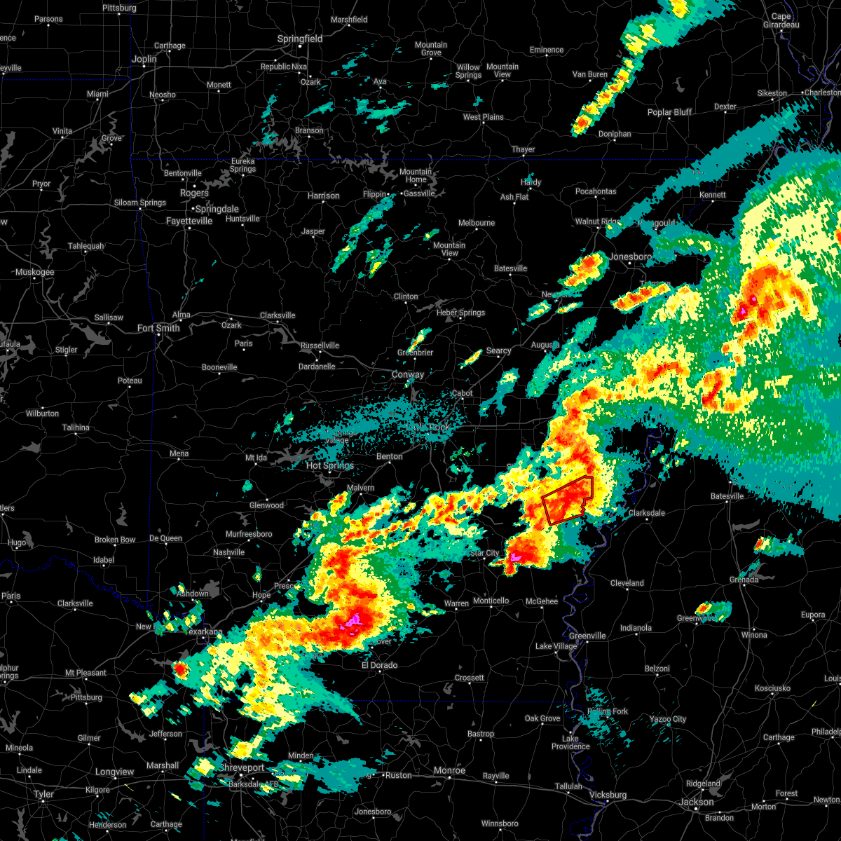 At 900 pm cdt, a confirmed large and extremely dangerous tornado was located 7 miles east of de witt, or 9 miles northwest of white river national wildlife refuge, moving east at 30 mph. this is a particularly dangerous situation. take cover now! (weather spotters confirmed tornado). Hazards include damaging tornado. You are in a life-threatening situation. flying debris may be deadly to those caught without shelter. mobile homes will be destroyed. considerable damage to homes, businesses, and vehicles is likely and complete destruction is possible. locations impacted include, st. Charles, de witt, indian bay, ethel, de luce, cross roads in monroe county,. At 900 pm cdt, a confirmed large and extremely dangerous tornado was located 7 miles east of de witt, or 9 miles northwest of white river national wildlife refuge, moving east at 30 mph. this is a particularly dangerous situation. take cover now! (weather spotters confirmed tornado). Hazards include damaging tornado. You are in a life-threatening situation. flying debris may be deadly to those caught without shelter. mobile homes will be destroyed. considerable damage to homes, businesses, and vehicles is likely and complete destruction is possible. locations impacted include, st. Charles, de witt, indian bay, ethel, de luce, cross roads in monroe county,.
|
| 3/27/2021 8:51 PM CDT |
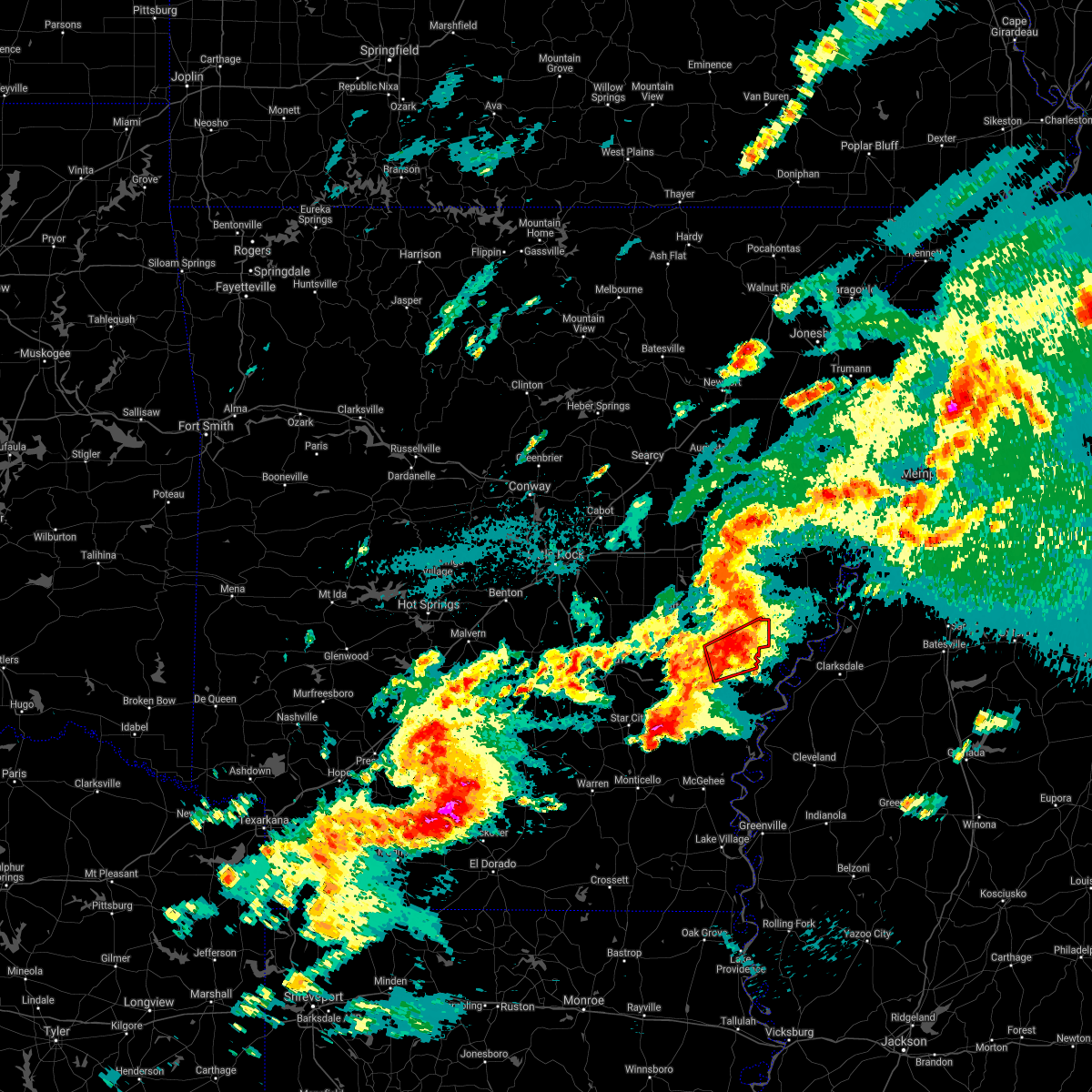 At 851 pm cdt, a confirmed large and extremely dangerous tornado was located near de witt, or 13 miles west of white river national wildlife refuge, moving northeast at 35 mph. this is a particularly dangerous situation. take cover now! (weather spotters confirmed tornado). Hazards include damaging tornado. You are in a life-threatening situation. flying debris may be deadly to those caught without shelter. mobile homes will be destroyed. considerable damage to homes, businesses, and vehicles is likely and complete destruction is possible. locations impacted include, st. Charles, de witt, indian bay, ethel, de luce, cross roads in monroe county,. At 851 pm cdt, a confirmed large and extremely dangerous tornado was located near de witt, or 13 miles west of white river national wildlife refuge, moving northeast at 35 mph. this is a particularly dangerous situation. take cover now! (weather spotters confirmed tornado). Hazards include damaging tornado. You are in a life-threatening situation. flying debris may be deadly to those caught without shelter. mobile homes will be destroyed. considerable damage to homes, businesses, and vehicles is likely and complete destruction is possible. locations impacted include, st. Charles, de witt, indian bay, ethel, de luce, cross roads in monroe county,.
|
| 3/27/2021 8:49 PM CDT |
 At 849 pm cdt, a severe thunderstorm capable of producing a tornado was located near de witt, or 14 miles west of white river national wildlife refuge, moving northeast at 35 mph (radar indicated rotation). Hazards include tornado and half dollar size hail. Flying debris will be dangerous to those caught without shelter. mobile homes will be damaged or destroyed. damage to roofs, windows, and vehicles will occur. Tree damage is likely. At 849 pm cdt, a severe thunderstorm capable of producing a tornado was located near de witt, or 14 miles west of white river national wildlife refuge, moving northeast at 35 mph (radar indicated rotation). Hazards include tornado and half dollar size hail. Flying debris will be dangerous to those caught without shelter. mobile homes will be damaged or destroyed. damage to roofs, windows, and vehicles will occur. Tree damage is likely.
|
| 3/27/2021 8:47 PM CDT |
 At 847 pm cdt, a severe thunderstorm capable of producing a tornado was located over de witt, or 15 miles west of white river national wildlife refuge, moving northeast at 40 mph (radar indicated rotation). Hazards include tornado and half dollar size hail. Flying debris will be dangerous to those caught without shelter. mobile homes will be damaged or destroyed. damage to roofs, windows, and vehicles will occur. tree damage is likely. locations impacted include, st. Charles, de witt, indian bay, ethel, de luce, cross roads in monroe county,. At 847 pm cdt, a severe thunderstorm capable of producing a tornado was located over de witt, or 15 miles west of white river national wildlife refuge, moving northeast at 40 mph (radar indicated rotation). Hazards include tornado and half dollar size hail. Flying debris will be dangerous to those caught without shelter. mobile homes will be damaged or destroyed. damage to roofs, windows, and vehicles will occur. tree damage is likely. locations impacted include, st. Charles, de witt, indian bay, ethel, de luce, cross roads in monroe county,.
|
| 3/27/2021 8:37 PM CDT |
 At 837 pm cdt, a severe thunderstorm capable of producing a tornado was located 7 miles southwest of de witt, or 19 miles west of white river national wildlife refuge, moving east at 50 mph (radar indicated rotation). Hazards include tornado and half dollar size hail. Flying debris will be dangerous to those caught without shelter. mobile homes will be damaged or destroyed. damage to roofs, windows, and vehicles will occur. tree damage is likely. locations impacted include, gillett, st. Charles, de witt, indian bay, ethel, de luce, weber, tichnor, cross roads in monroe county,. At 837 pm cdt, a severe thunderstorm capable of producing a tornado was located 7 miles southwest of de witt, or 19 miles west of white river national wildlife refuge, moving east at 50 mph (radar indicated rotation). Hazards include tornado and half dollar size hail. Flying debris will be dangerous to those caught without shelter. mobile homes will be damaged or destroyed. damage to roofs, windows, and vehicles will occur. tree damage is likely. locations impacted include, gillett, st. Charles, de witt, indian bay, ethel, de luce, weber, tichnor, cross roads in monroe county,.
|
| 3/27/2021 8:26 PM CDT |
 At 826 pm cdt, a severe thunderstorm capable of producing a tornado was located over langford, or 21 miles north of dumas, moving east at 45 mph (radar indicated rotation). Hazards include tornado and half dollar size hail. Flying debris will be dangerous to those caught without shelter. mobile homes will be damaged or destroyed. damage to roofs, windows, and vehicles will occur. tree damage is likely. locations impacted include, gillett, st. Charles, langford, little bayou meto park, de witt, ethel, de luce, tichnor, bayou meteo state game area, indian bay, lodge corner, reydell, weber, cross roads in monroe county,. At 826 pm cdt, a severe thunderstorm capable of producing a tornado was located over langford, or 21 miles north of dumas, moving east at 45 mph (radar indicated rotation). Hazards include tornado and half dollar size hail. Flying debris will be dangerous to those caught without shelter. mobile homes will be damaged or destroyed. damage to roofs, windows, and vehicles will occur. tree damage is likely. locations impacted include, gillett, st. Charles, langford, little bayou meto park, de witt, ethel, de luce, tichnor, bayou meteo state game area, indian bay, lodge corner, reydell, weber, cross roads in monroe county,.
|
| 3/27/2021 8:18 PM CDT |
 At 818 pm cdt, a severe thunderstorm capable of producing a tornado was located near woodville, or 18 miles northeast of star city, moving northeast at 35 mph (radar indicated rotation). Hazards include tornado and half dollar size hail. Flying debris will be dangerous to those caught without shelter. mobile homes will be damaged or destroyed. damage to roofs, windows, and vehicles will occur. tree damage is likely. locations impacted include, gillett, grady, st. Charles, woodville, langford, little bayou meto park, de witt, ethel, de luce, tichnor, bayou meteo state game area, indian bay, lodge corner, reydell, weber, sarassa, cross roads in monroe county, tamo,. At 818 pm cdt, a severe thunderstorm capable of producing a tornado was located near woodville, or 18 miles northeast of star city, moving northeast at 35 mph (radar indicated rotation). Hazards include tornado and half dollar size hail. Flying debris will be dangerous to those caught without shelter. mobile homes will be damaged or destroyed. damage to roofs, windows, and vehicles will occur. tree damage is likely. locations impacted include, gillett, grady, st. Charles, woodville, langford, little bayou meto park, de witt, ethel, de luce, tichnor, bayou meteo state game area, indian bay, lodge corner, reydell, weber, sarassa, cross roads in monroe county, tamo,.
|
| 3/27/2021 8:07 PM CDT |
 At 807 pm cdt, a severe thunderstorm capable of producing a tornado was located over linwood, or 13 miles north of star city, moving east at 45 mph (radar indicated rotation). Hazards include tornado and half dollar size hail. Flying debris will be dangerous to those caught without shelter. mobile homes will be damaged or destroyed. damage to roofs, windows, and vehicles will occur. Tree damage is likely. At 807 pm cdt, a severe thunderstorm capable of producing a tornado was located over linwood, or 13 miles north of star city, moving east at 45 mph (radar indicated rotation). Hazards include tornado and half dollar size hail. Flying debris will be dangerous to those caught without shelter. mobile homes will be damaged or destroyed. damage to roofs, windows, and vehicles will occur. Tree damage is likely.
|
| 6/21/2020 4:37 PM CDT |
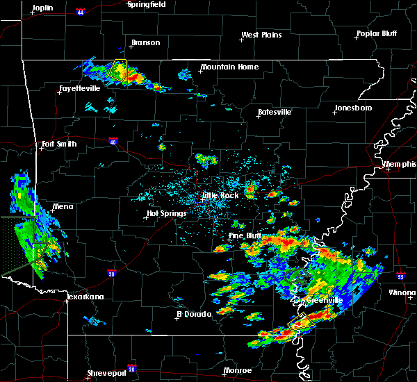 At 437 pm cdt, a severe thunderstorm was located 8 miles southeast of de witt, or 9 miles west of white river national wildlife refuge, moving east at 20 mph (radar indicated). Hazards include 60 mph wind gusts and quarter size hail. Hail damage to vehicles is expected. Expect wind damage to roofs, siding, and trees. At 437 pm cdt, a severe thunderstorm was located 8 miles southeast of de witt, or 9 miles west of white river national wildlife refuge, moving east at 20 mph (radar indicated). Hazards include 60 mph wind gusts and quarter size hail. Hail damage to vehicles is expected. Expect wind damage to roofs, siding, and trees.
|
| 6/5/2020 5:19 PM CDT |
 At 518 pm cdt, severe thunderstorms were located from near almyra to 7 miles northwest of white river national wildlife refuge, moving south at 25 mph (radar indicated). Hazards include 60 mph wind gusts and quarter size hail. Hail damage to vehicles is expected. Expect wind damage to roofs, siding, and trees. At 518 pm cdt, severe thunderstorms were located from near almyra to 7 miles northwest of white river national wildlife refuge, moving south at 25 mph (radar indicated). Hazards include 60 mph wind gusts and quarter size hail. Hail damage to vehicles is expected. Expect wind damage to roofs, siding, and trees.
|
| 6/5/2020 5:01 PM CDT |
 At 501 pm cdt, severe thunderstorms were located along a line extending from 5 miles northeast of almyra to 5 miles south of st. charles, moving southeast at 20 mph (radar indicated). Hazards include 60 mph wind gusts and quarter size hail. Hail damage to vehicles is expected. expect wind damage to roofs, siding, and trees. locations impacted include, stuttgart, white river national wildlife r, almyra, st. Charles, ulm, de witt, ethel, almyra airport, casscoe, crocketts bluff, indian bay, lawrenceville, cross roads in monroe county,. At 501 pm cdt, severe thunderstorms were located along a line extending from 5 miles northeast of almyra to 5 miles south of st. charles, moving southeast at 20 mph (radar indicated). Hazards include 60 mph wind gusts and quarter size hail. Hail damage to vehicles is expected. expect wind damage to roofs, siding, and trees. locations impacted include, stuttgart, white river national wildlife r, almyra, st. Charles, ulm, de witt, ethel, almyra airport, casscoe, crocketts bluff, indian bay, lawrenceville, cross roads in monroe county,.
|
| 6/5/2020 4:43 PM CDT |
 At 442 pm cdt, strong to severe thunderstorms were located from near roe to near st. charles, moving southeast at 20 mph (radar indicated). Hazards include 60 mph wind gusts and quarter size hail. Hail damage to vehicles is expected. Expect wind damage to roofs, siding, and trees. At 442 pm cdt, strong to severe thunderstorms were located from near roe to near st. charles, moving southeast at 20 mph (radar indicated). Hazards include 60 mph wind gusts and quarter size hail. Hail damage to vehicles is expected. Expect wind damage to roofs, siding, and trees.
|
| 4/29/2020 12:30 AM CDT |
 At 1230 am cdt, severe thunderstorms were located along a line extending from near watkins corner to near merrisach lake to near cane creek state park, moving southeast at 60 mph (radar indicated). Hazards include 60 mph wind gusts and penny size hail. Expect damage to roofs, siding, and trees. locations impacted include, dumas, rosedale, rohwer, gould, gillett, grady, arkansas city, mitchellville, st. Charles, tillar, watson, winchester, whitefield, lucca landing, little bayou meto park, woodville, douglas, trusten holder wma, nebo, yancopin,. At 1230 am cdt, severe thunderstorms were located along a line extending from near watkins corner to near merrisach lake to near cane creek state park, moving southeast at 60 mph (radar indicated). Hazards include 60 mph wind gusts and penny size hail. Expect damage to roofs, siding, and trees. locations impacted include, dumas, rosedale, rohwer, gould, gillett, grady, arkansas city, mitchellville, st. Charles, tillar, watson, winchester, whitefield, lucca landing, little bayou meto park, woodville, douglas, trusten holder wma, nebo, yancopin,.
|
| 4/29/2020 12:12 AM CDT |
 At 1212 am cdt, severe thunderstorms were located along a line extending from near holly grove to near de witt to near cottondale, moving east at 55 mph (radar indicated). Hazards include 60 mph wind gusts and penny size hail. expect damage to roofs, siding, and trees At 1212 am cdt, severe thunderstorms were located along a line extending from near holly grove to near de witt to near cottondale, moving east at 55 mph (radar indicated). Hazards include 60 mph wind gusts and penny size hail. expect damage to roofs, siding, and trees
|
| 4/28/2020 11:48 PM CDT |
 At 1148 pm cdt, severe thunderstorms were located along a line extending from near roe to near stuttgart to near humphrey to near pine bluff, moving southeast at 45 mph (radar indicated). Hazards include 60 mph wind gusts and quarter size hail. Hail damage to vehicles is expected. expect wind damage to roofs, siding, and trees. locations impacted include, pine bluff, stuttgart, star city, clarendon, hazen, de valls bluff, white hall, england, altheimer, gould, gillett, holly grove, humphrey, grady, fredonia, humnoke, almyra, st. charles, ulm, roe, this includes the following highways, interstate 40 between mile markers 191 and 198. Interstate 530 between mile markers 24 and 46. At 1148 pm cdt, severe thunderstorms were located along a line extending from near roe to near stuttgart to near humphrey to near pine bluff, moving southeast at 45 mph (radar indicated). Hazards include 60 mph wind gusts and quarter size hail. Hail damage to vehicles is expected. expect wind damage to roofs, siding, and trees. locations impacted include, pine bluff, stuttgart, star city, clarendon, hazen, de valls bluff, white hall, england, altheimer, gould, gillett, holly grove, humphrey, grady, fredonia, humnoke, almyra, st. charles, ulm, roe, this includes the following highways, interstate 40 between mile markers 191 and 198. Interstate 530 between mile markers 24 and 46.
|
| 4/28/2020 11:24 PM CDT |
 At 1124 pm cdt, severe thunderstorms were located along a line extending from near carlisle to near parkers corner to england to near pine bluff arsenal, moving southeast at 55 mph (radar indicated). Hazards include 60 mph wind gusts and quarter size hail. Hail damage to vehicles is expected. Expect wind damage to roofs, siding, and trees. At 1124 pm cdt, severe thunderstorms were located along a line extending from near carlisle to near parkers corner to england to near pine bluff arsenal, moving southeast at 55 mph (radar indicated). Hazards include 60 mph wind gusts and quarter size hail. Hail damage to vehicles is expected. Expect wind damage to roofs, siding, and trees.
|
| 4/12/2020 9:04 PM CDT |
 At 904 pm cdt, severe thunderstorms were located along a line extending from roe to 6 miles west of st. charles to 7 miles northwest of white river national wildlife refuge to 8 miles northeast of trusten holder wma to near yancopin to lucca landing, moving east at 70 mph (radar indicated). Hazards include 70 mph wind gusts and quarter size hail. Hail damage to vehicles is expected. expect considerable tree damage. wind damage is also likely to mobile homes, roofs, and outbuildings. locations impacted include, stuttgart, rohwer, gillett, holly grove, almyra, st. Charles, tillar, watson, ulm, winchester, roe, yancopin, omega, merrisach lake, kelso, palmer, stuttgart municipal airport, trusten holder wma, de witt, blackton,. At 904 pm cdt, severe thunderstorms were located along a line extending from roe to 6 miles west of st. charles to 7 miles northwest of white river national wildlife refuge to 8 miles northeast of trusten holder wma to near yancopin to lucca landing, moving east at 70 mph (radar indicated). Hazards include 70 mph wind gusts and quarter size hail. Hail damage to vehicles is expected. expect considerable tree damage. wind damage is also likely to mobile homes, roofs, and outbuildings. locations impacted include, stuttgart, rohwer, gillett, holly grove, almyra, st. Charles, tillar, watson, ulm, winchester, roe, yancopin, omega, merrisach lake, kelso, palmer, stuttgart municipal airport, trusten holder wma, de witt, blackton,.
|
| 4/12/2020 8:57 PM CDT | Wind gust measured from a trained spotter weather statio in arkansas county AR, 0.1 miles S of DeWitt, AR |
| 4/12/2020 8:57 PM CDT | Wind gust measured from a trained spotter weather statio in arkansas county AR, 0.1 miles S of DeWitt, AR |
| 4/12/2020 8:51 PM CDT |
 At 850 pm cdt, severe thunderstorms were located along a line extending from near parkers corner to 7 miles south of stuttgart to 8 miles northeast of langford to near gillett to near dumas to near tillar, moving east at 75 mph (radar indicated). Hazards include 70 mph wind gusts and quarter size hail. Hail damage to vehicles is expected. expect considerable tree damage. wind damage is also likely to mobile homes, roofs, and outbuildings. locations impacted include, stuttgart, dumas, rohwer, gould, gillett, holly grove, humphrey, grady, mitchellville, humnoke, almyra, st. Charles, tillar, watson, ulm, winchester, roe, little bayou meto park, woodville, douglas,. At 850 pm cdt, severe thunderstorms were located along a line extending from near parkers corner to 7 miles south of stuttgart to 8 miles northeast of langford to near gillett to near dumas to near tillar, moving east at 75 mph (radar indicated). Hazards include 70 mph wind gusts and quarter size hail. Hail damage to vehicles is expected. expect considerable tree damage. wind damage is also likely to mobile homes, roofs, and outbuildings. locations impacted include, stuttgart, dumas, rohwer, gould, gillett, holly grove, humphrey, grady, mitchellville, humnoke, almyra, st. Charles, tillar, watson, ulm, winchester, roe, little bayou meto park, woodville, douglas,.
|
| 4/12/2020 8:28 PM CDT |
 At 827 pm cdt, severe thunderstorms were located along a line extending from estes to 7 miles northwest of altheimer to near cottondale to near feenyville to 6 miles east of herbine to near warren, moving east at 65 mph (radar indicated). Hazards include 70 mph wind gusts and quarter size hail. Hail damage to vehicles is expected. expect considerable tree damage. Wind damage is also likely to mobile homes, roofs, and outbuildings. At 827 pm cdt, severe thunderstorms were located along a line extending from estes to 7 miles northwest of altheimer to near cottondale to near feenyville to 6 miles east of herbine to near warren, moving east at 65 mph (radar indicated). Hazards include 70 mph wind gusts and quarter size hail. Hail damage to vehicles is expected. expect considerable tree damage. Wind damage is also likely to mobile homes, roofs, and outbuildings.
|
| 1/11/2020 2:28 AM CST |
 At 228 am cst, severe thunderstorms were located along a line extending from near stuttgart to 8 miles southwest of almyra to little bayou meto park to near whitefield, moving east at 35 mph (radar indicated). Hazards include 60 mph wind gusts. expect damage to roofs, siding, and trees At 228 am cst, severe thunderstorms were located along a line extending from near stuttgart to 8 miles southwest of almyra to little bayou meto park to near whitefield, moving east at 35 mph (radar indicated). Hazards include 60 mph wind gusts. expect damage to roofs, siding, and trees
|
| 1/11/2020 2:18 AM CST |
 At 218 am cst, severe thunderstorms were located along a line extending from near humphrey to 7 miles north of langford to near woodville to nebo, moving east at 30 mph (radar indicated). Hazards include 60 mph wind gusts. Expect damage to roofs, siding, and trees. locations impacted include, pine bluff, stuttgart, altheimer, gould, gillett, humphrey, grady, almyra, st. Charles, nebo, cottondale, whitefield, brummitt, linwood, little bayou meto park, madding, woodville, langford, douglas, richardson,. At 218 am cst, severe thunderstorms were located along a line extending from near humphrey to 7 miles north of langford to near woodville to nebo, moving east at 30 mph (radar indicated). Hazards include 60 mph wind gusts. Expect damage to roofs, siding, and trees. locations impacted include, pine bluff, stuttgart, altheimer, gould, gillett, humphrey, grady, almyra, st. Charles, nebo, cottondale, whitefield, brummitt, linwood, little bayou meto park, madding, woodville, langford, douglas, richardson,.
|
| 1/11/2020 1:29 AM CST |
 At 129 am cst, severe thunderstorms were located along a line extending from near hazen to brummitt to near madding to 8 miles northwest of feenyville, moving east at 30 mph (radar indicated). Hazards include 60 mph wind gusts. expect damage to roofs, siding, and trees At 129 am cst, severe thunderstorms were located along a line extending from near hazen to brummitt to near madding to 8 miles northwest of feenyville, moving east at 30 mph (radar indicated). Hazards include 60 mph wind gusts. expect damage to roofs, siding, and trees
|
| 10/21/2019 5:43 AM CDT |
 The national weather service in little rock has issued a * severe thunderstorm warning for. northern desha county in southeastern arkansas. southeastern monroe county in eastern arkansas. southeastern jefferson county in southeastern arkansas. Northern lincoln county in southeastern arkansas. The national weather service in little rock has issued a * severe thunderstorm warning for. northern desha county in southeastern arkansas. southeastern monroe county in eastern arkansas. southeastern jefferson county in southeastern arkansas. Northern lincoln county in southeastern arkansas.
|
| 10/21/2019 5:33 AM CDT |
 At 533 am cdt, severe thunderstorms were located along a line extending from near holly grove to star city, moving east at 60 mph (radar indicated). Hazards include 60 mph wind gusts. Expect damage to roofs, siding, and trees. locations impacted include, pine bluff, stuttgart, rison, altheimer, gould, gillett, holly grove, humphrey, grady, almyra, st. Charles, ulm, whitefield, little bayou meto park, woodville, douglas, stuttgart municipal airport, nebo, feenyville, cottondale,. At 533 am cdt, severe thunderstorms were located along a line extending from near holly grove to star city, moving east at 60 mph (radar indicated). Hazards include 60 mph wind gusts. Expect damage to roofs, siding, and trees. locations impacted include, pine bluff, stuttgart, rison, altheimer, gould, gillett, holly grove, humphrey, grady, almyra, st. Charles, ulm, whitefield, little bayou meto park, woodville, douglas, stuttgart municipal airport, nebo, feenyville, cottondale,.
|
| 10/21/2019 5:06 AM CDT |
 At 506 am cdt, severe thunderstorms were located along a line extending from stuttgart municipal airport to near kingsland, moving east at 55 mph (radar indicated). Hazards include 60 mph wind gusts. expect damage to roofs, siding, and trees At 506 am cdt, severe thunderstorms were located along a line extending from stuttgart municipal airport to near kingsland, moving east at 55 mph (radar indicated). Hazards include 60 mph wind gusts. expect damage to roofs, siding, and trees
|
| 8/22/2019 5:48 PM CDT |
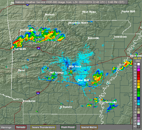 At 547 pm cdt, a severe thunderstorm was located near de witt, or 12 miles northwest of white river national wildlife refuge, moving southeast at 20 mph (radar indicated). Hazards include 60 mph wind gusts and penny size hail. Expect damage to roofs, siding, and trees. locations impacted include, st. Charles, de witt, indian bay, ethel, de luce, crocketts bluff, cross roads in monroe county,. At 547 pm cdt, a severe thunderstorm was located near de witt, or 12 miles northwest of white river national wildlife refuge, moving southeast at 20 mph (radar indicated). Hazards include 60 mph wind gusts and penny size hail. Expect damage to roofs, siding, and trees. locations impacted include, st. Charles, de witt, indian bay, ethel, de luce, crocketts bluff, cross roads in monroe county,.
|
| 8/22/2019 5:27 PM CDT |
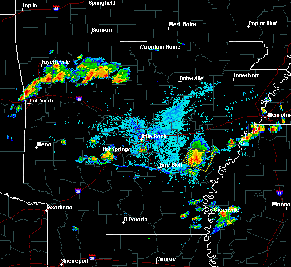 At 527 pm cdt, a severe thunderstorm was located over almyra, or 12 miles southeast of stuttgart, moving southeast at 15 mph (radar indicated). Hazards include 60 mph wind gusts and nickel size hail. Expect damage to roofs, siding, and trees. locations impacted include, almyra, st. Charles, de witt, indian bay, ethel, de luce, almyra airport, crocketts bluff, cross roads in monroe county,. At 527 pm cdt, a severe thunderstorm was located over almyra, or 12 miles southeast of stuttgart, moving southeast at 15 mph (radar indicated). Hazards include 60 mph wind gusts and nickel size hail. Expect damage to roofs, siding, and trees. locations impacted include, almyra, st. Charles, de witt, indian bay, ethel, de luce, almyra airport, crocketts bluff, cross roads in monroe county,.
|
| 8/22/2019 5:12 PM CDT |
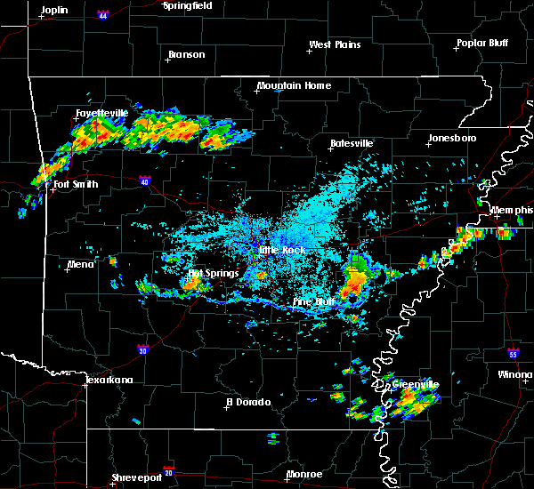 At 512 pm cdt, a severe thunderstorm was located over almyra, or 9 miles southeast of stuttgart, moving east at 20 mph (radar indicated). Hazards include 60 mph wind gusts and nickel size hail. expect damage to roofs, siding, and trees At 512 pm cdt, a severe thunderstorm was located over almyra, or 9 miles southeast of stuttgart, moving east at 20 mph (radar indicated). Hazards include 60 mph wind gusts and nickel size hail. expect damage to roofs, siding, and trees
|
| 5/18/2019 6:21 PM CDT |
 At 620 pm cdt, severe thunderstorms were located along a line extending from near almyra to near langford to nebo, moving east at 45 mph (radar indicated). Hazards include 60 mph wind gusts and nickel size hail. expect damage to roofs, siding, and trees At 620 pm cdt, severe thunderstorms were located along a line extending from near almyra to near langford to nebo, moving east at 45 mph (radar indicated). Hazards include 60 mph wind gusts and nickel size hail. expect damage to roofs, siding, and trees
|
| 5/8/2019 6:11 PM CDT |
 At 610 pm cdt, severe thunderstorms were located along a line extending from near pine bluff to nebo to near plantersville, moving northeast at 45 mph (law enforcement). Hazards include 60 mph wind gusts. expect damage to roofs, siding, and trees At 610 pm cdt, severe thunderstorms were located along a line extending from near pine bluff to nebo to near plantersville, moving northeast at 45 mph (law enforcement). Hazards include 60 mph wind gusts. expect damage to roofs, siding, and trees
|
| 4/7/2019 9:12 AM CDT |
 At 911 am cdt, a severe thunderstorm was located over omega, or near dumas, moving northeast at 50 mph (radar indicated). Hazards include 60 mph wind gusts and quarter size hail. Hail damage to vehicles is expected. Expect wind damage to roofs, siding, and trees. At 911 am cdt, a severe thunderstorm was located over omega, or near dumas, moving northeast at 50 mph (radar indicated). Hazards include 60 mph wind gusts and quarter size hail. Hail damage to vehicles is expected. Expect wind damage to roofs, siding, and trees.
|
| 3/13/2019 6:58 PM CDT |
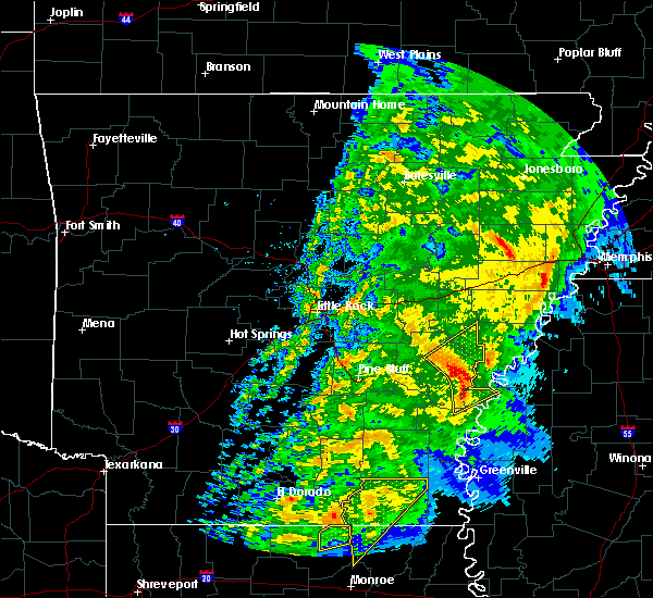 At 658 pm cdt, severe thunderstorms were located along a line extending from near almyra to 6 miles southeast of de witt to 6 miles west of white river national wildlife refuge to near trusten holder wma, moving northeast at 65 mph (radar indicated). Hazards include 60 mph wind gusts. expect damage to roofs, siding, and trees At 658 pm cdt, severe thunderstorms were located along a line extending from near almyra to 6 miles southeast of de witt to 6 miles west of white river national wildlife refuge to near trusten holder wma, moving northeast at 65 mph (radar indicated). Hazards include 60 mph wind gusts. expect damage to roofs, siding, and trees
|
| 3/9/2019 12:07 PM CST |
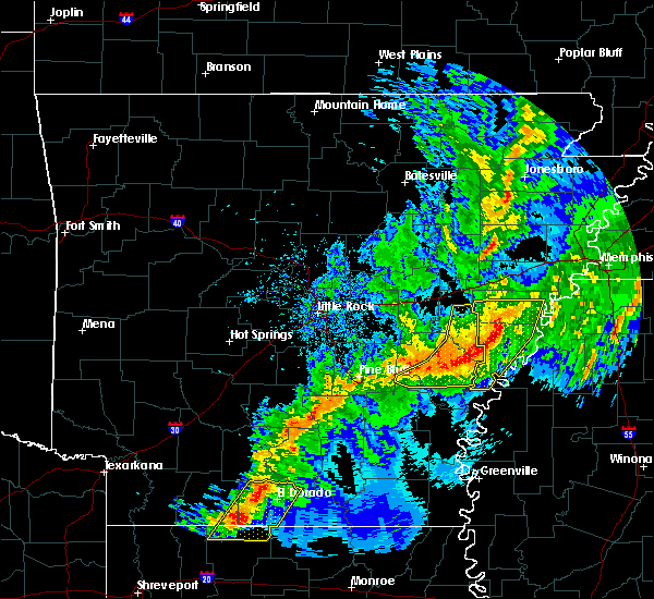 At 1206 pm cst, severe thunderstorms were located along a line extending from near rondo to near marvell to 6 miles east of st. charles to near de witt, moving east at 45 mph (radar indicated). Hazards include 60 mph wind gusts and quarter size hail. Hail damage to vehicles is expected. expect wind damage to roofs, siding, and trees. locations impacted include, almyra, st. Charles, langford, de witt, little bayou meto park, ethel, de luce, crocketts bluff, indian bay, lodge corner, reydell, cross roads in monroe county, tichnor, bayou meteo state game area, weber, a tornado watch remains in effect until 500 pm cst for eastern and southeastern arkansas. At 1206 pm cst, severe thunderstorms were located along a line extending from near rondo to near marvell to 6 miles east of st. charles to near de witt, moving east at 45 mph (radar indicated). Hazards include 60 mph wind gusts and quarter size hail. Hail damage to vehicles is expected. expect wind damage to roofs, siding, and trees. locations impacted include, almyra, st. Charles, langford, de witt, little bayou meto park, ethel, de luce, crocketts bluff, indian bay, lodge corner, reydell, cross roads in monroe county, tichnor, bayou meteo state game area, weber, a tornado watch remains in effect until 500 pm cst for eastern and southeastern arkansas.
|
| 3/9/2019 11:41 AM CST |
 At 1141 am cst, severe thunderstorms were located along a line extending from 7 miles north of palmer to near holly grove to near de witt to near richardson, moving east at 45 mph (radar indicated). Hazards include 60 mph wind gusts and quarter size hail. Hail damage to vehicles is expected. Expect wind damage to roofs, siding, and trees. At 1141 am cst, severe thunderstorms were located along a line extending from 7 miles north of palmer to near holly grove to near de witt to near richardson, moving east at 45 mph (radar indicated). Hazards include 60 mph wind gusts and quarter size hail. Hail damage to vehicles is expected. Expect wind damage to roofs, siding, and trees.
|
| 3/9/2019 11:35 AM CST |
 At 1135 am cst, severe thunderstorms were located along a line extending from 6 miles southwest of garret grove to near holly grove to near almyra to near langford, moving east at 45 mph (radar indicated). Hazards include 60 mph wind gusts and quarter size hail. Hail damage to vehicles is expected. expect wind damage to roofs, siding, and trees. Locations impacted include, stuttgart, clarendon, holly grove, humphrey, almyra, alfrey, allendale, dobbs landing, palmer, de witt, blackton, aberdeen, almyra airport, monroe, casscoe, crocketts bluff, ragtown, bayou meteo state game area, pine city, keevil, a tornado watch remains in effect until 500 pm cst for eastern, central and southeastern arkansas. At 1135 am cst, severe thunderstorms were located along a line extending from 6 miles southwest of garret grove to near holly grove to near almyra to near langford, moving east at 45 mph (radar indicated). Hazards include 60 mph wind gusts and quarter size hail. Hail damage to vehicles is expected. expect wind damage to roofs, siding, and trees. Locations impacted include, stuttgart, clarendon, holly grove, humphrey, almyra, alfrey, allendale, dobbs landing, palmer, de witt, blackton, aberdeen, almyra airport, monroe, casscoe, crocketts bluff, ragtown, bayou meteo state game area, pine city, keevil, a tornado watch remains in effect until 500 pm cst for eastern, central and southeastern arkansas.
|
| 3/9/2019 11:02 AM CST |
 At 1102 am cst, severe thunderstorms were located along a line extending from near parkers corner to near brummitt to 6 miles west of humphrey to near pine bluff, moving east at 35 mph (radar indicated). Hazards include 60 mph wind gusts and quarter size hail. Hail damage to vehicles is expected. Expect wind damage to roofs, siding, and trees. At 1102 am cst, severe thunderstorms were located along a line extending from near parkers corner to near brummitt to 6 miles west of humphrey to near pine bluff, moving east at 35 mph (radar indicated). Hazards include 60 mph wind gusts and quarter size hail. Hail damage to vehicles is expected. Expect wind damage to roofs, siding, and trees.
|
| 8/8/2018 6:22 PM CDT |
 At 622 pm cdt, severe thunderstorms were located along a line extending from near humphrey to langford to 9 miles southeast of cane creek state park, moving east at 40 mph (radar indicated). Hazards include 60 mph wind gusts and penny size hail. Expect damage to roofs, siding, and trees. Locations impacted include, stuttgart, dumas, gould, gillett, humphrey, grady, mitchellville, almyra, winchester, whitefield, plantersville, little bayou meto park, woodville, douglas, omega, cane creek state park, mills, langford, richardson, de witt,. At 622 pm cdt, severe thunderstorms were located along a line extending from near humphrey to langford to 9 miles southeast of cane creek state park, moving east at 40 mph (radar indicated). Hazards include 60 mph wind gusts and penny size hail. Expect damage to roofs, siding, and trees. Locations impacted include, stuttgart, dumas, gould, gillett, humphrey, grady, mitchellville, almyra, winchester, whitefield, plantersville, little bayou meto park, woodville, douglas, omega, cane creek state park, mills, langford, richardson, de witt,.
|
| 8/8/2018 5:56 PM CDT |
 At 555 pm cdt, severe thunderstorms were located along a line extending from near pine bluff arsenal to near linwood to near brandon, moving east at 40 mph (radar indicated). Hazards include 60 mph wind gusts and penny size hail. expect damage to roofs, siding, and trees At 555 pm cdt, severe thunderstorms were located along a line extending from near pine bluff arsenal to near linwood to near brandon, moving east at 40 mph (radar indicated). Hazards include 60 mph wind gusts and penny size hail. expect damage to roofs, siding, and trees
|
| 7/20/2018 10:10 PM CDT |
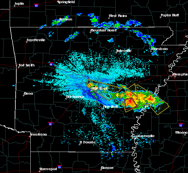 At 1010 pm cdt, a severe thunderstorm capable of producing a tornado was located near de witt, or 16 miles northwest of white river national wildlife refuge, moving south at 25 mph (radar indicated rotation). Hazards include tornado. Flying debris will be dangerous to those caught without shelter. mobile homes will be damaged or destroyed. damage to roofs, windows, and vehicles will occur. tree damage is likely. locations impacted include, st. Charles, de witt, ethel, crocketts bluff, lawrenceville,. At 1010 pm cdt, a severe thunderstorm capable of producing a tornado was located near de witt, or 16 miles northwest of white river national wildlife refuge, moving south at 25 mph (radar indicated rotation). Hazards include tornado. Flying debris will be dangerous to those caught without shelter. mobile homes will be damaged or destroyed. damage to roofs, windows, and vehicles will occur. tree damage is likely. locations impacted include, st. Charles, de witt, ethel, crocketts bluff, lawrenceville,.
|
| 7/20/2018 9:54 PM CDT |
 At 953 pm cdt, a severe thunderstorm capable of producing a tornado was located 8 miles northeast of almyra, or 13 miles south of clarendon, moving south at 25 mph (radar indicated rotation). Hazards include tornado. Flying debris will be dangerous to those caught without shelter. mobile homes will be damaged or destroyed. damage to roofs, windows, and vehicles will occur. Tree damage is likely. At 953 pm cdt, a severe thunderstorm capable of producing a tornado was located 8 miles northeast of almyra, or 13 miles south of clarendon, moving south at 25 mph (radar indicated rotation). Hazards include tornado. Flying debris will be dangerous to those caught without shelter. mobile homes will be damaged or destroyed. damage to roofs, windows, and vehicles will occur. Tree damage is likely.
|
| 7/20/2018 9:52 PM CDT |
 At 952 pm cdt, a severe thunderstorm was located 8 miles northeast of almyra, or 12 miles east of stuttgart, moving southeast at 30 mph (radar indicated). Hazards include 60 mph wind gusts and half dollar size hail. Hail damage to vehicles is expected. expect wind damage to roofs, siding, and trees. locations impacted include, clarendon, gillett, holly grove, almyra, st. Charles, ulm, roe, de witt, aberdeen, ethel, de luce, almyra airport, casscoe, crocketts bluff, ragtown, indian bay, pine city, lawrenceville, duncan, cross roads in monroe county,. At 952 pm cdt, a severe thunderstorm was located 8 miles northeast of almyra, or 12 miles east of stuttgart, moving southeast at 30 mph (radar indicated). Hazards include 60 mph wind gusts and half dollar size hail. Hail damage to vehicles is expected. expect wind damage to roofs, siding, and trees. locations impacted include, clarendon, gillett, holly grove, almyra, st. Charles, ulm, roe, de witt, aberdeen, ethel, de luce, almyra airport, casscoe, crocketts bluff, ragtown, indian bay, pine city, lawrenceville, duncan, cross roads in monroe county,.
|
| 7/20/2018 9:36 PM CDT |
 At 936 pm cdt, a severe thunderstorm was located over roe, or 9 miles southwest of clarendon, moving southeast at 30 mph (radar indicated). Hazards include 60 mph wind gusts and quarter size hail. Hail damage to vehicles is expected. Expect wind damage to roofs, siding, and trees. At 936 pm cdt, a severe thunderstorm was located over roe, or 9 miles southwest of clarendon, moving southeast at 30 mph (radar indicated). Hazards include 60 mph wind gusts and quarter size hail. Hail damage to vehicles is expected. Expect wind damage to roofs, siding, and trees.
|
| 7/19/2018 11:33 PM CDT |
 At 1133 pm cdt, severe thunderstorms were located along a line extending from near de witt to 7 miles northwest of gillett, moving southeast at 25 mph (radar indicated). Hazards include 60 mph wind gusts and penny size hail. Expect damage to roofs, siding, and trees. Locations impacted include, gillett, merrisach lake, trusten holder wma, de witt, arkansas post, de luce, lodge corner, weber, tichnor,. At 1133 pm cdt, severe thunderstorms were located along a line extending from near de witt to 7 miles northwest of gillett, moving southeast at 25 mph (radar indicated). Hazards include 60 mph wind gusts and penny size hail. Expect damage to roofs, siding, and trees. Locations impacted include, gillett, merrisach lake, trusten holder wma, de witt, arkansas post, de luce, lodge corner, weber, tichnor,.
|
| 7/19/2018 11:21 PM CDT |
 At 1121 pm cdt, a severe thunderstorm was located near de witt, or 14 miles southeast of stuttgart, moving south at 25 mph (radar indicated). Hazards include 60 mph wind gusts and penny size hail. expect damage to roofs, siding, and trees At 1121 pm cdt, a severe thunderstorm was located near de witt, or 14 miles southeast of stuttgart, moving south at 25 mph (radar indicated). Hazards include 60 mph wind gusts and penny size hail. expect damage to roofs, siding, and trees
|
| 6/23/2018 6:35 AM CDT |
 At 635 am cdt, a severe thunderstorm was located near langford, or 16 miles south of stuttgart, moving east at 50 mph (radar indicated). Hazards include 60 mph wind gusts and quarter size hail. Hail damage to vehicles is expected. expect wind damage to roofs, siding, and trees. Locations impacted include, gillett, richardson, little bayou meto park, langford, de witt, bayou meteo state game area, lodge corner, cornerstone, reydell,. At 635 am cdt, a severe thunderstorm was located near langford, or 16 miles south of stuttgart, moving east at 50 mph (radar indicated). Hazards include 60 mph wind gusts and quarter size hail. Hail damage to vehicles is expected. expect wind damage to roofs, siding, and trees. Locations impacted include, gillett, richardson, little bayou meto park, langford, de witt, bayou meteo state game area, lodge corner, cornerstone, reydell,.
|
| 6/23/2018 6:12 AM CDT |
 At 611 am cdt, a severe thunderstorm was located over pine bluff, moving east at 40 mph (radar indicated). Hazards include 60 mph wind gusts and quarter size hail. Hail damage to vehicles is expected. Expect wind damage to roofs, siding, and trees. At 611 am cdt, a severe thunderstorm was located over pine bluff, moving east at 40 mph (radar indicated). Hazards include 60 mph wind gusts and quarter size hail. Hail damage to vehicles is expected. Expect wind damage to roofs, siding, and trees.
|
| 5/6/2018 6:18 PM CDT |
 At 617 pm cdt, a severe thunderstorm was located over stuttgart, moving southeast at 20 mph (radar indicated). Hazards include 70 mph wind gusts. the city of stuttgart reported significant power line damage from 70 mph winds associated with this storm. if you are in its path, take cover immediately!!. Expect considerable tree damage. Damage is likely to mobile homes, roofs, and outbuildings. At 617 pm cdt, a severe thunderstorm was located over stuttgart, moving southeast at 20 mph (radar indicated). Hazards include 70 mph wind gusts. the city of stuttgart reported significant power line damage from 70 mph winds associated with this storm. if you are in its path, take cover immediately!!. Expect considerable tree damage. Damage is likely to mobile homes, roofs, and outbuildings.
|
| 4/14/2018 1:06 AM CDT |
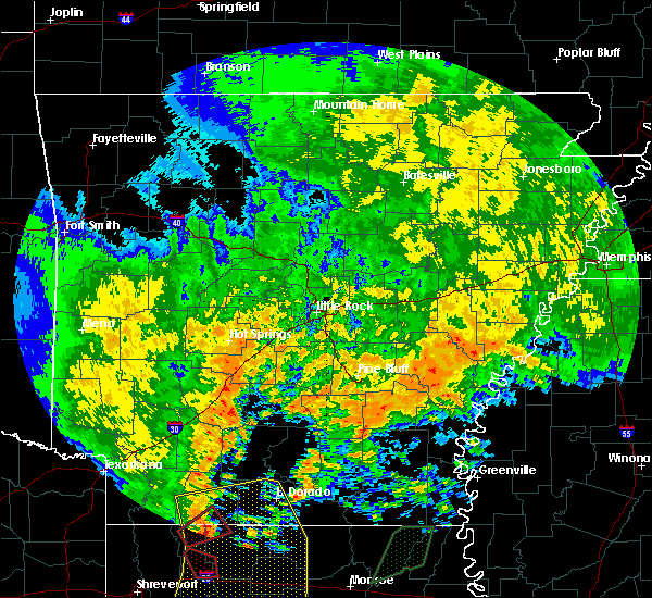 At 105 am cdt, a severe thunderstorm capable of producing a tornado was located near gillett, or 20 miles west of white river national wildlife refuge, moving northeast at 55 mph (radar indicated rotation). Hazards include tornado. Flying debris will be dangerous to those caught without shelter. mobile homes will be damaged or destroyed. damage to roofs, windows, and vehicles will occur. Tree damage is likely. At 105 am cdt, a severe thunderstorm capable of producing a tornado was located near gillett, or 20 miles west of white river national wildlife refuge, moving northeast at 55 mph (radar indicated rotation). Hazards include tornado. Flying debris will be dangerous to those caught without shelter. mobile homes will be damaged or destroyed. damage to roofs, windows, and vehicles will occur. Tree damage is likely.
|
| 4/3/2018 6:13 PM CDT |
 At 612 pm cdt, a severe thunderstorm was located over gillett, or 17 miles west of white river national wildlife refuge, moving northeast at 35 mph (radar indicated). Hazards include half dollar size hail. damage to vehicles is expected At 612 pm cdt, a severe thunderstorm was located over gillett, or 17 miles west of white river national wildlife refuge, moving northeast at 35 mph (radar indicated). Hazards include half dollar size hail. damage to vehicles is expected
|
| 2/24/2018 6:37 PM CST |
 At 637 pm cst, severe thunderstorms were located along a line extending from near st. charles to 6 miles west of white river national wildlife refuge to 7 miles northeast of mitchellville to 6 miles west of omega, moving east at 40 mph (radar indicated). Hazards include 60 mph wind gusts. expect damage to roofs, siding, and trees At 637 pm cst, severe thunderstorms were located along a line extending from near st. charles to 6 miles west of white river national wildlife refuge to 7 miles northeast of mitchellville to 6 miles west of omega, moving east at 40 mph (radar indicated). Hazards include 60 mph wind gusts. expect damage to roofs, siding, and trees
|
| 2/24/2018 6:09 PM CST |
 At 608 pm cst, severe thunderstorms were located along a line extending from near garret grove to near holly grove to near de witt, moving northeast at 50 mph (radar indicated). Hazards include 60 mph wind gusts. Expect damage to roofs, siding, and trees. locations impacted include, holly grove, almyra, st. Charles, palmer, de witt, blackton, aberdeen, ethel, almyra airport, monroe, casscoe, crocketts bluff, ragtown, indian bay, pine city, lawrenceville, duncan, cross roads in monroe county, lodge corner, a tornado watch remains in effect until 700 pm cst for eastern, central and southeastern arkansas. At 608 pm cst, severe thunderstorms were located along a line extending from near garret grove to near holly grove to near de witt, moving northeast at 50 mph (radar indicated). Hazards include 60 mph wind gusts. Expect damage to roofs, siding, and trees. locations impacted include, holly grove, almyra, st. Charles, palmer, de witt, blackton, aberdeen, ethel, almyra airport, monroe, casscoe, crocketts bluff, ragtown, indian bay, pine city, lawrenceville, duncan, cross roads in monroe county, lodge corner, a tornado watch remains in effect until 700 pm cst for eastern, central and southeastern arkansas.
|
| 2/24/2018 5:52 PM CST |
 At 551 pm cst, severe thunderstorms were located along a line extending from near clarendon to near ulm to near langford, moving east at 45 mph (radar indicated). Hazards include 60 mph wind gusts. expect damage to roofs, siding, and trees At 551 pm cst, severe thunderstorms were located along a line extending from near clarendon to near ulm to near langford, moving east at 45 mph (radar indicated). Hazards include 60 mph wind gusts. expect damage to roofs, siding, and trees
|
| 11/3/2017 5:42 PM CDT |
 At 541 pm cdt, severe thunderstorms were located along a line extending from near de witt to near gillett, moving east at 30 mph (radar indicated). Hazards include 60 mph wind gusts and quarter size hail. Hail damage to vehicles is expected. expect wind damage to roofs, siding, and trees. Locations impacted include, gillett, de witt, weber, ethel, de luce, tichnor,. At 541 pm cdt, severe thunderstorms were located along a line extending from near de witt to near gillett, moving east at 30 mph (radar indicated). Hazards include 60 mph wind gusts and quarter size hail. Hail damage to vehicles is expected. expect wind damage to roofs, siding, and trees. Locations impacted include, gillett, de witt, weber, ethel, de luce, tichnor,.
|
| 11/3/2017 5:25 PM CDT |
 At 524 pm cdt, a severe thunderstorm was located 5 miles west of gillett, or 8 miles southwest of dewitt, moving east at 25 mph (radar indicated). Hazards include 60 mph wind gusts and quarter size hail. Hail damage to vehicles is expected. Expect wind damage to roofs, siding, and trees. At 524 pm cdt, a severe thunderstorm was located 5 miles west of gillett, or 8 miles southwest of dewitt, moving east at 25 mph (radar indicated). Hazards include 60 mph wind gusts and quarter size hail. Hail damage to vehicles is expected. Expect wind damage to roofs, siding, and trees.
|
| 4/29/2017 5:55 PM CDT | Several large trees were blown dow in arkansas county AR, 1 miles SW of DeWitt, AR |
| 4/29/2017 5:45 PM CDT |
 At 545 pm cdt, severe thunderstorms were located along a line extending from madding to little bayou meto park to 6 miles northeast of mitchellville, moving north at 65 mph (radar indicated). Hazards include 60 mph wind gusts and penny size hail. Expect damage to roofs, siding, and trees. Locations impacted include, stuttgart, gillett, humphrey, almyra, watson, linwood, little bayou meto park, merrisach lake, langford, richardson, de witt, wabbaseka, arkansas post, de luce, cornerstone, almyra airport, tamo, tichnor, moscow, morgan point recreation area,. At 545 pm cdt, severe thunderstorms were located along a line extending from madding to little bayou meto park to 6 miles northeast of mitchellville, moving north at 65 mph (radar indicated). Hazards include 60 mph wind gusts and penny size hail. Expect damage to roofs, siding, and trees. Locations impacted include, stuttgart, gillett, humphrey, almyra, watson, linwood, little bayou meto park, merrisach lake, langford, richardson, de witt, wabbaseka, arkansas post, de luce, cornerstone, almyra airport, tamo, tichnor, moscow, morgan point recreation area,.
|
| 4/29/2017 5:30 PM CDT |
 At 530 pm cdt, severe thunderstorms were located along a line extending from near nebo to mills to omega, moving north at 65 mph (radar indicated). Hazards include 60 mph wind gusts and penny size hail. Expect damage to roofs, siding, and trees. Locations impacted include, stuttgart, dumas, gould, gillett, humphrey, grady, mitchellville, almyra, tillar, watson, winchester, whitefield, mcgehee, little bayou meto park, woodville, douglas, nebo, omega, linwood, mills,. At 530 pm cdt, severe thunderstorms were located along a line extending from near nebo to mills to omega, moving north at 65 mph (radar indicated). Hazards include 60 mph wind gusts and penny size hail. Expect damage to roofs, siding, and trees. Locations impacted include, stuttgart, dumas, gould, gillett, humphrey, grady, mitchellville, almyra, tillar, watson, winchester, whitefield, mcgehee, little bayou meto park, woodville, douglas, nebo, omega, linwood, mills,.
|
| 4/29/2017 5:08 PM CDT |
 At 508 pm cdt, severe thunderstorms were located along a line extending from plantersville to 9 miles southwest of tillar to near dermott, moving north at 65 mph (radar indicated). Hazards include 60 mph wind gusts and penny size hail. expect damage to roofs, siding, and trees At 508 pm cdt, severe thunderstorms were located along a line extending from plantersville to 9 miles southwest of tillar to near dermott, moving north at 65 mph (radar indicated). Hazards include 60 mph wind gusts and penny size hail. expect damage to roofs, siding, and trees
|
| 4/10/2017 9:51 PM CDT |
 At 950 pm cdt, severe thunderstorms were located along a line extending from 9 miles north of langford to near gillett to near mitchellville, moving east at 65 mph (radar indicated). Hazards include 60 mph wind gusts. Expect damage to roofs, siding, and trees. locations impacted include, pine bluff, dumas, star city, white river national wildlife r, altheimer, gould, gillett, grady, mitchellville, almyra, st. Charles, watson, whitefield, little bayou meto park, woodville, douglas, trusten holder wma, nebo, feenyville, yancopin, this includes interstate 530 between mile markers 43 and 46. At 950 pm cdt, severe thunderstorms were located along a line extending from 9 miles north of langford to near gillett to near mitchellville, moving east at 65 mph (radar indicated). Hazards include 60 mph wind gusts. Expect damage to roofs, siding, and trees. locations impacted include, pine bluff, dumas, star city, white river national wildlife r, altheimer, gould, gillett, grady, mitchellville, almyra, st. Charles, watson, whitefield, little bayou meto park, woodville, douglas, trusten holder wma, nebo, feenyville, yancopin, this includes interstate 530 between mile markers 43 and 46.
|
| 4/10/2017 9:15 PM CDT |
 At 914 pm cdt, severe thunderstorms were located along a line extending from 6 miles northeast of lamont to near kedron to near herbine, moving east at 65 mph (radar indicated). Hazards include 60 mph wind gusts. expect damage to roofs, siding, and trees At 914 pm cdt, severe thunderstorms were located along a line extending from 6 miles northeast of lamont to near kedron to near herbine, moving east at 65 mph (radar indicated). Hazards include 60 mph wind gusts. expect damage to roofs, siding, and trees
|
| 3/25/2017 1:20 AM CDT |
 At 120 am cdt, a severe thunderstorm was located near holly grove, or 12 miles south of clarendon, moving northeast at 45 mph (radar indicated). Hazards include 60 mph wind gusts and penny size hail. Expect damage to roofs, siding, and trees. locations impacted include, clarendon, holly grove, st. Charles, alfrey, palmer, de witt, blackton, aberdeen, monroe, crocketts bluff, ragtown, pine city, lawrenceville, duncan, cross roads in monroe county,. At 120 am cdt, a severe thunderstorm was located near holly grove, or 12 miles south of clarendon, moving northeast at 45 mph (radar indicated). Hazards include 60 mph wind gusts and penny size hail. Expect damage to roofs, siding, and trees. locations impacted include, clarendon, holly grove, st. Charles, alfrey, palmer, de witt, blackton, aberdeen, monroe, crocketts bluff, ragtown, pine city, lawrenceville, duncan, cross roads in monroe county,.
|
| 3/25/2017 12:58 AM CDT |
 At 1258 am cdt, a severe thunderstorm was located over almyra, or 7 miles southeast of stuttgart, moving northeast at 45 mph (radar indicated). Hazards include 60 mph wind gusts and penny size hail. expect damage to roofs, siding, and trees At 1258 am cdt, a severe thunderstorm was located over almyra, or 7 miles southeast of stuttgart, moving northeast at 45 mph (radar indicated). Hazards include 60 mph wind gusts and penny size hail. expect damage to roofs, siding, and trees
|
| 7/14/2016 8:03 PM CDT |
 At 802 pm cdt, a severe thunderstorm was located near almyra, or 10 miles east of stuttgart, moving east at 20 mph (radar indicated). Hazards include 60 mph wind gusts and quarter size hail. Hail damage to vehicles is expected. Expect wind damage to roofs, siding, and trees. At 802 pm cdt, a severe thunderstorm was located near almyra, or 10 miles east of stuttgart, moving east at 20 mph (radar indicated). Hazards include 60 mph wind gusts and quarter size hail. Hail damage to vehicles is expected. Expect wind damage to roofs, siding, and trees.
|
| 7/14/2016 7:53 PM CDT |
 At 752 pm cdt, a severe thunderstorm was located near almyra, or 12 miles southeast of stuttgart, moving east at 35 mph (radar indicated). Hazards include 60 mph wind gusts and penny size hail. Expect damage to roofs. siding. and trees. locations impacted include, stuttgart, almyra, st. Charles, de witt, cross roads in monroe county, ethel, lodge corner, almyra airport, indian bay, crocketts bluff,. At 752 pm cdt, a severe thunderstorm was located near almyra, or 12 miles southeast of stuttgart, moving east at 35 mph (radar indicated). Hazards include 60 mph wind gusts and penny size hail. Expect damage to roofs. siding. and trees. locations impacted include, stuttgart, almyra, st. Charles, de witt, cross roads in monroe county, ethel, lodge corner, almyra airport, indian bay, crocketts bluff,.
|
| 7/14/2016 7:43 PM CDT |
 At 742 pm cdt, severe thunderstorms were located along a line extending from near st. charles to near mcgehee, moving east at 50 mph (radar indicated). Hazards include 60 mph wind gusts. Expect damage to roofs. siding. and trees. locations impacted include, stuttgart, rohwer, gillett, arkansas city, almyra, st. Charles, tillar, watson, merrisach lake, yancopin, de witt, mcgehee, lucca landing, kelso, trusten holder wma, reed, arkansas post, pendleton, masonville, indian bay,. At 742 pm cdt, severe thunderstorms were located along a line extending from near st. charles to near mcgehee, moving east at 50 mph (radar indicated). Hazards include 60 mph wind gusts. Expect damage to roofs. siding. and trees. locations impacted include, stuttgart, rohwer, gillett, arkansas city, almyra, st. Charles, tillar, watson, merrisach lake, yancopin, de witt, mcgehee, lucca landing, kelso, trusten holder wma, reed, arkansas post, pendleton, masonville, indian bay,.
|
| 7/14/2016 7:13 PM CDT |
 At 713 pm cdt, severe thunderstorms were located along a line extending from 7 miles southeast of humphrey to near green hill, moving east at 50 mph (radar indicated). Hazards include 60 mph wind gusts. Expect damage to roofs. siding. And trees. At 713 pm cdt, severe thunderstorms were located along a line extending from 7 miles southeast of humphrey to near green hill, moving east at 50 mph (radar indicated). Hazards include 60 mph wind gusts. Expect damage to roofs. siding. And trees.
|
| 5/10/2016 1:05 AM CDT |
 At 105 am cdt, severe thunderstorms were located along a line extending from near holly grove to near almyra to near woodville, moving east at 50 mph (radar indicated). Hazards include 60 mph wind gusts and penny size hail. Expect damage to roofs. siding. And trees. At 105 am cdt, severe thunderstorms were located along a line extending from near holly grove to near almyra to near woodville, moving east at 50 mph (radar indicated). Hazards include 60 mph wind gusts and penny size hail. Expect damage to roofs. siding. And trees.
|
| 5/10/2016 1:02 AM CDT |
 At 102 am cdt, severe thunderstorms were located along a line extending from 6 miles southwest of holly grove to 7 miles northeast of langford to near nebo, moving east at 50 mph (radar indicated). Hazards include 60 mph wind gusts and penny size hail. Expect damage to roofs. siding. and trees. Locations impacted include, stuttgart, holly grove, grady, almyra, ulm, little bayou meto pa, whitefield, madding, woodville, cottondale, richardson, langford, linwood, aberdeen, casscoe, cornerstone, bayou meteo state ga, sarassa, moscow, tarry, a tornado watch remains in effect until 200 am cdt for southeastern arkansas. At 102 am cdt, severe thunderstorms were located along a line extending from 6 miles southwest of holly grove to 7 miles northeast of langford to near nebo, moving east at 50 mph (radar indicated). Hazards include 60 mph wind gusts and penny size hail. Expect damage to roofs. siding. and trees. Locations impacted include, stuttgart, holly grove, grady, almyra, ulm, little bayou meto pa, whitefield, madding, woodville, cottondale, richardson, langford, linwood, aberdeen, casscoe, cornerstone, bayou meteo state ga, sarassa, moscow, tarry, a tornado watch remains in effect until 200 am cdt for southeastern arkansas.
|
| 5/10/2016 12:35 AM CDT |
 At 1235 am cdt, severe thunderstorms were located along a line extending from near stuttgart municipal airport to near altheimer to near rison, moving east at 45 mph (radar indicated). Hazards include 60 mph wind gusts and penny size hail. Expect damage to roofs. siding. And trees. At 1235 am cdt, severe thunderstorms were located along a line extending from near stuttgart municipal airport to near altheimer to near rison, moving east at 45 mph (radar indicated). Hazards include 60 mph wind gusts and penny size hail. Expect damage to roofs. siding. And trees.
|
| 4/11/2016 1:14 PM CDT |
 At 113 pm cdt, severe thunderstorms were located along a line extending from near de witt to near mills to wilmar, moving southeast at 45 mph (radar indicated). Hazards include 70 mph wind gusts and nickel size hail. Expect considerable tree damage. damage is likely to mobile homes, roofs, and outbuildings. Locations impacted include, monticello, warren, dumas, gould, gillett, wilmar, mitchellville, winchester, merrisach lake, mills, douglas, green hill, omega, de witt, arkansas post, gourd, enon, pendleton, rose hill, reedville,. At 113 pm cdt, severe thunderstorms were located along a line extending from near de witt to near mills to wilmar, moving southeast at 45 mph (radar indicated). Hazards include 70 mph wind gusts and nickel size hail. Expect considerable tree damage. damage is likely to mobile homes, roofs, and outbuildings. Locations impacted include, monticello, warren, dumas, gould, gillett, wilmar, mitchellville, winchester, merrisach lake, mills, douglas, green hill, omega, de witt, arkansas post, gourd, enon, pendleton, rose hill, reedville,.
|
| 4/11/2016 12:40 PM CDT |
 At 1240 pm cdt, severe thunderstorms were located along a line extending from 6 miles north of richardson to near nebo to near mt elba, moving east at 45 mph (radar indicated). Hazards include 70 mph wind gusts and nickel size hail. Expect considerable tree damage. Damage is likely to mobile homes, roofs, and outbuildings. At 1240 pm cdt, severe thunderstorms were located along a line extending from 6 miles north of richardson to near nebo to near mt elba, moving east at 45 mph (radar indicated). Hazards include 70 mph wind gusts and nickel size hail. Expect considerable tree damage. Damage is likely to mobile homes, roofs, and outbuildings.
|
| 3/31/2016 4:29 PM CDT |
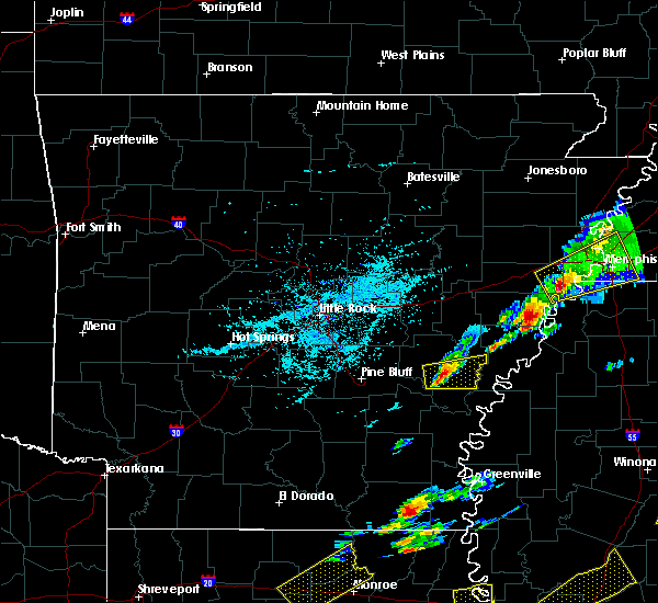 At 429 pm cdt, a severe thunderstorm was located near de witt, or 18 miles west of white river national wildlife refuge, moving east at 25 mph (radar indicated). Hazards include 60 mph wind gusts and quarter size hail. Hail damage to vehicles is expected. Expect wind damage to roofs, siding, and trees. At 429 pm cdt, a severe thunderstorm was located near de witt, or 18 miles west of white river national wildlife refuge, moving east at 25 mph (radar indicated). Hazards include 60 mph wind gusts and quarter size hail. Hail damage to vehicles is expected. Expect wind damage to roofs, siding, and trees.
|
| 3/13/2016 7:17 PM CDT |
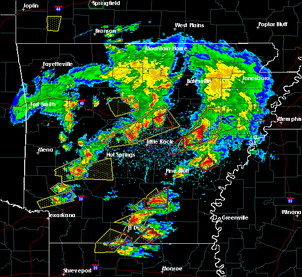 At 716 pm cdt, a confirmed tornado was located over de witt, or 16 miles southeast of stuttgart, moving northeast at 30 mph (weather spotters confirmed tornado). Hazards include damaging tornado and golf ball size hail. Flying debris will be dangerous to those caught without shelter. mobile homes will be damaged or destroyed. damage to roofs, windows, and vehicles will occur. tree damage is likely. if you are near dewitt, take cover immediately! this tornado will be near, st. charles around 740 pm cdt. Other locations impacted by this tornadic thunderstorm include crocketts bluff. At 716 pm cdt, a confirmed tornado was located over de witt, or 16 miles southeast of stuttgart, moving northeast at 30 mph (weather spotters confirmed tornado). Hazards include damaging tornado and golf ball size hail. Flying debris will be dangerous to those caught without shelter. mobile homes will be damaged or destroyed. damage to roofs, windows, and vehicles will occur. tree damage is likely. if you are near dewitt, take cover immediately! this tornado will be near, st. charles around 740 pm cdt. Other locations impacted by this tornadic thunderstorm include crocketts bluff.
|
| 3/13/2016 7:09 PM CDT | Power lines were blown down near de wit in arkansas county AR, 1 miles SW of DeWitt, AR |
| 3/13/2016 7:09 PM CDT |
 At 709 pm cdt, a confirmed tornado was located near de witt, or 16 miles southeast of stuttgart, moving northeast at 35 mph (weather spotters confirmed tornado). Hazards include damaging tornado and golf ball size hail. Flying debris will be dangerous to those caught without shelter. mobile homes will be damaged or destroyed. damage to roofs, windows, and vehicles will occur. tree damage is likely. this tornado will be near, de witt around 715 pm cdt. st. charles around 740 pm cdt. Other locations impacted by this tornadic thunderstorm include crocketts bluff. At 709 pm cdt, a confirmed tornado was located near de witt, or 16 miles southeast of stuttgart, moving northeast at 35 mph (weather spotters confirmed tornado). Hazards include damaging tornado and golf ball size hail. Flying debris will be dangerous to those caught without shelter. mobile homes will be damaged or destroyed. damage to roofs, windows, and vehicles will occur. tree damage is likely. this tornado will be near, de witt around 715 pm cdt. st. charles around 740 pm cdt. Other locations impacted by this tornadic thunderstorm include crocketts bluff.
|
| 3/13/2016 7:02 PM CDT |
 At 702 pm cdt, a severe thunderstorm capable of producing a tornado was located 7 miles west of de witt, or 16 miles south of stuttgart, moving northeast at 30 mph (radar indicated rotation). Hazards include tornado and baseball size hail. Flying debris will be dangerous to those caught without shelter. mobile homes will be damaged or destroyed. damage to roofs, windows, and vehicles will occur. tree damage is likely. this dangerous storm will be near, de witt around 715 pm cdt. almyra around 720 pm cdt. st. charles around 745 pm cdt. Other locations impacted by this tornadic thunderstorm include crocketts bluff. At 702 pm cdt, a severe thunderstorm capable of producing a tornado was located 7 miles west of de witt, or 16 miles south of stuttgart, moving northeast at 30 mph (radar indicated rotation). Hazards include tornado and baseball size hail. Flying debris will be dangerous to those caught without shelter. mobile homes will be damaged or destroyed. damage to roofs, windows, and vehicles will occur. tree damage is likely. this dangerous storm will be near, de witt around 715 pm cdt. almyra around 720 pm cdt. st. charles around 745 pm cdt. Other locations impacted by this tornadic thunderstorm include crocketts bluff.
|
| 3/13/2016 6:51 PM CDT |
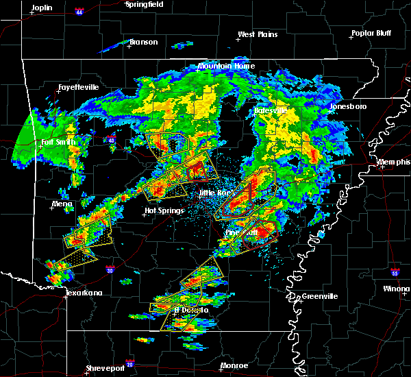 At 651 pm cdt, a confirmed tornado was located near langford, or 18 miles south of stuttgart, moving northeast at 45 mph (weather spotters confirmed tornado). Hazards include damaging tornado and golf ball size hail. Flying debris will be dangerous to those caught without shelter. mobile homes will be damaged or destroyed. damage to roofs, windows, and vehicles will occur. tree damage is likely. this tornado will be near, de witt around 700 pm cdt. Other locations impacted by this tornadic thunderstorm include bayou meteo state game area, reydell, almyra airport and lodge corner. At 651 pm cdt, a confirmed tornado was located near langford, or 18 miles south of stuttgart, moving northeast at 45 mph (weather spotters confirmed tornado). Hazards include damaging tornado and golf ball size hail. Flying debris will be dangerous to those caught without shelter. mobile homes will be damaged or destroyed. damage to roofs, windows, and vehicles will occur. tree damage is likely. this tornado will be near, de witt around 700 pm cdt. Other locations impacted by this tornadic thunderstorm include bayou meteo state game area, reydell, almyra airport and lodge corner.
|
| 3/13/2016 6:39 PM CDT |
 At 639 pm cdt, a severe thunderstorm capable of producing a tornado was located near langford, or 20 miles northeast of star city, moving northeast at 50 mph (radar indicated rotation). Hazards include tornado and half dollar size hail. Flying debris will be dangerous to those caught without shelter. mobile homes will be damaged or destroyed. damage to roofs, windows, and vehicles will occur. tree damage is likely. this dangerous storm will be near, almyra and de witt around 700 pm cdt. Other locations impacted by this tornadic thunderstorm include cornerstone, bayou meteo state game area, sarassa, lodge corner, almyra airport, reydell and tamo. At 639 pm cdt, a severe thunderstorm capable of producing a tornado was located near langford, or 20 miles northeast of star city, moving northeast at 50 mph (radar indicated rotation). Hazards include tornado and half dollar size hail. Flying debris will be dangerous to those caught without shelter. mobile homes will be damaged or destroyed. damage to roofs, windows, and vehicles will occur. tree damage is likely. this dangerous storm will be near, almyra and de witt around 700 pm cdt. Other locations impacted by this tornadic thunderstorm include cornerstone, bayou meteo state game area, sarassa, lodge corner, almyra airport, reydell and tamo.
|
| 12/26/2015 4:29 AM CST |
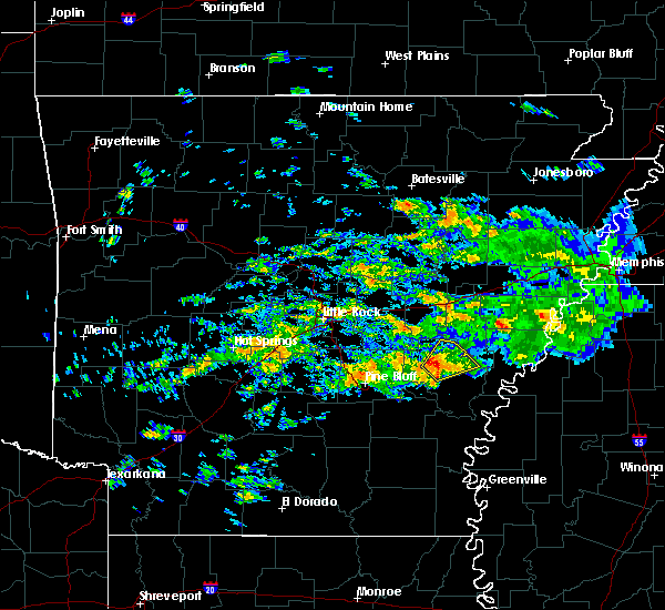 At 427 am cst, a severe thunderstorm was located over almyra, or 9 miles southeast of stuttgart, moving northeast at 40 mph (radar indicated). Hazards include 60 mph wind gusts and quarter size hail. Hail damage to vehicles is expected. expect wind damage to roofs, siding, and trees. locations impacted include, almyra, st. Charles, de witt, casscoe, almyra airport and crocketts bluff. At 427 am cst, a severe thunderstorm was located over almyra, or 9 miles southeast of stuttgart, moving northeast at 40 mph (radar indicated). Hazards include 60 mph wind gusts and quarter size hail. Hail damage to vehicles is expected. expect wind damage to roofs, siding, and trees. locations impacted include, almyra, st. Charles, de witt, casscoe, almyra airport and crocketts bluff.
|
| 12/26/2015 4:09 AM CST |
 At 408 am cst, a severe thunderstorm was located near langford, or 19 miles south of stuttgart, moving northeast at 45 mph (radar indicated). Hazards include 60 mph wind gusts and quarter size hail. Hail damage to vehicles is expected. Expect wind damage to roofs, siding, and trees. At 408 am cst, a severe thunderstorm was located near langford, or 19 miles south of stuttgart, moving northeast at 45 mph (radar indicated). Hazards include 60 mph wind gusts and quarter size hail. Hail damage to vehicles is expected. Expect wind damage to roofs, siding, and trees.
|
| 11/17/2015 4:14 PM CST |
 At 412 pm cst, severe thunderstorms were located along a line extending from des arc to roe to near de witt, moving east at 45 mph (radar indicated). Hazards include 70 mph wind gusts. Expect considerable tree damage. Damage is likely to mobile homes, roofs and outbuildings. At 412 pm cst, severe thunderstorms were located along a line extending from des arc to roe to near de witt, moving east at 45 mph (radar indicated). Hazards include 70 mph wind gusts. Expect considerable tree damage. Damage is likely to mobile homes, roofs and outbuildings.
|
| 11/17/2015 4:09 PM CST |
 At 409 pm cst, severe thunderstorms were located along a line extending from near des arc to roe to near de witt, moving northeast at 25 mph (radar indicated). Hazards include 70 mph wind gusts. Expect considerable tree damage. damage is likely to mobile homes, roofs and outbuildings. locations impacted include, brinkley, des arc, clarendon, de valls bluff, holly grove, fredonia, almyra, st. charles, ulm, roe, alfrey, allendale, palmer, hallsville, de witt, dobbs landing, peppers landing, cotton plant, fargo and blackton. A tornado watch remains in effect until 600 pm cst for southeastern arkansas. At 409 pm cst, severe thunderstorms were located along a line extending from near des arc to roe to near de witt, moving northeast at 25 mph (radar indicated). Hazards include 70 mph wind gusts. Expect considerable tree damage. damage is likely to mobile homes, roofs and outbuildings. locations impacted include, brinkley, des arc, clarendon, de valls bluff, holly grove, fredonia, almyra, st. charles, ulm, roe, alfrey, allendale, palmer, hallsville, de witt, dobbs landing, peppers landing, cotton plant, fargo and blackton. A tornado watch remains in effect until 600 pm cst for southeastern arkansas.
|
| 11/17/2015 3:57 PM CST |
 At 357 pm cst, severe thunderstorms were located along a line extending from 6 miles west of de witt to near omega to 6 miles west of mcmillan corner, moving northeast at 45 mph (radar indicated). Hazards include 70 mph wind gusts. Expect considerable tree damage. Damage is likely to mobile homes, roofs and outbuildings. At 357 pm cst, severe thunderstorms were located along a line extending from 6 miles west of de witt to near omega to 6 miles west of mcmillan corner, moving northeast at 45 mph (radar indicated). Hazards include 70 mph wind gusts. Expect considerable tree damage. Damage is likely to mobile homes, roofs and outbuildings.
|
| 11/17/2015 3:30 PM CST |
 At 329 pm cst, severe thunderstorms were located along a line extending from carlisle to humnoke and grady, moving northeast at 45 mph (radar indicated). Hazards include 70 mph wind gusts. Expect considerable tree damage. Damage is likely to mobile homes, roofs and outbuildings. At 329 pm cst, severe thunderstorms were located along a line extending from carlisle to humnoke and grady, moving northeast at 45 mph (radar indicated). Hazards include 70 mph wind gusts. Expect considerable tree damage. Damage is likely to mobile homes, roofs and outbuildings.
|
| 11/17/2015 3:20 PM CST |
 A severe thunderstorm warning remains in effect until 345 pm cst for south central arkansas. western desha. southeastern jefferson. eastern drew and lincoln counties. at 319 pm cst. severe thunderstorms were located along a line extending from woodville to 10 miles southwest of mills to 7 miles southeast of ladelle. Moving northeast at 45 mph. A severe thunderstorm warning remains in effect until 345 pm cst for south central arkansas. western desha. southeastern jefferson. eastern drew and lincoln counties. at 319 pm cst. severe thunderstorms were located along a line extending from woodville to 10 miles southwest of mills to 7 miles southeast of ladelle. Moving northeast at 45 mph.
|
| 11/17/2015 2:59 PM CST |
 At 258 pm cst, severe thunderstorms were located along a line extending from 6 miles north of feenyville to near plantersville to near fountain hill, moving east at 45 mph (radar indicated). Hazards include 60 mph wind gusts. Expect damage to roofs. Siding and trees. At 258 pm cst, severe thunderstorms were located along a line extending from 6 miles north of feenyville to near plantersville to near fountain hill, moving east at 45 mph (radar indicated). Hazards include 60 mph wind gusts. Expect damage to roofs. Siding and trees.
|
| 7/15/2015 4:31 PM CDT |
 At 431 pm cdt, a severe thunderstorm was located 9 miles southeast of humphrey, or 12 miles south of stuttgart, moving south at 10 mph (radar indicated). Hazards include 60 mph wind gusts and nickel size hail. Expect damage to roofs. Siding and trees. At 431 pm cdt, a severe thunderstorm was located 9 miles southeast of humphrey, or 12 miles south of stuttgart, moving south at 10 mph (radar indicated). Hazards include 60 mph wind gusts and nickel size hail. Expect damage to roofs. Siding and trees.
|
| 7/15/2015 2:47 PM CDT |
 At 246 pm cdt, a severe thunderstorm was located near almyra, or near stuttgart, moving southeast at 20 mph (radar indicated). Hazards include 60 mph wind gusts and quarter size hail. Hail damage to vehicles is expected. Expect wind damage to roofs, siding and trees. At 246 pm cdt, a severe thunderstorm was located near almyra, or near stuttgart, moving southeast at 20 mph (radar indicated). Hazards include 60 mph wind gusts and quarter size hail. Hail damage to vehicles is expected. Expect wind damage to roofs, siding and trees.
|
| 5/24/2015 5:52 PM CDT | At 549 pm cdt, severe thunderstorms were located along a line extending from almyra to 6 miles east of de witt to white river nwr, and moving northeast at 45 mph (radar indicated). Hazards include 60 mph wind gusts. Expect damage to roofs. Siding and trees. |
| 5/24/2015 5:26 PM CDT | At 524 pm cdt, severe thunderstorms were located along a line extending from 5 miles west of gillett to arkansas city, and moving northeast at 45 mph (radar indicated). Hazards include 60 mph wind gusts. Expect damage to roofs. Siding and trees. |
| 5/24/2015 4:58 PM CDT | At 456 pm cdt, severe thunderstorms were located along a line extending from lonoke to whitefield, and moving northeast at 45 mph (radar indicated). Hazards include 60 mph wind gusts. Expect damage to roofs. Siding and trees. |
| 5/24/2015 4:30 PM CDT | At 428 pm cdt, severe thunderstorms were located along a line extending from estes to 7 miles southwest of star city, and moving northeast at 45 mph (radar indicated). Hazards include 60 mph wind gusts. Expect damage to roofs. Siding and trees. |
| 4/19/2015 8:05 PM CDT | A severe thunderstorm warning remains in effect for central arkansas county until 815 pm cdt. at 803 pm cdt. a severe thunderstorm was located near de witt. and moving east at 45 mph. hazard. 60 mph wind gusts and quarter size hail. source. Radar indicated. |
| 4/19/2015 7:45 PM CDT | At 744 pm cdt, a severe thunderstorm was located near langford, and moving east at 45 mph (radar indicated). Hazards include 60 mph wind gusts and quarter size hail. Hail damage to vehicles is expected. Expect wind damage to roofs, siding and trees. |
| 3/31/2015 2:14 PM CDT | A severe thunderstorm warning remains in effect for eastern jefferson and southern arkansas counties until 245 pm cdt. at 212 pm cdt. national weather service doppler radar continued to indicate a severe thunderstorm capable of producing large destructive hail up to baseball size. this storm was located 4 miles southwest of lodge corner. Moving southeast at 25 mph. |
| 3/31/2015 2:00 PM CDT | The national weather service in little rock has issued a * severe thunderstorm warning for. southern arkansas county in southeast arkansas. eastern jefferson county in southeast arkansas. until 245 pm cdt * at 152 pm cdt. National weather service doppler radar indicated. |
| 8/17/2014 3:16 PM CDT | Reports of damage to a carpor in arkansas county AR, 1 miles SW of DeWitt, AR |
| 1/29/2013 9:48 PM CST | There is a tree on a truck along hwy 153 between de witt and saint charles. there was also a shed and chicken coop destroye in arkansas county AR, 3.2 miles SW of DeWitt, AR |
| 1/1/0001 12:00 AM | A couple of trees were downed in the de witt are in arkansas county AR, 0.1 miles S of DeWitt, AR |
| 1/1/0001 12:00 AM | Several trees and powerlines were downed south of de wit in arkansas county AR, 4.7 miles N of DeWitt, AR |
| 1/1/0001 12:00 AM | Trailer house destroyed on garot road south of de wit in arkansas county AR, 3.4 miles N of DeWitt, AR |
| 9/25/2011 6:01 PM CDT | Quarter sized hail reported 3.1 miles SSW of DeWitt, AR, nickel to quarter size hail falling at this time. |
| 9/25/2011 6:00 PM CDT | Ping Pong Ball sized hail reported 0.1 miles S of DeWitt, AR, hail ranged from quarters to ping pong sized. heavy rainfall reported with almost two inches measured in one hour. |
| 9/25/2011 5:56 PM CDT | Ping Pong Ball sized hail reported 0.1 miles S of DeWitt, AR, quarter to ping pong sized hail was reported in de witt. |
| 1/1/0001 12:00 AM | Quarter sized hail reported 5 miles S of DeWitt, AR |
| 1/1/0001 12:00 AM | Quarter sized hail reported 1.9 miles SE of DeWitt, AR |
| 1/1/0001 12:00 AM | Golf Ball sized hail reported 1.7 miles E of DeWitt, AR |
Hail Maps for DeWitt, AR
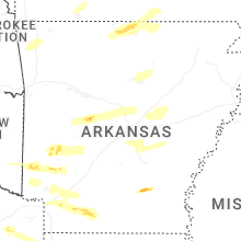
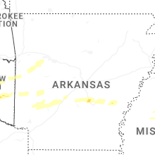
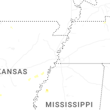
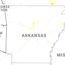
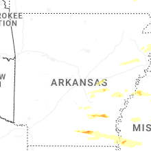


Connect with Interactive Hail Maps