

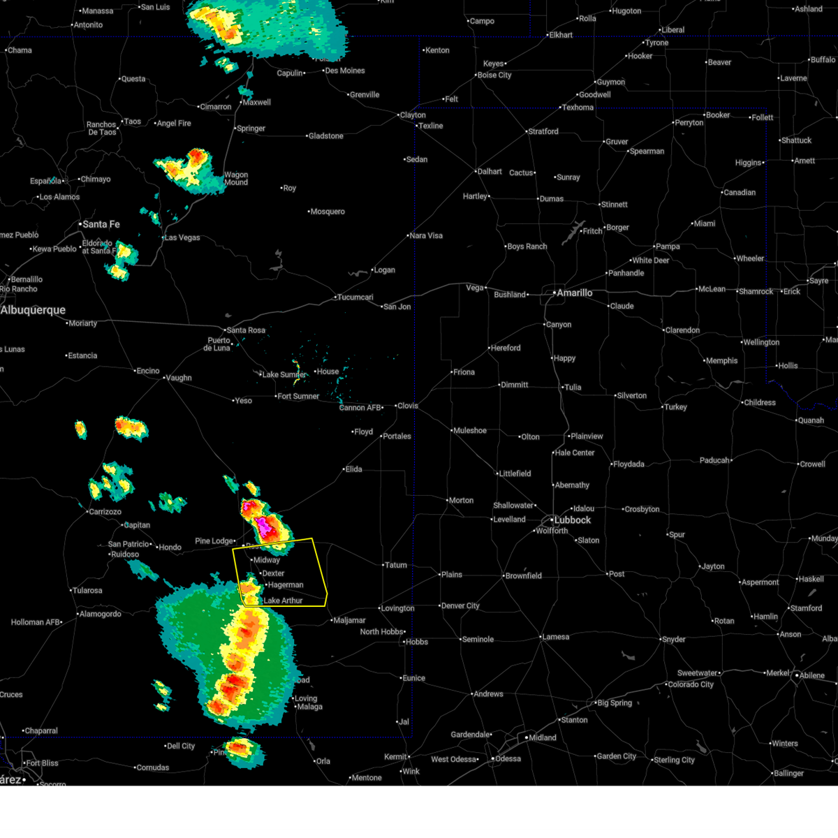
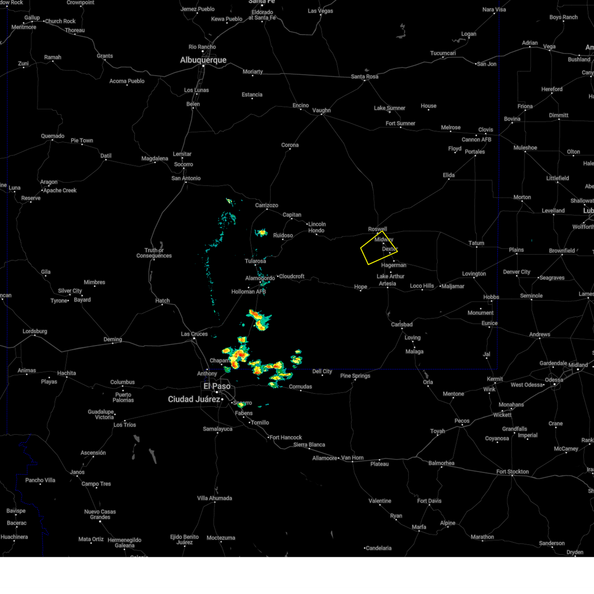
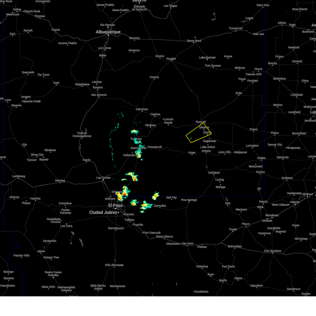
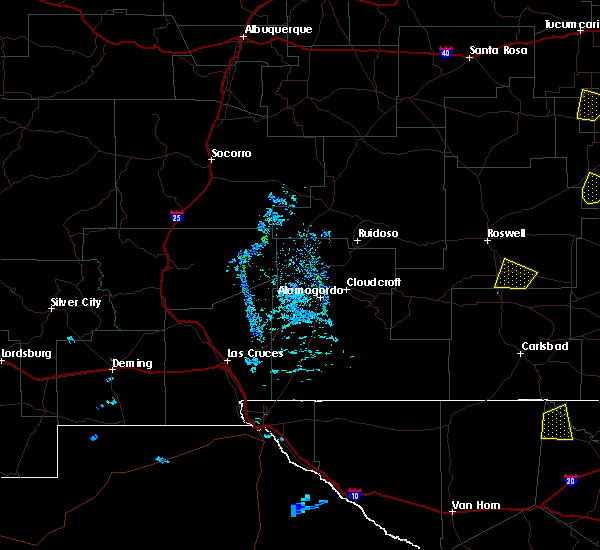
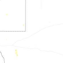
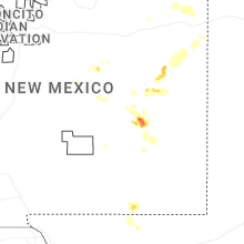
Hail Map for Dexter, NM
The Dexter, NM area has had 10 reports of on-the-ground hail by trained spotters, and has been under severe weather warnings 1 time during the past 12 months. Doppler radar has detected hail at or near Dexter, NM on 29 occasions, including 2 occasions during the past year.
| Name: | Dexter, NM |
| Where Located: | 16.5 miles SSE of Roswell, NM |
| Map: | Google Map for Dexter, NM |
| Population: | 1266 |
| Housing Units: | 452 |
| More Info: | Search Google for Dexter, NM |
0
The Top Recent Hail Date for Dexter, NM is Friday, June 5, 2026 (27th out of 29)
Hail and Wind Damage Spotted near Dexter, NM
| Date / Time | Report Details |
|---|---|
| 6/1/2026 7:14 PM MDT |
 Svrabq the national weather service in albuquerque has issued a * severe thunderstorm warning for, central chaves county in southeastern new mexico, * until 800 pm mdt. * at 714 pm mdt, a severe thunderstorm was located 8 miles southwest of dexter, or 17 miles south of roswell, moving northeast at 15 mph (radar indicated). Hazards include 60 mph wind gusts and quarter size hail. Hail damage to vehicles is expected. Expect wind damage to roofs, siding, and trees. Svrabq the national weather service in albuquerque has issued a * severe thunderstorm warning for, central chaves county in southeastern new mexico, * until 800 pm mdt. * at 714 pm mdt, a severe thunderstorm was located 8 miles southwest of dexter, or 17 miles south of roswell, moving northeast at 15 mph (radar indicated). Hazards include 60 mph wind gusts and quarter size hail. Hail damage to vehicles is expected. Expect wind damage to roofs, siding, and trees.
|
| 6/15/2025 4:29 PM MDT |
 The severe thunderstorm warning that was previously in effect has been reissued for southern chaves county and is in effect until 530 pm mdt. please refer to that bulletin for the latest severe weather information. The severe thunderstorm warning that was previously in effect has been reissued for southern chaves county and is in effect until 530 pm mdt. please refer to that bulletin for the latest severe weather information.
|
| 6/15/2025 3:49 PM MDT |
 At 349 pm mdt, severe thunderstorms were located along a line from near dexter to 9 miles south of hagerman, moving east at 20 mph (radar indicated). Hazards include 70 mph wind gusts and small hail. Expect considerable tree damage. damage is likely to mobile homes, roofs, and outbuildings. locations impacted include, roswell, dexter, hagerman, bottomless lakes state park, lake arthur, greenfield and midway. this includes the following highways, highway 380 between mile markers 158 and 189. Highway 285 between mile markers 79 and 104. At 349 pm mdt, severe thunderstorms were located along a line from near dexter to 9 miles south of hagerman, moving east at 20 mph (radar indicated). Hazards include 70 mph wind gusts and small hail. Expect considerable tree damage. damage is likely to mobile homes, roofs, and outbuildings. locations impacted include, roswell, dexter, hagerman, bottomless lakes state park, lake arthur, greenfield and midway. this includes the following highways, highway 380 between mile markers 158 and 189. Highway 285 between mile markers 79 and 104.
|
| 6/15/2025 3:31 PM MDT |
 Svrabq the national weather service in albuquerque has issued a * severe thunderstorm warning for, central chaves county in southeastern new mexico, * until 430 pm mdt. * at 331 pm mdt, severe thunderstorms were located along a line from 9 miles south of roswell to 10 miles south of hagerman, moving east at 10 mph (radar indicated). Hazards include 70 mph wind gusts. Expect considerable tree damage. Damage is likely to mobile homes, roofs, and outbuildings. Svrabq the national weather service in albuquerque has issued a * severe thunderstorm warning for, central chaves county in southeastern new mexico, * until 430 pm mdt. * at 331 pm mdt, severe thunderstorms were located along a line from 9 miles south of roswell to 10 miles south of hagerman, moving east at 10 mph (radar indicated). Hazards include 70 mph wind gusts. Expect considerable tree damage. Damage is likely to mobile homes, roofs, and outbuildings.
|
| 11/2/2024 5:45 AM MDT |
 the severe thunderstorm warning has been cancelled and is no longer in effect the severe thunderstorm warning has been cancelled and is no longer in effect
|
| 11/2/2024 5:27 AM MDT |
 Svrabq the national weather service in albuquerque has issued a * severe thunderstorm warning for, central chaves county in southeastern new mexico, * until 615 am mdt. * at 527 am mdt, a severe thunderstorm was located 13 miles south of hagerman, or 31 miles south of roswell, moving northeast at 20 mph (radar indicated). Hazards include ping pong ball size hail and 60 mph wind gusts. People and animals outdoors will be injured. expect hail damage to roofs, siding, windows, and vehicles. Expect wind damage to roofs, siding, and trees. Svrabq the national weather service in albuquerque has issued a * severe thunderstorm warning for, central chaves county in southeastern new mexico, * until 615 am mdt. * at 527 am mdt, a severe thunderstorm was located 13 miles south of hagerman, or 31 miles south of roswell, moving northeast at 20 mph (radar indicated). Hazards include ping pong ball size hail and 60 mph wind gusts. People and animals outdoors will be injured. expect hail damage to roofs, siding, windows, and vehicles. Expect wind damage to roofs, siding, and trees.
|
| 11/2/2024 2:44 AM MDT |
 the severe thunderstorm warning has been cancelled and is no longer in effect the severe thunderstorm warning has been cancelled and is no longer in effect
|
| 11/2/2024 2:30 AM MDT |
 At 230 am mdt, a severe thunderstorm was located 5 miles southwest of bottomless lakes state park, or 9 miles southeast of roswell, moving northeast at 15 mph (radar indicated). Hazards include 60 mph wind gusts and small hail. Expect damage to roofs, siding, and trees. locations impacted include, southeastern roswell, dexter, bottomless lakes state park, bitter lake wildlife refuge and midway. this includes the following highways, highway 380 between mile markers 157 and 169. Highway 285 between mile markers 92 and 104. At 230 am mdt, a severe thunderstorm was located 5 miles southwest of bottomless lakes state park, or 9 miles southeast of roswell, moving northeast at 15 mph (radar indicated). Hazards include 60 mph wind gusts and small hail. Expect damage to roofs, siding, and trees. locations impacted include, southeastern roswell, dexter, bottomless lakes state park, bitter lake wildlife refuge and midway. this includes the following highways, highway 380 between mile markers 157 and 169. Highway 285 between mile markers 92 and 104.
|
| 11/2/2024 2:12 AM MDT |
 Svrabq the national weather service in albuquerque has issued a * severe thunderstorm warning for, central chaves county in southeastern new mexico, * until 300 am mdt. * at 212 am mdt, a severe thunderstorm was located 7 miles northwest of dexter, or 9 miles south of roswell, moving northeast at 15 mph (radar indicated). Hazards include 60 mph wind gusts and half dollar size hail. Hail damage to vehicles is expected. Expect wind damage to roofs, siding, and trees. Svrabq the national weather service in albuquerque has issued a * severe thunderstorm warning for, central chaves county in southeastern new mexico, * until 300 am mdt. * at 212 am mdt, a severe thunderstorm was located 7 miles northwest of dexter, or 9 miles south of roswell, moving northeast at 15 mph (radar indicated). Hazards include 60 mph wind gusts and half dollar size hail. Hail damage to vehicles is expected. Expect wind damage to roofs, siding, and trees.
|
| 11/2/2024 2:12 AM MDT |
 The severe thunderstorm warning that was previously in effect has been reissued for south central chaves county and is in effect until 300 am mdt. please refer to that bulletin for the latest severe weather information. The severe thunderstorm warning that was previously in effect has been reissued for south central chaves county and is in effect until 300 am mdt. please refer to that bulletin for the latest severe weather information.
|
| 11/2/2024 1:51 AM MDT |
 At 151 am mdt, a severe thunderstorm was located 11 miles south of roswell, moving northeast at 25 mph (radar indicated). Hazards include ping pong ball size hail and 60 mph wind gusts. People and animals outdoors will be injured. expect hail damage to roofs, siding, windows, and vehicles. expect wind damage to roofs, siding, and trees. locations impacted include, roswell, dexter, midway and roswell correctional facility. this includes the following highways, highway 380 between mile markers 156 and 159. Highway 285 between mile markers 92 and 104. At 151 am mdt, a severe thunderstorm was located 11 miles south of roswell, moving northeast at 25 mph (radar indicated). Hazards include ping pong ball size hail and 60 mph wind gusts. People and animals outdoors will be injured. expect hail damage to roofs, siding, windows, and vehicles. expect wind damage to roofs, siding, and trees. locations impacted include, roswell, dexter, midway and roswell correctional facility. this includes the following highways, highway 380 between mile markers 156 and 159. Highway 285 between mile markers 92 and 104.
|
| 11/2/2024 1:29 AM MDT |
 Svrabq the national weather service in albuquerque has issued a * severe thunderstorm warning for, central chaves county in southeastern new mexico, * until 215 am mdt. * at 129 am mdt, a severe thunderstorm was located 18 miles southwest of roswell, moving northeast at 20 mph (radar indicated). Hazards include 60 mph wind gusts and half dollar size hail. Hail damage to vehicles is expected. Expect wind damage to roofs, siding, and trees. Svrabq the national weather service in albuquerque has issued a * severe thunderstorm warning for, central chaves county in southeastern new mexico, * until 215 am mdt. * at 129 am mdt, a severe thunderstorm was located 18 miles southwest of roswell, moving northeast at 20 mph (radar indicated). Hazards include 60 mph wind gusts and half dollar size hail. Hail damage to vehicles is expected. Expect wind damage to roofs, siding, and trees.
|
| 5/11/2024 6:13 PM MDT |
 Svrabq the national weather service in albuquerque has issued a * severe thunderstorm warning for, east central chaves county in southeastern new mexico, * until 715 pm mdt. * at 612 pm mdt, a severe thunderstorm was located near hagerman, or 15 miles northeast of artesia, moving east at 35 mph (trained weather spotters). Hazards include golf ball size hail and 60 mph wind gusts. People and animals outdoors will be injured. expect hail damage to roofs, siding, windows, and vehicles. Expect wind damage to roofs, siding, and trees. Svrabq the national weather service in albuquerque has issued a * severe thunderstorm warning for, east central chaves county in southeastern new mexico, * until 715 pm mdt. * at 612 pm mdt, a severe thunderstorm was located near hagerman, or 15 miles northeast of artesia, moving east at 35 mph (trained weather spotters). Hazards include golf ball size hail and 60 mph wind gusts. People and animals outdoors will be injured. expect hail damage to roofs, siding, windows, and vehicles. Expect wind damage to roofs, siding, and trees.
|
| 5/11/2024 5:52 PM MDT |
 At 552 pm mdt, a severe thunderstorm was located 8 miles southwest of hagerman, or 15 miles north of artesia, moving east at 25 mph (trained weather spotters). Hazards include golf ball size hail and 60 mph wind gusts. People and animals outdoors will be injured. expect hail damage to roofs, siding, windows, and vehicles. expect wind damage to roofs, siding, and trees. Locations impacted include, dexter, hagerman, lake arthur, greenfield, and roswell correctional facility. At 552 pm mdt, a severe thunderstorm was located 8 miles southwest of hagerman, or 15 miles north of artesia, moving east at 25 mph (trained weather spotters). Hazards include golf ball size hail and 60 mph wind gusts. People and animals outdoors will be injured. expect hail damage to roofs, siding, windows, and vehicles. expect wind damage to roofs, siding, and trees. Locations impacted include, dexter, hagerman, lake arthur, greenfield, and roswell correctional facility.
|
| 5/11/2024 5:15 PM MDT |
 Svrabq the national weather service in albuquerque has issued a * severe thunderstorm warning for, east central chaves county in southeastern new mexico, * until 615 pm mdt. * at 515 pm mdt, a severe thunderstorm was located 17 miles west of dexter, or 19 miles south of roswell, moving east at 30 mph (radar indicated). Hazards include golf ball size hail and 60 mph wind gusts. People and animals outdoors will be injured. expect hail damage to roofs, siding, windows, and vehicles. Expect wind damage to roofs, siding, and trees. Svrabq the national weather service in albuquerque has issued a * severe thunderstorm warning for, east central chaves county in southeastern new mexico, * until 615 pm mdt. * at 515 pm mdt, a severe thunderstorm was located 17 miles west of dexter, or 19 miles south of roswell, moving east at 30 mph (radar indicated). Hazards include golf ball size hail and 60 mph wind gusts. People and animals outdoors will be injured. expect hail damage to roofs, siding, windows, and vehicles. Expect wind damage to roofs, siding, and trees.
|
| 7/7/2023 3:06 PM MDT |
 The severe thunderstorm warning for central chaves county will expire at 315 pm mdt, the storm which prompted the warning has weakened below severe limits, and no longer poses an immediate threat to life or property. therefore, the warning will be allowed to expire. however small hail, gusty winds and heavy rain are still possible with this thunderstorm. The severe thunderstorm warning for central chaves county will expire at 315 pm mdt, the storm which prompted the warning has weakened below severe limits, and no longer poses an immediate threat to life or property. therefore, the warning will be allowed to expire. however small hail, gusty winds and heavy rain are still possible with this thunderstorm.
|
| 7/7/2023 2:49 PM MDT |
 At 249 pm mdt, a severe thunderstorm was located 8 miles west of dexter, or 12 miles south of roswell, moving east at 20 mph (radar indicated). Hazards include 60 mph wind gusts and quarter size hail. Hail damage to vehicles is expected. expect wind damage to roofs, siding, and trees. locations impacted include, southern roswell, dexter, hagerman, bottomless lakes state park, greenfield, roswell correctional facility and midway. this includes the following highways, highway 285 between mile markers 88 and 104. highway 380 between mile markers 158 and 168. hail threat, radar indicated max hail size, 1. 00 in wind threat, radar indicated max wind gust, 60 mph. At 249 pm mdt, a severe thunderstorm was located 8 miles west of dexter, or 12 miles south of roswell, moving east at 20 mph (radar indicated). Hazards include 60 mph wind gusts and quarter size hail. Hail damage to vehicles is expected. expect wind damage to roofs, siding, and trees. locations impacted include, southern roswell, dexter, hagerman, bottomless lakes state park, greenfield, roswell correctional facility and midway. this includes the following highways, highway 285 between mile markers 88 and 104. highway 380 between mile markers 158 and 168. hail threat, radar indicated max hail size, 1. 00 in wind threat, radar indicated max wind gust, 60 mph.
|
| 7/7/2023 2:28 PM MDT |
 At 228 pm mdt, a severe thunderstorm was located 11 miles southwest of roswell, moving east at 20 mph (radar indicated). Hazards include 60 mph wind gusts and quarter size hail. Hail damage to vehicles is expected. Expect wind damage to roofs, siding, and trees. At 228 pm mdt, a severe thunderstorm was located 11 miles southwest of roswell, moving east at 20 mph (radar indicated). Hazards include 60 mph wind gusts and quarter size hail. Hail damage to vehicles is expected. Expect wind damage to roofs, siding, and trees.
|
| 6/1/2023 1:16 AM MDT |
 At 116 am mdt, a severe thunderstorm was located 12 miles southwest of roswell, moving northeast at 25 mph (radar indicated). Hazards include 60 mph wind gusts and quarter size hail. Hail damage to vehicles is expected. Expect wind damage to roofs, siding, and trees. At 116 am mdt, a severe thunderstorm was located 12 miles southwest of roswell, moving northeast at 25 mph (radar indicated). Hazards include 60 mph wind gusts and quarter size hail. Hail damage to vehicles is expected. Expect wind damage to roofs, siding, and trees.
|
| 5/31/2023 2:50 PM MDT | Quarter sized hail reported 7.2 miles SSE of Dexter, NM |
| 5/31/2023 2:48 PM MDT | Half Dollar sized hail reported 0.5 miles NE of Dexter, NM |
| 5/31/2023 2:31 PM MDT |
 At 230 pm mdt, a severe thunderstorm was located near roswell, moving northeast at 25 mph (radar indicated). Hazards include 60 mph wind gusts and quarter size hail. Hail damage to vehicles is expected. Expect wind damage to roofs, siding, and trees. At 230 pm mdt, a severe thunderstorm was located near roswell, moving northeast at 25 mph (radar indicated). Hazards include 60 mph wind gusts and quarter size hail. Hail damage to vehicles is expected. Expect wind damage to roofs, siding, and trees.
|
| 7/11/2021 3:09 PM MDT |
 At 309 pm mdt, a severe thunderstorm was located near cottonwood, or 11 miles north of artesia, moving south at 15 mph (law enforcement). Hazards include 60 mph wind gusts and quarter size hail. Hail damage to vehicles is expected. expect wind damage to roofs, siding, and trees. locations impacted include, dexter, hagerman, lake arthur, greenfield and roswell correctional facility. This includes highway 285 between mile markers 79 and 99. At 309 pm mdt, a severe thunderstorm was located near cottonwood, or 11 miles north of artesia, moving south at 15 mph (law enforcement). Hazards include 60 mph wind gusts and quarter size hail. Hail damage to vehicles is expected. expect wind damage to roofs, siding, and trees. locations impacted include, dexter, hagerman, lake arthur, greenfield and roswell correctional facility. This includes highway 285 between mile markers 79 and 99.
|
| 7/11/2021 2:44 PM MDT |
 At 243 pm mdt, a severe thunderstorm was located over hagerman, or 19 miles north of artesia, moving south at 15 mph (radar indicated). Hazards include 60 mph wind gusts and quarter size hail. Hail damage to vehicles is expected. Expect wind damage to roofs, siding, and trees. At 243 pm mdt, a severe thunderstorm was located over hagerman, or 19 miles north of artesia, moving south at 15 mph (radar indicated). Hazards include 60 mph wind gusts and quarter size hail. Hail damage to vehicles is expected. Expect wind damage to roofs, siding, and trees.
|
| 7/11/2021 2:26 PM MDT |
 At 226 pm mdt, a severe thunderstorm was located near hagerman, or 17 miles north of artesia, moving southwest at 30 mph (radar indicated). Hazards include golf ball size hail and 60 mph wind gusts. People and animals outdoors will be injured. expect hail damage to roofs, siding, windows, and vehicles. expect wind damage to roofs, siding, and trees. locations impacted include, dexter, hagerman, lake arthur, bottomless lakes state park, greenfield and roswell correctional facility. This includes highway 285 between mile markers 83 and 98. At 226 pm mdt, a severe thunderstorm was located near hagerman, or 17 miles north of artesia, moving southwest at 30 mph (radar indicated). Hazards include golf ball size hail and 60 mph wind gusts. People and animals outdoors will be injured. expect hail damage to roofs, siding, windows, and vehicles. expect wind damage to roofs, siding, and trees. locations impacted include, dexter, hagerman, lake arthur, bottomless lakes state park, greenfield and roswell correctional facility. This includes highway 285 between mile markers 83 and 98.
|
| 7/11/2021 1:59 PM MDT |
 At 159 pm mdt, a severe thunderstorm was located near bottomless lakes state park, or 16 miles southeast of roswell, moving southwest at 30 mph (radar indicated). Hazards include tennis ball size hail and 60 mph wind gusts. People and animals outdoors will be injured. expect hail damage to roofs, siding, windows, and vehicles. Expect wind damage to roofs, siding, and trees. At 159 pm mdt, a severe thunderstorm was located near bottomless lakes state park, or 16 miles southeast of roswell, moving southwest at 30 mph (radar indicated). Hazards include tennis ball size hail and 60 mph wind gusts. People and animals outdoors will be injured. expect hail damage to roofs, siding, windows, and vehicles. Expect wind damage to roofs, siding, and trees.
|
| 5/30/2021 6:26 PM MDT |
 At 626 pm mdt, a severe thunderstorm was located near hagerman, or 14 miles north of artesia, moving east at 20 mph (radar indicated). Hazards include 60 mph wind gusts and quarter size hail. Hail damage to vehicles is expected. expect wind damage to roofs, siding, and trees. locations impacted include, dexter, hagerman, lake arthur and greenfield. This includes highway 285 between mile markers 79 and 95. At 626 pm mdt, a severe thunderstorm was located near hagerman, or 14 miles north of artesia, moving east at 20 mph (radar indicated). Hazards include 60 mph wind gusts and quarter size hail. Hail damage to vehicles is expected. expect wind damage to roofs, siding, and trees. locations impacted include, dexter, hagerman, lake arthur and greenfield. This includes highway 285 between mile markers 79 and 95.
|
| 5/30/2021 6:06 PM MDT |
 At 606 pm mdt, a severe thunderstorm was located 10 miles northwest of cottonwood, or 15 miles north of artesia, moving east at 20 mph (radar indicated). Hazards include ping pong ball size hail and 60 mph wind gusts. People and animals outdoors will be injured. expect hail damage to roofs, siding, windows, and vehicles. Expect wind damage to roofs, siding, and trees. At 606 pm mdt, a severe thunderstorm was located 10 miles northwest of cottonwood, or 15 miles north of artesia, moving east at 20 mph (radar indicated). Hazards include ping pong ball size hail and 60 mph wind gusts. People and animals outdoors will be injured. expect hail damage to roofs, siding, windows, and vehicles. Expect wind damage to roofs, siding, and trees.
|
| 5/30/2021 5:39 PM MDT |
 The severe thunderstorm warning for central chaves county will expire at 545 pm mdt, the storm which prompted the warning has moved out of the warned area. therefore, the warning will be allowed to expire. a severe thunderstorm watch remains in effect until 800 pm mdt for southeastern new mexico. remember, a severe thunderstorm warning remains in effect for central chavez county in southeastern new mexico until 0630 pm. The severe thunderstorm warning for central chaves county will expire at 545 pm mdt, the storm which prompted the warning has moved out of the warned area. therefore, the warning will be allowed to expire. a severe thunderstorm watch remains in effect until 800 pm mdt for southeastern new mexico. remember, a severe thunderstorm warning remains in effect for central chavez county in southeastern new mexico until 0630 pm.
|
| 5/30/2021 5:37 PM MDT |
 At 536 pm mdt, a severe thunderstorm was located over dexter, or 16 miles southeast of roswell, moving east at 15 mph (radar indicated). Hazards include ping pong ball size hail and 60 mph wind gusts. People and animals outdoors will be injured. expect hail damage to roofs, siding, windows, and vehicles. Expect wind damage to roofs, siding, and trees. At 536 pm mdt, a severe thunderstorm was located over dexter, or 16 miles southeast of roswell, moving east at 15 mph (radar indicated). Hazards include ping pong ball size hail and 60 mph wind gusts. People and animals outdoors will be injured. expect hail damage to roofs, siding, windows, and vehicles. Expect wind damage to roofs, siding, and trees.
|
| 5/30/2021 5:35 PM MDT | Ping Pong Ball sized hail reported 0.5 miles NE of Dexter, NM |
| 5/30/2021 5:32 PM MDT |
 At 532 pm mdt, a severe thunderstorm capable of producing a tornado was located 8 miles west of dexter, or 14 miles south of roswell, moving southeast at 5 mph (radar indicated rotation). Hazards include tornado and quarter size hail. Flying debris will be dangerous to those caught without shelter. mobile homes will be damaged or destroyed. damage to roofs, windows, and vehicles will occur. tree damage is likely. this dangerous storm will be near, dexter and greenfield around 615 pm mdt. This includes highway 285 between mile markers 84 and 95. At 532 pm mdt, a severe thunderstorm capable of producing a tornado was located 8 miles west of dexter, or 14 miles south of roswell, moving southeast at 5 mph (radar indicated rotation). Hazards include tornado and quarter size hail. Flying debris will be dangerous to those caught without shelter. mobile homes will be damaged or destroyed. damage to roofs, windows, and vehicles will occur. tree damage is likely. this dangerous storm will be near, dexter and greenfield around 615 pm mdt. This includes highway 285 between mile markers 84 and 95.
|
| 5/30/2021 5:17 PM MDT |
 At 517 pm mdt, a severe thunderstorm was located near dexter, or 12 miles south of roswell, moving east at 15 mph (radar indicated). Hazards include ping pong ball size hail and 60 mph wind gusts. People and animals outdoors will be injured. expect hail damage to roofs, siding, windows, and vehicles. expect wind damage to roofs, siding, and trees. locations impacted include, southern roswell, dexter, roswell correctional facility and midway. This includes highway 285 between mile markers 86 and 104. At 517 pm mdt, a severe thunderstorm was located near dexter, or 12 miles south of roswell, moving east at 15 mph (radar indicated). Hazards include ping pong ball size hail and 60 mph wind gusts. People and animals outdoors will be injured. expect hail damage to roofs, siding, windows, and vehicles. expect wind damage to roofs, siding, and trees. locations impacted include, southern roswell, dexter, roswell correctional facility and midway. This includes highway 285 between mile markers 86 and 104.
|
| 5/30/2021 5:15 PM MDT |
 At 515 pm mdt, a confirmed tornado was located 10 miles west of dexter, or 13 miles south of roswell, moving southeast at 5 mph (weather spotters confirmed tornado). Hazards include damaging tornado and hail up to two inches in diameter. Flying debris will be dangerous to those caught without shelter. mobile homes will be damaged or destroyed. damage to roofs, windows, and vehicles will occur. tree damage is likely. the tornado will be near, roswell correctional facility around 535 pm mdt. Dexter and greenfield around 600 pm mdt. At 515 pm mdt, a confirmed tornado was located 10 miles west of dexter, or 13 miles south of roswell, moving southeast at 5 mph (weather spotters confirmed tornado). Hazards include damaging tornado and hail up to two inches in diameter. Flying debris will be dangerous to those caught without shelter. mobile homes will be damaged or destroyed. damage to roofs, windows, and vehicles will occur. tree damage is likely. the tornado will be near, roswell correctional facility around 535 pm mdt. Dexter and greenfield around 600 pm mdt.
|
| 5/30/2021 5:04 PM MDT |
 At 503 pm mdt, a confirmed tornado was located 8 miles west of dexter, or 12 miles south of roswell, moving east at 10 mph (emergency management confirmed tornado near u.s. highway 285 and shawnee road). Hazards include damaging tornado and two inch hail. Flying debris will be dangerous to those caught without shelter. mobile homes will be damaged or destroyed. damage to roofs, windows, and vehicles will occur. tree damage is likely. this tornado will be near, dexter and greenfield around 545 pm mdt. This includes highway 285 between mile markers 83 and 98. At 503 pm mdt, a confirmed tornado was located 8 miles west of dexter, or 12 miles south of roswell, moving east at 10 mph (emergency management confirmed tornado near u.s. highway 285 and shawnee road). Hazards include damaging tornado and two inch hail. Flying debris will be dangerous to those caught without shelter. mobile homes will be damaged or destroyed. damage to roofs, windows, and vehicles will occur. tree damage is likely. this tornado will be near, dexter and greenfield around 545 pm mdt. This includes highway 285 between mile markers 83 and 98.
|
| 5/30/2021 4:45 PM MDT |
 At 444 pm mdt, a severe thunderstorm was located 12 miles south of roswell, moving east at 10 mph (trained weather spotters). Hazards include two inch hail and 60 mph wind gusts. People and animals outdoors will be injured. expect hail damage to roofs, siding, windows, and vehicles. Expect wind damage to roofs, siding, and trees. At 444 pm mdt, a severe thunderstorm was located 12 miles south of roswell, moving east at 10 mph (trained weather spotters). Hazards include two inch hail and 60 mph wind gusts. People and animals outdoors will be injured. expect hail damage to roofs, siding, windows, and vehicles. Expect wind damage to roofs, siding, and trees.
|
| 5/30/2021 4:41 PM MDT |
 At 441 pm mdt, a confirmed tornado was located 11 miles west of dexter, or 11 miles south of roswell, moving east at 10 mph (weather spotters confirmed tornado). Hazards include damaging tornado and hail up to two inches in diameter. Flying debris will be dangerous to those caught without shelter. mobile homes will be damaged or destroyed. damage to roofs, windows, and vehicles will occur. tree damage is likely. the tornado will be near, roswell correctional facility around 510 pm mdt. Dexter around 515 pm mdt. At 441 pm mdt, a confirmed tornado was located 11 miles west of dexter, or 11 miles south of roswell, moving east at 10 mph (weather spotters confirmed tornado). Hazards include damaging tornado and hail up to two inches in diameter. Flying debris will be dangerous to those caught without shelter. mobile homes will be damaged or destroyed. damage to roofs, windows, and vehicles will occur. tree damage is likely. the tornado will be near, roswell correctional facility around 510 pm mdt. Dexter around 515 pm mdt.
|
| 5/28/2021 7:18 PM MDT |
 At 718 pm mdt, a severe thunderstorm was located over hagerman, or 21 miles north of artesia, moving southeast at 20 mph (radar indicated). Hazards include ping pong ball size hail and 60 mph wind gusts. People and animals outdoors will be injured. expect hail damage to roofs, siding, windows, and vehicles. expect wind damage to roofs, siding, and trees. Locations impacted include, dexter, hagerman and greenfield. At 718 pm mdt, a severe thunderstorm was located over hagerman, or 21 miles north of artesia, moving southeast at 20 mph (radar indicated). Hazards include ping pong ball size hail and 60 mph wind gusts. People and animals outdoors will be injured. expect hail damage to roofs, siding, windows, and vehicles. expect wind damage to roofs, siding, and trees. Locations impacted include, dexter, hagerman and greenfield.
|
| 5/28/2021 7:08 PM MDT | Quarter sized hail reported 0.5 miles NE of Dexter, NM, at lake van |
| 5/28/2021 6:57 PM MDT | Tea Cup sized hail reported 6.3 miles ESE of Dexter, NM, on highway 285 |
| 5/28/2021 6:57 PM MDT | Tea Cup sized hail reported 3.1 miles SE of Dexter, NM, on highway 285 |
| 5/28/2021 6:57 PM MDT |
 The national weather service in albuquerque has issued a * severe thunderstorm warning for. central chaves county in southeastern new mexico. until 800 pm mdt. At 657 pm mdt, a severe thunderstorm was located over dexter, or 15 miles southeast of roswell, moving southeast at 20 mph. The national weather service in albuquerque has issued a * severe thunderstorm warning for. central chaves county in southeastern new mexico. until 800 pm mdt. At 657 pm mdt, a severe thunderstorm was located over dexter, or 15 miles southeast of roswell, moving southeast at 20 mph.
|
| 5/28/2021 6:50 PM MDT | Power pole bending toward road in chaves county NM, 4.4 miles E of Dexter, NM |
| 5/28/2021 6:48 PM MDT | Tennis Ball sized hail reported 5.6 miles E of Dexter, NM |
| 5/28/2021 6:40 PM MDT | Quarter sized hail reported 6.4 miles SE of Dexter, NM |
| 5/28/2021 6:37 PM MDT |
 At 636 pm mdt, a severe thunderstorm was located 10 miles west of dexter, or 10 miles south of roswell, moving southeast at 20 mph (radar indicated). Hazards include golf ball size hail and 60 mph wind gusts. People and animals outdoors will be injured. expect hail damage to roofs, siding, windows, and vehicles. expect wind damage to roofs, siding, and trees. locations impacted include, southern roswell, dexter, greenfield, roswell correctional facility and midway. This includes highway 285 between mile markers 87 and 104. At 636 pm mdt, a severe thunderstorm was located 10 miles west of dexter, or 10 miles south of roswell, moving southeast at 20 mph (radar indicated). Hazards include golf ball size hail and 60 mph wind gusts. People and animals outdoors will be injured. expect hail damage to roofs, siding, windows, and vehicles. expect wind damage to roofs, siding, and trees. locations impacted include, southern roswell, dexter, greenfield, roswell correctional facility and midway. This includes highway 285 between mile markers 87 and 104.
|
| 5/28/2021 6:14 PM MDT |
 At 613 pm mdt, a severe thunderstorm was located 10 miles southwest of roswell, moving southeast at 25 mph (radar indicated). Hazards include ping pong ball size hail and 60 mph wind gusts. People and animals outdoors will be injured. expect hail damage to roofs, siding, windows, and vehicles. expect wind damage to roofs, siding, and trees. locations impacted include, roswell, dexter, greenfield, roswell correctional facility and midway. This includes highway 285 between mile markers 87 and 104. At 613 pm mdt, a severe thunderstorm was located 10 miles southwest of roswell, moving southeast at 25 mph (radar indicated). Hazards include ping pong ball size hail and 60 mph wind gusts. People and animals outdoors will be injured. expect hail damage to roofs, siding, windows, and vehicles. expect wind damage to roofs, siding, and trees. locations impacted include, roswell, dexter, greenfield, roswell correctional facility and midway. This includes highway 285 between mile markers 87 and 104.
|
| 5/28/2021 6:04 PM MDT |
 At 604 pm mdt, a severe thunderstorm was located 14 miles west of roswell, moving southeast at 20 mph (radar indicated). Hazards include 60 mph wind gusts and half dollar size hail. Hail damage to vehicles is expected. Expect wind damage to roofs, siding, and trees. At 604 pm mdt, a severe thunderstorm was located 14 miles west of roswell, moving southeast at 20 mph (radar indicated). Hazards include 60 mph wind gusts and half dollar size hail. Hail damage to vehicles is expected. Expect wind damage to roofs, siding, and trees.
|
| 5/26/2021 6:11 PM MDT |
 The severe thunderstorm warning for central chaves county will expire at 615 pm mdt, the storm which prompted the warning has weakened below severe limits, and has exited the warned area. therefore, the warning will be allowed to expire. however gusty winds are still possible with this thunderstorm. The severe thunderstorm warning for central chaves county will expire at 615 pm mdt, the storm which prompted the warning has weakened below severe limits, and has exited the warned area. therefore, the warning will be allowed to expire. however gusty winds are still possible with this thunderstorm.
|
| 5/26/2021 5:54 PM MDT |
 At 552 pm mdt, a severe thunderstorm was located over roswell moving north at 35 mph (public). Hazards include 65 mph wind gusts. Expect damage to roofs, siding, and trees. locations impacted include, roswell, dexter, bitter lake wildlife refuge, bottomless lakes state park, greenfield and midway. this includes the following highways, highway 285 between mile markers 90 and 118. Highway 380 between mile markers 156 and 178. At 552 pm mdt, a severe thunderstorm was located over roswell moving north at 35 mph (public). Hazards include 65 mph wind gusts. Expect damage to roofs, siding, and trees. locations impacted include, roswell, dexter, bitter lake wildlife refuge, bottomless lakes state park, greenfield and midway. this includes the following highways, highway 285 between mile markers 90 and 118. Highway 380 between mile markers 156 and 178.
|
| 5/26/2021 5:41 PM MDT |
 The national weather service in albuquerque has issued a * severe thunderstorm warning for. central chaves county in southeastern new mexico. until 615 pm mdt. At 541 pm mdt, a severe thunderstorm was located over southeastern roswell, moving northeast at 30 mph. The national weather service in albuquerque has issued a * severe thunderstorm warning for. central chaves county in southeastern new mexico. until 615 pm mdt. At 541 pm mdt, a severe thunderstorm was located over southeastern roswell, moving northeast at 30 mph.
|
| 5/22/2021 5:38 PM MDT |
 At 538 pm mdt, severe thunderstorms were located along a line extending from 10 miles southeast of elkins to hagerman, moving north at 15 mph (radar indicated). Hazards include 60 mph wind gusts and quarter size hail. Hail damage to vehicles is expected. Expect wind damage to roofs, siding, and trees. At 538 pm mdt, severe thunderstorms were located along a line extending from 10 miles southeast of elkins to hagerman, moving north at 15 mph (radar indicated). Hazards include 60 mph wind gusts and quarter size hail. Hail damage to vehicles is expected. Expect wind damage to roofs, siding, and trees.
|
| 7/4/2020 4:15 AM MDT |
 At 415 am mdt, a severe thunderstorm was located near bottomless lakes state park, or 18 miles east of roswell, moving south at 15 mph (radar indicated). Hazards include 60 mph wind gusts and half dollar size hail. Hail damage to vehicles is expected. Expect wind damage to roofs, siding, and trees. At 415 am mdt, a severe thunderstorm was located near bottomless lakes state park, or 18 miles east of roswell, moving south at 15 mph (radar indicated). Hazards include 60 mph wind gusts and half dollar size hail. Hail damage to vehicles is expected. Expect wind damage to roofs, siding, and trees.
|
| 6/23/2020 7:37 PM MDT |
 At 737 pm mdt, severe thunderstorms were located along a line extending from 9 miles southeast of dunken to cottonwood, moving southeast at 50 mph (radar indicated). Hazards include 60 mph wind gusts. Expect damage to roofs, siding, and trees. locations impacted include, southern roswell, dexter, hagerman, lake arthur, elk, dunken, greenfield, roswell correctional facility and midway. this includes the following highways, highway 285 between mile markers 79 and 104. Highway 380 between mile markers 160 and 161. At 737 pm mdt, severe thunderstorms were located along a line extending from 9 miles southeast of dunken to cottonwood, moving southeast at 50 mph (radar indicated). Hazards include 60 mph wind gusts. Expect damage to roofs, siding, and trees. locations impacted include, southern roswell, dexter, hagerman, lake arthur, elk, dunken, greenfield, roswell correctional facility and midway. this includes the following highways, highway 285 between mile markers 79 and 104. Highway 380 between mile markers 160 and 161.
|
| 6/23/2020 7:08 PM MDT |
 At 708 pm mdt, severe thunderstorms were located along a line extending from near tinnie to 6 miles northwest of bitter lake wildlife refuge, moving southeast at 20 mph (radar indicated). Hazards include 60 mph wind gusts. expect damage to roofs, siding, and trees At 708 pm mdt, severe thunderstorms were located along a line extending from near tinnie to 6 miles northwest of bitter lake wildlife refuge, moving southeast at 20 mph (radar indicated). Hazards include 60 mph wind gusts. expect damage to roofs, siding, and trees
|
| 10/8/2019 3:46 PM MDT |
 At 346 pm mdt, a severe thunderstorm was located near bottomless lakes state park, or 10 miles southeast of roswell, moving east at 25 mph (radar indicated). Hazards include 60 mph wind gusts and quarter size hail. Hail damage to vehicles is expected. expect wind damage to roofs, siding, and trees. Locations impacted include, dexter, bottomless lakes state park and midway. At 346 pm mdt, a severe thunderstorm was located near bottomless lakes state park, or 10 miles southeast of roswell, moving east at 25 mph (radar indicated). Hazards include 60 mph wind gusts and quarter size hail. Hail damage to vehicles is expected. expect wind damage to roofs, siding, and trees. Locations impacted include, dexter, bottomless lakes state park and midway.
|
| 10/8/2019 3:27 PM MDT |
 At 327 pm mdt, a severe thunderstorm was located near roswell, moving east at 25 mph (radar indicated). Hazards include 60 mph wind gusts and half dollar size hail. Hail damage to vehicles is expected. Expect wind damage to roofs, siding, and trees. At 327 pm mdt, a severe thunderstorm was located near roswell, moving east at 25 mph (radar indicated). Hazards include 60 mph wind gusts and half dollar size hail. Hail damage to vehicles is expected. Expect wind damage to roofs, siding, and trees.
|
| 6/3/2019 6:55 PM MDT |
 At 655 pm mdt, a severe thunderstorm was located near dexter, or 15 miles southeast of roswell, moving east at 20 mph (radar indicated). Hazards include 60 mph wind gusts and penny size hail. Expect damage to roofs, siding, and trees. locations impacted include, dexter and greenfield. This includes highway 285 between mile markers 92 and 95. At 655 pm mdt, a severe thunderstorm was located near dexter, or 15 miles southeast of roswell, moving east at 20 mph (radar indicated). Hazards include 60 mph wind gusts and penny size hail. Expect damage to roofs, siding, and trees. locations impacted include, dexter and greenfield. This includes highway 285 between mile markers 92 and 95.
|
| 6/3/2019 6:46 PM MDT |
 At 646 pm mdt, a severe thunderstorm was located 7 miles west of hagerman, or 17 miles north of artesia, moving east at 20 mph (emergency management). Hazards include golf ball size hail and 70 mph wind gusts. People and animals outdoors will be injured. expect hail damage to roofs, siding, windows, and vehicles. expect considerable tree damage. wind damage is also likely to mobile homes, roofs, and outbuildings. locations impacted include, dexter, hagerman, greenfield and roswell correctional facility. This includes highway 285 between mile markers 85 and 95. At 646 pm mdt, a severe thunderstorm was located 7 miles west of hagerman, or 17 miles north of artesia, moving east at 20 mph (emergency management). Hazards include golf ball size hail and 70 mph wind gusts. People and animals outdoors will be injured. expect hail damage to roofs, siding, windows, and vehicles. expect considerable tree damage. wind damage is also likely to mobile homes, roofs, and outbuildings. locations impacted include, dexter, hagerman, greenfield and roswell correctional facility. This includes highway 285 between mile markers 85 and 95.
|
| 6/3/2019 6:42 PM MDT |
 At 639 pm mdt, a severe thunderstorm capable of producing a tornado was located near dexter, or 17 miles south of roswell, moving east at 25 mph (weather spotters reported funnel cloud). Hazards include tornado and hail up to two inches in diameter. Flying debris will be dangerous to those caught without shelter. mobile homes will be damaged or destroyed. damage to roofs, windows, and vehicles will occur. tree damage is likely. this dangerous storm will be near, hagerman and greenfield around 655 pm mdt. This includes highway 285 between mile markers 88 and 93. At 639 pm mdt, a severe thunderstorm capable of producing a tornado was located near dexter, or 17 miles south of roswell, moving east at 25 mph (weather spotters reported funnel cloud). Hazards include tornado and hail up to two inches in diameter. Flying debris will be dangerous to those caught without shelter. mobile homes will be damaged or destroyed. damage to roofs, windows, and vehicles will occur. tree damage is likely. this dangerous storm will be near, hagerman and greenfield around 655 pm mdt. This includes highway 285 between mile markers 88 and 93.
|
| 6/3/2019 6:26 PM MDT |
 At 625 pm mdt, a severe thunderstorm was located 13 miles southwest of dexter, or 19 miles south of roswell, moving east at 20 mph (emergency management). Hazards include two inch hail and 70 mph wind gusts. People and animals outdoors will be injured. expect hail damage to roofs, siding, windows, and vehicles. expect considerable tree damage. Wind damage is also likely to mobile homes, roofs, and outbuildings. At 625 pm mdt, a severe thunderstorm was located 13 miles southwest of dexter, or 19 miles south of roswell, moving east at 20 mph (emergency management). Hazards include two inch hail and 70 mph wind gusts. People and animals outdoors will be injured. expect hail damage to roofs, siding, windows, and vehicles. expect considerable tree damage. Wind damage is also likely to mobile homes, roofs, and outbuildings.
|
| 6/3/2019 5:36 PM MDT |
 At 535 pm mdt, a severe thunderstorm was located near roswell, moving east at 20 mph (trained weather spotters). Hazards include 60 mph wind gusts and half dollar size hail. Hail damage to vehicles is expected. expect wind damage to roofs, siding, and trees. locations impacted include, roswell, dexter, greenfield and midway. This includes highway 285 between mile markers 94 and 104. At 535 pm mdt, a severe thunderstorm was located near roswell, moving east at 20 mph (trained weather spotters). Hazards include 60 mph wind gusts and half dollar size hail. Hail damage to vehicles is expected. expect wind damage to roofs, siding, and trees. locations impacted include, roswell, dexter, greenfield and midway. This includes highway 285 between mile markers 94 and 104.
|
| 6/3/2019 5:28 PM MDT |
 At 528 pm mdt, a severe thunderstorm was located near roswell, moving east at 15 mph (trained weather spotters). Hazards include golf ball size hail and 70 mph wind gusts. People and animals outdoors will be injured. expect hail damage to roofs, siding, windows, and vehicles. expect considerable tree damage. wind damage is also likely to mobile homes, roofs, and outbuildings. locations impacted include, roswell, dexter, greenfield and midway. This includes highway 285 between mile markers 94 and 104. At 528 pm mdt, a severe thunderstorm was located near roswell, moving east at 15 mph (trained weather spotters). Hazards include golf ball size hail and 70 mph wind gusts. People and animals outdoors will be injured. expect hail damage to roofs, siding, windows, and vehicles. expect considerable tree damage. wind damage is also likely to mobile homes, roofs, and outbuildings. locations impacted include, roswell, dexter, greenfield and midway. This includes highway 285 between mile markers 94 and 104.
|
| 6/3/2019 5:15 PM MDT |
 At 515 pm mdt, a severe thunderstorm was located 7 miles southwest of roswell, moving east at 20 mph (trained weather spotters). Hazards include golf ball size hail and 70 mph wind gusts. People and animals outdoors will be injured. expect hail damage to roofs, siding, windows, and vehicles. expect considerable tree damage. Wind damage is also likely to mobile homes, roofs, and outbuildings. At 515 pm mdt, a severe thunderstorm was located 7 miles southwest of roswell, moving east at 20 mph (trained weather spotters). Hazards include golf ball size hail and 70 mph wind gusts. People and animals outdoors will be injured. expect hail damage to roofs, siding, windows, and vehicles. expect considerable tree damage. Wind damage is also likely to mobile homes, roofs, and outbuildings.
|
| 6/2/2019 6:10 PM MDT |
 At 610 pm mdt, a severe thunderstorm was located 11 miles northwest of cottonwood, or 14 miles northwest of artesia, moving east at 25 mph (radar indicated). Hazards include 60 mph wind gusts and quarter size hail. Hail damage to vehicles is expected. expect wind damage to roofs, siding, and trees. locations impacted include, lake arthur and roswell correctional facility. This includes highway 285 between mile markers 79 and 92. At 610 pm mdt, a severe thunderstorm was located 11 miles northwest of cottonwood, or 14 miles northwest of artesia, moving east at 25 mph (radar indicated). Hazards include 60 mph wind gusts and quarter size hail. Hail damage to vehicles is expected. expect wind damage to roofs, siding, and trees. locations impacted include, lake arthur and roswell correctional facility. This includes highway 285 between mile markers 79 and 92.
|
| 6/2/2019 6:09 PM MDT |
 At 608 pm mdt, a severe thunderstorm was located 20 miles east of hagerman, or 33 miles northeast of artesia, moving east at 25 mph (radar indicated). Hazards include two inch hail and 70 mph wind gusts. People and animals outdoors will be injured. expect hail damage to roofs, siding, windows, and vehicles. expect considerable tree damage. wind damage is also likely to mobile homes, roofs, and outbuildings. locations impacted include, dexter, hagerman, lake arthur and greenfield. This includes highway 249 and highway 172. At 608 pm mdt, a severe thunderstorm was located 20 miles east of hagerman, or 33 miles northeast of artesia, moving east at 25 mph (radar indicated). Hazards include two inch hail and 70 mph wind gusts. People and animals outdoors will be injured. expect hail damage to roofs, siding, windows, and vehicles. expect considerable tree damage. wind damage is also likely to mobile homes, roofs, and outbuildings. locations impacted include, dexter, hagerman, lake arthur and greenfield. This includes highway 249 and highway 172.
|
| 6/2/2019 5:54 PM MDT |
 At 553 pm mdt, a severe thunderstorm was located 14 miles north of hope, moving east at 25 mph (radar indicated). Hazards include 60 mph wind gusts and quarter size hail. Hail damage to vehicles is expected. Expect wind damage to roofs, siding, and trees. At 553 pm mdt, a severe thunderstorm was located 14 miles north of hope, moving east at 25 mph (radar indicated). Hazards include 60 mph wind gusts and quarter size hail. Hail damage to vehicles is expected. Expect wind damage to roofs, siding, and trees.
|
| 6/2/2019 5:48 PM MDT |
 At 547 pm mdt, a severe thunderstorm was located 11 miles east of hagerman, or 26 miles northeast of artesia, moving east at 25 mph. this is a very dangerous storm (radar indicated). Hazards include three inch hail and 70 mph wind gusts. People and animals outdoors will be severely injured. expect shattered windows, extensive damage to roofs, siding, and vehicles. locations impacted include, dexter, hagerman, lake arthur and greenfield. This also includes highway 249 and highway 172. At 547 pm mdt, a severe thunderstorm was located 11 miles east of hagerman, or 26 miles northeast of artesia, moving east at 25 mph. this is a very dangerous storm (radar indicated). Hazards include three inch hail and 70 mph wind gusts. People and animals outdoors will be severely injured. expect shattered windows, extensive damage to roofs, siding, and vehicles. locations impacted include, dexter, hagerman, lake arthur and greenfield. This also includes highway 249 and highway 172.
|
| 6/2/2019 5:25 PM MDT |
 At 524 pm mdt, a severe thunderstorm was located near hagerman, or 21 miles southeast of roswell, moving east at 25 mph. this is a very dangerous storm (radar indicated). Hazards include three inch hail and 70 mph wind gusts. People and animals outdoors will be severely injured. Expect shattered windows, extensive damage to roofs, siding, and vehicles. At 524 pm mdt, a severe thunderstorm was located near hagerman, or 21 miles southeast of roswell, moving east at 25 mph. this is a very dangerous storm (radar indicated). Hazards include three inch hail and 70 mph wind gusts. People and animals outdoors will be severely injured. Expect shattered windows, extensive damage to roofs, siding, and vehicles.
|
| 6/2/2019 5:17 PM MDT |
 At 517 pm mdt, a severe thunderstorm was located near hagerman, or 23 miles southeast of roswell, moving east at 30 mph. this is a very dangerous storm (radar and spotter indicated). Hazards include 80 mph wind gusts and three inch hail. Flying debris will be dangerous to those caught without shelter. mobile homes will be heavily damaged. expect considerable damage to roofs, windows, and vehicles. extensive tree damage and power outages are likely. locations impacted include, dexter, hagerman, lake arthur, greenfield and roswell correctional facility. This includes highway 285 between mile markers 79 and 99. At 517 pm mdt, a severe thunderstorm was located near hagerman, or 23 miles southeast of roswell, moving east at 30 mph. this is a very dangerous storm (radar and spotter indicated). Hazards include 80 mph wind gusts and three inch hail. Flying debris will be dangerous to those caught without shelter. mobile homes will be heavily damaged. expect considerable damage to roofs, windows, and vehicles. extensive tree damage and power outages are likely. locations impacted include, dexter, hagerman, lake arthur, greenfield and roswell correctional facility. This includes highway 285 between mile markers 79 and 99.
|
| 6/2/2019 4:56 PM MDT |
 At 456 pm mdt, a severe thunderstorm was located near dexter, or 16 miles southeast of roswell, moving east at 15 mph. this is a very dangerous storm (radar indicated). Hazards include 80 mph wind gusts and two inch hail. Flying debris will be dangerous to those caught without shelter. mobile homes will be heavily damaged. expect considerable damage to roofs, windows, and vehicles. extensive tree damage and power outages are likely. locations impacted include, dexter, hagerman, lake arthur, greenfield and roswell correctional facility. This includes highway 285 between mile markers 79 and 99. At 456 pm mdt, a severe thunderstorm was located near dexter, or 16 miles southeast of roswell, moving east at 15 mph. this is a very dangerous storm (radar indicated). Hazards include 80 mph wind gusts and two inch hail. Flying debris will be dangerous to those caught without shelter. mobile homes will be heavily damaged. expect considerable damage to roofs, windows, and vehicles. extensive tree damage and power outages are likely. locations impacted include, dexter, hagerman, lake arthur, greenfield and roswell correctional facility. This includes highway 285 between mile markers 79 and 99.
|
| 6/2/2019 4:45 PM MDT | Hen Egg sized hail reported 5.4 miles NE of Dexter, NM, reported by storm spotter at us 285 and state rd. 559 intersection |
| 6/2/2019 4:36 PM MDT |
 At 436 pm mdt, a severe thunderstorm was located near dexter, or 16 miles south of roswell, moving east at 30 mph. this is a very dangerous storm (radar indicated). Hazards include 80 mph wind gusts and two inch hail. Flying debris will be dangerous to those caught without shelter. mobile homes will be heavily damaged. expect considerable damage to roofs, windows, and vehicles. Extensive tree damage and power outages are likely. At 436 pm mdt, a severe thunderstorm was located near dexter, or 16 miles south of roswell, moving east at 30 mph. this is a very dangerous storm (radar indicated). Hazards include 80 mph wind gusts and two inch hail. Flying debris will be dangerous to those caught without shelter. mobile homes will be heavily damaged. expect considerable damage to roofs, windows, and vehicles. Extensive tree damage and power outages are likely.
|
| 5/30/2019 6:47 PM MDT | Roof ripped off of dairy barn and windows blown out of house across street near ojibwa rd. and highway 285... time appro in chaves county NM, 5.4 miles NE of Dexter, NM |
| 4/30/2019 2:17 AM MDT | Quarter sized hail reported 2.8 miles SSE of Dexter, NM |
| 4/26/2019 7:51 PM MDT |
 The severe thunderstorm warning for south central roosevelt and northeastern chaves counties will expire at 800 pm mdt, the storms which prompted the warning have weakened below severe limits, and no longer pose an immediate threat to life or property. therefore, the warning will be allowed to expire. The severe thunderstorm warning for south central roosevelt and northeastern chaves counties will expire at 800 pm mdt, the storms which prompted the warning have weakened below severe limits, and no longer pose an immediate threat to life or property. therefore, the warning will be allowed to expire.
|
| 4/26/2019 7:18 PM MDT |
 At 718 pm mdt, severe thunderstorms were located along a line extending from 12 miles northeast of bitter lake wildlife refuge to 10 miles west of dexter, moving east at 25 mph (radar indicated). Hazards include 60 mph wind gusts and quarter size hail. Hail damage to vehicles is expected. Expect wind damage to roofs, siding, and trees. At 718 pm mdt, severe thunderstorms were located along a line extending from 12 miles northeast of bitter lake wildlife refuge to 10 miles west of dexter, moving east at 25 mph (radar indicated). Hazards include 60 mph wind gusts and quarter size hail. Hail damage to vehicles is expected. Expect wind damage to roofs, siding, and trees.
|
| 4/26/2019 7:16 PM MDT |
 At 718 pm mdt, severe thunderstorms were located along a line extending from 12 miles northeast of bitter lake wildlife refuge to 10 miles west of dexter, moving east at 25 mph (radar indicated). Hazards include 60 mph wind gusts and quarter size hail. Hail damage to vehicles is expected. Expect wind damage to roofs, siding, and trees. At 718 pm mdt, severe thunderstorms were located along a line extending from 12 miles northeast of bitter lake wildlife refuge to 10 miles west of dexter, moving east at 25 mph (radar indicated). Hazards include 60 mph wind gusts and quarter size hail. Hail damage to vehicles is expected. Expect wind damage to roofs, siding, and trees.
|
| 4/26/2019 7:01 PM MDT |
 At 700 pm mdt, severe thunderstorms were located along a line extending from 20 miles north of bitter lake wildlife refuge to 6 miles west of dexter, moving east at 35 mph (radar indicated). Hazards include 60 mph wind gusts and quarter size hail. Hail damage to vehicles is expected. expect wind damage to roofs, siding, and trees. locations impacted include, roswell, dexter, hagerman, bitter lake wildlife refuge, bottomless lakes state park, greenfield, roswell correctional facility, midway and elkins. This includes highway 285 between mile markers 87 and 133. At 700 pm mdt, severe thunderstorms were located along a line extending from 20 miles north of bitter lake wildlife refuge to 6 miles west of dexter, moving east at 35 mph (radar indicated). Hazards include 60 mph wind gusts and quarter size hail. Hail damage to vehicles is expected. expect wind damage to roofs, siding, and trees. locations impacted include, roswell, dexter, hagerman, bitter lake wildlife refuge, bottomless lakes state park, greenfield, roswell correctional facility, midway and elkins. This includes highway 285 between mile markers 87 and 133.
|
| 4/26/2019 6:32 PM MDT |
 At 632 pm mdt, severe thunderstorms were located along a line extending from 13 miles south of mesa to 14 miles southwest of roswell, moving east at 40 mph (radar indicated). Hazards include 60 mph wind gusts and quarter size hail. Hail damage to vehicles is expected. Expect wind damage to roofs, siding, and trees. At 632 pm mdt, severe thunderstorms were located along a line extending from 13 miles south of mesa to 14 miles southwest of roswell, moving east at 40 mph (radar indicated). Hazards include 60 mph wind gusts and quarter size hail. Hail damage to vehicles is expected. Expect wind damage to roofs, siding, and trees.
|
| 3/12/2019 6:24 PM MDT |
 The severe thunderstorm warning for east central chaves county will expire at 630 pm mdt, the storm which prompted the warning has weakened below severe limits, and no longer poses an immediate threat to life or property. therefore the warning will be allowed to expire. however gusty winds and heavy rain are still possible with this thunderstorm. a tornado watch remains in effect until 1000 pm mdt for southeastern new mexico. The severe thunderstorm warning for east central chaves county will expire at 630 pm mdt, the storm which prompted the warning has weakened below severe limits, and no longer poses an immediate threat to life or property. therefore the warning will be allowed to expire. however gusty winds and heavy rain are still possible with this thunderstorm. a tornado watch remains in effect until 1000 pm mdt for southeastern new mexico.
|
| 3/12/2019 6:04 PM MDT |
 At 604 pm mdt, a severe thunderstorm was located near dexter, or 20 miles southeast of roswell, moving northeast at 45 mph (radar indicated). Hazards include 60 mph wind gusts and quarter size hail. Hail damage to vehicles is expected. expect wind damage to roofs, siding, and trees. locations impacted include, dexter, hagerman, bottomless lakes state park and greenfield. this includes highway 285 between mile markers 89 and 97. A tornado watch remains in effect until 1000 pm mdt for southeastern new mexico. At 604 pm mdt, a severe thunderstorm was located near dexter, or 20 miles southeast of roswell, moving northeast at 45 mph (radar indicated). Hazards include 60 mph wind gusts and quarter size hail. Hail damage to vehicles is expected. expect wind damage to roofs, siding, and trees. locations impacted include, dexter, hagerman, bottomless lakes state park and greenfield. this includes highway 285 between mile markers 89 and 97. A tornado watch remains in effect until 1000 pm mdt for southeastern new mexico.
|
| 3/12/2019 6:01 PM MDT |
 At 601 pm mdt, a confirmed tornado was located over dexter, or 16 miles southeast of roswell, moving northeast at 45 mph (law enforcement confirmed tornado). Hazards include damaging tornado and quarter size hail. Flying debris will be dangerous to those caught without shelter. mobile homes will be damaged or destroyed. damage to roofs, windows, and vehicles will occur. tree damage is likely. the tornado will be near, bottomless lakes state park around 615 pm mdt. This includes highway 285 between mile markers 89 and 95. At 601 pm mdt, a confirmed tornado was located over dexter, or 16 miles southeast of roswell, moving northeast at 45 mph (law enforcement confirmed tornado). Hazards include damaging tornado and quarter size hail. Flying debris will be dangerous to those caught without shelter. mobile homes will be damaged or destroyed. damage to roofs, windows, and vehicles will occur. tree damage is likely. the tornado will be near, bottomless lakes state park around 615 pm mdt. This includes highway 285 between mile markers 89 and 95.
|
| 3/12/2019 5:40 PM MDT |
 At 539 pm mdt, a severe thunderstorm was located 7 miles northwest of cottonwood, or 12 miles north of artesia, moving northeast at 55 mph (radar indicated). Hazards include 60 mph wind gusts and quarter size hail. Hail damage to vehicles is expected. Expect wind damage to roofs, siding, and trees. At 539 pm mdt, a severe thunderstorm was located 7 miles northwest of cottonwood, or 12 miles north of artesia, moving northeast at 55 mph (radar indicated). Hazards include 60 mph wind gusts and quarter size hail. Hail damage to vehicles is expected. Expect wind damage to roofs, siding, and trees.
|
| 5/23/2018 4:45 PM MDT |
 At 445 pm mdt, severe thunderstorms were located along a line extending from 21 miles southeast of tinnie to 19 miles northeast of dunken to 7 miles north of hope, moving north at 35 mph (radar indicated). Hazards include 60 mph wind gusts and half dollar size hail. Hail damage to vehicles is expected. Expect wind damage to roofs, siding, and trees. At 445 pm mdt, severe thunderstorms were located along a line extending from 21 miles southeast of tinnie to 19 miles northeast of dunken to 7 miles north of hope, moving north at 35 mph (radar indicated). Hazards include 60 mph wind gusts and half dollar size hail. Hail damage to vehicles is expected. Expect wind damage to roofs, siding, and trees.
|
| 5/23/2018 3:47 PM MDT |
 At 347 pm mdt, severe thunderstorms were located along a line extending from 25 miles west of cottonwood to 12 miles north of hope, moving north at 20 mph (radar indicated). Hazards include 60 mph wind gusts and half dollar size hail. Hail damage to vehicles is expected. Expect wind damage to roofs, siding, and trees. At 347 pm mdt, severe thunderstorms were located along a line extending from 25 miles west of cottonwood to 12 miles north of hope, moving north at 20 mph (radar indicated). Hazards include 60 mph wind gusts and half dollar size hail. Hail damage to vehicles is expected. Expect wind damage to roofs, siding, and trees.
|
| 5/9/2017 2:44 PM MDT |
 At 243 pm mdt, a severe thunderstorm was located near bottomless lakes state park, or 8 miles southeast of roswell, moving north at 30 mph (radar indicated). Hazards include ping pong ball size hail and 60 mph wind gusts. People and animals outdoors will be injured. expect hail damage to roofs, siding, windows, and vehicles. expect wind damage to roofs, siding, and trees. locations impacted include, roswell, dexter, bitter lake wildlife refuge, bottomless lakes state park, greenfield and midway. this includes highway 285 between mile markers 94 and 124. A tornado watch remains in effect until 1000 pm mdt for southeastern new mexico. At 243 pm mdt, a severe thunderstorm was located near bottomless lakes state park, or 8 miles southeast of roswell, moving north at 30 mph (radar indicated). Hazards include ping pong ball size hail and 60 mph wind gusts. People and animals outdoors will be injured. expect hail damage to roofs, siding, windows, and vehicles. expect wind damage to roofs, siding, and trees. locations impacted include, roswell, dexter, bitter lake wildlife refuge, bottomless lakes state park, greenfield and midway. this includes highway 285 between mile markers 94 and 124. A tornado watch remains in effect until 1000 pm mdt for southeastern new mexico.
|
| 5/9/2017 2:24 PM MDT |
 At 223 pm mdt, a severe thunderstorm was located near dexter, or 15 miles south of roswell, moving north at 30 mph (radar indicated). Hazards include 60 mph wind gusts and half dollar size hail. Hail damage to vehicles is expected. Expect wind damage to roofs, siding, and trees. At 223 pm mdt, a severe thunderstorm was located near dexter, or 15 miles south of roswell, moving north at 30 mph (radar indicated). Hazards include 60 mph wind gusts and half dollar size hail. Hail damage to vehicles is expected. Expect wind damage to roofs, siding, and trees.
|
| 4/12/2017 9:51 AM MDT |
 At 950 am mdt, a severe thunderstorm was located 7 miles southeast of roswell, moving northeast at 30 mph (radar indicated). Hazards include 60 mph wind gusts and half dollar size hail. Hail damage to vehicles is expected. expect wind damage to roofs, siding, and trees. locations impacted include, roswell, dexter, bottomless lakes state park, greenfield, roswell correctional facility and midway. This includes highway 285 between mile markers 89 and 104. At 950 am mdt, a severe thunderstorm was located 7 miles southeast of roswell, moving northeast at 30 mph (radar indicated). Hazards include 60 mph wind gusts and half dollar size hail. Hail damage to vehicles is expected. expect wind damage to roofs, siding, and trees. locations impacted include, roswell, dexter, bottomless lakes state park, greenfield, roswell correctional facility and midway. This includes highway 285 between mile markers 89 and 104.
|
| 4/12/2017 9:34 AM MDT |
 At 933 am mdt, a severe thunderstorm was located 10 miles south of roswell, moving northeast at 30 mph (radar indicated). Hazards include 60 mph wind gusts and half dollar size hail. Hail damage to vehicles is expected. expect wind damage to roofs, siding, and trees. locations impacted include, roswell, dexter, bottomless lakes state park, greenfield, roswell correctional facility and midway. This includes highway 285 between mile markers 89 and 104. At 933 am mdt, a severe thunderstorm was located 10 miles south of roswell, moving northeast at 30 mph (radar indicated). Hazards include 60 mph wind gusts and half dollar size hail. Hail damage to vehicles is expected. expect wind damage to roofs, siding, and trees. locations impacted include, roswell, dexter, bottomless lakes state park, greenfield, roswell correctional facility and midway. This includes highway 285 between mile markers 89 and 104.
|
| 4/12/2017 9:16 AM MDT |
 At 915 am mdt, a severe thunderstorm was located 16 miles southwest of roswell, moving northeast at 30 mph (radar indicated). Hazards include ping pong ball size hail and 60 mph wind gusts. People and animals outdoors will be injured. expect hail damage to roofs, siding, windows, and vehicles. Expect wind damage to roofs, siding, and trees. At 915 am mdt, a severe thunderstorm was located 16 miles southwest of roswell, moving northeast at 30 mph (radar indicated). Hazards include ping pong ball size hail and 60 mph wind gusts. People and animals outdoors will be injured. expect hail damage to roofs, siding, windows, and vehicles. Expect wind damage to roofs, siding, and trees.
|
| 4/12/2017 8:28 AM MDT |
 At 828 am mdt, a severe thunderstorm was located 7 miles southeast of roswell, moving northeast at 30 mph (radar indicated). Hazards include 60 mph wind gusts and quarter size hail. Hail damage to vehicles is expected. expect wind damage to roofs, siding, and trees. locations impacted include, roswell, dexter, bitter lake wildlife refuge, bottomless lakes state park, greenfield and midway. This includes highway 285 between mile markers 91 and 104. At 828 am mdt, a severe thunderstorm was located 7 miles southeast of roswell, moving northeast at 30 mph (radar indicated). Hazards include 60 mph wind gusts and quarter size hail. Hail damage to vehicles is expected. expect wind damage to roofs, siding, and trees. locations impacted include, roswell, dexter, bitter lake wildlife refuge, bottomless lakes state park, greenfield and midway. This includes highway 285 between mile markers 91 and 104.
|
| 4/12/2017 8:13 AM MDT |
 At 811 am mdt, a severe thunderstorm was located 9 miles south of roswell, moving northeast at 30 mph (radar indicated). Hazards include ping pong ball size hail and 60 mph wind gusts. People and animals outdoors will be injured. expect hail damage to roofs, siding, windows, and vehicles. Expect wind damage to roofs, siding, and trees. At 811 am mdt, a severe thunderstorm was located 9 miles south of roswell, moving northeast at 30 mph (radar indicated). Hazards include ping pong ball size hail and 60 mph wind gusts. People and animals outdoors will be injured. expect hail damage to roofs, siding, windows, and vehicles. Expect wind damage to roofs, siding, and trees.
|
| 9/17/2016 1:48 PM MDT |
 At 148 pm mdt, a severe thunderstorm was located 15 miles southeast of picacho, or 25 miles southwest of roswell, moving northeast at 35 mph (radar indicated). Hazards include 60 mph wind gusts and half dollar size hail. Hail damage to vehicles is expected. Expect wind damage to roofs, siding, and trees. At 148 pm mdt, a severe thunderstorm was located 15 miles southeast of picacho, or 25 miles southwest of roswell, moving northeast at 35 mph (radar indicated). Hazards include 60 mph wind gusts and half dollar size hail. Hail damage to vehicles is expected. Expect wind damage to roofs, siding, and trees.
|
| 9/15/2016 5:19 PM MDT |
 At 519 pm mdt, a severe thunderstorm was located 22 miles southwest of roswell, moving northeast at 30 mph (radar indicated). Hazards include 60 mph wind gusts and half dollar size hail. Hail damage to vehicles is expected. Expect wind damage to roofs, siding, and trees. At 519 pm mdt, a severe thunderstorm was located 22 miles southwest of roswell, moving northeast at 30 mph (radar indicated). Hazards include 60 mph wind gusts and half dollar size hail. Hail damage to vehicles is expected. Expect wind damage to roofs, siding, and trees.
|
| 8/24/2016 5:42 PM MDT | The severe thunderstorm warning for central chaves county will expire at 545 pm mdt, the storm which prompted the warning has weakened below severe limits, and no longer pose an immediate threat to life or property. therefore the warning will be allowed to expire. however heavy rain is still possible with this thunderstorm. |
| 8/24/2016 5:20 PM MDT |
 At 520 pm mdt, a severe thunderstorm was located 10 miles southwest of roswell, moving east at 25 mph (radar indicated). Hazards include 60 mph wind gusts and quarter size hail. Hail damage to vehicles is expected. expect wind damage to roofs, siding, and trees. locations impacted include, roswell, dexter, hagerman, bottomless lakes state park, lake arthur, roswell correctional facility, midway and greenfield. This includes highway 285 between mile markers 84 and 104. At 520 pm mdt, a severe thunderstorm was located 10 miles southwest of roswell, moving east at 25 mph (radar indicated). Hazards include 60 mph wind gusts and quarter size hail. Hail damage to vehicles is expected. expect wind damage to roofs, siding, and trees. locations impacted include, roswell, dexter, hagerman, bottomless lakes state park, lake arthur, roswell correctional facility, midway and greenfield. This includes highway 285 between mile markers 84 and 104.
|
| 8/24/2016 5:01 PM MDT |
 At 500 pm mdt, a severe thunderstorm was located 13 miles west of roswell, moving east at 40 mph (radar indicated). Hazards include 60 mph wind gusts and quarter size hail. Hail damage to vehicles is expected. Expect wind damage to roofs, siding, and trees. At 500 pm mdt, a severe thunderstorm was located 13 miles west of roswell, moving east at 40 mph (radar indicated). Hazards include 60 mph wind gusts and quarter size hail. Hail damage to vehicles is expected. Expect wind damage to roofs, siding, and trees.
|
| 5/29/2016 3:57 PM MDT |
 At 357 pm mdt, a severe thunderstorm was located 6 miles south of hagerman, or 13 miles northeast of artesia, moving northeast at 10 mph (radar indicated). Hazards include 60 mph wind gusts and half dollar size hail. Hail damage to vehicles is expected. expect wind damage to roofs, siding and trees. locations impacted include, dexter, hagerman, lake arthur and greenfield. This includes highway 285 between mile markers 79 and 81. At 357 pm mdt, a severe thunderstorm was located 6 miles south of hagerman, or 13 miles northeast of artesia, moving northeast at 10 mph (radar indicated). Hazards include 60 mph wind gusts and half dollar size hail. Hail damage to vehicles is expected. expect wind damage to roofs, siding and trees. locations impacted include, dexter, hagerman, lake arthur and greenfield. This includes highway 285 between mile markers 79 and 81.
|
| 5/29/2016 3:37 PM MDT |
 At 337 pm mdt, a severe thunderstorm was located near cottonwood, or 9 miles northeast of artesia, moving northeast at 10 mph (radar indicated). Hazards include half dollar size hail and 60 mph wind gusts. Hail damage to vehicles is expected. Expect wind damage to roofs, siding and trees. At 337 pm mdt, a severe thunderstorm was located near cottonwood, or 9 miles northeast of artesia, moving northeast at 10 mph (radar indicated). Hazards include half dollar size hail and 60 mph wind gusts. Hail damage to vehicles is expected. Expect wind damage to roofs, siding and trees.
|
| 8/21/2015 4:45 PM MDT | Half of mobile home overturned on hwy 285 in chaves county NM, 4.4 miles E of Dexter, NM |
| 6/4/2015 7:14 PM MDT | At 714 pm mdt, a severe thunderstorm was located near hagerman, or 16 miles north of artesia, moving north at 35 mph (radar indicated). Hazards include quarter size hail and 60 mph wind gusts. Hail damage to vehicles is expected. Expect wind damage to roofs, siding and trees. |
Hail Maps for Dexter, NM


Connect with Interactive Hail Maps