

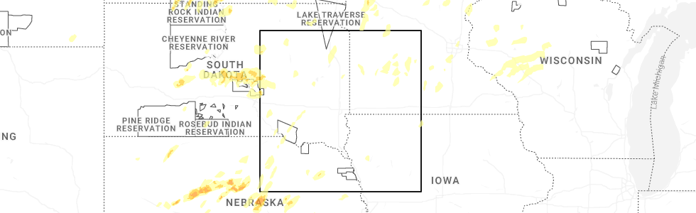
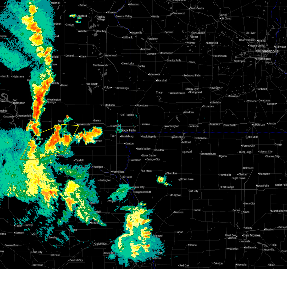
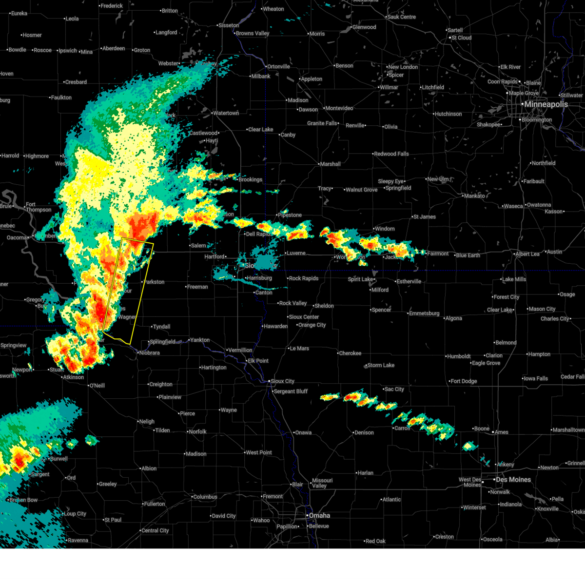
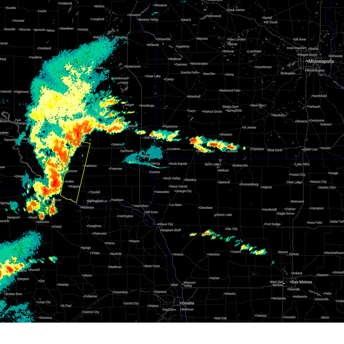
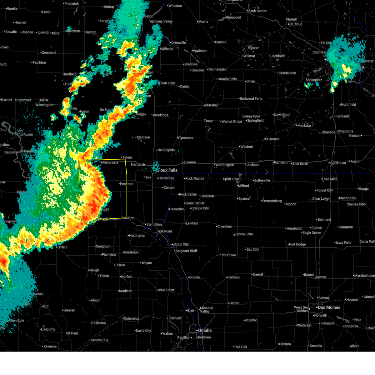
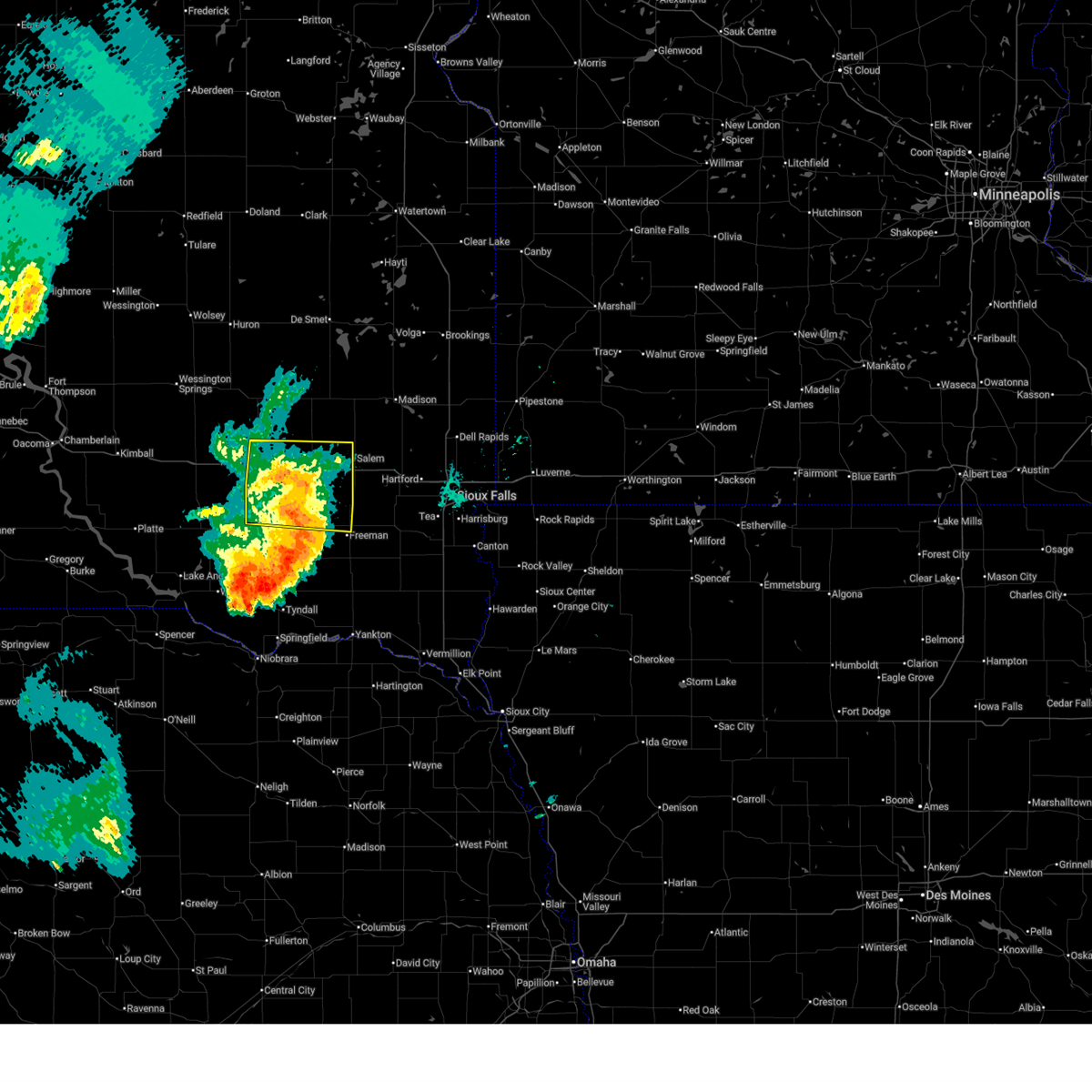
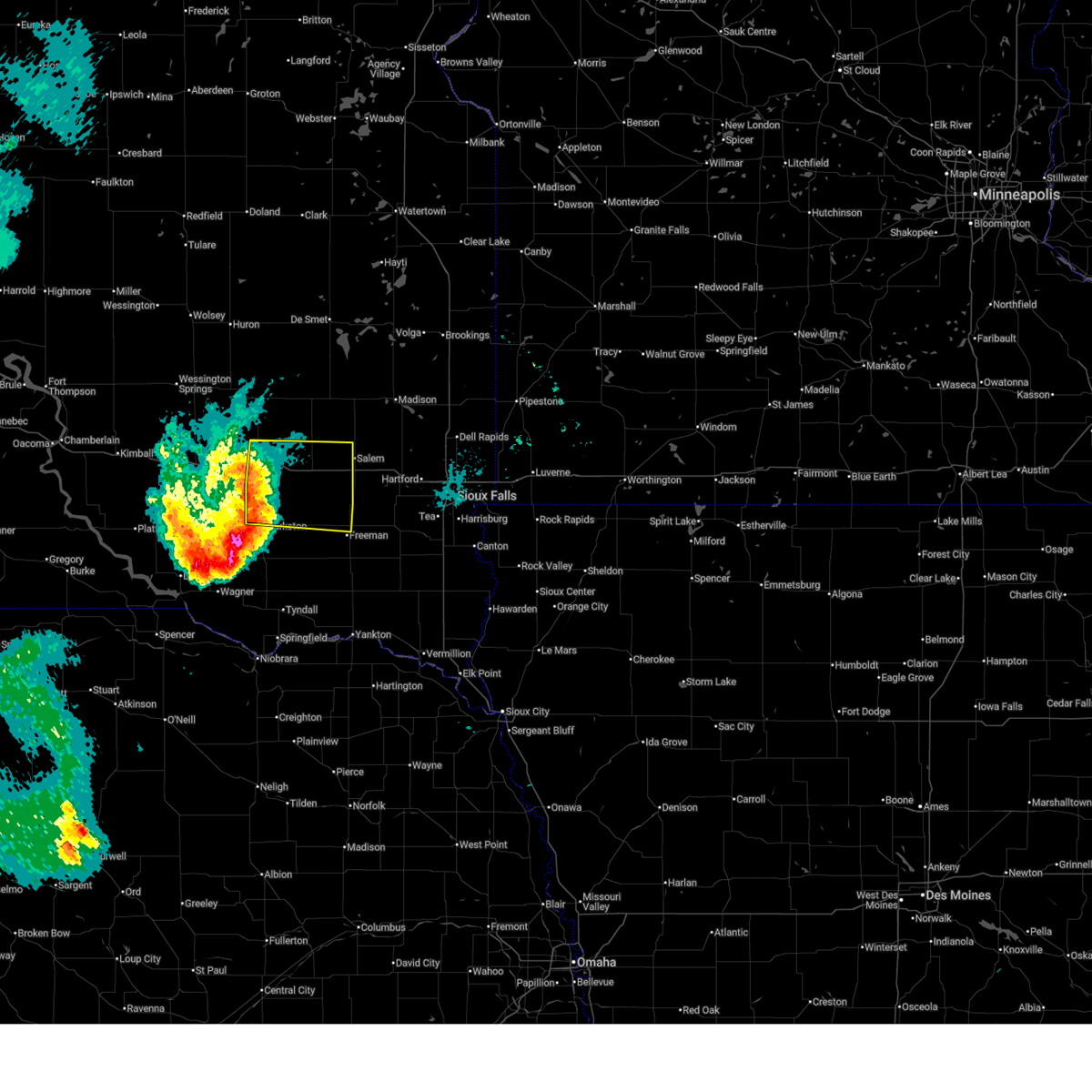
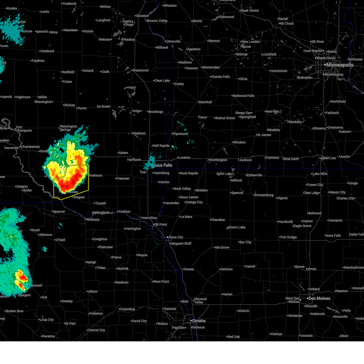
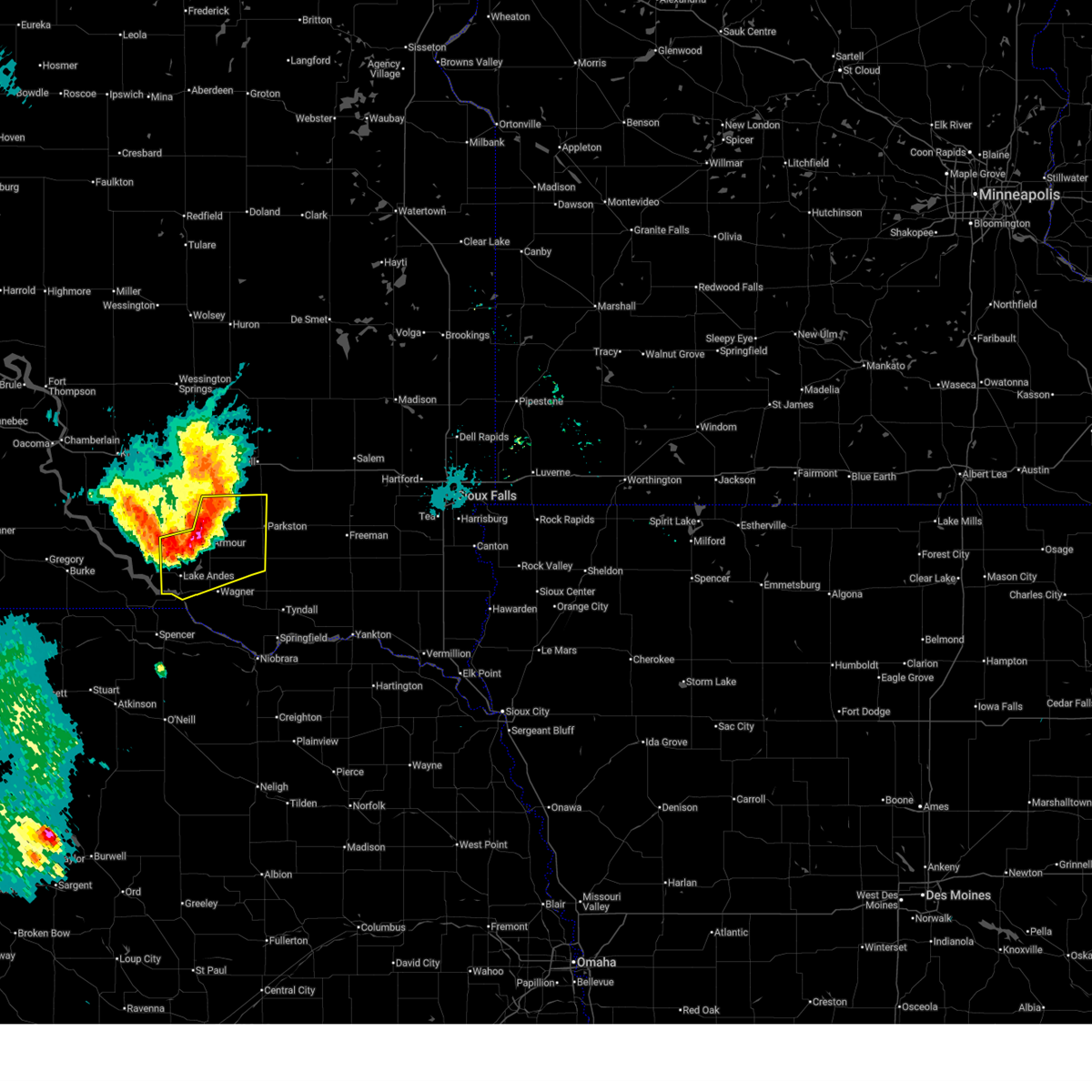
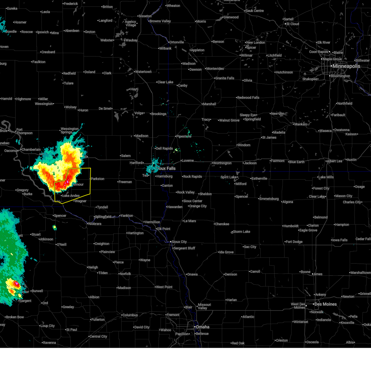
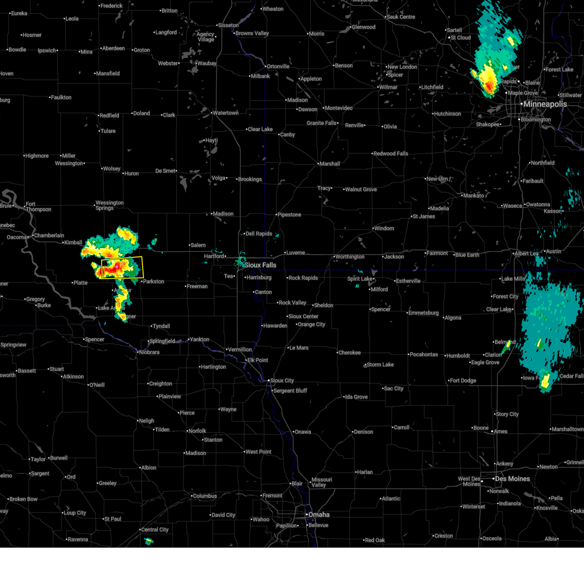
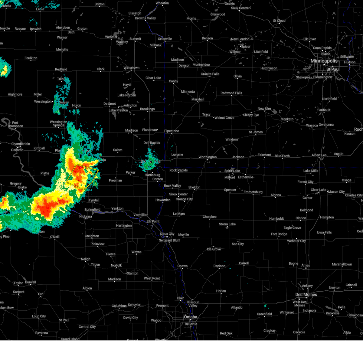
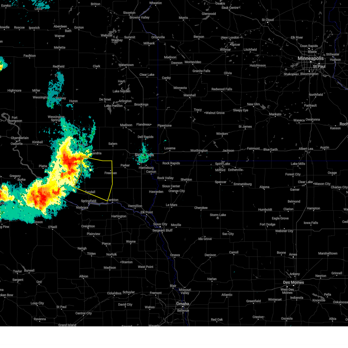
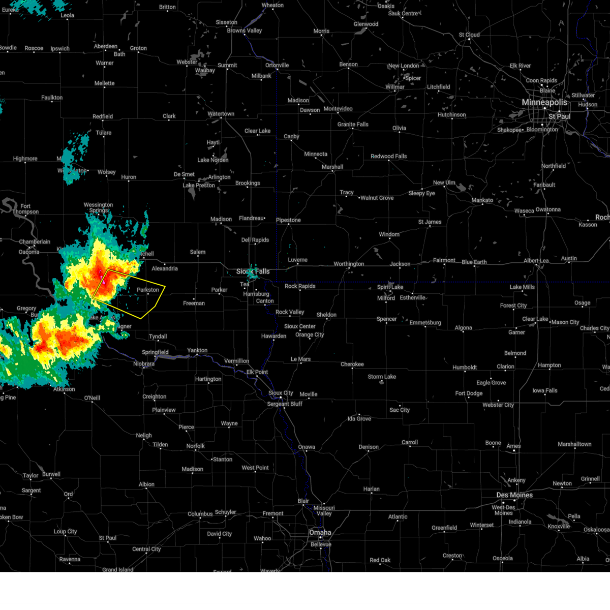
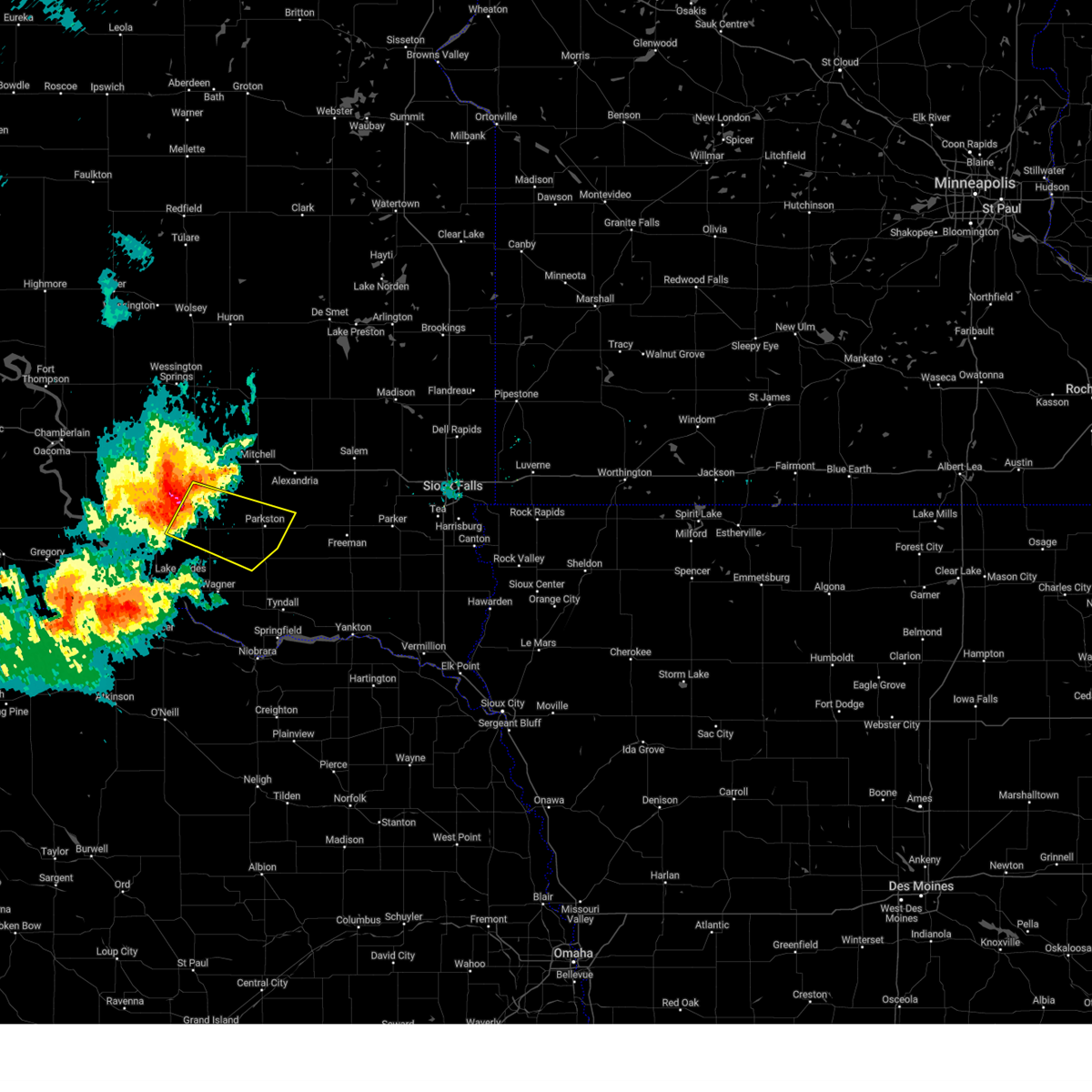
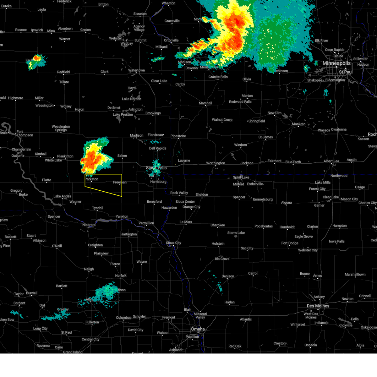
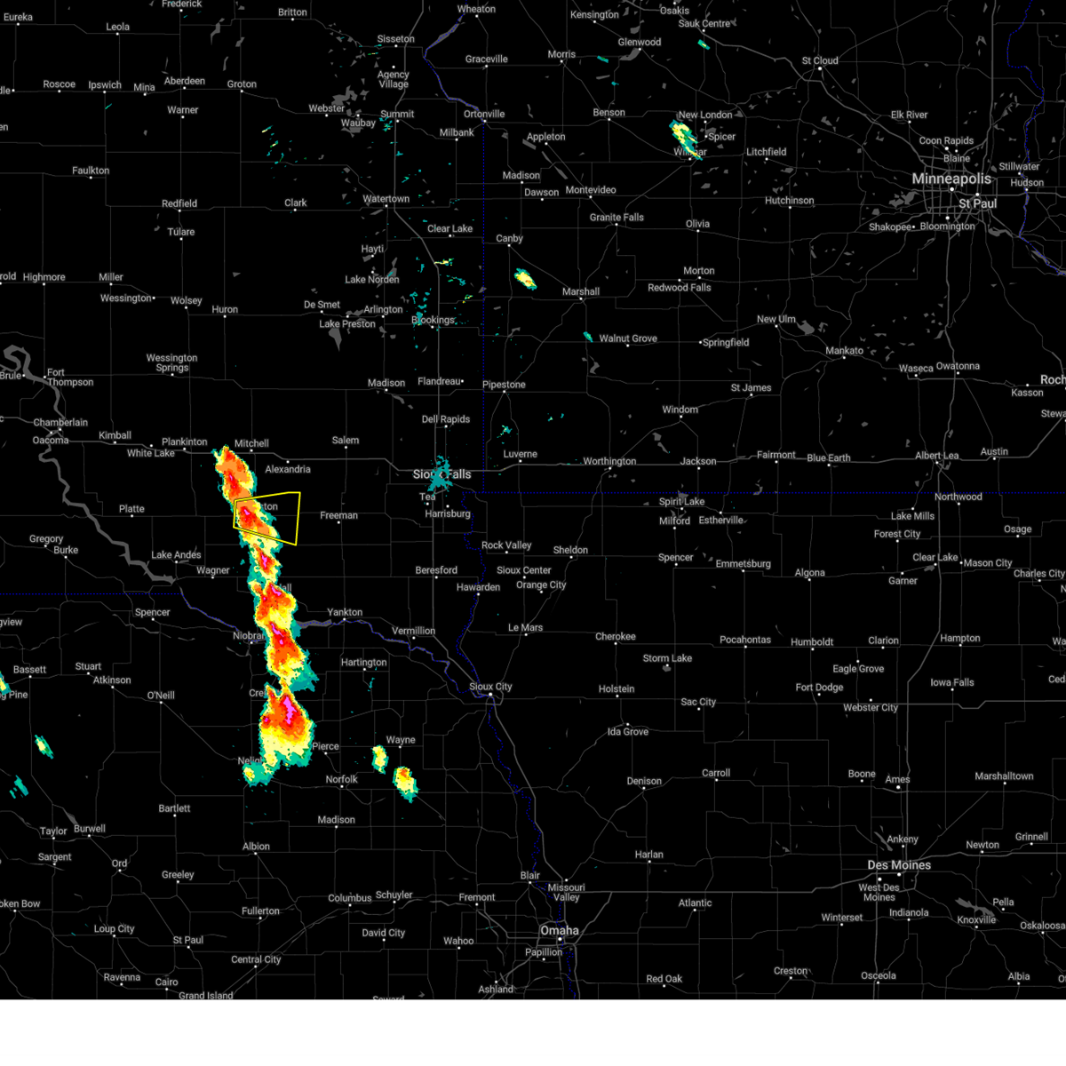
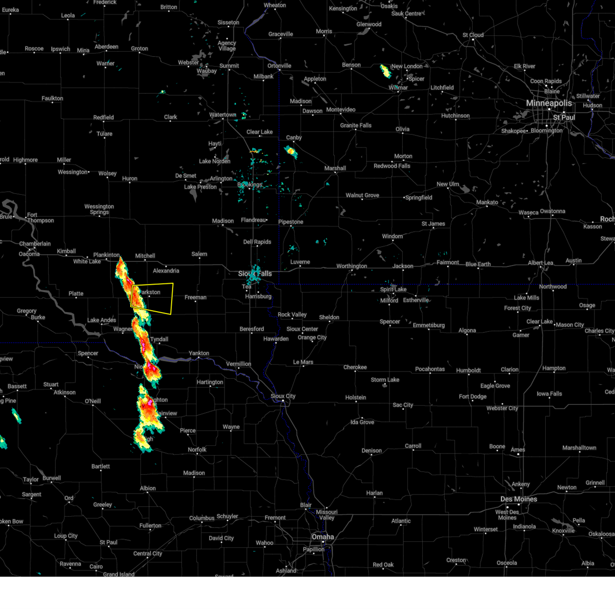
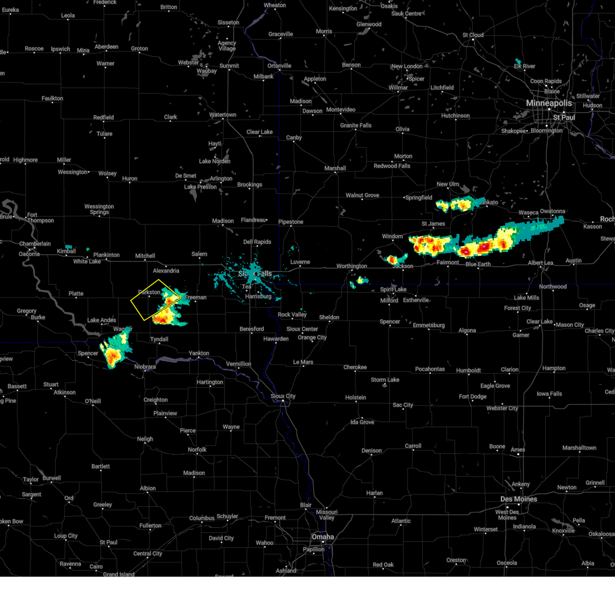
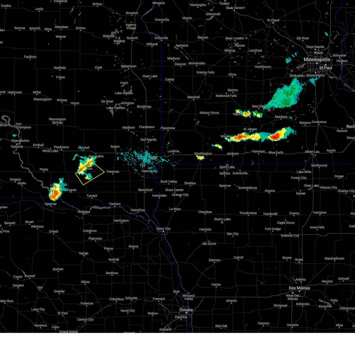
Hail Map for Dimock, SD
The Dimock, SD area has had 5 reports of on-the-ground hail by trained spotters, and has been under severe weather warnings 24 times during the past 12 months. Doppler radar has detected hail at or near Dimock, SD on 45 occasions, including 3 occasions during the past year.
| Name: | Dimock, SD |
| Where Located: | 63.3 miles W of Sioux Falls, SD |
| Map: | Google Map for Dimock, SD |
| Population: | 125 |
| Housing Units: | 61 |
| More Info: | Search Google for Dimock, SD |
1
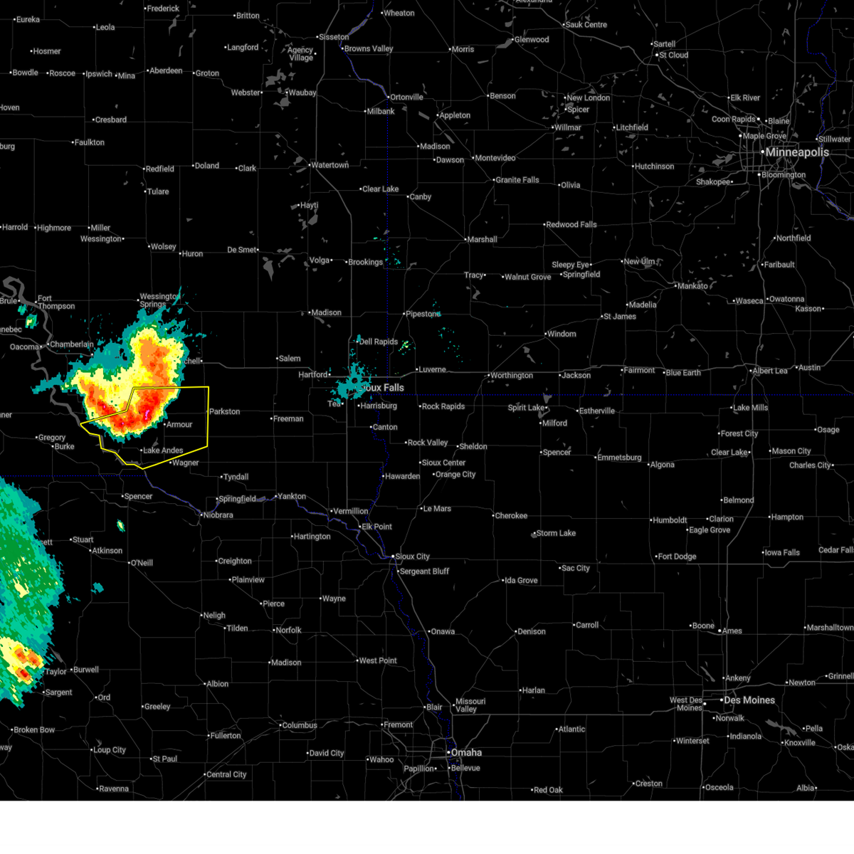
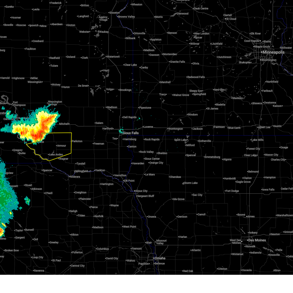
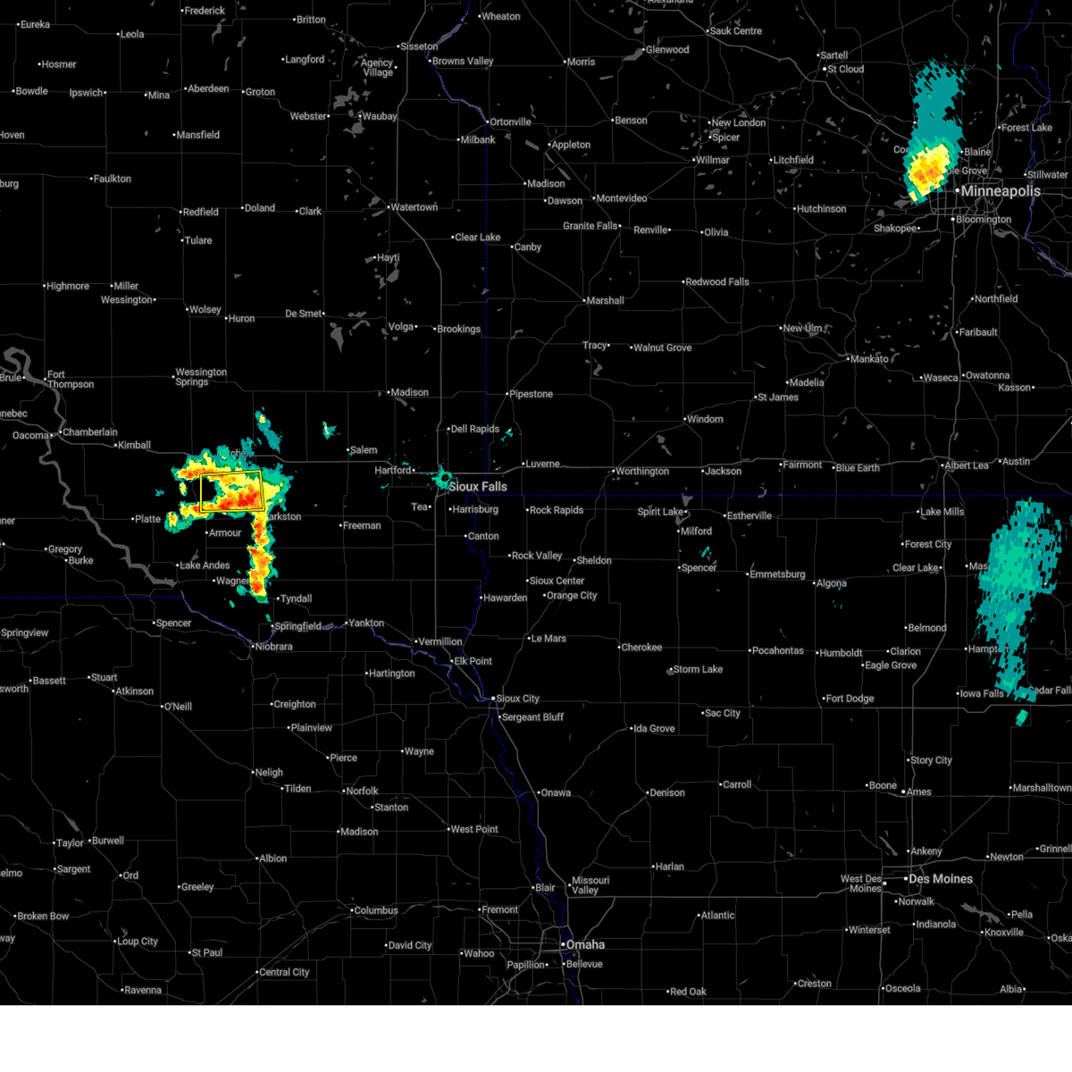
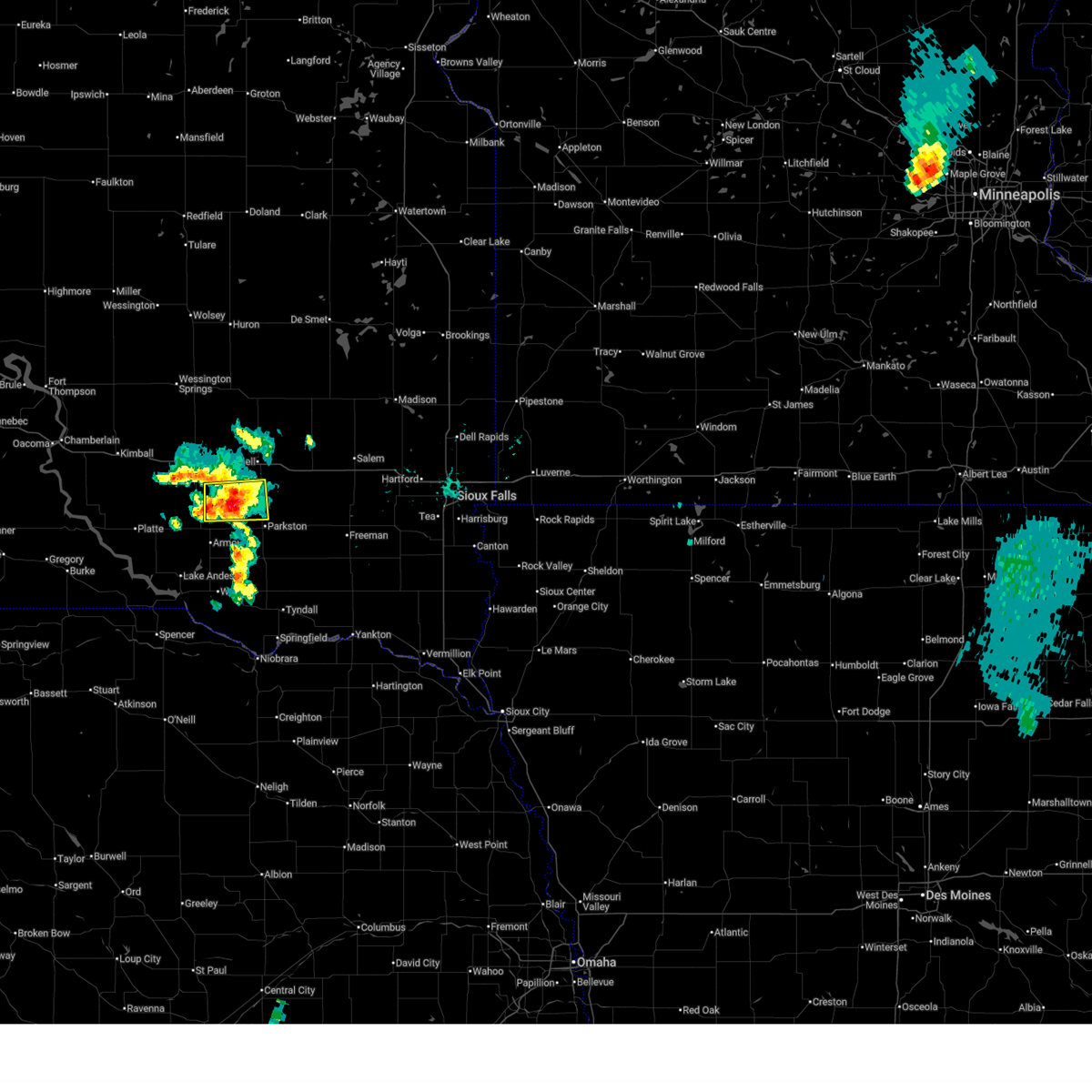
The Top Recent Hail Date for Dimock, SD is Tuesday, June 9, 2026 (15th out of 45)
Hail and Wind Damage Spotted near Dimock, SD
| Date / Time | Report Details |
|---|---|
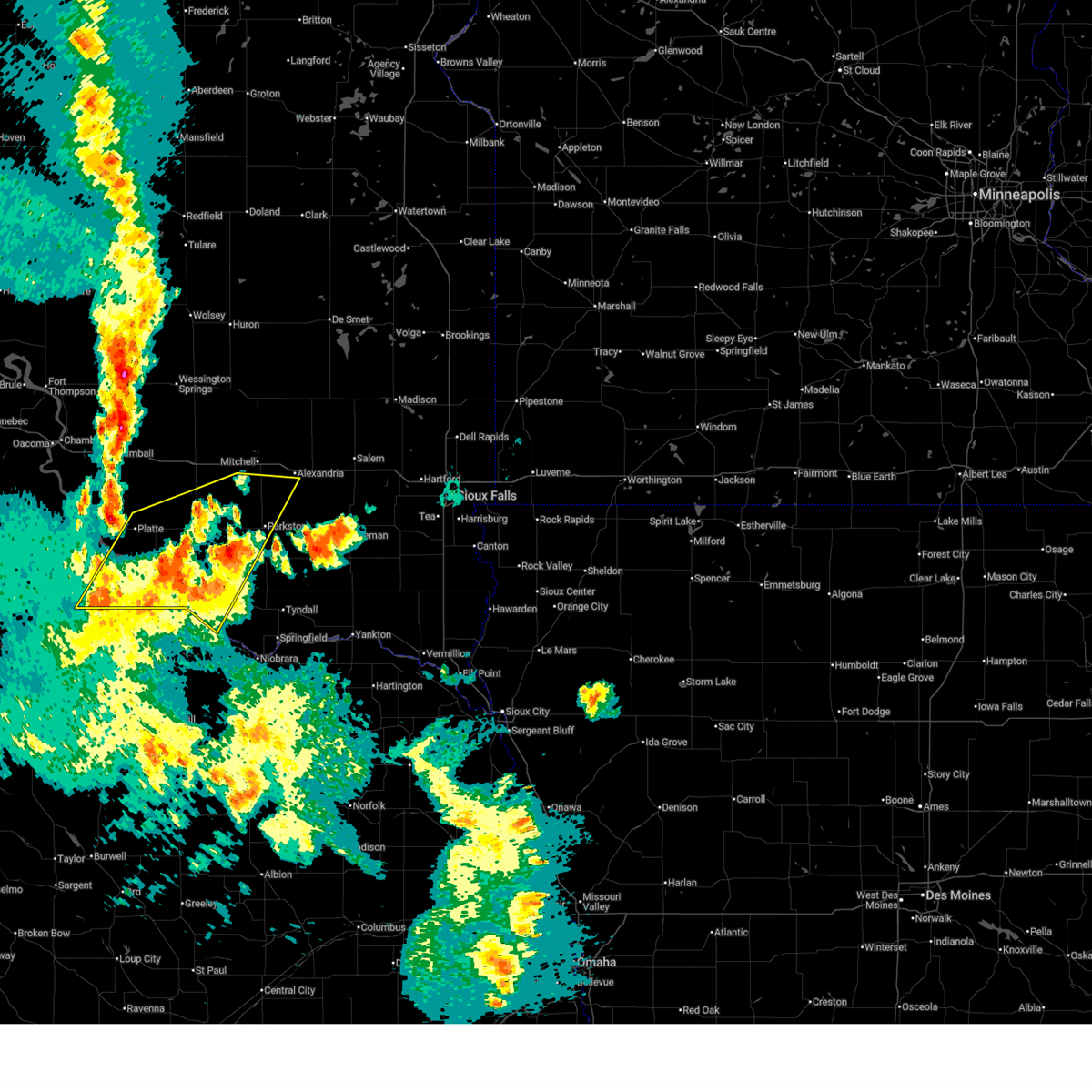
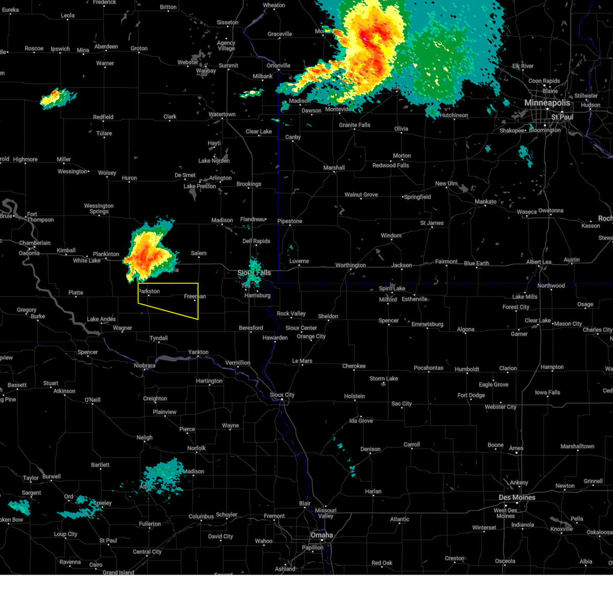
| 6/9/2026 11:35 PM CDT |
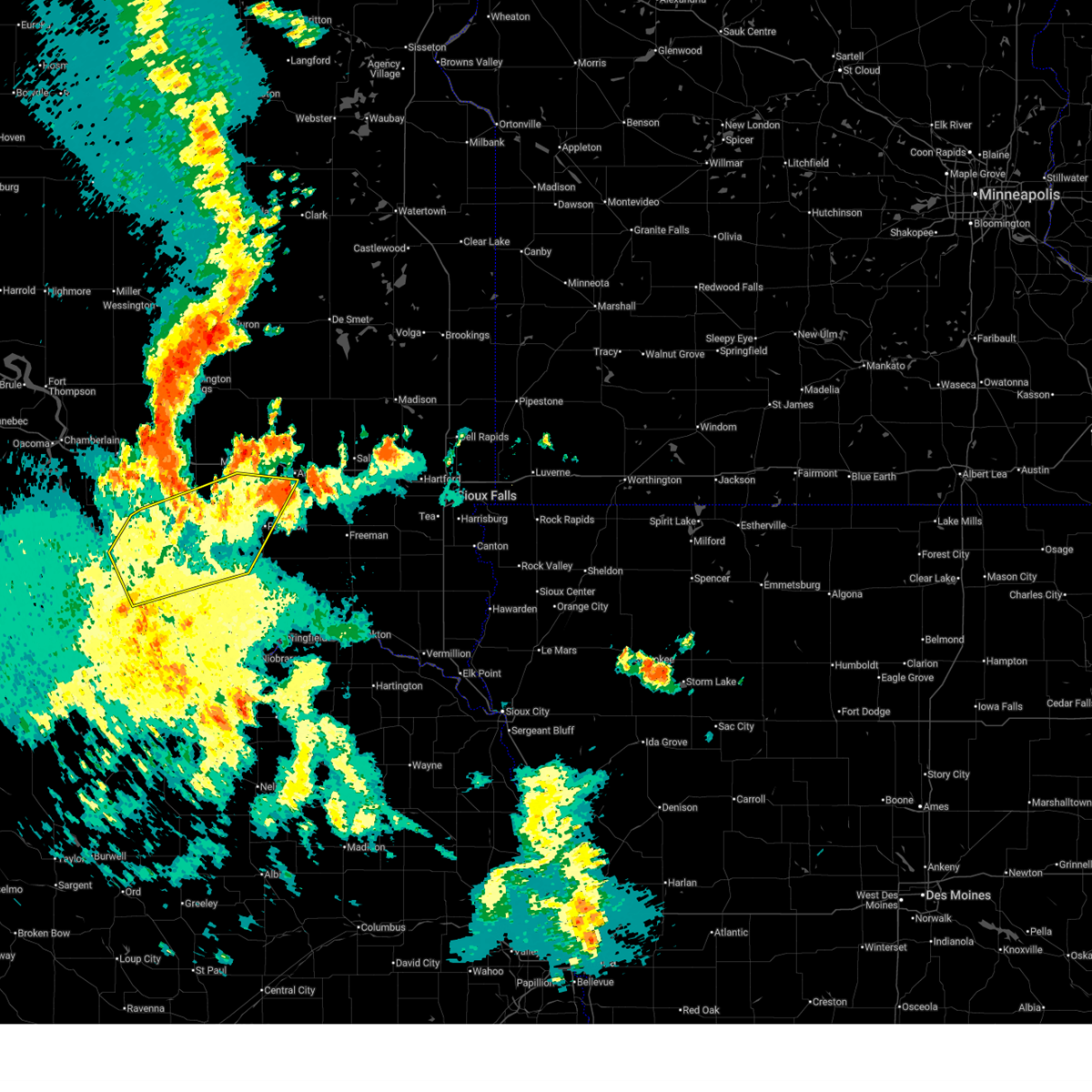 At 1134 pm cdt, severe thunderstorms were located along a line extending from 7 miles west of aurora center to near mitchell to near emery, moving northeast at 55 mph (public. at 1112 pm cdt, a 67 mph wind gust was reported 4 miles ese of platte). Hazards include 70 mph wind gusts and quarter size hail. Hail damage to vehicles is expected. expect considerable tree damage. wind damage is also likely to mobile homes, roofs, and outbuildings. Locations impacted include, aurora center. At 1134 pm cdt, severe thunderstorms were located along a line extending from 7 miles west of aurora center to near mitchell to near emery, moving northeast at 55 mph (public. at 1112 pm cdt, a 67 mph wind gust was reported 4 miles ese of platte). Hazards include 70 mph wind gusts and quarter size hail. Hail damage to vehicles is expected. expect considerable tree damage. wind damage is also likely to mobile homes, roofs, and outbuildings. Locations impacted include, aurora center.
|
| 6/9/2026 11:26 PM CDT |
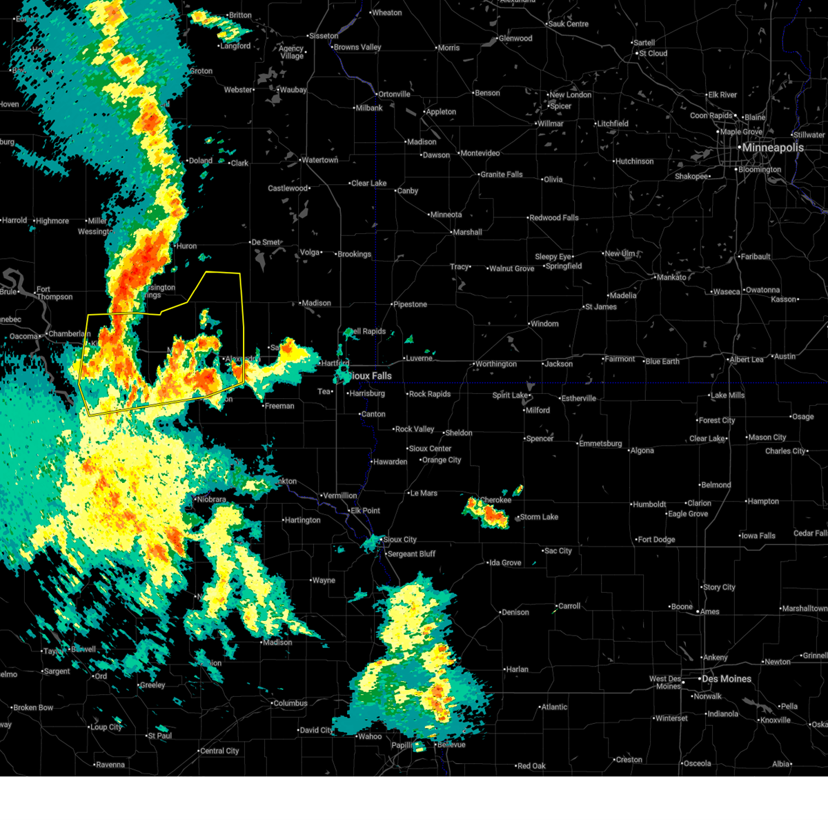 At 1124 pm cdt, severe thunderstorms were located along a line extending from 9 miles west of storla to near plankinton to aurora center, moving east at 35 mph (mesonet. at 1119 pm cdt, a 76 mph wind gust was reported by a personal weather station 11 miles nne of platte, sd). Hazards include 70 mph wind gusts and quarter size hail. Hail damage to vehicles is expected. expect considerable tree damage. wind damage is also likely to mobile homes, roofs, and outbuildings. Locations impacted include, mitchell, plankinton, kimball, platte, alexandria, corsica, mount vernon, emery, white lake, ethan, stickney, letcher, carthage, artesian, dimock, fulton, new holland, harrison, fedora, and loomis. At 1124 pm cdt, severe thunderstorms were located along a line extending from 9 miles west of storla to near plankinton to aurora center, moving east at 35 mph (mesonet. at 1119 pm cdt, a 76 mph wind gust was reported by a personal weather station 11 miles nne of platte, sd). Hazards include 70 mph wind gusts and quarter size hail. Hail damage to vehicles is expected. expect considerable tree damage. wind damage is also likely to mobile homes, roofs, and outbuildings. Locations impacted include, mitchell, plankinton, kimball, platte, alexandria, corsica, mount vernon, emery, white lake, ethan, stickney, letcher, carthage, artesian, dimock, fulton, new holland, harrison, fedora, and loomis.
|
| 6/9/2026 11:17 PM CDT |
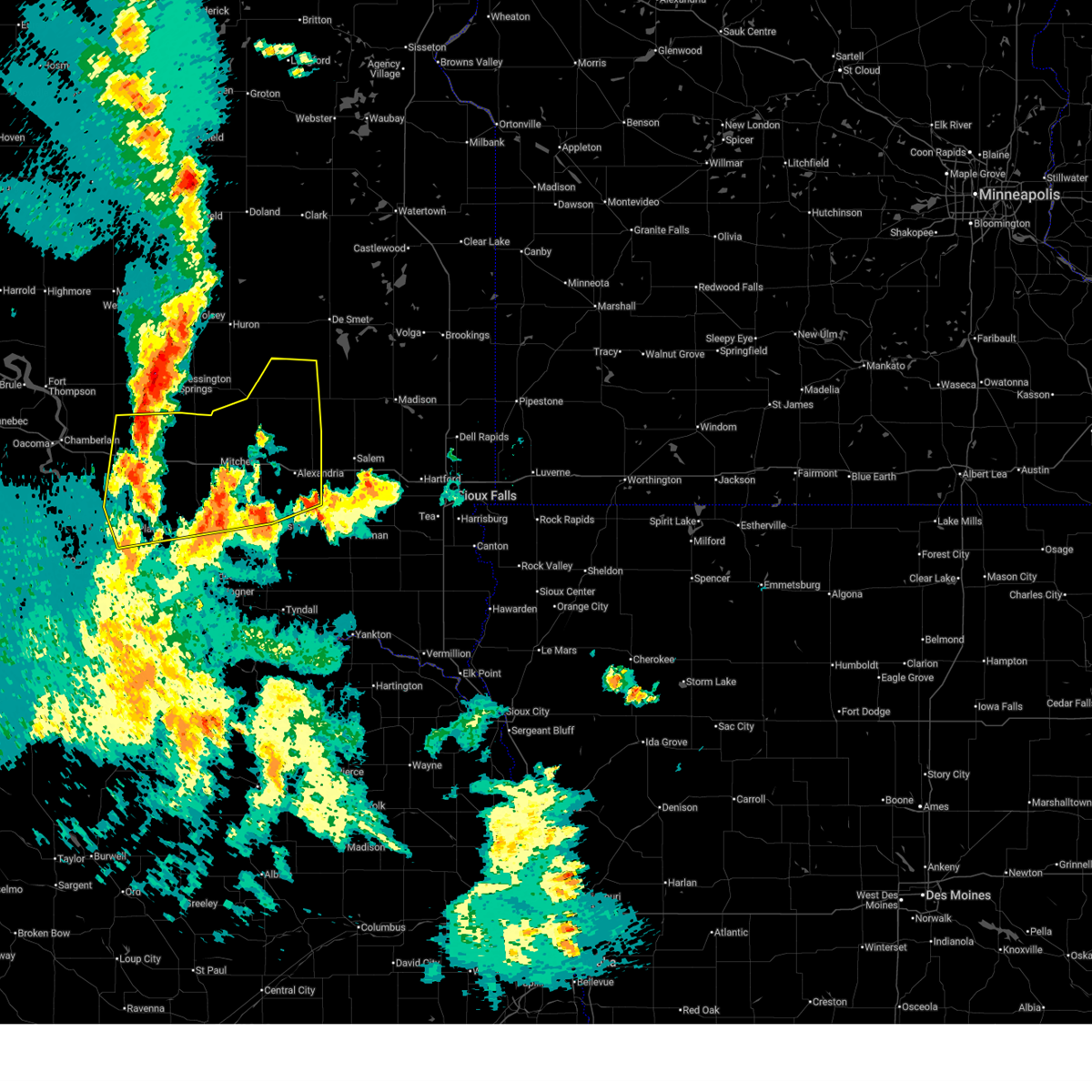 Svrfsd the national weather service in sioux falls has issued a * severe thunderstorm warning for, davison county in southeastern south dakota, sanborn county in east central south dakota, aurora county in south central south dakota, north central charles mix county in south central south dakota, western miner county in east central south dakota, douglas county in south central south dakota, hanson county in southeastern south dakota, northwestern hutchinson county in southeastern south dakota, eastern brule county in south central south dakota, * until 1215 am cdt. * at 1117 pm cdt, severe thunderstorms were located along a line extending from near wessington springs to 9 miles west of storla to near new holland, moving east at 40 mph (radar indicated). Hazards include 60 mph wind gusts and quarter size hail. Hail damage to vehicles is expected. expect wind damage to roofs, siding, and trees. severe thunderstorms will be near, plankinton, new holland, and aurora center around 1120 pm cdt. stickney, harrison, and storla around 1125 pm cdt. mount vernon around 1135 pm cdt. Other locations in the path of these severe thunderstorms include letcher, loomis, mitchell, artesian and ethan. Svrfsd the national weather service in sioux falls has issued a * severe thunderstorm warning for, davison county in southeastern south dakota, sanborn county in east central south dakota, aurora county in south central south dakota, north central charles mix county in south central south dakota, western miner county in east central south dakota, douglas county in south central south dakota, hanson county in southeastern south dakota, northwestern hutchinson county in southeastern south dakota, eastern brule county in south central south dakota, * until 1215 am cdt. * at 1117 pm cdt, severe thunderstorms were located along a line extending from near wessington springs to 9 miles west of storla to near new holland, moving east at 40 mph (radar indicated). Hazards include 60 mph wind gusts and quarter size hail. Hail damage to vehicles is expected. expect wind damage to roofs, siding, and trees. severe thunderstorms will be near, plankinton, new holland, and aurora center around 1120 pm cdt. stickney, harrison, and storla around 1125 pm cdt. mount vernon around 1135 pm cdt. Other locations in the path of these severe thunderstorms include letcher, loomis, mitchell, artesian and ethan.
|
| 6/9/2026 11:13 PM CDT |
 At 1111 pm cdt, severe thunderstorms were located along a line extending from 7 miles west of platte to near stickney to near milltown, moving northeast at 60 mph (public. at 1056 pm cdt, a 59 mph wind gust was reported 7 miles nne of lake andes). Hazards include 70 mph wind gusts and quarter size hail. Hail damage to vehicles is expected. expect considerable tree damage. wind damage is also likely to mobile homes, roofs, and outbuildings. These severe storms will be near, platte, ethan, new holland, and aurora center around 1115 pm cdt. At 1111 pm cdt, severe thunderstorms were located along a line extending from 7 miles west of platte to near stickney to near milltown, moving northeast at 60 mph (public. at 1056 pm cdt, a 59 mph wind gust was reported 7 miles nne of lake andes). Hazards include 70 mph wind gusts and quarter size hail. Hail damage to vehicles is expected. expect considerable tree damage. wind damage is also likely to mobile homes, roofs, and outbuildings. These severe storms will be near, platte, ethan, new holland, and aurora center around 1115 pm cdt.
|
| 6/9/2026 10:55 PM CDT |
 Svrfsd the national weather service in sioux falls has issued a * severe thunderstorm warning for, southern davison county in southeastern south dakota, southeastern aurora county in south central south dakota, charles mix county in south central south dakota, southeastern gregory county in south central south dakota, douglas county in south central south dakota, southwestern hanson county in southeastern south dakota, northwestern hutchinson county in southeastern south dakota, * until 1145 pm cdt. * at 1054 pm cdt, severe thunderstorms were located along a line extending from st. charles to 7 miles east of geddes to near delmont, moving northeast at 50 mph (public. at 1043 pm cdt, a 73 mph wind gust was reported 3 miles ene of fairfax). Hazards include 70 mph wind gusts and quarter size hail. Hail damage to vehicles is expected. expect considerable tree damage. wind damage is also likely to mobile homes, roofs, and outbuildings. severe thunderstorms will be near, parkston, armour, corsica, and geddes around 1100 pm cdt. dimock and harrison around 1105 pm cdt. ethan and new holland around 1110 pm cdt. Other locations in the path of these severe thunderstorms include platte and aurora center. Svrfsd the national weather service in sioux falls has issued a * severe thunderstorm warning for, southern davison county in southeastern south dakota, southeastern aurora county in south central south dakota, charles mix county in south central south dakota, southeastern gregory county in south central south dakota, douglas county in south central south dakota, southwestern hanson county in southeastern south dakota, northwestern hutchinson county in southeastern south dakota, * until 1145 pm cdt. * at 1054 pm cdt, severe thunderstorms were located along a line extending from st. charles to 7 miles east of geddes to near delmont, moving northeast at 50 mph (public. at 1043 pm cdt, a 73 mph wind gust was reported 3 miles ene of fairfax). Hazards include 70 mph wind gusts and quarter size hail. Hail damage to vehicles is expected. expect considerable tree damage. wind damage is also likely to mobile homes, roofs, and outbuildings. severe thunderstorms will be near, parkston, armour, corsica, and geddes around 1100 pm cdt. dimock and harrison around 1105 pm cdt. ethan and new holland around 1110 pm cdt. Other locations in the path of these severe thunderstorms include platte and aurora center.
|
| 7/29/2025 7:40 PM CDT |
 At 740 pm cdt, severe thunderstorms were located along a line extending from near clayton to near niobrara, moving east at 30 mph (the rwis near tripp reported a 68 mph wind gust at approximately 7:20 pm cdt). Hazards include 60 mph wind gusts. Expect damage to roofs, siding, and trees. Locations impacted include, springfield, scotland and clayton. At 740 pm cdt, severe thunderstorms were located along a line extending from near clayton to near niobrara, moving east at 30 mph (the rwis near tripp reported a 68 mph wind gust at approximately 7:20 pm cdt). Hazards include 60 mph wind gusts. Expect damage to roofs, siding, and trees. Locations impacted include, springfield, scotland and clayton.
|
| 7/29/2025 7:17 PM CDT |
 Svrfsd the national weather service in sioux falls has issued a * severe thunderstorm warning for, southeastern charles mix county in south central south dakota, bon homme county in southeastern south dakota, hutchinson county in southeastern south dakota, * until 800 pm cdt. * at 717 pm cdt, severe thunderstorms were located along a line extending from near dimock to near verdel, moving east at 30 mph (radar indicated). Hazards include 60 mph wind gusts. Expect damage to roofs, siding, and trees. severe thunderstorms will be near, tripp, avon, kaylor, and milltown around 720 pm cdt. tyndall around 725 pm cdt. springfield and clayton around 730 pm cdt. Scotland around 735 pm cdt. Svrfsd the national weather service in sioux falls has issued a * severe thunderstorm warning for, southeastern charles mix county in south central south dakota, bon homme county in southeastern south dakota, hutchinson county in southeastern south dakota, * until 800 pm cdt. * at 717 pm cdt, severe thunderstorms were located along a line extending from near dimock to near verdel, moving east at 30 mph (radar indicated). Hazards include 60 mph wind gusts. Expect damage to roofs, siding, and trees. severe thunderstorms will be near, tripp, avon, kaylor, and milltown around 720 pm cdt. tyndall around 725 pm cdt. springfield and clayton around 730 pm cdt. Scotland around 735 pm cdt.
|
| 7/29/2025 6:52 PM CDT |
 At 651 pm cdt, severe thunderstorms were located along a line extending from near mitchell to 7 miles northeast of lynch, moving east at 35 mph (at 6:46 pm cdt the mitchell asos reported a wind gusts of 63 mph). Hazards include 60 mph wind gusts. Expect damage to roofs, siding, and trees. these severe storms will be near, mitchell, ethan, delmont, dimock, and dante around 655 pm cdt. Parkston around 700 pm cdt. At 651 pm cdt, severe thunderstorms were located along a line extending from near mitchell to 7 miles northeast of lynch, moving east at 35 mph (at 6:46 pm cdt the mitchell asos reported a wind gusts of 63 mph). Hazards include 60 mph wind gusts. Expect damage to roofs, siding, and trees. these severe storms will be near, mitchell, ethan, delmont, dimock, and dante around 655 pm cdt. Parkston around 700 pm cdt.
|
| 7/29/2025 6:45 PM CDT |
 Svrfsd the national weather service in sioux falls has issued a * severe thunderstorm warning for, davison county in southeastern south dakota, southeastern charles mix county in south central south dakota, northwestern bon homme county in southeastern south dakota, eastern douglas county in south central south dakota, southwestern hanson county in southeastern south dakota, western hutchinson county in southeastern south dakota, * until 730 pm cdt. * at 645 pm cdt, severe thunderstorms were located along a line extending from loomis to 6 miles northeast of lynch, moving southeast at 35 mph (radar indicated). Hazards include 60 mph wind gusts. Expect damage to roofs, siding, and trees. severe thunderstorms will be near, mitchell, wagner, delmont, and dante around 650 pm cdt. Parkston, ethan, and dimock around 655 pm cdt. Svrfsd the national weather service in sioux falls has issued a * severe thunderstorm warning for, davison county in southeastern south dakota, southeastern charles mix county in south central south dakota, northwestern bon homme county in southeastern south dakota, eastern douglas county in south central south dakota, southwestern hanson county in southeastern south dakota, western hutchinson county in southeastern south dakota, * until 730 pm cdt. * at 645 pm cdt, severe thunderstorms were located along a line extending from loomis to 6 miles northeast of lynch, moving southeast at 35 mph (radar indicated). Hazards include 60 mph wind gusts. Expect damage to roofs, siding, and trees. severe thunderstorms will be near, mitchell, wagner, delmont, and dante around 650 pm cdt. Parkston, ethan, and dimock around 655 pm cdt.
|
| 7/15/2025 7:46 PM CDT |
 The storms which prompted the warning have moved out of the area. therefore, the warning has been allowed to expire. however, gusty winds are still possible with these thunderstorms. a severe thunderstorm watch remains in effect until 1100 pm cdt for south central and southeastern south dakota. remember, a severe thunderstorm warning still remains in effect for mccook, hutchinson, tuner, and yankton counties until 8:30 pm!. The storms which prompted the warning have moved out of the area. therefore, the warning has been allowed to expire. however, gusty winds are still possible with these thunderstorms. a severe thunderstorm watch remains in effect until 1100 pm cdt for south central and southeastern south dakota. remember, a severe thunderstorm warning still remains in effect for mccook, hutchinson, tuner, and yankton counties until 8:30 pm!.
|
| 7/15/2025 7:23 PM CDT |
 At 721 pm cdt, severe thunderstorms were located along a line extending from 6 miles northwest of clayton to near freeman to near utica to 6 miles south of tabor, moving east at 50 mph (public. at 706 pm a 63 mph gust was reported 6 miles south, southwest was of mitchell, south dakota!). Hazards include 70 mph wind gusts and quarter size hail. Hail damage to vehicles is expected. expect considerable tree damage. wind damage is also likely to mobile homes, roofs, and outbuildings. these severe storms will be near, yankton, lewis and clark state recreation area, freeman, clayton, and utica around 725 pm cdt. mayfield around 730 pm cdt. bridgewater and dolton around 735 pm cdt. Other locations impacted by these severe thunderstorms include lesterville, olivet, and southeastern yankton sioux tribal nation. At 721 pm cdt, severe thunderstorms were located along a line extending from 6 miles northwest of clayton to near freeman to near utica to 6 miles south of tabor, moving east at 50 mph (public. at 706 pm a 63 mph gust was reported 6 miles south, southwest was of mitchell, south dakota!). Hazards include 70 mph wind gusts and quarter size hail. Hail damage to vehicles is expected. expect considerable tree damage. wind damage is also likely to mobile homes, roofs, and outbuildings. these severe storms will be near, yankton, lewis and clark state recreation area, freeman, clayton, and utica around 725 pm cdt. mayfield around 730 pm cdt. bridgewater and dolton around 735 pm cdt. Other locations impacted by these severe thunderstorms include lesterville, olivet, and southeastern yankton sioux tribal nation.
|
| 7/15/2025 7:23 PM CDT |
 the severe thunderstorm warning has been cancelled and is no longer in effect the severe thunderstorm warning has been cancelled and is no longer in effect
|
| 7/15/2025 6:39 PM CDT |
 Svrfsd the national weather service in sioux falls has issued a * severe thunderstorm warning for, southern davison county in southeastern south dakota, southeastern aurora county in south central south dakota, southeastern charles mix county in south central south dakota, bon homme county in southeastern south dakota, douglas county in south central south dakota, southwestern mccook county in southeastern south dakota, yankton county in southeastern south dakota, southern hanson county in southeastern south dakota, western turner county in southeastern south dakota, hutchinson county in southeastern south dakota, * until 745 pm cdt. * at 638 pm cdt, severe thunderstorms were located along a line extending from 6 miles northeast of stickney to 6 miles west of dimock to 8 miles southwest of tripp to 8 miles southwest of dante, moving east at 40 mph (radar indicated). Hazards include 70 mph wind gusts and quarter size hail. Hail damage to vehicles is expected. expect considerable tree damage. wind damage is also likely to mobile homes, roofs, and outbuildings. severe thunderstorms will be near, parkston, tripp, avon, ethan, and dimock around 645 pm cdt. kaylor around 650 pm cdt. tyndall and milltown around 655 pm cdt. scotland around 700 pm cdt. clayton around 705 pm cdt. alexandria and menno around 710 pm cdt. tabor around 715 pm cdt. bridgewater and emery around 720 pm cdt. Other locations impacted by these severe thunderstorms include lesterville, olivet, and yankton sioux tribal nation. Svrfsd the national weather service in sioux falls has issued a * severe thunderstorm warning for, southern davison county in southeastern south dakota, southeastern aurora county in south central south dakota, southeastern charles mix county in south central south dakota, bon homme county in southeastern south dakota, douglas county in south central south dakota, southwestern mccook county in southeastern south dakota, yankton county in southeastern south dakota, southern hanson county in southeastern south dakota, western turner county in southeastern south dakota, hutchinson county in southeastern south dakota, * until 745 pm cdt. * at 638 pm cdt, severe thunderstorms were located along a line extending from 6 miles northeast of stickney to 6 miles west of dimock to 8 miles southwest of tripp to 8 miles southwest of dante, moving east at 40 mph (radar indicated). Hazards include 70 mph wind gusts and quarter size hail. Hail damage to vehicles is expected. expect considerable tree damage. wind damage is also likely to mobile homes, roofs, and outbuildings. severe thunderstorms will be near, parkston, tripp, avon, ethan, and dimock around 645 pm cdt. kaylor around 650 pm cdt. tyndall and milltown around 655 pm cdt. scotland around 700 pm cdt. clayton around 705 pm cdt. alexandria and menno around 710 pm cdt. tabor around 715 pm cdt. bridgewater and emery around 720 pm cdt. Other locations impacted by these severe thunderstorms include lesterville, olivet, and yankton sioux tribal nation.
|
| 6/27/2025 10:45 PM CDT |
 The storms which prompted the warning are moving out of the warned area. therefore, the warning will be allowed to expire. a severe thunderstorm watch remains in effect until midnight cdt for southeastern south dakota. remember, a severe thunderstorm warning still remains in effect for portions of the following counties: hanson, mccook, and hutchinson until 1130 pm cdt. The storms which prompted the warning are moving out of the warned area. therefore, the warning will be allowed to expire. a severe thunderstorm watch remains in effect until midnight cdt for southeastern south dakota. remember, a severe thunderstorm warning still remains in effect for portions of the following counties: hanson, mccook, and hutchinson until 1130 pm cdt.
|
| 6/27/2025 10:19 PM CDT |
 At 1019 pm cdt, severe thunderstorms were located along a line extending from near fulton to near alexandria to near milltown, moving east at 40 mph (radar indicated). Hazards include 60 mph wind gusts. Expect damage to roofs, siding, and trees. Locations impacted include, alexandria, clayton, farmer, emery, bridgewater and spencer in mccook county. At 1019 pm cdt, severe thunderstorms were located along a line extending from near fulton to near alexandria to near milltown, moving east at 40 mph (radar indicated). Hazards include 60 mph wind gusts. Expect damage to roofs, siding, and trees. Locations impacted include, alexandria, clayton, farmer, emery, bridgewater and spencer in mccook county.
|
| 6/27/2025 10:13 PM CDT |
 The storms which prompted the warning have moved out of the area. therefore, the warning will be allowed to expire. however, gusty winds and heavy rain are still possible with these thunderstorms. a severe thunderstorm watch remains in effect until midnight cdt for south central and southeastern south dakota. remember, a severe thunderstorm warning still remains in effect for portions of charles mix, far southeast douglas and hutchinson counties until 11 pm cdt. The storms which prompted the warning have moved out of the area. therefore, the warning will be allowed to expire. however, gusty winds and heavy rain are still possible with these thunderstorms. a severe thunderstorm watch remains in effect until midnight cdt for south central and southeastern south dakota. remember, a severe thunderstorm warning still remains in effect for portions of charles mix, far southeast douglas and hutchinson counties until 11 pm cdt.
|
| 6/27/2025 9:59 PM CDT |
 At 958 pm cdt, severe thunderstorms were located along a line extending from 8 miles west of parkston to near delmont to near lake andes, moving east at 40 mph (radar indicated. at 944 pm cdt, a wind gust of 72 mph was reported 3 miles south of corsica). Hazards include 70 mph wind gusts. Expect considerable tree damage. damage is likely to mobile homes, roofs, and outbuildings. These severe storms will be near, parkston, delmont, and ravinia around 1005 pm cdt. At 958 pm cdt, severe thunderstorms were located along a line extending from 8 miles west of parkston to near delmont to near lake andes, moving east at 40 mph (radar indicated. at 944 pm cdt, a wind gust of 72 mph was reported 3 miles south of corsica). Hazards include 70 mph wind gusts. Expect considerable tree damage. damage is likely to mobile homes, roofs, and outbuildings. These severe storms will be near, parkston, delmont, and ravinia around 1005 pm cdt.
|
| 6/27/2025 9:59 PM CDT |
 the severe thunderstorm warning has been cancelled and is no longer in effect the severe thunderstorm warning has been cancelled and is no longer in effect
|
| 6/27/2025 9:54 PM CDT |
 Svrfsd the national weather service in sioux falls has issued a * severe thunderstorm warning for, davison county in southeastern south dakota, western mccook county in southeastern south dakota, hanson county in southeastern south dakota, northern hutchinson county in southeastern south dakota, * until 1045 pm cdt. * at 952 pm cdt, severe thunderstorms were located along a line extending from near loomis to 7 miles west of ethan, moving east at 40 mph (emergency management). Hazards include 70 mph wind gusts. Expect considerable tree damage. damage is likely to mobile homes, roofs, and outbuildings. severe thunderstorms will be near, mitchell, ethan, and dimock around 1000 pm cdt. alexandria and fulton around 1010 pm cdt. Other locations in the path of these severe thunderstorms include milltown, clayton, farmer, emery, spencer in mccook county and bridgewater. Svrfsd the national weather service in sioux falls has issued a * severe thunderstorm warning for, davison county in southeastern south dakota, western mccook county in southeastern south dakota, hanson county in southeastern south dakota, northern hutchinson county in southeastern south dakota, * until 1045 pm cdt. * at 952 pm cdt, severe thunderstorms were located along a line extending from near loomis to 7 miles west of ethan, moving east at 40 mph (emergency management). Hazards include 70 mph wind gusts. Expect considerable tree damage. damage is likely to mobile homes, roofs, and outbuildings. severe thunderstorms will be near, mitchell, ethan, and dimock around 1000 pm cdt. alexandria and fulton around 1010 pm cdt. Other locations in the path of these severe thunderstorms include milltown, clayton, farmer, emery, spencer in mccook county and bridgewater.
|
| 6/27/2025 9:45 PM CDT |
 At 944 pm cdt, severe thunderstorms were located along a line extending from near corsica to armour to near geddes, moving east at 40 mph (radar indicated). Hazards include 70 mph wind gusts. Expect considerable tree damage. damage is likely to mobile homes, roofs, and outbuildings. Locations impacted include, armour, delmont and parkston. At 944 pm cdt, severe thunderstorms were located along a line extending from near corsica to armour to near geddes, moving east at 40 mph (radar indicated). Hazards include 70 mph wind gusts. Expect considerable tree damage. damage is likely to mobile homes, roofs, and outbuildings. Locations impacted include, armour, delmont and parkston.
|
| 6/27/2025 9:24 PM CDT |
 Svrfsd the national weather service in sioux falls has issued a * severe thunderstorm warning for, southern davison county in southeastern south dakota, southeastern aurora county in south central south dakota, central charles mix county in south central south dakota, east central gregory county in south central south dakota, douglas county in south central south dakota, western hutchinson county in southeastern south dakota, * until 1015 pm cdt. * at 924 pm cdt, severe thunderstorms were located along a line extending from near aurora center to near new holland to near platte, moving east at 40 mph (radar indicated. at 858 pm cdt, a wind gust of 65 mph was reported at the platte-winner bridge over the missouri river). Hazards include 70 mph wind gusts. Expect considerable tree damage. damage is likely to mobile homes, roofs, and outbuildings. severe thunderstorms will be near, corsica, geddes, and harrison around 930 pm cdt. armour around 935 pm cdt. Other locations in the path of these severe thunderstorms include delmont and parkston. Svrfsd the national weather service in sioux falls has issued a * severe thunderstorm warning for, southern davison county in southeastern south dakota, southeastern aurora county in south central south dakota, central charles mix county in south central south dakota, east central gregory county in south central south dakota, douglas county in south central south dakota, western hutchinson county in southeastern south dakota, * until 1015 pm cdt. * at 924 pm cdt, severe thunderstorms were located along a line extending from near aurora center to near new holland to near platte, moving east at 40 mph (radar indicated. at 858 pm cdt, a wind gust of 65 mph was reported at the platte-winner bridge over the missouri river). Hazards include 70 mph wind gusts. Expect considerable tree damage. damage is likely to mobile homes, roofs, and outbuildings. severe thunderstorms will be near, corsica, geddes, and harrison around 930 pm cdt. armour around 935 pm cdt. Other locations in the path of these severe thunderstorms include delmont and parkston.
|
| 6/16/2025 2:35 PM CDT |
 the severe thunderstorm warning has been cancelled and is no longer in effect the severe thunderstorm warning has been cancelled and is no longer in effect
|
| 6/16/2025 2:23 PM CDT |
 At 223 pm cdt, a severe thunderstorm was located 7 miles west of dimock, or 10 miles northwest of parkston, moving east at 30 mph (radar indicated). Hazards include 60 mph wind gusts and quarter size hail. Hail damage to vehicles is expected. expect wind damage to roofs, siding, and trees. Locations impacted include, ethan and dimock. At 223 pm cdt, a severe thunderstorm was located 7 miles west of dimock, or 10 miles northwest of parkston, moving east at 30 mph (radar indicated). Hazards include 60 mph wind gusts and quarter size hail. Hail damage to vehicles is expected. expect wind damage to roofs, siding, and trees. Locations impacted include, ethan and dimock.
|
| 6/16/2025 2:19 PM CDT | Quarter sized hail reported 10.2 miles E of Dimock, SD, in addition to quarter sized hail... thunderstorm wind gusts were about 30 mph. |
| 6/16/2025 2:09 PM CDT |
 Svrfsd the national weather service in sioux falls has issued a * severe thunderstorm warning for, southern davison county in southeastern south dakota, southeastern aurora county in south central south dakota, northeastern douglas county in south central south dakota, northwestern hutchinson county in southeastern south dakota, * until 300 pm cdt. * at 208 pm cdt, a severe thunderstorm was located 8 miles southeast of stickney, or 15 miles southeast of plankinton, moving east at 20 mph (radar indicated). Hazards include 60 mph wind gusts and quarter size hail. Hail damage to vehicles is expected. Expect wind damage to roofs, siding, and trees. Svrfsd the national weather service in sioux falls has issued a * severe thunderstorm warning for, southern davison county in southeastern south dakota, southeastern aurora county in south central south dakota, northeastern douglas county in south central south dakota, northwestern hutchinson county in southeastern south dakota, * until 300 pm cdt. * at 208 pm cdt, a severe thunderstorm was located 8 miles southeast of stickney, or 15 miles southeast of plankinton, moving east at 20 mph (radar indicated). Hazards include 60 mph wind gusts and quarter size hail. Hail damage to vehicles is expected. Expect wind damage to roofs, siding, and trees.
|
| 8/27/2024 12:07 AM CDT |
 the severe thunderstorm warning has been cancelled and is no longer in effect the severe thunderstorm warning has been cancelled and is no longer in effect
|
| 8/27/2024 12:07 AM CDT |
 At 1207 am cdt, a severe thunderstorm was located near parkston, moving northeast at 35 mph (radar indicated). Hazards include ping pong ball size hail and 60 mph wind gusts. People and animals outdoors will be injured. expect hail damage to roofs, siding, windows, and vehicles. expect wind damage to roofs, siding, and trees. this severe storm will be near, parkston and tripp around 1210 am cdt. milltown around 1215 am cdt. Other locations in the path of this severe thunderstorm include clayton. At 1207 am cdt, a severe thunderstorm was located near parkston, moving northeast at 35 mph (radar indicated). Hazards include ping pong ball size hail and 60 mph wind gusts. People and animals outdoors will be injured. expect hail damage to roofs, siding, windows, and vehicles. expect wind damage to roofs, siding, and trees. this severe storm will be near, parkston and tripp around 1210 am cdt. milltown around 1215 am cdt. Other locations in the path of this severe thunderstorm include clayton.
|
| 8/26/2024 11:59 PM CDT |
 Svrfsd the national weather service in sioux falls has issued a * severe thunderstorm warning for, east central charles mix county in south central south dakota, southeastern douglas county in south central south dakota, south central hanson county in southeastern south dakota, northwestern hutchinson county in southeastern south dakota, * until 1245 am cdt. * at 1159 pm cdt, a severe thunderstorm was located over delmont, or 10 miles southwest of parkston, moving northeast at 35 mph (radar indicated). Hazards include ping pong ball size hail. People and animals outdoors will be injured. expect damage to roofs, siding, windows, and vehicles. this severe thunderstorm will be near, parkston and tripp around 1205 am cdt. milltown around 1215 am cdt. Other locations in the path of this severe thunderstorm include clayton. Svrfsd the national weather service in sioux falls has issued a * severe thunderstorm warning for, east central charles mix county in south central south dakota, southeastern douglas county in south central south dakota, south central hanson county in southeastern south dakota, northwestern hutchinson county in southeastern south dakota, * until 1245 am cdt. * at 1159 pm cdt, a severe thunderstorm was located over delmont, or 10 miles southwest of parkston, moving northeast at 35 mph (radar indicated). Hazards include ping pong ball size hail. People and animals outdoors will be injured. expect damage to roofs, siding, windows, and vehicles. this severe thunderstorm will be near, parkston and tripp around 1205 am cdt. milltown around 1215 am cdt. Other locations in the path of this severe thunderstorm include clayton.
|
| 7/29/2024 9:32 PM CDT |
 At 932 pm cdt, severe thunderstorms were located along a line extending from near milltown to near kaylor to near tyndall, moving east at 50 mph (trained weather spotters). Hazards include 70 mph wind gusts and penny size hail. at 921 pm cdt a 74 mph wind was reported near tripp. Expect considerable tree damage. damage is likely to mobile homes, roofs, and outbuildings. these severe storms will be near, scotland and milltown around 935 pm cdt. Other locations in the path of these severe thunderstorms include menno, clayton, tabor, freeman and utica. At 932 pm cdt, severe thunderstorms were located along a line extending from near milltown to near kaylor to near tyndall, moving east at 50 mph (trained weather spotters). Hazards include 70 mph wind gusts and penny size hail. at 921 pm cdt a 74 mph wind was reported near tripp. Expect considerable tree damage. damage is likely to mobile homes, roofs, and outbuildings. these severe storms will be near, scotland and milltown around 935 pm cdt. Other locations in the path of these severe thunderstorms include menno, clayton, tabor, freeman and utica.
|
| 7/29/2024 9:20 PM CDT |
 the severe thunderstorm warning has been cancelled and is no longer in effect the severe thunderstorm warning has been cancelled and is no longer in effect
|
| 7/29/2024 9:20 PM CDT |
 At 920 pm cdt, a severe thunderstorm was located near tripp, or 7 miles south of parkston, moving southeast at 55 mph (emergency management). Hazards include 70 mph wind gusts and nickel size hail. at 856 pm cdt a 71 mph wind gust was reported in corsica. Expect considerable tree damage. damage is likely to mobile homes, roofs, and outbuildings. This severe thunderstorm will remain over mainly rural areas of south central davison, eastern douglas and western hutchinson counties. At 920 pm cdt, a severe thunderstorm was located near tripp, or 7 miles south of parkston, moving southeast at 55 mph (emergency management). Hazards include 70 mph wind gusts and nickel size hail. at 856 pm cdt a 71 mph wind gust was reported in corsica. Expect considerable tree damage. damage is likely to mobile homes, roofs, and outbuildings. This severe thunderstorm will remain over mainly rural areas of south central davison, eastern douglas and western hutchinson counties.
|
| 7/29/2024 9:16 PM CDT |
 Svrfsd the national weather service in sioux falls has issued a * severe thunderstorm warning for, southeastern davison county in southeastern south dakota, east central charles mix county in south central south dakota, northern bon homme county in southeastern south dakota, western yankton county in southeastern south dakota, southwestern hanson county in southeastern south dakota, hutchinson county in southeastern south dakota, * until 1000 pm cdt. * at 915 pm cdt, severe thunderstorms were located along a line extending from 6 miles west of dimock to near parkston to 7 miles northeast of dante, moving east at 50 mph (emergency manager reported). Hazards include 70 mph wind gusts. Expect considerable tree damage. damage is likely to mobile homes, roofs, and outbuildings. severe thunderstorms will be near, parkston, tripp, kaylor, and dimock around 920 pm cdt. tyndall, scotland, and milltown around 930 pm cdt. Other locations in the path of these severe thunderstorms include menno, tabor, clayton and utica. Svrfsd the national weather service in sioux falls has issued a * severe thunderstorm warning for, southeastern davison county in southeastern south dakota, east central charles mix county in south central south dakota, northern bon homme county in southeastern south dakota, western yankton county in southeastern south dakota, southwestern hanson county in southeastern south dakota, hutchinson county in southeastern south dakota, * until 1000 pm cdt. * at 915 pm cdt, severe thunderstorms were located along a line extending from 6 miles west of dimock to near parkston to 7 miles northeast of dante, moving east at 50 mph (emergency manager reported). Hazards include 70 mph wind gusts. Expect considerable tree damage. damage is likely to mobile homes, roofs, and outbuildings. severe thunderstorms will be near, parkston, tripp, kaylor, and dimock around 920 pm cdt. tyndall, scotland, and milltown around 930 pm cdt. Other locations in the path of these severe thunderstorms include menno, tabor, clayton and utica.
|
| 7/29/2024 9:07 PM CDT |
 At 906 pm cdt, a severe thunderstorm was located near corsica, or 16 miles west of parkston, moving southeast at 40 mph (emergency management). Hazards include 70 mph wind gusts and nickel size hail. at 9 pm cdt a personal weather station in armour measured a 68 mph wind gust. Expect considerable tree damage. damage is likely to mobile homes, roofs, and outbuildings. this severe storm will be near, armour around 910 pm cdt. delmont around 915 pm cdt. Other locations in the path of this severe thunderstorm include parkston. At 906 pm cdt, a severe thunderstorm was located near corsica, or 16 miles west of parkston, moving southeast at 40 mph (emergency management). Hazards include 70 mph wind gusts and nickel size hail. at 9 pm cdt a personal weather station in armour measured a 68 mph wind gust. Expect considerable tree damage. damage is likely to mobile homes, roofs, and outbuildings. this severe storm will be near, armour around 910 pm cdt. delmont around 915 pm cdt. Other locations in the path of this severe thunderstorm include parkston.
|
| 7/29/2024 8:55 PM CDT |
 Svrfsd the national weather service in sioux falls has issued a * severe thunderstorm warning for, southwestern davison county in southeastern south dakota, southeastern aurora county in south central south dakota, east central charles mix county in south central south dakota, douglas county in south central south dakota, western hutchinson county in southeastern south dakota, * until 945 pm cdt. * at 854 pm cdt, a severe thunderstorm was located near harrison, or 16 miles south of plankinton, moving southeast at 35 mph (radar indicated). Hazards include 60 mph wind gusts and nickel size hail. Expect damage to roofs, siding, and trees. this severe thunderstorm will be near, corsica around 900 pm cdt. armour around 905 pm cdt. Other locations in the path of this severe thunderstorm include delmont and parkston. Svrfsd the national weather service in sioux falls has issued a * severe thunderstorm warning for, southwestern davison county in southeastern south dakota, southeastern aurora county in south central south dakota, east central charles mix county in south central south dakota, douglas county in south central south dakota, western hutchinson county in southeastern south dakota, * until 945 pm cdt. * at 854 pm cdt, a severe thunderstorm was located near harrison, or 16 miles south of plankinton, moving southeast at 35 mph (radar indicated). Hazards include 60 mph wind gusts and nickel size hail. Expect damage to roofs, siding, and trees. this severe thunderstorm will be near, corsica around 900 pm cdt. armour around 905 pm cdt. Other locations in the path of this severe thunderstorm include delmont and parkston.
|
| 7/14/2024 4:15 AM CDT |
 The storms which prompted the warning have weakened below severe limits, and no longer pose an immediate threat to life or property. therefore, the warning will be allowed to expire. however, gusty winds and heavy rain are still possible with these thunderstorms. a severe thunderstorm watch remains in effect until 800 am cdt for south central and southeastern south dakota. The storms which prompted the warning have weakened below severe limits, and no longer pose an immediate threat to life or property. therefore, the warning will be allowed to expire. however, gusty winds and heavy rain are still possible with these thunderstorms. a severe thunderstorm watch remains in effect until 800 am cdt for south central and southeastern south dakota.
|
| 7/14/2024 4:04 AM CDT |
 At 402 am cdt, severe thunderstorms were located along a line extending from mount vernon to near armour to near lynch, moving east at 55 mph (trained weather spotters. at 333 am, the sddot site at the platte-winner bridge recorded a 68 mph wind gust). Hazards include 60 mph wind gusts. Expect damage to roofs, siding, and trees. Locations impacted include, wagner, marty, delmont, dante, parkston, dimock, tripp, avon, kaylor, milltown, tyndall, springfield, scotland and clayton. At 402 am cdt, severe thunderstorms were located along a line extending from mount vernon to near armour to near lynch, moving east at 55 mph (trained weather spotters. at 333 am, the sddot site at the platte-winner bridge recorded a 68 mph wind gust). Hazards include 60 mph wind gusts. Expect damage to roofs, siding, and trees. Locations impacted include, wagner, marty, delmont, dante, parkston, dimock, tripp, avon, kaylor, milltown, tyndall, springfield, scotland and clayton.
|
| 7/14/2024 3:28 AM CDT |
 Svrfsd the national weather service in sioux falls has issued a * severe thunderstorm warning for, charles mix county in south central south dakota, gregory county in south central south dakota, bon homme county in southeastern south dakota, douglas county in south central south dakota, yankton county in southeastern south dakota, turner county in southeastern south dakota, hutchinson county in southeastern south dakota, * until 415 am cdt. * at 328 am cdt, severe thunderstorms were located along a line extending from alexandria to near tripp to near verdel, moving east at 65 mph (radar indicated). Hazards include 60 mph wind gusts. Expect damage to roofs, siding, and trees. severe thunderstorms will be near, tyndall, springfield, scotland, menno, kaylor, and clayton around 335 am cdt. freeman, tabor, and dolton around 345 am cdt. Other locations in the path of these severe thunderstorms include lewis and clark state recreation area, marion, utica, yankton, parker, mayfield, monroe, viborg, irene, hurley, mission hill, chancellor, volin and davis. Svrfsd the national weather service in sioux falls has issued a * severe thunderstorm warning for, charles mix county in south central south dakota, gregory county in south central south dakota, bon homme county in southeastern south dakota, douglas county in south central south dakota, yankton county in southeastern south dakota, turner county in southeastern south dakota, hutchinson county in southeastern south dakota, * until 415 am cdt. * at 328 am cdt, severe thunderstorms were located along a line extending from alexandria to near tripp to near verdel, moving east at 65 mph (radar indicated). Hazards include 60 mph wind gusts. Expect damage to roofs, siding, and trees. severe thunderstorms will be near, tyndall, springfield, scotland, menno, kaylor, and clayton around 335 am cdt. freeman, tabor, and dolton around 345 am cdt. Other locations in the path of these severe thunderstorms include lewis and clark state recreation area, marion, utica, yankton, parker, mayfield, monroe, viborg, irene, hurley, mission hill, chancellor, volin and davis.
|
| 8/10/2023 6:52 PM CDT |
 At 652 pm cdt, a severe thunderstorm was located over ethan, or 11 miles north of parkston, moving east at 25 mph (radar indicated). Hazards include quarter size hail. Damage to vehicles is expected. this severe thunderstorm will be near, ethan and dimock around 655 pm cdt. hail threat, radar indicated max hail size, 1. 00 in wind threat, radar indicated max wind gust, <50 mph. At 652 pm cdt, a severe thunderstorm was located over ethan, or 11 miles north of parkston, moving east at 25 mph (radar indicated). Hazards include quarter size hail. Damage to vehicles is expected. this severe thunderstorm will be near, ethan and dimock around 655 pm cdt. hail threat, radar indicated max hail size, 1. 00 in wind threat, radar indicated max wind gust, <50 mph.
|
| 7/25/2023 10:57 PM CDT |
 At 1057 pm cdt, a severe thunderstorm was located near milltown, or 10 miles northeast of parkston, moving southeast at 35 mph (radar indicated). Hazards include 70 mph wind gusts and nickel size hail. Expect considerable tree damage. damage is likely to mobile homes, roofs, and outbuildings. this severe storm will be near, milltown around 1105 pm cdt. clayton around 1115 pm cdt. freeman and menno around 1130 pm cdt. other locations impacted by this severe thunderstorm include olivet. at 1055 pm cdt, 75 mph winds were reported 1 mile west northwest of ethan. thunderstorm damage threat, considerable hail threat, radar indicated max hail size, 0. 88 in wind threat, radar indicated max wind gust, 70 mph. At 1057 pm cdt, a severe thunderstorm was located near milltown, or 10 miles northeast of parkston, moving southeast at 35 mph (radar indicated). Hazards include 70 mph wind gusts and nickel size hail. Expect considerable tree damage. damage is likely to mobile homes, roofs, and outbuildings. this severe storm will be near, milltown around 1105 pm cdt. clayton around 1115 pm cdt. freeman and menno around 1130 pm cdt. other locations impacted by this severe thunderstorm include olivet. at 1055 pm cdt, 75 mph winds were reported 1 mile west northwest of ethan. thunderstorm damage threat, considerable hail threat, radar indicated max hail size, 0. 88 in wind threat, radar indicated max wind gust, 70 mph.
|
| 7/25/2023 10:51 PM CDT |
 At 1050 pm cdt, a severe thunderstorm was located over ethan, or 10 miles north of parkston, moving southeast at 35 mph (radar indicated). Hazards include 70 mph wind gusts and nickel size hail. Expect considerable tree damage. damage is likely to mobile homes, roofs, and outbuildings. this severe thunderstorm will be near, milltown and dimock around 1105 pm cdt. clayton around 1115 pm cdt. freeman and menno around 1130 pm cdt. other locations impacted by this severe thunderstorm include olivet. thunderstorm damage threat, considerable hail threat, radar indicated max hail size, 0. 88 in wind threat, radar indicated max wind gust, 70 mph. At 1050 pm cdt, a severe thunderstorm was located over ethan, or 10 miles north of parkston, moving southeast at 35 mph (radar indicated). Hazards include 70 mph wind gusts and nickel size hail. Expect considerable tree damage. damage is likely to mobile homes, roofs, and outbuildings. this severe thunderstorm will be near, milltown and dimock around 1105 pm cdt. clayton around 1115 pm cdt. freeman and menno around 1130 pm cdt. other locations impacted by this severe thunderstorm include olivet. thunderstorm damage threat, considerable hail threat, radar indicated max hail size, 0. 88 in wind threat, radar indicated max wind gust, 70 mph.
|
| 7/24/2023 3:09 AM CDT |
 At 308 am cdt, a severe thunderstorm was located near parkston, moving southeast at 30 mph (radar indicated). Hazards include half dollar size hail. Damage to vehicles is expected. locations impacted include, parkston and dimock. hail threat, radar indicated max hail size, 1. 25 in wind threat, radar indicated max wind gust, <50 mph. At 308 am cdt, a severe thunderstorm was located near parkston, moving southeast at 30 mph (radar indicated). Hazards include half dollar size hail. Damage to vehicles is expected. locations impacted include, parkston and dimock. hail threat, radar indicated max hail size, 1. 25 in wind threat, radar indicated max wind gust, <50 mph.
|
| 7/24/2023 3:07 AM CDT |
 The severe thunderstorm warning for southeastern davison, northeastern douglas, southwestern hanson and northwestern hutchinson counties will expire at 315 am cdt, the storm which prompted the warning has moved out of the area. therefore, the warning will be allowed to expire. a severe thunderstorm watch remains in effect until 900 am cdt for south central and southeastern south dakota. The severe thunderstorm warning for southeastern davison, northeastern douglas, southwestern hanson and northwestern hutchinson counties will expire at 315 am cdt, the storm which prompted the warning has moved out of the area. therefore, the warning will be allowed to expire. a severe thunderstorm watch remains in effect until 900 am cdt for south central and southeastern south dakota.
|
| 7/24/2023 2:58 AM CDT |
 At 257 am cdt, a severe thunderstorm was located over dimock, or near parkston, moving southeast at 25 mph (radar indicated). Hazards include half dollar size hail. Damage to vehicles is expected. this severe thunderstorm will remain over mainly rural areas of southeastern davison, eastern douglas, southwestern hanson and northwestern hutchinson counties. hail threat, radar indicated max hail size, 1. 25 in wind threat, radar indicated max wind gust, <50 mph. At 257 am cdt, a severe thunderstorm was located over dimock, or near parkston, moving southeast at 25 mph (radar indicated). Hazards include half dollar size hail. Damage to vehicles is expected. this severe thunderstorm will remain over mainly rural areas of southeastern davison, eastern douglas, southwestern hanson and northwestern hutchinson counties. hail threat, radar indicated max hail size, 1. 25 in wind threat, radar indicated max wind gust, <50 mph.
|
| 7/24/2023 2:50 AM CDT |
 At 250 am cdt, a severe thunderstorm was located near ethan, or 12 miles south of mitchell, moving east at 5 mph (radar indicated). Hazards include ping pong ball size hail. People and animals outdoors will be injured. expect damage to roofs, siding, windows, and vehicles. locations impacted include, alexandria, ethan and dimock. hail threat, radar indicated max hail size, 1. 50 in wind threat, radar indicated max wind gust, <50 mph. At 250 am cdt, a severe thunderstorm was located near ethan, or 12 miles south of mitchell, moving east at 5 mph (radar indicated). Hazards include ping pong ball size hail. People and animals outdoors will be injured. expect damage to roofs, siding, windows, and vehicles. locations impacted include, alexandria, ethan and dimock. hail threat, radar indicated max hail size, 1. 50 in wind threat, radar indicated max wind gust, <50 mph.
|
| 7/24/2023 2:35 AM CDT |
 At 235 am cdt, a severe thunderstorm was located 7 miles west of ethan, or 12 miles south of mitchell, moving east at 5 mph (radar indicated). Hazards include ping pong ball size hail. People and animals outdoors will be injured. Expect damage to roofs, siding, windows, and vehicles. At 235 am cdt, a severe thunderstorm was located 7 miles west of ethan, or 12 miles south of mitchell, moving east at 5 mph (radar indicated). Hazards include ping pong ball size hail. People and animals outdoors will be injured. Expect damage to roofs, siding, windows, and vehicles.
|
| 7/24/2023 2:23 AM CDT |
 The severe thunderstorm warning for east central douglas and western hutchinson counties will expire at 230 am cdt, the storm which prompted the warning has weakened below severe limits, and no longer poses an immediate threat to life or property. therefore, the warning will be allowed to expire. however small hail is still possible with this thunderstorm. a severe thunderstorm watch remains in effect until 900 am cdt for south central and southeastern south dakota. The severe thunderstorm warning for east central douglas and western hutchinson counties will expire at 230 am cdt, the storm which prompted the warning has weakened below severe limits, and no longer poses an immediate threat to life or property. therefore, the warning will be allowed to expire. however small hail is still possible with this thunderstorm. a severe thunderstorm watch remains in effect until 900 am cdt for south central and southeastern south dakota.
|
| 7/24/2023 2:14 AM CDT |
 At 214 am cdt, a severe thunderstorm was located over parkston, moving east at 25 mph (radar indicated). Hazards include quarter size hail. Damage to vehicles is expected. locations impacted include, milltown. hail threat, radar indicated max hail size, 1. 00 in wind threat, radar indicated max wind gust, <50 mph. At 214 am cdt, a severe thunderstorm was located over parkston, moving east at 25 mph (radar indicated). Hazards include quarter size hail. Damage to vehicles is expected. locations impacted include, milltown. hail threat, radar indicated max hail size, 1. 00 in wind threat, radar indicated max wind gust, <50 mph.
|
| 7/24/2023 2:01 AM CDT |
 At 201 am cdt, a severe thunderstorm was located near parkston, moving east at 25 mph (radar indicated). Hazards include quarter size hail. Damage to vehicles is expected. this severe thunderstorm will be near, dimock around 210 am cdt. parkston around 215 am cdt. other locations in the path of this severe thunderstorm include milltown. hail threat, radar indicated max hail size, 1. 00 in wind threat, radar indicated max wind gust, <50 mph. At 201 am cdt, a severe thunderstorm was located near parkston, moving east at 25 mph (radar indicated). Hazards include quarter size hail. Damage to vehicles is expected. this severe thunderstorm will be near, dimock around 210 am cdt. parkston around 215 am cdt. other locations in the path of this severe thunderstorm include milltown. hail threat, radar indicated max hail size, 1. 00 in wind threat, radar indicated max wind gust, <50 mph.
|
| 7/14/2023 6:41 PM CDT |
 The severe thunderstorm warning for east central douglas, south central hanson and western hutchinson counties will expire at 645 pm cdt, the storms which prompted the warning have weakened below severe limits, and have exited the warned area. therefore, the warning will be allowed to expire. however gusty winds are still possible with these thunderstorms. The severe thunderstorm warning for east central douglas, south central hanson and western hutchinson counties will expire at 645 pm cdt, the storms which prompted the warning have weakened below severe limits, and have exited the warned area. therefore, the warning will be allowed to expire. however gusty winds are still possible with these thunderstorms.
|
| 7/14/2023 6:16 PM CDT |
 At 615 pm cdt, two severe thunderstorms were located along a line extending from near dimock to near parkston, moving southeast at 35 mph (radar indicated). Hazards include 60 mph wind gusts. Expect damage to roofs, siding, and trees. locations impacted include, milltown and tripp. hail threat, radar indicated max hail size, <. 75 in wind threat, radar indicated max wind gust, 60 mph. At 615 pm cdt, two severe thunderstorms were located along a line extending from near dimock to near parkston, moving southeast at 35 mph (radar indicated). Hazards include 60 mph wind gusts. Expect damage to roofs, siding, and trees. locations impacted include, milltown and tripp. hail threat, radar indicated max hail size, <. 75 in wind threat, radar indicated max wind gust, 60 mph.
|
| 7/14/2023 5:55 PM CDT |
 At 555 pm cdt, two severe thunderstorms were located along a line extending from near ethan to 11 miles east of stickney, moving southeast at 25 mph (radar indicated). Hazards include 60 mph wind gusts. Expect damage to roofs, siding, and trees. severe thunderstorms will be near, ethan around 600 pm cdt. dimock around 605 pm cdt. other locations in the path of these severe thunderstorms include parkston, milltown, clayton and tripp. hail threat, radar indicated max hail size, <. 75 in wind threat, radar indicated max wind gust, 60 mph. At 555 pm cdt, two severe thunderstorms were located along a line extending from near ethan to 11 miles east of stickney, moving southeast at 25 mph (radar indicated). Hazards include 60 mph wind gusts. Expect damage to roofs, siding, and trees. severe thunderstorms will be near, ethan around 600 pm cdt. dimock around 605 pm cdt. other locations in the path of these severe thunderstorms include parkston, milltown, clayton and tripp. hail threat, radar indicated max hail size, <. 75 in wind threat, radar indicated max wind gust, 60 mph.
|
| 7/12/2023 4:07 AM CDT |
 At 407 am cdt, severe thunderstorms were located along a line extending from near viborg to near niobrara, moving east at 60 mph (radar indicated). Hazards include 70 mph wind gusts. Expect considerable tree damage. damage is likely to mobile homes, roofs, and outbuildings. these severe storms will be near, mayfield around 410 am cdt. other locations in the path of these severe thunderstorms include tabor and lewis and clark state recreation area. thunderstorm damage threat, considerable hail threat, radar indicated max hail size, <. 75 in wind threat, observed max wind gust, 70 mph. At 407 am cdt, severe thunderstorms were located along a line extending from near viborg to near niobrara, moving east at 60 mph (radar indicated). Hazards include 70 mph wind gusts. Expect considerable tree damage. damage is likely to mobile homes, roofs, and outbuildings. these severe storms will be near, mayfield around 410 am cdt. other locations in the path of these severe thunderstorms include tabor and lewis and clark state recreation area. thunderstorm damage threat, considerable hail threat, radar indicated max hail size, <. 75 in wind threat, observed max wind gust, 70 mph.
|
| 7/12/2023 3:54 AM CDT |
 At 353 am cdt, severe thunderstorms were located along a line extending from 8 miles southeast of freeman to near verdel, moving east at 70 mph (radar indicated). Hazards include 70 mph wind gusts. Expect considerable tree damage. damage is likely to mobile homes, roofs, and outbuildings. locations impacted include, mayfield, tyndall, tabor and lewis and clark state recreation area. between 335 and 340 am cdt, winds reached 69 mph at the south dakota road weather information system site just northwest of tripp. thunderstorm damage threat, considerable hail threat, radar indicated max hail size, <. 75 in wind threat, observed max wind gust, 70 mph. At 353 am cdt, severe thunderstorms were located along a line extending from 8 miles southeast of freeman to near verdel, moving east at 70 mph (radar indicated). Hazards include 70 mph wind gusts. Expect considerable tree damage. damage is likely to mobile homes, roofs, and outbuildings. locations impacted include, mayfield, tyndall, tabor and lewis and clark state recreation area. between 335 and 340 am cdt, winds reached 69 mph at the south dakota road weather information system site just northwest of tripp. thunderstorm damage threat, considerable hail threat, radar indicated max hail size, <. 75 in wind threat, observed max wind gust, 70 mph.
|
| 7/12/2023 3:27 AM CDT |
 At 327 am cdt, severe thunderstorms were located along a line extending from near parkston to near butte, moving east at 65 mph (radar indicated). Hazards include 60 mph wind gusts. Expect damage to roofs, siding, and trees. severe thunderstorms will be near, parkston, tripp and dimock around 330 am cdt. kaylor around 335 am cdt. scotland around 340 am cdt. menno and marty around 345 am cdt. other locations in the path of these severe thunderstorms include wagner, dante, mayfield and avon. hail threat, radar indicated max hail size, <. 75 in wind threat, radar indicated max wind gust, 60 mph. At 327 am cdt, severe thunderstorms were located along a line extending from near parkston to near butte, moving east at 65 mph (radar indicated). Hazards include 60 mph wind gusts. Expect damage to roofs, siding, and trees. severe thunderstorms will be near, parkston, tripp and dimock around 330 am cdt. kaylor around 335 am cdt. scotland around 340 am cdt. menno and marty around 345 am cdt. other locations in the path of these severe thunderstorms include wagner, dante, mayfield and avon. hail threat, radar indicated max hail size, <. 75 in wind threat, radar indicated max wind gust, 60 mph.
|
| 7/12/2023 2:54 AM CDT |
 At 253 am cdt, a severe thunderstorm was located near mitchell, moving southeast at 40 mph (radar indicated). Hazards include 70 mph wind gusts and nickel size hail. Expect considerable tree damage. damage is likely to mobile homes, roofs, and outbuildings. this severe thunderstorm will be near, ethan around 305 am cdt. dimock and fulton around 310 am cdt. other locations in the path of this severe thunderstorm include alexandria, farmer, milltown, emery and clayton. at 236 am cdt, 60 mph winds were reported by an automated weather sensor near plankinton. thunderstorm damage threat, considerable hail threat, radar indicated max hail size, 0. 88 in wind threat, observed max wind gust, 70 mph. At 253 am cdt, a severe thunderstorm was located near mitchell, moving southeast at 40 mph (radar indicated). Hazards include 70 mph wind gusts and nickel size hail. Expect considerable tree damage. damage is likely to mobile homes, roofs, and outbuildings. this severe thunderstorm will be near, ethan around 305 am cdt. dimock and fulton around 310 am cdt. other locations in the path of this severe thunderstorm include alexandria, farmer, milltown, emery and clayton. at 236 am cdt, 60 mph winds were reported by an automated weather sensor near plankinton. thunderstorm damage threat, considerable hail threat, radar indicated max hail size, 0. 88 in wind threat, observed max wind gust, 70 mph.
|
| 6/24/2023 3:17 AM CDT |
 At 317 am cdt, a severe thunderstorm was located near dimock, or near parkston, moving northeast at 50 mph (radar indicated). Hazards include 60 mph wind gusts. Expect damage to roofs, siding, and trees. this severe thunderstorm will be near, ethan and milltown around 320 am cdt. alexandria around 335 am cdt. emery and fulton around 340 am cdt. hail threat, radar indicated max hail size, <. 75 in wind threat, radar indicated max wind gust, 60 mph. At 317 am cdt, a severe thunderstorm was located near dimock, or near parkston, moving northeast at 50 mph (radar indicated). Hazards include 60 mph wind gusts. Expect damage to roofs, siding, and trees. this severe thunderstorm will be near, ethan and milltown around 320 am cdt. alexandria around 335 am cdt. emery and fulton around 340 am cdt. hail threat, radar indicated max hail size, <. 75 in wind threat, radar indicated max wind gust, 60 mph.
|
| 6/24/2023 2:58 AM CDT |
 At 258 am cdt, severe thunderstorms were located along a line extending from 6 miles west of tripp to near delmont to 9 miles east of corsica, moving northeast at 45 mph (radar indicated). Hazards include 60 mph wind gusts. Expect damage to roofs, siding, and trees. these severe storms will be near, parkston and dimock around 315 am cdt. hail threat, radar indicated max hail size, <. 75 in wind threat, radar indicated max wind gust, 60 mph. At 258 am cdt, severe thunderstorms were located along a line extending from 6 miles west of tripp to near delmont to 9 miles east of corsica, moving northeast at 45 mph (radar indicated). Hazards include 60 mph wind gusts. Expect damage to roofs, siding, and trees. these severe storms will be near, parkston and dimock around 315 am cdt. hail threat, radar indicated max hail size, <. 75 in wind threat, radar indicated max wind gust, 60 mph.
|
| 6/24/2023 2:35 AM CDT |
 At 235 am cdt, a severe thunderstorm was located over delmont, or 11 miles southwest of parkston, moving northeast at 30 mph (radar indicated). Hazards include 60 mph wind gusts. Expect damage to roofs, siding, and trees. this severe thunderstorm will be near, parkston around 300 am cdt. dimock around 305 am cdt. ethan, milltown and clayton around 315 am cdt. hail threat, radar indicated max hail size, <. 75 in wind threat, radar indicated max wind gust, 60 mph. At 235 am cdt, a severe thunderstorm was located over delmont, or 11 miles southwest of parkston, moving northeast at 30 mph (radar indicated). Hazards include 60 mph wind gusts. Expect damage to roofs, siding, and trees. this severe thunderstorm will be near, parkston around 300 am cdt. dimock around 305 am cdt. ethan, milltown and clayton around 315 am cdt. hail threat, radar indicated max hail size, <. 75 in wind threat, radar indicated max wind gust, 60 mph.
|
| 8/2/2022 8:34 PM CDT |
 At 834 pm cdt, severe thunderstorms were located along a line extending from 9 miles north of fulton to near alexandria to 8 miles north of delmont, moving east at 60 mph (radar indicated). Hazards include 60 mph wind gusts. the strongest winds may be occurring ahead of the rainfall. Expect damage to roofs, siding, and trees. severe thunderstorms will be near, alexandria, fulton and farmer around 840 pm cdt. emery and spencer in mccook county around 845 pm cdt. bridgewater, milltown and canova around 850 pm cdt. salem around 855 pm cdt. lake vermillion state recreation area, lake herman state park, freeman, canistota, montrose, orland, clayton and dolton around 900 pm cdt. hail threat, radar indicated max hail size, <. 75 in wind threat, radar indicated max wind gust, 60 mph. At 834 pm cdt, severe thunderstorms were located along a line extending from 9 miles north of fulton to near alexandria to 8 miles north of delmont, moving east at 60 mph (radar indicated). Hazards include 60 mph wind gusts. the strongest winds may be occurring ahead of the rainfall. Expect damage to roofs, siding, and trees. severe thunderstorms will be near, alexandria, fulton and farmer around 840 pm cdt. emery and spencer in mccook county around 845 pm cdt. bridgewater, milltown and canova around 850 pm cdt. salem around 855 pm cdt. lake vermillion state recreation area, lake herman state park, freeman, canistota, montrose, orland, clayton and dolton around 900 pm cdt. hail threat, radar indicated max hail size, <. 75 in wind threat, radar indicated max wind gust, 60 mph.
|
| 8/2/2022 8:02 PM CDT |
 At 802 pm cdt, severe thunderstorms were located along a line extending from 7 miles northwest of aurora center to near new holland to 7 miles northeast of geddes, moving northeast at 45 mph (radar indicated). Hazards include 60 mph wind gusts and quarter size hail. Hail damage to vehicles is expected. expect wind damage to roofs, siding, and trees. these severe storms will be near, harrison and aurora center around 805 pm cdt. plankinton and stickney around 815 pm cdt. armour and corsica around 820 pm cdt. mount vernon around 830 pm cdt. mitchell, parkston, ethan, dimock and loomis around 845 pm cdt. hail threat, radar indicated max hail size, 1. 00 in wind threat, radar indicated max wind gust, 60 mph. At 802 pm cdt, severe thunderstorms were located along a line extending from 7 miles northwest of aurora center to near new holland to 7 miles northeast of geddes, moving northeast at 45 mph (radar indicated). Hazards include 60 mph wind gusts and quarter size hail. Hail damage to vehicles is expected. expect wind damage to roofs, siding, and trees. these severe storms will be near, harrison and aurora center around 805 pm cdt. plankinton and stickney around 815 pm cdt. armour and corsica around 820 pm cdt. mount vernon around 830 pm cdt. mitchell, parkston, ethan, dimock and loomis around 845 pm cdt. hail threat, radar indicated max hail size, 1. 00 in wind threat, radar indicated max wind gust, 60 mph.
|
| 8/2/2022 7:59 PM CDT |
 At 759 pm cdt, severe thunderstorms were located along a line extending from 6 miles northwest of aurora center to near new holland to 6 miles northeast of geddes, moving northeast at 45 mph (radar indicated). Hazards include 60 mph wind gusts. Expect damage to roofs, siding, and trees. severe thunderstorms will be near, plankinton, armour, corsica and stickney around 815 pm cdt. mount vernon around 825 pm cdt. mitchell, parkston and loomis around 840 pm cdt. ethan and dimock around 845 pm cdt. hail threat, radar indicated max hail size, <. 75 in wind threat, radar indicated max wind gust, 60 mph. At 759 pm cdt, severe thunderstorms were located along a line extending from 6 miles northwest of aurora center to near new holland to 6 miles northeast of geddes, moving northeast at 45 mph (radar indicated). Hazards include 60 mph wind gusts. Expect damage to roofs, siding, and trees. severe thunderstorms will be near, plankinton, armour, corsica and stickney around 815 pm cdt. mount vernon around 825 pm cdt. mitchell, parkston and loomis around 840 pm cdt. ethan and dimock around 845 pm cdt. hail threat, radar indicated max hail size, <. 75 in wind threat, radar indicated max wind gust, 60 mph.
|
| 7/5/2022 3:15 PM CDT |
 At 314 pm cdt, severe thunderstorms were located along a line extending from 6 miles north of montrose to near wall lake to near mayfield, moving east at 50 mph (radar indicated). Hazards include 70 mph wind gusts and half dollar size hail. Hail damage to vehicles is expected. expect considerable tree damage. wind damage is also likely to mobile homes, roofs, and outbuildings. these severe storms will be near, wall lake, hurley and chancellor around 320 pm cdt. colton, davis and ellis around 325 pm cdt. tea, hartford, lennox and viborg around 330 pm cdt. Other locations impacted by these severe thunderstorms include olivet. At 314 pm cdt, severe thunderstorms were located along a line extending from 6 miles north of montrose to near wall lake to near mayfield, moving east at 50 mph (radar indicated). Hazards include 70 mph wind gusts and half dollar size hail. Hail damage to vehicles is expected. expect considerable tree damage. wind damage is also likely to mobile homes, roofs, and outbuildings. these severe storms will be near, wall lake, hurley and chancellor around 320 pm cdt. colton, davis and ellis around 325 pm cdt. tea, hartford, lennox and viborg around 330 pm cdt. Other locations impacted by these severe thunderstorms include olivet.
|
| 7/5/2022 3:01 PM CDT |
 At 258 pm cdt, severe thunderstorms were located along a line extending from 6 miles southeast of canova to near canistota to near menno, moving east at 50 mph (radar indicated. at 257 pm cdt, quarter size hail was reported ). Hazards include 70 mph wind gusts and quarter size hail. Hail damage to vehicles is expected. expect considerable tree damage. wind damage is also likely to mobile homes, roofs, and outbuildings. these severe storms will be near, lake vermillion state recreation area, marion and monroe around 305 pm cdt. parker and humboldt around 310 pm cdt. hartford, wall lake and montrose around 315 pm cdt. chancellor around 320 pm cdt. tea, lennox, colton and ellis around 325 pm cdt. worthing, viborg, hurley and lyons around 330 pm cdt. sioux falls, brandon, harrisburg, crooks, davis and dell rapids around 335 pm cdt. baltic, lake alvin state recreation area and renner around 340 pm cdt. other locations impacted by these severe thunderstorms include olivet. thunderstorm damage threat, considerable hail threat, radar indicated max hail size, 1. 00 in wind threat, radar indicated max wind gust, 70 mph. At 258 pm cdt, severe thunderstorms were located along a line extending from 6 miles southeast of canova to near canistota to near menno, moving east at 50 mph (radar indicated. at 257 pm cdt, quarter size hail was reported ). Hazards include 70 mph wind gusts and quarter size hail. Hail damage to vehicles is expected. expect considerable tree damage. wind damage is also likely to mobile homes, roofs, and outbuildings. these severe storms will be near, lake vermillion state recreation area, marion and monroe around 305 pm cdt. parker and humboldt around 310 pm cdt. hartford, wall lake and montrose around 315 pm cdt. chancellor around 320 pm cdt. tea, lennox, colton and ellis around 325 pm cdt. worthing, viborg, hurley and lyons around 330 pm cdt. sioux falls, brandon, harrisburg, crooks, davis and dell rapids around 335 pm cdt. baltic, lake alvin state recreation area and renner around 340 pm cdt. other locations impacted by these severe thunderstorms include olivet. thunderstorm damage threat, considerable hail threat, radar indicated max hail size, 1. 00 in wind threat, radar indicated max wind gust, 70 mph.
|
| 7/5/2022 2:25 PM CDT |
 At 224 pm cdt, severe thunderstorms were located along a line extending from near fedora to near ethan to near armour, moving east at 50 mph (radar indicated). Hazards include 70 mph wind gusts and quarter size hail. Hail damage to vehicles is expected. expect considerable tree damage. wind damage is also likely to mobile homes, roofs, and outbuildings. severe thunderstorms will be near, alexandria, milltown and fulton around 230 pm cdt. emery and farmer around 235 pm cdt. spencer in mccook county and clayton around 240 pm cdt. bridgewater around 245 pm cdt. tripp around 250 pm cdt. salem, freeman, canistota, kaylor and dolton around 255 pm cdt. marion around 300 pm cdt. montrose and monroe around 305 pm cdt. other locations impacted by these severe thunderstorms include olivet. thunderstorm damage threat, considerable hail threat, radar indicated max hail size, 1. 00 in wind threat, radar indicated max wind gust, 70 mph. At 224 pm cdt, severe thunderstorms were located along a line extending from near fedora to near ethan to near armour, moving east at 50 mph (radar indicated). Hazards include 70 mph wind gusts and quarter size hail. Hail damage to vehicles is expected. expect considerable tree damage. wind damage is also likely to mobile homes, roofs, and outbuildings. severe thunderstorms will be near, alexandria, milltown and fulton around 230 pm cdt. emery and farmer around 235 pm cdt. spencer in mccook county and clayton around 240 pm cdt. bridgewater around 245 pm cdt. tripp around 250 pm cdt. salem, freeman, canistota, kaylor and dolton around 255 pm cdt. marion around 300 pm cdt. montrose and monroe around 305 pm cdt. other locations impacted by these severe thunderstorms include olivet. thunderstorm damage threat, considerable hail threat, radar indicated max hail size, 1. 00 in wind threat, radar indicated max wind gust, 70 mph.
|
| 7/5/2022 2:15 PM CDT |
 At 214 pm cdt, severe thunderstorms were located along a line extending from 6 miles south of artesian to 6 miles north of ethan to near armour, moving southeast at 55 mph (emergency management. at 2:10 pm, an 80 mph wind gust was reported in woonsocket). Hazards include 70 mph wind gusts and quarter size hail. Hail damage to vehicles is expected. expect considerable tree damage. wind damage is also likely to mobile homes, roofs, and outbuildings. these severe storms will be near, alexandria, dimock and fulton around 220 pm cdt. delmont around 225 pm cdt. parkston, emery, milltown and farmer around 230 pm cdt. thunderstorm damage threat, considerable hail threat, radar indicated max hail size, 1. 00 in wind threat, radar indicated max wind gust, 70 mph. At 214 pm cdt, severe thunderstorms were located along a line extending from 6 miles south of artesian to 6 miles north of ethan to near armour, moving southeast at 55 mph (emergency management. at 2:10 pm, an 80 mph wind gust was reported in woonsocket). Hazards include 70 mph wind gusts and quarter size hail. Hail damage to vehicles is expected. expect considerable tree damage. wind damage is also likely to mobile homes, roofs, and outbuildings. these severe storms will be near, alexandria, dimock and fulton around 220 pm cdt. delmont around 225 pm cdt. parkston, emery, milltown and farmer around 230 pm cdt. thunderstorm damage threat, considerable hail threat, radar indicated max hail size, 1. 00 in wind threat, radar indicated max wind gust, 70 mph.
|
| 7/5/2022 1:58 PM CDT |
 At 156 pm cdt, severe thunderstorms were located along a line extending from forestburg to near mount vernon to near aurora center, moving southeast at 50 mph (emergency management. at 135 pm cdt, a 65 mph wind gust was reported 8 miles north of plankinton). Hazards include 70 mph wind gusts and half dollar size hail. Hail damage to vehicles is expected. expect considerable tree damage. wind damage is also likely to mobile homes, roofs, and outbuildings. these severe storms will be near, mitchell and loomis around 200 pm cdt. corsica and artesian around 205 pm cdt. armour around 215 pm cdt. ethan and dimock around 220 pm cdt. parkston, delmont and fulton around 225 pm cdt. alexandria, milltown and farmer around 230 pm cdt. emery around 240 pm cdt. thunderstorm damage threat, considerable hail threat, radar indicated max hail size, 1. 25 in wind threat, radar indicated max wind gust, 70 mph. At 156 pm cdt, severe thunderstorms were located along a line extending from forestburg to near mount vernon to near aurora center, moving southeast at 50 mph (emergency management. at 135 pm cdt, a 65 mph wind gust was reported 8 miles north of plankinton). Hazards include 70 mph wind gusts and half dollar size hail. Hail damage to vehicles is expected. expect considerable tree damage. wind damage is also likely to mobile homes, roofs, and outbuildings. these severe storms will be near, mitchell and loomis around 200 pm cdt. corsica and artesian around 205 pm cdt. armour around 215 pm cdt. ethan and dimock around 220 pm cdt. parkston, delmont and fulton around 225 pm cdt. alexandria, milltown and farmer around 230 pm cdt. emery around 240 pm cdt. thunderstorm damage threat, considerable hail threat, radar indicated max hail size, 1. 25 in wind threat, radar indicated max wind gust, 70 mph.
|
| 7/5/2022 1:29 PM CDT |
 At 128 pm cdt, severe thunderstorms were located along a line extending from near alpena to 8 miles northwest of storla to near grass ranch colony, moving southeast at 55 mph (radar indicated). Hazards include 70 mph wind gusts and ping pong ball size hail. People and animals outdoors will be injured. expect hail damage to roofs, siding, windows, and vehicles. expect considerable tree damage. wind damage is also likely to mobile homes, roofs, and outbuildings. severe thunderstorms will be near, woonsocket around 135 pm cdt. plankinton and storla around 140 pm cdt. forestburg around 145 pm cdt. mount vernon, letcher and aurora center around 150 pm cdt. mitchell, stickney, artesian, new holland and loomis around 155 pm cdt. harrison around 200 pm cdt. corsica around 205 pm cdt. armour, ethan, dimock and fulton around 210 pm cdt. thunderstorm damage threat, considerable hail threat, radar indicated max hail size, 1. 50 in wind threat, radar indicated max wind gust, 70 mph. At 128 pm cdt, severe thunderstorms were located along a line extending from near alpena to 8 miles northwest of storla to near grass ranch colony, moving southeast at 55 mph (radar indicated). Hazards include 70 mph wind gusts and ping pong ball size hail. People and animals outdoors will be injured. expect hail damage to roofs, siding, windows, and vehicles. expect considerable tree damage. wind damage is also likely to mobile homes, roofs, and outbuildings. severe thunderstorms will be near, woonsocket around 135 pm cdt. plankinton and storla around 140 pm cdt. forestburg around 145 pm cdt. mount vernon, letcher and aurora center around 150 pm cdt. mitchell, stickney, artesian, new holland and loomis around 155 pm cdt. harrison around 200 pm cdt. corsica around 205 pm cdt. armour, ethan, dimock and fulton around 210 pm cdt. thunderstorm damage threat, considerable hail threat, radar indicated max hail size, 1. 50 in wind threat, radar indicated max wind gust, 70 mph.
|
| 6/20/2022 6:30 PM CDT |
 At 629 pm cdt, a severe thunderstorm was located near parkston, moving northeast at 55 mph (trained weather spotters. at 618 pm, a 70 mph wind gust was recorded 1 mile northwest of tripp). Hazards include 60 mph wind gusts and penny size hail. Expect damage to roofs, siding, and trees. this severe storm will be near, dimock and milltown around 640 pm cdt. hail threat, radar indicated max hail size, 0. 75 in wind threat, radar indicated max wind gust, 60 mph. At 629 pm cdt, a severe thunderstorm was located near parkston, moving northeast at 55 mph (trained weather spotters. at 618 pm, a 70 mph wind gust was recorded 1 mile northwest of tripp). Hazards include 60 mph wind gusts and penny size hail. Expect damage to roofs, siding, and trees. this severe storm will be near, dimock and milltown around 640 pm cdt. hail threat, radar indicated max hail size, 0. 75 in wind threat, radar indicated max wind gust, 60 mph.
|
| 6/20/2022 6:21 PM CDT |
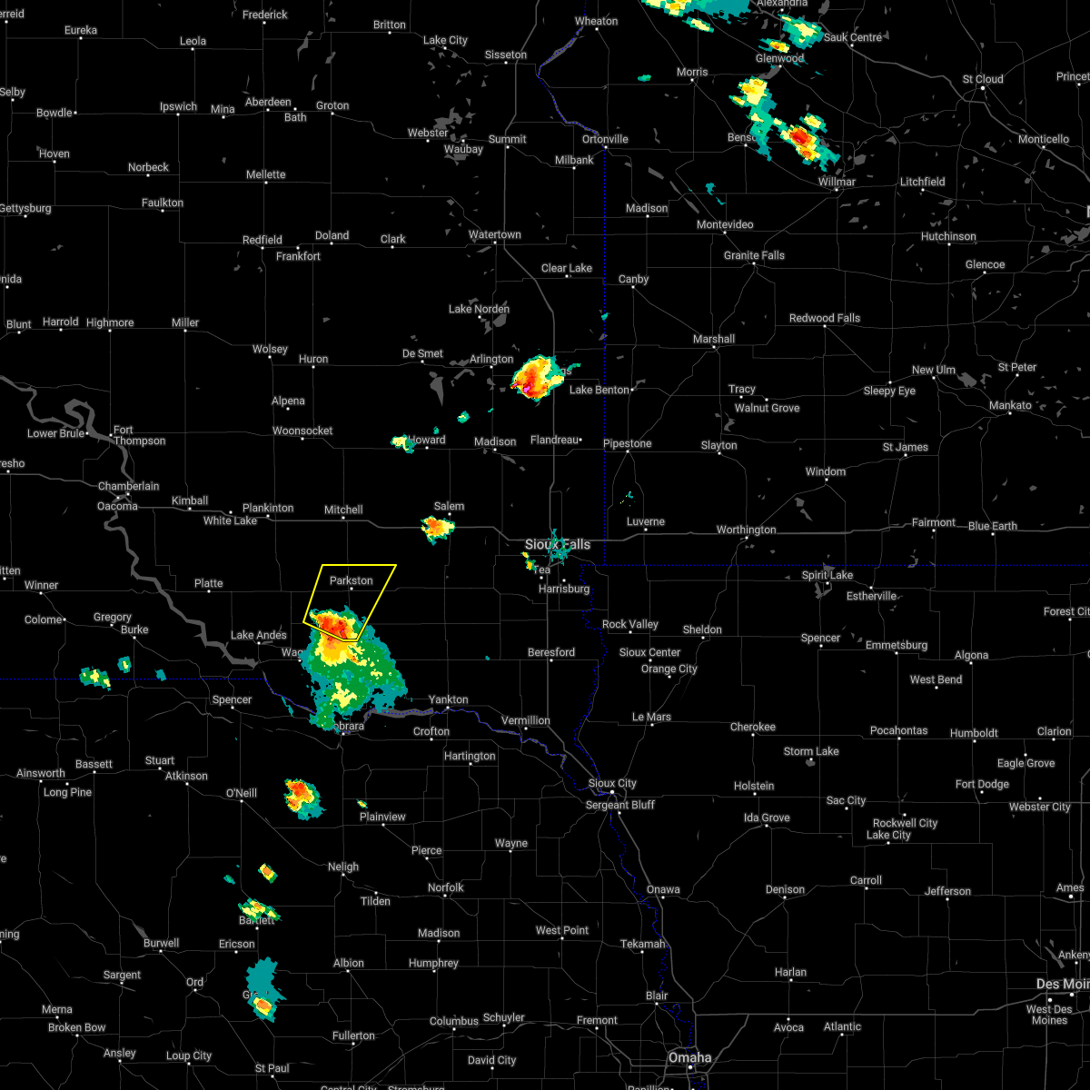 At 621 pm cdt, a severe thunderstorm was located over delmont, or 10 miles southwest of parkston, moving northeast at 45 mph (radar indicated). Hazards include 60 mph wind gusts and penny size hail. Expect damage to roofs, siding, and trees. this severe thunderstorm will be near, parkston around 635 pm cdt. dimock around 640 pm cdt. other locations in the path of this severe thunderstorm include milltown. hail threat, radar indicated max hail size, 0. 75 in wind threat, radar indicated max wind gust, 60 mph. At 621 pm cdt, a severe thunderstorm was located over delmont, or 10 miles southwest of parkston, moving northeast at 45 mph (radar indicated). Hazards include 60 mph wind gusts and penny size hail. Expect damage to roofs, siding, and trees. this severe thunderstorm will be near, parkston around 635 pm cdt. dimock around 640 pm cdt. other locations in the path of this severe thunderstorm include milltown. hail threat, radar indicated max hail size, 0. 75 in wind threat, radar indicated max wind gust, 60 mph.
|
| 6/13/2022 1:17 AM CDT |
 At 116 am cdt, severe thunderstorms were located along a line extending from near letcher to near mitchell to 7 miles west of dimock, moving east at 50 mph (trained weather spotters. winds of 65 mph were reported between mount vernon and mitchell at 115 am). Hazards include 70 mph wind gusts and quarter size hail. Hail damage to vehicles is expected. expect considerable tree damage. wind damage is also likely to mobile homes, roofs, and outbuildings. these severe storms will be near, mitchell, letcher and loomis around 120 am cdt. Other locations in the path of these severe thunderstorms include ethan, artesian, fulton, alexandria, fedora, farmer, roswell, emery, howard, bridgewater, spencer in mccook county, canova, vilas and salem. At 116 am cdt, severe thunderstorms were located along a line extending from near letcher to near mitchell to 7 miles west of dimock, moving east at 50 mph (trained weather spotters. winds of 65 mph were reported between mount vernon and mitchell at 115 am). Hazards include 70 mph wind gusts and quarter size hail. Hail damage to vehicles is expected. expect considerable tree damage. wind damage is also likely to mobile homes, roofs, and outbuildings. these severe storms will be near, mitchell, letcher and loomis around 120 am cdt. Other locations in the path of these severe thunderstorms include ethan, artesian, fulton, alexandria, fedora, farmer, roswell, emery, howard, bridgewater, spencer in mccook county, canova, vilas and salem.
|
| 6/13/2022 1:07 AM CDT |
 At 106 am cdt, severe thunderstorms were located along a line extending from near storla to mount vernon to near corsica, moving east at 50 mph (radar indicated). Hazards include 60 mph wind gusts and quarter size hail. Hail damage to vehicles is expected. expect wind damage to roofs, siding, and trees. severe thunderstorms will be near, mitchell, letcher and loomis around 120 am cdt. dimock around 125 am cdt. Other locations in the path of these severe thunderstorms include ethan, artesian, fulton, alexandria, fedora, farmer, roswell, emery, vilas, howard, bridgewater, spencer in mccook county, canova and salem. At 106 am cdt, severe thunderstorms were located along a line extending from near storla to mount vernon to near corsica, moving east at 50 mph (radar indicated). Hazards include 60 mph wind gusts and quarter size hail. Hail damage to vehicles is expected. expect wind damage to roofs, siding, and trees. severe thunderstorms will be near, mitchell, letcher and loomis around 120 am cdt. dimock around 125 am cdt. Other locations in the path of these severe thunderstorms include ethan, artesian, fulton, alexandria, fedora, farmer, roswell, emery, vilas, howard, bridgewater, spencer in mccook county, canova and salem.
|
| 5/30/2022 1:04 PM CDT |
 At 104 pm cdt, severe thunderstorms were located along a line extending from near parkston to 8 miles northeast of kaylor to near scotland, moving northeast at 50 mph (radar indicated). Hazards include 70 mph wind gusts and penny size hail. Expect considerable tree damage. damage is likely to mobile homes, roofs, and outbuildings. severe thunderstorms will be near, menno, ethan and milltown around 115 pm cdt. clayton around 120 pm cdt. other locations in the path of these severe thunderstorms include alexandria, bridgewater, emery, fulton, spencer in mccook county and farmer. thunderstorm damage threat, considerable hail threat, radar indicated max hail size, 0. 75 in wind threat, radar indicated max wind gust, 70 mph. At 104 pm cdt, severe thunderstorms were located along a line extending from near parkston to 8 miles northeast of kaylor to near scotland, moving northeast at 50 mph (radar indicated). Hazards include 70 mph wind gusts and penny size hail. Expect considerable tree damage. damage is likely to mobile homes, roofs, and outbuildings. severe thunderstorms will be near, menno, ethan and milltown around 115 pm cdt. clayton around 120 pm cdt. other locations in the path of these severe thunderstorms include alexandria, bridgewater, emery, fulton, spencer in mccook county and farmer. thunderstorm damage threat, considerable hail threat, radar indicated max hail size, 0. 75 in wind threat, radar indicated max wind gust, 70 mph.
|
| 5/30/2022 12:49 PM CDT |
 At 1249 pm cdt, a severe thunderstorm was located over tripp, or 12 miles south of parkston, moving north at 50 mph (radar indicated). Hazards include 70 mph wind gusts and nickel size hail. Expect considerable tree damage. damage is likely to mobile homes, roofs, and outbuildings. locations impacted include, tripp, parkston, dimock and milltown. thunderstorm damage threat, considerable hail threat, radar indicated max hail size, 0. 88 in wind threat, radar indicated max wind gust, 70 mph. At 1249 pm cdt, a severe thunderstorm was located over tripp, or 12 miles south of parkston, moving north at 50 mph (radar indicated). Hazards include 70 mph wind gusts and nickel size hail. Expect considerable tree damage. damage is likely to mobile homes, roofs, and outbuildings. locations impacted include, tripp, parkston, dimock and milltown. thunderstorm damage threat, considerable hail threat, radar indicated max hail size, 0. 88 in wind threat, radar indicated max wind gust, 70 mph.
|
| 5/30/2022 12:38 PM CDT |
 At 1238 pm cdt, a severe thunderstorm was located over avon, or 12 miles west of tyndall, moving north at 45 mph (radar indicated). Hazards include 70 mph wind gusts and nickel size hail. Expect considerable tree damage. damage is likely to mobile homes, roofs, and outbuildings. locations impacted include, tripp, delmont, kaylor, parkston, milltown and dimock. thunderstorm damage threat, considerable hail threat, radar indicated max hail size, 0. 88 in wind threat, radar indicated max wind gust, 70 mph. At 1238 pm cdt, a severe thunderstorm was located over avon, or 12 miles west of tyndall, moving north at 45 mph (radar indicated). Hazards include 70 mph wind gusts and nickel size hail. Expect considerable tree damage. damage is likely to mobile homes, roofs, and outbuildings. locations impacted include, tripp, delmont, kaylor, parkston, milltown and dimock. thunderstorm damage threat, considerable hail threat, radar indicated max hail size, 0. 88 in wind threat, radar indicated max wind gust, 70 mph.
|
| 5/30/2022 12:25 PM CDT |
 At 1224 pm cdt, a severe thunderstorm was located 9 miles northwest of niobrara, or 16 miles southwest of tyndall, moving north at 45 mph (radar indicated). Hazards include 70 mph wind gusts and nickel size hail. Expect considerable tree damage. damage is likely to mobile homes, roofs, and outbuildings. this severe thunderstorm will be near, tyndall, avon and dante around 1240 pm cdt. other locations in the path of this severe thunderstorm include tripp, delmont, kaylor, parkston, dimock and milltown. thunderstorm damage threat, considerable hail threat, radar indicated max hail size, 0. 88 in wind threat, radar indicated max wind gust, 70 mph. At 1224 pm cdt, a severe thunderstorm was located 9 miles northwest of niobrara, or 16 miles southwest of tyndall, moving north at 45 mph (radar indicated). Hazards include 70 mph wind gusts and nickel size hail. Expect considerable tree damage. damage is likely to mobile homes, roofs, and outbuildings. this severe thunderstorm will be near, tyndall, avon and dante around 1240 pm cdt. other locations in the path of this severe thunderstorm include tripp, delmont, kaylor, parkston, dimock and milltown. thunderstorm damage threat, considerable hail threat, radar indicated max hail size, 0. 88 in wind threat, radar indicated max wind gust, 70 mph.
|
| 5/30/2022 12:49 AM CDT |
 At 1247 am cdt, severe thunderstorms were located along a line extending from near plankinton to 7 miles south of mitchell to 6 miles southwest of milltown, moving northeast at 55 mph (at 12:36 am, an observation site in tripp, south dakota recorded a wind gust of 65 mph). Hazards include 60 mph wind gusts. Expect damage to roofs, siding, and trees. severe thunderstorms will be near, ethan around 1250 am cdt. mitchell and milltown around 1255 am cdt. alexandria, fulton, clayton and loomis around 100 am cdt. letcher around 105 am cdt. bridgewater, emery, spencer in mccook county, forestburg and farmer around 110 am cdt. artesian around 115 am cdt. canistota and canova around 120 am cdt. salem, howard, fedora, vilas and roswell around 125 am cdt. hail threat, radar indicated max hail size, <. 75 in wind threat, radar indicated max wind gust, 60 mph. At 1247 am cdt, severe thunderstorms were located along a line extending from near plankinton to 7 miles south of mitchell to 6 miles southwest of milltown, moving northeast at 55 mph (at 12:36 am, an observation site in tripp, south dakota recorded a wind gust of 65 mph). Hazards include 60 mph wind gusts. Expect damage to roofs, siding, and trees. severe thunderstorms will be near, ethan around 1250 am cdt. mitchell and milltown around 1255 am cdt. alexandria, fulton, clayton and loomis around 100 am cdt. letcher around 105 am cdt. bridgewater, emery, spencer in mccook county, forestburg and farmer around 110 am cdt. artesian around 115 am cdt. canistota and canova around 120 am cdt. salem, howard, fedora, vilas and roswell around 125 am cdt. hail threat, radar indicated max hail size, <. 75 in wind threat, radar indicated max wind gust, 60 mph.
|
| 5/29/2022 2:23 AM CDT |
 At 223 am cdt, severe thunderstorms were located along a line extending from 10 miles west of dimock to near delmont to near avon, moving east at 50 mph (radar indicated). Hazards include 60 mph wind gusts and quarter size hail. Hail damage to vehicles is expected. expect wind damage to roofs, siding, and trees. these severe storms will be near, tripp around 230 am cdt. other locations in the path of these severe thunderstorms include parkston, kaylor, dimock, tyndall, ethan, milltown, scotland, tabor and clayton. hail threat, radar indicated max hail size, 1. 00 in wind threat, radar indicated max wind gust, 60 mph. At 223 am cdt, severe thunderstorms were located along a line extending from 10 miles west of dimock to near delmont to near avon, moving east at 50 mph (radar indicated). Hazards include 60 mph wind gusts and quarter size hail. Hail damage to vehicles is expected. expect wind damage to roofs, siding, and trees. these severe storms will be near, tripp around 230 am cdt. other locations in the path of these severe thunderstorms include parkston, kaylor, dimock, tyndall, ethan, milltown, scotland, tabor and clayton. hail threat, radar indicated max hail size, 1. 00 in wind threat, radar indicated max wind gust, 60 mph.
|
| 5/29/2022 2:10 AM CDT |
 At 209 am cdt, severe thunderstorms were located along a line extending from near corsica to near armour to near wagner, moving northeast at 40 mph (radar indicated). Hazards include 60 mph wind gusts and nickel size hail. Expect damage to roofs, siding, and trees. severe thunderstorms will be near, armour and corsica around 215 am cdt. delmont around 220 am cdt. other locations in the path of these severe thunderstorms include parkston, tripp, dimock, ethan, kaylor, scotland, milltown and clayton. hail threat, radar indicated max hail size, 0. 88 in wind threat, radar indicated max wind gust, 60 mph. At 209 am cdt, severe thunderstorms were located along a line extending from near corsica to near armour to near wagner, moving northeast at 40 mph (radar indicated). Hazards include 60 mph wind gusts and nickel size hail. Expect damage to roofs, siding, and trees. severe thunderstorms will be near, armour and corsica around 215 am cdt. delmont around 220 am cdt. other locations in the path of these severe thunderstorms include parkston, tripp, dimock, ethan, kaylor, scotland, milltown and clayton. hail threat, radar indicated max hail size, 0. 88 in wind threat, radar indicated max wind gust, 60 mph.
|
| 5/12/2022 4:40 PM CDT |
 At 438 pm cdt, severe thunderstorms were located along a line extending from 6 miles west of dimock to 8 miles southeast of freeman to near wakonda, moving northeast at 85 mph. these are destructive storms for alexandria, lake vermillion state park, sioux falls, lennox, larchwood, and surrounding areas (radar indicated). Hazards include 80 mph wind gusts. Flying debris will be dangerous to those caught without shelter. mobile homes will be heavily damaged. expect considerable damage to roofs, windows, and vehicles. extensive tree damage and power outages are likely. severe thunderstorms will be near, beresford, parker, centerville, marion, hurley and dolton around 445 pm cdt. canistota, alexandria, chancellor, monroe and davis around 450 pm cdt. lake vermillion state recreation area, lennox, wall lake, worthing, fulton and farmer around 455 pm cdt. canton, tea, hartford, humboldt, montrose, spencer in mccook county and ellis around 500 pm cdt. sioux falls, harrisburg, crooks, colton, canova, fedora, roswell, lyons, lake alvin state recreation area and renner around 505 pm cdt. brandon, baltic, larchwood, howard, lester, chester, vilas, rowena, corson and dell rapids around 510 pm cdt. valley springs, hills, beaver creek, trent, wentworth, carthage, winfred and palisades state park around 515 pm cdt. luverne, garretson, colman, egan and sherman around 520 pm cdt. Other locations impacted by these severe thunderstorms include steen. At 438 pm cdt, severe thunderstorms were located along a line extending from 6 miles west of dimock to 8 miles southeast of freeman to near wakonda, moving northeast at 85 mph. these are destructive storms for alexandria, lake vermillion state park, sioux falls, lennox, larchwood, and surrounding areas (radar indicated). Hazards include 80 mph wind gusts. Flying debris will be dangerous to those caught without shelter. mobile homes will be heavily damaged. expect considerable damage to roofs, windows, and vehicles. extensive tree damage and power outages are likely. severe thunderstorms will be near, beresford, parker, centerville, marion, hurley and dolton around 445 pm cdt. canistota, alexandria, chancellor, monroe and davis around 450 pm cdt. lake vermillion state recreation area, lennox, wall lake, worthing, fulton and farmer around 455 pm cdt. canton, tea, hartford, humboldt, montrose, spencer in mccook county and ellis around 500 pm cdt. sioux falls, harrisburg, crooks, colton, canova, fedora, roswell, lyons, lake alvin state recreation area and renner around 505 pm cdt. brandon, baltic, larchwood, howard, lester, chester, vilas, rowena, corson and dell rapids around 510 pm cdt. valley springs, hills, beaver creek, trent, wentworth, carthage, winfred and palisades state park around 515 pm cdt. luverne, garretson, colman, egan and sherman around 520 pm cdt. Other locations impacted by these severe thunderstorms include steen.
|
| 5/12/2022 4:30 PM CDT |
 At 428 pm cdt, severe thunderstorms were located along a line extending from near armour to kaylor to near mission hill, moving northeast at 80 mph. these are destructive storms for parkston, freeman, irene and surrounding areas (observed. at 421 pm cdt, yankton automated equipment gusted to 71 mph. this gust was ahead of the main line). Hazards include 80 mph wind gusts and quarter size hail. Flying debris will be dangerous to those caught without shelter. mobile homes will be heavily damaged. expect considerable damage to roofs, windows, and vehicles. extensive tree damage and power outages are likely. these severe storms will be near, menno, mayfield and volin around 435 pm cdt. irene, wakonda and milltown around 440 pm cdt. freeman, centerville, viborg, dimock and clayton around 445 pm cdt. ethan around 450 pm cdt. Other locations impacted by these severe thunderstorms include gayville, lesterville, olivet and yankton sioux tribal nation. At 428 pm cdt, severe thunderstorms were located along a line extending from near armour to kaylor to near mission hill, moving northeast at 80 mph. these are destructive storms for parkston, freeman, irene and surrounding areas (observed. at 421 pm cdt, yankton automated equipment gusted to 71 mph. this gust was ahead of the main line). Hazards include 80 mph wind gusts and quarter size hail. Flying debris will be dangerous to those caught without shelter. mobile homes will be heavily damaged. expect considerable damage to roofs, windows, and vehicles. extensive tree damage and power outages are likely. these severe storms will be near, menno, mayfield and volin around 435 pm cdt. irene, wakonda and milltown around 440 pm cdt. freeman, centerville, viborg, dimock and clayton around 445 pm cdt. ethan around 450 pm cdt. Other locations impacted by these severe thunderstorms include gayville, lesterville, olivet and yankton sioux tribal nation.
|
| 5/12/2022 3:59 PM CDT |
 At 359 pm cdt, severe thunderstorms were located along a line extending from 10 miles northeast of butte to 10 miles east of lynch to near osmond, moving northeast at 80 mph (radar indicated). Hazards include 70 mph wind gusts and quarter size hail. Hail damage to vehicles is expected. expect considerable tree damage. wind damage is also likely to mobile homes, roofs, and outbuildings. severe thunderstorms will be near, lake andes, springfield, wagner and ravinia around 410 pm cdt. avon and dante around 415 pm cdt. tyndall, lewis and clark state recreation area, armour and delmont around 420 pm cdt. yankton, tripp, corsica and kaylor around 425 pm cdt. parkston, scotland, meckling, mission hill and volin around 430 pm cdt. menno, wakonda, mayfield and dimock around 435 pm cdt. irene, ethan, milltown and clayton around 440 pm cdt. mitchell, beresford, freeman, centerville and viborg around 445 pm cdt. Other locations impacted by these severe thunderstorms include gayville, lesterville, olivet and yankton sioux tribal nation. At 359 pm cdt, severe thunderstorms were located along a line extending from 10 miles northeast of butte to 10 miles east of lynch to near osmond, moving northeast at 80 mph (radar indicated). Hazards include 70 mph wind gusts and quarter size hail. Hail damage to vehicles is expected. expect considerable tree damage. wind damage is also likely to mobile homes, roofs, and outbuildings. severe thunderstorms will be near, lake andes, springfield, wagner and ravinia around 410 pm cdt. avon and dante around 415 pm cdt. tyndall, lewis and clark state recreation area, armour and delmont around 420 pm cdt. yankton, tripp, corsica and kaylor around 425 pm cdt. parkston, scotland, meckling, mission hill and volin around 430 pm cdt. menno, wakonda, mayfield and dimock around 435 pm cdt. irene, ethan, milltown and clayton around 440 pm cdt. mitchell, beresford, freeman, centerville and viborg around 445 pm cdt. Other locations impacted by these severe thunderstorms include gayville, lesterville, olivet and yankton sioux tribal nation.
|
| 4/12/2022 6:21 PM CDT |
 At 620 pm cdt, a severe thunderstorm was located over milltown, or 9 miles northeast of parkston, moving northeast at 50 mph (radar indicated). Hazards include two inch hail and 60 mph wind gusts. People and animals outdoors will be injured. expect hail damage to roofs, siding, windows, and vehicles. expect wind damage to roofs, siding, and trees. this severe thunderstorm will be near, clayton around 630 pm cdt. emery around 635 pm cdt. bridgewater around 640 pm cdt. other locations in the path of this severe thunderstorm include dolton and canistota. thunderstorm damage threat, considerable hail threat, radar indicated max hail size, 2. 00 in wind threat, radar indicated max wind gust, 60 mph. At 620 pm cdt, a severe thunderstorm was located over milltown, or 9 miles northeast of parkston, moving northeast at 50 mph (radar indicated). Hazards include two inch hail and 60 mph wind gusts. People and animals outdoors will be injured. expect hail damage to roofs, siding, windows, and vehicles. expect wind damage to roofs, siding, and trees. this severe thunderstorm will be near, clayton around 630 pm cdt. emery around 635 pm cdt. bridgewater around 640 pm cdt. other locations in the path of this severe thunderstorm include dolton and canistota. thunderstorm damage threat, considerable hail threat, radar indicated max hail size, 2. 00 in wind threat, radar indicated max wind gust, 60 mph.
|
| 4/12/2022 6:15 PM CDT | Tennis Ball sized hail reported 0.3 miles SSE of Dimock, SD, email with picture and ruler. |
| 4/12/2022 6:14 PM CDT |
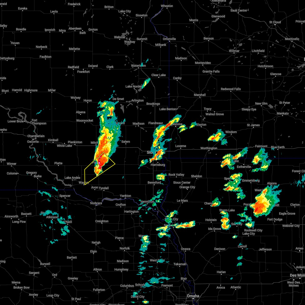 At 614 pm cdt, a severe thunderstorm was located near parkston, moving northeast at 45 mph (radar indicated). Hazards include two inch hail and 60 mph wind gusts. People and animals outdoors will be injured. expect hail damage to roofs, siding, windows, and vehicles. expect wind damage to roofs, siding, and trees. locations impacted include, parkston, tripp, delmont, dimock, milltown and eastern yankton sioux tribal nation. thunderstorm damage threat, considerable hail threat, radar indicated max hail size, 2. 00 in wind threat, radar indicated max wind gust, 60 mph. At 614 pm cdt, a severe thunderstorm was located near parkston, moving northeast at 45 mph (radar indicated). Hazards include two inch hail and 60 mph wind gusts. People and animals outdoors will be injured. expect hail damage to roofs, siding, windows, and vehicles. expect wind damage to roofs, siding, and trees. locations impacted include, parkston, tripp, delmont, dimock, milltown and eastern yankton sioux tribal nation. thunderstorm damage threat, considerable hail threat, radar indicated max hail size, 2. 00 in wind threat, radar indicated max wind gust, 60 mph.
|
| 4/12/2022 6:10 PM CDT |
 At 610 pm cdt, a severe thunderstorm was located over ethan, or 10 miles north of parkston, moving northeast at 50 mph (radar indicated). Hazards include 60 mph wind gusts and half dollar size hail. Hail damage to vehicles is expected. expect wind damage to roofs, siding, and trees. this severe thunderstorm will be near, alexandria and fulton around 625 pm cdt. emery around 630 pm cdt. other locations in the path of this severe thunderstorm include farmer, spencer in mccook county and salem. hail threat, radar indicated max hail size, 1. 25 in wind threat, radar indicated max wind gust, 60 mph. At 610 pm cdt, a severe thunderstorm was located over ethan, or 10 miles north of parkston, moving northeast at 50 mph (radar indicated). Hazards include 60 mph wind gusts and half dollar size hail. Hail damage to vehicles is expected. expect wind damage to roofs, siding, and trees. this severe thunderstorm will be near, alexandria and fulton around 625 pm cdt. emery around 630 pm cdt. other locations in the path of this severe thunderstorm include farmer, spencer in mccook county and salem. hail threat, radar indicated max hail size, 1. 25 in wind threat, radar indicated max wind gust, 60 mph.
|
| 4/12/2022 5:58 PM CDT |
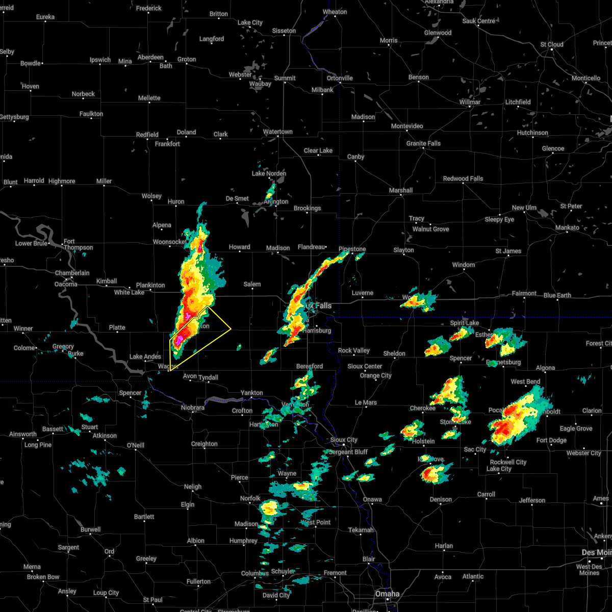 At 558 pm cdt, a severe thunderstorm was located near delmont, or 8 miles southwest of parkston, moving northeast at 35 mph (radar indicated). Hazards include golf ball size hail and 60 mph wind gusts. People and animals outdoors will be injured. expect hail damage to roofs, siding, windows, and vehicles. expect wind damage to roofs, siding, and trees. locations impacted include, parkston, tripp, delmont, dimock, milltown and eastern yankton sioux tribal nation. thunderstorm damage threat, considerable hail threat, radar indicated max hail size, 1. 75 in wind threat, radar indicated max wind gust, 60 mph. At 558 pm cdt, a severe thunderstorm was located near delmont, or 8 miles southwest of parkston, moving northeast at 35 mph (radar indicated). Hazards include golf ball size hail and 60 mph wind gusts. People and animals outdoors will be injured. expect hail damage to roofs, siding, windows, and vehicles. expect wind damage to roofs, siding, and trees. locations impacted include, parkston, tripp, delmont, dimock, milltown and eastern yankton sioux tribal nation. thunderstorm damage threat, considerable hail threat, radar indicated max hail size, 1. 75 in wind threat, radar indicated max wind gust, 60 mph.
|
| 4/12/2022 5:57 PM CDT |
 At 556 pm cdt, a severe thunderstorm was located near ethan, or 10 miles north of parkston, moving northeast at 45 mph (radar indicated). Hazards include golf ball size hail and 60 mph wind gusts. People and animals outdoors will be injured. expect hail damage to roofs, siding, windows, and vehicles. expect wind damage to roofs, siding, and trees. locations impacted include, ethan and dimock. thunderstorm damage threat, considerable hail threat, radar indicated max hail size, 1. 75 in wind threat, radar indicated max wind gust, 60 mph. At 556 pm cdt, a severe thunderstorm was located near ethan, or 10 miles north of parkston, moving northeast at 45 mph (radar indicated). Hazards include golf ball size hail and 60 mph wind gusts. People and animals outdoors will be injured. expect hail damage to roofs, siding, windows, and vehicles. expect wind damage to roofs, siding, and trees. locations impacted include, ethan and dimock. thunderstorm damage threat, considerable hail threat, radar indicated max hail size, 1. 75 in wind threat, radar indicated max wind gust, 60 mph.
|
| 4/12/2022 5:48 PM CDT |
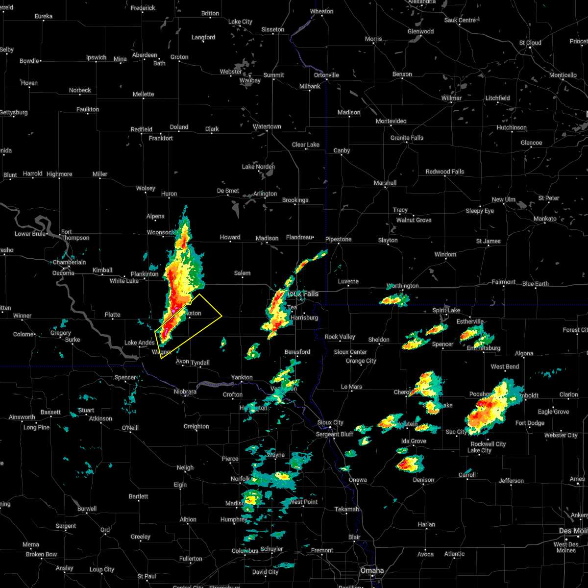 At 548 pm cdt, a severe thunderstorm was located near delmont, or 14 miles southwest of parkston, moving northeast at 35 mph (radar indicated). Hazards include golf ball size hail and 60 mph wind gusts. People and animals outdoors will be injured. expect hail damage to roofs, siding, windows, and vehicles. Expect wind damage to roofs, siding, and trees. At 548 pm cdt, a severe thunderstorm was located near delmont, or 14 miles southwest of parkston, moving northeast at 35 mph (radar indicated). Hazards include golf ball size hail and 60 mph wind gusts. People and animals outdoors will be injured. expect hail damage to roofs, siding, windows, and vehicles. Expect wind damage to roofs, siding, and trees.
|
| 4/12/2022 5:39 PM CDT |
 At 538 pm cdt, a severe thunderstorm was located 8 miles east of corsica, or 13 miles west of parkston, moving northeast at 35 mph (radar indicated). Hazards include golf ball size hail and 60 mph wind gusts. People and animals outdoors will be injured. expect hail damage to roofs, siding, windows, and vehicles. expect wind damage to roofs, siding, and trees. locations impacted include, armour, corsica, mount vernon, ethan and dimock. thunderstorm damage threat, considerable hail threat, radar indicated max hail size, 1. 75 in wind threat, radar indicated max wind gust, 60 mph. At 538 pm cdt, a severe thunderstorm was located 8 miles east of corsica, or 13 miles west of parkston, moving northeast at 35 mph (radar indicated). Hazards include golf ball size hail and 60 mph wind gusts. People and animals outdoors will be injured. expect hail damage to roofs, siding, windows, and vehicles. expect wind damage to roofs, siding, and trees. locations impacted include, armour, corsica, mount vernon, ethan and dimock. thunderstorm damage threat, considerable hail threat, radar indicated max hail size, 1. 75 in wind threat, radar indicated max wind gust, 60 mph.
|
| 4/12/2022 5:29 PM CDT |
 At 528 pm cdt, a severe thunderstorm was located near corsica, or 17 miles west of parkston, moving northeast at 35 mph (radar indicated). Hazards include 60 mph wind gusts and half dollar size hail. Hail damage to vehicles is expected. Expect wind damage to roofs, siding, and trees. At 528 pm cdt, a severe thunderstorm was located near corsica, or 17 miles west of parkston, moving northeast at 35 mph (radar indicated). Hazards include 60 mph wind gusts and half dollar size hail. Hail damage to vehicles is expected. Expect wind damage to roofs, siding, and trees.
|
| 8/30/2021 5:05 PM CDT |
 At 504 pm cdt, a severe thunderstorm was located over ethan, or 11 miles north of parkston, moving east at 20 mph (trained weather spotters reported quarter sized hail near ethan sd at 500 pm). Hazards include 60 mph wind gusts and quarter size hail. Hail damage to vehicles is expected. expect wind damage to roofs, siding, and trees. locations impacted include, ethan and dimock. hail threat, observed max hail size, 1. 00 in wind threat, radar indicated max wind gust, 60 mph. At 504 pm cdt, a severe thunderstorm was located over ethan, or 11 miles north of parkston, moving east at 20 mph (trained weather spotters reported quarter sized hail near ethan sd at 500 pm). Hazards include 60 mph wind gusts and quarter size hail. Hail damage to vehicles is expected. expect wind damage to roofs, siding, and trees. locations impacted include, ethan and dimock. hail threat, observed max hail size, 1. 00 in wind threat, radar indicated max wind gust, 60 mph.
|
| 8/30/2021 4:44 PM CDT |
 At 443 pm cdt, a severe thunderstorm was located near ethan, or 10 miles south of mitchell, moving east at 25 mph (trained weather spotters reported quarter sized hail 8 miles nw of ethan). Hazards include 60 mph wind gusts and half dollar size hail. Hail damage to vehicles is expected. expect wind damage to roofs, siding, and trees. locations impacted include, ethan and dimock. hail threat, observed max hail size, 1. 25 in wind threat, radar indicated max wind gust, 60 mph. At 443 pm cdt, a severe thunderstorm was located near ethan, or 10 miles south of mitchell, moving east at 25 mph (trained weather spotters reported quarter sized hail 8 miles nw of ethan). Hazards include 60 mph wind gusts and half dollar size hail. Hail damage to vehicles is expected. expect wind damage to roofs, siding, and trees. locations impacted include, ethan and dimock. hail threat, observed max hail size, 1. 25 in wind threat, radar indicated max wind gust, 60 mph.
|
| 8/30/2021 4:19 PM CDT |
 At 419 pm cdt, a severe thunderstorm was located near mount vernon, or 10 miles southwest of mitchell, moving east at 20 mph (radar indicated). Hazards include 60 mph wind gusts and half dollar size hail. Hail damage to vehicles is expected. Expect wind damage to roofs, siding, and trees. At 419 pm cdt, a severe thunderstorm was located near mount vernon, or 10 miles southwest of mitchell, moving east at 20 mph (radar indicated). Hazards include 60 mph wind gusts and half dollar size hail. Hail damage to vehicles is expected. Expect wind damage to roofs, siding, and trees.
|
| 6/23/2021 8:42 PM CDT |
 At 841 pm cdt, severe thunderstorms were located along a line extending from near clayton to 7 miles southeast of santee, moving east at 40 mph (trained weather spotters. a gust to 68 mph was reported earlier at the fort randall dam). Hazards include 60 mph wind gusts and quarter size hail. Hail damage to vehicles is expected. expect wind damage to roofs, siding, and trees. these severe storms will be near, freeman and dolton around 905 pm cdt. marion around 915 pm cdt. Other locations impacted by these severe thunderstorms include gayville, lesterville, olivet and yankton sioux tribal nation. At 841 pm cdt, severe thunderstorms were located along a line extending from near clayton to 7 miles southeast of santee, moving east at 40 mph (trained weather spotters. a gust to 68 mph was reported earlier at the fort randall dam). Hazards include 60 mph wind gusts and quarter size hail. Hail damage to vehicles is expected. expect wind damage to roofs, siding, and trees. these severe storms will be near, freeman and dolton around 905 pm cdt. marion around 915 pm cdt. Other locations impacted by these severe thunderstorms include gayville, lesterville, olivet and yankton sioux tribal nation.
|
| 6/23/2021 8:36 PM CDT |
 At 835 pm cdt, a severe thunderstorm was located near stickney, or 12 miles southeast of plankinton, moving east at 25 mph (trained weather spotters. quarter size hail was reported south of stickney). Hazards include 60 mph wind gusts and quarter size hail. Hail damage to vehicles is expected. expect wind damage to roofs, siding, and trees. This severe thunderstorm will be near, ethan and dimock around 915 pm cdt. At 835 pm cdt, a severe thunderstorm was located near stickney, or 12 miles southeast of plankinton, moving east at 25 mph (trained weather spotters. quarter size hail was reported south of stickney). Hazards include 60 mph wind gusts and quarter size hail. Hail damage to vehicles is expected. expect wind damage to roofs, siding, and trees. This severe thunderstorm will be near, ethan and dimock around 915 pm cdt.
|
| 6/23/2021 8:28 PM CDT |
 At 827 pm cdt, severe thunderstorms were located along a line extending from near clayton to near springfield, moving east at 50 mph (trained weather spotters. a gust to 63 mph was reported at the fort randall dam at 814 pm). Hazards include 60 mph wind gusts. Expect damage to roofs, siding, and trees. these severe storms will be near, freeman and dolton around 845 pm cdt. marion around 855 pm cdt. Other locations impacted by these severe thunderstorms include gayville, lesterville, olivet and yankton sioux tribal nation. At 827 pm cdt, severe thunderstorms were located along a line extending from near clayton to near springfield, moving east at 50 mph (trained weather spotters. a gust to 63 mph was reported at the fort randall dam at 814 pm). Hazards include 60 mph wind gusts. Expect damage to roofs, siding, and trees. these severe storms will be near, freeman and dolton around 845 pm cdt. marion around 855 pm cdt. Other locations impacted by these severe thunderstorms include gayville, lesterville, olivet and yankton sioux tribal nation.
|
| 6/23/2021 8:20 PM CDT |
 At 820 pm cdt, severe thunderstorms were located along a line extending from near milltown to near springfield, moving east at 50 mph (radar indicated). Hazards include 60 mph wind gusts. Expect damage to roofs, siding, and trees. severe thunderstorms will be near, springfield around 825 pm cdt. clayton around 830 pm cdt. freeman and dolton around 845 pm cdt. marion around 850 pm cdt. Other locations impacted by these severe thunderstorms include gayville, lesterville, olivet and yankton sioux tribal nation. At 820 pm cdt, severe thunderstorms were located along a line extending from near milltown to near springfield, moving east at 50 mph (radar indicated). Hazards include 60 mph wind gusts. Expect damage to roofs, siding, and trees. severe thunderstorms will be near, springfield around 825 pm cdt. clayton around 830 pm cdt. freeman and dolton around 845 pm cdt. marion around 850 pm cdt. Other locations impacted by these severe thunderstorms include gayville, lesterville, olivet and yankton sioux tribal nation.
|
| 6/23/2021 8:08 PM CDT |
 At 807 pm cdt, a severe thunderstorm was located near stickney, or 13 miles south of plankinton, moving east at 20 mph (radar indicated). Hazards include 60 mph wind gusts and quarter size hail. Hail damage to vehicles is expected. expect wind damage to roofs, siding, and trees. This severe storm will be near, dimock around 845 pm cdt. At 807 pm cdt, a severe thunderstorm was located near stickney, or 13 miles south of plankinton, moving east at 20 mph (radar indicated). Hazards include 60 mph wind gusts and quarter size hail. Hail damage to vehicles is expected. expect wind damage to roofs, siding, and trees. This severe storm will be near, dimock around 845 pm cdt.
|
| 6/23/2021 7:46 PM CDT |
 At 745 pm cdt, a severe thunderstorm was located 7 miles southeast of stickney, or 15 miles southeast of plankinton, moving east at 20 mph (radar indicated). Hazards include 60 mph wind gusts and quarter size hail. Hail damage to vehicles is expected. expect wind damage to roofs, siding, and trees. This severe thunderstorm will be near, ethan and dimock around 830 pm cdt. At 745 pm cdt, a severe thunderstorm was located 7 miles southeast of stickney, or 15 miles southeast of plankinton, moving east at 20 mph (radar indicated). Hazards include 60 mph wind gusts and quarter size hail. Hail damage to vehicles is expected. expect wind damage to roofs, siding, and trees. This severe thunderstorm will be near, ethan and dimock around 830 pm cdt.
|
| 8/9/2020 1:11 AM CDT |
 At 111 am cdt, severe thunderstorms were located along a line extending from near letcher to near clayton to near tabor, moving east at 50 mph (radar indicated). Hazards include 70 mph wind gusts and penny size hail. Expect considerable tree damage. damage is likely to mobile homes, roofs, and outbuildings. these severe storms will be near, emery and clayton around 115 am cdt. yankton, bridgewater and utica around 120 am cdt. dolton around 125 am cdt. mayfield, mission hill and fedora around 130 am cdt. canistota around 135 am cdt. Other locations impacted by these severe thunderstorms include lesterville and olivet. At 111 am cdt, severe thunderstorms were located along a line extending from near letcher to near clayton to near tabor, moving east at 50 mph (radar indicated). Hazards include 70 mph wind gusts and penny size hail. Expect considerable tree damage. damage is likely to mobile homes, roofs, and outbuildings. these severe storms will be near, emery and clayton around 115 am cdt. yankton, bridgewater and utica around 120 am cdt. dolton around 125 am cdt. mayfield, mission hill and fedora around 130 am cdt. canistota around 135 am cdt. Other locations impacted by these severe thunderstorms include lesterville and olivet.
|
| 8/9/2020 12:47 AM CDT |
 At 1247 am cdt, severe thunderstorms were located along a line extending from 6 miles west of storla to near parkston to near springfield, moving east at 50 mph (radar indicated). Hazards include 60 mph wind gusts and penny size hail. Expect damage to roofs, siding, and trees. severe thunderstorms will be near, parkston and dimock around 1255 am cdt. milltown around 100 am cdt. tabor, letcher and clayton around 110 am cdt. lewis and clark state recreation area and emery around 115 am cdt. yankton, bridgewater and utica around 120 am cdt. artesian and dolton around 125 am cdt. canistota, mayfield, mission hill and fedora around 130 am cdt. Other locations impacted by these severe thunderstorms include lesterville and olivet. At 1247 am cdt, severe thunderstorms were located along a line extending from 6 miles west of storla to near parkston to near springfield, moving east at 50 mph (radar indicated). Hazards include 60 mph wind gusts and penny size hail. Expect damage to roofs, siding, and trees. severe thunderstorms will be near, parkston and dimock around 1255 am cdt. milltown around 100 am cdt. tabor, letcher and clayton around 110 am cdt. lewis and clark state recreation area and emery around 115 am cdt. yankton, bridgewater and utica around 120 am cdt. artesian and dolton around 125 am cdt. canistota, mayfield, mission hill and fedora around 130 am cdt. Other locations impacted by these severe thunderstorms include lesterville and olivet.
|
| 8/9/2020 12:37 AM CDT |
 At 1237 am cdt, severe thunderstorms were located along a line extending from near white lake to 7 miles northeast of armour to near avon, moving east at 55 mph (radar indicated). Hazards include 60 mph wind gusts and penny size hail. Expect damage to roofs, siding, and trees. these severe storms will be near, avon around 1240 am cdt. springfield around 1245 am cdt. parkston, tyndall, plankinton and dimock around 1250 am cdt. storla around 1255 am cdt. Mount vernon around 100 am cdt. At 1237 am cdt, severe thunderstorms were located along a line extending from near white lake to 7 miles northeast of armour to near avon, moving east at 55 mph (radar indicated). Hazards include 60 mph wind gusts and penny size hail. Expect damage to roofs, siding, and trees. these severe storms will be near, avon around 1240 am cdt. springfield around 1245 am cdt. parkston, tyndall, plankinton and dimock around 1250 am cdt. storla around 1255 am cdt. Mount vernon around 100 am cdt.
|
| 8/9/2020 12:19 AM CDT |
 At 1218 am cdt, severe thunderstorms were located along a line extending from near kimball to near harrison to 6 miles southeast of marty, moving east at 55 mph (radar indicated). Hazards include 60 mph wind gusts and penny size hail. Expect damage to roofs, siding, and trees. severe thunderstorms will be near, corsica around 1225 am cdt. armour and dante around 1230 am cdt. avon and white lake around 1235 am cdt. tyndall, plankinton and springfield around 1245 am cdt. parkston and dimock around 1250 am cdt. storla around 1255 am cdt. Mount vernon around 100 am cdt. At 1218 am cdt, severe thunderstorms were located along a line extending from near kimball to near harrison to 6 miles southeast of marty, moving east at 55 mph (radar indicated). Hazards include 60 mph wind gusts and penny size hail. Expect damage to roofs, siding, and trees. severe thunderstorms will be near, corsica around 1225 am cdt. armour and dante around 1230 am cdt. avon and white lake around 1235 am cdt. tyndall, plankinton and springfield around 1245 am cdt. parkston and dimock around 1250 am cdt. storla around 1255 am cdt. Mount vernon around 100 am cdt.
|
| 7/24/2020 11:10 PM CDT |
 At 1110 pm cdt, a severe thunderstorm was located over dimock, or near parkston, moving east at 30 mph (radar indicated). Hazards include 60 mph wind gusts. Expect damage to roofs, siding, and trees. This severe storm will be near, milltown around 1125 pm cdt. At 1110 pm cdt, a severe thunderstorm was located over dimock, or near parkston, moving east at 30 mph (radar indicated). Hazards include 60 mph wind gusts. Expect damage to roofs, siding, and trees. This severe storm will be near, milltown around 1125 pm cdt.
|
| 7/24/2020 10:45 PM CDT |
 At 1044 pm cdt, a severe thunderstorm was located near corsica, or 15 miles west of parkston, moving east at 35 mph (radar indicated). Hazards include 60 mph wind gusts. Expect damage to roofs, siding, and trees. this severe thunderstorm will be near, parkston and dimock around 1110 pm cdt. ethan around 1115 pm cdt. Milltown around 1125 pm cdt. At 1044 pm cdt, a severe thunderstorm was located near corsica, or 15 miles west of parkston, moving east at 35 mph (radar indicated). Hazards include 60 mph wind gusts. Expect damage to roofs, siding, and trees. this severe thunderstorm will be near, parkston and dimock around 1110 pm cdt. ethan around 1115 pm cdt. Milltown around 1125 pm cdt.
|
| 7/17/2020 8:59 AM CDT |
 At 859 am cdt, a severe thunderstorm was located near milltown, or 11 miles northeast of parkston, moving northeast at 35 mph (radar indicated). Hazards include 60 mph wind gusts and half dollar size hail. Hail damage to vehicles is expected. expect wind damage to roofs, siding, and trees. this severe thunderstorm will be near, clayton around 905 am cdt. emery around 920 am cdt. bridgewater around 925 am cdt. canistota around 940 am cdt. Salem around 945 am cdt. At 859 am cdt, a severe thunderstorm was located near milltown, or 11 miles northeast of parkston, moving northeast at 35 mph (radar indicated). Hazards include 60 mph wind gusts and half dollar size hail. Hail damage to vehicles is expected. expect wind damage to roofs, siding, and trees. this severe thunderstorm will be near, clayton around 905 am cdt. emery around 920 am cdt. bridgewater around 925 am cdt. canistota around 940 am cdt. Salem around 945 am cdt.
|
| 7/7/2020 2:28 AM CDT |
 The severe thunderstorm warning for southeastern charles mix, bon homme, douglas and western hutchinson counties will expire at 230 am cdt, the storms which prompted the warning have weakened below severe limits, and no longer pose an immediate threat to life or property. therefore, the warning will be allowed to expire. however gusty winds up to 50 mph and heavy rain are still likely with these thunderstorms through 300 am cdt. a severe thunderstorm watch remains in effect until 500 am cdt for south central and southeastern south dakota. The severe thunderstorm warning for southeastern charles mix, bon homme, douglas and western hutchinson counties will expire at 230 am cdt, the storms which prompted the warning have weakened below severe limits, and no longer pose an immediate threat to life or property. therefore, the warning will be allowed to expire. however gusty winds up to 50 mph and heavy rain are still likely with these thunderstorms through 300 am cdt. a severe thunderstorm watch remains in effect until 500 am cdt for south central and southeastern south dakota.
|
| 7/7/2020 2:18 AM CDT |
 At 216 am cdt, severe thunderstorms were located along a line extending from 7 miles northeast of corsica to near dante to 11 miles east of lynch, moving east at 40 mph (radar indicated). Hazards include 65 to 70 mph wind gusts. Expect considerable tree damage. damage is likely to mobile homes, roofs, and outbuildings. these severe storms will be near, dante around 220 am cdt. avon around 230 am cdt. dimock around 235 am cdt. parkston and tyndall around 240 am cdt. Springfield around 245 am cdt. At 216 am cdt, severe thunderstorms were located along a line extending from 7 miles northeast of corsica to near dante to 11 miles east of lynch, moving east at 40 mph (radar indicated). Hazards include 65 to 70 mph wind gusts. Expect considerable tree damage. damage is likely to mobile homes, roofs, and outbuildings. these severe storms will be near, dante around 220 am cdt. avon around 230 am cdt. dimock around 235 am cdt. parkston and tyndall around 240 am cdt. Springfield around 245 am cdt.
|
| 7/7/2020 1:45 AM CDT |
 At 145 am cdt, severe thunderstorms were located along a line extending from near aurora center to near lake andes to near gross, moving east at 50 mph (radar indicated). Hazards include 70 mph wind gusts. Expect considerable tree damage. damage is likely to mobile homes, roofs, and outbuildings. severe thunderstorms will be near, ravinia around 150 am cdt. marty around 155 am cdt. wagner and corsica around 200 am cdt. dante around 205 am cdt. avon around 215 am cdt. Parkston, tyndall, springfield, kaylor and dimock around 225 am cdt. At 145 am cdt, severe thunderstorms were located along a line extending from near aurora center to near lake andes to near gross, moving east at 50 mph (radar indicated). Hazards include 70 mph wind gusts. Expect considerable tree damage. damage is likely to mobile homes, roofs, and outbuildings. severe thunderstorms will be near, ravinia around 150 am cdt. marty around 155 am cdt. wagner and corsica around 200 am cdt. dante around 205 am cdt. avon around 215 am cdt. Parkston, tyndall, springfield, kaylor and dimock around 225 am cdt.
|
| 7/3/2020 2:04 AM CDT |
 At 203 am cdt, severe thunderstorms were located along a line extending from near freeman to near scotland to 9 miles south of avon, moving east at 50 mph (ground observation stations). Hazards include 60 mph wind gusts. Expect damage to roofs, siding, and trees. These severe thunderstorms will remain over mainly rural areas of southeastern charles mix, southeastern gregory, bon homme, eastern douglas and hutchinson counties, including the following locations, olivet. At 203 am cdt, severe thunderstorms were located along a line extending from near freeman to near scotland to 9 miles south of avon, moving east at 50 mph (ground observation stations). Hazards include 60 mph wind gusts. Expect damage to roofs, siding, and trees. These severe thunderstorms will remain over mainly rural areas of southeastern charles mix, southeastern gregory, bon homme, eastern douglas and hutchinson counties, including the following locations, olivet.
|
| 7/3/2020 1:29 AM CDT |
 At 129 am cdt, severe thunderstorms were located along a line extending from near parkston to near delmont to 7 miles west of pickstown, moving east at 50 mph (radar indicated). Hazards include 60 mph wind gusts. Expect damage to roofs, siding, and trees. severe thunderstorms will be near, parkston and delmont around 135 am cdt. milltown around 140 am cdt. tripp, marty and clayton around 145 am cdt. kaylor around 150 am cdt. menno around 155 am cdt. scotland around 200 am cdt. springfield around 215 am cdt. Other locations impacted by these severe thunderstorms include olivet. At 129 am cdt, severe thunderstorms were located along a line extending from near parkston to near delmont to 7 miles west of pickstown, moving east at 50 mph (radar indicated). Hazards include 60 mph wind gusts. Expect damage to roofs, siding, and trees. severe thunderstorms will be near, parkston and delmont around 135 am cdt. milltown around 140 am cdt. tripp, marty and clayton around 145 am cdt. kaylor around 150 am cdt. menno around 155 am cdt. scotland around 200 am cdt. springfield around 215 am cdt. Other locations impacted by these severe thunderstorms include olivet.
|
| 7/3/2020 1:06 AM CDT |
 At 106 am cdt, severe thunderstorms were located along a line extending from 7 miles west of dimock to 6 miles south of geddes, moving south at 45 mph (ground observation stations). Hazards include 60 mph wind gusts. Expect damage to roofs, siding, and trees. these severe storms will be near, lake andes around 110 am cdt. parkston and pickstown around 120 am cdt. delmont around 125 am cdt. tripp around 135 am cdt. Kaylor around 140 am cdt. At 106 am cdt, severe thunderstorms were located along a line extending from 7 miles west of dimock to 6 miles south of geddes, moving south at 45 mph (ground observation stations). Hazards include 60 mph wind gusts. Expect damage to roofs, siding, and trees. these severe storms will be near, lake andes around 110 am cdt. parkston and pickstown around 120 am cdt. delmont around 125 am cdt. tripp around 135 am cdt. Kaylor around 140 am cdt.
|
| 7/3/2020 12:47 AM CDT |
 At 1247 am cdt, severe thunderstorms were located along a line extending from near mount vernon to near geddes, moving south at 40 mph (radar indicated). Hazards include 60 mph wind gusts. Expect damage to roofs, siding, and trees. severe thunderstorms will be near, lake andes and dimock around 110 am cdt. pickstown around 115 am cdt. parkston around 120 am cdt. delmont around 125 am cdt. Tripp around 130 am cdt. At 1247 am cdt, severe thunderstorms were located along a line extending from near mount vernon to near geddes, moving south at 40 mph (radar indicated). Hazards include 60 mph wind gusts. Expect damage to roofs, siding, and trees. severe thunderstorms will be near, lake andes and dimock around 110 am cdt. pickstown around 115 am cdt. parkston around 120 am cdt. delmont around 125 am cdt. Tripp around 130 am cdt.
|
| 6/9/2020 1:05 AM CDT |
 The severe thunderstorm warning for southern davison, southeastern aurora, northeastern charles mix, douglas, southwestern hanson and northwestern hutchinson counties will expire at 115 am cdt, the storm which prompted the warning has weakened below severe limits, and no longer poses an immediate threat to life or property. therefore, the warning will be allowed to expire. however small hail is still possible with this thunderstorm. a severe thunderstorm watch remains in effect until 200 am cdt for south central and southeastern south dakota. The severe thunderstorm warning for southern davison, southeastern aurora, northeastern charles mix, douglas, southwestern hanson and northwestern hutchinson counties will expire at 115 am cdt, the storm which prompted the warning has weakened below severe limits, and no longer poses an immediate threat to life or property. therefore, the warning will be allowed to expire. however small hail is still possible with this thunderstorm. a severe thunderstorm watch remains in effect until 200 am cdt for south central and southeastern south dakota.
|
| 6/9/2020 12:54 AM CDT |
 At 1254 am cdt, a severe thunderstorm was located near corsica, or 17 miles west of parkston, moving northeast at 55 mph (radar indicated). Hazards include 60 mph wind gusts and half dollar size hail. Hail damage to vehicles is expected. expect wind damage to roofs, siding, and trees. This severe thunderstorm will remain over mainly rural areas of southern davison, southeastern aurora, northeastern charles mix, douglas, southwestern hanson and northwestern hutchinson counties. At 1254 am cdt, a severe thunderstorm was located near corsica, or 17 miles west of parkston, moving northeast at 55 mph (radar indicated). Hazards include 60 mph wind gusts and half dollar size hail. Hail damage to vehicles is expected. expect wind damage to roofs, siding, and trees. This severe thunderstorm will remain over mainly rural areas of southern davison, southeastern aurora, northeastern charles mix, douglas, southwestern hanson and northwestern hutchinson counties.
|
| 6/9/2020 12:38 AM CDT |
 At 1237 am cdt, a severe thunderstorm was located near ravinia, or near lake andes, moving northeast at 55 mph (radar indicated). Hazards include 60 mph wind gusts and half dollar size hail. Hail damage to vehicles is expected. expect wind damage to roofs, siding, and trees. this severe thunderstorm will be near, armour around 1250 am cdt. Corsica around 1255 am cdt. At 1237 am cdt, a severe thunderstorm was located near ravinia, or near lake andes, moving northeast at 55 mph (radar indicated). Hazards include 60 mph wind gusts and half dollar size hail. Hail damage to vehicles is expected. expect wind damage to roofs, siding, and trees. this severe thunderstorm will be near, armour around 1250 am cdt. Corsica around 1255 am cdt.
|
| 6/8/2020 10:59 PM CDT |
 At 1058 pm cdt, a severe thunderstorm was located over dimock, or near parkston, moving northeast at 30 mph (radar indicated). Hazards include two inch hail and 60 mph wind gusts. People and animals outdoors will be injured. expect hail damage to roofs, siding, windows, and vehicles. expect wind damage to roofs, siding, and trees. This severe thunderstorm will remain over mainly rural areas of southeastern davison, southwestern hanson and northwestern hutchinson counties. At 1058 pm cdt, a severe thunderstorm was located over dimock, or near parkston, moving northeast at 30 mph (radar indicated). Hazards include two inch hail and 60 mph wind gusts. People and animals outdoors will be injured. expect hail damage to roofs, siding, windows, and vehicles. expect wind damage to roofs, siding, and trees. This severe thunderstorm will remain over mainly rural areas of southeastern davison, southwestern hanson and northwestern hutchinson counties.
|
| 6/8/2020 10:37 PM CDT |
 At 1037 pm cdt, a severe thunderstorm was located near delmont, or near parkston, moving northeast at 30 mph (radar indicated). Hazards include two inch hail and 60 mph wind gusts. People and animals outdoors will be injured. expect hail damage to roofs, siding, windows, and vehicles. expect wind damage to roofs, siding, and trees. this severe thunderstorm will be near, parkston around 1050 pm cdt. dimock around 1055 pm cdt. Ethan around 1105 pm cdt. At 1037 pm cdt, a severe thunderstorm was located near delmont, or near parkston, moving northeast at 30 mph (radar indicated). Hazards include two inch hail and 60 mph wind gusts. People and animals outdoors will be injured. expect hail damage to roofs, siding, windows, and vehicles. expect wind damage to roofs, siding, and trees. this severe thunderstorm will be near, parkston around 1050 pm cdt. dimock around 1055 pm cdt. Ethan around 1105 pm cdt.
|
| 6/8/2020 9:44 PM CDT |
 At 944 pm cdt, a severe thunderstorm was located near ethan, or 12 miles south of mitchell, moving north at 25 mph (radar indicated). Hazards include 60 mph wind gusts and half dollar size hail. Hail damage to vehicles is expected. expect wind damage to roofs, siding, and trees. This severe storm will be near, mitchell around 1015 pm cdt. At 944 pm cdt, a severe thunderstorm was located near ethan, or 12 miles south of mitchell, moving north at 25 mph (radar indicated). Hazards include 60 mph wind gusts and half dollar size hail. Hail damage to vehicles is expected. expect wind damage to roofs, siding, and trees. This severe storm will be near, mitchell around 1015 pm cdt.
|
| 6/8/2020 9:30 PM CDT |
 At 929 pm cdt, a severe thunderstorm was located 7 miles west of dimock, or 10 miles northwest of parkston, moving north at 25 mph (radar indicated). Hazards include 60 mph wind gusts and quarter size hail. Hail damage to vehicles is expected. expect wind damage to roofs, siding, and trees. This severe thunderstorm will be near, mitchell and mount vernon around 1000 pm cdt. At 929 pm cdt, a severe thunderstorm was located 7 miles west of dimock, or 10 miles northwest of parkston, moving north at 25 mph (radar indicated). Hazards include 60 mph wind gusts and quarter size hail. Hail damage to vehicles is expected. expect wind damage to roofs, siding, and trees. This severe thunderstorm will be near, mitchell and mount vernon around 1000 pm cdt.
|
| 9/10/2019 11:09 PM CDT |
 The severe thunderstorm warning for northern bon homme, southwestern mccook, northwestern yankton, southeastern hanson and hutchinson counties will expire at 1115 pm cdt, the storms which prompted the warning have moved out of the area. therefore, the warning will be allowed to expire. a severe thunderstorm watch remains in effect until 400 am cdt for south central and southeastern south dakota. The severe thunderstorm warning for northern bon homme, southwestern mccook, northwestern yankton, southeastern hanson and hutchinson counties will expire at 1115 pm cdt, the storms which prompted the warning have moved out of the area. therefore, the warning will be allowed to expire. a severe thunderstorm watch remains in effect until 400 am cdt for south central and southeastern south dakota.
|
| 9/10/2019 10:22 PM CDT |
 At 1022 pm cdt, severe thunderstorms were located along a line extending from near dimock to tripp to near avon, moving northeast at 30 mph (radar indicated). Hazards include 70 mph wind gusts. Expect considerable tree damage. damage is likely to mobile homes, roofs, and outbuildings. severe thunderstorms will be near, parkston and dimock around 1030 pm cdt. kaylor around 1035 pm cdt. milltown around 1045 pm cdt. scotland and menno around 1100 pm cdt. clayton around 1105 pm cdt. Other locations impacted by these severe thunderstorms include lesterville and olivet. At 1022 pm cdt, severe thunderstorms were located along a line extending from near dimock to tripp to near avon, moving northeast at 30 mph (radar indicated). Hazards include 70 mph wind gusts. Expect considerable tree damage. damage is likely to mobile homes, roofs, and outbuildings. severe thunderstorms will be near, parkston and dimock around 1030 pm cdt. kaylor around 1035 pm cdt. milltown around 1045 pm cdt. scotland and menno around 1100 pm cdt. clayton around 1105 pm cdt. Other locations impacted by these severe thunderstorms include lesterville and olivet.
|
| 8/17/2019 9:01 PM CDT |
 At 901 pm cdt, severe thunderstorms were located along a line extending from near roswell to near emery to 7 miles west of parkston, moving east at 45 mph (radar indicated). Hazards include 70 mph wind gusts and half dollar size hail. Hail damage to vehicles is expected. expect considerable tree damage. wind damage is also likely to mobile homes, roofs, and outbuildings. these severe storms will be near, emery, spencer in mccook county, roswell and farmer around 905 pm cdt. howard, bridgewater and vilas around 910 pm cdt. salem, winfred and milltown around 920 pm cdt. canistota around 925 pm cdt. Clayton around 930 pm cdt. At 901 pm cdt, severe thunderstorms were located along a line extending from near roswell to near emery to 7 miles west of parkston, moving east at 45 mph (radar indicated). Hazards include 70 mph wind gusts and half dollar size hail. Hail damage to vehicles is expected. expect considerable tree damage. wind damage is also likely to mobile homes, roofs, and outbuildings. these severe storms will be near, emery, spencer in mccook county, roswell and farmer around 905 pm cdt. howard, bridgewater and vilas around 910 pm cdt. salem, winfred and milltown around 920 pm cdt. canistota around 925 pm cdt. Clayton around 930 pm cdt.
|
| 8/17/2019 8:40 PM CDT |
 At 840 pm cdt, severe thunderstorms were located along a line extending from near artesian to 6 miles north of ethan to near corsica, moving east at 45 mph (radar indicated). Hazards include 70 mph wind gusts and half dollar size hail. Hail damage to vehicles is expected. expect considerable tree damage. wind damage is also likely to mobile homes, roofs, and outbuildings. severe thunderstorms will be near, ethan and artesian around 845 pm cdt. fulton around 850 pm cdt. alexandria and fedora around 855 pm cdt. roswell and farmer around 900 pm cdt. emery, spencer in mccook county and vilas around 905 pm cdt. parkston, howard, bridgewater and dimock around 910 pm cdt. salem, winfred and milltown around 920 pm cdt. Canistota around 925 pm cdt. At 840 pm cdt, severe thunderstorms were located along a line extending from near artesian to 6 miles north of ethan to near corsica, moving east at 45 mph (radar indicated). Hazards include 70 mph wind gusts and half dollar size hail. Hail damage to vehicles is expected. expect considerable tree damage. wind damage is also likely to mobile homes, roofs, and outbuildings. severe thunderstorms will be near, ethan and artesian around 845 pm cdt. fulton around 850 pm cdt. alexandria and fedora around 855 pm cdt. roswell and farmer around 900 pm cdt. emery, spencer in mccook county and vilas around 905 pm cdt. parkston, howard, bridgewater and dimock around 910 pm cdt. salem, winfred and milltown around 920 pm cdt. Canistota around 925 pm cdt.
|
| 8/17/2019 8:24 PM CDT |
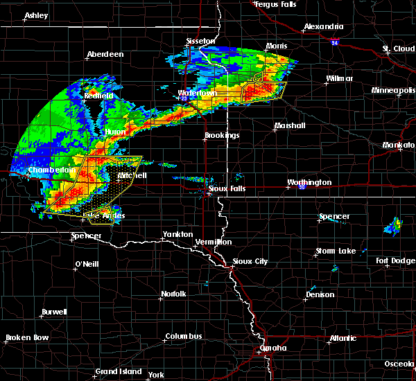 At 823 pm cdt, a severe thunderstorm was located near delmont, or 13 miles southwest of parkston, moving northeast at 30 mph (radar indicated). Hazards include ping pong ball size hail and 60 mph wind gusts. People and animals outdoors will be injured. expect hail damage to roofs, siding, windows, and vehicles. expect wind damage to roofs, siding, and trees. this severe thunderstorm will be near, parkston around 850 pm cdt. Dimock around 855 pm cdt. At 823 pm cdt, a severe thunderstorm was located near delmont, or 13 miles southwest of parkston, moving northeast at 30 mph (radar indicated). Hazards include ping pong ball size hail and 60 mph wind gusts. People and animals outdoors will be injured. expect hail damage to roofs, siding, windows, and vehicles. expect wind damage to roofs, siding, and trees. this severe thunderstorm will be near, parkston around 850 pm cdt. Dimock around 855 pm cdt.
|
| 7/20/2019 7:58 AM CDT |
 At 757 am cdt, severe thunderstorms were located along a line extending from near artesian to near fulton to near dimock, moving east at 40 mph (radar indicated. at 757 am cdt a 70 mph wind gust was reported at the mitchell airport). Hazards include 70 mph wind gusts. Expect considerable tree damage. damage is likely to mobile homes, roofs, and outbuildings. these severe storms will be near, fulton around 800 am cdt. alexandria around 805 am cdt. milltown, fedora and farmer around 810 am cdt. roswell around 815 am cdt. spencer in mccook county and clayton around 820 am cdt. vilas around 825 am cdt. Howard, bridgewater and canova around 830 am cdt. At 757 am cdt, severe thunderstorms were located along a line extending from near artesian to near fulton to near dimock, moving east at 40 mph (radar indicated. at 757 am cdt a 70 mph wind gust was reported at the mitchell airport). Hazards include 70 mph wind gusts. Expect considerable tree damage. damage is likely to mobile homes, roofs, and outbuildings. these severe storms will be near, fulton around 800 am cdt. alexandria around 805 am cdt. milltown, fedora and farmer around 810 am cdt. roswell around 815 am cdt. spencer in mccook county and clayton around 820 am cdt. vilas around 825 am cdt. Howard, bridgewater and canova around 830 am cdt.
|
| 7/20/2019 7:48 AM CDT |
 At 748 am cdt, severe thunderstorms were located along a line extending from near forestburg to near mitchell to near dimock, moving east at 40 mph (radar indicated). Hazards include 60 mph wind gusts. Expect damage to roofs, siding, and trees. severe thunderstorms will be near, alexandria, artesian and fulton around 800 am cdt. milltown, fedora and farmer around 810 am cdt. spencer in mccook county and roswell around 815 am cdt. clayton around 820 am cdt. vilas around 825 am cdt. Howard, bridgewater and canova around 830 am cdt. At 748 am cdt, severe thunderstorms were located along a line extending from near forestburg to near mitchell to near dimock, moving east at 40 mph (radar indicated). Hazards include 60 mph wind gusts. Expect damage to roofs, siding, and trees. severe thunderstorms will be near, alexandria, artesian and fulton around 800 am cdt. milltown, fedora and farmer around 810 am cdt. spencer in mccook county and roswell around 815 am cdt. clayton around 820 am cdt. vilas around 825 am cdt. Howard, bridgewater and canova around 830 am cdt.
|
| 7/17/2019 5:42 AM CDT |
 At 542 am cdt, severe thunderstorms were located along a line extending from near emery to near niobrara, moving east at 40 mph. these are very dangerous storms (trained weather spotters. a wind gust of 89 mph was reported near parkston around 5:31 am). Hazards include 90 mph wind gusts and half dollar size hail. You are in a life-threatening situation. flying debris may be deadly to those caught without shelter. mobile homes will be heavily damaged or destroyed. homes and businesses will have substantial roof and window damage. expect extensive tree damage and power outages. these severe storms will be near, emery and clayton around 545 am cdt. bridgewater around 555 am cdt. dolton around 605 am cdt. canistota around 610 am cdt. marion and monroe around 615 am cdt. parker around 625 am cdt. chancellor around 630 am cdt. Other locations impacted by these severe thunderstorms include gayville, lesterville and olivet. At 542 am cdt, severe thunderstorms were located along a line extending from near emery to near niobrara, moving east at 40 mph. these are very dangerous storms (trained weather spotters. a wind gust of 89 mph was reported near parkston around 5:31 am). Hazards include 90 mph wind gusts and half dollar size hail. You are in a life-threatening situation. flying debris may be deadly to those caught without shelter. mobile homes will be heavily damaged or destroyed. homes and businesses will have substantial roof and window damage. expect extensive tree damage and power outages. these severe storms will be near, emery and clayton around 545 am cdt. bridgewater around 555 am cdt. dolton around 605 am cdt. canistota around 610 am cdt. marion and monroe around 615 am cdt. parker around 625 am cdt. chancellor around 630 am cdt. Other locations impacted by these severe thunderstorms include gayville, lesterville and olivet.
|
| 7/17/2019 5:27 AM CDT |
 At 525 am cdt, severe thunderstorms were located along a line extending from near alexandria to 11 miles northwest of niobrara, moving east at 40 mph. these are very dangerous storms (trained weather spotters). Hazards include 80 mph wind gusts and quarter size hail. Flying debris will be dangerous to those caught without shelter. mobile homes will be heavily damaged. expect considerable damage to roofs, windows, and vehicles. extensive tree damage and power outages are likely. severe thunderstorms will be near, alexandria around 530 am cdt. springfield, emery and clayton around 545 am cdt. bridgewater around 555 am cdt. dolton around 605 am cdt. canistota around 610 am cdt. marion and monroe around 615 am cdt. parker around 625 am cdt. chancellor around 630 am cdt. Other locations impacted by these severe thunderstorms include gayville, lesterville and olivet. At 525 am cdt, severe thunderstorms were located along a line extending from near alexandria to 11 miles northwest of niobrara, moving east at 40 mph. these are very dangerous storms (trained weather spotters). Hazards include 80 mph wind gusts and quarter size hail. Flying debris will be dangerous to those caught without shelter. mobile homes will be heavily damaged. expect considerable damage to roofs, windows, and vehicles. extensive tree damage and power outages are likely. severe thunderstorms will be near, alexandria around 530 am cdt. springfield, emery and clayton around 545 am cdt. bridgewater around 555 am cdt. dolton around 605 am cdt. canistota around 610 am cdt. marion and monroe around 615 am cdt. parker around 625 am cdt. chancellor around 630 am cdt. Other locations impacted by these severe thunderstorms include gayville, lesterville and olivet.
|
| 7/17/2019 5:11 AM CDT |
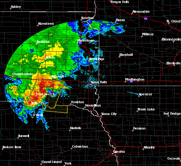 At 510 am cdt, a severe thunderstorm capable of producing a tornado was located near armour, or 12 miles west of parkston, moving east at 25 mph (radar indicated rotation). Hazards include tornado and quarter size hail. Flying debris will be dangerous to those caught without shelter. mobile homes will be damaged or destroyed. damage to roofs, windows, and vehicles will occur. tree damage is likely. this dangerous storm will be near, delmont around 520 am cdt. Parkston around 530 am cdt. At 510 am cdt, a severe thunderstorm capable of producing a tornado was located near armour, or 12 miles west of parkston, moving east at 25 mph (radar indicated rotation). Hazards include tornado and quarter size hail. Flying debris will be dangerous to those caught without shelter. mobile homes will be damaged or destroyed. damage to roofs, windows, and vehicles will occur. tree damage is likely. this dangerous storm will be near, delmont around 520 am cdt. Parkston around 530 am cdt.
|
| 7/17/2019 5:09 AM CDT |
 At 508 am cdt, severe thunderstorms were located along a line extending from 9 miles southeast of mount vernon to marty, moving east at 45 mph. these are very dangerous storms (trained weather spotters. this storm has had a history of producing winds in excess of 70 mph). Hazards include 80 mph wind gusts and half dollar size hail. Flying debris will be dangerous to those caught without shelter. mobile homes will be heavily damaged. expect considerable damage to roofs, windows, and vehicles. extensive tree damage and power outages are likely. these severe storms will be near, ethan, dimock and dante around 525 am cdt. Avon around 530 am cdt. At 508 am cdt, severe thunderstorms were located along a line extending from 9 miles southeast of mount vernon to marty, moving east at 45 mph. these are very dangerous storms (trained weather spotters. this storm has had a history of producing winds in excess of 70 mph). Hazards include 80 mph wind gusts and half dollar size hail. Flying debris will be dangerous to those caught without shelter. mobile homes will be heavily damaged. expect considerable damage to roofs, windows, and vehicles. extensive tree damage and power outages are likely. these severe storms will be near, ethan, dimock and dante around 525 am cdt. Avon around 530 am cdt.
|
| 7/17/2019 5:03 AM CDT |
 At 503 am cdt, a severe thunderstorm capable of producing a tornado was located near armour, or 16 miles west of parkston, moving east at 20 mph (radar indicated rotation). Hazards include tornado and quarter size hail. Flying debris will be dangerous to those caught without shelter. mobile homes will be damaged or destroyed. damage to roofs, windows, and vehicles will occur. tree damage is likely. This dangerous storm will be near, delmont around 530 am cdt. At 503 am cdt, a severe thunderstorm capable of producing a tornado was located near armour, or 16 miles west of parkston, moving east at 20 mph (radar indicated rotation). Hazards include tornado and quarter size hail. Flying debris will be dangerous to those caught without shelter. mobile homes will be damaged or destroyed. damage to roofs, windows, and vehicles will occur. tree damage is likely. This dangerous storm will be near, delmont around 530 am cdt.
|
| 7/17/2019 4:51 AM CDT |
 At 451 am cdt, severe thunderstorms were located along a line extending from near stickney to 7 miles northwest of gross, moving east at 45 mph (radar indicated). Hazards include 70 mph wind gusts and quarter size hail. Hail damage to vehicles is expected. expect considerable tree damage. wind damage is also likely to mobile homes, roofs, and outbuildings. severe thunderstorms will be near, pickstown around 500 am cdt. marty around 510 am cdt. wagner around 515 am cdt. ethan and dimock around 520 am cdt. dante around 525 am cdt. Avon around 530 am cdt. At 451 am cdt, severe thunderstorms were located along a line extending from near stickney to 7 miles northwest of gross, moving east at 45 mph (radar indicated). Hazards include 70 mph wind gusts and quarter size hail. Hail damage to vehicles is expected. expect considerable tree damage. wind damage is also likely to mobile homes, roofs, and outbuildings. severe thunderstorms will be near, pickstown around 500 am cdt. marty around 510 am cdt. wagner around 515 am cdt. ethan and dimock around 520 am cdt. dante around 525 am cdt. Avon around 530 am cdt.
|
| 6/27/2019 4:11 AM CDT |
 The severe thunderstorm warning for southeastern davison, northeastern douglas, southwestern mccook, southern hanson and northern hutchinson counties will expire at 415 am cdt, the storm which prompted the warning has weakened below severe limits, and no longer poses an immediate threat to life or property. therefore, the warning will be allowed to expire. a severe thunderstorm watch remains in effect until 100 pm cdt for southeastern south dakota. The severe thunderstorm warning for southeastern davison, northeastern douglas, southwestern mccook, southern hanson and northern hutchinson counties will expire at 415 am cdt, the storm which prompted the warning has weakened below severe limits, and no longer poses an immediate threat to life or property. therefore, the warning will be allowed to expire. a severe thunderstorm watch remains in effect until 100 pm cdt for southeastern south dakota.
|
| 6/27/2019 3:34 AM CDT |
 At 334 am cdt, a severe thunderstorm was located 9 miles west of parkston, moving east at 55 mph (radar indicated). Hazards include 60 mph wind gusts and half dollar size hail. Hail damage to vehicles is expected. expect wind damage to roofs, siding, and trees. this severe thunderstorm will be near, parkston, ethan and dimock around 345 am cdt. milltown around 355 am cdt. clayton around 400 am cdt. Emery around 405 am cdt. At 334 am cdt, a severe thunderstorm was located 9 miles west of parkston, moving east at 55 mph (radar indicated). Hazards include 60 mph wind gusts and half dollar size hail. Hail damage to vehicles is expected. expect wind damage to roofs, siding, and trees. this severe thunderstorm will be near, parkston, ethan and dimock around 345 am cdt. milltown around 355 am cdt. clayton around 400 am cdt. Emery around 405 am cdt.
|
| 8/28/2018 1:07 AM CDT |
 At 107 am cdt, a severe thunderstorm was located near dimock, or 7 miles northeast of parkston, moving east at 45 mph (radar indicated). Hazards include 60 mph wind gusts and quarter size hail. Hail damage to vehicles is expected. expect wind damage to roofs, siding, and trees. this severe thunderstorm will be near, emery around 130 am cdt. Bridgewater around 135 am cdt. At 107 am cdt, a severe thunderstorm was located near dimock, or 7 miles northeast of parkston, moving east at 45 mph (radar indicated). Hazards include 60 mph wind gusts and quarter size hail. Hail damage to vehicles is expected. expect wind damage to roofs, siding, and trees. this severe thunderstorm will be near, emery around 130 am cdt. Bridgewater around 135 am cdt.
|
| 8/28/2018 12:56 AM CDT |
 At 1255 am cdt, a severe thunderstorm was located over dimock, or near parkston, moving east at 45 mph (radar indicated). Hazards include 60 mph wind gusts and half dollar size hail. Hail damage to vehicles is expected. expect wind damage to roofs, siding, and trees. this severe storm will be near, ethan around 100 am cdt. Milltown around 110 am cdt. At 1255 am cdt, a severe thunderstorm was located over dimock, or near parkston, moving east at 45 mph (radar indicated). Hazards include 60 mph wind gusts and half dollar size hail. Hail damage to vehicles is expected. expect wind damage to roofs, siding, and trees. this severe storm will be near, ethan around 100 am cdt. Milltown around 110 am cdt.
|
| 8/28/2018 12:42 AM CDT |
 At 1242 am cdt, a severe thunderstorm was located 8 miles east of corsica, or 12 miles west of parkston, moving east at 45 mph (radar indicated). Hazards include 60 mph wind gusts and half dollar size hail. Hail damage to vehicles is expected. expect wind damage to roofs, siding, and trees. this severe thunderstorm will be near, ethan and dimock around 100 am cdt. Milltown around 110 am cdt. At 1242 am cdt, a severe thunderstorm was located 8 miles east of corsica, or 12 miles west of parkston, moving east at 45 mph (radar indicated). Hazards include 60 mph wind gusts and half dollar size hail. Hail damage to vehicles is expected. expect wind damage to roofs, siding, and trees. this severe thunderstorm will be near, ethan and dimock around 100 am cdt. Milltown around 110 am cdt.
|
| 8/5/2018 2:02 AM CDT |
 At 201 am cdt, a severe thunderstorm was located near milltown, or 12 miles east of parkston, moving east at 30 mph (radar indicated). Hazards include 70 mph wind gusts and half dollar size hail. Hail damage to vehicles is expected. expect considerable tree damage. wind damage is also likely to mobile homes, roofs, and outbuildings. This severe storm will be near, clayton around 210 am cdt. At 201 am cdt, a severe thunderstorm was located near milltown, or 12 miles east of parkston, moving east at 30 mph (radar indicated). Hazards include 70 mph wind gusts and half dollar size hail. Hail damage to vehicles is expected. expect considerable tree damage. wind damage is also likely to mobile homes, roofs, and outbuildings. This severe storm will be near, clayton around 210 am cdt.
|
| 8/5/2018 1:29 AM CDT |
 At 129 am cdt, a severe thunderstorm was located near dimock, or 8 miles northwest of parkston, moving east at 30 mph (radar indicated). Hazards include 70 mph wind gusts and half dollar size hail. Hail damage to vehicles is expected. expect considerable tree damage. wind damage is also likely to mobile homes, roofs, and outbuildings. this severe thunderstorm will be near, dimock around 135 am cdt. parkston around 140 am cdt. milltown around 155 am cdt. Clayton around 210 am cdt. At 129 am cdt, a severe thunderstorm was located near dimock, or 8 miles northwest of parkston, moving east at 30 mph (radar indicated). Hazards include 70 mph wind gusts and half dollar size hail. Hail damage to vehicles is expected. expect considerable tree damage. wind damage is also likely to mobile homes, roofs, and outbuildings. this severe thunderstorm will be near, dimock around 135 am cdt. parkston around 140 am cdt. milltown around 155 am cdt. Clayton around 210 am cdt.
|
| 6/27/2018 7:22 AM CDT |
 At 721 am cdt, a severe thunderstorm was located near tripp, or 7 miles south of parkston, moving southeast at 45 mph (radar indicated). Hazards include 60 mph wind gusts and half dollar size hail. Hail damage to vehicles is expected. expect wind damage to roofs, siding, and trees. this severe thunderstorm will be near, tripp around 730 am cdt. kaylor around 740 am cdt. scotland and menno around 750 am cdt. Other locations impacted by this severe thunderstorm include olivet and lesterville. At 721 am cdt, a severe thunderstorm was located near tripp, or 7 miles south of parkston, moving southeast at 45 mph (radar indicated). Hazards include 60 mph wind gusts and half dollar size hail. Hail damage to vehicles is expected. expect wind damage to roofs, siding, and trees. this severe thunderstorm will be near, tripp around 730 am cdt. kaylor around 740 am cdt. scotland and menno around 750 am cdt. Other locations impacted by this severe thunderstorm include olivet and lesterville.
|
| 6/27/2018 7:10 AM CDT |
 At 709 am cdt, a severe thunderstorm was located 7 miles east of corsica, or 14 miles west of parkston, moving southeast at 35 mph (radar indicated). Hazards include ping pong ball size hail and 60 mph wind gusts. People and animals outdoors will be injured. expect hail damage to roofs, siding, windows, and vehicles. expect wind damage to roofs, siding, and trees. this severe storm will be near, delmont around 725 am cdt. Parkston around 730 am cdt. At 709 am cdt, a severe thunderstorm was located 7 miles east of corsica, or 14 miles west of parkston, moving southeast at 35 mph (radar indicated). Hazards include ping pong ball size hail and 60 mph wind gusts. People and animals outdoors will be injured. expect hail damage to roofs, siding, windows, and vehicles. expect wind damage to roofs, siding, and trees. this severe storm will be near, delmont around 725 am cdt. Parkston around 730 am cdt.
|
| 6/27/2018 6:55 AM CDT |
 At 654 am cdt, a severe thunderstorm was located near corsica, or 16 miles south of plankinton, moving southeast at 35 mph (radar indicated). Hazards include ping pong ball size hail and 60 mph wind gusts. People and animals outdoors will be injured. expect hail damage to roofs, siding, windows, and vehicles. expect wind damage to roofs, siding, and trees. this severe thunderstorm will be near, delmont around 725 am cdt. Parkston around 730 am cdt. At 654 am cdt, a severe thunderstorm was located near corsica, or 16 miles south of plankinton, moving southeast at 35 mph (radar indicated). Hazards include ping pong ball size hail and 60 mph wind gusts. People and animals outdoors will be injured. expect hail damage to roofs, siding, windows, and vehicles. expect wind damage to roofs, siding, and trees. this severe thunderstorm will be near, delmont around 725 am cdt. Parkston around 730 am cdt.
|
| 6/9/2018 12:37 AM CDT |
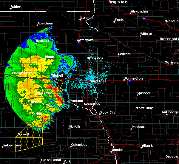 At 1237 am cdt, a severe thunderstorm was located near parkston, moving northeast at 30 mph (radar indicated). Hazards include 70 mph wind gusts and quarter size hail. Hail damage to vehicles is expected. expect considerable tree damage. wind damage is also likely to mobile homes, roofs, and outbuildings. this severe thunderstorm will be near, milltown around 1245 am cdt. Alexandria and emery around 115 am cdt. At 1237 am cdt, a severe thunderstorm was located near parkston, moving northeast at 30 mph (radar indicated). Hazards include 70 mph wind gusts and quarter size hail. Hail damage to vehicles is expected. expect considerable tree damage. wind damage is also likely to mobile homes, roofs, and outbuildings. this severe thunderstorm will be near, milltown around 1245 am cdt. Alexandria and emery around 115 am cdt.
|
| 6/1/2018 8:24 PM CDT |
 At 822 pm cdt, severe thunderstorms were located along a line extending from near parkston to near kaylor to near niobrara, moving east at 45 mph (radar indicated). Hazards include 60 mph wind gusts and penny size hail. Expect damage to roofs, siding, and trees. these severe storms will be near, kaylor and dimock around 825 pm cdt. scotland around 835 pm cdt. milltown around 840 pm cdt. tabor and clayton around 845 pm cdt. other locations impacted by these severe thunderstorms include olivet. Currently, the strongest part of the storm was midway between parkston and tripp. At 822 pm cdt, severe thunderstorms were located along a line extending from near parkston to near kaylor to near niobrara, moving east at 45 mph (radar indicated). Hazards include 60 mph wind gusts and penny size hail. Expect damage to roofs, siding, and trees. these severe storms will be near, kaylor and dimock around 825 pm cdt. scotland around 835 pm cdt. milltown around 840 pm cdt. tabor and clayton around 845 pm cdt. other locations impacted by these severe thunderstorms include olivet. Currently, the strongest part of the storm was midway between parkston and tripp.
|
| 6/1/2018 8:00 PM CDT |
 At 759 pm cdt, severe thunderstorms were located along a line extending from near delmont to near dante, moving east at 35 mph (radar indicated). Hazards include 60 mph wind gusts and penny size hail. Expect damage to roofs, siding, and trees. severe thunderstorms will be near, delmont around 805 pm cdt. avon around 820 pm cdt. parkston and tripp around 825 pm cdt. tyndall around 835 pm cdt. milltown around 845 pm cdt. Other locations impacted by these severe thunderstorms include olivet. At 759 pm cdt, severe thunderstorms were located along a line extending from near delmont to near dante, moving east at 35 mph (radar indicated). Hazards include 60 mph wind gusts and penny size hail. Expect damage to roofs, siding, and trees. severe thunderstorms will be near, delmont around 805 pm cdt. avon around 820 pm cdt. parkston and tripp around 825 pm cdt. tyndall around 835 pm cdt. milltown around 845 pm cdt. Other locations impacted by these severe thunderstorms include olivet.
|
| 6/1/2018 7:42 PM CDT |
 At 741 pm cdt, severe thunderstorms were located along a line extending from 6 miles north of storla to armour, moving northeast at 40 mph (radar indicated). Hazards include 60 mph wind gusts and nickel size hail. Expect damage to roofs, siding, and trees. these severe storms will be near, lane and storla around 745 pm cdt. delmont around 750 pm cdt. woonsocket around 755 pm cdt. Forestburg around 800 pm cdt. At 741 pm cdt, severe thunderstorms were located along a line extending from 6 miles north of storla to armour, moving northeast at 40 mph (radar indicated). Hazards include 60 mph wind gusts and nickel size hail. Expect damage to roofs, siding, and trees. these severe storms will be near, lane and storla around 745 pm cdt. delmont around 750 pm cdt. woonsocket around 755 pm cdt. Forestburg around 800 pm cdt.
|
| 6/1/2018 7:24 PM CDT |
 At 722 pm cdt, severe thunderstorms were located along a line extending from 8 miles west of storla to 7 miles northeast of lake andes, moving northeast at 35 mph (radar indicated. these storms have had a history of producing tree and crop damage near gregory and academy). Hazards include 70 mph wind gusts and penny size hail. Expect considerable tree damage. damage is likely to mobile homes, roofs, and outbuildings. severe thunderstorms will be near, armour and storla around 735 pm cdt. delmont around 745 pm cdt. woonsocket around 750 pm cdt. letcher around 755 pm cdt. Parkston, dimock and forestburg around 800 pm cdt. At 722 pm cdt, severe thunderstorms were located along a line extending from 8 miles west of storla to 7 miles northeast of lake andes, moving northeast at 35 mph (radar indicated. these storms have had a history of producing tree and crop damage near gregory and academy). Hazards include 70 mph wind gusts and penny size hail. Expect considerable tree damage. damage is likely to mobile homes, roofs, and outbuildings. severe thunderstorms will be near, armour and storla around 735 pm cdt. delmont around 745 pm cdt. woonsocket around 750 pm cdt. letcher around 755 pm cdt. Parkston, dimock and forestburg around 800 pm cdt.
|
| 5/23/2018 2:18 PM CDT |
 At 217 pm cdt, a severe thunderstorm was located near milltown and parkston, moving northeast at 25 mph (trained weather spotters. quarter size hail was reported 3 miles south of parkston at 157 pm). Hazards include quarter size hail. Damage to vehicles is expected. This severe storm will be near, ethan around 230 pm cdt. At 217 pm cdt, a severe thunderstorm was located near milltown and parkston, moving northeast at 25 mph (trained weather spotters. quarter size hail was reported 3 miles south of parkston at 157 pm). Hazards include quarter size hail. Damage to vehicles is expected. This severe storm will be near, ethan around 230 pm cdt.
|
| 5/23/2018 2:00 PM CDT |
 The national weather service in sioux falls has issued a * severe thunderstorm warning for. southeastern davison county in southeastern south dakota. southern hanson county in southeastern south dakota. northwestern hutchinson county in southeastern south dakota. Until 230 pm cdt. The national weather service in sioux falls has issued a * severe thunderstorm warning for. southeastern davison county in southeastern south dakota. southern hanson county in southeastern south dakota. northwestern hutchinson county in southeastern south dakota. Until 230 pm cdt.
|
| 4/13/2018 12:09 PM CDT |
 At 1152 am cdt, severe thunderstorms were located along a line extending from 7 miles west of dimock to near parkston, moving northeast at 35 mph (radar indicated). Hazards include 60 mph wind gusts and quarter size hail. Hail damage to vehicles is expected. expect wind damage to roofs, siding, and trees. these severe storms will be near, dimock around 1200 pm cdt. Ethan and milltown around 1205 pm cdt. At 1152 am cdt, severe thunderstorms were located along a line extending from 7 miles west of dimock to near parkston, moving northeast at 35 mph (radar indicated). Hazards include 60 mph wind gusts and quarter size hail. Hail damage to vehicles is expected. expect wind damage to roofs, siding, and trees. these severe storms will be near, dimock around 1200 pm cdt. Ethan and milltown around 1205 pm cdt.
|
| 4/13/2018 11:53 AM CDT |
 At 1152 am cdt, severe thunderstorms were located along a line extending from 7 miles west of dimock to near parkston, moving northeast at 35 mph (radar indicated). Hazards include 60 mph wind gusts and quarter size hail. Hail damage to vehicles is expected. expect wind damage to roofs, siding, and trees. these severe storms will be near, dimock around 1200 pm cdt. Ethan and milltown around 1205 pm cdt. At 1152 am cdt, severe thunderstorms were located along a line extending from 7 miles west of dimock to near parkston, moving northeast at 35 mph (radar indicated). Hazards include 60 mph wind gusts and quarter size hail. Hail damage to vehicles is expected. expect wind damage to roofs, siding, and trees. these severe storms will be near, dimock around 1200 pm cdt. Ethan and milltown around 1205 pm cdt.
|
| 4/13/2018 11:36 AM CDT |
 At 1135 am cdt, severe thunderstorms were located along a line extending from near corsica to near tripp, moving northeast at 30 mph (trained weather spotters. at 1129 am cdt quarter sized hail was reported 3 miles southwest of delmont). Hazards include 60 mph wind gusts and quarter size hail. Hail damage to vehicles is expected. expect wind damage to roofs, siding, and trees. severe thunderstorms will be near, parkston around 1200 pm cdt. ethan around 1210 pm cdt. Milltown around 1215 pm cdt. At 1135 am cdt, severe thunderstorms were located along a line extending from near corsica to near tripp, moving northeast at 30 mph (trained weather spotters. at 1129 am cdt quarter sized hail was reported 3 miles southwest of delmont). Hazards include 60 mph wind gusts and quarter size hail. Hail damage to vehicles is expected. expect wind damage to roofs, siding, and trees. severe thunderstorms will be near, parkston around 1200 pm cdt. ethan around 1210 pm cdt. Milltown around 1215 pm cdt.
|
| 9/19/2017 10:40 PM CDT |
 The severe thunderstorm warning for davison. northeastern douglas. southwestern hanson and northwestern hutchinson counties will expire at 1045 pm cdt. the storm which prompted the warning has moved out of the area. therefore the warning will be allowed to expire. A tornado watch remains in effect until midnight cdt for southeastern. The severe thunderstorm warning for davison. northeastern douglas. southwestern hanson and northwestern hutchinson counties will expire at 1045 pm cdt. the storm which prompted the warning has moved out of the area. therefore the warning will be allowed to expire. A tornado watch remains in effect until midnight cdt for southeastern.
|
| 9/19/2017 10:29 PM CDT |
 At 1029 pm cdt, a severe thunderstorm was located 7 miles southeast of mount vernon, or 9 miles southwest of mitchell, moving northeast at 45 mph. this is a very dangerous storm (radar indicated). Hazards include 80 mph wind gusts and quarter size hail. Flying debris will be dangerous to those caught without shelter. mobile homes will be heavily damaged. expect considerable damage to roofs, windows, and vehicles. extensive tree damage and power outages are likely. this severe storm will be near, mitchell around 1045 pm cdt. A tornado watch remains in effect until midnight cdt for south central and southeastern south dakota. At 1029 pm cdt, a severe thunderstorm was located 7 miles southeast of mount vernon, or 9 miles southwest of mitchell, moving northeast at 45 mph. this is a very dangerous storm (radar indicated). Hazards include 80 mph wind gusts and quarter size hail. Flying debris will be dangerous to those caught without shelter. mobile homes will be heavily damaged. expect considerable damage to roofs, windows, and vehicles. extensive tree damage and power outages are likely. this severe storm will be near, mitchell around 1045 pm cdt. A tornado watch remains in effect until midnight cdt for south central and southeastern south dakota.
|
| 9/19/2017 10:10 PM CDT |
 At 1009 pm cdt, a severe thunderstorm was located near stickney, or 14 miles south of plankinton, moving northeast at 45 mph. this is a very dangerous storm (radar indicated. at 1002 pm cdt 60 mph wind gusts were reported at mitchell airport). Hazards include 80 mph wind gusts and quarter size hail. Flying debris will be dangerous to those caught without shelter. mobile homes will be heavily damaged. expect considerable damage to roofs, windows, and vehicles. extensive tree damage and power outages are likely. this severe storm will be near, mount vernon around 1030 pm cdt. mitchell around 1045 pm cdt. A tornado watch remains in effect until midnight cdt for south central and southeastern south dakota. At 1009 pm cdt, a severe thunderstorm was located near stickney, or 14 miles south of plankinton, moving northeast at 45 mph. this is a very dangerous storm (radar indicated. at 1002 pm cdt 60 mph wind gusts were reported at mitchell airport). Hazards include 80 mph wind gusts and quarter size hail. Flying debris will be dangerous to those caught without shelter. mobile homes will be heavily damaged. expect considerable damage to roofs, windows, and vehicles. extensive tree damage and power outages are likely. this severe storm will be near, mount vernon around 1030 pm cdt. mitchell around 1045 pm cdt. A tornado watch remains in effect until midnight cdt for south central and southeastern south dakota.
|
| 9/19/2017 10:00 PM CDT |
 At 959 pm cdt, a severe thunderstorm was located over harrison, or 17 miles south of plankinton, moving northeast at 45 mph (radar indicated). Hazards include 70 mph wind gusts and quarter size hail. Hail damage to vehicles is expected. expect considerable tree damage. wind damage is also likely to mobile homes, roofs, and outbuildings. this severe thunderstorm will be near, corsica around 1005 pm cdt. stickney around 1015 pm cdt. mount vernon around 1030 pm cdt. mitchell around 1045 pm cdt. A tornado watch remains in effect until midnight cdt for south central and southeastern south dakota. At 959 pm cdt, a severe thunderstorm was located over harrison, or 17 miles south of plankinton, moving northeast at 45 mph (radar indicated). Hazards include 70 mph wind gusts and quarter size hail. Hail damage to vehicles is expected. expect considerable tree damage. wind damage is also likely to mobile homes, roofs, and outbuildings. this severe thunderstorm will be near, corsica around 1005 pm cdt. stickney around 1015 pm cdt. mount vernon around 1030 pm cdt. mitchell around 1045 pm cdt. A tornado watch remains in effect until midnight cdt for south central and southeastern south dakota.
|
| 8/21/2017 12:54 PM CDT |
 At 1253 pm cdt, severe thunderstorms were located along a line extending from 7 miles north of milltown to 6 miles northwest of menno to near tyndall, moving east at 50 mph. these are very dangerous storms (radar indicated). Hazards include baseball size hail and 70 mph wind gusts. People and animals outdoors will be severely injured. expect shattered windows, extensive damage to roofs, siding, and vehicles. these severe storms will be near, menno around 100 pm cdt. scotland and clayton around 105 pm cdt. freeman around 110 pm cdt. Other locations impacted by these severe thunderstorms include lesterville and olivet. At 1253 pm cdt, severe thunderstorms were located along a line extending from 7 miles north of milltown to 6 miles northwest of menno to near tyndall, moving east at 50 mph. these are very dangerous storms (radar indicated). Hazards include baseball size hail and 70 mph wind gusts. People and animals outdoors will be severely injured. expect shattered windows, extensive damage to roofs, siding, and vehicles. these severe storms will be near, menno around 100 pm cdt. scotland and clayton around 105 pm cdt. freeman around 110 pm cdt. Other locations impacted by these severe thunderstorms include lesterville and olivet.
|
| 8/21/2017 12:33 PM CDT |
 At 1233 pm cdt, severe thunderstorms were located along a line extending from 7 miles west of ethan to near parkston to near wagner, moving east at 50 mph (radar indicated). Hazards include two inch hail and 70 mph wind gusts. People and animals outdoors will be injured. expect hail damage to roofs, siding, windows, and vehicles. expect considerable tree damage. wind damage is also likely to mobile homes, roofs, and outbuildings. severe thunderstorms will be near, tripp around 1240 pm cdt. kaylor around 1245 pm cdt. milltown around 1255 pm cdt. menno around 100 pm cdt. clayton around 105 pm cdt. freeman around 110 pm cdt. Other locations impacted by these severe thunderstorms include lesterville and olivet. At 1233 pm cdt, severe thunderstorms were located along a line extending from 7 miles west of ethan to near parkston to near wagner, moving east at 50 mph (radar indicated). Hazards include two inch hail and 70 mph wind gusts. People and animals outdoors will be injured. expect hail damage to roofs, siding, windows, and vehicles. expect considerable tree damage. wind damage is also likely to mobile homes, roofs, and outbuildings. severe thunderstorms will be near, tripp around 1240 pm cdt. kaylor around 1245 pm cdt. milltown around 1255 pm cdt. menno around 100 pm cdt. clayton around 105 pm cdt. freeman around 110 pm cdt. Other locations impacted by these severe thunderstorms include lesterville and olivet.
|
| 8/21/2017 12:21 PM CDT |
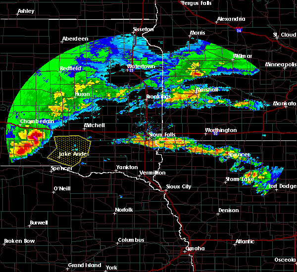 At 1220 pm cdt, severe thunderstorms were located along a line extending from 7 miles northeast of corsica to near delmont to pickstown, moving east at 55 mph (public. at 1210 pm cdt, a 60 mph wind gust was reported in corsica). Hazards include two inch hail and 70 mph wind gusts. People and animals outdoors will be injured. expect hail damage to roofs, siding, windows, and vehicles. expect considerable tree damage. wind damage is also likely to mobile homes, roofs, and outbuildings. these severe storms will be near, delmont around 1225 pm cdt. wagner, tripp and dimock around 1235 pm cdt. Parkston and dante around 1240 pm cdt. At 1220 pm cdt, severe thunderstorms were located along a line extending from 7 miles northeast of corsica to near delmont to pickstown, moving east at 55 mph (public. at 1210 pm cdt, a 60 mph wind gust was reported in corsica). Hazards include two inch hail and 70 mph wind gusts. People and animals outdoors will be injured. expect hail damage to roofs, siding, windows, and vehicles. expect considerable tree damage. wind damage is also likely to mobile homes, roofs, and outbuildings. these severe storms will be near, delmont around 1225 pm cdt. wagner, tripp and dimock around 1235 pm cdt. Parkston and dante around 1240 pm cdt.
|
| 8/21/2017 12:08 PM CDT |
 At 1207 pm cdt, severe thunderstorms were located along a line extending from near stickney to 6 miles west of armour to 10 miles east of bonesteel, moving east at 40 mph (public. at 12:05 pm cdt, golf ball size hail was reported 2 miles south of aurora center). Hazards include two inch hail and 70 mph wind gusts. People and animals outdoors will be injured. expect hail damage to roofs, siding, windows, and vehicles. expect considerable tree damage. wind damage is also likely to mobile homes, roofs, and outbuildings. these severe storms will be near, armour around 1215 pm cdt. pickstown around 1225 pm cdt. delmont around 1230 pm cdt. marty around 1235 pm cdt. dimock around 1240 pm cdt. Parkston, tripp and dante around 1245 pm cdt. At 1207 pm cdt, severe thunderstorms were located along a line extending from near stickney to 6 miles west of armour to 10 miles east of bonesteel, moving east at 40 mph (public. at 12:05 pm cdt, golf ball size hail was reported 2 miles south of aurora center). Hazards include two inch hail and 70 mph wind gusts. People and animals outdoors will be injured. expect hail damage to roofs, siding, windows, and vehicles. expect considerable tree damage. wind damage is also likely to mobile homes, roofs, and outbuildings. these severe storms will be near, armour around 1215 pm cdt. pickstown around 1225 pm cdt. delmont around 1230 pm cdt. marty around 1235 pm cdt. dimock around 1240 pm cdt. Parkston, tripp and dante around 1245 pm cdt.
|
| 8/21/2017 12:05 PM CDT |
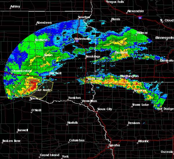 At 1204 pm cdt, severe thunderstorms were located along a line extending from near stickney to 7 miles south of harrison to 8 miles east of bonesteel, moving southeast at 40 mph (radar indicated). Hazards include two inch hail and 70 mph wind gusts. People and animals outdoors will be injured. expect hail damage to roofs, siding, windows, and vehicles. expect considerable tree damage. wind damage is also likely to mobile homes, roofs, and outbuildings. severe thunderstorms will be near, armour and corsica around 1215 pm cdt. pickstown around 1220 pm cdt. delmont around 1230 pm cdt. marty around 1235 pm cdt. parkston and dimock around 1240 pm cdt. Tripp around 1245 pm cdt. At 1204 pm cdt, severe thunderstorms were located along a line extending from near stickney to 7 miles south of harrison to 8 miles east of bonesteel, moving southeast at 40 mph (radar indicated). Hazards include two inch hail and 70 mph wind gusts. People and animals outdoors will be injured. expect hail damage to roofs, siding, windows, and vehicles. expect considerable tree damage. wind damage is also likely to mobile homes, roofs, and outbuildings. severe thunderstorms will be near, armour and corsica around 1215 pm cdt. pickstown around 1220 pm cdt. delmont around 1230 pm cdt. marty around 1235 pm cdt. parkston and dimock around 1240 pm cdt. Tripp around 1245 pm cdt.
|
| 6/29/2017 11:47 AM CDT |
 At 446 pm cdt, a severe thunderstorm was located over tripp, or 12 miles south of parkston, moving southeast at 20 mph (radar indicated). Hazards include 70 mph wind gusts and ping pong ball size hail. People and animals outdoors will be injured. expect hail damage to roofs, siding, windows, and vehicles. expect considerable tree damage. wind damage is also likely to mobile homes, roofs, and outbuildings. this severe storm will be near, tripp around 450 pm cdt. Kaylor around 510 pm cdt. At 446 pm cdt, a severe thunderstorm was located over tripp, or 12 miles south of parkston, moving southeast at 20 mph (radar indicated). Hazards include 70 mph wind gusts and ping pong ball size hail. People and animals outdoors will be injured. expect hail damage to roofs, siding, windows, and vehicles. expect considerable tree damage. wind damage is also likely to mobile homes, roofs, and outbuildings. this severe storm will be near, tripp around 450 pm cdt. Kaylor around 510 pm cdt.
|
| 6/29/2017 11:40 AM CDT |
 At 439 pm cdt, a severe thunderstorm was located near tripp, or 12 miles south of parkston, moving southeast at 20 mph (radar indicated). Hazards include ping pong ball size hail and 60 mph wind gusts. People and animals outdoors will be injured. expect hail damage to roofs, siding, windows, and vehicles. expect wind damage to roofs, siding, and trees. this severe thunderstorm will be near, tripp around 450 pm cdt. Kaylor around 510 pm cdt. At 439 pm cdt, a severe thunderstorm was located near tripp, or 12 miles south of parkston, moving southeast at 20 mph (radar indicated). Hazards include ping pong ball size hail and 60 mph wind gusts. People and animals outdoors will be injured. expect hail damage to roofs, siding, windows, and vehicles. expect wind damage to roofs, siding, and trees. this severe thunderstorm will be near, tripp around 450 pm cdt. Kaylor around 510 pm cdt.
|
| 6/27/2017 5:57 PM CDT |
 A severe thunderstorm warning remains in effect until 1115 pm cdt for eastern douglas and northwestern hutchinson counties. at 1056 pm cdt, a severe thunderstorm was located near delmont, or 11 miles west of parkston, moving east at 30 mph. hazard. 60 mph wind gusts and quarter size hail. source. radar indicated. At 1043 pm cdt half dollar hail was. A severe thunderstorm warning remains in effect until 1115 pm cdt for eastern douglas and northwestern hutchinson counties. at 1056 pm cdt, a severe thunderstorm was located near delmont, or 11 miles west of parkston, moving east at 30 mph. hazard. 60 mph wind gusts and quarter size hail. source. radar indicated. At 1043 pm cdt half dollar hail was.
|
| 6/27/2017 5:39 PM CDT |
 At 1037 pm cdt, a severe thunderstorm was located over armour, or 16 miles west of parkston, moving northeast at 40 mph (radar indicated). Hazards include 60 mph wind gusts and quarter size hail. Hail damage to vehicles is expected. expect wind damage to roofs, siding, and trees. this severe storm will be near, delmont around 1045 pm cdt. parkston around 1100 pm cdt. dimock around 1105 pm cdt. Ethan around 1110 pm cdt. At 1037 pm cdt, a severe thunderstorm was located over armour, or 16 miles west of parkston, moving northeast at 40 mph (radar indicated). Hazards include 60 mph wind gusts and quarter size hail. Hail damage to vehicles is expected. expect wind damage to roofs, siding, and trees. this severe storm will be near, delmont around 1045 pm cdt. parkston around 1100 pm cdt. dimock around 1105 pm cdt. Ethan around 1110 pm cdt.
|
| 6/27/2017 5:24 PM CDT |
 At 1023 pm cdt, a severe thunderstorm was located 7 miles west of armour, or 9 miles north of lake andes, moving east at 40 mph (radar indicated). Hazards include 60 mph wind gusts and half dollar size hail. Hail damage to vehicles is expected. expect wind damage to roofs, siding, and trees. this severe thunderstorm will be near, armour and corsica around 1035 pm cdt. delmont around 1045 pm cdt. parkston and dimock around 1105 pm cdt. Ethan around 1110 pm cdt. At 1023 pm cdt, a severe thunderstorm was located 7 miles west of armour, or 9 miles north of lake andes, moving east at 40 mph (radar indicated). Hazards include 60 mph wind gusts and half dollar size hail. Hail damage to vehicles is expected. expect wind damage to roofs, siding, and trees. this severe thunderstorm will be near, armour and corsica around 1035 pm cdt. delmont around 1045 pm cdt. parkston and dimock around 1105 pm cdt. Ethan around 1110 pm cdt.
|
| 6/13/2017 7:00 PM CDT |
 At 700 pm cdt, a severe thunderstorm was located 9 miles east of corsica, or 11 miles west of parkston, moving northeast at 45 mph (radar indicated). Hazards include 60 mph wind gusts and quarter size hail. Hail damage to vehicles is expected. expect wind damage to roofs, siding, and trees. locations impacted include, parkston, armour, corsica, ethan, delmont and dimock. A tornado watch remains in effect until 1000 pm cdt for south central and southeastern south dakota. At 700 pm cdt, a severe thunderstorm was located 9 miles east of corsica, or 11 miles west of parkston, moving northeast at 45 mph (radar indicated). Hazards include 60 mph wind gusts and quarter size hail. Hail damage to vehicles is expected. expect wind damage to roofs, siding, and trees. locations impacted include, parkston, armour, corsica, ethan, delmont and dimock. A tornado watch remains in effect until 1000 pm cdt for south central and southeastern south dakota.
|
| 6/13/2017 6:49 PM CDT |
 At 649 pm cdt, a severe thunderstorm was located over armour, or 16 miles northeast of lake andes, moving northeast at 45 mph (radar indicated). Hazards include ping pong ball size hail and 60 mph wind gusts. People and animals outdoors will be injured. expect hail damage to roofs, siding, windows, and vehicles. Expect wind damage to roofs, siding, and trees. At 649 pm cdt, a severe thunderstorm was located over armour, or 16 miles northeast of lake andes, moving northeast at 45 mph (radar indicated). Hazards include ping pong ball size hail and 60 mph wind gusts. People and animals outdoors will be injured. expect hail damage to roofs, siding, windows, and vehicles. Expect wind damage to roofs, siding, and trees.
|
| 6/13/2017 6:37 PM CDT |
 At 636 pm cdt, a severe thunderstorm was located near dimock, or 7 miles northwest of parkston, moving northeast at 50 mph (trained weather spotters. at 634 pm cdt, trained spotters reported golf ball size hail 10 miles west of dimock). Hazards include two inch hail and 70 mph wind gusts. People and animals outdoors will be injured. expect hail damage to roofs, siding, windows, and vehicles. expect considerable tree damage. wind damage is also likely to mobile homes, roofs, and outbuildings. this severe storm will be near, ethan around 645 pm cdt. alexandria, fulton and farmer around 700 pm cdt. A tornado watch remains in effect until 1000 pm cdt for south central, southeastern and east central south dakota. At 636 pm cdt, a severe thunderstorm was located near dimock, or 7 miles northwest of parkston, moving northeast at 50 mph (trained weather spotters. at 634 pm cdt, trained spotters reported golf ball size hail 10 miles west of dimock). Hazards include two inch hail and 70 mph wind gusts. People and animals outdoors will be injured. expect hail damage to roofs, siding, windows, and vehicles. expect considerable tree damage. wind damage is also likely to mobile homes, roofs, and outbuildings. this severe storm will be near, ethan around 645 pm cdt. alexandria, fulton and farmer around 700 pm cdt. A tornado watch remains in effect until 1000 pm cdt for south central, southeastern and east central south dakota.
|
| 6/13/2017 6:34 PM CDT | Golf Ball sized hail reported 10.2 miles E of Dimock, SD |
| 6/13/2017 6:28 PM CDT |
 At 628 pm cdt, a severe thunderstorm was located near dimock, or 7 miles northwest of parkston, moving northeast at 65 mph (radar indicated). Hazards include two inch hail and 70 mph wind gusts. People and animals outdoors will be injured. expect hail damage to roofs, siding, windows, and vehicles. expect considerable tree damage. wind damage is also likely to mobile homes, roofs, and outbuildings. this severe thunderstorm will be near, ethan around 640 pm cdt. alexandria and fulton around 650 pm cdt. farmer around 655 pm cdt. A tornado watch remains in effect until 1000 pm cdt for south central, southeastern and east central south dakota. At 628 pm cdt, a severe thunderstorm was located near dimock, or 7 miles northwest of parkston, moving northeast at 65 mph (radar indicated). Hazards include two inch hail and 70 mph wind gusts. People and animals outdoors will be injured. expect hail damage to roofs, siding, windows, and vehicles. expect considerable tree damage. wind damage is also likely to mobile homes, roofs, and outbuildings. this severe thunderstorm will be near, ethan around 640 pm cdt. alexandria and fulton around 650 pm cdt. farmer around 655 pm cdt. A tornado watch remains in effect until 1000 pm cdt for south central, southeastern and east central south dakota.
|
| 5/15/2017 8:50 AM CDT |
 At 850 am cdt, a severe thunderstorm was located 7 miles south of alexandria, or 13 miles northeast of parkston, moving northeast at 40 mph (radar indicated). Hazards include 60 mph wind gusts and quarter size hail. Hail damage to vehicles is expected. expect wind damage to roofs, siding, and trees. This severe storm will be near, alexandria, emery and farmer around 900 am cdt. At 850 am cdt, a severe thunderstorm was located 7 miles south of alexandria, or 13 miles northeast of parkston, moving northeast at 40 mph (radar indicated). Hazards include 60 mph wind gusts and quarter size hail. Hail damage to vehicles is expected. expect wind damage to roofs, siding, and trees. This severe storm will be near, alexandria, emery and farmer around 900 am cdt.
|
| 5/15/2017 8:37 AM CDT |
 At 837 am cdt, a severe thunderstorm was located near parkston, moving northeast at 50 mph (radar indicated). Hazards include 60 mph wind gusts and quarter size hail. Hail damage to vehicles is expected. expect wind damage to roofs, siding, and trees. this severe thunderstorm will be near, milltown around 840 am cdt. ethan around 845 am cdt. Alexandria, emery, fulton and farmer around 900 am cdt. At 837 am cdt, a severe thunderstorm was located near parkston, moving northeast at 50 mph (radar indicated). Hazards include 60 mph wind gusts and quarter size hail. Hail damage to vehicles is expected. expect wind damage to roofs, siding, and trees. this severe thunderstorm will be near, milltown around 840 am cdt. ethan around 845 am cdt. Alexandria, emery, fulton and farmer around 900 am cdt.
|
| 5/15/2017 8:24 AM CDT |
 At 823 am cdt, a severe thunderstorm was located near parkston, moving northeast at 35 mph (emergency management). Hazards include 60 mph wind gusts and quarter size hail. Hail damage to vehicles is expected. expect wind damage to roofs, siding, and trees. this severe storm will be near, parkston around 830 am cdt. dimock around 835 am cdt. Ethan around 845 am cdt. At 823 am cdt, a severe thunderstorm was located near parkston, moving northeast at 35 mph (emergency management). Hazards include 60 mph wind gusts and quarter size hail. Hail damage to vehicles is expected. expect wind damage to roofs, siding, and trees. this severe storm will be near, parkston around 830 am cdt. dimock around 835 am cdt. Ethan around 845 am cdt.
|
| 5/15/2017 8:08 AM CDT |
 At 807 am cdt, a severe thunderstorm was located over armour, or 14 miles northeast of lake andes, moving northeast at 40 mph (emergency management. at 805 am cdt, emergency management reported wind damage in armour). Hazards include 60 mph wind gusts and quarter size hail. Hail damage to vehicles is expected. expect wind damage to roofs, siding, and trees. this severe thunderstorm will be near, dimock around 840 am cdt. Ethan around 845 am cdt. At 807 am cdt, a severe thunderstorm was located over armour, or 14 miles northeast of lake andes, moving northeast at 40 mph (emergency management. at 805 am cdt, emergency management reported wind damage in armour). Hazards include 60 mph wind gusts and quarter size hail. Hail damage to vehicles is expected. expect wind damage to roofs, siding, and trees. this severe thunderstorm will be near, dimock around 840 am cdt. Ethan around 845 am cdt.
|
| 9/9/2016 5:29 AM CDT |
 At 529 am cdt, a severe thunderstorm was located near milltown, or near parkston, moving east at 35 mph (radar indicated). Hazards include half dollar size hail. Damage to vehicles is expected. This severe storm will be near, clayton around 545 am cdt. At 529 am cdt, a severe thunderstorm was located near milltown, or near parkston, moving east at 35 mph (radar indicated). Hazards include half dollar size hail. Damage to vehicles is expected. This severe storm will be near, clayton around 545 am cdt.
|
| 9/9/2016 5:16 AM CDT |
 At 515 am cdt, a severe thunderstorm was located near parkston, moving east at 50 mph (radar indicated). Hazards include quarter size hail. Damage to vehicles is expected. this severe thunderstorm will be near, parkston around 520 pm cdt. milltown around 530 am cdt. clayton around 540 am cdt. Freeman around 545 am cdt. At 515 am cdt, a severe thunderstorm was located near parkston, moving east at 50 mph (radar indicated). Hazards include quarter size hail. Damage to vehicles is expected. this severe thunderstorm will be near, parkston around 520 pm cdt. milltown around 530 am cdt. clayton around 540 am cdt. Freeman around 545 am cdt.
|
| 8/18/2016 10:55 PM CDT |
 The severe thunderstorm warning for hutchinson, eastern douglas, east central charles mix, southern hanson, southwestern mccook, northwestern bon homme, west central turner and southeastern davison counties will expire at 1100 pm cdt, the storm which prompted the warning has weakened below severe limits, and no longer pose an immediate threat to life or property. therefore, the warning will be allowed to expire. a severe thunderstorm watch remains in effect until 200 am cdt for southeastern south dakota. The severe thunderstorm warning for hutchinson, eastern douglas, east central charles mix, southern hanson, southwestern mccook, northwestern bon homme, west central turner and southeastern davison counties will expire at 1100 pm cdt, the storm which prompted the warning has weakened below severe limits, and no longer pose an immediate threat to life or property. therefore, the warning will be allowed to expire. a severe thunderstorm watch remains in effect until 200 am cdt for southeastern south dakota.
|
| 8/18/2016 10:40 PM CDT |
 At 1039 pm cdt, a severe thunderstorm was located near parkston, moving northeast at 65 mph (radar indicated). Hazards include 70 mph wind gusts. Expect considerable tree damage. damage is likely to mobile homes, roofs, and outbuildings. this severe storm will be near, clayton around 1050 pm cdt. emery around 1100 pm cdt. Other locations impacted by this severe thunderstorm include olivet. At 1039 pm cdt, a severe thunderstorm was located near parkston, moving northeast at 65 mph (radar indicated). Hazards include 70 mph wind gusts. Expect considerable tree damage. damage is likely to mobile homes, roofs, and outbuildings. this severe storm will be near, clayton around 1050 pm cdt. emery around 1100 pm cdt. Other locations impacted by this severe thunderstorm include olivet.
|
| 8/18/2016 10:22 PM CDT |
 At 1022 pm cdt, a severe thunderstorm was located near delmont, or 16 miles southwest of parkston, moving northeast at 65 mph (radar indicated). Hazards include 70 mph wind gusts. Expect considerable tree damage. damage is likely to mobile homes, roofs, and outbuildings. this severe thunderstorm will be near, delmont around 1025 pm cdt. parkston and tripp around 1035 pm cdt. milltown around 1045 pm cdt. clayton around 1050 pm cdt. Other locations impacted by this severe thunderstorm include olivet. At 1022 pm cdt, a severe thunderstorm was located near delmont, or 16 miles southwest of parkston, moving northeast at 65 mph (radar indicated). Hazards include 70 mph wind gusts. Expect considerable tree damage. damage is likely to mobile homes, roofs, and outbuildings. this severe thunderstorm will be near, delmont around 1025 pm cdt. parkston and tripp around 1035 pm cdt. milltown around 1045 pm cdt. clayton around 1050 pm cdt. Other locations impacted by this severe thunderstorm include olivet.
|
| 7/16/2016 11:39 PM CDT |
 At 1137 pm cdt, a severe thunderstorm was located near tabor, or 8 miles north of lewis and clark state recreation area, moving east at 75 mph (radar indicated. at 1121 pm cdt 67 mph wind gusts was reported at parkston). Hazards include 60 mph wind gusts. Expect damage to roofs. siding. and trees. This severe thunderstorm will remain over mainly rural areas of hutchinson, western yankton, douglas, southeastern charles mix, bon homme and northwestern turner counties, including the following locations: olivet and lesterville. At 1137 pm cdt, a severe thunderstorm was located near tabor, or 8 miles north of lewis and clark state recreation area, moving east at 75 mph (radar indicated. at 1121 pm cdt 67 mph wind gusts was reported at parkston). Hazards include 60 mph wind gusts. Expect damage to roofs. siding. and trees. This severe thunderstorm will remain over mainly rural areas of hutchinson, western yankton, douglas, southeastern charles mix, bon homme and northwestern turner counties, including the following locations: olivet and lesterville.
|
| 7/16/2016 11:18 PM CDT |
 At 1118 pm cdt, a severe thunderstorm was located near avon, or 12 miles northwest of tyndall, moving east at 75 mph (radar indicated). Hazards include 60 mph wind gusts. Expect damage to roofs. siding. and trees. this severe thunderstorm will be near, tyndall around 1125 pm cdt. tabor around 1135 pm cdt. utica around 1140 pm cdt. yankton and lewis and clark state recreation area around 1145 pm cdt. Other locations impacted by this severe thunderstorm include olivet and lesterville. At 1118 pm cdt, a severe thunderstorm was located near avon, or 12 miles northwest of tyndall, moving east at 75 mph (radar indicated). Hazards include 60 mph wind gusts. Expect damage to roofs. siding. and trees. this severe thunderstorm will be near, tyndall around 1125 pm cdt. tabor around 1135 pm cdt. utica around 1140 pm cdt. yankton and lewis and clark state recreation area around 1145 pm cdt. Other locations impacted by this severe thunderstorm include olivet and lesterville.
|
| 8/9/2015 5:57 PM CDT |
 At 555 pm cdt, a severe thunderstorm was located near ethan, or 9 miles north of parkston, moving northeast at 25 mph. a second severe storm was located 5 miles east southeast of parkston, moving east at 30 mph (radar indicated). Hazards include 60 mph wind gusts and half dollar size hail. Hail damage to vehicles is expected. expect wind damage to roofs, siding and trees. locations impacted include, ethan, dimock and milltown. At 540 pm, dime size hail was reported along the davison, hutchinson county line on highway 37. At 555 pm cdt, a severe thunderstorm was located near ethan, or 9 miles north of parkston, moving northeast at 25 mph. a second severe storm was located 5 miles east southeast of parkston, moving east at 30 mph (radar indicated). Hazards include 60 mph wind gusts and half dollar size hail. Hail damage to vehicles is expected. expect wind damage to roofs, siding and trees. locations impacted include, ethan, dimock and milltown. At 540 pm, dime size hail was reported along the davison, hutchinson county line on highway 37.
|
| 8/9/2015 5:44 PM CDT |
 At 543 pm cdt, a severe thunderstorm was located over dimock, or 7 miles north of parkston, moving east at 20 mph (radar indicated). Hazards include 60 mph wind gusts and half dollar size hail. Hail damage to vehicles is expected. expect wind damage to roofs, siding and trees. This severe thunderstorm will remain over mainly rural areas of southeastern davison county near ethan, northwestern hutchinson near dimock, and southwestern hanson counties. At 543 pm cdt, a severe thunderstorm was located over dimock, or 7 miles north of parkston, moving east at 20 mph (radar indicated). Hazards include 60 mph wind gusts and half dollar size hail. Hail damage to vehicles is expected. expect wind damage to roofs, siding and trees. This severe thunderstorm will remain over mainly rural areas of southeastern davison county near ethan, northwestern hutchinson near dimock, and southwestern hanson counties.
|
| 8/9/2015 5:28 PM CDT |
 At 527 pm cdt, a severe thunderstorm was located near dimock, or 8 miles northwest of parkston, moving northeast at 25 mph (radar indicated). Hazards include 60 mph wind gusts and half dollar size hail. Hail damage to vehicles is expected. expect wind damage to roofs, siding and trees. this severe thunderstorm will be near, dimock around 545 pm cdt. Ethan around 550 pm cdt. At 527 pm cdt, a severe thunderstorm was located near dimock, or 8 miles northwest of parkston, moving northeast at 25 mph (radar indicated). Hazards include 60 mph wind gusts and half dollar size hail. Hail damage to vehicles is expected. expect wind damage to roofs, siding and trees. this severe thunderstorm will be near, dimock around 545 pm cdt. Ethan around 550 pm cdt.
|
| 7/25/2015 11:26 PM CDT |
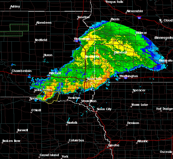 The severe thunderstorm warning for southeastern douglas and hutchinson counties will expire at 1130 pm cdt, the storms which prompted the warning have weakened below severe limits, and no longer pose an immediate threat to life or property. therefore the warning will be allowed to expire. however gusty winds are still possible with these thunderstorms, especially near parkston, tripp and olivet. a severe thunderstorm watch remains in effect until 100 am cdt for southeastern south dakota. The severe thunderstorm warning for southeastern douglas and hutchinson counties will expire at 1130 pm cdt, the storms which prompted the warning have weakened below severe limits, and no longer pose an immediate threat to life or property. therefore the warning will be allowed to expire. however gusty winds are still possible with these thunderstorms, especially near parkston, tripp and olivet. a severe thunderstorm watch remains in effect until 100 am cdt for southeastern south dakota.
|
| 7/25/2015 11:15 PM CDT |
 At 1115 pm cdt, severe thunderstorms were located along a line extending from near parkston to near delmont, moving southeast at 30 mph (radar indicated). Hazards include 70 mph wind gusts and penny size hail. Expect considerable tree damage. damage is likely to mobile homes, roofs and outbuildings. these severe storms will be near, tripp around 1125 pm cdt. kaylor and milltown around 1130 pm cdt. Other locations impacted by these severe thunderstorms include olivet. At 1115 pm cdt, severe thunderstorms were located along a line extending from near parkston to near delmont, moving southeast at 30 mph (radar indicated). Hazards include 70 mph wind gusts and penny size hail. Expect considerable tree damage. damage is likely to mobile homes, roofs and outbuildings. these severe storms will be near, tripp around 1125 pm cdt. kaylor and milltown around 1130 pm cdt. Other locations impacted by these severe thunderstorms include olivet.
|
| 7/25/2015 11:08 PM CDT |
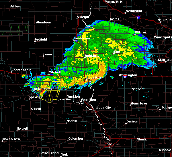 At 1108 pm cdt, severe thunderstorms were located along a line extending from near dimock to delmont, moving southeast at 30 mph (radar indicated). Hazards include 70 mph wind gusts and penny size hail. Expect considerable tree damage. damage is likely to mobile homes, roofs and outbuildings. these severe storms will be near, parkston around 1115 pm cdt. tripp around 1125 pm cdt. kaylor and milltown around 1130 pm cdt. Other locations impacted by these severe thunderstorms include olivet. At 1108 pm cdt, severe thunderstorms were located along a line extending from near dimock to delmont, moving southeast at 30 mph (radar indicated). Hazards include 70 mph wind gusts and penny size hail. Expect considerable tree damage. damage is likely to mobile homes, roofs and outbuildings. these severe storms will be near, parkston around 1115 pm cdt. tripp around 1125 pm cdt. kaylor and milltown around 1130 pm cdt. Other locations impacted by these severe thunderstorms include olivet.
|
| 7/25/2015 10:43 PM CDT |
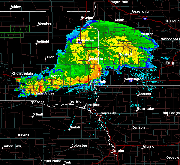 At 1043 pm cdt, severe thunderstorms were located along a line extending from 6 miles southeast of stickney to near armour, moving east at 45 mph (radar indicated). Hazards include 70 mph wind gusts and penny size hail. Expect considerable tree damage. damage is likely to mobile homes, roofs and outbuildings. severe thunderstorms will be near, delmont around 1100 pm cdt. dimock around 1105 pm cdt. parkston and tripp around 1110 pm cdt. kaylor and milltown around 1120 pm cdt. clayton around 1130 pm cdt. Other locations impacted by these severe thunderstorms include olivet. At 1043 pm cdt, severe thunderstorms were located along a line extending from 6 miles southeast of stickney to near armour, moving east at 45 mph (radar indicated). Hazards include 70 mph wind gusts and penny size hail. Expect considerable tree damage. damage is likely to mobile homes, roofs and outbuildings. severe thunderstorms will be near, delmont around 1100 pm cdt. dimock around 1105 pm cdt. parkston and tripp around 1110 pm cdt. kaylor and milltown around 1120 pm cdt. clayton around 1130 pm cdt. Other locations impacted by these severe thunderstorms include olivet.
|
| 6/27/2015 9:56 PM CDT |
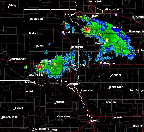 At 956 pm cdt, a severe thunderstorm was located near dimock, or near parkston, moving southeast at 35 mph (radar indicated). Hazards include 60 mph wind gusts and quarter size hail. Hail damage to vehicles is expected. expect wind damage to roofs, siding and trees. This severe storm will be near, parkston around 1005 pm cdt. At 956 pm cdt, a severe thunderstorm was located near dimock, or near parkston, moving southeast at 35 mph (radar indicated). Hazards include 60 mph wind gusts and quarter size hail. Hail damage to vehicles is expected. expect wind damage to roofs, siding and trees. This severe storm will be near, parkston around 1005 pm cdt.
|
| 6/27/2015 9:39 PM CDT |
 At 937 pm cdt, a severe thunderstorm was located 8 miles northwest of ethan, or 10 miles southwest of mitchell, moving southeast at 35 mph (trained weather spotters. at 929 pm cdt 60 mph winds and quarter size hail was reported 7 miles west southwest of mitchell). Hazards include 60 mph wind gusts and half dollar size hail. Hail damage to vehicles is expected. expect wind damage to roofs, siding and trees. this severe thunderstorm will be near, ethan around 950 pm cdt. dimock around 955 pm cdt. Parkston around 1005 pm cdt. At 937 pm cdt, a severe thunderstorm was located 8 miles northwest of ethan, or 10 miles southwest of mitchell, moving southeast at 35 mph (trained weather spotters. at 929 pm cdt 60 mph winds and quarter size hail was reported 7 miles west southwest of mitchell). Hazards include 60 mph wind gusts and half dollar size hail. Hail damage to vehicles is expected. expect wind damage to roofs, siding and trees. this severe thunderstorm will be near, ethan around 950 pm cdt. dimock around 955 pm cdt. Parkston around 1005 pm cdt.
|
| 6/20/2015 2:45 AM CDT |
 At 244 am cdt, severe thunderstorms were located along a line extending from near milltown to near tyndall to scottville, moving east at 65 mph (radar indicated). Hazards include 60 mph wind gusts. Expect damage to roofs. siding and trees. these severe storms will be near, milltown and clayton around 250 am cdt. tabor around 255 am cdt. Other locations impacted by these severe thunderstorms include olivet and lesterville. At 244 am cdt, severe thunderstorms were located along a line extending from near milltown to near tyndall to scottville, moving east at 65 mph (radar indicated). Hazards include 60 mph wind gusts. Expect damage to roofs. siding and trees. these severe storms will be near, milltown and clayton around 250 am cdt. tabor around 255 am cdt. Other locations impacted by these severe thunderstorms include olivet and lesterville.
|
| 6/20/2015 2:32 AM CDT |
 At 231 am cdt, severe thunderstorms were located along a line extending from near ethan to near avon to near anncar, moving east at 65 mph (radar indicated). Hazards include 70 mph wind gusts. Expect considerable tree damage. damage is likely to mobile homes, roofs and outbuildings. these severe storms will be near, parkston, avon and dimock around 235 am cdt. tyndall and milltown around 245 am cdt. clayton around 250 am cdt. tabor around 255 am cdt. Other locations impacted by these severe thunderstorms include olivet and lesterville. At 231 am cdt, severe thunderstorms were located along a line extending from near ethan to near avon to near anncar, moving east at 65 mph (radar indicated). Hazards include 70 mph wind gusts. Expect considerable tree damage. damage is likely to mobile homes, roofs and outbuildings. these severe storms will be near, parkston, avon and dimock around 235 am cdt. tyndall and milltown around 245 am cdt. clayton around 250 am cdt. tabor around 255 am cdt. Other locations impacted by these severe thunderstorms include olivet and lesterville.
|
| 6/20/2015 2:17 AM CDT |
 At 216 am cdt, severe thunderstorms were located along a line extending from near stickney to near ravinia to near dustin, moving east at 65 mph (radar indicated). Hazards include 70 mph wind gusts. Expect considerable tree damage. damage is likely to mobile homes, roofs and outbuildings. severe thunderstorms will be near, wagner and ravinia around 220 am cdt. dante around 225 am cdt. parkston, avon and dimock around 235 am cdt. tyndall around 240 am cdt. milltown around 245 am cdt. tabor and clayton around 250 am cdt. Other locations impacted by these severe thunderstorms include olivet and lesterville. At 216 am cdt, severe thunderstorms were located along a line extending from near stickney to near ravinia to near dustin, moving east at 65 mph (radar indicated). Hazards include 70 mph wind gusts. Expect considerable tree damage. damage is likely to mobile homes, roofs and outbuildings. severe thunderstorms will be near, wagner and ravinia around 220 am cdt. dante around 225 am cdt. parkston, avon and dimock around 235 am cdt. tyndall around 240 am cdt. milltown around 245 am cdt. tabor and clayton around 250 am cdt. Other locations impacted by these severe thunderstorms include olivet and lesterville.
|
| 5/10/2015 11:51 AM CDT | At 1149 am cdt, severe thunderstorms capable of producing tornadoes were located along a line extending from near loomis to near mitchell, moving north at 35 mph (radar indicated rotation. national weather service doppler radar has shown the circluation jussouth of mitchell has stregnthened. if you are in the path of this storm, seek shelter now!! there are additional storms capable of producing tornadoes, one a few miles west of mitchell, and a thirs to the south a few miles north of ethan). Hazards include tornado and half dollar size hail. Flying debris will be dangerous to those caught without shelter. mobile homes will be damaged or destroyed. damage to roofs, windows and vehicles will occur. tree damage is likely. these dangerous storms will be near, loomis around 1155 am cdt. Radar indicated. |
| 5/10/2015 11:38 AM CDT | At 1136 am cdt, two tornado producing storms were located in davison county. the first is 8 miles south of mitchell. the second is near ethan, moving northeast at 30 mph (weather spotters confirmed tornado with the first tornadic circulation). Hazards include damaging tornado and half dollar size hail. Flying debris will be dangerous to those caught without shelter. mobile homes will be damaged or destroyed. damage to roofs, windows and vehicles will occur. tree damage is likely. these tornadic storms will be near, mitchell and loomis around 1200 pm cdt. Observed. |
| 5/10/2015 11:29 AM CDT | At 1129 am cdt, a confirmed tornado was located near ethan, or 9 miles south of mitchell, moving north at 30 mph (weather spotters confirmed tornado 4 miles west of ethan at 1123 am). Hazards include damaging tornado and half dollar size hail. Flying debris will be dangerous to those caught without shelter. mobile homes will be damaged or destroyed. damage to roofs, windows and vehicles will occur. tree damage is likely. this tornado will be near, mitchell and loomis around 1155 am cdt. Observed. |
| 5/10/2015 11:23 AM CDT | At 1123 am cdt, a severe thunderstorm capable of producing a tornado was located near ethan, or 12 miles south of mitchell, moving north at 30 mph (radar indicated rotation). Hazards include tornado and half dollar size hail. Flying debris will be dangerous to those caught without shelter. mobile homes will be damaged or destroyed. damage to roofs, windows and vehicles will occur. tree damage is likely. this dangerous storm will be near, mitchell and loomis around 1155 am cdt. Radar indicated. |
| 8/10/2013 7:12 PM CDT | Ping Pong Ball sized hail reported 2.6 miles NW of Dimock, SD, hail completely covered the ground and damaged siding of house. |
| 5/4/2012 3:30 PM CDT | Quarter sized hail reported 2.5 miles N of Dimock, SD, quarter size hail observed while traveling to parkston. |
Hail Maps for Dimock, SD


Connect with Interactive Hail Maps