

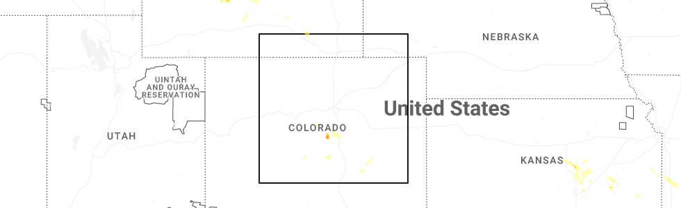
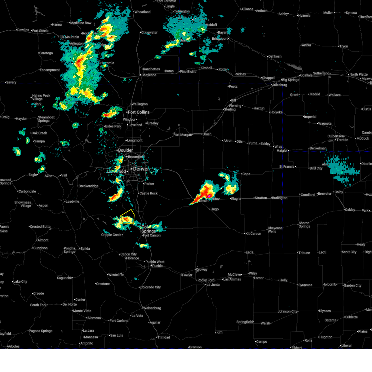
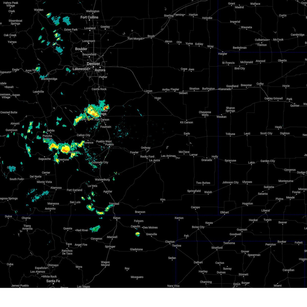
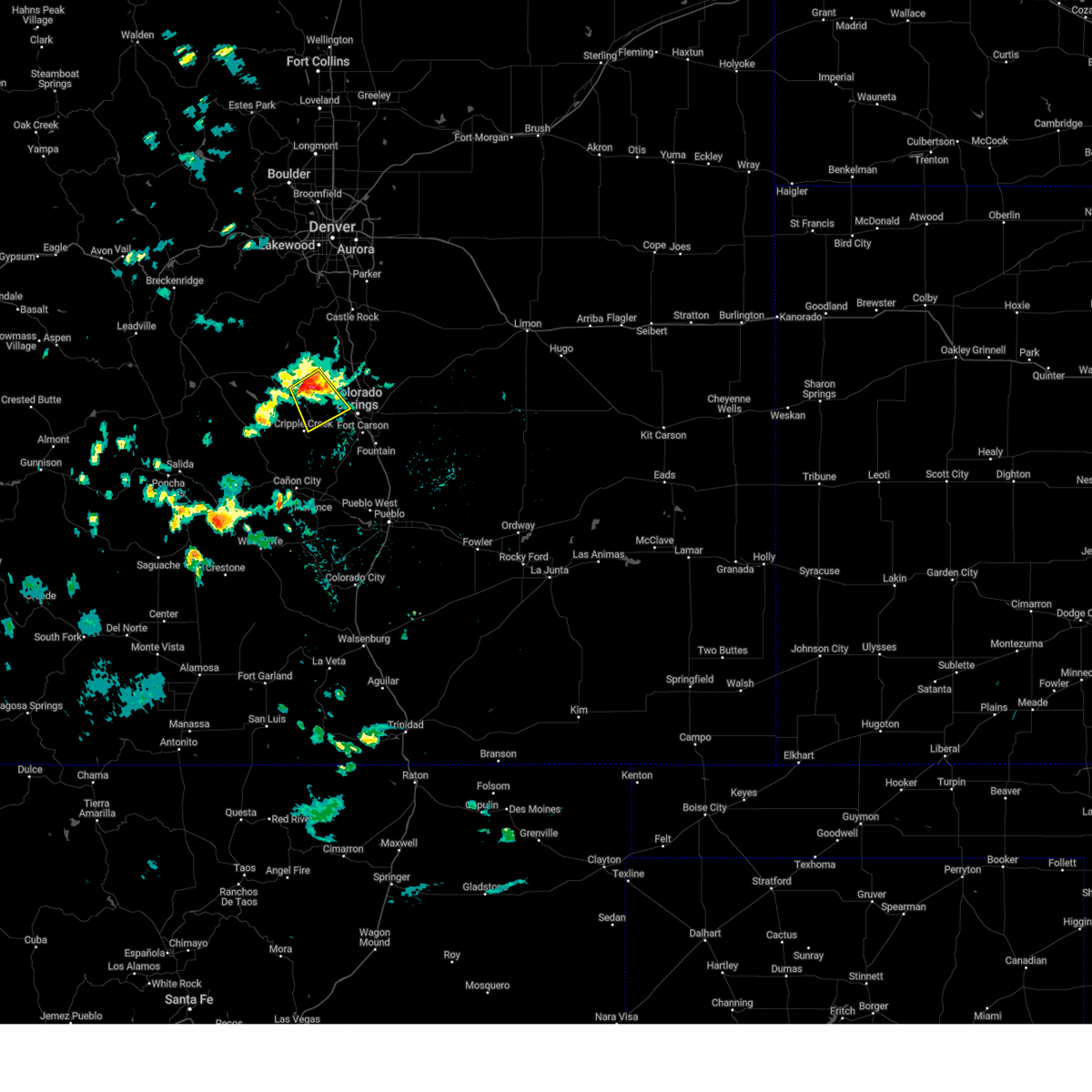
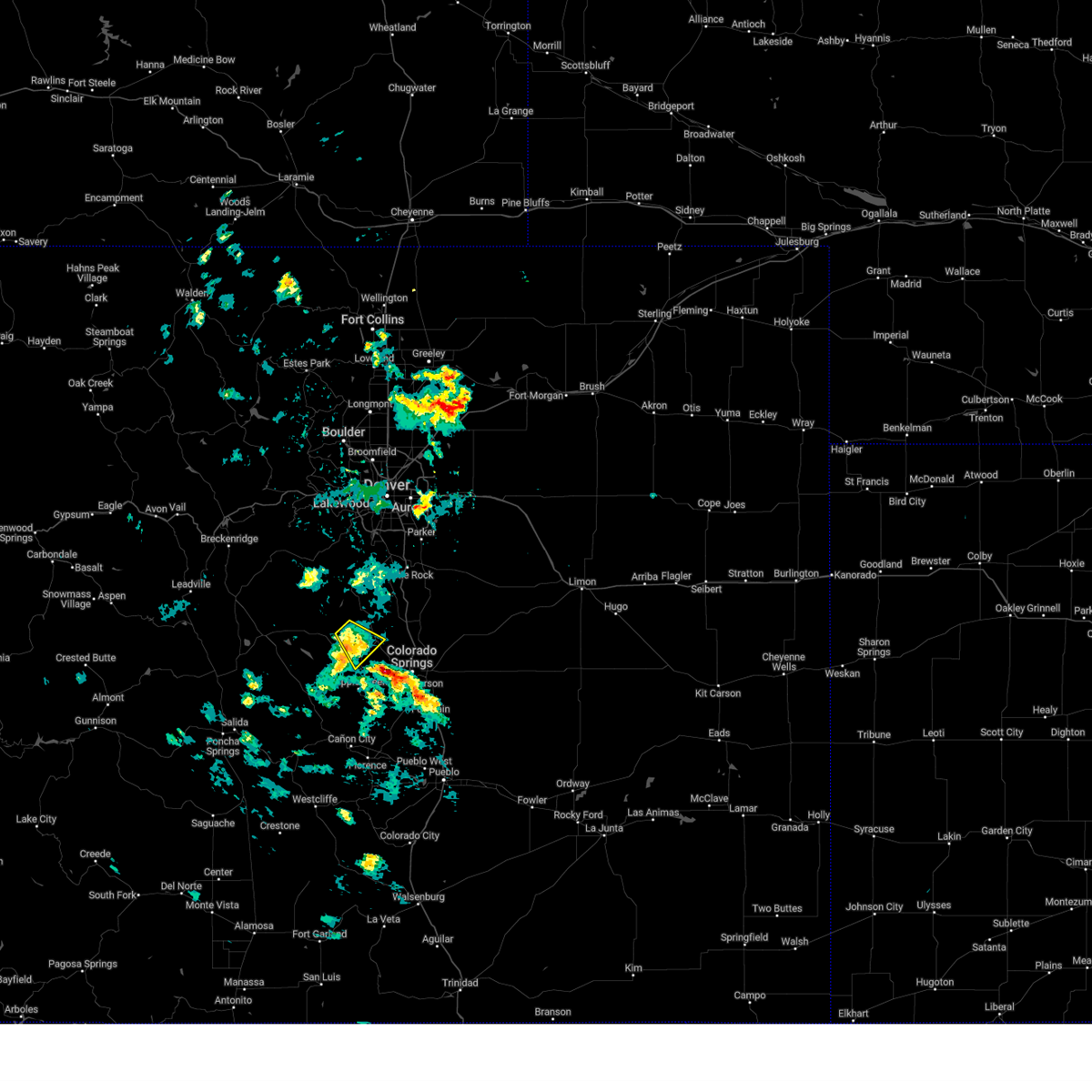
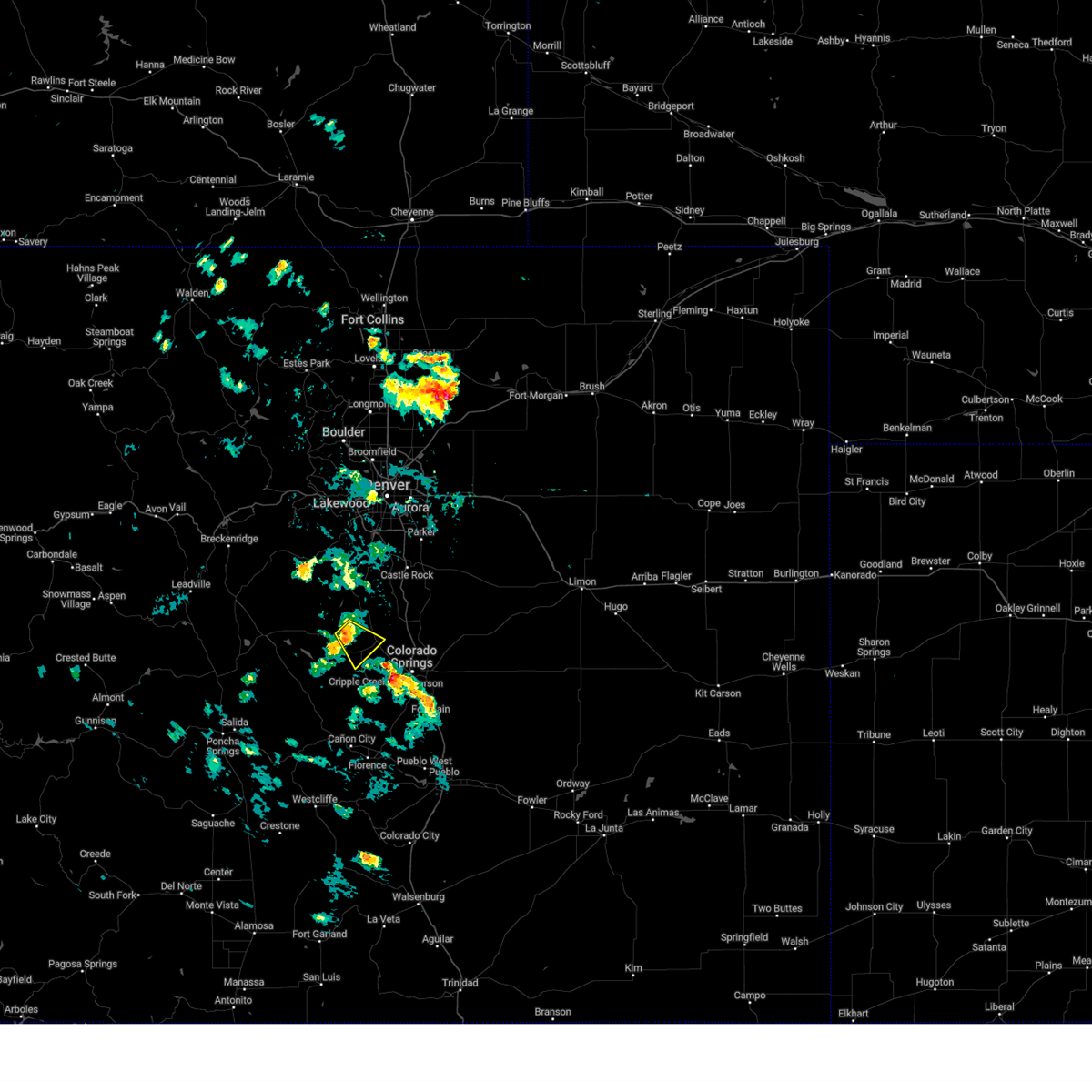
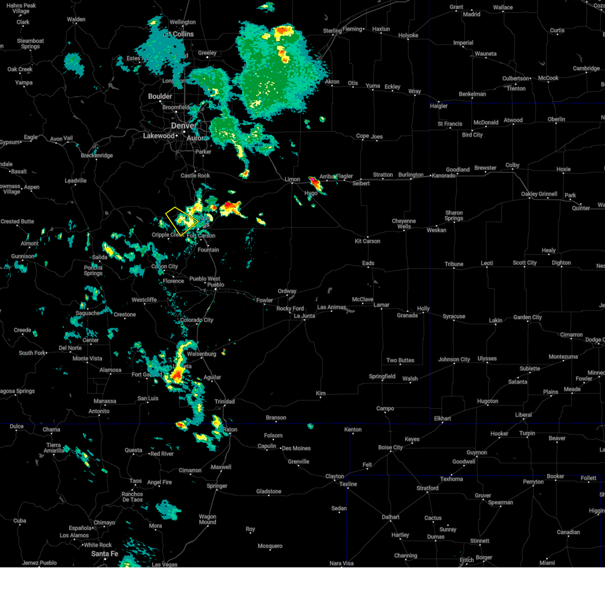
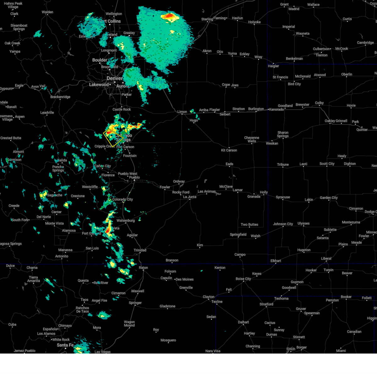
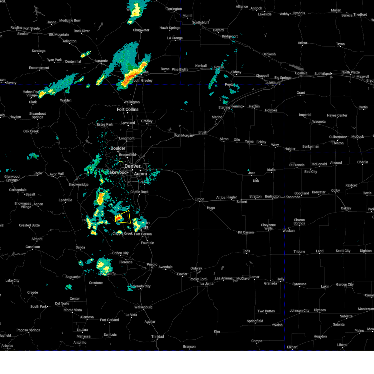
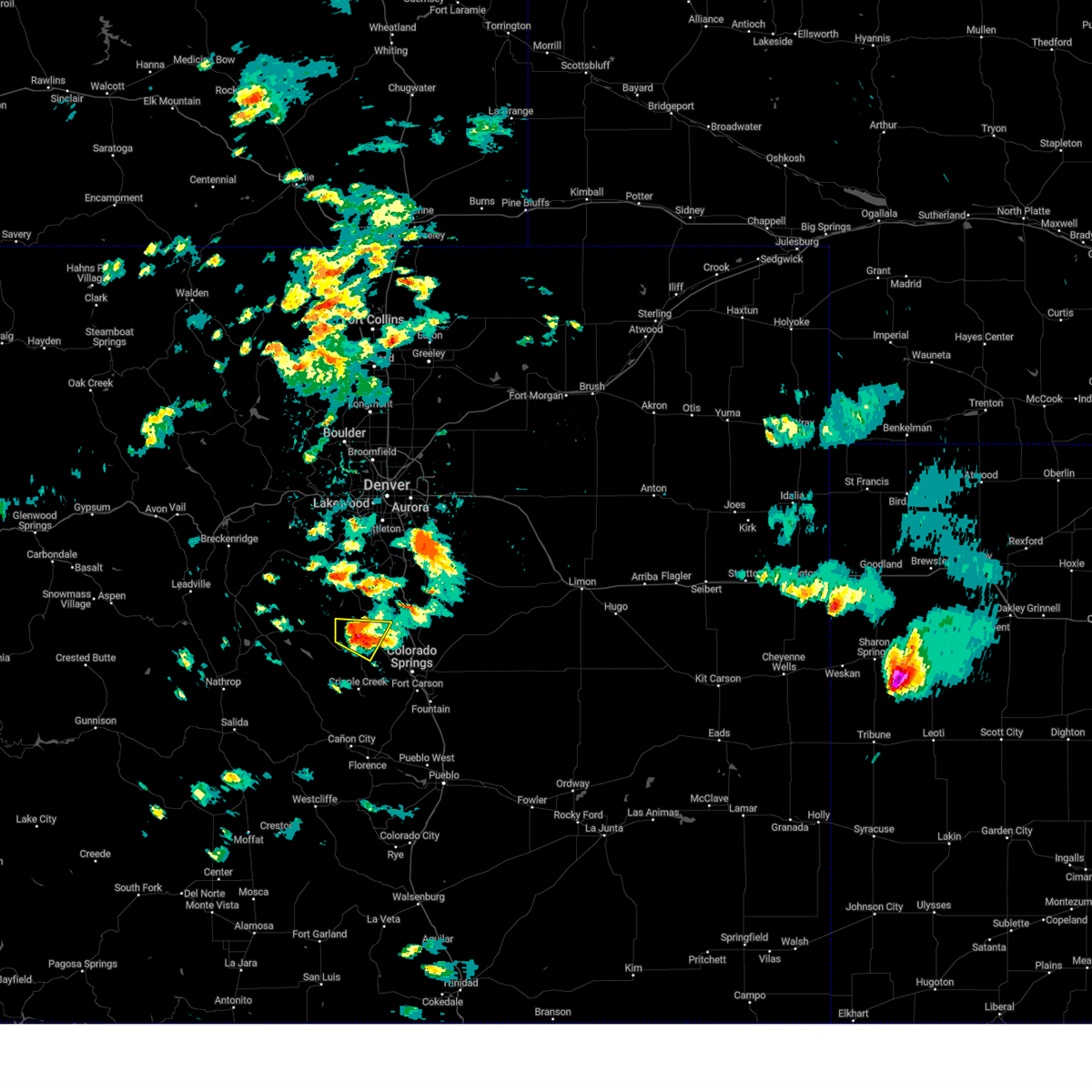
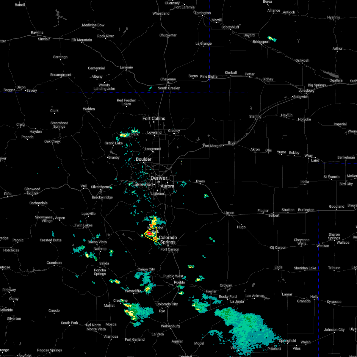
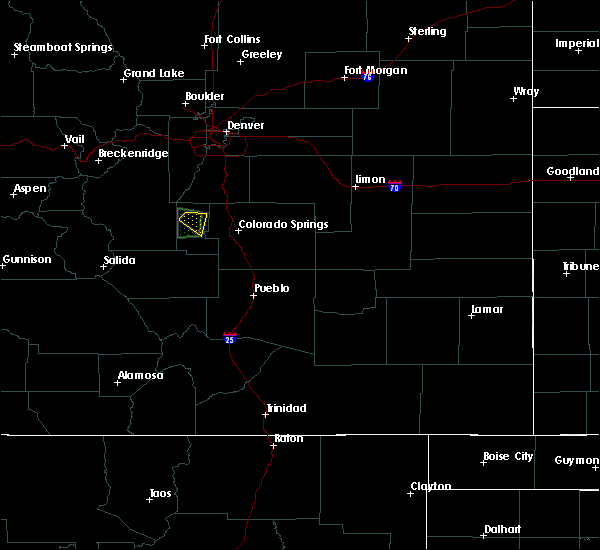
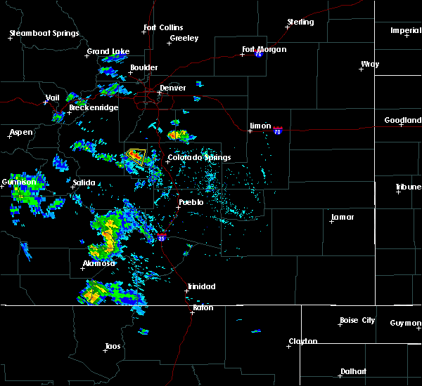
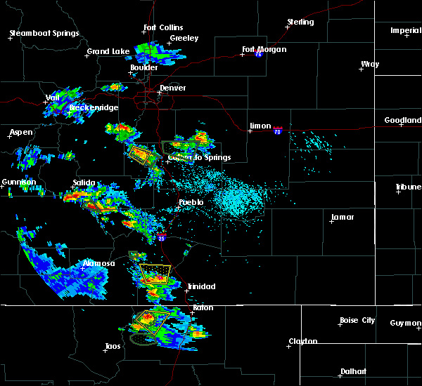
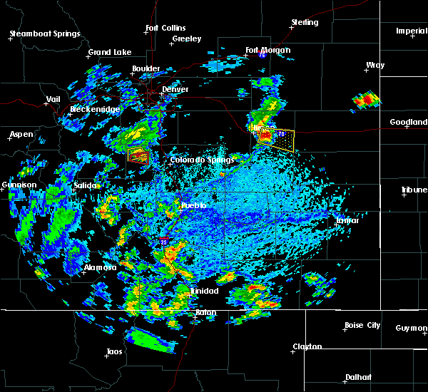
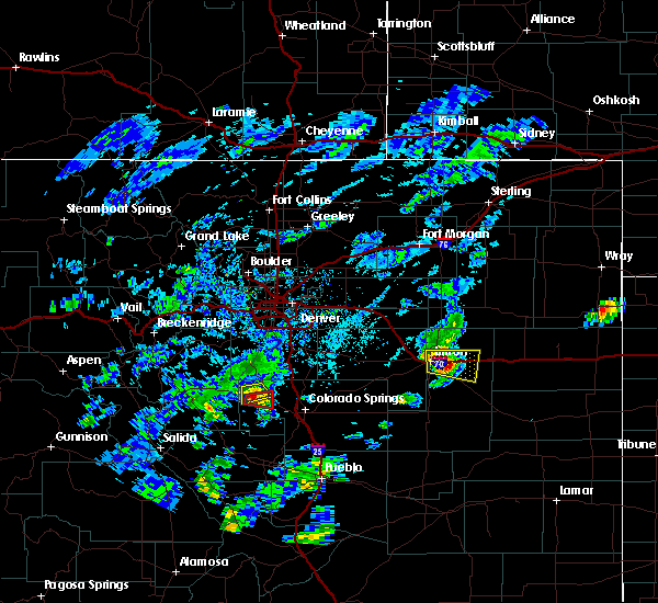
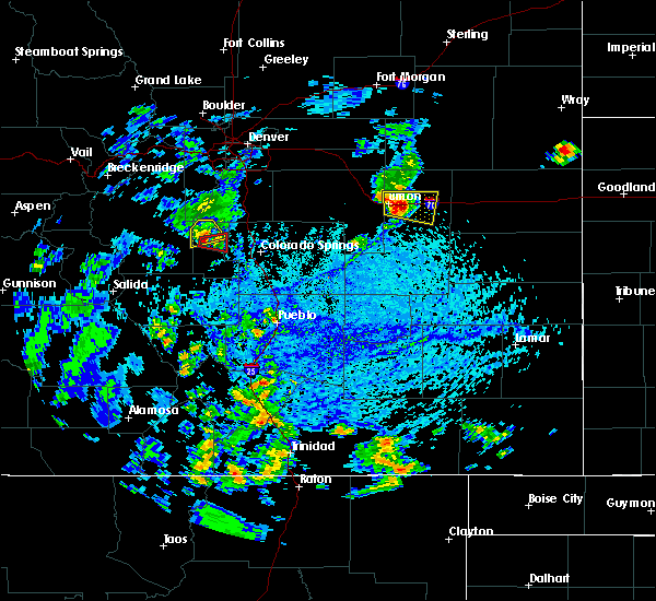
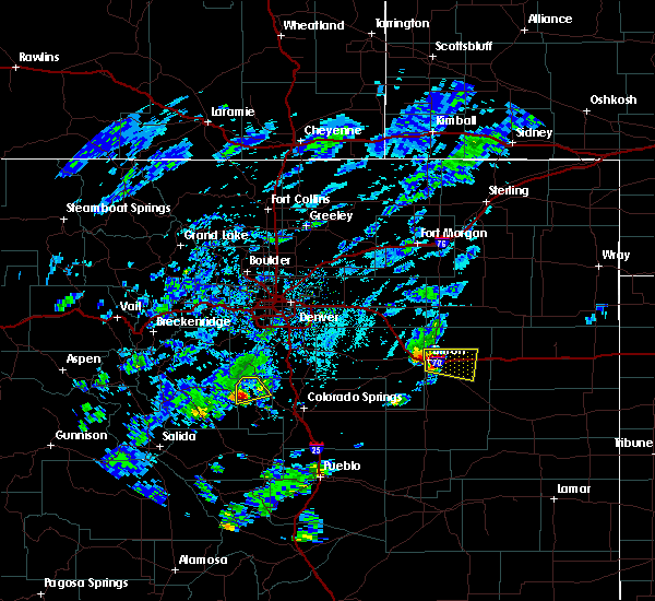
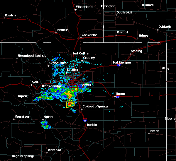
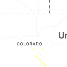
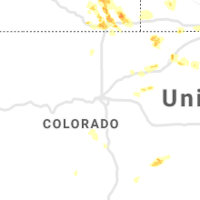
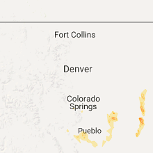
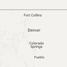
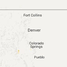
Hail Map for Divide, CO
The Divide, CO area has had 7 reports of on-the-ground hail by trained spotters, and has been under severe weather warnings 3 times during the past 12 months. Doppler radar has detected hail at or near Divide, CO on 46 occasions, including 1 occasion during the past year.
| Name: | Divide, CO |
| Where Located: | 55.5 miles S of Denver, CO |
| Map: | Google Map for Divide, CO |
| Population: | 127 |
| Housing Units: | 56 |
| More Info: | Search Google for Divide, CO |
0
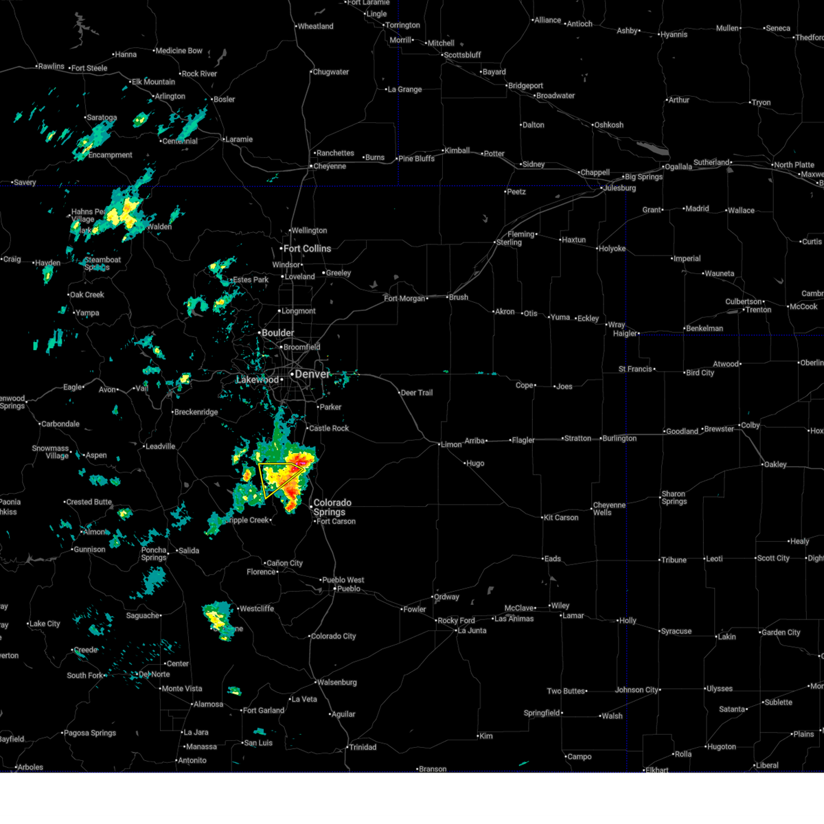
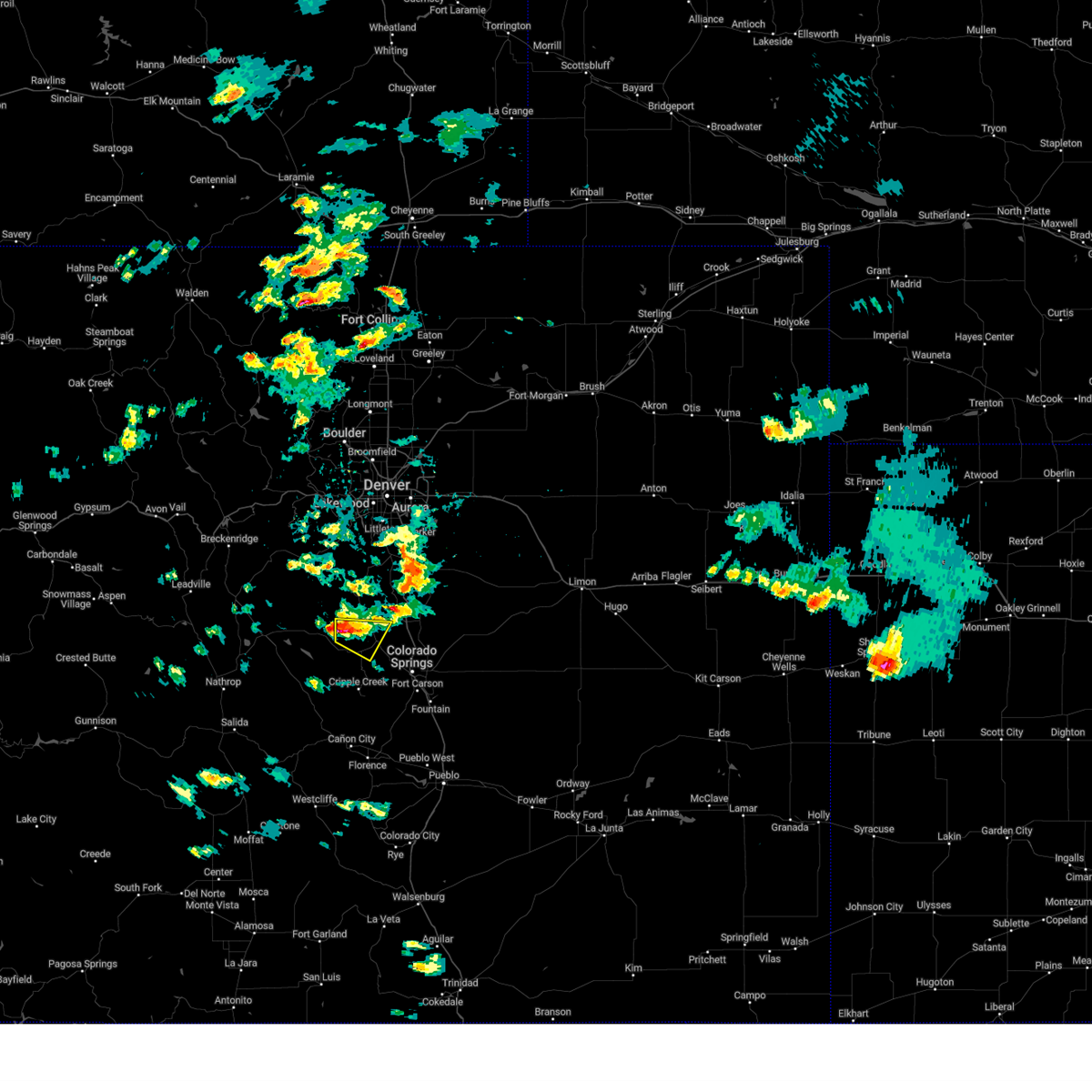
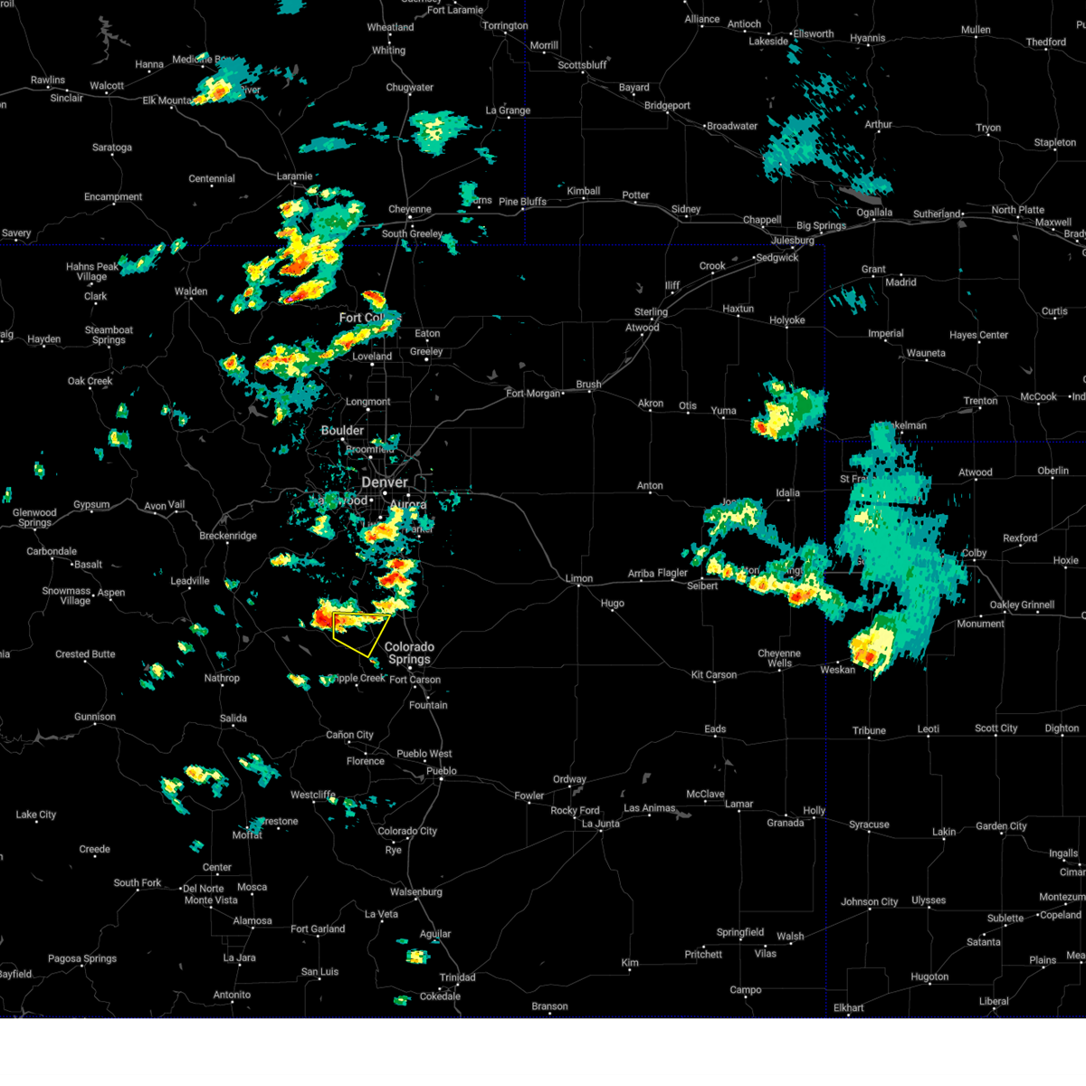
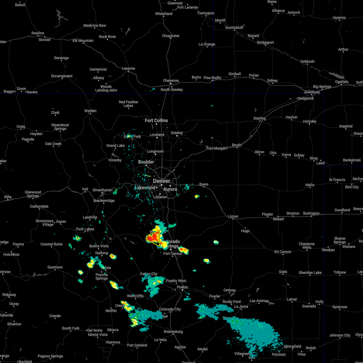
The Top Recent Hail Date for Divide, CO is Wednesday, July 30, 2025 (17th out of 46)
Hail and Wind Damage Spotted near Divide, CO
| Date / Time | Report Details |
|---|---|
| 7/30/2025 2:30 PM MDT |
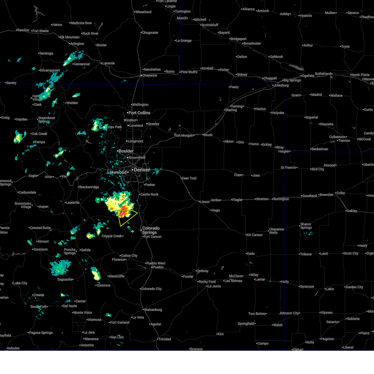
 The storm which prompted the warning has weakened below severe limits, and has exited the warned area. therefore, the warning has been allowed to expire. however, small hail and heavy rain are still possible with this thunderstorm. The storm which prompted the warning has weakened below severe limits, and has exited the warned area. therefore, the warning has been allowed to expire. however, small hail and heavy rain are still possible with this thunderstorm.
|
| 7/30/2025 2:00 PM MDT |
 At 200 pm mdt, a severe thunderstorm was located near westcreek, or 24 miles northwest of colorado springs, moving southeast at 15 mph (radar indicated). Hazards include ping pong ball size hail and 60 mph wind gusts. People and animals outdoors will be injured. expect hail damage to roofs, siding, windows, and vehicles. expect wind damage to roofs, siding, and trees. Locations impacted include, woodland park and divide. At 200 pm mdt, a severe thunderstorm was located near westcreek, or 24 miles northwest of colorado springs, moving southeast at 15 mph (radar indicated). Hazards include ping pong ball size hail and 60 mph wind gusts. People and animals outdoors will be injured. expect hail damage to roofs, siding, windows, and vehicles. expect wind damage to roofs, siding, and trees. Locations impacted include, woodland park and divide.
|
| 7/30/2025 1:54 PM MDT |
 Svrpub the national weather service in pueblo has issued a * severe thunderstorm warning for, northern teller county in central colorado, northwestern el paso county in east central colorado, * until 230 pm mdt. * at 154 pm mdt, a severe thunderstorm was located near westcreek, or 25 miles northwest of colorado springs, moving southeast at 10 mph (radar indicated). Hazards include 60 mph wind gusts and quarter size hail. Hail damage to vehicles is expected. Expect wind damage to roofs, siding, and trees. Svrpub the national weather service in pueblo has issued a * severe thunderstorm warning for, northern teller county in central colorado, northwestern el paso county in east central colorado, * until 230 pm mdt. * at 154 pm mdt, a severe thunderstorm was located near westcreek, or 25 miles northwest of colorado springs, moving southeast at 10 mph (radar indicated). Hazards include 60 mph wind gusts and quarter size hail. Hail damage to vehicles is expected. Expect wind damage to roofs, siding, and trees.
|
| 6/17/2025 12:45 PM MDT |
 Torpub the national weather service in pueblo has issued a * tornado warning for, northeastern teller county in central colorado, west central el paso county in east central colorado, * until 115 pm mdt. * at 1245 pm mdt, a severe thunderstorm capable of producing a tornado was located near woodland park, or 19 miles northwest of colorado springs, moving east at 15 mph (radar indicated rotation). Hazards include tornado and quarter size hail. Flying debris will be dangerous to those caught without shelter. mobile homes will be damaged or destroyed. damage to roofs, windows, and vehicles will occur. tree damage is likely. this dangerous storm will be near, woodland park around 1250 pm mdt. Green mountain falls and crystola around 1255 pm mdt. Torpub the national weather service in pueblo has issued a * tornado warning for, northeastern teller county in central colorado, west central el paso county in east central colorado, * until 115 pm mdt. * at 1245 pm mdt, a severe thunderstorm capable of producing a tornado was located near woodland park, or 19 miles northwest of colorado springs, moving east at 15 mph (radar indicated rotation). Hazards include tornado and quarter size hail. Flying debris will be dangerous to those caught without shelter. mobile homes will be damaged or destroyed. damage to roofs, windows, and vehicles will occur. tree damage is likely. this dangerous storm will be near, woodland park around 1250 pm mdt. Green mountain falls and crystola around 1255 pm mdt.
|
| 6/17/2025 11:30 AM MDT |
 Svrpub the national weather service in pueblo has issued a * severe thunderstorm warning for, northeastern teller county in central colorado, northwestern el paso county in east central colorado, * until 1215 pm mdt. * at 1130 am mdt, a severe thunderstorm was located over woodland park, or 18 miles northwest of colorado springs, moving east at 15 mph (radar indicated). Hazards include 60 mph wind gusts and quarter size hail. Hail damage to vehicles is expected. Expect wind damage to roofs, siding, and trees. Svrpub the national weather service in pueblo has issued a * severe thunderstorm warning for, northeastern teller county in central colorado, northwestern el paso county in east central colorado, * until 1215 pm mdt. * at 1130 am mdt, a severe thunderstorm was located over woodland park, or 18 miles northwest of colorado springs, moving east at 15 mph (radar indicated). Hazards include 60 mph wind gusts and quarter size hail. Hail damage to vehicles is expected. Expect wind damage to roofs, siding, and trees.
|
| 5/31/2025 5:34 PM MDT |
 the severe thunderstorm warning has been cancelled and is no longer in effect the severe thunderstorm warning has been cancelled and is no longer in effect
|
| 5/31/2025 5:28 PM MDT |
 At 527 pm mdt, a severe thunderstorm was located near divide, or 15 miles west of colorado springs, moving southeast at 20 mph (radar indicated). Hazards include 60 mph wind gusts and quarter size hail. Hail damage to vehicles is expected. expect wind damage to roofs, siding, and trees. Locations impacted include, pikes peak, manitou springs, crystola, chipita park, green mountain falls, and cascade. At 527 pm mdt, a severe thunderstorm was located near divide, or 15 miles west of colorado springs, moving southeast at 20 mph (radar indicated). Hazards include 60 mph wind gusts and quarter size hail. Hail damage to vehicles is expected. expect wind damage to roofs, siding, and trees. Locations impacted include, pikes peak, manitou springs, crystola, chipita park, green mountain falls, and cascade.
|
| 5/31/2025 5:13 PM MDT |
 Svrpub the national weather service in pueblo has issued a * severe thunderstorm warning for, central teller county in central colorado, west central el paso county in east central colorado, * until 600 pm mdt. * at 513 pm mdt, a severe thunderstorm was located over divide, or 18 miles northwest of colorado springs, moving southeast at 20 mph (radar indicated). Hazards include 60 mph wind gusts and quarter size hail. Hail damage to vehicles is expected. Expect wind damage to roofs, siding, and trees. Svrpub the national weather service in pueblo has issued a * severe thunderstorm warning for, central teller county in central colorado, west central el paso county in east central colorado, * until 600 pm mdt. * at 513 pm mdt, a severe thunderstorm was located over divide, or 18 miles northwest of colorado springs, moving southeast at 20 mph (radar indicated). Hazards include 60 mph wind gusts and quarter size hail. Hail damage to vehicles is expected. Expect wind damage to roofs, siding, and trees.
|
| 5/30/2025 5:32 PM MDT |
 the severe thunderstorm warning has been cancelled and is no longer in effect the severe thunderstorm warning has been cancelled and is no longer in effect
|
| 5/30/2025 5:20 PM MDT |
 Svrpub the national weather service in pueblo has issued a * severe thunderstorm warning for, northern teller county in central colorado, western el paso county in east central colorado, * until 545 pm mdt. * at 520 pm mdt, a severe thunderstorm was located near divide, or 24 miles northwest of colorado springs, moving southeast at 25 mph (radar indicated). Hazards include 60 mph wind gusts and half dollar size hail. Hail damage to vehicles is expected. Expect wind damage to roofs, siding, and trees. Svrpub the national weather service in pueblo has issued a * severe thunderstorm warning for, northern teller county in central colorado, western el paso county in east central colorado, * until 545 pm mdt. * at 520 pm mdt, a severe thunderstorm was located near divide, or 24 miles northwest of colorado springs, moving southeast at 25 mph (radar indicated). Hazards include 60 mph wind gusts and half dollar size hail. Hail damage to vehicles is expected. Expect wind damage to roofs, siding, and trees.
|
| 5/27/2025 4:51 PM MDT |
 the severe thunderstorm warning has been cancelled and is no longer in effect the severe thunderstorm warning has been cancelled and is no longer in effect
|
| 5/27/2025 4:31 PM MDT |
 Svrpub the national weather service in pueblo has issued a * severe thunderstorm warning for, central teller county in central colorado, west central el paso county in east central colorado, * until 500 pm mdt. * at 430 pm mdt, a severe thunderstorm was located near divide, or 17 miles northwest of colorado springs, moving southeast at 20 mph (radar indicated). Hazards include 60 mph wind gusts and quarter size hail. Hail damage to vehicles is expected. Expect wind damage to roofs, siding, and trees. Svrpub the national weather service in pueblo has issued a * severe thunderstorm warning for, central teller county in central colorado, west central el paso county in east central colorado, * until 500 pm mdt. * at 430 pm mdt, a severe thunderstorm was located near divide, or 17 miles northwest of colorado springs, moving southeast at 20 mph (radar indicated). Hazards include 60 mph wind gusts and quarter size hail. Hail damage to vehicles is expected. Expect wind damage to roofs, siding, and trees.
|
| 9/4/2024 2:46 PM MDT |
 Svrpub the national weather service in pueblo has issued a * severe thunderstorm warning for, northern teller county in central colorado, * until 315 pm mdt. * at 246 pm mdt, a severe thunderstorm was located near florissant, or 26 miles northwest of colorado springs, moving east at 15 mph (radar indicated). Hazards include 60 mph wind gusts and penny size hail. expect damage to roofs, siding, and trees Svrpub the national weather service in pueblo has issued a * severe thunderstorm warning for, northern teller county in central colorado, * until 315 pm mdt. * at 246 pm mdt, a severe thunderstorm was located near florissant, or 26 miles northwest of colorado springs, moving east at 15 mph (radar indicated). Hazards include 60 mph wind gusts and penny size hail. expect damage to roofs, siding, and trees
|
| 8/5/2023 2:56 PM MDT |
 The severe thunderstorm warning for east central teller and west central el paso counties will expire at 300 pm mdt, the storm which prompted the warning has weakened below severe limits, and no longer poses an immediate threat to life or property. therefore, the warning will be allowed to expire. however small hail, gusty winds and heavy rain are still possible with this thunderstorm. a severe thunderstorm watch remains in effect until 1000 pm mdt for central and east central colorado. The severe thunderstorm warning for east central teller and west central el paso counties will expire at 300 pm mdt, the storm which prompted the warning has weakened below severe limits, and no longer poses an immediate threat to life or property. therefore, the warning will be allowed to expire. however small hail, gusty winds and heavy rain are still possible with this thunderstorm. a severe thunderstorm watch remains in effect until 1000 pm mdt for central and east central colorado.
|
| 8/5/2023 2:30 PM MDT |
 At 230 pm mdt, a severe thunderstorm was located over crystola, or 14 miles northwest of colorado springs, moving southeast at 15 mph (radar indicated). Hazards include 60 mph wind gusts and half dollar size hail. Hail damage to vehicles is expected. expect wind damage to roofs, siding, and trees. this severe thunderstorm will be near, green mountain falls and crystola around 235 pm mdt. pikes peak around 245 pm mdt. cascade and chipita park around 250 pm mdt. Other locations in the path of this severe thunderstorm include manitou springs. At 230 pm mdt, a severe thunderstorm was located over crystola, or 14 miles northwest of colorado springs, moving southeast at 15 mph (radar indicated). Hazards include 60 mph wind gusts and half dollar size hail. Hail damage to vehicles is expected. expect wind damage to roofs, siding, and trees. this severe thunderstorm will be near, green mountain falls and crystola around 235 pm mdt. pikes peak around 245 pm mdt. cascade and chipita park around 250 pm mdt. Other locations in the path of this severe thunderstorm include manitou springs.
|
| 7/20/2023 1:54 PM MDT |
 At 154 pm mdt, a severe thunderstorm was located over chipita park, or 11 miles northwest of colorado springs, moving southeast at 35 mph (radar indicated). Hazards include 60 mph wind gusts and quarter size hail. Hail damage to vehicles is expected. expect wind damage to roofs, siding, and trees. Locations impacted include, colorado springs, woodland park, air force academy, manitou springs, green mountain falls, divide, pikes peak, crystola, chipita park, cascade and cimarron hills. At 154 pm mdt, a severe thunderstorm was located over chipita park, or 11 miles northwest of colorado springs, moving southeast at 35 mph (radar indicated). Hazards include 60 mph wind gusts and quarter size hail. Hail damage to vehicles is expected. expect wind damage to roofs, siding, and trees. Locations impacted include, colorado springs, woodland park, air force academy, manitou springs, green mountain falls, divide, pikes peak, crystola, chipita park, cascade and cimarron hills.
|
| 7/20/2023 1:48 PM MDT | Quarter sized hail reported 0.4 miles N of Divide, CO |
| 7/20/2023 1:47 PM MDT |
 At 147 pm mdt, a severe thunderstorm was located over green mountain falls, or 14 miles northwest of colorado springs, moving southeast at 35 mph (radar indicated). Hazards include 60 mph wind gusts and quarter size hail. Hail damage to vehicles is expected. Expect wind damage to roofs, siding, and trees. At 147 pm mdt, a severe thunderstorm was located over green mountain falls, or 14 miles northwest of colorado springs, moving southeast at 35 mph (radar indicated). Hazards include 60 mph wind gusts and quarter size hail. Hail damage to vehicles is expected. Expect wind damage to roofs, siding, and trees.
|
| 7/20/2023 1:43 PM MDT |
 The severe thunderstorm warning for northern teller and northwestern el paso counties will expire at 145 pm mdt, the storm which prompted the warning has moved out of the area. therefore, the warning will be allowed to expire. however small hail and gusty winds are still possible with this thunderstorm. a severe thunderstorm watch remains in effect until 900 pm mdt for central and east central colorado. The severe thunderstorm warning for northern teller and northwestern el paso counties will expire at 145 pm mdt, the storm which prompted the warning has moved out of the area. therefore, the warning will be allowed to expire. however small hail and gusty winds are still possible with this thunderstorm. a severe thunderstorm watch remains in effect until 900 pm mdt for central and east central colorado.
|
| 7/20/2023 1:25 PM MDT |
 At 125 pm mdt, a severe thunderstorm was located 7 miles south of westcreek, or 23 miles northwest of colorado springs, moving east at 30 mph (radar indicated). Hazards include 60 mph wind gusts and half dollar size hail. Hail damage to vehicles is expected. expect wind damage to roofs, siding, and trees. Locations impacted include, woodland park and divide. At 125 pm mdt, a severe thunderstorm was located 7 miles south of westcreek, or 23 miles northwest of colorado springs, moving east at 30 mph (radar indicated). Hazards include 60 mph wind gusts and half dollar size hail. Hail damage to vehicles is expected. expect wind damage to roofs, siding, and trees. Locations impacted include, woodland park and divide.
|
| 7/20/2023 1:12 PM MDT |
 At 111 pm mdt, a severe thunderstorm was located 7 miles northeast of lake george, or 30 miles northwest of colorado springs, moving east at 30 mph (radar indicated). Hazards include 60 mph wind gusts and quarter size hail. Hail damage to vehicles is expected. Expect wind damage to roofs, siding, and trees. At 111 pm mdt, a severe thunderstorm was located 7 miles northeast of lake george, or 30 miles northwest of colorado springs, moving east at 30 mph (radar indicated). Hazards include 60 mph wind gusts and quarter size hail. Hail damage to vehicles is expected. Expect wind damage to roofs, siding, and trees.
|
| 7/4/2023 4:08 PM MDT |
 At 408 pm mdt, a severe thunderstorm was located over green mountain falls, or 14 miles northwest of colorado springs, moving east at 20 mph (radar indicated). Hazards include ping pong ball size hail. People and animals outdoors will be injured. Expect damage to roofs, siding, windows, and vehicles. At 408 pm mdt, a severe thunderstorm was located over green mountain falls, or 14 miles northwest of colorado springs, moving east at 20 mph (radar indicated). Hazards include ping pong ball size hail. People and animals outdoors will be injured. Expect damage to roofs, siding, windows, and vehicles.
|
| 5/10/2023 3:20 PM MDT | Quarter sized hail reported 7.4 miles N of Divide, CO, hail reported in mueller state park... posted in a picture on twitter. |
| 5/10/2023 3:19 PM MDT |
 At 319 pm mdt, a severe thunderstorm capable of producing a tornado was located over divide, or 17 miles west of colorado springs, moving north at 25 mph (radar indicated rotation). Hazards include tornado and quarter size hail. Flying debris will be dangerous to those caught without shelter. mobile homes will be damaged or destroyed. damage to roofs, windows, and vehicles will occur. tree damage is likely. Locations impacted include, green mountain falls and divide. At 319 pm mdt, a severe thunderstorm capable of producing a tornado was located over divide, or 17 miles west of colorado springs, moving north at 25 mph (radar indicated rotation). Hazards include tornado and quarter size hail. Flying debris will be dangerous to those caught without shelter. mobile homes will be damaged or destroyed. damage to roofs, windows, and vehicles will occur. tree damage is likely. Locations impacted include, green mountain falls and divide.
|
| 5/10/2023 3:10 PM MDT |
 At 310 pm mdt, a severe thunderstorm capable of producing a tornado was located near divide, or 17 miles west of colorado springs, moving northeast at 15 mph (radar indicated rotation). Hazards include tornado and quarter size hail. Flying debris will be dangerous to those caught without shelter. mobile homes will be damaged or destroyed. damage to roofs, windows, and vehicles will occur. Tree damage is likely. At 310 pm mdt, a severe thunderstorm capable of producing a tornado was located near divide, or 17 miles west of colorado springs, moving northeast at 15 mph (radar indicated rotation). Hazards include tornado and quarter size hail. Flying debris will be dangerous to those caught without shelter. mobile homes will be damaged or destroyed. damage to roofs, windows, and vehicles will occur. Tree damage is likely.
|
| 8/4/2022 6:34 PM MDT |
 At 634 pm mdt, severe thunderstorms were located along a line extending from near divide to near woodland park, and are nearly stationary (radar indicated). Hazards include 60 mph wind gusts and quarter size hail. Hail damage to vehicles is expected. expect wind damage to roofs, siding, and trees. locations impacted include, woodland park and divide. hail threat, radar indicated max hail size, 1. 00 in wind threat, radar indicated max wind gust, 60 mph. At 634 pm mdt, severe thunderstorms were located along a line extending from near divide to near woodland park, and are nearly stationary (radar indicated). Hazards include 60 mph wind gusts and quarter size hail. Hail damage to vehicles is expected. expect wind damage to roofs, siding, and trees. locations impacted include, woodland park and divide. hail threat, radar indicated max hail size, 1. 00 in wind threat, radar indicated max wind gust, 60 mph.
|
| 8/4/2022 6:17 PM MDT |
 At 617 pm mdt, a severe thunderstorm was located near divide, or 22 miles northwest of colorado springs, and is nearly stationary (radar indicated). Hazards include 60 mph wind gusts and quarter size hail. Hail damage to vehicles is expected. expect wind damage to roofs, siding, and trees. locations impacted include, woodland park, green mountain falls and divide. hail threat, radar indicated max hail size, 1. 00 in wind threat, radar indicated max wind gust, 60 mph. At 617 pm mdt, a severe thunderstorm was located near divide, or 22 miles northwest of colorado springs, and is nearly stationary (radar indicated). Hazards include 60 mph wind gusts and quarter size hail. Hail damage to vehicles is expected. expect wind damage to roofs, siding, and trees. locations impacted include, woodland park, green mountain falls and divide. hail threat, radar indicated max hail size, 1. 00 in wind threat, radar indicated max wind gust, 60 mph.
|
| 8/4/2022 5:52 PM MDT |
 At 551 pm mdt, a severe thunderstorm was located near divide, or 22 miles northwest of colorado springs, moving northeast at 10 mph (radar indicated). Hazards include 60 mph wind gusts and quarter size hail. Hail damage to vehicles is expected. Expect wind damage to roofs, siding, and trees. At 551 pm mdt, a severe thunderstorm was located near divide, or 22 miles northwest of colorado springs, moving northeast at 10 mph (radar indicated). Hazards include 60 mph wind gusts and quarter size hail. Hail damage to vehicles is expected. Expect wind damage to roofs, siding, and trees.
|
| 7/11/2022 2:58 PM MDT |
 The severe thunderstorm warning for central teller county will expire at 300 pm mdt, the storm which prompted the warning has weakened below severe limits, and no longer poses an immediate threat to life or property. therefore, the warning will be allowed to expire. however small hail, gusty winds and heavy rain are still possible with this thunderstorm. this storm may re-intensify as it tracks toward the woodland park area. The severe thunderstorm warning for central teller county will expire at 300 pm mdt, the storm which prompted the warning has weakened below severe limits, and no longer poses an immediate threat to life or property. therefore, the warning will be allowed to expire. however small hail, gusty winds and heavy rain are still possible with this thunderstorm. this storm may re-intensify as it tracks toward the woodland park area.
|
| 7/11/2022 2:43 PM MDT |
 At 243 pm mdt, a severe thunderstorm was located over divide, or 18 miles northwest of colorado springs, and is nearly stationary (radar indicated). Hazards include 60 mph wind gusts and quarter size hail. Hail damage to vehicles is expected. expect wind damage to roofs, siding, and trees. locations impacted include, divide. hail threat, radar indicated max hail size, 1. 00 in wind threat, radar indicated max wind gust, 60 mph. At 243 pm mdt, a severe thunderstorm was located over divide, or 18 miles northwest of colorado springs, and is nearly stationary (radar indicated). Hazards include 60 mph wind gusts and quarter size hail. Hail damage to vehicles is expected. expect wind damage to roofs, siding, and trees. locations impacted include, divide. hail threat, radar indicated max hail size, 1. 00 in wind threat, radar indicated max wind gust, 60 mph.
|
| 7/11/2022 2:17 PM MDT |
 At 217 pm mdt, a severe thunderstorm was located over divide, or 19 miles northwest of colorado springs, and is nearly stationary (radar indicated). Hazards include 60 mph wind gusts and quarter size hail. Hail damage to vehicles is expected. Expect wind damage to roofs, siding, and trees. At 217 pm mdt, a severe thunderstorm was located over divide, or 19 miles northwest of colorado springs, and is nearly stationary (radar indicated). Hazards include 60 mph wind gusts and quarter size hail. Hail damage to vehicles is expected. Expect wind damage to roofs, siding, and trees.
|
| 6/29/2022 8:33 PM MDT |
 At 833 pm mdt, a severe thunderstorm was located near divide, or 20 miles northwest of colorado springs, moving east at 20 mph (radar indicated). Hazards include 60 mph wind gusts and quarter size hail. Hail damage to vehicles is expected. expect wind damage to roofs, siding, and trees. this severe storm will be near, woodland park around 840 pm mdt. hail threat, radar indicated max hail size, 1. 00 in wind threat, radar indicated max wind gust, 60 mph. At 833 pm mdt, a severe thunderstorm was located near divide, or 20 miles northwest of colorado springs, moving east at 20 mph (radar indicated). Hazards include 60 mph wind gusts and quarter size hail. Hail damage to vehicles is expected. expect wind damage to roofs, siding, and trees. this severe storm will be near, woodland park around 840 pm mdt. hail threat, radar indicated max hail size, 1. 00 in wind threat, radar indicated max wind gust, 60 mph.
|
| 6/29/2022 8:25 PM MDT |
 At 824 pm mdt, a severe thunderstorm was located near divide, or 23 miles northwest of colorado springs, moving east at 20 mph (radar indicated). Hazards include 60 mph wind gusts and quarter size hail. Hail damage to vehicles is expected. expect wind damage to roofs, siding, and trees. this severe thunderstorm will be near, divide around 835 pm mdt. woodland park around 840 pm mdt. hail threat, radar indicated max hail size, 1. 00 in wind threat, radar indicated max wind gust, 60 mph. At 824 pm mdt, a severe thunderstorm was located near divide, or 23 miles northwest of colorado springs, moving east at 20 mph (radar indicated). Hazards include 60 mph wind gusts and quarter size hail. Hail damage to vehicles is expected. expect wind damage to roofs, siding, and trees. this severe thunderstorm will be near, divide around 835 pm mdt. woodland park around 840 pm mdt. hail threat, radar indicated max hail size, 1. 00 in wind threat, radar indicated max wind gust, 60 mph.
|
| 7/13/2021 1:17 PM MDT |
 At 117 pm mdt, a severe thunderstorm was located near florissant, or 23 miles northwest of colorado springs, moving southeast at 15 mph (radar indicated). Hazards include 60 mph wind gusts and quarter size hail. Hail damage to vehicles is expected. expect wind damage to roofs, siding, and trees. Locations impacted include, divide. At 117 pm mdt, a severe thunderstorm was located near florissant, or 23 miles northwest of colorado springs, moving southeast at 15 mph (radar indicated). Hazards include 60 mph wind gusts and quarter size hail. Hail damage to vehicles is expected. expect wind damage to roofs, siding, and trees. Locations impacted include, divide.
|
| 7/13/2021 1:08 PM MDT |
 At 108 pm mdt, a severe thunderstorm was located near florissant, or 25 miles northwest of colorado springs, moving southeast at 15 mph (radar indicated). Hazards include 60 mph wind gusts and quarter size hail. Hail damage to vehicles is expected. Expect wind damage to roofs, siding, and trees. At 108 pm mdt, a severe thunderstorm was located near florissant, or 25 miles northwest of colorado springs, moving southeast at 15 mph (radar indicated). Hazards include 60 mph wind gusts and quarter size hail. Hail damage to vehicles is expected. Expect wind damage to roofs, siding, and trees.
|
| 7/5/2021 3:12 PM MDT |
 The severe thunderstorm warning for central teller county will expire at 315 pm mdt, the storm which prompted the warning has weakened below severe limits, and no longer poses an immediate threat to life or property. therefore, the warning will be allowed to expire. however small hail and heavy rain are still possible with this thunderstorm. The severe thunderstorm warning for central teller county will expire at 315 pm mdt, the storm which prompted the warning has weakened below severe limits, and no longer poses an immediate threat to life or property. therefore, the warning will be allowed to expire. however small hail and heavy rain are still possible with this thunderstorm.
|
| 7/5/2021 3:05 PM MDT |
 At 305 pm mdt, a severe thunderstorm was located near divide, or 20 miles west of colorado springs, moving east at 15 mph (radar indicated). Hazards include 60 mph wind gusts and quarter size hail. Hail damage to vehicles is expected. expect wind damage to roofs, siding, and trees. Locations impacted include, divide. At 305 pm mdt, a severe thunderstorm was located near divide, or 20 miles west of colorado springs, moving east at 15 mph (radar indicated). Hazards include 60 mph wind gusts and quarter size hail. Hail damage to vehicles is expected. expect wind damage to roofs, siding, and trees. Locations impacted include, divide.
|
| 7/5/2021 2:51 PM MDT |
 At 248 pm mdt, a severe thunderstorm was located near florissant, or 23 miles west of colorado springs, moving east at 15 mph (radar indicated). Hazards include 60 mph wind gusts and quarter size hail. Hail damage to vehicles is expected. Expect wind damage to roofs, siding, and trees. At 248 pm mdt, a severe thunderstorm was located near florissant, or 23 miles west of colorado springs, moving east at 15 mph (radar indicated). Hazards include 60 mph wind gusts and quarter size hail. Hail damage to vehicles is expected. Expect wind damage to roofs, siding, and trees.
|
| 7/21/2020 3:05 PM MDT |
 At 305 pm mdt, a severe thunderstorm was located over woodland park, or 15 miles northwest of colorado springs, moving southeast at 25 mph (radar indicated). Hazards include 60 mph wind gusts and quarter size hail. Hail damage to vehicles is expected. expect wind damage to roofs, siding, and trees. Locations impacted include, northwestern colorado springs, woodland park, monument, air force academy, manitou springs, green mountain falls, pikes peak, black forest, crystola, divide, chipita park, gleneagle and cascade. At 305 pm mdt, a severe thunderstorm was located over woodland park, or 15 miles northwest of colorado springs, moving southeast at 25 mph (radar indicated). Hazards include 60 mph wind gusts and quarter size hail. Hail damage to vehicles is expected. expect wind damage to roofs, siding, and trees. Locations impacted include, northwestern colorado springs, woodland park, monument, air force academy, manitou springs, green mountain falls, pikes peak, black forest, crystola, divide, chipita park, gleneagle and cascade.
|
| 7/21/2020 2:54 PM MDT |
 At 253 pm mdt, a severe thunderstorm was located near woodland park, or 20 miles northwest of colorado springs, moving southeast at 25 mph (radar indicated). Hazards include 60 mph wind gusts and quarter size hail. Hail damage to vehicles is expected. Expect wind damage to roofs, siding, and trees. At 253 pm mdt, a severe thunderstorm was located near woodland park, or 20 miles northwest of colorado springs, moving southeast at 25 mph (radar indicated). Hazards include 60 mph wind gusts and quarter size hail. Hail damage to vehicles is expected. Expect wind damage to roofs, siding, and trees.
|
| 7/15/2020 2:38 PM MDT |
 The severe thunderstorm warning for central teller and northwestern el paso counties will expire at 245 pm mdt, the storm which prompted the warning has weakened below severe limits, and no longer poses an immediate threat to life or property. therefore, the warning will be allowed to expire. however small hail and gusty winds are still possible with this thunderstorm. a severe thunderstorm watch remains in effect until 900 pm mdt for central and east central colorado. The severe thunderstorm warning for central teller and northwestern el paso counties will expire at 245 pm mdt, the storm which prompted the warning has weakened below severe limits, and no longer poses an immediate threat to life or property. therefore, the warning will be allowed to expire. however small hail and gusty winds are still possible with this thunderstorm. a severe thunderstorm watch remains in effect until 900 pm mdt for central and east central colorado.
|
| 7/15/2020 2:24 PM MDT |
 At 224 pm mdt, a severe thunderstorm was located over green mountain falls, or 13 miles northwest of colorado springs, moving east at 10 mph (radar indicated). Hazards include 60 mph wind gusts and quarter size hail. Hail damage to vehicles is expected. expect wind damage to roofs, siding, and trees. Locations impacted include, woodland park, air force academy, manitou springs, green mountain falls, divide, pikes peak, crystola, chipita park and cascade. At 224 pm mdt, a severe thunderstorm was located over green mountain falls, or 13 miles northwest of colorado springs, moving east at 10 mph (radar indicated). Hazards include 60 mph wind gusts and quarter size hail. Hail damage to vehicles is expected. expect wind damage to roofs, siding, and trees. Locations impacted include, woodland park, air force academy, manitou springs, green mountain falls, divide, pikes peak, crystola, chipita park and cascade.
|
| 7/15/2020 2:10 PM MDT |
 At 210 pm mdt, a severe thunderstorm was located near green mountain falls, or 15 miles northwest of colorado springs, moving east at 10 mph (radar indicated). Hazards include 60 mph wind gusts and quarter size hail. Hail damage to vehicles is expected. Expect wind damage to roofs, siding, and trees. At 210 pm mdt, a severe thunderstorm was located near green mountain falls, or 15 miles northwest of colorado springs, moving east at 10 mph (radar indicated). Hazards include 60 mph wind gusts and quarter size hail. Hail damage to vehicles is expected. Expect wind damage to roofs, siding, and trees.
|
| 7/23/2019 6:09 PM MDT |
 The severe thunderstorm warning for central teller county will expire at 615 pm mdt, the storm which prompted the warning has weakened below severe limits, and large hail and damaging winds are no longer a threat. however heavy rain is occurring with this storm and a flash flood warning is in effect for the area. The severe thunderstorm warning for central teller county will expire at 615 pm mdt, the storm which prompted the warning has weakened below severe limits, and large hail and damaging winds are no longer a threat. however heavy rain is occurring with this storm and a flash flood warning is in effect for the area.
|
| 7/23/2019 5:55 PM MDT | Quarter sized hail reported 0.4 miles N of Divide, CO |
| 7/23/2019 5:54 PM MDT |
 A severe thunderstorm warning remains in effect until 615 pm mdt for central teller county. at 553 pm mdt, a severe thunderstorm was located over divide, or 19 miles northwest of colorado springs, moving southeast at 10 mph. hazard. 60 mph wind gusts and half dollar size hail. source. radar indicated. Quarter size hail was also reported in. A severe thunderstorm warning remains in effect until 615 pm mdt for central teller county. at 553 pm mdt, a severe thunderstorm was located over divide, or 19 miles northwest of colorado springs, moving southeast at 10 mph. hazard. 60 mph wind gusts and half dollar size hail. source. radar indicated. Quarter size hail was also reported in.
|
| 7/23/2019 5:39 PM MDT |
 At 539 pm mdt, a severe thunderstorm was located near divide, or 22 miles northwest of colorado springs, moving southeast at 5 mph (radar indicated). Hazards include 60 mph wind gusts and half dollar size hail. Hail damage to vehicles is expected. Expect wind damage to roofs, siding, and trees. At 539 pm mdt, a severe thunderstorm was located near divide, or 22 miles northwest of colorado springs, moving southeast at 5 mph (radar indicated). Hazards include 60 mph wind gusts and half dollar size hail. Hail damage to vehicles is expected. Expect wind damage to roofs, siding, and trees.
|
| 8/7/2018 3:20 PM MDT |
 At 320 pm mdt, a severe thunderstorm was located over divide, or 19 miles northwest of colorado springs, moving east at 15 mph (trained weather spotters). Hazards include ping pong ball size hail and 60 mph wind gusts. People and animals outdoors will be injured. expect hail damage to roofs, siding, windows, and vehicles. expect wind damage to roofs, siding, and trees. Locations impacted include, southwestern colorado springs, woodland park, air force academy, manitou springs, green mountain falls, divide, crystola, chipita park and cascade. At 320 pm mdt, a severe thunderstorm was located over divide, or 19 miles northwest of colorado springs, moving east at 15 mph (trained weather spotters). Hazards include ping pong ball size hail and 60 mph wind gusts. People and animals outdoors will be injured. expect hail damage to roofs, siding, windows, and vehicles. expect wind damage to roofs, siding, and trees. Locations impacted include, southwestern colorado springs, woodland park, air force academy, manitou springs, green mountain falls, divide, crystola, chipita park and cascade.
|
| 8/7/2018 3:19 PM MDT | Ping Pong Ball sized hail reported 3.7 miles S of Divide, CO |
| 8/7/2018 3:14 PM MDT |
 At 313 pm mdt, a severe thunderstorm was located over divide, or 19 miles northwest of colorado springs, moving southeast at 30 mph (radar indicated). Hazards include 60 mph wind gusts and quarter size hail. Hail damage to vehicles is expected. Expect wind damage to roofs, siding, and trees. At 313 pm mdt, a severe thunderstorm was located over divide, or 19 miles northwest of colorado springs, moving southeast at 30 mph (radar indicated). Hazards include 60 mph wind gusts and quarter size hail. Hail damage to vehicles is expected. Expect wind damage to roofs, siding, and trees.
|
| 8/6/2018 1:33 PM MDT |
 At 132 pm mdt, a severe thunderstorm was located over divide, or 17 miles northwest of colorado springs, moving southeast at 30 mph (radar indicated). Hazards include 60 mph wind gusts and quarter size hail. Hail damage to vehicles is expected. expect wind damage to roofs, siding, and trees. Locations impacted include, western colorado springs, woodland park, air force academy, manitou springs, green mountain falls, pikes peak, divide, crystola, chipita park and cascade. At 132 pm mdt, a severe thunderstorm was located over divide, or 17 miles northwest of colorado springs, moving southeast at 30 mph (radar indicated). Hazards include 60 mph wind gusts and quarter size hail. Hail damage to vehicles is expected. expect wind damage to roofs, siding, and trees. Locations impacted include, western colorado springs, woodland park, air force academy, manitou springs, green mountain falls, pikes peak, divide, crystola, chipita park and cascade.
|
| 8/6/2018 1:30 PM MDT | Quarter sized hail reported 3.4 miles ESE of Divide, CO |
| 8/6/2018 1:19 PM MDT |
 At 118 pm mdt, a severe thunderstorm was located near florissant, or 24 miles northwest of colorado springs, moving east at 30 mph (trained weather spotters). Hazards include 60 mph wind gusts and quarter size hail. Hail damage to vehicles is expected. Expect wind damage to roofs, siding, and trees. At 118 pm mdt, a severe thunderstorm was located near florissant, or 24 miles northwest of colorado springs, moving east at 30 mph (trained weather spotters). Hazards include 60 mph wind gusts and quarter size hail. Hail damage to vehicles is expected. Expect wind damage to roofs, siding, and trees.
|
| 8/6/2018 12:45 PM MDT |
 At 1245 pm mdt, a severe thunderstorm was located near divide, or 22 miles northwest of colorado springs, moving northeast at 20 mph (radar indicated). Hazards include 60 mph wind gusts and quarter size hail. Hail damage to vehicles is expected. Expect wind damage to roofs, siding, and trees. At 1245 pm mdt, a severe thunderstorm was located near divide, or 22 miles northwest of colorado springs, moving northeast at 20 mph (radar indicated). Hazards include 60 mph wind gusts and quarter size hail. Hail damage to vehicles is expected. Expect wind damage to roofs, siding, and trees.
|
| 7/26/2018 3:43 PM MDT |
 The severe thunderstorm warning for central teller and west central el paso counties will expire at 345 pm mdt, the storm which prompted the warning has weakened below severe limits, and no longer poses an immediate threat to life or property. therefore, the warning will be allowed to expire. a severe thunderstorm watch remains in effect until 900 pm mdt for central and east central colorado. The severe thunderstorm warning for central teller and west central el paso counties will expire at 345 pm mdt, the storm which prompted the warning has weakened below severe limits, and no longer poses an immediate threat to life or property. therefore, the warning will be allowed to expire. a severe thunderstorm watch remains in effect until 900 pm mdt for central and east central colorado.
|
| 7/26/2018 3:32 PM MDT |
 At 328 pm mdt, a severe thunderstorm was located over green mountain falls, or 14 miles northwest of colorado springs, moving southeast at 30 mph (radar indicated. at 3:17 pm mdt...trained weather spotters reported 1 inch diameter hail 1 mile northwest of woodland park and also 1 mile northeast of woodland park). Hazards include 60 mph wind gusts and half dollar size hail. Hail damage to vehicles is expected. expect wind damage to roofs, siding, and trees. Locations impacted include, western colorado springs, woodland park, manitou springs, green mountain falls, pikes peak, divide, crystola, chipita park and cascade. At 328 pm mdt, a severe thunderstorm was located over green mountain falls, or 14 miles northwest of colorado springs, moving southeast at 30 mph (radar indicated. at 3:17 pm mdt...trained weather spotters reported 1 inch diameter hail 1 mile northwest of woodland park and also 1 mile northeast of woodland park). Hazards include 60 mph wind gusts and half dollar size hail. Hail damage to vehicles is expected. expect wind damage to roofs, siding, and trees. Locations impacted include, western colorado springs, woodland park, manitou springs, green mountain falls, pikes peak, divide, crystola, chipita park and cascade.
|
| 7/26/2018 3:26 PM MDT |
 At 325 pm mdt, a severe thunderstorm was located over crystola, or 15 miles northwest of colorado springs, moving southeast at 30 mph (trained weather spotters). Hazards include 60 mph wind gusts and half dollar size hail. Hail damage to vehicles is expected. expect wind damage to roofs, siding, and trees. Locations impacted include, western colorado springs, woodland park, air force academy, manitou springs, green mountain falls, pikes peak, divide, crystola, chipita park and cascade. At 325 pm mdt, a severe thunderstorm was located over crystola, or 15 miles northwest of colorado springs, moving southeast at 30 mph (trained weather spotters). Hazards include 60 mph wind gusts and half dollar size hail. Hail damage to vehicles is expected. expect wind damage to roofs, siding, and trees. Locations impacted include, western colorado springs, woodland park, air force academy, manitou springs, green mountain falls, pikes peak, divide, crystola, chipita park and cascade.
|
| 7/26/2018 3:08 PM MDT |
 At 307 pm mdt, a severe thunderstorm was located near westcreek, or 23 miles northwest of colorado springs, moving southeast at 30 mph (radar indicated). Hazards include 60 mph wind gusts and half dollar size hail. Hail damage to vehicles is expected. Expect wind damage to roofs, siding, and trees. At 307 pm mdt, a severe thunderstorm was located near westcreek, or 23 miles northwest of colorado springs, moving southeast at 30 mph (radar indicated). Hazards include 60 mph wind gusts and half dollar size hail. Hail damage to vehicles is expected. Expect wind damage to roofs, siding, and trees.
|
| 7/24/2018 3:57 PM MDT |
 The severe thunderstorm warning for central teller and west central el paso counties will expire at 400 pm mdt, the storm which prompted the warning has weakened below severe limits, and no longer poses an immediate threat to life or property. therefore, the warning will be allowed to expire. The severe thunderstorm warning for central teller and west central el paso counties will expire at 400 pm mdt, the storm which prompted the warning has weakened below severe limits, and no longer poses an immediate threat to life or property. therefore, the warning will be allowed to expire.
|
| 7/24/2018 3:53 PM MDT |
 At 352 pm mdt, a severe thunderstorm was located near divide, or 16 miles northwest of colorado springs, moving southeast at 15 mph (radar indicated). Hazards include 60 mph wind gusts and quarter size hail. Hail damage to vehicles is expected. expect wind damage to roofs, siding, and trees. Locations impacted include, woodland park, green mountain falls, divide and crystola. At 352 pm mdt, a severe thunderstorm was located near divide, or 16 miles northwest of colorado springs, moving southeast at 15 mph (radar indicated). Hazards include 60 mph wind gusts and quarter size hail. Hail damage to vehicles is expected. expect wind damage to roofs, siding, and trees. Locations impacted include, woodland park, green mountain falls, divide and crystola.
|
| 7/24/2018 3:35 PM MDT |
 At 325 pm mdt, a severe thunderstorm was located near divide, or 22 miles northwest of colorado springs, moving southeast at 15 mph (radar indicated). Hazards include 60 mph wind gusts and quarter size hail. Hail damage to vehicles is expected. Expect wind damage to roofs, siding, and trees. At 325 pm mdt, a severe thunderstorm was located near divide, or 22 miles northwest of colorado springs, moving southeast at 15 mph (radar indicated). Hazards include 60 mph wind gusts and quarter size hail. Hail damage to vehicles is expected. Expect wind damage to roofs, siding, and trees.
|
| 7/24/2018 3:25 PM MDT |
 At 325 pm mdt, a severe thunderstorm was located near divide, or 22 miles northwest of colorado springs, moving southeast at 15 mph (radar indicated). Hazards include 60 mph wind gusts and quarter size hail. Hail damage to vehicles is expected. Expect wind damage to roofs, siding, and trees. At 325 pm mdt, a severe thunderstorm was located near divide, or 22 miles northwest of colorado springs, moving southeast at 15 mph (radar indicated). Hazards include 60 mph wind gusts and quarter size hail. Hail damage to vehicles is expected. Expect wind damage to roofs, siding, and trees.
|
| 7/23/2018 3:44 PM MDT |
 At 344 pm mdt, a severe thunderstorm was located over green mountain falls, or 12 miles northwest of colorado springs, moving southeast at 20 mph (radar indicated). Hazards include 70 mph wind gusts and ping pong ball size hail. People and animals outdoors will be injured. expect hail damage to roofs, siding, windows, and vehicles. expect considerable tree damage. wind damage is also likely to mobile homes, roofs, and outbuildings. Locations impacted include, colorado springs, woodland park, air force academy, manitou springs, green mountain falls, divide, crystola, chipita park and cascade. At 344 pm mdt, a severe thunderstorm was located over green mountain falls, or 12 miles northwest of colorado springs, moving southeast at 20 mph (radar indicated). Hazards include 70 mph wind gusts and ping pong ball size hail. People and animals outdoors will be injured. expect hail damage to roofs, siding, windows, and vehicles. expect considerable tree damage. wind damage is also likely to mobile homes, roofs, and outbuildings. Locations impacted include, colorado springs, woodland park, air force academy, manitou springs, green mountain falls, divide, crystola, chipita park and cascade.
|
| 7/23/2018 3:33 PM MDT |
 At 333 pm mdt, a severe thunderstorm was located over woodland park, or 15 miles northwest of colorado springs, moving southeast at 20 mph (trained weather spotters). Hazards include quarter size hail. Damage to vehicles is expected. Locations impacted include, colorado springs, woodland park, air force academy, manitou springs, green mountain falls, divide, crystola, chipita park and cascade. At 333 pm mdt, a severe thunderstorm was located over woodland park, or 15 miles northwest of colorado springs, moving southeast at 20 mph (trained weather spotters). Hazards include quarter size hail. Damage to vehicles is expected. Locations impacted include, colorado springs, woodland park, air force academy, manitou springs, green mountain falls, divide, crystola, chipita park and cascade.
|
| 7/23/2018 3:24 PM MDT |
 At 323 pm mdt, a severe thunderstorm was located over woodland park, or 18 miles northwest of colorado springs, moving southeast at 25 mph (radar indicated). Hazards include golf ball size hail and 70 mph wind gusts. People and animals outdoors will be injured. expect hail damage to roofs, siding, windows, and vehicles. expect considerable tree damage. Wind damage is also likely to mobile homes, roofs, and outbuildings. At 323 pm mdt, a severe thunderstorm was located over woodland park, or 18 miles northwest of colorado springs, moving southeast at 25 mph (radar indicated). Hazards include golf ball size hail and 70 mph wind gusts. People and animals outdoors will be injured. expect hail damage to roofs, siding, windows, and vehicles. expect considerable tree damage. Wind damage is also likely to mobile homes, roofs, and outbuildings.
|
| 7/23/2018 3:19 PM MDT |
 At 319 pm mdt, a severe thunderstorm was located over woodland park, or 17 miles northwest of colorado springs, moving southeast at 25 mph (radar indicated). Hazards include 70 mph wind gusts and ping pong ball size hail. People and animals outdoors will be injured. expect hail damage to roofs, siding, windows, and vehicles. expect considerable tree damage. wind damage is also likely to mobile homes, roofs, and outbuildings. Locations impacted include, colorado springs, fountain, woodland park, monument, air force academy, manitou springs, palmer lake, green mountain falls, pikes peak, black forest, crystola, security, divide, stratmoor, chipita park, florissant, gleneagle, fort carson, peterson afb and cimarron hills. At 319 pm mdt, a severe thunderstorm was located over woodland park, or 17 miles northwest of colorado springs, moving southeast at 25 mph (radar indicated). Hazards include 70 mph wind gusts and ping pong ball size hail. People and animals outdoors will be injured. expect hail damage to roofs, siding, windows, and vehicles. expect considerable tree damage. wind damage is also likely to mobile homes, roofs, and outbuildings. Locations impacted include, colorado springs, fountain, woodland park, monument, air force academy, manitou springs, palmer lake, green mountain falls, pikes peak, black forest, crystola, security, divide, stratmoor, chipita park, florissant, gleneagle, fort carson, peterson afb and cimarron hills.
|
| 7/23/2018 3:13 PM MDT |
 At 312 pm mdt, a severe thunderstorm was located near woodland park, or 21 miles northwest of colorado springs, moving southeast at 20 mph (radar indicated). Hazards include 60 mph wind gusts and half dollar size hail. Hail damage to vehicles is expected. expect wind damage to roofs, siding, and trees. Locations impacted include, colorado springs, fountain, woodland park, monument, air force academy, manitou springs, palmer lake, green mountain falls, pikes peak, black forest, crystola, security, divide, stratmoor, chipita park, florissant, gleneagle, fort carson, peterson afb and cimarron hills. At 312 pm mdt, a severe thunderstorm was located near woodland park, or 21 miles northwest of colorado springs, moving southeast at 20 mph (radar indicated). Hazards include 60 mph wind gusts and half dollar size hail. Hail damage to vehicles is expected. expect wind damage to roofs, siding, and trees. Locations impacted include, colorado springs, fountain, woodland park, monument, air force academy, manitou springs, palmer lake, green mountain falls, pikes peak, black forest, crystola, security, divide, stratmoor, chipita park, florissant, gleneagle, fort carson, peterson afb and cimarron hills.
|
| 7/23/2018 2:58 PM MDT |
 At 258 pm mdt, a severe thunderstorm was located near westcreek, or 25 miles northwest of colorado springs, moving southeast at 20 mph (radar indicated). Hazards include 60 mph wind gusts and half dollar size hail. Hail damage to vehicles is expected. expect wind damage to roofs, siding, and trees. Locations impacted include, colorado springs, fountain, woodland park, monument, air force academy, manitou springs, palmer lake, green mountain falls, pikes peak, black forest, crystola, security, divide, stratmoor, chipita park, florissant, gleneagle, fort carson, peterson afb and cimarron hills. At 258 pm mdt, a severe thunderstorm was located near westcreek, or 25 miles northwest of colorado springs, moving southeast at 20 mph (radar indicated). Hazards include 60 mph wind gusts and half dollar size hail. Hail damage to vehicles is expected. expect wind damage to roofs, siding, and trees. Locations impacted include, colorado springs, fountain, woodland park, monument, air force academy, manitou springs, palmer lake, green mountain falls, pikes peak, black forest, crystola, security, divide, stratmoor, chipita park, florissant, gleneagle, fort carson, peterson afb and cimarron hills.
|
| 7/23/2018 2:42 PM MDT |
 At 241 pm mdt, a severe thunderstorm was located near westcreek, or 25 miles northwest of colorado springs, moving southeast at 30 mph (radar indicated). Hazards include golf ball size hail and 70 mph wind gusts. People and animals outdoors will be injured. expect hail damage to roofs, siding, windows, and vehicles. expect considerable tree damage. wind damage is also likely to mobile homes, roofs, and outbuildings. Locations impacted include, colorado springs, fountain, woodland park, monument, air force academy, manitou springs, palmer lake, green mountain falls, pikes peak, black forest, crystola, security, divide, stratmoor, chipita park, florissant, gleneagle, fort carson, peterson afb and cimarron hills. At 241 pm mdt, a severe thunderstorm was located near westcreek, or 25 miles northwest of colorado springs, moving southeast at 30 mph (radar indicated). Hazards include golf ball size hail and 70 mph wind gusts. People and animals outdoors will be injured. expect hail damage to roofs, siding, windows, and vehicles. expect considerable tree damage. wind damage is also likely to mobile homes, roofs, and outbuildings. Locations impacted include, colorado springs, fountain, woodland park, monument, air force academy, manitou springs, palmer lake, green mountain falls, pikes peak, black forest, crystola, security, divide, stratmoor, chipita park, florissant, gleneagle, fort carson, peterson afb and cimarron hills.
|
| 7/23/2018 2:38 PM MDT |
 At 238 pm mdt, a severe thunderstorm was located over westcreek, or 26 miles northwest of colorado springs, moving southeast at 30 mph (radar indicated). Hazards include 60 mph wind gusts and half dollar size hail. Hail damage to vehicles is expected. Expect wind damage to roofs, siding, and trees. At 238 pm mdt, a severe thunderstorm was located over westcreek, or 26 miles northwest of colorado springs, moving southeast at 30 mph (radar indicated). Hazards include 60 mph wind gusts and half dollar size hail. Hail damage to vehicles is expected. Expect wind damage to roofs, siding, and trees.
|
| 7/23/2018 2:33 PM MDT |
 At 233 pm mdt, a severe thunderstorm was located near westcreek, or 24 miles northwest of colorado springs, moving northeast at 30 mph (radar indicated). Hazards include ping pong ball size hail and 60 mph wind gusts. People and animals outdoors will be injured. expect hail damage to roofs, siding, windows, and vehicles. expect wind damage to roofs, siding, and trees. Locations impacted include, woodland park, florissant and divide. At 233 pm mdt, a severe thunderstorm was located near westcreek, or 24 miles northwest of colorado springs, moving northeast at 30 mph (radar indicated). Hazards include ping pong ball size hail and 60 mph wind gusts. People and animals outdoors will be injured. expect hail damage to roofs, siding, windows, and vehicles. expect wind damage to roofs, siding, and trees. Locations impacted include, woodland park, florissant and divide.
|
| 7/23/2018 2:20 PM MDT |
 The national weather service in pueblo has issued a * severe thunderstorm warning for. northwestern teller county in central colorado. until 300 pm mdt. At 220 pm mdt, a severe thunderstorm was located near florissant, or 26 miles northwest of colorado springs, moving northeast at 30. The national weather service in pueblo has issued a * severe thunderstorm warning for. northwestern teller county in central colorado. until 300 pm mdt. At 220 pm mdt, a severe thunderstorm was located near florissant, or 26 miles northwest of colorado springs, moving northeast at 30.
|
| 7/12/2017 3:42 PM MDT |
 The tornado warning for central teller county will expire at 345 pm mdt, the storm which prompted the warning has weakened below severe limits, and no longer appears capable of producing a tornado. therefore the warning will be allowed to expire. however small hail and heavy rain are still possible with this thunderstorm. The tornado warning for central teller county will expire at 345 pm mdt, the storm which prompted the warning has weakened below severe limits, and no longer appears capable of producing a tornado. therefore the warning will be allowed to expire. however small hail and heavy rain are still possible with this thunderstorm.
|
| 7/12/2017 3:32 PM MDT |
 At 332 pm mdt, a severe thunderstorm was located near divide, or 20 miles northwest of colorado springs, moving east at 15 mph (radar indicated). Hazards include 60 mph wind gusts and quarter size hail. Hail damage to vehicles is expected. expect wind damage to roofs, siding, and trees. Locations impacted include, woodland park. At 332 pm mdt, a severe thunderstorm was located near divide, or 20 miles northwest of colorado springs, moving east at 15 mph (radar indicated). Hazards include 60 mph wind gusts and quarter size hail. Hail damage to vehicles is expected. expect wind damage to roofs, siding, and trees. Locations impacted include, woodland park.
|
| 7/12/2017 3:31 PM MDT |
 At 331 pm mdt, a severe thunderstorm capable of producing a tornado was located over divide, or 20 miles northwest of colorado springs, moving east at 10 mph (radar indicated rotation). Hazards include tornado and quarter size hail. Flying debris will be dangerous to those caught without shelter. mobile homes will be damaged or destroyed. damage to roofs, windows, and vehicles will occur. tree damage is likely. This dangerous storm will be near, woodland park and green mountain falls around 345 pm mdt. At 331 pm mdt, a severe thunderstorm capable of producing a tornado was located over divide, or 20 miles northwest of colorado springs, moving east at 10 mph (radar indicated rotation). Hazards include tornado and quarter size hail. Flying debris will be dangerous to those caught without shelter. mobile homes will be damaged or destroyed. damage to roofs, windows, and vehicles will occur. tree damage is likely. This dangerous storm will be near, woodland park and green mountain falls around 345 pm mdt.
|
| 7/12/2017 3:23 PM MDT |
 At 323 pm mdt, a severe thunderstorm was located near florissant, or 25 miles northwest of colorado springs, moving northeast at 10 mph (radar indicated). Hazards include 60 mph wind gusts and quarter size hail. Hail damage to vehicles is expected. expect wind damage to roofs, siding, and trees. Locations impacted include, woodland park. At 323 pm mdt, a severe thunderstorm was located near florissant, or 25 miles northwest of colorado springs, moving northeast at 10 mph (radar indicated). Hazards include 60 mph wind gusts and quarter size hail. Hail damage to vehicles is expected. expect wind damage to roofs, siding, and trees. Locations impacted include, woodland park.
|
| 7/12/2017 3:20 PM MDT |
 At 319 pm mdt, a severe thunderstorm capable of producing a tornado was located over divide, or 21 miles northwest of colorado springs, moving east at 10 mph (radar indicated rotation). Hazards include tornado and quarter size hail. Flying debris will be dangerous to those caught without shelter. mobile homes will be damaged or destroyed. damage to roofs, windows, and vehicles will occur. tree damage is likely. this dangerous storm will be near, divide around 330 pm mdt. Woodland park and green mountain falls around 345 pm mdt. At 319 pm mdt, a severe thunderstorm capable of producing a tornado was located over divide, or 21 miles northwest of colorado springs, moving east at 10 mph (radar indicated rotation). Hazards include tornado and quarter size hail. Flying debris will be dangerous to those caught without shelter. mobile homes will be damaged or destroyed. damage to roofs, windows, and vehicles will occur. tree damage is likely. this dangerous storm will be near, divide around 330 pm mdt. Woodland park and green mountain falls around 345 pm mdt.
|
| 7/12/2017 3:04 PM MDT |
 At 304 pm mdt, a severe thunderstorm was located near florissant, or 26 miles northwest of colorado springs, moving northeast at 10 mph (radar indicated). Hazards include 60 mph wind gusts and quarter size hail. Hail damage to vehicles is expected. Expect wind damage to roofs, siding, and trees. At 304 pm mdt, a severe thunderstorm was located near florissant, or 26 miles northwest of colorado springs, moving northeast at 10 mph (radar indicated). Hazards include 60 mph wind gusts and quarter size hail. Hail damage to vehicles is expected. Expect wind damage to roofs, siding, and trees.
|
| 6/20/2016 5:33 PM MDT | Quarter sized hail reported 3.7 miles S of Divide, CO, . |
| 6/20/2016 5:32 PM MDT |
 At 531 pm mdt, a severe thunderstorm was located just northwest of woodland park, or 23 miles northwest of colorado springs, moving east at 15 mph (radar indicated). Hazards include ping pong ball size hail and 60 mph wind gusts. People and animals outdoors will be injured. expect hail damage to roofs, siding, windows, and vehicles. expect wind damage to roofs, siding, and trees. Locations impacted include, woodland park and divide. At 531 pm mdt, a severe thunderstorm was located just northwest of woodland park, or 23 miles northwest of colorado springs, moving east at 15 mph (radar indicated). Hazards include ping pong ball size hail and 60 mph wind gusts. People and animals outdoors will be injured. expect hail damage to roofs, siding, windows, and vehicles. expect wind damage to roofs, siding, and trees. Locations impacted include, woodland park and divide.
|
| 6/20/2016 5:21 PM MDT |
 At 520 pm mdt, a severe thunderstorm was located 7 miles north of divide, or 24 miles northwest of colorado springs, moving east at 15 mph (radar indicated). Hazards include 60 mph wind gusts and half dollar size hail. Hail damage to vehicles is expected. Expect wind damage to roofs, siding, and trees. At 520 pm mdt, a severe thunderstorm was located 7 miles north of divide, or 24 miles northwest of colorado springs, moving east at 15 mph (radar indicated). Hazards include 60 mph wind gusts and half dollar size hail. Hail damage to vehicles is expected. Expect wind damage to roofs, siding, and trees.
|
| 7/1/2015 2:24 PM MDT |
 At 223 pm mdt, a severe thunderstorm was located south of florissant moving east southeast at 30 mph (radar indicated). Hazards include quarter size hail. Damage to vehicles is expected. Locations impacted include, green mountain falls, pikes peak, cascade, chipita park and divide. At 223 pm mdt, a severe thunderstorm was located south of florissant moving east southeast at 30 mph (radar indicated). Hazards include quarter size hail. Damage to vehicles is expected. Locations impacted include, green mountain falls, pikes peak, cascade, chipita park and divide.
|
| 7/1/2015 2:10 PM MDT |
 At 210 pm mdt, a severe thunderstorm was located near florissant, or 22 miles west of colorado springs, moving east southeast at 30 mph (radar indicated). Hazards include quarter size hail. damage to vehicles is expected At 210 pm mdt, a severe thunderstorm was located near florissant, or 22 miles west of colorado springs, moving east southeast at 30 mph (radar indicated). Hazards include quarter size hail. damage to vehicles is expected
|
| 6/30/2015 6:25 PM MDT |
 At 625 pm mdt, a severe thunderstorm was located near divide, or 20 miles west of colorado springs, moving south at 10 mph (radar indicated. at 622 pm...golf ball size hail was reported 4 miles south southwest of divide). Hazards include golf ball size hail and 60 mph wind gusts. People and animals outdoors will be injured. expect hail damage to roofs, siding, windows and vehicles. expect wind damage to roofs, siding and trees. Locations impacted include, cripple creek, pikes peak, florissant and divide. At 625 pm mdt, a severe thunderstorm was located near divide, or 20 miles west of colorado springs, moving south at 10 mph (radar indicated. at 622 pm...golf ball size hail was reported 4 miles south southwest of divide). Hazards include golf ball size hail and 60 mph wind gusts. People and animals outdoors will be injured. expect hail damage to roofs, siding, windows and vehicles. expect wind damage to roofs, siding and trees. Locations impacted include, cripple creek, pikes peak, florissant and divide.
|
| 6/30/2015 6:17 PM MDT |
 At 616 pm mdt, a severe thunderstorm was located near divide, or 21 miles west of colorado springs, moving south at 10 mph (radar indicated). Hazards include 60 mph wind gusts and quarter size hail. Hail damage to vehicles is expected. Expect wind damage to roofs, siding and trees. At 616 pm mdt, a severe thunderstorm was located near divide, or 21 miles west of colorado springs, moving south at 10 mph (radar indicated). Hazards include 60 mph wind gusts and quarter size hail. Hail damage to vehicles is expected. Expect wind damage to roofs, siding and trees.
|
| 6/28/2015 1:23 PM MDT |
 At 121 pm mdt, a severe thunderstorm was located over divide, or 17 miles northwest of colorado springs, moving south at 20 mph (radar indicated). Hazards include 60 mph wind gusts and half dollar size hail. Hail damage to vehicles is expected. expect wind damage to roofs, siding and trees. locations impacted include, woodland park, cripple creek, green mountain falls, pikes peak, chipita park, crystola, divide and cascade. this storm will affect the pike peak hill climb. numerous cloud to ground lightning flashes were occurring with this storm. those attending the pikes peak hill climb are in the path of this storm and should prepare for imminent dangerous weather conditions. Get into your hard topped vehicles now!. At 121 pm mdt, a severe thunderstorm was located over divide, or 17 miles northwest of colorado springs, moving south at 20 mph (radar indicated). Hazards include 60 mph wind gusts and half dollar size hail. Hail damage to vehicles is expected. expect wind damage to roofs, siding and trees. locations impacted include, woodland park, cripple creek, green mountain falls, pikes peak, chipita park, crystola, divide and cascade. this storm will affect the pike peak hill climb. numerous cloud to ground lightning flashes were occurring with this storm. those attending the pikes peak hill climb are in the path of this storm and should prepare for imminent dangerous weather conditions. Get into your hard topped vehicles now!.
|
| 6/28/2015 1:12 PM MDT |
 At 111 pm mdt, a severe thunderstorm was located near divide, or 19 miles northwest of colorado springs, moving south at 20 mph (radar indicated). Hazards include 60 mph wind gusts and half dollar size hail. Hail damage to vehicles is expected. expect wind damage to roofs, siding and trees. This storm will effect the pikes peak international hill climb. At 111 pm mdt, a severe thunderstorm was located near divide, or 19 miles northwest of colorado springs, moving south at 20 mph (radar indicated). Hazards include 60 mph wind gusts and half dollar size hail. Hail damage to vehicles is expected. expect wind damage to roofs, siding and trees. This storm will effect the pikes peak international hill climb.
|
| 5/25/2014 2:23 PM MDT | Half Dollar sized hail reported 3.7 miles S of Divide, CO |
Hail Maps for Divide, CO


Connect with Interactive Hail Maps