

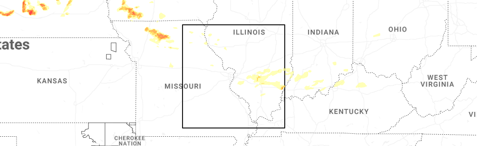
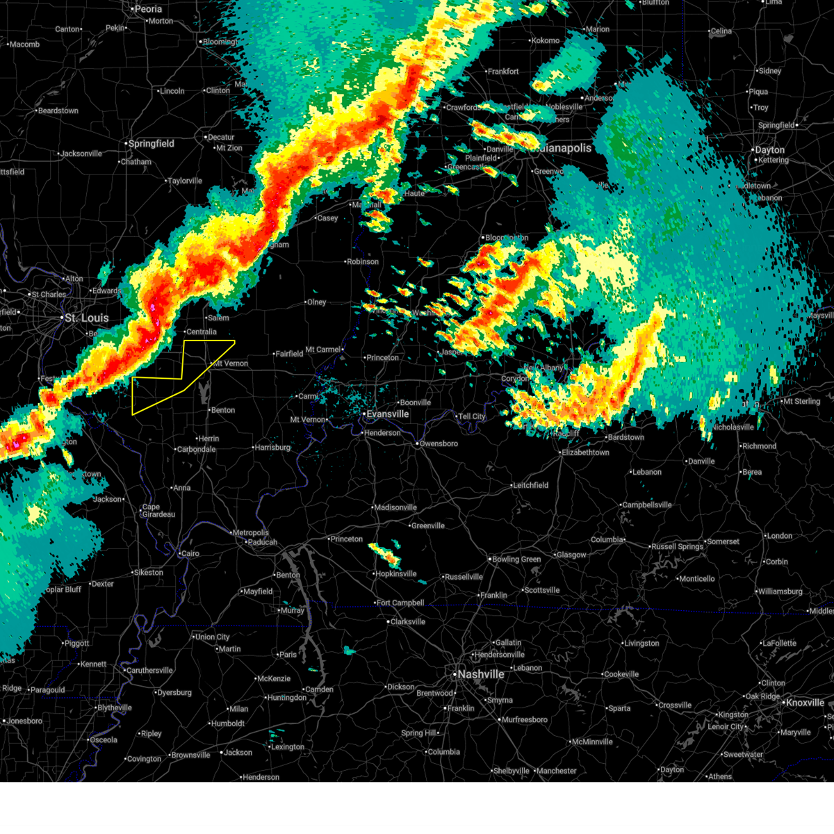
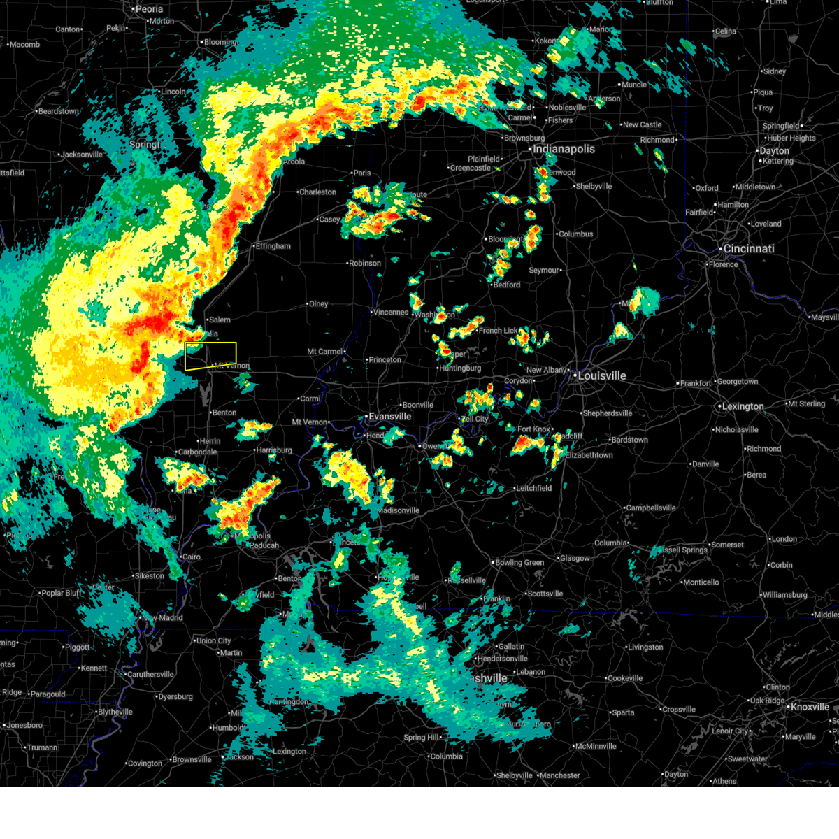
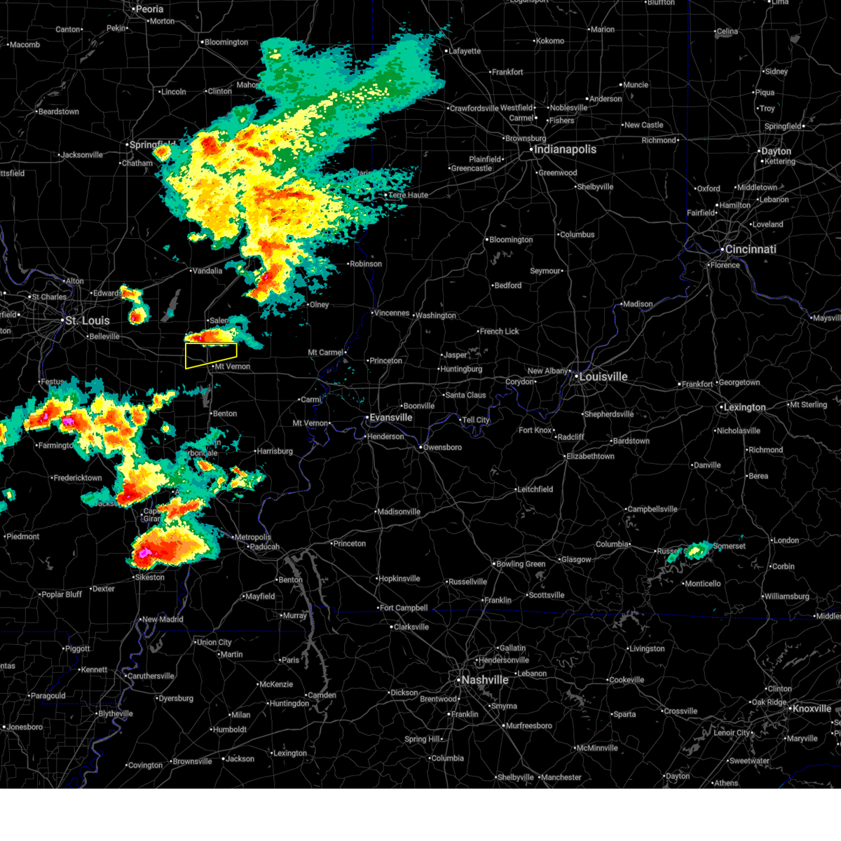
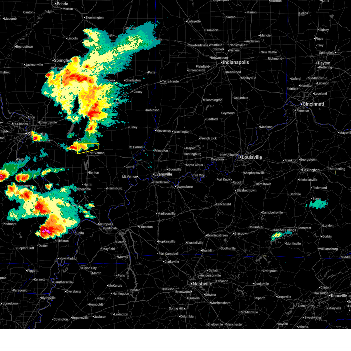
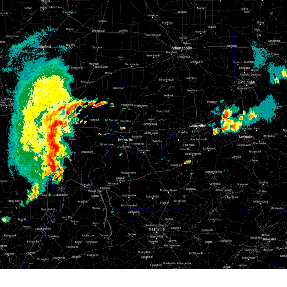
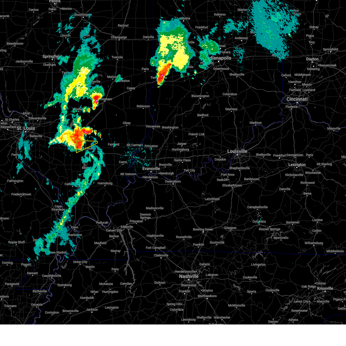
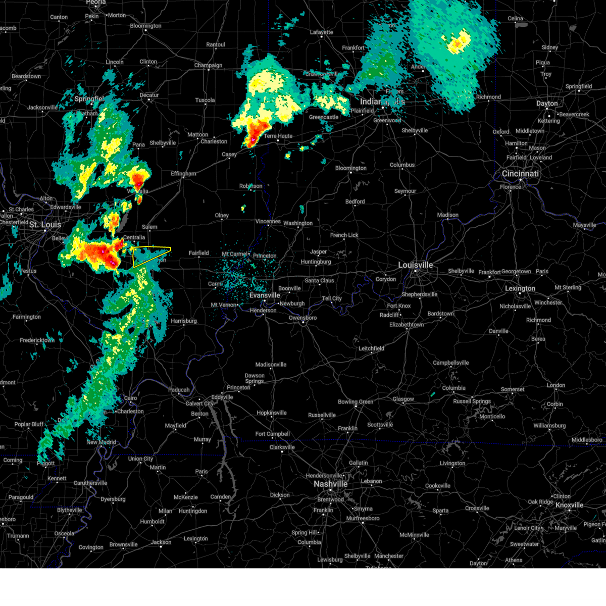
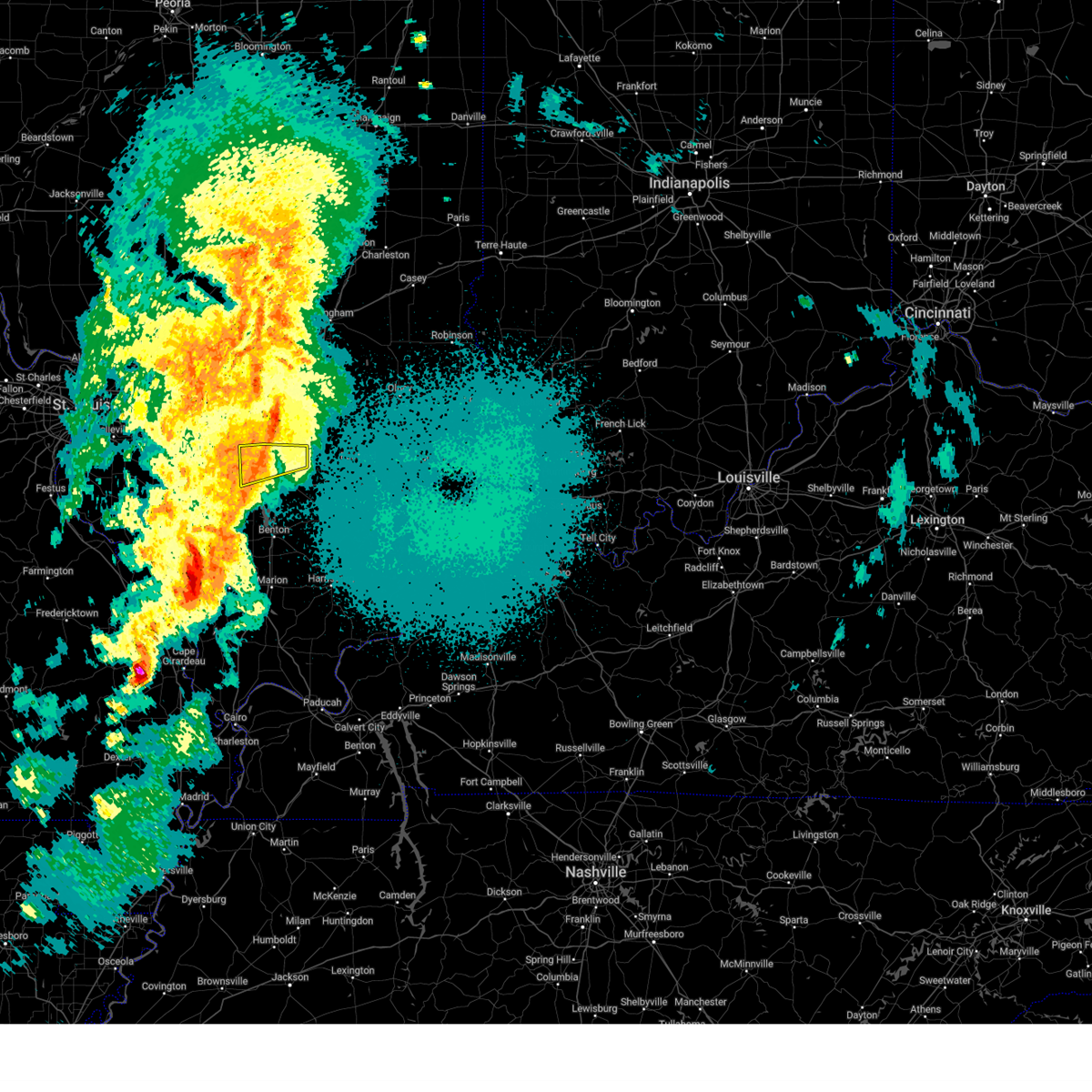
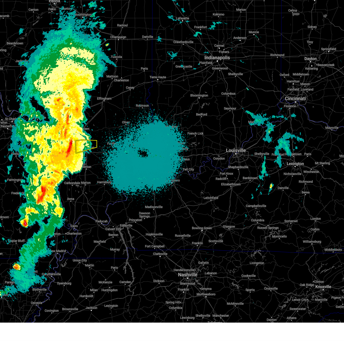
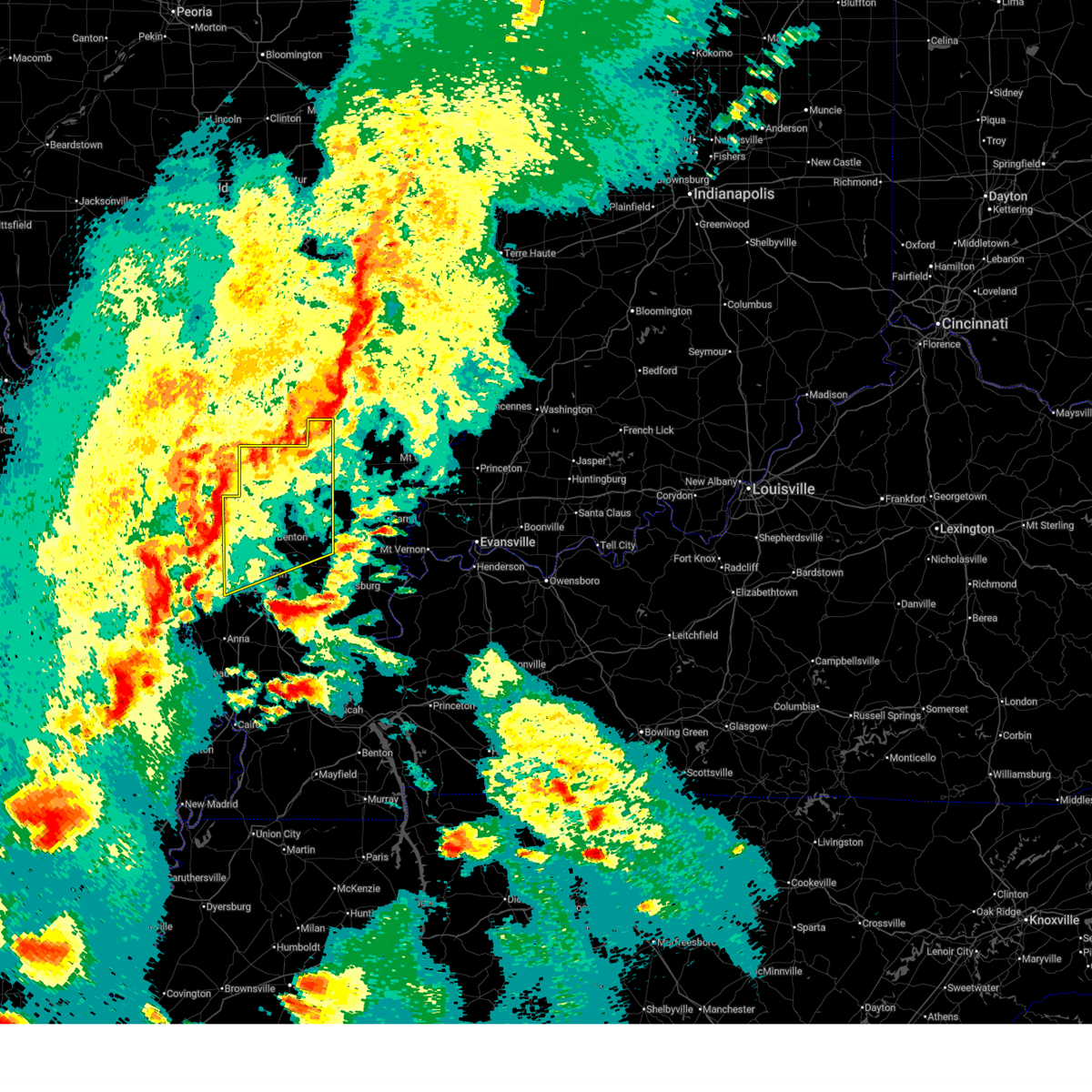
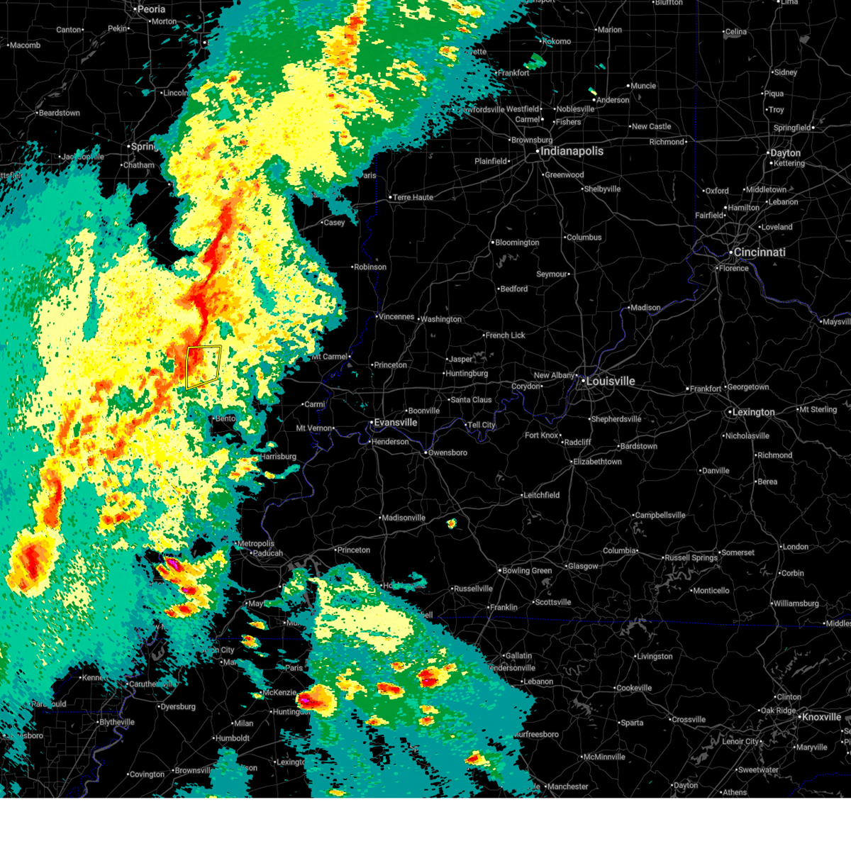
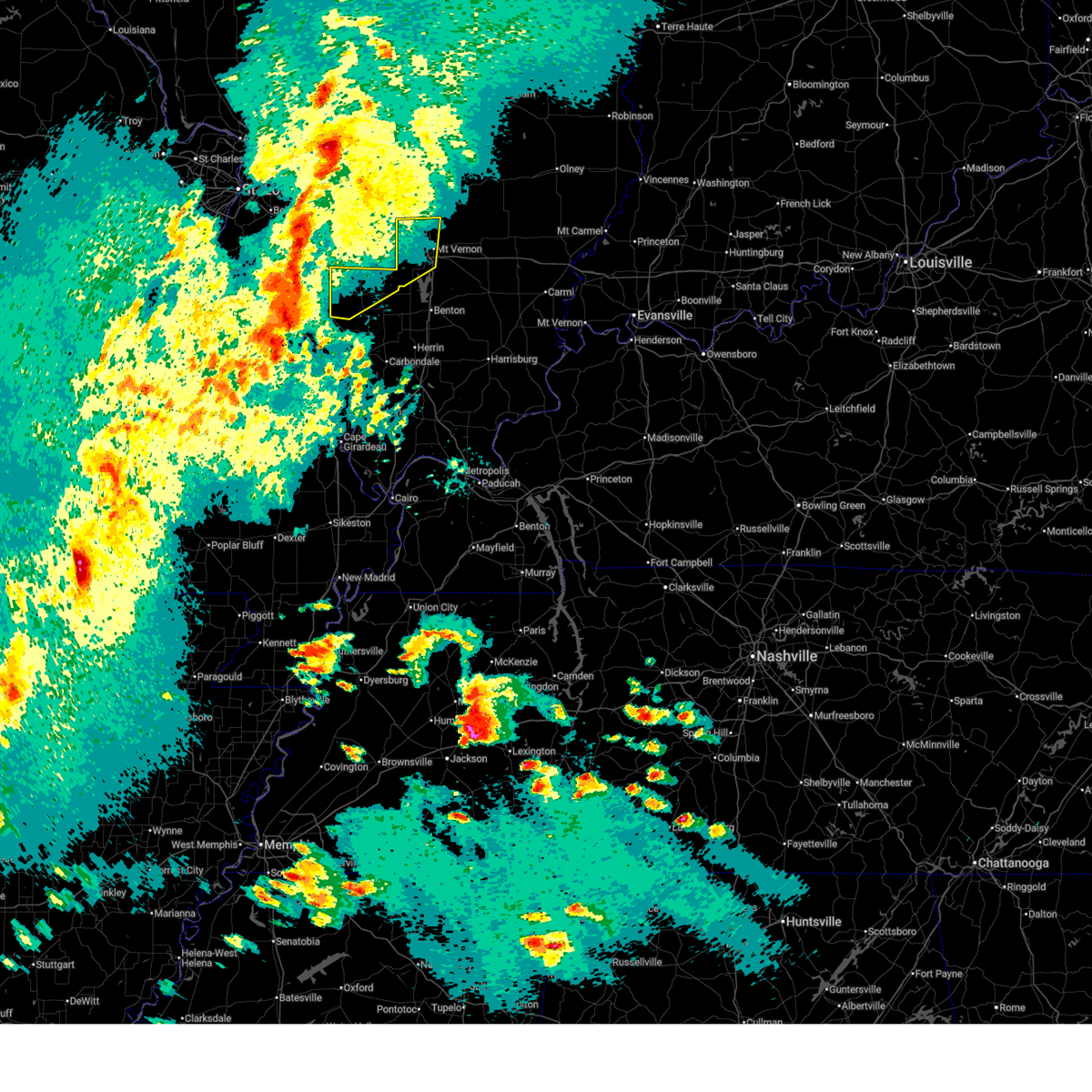
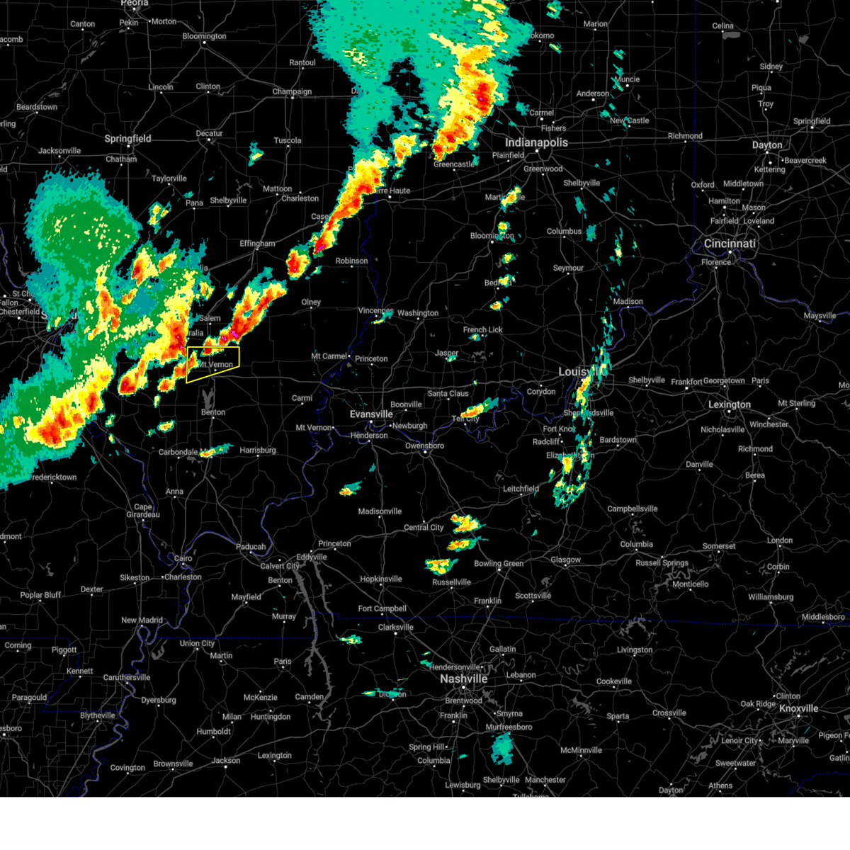
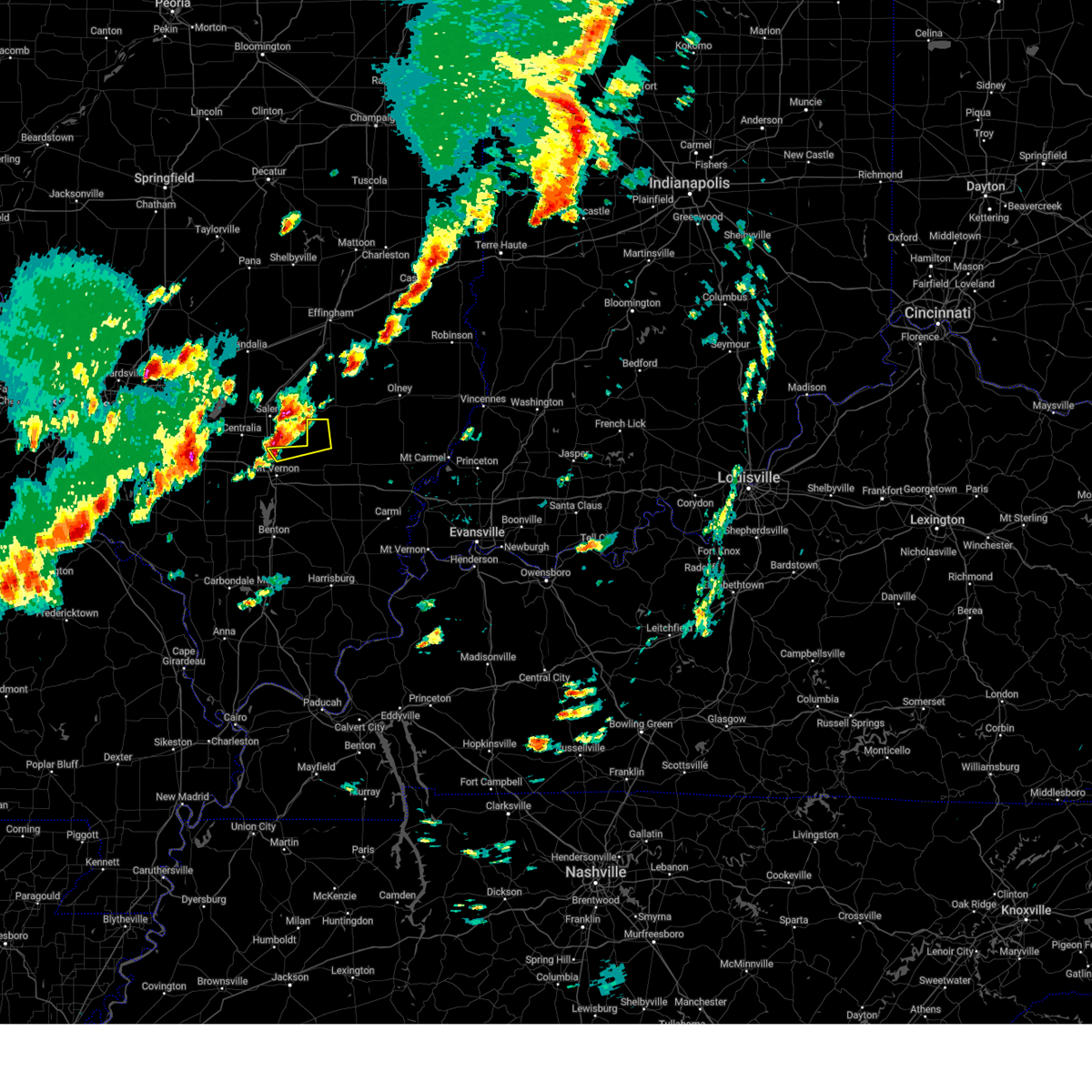
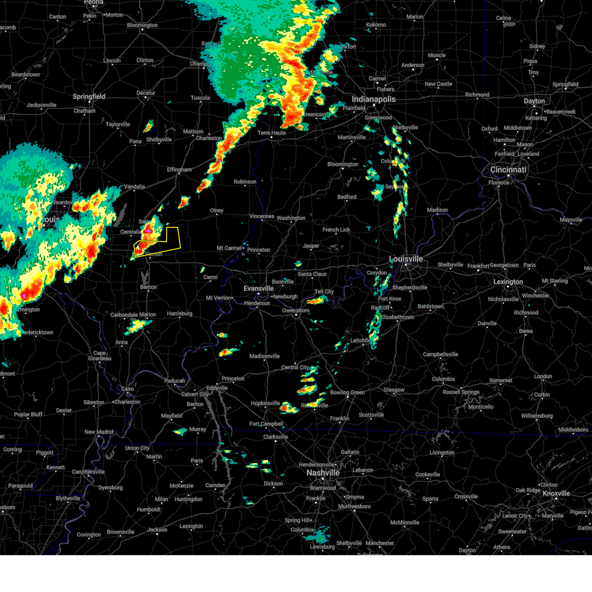
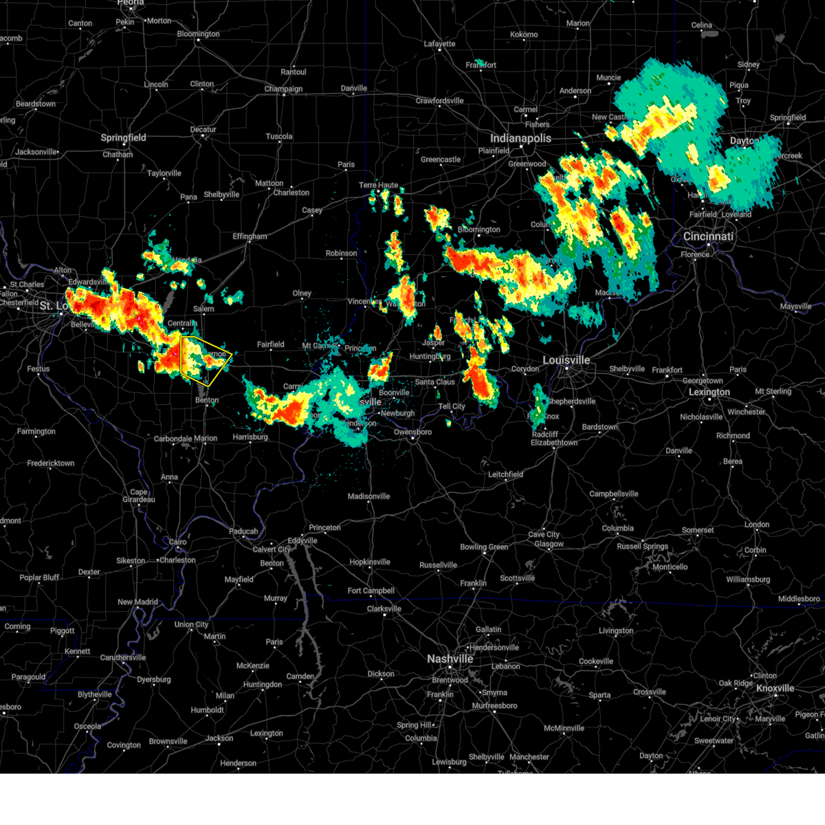
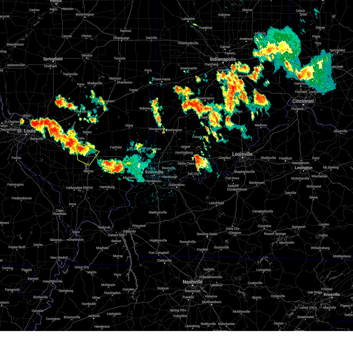
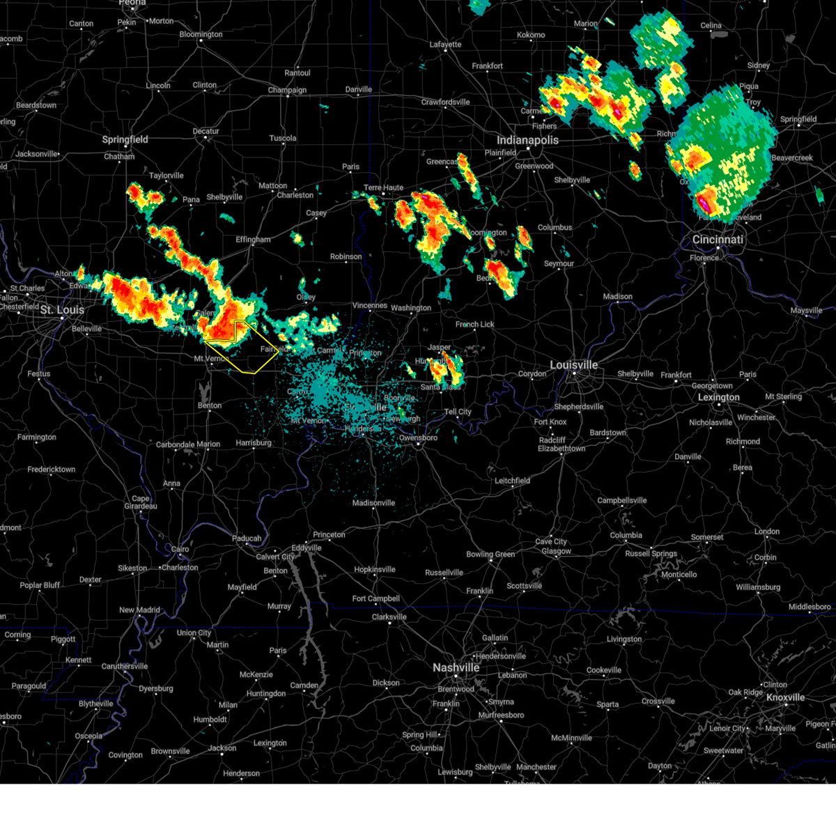
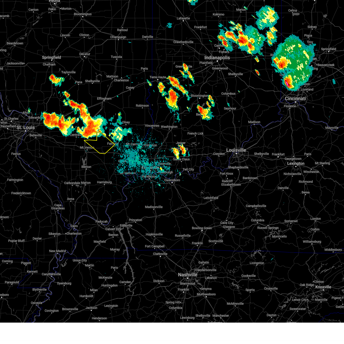
Hail Map for Dix, IL
The Dix, IL area has had 5 reports of on-the-ground hail by trained spotters, and has been under severe weather warnings 13 times during the past 12 months. Doppler radar has detected hail at or near Dix, IL on 77 occasions, including 4 occasions during the past year.
| Name: | Dix, IL |
| Where Located: | 69.1 miles E of Saint Louis, MO |
| Map: | Google Map for Dix, IL |
| Population: | 461 |
| Housing Units: | 264 |
| More Info: | Search Google for Dix, IL |
1
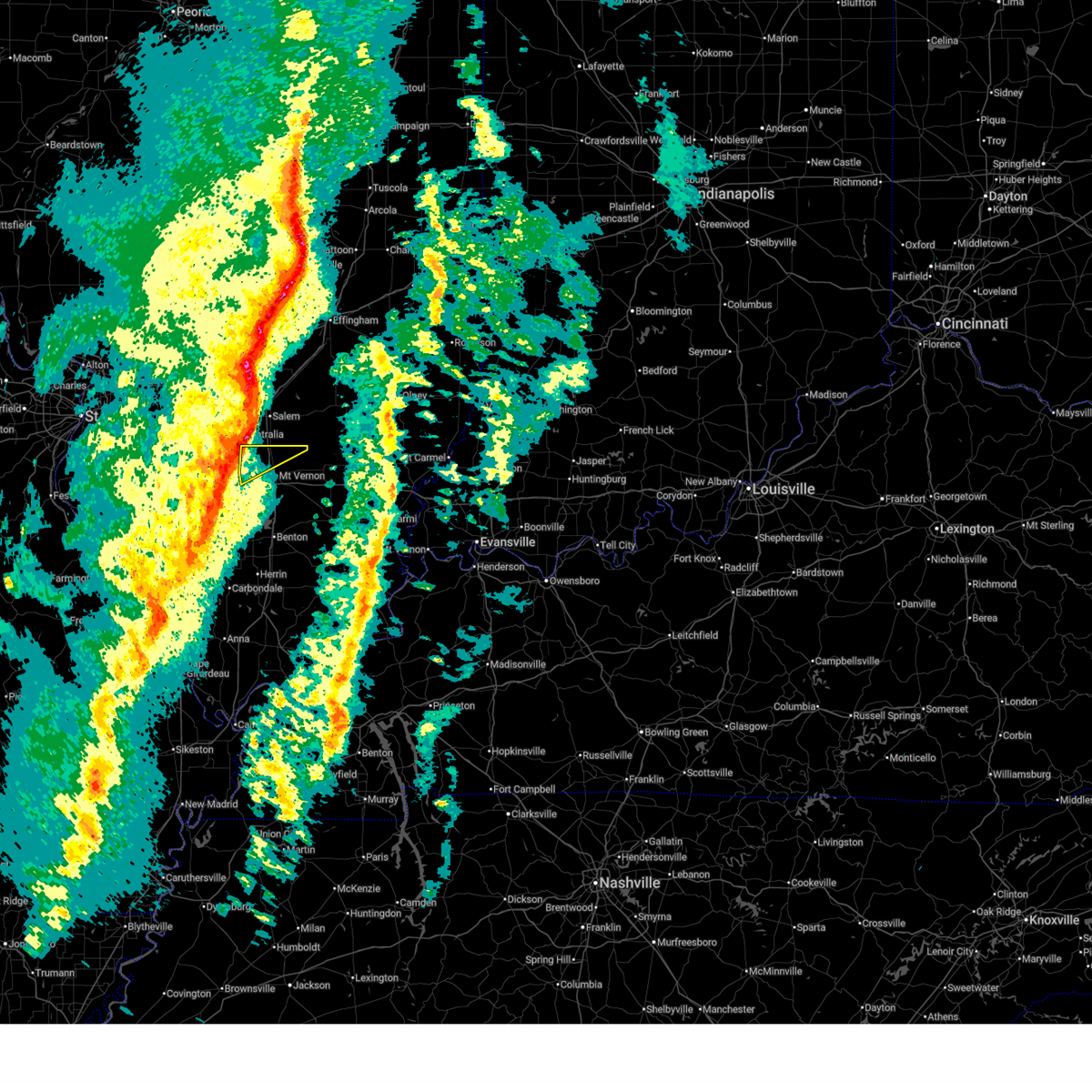
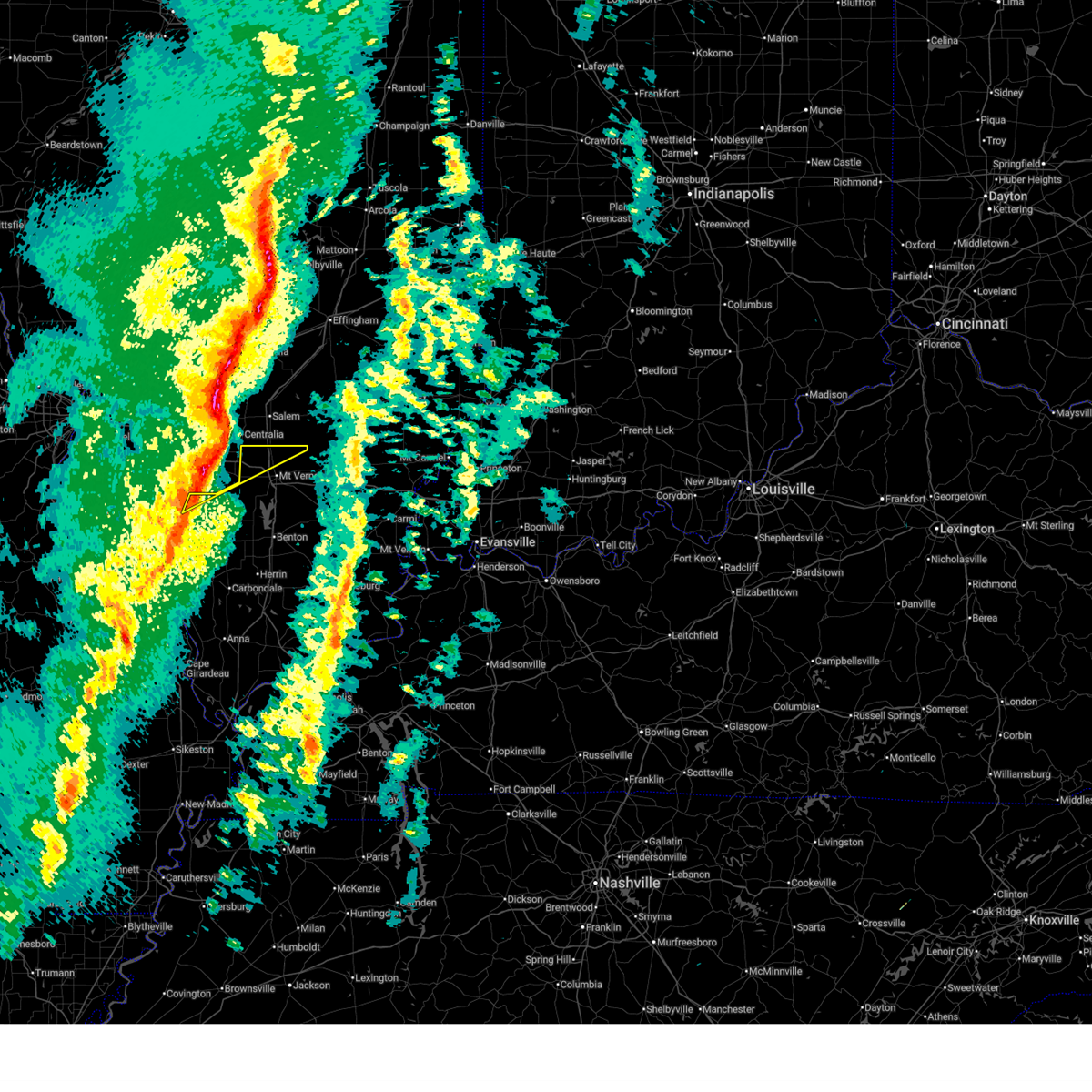
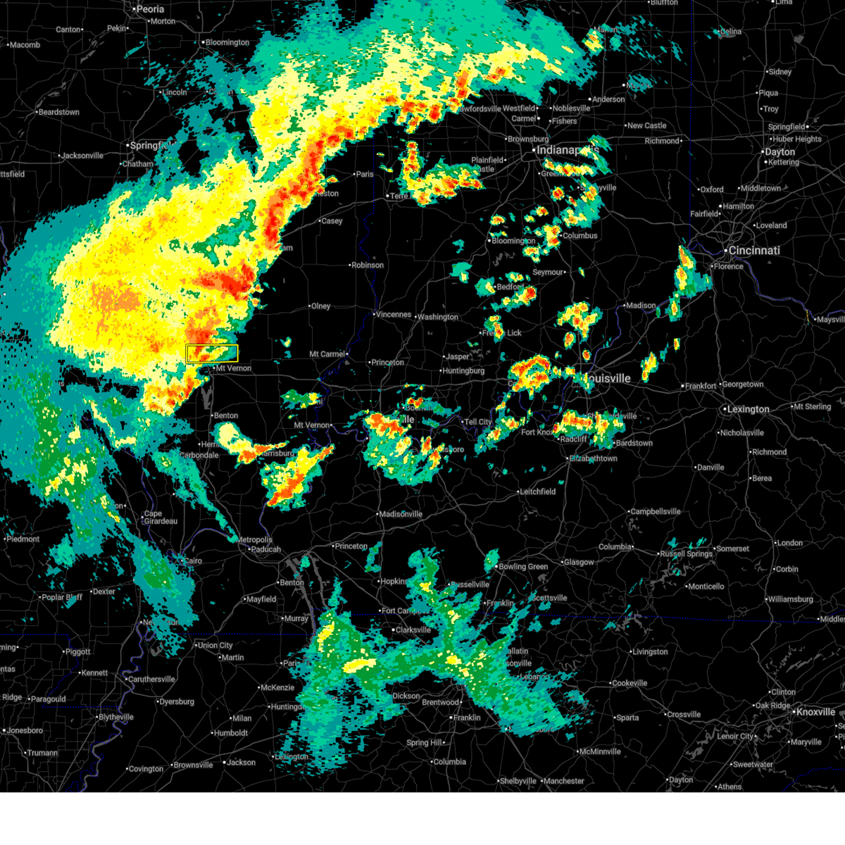
The Top Recent Hail Date for Dix, IL is Saturday, May 16, 2026 (18th out of 77)
Hail and Wind Damage Spotted near Dix, IL
| Date / Time | Report Details |
|---|---|
| 6/21/2026 4:59 PM CDT |
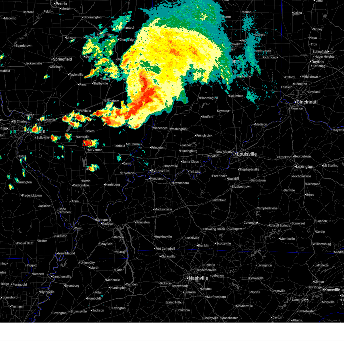 At 459 pm cdt, a severe thunderstorm capable of producing a tornado was located near mount vernon, moving east at 25 mph (radar indicated rotation). Hazards include tornado and quarter size hail. Flying debris will be dangerous to those caught without shelter. mobile homes will be damaged or destroyed. damage to roofs, windows, and vehicles will occur. tree damage is likely. locations impacted include, dix. This includes interstate 57 in illinois between mile markers 100 and 105. At 459 pm cdt, a severe thunderstorm capable of producing a tornado was located near mount vernon, moving east at 25 mph (radar indicated rotation). Hazards include tornado and quarter size hail. Flying debris will be dangerous to those caught without shelter. mobile homes will be damaged or destroyed. damage to roofs, windows, and vehicles will occur. tree damage is likely. locations impacted include, dix. This includes interstate 57 in illinois between mile markers 100 and 105.
|
| 6/21/2026 4:46 PM CDT |
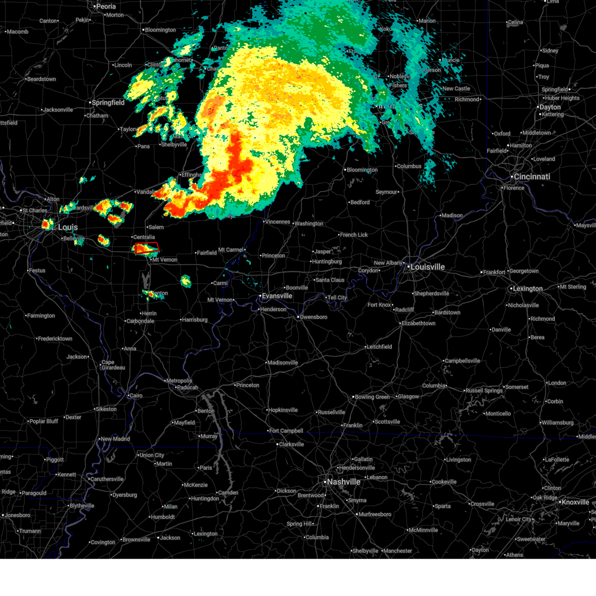 At 445 pm cdt, a severe thunderstorm capable of producing a tornado was located near irvington, or 7 miles southeast of centralia, moving northeast at 35 mph (radar indicated rotation). Hazards include tornado. Flying debris will be dangerous to those caught without shelter. mobile homes will be damaged or destroyed. damage to roofs, windows, and vehicles will occur. tree damage is likely. locations impacted include, dix. This includes interstate 57 in illinois between mile markers 100 and 105. At 445 pm cdt, a severe thunderstorm capable of producing a tornado was located near irvington, or 7 miles southeast of centralia, moving northeast at 35 mph (radar indicated rotation). Hazards include tornado. Flying debris will be dangerous to those caught without shelter. mobile homes will be damaged or destroyed. damage to roofs, windows, and vehicles will occur. tree damage is likely. locations impacted include, dix. This includes interstate 57 in illinois between mile markers 100 and 105.
|
| 4/27/2026 8:55 PM CDT |
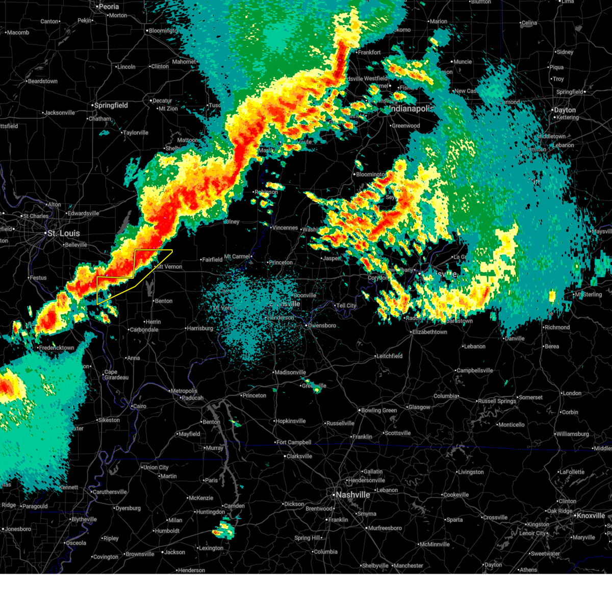 At 854 pm cdt, severe thunderstorms were located along a line extending from 7 miles west of helm to near pinckneyville, moving east at 50 mph (radar indicated). Hazards include 60 mph wind gusts and quarter size hail. Hail damage to vehicles is expected. expect wind damage to roofs, siding, and trees. locations impacted include, mount vernon, pinckneyville, woodlawn, tamaroa, willisville, dix, cutler, and waltonville. this includes the following highways, interstate 57 in illinois between mile markers 93 and 105. Interstate 64 in illinois between mile markers 63 and 77. At 854 pm cdt, severe thunderstorms were located along a line extending from 7 miles west of helm to near pinckneyville, moving east at 50 mph (radar indicated). Hazards include 60 mph wind gusts and quarter size hail. Hail damage to vehicles is expected. expect wind damage to roofs, siding, and trees. locations impacted include, mount vernon, pinckneyville, woodlawn, tamaroa, willisville, dix, cutler, and waltonville. this includes the following highways, interstate 57 in illinois between mile markers 93 and 105. Interstate 64 in illinois between mile markers 63 and 77.
|
| 4/27/2026 8:26 PM CDT |
 Svrpah the national weather service in paducah has issued a * severe thunderstorm warning for, perry county in south central illinois, northwestern jefferson county in south central illinois, * until 930 pm cdt. * at 825 pm cdt, severe thunderstorms were located along a line extending from 8 miles west of wamac to near evansville, moving east at 50 mph (radar indicated). Hazards include 60 mph wind gusts and quarter size hail. Hail damage to vehicles is expected. Expect wind damage to roofs, siding, and trees. Svrpah the national weather service in paducah has issued a * severe thunderstorm warning for, perry county in south central illinois, northwestern jefferson county in south central illinois, * until 930 pm cdt. * at 825 pm cdt, severe thunderstorms were located along a line extending from 8 miles west of wamac to near evansville, moving east at 50 mph (radar indicated). Hazards include 60 mph wind gusts and quarter size hail. Hail damage to vehicles is expected. Expect wind damage to roofs, siding, and trees.
|
| 3/15/2026 7:13 PM CDT |
 The storms which prompted the warning have moved out of the area. therefore, the warning will be allowed to expire. a tornado watch remains in effect until 1100 pm cdt for south central illinois. The storms which prompted the warning have moved out of the area. therefore, the warning will be allowed to expire. a tornado watch remains in effect until 1100 pm cdt for south central illinois.
|
| 3/15/2026 6:39 PM CDT |
 At 638 pm cdt, severe thunderstorms were located along a line extending from wamac to 6 miles northwest of tamaroa, moving east at 35 mph (radar indicated). Hazards include 60 mph wind gusts. Expect damage to roofs, siding, and trees. locations impacted include, mount vernon, woodlawn, and dix. this includes the following highways, interstate 57 in illinois between mile markers 98 and 105. Interstate 64 in illinois between mile markers 63 and 72. At 638 pm cdt, severe thunderstorms were located along a line extending from wamac to 6 miles northwest of tamaroa, moving east at 35 mph (radar indicated). Hazards include 60 mph wind gusts. Expect damage to roofs, siding, and trees. locations impacted include, mount vernon, woodlawn, and dix. this includes the following highways, interstate 57 in illinois between mile markers 98 and 105. Interstate 64 in illinois between mile markers 63 and 72.
|
| 3/15/2026 6:39 PM CDT |
 the severe thunderstorm warning has been cancelled and is no longer in effect the severe thunderstorm warning has been cancelled and is no longer in effect
|
| 3/15/2026 6:24 PM CDT |
 Svrpah the national weather service in paducah has issued a * severe thunderstorm warning for, northwestern perry county in south central illinois, northern jefferson county in south central illinois, * until 715 pm cdt. * at 623 pm cdt, severe thunderstorms were located along a line extending from 7 miles west of wamac to 9 miles south of nashville, moving northeast at 70 mph (radar indicated). Hazards include 60 mph wind gusts and penny size hail. expect damage to roofs, siding, and trees Svrpah the national weather service in paducah has issued a * severe thunderstorm warning for, northwestern perry county in south central illinois, northern jefferson county in south central illinois, * until 715 pm cdt. * at 623 pm cdt, severe thunderstorms were located along a line extending from 7 miles west of wamac to 9 miles south of nashville, moving northeast at 70 mph (radar indicated). Hazards include 60 mph wind gusts and penny size hail. expect damage to roofs, siding, and trees
|
| 3/11/2026 5:47 AM CDT |
 At 546 am cdt, a severe thunderstorm was located near woodlawn, or 8 miles northwest of mount vernon, moving east at 55 mph (radar indicated. this storm has also produced a 65 mph wind gust in salem, il). Hazards include 70 mph wind gusts. Expect considerable tree damage. damage is likely to mobile homes, roofs, and outbuildings. locations impacted include, mount vernon and dix. this includes the following highways, interstate 57 in illinois between mile markers 98 and 105. Interstate 64 in illinois between mile markers 63 and 71. At 546 am cdt, a severe thunderstorm was located near woodlawn, or 8 miles northwest of mount vernon, moving east at 55 mph (radar indicated. this storm has also produced a 65 mph wind gust in salem, il). Hazards include 70 mph wind gusts. Expect considerable tree damage. damage is likely to mobile homes, roofs, and outbuildings. locations impacted include, mount vernon and dix. this includes the following highways, interstate 57 in illinois between mile markers 98 and 105. Interstate 64 in illinois between mile markers 63 and 71.
|
| 3/11/2026 5:24 AM CDT |
 Svrpah the national weather service in paducah has issued a * severe thunderstorm warning for, northern jefferson county in south central illinois, * until 615 am cdt. * at 524 am cdt, a severe thunderstorm was located near nashville, moving east at 65 mph (radar indicated). Hazards include 60 mph wind gusts. expect damage to roofs, siding, and trees Svrpah the national weather service in paducah has issued a * severe thunderstorm warning for, northern jefferson county in south central illinois, * until 615 am cdt. * at 524 am cdt, a severe thunderstorm was located near nashville, moving east at 65 mph (radar indicated). Hazards include 60 mph wind gusts. expect damage to roofs, siding, and trees
|
| 2/19/2026 5:18 PM CST |
 At 518 pm cst, a severe thunderstorm capable of producing a tornado was located 8 miles north of mount vernon, moving northeast at 25 mph (radar indicated rotation). Hazards include tornado and quarter size hail. Flying debris will be dangerous to those caught without shelter. mobile homes will be damaged or destroyed. damage to roofs, windows, and vehicles will occur. tree damage is likely. this tornadic thunderstorm will remain over mainly rural areas of northeastern jefferson county, including the following locations, dix. This includes interstate 57 in illinois between mile markers 102 and 105. At 518 pm cst, a severe thunderstorm capable of producing a tornado was located 8 miles north of mount vernon, moving northeast at 25 mph (radar indicated rotation). Hazards include tornado and quarter size hail. Flying debris will be dangerous to those caught without shelter. mobile homes will be damaged or destroyed. damage to roofs, windows, and vehicles will occur. tree damage is likely. this tornadic thunderstorm will remain over mainly rural areas of northeastern jefferson county, including the following locations, dix. This includes interstate 57 in illinois between mile markers 102 and 105.
|
| 2/19/2026 5:04 PM CST |
 Torpah the national weather service in paducah has issued a * tornado warning for, northern jefferson county in south central illinois, * until 545 pm cst. * at 503 pm cst, a severe thunderstorm capable of producing a tornado was located near woodlawn, or 8 miles northwest of mount vernon, moving northeast at 25 mph (radar indicated rotation). Hazards include tornado. Flying debris will be dangerous to those caught without shelter. mobile homes will be damaged or destroyed. damage to roofs, windows, and vehicles will occur. tree damage is likely. this dangerous storm will be near, mount vernon around 510 pm cst. other locations impacted by this tornadic thunderstorm include dix and walnut hill. this includes the following highways, interstate 57 in illinois between mile markers 98 and 105. Interstate 64 in illinois between mile markers 65 and 72. Torpah the national weather service in paducah has issued a * tornado warning for, northern jefferson county in south central illinois, * until 545 pm cst. * at 503 pm cst, a severe thunderstorm capable of producing a tornado was located near woodlawn, or 8 miles northwest of mount vernon, moving northeast at 25 mph (radar indicated rotation). Hazards include tornado. Flying debris will be dangerous to those caught without shelter. mobile homes will be damaged or destroyed. damage to roofs, windows, and vehicles will occur. tree damage is likely. this dangerous storm will be near, mount vernon around 510 pm cst. other locations impacted by this tornadic thunderstorm include dix and walnut hill. this includes the following highways, interstate 57 in illinois between mile markers 98 and 105. Interstate 64 in illinois between mile markers 65 and 72.
|
| 12/28/2025 4:50 PM CST |
 Svrpah the national weather service in paducah has issued a * severe thunderstorm warning for, western wayne county in south central illinois, jefferson county in south central illinois, * until 530 pm cst. * at 450 pm cst, severe thunderstorms were located along a line extending from near helm to near tamaroa, moving east at 45 mph (radar indicated). Hazards include 60 mph wind gusts. expect damage to roofs, siding, and trees Svrpah the national weather service in paducah has issued a * severe thunderstorm warning for, western wayne county in south central illinois, jefferson county in south central illinois, * until 530 pm cst. * at 450 pm cst, severe thunderstorms were located along a line extending from near helm to near tamaroa, moving east at 45 mph (radar indicated). Hazards include 60 mph wind gusts. expect damage to roofs, siding, and trees
|
| 5/16/2025 4:12 PM CDT |
 the severe thunderstorm warning has been cancelled and is no longer in effect the severe thunderstorm warning has been cancelled and is no longer in effect
|
| 5/16/2025 3:49 PM CDT |
 Svrpah the national weather service in paducah has issued a * severe thunderstorm warning for, northern jefferson county in south central illinois, * until 430 pm cdt. * at 349 pm cdt, a severe thunderstorm was located near ashley, or 8 miles east of nashville, moving east at 55 mph (radar indicated). Hazards include 60 mph wind gusts and quarter size hail. Hail damage to vehicles is expected. Expect wind damage to roofs, siding, and trees. Svrpah the national weather service in paducah has issued a * severe thunderstorm warning for, northern jefferson county in south central illinois, * until 430 pm cdt. * at 349 pm cdt, a severe thunderstorm was located near ashley, or 8 miles east of nashville, moving east at 55 mph (radar indicated). Hazards include 60 mph wind gusts and quarter size hail. Hail damage to vehicles is expected. Expect wind damage to roofs, siding, and trees.
|
| 4/29/2025 2:07 PM CDT |
 Svrpah the national weather service in paducah has issued a * severe thunderstorm warning for, northern jefferson county in south central illinois, * until 245 pm cdt. * at 207 pm cdt, a severe thunderstorm was located near ashley, or near nashville, moving northeast at 40 mph (radar indicated). Hazards include 60 mph wind gusts and quarter size hail. Hail damage to vehicles is expected. Expect wind damage to roofs, siding, and trees. Svrpah the national weather service in paducah has issued a * severe thunderstorm warning for, northern jefferson county in south central illinois, * until 245 pm cdt. * at 207 pm cdt, a severe thunderstorm was located near ashley, or near nashville, moving northeast at 40 mph (radar indicated). Hazards include 60 mph wind gusts and quarter size hail. Hail damage to vehicles is expected. Expect wind damage to roofs, siding, and trees.
|
| 4/29/2025 8:03 AM CDT |
 the severe thunderstorm warning has been cancelled and is no longer in effect the severe thunderstorm warning has been cancelled and is no longer in effect
|
| 4/29/2025 7:41 AM CDT |
 Svrpah the national weather service in paducah has issued a * severe thunderstorm warning for, northern jefferson county in south central illinois, * until 815 am cdt. * at 739 am cdt, a severe thunderstorm was located over nashville, moving northeast at 50 mph (radar indicated). Hazards include 60 mph wind gusts and quarter size hail. Hail damage to vehicles is expected. Expect wind damage to roofs, siding, and trees. Svrpah the national weather service in paducah has issued a * severe thunderstorm warning for, northern jefferson county in south central illinois, * until 815 am cdt. * at 739 am cdt, a severe thunderstorm was located over nashville, moving northeast at 50 mph (radar indicated). Hazards include 60 mph wind gusts and quarter size hail. Hail damage to vehicles is expected. Expect wind damage to roofs, siding, and trees.
|
| 4/20/2025 9:42 PM CDT |
 The storm which prompted the warning has moved out of the area. therefore, the warning will be allowed to expire. however, gusty winds and heavy rain are still possible with this thunderstorm. a tornado watch remains in effect until 1100 pm cdt for south central illinois. The storm which prompted the warning has moved out of the area. therefore, the warning will be allowed to expire. however, gusty winds and heavy rain are still possible with this thunderstorm. a tornado watch remains in effect until 1100 pm cdt for south central illinois.
|
| 4/20/2025 9:19 PM CDT |
 Svrpah the national weather service in paducah has issued a * severe thunderstorm warning for, northern jefferson county in south central illinois, * until 945 pm cdt. * at 918 pm cdt, a severe thunderstorm was located over ashley, or 10 miles east of nashville, moving northeast at 50 mph (radar indicated). Hazards include 60 mph wind gusts. expect damage to roofs, siding, and trees Svrpah the national weather service in paducah has issued a * severe thunderstorm warning for, northern jefferson county in south central illinois, * until 945 pm cdt. * at 918 pm cdt, a severe thunderstorm was located over ashley, or 10 miles east of nashville, moving northeast at 50 mph (radar indicated). Hazards include 60 mph wind gusts. expect damage to roofs, siding, and trees
|
| 4/2/2025 6:36 PM CDT |
 Svrpah the national weather service in paducah has issued a * severe thunderstorm warning for, eastern perry county in south central illinois, western wayne county in south central illinois, jefferson county in south central illinois, northern williamson county in southern illinois, northwestern saline county in southern illinois, northeastern jackson county in southern illinois, western hamilton county in south central illinois, franklin county in south central illinois, * until 715 pm cdt. * at 636 pm cdt, severe thunderstorms were located along a line extending from near irvington to near tamaroa to 6 miles east of ava, moving northeast at 55 mph (radar indicated). Hazards include 60 mph wind gusts and quarter size hail. Hail damage to vehicles is expected. Expect wind damage to roofs, siding, and trees. Svrpah the national weather service in paducah has issued a * severe thunderstorm warning for, eastern perry county in south central illinois, western wayne county in south central illinois, jefferson county in south central illinois, northern williamson county in southern illinois, northwestern saline county in southern illinois, northeastern jackson county in southern illinois, western hamilton county in south central illinois, franklin county in south central illinois, * until 715 pm cdt. * at 636 pm cdt, severe thunderstorms were located along a line extending from near irvington to near tamaroa to 6 miles east of ava, moving northeast at 55 mph (radar indicated). Hazards include 60 mph wind gusts and quarter size hail. Hail damage to vehicles is expected. Expect wind damage to roofs, siding, and trees.
|
| 4/2/2025 6:36 PM CDT |
 Torpah the national weather service in paducah has issued a * tornado warning for, jefferson county in south central illinois, * until 715 pm cdt. * at 636 pm cdt, severe thunderstorms capable of producing both tornadoes and extensive straight line wind damage were located along a line extending from near irvington to near tamaroa, moving northeast at 65 mph (radar indicated rotation). Hazards include tornado. Flying debris will be dangerous to those caught without shelter. mobile homes will be damaged or destroyed. damage to roofs, windows, and vehicles will occur. tree damage is likely. these dangerous storms will be near, woodlawn around 645 pm cdt. mount vernon around 650 pm cdt. other locations impacted by these tornadic storms include dix, belle rive, waltonville, and walnut hill. this includes the following highways, interstate 57 in illinois between mile markers 88 and 105. Interstate 64 in illinois between mile markers 63 and 91. Torpah the national weather service in paducah has issued a * tornado warning for, jefferson county in south central illinois, * until 715 pm cdt. * at 636 pm cdt, severe thunderstorms capable of producing both tornadoes and extensive straight line wind damage were located along a line extending from near irvington to near tamaroa, moving northeast at 65 mph (radar indicated rotation). Hazards include tornado. Flying debris will be dangerous to those caught without shelter. mobile homes will be damaged or destroyed. damage to roofs, windows, and vehicles will occur. tree damage is likely. these dangerous storms will be near, woodlawn around 645 pm cdt. mount vernon around 650 pm cdt. other locations impacted by these tornadic storms include dix, belle rive, waltonville, and walnut hill. this includes the following highways, interstate 57 in illinois between mile markers 88 and 105. Interstate 64 in illinois between mile markers 63 and 91.
|
| 4/2/2025 5:54 PM CDT |
 At 553 pm cdt, severe thunderstorms were located along a line extending from near brownstown to near fairman to near ashley, moving northeast at 80 mph (radar indicated). Hazards include 60 mph wind gusts and nickel size hail. Expect damage to roofs, siding, and trees. locations impacted include, dix, mount vernon, woodlawn, and waltonville. this includes the following highways, interstate 57 in illinois between mile markers 90 and 105. Interstate 64 in illinois between mile markers 63 and 80. At 553 pm cdt, severe thunderstorms were located along a line extending from near brownstown to near fairman to near ashley, moving northeast at 80 mph (radar indicated). Hazards include 60 mph wind gusts and nickel size hail. Expect damage to roofs, siding, and trees. locations impacted include, dix, mount vernon, woodlawn, and waltonville. this includes the following highways, interstate 57 in illinois between mile markers 90 and 105. Interstate 64 in illinois between mile markers 63 and 80.
|
| 4/2/2025 5:54 PM CDT |
 the severe thunderstorm warning has been cancelled and is no longer in effect the severe thunderstorm warning has been cancelled and is no longer in effect
|
| 4/2/2025 5:16 PM CDT |
 Svrpah the national weather service in paducah has issued a * severe thunderstorm warning for, perry county in south central illinois, western jefferson county in south central illinois, * until 600 pm cdt. * at 516 pm cdt, severe thunderstorms were located along a line extending from near aviston to near marissa to near chester, moving northeast at 75 mph (radar indicated). Hazards include 60 mph wind gusts and nickel size hail. expect damage to roofs, siding, and trees Svrpah the national weather service in paducah has issued a * severe thunderstorm warning for, perry county in south central illinois, western jefferson county in south central illinois, * until 600 pm cdt. * at 516 pm cdt, severe thunderstorms were located along a line extending from near aviston to near marissa to near chester, moving northeast at 75 mph (radar indicated). Hazards include 60 mph wind gusts and nickel size hail. expect damage to roofs, siding, and trees
|
| 3/30/2025 3:19 PM CDT |
 Svrpah the national weather service in paducah has issued a * severe thunderstorm warning for, northern jefferson county in south central illinois, * until 415 pm cdt. * at 319 pm cdt, a severe thunderstorm was located over ashley, or 12 miles west of mount vernon, moving northeast at 40 mph (radar indicated). Hazards include 60 mph wind gusts and quarter size hail. Hail damage to vehicles is expected. Expect wind damage to roofs, siding, and trees. Svrpah the national weather service in paducah has issued a * severe thunderstorm warning for, northern jefferson county in south central illinois, * until 415 pm cdt. * at 319 pm cdt, a severe thunderstorm was located over ashley, or 12 miles west of mount vernon, moving northeast at 40 mph (radar indicated). Hazards include 60 mph wind gusts and quarter size hail. Hail damage to vehicles is expected. Expect wind damage to roofs, siding, and trees.
|
| 3/30/2025 3:02 PM CDT |
 At 301 pm cdt, a severe thunderstorm was located 7 miles west of helm, or 11 miles north of mount vernon, moving northeast at 40 mph (radar indicated). Hazards include 60 mph wind gusts and quarter size hail. Hail damage to vehicles is expected. expect wind damage to roofs, siding, and trees. Locations impacted include, dix. At 301 pm cdt, a severe thunderstorm was located 7 miles west of helm, or 11 miles north of mount vernon, moving northeast at 40 mph (radar indicated). Hazards include 60 mph wind gusts and quarter size hail. Hail damage to vehicles is expected. expect wind damage to roofs, siding, and trees. Locations impacted include, dix.
|
| 3/30/2025 2:49 PM CDT |
 Svrpah the national weather service in paducah has issued a * severe thunderstorm warning for, northwestern wayne county in south central illinois, northern jefferson county in south central illinois, * until 330 pm cdt. * at 249 pm cdt, a severe thunderstorm was located near woodlawn, or 7 miles northwest of mount vernon, moving northeast at 40 mph (radar indicated). Hazards include 60 mph wind gusts and quarter size hail. Hail damage to vehicles is expected. Expect wind damage to roofs, siding, and trees. Svrpah the national weather service in paducah has issued a * severe thunderstorm warning for, northwestern wayne county in south central illinois, northern jefferson county in south central illinois, * until 330 pm cdt. * at 249 pm cdt, a severe thunderstorm was located near woodlawn, or 7 miles northwest of mount vernon, moving northeast at 40 mph (radar indicated). Hazards include 60 mph wind gusts and quarter size hail. Hail damage to vehicles is expected. Expect wind damage to roofs, siding, and trees.
|
| 7/29/2024 11:14 PM CDT |
 At 1114 pm cdt, a severe thunderstorm was located over woodlawn, or 8 miles west of mount vernon, moving southeast at 30 mph (radar indicated). Hazards include 60 mph wind gusts. Expect damage to roofs, siding, and trees. locations impacted include, mount vernon, rend lake area, woodlawn, bluford, ina, waltonville, bonnie, and nason. this includes the following highways, interstate 57 in illinois between mile markers 82 and 103. Interstate 64 in illinois between mile markers 63 and 87. At 1114 pm cdt, a severe thunderstorm was located over woodlawn, or 8 miles west of mount vernon, moving southeast at 30 mph (radar indicated). Hazards include 60 mph wind gusts. Expect damage to roofs, siding, and trees. locations impacted include, mount vernon, rend lake area, woodlawn, bluford, ina, waltonville, bonnie, and nason. this includes the following highways, interstate 57 in illinois between mile markers 82 and 103. Interstate 64 in illinois between mile markers 63 and 87.
|
| 7/29/2024 10:52 PM CDT |
 Svrpah the national weather service in paducah has issued a * severe thunderstorm warning for, jefferson county in south central illinois, * until 1130 pm cdt. * at 1052 pm cdt, a severe thunderstorm was located over irvington, or near centralia, moving southeast at 35 mph (radar indicated). Hazards include 60 mph wind gusts and nickel size hail. expect damage to roofs, siding, and trees Svrpah the national weather service in paducah has issued a * severe thunderstorm warning for, jefferson county in south central illinois, * until 1130 pm cdt. * at 1052 pm cdt, a severe thunderstorm was located over irvington, or near centralia, moving southeast at 35 mph (radar indicated). Hazards include 60 mph wind gusts and nickel size hail. expect damage to roofs, siding, and trees
|
| 7/29/2024 9:50 PM CDT | Trees down in the roadway and reports of power lines down near di in jefferson county IL, 3 miles W of Dix, IL |
| 7/29/2024 9:38 PM CDT |
 At 937 pm cdt, a severe thunderstorm was located over helm, or 15 miles southwest of flora, moving southeast at 40 mph (emergency management). Hazards include 60 mph wind gusts and quarter size hail. this storm has a history of producing damage to trees and power lines. Hail damage to vehicles is expected. expect wind damage to roofs, siding, and trees. locations impacted include, fairfield, wayne city, bluford, jeffersonville, sims, keenes, and johnsonville. This includes interstate 64 in illinois between mile markers 94 and 101. At 937 pm cdt, a severe thunderstorm was located over helm, or 15 miles southwest of flora, moving southeast at 40 mph (emergency management). Hazards include 60 mph wind gusts and quarter size hail. this storm has a history of producing damage to trees and power lines. Hail damage to vehicles is expected. expect wind damage to roofs, siding, and trees. locations impacted include, fairfield, wayne city, bluford, jeffersonville, sims, keenes, and johnsonville. This includes interstate 64 in illinois between mile markers 94 and 101.
|
| 7/29/2024 9:25 PM CDT |
 Svrpah the national weather service in paducah has issued a * severe thunderstorm warning for, western wayne county in south central illinois, northeastern jefferson county in south central illinois, * until 1015 pm cdt. * at 925 pm cdt, a severe thunderstorm was located 7 miles south of omega, or 7 miles east of salem, moving southeast at 40 mph (radar indicated). Hazards include 60 mph wind gusts and penny size hail. expect damage to roofs, siding, and trees Svrpah the national weather service in paducah has issued a * severe thunderstorm warning for, western wayne county in south central illinois, northeastern jefferson county in south central illinois, * until 1015 pm cdt. * at 925 pm cdt, a severe thunderstorm was located 7 miles south of omega, or 7 miles east of salem, moving southeast at 40 mph (radar indicated). Hazards include 60 mph wind gusts and penny size hail. expect damage to roofs, siding, and trees
|
| 5/26/2024 7:28 PM CDT |
 At 727 pm cdt, severe thunderstorms were located along a line extending from 10 miles north of mount vernon to near tamaroa to near ava, moving east at 55 mph (radar indicated). Hazards include 70 mph wind gusts and quarter size hail. Hail damage to vehicles is expected. expect considerable tree damage. wind damage is also likely to mobile homes, roofs, and outbuildings. locations impacted include, mount vernon, benton, du quoin, pinckneyville, christopher, rend lake area, sesser, royalton, elkville, woodlawn, bluford, valier, west city, ava, tamaroa, willisville, ina, north city, buckner, and dix. this includes the following highways, interstate 57 in illinois between mile markers 71 and 105. Interstate 64 in illinois between mile markers 63 and 91. At 727 pm cdt, severe thunderstorms were located along a line extending from 10 miles north of mount vernon to near tamaroa to near ava, moving east at 55 mph (radar indicated). Hazards include 70 mph wind gusts and quarter size hail. Hail damage to vehicles is expected. expect considerable tree damage. wind damage is also likely to mobile homes, roofs, and outbuildings. locations impacted include, mount vernon, benton, du quoin, pinckneyville, christopher, rend lake area, sesser, royalton, elkville, woodlawn, bluford, valier, west city, ava, tamaroa, willisville, ina, north city, buckner, and dix. this includes the following highways, interstate 57 in illinois between mile markers 71 and 105. Interstate 64 in illinois between mile markers 63 and 91.
|
| 5/26/2024 6:58 PM CDT |
 Svrpah the national weather service in paducah has issued a * severe thunderstorm warning for, perry county in south central illinois, jefferson county in south central illinois, northern jackson county in southern illinois, central franklin county in south central illinois, * until 815 pm cdt. * at 658 pm cdt, severe thunderstorms were located along a line extending from near carlyle to near lively grove to ste. genevieve, moving east at 60 mph (radar indicated). Hazards include 70 mph wind gusts and quarter size hail. Hail damage to vehicles is expected. expect considerable tree damage. Wind damage is also likely to mobile homes, roofs, and outbuildings. Svrpah the national weather service in paducah has issued a * severe thunderstorm warning for, perry county in south central illinois, jefferson county in south central illinois, northern jackson county in southern illinois, central franklin county in south central illinois, * until 815 pm cdt. * at 658 pm cdt, severe thunderstorms were located along a line extending from near carlyle to near lively grove to ste. genevieve, moving east at 60 mph (radar indicated). Hazards include 70 mph wind gusts and quarter size hail. Hail damage to vehicles is expected. expect considerable tree damage. Wind damage is also likely to mobile homes, roofs, and outbuildings.
|
| 5/8/2024 7:44 PM CDT |
 The storms which prompted the warning have moved out of the area. therefore, the warning will be allowed to expire. a tornado watch remains in effect until midnight cdt for south central illinois. The storms which prompted the warning have moved out of the area. therefore, the warning will be allowed to expire. a tornado watch remains in effect until midnight cdt for south central illinois.
|
| 5/8/2024 7:02 PM CDT |
 At 702 pm cdt, severe thunderstorms were located along a line extending from irvington to 9 miles north of pinckneyville, moving east at 45 mph (radar indicated). Hazards include 70 mph wind gusts and quarter size hail. Hail damage to vehicles is expected. expect considerable tree damage. wind damage is also likely to mobile homes, roofs, and outbuildings. locations impacted include, mount vernon, rend lake area, woodlawn, bluford, ina, dix, waltonville, bonnie, belle rive, and nason. this includes the following highways, interstate 57 in illinois between mile markers 81 and 105. Interstate 64 in illinois between mile markers 63 and 90. At 702 pm cdt, severe thunderstorms were located along a line extending from irvington to 9 miles north of pinckneyville, moving east at 45 mph (radar indicated). Hazards include 70 mph wind gusts and quarter size hail. Hail damage to vehicles is expected. expect considerable tree damage. wind damage is also likely to mobile homes, roofs, and outbuildings. locations impacted include, mount vernon, rend lake area, woodlawn, bluford, ina, dix, waltonville, bonnie, belle rive, and nason. this includes the following highways, interstate 57 in illinois between mile markers 81 and 105. Interstate 64 in illinois between mile markers 63 and 90.
|
| 5/8/2024 6:50 PM CDT |
 Svrpah the national weather service in paducah has issued a * severe thunderstorm warning for, jefferson county in south central illinois, * until 745 pm cdt. * at 649 pm cdt, severe thunderstorms were located along a line extending from 7 miles northwest of irvington to near coulterville, moving east at 45 mph (radar indicated). Hazards include 60 mph wind gusts and quarter size hail. Hail damage to vehicles is expected. Expect wind damage to roofs, siding, and trees. Svrpah the national weather service in paducah has issued a * severe thunderstorm warning for, jefferson county in south central illinois, * until 745 pm cdt. * at 649 pm cdt, severe thunderstorms were located along a line extending from 7 miles northwest of irvington to near coulterville, moving east at 45 mph (radar indicated). Hazards include 60 mph wind gusts and quarter size hail. Hail damage to vehicles is expected. Expect wind damage to roofs, siding, and trees.
|
| 5/4/2024 7:46 PM CDT |
 the severe thunderstorm warning has been cancelled and is no longer in effect the severe thunderstorm warning has been cancelled and is no longer in effect
|
| 5/4/2024 7:32 PM CDT |
 At 732 pm cdt, severe thunderstorms were located along a line extending from 7 miles southwest of helm to near mount vernon to near sesser, moving east at 15 mph (radar indicated). Hazards include 60 mph wind gusts and penny size hail. Expect damage to roofs, siding, and trees. locations impacted include, mount vernon, rend lake area, bluford, ina, waltonville, bonnie, belle rive, and nason. this includes the following highways, interstate 57 in illinois between mile markers 83 and 100. Interstate 64 in illinois between mile markers 73 and 91. At 732 pm cdt, severe thunderstorms were located along a line extending from 7 miles southwest of helm to near mount vernon to near sesser, moving east at 15 mph (radar indicated). Hazards include 60 mph wind gusts and penny size hail. Expect damage to roofs, siding, and trees. locations impacted include, mount vernon, rend lake area, bluford, ina, waltonville, bonnie, belle rive, and nason. this includes the following highways, interstate 57 in illinois between mile markers 83 and 100. Interstate 64 in illinois between mile markers 73 and 91.
|
| 5/4/2024 7:18 PM CDT |
 Svrpah the national weather service in paducah has issued a * severe thunderstorm warning for, jefferson county in south central illinois, * until 800 pm cdt. * at 718 pm cdt, severe thunderstorms were located along a line extending from 6 miles southeast of centralia to near woodlawn to near sesser, moving east at 20 mph (radar indicated). Hazards include 60 mph wind gusts and penny size hail. expect damage to roofs, siding, and trees Svrpah the national weather service in paducah has issued a * severe thunderstorm warning for, jefferson county in south central illinois, * until 800 pm cdt. * at 718 pm cdt, severe thunderstorms were located along a line extending from 6 miles southeast of centralia to near woodlawn to near sesser, moving east at 20 mph (radar indicated). Hazards include 60 mph wind gusts and penny size hail. expect damage to roofs, siding, and trees
|
| 4/18/2024 7:52 PM CDT |
 At 751 pm cdt, severe thunderstorms were located along a line extending from 6 miles north of wayne city to near christopher, moving east at 55 mph (radar indicated). Hazards include 70 mph wind gusts. Expect considerable tree damage. damage is likely to mobile homes, roofs, and outbuildings. locations impacted include, mount vernon, west frankfort, benton, du quoin, pinckneyville, fairfield, mcleansboro, christopher, rend lake area, sesser, zeigler, royalton, wayne city, elkville, woodlawn, bluford, cisne, valier, west city, and ava. this includes the following highways, interstate 57 in illinois between mile markers 62 and 105. Interstate 64 in illinois between mile markers 63 and 116. At 751 pm cdt, severe thunderstorms were located along a line extending from 6 miles north of wayne city to near christopher, moving east at 55 mph (radar indicated). Hazards include 70 mph wind gusts. Expect considerable tree damage. damage is likely to mobile homes, roofs, and outbuildings. locations impacted include, mount vernon, west frankfort, benton, du quoin, pinckneyville, fairfield, mcleansboro, christopher, rend lake area, sesser, zeigler, royalton, wayne city, elkville, woodlawn, bluford, cisne, valier, west city, and ava. this includes the following highways, interstate 57 in illinois between mile markers 62 and 105. Interstate 64 in illinois between mile markers 63 and 116.
|
| 4/18/2024 7:28 PM CDT |
 Svrpah the national weather service in paducah has issued a * severe thunderstorm warning for, perry county in south central illinois, wayne county in south central illinois, jefferson county in south central illinois, northern jackson county in southern illinois, hamilton county in south central illinois, franklin county in south central illinois, * until 845 pm cdt. * at 727 pm cdt, severe thunderstorms were located along a line extending from near centralia to near willisville, moving east at 50 mph (trained weather spotters. these storms have a history of widespread wind damage). Hazards include 70 mph wind gusts. Expect considerable tree damage. Damage is likely to mobile homes, roofs, and outbuildings. Svrpah the national weather service in paducah has issued a * severe thunderstorm warning for, perry county in south central illinois, wayne county in south central illinois, jefferson county in south central illinois, northern jackson county in southern illinois, hamilton county in south central illinois, franklin county in south central illinois, * until 845 pm cdt. * at 727 pm cdt, severe thunderstorms were located along a line extending from near centralia to near willisville, moving east at 50 mph (trained weather spotters. these storms have a history of widespread wind damage). Hazards include 70 mph wind gusts. Expect considerable tree damage. Damage is likely to mobile homes, roofs, and outbuildings.
|
| 4/18/2024 7:22 PM CDT |
 Svrpah the national weather service in paducah has issued a * severe thunderstorm warning for, northern jefferson county in south central illinois, * until 745 pm cdt. * at 722 pm cdt, a severe thunderstorm was located near irvington, or near centralia, moving east at 45 mph. this is a destructive storm for dix and interstate 57 north of mt. vernon (radar indicated). Hazards include 80 mph wind gusts. Flying debris will be dangerous to those caught without shelter. mobile homes will be heavily damaged. expect considerable damage to roofs, windows, and vehicles. Extensive tree damage and power outages are likely. Svrpah the national weather service in paducah has issued a * severe thunderstorm warning for, northern jefferson county in south central illinois, * until 745 pm cdt. * at 722 pm cdt, a severe thunderstorm was located near irvington, or near centralia, moving east at 45 mph. this is a destructive storm for dix and interstate 57 north of mt. vernon (radar indicated). Hazards include 80 mph wind gusts. Flying debris will be dangerous to those caught without shelter. mobile homes will be heavily damaged. expect considerable damage to roofs, windows, and vehicles. Extensive tree damage and power outages are likely.
|
| 4/18/2024 7:11 PM CDT |
 At 710 pm cdt, severe thunderstorms were located along a line extending from 6 miles west of irvington to near chester, moving east at 50 mph (trained weather spotters). Hazards include 70 mph wind gusts and quarter size hail. Hail damage to vehicles is expected. expect considerable tree damage. wind damage is also likely to mobile homes, roofs, and outbuildings. locations impacted include, mount vernon, du quoin, pinckneyville, rend lake area, de soto, elkville, woodlawn, ava, tamaroa, willisville, dix, cutler, waltonville, dowell, bonnie, campbell hill, vergennes, nason, and st. johns. this includes the following highways, interstate 57 in illinois between mile markers 87 and 105. Interstate 64 in illinois between mile markers 63 and 82. At 710 pm cdt, severe thunderstorms were located along a line extending from 6 miles west of irvington to near chester, moving east at 50 mph (trained weather spotters). Hazards include 70 mph wind gusts and quarter size hail. Hail damage to vehicles is expected. expect considerable tree damage. wind damage is also likely to mobile homes, roofs, and outbuildings. locations impacted include, mount vernon, du quoin, pinckneyville, rend lake area, de soto, elkville, woodlawn, ava, tamaroa, willisville, dix, cutler, waltonville, dowell, bonnie, campbell hill, vergennes, nason, and st. johns. this includes the following highways, interstate 57 in illinois between mile markers 87 and 105. Interstate 64 in illinois between mile markers 63 and 82.
|
| 4/18/2024 6:48 PM CDT |
 Svrpah the national weather service in paducah has issued a * severe thunderstorm warning for, perry county in south central illinois, jefferson county in south central illinois, northern jackson county in southern illinois, * until 745 pm cdt. * at 647 pm cdt, severe thunderstorms were located along a line extending from near okawville to rocky ridge, moving east at 50 mph (trained weather spotters. these storms have a history of widespread wind damage across parts of missouri and illinois). Hazards include 70 mph wind gusts and quarter size hail. Hail damage to vehicles is expected. expect considerable tree damage. Wind damage is also likely to mobile homes, roofs, and outbuildings. Svrpah the national weather service in paducah has issued a * severe thunderstorm warning for, perry county in south central illinois, jefferson county in south central illinois, northern jackson county in southern illinois, * until 745 pm cdt. * at 647 pm cdt, severe thunderstorms were located along a line extending from near okawville to rocky ridge, moving east at 50 mph (trained weather spotters. these storms have a history of widespread wind damage across parts of missouri and illinois). Hazards include 70 mph wind gusts and quarter size hail. Hail damage to vehicles is expected. expect considerable tree damage. Wind damage is also likely to mobile homes, roofs, and outbuildings.
|
| 4/2/2024 3:19 AM CDT |
 Torpah the national weather service in paducah has issued a * tornado warning for, northeastern jefferson county in south central illinois, * until 345 am cdt. * at 319 am cdt, a severe thunderstorm capable of producing a tornado was located 9 miles north of mount vernon, moving east at 50 mph (radar indicated rotation). Hazards include tornado. Flying debris will be dangerous to those caught without shelter. mobile homes will be damaged or destroyed. damage to roofs, windows, and vehicles will occur. tree damage is likely. this tornadic thunderstorm will remain over mainly rural areas of northeastern jefferson county, including the following locations, dix. this includes the following highways, interstate 57 in illinois between mile markers 99 and 105. Interstate 64 in illinois between mile markers 69 and 70. Torpah the national weather service in paducah has issued a * tornado warning for, northeastern jefferson county in south central illinois, * until 345 am cdt. * at 319 am cdt, a severe thunderstorm capable of producing a tornado was located 9 miles north of mount vernon, moving east at 50 mph (radar indicated rotation). Hazards include tornado. Flying debris will be dangerous to those caught without shelter. mobile homes will be damaged or destroyed. damage to roofs, windows, and vehicles will occur. tree damage is likely. this tornadic thunderstorm will remain over mainly rural areas of northeastern jefferson county, including the following locations, dix. this includes the following highways, interstate 57 in illinois between mile markers 99 and 105. Interstate 64 in illinois between mile markers 69 and 70.
|
| 4/1/2024 11:26 PM CDT |
 Svrpah the national weather service in paducah has issued a * severe thunderstorm warning for, northwestern wayne county in south central illinois, northeastern jefferson county in south central illinois, * until midnight cdt. * at 1126 pm cdt, a severe thunderstorm was located near bluford, or 8 miles northeast of mount vernon, moving northeast at 50 mph (radar indicated). Hazards include 60 mph wind gusts and quarter size hail. Hail damage to vehicles is expected. Expect wind damage to roofs, siding, and trees. Svrpah the national weather service in paducah has issued a * severe thunderstorm warning for, northwestern wayne county in south central illinois, northeastern jefferson county in south central illinois, * until midnight cdt. * at 1126 pm cdt, a severe thunderstorm was located near bluford, or 8 miles northeast of mount vernon, moving northeast at 50 mph (radar indicated). Hazards include 60 mph wind gusts and quarter size hail. Hail damage to vehicles is expected. Expect wind damage to roofs, siding, and trees.
|
| 3/14/2024 7:35 PM CDT |
 At 734 pm cdt, severe thunderstorms were located along a line extending from 8 miles southwest of helm to woodlawn to 8 miles northwest of tamaroa, moving east at 35 mph. quarter size hail was reported near woodlawn at 730 pm (public). Hazards include 60 mph wind gusts and quarter size hail. Hail damage to vehicles is expected. expect wind damage to roofs, siding, and trees. locations impacted include, mount vernon, rend lake area, wayne city, woodlawn, bluford, dix, waltonville, bonnie, and keenes. this includes the following highways, interstate 57 in illinois between mile markers 85 and 105. Interstate 64 in illinois between mile markers 63 and 91. At 734 pm cdt, severe thunderstorms were located along a line extending from 8 miles southwest of helm to woodlawn to 8 miles northwest of tamaroa, moving east at 35 mph. quarter size hail was reported near woodlawn at 730 pm (public). Hazards include 60 mph wind gusts and quarter size hail. Hail damage to vehicles is expected. expect wind damage to roofs, siding, and trees. locations impacted include, mount vernon, rend lake area, wayne city, woodlawn, bluford, dix, waltonville, bonnie, and keenes. this includes the following highways, interstate 57 in illinois between mile markers 85 and 105. Interstate 64 in illinois between mile markers 63 and 91.
|
| 3/14/2024 7:17 PM CDT |
 Svrpah the national weather service in paducah has issued a * severe thunderstorm warning for, west central wayne county in south central illinois, jefferson county in south central illinois, * until 815 pm cdt. * at 716 pm cdt, severe thunderstorms were located along a line extending from 7 miles east of centralia to near nashville to near lively grove, moving east at 30 mph (radar indicated). Hazards include 60 mph wind gusts and quarter size hail. Hail damage to vehicles is expected. Expect wind damage to roofs, siding, and trees. Svrpah the national weather service in paducah has issued a * severe thunderstorm warning for, west central wayne county in south central illinois, jefferson county in south central illinois, * until 815 pm cdt. * at 716 pm cdt, severe thunderstorms were located along a line extending from 7 miles east of centralia to near nashville to near lively grove, moving east at 30 mph (radar indicated). Hazards include 60 mph wind gusts and quarter size hail. Hail damage to vehicles is expected. Expect wind damage to roofs, siding, and trees.
|
| 3/14/2024 6:58 PM CDT |
 the severe thunderstorm warning has been cancelled and is no longer in effect the severe thunderstorm warning has been cancelled and is no longer in effect
|
| 3/14/2024 6:46 PM CDT |
 At 645 pm cdt, a severe thunderstorm was located near woodlawn, or 10 miles west of mount vernon, moving east at 30 mph (radar indicated). Hazards include 60 mph wind gusts and quarter size hail. Hail damage to vehicles is expected. expect wind damage to roofs, siding, and trees. locations impacted include, mount vernon and woodlawn. this includes the following highways, interstate 57 in illinois between mile markers 94 and 102. Interstate 64 in illinois between mile markers 63 and 76. At 645 pm cdt, a severe thunderstorm was located near woodlawn, or 10 miles west of mount vernon, moving east at 30 mph (radar indicated). Hazards include 60 mph wind gusts and quarter size hail. Hail damage to vehicles is expected. expect wind damage to roofs, siding, and trees. locations impacted include, mount vernon and woodlawn. this includes the following highways, interstate 57 in illinois between mile markers 94 and 102. Interstate 64 in illinois between mile markers 63 and 76.
|
| 3/14/2024 6:29 PM CDT |
 Svrpah the national weather service in paducah has issued a * severe thunderstorm warning for, northwestern jefferson county in south central illinois, * until 715 pm cdt. * at 628 pm cdt, a severe thunderstorm was located near nashville, moving east at 30 mph (radar indicated). Hazards include 60 mph wind gusts and quarter size hail. Hail damage to vehicles is expected. Expect wind damage to roofs, siding, and trees. Svrpah the national weather service in paducah has issued a * severe thunderstorm warning for, northwestern jefferson county in south central illinois, * until 715 pm cdt. * at 628 pm cdt, a severe thunderstorm was located near nashville, moving east at 30 mph (radar indicated). Hazards include 60 mph wind gusts and quarter size hail. Hail damage to vehicles is expected. Expect wind damage to roofs, siding, and trees.
|
| 8/6/2023 10:37 PM CDT |
 At 1036 pm cdt, severe thunderstorms were located along a line extending from 6 miles northwest of albion to 6 miles northeast of wayne city to near mount vernon, moving southeast at 30 mph (radar indicated). Hazards include 60 mph wind gusts. expect damage to roofs, siding, and trees At 1036 pm cdt, severe thunderstorms were located along a line extending from 6 miles northwest of albion to 6 miles northeast of wayne city to near mount vernon, moving southeast at 30 mph (radar indicated). Hazards include 60 mph wind gusts. expect damage to roofs, siding, and trees
|
| 8/6/2023 10:33 PM CDT |
 At 1032 pm cdt, a severe thunderstorm was located near bluford, or 12 miles northeast of mount vernon, moving east at 40 mph (radar indicated). Hazards include 60 mph wind gusts and penny size hail. Expect damage to roofs, siding, and trees. locations impacted include, mount vernon, bluford and dix. this includes the following highways, interstate 57 in illinois between mile markers 97 and 105. interstate 64 in illinois between mile markers 71 and 72. hail threat, radar indicated max hail size, 0. 75 in wind threat, radar indicated max wind gust, 60 mph. At 1032 pm cdt, a severe thunderstorm was located near bluford, or 12 miles northeast of mount vernon, moving east at 40 mph (radar indicated). Hazards include 60 mph wind gusts and penny size hail. Expect damage to roofs, siding, and trees. locations impacted include, mount vernon, bluford and dix. this includes the following highways, interstate 57 in illinois between mile markers 97 and 105. interstate 64 in illinois between mile markers 71 and 72. hail threat, radar indicated max hail size, 0. 75 in wind threat, radar indicated max wind gust, 60 mph.
|
| 8/6/2023 10:21 PM CDT |
 At 1021 pm cdt, a severe thunderstorm was located 7 miles northeast of mount vernon, moving east at 40 mph (radar indicated). Hazards include 60 mph wind gusts and penny size hail. Expect damage to roofs, siding, and trees. locations impacted include, mount vernon, bluford and dix. this includes the following highways, interstate 57 in illinois between mile markers 97 and 105. interstate 64 in illinois between mile markers 65 and 72. hail threat, radar indicated max hail size, 0. 75 in wind threat, radar indicated max wind gust, 60 mph. At 1021 pm cdt, a severe thunderstorm was located 7 miles northeast of mount vernon, moving east at 40 mph (radar indicated). Hazards include 60 mph wind gusts and penny size hail. Expect damage to roofs, siding, and trees. locations impacted include, mount vernon, bluford and dix. this includes the following highways, interstate 57 in illinois between mile markers 97 and 105. interstate 64 in illinois between mile markers 65 and 72. hail threat, radar indicated max hail size, 0. 75 in wind threat, radar indicated max wind gust, 60 mph.
|
| 8/6/2023 9:57 PM CDT |
 At 957 pm cdt, a severe thunderstorm was located over irvington, or near centralia, moving east at 40 mph (radar indicated). Hazards include 60 mph wind gusts and nickel size hail. expect damage to roofs, siding, and trees At 957 pm cdt, a severe thunderstorm was located over irvington, or near centralia, moving east at 40 mph (radar indicated). Hazards include 60 mph wind gusts and nickel size hail. expect damage to roofs, siding, and trees
|
| 7/29/2023 5:43 PM CDT |
 At 543 pm cdt, severe thunderstorms were located along a line extending from near irvington to near rend lake area to near johnston city, moving east at 40 mph (trained weather spotters). Hazards include 70 mph wind gusts and quarter size hail. Hail damage to vehicles is expected. expect considerable tree damage. wind damage is also likely to mobile homes, roofs, and outbuildings. locations impacted include, marion, mount vernon, herrin, west frankfort, benton, johnston city, christopher, rend lake area, sesser, zeigler, royalton, energy, hurst, woodlawn, bluford, valier, west city, pittsburg, thompsonville and ina. this includes the following highways, interstate 57 in illinois between mile markers 55 and 105. interstate 64 in illinois between mile markers 63 and 90. thunderstorm damage threat, considerable hail threat, radar indicated max hail size, 1. 00 in wind threat, observed max wind gust, 70 mph. At 543 pm cdt, severe thunderstorms were located along a line extending from near irvington to near rend lake area to near johnston city, moving east at 40 mph (trained weather spotters). Hazards include 70 mph wind gusts and quarter size hail. Hail damage to vehicles is expected. expect considerable tree damage. wind damage is also likely to mobile homes, roofs, and outbuildings. locations impacted include, marion, mount vernon, herrin, west frankfort, benton, johnston city, christopher, rend lake area, sesser, zeigler, royalton, energy, hurst, woodlawn, bluford, valier, west city, pittsburg, thompsonville and ina. this includes the following highways, interstate 57 in illinois between mile markers 55 and 105. interstate 64 in illinois between mile markers 63 and 90. thunderstorm damage threat, considerable hail threat, radar indicated max hail size, 1. 00 in wind threat, observed max wind gust, 70 mph.
|
| 7/29/2023 5:15 PM CDT |
 At 514 pm cdt, severe thunderstorms were located along a line extending from near okawville to 7 miles north of pinckneyville to 7 miles northeast of ava, moving east at 40 mph (trained weather spotters). Hazards include 70 mph wind gusts and quarter size hail. Hail damage to vehicles is expected. expect considerable tree damage. Wind damage is also likely to mobile homes, roofs, and outbuildings. At 514 pm cdt, severe thunderstorms were located along a line extending from near okawville to 7 miles north of pinckneyville to 7 miles northeast of ava, moving east at 40 mph (trained weather spotters). Hazards include 70 mph wind gusts and quarter size hail. Hail damage to vehicles is expected. expect considerable tree damage. Wind damage is also likely to mobile homes, roofs, and outbuildings.
|
| 7/1/2023 5:46 PM CDT |
 At 545 pm cdt, severe thunderstorms were located along a line extending from near helm to 6 miles southeast of bluford to benton, moving east at 45 mph (radar indicated). Hazards include 70 mph wind gusts. Expect considerable tree damage. damage is likely to mobile homes, roofs, and outbuildings. locations impacted include, mount vernon, west frankfort, benton, rend lake area, wayne city, bluford, west city, thompsonville, ina, dahlgren, buckner, dix, bonnie, belle rive, orient, hanaford, ewing, nason, keenes and macedonia. this includes the following highways, interstate 57 in illinois between mile markers 66 and 105. interstate 64 in illinois between mile markers 73 and 100. thunderstorm damage threat, considerable hail threat, radar indicated max hail size, <. 75 in wind threat, radar indicated max wind gust, 70 mph. At 545 pm cdt, severe thunderstorms were located along a line extending from near helm to 6 miles southeast of bluford to benton, moving east at 45 mph (radar indicated). Hazards include 70 mph wind gusts. Expect considerable tree damage. damage is likely to mobile homes, roofs, and outbuildings. locations impacted include, mount vernon, west frankfort, benton, rend lake area, wayne city, bluford, west city, thompsonville, ina, dahlgren, buckner, dix, bonnie, belle rive, orient, hanaford, ewing, nason, keenes and macedonia. this includes the following highways, interstate 57 in illinois between mile markers 66 and 105. interstate 64 in illinois between mile markers 73 and 100. thunderstorm damage threat, considerable hail threat, radar indicated max hail size, <. 75 in wind threat, radar indicated max wind gust, 70 mph.
|
| 7/1/2023 5:26 PM CDT |
 At 525 pm cdt, severe thunderstorms were located along a line extending from 8 miles southeast of salem to near mount vernon to near christopher, moving east at 45 mph (radar indicated). Hazards include 70 mph wind gusts. Expect considerable tree damage. Damage is likely to mobile homes, roofs, and outbuildings. At 525 pm cdt, severe thunderstorms were located along a line extending from 8 miles southeast of salem to near mount vernon to near christopher, moving east at 45 mph (radar indicated). Hazards include 70 mph wind gusts. Expect considerable tree damage. Damage is likely to mobile homes, roofs, and outbuildings.
|
| 7/1/2023 5:07 PM CDT |
 At 507 pm cdt, severe thunderstorms were located along a line extending from centralia to 7 miles southeast of ashley to near pinckneyville, moving east at 45 mph (radar indicated). Hazards include 70 mph wind gusts. Expect considerable tree damage. Damage is likely to mobile homes, roofs, and outbuildings. At 507 pm cdt, severe thunderstorms were located along a line extending from centralia to 7 miles southeast of ashley to near pinckneyville, moving east at 45 mph (radar indicated). Hazards include 70 mph wind gusts. Expect considerable tree damage. Damage is likely to mobile homes, roofs, and outbuildings.
|
| 6/30/2023 8:04 PM CDT |
 At 804 pm cdt, a severe thunderstorm was located over ashley, or 8 miles east of nashville, moving east at 45 mph. widespread wind damage was reported in nashville with this storm (emergency management). Hazards include 70 mph wind gusts and quarter size hail. Hail damage to vehicles is expected. expect considerable tree damage. wind damage is also likely to mobile homes, roofs, and outbuildings. locations impacted include, mount vernon, rend lake area, woodlawn, bluford, ina, dix, waltonville, bonnie, belle rive and nason. this includes the following highways, interstate 57 in illinois between mile markers 83 and 105. interstate 64 in illinois between mile markers 63 and 90. thunderstorm damage threat, considerable hail threat, radar indicated max hail size, 1. 00 in wind threat, radar indicated max wind gust, 70 mph. At 804 pm cdt, a severe thunderstorm was located over ashley, or 8 miles east of nashville, moving east at 45 mph. widespread wind damage was reported in nashville with this storm (emergency management). Hazards include 70 mph wind gusts and quarter size hail. Hail damage to vehicles is expected. expect considerable tree damage. wind damage is also likely to mobile homes, roofs, and outbuildings. locations impacted include, mount vernon, rend lake area, woodlawn, bluford, ina, dix, waltonville, bonnie, belle rive and nason. this includes the following highways, interstate 57 in illinois between mile markers 83 and 105. interstate 64 in illinois between mile markers 63 and 90. thunderstorm damage threat, considerable hail threat, radar indicated max hail size, 1. 00 in wind threat, radar indicated max wind gust, 70 mph.
|
| 6/30/2023 7:52 PM CDT |
 At 752 pm cdt, a severe thunderstorm was located over nashville, moving east at 45 mph (radar indicated). Hazards include 70 mph wind gusts and quarter size hail. Hail damage to vehicles is expected. expect considerable tree damage. Wind damage is also likely to mobile homes, roofs, and outbuildings. At 752 pm cdt, a severe thunderstorm was located over nashville, moving east at 45 mph (radar indicated). Hazards include 70 mph wind gusts and quarter size hail. Hail damage to vehicles is expected. expect considerable tree damage. Wind damage is also likely to mobile homes, roofs, and outbuildings.
|
| 6/29/2023 2:35 PM CDT |
 At 234 pm cdt, severe thunderstorms were located along a line extending from near west salem to 6 miles north of mount vernon, moving southeast at 45 mph (radar indicated). Hazards include 70 mph wind gusts and quarter size hail. Hail damage to vehicles is expected. expect considerable tree damage. wind damage is also likely to mobile homes, roofs, and outbuildings. locations impacted include, mount vernon, fairfield, albion, grayville, wayne city, west salem, bluford, cisne, dix, jeffersonville, sims, bone gap, browns, mount erie, keenes, johnsonville and golden gate. This includes interstate 57 in illinois between mile markers 99 and 105. At 234 pm cdt, severe thunderstorms were located along a line extending from near west salem to 6 miles north of mount vernon, moving southeast at 45 mph (radar indicated). Hazards include 70 mph wind gusts and quarter size hail. Hail damage to vehicles is expected. expect considerable tree damage. wind damage is also likely to mobile homes, roofs, and outbuildings. locations impacted include, mount vernon, fairfield, albion, grayville, wayne city, west salem, bluford, cisne, dix, jeffersonville, sims, bone gap, browns, mount erie, keenes, johnsonville and golden gate. This includes interstate 57 in illinois between mile markers 99 and 105.
|
| 6/29/2023 2:14 PM CDT |
 At 214 pm cdt, severe thunderstorms were located along a line extending from near cisne to 6 miles southeast of centralia, moving southeast at 45 mph (radar indicated). Hazards include 70 mph wind gusts and half dollar size hail. Hail damage to vehicles is expected. expect considerable tree damage. wind damage is also likely to mobile homes, roofs, and outbuildings. locations impacted include, mount vernon, fairfield, albion, grayville, wayne city, west salem, woodlawn, bluford, cisne, dix, jeffersonville, sims, bone gap, browns, mount erie, keenes, johnsonville and golden gate. this includes the following highways, interstate 57 in illinois between mile markers 93 and 105. Interstate 64 in illinois between mile markers 63 and 76. At 214 pm cdt, severe thunderstorms were located along a line extending from near cisne to 6 miles southeast of centralia, moving southeast at 45 mph (radar indicated). Hazards include 70 mph wind gusts and half dollar size hail. Hail damage to vehicles is expected. expect considerable tree damage. wind damage is also likely to mobile homes, roofs, and outbuildings. locations impacted include, mount vernon, fairfield, albion, grayville, wayne city, west salem, woodlawn, bluford, cisne, dix, jeffersonville, sims, bone gap, browns, mount erie, keenes, johnsonville and golden gate. this includes the following highways, interstate 57 in illinois between mile markers 93 and 105. Interstate 64 in illinois between mile markers 63 and 76.
|
| 6/29/2023 1:57 PM CDT |
 At 156 pm cdt, severe thunderstorms were located along a line extending from near ingraham to near shattuc, moving east at 35 mph (radar indicated). Hazards include 70 mph wind gusts and half dollar size hail. Hail damage to vehicles is expected. expect considerable tree damage. Wind damage is also likely to mobile homes, roofs, and outbuildings. At 156 pm cdt, severe thunderstorms were located along a line extending from near ingraham to near shattuc, moving east at 35 mph (radar indicated). Hazards include 70 mph wind gusts and half dollar size hail. Hail damage to vehicles is expected. expect considerable tree damage. Wind damage is also likely to mobile homes, roofs, and outbuildings.
|
| 5/7/2023 2:49 PM CDT |
 At 249 pm cdt, severe thunderstorms were located along a line extending from near mount vernon to near rend lake area, moving northeast at 40 mph (radar indicated). Hazards include 70 mph wind gusts and half dollar size hail. Hail damage to vehicles is expected. expect considerable tree damage. wind damage is also likely to mobile homes, roofs, and outbuildings. locations impacted include, mount vernon, benton, fairfield, christopher, rend lake area, sesser, wayne city, woodlawn, bluford, cisne, valier, west city, ina, north city, dahlgren, buckner, dix, waltonville, bonnie and jeffersonville. this includes the following highways, interstate 57 in illinois between mile markers 71 and 105. interstate 64 in illinois between mile markers 63 and 108. thunderstorm damage threat, considerable hail threat, radar indicated max hail size, 1. 25 in wind threat, radar indicated max wind gust, 70 mph. At 249 pm cdt, severe thunderstorms were located along a line extending from near mount vernon to near rend lake area, moving northeast at 40 mph (radar indicated). Hazards include 70 mph wind gusts and half dollar size hail. Hail damage to vehicles is expected. expect considerable tree damage. wind damage is also likely to mobile homes, roofs, and outbuildings. locations impacted include, mount vernon, benton, fairfield, christopher, rend lake area, sesser, wayne city, woodlawn, bluford, cisne, valier, west city, ina, north city, dahlgren, buckner, dix, waltonville, bonnie and jeffersonville. this includes the following highways, interstate 57 in illinois between mile markers 71 and 105. interstate 64 in illinois between mile markers 63 and 108. thunderstorm damage threat, considerable hail threat, radar indicated max hail size, 1. 25 in wind threat, radar indicated max wind gust, 70 mph.
|
| 5/7/2023 2:40 PM CDT |
 At 240 pm cdt, severe thunderstorms were located along a line extending from near woodlawn to valier, moving northeast at 40 mph (radar indicated). Hazards include 60 mph wind gusts and quarter size hail. Hail damage to vehicles is expected. Expect wind damage to roofs, siding, and trees. At 240 pm cdt, severe thunderstorms were located along a line extending from near woodlawn to valier, moving northeast at 40 mph (radar indicated). Hazards include 60 mph wind gusts and quarter size hail. Hail damage to vehicles is expected. Expect wind damage to roofs, siding, and trees.
|
| 4/15/2023 8:36 PM CDT |
 The severe thunderstorm warning for jefferson county will expire at 845 pm cdt, the storms which prompted the warning have weakened below severe limits, and have exited the warned area. therefore, the warning will be allowed to expire. a tornado watch remains in effect until 1000 pm cdt for south central illinois. The severe thunderstorm warning for jefferson county will expire at 845 pm cdt, the storms which prompted the warning have weakened below severe limits, and have exited the warned area. therefore, the warning will be allowed to expire. a tornado watch remains in effect until 1000 pm cdt for south central illinois.
|
| 4/15/2023 8:03 PM CDT |
 At 803 pm cdt, severe thunderstorms were located along a line extending from 6 miles east of centralia to near mount vernon to near rend lake area, moving east at 45 mph (radar indicated). Hazards include 70 mph wind gusts and quarter size hail. Hail damage to vehicles is expected. expect considerable tree damage. wind damage is also likely to mobile homes, roofs, and outbuildings. locations impacted include, mount vernon, rend lake area, woodlawn, bluford, ina, dix, waltonville, bonnie, belle rive and nason. this includes the following highways, interstate 57 in illinois between mile markers 81 and 105. Interstate 64 in illinois between mile markers 63 and 90. At 803 pm cdt, severe thunderstorms were located along a line extending from 6 miles east of centralia to near mount vernon to near rend lake area, moving east at 45 mph (radar indicated). Hazards include 70 mph wind gusts and quarter size hail. Hail damage to vehicles is expected. expect considerable tree damage. wind damage is also likely to mobile homes, roofs, and outbuildings. locations impacted include, mount vernon, rend lake area, woodlawn, bluford, ina, dix, waltonville, bonnie, belle rive and nason. this includes the following highways, interstate 57 in illinois between mile markers 81 and 105. Interstate 64 in illinois between mile markers 63 and 90.
|
| 4/15/2023 7:48 PM CDT |
 At 748 pm cdt, severe thunderstorms were located along a line extending from near wamac to near ashley to pinckneyville, moving east at 45 mph (radar indicated). Hazards include 60 mph wind gusts and quarter size hail. Hail damage to vehicles is expected. Expect wind damage to roofs, siding, and trees. At 748 pm cdt, severe thunderstorms were located along a line extending from near wamac to near ashley to pinckneyville, moving east at 45 mph (radar indicated). Hazards include 60 mph wind gusts and quarter size hail. Hail damage to vehicles is expected. Expect wind damage to roofs, siding, and trees.
|
| 2/22/2023 3:08 PM CST |
 At 307 pm cst, severe thunderstorms were located along a line extending from near wamac to near cedar lake area, moving east at 50 mph (radar indicated). Hazards include 60 mph wind gusts. Expect damage to roofs, siding, and trees. severe thunderstorms will be near, lake of egypt area around 325 pm cst. other locations in the path of these severe thunderstorms include creal springs. this includes the following highways, interstate 24 in illinois near mile marker 1. interstate 57 in illinois between mile markers 44 and 105. interstate 64 in illinois between mile markers 63 and 90. hail threat, radar indicated max hail size, <. 75 in wind threat, radar indicated max wind gust, 60 mph. At 307 pm cst, severe thunderstorms were located along a line extending from near wamac to near cedar lake area, moving east at 50 mph (radar indicated). Hazards include 60 mph wind gusts. Expect damage to roofs, siding, and trees. severe thunderstorms will be near, lake of egypt area around 325 pm cst. other locations in the path of these severe thunderstorms include creal springs. this includes the following highways, interstate 24 in illinois near mile marker 1. interstate 57 in illinois between mile markers 44 and 105. interstate 64 in illinois between mile markers 63 and 90. hail threat, radar indicated max hail size, <. 75 in wind threat, radar indicated max wind gust, 60 mph.
|
| 7/24/2022 6:36 PM CDT |
 At 636 pm cdt, a severe thunderstorm was located near helm, or 10 miles southeast of salem, moving southeast at 30 mph (radar indicated). Hazards include 60 mph wind gusts and half dollar size hail. Hail damage to vehicles is expected. expect wind damage to roofs, siding, and trees. locations impacted include, bluford and shields. hail threat, radar indicated max hail size, 1. 25 in wind threat, radar indicated max wind gust, 60 mph. At 636 pm cdt, a severe thunderstorm was located near helm, or 10 miles southeast of salem, moving southeast at 30 mph (radar indicated). Hazards include 60 mph wind gusts and half dollar size hail. Hail damage to vehicles is expected. expect wind damage to roofs, siding, and trees. locations impacted include, bluford and shields. hail threat, radar indicated max hail size, 1. 25 in wind threat, radar indicated max wind gust, 60 mph.
|
| 7/24/2022 6:29 PM CDT |
 At 628 pm cdt, a severe thunderstorm was located 7 miles south of salem, moving southeast at 30 mph (radar indicated). Hazards include 60 mph wind gusts and quarter size hail. Hail damage to vehicles is expected. expect wind damage to roofs, siding, and trees. this severe thunderstorm will remain over mainly rural areas of northeastern jefferson county, including the following locations, dix. this includes interstate 57 in illinois between mile markers 103 and 105. hail threat, radar indicated max hail size, 1. 00 in wind threat, radar indicated max wind gust, 60 mph. At 628 pm cdt, a severe thunderstorm was located 7 miles south of salem, moving southeast at 30 mph (radar indicated). Hazards include 60 mph wind gusts and quarter size hail. Hail damage to vehicles is expected. expect wind damage to roofs, siding, and trees. this severe thunderstorm will remain over mainly rural areas of northeastern jefferson county, including the following locations, dix. this includes interstate 57 in illinois between mile markers 103 and 105. hail threat, radar indicated max hail size, 1. 00 in wind threat, radar indicated max wind gust, 60 mph.
|
| 7/8/2022 7:24 PM CDT |
 The severe thunderstorm warning for eastern jefferson county will expire at 730 pm cdt, the storms which prompted the warning have weakened below severe limits, and are exiting the warned area. therefore, the warning will be allowed to expire. however gusty winds and heavy rain are still possible with these thunderstorms. to report severe weather, contact your nearest law enforcement agency. they will relay your report to the national weather service paducah. The severe thunderstorm warning for eastern jefferson county will expire at 730 pm cdt, the storms which prompted the warning have weakened below severe limits, and are exiting the warned area. therefore, the warning will be allowed to expire. however gusty winds and heavy rain are still possible with these thunderstorms. to report severe weather, contact your nearest law enforcement agency. they will relay your report to the national weather service paducah.
|
| 7/8/2022 7:13 PM CDT |
 At 713 pm cdt, severe thunderstorms were located along a line extending from 7 miles northeast of mount vernon to 9 miles northeast of rend lake area, moving east at 35 mph (radar indicated). Hazards include 60 mph wind gusts and penny size hail. Expect damage to roofs, siding, and trees. locations impacted include, bluford. this includes the following highways, interstate 57 in illinois between mile markers 85 and 91, and between mile markers 101 and 105. interstate 64 in illinois between mile markers 79 and 90. hail threat, radar indicated max hail size, 0. 75 in wind threat, radar indicated max wind gust, 60 mph. At 713 pm cdt, severe thunderstorms were located along a line extending from 7 miles northeast of mount vernon to 9 miles northeast of rend lake area, moving east at 35 mph (radar indicated). Hazards include 60 mph wind gusts and penny size hail. Expect damage to roofs, siding, and trees. locations impacted include, bluford. this includes the following highways, interstate 57 in illinois between mile markers 85 and 91, and between mile markers 101 and 105. interstate 64 in illinois between mile markers 79 and 90. hail threat, radar indicated max hail size, 0. 75 in wind threat, radar indicated max wind gust, 60 mph.
|
| 7/8/2022 6:56 PM CDT |
 At 656 pm cdt, severe thunderstorms were located along a line extending from near woodlawn to 8 miles north of sesser, moving east at 35 mph (radar indicated). Hazards include 60 mph wind gusts and penny size hail. Expect damage to roofs, siding, and trees. these severe storms will be near, mount vernon around 705 pm cdt. other locations in the path of these severe thunderstorms include bluford. this includes the following highways, interstate 57 in illinois between mile markers 84 and 105. interstate 64 in illinois between mile markers 63 and 90. hail threat, radar indicated max hail size, 0. 75 in wind threat, radar indicated max wind gust, 60 mph. At 656 pm cdt, severe thunderstorms were located along a line extending from near woodlawn to 8 miles north of sesser, moving east at 35 mph (radar indicated). Hazards include 60 mph wind gusts and penny size hail. Expect damage to roofs, siding, and trees. these severe storms will be near, mount vernon around 705 pm cdt. other locations in the path of these severe thunderstorms include bluford. this includes the following highways, interstate 57 in illinois between mile markers 84 and 105. interstate 64 in illinois between mile markers 63 and 90. hail threat, radar indicated max hail size, 0. 75 in wind threat, radar indicated max wind gust, 60 mph.
|
| 7/8/2022 6:47 PM CDT |
 At 646 pm cdt, severe thunderstorms were located along a line extending from near ashley to 7 miles northeast of tamaroa, moving east at 35 mph (radar indicated). Hazards include 60 mph wind gusts and penny size hail. Expect damage to roofs, siding, and trees. severe thunderstorms will be near, woodlawn around 655 pm cdt. other locations in the path of these severe thunderstorms include mount vernon and bluford. this includes the following highways, interstate 57 in illinois between mile markers 84 and 105. interstate 64 in illinois between mile markers 63 and 90. hail threat, radar indicated max hail size, 0. 75 in wind threat, radar indicated max wind gust, 60 mph. At 646 pm cdt, severe thunderstorms were located along a line extending from near ashley to 7 miles northeast of tamaroa, moving east at 35 mph (radar indicated). Hazards include 60 mph wind gusts and penny size hail. Expect damage to roofs, siding, and trees. severe thunderstorms will be near, woodlawn around 655 pm cdt. other locations in the path of these severe thunderstorms include mount vernon and bluford. this includes the following highways, interstate 57 in illinois between mile markers 84 and 105. interstate 64 in illinois between mile markers 63 and 90. hail threat, radar indicated max hail size, 0. 75 in wind threat, radar indicated max wind gust, 60 mph.
|
| 6/17/2022 6:44 AM CDT |
 At 644 am cdt, severe thunderstorms were located along a line extending from near bluford to near du quoin, moving southeast at 30 mph (radar indicated). Hazards include 60 mph wind gusts and nickel size hail. Expect damage to roofs, siding, and trees. severe thunderstorms will be near, valier around 700 am cdt. other locations in the path of these severe thunderstorms include christopher, zeigler, royalton, west frankfort and mcleansboro. this includes the following highways, interstate 57 in illinois between mile markers 62 and 103. interstate 64 in illinois between mile markers 65 and 91. hail threat, radar indicated max hail size, 0. 88 in wind threat, radar indicated max wind gust, 60 mph. At 644 am cdt, severe thunderstorms were located along a line extending from near bluford to near du quoin, moving southeast at 30 mph (radar indicated). Hazards include 60 mph wind gusts and nickel size hail. Expect damage to roofs, siding, and trees. severe thunderstorms will be near, valier around 700 am cdt. other locations in the path of these severe thunderstorms include christopher, zeigler, royalton, west frankfort and mcleansboro. this includes the following highways, interstate 57 in illinois between mile markers 62 and 103. interstate 64 in illinois between mile markers 65 and 91. hail threat, radar indicated max hail size, 0. 88 in wind threat, radar indicated max wind gust, 60 mph.
|
| 6/17/2022 6:29 AM CDT |
 At 628 am cdt, severe thunderstorms were located along a line extending from near helm to near woodlawn, moving southeast at 40 mph (radar indicated). Hazards include 70 mph wind gusts and quarter size hail. Hail damage to vehicles is expected. expect considerable tree damage. wind damage is also likely to mobile homes, roofs, and outbuildings. locations impacted include, mount vernon and bluford. this includes the following highways, interstate 57 in illinois between mile markers 88 and 105. interstate 64 in illinois between mile markers 63 and 91. thunderstorm damage threat, considerable hail threat, radar indicated max hail size, 1. 00 in wind threat, radar indicated max wind gust, 70 mph. At 628 am cdt, severe thunderstorms were located along a line extending from near helm to near woodlawn, moving southeast at 40 mph (radar indicated). Hazards include 70 mph wind gusts and quarter size hail. Hail damage to vehicles is expected. expect considerable tree damage. wind damage is also likely to mobile homes, roofs, and outbuildings. locations impacted include, mount vernon and bluford. this includes the following highways, interstate 57 in illinois between mile markers 88 and 105. interstate 64 in illinois between mile markers 63 and 91. thunderstorm damage threat, considerable hail threat, radar indicated max hail size, 1. 00 in wind threat, radar indicated max wind gust, 70 mph.
|
| 6/17/2022 6:10 AM CDT |
 At 609 am cdt, severe thunderstorms were located along a line extending from near salem to near irvington, moving southeast at 45 mph (radar indicated). Hazards include 70 mph wind gusts and quarter size hail. Hail damage to vehicles is expected. expect considerable tree damage. wind damage is also likely to mobile homes, roofs, and outbuildings. severe thunderstorms will be near, woodlawn around 620 am cdt. mount vernon around 625 am cdt. other locations in the path of these severe thunderstorms include bluford. this includes the following highways, interstate 57 in illinois between mile markers 88 and 105. interstate 64 in illinois between mile markers 63 and 91. thunderstorm damage threat, considerable hail threat, radar indicated max hail size, 1. 00 in wind threat, radar indicated max wind gust, 70 mph. At 609 am cdt, severe thunderstorms were located along a line extending from near salem to near irvington, moving southeast at 45 mph (radar indicated). Hazards include 70 mph wind gusts and quarter size hail. Hail damage to vehicles is expected. expect considerable tree damage. wind damage is also likely to mobile homes, roofs, and outbuildings. severe thunderstorms will be near, woodlawn around 620 am cdt. mount vernon around 625 am cdt. other locations in the path of these severe thunderstorms include bluford. this includes the following highways, interstate 57 in illinois between mile markers 88 and 105. interstate 64 in illinois between mile markers 63 and 91. thunderstorm damage threat, considerable hail threat, radar indicated max hail size, 1. 00 in wind threat, radar indicated max wind gust, 70 mph.
|
| 5/19/2022 6:33 PM CDT |
 At 632 pm cdt, a severe thunderstorm was located near woodlawn, or near mount vernon, moving northeast at 70 mph (radar indicated). Hazards include 60 mph wind gusts. Expect damage to roofs, siding, and trees. this severe thunderstorm will remain over mainly rural areas of jefferson county, including the following locations, dix. this includes the following highways, interstate 57 in illinois between mile markers 90 and 105. interstate 64 in illinois between mile markers 63 and 87. hail threat, radar indicated max hail size, <. 75 in wind threat, radar indicated max wind gust, 60 mph. At 632 pm cdt, a severe thunderstorm was located near woodlawn, or near mount vernon, moving northeast at 70 mph (radar indicated). Hazards include 60 mph wind gusts. Expect damage to roofs, siding, and trees. this severe thunderstorm will remain over mainly rural areas of jefferson county, including the following locations, dix. this includes the following highways, interstate 57 in illinois between mile markers 90 and 105. interstate 64 in illinois between mile markers 63 and 87. hail threat, radar indicated max hail size, <. 75 in wind threat, radar indicated max wind gust, 60 mph.
|
| 5/19/2022 6:01 PM CDT |
 At 601 pm cdt, severe thunderstorms were located along a line extending from 6 miles south of beckemeyer to 7 miles northwest of tamaroa to 7 miles southwest of pinckneyville, moving northeast at 65 mph (radar indicated). Hazards include 70 mph wind gusts. Expect considerable tree damage. damage is likely to mobile homes, roofs, and outbuildings. severe thunderstorms will be near, woodlawn around 615 pm cdt. other locations in the path of these severe thunderstorms include mount vernon and bluford. this includes the following highways, interstate 57 in illinois between mile markers 90 and 105. interstate 64 in illinois between mile markers 63 and 87. thunderstorm damage threat, considerable hail threat, radar indicated max hail size, <. 75 in wind threat, radar indicated max wind gust, 70 mph. At 601 pm cdt, severe thunderstorms were located along a line extending from 6 miles south of beckemeyer to 7 miles northwest of tamaroa to 7 miles southwest of pinckneyville, moving northeast at 65 mph (radar indicated). Hazards include 70 mph wind gusts. Expect considerable tree damage. damage is likely to mobile homes, roofs, and outbuildings. severe thunderstorms will be near, woodlawn around 615 pm cdt. other locations in the path of these severe thunderstorms include mount vernon and bluford. this includes the following highways, interstate 57 in illinois between mile markers 90 and 105. interstate 64 in illinois between mile markers 63 and 87. thunderstorm damage threat, considerable hail threat, radar indicated max hail size, <. 75 in wind threat, radar indicated max wind gust, 70 mph.
|
| 10/24/2021 10:01 PM CDT |
 At 1001 pm cdt, a severe thunderstorm capable of producing a tornado was located over irvington, or near centralia, moving northeast at 35 mph (radar indicated rotation). Hazards include tornado. Flying debris will be dangerous to those caught without shelter. mobile homes will be damaged or destroyed. damage to roofs, windows, and vehicles will occur. tree damage is likely. this tornadic thunderstorm will remain over mainly rural areas of northwestern jefferson county. This includes interstate 57 in illinois near mile marker 105. At 1001 pm cdt, a severe thunderstorm capable of producing a tornado was located over irvington, or near centralia, moving northeast at 35 mph (radar indicated rotation). Hazards include tornado. Flying debris will be dangerous to those caught without shelter. mobile homes will be damaged or destroyed. damage to roofs, windows, and vehicles will occur. tree damage is likely. this tornadic thunderstorm will remain over mainly rural areas of northwestern jefferson county. This includes interstate 57 in illinois near mile marker 105.
|
| 8/12/2021 8:07 PM CDT |
 At 807 pm cdt, severe thunderstorms were located along a line extending from 7 miles southeast of carlyle to 6 miles south of nashville to percy, moving east at 45 mph (radar indicated). Hazards include 60 mph wind gusts. Expect damage to roofs, siding, and trees. severe thunderstorms will be near, tamaroa around 820 pm cdt. other locations in the path of these severe thunderstorms include woodlawn, du quoin and valier. this includes the following highways, interstate 57 in illinois between mile markers 81 and 105. interstate 64 in illinois between mile markers 63 and 85. hail threat, radar indicated max hail size, <. 75 in wind threat, radar indicated max wind gust, 60 mph. At 807 pm cdt, severe thunderstorms were located along a line extending from 7 miles southeast of carlyle to 6 miles south of nashville to percy, moving east at 45 mph (radar indicated). Hazards include 60 mph wind gusts. Expect damage to roofs, siding, and trees. severe thunderstorms will be near, tamaroa around 820 pm cdt. other locations in the path of these severe thunderstorms include woodlawn, du quoin and valier. this includes the following highways, interstate 57 in illinois between mile markers 81 and 105. interstate 64 in illinois between mile markers 63 and 85. hail threat, radar indicated max hail size, <. 75 in wind threat, radar indicated max wind gust, 60 mph.
|
| 7/10/2021 4:36 PM CDT |
 At 435 pm cdt, severe thunderstorms were located along a line extending from near irvington to near sparta, moving east at 20 mph (radar indicated). Hazards include 60 mph wind gusts and penny size hail. expect damage to roofs, siding, and trees At 435 pm cdt, severe thunderstorms were located along a line extending from near irvington to near sparta, moving east at 20 mph (radar indicated). Hazards include 60 mph wind gusts and penny size hail. expect damage to roofs, siding, and trees
|
| 5/6/2021 4:13 PM CDT | Quarter sized hail reported 0.9 miles WNW of Dix, IL |
| 5/6/2021 4:08 PM CDT |
 At 407 pm cdt, a severe thunderstorm was located 7 miles north of mount vernon, moving southeast at 30 mph (radar indicated). Hazards include ping pong ball size hail and 60 mph wind gusts. People and animals outdoors will be injured. expect hail damage to roofs, siding, windows, and vehicles. expect wind damage to roofs, siding, and trees. Locations impacted include, mount vernon, bluford, dix, belle rive and keenes. At 407 pm cdt, a severe thunderstorm was located 7 miles north of mount vernon, moving southeast at 30 mph (radar indicated). Hazards include ping pong ball size hail and 60 mph wind gusts. People and animals outdoors will be injured. expect hail damage to roofs, siding, windows, and vehicles. expect wind damage to roofs, siding, and trees. Locations impacted include, mount vernon, bluford, dix, belle rive and keenes.
|
| 5/6/2021 3:52 PM CDT |
 At 352 pm cdt, a severe thunderstorm was located 7 miles south of salem, moving southeast at 30 mph (radar indicated). Hazards include 60 mph wind gusts and quarter size hail. Hail damage to vehicles is expected. Expect wind damage to roofs, siding, and trees. At 352 pm cdt, a severe thunderstorm was located 7 miles south of salem, moving southeast at 30 mph (radar indicated). Hazards include 60 mph wind gusts and quarter size hail. Hail damage to vehicles is expected. Expect wind damage to roofs, siding, and trees.
|
| 8/10/2020 7:39 PM CDT |
 At 739 pm cdt, severe thunderstorms were located along a line extending from near bluford to near benton, moving east at 60 mph (radar indicated). Hazards include 70 mph wind gusts. Expect considerable tree damage. damage is likely to mobile homes, roofs, and outbuildings. Locations impacted include, mount vernon, benton, christopher, rend lake area, sesser, woodlawn, bluford, valier, west city, ina, north city, buckner, dix, waltonville, bonnie, belle rive, ewing and nason. At 739 pm cdt, severe thunderstorms were located along a line extending from near bluford to near benton, moving east at 60 mph (radar indicated). Hazards include 70 mph wind gusts. Expect considerable tree damage. damage is likely to mobile homes, roofs, and outbuildings. Locations impacted include, mount vernon, benton, christopher, rend lake area, sesser, woodlawn, bluford, valier, west city, ina, north city, buckner, dix, waltonville, bonnie, belle rive, ewing and nason.
|
| 8/10/2020 7:11 PM CDT |
 At 711 pm cdt, severe thunderstorms were located along a line extending from near irvington to 7 miles northwest of tamaroa, moving east at 65 mph (radar indicated). Hazards include 60 mph wind gusts. expect damage to roofs, siding, and trees At 711 pm cdt, severe thunderstorms were located along a line extending from near irvington to 7 miles northwest of tamaroa, moving east at 65 mph (radar indicated). Hazards include 60 mph wind gusts. expect damage to roofs, siding, and trees
|
| 8/21/2019 9:28 PM CDT |
 At 927 pm cdt, a severe thunderstorm was located near wayne city, or 14 miles northeast of mount vernon, moving east at 20 mph (radar indicated). Hazards include 60 mph wind gusts and quarter size hail. Hail damage to vehicles is expected. expect wind damage to roofs, siding, and trees. Locations impacted include, mount vernon, fairfield, wayne city, bluford, cisne, dix, jeffersonville, sims, keenes and johnsonville. At 927 pm cdt, a severe thunderstorm was located near wayne city, or 14 miles northeast of mount vernon, moving east at 20 mph (radar indicated). Hazards include 60 mph wind gusts and quarter size hail. Hail damage to vehicles is expected. expect wind damage to roofs, siding, and trees. Locations impacted include, mount vernon, fairfield, wayne city, bluford, cisne, dix, jeffersonville, sims, keenes and johnsonville.
|
| 8/21/2019 9:14 PM CDT |
 At 913 pm cdt, a severe thunderstorm was located near bluford, or 13 miles northeast of mount vernon, moving east at 30 mph (radar indicated). Hazards include 60 mph wind gusts and quarter size hail. Hail damage to vehicles is expected. Expect wind damage to roofs, siding, and trees. At 913 pm cdt, a severe thunderstorm was located near bluford, or 13 miles northeast of mount vernon, moving east at 30 mph (radar indicated). Hazards include 60 mph wind gusts and quarter size hail. Hail damage to vehicles is expected. Expect wind damage to roofs, siding, and trees.
|
| 8/19/2019 7:59 PM CDT |
 At 758 pm cdt, a severe thunderstorm was located just north of mount vernon, moving southeast at 20 mph (radar indicated). Hazards include 60 mph wind gusts and nickel size hail. Expect damage to roofs, siding, and trees. Locations impacted include, mount vernon, rend lake area, woodlawn, bluford, dix, bonnie and nason. At 758 pm cdt, a severe thunderstorm was located just north of mount vernon, moving southeast at 20 mph (radar indicated). Hazards include 60 mph wind gusts and nickel size hail. Expect damage to roofs, siding, and trees. Locations impacted include, mount vernon, rend lake area, woodlawn, bluford, dix, bonnie and nason.
|
| 8/19/2019 7:46 PM CDT |
 At 745 pm cdt, a severe thunderstorm was located near woodlawn, or just northwest of mount vernon, moving southeast at 25 mph (radar indicated). Hazards include 60 mph wind gusts and nickel size hail. expect damage to roofs, siding, and trees At 745 pm cdt, a severe thunderstorm was located near woodlawn, or just northwest of mount vernon, moving southeast at 25 mph (radar indicated). Hazards include 60 mph wind gusts and nickel size hail. expect damage to roofs, siding, and trees
|
| 8/18/2019 2:01 PM CDT |
 At 201 pm cdt, a severe thunderstorm was located near bluford, or 12 miles northeast of mount vernon, moving east at 25 mph (radar indicated). Hazards include 60 mph wind gusts and quarter size hail. Hail damage to vehicles is expected. expect wind damage to roofs, siding, and trees. Locations impacted include, bluford and johnsonville. At 201 pm cdt, a severe thunderstorm was located near bluford, or 12 miles northeast of mount vernon, moving east at 25 mph (radar indicated). Hazards include 60 mph wind gusts and quarter size hail. Hail damage to vehicles is expected. expect wind damage to roofs, siding, and trees. Locations impacted include, bluford and johnsonville.
|
| 8/18/2019 1:40 PM CDT |
 The national weather service in paducah has issued a * severe thunderstorm warning for. northwestern wayne county in south central illinois. northeastern jefferson county in south central illinois. until 215 pm cdt. At 140 pm cdt, a severe thunderstorm was located 7 miles northwest. The national weather service in paducah has issued a * severe thunderstorm warning for. northwestern wayne county in south central illinois. northeastern jefferson county in south central illinois. until 215 pm cdt. At 140 pm cdt, a severe thunderstorm was located 7 miles northwest.
|
| 7/17/2019 7:48 PM CDT |
 At 748 pm cdt, severe thunderstorms were located along a line extending from 7 miles north of woodlawn to near sesser, moving east at 45 mph (trained weather spotters). Hazards include 60 mph wind gusts and penny size hail. Expect damage to roofs, siding, and trees. Locations impacted include, benton, christopher, rend lake area, mount vernon, sesser, woodlawn, bluford, valier, west city, ina, north city, dix, waltonville, bonnie, belle rive, ewing and nason. At 748 pm cdt, severe thunderstorms were located along a line extending from 7 miles north of woodlawn to near sesser, moving east at 45 mph (trained weather spotters). Hazards include 60 mph wind gusts and penny size hail. Expect damage to roofs, siding, and trees. Locations impacted include, benton, christopher, rend lake area, mount vernon, sesser, woodlawn, bluford, valier, west city, ina, north city, dix, waltonville, bonnie, belle rive, ewing and nason.
|
| 7/17/2019 7:37 PM CDT |
 At 736 pm cdt, a severe thunderstorm was located over sesser, or near rend lake area, moving east at 40 mph. a spotter reported trees bending with estimated 45 to 50 mph winds as the storm was hitting sesser, and the storm is strengthening (trained weather spotters). Hazards include 60 mph wind gusts and penny size hail. expect damage to roofs, siding, and trees At 736 pm cdt, a severe thunderstorm was located over sesser, or near rend lake area, moving east at 40 mph. a spotter reported trees bending with estimated 45 to 50 mph winds as the storm was hitting sesser, and the storm is strengthening (trained weather spotters). Hazards include 60 mph wind gusts and penny size hail. expect damage to roofs, siding, and trees
|
| 5/21/2019 4:46 PM CDT |
 The national weather service in paducah has issued a * tornado warning for. northwestern jefferson county in south central illinois. until 1015 pm cdt. At 946 pm cdt, a severe thunderstorm capable of producing a tornado was located near woodlawn, or 8 miles northwest of mount vernon,. The national weather service in paducah has issued a * tornado warning for. northwestern jefferson county in south central illinois. until 1015 pm cdt. At 946 pm cdt, a severe thunderstorm capable of producing a tornado was located near woodlawn, or 8 miles northwest of mount vernon,.
|
| 5/21/2019 4:40 PM CDT |
 The national weather service in paducah has issued a * severe thunderstorm warning for. northwestern jefferson county in south central illinois. until 1015 pm cdt. At 940 pm cdt, a severe thunderstorm was located over woodlawn, or 9 miles west of mount vernon, moving northeast at 45 mph. The national weather service in paducah has issued a * severe thunderstorm warning for. northwestern jefferson county in south central illinois. until 1015 pm cdt. At 940 pm cdt, a severe thunderstorm was located over woodlawn, or 9 miles west of mount vernon, moving northeast at 45 mph.
|
| 3/24/2019 7:43 PM CDT |
 The severe thunderstorm warning for northern jefferson county will expire at 745 pm cdt. the storm which prompted the warning has weakened below severe limits, and no longer poses an immediate threat to life or property. therefore, the warning will be allowed to expire. However small hail is still possible with this thunderstorm. The severe thunderstorm warning for northern jefferson county will expire at 745 pm cdt. the storm which prompted the warning has weakened below severe limits, and no longer poses an immediate threat to life or property. therefore, the warning will be allowed to expire. However small hail is still possible with this thunderstorm.
|
| 3/24/2019 7:25 PM CDT |
 At 725 pm cdt, a severe thunderstorm was located over mount vernon, moving east at 35 mph (radar indicated). Hazards include 60 mph wind gusts and quarter size hail. Hail damage to vehicles is expected. expect wind damage to roofs, siding, and trees. Locations impacted include, mount vernon, woodlawn, bluford, dix and belle rive. At 725 pm cdt, a severe thunderstorm was located over mount vernon, moving east at 35 mph (radar indicated). Hazards include 60 mph wind gusts and quarter size hail. Hail damage to vehicles is expected. expect wind damage to roofs, siding, and trees. Locations impacted include, mount vernon, woodlawn, bluford, dix and belle rive.
|
| 3/24/2019 7:14 PM CDT |
 At 714 pm cdt, a severe thunderstorm was located over woodlawn, or 8 miles northwest of mount vernon, moving east at 25 mph (radar indicated). Hazards include 60 mph wind gusts and quarter size hail. Hail damage to vehicles is expected. expect wind damage to roofs, siding, and trees. Locations impacted include, mount vernon, woodlawn, bluford, dix and belle rive. At 714 pm cdt, a severe thunderstorm was located over woodlawn, or 8 miles northwest of mount vernon, moving east at 25 mph (radar indicated). Hazards include 60 mph wind gusts and quarter size hail. Hail damage to vehicles is expected. expect wind damage to roofs, siding, and trees. Locations impacted include, mount vernon, woodlawn, bluford, dix and belle rive.
|
| 3/24/2019 6:58 PM CDT |
 At 658 pm cdt, a severe thunderstorm was located near ashley, or 10 miles south of centralia, moving east at 35 mph (radar indicated). Hazards include 60 mph wind gusts and quarter size hail. Hail damage to vehicles is expected. Expect wind damage to roofs, siding, and trees. At 658 pm cdt, a severe thunderstorm was located near ashley, or 10 miles south of centralia, moving east at 35 mph (radar indicated). Hazards include 60 mph wind gusts and quarter size hail. Hail damage to vehicles is expected. Expect wind damage to roofs, siding, and trees.
|
| 6/28/2018 7:09 PM CDT |
 At 708 pm cdt, severe thunderstorms were located along a line extending from 6 miles south of schnell to 8 miles northeast of mcleansboro to near johnston city to near ava, moving southeast at 55 mph (trained weather spotters. numerous reports of 60 to 70 mph winds with this line of storms. more damage is likely). Hazards include 70 mph wind gusts and quarter size hail. Hail damage to vehicles is expected. expect considerable tree damage. wind damage is also likely to mobile homes, roofs, and outbuildings. Locations impacted include, west frankfort, murphysboro, mount carmel, benton, du quoin, pinckneyville, carmi, fairfield, mcleansboro, christopher, albion, mount vernon, rend lake area, sesser, zeigler, grayville, de soto, lancaster, norris city and royalton. At 708 pm cdt, severe thunderstorms were located along a line extending from 6 miles south of schnell to 8 miles northeast of mcleansboro to near johnston city to near ava, moving southeast at 55 mph (trained weather spotters. numerous reports of 60 to 70 mph winds with this line of storms. more damage is likely). Hazards include 70 mph wind gusts and quarter size hail. Hail damage to vehicles is expected. expect considerable tree damage. wind damage is also likely to mobile homes, roofs, and outbuildings. Locations impacted include, west frankfort, murphysboro, mount carmel, benton, du quoin, pinckneyville, carmi, fairfield, mcleansboro, christopher, albion, mount vernon, rend lake area, sesser, zeigler, grayville, de soto, lancaster, norris city and royalton.
|
| 6/28/2018 6:25 PM CDT |
 At 624 pm cdt, severe thunderstorms were located along a line extending from near bible grove to near omega to near lively grove to near smithton, moving southeast at 65 mph (radar indicated). Hazards include 60 mph wind gusts and nickel size hail. expect damage to roofs, siding, and trees At 624 pm cdt, severe thunderstorms were located along a line extending from near bible grove to near omega to near lively grove to near smithton, moving southeast at 65 mph (radar indicated). Hazards include 60 mph wind gusts and nickel size hail. expect damage to roofs, siding, and trees
|
| 5/31/2018 10:46 AM CDT |
 At 1046 am cdt, a severe thunderstorm was located near helm, or 11 miles northeast of mount vernon in jefferson county, moving northeast at 45 mph (radar indicated). Hazards include 60 mph wind gusts. expect damage to roofs, siding, and trees At 1046 am cdt, a severe thunderstorm was located near helm, or 11 miles northeast of mount vernon in jefferson county, moving northeast at 45 mph (radar indicated). Hazards include 60 mph wind gusts. expect damage to roofs, siding, and trees
|
| 5/31/2018 10:10 AM CDT |
 At 1008 am cdt, a severe thunderstorm was located near sesser, or 8 miles northwest of rend lake area, moving east at 50 mph. there was a public report of 40 mph measured winds as this storm was hitting the waltonville area. there was a report of a power outage as well. it is possible that sub severe winds could down trees due to how wet the grounds are. 40 mph or greater wind speeds, particularly gusts, could well cause such damage (public). Hazards include 60 mph wind gusts. Expect damage to roofs, siding, and trees. Locations impacted include, mount vernon, benton, du quoin, pinckneyville, christopher, rend lake area, mount vernon in jefferson county, sesser, woodlawn, bluford, valier, west city, tamaroa, ina, north city, buckner, dix, waltonville, dowell and bonnie. At 1008 am cdt, a severe thunderstorm was located near sesser, or 8 miles northwest of rend lake area, moving east at 50 mph. there was a public report of 40 mph measured winds as this storm was hitting the waltonville area. there was a report of a power outage as well. it is possible that sub severe winds could down trees due to how wet the grounds are. 40 mph or greater wind speeds, particularly gusts, could well cause such damage (public). Hazards include 60 mph wind gusts. Expect damage to roofs, siding, and trees. Locations impacted include, mount vernon, benton, du quoin, pinckneyville, christopher, rend lake area, mount vernon in jefferson county, sesser, woodlawn, bluford, valier, west city, tamaroa, ina, north city, buckner, dix, waltonville, dowell and bonnie.
|
| 5/31/2018 9:55 AM CDT |
 At 955 am cdt, a severe thunderstorm was located near tamaroa, or 10 miles north of du quoin, moving east at 55 mph. this storm just downed trees and power lines in and around du quoin (emergency management). Hazards include 60 mph wind gusts. expect damage to roofs, siding, and trees At 955 am cdt, a severe thunderstorm was located near tamaroa, or 10 miles north of du quoin, moving east at 55 mph. this storm just downed trees and power lines in and around du quoin (emergency management). Hazards include 60 mph wind gusts. expect damage to roofs, siding, and trees
|
| 4/3/2018 5:06 PM CDT |
 At 505 pm cdt, a severe thunderstorm was located over mount vernon, moving east at 45 mph (radar indicated). Hazards include 60 mph wind gusts and half dollar size hail. Hail damage to vehicles is expected. Expect wind damage to roofs, siding, and trees. At 505 pm cdt, a severe thunderstorm was located over mount vernon, moving east at 45 mph (radar indicated). Hazards include 60 mph wind gusts and half dollar size hail. Hail damage to vehicles is expected. Expect wind damage to roofs, siding, and trees.
|
| 7/23/2017 4:17 AM CDT |
 At 416 am cdt, severe thunderstorms were located along a line extending from wamac to 6 miles south of ashley, moving east at 35 mph (radar indicated). Hazards include 60 mph wind gusts. expect damage to roofs, siding, and trees At 416 am cdt, severe thunderstorms were located along a line extending from wamac to 6 miles south of ashley, moving east at 35 mph (radar indicated). Hazards include 60 mph wind gusts. expect damage to roofs, siding, and trees
|
| 4/26/2017 3:37 PM CDT |
 The severe thunderstorm warning for northeastern jefferson county will expire at 345 pm cdt, the storms which prompted the warning were moving out of the warned area. they just produced 58 mph winds heading into wayne county. therefore the warning will be allowed to expire at 345 pm cdt. a severe thunderstorm watch remains in effect until 700 pm cdt for south central illinois. The severe thunderstorm warning for northeastern jefferson county will expire at 345 pm cdt, the storms which prompted the warning were moving out of the warned area. they just produced 58 mph winds heading into wayne county. therefore the warning will be allowed to expire at 345 pm cdt. a severe thunderstorm watch remains in effect until 700 pm cdt for south central illinois.
|
| 4/26/2017 3:26 PM CDT |
 At 325 pm cdt, severe thunderstorms were located along a line extending from 8 miles southeast of centralia to 8 miles northwest of bluford to near mount vernon, moving northeast at 50 mph. these storms continue to produce large hail and damaging winds, and have a history of winds gusting to 70 mph, so take cover now! (radar indicated). Hazards include 70 mph wind gusts and quarter size hail. Hail damage to vehicles is expected. expect considerable tree damage. wind damage is also likely to mobile homes, roofs, and outbuildings. Locations impacted include, mount vernon, bluford, dix and belle rive. At 325 pm cdt, severe thunderstorms were located along a line extending from 8 miles southeast of centralia to 8 miles northwest of bluford to near mount vernon, moving northeast at 50 mph. these storms continue to produce large hail and damaging winds, and have a history of winds gusting to 70 mph, so take cover now! (radar indicated). Hazards include 70 mph wind gusts and quarter size hail. Hail damage to vehicles is expected. expect considerable tree damage. wind damage is also likely to mobile homes, roofs, and outbuildings. Locations impacted include, mount vernon, bluford, dix and belle rive.
|
| 4/26/2017 3:18 PM CDT |
 At 316 pm cdt, severe thunderstorms were located along a line extending from near woodlawn to mount vernon to 6 miles northeast of rend lake area, moving northeast at 55 mph. this storm has a history of producing severe weather, so take cover now! (radar indicated). Hazards include 70 mph wind gusts and quarter size hail. Hail damage to vehicles is expected. expect considerable tree damage. wind damage is also likely to mobile homes, roofs, and outbuildings. Locations impacted include, mount vernon, woodlawn, bluford, ina, dix, waltonville, bonnie, belle rive and nason. At 316 pm cdt, severe thunderstorms were located along a line extending from near woodlawn to mount vernon to 6 miles northeast of rend lake area, moving northeast at 55 mph. this storm has a history of producing severe weather, so take cover now! (radar indicated). Hazards include 70 mph wind gusts and quarter size hail. Hail damage to vehicles is expected. expect considerable tree damage. wind damage is also likely to mobile homes, roofs, and outbuildings. Locations impacted include, mount vernon, woodlawn, bluford, ina, dix, waltonville, bonnie, belle rive and nason.
|
| 4/26/2017 3:04 PM CDT |
 At 304 pm cdt, severe thunderstorms were located along a line extending from near ashley to 9 miles south of woodlawn to near sesser, moving northeast at 50 mph. these storms have a history of producing damaging winds, so take cover now! (radar indicated). Hazards include 70 mph wind gusts and quarter size hail. Hail damage to vehicles is expected. expect considerable tree damage. wind damage is also likely to mobile homes, roofs, and outbuildings. Locations impacted include, mount vernon, west frankfort, benton, christopher, rend lake area, sesser, zeigler, royalton, woodlawn, bluford, valier, west city, thompsonville, ina, north city, buckner, dix, waltonville, bonnie and belle rive. At 304 pm cdt, severe thunderstorms were located along a line extending from near ashley to 9 miles south of woodlawn to near sesser, moving northeast at 50 mph. these storms have a history of producing damaging winds, so take cover now! (radar indicated). Hazards include 70 mph wind gusts and quarter size hail. Hail damage to vehicles is expected. expect considerable tree damage. wind damage is also likely to mobile homes, roofs, and outbuildings. Locations impacted include, mount vernon, west frankfort, benton, christopher, rend lake area, sesser, zeigler, royalton, woodlawn, bluford, valier, west city, thompsonville, ina, north city, buckner, dix, waltonville, bonnie and belle rive.
|
| 4/26/2017 2:47 PM CDT |
 At 246 pm cdt, severe thunderstorms were located along a line extending from 9 miles southeast of coulterville to near pinckneyville to elkville to near de soto, moving northeast at 50 mph. spotters reported 65 mph wind gusts with these storms as they moved through pinckneyville recently (radar indicated). Hazards include 70 mph wind gusts and quarter size hail. Hail damage to vehicles is expected. expect considerable tree damage. Wind damage is also likely to mobile homes, roofs, and outbuildings. At 246 pm cdt, severe thunderstorms were located along a line extending from 9 miles southeast of coulterville to near pinckneyville to elkville to near de soto, moving northeast at 50 mph. spotters reported 65 mph wind gusts with these storms as they moved through pinckneyville recently (radar indicated). Hazards include 70 mph wind gusts and quarter size hail. Hail damage to vehicles is expected. expect considerable tree damage. Wind damage is also likely to mobile homes, roofs, and outbuildings.
|
| 2/28/2017 7:23 PM CST |
 At 723 pm cst, a severe thunderstorm was located near irvington, or 7 miles southeast of centralia, moving east at 45 mph (radar indicated). Hazards include 60 mph wind gusts and nickel size hail. Expect damage to roofs, siding, and trees. locations impacted include, dix. A tornado watch remains in effect until 900 pm cst for south central illinois. At 723 pm cst, a severe thunderstorm was located near irvington, or 7 miles southeast of centralia, moving east at 45 mph (radar indicated). Hazards include 60 mph wind gusts and nickel size hail. Expect damage to roofs, siding, and trees. locations impacted include, dix. A tornado watch remains in effect until 900 pm cst for south central illinois.
|
| 2/28/2017 7:06 PM CST |
 At 706 pm cst, a severe thunderstorm was located near irvington, or 8 miles northeast of nashville, moving east at 45 mph (radar indicated). Hazards include 60 mph wind gusts and nickel size hail. expect damage to roofs, siding, and trees At 706 pm cst, a severe thunderstorm was located near irvington, or 8 miles northeast of nashville, moving east at 45 mph (radar indicated). Hazards include 60 mph wind gusts and nickel size hail. expect damage to roofs, siding, and trees
|
| 7/13/2016 5:23 PM CDT |
 The severe thunderstorm warning for franklin, jefferson and williamson counties will expire at 530 pm cdt, the main wind damaging part of the storms which prompted the warning have moved out of the area. therefore, the warning will be allowed to expire. however gusty winds 45 to 55 mph are still possible with these thunderstorms lingering across especially southern williamson county. a severe thunderstorm watch remains in effect until 900 pm cdt for south central and southern illinois. The severe thunderstorm warning for franklin, jefferson and williamson counties will expire at 530 pm cdt, the main wind damaging part of the storms which prompted the warning have moved out of the area. therefore, the warning will be allowed to expire. however gusty winds 45 to 55 mph are still possible with these thunderstorms lingering across especially southern williamson county. a severe thunderstorm watch remains in effect until 900 pm cdt for south central and southern illinois.
|
| 7/13/2016 4:53 PM CDT |
 At 452 pm cdt, severe thunderstorms were located along a line extending from near mount vernon to 6 miles northeast of benton to near carterville, moving east at 60 mph. there have been numerous reports of trees and power lines and wind damage with this line of storms as it moved across communities from pinckneyville, to murhphsboro, to carbondale (radar indicated). Hazards include 70 mph wind gusts and penny size hail. Expect considerable tree damage. damage is likely to mobile homes, roofs, and outbuildings. Locations impacted include, marion, mount vernon, herrin, west frankfort, benton, carterville, johnston city, christopher, rend lake area, sesser, zeigler, crainville, cambria, royalton, energy, hurst, woodlawn, bluford, valier and west city. At 452 pm cdt, severe thunderstorms were located along a line extending from near mount vernon to 6 miles northeast of benton to near carterville, moving east at 60 mph. there have been numerous reports of trees and power lines and wind damage with this line of storms as it moved across communities from pinckneyville, to murhphsboro, to carbondale (radar indicated). Hazards include 70 mph wind gusts and penny size hail. Expect considerable tree damage. damage is likely to mobile homes, roofs, and outbuildings. Locations impacted include, marion, mount vernon, herrin, west frankfort, benton, carterville, johnston city, christopher, rend lake area, sesser, zeigler, crainville, cambria, royalton, energy, hurst, woodlawn, bluford, valier and west city.
|
| 7/13/2016 4:27 PM CDT |
 At 427 pm cdt, severe thunderstorms were located along a line extending from near tamaroa to 7 miles west of du quoin to 7 miles west of murphysboro, moving east at 55 mph (radar indicated). Hazards include 70 mph wind gusts and penny size hail. Expect considerable tree damage. Damage is likely to mobile homes, roofs, and outbuildings. At 427 pm cdt, severe thunderstorms were located along a line extending from near tamaroa to 7 miles west of du quoin to 7 miles west of murphysboro, moving east at 55 mph (radar indicated). Hazards include 70 mph wind gusts and penny size hail. Expect considerable tree damage. Damage is likely to mobile homes, roofs, and outbuildings.
|
| 5/11/2016 4:03 PM CDT |
 At 402 pm cdt, a severe thunderstorm was located near ashley, or 11 miles west of mount vernon, moving east at 25 mph. damaging winds to 60 mph were reported with storms moving through scheller earlier (radar indicated). Hazards include 60 mph wind gusts and quarter size hail. Hail damage to vehicles is expected. expect wind damage to roofs, siding, and trees. Locations impacted include, mount vernon, woodlawn, bluford, dix, waltonville, bonnie and belle rive. At 402 pm cdt, a severe thunderstorm was located near ashley, or 11 miles west of mount vernon, moving east at 25 mph. damaging winds to 60 mph were reported with storms moving through scheller earlier (radar indicated). Hazards include 60 mph wind gusts and quarter size hail. Hail damage to vehicles is expected. expect wind damage to roofs, siding, and trees. Locations impacted include, mount vernon, woodlawn, bluford, dix, waltonville, bonnie and belle rive.
|
| 5/11/2016 3:34 PM CDT |
 At 334 pm cdt, a severe thunderstorm capable of producing a tornado was located 7 miles north of mount vernon, moving east at 25 mph (radar indicated rotation). Hazards include tornado and hail up to two inches in diameter. Flying debris will be dangerous to those caught without shelter. mobile homes will be damaged or destroyed. damage to roofs, windows, and vehicles will occur. tree damage is likely. This tornadic thunderstorm will remain over mainly rural areas of northern jefferson county, including the following locations: dix. At 334 pm cdt, a severe thunderstorm capable of producing a tornado was located 7 miles north of mount vernon, moving east at 25 mph (radar indicated rotation). Hazards include tornado and hail up to two inches in diameter. Flying debris will be dangerous to those caught without shelter. mobile homes will be damaged or destroyed. damage to roofs, windows, and vehicles will occur. tree damage is likely. This tornadic thunderstorm will remain over mainly rural areas of northern jefferson county, including the following locations: dix.
|
| 5/11/2016 3:29 PM CDT |
 At 329 pm cdt, a severe thunderstorm was located near irvington, or 7 miles southeast of centralia, moving east at 25 mph (radar indicated). Hazards include 60 mph wind gusts and quarter size hail. Hail damage to vehicles is expected. Expect wind damage to roofs, siding, and trees. At 329 pm cdt, a severe thunderstorm was located near irvington, or 7 miles southeast of centralia, moving east at 25 mph (radar indicated). Hazards include 60 mph wind gusts and quarter size hail. Hail damage to vehicles is expected. Expect wind damage to roofs, siding, and trees.
|
| 5/11/2016 3:25 PM CDT |
 At 324 pm cdt, a severe thunderstorm was located near wayne city, or 15 miles east of mount vernon, moving east at 25 mph. this storm just produced ping pong sized hail in wayne city. additional storms in other parts of the warning will also be capable of damaging winds and large hail (radar indicated). Hazards include 60 mph wind gusts and ping pong sized hail. Hail damage to vehicles is expected. expect wind damage to roofs, siding, and trees. Locations impacted include, mount vernon, fairfield, wayne city, woodlawn, bluford, cisne, dix, waltonville, bonnie, jeffersonville, belle rive, sims, keenes and johnsonville. At 324 pm cdt, a severe thunderstorm was located near wayne city, or 15 miles east of mount vernon, moving east at 25 mph. this storm just produced ping pong sized hail in wayne city. additional storms in other parts of the warning will also be capable of damaging winds and large hail (radar indicated). Hazards include 60 mph wind gusts and ping pong sized hail. Hail damage to vehicles is expected. expect wind damage to roofs, siding, and trees. Locations impacted include, mount vernon, fairfield, wayne city, woodlawn, bluford, cisne, dix, waltonville, bonnie, jeffersonville, belle rive, sims, keenes and johnsonville.
|
| 5/11/2016 2:55 PM CDT |
 At 255 pm cdt, a severe thunderstorm was located near bluford, or 12 miles northeast of mount vernon, moving east at 30 mph (radar indicated). Hazards include 60 mph wind gusts and quarter size hail. Hail damage to vehicles is expected. expect wind damage to roofs, siding, and trees. Locations impacted include, mount vernon, fairfield, wayne city, woodlawn, bluford, cisne, dix, waltonville, bonnie, jeffersonville, belle rive, sims, keenes and johnsonville. At 255 pm cdt, a severe thunderstorm was located near bluford, or 12 miles northeast of mount vernon, moving east at 30 mph (radar indicated). Hazards include 60 mph wind gusts and quarter size hail. Hail damage to vehicles is expected. expect wind damage to roofs, siding, and trees. Locations impacted include, mount vernon, fairfield, wayne city, woodlawn, bluford, cisne, dix, waltonville, bonnie, jeffersonville, belle rive, sims, keenes and johnsonville.
|
| 5/11/2016 2:46 PM CDT |
 At 246 pm cdt, a severe thunderstorm was located near bluford, or 9 miles northeast of mount vernon, moving northeast at 20 mph (radar indicated). Hazards include 60 mph wind gusts and quarter size hail. Hail damage to vehicles is expected. Expect wind damage to roofs, siding, and trees. At 246 pm cdt, a severe thunderstorm was located near bluford, or 9 miles northeast of mount vernon, moving northeast at 20 mph (radar indicated). Hazards include 60 mph wind gusts and quarter size hail. Hail damage to vehicles is expected. Expect wind damage to roofs, siding, and trees.
|
| 5/7/2016 6:08 PM CDT |
 The severe thunderstorm warning for jefferson county will expire at 615 pm cdt, the storm which prompted the warning has moved out of the area. therefore the warning will be allowed to expire. this storm did produce winds in excess of 60 mph and some tree damage as it moved across parts of jefferson county. a severe thunderstorm watch remains in effect until 900 pm cdt for south central illinois. a severe thunderstorm watch also remains in effect until 100 am cdt for south central illinois. The severe thunderstorm warning for jefferson county will expire at 615 pm cdt, the storm which prompted the warning has moved out of the area. therefore the warning will be allowed to expire. this storm did produce winds in excess of 60 mph and some tree damage as it moved across parts of jefferson county. a severe thunderstorm watch remains in effect until 900 pm cdt for south central illinois. a severe thunderstorm watch also remains in effect until 100 am cdt for south central illinois.
|
| 5/7/2016 5:43 PM CDT | Reported by trained spotter. winds estimate in jefferson county IL, 4.3 miles NE of Dix, IL |
| 5/7/2016 5:41 PM CDT |
 At 540 pm cdt, a severe thunderstorm was located near woodlawn, or 10 miles west of mount vernon, moving east at 60 mph. this storm just produced 60 mph winds as it moved through nashville in washington county illinois (radar indicated). Hazards include 60 mph wind gusts. Expect damage to roofs. siding. and trees. Locations impacted include, mount vernon, woodlawn, bluford, ina, dix, waltonville, bonnie, belle rive and nason. At 540 pm cdt, a severe thunderstorm was located near woodlawn, or 10 miles west of mount vernon, moving east at 60 mph. this storm just produced 60 mph winds as it moved through nashville in washington county illinois (radar indicated). Hazards include 60 mph wind gusts. Expect damage to roofs. siding. and trees. Locations impacted include, mount vernon, woodlawn, bluford, ina, dix, waltonville, bonnie, belle rive and nason.
|
| 5/7/2016 5:33 PM CDT |
 At 531 pm cdt, a severe thunderstorm was located near irvington, or 8 miles northeast of nashville, moving southeast at 60 mph (radar indicated). Hazards include 60 mph wind gusts. Expect damage to roofs. siding. And trees. At 531 pm cdt, a severe thunderstorm was located near irvington, or 8 miles northeast of nashville, moving southeast at 60 mph (radar indicated). Hazards include 60 mph wind gusts. Expect damage to roofs. siding. And trees.
|
| 4/26/2016 4:16 PM CDT |
 At 415 pm cdt, severe thunderstorms were located along a line extending from near helm to 8 miles northeast of benton, moving east at 45 mph (radar indicated). Hazards include 60 mph wind gusts and nickel size hail. Expect damage to roofs. siding. and trees. Locations impacted include, mount vernon, bluford, ina, dix, bonnie, belle rive and nason. At 415 pm cdt, severe thunderstorms were located along a line extending from near helm to 8 miles northeast of benton, moving east at 45 mph (radar indicated). Hazards include 60 mph wind gusts and nickel size hail. Expect damage to roofs. siding. and trees. Locations impacted include, mount vernon, bluford, ina, dix, bonnie, belle rive and nason.
|
| 4/26/2016 4:08 PM CDT |
 At 407 pm cdt, severe thunderstorms were located along a line extending from 7 miles west of helm to near rend lake area, moving east at 50 mph (law enforcement). Hazards include 60 mph wind gusts and nickel size hail. law enforcement reported trees down in dix at 400 pm. Expect damage to roofs. siding. and trees. Locations impacted include, mount vernon, woodlawn, bluford, tamaroa, ina, dix, waltonville, bonnie, belle rive and nason. At 407 pm cdt, severe thunderstorms were located along a line extending from 7 miles west of helm to near rend lake area, moving east at 50 mph (law enforcement). Hazards include 60 mph wind gusts and nickel size hail. law enforcement reported trees down in dix at 400 pm. Expect damage to roofs. siding. and trees. Locations impacted include, mount vernon, woodlawn, bluford, tamaroa, ina, dix, waltonville, bonnie, belle rive and nason.
|
| 4/26/2016 4:00 PM CDT | Trees down in jefferson county IL, 0.5 miles NW of Dix, IL |
| 4/26/2016 3:59 PM CDT |
 At 357 pm cdt, severe thunderstorms were located along a line extending from near centralia to sesser, moving east at 50 mph (radar indicated). Hazards include 60 mph wind gusts and nickel size hail. one inch hail was reported between tamaroa and duquoin at 351 pm. Expect damage to roofs. siding. and trees. Locations impacted include, mount vernon, woodlawn, bluford, tamaroa, ina, dix, waltonville, bonnie, belle rive and nason. At 357 pm cdt, severe thunderstorms were located along a line extending from near centralia to sesser, moving east at 50 mph (radar indicated). Hazards include 60 mph wind gusts and nickel size hail. one inch hail was reported between tamaroa and duquoin at 351 pm. Expect damage to roofs. siding. and trees. Locations impacted include, mount vernon, woodlawn, bluford, tamaroa, ina, dix, waltonville, bonnie, belle rive and nason.
|
| 4/26/2016 3:40 PM CDT |
 At 340 pm cdt, severe thunderstorms were located along a line extending from wamac to tamaroa, moving east at 45 mph (radar indicated). Hazards include 60 mph wind gusts and nickel size hail. Expect damage to roofs. siding. And trees. At 340 pm cdt, severe thunderstorms were located along a line extending from wamac to tamaroa, moving east at 45 mph (radar indicated). Hazards include 60 mph wind gusts and nickel size hail. Expect damage to roofs. siding. And trees.
|
| 12/23/2015 11:28 AM CST | At 1127 am cst, severe thunderstorms were located along a line extending from near du quoin to near cobden to near olive branch, moving east at 60 mph (radar indicated). Hazards include 60 mph wind gusts. Expect damage to roofs. Siding and trees. |
| 7/13/2015 9:38 PM CDT |
 At 937 pm cdt, a severe thunderstorm was located 9 miles southwest of helm, or 9 miles north of mount vernon, moving southeast at 40 mph (radar indicated). Hazards include 60 mph wind gusts and quarter size hail. Hail damage to vehicles is expected. Expect wind damage to roofs, siding and trees. At 937 pm cdt, a severe thunderstorm was located 9 miles southwest of helm, or 9 miles north of mount vernon, moving southeast at 40 mph (radar indicated). Hazards include 60 mph wind gusts and quarter size hail. Hail damage to vehicles is expected. Expect wind damage to roofs, siding and trees.
|
| 4/9/2015 10:11 PM CDT | The severe thunderstorm warning for jefferson county will expire at 1015 pm cdt. the storms which prompted the warning is moving out of the county at this time. therefore the warning will be allowed to expire. A tornado watch remains in effect until 100 am cdt for south central illinois. |
| 4/9/2015 9:49 PM CDT | A severe thunderstorm warning remains in effect until 1015 pm cdt for jefferson county. at 948 pm cdt. severe thunderstorms were located along a line extending from 8 miles west of helm to 6 miles south of mount vernon. moving east at 65 mph. this storm continues to intensify. hazard. 70 mph wind gusts and half dollar size hail. |
| 4/9/2015 9:32 PM CDT | The national weather service in paducah has issued a * severe thunderstorm warning for. jefferson county in south central illinois. until 1015 pm cdt * at 931 pm cdt. severe thunderstorms were located along a line extending from near irvington to ashley to near tamaroa. Moving. |
| 4/10/2013 4:50 PM CDT | Golf Ball sized hail reported 3.1 miles NE of Dix, IL, golfball size hail reported southwest of dix. |
| 4/10/2013 4:45 PM CDT | Ping Pong Ball sized hail reported 0.5 miles NW of Dix, IL, second round of hail lasted approx 3-4 minutes. more damage to vinyl siding and screens of home. |
| 4/10/2013 4:22 PM CDT | Quarter sized hail reported 0.5 miles NW of Dix, IL, minor damage to vinyl siding and screens on south side of house. |
| 1/1/0001 12:00 AM | Quarter sized hail reported 0.5 miles NW of Dix, IL |
Hail Maps for Dix, IL
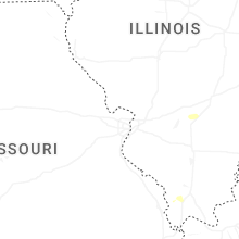


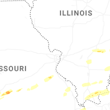

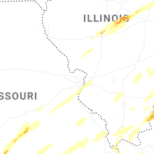


Connect with Interactive Hail Maps