

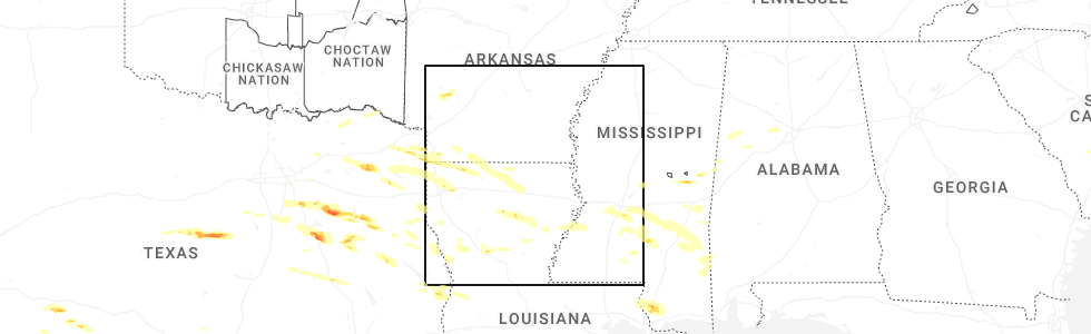
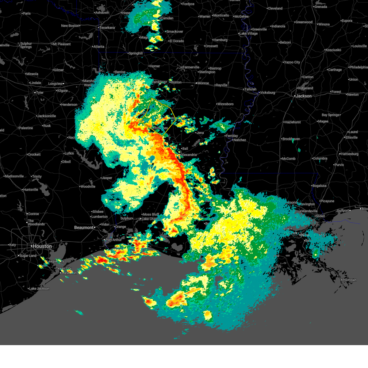
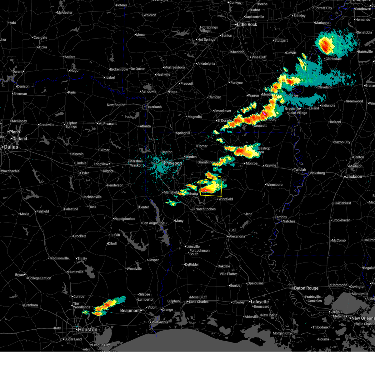
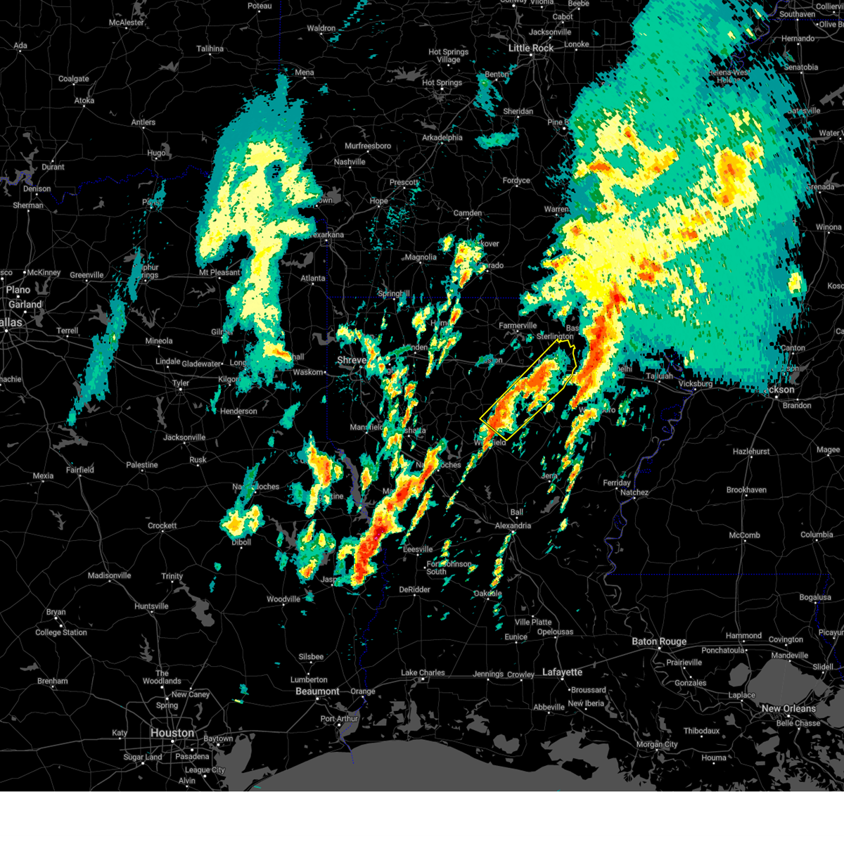
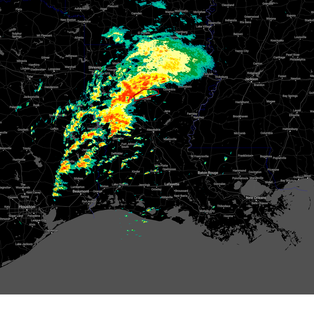
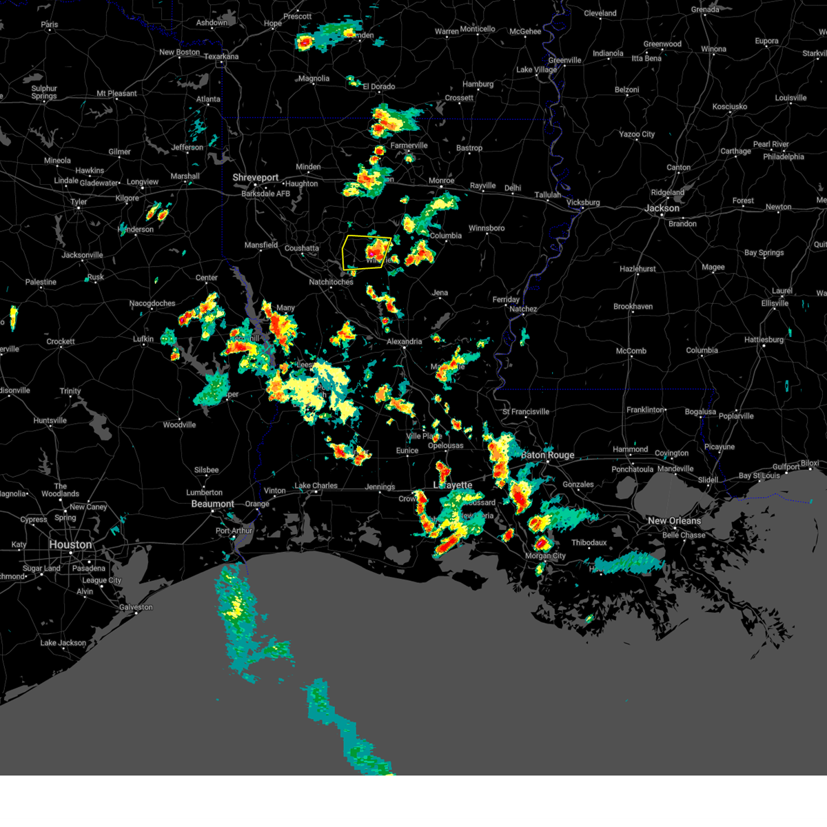
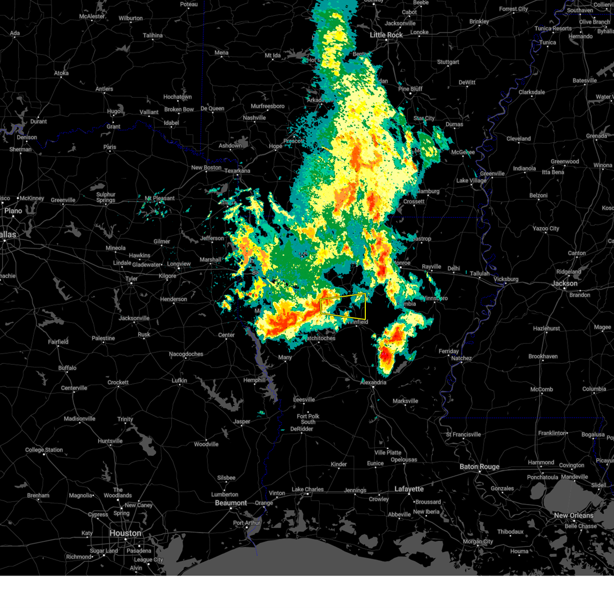
Hail Map for Dodson, LA
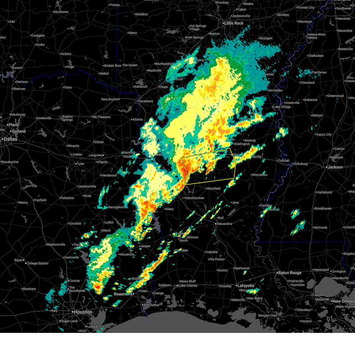
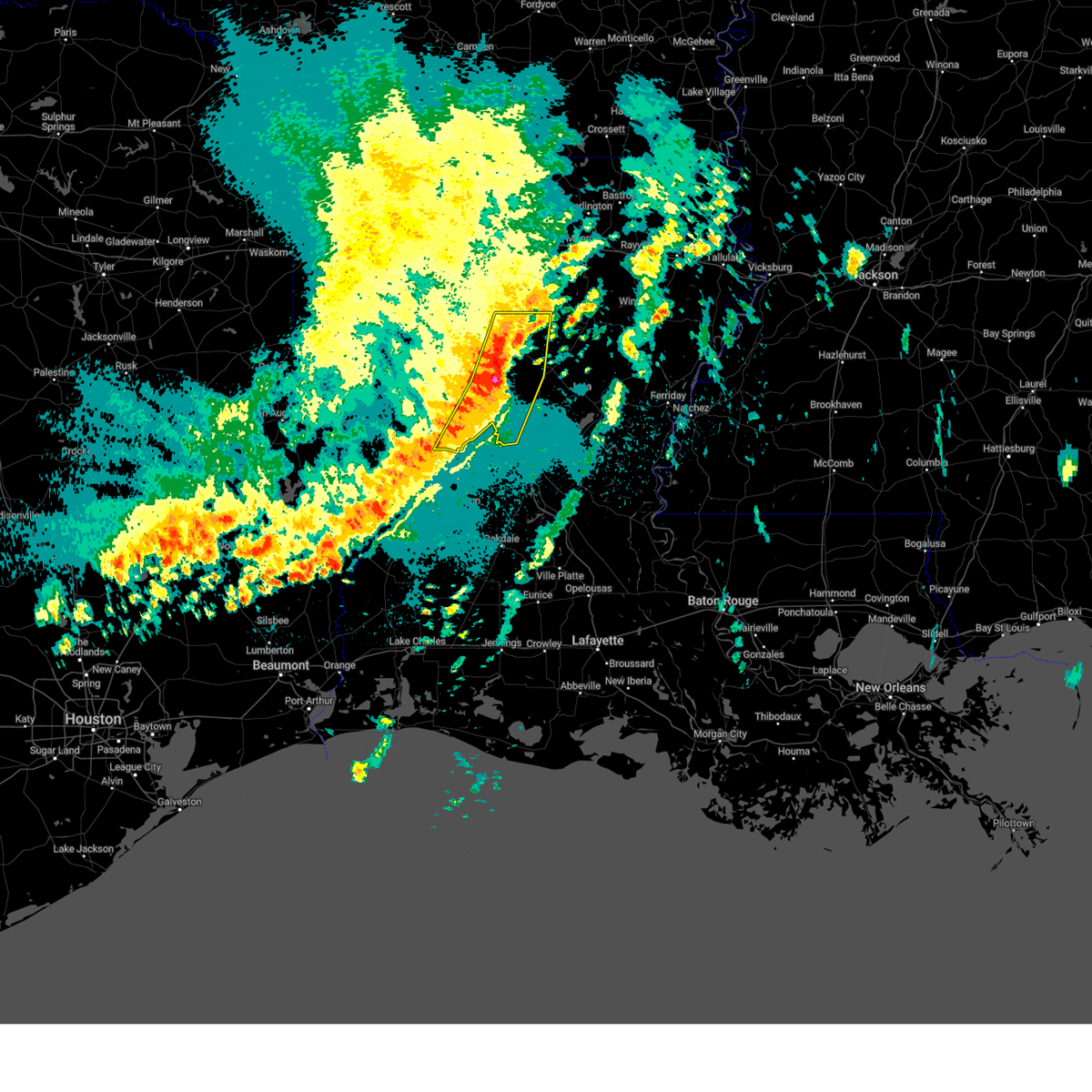
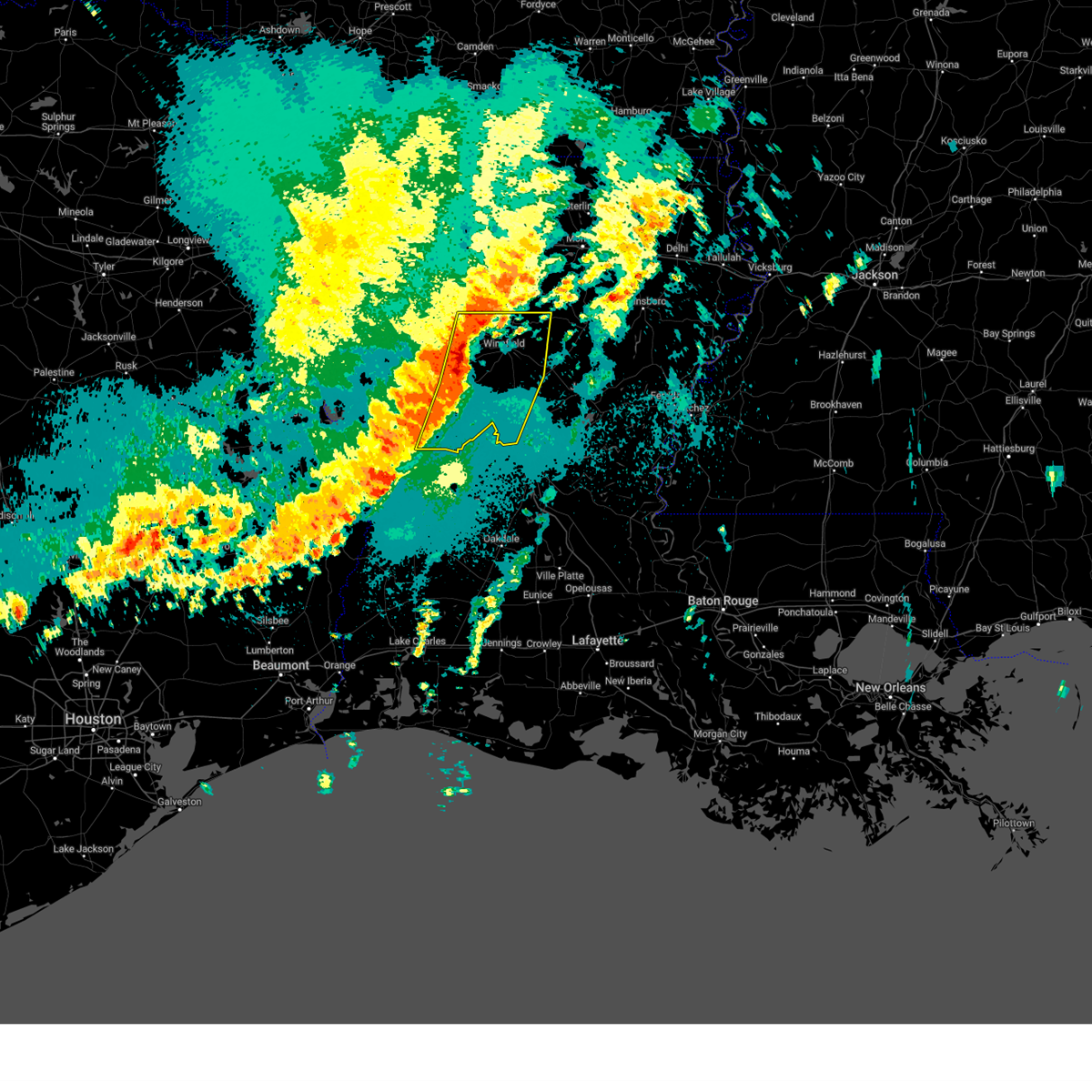
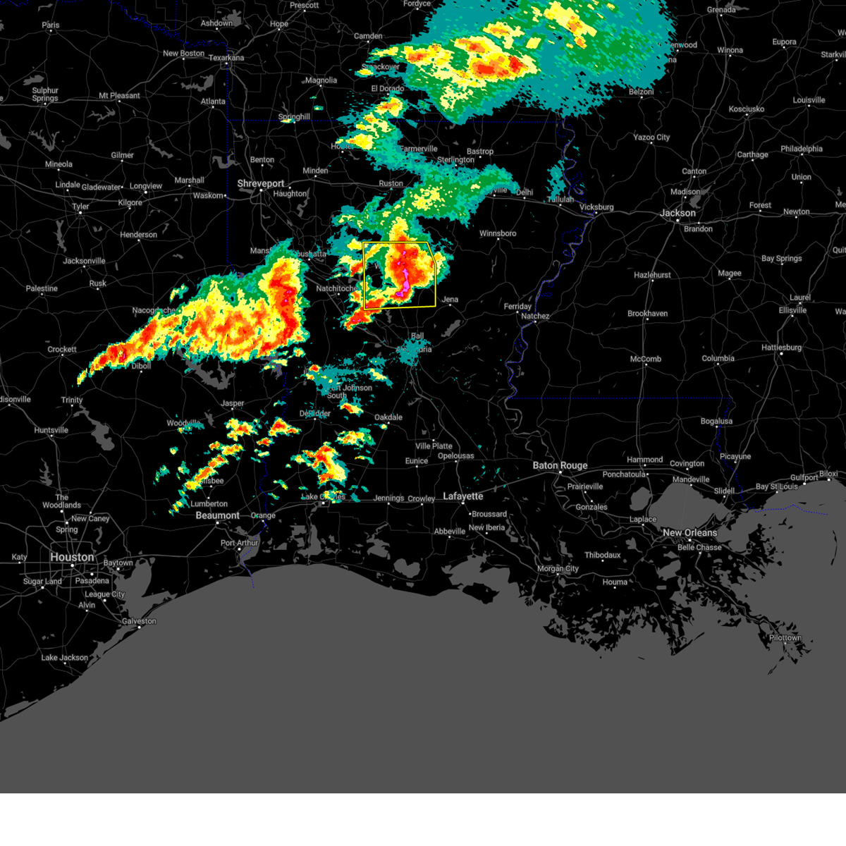
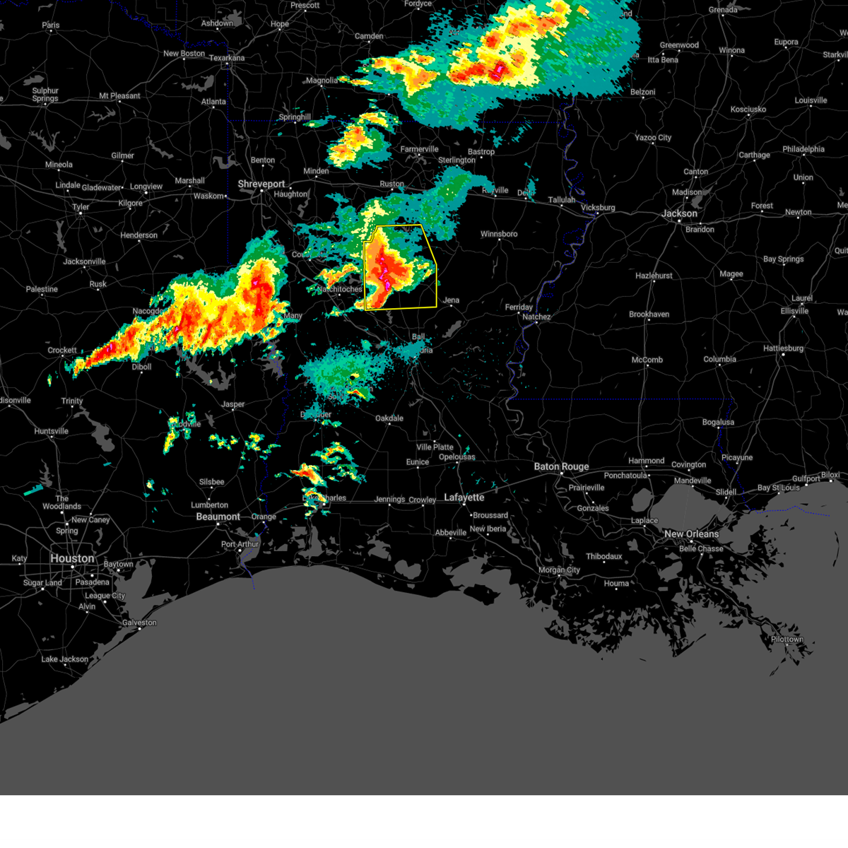
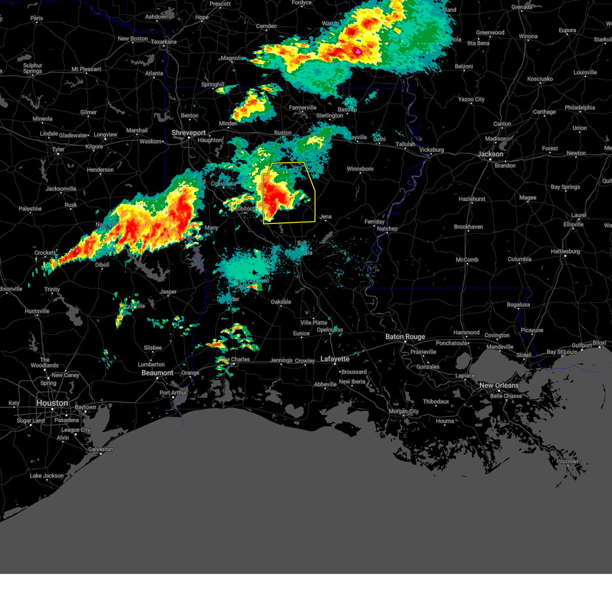
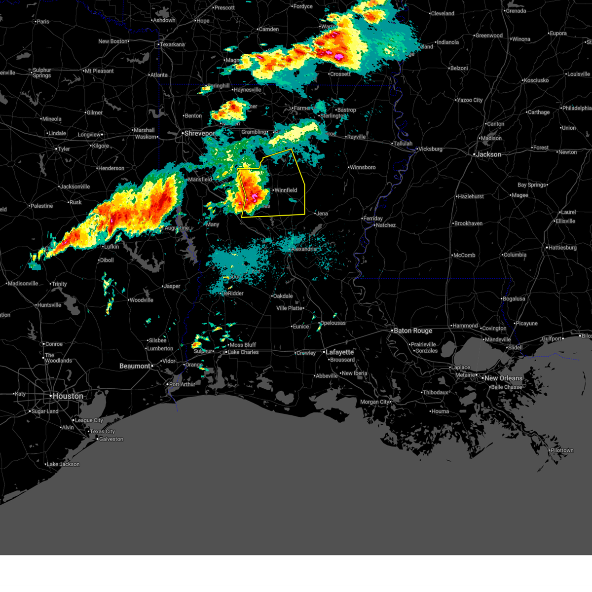
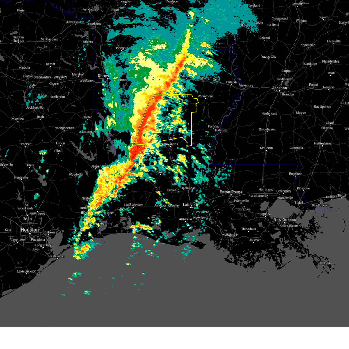
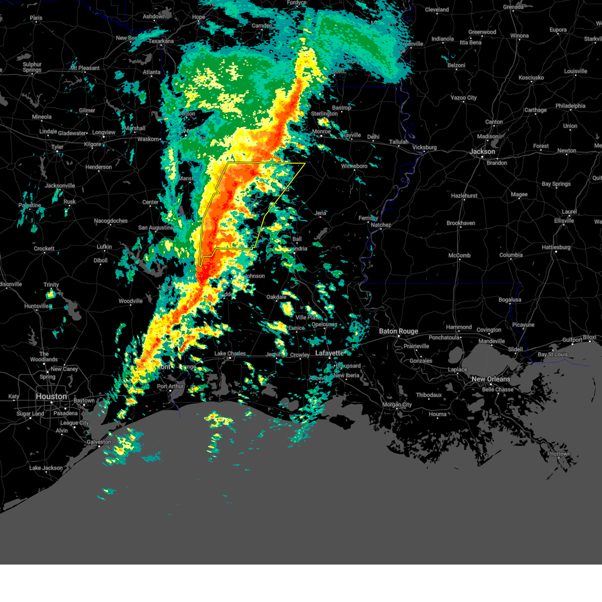
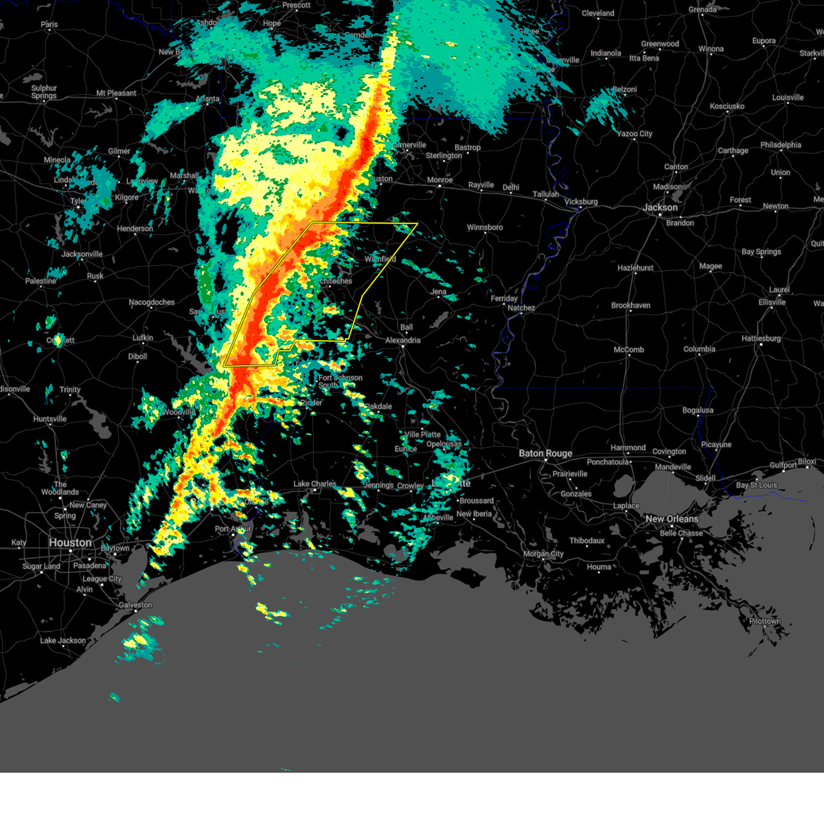
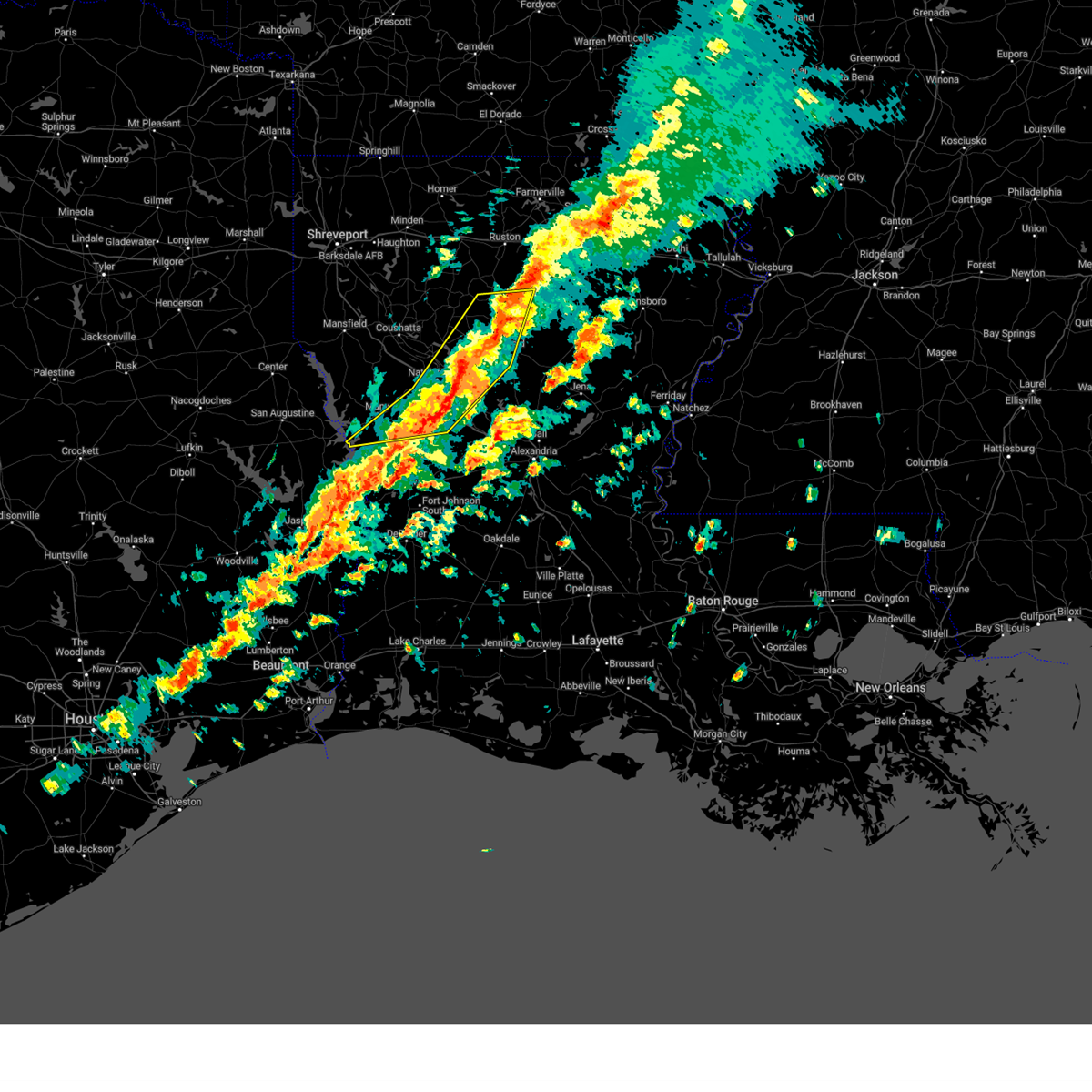
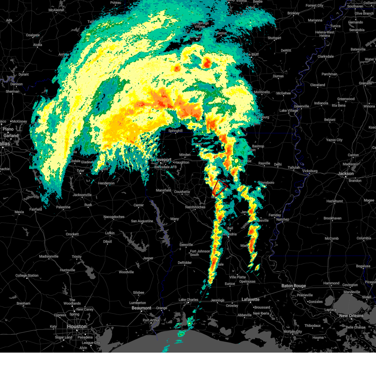
The Dodson, LA area has had 1 report of on-the-ground hail by trained spotters, and has been under severe weather warnings 8 times during the past 12 months. Doppler radar has detected hail at or near Dodson, LA on 64 occasions, including 3 occasions during the past year.
| Name: | Dodson, LA |
| Where Located: | 64.9 miles SW of Bastrop, LA |
| Map: | Google Map for Dodson, LA |
| Population: | 337 |
| Housing Units: | 173 |
| More Info: | Search Google for Dodson, LA |
0
The Top Recent Hail Date for Dodson, LA is Wednesday, April 29, 2026 (60th out of 64)
Hail and Wind Damage Spotted near Dodson, LA
| Date / Time | Report Details |
|---|---|
| 5/23/2026 12:15 PM CDT |
 the severe thunderstorm warning has been cancelled and is no longer in effect the severe thunderstorm warning has been cancelled and is no longer in effect
|
| 5/23/2026 12:00 PM CDT |
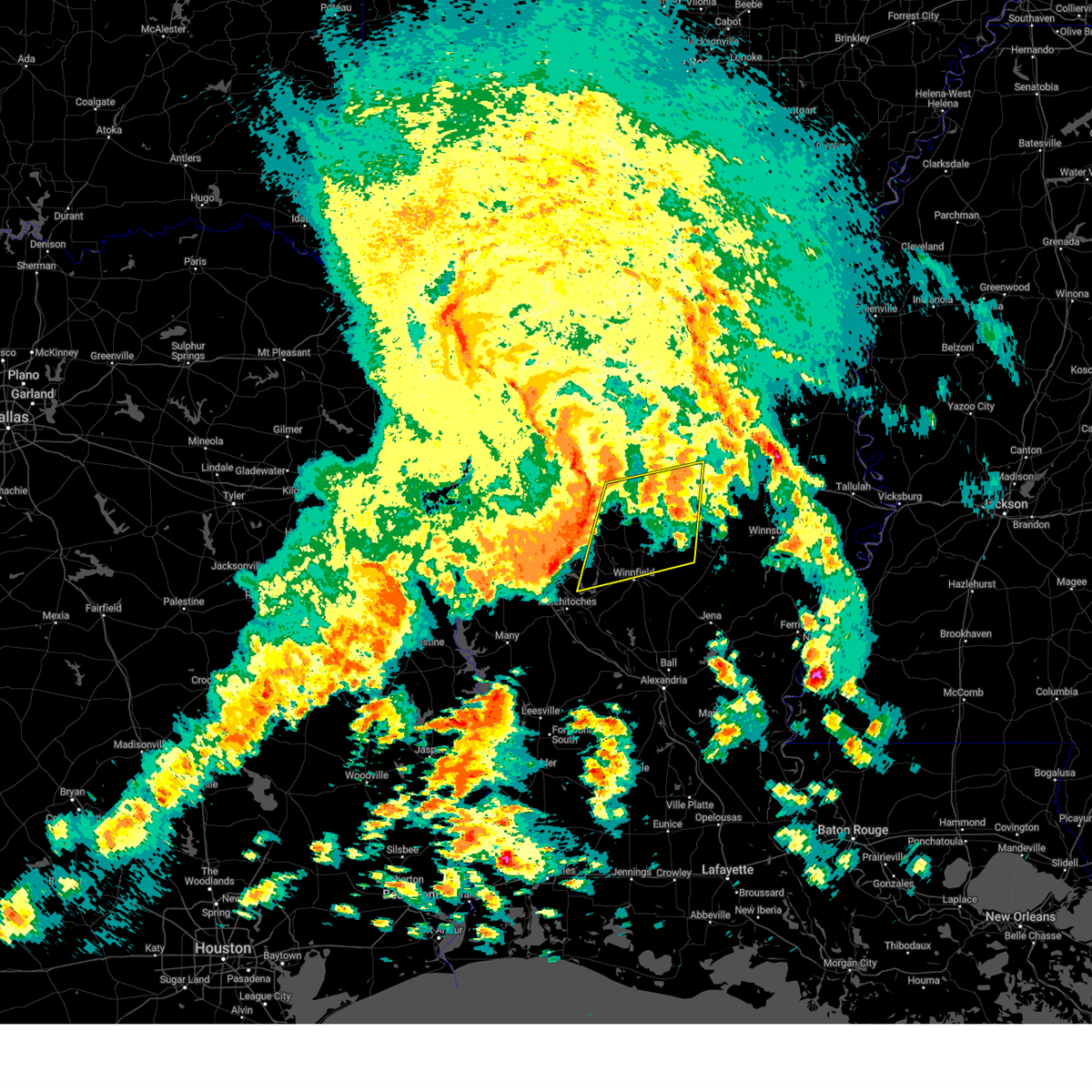
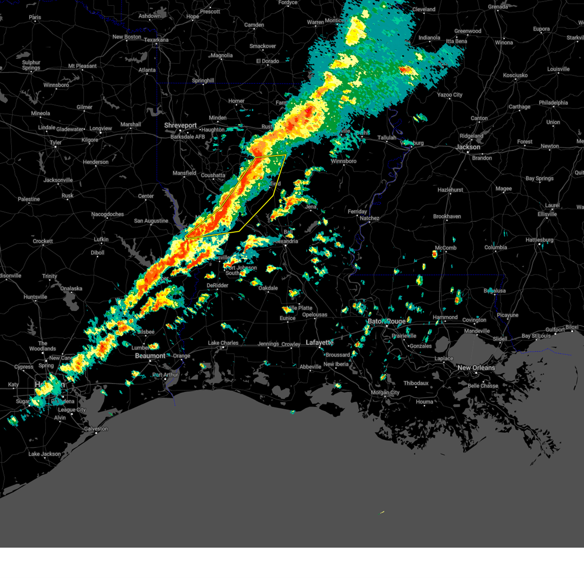
 At noon cdt, severe thunderstorms were located along a line from 9 miles east of jonesboro to 15 miles east of jena, or along a line from 9 miles east of jonesboro to 34 miles south of columbia, moving northeast at 40 mph (radar indicated). Hazards include 60 mph wind gusts and small hail. Expect damage to roofs, siding, and trees. Locations impacted include, columbia, jena, olla, clarks, grayson, urania, chatham, dodson, sikes, kelly, standard, spaulding, burlington, vixen, riverton and hudson. At noon cdt, severe thunderstorms were located along a line from 9 miles east of jonesboro to 15 miles east of jena, or along a line from 9 miles east of jonesboro to 34 miles south of columbia, moving northeast at 40 mph (radar indicated). Hazards include 60 mph wind gusts and small hail. Expect damage to roofs, siding, and trees. Locations impacted include, columbia, jena, olla, clarks, grayson, urania, chatham, dodson, sikes, kelly, standard, spaulding, burlington, vixen, riverton and hudson.
|
| 5/23/2026 11:25 AM CDT |
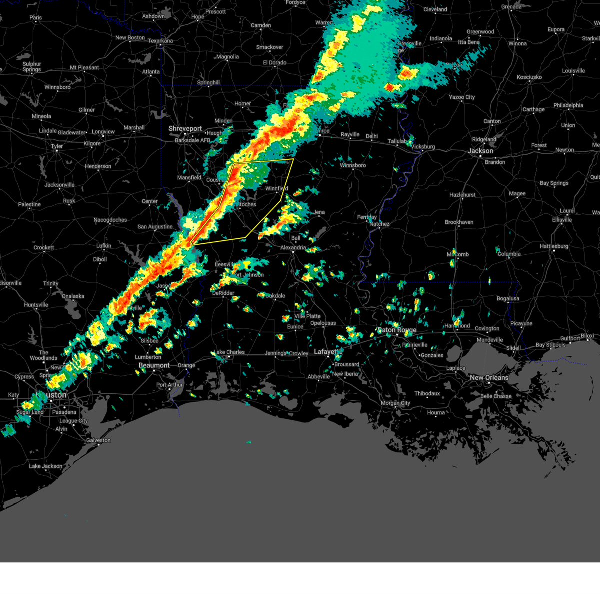
 Svrshv the national weather service in shreveport has issued a * severe thunderstorm warning for, caldwell parish in north central louisiana, southeastern jackson parish in north central louisiana, la salle parish in north central louisiana, northeastern winn parish in north central louisiana, * until 1230 pm cdt. * at 1125 am cdt, severe thunderstorms were located along a line from 9 miles northwest of winnfield to 16 miles southeast of midway, or along a line from 9 miles northwest of winnfield to 44 miles south of columbia, moving northeast at 40 mph (radar indicated). Hazards include 60 mph wind gusts and small hail. expect damage to roofs, siding, and trees Svrshv the national weather service in shreveport has issued a * severe thunderstorm warning for, caldwell parish in north central louisiana, southeastern jackson parish in north central louisiana, la salle parish in north central louisiana, northeastern winn parish in north central louisiana, * until 1230 pm cdt. * at 1125 am cdt, severe thunderstorms were located along a line from 9 miles northwest of winnfield to 16 miles southeast of midway, or along a line from 9 miles northwest of winnfield to 44 miles south of columbia, moving northeast at 40 mph (radar indicated). Hazards include 60 mph wind gusts and small hail. expect damage to roofs, siding, and trees
|
| 5/23/2026 10:50 AM CDT |
 Svrshv the national weather service in shreveport has issued a * severe thunderstorm warning for, west central grant parish in north central louisiana, western winn parish in north central louisiana, southeastern bienville parish in northwestern louisiana, northeastern natchitoches parish in northwestern louisiana, * until 1145 am cdt. * at 1050 am cdt, severe thunderstorms were located along a line from 6 miles west of campti to 5 miles north of colfax, or along a line from 12 miles northwest of natchitoches to 23 miles south of winnfield, moving northeast at 40 mph (radar indicated). Hazards include 60 mph wind gusts and small hail. expect damage to roofs, siding, and trees Svrshv the national weather service in shreveport has issued a * severe thunderstorm warning for, west central grant parish in north central louisiana, western winn parish in north central louisiana, southeastern bienville parish in northwestern louisiana, northeastern natchitoches parish in northwestern louisiana, * until 1145 am cdt. * at 1050 am cdt, severe thunderstorms were located along a line from 6 miles west of campti to 5 miles north of colfax, or along a line from 12 miles northwest of natchitoches to 23 miles south of winnfield, moving northeast at 40 mph (radar indicated). Hazards include 60 mph wind gusts and small hail. expect damage to roofs, siding, and trees
|
| 2/14/2026 9:00 PM CST | Trees down near the intersection of hwy. 126 and hwy. 34 east of dodson... louisian in winn county LA, 4.6 miles W of Dodson, LA |
| 2/14/2026 8:52 PM CST |
 Svrshv the national weather service in shreveport has issued a * severe thunderstorm warning for, caldwell parish in north central louisiana, grant parish in north central louisiana, la salle parish in north central louisiana, eastern winn parish in north central louisiana, * until 945 pm cst. * at 852 pm cst, severe thunderstorms were located along a line from 13 miles southeast of jonesboro to 13 miles southeast of colfax, or along a line from 13 miles southeast of jonesboro to 38 miles south of winnfield, moving east at 40 mph (radar indicated). Hazards include 60 mph wind gusts. expect damage to roofs, siding, and trees Svrshv the national weather service in shreveport has issued a * severe thunderstorm warning for, caldwell parish in north central louisiana, grant parish in north central louisiana, la salle parish in north central louisiana, eastern winn parish in north central louisiana, * until 945 pm cst. * at 852 pm cst, severe thunderstorms were located along a line from 13 miles southeast of jonesboro to 13 miles southeast of colfax, or along a line from 13 miles southeast of jonesboro to 38 miles south of winnfield, moving east at 40 mph (radar indicated). Hazards include 60 mph wind gusts. expect damage to roofs, siding, and trees
|
| 2/14/2026 8:29 PM CST |
 At 829 pm cst, severe thunderstorms were located along a line from 8 miles south of jonesboro to 14 miles southwest of colfax, or along a line from 8 miles south of jonesboro to 31 miles southeast of natchitoches, moving east at 40 mph (radar indicated). Hazards include 60 mph wind gusts. Expect damage to roofs, siding, and trees. Locations impacted include, winnfield, colfax, montgomery, dry prong, goldonna, dodson, georgetown, calvin, atlanta, sikes, williana, lake iatt, joyce, aloha, hudson, rochelle, bentley, chopin, cloutierville and melrose. At 829 pm cst, severe thunderstorms were located along a line from 8 miles south of jonesboro to 14 miles southwest of colfax, or along a line from 8 miles south of jonesboro to 31 miles southeast of natchitoches, moving east at 40 mph (radar indicated). Hazards include 60 mph wind gusts. Expect damage to roofs, siding, and trees. Locations impacted include, winnfield, colfax, montgomery, dry prong, goldonna, dodson, georgetown, calvin, atlanta, sikes, williana, lake iatt, joyce, aloha, hudson, rochelle, bentley, chopin, cloutierville and melrose.
|
| 2/14/2026 8:09 PM CST |
 Svrshv the national weather service in shreveport has issued a * severe thunderstorm warning for, grant parish in north central louisiana, winn parish in north central louisiana, central natchitoches parish in northwestern louisiana, * until 900 pm cst. * at 809 pm cst, severe thunderstorms were located along a line from 16 miles southwest of jonesboro to 24 miles south of montgomery, or along a line from 16 miles southwest of jonesboro to 27 miles south of natchitoches, moving east at 40 mph (radar indicated). Hazards include 60 mph wind gusts. expect damage to roofs, siding, and trees Svrshv the national weather service in shreveport has issued a * severe thunderstorm warning for, grant parish in north central louisiana, winn parish in north central louisiana, central natchitoches parish in northwestern louisiana, * until 900 pm cst. * at 809 pm cst, severe thunderstorms were located along a line from 16 miles southwest of jonesboro to 24 miles south of montgomery, or along a line from 16 miles southwest of jonesboro to 27 miles south of natchitoches, moving east at 40 mph (radar indicated). Hazards include 60 mph wind gusts. expect damage to roofs, siding, and trees
|
| 1/10/2026 12:28 AM CST |
 Svrshv the national weather service in shreveport has issued a * severe thunderstorm warning for, northwestern caldwell parish in north central louisiana, jackson parish in north central louisiana, southern lincoln parish in north central louisiana, ouachita parish in north central louisiana, northern winn parish in north central louisiana, eastern bienville parish in northwestern louisiana, northeastern natchitoches parish in northwestern louisiana, * until 115 am cst. * at 1228 am cst, severe thunderstorms were located along a line from 14 miles west of jonesboro to 15 miles southwest of jonesboro, moving east at 60 mph (radar indicated). Hazards include 60 mph wind gusts and small hail. expect damage to roofs, siding, and trees Svrshv the national weather service in shreveport has issued a * severe thunderstorm warning for, northwestern caldwell parish in north central louisiana, jackson parish in north central louisiana, southern lincoln parish in north central louisiana, ouachita parish in north central louisiana, northern winn parish in north central louisiana, eastern bienville parish in northwestern louisiana, northeastern natchitoches parish in northwestern louisiana, * until 115 am cst. * at 1228 am cst, severe thunderstorms were located along a line from 14 miles west of jonesboro to 15 miles southwest of jonesboro, moving east at 60 mph (radar indicated). Hazards include 60 mph wind gusts and small hail. expect damage to roofs, siding, and trees
|
| 6/11/2025 4:51 PM CDT |
 At 450 pm cdt, severe thunderstorms were located along a line extending from 10 miles southwest of jonesboro to 9 miles southeast of winnfield to 14 miles north of ball to near timber trails, moving northeast at 25 mph (radar indicated). Hazards include 60 mph wind gusts and penny size hail. Expect damage to roofs, siding, and trees. Locations impacted include, winnfield, ball, urania, pollock, dry prong, goldonna, tullos, dodson, georgetown, calvin, sikes, rogers, hudson, bentley, rochelle, joyce, zenoria, fishville, and williana. At 450 pm cdt, severe thunderstorms were located along a line extending from 10 miles southwest of jonesboro to 9 miles southeast of winnfield to 14 miles north of ball to near timber trails, moving northeast at 25 mph (radar indicated). Hazards include 60 mph wind gusts and penny size hail. Expect damage to roofs, siding, and trees. Locations impacted include, winnfield, ball, urania, pollock, dry prong, goldonna, tullos, dodson, georgetown, calvin, sikes, rogers, hudson, bentley, rochelle, joyce, zenoria, fishville, and williana.
|
| 6/11/2025 4:20 PM CDT |
 Svrshv the national weather service in shreveport has issued a * severe thunderstorm warning for, grant parish in north central louisiana, northeastern natchitoches parish in northwestern louisiana, northwestern la salle parish in north central louisiana, winn parish in north central louisiana, * until 515 pm cdt. * at 420 pm cdt, severe thunderstorms were located along a line extending from 14 miles northeast of campti to 11 miles south of winnfield to 7 miles northeast of colfax to near boyce, moving northeast at 25 mph (radar indicated). Hazards include 60 mph wind gusts and penny size hail. expect damage to roofs, siding, and trees Svrshv the national weather service in shreveport has issued a * severe thunderstorm warning for, grant parish in north central louisiana, northeastern natchitoches parish in northwestern louisiana, northwestern la salle parish in north central louisiana, winn parish in north central louisiana, * until 515 pm cdt. * at 420 pm cdt, severe thunderstorms were located along a line extending from 14 miles northeast of campti to 11 miles south of winnfield to 7 miles northeast of colfax to near boyce, moving northeast at 25 mph (radar indicated). Hazards include 60 mph wind gusts and penny size hail. expect damage to roofs, siding, and trees
|
| 5/20/2025 4:28 PM CDT |
 Svrshv the national weather service in shreveport has issued a * severe thunderstorm warning for, western caldwell parish in north central louisiana, southeastern jackson parish in north central louisiana, northern winn parish in north central louisiana, * until 515 pm cdt. * at 428 pm cdt, a severe thunderstorm was located 11 miles northwest of winnfield, moving east at 40 mph (radar indicated). Hazards include 60 mph wind gusts and quarter size hail. Hail damage to vehicles is expected. Expect wind damage to roofs, siding, and trees. Svrshv the national weather service in shreveport has issued a * severe thunderstorm warning for, western caldwell parish in north central louisiana, southeastern jackson parish in north central louisiana, northern winn parish in north central louisiana, * until 515 pm cdt. * at 428 pm cdt, a severe thunderstorm was located 11 miles northwest of winnfield, moving east at 40 mph (radar indicated). Hazards include 60 mph wind gusts and quarter size hail. Hail damage to vehicles is expected. Expect wind damage to roofs, siding, and trees.
|
| 5/20/2025 4:13 PM CDT |
 the severe thunderstorm warning has been cancelled and is no longer in effect the severe thunderstorm warning has been cancelled and is no longer in effect
|
| 5/20/2025 4:13 PM CDT |
 At 412 pm cdt, a severe thunderstorm was located 7 miles south of jonesboro, moving east at 45 mph (radar indicated). Hazards include 60 mph wind gusts and quarter size hail. Hail damage to vehicles is expected. expect wind damage to roofs, siding, and trees. Locations impacted include, friendship, jonesboro, goldonna, hudson, saline, dodson, and hodge. At 412 pm cdt, a severe thunderstorm was located 7 miles south of jonesboro, moving east at 45 mph (radar indicated). Hazards include 60 mph wind gusts and quarter size hail. Hail damage to vehicles is expected. expect wind damage to roofs, siding, and trees. Locations impacted include, friendship, jonesboro, goldonna, hudson, saline, dodson, and hodge.
|
| 5/20/2025 3:53 PM CDT |
 At 353 pm cdt, a severe thunderstorm was located 16 miles northeast of campti, or 18 miles southwest of jonesboro, moving east at 45 mph (radar indicated). Hazards include 60 mph wind gusts and quarter size hail. Hail damage to vehicles is expected. expect wind damage to roofs, siding, and trees. Locations impacted include, friendship, jonesboro, goldonna, chestnut, hudson, saline, dodson, ashland, hodge, martin, and lucky. At 353 pm cdt, a severe thunderstorm was located 16 miles northeast of campti, or 18 miles southwest of jonesboro, moving east at 45 mph (radar indicated). Hazards include 60 mph wind gusts and quarter size hail. Hail damage to vehicles is expected. expect wind damage to roofs, siding, and trees. Locations impacted include, friendship, jonesboro, goldonna, chestnut, hudson, saline, dodson, ashland, hodge, martin, and lucky.
|
| 5/20/2025 3:39 PM CDT |
 Svrshv the national weather service in shreveport has issued a * severe thunderstorm warning for, southwestern jackson parish in north central louisiana, northeastern red river parish in northwestern louisiana, north central natchitoches parish in northwestern louisiana, southeastern bienville parish in northwestern louisiana, northwestern winn parish in north central louisiana, * until 430 pm cdt. * at 338 pm cdt, a severe thunderstorm was located 10 miles northeast of coushatta, or 26 miles north of natchitoches, moving east at 45 mph (radar indicated). Hazards include 60 mph wind gusts and quarter size hail. Hail damage to vehicles is expected. Expect wind damage to roofs, siding, and trees. Svrshv the national weather service in shreveport has issued a * severe thunderstorm warning for, southwestern jackson parish in north central louisiana, northeastern red river parish in northwestern louisiana, north central natchitoches parish in northwestern louisiana, southeastern bienville parish in northwestern louisiana, northwestern winn parish in north central louisiana, * until 430 pm cdt. * at 338 pm cdt, a severe thunderstorm was located 10 miles northeast of coushatta, or 26 miles north of natchitoches, moving east at 45 mph (radar indicated). Hazards include 60 mph wind gusts and quarter size hail. Hail damage to vehicles is expected. Expect wind damage to roofs, siding, and trees.
|
| 5/6/2025 5:06 PM CDT |
 Svrshv the national weather service in shreveport has issued a * severe thunderstorm warning for, caldwell parish in north central louisiana, eastern jackson parish in north central louisiana, ouachita parish in north central louisiana, southeastern lincoln parish in north central louisiana, northeastern winn parish in north central louisiana, * until 600 pm cdt. * at 506 pm cdt, severe thunderstorms were located along a line extending from 12 miles east of ruston to 12 miles southwest of brownsville-bawcomville to 18 miles southwest of brownsville-bawcom to near winnfield, moving east at 60 mph (radar indicated). Hazards include 70 mph wind gusts and penny size hail. Expect considerable tree damage. Damage is likely to mobile homes, roofs, and outbuildings. Svrshv the national weather service in shreveport has issued a * severe thunderstorm warning for, caldwell parish in north central louisiana, eastern jackson parish in north central louisiana, ouachita parish in north central louisiana, southeastern lincoln parish in north central louisiana, northeastern winn parish in north central louisiana, * until 600 pm cdt. * at 506 pm cdt, severe thunderstorms were located along a line extending from 12 miles east of ruston to 12 miles southwest of brownsville-bawcomville to 18 miles southwest of brownsville-bawcom to near winnfield, moving east at 60 mph (radar indicated). Hazards include 70 mph wind gusts and penny size hail. Expect considerable tree damage. Damage is likely to mobile homes, roofs, and outbuildings.
|
| 5/6/2025 4:32 PM CDT |
 Svrshv the national weather service in shreveport has issued a * severe thunderstorm warning for, northwestern caldwell parish in north central louisiana, jackson parish in north central louisiana, northeastern natchitoches parish in northwestern louisiana, southwestern ouachita parish in north central louisiana, southeastern bienville parish in northwestern louisiana, southeastern lincoln parish in north central louisiana, northern winn parish in north central louisiana, * until 515 pm cdt. * at 432 pm cdt, severe thunderstorms were located along a line extending from 7 miles south of arcadia to 12 miles northeast of campti, moving east at 65 mph (radar indicated). Hazards include 70 mph wind gusts and penny size hail. Expect considerable tree damage. Damage is likely to mobile homes, roofs, and outbuildings. Svrshv the national weather service in shreveport has issued a * severe thunderstorm warning for, northwestern caldwell parish in north central louisiana, jackson parish in north central louisiana, northeastern natchitoches parish in northwestern louisiana, southwestern ouachita parish in north central louisiana, southeastern bienville parish in northwestern louisiana, southeastern lincoln parish in north central louisiana, northern winn parish in north central louisiana, * until 515 pm cdt. * at 432 pm cdt, severe thunderstorms were located along a line extending from 7 miles south of arcadia to 12 miles northeast of campti, moving east at 65 mph (radar indicated). Hazards include 70 mph wind gusts and penny size hail. Expect considerable tree damage. Damage is likely to mobile homes, roofs, and outbuildings.
|
| 5/6/2025 3:03 PM CDT |
 Svrshv the national weather service in shreveport has issued a * severe thunderstorm warning for, southeastern webster parish in northwestern louisiana, western jackson parish in north central louisiana, northeastern red river parish in northwestern louisiana, north central natchitoches parish in northwestern louisiana, south central claiborne parish in northwestern louisiana, bienville parish in northwestern louisiana, southeastern bossier parish in northwestern louisiana, southwestern lincoln parish in north central louisiana, northwestern winn parish in north central louisiana, * until 345 pm cdt. * at 302 pm cdt, severe thunderstorms were located along a line extending from 9 miles south of haughton to near campti, moving northeast at 55 mph (radar indicated). Hazards include quarter size hail. damage to vehicles is expected Svrshv the national weather service in shreveport has issued a * severe thunderstorm warning for, southeastern webster parish in northwestern louisiana, western jackson parish in north central louisiana, northeastern red river parish in northwestern louisiana, north central natchitoches parish in northwestern louisiana, south central claiborne parish in northwestern louisiana, bienville parish in northwestern louisiana, southeastern bossier parish in northwestern louisiana, southwestern lincoln parish in north central louisiana, northwestern winn parish in north central louisiana, * until 345 pm cdt. * at 302 pm cdt, severe thunderstorms were located along a line extending from 9 miles south of haughton to near campti, moving northeast at 55 mph (radar indicated). Hazards include quarter size hail. damage to vehicles is expected
|
| 5/2/2025 3:54 PM CDT |
 the severe thunderstorm warning has been cancelled and is no longer in effect the severe thunderstorm warning has been cancelled and is no longer in effect
|
| 5/2/2025 3:54 PM CDT |
 At 354 pm cdt, severe thunderstorms were located along a line from near ringgold to 13 miles southwest of jonesboro, or along a line from 16 miles south of minden to 13 miles southwest of jonesboro, moving northeast at 40 mph (radar indicated). Hazards include 60 mph wind gusts and quarter size hail. Hail damage to vehicles is expected. expect wind damage to roofs, siding, and trees. Locations impacted include, jonesboro, ringgold, sibley, dubberly, heflin, martin, hodge, goldonna, north hodge, dodson, hall summit, east hodge, saline, lucky, ashland, castor, calvin, bienville, quitman and jamestown. At 354 pm cdt, severe thunderstorms were located along a line from near ringgold to 13 miles southwest of jonesboro, or along a line from 16 miles south of minden to 13 miles southwest of jonesboro, moving northeast at 40 mph (radar indicated). Hazards include 60 mph wind gusts and quarter size hail. Hail damage to vehicles is expected. expect wind damage to roofs, siding, and trees. Locations impacted include, jonesboro, ringgold, sibley, dubberly, heflin, martin, hodge, goldonna, north hodge, dodson, hall summit, east hodge, saline, lucky, ashland, castor, calvin, bienville, quitman and jamestown.
|
| 5/2/2025 3:27 PM CDT |
 Svrshv the national weather service in shreveport has issued a * severe thunderstorm warning for, southwestern jackson parish in north central louisiana, western winn parish in north central louisiana, bienville parish in northwestern louisiana, southeastern bossier parish in northwestern louisiana, east central de soto parish in northwestern louisiana, northeastern natchitoches parish in northwestern louisiana, red river parish in northwestern louisiana, southeastern webster parish in northwestern louisiana, * until 415 pm cdt. * at 327 pm cdt, severe thunderstorms were located along a line from 11 miles northwest of coushatta to 9 miles east of campti, or along a line from 19 miles northeast of mansfield to 11 miles northeast of natchitoches, moving northeast at 40 mph (radar indicated). Hazards include 60 mph wind gusts and quarter size hail. Hail damage to vehicles is expected. Expect wind damage to roofs, siding, and trees. Svrshv the national weather service in shreveport has issued a * severe thunderstorm warning for, southwestern jackson parish in north central louisiana, western winn parish in north central louisiana, bienville parish in northwestern louisiana, southeastern bossier parish in northwestern louisiana, east central de soto parish in northwestern louisiana, northeastern natchitoches parish in northwestern louisiana, red river parish in northwestern louisiana, southeastern webster parish in northwestern louisiana, * until 415 pm cdt. * at 327 pm cdt, severe thunderstorms were located along a line from 11 miles northwest of coushatta to 9 miles east of campti, or along a line from 19 miles northeast of mansfield to 11 miles northeast of natchitoches, moving northeast at 40 mph (radar indicated). Hazards include 60 mph wind gusts and quarter size hail. Hail damage to vehicles is expected. Expect wind damage to roofs, siding, and trees.
|
| 5/1/2025 1:44 AM CDT |
 At 143 am cdt, severe thunderstorms were located along a line extending from 12 miles northeast of winnfield to 15 miles north of colfax to near flatwoods, moving east at 45 mph (radar indicated). Hazards include 60 mph wind gusts and penny size hail. Expect damage to roofs, siding, and trees. Locations impacted include, sikes, cloutierville, montgomery, winnfield, hudson, chopin, dry prong, dodson, joyce, lake iatt, atlanta, aloha, williana, colfax, gorum, calvin, and georgetown. At 143 am cdt, severe thunderstorms were located along a line extending from 12 miles northeast of winnfield to 15 miles north of colfax to near flatwoods, moving east at 45 mph (radar indicated). Hazards include 60 mph wind gusts and penny size hail. Expect damage to roofs, siding, and trees. Locations impacted include, sikes, cloutierville, montgomery, winnfield, hudson, chopin, dry prong, dodson, joyce, lake iatt, atlanta, aloha, williana, colfax, gorum, calvin, and georgetown.
|
| 5/1/2025 1:21 AM CDT |
 Svrshv the national weather service in shreveport has issued a * severe thunderstorm warning for, grant parish in north central louisiana, eastern natchitoches parish in northwestern louisiana, winn parish in north central louisiana, * until 200 am cdt. * at 121 am cdt, severe thunderstorms were located along a line extending from 12 miles southwest of jonesboro to near montgomery to near kurthwood, moving east at 35 mph (radar indicated). Hazards include 60 mph wind gusts and penny size hail. expect damage to roofs, siding, and trees Svrshv the national weather service in shreveport has issued a * severe thunderstorm warning for, grant parish in north central louisiana, eastern natchitoches parish in northwestern louisiana, winn parish in north central louisiana, * until 200 am cdt. * at 121 am cdt, severe thunderstorms were located along a line extending from 12 miles southwest of jonesboro to near montgomery to near kurthwood, moving east at 35 mph (radar indicated). Hazards include 60 mph wind gusts and penny size hail. expect damage to roofs, siding, and trees
|
| 3/31/2025 2:20 AM CDT |
 the severe thunderstorm warning has been cancelled and is no longer in effect the severe thunderstorm warning has been cancelled and is no longer in effect
|
| 3/31/2025 2:04 AM CDT |
 At 204 am cdt, severe thunderstorms were located along a line from 6 miles southeast of jonesboro to 13 miles south of winnfield, moving east at 40 mph. these are destructive storms for southern winn parish (radar indicated). Hazards include three inch hail and 60 mph wind gusts. People and animals outdoors will be severely injured. expect shattered windows, extensive damage to roofs, siding, and vehicles. Locations impacted include, winnfield, olla, montgomery, urania, tullos, dodson, georgetown, calvin, atlanta, sikes, joyce, hudson, williana, rochelle and zenoria. At 204 am cdt, severe thunderstorms were located along a line from 6 miles southeast of jonesboro to 13 miles south of winnfield, moving east at 40 mph. these are destructive storms for southern winn parish (radar indicated). Hazards include three inch hail and 60 mph wind gusts. People and animals outdoors will be severely injured. expect shattered windows, extensive damage to roofs, siding, and vehicles. Locations impacted include, winnfield, olla, montgomery, urania, tullos, dodson, georgetown, calvin, atlanta, sikes, joyce, hudson, williana, rochelle and zenoria.
|
| 3/31/2025 2:04 AM CDT |
 the severe thunderstorm warning has been cancelled and is no longer in effect the severe thunderstorm warning has been cancelled and is no longer in effect
|
| 3/31/2025 2:01 AM CDT |
 At 201 am cdt, severe thunderstorms were located along a line from near jonesboro to 14 miles south of winnfield, moving east at 40 mph. these are destructive storms for southern winn parish (radar indicated). Hazards include three inch hail and 60 mph wind gusts. People and animals outdoors will be severely injured. expect shattered windows, extensive damage to roofs, siding, and vehicles. Locations impacted include, winnfield, jonesboro, olla, montgomery, urania, tullos, dodson, georgetown, calvin, atlanta, sikes, joyce, hudson, rochelle, williana and zenoria. At 201 am cdt, severe thunderstorms were located along a line from near jonesboro to 14 miles south of winnfield, moving east at 40 mph. these are destructive storms for southern winn parish (radar indicated). Hazards include three inch hail and 60 mph wind gusts. People and animals outdoors will be severely injured. expect shattered windows, extensive damage to roofs, siding, and vehicles. Locations impacted include, winnfield, jonesboro, olla, montgomery, urania, tullos, dodson, georgetown, calvin, atlanta, sikes, joyce, hudson, rochelle, williana and zenoria.
|
| 3/31/2025 1:55 AM CDT |
 At 155 am cdt, severe thunderstorms were located along a line from 5 miles south of jonesboro to 10 miles east of montgomery, or along a line from 5 miles south of jonesboro to 15 miles south of winnfield, moving east at 40 mph (radar indicated). Hazards include tennis ball size hail and 60 mph wind gusts. People and animals outdoors will be injured. expect hail damage to roofs, siding, windows, and vehicles. expect wind damage to roofs, siding, and trees. Locations impacted include, winnfield, jonesboro, olla, montgomery, urania, tullos, dodson, georgetown, calvin, atlanta, sikes, joyce, hudson, rochelle, williana and zenoria. At 155 am cdt, severe thunderstorms were located along a line from 5 miles south of jonesboro to 10 miles east of montgomery, or along a line from 5 miles south of jonesboro to 15 miles south of winnfield, moving east at 40 mph (radar indicated). Hazards include tennis ball size hail and 60 mph wind gusts. People and animals outdoors will be injured. expect hail damage to roofs, siding, windows, and vehicles. expect wind damage to roofs, siding, and trees. Locations impacted include, winnfield, jonesboro, olla, montgomery, urania, tullos, dodson, georgetown, calvin, atlanta, sikes, joyce, hudson, rochelle, williana and zenoria.
|
| 3/31/2025 1:55 AM CDT |
 the severe thunderstorm warning has been cancelled and is no longer in effect the severe thunderstorm warning has been cancelled and is no longer in effect
|
| 3/31/2025 1:37 AM CDT |
 Svrshv the national weather service in shreveport has issued a * severe thunderstorm warning for, southwestern caldwell parish in north central louisiana, northern grant parish in north central louisiana, southern jackson parish in north central louisiana, northwestern la salle parish in north central louisiana, winn parish in north central louisiana, northeastern natchitoches parish in northwestern louisiana, * until 230 am cdt. * at 137 am cdt, severe thunderstorms were located along a line from 15 miles southwest of jonesboro to over montgomery, or along a line from 15 miles southwest of jonesboro to 11 miles east of natchitoches, moving east at 40 mph (radar indicated). Hazards include golf ball size hail and 60 mph wind gusts. People and animals outdoors will be injured. expect hail damage to roofs, siding, windows, and vehicles. Expect wind damage to roofs, siding, and trees. Svrshv the national weather service in shreveport has issued a * severe thunderstorm warning for, southwestern caldwell parish in north central louisiana, northern grant parish in north central louisiana, southern jackson parish in north central louisiana, northwestern la salle parish in north central louisiana, winn parish in north central louisiana, northeastern natchitoches parish in northwestern louisiana, * until 230 am cdt. * at 137 am cdt, severe thunderstorms were located along a line from 15 miles southwest of jonesboro to over montgomery, or along a line from 15 miles southwest of jonesboro to 11 miles east of natchitoches, moving east at 40 mph (radar indicated). Hazards include golf ball size hail and 60 mph wind gusts. People and animals outdoors will be injured. expect hail damage to roofs, siding, windows, and vehicles. Expect wind damage to roofs, siding, and trees.
|
| 3/15/2025 10:23 AM CDT |
 the severe thunderstorm warning has been cancelled and is no longer in effect the severe thunderstorm warning has been cancelled and is no longer in effect
|
| 3/15/2025 9:48 AM CDT |
 Svrshv the national weather service in shreveport has issued a * severe thunderstorm warning for, west central grant parish in north central louisiana, southwestern jackson parish in north central louisiana, northwestern winn parish in north central louisiana, central natchitoches parish in northwestern louisiana, * until 1030 am cdt. * at 948 am cdt, a severe thunderstorm was located 6 miles east of natchitoches, moving northeast at 45 mph (radar indicated). Hazards include 60 mph wind gusts and quarter size hail. Hail damage to vehicles is expected. Expect wind damage to roofs, siding, and trees. Svrshv the national weather service in shreveport has issued a * severe thunderstorm warning for, west central grant parish in north central louisiana, southwestern jackson parish in north central louisiana, northwestern winn parish in north central louisiana, central natchitoches parish in northwestern louisiana, * until 1030 am cdt. * at 948 am cdt, a severe thunderstorm was located 6 miles east of natchitoches, moving northeast at 45 mph (radar indicated). Hazards include 60 mph wind gusts and quarter size hail. Hail damage to vehicles is expected. Expect wind damage to roofs, siding, and trees.
|
| 3/15/2025 9:03 AM CDT |
 Svrshv the national weather service in shreveport has issued a * severe thunderstorm warning for, northwestern caldwell parish in north central louisiana, southeastern jackson parish in north central louisiana, ouachita parish in north central louisiana, northeastern winn parish in north central louisiana, * until 1000 am cdt. * at 903 am cdt, a severe thunderstorm was located 13 miles east of jonesboro, moving northeast at 55 mph (radar indicated). Hazards include 60 mph wind gusts and half dollar size hail. Hail damage to vehicles is expected. Expect wind damage to roofs, siding, and trees. Svrshv the national weather service in shreveport has issued a * severe thunderstorm warning for, northwestern caldwell parish in north central louisiana, southeastern jackson parish in north central louisiana, ouachita parish in north central louisiana, northeastern winn parish in north central louisiana, * until 1000 am cdt. * at 903 am cdt, a severe thunderstorm was located 13 miles east of jonesboro, moving northeast at 55 mph (radar indicated). Hazards include 60 mph wind gusts and half dollar size hail. Hail damage to vehicles is expected. Expect wind damage to roofs, siding, and trees.
|
| 3/15/2025 8:06 AM CDT |
 Torshv the national weather service in shreveport has issued a * tornado warning for, southeastern jackson parish in north central louisiana, northeastern winn parish in north central louisiana, * until 830 am cdt. * at 806 am cdt, a severe thunderstorm capable of producing a tornado was located 6 miles north of winnfield, moving northeast at 45 mph (radar indicated rotation). Hazards include tornado. Flying debris will be dangerous to those caught without shelter. mobile homes will be damaged or destroyed. damage to roofs, windows and vehicles will occur. Tree damage is likely. Torshv the national weather service in shreveport has issued a * tornado warning for, southeastern jackson parish in north central louisiana, northeastern winn parish in north central louisiana, * until 830 am cdt. * at 806 am cdt, a severe thunderstorm capable of producing a tornado was located 6 miles north of winnfield, moving northeast at 45 mph (radar indicated rotation). Hazards include tornado. Flying debris will be dangerous to those caught without shelter. mobile homes will be damaged or destroyed. damage to roofs, windows and vehicles will occur. Tree damage is likely.
|
| 3/15/2025 7:49 AM CDT |
 Svrshv the national weather service in shreveport has issued a * severe thunderstorm warning for, southeastern union county in south central arkansas, northwestern caldwell parish in north central louisiana, north central grant parish in north central louisiana, jackson parish in north central louisiana, lincoln parish in north central louisiana, ouachita parish in north central louisiana, union parish in north central louisiana, winn parish in north central louisiana, southeastern bienville parish in northwestern louisiana, northeastern natchitoches parish in northwestern louisiana, * until 845 am cdt. * at 749 am cdt, a severe thunderstorm was located 6 miles southeast of jonesboro, moving northeast at 50 mph (radar indicated). Hazards include 60 mph wind gusts and quarter size hail. Hail damage to vehicles is expected. Expect wind damage to roofs, siding, and trees. Svrshv the national weather service in shreveport has issued a * severe thunderstorm warning for, southeastern union county in south central arkansas, northwestern caldwell parish in north central louisiana, north central grant parish in north central louisiana, jackson parish in north central louisiana, lincoln parish in north central louisiana, ouachita parish in north central louisiana, union parish in north central louisiana, winn parish in north central louisiana, southeastern bienville parish in northwestern louisiana, northeastern natchitoches parish in northwestern louisiana, * until 845 am cdt. * at 749 am cdt, a severe thunderstorm was located 6 miles southeast of jonesboro, moving northeast at 50 mph (radar indicated). Hazards include 60 mph wind gusts and quarter size hail. Hail damage to vehicles is expected. Expect wind damage to roofs, siding, and trees.
|
| 3/15/2025 6:52 AM CDT |
 Svrshv the national weather service in shreveport has issued a * severe thunderstorm warning for, northwestern caldwell parish in north central louisiana, jackson parish in north central louisiana, eastern lincoln parish in north central louisiana, southwestern ouachita parish in north central louisiana, south central union parish in north central louisiana, winn parish in north central louisiana, southeastern bienville parish in northwestern louisiana, northeastern natchitoches parish in northwestern louisiana, * until 745 am cdt. * at 652 am cdt, a severe thunderstorm was located 16 miles southwest of jonesboro, moving northeast at 45 mph (radar indicated). Hazards include quarter size hail. damage to vehicles is expected Svrshv the national weather service in shreveport has issued a * severe thunderstorm warning for, northwestern caldwell parish in north central louisiana, jackson parish in north central louisiana, eastern lincoln parish in north central louisiana, southwestern ouachita parish in north central louisiana, south central union parish in north central louisiana, winn parish in north central louisiana, southeastern bienville parish in northwestern louisiana, northeastern natchitoches parish in northwestern louisiana, * until 745 am cdt. * at 652 am cdt, a severe thunderstorm was located 16 miles southwest of jonesboro, moving northeast at 45 mph (radar indicated). Hazards include quarter size hail. damage to vehicles is expected
|
| 3/4/2025 11:27 AM CST |
 Svrshv the national weather service in shreveport has issued a * severe thunderstorm warning for, caldwell parish in north central louisiana, grant parish in north central louisiana, southern jackson parish in north central louisiana, la salle parish in north central louisiana, winn parish in north central louisiana, eastern natchitoches parish in northwestern louisiana, * until 1245 pm cst. * at 1127 am cst, severe thunderstorms were located along a line from 10 miles east of jonesboro to 19 miles southwest of colfax, or along a line from 10 miles east of jonesboro to 26 miles south of natchitoches, moving east at 45 mph (radar indicated). Hazards include 70 mph wind gusts and quarter size hail. Hail damage to vehicles is expected. expect considerable tree damage. Wind damage is also likely to mobile homes, roofs, and outbuildings. Svrshv the national weather service in shreveport has issued a * severe thunderstorm warning for, caldwell parish in north central louisiana, grant parish in north central louisiana, southern jackson parish in north central louisiana, la salle parish in north central louisiana, winn parish in north central louisiana, eastern natchitoches parish in northwestern louisiana, * until 1245 pm cst. * at 1127 am cst, severe thunderstorms were located along a line from 10 miles east of jonesboro to 19 miles southwest of colfax, or along a line from 10 miles east of jonesboro to 26 miles south of natchitoches, moving east at 45 mph (radar indicated). Hazards include 70 mph wind gusts and quarter size hail. Hail damage to vehicles is expected. expect considerable tree damage. Wind damage is also likely to mobile homes, roofs, and outbuildings.
|
| 3/4/2025 11:02 AM CST |
 At 1102 am cst, severe thunderstorms were located along a line from over jonesboro to 26 miles south of many, or along a line from over jonesboro to 43 miles southwest of natchitoches, moving east at 45 mph (radar indicated). Hazards include 60 mph wind gusts and quarter size hail. Hail damage to vehicles is expected. expect wind damage to roofs, siding, and trees. Locations impacted include, natchitoches, winnfield, jonesboro, many, coushatta, campti, montgomery, allen, florien, provencal, natchez, martin, clarence, goldonna, dodson, saline, lucky, ashland, calvin and fisher. At 1102 am cst, severe thunderstorms were located along a line from over jonesboro to 26 miles south of many, or along a line from over jonesboro to 43 miles southwest of natchitoches, moving east at 45 mph (radar indicated). Hazards include 60 mph wind gusts and quarter size hail. Hail damage to vehicles is expected. expect wind damage to roofs, siding, and trees. Locations impacted include, natchitoches, winnfield, jonesboro, many, coushatta, campti, montgomery, allen, florien, provencal, natchez, martin, clarence, goldonna, dodson, saline, lucky, ashland, calvin and fisher.
|
| 3/4/2025 11:02 AM CST |
 the severe thunderstorm warning has been cancelled and is no longer in effect the severe thunderstorm warning has been cancelled and is no longer in effect
|
| 3/4/2025 10:38 AM CST |
 Svrshv the national weather service in shreveport has issued a * severe thunderstorm warning for, west central grant parish in north central louisiana, southern jackson parish in north central louisiana, winn parish in north central louisiana, southeastern bienville parish in northwestern louisiana, southeastern de soto parish in northwestern louisiana, natchitoches parish in northwestern louisiana, red river parish in northwestern louisiana, sabine parish in northwestern louisiana, sabine county in eastern texas, * until 1145 am cst. * at 1038 am cst, severe thunderstorms were located along a line from 16 miles west of jonesboro to 12 miles southeast of hemphill, or along a line from 16 miles west of jonesboro to 48 miles southeast of center, moving east at 45 mph (radar indicated). Hazards include 60 mph wind gusts and quarter size hail. Hail damage to vehicles is expected. Expect wind damage to roofs, siding, and trees. Svrshv the national weather service in shreveport has issued a * severe thunderstorm warning for, west central grant parish in north central louisiana, southern jackson parish in north central louisiana, winn parish in north central louisiana, southeastern bienville parish in northwestern louisiana, southeastern de soto parish in northwestern louisiana, natchitoches parish in northwestern louisiana, red river parish in northwestern louisiana, sabine parish in northwestern louisiana, sabine county in eastern texas, * until 1145 am cst. * at 1038 am cst, severe thunderstorms were located along a line from 16 miles west of jonesboro to 12 miles southeast of hemphill, or along a line from 16 miles west of jonesboro to 48 miles southeast of center, moving east at 45 mph (radar indicated). Hazards include 60 mph wind gusts and quarter size hail. Hail damage to vehicles is expected. Expect wind damage to roofs, siding, and trees.
|
| 1/5/2025 3:14 PM CST |
 The severe thunderstorm warning that was previously in effect has been reissued for winn, grant, and natchitoches parishes and is in effect until 400 pm cst. please refer to that bulletin for the latest severe weather information. however, gusty winds and heavy rain are still possible with these thunderstorms. The severe thunderstorm warning that was previously in effect has been reissued for winn, grant, and natchitoches parishes and is in effect until 400 pm cst. please refer to that bulletin for the latest severe weather information. however, gusty winds and heavy rain are still possible with these thunderstorms.
|
| 1/5/2025 2:47 PM CST |
 the severe thunderstorm warning has been cancelled and is no longer in effect the severe thunderstorm warning has been cancelled and is no longer in effect
|
| 1/5/2025 2:47 PM CST |
 At 247 pm cst, severe thunderstorms were located along a line from 6 miles southwest of jonesboro to 11 miles southeast of many, or along a line from 6 miles southwest of jonesboro to 22 miles southwest of natchitoches, moving east at 50 mph (radar indicated). Hazards include 60 mph wind gusts and quarter size hail. Hail damage to vehicles is expected. expect wind damage to roofs, siding, and trees. locations impacted include, natchitoches, winnfield, jonesboro, many, campti, montgomery, florien, provencal, natchez, clarence, goldonna, dodson, calvin, fisher, atlanta, st. Maurice, clear lake, grand ecore, bermuda and melrose. At 247 pm cst, severe thunderstorms were located along a line from 6 miles southwest of jonesboro to 11 miles southeast of many, or along a line from 6 miles southwest of jonesboro to 22 miles southwest of natchitoches, moving east at 50 mph (radar indicated). Hazards include 60 mph wind gusts and quarter size hail. Hail damage to vehicles is expected. expect wind damage to roofs, siding, and trees. locations impacted include, natchitoches, winnfield, jonesboro, many, campti, montgomery, florien, provencal, natchez, clarence, goldonna, dodson, calvin, fisher, atlanta, st. Maurice, clear lake, grand ecore, bermuda and melrose.
|
| 1/5/2025 2:25 PM CST |
 Svrshv the national weather service in shreveport has issued a * severe thunderstorm warning for, west central grant parish in north central louisiana, southwestern jackson parish in north central louisiana, winn parish in north central louisiana, southeastern bienville parish in northwestern louisiana, natchitoches parish in northwestern louisiana, southeastern red river parish in northwestern louisiana, northeastern sabine parish in northwestern louisiana, * until 315 pm cst. * at 225 pm cst, severe thunderstorms were located along a line from 17 miles north of campti to 11 miles east of milam, or along a line from 24 miles west of jonesboro to 38 miles southwest of natchitoches, moving east at 50 mph (radar indicated). Hazards include 60 mph wind gusts and quarter size hail. Hail damage to vehicles is expected. Expect wind damage to roofs, siding, and trees. Svrshv the national weather service in shreveport has issued a * severe thunderstorm warning for, west central grant parish in north central louisiana, southwestern jackson parish in north central louisiana, winn parish in north central louisiana, southeastern bienville parish in northwestern louisiana, natchitoches parish in northwestern louisiana, southeastern red river parish in northwestern louisiana, northeastern sabine parish in northwestern louisiana, * until 315 pm cst. * at 225 pm cst, severe thunderstorms were located along a line from 17 miles north of campti to 11 miles east of milam, or along a line from 24 miles west of jonesboro to 38 miles southwest of natchitoches, moving east at 50 mph (radar indicated). Hazards include 60 mph wind gusts and quarter size hail. Hail damage to vehicles is expected. Expect wind damage to roofs, siding, and trees.
|
| 12/26/2024 7:43 PM CST |
 Svrshv the national weather service in shreveport has issued a * severe thunderstorm warning for, jackson parish in north central louisiana, southern lincoln parish in north central louisiana, west central ouachita parish in north central louisiana, northwestern winn parish in north central louisiana, southeastern bienville parish in northwestern louisiana, northeastern natchitoches parish in northwestern louisiana, * until 830 pm cst. * at 743 pm cst, severe thunderstorms were located along a line from 6 miles southwest of grambling to 12 miles northeast of campti, or along a line from 6 miles southwest of grambling to 20 miles west of winnfield, moving east at 30 mph (radar indicated). Hazards include 60 mph wind gusts and small hail. expect damage to roofs, siding, and trees Svrshv the national weather service in shreveport has issued a * severe thunderstorm warning for, jackson parish in north central louisiana, southern lincoln parish in north central louisiana, west central ouachita parish in north central louisiana, northwestern winn parish in north central louisiana, southeastern bienville parish in northwestern louisiana, northeastern natchitoches parish in northwestern louisiana, * until 830 pm cst. * at 743 pm cst, severe thunderstorms were located along a line from 6 miles southwest of grambling to 12 miles northeast of campti, or along a line from 6 miles southwest of grambling to 20 miles west of winnfield, moving east at 30 mph (radar indicated). Hazards include 60 mph wind gusts and small hail. expect damage to roofs, siding, and trees
|
| 7/8/2024 7:41 PM CDT |
 At 740 pm cdt, a severe thunderstorm capable of producing a tornado was located 10 miles south of jonesboro, moving northeast at 30 mph (radar indicated rotation). Hazards include tornado. Flying debris will be dangerous to those caught without shelter. mobile homes will be damaged or destroyed. damage to roofs, windows, and vehicles will occur. tree damage is likely. Locations impacted include, dodson. At 740 pm cdt, a severe thunderstorm capable of producing a tornado was located 10 miles south of jonesboro, moving northeast at 30 mph (radar indicated rotation). Hazards include tornado. Flying debris will be dangerous to those caught without shelter. mobile homes will be damaged or destroyed. damage to roofs, windows, and vehicles will occur. tree damage is likely. Locations impacted include, dodson.
|
| 7/8/2024 7:32 PM CDT |
 Torshv the national weather service in shreveport has issued a * tornado warning for, south central jackson parish in north central louisiana, north central winn parish in north central louisiana, * until 800 pm cdt. * at 732 pm cdt, a severe thunderstorm capable of producing a tornado was located 9 miles northwest of winnfield, moving northeast at 30 mph (radar indicated rotation). Hazards include tornado. Flying debris will be dangerous to those caught without shelter. mobile homes will be damaged or destroyed. damage to roofs, windows, and vehicles will occur. tree damage is likely. This tornadic thunderstorm will remain over mainly rural areas of south central jackson and north central winn parishes, including the following locations, dodson. Torshv the national weather service in shreveport has issued a * tornado warning for, south central jackson parish in north central louisiana, north central winn parish in north central louisiana, * until 800 pm cdt. * at 732 pm cdt, a severe thunderstorm capable of producing a tornado was located 9 miles northwest of winnfield, moving northeast at 30 mph (radar indicated rotation). Hazards include tornado. Flying debris will be dangerous to those caught without shelter. mobile homes will be damaged or destroyed. damage to roofs, windows, and vehicles will occur. tree damage is likely. This tornadic thunderstorm will remain over mainly rural areas of south central jackson and north central winn parishes, including the following locations, dodson.
|
| 6/26/2024 2:16 PM CDT |
 Svrshv the national weather service in shreveport has issued a * severe thunderstorm warning for, west central grant parish in north central louisiana, southeastern red river parish in northwestern louisiana, northern natchitoches parish in northwestern louisiana, south central bienville parish in northwestern louisiana, winn parish in north central louisiana, * until 315 pm cdt. * at 216 pm cdt, severe thunderstorms were located along a line extending from 16 miles west of jonesboro to 12 miles southwest of coushatta, moving southeast at 40 mph (radar indicated). Hazards include 60 mph wind gusts. expect damage to roofs, siding, and trees Svrshv the national weather service in shreveport has issued a * severe thunderstorm warning for, west central grant parish in north central louisiana, southeastern red river parish in northwestern louisiana, northern natchitoches parish in northwestern louisiana, south central bienville parish in northwestern louisiana, winn parish in north central louisiana, * until 315 pm cdt. * at 216 pm cdt, severe thunderstorms were located along a line extending from 16 miles west of jonesboro to 12 miles southwest of coushatta, moving southeast at 40 mph (radar indicated). Hazards include 60 mph wind gusts. expect damage to roofs, siding, and trees
|
| 6/3/2024 8:09 PM CDT |
 Svrshv the national weather service in shreveport has issued a * severe thunderstorm warning for, caldwell parish in north central louisiana, jackson parish in north central louisiana, southeastern union parish in north central louisiana, northeastern natchitoches parish in northwestern louisiana, northern la salle parish in north central louisiana, ouachita parish in north central louisiana, southeastern bienville parish in northwestern louisiana, winn parish in north central louisiana, * until 915 pm cdt. * at 809 pm cdt, severe thunderstorms were located along a line extending from near sterlington to 16 miles east of jonesboro to 15 miles northeast of coushatta, moving southeast at 35 mph (radar indicated). Hazards include 60 mph wind gusts. expect damage to roofs, siding, and trees Svrshv the national weather service in shreveport has issued a * severe thunderstorm warning for, caldwell parish in north central louisiana, jackson parish in north central louisiana, southeastern union parish in north central louisiana, northeastern natchitoches parish in northwestern louisiana, northern la salle parish in north central louisiana, ouachita parish in north central louisiana, southeastern bienville parish in northwestern louisiana, winn parish in north central louisiana, * until 915 pm cdt. * at 809 pm cdt, severe thunderstorms were located along a line extending from near sterlington to 16 miles east of jonesboro to 15 miles northeast of coushatta, moving southeast at 35 mph (radar indicated). Hazards include 60 mph wind gusts. expect damage to roofs, siding, and trees
|
| 6/2/2024 10:44 PM CDT |
 At 1044 pm cdt, severe thunderstorms were located along a line extending from 9 miles southeast of arcadia to 11 miles southwest of jonesboro to 8 miles southeast of campti, moving east at 50 mph (radar indicated. multiple trees have been downed across northwest louisiana with these storms). Hazards include 60 mph wind gusts. Expect damage to roofs, siding, and trees. Locations impacted include, winnfield, jonesboro, campti, chatham, clarence, hodge, goldonna, north hodge, dodson, east hodge, saline, lucky, ashland, calvin, bienville, quitman, atlanta, eros, powhatan, and sikes. At 1044 pm cdt, severe thunderstorms were located along a line extending from 9 miles southeast of arcadia to 11 miles southwest of jonesboro to 8 miles southeast of campti, moving east at 50 mph (radar indicated. multiple trees have been downed across northwest louisiana with these storms). Hazards include 60 mph wind gusts. Expect damage to roofs, siding, and trees. Locations impacted include, winnfield, jonesboro, campti, chatham, clarence, hodge, goldonna, north hodge, dodson, east hodge, saline, lucky, ashland, calvin, bienville, quitman, atlanta, eros, powhatan, and sikes.
|
| 6/2/2024 10:44 PM CDT |
 the severe thunderstorm warning has been cancelled and is no longer in effect the severe thunderstorm warning has been cancelled and is no longer in effect
|
| 6/2/2024 10:09 PM CDT |
 Svrshv the national weather service in shreveport has issued a * severe thunderstorm warning for, jackson parish in north central louisiana, southeastern de soto parish in northwestern louisiana, eastern red river parish in northwestern louisiana, northern natchitoches parish in northwestern louisiana, bienville parish in northwestern louisiana, southwestern lincoln parish in north central louisiana, winn parish in north central louisiana, * until 1115 pm cdt. * at 1009 pm cdt, severe thunderstorms were located along a line extending from 6 miles northeast of ringgold to 15 miles north of campti to 7 miles southwest of coushatta, moving east at 50 mph (radar indicated). Hazards include 70 mph wind gusts. Expect considerable tree damage. Damage is likely to mobile homes, roofs, and outbuildings. Svrshv the national weather service in shreveport has issued a * severe thunderstorm warning for, jackson parish in north central louisiana, southeastern de soto parish in northwestern louisiana, eastern red river parish in northwestern louisiana, northern natchitoches parish in northwestern louisiana, bienville parish in northwestern louisiana, southwestern lincoln parish in north central louisiana, winn parish in north central louisiana, * until 1115 pm cdt. * at 1009 pm cdt, severe thunderstorms were located along a line extending from 6 miles northeast of ringgold to 15 miles north of campti to 7 miles southwest of coushatta, moving east at 50 mph (radar indicated). Hazards include 70 mph wind gusts. Expect considerable tree damage. Damage is likely to mobile homes, roofs, and outbuildings.
|
| 5/30/2024 10:20 PM CDT |
 At 1019 pm cdt, severe thunderstorms were located along a line extending from 16 miles southeast of jonesboro to 6 miles northwest of olla to near midway to 10 miles north of holloway, moving east at 40 mph (radar indicated). Hazards include 60 mph wind gusts and penny size hail. Expect damage to roofs, siding, and trees. Locations impacted include, ball, jena, olla, clarks, grayson, midway, urania, pollock, dry prong, tullos, dodson, georgetown, sikes, nebo, rogers, catahoula lake, standard, joyce, burlington, and spaulding. At 1019 pm cdt, severe thunderstorms were located along a line extending from 16 miles southeast of jonesboro to 6 miles northwest of olla to near midway to 10 miles north of holloway, moving east at 40 mph (radar indicated). Hazards include 60 mph wind gusts and penny size hail. Expect damage to roofs, siding, and trees. Locations impacted include, ball, jena, olla, clarks, grayson, midway, urania, pollock, dry prong, tullos, dodson, georgetown, sikes, nebo, rogers, catahoula lake, standard, joyce, burlington, and spaulding.
|
| 5/30/2024 9:46 PM CDT |
 Svrshv the national weather service in shreveport has issued a * severe thunderstorm warning for, grant parish in north central louisiana, western caldwell parish in north central louisiana, southeastern jackson parish in north central louisiana, la salle parish in north central louisiana, winn parish in north central louisiana, * until 1045 pm cdt. * at 945 pm cdt, severe thunderstorms were located along a line extending from 14 miles south of jonesboro to near winnfield to 12 miles northeast of colfax to near timber trails, moving east at 40 mph (radar indicated). Hazards include 60 mph wind gusts and penny size hail. expect damage to roofs, siding, and trees Svrshv the national weather service in shreveport has issued a * severe thunderstorm warning for, grant parish in north central louisiana, western caldwell parish in north central louisiana, southeastern jackson parish in north central louisiana, la salle parish in north central louisiana, winn parish in north central louisiana, * until 1045 pm cdt. * at 945 pm cdt, severe thunderstorms were located along a line extending from 14 miles south of jonesboro to near winnfield to 12 miles northeast of colfax to near timber trails, moving east at 40 mph (radar indicated). Hazards include 60 mph wind gusts and penny size hail. expect damage to roofs, siding, and trees
|
| 5/30/2024 9:03 PM CDT |
 Svrshv the national weather service in shreveport has issued a * severe thunderstorm warning for, grant parish in north central louisiana, central natchitoches parish in northwestern louisiana, central winn parish in north central louisiana, * until 945 pm cdt. * at 902 pm cdt, severe thunderstorms were located along a line extending from near campti to near hutton, moving east at 45 mph. **! hazard, 70 mph wind gusts (radar indicated). Expect considerable tree damage. Damage is likely to mobile homes, roofs, and outbuildings. Svrshv the national weather service in shreveport has issued a * severe thunderstorm warning for, grant parish in north central louisiana, central natchitoches parish in northwestern louisiana, central winn parish in north central louisiana, * until 945 pm cdt. * at 902 pm cdt, severe thunderstorms were located along a line extending from near campti to near hutton, moving east at 45 mph. **! hazard, 70 mph wind gusts (radar indicated). Expect considerable tree damage. Damage is likely to mobile homes, roofs, and outbuildings.
|
| 4/28/2024 7:23 PM CDT |
 Svrshv the national weather service in shreveport has issued a * severe thunderstorm warning for, lafayette county in southwestern arkansas, southwestern union county in south central arkansas, southeastern nevada county in southwestern arkansas, southern miller county in southwestern arkansas, columbia county in southwestern arkansas, webster parish in northwestern louisiana, eastern de soto parish in northwestern louisiana, red river parish in northwestern louisiana, north central natchitoches parish in northwestern louisiana, central caddo parish in northwestern louisiana, western jackson parish in north central louisiana, claiborne parish in northwestern louisiana, bienville parish in northwestern louisiana, bossier parish in northwestern louisiana, western lincoln parish in north central louisiana, northwestern winn parish in north central louisiana, * until 800 pm cdt. * at 722 pm cdt, severe thunderstorms were located along a line extending from near brightstar to near coushatta, moving east at 55 mph (radar indicated). Hazards include 70 mph wind gusts and nickel size hail. Expect considerable tree damage. Damage is likely to mobile homes, roofs, and outbuildings. Svrshv the national weather service in shreveport has issued a * severe thunderstorm warning for, lafayette county in southwestern arkansas, southwestern union county in south central arkansas, southeastern nevada county in southwestern arkansas, southern miller county in southwestern arkansas, columbia county in southwestern arkansas, webster parish in northwestern louisiana, eastern de soto parish in northwestern louisiana, red river parish in northwestern louisiana, north central natchitoches parish in northwestern louisiana, central caddo parish in northwestern louisiana, western jackson parish in north central louisiana, claiborne parish in northwestern louisiana, bienville parish in northwestern louisiana, bossier parish in northwestern louisiana, western lincoln parish in north central louisiana, northwestern winn parish in north central louisiana, * until 800 pm cdt. * at 722 pm cdt, severe thunderstorms were located along a line extending from near brightstar to near coushatta, moving east at 55 mph (radar indicated). Hazards include 70 mph wind gusts and nickel size hail. Expect considerable tree damage. Damage is likely to mobile homes, roofs, and outbuildings.
|
| 4/9/2024 5:18 PM CDT |
 Svrshv the national weather service in shreveport has issued a * severe thunderstorm warning for, jackson parish in north central louisiana, northern natchitoches parish in northwestern louisiana, southwestern ouachita parish in north central louisiana, eastern bienville parish in northwestern louisiana, southern lincoln parish in north central louisiana, northern winn parish in north central louisiana, * until 600 pm cdt. * at 518 pm cdt, severe thunderstorms were located along a line extending from 7 miles south of arcadia to 12 miles northwest of jonesboro to 20 miles northeast of campti, moving east at 40 mph (radar indicated). Hazards include 60 mph wind gusts and penny size hail. expect damage to roofs, siding, and trees Svrshv the national weather service in shreveport has issued a * severe thunderstorm warning for, jackson parish in north central louisiana, northern natchitoches parish in northwestern louisiana, southwestern ouachita parish in north central louisiana, eastern bienville parish in northwestern louisiana, southern lincoln parish in north central louisiana, northern winn parish in north central louisiana, * until 600 pm cdt. * at 518 pm cdt, severe thunderstorms were located along a line extending from 7 miles south of arcadia to 12 miles northwest of jonesboro to 20 miles northeast of campti, moving east at 40 mph (radar indicated). Hazards include 60 mph wind gusts and penny size hail. expect damage to roofs, siding, and trees
|
| 12/9/2023 5:16 PM CST |
 At 516 pm cst, a severe thunderstorm was located near winnfield, moving east at 55 mph (radar indicated). Hazards include ping pong ball size hail and 60 mph wind gusts. People and animals outdoors will be injured. expect hail damage to roofs, siding, windows, and vehicles. Expect wind damage to roofs, siding, and trees. At 516 pm cst, a severe thunderstorm was located near winnfield, moving east at 55 mph (radar indicated). Hazards include ping pong ball size hail and 60 mph wind gusts. People and animals outdoors will be injured. expect hail damage to roofs, siding, windows, and vehicles. Expect wind damage to roofs, siding, and trees.
|
| 12/9/2023 5:12 PM CST |
 At 512 pm cst, a severe thunderstorm was located near winnfield, moving east at 35 mph (radar indicated). Hazards include ping pong ball size hail and 60 mph wind gusts. People and animals outdoors will be injured. expect hail damage to roofs, siding, windows, and vehicles. expect wind damage to roofs, siding, and trees. Locations impacted include, winnfield, dodson, and calvin. At 512 pm cst, a severe thunderstorm was located near winnfield, moving east at 35 mph (radar indicated). Hazards include ping pong ball size hail and 60 mph wind gusts. People and animals outdoors will be injured. expect hail damage to roofs, siding, windows, and vehicles. expect wind damage to roofs, siding, and trees. Locations impacted include, winnfield, dodson, and calvin.
|
| 12/9/2023 4:52 PM CST |
 At 452 pm cst, a severe thunderstorm was located 9 miles east of campti, or 15 miles northeast of natchitoches, moving east at 35 mph (radar indicated). Hazards include ping pong ball size hail and 60 mph wind gusts. People and animals outdoors will be injured. expect hail damage to roofs, siding, windows, and vehicles. expect wind damage to roofs, siding, and trees. Locations impacted include, winnfield, goldonna, dodson, and calvin. At 452 pm cst, a severe thunderstorm was located 9 miles east of campti, or 15 miles northeast of natchitoches, moving east at 35 mph (radar indicated). Hazards include ping pong ball size hail and 60 mph wind gusts. People and animals outdoors will be injured. expect hail damage to roofs, siding, windows, and vehicles. expect wind damage to roofs, siding, and trees. Locations impacted include, winnfield, goldonna, dodson, and calvin.
|
| 12/9/2023 4:39 PM CST |
 At 439 pm cst, a severe thunderstorm was located over campti, or 10 miles north of natchitoches, moving east at 35 mph (radar indicated). Hazards include ping pong ball size hail and 60 mph wind gusts. People and animals outdoors will be injured. expect hail damage to roofs, siding, windows, and vehicles. Expect wind damage to roofs, siding, and trees. At 439 pm cst, a severe thunderstorm was located over campti, or 10 miles north of natchitoches, moving east at 35 mph (radar indicated). Hazards include ping pong ball size hail and 60 mph wind gusts. People and animals outdoors will be injured. expect hail damage to roofs, siding, windows, and vehicles. Expect wind damage to roofs, siding, and trees.
|
| 11/20/2023 2:10 PM CST |
 At 209 pm cst, a severe thunderstorm capable of producing a tornado was located 12 miles west of winnfield, moving northeast at 40 mph (radar indicated rotation). Hazards include tornado. Flying debris will be dangerous to those caught without shelter. mobile homes will be damaged or destroyed. damage to roofs, windows, and vehicles will occur. tree damage is likely. This tornadic thunderstorm will remain over mainly rural areas of northern winn parish, including the following locations, sikes, calvin, dodson, hudson, and goldonna. At 209 pm cst, a severe thunderstorm capable of producing a tornado was located 12 miles west of winnfield, moving northeast at 40 mph (radar indicated rotation). Hazards include tornado. Flying debris will be dangerous to those caught without shelter. mobile homes will be damaged or destroyed. damage to roofs, windows, and vehicles will occur. tree damage is likely. This tornadic thunderstorm will remain over mainly rural areas of northern winn parish, including the following locations, sikes, calvin, dodson, hudson, and goldonna.
|
| 6/26/2023 7:44 AM CDT |
 At 744 am cdt, severe thunderstorms were located along a line extending from 14 miles southwest of brownsville-bawcomville to 15 miles northwest of clarks to 6 miles northwest of winnfield, moving southeast at 40 mph (radar indicated). Hazards include 60 mph wind gusts. expect damage to roofs, siding, and trees At 744 am cdt, severe thunderstorms were located along a line extending from 14 miles southwest of brownsville-bawcomville to 15 miles northwest of clarks to 6 miles northwest of winnfield, moving southeast at 40 mph (radar indicated). Hazards include 60 mph wind gusts. expect damage to roofs, siding, and trees
|
| 6/16/2023 2:53 AM CDT |
 At 252 am cdt, severe thunderstorms were located along a line extending from near grambling to 7 miles southeast of jonesboro to near winnfield to 7 miles northeast of montgomery to 13 miles south of natchitoches, moving east at 50 mph. these are destructive storms for the effected locations (radar indicated). Hazards include 80 mph wind gusts and quarter size hail. Flying debris will be dangerous to those caught without shelter. mobile homes will be heavily damaged. expect considerable damage to roofs, windows, and vehicles. Extensive tree damage and power outages are likely. At 252 am cdt, severe thunderstorms were located along a line extending from near grambling to 7 miles southeast of jonesboro to near winnfield to 7 miles northeast of montgomery to 13 miles south of natchitoches, moving east at 50 mph. these are destructive storms for the effected locations (radar indicated). Hazards include 80 mph wind gusts and quarter size hail. Flying debris will be dangerous to those caught without shelter. mobile homes will be heavily damaged. expect considerable damage to roofs, windows, and vehicles. Extensive tree damage and power outages are likely.
|
| 6/16/2023 2:48 AM CDT |
 At 247 am cdt, severe thunderstorms were located along a line extending from 13 miles south of grambling to near jonesboro to 12 miles west of winnfield to near natchitoches, moving east at 50 mph (radar indicated). Hazards include 80 mph wind gusts and quarter size hail. Flying debris will be dangerous to those caught without shelter. mobile homes will be heavily damaged. expect considerable damage to roofs, windows, and vehicles. extensive tree damage and power outages are likely. Locations impacted include, ruston, natchitoches, grambling, winnfield, jonesboro, campti, montgomery, simsboro, provencal, natchez, chatham, clarence, hodge, goldonna, north hodge, dodson, east hodge, saline, calvin and quitman. At 247 am cdt, severe thunderstorms were located along a line extending from 13 miles south of grambling to near jonesboro to 12 miles west of winnfield to near natchitoches, moving east at 50 mph (radar indicated). Hazards include 80 mph wind gusts and quarter size hail. Flying debris will be dangerous to those caught without shelter. mobile homes will be heavily damaged. expect considerable damage to roofs, windows, and vehicles. extensive tree damage and power outages are likely. Locations impacted include, ruston, natchitoches, grambling, winnfield, jonesboro, campti, montgomery, simsboro, provencal, natchez, chatham, clarence, hodge, goldonna, north hodge, dodson, east hodge, saline, calvin and quitman.
|
| 6/16/2023 2:12 AM CDT |
 At 211 am cdt, severe thunderstorms were located along a line extending from near heflin to 9 miles southeast of ringgold to near coushatta to 9 miles east of converse, moving east at 50 mph (radar indicated). Hazards include 80 mph wind gusts and quarter size hail. Flying debris will be dangerous to those caught without shelter. mobile homes will be heavily damaged. expect considerable damage to roofs, windows, and vehicles. Extensive tree damage and power outages are likely. At 211 am cdt, severe thunderstorms were located along a line extending from near heflin to 9 miles southeast of ringgold to near coushatta to 9 miles east of converse, moving east at 50 mph (radar indicated). Hazards include 80 mph wind gusts and quarter size hail. Flying debris will be dangerous to those caught without shelter. mobile homes will be heavily damaged. expect considerable damage to roofs, windows, and vehicles. Extensive tree damage and power outages are likely.
|
| 6/4/2023 5:30 PM CDT |
 At 530 pm cdt, a severe thunderstorm was located 8 miles northwest of winnfield, moving west at 10 mph (radar indicated). Hazards include quarter size hail. damage to vehicles is expected At 530 pm cdt, a severe thunderstorm was located 8 miles northwest of winnfield, moving west at 10 mph (radar indicated). Hazards include quarter size hail. damage to vehicles is expected
|
| 5/11/2023 10:51 AM CDT |
 At 1051 am cdt, severe thunderstorms were located along a line extending from 9 miles south of jonesboro to near winnfield to near montgomery, moving east at 45 mph (radar indicated). Hazards include 60 mph wind gusts and penny size hail. expect damage to roofs, siding, and trees At 1051 am cdt, severe thunderstorms were located along a line extending from 9 miles south of jonesboro to near winnfield to near montgomery, moving east at 45 mph (radar indicated). Hazards include 60 mph wind gusts and penny size hail. expect damage to roofs, siding, and trees
|
| 5/11/2023 10:20 AM CDT | Tree reported down across the southbound lane of hwy 167... north of dodson... la. resources were activated to clear the lan in winn county LA, 0.7 miles S of Dodson, LA |
| 5/11/2023 9:52 AM CDT |
 At 952 am cdt, a severe thunderstorm was located 16 miles northeast of campti, or 17 miles southwest of jonesboro, moving east at 40 mph (radar indicated). Hazards include 60 mph wind gusts. expect damage to roofs, siding, and trees At 952 am cdt, a severe thunderstorm was located 16 miles northeast of campti, or 17 miles southwest of jonesboro, moving east at 40 mph (radar indicated). Hazards include 60 mph wind gusts. expect damage to roofs, siding, and trees
|
| 4/15/2023 7:45 PM CDT |
 At 745 pm cdt, a severe thunderstorm was located 7 miles east of campti, or 14 miles northeast of natchitoches, moving east at 35 mph (radar indicated). Hazards include 60 mph wind gusts and half dollar size hail. Hail damage to vehicles is expected. Expect wind damage to roofs, siding, and trees. At 745 pm cdt, a severe thunderstorm was located 7 miles east of campti, or 14 miles northeast of natchitoches, moving east at 35 mph (radar indicated). Hazards include 60 mph wind gusts and half dollar size hail. Hail damage to vehicles is expected. Expect wind damage to roofs, siding, and trees.
|
| 3/17/2023 12:54 AM CDT |
 The severe thunderstorm warning for northwestern caldwell, southeastern jackson, central natchitoches, southern ouachita, east central sabine and winn parishes will expire at 100 am cdt, the storms which prompted the warning have weakened below severe limits, and have exited the warned area. therefore, the warning will be allowed to expire. a tornado watch remains in effect until 500 am cdt for north central and northwestern louisiana. remember, a severe thunderstorm warning still remains in effect for southern sabine, southern natchitoches, and southern winn parishes. The severe thunderstorm warning for northwestern caldwell, southeastern jackson, central natchitoches, southern ouachita, east central sabine and winn parishes will expire at 100 am cdt, the storms which prompted the warning have weakened below severe limits, and have exited the warned area. therefore, the warning will be allowed to expire. a tornado watch remains in effect until 500 am cdt for north central and northwestern louisiana. remember, a severe thunderstorm warning still remains in effect for southern sabine, southern natchitoches, and southern winn parishes.
|
| 3/17/2023 12:35 AM CDT |
 At 1235 am cdt, severe thunderstorms were located along a line extending from 9 miles southwest of brownsville-bawcomville to 17 miles northwest of clarks to 17 miles southeast of jonesboro to near winnfield to 19 miles north of montgomery to 11 miles east of campti to near natchitoches to 16 miles east of many, moving east at 35 mph (radar indicated). Hazards include 60 mph wind gusts and penny size hail. Expect damage to roofs, siding, and trees. locations impacted include, monroe, natchitoches, winnfield, brownsville-bawcomville, richwood, provencal, natchez, chatham, clarence, dodson, calvin, atlanta, sikes, fondale, vixen, st. maurice, joyce, clear lake, grand ecore and hudson. hail threat, radar indicated max hail size, 0. 75 in wind threat, radar indicated max wind gust, 60 mph. At 1235 am cdt, severe thunderstorms were located along a line extending from 9 miles southwest of brownsville-bawcomville to 17 miles northwest of clarks to 17 miles southeast of jonesboro to near winnfield to 19 miles north of montgomery to 11 miles east of campti to near natchitoches to 16 miles east of many, moving east at 35 mph (radar indicated). Hazards include 60 mph wind gusts and penny size hail. Expect damage to roofs, siding, and trees. locations impacted include, monroe, natchitoches, winnfield, brownsville-bawcomville, richwood, provencal, natchez, chatham, clarence, dodson, calvin, atlanta, sikes, fondale, vixen, st. maurice, joyce, clear lake, grand ecore and hudson. hail threat, radar indicated max hail size, 0. 75 in wind threat, radar indicated max wind gust, 60 mph.
|
| 3/17/2023 12:08 AM CDT |
 At 1208 am cdt, severe thunderstorms were located along a line extending from 10 miles east of ruston to 6 miles south of jonesboro to 18 miles northwest of winnfield to near campti to 10 miles south of coushatta to 12 miles north of many, moving southeast at 35 mph (radar indicated). Hazards include 60 mph wind gusts and penny size hail. expect damage to roofs, siding, and trees At 1208 am cdt, severe thunderstorms were located along a line extending from 10 miles east of ruston to 6 miles south of jonesboro to 18 miles northwest of winnfield to near campti to 10 miles south of coushatta to 12 miles north of many, moving southeast at 35 mph (radar indicated). Hazards include 60 mph wind gusts and penny size hail. expect damage to roofs, siding, and trees
|
| 3/16/2023 11:09 PM CDT |
 At 1109 pm cdt, severe thunderstorms were located along a line extending from 6 miles northeast of jonesboro to 10 miles east of campti, moving east at 50 mph (radar indicated). Hazards include 60 mph wind gusts. expect damage to roofs, siding, and trees At 1109 pm cdt, severe thunderstorms were located along a line extending from 6 miles northeast of jonesboro to 10 miles east of campti, moving east at 50 mph (radar indicated). Hazards include 60 mph wind gusts. expect damage to roofs, siding, and trees
|
| 11/29/2022 3:35 PM CST |
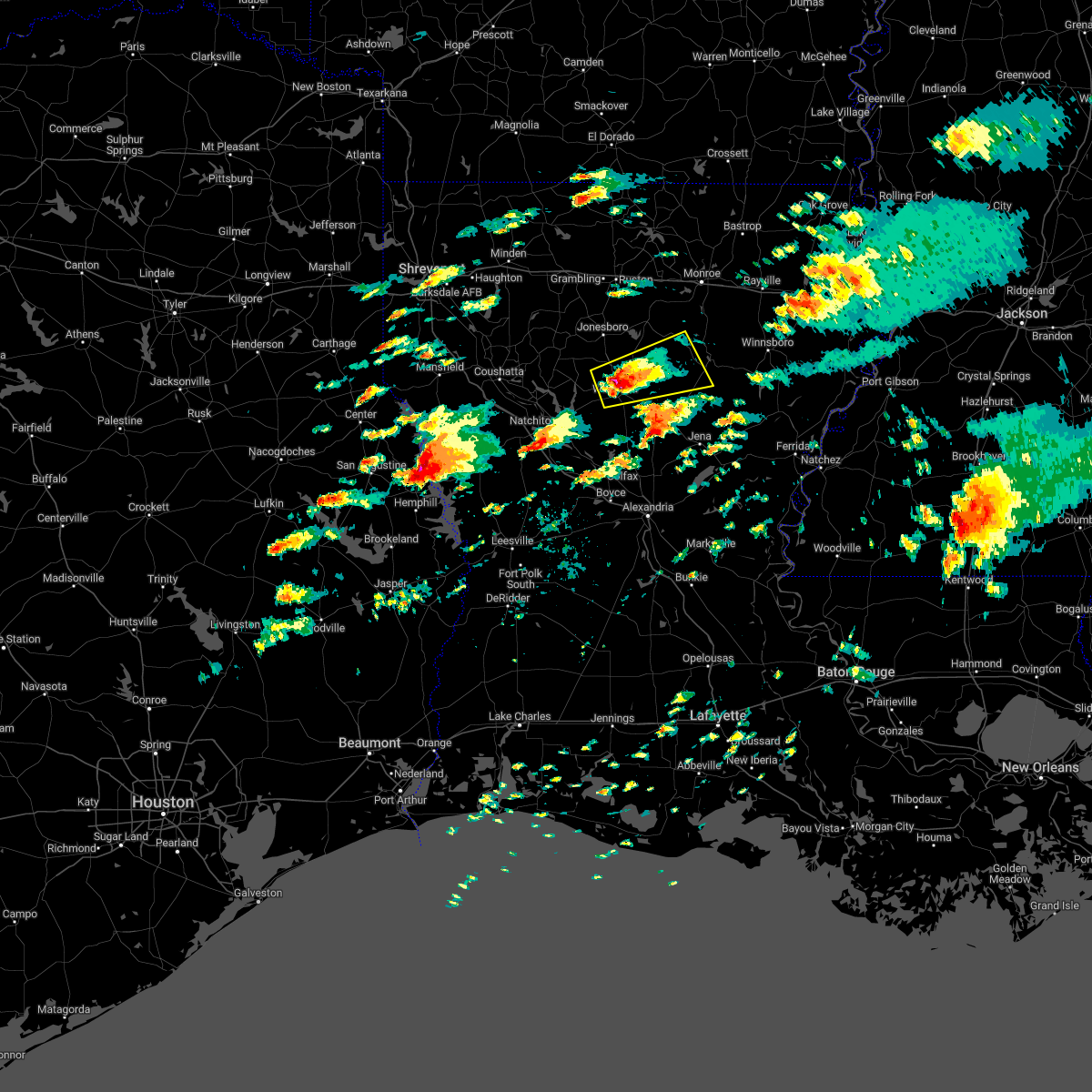 At 334 pm cst, a severe thunderstorm was located 7 miles northeast of winnfield, moving east at 45 mph (radar indicated). Hazards include 60 mph wind gusts and half dollar size hail. Hail damage to vehicles is expected. Expect wind damage to roofs, siding, and trees. At 334 pm cst, a severe thunderstorm was located 7 miles northeast of winnfield, moving east at 45 mph (radar indicated). Hazards include 60 mph wind gusts and half dollar size hail. Hail damage to vehicles is expected. Expect wind damage to roofs, siding, and trees.
|
| 11/4/2022 11:50 PM CDT |
 At 1150 pm cdt, severe thunderstorms were located along a line extending from 11 miles south of arcadia to 8 miles northwest of natchitoches, moving east at 30 mph (radar indicated). Hazards include 60 mph wind gusts. expect damage to roofs, siding, and trees At 1150 pm cdt, severe thunderstorms were located along a line extending from 11 miles south of arcadia to 8 miles northwest of natchitoches, moving east at 30 mph (radar indicated). Hazards include 60 mph wind gusts. expect damage to roofs, siding, and trees
|
| 4/17/2022 5:17 PM CDT |
 At 517 pm cdt, severe thunderstorms were located along a line extending from 9 miles south of richwood to 10 miles west of columbia to 6 miles west of clarks to 12 miles east of winnfield, moving east southeast at 50 mph (radar indicated). Hazards include 60 mph wind gusts and quarter size hail. Hail damage to vehicles is expected. expect wind damage to roofs, siding, and trees. locations impacted include, chatham, dodson, sikes, vixen, bosco, hudson and luna. hail threat, radar indicated max hail size, 1. 00 in wind threat, radar indicated max wind gust, 60 mph. At 517 pm cdt, severe thunderstorms were located along a line extending from 9 miles south of richwood to 10 miles west of columbia to 6 miles west of clarks to 12 miles east of winnfield, moving east southeast at 50 mph (radar indicated). Hazards include 60 mph wind gusts and quarter size hail. Hail damage to vehicles is expected. expect wind damage to roofs, siding, and trees. locations impacted include, chatham, dodson, sikes, vixen, bosco, hudson and luna. hail threat, radar indicated max hail size, 1. 00 in wind threat, radar indicated max wind gust, 60 mph.
|
| 4/17/2022 5:05 PM CDT |
 At 504 pm cdt, severe thunderstorms were located along a line extending from 17 miles southwest of brownsville-bawcom to 19 miles northeast of winnfield to 9 miles south of jonesboro, moving southeast at 50 mph (radar indicated). Hazards include 60 mph wind gusts and quarter size hail. Hail damage to vehicles is expected. expect wind damage to roofs, siding, and trees. locations impacted include, jonesboro, chatham, dodson, eros, sikes, vixen, bosco, hudson and luna. hail threat, radar indicated max hail size, 1. 00 in wind threat, radar indicated max wind gust, 60 mph. At 504 pm cdt, severe thunderstorms were located along a line extending from 17 miles southwest of brownsville-bawcom to 19 miles northeast of winnfield to 9 miles south of jonesboro, moving southeast at 50 mph (radar indicated). Hazards include 60 mph wind gusts and quarter size hail. Hail damage to vehicles is expected. expect wind damage to roofs, siding, and trees. locations impacted include, jonesboro, chatham, dodson, eros, sikes, vixen, bosco, hudson and luna. hail threat, radar indicated max hail size, 1. 00 in wind threat, radar indicated max wind gust, 60 mph.
|
| 4/17/2022 4:46 PM CDT |
 At 445 pm cdt, severe thunderstorms were located along a line extending from 8 miles south of ruston to near jonesboro to 22 miles east of ringgold, moving east at 40 mph (radar indicated). Hazards include 60 mph wind gusts and quarter size hail. Hail damage to vehicles is expected. Expect wind damage to roofs, siding, and trees. At 445 pm cdt, severe thunderstorms were located along a line extending from 8 miles south of ruston to near jonesboro to 22 miles east of ringgold, moving east at 40 mph (radar indicated). Hazards include 60 mph wind gusts and quarter size hail. Hail damage to vehicles is expected. Expect wind damage to roofs, siding, and trees.
|
| 4/13/2022 5:06 PM CDT |
 At 506 pm cdt, severe thunderstorms were located along a line extending from 13 miles southeast of jonesboro to 7 miles southeast of winnfield to 6 miles northwest of lena, moving east at 70 mph (radar indicated). Hazards include 70 mph wind gusts. Expect considerable tree damage. damage is likely to mobile homes, roofs, and outbuildings. locations impacted include, natchitoches, winnfield, colfax, montgomery, natchez, pollock, dry prong, dodson, georgetown, calvin, atlanta, sikes, cloutierville, melrose, bellwood, chopin, st. Maurice, joyce, lake iatt and williana. At 506 pm cdt, severe thunderstorms were located along a line extending from 13 miles southeast of jonesboro to 7 miles southeast of winnfield to 6 miles northwest of lena, moving east at 70 mph (radar indicated). Hazards include 70 mph wind gusts. Expect considerable tree damage. damage is likely to mobile homes, roofs, and outbuildings. locations impacted include, natchitoches, winnfield, colfax, montgomery, natchez, pollock, dry prong, dodson, georgetown, calvin, atlanta, sikes, cloutierville, melrose, bellwood, chopin, st. Maurice, joyce, lake iatt and williana.
|
| 4/13/2022 4:39 PM CDT |
 At 439 pm cdt, severe thunderstorms were located along a line extending from 14 miles northeast of campti to near natchitoches to 16 miles north of kurthwood, moving east at 45 mph (radar indicated). Hazards include 60 mph wind gusts. expect damage to roofs, siding, and trees At 439 pm cdt, severe thunderstorms were located along a line extending from 14 miles northeast of campti to near natchitoches to 16 miles north of kurthwood, moving east at 45 mph (radar indicated). Hazards include 60 mph wind gusts. expect damage to roofs, siding, and trees
|
| 4/12/2022 11:26 PM CDT |
 At 1125 pm cdt, severe thunderstorms were located along a line extending from 8 miles northeast of cooley to 11 miles northeast of winnfield, moving northeast at 55 mph (radar indicated). Hazards include 60 mph wind gusts and penny size hail. expect damage to roofs, siding, and trees At 1125 pm cdt, severe thunderstorms were located along a line extending from 8 miles northeast of cooley to 11 miles northeast of winnfield, moving northeast at 55 mph (radar indicated). Hazards include 60 mph wind gusts and penny size hail. expect damage to roofs, siding, and trees
|
| 4/12/2022 10:39 PM CDT |
 At 1039 pm cdt, severe thunderstorms were located along a line extending from near gibsland to 14 miles east of converse, moving east at 65 mph (radar indicated). Hazards include 60 mph wind gusts and penny size hail. expect damage to roofs, siding, and trees At 1039 pm cdt, severe thunderstorms were located along a line extending from near gibsland to 14 miles east of converse, moving east at 65 mph (radar indicated). Hazards include 60 mph wind gusts and penny size hail. expect damage to roofs, siding, and trees
|
| 4/5/2022 4:00 AM CDT |
 At 359 am cdt, severe thunderstorms were located along a line extending from 8 miles north of jonesboro to near campti, moving east at 60 mph (radar indicated). Hazards include 60 mph wind gusts and quarter size hail. Hail damage to vehicles is expected. expect wind damage to roofs, siding, and trees. Locations impacted include, winnfield, jonesboro, coushatta, martin, chatham, hodge, goldonna, north hodge, dodson, east hodge, saline, lucky, ashland, calvin, edgefield, quitman, eros, sikes, hanna and friendship. At 359 am cdt, severe thunderstorms were located along a line extending from 8 miles north of jonesboro to near campti, moving east at 60 mph (radar indicated). Hazards include 60 mph wind gusts and quarter size hail. Hail damage to vehicles is expected. expect wind damage to roofs, siding, and trees. Locations impacted include, winnfield, jonesboro, coushatta, martin, chatham, hodge, goldonna, north hodge, dodson, east hodge, saline, lucky, ashland, calvin, edgefield, quitman, eros, sikes, hanna and friendship.
|
| 4/5/2022 3:14 AM CDT |
 At 313 am cdt, severe thunderstorms were located along a line extending from 8 miles northwest of ringgold to 6 miles east of logansport, moving east at 60 mph (radar indicated). Hazards include 60 mph wind gusts and quarter size hail. Hail damage to vehicles is expected. Expect wind damage to roofs, siding, and trees. At 313 am cdt, severe thunderstorms were located along a line extending from 8 miles northwest of ringgold to 6 miles east of logansport, moving east at 60 mph (radar indicated). Hazards include 60 mph wind gusts and quarter size hail. Hail damage to vehicles is expected. Expect wind damage to roofs, siding, and trees.
|
| 3/30/2022 12:33 PM CDT |
 At 1233 pm cdt, a severe thunderstorm capable of producing a tornado was located near jonesboro, moving east at 55 mph (radar indicated rotation). Hazards include tornado. Flying debris will be dangerous to those caught without shelter. mobile homes will be damaged or destroyed. damage to roofs, windows, and vehicles will occur. tree damage is likely. This tornadic thunderstorm will remain over mainly rural areas of southern jackson, southeastern bienville and northeastern winn parishes, including the following locations, sikes, dodson and chatham. At 1233 pm cdt, a severe thunderstorm capable of producing a tornado was located near jonesboro, moving east at 55 mph (radar indicated rotation). Hazards include tornado. Flying debris will be dangerous to those caught without shelter. mobile homes will be damaged or destroyed. damage to roofs, windows, and vehicles will occur. tree damage is likely. This tornadic thunderstorm will remain over mainly rural areas of southern jackson, southeastern bienville and northeastern winn parishes, including the following locations, sikes, dodson and chatham.
|
| 3/30/2022 12:18 PM CDT |
 At 1218 pm cdt, a severe thunderstorm capable of producing a tornado was located 11 miles southwest of jonesboro, moving east at 55 mph (radar indicated rotation). Hazards include tornado. Flying debris will be dangerous to those caught without shelter. mobile homes will be damaged or destroyed. damage to roofs, windows, and vehicles will occur. tree damage is likely. this dangerous storm will be near, jonesboro around 1230 pm cdt. Other locations impacted by this tornadic thunderstorm include sikes, goldonna, chestnut, saline, chatham, dodson and hodge. At 1218 pm cdt, a severe thunderstorm capable of producing a tornado was located 11 miles southwest of jonesboro, moving east at 55 mph (radar indicated rotation). Hazards include tornado. Flying debris will be dangerous to those caught without shelter. mobile homes will be damaged or destroyed. damage to roofs, windows, and vehicles will occur. tree damage is likely. this dangerous storm will be near, jonesboro around 1230 pm cdt. Other locations impacted by this tornadic thunderstorm include sikes, goldonna, chestnut, saline, chatham, dodson and hodge.
|
| 3/30/2022 12:07 PM CDT |
 At 1206 pm cdt, a severe thunderstorm capable of producing a tornado was located 12 miles northeast of campti, or 21 miles north of natchitoches, moving east at 50 mph (radar indicated rotation). Hazards include tornado. Flying debris will be dangerous to those caught without shelter. mobile homes will be damaged or destroyed. damage to roofs, windows, and vehicles will occur. tree damage is likely. this dangerous storm will be near, jonesboro around 1230 pm cdt. Other locations impacted by this tornadic thunderstorm include sikes, goldonna, chestnut, saline, creston, chatham, dodson and ashland. At 1206 pm cdt, a severe thunderstorm capable of producing a tornado was located 12 miles northeast of campti, or 21 miles north of natchitoches, moving east at 50 mph (radar indicated rotation). Hazards include tornado. Flying debris will be dangerous to those caught without shelter. mobile homes will be damaged or destroyed. damage to roofs, windows, and vehicles will occur. tree damage is likely. this dangerous storm will be near, jonesboro around 1230 pm cdt. Other locations impacted by this tornadic thunderstorm include sikes, goldonna, chestnut, saline, creston, chatham, dodson and ashland.
|
| 3/22/2022 7:20 AM CDT | Quarter sized hail reported 4.6 miles W of Dodson, LA, corrects previous hail report from 4 e dodson. near intersection of hwy 126 and hwy 34... nickel to quarter size hail. |
| 3/22/2022 7:19 AM CDT |
 At 719 am cdt, a severe thunderstorm was located 11 miles southeast of jonesboro, moving northeast at 50 mph (radar indicated). Hazards include quarter size hail. damage to vehicles is expected At 719 am cdt, a severe thunderstorm was located 11 miles southeast of jonesboro, moving northeast at 50 mph (radar indicated). Hazards include quarter size hail. damage to vehicles is expected
|
| 6/8/2021 2:11 PM CDT |
 The severe thunderstorm warning for southern jackson, east central bienville and northwestern winn parishes will expire at 215 pm cdt, the storms which prompted the warning have moved out of the area. therefore, the warning will be allowed to expire. a severe thunderstorm watch remains in effect until 700 pm cdt for north central and northwestern louisiana. The severe thunderstorm warning for southern jackson, east central bienville and northwestern winn parishes will expire at 215 pm cdt, the storms which prompted the warning have moved out of the area. therefore, the warning will be allowed to expire. a severe thunderstorm watch remains in effect until 700 pm cdt for north central and northwestern louisiana.
|
| 6/8/2021 2:05 PM CDT |
 At 204 pm cdt, severe thunderstorms were located along a line extending from near ruston to 10 miles east of jonesboro to 9 miles north of winnfield, moving east at 45 mph (radar indicated). Hazards include 60 mph wind gusts. expect damage to roofs, siding, and trees At 204 pm cdt, severe thunderstorms were located along a line extending from near ruston to 10 miles east of jonesboro to 9 miles north of winnfield, moving east at 45 mph (radar indicated). Hazards include 60 mph wind gusts. expect damage to roofs, siding, and trees
|
| 6/8/2021 1:53 PM CDT |
 At 152 pm cdt, severe thunderstorms were located along a line extending from 11 miles south of grambling to near jonesboro to 11 miles northwest of winnfield, moving east at 40 mph (radar indicated). Hazards include 60 mph wind gusts. Expect damage to roofs, siding, and trees. Locations impacted include, jonesboro, chatham, hodge, north hodge, dodson, east hodge, quitman, eros and sikes. At 152 pm cdt, severe thunderstorms were located along a line extending from 11 miles south of grambling to near jonesboro to 11 miles northwest of winnfield, moving east at 40 mph (radar indicated). Hazards include 60 mph wind gusts. Expect damage to roofs, siding, and trees. Locations impacted include, jonesboro, chatham, hodge, north hodge, dodson, east hodge, quitman, eros and sikes.
|
| 6/8/2021 1:41 PM CDT |
 At 141 pm cdt, severe thunderstorms were located along a line extending from 14 miles southwest of grambling to near jonesboro to 15 miles northwest of winnfield, moving east at 40 mph (radar indicated). Hazards include 60 mph wind gusts. Expect damage to roofs, siding, and trees. Locations impacted include, jonesboro, chatham, hodge, north hodge, dodson, east hodge, quitman, eros, sikes and liberty hill. At 141 pm cdt, severe thunderstorms were located along a line extending from 14 miles southwest of grambling to near jonesboro to 15 miles northwest of winnfield, moving east at 40 mph (radar indicated). Hazards include 60 mph wind gusts. Expect damage to roofs, siding, and trees. Locations impacted include, jonesboro, chatham, hodge, north hodge, dodson, east hodge, quitman, eros, sikes and liberty hill.
|
| 6/8/2021 1:29 PM CDT |
 At 128 pm cdt, severe thunderstorms were located along a line extending from 13 miles south of gibsland to 13 miles west of jonesboro to 14 miles northeast of campti, moving east at 35 mph (radar indicated). Hazards include 60 mph wind gusts. expect damage to roofs, siding, and trees At 128 pm cdt, severe thunderstorms were located along a line extending from 13 miles south of gibsland to 13 miles west of jonesboro to 14 miles northeast of campti, moving east at 35 mph (radar indicated). Hazards include 60 mph wind gusts. expect damage to roofs, siding, and trees
|
| 5/10/2021 5:33 PM CDT |
 At 532 pm cdt, a severe thunderstorm was located 8 miles northeast of winnfield, moving east at 40 mph (radar indicated). Hazards include 60 mph wind gusts and half dollar size hail. Hail damage to vehicles is expected. expect wind damage to roofs, siding, and trees. Locations impacted include, winnfield, dodson, calvin, sikes, joyce and hudson. At 532 pm cdt, a severe thunderstorm was located 8 miles northeast of winnfield, moving east at 40 mph (radar indicated). Hazards include 60 mph wind gusts and half dollar size hail. Hail damage to vehicles is expected. expect wind damage to roofs, siding, and trees. Locations impacted include, winnfield, dodson, calvin, sikes, joyce and hudson.
|
| 5/10/2021 5:17 PM CDT |
 At 517 pm cdt, a severe thunderstorm was located 10 miles northwest of winnfield, moving east at 40 mph (radar indicated). Hazards include 60 mph wind gusts and half dollar size hail. Hail damage to vehicles is expected. expect wind damage to roofs, siding, and trees. Locations impacted include, winnfield, jonesboro, chatham, hodge, goldonna, north hodge, dodson, east hodge, calvin, sikes, hudson, friendship and joyce. At 517 pm cdt, a severe thunderstorm was located 10 miles northwest of winnfield, moving east at 40 mph (radar indicated). Hazards include 60 mph wind gusts and half dollar size hail. Hail damage to vehicles is expected. expect wind damage to roofs, siding, and trees. Locations impacted include, winnfield, jonesboro, chatham, hodge, goldonna, north hodge, dodson, east hodge, calvin, sikes, hudson, friendship and joyce.
|
| 5/10/2021 4:56 PM CDT |
 The national weather service in shreveport has issued a * severe thunderstorm warning for. jackson parish in north central louisiana. northeastern natchitoches parish in northwestern louisiana. southeastern bienville parish in northwestern louisiana. Winn parish in north central louisiana. The national weather service in shreveport has issued a * severe thunderstorm warning for. jackson parish in north central louisiana. northeastern natchitoches parish in northwestern louisiana. southeastern bienville parish in northwestern louisiana. Winn parish in north central louisiana.
|
| 5/4/2021 12:41 PM CDT |
 The national weather service in shreveport has issued a * severe thunderstorm warning for. southern jackson parish in north central louisiana. northeastern natchitoches parish in northwestern louisiana. southeastern bienville parish in northwestern louisiana. Winn parish in north central louisiana. The national weather service in shreveport has issued a * severe thunderstorm warning for. southern jackson parish in north central louisiana. northeastern natchitoches parish in northwestern louisiana. southeastern bienville parish in northwestern louisiana. Winn parish in north central louisiana.
|
| 4/9/2021 8:21 PM CDT |
 At 820 pm cdt, a severe thunderstorm was located 8 miles northwest of winnfield, moving east at 40 mph (radar indicated). Hazards include golf ball size hail and 70 mph wind gusts. People and animals outdoors will be injured. expect hail damage to roofs, siding, windows, and vehicles. expect considerable tree damage. wind damage is also likely to mobile homes, roofs, and outbuildings. Locations impacted include, winnfield, jonesboro, goldonna, dodson, calvin, sikes, joyce and hudson. At 820 pm cdt, a severe thunderstorm was located 8 miles northwest of winnfield, moving east at 40 mph (radar indicated). Hazards include golf ball size hail and 70 mph wind gusts. People and animals outdoors will be injured. expect hail damage to roofs, siding, windows, and vehicles. expect considerable tree damage. wind damage is also likely to mobile homes, roofs, and outbuildings. Locations impacted include, winnfield, jonesboro, goldonna, dodson, calvin, sikes, joyce and hudson.
|
| 4/9/2021 7:55 PM CDT |
 At 755 pm cdt, severe thunderstorms were located along a line extending from 16 miles southwest of jonesboro to near campti, moving east at 40 mph (radar indicated). Hazards include 70 mph wind gusts and penny size hail. Expect considerable tree damage. Damage is likely to mobile homes, roofs, and outbuildings. At 755 pm cdt, severe thunderstorms were located along a line extending from 16 miles southwest of jonesboro to near campti, moving east at 40 mph (radar indicated). Hazards include 70 mph wind gusts and penny size hail. Expect considerable tree damage. Damage is likely to mobile homes, roofs, and outbuildings.
|
| 12/23/2020 6:28 PM CST |
 At 627 pm cst, a severe thunderstorm was located 14 miles southwest of jonesboro, moving northeast at 50 mph (radar indicated). Hazards include 60 mph wind gusts and quarter size hail. Hail damage to vehicles is expected. Expect wind damage to roofs, siding, and trees. At 627 pm cst, a severe thunderstorm was located 14 miles southwest of jonesboro, moving northeast at 50 mph (radar indicated). Hazards include 60 mph wind gusts and quarter size hail. Hail damage to vehicles is expected. Expect wind damage to roofs, siding, and trees.
|
| 4/29/2020 2:34 AM CDT |
 At 234 am cdt, severe thunderstorms were located along a line extending from 6 miles southeast of bakers to liddieville to 10 miles southeast of winnfield, moving southeast at 50 mph (radar indicated). Hazards include 60 mph wind gusts and quarter size hail. Hail damage to vehicles is expected. expect wind damage to roofs, siding, and trees. Locations impacted include, columbia, olla, clarks, grayson, urania, tullos, dodson, sikes, spaulding, hudson, riverton, standard, kelly, joyce and burlington. At 234 am cdt, severe thunderstorms were located along a line extending from 6 miles southeast of bakers to liddieville to 10 miles southeast of winnfield, moving southeast at 50 mph (radar indicated). Hazards include 60 mph wind gusts and quarter size hail. Hail damage to vehicles is expected. expect wind damage to roofs, siding, and trees. Locations impacted include, columbia, olla, clarks, grayson, urania, tullos, dodson, sikes, spaulding, hudson, riverton, standard, kelly, joyce and burlington.
|
| 4/29/2020 2:19 AM CDT |
 At 218 am cdt, severe thunderstorms were located along a line extending from 6 miles west of liddieville to 6 miles east of winnfield to near natchitoches to 6 miles west of converse, moving southeast at 45 mph (radar indicated). Hazards include 60 mph wind gusts and quarter size hail. Hail damage to vehicles is expected. Expect wind damage to roofs, siding, and trees. At 218 am cdt, severe thunderstorms were located along a line extending from 6 miles west of liddieville to 6 miles east of winnfield to near natchitoches to 6 miles west of converse, moving southeast at 45 mph (radar indicated). Hazards include 60 mph wind gusts and quarter size hail. Hail damage to vehicles is expected. Expect wind damage to roofs, siding, and trees.
|
| 4/29/2020 1:37 AM CDT |
 At 137 am cdt, severe thunderstorms were located along a line extending from near bastrop to 9 miles west of claiborne to 10 miles southwest of grambling, moving southeast at 55 mph (radar indicated). Hazards include 60 mph wind gusts and quarter size hail. Hail damage to vehicles is expected. Expect wind damage to roofs, siding, and trees. At 137 am cdt, severe thunderstorms were located along a line extending from near bastrop to 9 miles west of claiborne to 10 miles southwest of grambling, moving southeast at 55 mph (radar indicated). Hazards include 60 mph wind gusts and quarter size hail. Hail damage to vehicles is expected. Expect wind damage to roofs, siding, and trees.
|
| 4/24/2020 10:42 PM CDT |
 At 1042 pm cdt, a severe thunderstorm was located 15 miles west of jonesboro, moving southeast at 55 mph (radar indicated). Hazards include golf ball size hail and 70 mph wind gusts. People and animals outdoors will be injured. expect hail damage to roofs, siding, windows, and vehicles. expect considerable tree damage. Wind damage is also likely to mobile homes, roofs, and outbuildings. At 1042 pm cdt, a severe thunderstorm was located 15 miles west of jonesboro, moving southeast at 55 mph (radar indicated). Hazards include golf ball size hail and 70 mph wind gusts. People and animals outdoors will be injured. expect hail damage to roofs, siding, windows, and vehicles. expect considerable tree damage. Wind damage is also likely to mobile homes, roofs, and outbuildings.
|
| 4/24/2020 10:37 PM CDT |
 The severe thunderstorm warning for west central grant, southwestern jackson, central natchitoches, southern bienville and western winn parishes will expire at 1045 pm cdt, the storm which prompted the warning has weakened below severe limits, and no longer poses an immediate threat to life or property. therefore, the warning will be allowed to expire. however gusty winds are still possible with this thunderstorm. a severe thunderstorm watch remains in effect until 200 am cdt for north central and northwestern louisiana. The severe thunderstorm warning for west central grant, southwestern jackson, central natchitoches, southern bienville and western winn parishes will expire at 1045 pm cdt, the storm which prompted the warning has weakened below severe limits, and no longer poses an immediate threat to life or property. therefore, the warning will be allowed to expire. however gusty winds are still possible with this thunderstorm. a severe thunderstorm watch remains in effect until 200 am cdt for north central and northwestern louisiana.
|
| 4/24/2020 10:23 PM CDT |
 At 1023 pm cdt, a severe thunderstorm was located 9 miles east of campti, or 12 miles northeast of natchitoches, moving east at 55 mph (radar indicated). Hazards include 60 mph wind gusts and quarter size hail. Hail damage to vehicles is expected. expect wind damage to roofs, siding, and trees. locations impacted include, natchitoches, winnfield, campti, montgomery, natchez, clarence, goldonna, dodson, calvin, atlanta, grand ecore, hudson, st. Maurice, joyce, clear lake, creston, bermuda, aloha and hagewood. At 1023 pm cdt, a severe thunderstorm was located 9 miles east of campti, or 12 miles northeast of natchitoches, moving east at 55 mph (radar indicated). Hazards include 60 mph wind gusts and quarter size hail. Hail damage to vehicles is expected. expect wind damage to roofs, siding, and trees. locations impacted include, natchitoches, winnfield, campti, montgomery, natchez, clarence, goldonna, dodson, calvin, atlanta, grand ecore, hudson, st. Maurice, joyce, clear lake, creston, bermuda, aloha and hagewood.
|
| 4/24/2020 9:53 PM CDT |
 At 953 pm cdt, a severe thunderstorm was located near coushatta, or 18 miles east of mansfield, moving east at 55 mph (radar indicated). Hazards include 70 mph wind gusts and half dollar size hail. Hail damage to vehicles is expected. expect considerable tree damage. Wind damage is also likely to mobile homes, roofs, and outbuildings. At 953 pm cdt, a severe thunderstorm was located near coushatta, or 18 miles east of mansfield, moving east at 55 mph (radar indicated). Hazards include 70 mph wind gusts and half dollar size hail. Hail damage to vehicles is expected. expect considerable tree damage. Wind damage is also likely to mobile homes, roofs, and outbuildings.
|
| 4/22/2020 10:13 PM CDT |
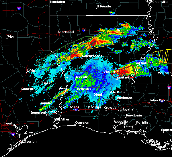 At 1013 pm cdt, a severe thunderstorm capable of producing a tornado was located 9 miles south of jonesboro, moving east at 60 mph (radar indicated rotation). Hazards include tornado and half dollar size hail. Flying debris will be dangerous to those caught without shelter. mobile homes will be damaged or destroyed. damage to roofs, windows, and vehicles will occur. tree damage is likely. This tornadic thunderstorm will remain over mainly rural areas of northern caldwell, southern jackson, south central ouachita, southeastern bienville and northern winn parishes, including the following locations, fondale, sikes, vixen, bosco, hudson, riverton, luna and dodson. At 1013 pm cdt, a severe thunderstorm capable of producing a tornado was located 9 miles south of jonesboro, moving east at 60 mph (radar indicated rotation). Hazards include tornado and half dollar size hail. Flying debris will be dangerous to those caught without shelter. mobile homes will be damaged or destroyed. damage to roofs, windows, and vehicles will occur. tree damage is likely. This tornadic thunderstorm will remain over mainly rural areas of northern caldwell, southern jackson, south central ouachita, southeastern bienville and northern winn parishes, including the following locations, fondale, sikes, vixen, bosco, hudson, riverton, luna and dodson.
|
| 4/22/2020 9:58 PM CDT |
 At 958 pm cdt, a severe thunderstorm was located 17 miles west of jonesboro, moving east at 45 mph (radar indicated). Hazards include 60 mph wind gusts and quarter size hail. Hail damage to vehicles is expected. Expect wind damage to roofs, siding, and trees. At 958 pm cdt, a severe thunderstorm was located 17 miles west of jonesboro, moving east at 45 mph (radar indicated). Hazards include 60 mph wind gusts and quarter size hail. Hail damage to vehicles is expected. Expect wind damage to roofs, siding, and trees.
|
| 4/22/2020 12:18 PM CDT |
 At 1218 pm cdt, a severe thunderstorm was located 10 miles southwest of montgomery, or 11 miles south of natchitoches, moving northeast at 65 mph (radar indicated). Hazards include 60 mph wind gusts and quarter size hail. Hail damage to vehicles is expected. expect wind damage to roofs, siding, and trees. locations impacted include, natchitoches, winnfield, campti, montgomery, allen, provencal, natchez, clarence, goldonna, dodson, calvin, atlanta, powhatan, melrose, st. Maurice, joyce, chestnut, clear lake, grand ecore and hudson. At 1218 pm cdt, a severe thunderstorm was located 10 miles southwest of montgomery, or 11 miles south of natchitoches, moving northeast at 65 mph (radar indicated). Hazards include 60 mph wind gusts and quarter size hail. Hail damage to vehicles is expected. expect wind damage to roofs, siding, and trees. locations impacted include, natchitoches, winnfield, campti, montgomery, allen, provencal, natchez, clarence, goldonna, dodson, calvin, atlanta, powhatan, melrose, st. Maurice, joyce, chestnut, clear lake, grand ecore and hudson.
|
| 4/22/2020 12:01 PM CDT |
 The national weather service in shreveport has issued a * severe thunderstorm warning for. northwestern grant parish in north central louisiana. southwestern jackson parish in north central louisiana. southeastern red river parish in northwestern louisiana. Central natchitoches parish in northwestern louisiana. The national weather service in shreveport has issued a * severe thunderstorm warning for. northwestern grant parish in north central louisiana. southwestern jackson parish in north central louisiana. southeastern red river parish in northwestern louisiana. Central natchitoches parish in northwestern louisiana.
|
| 4/19/2020 11:40 AM CDT |
 At 1140 am cdt, a severe thunderstorm was located 9 miles northeast of coushatta, or 27 miles north of natchitoches, moving east at 50 mph (radar indicated). Hazards include 60 mph wind gusts and quarter size hail. Hail damage to vehicles is expected. Expect wind damage to roofs, siding, and trees. At 1140 am cdt, a severe thunderstorm was located 9 miles northeast of coushatta, or 27 miles north of natchitoches, moving east at 50 mph (radar indicated). Hazards include 60 mph wind gusts and quarter size hail. Hail damage to vehicles is expected. Expect wind damage to roofs, siding, and trees.
|
| 2/5/2020 12:35 PM CST |
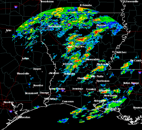 At 1235 pm cst, a severe thunderstorm was located 10 miles north of winnfield, moving northeast at 60 mph (radar indicated). Hazards include quarter size hail. Damage to vehicles is expected. Locations impacted include, dodson, sikes and hudson. At 1235 pm cst, a severe thunderstorm was located 10 miles north of winnfield, moving northeast at 60 mph (radar indicated). Hazards include quarter size hail. Damage to vehicles is expected. Locations impacted include, dodson, sikes and hudson.
|
| 2/5/2020 12:17 PM CST |
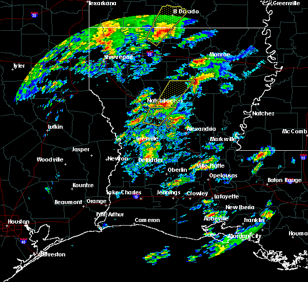 At 1217 pm cst, a severe thunderstorm was located 8 miles southwest of winnfield, moving northeast at 60 mph (radar indicated). Hazards include golf ball size hail and 60 mph wind gusts. People and animals outdoors will be injured. expect hail damage to roofs, siding, windows, and vehicles. expect wind damage to roofs, siding, and trees. Locations impacted include, winnfield, dodson, calvin, atlanta, sikes, joyce and hudson. At 1217 pm cst, a severe thunderstorm was located 8 miles southwest of winnfield, moving northeast at 60 mph (radar indicated). Hazards include golf ball size hail and 60 mph wind gusts. People and animals outdoors will be injured. expect hail damage to roofs, siding, windows, and vehicles. expect wind damage to roofs, siding, and trees. Locations impacted include, winnfield, dodson, calvin, atlanta, sikes, joyce and hudson.
|
| 2/5/2020 12:06 PM CST |
 At 1205 pm cst, a severe thunderstorm was located over montgomery, or 14 miles east of natchitoches, moving northeast at 60 mph (radar indicated). Hazards include ping pong ball size hail and 60 mph wind gusts. People and animals outdoors will be injured. expect hail damage to roofs, siding, windows, and vehicles. Expect wind damage to roofs, siding, and trees. At 1205 pm cst, a severe thunderstorm was located over montgomery, or 14 miles east of natchitoches, moving northeast at 60 mph (radar indicated). Hazards include ping pong ball size hail and 60 mph wind gusts. People and animals outdoors will be injured. expect hail damage to roofs, siding, windows, and vehicles. Expect wind damage to roofs, siding, and trees.
|
| 1/11/2020 3:24 AM CST |
 At 324 am cst, severe thunderstorms were located along a line extending from 8 miles southeast of farmerville to 17 miles east of jonesboro to 14 miles northeast of winnfield, moving east at 50 mph (radar indicated). Hazards include 60 mph wind gusts. expect damage to roofs, siding, and trees At 324 am cst, severe thunderstorms were located along a line extending from 8 miles southeast of farmerville to 17 miles east of jonesboro to 14 miles northeast of winnfield, moving east at 50 mph (radar indicated). Hazards include 60 mph wind gusts. expect damage to roofs, siding, and trees
|
| 12/16/2019 1:10 PM CST |
 At 110 pm cst, severe thunderstorms were located along a line extending from near campti to 17 miles southeast of coushatta to near natchitoches, moving northeast at 55 mph (radar indicated). Hazards include 60 mph wind gusts and quarter size hail. Hail damage to vehicles is expected. expect wind damage to roofs, siding, and trees. locations impacted include, natchitoches, winnfield, campti, provencal, clarence, goldonna, dodson, calvin, atlanta, powhatan, sikes, grand ecore, hudson, st. Maurice, joyce, black lake, clear lake and creston. At 110 pm cst, severe thunderstorms were located along a line extending from near campti to 17 miles southeast of coushatta to near natchitoches, moving northeast at 55 mph (radar indicated). Hazards include 60 mph wind gusts and quarter size hail. Hail damage to vehicles is expected. expect wind damage to roofs, siding, and trees. locations impacted include, natchitoches, winnfield, campti, provencal, clarence, goldonna, dodson, calvin, atlanta, powhatan, sikes, grand ecore, hudson, st. Maurice, joyce, black lake, clear lake and creston.
|
| 12/16/2019 12:49 PM CST |
 At 1248 pm cst, severe thunderstorms were located along a line extending from 15 miles south of coushatta to 13 miles east of zwolle to near many, moving northeast at 45 mph (radar indicated). Hazards include 60 mph wind gusts and quarter size hail. Hail damage to vehicles is expected. Expect wind damage to roofs, siding, and trees. At 1248 pm cst, severe thunderstorms were located along a line extending from 15 miles south of coushatta to 13 miles east of zwolle to near many, moving northeast at 45 mph (radar indicated). Hazards include 60 mph wind gusts and quarter size hail. Hail damage to vehicles is expected. Expect wind damage to roofs, siding, and trees.
|
| 11/30/2019 3:35 PM CST |
 At 334 pm cst, a severe thunderstorm was located 11 miles north of winnfield, moving northeast at 50 mph (radar indicated). Hazards include 70 mph wind gusts and quarter size hail. Hail damage to vehicles is expected. expect considerable tree damage. wind damage is also likely to mobile homes, roofs, and outbuildings. Locations impacted include, dodson, calvin, sikes and hudson. At 334 pm cst, a severe thunderstorm was located 11 miles north of winnfield, moving northeast at 50 mph (radar indicated). Hazards include 70 mph wind gusts and quarter size hail. Hail damage to vehicles is expected. expect considerable tree damage. wind damage is also likely to mobile homes, roofs, and outbuildings. Locations impacted include, dodson, calvin, sikes and hudson.
|
| 11/30/2019 3:24 PM CST |
 At 324 pm cst, a severe thunderstorm was located 10 miles northwest of winnfield, moving northeast at 50 mph (radar indicated). Hazards include 70 mph wind gusts and quarter size hail. Hail damage to vehicles is expected. expect considerable tree damage. Wind damage is also likely to mobile homes, roofs, and outbuildings. At 324 pm cst, a severe thunderstorm was located 10 miles northwest of winnfield, moving northeast at 50 mph (radar indicated). Hazards include 70 mph wind gusts and quarter size hail. Hail damage to vehicles is expected. expect considerable tree damage. Wind damage is also likely to mobile homes, roofs, and outbuildings.
|
| 5/19/2019 1:14 AM CDT |
 At 114 am cdt, severe thunderstorms were located along a line extending from 15 miles south of gibsland to 16 miles southwest of jonesboro to near campti to near zwolle, moving east at 40 mph (radar indicated). Hazards include 60 mph wind gusts and quarter size hail. Hail damage to vehicles is expected. Expect wind damage to roofs, siding, and trees. At 114 am cdt, severe thunderstorms were located along a line extending from 15 miles south of gibsland to 16 miles southwest of jonesboro to near campti to near zwolle, moving east at 40 mph (radar indicated). Hazards include 60 mph wind gusts and quarter size hail. Hail damage to vehicles is expected. Expect wind damage to roofs, siding, and trees.
|
| 5/9/2019 4:42 AM CDT |
 At 442 am cdt, a severe thunderstorm was located 7 miles north of montgomery, or 13 miles east of natchitoches, moving east at 45 mph (radar indicated). Hazards include 60 mph wind gusts. expect damage to roofs, siding, and trees At 442 am cdt, a severe thunderstorm was located 7 miles north of montgomery, or 13 miles east of natchitoches, moving east at 45 mph (radar indicated). Hazards include 60 mph wind gusts. expect damage to roofs, siding, and trees
|
| 5/8/2019 5:22 PM CDT |
 At 522 pm cdt, severe thunderstorms were located along a line extending from 11 miles southwest of jonesboro to 13 miles east of campti to near montgomery to near hutton, moving east at 50 mph (radar indicated). Hazards include 60 mph wind gusts and penny size hail. expect damage to roofs, siding, and trees At 522 pm cdt, severe thunderstorms were located along a line extending from 11 miles southwest of jonesboro to 13 miles east of campti to near montgomery to near hutton, moving east at 50 mph (radar indicated). Hazards include 60 mph wind gusts and penny size hail. expect damage to roofs, siding, and trees
|
| 4/25/2019 1:55 AM CDT |
 At 155 am cdt, severe thunderstorms were located along a line extending from 12 miles east of ruston to 17 miles southwest of brownsville-bawcom to 14 miles east of jonesboro to near winnfield to near montgomery, moving northeast at 55 mph (radar indicated). Hazards include 60 mph wind gusts. expect damage to roofs, siding, and trees At 155 am cdt, severe thunderstorms were located along a line extending from 12 miles east of ruston to 17 miles southwest of brownsville-bawcom to 14 miles east of jonesboro to near winnfield to near montgomery, moving northeast at 55 mph (radar indicated). Hazards include 60 mph wind gusts. expect damage to roofs, siding, and trees
|
| 4/25/2019 1:29 AM CDT |
 At 129 am cdt, severe thunderstorms were located along a line extending from near jonesboro to 13 miles northeast of campti to 10 miles southwest of natchitoches to 10 miles east of milam to near pineland, moving northeast at 80 mph (radar indicated). Hazards include 60 mph wind gusts. Expect damage to roofs, siding, and trees. Locations impacted include, natchitoches, jonesboro, milam, many, hemphill, campti, allen, florien, provencal, natchez, clarence, hodge, goldonna, north hodge, dodson, east hodge, saline, calvin, fisher and robeline. At 129 am cdt, severe thunderstorms were located along a line extending from near jonesboro to 13 miles northeast of campti to 10 miles southwest of natchitoches to 10 miles east of milam to near pineland, moving northeast at 80 mph (radar indicated). Hazards include 60 mph wind gusts. Expect damage to roofs, siding, and trees. Locations impacted include, natchitoches, jonesboro, milam, many, hemphill, campti, allen, florien, provencal, natchez, clarence, hodge, goldonna, north hodge, dodson, east hodge, saline, calvin, fisher and robeline.
|
| 4/25/2019 1:12 AM CDT |
 At 112 am cdt, severe thunderstorms were located along a line extending from 17 miles southeast of ringgold to 12 miles west of natchitoches to near many to near browndell, moving northeast at 35 mph (radar indicated). Hazards include 60 mph wind gusts and penny size hail. expect damage to roofs, siding, and trees At 112 am cdt, severe thunderstorms were located along a line extending from 17 miles southeast of ringgold to 12 miles west of natchitoches to near many to near browndell, moving northeast at 35 mph (radar indicated). Hazards include 60 mph wind gusts and penny size hail. expect damage to roofs, siding, and trees
|
| 4/13/2019 2:59 PM CDT |
 At 258 pm cdt, severe thunderstorms were located along a line extending from 7 miles south of brownsville-bawcom to near clarks, moving east at 80 mph (radar indicated). Hazards include 60 mph wind gusts and quarter size hail. Hail damage to vehicles is expected. Expect wind damage to roofs, siding, and trees. At 258 pm cdt, severe thunderstorms were located along a line extending from 7 miles south of brownsville-bawcom to near clarks, moving east at 80 mph (radar indicated). Hazards include 60 mph wind gusts and quarter size hail. Hail damage to vehicles is expected. Expect wind damage to roofs, siding, and trees.
|
| 4/13/2019 2:16 PM CDT |
 At 215 pm cdt, a severe thunderstorm capable of producing a tornado was located 11 miles south of jonesboro, moving northeast at 45 mph (radar indicated rotation). Hazards include tornado and quarter size hail. Flying debris will be dangerous to those caught without shelter. mobile homes will be damaged or destroyed. damage to roofs, windows, and vehicles will occur. tree damage is likely. This tornadic thunderstorm will remain over mainly rural areas of northwestern caldwell, southeastern jackson, southwestern ouachita and northern winn parishes, including the following locations, fondale, sikes, vixen, bosco, hudson, luna, chatham, dodson, lapine and calvin. At 215 pm cdt, a severe thunderstorm capable of producing a tornado was located 11 miles south of jonesboro, moving northeast at 45 mph (radar indicated rotation). Hazards include tornado and quarter size hail. Flying debris will be dangerous to those caught without shelter. mobile homes will be damaged or destroyed. damage to roofs, windows, and vehicles will occur. tree damage is likely. This tornadic thunderstorm will remain over mainly rural areas of northwestern caldwell, southeastern jackson, southwestern ouachita and northern winn parishes, including the following locations, fondale, sikes, vixen, bosco, hudson, luna, chatham, dodson, lapine and calvin.
|
| 4/13/2019 2:00 PM CDT |
 At 200 pm cdt, severe thunderstorms were located along a line extending from 14 miles west of jonesboro to 16 miles west of winnfield to 10 miles east of campti, moving northeast at 45 mph (radar indicated). Hazards include 60 mph wind gusts and quarter size hail. Hail damage to vehicles is expected. Expect wind damage to roofs, siding, and trees. At 200 pm cdt, severe thunderstorms were located along a line extending from 14 miles west of jonesboro to 16 miles west of winnfield to 10 miles east of campti, moving northeast at 45 mph (radar indicated). Hazards include 60 mph wind gusts and quarter size hail. Hail damage to vehicles is expected. Expect wind damage to roofs, siding, and trees.
|
| 4/6/2019 9:28 PM CDT |
 At 923 pm cdt, a severe thunderstorm was located 7 miles southwest of winnfield, and another severe thunderstorm west of duback, were moving northeast at 40 mph (radar indicated). Hazards include golf ball size hail and 60 mph wind gusts. People and animals outdoors will be injured. expect hail damage to roofs, siding, windows, and vehicles. Expect wind damage to roofs, siding, and trees. At 923 pm cdt, a severe thunderstorm was located 7 miles southwest of winnfield, and another severe thunderstorm west of duback, were moving northeast at 40 mph (radar indicated). Hazards include golf ball size hail and 60 mph wind gusts. People and animals outdoors will be injured. expect hail damage to roofs, siding, windows, and vehicles. Expect wind damage to roofs, siding, and trees.
|
| 4/6/2019 8:53 PM CDT |
 At 851 pm cdt, a severe thunderstorm was located near montgomery, or 11 miles southeast of natchitoches, moving northeast at 40 mph. other intense thunderstorms were developing in the same general vicinity along the red river valley (radar indicated). Hazards include golf ball size hail and 60 mph wind gusts. People and animals outdoors will be injured. expect hail damage to roofs, siding, windows, and vehicles. Expect wind damage to roofs, siding, and trees. At 851 pm cdt, a severe thunderstorm was located near montgomery, or 11 miles southeast of natchitoches, moving northeast at 40 mph. other intense thunderstorms were developing in the same general vicinity along the red river valley (radar indicated). Hazards include golf ball size hail and 60 mph wind gusts. People and animals outdoors will be injured. expect hail damage to roofs, siding, windows, and vehicles. Expect wind damage to roofs, siding, and trees.
|
| 11/5/2018 5:44 PM CST |
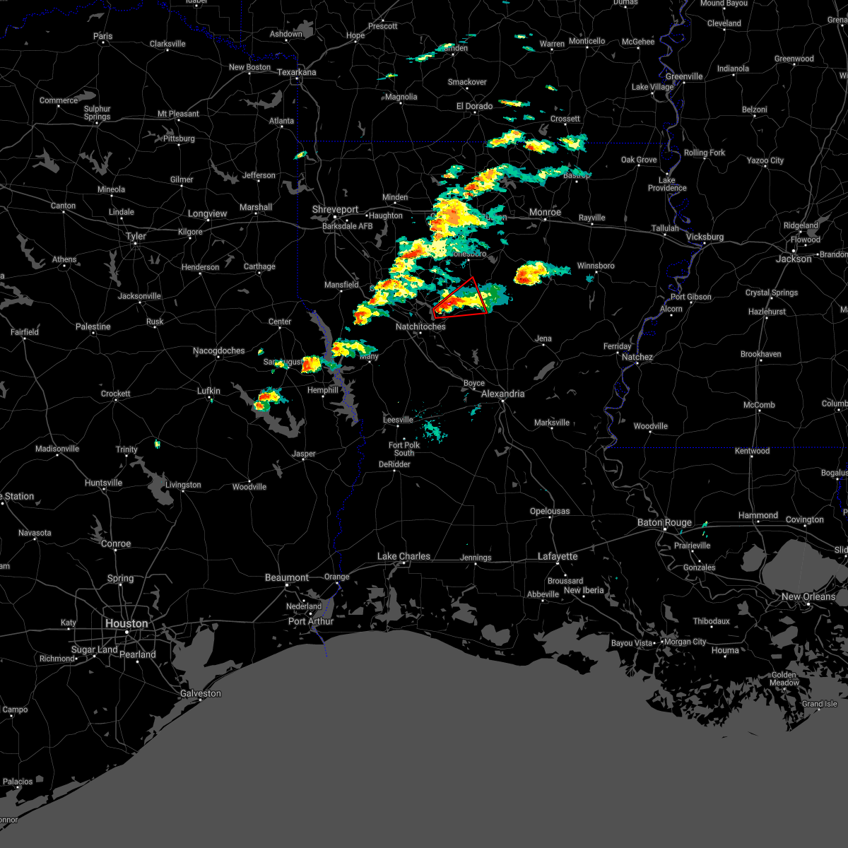 At 543 pm cst, a tornado producing storm was located 9 miles east of campti, or 13 miles northeast of natchitoches, moving northeast at 30 mph. a tornado has occurred with this storm earlier in natchitoches parish. take cover immediately (radar confirmed tornado). Hazards include damaging tornado. Flying debris will be dangerous to those caught without shelter. mobile homes will be damaged or destroyed. damage to roofs, windows, and vehicles will occur. tree damage is likely. this tornadic storm will be near, winnfield around 620 pm cst. Other locations impacted by this tornadic thunderstorm include dodson, joyce and calvin. At 543 pm cst, a tornado producing storm was located 9 miles east of campti, or 13 miles northeast of natchitoches, moving northeast at 30 mph. a tornado has occurred with this storm earlier in natchitoches parish. take cover immediately (radar confirmed tornado). Hazards include damaging tornado. Flying debris will be dangerous to those caught without shelter. mobile homes will be damaged or destroyed. damage to roofs, windows, and vehicles will occur. tree damage is likely. this tornadic storm will be near, winnfield around 620 pm cst. Other locations impacted by this tornadic thunderstorm include dodson, joyce and calvin.
|
| 8/20/2018 8:43 PM CDT |
 At 843 pm cdt, severe thunderstorms were located along a line extending from near buckner to jonesboro, moving southeast at 25 mph (radar indicated). Hazards include 60 mph wind gusts and penny size hail. Expect damage to roofs, siding, and trees. Locations impacted include, monroe, jonesboro, richwood, chatham, hodge, north hodge, dodson, east hodge, lucky, bienville, quitman, eros, sikes, fondale, vixen, bosco, riverton, friendship, liberty hill and pine grove. At 843 pm cdt, severe thunderstorms were located along a line extending from near buckner to jonesboro, moving southeast at 25 mph (radar indicated). Hazards include 60 mph wind gusts and penny size hail. Expect damage to roofs, siding, and trees. Locations impacted include, monroe, jonesboro, richwood, chatham, hodge, north hodge, dodson, east hodge, lucky, bienville, quitman, eros, sikes, fondale, vixen, bosco, riverton, friendship, liberty hill and pine grove.
|
| 8/20/2018 7:59 PM CDT |
 At 758 pm cdt, severe thunderstorms were located along a line extending from 6 miles east of richwood to 14 miles south of gibsland, moving east at 25 mph (radar indicated). Hazards include 70 mph wind gusts. Expect considerable tree damage. Damage is likely to mobile homes, roofs, and outbuildings. At 758 pm cdt, severe thunderstorms were located along a line extending from 6 miles east of richwood to 14 miles south of gibsland, moving east at 25 mph (radar indicated). Hazards include 70 mph wind gusts. Expect considerable tree damage. Damage is likely to mobile homes, roofs, and outbuildings.
|
| 7/31/2018 10:38 PM CDT |
 At 1036 pm cdt, a severe thunderstorm was located 10 miles northeast of winnfield, moving south at 20 mph (radar indicated). Hazards include 60 mph wind gusts and penny size hail. Expect damage to roofs, siding, and trees. Locations impacted include, winnfield, dodson, calvin, sikes, joyce and hudson. At 1036 pm cdt, a severe thunderstorm was located 10 miles northeast of winnfield, moving south at 20 mph (radar indicated). Hazards include 60 mph wind gusts and penny size hail. Expect damage to roofs, siding, and trees. Locations impacted include, winnfield, dodson, calvin, sikes, joyce and hudson.
|
| 7/31/2018 10:20 PM CDT | Tree down on hwy 126 just east of dodso in winn county LA, 0.5 miles W of Dodson, LA |
| 7/31/2018 10:18 PM CDT | Corrected time. tree down one half mile east of hwy 34 on aunt maries roa in winn county LA, 4.8 miles WNW of Dodson, LA |
| 7/31/2018 10:15 PM CDT | Tree down at the intersection of la hwys 34 and 12 in winn county LA, 4.6 miles W of Dodson, LA |
| 7/31/2018 10:10 PM CDT |
 At 1009 pm cdt, a severe thunderstorm was located 10 miles southeast of jonesboro, moving south at 15 mph (radar indicated). Hazards include 60 mph wind gusts and penny size hail. expect damage to roofs, siding, and trees At 1009 pm cdt, a severe thunderstorm was located 10 miles southeast of jonesboro, moving south at 15 mph (radar indicated). Hazards include 60 mph wind gusts and penny size hail. expect damage to roofs, siding, and trees
|
| 7/31/2018 10:18 AM CDT | Tree down one half mile east of hwy 34 on aunt maries roa in winn county LA, 4.8 miles WNW of Dodson, LA |
| 7/29/2018 4:00 PM CDT | A large limb took down a power line... blocking a road in tow in winn county LA, 0.1 miles SE of Dodson, LA |
| 7/29/2018 3:46 PM CDT |
 At 346 pm cdt, severe thunderstorms were located along a line extending from 7 miles north of winnfield to near many, moving southeast at 30 mph (radar indicated). Hazards include 60 mph wind gusts. expect damage to roofs, siding, and trees At 346 pm cdt, severe thunderstorms were located along a line extending from 7 miles north of winnfield to near many, moving southeast at 30 mph (radar indicated). Hazards include 60 mph wind gusts. expect damage to roofs, siding, and trees
|
| 6/3/2018 9:04 AM CDT |
 At 904 am cdt, a severe thunderstorm was located 12 miles northeast of winnfield, moving south at 20 mph (radar indicated). Hazards include 60 mph wind gusts and quarter size hail. Hail damage to vehicles is expected. Expect wind damage to roofs, siding, and trees. At 904 am cdt, a severe thunderstorm was located 12 miles northeast of winnfield, moving south at 20 mph (radar indicated). Hazards include 60 mph wind gusts and quarter size hail. Hail damage to vehicles is expected. Expect wind damage to roofs, siding, and trees.
|
| 4/14/2018 2:26 AM CDT |
 At 226 am cdt, a severe thunderstorm capable of producing a tornado was located near jonesboro, moving northeast at 45 mph (radar indicated rotation). Hazards include tornado. Flying debris will be dangerous to those caught without shelter. mobile homes will be damaged or destroyed. damage to roofs, windows, and vehicles will occur. tree damage is likely. this dangerous storm will be near, jonesboro around 230 am cdt. Other locations impacted by this tornadic thunderstorm include dodson, chatham and calvin. At 226 am cdt, a severe thunderstorm capable of producing a tornado was located near jonesboro, moving northeast at 45 mph (radar indicated rotation). Hazards include tornado. Flying debris will be dangerous to those caught without shelter. mobile homes will be damaged or destroyed. damage to roofs, windows, and vehicles will occur. tree damage is likely. this dangerous storm will be near, jonesboro around 230 am cdt. Other locations impacted by this tornadic thunderstorm include dodson, chatham and calvin.
|
| 4/14/2018 1:23 AM CDT |
 At 122 am cdt, severe thunderstorms were located along a line extending from 9 miles west of junction city to 9 miles west of bernice to near arcadia to 13 miles northwest of jonesboro to 9 miles north of campti to 13 miles south of coushatta, moving east at 70 mph (radar indicated). Hazards include 60 mph wind gusts and penny size hail. Expect damage to roofs, siding, and trees. locations impacted include, ruston, el dorado, minden, magnolia, grambling, jonesboro, homer, smackover, norphlet, farmerville, arcadia, haynesville, coushatta, bernice, ringgold, sibley, campti, gibsland, emerson and dubberly. A tornado watch remains in effect until 600 am cdt for south central and southwestern arkansas, and north central and northwestern louisiana. At 122 am cdt, severe thunderstorms were located along a line extending from 9 miles west of junction city to 9 miles west of bernice to near arcadia to 13 miles northwest of jonesboro to 9 miles north of campti to 13 miles south of coushatta, moving east at 70 mph (radar indicated). Hazards include 60 mph wind gusts and penny size hail. Expect damage to roofs, siding, and trees. locations impacted include, ruston, el dorado, minden, magnolia, grambling, jonesboro, homer, smackover, norphlet, farmerville, arcadia, haynesville, coushatta, bernice, ringgold, sibley, campti, gibsland, emerson and dubberly. A tornado watch remains in effect until 600 am cdt for south central and southwestern arkansas, and north central and northwestern louisiana.
|
| 4/14/2018 12:59 AM CDT |
 At 1259 am cdt, severe thunderstorms were located along a line extending from 6 miles east of taylor to near shongaloo to minden to 7 miles northwest of ringgold to 9 miles east of mansfield to 9 miles northwest of converse, moving east at 75 mph (radar indicated). Hazards include 60 mph wind gusts and penny size hail. expect damage to roofs, siding, and trees At 1259 am cdt, severe thunderstorms were located along a line extending from 6 miles east of taylor to near shongaloo to minden to 7 miles northwest of ringgold to 9 miles east of mansfield to 9 miles northwest of converse, moving east at 75 mph (radar indicated). Hazards include 60 mph wind gusts and penny size hail. expect damage to roofs, siding, and trees
|
| 4/6/2018 7:59 PM CDT |
 At 758 pm cdt, severe thunderstorms were located along a line extending from 9 miles west of campti to 7 miles northeast of natchitoches to 14 miles southwest of jonesboro, moving southeast at 45 mph (radar indicated). Hazards include 60 mph wind gusts and half dollar size hail. Hail damage to vehicles is expected. Expect wind damage to roofs, siding, and trees. At 758 pm cdt, severe thunderstorms were located along a line extending from 9 miles west of campti to 7 miles northeast of natchitoches to 14 miles southwest of jonesboro, moving southeast at 45 mph (radar indicated). Hazards include 60 mph wind gusts and half dollar size hail. Hail damage to vehicles is expected. Expect wind damage to roofs, siding, and trees.
|
| 4/6/2018 7:19 PM CDT |
 The national weather service in shreveport has issued a * severe thunderstorm warning for. southwestern jackson parish in north central louisiana. northeastern red river parish in northwestern louisiana. north central natchitoches parish in northwestern louisiana. Eastern bienville parish in northwestern louisiana. The national weather service in shreveport has issued a * severe thunderstorm warning for. southwestern jackson parish in north central louisiana. northeastern red river parish in northwestern louisiana. north central natchitoches parish in northwestern louisiana. Eastern bienville parish in northwestern louisiana.
|
| 4/3/2018 6:30 PM CDT |
 At 629 pm cdt, severe thunderstorms were located along a line extending from 6 miles northeast of columbia to 15 miles south of winnfield, moving southeast at 45 mph (radar indicated). Hazards include 60 mph wind gusts and penny size hail. expect damage to roofs, siding, and trees At 629 pm cdt, severe thunderstorms were located along a line extending from 6 miles northeast of columbia to 15 miles south of winnfield, moving southeast at 45 mph (radar indicated). Hazards include 60 mph wind gusts and penny size hail. expect damage to roofs, siding, and trees
|
| 4/3/2018 5:30 PM CDT |
 At 529 pm cdt, severe thunderstorms were located along a line extending from near jonesboro to near natchitoches, moving east at 55 mph (radar indicated). Hazards include 60 mph wind gusts and penny size hail. expect damage to roofs, siding, and trees At 529 pm cdt, severe thunderstorms were located along a line extending from near jonesboro to near natchitoches, moving east at 55 mph (radar indicated). Hazards include 60 mph wind gusts and penny size hail. expect damage to roofs, siding, and trees
|
| 4/3/2018 4:44 PM CDT |
 At 444 pm cdt, severe thunderstorms were located along a line extending from 11 miles southwest of ringgold to near converse, moving east at 60 mph (radar indicated). Hazards include 60 mph wind gusts and quarter size hail. Hail damage to vehicles is expected. Expect wind damage to roofs, siding, and trees. At 444 pm cdt, severe thunderstorms were located along a line extending from 11 miles southwest of ringgold to near converse, moving east at 60 mph (radar indicated). Hazards include 60 mph wind gusts and quarter size hail. Hail damage to vehicles is expected. Expect wind damage to roofs, siding, and trees.
|
| 3/28/2018 3:55 PM CDT |
 At 355 pm cdt, a severe thunderstorm was located 18 miles northwest of columbia, moving east at 55 mph (radar indicated). Hazards include 60 mph wind gusts and quarter size hail. Hail damage to vehicles is expected. Expect wind damage to roofs, siding, and trees. At 355 pm cdt, a severe thunderstorm was located 18 miles northwest of columbia, moving east at 55 mph (radar indicated). Hazards include 60 mph wind gusts and quarter size hail. Hail damage to vehicles is expected. Expect wind damage to roofs, siding, and trees.
|
| 3/28/2018 3:47 PM CDT |
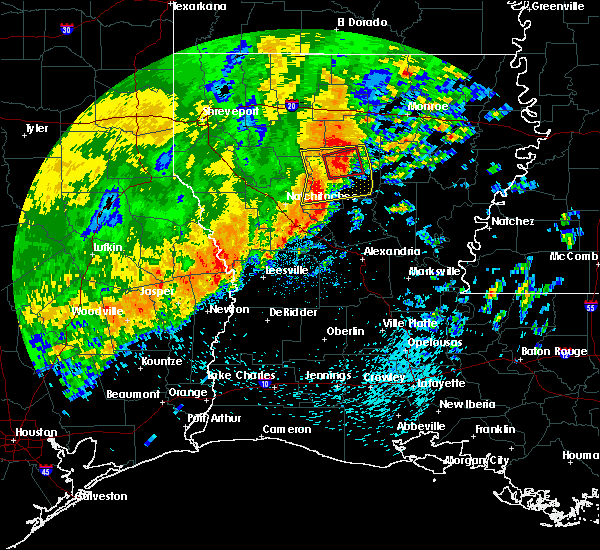 At 347 pm cdt, a severe thunderstorm capable of producing a tornado was located 12 miles northeast of winnfield, moving east at 45 mph (radar indicated rotation). Hazards include tornado. Flying debris will be dangerous to those caught without shelter. mobile homes will be damaged or destroyed. damage to roofs, windows, and vehicles will occur. tree damage is likely. Locations impacted include, dodson, sikes and hudson. At 347 pm cdt, a severe thunderstorm capable of producing a tornado was located 12 miles northeast of winnfield, moving east at 45 mph (radar indicated rotation). Hazards include tornado. Flying debris will be dangerous to those caught without shelter. mobile homes will be damaged or destroyed. damage to roofs, windows, and vehicles will occur. tree damage is likely. Locations impacted include, dodson, sikes and hudson.
|
| 3/28/2018 3:42 PM CDT |
 At 342 pm cdt, a severe thunderstorm was located 7 miles northeast of winnfield, moving east at 40 mph (radar indicated). Hazards include 60 mph wind gusts. Expect damage to roofs, siding, and trees. locations impacted include, winnfield, jonesboro, goldonna, dodson, calvin, atlanta, sikes, joyce and hudson. A tornado watch remains in effect until 900 pm cdt for north central and northwestern louisiana. At 342 pm cdt, a severe thunderstorm was located 7 miles northeast of winnfield, moving east at 40 mph (radar indicated). Hazards include 60 mph wind gusts. Expect damage to roofs, siding, and trees. locations impacted include, winnfield, jonesboro, goldonna, dodson, calvin, atlanta, sikes, joyce and hudson. A tornado watch remains in effect until 900 pm cdt for north central and northwestern louisiana.
|
| 3/28/2018 3:25 PM CDT |
 At 325 pm cdt, a severe thunderstorm capable of producing a tornado was located 12 miles northwest of winnfield, moving east at 45 mph (radar indicated rotation). Hazards include tornado. Flying debris will be dangerous to those caught without shelter. mobile homes will be damaged or destroyed. damage to roofs, windows, and vehicles will occur. tree damage is likely. This tornadic thunderstorm will remain over mainly rural areas of south central jackson, northeastern natchitoches and northern winn parishes, including the following locations: sikes, dodson, hudson, calvin and goldonna. At 325 pm cdt, a severe thunderstorm capable of producing a tornado was located 12 miles northwest of winnfield, moving east at 45 mph (radar indicated rotation). Hazards include tornado. Flying debris will be dangerous to those caught without shelter. mobile homes will be damaged or destroyed. damage to roofs, windows, and vehicles will occur. tree damage is likely. This tornadic thunderstorm will remain over mainly rural areas of south central jackson, northeastern natchitoches and northern winn parishes, including the following locations: sikes, dodson, hudson, calvin and goldonna.
|
| 3/28/2018 3:01 PM CDT |
 The national weather service in shreveport has issued a * severe thunderstorm warning for. southern jackson parish in north central louisiana. northeastern natchitoches parish in northwestern louisiana. southeastern bienville parish in northwestern louisiana. Winn parish in north central louisiana. The national weather service in shreveport has issued a * severe thunderstorm warning for. southern jackson parish in north central louisiana. northeastern natchitoches parish in northwestern louisiana. southeastern bienville parish in northwestern louisiana. Winn parish in north central louisiana.
|
| 5/28/2017 8:05 PM CDT |
 At 804 pm cdt, a severe thunderstorm capable of producing a tornado was located near winnfield, moving east at 65 mph (radar indicated rotation). Hazards include tornado and quarter size hail. Flying debris will be dangerous to those caught without shelter. mobile homes will be damaged or destroyed. damage to roofs, windows, and vehicles will occur. Tree damage is likely. At 804 pm cdt, a severe thunderstorm capable of producing a tornado was located near winnfield, moving east at 65 mph (radar indicated rotation). Hazards include tornado and quarter size hail. Flying debris will be dangerous to those caught without shelter. mobile homes will be damaged or destroyed. damage to roofs, windows, and vehicles will occur. Tree damage is likely.
|
| 5/28/2017 7:43 PM CDT |
 At 742 pm cdt, severe thunderstorms were located along a line extending from 11 miles south of arcadia to 15 miles west of jonesboro to 19 miles east of coushatta to near campti to 7 miles southwest of natchitoches, moving northeast at 30 mph (radar indicated). Hazards include 70 mph wind gusts and quarter size hail. Hail damage to vehicles is expected. expect considerable tree damage. Wind damage is also likely to mobile homes, roofs, and outbuildings. At 742 pm cdt, severe thunderstorms were located along a line extending from 11 miles south of arcadia to 15 miles west of jonesboro to 19 miles east of coushatta to near campti to 7 miles southwest of natchitoches, moving northeast at 30 mph (radar indicated). Hazards include 70 mph wind gusts and quarter size hail. Hail damage to vehicles is expected. expect considerable tree damage. Wind damage is also likely to mobile homes, roofs, and outbuildings.
|
| 4/30/2017 4:25 AM CDT | Trees down ne dodso in winn county LA, 2.2 miles SW of Dodson, LA |
| 4/30/2017 3:24 AM CDT | Trees down in and on the gaars mills road are in winn county LA, 6.6 miles WSW of Dodson, LA |
| 4/30/2017 3:23 AM CDT | Trees down and several homes with damage to porches off ketchum road west of sike in winn county LA, 7 miles W of Dodson, LA |
| 4/29/2017 3:51 PM CDT |
 The tornado warning for jackson, eastern bienville, south central lincoln and north central winn parishes will expire at 400 pm cdt, the tornadic thunderstorm which prompted the warning has weakened. therefore, the warning will be allowed to expire. The tornado warning for jackson, eastern bienville, south central lincoln and north central winn parishes will expire at 400 pm cdt, the tornadic thunderstorm which prompted the warning has weakened. therefore, the warning will be allowed to expire.
|
| 4/29/2017 3:10 PM CDT |
 At 310 pm cdt, a severe thunderstorm capable of producing a tornado was located over jonesboro, moving northeast at 25 mph (radar indicated rotation). Hazards include tornado and quarter size hail. Flying debris will be dangerous to those caught without shelter. mobile homes will be damaged or destroyed. damage to roofs, windows, and vehicles will occur. tree damage is likely. This tornadic thunderstorm will remain over mainly rural areas of jackson, eastern bienville, south central lincoln and north central winn parishes, including the following locations: east hodge, hodge, chatham, north hodge, quitman and dodson. At 310 pm cdt, a severe thunderstorm capable of producing a tornado was located over jonesboro, moving northeast at 25 mph (radar indicated rotation). Hazards include tornado and quarter size hail. Flying debris will be dangerous to those caught without shelter. mobile homes will be damaged or destroyed. damage to roofs, windows, and vehicles will occur. tree damage is likely. This tornadic thunderstorm will remain over mainly rural areas of jackson, eastern bienville, south central lincoln and north central winn parishes, including the following locations: east hodge, hodge, chatham, north hodge, quitman and dodson.
|
| 4/29/2017 3:05 PM CDT |
 At 305 pm cdt, a severe thunderstorm was located near jonesboro, moving northeast at 25 mph (radar indicated). Hazards include 60 mph wind gusts and quarter size hail. Hail damage to vehicles is expected. Expect wind damage to roofs, siding, and trees. At 305 pm cdt, a severe thunderstorm was located near jonesboro, moving northeast at 25 mph (radar indicated). Hazards include 60 mph wind gusts and quarter size hail. Hail damage to vehicles is expected. Expect wind damage to roofs, siding, and trees.
|
| 4/29/2017 3:02 PM CDT |
 At 301 pm cdt, a severe thunderstorm capable of producing a tornado was located 12 miles east of campti, or 15 miles west of winnfield, moving northeast at 25 mph (radar indicated rotation). Hazards include tornado. Flying debris will be dangerous to those caught without shelter. mobile homes will be damaged or destroyed. damage to roofs, windows, and vehicles will occur. tree damage is likely. this dangerous storm will be near, jonesboro around 345 pm cdt. Other locations impacted by this tornadic thunderstorm include goldonna, dodson and calvin. At 301 pm cdt, a severe thunderstorm capable of producing a tornado was located 12 miles east of campti, or 15 miles west of winnfield, moving northeast at 25 mph (radar indicated rotation). Hazards include tornado. Flying debris will be dangerous to those caught without shelter. mobile homes will be damaged or destroyed. damage to roofs, windows, and vehicles will occur. tree damage is likely. this dangerous storm will be near, jonesboro around 345 pm cdt. Other locations impacted by this tornadic thunderstorm include goldonna, dodson and calvin.
|
| 4/2/2017 4:34 PM CDT |
 At 434 pm cdt, severe thunderstorms were located along a line extending from 16 miles east of jonesboro to 9 miles south of winnfield to near colfax, moving east at 40 mph (radar indicated). Hazards include 60 mph wind gusts and quarter size hail. Hail damage to vehicles is expected. expect wind damage to roofs, siding, and trees. locations impacted include, winnfield, columbia, jena, colfax, olla, clarks, grayson, midway, urania, pollock, dry prong, tullos, dodson, georgetown, atlanta, sikes, nebo, rogers, catahoula lake and chopin. A tornado watch remains in effect until 900 pm cdt for north central and northwestern louisiana. At 434 pm cdt, severe thunderstorms were located along a line extending from 16 miles east of jonesboro to 9 miles south of winnfield to near colfax, moving east at 40 mph (radar indicated). Hazards include 60 mph wind gusts and quarter size hail. Hail damage to vehicles is expected. expect wind damage to roofs, siding, and trees. locations impacted include, winnfield, columbia, jena, colfax, olla, clarks, grayson, midway, urania, pollock, dry prong, tullos, dodson, georgetown, atlanta, sikes, nebo, rogers, catahoula lake and chopin. A tornado watch remains in effect until 900 pm cdt for north central and northwestern louisiana.
|
| 4/2/2017 4:12 PM CDT |
 At 412 pm cdt, severe thunderstorms were located along a line extending from 7 miles southeast of jonesboro to 6 miles northeast of montgomery to flatwoods, moving east at 40 mph (radar indicated). Hazards include 60 mph wind gusts and quarter size hail. Hail damage to vehicles is expected. Expect wind damage to roofs, siding, and trees. At 412 pm cdt, severe thunderstorms were located along a line extending from 7 miles southeast of jonesboro to 6 miles northeast of montgomery to flatwoods, moving east at 40 mph (radar indicated). Hazards include 60 mph wind gusts and quarter size hail. Hail damage to vehicles is expected. Expect wind damage to roofs, siding, and trees.
|
| 4/2/2017 3:36 PM CDT |
 At 336 pm cdt, severe thunderstorms were located along a line extending from 8 miles southwest of jonesboro to 7 miles southwest of natchitoches to near kurthwood, moving east at 40 mph (radar indicated). Hazards include 60 mph wind gusts and quarter size hail. Hail damage to vehicles is expected. Expect wind damage to roofs, siding, and trees. At 336 pm cdt, severe thunderstorms were located along a line extending from 8 miles southwest of jonesboro to 7 miles southwest of natchitoches to near kurthwood, moving east at 40 mph (radar indicated). Hazards include 60 mph wind gusts and quarter size hail. Hail damage to vehicles is expected. Expect wind damage to roofs, siding, and trees.
|
| 3/25/2017 12:00 AM CDT |
 At 1200 am cdt, severe thunderstorms were located along a line extending from 6 miles north of jonesboro to 24 miles northwest of olla to 6 miles southwest of winnfield to near natchitoches to 14 miles west of montgomery to 9 miles northwest of kurthwood, moving northeast at 40 mph (radar indicated). Hazards include 60 mph wind gusts. expect damage to roofs, siding, and trees At 1200 am cdt, severe thunderstorms were located along a line extending from 6 miles north of jonesboro to 24 miles northwest of olla to 6 miles southwest of winnfield to near natchitoches to 14 miles west of montgomery to 9 miles northwest of kurthwood, moving northeast at 40 mph (radar indicated). Hazards include 60 mph wind gusts. expect damage to roofs, siding, and trees
|
| 3/24/2017 11:36 PM CDT |
 At 1136 pm cdt, severe thunderstorms were located along a line extending from 13 miles south of arcadia to 13 miles northwest of winnfield to 9 miles north of montgomery to 12 miles east of many to 10 miles west of hornbeck, moving northeast at 35 mph (radar indicated). Hazards include 60 mph wind gusts. Expect damage to roofs, siding, and trees. locations impacted include, natchitoches, winnfield, jonesboro, many, campti, montgomery, allen, florien, provencal, natchez, clarence, hodge, goldonna, north hodge, dodson, east hodge, saline, lucky, ashland and calvin. A tornado watch remains in effect until 300 am cdt for north central and northwestern louisiana. At 1136 pm cdt, severe thunderstorms were located along a line extending from 13 miles south of arcadia to 13 miles northwest of winnfield to 9 miles north of montgomery to 12 miles east of many to 10 miles west of hornbeck, moving northeast at 35 mph (radar indicated). Hazards include 60 mph wind gusts. Expect damage to roofs, siding, and trees. locations impacted include, natchitoches, winnfield, jonesboro, many, campti, montgomery, allen, florien, provencal, natchez, clarence, hodge, goldonna, north hodge, dodson, east hodge, saline, lucky, ashland and calvin. A tornado watch remains in effect until 300 am cdt for north central and northwestern louisiana.
|
| 3/24/2017 11:00 PM CDT |
 At 1100 pm cdt, severe thunderstorms were located along a line extending from 9 miles north of coushatta to 6 miles west of campti to 10 miles southwest of natchitoches to 7 miles northwest of hornbeck, moving east at 40 mph (radar indicated). Hazards include 60 mph wind gusts. expect damage to roofs, siding, and trees At 1100 pm cdt, severe thunderstorms were located along a line extending from 9 miles north of coushatta to 6 miles west of campti to 10 miles southwest of natchitoches to 7 miles northwest of hornbeck, moving east at 40 mph (radar indicated). Hazards include 60 mph wind gusts. expect damage to roofs, siding, and trees
|
| 7/14/2016 9:09 PM CDT |
 At 909 pm cdt, severe thunderstorms were located along a line extending from liddieville to near olla to near winnfield, moving south at 40 mph (radar indicated). Hazards include 60 mph wind gusts. Expect damage to roofs. siding. and trees. Locations impacted include, winnfield, columbia, olla, clarks, grayson, urania, tullos, dodson, sikes, standard, burlington, spaulding, hudson, riverton, kelly and joyce. At 909 pm cdt, severe thunderstorms were located along a line extending from liddieville to near olla to near winnfield, moving south at 40 mph (radar indicated). Hazards include 60 mph wind gusts. Expect damage to roofs. siding. and trees. Locations impacted include, winnfield, columbia, olla, clarks, grayson, urania, tullos, dodson, sikes, standard, burlington, spaulding, hudson, riverton, kelly and joyce.
|
| 7/14/2016 8:34 PM CDT |
 At 834 pm cdt, a strong gust front was located along a line extending from near start to 11 miles east of jonesboro, moving south southeast at 40 mph. strong to severe thunderstorms were noted behind this boundary along a line from just north of chatham to south monroe, also moving south southeast at 40 mph (radar indicated). Hazards include 60 mph wind gusts. Expect damage to roofs. siding. And trees. At 834 pm cdt, a strong gust front was located along a line extending from near start to 11 miles east of jonesboro, moving south southeast at 40 mph. strong to severe thunderstorms were noted behind this boundary along a line from just north of chatham to south monroe, also moving south southeast at 40 mph (radar indicated). Hazards include 60 mph wind gusts. Expect damage to roofs. siding. And trees.
|
| 6/18/2016 11:12 AM CDT | Trees down on hwy 126 nw of dodson in winn county LA, 1.9 miles SE of Dodson, LA |
| 6/18/2016 11:12 AM CDT |
 At 1112 am cdt, a severe thunderstorm was located near jonesboro, moving southwest at 15 mph (radar indicated). Hazards include 60 mph wind gusts. Expect damage to roofs. siding. And trees. At 1112 am cdt, a severe thunderstorm was located near jonesboro, moving southwest at 15 mph (radar indicated). Hazards include 60 mph wind gusts. Expect damage to roofs. siding. And trees.
|
| 5/27/2016 3:35 PM CDT |
 At 334 pm cdt, a severe thunderstorm was located near winnfield, moving east at 35 mph (radar indicated). Hazards include 60 mph wind gusts and quarter size hail. Hail damage to vehicles is expected. Expect wind damage to roofs, siding, and trees. At 334 pm cdt, a severe thunderstorm was located near winnfield, moving east at 35 mph (radar indicated). Hazards include 60 mph wind gusts and quarter size hail. Hail damage to vehicles is expected. Expect wind damage to roofs, siding, and trees.
|
| 3/31/2016 5:34 PM CDT |
 At 534 pm cdt, a severe thunderstorm was located 15 miles southwest of jonesboro, moving east at 30 mph. another strong thunderstorm was indicated over southern red river and northwestern natchitoches parish, between edgefield and powhatan, also moving east at 30 mph. this storm may produce hail up to the size of dimes (radar indicated). Hazards include 60 mph wind gusts and quarter size hail. Hail damage to vehicles is expected. expect wind damage to roofs, siding, and trees. Locations impacted include, jonesboro, campti, hodge, goldonna, north hodge, dodson, east hodge, saline, ashland, calvin, powhatan, clear lake, creston, black lake, chestnut, friendship and lake end. At 534 pm cdt, a severe thunderstorm was located 15 miles southwest of jonesboro, moving east at 30 mph. another strong thunderstorm was indicated over southern red river and northwestern natchitoches parish, between edgefield and powhatan, also moving east at 30 mph. this storm may produce hail up to the size of dimes (radar indicated). Hazards include 60 mph wind gusts and quarter size hail. Hail damage to vehicles is expected. expect wind damage to roofs, siding, and trees. Locations impacted include, jonesboro, campti, hodge, goldonna, north hodge, dodson, east hodge, saline, ashland, calvin, powhatan, clear lake, creston, black lake, chestnut, friendship and lake end.
|
| 3/31/2016 5:01 PM CDT |
 At 501 pm cdt, a severe thunderstorm was located 8 miles east of coushatta, or 19 miles north of natchitoches, moving east at 30 mph. golf ball size hail was reported 6 miles south of coushatta at 455 pm. another severe thunderstorm was indicated 4 miles east of lucky, also moving east at 30 mph. quarter to half dollar size hailand damaging winds in excess of 60 mph will be possible with this storm as it moves across eastern bienville and into western jackson parish (radar indicated). Hazards include golf ball size hail and 60 mph wind gusts. People and animals outdoors will be injured. expect hail damage to roofs, siding, windows, and vehicles. expect wind damage to roofs, siding, and trees. Locations impacted include, jonesboro, campti, martin, hodge, goldonna, north hodge, dodson, east hodge, saline, lucky, ashland, calvin, bienville, powhatan, clear lake, creston, ajax, black lake, chestnut and friendship. At 501 pm cdt, a severe thunderstorm was located 8 miles east of coushatta, or 19 miles north of natchitoches, moving east at 30 mph. golf ball size hail was reported 6 miles south of coushatta at 455 pm. another severe thunderstorm was indicated 4 miles east of lucky, also moving east at 30 mph. quarter to half dollar size hailand damaging winds in excess of 60 mph will be possible with this storm as it moves across eastern bienville and into western jackson parish (radar indicated). Hazards include golf ball size hail and 60 mph wind gusts. People and animals outdoors will be injured. expect hail damage to roofs, siding, windows, and vehicles. expect wind damage to roofs, siding, and trees. Locations impacted include, jonesboro, campti, martin, hodge, goldonna, north hodge, dodson, east hodge, saline, lucky, ashland, calvin, bienville, powhatan, clear lake, creston, ajax, black lake, chestnut and friendship.
|
| 3/31/2016 4:44 PM CDT |
 At 444 pm cdt, a severe thunderstorm was located over coushatta, or 21 miles east of mansfield, moving east at 30 mph (radar indicated). Hazards include ping pong ball size hail and 60 mph wind gusts. People and animals outdoors will be injured. expect hail damage to roofs, siding, windows, and vehicles. Expect wind damage to roofs, siding, and trees. At 444 pm cdt, a severe thunderstorm was located over coushatta, or 21 miles east of mansfield, moving east at 30 mph (radar indicated). Hazards include ping pong ball size hail and 60 mph wind gusts. People and animals outdoors will be injured. expect hail damage to roofs, siding, windows, and vehicles. Expect wind damage to roofs, siding, and trees.
|
| 3/31/2016 3:35 PM CDT |
 At 335 pm cdt, severe thunderstorms were located along a line extending from 16 miles southwest of jonesboro to near winnfield to 9 miles west of olla, moving northeast at 40 mph. the strongest severe thunderstorm was located just south of goldonna, and will be capable of producing half dollar size hail (radar indicated). Hazards include 60 mph wind gusts and quarter size hail. Hail damage to vehicles is expected. expect wind damage to roofs, siding, and trees. Locations impacted include, winnfield, goldonna, dodson, calvin, atlanta, sikes, hudson, joyce and kelly. At 335 pm cdt, severe thunderstorms were located along a line extending from 16 miles southwest of jonesboro to near winnfield to 9 miles west of olla, moving northeast at 40 mph. the strongest severe thunderstorm was located just south of goldonna, and will be capable of producing half dollar size hail (radar indicated). Hazards include 60 mph wind gusts and quarter size hail. Hail damage to vehicles is expected. expect wind damage to roofs, siding, and trees. Locations impacted include, winnfield, goldonna, dodson, calvin, atlanta, sikes, hudson, joyce and kelly.
|
| 3/31/2016 3:14 PM CDT |
 At 314 pm cdt, severe thunderstorms were located along a line extending from near campti to 11 miles north of montgomery to 12 miles north of colfax, moving northeast at 50 mph (radar indicated). Hazards include 60 mph wind gusts and quarter size hail. Hail damage to vehicles is expected. Expect wind damage to roofs, siding, and trees. At 314 pm cdt, severe thunderstorms were located along a line extending from near campti to 11 miles north of montgomery to 12 miles north of colfax, moving northeast at 50 mph (radar indicated). Hazards include 60 mph wind gusts and quarter size hail. Hail damage to vehicles is expected. Expect wind damage to roofs, siding, and trees.
|
| 3/8/2016 4:26 PM CST |
 At 426 pm cst, a severe thunderstorm was located 13 miles southeast of jonesboro, moving northeast at 60 mph (radar indicated). Hazards include 60 mph wind gusts and nickel size hail. Expect damage to roofs. siding. And trees. At 426 pm cst, a severe thunderstorm was located 13 miles southeast of jonesboro, moving northeast at 60 mph (radar indicated). Hazards include 60 mph wind gusts and nickel size hail. Expect damage to roofs. siding. And trees.
|
| 3/8/2016 4:13 PM CST |
 At 412 pm cst, a severe thunderstorm was located 15 miles northeast of winnfield, moving northeast at 45 mph (radar indicated). Hazards include 70 mph wind gusts and quarter size hail. Hail damage to vehicles is expected. expect considerable tree damage. wind damage is also likely to mobile homes, roofs, and outbuildings. locations impacted include, winnfield, chatham, dodson, sikes, spaulding, hudson and joyce. A tornado watch remains in effect until 600 pm cst for northwestern louisiana. At 412 pm cst, a severe thunderstorm was located 15 miles northeast of winnfield, moving northeast at 45 mph (radar indicated). Hazards include 70 mph wind gusts and quarter size hail. Hail damage to vehicles is expected. expect considerable tree damage. wind damage is also likely to mobile homes, roofs, and outbuildings. locations impacted include, winnfield, chatham, dodson, sikes, spaulding, hudson and joyce. A tornado watch remains in effect until 600 pm cst for northwestern louisiana.
|
| 3/8/2016 3:59 PM CST |
 At 357 pm cst, a severe thunderstorm was located 8 miles north of winnfield, moving northeast at 50 mph (radar indicated). Hazards include 70 mph wind gusts and quarter size hail. Hail damage to vehicles is expected. expect considerable tree damage. wind damage is also likely to mobile homes, roofs, and outbuildings. locations impacted include, winnfield, chatham, dodson, calvin, atlanta, sikes, spaulding, hudson, joyce and burlington. A tornado watch remains in effect until 600 pm cst for north central louisiana. At 357 pm cst, a severe thunderstorm was located 8 miles north of winnfield, moving northeast at 50 mph (radar indicated). Hazards include 70 mph wind gusts and quarter size hail. Hail damage to vehicles is expected. expect considerable tree damage. wind damage is also likely to mobile homes, roofs, and outbuildings. locations impacted include, winnfield, chatham, dodson, calvin, atlanta, sikes, spaulding, hudson, joyce and burlington. A tornado watch remains in effect until 600 pm cst for north central louisiana.
|
| 3/8/2016 3:40 PM CST |
 At 339 pm cst, a severe thunderstorm was located near winnfield, moving northeast at 40 mph (radar indicated). Hazards include 70 mph wind gusts and quarter size hail. Hail damage to vehicles is expected. expect considerable tree damage. Wind damage is also likely to mobile homes, roofs, and outbuildings. At 339 pm cst, a severe thunderstorm was located near winnfield, moving northeast at 40 mph (radar indicated). Hazards include 70 mph wind gusts and quarter size hail. Hail damage to vehicles is expected. expect considerable tree damage. Wind damage is also likely to mobile homes, roofs, and outbuildings.
|
| 3/8/2016 3:35 PM CST |
 A severe thunderstorm warning remains in effect until 345 pm cst for northeastern natchitoches. winn and north central grant parishes. at 335 pm cst. a severe thunderstorm was located 9 miles west of winnfield. moving northeast at 40 mph. hazard. 60 mph wind gusts and nickel size hail. A severe thunderstorm warning remains in effect until 345 pm cst for northeastern natchitoches. winn and north central grant parishes. at 335 pm cst. a severe thunderstorm was located 9 miles west of winnfield. moving northeast at 40 mph. hazard. 60 mph wind gusts and nickel size hail.
|
| 3/8/2016 3:15 PM CST |
 At 315 pm cst, a severe thunderstorm was located 9 miles east of natchitoches, moving northeast at 45 mph (radar indicated). Hazards include 60 mph wind gusts and nickel size hail. Expect damage to roofs. siding. and trees. locations impacted include, natchitoches, winnfield, campti, montgomery, natchez, clarence, dodson, calvin, atlanta, grand ecore, clear lake, hudson, bermuda, st. maurice, melrose and joyce. A tornado watch remains in effect until 600 pm cst for northwestern louisiana. At 315 pm cst, a severe thunderstorm was located 9 miles east of natchitoches, moving northeast at 45 mph (radar indicated). Hazards include 60 mph wind gusts and nickel size hail. Expect damage to roofs. siding. and trees. locations impacted include, natchitoches, winnfield, campti, montgomery, natchez, clarence, dodson, calvin, atlanta, grand ecore, clear lake, hudson, bermuda, st. maurice, melrose and joyce. A tornado watch remains in effect until 600 pm cst for northwestern louisiana.
|
| 3/8/2016 2:41 PM CST |
 At 241 pm cst, a severe thunderstorm was located 8 miles south of natchitoches, moving northeast at 45 mph (radar indicated). Hazards include 60 mph wind gusts. Expect damage to roofs. siding. And trees. At 241 pm cst, a severe thunderstorm was located 8 miles south of natchitoches, moving northeast at 45 mph (radar indicated). Hazards include 60 mph wind gusts. Expect damage to roofs. siding. And trees.
|
| 2/23/2016 5:59 PM CST |
 At 558 pm cst, severe thunderstorms were located along a line extending from 10 miles south of jonesboro to near colfax, moving east at 45 mph (public). Hazards include 60 mph wind gusts and quarter to half dollar sized hail. Hail damage to vehicles is expected. Expect wind damage to roofs, siding, and trees. At 558 pm cst, severe thunderstorms were located along a line extending from 10 miles south of jonesboro to near colfax, moving east at 45 mph (public). Hazards include 60 mph wind gusts and quarter to half dollar sized hail. Hail damage to vehicles is expected. Expect wind damage to roofs, siding, and trees.
|
| 2/23/2016 5:51 PM CST |
 At 550 pm cst, a severe thunderstorm was located 8 miles northwest of winnfield, moving east at 45 mph (public). Hazards include 60 mph wind gusts and quarter size hail. Hail damage to vehicles is expected. expect wind damage to roofs, siding, and trees. locations impacted include, winnfield, goldonna, dodson, calvin, atlanta and st. Maurice. At 550 pm cst, a severe thunderstorm was located 8 miles northwest of winnfield, moving east at 45 mph (public). Hazards include 60 mph wind gusts and quarter size hail. Hail damage to vehicles is expected. expect wind damage to roofs, siding, and trees. locations impacted include, winnfield, goldonna, dodson, calvin, atlanta and st. Maurice.
|
| 2/23/2016 5:35 PM CST |
 At 534 pm cst, a severe thunderstorm was located 13 miles northeast of campti, or 16 miles west of winnfield, moving east at 45 mph (public). Hazards include 60 mph wind gusts and quarter size hail. Hail damage to vehicles is expected. expect wind damage to roofs, siding, and trees. locations impacted include, natchitoches, winnfield, clarence, goldonna, dodson, calvin, atlanta, grand ecore, st. Maurice and clear lake. At 534 pm cst, a severe thunderstorm was located 13 miles northeast of campti, or 16 miles west of winnfield, moving east at 45 mph (public). Hazards include 60 mph wind gusts and quarter size hail. Hail damage to vehicles is expected. expect wind damage to roofs, siding, and trees. locations impacted include, natchitoches, winnfield, clarence, goldonna, dodson, calvin, atlanta, grand ecore, st. Maurice and clear lake.
|
| 2/23/2016 5:13 PM CST |
 At 512 pm cst, a severe thunderstorm was located near campti, or 11 miles north of natchitoches, moving east at 45 mph (public). Hazards include 60 mph wind gusts and quarter size hail. Hail damage to vehicles is expected. Expect wind damage to roofs, siding, and trees. At 512 pm cst, a severe thunderstorm was located near campti, or 11 miles north of natchitoches, moving east at 45 mph (public). Hazards include 60 mph wind gusts and quarter size hail. Hail damage to vehicles is expected. Expect wind damage to roofs, siding, and trees.
|
| 12/28/2015 12:29 AM CST |
 At 1229 am cst, severe thunderstorms were located along a line extending from near grambling to 7 miles northeast of colfax, moving northeast at 50 mph (radar indicated). Hazards include 60 mph wind gusts. Expect damage to roofs. siding. And trees. At 1229 am cst, severe thunderstorms were located along a line extending from near grambling to 7 miles northeast of colfax, moving northeast at 50 mph (radar indicated). Hazards include 60 mph wind gusts. Expect damage to roofs. siding. And trees.
|
| 12/28/2015 12:12 AM CST |
 At 1212 am cst, severe thunderstorms were located along a line extending from 10 miles southwest of jonesboro to near alexandria international airport, moving northeast at 45 mph (radar indicated). Hazards include 60 mph wind gusts. Expect damage to roofs. siding. and trees. locations impacted include, winnfield, jonesboro, colfax, montgomery, hodge, dry prong, goldonna, dodson, calvin, bienville, atlanta, williana, bentley, lake iatt, brice, friendship, aloha and liberty hill. A tornado watch remains in effect until 500 am cst for northwestern louisiana. At 1212 am cst, severe thunderstorms were located along a line extending from 10 miles southwest of jonesboro to near alexandria international airport, moving northeast at 45 mph (radar indicated). Hazards include 60 mph wind gusts. Expect damage to roofs. siding. and trees. locations impacted include, winnfield, jonesboro, colfax, montgomery, hodge, dry prong, goldonna, dodson, calvin, bienville, atlanta, williana, bentley, lake iatt, brice, friendship, aloha and liberty hill. A tornado watch remains in effect until 500 am cst for northwestern louisiana.
|
| 12/27/2015 11:57 PM CST |
 At 1156 pm cst, severe thunderstorms were located along a line extending from 12 miles northeast of campti to near hineston, moving east at 45 mph (radar indicated). Hazards include 60 mph wind gusts. Expect damage to roofs. siding. and trees. locations impacted include, winnfield, jonesboro, colfax, montgomery, clarence, hodge, dry prong, goldonna, dodson, saline, lucky, ashland, calvin, bienville, atlanta, clear lake, creston, williana, brice and friendship. A tornado watch remains in effect until 500 am cst for northwestern louisiana. At 1156 pm cst, severe thunderstorms were located along a line extending from 12 miles northeast of campti to near hineston, moving east at 45 mph (radar indicated). Hazards include 60 mph wind gusts. Expect damage to roofs. siding. and trees. locations impacted include, winnfield, jonesboro, colfax, montgomery, clarence, hodge, dry prong, goldonna, dodson, saline, lucky, ashland, calvin, bienville, atlanta, clear lake, creston, williana, brice and friendship. A tornado watch remains in effect until 500 am cst for northwestern louisiana.
|
| 12/27/2015 11:33 PM CST |
 At 1132 pm cst, severe thunderstorms were located along a line extending from near campti to near fullerton, moving northeast at 45 mph (radar indicated). Hazards include 60 mph wind gusts. Expect damage to roofs. siding. And trees. At 1132 pm cst, severe thunderstorms were located along a line extending from near campti to near fullerton, moving northeast at 45 mph (radar indicated). Hazards include 60 mph wind gusts. Expect damage to roofs. siding. And trees.
|
| 12/25/2015 4:53 PM CST |
 At 453 pm cst, a severe thunderstorm was located 8 miles southeast of jonesboro, moving north at 35 mph (radar indicated). Hazards include 60 mph wind gusts and quarter size hail. Hail damage to vehicles is expected. Expect wind damage to roofs, siding, and trees. At 453 pm cst, a severe thunderstorm was located 8 miles southeast of jonesboro, moving north at 35 mph (radar indicated). Hazards include 60 mph wind gusts and quarter size hail. Hail damage to vehicles is expected. Expect wind damage to roofs, siding, and trees.
|
| 12/13/2015 11:37 AM CST |
 At 1137 am cst, showers containing strong winds were located along a line extending from norphlet to 6 miles north of cooley to near ruston to near jonesboro to near winnfield, moving east at 30 mph (radar indicated). Hazards include 60 mph wind gusts. Expect damage to roofs. siding. and trees. Locations impacted include, ruston, el dorado, grambling, winnfield, jonesboro, smackover, norphlet, junction city, farmerville, bernice, calion, lawson, urbana, cooley, dubach, choudrant, simsboro, chatham, hodge and north hodge. At 1137 am cst, showers containing strong winds were located along a line extending from norphlet to 6 miles north of cooley to near ruston to near jonesboro to near winnfield, moving east at 30 mph (radar indicated). Hazards include 60 mph wind gusts. Expect damage to roofs. siding. and trees. Locations impacted include, ruston, el dorado, grambling, winnfield, jonesboro, smackover, norphlet, junction city, farmerville, bernice, calion, lawson, urbana, cooley, dubach, choudrant, simsboro, chatham, hodge and north hodge.
|
| 12/13/2015 11:00 AM CST |
 At 1059 am cst, showers containing strong winds were located along a line extending from mount holly to near arcadia to 9 miles east of campti, moving east at 30 mph. these storms have produced widespread wind damage across northwest louisiana, with a 65 mph wind gust measured in gibsland louisiana in bienville parish (radar indicated). Hazards include 60 mph wind gusts. Expect damage to roofs. siding. And trees. At 1059 am cst, showers containing strong winds were located along a line extending from mount holly to near arcadia to 9 miles east of campti, moving east at 30 mph. these storms have produced widespread wind damage across northwest louisiana, with a 65 mph wind gust measured in gibsland louisiana in bienville parish (radar indicated). Hazards include 60 mph wind gusts. Expect damage to roofs. siding. And trees.
|
| 11/17/2015 1:09 PM CST |
 At 106 pm cst, severe thunderstorms were located along a line extending from near bienville to near natchitoches, moving east at 30 mph (radar indicated). Hazards include 60 mph wind gusts. Expect damage to roofs. siding. and trees. A tornado watch remains in effect until 400 pm cst for northwestern louisiana. At 106 pm cst, severe thunderstorms were located along a line extending from near bienville to near natchitoches, moving east at 30 mph (radar indicated). Hazards include 60 mph wind gusts. Expect damage to roofs. siding. and trees. A tornado watch remains in effect until 400 pm cst for northwestern louisiana.
|
| 6/9/2015 9:54 PM CDT |
 The severe thunderstorm warning for northwestern winn parish will expire at 1000 pm cdt, the storm which prompted the warning has weakened below severe limits, and no longer pose an immediate threat to life or property. therefore the warning will be allowed to expire. however heavy rain is still possible with this thunderstorm. to report severe weather, contact your nearest law enforcement agency. they will relay your report to the national weather service shreveport. The severe thunderstorm warning for northwestern winn parish will expire at 1000 pm cdt, the storm which prompted the warning has weakened below severe limits, and no longer pose an immediate threat to life or property. therefore the warning will be allowed to expire. however heavy rain is still possible with this thunderstorm. to report severe weather, contact your nearest law enforcement agency. they will relay your report to the national weather service shreveport.
|
| 6/9/2015 9:24 PM CDT |
 At 923 pm cdt, a severe thunderstorm was located 10 miles northwest of winnfield, moving south southwest at 20 mph (radar indicated). Hazards include 60 mph wind gusts. Expect damage to roofs. siding and trees. Locations impacted include, winnfield, goldonna, dodson and calvin. At 923 pm cdt, a severe thunderstorm was located 10 miles northwest of winnfield, moving south southwest at 20 mph (radar indicated). Hazards include 60 mph wind gusts. Expect damage to roofs. siding and trees. Locations impacted include, winnfield, goldonna, dodson and calvin.
|
| 6/9/2015 9:10 PM CDT | Trees down near intersection of hwy 126 and hwy 123 in winn county LA, 2.8 miles ESE of Dodson, LA |
| 6/9/2015 9:03 PM CDT |
 At 903 pm cdt, a severe thunderstorm was located 9 miles south of jonesboro, moving south southwest at 20 mph (radar indicated). Hazards include 60 mph wind gusts and penny size hail. Expect damage to roofs. Siding and trees. At 903 pm cdt, a severe thunderstorm was located 9 miles south of jonesboro, moving south southwest at 20 mph (radar indicated). Hazards include 60 mph wind gusts and penny size hail. Expect damage to roofs. Siding and trees.
|
| 5/28/2015 4:29 PM CDT | At 428 pm cdt, a severe thunderstorm was located 17 miles southeast of ringgold, or 18 miles west of jonesboro, moving southeast at 15 mph (radar indicated). Hazards include 60 mph wind gusts and penny size hail. Expect damage to roofs. Siding and trees. |
| 5/27/2015 5:50 AM CDT | At 549 am cdt, severe thunderstorms were located along a line extending from 15 miles northeast of campti to 13 miles north of kurthwood, and are nearly stationary (radar indicated). Hazards include 60 mph wind gusts. Expect damage to roofs. siding and trees. Locations impacted include, natchitoches, winnfield, colfax, campti, montgomery, provencal, natchez, clarence, goldonna, dodson, calvin, atlanta, clear lake, creston, flora, chopin, grand ecore, black lake, chestnut and bermuda. |
| 5/27/2015 5:25 AM CDT | At 525 am cdt, severe thunderstorms were located along a line extending from 12 miles northeast of coushatta to 9 miles east of many, moving east at 25 mph (radar indicated). Hazards include 60 mph wind gusts. Expect damage to roofs. Siding and trees. |
| 5/25/2015 10:05 PM CDT | At 1004 pm cdt, severe thunderstorms were located along a line extending from 11 miles southwest of huttig to 6 miles south of farmerville to 10 miles southeast of ruston to 10 miles east of jonesboro to 6 miles north of winnfield, moving east at 45 mph (radar indicated). Hazards include 60 mph wind gusts and quarter size hail. Hail damage to vehicles is expected. Expect wind damage to roofs, siding and trees. |
| 5/25/2015 9:52 PM CDT | At 952 pm cdt, severe thunderstorms were located along a line extending from 12 miles southwest of huttig to near farmerville to 6 miles southeast of ruston to near jonesboro to 7 miles northwest of winnfield, moving east at 65 mph (radar indicated). Hazards include 60 mph wind gusts and quarter size hail. Hail damage to vehicles is expected. expect wind damage to roofs, siding and trees. locations impacted include, monroe, ruston, claiborne, west monroe, grambling, winnfield, jonesboro, brownsville-bawcomville, brownsville-bawcom, farmerville, richwood, bernice, sterlington, cooley, dubach, choudrant, simsboro, marion, chatham and hodge. A tornado watch remains in effect until 200 am cdt for northwestern louisiana. |
| 5/25/2015 9:22 PM CDT | At 922 pm cdt, severe thunderstorms were located along a line extending from near junction city to 9 miles southwest of bernice to arcadia to 14 miles south of gibsland to 13 miles north of campti, moving east at 50 mph (radar indicated). Hazards include 60 mph wind gusts and quarter size hail. Hail damage to vehicles is expected. Expect wind damage to roofs, siding and trees. |
| 5/24/2015 12:20 PM CDT | At 1219 pm cdt, severe thunderstorms were located along a line extending from near coushatta to 7 miles west of natchitoches to 8 miles northwest of kurthwood, moving northeast at 25 mph (radar indicated). Hazards include 60 mph wind gusts and quarter size hail. Hail damage to vehicles is expected. Expect wind damage to roofs, siding and trees. |
| 4/19/2015 2:58 AM CDT | At 257 am cdt, severe thunderstorms were located along a line extending from 11 miles south of arcadia to 8 miles north of winnfield to 9 miles north of timber trails, moving northeast at 45 mph (radar indicated). Hazards include 60 mph wind gusts. Expect damage to roofs. Siding and trees. |
| 4/1/2015 5:53 PM CDT | The severe thunderstorm warning for northwestern winn. southeastern bienville and southwestern jackson parishes will expire at 600 pm cdt. the storm which prompted the warning has weakened and is no longer severe. Therefore the warning will be allowed to expire at 6 pm. |
| 4/1/2015 5:53 PM CDT | The severe thunderstorm warning for northwestern winn. southeastern bienville and southwestern jackson parishes will expire at 600 pm cdt. the storm which prompted the warning has weakened and is no longer severe. Therefore the warning will be allowed to expire at 6 pm. |
| 4/1/2015 5:53 PM CDT | The severe thunderstorm warning for northwestern winn. southeastern bienville and southwestern jackson parishes will expire at 600 pm cdt. the storm which prompted the warning has weakened and is no longer severe. Therefore the warning will be allowed to expire at 6 pm. |
| 4/1/2015 5:38 PM CDT | A severe thunderstorm warning remains in effect until 600 pm cdt for northwestern winn. southeastern bienville and southwestern jackson parishes. at 538 pm cdt. doppler radar indicated a severe thunderstorm capable of producing damaging winds in excess of 60 mph. this storm was located 3 miles southwest of jonesboro. Moving northeast at 40. |
| 4/1/2015 5:12 PM CDT | The national weather service in shreveport has issued a * severe thunderstorm warning for. northwestern winn parish in north central louisiana. southeastern bienville parish in northwestern louisiana. southwestern jackson parish in north central louisiana. Northeastern natchitoches parish in northwestern louisiana. |
| 10/13/2014 10:48 AM CDT | Trees down all over northern part of parish... 167 north... 37 at 1236... 1233 at hwy 156 in winn county LA, 0.1 miles SE of Dodson, LA |
| 8/11/2014 3:14 PM CDT | Tree down on hwy 126 in winn county LA, 3 miles E of Dodson, LA |
| 5/21/2013 8:45 PM CDT | Trees down on a house in dodson in winn county LA, 0.1 miles SE of Dodson, LA |
| 12/25/2012 12:15 PM CST | Trees and powerlines down along hwy 126 in winn county LA, 0.1 miles SE of Dodson, LA |
| 7/28/2012 7:20 PM CDT | A tree was blown down in dodso in winn county LA, 0.1 miles SE of Dodson, LA |
Hail Maps for Dodson, LA

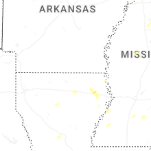
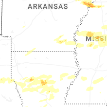


Connect with Interactive Hail Maps