

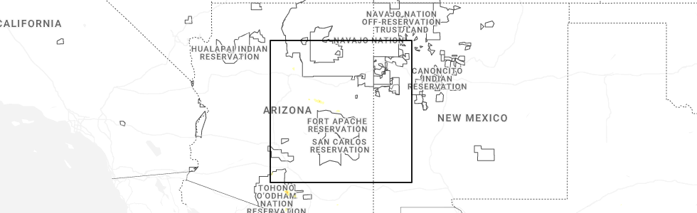
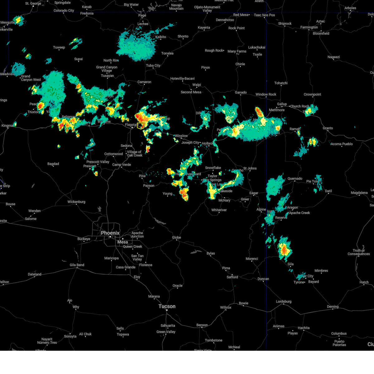
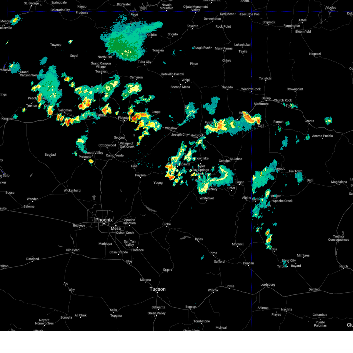
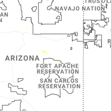
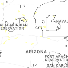
Hail Map for Doney Park, AZ
The Doney Park, AZ area has had 0 reports of on-the-ground hail by trained spotters, and has been under severe weather warnings 0 times during the past 12 months. Doppler radar has detected hail at or near Doney Park, AZ on 29 occasions, including 1 occasion during the past year.
| Name: | Doney Park, AZ |
| Where Located: | 9 miles ENE of Flagstaff, AZ |
| Map: | Google Map for Doney Park, AZ |
| Population: | 5395 |
| Housing Units: | 1896 |
| More Info: | Search Google for Doney Park, AZ |
0
The Top Recent Hail Date for Doney Park, AZ is Tuesday, July 15, 2025 (13th out of 29)
Hail and Wind Damage Spotted near Doney Park, AZ
| Date / Time | Report Details |
|---|---|
| 8/11/2024 5:51 PM MST |
 the severe thunderstorm warning has been cancelled and is no longer in effect the severe thunderstorm warning has been cancelled and is no longer in effect
|
| 8/11/2024 5:31 PM MST |
 Svrfgz the national weather service in flagstaff has issued a * severe thunderstorm warning for, coconino county in north central arizona, * until 615 pm mst/715 pm mdt. * at 530 pm mst/630 pm mdt, a severe thunderstorm was over cosnino and was moving west at 5 mph (radar indicated). Hazards include 60 mph wind gusts and quarter size hail. Hail damage to vehicles is expected. Expect wind damage to roofs, siding, and trees. Svrfgz the national weather service in flagstaff has issued a * severe thunderstorm warning for, coconino county in north central arizona, * until 615 pm mst/715 pm mdt. * at 530 pm mst/630 pm mdt, a severe thunderstorm was over cosnino and was moving west at 5 mph (radar indicated). Hazards include 60 mph wind gusts and quarter size hail. Hail damage to vehicles is expected. Expect wind damage to roofs, siding, and trees.
|
| 9/13/2023 3:18 PM MST |
 At 316 pm mst, a severe thunderstorm was located near winona, or 13 miles east of flagstaff, moving southeast at 10 mph (radar indicated). Hazards include 60 mph wind gusts and quarter size hail. Hail damage to vehicles is expected. expect wind damage to roofs, siding, and trees. this severe thunderstorm will remain over mainly rural areas of coconino county. hail threat, radar indicated max hail size, 1. 00 in wind threat, radar indicated max wind gust, 60 mph. At 316 pm mst, a severe thunderstorm was located near winona, or 13 miles east of flagstaff, moving southeast at 10 mph (radar indicated). Hazards include 60 mph wind gusts and quarter size hail. Hail damage to vehicles is expected. expect wind damage to roofs, siding, and trees. this severe thunderstorm will remain over mainly rural areas of coconino county. hail threat, radar indicated max hail size, 1. 00 in wind threat, radar indicated max wind gust, 60 mph.
|
| 9/13/2023 3:01 PM MST |
 At 300 pm mst, a severe thunderstorm was located near pioneer valley, moving southeast at 5 mph (radar indicated). Hazards include quarter size hail. Damage to vehicles is expected. this severe thunderstorm will remain over mainly rural areas of coconino county. hail threat, radar indicated max hail size, 1. 00 in wind threat, radar indicated max wind gust, <50 mph. At 300 pm mst, a severe thunderstorm was located near pioneer valley, moving southeast at 5 mph (radar indicated). Hazards include quarter size hail. Damage to vehicles is expected. this severe thunderstorm will remain over mainly rural areas of coconino county. hail threat, radar indicated max hail size, 1. 00 in wind threat, radar indicated max wind gust, <50 mph.
|
| 8/9/2023 6:06 PM MST |
 At 605 pm mst, a severe thunderstorm was located near doney park, or 10 miles northeast of flagstaff, moving east at 25 mph (radar indicated). Hazards include 60 mph wind gusts and penny size hail. Expect damage to roofs, siding, and trees. locations impacted include, flagstaff, flagstaff mall, timberline, hutchison acres, country club, pioneer valley, pine mountain estates, picture canyon preserve, cosnino, little elden springs horse camp, hutchinson acres, macann estates, winona, doney park, wupatki trails, fernwood, sunset crater volcano national monument, walnut canyon n. m. and mt. elden. this includes the following highways, route 66 between mile markers 201 and 204. interstate 40 between mile markers 201 and 211. u. s. highway 89 between mile markers 419 and 429. hail threat, radar indicated max hail size, 0. 75 in wind threat, radar indicated max wind gust, 60 mph. At 605 pm mst, a severe thunderstorm was located near doney park, or 10 miles northeast of flagstaff, moving east at 25 mph (radar indicated). Hazards include 60 mph wind gusts and penny size hail. Expect damage to roofs, siding, and trees. locations impacted include, flagstaff, flagstaff mall, timberline, hutchison acres, country club, pioneer valley, pine mountain estates, picture canyon preserve, cosnino, little elden springs horse camp, hutchinson acres, macann estates, winona, doney park, wupatki trails, fernwood, sunset crater volcano national monument, walnut canyon n. m. and mt. elden. this includes the following highways, route 66 between mile markers 201 and 204. interstate 40 between mile markers 201 and 211. u. s. highway 89 between mile markers 419 and 429. hail threat, radar indicated max hail size, 0. 75 in wind threat, radar indicated max wind gust, 60 mph.
|
| 8/9/2023 5:45 PM MST |
 At 544 pm mst, a severe thunderstorm was located over schultz pass, or near flagstaff, moving east at 25 mph (radar indicated). Hazards include 60 mph wind gusts. expect damage to roofs, siding, and trees At 544 pm mst, a severe thunderstorm was located over schultz pass, or near flagstaff, moving east at 25 mph (radar indicated). Hazards include 60 mph wind gusts. expect damage to roofs, siding, and trees
|
| 7/26/2023 10:53 AM MST |
 At 1052 am mst, a severe thunderstorm was located near winona, or 13 miles east of flagstaff, moving east at 25 mph (radar indicated). Hazards include 60 mph wind gusts and quarter size hail. Hail damage to vehicles is expected. Expect wind damage to roofs, siding, and trees. At 1052 am mst, a severe thunderstorm was located near winona, or 13 miles east of flagstaff, moving east at 25 mph (radar indicated). Hazards include 60 mph wind gusts and quarter size hail. Hail damage to vehicles is expected. Expect wind damage to roofs, siding, and trees.
|
| 8/17/2021 1:39 PM MST |
 The severe thunderstorm warning for coconino county will expire at 145 pm mst, the storm which prompted the warning has weakened below severe limits, and no longer poses an immediate threat to life or property. therefore, the warning will be allowed to expire. however a flash flood warning continues for this area and heavy rain is still possible with this thunderstorm. The severe thunderstorm warning for coconino county will expire at 145 pm mst, the storm which prompted the warning has weakened below severe limits, and no longer poses an immediate threat to life or property. therefore, the warning will be allowed to expire. however a flash flood warning continues for this area and heavy rain is still possible with this thunderstorm.
|
| 8/17/2021 12:59 PM MST |
 At 1258 pm mst, a severe thunderstorm was located over fort valley, or 7 miles northwest of flagstaff, and is nearly stationary (radar indicated). Hazards include 60 mph wind gusts and quarter size hail. Hail damage to vehicles is expected. Expect wind damage to roofs, siding, and trees. At 1258 pm mst, a severe thunderstorm was located over fort valley, or 7 miles northwest of flagstaff, and is nearly stationary (radar indicated). Hazards include 60 mph wind gusts and quarter size hail. Hail damage to vehicles is expected. Expect wind damage to roofs, siding, and trees.
|
| 7/28/2018 12:36 PM MST |
 The severe thunderstorm warning for coconino county will expire at 1245 pm mst, the storm which prompted the warning has weakened below severe limits, and no longer pose an immediate threat to life or property. therefore the warning will be allowed to expire. however heavy rain is still possible with this thunderstorm. The severe thunderstorm warning for coconino county will expire at 1245 pm mst, the storm which prompted the warning has weakened below severe limits, and no longer pose an immediate threat to life or property. therefore the warning will be allowed to expire. however heavy rain is still possible with this thunderstorm.
|
| 7/28/2018 11:59 AM MST |
 At 1159 am mst, a severe thunderstorm was located over timberline, or 10 miles northeast of flagstaff, and is nearly stationary (radar indicated). Hazards include 60 mph wind gusts and quarter size hail. Hail damage to vehicles is expected. Expect wind damage to roofs, siding, and trees. At 1159 am mst, a severe thunderstorm was located over timberline, or 10 miles northeast of flagstaff, and is nearly stationary (radar indicated). Hazards include 60 mph wind gusts and quarter size hail. Hail damage to vehicles is expected. Expect wind damage to roofs, siding, and trees.
|
| 7/19/2018 1:26 PM MST |
 At 126 pm mst, a severe thunderstorm was located over east flagstaff, moving north at 10 mph (spotter report). Hazards include quarter size hail. damage to vehicles is expected At 126 pm mst, a severe thunderstorm was located over east flagstaff, moving north at 10 mph (spotter report). Hazards include quarter size hail. damage to vehicles is expected
|
| 7/19/2018 1:10 PM MST |
 The severe thunderstorm warning for coconino county will expire at 115 pm mst, the severe thunderstorm near the flagstaff mall has weakened and moved north. the severe thunderstorm warning will be allowed to expire. heavy rain is still occurring in east flagstaff. The severe thunderstorm warning for coconino county will expire at 115 pm mst, the severe thunderstorm near the flagstaff mall has weakened and moved north. the severe thunderstorm warning will be allowed to expire. heavy rain is still occurring in east flagstaff.
|
| 7/19/2018 12:47 PM MST |
 The national weather service in flagstaff has issued a * severe thunderstorm warning for. coconino county in north central arizona. Until 115 pm mst * at 1246 pm mst, a severe thunderstorm was located over flagstaff mall and is nearly stationary. The national weather service in flagstaff has issued a * severe thunderstorm warning for. coconino county in north central arizona. Until 115 pm mst * at 1246 pm mst, a severe thunderstorm was located over flagstaff mall and is nearly stationary.
|
| 8/13/2017 6:18 PM MST |
 At 617 pm mst, a severe thunderstorm was located over downtown flagstaff, or over flagstaff, moving southeast at 30 mph (radar indicated). Hazards include 60 mph wind gusts and quarter size hail. Hail damage to vehicles is expected. Expect wind damage to roofs, siding, and trees. At 617 pm mst, a severe thunderstorm was located over downtown flagstaff, or over flagstaff, moving southeast at 30 mph (radar indicated). Hazards include 60 mph wind gusts and quarter size hail. Hail damage to vehicles is expected. Expect wind damage to roofs, siding, and trees.
|
| 8/6/2016 11:59 AM MST |
 At 1159 am mst, doppler radar indicated a severe thunderstorm capable of producing quarter size hail. this storm was located near doney park, or 11 miles northeast of flagstaff, and moving southeast at 5 mph. this storm will cross townsen winona road. At 1159 am mst, doppler radar indicated a severe thunderstorm capable of producing quarter size hail. this storm was located near doney park, or 11 miles northeast of flagstaff, and moving southeast at 5 mph. this storm will cross townsen winona road.
|
| 8/6/2016 11:45 AM MST |
 At 1143 am mst, doppler radar indicated a severe thunderstorm capable of producing quarter size hail. this storm was located about 3 miles east of near doney park, or 11 miles northeast of flagstaff, moving southeast at 10 mph. locations impacted include, eastern portions of doney park. At 1143 am mst, doppler radar indicated a severe thunderstorm capable of producing quarter size hail. this storm was located about 3 miles east of near doney park, or 11 miles northeast of flagstaff, moving southeast at 10 mph. locations impacted include, eastern portions of doney park.
|
| 8/6/2016 11:33 AM MST |
 At 1132 am mst, doppler radar indicated a severe thunderstorm capable of producing quarter size hail. this storm was located just south of sunset crater volcano national monument, or 12 miles northeast of flagstaff, and moving southeast at 10 mph. At 1132 am mst, doppler radar indicated a severe thunderstorm capable of producing quarter size hail. this storm was located just south of sunset crater volcano national monument, or 12 miles northeast of flagstaff, and moving southeast at 10 mph.
|
| 7/7/2015 3:08 PM MST |
 The severe thunderstorm warning for central coconino county will expire at 315 pm mst, the severe thunderstorm which prompted the warning over east flagstaff has weakened. therefore the warning will be allowed to expire. The severe thunderstorm warning for central coconino county will expire at 315 pm mst, the severe thunderstorm which prompted the warning over east flagstaff has weakened. therefore the warning will be allowed to expire.
|
| 7/7/2015 2:49 PM MST |
 At 249 pm mst, doppler radar indicated a severe thunderstorm capable of producing quarter size hail. this storm was located over flagstaff, and moving northeast at 25 mph. At 249 pm mst, doppler radar indicated a severe thunderstorm capable of producing quarter size hail. this storm was located over flagstaff, and moving northeast at 25 mph.
|
Hail Maps for Doney Park, AZ


Connect with Interactive Hail Maps