

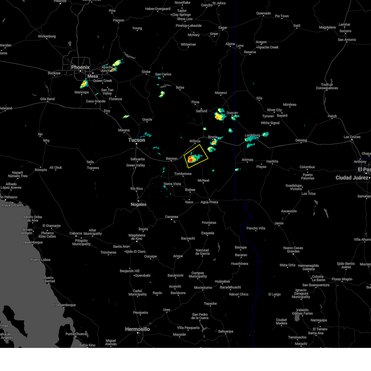
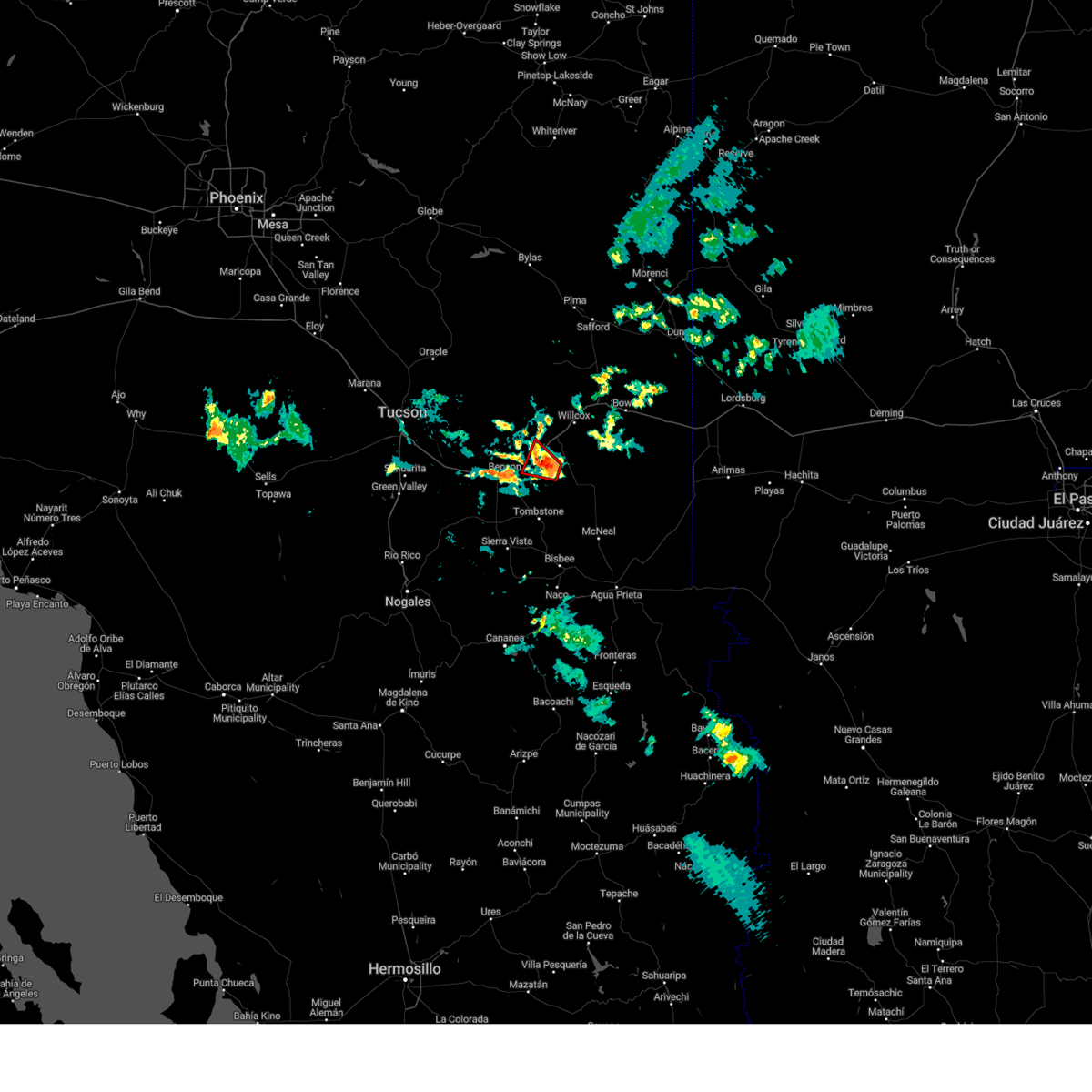
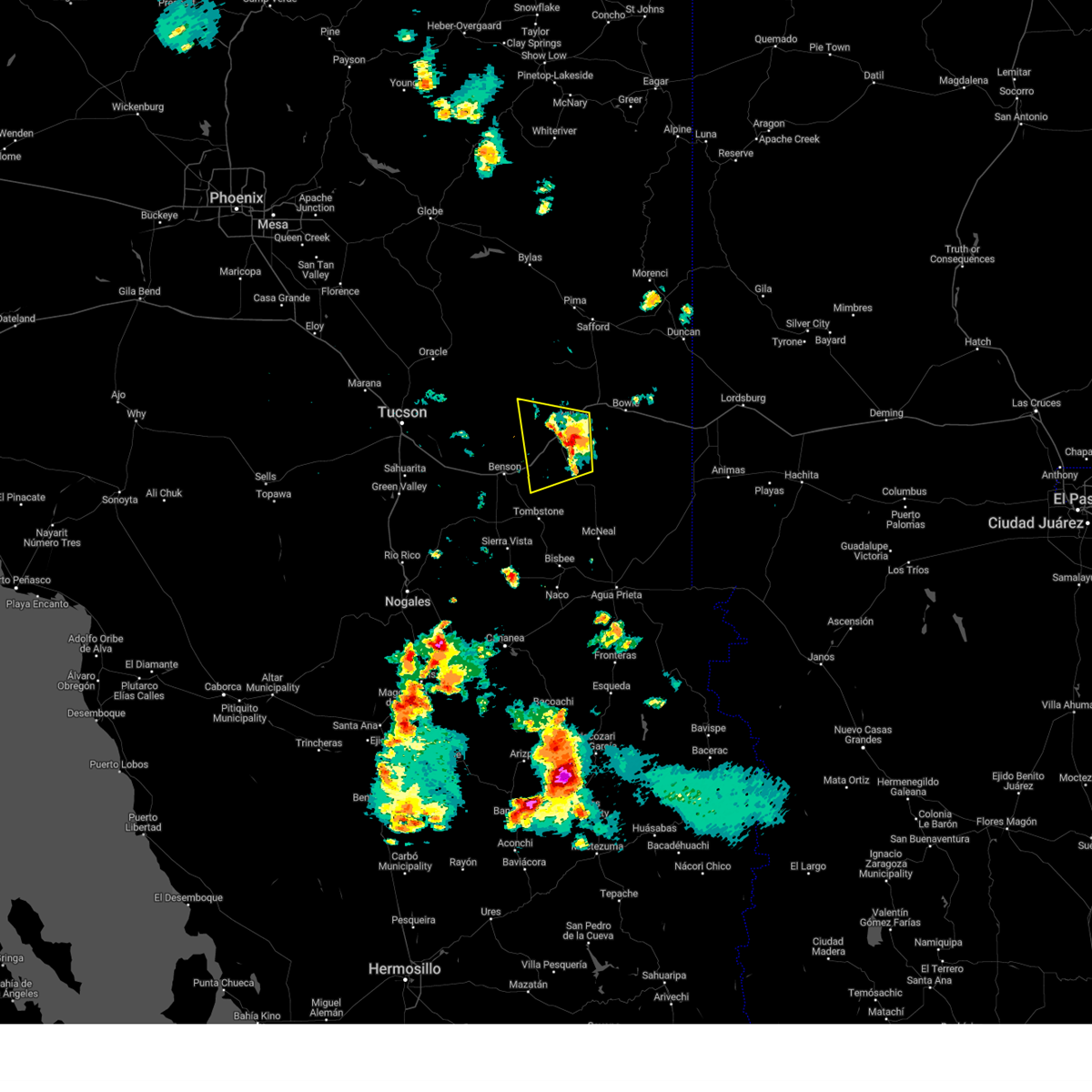
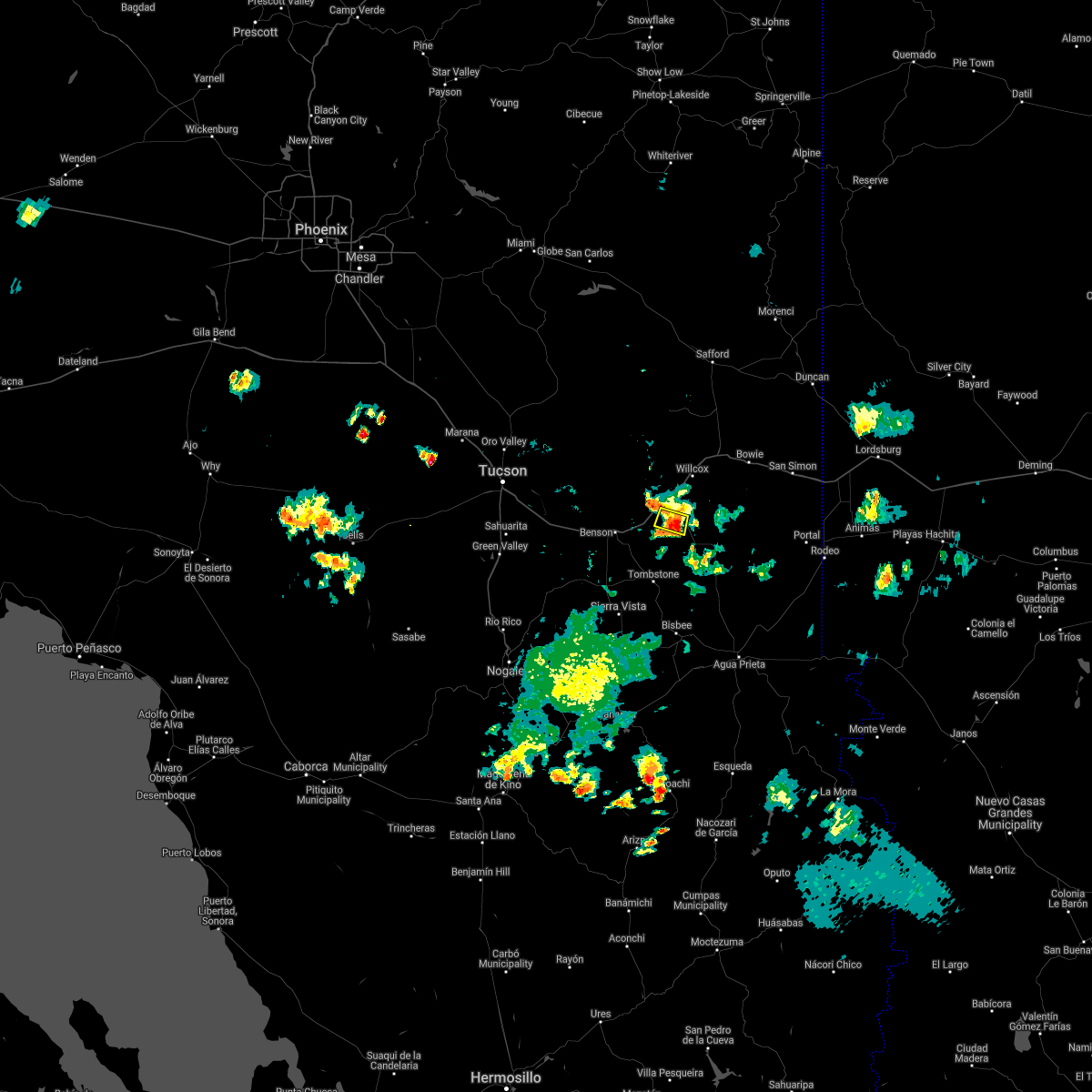
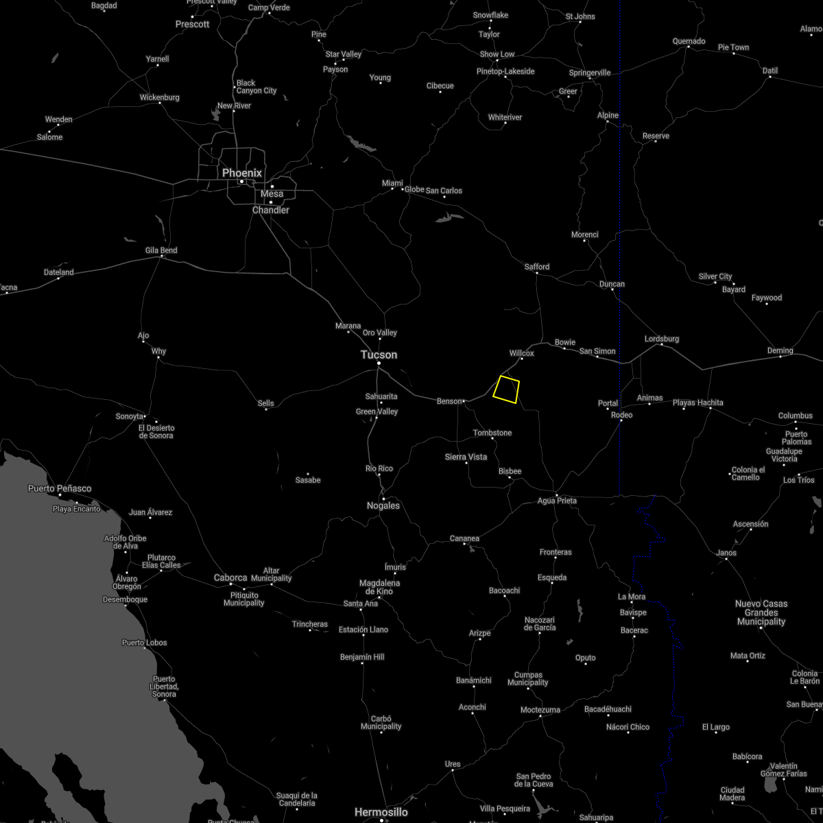
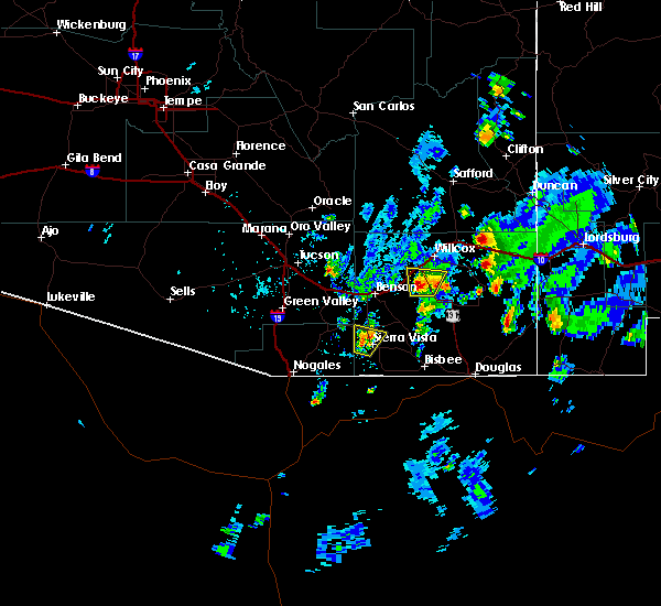
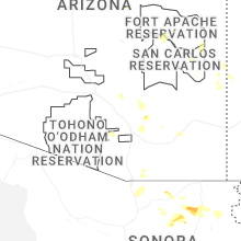
Hail Map for Dragoon, AZ
The Dragoon, AZ area has had 3 reports of on-the-ground hail by trained spotters, and has been under severe weather warnings 4 times during the past 12 months. Doppler radar has detected hail at or near Dragoon, AZ on 46 occasions, including 5 occasions during the past year.
| Name: | Dragoon, AZ |
| Where Located: | 55 miles NNW of Douglas, AZ |
| Map: | Google Map for Dragoon, AZ |
| Population: | 209 |
| Housing Units: | 115 |
| More Info: | Search Google for Dragoon, AZ |
1
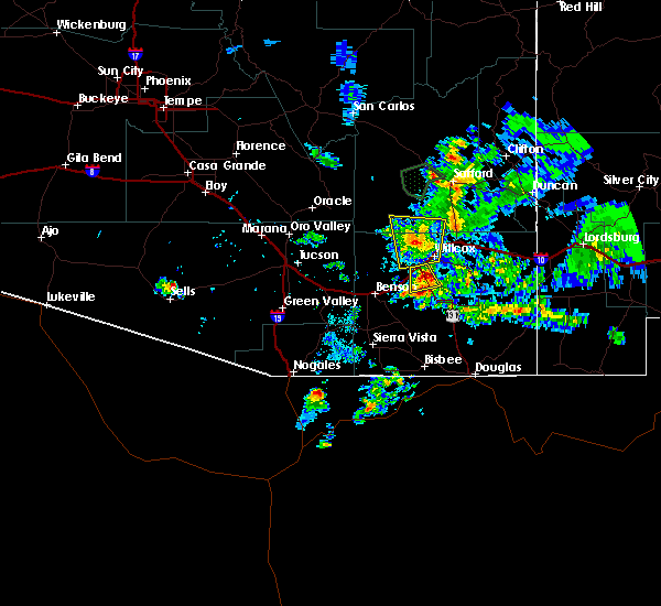
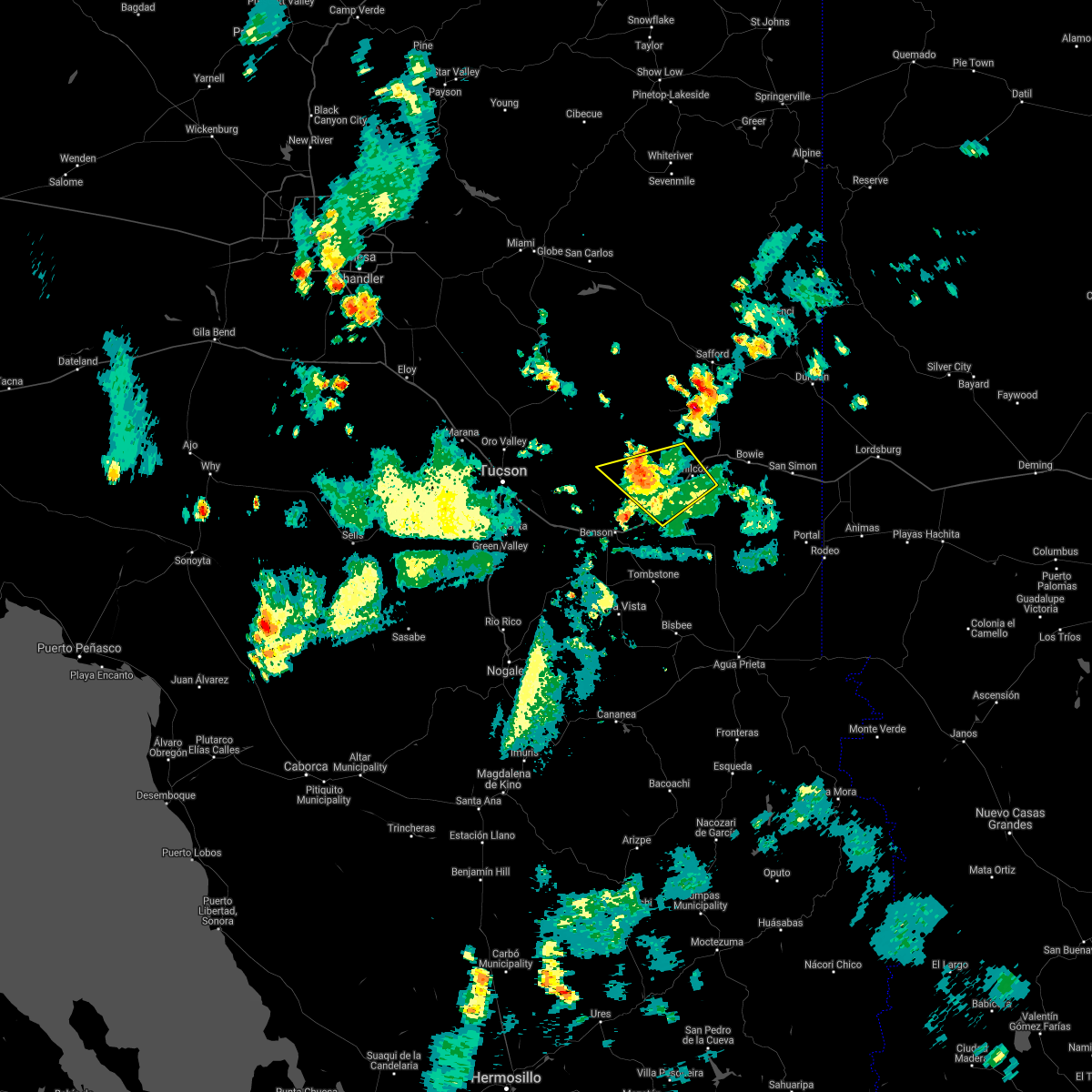
The Top Recent Hail Date for Dragoon, AZ is Sunday, July 12, 2026 (10th out of 46)
Hail and Wind Damage Spotted near Dragoon, AZ
| Date / Time | Report Details |
|---|---|
| 7/12/2026 2:52 PM MST |
 The storm which prompted the warning has weakened below severe limits, and has exited the warned area. therefore, the warning will be allowed to expire. The storm which prompted the warning has weakened below severe limits, and has exited the warned area. therefore, the warning will be allowed to expire.
|
| 7/12/2026 2:31 PM MST |
 Svrtwc the national weather service in tucson has issued a * severe thunderstorm warning for, northwestern cochise county in southeastern arizona, * until 300 pm mst. * at 231 pm mst, a severe thunderstorm was located near dragoon, moving west at 25 mph (radar indicated). Hazards include 60 mph wind gusts and quarter size hail. Hail damage to vehicles is expected. Expect wind damage to roofs, siding, and trees. Svrtwc the national weather service in tucson has issued a * severe thunderstorm warning for, northwestern cochise county in southeastern arizona, * until 300 pm mst. * at 231 pm mst, a severe thunderstorm was located near dragoon, moving west at 25 mph (radar indicated). Hazards include 60 mph wind gusts and quarter size hail. Hail damage to vehicles is expected. Expect wind damage to roofs, siding, and trees.
|
| 9/25/2025 12:47 PM MST | At 1247 pm mst, a severe thunderstorm was located near kartchner caverns state park, moving southeast at 20 mph (radar indicated). Hazards include 60 mph wind gusts and quarter size hail. Hail damage to vehicles is expected. expect wind damage to roofs, siding, and trees. locations impacted include, benson, whetstone, st. david, tombstone, kartchner caverns state park, mescal, fairbank and charleston. this includes the following highways, route 90 between mile markers 290 and 308. route 80 between mile markers 293 and 315. interstate 10 between mile markers 295 and 316. Route 82 between mile markers 52 and 67. |
| 9/25/2025 12:24 PM MST | Svrtwc the national weather service in tucson has issued a * severe thunderstorm warning for, west central cochise county in southeastern arizona, east central pima county in southeastern arizona, * until 115 pm mst. * at 1224 pm mst, a severe thunderstorm was located near kartchner caverns state park, moving east at 25 mph (radar indicated). Hazards include 60 mph wind gusts and quarter size hail. Hail damage to vehicles is expected. Expect wind damage to roofs, siding, and trees. |
| 7/13/2025 6:52 PM MST |
 The storms which prompted the warning have weakened and moved out of the area. therefore, the warning will be allowed to expire. however, strong gusty winds are still possible. The storms which prompted the warning have weakened and moved out of the area. therefore, the warning will be allowed to expire. however, strong gusty winds are still possible.
|
| 7/13/2025 6:14 PM MST |
 Svrtwc the national weather service in tucson has issued a * severe thunderstorm warning for, southwestern cochise county in southeastern arizona, * until 700 pm mst. * at 614 pm mst, severe thunderstorms were located along a line from near bisbee to 6 miles southwest of dragoon, moving southwest at 20 mph (radar indicated). Hazards include 60 mph wind gusts and quarter size hail. Hail damage to vehicles is expected. Expect wind damage to roofs, siding, and trees. Svrtwc the national weather service in tucson has issued a * severe thunderstorm warning for, southwestern cochise county in southeastern arizona, * until 700 pm mst. * at 614 pm mst, severe thunderstorms were located along a line from near bisbee to 6 miles southwest of dragoon, moving southwest at 20 mph (radar indicated). Hazards include 60 mph wind gusts and quarter size hail. Hail damage to vehicles is expected. Expect wind damage to roofs, siding, and trees.
|
| 9/16/2024 4:46 PM MST |
 Svrtwc the national weather service in tucson has issued a * severe thunderstorm warning for, central cochise county in southeastern arizona, * until 530 pm mst. * at 446 pm mst, a severe thunderstorm was located over pearce-sunsites, or 19 miles south of willcox, moving northeast at 15 mph (radar indicated). Hazards include 60 mph wind gusts and quarter size hail. Hail damage to vehicles is expected. Expect wind damage to roofs, siding, and trees. Svrtwc the national weather service in tucson has issued a * severe thunderstorm warning for, central cochise county in southeastern arizona, * until 530 pm mst. * at 446 pm mst, a severe thunderstorm was located over pearce-sunsites, or 19 miles south of willcox, moving northeast at 15 mph (radar indicated). Hazards include 60 mph wind gusts and quarter size hail. Hail damage to vehicles is expected. Expect wind damage to roofs, siding, and trees.
|
| 8/16/2024 8:46 PM MST |
 the tornado warning has been cancelled and is no longer in effect the tornado warning has been cancelled and is no longer in effect
|
| 8/16/2024 8:37 PM MST |
 At 837 pm mst, a severe thunderstorm capable of producing a tornado was located near dragoon, or 17 miles northeast of benson, moving northwest at 15 mph (radar indicated rotation). Hazards include tornado and quarter size hail. Flying debris will be dangerous to those caught without shelter. mobile homes will be damaged or destroyed. damage to roofs, windows, and vehicles will occur. tree damage is likely. this tornadic thunderstorm will remain over mainly remote areas of northwestern cochise county, including the following locations, texas canyon. This includes interstate 10 between mile markers 314 and 325. At 837 pm mst, a severe thunderstorm capable of producing a tornado was located near dragoon, or 17 miles northeast of benson, moving northwest at 15 mph (radar indicated rotation). Hazards include tornado and quarter size hail. Flying debris will be dangerous to those caught without shelter. mobile homes will be damaged or destroyed. damage to roofs, windows, and vehicles will occur. tree damage is likely. this tornadic thunderstorm will remain over mainly remote areas of northwestern cochise county, including the following locations, texas canyon. This includes interstate 10 between mile markers 314 and 325.
|
| 8/16/2024 8:23 PM MST |
 At 823 pm mst, a severe thunderstorm was located 7 miles south of dragoon, or 15 miles east of benson, moving northwest at 10 mph (radar indicated). Hazards include 60 mph wind gusts and quarter size hail. Hail damage to vehicles is expected. expect wind damage to roofs, siding, and trees. locations impacted include, benson, st. david, dragoon, kartchner caverns state park, pearce-sunsites, mescal, and texas canyon. this includes the following highways, interstate 10 between mile markers 297 and 328. route 80 between mile markers 293 and 305. route 90 between mile markers 290 and 298. Route 191 between mile markers 53 and 58. At 823 pm mst, a severe thunderstorm was located 7 miles south of dragoon, or 15 miles east of benson, moving northwest at 10 mph (radar indicated). Hazards include 60 mph wind gusts and quarter size hail. Hail damage to vehicles is expected. expect wind damage to roofs, siding, and trees. locations impacted include, benson, st. david, dragoon, kartchner caverns state park, pearce-sunsites, mescal, and texas canyon. this includes the following highways, interstate 10 between mile markers 297 and 328. route 80 between mile markers 293 and 305. route 90 between mile markers 290 and 298. Route 191 between mile markers 53 and 58.
|
| 8/16/2024 8:22 PM MST |
 Tortwc the national weather service in tucson has issued a * tornado warning for, west central cochise county in southeastern arizona, * until 900 pm mst. * at 821 pm mst, a severe thunderstorm capable of producing a tornado was located over dragoon, or 17 miles southwest of willcox, moving northwest at 15 mph (radar indicated rotation). Hazards include tornado and quarter size hail. Flying debris will be dangerous to those caught without shelter. mobile homes will be damaged or destroyed. damage to roofs, windows, and vehicles will occur. tree damage is likely. this dangerous storm will be near, dragoon around 825 pm mst. other locations impacted by this tornadic thunderstorm include texas canyon. This includes interstate 10 between mile markers 314 and 324. Tortwc the national weather service in tucson has issued a * tornado warning for, west central cochise county in southeastern arizona, * until 900 pm mst. * at 821 pm mst, a severe thunderstorm capable of producing a tornado was located over dragoon, or 17 miles southwest of willcox, moving northwest at 15 mph (radar indicated rotation). Hazards include tornado and quarter size hail. Flying debris will be dangerous to those caught without shelter. mobile homes will be damaged or destroyed. damage to roofs, windows, and vehicles will occur. tree damage is likely. this dangerous storm will be near, dragoon around 825 pm mst. other locations impacted by this tornadic thunderstorm include texas canyon. This includes interstate 10 between mile markers 314 and 324.
|
| 8/16/2024 8:14 PM MST | Personal weather station estimate of 60 mph wind gus in cochise county AZ, 5.3 miles WSW of Dragoon, AZ |
| 8/16/2024 7:55 PM MST |
 Svrtwc the national weather service in tucson has issued a * severe thunderstorm warning for, northwestern cochise county in southeastern arizona, * until 845 pm mst. * at 755 pm mst, a severe thunderstorm was located 8 miles southwest of pearce-sunsites, or 19 miles east of benson, moving northwest at 10 mph (radar indicated). Hazards include 60 mph wind gusts and quarter size hail. Hail damage to vehicles is expected. Expect wind damage to roofs, siding, and trees. Svrtwc the national weather service in tucson has issued a * severe thunderstorm warning for, northwestern cochise county in southeastern arizona, * until 845 pm mst. * at 755 pm mst, a severe thunderstorm was located 8 miles southwest of pearce-sunsites, or 19 miles east of benson, moving northwest at 10 mph (radar indicated). Hazards include 60 mph wind gusts and quarter size hail. Hail damage to vehicles is expected. Expect wind damage to roofs, siding, and trees.
|
| 7/15/2024 4:39 PM MST |
 Svrtwc the national weather service in tucson has issued a * severe thunderstorm warning for, west central cochise county in southeastern arizona, * until 530 pm mst. * at 438 pm mst, a severe thunderstorm was located near dragoon, or 13 miles east of benson, moving west at 15 mph (radar indicated). Hazards include 60 mph wind gusts and penny size hail. expect damage to roofs, siding, and trees Svrtwc the national weather service in tucson has issued a * severe thunderstorm warning for, west central cochise county in southeastern arizona, * until 530 pm mst. * at 438 pm mst, a severe thunderstorm was located near dragoon, or 13 miles east of benson, moving west at 15 mph (radar indicated). Hazards include 60 mph wind gusts and penny size hail. expect damage to roofs, siding, and trees
|
| 7/15/2024 4:23 PM MST |
 At 421 pm mst, a severe thunderstorm was located near dragoon and i- 10 , or 15 miles east of benson, moving west at 15 mph (radar indicated). Hazards include 60 mph wind gusts and quarter size hail. Hail damage to vehicles is expected. expect wind damage to roofs, siding, and trees. locations impacted include, dragoon, pearce-sunsites, cochise, and texas canyon. this includes the following highways, interstate 10 between mile markers 315 and 335. Route 191 between mile markers 49 and 66. At 421 pm mst, a severe thunderstorm was located near dragoon and i- 10 , or 15 miles east of benson, moving west at 15 mph (radar indicated). Hazards include 60 mph wind gusts and quarter size hail. Hail damage to vehicles is expected. expect wind damage to roofs, siding, and trees. locations impacted include, dragoon, pearce-sunsites, cochise, and texas canyon. this includes the following highways, interstate 10 between mile markers 315 and 335. Route 191 between mile markers 49 and 66.
|
| 7/15/2024 4:00 PM MST |
 At 400 pm mst, severe thunderstorms were located along a line extending from near pearce-sunsites through cochise to 14 miles northwest of willcox, moving west at 10 mph (radar indicated). Hazards include 70 mph wind gusts and quarter size hail. Hail damage to vehicles is expected. expect considerable tree damage. wind damage is also likely to mobile homes, roofs, and outbuildings. locations impacted include, willcox, dragoon, pearce-sunsites, cochise, texas canyon, and kansas settlement. this includes the following highways, interstate 10 between mile markers 315 and 345. route 186 between mile markers 327 and 336. Route 191 between mile markers 49 and 66. At 400 pm mst, severe thunderstorms were located along a line extending from near pearce-sunsites through cochise to 14 miles northwest of willcox, moving west at 10 mph (radar indicated). Hazards include 70 mph wind gusts and quarter size hail. Hail damage to vehicles is expected. expect considerable tree damage. wind damage is also likely to mobile homes, roofs, and outbuildings. locations impacted include, willcox, dragoon, pearce-sunsites, cochise, texas canyon, and kansas settlement. this includes the following highways, interstate 10 between mile markers 315 and 345. route 186 between mile markers 327 and 336. Route 191 between mile markers 49 and 66.
|
| 7/15/2024 3:44 PM MST |
 Svrtwc the national weather service in tucson has issued a * severe thunderstorm warning for, northwestern cochise county in southeastern arizona, * until 445 pm mst. * at 344 pm mst, a severe thunderstorm was located near and south of willcox, moving west at 10 mph (radar indicated). Hazards include 70 mph wind gusts and quarter size hail. Hail damage to vehicles is expected. expect considerable tree damage. Wind damage is also likely to mobile homes, roofs, and outbuildings. Svrtwc the national weather service in tucson has issued a * severe thunderstorm warning for, northwestern cochise county in southeastern arizona, * until 445 pm mst. * at 344 pm mst, a severe thunderstorm was located near and south of willcox, moving west at 10 mph (radar indicated). Hazards include 70 mph wind gusts and quarter size hail. Hail damage to vehicles is expected. expect considerable tree damage. Wind damage is also likely to mobile homes, roofs, and outbuildings.
|
| 7/14/2024 3:58 PM MST |
 The storm which prompted the warning has weakened below severe limits, and no longer poses an immediate threat to life or property. therefore, the warning will be allowed to expire. however, small hail and gusty winds are still possible with this thunderstorm. The storm which prompted the warning has weakened below severe limits, and no longer poses an immediate threat to life or property. therefore, the warning will be allowed to expire. however, small hail and gusty winds are still possible with this thunderstorm.
|
| 7/14/2024 3:43 PM MST |
 At 339 pm mst, a severe thunderstorm was located 7 miles northeast of benson, moving northwest at 15 mph (radar indicated). Hazards include 60 mph wind gusts and quarter size hail. Hail damage to vehicles is expected. expect wind damage to roofs, siding, and trees. locations impacted include, dragoon and texas canyon. this includes interstate 10 between mile markers 310 and 321. Additional stong storms immediately south of the texas canyon storm will also impact the benson and saint david communities in the next 10 to 20 minutes. At 339 pm mst, a severe thunderstorm was located 7 miles northeast of benson, moving northwest at 15 mph (radar indicated). Hazards include 60 mph wind gusts and quarter size hail. Hail damage to vehicles is expected. expect wind damage to roofs, siding, and trees. locations impacted include, dragoon and texas canyon. this includes interstate 10 between mile markers 310 and 321. Additional stong storms immediately south of the texas canyon storm will also impact the benson and saint david communities in the next 10 to 20 minutes.
|
| 7/14/2024 3:16 PM MST |
 Svrtwc the national weather service in tucson has issued a * severe thunderstorm warning for, northwestern cochise county in southeastern arizona, * until 400 pm mst. * at 315 pm mst, a severe thunderstorm was located near dragoon, or 11 miles east of benson, moving northwest at 15 mph (radar indicated). Hazards include 60 mph wind gusts and quarter size hail. Hail damage to vehicles is expected. Expect wind damage to roofs, siding, and trees. Svrtwc the national weather service in tucson has issued a * severe thunderstorm warning for, northwestern cochise county in southeastern arizona, * until 400 pm mst. * at 315 pm mst, a severe thunderstorm was located near dragoon, or 11 miles east of benson, moving northwest at 15 mph (radar indicated). Hazards include 60 mph wind gusts and quarter size hail. Hail damage to vehicles is expected. Expect wind damage to roofs, siding, and trees.
|
| 7/11/2024 5:04 PM MST |
 the severe thunderstorm warning has been cancelled and is no longer in effect the severe thunderstorm warning has been cancelled and is no longer in effect
|
| 7/11/2024 4:12 PM MST |
 Svrtwc the national weather service in tucson has issued a * severe thunderstorm warning for, northeastern cochise county in southeastern arizona, * until 515 pm mst. * at 411 pm mst, severe thunderstorms were located along a line extending from 9 miles east of willcox to 7 miles north of portal, moving southwest at 15 mph (radar indicated). Hazards include 60 mph wind gusts and areas of blowing dust. expect damage to roofs, siding, and trees Svrtwc the national weather service in tucson has issued a * severe thunderstorm warning for, northeastern cochise county in southeastern arizona, * until 515 pm mst. * at 411 pm mst, severe thunderstorms were located along a line extending from 9 miles east of willcox to 7 miles north of portal, moving southwest at 15 mph (radar indicated). Hazards include 60 mph wind gusts and areas of blowing dust. expect damage to roofs, siding, and trees
|
| 6/30/2024 4:43 PM MST |
 The storm which prompted the warning has weakened below severe limits, and no longer poses an immediate threat to life or property. therefore, the warning will be allowed to expire. however, gusty winds and heavy rain are still possible with this thunderstorm. The storm which prompted the warning has weakened below severe limits, and no longer poses an immediate threat to life or property. therefore, the warning will be allowed to expire. however, gusty winds and heavy rain are still possible with this thunderstorm.
|
| 6/30/2024 4:05 PM MST |
 Svrtwc the national weather service in tucson has issued a * severe thunderstorm warning for, west central cochise county in southeastern arizona, * until 445 pm mst. * at 405 pm mst, a severe thunderstorm was located 7 miles east of st. david, or 13 miles southeast of benson, moving northwest at 10 mph (radar indicated). Hazards include 60 mph wind gusts and quarter size hail. Hail damage to vehicles is expected. Expect wind damage to roofs, siding, and trees. Svrtwc the national weather service in tucson has issued a * severe thunderstorm warning for, west central cochise county in southeastern arizona, * until 445 pm mst. * at 405 pm mst, a severe thunderstorm was located 7 miles east of st. david, or 13 miles southeast of benson, moving northwest at 10 mph (radar indicated). Hazards include 60 mph wind gusts and quarter size hail. Hail damage to vehicles is expected. Expect wind damage to roofs, siding, and trees.
|
| 9/13/2023 12:28 PM MST |
 At 1228 pm mst, a severe thunderstorm was located near st. david, or 10 miles southeast of benson, moving east at 20 mph (radar indicated). Hazards include 60 mph wind gusts and penny size hail. expect damage to roofs, siding, and trees At 1228 pm mst, a severe thunderstorm was located near st. david, or 10 miles southeast of benson, moving east at 20 mph (radar indicated). Hazards include 60 mph wind gusts and penny size hail. expect damage to roofs, siding, and trees
|
| 7/27/2023 6:11 PM MST |
 At 611 pm mst, a severe thunderstorm was located near st. david, or 8 miles east of benson, moving west at 20 mph (radar indicated). Hazards include 70 mph wind gusts and quarter size hail. Hail damage to vehicles is expected. expect considerable tree damage. wind damage is also likely to mobile homes, roofs, and outbuildings. locations impacted include, st. david, dragoon and texas canyon. thunderstorm damage threat, considerable hail threat, radar indicated max hail size, 1. 00 in wind threat, radar indicated max wind gust, 70 mph. At 611 pm mst, a severe thunderstorm was located near st. david, or 8 miles east of benson, moving west at 20 mph (radar indicated). Hazards include 70 mph wind gusts and quarter size hail. Hail damage to vehicles is expected. expect considerable tree damage. wind damage is also likely to mobile homes, roofs, and outbuildings. locations impacted include, st. david, dragoon and texas canyon. thunderstorm damage threat, considerable hail threat, radar indicated max hail size, 1. 00 in wind threat, radar indicated max wind gust, 70 mph.
|
| 7/27/2023 5:42 PM MST |
 At 541 pm mst, a severe thunderstorm was located near dragoon, or 13 miles southwest of willcox, moving west at 15 mph (radar indicated). Hazards include 70 mph wind gusts and quarter size hail. Hail damage to vehicles is expected. expect considerable tree damage. Wind damage is also likely to mobile homes, roofs, and outbuildings. At 541 pm mst, a severe thunderstorm was located near dragoon, or 13 miles southwest of willcox, moving west at 15 mph (radar indicated). Hazards include 70 mph wind gusts and quarter size hail. Hail damage to vehicles is expected. expect considerable tree damage. Wind damage is also likely to mobile homes, roofs, and outbuildings.
|
| 9/12/2022 3:11 PM MST |
 At 309 pm mst, a severe thunderstorm was located near pearce- sunsites, or 21 miles east of benson, moving north and northeast at 10 mph. another severe thunderstorm was noted near fairbank and whetstone, north to northeast of fort huachuca (radar indicated). Hazards include 60 mph wind gusts and quarter size hail. Hail damage to vehicles is expected. expect wind damage to roofs, siding, and trees. locations impacted include, whetstone, st. david, tombstone, dragoon, pearce-sunsites and fairbank. hail threat, radar indicated max hail size, 1. 00 in wind threat, radar indicated max wind gust, 60 mph. At 309 pm mst, a severe thunderstorm was located near pearce- sunsites, or 21 miles east of benson, moving north and northeast at 10 mph. another severe thunderstorm was noted near fairbank and whetstone, north to northeast of fort huachuca (radar indicated). Hazards include 60 mph wind gusts and quarter size hail. Hail damage to vehicles is expected. expect wind damage to roofs, siding, and trees. locations impacted include, whetstone, st. david, tombstone, dragoon, pearce-sunsites and fairbank. hail threat, radar indicated max hail size, 1. 00 in wind threat, radar indicated max wind gust, 60 mph.
|
| 9/12/2022 2:48 PM MST |
 At 247 pm mst, a severe thunderstorm was located 8 miles south of dragoon, or 14 miles east of benson, moving north at 5 to 10 mph, with another storm 10 miles northeast of sierra vista (radar indicated). Hazards include 60 mph wind gusts and quarter size hail. Hail damage to vehicles is expected. Expect wind damage to roofs, siding, and trees. At 247 pm mst, a severe thunderstorm was located 8 miles south of dragoon, or 14 miles east of benson, moving north at 5 to 10 mph, with another storm 10 miles northeast of sierra vista (radar indicated). Hazards include 60 mph wind gusts and quarter size hail. Hail damage to vehicles is expected. Expect wind damage to roofs, siding, and trees.
|
| 8/8/2022 6:10 PM MST |
 At 610 pm mst, a severe thunderstorm was located over dragoon, or 16 miles east of benson, and is nearly stationary (radar indicated). Hazards include 60 mph wind gusts and quarter size hail. Hail damage to vehicles is expected. expect wind damage to roofs, siding, and trees. locations impacted include, dragoon, cochise and texas canyon. hail threat, radar indicated max hail size, 1. 00 in wind threat, radar indicated max wind gust, 60 mph. At 610 pm mst, a severe thunderstorm was located over dragoon, or 16 miles east of benson, and is nearly stationary (radar indicated). Hazards include 60 mph wind gusts and quarter size hail. Hail damage to vehicles is expected. expect wind damage to roofs, siding, and trees. locations impacted include, dragoon, cochise and texas canyon. hail threat, radar indicated max hail size, 1. 00 in wind threat, radar indicated max wind gust, 60 mph.
|
| 8/8/2022 5:53 PM MST |
 At 553 pm mst, a severe thunderstorm was located over dragoon, or 17 miles southwest of willcox, moving west at 5 mph (radar indicated). Hazards include 60 mph wind gusts and quarter size hail. Hail damage to vehicles is expected. Expect wind damage to roofs, siding, and trees. At 553 pm mst, a severe thunderstorm was located over dragoon, or 17 miles southwest of willcox, moving west at 5 mph (radar indicated). Hazards include 60 mph wind gusts and quarter size hail. Hail damage to vehicles is expected. Expect wind damage to roofs, siding, and trees.
|
| 8/7/2022 7:34 PM MST |
 At 734 pm mst, severe thunderstorms were located along a line extending from near dragoon to 10 miles south of pearce-sunsites to 6 miles north of bisbee, moving southwest at 15 mph (radar indicated). Hazards include 60 mph wind gusts and quarter size hail. Hail damage to vehicles is expected. expect wind damage to roofs, siding, and trees. locations impacted include, bisbee, st. david, tombstone, naco, dragoon, pearce-sunsites and texas canyon. hail threat, radar indicated max hail size, 1. 00 in wind threat, radar indicated max wind gust, 60 mph. At 734 pm mst, severe thunderstorms were located along a line extending from near dragoon to 10 miles south of pearce-sunsites to 6 miles north of bisbee, moving southwest at 15 mph (radar indicated). Hazards include 60 mph wind gusts and quarter size hail. Hail damage to vehicles is expected. expect wind damage to roofs, siding, and trees. locations impacted include, bisbee, st. david, tombstone, naco, dragoon, pearce-sunsites and texas canyon. hail threat, radar indicated max hail size, 1. 00 in wind threat, radar indicated max wind gust, 60 mph.
|
| 8/7/2022 7:08 PM MST |
 At 707 pm mst, severe thunderstorms were located along a line extending from 8 miles south of willcox to 9 miles southeast of pearce-sunsites to 12 miles north of bisbee, moving southwest at 10 mph (radar indicated). Hazards include 60 mph wind gusts and quarter size hail. Hail damage to vehicles is expected. Expect wind damage to roofs, siding, and trees. At 707 pm mst, severe thunderstorms were located along a line extending from 8 miles south of willcox to 9 miles southeast of pearce-sunsites to 12 miles north of bisbee, moving southwest at 10 mph (radar indicated). Hazards include 60 mph wind gusts and quarter size hail. Hail damage to vehicles is expected. Expect wind damage to roofs, siding, and trees.
|
| 8/6/2022 8:41 PM MST |
 The severe thunderstorm warning for northwestern cochise county will expire at 845 pm mst, the storm which prompted the warning has weakened below severe limits, and no longer poses an immediate threat to life or property. therefore, the warning will be allowed to expire. however gusty winds and heavy rain are still possible with this thunderstorm. to report severe weather, contact your nearest law enforcement agency. they will relay your report to the national weather service tucson. The severe thunderstorm warning for northwestern cochise county will expire at 845 pm mst, the storm which prompted the warning has weakened below severe limits, and no longer poses an immediate threat to life or property. therefore, the warning will be allowed to expire. however gusty winds and heavy rain are still possible with this thunderstorm. to report severe weather, contact your nearest law enforcement agency. they will relay your report to the national weather service tucson.
|
| 8/6/2022 8:16 PM MST |
 At 816 pm mst, a severe thunderstorm was located near dragoon, or 12 miles northeast of benson, moving west at 30 mph (radar indicated). Hazards include 60 mph wind gusts. Expect damage to roofs, siding, and trees. locations impacted include, benson, st. david, dragoon, texas canyon and cascabel. hail threat, radar indicated max hail size, <. 75 in wind threat, radar indicated max wind gust, 60 mph. At 816 pm mst, a severe thunderstorm was located near dragoon, or 12 miles northeast of benson, moving west at 30 mph (radar indicated). Hazards include 60 mph wind gusts. Expect damage to roofs, siding, and trees. locations impacted include, benson, st. david, dragoon, texas canyon and cascabel. hail threat, radar indicated max hail size, <. 75 in wind threat, radar indicated max wind gust, 60 mph.
|
| 8/6/2022 8:00 PM MST |
 At 759 pm mst, a cluster of severe thunderstorms were located over dragoon, or 17 miles southwest of willcox, moving west at 25 mph (radar indicated). Hazards include 60 mph wind gusts and quarter size hail. Hail damage to vehicles is expected. Expect wind damage to roofs, siding, and trees. At 759 pm mst, a cluster of severe thunderstorms were located over dragoon, or 17 miles southwest of willcox, moving west at 25 mph (radar indicated). Hazards include 60 mph wind gusts and quarter size hail. Hail damage to vehicles is expected. Expect wind damage to roofs, siding, and trees.
|
| 10/5/2021 1:19 PM MST |
 At 118 pm mst, a severe thunderstorm was located 9 miles south of willcox, moving northeast at 20 mph (radar indicated). Hazards include 60 mph wind gusts and quarter size hail. Hail damage to vehicles is expected. expect wind damage to roofs, siding, and trees. locations impacted include, dragoon and cochise. hail threat, radar indicated max hail size, 1. 00 in wind threat, radar indicated max wind gust, 60 mph. At 118 pm mst, a severe thunderstorm was located 9 miles south of willcox, moving northeast at 20 mph (radar indicated). Hazards include 60 mph wind gusts and quarter size hail. Hail damage to vehicles is expected. expect wind damage to roofs, siding, and trees. locations impacted include, dragoon and cochise. hail threat, radar indicated max hail size, 1. 00 in wind threat, radar indicated max wind gust, 60 mph.
|
| 10/5/2021 12:54 PM MST |
 At 1254 pm mst, a severe thunderstorm was located over dragoon, or 18 miles southwest of willcox, moving northeast at 20 mph (radar indicated). Hazards include 60 mph wind gusts and quarter size hail. Hail damage to vehicles is expected. Expect wind damage to roofs, siding, and trees. At 1254 pm mst, a severe thunderstorm was located over dragoon, or 18 miles southwest of willcox, moving northeast at 20 mph (radar indicated). Hazards include 60 mph wind gusts and quarter size hail. Hail damage to vehicles is expected. Expect wind damage to roofs, siding, and trees.
|
| 8/13/2021 6:24 PM MST |
 At 624 pm mst, severe thunderstorms were located along a line extending from 14 miles northeast of benson to 6 miles southwest of dragoon to near pearce-sunsites, moving southwest at 20 mph (radar indicated). Hazards include 60 mph wind gusts and penny size hail. Expect damage to roofs, siding, and trees. locations impacted include, dragoon, pearce-sunsites and texas canyon. hail threat, radar indicated max hail size, 0. 75 in wind threat, radar indicated max wind gust, 60 mph. At 624 pm mst, severe thunderstorms were located along a line extending from 14 miles northeast of benson to 6 miles southwest of dragoon to near pearce-sunsites, moving southwest at 20 mph (radar indicated). Hazards include 60 mph wind gusts and penny size hail. Expect damage to roofs, siding, and trees. locations impacted include, dragoon, pearce-sunsites and texas canyon. hail threat, radar indicated max hail size, 0. 75 in wind threat, radar indicated max wind gust, 60 mph.
|
| 8/13/2021 6:05 PM MST |
 At 605 pm mst, severe thunderstorms were located along a line extending from 14 miles southwest of willcox to near dragoon to 6 miles east of pearce-sunsites, moving southwest at 15 mph (radar indicated). Hazards include 60 mph wind gusts and penny size hail. expect damage to roofs, siding, and trees At 605 pm mst, severe thunderstorms were located along a line extending from 14 miles southwest of willcox to near dragoon to 6 miles east of pearce-sunsites, moving southwest at 15 mph (radar indicated). Hazards include 60 mph wind gusts and penny size hail. expect damage to roofs, siding, and trees
|
| 8/8/2021 6:09 PM MST |
 At 609 pm mst, a severe thunderstorm was located over dragoon, or 16 miles east of benson, moving southwest at 10 mph (radar indicated). Hazards include 60 mph wind gusts, quarter size hail and blowing dust. Hail damage to vehicles is expected. Expect wind damage to roofs, siding, and trees. At 609 pm mst, a severe thunderstorm was located over dragoon, or 16 miles east of benson, moving southwest at 10 mph (radar indicated). Hazards include 60 mph wind gusts, quarter size hail and blowing dust. Hail damage to vehicles is expected. Expect wind damage to roofs, siding, and trees.
|
| 8/8/2021 5:57 PM MST |
 The severe thunderstorm warning for central cochise county will expire at 600 pm mst, the storm which prompted the warning has weakened below severe limits, and no longer poses an immediate threat to life or property. therefore, the warning will be allowed to expire. however small hail, gusty winds and heavy rain are still possible with this thunderstorm through 615 pm. The severe thunderstorm warning for central cochise county will expire at 600 pm mst, the storm which prompted the warning has weakened below severe limits, and no longer poses an immediate threat to life or property. therefore, the warning will be allowed to expire. however small hail, gusty winds and heavy rain are still possible with this thunderstorm through 615 pm.
|
| 8/8/2021 5:50 PM MST | Down power lines along dragoon rd near mile marker in cochise county AZ, 4.5 miles WSW of Dragoon, AZ |
| 8/8/2021 5:49 PM MST |
 At 548 pm mst, a severe thunderstorm was located south southwest of cochise or northwest of pearce-sunsites moving south at 10 mph (radar indicated). Hazards include 60 mph wind gusts and quarter size hail. Hail damage to vehicles is expected. expect wind damage to roofs, siding, and trees. locations impacted include, dragoon and pearce-sunsites. hail threat, radar indicated max hail size, 1. 00 in wind threat, radar indicated max wind gust, 60 mph. At 548 pm mst, a severe thunderstorm was located south southwest of cochise or northwest of pearce-sunsites moving south at 10 mph (radar indicated). Hazards include 60 mph wind gusts and quarter size hail. Hail damage to vehicles is expected. expect wind damage to roofs, siding, and trees. locations impacted include, dragoon and pearce-sunsites. hail threat, radar indicated max hail size, 1. 00 in wind threat, radar indicated max wind gust, 60 mph.
|
| 8/8/2021 5:22 PM MST |
 At 522 pm mst, a severe thunderstorm was located near dragoon, or 14 miles south of willcox, moving south at 10 mph (radar indicated). Hazards include 60 mph wind gusts and quarter size hail. Hail damage to vehicles is expected. Expect wind damage to roofs, siding, and trees. At 522 pm mst, a severe thunderstorm was located near dragoon, or 14 miles south of willcox, moving south at 10 mph (radar indicated). Hazards include 60 mph wind gusts and quarter size hail. Hail damage to vehicles is expected. Expect wind damage to roofs, siding, and trees.
|
| 8/6/2021 3:59 PM MST |
 At 359 pm mst, a severe thunderstorm was located 7 miles north of st. david, or 8 miles northeast of benson, moving west at 5 mph (radar indicated). Hazards include 60 mph wind gusts and quarter size hail. Hail damage to vehicles is expected. Expect wind damage to roofs, siding, and trees. At 359 pm mst, a severe thunderstorm was located 7 miles north of st. david, or 8 miles northeast of benson, moving west at 5 mph (radar indicated). Hazards include 60 mph wind gusts and quarter size hail. Hail damage to vehicles is expected. Expect wind damage to roofs, siding, and trees.
|
| 8/6/2021 3:31 PM MST |
 At 330 pm mst, a severe thunderstorm was located near dragoon, or 14 miles east of benson, and is nearly stationary (radar indicated). Hazards include 60 mph wind gusts and quarter size hail. Hail damage to vehicles is expected. Expect wind damage to roofs, siding, and trees. At 330 pm mst, a severe thunderstorm was located near dragoon, or 14 miles east of benson, and is nearly stationary (radar indicated). Hazards include 60 mph wind gusts and quarter size hail. Hail damage to vehicles is expected. Expect wind damage to roofs, siding, and trees.
|
| 8/2/2021 3:27 PM MST |
 The severe thunderstorm warning for west central cochise county will expire at 330 pm mst, the storm which prompted the warning that started near texas canyon and i-10 has weakened and moved south out of the area. therefore, the warning will be allowed to expire. however gusty winds to 40 mph and heavy rain are still possible with this thunderstorm as it pushes toward tombstone. The severe thunderstorm warning for west central cochise county will expire at 330 pm mst, the storm which prompted the warning that started near texas canyon and i-10 has weakened and moved south out of the area. therefore, the warning will be allowed to expire. however gusty winds to 40 mph and heavy rain are still possible with this thunderstorm as it pushes toward tombstone.
|
| 8/2/2021 3:13 PM MST |
 At 313 pm mst, a severe thunderstorm was located 7 miles south of dragoon, or 14 miles east of benson, moving south at 10 mph (radar indicated). Hazards include 60 mph wind gusts and quarter size hail. Hail damage to vehicles is expected. expect wind damage to roofs, siding, and trees. locations impacted include, dragoon, pearce-sunsites and texas canyon. this includes the following highways, interstate 10 between mile markers 312 and 324. Route 80 near mile marker 311. At 313 pm mst, a severe thunderstorm was located 7 miles south of dragoon, or 14 miles east of benson, moving south at 10 mph (radar indicated). Hazards include 60 mph wind gusts and quarter size hail. Hail damage to vehicles is expected. expect wind damage to roofs, siding, and trees. locations impacted include, dragoon, pearce-sunsites and texas canyon. this includes the following highways, interstate 10 between mile markers 312 and 324. Route 80 near mile marker 311.
|
| 8/2/2021 2:50 PM MST |
 At 249 pm mst, a severe thunderstorm was located near texas canyon at i-10, or 13 miles east of benson, moving southeast at 10 mph (radar indicated). Hazards include 60 mph wind gusts and quarter size hail. Hail damage to vehicles is expected. Expect wind damage to roofs, siding, and trees. At 249 pm mst, a severe thunderstorm was located near texas canyon at i-10, or 13 miles east of benson, moving southeast at 10 mph (radar indicated). Hazards include 60 mph wind gusts and quarter size hail. Hail damage to vehicles is expected. Expect wind damage to roofs, siding, and trees.
|
| 7/18/2021 4:50 PM MST |
 At 449 pm mst, a severe thunderstorm was located near pearce-sunsites, or 24 miles south of willcox, moving northwest at 20 mph (radar indicated). Hazards include 60 mph wind gusts. expect damage to roofs, siding, and trees At 449 pm mst, a severe thunderstorm was located near pearce-sunsites, or 24 miles south of willcox, moving northwest at 20 mph (radar indicated). Hazards include 60 mph wind gusts. expect damage to roofs, siding, and trees
|
| 9/8/2020 9:37 PM MST |
 At 936 pm mst, severe thunderstorms were located along a line extending from 6 miles northeast of benson to 9 miles northeast of sonoita, moving southeast at 20 mph (radar indicated). Hazards include 60 mph wind gusts and nickel size hail. expect damage to roofs, siding, and trees At 936 pm mst, severe thunderstorms were located along a line extending from 6 miles northeast of benson to 9 miles northeast of sonoita, moving southeast at 20 mph (radar indicated). Hazards include 60 mph wind gusts and nickel size hail. expect damage to roofs, siding, and trees
|
| 8/1/2020 8:21 PM MST |
 The severe thunderstorm warning for northwestern cochise county will expire at 830 pm mst, the storm which prompted the warning has weakened below severe limits, and no longer poses an immediate threat to life or property. therefore, the warning will be allowed to expire. The severe thunderstorm warning for northwestern cochise county will expire at 830 pm mst, the storm which prompted the warning has weakened below severe limits, and no longer poses an immediate threat to life or property. therefore, the warning will be allowed to expire.
|
| 8/1/2020 7:45 PM MST |
 At 745 pm mst, a severe thunderstorm was located near texas canyon and interstate 10, or 11 miles east of benson, moving south at 20 mph (radar indicated). Hazards include 60 mph wind gusts and quarter size hail. Hail damage to vehicles is expected. Expect wind damage to roofs, siding, and trees. At 745 pm mst, a severe thunderstorm was located near texas canyon and interstate 10, or 11 miles east of benson, moving south at 20 mph (radar indicated). Hazards include 60 mph wind gusts and quarter size hail. Hail damage to vehicles is expected. Expect wind damage to roofs, siding, and trees.
|
| 8/1/2020 7:03 PM MST |
 At 701 pm mst, a severe thunderstorm was located along highway 191 near cochise, or 11 miles south of willcox. another severe thunderstorm was located 2 miles southeast of dragoon. both storms were moving south at 10 mph (radar indicated). Hazards include 60 mph wind gusts and quarter size hail. Hail damage to vehicles is expected. Expect wind damage to roofs, siding, and trees. At 701 pm mst, a severe thunderstorm was located along highway 191 near cochise, or 11 miles south of willcox. another severe thunderstorm was located 2 miles southeast of dragoon. both storms were moving south at 10 mph (radar indicated). Hazards include 60 mph wind gusts and quarter size hail. Hail damage to vehicles is expected. Expect wind damage to roofs, siding, and trees.
|
| 7/11/2020 6:15 PM MST |
 At 615 pm mst, a severe thunderstorm was located 9 miles west of dragoon, or 9 miles northeast of benson, moving west at 20 mph (radar indicated). Hazards include 70 mph wind gusts and penny size hail. Expect considerable tree damage. damage is likely to mobile homes, roofs, and outbuildings. locations impacted include, benson, st. david, dragoon and texas canyon. this includes the following highways, interstate 10 between mile markers 301 and 328. route 80 between mile markers 293 and 301. Route 90 between mile markers 290 and 297. At 615 pm mst, a severe thunderstorm was located 9 miles west of dragoon, or 9 miles northeast of benson, moving west at 20 mph (radar indicated). Hazards include 70 mph wind gusts and penny size hail. Expect considerable tree damage. damage is likely to mobile homes, roofs, and outbuildings. locations impacted include, benson, st. david, dragoon and texas canyon. this includes the following highways, interstate 10 between mile markers 301 and 328. route 80 between mile markers 293 and 301. Route 90 between mile markers 290 and 297.
|
| 7/11/2020 5:52 PM MST |
 At 551 pm mst, a severe thunderstorm was located near dragoon, or 16 miles northeast of benson, moving west at 20 mph (radar indicated). Hazards include 60 mph wind gusts and penny size hail along with blowing dust and heavy rain. expect damage to roofs, siding, and trees At 551 pm mst, a severe thunderstorm was located near dragoon, or 16 miles northeast of benson, moving west at 20 mph (radar indicated). Hazards include 60 mph wind gusts and penny size hail along with blowing dust and heavy rain. expect damage to roofs, siding, and trees
|
| 11/29/2019 8:54 AM MST |
 The severe thunderstorm warning for east central pima, northwestern cochise and northeastern santa cruz counties will expire at 900 am mst, the storms which prompted the warning have weakened below severe limits. The severe thunderstorm warning for east central pima, northwestern cochise and northeastern santa cruz counties will expire at 900 am mst, the storms which prompted the warning have weakened below severe limits.
|
| 11/29/2019 8:13 AM MST |
 At 812 am mst, strong to severe thunderstorms were located along a line extending from 16 miles north of benson to i-10 between vail and benson, to 6 miles northeast of elgin, moving east at 35 mph (radar indicated). Hazards include 60 mph wind gusts. expect damage to roofs, siding, and trees At 812 am mst, strong to severe thunderstorms were located along a line extending from 16 miles north of benson to i-10 between vail and benson, to 6 miles northeast of elgin, moving east at 35 mph (radar indicated). Hazards include 60 mph wind gusts. expect damage to roofs, siding, and trees
|
| 8/3/2019 4:29 PM MST |
 At 429 pm mst, a severe thunderstorm was located over tombstone, or 20 miles northeast of sierra vista, moving northwest at 15 mph (radar indicated). Hazards include 60 mph wind gusts and quarter size hail. Hail damage to vehicles is expected. Expect wind damage to roofs, siding, and trees. At 429 pm mst, a severe thunderstorm was located over tombstone, or 20 miles northeast of sierra vista, moving northwest at 15 mph (radar indicated). Hazards include 60 mph wind gusts and quarter size hail. Hail damage to vehicles is expected. Expect wind damage to roofs, siding, and trees.
|
| 7/30/2019 5:57 PM MST |
 The severe thunderstorm warning for northwestern cochise county will expire at 600 pm mst, the storm which prompted the warning has weakened below severe limits, and no longer poses an immediate threat to life or property. therefore, the warning will be allowed to expire. however gusty winds and heavy rain are still possible with this thunderstorm. The severe thunderstorm warning for northwestern cochise county will expire at 600 pm mst, the storm which prompted the warning has weakened below severe limits, and no longer poses an immediate threat to life or property. therefore, the warning will be allowed to expire. however gusty winds and heavy rain are still possible with this thunderstorm.
|
| 7/30/2019 5:23 PM MST |
 At 521 pm mst, a severe thunderstorm was located along highway 186 near willcox and another was located 8 miles north of dragoon, or 13 miles southwest of willcox. these two storms are expected to merge and move northwest at 20 mph, impacting interstate 10 between texas canyon and willcox (radar indicated). Hazards include 60 mph wind gusts and quarter size hail. Hail damage to vehicles is expected. Expect wind damage to roofs, siding, and trees. At 521 pm mst, a severe thunderstorm was located along highway 186 near willcox and another was located 8 miles north of dragoon, or 13 miles southwest of willcox. these two storms are expected to merge and move northwest at 20 mph, impacting interstate 10 between texas canyon and willcox (radar indicated). Hazards include 60 mph wind gusts and quarter size hail. Hail damage to vehicles is expected. Expect wind damage to roofs, siding, and trees.
|
| 7/29/2019 5:14 PM MST |
 At 512 pm mst, a severe thunderstorm was located over texas canyon on interstate 10 about 15 miles east of benson, and was tracking southwest at 10 mph (radar indicated). Hazards include 60 mph wind gusts and quarter size hail. Hail damage to vehicles is expected. expect wind damage to roofs, siding, and trees. locations impacted include, st. david, dragoon and texas canyon. this includes the following highways, interstate 10 between mile markers 308 and 328. Route 80 between mile markers 301 and 302. At 512 pm mst, a severe thunderstorm was located over texas canyon on interstate 10 about 15 miles east of benson, and was tracking southwest at 10 mph (radar indicated). Hazards include 60 mph wind gusts and quarter size hail. Hail damage to vehicles is expected. expect wind damage to roofs, siding, and trees. locations impacted include, st. david, dragoon and texas canyon. this includes the following highways, interstate 10 between mile markers 308 and 328. Route 80 between mile markers 301 and 302.
|
| 7/29/2019 4:58 PM MST |
 At 457 pm mst, a severe thunderstorm was located over dragoon, or 16 miles northeast of benson, and moving southwest at 10 mph. it will impact motorists on interstate 10 near texas canyon (radar indicated). Hazards include 60 mph wind gusts and quarter size hail. Hail damage to vehicles is expected. Expect wind damage to roofs, siding, and trees. At 457 pm mst, a severe thunderstorm was located over dragoon, or 16 miles northeast of benson, and moving southwest at 10 mph. it will impact motorists on interstate 10 near texas canyon (radar indicated). Hazards include 60 mph wind gusts and quarter size hail. Hail damage to vehicles is expected. Expect wind damage to roofs, siding, and trees.
|
| 7/22/2019 6:05 PM MST |
 The severe thunderstorm warning for northwestern cochise county will expire at 615 pm mst, the storm which prompted the warning has weakened below severe limits, and no longer poses an immediate threat to life or property. therefore, the warning will be allowed to expire. however gusty winds and heavy rain are still possible with this thunderstorm. The severe thunderstorm warning for northwestern cochise county will expire at 615 pm mst, the storm which prompted the warning has weakened below severe limits, and no longer poses an immediate threat to life or property. therefore, the warning will be allowed to expire. however gusty winds and heavy rain are still possible with this thunderstorm.
|
| 7/22/2019 5:31 PM MST |
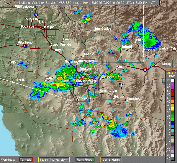 At 530 pm mst, a severe thunderstorm was located near dragoon, or 14 miles southwest of willcox, moving west at 15 mph. this is right over i-10 and could cause damage to vehicles and force high profile vehicles off the road (radar indicated). Hazards include 60 mph wind gusts and nickel size hail. expect damage to roofs, siding, and trees At 530 pm mst, a severe thunderstorm was located near dragoon, or 14 miles southwest of willcox, moving west at 15 mph. this is right over i-10 and could cause damage to vehicles and force high profile vehicles off the road (radar indicated). Hazards include 60 mph wind gusts and nickel size hail. expect damage to roofs, siding, and trees
|
| 7/30/2018 6:03 PM MST |
 At 600 pm mst, an area of severe thunderstorms was located near and along i-10 in the benson and texas canyon areas, moving southwest at 15 mph (radar indicated). Hazards include 60 mph wind gusts and quarter size hail. Hail damage to vehicles is expected. expect wind damage to roofs, siding, and trees. locations impacted include, benson, i-10 and texas canyon, mescal, dragoon. this includes the following highways, interstate 10 between mile markers 284 and 323. route 80 between mile markers 293 and 304. route 83 between mile markers 53 and 56. Route 90 between mile markers 290 and 297. At 600 pm mst, an area of severe thunderstorms was located near and along i-10 in the benson and texas canyon areas, moving southwest at 15 mph (radar indicated). Hazards include 60 mph wind gusts and quarter size hail. Hail damage to vehicles is expected. expect wind damage to roofs, siding, and trees. locations impacted include, benson, i-10 and texas canyon, mescal, dragoon. this includes the following highways, interstate 10 between mile markers 284 and 323. route 80 between mile markers 293 and 304. route 83 between mile markers 53 and 56. Route 90 between mile markers 290 and 297.
|
| 7/30/2018 5:36 PM MST |
 At 534 pm mst, severe thunderstorms were located along a line extending from 20 miles east of tucson to near benson to 20 miles southwest of willcox, moving southwest at 15 mph (radar indicated). Hazards include 60 mph wind gusts and quarter size hail. Hail damage to vehicles is expected. Expect wind damage to roofs, siding, and trees. At 534 pm mst, severe thunderstorms were located along a line extending from 20 miles east of tucson to near benson to 20 miles southwest of willcox, moving southwest at 15 mph (radar indicated). Hazards include 60 mph wind gusts and quarter size hail. Hail damage to vehicles is expected. Expect wind damage to roofs, siding, and trees.
|
| 7/20/2018 5:27 PM MST |
 The severe thunderstorm warning for west central cochise county will expire at 530 pm mst, the storm which prompted the warning has exited the warned area. therefore, this warning will be allowed to expire. The severe thunderstorm warning for west central cochise county will expire at 530 pm mst, the storm which prompted the warning has exited the warned area. therefore, this warning will be allowed to expire.
|
| 7/20/2018 5:04 PM MST |
 At 501 pm mst, a couple of severe thunderstorms continued near texas canyon and southeast of dragoon. these storms were moving slowly toward the west. these storms have had a history of producing quarter size hail (radar indicated). Hazards include 60 mph wind gusts and quarter size hail. Hail damage to vehicles is expected. expect wind damage to roofs, siding, and trees. locations impacted include, cochise, i-10 and texas canyon and dragoon. this includes the following highways, interstate 10 between mile markers 311 and 327. Route 191 between mile markers 56 and 63. At 501 pm mst, a couple of severe thunderstorms continued near texas canyon and southeast of dragoon. these storms were moving slowly toward the west. these storms have had a history of producing quarter size hail (radar indicated). Hazards include 60 mph wind gusts and quarter size hail. Hail damage to vehicles is expected. expect wind damage to roofs, siding, and trees. locations impacted include, cochise, i-10 and texas canyon and dragoon. this includes the following highways, interstate 10 between mile markers 311 and 327. Route 191 between mile markers 56 and 63.
|
| 7/20/2018 4:45 PM MST |
 At 443 pm mst, a couple of severe thunderstorms were located 13 miles northeast of benson, or 20 miles southwest of willcox, moving west at 5 mph. motorists on intersate 10 between benson and willcox will likely encounter some hail and gusty winds with one of the storms (radar indicated). Hazards include 60 mph wind gusts and quarter size hail. Hail damage to vehicles is expected. Expect wind damage to roofs, siding, and trees. At 443 pm mst, a couple of severe thunderstorms were located 13 miles northeast of benson, or 20 miles southwest of willcox, moving west at 5 mph. motorists on intersate 10 between benson and willcox will likely encounter some hail and gusty winds with one of the storms (radar indicated). Hazards include 60 mph wind gusts and quarter size hail. Hail damage to vehicles is expected. Expect wind damage to roofs, siding, and trees.
|
| 7/20/2018 4:22 PM MST |
 At 417 pm mst, a severe thunderstorm was located 13 miles southwest of willcox, moving west at 10 mph. this storm continued to intensify and could produce hail in excessive of one inch in size (radar indicated). Hazards include 60 mph wind gusts and quarter size hail. Hail damage to vehicles is expected. expect wind damage to roofs, siding, and trees. locations impacted include: cochise, i-10 and texas canyon and dragoon. this includes the following highways, interstate 10 between mile markers 315 and 331. Route 191 between mile markers 52 and 66. At 417 pm mst, a severe thunderstorm was located 13 miles southwest of willcox, moving west at 10 mph. this storm continued to intensify and could produce hail in excessive of one inch in size (radar indicated). Hazards include 60 mph wind gusts and quarter size hail. Hail damage to vehicles is expected. expect wind damage to roofs, siding, and trees. locations impacted include: cochise, i-10 and texas canyon and dragoon. this includes the following highways, interstate 10 between mile markers 315 and 331. Route 191 between mile markers 52 and 66.
|
| 7/20/2018 4:20 PM MST | Quarter sized hail reported 5.7 miles W of Dragoon, AZ, spotter 3096 reported quarter size hail. |
| 7/20/2018 4:08 PM MST |
 At 407 pm mst, a severe thunderstorm was located 13 miles southwest of willcox, moving west at 10 mph (radar indicated). Hazards include 60 mph wind gusts and quarter size hail. Hail damage to vehicles is expected. Expect wind damage to roofs, siding, and trees. At 407 pm mst, a severe thunderstorm was located 13 miles southwest of willcox, moving west at 10 mph (radar indicated). Hazards include 60 mph wind gusts and quarter size hail. Hail damage to vehicles is expected. Expect wind damage to roofs, siding, and trees.
|
| 9/29/2016 4:25 PM MST |
 The severe thunderstorm warning for northwestern cochise county will expire at 430 pm mst, the storm which prompted the warning has weakened below severe limits, and no longer poses an immediate threat to life or property. therefore the warning will be allowed to expire. The severe thunderstorm warning for northwestern cochise county will expire at 430 pm mst, the storm which prompted the warning has weakened below severe limits, and no longer poses an immediate threat to life or property. therefore the warning will be allowed to expire.
|
| 9/29/2016 4:09 PM MST |
 At 406 pm mst, doppler radar indicated a cluster of severe thunderstorms capable of producing damaging winds in excess of 60 mph. these storms were located 13 miles northeast of benson, but also extended west and east toward the pima county border and east toward cochise and pearce. these storms were moving north at 10 to 15 mph. penny size hail may also accompany the damaging winds. locations impacted include, benson, cochise, st. david, saint david, kartchner caverns state park, dragoon, muleshoe ranch preserve, cascabel, mescal, i-10 and texas canyon and whetstone. At 406 pm mst, doppler radar indicated a cluster of severe thunderstorms capable of producing damaging winds in excess of 60 mph. these storms were located 13 miles northeast of benson, but also extended west and east toward the pima county border and east toward cochise and pearce. these storms were moving north at 10 to 15 mph. penny size hail may also accompany the damaging winds. locations impacted include, benson, cochise, st. david, saint david, kartchner caverns state park, dragoon, muleshoe ranch preserve, cascabel, mescal, i-10 and texas canyon and whetstone.
|
| 9/29/2016 3:39 PM MST |
 At 338 pm mst, doppler radar indicated a cluster of severe thunderstorms capable of producing damaging winds in excess of 60 mph. these storms were located 11 miles east of benson, or 24 miles southwest of willcox, and moving north at 15 mph. penny size hail may also accompany the damaging winds. At 338 pm mst, doppler radar indicated a cluster of severe thunderstorms capable of producing damaging winds in excess of 60 mph. these storms were located 11 miles east of benson, or 24 miles southwest of willcox, and moving north at 15 mph. penny size hail may also accompany the damaging winds.
|
| 8/6/2016 6:30 PM MST | Spotter estimate of 60 mph winds in cochise county AZ, 9.9 miles W of Dragoon, AZ |
| 7/31/2016 5:56 PM MST |
 At 555 pm mst, doppler radar indicated a severe thunderstorm capable of producing quarter size hail and damaging winds in excess of 60 mph. this storm was located 19 miles south of willcox, moving west at 10 mph. this storm will impact portions of highway 191 between pearce and cochise. locations impacted include, willcox, cochise, kansas settlement, dragoon and pearce-sunsites. At 555 pm mst, doppler radar indicated a severe thunderstorm capable of producing quarter size hail and damaging winds in excess of 60 mph. this storm was located 19 miles south of willcox, moving west at 10 mph. this storm will impact portions of highway 191 between pearce and cochise. locations impacted include, willcox, cochise, kansas settlement, dragoon and pearce-sunsites.
|
| 7/31/2016 5:36 PM MST |
 At 535 pm mst, doppler radar indicated a severe thunderstorm capable of producing quarter size hail and damaging winds in excess of 60 mph. this storm was located 17 miles south of willcox, and moving northwest at 5 mph. At 535 pm mst, doppler radar indicated a severe thunderstorm capable of producing quarter size hail and damaging winds in excess of 60 mph. this storm was located 17 miles south of willcox, and moving northwest at 5 mph.
|
| 9/2/2015 2:28 PM MST |
 At 228 pm mst, national weather service meteorologists detected a severe thunderstorm capable of producing damaging winds in excess of 60 mph. this storm was located near cochise, and moving north at 10 mph. At 228 pm mst, national weather service meteorologists detected a severe thunderstorm capable of producing damaging winds in excess of 60 mph. this storm was located near cochise, and moving north at 10 mph.
|
| 9/2/2015 2:14 PM MST |
 At 214 pm mst, doppler radar continued to indicate a severe thunderstorm capable of producing damaging winds in excess of 60 mph. this storm was located near cochise, moving north at 10 mph. locations impacted include, cochise. At 214 pm mst, doppler radar continued to indicate a severe thunderstorm capable of producing damaging winds in excess of 60 mph. this storm was located near cochise, moving north at 10 mph. locations impacted include, cochise.
|
| 9/2/2015 1:58 PM MST |
 At 157 pm mst, national weather service meteorologists detected a severe thunderstorm capable of producing quarter size hail and damaging winds in excess of 60 mph. this storm was located 7 miles southeast of dragoon, and moving north at 10 mph. At 157 pm mst, national weather service meteorologists detected a severe thunderstorm capable of producing quarter size hail and damaging winds in excess of 60 mph. this storm was located 7 miles southeast of dragoon, and moving north at 10 mph.
|
| 7/13/2013 6:45 PM MST | Quarter sized hail reported 8.9 miles WSW of Dragoon, AZ, spotter called in to update 3 4 ins report to 1.00 ins hail after storm passed through. |
| 7/13/2013 6:20 PM MST | Quarter sized hail reported 8.9 miles WSW of Dragoon, AZ, spotter called in to update 3 4 ins report to 1.00 ins hail after storm passed through. |
| 7/9/2013 7:20 PM MST | Irrigation sprinklers tipped on side... roof blown off chicken house... downed power lines and large branches snapped... barn destroyed in cochise county AZ, 6.8 miles W of Dragoon, AZ |
Hail Maps for Dragoon, AZ


Connect with Interactive Hail Maps