

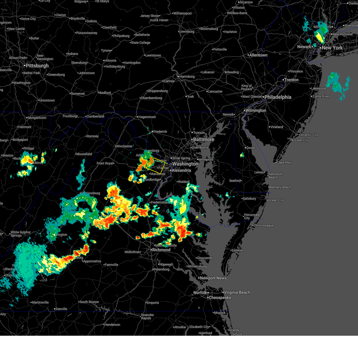
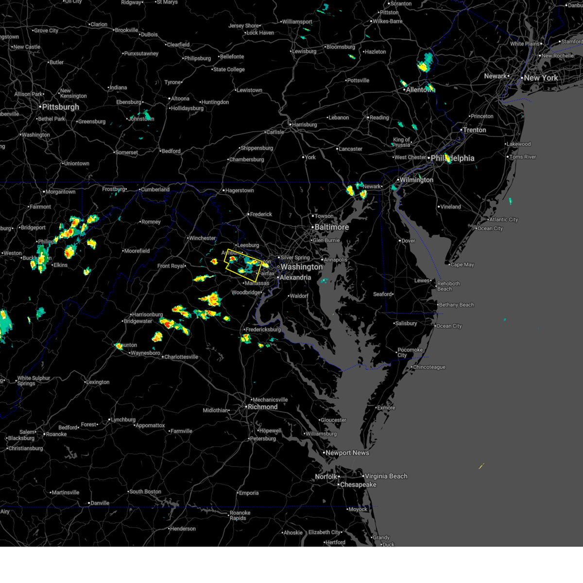
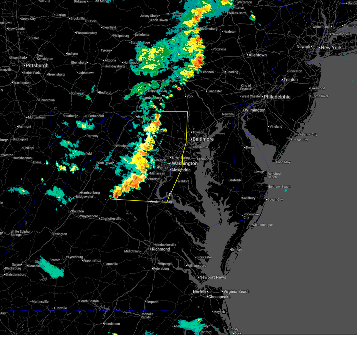
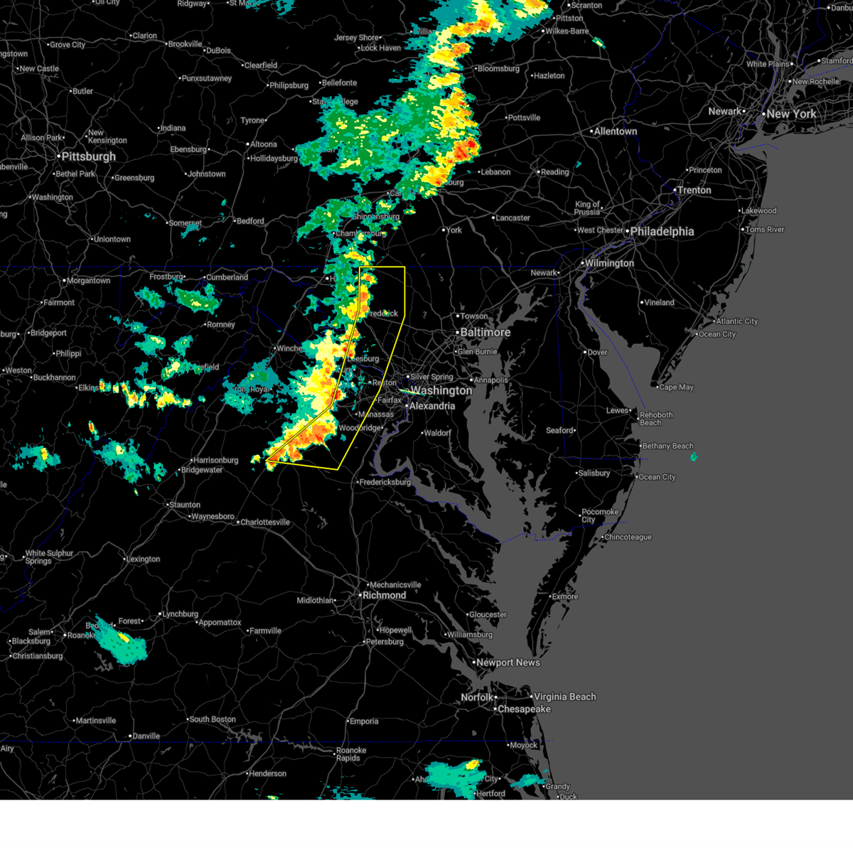
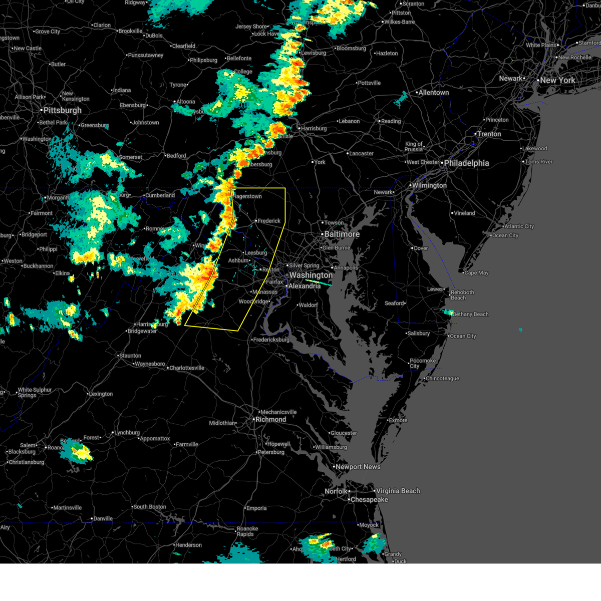
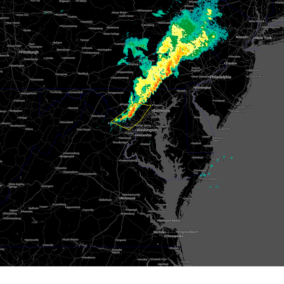
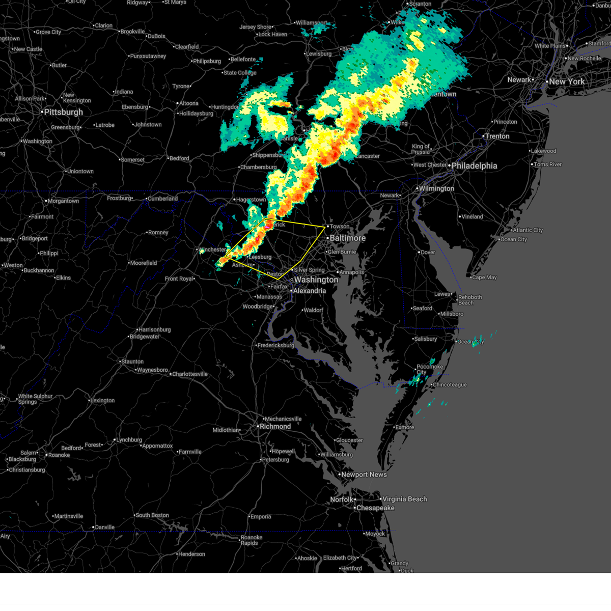
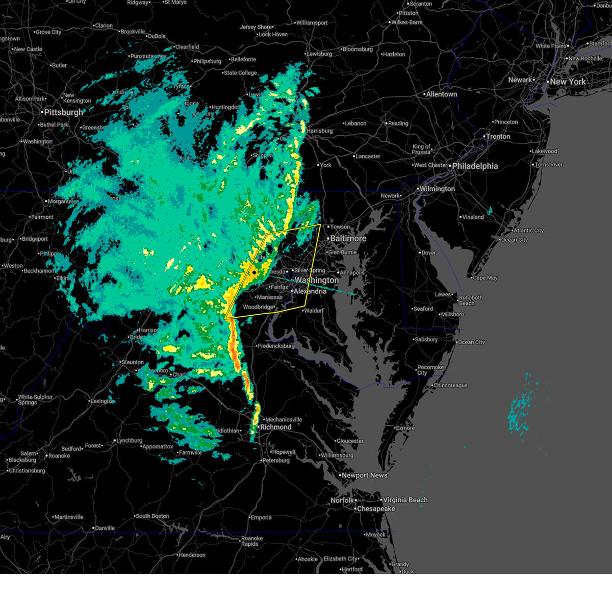
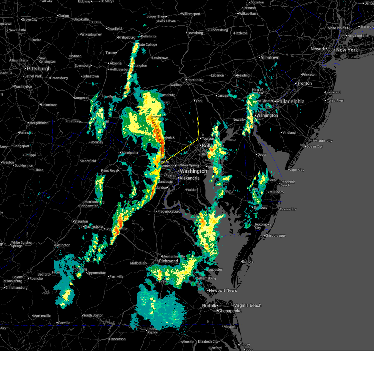
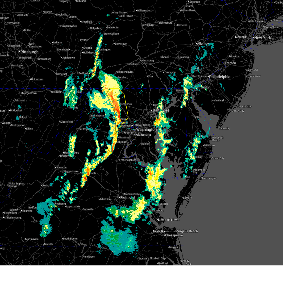
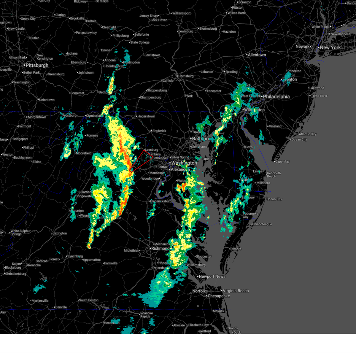
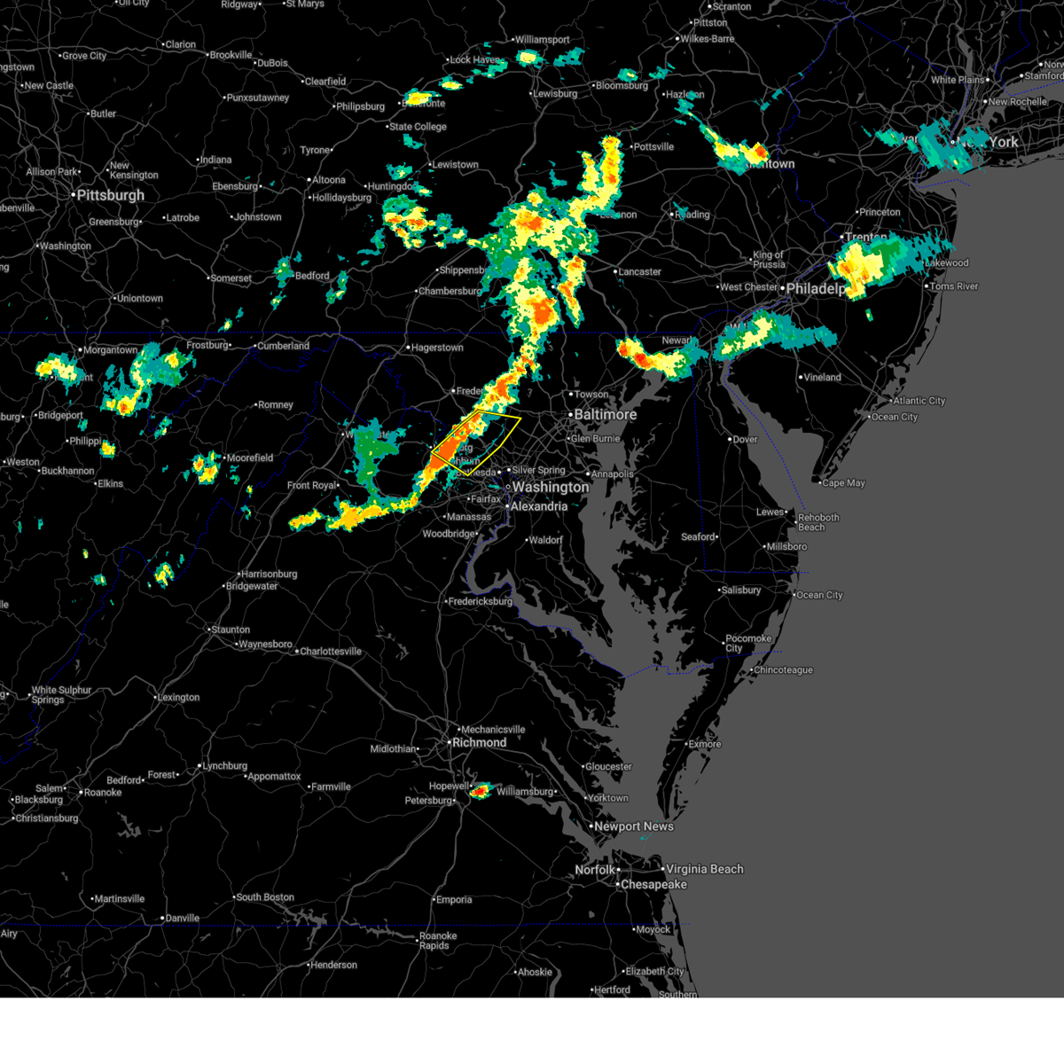
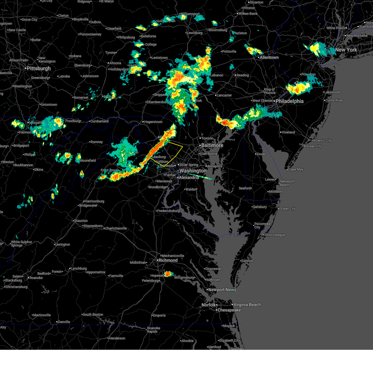
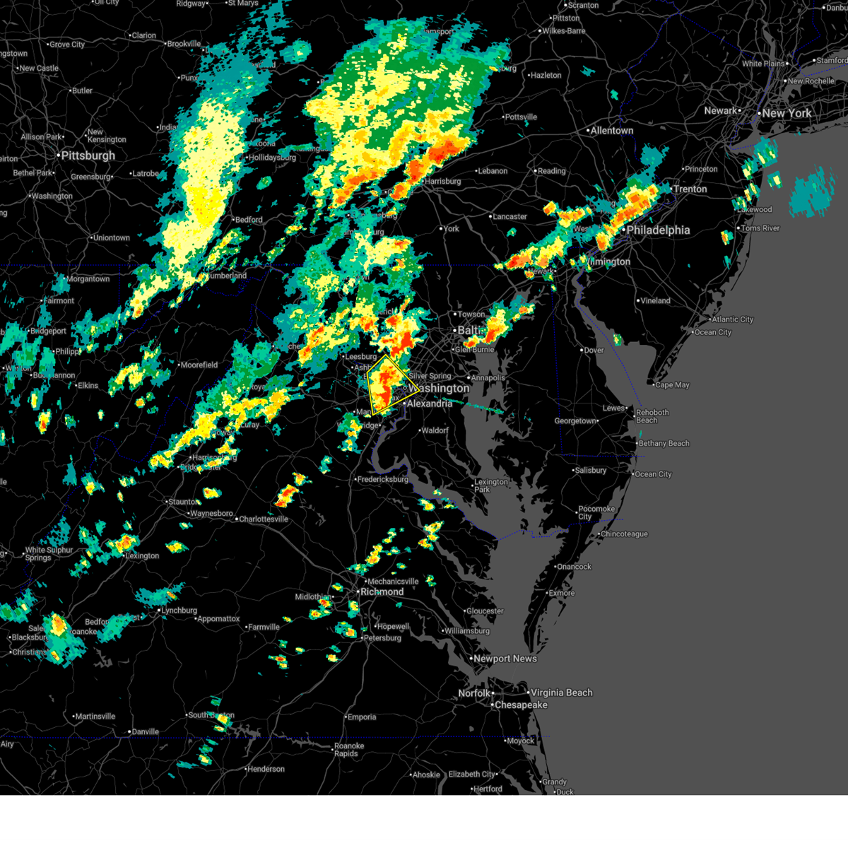
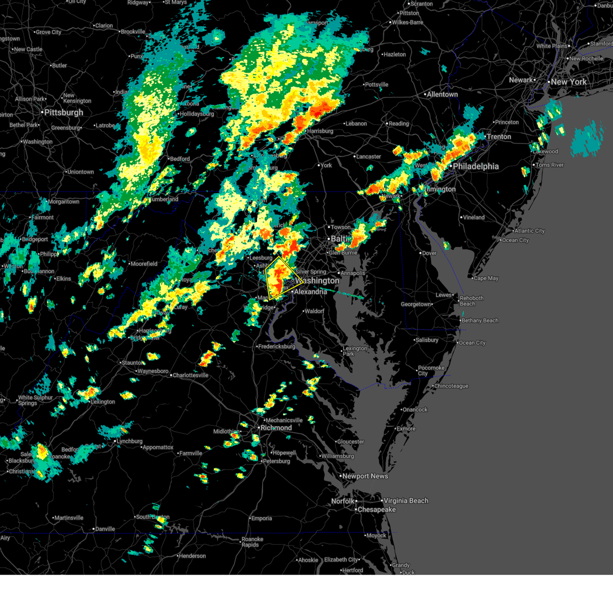
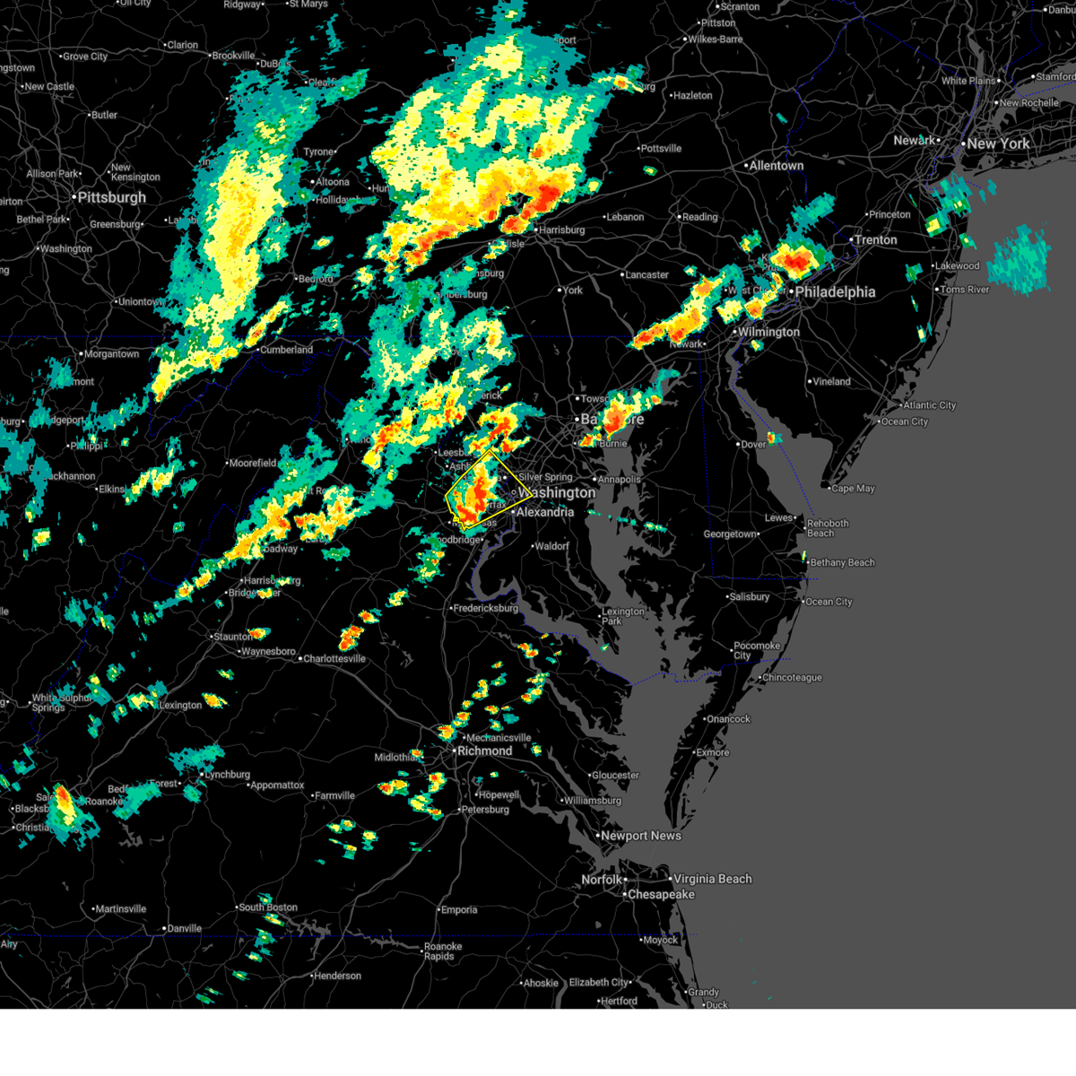
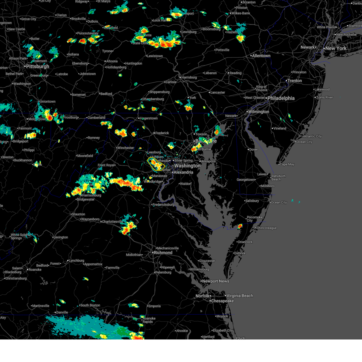
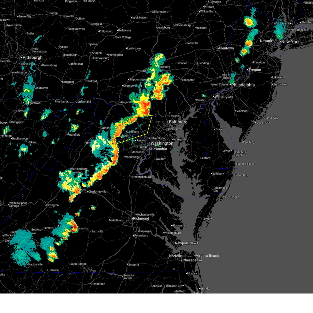
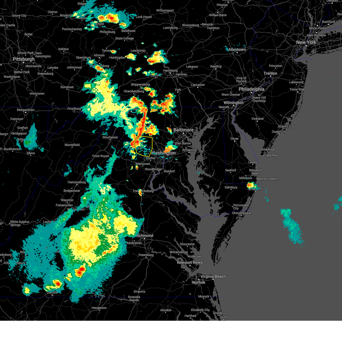
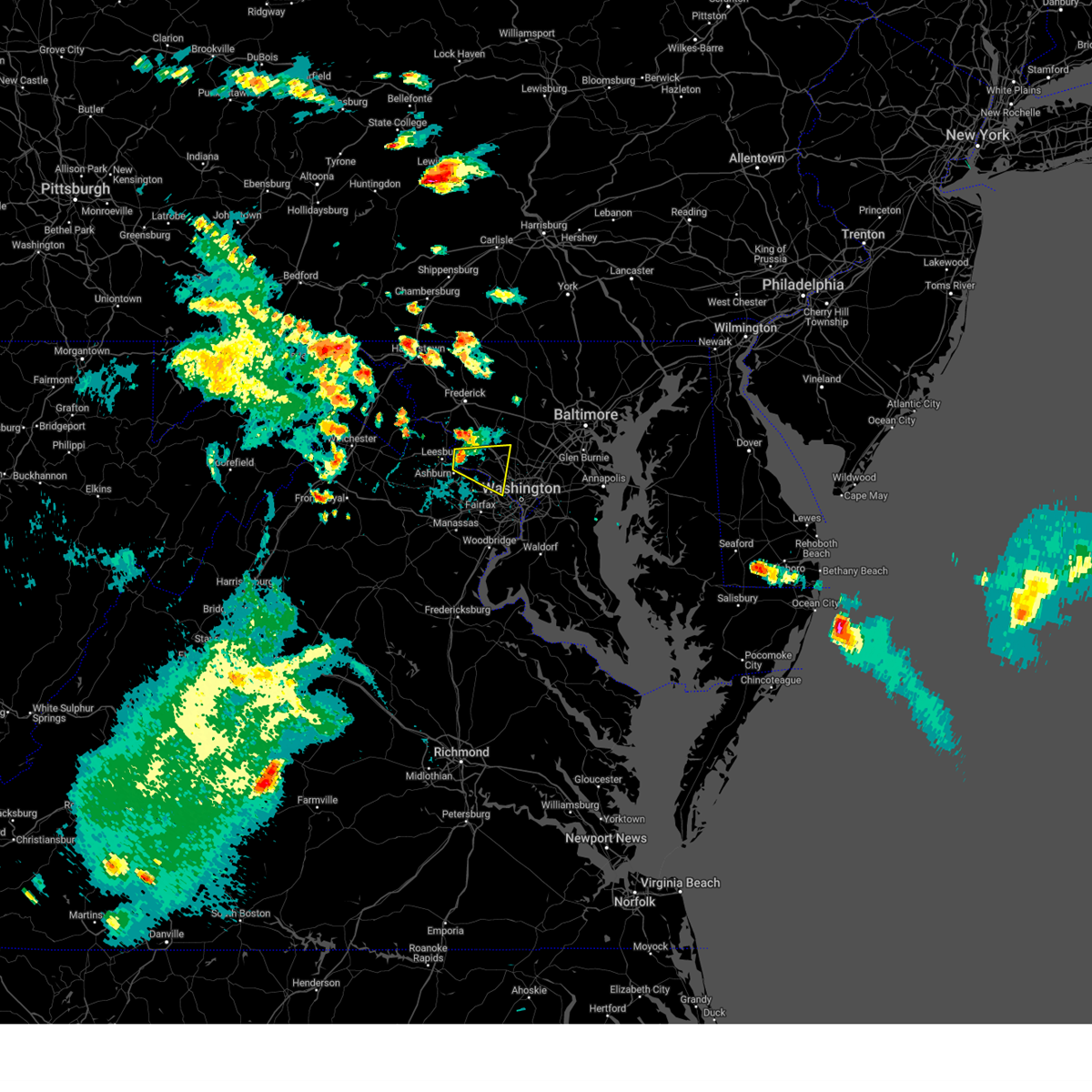
Hail Map for Dranesville, VA
The Dranesville, VA area has had 0 reports of on-the-ground hail by trained spotters, and has been under severe weather warnings 43 times during the past 12 months. Doppler radar has detected hail at or near Dranesville, VA on 54 occasions, including 1 occasion during the past year.
| Name: | Dranesville, VA |
| Where Located: | 45.9 miles WSW of Baltimore, MD |
| Map: | Google Map for Dranesville, VA |
| Population: | 11921 |
| Housing Units: | 3895 |
| More Info: | Search Google for Dranesville, VA |
0
The Top Recent Hail Date for Dranesville, VA is Wednesday, June 25, 2025 (32nd out of 54)

Hail and Wind Damage Spotted near Dranesville, VA
| Date / Time | Report Details |
|---|---|
| 6/12/2026 7:04 PM EDT |
 the severe thunderstorm warning has been cancelled and is no longer in effect the severe thunderstorm warning has been cancelled and is no longer in effect
|
| 6/12/2026 7:04 PM EDT |
 At 704 pm edt, a severe thunderstorm was located over oakton, or near fairfax, moving southeast at 30 mph (a wind gust of 67 mph was observed at dulles international airport at 653 mph). Hazards include 70 mph wind gusts. Damaging winds will cause some trees and large branches to fall. this could injure those outdoors, as well as damage homes and vehicles. roadways may become blocked by downed trees. localized power outages are possible. unsecured light objects may become projectiles. Locations impacted include, centreville, reston, annandale, herndon, fairfax, vienna, falls church, mantua, pimmit hills, mclean, burke, oakton, sterling, chantilly, tysons corner, wolf trap, merrifield, i66 and i495 interchange, west springfield, and fairfax station. At 704 pm edt, a severe thunderstorm was located over oakton, or near fairfax, moving southeast at 30 mph (a wind gust of 67 mph was observed at dulles international airport at 653 mph). Hazards include 70 mph wind gusts. Damaging winds will cause some trees and large branches to fall. this could injure those outdoors, as well as damage homes and vehicles. roadways may become blocked by downed trees. localized power outages are possible. unsecured light objects may become projectiles. Locations impacted include, centreville, reston, annandale, herndon, fairfax, vienna, falls church, mantua, pimmit hills, mclean, burke, oakton, sterling, chantilly, tysons corner, wolf trap, merrifield, i66 and i495 interchange, west springfield, and fairfax station.
|
| 6/12/2026 6:59 PM EDT |
 At 659 pm edt, a severe thunderstorm was located near reston, moving east at 30 mph (a wind gust of 67 mph was observed at dulles international airport at 653 mph). Hazards include 70 mph wind gusts. Damaging winds will cause some trees and large branches to fall. this could injure those outdoors, as well as damage homes and vehicles. roadways may become blocked by downed trees. localized power outages are possible. unsecured light objects may become projectiles. Locations impacted include, centreville, reston, annandale, south riding, herndon, fairfax, vienna, falls church, mantua, pimmit hills, dulles international airport, mclean, burke, oakton, sterling, chantilly, tysons corner, wolf trap, merrifield, and i66 and i495 interchange. At 659 pm edt, a severe thunderstorm was located near reston, moving east at 30 mph (a wind gust of 67 mph was observed at dulles international airport at 653 mph). Hazards include 70 mph wind gusts. Damaging winds will cause some trees and large branches to fall. this could injure those outdoors, as well as damage homes and vehicles. roadways may become blocked by downed trees. localized power outages are possible. unsecured light objects may become projectiles. Locations impacted include, centreville, reston, annandale, south riding, herndon, fairfax, vienna, falls church, mantua, pimmit hills, dulles international airport, mclean, burke, oakton, sterling, chantilly, tysons corner, wolf trap, merrifield, and i66 and i495 interchange.
|
| 6/12/2026 6:56 PM EDT |
 At 655 pm edt, a severe thunderstorm was located over chantilly, or near centreville, moving southeast at 30 mph (a wind gust of 67 mph was observed at dulles international airport at 653 mph). Hazards include 70 mph wind gusts. Damaging winds will cause some trees and large branches to fall. this could injure those outdoors, as well as damage homes and vehicles. roadways may become blocked by downed trees. localized power outages are possible. unsecured light objects may become projectiles. Locations impacted include, centreville, reston, annandale, south riding, herndon, fairfax, vienna, falls church, broadlands, brambleton, mantua, pimmit hills, dulles international airport, mclean, ashburn, burke, oakton, sterling, chantilly, and tysons corner. At 655 pm edt, a severe thunderstorm was located over chantilly, or near centreville, moving southeast at 30 mph (a wind gust of 67 mph was observed at dulles international airport at 653 mph). Hazards include 70 mph wind gusts. Damaging winds will cause some trees and large branches to fall. this could injure those outdoors, as well as damage homes and vehicles. roadways may become blocked by downed trees. localized power outages are possible. unsecured light objects may become projectiles. Locations impacted include, centreville, reston, annandale, south riding, herndon, fairfax, vienna, falls church, broadlands, brambleton, mantua, pimmit hills, dulles international airport, mclean, ashburn, burke, oakton, sterling, chantilly, and tysons corner.
|
| 6/12/2026 6:48 PM EDT |
 Svrlwx the national weather service in sterling virginia has issued a * severe thunderstorm warning for, southeastern loudoun county in northern virginia, the city of fairfax in northern virginia, northwestern arlington county in northern virginia, the western city of falls church in northern virginia, central fairfax county in northern virginia, the northeastern city of manassas park in northern virginia, north central prince william county in northern virginia, * until 730 pm edt. * at 647 pm edt, a severe thunderstorm was located over south riding, moving southeast at 30 mph (radar indicated). Hazards include 70 mph wind gusts. Damaging winds will cause some trees and large branches to fall. this could injure those outdoors, as well as damage homes and vehicles. roadways may become blocked by downed trees. localized power outages are possible. Unsecured light objects may become projectiles. Svrlwx the national weather service in sterling virginia has issued a * severe thunderstorm warning for, southeastern loudoun county in northern virginia, the city of fairfax in northern virginia, northwestern arlington county in northern virginia, the western city of falls church in northern virginia, central fairfax county in northern virginia, the northeastern city of manassas park in northern virginia, north central prince william county in northern virginia, * until 730 pm edt. * at 647 pm edt, a severe thunderstorm was located over south riding, moving southeast at 30 mph (radar indicated). Hazards include 70 mph wind gusts. Damaging winds will cause some trees and large branches to fall. this could injure those outdoors, as well as damage homes and vehicles. roadways may become blocked by downed trees. localized power outages are possible. Unsecured light objects may become projectiles.
|
| 6/12/2026 4:20 PM EDT |
 Svrlwx the national weather service in sterling virginia has issued a * severe thunderstorm warning for, the northwestern district of columbia, south central montgomery county in central maryland, southeastern loudoun county in northern virginia, northeastern fairfax county in northern virginia, * until 445 pm edt. * at 420 pm edt, a severe thunderstorm was located over great falls, or near lowes island, moving east at 25 mph (radar indicated). Hazards include 60 mph wind gusts. Damaging winds will cause some trees and large branches to fall. this could injure those outdoors, as well as damage homes and vehicles. roadways may become blocked by downed trees. localized power outages are possible. Unsecured light objects may become projectiles. Svrlwx the national weather service in sterling virginia has issued a * severe thunderstorm warning for, the northwestern district of columbia, south central montgomery county in central maryland, southeastern loudoun county in northern virginia, northeastern fairfax county in northern virginia, * until 445 pm edt. * at 420 pm edt, a severe thunderstorm was located over great falls, or near lowes island, moving east at 25 mph (radar indicated). Hazards include 60 mph wind gusts. Damaging winds will cause some trees and large branches to fall. this could injure those outdoors, as well as damage homes and vehicles. roadways may become blocked by downed trees. localized power outages are possible. Unsecured light objects may become projectiles.
|
| 6/12/2026 4:01 PM EDT |
 At 401 pm edt, a severe thunderstorm was located over dulles international airport, moving east at 25 mph (radar indicated). Hazards include 60 mph wind gusts. Damaging winds will cause some trees and large branches to fall. this could injure those outdoors, as well as damage homes and vehicles. roadways may become blocked by downed trees. localized power outages are possible. unsecured light objects may become projectiles. Locations impacted include, centreville, reston, south riding, herndon, fairfax, vienna, broadlands, brambleton, dulles international airport, ashburn, oakton, sterling, chantilly, wolf trap, great falls, arcola, sterling park, and belleview. At 401 pm edt, a severe thunderstorm was located over dulles international airport, moving east at 25 mph (radar indicated). Hazards include 60 mph wind gusts. Damaging winds will cause some trees and large branches to fall. this could injure those outdoors, as well as damage homes and vehicles. roadways may become blocked by downed trees. localized power outages are possible. unsecured light objects may become projectiles. Locations impacted include, centreville, reston, south riding, herndon, fairfax, vienna, broadlands, brambleton, dulles international airport, ashburn, oakton, sterling, chantilly, wolf trap, great falls, arcola, sterling park, and belleview.
|
| 6/12/2026 3:43 PM EDT |
 Svrlwx the national weather service in sterling virginia has issued a * severe thunderstorm warning for, southeastern loudoun county in northern virginia, the city of fairfax in northern virginia, northwestern fairfax county in northern virginia, northwestern prince william county in northern virginia, * until 415 pm edt. * at 342 pm edt, a severe thunderstorm was located near brambleton, moving east at 25 mph (radar indicated). Hazards include 60 mph wind gusts. Damaging winds will cause some trees and large branches to fall. this could injure those outdoors, as well as damage homes and vehicles. roadways may become blocked by downed trees. localized power outages are possible. Unsecured light objects may become projectiles. Svrlwx the national weather service in sterling virginia has issued a * severe thunderstorm warning for, southeastern loudoun county in northern virginia, the city of fairfax in northern virginia, northwestern fairfax county in northern virginia, northwestern prince william county in northern virginia, * until 415 pm edt. * at 342 pm edt, a severe thunderstorm was located near brambleton, moving east at 25 mph (radar indicated). Hazards include 60 mph wind gusts. Damaging winds will cause some trees and large branches to fall. this could injure those outdoors, as well as damage homes and vehicles. roadways may become blocked by downed trees. localized power outages are possible. Unsecured light objects may become projectiles.
|
| 6/11/2026 7:54 PM EDT |
 Svrlwx the national weather service in sterling virginia has issued a * severe thunderstorm warning for, the district of columbia, western baltimore county in northern maryland, carroll county in north central maryland, northwestern anne arundel county in central maryland, northwestern charles county in southern maryland, howard county in central maryland, montgomery county in central maryland, eastern frederick county in north central maryland, central prince georges county in central maryland, northeastern orange county in central virginia, the northern city of fredericksburg in central virginia, southeastern fauquier county in northern virginia, the city of manassas park in northern virginia, the city of manassas in northern virginia, east central madison county in northwestern virginia, the city of fairfax in northern virginia, arlington county in northern virginia, north central spotsylvania county in central virginia, stafford county in northern virginia, southeastern loudoun county in northern virginia, the city of falls church in northern virginia, fairfax county in northern virginia, southern culpeper county in northern virginia, prince william county in northern virginia, northwestern king george county in central virginia, the city of alexandria in northern virginia, * until 830 pm edt. * at 753 pm edt, severe thunderstorms were located along a line extending from 8 miles west of stafford to near burke to near great falls to near montgomery village to near mount airy to 8 miles northwest of sykesville to near littlestown, moving east at 45 mph (emergency management has reported many instances of trees down with this line of storms). Hazards include 60 mph wind gusts. Damaging winds will cause some trees and large branches to fall. this could injure those outdoors, as well as damage homes and vehicles. roadways may become blocked by downed trees. localized power outages are possible. Unsecured light objects may become projectiles. Svrlwx the national weather service in sterling virginia has issued a * severe thunderstorm warning for, the district of columbia, western baltimore county in northern maryland, carroll county in north central maryland, northwestern anne arundel county in central maryland, northwestern charles county in southern maryland, howard county in central maryland, montgomery county in central maryland, eastern frederick county in north central maryland, central prince georges county in central maryland, northeastern orange county in central virginia, the northern city of fredericksburg in central virginia, southeastern fauquier county in northern virginia, the city of manassas park in northern virginia, the city of manassas in northern virginia, east central madison county in northwestern virginia, the city of fairfax in northern virginia, arlington county in northern virginia, north central spotsylvania county in central virginia, stafford county in northern virginia, southeastern loudoun county in northern virginia, the city of falls church in northern virginia, fairfax county in northern virginia, southern culpeper county in northern virginia, prince william county in northern virginia, northwestern king george county in central virginia, the city of alexandria in northern virginia, * until 830 pm edt. * at 753 pm edt, severe thunderstorms were located along a line extending from 8 miles west of stafford to near burke to near great falls to near montgomery village to near mount airy to 8 miles northwest of sykesville to near littlestown, moving east at 45 mph (emergency management has reported many instances of trees down with this line of storms). Hazards include 60 mph wind gusts. Damaging winds will cause some trees and large branches to fall. this could injure those outdoors, as well as damage homes and vehicles. roadways may become blocked by downed trees. localized power outages are possible. Unsecured light objects may become projectiles.
|
| 6/11/2026 7:48 PM EDT |
 the severe thunderstorm warning has been cancelled and is no longer in effect the severe thunderstorm warning has been cancelled and is no longer in effect
|
| 6/11/2026 7:48 PM EDT |
 At 748 pm edt, severe thunderstorms were located along a line extending from 7 miles south of bealeton to south riding to near new market to near carroll valley, moving east at 40 mph (emergency management). Hazards include 60 mph wind gusts. Damaging winds will cause some trees and large branches to fall. this could injure those outdoors, as well as damage homes and vehicles. roadways may become blocked by downed trees. localized power outages are possible. unsecured light objects may become projectiles. Locations impacted include, germantown, centreville, frederick, rockville, gaithersburg, reston, leesburg, south riding, herndon, fairfax, culpeper, vienna, damascus, broadlands, lansdowne, lowes island, brambleton, warrenton, thurmont, and poolesville. At 748 pm edt, severe thunderstorms were located along a line extending from 7 miles south of bealeton to south riding to near new market to near carroll valley, moving east at 40 mph (emergency management). Hazards include 60 mph wind gusts. Damaging winds will cause some trees and large branches to fall. this could injure those outdoors, as well as damage homes and vehicles. roadways may become blocked by downed trees. localized power outages are possible. unsecured light objects may become projectiles. Locations impacted include, germantown, centreville, frederick, rockville, gaithersburg, reston, leesburg, south riding, herndon, fairfax, culpeper, vienna, damascus, broadlands, lansdowne, lowes island, brambleton, warrenton, thurmont, and poolesville.
|
| 6/11/2026 7:18 PM EDT |
 Svrlwx the national weather service in sterling virginia has issued a * severe thunderstorm warning for, eastern washington county in north central maryland, northwestern howard county in central maryland, western montgomery county in central maryland, frederick county in north central maryland, western carroll county in north central maryland, northwestern stafford county in northern virginia, loudoun county in northern virginia, northeastern orange county in central virginia, northwestern fairfax county in northern virginia, southeastern rappahannock county in northwestern virginia, fauquier county in northern virginia, culpeper county in northern virginia, the city of manassas park in northern virginia, prince william county in northern virginia, the city of manassas in northern virginia, east central madison county in northwestern virginia, the western city of fairfax in northern virginia, eastern clarke county in northwestern virginia, southeastern jefferson county in the panhandle of west virginia, * until 800 pm edt. * at 716 pm edt, severe thunderstorms were located along a line extending from 8 miles west of culpeper to near delaplane to near boonsboro to greencastle, moving east at 40 mph (emergency management has reported many instances of trees down with this line of storms). Hazards include 60 mph wind gusts. Damaging winds will cause some trees and large branches to fall. this could injure those outdoors, as well as damage homes and vehicles. roadways may become blocked by downed trees. localized power outages are possible. Unsecured light objects may become projectiles. Svrlwx the national weather service in sterling virginia has issued a * severe thunderstorm warning for, eastern washington county in north central maryland, northwestern howard county in central maryland, western montgomery county in central maryland, frederick county in north central maryland, western carroll county in north central maryland, northwestern stafford county in northern virginia, loudoun county in northern virginia, northeastern orange county in central virginia, northwestern fairfax county in northern virginia, southeastern rappahannock county in northwestern virginia, fauquier county in northern virginia, culpeper county in northern virginia, the city of manassas park in northern virginia, prince william county in northern virginia, the city of manassas in northern virginia, east central madison county in northwestern virginia, the western city of fairfax in northern virginia, eastern clarke county in northwestern virginia, southeastern jefferson county in the panhandle of west virginia, * until 800 pm edt. * at 716 pm edt, severe thunderstorms were located along a line extending from 8 miles west of culpeper to near delaplane to near boonsboro to greencastle, moving east at 40 mph (emergency management has reported many instances of trees down with this line of storms). Hazards include 60 mph wind gusts. Damaging winds will cause some trees and large branches to fall. this could injure those outdoors, as well as damage homes and vehicles. roadways may become blocked by downed trees. localized power outages are possible. Unsecured light objects may become projectiles.
|
| 6/6/2026 6:24 PM EDT |
 At 623 pm edt, severe thunderstorms were located along a line extending from eldersburg to near olney to lowes island, moving east at 40 mph (radar indicated). Hazards include 60 mph wind gusts. Damaging winds will cause some trees and large branches to fall. this could injure those outdoors, as well as damage homes and vehicles. roadways may become blocked by downed trees. localized power outages are possible. unsecured light objects may become projectiles. Locations impacted include, baltimore, columbia, germantown, rockville, bethesda, gaithersburg, reston, leesburg, olney, pikesville, herndon, damascus, broadlands, lansdowne, lowes island, pimmit hills, poolesville, mclean, american legion bridge, and historic ellicott city. At 623 pm edt, severe thunderstorms were located along a line extending from eldersburg to near olney to lowes island, moving east at 40 mph (radar indicated). Hazards include 60 mph wind gusts. Damaging winds will cause some trees and large branches to fall. this could injure those outdoors, as well as damage homes and vehicles. roadways may become blocked by downed trees. localized power outages are possible. unsecured light objects may become projectiles. Locations impacted include, baltimore, columbia, germantown, rockville, bethesda, gaithersburg, reston, leesburg, olney, pikesville, herndon, damascus, broadlands, lansdowne, lowes island, pimmit hills, poolesville, mclean, american legion bridge, and historic ellicott city.
|
| 6/6/2026 5:57 PM EDT |
 Svrlwx the national weather service in sterling virginia has issued a * severe thunderstorm warning for, southeastern carroll county in north central maryland, northwestern baltimore city in northern maryland, howard county in central maryland, montgomery county in central maryland, southern frederick county in north central maryland, southwestern baltimore county in northern maryland, central loudoun county in northern virginia, northeastern fairfax county in northern virginia, * until 645 pm edt. * at 557 pm edt, severe thunderstorms were located along a line extending from near new market to 6 miles northwest of boyds to near purcellville, moving east at 40 mph (radar indicated). Hazards include 60 mph wind gusts. Damaging winds will cause some trees and large branches to fall. this could injure those outdoors, as well as damage homes and vehicles. roadways may become blocked by downed trees. localized power outages are possible. Unsecured light objects may become projectiles. Svrlwx the national weather service in sterling virginia has issued a * severe thunderstorm warning for, southeastern carroll county in north central maryland, northwestern baltimore city in northern maryland, howard county in central maryland, montgomery county in central maryland, southern frederick county in north central maryland, southwestern baltimore county in northern maryland, central loudoun county in northern virginia, northeastern fairfax county in northern virginia, * until 645 pm edt. * at 557 pm edt, severe thunderstorms were located along a line extending from near new market to 6 miles northwest of boyds to near purcellville, moving east at 40 mph (radar indicated). Hazards include 60 mph wind gusts. Damaging winds will cause some trees and large branches to fall. this could injure those outdoors, as well as damage homes and vehicles. roadways may become blocked by downed trees. localized power outages are possible. Unsecured light objects may become projectiles.
|
| 3/16/2026 8:33 PM EDT |
 Svrlwx the national weather service in sterling virginia has issued a * severe thunderstorm warning for, the district of columbia, howard county in central maryland, montgomery county in central maryland, southeastern frederick county in north central maryland, southwestern baltimore county in northern maryland, central prince georges county in central maryland, south central carroll county in north central maryland, northwestern anne arundel county in central maryland, north central charles county in southern maryland, southeastern loudoun county in northern virginia, northern stafford county in northern virginia, the city of falls church in northern virginia, fairfax county in northern virginia, east central fauquier county in northern virginia, the city of manassas park in northern virginia, prince william county in northern virginia, the city of manassas in northern virginia, the city of fairfax in northern virginia, arlington county in northern virginia, the city of alexandria in northern virginia, * until 915 pm edt. * at 832 pm edt, severe thunderstorms were located along a line extending from near green valley to near bealeton, moving east at 65 mph (nws observation). Hazards include 60 mph wind gusts. Damaging winds will cause some trees and large branches to fall. this could injure those outdoors, as well as damage homes and vehicles. roadways may become blocked by downed trees. localized power outages are possible. Unsecured light objects may become projectiles. Svrlwx the national weather service in sterling virginia has issued a * severe thunderstorm warning for, the district of columbia, howard county in central maryland, montgomery county in central maryland, southeastern frederick county in north central maryland, southwestern baltimore county in northern maryland, central prince georges county in central maryland, south central carroll county in north central maryland, northwestern anne arundel county in central maryland, north central charles county in southern maryland, southeastern loudoun county in northern virginia, northern stafford county in northern virginia, the city of falls church in northern virginia, fairfax county in northern virginia, east central fauquier county in northern virginia, the city of manassas park in northern virginia, prince william county in northern virginia, the city of manassas in northern virginia, the city of fairfax in northern virginia, arlington county in northern virginia, the city of alexandria in northern virginia, * until 915 pm edt. * at 832 pm edt, severe thunderstorms were located along a line extending from near green valley to near bealeton, moving east at 65 mph (nws observation). Hazards include 60 mph wind gusts. Damaging winds will cause some trees and large branches to fall. this could injure those outdoors, as well as damage homes and vehicles. roadways may become blocked by downed trees. localized power outages are possible. Unsecured light objects may become projectiles.
|
| 3/16/2026 11:40 AM EDT |
 Svrlwx the national weather service in sterling virginia has issued a * severe thunderstorm warning for, northeastern washington county in north central maryland, carroll county in north central maryland, northwestern baltimore city in northern maryland, northern howard county in central maryland, central montgomery county in central maryland, central frederick county in north central maryland, northwestern baltimore county in northern maryland, eastern loudoun county in northern virginia, northern fairfax county in northern virginia, * until 1230 pm edt. * at 1140 am edt, severe thunderstorms were located along a line extending from rouzerville to near new market to near germantown to near boyds, moving northeast at 50 mph (radar indicated). Hazards include 60 mph wind gusts. Damaging winds will cause some trees and large branches to fall. this could injure those outdoors, as well as damage homes and vehicles. roadways may become blocked by downed trees. localized power outages are possible. Unsecured light objects may become projectiles. Svrlwx the national weather service in sterling virginia has issued a * severe thunderstorm warning for, northeastern washington county in north central maryland, carroll county in north central maryland, northwestern baltimore city in northern maryland, northern howard county in central maryland, central montgomery county in central maryland, central frederick county in north central maryland, northwestern baltimore county in northern maryland, eastern loudoun county in northern virginia, northern fairfax county in northern virginia, * until 1230 pm edt. * at 1140 am edt, severe thunderstorms were located along a line extending from rouzerville to near new market to near germantown to near boyds, moving northeast at 50 mph (radar indicated). Hazards include 60 mph wind gusts. Damaging winds will cause some trees and large branches to fall. this could injure those outdoors, as well as damage homes and vehicles. roadways may become blocked by downed trees. localized power outages are possible. Unsecured light objects may become projectiles.
|
| 3/16/2026 11:32 AM EDT |
 At 1131 am edt, severe thunderstorms were located along a line extending from municipal stadium to near boonsboro to near braddock heights to lansdowne, moving northeast at 55 mph (radar indicated). Hazards include 60 mph wind gusts. Damaging winds will cause some trees and large branches to fall. this could injure those outdoors, as well as damage homes and vehicles. roadways may become blocked by downed trees. localized power outages are possible. unsecured light objects may become projectiles. Locations impacted include, germantown, frederick, gaithersburg, leesburg, hagerstown, south riding, herndon, broadlands, lansdowne, lowes island, brambleton, thurmont, poolesville, municipal stadium, harry grove stadium, dulles international airport, ashburn, montgomery village, sterling, and north potomac. At 1131 am edt, severe thunderstorms were located along a line extending from municipal stadium to near boonsboro to near braddock heights to lansdowne, moving northeast at 55 mph (radar indicated). Hazards include 60 mph wind gusts. Damaging winds will cause some trees and large branches to fall. this could injure those outdoors, as well as damage homes and vehicles. roadways may become blocked by downed trees. localized power outages are possible. unsecured light objects may become projectiles. Locations impacted include, germantown, frederick, gaithersburg, leesburg, hagerstown, south riding, herndon, broadlands, lansdowne, lowes island, brambleton, thurmont, poolesville, municipal stadium, harry grove stadium, dulles international airport, ashburn, montgomery village, sterling, and north potomac.
|
| 3/16/2026 11:32 AM EDT |
 the severe thunderstorm warning has been cancelled and is no longer in effect the severe thunderstorm warning has been cancelled and is no longer in effect
|
| 3/16/2026 11:19 AM EDT |
 At 1119 am edt, severe thunderstorms were located along a line extending from near saint james to near harpers ferry to near point of rocks to near arcola, moving northeast at 55 mph (radar indicated). Hazards include 60 mph wind gusts. Damaging winds will cause some trees and large branches to fall. this could injure those outdoors, as well as damage homes and vehicles. roadways may become blocked by downed trees. localized power outages are possible. unsecured light objects may become projectiles. Locations impacted include, germantown, frederick, gaithersburg, leesburg, hagerstown, south riding, herndon, broadlands, lansdowne, lowes island, brambleton, thurmont, poolesville, shepherdstown, municipal stadium, harry grove stadium, dulles international airport, ashburn, montgomery village, and sterling. At 1119 am edt, severe thunderstorms were located along a line extending from near saint james to near harpers ferry to near point of rocks to near arcola, moving northeast at 55 mph (radar indicated). Hazards include 60 mph wind gusts. Damaging winds will cause some trees and large branches to fall. this could injure those outdoors, as well as damage homes and vehicles. roadways may become blocked by downed trees. localized power outages are possible. unsecured light objects may become projectiles. Locations impacted include, germantown, frederick, gaithersburg, leesburg, hagerstown, south riding, herndon, broadlands, lansdowne, lowes island, brambleton, thurmont, poolesville, shepherdstown, municipal stadium, harry grove stadium, dulles international airport, ashburn, montgomery village, and sterling.
|
| 3/16/2026 11:17 AM EDT |
 the tornado warning has been cancelled and is no longer in effect the tornado warning has been cancelled and is no longer in effect
|
| 3/16/2026 11:10 AM EDT |
 At 1109 am edt, severe thunderstorms were located along a line extending from kearneysville to near charles town to purcellville to near haymarket, moving northeast at 60 mph (radar indicated). Hazards include 60 mph wind gusts. Damaging winds will cause some trees and large branches to fall. this could injure those outdoors, as well as damage homes and vehicles. roadways may become blocked by downed trees. localized power outages are possible. unsecured light objects may become projectiles. Locations impacted include, germantown, frederick, gaithersburg, leesburg, hagerstown, south riding, herndon, broadlands, lansdowne, lowes island, brambleton, thurmont, charles town, poolesville, shepherdstown, municipal stadium, harry grove stadium, dulles international airport, ashburn, and montgomery village. At 1109 am edt, severe thunderstorms were located along a line extending from kearneysville to near charles town to purcellville to near haymarket, moving northeast at 60 mph (radar indicated). Hazards include 60 mph wind gusts. Damaging winds will cause some trees and large branches to fall. this could injure those outdoors, as well as damage homes and vehicles. roadways may become blocked by downed trees. localized power outages are possible. unsecured light objects may become projectiles. Locations impacted include, germantown, frederick, gaithersburg, leesburg, hagerstown, south riding, herndon, broadlands, lansdowne, lowes island, brambleton, thurmont, charles town, poolesville, shepherdstown, municipal stadium, harry grove stadium, dulles international airport, ashburn, and montgomery village.
|
| 3/16/2026 11:10 AM EDT |
 the severe thunderstorm warning has been cancelled and is no longer in effect the severe thunderstorm warning has been cancelled and is no longer in effect
|
| 3/16/2026 11:06 AM EDT |
 At 1106 am edt, a severe thunderstorm capable of producing a tornado was located near middleburg, or 9 miles west of south riding, moving northeast at 60 mph (radar indicated rotation). Hazards include tornado. For those in the direct path of a tornado touchdown, flying debris will be dangerous to those caught without shelter. damage to roofs, siding, and windows may occur. mobile homes may be damaged or destroyed. tree damage is likely. this dangerous storm will be near, leesburg, south riding, broadlands, brambleton, ashburn, arcola, and oatlands around 1110 am edt. sterling around 1115 am edt. Other locations impacted by this tornadic thunderstorm include belmont, sterling park, gleedsville, aldie, and woolsey. At 1106 am edt, a severe thunderstorm capable of producing a tornado was located near middleburg, or 9 miles west of south riding, moving northeast at 60 mph (radar indicated rotation). Hazards include tornado. For those in the direct path of a tornado touchdown, flying debris will be dangerous to those caught without shelter. damage to roofs, siding, and windows may occur. mobile homes may be damaged or destroyed. tree damage is likely. this dangerous storm will be near, leesburg, south riding, broadlands, brambleton, ashburn, arcola, and oatlands around 1110 am edt. sterling around 1115 am edt. Other locations impacted by this tornadic thunderstorm include belmont, sterling park, gleedsville, aldie, and woolsey.
|
| 3/16/2026 10:57 AM EDT |
 Svrlwx the national weather service in sterling virginia has issued a * severe thunderstorm warning for, eastern washington county in north central maryland, northwestern montgomery county in central maryland, frederick county in north central maryland, loudoun county in northern virginia, east central frederick county in northwestern virginia, clarke county in northwestern virginia, north central fauquier county in northern virginia, northwestern prince william county in northern virginia, jefferson county in the panhandle of west virginia, southeastern berkeley county in the panhandle of west virginia, * until 1145 am edt. * at 1057 am edt, severe thunderstorms were located along a line extending from near inwood to berryville to near bluemont to near warrenton, moving northeast at 55 mph (radar indicated). Hazards include 70 mph wind gusts. Damaging winds will cause some trees and large branches to fall. this could injure those outdoors, as well as damage homes and vehicles. roadways may become blocked by downed trees. localized power outages are possible. Unsecured light objects may become projectiles. Svrlwx the national weather service in sterling virginia has issued a * severe thunderstorm warning for, eastern washington county in north central maryland, northwestern montgomery county in central maryland, frederick county in north central maryland, loudoun county in northern virginia, east central frederick county in northwestern virginia, clarke county in northwestern virginia, north central fauquier county in northern virginia, northwestern prince william county in northern virginia, jefferson county in the panhandle of west virginia, southeastern berkeley county in the panhandle of west virginia, * until 1145 am edt. * at 1057 am edt, severe thunderstorms were located along a line extending from near inwood to berryville to near bluemont to near warrenton, moving northeast at 55 mph (radar indicated). Hazards include 70 mph wind gusts. Damaging winds will cause some trees and large branches to fall. this could injure those outdoors, as well as damage homes and vehicles. roadways may become blocked by downed trees. localized power outages are possible. Unsecured light objects may become projectiles.
|
| 3/16/2026 10:57 AM EDT |
 Torlwx the national weather service in sterling virginia has issued a * tornado warning for, southeastern loudoun county in northern virginia, north central fauquier county in northern virginia, northwestern prince william county in northern virginia, * until 1130 am edt. * at 1057 am edt, a severe thunderstorm capable of producing a tornado was located near the plains, or near warrenton, moving northeast at 55 mph (radar indicated rotation). Hazards include tornado. For those in the direct path of a tornado touchdown, flying debris will be dangerous to those caught without shelter. damage to roofs, siding, and windows may occur. mobile homes may be damaged or destroyed. tree damage is likely. this dangerous storm will be near, south riding and arcola around 1105 am edt. broadlands, brambleton, ashburn, and oatlands around 1110 am edt. leesburg and sterling around 1115 am edt. Other locations impacted by this tornadic thunderstorm include gleedsville, aldie, meadowville, halfway, woolsey, broad run, belmont, and sterling park. Torlwx the national weather service in sterling virginia has issued a * tornado warning for, southeastern loudoun county in northern virginia, north central fauquier county in northern virginia, northwestern prince william county in northern virginia, * until 1130 am edt. * at 1057 am edt, a severe thunderstorm capable of producing a tornado was located near the plains, or near warrenton, moving northeast at 55 mph (radar indicated rotation). Hazards include tornado. For those in the direct path of a tornado touchdown, flying debris will be dangerous to those caught without shelter. damage to roofs, siding, and windows may occur. mobile homes may be damaged or destroyed. tree damage is likely. this dangerous storm will be near, south riding and arcola around 1105 am edt. broadlands, brambleton, ashburn, and oatlands around 1110 am edt. leesburg and sterling around 1115 am edt. Other locations impacted by this tornadic thunderstorm include gleedsville, aldie, meadowville, halfway, woolsey, broad run, belmont, and sterling park.
|
| 3/11/2026 6:45 PM EDT |
 At 645 pm edt, severe thunderstorms were located along a line extending from 6 miles east of point of rocks to near poolesville to near leesburg, moving east at 45 mph (radar indicated). Hazards include 70 mph wind gusts. Damaging winds will cause some trees and large branches to fall. this could injure those outdoors, as well as damage homes and vehicles. roadways may become blocked by downed trees. localized power outages are possible. unsecured light objects may become projectiles. Locations impacted include, germantown, gaithersburg, leesburg, damascus, broadlands, lansdowne, lowes island, poolesville, ashburn, montgomery village, sterling, north potomac, great falls, countryside, oatlands, boyds, point of rocks, clarksburg, darnestown, and belmont. At 645 pm edt, severe thunderstorms were located along a line extending from 6 miles east of point of rocks to near poolesville to near leesburg, moving east at 45 mph (radar indicated). Hazards include 70 mph wind gusts. Damaging winds will cause some trees and large branches to fall. this could injure those outdoors, as well as damage homes and vehicles. roadways may become blocked by downed trees. localized power outages are possible. unsecured light objects may become projectiles. Locations impacted include, germantown, gaithersburg, leesburg, damascus, broadlands, lansdowne, lowes island, poolesville, ashburn, montgomery village, sterling, north potomac, great falls, countryside, oatlands, boyds, point of rocks, clarksburg, darnestown, and belmont.
|
| 3/11/2026 6:40 PM EDT |
 Svrlwx the national weather service in sterling virginia has issued a * severe thunderstorm warning for, western montgomery county in central maryland, south central frederick county in north central maryland, central loudoun county in northern virginia, north central fairfax county in northern virginia, * until 715 pm edt. * at 640 pm edt, severe thunderstorms were located along a line extending from point of rocks to near leesburg to near oatlands, moving east at 40 mph (radar indicated). Hazards include 70 mph wind gusts. Damaging winds will cause some trees and large branches to fall. this could injure those outdoors, as well as damage homes and vehicles. roadways may become blocked by downed trees. localized power outages are possible. Unsecured light objects may become projectiles. Svrlwx the national weather service in sterling virginia has issued a * severe thunderstorm warning for, western montgomery county in central maryland, south central frederick county in north central maryland, central loudoun county in northern virginia, north central fairfax county in northern virginia, * until 715 pm edt. * at 640 pm edt, severe thunderstorms were located along a line extending from point of rocks to near leesburg to near oatlands, moving east at 40 mph (radar indicated). Hazards include 70 mph wind gusts. Damaging winds will cause some trees and large branches to fall. this could injure those outdoors, as well as damage homes and vehicles. roadways may become blocked by downed trees. localized power outages are possible. Unsecured light objects may become projectiles.
|
| 8/17/2025 6:54 PM EDT |
 The storms which prompted the warning have weakened below severe limits, and no longer pose an immediate threat to life or property. therefore, the warning will be allowed to expire. however, gusty winds are still possible with these thunderstorms. The storms which prompted the warning have weakened below severe limits, and no longer pose an immediate threat to life or property. therefore, the warning will be allowed to expire. however, gusty winds are still possible with these thunderstorms.
|
| 8/17/2025 6:33 PM EDT |
 At 633 pm edt, severe thunderstorms were located along a line extending from near damascus to near boyds to near lansdowne, moving east at 25 mph (radar indicated). Hazards include 60 mph wind gusts. Damaging winds will cause some trees and large branches to fall. this could injure those outdoors, as well as damage homes and vehicles. roadways may become blocked by downed trees. localized power outages are possible. unsecured light objects may become projectiles. Locations impacted include, germantown, rockville, gaithersburg, reston, leesburg, olney, damascus, lansdowne, lowes island, poolesville, aspen hill, potomac, ashburn, montgomery village, sterling, north potomac, redland, wolf trap, great falls, and countryside. At 633 pm edt, severe thunderstorms were located along a line extending from near damascus to near boyds to near lansdowne, moving east at 25 mph (radar indicated). Hazards include 60 mph wind gusts. Damaging winds will cause some trees and large branches to fall. this could injure those outdoors, as well as damage homes and vehicles. roadways may become blocked by downed trees. localized power outages are possible. unsecured light objects may become projectiles. Locations impacted include, germantown, rockville, gaithersburg, reston, leesburg, olney, damascus, lansdowne, lowes island, poolesville, aspen hill, potomac, ashburn, montgomery village, sterling, north potomac, redland, wolf trap, great falls, and countryside.
|
| 8/17/2025 6:33 PM EDT |
 the severe thunderstorm warning has been cancelled and is no longer in effect the severe thunderstorm warning has been cancelled and is no longer in effect
|
| 8/17/2025 6:13 PM EDT |
 Svrlwx the national weather service in sterling virginia has issued a * severe thunderstorm warning for, west central howard county in central maryland, montgomery county in central maryland, southeastern frederick county in north central maryland, northeastern loudoun county in northern virginia, north central fairfax county in northern virginia, * until 700 pm edt. * at 612 pm edt, severe thunderstorms were located along a line extending from near ballenger creek to near point of rocks to near leesburg, moving east at 25 mph (radar indicated). Hazards include 60 mph wind gusts. Damaging winds will cause some trees and large branches to fall. this could injure those outdoors, as well as damage homes and vehicles. roadways may become blocked by downed trees. localized power outages are possible. Unsecured light objects may become projectiles. Svrlwx the national weather service in sterling virginia has issued a * severe thunderstorm warning for, west central howard county in central maryland, montgomery county in central maryland, southeastern frederick county in north central maryland, northeastern loudoun county in northern virginia, north central fairfax county in northern virginia, * until 700 pm edt. * at 612 pm edt, severe thunderstorms were located along a line extending from near ballenger creek to near point of rocks to near leesburg, moving east at 25 mph (radar indicated). Hazards include 60 mph wind gusts. Damaging winds will cause some trees and large branches to fall. this could injure those outdoors, as well as damage homes and vehicles. roadways may become blocked by downed trees. localized power outages are possible. Unsecured light objects may become projectiles.
|
| 7/1/2025 3:11 PM EDT |
 the severe thunderstorm warning has been cancelled and is no longer in effect the severe thunderstorm warning has been cancelled and is no longer in effect
|
| 7/1/2025 3:11 PM EDT |
 At 310 pm edt, a severe thunderstorm was located over pimmit hills, moving northeast at 25 mph (radar indicated). Hazards include 60 mph wind gusts. Damaging winds will cause some trees and large branches to fall. this could injure those outdoors, as well as damage homes and vehicles. roadways may become blocked by downed trees. localized power outages are possible. unsecured light objects may become projectiles. Locations impacted include, arlington, alexandria, rockville, bethesda, gaithersburg, reston, annandale, springfield, fairfax, vienna, falls church, mantua, pimmit hills, mclean, nationals park, howard university, gallaudet university, american legion bridge, fort totten, and reagan national airport. At 310 pm edt, a severe thunderstorm was located over pimmit hills, moving northeast at 25 mph (radar indicated). Hazards include 60 mph wind gusts. Damaging winds will cause some trees and large branches to fall. this could injure those outdoors, as well as damage homes and vehicles. roadways may become blocked by downed trees. localized power outages are possible. unsecured light objects may become projectiles. Locations impacted include, arlington, alexandria, rockville, bethesda, gaithersburg, reston, annandale, springfield, fairfax, vienna, falls church, mantua, pimmit hills, mclean, nationals park, howard university, gallaudet university, american legion bridge, fort totten, and reagan national airport.
|
| 7/1/2025 2:58 PM EDT |
 At 257 pm edt, a severe thunderstorm was located over oakton, or over vienna, moving northeast at 25 mph (radar indicated). Hazards include 60 mph wind gusts. Damaging winds will cause some trees and large branches to fall. this could injure those outdoors, as well as damage homes and vehicles. roadways may become blocked by downed trees. localized power outages are possible. unsecured light objects may become projectiles. Locations impacted include, arlington, alexandria, centreville, rockville, bethesda, gaithersburg, reston, annandale, springfield, south riding, herndon, fairfax, vienna, falls church, mantua, pimmit hills, mclean, nationals park, howard university, and gallaudet university. At 257 pm edt, a severe thunderstorm was located over oakton, or over vienna, moving northeast at 25 mph (radar indicated). Hazards include 60 mph wind gusts. Damaging winds will cause some trees and large branches to fall. this could injure those outdoors, as well as damage homes and vehicles. roadways may become blocked by downed trees. localized power outages are possible. unsecured light objects may become projectiles. Locations impacted include, arlington, alexandria, centreville, rockville, bethesda, gaithersburg, reston, annandale, springfield, south riding, herndon, fairfax, vienna, falls church, mantua, pimmit hills, mclean, nationals park, howard university, and gallaudet university.
|
| 7/1/2025 2:58 PM EDT |
 the severe thunderstorm warning has been cancelled and is no longer in effect the severe thunderstorm warning has been cancelled and is no longer in effect
|
| 7/1/2025 2:38 PM EDT |
 Svrlwx the national weather service in sterling virginia has issued a * severe thunderstorm warning for, the district of columbia, south central montgomery county in central maryland, southeastern loudoun county in northern virginia, the city of fairfax in northern virginia, arlington county in northern virginia, the city of falls church in northern virginia, fairfax county in northern virginia, the city of manassas park in northern virginia, central prince william county in northern virginia, the city of manassas in northern virginia, the northern city of alexandria in northern virginia, * until 330 pm edt. * at 238 pm edt, a severe thunderstorm was located over centreville, moving northeast at 25 mph (radar indicated). Hazards include 60 mph wind gusts. Damaging winds will cause some trees and large branches to fall. this could injure those outdoors, as well as damage homes and vehicles. roadways may become blocked by downed trees. localized power outages are possible. Unsecured light objects may become projectiles. Svrlwx the national weather service in sterling virginia has issued a * severe thunderstorm warning for, the district of columbia, south central montgomery county in central maryland, southeastern loudoun county in northern virginia, the city of fairfax in northern virginia, arlington county in northern virginia, the city of falls church in northern virginia, fairfax county in northern virginia, the city of manassas park in northern virginia, central prince william county in northern virginia, the city of manassas in northern virginia, the northern city of alexandria in northern virginia, * until 330 pm edt. * at 238 pm edt, a severe thunderstorm was located over centreville, moving northeast at 25 mph (radar indicated). Hazards include 60 mph wind gusts. Damaging winds will cause some trees and large branches to fall. this could injure those outdoors, as well as damage homes and vehicles. roadways may become blocked by downed trees. localized power outages are possible. Unsecured light objects may become projectiles.
|
| 6/25/2025 3:28 PM EDT |
 Svrlwx the national weather service in sterling virginia has issued a * severe thunderstorm warning for, southeastern loudoun county in northern virginia, the city of fairfax in northern virginia, central fairfax county in northern virginia, * until 415 pm edt. * at 328 pm edt, severe thunderstorms were located along a line extending from near herndon to fairfax, moving southeast at 15 mph (a 70 mph wind gust was measured at dulles international airport). Hazards include 70 mph wind gusts. Damaging winds will cause some trees and large branches to fall. this could injure those outdoors, as well as damage homes and vehicles. roadways may become blocked by downed trees. localized power outages are possible. Unsecured light objects may become projectiles. Svrlwx the national weather service in sterling virginia has issued a * severe thunderstorm warning for, southeastern loudoun county in northern virginia, the city of fairfax in northern virginia, central fairfax county in northern virginia, * until 415 pm edt. * at 328 pm edt, severe thunderstorms were located along a line extending from near herndon to fairfax, moving southeast at 15 mph (a 70 mph wind gust was measured at dulles international airport). Hazards include 70 mph wind gusts. Damaging winds will cause some trees and large branches to fall. this could injure those outdoors, as well as damage homes and vehicles. roadways may become blocked by downed trees. localized power outages are possible. Unsecured light objects may become projectiles.
|
| 6/25/2025 3:16 PM EDT |
 At 316 pm edt, severe thunderstorms were located along a line extending from herndon to oakton, moving southeast at 15 mph (radar indicated). Hazards include 60 mph wind gusts. Damaging winds will cause some trees and large branches to fall. this could injure those outdoors, as well as damage homes and vehicles. roadways may become blocked by downed trees. localized power outages are possible. unsecured light objects may become projectiles. Locations impacted include, centreville, reston, herndon, fairfax, vienna, broadlands, brambleton, mantua, pimmit hills, dulles international airport, ashburn, oakton, sterling, chantilly, tysons corner, wolf trap, merrifield, arcola, i66 and i495 interchange, and dunn loring. At 316 pm edt, severe thunderstorms were located along a line extending from herndon to oakton, moving southeast at 15 mph (radar indicated). Hazards include 60 mph wind gusts. Damaging winds will cause some trees and large branches to fall. this could injure those outdoors, as well as damage homes and vehicles. roadways may become blocked by downed trees. localized power outages are possible. unsecured light objects may become projectiles. Locations impacted include, centreville, reston, herndon, fairfax, vienna, broadlands, brambleton, mantua, pimmit hills, dulles international airport, ashburn, oakton, sterling, chantilly, tysons corner, wolf trap, merrifield, arcola, i66 and i495 interchange, and dunn loring.
|
| 6/25/2025 3:16 PM EDT |
 the severe thunderstorm warning has been cancelled and is no longer in effect the severe thunderstorm warning has been cancelled and is no longer in effect
|
| 6/25/2025 2:53 PM EDT |
 Svrlwx the national weather service in sterling virginia has issued a * severe thunderstorm warning for, southwestern montgomery county in central maryland, southeastern loudoun county in northern virginia, the city of fairfax in northern virginia, northwestern fairfax county in northern virginia, * until 330 pm edt. * at 252 pm edt, severe thunderstorms were located along a line extending from ashburn to reston, moving southeast at 15 mph (radar indicated). Hazards include 60 mph wind gusts. Damaging winds will cause some trees and large branches to fall. this could injure those outdoors, as well as damage homes and vehicles. roadways may become blocked by downed trees. localized power outages are possible. Unsecured light objects may become projectiles. Svrlwx the national weather service in sterling virginia has issued a * severe thunderstorm warning for, southwestern montgomery county in central maryland, southeastern loudoun county in northern virginia, the city of fairfax in northern virginia, northwestern fairfax county in northern virginia, * until 330 pm edt. * at 252 pm edt, severe thunderstorms were located along a line extending from ashburn to reston, moving southeast at 15 mph (radar indicated). Hazards include 60 mph wind gusts. Damaging winds will cause some trees and large branches to fall. this could injure those outdoors, as well as damage homes and vehicles. roadways may become blocked by downed trees. localized power outages are possible. Unsecured light objects may become projectiles.
|
| 6/19/2025 3:51 PM EDT |
 Svrlwx the national weather service in sterling virginia has issued a * severe thunderstorm warning for, the district of columbia, southeastern howard county in central maryland, southern montgomery county in central maryland, central prince georges county in central maryland, west central anne arundel county in central maryland, southeastern loudoun county in northern virginia, the city of falls church in northern virginia, fairfax county in northern virginia, the city of manassas park in northern virginia, east central prince william county in northern virginia, the northeastern city of manassas in northern virginia, the city of fairfax in northern virginia, arlington county in northern virginia, the city of alexandria in northern virginia, * until 445 pm edt. * at 351 pm edt, severe thunderstorms were located along a line extending from broadlands to 7 miles west of dale city, moving northeast at 50 mph (radar indicated). Hazards include 70 mph wind gusts. Damaging winds will cause some trees and large branches to fall. this could injure those outdoors, as well as damage homes and vehicles. roadways may become blocked by downed trees. localized power outages are possible. Unsecured light objects may become projectiles. Svrlwx the national weather service in sterling virginia has issued a * severe thunderstorm warning for, the district of columbia, southeastern howard county in central maryland, southern montgomery county in central maryland, central prince georges county in central maryland, west central anne arundel county in central maryland, southeastern loudoun county in northern virginia, the city of falls church in northern virginia, fairfax county in northern virginia, the city of manassas park in northern virginia, east central prince william county in northern virginia, the northeastern city of manassas in northern virginia, the city of fairfax in northern virginia, arlington county in northern virginia, the city of alexandria in northern virginia, * until 445 pm edt. * at 351 pm edt, severe thunderstorms were located along a line extending from broadlands to 7 miles west of dale city, moving northeast at 50 mph (radar indicated). Hazards include 70 mph wind gusts. Damaging winds will cause some trees and large branches to fall. this could injure those outdoors, as well as damage homes and vehicles. roadways may become blocked by downed trees. localized power outages are possible. Unsecured light objects may become projectiles.
|
| 6/19/2025 3:37 PM EDT |
 Svrlwx the national weather service in sterling virginia has issued a * severe thunderstorm warning for, southeastern loudoun county in northern virginia, northwestern fairfax county in northern virginia, north central fauquier county in northern virginia, northwestern prince william county in northern virginia, * until 400 pm edt. * at 336 pm edt, a severe thunderstorm was located near middleburg, or 9 miles southwest of brambleton, moving east at 50 mph. this is a destructive storm for aldie, arcola, dulles internatonal airport, sterling, (radar indicated). Hazards include 80 mph wind gusts. Expect considerable damage to trees and power lines. your life is at significant risk if outdoors. In addition to some trees falling into homes, wind damage is possible to roofs, sheds, open garages, and mobile homes. Svrlwx the national weather service in sterling virginia has issued a * severe thunderstorm warning for, southeastern loudoun county in northern virginia, northwestern fairfax county in northern virginia, north central fauquier county in northern virginia, northwestern prince william county in northern virginia, * until 400 pm edt. * at 336 pm edt, a severe thunderstorm was located near middleburg, or 9 miles southwest of brambleton, moving east at 50 mph. this is a destructive storm for aldie, arcola, dulles internatonal airport, sterling, (radar indicated). Hazards include 80 mph wind gusts. Expect considerable damage to trees and power lines. your life is at significant risk if outdoors. In addition to some trees falling into homes, wind damage is possible to roofs, sheds, open garages, and mobile homes.
|
| 6/19/2025 3:27 PM EDT |
 Svrlwx the national weather service in sterling virginia has issued a * severe thunderstorm warning for, south central carroll county in north central maryland, northwestern howard county in central maryland, montgomery county in central maryland, southeastern frederick county in north central maryland, loudoun county in northern virginia, north central fairfax county in northern virginia, north central fauquier county in northern virginia, northwestern prince william county in northern virginia, * until 400 pm edt. * at 327 pm edt, a severe thunderstorm was located near purcellville, or near leesburg, moving east at 50 mph (radar indicated). Hazards include emergency management reports a history of downed trees with this line of storms. Damaging winds will cause some trees and large branches to fall. this could injure those outdoors, as well as damage homes and vehicles. roadways may become blocked by downed trees. localized power outages are possible. Unsecured light objects may become projectiles. Svrlwx the national weather service in sterling virginia has issued a * severe thunderstorm warning for, south central carroll county in north central maryland, northwestern howard county in central maryland, montgomery county in central maryland, southeastern frederick county in north central maryland, loudoun county in northern virginia, north central fairfax county in northern virginia, north central fauquier county in northern virginia, northwestern prince william county in northern virginia, * until 400 pm edt. * at 327 pm edt, a severe thunderstorm was located near purcellville, or near leesburg, moving east at 50 mph (radar indicated). Hazards include emergency management reports a history of downed trees with this line of storms. Damaging winds will cause some trees and large branches to fall. this could injure those outdoors, as well as damage homes and vehicles. roadways may become blocked by downed trees. localized power outages are possible. Unsecured light objects may become projectiles.
|
| 5/31/2025 2:24 PM EDT |
 Svrlwx the national weather service in sterling virginia has issued a * severe thunderstorm warning for, the northwestern district of columbia, southern montgomery county in central maryland, southeastern loudoun county in northern virginia, arlington county in northern virginia, the city of falls church in northern virginia, northeastern fairfax county in northern virginia, * until 300 pm edt. * at 224 pm edt, a severe thunderstorm was located over lowes island, moving east at 40 mph (radar indicated). Hazards include 60 mph wind gusts. Damaging winds will cause some trees and large branches to fall. this could injure those outdoors, as well as damage homes and vehicles. roadways may become blocked by downed trees. localized power outages are possible. Unsecured light objects may become projectiles. Svrlwx the national weather service in sterling virginia has issued a * severe thunderstorm warning for, the northwestern district of columbia, southern montgomery county in central maryland, southeastern loudoun county in northern virginia, arlington county in northern virginia, the city of falls church in northern virginia, northeastern fairfax county in northern virginia, * until 300 pm edt. * at 224 pm edt, a severe thunderstorm was located over lowes island, moving east at 40 mph (radar indicated). Hazards include 60 mph wind gusts. Damaging winds will cause some trees and large branches to fall. this could injure those outdoors, as well as damage homes and vehicles. roadways may become blocked by downed trees. localized power outages are possible. Unsecured light objects may become projectiles.
|
| 5/30/2025 7:46 PM EDT |
 At 745 pm edt, severe thunderstorms were located along a line extending from near martinsburg to near harpers ferry to arcola, moving northeast at 30 mph (radar indicated). Hazards include 60 mph wind gusts. Damaging winds will cause some trees and large branches to fall. this could injure those outdoors, as well as damage homes and vehicles. roadways may become blocked by downed trees. localized power outages are possible. unsecured light objects may become projectiles. Locations impacted include, winebrenners cross, gleedsville, waterford, brownsville, belmont, doubs, berkeley, fairplay, keedysville, petersville, poolesville, pleasantville, williamsport, millville, gapland, lincoln, herndon, darnestown, antietam, and brunswick. At 745 pm edt, severe thunderstorms were located along a line extending from near martinsburg to near harpers ferry to arcola, moving northeast at 30 mph (radar indicated). Hazards include 60 mph wind gusts. Damaging winds will cause some trees and large branches to fall. this could injure those outdoors, as well as damage homes and vehicles. roadways may become blocked by downed trees. localized power outages are possible. unsecured light objects may become projectiles. Locations impacted include, winebrenners cross, gleedsville, waterford, brownsville, belmont, doubs, berkeley, fairplay, keedysville, petersville, poolesville, pleasantville, williamsport, millville, gapland, lincoln, herndon, darnestown, antietam, and brunswick.
|
| 5/30/2025 7:46 PM EDT |
 the severe thunderstorm warning has been cancelled and is no longer in effect the severe thunderstorm warning has been cancelled and is no longer in effect
|
| 5/30/2025 7:28 PM EDT |
 Svrlwx the national weather service in sterling virginia has issued a * severe thunderstorm warning for, southeastern washington county in north central maryland, southwestern montgomery county in central maryland, southwestern frederick county in north central maryland, loudoun county in northern virginia, east central frederick county in northwestern virginia, northwestern fairfax county in northern virginia, central clarke county in northwestern virginia, north central fauquier county in northern virginia, northwestern prince william county in northern virginia, jefferson county in the panhandle of west virginia, central berkeley county in the panhandle of west virginia, * until 815 pm edt. * at 728 pm edt, severe thunderstorms were located along a line extending from near inwood to near round hill to near middleburg, moving northeast at 35 mph (radar indicated). Hazards include 60 mph wind gusts. Damaging winds will cause some trees and large branches to fall. this could injure those outdoors, as well as damage homes and vehicles. roadways may become blocked by downed trees. localized power outages are possible. Unsecured light objects may become projectiles. Svrlwx the national weather service in sterling virginia has issued a * severe thunderstorm warning for, southeastern washington county in north central maryland, southwestern montgomery county in central maryland, southwestern frederick county in north central maryland, loudoun county in northern virginia, east central frederick county in northwestern virginia, northwestern fairfax county in northern virginia, central clarke county in northwestern virginia, north central fauquier county in northern virginia, northwestern prince william county in northern virginia, jefferson county in the panhandle of west virginia, central berkeley county in the panhandle of west virginia, * until 815 pm edt. * at 728 pm edt, severe thunderstorms were located along a line extending from near inwood to near round hill to near middleburg, moving northeast at 35 mph (radar indicated). Hazards include 60 mph wind gusts. Damaging winds will cause some trees and large branches to fall. this could injure those outdoors, as well as damage homes and vehicles. roadways may become blocked by downed trees. localized power outages are possible. Unsecured light objects may become projectiles.
|
| 5/16/2025 5:05 PM EDT |
 the severe thunderstorm warning has been cancelled and is no longer in effect the severe thunderstorm warning has been cancelled and is no longer in effect
|
| 5/16/2025 5:05 PM EDT |
 At 505 pm edt, severe thunderstorms were located along a line extending from 6 miles northwest of boyds to poolesville to brambleton, moving east at 45 mph (radar indicated). Hazards include 70 mph wind gusts. Damaging winds will cause some trees and large branches to fall. this could injure those outdoors, as well as damage homes and vehicles. roadways may become blocked by downed trees. localized power outages are possible. unsecured light objects may become projectiles. Locations impacted include, gleedsville, sterling, leesburg, waterford, belmont, broadlands, arcola, poolesville, herndon, darnestown, reston, paeonian springs, lowes island, dulles international airport, lucketts, brambleton, lansdowne, great falls, boyds, and barnesville. At 505 pm edt, severe thunderstorms were located along a line extending from 6 miles northwest of boyds to poolesville to brambleton, moving east at 45 mph (radar indicated). Hazards include 70 mph wind gusts. Damaging winds will cause some trees and large branches to fall. this could injure those outdoors, as well as damage homes and vehicles. roadways may become blocked by downed trees. localized power outages are possible. unsecured light objects may become projectiles. Locations impacted include, gleedsville, sterling, leesburg, waterford, belmont, broadlands, arcola, poolesville, herndon, darnestown, reston, paeonian springs, lowes island, dulles international airport, lucketts, brambleton, lansdowne, great falls, boyds, and barnesville.
|
| 5/16/2025 4:54 PM EDT |
 the severe thunderstorm warning has been cancelled and is no longer in effect the severe thunderstorm warning has been cancelled and is no longer in effect
|
| 5/16/2025 4:54 PM EDT |
 At 454 pm edt, severe thunderstorms were located along a line extending from point of rocks to leesburg to near oatlands, moving east at 45 mph (radar indicated). Hazards include 70 mph wind gusts. Damaging winds will cause some trees and large branches to fall. this could injure those outdoors, as well as damage homes and vehicles. roadways may become blocked by downed trees. localized power outages are possible. unsecured light objects may become projectiles. Locations impacted include, gleedsville, sterling, purcellville, leesburg, waterford, belmont, broadlands, arcola, aldie, poolesville, hamilton, philomont, lincoln, herndon, darnestown, reston, paeonian springs, lowes island, dulles international airport, and lucketts. At 454 pm edt, severe thunderstorms were located along a line extending from point of rocks to leesburg to near oatlands, moving east at 45 mph (radar indicated). Hazards include 70 mph wind gusts. Damaging winds will cause some trees and large branches to fall. this could injure those outdoors, as well as damage homes and vehicles. roadways may become blocked by downed trees. localized power outages are possible. unsecured light objects may become projectiles. Locations impacted include, gleedsville, sterling, purcellville, leesburg, waterford, belmont, broadlands, arcola, aldie, poolesville, hamilton, philomont, lincoln, herndon, darnestown, reston, paeonian springs, lowes island, dulles international airport, and lucketts.
|
| 5/16/2025 4:46 PM EDT |
 At 446 pm edt, severe thunderstorms were located along a line extending from near brunswick to near purcellville to near middleburg, moving east at 50 mph (radar indicated). Hazards include 70 mph wind gusts. Damaging winds will cause some trees and large branches to fall. this could injure those outdoors, as well as damage homes and vehicles. roadways may become blocked by downed trees. localized power outages are possible. unsecured light objects may become projectiles. Locations impacted include, catharpin, gleedsville, waterford, woolsey, belmont, aldie, poolesville, philomont, lincoln, herndon, darnestown, the plains, saint louis, paeonian springs, lowes island, neersville, lucketts, brambleton, lansdowne, and great falls. At 446 pm edt, severe thunderstorms were located along a line extending from near brunswick to near purcellville to near middleburg, moving east at 50 mph (radar indicated). Hazards include 70 mph wind gusts. Damaging winds will cause some trees and large branches to fall. this could injure those outdoors, as well as damage homes and vehicles. roadways may become blocked by downed trees. localized power outages are possible. unsecured light objects may become projectiles. Locations impacted include, catharpin, gleedsville, waterford, woolsey, belmont, aldie, poolesville, philomont, lincoln, herndon, darnestown, the plains, saint louis, paeonian springs, lowes island, neersville, lucketts, brambleton, lansdowne, and great falls.
|
| 5/16/2025 4:30 PM EDT |
 Svrlwx the national weather service in sterling virginia has issued a * severe thunderstorm warning for, west central montgomery county in central maryland, southern frederick county in north central maryland, loudoun county in northern virginia, northwestern fairfax county in northern virginia, northwestern fauquier county in northern virginia, northwestern prince william county in northern virginia, * until 515 pm edt. * at 430 pm edt, severe thunderstorms were located along a line extending from near berryville to near bluemont to near hume, moving east at 45 mph (radar indicated). Hazards include 60 mph wind gusts. Damaging winds will cause some trees and large branches to fall. this could injure those outdoors, as well as damage homes and vehicles. roadways may become blocked by downed trees. localized power outages are possible. Unsecured light objects may become projectiles. Svrlwx the national weather service in sterling virginia has issued a * severe thunderstorm warning for, west central montgomery county in central maryland, southern frederick county in north central maryland, loudoun county in northern virginia, northwestern fairfax county in northern virginia, northwestern fauquier county in northern virginia, northwestern prince william county in northern virginia, * until 515 pm edt. * at 430 pm edt, severe thunderstorms were located along a line extending from near berryville to near bluemont to near hume, moving east at 45 mph (radar indicated). Hazards include 60 mph wind gusts. Damaging winds will cause some trees and large branches to fall. this could injure those outdoors, as well as damage homes and vehicles. roadways may become blocked by downed trees. localized power outages are possible. Unsecured light objects may become projectiles.
|
| 5/16/2025 4:09 PM EDT |
 At 409 pm edt, a severe thunderstorm was located over poolesville, moving east at 30 mph (radar indicated). Hazards include 60 mph wind gusts and quarter size hail. Damaging winds will cause some trees and large branches to fall. this could injure those outdoors, as well as damage homes and vehicles. roadways may become blocked by downed trees. localized power outages are possible. unsecured light objects may become projectiles. Locations impacted include, cabin john, gaithersburg, potomac, washington grove, american legion bridge, langley, bradley farms, north potomac, germantown, redland, poolesville, mclean, montgomery village, darnestown, derwood, lowes island, lansdowne, great falls, rockville, and congressional manor. At 409 pm edt, a severe thunderstorm was located over poolesville, moving east at 30 mph (radar indicated). Hazards include 60 mph wind gusts and quarter size hail. Damaging winds will cause some trees and large branches to fall. this could injure those outdoors, as well as damage homes and vehicles. roadways may become blocked by downed trees. localized power outages are possible. unsecured light objects may become projectiles. Locations impacted include, cabin john, gaithersburg, potomac, washington grove, american legion bridge, langley, bradley farms, north potomac, germantown, redland, poolesville, mclean, montgomery village, darnestown, derwood, lowes island, lansdowne, great falls, rockville, and congressional manor.
|
| 5/16/2025 3:58 PM EDT |
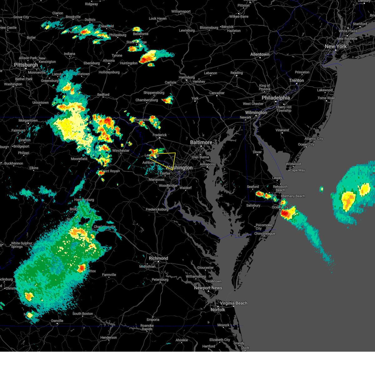 Svrlwx the national weather service in sterling virginia has issued a * severe thunderstorm warning for, central montgomery county in central maryland, east central loudoun county in northern virginia, north central fairfax county in northern virginia, * until 445 pm edt. * at 358 pm edt, a severe thunderstorm was located over leesburg, moving east at 30 mph (radar indicated). Hazards include 60 mph wind gusts and quarter size hail. Damaging winds will cause some trees and large branches to fall. this could injure those outdoors, as well as damage homes and vehicles. roadways may become blocked by downed trees. localized power outages are possible. Unsecured light objects may become projectiles. Svrlwx the national weather service in sterling virginia has issued a * severe thunderstorm warning for, central montgomery county in central maryland, east central loudoun county in northern virginia, north central fairfax county in northern virginia, * until 445 pm edt. * at 358 pm edt, a severe thunderstorm was located over leesburg, moving east at 30 mph (radar indicated). Hazards include 60 mph wind gusts and quarter size hail. Damaging winds will cause some trees and large branches to fall. this could injure those outdoors, as well as damage homes and vehicles. roadways may become blocked by downed trees. localized power outages are possible. Unsecured light objects may become projectiles.
|
| 5/5/2025 7:41 PM EDT |
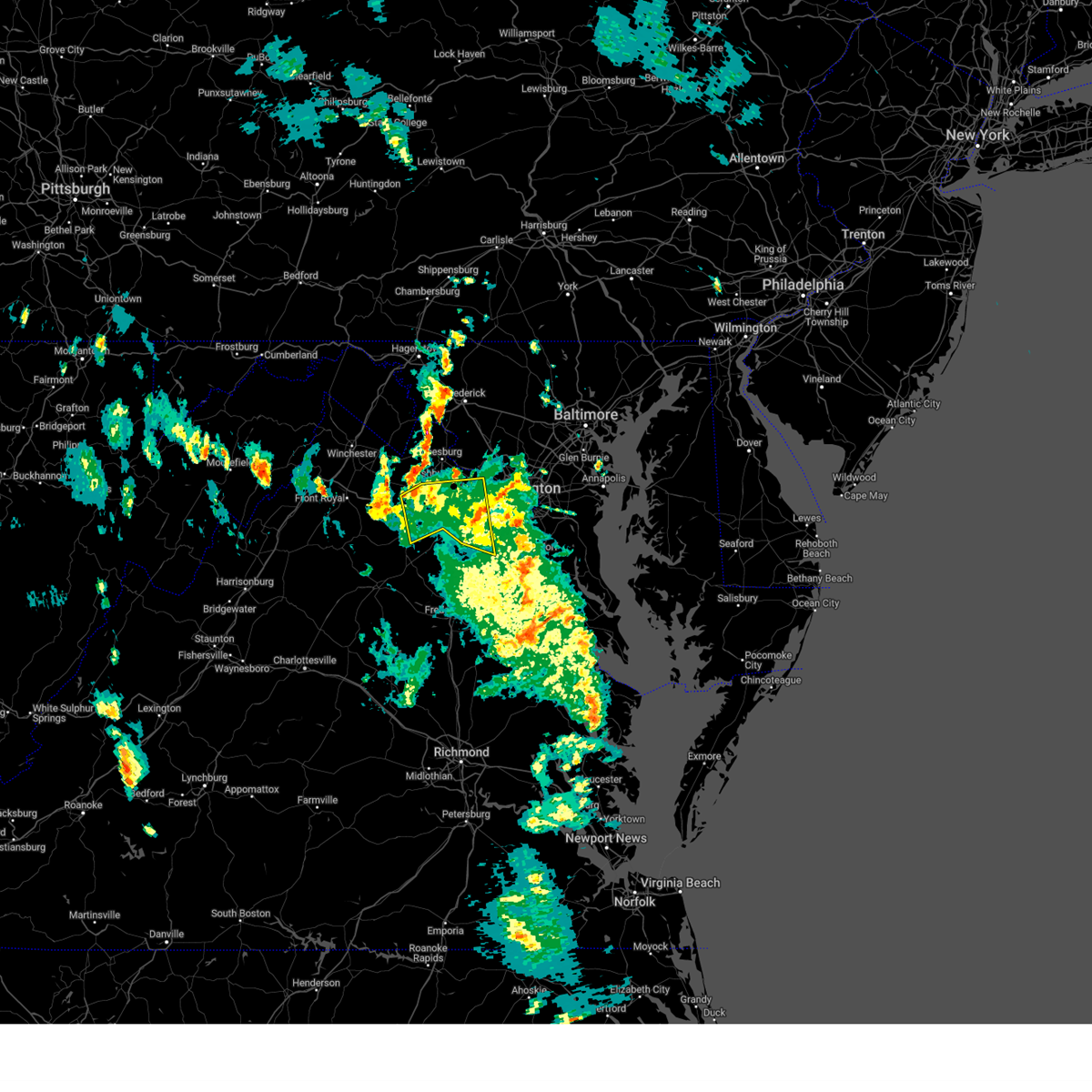 The storms which prompted the warning have weakened below severe limits, and no longer pose an immediate threat to life or property. therefore, the warning will be allowed to expire. a severe thunderstorm watch remains in effect until midnight edt for northern virginia. The storms which prompted the warning have weakened below severe limits, and no longer pose an immediate threat to life or property. therefore, the warning will be allowed to expire. a severe thunderstorm watch remains in effect until midnight edt for northern virginia.
|
| 5/5/2025 7:24 PM EDT |
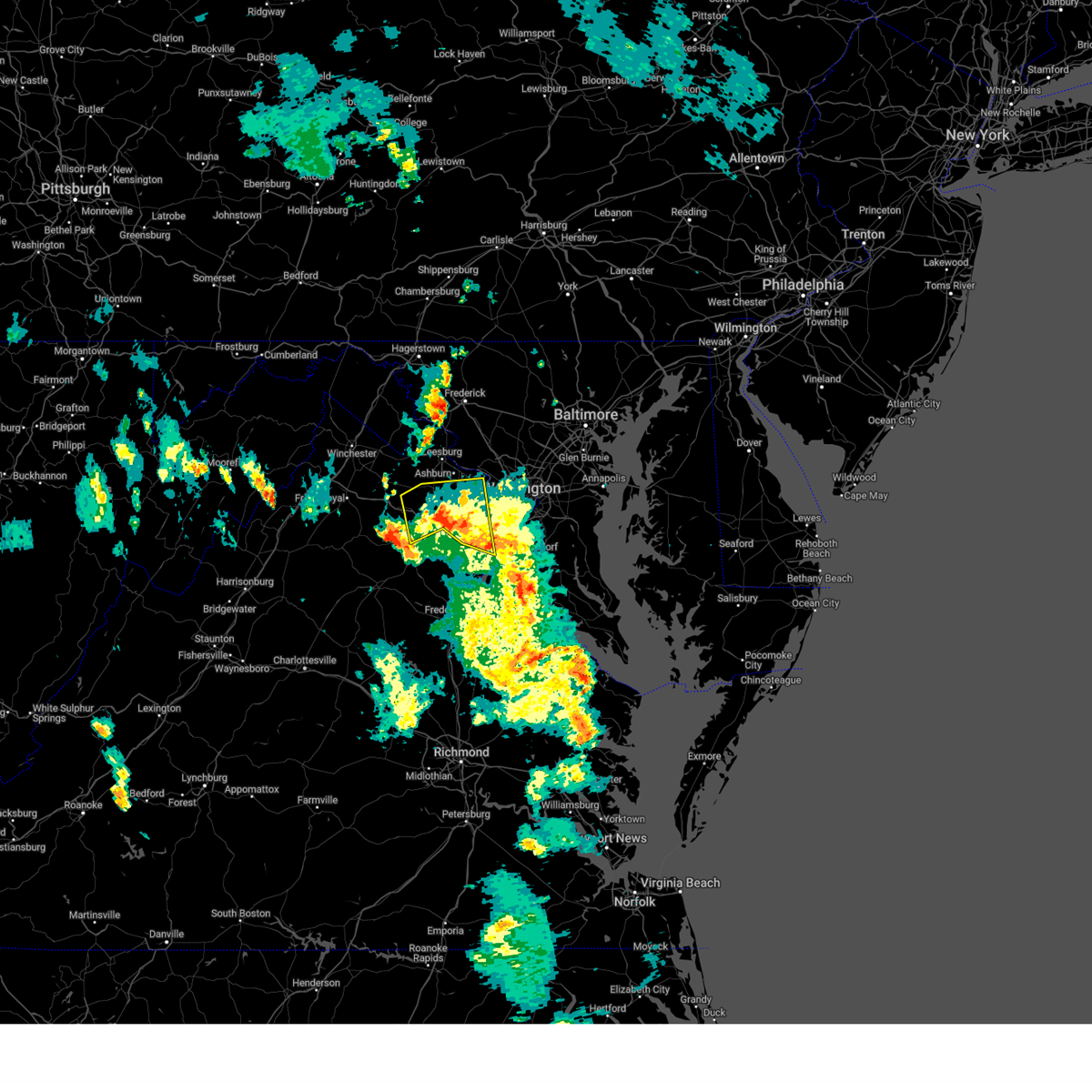 the severe thunderstorm warning has been cancelled and is no longer in effect the severe thunderstorm warning has been cancelled and is no longer in effect
|
| 5/5/2025 7:24 PM EDT |
 At 724 pm edt, severe thunderstorms were located along a line extending from near chantilly to near haymarket to near warrenton, moving northwest at 40 mph (radar indicated). Hazards include 60 mph wind gusts and quarter size hail. Damaging winds will cause some trees and large branches to fall. this could injure those outdoors, as well as damage homes and vehicles. roadways may become blocked by downed trees. localized power outages are possible. unsecured light objects may become projectiles. Locations impacted include, catharpin, woolsey, aldie, linton hall, herndon, the plains, burke, oakton, lake ridge, clifton, brambleton, great falls, fairfax, greenwich, gainesville, manassas, sterling, wolf trap, broken hill, and manassas park. At 724 pm edt, severe thunderstorms were located along a line extending from near chantilly to near haymarket to near warrenton, moving northwest at 40 mph (radar indicated). Hazards include 60 mph wind gusts and quarter size hail. Damaging winds will cause some trees and large branches to fall. this could injure those outdoors, as well as damage homes and vehicles. roadways may become blocked by downed trees. localized power outages are possible. unsecured light objects may become projectiles. Locations impacted include, catharpin, woolsey, aldie, linton hall, herndon, the plains, burke, oakton, lake ridge, clifton, brambleton, great falls, fairfax, greenwich, gainesville, manassas, sterling, wolf trap, broken hill, and manassas park.
|
| 5/5/2025 6:58 PM EDT |
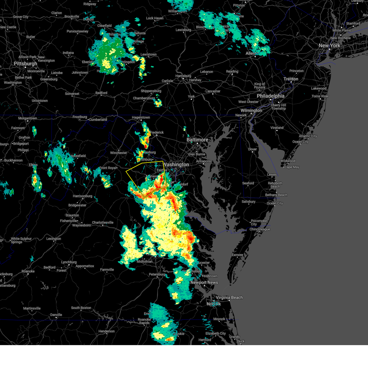 Svrlwx the national weather service in sterling virginia has issued a * severe thunderstorm warning for, northwestern stafford county in northern virginia, southeastern loudoun county in northern virginia, the city of fairfax in northern virginia, western fairfax county in northern virginia, fauquier county in northern virginia, the city of manassas park in northern virginia, prince william county in northern virginia, the city of manassas in northern virginia, * until 745 pm edt. * at 658 pm edt, severe thunderstorms were located along a line extending from woodbridge to near dale city to 6 miles southeast of bealeton, moving northwest at 25 mph (radar indicated). Hazards include 60 mph wind gusts and quarter size hail. Damaging winds will cause some trees and large branches to fall. this could injure those outdoors, as well as damage homes and vehicles. roadways may become blocked by downed trees. localized power outages are possible. Unsecured light objects may become projectiles. Svrlwx the national weather service in sterling virginia has issued a * severe thunderstorm warning for, northwestern stafford county in northern virginia, southeastern loudoun county in northern virginia, the city of fairfax in northern virginia, western fairfax county in northern virginia, fauquier county in northern virginia, the city of manassas park in northern virginia, prince william county in northern virginia, the city of manassas in northern virginia, * until 745 pm edt. * at 658 pm edt, severe thunderstorms were located along a line extending from woodbridge to near dale city to 6 miles southeast of bealeton, moving northwest at 25 mph (radar indicated). Hazards include 60 mph wind gusts and quarter size hail. Damaging winds will cause some trees and large branches to fall. this could injure those outdoors, as well as damage homes and vehicles. roadways may become blocked by downed trees. localized power outages are possible. Unsecured light objects may become projectiles.
|
| 8/29/2024 5:03 PM EDT |
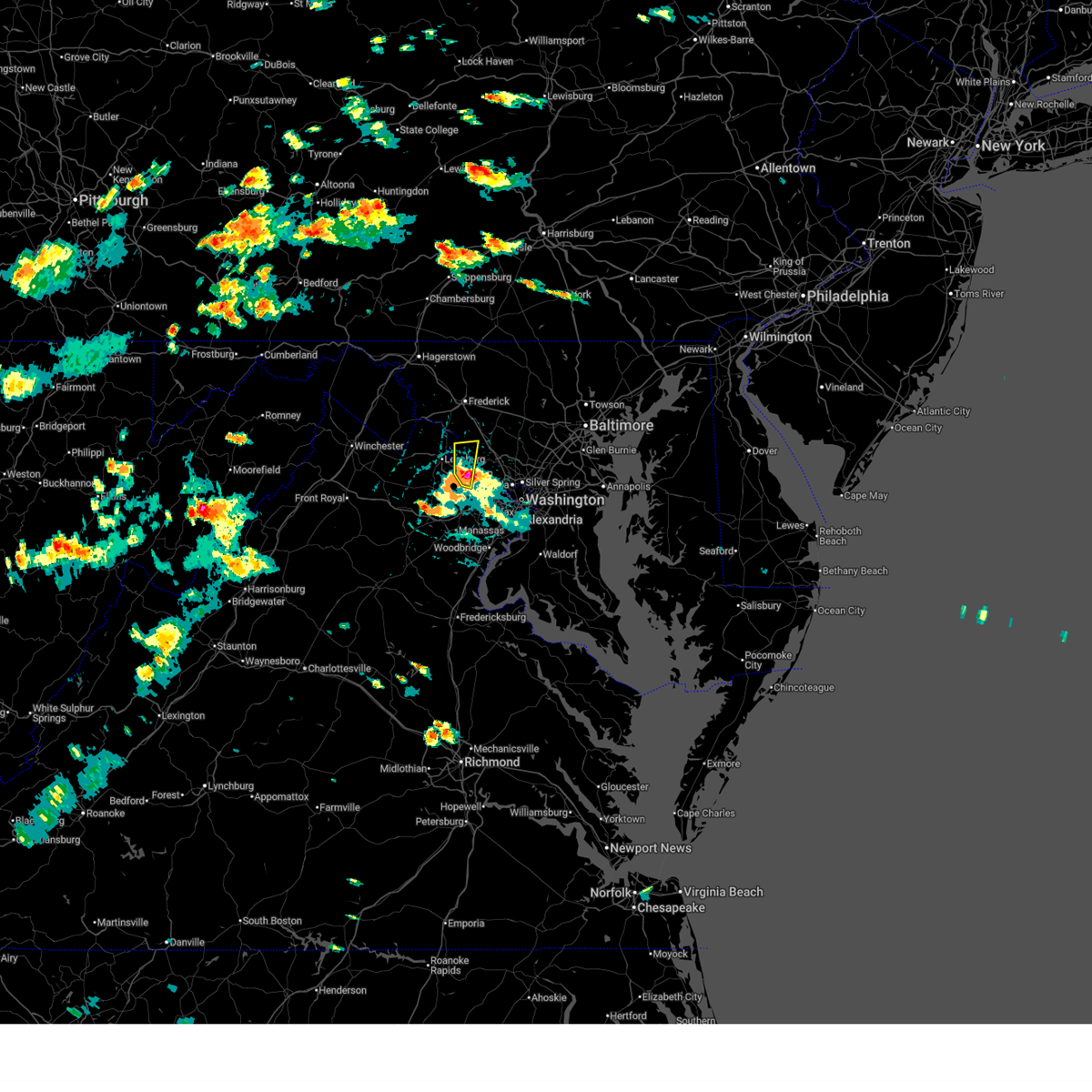 At 503 pm edt, a severe thunderstorm was located over countryside, or over lowes island, moving north at 10 mph (radar indicated). Hazards include 70 mph wind gusts and quarter size hail. Damaging winds will cause some trees and large branches to fall. this could injure those outdoors, as well as damage homes and vehicles. roadways may become blocked by downed trees. localized power outages are possible. unsecured light objects may become projectiles. Locations impacted include, herndon, lansdowne, lowes island, poolesville, ashburn, sterling, great falls, countryside, beallsville, dawsonville, and sterling park. At 503 pm edt, a severe thunderstorm was located over countryside, or over lowes island, moving north at 10 mph (radar indicated). Hazards include 70 mph wind gusts and quarter size hail. Damaging winds will cause some trees and large branches to fall. this could injure those outdoors, as well as damage homes and vehicles. roadways may become blocked by downed trees. localized power outages are possible. unsecured light objects may become projectiles. Locations impacted include, herndon, lansdowne, lowes island, poolesville, ashburn, sterling, great falls, countryside, beallsville, dawsonville, and sterling park.
|
| 8/29/2024 4:40 PM EDT |
 At 439 pm edt, a severe thunderstorm was located over ashburn, or near broadlands, moving north at 15 mph (radar indicated). Hazards include 70 mph wind gusts and ping pong ball size hail. Damaging winds will cause some trees and large branches to fall. this could injure those outdoors, as well as damage homes and vehicles. roadways may become blocked by downed trees. localized power outages are possible. unsecured light objects may become projectiles. Locations impacted include, leesburg, herndon, broadlands, lansdowne, lowes island, brambleton, poolesville, dulles international airport, ashburn, sterling, great falls, countryside, arcola, belmont, beallsville, dawsonville, and sterling park. At 439 pm edt, a severe thunderstorm was located over ashburn, or near broadlands, moving north at 15 mph (radar indicated). Hazards include 70 mph wind gusts and ping pong ball size hail. Damaging winds will cause some trees and large branches to fall. this could injure those outdoors, as well as damage homes and vehicles. roadways may become blocked by downed trees. localized power outages are possible. unsecured light objects may become projectiles. Locations impacted include, leesburg, herndon, broadlands, lansdowne, lowes island, brambleton, poolesville, dulles international airport, ashburn, sterling, great falls, countryside, arcola, belmont, beallsville, dawsonville, and sterling park.
|
| 8/29/2024 4:37 PM EDT |
 Svrlwx the national weather service in sterling virginia has issued a * severe thunderstorm warning for, west central montgomery county in central maryland, southeastern loudoun county in northern virginia, northwestern fairfax county in northern virginia, * until 515 pm edt. * at 437 pm edt, a severe thunderstorm was located over ashburn, or near broadlands, moving north at 15 mph (radar indicated). Hazards include 60 mph wind gusts and quarter size hail. Damaging winds will cause some trees and large branches to fall. this could injure those outdoors, as well as damage homes and vehicles. roadways may become blocked by downed trees. localized power outages are possible. Unsecured light objects may become projectiles. Svrlwx the national weather service in sterling virginia has issued a * severe thunderstorm warning for, west central montgomery county in central maryland, southeastern loudoun county in northern virginia, northwestern fairfax county in northern virginia, * until 515 pm edt. * at 437 pm edt, a severe thunderstorm was located over ashburn, or near broadlands, moving north at 15 mph (radar indicated). Hazards include 60 mph wind gusts and quarter size hail. Damaging winds will cause some trees and large branches to fall. this could injure those outdoors, as well as damage homes and vehicles. roadways may become blocked by downed trees. localized power outages are possible. Unsecured light objects may become projectiles.
|
| 8/3/2024 5:39 PM EDT |
 Svrlwx the national weather service in sterling virginia has issued a * severe thunderstorm warning for, the northern district of columbia, central howard county in central maryland, montgomery county in central maryland, northwestern prince georges county in central maryland, southeastern loudoun county in northern virginia, northwestern arlington county in northern virginia, northern fairfax county in northern virginia, * until 630 pm edt. * at 539 pm edt, a severe thunderstorm was located over lowes island, moving east at 40 mph (radar indicated). Hazards include 60 mph wind gusts. Damaging winds will cause some trees and large branches to fall. this could injure those outdoors, as well as damage homes and vehicles. roadways may become blocked by downed trees. localized power outages are possible. Unsecured light objects may become projectiles. Svrlwx the national weather service in sterling virginia has issued a * severe thunderstorm warning for, the northern district of columbia, central howard county in central maryland, montgomery county in central maryland, northwestern prince georges county in central maryland, southeastern loudoun county in northern virginia, northwestern arlington county in northern virginia, northern fairfax county in northern virginia, * until 630 pm edt. * at 539 pm edt, a severe thunderstorm was located over lowes island, moving east at 40 mph (radar indicated). Hazards include 60 mph wind gusts. Damaging winds will cause some trees and large branches to fall. this could injure those outdoors, as well as damage homes and vehicles. roadways may become blocked by downed trees. localized power outages are possible. Unsecured light objects may become projectiles.
|
| 8/3/2024 5:20 PM EDT |
 Svrlwx the national weather service in sterling virginia has issued a * severe thunderstorm warning for, west central montgomery county in central maryland, loudoun county in northern virginia, northwestern fairfax county in northern virginia, east central clarke county in northwestern virginia, north central fauquier county in northern virginia, northwestern prince william county in northern virginia, south central jefferson county in the panhandle of west virginia, * until 545 pm edt. * at 520 pm edt, severe thunderstorms were located along a line extending from round hill to near brambleton to near warrenton, moving northeast at 45 mph (radar indicated). Hazards include 60 mph wind gusts. Damaging winds will cause some trees and large branches to fall. this could injure those outdoors, as well as damage homes and vehicles. roadways may become blocked by downed trees. localized power outages are possible. Unsecured light objects may become projectiles. Svrlwx the national weather service in sterling virginia has issued a * severe thunderstorm warning for, west central montgomery county in central maryland, loudoun county in northern virginia, northwestern fairfax county in northern virginia, east central clarke county in northwestern virginia, north central fauquier county in northern virginia, northwestern prince william county in northern virginia, south central jefferson county in the panhandle of west virginia, * until 545 pm edt. * at 520 pm edt, severe thunderstorms were located along a line extending from round hill to near brambleton to near warrenton, moving northeast at 45 mph (radar indicated). Hazards include 60 mph wind gusts. Damaging winds will cause some trees and large branches to fall. this could injure those outdoors, as well as damage homes and vehicles. roadways may become blocked by downed trees. localized power outages are possible. Unsecured light objects may become projectiles.
|
| 8/3/2024 5:19 PM EDT |
 Svrlwx the national weather service in sterling virginia has issued a * severe thunderstorm warning for, southeastern loudoun county in northern virginia, northwestern prince william county in northern virginia, * until 545 pm edt. * at 518 pm edt, a severe thunderstorm was located near oatlands, or near brambleton, moving east at 35 mph. this is a destructive storm for eastern loudoun county (radar indicated). Hazards include 80 mph wind gusts. Expect considerable damage to trees and power lines. your life is at significant risk if outdoors. In addition to some trees falling into homes, wind damage is possible to roofs, sheds, open garages, and mobile homes. Svrlwx the national weather service in sterling virginia has issued a * severe thunderstorm warning for, southeastern loudoun county in northern virginia, northwestern prince william county in northern virginia, * until 545 pm edt. * at 518 pm edt, a severe thunderstorm was located near oatlands, or near brambleton, moving east at 35 mph. this is a destructive storm for eastern loudoun county (radar indicated). Hazards include 80 mph wind gusts. Expect considerable damage to trees and power lines. your life is at significant risk if outdoors. In addition to some trees falling into homes, wind damage is possible to roofs, sheds, open garages, and mobile homes.
|
| 7/29/2024 5:24 PM EDT |
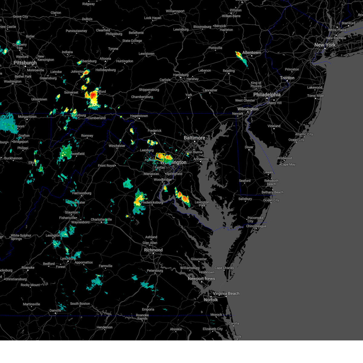 The storm which prompted the warning has weakened below severe limits, and no longer poses an immediate threat to life or property. therefore, the warning will be allowed to expire. however, gusty winds and heavy rain are still possible with this thunderstorm. to report severe weather, contact your nearest law enforcement agency. they will relay your report to the national weather service sterling virginia. The storm which prompted the warning has weakened below severe limits, and no longer poses an immediate threat to life or property. therefore, the warning will be allowed to expire. however, gusty winds and heavy rain are still possible with this thunderstorm. to report severe weather, contact your nearest law enforcement agency. they will relay your report to the national weather service sterling virginia.
|
| 7/29/2024 5:12 PM EDT |
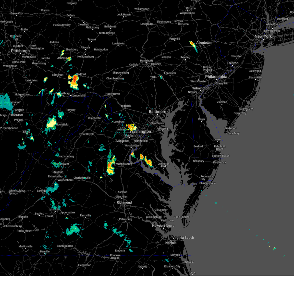 At 512 pm edt, a severe thunderstorm was located over lowes island, and is nearly stationary (radar indicated). Hazards include 60 mph wind gusts. Damaging winds will cause some trees and large branches to fall. this could injure those outdoors, as well as damage homes and vehicles. roadways may become blocked by downed trees. localized power outages are possible. unsecured light objects may become projectiles. Locations impacted include, lowes island, potomac, sterling, north potomac, great falls, and darnestown. At 512 pm edt, a severe thunderstorm was located over lowes island, and is nearly stationary (radar indicated). Hazards include 60 mph wind gusts. Damaging winds will cause some trees and large branches to fall. this could injure those outdoors, as well as damage homes and vehicles. roadways may become blocked by downed trees. localized power outages are possible. unsecured light objects may become projectiles. Locations impacted include, lowes island, potomac, sterling, north potomac, great falls, and darnestown.
|
| 7/29/2024 5:01 PM EDT |
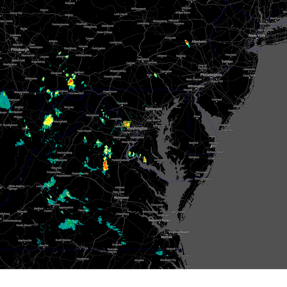 Svrlwx the national weather service in sterling virginia has issued a * severe thunderstorm warning for, southwestern montgomery county in central maryland, eastern loudoun county in northern virginia, north central fairfax county in northern virginia, * until 530 pm edt. * at 501 pm edt, a severe thunderstorm was located over lowes island, and is nearly stationary (radar indicated). Hazards include 60 mph wind gusts. Damaging winds will cause some trees and large branches to fall. this could injure those outdoors, as well as damage homes and vehicles. roadways may become blocked by downed trees. localized power outages are possible. Unsecured light objects may become projectiles. Svrlwx the national weather service in sterling virginia has issued a * severe thunderstorm warning for, southwestern montgomery county in central maryland, eastern loudoun county in northern virginia, north central fairfax county in northern virginia, * until 530 pm edt. * at 501 pm edt, a severe thunderstorm was located over lowes island, and is nearly stationary (radar indicated). Hazards include 60 mph wind gusts. Damaging winds will cause some trees and large branches to fall. this could injure those outdoors, as well as damage homes and vehicles. roadways may become blocked by downed trees. localized power outages are possible. Unsecured light objects may become projectiles.
|
| 7/17/2024 5:58 PM EDT |
 The storms which prompted the warning have weakened below severe limits, and no longer pose an immediate threat to life or property. therefore, the warning will be allowed to expire. however, gusty winds and heavy rain are still possible with these thunderstorms. a severe thunderstorm watch remains in effect until 1000 pm edt for district of columbia, southern and central maryland, and northern virginia. The storms which prompted the warning have weakened below severe limits, and no longer pose an immediate threat to life or property. therefore, the warning will be allowed to expire. however, gusty winds and heavy rain are still possible with these thunderstorms. a severe thunderstorm watch remains in effect until 1000 pm edt for district of columbia, southern and central maryland, and northern virginia.
|
| 7/17/2024 5:30 PM EDT |
 Svrlwx the national weather service in sterling virginia has issued a * severe thunderstorm warning for, the district of columbia, southeastern montgomery county in central maryland, northwestern prince georges county in central maryland, northwestern charles county in southern maryland, the city of fairfax in northern virginia, arlington county in northern virginia, the city of falls church in northern virginia, fairfax county in northern virginia, the city of manassas park in northern virginia, central prince william county in northern virginia, the city of manassas in northern virginia, the city of alexandria in northern virginia, * until 600 pm edt. * at 530 pm edt, severe thunderstorms were located along a line extending from near lowes island to 6 miles northwest of dale city, moving east at 30 mph (radar indicated). Hazards include 60 mph wind gusts. Damaging winds will cause some trees and large branches to fall. this could injure those outdoors, as well as damage homes and vehicles. roadways may become blocked by downed trees. localized power outages are possible. Unsecured light objects may become projectiles. Svrlwx the national weather service in sterling virginia has issued a * severe thunderstorm warning for, the district of columbia, southeastern montgomery county in central maryland, northwestern prince georges county in central maryland, northwestern charles county in southern maryland, the city of fairfax in northern virginia, arlington county in northern virginia, the city of falls church in northern virginia, fairfax county in northern virginia, the city of manassas park in northern virginia, central prince william county in northern virginia, the city of manassas in northern virginia, the city of alexandria in northern virginia, * until 600 pm edt. * at 530 pm edt, severe thunderstorms were located along a line extending from near lowes island to 6 miles northwest of dale city, moving east at 30 mph (radar indicated). Hazards include 60 mph wind gusts. Damaging winds will cause some trees and large branches to fall. this could injure those outdoors, as well as damage homes and vehicles. roadways may become blocked by downed trees. localized power outages are possible. Unsecured light objects may become projectiles.
|
| 7/15/2024 5:21 PM EDT |
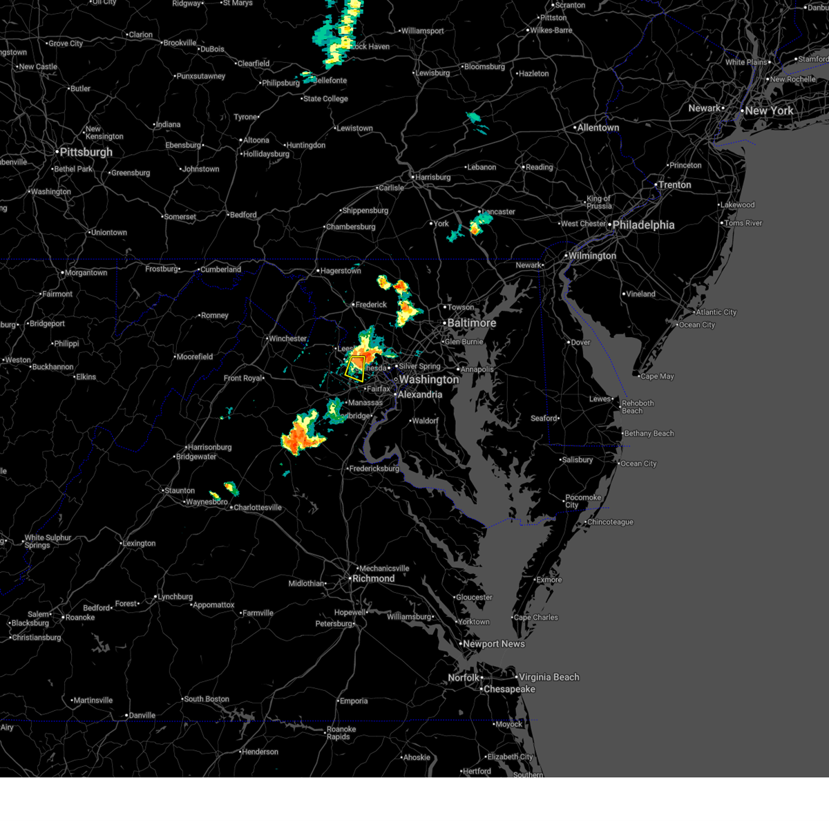 At 521 pm edt, a severe thunderstorm was located over great falls, or over lowes island, moving southeast at 20 mph (trained weather spotters). Hazards include 60 mph wind gusts. Damaging winds will cause some trees and large branches to fall. this could injure those outdoors, as well as damage homes and vehicles. roadways may become blocked by downed trees. localized power outages are possible. unsecured light objects may become projectiles. Locations impacted include, reston, herndon, lowes island, dulles international airport, ashburn, sterling, great falls, countryside, darnestown, and sterling park. At 521 pm edt, a severe thunderstorm was located over great falls, or over lowes island, moving southeast at 20 mph (trained weather spotters). Hazards include 60 mph wind gusts. Damaging winds will cause some trees and large branches to fall. this could injure those outdoors, as well as damage homes and vehicles. roadways may become blocked by downed trees. localized power outages are possible. unsecured light objects may become projectiles. Locations impacted include, reston, herndon, lowes island, dulles international airport, ashburn, sterling, great falls, countryside, darnestown, and sterling park.
|
| 7/15/2024 5:14 PM EDT |
 Svrlwx the national weather service in sterling virginia has issued a * severe thunderstorm warning for, the district of columbia, southeastern montgomery county in central maryland, northwestern prince georges county in central maryland, eastern loudoun county in northern virginia, arlington county in northern virginia, the city of falls church in northern virginia, northeastern fairfax county in northern virginia, the city of alexandria in northern virginia, * until 600 pm edt. * at 513 pm edt, a severe thunderstorm was located over great falls, moving east at 25 mph (trained weather spotters reported numerous downed trees and power lines in loudoun county with this storm). Hazards include 60 mph wind gusts. Damaging winds will cause some trees and large branches to fall. this could injure those outdoors, as well as damage homes and vehicles. roadways may become blocked by downed trees. localized power outages are possible. Unsecured light objects may become projectiles. Svrlwx the national weather service in sterling virginia has issued a * severe thunderstorm warning for, the district of columbia, southeastern montgomery county in central maryland, northwestern prince georges county in central maryland, eastern loudoun county in northern virginia, arlington county in northern virginia, the city of falls church in northern virginia, northeastern fairfax county in northern virginia, the city of alexandria in northern virginia, * until 600 pm edt. * at 513 pm edt, a severe thunderstorm was located over great falls, moving east at 25 mph (trained weather spotters reported numerous downed trees and power lines in loudoun county with this storm). Hazards include 60 mph wind gusts. Damaging winds will cause some trees and large branches to fall. this could injure those outdoors, as well as damage homes and vehicles. roadways may become blocked by downed trees. localized power outages are possible. Unsecured light objects may become projectiles.
|
| 7/15/2024 5:08 PM EDT |
 At 507 pm edt, a severe thunderstorm was located over sterling, or over herndon, moving east at 25 mph (radar indicated). Hazards include 60 mph wind gusts. Damaging winds will cause some trees and large branches to fall. this could injure those outdoors, as well as damage homes and vehicles. roadways may become blocked by downed trees. localized power outages are possible. unsecured light objects may become projectiles. Locations impacted include, reston, herndon, broadlands, lansdowne, lowes island, brambleton, dulles international airport, ashburn, sterling, great falls, countryside, arcola, darnestown, belmont, and sterling park. At 507 pm edt, a severe thunderstorm was located over sterling, or over herndon, moving east at 25 mph (radar indicated). Hazards include 60 mph wind gusts. Damaging winds will cause some trees and large branches to fall. this could injure those outdoors, as well as damage homes and vehicles. roadways may become blocked by downed trees. localized power outages are possible. unsecured light objects may become projectiles. Locations impacted include, reston, herndon, broadlands, lansdowne, lowes island, brambleton, dulles international airport, ashburn, sterling, great falls, countryside, arcola, darnestown, belmont, and sterling park.
|
| 7/15/2024 4:57 PM EDT |
 Svrlwx the national weather service in sterling virginia has issued a * severe thunderstorm warning for, southwestern montgomery county in central maryland, southeastern loudoun county in northern virginia, northwestern fairfax county in northern virginia, * until 530 pm edt. * at 456 pm edt, a severe thunderstorm was located over ashburn, or over broadlands, moving southeast at 25 mph (radar indicated). Hazards include 60 mph wind gusts. Damaging winds will cause some trees and large branches to fall. this could injure those outdoors, as well as damage homes and vehicles. roadways may become blocked by downed trees. localized power outages are possible. Unsecured light objects may become projectiles. Svrlwx the national weather service in sterling virginia has issued a * severe thunderstorm warning for, southwestern montgomery county in central maryland, southeastern loudoun county in northern virginia, northwestern fairfax county in northern virginia, * until 530 pm edt. * at 456 pm edt, a severe thunderstorm was located over ashburn, or over broadlands, moving southeast at 25 mph (radar indicated). Hazards include 60 mph wind gusts. Damaging winds will cause some trees and large branches to fall. this could injure those outdoors, as well as damage homes and vehicles. roadways may become blocked by downed trees. localized power outages are possible. Unsecured light objects may become projectiles.
|
| 5/27/2024 7:05 PM EDT |
 At 705 pm edt, a severe thunderstorm was located over lowes island, moving east at 20 mph (radar indicated). Hazards include 60 mph wind gusts and quarter size hail. Damaging winds will cause some trees and large branches to fall. this could injure those outdoors, as well as damage homes and vehicles. roadways may become blocked by downed trees. localized power outages are possible. unsecured light objects may become projectiles. Locations impacted include, germantown, rockville, bethesda, gaithersburg, reston, herndon, broadlands, lansdowne, lowes island, brambleton, potomac, ashburn, montgomery village, sterling, north potomac, redland, great falls, countryside, darnestown, and belmont. At 705 pm edt, a severe thunderstorm was located over lowes island, moving east at 20 mph (radar indicated). Hazards include 60 mph wind gusts and quarter size hail. Damaging winds will cause some trees and large branches to fall. this could injure those outdoors, as well as damage homes and vehicles. roadways may become blocked by downed trees. localized power outages are possible. unsecured light objects may become projectiles. Locations impacted include, germantown, rockville, bethesda, gaithersburg, reston, herndon, broadlands, lansdowne, lowes island, brambleton, potomac, ashburn, montgomery village, sterling, north potomac, redland, great falls, countryside, darnestown, and belmont.
|
| 5/27/2024 6:51 PM EDT |
 Svrlwx the national weather service in sterling virginia has issued a * severe thunderstorm warning for, southwestern montgomery county in central maryland, southeastern loudoun county in northern virginia, northern fairfax county in northern virginia, * until 730 pm edt. * at 650 pm edt, a severe thunderstorm was located over ashburn, or near broadlands, moving east at 20 mph (radar indicated). Hazards include 60 mph wind gusts and quarter size hail. Damaging winds will cause some trees and large branches to fall. this could injure those outdoors, as well as damage homes and vehicles. roadways may become blocked by downed trees. localized power outages are possible. Unsecured light objects may become projectiles. Svrlwx the national weather service in sterling virginia has issued a * severe thunderstorm warning for, southwestern montgomery county in central maryland, southeastern loudoun county in northern virginia, northern fairfax county in northern virginia, * until 730 pm edt. * at 650 pm edt, a severe thunderstorm was located over ashburn, or near broadlands, moving east at 20 mph (radar indicated). Hazards include 60 mph wind gusts and quarter size hail. Damaging winds will cause some trees and large branches to fall. this could injure those outdoors, as well as damage homes and vehicles. roadways may become blocked by downed trees. localized power outages are possible. Unsecured light objects may become projectiles.
|
| 4/15/2024 2:42 PM EDT |
 At 242 pm edt, a severe thunderstorm was located over brambleton, moving east at 35 mph (trained weather spotters). Hazards include golf ball size hail reprted by a trained spotter in hanson park. Hail is large enough to dent and damage vehicles. some damage to roofs, siding, and windows is possible. Locations impacted include, reston, herndon, fairfax, broadlands, brambleton, dulles international airport, ashburn, oakton, sterling, wolf trap, great falls, and arcola. At 242 pm edt, a severe thunderstorm was located over brambleton, moving east at 35 mph (trained weather spotters). Hazards include golf ball size hail reprted by a trained spotter in hanson park. Hail is large enough to dent and damage vehicles. some damage to roofs, siding, and windows is possible. Locations impacted include, reston, herndon, fairfax, broadlands, brambleton, dulles international airport, ashburn, oakton, sterling, wolf trap, great falls, and arcola.
|
| 4/15/2024 2:36 PM EDT |
 Svrlwx the national weather service in sterling virginia has issued a * severe thunderstorm warning for, southeastern loudoun county in northern virginia, northwestern fairfax county in northern virginia, * until 300 pm edt. * at 235 pm edt, a severe thunderstorm was located over brambleton, moving east at 35 mph (radar indicated). Hazards include quarter size hail. some hail damage to agriculture is expected Svrlwx the national weather service in sterling virginia has issued a * severe thunderstorm warning for, southeastern loudoun county in northern virginia, northwestern fairfax county in northern virginia, * until 300 pm edt. * at 235 pm edt, a severe thunderstorm was located over brambleton, moving east at 35 mph (radar indicated). Hazards include quarter size hail. some hail damage to agriculture is expected
|
| 9/9/2023 3:18 PM EDT |
 At 317 pm edt, a severe thunderstorm was located over herndon, moving northeast at 15 mph (radar indicated). Hazards include 60 mph wind gusts and quarter size hail. Damaging winds will cause some trees and large branches to fall. this could injure those outdoors, as well as damage homes and vehicles. roadways may become blocked by downed trees. localized power outages are possible. Unsecured light objects may become projectiles. At 317 pm edt, a severe thunderstorm was located over herndon, moving northeast at 15 mph (radar indicated). Hazards include 60 mph wind gusts and quarter size hail. Damaging winds will cause some trees and large branches to fall. this could injure those outdoors, as well as damage homes and vehicles. roadways may become blocked by downed trees. localized power outages are possible. Unsecured light objects may become projectiles.
|
| 9/8/2023 6:59 PM EDT |
 At 658 pm edt, a severe thunderstorm was located over ashburn, or near broadlands, moving northeast at 10 mph. another severe thunderstorm is located north of haymarket (trained weather spotters. numerous reports of wind driven hail have been received across eastern loudoun county). Hazards include golf ball size hail and 60 mph wind gusts. Expect wind damage to trees and power lines. hail is large enough to dent and damage vehicles. some hail damage to roofs, siding, and windows is possible. locations impacted include, south riding, herndon, broadlands, lansdowne, lowes island, brambleton, dulles international airport, ashburn, sterling, chantilly, great falls, countryside, haymarket, arcola, gainesville, belmont, catharpin, woolsey, and sterling park. thunderstorm damage threat, considerable hail threat, observed max hail size, 1. 75 in wind threat, radar indicated max wind gust, 60 mph. At 658 pm edt, a severe thunderstorm was located over ashburn, or near broadlands, moving northeast at 10 mph. another severe thunderstorm is located north of haymarket (trained weather spotters. numerous reports of wind driven hail have been received across eastern loudoun county). Hazards include golf ball size hail and 60 mph wind gusts. Expect wind damage to trees and power lines. hail is large enough to dent and damage vehicles. some hail damage to roofs, siding, and windows is possible. locations impacted include, south riding, herndon, broadlands, lansdowne, lowes island, brambleton, dulles international airport, ashburn, sterling, chantilly, great falls, countryside, haymarket, arcola, gainesville, belmont, catharpin, woolsey, and sterling park. thunderstorm damage threat, considerable hail threat, observed max hail size, 1. 75 in wind threat, radar indicated max wind gust, 60 mph.
|
| 9/8/2023 6:39 PM EDT |
 At 637 pm edt, a severe thunderstorm was located over dulles international airport, moving northeast at 10 mph (trained weather spotters. numerous reports of significant wind driven hail, of at least ping pong ball size, is ongoing with storms across eastern loudoun and northeast prince william counties. hail up to two inches is possible). Hazards include two inch hail and 60 mph wind gusts. Expect wind damage to trees and power lines. hail is large enough to dent and damage vehicles. Some hail damage to roofs, siding, and windows is possible. At 637 pm edt, a severe thunderstorm was located over dulles international airport, moving northeast at 10 mph (trained weather spotters. numerous reports of significant wind driven hail, of at least ping pong ball size, is ongoing with storms across eastern loudoun and northeast prince william counties. hail up to two inches is possible). Hazards include two inch hail and 60 mph wind gusts. Expect wind damage to trees and power lines. hail is large enough to dent and damage vehicles. Some hail damage to roofs, siding, and windows is possible.
|
| 9/8/2023 6:33 PM EDT |
 At 632 pm edt, a severe thunderstorm was located over countryside, or over lowes island, moving northeast at 15 mph (trained weather spotters have reported numerous instances of at least half dollar size, wind driven hail in eastern loudoun county). Hazards include ping pong ball size hail and 60 mph wind gusts. Damaging winds will cause some trees and large branches to fall. this could injure those outdoors, as well as damage homes and vehicles. roadways may become blocked by downed trees. localized power outages are possible. unsecured light objects may become projectiles. locations impacted include, south riding, herndon, broadlands, lansdowne, lowes island, brambleton, dulles international airport, ashburn, sterling, countryside, arcola, belmont, and sterling park. hail threat, observed max hail size, 1. 50 in wind threat, radar indicated max wind gust, 60 mph. At 632 pm edt, a severe thunderstorm was located over countryside, or over lowes island, moving northeast at 15 mph (trained weather spotters have reported numerous instances of at least half dollar size, wind driven hail in eastern loudoun county). Hazards include ping pong ball size hail and 60 mph wind gusts. Damaging winds will cause some trees and large branches to fall. this could injure those outdoors, as well as damage homes and vehicles. roadways may become blocked by downed trees. localized power outages are possible. unsecured light objects may become projectiles. locations impacted include, south riding, herndon, broadlands, lansdowne, lowes island, brambleton, dulles international airport, ashburn, sterling, countryside, arcola, belmont, and sterling park. hail threat, observed max hail size, 1. 50 in wind threat, radar indicated max wind gust, 60 mph.
|
| 9/8/2023 6:09 PM EDT |
 At 608 pm edt, a severe thunderstorm was located over brambleton, moving northeast at 10 mph (trained weather spotters. numerous reports of wind driven hail have been reported across southern and eastern loudoun county, mainly up to half dollar size hail. hail up to golf ball size is possible). Hazards include golf ball size hail and 60 mph wind gusts. Expect wind damage to trees and power lines. hail is large enough to dent and damage vehicles. some hail damage to roofs, siding, and windows is possible. locations impacted include, south riding, herndon, broadlands, lansdowne, lowes island, brambleton, dulles international airport, ashburn, sterling, chantilly, countryside, arcola, belmont, and sterling park. thunderstorm damage threat, considerable hail threat, observed max hail size, 1. 75 in wind threat, radar indicated max wind gust, 60 mph. At 608 pm edt, a severe thunderstorm was located over brambleton, moving northeast at 10 mph (trained weather spotters. numerous reports of wind driven hail have been reported across southern and eastern loudoun county, mainly up to half dollar size hail. hail up to golf ball size is possible). Hazards include golf ball size hail and 60 mph wind gusts. Expect wind damage to trees and power lines. hail is large enough to dent and damage vehicles. some hail damage to roofs, siding, and windows is possible. locations impacted include, south riding, herndon, broadlands, lansdowne, lowes island, brambleton, dulles international airport, ashburn, sterling, chantilly, countryside, arcola, belmont, and sterling park. thunderstorm damage threat, considerable hail threat, observed max hail size, 1. 75 in wind threat, radar indicated max wind gust, 60 mph.
|
| 9/8/2023 6:02 PM EDT |
 At 601 pm edt, a severe thunderstorm was located over arcola, or over brambleton, moving north at 5 mph (trained weather spotters have reported numerous hail across eastern and southern loudoun county). Hazards include 60 mph wind gusts and half dollar size hail. Damaging winds will cause some trees and large branches to fall. this could injure those outdoors, as well as damage homes and vehicles. roadways may become blocked by downed trees. localized power outages are possible. unsecured light objects may become projectiles. locations impacted include, south riding, herndon, broadlands, lansdowne, lowes island, brambleton, dulles international airport, ashburn, sterling, chantilly, countryside, arcola, belmont, and sterling park. hail threat, observed max hail size, 1. 25 in wind threat, radar indicated max wind gust, 60 mph. At 601 pm edt, a severe thunderstorm was located over arcola, or over brambleton, moving north at 5 mph (trained weather spotters have reported numerous hail across eastern and southern loudoun county). Hazards include 60 mph wind gusts and half dollar size hail. Damaging winds will cause some trees and large branches to fall. this could injure those outdoors, as well as damage homes and vehicles. roadways may become blocked by downed trees. localized power outages are possible. unsecured light objects may become projectiles. locations impacted include, south riding, herndon, broadlands, lansdowne, lowes island, brambleton, dulles international airport, ashburn, sterling, chantilly, countryside, arcola, belmont, and sterling park. hail threat, observed max hail size, 1. 25 in wind threat, radar indicated max wind gust, 60 mph.
|
| 9/8/2023 5:59 PM EDT |
 At 558 pm edt, a severe thunderstorm was located over arcola, or over brambleton, moving north at 5 mph (radar indicated). Hazards include 60 mph wind gusts and half dollar size hail. Damaging winds will cause some trees and large branches to fall. this could injure those outdoors, as well as damage homes and vehicles. roadways may become blocked by downed trees. localized power outages are possible. Unsecured light objects may become projectiles. At 558 pm edt, a severe thunderstorm was located over arcola, or over brambleton, moving north at 5 mph (radar indicated). Hazards include 60 mph wind gusts and half dollar size hail. Damaging winds will cause some trees and large branches to fall. this could injure those outdoors, as well as damage homes and vehicles. roadways may become blocked by downed trees. localized power outages are possible. Unsecured light objects may become projectiles.
|
| 9/8/2023 5:53 PM EDT |
 At 553 pm edt, a severe thunderstorm was located over arcola, or over brambleton, moving north at 10 mph (trained weather spotters). Hazards include 60 mph wind gusts and quarter size hail. Damaging winds will cause some trees and large branches to fall. this could injure those outdoors, as well as damage homes and vehicles. roadways may become blocked by downed trees. localized power outages are possible. unsecured light objects may become projectiles. locations impacted include, south riding, herndon, broadlands, lansdowne, lowes island, brambleton, dulles international airport, ashburn, sterling, chantilly, countryside, arcola, belmont, catharpin, woolsey, aldie, and sterling park. hail threat, observed max hail size, 1. 00 in wind threat, radar indicated max wind gust, 60 mph. At 553 pm edt, a severe thunderstorm was located over arcola, or over brambleton, moving north at 10 mph (trained weather spotters). Hazards include 60 mph wind gusts and quarter size hail. Damaging winds will cause some trees and large branches to fall. this could injure those outdoors, as well as damage homes and vehicles. roadways may become blocked by downed trees. localized power outages are possible. unsecured light objects may become projectiles. locations impacted include, south riding, herndon, broadlands, lansdowne, lowes island, brambleton, dulles international airport, ashburn, sterling, chantilly, countryside, arcola, belmont, catharpin, woolsey, aldie, and sterling park. hail threat, observed max hail size, 1. 00 in wind threat, radar indicated max wind gust, 60 mph.
|
| 9/8/2023 5:41 PM EDT |
 At 541 pm edt, a severe thunderstorm was located over arcola, or over south riding, moving north at 10 mph (trained weather spotters reported quarter size hail in south riding and chantilly). Hazards include 60 mph wind gusts and quarter size hail. Damaging winds will cause some trees and large branches to fall. this could injure those outdoors, as well as damage homes and vehicles. roadways may become blocked by downed trees. localized power outages are possible. unsecured light objects may become projectiles. locations impacted include, south riding, herndon, broadlands, lansdowne, lowes island, brambleton, dulles international airport, ashburn, sterling, chantilly, countryside, arcola, belmont, catharpin, woolsey, aldie, and sterling park. hail threat, observed max hail size, 1. 00 in wind threat, radar indicated max wind gust, 60 mph. At 541 pm edt, a severe thunderstorm was located over arcola, or over south riding, moving north at 10 mph (trained weather spotters reported quarter size hail in south riding and chantilly). Hazards include 60 mph wind gusts and quarter size hail. Damaging winds will cause some trees and large branches to fall. this could injure those outdoors, as well as damage homes and vehicles. roadways may become blocked by downed trees. localized power outages are possible. unsecured light objects may become projectiles. locations impacted include, south riding, herndon, broadlands, lansdowne, lowes island, brambleton, dulles international airport, ashburn, sterling, chantilly, countryside, arcola, belmont, catharpin, woolsey, aldie, and sterling park. hail threat, observed max hail size, 1. 00 in wind threat, radar indicated max wind gust, 60 mph.
|
| 9/8/2023 5:34 PM EDT |
 At 534 pm edt, a severe thunderstorm was located over south riding, moving north at 10 mph (radar indicated). Hazards include 60 mph wind gusts and quarter size hail. Damaging winds will cause some trees and large branches to fall. this could injure those outdoors, as well as damage homes and vehicles. roadways may become blocked by downed trees. localized power outages are possible. Unsecured light objects may become projectiles. At 534 pm edt, a severe thunderstorm was located over south riding, moving north at 10 mph (radar indicated). Hazards include 60 mph wind gusts and quarter size hail. Damaging winds will cause some trees and large branches to fall. this could injure those outdoors, as well as damage homes and vehicles. roadways may become blocked by downed trees. localized power outages are possible. Unsecured light objects may become projectiles.
|
| 9/8/2023 5:19 PM EDT |
 At 519 pm edt, a severe thunderstorm was located over south riding, moving north at 10 mph (radar indicated). Hazards include 60 mph wind gusts and quarter size hail. Damaging winds will cause some trees and large branches to fall. this could injure those outdoors, as well as damage homes and vehicles. roadways may become blocked by downed trees. localized power outages are possible. Unsecured light objects may become projectiles. At 519 pm edt, a severe thunderstorm was located over south riding, moving north at 10 mph (radar indicated). Hazards include 60 mph wind gusts and quarter size hail. Damaging winds will cause some trees and large branches to fall. this could injure those outdoors, as well as damage homes and vehicles. roadways may become blocked by downed trees. localized power outages are possible. Unsecured light objects may become projectiles.
|
| 9/7/2023 3:39 PM EDT |
 At 339 pm edt, a severe thunderstorm was located near haymarket, or 7 miles southwest of south riding, moving north at 25 mph (radar indicated). Hazards include ping pong ball size hail and 60 mph wind gusts. Damaging winds will cause some trees and large branches to fall. this could injure those outdoors, as well as damage homes and vehicles. roadways may become blocked by downed trees. localized power outages are possible. Unsecured light objects may become projectiles. At 339 pm edt, a severe thunderstorm was located near haymarket, or 7 miles southwest of south riding, moving north at 25 mph (radar indicated). Hazards include ping pong ball size hail and 60 mph wind gusts. Damaging winds will cause some trees and large branches to fall. this could injure those outdoors, as well as damage homes and vehicles. roadways may become blocked by downed trees. localized power outages are possible. Unsecured light objects may become projectiles.
|
| 9/7/2023 2:49 PM EDT |
 At 249 pm edt, a severe thunderstorm was located over poolesville, moving northeast at 15 mph (radar indicated). Hazards include 60 mph wind gusts and quarter size hail. Damaging winds will cause some trees and large branches to fall. this could injure those outdoors, as well as damage homes and vehicles. roadways may become blocked by downed trees. localized power outages are possible. unsecured light objects may become projectiles. locations impacted include, germantown, gaithersburg, lansdowne, lowes island, poolesville, ashburn, montgomery village, sterling, north potomac, great falls, countryside, boyds, clarksburg, darnestown, belmont, barnesville, park mills, dickerson, beallsville, and dawsonville. hail threat, radar indicated max hail size, 1. 00 in wind threat, radar indicated max wind gust, 60 mph. At 249 pm edt, a severe thunderstorm was located over poolesville, moving northeast at 15 mph (radar indicated). Hazards include 60 mph wind gusts and quarter size hail. Damaging winds will cause some trees and large branches to fall. this could injure those outdoors, as well as damage homes and vehicles. roadways may become blocked by downed trees. localized power outages are possible. unsecured light objects may become projectiles. locations impacted include, germantown, gaithersburg, lansdowne, lowes island, poolesville, ashburn, montgomery village, sterling, north potomac, great falls, countryside, boyds, clarksburg, darnestown, belmont, barnesville, park mills, dickerson, beallsville, and dawsonville. hail threat, radar indicated max hail size, 1. 00 in wind threat, radar indicated max wind gust, 60 mph.
|
| 9/7/2023 2:32 PM EDT |
 At 232 pm edt, a severe thunderstorm was located near countryside, or near poolesville, moving northeast at 30 mph (radar indicated). Hazards include 60 mph wind gusts and quarter size hail. Damaging winds will cause some trees and large branches to fall. this could injure those outdoors, as well as damage homes and vehicles. roadways may become blocked by downed trees. localized power outages are possible. unsecured light objects may become projectiles. locations impacted include, germantown, gaithersburg, lansdowne, lowes island, poolesville, ashburn, montgomery village, sterling, north potomac, great falls, countryside, boyds, clarksburg, darnestown, belmont, adamstown, laytonsville, barnesville, doubs, and park mills. hail threat, radar indicated max hail size, 1. 00 in wind threat, radar indicated max wind gust, 60 mph. At 232 pm edt, a severe thunderstorm was located near countryside, or near poolesville, moving northeast at 30 mph (radar indicated). Hazards include 60 mph wind gusts and quarter size hail. Damaging winds will cause some trees and large branches to fall. this could injure those outdoors, as well as damage homes and vehicles. roadways may become blocked by downed trees. localized power outages are possible. unsecured light objects may become projectiles. locations impacted include, germantown, gaithersburg, lansdowne, lowes island, poolesville, ashburn, montgomery village, sterling, north potomac, great falls, countryside, boyds, clarksburg, darnestown, belmont, adamstown, laytonsville, barnesville, doubs, and park mills. hail threat, radar indicated max hail size, 1. 00 in wind threat, radar indicated max wind gust, 60 mph.
|
| 9/7/2023 2:09 PM EDT |
 At 209 pm edt, a severe thunderstorm was located over brambleton, moving northeast at 30 mph (radar indicated). Hazards include 60 mph wind gusts and quarter size hail. Damaging winds will cause some trees and large branches to fall. this could injure those outdoors, as well as damage homes and vehicles. roadways may become blocked by downed trees. localized power outages are possible. Unsecured light objects may become projectiles. At 209 pm edt, a severe thunderstorm was located over brambleton, moving northeast at 30 mph (radar indicated). Hazards include 60 mph wind gusts and quarter size hail. Damaging winds will cause some trees and large branches to fall. this could injure those outdoors, as well as damage homes and vehicles. roadways may become blocked by downed trees. localized power outages are possible. Unsecured light objects may become projectiles.
|
| 9/7/2023 1:56 PM EDT |
 At 156 pm edt, a severe thunderstorm was located over south riding, moving northeast at 15 mph (radar indicated). Hazards include 60 mph wind gusts and quarter size hail. Damaging winds will cause some trees and large branches to fall. this could injure those outdoors, as well as damage homes and vehicles. roadways may become blocked by downed trees. localized power outages are possible. unsecured light objects may become projectiles. locations impacted include, reston, leesburg, south riding, herndon, broadlands, lansdowne, lowes island, brambleton, poolesville, dulles international airport, ashburn, sterling, north potomac, chantilly, great falls, countryside, arcola, darnestown, belmont, and sterling park. hail threat, radar indicated max hail size, 1. 00 in wind threat, radar indicated max wind gust, 60 mph. At 156 pm edt, a severe thunderstorm was located over south riding, moving northeast at 15 mph (radar indicated). Hazards include 60 mph wind gusts and quarter size hail. Damaging winds will cause some trees and large branches to fall. this could injure those outdoors, as well as damage homes and vehicles. roadways may become blocked by downed trees. localized power outages are possible. unsecured light objects may become projectiles. locations impacted include, reston, leesburg, south riding, herndon, broadlands, lansdowne, lowes island, brambleton, poolesville, dulles international airport, ashburn, sterling, north potomac, chantilly, great falls, countryside, arcola, darnestown, belmont, and sterling park. hail threat, radar indicated max hail size, 1. 00 in wind threat, radar indicated max wind gust, 60 mph.
|
| 9/7/2023 1:42 PM EDT |
 At 142 pm edt, a severe thunderstorm was located over brambleton, moving northeast at 25 mph (radar indicated). Hazards include 60 mph wind gusts and quarter size hail. Damaging winds will cause some trees and large branches to fall. this could injure those outdoors, as well as damage homes and vehicles. roadways may become blocked by downed trees. localized power outages are possible. Unsecured light objects may become projectiles. At 142 pm edt, a severe thunderstorm was located over brambleton, moving northeast at 25 mph (radar indicated). Hazards include 60 mph wind gusts and quarter size hail. Damaging winds will cause some trees and large branches to fall. this could injure those outdoors, as well as damage homes and vehicles. roadways may become blocked by downed trees. localized power outages are possible. Unsecured light objects may become projectiles.
|
| 8/25/2023 7:38 PM EDT |
 The severe thunderstorm warning for south central montgomery and northwestern fairfax counties and the city of fairfax will expire at 745 pm edt, the storm which prompted the warning has weakened below severe limits, and no longer poses an immediate threat to life or property. therefore, the warning will be allowed to expire. however gusty winds and heavy rain are still possible with this thunderstorm. to report severe weather, contact your nearest law enforcement agency. they will relay your report to the national weather service sterling virginia. The severe thunderstorm warning for south central montgomery and northwestern fairfax counties and the city of fairfax will expire at 745 pm edt, the storm which prompted the warning has weakened below severe limits, and no longer poses an immediate threat to life or property. therefore, the warning will be allowed to expire. however gusty winds and heavy rain are still possible with this thunderstorm. to report severe weather, contact your nearest law enforcement agency. they will relay your report to the national weather service sterling virginia.
|
| 8/25/2023 7:23 PM EDT |
 At 723 pm edt, a severe thunderstorm was located over potomac, or over american legion bridge, moving southeast at 20 mph (radar indicated). Hazards include 60 mph wind gusts. Damaging winds will cause some trees and large branches to fall. this could injure those outdoors, as well as damage homes and vehicles. roadways may become blocked by downed trees. localized power outages are possible. unsecured light objects may become projectiles. locations impacted include, rockville, bethesda, gaithersburg, reston, herndon, fairfax, vienna, mantua, pimmit hills, american legion bridge, mclean, aspen hill, potomac, north bethesda, oakton, north potomac, tysons corner, wolf trap, great falls, and merrifield. hail threat, radar indicated max hail size, <. 75 in wind threat, radar indicated max wind gust, 60 mph. At 723 pm edt, a severe thunderstorm was located over potomac, or over american legion bridge, moving southeast at 20 mph (radar indicated). Hazards include 60 mph wind gusts. Damaging winds will cause some trees and large branches to fall. this could injure those outdoors, as well as damage homes and vehicles. roadways may become blocked by downed trees. localized power outages are possible. unsecured light objects may become projectiles. locations impacted include, rockville, bethesda, gaithersburg, reston, herndon, fairfax, vienna, mantua, pimmit hills, american legion bridge, mclean, aspen hill, potomac, north bethesda, oakton, north potomac, tysons corner, wolf trap, great falls, and merrifield. hail threat, radar indicated max hail size, <. 75 in wind threat, radar indicated max wind gust, 60 mph.
|
| 8/25/2023 7:11 PM EDT |
 At 711 pm edt, a severe thunderstorm was located over great falls, or near lowes island, moving southeast at 20 mph (radar indicated). Hazards include 60 mph wind gusts. Damaging winds will cause some trees and large branches to fall. this could injure those outdoors, as well as damage homes and vehicles. roadways may become blocked by downed trees. localized power outages are possible. unsecured light objects may become projectiles. locations impacted include, germantown, rockville, bethesda, gaithersburg, reston, herndon, fairfax, vienna, broadlands, lowes island, brambleton, mantua, pimmit hills, american legion bridge, mclean, aspen hill, potomac, north bethesda, ashburn, and oakton. hail threat, radar indicated max hail size, <. 75 in wind threat, radar indicated max wind gust, 60 mph. At 711 pm edt, a severe thunderstorm was located over great falls, or near lowes island, moving southeast at 20 mph (radar indicated). Hazards include 60 mph wind gusts. Damaging winds will cause some trees and large branches to fall. this could injure those outdoors, as well as damage homes and vehicles. roadways may become blocked by downed trees. localized power outages are possible. unsecured light objects may become projectiles. locations impacted include, germantown, rockville, bethesda, gaithersburg, reston, herndon, fairfax, vienna, broadlands, lowes island, brambleton, mantua, pimmit hills, american legion bridge, mclean, aspen hill, potomac, north bethesda, ashburn, and oakton. hail threat, radar indicated max hail size, <. 75 in wind threat, radar indicated max wind gust, 60 mph.
|
| 8/25/2023 6:59 PM EDT |
 At 659 pm edt, a severe thunderstorm was located over lowes island, moving southeast at 20 mph (radar indicated). Hazards include 60 mph wind gusts. Damaging winds will cause some trees and large branches to fall. this could injure those outdoors, as well as damage homes and vehicles. roadways may become blocked by downed trees. localized power outages are possible. Unsecured light objects may become projectiles. At 659 pm edt, a severe thunderstorm was located over lowes island, moving southeast at 20 mph (radar indicated). Hazards include 60 mph wind gusts. Damaging winds will cause some trees and large branches to fall. this could injure those outdoors, as well as damage homes and vehicles. roadways may become blocked by downed trees. localized power outages are possible. Unsecured light objects may become projectiles.
|
| 8/25/2023 6:54 PM EDT |
 At 654 pm edt, a severe thunderstorm was located over countryside, or over lowes island, moving southeast at 25 mph (radar indicated). Hazards include 60 mph wind gusts. Damaging winds will cause some trees and large branches to fall. this could injure those outdoors, as well as damage homes and vehicles. roadways may become blocked by downed trees. localized power outages are possible. unsecured light objects may become projectiles. locations impacted include, germantown, gaithersburg, reston, leesburg, herndon, broadlands, lansdowne, lowes island, brambleton, poolesville, dulles international airport, ashburn, sterling, north potomac, chantilly, great falls, countryside, darnestown, belmont, and beallsville. hail threat, radar indicated max hail size, <. 75 in wind threat, radar indicated max wind gust, 60 mph. At 654 pm edt, a severe thunderstorm was located over countryside, or over lowes island, moving southeast at 25 mph (radar indicated). Hazards include 60 mph wind gusts. Damaging winds will cause some trees and large branches to fall. this could injure those outdoors, as well as damage homes and vehicles. roadways may become blocked by downed trees. localized power outages are possible. unsecured light objects may become projectiles. locations impacted include, germantown, gaithersburg, reston, leesburg, herndon, broadlands, lansdowne, lowes island, brambleton, poolesville, dulles international airport, ashburn, sterling, north potomac, chantilly, great falls, countryside, darnestown, belmont, and beallsville. hail threat, radar indicated max hail size, <. 75 in wind threat, radar indicated max wind gust, 60 mph.
|
| 8/25/2023 6:48 PM EDT |
 At 648 pm edt, a severe thunderstorm was located over poolesville, moving southeast at 25 mph (radar indicated). Hazards include 60 mph wind gusts. Damaging winds will cause some trees and large branches to fall. this could injure those outdoors, as well as damage homes and vehicles. roadways may become blocked by downed trees. localized power outages are possible. unsecured light objects may become projectiles. locations impacted include, germantown, gaithersburg, reston, leesburg, herndon, broadlands, lansdowne, lowes island, brambleton, poolesville, dulles international airport, ashburn, sterling, north potomac, chantilly, great falls, countryside, darnestown, belmont, and beallsville. hail threat, radar indicated max hail size, <. 75 in wind threat, radar indicated max wind gust, 60 mph. At 648 pm edt, a severe thunderstorm was located over poolesville, moving southeast at 25 mph (radar indicated). Hazards include 60 mph wind gusts. Damaging winds will cause some trees and large branches to fall. this could injure those outdoors, as well as damage homes and vehicles. roadways may become blocked by downed trees. localized power outages are possible. unsecured light objects may become projectiles. locations impacted include, germantown, gaithersburg, reston, leesburg, herndon, broadlands, lansdowne, lowes island, brambleton, poolesville, dulles international airport, ashburn, sterling, north potomac, chantilly, great falls, countryside, darnestown, belmont, and beallsville. hail threat, radar indicated max hail size, <. 75 in wind threat, radar indicated max wind gust, 60 mph.
|
| 8/25/2023 6:36 PM EDT |
 At 636 pm edt, a severe thunderstorm was located near lansdowne, moving southeast at 20 mph (radar indicated). Hazards include 60 mph wind gusts. Damaging winds will cause some trees and large branches to fall. this could injure those outdoors, as well as damage homes and vehicles. roadways may become blocked by downed trees. localized power outages are possible. Unsecured light objects may become projectiles. At 636 pm edt, a severe thunderstorm was located near lansdowne, moving southeast at 20 mph (radar indicated). Hazards include 60 mph wind gusts. Damaging winds will cause some trees and large branches to fall. this could injure those outdoors, as well as damage homes and vehicles. roadways may become blocked by downed trees. localized power outages are possible. Unsecured light objects may become projectiles.
|
| 8/7/2023 5:43 PM EDT |
 The severe thunderstorm warning for south central carroll, western howard, montgomery, northern prince georges, southeastern loudoun, northwestern fairfax and northwestern prince william counties will expire at 545 pm edt, the storms which prompted the warning have moved out of the area. therefore, the warning will be allowed to expire. a tornado watch remains in effect until 900 pm edt for central and north central maryland, and northern virginia. to report severe weather, contact your nearest law enforcement agency. they will relay your report to the national weather service sterling virginia. The severe thunderstorm warning for south central carroll, western howard, montgomery, northern prince georges, southeastern loudoun, northwestern fairfax and northwestern prince william counties will expire at 545 pm edt, the storms which prompted the warning have moved out of the area. therefore, the warning will be allowed to expire. a tornado watch remains in effect until 900 pm edt for central and north central maryland, and northern virginia. to report severe weather, contact your nearest law enforcement agency. they will relay your report to the national weather service sterling virginia.
|
| 8/7/2023 5:11 PM EDT |
 At 511 pm edt, severe thunderstorms were located along a line extending from near poolesville to herndon to near haymarket, moving northeast at 55 mph (radar indicated). Hazards include 60 mph wind gusts. Damaging winds will cause some trees and large branches to fall. this could injure those outdoors, as well as damage homes and vehicles. roadways may become blocked by downed trees. localized power outages are possible. Unsecured light objects may become projectiles. At 511 pm edt, severe thunderstorms were located along a line extending from near poolesville to herndon to near haymarket, moving northeast at 55 mph (radar indicated). Hazards include 60 mph wind gusts. Damaging winds will cause some trees and large branches to fall. this could injure those outdoors, as well as damage homes and vehicles. roadways may become blocked by downed trees. localized power outages are possible. Unsecured light objects may become projectiles.
|
| 8/7/2023 4:56 PM EDT |
 At 455 pm edt, severe thunderstorms were located along a line extending from near gamber to near haymarket, moving east at 55 mph (emergency management continues to report widespread wind damage with this storm). Hazards include 70 mph wind gusts. Damaging winds will cause some trees and large branches to fall. this could injure those outdoors, as well as damage homes and vehicles. roadways may become blocked by downed trees. localized power outages are possible. unsecured light objects may become projectiles. locations impacted include, germantown, frederick, rockville, bethesda, gaithersburg, reston, leesburg, olney, herndon, westminster, damascus, broadlands, lansdowne, lowes island, poolesville, mclean, american legion bridge, harry grove stadium, ellicott city and aspen hill. thunderstorm damage threat, considerable hail threat, radar indicated max hail size, <. 75 in wind threat, radar indicated max wind gust, 70 mph. At 455 pm edt, severe thunderstorms were located along a line extending from near gamber to near haymarket, moving east at 55 mph (emergency management continues to report widespread wind damage with this storm). Hazards include 70 mph wind gusts. Damaging winds will cause some trees and large branches to fall. this could injure those outdoors, as well as damage homes and vehicles. roadways may become blocked by downed trees. localized power outages are possible. unsecured light objects may become projectiles. locations impacted include, germantown, frederick, rockville, bethesda, gaithersburg, reston, leesburg, olney, herndon, westminster, damascus, broadlands, lansdowne, lowes island, poolesville, mclean, american legion bridge, harry grove stadium, ellicott city and aspen hill. thunderstorm damage threat, considerable hail threat, radar indicated max hail size, <. 75 in wind threat, radar indicated max wind gust, 70 mph.
|
| 8/7/2023 4:29 PM EDT |
 At 428 pm edt, severe thunderstorms were located along a line extending from near berryville to 6 miles east of big meadows, moving east at 25 mph (radar indicated). Hazards include 60 mph wind gusts and quarter size hail. Damaging winds will cause some trees and large branches to fall. this could injure those outdoors, as well as damage homes and vehicles. roadways may become blocked by downed trees. localized power outages are possible. Unsecured light objects may become projectiles. At 428 pm edt, severe thunderstorms were located along a line extending from near berryville to 6 miles east of big meadows, moving east at 25 mph (radar indicated). Hazards include 60 mph wind gusts and quarter size hail. Damaging winds will cause some trees and large branches to fall. this could injure those outdoors, as well as damage homes and vehicles. roadways may become blocked by downed trees. localized power outages are possible. Unsecured light objects may become projectiles.
|
| 8/7/2023 4:25 PM EDT |
 At 424 pm edt, severe thunderstorms were located along a line extending from near thurmont to 7 miles north of linden, moving east at 55 mph (emergency management reports widespread wind damage with this line of storms across md and northern va). Hazards include 70 mph wind gusts and quarter size hail. Damaging winds will cause some trees and large branches to fall. this could injure those outdoors, as well as damage homes and vehicles. roadways may become blocked by downed trees. localized power outages are possible. Unsecured light objects may become projectiles. At 424 pm edt, severe thunderstorms were located along a line extending from near thurmont to 7 miles north of linden, moving east at 55 mph (emergency management reports widespread wind damage with this line of storms across md and northern va). Hazards include 70 mph wind gusts and quarter size hail. Damaging winds will cause some trees and large branches to fall. this could injure those outdoors, as well as damage homes and vehicles. roadways may become blocked by downed trees. localized power outages are possible. Unsecured light objects may become projectiles.
|
| 7/29/2023 4:24 PM EDT |
 At 424 pm edt, severe thunderstorms were located along a line extending from savage-guilford to hillandale to reston, moving east at 35 mph (radar indicated). Hazards include 70 mph wind gusts and quarter size hail. Damaging winds will cause some trees and large branches to fall. this could injure those outdoors, as well as damage homes and vehicles. roadways may become blocked by downed trees. localized power outages are possible. Unsecured light objects may become projectiles. At 424 pm edt, severe thunderstorms were located along a line extending from savage-guilford to hillandale to reston, moving east at 35 mph (radar indicated). Hazards include 70 mph wind gusts and quarter size hail. Damaging winds will cause some trees and large branches to fall. this could injure those outdoors, as well as damage homes and vehicles. roadways may become blocked by downed trees. localized power outages are possible. Unsecured light objects may become projectiles.
|
| 7/29/2023 4:09 PM EDT |
 At 409 pm edt, a severe thunderstorm was located over herndon, moving east at 30 mph (radar indicated). Hazards include 60 mph wind gusts and quarter size hail. Damaging winds will cause some trees and large branches to fall. this could injure those outdoors, as well as damage homes and vehicles. roadways may become blocked by downed trees. localized power outages are possible. Unsecured light objects may become projectiles. At 409 pm edt, a severe thunderstorm was located over herndon, moving east at 30 mph (radar indicated). Hazards include 60 mph wind gusts and quarter size hail. Damaging winds will cause some trees and large branches to fall. this could injure those outdoors, as well as damage homes and vehicles. roadways may become blocked by downed trees. localized power outages are possible. Unsecured light objects may become projectiles.
|
| 7/28/2023 6:37 PM EDT |
 At 636 pm edt, a severe thunderstorm was located over potomac, or near american legion bridge, moving east at 20 mph (radar indicated). Hazards include 60 mph wind gusts and quarter size hail. Damaging winds will cause some trees and large branches to fall. this could injure those outdoors, as well as damage homes and vehicles. roadways may become blocked by downed trees. localized power outages are possible. unsecured light objects may become projectiles. locations impacted include, rockville, bethesda, reston, vienna, falls church, pimmit hills, american legion bridge, mclean, aspen hill, potomac, north bethesda, oakton, tysons corner, wolf trap, great falls, merrifield, chevy chase, north kensington, south kensington and forest glen. hail threat, radar indicated max hail size, 1. 00 in wind threat, radar indicated max wind gust, 60 mph. At 636 pm edt, a severe thunderstorm was located over potomac, or near american legion bridge, moving east at 20 mph (radar indicated). Hazards include 60 mph wind gusts and quarter size hail. Damaging winds will cause some trees and large branches to fall. this could injure those outdoors, as well as damage homes and vehicles. roadways may become blocked by downed trees. localized power outages are possible. unsecured light objects may become projectiles. locations impacted include, rockville, bethesda, reston, vienna, falls church, pimmit hills, american legion bridge, mclean, aspen hill, potomac, north bethesda, oakton, tysons corner, wolf trap, great falls, merrifield, chevy chase, north kensington, south kensington and forest glen. hail threat, radar indicated max hail size, 1. 00 in wind threat, radar indicated max wind gust, 60 mph.
|
| 7/28/2023 6:28 PM EDT |
 At 628 pm edt, a severe thunderstorm was located over great falls, or near lowes island, moving east at 20 mph (radar indicated). Hazards include 60 mph wind gusts and quarter size hail. Damaging winds will cause some trees and large branches to fall. this could injure those outdoors, as well as damage homes and vehicles. roadways may become blocked by downed trees. localized power outages are possible. Unsecured light objects may become projectiles. At 628 pm edt, a severe thunderstorm was located over great falls, or near lowes island, moving east at 20 mph (radar indicated). Hazards include 60 mph wind gusts and quarter size hail. Damaging winds will cause some trees and large branches to fall. this could injure those outdoors, as well as damage homes and vehicles. roadways may become blocked by downed trees. localized power outages are possible. Unsecured light objects may become projectiles.
|
| 7/27/2023 6:40 PM EDT |
 At 640 pm edt, severe thunderstorms were located along a line extending from near great falls to herndon to chantilly, moving east at 25 mph (radar indicated). Hazards include 60 mph wind gusts. Damaging winds will cause some trees and large branches to fall. this could injure those outdoors, as well as damage homes and vehicles. roadways may become blocked by downed trees. localized power outages are possible. unsecured light objects may become projectiles. locations impacted include, centreville, rockville, bethesda, reston, annandale, south riding, herndon, fairfax, vienna, falls church, lowes island, mantua, pimmit hills, mclean, american legion bridge, dulles international airport, potomac, north bethesda, oakton and sterling. hail threat, radar indicated max hail size, <. 75 in wind threat, radar indicated max wind gust, 60 mph. At 640 pm edt, severe thunderstorms were located along a line extending from near great falls to herndon to chantilly, moving east at 25 mph (radar indicated). Hazards include 60 mph wind gusts. Damaging winds will cause some trees and large branches to fall. this could injure those outdoors, as well as damage homes and vehicles. roadways may become blocked by downed trees. localized power outages are possible. unsecured light objects may become projectiles. locations impacted include, centreville, rockville, bethesda, reston, annandale, south riding, herndon, fairfax, vienna, falls church, lowes island, mantua, pimmit hills, mclean, american legion bridge, dulles international airport, potomac, north bethesda, oakton and sterling. hail threat, radar indicated max hail size, <. 75 in wind threat, radar indicated max wind gust, 60 mph.
|
| 7/27/2023 6:24 PM EDT |
 At 623 pm edt, severe thunderstorms were located along a line extending from countryside to near brambleton to near arcola, moving east at 20 mph (radar indicated). Hazards include 60 mph wind gusts. Damaging winds will cause some trees and large branches to fall. this could injure those outdoors, as well as damage homes and vehicles. roadways may become blocked by downed trees. localized power outages are possible. Unsecured light objects may become projectiles. At 623 pm edt, severe thunderstorms were located along a line extending from countryside to near brambleton to near arcola, moving east at 20 mph (radar indicated). Hazards include 60 mph wind gusts. Damaging winds will cause some trees and large branches to fall. this could injure those outdoors, as well as damage homes and vehicles. roadways may become blocked by downed trees. localized power outages are possible. Unsecured light objects may become projectiles.
|
| 7/14/2023 6:11 PM EDT |
 The severe thunderstorm warning for south central montgomery, southeastern loudoun and northwestern fairfax counties will expire at 615 pm edt, the storm which prompted the warning has moved out of the area. therefore, the warning will be allowed to expire. to report severe weather, contact your nearest law enforcement agency. they will relay your report to the national weather service sterling virginia. The severe thunderstorm warning for south central montgomery, southeastern loudoun and northwestern fairfax counties will expire at 615 pm edt, the storm which prompted the warning has moved out of the area. therefore, the warning will be allowed to expire. to report severe weather, contact your nearest law enforcement agency. they will relay your report to the national weather service sterling virginia.
|
| 7/14/2023 5:46 PM EDT |
 At 546 pm edt, a severe thunderstorm was located over herndon, moving east at 15 mph (radar indicated). Hazards include 60 mph wind gusts and quarter size hail. Damaging winds will cause some trees and large branches to fall. this could injure those outdoors, as well as damage homes and vehicles. roadways may become blocked by downed trees. localized power outages are possible. unsecured light objects may become projectiles. locations impacted include, bethesda, reston, south riding, herndon, vienna, broadlands, lowes island, brambleton, american legion bridge, dulles international airport, potomac, north bethesda, ashburn, oakton, sterling, tysons corner, wolf trap, great falls, arcola and wheaton-glenmont. hail threat, radar indicated max hail size, 1. 00 in wind threat, radar indicated max wind gust, 60 mph. At 546 pm edt, a severe thunderstorm was located over herndon, moving east at 15 mph (radar indicated). Hazards include 60 mph wind gusts and quarter size hail. Damaging winds will cause some trees and large branches to fall. this could injure those outdoors, as well as damage homes and vehicles. roadways may become blocked by downed trees. localized power outages are possible. unsecured light objects may become projectiles. locations impacted include, bethesda, reston, south riding, herndon, vienna, broadlands, lowes island, brambleton, american legion bridge, dulles international airport, potomac, north bethesda, ashburn, oakton, sterling, tysons corner, wolf trap, great falls, arcola and wheaton-glenmont. hail threat, radar indicated max hail size, 1. 00 in wind threat, radar indicated max wind gust, 60 mph.
|
| 7/14/2023 5:24 PM EDT |
 At 523 pm edt, a severe thunderstorm was located over sterling, or over dulles international airport, moving east at 20 mph (radar indicated). Hazards include 60 mph wind gusts and quarter size hail. Damaging winds will cause some trees and large branches to fall. this could injure those outdoors, as well as damage homes and vehicles. roadways may become blocked by downed trees. localized power outages are possible. Unsecured light objects may become projectiles. At 523 pm edt, a severe thunderstorm was located over sterling, or over dulles international airport, moving east at 20 mph (radar indicated). Hazards include 60 mph wind gusts and quarter size hail. Damaging winds will cause some trees and large branches to fall. this could injure those outdoors, as well as damage homes and vehicles. roadways may become blocked by downed trees. localized power outages are possible. Unsecured light objects may become projectiles.
|
| 6/27/2023 2:11 PM EDT |
 At 209 pm edt, a severe thunderstorm was located over oakton, or over vienna, moving east at 25 mph (radar indicated). Hazards include 60 mph wind gusts and quarter size hail. Damaging winds will cause some trees and large branches to fall. this could injure those outdoors, as well as damage homes and vehicles. roadways may become blocked by downed trees. localized power outages are possible. Unsecured light objects may become projectiles. At 209 pm edt, a severe thunderstorm was located over oakton, or over vienna, moving east at 25 mph (radar indicated). Hazards include 60 mph wind gusts and quarter size hail. Damaging winds will cause some trees and large branches to fall. this could injure those outdoors, as well as damage homes and vehicles. roadways may become blocked by downed trees. localized power outages are possible. Unsecured light objects may become projectiles.
|
| 4/22/2023 1:38 PM EDT |
 At 138 pm edt, a severe thunderstorm was located over broadlands, moving northeast at 45 mph (radar indicated). Hazards include 60 mph wind gusts. Damaging winds will cause some trees and large branches to fall. this could injure those outdoors, as well as damage homes and vehicles. roadways may become blocked by downed trees. localized power outages are possible. unsecured light objects may become projectiles. locations impacted include, arlington, germantown, centreville, rockville, bethesda, gaithersburg, reston, leesburg, annandale, olney, herndon, fairfax, vienna, falls church, broadlands, lansdowne, lowes island, brambleton, mantua and pimmit hills. hail threat, radar indicated max hail size, <. 75 in wind threat, radar indicated max wind gust, 60 mph. At 138 pm edt, a severe thunderstorm was located over broadlands, moving northeast at 45 mph (radar indicated). Hazards include 60 mph wind gusts. Damaging winds will cause some trees and large branches to fall. this could injure those outdoors, as well as damage homes and vehicles. roadways may become blocked by downed trees. localized power outages are possible. unsecured light objects may become projectiles. locations impacted include, arlington, germantown, centreville, rockville, bethesda, gaithersburg, reston, leesburg, annandale, olney, herndon, fairfax, vienna, falls church, broadlands, lansdowne, lowes island, brambleton, mantua and pimmit hills. hail threat, radar indicated max hail size, <. 75 in wind threat, radar indicated max wind gust, 60 mph.
|
| 4/22/2023 1:20 PM EDT |
 At 119 pm edt, a severe thunderstorm was located near haymarket, or 8 miles southwest of south riding, moving northeast at 45 mph (radar indicated). Hazards include 60 mph wind gusts. Damaging winds will cause some trees and large branches to fall. this could injure those outdoors, as well as damage homes and vehicles. roadways may become blocked by downed trees. localized power outages are possible. Unsecured light objects may become projectiles. At 119 pm edt, a severe thunderstorm was located near haymarket, or 8 miles southwest of south riding, moving northeast at 45 mph (radar indicated). Hazards include 60 mph wind gusts. Damaging winds will cause some trees and large branches to fall. this could injure those outdoors, as well as damage homes and vehicles. roadways may become blocked by downed trees. localized power outages are possible. Unsecured light objects may become projectiles.
|
| 4/6/2023 6:18 PM EDT |
 At 617 pm edt, a severe thunderstorm was located over tysons corner, or over american legion bridge, moving east at 40 mph (radar indicated). Hazards include 60 mph wind gusts. Damaging winds will cause some trees and large branches to fall. this could injure those outdoors, as well as damage homes and vehicles. roadways may become blocked by downed trees. localized power outages are possible. Unsecured light objects may become projectiles. At 617 pm edt, a severe thunderstorm was located over tysons corner, or over american legion bridge, moving east at 40 mph (radar indicated). Hazards include 60 mph wind gusts. Damaging winds will cause some trees and large branches to fall. this could injure those outdoors, as well as damage homes and vehicles. roadways may become blocked by downed trees. localized power outages are possible. Unsecured light objects may become projectiles.
|
| 9/25/2022 1:39 PM EDT |
 At 139 pm edt, severe thunderstorms were located along a line extending from near inwood to near millwood pike to near stephens city, moving east at 55 mph (radar indicated). Hazards include 70 mph wind gusts and quarter size hail. Damaging winds will cause some trees and large branches to fall. this could injure those outdoors, as well as damage homes and vehicles. roadways may become blocked by downed trees. localized power outages are possible. Unsecured light objects may become projectiles. At 139 pm edt, severe thunderstorms were located along a line extending from near inwood to near millwood pike to near stephens city, moving east at 55 mph (radar indicated). Hazards include 70 mph wind gusts and quarter size hail. Damaging winds will cause some trees and large branches to fall. this could injure those outdoors, as well as damage homes and vehicles. roadways may become blocked by downed trees. localized power outages are possible. Unsecured light objects may become projectiles.
|
| 8/10/2022 4:12 PM EDT |
 At 411 pm edt, a severe thunderstorm was located over oakton, or near fairfax, and is drifting east (radar indicated). Hazards include localized 60 mph wind gusts. Damaging winds will cause some trees and large branches to fall. this could injure those outdoors, as well as damage homes and vehicles. roadways may become blocked by downed trees. localized power outages are possible. Unsecured light objects may become projectiles. At 411 pm edt, a severe thunderstorm was located over oakton, or near fairfax, and is drifting east (radar indicated). Hazards include localized 60 mph wind gusts. Damaging winds will cause some trees and large branches to fall. this could injure those outdoors, as well as damage homes and vehicles. roadways may become blocked by downed trees. localized power outages are possible. Unsecured light objects may become projectiles.
|
| 8/1/2022 10:54 PM EDT |
 At 1053 pm edt, a severe thunderstorm was located over sterling, or near lowes island, moving east at 35 mph (radar indicated). Hazards include 60 mph wind gusts. Damaging winds will cause some trees and large branches to fall. this could injure those outdoors, as well as damage homes and vehicles. roadways may become blocked by downed trees. localized power outages are possible. unsecured light objects may become projectiles. locations impacted include, rockville, gaithersburg, reston, leesburg, herndon, broadlands, lansdowne, lowes island, brambleton, pimmit hills, american legion bridge, potomac, north bethesda, ashburn, sterling, north potomac, tysons corner, wolf trap, great falls and countryside. hail threat, radar indicated max hail size, <. 75 in wind threat, radar indicated max wind gust, 60 mph. At 1053 pm edt, a severe thunderstorm was located over sterling, or near lowes island, moving east at 35 mph (radar indicated). Hazards include 60 mph wind gusts. Damaging winds will cause some trees and large branches to fall. this could injure those outdoors, as well as damage homes and vehicles. roadways may become blocked by downed trees. localized power outages are possible. unsecured light objects may become projectiles. locations impacted include, rockville, gaithersburg, reston, leesburg, herndon, broadlands, lansdowne, lowes island, brambleton, pimmit hills, american legion bridge, potomac, north bethesda, ashburn, sterling, north potomac, tysons corner, wolf trap, great falls and countryside. hail threat, radar indicated max hail size, <. 75 in wind threat, radar indicated max wind gust, 60 mph.
|
| 8/1/2022 10:37 PM EDT |
 At 1037 pm edt, a severe thunderstorm was located over oatlands, or near leesburg, moving east at 35 mph (radar indicated). Hazards include 60 mph wind gusts. Damaging winds will cause some trees and large branches to fall. this could injure those outdoors, as well as damage homes and vehicles. roadways may become blocked by downed trees. localized power outages are possible. Unsecured light objects may become projectiles. At 1037 pm edt, a severe thunderstorm was located over oatlands, or near leesburg, moving east at 35 mph (radar indicated). Hazards include 60 mph wind gusts. Damaging winds will cause some trees and large branches to fall. this could injure those outdoors, as well as damage homes and vehicles. roadways may become blocked by downed trees. localized power outages are possible. Unsecured light objects may become projectiles.
|
| 7/18/2022 3:55 PM EDT |
 At 355 pm edt, a severe thunderstorm was located over leesburg, moving northeast at 35 mph (radar indicated). Hazards include 60 mph wind gusts and quarter size hail. Damaging winds will cause some trees and large branches to fall. this could injure those outdoors, as well as damage homes and vehicles. roadways may become blocked by downed trees. localized power outages are possible. unsecured light objects may become projectiles. locations impacted include, germantown, rockville, bethesda, gaithersburg, reston, leesburg, herndon, broadlands, lansdowne, lowes island, brambleton, poolesville, potomac, north bethesda, ashburn, montgomery village, sterling, north potomac, great falls and countryside. hail threat, radar indicated max hail size, 1. 00 in wind threat, radar indicated max wind gust, 60 mph. At 355 pm edt, a severe thunderstorm was located over leesburg, moving northeast at 35 mph (radar indicated). Hazards include 60 mph wind gusts and quarter size hail. Damaging winds will cause some trees and large branches to fall. this could injure those outdoors, as well as damage homes and vehicles. roadways may become blocked by downed trees. localized power outages are possible. unsecured light objects may become projectiles. locations impacted include, germantown, rockville, bethesda, gaithersburg, reston, leesburg, herndon, broadlands, lansdowne, lowes island, brambleton, poolesville, potomac, north bethesda, ashburn, montgomery village, sterling, north potomac, great falls and countryside. hail threat, radar indicated max hail size, 1. 00 in wind threat, radar indicated max wind gust, 60 mph.
|
| 7/18/2022 3:44 PM EDT |
 At 344 pm edt, a severe thunderstorm was located near oatlands, or 8 miles southwest of leesburg, moving northeast at 35 mph (radar indicated). Hazards include 60 mph wind gusts and quarter size hail. Damaging winds will cause some trees and large branches to fall. this could injure those outdoors, as well as damage homes and vehicles. roadways may become blocked by downed trees. localized power outages are possible. Unsecured light objects may become projectiles. At 344 pm edt, a severe thunderstorm was located near oatlands, or 8 miles southwest of leesburg, moving northeast at 35 mph (radar indicated). Hazards include 60 mph wind gusts and quarter size hail. Damaging winds will cause some trees and large branches to fall. this could injure those outdoors, as well as damage homes and vehicles. roadways may become blocked by downed trees. localized power outages are possible. Unsecured light objects may become projectiles.
|
| 7/12/2022 5:26 PM EDT |
 At 526 pm edt, severe thunderstorms were located along a line extending from near north potomac to 6 miles southwest of linton hall, moving east at 50 mph (radar indicated). Hazards include 70 mph wind gusts and quarter size hail. Damaging winds will cause some trees and large branches to fall. this could injure those outdoors, as well as damage homes and vehicles. roadways may become blocked by downed trees. localized power outages are possible. unsecured light objects may become projectiles. locations impacted include, germantown, centreville, dale city, rockville, bethesda, gaithersburg, reston, annandale, south riding, herndon, fairfax, vienna, falls church, broadlands, lansdowne, lowes island, brambleton, mantua, pimmit hills and poolesville. thunderstorm damage threat, considerable hail threat, radar indicated max hail size, 1. 00 in wind threat, radar indicated max wind gust, 70 mph. At 526 pm edt, severe thunderstorms were located along a line extending from near north potomac to 6 miles southwest of linton hall, moving east at 50 mph (radar indicated). Hazards include 70 mph wind gusts and quarter size hail. Damaging winds will cause some trees and large branches to fall. this could injure those outdoors, as well as damage homes and vehicles. roadways may become blocked by downed trees. localized power outages are possible. unsecured light objects may become projectiles. locations impacted include, germantown, centreville, dale city, rockville, bethesda, gaithersburg, reston, annandale, south riding, herndon, fairfax, vienna, falls church, broadlands, lansdowne, lowes island, brambleton, mantua, pimmit hills and poolesville. thunderstorm damage threat, considerable hail threat, radar indicated max hail size, 1. 00 in wind threat, radar indicated max wind gust, 70 mph.
|
| 7/12/2022 5:22 PM EDT |
 At 522 pm edt, severe thunderstorms were located along a line extending from near poolesville to 6 miles east of warrenton, moving east at 50 mph (radar indicated). Hazards include 60 mph wind gusts and quarter size hail. Damaging winds will cause some trees and large branches to fall. this could injure those outdoors, as well as damage homes and vehicles. roadways may become blocked by downed trees. localized power outages are possible. unsecured light objects may become projectiles. locations impacted include, germantown, centreville, dale city, rockville, bethesda, gaithersburg, reston, leesburg, annandale, south riding, herndon, fairfax, vienna, falls church, broadlands, lansdowne, lowes island, brambleton, mantua and pimmit hills. hail threat, radar indicated max hail size, 1. 00 in wind threat, radar indicated max wind gust, 60 mph. At 522 pm edt, severe thunderstorms were located along a line extending from near poolesville to 6 miles east of warrenton, moving east at 50 mph (radar indicated). Hazards include 60 mph wind gusts and quarter size hail. Damaging winds will cause some trees and large branches to fall. this could injure those outdoors, as well as damage homes and vehicles. roadways may become blocked by downed trees. localized power outages are possible. unsecured light objects may become projectiles. locations impacted include, germantown, centreville, dale city, rockville, bethesda, gaithersburg, reston, leesburg, annandale, south riding, herndon, fairfax, vienna, falls church, broadlands, lansdowne, lowes island, brambleton, mantua and pimmit hills. hail threat, radar indicated max hail size, 1. 00 in wind threat, radar indicated max wind gust, 60 mph.
|
| 7/12/2022 5:04 PM EDT |
 At 503 pm edt, severe thunderstorms were located along a line extending from near purcellville to 6 miles southeast of hume, moving east at 50 mph (radar indicated). Hazards include 60 mph wind gusts and quarter size hail. Damaging winds will cause some trees and large branches to fall. this could injure those outdoors, as well as damage homes and vehicles. roadways may become blocked by downed trees. localized power outages are possible. Unsecured light objects may become projectiles. At 503 pm edt, severe thunderstorms were located along a line extending from near purcellville to 6 miles southeast of hume, moving east at 50 mph (radar indicated). Hazards include 60 mph wind gusts and quarter size hail. Damaging winds will cause some trees and large branches to fall. this could injure those outdoors, as well as damage homes and vehicles. roadways may become blocked by downed trees. localized power outages are possible. Unsecured light objects may become projectiles.
|
| 6/16/2022 4:32 PM EDT |
 At 431 pm edt, a severe thunderstorm was located over ashburn, or over broadlands, moving east at 30 mph (radar indicated). Hazards include 60 mph wind gusts. Damaging winds will cause some trees and large branches to fall. this could injure those outdoors, as well as damage homes and vehicles. roadways may become blocked by downed trees. localized power outages are possible. Unsecured light objects may become projectiles. At 431 pm edt, a severe thunderstorm was located over ashburn, or over broadlands, moving east at 30 mph (radar indicated). Hazards include 60 mph wind gusts. Damaging winds will cause some trees and large branches to fall. this could injure those outdoors, as well as damage homes and vehicles. roadways may become blocked by downed trees. localized power outages are possible. Unsecured light objects may become projectiles.
|
| 5/27/2022 11:54 AM EDT |
 At 1154 am edt, a severe thunderstorm capable of producing a tornado was located over reston, moving northeast at 40 mph (radar indicated rotation). Hazards include tornado. For those in the direct path of a tornado touchdown, flying debris will be dangerous to those caught without shelter. damage to roofs, siding, and windows may occur. mobile homes may be damaged or destroyed. tree damage is likely. this dangerous storm will be near, great falls around 1205 pm edt. potomac and north potomac around 1215 pm edt. Other locations impacted by this tornadic thunderstorm include bradley farms. At 1154 am edt, a severe thunderstorm capable of producing a tornado was located over reston, moving northeast at 40 mph (radar indicated rotation). Hazards include tornado. For those in the direct path of a tornado touchdown, flying debris will be dangerous to those caught without shelter. damage to roofs, siding, and windows may occur. mobile homes may be damaged or destroyed. tree damage is likely. this dangerous storm will be near, great falls around 1205 pm edt. potomac and north potomac around 1215 pm edt. Other locations impacted by this tornadic thunderstorm include bradley farms.
|
| 5/27/2022 11:47 AM EDT |
 At 1146 am edt, severe thunderstorms were located along a line extending from lansdowne to near chantilly to near lake ridge, moving northeast at 40 mph (radar indicated). Hazards include 60 mph wind gusts. Damaging winds will cause some trees and large branches to fall. this could injure those outdoors, as well as damage homes and vehicles. roadways may become blocked by downed trees. localized power outages are possible. Unsecured light objects may become projectiles. At 1146 am edt, severe thunderstorms were located along a line extending from lansdowne to near chantilly to near lake ridge, moving northeast at 40 mph (radar indicated). Hazards include 60 mph wind gusts. Damaging winds will cause some trees and large branches to fall. this could injure those outdoors, as well as damage homes and vehicles. roadways may become blocked by downed trees. localized power outages are possible. Unsecured light objects may become projectiles.
|
| 5/22/2022 7:20 PM EDT |
 At 720 pm edt, severe thunderstorms were located along a line extending from near sykesville to near spotsylvania, moving east at 35 mph (radar indicated). Hazards include 60 mph wind gusts. Damaging winds will cause some trees and large branches to fall. this could injure those outdoors, as well as damage homes and vehicles. roadways may become blocked by downed trees. localized power outages are possible. unsecured light objects may become projectiles. locations impacted include, arlington, alexandria, stafford, columbia, germantown, centreville, dale city, rockville, bethesda, gaithersburg, reston, annandale, olney, springfield, college park, fredericksburg, south riding, fort washington, herndon and greenbelt. hail threat, radar indicated max hail size, <. 75 in wind threat, observed max wind gust, 60 mph. At 720 pm edt, severe thunderstorms were located along a line extending from near sykesville to near spotsylvania, moving east at 35 mph (radar indicated). Hazards include 60 mph wind gusts. Damaging winds will cause some trees and large branches to fall. this could injure those outdoors, as well as damage homes and vehicles. roadways may become blocked by downed trees. localized power outages are possible. unsecured light objects may become projectiles. locations impacted include, arlington, alexandria, stafford, columbia, germantown, centreville, dale city, rockville, bethesda, gaithersburg, reston, annandale, olney, springfield, college park, fredericksburg, south riding, fort washington, herndon and greenbelt. hail threat, radar indicated max hail size, <. 75 in wind threat, observed max wind gust, 60 mph.
|
| 5/22/2022 7:04 PM EDT |
 At 703 pm edt, severe thunderstorms were located along a line extending from near damascus to 13 miles north of mineral, moving east at 30 mph (measured gust to 58 mph at dulles airport). Hazards include 60 mph wind gusts. Damaging winds will cause some trees and large branches to fall. this could injure those outdoors, as well as damage homes and vehicles. roadways may become blocked by downed trees. localized power outages are possible. Unsecured light objects may become projectiles. At 703 pm edt, severe thunderstorms were located along a line extending from near damascus to 13 miles north of mineral, moving east at 30 mph (measured gust to 58 mph at dulles airport). Hazards include 60 mph wind gusts. Damaging winds will cause some trees and large branches to fall. this could injure those outdoors, as well as damage homes and vehicles. roadways may become blocked by downed trees. localized power outages are possible. Unsecured light objects may become projectiles.
|
| 5/22/2022 4:14 PM EDT |
 At 413 pm edt, a severe thunderstorm was located over oatlands, or near brambleton, moving east at 20 mph (radar indicated). Hazards include 60 mph wind gusts. Damaging winds will cause some trees and large branches to fall. this could injure those outdoors, as well as damage homes and vehicles. roadways may become blocked by downed trees. localized power outages are possible. unsecured light objects may become projectiles. locations impacted include, reston, leesburg, herndon, broadlands, lansdowne, lowes island, brambleton, poolesville, ashburn, sterling, great falls, countryside, oatlands, belmont, gleedsville, aldie and sterling park. hail threat, radar indicated max hail size, <. 75 in wind threat, radar indicated max wind gust, 60 mph. At 413 pm edt, a severe thunderstorm was located over oatlands, or near brambleton, moving east at 20 mph (radar indicated). Hazards include 60 mph wind gusts. Damaging winds will cause some trees and large branches to fall. this could injure those outdoors, as well as damage homes and vehicles. roadways may become blocked by downed trees. localized power outages are possible. unsecured light objects may become projectiles. locations impacted include, reston, leesburg, herndon, broadlands, lansdowne, lowes island, brambleton, poolesville, ashburn, sterling, great falls, countryside, oatlands, belmont, gleedsville, aldie and sterling park. hail threat, radar indicated max hail size, <. 75 in wind threat, radar indicated max wind gust, 60 mph.
|
| 5/22/2022 3:58 PM EDT |
 At 358 pm edt, a severe thunderstorm was located over middleburg, or 8 miles west of brambleton, moving east at 15 mph (radar indicated). Hazards include 60 mph wind gusts and quarter size hail. Damaging winds will cause some trees and large branches to fall. this could injure those outdoors, as well as damage homes and vehicles. roadways may become blocked by downed trees. localized power outages are possible. Unsecured light objects may become projectiles. At 358 pm edt, a severe thunderstorm was located over middleburg, or 8 miles west of brambleton, moving east at 15 mph (radar indicated). Hazards include 60 mph wind gusts and quarter size hail. Damaging winds will cause some trees and large branches to fall. this could injure those outdoors, as well as damage homes and vehicles. roadways may become blocked by downed trees. localized power outages are possible. Unsecured light objects may become projectiles.
|
| 10/25/2021 5:46 PM EDT |
 At 546 pm edt, severe thunderstorms were located along a line extending from near south riding to reston to wolf trap, moving north at 35 mph (radar indicated). Hazards include 60 mph wind gusts. Damaging winds will cause some trees and large branches to fall. this could injure those outdoors, as well as damage homes and vehicles. roadways may become blocked by downed trees. localized power outages are possible. unsecured light objects may become projectiles. locations impacted include, centreville, reston, south riding, herndon, vienna, brambleton, dulles international airport, oakton, sterling, chantilly, tysons corner, wolf trap, great falls and arcola. hail threat, radar indicated max hail size, <. 75 in wind threat, radar indicated max wind gust, 60 mph. At 546 pm edt, severe thunderstorms were located along a line extending from near south riding to reston to wolf trap, moving north at 35 mph (radar indicated). Hazards include 60 mph wind gusts. Damaging winds will cause some trees and large branches to fall. this could injure those outdoors, as well as damage homes and vehicles. roadways may become blocked by downed trees. localized power outages are possible. unsecured light objects may become projectiles. locations impacted include, centreville, reston, south riding, herndon, vienna, brambleton, dulles international airport, oakton, sterling, chantilly, tysons corner, wolf trap, great falls and arcola. hail threat, radar indicated max hail size, <. 75 in wind threat, radar indicated max wind gust, 60 mph.
|
| 10/25/2021 5:44 PM EDT |
 At 544 pm edt, severe thunderstorms were located along a line extending from south riding to herndon to wolf trap, moving northeast at 50 mph (radar indicated). Hazards include 60 mph wind gusts. Damaging winds will cause some trees and large branches to fall. this could injure those outdoors, as well as damage homes and vehicles. roadways may become blocked by downed trees. localized power outages are possible. Unsecured light objects may become projectiles. At 544 pm edt, severe thunderstorms were located along a line extending from south riding to herndon to wolf trap, moving northeast at 50 mph (radar indicated). Hazards include 60 mph wind gusts. Damaging winds will cause some trees and large branches to fall. this could injure those outdoors, as well as damage homes and vehicles. roadways may become blocked by downed trees. localized power outages are possible. Unsecured light objects may become projectiles.
|
| 10/25/2021 5:35 PM EDT |
 At 535 pm edt, severe thunderstorms were located along a line extending from near bull run to near chantilly to oakton, moving north at 40 mph (radar indicated). Hazards include 60 mph wind gusts. Damaging winds will cause some trees and large branches to fall. this could injure those outdoors, as well as damage homes and vehicles. roadways may become blocked by downed trees. localized power outages are possible. unsecured light objects may become projectiles. locations impacted include, centreville, reston, south riding, herndon, fairfax, vienna, brambleton, mantua, dulles international airport, burke, linton hall, oakton, sterling, chantilly, wolf trap, great falls, merrifield, bull run, arcola and manassas. hail threat, radar indicated max hail size, <. 75 in wind threat, radar indicated max wind gust, 60 mph. At 535 pm edt, severe thunderstorms were located along a line extending from near bull run to near chantilly to oakton, moving north at 40 mph (radar indicated). Hazards include 60 mph wind gusts. Damaging winds will cause some trees and large branches to fall. this could injure those outdoors, as well as damage homes and vehicles. roadways may become blocked by downed trees. localized power outages are possible. unsecured light objects may become projectiles. locations impacted include, centreville, reston, south riding, herndon, fairfax, vienna, brambleton, mantua, dulles international airport, burke, linton hall, oakton, sterling, chantilly, wolf trap, great falls, merrifield, bull run, arcola and manassas. hail threat, radar indicated max hail size, <. 75 in wind threat, radar indicated max wind gust, 60 mph.
|
| 10/25/2021 5:25 PM EDT |
 At 525 pm edt, severe thunderstorms were located along a line extending from near linton hall to near centreville to near burke, moving northeast at 35 mph (radar indicated). Hazards include 60 mph wind gusts. Damaging winds will cause some trees and large branches to fall. this could injure those outdoors, as well as damage homes and vehicles. roadways may become blocked by downed trees. localized power outages are possible. Unsecured light objects may become projectiles. At 525 pm edt, severe thunderstorms were located along a line extending from near linton hall to near centreville to near burke, moving northeast at 35 mph (radar indicated). Hazards include 60 mph wind gusts. Damaging winds will cause some trees and large branches to fall. this could injure those outdoors, as well as damage homes and vehicles. roadways may become blocked by downed trees. localized power outages are possible. Unsecured light objects may become projectiles.
|
| 9/1/2021 2:54 AM EDT |
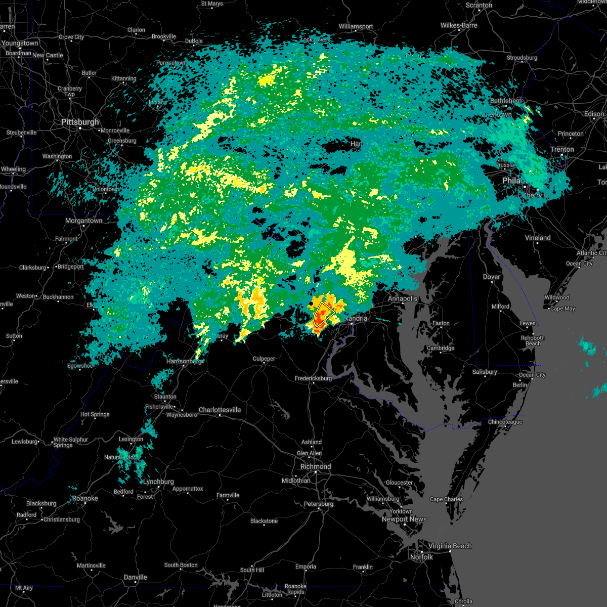 At 253 am edt, a severe thunderstorm was located near chantilly, or near reston, moving northeast at 20 mph (radar indicated). Hazards include 60 mph wind gusts. Damaging winds will cause some trees and large branches to fall. this could injure those outdoors, as well as damage homes and vehicles. roadways may become blocked by downed trees. localized power outages are possible. unsecured light objects may become projectiles. locations impacted include, centreville, reston, herndon, fairfax, vienna, oakton, chantilly, wolf trap and dunn loring. hail threat, radar indicated max hail size, <. 75 in wind threat, radar indicated max wind gust, 60 mph. At 253 am edt, a severe thunderstorm was located near chantilly, or near reston, moving northeast at 20 mph (radar indicated). Hazards include 60 mph wind gusts. Damaging winds will cause some trees and large branches to fall. this could injure those outdoors, as well as damage homes and vehicles. roadways may become blocked by downed trees. localized power outages are possible. unsecured light objects may become projectiles. locations impacted include, centreville, reston, herndon, fairfax, vienna, oakton, chantilly, wolf trap and dunn loring. hail threat, radar indicated max hail size, <. 75 in wind threat, radar indicated max wind gust, 60 mph.
|
| 9/1/2021 2:34 AM EDT |
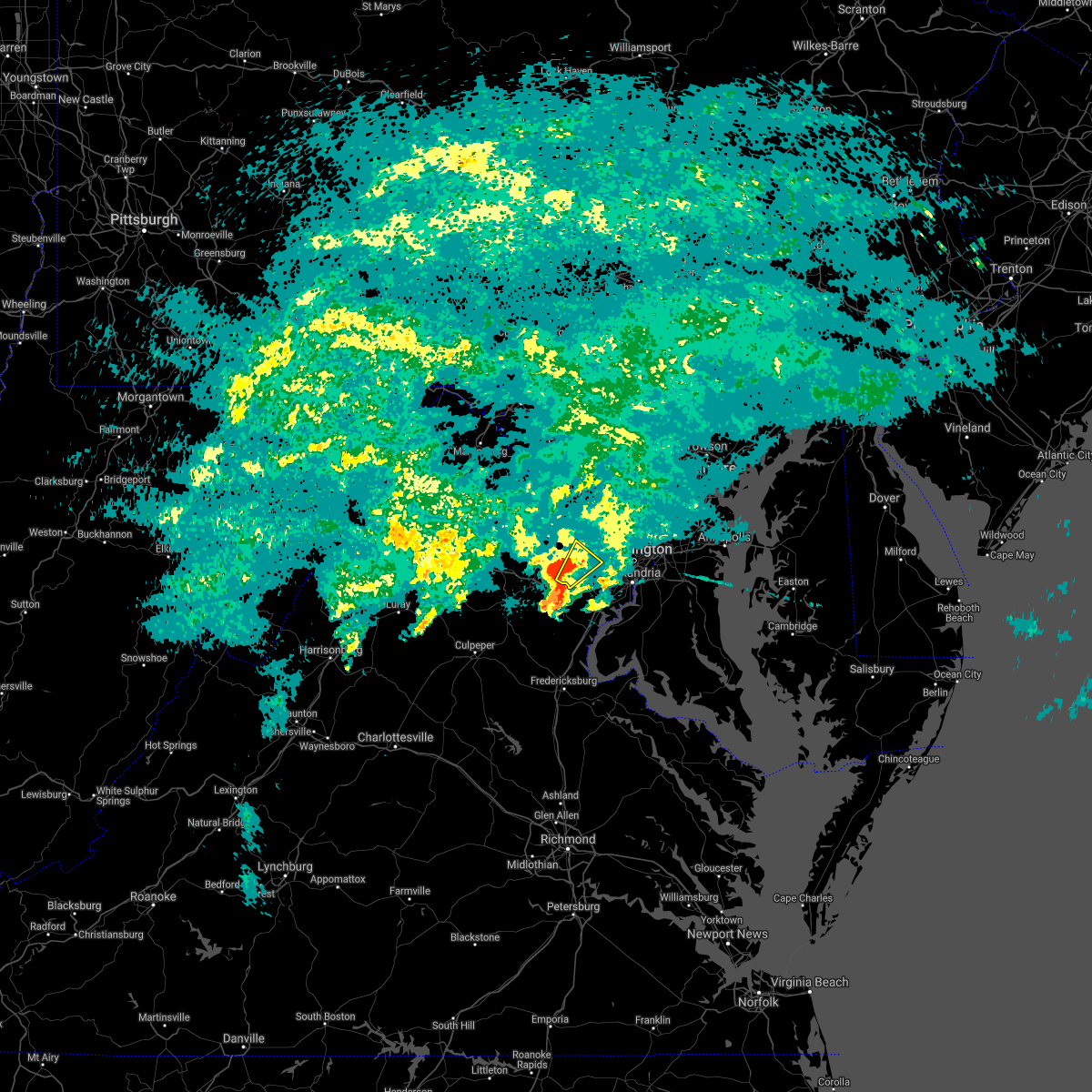 At 234 am edt, a severe thunderstorm was located over centreville, moving northeast at 20 mph (radar indicated). Hazards include 60 mph wind gusts. Damaging winds will cause some trees and large branches to fall. this could injure those outdoors, as well as damage homes and vehicles. roadways may become blocked by downed trees. localized power outages are possible. Unsecured light objects may become projectiles. At 234 am edt, a severe thunderstorm was located over centreville, moving northeast at 20 mph (radar indicated). Hazards include 60 mph wind gusts. Damaging winds will cause some trees and large branches to fall. this could injure those outdoors, as well as damage homes and vehicles. roadways may become blocked by downed trees. localized power outages are possible. Unsecured light objects may become projectiles.
|
| 8/28/2021 7:53 PM EDT |
 The severe thunderstorm warning for southwestern montgomery, southeastern loudoun and northwestern fairfax counties will expire at 800 pm edt, the storm which prompted the warning has weakened below severe limits, and no longer poses an immediate threat to life or property. therefore, the warning will be allowed to expire. The severe thunderstorm warning for southwestern montgomery, southeastern loudoun and northwestern fairfax counties will expire at 800 pm edt, the storm which prompted the warning has weakened below severe limits, and no longer poses an immediate threat to life or property. therefore, the warning will be allowed to expire.
|
| 8/28/2021 7:40 PM EDT |
 At 740 pm edt, a severe thunderstorm was located over lowes island, moving south at 20 mph (radar indicated). Hazards include 60 mph wind gusts and quarter size hail. Damaging winds will cause some trees and large branches to fall. this could injure those outdoors, as well as damage homes and vehicles. roadways may become blocked by downed trees. localized power outages are possible. unsecured light objects may become projectiles. locations impacted include, reston, herndon, vienna, lansdowne, lowes island, brambleton, dulles international airport, potomac, ashburn, oakton, sterling, north potomac, tysons corner, wolf trap, great falls, countryside, arcola, darnestown, belleview and sterling park. hail threat, radar indicated max hail size, 1. 00 in wind threat, radar indicated max wind gust, 60 mph. At 740 pm edt, a severe thunderstorm was located over lowes island, moving south at 20 mph (radar indicated). Hazards include 60 mph wind gusts and quarter size hail. Damaging winds will cause some trees and large branches to fall. this could injure those outdoors, as well as damage homes and vehicles. roadways may become blocked by downed trees. localized power outages are possible. unsecured light objects may become projectiles. locations impacted include, reston, herndon, vienna, lansdowne, lowes island, brambleton, dulles international airport, potomac, ashburn, oakton, sterling, north potomac, tysons corner, wolf trap, great falls, countryside, arcola, darnestown, belleview and sterling park. hail threat, radar indicated max hail size, 1. 00 in wind threat, radar indicated max wind gust, 60 mph.
|
| 8/28/2021 7:18 PM EDT |
 At 718 pm edt, a severe thunderstorm was located over poolesville, moving south at 20 mph (radar indicated). Hazards include 60 mph wind gusts and quarter size hail. Damaging winds will cause some trees and large branches to fall. this could injure those outdoors, as well as damage homes and vehicles. roadways may become blocked by downed trees. localized power outages are possible. Unsecured light objects may become projectiles. At 718 pm edt, a severe thunderstorm was located over poolesville, moving south at 20 mph (radar indicated). Hazards include 60 mph wind gusts and quarter size hail. Damaging winds will cause some trees and large branches to fall. this could injure those outdoors, as well as damage homes and vehicles. roadways may become blocked by downed trees. localized power outages are possible. Unsecured light objects may become projectiles.
|
| 8/13/2021 4:46 PM EDT |
 At 446 pm edt, a severe thunderstorm was located over great falls, or near reston, moving southeast at 10 mph (radar indicated). Hazards include 60 mph wind gusts and quarter size hail. Damaging winds will cause some trees and large branches to fall. this could injure those outdoors, as well as damage homes and vehicles. roadways may become blocked by downed trees. localized power outages are possible. Unsecured light objects may become projectiles. At 446 pm edt, a severe thunderstorm was located over great falls, or near reston, moving southeast at 10 mph (radar indicated). Hazards include 60 mph wind gusts and quarter size hail. Damaging winds will cause some trees and large branches to fall. this could injure those outdoors, as well as damage homes and vehicles. roadways may become blocked by downed trees. localized power outages are possible. Unsecured light objects may become projectiles.
|
| 8/13/2021 4:29 PM EDT |
 At 428 pm edt, a severe thunderstorm was located over sterling, or near lowes island, moving southeast at 10 mph (radar indicated). Hazards include 60 mph wind gusts. Damaging winds will cause some trees and large branches to fall. this could injure those outdoors, as well as damage homes and vehicles. roadways may become blocked by downed trees. localized power outages are possible. unsecured light objects may become projectiles. locations impacted include, broadlands, lowes island, ashburn, sterling, great falls, countryside, darnestown and sterling park. hail threat, radar indicated max hail size, <. 75 in wind threat, radar indicated max wind gust, 60 mph. At 428 pm edt, a severe thunderstorm was located over sterling, or near lowes island, moving southeast at 10 mph (radar indicated). Hazards include 60 mph wind gusts. Damaging winds will cause some trees and large branches to fall. this could injure those outdoors, as well as damage homes and vehicles. roadways may become blocked by downed trees. localized power outages are possible. unsecured light objects may become projectiles. locations impacted include, broadlands, lowes island, ashburn, sterling, great falls, countryside, darnestown and sterling park. hail threat, radar indicated max hail size, <. 75 in wind threat, radar indicated max wind gust, 60 mph.
|
| 8/13/2021 4:20 PM EDT |
 At 420 pm edt, a severe thunderstorm was located over boyds, or near germantown, and is nearly stationary (radar indicated). Hazards include 60 mph wind gusts and quarter size hail. Damaging winds will cause some trees and large branches to fall. this could injure those outdoors, as well as damage homes and vehicles. roadways may become blocked by downed trees. localized power outages are possible. unsecured light objects may become projectiles. locations impacted include, germantown, broadlands, lowes island, ashburn, sterling, great falls, countryside, clarksburg, darnestown and sterling park. hail threat, radar indicated max hail size, 1. 00 in wind threat, radar indicated max wind gust, 60 mph. At 420 pm edt, a severe thunderstorm was located over boyds, or near germantown, and is nearly stationary (radar indicated). Hazards include 60 mph wind gusts and quarter size hail. Damaging winds will cause some trees and large branches to fall. this could injure those outdoors, as well as damage homes and vehicles. roadways may become blocked by downed trees. localized power outages are possible. unsecured light objects may become projectiles. locations impacted include, germantown, broadlands, lowes island, ashburn, sterling, great falls, countryside, clarksburg, darnestown and sterling park. hail threat, radar indicated max hail size, 1. 00 in wind threat, radar indicated max wind gust, 60 mph.
|
| 8/13/2021 4:05 PM EDT |
 At 405 pm edt, a severe thunderstorm was located over poolesville, and is nearly stationary (radar indicated). Hazards include 60 mph wind gusts and quarter size hail. Damaging winds will cause some trees and large branches to fall. this could injure those outdoors, as well as damage homes and vehicles. roadways may become blocked by downed trees. localized power outages are possible. Unsecured light objects may become projectiles. At 405 pm edt, a severe thunderstorm was located over poolesville, and is nearly stationary (radar indicated). Hazards include 60 mph wind gusts and quarter size hail. Damaging winds will cause some trees and large branches to fall. this could injure those outdoors, as well as damage homes and vehicles. roadways may become blocked by downed trees. localized power outages are possible. Unsecured light objects may become projectiles.
|
| 8/10/2021 5:56 PM EDT |
 At 556 pm edt, severe thunderstorms were located along a line extending from near leesburg to oatlands to near brambleton to near arcola to near middleburg, moving east at 25 mph (radar indicated). Hazards include 70 mph wind gusts and quarter size hail. Damaging winds will cause some trees and large branches to fall. this could injure those outdoors, as well as damage homes and vehicles. roadways may become blocked by downed trees. localized power outages are possible. unsecured light objects may become projectiles. locations impacted include, reston, south riding, herndon, broadlands, lowes island, brambleton, dulles international airport, ashburn, sterling, chantilly, great falls, countryside, arcola, oatlands, belmont, gleedsville, aldie and sterling park. thunderstorm damage threat, considerable hail threat, radar indicated max hail size, 1. 00 in wind threat, radar indicated max wind gust, 70 mph. At 556 pm edt, severe thunderstorms were located along a line extending from near leesburg to oatlands to near brambleton to near arcola to near middleburg, moving east at 25 mph (radar indicated). Hazards include 70 mph wind gusts and quarter size hail. Damaging winds will cause some trees and large branches to fall. this could injure those outdoors, as well as damage homes and vehicles. roadways may become blocked by downed trees. localized power outages are possible. unsecured light objects may become projectiles. locations impacted include, reston, south riding, herndon, broadlands, lowes island, brambleton, dulles international airport, ashburn, sterling, chantilly, great falls, countryside, arcola, oatlands, belmont, gleedsville, aldie and sterling park. thunderstorm damage threat, considerable hail threat, radar indicated max hail size, 1. 00 in wind threat, radar indicated max wind gust, 70 mph.
|
| 8/10/2021 5:41 PM EDT |
 At 541 pm edt, severe thunderstorms were located along a line extending from near oatlands to near middleburg to near the plains, moving east at 25 mph (radar indicated). Hazards include 70 mph wind gusts and quarter size hail. Damaging winds will cause some trees and large branches to fall. this could injure those outdoors, as well as damage homes and vehicles. roadways may become blocked by downed trees. localized power outages are possible. Unsecured light objects may become projectiles. At 541 pm edt, severe thunderstorms were located along a line extending from near oatlands to near middleburg to near the plains, moving east at 25 mph (radar indicated). Hazards include 70 mph wind gusts and quarter size hail. Damaging winds will cause some trees and large branches to fall. this could injure those outdoors, as well as damage homes and vehicles. roadways may become blocked by downed trees. localized power outages are possible. Unsecured light objects may become projectiles.
|
| 8/10/2021 4:34 PM EDT |
 At 434 pm edt, a severe thunderstorm was located over countryside, or over lowes island, moving east at 10 mph (radar indicated). Hazards include 60 mph wind gusts. Damaging winds will cause some trees and large branches to fall. this could injure those outdoors, as well as damage homes and vehicles. roadways may become blocked by downed trees. localized power outages are possible. Unsecured light objects may become projectiles. At 434 pm edt, a severe thunderstorm was located over countryside, or over lowes island, moving east at 10 mph (radar indicated). Hazards include 60 mph wind gusts. Damaging winds will cause some trees and large branches to fall. this could injure those outdoors, as well as damage homes and vehicles. roadways may become blocked by downed trees. localized power outages are possible. Unsecured light objects may become projectiles.
|
| 7/28/2021 10:11 PM EDT |
 At 1011 pm edt, a severe thunderstorm was located over great falls, or near reston, moving south at 10 mph (radar indicated). Hazards include 60 mph wind gusts and quarter size hail. Damaging winds will cause some trees and large branches to fall. this could injure those outdoors, as well as damage homes and vehicles. roadways may become blocked by downed trees. localized power outages are possible. Unsecured light objects may become projectiles. At 1011 pm edt, a severe thunderstorm was located over great falls, or near reston, moving south at 10 mph (radar indicated). Hazards include 60 mph wind gusts and quarter size hail. Damaging winds will cause some trees and large branches to fall. this could injure those outdoors, as well as damage homes and vehicles. roadways may become blocked by downed trees. localized power outages are possible. Unsecured light objects may become projectiles.
|
| 7/17/2021 3:54 PM EDT |
 At 353 pm edt, a severe thunderstorm was located near north potomac, or near lowes island, moving north at 20 mph (radar indicated). Hazards include 60 mph wind gusts and quarter size hail. Damaging winds will cause some trees and large branches to fall. this could injure those outdoors, as well as damage homes and vehicles. roadways may become blocked by downed trees. localized power outages are possible. unsecured light objects may become projectiles. Locations impacted include, germantown, rockville, gaithersburg, reston, lowes island, potomac, montgomery village, sterling, north potomac, redland, wolf trap, great falls, boyds, darnestown, derwood, washington grove and dawsonville. At 353 pm edt, a severe thunderstorm was located near north potomac, or near lowes island, moving north at 20 mph (radar indicated). Hazards include 60 mph wind gusts and quarter size hail. Damaging winds will cause some trees and large branches to fall. this could injure those outdoors, as well as damage homes and vehicles. roadways may become blocked by downed trees. localized power outages are possible. unsecured light objects may become projectiles. Locations impacted include, germantown, rockville, gaithersburg, reston, lowes island, potomac, montgomery village, sterling, north potomac, redland, wolf trap, great falls, boyds, darnestown, derwood, washington grove and dawsonville.
|
| 7/17/2021 3:30 PM EDT |
 At 330 pm edt, a severe thunderstorm was located over great falls, or near herndon, moving north at 20 mph (radar indicated). Hazards include 60 mph wind gusts and quarter size hail. Damaging winds will cause some trees and large branches to fall. this could injure those outdoors, as well as damage homes and vehicles. roadways may become blocked by downed trees. localized power outages are possible. Unsecured light objects may become projectiles. At 330 pm edt, a severe thunderstorm was located over great falls, or near herndon, moving north at 20 mph (radar indicated). Hazards include 60 mph wind gusts and quarter size hail. Damaging winds will cause some trees and large branches to fall. this could injure those outdoors, as well as damage homes and vehicles. roadways may become blocked by downed trees. localized power outages are possible. Unsecured light objects may become projectiles.
|
| 7/1/2021 2:46 PM EDT |
 At 246 pm edt, a severe thunderstorm was located over potomac, or near american legion bridge, moving east at 30 mph (radar indicated). Hazards include 60 mph wind gusts. Damaging winds will cause some trees and large branches to fall. this could injure those outdoors, as well as damage homes and vehicles. roadways may become blocked by downed trees. localized power outages are possible. unsecured light objects may become projectiles. Locations impacted include, rockville, bethesda, reston, olney, herndon, american legion bridge, mclean, aspen hill, potomac, north bethesda, north potomac, tysons corner, redland, wolf trap, great falls, rossmoor, wheaton-glenmont, wheaton, darnestown and cabin john. At 246 pm edt, a severe thunderstorm was located over potomac, or near american legion bridge, moving east at 30 mph (radar indicated). Hazards include 60 mph wind gusts. Damaging winds will cause some trees and large branches to fall. this could injure those outdoors, as well as damage homes and vehicles. roadways may become blocked by downed trees. localized power outages are possible. unsecured light objects may become projectiles. Locations impacted include, rockville, bethesda, reston, olney, herndon, american legion bridge, mclean, aspen hill, potomac, north bethesda, north potomac, tysons corner, redland, wolf trap, great falls, rossmoor, wheaton-glenmont, wheaton, darnestown and cabin john.
|
| 7/1/2021 2:28 PM EDT |
 At 228 pm edt, a severe thunderstorm was located over sterling, or over herndon, moving east at 30 mph (radar indicated). Hazards include 60 mph wind gusts. Damaging winds will cause some trees and large branches to fall. this could injure those outdoors, as well as damage homes and vehicles. roadways may become blocked by downed trees. localized power outages are possible. Unsecured light objects may become projectiles. At 228 pm edt, a severe thunderstorm was located over sterling, or over herndon, moving east at 30 mph (radar indicated). Hazards include 60 mph wind gusts. Damaging winds will cause some trees and large branches to fall. this could injure those outdoors, as well as damage homes and vehicles. roadways may become blocked by downed trees. localized power outages are possible. Unsecured light objects may become projectiles.
|
| 7/1/2021 1:38 PM EDT |
 The severe thunderstorm warning for the northwestern district of columbia, south central montgomery, eastern loudoun and northeastern fairfax counties will expire at 145 pm edt, the storm which prompted the warning has weakened below severe limits, and no longer poses an immediate threat to life or property. therefore, the warning will be allowed to expire. a severe thunderstorm watch remains in effect until 800 pm edt for district of columbia, central maryland, and northern virginia. The severe thunderstorm warning for the northwestern district of columbia, south central montgomery, eastern loudoun and northeastern fairfax counties will expire at 145 pm edt, the storm which prompted the warning has weakened below severe limits, and no longer poses an immediate threat to life or property. therefore, the warning will be allowed to expire. a severe thunderstorm watch remains in effect until 800 pm edt for district of columbia, central maryland, and northern virginia.
|
| 7/1/2021 1:18 PM EDT |
 At 118 pm edt, a severe thunderstorm was located over lowes island, moving east at 25 mph (radar indicated). Hazards include 60 mph wind gusts and quarter size hail. Damaging winds will cause some trees and large branches to fall. this could injure those outdoors, as well as damage homes and vehicles. roadways may become blocked by downed trees. localized power outages are possible. unsecured light objects may become projectiles. Locations impacted include, rockville, bethesda, olney, lowes island, american legion bridge, aspen hill, potomac, north bethesda, north potomac, redland, great falls, chevy chase, north kensington, south kensington, martin`s additions, north chevy chase, friendship village, rossmoor, wheaton-glenmont and wheaton. At 118 pm edt, a severe thunderstorm was located over lowes island, moving east at 25 mph (radar indicated). Hazards include 60 mph wind gusts and quarter size hail. Damaging winds will cause some trees and large branches to fall. this could injure those outdoors, as well as damage homes and vehicles. roadways may become blocked by downed trees. localized power outages are possible. unsecured light objects may become projectiles. Locations impacted include, rockville, bethesda, olney, lowes island, american legion bridge, aspen hill, potomac, north bethesda, north potomac, redland, great falls, chevy chase, north kensington, south kensington, martin`s additions, north chevy chase, friendship village, rossmoor, wheaton-glenmont and wheaton.
|
| 7/1/2021 1:03 PM EDT |
 At 103 pm edt, a severe thunderstorm was located over ashburn, or near broadlands, moving east at 25 mph (radar indicated). Hazards include 60 mph wind gusts and quarter size hail. Damaging winds will cause some trees and large branches to fall. this could injure those outdoors, as well as damage homes and vehicles. roadways may become blocked by downed trees. localized power outages are possible. Unsecured light objects may become projectiles. At 103 pm edt, a severe thunderstorm was located over ashburn, or near broadlands, moving east at 25 mph (radar indicated). Hazards include 60 mph wind gusts and quarter size hail. Damaging winds will cause some trees and large branches to fall. this could injure those outdoors, as well as damage homes and vehicles. roadways may become blocked by downed trees. localized power outages are possible. Unsecured light objects may become projectiles.
|
| 6/21/2021 5:28 PM EDT |
 At 528 pm edt, severe thunderstorms were located along a line extending from near mount airy to near north potomac to near south riding, moving east at 35 mph (radar indicated). Hazards include 60 mph wind gusts. Damaging winds will cause some trees and large branches to fall. this could injure those outdoors, as well as damage homes and vehicles. roadways may become blocked by downed trees. localized power outages are possible. unsecured light objects may become projectiles. Locations impacted include, arlington, columbia, germantown, centreville, rockville, bethesda, gaithersburg, reston, annandale, olney, springfield, south riding, herndon, fairfax, vienna, damascus, falls church, broadlands, lansdowne and lowes island. At 528 pm edt, severe thunderstorms were located along a line extending from near mount airy to near north potomac to near south riding, moving east at 35 mph (radar indicated). Hazards include 60 mph wind gusts. Damaging winds will cause some trees and large branches to fall. this could injure those outdoors, as well as damage homes and vehicles. roadways may become blocked by downed trees. localized power outages are possible. unsecured light objects may become projectiles. Locations impacted include, arlington, columbia, germantown, centreville, rockville, bethesda, gaithersburg, reston, annandale, olney, springfield, south riding, herndon, fairfax, vienna, damascus, falls church, broadlands, lansdowne and lowes island.
|
| 6/21/2021 5:02 PM EDT |
 At 501 pm edt, severe thunderstorms were located along a line extending from ballenger creek to leesburg to near the plains, moving east at 35 mph (radar indicated). Hazards include 60 mph wind gusts. Damaging winds will cause some trees and large branches to fall. this could injure those outdoors, as well as damage homes and vehicles. roadways may become blocked by downed trees. localized power outages are possible. Unsecured light objects may become projectiles. At 501 pm edt, severe thunderstorms were located along a line extending from ballenger creek to leesburg to near the plains, moving east at 35 mph (radar indicated). Hazards include 60 mph wind gusts. Damaging winds will cause some trees and large branches to fall. this could injure those outdoors, as well as damage homes and vehicles. roadways may become blocked by downed trees. localized power outages are possible. Unsecured light objects may become projectiles.
|
| 6/14/2021 10:12 PM EDT |
 At 1012 pm edt, a severe thunderstorm was located over herndon, moving east at 30 mph (radar indicated). Hazards include 60 mph wind gusts. Damaging winds will cause some trees and large branches to fall. this could injure those outdoors, as well as damage homes and vehicles. roadways may become blocked by downed trees. localized power outages are possible. unsecured light objects may become projectiles. Locations impacted include, rockville, reston, south riding, herndon, vienna, lowes island, brambleton, pimmit hills, dulles international airport, potomac, ashburn, oakton, sterling, north potomac, tysons corner, wolf trap, great falls, merrifield, countryside and arcola. At 1012 pm edt, a severe thunderstorm was located over herndon, moving east at 30 mph (radar indicated). Hazards include 60 mph wind gusts. Damaging winds will cause some trees and large branches to fall. this could injure those outdoors, as well as damage homes and vehicles. roadways may become blocked by downed trees. localized power outages are possible. unsecured light objects may become projectiles. Locations impacted include, rockville, reston, south riding, herndon, vienna, lowes island, brambleton, pimmit hills, dulles international airport, potomac, ashburn, oakton, sterling, north potomac, tysons corner, wolf trap, great falls, merrifield, countryside and arcola.
|
| 6/14/2021 9:55 PM EDT |
 At 955 pm edt, a severe thunderstorm was located over broadlands, moving east at 25 mph (radar indicated). Hazards include 60 mph wind gusts and quarter size hail. Damaging winds will cause some trees and large branches to fall. this could injure those outdoors, as well as damage homes and vehicles. roadways may become blocked by downed trees. localized power outages are possible. Unsecured light objects may become projectiles. At 955 pm edt, a severe thunderstorm was located over broadlands, moving east at 25 mph (radar indicated). Hazards include 60 mph wind gusts and quarter size hail. Damaging winds will cause some trees and large branches to fall. this could injure those outdoors, as well as damage homes and vehicles. roadways may become blocked by downed trees. localized power outages are possible. Unsecured light objects may become projectiles.
|
| 6/14/2021 8:59 PM EDT |
 At 859 pm edt, a severe thunderstorm was located over oakton, or over vienna, moving east at 30 mph (radar indicated). Hazards include 60 mph wind gusts and quarter size hail. Damaging winds will cause some trees and large branches to fall. this could injure those outdoors, as well as damage homes and vehicles. roadways may become blocked by downed trees. localized power outages are possible. unsecured light objects may become projectiles. Locations impacted include, reston, herndon, vienna, oakton, wolf trap, great falls, merrifield and dunn loring. At 859 pm edt, a severe thunderstorm was located over oakton, or over vienna, moving east at 30 mph (radar indicated). Hazards include 60 mph wind gusts and quarter size hail. Damaging winds will cause some trees and large branches to fall. this could injure those outdoors, as well as damage homes and vehicles. roadways may become blocked by downed trees. localized power outages are possible. unsecured light objects may become projectiles. Locations impacted include, reston, herndon, vienna, oakton, wolf trap, great falls, merrifield and dunn loring.
|
| 6/14/2021 8:47 PM EDT |
 At 847 pm edt, a severe thunderstorm was located over chantilly, or over centreville, moving east at 30 mph (radar indicated). Hazards include 60 mph wind gusts and quarter size hail. Damaging winds will cause some trees and large branches to fall. this could injure those outdoors, as well as damage homes and vehicles. roadways may become blocked by downed trees. localized power outages are possible. unsecured light objects may become projectiles. Locations impacted include, centreville, reston, south riding, herndon, fairfax, vienna, mantua, oakton, chantilly, wolf trap, great falls, merrifield and dunn loring. At 847 pm edt, a severe thunderstorm was located over chantilly, or over centreville, moving east at 30 mph (radar indicated). Hazards include 60 mph wind gusts and quarter size hail. Damaging winds will cause some trees and large branches to fall. this could injure those outdoors, as well as damage homes and vehicles. roadways may become blocked by downed trees. localized power outages are possible. unsecured light objects may become projectiles. Locations impacted include, centreville, reston, south riding, herndon, fairfax, vienna, mantua, oakton, chantilly, wolf trap, great falls, merrifield and dunn loring.
|
| 6/14/2021 8:37 PM EDT |
 At 837 pm edt, a severe thunderstorm was located near centreville, moving east at 30 mph (radar indicated). Hazards include 60 mph wind gusts and quarter size hail. Damaging winds will cause some trees and large branches to fall. this could injure those outdoors, as well as damage homes and vehicles. roadways may become blocked by downed trees. localized power outages are possible. unsecured light objects may become projectiles. Locations impacted include, centreville, reston, south riding, herndon, fairfax, vienna, mantua, dulles international airport, oakton, chantilly, wolf trap, great falls, merrifield and catharpin. At 837 pm edt, a severe thunderstorm was located near centreville, moving east at 30 mph (radar indicated). Hazards include 60 mph wind gusts and quarter size hail. Damaging winds will cause some trees and large branches to fall. this could injure those outdoors, as well as damage homes and vehicles. roadways may become blocked by downed trees. localized power outages are possible. unsecured light objects may become projectiles. Locations impacted include, centreville, reston, south riding, herndon, fairfax, vienna, mantua, dulles international airport, oakton, chantilly, wolf trap, great falls, merrifield and catharpin.
|
| 6/14/2021 8:26 PM EDT |
 At 826 pm edt, a severe thunderstorm was located over haymarket, or 8 miles southwest of south riding, moving east at 30 mph (radar indicated). Hazards include 60 mph wind gusts and quarter size hail. Damaging winds will cause some trees and large branches to fall. this could injure those outdoors, as well as damage homes and vehicles. roadways may become blocked by downed trees. localized power outages are possible. Unsecured light objects may become projectiles. At 826 pm edt, a severe thunderstorm was located over haymarket, or 8 miles southwest of south riding, moving east at 30 mph (radar indicated). Hazards include 60 mph wind gusts and quarter size hail. Damaging winds will cause some trees and large branches to fall. this could injure those outdoors, as well as damage homes and vehicles. roadways may become blocked by downed trees. localized power outages are possible. Unsecured light objects may become projectiles.
|
| 5/26/2021 8:00 PM EDT |
 At 800 pm edt, a severe thunderstorm was located over sterling, or over herndon, moving east at 35 mph (radar indicated). Hazards include 60 mph wind gusts. Damaging winds will cause some trees and large branches to fall. this could injure those outdoors, as well as damage homes and vehicles. roadways may become blocked by downed trees. localized power outages are possible. unsecured light objects may become projectiles. Locations impacted include, reston, herndon, lowes island, sterling, north potomac, wolf trap, great falls and darnestown. At 800 pm edt, a severe thunderstorm was located over sterling, or over herndon, moving east at 35 mph (radar indicated). Hazards include 60 mph wind gusts. Damaging winds will cause some trees and large branches to fall. this could injure those outdoors, as well as damage homes and vehicles. roadways may become blocked by downed trees. localized power outages are possible. unsecured light objects may become projectiles. Locations impacted include, reston, herndon, lowes island, sterling, north potomac, wolf trap, great falls and darnestown.
|
| 5/26/2021 7:36 PM EDT |
 At 736 pm edt, a severe thunderstorm was located over oatlands, or near brambleton, moving east at 35 mph (radar indicated). Hazards include 60 mph wind gusts. Damaging winds will cause some trees and large branches to fall. this could injure those outdoors, as well as damage homes and vehicles. roadways may become blocked by downed trees. localized power outages are possible. unsecured light objects may become projectiles. Locations impacted include, reston, leesburg, south riding, herndon, broadlands, lansdowne, lowes island, brambleton, dulles international airport, ashburn, sterling, north potomac, wolf trap, great falls, countryside, arcola, oatlands, darnestown, belmont and gleedsville. At 736 pm edt, a severe thunderstorm was located over oatlands, or near brambleton, moving east at 35 mph (radar indicated). Hazards include 60 mph wind gusts. Damaging winds will cause some trees and large branches to fall. this could injure those outdoors, as well as damage homes and vehicles. roadways may become blocked by downed trees. localized power outages are possible. unsecured light objects may become projectiles. Locations impacted include, reston, leesburg, south riding, herndon, broadlands, lansdowne, lowes island, brambleton, dulles international airport, ashburn, sterling, north potomac, wolf trap, great falls, countryside, arcola, oatlands, darnestown, belmont and gleedsville.
|
| 5/26/2021 7:27 PM EDT |
 At 727 pm edt, a severe thunderstorm was located over middleburg, or 11 miles west of brambleton, moving east at 35 mph (radar indicated). Hazards include 60 mph wind gusts. Damaging winds will cause some trees and large branches to fall. this could injure those outdoors, as well as damage homes and vehicles. roadways may become blocked by downed trees. localized power outages are possible. Unsecured light objects may become projectiles. At 727 pm edt, a severe thunderstorm was located over middleburg, or 11 miles west of brambleton, moving east at 35 mph (radar indicated). Hazards include 60 mph wind gusts. Damaging winds will cause some trees and large branches to fall. this could injure those outdoors, as well as damage homes and vehicles. roadways may become blocked by downed trees. localized power outages are possible. Unsecured light objects may become projectiles.
|
| 5/26/2021 4:17 PM EDT |
 At 417 pm edt, a severe thunderstorm was located over haymarket, or 10 miles northeast of warrenton, moving northeast at 25 mph. this is a very dangerous storm (radar indicated). Hazards include 80 mph wind gusts and golf ball size hail. Expect considerable damage to trees and power lines. your life is at significant risk if outdoors. in addition to some trees falling into homes, wind damage is possible to roofs, sheds, open garages, and mobile homes. Locations impacted include, centreville, reston, annandale, south riding, herndon, fairfax, mantua, dulles international airport, burke, linton hall, oakton, sterling, chantilly, merrifield, bull run, haymarket, manassas, sudley, manassas park and fairfax station. At 417 pm edt, a severe thunderstorm was located over haymarket, or 10 miles northeast of warrenton, moving northeast at 25 mph. this is a very dangerous storm (radar indicated). Hazards include 80 mph wind gusts and golf ball size hail. Expect considerable damage to trees and power lines. your life is at significant risk if outdoors. in addition to some trees falling into homes, wind damage is possible to roofs, sheds, open garages, and mobile homes. Locations impacted include, centreville, reston, annandale, south riding, herndon, fairfax, mantua, dulles international airport, burke, linton hall, oakton, sterling, chantilly, merrifield, bull run, haymarket, manassas, sudley, manassas park and fairfax station.
|
| 5/26/2021 4:11 PM EDT |
 At 411 pm edt, a severe thunderstorm was located over haymarket, or 8 miles northeast of warrenton, moving northeast at 30 mph (radar indicated). Hazards include 70 mph wind gusts and quarter size hail. the highest winds are most likely near aden. Damaging winds will cause some trees and large branches to fall. this could injure those outdoors, as well as damage homes and vehicles. roadways may become blocked by downed trees. localized power outages are possible. unsecured light objects may become projectiles. Locations impacted include, centreville, reston, annandale, south riding, herndon, fairfax, mantua, dulles international airport, burke, linton hall, oakton, sterling, chantilly, merrifield, bull run, haymarket, arcola, manassas, sudley and manassas park. At 411 pm edt, a severe thunderstorm was located over haymarket, or 8 miles northeast of warrenton, moving northeast at 30 mph (radar indicated). Hazards include 70 mph wind gusts and quarter size hail. the highest winds are most likely near aden. Damaging winds will cause some trees and large branches to fall. this could injure those outdoors, as well as damage homes and vehicles. roadways may become blocked by downed trees. localized power outages are possible. unsecured light objects may become projectiles. Locations impacted include, centreville, reston, annandale, south riding, herndon, fairfax, mantua, dulles international airport, burke, linton hall, oakton, sterling, chantilly, merrifield, bull run, haymarket, arcola, manassas, sudley and manassas park.
|
| 5/26/2021 4:05 PM EDT |
 At 405 pm edt, a severe thunderstorm was located near warrenton, moving northeast at 30 mph (radar indicated). Hazards include 60 mph wind gusts. Damaging winds will cause some trees and large branches to fall. this could injure those outdoors, as well as damage homes and vehicles. roadways may become blocked by downed trees. localized power outages are possible. Unsecured light objects may become projectiles. At 405 pm edt, a severe thunderstorm was located near warrenton, moving northeast at 30 mph (radar indicated). Hazards include 60 mph wind gusts. Damaging winds will cause some trees and large branches to fall. this could injure those outdoors, as well as damage homes and vehicles. roadways may become blocked by downed trees. localized power outages are possible. Unsecured light objects may become projectiles.
|
| 5/4/2021 4:26 PM EDT |
 At 426 pm edt, severe thunderstorms were located along a line extending from countryside to near chantilly, moving east at 35 mph (radar indicated). Hazards include 60 mph wind gusts. Damaging winds will cause some trees and large branches to fall. this could injure those outdoors, as well as damage homes and vehicles. roadways may become blocked by downed trees. localized power outages are possible. unsecured light objects may become projectiles. Locations impacted include, reston, south riding, herndon, vienna, broadlands, lowes island, dulles international airport, ashburn, oakton, sterling, chantilly, wolf trap, great falls, countryside and sterling park. At 426 pm edt, severe thunderstorms were located along a line extending from countryside to near chantilly, moving east at 35 mph (radar indicated). Hazards include 60 mph wind gusts. Damaging winds will cause some trees and large branches to fall. this could injure those outdoors, as well as damage homes and vehicles. roadways may become blocked by downed trees. localized power outages are possible. unsecured light objects may become projectiles. Locations impacted include, reston, south riding, herndon, vienna, broadlands, lowes island, dulles international airport, ashburn, oakton, sterling, chantilly, wolf trap, great falls, countryside and sterling park.
|
| 5/4/2021 4:01 PM EDT |
 At 400 pm edt, a severe thunderstorm was located near middleburg, or 8 miles west of brambleton, moving east at 30 mph (radar indicated). Hazards include 60 mph wind gusts. Damaging winds will cause some trees and large branches to fall. this could injure those outdoors, as well as damage homes and vehicles. roadways may become blocked by downed trees. localized power outages are possible. Unsecured light objects may become projectiles. At 400 pm edt, a severe thunderstorm was located near middleburg, or 8 miles west of brambleton, moving east at 30 mph (radar indicated). Hazards include 60 mph wind gusts. Damaging winds will cause some trees and large branches to fall. this could injure those outdoors, as well as damage homes and vehicles. roadways may become blocked by downed trees. localized power outages are possible. Unsecured light objects may become projectiles.
|
| 4/30/2021 4:39 PM EDT |
 At 438 pm edt, severe thunderstorms were located along a line extending from montgomery village to near chantilly to warrenton, moving east at 65 mph (radar indicated). Hazards include 60 mph wind gusts. Damaging winds will cause some trees and large branches to fall. this could injure those outdoors, as well as damage homes and vehicles. roadways may become blocked by downed trees. localized power outages are possible. Unsecured light objects may become projectiles. At 438 pm edt, severe thunderstorms were located along a line extending from montgomery village to near chantilly to warrenton, moving east at 65 mph (radar indicated). Hazards include 60 mph wind gusts. Damaging winds will cause some trees and large branches to fall. this could injure those outdoors, as well as damage homes and vehicles. roadways may become blocked by downed trees. localized power outages are possible. Unsecured light objects may become projectiles.
|
| 4/30/2021 4:39 PM EDT |
 The national weather service in sterling virginia has issued a * severe thunderstorm warning for. the district of columbia. south central howard county in central maryland. southern montgomery county in central maryland. Prince georges county in central maryland. The national weather service in sterling virginia has issued a * severe thunderstorm warning for. the district of columbia. south central howard county in central maryland. southern montgomery county in central maryland. Prince georges county in central maryland.
|
| 11/15/2020 6:57 PM EST |
 At 622 pm est, severe thunderstorms were located along a line extending from near ballenger creek to near point of rocks to near leesburg, moving southeast at 30 mph (radar indicated). Hazards include 60 mph wind gusts. Damaging winds will cause some trees and large branches to fall. this could injure those outdoors, as well as damage homes and vehicles. roadways may become blocked by downed trees. localized power outages are possible. Unsecured light objects may become projectiles. At 622 pm est, severe thunderstorms were located along a line extending from near ballenger creek to near point of rocks to near leesburg, moving southeast at 30 mph (radar indicated). Hazards include 60 mph wind gusts. Damaging winds will cause some trees and large branches to fall. this could injure those outdoors, as well as damage homes and vehicles. roadways may become blocked by downed trees. localized power outages are possible. Unsecured light objects may become projectiles.
|
| 11/15/2020 6:22 PM EST |
 At 622 pm est, severe thunderstorms were located along a line extending from near ballenger creek to near point of rocks to near leesburg, moving southeast at 30 mph (radar indicated). Hazards include 60 mph wind gusts. Damaging winds will cause some trees and large branches to fall. this could injure those outdoors, as well as damage homes and vehicles. roadways may become blocked by downed trees. localized power outages are possible. Unsecured light objects may become projectiles. At 622 pm est, severe thunderstorms were located along a line extending from near ballenger creek to near point of rocks to near leesburg, moving southeast at 30 mph (radar indicated). Hazards include 60 mph wind gusts. Damaging winds will cause some trees and large branches to fall. this could injure those outdoors, as well as damage homes and vehicles. roadways may become blocked by downed trees. localized power outages are possible. Unsecured light objects may become projectiles.
|
| 9/3/2020 4:54 PM EDT |
 At 454 pm edt, a severe thunderstorm was located over redland, or over rockville, moving east at 30 mph (radar indicated). Hazards include 60 mph wind gusts. Damaging winds will cause some trees and large branches to fall. this could injure those outdoors, as well as damage homes and vehicles. roadways may become blocked by downed trees. localized power outages are possible. unsecured light objects may become projectiles. Locations impacted include, columbia, germantown, rockville, bethesda, gaithersburg, reston, olney, college park, greenbelt, langley park, beltsville, bladensburg, american legion bridge, fort totten, university of maryland, howard university, aspen hill, potomac, north bethesda and montgomery village. At 454 pm edt, a severe thunderstorm was located over redland, or over rockville, moving east at 30 mph (radar indicated). Hazards include 60 mph wind gusts. Damaging winds will cause some trees and large branches to fall. this could injure those outdoors, as well as damage homes and vehicles. roadways may become blocked by downed trees. localized power outages are possible. unsecured light objects may become projectiles. Locations impacted include, columbia, germantown, rockville, bethesda, gaithersburg, reston, olney, college park, greenbelt, langley park, beltsville, bladensburg, american legion bridge, fort totten, university of maryland, howard university, aspen hill, potomac, north bethesda and montgomery village.
|
| 9/3/2020 4:38 PM EDT |
 At 438 pm edt, a severe thunderstorm was located over boyds, or over germantown, moving east at 30 mph (radar indicated). Hazards include 65 mph wind gusts. Damaging winds will cause some trees and large branches to fall. this could injure those outdoors, as well as damage homes and vehicles. roadways may become blocked by downed trees. localized power outages are possible. unsecured light objects may become projectiles. Locations impacted include, germantown, gaithersburg, lowes island, poolesville, potomac, ashburn, montgomery village, sterling, north potomac, great falls, countryside, boyds, clarksburg, darnestown and dawsonville. At 438 pm edt, a severe thunderstorm was located over boyds, or over germantown, moving east at 30 mph (radar indicated). Hazards include 65 mph wind gusts. Damaging winds will cause some trees and large branches to fall. this could injure those outdoors, as well as damage homes and vehicles. roadways may become blocked by downed trees. localized power outages are possible. unsecured light objects may become projectiles. Locations impacted include, germantown, gaithersburg, lowes island, poolesville, potomac, ashburn, montgomery village, sterling, north potomac, great falls, countryside, boyds, clarksburg, darnestown and dawsonville.
|
| 9/3/2020 4:36 PM EDT |
 At 436 pm edt, a severe thunderstorm was located near lowes island, moving east at 25 mph (radar indicated). Hazards include 65 mph wind gusts. Damaging winds will cause some trees and large branches to fall. this could injure those outdoors, as well as damage homes and vehicles. roadways may become blocked by downed trees. localized power outages are possible. Unsecured light objects may become projectiles. At 436 pm edt, a severe thunderstorm was located near lowes island, moving east at 25 mph (radar indicated). Hazards include 65 mph wind gusts. Damaging winds will cause some trees and large branches to fall. this could injure those outdoors, as well as damage homes and vehicles. roadways may become blocked by downed trees. localized power outages are possible. Unsecured light objects may become projectiles.
|
| 9/3/2020 4:31 PM EDT |
 At 431 pm edt, a severe thunderstorm was located over boyds, or near poolesville, moving east at 30 mph (radar indicated). Hazards include 60 mph wind gusts. Damaging winds will cause some trees and large branches to fall. this could injure those outdoors, as well as damage homes and vehicles. roadways may become blocked by downed trees. localized power outages are possible. unsecured light objects may become projectiles. Locations impacted include, germantown, gaithersburg, leesburg, damascus, broadlands, lansdowne, lowes island, poolesville, potomac, ashburn, montgomery village, sterling, north potomac, great falls, countryside, boyds, clarksburg, darnestown, belmont and barnesville. At 431 pm edt, a severe thunderstorm was located over boyds, or near poolesville, moving east at 30 mph (radar indicated). Hazards include 60 mph wind gusts. Damaging winds will cause some trees and large branches to fall. this could injure those outdoors, as well as damage homes and vehicles. roadways may become blocked by downed trees. localized power outages are possible. unsecured light objects may become projectiles. Locations impacted include, germantown, gaithersburg, leesburg, damascus, broadlands, lansdowne, lowes island, poolesville, potomac, ashburn, montgomery village, sterling, north potomac, great falls, countryside, boyds, clarksburg, darnestown, belmont and barnesville.
|
| 9/3/2020 4:22 PM EDT |
 At 422 pm edt, a severe thunderstorm was located over poolesville, moving east at 30 mph (radar indicated). Hazards include 60 mph wind gusts. Damaging winds will cause some trees and large branches to fall. this could injure those outdoors, as well as damage homes and vehicles. roadways may become blocked by downed trees. localized power outages are possible. unsecured light objects may become projectiles. Locations impacted include, germantown, gaithersburg, leesburg, damascus, broadlands, lansdowne, lowes island, poolesville, potomac, ashburn, montgomery village, sterling, north potomac, great falls, countryside, boyds, clarksburg, darnestown, belmont and barnesville. At 422 pm edt, a severe thunderstorm was located over poolesville, moving east at 30 mph (radar indicated). Hazards include 60 mph wind gusts. Damaging winds will cause some trees and large branches to fall. this could injure those outdoors, as well as damage homes and vehicles. roadways may become blocked by downed trees. localized power outages are possible. unsecured light objects may become projectiles. Locations impacted include, germantown, gaithersburg, leesburg, damascus, broadlands, lansdowne, lowes island, poolesville, potomac, ashburn, montgomery village, sterling, north potomac, great falls, countryside, boyds, clarksburg, darnestown, belmont and barnesville.
|
| 9/3/2020 4:07 PM EDT |
 At 406 pm edt, a severe thunderstorm was located near leesburg, moving east at 30 mph (radar indicated). Hazards include 60 mph wind gusts. Damaging winds will cause some trees and large branches to fall. this could injure those outdoors, as well as damage homes and vehicles. roadways may become blocked by downed trees. localized power outages are possible. Unsecured light objects may become projectiles. At 406 pm edt, a severe thunderstorm was located near leesburg, moving east at 30 mph (radar indicated). Hazards include 60 mph wind gusts. Damaging winds will cause some trees and large branches to fall. this could injure those outdoors, as well as damage homes and vehicles. roadways may become blocked by downed trees. localized power outages are possible. Unsecured light objects may become projectiles.
|
| 9/2/2020 7:29 PM EDT |
 At 729 pm edt, severe thunderstorms were located along a line extending from near mount airy to near green valley to near boyds to near lansdowne, moving east at 35 mph (radar indicated). Hazards include 60 mph wind gusts. Damaging winds will cause some trees and large branches to fall. this could injure those outdoors, as well as damage homes and vehicles. roadways may become blocked by downed trees. localized power outages are possible. unsecured light objects may become projectiles. Locations impacted include, germantown, rockville, gaithersburg, leesburg, olney, damascus, lansdowne, lowes island, poolesville, aspen hill, potomac, ashburn, montgomery village, sterling, north potomac, redland, great falls, countryside, mount airy and new market. At 729 pm edt, severe thunderstorms were located along a line extending from near mount airy to near green valley to near boyds to near lansdowne, moving east at 35 mph (radar indicated). Hazards include 60 mph wind gusts. Damaging winds will cause some trees and large branches to fall. this could injure those outdoors, as well as damage homes and vehicles. roadways may become blocked by downed trees. localized power outages are possible. unsecured light objects may become projectiles. Locations impacted include, germantown, rockville, gaithersburg, leesburg, olney, damascus, lansdowne, lowes island, poolesville, aspen hill, potomac, ashburn, montgomery village, sterling, north potomac, redland, great falls, countryside, mount airy and new market.
|
| 9/2/2020 7:21 PM EDT |
 At 721 pm edt, severe thunderstorms were located along a line extending from new market to 6 miles south of ballenger creek to near poolesville to leesburg, moving east at 35 mph (radar indicated). Hazards include 60 mph wind gusts. Damaging winds will cause some trees and large branches to fall. this could injure those outdoors, as well as damage homes and vehicles. roadways may become blocked by downed trees. localized power outages are possible. unsecured light objects may become projectiles. Locations impacted include, germantown, frederick, rockville, gaithersburg, reston, leesburg, olney, damascus, broadlands, lansdowne, lowes island, poolesville, harry grove stadium, aspen hill, potomac, ashburn, montgomery village, sterling, north potomac and ballenger creek. At 721 pm edt, severe thunderstorms were located along a line extending from new market to 6 miles south of ballenger creek to near poolesville to leesburg, moving east at 35 mph (radar indicated). Hazards include 60 mph wind gusts. Damaging winds will cause some trees and large branches to fall. this could injure those outdoors, as well as damage homes and vehicles. roadways may become blocked by downed trees. localized power outages are possible. unsecured light objects may become projectiles. Locations impacted include, germantown, frederick, rockville, gaithersburg, reston, leesburg, olney, damascus, broadlands, lansdowne, lowes island, poolesville, harry grove stadium, aspen hill, potomac, ashburn, montgomery village, sterling, north potomac and ballenger creek.
|
| 9/2/2020 7:21 PM EDT |
 At 705 pm edt, severe thunderstorms were located along a line extending from ballenger creek to point of rocks to 6 miles north of leesburg to near round hill, moving east at 35 mph (radar indicated). Hazards include 60 mph wind gusts. Damaging winds will cause some trees and large branches to fall. this could injure those outdoors, as well as damage homes and vehicles. roadways may become blocked by downed trees. localized power outages are possible. Unsecured light objects may become projectiles. At 705 pm edt, severe thunderstorms were located along a line extending from ballenger creek to point of rocks to 6 miles north of leesburg to near round hill, moving east at 35 mph (radar indicated). Hazards include 60 mph wind gusts. Damaging winds will cause some trees and large branches to fall. this could injure those outdoors, as well as damage homes and vehicles. roadways may become blocked by downed trees. localized power outages are possible. Unsecured light objects may become projectiles.
|
| 9/2/2020 7:06 PM EDT |
 At 705 pm edt, severe thunderstorms were located along a line extending from ballenger creek to point of rocks to 6 miles north of leesburg to near round hill, moving east at 35 mph (radar indicated). Hazards include 60 mph wind gusts. Damaging winds will cause some trees and large branches to fall. this could injure those outdoors, as well as damage homes and vehicles. roadways may become blocked by downed trees. localized power outages are possible. Unsecured light objects may become projectiles. At 705 pm edt, severe thunderstorms were located along a line extending from ballenger creek to point of rocks to 6 miles north of leesburg to near round hill, moving east at 35 mph (radar indicated). Hazards include 60 mph wind gusts. Damaging winds will cause some trees and large branches to fall. this could injure those outdoors, as well as damage homes and vehicles. roadways may become blocked by downed trees. localized power outages are possible. Unsecured light objects may become projectiles.
|
| 8/28/2020 6:24 PM EDT |
 The severe thunderstorm warning for southeastern loudoun, northwestern fairfax and northwestern prince william counties and the western city of fairfax will expire at 630 pm edt, the storm which prompted the warning has weakened below severe limits, and no longer poses an immediate threat to life or property. therefore, the warning will be allowed to expire. however small hail and gusty winds are still possible with this thunderstorm. a severe thunderstorm watch remains in effect until 800 pm edt for central maryland, and northern virginia. The severe thunderstorm warning for southeastern loudoun, northwestern fairfax and northwestern prince william counties and the western city of fairfax will expire at 630 pm edt, the storm which prompted the warning has weakened below severe limits, and no longer poses an immediate threat to life or property. therefore, the warning will be allowed to expire. however small hail and gusty winds are still possible with this thunderstorm. a severe thunderstorm watch remains in effect until 800 pm edt for central maryland, and northern virginia.
|
| 8/28/2020 6:14 PM EDT |
 At 614 pm edt, a severe thunderstorm was located over dulles international airport, and is nearly stationary (radar indicated). Hazards include 60 mph wind gusts and small hail. Damaging winds will cause some trees and large branches to fall. this could injure those outdoors, as well as damage homes and vehicles. roadways may become blocked by downed trees. localized power outages are possible. unsecured light objects may become projectiles. Locations impacted include, centreville, reston, south riding, herndon, fairfax, vienna, broadlands, lowes island, brambleton, dulles international airport, potomac, ashburn, oakton, sterling, chantilly, wolf trap, great falls, countryside, arcola and fairfax station. At 614 pm edt, a severe thunderstorm was located over dulles international airport, and is nearly stationary (radar indicated). Hazards include 60 mph wind gusts and small hail. Damaging winds will cause some trees and large branches to fall. this could injure those outdoors, as well as damage homes and vehicles. roadways may become blocked by downed trees. localized power outages are possible. unsecured light objects may become projectiles. Locations impacted include, centreville, reston, south riding, herndon, fairfax, vienna, broadlands, lowes island, brambleton, dulles international airport, potomac, ashburn, oakton, sterling, chantilly, wolf trap, great falls, countryside, arcola and fairfax station.
|
| 8/28/2020 5:52 PM EDT |
 At 552 pm edt, a severe thunderstorm was located near arcola, or near brambleton, moving east at 25 mph (radar indicated). Hazards include ping pong ball size hail and 60 mph wind gusts. Damaging winds will cause some trees and large branches to fall. this could injure those outdoors, as well as damage homes and vehicles. roadways may become blocked by downed trees. localized power outages are possible. Unsecured light objects may become projectiles. At 552 pm edt, a severe thunderstorm was located near arcola, or near brambleton, moving east at 25 mph (radar indicated). Hazards include ping pong ball size hail and 60 mph wind gusts. Damaging winds will cause some trees and large branches to fall. this could injure those outdoors, as well as damage homes and vehicles. roadways may become blocked by downed trees. localized power outages are possible. Unsecured light objects may become projectiles.
|
| 8/25/2020 6:57 PM EDT |
 At 657 pm edt, a severe thunderstorm was located near reston, moving southeast at 30 mph (radar indicated). Hazards include 60 mph wind gusts. Damaging winds will cause some trees and large branches to fall. this could injure those outdoors, as well as damage homes and vehicles. roadways may become blocked by downed trees. localized power outages are possible. Unsecured light objects may become projectiles. At 657 pm edt, a severe thunderstorm was located near reston, moving southeast at 30 mph (radar indicated). Hazards include 60 mph wind gusts. Damaging winds will cause some trees and large branches to fall. this could injure those outdoors, as well as damage homes and vehicles. roadways may become blocked by downed trees. localized power outages are possible. Unsecured light objects may become projectiles.
|
| 7/22/2020 3:27 PM EDT |
 At 326 pm edt, severe thunderstorms were located along a line extending from boyds to near ashburn to near south riding to near haymarket, moving east at 10 mph. these are very dangerous storms (radar indicated). Hazards include widespread damaging wind gusts up to 75 mph, especially near reston, wolf trap, vienna and fairfax. isolated hail up to quarter size is also possible. Expect considerable damage to trees and power lines. your life is at significant risk if outdoors. in addition to some trees falling into homes, wind damage is possible to roofs, sheds, open garages, and mobile homes. Locations impacted include, arlington, germantown, centreville, rockville, bethesda, gaithersburg, reston, annandale, olney, herndon, fairfax, vienna, damascus, falls church, lowes island, mantua, pimmit hills, mclean, american legion bridge and aspen hill. At 326 pm edt, severe thunderstorms were located along a line extending from boyds to near ashburn to near south riding to near haymarket, moving east at 10 mph. these are very dangerous storms (radar indicated). Hazards include widespread damaging wind gusts up to 75 mph, especially near reston, wolf trap, vienna and fairfax. isolated hail up to quarter size is also possible. Expect considerable damage to trees and power lines. your life is at significant risk if outdoors. in addition to some trees falling into homes, wind damage is possible to roofs, sheds, open garages, and mobile homes. Locations impacted include, arlington, germantown, centreville, rockville, bethesda, gaithersburg, reston, annandale, olney, herndon, fairfax, vienna, damascus, falls church, lowes island, mantua, pimmit hills, mclean, american legion bridge and aspen hill.
|
| 7/22/2020 3:21 PM EDT |
 At 320 pm edt, severe thunderstorms were located along a line extending from near boyds to near ashburn to near south riding to near haymarket, moving east at 10 mph (radar indicated). Hazards include scattered damaging wind gusts up to 70 mph and isolated hail up to quarter size. Damaging winds will cause some trees and large branches to fall. this could injure those outdoors, as well as damage homes and vehicles. roadways may become blocked by downed trees. localized power outages are possible. unsecured light objects may become projectiles. Locations impacted include, arlington, germantown, centreville, rockville, bethesda, gaithersburg, reston, annandale, olney, herndon, fairfax, vienna, damascus, falls church, lowes island, mantua, pimmit hills, mclean, american legion bridge and aspen hill. At 320 pm edt, severe thunderstorms were located along a line extending from near boyds to near ashburn to near south riding to near haymarket, moving east at 10 mph (radar indicated). Hazards include scattered damaging wind gusts up to 70 mph and isolated hail up to quarter size. Damaging winds will cause some trees and large branches to fall. this could injure those outdoors, as well as damage homes and vehicles. roadways may become blocked by downed trees. localized power outages are possible. unsecured light objects may become projectiles. Locations impacted include, arlington, germantown, centreville, rockville, bethesda, gaithersburg, reston, annandale, olney, herndon, fairfax, vienna, damascus, falls church, lowes island, mantua, pimmit hills, mclean, american legion bridge and aspen hill.
|
| 7/22/2020 2:56 PM EDT |
 At 256 pm edt, severe thunderstorms were located along a line extending from near poolesville to brambleton to near haymarket to near warrenton, moving east at 10 mph (radar indicated). Hazards include scattered damaging wind gusts up to 60 mph and isolated hail up to quarter size. Damaging winds will cause some trees and large branches to fall. this could injure those outdoors, as well as damage homes and vehicles. roadways may become blocked by downed trees. localized power outages are possible. Unsecured light objects may become projectiles. At 256 pm edt, severe thunderstorms were located along a line extending from near poolesville to brambleton to near haymarket to near warrenton, moving east at 10 mph (radar indicated). Hazards include scattered damaging wind gusts up to 60 mph and isolated hail up to quarter size. Damaging winds will cause some trees and large branches to fall. this could injure those outdoors, as well as damage homes and vehicles. roadways may become blocked by downed trees. localized power outages are possible. Unsecured light objects may become projectiles.
|
| 7/5/2020 5:38 PM EDT |
 At 538 pm edt, a severe thunderstorm was located over dulles international airport, and is nearly stationary (radar indicated). Hazards include 60 mph wind gusts and quarter size hail. Damaging winds will cause some trees and large branches to fall. this could injure those outdoors, as well as damage homes and vehicles. roadways may become blocked by downed trees. localized power outages are possible. Unsecured light objects may become projectiles. At 538 pm edt, a severe thunderstorm was located over dulles international airport, and is nearly stationary (radar indicated). Hazards include 60 mph wind gusts and quarter size hail. Damaging winds will cause some trees and large branches to fall. this could injure those outdoors, as well as damage homes and vehicles. roadways may become blocked by downed trees. localized power outages are possible. Unsecured light objects may become projectiles.
|
| 6/22/2020 3:58 PM EDT |
 At 358 pm edt, a severe thunderstorm was located over great falls, or over lowes island, moving northeast at 15 mph (radar indicated). Hazards include 60 mph wind gusts and quarter size hail. Damaging winds will cause some trees and large branches to fall. this could injure those outdoors, as well as damage homes and vehicles. roadways may become blocked by downed trees. localized power outages are possible. unsecured light objects may become projectiles. Locations impacted include, reston, herndon, lowes island, potomac, sterling, wolf trap, great falls, darnestown, sterling park and bradley farms. At 358 pm edt, a severe thunderstorm was located over great falls, or over lowes island, moving northeast at 15 mph (radar indicated). Hazards include 60 mph wind gusts and quarter size hail. Damaging winds will cause some trees and large branches to fall. this could injure those outdoors, as well as damage homes and vehicles. roadways may become blocked by downed trees. localized power outages are possible. unsecured light objects may become projectiles. Locations impacted include, reston, herndon, lowes island, potomac, sterling, wolf trap, great falls, darnestown, sterling park and bradley farms.
|
| 6/22/2020 3:54 PM EDT |
 At 354 pm edt, a severe thunderstorm was located over great falls, or near herndon, moving northeast at 15 mph (radar indicated). Hazards include 60 mph wind gusts and quarter size hail. Damaging winds will cause some trees and large branches to fall. this could injure those outdoors, as well as damage homes and vehicles. roadways may become blocked by downed trees. localized power outages are possible. unsecured light objects may become projectiles. Locations impacted include, bethesda, reston, herndon, fairfax, vienna, lowes island, american legion bridge, mclean, potomac, oakton, sterling, tysons corner, wolf trap, great falls, dunn loring, darnestown, cabin john, glen echo, west mclean and belleview. At 354 pm edt, a severe thunderstorm was located over great falls, or near herndon, moving northeast at 15 mph (radar indicated). Hazards include 60 mph wind gusts and quarter size hail. Damaging winds will cause some trees and large branches to fall. this could injure those outdoors, as well as damage homes and vehicles. roadways may become blocked by downed trees. localized power outages are possible. unsecured light objects may become projectiles. Locations impacted include, bethesda, reston, herndon, fairfax, vienna, lowes island, american legion bridge, mclean, potomac, oakton, sterling, tysons corner, wolf trap, great falls, dunn loring, darnestown, cabin john, glen echo, west mclean and belleview.
|
| 6/22/2020 3:44 PM EDT |
 At 344 pm edt, a severe thunderstorm was located over sterling, or near herndon, moving northeast at 15 mph (radar indicated). Hazards include 60 mph wind gusts and quarter size hail. Damaging winds will cause some trees and large branches to fall. this could injure those outdoors, as well as damage homes and vehicles. roadways may become blocked by downed trees. localized power outages are possible. Unsecured light objects may become projectiles. At 344 pm edt, a severe thunderstorm was located over sterling, or near herndon, moving northeast at 15 mph (radar indicated). Hazards include 60 mph wind gusts and quarter size hail. Damaging winds will cause some trees and large branches to fall. this could injure those outdoors, as well as damage homes and vehicles. roadways may become blocked by downed trees. localized power outages are possible. Unsecured light objects may become projectiles.
|
| 6/22/2020 3:30 PM EDT |
 At 330 pm edt, a severe thunderstorm was located over chantilly, or near dulles international airport, moving northeast at 15 mph (radar indicated). Hazards include 60 mph wind gusts and quarter size hail. Damaging winds will cause some trees and large branches to fall. this could injure those outdoors, as well as damage homes and vehicles. roadways may become blocked by downed trees. localized power outages are possible. Unsecured light objects may become projectiles. At 330 pm edt, a severe thunderstorm was located over chantilly, or near dulles international airport, moving northeast at 15 mph (radar indicated). Hazards include 60 mph wind gusts and quarter size hail. Damaging winds will cause some trees and large branches to fall. this could injure those outdoors, as well as damage homes and vehicles. roadways may become blocked by downed trees. localized power outages are possible. Unsecured light objects may become projectiles.
|
| 6/10/2020 7:41 PM EDT |
 The severe thunderstorm warning for southwestern montgomery, southeastern loudoun and northwestern fairfax counties will expire at 745 pm edt, the storms which prompted the warning have weakened below severe limits, and no longer pose an immediate threat to life or property. therefore, the warning will be allowed to expire. however gusty winds are still possible with these thunderstorms. The severe thunderstorm warning for southwestern montgomery, southeastern loudoun and northwestern fairfax counties will expire at 745 pm edt, the storms which prompted the warning have weakened below severe limits, and no longer pose an immediate threat to life or property. therefore, the warning will be allowed to expire. however gusty winds are still possible with these thunderstorms.
|
| 6/10/2020 7:27 PM EDT |
 At 726 pm edt, severe thunderstorms were located along a line extending from near poolesville to countryside to dulles international airport, moving northeast at 35 mph (radar indicated). Hazards include 60 mph wind gusts. Damaging winds will cause some trees and large branches to fall. this could injure those outdoors, as well as damage homes and vehicles. roadways may become blocked by downed trees. localized power outages are possible. unsecured light objects may become projectiles. Locations impacted include, germantown, rockville, gaithersburg, reston, herndon, lowes island, poolesville, dulles international airport, potomac, ashburn, sterling, north potomac, chantilly, great falls, countryside, boyds, darnestown, beallsville, dawsonville and sterling park. At 726 pm edt, severe thunderstorms were located along a line extending from near poolesville to countryside to dulles international airport, moving northeast at 35 mph (radar indicated). Hazards include 60 mph wind gusts. Damaging winds will cause some trees and large branches to fall. this could injure those outdoors, as well as damage homes and vehicles. roadways may become blocked by downed trees. localized power outages are possible. unsecured light objects may become projectiles. Locations impacted include, germantown, rockville, gaithersburg, reston, herndon, lowes island, poolesville, dulles international airport, potomac, ashburn, sterling, north potomac, chantilly, great falls, countryside, boyds, darnestown, beallsville, dawsonville and sterling park.
|
| 6/10/2020 7:16 PM EDT |
 At 716 pm edt, severe thunderstorms were located along a line extending from ashburn to near dulles international airport to near south riding, moving northeast at 35 mph (radar indicated). Hazards include 60 mph wind gusts. Damaging winds will cause some trees and large branches to fall. this could injure those outdoors, as well as damage homes and vehicles. roadways may become blocked by downed trees. localized power outages are possible. unsecured light objects may become projectiles. Locations impacted include, germantown, rockville, gaithersburg, reston, leesburg, south riding, herndon, broadlands, lansdowne, lowes island, brambleton, poolesville, dulles international airport, potomac, ashburn, sterling, north potomac, chantilly, great falls and countryside. At 716 pm edt, severe thunderstorms were located along a line extending from ashburn to near dulles international airport to near south riding, moving northeast at 35 mph (radar indicated). Hazards include 60 mph wind gusts. Damaging winds will cause some trees and large branches to fall. this could injure those outdoors, as well as damage homes and vehicles. roadways may become blocked by downed trees. localized power outages are possible. unsecured light objects may become projectiles. Locations impacted include, germantown, rockville, gaithersburg, reston, leesburg, south riding, herndon, broadlands, lansdowne, lowes island, brambleton, poolesville, dulles international airport, potomac, ashburn, sterling, north potomac, chantilly, great falls and countryside.
|
| 6/10/2020 7:02 PM EDT |
 At 701 pm edt, severe thunderstorms were located along a line extending from near oatlands to near arcola to near haymarket, moving northeast at 35 mph (radar indicated). Hazards include 60 mph wind gusts. Damaging winds will cause some trees and large branches to fall. this could injure those outdoors, as well as damage homes and vehicles. roadways may become blocked by downed trees. localized power outages are possible. Unsecured light objects may become projectiles. At 701 pm edt, severe thunderstorms were located along a line extending from near oatlands to near arcola to near haymarket, moving northeast at 35 mph (radar indicated). Hazards include 60 mph wind gusts. Damaging winds will cause some trees and large branches to fall. this could injure those outdoors, as well as damage homes and vehicles. roadways may become blocked by downed trees. localized power outages are possible. Unsecured light objects may become projectiles.
|
| 6/4/2020 7:28 PM EDT |
 At 728 pm edt, severe thunderstorms were located along a line extending from herndon to fairfax to near lake ridge, moving east at 50 mph (radar indicated). Hazards include 60 mph wind gusts. Damaging winds will cause some trees and large branches to fall. this could injure those outdoors, as well as damage homes and vehicles. roadways may become blocked by downed trees. localized power outages are possible. Unsecured light objects may become projectiles. At 728 pm edt, severe thunderstorms were located along a line extending from herndon to fairfax to near lake ridge, moving east at 50 mph (radar indicated). Hazards include 60 mph wind gusts. Damaging winds will cause some trees and large branches to fall. this could injure those outdoors, as well as damage homes and vehicles. roadways may become blocked by downed trees. localized power outages are possible. Unsecured light objects may become projectiles.
|
| 6/4/2020 6:55 PM EDT |
 At 655 pm edt, a severe thunderstorm was located near linton hall, or 10 miles east of warrenton, moving northeast at 30 mph (radar indicated). Hazards include 60 mph wind gusts and quarter size hail. Damaging winds will cause some trees and large branches to fall. this could injure those outdoors, as well as damage homes and vehicles. roadways may become blocked by downed trees. localized power outages are possible. Unsecured light objects may become projectiles. At 655 pm edt, a severe thunderstorm was located near linton hall, or 10 miles east of warrenton, moving northeast at 30 mph (radar indicated). Hazards include 60 mph wind gusts and quarter size hail. Damaging winds will cause some trees and large branches to fall. this could injure those outdoors, as well as damage homes and vehicles. roadways may become blocked by downed trees. localized power outages are possible. Unsecured light objects may become projectiles.
|
| 4/13/2020 2:09 PM EDT |
 At 208 pm edt, severe thunderstorms with a history of producing damaging winds were located along a line extending from near germantown to sterling, moving east at 40 mph (measured wind and radar indicated. a wind gust to 59 mph was measured at leesburg executive airport). Hazards include 60 to 70 mph wind gusts. Damaging winds will cause some trees and large branches to fall. this could injure those outdoors, as well as damage homes and vehicles. roadways may become blocked by downed trees. localized power outages are possible. unsecured light objects may become projectiles. Locations impacted include, rockville, bethesda, gaithersburg, reston, olney, herndon, lowes island, american legion bridge, aspen hill, potomac, north bethesda, sterling, north potomac, fairland, white oak, redland, wolf trap, great falls, colesville and kemp mill. At 208 pm edt, severe thunderstorms with a history of producing damaging winds were located along a line extending from near germantown to sterling, moving east at 40 mph (measured wind and radar indicated. a wind gust to 59 mph was measured at leesburg executive airport). Hazards include 60 to 70 mph wind gusts. Damaging winds will cause some trees and large branches to fall. this could injure those outdoors, as well as damage homes and vehicles. roadways may become blocked by downed trees. localized power outages are possible. unsecured light objects may become projectiles. Locations impacted include, rockville, bethesda, gaithersburg, reston, olney, herndon, lowes island, american legion bridge, aspen hill, potomac, north bethesda, sterling, north potomac, fairland, white oak, redland, wolf trap, great falls, colesville and kemp mill.
|
| 4/13/2020 1:56 PM EDT |
 At 156 pm edt, severe thunderstorms with a history of producing damaging winds were located along a line extending from poolesville to near broadlands, moving east at 40 mph (observed wind and radar indicated. a 58 mph wind gust was measured at leesburg executive airport). Hazards include 60 to 70 mph wind gusts. Damaging winds will cause some trees and large branches to fall. this could injure those outdoors, as well as damage homes and vehicles. roadways may become blocked by downed trees. localized power outages are possible. unsecured light objects may become projectiles. Locations impacted include, rockville, bethesda, gaithersburg, reston, leesburg, herndon, vienna, falls church, broadlands, lansdowne, lowes island, brambleton, pimmit hills, poolesville, mclean, american legion bridge, aspen hill, potomac, north bethesda and ashburn. At 156 pm edt, severe thunderstorms with a history of producing damaging winds were located along a line extending from poolesville to near broadlands, moving east at 40 mph (observed wind and radar indicated. a 58 mph wind gust was measured at leesburg executive airport). Hazards include 60 to 70 mph wind gusts. Damaging winds will cause some trees and large branches to fall. this could injure those outdoors, as well as damage homes and vehicles. roadways may become blocked by downed trees. localized power outages are possible. unsecured light objects may become projectiles. Locations impacted include, rockville, bethesda, gaithersburg, reston, leesburg, herndon, vienna, falls church, broadlands, lansdowne, lowes island, brambleton, pimmit hills, poolesville, mclean, american legion bridge, aspen hill, potomac, north bethesda and ashburn.
|
| 4/13/2020 1:50 PM EDT |
 At 150 pm edt, severe thunderstorms were located along a line extending from near leesburg to oatlands, moving east at 40 mph (radar indicated). Hazards include 70 mph wind gusts. Damaging winds will cause some trees and large branches to fall. this could injure those outdoors, as well as damage homes and vehicles. roadways may become blocked by downed trees. localized power outages are possible. unsecured light objects may become projectiles. Locations impacted include, rockville, bethesda, gaithersburg, reston, leesburg, olney, herndon, vienna, falls church, broadlands, lansdowne, lowes island, brambleton, pimmit hills, poolesville, mclean, american legion bridge, aspen hill, potomac and north bethesda. At 150 pm edt, severe thunderstorms were located along a line extending from near leesburg to oatlands, moving east at 40 mph (radar indicated). Hazards include 70 mph wind gusts. Damaging winds will cause some trees and large branches to fall. this could injure those outdoors, as well as damage homes and vehicles. roadways may become blocked by downed trees. localized power outages are possible. unsecured light objects may become projectiles. Locations impacted include, rockville, bethesda, gaithersburg, reston, leesburg, olney, herndon, vienna, falls church, broadlands, lansdowne, lowes island, brambleton, pimmit hills, poolesville, mclean, american legion bridge, aspen hill, potomac and north bethesda.
|
| 4/13/2020 1:48 PM EDT |
 At 148 pm edt, severe thunderstorms were located along a line extending from near leesburg to oatlands, moving east at 40 mph (radar indicated). Hazards include 60 mph wind gusts. Damaging winds will cause some trees and large branches to fall. this could injure those outdoors, as well as damage homes and vehicles. roadways may become blocked by downed trees. localized power outages are possible. Unsecured light objects may become projectiles. At 148 pm edt, severe thunderstorms were located along a line extending from near leesburg to oatlands, moving east at 40 mph (radar indicated). Hazards include 60 mph wind gusts. Damaging winds will cause some trees and large branches to fall. this could injure those outdoors, as well as damage homes and vehicles. roadways may become blocked by downed trees. localized power outages are possible. Unsecured light objects may become projectiles.
|
| 8/20/2019 6:53 PM EDT |
 The severe thunderstorm warning for west central montgomery and central loudoun counties will expire at 700 pm edt, the storm which prompted the warning has weakened below severe limits, and no longer poses an immediate threat to life or property. therefore, the warning will be allowed to expire. however heavy rain is still possible with this thunderstorm. a severe thunderstorm watch remains in effect until 900 pm edt for central maryland, and northern virginia. to report severe weather, contact your nearest law enforcement agency. they will relay your report to the national weather service sterling virginia. The severe thunderstorm warning for west central montgomery and central loudoun counties will expire at 700 pm edt, the storm which prompted the warning has weakened below severe limits, and no longer poses an immediate threat to life or property. therefore, the warning will be allowed to expire. however heavy rain is still possible with this thunderstorm. a severe thunderstorm watch remains in effect until 900 pm edt for central maryland, and northern virginia. to report severe weather, contact your nearest law enforcement agency. they will relay your report to the national weather service sterling virginia.
|
| 8/20/2019 6:32 PM EDT |
 A severe thunderstorm warning remains in effect until 700 pm edt for west central montgomery and central loudoun counties. at 632 pm edt, a severe thunderstorm was located over leesburg, moving east at 20 mph. hazard. 70 mph wind gusts. source. Radar indicated. A severe thunderstorm warning remains in effect until 700 pm edt for west central montgomery and central loudoun counties. at 632 pm edt, a severe thunderstorm was located over leesburg, moving east at 20 mph. hazard. 70 mph wind gusts. source. Radar indicated.
|
| 8/20/2019 6:32 PM EDT |
 At 632 pm edt, a severe thunderstorm was located over leesburg, moving east at 20 mph (radar indicated). Hazards include 70 mph wind gusts. Damaging winds will cause some trees and large branches to fall. this could injure those outdoors, as well as damage homes and vehicles. roadways may become blocked by downed trees. localized power outages are possible. unsecured light objects may become projectiles. Locations impacted include, leesburg, broadlands, lansdowne, brambleton, poolesville, ashburn, sterling, countryside, oatlands, belmont, hamilton, paeonian springs, gleedsville, aldie, sterling park and hughesville. At 632 pm edt, a severe thunderstorm was located over leesburg, moving east at 20 mph (radar indicated). Hazards include 70 mph wind gusts. Damaging winds will cause some trees and large branches to fall. this could injure those outdoors, as well as damage homes and vehicles. roadways may become blocked by downed trees. localized power outages are possible. unsecured light objects may become projectiles. Locations impacted include, leesburg, broadlands, lansdowne, brambleton, poolesville, ashburn, sterling, countryside, oatlands, belmont, hamilton, paeonian springs, gleedsville, aldie, sterling park and hughesville.
|
| 8/20/2019 6:21 PM EDT |
 At 621 pm edt, a severe thunderstorm was located over oatlands, or near leesburg, moving east at 15 mph (radar indicated). Hazards include 60 mph wind gusts. Damaging winds will cause some trees and large branches to fall. this could injure those outdoors, as well as damage homes and vehicles. roadways may become blocked by downed trees. localized power outages are possible. Unsecured light objects may become projectiles. At 621 pm edt, a severe thunderstorm was located over oatlands, or near leesburg, moving east at 15 mph (radar indicated). Hazards include 60 mph wind gusts. Damaging winds will cause some trees and large branches to fall. this could injure those outdoors, as well as damage homes and vehicles. roadways may become blocked by downed trees. localized power outages are possible. Unsecured light objects may become projectiles.
|
| 8/20/2019 6:21 PM EDT |
 The national weather service in sterling virginia has issued a * severe thunderstorm warning for. west central montgomery county in central maryland. central loudoun county in northern virginia. until 700 pm edt. At 621 pm edt, a severe thunderstorm was located over oatlands, or. The national weather service in sterling virginia has issued a * severe thunderstorm warning for. west central montgomery county in central maryland. central loudoun county in northern virginia. until 700 pm edt. At 621 pm edt, a severe thunderstorm was located over oatlands, or.
|
| 8/20/2019 5:28 PM EDT |
 The national weather service in sterling virginia has issued a * severe thunderstorm warning for. southern montgomery county in central maryland. east central loudoun county in northern virginia. north central fairfax county in northern virginia. Until 615 pm edt. The national weather service in sterling virginia has issued a * severe thunderstorm warning for. southern montgomery county in central maryland. east central loudoun county in northern virginia. north central fairfax county in northern virginia. Until 615 pm edt.
|
| 8/20/2019 5:10 PM EDT |
 The national weather service in sterling virginia has issued a * severe thunderstorm warning for. east central loudoun county in northern virginia. north central fairfax county in northern virginia. until 530 pm edt. At 510 pm edt, a severe thunderstorm was located over sterling, or. The national weather service in sterling virginia has issued a * severe thunderstorm warning for. east central loudoun county in northern virginia. north central fairfax county in northern virginia. until 530 pm edt. At 510 pm edt, a severe thunderstorm was located over sterling, or.
|
| 8/19/2019 10:49 PM EDT |
 A severe thunderstorm warning remains in effect until 1115 pm edt for southwestern montgomery. southeastern loudoun and north central fairfax counties and the city of fairfax. at 1049 pm edt, a severe thunderstorm was located over wolf trap, or over reston, and is nearly stationary. hazard. 60 mph wind gusts and quarter size hail. A severe thunderstorm warning remains in effect until 1115 pm edt for southwestern montgomery. southeastern loudoun and north central fairfax counties and the city of fairfax. at 1049 pm edt, a severe thunderstorm was located over wolf trap, or over reston, and is nearly stationary. hazard. 60 mph wind gusts and quarter size hail.
|
| 8/19/2019 10:34 PM EDT |
 At 1033 pm edt, a severe thunderstorm was located over reston, and is nearly stationary (radar indicated). Hazards include 60 mph wind gusts and quarter size hail. Damaging winds will cause some trees and large branches to fall. this could injure those outdoors, as well as damage homes and vehicles. roadways may become blocked by downed trees. localized power outages are possible. Unsecured light objects may become projectiles. At 1033 pm edt, a severe thunderstorm was located over reston, and is nearly stationary (radar indicated). Hazards include 60 mph wind gusts and quarter size hail. Damaging winds will cause some trees and large branches to fall. this could injure those outdoors, as well as damage homes and vehicles. roadways may become blocked by downed trees. localized power outages are possible. Unsecured light objects may become projectiles.
|
| 8/15/2019 2:57 PM EDT |
 A severe thunderstorm warning remains in effect until 330 pm edt for southeastern loudoun and northwestern fairfax counties. at 256 pm edt, a severe thunderstorm was located over brambleton, moving east at 20 mph. hazard. 60 mph wind gusts and quarter size hail. source. Broadcast media reported a tree down on route 15 in loudoun. A severe thunderstorm warning remains in effect until 330 pm edt for southeastern loudoun and northwestern fairfax counties. at 256 pm edt, a severe thunderstorm was located over brambleton, moving east at 20 mph. hazard. 60 mph wind gusts and quarter size hail. source. Broadcast media reported a tree down on route 15 in loudoun.
|
| 8/15/2019 2:38 PM EDT |
 The national weather service in sterling virginia has issued a * severe thunderstorm warning for. southeastern loudoun county in northern virginia. northwestern fairfax county in northern virginia. until 330 pm edt. At 237 pm edt, a severe thunderstorm was located near oatlands, or. The national weather service in sterling virginia has issued a * severe thunderstorm warning for. southeastern loudoun county in northern virginia. northwestern fairfax county in northern virginia. until 330 pm edt. At 237 pm edt, a severe thunderstorm was located near oatlands, or.
|
| 8/7/2019 3:05 PM EDT |
 At 305 pm edt, a severe thunderstorm was located over sterling, or near herndon, moving northeast at 20 mph (radar indicated). Hazards include 60 mph wind gusts and quarter size hail. Damaging winds will cause some trees and large branches to fall. this could injure those outdoors, as well as damage homes and vehicles. roadways may become blocked by downed trees. localized power outages are possible. unsecured light objects may become projectiles. Locations impacted include, germantown, reston, herndon, broadlands, lansdowne, lowes island, poolesville, dulles international airport, american legion bridge, potomac, ashburn, sterling, north potomac, wolf trap, great falls, countryside, boyds, darnestown, belmont and cabin john. At 305 pm edt, a severe thunderstorm was located over sterling, or near herndon, moving northeast at 20 mph (radar indicated). Hazards include 60 mph wind gusts and quarter size hail. Damaging winds will cause some trees and large branches to fall. this could injure those outdoors, as well as damage homes and vehicles. roadways may become blocked by downed trees. localized power outages are possible. unsecured light objects may become projectiles. Locations impacted include, germantown, reston, herndon, broadlands, lansdowne, lowes island, poolesville, dulles international airport, american legion bridge, potomac, ashburn, sterling, north potomac, wolf trap, great falls, countryside, boyds, darnestown, belmont and cabin john.
|
| 8/7/2019 2:41 PM EDT |
 At 241 pm edt, a severe thunderstorm was located over brambleton, moving northeast at 20 mph (radar indicated). Hazards include 60 mph wind gusts and quarter size hail. Damaging winds will cause some trees and large branches to fall. this could injure those outdoors, as well as damage homes and vehicles. roadways may become blocked by downed trees. localized power outages are possible. Unsecured light objects may become projectiles. At 241 pm edt, a severe thunderstorm was located over brambleton, moving northeast at 20 mph (radar indicated). Hazards include 60 mph wind gusts and quarter size hail. Damaging winds will cause some trees and large branches to fall. this could injure those outdoors, as well as damage homes and vehicles. roadways may become blocked by downed trees. localized power outages are possible. Unsecured light objects may become projectiles.
|
| 8/7/2019 1:57 PM EDT |
 At 157 pm edt, a severe thunderstorm was located over great falls, or over lowes island, moving northeast at 25 mph (radar indicated). Hazards include 60 mph wind gusts and quarter size hail. Damaging winds will cause some trees and large branches to fall. this could injure those outdoors, as well as damage homes and vehicles. roadways may become blocked by downed trees. localized power outages are possible. Unsecured light objects may become projectiles. At 157 pm edt, a severe thunderstorm was located over great falls, or over lowes island, moving northeast at 25 mph (radar indicated). Hazards include 60 mph wind gusts and quarter size hail. Damaging winds will cause some trees and large branches to fall. this could injure those outdoors, as well as damage homes and vehicles. roadways may become blocked by downed trees. localized power outages are possible. Unsecured light objects may become projectiles.
|
| 8/7/2019 1:57 PM EDT |
 The national weather service in sterling virginia has issued a * severe thunderstorm warning for. western howard county in central maryland. central montgomery county in central maryland. eastern loudoun county in northern virginia. North central fairfax county in northern virginia. The national weather service in sterling virginia has issued a * severe thunderstorm warning for. western howard county in central maryland. central montgomery county in central maryland. eastern loudoun county in northern virginia. North central fairfax county in northern virginia.
|
| 8/6/2019 6:56 PM EDT |
 At 656 pm edt, a severe thunderstorm was located over great falls, or near lowes island, and is nearly stationary (radar indicated). Hazards include 60 mph wind gusts and quarter size hail. Damaging winds will cause some trees and large branches to fall. this could injure those outdoors, as well as damage homes and vehicles. roadways may become blocked by downed trees. localized power outages are possible. Unsecured light objects may become projectiles. At 656 pm edt, a severe thunderstorm was located over great falls, or near lowes island, and is nearly stationary (radar indicated). Hazards include 60 mph wind gusts and quarter size hail. Damaging winds will cause some trees and large branches to fall. this could injure those outdoors, as well as damage homes and vehicles. roadways may become blocked by downed trees. localized power outages are possible. Unsecured light objects may become projectiles.
|
| 8/6/2019 6:44 PM EDT |
 At 644 pm edt, a severe thunderstorm was located over great falls, or over lowes island, and is nearly stationary (radar indicated). Hazards include 60 mph wind gusts and quarter size hail. Damaging winds will cause some trees and large branches to fall. this could injure those outdoors, as well as damage homes and vehicles. roadways may become blocked by downed trees. localized power outages are possible. unsecured light objects may become projectiles. Locations impacted include, reston, herndon, lowes island, potomac, sterling, wolf trap, great falls, darnestown and sterling park. At 644 pm edt, a severe thunderstorm was located over great falls, or over lowes island, and is nearly stationary (radar indicated). Hazards include 60 mph wind gusts and quarter size hail. Damaging winds will cause some trees and large branches to fall. this could injure those outdoors, as well as damage homes and vehicles. roadways may become blocked by downed trees. localized power outages are possible. unsecured light objects may become projectiles. Locations impacted include, reston, herndon, lowes island, potomac, sterling, wolf trap, great falls, darnestown and sterling park.
|
| 8/6/2019 6:21 PM EDT |
 At 621 pm edt, a severe thunderstorm was located over great falls, or over lowes island, and is nearly stationary (radar indicated). Hazards include 60 mph wind gusts and quarter size hail. Damaging winds will cause some trees and large branches to fall. this could injure those outdoors, as well as damage homes and vehicles. roadways may become blocked by downed trees. localized power outages are possible. Unsecured light objects may become projectiles. At 621 pm edt, a severe thunderstorm was located over great falls, or over lowes island, and is nearly stationary (radar indicated). Hazards include 60 mph wind gusts and quarter size hail. Damaging winds will cause some trees and large branches to fall. this could injure those outdoors, as well as damage homes and vehicles. roadways may become blocked by downed trees. localized power outages are possible. Unsecured light objects may become projectiles.
|
| 7/22/2019 2:44 PM EDT |
 The national weather service in sterling virginia has issued a * severe thunderstorm warning for. the northwestern district of columbia. southeastern montgomery county in central maryland. northwestern prince georges county in central maryland. East central loudoun county in northern virginia. The national weather service in sterling virginia has issued a * severe thunderstorm warning for. the northwestern district of columbia. southeastern montgomery county in central maryland. northwestern prince georges county in central maryland. East central loudoun county in northern virginia.
|
| 7/22/2019 2:44 PM EDT |
 At 244 pm edt, a severe thunderstorm was located over reston, moving east at 25 mph (radar indicated). Hazards include 60 mph wind gusts. Damaging winds will cause some trees and large branches to fall. this could injure those outdoors, as well as damage homes and vehicles. roadways may become blocked by downed trees. localized power outages are possible. Unsecured light objects may become projectiles. At 244 pm edt, a severe thunderstorm was located over reston, moving east at 25 mph (radar indicated). Hazards include 60 mph wind gusts. Damaging winds will cause some trees and large branches to fall. this could injure those outdoors, as well as damage homes and vehicles. roadways may become blocked by downed trees. localized power outages are possible. Unsecured light objects may become projectiles.
|
| 7/21/2019 7:50 PM EDT |
 At 750 pm edt, severe thunderstorms were located along a line extending from near north potomac to lowes island to dulles international airport, moving east at 15 mph (radar indicated). Hazards include 60 mph wind gusts. Damaging winds will cause some trees and large branches to fall. this could injure those outdoors, as well as damage homes and vehicles. roadways may become blocked by downed trees. localized power outages are possible. unsecured light objects may become projectiles. Locations impacted include, rockville, gaithersburg, reston, herndon, vienna, lowes island, dulles international airport, potomac, oakton, sterling, north potomac, tysons corner, wolf trap, great falls, darnestown, belleview and sterling park. At 750 pm edt, severe thunderstorms were located along a line extending from near north potomac to lowes island to dulles international airport, moving east at 15 mph (radar indicated). Hazards include 60 mph wind gusts. Damaging winds will cause some trees and large branches to fall. this could injure those outdoors, as well as damage homes and vehicles. roadways may become blocked by downed trees. localized power outages are possible. unsecured light objects may become projectiles. Locations impacted include, rockville, gaithersburg, reston, herndon, vienna, lowes island, dulles international airport, potomac, oakton, sterling, north potomac, tysons corner, wolf trap, great falls, darnestown, belleview and sterling park.
|
| 7/21/2019 7:35 PM EDT |
 At 735 pm edt, severe thunderstorms were located along a line extending from near lowes island to herndon to south riding, moving southeast at 15 mph (radar indicated). Hazards include 60 mph wind gusts. Damaging winds will cause some trees and large branches to fall. this could injure those outdoors, as well as damage homes and vehicles. roadways may become blocked by downed trees. localized power outages are possible. Unsecured light objects may become projectiles. At 735 pm edt, severe thunderstorms were located along a line extending from near lowes island to herndon to south riding, moving southeast at 15 mph (radar indicated). Hazards include 60 mph wind gusts. Damaging winds will cause some trees and large branches to fall. this could injure those outdoors, as well as damage homes and vehicles. roadways may become blocked by downed trees. localized power outages are possible. Unsecured light objects may become projectiles.
|
| 7/21/2019 7:00 PM EDT |
 At 659 pm edt, a severe thunderstorm was located over lowes island, and is nearly stationary (radar indicated). Hazards include 60 mph wind gusts. Damaging winds will cause some trees and large branches to fall. this could injure those outdoors, as well as damage homes and vehicles. roadways may become blocked by downed trees. localized power outages are possible. Unsecured light objects may become projectiles. At 659 pm edt, a severe thunderstorm was located over lowes island, and is nearly stationary (radar indicated). Hazards include 60 mph wind gusts. Damaging winds will cause some trees and large branches to fall. this could injure those outdoors, as well as damage homes and vehicles. roadways may become blocked by downed trees. localized power outages are possible. Unsecured light objects may become projectiles.
|
| 7/17/2019 5:27 PM EDT |
 The severe thunderstorm warning for montgomery county in central maryland, southeastern frederick county in north central maryland, southeastern loudoun and north central fairfax counties in northern virginia will expire at 530 pm edt, the storm which prompted the warning has moved out of the area. therefore, the warning will be allowed to expire. however gusty winds and heavy rain are still possible with this thunderstorm. a severe thunderstorm watch remains in effect until midnight edt for central maryland, and northern virginia. remember, a severe thunderstorm warning still remains in effect for portions of montgomery, loudoun, fairfax and frederick counties. The severe thunderstorm warning for montgomery county in central maryland, southeastern frederick county in north central maryland, southeastern loudoun and north central fairfax counties in northern virginia will expire at 530 pm edt, the storm which prompted the warning has moved out of the area. therefore, the warning will be allowed to expire. however gusty winds and heavy rain are still possible with this thunderstorm. a severe thunderstorm watch remains in effect until midnight edt for central maryland, and northern virginia. remember, a severe thunderstorm warning still remains in effect for portions of montgomery, loudoun, fairfax and frederick counties.
|
| 7/17/2019 5:09 PM EDT |
 At 507 pm edt, a severe thunderstorm was located over germantown, moving east at 30 mph. additionally, severe thunderstorm winds from a second storm are moving into the sterling park area of eastern loudoun county and will continue moving northeast at 30 mph and impact northwest fairfax and southwest montgomery counties (radar indicated). Hazards include 60 mph wind gusts. Damaging winds will cause some trees and large branches to fall. this could injure those outdoors, as well as damage homes and vehicles. roadways may become blocked by downed trees. localized power outages are possible. unsecured light objects may become projectiles. Locations impacted include, germantown, rockville, gaithersburg, reston, herndon, damascus, broadlands, lansdowne, lowes island, brambleton, poolesville, aspen hill, potomac, north bethesda, ashburn, montgomery village, sterling, north potomac, redland and great falls. At 507 pm edt, a severe thunderstorm was located over germantown, moving east at 30 mph. additionally, severe thunderstorm winds from a second storm are moving into the sterling park area of eastern loudoun county and will continue moving northeast at 30 mph and impact northwest fairfax and southwest montgomery counties (radar indicated). Hazards include 60 mph wind gusts. Damaging winds will cause some trees and large branches to fall. this could injure those outdoors, as well as damage homes and vehicles. roadways may become blocked by downed trees. localized power outages are possible. unsecured light objects may become projectiles. Locations impacted include, germantown, rockville, gaithersburg, reston, herndon, damascus, broadlands, lansdowne, lowes island, brambleton, poolesville, aspen hill, potomac, north bethesda, ashburn, montgomery village, sterling, north potomac, redland and great falls.
|
| 7/17/2019 4:43 PM EDT |
 At 442 pm edt, a severe thunderstorm was located over lansdowne, moving east at 35 mph (radar indicated). Hazards include 60 mph wind gusts. Damaging winds will cause some trees and large branches to fall. this could injure those outdoors, as well as damage homes and vehicles. roadways may become blocked by downed trees. localized power outages are possible. Unsecured light objects may become projectiles. At 442 pm edt, a severe thunderstorm was located over lansdowne, moving east at 35 mph (radar indicated). Hazards include 60 mph wind gusts. Damaging winds will cause some trees and large branches to fall. this could injure those outdoors, as well as damage homes and vehicles. roadways may become blocked by downed trees. localized power outages are possible. Unsecured light objects may become projectiles.
|
| 7/6/2019 6:37 PM EDT |
 At 637 pm edt, a severe thunderstorm was located over ashburn, or over broadlands, moving east at 15 mph (radar indicated). Hazards include 60 mph wind gusts. Damaging winds will cause some trees and large branches to fall. this could injure those outdoors, as well as damage homes and vehicles. roadways may become blocked by downed trees. localized power outages are possible. unsecured light objects may become projectiles. Locations impacted include, reston, leesburg, south riding, herndon, broadlands, lansdowne, lowes island, brambleton, poolesville, dulles international airport, ashburn, sterling, chantilly, great falls, countryside, arcola, darnestown, belmont, dawsonville and sterling park. At 637 pm edt, a severe thunderstorm was located over ashburn, or over broadlands, moving east at 15 mph (radar indicated). Hazards include 60 mph wind gusts. Damaging winds will cause some trees and large branches to fall. this could injure those outdoors, as well as damage homes and vehicles. roadways may become blocked by downed trees. localized power outages are possible. unsecured light objects may become projectiles. Locations impacted include, reston, leesburg, south riding, herndon, broadlands, lansdowne, lowes island, brambleton, poolesville, dulles international airport, ashburn, sterling, chantilly, great falls, countryside, arcola, darnestown, belmont, dawsonville and sterling park.
|
| 7/6/2019 6:25 PM EDT |
 At 624 pm edt, a severe thunderstorm was located over brambleton, moving east at 15 mph (radar indicated). Hazards include 60 mph wind gusts. Damaging winds will cause some trees and large branches to fall. this could injure those outdoors, as well as damage homes and vehicles. roadways may become blocked by downed trees. localized power outages are possible. Unsecured light objects may become projectiles. At 624 pm edt, a severe thunderstorm was located over brambleton, moving east at 15 mph (radar indicated). Hazards include 60 mph wind gusts. Damaging winds will cause some trees and large branches to fall. this could injure those outdoors, as well as damage homes and vehicles. roadways may become blocked by downed trees. localized power outages are possible. Unsecured light objects may become projectiles.
|
| 7/4/2019 3:39 PM EDT |
 The severe thunderstorm warning for west central montgomery, southeastern loudoun and north central fairfax counties will expire at 345 pm edt, the storm which prompted the warning has weakened below severe limits, and no longer poses an immediate threat to life or property. therefore, the warning will be allowed to expire. to report severe weather, contact your nearest law enforcement agency. they will relay your report to the national weather service sterling virginia. The severe thunderstorm warning for west central montgomery, southeastern loudoun and north central fairfax counties will expire at 345 pm edt, the storm which prompted the warning has weakened below severe limits, and no longer poses an immediate threat to life or property. therefore, the warning will be allowed to expire. to report severe weather, contact your nearest law enforcement agency. they will relay your report to the national weather service sterling virginia.
|
| 7/4/2019 2:56 PM EDT |
 At 256 pm edt, a severe thunderstorm was located over lowes island, and is nearly stationary (radar indicated). Hazards include 60 mph wind gusts and quarter size hail. Damaging winds will cause some trees and large branches to fall. this could injure those outdoors, as well as damage homes and vehicles. roadways may become blocked by downed trees. localized power outages are possible. Unsecured light objects may become projectiles. At 256 pm edt, a severe thunderstorm was located over lowes island, and is nearly stationary (radar indicated). Hazards include 60 mph wind gusts and quarter size hail. Damaging winds will cause some trees and large branches to fall. this could injure those outdoors, as well as damage homes and vehicles. roadways may become blocked by downed trees. localized power outages are possible. Unsecured light objects may become projectiles.
|
| 6/27/2019 6:40 PM EDT |
 At 640 pm edt, severe thunderstorms were located along a line extending from chantilly to near lake ridge to lorton, moving south at 10 mph (radar indicated). Hazards include 60 mph wind gusts and quarter size hail. Damaging winds will cause some trees and large branches to fall. this could injure those outdoors, as well as damage homes and vehicles. roadways may become blocked by downed trees. localized power outages are possible. unsecured light objects may become projectiles. Locations impacted include, centreville, dale city, reston, springfield, south riding, herndon, fairfax, groveton, fort belvoir, woodbridge, dulles international airport, lake ridge, burke, linton hall, oakton, chantilly, lincolnia, montclair, lorton and franconia. At 640 pm edt, severe thunderstorms were located along a line extending from chantilly to near lake ridge to lorton, moving south at 10 mph (radar indicated). Hazards include 60 mph wind gusts and quarter size hail. Damaging winds will cause some trees and large branches to fall. this could injure those outdoors, as well as damage homes and vehicles. roadways may become blocked by downed trees. localized power outages are possible. unsecured light objects may become projectiles. Locations impacted include, centreville, dale city, reston, springfield, south riding, herndon, fairfax, groveton, fort belvoir, woodbridge, dulles international airport, lake ridge, burke, linton hall, oakton, chantilly, lincolnia, montclair, lorton and franconia.
|
| 6/27/2019 6:15 PM EDT |
 At 615 pm edt, severe thunderstorms were located along a line extending from dulles international airport to near burke to newington, moving south at 10 mph (radar indicated). Hazards include 60 mph wind gusts and quarter size hail. Damaging winds will cause some trees and large branches to fall. this could injure those outdoors, as well as damage homes and vehicles. roadways may become blocked by downed trees. localized power outages are possible. Unsecured light objects may become projectiles. At 615 pm edt, severe thunderstorms were located along a line extending from dulles international airport to near burke to newington, moving south at 10 mph (radar indicated). Hazards include 60 mph wind gusts and quarter size hail. Damaging winds will cause some trees and large branches to fall. this could injure those outdoors, as well as damage homes and vehicles. roadways may become blocked by downed trees. localized power outages are possible. Unsecured light objects may become projectiles.
|
| 6/27/2019 5:39 PM EDT |
 At 539 pm edt, severe thunderstorms were located along a line extending from germantown to near oatlands, moving southeast at 25 mph (radar indicated). Hazards include 60 mph wind gusts. Damaging winds will cause some trees and large branches to fall. this could injure those outdoors, as well as damage homes and vehicles. roadways may become blocked by downed trees. localized power outages are possible. unsecured light objects may become projectiles. Locations impacted include, germantown, rockville, gaithersburg, lansdowne, lowes island, poolesville, potomac, ashburn, montgomery village, sterling, north potomac, redland, great falls, countryside, boyds, clarksburg, darnestown, belmont, derwood and washington grove. At 539 pm edt, severe thunderstorms were located along a line extending from germantown to near oatlands, moving southeast at 25 mph (radar indicated). Hazards include 60 mph wind gusts. Damaging winds will cause some trees and large branches to fall. this could injure those outdoors, as well as damage homes and vehicles. roadways may become blocked by downed trees. localized power outages are possible. unsecured light objects may become projectiles. Locations impacted include, germantown, rockville, gaithersburg, lansdowne, lowes island, poolesville, potomac, ashburn, montgomery village, sterling, north potomac, redland, great falls, countryside, boyds, clarksburg, darnestown, belmont, derwood and washington grove.
|
| 6/27/2019 5:39 PM EDT |
 At 511 pm edt, the front edge of damaging winds ahead of a line of severe thunderstorms was located along a line extending from 7 miles northwest of boyds to round hill, moving southeast at 25 mph (radar indicated). Hazards include 60 mph wind gusts. Damaging winds will cause some trees and large branches to fall. this could injure those outdoors, as well as damage homes and vehicles. roadways may become blocked by downed trees. localized power outages are possible. Unsecured light objects may become projectiles. At 511 pm edt, the front edge of damaging winds ahead of a line of severe thunderstorms was located along a line extending from 7 miles northwest of boyds to round hill, moving southeast at 25 mph (radar indicated). Hazards include 60 mph wind gusts. Damaging winds will cause some trees and large branches to fall. this could injure those outdoors, as well as damage homes and vehicles. roadways may become blocked by downed trees. localized power outages are possible. Unsecured light objects may become projectiles.
|
| 6/27/2019 5:12 PM EDT |
 At 511 pm edt, the front edge of damaging winds ahead of a line of severe thunderstorms was located along a line extending from 7 miles northwest of boyds to round hill, moving southeast at 25 mph (radar indicated). Hazards include 60 mph wind gusts. Damaging winds will cause some trees and large branches to fall. this could injure those outdoors, as well as damage homes and vehicles. roadways may become blocked by downed trees. localized power outages are possible. Unsecured light objects may become projectiles. At 511 pm edt, the front edge of damaging winds ahead of a line of severe thunderstorms was located along a line extending from 7 miles northwest of boyds to round hill, moving southeast at 25 mph (radar indicated). Hazards include 60 mph wind gusts. Damaging winds will cause some trees and large branches to fall. this could injure those outdoors, as well as damage homes and vehicles. roadways may become blocked by downed trees. localized power outages are possible. Unsecured light objects may become projectiles.
|
| 6/27/2019 5:07 PM EDT |
 At 507 pm edt, a severe thunderstorm was located over reston, and is nearly stationary (radar indicated. nickel size hail was reported in reston). Hazards include 60 mph wind gusts and quarter size hail. Damaging winds will cause some trees and large branches to fall. this could injure those outdoors, as well as damage homes and vehicles. roadways may become blocked by downed trees. localized power outages are possible. unsecured light objects may become projectiles. Locations impacted include, reston, herndon, oakton, chantilly, wolf trap and great falls. At 507 pm edt, a severe thunderstorm was located over reston, and is nearly stationary (radar indicated. nickel size hail was reported in reston). Hazards include 60 mph wind gusts and quarter size hail. Damaging winds will cause some trees and large branches to fall. this could injure those outdoors, as well as damage homes and vehicles. roadways may become blocked by downed trees. localized power outages are possible. unsecured light objects may become projectiles. Locations impacted include, reston, herndon, oakton, chantilly, wolf trap and great falls.
|
| 6/27/2019 4:42 PM EDT |
 At 442 pm edt, a severe thunderstorm was located over herndon, and is nearly stationary (radar indicated). Hazards include 60 mph wind gusts. Damaging winds will cause some trees and large branches to fall. this could injure those outdoors, as well as damage homes and vehicles. roadways may become blocked by downed trees. localized power outages are possible. Unsecured light objects may become projectiles. At 442 pm edt, a severe thunderstorm was located over herndon, and is nearly stationary (radar indicated). Hazards include 60 mph wind gusts. Damaging winds will cause some trees and large branches to fall. this could injure those outdoors, as well as damage homes and vehicles. roadways may become blocked by downed trees. localized power outages are possible. Unsecured light objects may become projectiles.
|
| 6/2/2019 6:08 PM EDT |
 At 608 pm edt, a severe thunderstorm was located over ashburn, or near dulles international airport, moving southeast at 30 mph (radar indicated). Hazards include 60 mph wind gusts. Damaging winds will cause some trees and large branches to fall. this could injure those outdoors, as well as damage homes and vehicles. roadways may become blocked by downed trees. localized power outages are possible. unsecured light objects may become projectiles. Locations impacted include, centreville, reston, leesburg, south riding, herndon, fairfax, vienna, broadlands, lansdowne, lowes island, brambleton, mantua, dulles international airport, potomac, ashburn, oakton, sterling, chantilly, tysons corner and wolf trap. At 608 pm edt, a severe thunderstorm was located over ashburn, or near dulles international airport, moving southeast at 30 mph (radar indicated). Hazards include 60 mph wind gusts. Damaging winds will cause some trees and large branches to fall. this could injure those outdoors, as well as damage homes and vehicles. roadways may become blocked by downed trees. localized power outages are possible. unsecured light objects may become projectiles. Locations impacted include, centreville, reston, leesburg, south riding, herndon, fairfax, vienna, broadlands, lansdowne, lowes island, brambleton, mantua, dulles international airport, potomac, ashburn, oakton, sterling, chantilly, tysons corner and wolf trap.
|
| 6/2/2019 5:52 PM EDT |
 At 552 pm edt, a severe thunderstorm was located over oatlands, or near broadlands, moving southeast at 30 mph (radar indicated). Hazards include 60 mph wind gusts and quarter size hail. Damaging winds will cause some trees and large branches to fall. this could injure those outdoors, as well as damage homes and vehicles. roadways may become blocked by downed trees. localized power outages are possible. Unsecured light objects may become projectiles. At 552 pm edt, a severe thunderstorm was located over oatlands, or near broadlands, moving southeast at 30 mph (radar indicated). Hazards include 60 mph wind gusts and quarter size hail. Damaging winds will cause some trees and large branches to fall. this could injure those outdoors, as well as damage homes and vehicles. roadways may become blocked by downed trees. localized power outages are possible. Unsecured light objects may become projectiles.
|
| 6/2/2019 5:34 PM EDT |
 At 534 pm edt, a severe thunderstorm was located over great falls, or near reston, moving east at 30 mph (radar indicated). Hazards include 60 mph wind gusts and quarter size hail. Damaging winds will cause some trees and large branches to fall. this could injure those outdoors, as well as damage homes and vehicles. roadways may become blocked by downed trees. localized power outages are possible. unsecured light objects may become projectiles. Locations impacted include, reston, potomac, wolf trap, great falls and belleview. At 534 pm edt, a severe thunderstorm was located over great falls, or near reston, moving east at 30 mph (radar indicated). Hazards include 60 mph wind gusts and quarter size hail. Damaging winds will cause some trees and large branches to fall. this could injure those outdoors, as well as damage homes and vehicles. roadways may become blocked by downed trees. localized power outages are possible. unsecured light objects may become projectiles. Locations impacted include, reston, potomac, wolf trap, great falls and belleview.
|
| 6/2/2019 5:33 PM EDT |
 At 533 pm edt, a severe thunderstorm was located over lowes island, moving east at 20 mph (radar indicated). Hazards include golf ball size hail and 60 mph wind gusts. the largest hail is most likely near great falls. Expect wind damage to trees and power lines. hail is large enough to dent and damage vehicles. some hail damage to roofs, siding, and windows is possible. Locations impacted include, rockville, gaithersburg, reston, lowes island, american legion bridge, potomac, north potomac, wolf trap, great falls, darnestown, cabin john, belleview, bradley farms and congressional manor. At 533 pm edt, a severe thunderstorm was located over lowes island, moving east at 20 mph (radar indicated). Hazards include golf ball size hail and 60 mph wind gusts. the largest hail is most likely near great falls. Expect wind damage to trees and power lines. hail is large enough to dent and damage vehicles. some hail damage to roofs, siding, and windows is possible. Locations impacted include, rockville, gaithersburg, reston, lowes island, american legion bridge, potomac, north potomac, wolf trap, great falls, darnestown, cabin john, belleview, bradley farms and congressional manor.
|
| 6/2/2019 5:33 PM EDT |
 At 525 pm edt, a severe thunderstorm was located over sterling, or over lowes island, moving east at 20 mph (radar indicated). Hazards include 60 mph wind gusts and quarter size hail. Damaging winds will cause some trees and large branches to fall. this could injure those outdoors, as well as damage homes and vehicles. roadways may become blocked by downed trees. localized power outages are possible. Unsecured light objects may become projectiles. At 525 pm edt, a severe thunderstorm was located over sterling, or over lowes island, moving east at 20 mph (radar indicated). Hazards include 60 mph wind gusts and quarter size hail. Damaging winds will cause some trees and large branches to fall. this could injure those outdoors, as well as damage homes and vehicles. roadways may become blocked by downed trees. localized power outages are possible. Unsecured light objects may become projectiles.
|
| 6/2/2019 5:27 PM EDT |
 At 527 pm edt, a severe thunderstorm was located over herndon, moving east at 30 mph (radar indicated). Hazards include 60 mph wind gusts and quarter size hail. Damaging winds will cause some trees and large branches to fall. this could injure those outdoors, as well as damage homes and vehicles. roadways may become blocked by downed trees. localized power outages are possible. unsecured light objects may become projectiles. Locations impacted include, reston, herndon, potomac, ashburn, sterling, wolf trap, great falls, belleview and sterling park. At 527 pm edt, a severe thunderstorm was located over herndon, moving east at 30 mph (radar indicated). Hazards include 60 mph wind gusts and quarter size hail. Damaging winds will cause some trees and large branches to fall. this could injure those outdoors, as well as damage homes and vehicles. roadways may become blocked by downed trees. localized power outages are possible. unsecured light objects may become projectiles. Locations impacted include, reston, herndon, potomac, ashburn, sterling, wolf trap, great falls, belleview and sterling park.
|
| 6/2/2019 5:25 PM EDT |
 At 525 pm edt, a severe thunderstorm was located over sterling, or over lowes island, moving east at 20 mph (radar indicated). Hazards include 60 mph wind gusts and quarter size hail. Damaging winds will cause some trees and large branches to fall. this could injure those outdoors, as well as damage homes and vehicles. roadways may become blocked by downed trees. localized power outages are possible. Unsecured light objects may become projectiles. At 525 pm edt, a severe thunderstorm was located over sterling, or over lowes island, moving east at 20 mph (radar indicated). Hazards include 60 mph wind gusts and quarter size hail. Damaging winds will cause some trees and large branches to fall. this could injure those outdoors, as well as damage homes and vehicles. roadways may become blocked by downed trees. localized power outages are possible. Unsecured light objects may become projectiles.
|
| 6/2/2019 5:13 PM EDT |
 At 512 pm edt, a severe thunderstorm was located over brambleton, moving east at 30 mph (radar indicated). Hazards include quarter size hail. some hail damage to agriculture is expected At 512 pm edt, a severe thunderstorm was located over brambleton, moving east at 30 mph (radar indicated). Hazards include quarter size hail. some hail damage to agriculture is expected
|
| 5/30/2019 3:08 PM EDT |
 At 307 pm edt, a severe thunderstorm was located over centreville, moving east at 40 mph (radar indicated). Hazards include 60 mph wind gusts and quarter size hail. Damaging winds will cause some trees and large branches to fall. this could injure those outdoors, as well as damage homes and vehicles. roadways may become blocked by downed trees. localized power outages are possible. unsecured light objects may become projectiles. Locations impacted include, centreville, reston, annandale, springfield, south riding, herndon, fairfax, vienna, brambleton, mantua, pimmit hills, dulles international airport, potomac, burke, linton hall, oakton, chantilly, tysons corner, lorton and wolf trap. At 307 pm edt, a severe thunderstorm was located over centreville, moving east at 40 mph (radar indicated). Hazards include 60 mph wind gusts and quarter size hail. Damaging winds will cause some trees and large branches to fall. this could injure those outdoors, as well as damage homes and vehicles. roadways may become blocked by downed trees. localized power outages are possible. unsecured light objects may become projectiles. Locations impacted include, centreville, reston, annandale, springfield, south riding, herndon, fairfax, vienna, brambleton, mantua, pimmit hills, dulles international airport, potomac, burke, linton hall, oakton, chantilly, tysons corner, lorton and wolf trap.
|
| 5/30/2019 2:54 PM EDT |
 At 254 pm edt, a severe thunderstorm was located near haymarket, or near south riding, moving east at 35 mph (radar indicated). Hazards include 60 mph wind gusts and quarter size hail. Damaging winds will cause some trees and large branches to fall. this could injure those outdoors, as well as damage homes and vehicles. roadways may become blocked by downed trees. localized power outages are possible. unsecured light objects may become projectiles. Locations impacted include, centreville, reston, annandale, springfield, south riding, herndon, fairfax, vienna, brambleton, mantua, pimmit hills, dulles international airport, potomac, burke, linton hall, oakton, chantilly, tysons corner, lorton and wolf trap. At 254 pm edt, a severe thunderstorm was located near haymarket, or near south riding, moving east at 35 mph (radar indicated). Hazards include 60 mph wind gusts and quarter size hail. Damaging winds will cause some trees and large branches to fall. this could injure those outdoors, as well as damage homes and vehicles. roadways may become blocked by downed trees. localized power outages are possible. unsecured light objects may become projectiles. Locations impacted include, centreville, reston, annandale, springfield, south riding, herndon, fairfax, vienna, brambleton, mantua, pimmit hills, dulles international airport, potomac, burke, linton hall, oakton, chantilly, tysons corner, lorton and wolf trap.
|
| 5/30/2019 2:44 PM EDT |
 At 244 pm edt, a severe thunderstorm was located near haymarket, or near south riding, moving east at 40 mph (radar indicated). Hazards include 60 mph wind gusts and quarter size hail. Damaging winds will cause some trees and large branches to fall. this could injure those outdoors, as well as damage homes and vehicles. roadways may become blocked by downed trees. localized power outages are possible. unsecured light objects may become projectiles. Locations impacted include, centreville, reston, annandale, springfield, south riding, herndon, fairfax, vienna, brambleton, mantua, pimmit hills, dulles international airport, potomac, burke, linton hall, oakton, sterling, chantilly, tysons corner and lorton. At 244 pm edt, a severe thunderstorm was located near haymarket, or near south riding, moving east at 40 mph (radar indicated). Hazards include 60 mph wind gusts and quarter size hail. Damaging winds will cause some trees and large branches to fall. this could injure those outdoors, as well as damage homes and vehicles. roadways may become blocked by downed trees. localized power outages are possible. unsecured light objects may become projectiles. Locations impacted include, centreville, reston, annandale, springfield, south riding, herndon, fairfax, vienna, brambleton, mantua, pimmit hills, dulles international airport, potomac, burke, linton hall, oakton, sterling, chantilly, tysons corner and lorton.
|
| 5/30/2019 2:32 PM EDT |
 At 232 pm edt, a severe thunderstorm was located over the plains, or 11 miles north of warrenton, moving east at 40 mph (radar indicated). Hazards include 60 mph wind gusts and quarter size hail. Damaging winds will cause some trees and large branches to fall. this could injure those outdoors, as well as damage homes and vehicles. roadways may become blocked by downed trees. localized power outages are possible. Unsecured light objects may become projectiles. At 232 pm edt, a severe thunderstorm was located over the plains, or 11 miles north of warrenton, moving east at 40 mph (radar indicated). Hazards include 60 mph wind gusts and quarter size hail. Damaging winds will cause some trees and large branches to fall. this could injure those outdoors, as well as damage homes and vehicles. roadways may become blocked by downed trees. localized power outages are possible. Unsecured light objects may become projectiles.
|
| 5/23/2019 3:38 PM EDT |
 At 338 pm edt, severe thunderstorms were located along a line extending from mclean to 11 miles west of montclair, moving southeast at 40 mph (radar indicated). Hazards include 60 mph wind gusts. Damaging winds will cause some trees and large branches to fall. this could injure those outdoors, as well as damage homes and vehicles. roadways may become blocked by downed trees. localized power outages are possible. unsecured light objects may become projectiles. Locations impacted include, arlington, centreville, dale city, bethesda, reston, annandale, herndon, fairfax, vienna, falls church, lowes island, mantua, pimmit hills, mclean, american legion bridge, potomac, north bethesda, lake ridge, burke and linton hall. At 338 pm edt, severe thunderstorms were located along a line extending from mclean to 11 miles west of montclair, moving southeast at 40 mph (radar indicated). Hazards include 60 mph wind gusts. Damaging winds will cause some trees and large branches to fall. this could injure those outdoors, as well as damage homes and vehicles. roadways may become blocked by downed trees. localized power outages are possible. unsecured light objects may become projectiles. Locations impacted include, arlington, centreville, dale city, bethesda, reston, annandale, herndon, fairfax, vienna, falls church, lowes island, mantua, pimmit hills, mclean, american legion bridge, potomac, north bethesda, lake ridge, burke and linton hall.
|
| 5/23/2019 3:11 PM EDT |
 At 311 pm edt, severe thunderstorms were located along a line extending from countryside to near warrenton, moving southeast at 40 mph (radar indicated). Hazards include 60 mph wind gusts. Damaging winds will cause some trees and large branches to fall. this could injure those outdoors, as well as damage homes and vehicles. roadways may become blocked by downed trees. localized power outages are possible. Unsecured light objects may become projectiles. At 311 pm edt, severe thunderstorms were located along a line extending from countryside to near warrenton, moving southeast at 40 mph (radar indicated). Hazards include 60 mph wind gusts. Damaging winds will cause some trees and large branches to fall. this could injure those outdoors, as well as damage homes and vehicles. roadways may become blocked by downed trees. localized power outages are possible. Unsecured light objects may become projectiles.
|
| 5/2/2019 3:35 PM EDT |
 At 335 pm edt, severe thunderstorms were located along a line extending from rockville to near reston, moving east at 25 mph (radar indicated). Hazards include 60 mph wind gusts and quarter size hail. Damaging winds will cause some trees and large branches to fall. this could injure those outdoors, as well as damage homes and vehicles. roadways may become blocked by downed trees. localized power outages are possible. unsecured light objects may become projectiles. Locations impacted include, germantown, centreville, rockville, bethesda, gaithersburg, reston, olney, south riding, herndon, lowes island, brambleton, dulles international airport, aspen hill, potomac, north bethesda, ashburn, oakton, montgomery village, sterling and north potomac. At 335 pm edt, severe thunderstorms were located along a line extending from rockville to near reston, moving east at 25 mph (radar indicated). Hazards include 60 mph wind gusts and quarter size hail. Damaging winds will cause some trees and large branches to fall. this could injure those outdoors, as well as damage homes and vehicles. roadways may become blocked by downed trees. localized power outages are possible. unsecured light objects may become projectiles. Locations impacted include, germantown, centreville, rockville, bethesda, gaithersburg, reston, olney, south riding, herndon, lowes island, brambleton, dulles international airport, aspen hill, potomac, north bethesda, ashburn, oakton, montgomery village, sterling and north potomac.
|
| 5/2/2019 3:20 PM EDT |
 At 320 pm edt, severe thunderstorms were located along a line extending from near potomac to near oatlands, moving east at 25 mph (radar indicated). Hazards include 60 mph wind gusts and quarter size hail. Damaging winds will cause some trees and large branches to fall. this could injure those outdoors, as well as damage homes and vehicles. roadways may become blocked by downed trees. localized power outages are possible. unsecured light objects may become projectiles. Locations impacted include, germantown, centreville, rockville, bethesda, gaithersburg, reston, olney, south riding, herndon, broadlands, lansdowne, lowes island, brambleton, poolesville, dulles international airport, aspen hill, potomac, north bethesda, ashburn and oakton. At 320 pm edt, severe thunderstorms were located along a line extending from near potomac to near oatlands, moving east at 25 mph (radar indicated). Hazards include 60 mph wind gusts and quarter size hail. Damaging winds will cause some trees and large branches to fall. this could injure those outdoors, as well as damage homes and vehicles. roadways may become blocked by downed trees. localized power outages are possible. unsecured light objects may become projectiles. Locations impacted include, germantown, centreville, rockville, bethesda, gaithersburg, reston, olney, south riding, herndon, broadlands, lansdowne, lowes island, brambleton, poolesville, dulles international airport, aspen hill, potomac, north bethesda, ashburn and oakton.
|
| 5/2/2019 3:03 PM EDT |
 At 303 pm edt, severe thunderstorms were located along a line extending from near poolesville to near middleburg, moving east at 25 mph (radar indicated). Hazards include 60 mph wind gusts and quarter size hail. Damaging winds will cause some trees and large branches to fall. this could injure those outdoors, as well as damage homes and vehicles. roadways may become blocked by downed trees. localized power outages are possible. Unsecured light objects may become projectiles. At 303 pm edt, severe thunderstorms were located along a line extending from near poolesville to near middleburg, moving east at 25 mph (radar indicated). Hazards include 60 mph wind gusts and quarter size hail. Damaging winds will cause some trees and large branches to fall. this could injure those outdoors, as well as damage homes and vehicles. roadways may become blocked by downed trees. localized power outages are possible. Unsecured light objects may become projectiles.
|
| 4/26/2019 2:39 PM EDT |
 At 238 pm edt, severe thunderstorms were located along a line extending from near lowes island to reston, moving northeast at 40 mph (radar indicated). Hazards include 60 mph wind gusts. Damaging winds will cause some trees and large branches to fall. this could injure those outdoors, as well as damage homes and vehicles. roadways may become blocked by downed trees. localized power outages are possible. unsecured light objects may become projectiles. Locations impacted include, germantown, centreville, rockville, bethesda, gaithersburg, reston, leesburg, olney, south riding, herndon, vienna, damascus, broadlands, lansdowne, lowes island, brambleton, poolesville, american legion bridge, dulles international airport and aspen hill. At 238 pm edt, severe thunderstorms were located along a line extending from near lowes island to reston, moving northeast at 40 mph (radar indicated). Hazards include 60 mph wind gusts. Damaging winds will cause some trees and large branches to fall. this could injure those outdoors, as well as damage homes and vehicles. roadways may become blocked by downed trees. localized power outages are possible. unsecured light objects may become projectiles. Locations impacted include, germantown, centreville, rockville, bethesda, gaithersburg, reston, leesburg, olney, south riding, herndon, vienna, damascus, broadlands, lansdowne, lowes island, brambleton, poolesville, american legion bridge, dulles international airport and aspen hill.
|
| 4/26/2019 2:39 PM EDT |
 At 239 pm edt, a severe thunderstorm capable of producing a tornado was located over great falls, or over lowes island, moving northeast at 40 mph (radar indicated rotation). Hazards include tornado. For those in the direct path of a tornado touchdown, flying debris will be dangerous to those caught without shelter. damage to roofs, siding, and windows may occur. mobile homes may be damaged or destroyed. tree damage is likely. this dangerous storm will be near, potomac and north potomac around 250 pm edt. rockville, gaithersburg and north bethesda around 255 pm edt. montgomery village, redland, north kensington and rossmoor around 300 pm edt. olney, aspen hill, colesville and wheaton-glenmont around 305 pm edt. Other locations impacted by this tornadic thunderstorm include derwood, spencerville, cloverly, washington grove, bradley farms, laytonsville, brookeville, norbeck, sandy spring and glenmont. At 239 pm edt, a severe thunderstorm capable of producing a tornado was located over great falls, or over lowes island, moving northeast at 40 mph (radar indicated rotation). Hazards include tornado. For those in the direct path of a tornado touchdown, flying debris will be dangerous to those caught without shelter. damage to roofs, siding, and windows may occur. mobile homes may be damaged or destroyed. tree damage is likely. this dangerous storm will be near, potomac and north potomac around 250 pm edt. rockville, gaithersburg and north bethesda around 255 pm edt. montgomery village, redland, north kensington and rossmoor around 300 pm edt. olney, aspen hill, colesville and wheaton-glenmont around 305 pm edt. Other locations impacted by this tornadic thunderstorm include derwood, spencerville, cloverly, washington grove, bradley farms, laytonsville, brookeville, norbeck, sandy spring and glenmont.
|
| 4/26/2019 2:32 PM EDT |
 At 232 pm edt, severe thunderstorms were located along a line extending from ashburn to dulles international airport, moving east at 50 mph (radar indicated. dulles airport gusted to 53 mph). Hazards include 60 mph wind gusts. Damaging winds will cause some trees and large branches to fall. this could injure those outdoors, as well as damage homes and vehicles. roadways may become blocked by downed trees. localized power outages are possible. unsecured light objects may become projectiles. Locations impacted include, germantown, centreville, rockville, bethesda, gaithersburg, reston, leesburg, olney, south riding, herndon, fairfax, vienna, damascus, broadlands, lansdowne, lowes island, brambleton, pimmit hills, poolesville and mclean. At 232 pm edt, severe thunderstorms were located along a line extending from ashburn to dulles international airport, moving east at 50 mph (radar indicated. dulles airport gusted to 53 mph). Hazards include 60 mph wind gusts. Damaging winds will cause some trees and large branches to fall. this could injure those outdoors, as well as damage homes and vehicles. roadways may become blocked by downed trees. localized power outages are possible. unsecured light objects may become projectiles. Locations impacted include, germantown, centreville, rockville, bethesda, gaithersburg, reston, leesburg, olney, south riding, herndon, fairfax, vienna, damascus, broadlands, lansdowne, lowes island, brambleton, pimmit hills, poolesville and mclean.
|
| 4/26/2019 2:20 PM EDT |
 At 220 pm edt, severe thunderstorms were located along a line extending from near brambleton to near south riding, moving northeast at 50 mph (radar indicated). Hazards include 60 mph wind gusts. Damaging winds will cause some trees and large branches to fall. this could injure those outdoors, as well as damage homes and vehicles. roadways may become blocked by downed trees. localized power outages are possible. Unsecured light objects may become projectiles. At 220 pm edt, severe thunderstorms were located along a line extending from near brambleton to near south riding, moving northeast at 50 mph (radar indicated). Hazards include 60 mph wind gusts. Damaging winds will cause some trees and large branches to fall. this could injure those outdoors, as well as damage homes and vehicles. roadways may become blocked by downed trees. localized power outages are possible. Unsecured light objects may become projectiles.
|
| 4/19/2019 9:06 PM EDT |
 The tornado warning for east central loudoun and north central fairfax counties will expire at 915 pm edt, the storm which prompted the warning has moved out of the area. therefore, the warning will be allowed to expire. a tornado watch remains in effect until midnight edt for northern virginia. to report severe weather, contact your nearest law enforcement agency. they will relay your report to the national weather service sterling virginia. The tornado warning for east central loudoun and north central fairfax counties will expire at 915 pm edt, the storm which prompted the warning has moved out of the area. therefore, the warning will be allowed to expire. a tornado watch remains in effect until midnight edt for northern virginia. to report severe weather, contact your nearest law enforcement agency. they will relay your report to the national weather service sterling virginia.
|
| 4/19/2019 9:00 PM EDT |
 At 858 pm edt, a severe thunderstorm capable of producing a tornado between reston and herndon, moving northeast at 60 mph (radar indicated rotation). Hazards include tornado. For those in the direct path of a tornado touchdown, flying debris will be dangerous to those caught without shelter. damage to roofs, siding, and windows may occur. mobile homes may be damaged or destroyed. tree damage is likely. Locations impacted include, reston, herndon, lowes island, sterling, great falls, countryside and sterling park. At 858 pm edt, a severe thunderstorm capable of producing a tornado between reston and herndon, moving northeast at 60 mph (radar indicated rotation). Hazards include tornado. For those in the direct path of a tornado touchdown, flying debris will be dangerous to those caught without shelter. damage to roofs, siding, and windows may occur. mobile homes may be damaged or destroyed. tree damage is likely. Locations impacted include, reston, herndon, lowes island, sterling, great falls, countryside and sterling park.
|
| 4/19/2019 8:53 PM EDT |
 At 853 pm edt, a severe thunderstorm capable of producing a tornado was located over reston, moving northeast at 55 mph (radar indicated rotation). Hazards include tornado. For those in the direct path of a tornado touchdown, flying debris will be dangerous to those caught without shelter. damage to roofs, siding, and windows may occur. mobile homes may be damaged or destroyed. Tree damage is likely. At 853 pm edt, a severe thunderstorm capable of producing a tornado was located over reston, moving northeast at 55 mph (radar indicated rotation). Hazards include tornado. For those in the direct path of a tornado touchdown, flying debris will be dangerous to those caught without shelter. damage to roofs, siding, and windows may occur. mobile homes may be damaged or destroyed. Tree damage is likely.
|
| 4/19/2019 8:41 PM EDT |
 At 840 pm edt, severe thunderstorms were located along a line extending from near arcola to 6 miles northwest of dale city, moving north at 45 mph (radar indicated). Hazards include 60 mph wind gusts. Damaging winds will cause some trees and large branches to fall. this could injure those outdoors, as well as damage homes and vehicles. roadways may become blocked by downed trees. localized power outages are possible. Unsecured light objects may become projectiles. At 840 pm edt, severe thunderstorms were located along a line extending from near arcola to 6 miles northwest of dale city, moving north at 45 mph (radar indicated). Hazards include 60 mph wind gusts. Damaging winds will cause some trees and large branches to fall. this could injure those outdoors, as well as damage homes and vehicles. roadways may become blocked by downed trees. localized power outages are possible. Unsecured light objects may become projectiles.
|
| 4/15/2019 2:10 AM EDT |
 At 210 am edt, severe thunderstorms were located along a line extending from near boyds to near linton hall, moving northeast at 55 mph (radar indicated). Hazards include 60 mph wind gusts. Damaging winds will cause some trees and large branches to fall. this could injure those outdoors, as well as damage homes and vehicles. roadways may become blocked by downed trees. localized power outages are possible. unsecured light objects may become projectiles. Locations impacted include, centreville, reston, south riding, herndon, broadlands, lansdowne, lowes island, brambleton, dulles international airport, ashburn, sterling, chantilly, great falls, countryside, arcola, belmont and sterling park. At 210 am edt, severe thunderstorms were located along a line extending from near boyds to near linton hall, moving northeast at 55 mph (radar indicated). Hazards include 60 mph wind gusts. Damaging winds will cause some trees and large branches to fall. this could injure those outdoors, as well as damage homes and vehicles. roadways may become blocked by downed trees. localized power outages are possible. unsecured light objects may become projectiles. Locations impacted include, centreville, reston, south riding, herndon, broadlands, lansdowne, lowes island, brambleton, dulles international airport, ashburn, sterling, chantilly, great falls, countryside, arcola, belmont and sterling park.
|
| 4/15/2019 1:54 AM EDT |
 At 154 am edt, severe thunderstorms were located along a line extending from near leesburg to bealeton, moving northeast at 55 mph (radar indicated). Hazards include 60 mph wind gusts. Damaging winds will cause some trees and large branches to fall. this could injure those outdoors, as well as damage homes and vehicles. roadways may become blocked by downed trees. localized power outages are possible. unsecured light objects may become projectiles. Locations impacted include, centreville, reston, leesburg, south riding, herndon, broadlands, lansdowne, lowes island, brambleton, warrenton, dulles international airport, ashburn, linton hall, sterling, chantilly, great falls, bull run, countryside, bealeton and haymarket. At 154 am edt, severe thunderstorms were located along a line extending from near leesburg to bealeton, moving northeast at 55 mph (radar indicated). Hazards include 60 mph wind gusts. Damaging winds will cause some trees and large branches to fall. this could injure those outdoors, as well as damage homes and vehicles. roadways may become blocked by downed trees. localized power outages are possible. unsecured light objects may become projectiles. Locations impacted include, centreville, reston, leesburg, south riding, herndon, broadlands, lansdowne, lowes island, brambleton, warrenton, dulles international airport, ashburn, linton hall, sterling, chantilly, great falls, bull run, countryside, bealeton and haymarket.
|
| 4/15/2019 1:43 AM EDT |
 At 142 am edt, severe thunderstorms were located along a line extending from near purcellville to 7 miles west of bealeton, moving northeast at 55 mph (radar indicated). Hazards include 60 mph wind gusts. Damaging winds will cause some trees and large branches to fall. this could injure those outdoors, as well as damage homes and vehicles. roadways may become blocked by downed trees. localized power outages are possible. Unsecured light objects may become projectiles. At 142 am edt, severe thunderstorms were located along a line extending from near purcellville to 7 miles west of bealeton, moving northeast at 55 mph (radar indicated). Hazards include 60 mph wind gusts. Damaging winds will cause some trees and large branches to fall. this could injure those outdoors, as well as damage homes and vehicles. roadways may become blocked by downed trees. localized power outages are possible. Unsecured light objects may become projectiles.
|
| 3/22/2019 4:09 PM EDT |
 The severe thunderstorm warning for southeastern montgomery and fairfax counties and the city of fairfax will expire at 415 pm edt, the storms which prompted the warning have moved out of the area. therefore the warning will be allowed to expire. to report severe weather, contact your nearest law enforcement agency. they will relay your report to the national weather service sterling virginia. The severe thunderstorm warning for southeastern montgomery and fairfax counties and the city of fairfax will expire at 415 pm edt, the storms which prompted the warning have moved out of the area. therefore the warning will be allowed to expire. to report severe weather, contact your nearest law enforcement agency. they will relay your report to the national weather service sterling virginia.
|
| 3/22/2019 4:01 PM EDT |
 At 400 pm edt, severe thunderstorms were located along a line extending from near rossmoor to reston, moving east at 55 mph (radar indicated). Hazards include 60 mph wind gusts. these storms have a history of producing wind gusts over 50 mph. Damaging winds will cause some trees and large branches to fall. this could injure those outdoors, as well as damage homes and vehicles. roadways may become blocked by downed trees. localized power outages are possible. unsecured light objects may become projectiles. Locations impacted include, centreville, rockville, bethesda, gaithersburg, reston, olney, south riding, herndon, fairfax, vienna, lowes island, mantua, pimmit hills, mclean, american legion bridge, aspen hill, potomac, north bethesda, burke and oakton. At 400 pm edt, severe thunderstorms were located along a line extending from near rossmoor to reston, moving east at 55 mph (radar indicated). Hazards include 60 mph wind gusts. these storms have a history of producing wind gusts over 50 mph. Damaging winds will cause some trees and large branches to fall. this could injure those outdoors, as well as damage homes and vehicles. roadways may become blocked by downed trees. localized power outages are possible. unsecured light objects may become projectiles. Locations impacted include, centreville, rockville, bethesda, gaithersburg, reston, olney, south riding, herndon, fairfax, vienna, lowes island, mantua, pimmit hills, mclean, american legion bridge, aspen hill, potomac, north bethesda, burke and oakton.
|
| 3/22/2019 3:43 PM EDT |
 At 342 pm edt, severe thunderstorms were located along a line extending from near boyds to oatlands, moving east at 55 mph (radar indicated). Hazards include 60 mph wind gusts. wind gusts over 50 mph were measured at winchester regional airport and leesburg executive airport, and pea size hail was covering the ground in leesburg. Damaging winds will cause some trees and large branches to fall. this could injure those outdoors, as well as damage homes and vehicles. roadways may become blocked by downed trees. localized power outages are possible. unsecured light objects may become projectiles. Locations impacted include, germantown, centreville, rockville, bethesda, gaithersburg, reston, leesburg, olney, south riding, herndon, fairfax, vienna, broadlands, lansdowne, lowes island, brambleton, mantua, pimmit hills, poolesville and mclean. At 342 pm edt, severe thunderstorms were located along a line extending from near boyds to oatlands, moving east at 55 mph (radar indicated). Hazards include 60 mph wind gusts. wind gusts over 50 mph were measured at winchester regional airport and leesburg executive airport, and pea size hail was covering the ground in leesburg. Damaging winds will cause some trees and large branches to fall. this could injure those outdoors, as well as damage homes and vehicles. roadways may become blocked by downed trees. localized power outages are possible. unsecured light objects may become projectiles. Locations impacted include, germantown, centreville, rockville, bethesda, gaithersburg, reston, leesburg, olney, south riding, herndon, fairfax, vienna, broadlands, lansdowne, lowes island, brambleton, mantua, pimmit hills, poolesville and mclean.
|
| 3/22/2019 3:36 PM EDT |
 At 335 pm edt, severe thunderstorms were located along a line extending from near poolesville to near middleburg, moving east at 55 mph (radar indicated). Hazards include 60 mph wind gusts. wind gusts over 50 mph were reported at winchester regional airport. small hail is covering the ground in leesburg. Damaging winds will cause some trees and large branches to fall. this could injure those outdoors, as well as damage homes and vehicles. roadways may become blocked by downed trees. localized power outages are possible. unsecured light objects may become projectiles. Locations impacted include, germantown, centreville, rockville, bethesda, gaithersburg, reston, leesburg, olney, south riding, herndon, fairfax, vienna, broadlands, lansdowne, lowes island, brambleton, mantua, pimmit hills, poolesville and mclean. At 335 pm edt, severe thunderstorms were located along a line extending from near poolesville to near middleburg, moving east at 55 mph (radar indicated). Hazards include 60 mph wind gusts. wind gusts over 50 mph were reported at winchester regional airport. small hail is covering the ground in leesburg. Damaging winds will cause some trees and large branches to fall. this could injure those outdoors, as well as damage homes and vehicles. roadways may become blocked by downed trees. localized power outages are possible. unsecured light objects may become projectiles. Locations impacted include, germantown, centreville, rockville, bethesda, gaithersburg, reston, leesburg, olney, south riding, herndon, fairfax, vienna, broadlands, lansdowne, lowes island, brambleton, mantua, pimmit hills, poolesville and mclean.
|
| 3/22/2019 3:26 PM EDT |
 At 326 pm edt, severe thunderstorms were located along a line extending from near point of rocks to near bluemont, moving east at 55 mph (radar indicated). Hazards include 60 mph wind gusts. Damaging winds will cause some trees and large branches to fall. this could injure those outdoors, as well as damage homes and vehicles. roadways may become blocked by downed trees. localized power outages are possible. Unsecured light objects may become projectiles. At 326 pm edt, severe thunderstorms were located along a line extending from near point of rocks to near bluemont, moving east at 55 mph (radar indicated). Hazards include 60 mph wind gusts. Damaging winds will cause some trees and large branches to fall. this could injure those outdoors, as well as damage homes and vehicles. roadways may become blocked by downed trees. localized power outages are possible. Unsecured light objects may become projectiles.
|
| 12/21/2018 4:35 PM EST |
 The severe thunderstorm warning for southeastern loudoun and central fairfax counties and the city of fairfax will expire at 445 pm est, the storms which prompted the warning have moved out of the area. therefore the warning will be allowed to expire. The severe thunderstorm warning for southeastern loudoun and central fairfax counties and the city of fairfax will expire at 445 pm est, the storms which prompted the warning have moved out of the area. therefore the warning will be allowed to expire.
|
| 12/21/2018 4:30 PM EST |
 At 430 pm est, severe thunderstorms were located along a line extending from leesburg to near centreville, moving east at 45 mph (radar indicated). Hazards include 60 mph wind gusts. Damaging winds will cause some trees and large branches to fall. this could injure those outdoors, as well as damage homes and vehicles. roadways may become blocked by downed trees. localized power outages are possible. unsecured light objects may become projectiles. Locations impacted include, centreville, reston, annandale, springfield, herndon, fairfax, vienna, falls church, broadlands, lansdowne, lowes island, brambleton, mantua, pimmit hills, dulles international airport, ashburn, burke, oakton, sterling and chantilly. At 430 pm est, severe thunderstorms were located along a line extending from leesburg to near centreville, moving east at 45 mph (radar indicated). Hazards include 60 mph wind gusts. Damaging winds will cause some trees and large branches to fall. this could injure those outdoors, as well as damage homes and vehicles. roadways may become blocked by downed trees. localized power outages are possible. unsecured light objects may become projectiles. Locations impacted include, centreville, reston, annandale, springfield, herndon, fairfax, vienna, falls church, broadlands, lansdowne, lowes island, brambleton, mantua, pimmit hills, dulles international airport, ashburn, burke, oakton, sterling and chantilly.
|
| 12/21/2018 4:15 PM EST |
 At 415 pm est, severe thunderstorms were located along a line extending from oatlands to 6 miles southeast of linton hall, moving north at 45 mph (radar indicated). Hazards include 60 mph wind gusts. Damaging winds will cause some trees and large branches to fall. this could injure those outdoors, as well as damage homes and vehicles. roadways may become blocked by downed trees. localized power outages are possible. unsecured light objects may become projectiles. Locations impacted include, alexandria, centreville, dale city, reston, annandale, springfield, south riding, herndon, fairfax, fort hunt, vienna, groveton, falls church, broadlands, lansdowne, lowes island, brambleton, mantua, fort belvoir and pimmit hills. At 415 pm est, severe thunderstorms were located along a line extending from oatlands to 6 miles southeast of linton hall, moving north at 45 mph (radar indicated). Hazards include 60 mph wind gusts. Damaging winds will cause some trees and large branches to fall. this could injure those outdoors, as well as damage homes and vehicles. roadways may become blocked by downed trees. localized power outages are possible. unsecured light objects may become projectiles. Locations impacted include, alexandria, centreville, dale city, reston, annandale, springfield, south riding, herndon, fairfax, fort hunt, vienna, groveton, falls church, broadlands, lansdowne, lowes island, brambleton, mantua, fort belvoir and pimmit hills.
|
| 12/21/2018 4:00 PM EST |
 At 400 pm est, severe thunderstorms were located along a line extending from near the plains to 10 miles west of montclair, moving north at 45 mph (radar indicated). Hazards include 60 mph wind gusts. Damaging winds will cause some trees and large branches to fall. this could injure those outdoors, as well as damage homes and vehicles. roadways may become blocked by downed trees. localized power outages are possible. Unsecured light objects may become projectiles. At 400 pm est, severe thunderstorms were located along a line extending from near the plains to 10 miles west of montclair, moving north at 45 mph (radar indicated). Hazards include 60 mph wind gusts. Damaging winds will cause some trees and large branches to fall. this could injure those outdoors, as well as damage homes and vehicles. roadways may become blocked by downed trees. localized power outages are possible. Unsecured light objects may become projectiles.
|
| 8/18/2018 2:22 AM EDT |
 At 221 am edt, a severe thunderstorm was located over great falls, or near american legion bridge, moving east at 40 mph (radar indicated). Hazards include 60 mph wind gusts. Damaging winds will cause some trees and large branches to fall. this could injure those outdoors, as well as damage homes and vehicles. roadways may become blocked by downed trees. localized power outages are possible. Unsecured light objects may become projectiles. At 221 am edt, a severe thunderstorm was located over great falls, or near american legion bridge, moving east at 40 mph (radar indicated). Hazards include 60 mph wind gusts. Damaging winds will cause some trees and large branches to fall. this could injure those outdoors, as well as damage homes and vehicles. roadways may become blocked by downed trees. localized power outages are possible. Unsecured light objects may become projectiles.
|
| 8/1/2018 11:26 PM EDT |
 At 1126 pm edt, a severe thunderstorm was located over ashburn, or near lansdowne, moving northeast at 30 mph (radar indicated). Hazards include 60 mph wind gusts. Damaging winds will cause some trees and large branches to fall. this could injure those outdoors, as well as damage homes and vehicles. roadways may become blocked by downed trees. localized power outages are possible. unsecured light objects may become projectiles. Locations impacted include, germantown, rockville, gaithersburg, leesburg, broadlands, lansdowne, lowes island, brambleton, poolesville, ashburn, montgomery village, sterling, north potomac, redland, great falls, countryside, boyds, clarksburg, darnestown and belmont. At 1126 pm edt, a severe thunderstorm was located over ashburn, or near lansdowne, moving northeast at 30 mph (radar indicated). Hazards include 60 mph wind gusts. Damaging winds will cause some trees and large branches to fall. this could injure those outdoors, as well as damage homes and vehicles. roadways may become blocked by downed trees. localized power outages are possible. unsecured light objects may become projectiles. Locations impacted include, germantown, rockville, gaithersburg, leesburg, broadlands, lansdowne, lowes island, brambleton, poolesville, ashburn, montgomery village, sterling, north potomac, redland, great falls, countryside, boyds, clarksburg, darnestown and belmont.
|
| 8/1/2018 11:05 PM EDT |
 At 1105 pm edt, a severe thunderstorm was located near oatlands, or near brambleton, moving northeast at 35 mph (radar indicated). Hazards include 60 mph wind gusts. Damaging winds will cause some trees and large branches to fall. this could injure those outdoors, as well as damage homes and vehicles. roadways may become blocked by downed trees. localized power outages are possible. Unsecured light objects may become projectiles. At 1105 pm edt, a severe thunderstorm was located near oatlands, or near brambleton, moving northeast at 35 mph (radar indicated). Hazards include 60 mph wind gusts. Damaging winds will cause some trees and large branches to fall. this could injure those outdoors, as well as damage homes and vehicles. roadways may become blocked by downed trees. localized power outages are possible. Unsecured light objects may become projectiles.
|
| 5/14/2018 6:46 PM EDT |
 At 646 pm edt, severe thunderstorms were located along a line extending from bethesda to newington to 11 miles east of bealeton, moving southeast at 35 mph (radar indicated). Hazards include 70 mph wind gusts and quarter size hail. Damaging winds will cause some trees and large branches to fall. this could injure those outdoors, as well as damage homes and vehicles. roadways may become blocked by downed trees. localized power outages are possible. unsecured light objects may become projectiles. Locations impacted include, arlington, alexandria, germantown, centreville, dale city, rockville, bethesda, gaithersburg, reston, annandale, springfield, college park, south riding, fort washington, herndon, greenbelt, fairfax, langley park, fort hunt and vienna. At 646 pm edt, severe thunderstorms were located along a line extending from bethesda to newington to 11 miles east of bealeton, moving southeast at 35 mph (radar indicated). Hazards include 70 mph wind gusts and quarter size hail. Damaging winds will cause some trees and large branches to fall. this could injure those outdoors, as well as damage homes and vehicles. roadways may become blocked by downed trees. localized power outages are possible. unsecured light objects may become projectiles. Locations impacted include, arlington, alexandria, germantown, centreville, dale city, rockville, bethesda, gaithersburg, reston, annandale, springfield, college park, south riding, fort washington, herndon, greenbelt, fairfax, langley park, fort hunt and vienna.
|
| 5/14/2018 6:39 PM EDT |
 The tornado warning for southeastern loudoun and northwestern fairfax counties and the northwestern city of fairfax will expire at 645 pm edt, the tornado threat has diminished and the tornado warning has been cancelled. however, large hail and damaging winds remain likely and a severe thunderstorm warning remains in effect for the area. however gusty winds are still possible with this thunderstorm. a severe thunderstorm watch remains in effect until 900 pm edt for northern virginia. The tornado warning for southeastern loudoun and northwestern fairfax counties and the northwestern city of fairfax will expire at 645 pm edt, the tornado threat has diminished and the tornado warning has been cancelled. however, large hail and damaging winds remain likely and a severe thunderstorm warning remains in effect for the area. however gusty winds are still possible with this thunderstorm. a severe thunderstorm watch remains in effect until 900 pm edt for northern virginia.
|
| 5/14/2018 6:28 PM EDT |
 At 627 pm edt, a severe thunderstorm capable of producing a tornado was located over ashburn, or near broadlands, moving southeast at 20 mph (radar indicated rotation). Hazards include tornado and ping pong ball size hail. For those in the direct path of a tornado touchdown, flying debris will be dangerous to those caught without shelter. damage to roofs, siding, and windows may occur. mobile homes may be damaged or destroyed. tree damage is likely. this dangerous storm will be near, chantilly around 635 pm edt. herndon and great falls around 640 pm edt. reston, vienna, oakton, tysons corner and wolf trap around 645 pm edt. Other locations impacted by this tornadic thunderstorm include belleview, sterling park and fairfax station. At 627 pm edt, a severe thunderstorm capable of producing a tornado was located over ashburn, or near broadlands, moving southeast at 20 mph (radar indicated rotation). Hazards include tornado and ping pong ball size hail. For those in the direct path of a tornado touchdown, flying debris will be dangerous to those caught without shelter. damage to roofs, siding, and windows may occur. mobile homes may be damaged or destroyed. tree damage is likely. this dangerous storm will be near, chantilly around 635 pm edt. herndon and great falls around 640 pm edt. reston, vienna, oakton, tysons corner and wolf trap around 645 pm edt. Other locations impacted by this tornadic thunderstorm include belleview, sterling park and fairfax station.
|
| 5/14/2018 6:12 PM EDT |
 At 612 pm edt, a severe thunderstorm capable of producing a tornado was located near leesburg, moving southeast at 20 mph (radar indicated rotation). Hazards include tornado and ping pong ball size hail. For those in the direct path of a tornado touchdown, flying debris will be dangerous to those caught without shelter. damage to roofs, siding, and windows may occur. mobile homes may be damaged or destroyed. tree damage is likely. this dangerous storm will be near, lansdowne around 620 pm edt. broadlands and brambleton around 625 pm edt. arcola around 630 pm edt. ashburn and countryside around 635 pm edt. dulles international airport around 640 pm edt. reston, herndon, lowes island, oakton, sterling, chantilly and great falls around 645 pm edt. Other locations impacted by this tornadic thunderstorm include congressional manor, belmont, belleview, sterling park, bradley farms, cabin john and fairfax station. At 612 pm edt, a severe thunderstorm capable of producing a tornado was located near leesburg, moving southeast at 20 mph (radar indicated rotation). Hazards include tornado and ping pong ball size hail. For those in the direct path of a tornado touchdown, flying debris will be dangerous to those caught without shelter. damage to roofs, siding, and windows may occur. mobile homes may be damaged or destroyed. tree damage is likely. this dangerous storm will be near, lansdowne around 620 pm edt. broadlands and brambleton around 625 pm edt. arcola around 630 pm edt. ashburn and countryside around 635 pm edt. dulles international airport around 640 pm edt. reston, herndon, lowes island, oakton, sterling, chantilly and great falls around 645 pm edt. Other locations impacted by this tornadic thunderstorm include congressional manor, belmont, belleview, sterling park, bradley farms, cabin john and fairfax station.
|
| 5/14/2018 6:07 PM EDT |
 At 607 pm edt, severe thunderstorms were located along a line extending from near poolesville to arcola to 6 miles west of warrenton, moving southeast at 35 mph (radar indicated). Hazards include golf ball size hail and 70 mph wind gusts. Expect wind damage to trees and power lines. hail is large enough to dent and damage vehicles. Some hail damage to roofs, siding, and windows is possible. At 607 pm edt, severe thunderstorms were located along a line extending from near poolesville to arcola to 6 miles west of warrenton, moving southeast at 35 mph (radar indicated). Hazards include golf ball size hail and 70 mph wind gusts. Expect wind damage to trees and power lines. hail is large enough to dent and damage vehicles. Some hail damage to roofs, siding, and windows is possible.
|
| 8/3/2017 7:06 PM EDT |
 At 706 pm edt, a severe thunderstorm was located over centreville, moving north-northeast at 10 mph (radar indicated). Hazards include 60 mph wind gusts. Damaging winds will cause some trees and large branches to fall. this could injure those outdoors, as well as damage homes and vehicles. roadways may become blocked by downed trees. localized power outages are possible. unsecured light objects may become projectiles. Locations impacted include, centreville, reston, south riding, herndon, lansdowne, lowes island, dulles international airport, ashburn, sterling, chantilly, great falls, countryside, belmont and sterling park. At 706 pm edt, a severe thunderstorm was located over centreville, moving north-northeast at 10 mph (radar indicated). Hazards include 60 mph wind gusts. Damaging winds will cause some trees and large branches to fall. this could injure those outdoors, as well as damage homes and vehicles. roadways may become blocked by downed trees. localized power outages are possible. unsecured light objects may become projectiles. Locations impacted include, centreville, reston, south riding, herndon, lansdowne, lowes island, dulles international airport, ashburn, sterling, chantilly, great falls, countryside, belmont and sterling park.
|
| 8/3/2017 6:47 PM EDT |
 At 647 pm edt, a severe thunderstorm was located over centreville, moving north at 15 mph (radar indicated). Hazards include 60 mph wind gusts and quarter size hail. Damaging winds will cause some trees and large branches to fall. this could injure those outdoors, as well as damage homes and vehicles. roadways may become blocked by downed trees. localized power outages are possible. Unsecured light objects may become projectiles. At 647 pm edt, a severe thunderstorm was located over centreville, moving north at 15 mph (radar indicated). Hazards include 60 mph wind gusts and quarter size hail. Damaging winds will cause some trees and large branches to fall. this could injure those outdoors, as well as damage homes and vehicles. roadways may become blocked by downed trees. localized power outages are possible. Unsecured light objects may become projectiles.
|
| 7/14/2017 4:14 PM EDT |
 At 413 pm edt, a severe thunderstorm was located over wolf trap, or over reston, moving southeast at 10 mph (radar indicated). Hazards include 60 mph wind gusts. Damaging winds will cause some trees and large branches to fall. this could injure those outdoors, as well as damage homes and vehicles. roadways may become blocked by downed trees. localized power outages are possible. Unsecured light objects may become projectiles. At 413 pm edt, a severe thunderstorm was located over wolf trap, or over reston, moving southeast at 10 mph (radar indicated). Hazards include 60 mph wind gusts. Damaging winds will cause some trees and large branches to fall. this could injure those outdoors, as well as damage homes and vehicles. roadways may become blocked by downed trees. localized power outages are possible. Unsecured light objects may become projectiles.
|
| 7/7/2017 7:40 PM EDT |
 At 739 pm edt, severe thunderstorms were located along a line extending from sterling to near chantilly to near bull run, moving southeast at 35 mph (radar indicated). Hazards include 60 mph wind gusts. Damaging winds will cause some trees and large branches to fall. this could injure those outdoors, as well as damage homes and vehicles. roadways may become blocked by downed trees. localized power outages are possible. Unsecured light objects may become projectiles. At 739 pm edt, severe thunderstorms were located along a line extending from sterling to near chantilly to near bull run, moving southeast at 35 mph (radar indicated). Hazards include 60 mph wind gusts. Damaging winds will cause some trees and large branches to fall. this could injure those outdoors, as well as damage homes and vehicles. roadways may become blocked by downed trees. localized power outages are possible. Unsecured light objects may become projectiles.
|
| 7/1/2017 3:09 PM EDT |
 At 309 pm edt, a severe thunderstorm was located over wolf trap, or over reston, moving east at 30 mph (radar indicated). Hazards include 60 mph wind gusts. Damaging winds will cause some trees and large branches to fall. this could injure those outdoors, as well as damage homes and vehicles. roadways may become blocked by downed trees. localized power outages are possible. unsecured light objects may become projectiles. Locations impacted include, reston, herndon, fairfax, vienna, lowes island, dulles international airport, ashburn, oakton, sterling, chantilly, wolf trap, great falls, countryside, darnestown and sterling park. At 309 pm edt, a severe thunderstorm was located over wolf trap, or over reston, moving east at 30 mph (radar indicated). Hazards include 60 mph wind gusts. Damaging winds will cause some trees and large branches to fall. this could injure those outdoors, as well as damage homes and vehicles. roadways may become blocked by downed trees. localized power outages are possible. unsecured light objects may become projectiles. Locations impacted include, reston, herndon, fairfax, vienna, lowes island, dulles international airport, ashburn, oakton, sterling, chantilly, wolf trap, great falls, countryside, darnestown and sterling park.
|
| 7/1/2017 2:53 PM EDT |
 At 252 pm edt, a severe thunderstorm was located over dulles international airport, moving east at 35 mph (radar indicated. a 56 mph wind gust was measured at the national weather service office northwest of dulles airport). Hazards include 60 mph wind gusts. Damaging winds will cause some trees and large branches to fall. this could injure those outdoors, as well as damage homes and vehicles. roadways may become blocked by downed trees. localized power outages are possible. unsecured light objects may become projectiles. Locations impacted include, centreville, reston, south riding, herndon, fairfax, vienna, broadlands, lansdowne, lowes island, brambleton, dulles international airport, ashburn, oakton, sterling, chantilly, wolf trap, great falls, countryside, arcola and oatlands. At 252 pm edt, a severe thunderstorm was located over dulles international airport, moving east at 35 mph (radar indicated. a 56 mph wind gust was measured at the national weather service office northwest of dulles airport). Hazards include 60 mph wind gusts. Damaging winds will cause some trees and large branches to fall. this could injure those outdoors, as well as damage homes and vehicles. roadways may become blocked by downed trees. localized power outages are possible. unsecured light objects may become projectiles. Locations impacted include, centreville, reston, south riding, herndon, fairfax, vienna, broadlands, lansdowne, lowes island, brambleton, dulles international airport, ashburn, oakton, sterling, chantilly, wolf trap, great falls, countryside, arcola and oatlands.
|
| 7/1/2017 2:38 PM EDT |
 At 237 pm edt, a severe thunderstorm was located near oatlands, or near brambleton, moving east at 25 mph (radar indicated). Hazards include 60 mph wind gusts. Damaging winds will cause some trees and large branches to fall. this could injure those outdoors, as well as damage homes and vehicles. roadways may become blocked by downed trees. localized power outages are possible. Unsecured light objects may become projectiles. At 237 pm edt, a severe thunderstorm was located near oatlands, or near brambleton, moving east at 25 mph (radar indicated). Hazards include 60 mph wind gusts. Damaging winds will cause some trees and large branches to fall. this could injure those outdoors, as well as damage homes and vehicles. roadways may become blocked by downed trees. localized power outages are possible. Unsecured light objects may become projectiles.
|
| 6/19/2017 3:19 PM EDT |
 At 318 pm edt, a severe thunderstorm was located near fairfax, moving northeast at 40 mph (radar indicated). Hazards include 60 mph wind gusts. Damaging winds will cause some trees and large branches to fall. this could injure those outdoors, as well as damage homes and vehicles. roadways may become blocked by downed trees. localized power outages are possible. Unsecured light objects may become projectiles. At 318 pm edt, a severe thunderstorm was located near fairfax, moving northeast at 40 mph (radar indicated). Hazards include 60 mph wind gusts. Damaging winds will cause some trees and large branches to fall. this could injure those outdoors, as well as damage homes and vehicles. roadways may become blocked by downed trees. localized power outages are possible. Unsecured light objects may become projectiles.
|
| 6/19/2017 3:11 PM EDT |
 At 311 pm edt, a severe thunderstorm was located near bull run, or near centreville, moving northeast at 40 mph (radar indicated). Hazards include 60 mph wind gusts. Damaging winds will cause some trees and large branches to fall. this could injure those outdoors, as well as damage homes and vehicles. roadways may become blocked by downed trees. localized power outages are possible. unsecured light objects may become projectiles. Locations impacted include, centreville, reston, annandale, springfield, south riding, herndon, fairfax, brambleton, mantua, dulles international airport, ashburn, burke, linton hall, oakton, sterling, chantilly, bull run, haymarket, arcola and manassas. At 311 pm edt, a severe thunderstorm was located near bull run, or near centreville, moving northeast at 40 mph (radar indicated). Hazards include 60 mph wind gusts. Damaging winds will cause some trees and large branches to fall. this could injure those outdoors, as well as damage homes and vehicles. roadways may become blocked by downed trees. localized power outages are possible. unsecured light objects may become projectiles. Locations impacted include, centreville, reston, annandale, springfield, south riding, herndon, fairfax, brambleton, mantua, dulles international airport, ashburn, burke, linton hall, oakton, sterling, chantilly, bull run, haymarket, arcola and manassas.
|
| 6/19/2017 2:57 PM EDT |
 At 257 pm edt, a severe thunderstorm was located near haymarket, or near warrenton, moving northeast at 40 mph (radar indicated). Hazards include 60 mph wind gusts and quarter size hail. Damaging winds will cause some trees and large branches to fall. this could injure those outdoors, as well as damage homes and vehicles. roadways may become blocked by downed trees. localized power outages are possible. unsecured light objects may become projectiles. Locations impacted include, centreville, reston, annandale, springfield, south riding, herndon, fairfax, brambleton, mantua, dulles international airport, ashburn, burke, linton hall, oakton, sterling, chantilly, bull run, haymarket, arcola and manassas. At 257 pm edt, a severe thunderstorm was located near haymarket, or near warrenton, moving northeast at 40 mph (radar indicated). Hazards include 60 mph wind gusts and quarter size hail. Damaging winds will cause some trees and large branches to fall. this could injure those outdoors, as well as damage homes and vehicles. roadways may become blocked by downed trees. localized power outages are possible. unsecured light objects may become projectiles. Locations impacted include, centreville, reston, annandale, springfield, south riding, herndon, fairfax, brambleton, mantua, dulles international airport, ashburn, burke, linton hall, oakton, sterling, chantilly, bull run, haymarket, arcola and manassas.
|
| 6/19/2017 2:45 PM EDT |
 At 244 pm edt, a severe thunderstorm was located over warrenton, moving northeast at 40 mph (radar indicated). Hazards include 60 mph wind gusts and quarter size hail. Damaging winds will cause some trees and large branches to fall. this could injure those outdoors, as well as damage homes and vehicles. roadways may become blocked by downed trees. localized power outages are possible. Unsecured light objects may become projectiles. At 244 pm edt, a severe thunderstorm was located over warrenton, moving northeast at 40 mph (radar indicated). Hazards include 60 mph wind gusts and quarter size hail. Damaging winds will cause some trees and large branches to fall. this could injure those outdoors, as well as damage homes and vehicles. roadways may become blocked by downed trees. localized power outages are possible. Unsecured light objects may become projectiles.
|
| 5/31/2017 5:31 PM EDT |
 At 531 pm edt, a severe thunderstorm was located over great falls, or near lowes island, moving northeast at 30 mph (radar indicated). Hazards include 60 mph wind gusts and quarter size hail. Damaging winds will cause some trees and large branches to fall. this could injure those outdoors, as well as damage homes and vehicles. roadways may become blocked by downed trees. localized power outages are possible. unsecured light objects may become projectiles. Locations impacted include, bethesda, reston, herndon, lowes island, potomac, north bethesda, oakton, sterling, north potomac, wolf trap, great falls, darnestown, belleview, bradley farms and congressional manor. At 531 pm edt, a severe thunderstorm was located over great falls, or near lowes island, moving northeast at 30 mph (radar indicated). Hazards include 60 mph wind gusts and quarter size hail. Damaging winds will cause some trees and large branches to fall. this could injure those outdoors, as well as damage homes and vehicles. roadways may become blocked by downed trees. localized power outages are possible. unsecured light objects may become projectiles. Locations impacted include, bethesda, reston, herndon, lowes island, potomac, north bethesda, oakton, sterling, north potomac, wolf trap, great falls, darnestown, belleview, bradley farms and congressional manor.
|
| 5/31/2017 5:25 PM EDT |
 At 525 pm edt, a severe thunderstorm was located over sterling, or over herndon, moving northeast at 25 mph (radar indicated). Hazards include 60 mph wind gusts and quarter size hail. Damaging winds will cause some trees and large branches to fall. this could injure those outdoors, as well as damage homes and vehicles. roadways may become blocked by downed trees. localized power outages are possible. unsecured light objects may become projectiles. Locations impacted include, centreville, bethesda, reston, south riding, herndon, lowes island, brambleton, dulles international airport, potomac, north bethesda, ashburn, oakton, sterling, north potomac, chantilly, wolf trap, great falls, countryside, arcola and darnestown. At 525 pm edt, a severe thunderstorm was located over sterling, or over herndon, moving northeast at 25 mph (radar indicated). Hazards include 60 mph wind gusts and quarter size hail. Damaging winds will cause some trees and large branches to fall. this could injure those outdoors, as well as damage homes and vehicles. roadways may become blocked by downed trees. localized power outages are possible. unsecured light objects may become projectiles. Locations impacted include, centreville, bethesda, reston, south riding, herndon, lowes island, brambleton, dulles international airport, potomac, north bethesda, ashburn, oakton, sterling, north potomac, chantilly, wolf trap, great falls, countryside, arcola and darnestown.
|
| 5/31/2017 5:12 PM EDT |
 At 512 pm edt, a severe thunderstorm was located over dulles international airport, moving northeast at 25 mph (radar indicated). Hazards include 60 mph wind gusts. Damaging winds will cause some trees and large branches to fall. this could injure those outdoors, as well as damage homes and vehicles. roadways may become blocked by downed trees. localized power outages are possible. Unsecured light objects may become projectiles. At 512 pm edt, a severe thunderstorm was located over dulles international airport, moving northeast at 25 mph (radar indicated). Hazards include 60 mph wind gusts. Damaging winds will cause some trees and large branches to fall. this could injure those outdoors, as well as damage homes and vehicles. roadways may become blocked by downed trees. localized power outages are possible. Unsecured light objects may become projectiles.
|
| 5/18/2017 7:40 PM EDT |
 The severe thunderstorm warning for west central montgomery, central loudoun, northwestern fairfax, north central fauquier and northwestern prince william counties will expire at 745 pm edt, the storms which prompted the warning have moved out of the area. therefore the warning will be allowed to expire. remember, a severe thunderstorm warning still remains in effect for eastern portions of the area. The severe thunderstorm warning for west central montgomery, central loudoun, northwestern fairfax, north central fauquier and northwestern prince william counties will expire at 745 pm edt, the storms which prompted the warning have moved out of the area. therefore the warning will be allowed to expire. remember, a severe thunderstorm warning still remains in effect for eastern portions of the area.
|
| 5/18/2017 7:19 PM EDT |
 At 719 pm edt, severe thunderstorms were located along a line extending from near purcellville to near middleburg, moving east at 30 mph (trained weather spotters). Hazards include ping pong ball size hail and 60 mph wind gusts. Damaging winds will cause some trees and large branches to fall. this could injure those outdoors, as well as damage homes and vehicles. roadways may become blocked by downed trees. localized power outages are possible. unsecured light objects may become projectiles. Locations impacted include, centreville, reston, leesburg, south riding, herndon, broadlands, lansdowne, brambleton, poolesville, dulles international airport, ashburn, sterling, chantilly, countryside, purcellville, middleburg, arcola, oatlands, belmont and hamilton. At 719 pm edt, severe thunderstorms were located along a line extending from near purcellville to near middleburg, moving east at 30 mph (trained weather spotters). Hazards include ping pong ball size hail and 60 mph wind gusts. Damaging winds will cause some trees and large branches to fall. this could injure those outdoors, as well as damage homes and vehicles. roadways may become blocked by downed trees. localized power outages are possible. unsecured light objects may become projectiles. Locations impacted include, centreville, reston, leesburg, south riding, herndon, broadlands, lansdowne, brambleton, poolesville, dulles international airport, ashburn, sterling, chantilly, countryside, purcellville, middleburg, arcola, oatlands, belmont and hamilton.
|
| 5/18/2017 7:03 PM EDT |
 At 703 pm edt, severe thunderstorms were located along a line extending from near purcellville to middleburg, moving east at 25 mph (radar indicated). Hazards include 60 mph wind gusts and half dollar size hail. Damaging winds will cause some trees and large branches to fall. this could injure those outdoors, as well as damage homes and vehicles. roadways may become blocked by downed trees. localized power outages are possible. Unsecured light objects may become projectiles. At 703 pm edt, severe thunderstorms were located along a line extending from near purcellville to middleburg, moving east at 25 mph (radar indicated). Hazards include 60 mph wind gusts and half dollar size hail. Damaging winds will cause some trees and large branches to fall. this could injure those outdoors, as well as damage homes and vehicles. roadways may become blocked by downed trees. localized power outages are possible. Unsecured light objects may become projectiles.
|
| 4/21/2017 4:00 PM EDT |
 At 400 pm edt, a severe thunderstorm was located over lansdowne, moving east at 30 mph (radar indicated). Hazards include 60 mph wind gusts. Damaging winds will cause some trees and large branches to fall. this could injure those outdoors, as well as damage homes and vehicles. roadways may become blocked by downed trees. localized power outages are possible. Unsecured light objects may become projectiles. At 400 pm edt, a severe thunderstorm was located over lansdowne, moving east at 30 mph (radar indicated). Hazards include 60 mph wind gusts. Damaging winds will cause some trees and large branches to fall. this could injure those outdoors, as well as damage homes and vehicles. roadways may become blocked by downed trees. localized power outages are possible. Unsecured light objects may become projectiles.
|
| 4/6/2017 1:26 PM EDT |
 At 126 pm edt, a severe thunderstorm capable of producing a tornado was located near warrenton, moving northeast at 45 mph (radar indicated rotation). Hazards include tornado. For those in the direct path of a tornado touchdown, flying debris will be dangerous to those caught without shelter. damage to roofs, siding, and windows may occur. mobile homes may be damaged or destroyed. tree damage is likely. this dangerous storm will be near, linton hall around 135 pm edt. south riding around 145 pm edt. centreville, brambleton, dulles international airport, chantilly and arcola around 150 pm edt. broadlands around 155 pm edt. reston, herndon, lansdowne, lowes island, ashburn, sterling, great falls and countryside around 200 pm edt. Other locations impacted by this tornadic thunderstorm include catharpin, garrett park, derwood, clarksburg, woolsey, washington grove, belmont, belleview, bradley farms and kensington. At 126 pm edt, a severe thunderstorm capable of producing a tornado was located near warrenton, moving northeast at 45 mph (radar indicated rotation). Hazards include tornado. For those in the direct path of a tornado touchdown, flying debris will be dangerous to those caught without shelter. damage to roofs, siding, and windows may occur. mobile homes may be damaged or destroyed. tree damage is likely. this dangerous storm will be near, linton hall around 135 pm edt. south riding around 145 pm edt. centreville, brambleton, dulles international airport, chantilly and arcola around 150 pm edt. broadlands around 155 pm edt. reston, herndon, lansdowne, lowes island, ashburn, sterling, great falls and countryside around 200 pm edt. Other locations impacted by this tornadic thunderstorm include catharpin, garrett park, derwood, clarksburg, woolsey, washington grove, belmont, belleview, bradley farms and kensington.
|
| 4/6/2017 1:12 PM EDT |
 At 111 pm edt, severe thunderstorms were located along a line extending from near warrenton to 6 miles west of dale city to triangle, moving northeast at 50 mph (radar indicated). Hazards include 60 mph wind gusts and quarter size hail. Damaging winds will cause some trees and large branches to fall. this could injure those outdoors, as well as damage homes and vehicles. roadways may become blocked by downed trees. localized power outages are possible. Unsecured light objects may become projectiles. At 111 pm edt, severe thunderstorms were located along a line extending from near warrenton to 6 miles west of dale city to triangle, moving northeast at 50 mph (radar indicated). Hazards include 60 mph wind gusts and quarter size hail. Damaging winds will cause some trees and large branches to fall. this could injure those outdoors, as well as damage homes and vehicles. roadways may become blocked by downed trees. localized power outages are possible. Unsecured light objects may become projectiles.
|
| 3/1/2017 1:28 PM EST |
 At 128 pm est, severe thunderstorms were located along a line extending from north potomac to near lake ridge to 11 miles west of spotsylvania, moving east at 55 mph (radar indicated). Hazards include 60 mph wind gusts. Damaging winds will cause some trees and large branches to fall. this could injure those outdoors, as well as damage homes and vehicles. roadways may become blocked by downed trees. localized power outages are possible. unsecured light objects may become projectiles. Locations impacted include, arlington, alexandria, stafford, centreville, waldorf, dale city, rockville, bethesda, reston, bowie, annandale, clinton, springfield, college park, fredericksburg, fort washington, herndon, greenbelt, fairfax and langley park. At 128 pm est, severe thunderstorms were located along a line extending from north potomac to near lake ridge to 11 miles west of spotsylvania, moving east at 55 mph (radar indicated). Hazards include 60 mph wind gusts. Damaging winds will cause some trees and large branches to fall. this could injure those outdoors, as well as damage homes and vehicles. roadways may become blocked by downed trees. localized power outages are possible. unsecured light objects may become projectiles. Locations impacted include, arlington, alexandria, stafford, centreville, waldorf, dale city, rockville, bethesda, reston, bowie, annandale, clinton, springfield, college park, fredericksburg, fort washington, herndon, greenbelt, fairfax and langley park.
|
| 3/1/2017 1:05 PM EST |
 At 104 pm est, severe thunderstorms were located along a line extending from broadlands to near haymarket to 9 miles east of orange, moving east at 50 mph (radar indicated). Hazards include 60 mph wind gusts. Damaging winds will cause some trees and large branches to fall. this could injure those outdoors, as well as damage homes and vehicles. roadways may become blocked by downed trees. localized power outages are possible. Unsecured light objects may become projectiles. At 104 pm est, severe thunderstorms were located along a line extending from broadlands to near haymarket to 9 miles east of orange, moving east at 50 mph (radar indicated). Hazards include 60 mph wind gusts. Damaging winds will cause some trees and large branches to fall. this could injure those outdoors, as well as damage homes and vehicles. roadways may become blocked by downed trees. localized power outages are possible. Unsecured light objects may become projectiles.
|
| 2/12/2017 10:58 PM EST |
 At 1057 pm est, severe thunderstorms were located along a line extending from near gaithersburg to lansdowne to near oatlands, moving east at 50 mph (radar indicated). Hazards include 60 mph wind gusts. Damaging winds will cause some trees and large branches to fall. this could injure those outdoors, as well as damage homes and vehicles. roadways may become blocked by downed trees. localized power outages are possible. unsecured light objects may become projectiles. Locations impacted include, germantown, rockville, bethesda, gaithersburg, reston, leesburg, olney, south riding, herndon, beltsville, vienna, broadlands, lansdowne, lowes island, brambleton, poolesville, american legion bridge, dulles international airport, aspen hill and potomac. At 1057 pm est, severe thunderstorms were located along a line extending from near gaithersburg to lansdowne to near oatlands, moving east at 50 mph (radar indicated). Hazards include 60 mph wind gusts. Damaging winds will cause some trees and large branches to fall. this could injure those outdoors, as well as damage homes and vehicles. roadways may become blocked by downed trees. localized power outages are possible. unsecured light objects may become projectiles. Locations impacted include, germantown, rockville, bethesda, gaithersburg, reston, leesburg, olney, south riding, herndon, beltsville, vienna, broadlands, lansdowne, lowes island, brambleton, poolesville, american legion bridge, dulles international airport, aspen hill and potomac.
|
| 2/12/2017 10:58 PM EST |
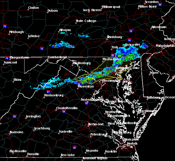 At 1057 pm est, severe thunderstorms were located along a line extending from near gaithersburg to lansdowne to near oatlands, moving east at 50 mph (radar indicated). Hazards include 60 mph wind gusts. Damaging winds will cause some trees and large branches to fall. this could injure those outdoors, as well as damage homes and vehicles. roadways may become blocked by downed trees. localized power outages are possible. unsecured light objects may become projectiles. Locations impacted include, germantown, rockville, bethesda, gaithersburg, reston, leesburg, olney, south riding, herndon, beltsville, vienna, broadlands, lansdowne, lowes island, brambleton, poolesville, american legion bridge, dulles international airport, aspen hill and potomac. At 1057 pm est, severe thunderstorms were located along a line extending from near gaithersburg to lansdowne to near oatlands, moving east at 50 mph (radar indicated). Hazards include 60 mph wind gusts. Damaging winds will cause some trees and large branches to fall. this could injure those outdoors, as well as damage homes and vehicles. roadways may become blocked by downed trees. localized power outages are possible. unsecured light objects may become projectiles. Locations impacted include, germantown, rockville, bethesda, gaithersburg, reston, leesburg, olney, south riding, herndon, beltsville, vienna, broadlands, lansdowne, lowes island, brambleton, poolesville, american legion bridge, dulles international airport, aspen hill and potomac.
|
| 2/12/2017 10:38 PM EST |
 At 1037 pm est, severe thunderstorms were located along a line extending from near point of rocks to near round hill to near berryville, moving east at 50 mph (radar indicated). Hazards include 60 mph wind gusts. Damaging winds will cause some trees and large branches to fall. this could injure those outdoors, as well as damage homes and vehicles. roadways may become blocked by downed trees. localized power outages are possible. Unsecured light objects may become projectiles. At 1037 pm est, severe thunderstorms were located along a line extending from near point of rocks to near round hill to near berryville, moving east at 50 mph (radar indicated). Hazards include 60 mph wind gusts. Damaging winds will cause some trees and large branches to fall. this could injure those outdoors, as well as damage homes and vehicles. roadways may become blocked by downed trees. localized power outages are possible. Unsecured light objects may become projectiles.
|
| 7/30/2016 7:41 PM EDT | The severe thunderstorm warning for southwestern montgomery county in central maryland, southern frederick county in north central maryland, northwestern fairfax and eastern loudoun counties in northern virginia will expire at 745 pm edt, the storms which prompted the warning have weakened. therefore, the warning will be allowed to expire. however heavy rain is still occurring with these thunderstorms. |
| 7/30/2016 7:41 PM EDT | The severe thunderstorm warning for southwestern montgomery county in central maryland, southern frederick county in north central maryland, northwestern fairfax and eastern loudoun counties in northern virginia will expire at 745 pm edt, the storms which prompted the warning have weakened. therefore, the warning will be allowed to expire. however heavy rain is still occurring with these thunderstorms. |
| 7/30/2016 7:30 PM EDT |
 At 730 pm edt, severe thunderstorms were located along a line extending from boyds to arcola, moving southeast at 25 mph (radar indicated). Hazards include 60 mph wind gusts. Damaging winds will cause some trees and large branches to fall. this could injure those outdoors, as well as damage homes and vehicles. roadways may become blocked by downed trees. localized power outages are possible. unsecured light objects may become projectiles. Locations impacted include, germantown, centreville, rockville, gaithersburg, reston, leesburg, south riding, herndon, broadlands, lansdowne, lowes island, brambleton, poolesville, dulles international airport, ashburn, montgomery village, sterling, north potomac, chantilly and redland. At 730 pm edt, severe thunderstorms were located along a line extending from boyds to arcola, moving southeast at 25 mph (radar indicated). Hazards include 60 mph wind gusts. Damaging winds will cause some trees and large branches to fall. this could injure those outdoors, as well as damage homes and vehicles. roadways may become blocked by downed trees. localized power outages are possible. unsecured light objects may become projectiles. Locations impacted include, germantown, centreville, rockville, gaithersburg, reston, leesburg, south riding, herndon, broadlands, lansdowne, lowes island, brambleton, poolesville, dulles international airport, ashburn, montgomery village, sterling, north potomac, chantilly and redland.
|
| 7/30/2016 7:21 PM EDT |
 At 720 pm edt, severe thunderstorms were located along a line extending from near boyds to near brambleton, moving east at 25 mph (radar indicated). Hazards include 60 mph wind gusts. Damaging winds will cause some trees and large branches to fall. this could injure those outdoors, as well as damage homes and vehicles. roadways may become blocked by downed trees. localized power outages are possible. unsecured light objects may become projectiles. Locations impacted include, germantown, centreville, rockville, gaithersburg, reston, leesburg, south riding, herndon, broadlands, lansdowne, lowes island, brambleton, poolesville, dulles international airport, ashburn, montgomery village, sterling, north potomac, chantilly and redland. At 720 pm edt, severe thunderstorms were located along a line extending from near boyds to near brambleton, moving east at 25 mph (radar indicated). Hazards include 60 mph wind gusts. Damaging winds will cause some trees and large branches to fall. this could injure those outdoors, as well as damage homes and vehicles. roadways may become blocked by downed trees. localized power outages are possible. unsecured light objects may become projectiles. Locations impacted include, germantown, centreville, rockville, gaithersburg, reston, leesburg, south riding, herndon, broadlands, lansdowne, lowes island, brambleton, poolesville, dulles international airport, ashburn, montgomery village, sterling, north potomac, chantilly and redland.
|
| 7/30/2016 7:00 PM EDT |
 At 659 pm edt, severe thunderstorms were located along a line extending from point of rocks to near middleburg, moving southeast at 25 mph (radar indicated). Hazards include 60 mph wind gusts. Damaging winds will cause some trees and large branches to fall. this could injure those outdoors, as well as damage homes and vehicles. roadways may become blocked by downed trees. localized power outages are possible. Unsecured light objects may become projectiles. At 659 pm edt, severe thunderstorms were located along a line extending from point of rocks to near middleburg, moving southeast at 25 mph (radar indicated). Hazards include 60 mph wind gusts. Damaging winds will cause some trees and large branches to fall. this could injure those outdoors, as well as damage homes and vehicles. roadways may become blocked by downed trees. localized power outages are possible. Unsecured light objects may become projectiles.
|
| 7/25/2016 5:53 PM EDT |
 At 553 pm edt, a severe thunderstorm was located over reston, moving east at 30 mph (radar indicated). Hazards include 60 mph wind gusts. Damaging winds will cause some trees and large branches to fall. this could injure those outdoors, as well as damage homes and vehicles. roadways may become blocked by downed trees. localized power outages are possible. unsecured light objects may become projectiles. Locations impacted include, arlington, alexandria, centreville, waldorf, bethesda, reston, bowie, annandale, clinton, springfield, college park, fort washington, herndon, greenbelt, fairfax, langley park, beltsville, fort hunt, vienna and groveton. At 553 pm edt, a severe thunderstorm was located over reston, moving east at 30 mph (radar indicated). Hazards include 60 mph wind gusts. Damaging winds will cause some trees and large branches to fall. this could injure those outdoors, as well as damage homes and vehicles. roadways may become blocked by downed trees. localized power outages are possible. unsecured light objects may become projectiles. Locations impacted include, arlington, alexandria, centreville, waldorf, bethesda, reston, bowie, annandale, clinton, springfield, college park, fort washington, herndon, greenbelt, fairfax, langley park, beltsville, fort hunt, vienna and groveton.
|
| 7/25/2016 5:45 PM EDT |
 At 545 pm edt, a severe thunderstorm was located over broadlands, moving east at 30 mph (radar indicated). Hazards include 70 mph wind gusts and quarter size hail. Damaging winds will cause some trees and large branches to fall. this could injure those outdoors, as well as damage homes and vehicles. roadways may become blocked by downed trees. localized power outages are possible. unsecured light objects may become projectiles. Locations impacted include, centreville, reston, south riding, herndon, broadlands, lowes island, brambleton, dulles international airport, potomac, ashburn, oakton, sterling, chantilly, wolf trap, great falls, countryside, arcola, oatlands, darnestown and belmont. At 545 pm edt, a severe thunderstorm was located over broadlands, moving east at 30 mph (radar indicated). Hazards include 70 mph wind gusts and quarter size hail. Damaging winds will cause some trees and large branches to fall. this could injure those outdoors, as well as damage homes and vehicles. roadways may become blocked by downed trees. localized power outages are possible. unsecured light objects may become projectiles. Locations impacted include, centreville, reston, south riding, herndon, broadlands, lowes island, brambleton, dulles international airport, potomac, ashburn, oakton, sterling, chantilly, wolf trap, great falls, countryside, arcola, oatlands, darnestown and belmont.
|
| 7/25/2016 5:44 PM EDT |
 At 543 pm edt, a severe thunderstorm was located over dulles international airport, moving east at 30 mph (radar indicated). Hazards include 70 mph wind gusts and quarter size hail. Damaging winds will cause some trees and large branches to fall. this could injure those outdoors, as well as damage homes and vehicles. roadways may become blocked by downed trees. localized power outages are possible. Unsecured light objects may become projectiles. At 543 pm edt, a severe thunderstorm was located over dulles international airport, moving east at 30 mph (radar indicated). Hazards include 70 mph wind gusts and quarter size hail. Damaging winds will cause some trees and large branches to fall. this could injure those outdoors, as well as damage homes and vehicles. roadways may become blocked by downed trees. localized power outages are possible. Unsecured light objects may become projectiles.
|
| 7/25/2016 5:16 PM EDT |
 At 515 pm edt, a severe thunderstorm was located near middleburg, or 12 miles west of leesburg, moving east at 30 mph (radar indicated). Hazards include 70 mph wind gusts and quarter size hail. Damaging winds will cause some trees and large branches to fall. this could injure those outdoors, as well as damage homes and vehicles. roadways may become blocked by downed trees. localized power outages are possible. Unsecured light objects may become projectiles. At 515 pm edt, a severe thunderstorm was located near middleburg, or 12 miles west of leesburg, moving east at 30 mph (radar indicated). Hazards include 70 mph wind gusts and quarter size hail. Damaging winds will cause some trees and large branches to fall. this could injure those outdoors, as well as damage homes and vehicles. roadways may become blocked by downed trees. localized power outages are possible. Unsecured light objects may become projectiles.
|
| 7/18/2016 3:45 PM EDT |
 At 345 pm edt, severe thunderstorms were located along a line extending from broadlands to near haymarket, moving east at 40 mph (radar indicated). Hazards include 60 mph wind gusts. Damaging winds will cause some trees and large branches to fall. this could injure those outdoors, as well as damage homes and vehicles. roadways may become blocked by downed trees. localized power outages are possible. Unsecured light objects may become projectiles. At 345 pm edt, severe thunderstorms were located along a line extending from broadlands to near haymarket, moving east at 40 mph (radar indicated). Hazards include 60 mph wind gusts. Damaging winds will cause some trees and large branches to fall. this could injure those outdoors, as well as damage homes and vehicles. roadways may become blocked by downed trees. localized power outages are possible. Unsecured light objects may become projectiles.
|
| 7/16/2016 4:39 PM EDT |
 At 438 pm edt, a severe thunderstorm was located over wolf trap, or near reston, moving east at 25 mph (radar indicated). Hazards include 60 mph wind gusts. Damaging winds will cause some trees and large branches to fall. this could injure those outdoors, as well as damage homes and vehicles. roadways may become blocked by downed trees. localized power outages are possible. unsecured light objects may become projectiles. Locations impacted include, arlington, rockville, bethesda, reston, annandale, herndon, vienna, falls church, mantua, pimmit hills, american legion bridge, mclean, aspen hill, potomac, north bethesda, oakton, fairland, lincolnia, tysons corner and white oak. At 438 pm edt, a severe thunderstorm was located over wolf trap, or near reston, moving east at 25 mph (radar indicated). Hazards include 60 mph wind gusts. Damaging winds will cause some trees and large branches to fall. this could injure those outdoors, as well as damage homes and vehicles. roadways may become blocked by downed trees. localized power outages are possible. unsecured light objects may become projectiles. Locations impacted include, arlington, rockville, bethesda, reston, annandale, herndon, vienna, falls church, mantua, pimmit hills, american legion bridge, mclean, aspen hill, potomac, north bethesda, oakton, fairland, lincolnia, tysons corner and white oak.
|
| 7/16/2016 4:17 PM EDT |
 At 417 pm edt, a severe thunderstorm was located over herndon, moving east at 25 mph (radar indicated). Hazards include 60 mph wind gusts. Damaging winds will cause some trees and large branches to fall. this could injure those outdoors, as well as damage homes and vehicles. roadways may become blocked by downed trees. localized power outages are possible. Unsecured light objects may become projectiles. At 417 pm edt, a severe thunderstorm was located over herndon, moving east at 25 mph (radar indicated). Hazards include 60 mph wind gusts. Damaging winds will cause some trees and large branches to fall. this could injure those outdoors, as well as damage homes and vehicles. roadways may become blocked by downed trees. localized power outages are possible. Unsecured light objects may become projectiles.
|
| 6/21/2016 5:47 PM EDT |
 At 547 pm edt, a severe thunderstorm was located near fairfax, moving east at 25 mph (radar indicated). Hazards include 60 mph wind gusts. Damaging winds will cause some trees and large branches to fall. this could injure those outdoors, as well as damage homes and vehicles. roadways may become blocked by downed trees. localized power outages are possible. unsecured light objects may become projectiles. Locations impacted include, arlington, alexandria, centreville, reston, annandale, springfield, fairfax, fort hunt, vienna, groveton, falls church, huntington, mantua, fort belvoir, pimmit hills, crystal city, reagan national airport, mclean, rosslyn and burke. At 547 pm edt, a severe thunderstorm was located near fairfax, moving east at 25 mph (radar indicated). Hazards include 60 mph wind gusts. Damaging winds will cause some trees and large branches to fall. this could injure those outdoors, as well as damage homes and vehicles. roadways may become blocked by downed trees. localized power outages are possible. unsecured light objects may become projectiles. Locations impacted include, arlington, alexandria, centreville, reston, annandale, springfield, fairfax, fort hunt, vienna, groveton, falls church, huntington, mantua, fort belvoir, pimmit hills, crystal city, reagan national airport, mclean, rosslyn and burke.
|
| 6/21/2016 5:39 PM EDT |
 The severe thunderstorm warning for northwestern fairfax and southeastern loudoun counties will expire at 545 pm edt, the storm which prompted the warning has moved out of the area. therefore the warning will be allowed to expire. a severe thunderstorm watch remains in effect until 900 pm edt for northern virginia. The severe thunderstorm warning for northwestern fairfax and southeastern loudoun counties will expire at 545 pm edt, the storm which prompted the warning has moved out of the area. therefore the warning will be allowed to expire. a severe thunderstorm watch remains in effect until 900 pm edt for northern virginia.
|
| 6/21/2016 5:37 PM EDT |
 At 536 pm edt, a severe thunderstorm was located over chantilly, or near centreville, moving east at 25 mph (radar indicated). Hazards include 60 mph wind gusts and quarter size hail. Damaging winds will cause some trees and large branches to fall. this could injure those outdoors, as well as damage homes and vehicles. roadways may become blocked by downed trees. localized power outages are possible. unsecured light objects may become projectiles. Locations impacted include, arlington, alexandria, centreville, reston, annandale, springfield, fairfax, fort hunt, vienna, groveton, falls church, huntington, mantua, fort belvoir, pimmit hills, crystal city, reagan national airport, mclean, rosslyn and burke. At 536 pm edt, a severe thunderstorm was located over chantilly, or near centreville, moving east at 25 mph (radar indicated). Hazards include 60 mph wind gusts and quarter size hail. Damaging winds will cause some trees and large branches to fall. this could injure those outdoors, as well as damage homes and vehicles. roadways may become blocked by downed trees. localized power outages are possible. unsecured light objects may become projectiles. Locations impacted include, arlington, alexandria, centreville, reston, annandale, springfield, fairfax, fort hunt, vienna, groveton, falls church, huntington, mantua, fort belvoir, pimmit hills, crystal city, reagan national airport, mclean, rosslyn and burke.
|
| 6/21/2016 5:34 PM EDT |
 At 534 pm edt, a severe thunderstorm was located over south riding, moving southeast at 25 mph (radar indicated). Hazards include 60 mph wind gusts. Damaging winds will cause some trees and large branches to fall. this could injure those outdoors, as well as damage homes and vehicles. roadways may become blocked by downed trees. localized power outages are possible. unsecured light objects may become projectiles. Locations impacted include, centreville, reston, south riding, herndon, brambleton, dulles international airport, ashburn, sterling, chantilly, arcola, sudley and sterling park. At 534 pm edt, a severe thunderstorm was located over south riding, moving southeast at 25 mph (radar indicated). Hazards include 60 mph wind gusts. Damaging winds will cause some trees and large branches to fall. this could injure those outdoors, as well as damage homes and vehicles. roadways may become blocked by downed trees. localized power outages are possible. unsecured light objects may become projectiles. Locations impacted include, centreville, reston, south riding, herndon, brambleton, dulles international airport, ashburn, sterling, chantilly, arcola, sudley and sterling park.
|
| 6/21/2016 5:31 PM EDT |
 At 531 pm edt, a severe thunderstorm was located over south riding, moving southeast at 25 mph (radar indicated). Hazards include 70 mph wind gusts and half dollar size hail. Damaging winds will cause some trees and large branches to fall. this could injure those outdoors, as well as damage homes and vehicles. roadways may become blocked by downed trees. localized power outages are possible. Unsecured light objects may become projectiles. At 531 pm edt, a severe thunderstorm was located over south riding, moving southeast at 25 mph (radar indicated). Hazards include 70 mph wind gusts and half dollar size hail. Damaging winds will cause some trees and large branches to fall. this could injure those outdoors, as well as damage homes and vehicles. roadways may become blocked by downed trees. localized power outages are possible. Unsecured light objects may become projectiles.
|
| 6/21/2016 5:21 PM EDT |
 At 521 pm edt, a severe thunderstorm was located near oatlands, or near brambleton, moving southeast at 25 mph (radar indicated). Hazards include 70 mph wind gusts and half dollar size hail. Damaging winds will cause some trees and large branches to fall. this could injure those outdoors, as well as damage homes and vehicles. roadways may become blocked by downed trees. localized power outages are possible. unsecured light objects may become projectiles. Locations impacted include, centreville, reston, south riding, herndon, broadlands, brambleton, dulles international airport, ashburn, sterling, chantilly, bull run, arcola, oatlands, sudley, woolsey, gleedsville, aldie, catharpin, halfway and sterling park. At 521 pm edt, a severe thunderstorm was located near oatlands, or near brambleton, moving southeast at 25 mph (radar indicated). Hazards include 70 mph wind gusts and half dollar size hail. Damaging winds will cause some trees and large branches to fall. this could injure those outdoors, as well as damage homes and vehicles. roadways may become blocked by downed trees. localized power outages are possible. unsecured light objects may become projectiles. Locations impacted include, centreville, reston, south riding, herndon, broadlands, brambleton, dulles international airport, ashburn, sterling, chantilly, bull run, arcola, oatlands, sudley, woolsey, gleedsville, aldie, catharpin, halfway and sterling park.
|
| 6/21/2016 5:15 PM EDT |
 At 515 pm edt, a severe thunderstorm was located over middleburg, or 8 miles west of brambleton, moving southeast at 25 mph (radar indicated). Hazards include golf ball size hail and 60 mph wind gusts. Expect wind damage to trees and power lines. hail is large enough to dent and damage vehicles. some hail damage to roofs, siding, and windows is possible. Locations impacted include, centreville, reston, south riding, herndon, broadlands, brambleton, dulles international airport, ashburn, sterling, chantilly, bull run, middleburg, arcola, oatlands, sudley, woolsey, philomont, gleedsville, aldie and catharpin. At 515 pm edt, a severe thunderstorm was located over middleburg, or 8 miles west of brambleton, moving southeast at 25 mph (radar indicated). Hazards include golf ball size hail and 60 mph wind gusts. Expect wind damage to trees and power lines. hail is large enough to dent and damage vehicles. some hail damage to roofs, siding, and windows is possible. Locations impacted include, centreville, reston, south riding, herndon, broadlands, brambleton, dulles international airport, ashburn, sterling, chantilly, bull run, middleburg, arcola, oatlands, sudley, woolsey, philomont, gleedsville, aldie and catharpin.
|
| 6/21/2016 4:53 PM EDT |
 At 453 pm edt, a severe thunderstorm was located near bluemont, or 16 miles south of charles town, moving southeast at 25 mph (radar indicated). Hazards include golf ball size hail and 70 mph wind gusts. Expect wind damage to trees and power lines. hail is large enough to dent and damage vehicles. Some hail damage to roofs, siding, and windows is possible. At 453 pm edt, a severe thunderstorm was located near bluemont, or 16 miles south of charles town, moving southeast at 25 mph (radar indicated). Hazards include golf ball size hail and 70 mph wind gusts. Expect wind damage to trees and power lines. hail is large enough to dent and damage vehicles. Some hail damage to roofs, siding, and windows is possible.
|
| 6/21/2016 3:07 PM EDT |
 At 307 pm edt, a severe thunderstorm was located near middleburg, or 9 miles west of brambleton, moving southeast at 35 mph (radar indicated). Hazards include 60 mph wind gusts and quarter size hail. Damaging winds will cause some trees and large branches to fall. this could injure those outdoors, as well as damage homes and vehicles. roadways may become blocked by downed trees. localized power outages are possible. unsecured light objects may become projectiles. Locations impacted include, centreville, reston, south riding, herndon, broadlands, brambleton, dulles international airport, ashburn, linton hall, sterling, chantilly, bull run, haymarket, middleburg, arcola, oatlands, sudley, gainesville, woolsey and gleedsville. At 307 pm edt, a severe thunderstorm was located near middleburg, or 9 miles west of brambleton, moving southeast at 35 mph (radar indicated). Hazards include 60 mph wind gusts and quarter size hail. Damaging winds will cause some trees and large branches to fall. this could injure those outdoors, as well as damage homes and vehicles. roadways may become blocked by downed trees. localized power outages are possible. unsecured light objects may become projectiles. Locations impacted include, centreville, reston, south riding, herndon, broadlands, brambleton, dulles international airport, ashburn, linton hall, sterling, chantilly, bull run, haymarket, middleburg, arcola, oatlands, sudley, gainesville, woolsey and gleedsville.
|
| 6/21/2016 2:54 PM EDT |
 At 254 pm edt, a severe thunderstorm was located over bluemont, or 13 miles south of charles town, moving southeast at 35 mph (radar indicated). Hazards include 60 mph wind gusts and quarter size hail. Damaging winds will cause some trees and large branches to fall. this could injure those outdoors, as well as damage homes and vehicles. roadways may become blocked by downed trees. localized power outages are possible. Unsecured light objects may become projectiles. At 254 pm edt, a severe thunderstorm was located over bluemont, or 13 miles south of charles town, moving southeast at 35 mph (radar indicated). Hazards include 60 mph wind gusts and quarter size hail. Damaging winds will cause some trees and large branches to fall. this could injure those outdoors, as well as damage homes and vehicles. roadways may become blocked by downed trees. localized power outages are possible. Unsecured light objects may become projectiles.
|
| 6/21/2016 1:52 PM EDT |
 The severe thunderstorm warning for northwestern fairfax, northern prince william and southeastern loudoun counties will expire at 200 pm edt, the storm which prompted the warning has weakened, and no longer pose an immediate threat to life or property. therefore the warning will be allowed to expire. a severe thunderstorm watch remains in effect until 900 pm edt for central maryland, and northern virginia. to report severe weather, contact your nearest law enforcement agency. they will relay your report to the national weather service sterling virginia. The severe thunderstorm warning for northwestern fairfax, northern prince william and southeastern loudoun counties will expire at 200 pm edt, the storm which prompted the warning has weakened, and no longer pose an immediate threat to life or property. therefore the warning will be allowed to expire. a severe thunderstorm watch remains in effect until 900 pm edt for central maryland, and northern virginia. to report severe weather, contact your nearest law enforcement agency. they will relay your report to the national weather service sterling virginia.
|
| 6/21/2016 1:41 PM EDT |
 At 141 pm edt, a severe thunderstorm was located over herndon, moving east at 40 mph (radar indicated). Hazards include 70 mph wind gusts and quarter size hail. Damaging winds will cause some trees and large branches to fall. this could injure those outdoors, as well as damage homes and vehicles. roadways may become blocked by downed trees. localized power outages are possible. unsecured light objects may become projectiles. Locations impacted include, centreville, reston, south riding, herndon, fairfax, broadlands, lowes island, brambleton, dulles international airport, ashburn, oakton, sterling, chantilly, wolf trap, great falls, countryside, arcola and sterling park. At 141 pm edt, a severe thunderstorm was located over herndon, moving east at 40 mph (radar indicated). Hazards include 70 mph wind gusts and quarter size hail. Damaging winds will cause some trees and large branches to fall. this could injure those outdoors, as well as damage homes and vehicles. roadways may become blocked by downed trees. localized power outages are possible. unsecured light objects may become projectiles. Locations impacted include, centreville, reston, south riding, herndon, fairfax, broadlands, lowes island, brambleton, dulles international airport, ashburn, oakton, sterling, chantilly, wolf trap, great falls, countryside, arcola and sterling park.
|
| 6/21/2016 1:26 PM EDT |
 At 126 pm edt, a severe thunderstorm was located near aldie, or near brambleton, moving east at 40 mph. this is a very dangerous storm (radar indicated). Hazards include 80 mph wind gusts and two inch hail. Expect considerable damage to trees and power lines. you life is at significant risk if outdoors. in addition to some trees falling into homes, wind damage is possible to roofs, sheds, open garages, and mobile homes. Locations impacted include, centreville, reston, south riding, herndon, fairfax, broadlands, lowes island, brambleton, dulles international airport, ashburn, oakton, sterling, chantilly, wolf trap, great falls, countryside, arcola, oatlands, belmont and woolsey. At 126 pm edt, a severe thunderstorm was located near aldie, or near brambleton, moving east at 40 mph. this is a very dangerous storm (radar indicated). Hazards include 80 mph wind gusts and two inch hail. Expect considerable damage to trees and power lines. you life is at significant risk if outdoors. in addition to some trees falling into homes, wind damage is possible to roofs, sheds, open garages, and mobile homes. Locations impacted include, centreville, reston, south riding, herndon, fairfax, broadlands, lowes island, brambleton, dulles international airport, ashburn, oakton, sterling, chantilly, wolf trap, great falls, countryside, arcola, oatlands, belmont and woolsey.
|
| 6/21/2016 1:16 PM EDT |
 At 116 pm edt, a severe thunderstorm was located near middleburg, or 10 miles west of brambleton, moving east at 40 mph (radar indicated). Hazards include two inch hail and 70 mph wind gusts. Expect wind damage to trees and power lines. hail is large enough to dent and damage vehicles. some hail damage to roofs, siding, and windows is possible. Locations impacted include, centreville, reston, south riding, herndon, fairfax, broadlands, lowes island, brambleton, dulles international airport, ashburn, oakton, sterling, chantilly, wolf trap, great falls, countryside, middleburg, arcola, the plains and oatlands. At 116 pm edt, a severe thunderstorm was located near middleburg, or 10 miles west of brambleton, moving east at 40 mph (radar indicated). Hazards include two inch hail and 70 mph wind gusts. Expect wind damage to trees and power lines. hail is large enough to dent and damage vehicles. some hail damage to roofs, siding, and windows is possible. Locations impacted include, centreville, reston, south riding, herndon, fairfax, broadlands, lowes island, brambleton, dulles international airport, ashburn, oakton, sterling, chantilly, wolf trap, great falls, countryside, middleburg, arcola, the plains and oatlands.
|
| 6/21/2016 1:12 PM EDT |
 At 112 pm edt, doppler radar indicated a severe thunderstorm capable of producing quarter size hail and destructive winds in excess of 70 mph. this storm was located near middleburg, or 13 miles west of brambleton, and moving east at 40 mph. At 112 pm edt, doppler radar indicated a severe thunderstorm capable of producing quarter size hail and destructive winds in excess of 70 mph. this storm was located near middleburg, or 13 miles west of brambleton, and moving east at 40 mph.
|
| 6/16/2016 8:20 PM EDT |
 At 820 pm edt, severe thunderstorms were located along a line extending from leesburg to near haymarket to near warrenton, moving east at 35 mph (radar indicated). Hazards include 60 mph wind gusts. Damaging winds will cause some trees and large branches to fall. this could injure those outdoors, as well as damage homes and vehicles. roadways may become blocked by downed trees. localized power outages are possible. Unsecured light objects may become projectiles. At 820 pm edt, severe thunderstorms were located along a line extending from leesburg to near haymarket to near warrenton, moving east at 35 mph (radar indicated). Hazards include 60 mph wind gusts. Damaging winds will cause some trees and large branches to fall. this could injure those outdoors, as well as damage homes and vehicles. roadways may become blocked by downed trees. localized power outages are possible. Unsecured light objects may become projectiles.
|
| 5/2/2016 7:24 PM EDT |
 At 723 pm edt, a severe thunderstorm was located over wolf trap, or over vienna, moving northeast at 25 mph (radar indicated). Hazards include 60 mph wind gusts and quarter size hail. Hail damage to vehicles is expected. Expect wind damage to roofs, siding, and trees. At 723 pm edt, a severe thunderstorm was located over wolf trap, or over vienna, moving northeast at 25 mph (radar indicated). Hazards include 60 mph wind gusts and quarter size hail. Hail damage to vehicles is expected. Expect wind damage to roofs, siding, and trees.
|
| 2/24/2016 5:29 PM EST |
 At 529 pm est, doppler radar indicated a line of severe thunderstorms capable of producing damaging winds in excess of 60 mph. these storms were located along a line extending from broadlands to near dale city to near stafford, and moving northeast at 55 mph. At 529 pm est, doppler radar indicated a line of severe thunderstorms capable of producing damaging winds in excess of 60 mph. these storms were located along a line extending from broadlands to near dale city to near stafford, and moving northeast at 55 mph.
|
| 8/4/2015 5:40 PM EDT |
 At 540 pm edt, doppler radar indicated a line of severe thunderstorms capable of producing quarter size hail and damaging winds in excess of 60 mph. these storms were located along a line extending from near north potomac to near reston, and moving east at 25 mph. At 540 pm edt, doppler radar indicated a line of severe thunderstorms capable of producing quarter size hail and damaging winds in excess of 60 mph. these storms were located along a line extending from near north potomac to near reston, and moving east at 25 mph.
|
| 8/4/2015 4:14 AM EDT |
 At 413 am edt, doppler radar indicated a severe thunderstorm capable of producing damaging winds in excess of 60 mph. this storm was located near purcellville, or near leesburg, and moving southeast at 35 mph. At 413 am edt, doppler radar indicated a severe thunderstorm capable of producing damaging winds in excess of 60 mph. this storm was located near purcellville, or near leesburg, and moving southeast at 35 mph.
|
| 6/23/2015 6:27 PM EDT |
 At 627 pm edt, trained weather spotters reported a line of severe thunderstorms producing quarter size hail and damaging winds in excess of 60 mph. these storms were located along a line extending from brooklyn park to south riding, and moving southeast at 35 mph. At 627 pm edt, trained weather spotters reported a line of severe thunderstorms producing quarter size hail and damaging winds in excess of 60 mph. these storms were located along a line extending from brooklyn park to south riding, and moving southeast at 35 mph.
|
| 6/23/2015 6:18 PM EDT |
 At 618 pm edt, doppler radar indicated a line of severe thunderstorms capable of producing quarter size hail and destructive winds in excess of 70 mph. these storms were located along a line extending from near westminster to near purcellville, moving east at 25 mph. locations impacted include, rockville, gaithersburg, leesburg, college park, greenbelt, poolesville, crofton, severn, elkridge, broadlands, olney, damascus, lowes island, lansdowne, langley park, germantown, columbia, byrd stadium, beltsville and baltimore-washington airport. At 618 pm edt, doppler radar indicated a line of severe thunderstorms capable of producing quarter size hail and destructive winds in excess of 70 mph. these storms were located along a line extending from near westminster to near purcellville, moving east at 25 mph. locations impacted include, rockville, gaithersburg, leesburg, college park, greenbelt, poolesville, crofton, severn, elkridge, broadlands, olney, damascus, lowes island, lansdowne, langley park, germantown, columbia, byrd stadium, beltsville and baltimore-washington airport.
|
| 6/23/2015 6:01 PM EDT |
 At 600 pm edt, doppler radar indicated a line of severe thunderstorms capable of producing quarter size hail and destructive winds in excess of 70 mph. these storms were located along a line extending from near westminster to round hill, and moving east at 25 mph. At 600 pm edt, doppler radar indicated a line of severe thunderstorms capable of producing quarter size hail and destructive winds in excess of 70 mph. these storms were located along a line extending from near westminster to round hill, and moving east at 25 mph.
|
| 6/20/2015 8:06 PM EDT |
 At 805 pm edt, doppler radar indicated a line of severe thunderstorms capable of producing damaging winds in excess of 60 mph. these storms were located along a line extending from near north potomac to springfield to aquia creek, moving east at 45 mph. locations impacted include, fairfax, vienna, falls church, springfield, reston, pimmit hills, mantua, annandale, american legion bridge, woodbridge, fort belvoir, mclean, aquia creek, groveton, dale city, dumfries, montclair, tysons corner, merrifield and triangle. At 805 pm edt, doppler radar indicated a line of severe thunderstorms capable of producing damaging winds in excess of 60 mph. these storms were located along a line extending from near north potomac to springfield to aquia creek, moving east at 45 mph. locations impacted include, fairfax, vienna, falls church, springfield, reston, pimmit hills, mantua, annandale, american legion bridge, woodbridge, fort belvoir, mclean, aquia creek, groveton, dale city, dumfries, montclair, tysons corner, merrifield and triangle.
|
| 6/20/2015 7:48 PM EDT |
 At 748 pm edt, doppler radar indicated a line of severe thunderstorms capable of producing damaging winds in excess of 60 mph. these storms were located along a line extending from broadlands to near bull run to 6 miles northwest of fredericksburg, and moving east at 25 mph. At 748 pm edt, doppler radar indicated a line of severe thunderstorms capable of producing damaging winds in excess of 60 mph. these storms were located along a line extending from broadlands to near bull run to 6 miles northwest of fredericksburg, and moving east at 25 mph.
|
| 6/18/2015 4:44 PM EDT | At 444 pm edt, doppler radar indicated a line of severe thunderstorms capable of producing quarter size hail and damaging winds in excess of 60 mph. these storms were located along a line extending from countryside to dulles international airport to arcola, moving southeast at 20 mph. locations impacted include, herndon, reston, south riding, lowes island, brambleton, dulles international airport, centreville, countryside, sterling, arcola, chantilly, great falls, wolf trap and sterling park. |
| 6/18/2015 4:44 PM EDT | At 444 pm edt, doppler radar indicated a line of severe thunderstorms capable of producing quarter size hail and damaging winds in excess of 60 mph. these storms were located along a line extending from countryside to dulles international airport to arcola, moving southeast at 20 mph. locations impacted include, herndon, reston, south riding, lowes island, brambleton, dulles international airport, centreville, countryside, sterling, arcola, chantilly, great falls, wolf trap and sterling park. |
| 6/18/2015 4:30 PM EDT | At 430 pm edt, doppler radar indicated a severe thunderstorm capable of producing quarter size hail and damaging winds in excess of 60 mph. this storm was located over broadlands, and moving southeast at 25 mph. |
| 6/18/2015 4:30 PM EDT | At 430 pm edt, doppler radar indicated a severe thunderstorm capable of producing quarter size hail and damaging winds in excess of 60 mph. this storm was located over broadlands, and moving southeast at 25 mph. |
| 6/8/2015 7:42 PM EDT | At 741 pm edt, doppler radar indicated a line of severe thunderstorms capable of producing damaging winds in excess of 60 mph. these storms were located along a line extending from sterling to north bethesda, moving east at 30 mph. locations impacted include, arlington, rockville, gaithersburg, herndon, fairfax, vienna, falls church, reston, south riding, pimmit hills, mantua, dulles international airport, gallaudet university, nationals park, american legion bridge, olney, bethesda, howard university, mclean and fort totten. |
| 6/8/2015 7:42 PM EDT | At 741 pm edt, doppler radar indicated a line of severe thunderstorms capable of producing damaging winds in excess of 60 mph. these storms were located along a line extending from sterling to north bethesda, moving east at 30 mph. locations impacted include, arlington, rockville, gaithersburg, herndon, fairfax, vienna, falls church, reston, south riding, pimmit hills, mantua, dulles international airport, gallaudet university, nationals park, american legion bridge, olney, bethesda, howard university, mclean and fort totten. |
| 6/8/2015 7:42 PM EDT | At 741 pm edt, doppler radar indicated a line of severe thunderstorms capable of producing damaging winds in excess of 60 mph. these storms were located along a line extending from sterling to north bethesda, moving east at 30 mph. locations impacted include, arlington, rockville, gaithersburg, herndon, fairfax, vienna, falls church, reston, south riding, pimmit hills, mantua, dulles international airport, gallaudet university, nationals park, american legion bridge, olney, bethesda, howard university, mclean and fort totten. |
| 6/8/2015 7:35 PM EDT | At 735 pm edt, doppler radar indicated a line of severe thunderstorms capable of producing damaging winds in excess of 60 mph. these storms were located along a line extending from near dulles international airport to potomac, moving east at 35 mph. locations impacted include, arlington, rockville, gaithersburg, herndon, fairfax, vienna, falls church, reston, south riding, pimmit hills, mantua, dulles international airport, gallaudet university, nationals park, american legion bridge, olney, bethesda, howard university, mclean and fort totten. |
| 6/8/2015 7:35 PM EDT | At 735 pm edt, doppler radar indicated a line of severe thunderstorms capable of producing damaging winds in excess of 60 mph. these storms were located along a line extending from near dulles international airport to potomac, moving east at 35 mph. locations impacted include, arlington, rockville, gaithersburg, herndon, fairfax, vienna, falls church, reston, south riding, pimmit hills, mantua, dulles international airport, gallaudet university, nationals park, american legion bridge, olney, bethesda, howard university, mclean and fort totten. |
| 6/8/2015 7:35 PM EDT | At 735 pm edt, doppler radar indicated a line of severe thunderstorms capable of producing damaging winds in excess of 60 mph. these storms were located along a line extending from near dulles international airport to potomac, moving east at 35 mph. locations impacted include, arlington, rockville, gaithersburg, herndon, fairfax, vienna, falls church, reston, south riding, pimmit hills, mantua, dulles international airport, gallaudet university, nationals park, american legion bridge, olney, bethesda, howard university, mclean and fort totten. |
| 6/8/2015 7:12 PM EDT | At 712 pm edt, doppler radar indicated a severe thunderstorm capable of producing damaging winds in excess of 60 mph. this storm was located over herndon, and moving east at 30 mph. |
| 6/8/2015 7:12 PM EDT | At 712 pm edt, doppler radar indicated a severe thunderstorm capable of producing damaging winds in excess of 60 mph. this storm was located over herndon, and moving east at 30 mph. |
| 6/8/2015 7:12 PM EDT | At 712 pm edt, doppler radar indicated a severe thunderstorm capable of producing damaging winds in excess of 60 mph. this storm was located over herndon, and moving east at 30 mph. |
| 6/8/2015 7:12 PM EDT | At 712 pm edt, doppler radar indicated a severe thunderstorm capable of producing damaging winds in excess of 60 mph. this storm was located over herndon, and moving east at 30 mph. |
| 6/8/2015 7:12 PM EDT | At 712 pm edt, doppler radar indicated a severe thunderstorm capable of producing damaging winds in excess of 60 mph. this storm was located over herndon, and moving east at 30 mph. |
| 6/8/2015 6:59 PM EDT | At 658 pm edt, doppler radar indicated a severe thunderstorm capable of producing quarter size hail and damaging winds in excess of 60 mph. this storm was located over chantilly, or near dulles international airport, moving east at 45 mph. locations impacted include, herndon, fairfax, vienna, springfield, reston, south riding, brambleton, mantua, dulles international airport, annandale, centreville, haymarket, merrifield, i66 and i495 interchange, chantilly, wolf trap, i395 and i495 interchange, oakton, arcola and tysons corner. a tornado watch remains in effect until 800 pm edt for northern virginia. |
| 6/8/2015 6:43 PM EDT | At 643 pm edt, doppler radar indicated a severe thunderstorm capable of producing quarter size hail and damaging winds in excess of 60 mph. this storm was located near haymarket, or 9 miles west of south riding, and moving east at 45 mph. |
| 6/1/2015 6:41 PM EDT | At 641 pm edt, doppler radar indicated a severe thunderstorm capable of producing quarter size hail and damaging winds in excess of 60 mph. this storm was located over lowes island, and moving east at 20 mph. |
| 6/1/2015 6:41 PM EDT | At 641 pm edt, doppler radar indicated a severe thunderstorm capable of producing quarter size hail and damaging winds in excess of 60 mph. this storm was located over lowes island, and moving east at 20 mph. |
| 6/1/2015 6:38 PM EDT | At 638 pm edt, doppler radar indicated a severe thunderstorm capable of producing quarter size hail and damaging winds in excess of 60 mph. this storm was located over countryside, or near lowes island, moving east at 20 mph. locations impacted include, herndon, poolesville, lowes island, lansdowne, reston, countryside, sterling, boyds, ashburn, great falls, wolf trap, dawsonville, sterling park and darnestown. |
| 6/1/2015 6:38 PM EDT | At 638 pm edt, doppler radar indicated a severe thunderstorm capable of producing quarter size hail and damaging winds in excess of 60 mph. this storm was located over countryside, or near lowes island, moving east at 20 mph. locations impacted include, herndon, poolesville, lowes island, lansdowne, reston, countryside, sterling, boyds, ashburn, great falls, wolf trap, dawsonville, sterling park and darnestown. |
| 6/1/2015 6:20 PM EDT | At 620 pm edt, doppler radar indicated a severe thunderstorm capable of producing quarter size hail and damaging winds in excess of 60 mph. this storm was located over ashburn, or over broadlands, and moving east at 20 mph. |
| 6/1/2015 6:20 PM EDT | At 620 pm edt, doppler radar indicated a severe thunderstorm capable of producing quarter size hail and damaging winds in excess of 60 mph. this storm was located over ashburn, or over broadlands, and moving east at 20 mph. |
| 5/16/2015 5:31 PM EDT | At 531 pm edt, doppler radar indicated a severe thunderstorm capable of producing damaging winds in excess of 60 mph. this storm was located over boyds, or near germantown, moving northeast at 25 mph. locations impacted include, herndon, poolesville, reston, south riding, lowes island, brambleton, centreville, dulles international airport, broadlands, lansdowne, countryside, potomac, arcola, chantilly, ashburn, great falls, north potomac, wolf trap, sterling and dawsonville. |
| 5/16/2015 5:31 PM EDT | At 531 pm edt, doppler radar indicated a severe thunderstorm capable of producing damaging winds in excess of 60 mph. this storm was located over boyds, or near germantown, moving northeast at 25 mph. locations impacted include, herndon, poolesville, reston, south riding, lowes island, brambleton, centreville, dulles international airport, broadlands, lansdowne, countryside, potomac, arcola, chantilly, ashburn, great falls, north potomac, wolf trap, sterling and dawsonville. |
| 5/16/2015 5:02 PM EDT | At 501 pm edt, doppler radar indicated a severe thunderstorm capable of producing damaging winds in excess of 60 mph. this storm was located over south riding, and moving northeast at 25 mph. |
| 5/16/2015 5:02 PM EDT | At 501 pm edt, doppler radar indicated a severe thunderstorm capable of producing damaging winds in excess of 60 mph. this storm was located over south riding, and moving northeast at 25 mph. |
| 5/6/2015 4:04 PM EDT | At 403 pm edt, doppler radar indicated a severe thunderstorm capable of producing quarter size hail. this storm was located over great falls park, and drifting slowly northeast at 5 mph. |
| 5/6/2015 4:04 PM EDT | At 403 pm edt, doppler radar indicated a severe thunderstorm capable of producing quarter size hail. this storm was located over great falls park, and drifting slowly northeast at 5 mph. |
Hail Maps for Dranesville, VA


Connect with Interactive Hail Maps