

Hail Map for Dry Prong, LA
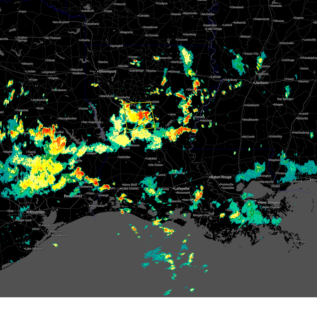
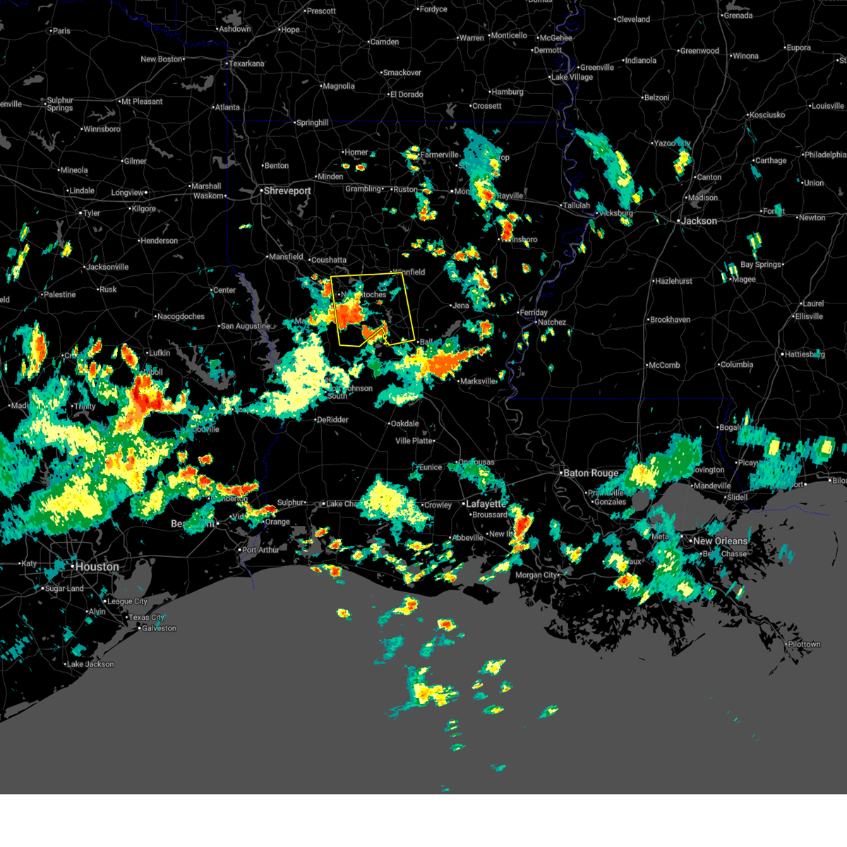
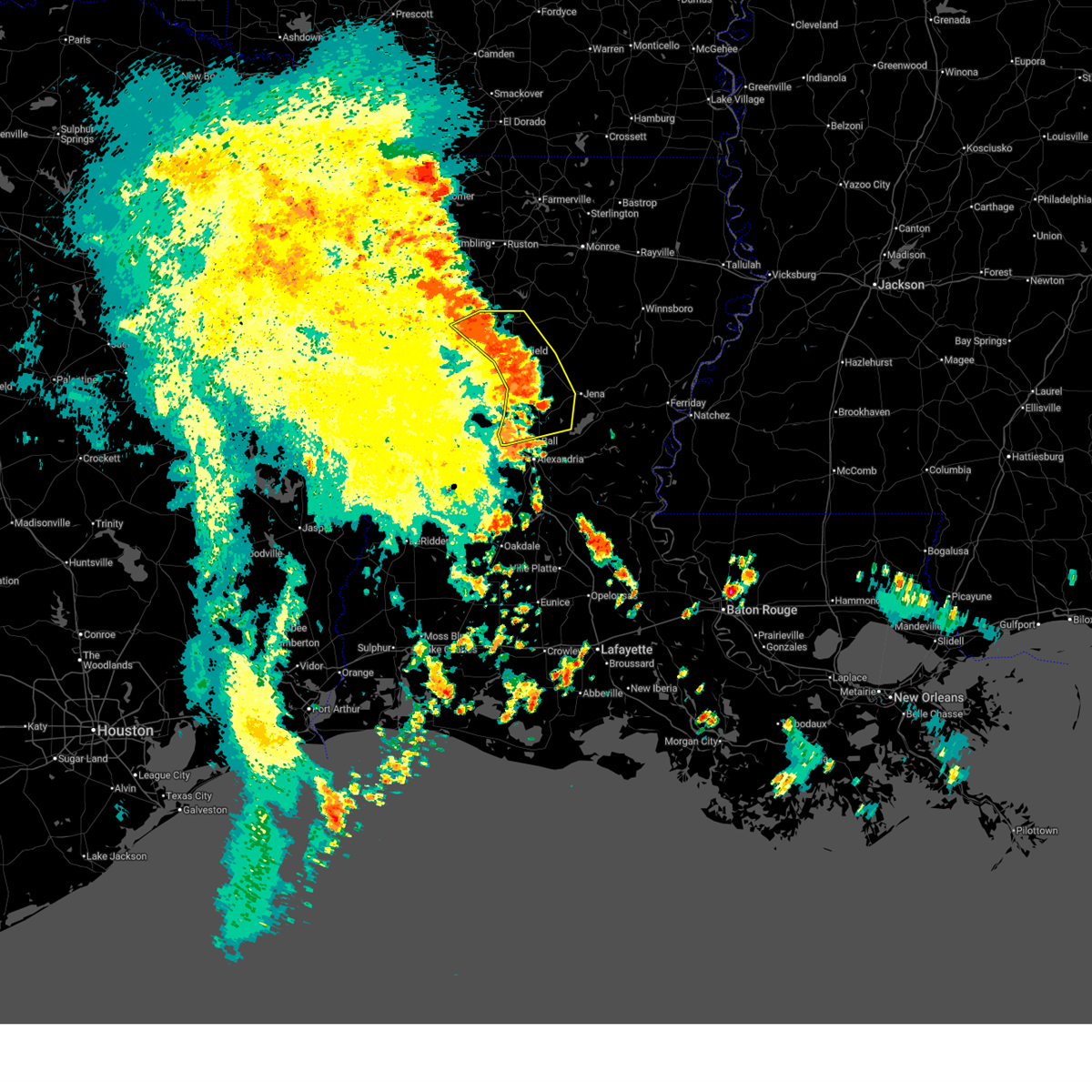
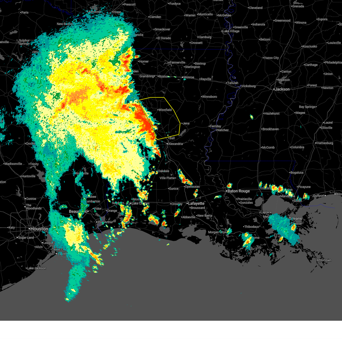
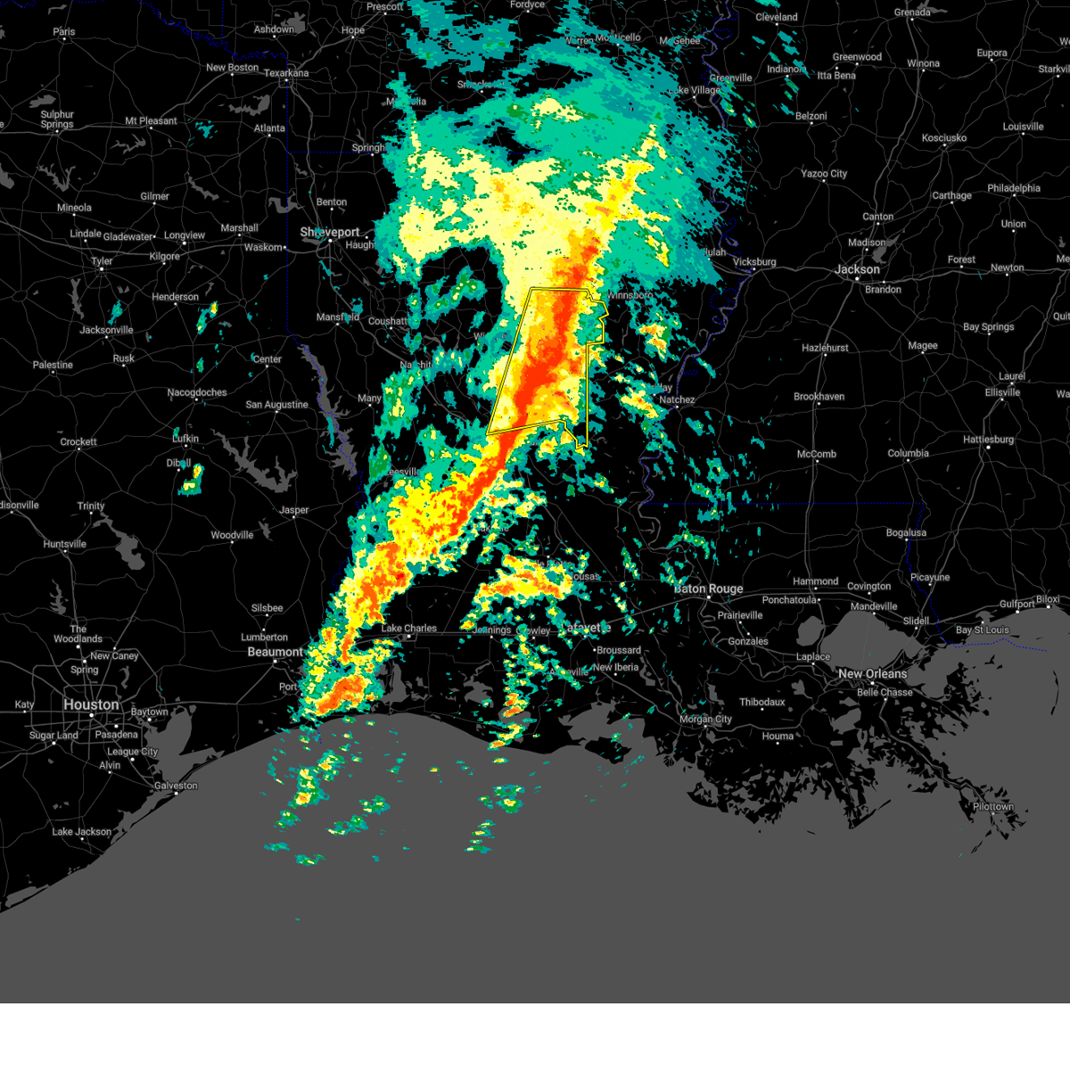
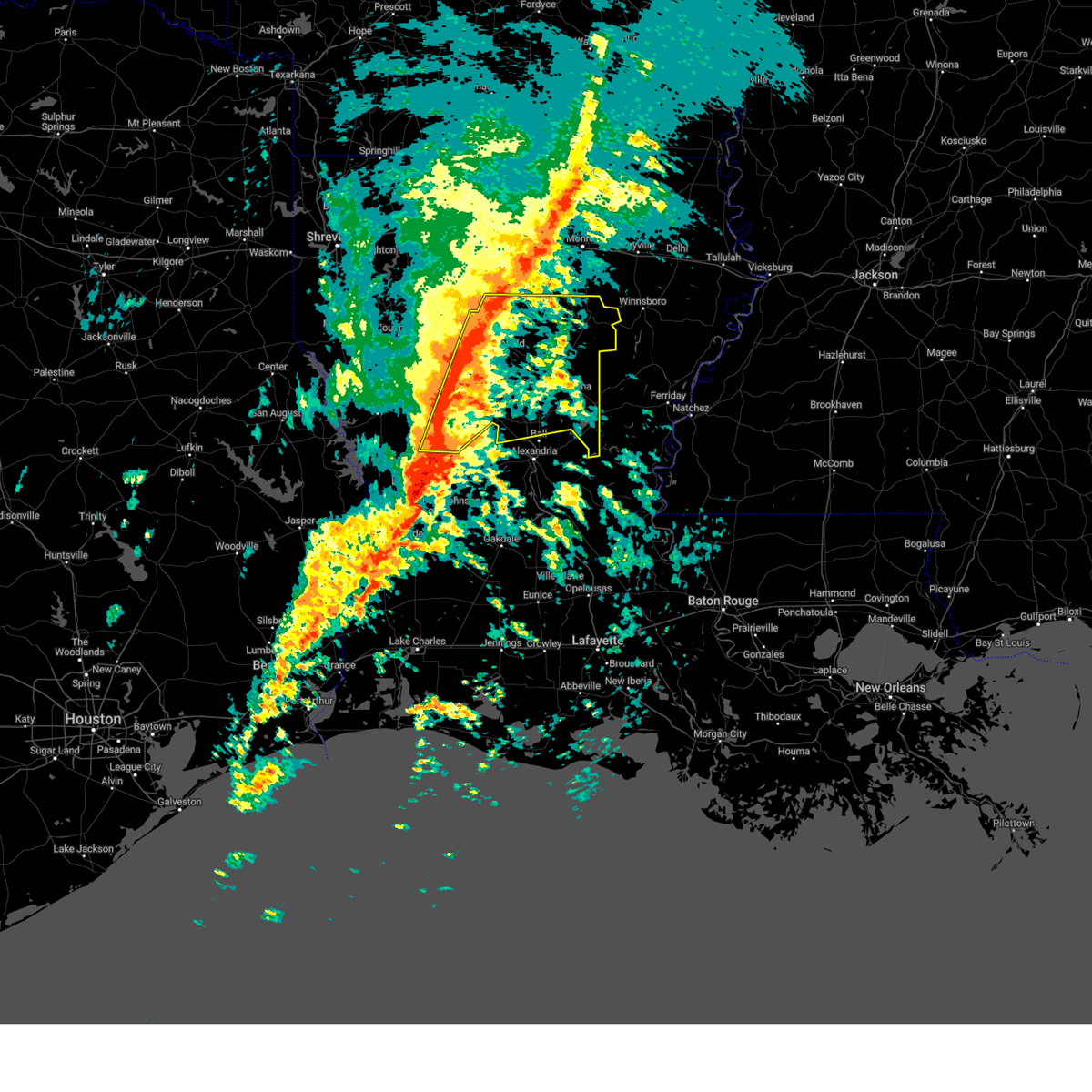
The Dry Prong, LA area has had 8 reports of on-the-ground hail by trained spotters, and has been under severe weather warnings 15 times during the past 12 months. Doppler radar has detected hail at or near Dry Prong, LA on 56 occasions, including 1 occasion during the past year.
| Name: | Dry Prong, LA |
| Where Located: | 90.1 miles SSW of Bastrop, LA |
| Map: | Google Map for Dry Prong, LA |
| Population: | 436 |
| Housing Units: | 199 |
| More Info: | Search Google for Dry Prong, LA |
0
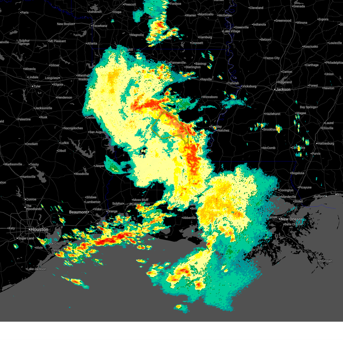
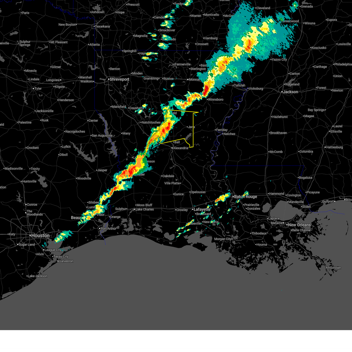
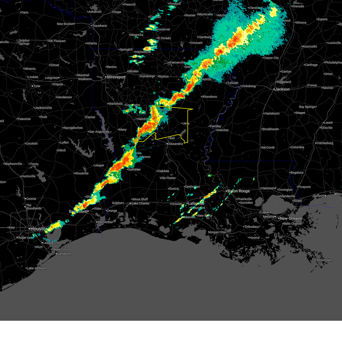
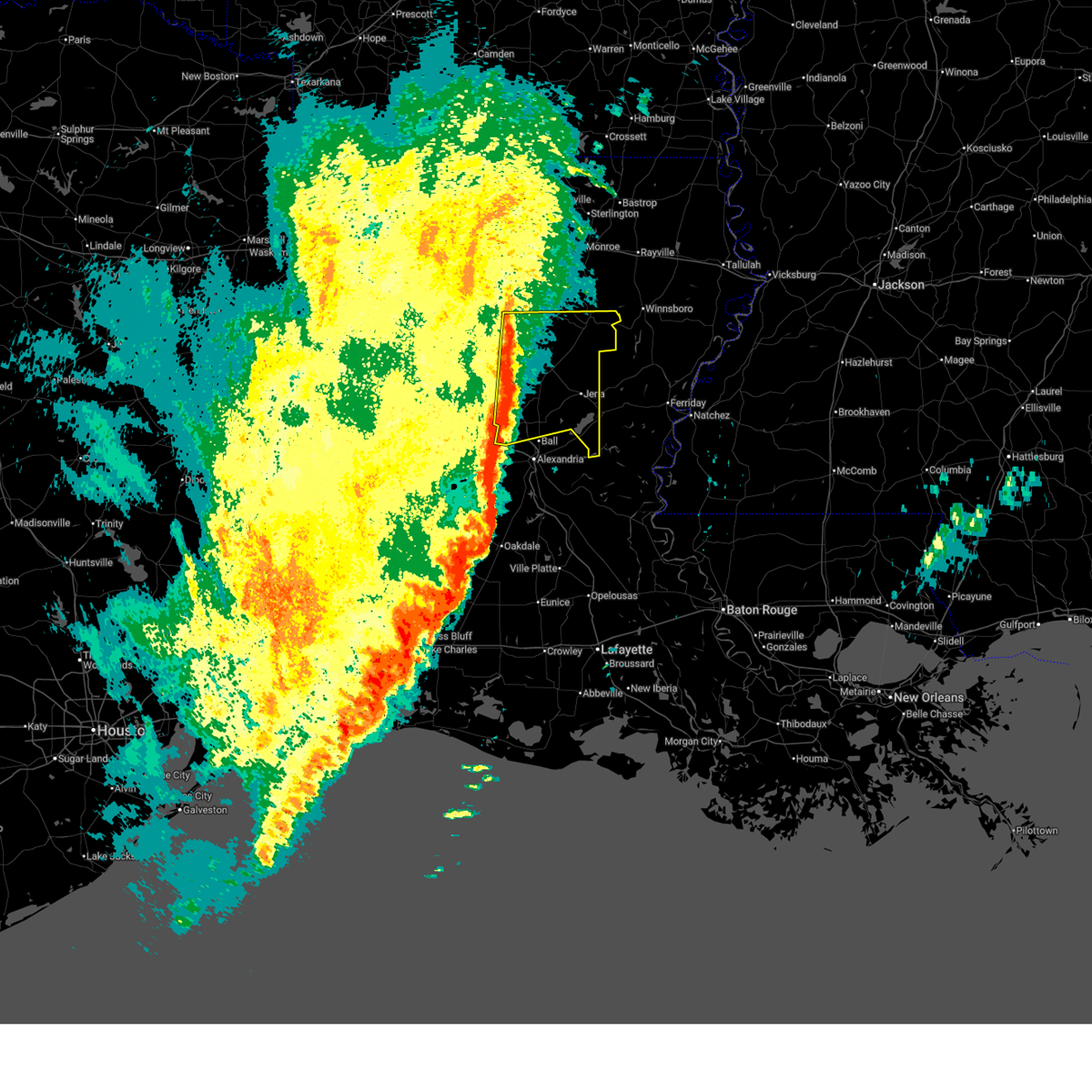
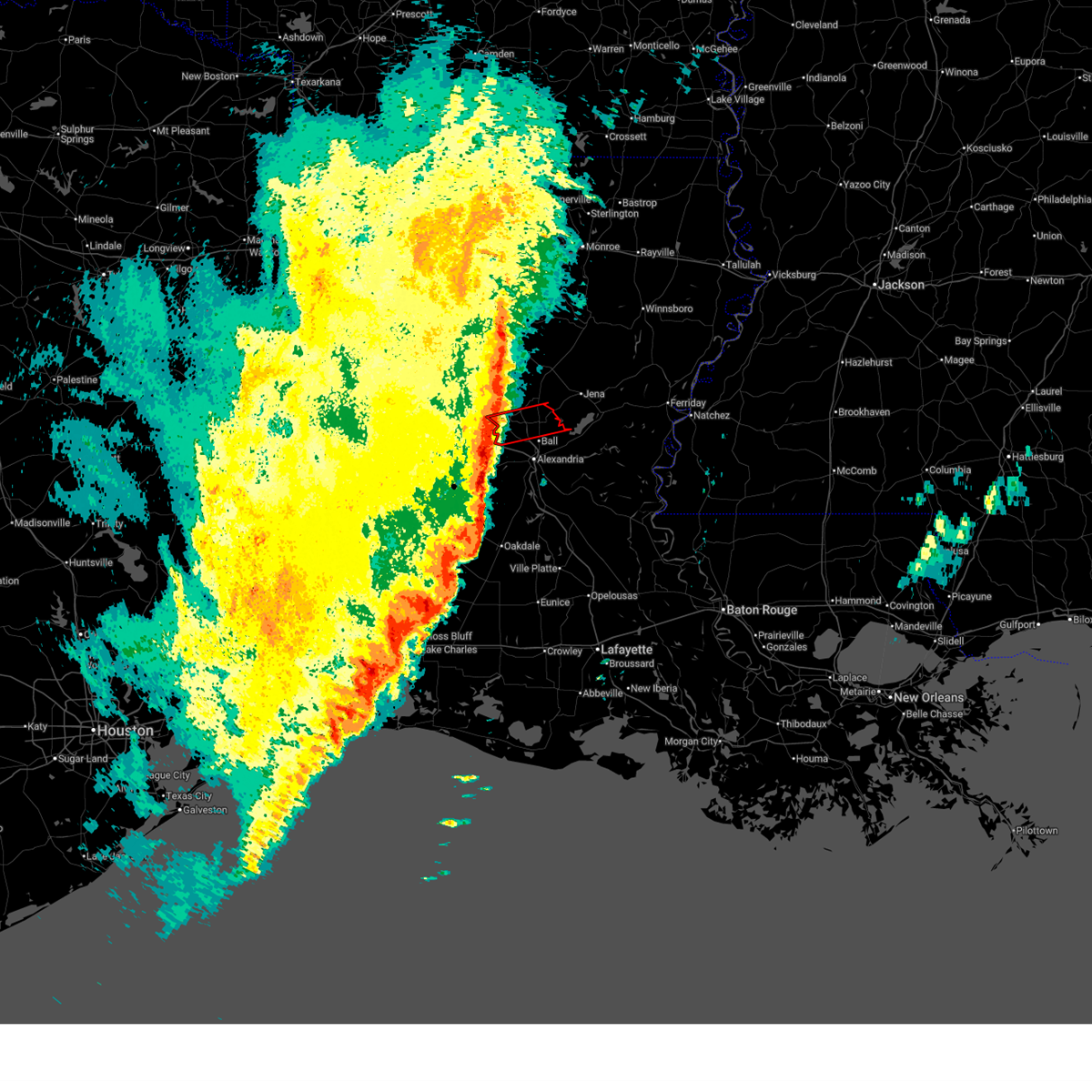
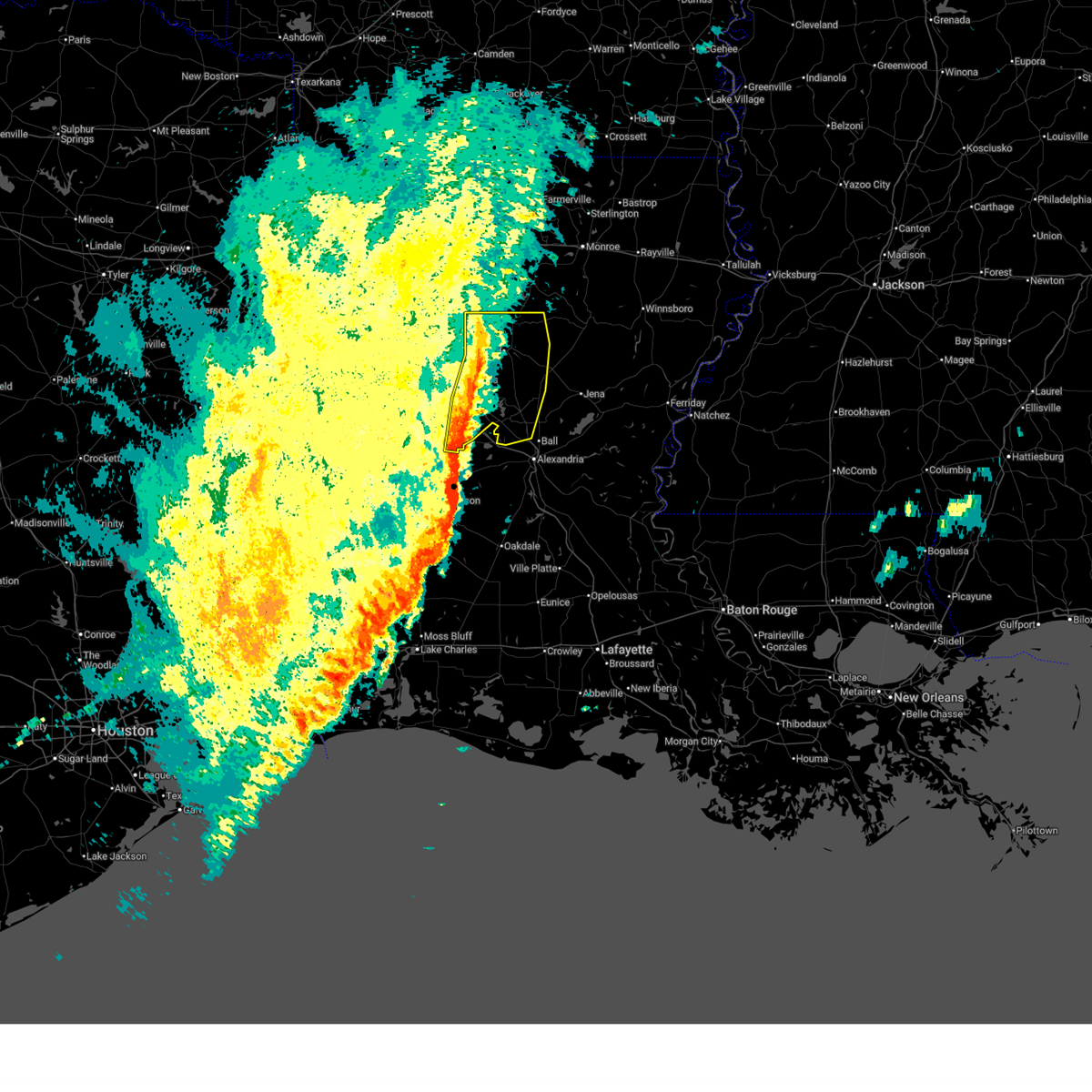
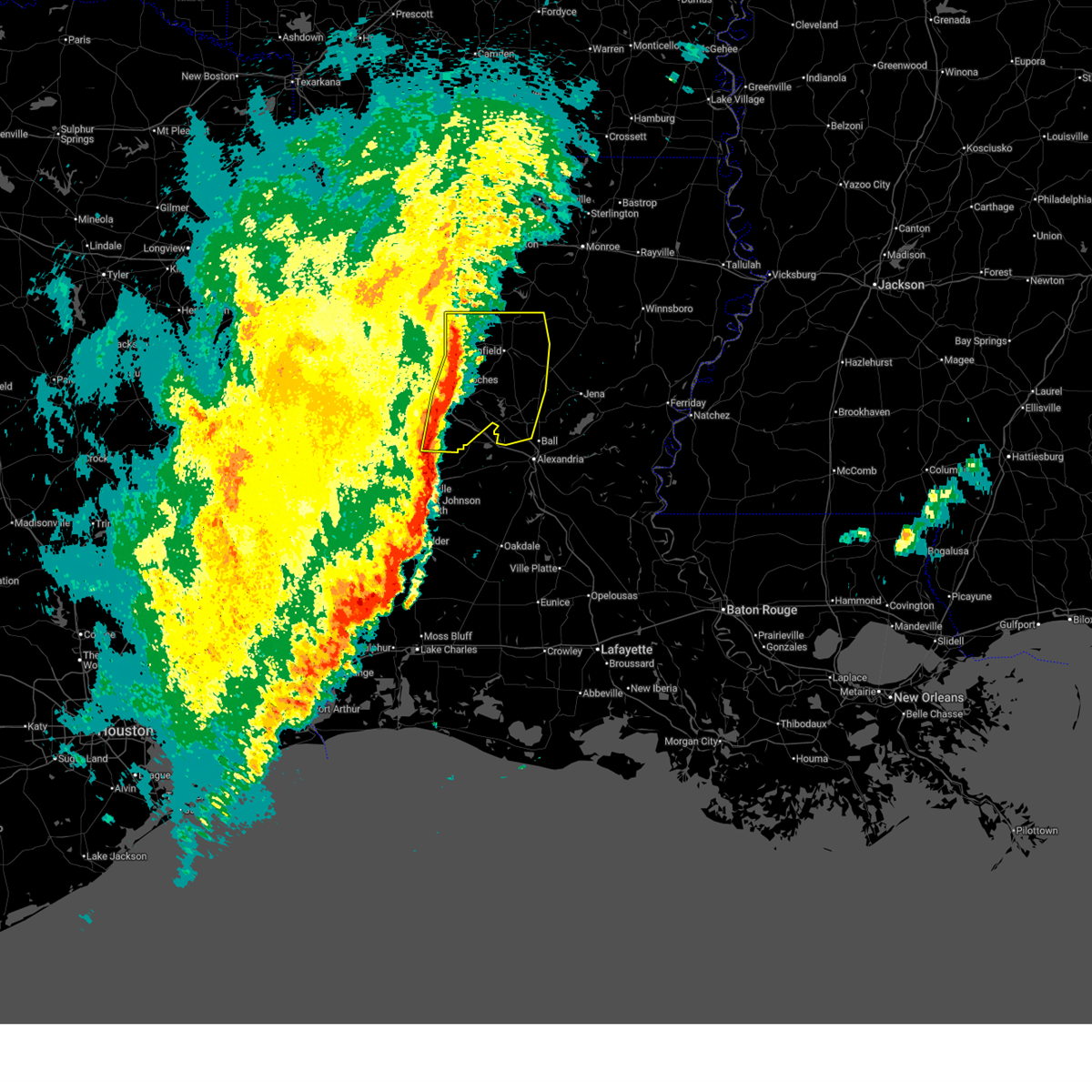
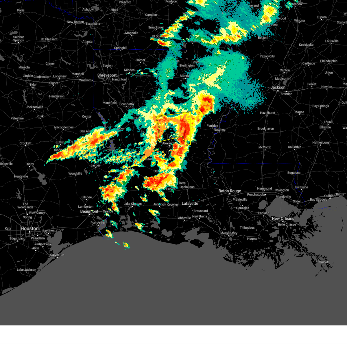
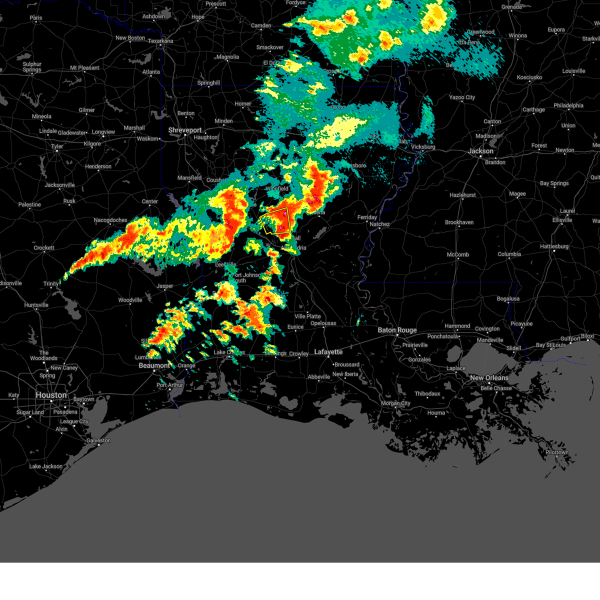
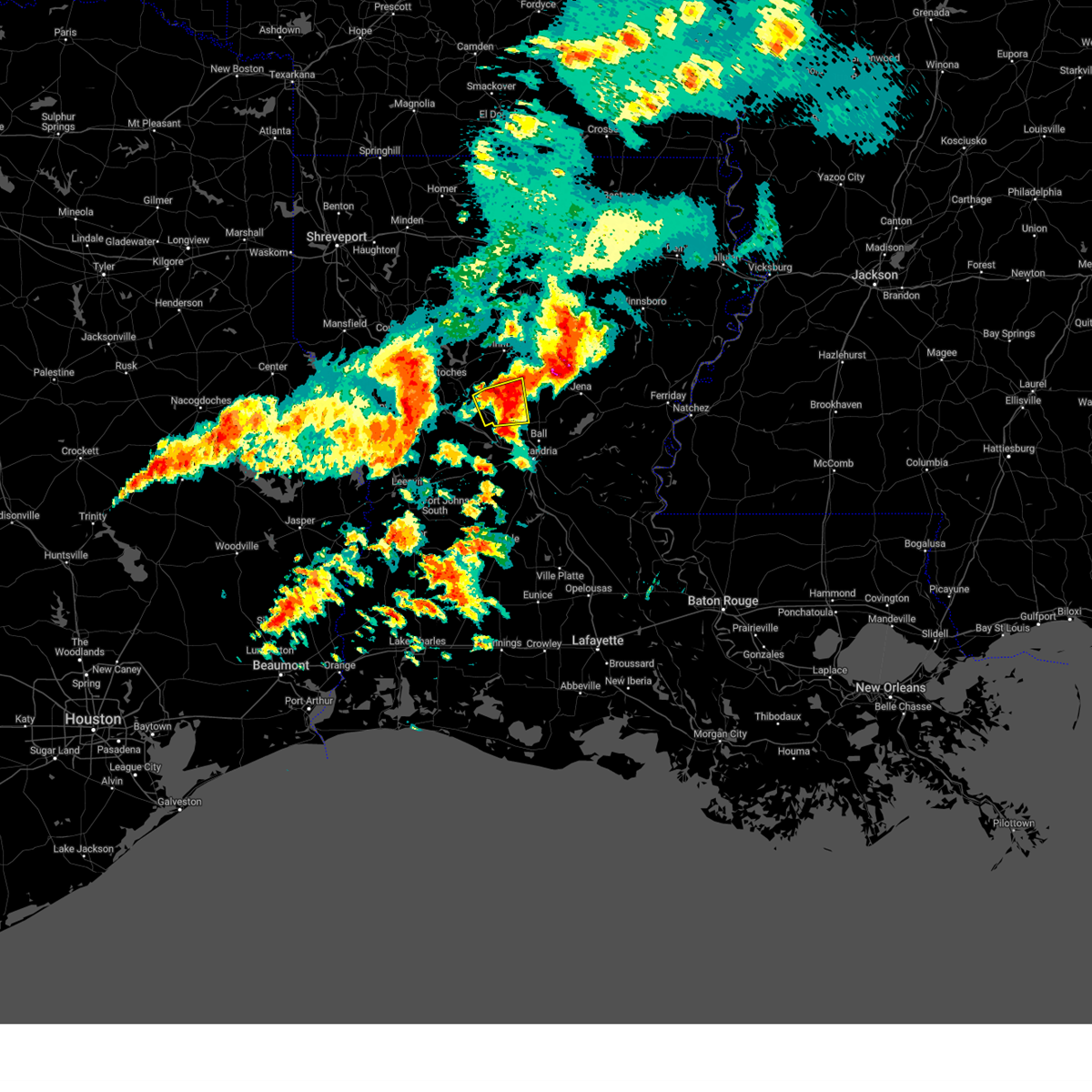
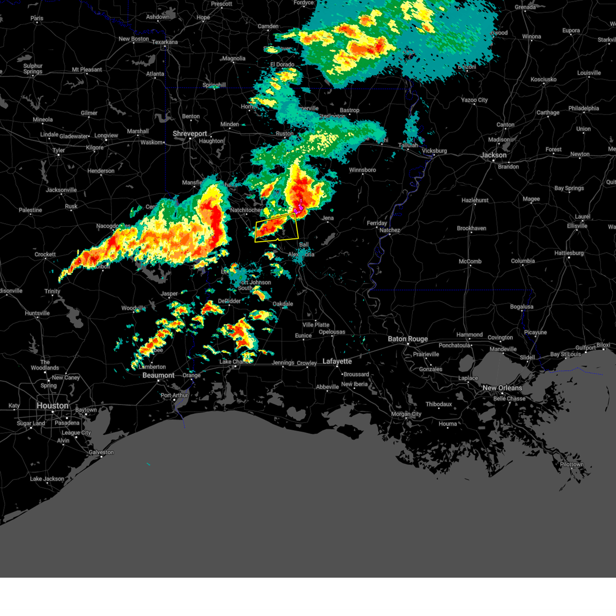
The Top Recent Hail Date for Dry Prong, LA is Sunday, March 15, 2026 (20th out of 56)

Hail and Wind Damage Spotted near Dry Prong, LA
| Date / Time | Report Details |
|---|---|
| 5/23/2026 11:40 AM CDT |
 The storms which prompted the warning have moved out of the area. therefore, the warning will be allowed to expire. however, gusty winds and heavy rain are still possible with these thunderstorms. to report severe weather, contact your nearest law enforcement agency. they will send your report to the national weather service office. a severe thunderstorm watch remains in effect until 600 pm cdt saturday for a portion of north central louisiana. The storms which prompted the warning have moved out of the area. therefore, the warning will be allowed to expire. however, gusty winds and heavy rain are still possible with these thunderstorms. to report severe weather, contact your nearest law enforcement agency. they will send your report to the national weather service office. a severe thunderstorm watch remains in effect until 600 pm cdt saturday for a portion of north central louisiana.
|
| 5/23/2026 11:12 AM CDT |
 At 1112 am cdt, severe thunderstorms were located along a line from 12 miles south of winnfield to 18 miles southwest of midway, or along a line from 12 miles south of winnfield to 39 miles southeast of winnfield, moving northeast at 40 mph (radar indicated). Hazards include 60 mph wind gusts and small hail. Expect damage to roofs, siding, and trees. Locations impacted include, colfax, pollock, dry prong, tullos, georgetown, fishville, bentley, zenoria, williana, rochelle, rogers, lake iatt, nebo, catahoula lake and aloha. At 1112 am cdt, severe thunderstorms were located along a line from 12 miles south of winnfield to 18 miles southwest of midway, or along a line from 12 miles south of winnfield to 39 miles southeast of winnfield, moving northeast at 40 mph (radar indicated). Hazards include 60 mph wind gusts and small hail. Expect damage to roofs, siding, and trees. Locations impacted include, colfax, pollock, dry prong, tullos, georgetown, fishville, bentley, zenoria, williana, rochelle, rogers, lake iatt, nebo, catahoula lake and aloha.
|
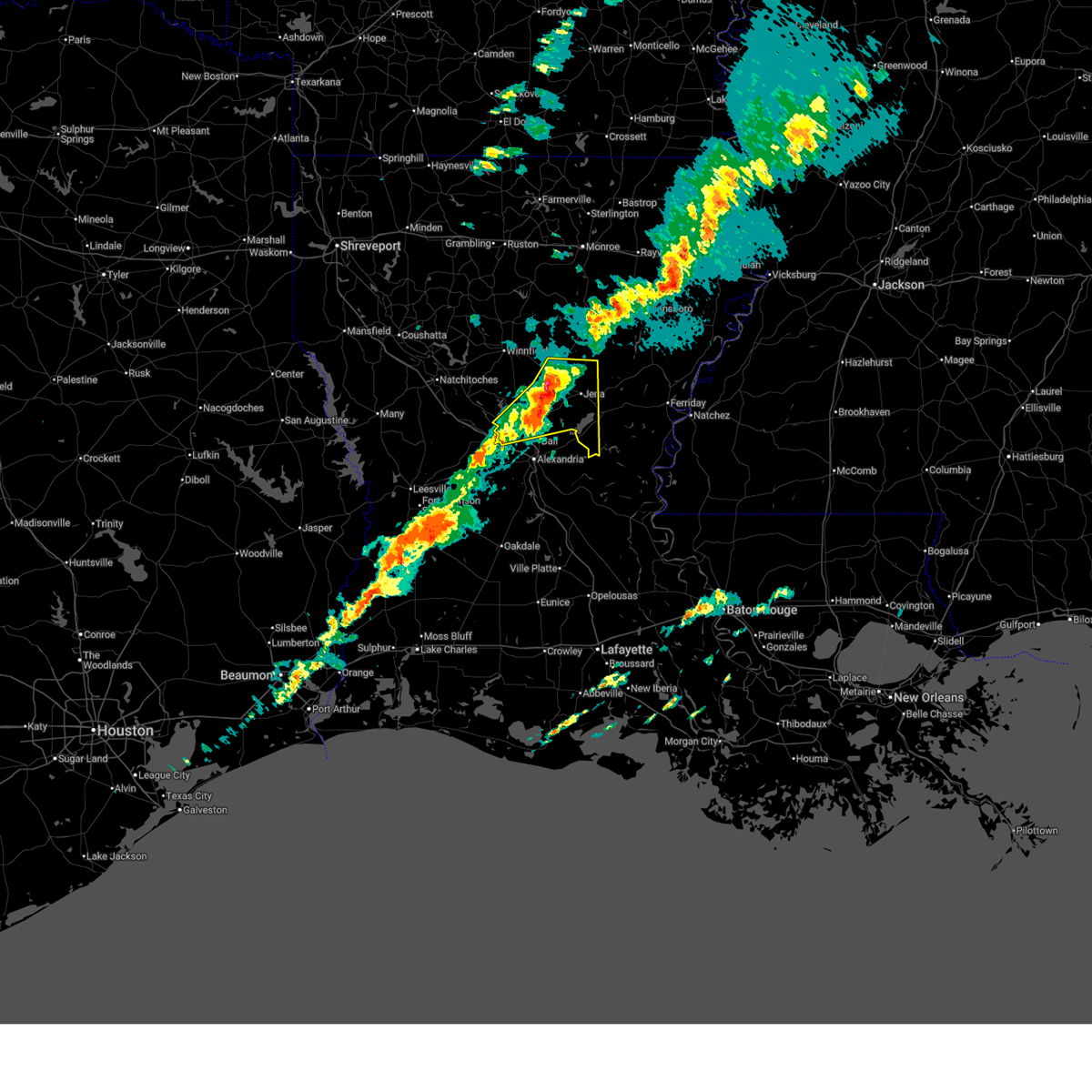
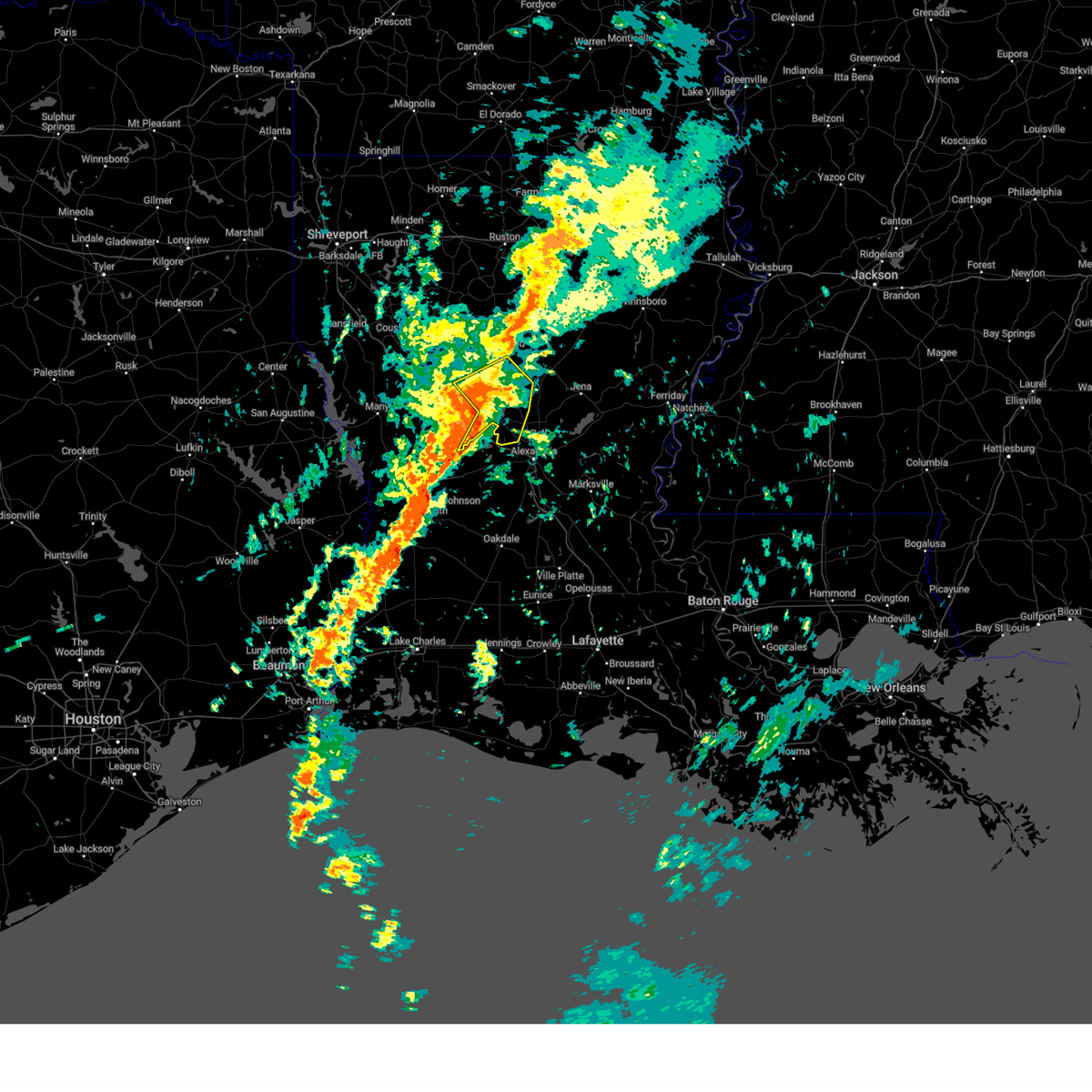
| 5/23/2026 11:07 AM CDT | Report of a tree down on us 167 north of dry prong near willian in grant county LA, 6.7 miles SSE of Dry Prong, LA |
| 5/23/2026 10:43 AM CDT |
 Svrshv the national weather service in shreveport has issued a * severe thunderstorm warning for, grant parish in north central louisiana, central la salle parish in north central louisiana, southeastern winn parish in north central louisiana, southeastern natchitoches parish in northwestern louisiana, * until 1145 am cdt. * at 1043 am cdt, severe thunderstorms were located along a line from 6 miles southwest of colfax to 30 miles southeast of colfax, or along a line from 26 miles southeast of natchitoches to 54 miles south of winnfield, moving northeast at 40 mph (radar indicated). Hazards include 70 mph wind gusts and quarter size hail. Hail damage to vehicles is expected. expect considerable tree damage. Wind damage is also likely to mobile homes, roofs, and outbuildings. Svrshv the national weather service in shreveport has issued a * severe thunderstorm warning for, grant parish in north central louisiana, central la salle parish in north central louisiana, southeastern winn parish in north central louisiana, southeastern natchitoches parish in northwestern louisiana, * until 1145 am cdt. * at 1043 am cdt, severe thunderstorms were located along a line from 6 miles southwest of colfax to 30 miles southeast of colfax, or along a line from 26 miles southeast of natchitoches to 54 miles south of winnfield, moving northeast at 40 mph (radar indicated). Hazards include 70 mph wind gusts and quarter size hail. Hail damage to vehicles is expected. expect considerable tree damage. Wind damage is also likely to mobile homes, roofs, and outbuildings.
|
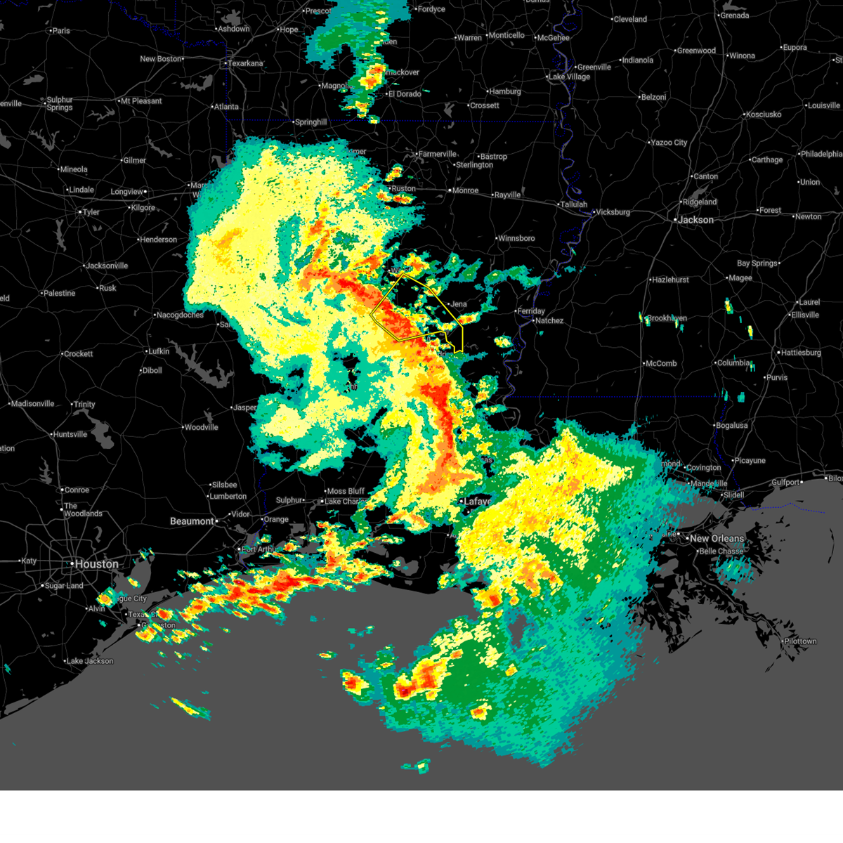
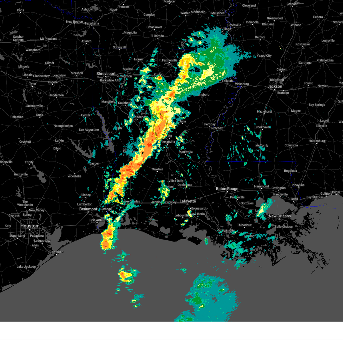
| 3/15/2026 9:18 PM CDT |
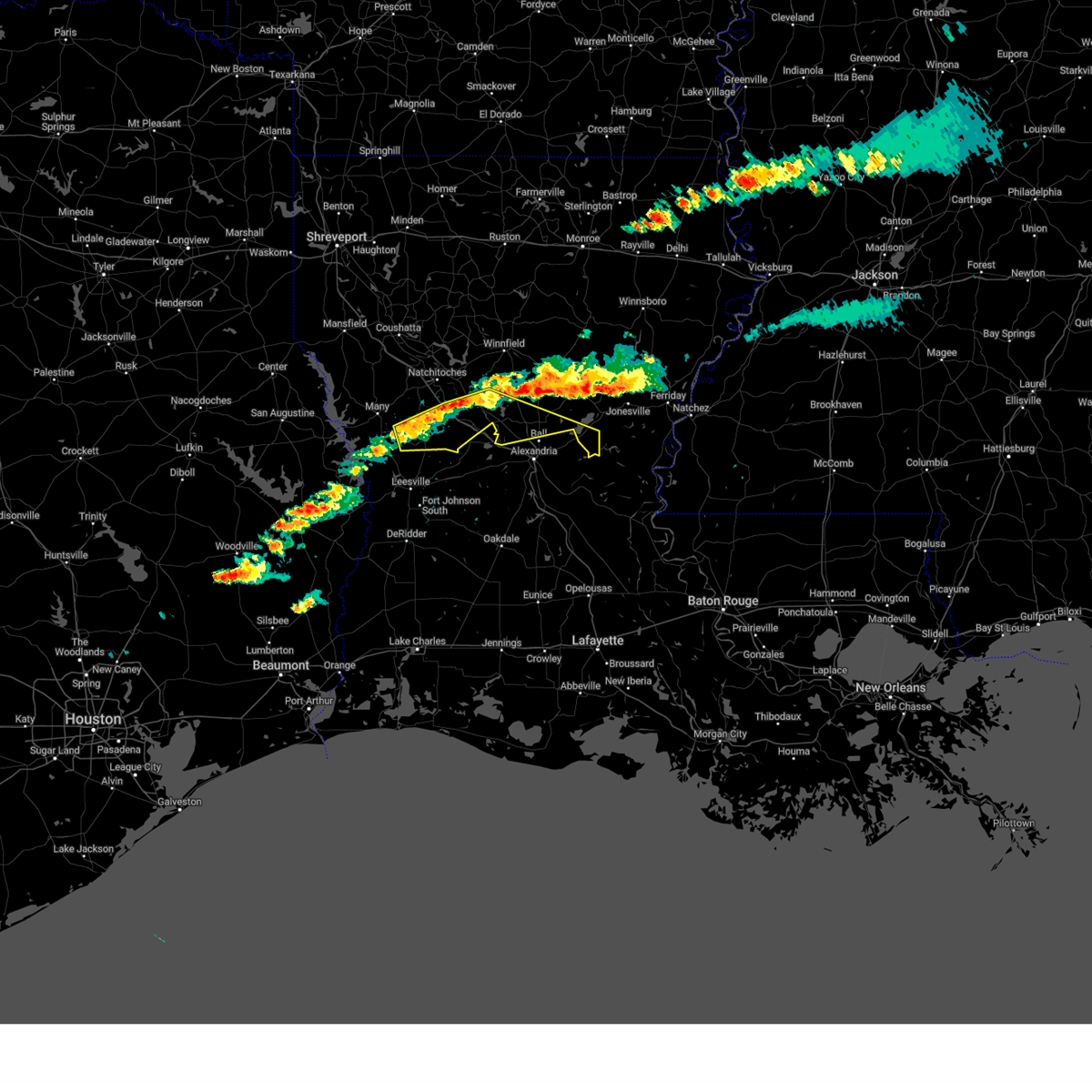
 At 918 pm cdt, severe thunderstorms were located along a line from near olla to 16 miles south of colfax, or along a line from 21 miles southwest of columbia to 38 miles southeast of natchitoches, moving east at 45 mph (radar indicated). Hazards include 60 mph wind gusts and quarter size hail. Hail damage to vehicles is expected. expect wind damage to roofs, siding, and trees. Locations impacted include, jena, colfax, midway, urania, pollock, dry prong, tullos, georgetown, rogers, fishville, zenoria, nebo, rochelle, catahoula lake and bentley. At 918 pm cdt, severe thunderstorms were located along a line from near olla to 16 miles south of colfax, or along a line from 21 miles southwest of columbia to 38 miles southeast of natchitoches, moving east at 45 mph (radar indicated). Hazards include 60 mph wind gusts and quarter size hail. Hail damage to vehicles is expected. expect wind damage to roofs, siding, and trees. Locations impacted include, jena, colfax, midway, urania, pollock, dry prong, tullos, georgetown, rogers, fishville, zenoria, nebo, rochelle, catahoula lake and bentley.
|
| 3/15/2026 9:18 PM CDT |
 the severe thunderstorm warning has been cancelled and is no longer in effect the severe thunderstorm warning has been cancelled and is no longer in effect
|
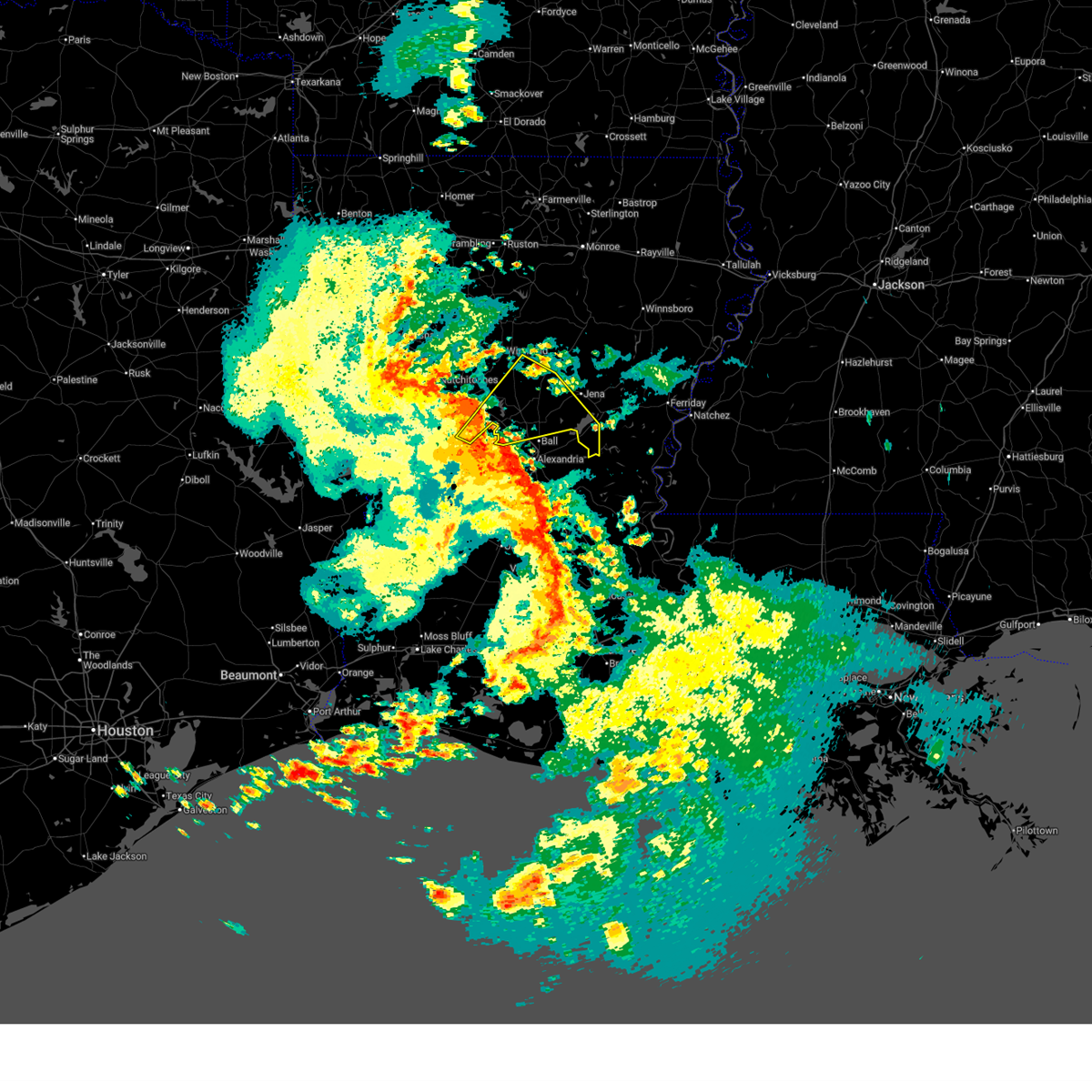
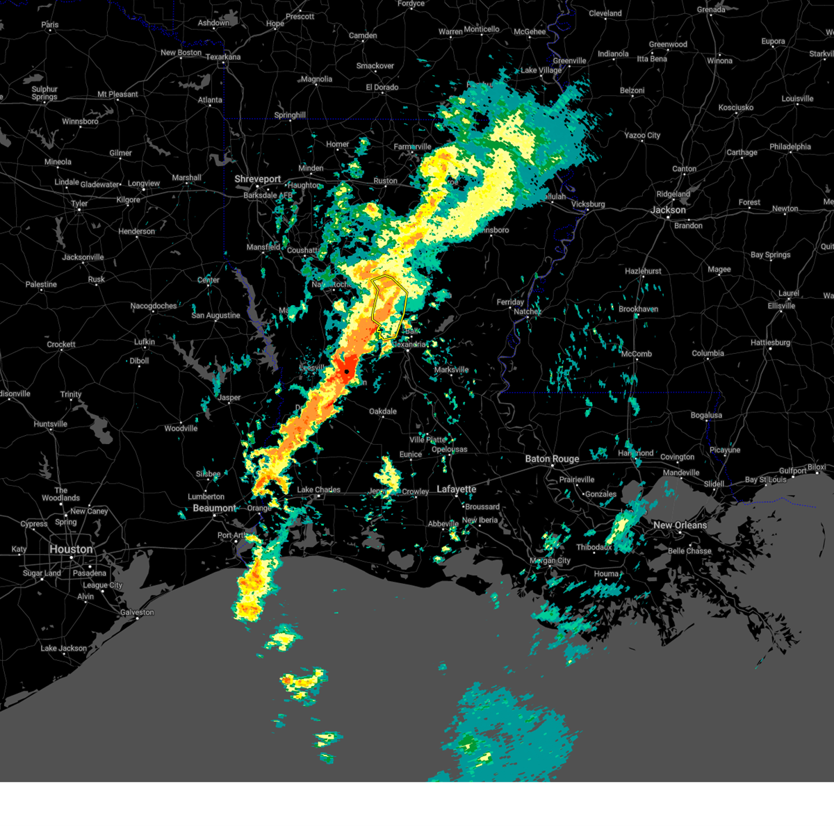
| 3/15/2026 9:07 PM CDT |
 At 907 pm cdt, severe thunderstorms were located along a line from 11 miles west of olla to 16 miles southwest of colfax, or along a line from 13 miles east of winnfield to 32 miles southeast of natchitoches, moving east at 45 mph (radar indicated). Hazards include 60 mph wind gusts and quarter size hail. Hail damage to vehicles is expected. expect wind damage to roofs, siding, and trees. Locations impacted include, jena, colfax, olla, midway, urania, pollock, dry prong, tullos, georgetown, zenoria, rochelle, fishville, rogers, bentley, williana, nebo, catahoula lake, standard, lake iatt and burlington. At 907 pm cdt, severe thunderstorms were located along a line from 11 miles west of olla to 16 miles southwest of colfax, or along a line from 13 miles east of winnfield to 32 miles southeast of natchitoches, moving east at 45 mph (radar indicated). Hazards include 60 mph wind gusts and quarter size hail. Hail damage to vehicles is expected. expect wind damage to roofs, siding, and trees. Locations impacted include, jena, colfax, olla, midway, urania, pollock, dry prong, tullos, georgetown, zenoria, rochelle, fishville, rogers, bentley, williana, nebo, catahoula lake, standard, lake iatt and burlington.
|
| 3/15/2026 8:56 PM CDT | Tree down blocking the northbound lane of highway 167 near the intersection of highway 472 in the williana communit in grant county LA, 6.7 miles SSE of Dry Prong, LA |
| 3/15/2026 8:51 PM CDT |
 Svrshv the national weather service in shreveport has issued a * severe thunderstorm warning for, southwestern caldwell parish in north central louisiana, grant parish in north central louisiana, la salle parish in north central louisiana, southeastern winn parish in north central louisiana, southeastern natchitoches parish in northwestern louisiana, * until 945 pm cdt. * at 851 pm cdt, severe thunderstorms were located along a line from near winnfield to 23 miles south of montgomery, or along a line from near winnfield to 26 miles south of natchitoches, moving east at 45 mph (radar indicated). Hazards include 60 mph wind gusts and small hail. expect damage to roofs, siding, and trees Svrshv the national weather service in shreveport has issued a * severe thunderstorm warning for, southwestern caldwell parish in north central louisiana, grant parish in north central louisiana, la salle parish in north central louisiana, southeastern winn parish in north central louisiana, southeastern natchitoches parish in northwestern louisiana, * until 945 pm cdt. * at 851 pm cdt, severe thunderstorms were located along a line from near winnfield to 23 miles south of montgomery, or along a line from near winnfield to 26 miles south of natchitoches, moving east at 45 mph (radar indicated). Hazards include 60 mph wind gusts and small hail. expect damage to roofs, siding, and trees
|
| 2/14/2026 9:16 PM CST |
 At 916 pm cst, severe thunderstorms were located along a line from 10 miles northwest of clarks to 24 miles southwest of midway, or along a line from 11 miles west of columbia to 42 miles southeast of winnfield, moving east at 40 mph (radar indicated). Hazards include 60 mph wind gusts. Expect damage to roofs, siding, and trees. Locations impacted include, columbia, jena, olla, clarks, grayson, midway, urania, pollock, dry prong, tullos, georgetown, zenoria, standard, burlington, rochelle, spaulding, kelly, nebo, rogers and catahoula lake. At 916 pm cst, severe thunderstorms were located along a line from 10 miles northwest of clarks to 24 miles southwest of midway, or along a line from 11 miles west of columbia to 42 miles southeast of winnfield, moving east at 40 mph (radar indicated). Hazards include 60 mph wind gusts. Expect damage to roofs, siding, and trees. Locations impacted include, columbia, jena, olla, clarks, grayson, midway, urania, pollock, dry prong, tullos, georgetown, zenoria, standard, burlington, rochelle, spaulding, kelly, nebo, rogers and catahoula lake.
|
| 2/14/2026 9:01 PM CST |
 At 901 pm cst, severe thunderstorms were located along a line from 17 miles southeast of jonesboro to 15 miles southeast of colfax, or along a line from 17 miles southeast of jonesboro to 38 miles south of winnfield, moving east at 40 mph (radar indicated). Hazards include 60 mph wind gusts. Expect damage to roofs, siding, and trees. Locations impacted include, columbia, jena, olla, clarks, grayson, midway, urania, pollock, dry prong, tullos, georgetown, sikes, zenoria, rochelle, standard, burlington, spaulding, kelly, nebo and rogers. At 901 pm cst, severe thunderstorms were located along a line from 17 miles southeast of jonesboro to 15 miles southeast of colfax, or along a line from 17 miles southeast of jonesboro to 38 miles south of winnfield, moving east at 40 mph (radar indicated). Hazards include 60 mph wind gusts. Expect damage to roofs, siding, and trees. Locations impacted include, columbia, jena, olla, clarks, grayson, midway, urania, pollock, dry prong, tullos, georgetown, sikes, zenoria, rochelle, standard, burlington, spaulding, kelly, nebo and rogers.
|
| 2/14/2026 8:52 PM CST |
 Svrshv the national weather service in shreveport has issued a * severe thunderstorm warning for, caldwell parish in north central louisiana, grant parish in north central louisiana, la salle parish in north central louisiana, eastern winn parish in north central louisiana, * until 945 pm cst. * at 852 pm cst, severe thunderstorms were located along a line from 13 miles southeast of jonesboro to 13 miles southeast of colfax, or along a line from 13 miles southeast of jonesboro to 38 miles south of winnfield, moving east at 40 mph (radar indicated). Hazards include 60 mph wind gusts. expect damage to roofs, siding, and trees Svrshv the national weather service in shreveport has issued a * severe thunderstorm warning for, caldwell parish in north central louisiana, grant parish in north central louisiana, la salle parish in north central louisiana, eastern winn parish in north central louisiana, * until 945 pm cst. * at 852 pm cst, severe thunderstorms were located along a line from 13 miles southeast of jonesboro to 13 miles southeast of colfax, or along a line from 13 miles southeast of jonesboro to 38 miles south of winnfield, moving east at 40 mph (radar indicated). Hazards include 60 mph wind gusts. expect damage to roofs, siding, and trees
|
| 2/14/2026 8:45 PM CST |
 Torshv the national weather service in shreveport has issued a * tornado warning for, southeastern grant parish in north central louisiana, * until 930 pm cst. * at 845 pm cst, a severe thunderstorm capable of producing a tornado was located 6 miles south of colfax, or 32 miles southeast of natchitoches, moving east at 35 mph (radar indicated rotation). Hazards include tornado. Flying debris will be dangerous to those caught without shelter. mobile homes will be damaged or destroyed. damage to roofs, windows and vehicles will occur. Tree damage is likely. Torshv the national weather service in shreveport has issued a * tornado warning for, southeastern grant parish in north central louisiana, * until 930 pm cst. * at 845 pm cst, a severe thunderstorm capable of producing a tornado was located 6 miles south of colfax, or 32 miles southeast of natchitoches, moving east at 35 mph (radar indicated rotation). Hazards include tornado. Flying debris will be dangerous to those caught without shelter. mobile homes will be damaged or destroyed. damage to roofs, windows and vehicles will occur. Tree damage is likely.
|
| 2/14/2026 8:29 PM CST |
 At 829 pm cst, severe thunderstorms were located along a line from 8 miles south of jonesboro to 14 miles southwest of colfax, or along a line from 8 miles south of jonesboro to 31 miles southeast of natchitoches, moving east at 40 mph (radar indicated). Hazards include 60 mph wind gusts. Expect damage to roofs, siding, and trees. Locations impacted include, winnfield, colfax, montgomery, dry prong, goldonna, dodson, georgetown, calvin, atlanta, sikes, williana, lake iatt, joyce, aloha, hudson, rochelle, bentley, chopin, cloutierville and melrose. At 829 pm cst, severe thunderstorms were located along a line from 8 miles south of jonesboro to 14 miles southwest of colfax, or along a line from 8 miles south of jonesboro to 31 miles southeast of natchitoches, moving east at 40 mph (radar indicated). Hazards include 60 mph wind gusts. Expect damage to roofs, siding, and trees. Locations impacted include, winnfield, colfax, montgomery, dry prong, goldonna, dodson, georgetown, calvin, atlanta, sikes, williana, lake iatt, joyce, aloha, hudson, rochelle, bentley, chopin, cloutierville and melrose.
|
| 2/14/2026 8:09 PM CST |
 Svrshv the national weather service in shreveport has issued a * severe thunderstorm warning for, grant parish in north central louisiana, winn parish in north central louisiana, central natchitoches parish in northwestern louisiana, * until 900 pm cst. * at 809 pm cst, severe thunderstorms were located along a line from 16 miles southwest of jonesboro to 24 miles south of montgomery, or along a line from 16 miles southwest of jonesboro to 27 miles south of natchitoches, moving east at 40 mph (radar indicated). Hazards include 60 mph wind gusts. expect damage to roofs, siding, and trees Svrshv the national weather service in shreveport has issued a * severe thunderstorm warning for, grant parish in north central louisiana, winn parish in north central louisiana, central natchitoches parish in northwestern louisiana, * until 900 pm cst. * at 809 pm cst, severe thunderstorms were located along a line from 16 miles southwest of jonesboro to 24 miles south of montgomery, or along a line from 16 miles southwest of jonesboro to 27 miles south of natchitoches, moving east at 40 mph (radar indicated). Hazards include 60 mph wind gusts. expect damage to roofs, siding, and trees
|
| 7/9/2025 3:55 PM CDT |
 The storm which prompted the warning has weakened below severe limits, and no longer poses an immediate threat to life or property. therefore, the warning will be allowed to expire. however, gusty winds are still possible with this thunderstorm. The storm which prompted the warning has weakened below severe limits, and no longer poses an immediate threat to life or property. therefore, the warning will be allowed to expire. however, gusty winds are still possible with this thunderstorm.
|
| 7/9/2025 3:24 PM CDT |
 Svrshv the national weather service in shreveport has issued a * severe thunderstorm warning for, grant parish in north central louisiana, southeastern natchitoches parish in northwestern louisiana, southwestern winn parish in north central louisiana, * until 400 pm cdt. * at 324 pm cdt, a severe thunderstorm was located 8 miles southwest of montgomery, or 11 miles southeast of natchitoches, moving east at 15 mph (radar indicated). Hazards include 60 mph wind gusts. expect damage to roofs, siding, and trees Svrshv the national weather service in shreveport has issued a * severe thunderstorm warning for, grant parish in north central louisiana, southeastern natchitoches parish in northwestern louisiana, southwestern winn parish in north central louisiana, * until 400 pm cdt. * at 324 pm cdt, a severe thunderstorm was located 8 miles southwest of montgomery, or 11 miles southeast of natchitoches, moving east at 15 mph (radar indicated). Hazards include 60 mph wind gusts. expect damage to roofs, siding, and trees
|
| 6/11/2025 4:51 PM CDT |
 At 450 pm cdt, severe thunderstorms were located along a line extending from 10 miles southwest of jonesboro to 9 miles southeast of winnfield to 14 miles north of ball to near timber trails, moving northeast at 25 mph (radar indicated). Hazards include 60 mph wind gusts and penny size hail. Expect damage to roofs, siding, and trees. Locations impacted include, winnfield, ball, urania, pollock, dry prong, goldonna, tullos, dodson, georgetown, calvin, sikes, rogers, hudson, bentley, rochelle, joyce, zenoria, fishville, and williana. At 450 pm cdt, severe thunderstorms were located along a line extending from 10 miles southwest of jonesboro to 9 miles southeast of winnfield to 14 miles north of ball to near timber trails, moving northeast at 25 mph (radar indicated). Hazards include 60 mph wind gusts and penny size hail. Expect damage to roofs, siding, and trees. Locations impacted include, winnfield, ball, urania, pollock, dry prong, goldonna, tullos, dodson, georgetown, calvin, sikes, rogers, hudson, bentley, rochelle, joyce, zenoria, fishville, and williana.
|
| 6/11/2025 4:20 PM CDT |
 Svrshv the national weather service in shreveport has issued a * severe thunderstorm warning for, grant parish in north central louisiana, northeastern natchitoches parish in northwestern louisiana, northwestern la salle parish in north central louisiana, winn parish in north central louisiana, * until 515 pm cdt. * at 420 pm cdt, severe thunderstorms were located along a line extending from 14 miles northeast of campti to 11 miles south of winnfield to 7 miles northeast of colfax to near boyce, moving northeast at 25 mph (radar indicated). Hazards include 60 mph wind gusts and penny size hail. expect damage to roofs, siding, and trees Svrshv the national weather service in shreveport has issued a * severe thunderstorm warning for, grant parish in north central louisiana, northeastern natchitoches parish in northwestern louisiana, northwestern la salle parish in north central louisiana, winn parish in north central louisiana, * until 515 pm cdt. * at 420 pm cdt, severe thunderstorms were located along a line extending from 14 miles northeast of campti to 11 miles south of winnfield to 7 miles northeast of colfax to near boyce, moving northeast at 25 mph (radar indicated). Hazards include 60 mph wind gusts and penny size hail. expect damage to roofs, siding, and trees
|
| 5/27/2025 5:18 AM CDT |
 At 518 am cdt, severe thunderstorms were located along a line extending from 6 miles north of timber trails to near holloway to near echo, moving east at 30 mph (radar indicated). Hazards include 60 mph wind gusts and quarter size hail. Hail damage to vehicles is expected. expect wind damage to roofs, siding, and trees. Locations impacted include, nebo, rogers, catahoula lake, pollock, midway, dry prong, fishville, jena, and bentley. At 518 am cdt, severe thunderstorms were located along a line extending from 6 miles north of timber trails to near holloway to near echo, moving east at 30 mph (radar indicated). Hazards include 60 mph wind gusts and quarter size hail. Hail damage to vehicles is expected. expect wind damage to roofs, siding, and trees. Locations impacted include, nebo, rogers, catahoula lake, pollock, midway, dry prong, fishville, jena, and bentley.
|
| 5/27/2025 4:49 AM CDT |
 the severe thunderstorm warning has been cancelled and is no longer in effect the severe thunderstorm warning has been cancelled and is no longer in effect
|
| 5/27/2025 4:49 AM CDT |
 At 448 am cdt, severe thunderstorms were located along a line extending from near boyce to alexandria to near lecompte, moving east at 30 mph (radar indicated). Hazards include 60 mph wind gusts and quarter size hail. Hail damage to vehicles is expected. expect wind damage to roofs, siding, and trees. Locations impacted include, nebo, rogers, catahoula lake, pollock, midway, dry prong, fishville, jena, bentley, colfax, and ball. At 448 am cdt, severe thunderstorms were located along a line extending from near boyce to alexandria to near lecompte, moving east at 30 mph (radar indicated). Hazards include 60 mph wind gusts and quarter size hail. Hail damage to vehicles is expected. expect wind damage to roofs, siding, and trees. Locations impacted include, nebo, rogers, catahoula lake, pollock, midway, dry prong, fishville, jena, bentley, colfax, and ball.
|
| 5/27/2025 4:35 AM CDT |
 Svrshv the national weather service in shreveport has issued a * severe thunderstorm warning for, southeastern grant parish in north central louisiana, southeastern natchitoches parish in northwestern louisiana, central la salle parish in north central louisiana, * until 530 am cdt. * at 434 am cdt, severe thunderstorms were located along a line extending from near lena to near alexandria international airport to near glenmora, moving east at 30 mph (radar indicated). Hazards include 60 mph wind gusts and quarter size hail. Hail damage to vehicles is expected. Expect wind damage to roofs, siding, and trees. Svrshv the national weather service in shreveport has issued a * severe thunderstorm warning for, southeastern grant parish in north central louisiana, southeastern natchitoches parish in northwestern louisiana, central la salle parish in north central louisiana, * until 530 am cdt. * at 434 am cdt, severe thunderstorms were located along a line extending from near lena to near alexandria international airport to near glenmora, moving east at 30 mph (radar indicated). Hazards include 60 mph wind gusts and quarter size hail. Hail damage to vehicles is expected. Expect wind damage to roofs, siding, and trees.
|
| 5/20/2025 7:43 PM CDT |
 At 743 pm cdt, severe thunderstorms were located along a line extending from 7 miles east of colfax to near flatwoods to near anacoco, moving southeast at 20 mph (radar indicated). Hazards include 60 mph wind gusts and quarter size hail. Hail damage to vehicles is expected. expect wind damage to roofs, siding, and trees. Locations impacted include, kisatchie, rogers, lake iatt, chopin, pollock, aloha, dry prong, fishville, bentley, colfax, and gorum. At 743 pm cdt, severe thunderstorms were located along a line extending from 7 miles east of colfax to near flatwoods to near anacoco, moving southeast at 20 mph (radar indicated). Hazards include 60 mph wind gusts and quarter size hail. Hail damage to vehicles is expected. expect wind damage to roofs, siding, and trees. Locations impacted include, kisatchie, rogers, lake iatt, chopin, pollock, aloha, dry prong, fishville, bentley, colfax, and gorum.
|
| 5/20/2025 7:12 PM CDT |
 At 712 pm cdt, severe thunderstorms were located along a line extending from 11 miles north of colfax to 9 miles southwest of montgomery to near hornbeck, moving southeast at 20 mph (radar indicated). Hazards include 60 mph wind gusts and quarter size hail. Hail damage to vehicles is expected. expect wind damage to roofs, siding, and trees. Locations impacted include, kisatchie, cloutierville, melrose, rogers, montgomery, bellwood, chopin, dry prong, bentley, lake iatt, cypress, pollock, aloha, fishville, colfax, and gorum. At 712 pm cdt, severe thunderstorms were located along a line extending from 11 miles north of colfax to 9 miles southwest of montgomery to near hornbeck, moving southeast at 20 mph (radar indicated). Hazards include 60 mph wind gusts and quarter size hail. Hail damage to vehicles is expected. expect wind damage to roofs, siding, and trees. Locations impacted include, kisatchie, cloutierville, melrose, rogers, montgomery, bellwood, chopin, dry prong, bentley, lake iatt, cypress, pollock, aloha, fishville, colfax, and gorum.
|
| 5/20/2025 7:07 PM CDT |
 Svrshv the national weather service in shreveport has issued a * severe thunderstorm warning for, grant parish in north central louisiana, southern natchitoches parish in northwestern louisiana, southern la salle parish in north central louisiana, east central sabine parish in northwestern louisiana, * until 815 pm cdt. * at 707 pm cdt, severe thunderstorms were located along a line extending from 12 miles north of colfax to 9 miles southwest of montgomery to near hornbeck, moving southeast at 20 mph (radar indicated). Hazards include 60 mph wind gusts and half dollar size hail. Hail damage to vehicles is expected. Expect wind damage to roofs, siding, and trees. Svrshv the national weather service in shreveport has issued a * severe thunderstorm warning for, grant parish in north central louisiana, southern natchitoches parish in northwestern louisiana, southern la salle parish in north central louisiana, east central sabine parish in northwestern louisiana, * until 815 pm cdt. * at 707 pm cdt, severe thunderstorms were located along a line extending from 12 miles north of colfax to 9 miles southwest of montgomery to near hornbeck, moving southeast at 20 mph (radar indicated). Hazards include 60 mph wind gusts and half dollar size hail. Hail damage to vehicles is expected. Expect wind damage to roofs, siding, and trees.
|
| 5/1/2025 1:44 AM CDT |
 At 143 am cdt, severe thunderstorms were located along a line extending from 12 miles northeast of winnfield to 15 miles north of colfax to near flatwoods, moving east at 45 mph (radar indicated). Hazards include 60 mph wind gusts and penny size hail. Expect damage to roofs, siding, and trees. Locations impacted include, sikes, cloutierville, montgomery, winnfield, hudson, chopin, dry prong, dodson, joyce, lake iatt, atlanta, aloha, williana, colfax, gorum, calvin, and georgetown. At 143 am cdt, severe thunderstorms were located along a line extending from 12 miles northeast of winnfield to 15 miles north of colfax to near flatwoods, moving east at 45 mph (radar indicated). Hazards include 60 mph wind gusts and penny size hail. Expect damage to roofs, siding, and trees. Locations impacted include, sikes, cloutierville, montgomery, winnfield, hudson, chopin, dry prong, dodson, joyce, lake iatt, atlanta, aloha, williana, colfax, gorum, calvin, and georgetown.
|
| 5/1/2025 1:21 AM CDT |
 Svrshv the national weather service in shreveport has issued a * severe thunderstorm warning for, grant parish in north central louisiana, eastern natchitoches parish in northwestern louisiana, winn parish in north central louisiana, * until 200 am cdt. * at 121 am cdt, severe thunderstorms were located along a line extending from 12 miles southwest of jonesboro to near montgomery to near kurthwood, moving east at 35 mph (radar indicated). Hazards include 60 mph wind gusts and penny size hail. expect damage to roofs, siding, and trees Svrshv the national weather service in shreveport has issued a * severe thunderstorm warning for, grant parish in north central louisiana, eastern natchitoches parish in northwestern louisiana, winn parish in north central louisiana, * until 200 am cdt. * at 121 am cdt, severe thunderstorms were located along a line extending from 12 miles southwest of jonesboro to near montgomery to near kurthwood, moving east at 35 mph (radar indicated). Hazards include 60 mph wind gusts and penny size hail. expect damage to roofs, siding, and trees
|
| 4/22/2025 3:41 PM CDT | Quarter sized hail reported 3.8 miles E of Dry Prong, LA, report from mping: quarter (1.00 in.). |
| 3/31/2025 3:32 AM CDT |
 The severe thunderstorm warning that was previously in effect has been reissued for and is in effect until 345 am cdt. please refer to that bulletin for the latest severe weather information. a severe thunderstorm watch remains in effect until 800 am cdt monday for a portion of north central louisiana. The severe thunderstorm warning that was previously in effect has been reissued for and is in effect until 345 am cdt. please refer to that bulletin for the latest severe weather information. a severe thunderstorm watch remains in effect until 800 am cdt monday for a portion of north central louisiana.
|
| 3/31/2025 2:55 AM CDT | Quarter sized hail reported 4.4 miles NNW of Dry Prong, LA, reports of quarter size hail in the community of bentley la. |
| 3/31/2025 2:47 AM CDT |
 Svrshv the national weather service in shreveport has issued a * severe thunderstorm warning for, grant parish in north central louisiana, la salle parish in north central louisiana, southeastern winn parish in north central louisiana, * until 330 am cdt. * at 247 am cdt, severe thunderstorms were located along a line from 10 miles southeast of winnfield to 13 miles southeast of colfax, or along a line from 10 miles southeast of winnfield to 38 miles south of winnfield, moving east at 40 mph (radar indicated). Hazards include golf ball size hail and 60 mph wind gusts. People and animals outdoors will be injured. expect hail damage to roofs, siding, windows, and vehicles. Expect wind damage to roofs, siding, and trees. Svrshv the national weather service in shreveport has issued a * severe thunderstorm warning for, grant parish in north central louisiana, la salle parish in north central louisiana, southeastern winn parish in north central louisiana, * until 330 am cdt. * at 247 am cdt, severe thunderstorms were located along a line from 10 miles southeast of winnfield to 13 miles southeast of colfax, or along a line from 10 miles southeast of winnfield to 38 miles south of winnfield, moving east at 40 mph (radar indicated). Hazards include golf ball size hail and 60 mph wind gusts. People and animals outdoors will be injured. expect hail damage to roofs, siding, windows, and vehicles. Expect wind damage to roofs, siding, and trees.
|
| 3/31/2025 2:47 AM CDT |
 the severe thunderstorm warning has been cancelled and is no longer in effect the severe thunderstorm warning has been cancelled and is no longer in effect
|
| 3/31/2025 2:43 AM CDT |
 At 243 am cdt, a severe thunderstorm was located 9 miles northeast of colfax, or 20 miles south of winnfield, moving east at 40 mph (radar indicated). Hazards include ping pong ball size hail and 60 mph wind gusts. People and animals outdoors will be injured. expect hail damage to roofs, siding, windows, and vehicles. expect wind damage to roofs, siding, and trees. Locations impacted include, colfax, dry prong, lake iatt, williana, aloha and bentley. At 243 am cdt, a severe thunderstorm was located 9 miles northeast of colfax, or 20 miles south of winnfield, moving east at 40 mph (radar indicated). Hazards include ping pong ball size hail and 60 mph wind gusts. People and animals outdoors will be injured. expect hail damage to roofs, siding, windows, and vehicles. expect wind damage to roofs, siding, and trees. Locations impacted include, colfax, dry prong, lake iatt, williana, aloha and bentley.
|
| 3/31/2025 2:22 AM CDT |
 Svrshv the national weather service in shreveport has issued a * severe thunderstorm warning for, central grant parish in north central louisiana, south central winn parish in north central louisiana, southeastern natchitoches parish in northwestern louisiana, * until 300 am cdt. * at 222 am cdt, a severe thunderstorm was located 6 miles south of montgomery, or 17 miles southeast of natchitoches, moving east at 40 mph (radar indicated). Hazards include ping pong ball size hail and 60 mph wind gusts. People and animals outdoors will be injured. expect hail damage to roofs, siding, windows, and vehicles. Expect wind damage to roofs, siding, and trees. Svrshv the national weather service in shreveport has issued a * severe thunderstorm warning for, central grant parish in north central louisiana, south central winn parish in north central louisiana, southeastern natchitoches parish in northwestern louisiana, * until 300 am cdt. * at 222 am cdt, a severe thunderstorm was located 6 miles south of montgomery, or 17 miles southeast of natchitoches, moving east at 40 mph (radar indicated). Hazards include ping pong ball size hail and 60 mph wind gusts. People and animals outdoors will be injured. expect hail damage to roofs, siding, windows, and vehicles. Expect wind damage to roofs, siding, and trees.
|
| 3/4/2025 12:11 PM CST |
 At 1211 pm cst, severe thunderstorms were located along a line from 9 miles northeast of columbia to 20 miles southwest of midway, or along a line from 9 miles northeast of columbia to 39 miles southeast of winnfield, moving east at 60 mph (radar indicated). Hazards include 70 mph wind gusts and quarter size hail. Hail damage to vehicles is expected. expect considerable tree damage. wind damage is also likely to mobile homes, roofs, and outbuildings. Locations impacted include, columbia, jena, olla, clarks, grayson, midway, urania, pollock, dry prong, tullos, georgetown, zenoria, rochelle, standard, burlington, spaulding, kelly, nebo, rogers and fishville. At 1211 pm cst, severe thunderstorms were located along a line from 9 miles northeast of columbia to 20 miles southwest of midway, or along a line from 9 miles northeast of columbia to 39 miles southeast of winnfield, moving east at 60 mph (radar indicated). Hazards include 70 mph wind gusts and quarter size hail. Hail damage to vehicles is expected. expect considerable tree damage. wind damage is also likely to mobile homes, roofs, and outbuildings. Locations impacted include, columbia, jena, olla, clarks, grayson, midway, urania, pollock, dry prong, tullos, georgetown, zenoria, rochelle, standard, burlington, spaulding, kelly, nebo, rogers and fishville.
|
| 3/4/2025 12:11 PM CST |
 the severe thunderstorm warning has been cancelled and is no longer in effect the severe thunderstorm warning has been cancelled and is no longer in effect
|
| 3/4/2025 11:27 AM CST |
 Svrshv the national weather service in shreveport has issued a * severe thunderstorm warning for, caldwell parish in north central louisiana, grant parish in north central louisiana, southern jackson parish in north central louisiana, la salle parish in north central louisiana, winn parish in north central louisiana, eastern natchitoches parish in northwestern louisiana, * until 1245 pm cst. * at 1127 am cst, severe thunderstorms were located along a line from 10 miles east of jonesboro to 19 miles southwest of colfax, or along a line from 10 miles east of jonesboro to 26 miles south of natchitoches, moving east at 45 mph (radar indicated). Hazards include 70 mph wind gusts and quarter size hail. Hail damage to vehicles is expected. expect considerable tree damage. Wind damage is also likely to mobile homes, roofs, and outbuildings. Svrshv the national weather service in shreveport has issued a * severe thunderstorm warning for, caldwell parish in north central louisiana, grant parish in north central louisiana, southern jackson parish in north central louisiana, la salle parish in north central louisiana, winn parish in north central louisiana, eastern natchitoches parish in northwestern louisiana, * until 1245 pm cst. * at 1127 am cst, severe thunderstorms were located along a line from 10 miles east of jonesboro to 19 miles southwest of colfax, or along a line from 10 miles east of jonesboro to 26 miles south of natchitoches, moving east at 45 mph (radar indicated). Hazards include 70 mph wind gusts and quarter size hail. Hail damage to vehicles is expected. expect considerable tree damage. Wind damage is also likely to mobile homes, roofs, and outbuildings.
|
| 12/28/2024 8:24 AM CST |
 the severe thunderstorm warning has been cancelled and is no longer in effect the severe thunderstorm warning has been cancelled and is no longer in effect
|
| 12/28/2024 7:56 AM CST |
 Svrshv the national weather service in shreveport has issued a * severe thunderstorm warning for, central grant parish in north central louisiana, west central la salle parish in north central louisiana, southeastern winn parish in north central louisiana, * until 900 am cst. * at 756 am cst, a severe thunderstorm was located 5 miles southeast of colfax, or 31 miles south of winnfield, moving northeast at 25 mph (radar indicated). Hazards include 60 mph wind gusts and half dollar size hail. Hail damage to vehicles is expected. Expect wind damage to roofs, siding, and trees. Svrshv the national weather service in shreveport has issued a * severe thunderstorm warning for, central grant parish in north central louisiana, west central la salle parish in north central louisiana, southeastern winn parish in north central louisiana, * until 900 am cst. * at 756 am cst, a severe thunderstorm was located 5 miles southeast of colfax, or 31 miles south of winnfield, moving northeast at 25 mph (radar indicated). Hazards include 60 mph wind gusts and half dollar size hail. Hail damage to vehicles is expected. Expect wind damage to roofs, siding, and trees.
|
| 11/18/2024 8:31 PM CST |
 The storms which prompted the warning have weakened below severe limits, and no longer pose an immediate threat to life or property. therefore, the warning has been allowed to expire. The storms which prompted the warning have weakened below severe limits, and no longer pose an immediate threat to life or property. therefore, the warning has been allowed to expire.
|
| 11/18/2024 8:18 PM CST |
 At 818 pm cst, severe thunderstorms were located along a line from near winnfield to near colfax, or along a line from near winnfield to 31 miles south of winnfield, moving northeast at 40 mph (radar indicated). Hazards include 60 mph wind gusts. Expect damage to roofs, siding, and trees. Locations impacted include, colfax, dry prong, atlanta, lake iatt and williana. At 818 pm cst, severe thunderstorms were located along a line from near winnfield to near colfax, or along a line from near winnfield to 31 miles south of winnfield, moving northeast at 40 mph (radar indicated). Hazards include 60 mph wind gusts. Expect damage to roofs, siding, and trees. Locations impacted include, colfax, dry prong, atlanta, lake iatt and williana.
|
| 11/18/2024 8:18 PM CST |
 the severe thunderstorm warning has been cancelled and is no longer in effect the severe thunderstorm warning has been cancelled and is no longer in effect
|
| 11/18/2024 7:52 PM CST |
 Svrshv the national weather service in shreveport has issued a * severe thunderstorm warning for, grant parish in north central louisiana, southwestern winn parish in north central louisiana, southeastern natchitoches parish in northwestern louisiana, * until 830 pm cst. * at 752 pm cst, severe thunderstorms were located along a line from 7 miles north of montgomery to 12 miles southwest of colfax, or along a line from 14 miles east of natchitoches to 27 miles southeast of natchitoches, moving northeast at 40 mph (radar indicated). Hazards include 60 mph wind gusts. expect damage to roofs, siding, and trees Svrshv the national weather service in shreveport has issued a * severe thunderstorm warning for, grant parish in north central louisiana, southwestern winn parish in north central louisiana, southeastern natchitoches parish in northwestern louisiana, * until 830 pm cst. * at 752 pm cst, severe thunderstorms were located along a line from 7 miles north of montgomery to 12 miles southwest of colfax, or along a line from 14 miles east of natchitoches to 27 miles southeast of natchitoches, moving northeast at 40 mph (radar indicated). Hazards include 60 mph wind gusts. expect damage to roofs, siding, and trees
|
| 6/3/2024 9:35 PM CDT |
 At 935 pm cdt, severe thunderstorms were located along a line extending from near harrisonburg to near midway to 6 miles north of colfax, moving east at 35 mph (radar indicated). Hazards include 60 mph wind gusts. Expect damage to roofs, siding, and trees. Locations impacted include, jena, colfax, midway, pollock, dry prong, georgetown, atlanta, nebo, rogers, catahoula lake, bentley, rochelle, zenoria, lake iatt, aloha, fishville, and williana. At 935 pm cdt, severe thunderstorms were located along a line extending from near harrisonburg to near midway to 6 miles north of colfax, moving east at 35 mph (radar indicated). Hazards include 60 mph wind gusts. Expect damage to roofs, siding, and trees. Locations impacted include, jena, colfax, midway, pollock, dry prong, georgetown, atlanta, nebo, rogers, catahoula lake, bentley, rochelle, zenoria, lake iatt, aloha, fishville, and williana.
|
| 6/3/2024 9:35 PM CDT |
 the severe thunderstorm warning has been cancelled and is no longer in effect the severe thunderstorm warning has been cancelled and is no longer in effect
|
| 6/3/2024 8:56 PM CDT |
 Svrshv the national weather service in shreveport has issued a * severe thunderstorm warning for, grant parish in north central louisiana, southern caldwell parish in north central louisiana, la salle parish in north central louisiana, southern winn parish in north central louisiana, * until 1000 pm cdt. * at 856 pm cdt, severe thunderstorms were located along a line extending from 7 miles southwest of liddieville to 11 miles west of olla to 11 miles east of campti, moving southeast at 35 mph (radar indicated. numerous trees and power lines have been downed across monroe and ouachita parish from these storms). Hazards include 60 mph wind gusts. expect damage to roofs, siding, and trees Svrshv the national weather service in shreveport has issued a * severe thunderstorm warning for, grant parish in north central louisiana, southern caldwell parish in north central louisiana, la salle parish in north central louisiana, southern winn parish in north central louisiana, * until 1000 pm cdt. * at 856 pm cdt, severe thunderstorms were located along a line extending from 7 miles southwest of liddieville to 11 miles west of olla to 11 miles east of campti, moving southeast at 35 mph (radar indicated. numerous trees and power lines have been downed across monroe and ouachita parish from these storms). Hazards include 60 mph wind gusts. expect damage to roofs, siding, and trees
|
| 5/30/2024 10:20 PM CDT |
 At 1019 pm cdt, severe thunderstorms were located along a line extending from 16 miles southeast of jonesboro to 6 miles northwest of olla to near midway to 10 miles north of holloway, moving east at 40 mph (radar indicated). Hazards include 60 mph wind gusts and penny size hail. Expect damage to roofs, siding, and trees. Locations impacted include, ball, jena, olla, clarks, grayson, midway, urania, pollock, dry prong, tullos, dodson, georgetown, sikes, nebo, rogers, catahoula lake, standard, joyce, burlington, and spaulding. At 1019 pm cdt, severe thunderstorms were located along a line extending from 16 miles southeast of jonesboro to 6 miles northwest of olla to near midway to 10 miles north of holloway, moving east at 40 mph (radar indicated). Hazards include 60 mph wind gusts and penny size hail. Expect damage to roofs, siding, and trees. Locations impacted include, ball, jena, olla, clarks, grayson, midway, urania, pollock, dry prong, tullos, dodson, georgetown, sikes, nebo, rogers, catahoula lake, standard, joyce, burlington, and spaulding.
|
| 5/30/2024 9:46 PM CDT |
 Svrshv the national weather service in shreveport has issued a * severe thunderstorm warning for, grant parish in north central louisiana, western caldwell parish in north central louisiana, southeastern jackson parish in north central louisiana, la salle parish in north central louisiana, winn parish in north central louisiana, * until 1045 pm cdt. * at 945 pm cdt, severe thunderstorms were located along a line extending from 14 miles south of jonesboro to near winnfield to 12 miles northeast of colfax to near timber trails, moving east at 40 mph (radar indicated). Hazards include 60 mph wind gusts and penny size hail. expect damage to roofs, siding, and trees Svrshv the national weather service in shreveport has issued a * severe thunderstorm warning for, grant parish in north central louisiana, western caldwell parish in north central louisiana, southeastern jackson parish in north central louisiana, la salle parish in north central louisiana, winn parish in north central louisiana, * until 1045 pm cdt. * at 945 pm cdt, severe thunderstorms were located along a line extending from 14 miles south of jonesboro to near winnfield to 12 miles northeast of colfax to near timber trails, moving east at 40 mph (radar indicated). Hazards include 60 mph wind gusts and penny size hail. expect damage to roofs, siding, and trees
|
| 5/30/2024 9:03 PM CDT |
 Svrshv the national weather service in shreveport has issued a * severe thunderstorm warning for, grant parish in north central louisiana, central natchitoches parish in northwestern louisiana, central winn parish in north central louisiana, * until 945 pm cdt. * at 902 pm cdt, severe thunderstorms were located along a line extending from near campti to near hutton, moving east at 45 mph. **! hazard, 70 mph wind gusts (radar indicated). Expect considerable tree damage. Damage is likely to mobile homes, roofs, and outbuildings. Svrshv the national weather service in shreveport has issued a * severe thunderstorm warning for, grant parish in north central louisiana, central natchitoches parish in northwestern louisiana, central winn parish in north central louisiana, * until 945 pm cdt. * at 902 pm cdt, severe thunderstorms were located along a line extending from near campti to near hutton, moving east at 45 mph. **! hazard, 70 mph wind gusts (radar indicated). Expect considerable tree damage. Damage is likely to mobile homes, roofs, and outbuildings.
|
| 5/9/2024 11:16 PM CDT |
 At 1115 pm cdt, severe thunderstorms were located along a line extending from 7 miles west of aimwell to near jena to near walters to near holloway, moving east at 40 mph (radar indicated). Hazards include 60 mph wind gusts and quarter size hail. Hail damage to vehicles is expected. expect wind damage to roofs, siding, and trees. Locations impacted include, ball, jena, midway, pollock, dry prong, nebo, rogers, catahoula lake, fishville, and bentley. At 1115 pm cdt, severe thunderstorms were located along a line extending from 7 miles west of aimwell to near jena to near walters to near holloway, moving east at 40 mph (radar indicated). Hazards include 60 mph wind gusts and quarter size hail. Hail damage to vehicles is expected. expect wind damage to roofs, siding, and trees. Locations impacted include, ball, jena, midway, pollock, dry prong, nebo, rogers, catahoula lake, fishville, and bentley.
|
| 5/9/2024 11:16 PM CDT |
 the severe thunderstorm warning has been cancelled and is no longer in effect the severe thunderstorm warning has been cancelled and is no longer in effect
|
| 5/9/2024 10:44 PM CDT |
 the severe thunderstorm warning has been cancelled and is no longer in effect the severe thunderstorm warning has been cancelled and is no longer in effect
|
| 5/9/2024 10:43 PM CDT |
 Svrshv the national weather service in shreveport has issued a * severe thunderstorm warning for, grant parish in north central louisiana, la salle parish in north central louisiana, southeastern winn parish in north central louisiana, * until 1130 pm cdt. * at 1042 pm cdt, severe thunderstorms were located along a line extending from 14 miles southeast of winnfield to 14 miles west of midway to 7 miles north of ball to 6 miles northwest of timber trails, moving east at 40 mph (radar indicated). Hazards include 60 mph wind gusts and quarter size hail. Hail damage to vehicles is expected. Expect wind damage to roofs, siding, and trees. Svrshv the national weather service in shreveport has issued a * severe thunderstorm warning for, grant parish in north central louisiana, la salle parish in north central louisiana, southeastern winn parish in north central louisiana, * until 1130 pm cdt. * at 1042 pm cdt, severe thunderstorms were located along a line extending from 14 miles southeast of winnfield to 14 miles west of midway to 7 miles north of ball to 6 miles northwest of timber trails, moving east at 40 mph (radar indicated). Hazards include 60 mph wind gusts and quarter size hail. Hail damage to vehicles is expected. Expect wind damage to roofs, siding, and trees.
|
| 5/9/2024 10:28 PM CDT |
 At 1028 pm cdt, severe thunderstorms were located along a line extending from 6 miles south of winnfield to near colfax, moving east at 25 mph (radar indicated). Hazards include 60 mph wind gusts and quarter size hail. Hail damage to vehicles is expected. expect wind damage to roofs, siding, and trees. Locations impacted include, pollock, dry prong, georgetown, lake iatt, williana, and rochelle. At 1028 pm cdt, severe thunderstorms were located along a line extending from 6 miles south of winnfield to near colfax, moving east at 25 mph (radar indicated). Hazards include 60 mph wind gusts and quarter size hail. Hail damage to vehicles is expected. expect wind damage to roofs, siding, and trees. Locations impacted include, pollock, dry prong, georgetown, lake iatt, williana, and rochelle.
|
| 5/9/2024 10:12 PM CDT |
 Svrshv the national weather service in shreveport has issued a * severe thunderstorm warning for, northeastern grant parish in north central louisiana, southeastern winn parish in north central louisiana, * until 1100 pm cdt. * at 1012 pm cdt, severe thunderstorms were located along a line extending from 8 miles southwest of winnfield to 9 miles east of montgomery to 6 miles northwest of colfax, moving east at 25 mph (radar indicated). Hazards include two inch hail and 60 mph wind gusts. People and animals outdoors will be injured. expect hail damage to roofs, siding, windows, and vehicles. Expect wind damage to roofs, siding, and trees. Svrshv the national weather service in shreveport has issued a * severe thunderstorm warning for, northeastern grant parish in north central louisiana, southeastern winn parish in north central louisiana, * until 1100 pm cdt. * at 1012 pm cdt, severe thunderstorms were located along a line extending from 8 miles southwest of winnfield to 9 miles east of montgomery to 6 miles northwest of colfax, moving east at 25 mph (radar indicated). Hazards include two inch hail and 60 mph wind gusts. People and animals outdoors will be injured. expect hail damage to roofs, siding, windows, and vehicles. Expect wind damage to roofs, siding, and trees.
|
| 3/25/2024 4:20 PM CDT |
 Svrshv the national weather service in shreveport has issued a * severe thunderstorm warning for, central grant parish in north central louisiana, la salle parish in north central louisiana, southeastern winn parish in north central louisiana, * until 500 pm cdt. * at 419 pm cdt, a severe thunderstorm was located 10 miles northeast of colfax, or 15 miles northeast of boyce, moving northeast at 50 mph (radar indicated). Hazards include 60 mph wind gusts. expect damage to roofs, siding, and trees Svrshv the national weather service in shreveport has issued a * severe thunderstorm warning for, central grant parish in north central louisiana, la salle parish in north central louisiana, southeastern winn parish in north central louisiana, * until 500 pm cdt. * at 419 pm cdt, a severe thunderstorm was located 10 miles northeast of colfax, or 15 miles northeast of boyce, moving northeast at 50 mph (radar indicated). Hazards include 60 mph wind gusts. expect damage to roofs, siding, and trees
|
| 3/15/2024 11:31 AM CDT |
 the tornado warning has been cancelled and is no longer in effect the tornado warning has been cancelled and is no longer in effect
|
| 3/15/2024 11:25 AM CDT |
 At 1124 am cdt, a severe thunderstorm capable of producing a tornado was located near colfax, or 10 miles northeast of boyce, moving east at 40 mph (radar indicated rotation). Hazards include tornado. Flying debris will be dangerous to those caught without shelter. mobile homes will be damaged or destroyed. damage to roofs, windows, and vehicles will occur. tree damage is likely. Locations impacted include, ball, colfax, pollock, dry prong, fishville, and bentley. At 1124 am cdt, a severe thunderstorm capable of producing a tornado was located near colfax, or 10 miles northeast of boyce, moving east at 40 mph (radar indicated rotation). Hazards include tornado. Flying debris will be dangerous to those caught without shelter. mobile homes will be damaged or destroyed. damage to roofs, windows, and vehicles will occur. tree damage is likely. Locations impacted include, ball, colfax, pollock, dry prong, fishville, and bentley.
|
| 3/15/2024 11:25 AM CDT |
 the tornado warning has been cancelled and is no longer in effect the tornado warning has been cancelled and is no longer in effect
|
| 3/15/2024 11:13 AM CDT |
 Torshv the national weather service in shreveport has issued a * tornado warning for, southeastern grant parish in north central louisiana, eastern natchitoches parish in northwestern louisiana, * until 1145 am cdt. * at 1112 am cdt, a severe thunderstorm capable of producing a tornado was located over colfax, or near lena, moving east at 40 mph (radar indicated rotation). Hazards include tornado. Flying debris will be dangerous to those caught without shelter. mobile homes will be damaged or destroyed. damage to roofs, windows, and vehicles will occur. tree damage is likely. This tornadic thunderstorm will remain over mainly rural areas of southeastern grant and eastern natchitoches parishes, including the following locations, pollock, aloha, dry prong, fishville, and bentley. Torshv the national weather service in shreveport has issued a * tornado warning for, southeastern grant parish in north central louisiana, eastern natchitoches parish in northwestern louisiana, * until 1145 am cdt. * at 1112 am cdt, a severe thunderstorm capable of producing a tornado was located over colfax, or near lena, moving east at 40 mph (radar indicated rotation). Hazards include tornado. Flying debris will be dangerous to those caught without shelter. mobile homes will be damaged or destroyed. damage to roofs, windows, and vehicles will occur. tree damage is likely. This tornadic thunderstorm will remain over mainly rural areas of southeastern grant and eastern natchitoches parishes, including the following locations, pollock, aloha, dry prong, fishville, and bentley.
|
| 2/11/2024 3:43 PM CST |
 At 342 pm cst, a severe thunderstorm was located 11 miles north of ball, or 17 miles north of pineville, moving northeast at 45 mph (radar indicated). Hazards include 60 mph wind gusts and quarter size hail. Hail damage to vehicles is expected. Expect wind damage to roofs, siding, and trees. At 342 pm cst, a severe thunderstorm was located 11 miles north of ball, or 17 miles north of pineville, moving northeast at 45 mph (radar indicated). Hazards include 60 mph wind gusts and quarter size hail. Hail damage to vehicles is expected. Expect wind damage to roofs, siding, and trees.
|
| 2/11/2024 3:04 PM CST |
 At 304 pm cst, a severe thunderstorm was located near lena, moving northeast at 45 mph (radar indicated). Hazards include 60 mph wind gusts and quarter size hail. Hail damage to vehicles is expected. Expect wind damage to roofs, siding, and trees. At 304 pm cst, a severe thunderstorm was located near lena, moving northeast at 45 mph (radar indicated). Hazards include 60 mph wind gusts and quarter size hail. Hail damage to vehicles is expected. Expect wind damage to roofs, siding, and trees.
|
| 12/9/2023 5:55 PM CST |
 At 555 pm cst, a severe thunderstorm was located over lena, moving northeast at 40 mph (radar indicated). Hazards include 60 mph wind gusts and quarter size hail. Hail damage to vehicles is expected. Expect wind damage to roofs, siding, and trees. At 555 pm cst, a severe thunderstorm was located over lena, moving northeast at 40 mph (radar indicated). Hazards include 60 mph wind gusts and quarter size hail. Hail damage to vehicles is expected. Expect wind damage to roofs, siding, and trees.
|
| 11/20/2023 4:44 PM CST |
 At 444 pm cst, a severe thunderstorm was located near timber trails, or 7 miles northeast of boyce, moving northeast at 45 mph (radar indicated). Hazards include 60 mph wind gusts and penny size hail. expect damage to roofs, siding, and trees At 444 pm cst, a severe thunderstorm was located near timber trails, or 7 miles northeast of boyce, moving northeast at 45 mph (radar indicated). Hazards include 60 mph wind gusts and penny size hail. expect damage to roofs, siding, and trees
|
| 11/20/2023 3:09 PM CST |
 At 308 pm cst, a severe thunderstorm capable of producing a tornado was located 11 miles north of timber trails, or 16 miles northeast of boyce, moving northeast at 55 mph (radar indicated rotation). Hazards include tornado. Flying debris will be dangerous to those caught without shelter. mobile homes will be damaged or destroyed. damage to roofs, windows, and vehicles will occur. tree damage is likely. this dangerous storm will be near, midway around 325 pm cst. jena around 330 pm cst. Other locations impacted by this tornadic thunderstorm include nebo, zenoria, rogers, lake iatt, pollock, dry prong, fishville, bentley, and georgetown. At 308 pm cst, a severe thunderstorm capable of producing a tornado was located 11 miles north of timber trails, or 16 miles northeast of boyce, moving northeast at 55 mph (radar indicated rotation). Hazards include tornado. Flying debris will be dangerous to those caught without shelter. mobile homes will be damaged or destroyed. damage to roofs, windows, and vehicles will occur. tree damage is likely. this dangerous storm will be near, midway around 325 pm cst. jena around 330 pm cst. Other locations impacted by this tornadic thunderstorm include nebo, zenoria, rogers, lake iatt, pollock, dry prong, fishville, bentley, and georgetown.
|
| 11/20/2023 2:59 PM CST |
 At 258 pm cst, a tornado producing storm was located over colfax, or 7 miles northeast of lena, moving northeast at 55 mph (radar confirmed tornado). Hazards include damaging tornado. Flying debris will be dangerous to those caught without shelter. mobile homes will be damaged or destroyed. damage to roofs, windows, and vehicles will occur. tree damage is likely. this tornadic storm will be near, jena and midway around 330 pm cst. Other locations impacted by this tornadic thunderstorm include nebo, zenoria, rogers, lake iatt, pollock, aloha, dry prong, fishville, bentley, and williana. At 258 pm cst, a tornado producing storm was located over colfax, or 7 miles northeast of lena, moving northeast at 55 mph (radar confirmed tornado). Hazards include damaging tornado. Flying debris will be dangerous to those caught without shelter. mobile homes will be damaged or destroyed. damage to roofs, windows, and vehicles will occur. tree damage is likely. this tornadic storm will be near, jena and midway around 330 pm cst. Other locations impacted by this tornadic thunderstorm include nebo, zenoria, rogers, lake iatt, pollock, aloha, dry prong, fishville, bentley, and williana.
|
| 6/26/2023 8:52 AM CDT |
 At 851 am cdt, severe thunderstorms were located along a line extending from near jena to 8 miles north of ball, moving southeast at 45 mph (radar indicated). Hazards include 60 mph wind gusts. Expect damage to roofs, siding, and trees. locations impacted include, ball, jena, olla, midway, urania, pollock, dry prong, tullos, georgetown, nebo, rogers, catahoula lake, bentley, rochelle, zenoria, fishville and williana. hail threat, radar indicated max hail size, <. 75 in wind threat, radar indicated max wind gust, 60 mph. At 851 am cdt, severe thunderstorms were located along a line extending from near jena to 8 miles north of ball, moving southeast at 45 mph (radar indicated). Hazards include 60 mph wind gusts. Expect damage to roofs, siding, and trees. locations impacted include, ball, jena, olla, midway, urania, pollock, dry prong, tullos, georgetown, nebo, rogers, catahoula lake, bentley, rochelle, zenoria, fishville and williana. hail threat, radar indicated max hail size, <. 75 in wind threat, radar indicated max wind gust, 60 mph.
|
| 6/26/2023 8:28 AM CDT |
 At 828 am cdt, severe thunderstorms were located along a line extending from 9 miles southwest of olla to 6 miles northeast of montgomery, moving southeast at 50 mph (radar indicated). Hazards include 60 mph wind gusts. expect damage to roofs, siding, and trees At 828 am cdt, severe thunderstorms were located along a line extending from 9 miles southwest of olla to 6 miles northeast of montgomery, moving southeast at 50 mph (radar indicated). Hazards include 60 mph wind gusts. expect damage to roofs, siding, and trees
|
| 6/16/2023 3:22 AM CDT |
 At 321 am cdt, severe thunderstorms were located along a line extending from 12 miles southwest of brownsville-bawcomville to near clarks to near olla to 15 miles north of ball to near lena, moving east at 50 mph. these are destructive storms for the effected locations (radar indicated). Hazards include 80 mph wind gusts and quarter size hail. Flying debris will be dangerous to those caught without shelter. mobile homes will be heavily damaged. expect considerable damage to roofs, windows, and vehicles. extensive tree damage and power outages are likely. locations impacted include, monroe, claiborne, west monroe, columbia, brownsville-bawcom, brownsville-bawcomville, swartz, jena, richwood, colfax, olla, clarks, grayson, midway, urania, pollock, dry prong, tullos, georgetown and drew. thunderstorm damage threat, destructive hail threat, radar indicated max hail size, 1. 00 in wind threat, radar indicated max wind gust, 80 mph. At 321 am cdt, severe thunderstorms were located along a line extending from 12 miles southwest of brownsville-bawcomville to near clarks to near olla to 15 miles north of ball to near lena, moving east at 50 mph. these are destructive storms for the effected locations (radar indicated). Hazards include 80 mph wind gusts and quarter size hail. Flying debris will be dangerous to those caught without shelter. mobile homes will be heavily damaged. expect considerable damage to roofs, windows, and vehicles. extensive tree damage and power outages are likely. locations impacted include, monroe, claiborne, west monroe, columbia, brownsville-bawcom, brownsville-bawcomville, swartz, jena, richwood, colfax, olla, clarks, grayson, midway, urania, pollock, dry prong, tullos, georgetown and drew. thunderstorm damage threat, destructive hail threat, radar indicated max hail size, 1. 00 in wind threat, radar indicated max wind gust, 80 mph.
|
| 6/16/2023 2:53 AM CDT |
 At 252 am cdt, severe thunderstorms were located along a line extending from near grambling to 7 miles southeast of jonesboro to near winnfield to 7 miles northeast of montgomery to 13 miles south of natchitoches, moving east at 50 mph. these are destructive storms for the effected locations (radar indicated). Hazards include 80 mph wind gusts and quarter size hail. Flying debris will be dangerous to those caught without shelter. mobile homes will be heavily damaged. expect considerable damage to roofs, windows, and vehicles. Extensive tree damage and power outages are likely. At 252 am cdt, severe thunderstorms were located along a line extending from near grambling to 7 miles southeast of jonesboro to near winnfield to 7 miles northeast of montgomery to 13 miles south of natchitoches, moving east at 50 mph. these are destructive storms for the effected locations (radar indicated). Hazards include 80 mph wind gusts and quarter size hail. Flying debris will be dangerous to those caught without shelter. mobile homes will be heavily damaged. expect considerable damage to roofs, windows, and vehicles. Extensive tree damage and power outages are likely.
|
| 6/10/2023 5:00 PM CDT |
 At 459 pm cdt, severe thunderstorms were located along a line extending from near clarks to 9 miles north of ball to flatwoods, moving east at 20 mph (radar indicated). Hazards include 60 mph wind gusts and quarter size hail. Hail damage to vehicles is expected. expect wind damage to roofs, siding, and trees. locations impacted include, columbia, jena, colfax, olla, clarks, grayson, midway, urania, pollock, dry prong, tullos, georgetown, nebo, spaulding, rogers, catahoula lake, standard, bentley, rochelle and kelly. hail threat, radar indicated max hail size, 1. 00 in wind threat, radar indicated max wind gust, 60 mph. At 459 pm cdt, severe thunderstorms were located along a line extending from near clarks to 9 miles north of ball to flatwoods, moving east at 20 mph (radar indicated). Hazards include 60 mph wind gusts and quarter size hail. Hail damage to vehicles is expected. expect wind damage to roofs, siding, and trees. locations impacted include, columbia, jena, colfax, olla, clarks, grayson, midway, urania, pollock, dry prong, tullos, georgetown, nebo, spaulding, rogers, catahoula lake, standard, bentley, rochelle and kelly. hail threat, radar indicated max hail size, 1. 00 in wind threat, radar indicated max wind gust, 60 mph.
|
| 6/10/2023 4:32 PM CDT |
 At 431 pm cdt, severe thunderstorms were located along a line extending from near olla to near colfax to near hutton, moving east at 20 mph (radar indicated). Hazards include 60 mph wind gusts and quarter size hail. Hail damage to vehicles is expected. Expect wind damage to roofs, siding, and trees. At 431 pm cdt, severe thunderstorms were located along a line extending from near olla to near colfax to near hutton, moving east at 20 mph (radar indicated). Hazards include 60 mph wind gusts and quarter size hail. Hail damage to vehicles is expected. Expect wind damage to roofs, siding, and trees.
|
| 5/11/2023 8:23 AM CDT |
 At 823 am cdt, a severe thunderstorm capable of producing a tornado was located 9 miles north of timber trails, or 14 miles north of pineville, moving northeast at 25 mph (radar indicated rotation). Hazards include tornado. Flying debris will be dangerous to those caught without shelter. mobile homes will be damaged or destroyed. damage to roofs, windows, and vehicles will occur. tree damage is likely. This tornadic thunderstorm will remain over mainly rural areas of east central grant and west central la salle parishes, including the following locations, pollock, fishville, bentley and dry prong. At 823 am cdt, a severe thunderstorm capable of producing a tornado was located 9 miles north of timber trails, or 14 miles north of pineville, moving northeast at 25 mph (radar indicated rotation). Hazards include tornado. Flying debris will be dangerous to those caught without shelter. mobile homes will be damaged or destroyed. damage to roofs, windows, and vehicles will occur. tree damage is likely. This tornadic thunderstorm will remain over mainly rural areas of east central grant and west central la salle parishes, including the following locations, pollock, fishville, bentley and dry prong.
|
| 5/11/2023 8:03 AM CDT |
 At 803 am cdt, a severe thunderstorm capable of producing a tornado was located 7 miles northwest of timber trails, or 8 miles northeast of boyce, moving northeast at 25 mph (radar indicated rotation). Hazards include tornado. Flying debris will be dangerous to those caught without shelter. mobile homes will be damaged or destroyed. damage to roofs, windows, and vehicles will occur. tree damage is likely. This tornadic thunderstorm will remain over mainly rural areas of southeastern grant parish, including the following locations, dry prong, pollock and bentley. At 803 am cdt, a severe thunderstorm capable of producing a tornado was located 7 miles northwest of timber trails, or 8 miles northeast of boyce, moving northeast at 25 mph (radar indicated rotation). Hazards include tornado. Flying debris will be dangerous to those caught without shelter. mobile homes will be damaged or destroyed. damage to roofs, windows, and vehicles will occur. tree damage is likely. This tornadic thunderstorm will remain over mainly rural areas of southeastern grant parish, including the following locations, dry prong, pollock and bentley.
|
| 4/15/2023 8:01 PM CDT |
 At 800 pm cdt, a severe thunderstorm was located 8 miles southwest of natchitoches, moving east at 45 mph (radar indicated). Hazards include 60 mph wind gusts and half dollar size hail. Hail damage to vehicles is expected. Expect wind damage to roofs, siding, and trees. At 800 pm cdt, a severe thunderstorm was located 8 miles southwest of natchitoches, moving east at 45 mph (radar indicated). Hazards include 60 mph wind gusts and half dollar size hail. Hail damage to vehicles is expected. Expect wind damage to roofs, siding, and trees.
|
| 3/26/2023 4:19 PM CDT |
 At 419 pm cdt, a severe thunderstorm was located 18 miles west of midway, or 18 miles southeast of winnfield, moving northeast at 40 mph (radar indicated). Hazards include 60 mph wind gusts and quarter size hail. Hail damage to vehicles is expected. expect wind damage to roofs, siding, and trees. Locations impacted include, dry prong, georgetown, zenoria, bentley, williana and rochelle. At 419 pm cdt, a severe thunderstorm was located 18 miles west of midway, or 18 miles southeast of winnfield, moving northeast at 40 mph (radar indicated). Hazards include 60 mph wind gusts and quarter size hail. Hail damage to vehicles is expected. expect wind damage to roofs, siding, and trees. Locations impacted include, dry prong, georgetown, zenoria, bentley, williana and rochelle.
|
| 3/26/2023 4:05 PM CDT | Quarter sized hail reported 7.8 miles ESE of Dry Prong, LA, report from social media. |
| 3/26/2023 4:05 PM CDT | Quarter sized hail reported 1 miles SE of Dry Prong, LA, report via social media. |
| 3/26/2023 4:05 PM CDT |
 At 404 pm cdt, a severe thunderstorm was located 9 miles northeast of colfax, or 15 miles northeast of lena, moving northeast at 40 mph (radar indicated). Hazards include 60 mph wind gusts and quarter size hail. Hail damage to vehicles is expected. expect wind damage to roofs, siding, and trees. Locations impacted include, colfax, montgomery, dry prong, georgetown, zenoria, lake iatt, bentley, williana and rochelle. At 404 pm cdt, a severe thunderstorm was located 9 miles northeast of colfax, or 15 miles northeast of lena, moving northeast at 40 mph (radar indicated). Hazards include 60 mph wind gusts and quarter size hail. Hail damage to vehicles is expected. expect wind damage to roofs, siding, and trees. Locations impacted include, colfax, montgomery, dry prong, georgetown, zenoria, lake iatt, bentley, williana and rochelle.
|
| 3/26/2023 3:36 PM CDT |
 At 335 pm cdt, a severe thunderstorm was located 8 miles north of flatwoods, or 9 miles northwest of lena, moving northeast at 40 mph (radar indicated). Hazards include 60 mph wind gusts and quarter size hail. Hail damage to vehicles is expected. Expect wind damage to roofs, siding, and trees. At 335 pm cdt, a severe thunderstorm was located 8 miles north of flatwoods, or 9 miles northwest of lena, moving northeast at 40 mph (radar indicated). Hazards include 60 mph wind gusts and quarter size hail. Hail damage to vehicles is expected. Expect wind damage to roofs, siding, and trees.
|
| 3/17/2023 1:21 AM CDT |
 At 121 am cdt, severe thunderstorms were located along a line extending from 16 miles southeast of winnfield to near boyce to clifton, moving east at 40 mph (radar indicated). Hazards include 60 mph wind gusts and penny size hail. Expect damage to roofs, siding, and trees. locations impacted include, ball, colfax, montgomery, pollock, dry prong, georgetown, kisatchie, cloutierville, melrose, bellwood, chopin, bentley, rochelle, zenoria, lake iatt, aloha, fishville, williana and gorum. hail threat, radar indicated max hail size, 0. 75 in wind threat, radar indicated max wind gust, 60 mph. At 121 am cdt, severe thunderstorms were located along a line extending from 16 miles southeast of winnfield to near boyce to clifton, moving east at 40 mph (radar indicated). Hazards include 60 mph wind gusts and penny size hail. Expect damage to roofs, siding, and trees. locations impacted include, ball, colfax, montgomery, pollock, dry prong, georgetown, kisatchie, cloutierville, melrose, bellwood, chopin, bentley, rochelle, zenoria, lake iatt, aloha, fishville, williana and gorum. hail threat, radar indicated max hail size, 0. 75 in wind threat, radar indicated max wind gust, 60 mph.
|
| 3/17/2023 12:40 AM CDT |
 At 1240 am cdt, severe thunderstorms were located along a line extending from 11 miles north of montgomery to 13 miles south of natchitoches to 8 miles northwest of kurthwood, moving east at 40 mph (radar indicated). Hazards include 60 mph wind gusts and penny size hail. expect damage to roofs, siding, and trees At 1240 am cdt, severe thunderstorms were located along a line extending from 11 miles north of montgomery to 13 miles south of natchitoches to 8 miles northwest of kurthwood, moving east at 40 mph (radar indicated). Hazards include 60 mph wind gusts and penny size hail. expect damage to roofs, siding, and trees
|
| 12/13/2022 8:18 PM CST |
 At 818 pm cst, a severe thunderstorm capable of producing a tornado was located near timber trails, or 10 miles northeast of boyce, moving northeast at 35 mph (radar indicated rotation). Hazards include tornado. Flying debris will be dangerous to those caught without shelter. mobile homes will be damaged or destroyed. damage to roofs, windows, and vehicles will occur. tree damage is likely. this dangerous storm will be near, jena and midway around 900 pm cst. Other locations impacted by this tornadic thunderstorm include pollock, zenoria, fishville, bentley and dry prong. At 818 pm cst, a severe thunderstorm capable of producing a tornado was located near timber trails, or 10 miles northeast of boyce, moving northeast at 35 mph (radar indicated rotation). Hazards include tornado. Flying debris will be dangerous to those caught without shelter. mobile homes will be damaged or destroyed. damage to roofs, windows, and vehicles will occur. tree damage is likely. this dangerous storm will be near, jena and midway around 900 pm cst. Other locations impacted by this tornadic thunderstorm include pollock, zenoria, fishville, bentley and dry prong.
|
| 10/12/2022 5:26 PM CDT | Quarter sized hail reported 10.7 miles NNW of Dry Prong, LA, public reports quarter size hail in the creola community in grant parish. |
| 10/12/2022 5:26 PM CDT | Half Dollar sized hail reported 10.7 miles NNW of Dry Prong, LA, corrects previous hail report from 8 ssw pollock. reports of quarter to half dollar size hail in the creola community in grant parish. |
| 8/17/2022 4:15 PM CDT |
 At 414 pm cdt, severe thunderstorms were located along a line extending from near walters to 7 miles east of colfax, moving southeast at 20 mph (radar indicated). Hazards include 60 mph wind gusts and quarter size hail. Hail damage to vehicles is expected. Expect wind damage to roofs, siding, and trees. At 414 pm cdt, severe thunderstorms were located along a line extending from near walters to 7 miles east of colfax, moving southeast at 20 mph (radar indicated). Hazards include 60 mph wind gusts and quarter size hail. Hail damage to vehicles is expected. Expect wind damage to roofs, siding, and trees.
|
| 8/17/2022 4:04 PM CDT |
 At 403 pm cdt, severe thunderstorms were located along a line extending from near jonesville to near lena, moving east at 35 mph (radar indicated). Hazards include 60 mph wind gusts and penny size hail. Expect damage to roofs, siding, and trees. locations impacted include, colfax, pollock, dry prong, nebo, rogers, lake iatt, catahoula lake, fishville and bentley. hail threat, radar indicated max hail size, 0. 75 in wind threat, radar indicated max wind gust, 60 mph. At 403 pm cdt, severe thunderstorms were located along a line extending from near jonesville to near lena, moving east at 35 mph (radar indicated). Hazards include 60 mph wind gusts and penny size hail. Expect damage to roofs, siding, and trees. locations impacted include, colfax, pollock, dry prong, nebo, rogers, lake iatt, catahoula lake, fishville and bentley. hail threat, radar indicated max hail size, 0. 75 in wind threat, radar indicated max wind gust, 60 mph.
|
| 8/17/2022 3:37 PM CDT |
 At 337 pm cdt, severe thunderstorms were located along a line extending from walters to 10 miles northwest of flatwoods, moving southeast at 40 mph (radar indicated). Hazards include 60 mph wind gusts and penny size hail. expect damage to roofs, siding, and trees At 337 pm cdt, severe thunderstorms were located along a line extending from walters to 10 miles northwest of flatwoods, moving southeast at 40 mph (radar indicated). Hazards include 60 mph wind gusts and penny size hail. expect damage to roofs, siding, and trees
|
| 6/10/2022 12:57 PM CDT |
 At 1257 pm cdt, severe thunderstorms were located along a line extending from 13 miles east of montgomery to 11 miles east of many, moving south at 20 mph (radar indicated). Hazards include ping pong ball size hail and 60 mph wind gusts. People and animals outdoors will be injured. expect hail damage to roofs, siding, windows, and vehicles. Expect wind damage to roofs, siding, and trees. At 1257 pm cdt, severe thunderstorms were located along a line extending from 13 miles east of montgomery to 11 miles east of many, moving south at 20 mph (radar indicated). Hazards include ping pong ball size hail and 60 mph wind gusts. People and animals outdoors will be injured. expect hail damage to roofs, siding, windows, and vehicles. Expect wind damage to roofs, siding, and trees.
|
| 4/13/2022 5:56 PM CDT |
 At 556 pm cdt, severe thunderstorms were located along a line extending from rosefield to near jena to tioga, moving east at 40 mph (radar indicated). Hazards include 70 mph wind gusts and penny size hail. Expect considerable tree damage. Damage is likely to mobile homes, roofs, and outbuildings. At 556 pm cdt, severe thunderstorms were located along a line extending from rosefield to near jena to tioga, moving east at 40 mph (radar indicated). Hazards include 70 mph wind gusts and penny size hail. Expect considerable tree damage. Damage is likely to mobile homes, roofs, and outbuildings.
|
| 4/13/2022 5:47 PM CDT |
 At 547 pm cdt, severe thunderstorms were located along a line extending from near buckner to near enterprise to near boyce, moving east at 55 mph (radar indicated. at 5 pm, numerous trees have been downed across much of winn parish from these storms). Hazards include 70 mph wind gusts and penny size hail. Expect considerable tree damage. damage is likely to mobile homes, roofs, and outbuildings. Locations impacted include, columbia, jena, colfax, olla, midway, urania, pollock, dry prong, tullos, georgetown, nebo, rogers, catahoula lake, chopin, standard, lake iatt, burlington, williana, spaulding and bentley. At 547 pm cdt, severe thunderstorms were located along a line extending from near buckner to near enterprise to near boyce, moving east at 55 mph (radar indicated. at 5 pm, numerous trees have been downed across much of winn parish from these storms). Hazards include 70 mph wind gusts and penny size hail. Expect considerable tree damage. damage is likely to mobile homes, roofs, and outbuildings. Locations impacted include, columbia, jena, colfax, olla, midway, urania, pollock, dry prong, tullos, georgetown, nebo, rogers, catahoula lake, chopin, standard, lake iatt, burlington, williana, spaulding and bentley.
|
| 4/13/2022 5:26 PM CDT | A tree was blown down onto power lines on brooks road near dry pron in grant county LA, 6.7 miles ESE of Dry Prong, LA |
| 4/13/2022 5:14 PM CDT |
 At 513 pm cdt, severe thunderstorms were located along a line extending from 13 miles northwest of columbia to 12 miles southwest of olla to near hutton, moving east at 65 mph. these are destructive storms for winn, caldwell, grant, and la salle parishes (radar indicated). Hazards include 80 mph wind gusts. Flying debris will be dangerous to those caught without shelter. mobile homes will be heavily damaged. expect considerable damage to roofs, windows, and vehicles. Extensive tree damage and power outages are likely. At 513 pm cdt, severe thunderstorms were located along a line extending from 13 miles northwest of columbia to 12 miles southwest of olla to near hutton, moving east at 65 mph. these are destructive storms for winn, caldwell, grant, and la salle parishes (radar indicated). Hazards include 80 mph wind gusts. Flying debris will be dangerous to those caught without shelter. mobile homes will be heavily damaged. expect considerable damage to roofs, windows, and vehicles. Extensive tree damage and power outages are likely.
|
| 4/13/2022 5:06 PM CDT |
 At 506 pm cdt, severe thunderstorms were located along a line extending from 13 miles southeast of jonesboro to 7 miles southeast of winnfield to 6 miles northwest of lena, moving east at 70 mph (radar indicated). Hazards include 70 mph wind gusts. Expect considerable tree damage. damage is likely to mobile homes, roofs, and outbuildings. locations impacted include, natchitoches, winnfield, colfax, montgomery, natchez, pollock, dry prong, dodson, georgetown, calvin, atlanta, sikes, cloutierville, melrose, bellwood, chopin, st. Maurice, joyce, lake iatt and williana. At 506 pm cdt, severe thunderstorms were located along a line extending from 13 miles southeast of jonesboro to 7 miles southeast of winnfield to 6 miles northwest of lena, moving east at 70 mph (radar indicated). Hazards include 70 mph wind gusts. Expect considerable tree damage. damage is likely to mobile homes, roofs, and outbuildings. locations impacted include, natchitoches, winnfield, colfax, montgomery, natchez, pollock, dry prong, dodson, georgetown, calvin, atlanta, sikes, cloutierville, melrose, bellwood, chopin, st. Maurice, joyce, lake iatt and williana.
|
| 4/13/2022 4:39 PM CDT |
 At 439 pm cdt, severe thunderstorms were located along a line extending from 14 miles northeast of campti to near natchitoches to 16 miles north of kurthwood, moving east at 45 mph (radar indicated). Hazards include 60 mph wind gusts. expect damage to roofs, siding, and trees At 439 pm cdt, severe thunderstorms were located along a line extending from 14 miles northeast of campti to near natchitoches to 16 miles north of kurthwood, moving east at 45 mph (radar indicated). Hazards include 60 mph wind gusts. expect damage to roofs, siding, and trees
|
| 3/30/2022 1:07 PM CDT |
 At 106 pm cdt, a severe thunderstorm capable of producing a tornado was located 7 miles northwest of timber trails, or 8 miles northeast of boyce, moving east at 45 mph (radar indicated rotation). Hazards include tornado and quarter size hail. Flying debris will be dangerous to those caught without shelter. mobile homes will be damaged or destroyed. damage to roofs, windows, and vehicles will occur. tree damage is likely. This tornadic thunderstorm will remain over mainly rural areas of central grant parish, including the following locations, dry prong, lake iatt, williana and bentley. At 106 pm cdt, a severe thunderstorm capable of producing a tornado was located 7 miles northwest of timber trails, or 8 miles northeast of boyce, moving east at 45 mph (radar indicated rotation). Hazards include tornado and quarter size hail. Flying debris will be dangerous to those caught without shelter. mobile homes will be damaged or destroyed. damage to roofs, windows, and vehicles will occur. tree damage is likely. This tornadic thunderstorm will remain over mainly rural areas of central grant parish, including the following locations, dry prong, lake iatt, williana and bentley.
|
| 3/30/2022 1:04 PM CDT |
 At 104 pm cdt, severe thunderstorms were located along a line extending from 18 miles northwest of clarks to 10 miles northeast of colfax to near boyce, moving east at 50 mph (radar indicated). Hazards include 60 mph wind gusts. expect damage to roofs, siding, and trees At 104 pm cdt, severe thunderstorms were located along a line extending from 18 miles northwest of clarks to 10 miles northeast of colfax to near boyce, moving east at 50 mph (radar indicated). Hazards include 60 mph wind gusts. expect damage to roofs, siding, and trees
|
| 3/30/2022 12:35 PM CDT |
 At 1235 pm cdt, a severe thunderstorm capable of producing a tornado was located near flatwoods, or 11 miles southwest of lena, moving east at 45 mph (radar indicated rotation). Hazards include tornado and quarter size hail. Flying debris will be dangerous to those caught without shelter. mobile homes will be damaged or destroyed. damage to roofs, windows, and vehicles will occur. tree damage is likely. this dangerous storm will be near, colfax around 100 pm cdt. Other locations impacted by this tornadic thunderstorm include cloutierville, lake iatt, chopin, aloha, dry prong, williana, bentley and gorum. At 1235 pm cdt, a severe thunderstorm capable of producing a tornado was located near flatwoods, or 11 miles southwest of lena, moving east at 45 mph (radar indicated rotation). Hazards include tornado and quarter size hail. Flying debris will be dangerous to those caught without shelter. mobile homes will be damaged or destroyed. damage to roofs, windows, and vehicles will occur. tree damage is likely. this dangerous storm will be near, colfax around 100 pm cdt. Other locations impacted by this tornadic thunderstorm include cloutierville, lake iatt, chopin, aloha, dry prong, williana, bentley and gorum.
|
| 1/9/2022 5:52 AM CST |
 At 551 am cst, a severe thunderstorm was located near lena, moving east at 40 mph (radar indicated). Hazards include 60 mph wind gusts and quarter size hail. Hail damage to vehicles is expected. Expect wind damage to roofs, siding, and trees. At 551 am cst, a severe thunderstorm was located near lena, moving east at 40 mph (radar indicated). Hazards include 60 mph wind gusts and quarter size hail. Hail damage to vehicles is expected. Expect wind damage to roofs, siding, and trees.
|
| 12/6/2021 10:33 AM CST |
 At 1033 am cst, severe thunderstorms were located along a line extending from near montgomery to 11 miles northwest of lena to 8 miles northwest of flatwoods to 7 miles north of hutton, moving east at 35 mph (radar indicated). Hazards include 60 mph wind gusts. expect damage to roofs, siding, and trees At 1033 am cst, severe thunderstorms were located along a line extending from near montgomery to 11 miles northwest of lena to 8 miles northwest of flatwoods to 7 miles north of hutton, moving east at 35 mph (radar indicated). Hazards include 60 mph wind gusts. expect damage to roofs, siding, and trees
|
| 10/27/2021 1:39 PM CDT |
 At 138 pm cdt, severe thunderstorms were located along a line extending from 7 miles northeast of colfax to near timber trails to 6 miles southwest of alexandria, moving northeast at 45 mph (radar indicated). Hazards include 60 mph wind gusts. expect damage to roofs, siding, and trees At 138 pm cdt, severe thunderstorms were located along a line extending from 7 miles northeast of colfax to near timber trails to 6 miles southwest of alexandria, moving northeast at 45 mph (radar indicated). Hazards include 60 mph wind gusts. expect damage to roofs, siding, and trees
|
| 6/13/2021 8:04 PM CDT |
 At 804 pm cdt, a severe thunderstorm was located 11 miles south of winnfield, moving south at 20 mph (radar indicated). Hazards include 60 mph wind gusts. expect damage to roofs, siding, and trees At 804 pm cdt, a severe thunderstorm was located 11 miles south of winnfield, moving south at 20 mph (radar indicated). Hazards include 60 mph wind gusts. expect damage to roofs, siding, and trees
|
| 5/4/2021 12:48 PM CDT |
 At 1247 pm cdt, a severe thunderstorm was located over colfax, or 7 miles northeast of lena, moving east at 40 mph (radar indicated). Hazards include 60 mph wind gusts. expect damage to roofs, siding, and trees At 1247 pm cdt, a severe thunderstorm was located over colfax, or 7 miles northeast of lena, moving east at 40 mph (radar indicated). Hazards include 60 mph wind gusts. expect damage to roofs, siding, and trees
|
| 4/14/2021 5:45 AM CDT | Quarter sized hail reported 0.1 miles ESE of Dry Prong, LA |
| 4/14/2021 5:38 AM CDT |
 At 537 am cdt, a severe thunderstorm was located just east of colfax, or 10 miles north of boyce, moving northeast at 30 mph (radar indicated). Hazards include 60 mph wind gusts and half dollar size hail. Hail damage to vehicles is expected. Expect wind damage to roofs, siding, and trees. At 537 am cdt, a severe thunderstorm was located just east of colfax, or 10 miles north of boyce, moving northeast at 30 mph (radar indicated). Hazards include 60 mph wind gusts and half dollar size hail. Hail damage to vehicles is expected. Expect wind damage to roofs, siding, and trees.
|
| 4/9/2021 10:27 PM CDT |
 At 1027 pm cdt, a severe thunderstorm was located near ball, or 12 miles north of pineville, moving northeast at 35 mph (radar indicated). Hazards include 60 mph wind gusts and quarter size hail. Hail damage to vehicles is expected. Expect wind damage to roofs, siding, and trees. At 1027 pm cdt, a severe thunderstorm was located near ball, or 12 miles north of pineville, moving northeast at 35 mph (radar indicated). Hazards include 60 mph wind gusts and quarter size hail. Hail damage to vehicles is expected. Expect wind damage to roofs, siding, and trees.
|
| 12/23/2020 7:26 PM CST |
 At 725 pm cst, a severe thunderstorm was located over colfax, or near lena, moving northeast at 40 mph (radar indicated). Hazards include 60 mph wind gusts and quarter size hail. Hail damage to vehicles is expected. expect wind damage to roofs, siding, and trees. Locations impacted include, colfax, pollock, dry prong, lake iatt, fishville, williana and bentley. At 725 pm cst, a severe thunderstorm was located over colfax, or near lena, moving northeast at 40 mph (radar indicated). Hazards include 60 mph wind gusts and quarter size hail. Hail damage to vehicles is expected. expect wind damage to roofs, siding, and trees. Locations impacted include, colfax, pollock, dry prong, lake iatt, fishville, williana and bentley.
|
| 12/23/2020 7:04 PM CST |
 At 704 pm cst, a severe thunderstorm was located near flatwoods, or 10 miles southwest of lena, moving northeast at 40 mph (radar indicated). Hazards include 60 mph wind gusts and quarter size hail. Hail damage to vehicles is expected. Expect wind damage to roofs, siding, and trees. At 704 pm cst, a severe thunderstorm was located near flatwoods, or 10 miles southwest of lena, moving northeast at 40 mph (radar indicated). Hazards include 60 mph wind gusts and quarter size hail. Hail damage to vehicles is expected. Expect wind damage to roofs, siding, and trees.
|
| 7/31/2020 4:53 PM CDT |
 At 453 pm cdt, severe thunderstorms were located along a line extending from sherwood to near midway to near ball to near boyce, moving east southeast at 30 mph (radar indicated). Hazards include 60 mph wind gusts. Expect damage to roofs, siding, and trees. Locations impacted include, ball, jena, colfax, olla, clarks, grayson, midway, urania, pollock, dry prong, nebo, spaulding, rogers, catahoula lake, standard, bentley, kelly, zenoria, burlington and fishville. At 453 pm cdt, severe thunderstorms were located along a line extending from sherwood to near midway to near ball to near boyce, moving east southeast at 30 mph (radar indicated). Hazards include 60 mph wind gusts. Expect damage to roofs, siding, and trees. Locations impacted include, ball, jena, colfax, olla, clarks, grayson, midway, urania, pollock, dry prong, nebo, spaulding, rogers, catahoula lake, standard, bentley, kelly, zenoria, burlington and fishville.
|
| 7/31/2020 4:21 PM CDT |
 At 421 pm cdt, severe thunderstorms were located along a line extending from near grayson to 14 miles west of midway to 6 miles north of colfax to 9 miles northwest of flatwoods, moving east at 25 mph (radar indicated). Hazards include 60 mph wind gusts. expect damage to roofs, siding, and trees At 421 pm cdt, severe thunderstorms were located along a line extending from near grayson to 14 miles west of midway to 6 miles north of colfax to 9 miles northwest of flatwoods, moving east at 25 mph (radar indicated). Hazards include 60 mph wind gusts. expect damage to roofs, siding, and trees
|
| 4/29/2020 3:01 AM CDT |
 At 301 am cdt, severe thunderstorms were located along a line extending from near lee bayou to 10 miles north of holloway to flatwoods to 8 miles northwest of hornbeck, moving southeast at 45 mph (radar indicated). Hazards include 60 mph wind gusts and quarter size hail. Hail damage to vehicles is expected. expect wind damage to roofs, siding, and trees. Locations impacted include, jena, many, colfax, midway, florien, pollock, dry prong, fisher, nebo, kisatchie, cloutierville, melrose, rogers, catahoula lake, bellwood, chopin, lake iatt, williana, gorum and mount carmel. At 301 am cdt, severe thunderstorms were located along a line extending from near lee bayou to 10 miles north of holloway to flatwoods to 8 miles northwest of hornbeck, moving southeast at 45 mph (radar indicated). Hazards include 60 mph wind gusts and quarter size hail. Hail damage to vehicles is expected. expect wind damage to roofs, siding, and trees. Locations impacted include, jena, many, colfax, midway, florien, pollock, dry prong, fisher, nebo, kisatchie, cloutierville, melrose, rogers, catahoula lake, bellwood, chopin, lake iatt, williana, gorum and mount carmel.
|
| 4/29/2020 2:49 AM CDT |
 At 248 am cdt, severe thunderstorms were located along a line extending from 7 miles southwest of wisner to 9 miles west of midway to 8 miles northwest of flatwoods to 8 miles southwest of many, moving southeast at 45 mph (radar indicated). Hazards include 60 mph wind gusts and quarter size hail. Hail damage to vehicles is expected. expect wind damage to roofs, siding, and trees. Locations impacted include, natchitoches, jena, many, zwolle, colfax, olla, montgomery, midway, urania, florien, provencal, natchez, pollock, dry prong, tullos, georgetown, fisher, robeline, atlanta and nebo. At 248 am cdt, severe thunderstorms were located along a line extending from 7 miles southwest of wisner to 9 miles west of midway to 8 miles northwest of flatwoods to 8 miles southwest of many, moving southeast at 45 mph (radar indicated). Hazards include 60 mph wind gusts and quarter size hail. Hail damage to vehicles is expected. expect wind damage to roofs, siding, and trees. Locations impacted include, natchitoches, jena, many, zwolle, colfax, olla, montgomery, midway, urania, florien, provencal, natchez, pollock, dry prong, tullos, georgetown, fisher, robeline, atlanta and nebo.
|
| 4/29/2020 2:19 AM CDT |
 At 218 am cdt, severe thunderstorms were located along a line extending from 6 miles west of liddieville to 6 miles east of winnfield to near natchitoches to 6 miles west of converse, moving southeast at 45 mph (radar indicated). Hazards include 60 mph wind gusts and quarter size hail. Hail damage to vehicles is expected. Expect wind damage to roofs, siding, and trees. At 218 am cdt, severe thunderstorms were located along a line extending from 6 miles west of liddieville to 6 miles east of winnfield to near natchitoches to 6 miles west of converse, moving southeast at 45 mph (radar indicated). Hazards include 60 mph wind gusts and quarter size hail. Hail damage to vehicles is expected. Expect wind damage to roofs, siding, and trees.
|
| 4/22/2020 3:55 PM CDT |
 At 355 pm cdt, a severe thunderstorm was located 8 miles northwest of flatwoods, or 11 miles west of lena, moving east at 55 mph (radar indicated). Hazards include 60 mph wind gusts and quarter size hail. Hail damage to vehicles is expected. Expect wind damage to roofs, siding, and trees. At 355 pm cdt, a severe thunderstorm was located 8 miles northwest of flatwoods, or 11 miles west of lena, moving east at 55 mph (radar indicated). Hazards include 60 mph wind gusts and quarter size hail. Hail damage to vehicles is expected. Expect wind damage to roofs, siding, and trees.
|
| 4/19/2020 5:10 PM CDT | Numerous trees dow in grant county LA, 0.1 miles ESE of Dry Prong, LA |
| 4/19/2020 5:10 PM CDT |
 At 510 pm cdt, severe thunderstorms were located along a line extending from 14 miles north of timber trails to near fort polk, moving east at 45 mph (radar indicated). Hazards include 60 mph wind gusts and penny size hail. Expect damage to roofs, siding, and trees. Locations impacted include, colfax, pollock, dry prong, lake iatt, fishville, williana and bentley. At 510 pm cdt, severe thunderstorms were located along a line extending from 14 miles north of timber trails to near fort polk, moving east at 45 mph (radar indicated). Hazards include 60 mph wind gusts and penny size hail. Expect damage to roofs, siding, and trees. Locations impacted include, colfax, pollock, dry prong, lake iatt, fishville, williana and bentley.
|
| 4/19/2020 4:34 PM CDT |
 At 434 pm cdt, severe thunderstorms were located along a line extending from 7 miles north of montgomery to 6 miles north of toledo bend dam, moving southeast at 40 mph (radar indicated). Hazards include 60 mph wind gusts and penny size hail. expect damage to roofs, siding, and trees At 434 pm cdt, severe thunderstorms were located along a line extending from 7 miles north of montgomery to 6 miles north of toledo bend dam, moving southeast at 40 mph (radar indicated). Hazards include 60 mph wind gusts and penny size hail. expect damage to roofs, siding, and trees
|
| 4/19/2020 1:51 PM CDT |
 At 151 pm cdt, severe thunderstorms were located along a line extending from 10 miles southwest of winnfield to 11 miles north of colfax to 7 miles southeast of montgomery, moving east at 40 mph (radar indicated). Hazards include 60 mph wind gusts and quarter size hail. Hail damage to vehicles is expected. Expect wind damage to roofs, siding, and trees. At 151 pm cdt, severe thunderstorms were located along a line extending from 10 miles southwest of winnfield to 11 miles north of colfax to 7 miles southeast of montgomery, moving east at 40 mph (radar indicated). Hazards include 60 mph wind gusts and quarter size hail. Hail damage to vehicles is expected. Expect wind damage to roofs, siding, and trees.
|
| 4/19/2020 1:06 PM CDT |
 At 106 pm cdt, severe thunderstorms were located along a line extending from 9 miles southeast of coushatta to 10 miles west of natchitoches to near many, moving east at 50 mph (radar indicated). Hazards include 60 mph wind gusts and quarter size hail. Hail damage to vehicles is expected. Expect wind damage to roofs, siding, and trees. At 106 pm cdt, severe thunderstorms were located along a line extending from 9 miles southeast of coushatta to 10 miles west of natchitoches to near many, moving east at 50 mph (radar indicated). Hazards include 60 mph wind gusts and quarter size hail. Hail damage to vehicles is expected. Expect wind damage to roofs, siding, and trees.
|
| 4/12/2020 3:42 PM CDT |
 At 342 pm cdt, a severe thunderstorm was located over lena, moving east at 50 mph (radar indicated). Hazards include 60 mph wind gusts and half dollar size hail. Hail damage to vehicles is expected. Expect wind damage to roofs, siding, and trees. At 342 pm cdt, a severe thunderstorm was located over lena, moving east at 50 mph (radar indicated). Hazards include 60 mph wind gusts and half dollar size hail. Hail damage to vehicles is expected. Expect wind damage to roofs, siding, and trees.
|
| 10/21/2019 7:31 AM CDT |
 At 730 am cdt, a severe thunderstorm was located near lena, moving east at 50 mph (radar indicated). Hazards include 60 mph wind gusts. expect damage to roofs, siding, and trees At 730 am cdt, a severe thunderstorm was located near lena, moving east at 50 mph (radar indicated). Hazards include 60 mph wind gusts. expect damage to roofs, siding, and trees
|
| 5/19/2019 2:43 AM CDT |
 At 242 am cdt, severe thunderstorms were located along a line extending from near claiborne to near alto to near liddieville to 8 miles north of jena to 7 miles northwest of timber trails to near hutton, moving east at 35 mph (radar indicated). Hazards include 60 mph wind gusts and penny size hail. expect damage to roofs, siding, and trees At 242 am cdt, severe thunderstorms were located along a line extending from near claiborne to near alto to near liddieville to 8 miles north of jena to 7 miles northwest of timber trails to near hutton, moving east at 35 mph (radar indicated). Hazards include 60 mph wind gusts and penny size hail. expect damage to roofs, siding, and trees
|
| 5/19/2019 2:09 AM CDT |
 At 208 am cdt, severe thunderstorms were located along a line extending from near ruston to 12 miles southwest of brownsville-bawcom to near clarks to 12 miles southeast of winnfield to near flatwoods to near hornbeck, moving east at 50 mph (radar indicated). Hazards include 60 mph wind gusts and penny size hail. expect damage to roofs, siding, and trees At 208 am cdt, severe thunderstorms were located along a line extending from near ruston to 12 miles southwest of brownsville-bawcom to near clarks to 12 miles southeast of winnfield to near flatwoods to near hornbeck, moving east at 50 mph (radar indicated). Hazards include 60 mph wind gusts and penny size hail. expect damage to roofs, siding, and trees
|
| 5/8/2019 6:04 PM CDT |
 At 604 pm cdt, severe thunderstorms were located along a line extending from 16 miles northwest of columbia to 10 miles west of clarks to 6 miles west of olla to 15 miles north of ball to 6 miles northeast of boyce, moving east at 40 mph (radar indicated). Hazards include 60 mph wind gusts and penny size hail. expect damage to roofs, siding, and trees At 604 pm cdt, severe thunderstorms were located along a line extending from 16 miles northwest of columbia to 10 miles west of clarks to 6 miles west of olla to 15 miles north of ball to 6 miles northeast of boyce, moving east at 40 mph (radar indicated). Hazards include 60 mph wind gusts and penny size hail. expect damage to roofs, siding, and trees
|
| 5/8/2019 5:22 PM CDT |
 At 522 pm cdt, severe thunderstorms were located along a line extending from 11 miles southwest of jonesboro to 13 miles east of campti to near montgomery to near hutton, moving east at 50 mph (radar indicated). Hazards include 60 mph wind gusts and penny size hail. expect damage to roofs, siding, and trees At 522 pm cdt, severe thunderstorms were located along a line extending from 11 miles southwest of jonesboro to 13 miles east of campti to near montgomery to near hutton, moving east at 50 mph (radar indicated). Hazards include 60 mph wind gusts and penny size hail. expect damage to roofs, siding, and trees
|
| 4/25/2019 5:42 AM CDT |
 At 542 am cdt, severe thunderstorms were located along a line extending from 14 miles north of timber trails to near ball, moving northeast at 45 mph (radar indicated). Hazards include 60 mph wind gusts. Expect damage to roofs, siding, and trees. Locations impacted include, alexandria, pollock, fishville and bentley. At 542 am cdt, severe thunderstorms were located along a line extending from 14 miles north of timber trails to near ball, moving northeast at 45 mph (radar indicated). Hazards include 60 mph wind gusts. Expect damage to roofs, siding, and trees. Locations impacted include, alexandria, pollock, fishville and bentley.
|
| 4/25/2019 5:27 AM CDT |
 At 526 am cdt, a severe thunderstorm was located over boyce, moving northeast at 40 mph (radar indicated). Hazards include 60 mph wind gusts. expect damage to roofs, siding, and trees At 526 am cdt, a severe thunderstorm was located over boyce, moving northeast at 40 mph (radar indicated). Hazards include 60 mph wind gusts. expect damage to roofs, siding, and trees
|
| 4/18/2019 9:48 AM CDT |
 At 948 am cdt, severe thunderstorms were located along a line extending from near winnfield to near colfax, moving northeast at 30 mph (radar indicated). Hazards include 60 mph wind gusts and nickel size hail. Expect damage to roofs, siding, and trees. Locations impacted include, winnfield, dry prong, georgetown, atlanta, lake iatt, williana, rochelle and joyce. At 948 am cdt, severe thunderstorms were located along a line extending from near winnfield to near colfax, moving northeast at 30 mph (radar indicated). Hazards include 60 mph wind gusts and nickel size hail. Expect damage to roofs, siding, and trees. Locations impacted include, winnfield, dry prong, georgetown, atlanta, lake iatt, williana, rochelle and joyce.
|
| 4/18/2019 9:28 AM CDT |
 At 927 am cdt, severe thunderstorms were located along a line extending from 11 miles northeast of montgomery to lena, moving northeast at 35 mph (radar indicated). Hazards include 60 mph wind gusts and nickel size hail. expect damage to roofs, siding, and trees At 927 am cdt, severe thunderstorms were located along a line extending from 11 miles northeast of montgomery to lena, moving northeast at 35 mph (radar indicated). Hazards include 60 mph wind gusts and nickel size hail. expect damage to roofs, siding, and trees
|
| 4/13/2019 2:28 PM CDT |
 At 228 pm cdt, a severe thunderstorm was located near timber trails, or 9 miles north of alexandria international airport, moving northeast at 55 mph (radar indicated). Hazards include 60 mph wind gusts and quarter size hail. Hail damage to vehicles is expected. Expect wind damage to roofs, siding, and trees. At 228 pm cdt, a severe thunderstorm was located near timber trails, or 9 miles north of alexandria international airport, moving northeast at 55 mph (radar indicated). Hazards include 60 mph wind gusts and quarter size hail. Hail damage to vehicles is expected. Expect wind damage to roofs, siding, and trees.
|
| 4/13/2019 3:14 AM CDT |
 At 313 am cdt, a severe thunderstorm was located 12 miles northeast of colfax, or 18 miles northeast of lena, moving east at 30 mph (radar indicated). Hazards include 60 mph wind gusts and half dollar size hail. Hail damage to vehicles is expected. expect wind damage to roofs, siding, and trees. Locations impacted include, dry prong, lake iatt and williana. At 313 am cdt, a severe thunderstorm was located 12 miles northeast of colfax, or 18 miles northeast of lena, moving east at 30 mph (radar indicated). Hazards include 60 mph wind gusts and half dollar size hail. Hail damage to vehicles is expected. expect wind damage to roofs, siding, and trees. Locations impacted include, dry prong, lake iatt and williana.
|
| 4/13/2019 3:02 AM CDT |
 At 302 am cdt, a severe thunderstorm was located 8 miles northeast of colfax, or 14 miles northeast of lena, moving northeast at 45 mph (radar indicated). Hazards include ping pong ball size hail and 60 mph wind gusts. People and animals outdoors will be injured. expect hail damage to roofs, siding, windows, and vehicles. expect wind damage to roofs, siding, and trees. Locations impacted include, colfax, pollock, dry prong, lake iatt, fishville, williana and bentley. At 302 am cdt, a severe thunderstorm was located 8 miles northeast of colfax, or 14 miles northeast of lena, moving northeast at 45 mph (radar indicated). Hazards include ping pong ball size hail and 60 mph wind gusts. People and animals outdoors will be injured. expect hail damage to roofs, siding, windows, and vehicles. expect wind damage to roofs, siding, and trees. Locations impacted include, colfax, pollock, dry prong, lake iatt, fishville, williana and bentley.
|
| 4/13/2019 2:52 AM CDT |
 At 252 am cdt, a severe thunderstorm was located near colfax, or 8 miles north of lena, moving northeast at 45 mph (radar indicated). Hazards include ping pong ball size hail and 60 mph wind gusts. People and animals outdoors will be injured. expect hail damage to roofs, siding, windows, and vehicles. expect wind damage to roofs, siding, and trees. Locations impacted include, alexandria, colfax, montgomery, pollock, dry prong, lake iatt, aloha, fishville, williana and bentley. At 252 am cdt, a severe thunderstorm was located near colfax, or 8 miles north of lena, moving northeast at 45 mph (radar indicated). Hazards include ping pong ball size hail and 60 mph wind gusts. People and animals outdoors will be injured. expect hail damage to roofs, siding, windows, and vehicles. expect wind damage to roofs, siding, and trees. Locations impacted include, alexandria, colfax, montgomery, pollock, dry prong, lake iatt, aloha, fishville, williana and bentley.
|
| 4/13/2019 2:40 AM CDT |
 At 240 am cdt, a severe thunderstorm was located 7 miles north of flatwoods, or 8 miles northwest of lena, moving northeast at 45 mph (radar indicated). Hazards include golf ball size hail and 60 mph wind gusts. People and animals outdoors will be injured. expect hail damage to roofs, siding, windows, and vehicles. Expect wind damage to roofs, siding, and trees. At 240 am cdt, a severe thunderstorm was located 7 miles north of flatwoods, or 8 miles northwest of lena, moving northeast at 45 mph (radar indicated). Hazards include golf ball size hail and 60 mph wind gusts. People and animals outdoors will be injured. expect hail damage to roofs, siding, windows, and vehicles. Expect wind damage to roofs, siding, and trees.
|
| 4/7/2019 4:51 PM CDT |
 At 451 pm cdt, severe thunderstorms were located along a line extending from near colfax to 6 miles north of boyce to near alexandria international airport, moving east at 30 mph (radar indicated). Hazards include 60 mph wind gusts. Expect damage to roofs, siding, and trees. Locations impacted include, alexandria, colfax, pollock, dry prong, lake iatt, fishville, williana and bentley. At 451 pm cdt, severe thunderstorms were located along a line extending from near colfax to 6 miles north of boyce to near alexandria international airport, moving east at 30 mph (radar indicated). Hazards include 60 mph wind gusts. Expect damage to roofs, siding, and trees. Locations impacted include, alexandria, colfax, pollock, dry prong, lake iatt, fishville, williana and bentley.
|
| 4/7/2019 4:28 PM CDT |
 At 428 pm cdt, severe thunderstorms were located along a line extending from 9 miles west of lena to near flatwoods to otis, moving east at 30 mph (radar indicated). Hazards include 60 mph wind gusts. expect damage to roofs, siding, and trees At 428 pm cdt, severe thunderstorms were located along a line extending from 9 miles west of lena to near flatwoods to otis, moving east at 30 mph (radar indicated). Hazards include 60 mph wind gusts. expect damage to roofs, siding, and trees
|
| 4/7/2019 2:35 PM CDT |
 At 235 pm cdt, severe thunderstorms were located along a line extending from near colfax to 11 miles north of ball, moving north at 25 mph (radar indicated). Hazards include 60 mph wind gusts and quarter size hail. Hail damage to vehicles is expected. Expect wind damage to roofs, siding, and trees. At 235 pm cdt, severe thunderstorms were located along a line extending from near colfax to 11 miles north of ball, moving north at 25 mph (radar indicated). Hazards include 60 mph wind gusts and quarter size hail. Hail damage to vehicles is expected. Expect wind damage to roofs, siding, and trees.
|
| 4/6/2019 9:34 PM CDT |
 At 933 pm cdt, a severe thunderstorm was located 7 miles northwest of ball, or 12 miles north of pineville, moving northeast at 45 mph (radar indicated). Hazards include golf ball size hail and 60 mph wind gusts. People and animals outdoors will be injured. expect hail damage to roofs, siding, windows, and vehicles. Expect wind damage to roofs, siding, and trees. At 933 pm cdt, a severe thunderstorm was located 7 miles northwest of ball, or 12 miles north of pineville, moving northeast at 45 mph (radar indicated). Hazards include golf ball size hail and 60 mph wind gusts. People and animals outdoors will be injured. expect hail damage to roofs, siding, windows, and vehicles. Expect wind damage to roofs, siding, and trees.
|
| 4/6/2019 8:53 PM CDT |
 At 851 pm cdt, a severe thunderstorm was located near montgomery, or 11 miles southeast of natchitoches, moving northeast at 40 mph. other intense thunderstorms were developing in the same general vicinity along the red river valley (radar indicated). Hazards include golf ball size hail and 60 mph wind gusts. People and animals outdoors will be injured. expect hail damage to roofs, siding, windows, and vehicles. Expect wind damage to roofs, siding, and trees. At 851 pm cdt, a severe thunderstorm was located near montgomery, or 11 miles southeast of natchitoches, moving northeast at 40 mph. other intense thunderstorms were developing in the same general vicinity along the red river valley (radar indicated). Hazards include golf ball size hail and 60 mph wind gusts. People and animals outdoors will be injured. expect hail damage to roofs, siding, windows, and vehicles. Expect wind damage to roofs, siding, and trees.
|
| 4/6/2019 12:39 PM CDT |
 At 1238 pm cdt, a cluster of severe thunderstorms was located 10 miles southwest of olla, or 18 miles southeast of winnfield, moving northeast at 35 mph (radar indicated). Hazards include 60 mph wind gusts and quarter size hail. Hail damage to vehicles is expected. Expect wind damage to roofs, siding, and trees. At 1238 pm cdt, a cluster of severe thunderstorms was located 10 miles southwest of olla, or 18 miles southeast of winnfield, moving northeast at 35 mph (radar indicated). Hazards include 60 mph wind gusts and quarter size hail. Hail damage to vehicles is expected. Expect wind damage to roofs, siding, and trees.
|
| 4/6/2019 12:34 PM CDT |
 At 1234 pm cdt, a severe thunderstorm was located 7 miles west of olla, or 16 miles east of winnfield, moving northeast at 35 mph (radar indicated). Hazards include 60 mph wind gusts and quarter size hail. Hail damage to vehicles is expected. expect wind damage to roofs, siding, and trees. Locations impacted include, colfax, urania, dry prong, tullos, georgetown, zenoria, lake iatt, williana and rochelle. At 1234 pm cdt, a severe thunderstorm was located 7 miles west of olla, or 16 miles east of winnfield, moving northeast at 35 mph (radar indicated). Hazards include 60 mph wind gusts and quarter size hail. Hail damage to vehicles is expected. expect wind damage to roofs, siding, and trees. Locations impacted include, colfax, urania, dry prong, tullos, georgetown, zenoria, lake iatt, williana and rochelle.
|
| 4/6/2019 12:17 PM CDT |
 At 1217 pm cdt, a severe thunderstorm was located 10 miles southeast of winnfield, moving northeast at 35 mph (radar indicated). Hazards include 60 mph wind gusts and quarter size hail. Hail damage to vehicles is expected. expect wind damage to roofs, siding, and trees. Locations impacted include, winnfield, colfax, montgomery, urania, dry prong, tullos, georgetown, atlanta, cloutierville, chopin, rochelle, joyce, zenoria, lake iatt, aloha, williana and gorum. At 1217 pm cdt, a severe thunderstorm was located 10 miles southeast of winnfield, moving northeast at 35 mph (radar indicated). Hazards include 60 mph wind gusts and quarter size hail. Hail damage to vehicles is expected. expect wind damage to roofs, siding, and trees. Locations impacted include, winnfield, colfax, montgomery, urania, dry prong, tullos, georgetown, atlanta, cloutierville, chopin, rochelle, joyce, zenoria, lake iatt, aloha, williana and gorum.
|
| 4/6/2019 12:00 PM CDT |
 At 1200 pm cdt, a severe thunderstorm was located 12 miles south of winnfield, moving northeast at 35 mph (radar indicated). Hazards include 60 mph wind gusts and quarter size hail. Hail damage to vehicles is expected. expect wind damage to roofs, siding, and trees. Locations impacted include, winnfield, colfax, montgomery, urania, natchez, dry prong, tullos, georgetown, atlanta, cloutierville, melrose, bellwood, chopin, rochelle, joyce, zenoria, flora, lake iatt, bermuda and aloha. At 1200 pm cdt, a severe thunderstorm was located 12 miles south of winnfield, moving northeast at 35 mph (radar indicated). Hazards include 60 mph wind gusts and quarter size hail. Hail damage to vehicles is expected. expect wind damage to roofs, siding, and trees. Locations impacted include, winnfield, colfax, montgomery, urania, natchez, dry prong, tullos, georgetown, atlanta, cloutierville, melrose, bellwood, chopin, rochelle, joyce, zenoria, flora, lake iatt, bermuda and aloha.
|
| 4/6/2019 11:44 AM CDT |
 At 1144 am cdt, a severe thunderstorm was located 8 miles east of montgomery, or 14 miles north of lena, moving northeast at 35 mph (radar indicated). Hazards include 60 mph wind gusts and quarter size hail. Hail damage to vehicles is expected. Expect wind damage to roofs, siding, and trees. At 1144 am cdt, a severe thunderstorm was located 8 miles east of montgomery, or 14 miles north of lena, moving northeast at 35 mph (radar indicated). Hazards include 60 mph wind gusts and quarter size hail. Hail damage to vehicles is expected. Expect wind damage to roofs, siding, and trees.
|
| 1/19/2019 1:26 AM CST |
 At 126 am cst, a severe thunderstorm capable of producing a tornado was located 16 miles southeast of winnfield, moving northeast at 50 mph (radar indicated rotation). Hazards include tornado and half dollar size hail. Flying debris will be dangerous to those caught without shelter. mobile homes will be damaged or destroyed. damage to roofs, windows, and vehicles will occur. Tree damage is likely. At 126 am cst, a severe thunderstorm capable of producing a tornado was located 16 miles southeast of winnfield, moving northeast at 50 mph (radar indicated rotation). Hazards include tornado and half dollar size hail. Flying debris will be dangerous to those caught without shelter. mobile homes will be damaged or destroyed. damage to roofs, windows, and vehicles will occur. Tree damage is likely.
|
| 1/19/2019 12:53 AM CST |
 At 1252 am cst, a severe thunderstorm was located near montgomery, or 10 miles north of lena, moving northeast at 55 mph (radar indicated). Hazards include 60 mph wind gusts and quarter size hail. Hail damage to vehicles is expected. Expect wind damage to roofs, siding, and trees. At 1252 am cst, a severe thunderstorm was located near montgomery, or 10 miles north of lena, moving northeast at 55 mph (radar indicated). Hazards include 60 mph wind gusts and quarter size hail. Hail damage to vehicles is expected. Expect wind damage to roofs, siding, and trees.
|
| 11/1/2018 1:08 AM CDT |
 The severe thunderstorm warning for eastern grant and la salle parishes will expire at 115 am cdt, the storms which prompted the warning will be moving out of eastern la salle parish shortly. these storms may still produce damaging winds though during the next 5 minutes across eastern la salle parish before exiting the area. a tornado watch remains in effect until 400 am cdt for north central louisiana. The severe thunderstorm warning for eastern grant and la salle parishes will expire at 115 am cdt, the storms which prompted the warning will be moving out of eastern la salle parish shortly. these storms may still produce damaging winds though during the next 5 minutes across eastern la salle parish before exiting the area. a tornado watch remains in effect until 400 am cdt for north central louisiana.
|
| 11/1/2018 12:21 AM CDT |
 At 1221 am cdt, severe thunderstorms were located along a line extending from 13 miles northeast of colfax to 8 miles north of ball to near timber trails, moving northeast at 35 mph (radar indicated). Hazards include 60 mph wind gusts. expect damage to roofs, siding, and trees At 1221 am cdt, severe thunderstorms were located along a line extending from 13 miles northeast of colfax to 8 miles north of ball to near timber trails, moving northeast at 35 mph (radar indicated). Hazards include 60 mph wind gusts. expect damage to roofs, siding, and trees
|
| 8/9/2018 6:12 PM CDT |
 At 611 pm cdt, severe thunderstorms were located along a line extending from 13 miles southeast of winnfield to 20 miles north of timber trails to 13 miles northeast of colfax, moving east at 15 mph (radar indicated). Hazards include 60 mph wind gusts and nickel size hail. expect damage to roofs, siding, and trees At 611 pm cdt, severe thunderstorms were located along a line extending from 13 miles southeast of winnfield to 20 miles north of timber trails to 13 miles northeast of colfax, moving east at 15 mph (radar indicated). Hazards include 60 mph wind gusts and nickel size hail. expect damage to roofs, siding, and trees
|
| 7/29/2018 4:51 PM CDT |
 At 450 pm cdt, severe thunderstorms were located along a line extending from near grayson to near colfax, moving southeast at 30 mph (radar indicated). Hazards include 60 mph wind gusts. expect damage to roofs, siding, and trees At 450 pm cdt, severe thunderstorms were located along a line extending from near grayson to near colfax, moving southeast at 30 mph (radar indicated). Hazards include 60 mph wind gusts. expect damage to roofs, siding, and trees
|
| 7/29/2018 3:46 PM CDT |
 At 346 pm cdt, severe thunderstorms were located along a line extending from 7 miles north of winnfield to near many, moving southeast at 30 mph (radar indicated). Hazards include 60 mph wind gusts. expect damage to roofs, siding, and trees At 346 pm cdt, severe thunderstorms were located along a line extending from 7 miles north of winnfield to near many, moving southeast at 30 mph (radar indicated). Hazards include 60 mph wind gusts. expect damage to roofs, siding, and trees
|
| 4/6/2018 9:55 PM CDT |
 At 955 pm cdt, severe thunderstorms were located along a line extending from 6 miles northeast of milam to 8 miles northwest of kurthwood to near boyce to 10 miles north of ball to walters, moving southeast at 25 mph (radar indicated). Hazards include 60 mph wind gusts. expect damage to roofs, siding, and trees At 955 pm cdt, severe thunderstorms were located along a line extending from 6 miles northeast of milam to 8 miles northwest of kurthwood to near boyce to 10 miles north of ball to walters, moving southeast at 25 mph (radar indicated). Hazards include 60 mph wind gusts. expect damage to roofs, siding, and trees
|
| 4/6/2018 8:56 PM CDT |
 At 856 pm cdt, severe thunderstorms were located along a line extending from 6 miles west of zwolle to 10 miles east of many to 7 miles northeast of montgomery to near olla, moving southeast at 35 mph (radar indicated). Hazards include 60 mph wind gusts and quarter size hail. Hail damage to vehicles is expected. Expect wind damage to roofs, siding, and trees. At 856 pm cdt, severe thunderstorms were located along a line extending from 6 miles west of zwolle to 10 miles east of many to 7 miles northeast of montgomery to near olla, moving southeast at 35 mph (radar indicated). Hazards include 60 mph wind gusts and quarter size hail. Hail damage to vehicles is expected. Expect wind damage to roofs, siding, and trees.
|
| 4/6/2018 7:59 PM CDT |
 At 758 pm cdt, severe thunderstorms were located along a line extending from 9 miles west of campti to 7 miles northeast of natchitoches to 14 miles southwest of jonesboro, moving southeast at 45 mph (radar indicated). Hazards include 60 mph wind gusts and half dollar size hail. Hail damage to vehicles is expected. Expect wind damage to roofs, siding, and trees. At 758 pm cdt, severe thunderstorms were located along a line extending from 9 miles west of campti to 7 miles northeast of natchitoches to 14 miles southwest of jonesboro, moving southeast at 45 mph (radar indicated). Hazards include 60 mph wind gusts and half dollar size hail. Hail damage to vehicles is expected. Expect wind damage to roofs, siding, and trees.
|
| 4/3/2018 7:00 PM CDT |
 At 659 pm cdt, severe thunderstorms were located along a line extending from 8 miles west of midway to near clifton, moving east at 40 mph (radar indicated). Hazards include 60 mph wind gusts and penny size hail. expect damage to roofs, siding, and trees At 659 pm cdt, severe thunderstorms were located along a line extending from 8 miles west of midway to near clifton, moving east at 40 mph (radar indicated). Hazards include 60 mph wind gusts and penny size hail. expect damage to roofs, siding, and trees
|
| 4/3/2018 6:00 PM CDT |
 At 559 pm cdt, severe thunderstorms were located along a line extending from near montgomery to near toledo bend dam, moving east at 50 mph (radar indicated). Hazards include 60 mph wind gusts and quarter size hail. Hail damage to vehicles is expected. Expect wind damage to roofs, siding, and trees. At 559 pm cdt, severe thunderstorms were located along a line extending from near montgomery to near toledo bend dam, moving east at 50 mph (radar indicated). Hazards include 60 mph wind gusts and quarter size hail. Hail damage to vehicles is expected. Expect wind damage to roofs, siding, and trees.
|
| 3/28/2018 4:56 PM CDT |
 At 456 pm cdt, a severe thunderstorm was located 10 miles north of colfax, or 15 miles northeast of lena, moving east at 55 mph (radar indicated). Hazards include 60 mph wind gusts and quarter size hail. Hail damage to vehicles is expected. Expect wind damage to roofs, siding, and trees. At 456 pm cdt, a severe thunderstorm was located 10 miles north of colfax, or 15 miles northeast of lena, moving east at 55 mph (radar indicated). Hazards include 60 mph wind gusts and quarter size hail. Hail damage to vehicles is expected. Expect wind damage to roofs, siding, and trees.
|
| 12/5/2017 6:10 AM CST |
 At 609 am cst, a severe thunderstorm was located over lena, moving northeast at 20 mph (radar indicated). Hazards include 60 mph wind gusts. expect damage to roofs, siding, and trees At 609 am cst, a severe thunderstorm was located over lena, moving northeast at 20 mph (radar indicated). Hazards include 60 mph wind gusts. expect damage to roofs, siding, and trees
|
| 5/28/2017 8:39 PM CDT |
 At 838 pm cdt, severe thunderstorms were located along a line extending from 12 miles southwest of claiborne to 14 miles east of jonesboro to 6 miles southeast of winnfield to near flatwoods, moving east at 20 mph (radar indicated). Hazards include 60 mph wind gusts and nickel size hail. expect damage to roofs, siding, and trees At 838 pm cdt, severe thunderstorms were located along a line extending from 12 miles southwest of claiborne to 14 miles east of jonesboro to 6 miles southeast of winnfield to near flatwoods, moving east at 20 mph (radar indicated). Hazards include 60 mph wind gusts and nickel size hail. expect damage to roofs, siding, and trees
|
| 5/28/2017 8:18 PM CDT |
 At 818 pm cdt, a severe thunderstorm capable of producing a tornado was located near lena, moving east at 35 mph (radar indicated rotation). Hazards include tornado. Flying debris will be dangerous to those caught without shelter. mobile homes will be damaged or destroyed. damage to roofs, windows, and vehicles will occur. Tree damage is likely. At 818 pm cdt, a severe thunderstorm capable of producing a tornado was located near lena, moving east at 35 mph (radar indicated rotation). Hazards include tornado. Flying debris will be dangerous to those caught without shelter. mobile homes will be damaged or destroyed. damage to roofs, windows, and vehicles will occur. Tree damage is likely.
|
| 5/28/2017 7:43 PM CDT |
 At 742 pm cdt, severe thunderstorms were located along a line extending from 11 miles south of arcadia to 15 miles west of jonesboro to 19 miles east of coushatta to near campti to 7 miles southwest of natchitoches, moving northeast at 30 mph (radar indicated). Hazards include 70 mph wind gusts and quarter size hail. Hail damage to vehicles is expected. expect considerable tree damage. Wind damage is also likely to mobile homes, roofs, and outbuildings. At 742 pm cdt, severe thunderstorms were located along a line extending from 11 miles south of arcadia to 15 miles west of jonesboro to 19 miles east of coushatta to near campti to 7 miles southwest of natchitoches, moving northeast at 30 mph (radar indicated). Hazards include 70 mph wind gusts and quarter size hail. Hail damage to vehicles is expected. expect considerable tree damage. Wind damage is also likely to mobile homes, roofs, and outbuildings.
|
| 4/2/2017 6:40 PM CDT |
 At 639 pm cdt, a severe thunderstorm was located near flatwoods, or near boyce, moving northeast at 35 mph (radar indicated). Hazards include 60 mph wind gusts and quarter size hail. Hail damage to vehicles is expected. Expect wind damage to roofs, siding, and trees. At 639 pm cdt, a severe thunderstorm was located near flatwoods, or near boyce, moving northeast at 35 mph (radar indicated). Hazards include 60 mph wind gusts and quarter size hail. Hail damage to vehicles is expected. Expect wind damage to roofs, siding, and trees.
|
| 4/2/2017 5:50 PM CDT |
 At 550 pm cdt, a severe thunderstorm capable of producing a tornado was located near timber trails, or 8 miles northeast of boyce, moving east at 30 mph (radar indicated rotation). Hazards include tornado and quarter size hail. Flying debris will be dangerous to those caught without shelter. mobile homes will be damaged or destroyed. damage to roofs, windows, and vehicles will occur. tree damage is likely. This tornadic thunderstorm will remain over mainly rural areas of southeastern grant and southwestern la salle parishes, including the following locations: pollock, dry prong, fishville, rogers and bentley. At 550 pm cdt, a severe thunderstorm capable of producing a tornado was located near timber trails, or 8 miles northeast of boyce, moving east at 30 mph (radar indicated rotation). Hazards include tornado and quarter size hail. Flying debris will be dangerous to those caught without shelter. mobile homes will be damaged or destroyed. damage to roofs, windows, and vehicles will occur. tree damage is likely. This tornadic thunderstorm will remain over mainly rural areas of southeastern grant and southwestern la salle parishes, including the following locations: pollock, dry prong, fishville, rogers and bentley.
|
| 4/2/2017 5:45 PM CDT |
 At 545 pm cdt, a severe thunderstorm was located over boyce, moving east at 35 mph (radar indicated). Hazards include 60 mph wind gusts and quarter size hail. Hail damage to vehicles is expected. Expect wind damage to roofs, siding, and trees. At 545 pm cdt, a severe thunderstorm was located over boyce, moving east at 35 mph (radar indicated). Hazards include 60 mph wind gusts and quarter size hail. Hail damage to vehicles is expected. Expect wind damage to roofs, siding, and trees.
|
| 4/2/2017 4:34 PM CDT |
 At 434 pm cdt, severe thunderstorms were located along a line extending from 16 miles east of jonesboro to 9 miles south of winnfield to near colfax, moving east at 40 mph (radar indicated). Hazards include 60 mph wind gusts and quarter size hail. Hail damage to vehicles is expected. expect wind damage to roofs, siding, and trees. locations impacted include, winnfield, columbia, jena, colfax, olla, clarks, grayson, midway, urania, pollock, dry prong, tullos, dodson, georgetown, atlanta, sikes, nebo, rogers, catahoula lake and chopin. A tornado watch remains in effect until 900 pm cdt for north central and northwestern louisiana. At 434 pm cdt, severe thunderstorms were located along a line extending from 16 miles east of jonesboro to 9 miles south of winnfield to near colfax, moving east at 40 mph (radar indicated). Hazards include 60 mph wind gusts and quarter size hail. Hail damage to vehicles is expected. expect wind damage to roofs, siding, and trees. locations impacted include, winnfield, columbia, jena, colfax, olla, clarks, grayson, midway, urania, pollock, dry prong, tullos, dodson, georgetown, atlanta, sikes, nebo, rogers, catahoula lake and chopin. A tornado watch remains in effect until 900 pm cdt for north central and northwestern louisiana.
|
| 4/2/2017 4:30 PM CDT | Several trees down on hwy 16 in grant county LA, 2.2 miles SSE of Dry Prong, LA |
| 4/2/2017 4:12 PM CDT |
 At 412 pm cdt, severe thunderstorms were located along a line extending from 7 miles southeast of jonesboro to 6 miles northeast of montgomery to flatwoods, moving east at 40 mph (radar indicated). Hazards include 60 mph wind gusts and quarter size hail. Hail damage to vehicles is expected. Expect wind damage to roofs, siding, and trees. At 412 pm cdt, severe thunderstorms were located along a line extending from 7 miles southeast of jonesboro to 6 miles northeast of montgomery to flatwoods, moving east at 40 mph (radar indicated). Hazards include 60 mph wind gusts and quarter size hail. Hail damage to vehicles is expected. Expect wind damage to roofs, siding, and trees.
|
| 4/2/2017 3:32 PM CDT |
 At 332 pm cdt, a severe thunderstorm was located over colfax, or 7 miles northeast of lena, moving northeast at 40 mph (radar indicated). Hazards include 60 mph wind gusts and quarter size hail. Hail damage to vehicles is expected. Expect wind damage to roofs, siding, and trees. At 332 pm cdt, a severe thunderstorm was located over colfax, or 7 miles northeast of lena, moving northeast at 40 mph (radar indicated). Hazards include 60 mph wind gusts and quarter size hail. Hail damage to vehicles is expected. Expect wind damage to roofs, siding, and trees.
|
| 3/29/2017 5:58 PM CDT |
 At 557 pm cdt, a severe thunderstorm was located near lena, moving northeast at 30 mph (radar indicated). Hazards include 60 mph wind gusts and quarter size hail. Hail damage to vehicles is expected. Expect wind damage to roofs, siding, and trees. At 557 pm cdt, a severe thunderstorm was located near lena, moving northeast at 30 mph (radar indicated). Hazards include 60 mph wind gusts and quarter size hail. Hail damage to vehicles is expected. Expect wind damage to roofs, siding, and trees.
|
| 1/21/2017 7:51 PM CST |
 The tornado warning for central grant parish will expire at 800 pm cst, the storm which prompted the warning has weakened below severe limits, and has exited the warned area. therefore, the warning will be allowed to expire. a tornado watch remains in effect until 900 pm cst for north central and northwestern louisiana. The tornado warning for central grant parish will expire at 800 pm cst, the storm which prompted the warning has weakened below severe limits, and has exited the warned area. therefore, the warning will be allowed to expire. a tornado watch remains in effect until 900 pm cst for north central and northwestern louisiana.
|
| 1/21/2017 7:25 PM CST | Quarter sized hail reported 0.1 miles ESE of Dry Prong, LA, 1 inch hail in dry prong. |
| 1/21/2017 7:08 PM CST |
 At 707 pm cst, a severe thunderstorm capable of producing a tornado was located near colfax, or 9 miles northeast of lena, moving east at 25 mph (radar indicated rotation). Hazards include tornado. Flying debris will be dangerous to those caught without shelter. mobile homes will be damaged or destroyed. damage to roofs, windows, and vehicles will occur. tree damage is likely. This tornadic thunderstorm will remain over mainly rural areas of central grant parish, including the following locations: aloha, dry prong, lake iatt and williana. At 707 pm cst, a severe thunderstorm capable of producing a tornado was located near colfax, or 9 miles northeast of lena, moving east at 25 mph (radar indicated rotation). Hazards include tornado. Flying debris will be dangerous to those caught without shelter. mobile homes will be damaged or destroyed. damage to roofs, windows, and vehicles will occur. tree damage is likely. This tornadic thunderstorm will remain over mainly rural areas of central grant parish, including the following locations: aloha, dry prong, lake iatt and williana.
|
| 1/2/2017 10:53 AM CST |
 At 1052 am cst, severe thunderstorms were located along a line extending from 8 miles northeast of campti to near montgomery to near clifton, moving east at 50 mph (radar indicated). Hazards include 60 mph wind gusts and penny size hail. expect damage to roofs, siding, and trees At 1052 am cst, severe thunderstorms were located along a line extending from 8 miles northeast of campti to near montgomery to near clifton, moving east at 50 mph (radar indicated). Hazards include 60 mph wind gusts and penny size hail. expect damage to roofs, siding, and trees
|
| 11/29/2016 6:13 PM CST |
 At 612 pm cst, a severe thunderstorm capable of producing a tornado was located near montgomery, or 12 miles north of lena, moving east at 25 mph (radar indicated rotation). Hazards include tornado and quarter size hail. Flying debris will be dangerous to those caught without shelter. mobile homes will be damaged or destroyed. damage to roofs, windows, and vehicles will occur. tree damage is likely. This tornadic thunderstorm will remain over mainly rural areas of central grant, southeastern natchitoches and south central winn parishes, including the following locations: aloha, dry prong, lake iatt and williana. At 612 pm cst, a severe thunderstorm capable of producing a tornado was located near montgomery, or 12 miles north of lena, moving east at 25 mph (radar indicated rotation). Hazards include tornado and quarter size hail. Flying debris will be dangerous to those caught without shelter. mobile homes will be damaged or destroyed. damage to roofs, windows, and vehicles will occur. tree damage is likely. This tornadic thunderstorm will remain over mainly rural areas of central grant, southeastern natchitoches and south central winn parishes, including the following locations: aloha, dry prong, lake iatt and williana.
|
| 11/29/2016 4:56 PM CST |
 At 455 pm cst, a severe thunderstorm was located 16 miles west of midway, or 21 miles southeast of winnfield, moving northeast at 50 mph (radar indicated). Hazards include 70 mph wind gusts and quarter size hail. Hail damage to vehicles is expected. expect considerable tree damage. wind damage is also likely to mobile homes, roofs, and outbuildings. locations impacted include, jena, olla, midway, urania, dry prong, tullos, georgetown, zenoria, rochelle and williana. A tornado watch remains in effect until 900 pm cst for north central louisiana. At 455 pm cst, a severe thunderstorm was located 16 miles west of midway, or 21 miles southeast of winnfield, moving northeast at 50 mph (radar indicated). Hazards include 70 mph wind gusts and quarter size hail. Hail damage to vehicles is expected. expect considerable tree damage. wind damage is also likely to mobile homes, roofs, and outbuildings. locations impacted include, jena, olla, midway, urania, dry prong, tullos, georgetown, zenoria, rochelle and williana. A tornado watch remains in effect until 900 pm cst for north central louisiana.
|
| 11/29/2016 4:32 PM CST |
 At 432 pm cst, a severe thunderstorm was located over colfax, or near lena, moving northeast at 50 mph (radar indicated). Hazards include 70 mph wind gusts and quarter size hail. Hail damage to vehicles is expected. expect considerable tree damage. Wind damage is also likely to mobile homes, roofs, and outbuildings. At 432 pm cst, a severe thunderstorm was located over colfax, or near lena, moving northeast at 50 mph (radar indicated). Hazards include 70 mph wind gusts and quarter size hail. Hail damage to vehicles is expected. expect considerable tree damage. Wind damage is also likely to mobile homes, roofs, and outbuildings.
|
| 11/28/2016 2:41 PM CST |
 At 241 pm cst, a severe thunderstorm capable of producing a tornado was located 13 miles north of timber trails, or 19 miles northeast of boyce, moving northeast at 50 mph (radar indicated rotation). Hazards include tornado and quarter size hail. Flying debris will be dangerous to those caught without shelter. mobile homes will be damaged or destroyed. damage to roofs, windows, and vehicles will occur. tree damage is likely. This tornadic thunderstorm will remain over mainly rural areas of northeastern grant, west central la salle and eastern winn parishes, including the following locations: zenoria, pollock, dry prong, georgetown, rochelle, williana and bentley. At 241 pm cst, a severe thunderstorm capable of producing a tornado was located 13 miles north of timber trails, or 19 miles northeast of boyce, moving northeast at 50 mph (radar indicated rotation). Hazards include tornado and quarter size hail. Flying debris will be dangerous to those caught without shelter. mobile homes will be damaged or destroyed. damage to roofs, windows, and vehicles will occur. tree damage is likely. This tornadic thunderstorm will remain over mainly rural areas of northeastern grant, west central la salle and eastern winn parishes, including the following locations: zenoria, pollock, dry prong, georgetown, rochelle, williana and bentley.
|
| 11/28/2016 2:38 PM CST |
 At 238 pm cst, a severe thunderstorm was located 13 miles northeast of colfax, or 18 miles northeast of boyce, moving northeast at 50 mph (radar indicated). Hazards include 60 mph wind gusts and quarter size hail. Hail damage to vehicles is expected. Expect wind damage to roofs, siding, and trees. At 238 pm cst, a severe thunderstorm was located 13 miles northeast of colfax, or 18 miles northeast of boyce, moving northeast at 50 mph (radar indicated). Hazards include 60 mph wind gusts and quarter size hail. Hail damage to vehicles is expected. Expect wind damage to roofs, siding, and trees.
|
| 7/14/2016 10:26 PM CDT | At 1024 pm cdt, severe thunderstorms were located along a line extending from 7 miles north of flatwoods to near colfax to 10 miles north of boyce to 9 miles north of ball, moving south at 15 mph (radar indicated). Hazards include 60 mph wind gusts. Expect damage to roofs. siding. and trees. Locations impacted include, colfax, pollock, dry prong, chopin, gorum, fishville, cloutierville, aloha and bentley. |
| 7/14/2016 9:56 PM CDT |
 At 956 pm cdt, a strong gust front with a broken line of strong to severe thunderstorms were located along a line extending from 6 miles west of natchitoches to 13 miles north of colfax to near aimwell, moving south at 25 mph. while these storms have weakened over the last few minutes, sporadic wind damage will remain possible over the next half hour (radar indicated). Hazards include 60 mph wind gusts. Expect damage to roofs. siding. and trees. Locations impacted include, natchitoches, jena, colfax, olla, montgomery, midway, allen, urania, provencal, natchez, clarence, pollock, dry prong, tullos, georgetown, robeline, atlanta, flora, williana and hagewood. At 956 pm cdt, a strong gust front with a broken line of strong to severe thunderstorms were located along a line extending from 6 miles west of natchitoches to 13 miles north of colfax to near aimwell, moving south at 25 mph. while these storms have weakened over the last few minutes, sporadic wind damage will remain possible over the next half hour (radar indicated). Hazards include 60 mph wind gusts. Expect damage to roofs. siding. and trees. Locations impacted include, natchitoches, jena, colfax, olla, montgomery, midway, allen, urania, provencal, natchez, clarence, pollock, dry prong, tullos, georgetown, robeline, atlanta, flora, williana and hagewood.
|
| 7/14/2016 9:26 PM CDT |
 At 926 pm cdt, severe thunderstorms were located along a line extending from campti to 6 miles southeast of winnfield to near enterprise, moving south at 25 mph (radar indicated). Hazards include 60 mph wind gusts. Expect damage to roofs. siding. And trees. At 926 pm cdt, severe thunderstorms were located along a line extending from campti to 6 miles southeast of winnfield to near enterprise, moving south at 25 mph (radar indicated). Hazards include 60 mph wind gusts. Expect damage to roofs. siding. And trees.
|
| 4/27/2016 9:01 AM CDT |
 At 901 am cdt, a severe thunderstorm was located 14 miles south of winnfield, moving northeast at 40 mph (radar indicated). Hazards include 60 mph wind gusts and nickel size hail. Expect damage to roofs. siding. and trees. Locations impacted include, colfax, dry prong, georgetown, atlanta, williana, lake iatt and rochelle. At 901 am cdt, a severe thunderstorm was located 14 miles south of winnfield, moving northeast at 40 mph (radar indicated). Hazards include 60 mph wind gusts and nickel size hail. Expect damage to roofs. siding. and trees. Locations impacted include, colfax, dry prong, georgetown, atlanta, williana, lake iatt and rochelle.
|
| 4/27/2016 8:20 AM CDT |
 At 819 am cdt, a severe thunderstorm was located 9 miles northwest of flatwoods, or 13 miles west of lena, moving northeast at 40 mph (radar indicated). Hazards include 60 mph wind gusts and nickel size hail. Expect damage to roofs. siding. And trees. At 819 am cdt, a severe thunderstorm was located 9 miles northwest of flatwoods, or 13 miles west of lena, moving northeast at 40 mph (radar indicated). Hazards include 60 mph wind gusts and nickel size hail. Expect damage to roofs. siding. And trees.
|
| 3/31/2016 5:05 PM CDT |
 At 505 pm cdt, a severe thunderstorm was located 5 miles south of dry prong, or 12 miles north of pineville, moving east at 45 mph (radar indicated). Hazards include 60 mph wind gusts and half dollar size hail. Hail damage to vehicles is expected. Expect wind damage to roofs, siding, and trees. At 505 pm cdt, a severe thunderstorm was located 5 miles south of dry prong, or 12 miles north of pineville, moving east at 45 mph (radar indicated). Hazards include 60 mph wind gusts and half dollar size hail. Hail damage to vehicles is expected. Expect wind damage to roofs, siding, and trees.
|
| 3/1/2016 4:17 PM CST |
 At 416 pm cst, severe thunderstorms were located along a line extending from 6 miles east of columbia to olla to 8 miles south of winnfield to near montgomery, moving southeast at 35 mph (radar indicated). Hazards include 60 mph wind gusts and quarter size hail. Hail damage to vehicles is expected. Expect wind damage to roofs, siding, and trees. At 416 pm cst, severe thunderstorms were located along a line extending from 6 miles east of columbia to olla to 8 miles south of winnfield to near montgomery, moving southeast at 35 mph (radar indicated). Hazards include 60 mph wind gusts and quarter size hail. Hail damage to vehicles is expected. Expect wind damage to roofs, siding, and trees.
|
| 2/23/2016 6:21 PM CST |
 At 620 pm cst, severe thunderstorms were located along a line extending from 17 miles northeast of winnfield to 14 miles northeast of colfax, moving east at 40 mph (public in natchitoches). Hazards include 60 mph wind gusts and quarter to half dollar sized hail. Hail damage to vehicles is expected. expect wind damage to roofs, siding, and trees. Locations impacted include, columbia, jena, olla, clarks, grayson, midway, urania, pollock, dry prong, tullos, georgetown, sikes, standard, burlington, zenoria, spaulding, williana, bentley, riverton and kelly. At 620 pm cst, severe thunderstorms were located along a line extending from 17 miles northeast of winnfield to 14 miles northeast of colfax, moving east at 40 mph (public in natchitoches). Hazards include 60 mph wind gusts and quarter to half dollar sized hail. Hail damage to vehicles is expected. expect wind damage to roofs, siding, and trees. Locations impacted include, columbia, jena, olla, clarks, grayson, midway, urania, pollock, dry prong, tullos, georgetown, sikes, standard, burlington, zenoria, spaulding, williana, bentley, riverton and kelly.
|
| 2/23/2016 5:59 PM CST |
 At 558 pm cst, severe thunderstorms were located along a line extending from 10 miles south of jonesboro to near colfax, moving east at 45 mph (public). Hazards include 60 mph wind gusts and quarter to half dollar sized hail. Hail damage to vehicles is expected. Expect wind damage to roofs, siding, and trees. At 558 pm cst, severe thunderstorms were located along a line extending from 10 miles south of jonesboro to near colfax, moving east at 45 mph (public). Hazards include 60 mph wind gusts and quarter to half dollar sized hail. Hail damage to vehicles is expected. Expect wind damage to roofs, siding, and trees.
|
| 12/28/2015 12:29 AM CST |
 At 1229 am cst, severe thunderstorms were located along a line extending from near grambling to 7 miles northeast of colfax, moving northeast at 50 mph (radar indicated). Hazards include 60 mph wind gusts. Expect damage to roofs. siding. And trees. At 1229 am cst, severe thunderstorms were located along a line extending from near grambling to 7 miles northeast of colfax, moving northeast at 50 mph (radar indicated). Hazards include 60 mph wind gusts. Expect damage to roofs. siding. And trees.
|
| 12/28/2015 12:12 AM CST |
 At 1212 am cst, severe thunderstorms were located along a line extending from 10 miles southwest of jonesboro to near alexandria international airport, moving northeast at 45 mph (radar indicated). Hazards include 60 mph wind gusts. Expect damage to roofs. siding. and trees. locations impacted include, winnfield, jonesboro, colfax, montgomery, hodge, dry prong, goldonna, dodson, calvin, bienville, atlanta, williana, bentley, lake iatt, brice, friendship, aloha and liberty hill. A tornado watch remains in effect until 500 am cst for northwestern louisiana. At 1212 am cst, severe thunderstorms were located along a line extending from 10 miles southwest of jonesboro to near alexandria international airport, moving northeast at 45 mph (radar indicated). Hazards include 60 mph wind gusts. Expect damage to roofs. siding. and trees. locations impacted include, winnfield, jonesboro, colfax, montgomery, hodge, dry prong, goldonna, dodson, calvin, bienville, atlanta, williana, bentley, lake iatt, brice, friendship, aloha and liberty hill. A tornado watch remains in effect until 500 am cst for northwestern louisiana.
|
| 12/27/2015 11:57 PM CST |
 At 1156 pm cst, severe thunderstorms were located along a line extending from 12 miles northeast of campti to near hineston, moving east at 45 mph (radar indicated). Hazards include 60 mph wind gusts. Expect damage to roofs. siding. and trees. locations impacted include, winnfield, jonesboro, colfax, montgomery, clarence, hodge, dry prong, goldonna, dodson, saline, lucky, ashland, calvin, bienville, atlanta, clear lake, creston, williana, brice and friendship. A tornado watch remains in effect until 500 am cst for northwestern louisiana. At 1156 pm cst, severe thunderstorms were located along a line extending from 12 miles northeast of campti to near hineston, moving east at 45 mph (radar indicated). Hazards include 60 mph wind gusts. Expect damage to roofs. siding. and trees. locations impacted include, winnfield, jonesboro, colfax, montgomery, clarence, hodge, dry prong, goldonna, dodson, saline, lucky, ashland, calvin, bienville, atlanta, clear lake, creston, williana, brice and friendship. A tornado watch remains in effect until 500 am cst for northwestern louisiana.
|
| 12/27/2015 11:33 PM CST |
 At 1132 pm cst, severe thunderstorms were located along a line extending from near campti to near fullerton, moving northeast at 45 mph (radar indicated). Hazards include 60 mph wind gusts. Expect damage to roofs. siding. And trees. At 1132 pm cst, severe thunderstorms were located along a line extending from near campti to near fullerton, moving northeast at 45 mph (radar indicated). Hazards include 60 mph wind gusts. Expect damage to roofs. siding. And trees.
|
| 5/28/2015 7:28 PM CDT | At 727 pm cdt, a severe thunderstorm was located 9 miles north of ball, or 15 miles north of pineville, moving southeast at 10 mph (radar indicated). Hazards include 60 mph wind gusts and quarter size hail. Hail damage to vehicles is expected. expect wind damage to roofs, siding and trees. Locations impacted include, pollock, dry prong, bentley, fishville and rogers. |
| 5/28/2015 6:46 PM CDT | At 646 pm cdt, a severe thunderstorm was located 14 miles northeast of colfax, or 19 miles northeast of lena, moving southeast at 10 mph (radar indicated). Hazards include 60 mph wind gusts and quarter size hail. Hail damage to vehicles is expected. Expect wind damage to roofs, siding and trees. |
| 4/27/2015 8:18 AM CDT | Tree down in willian in grant county LA, 6.7 miles SSE of Dry Prong, LA |
| 4/27/2015 7:54 AM CDT | At 753 am cdt, severe thunderstorms were located along a line extending from near lena to alexandria, moving northeast at 55 mph (radar indicated). Hazards include 60 mph wind gusts. Expect damage to roofs. trees. And power lines. |
| 4/19/2015 8:34 PM CDT | At 834 pm cdt, a severe thunderstorm was located near colfax, or 9 miles north of lena, moving east at 30 mph (radar indicated). Hazards include 60 mph wind gusts and quarter size hail. Hail damage to vehicles is expected. expect wind damage to roofs, siding and trees. locations impacted include, dry prong, georgetown, williana, aloha, lake iatt and rochelle. a tornado watch remains in effect until 100 am cdt for northwestern louisiana. 1. 00in. |
| 4/19/2015 8:17 PM CDT | At 816 pm cdt, a severe thunderstorm was located over timber trails, or 7 miles north of alexandria international airport, moving east at 40 mph (radar indicated). Hazards include 60 mph wind gusts and quarter size hail. Hail damage to vehicles is expected. expect wind damage to roofs, siding and trees. this severe thunderstorm will remain over mainly rural areas of southeastern grant and southern la salle parishes, including the following locations, catahoula lake, dry prong, fishville, rogers, nebo, bentley and pollock. a tornado watch remains in effect until 100 am cdt for north central louisiana. Possible. |
| 4/19/2015 8:12 PM CDT | At 812 pm cdt, a severe thunderstorm was located near montgomery, or 10 miles east of natchitoches, moving east at 55 mph (radar indicated). Hazards include 60 mph wind gusts and quarter size hail. Hail damage to vehicles is expected. expect wind damage to roofs, siding and trees. this severe thunderstorm will remain over mainly rural areas of southern winn, northern grant and east central natchitoches parishes, including the following locations, bermuda, st. maurice, cloutierville, atlanta, williana, aloha, georgetown, melrose, lake iatt and rochelle. a tornado watch remains in effect until 100 am cdt for northwestern louisiana. 1. 00in. |
| 4/19/2015 7:12 PM CDT | The national weather service in shreveport has issued a * severe thunderstorm warning for. southeastern grant parish in north central louisiana. southeastern natchitoches parish in northwestern louisiana. until 800 pm cdt * at 712 pm cdt. A severe thunderstorm was located near flatwoods. |
| 4/19/2015 2:59 AM CDT | A few trees down on parish highways in the vicinit in grant county LA, 0.1 miles ESE of Dry Prong, LA |
| 4/19/2015 2:58 AM CDT | At 257 am cdt, severe thunderstorms were located along a line extending from 11 miles south of arcadia to 8 miles north of winnfield to 9 miles north of timber trails, moving northeast at 45 mph (radar indicated). Hazards include 60 mph wind gusts. Expect damage to roofs. Siding and trees. |
| 4/19/2015 2:40 AM CDT | At 239 am cdt, severe thunderstorms were located along a line extending from near ringgold to near flatwoods, and are nearly stationary (radar indicated). Hazards include 60 mph wind gusts. Expect damage to roofs. siding and trees. locations impacted include, winnfield, colfax, ringgold, montgomery, dry prong, goldonna, saline, lucky, ashland, castor, calvin, bienville, atlanta, jamestown, williana, bentley, chestnut, lake iatt, brice and friendship. 75in. |
| 4/19/2015 2:22 AM CDT | At 221 am cdt, severe thunderstorms were located along a line extending from near ringgold to near flatwoods, moving east at 40 mph (radar indicated). Hazards include 60 mph wind gusts. Expect damage to roofs. Siding and trees. |
| 3/31/2013 1:01 PM CDT | Numerous trees down across the parish. several parish roads are blocked by tree in grant county LA, 0.1 miles ESE of Dry Prong, LA |
| 5/31/2012 12:35 PM CDT | Deputies responded to tree down across roadwa in grant county LA, 0.1 miles ESE of Dry Prong, LA |
| 4/2/2012 1:20 PM CDT | Numerous trees down across the paris in grant county LA, 0.1 miles ESE of Dry Prong, LA |
Hail Maps for Dry Prong, LA


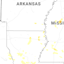
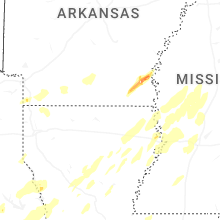


Connect with Interactive Hail Maps