

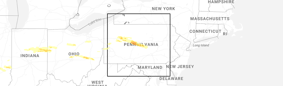
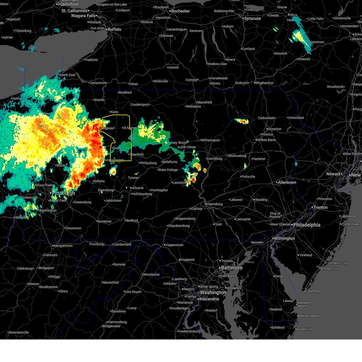
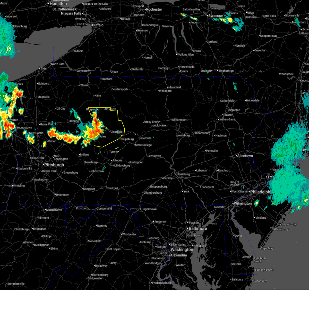
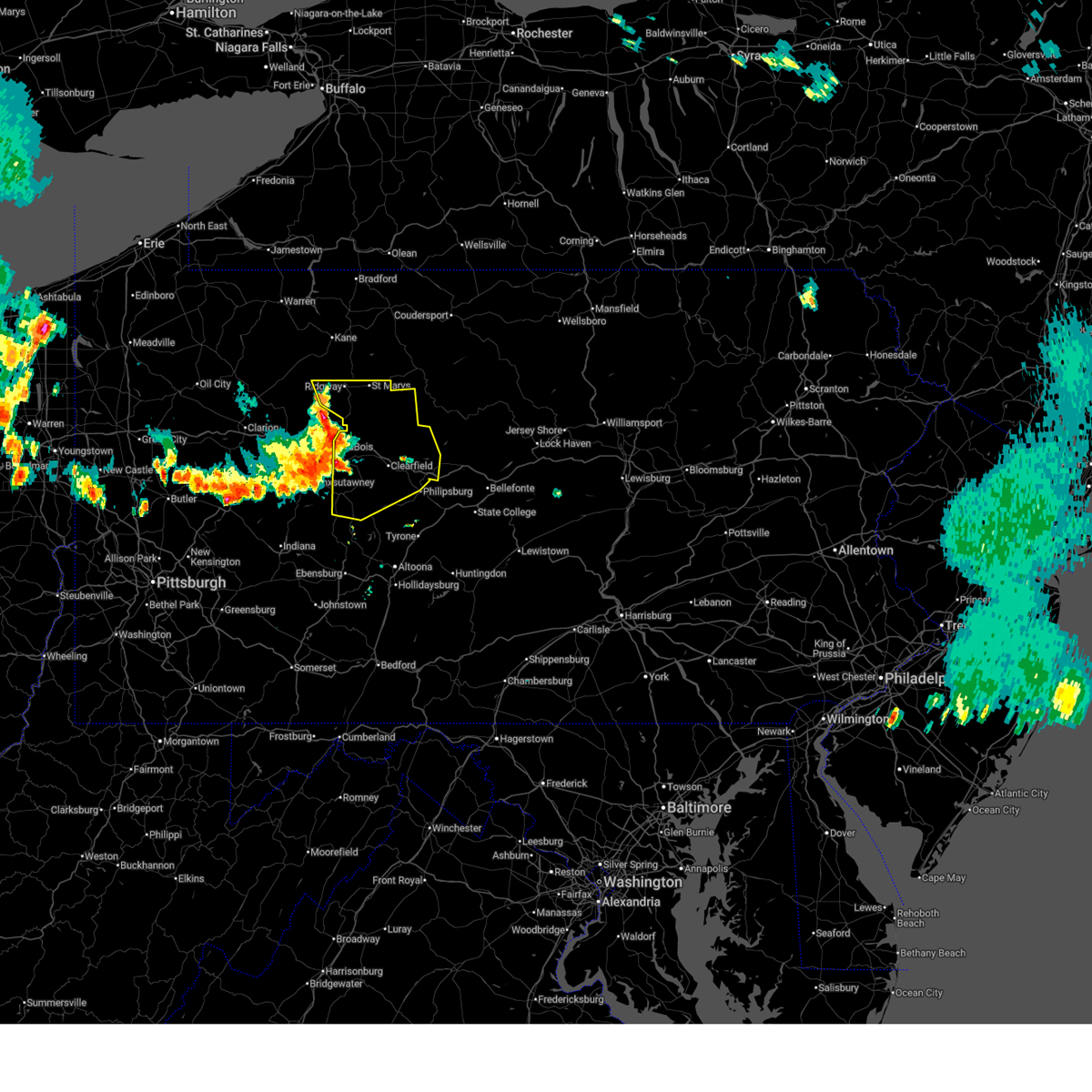
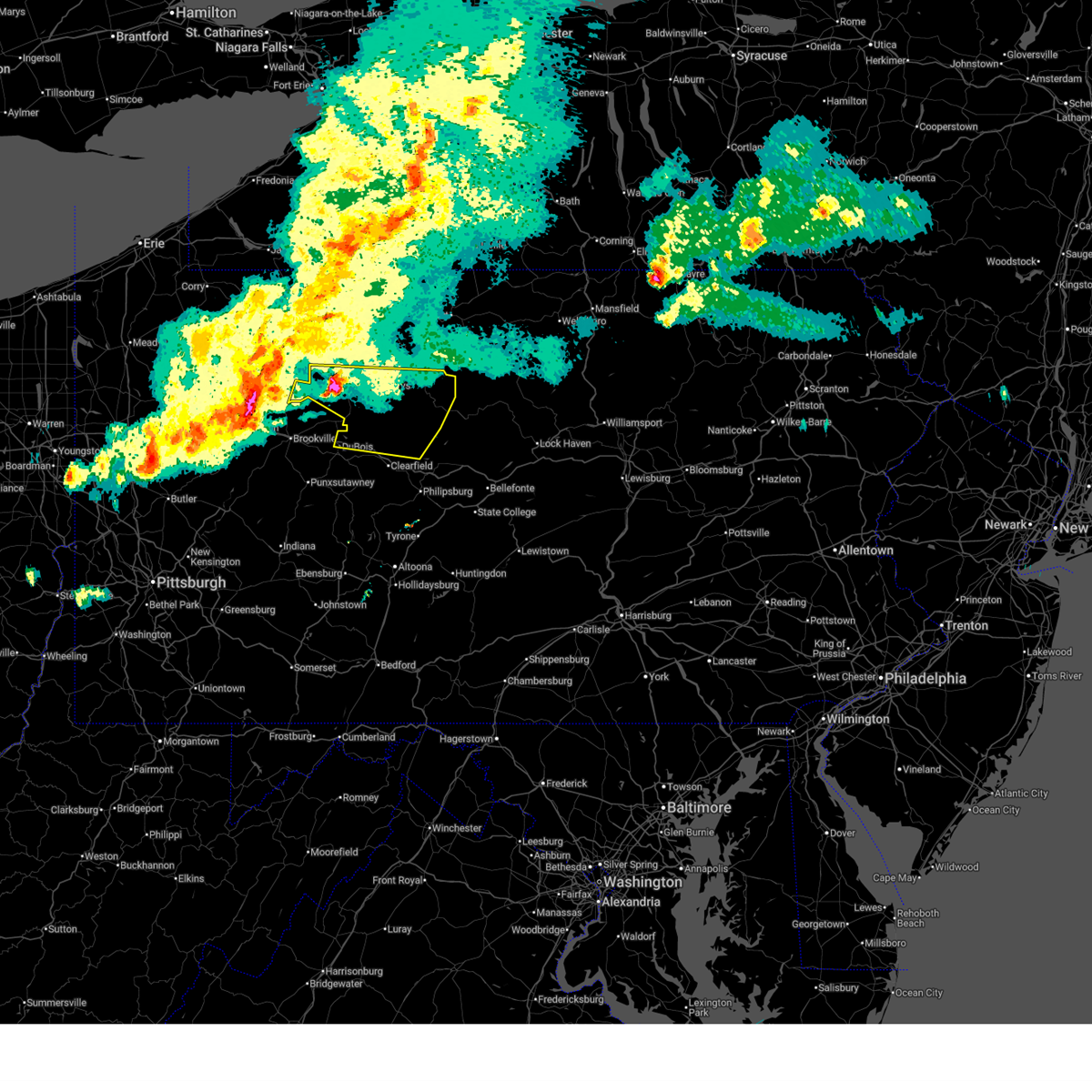
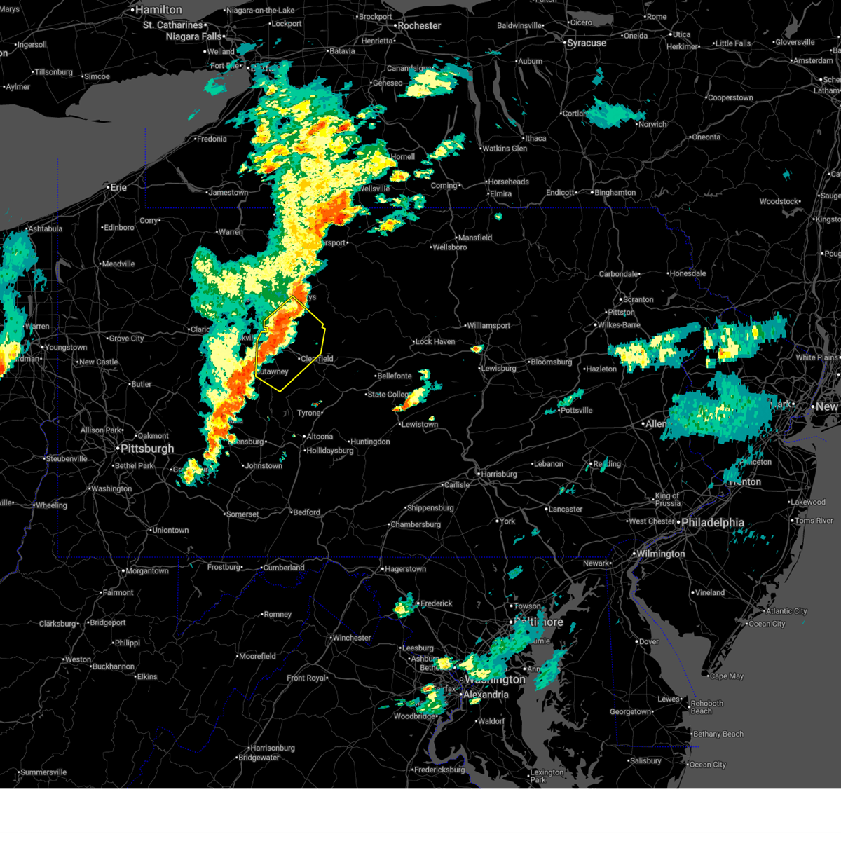
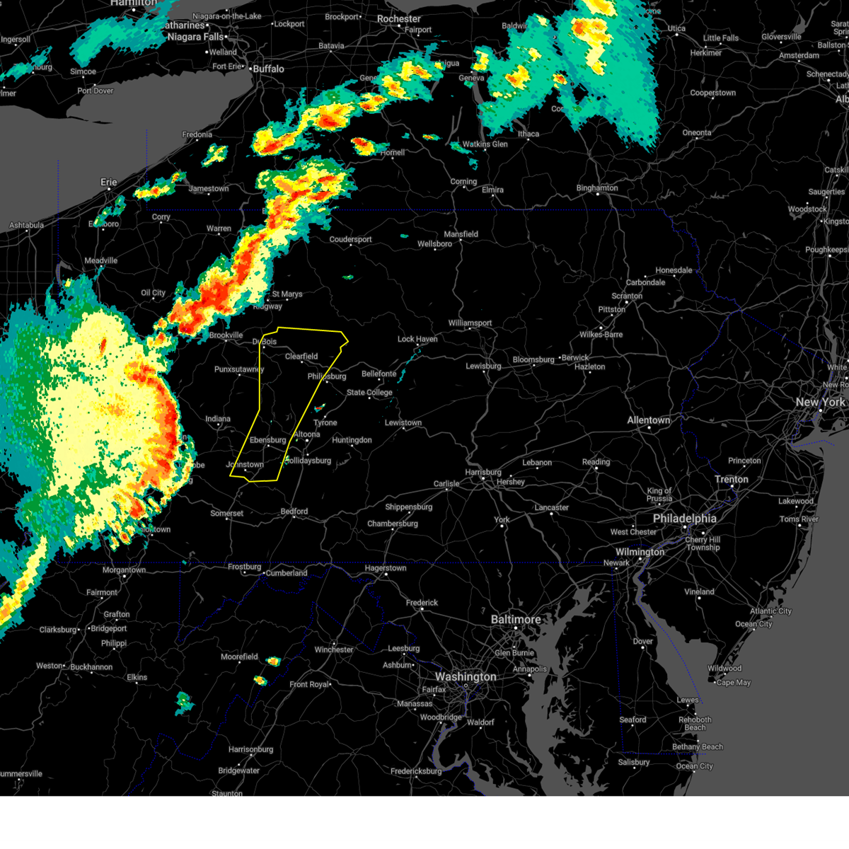
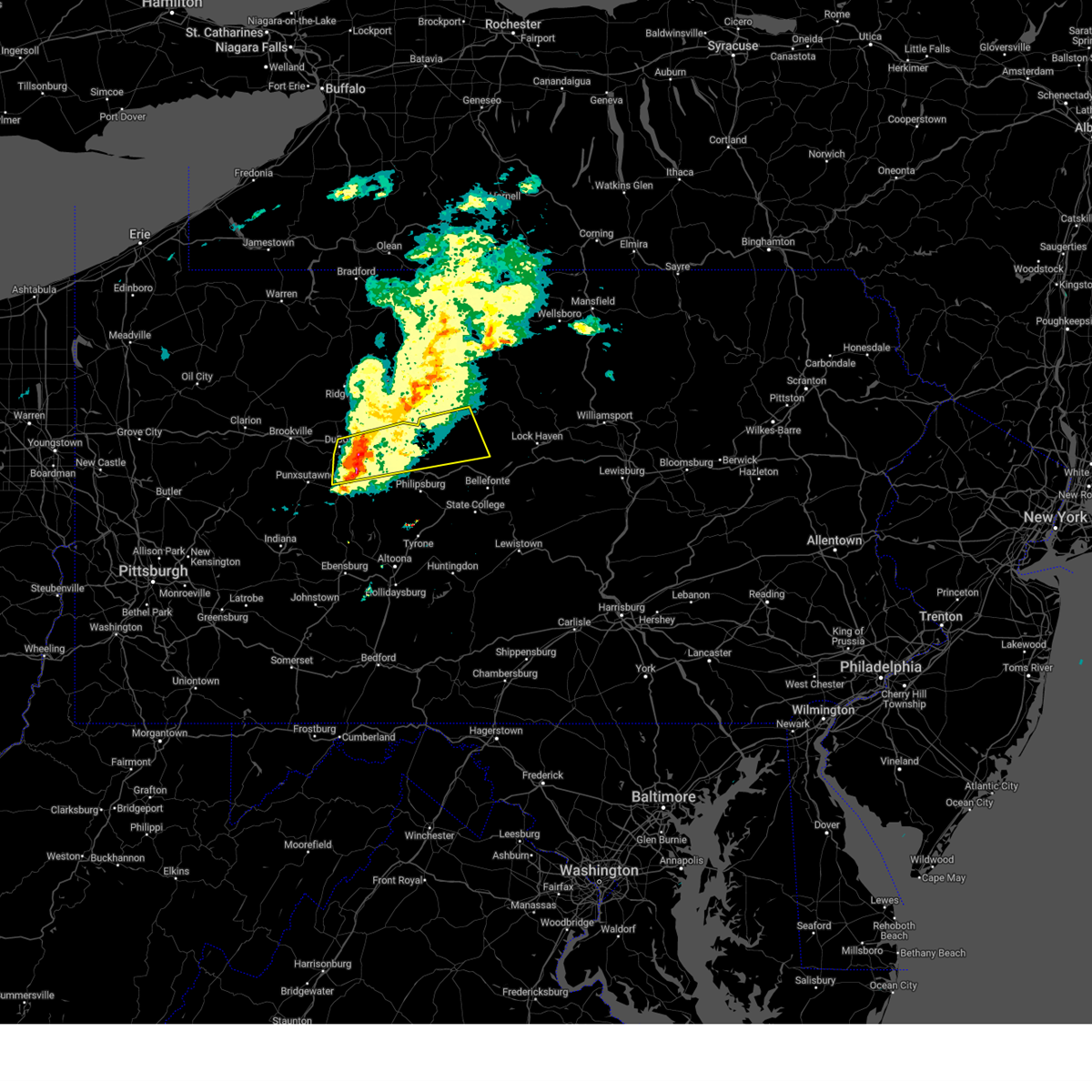
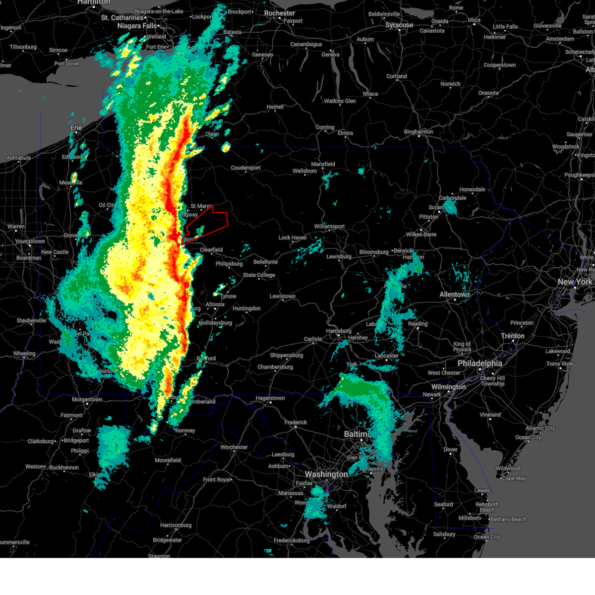
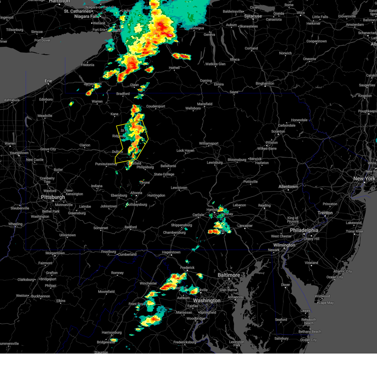
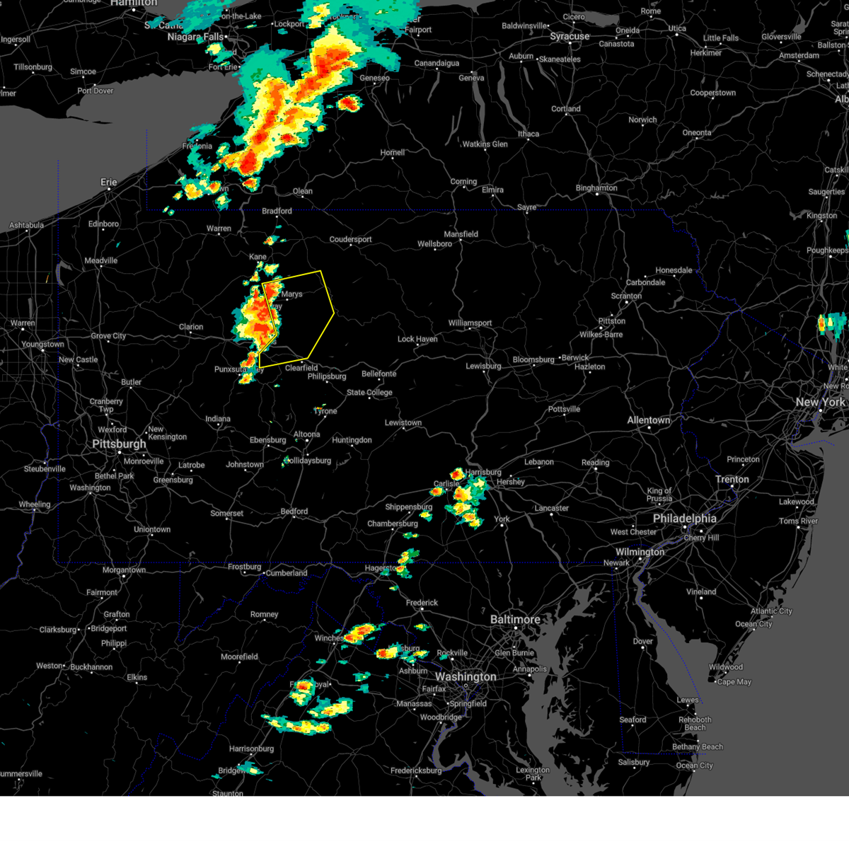
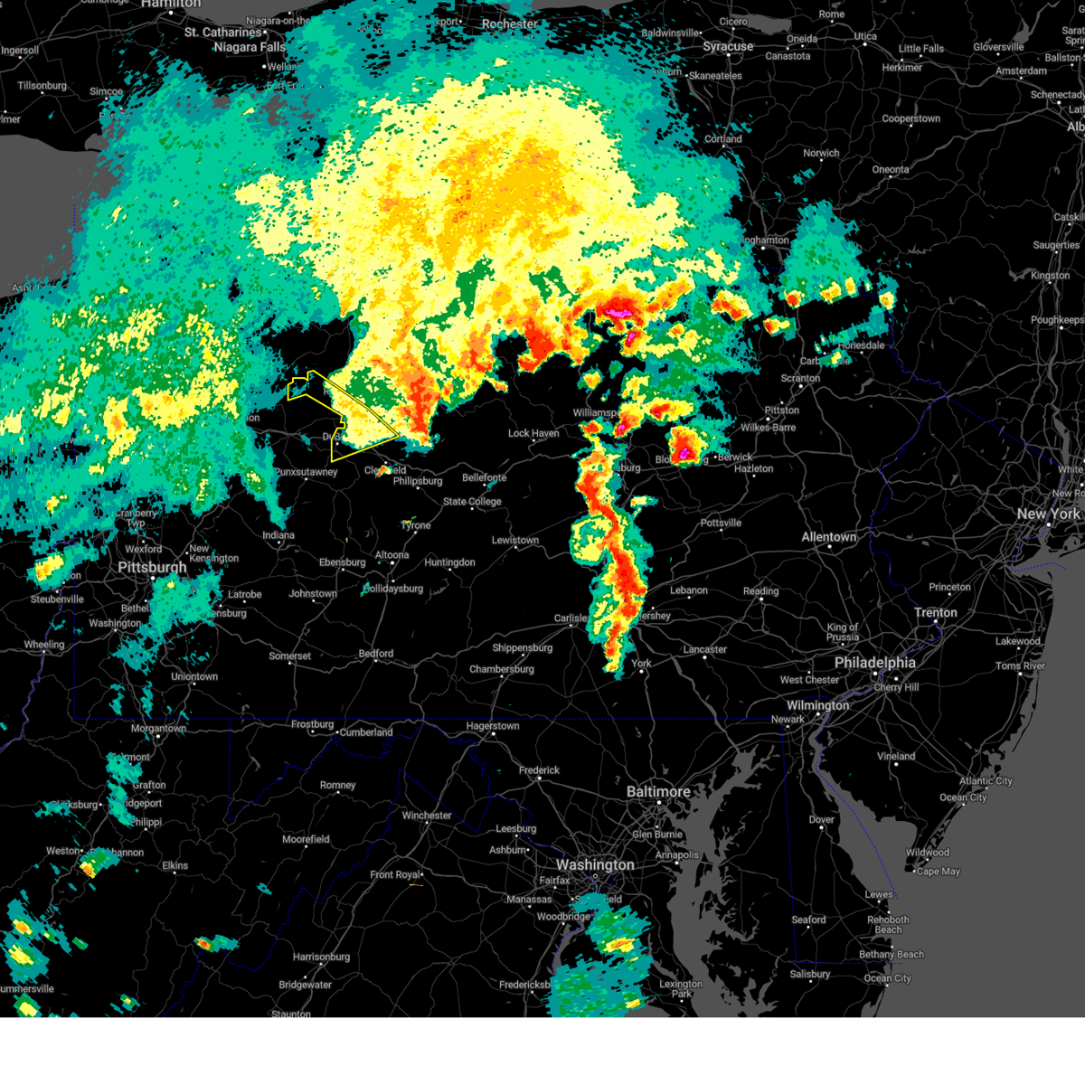
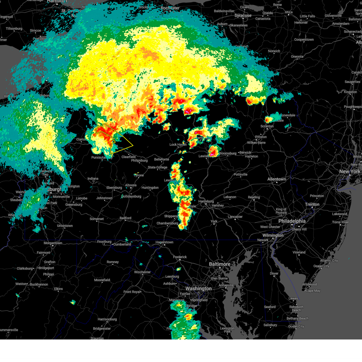
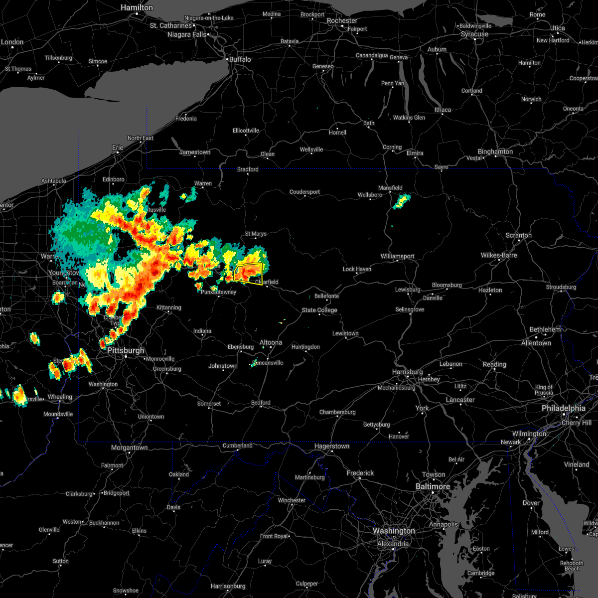
Hail Map for DuBois, PA
The DuBois, PA area has had 0 reports of on-the-ground hail by trained spotters, and has been under severe weather warnings 12 times during the past 12 months. Doppler radar has detected hail at or near DuBois, PA on 28 occasions, including 3 occasions during the past year.
| Name: | DuBois, PA |
| Where Located: | 52 miles WNW of State College, PA |
| Map: | Google Map for DuBois, PA |
| Population: | 7794 |
| Housing Units: | 3825 |
| More Info: | Search Google for DuBois, PA |
2
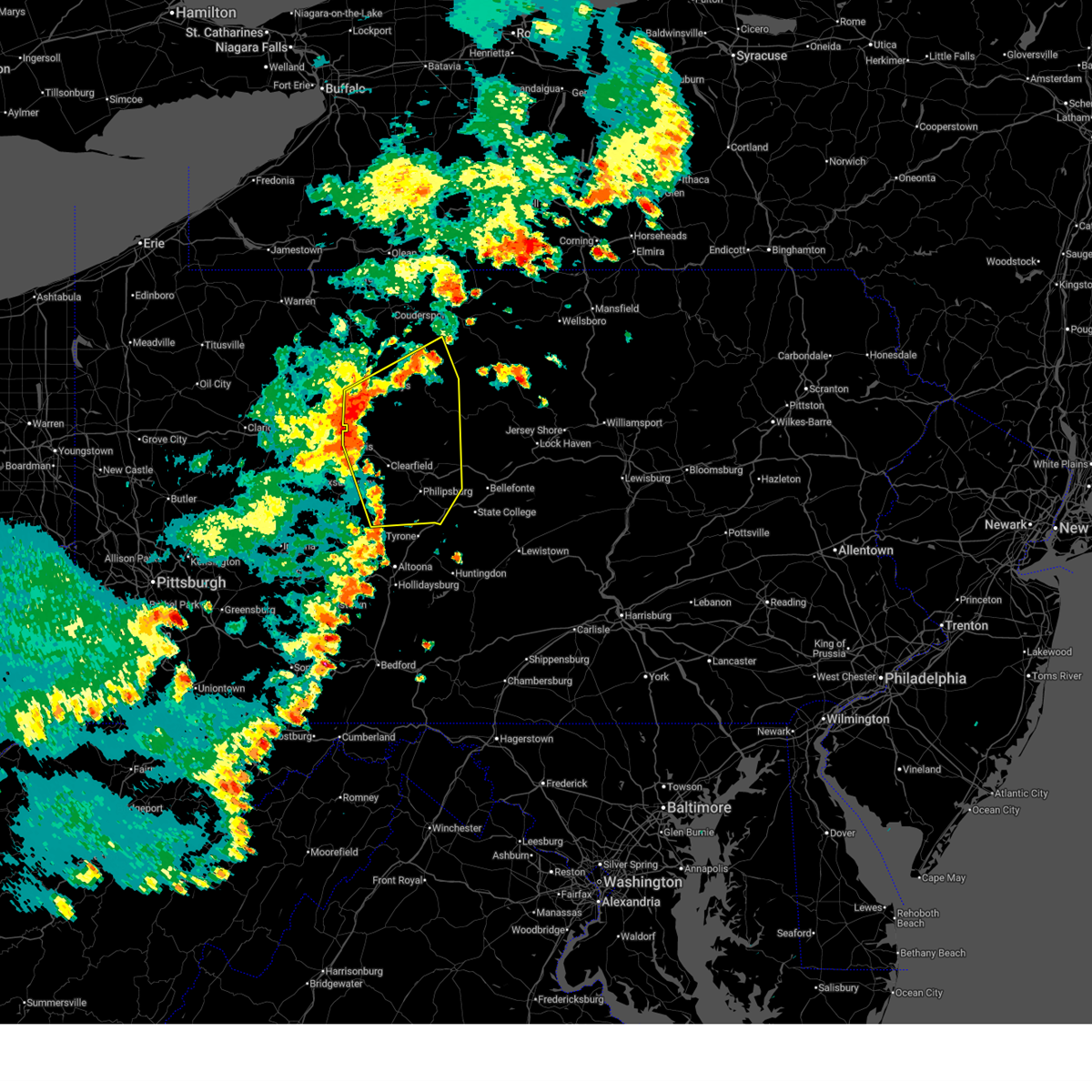
The Top Recent Hail Date for DuBois, PA is Sunday, March 22, 2026 (4th out of 28)
Hail and Wind Damage Spotted near DuBois, PA
| Date / Time | Report Details |
|---|---|
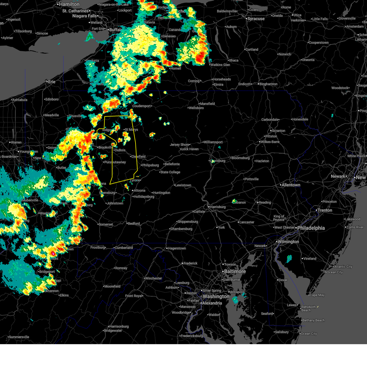
| 7/3/2026 11:45 PM EDT |
 Svrctp the national weather service in state college pa has issued a * severe thunderstorm warning for, northwestern clearfield county in central pennsylvania, elk county in north central pennsylvania, * until 1230 am edt. * at 1145 pm edt, severe thunderstorms were located along a line extending from near portland mills to near brookville to punxsutawney, moving northeast at 50 mph (radar indicated). Hazards include 60 mph wind gusts. expect damage to roofs, siding, and trees Svrctp the national weather service in state college pa has issued a * severe thunderstorm warning for, northwestern clearfield county in central pennsylvania, elk county in north central pennsylvania, * until 1230 am edt. * at 1145 pm edt, severe thunderstorms were located along a line extending from near portland mills to near brookville to punxsutawney, moving northeast at 50 mph (radar indicated). Hazards include 60 mph wind gusts. expect damage to roofs, siding, and trees
|
| 7/3/2026 9:36 PM EDT |
 At 935 pm edt, severe thunderstorms were located along a line extending from brandy camp to s.b. elliot state park to near rockton to 12 miles south of reynoldsville to near punxsutawney, moving east at 30 mph (radar indicated). Hazards include 70 mph wind gusts and nickel size hail. Expect considerable tree damage. damage is likely to mobile homes, roofs, and outbuildings. these severe storms will be near, s. b. elliot state park, brandy camp, and hyde around 940 pm edt. st. marys, clearfield, and plymptonville around 950 pm edt. medix run, lecontes mills, and woodland around 1000 pm edt. benezette around 1010 pm edt. karthaus, philipsburg, and hicks run around 1020 pm edt. other locations impacted by these severe thunderstorms include west decatur, glen hope, weedville, grampian, and lumber city. For those driving on interstate 80, this includes areas between the dubois and snow shoe exits, specifically from mile markers 97 to 136. At 935 pm edt, severe thunderstorms were located along a line extending from brandy camp to s.b. elliot state park to near rockton to 12 miles south of reynoldsville to near punxsutawney, moving east at 30 mph (radar indicated). Hazards include 70 mph wind gusts and nickel size hail. Expect considerable tree damage. damage is likely to mobile homes, roofs, and outbuildings. these severe storms will be near, s. b. elliot state park, brandy camp, and hyde around 940 pm edt. st. marys, clearfield, and plymptonville around 950 pm edt. medix run, lecontes mills, and woodland around 1000 pm edt. benezette around 1010 pm edt. karthaus, philipsburg, and hicks run around 1020 pm edt. other locations impacted by these severe thunderstorms include west decatur, glen hope, weedville, grampian, and lumber city. For those driving on interstate 80, this includes areas between the dubois and snow shoe exits, specifically from mile markers 97 to 136.
|
| 7/3/2026 9:23 PM EDT |
 Svrctp the national weather service in state college pa has issued a * severe thunderstorm warning for, clearfield county in central pennsylvania, southern elk county in north central pennsylvania, * until 1030 pm edt. * at 923 pm edt, severe thunderstorms were located along a line extending from portland mills to dubois to near rockton to punxsutawney to 16 miles southeast of new bethlehem, moving east at 30 mph (radar indicated). Hazards include 60 mph wind gusts and nickel size hail. Expect damage to roofs, siding, and trees. severe thunderstorms will be near, ridgway, s. b. elliot state park, and brandy camp around 930 pm edt. st. marys, clearfield, and hyde around 940 pm edt. woodland around 950 pm edt. medix run, lecontes mills, and benezette around 1000 pm edt. philipsburg around 1010 pm edt. other locations impacted by these severe thunderstorms include west decatur, glen hope, weedville, grampian, and lumber city. For those driving on interstate 80, this includes areas between the dubois and snow shoe exits, specifically from mile markers 97 to 136. Svrctp the national weather service in state college pa has issued a * severe thunderstorm warning for, clearfield county in central pennsylvania, southern elk county in north central pennsylvania, * until 1030 pm edt. * at 923 pm edt, severe thunderstorms were located along a line extending from portland mills to dubois to near rockton to punxsutawney to 16 miles southeast of new bethlehem, moving east at 30 mph (radar indicated). Hazards include 60 mph wind gusts and nickel size hail. Expect damage to roofs, siding, and trees. severe thunderstorms will be near, ridgway, s. b. elliot state park, and brandy camp around 930 pm edt. st. marys, clearfield, and hyde around 940 pm edt. woodland around 950 pm edt. medix run, lecontes mills, and benezette around 1000 pm edt. philipsburg around 1010 pm edt. other locations impacted by these severe thunderstorms include west decatur, glen hope, weedville, grampian, and lumber city. For those driving on interstate 80, this includes areas between the dubois and snow shoe exits, specifically from mile markers 97 to 136.
|
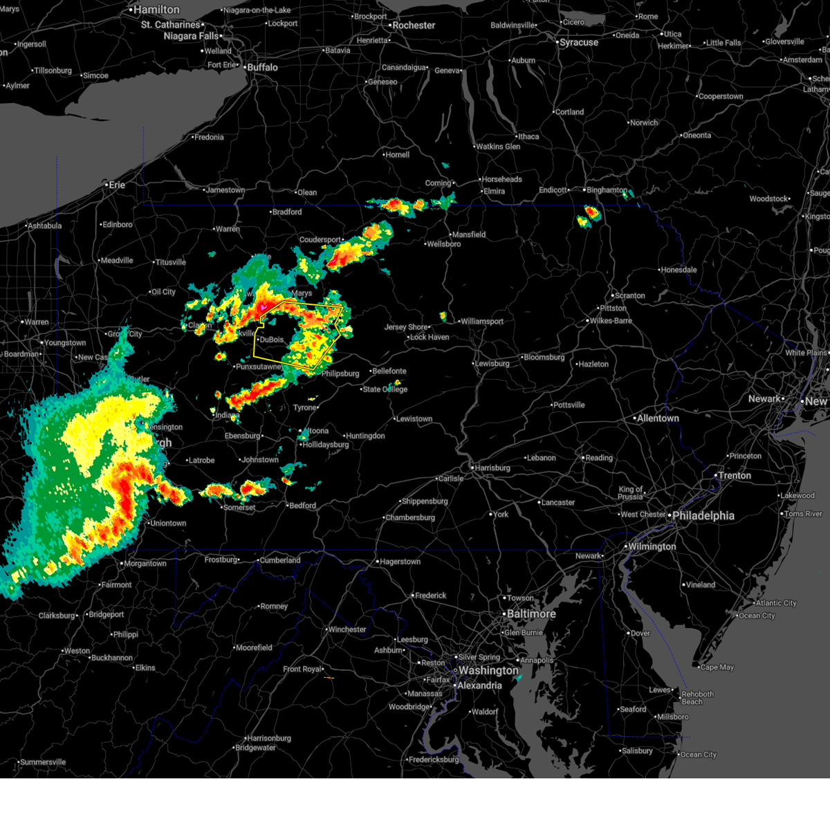
| 6/11/2026 5:13 PM EDT |
 Svrctp the national weather service in state college pa has issued a * severe thunderstorm warning for, cameron county in north central pennsylvania, western centre county in central pennsylvania, clearfield county in central pennsylvania, northwestern clinton county in north central pennsylvania, southeastern elk county in north central pennsylvania, southwestern potter county in north central pennsylvania, * until 615 pm edt. * at 512 pm edt, severe thunderstorms were located along a line extending from near truman to parker dam state park to blandburg, moving northeast at 45 mph (radar indicated). Hazards include 60 mph wind gusts. expect damage to roofs, siding, and trees Svrctp the national weather service in state college pa has issued a * severe thunderstorm warning for, cameron county in north central pennsylvania, western centre county in central pennsylvania, clearfield county in central pennsylvania, northwestern clinton county in north central pennsylvania, southeastern elk county in north central pennsylvania, southwestern potter county in north central pennsylvania, * until 615 pm edt. * at 512 pm edt, severe thunderstorms were located along a line extending from near truman to parker dam state park to blandburg, moving northeast at 45 mph (radar indicated). Hazards include 60 mph wind gusts. expect damage to roofs, siding, and trees
|
| 6/11/2026 4:56 PM EDT | Tree down on long av in clearfield county PA, 0.3 miles NE of DuBois, PA |
| 6/11/2026 4:24 PM EDT |
 Svrctp the national weather service in state college pa has issued a * severe thunderstorm warning for, northeastern cambria county in central pennsylvania, west central cameron county in north central pennsylvania, clearfield county in central pennsylvania, elk county in north central pennsylvania, * until 515 pm edt. * at 423 pm edt, severe thunderstorms were located along a line extending from marienville to near new bethlehem to near indiana, moving northeast at 45 mph (radar indicated). Hazards include 60 mph wind gusts. expect damage to roofs, siding, and trees Svrctp the national weather service in state college pa has issued a * severe thunderstorm warning for, northeastern cambria county in central pennsylvania, west central cameron county in north central pennsylvania, clearfield county in central pennsylvania, elk county in north central pennsylvania, * until 515 pm edt. * at 423 pm edt, severe thunderstorms were located along a line extending from marienville to near new bethlehem to near indiana, moving northeast at 45 mph (radar indicated). Hazards include 60 mph wind gusts. expect damage to roofs, siding, and trees
|
| 6/6/2026 3:30 PM EDT |
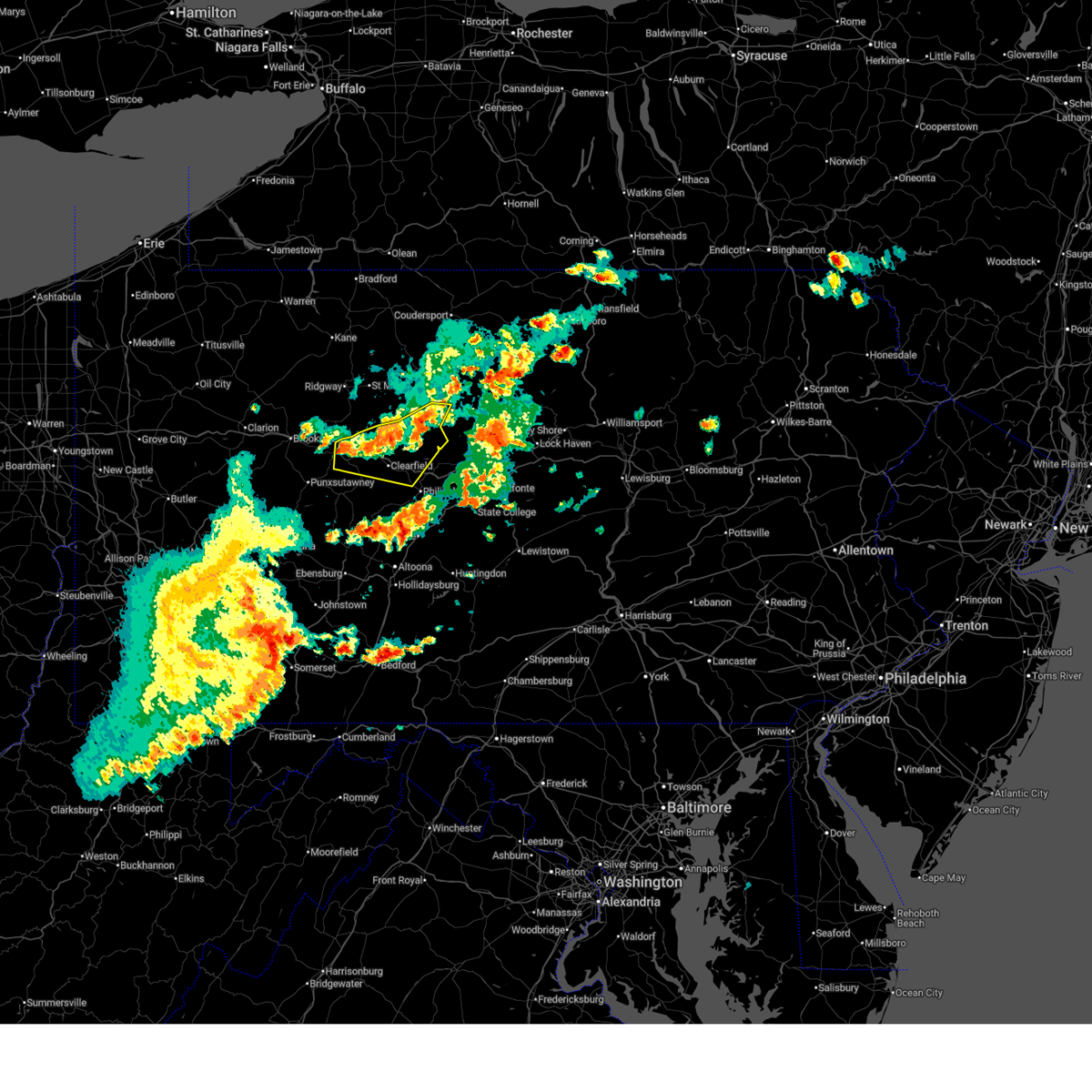 At 329 pm edt, severe thunderstorms were located along a line extending from near hicks run to near lecontes mills to near s.b. elliot state park to sandy, moving southeast at 45 mph (radar indicated). Hazards include 60 mph wind gusts and quarter size hail. Hail damage to vehicles is expected. expect wind damage to roofs, siding, and trees. locations impacted include, dubois, clearfield, sandy, woodland, curwensville, penfield, hyde, plymptonville, rockton, karthaus, parker dam state park, and lecontes mills. For those driving on interstate 80, this includes areas between the dubois and kylertown exits, specifically from mile markers 98 to 130. At 329 pm edt, severe thunderstorms were located along a line extending from near hicks run to near lecontes mills to near s.b. elliot state park to sandy, moving southeast at 45 mph (radar indicated). Hazards include 60 mph wind gusts and quarter size hail. Hail damage to vehicles is expected. expect wind damage to roofs, siding, and trees. locations impacted include, dubois, clearfield, sandy, woodland, curwensville, penfield, hyde, plymptonville, rockton, karthaus, parker dam state park, and lecontes mills. For those driving on interstate 80, this includes areas between the dubois and kylertown exits, specifically from mile markers 98 to 130.
|
| 6/6/2026 3:00 PM EDT |
 Svrctp the national weather service in state college pa has issued a * severe thunderstorm warning for, southeastern cameron county in north central pennsylvania, northern clearfield county in central pennsylvania, southeastern elk county in north central pennsylvania, * until 400 pm edt. * at 259 pm edt, severe thunderstorms were located along a line extending from near force to brockport to brockway to reynoldsville, moving east southeast at 40 mph (radar indicated). Hazards include 60 mph wind gusts and quarter size hail. Hail damage to vehicles is expected. Expect wind damage to roofs, siding, and trees. Svrctp the national weather service in state college pa has issued a * severe thunderstorm warning for, southeastern cameron county in north central pennsylvania, northern clearfield county in central pennsylvania, southeastern elk county in north central pennsylvania, * until 400 pm edt. * at 259 pm edt, severe thunderstorms were located along a line extending from near force to brockport to brockway to reynoldsville, moving east southeast at 40 mph (radar indicated). Hazards include 60 mph wind gusts and quarter size hail. Hail damage to vehicles is expected. Expect wind damage to roofs, siding, and trees.
|
| 4/15/2026 8:44 PM EDT |
 Svrctp the national weather service in state college pa has issued a * severe thunderstorm warning for, cameron county in north central pennsylvania, northern clearfield county in central pennsylvania, elk county in north central pennsylvania, * until 945 pm edt. * at 843 pm edt, severe thunderstorms were located along a line extending from near james city to brookville, moving east at 40 mph (radar indicated). Hazards include 60 mph wind gusts. expect damage to roofs, siding, and trees Svrctp the national weather service in state college pa has issued a * severe thunderstorm warning for, cameron county in north central pennsylvania, northern clearfield county in central pennsylvania, elk county in north central pennsylvania, * until 945 pm edt. * at 843 pm edt, severe thunderstorms were located along a line extending from near james city to brookville, moving east at 40 mph (radar indicated). Hazards include 60 mph wind gusts. expect damage to roofs, siding, and trees
|
| 3/31/2026 9:49 PM EDT |
 Svrctp the national weather service in state college pa has issued a * severe thunderstorm warning for, northwestern clearfield county in central pennsylvania, southeastern elk county in north central pennsylvania, * until 1030 pm edt. * at 949 pm edt, a severe thunderstorm was located over brockway, moving southeast at 55 mph (radar indicated). Hazards include 60 mph wind gusts. Expect damage to roofs, siding, and trees. this severe thunderstorm will be near, dubois around 950 pm edt. s. b. elliot state park and penfield around 1000 pm edt. plymptonville around 1010 pm edt. clearfield around 1020 pm edt. other locations impacted by this severe thunderstorm include weedville, treasure lake, penn state dubois, clearfield-lawrence airport, and grampian. for those driving on interstate 80, this includes areas between the dubois and clearfield exits, specifically from mile markers 97 to 119. this includes the following highways, route 119 from near sykesville to south of dubois. route 219 from north of grampian to brockport. route 322 from the jefferson county line to clearfield. state road 153 from near s. b. elliot state park to penfield. State road 255 from penfield to north of penfield. Svrctp the national weather service in state college pa has issued a * severe thunderstorm warning for, northwestern clearfield county in central pennsylvania, southeastern elk county in north central pennsylvania, * until 1030 pm edt. * at 949 pm edt, a severe thunderstorm was located over brockway, moving southeast at 55 mph (radar indicated). Hazards include 60 mph wind gusts. Expect damage to roofs, siding, and trees. this severe thunderstorm will be near, dubois around 950 pm edt. s. b. elliot state park and penfield around 1000 pm edt. plymptonville around 1010 pm edt. clearfield around 1020 pm edt. other locations impacted by this severe thunderstorm include weedville, treasure lake, penn state dubois, clearfield-lawrence airport, and grampian. for those driving on interstate 80, this includes areas between the dubois and clearfield exits, specifically from mile markers 97 to 119. this includes the following highways, route 119 from near sykesville to south of dubois. route 219 from north of grampian to brockport. route 322 from the jefferson county line to clearfield. state road 153 from near s. b. elliot state park to penfield. State road 255 from penfield to north of penfield.
|
| 3/22/2026 5:23 PM EDT |
 Svrctp the national weather service in state college pa has issued a * severe thunderstorm warning for, northwestern clearfield county in central pennsylvania, * until 615 pm edt. * at 523 pm edt, a severe thunderstorm was located over s.b. elliot state park, moving east at 60 mph (radar indicated). Hazards include 60 mph wind gusts. expect damage to roofs, siding, and trees Svrctp the national weather service in state college pa has issued a * severe thunderstorm warning for, northwestern clearfield county in central pennsylvania, * until 615 pm edt. * at 523 pm edt, a severe thunderstorm was located over s.b. elliot state park, moving east at 60 mph (radar indicated). Hazards include 60 mph wind gusts. expect damage to roofs, siding, and trees
|
| 3/7/2026 5:26 PM EST |
 Svrctp the national weather service in state college pa has issued a * severe thunderstorm warning for, northeastern cambria county in central pennsylvania, clearfield county in central pennsylvania, * until 615 pm est. * at 526 pm est, severe thunderstorms were located along a line extending from parker dam state park to 12 miles north of hastings to near northern cambria, moving northeast at 50 mph (radar indicated). Hazards include 60 mph wind gusts. expect damage to roofs, siding, and trees Svrctp the national weather service in state college pa has issued a * severe thunderstorm warning for, northeastern cambria county in central pennsylvania, clearfield county in central pennsylvania, * until 615 pm est. * at 526 pm est, severe thunderstorms were located along a line extending from parker dam state park to 12 miles north of hastings to near northern cambria, moving northeast at 50 mph (radar indicated). Hazards include 60 mph wind gusts. expect damage to roofs, siding, and trees
|
| 11/5/2025 5:55 PM EST | Trees on wire in clearfield county PA, 0.3 miles NE of DuBois, PA |
| 11/5/2025 5:54 PM EST | Svrctp the national weather service in state college pa has issued a * severe thunderstorm warning for, northern clearfield county in central pennsylvania, * until 615 pm est. * at 553 pm est, a severe thunderstorm was located over dubois, moving east at 60 mph (radar indicated). Hazards include 60 mph wind gusts. expect damage to roofs, siding, and trees |
| 6/18/2025 6:56 PM EDT |
 Svrctp the national weather service in state college pa has issued a * severe thunderstorm warning for, western clearfield county in central pennsylvania, southeastern elk county in north central pennsylvania, * until 715 pm edt. * at 655 pm edt, severe thunderstorms were located along a line extending from medix run to parker dam state park to near sandy, moving southeast at 30 mph (radar indicated). Hazards include 60 mph wind gusts. expect damage to roofs, siding, and trees Svrctp the national weather service in state college pa has issued a * severe thunderstorm warning for, western clearfield county in central pennsylvania, southeastern elk county in north central pennsylvania, * until 715 pm edt. * at 655 pm edt, severe thunderstorms were located along a line extending from medix run to parker dam state park to near sandy, moving southeast at 30 mph (radar indicated). Hazards include 60 mph wind gusts. expect damage to roofs, siding, and trees
|
| 4/29/2025 5:37 PM EDT |
 Svrctp the national weather service in state college pa has issued a * severe thunderstorm warning for, cambria county in central pennsylvania, clearfield county in central pennsylvania, * until 645 pm edt. * at 535 pm edt, severe thunderstorms were located along a line extending from 11 miles east of shanor-northvue to near leechburg to jeannette to clairton, moving east northeast at 65 mph (radar indicated). Hazards include 70 mph wind gusts and quarter size hail. Hail damage to vehicles is expected. expect considerable tree damage. Wind damage is also likely to mobile homes, roofs, and outbuildings. Svrctp the national weather service in state college pa has issued a * severe thunderstorm warning for, cambria county in central pennsylvania, clearfield county in central pennsylvania, * until 645 pm edt. * at 535 pm edt, severe thunderstorms were located along a line extending from 11 miles east of shanor-northvue to near leechburg to jeannette to clairton, moving east northeast at 65 mph (radar indicated). Hazards include 70 mph wind gusts and quarter size hail. Hail damage to vehicles is expected. expect considerable tree damage. Wind damage is also likely to mobile homes, roofs, and outbuildings.
|
| 4/19/2025 2:44 PM EDT |
 Svrctp the national weather service in state college pa has issued a * severe thunderstorm warning for, southeastern cameron county in north central pennsylvania, northwestern centre county in central pennsylvania, northern clearfield county in central pennsylvania, west central clinton county in north central pennsylvania, * until 315 pm edt. * at 243 pm edt, a severe thunderstorm was located over rockton, moving east at 60 mph (radar indicated). Hazards include 60 mph wind gusts and nickel size hail. expect damage to roofs, siding, and trees Svrctp the national weather service in state college pa has issued a * severe thunderstorm warning for, southeastern cameron county in north central pennsylvania, northwestern centre county in central pennsylvania, northern clearfield county in central pennsylvania, west central clinton county in north central pennsylvania, * until 315 pm edt. * at 243 pm edt, a severe thunderstorm was located over rockton, moving east at 60 mph (radar indicated). Hazards include 60 mph wind gusts and nickel size hail. expect damage to roofs, siding, and trees
|
| 3/16/2025 2:10 PM EDT | Trees and wires dow in clearfield county PA, 0.3 miles NE of DuBois, PA |
| 3/16/2025 2:03 PM EDT |
 Torctp the national weather service in state college pa has issued a * tornado warning for, northwestern clearfield county in central pennsylvania, southeastern elk county in north central pennsylvania, * until 230 pm edt. * at 203 pm edt, severe thunderstorms capable of producing both tornadoes and extensive straight line wind damage were located over dubois, moving northeast at 55 mph (radar indicated rotation). Hazards include tornado and quarter size hail. Flying debris will be dangerous to those caught without shelter. mobile homes will be damaged or destroyed. damage to roofs, windows, and vehicles will occur. tree damage is likely. these dangerous storms will be near, penfield and force around 210 pm edt. medix run around 220 pm edt. benezette around 230 pm edt. other locations impacted by this tornadic thunderstorm include treasure lake, penn state dubois, weedville, and kersey. For those driving on interstate 80, this includes areas between the dubois and dubois route 255 exits, specifically from mile markers 97 to 100. Torctp the national weather service in state college pa has issued a * tornado warning for, northwestern clearfield county in central pennsylvania, southeastern elk county in north central pennsylvania, * until 230 pm edt. * at 203 pm edt, severe thunderstorms capable of producing both tornadoes and extensive straight line wind damage were located over dubois, moving northeast at 55 mph (radar indicated rotation). Hazards include tornado and quarter size hail. Flying debris will be dangerous to those caught without shelter. mobile homes will be damaged or destroyed. damage to roofs, windows, and vehicles will occur. tree damage is likely. these dangerous storms will be near, penfield and force around 210 pm edt. medix run around 220 pm edt. benezette around 230 pm edt. other locations impacted by this tornadic thunderstorm include treasure lake, penn state dubois, weedville, and kersey. For those driving on interstate 80, this includes areas between the dubois and dubois route 255 exits, specifically from mile markers 97 to 100.
|
| 3/16/2025 1:47 PM EDT |
 Svrctp the national weather service in state college pa has issued a * severe thunderstorm warning for, bedford county in south central pennsylvania, blair county in central pennsylvania, cambria county in central pennsylvania, southwestern centre county in central pennsylvania, clearfield county in central pennsylvania, eastern elk county in north central pennsylvania, eastern somerset county in south central pennsylvania, * until 230 pm edt. * at 147 pm edt, severe thunderstorms were located along a line extending from near portland mills to near punxsutawney to near friedens, moving northeast at 80 mph (trained weather spotters). Hazards include 60 mph wind gusts and penny size hail. expect damage to roofs, siding, and trees Svrctp the national weather service in state college pa has issued a * severe thunderstorm warning for, bedford county in south central pennsylvania, blair county in central pennsylvania, cambria county in central pennsylvania, southwestern centre county in central pennsylvania, clearfield county in central pennsylvania, eastern elk county in north central pennsylvania, eastern somerset county in south central pennsylvania, * until 230 pm edt. * at 147 pm edt, severe thunderstorms were located along a line extending from near portland mills to near punxsutawney to near friedens, moving northeast at 80 mph (trained weather spotters). Hazards include 60 mph wind gusts and penny size hail. expect damage to roofs, siding, and trees
|
| 7/15/2024 4:08 PM EDT |
 The storms which prompted the warning have weakened below severe limits, and are exiting the warned area. therefore, the warning will be allowed to expire. however, gusty winds are still possible with these thunderstorms as they move through cameron, potter and northern clinton counties. a severe thunderstorm watch remains in effect until 700 pm edt for north central pennsylvania. The storms which prompted the warning have weakened below severe limits, and are exiting the warned area. therefore, the warning will be allowed to expire. however, gusty winds are still possible with these thunderstorms as they move through cameron, potter and northern clinton counties. a severe thunderstorm watch remains in effect until 700 pm edt for north central pennsylvania.
|
| 7/15/2024 3:36 PM EDT |
 Svrctp the national weather service in state college pa has issued a * severe thunderstorm warning for, western cameron county in north central pennsylvania, northwestern clearfield county in central pennsylvania, eastern elk county in north central pennsylvania, * until 415 pm edt. * at 336 pm edt, severe thunderstorms were located along a line extending from johnsonburg to penfield to sandy, moving east at 45 mph (radar indicated). Hazards include 60 mph wind gusts. expect damage to roofs, siding, and trees Svrctp the national weather service in state college pa has issued a * severe thunderstorm warning for, western cameron county in north central pennsylvania, northwestern clearfield county in central pennsylvania, eastern elk county in north central pennsylvania, * until 415 pm edt. * at 336 pm edt, severe thunderstorms were located along a line extending from johnsonburg to penfield to sandy, moving east at 45 mph (radar indicated). Hazards include 60 mph wind gusts. expect damage to roofs, siding, and trees
|
| 6/26/2024 5:26 PM EDT |
 The storms which prompted the warning have moved out of the area. therefore, the warning will be allowed to expire. however, gusty winds are still possible with these thunderstorms. a severe thunderstorm watch remains in effect until 900 pm edt for central and north central pennsylvania. The storms which prompted the warning have moved out of the area. therefore, the warning will be allowed to expire. however, gusty winds are still possible with these thunderstorms. a severe thunderstorm watch remains in effect until 900 pm edt for central and north central pennsylvania.
|
| 6/26/2024 4:54 PM EDT |
 Svrctp the national weather service in state college pa has issued a * severe thunderstorm warning for, northwestern clearfield county in central pennsylvania, southwestern elk county in north central pennsylvania, * until 530 pm edt. * at 453 pm edt, severe thunderstorms were located along a line extending from near portland mills to brandy camp to dubois, moving northeast at 30 mph (radar indicated). Hazards include 60 mph wind gusts. expect damage to roofs, siding, and trees Svrctp the national weather service in state college pa has issued a * severe thunderstorm warning for, northwestern clearfield county in central pennsylvania, southwestern elk county in north central pennsylvania, * until 530 pm edt. * at 453 pm edt, severe thunderstorms were located along a line extending from near portland mills to brandy camp to dubois, moving northeast at 30 mph (radar indicated). Hazards include 60 mph wind gusts. expect damage to roofs, siding, and trees
|
| 5/22/2024 3:49 PM EDT |
 At 349 pm edt, a severe thunderstorm was located over force, moving east at 45 mph (radar indicated). Hazards include 60 mph wind gusts. Expect damage to roofs, siding, and trees. locations impacted include, st. marys, dubois, ridgway, johnsonburg, sandy, penfield, plymptonville, rockton, karthaus, wilcox, james city, and force. For those driving on interstate 80, this includes areas between the dubois and clearfield exits, specifically from mile markers 97 to 118. At 349 pm edt, a severe thunderstorm was located over force, moving east at 45 mph (radar indicated). Hazards include 60 mph wind gusts. Expect damage to roofs, siding, and trees. locations impacted include, st. marys, dubois, ridgway, johnsonburg, sandy, penfield, plymptonville, rockton, karthaus, wilcox, james city, and force. For those driving on interstate 80, this includes areas between the dubois and clearfield exits, specifically from mile markers 97 to 118.
|
| 5/22/2024 3:30 PM EDT |
 Svrctp the national weather service in state college pa has issued a * severe thunderstorm warning for, northern clearfield county in central pennsylvania, elk county in north central pennsylvania, * until 430 pm edt. * at 330 pm edt, a severe thunderstorm was located over portland mills, moving northeast at 35 mph (radar indicated). Hazards include 60 mph wind gusts. expect damage to roofs, siding, and trees Svrctp the national weather service in state college pa has issued a * severe thunderstorm warning for, northern clearfield county in central pennsylvania, elk county in north central pennsylvania, * until 430 pm edt. * at 330 pm edt, a severe thunderstorm was located over portland mills, moving northeast at 35 mph (radar indicated). Hazards include 60 mph wind gusts. expect damage to roofs, siding, and trees
|
| 4/14/2024 6:32 PM EDT |
 At 632 pm edt, severe thunderstorms were located along a line extending from near flemington to plymptonville, moving east at 70 mph (radar indicated). Hazards include 60 mph wind gusts and quarter size hail. Hail damage to vehicles is expected. expect wind damage to roofs, siding, and trees. locations impacted include, dubois, clearfield, bellefonte, sandy, philipsburg, woodland, curwensville, lamar, hyde, milesburg, plymptonville, and rockton. for those driving on interstate 80, this includes areas between the dubois route 255 and lock haven exits, specifically from mile markers 110 to 173. This includes interstate 99 near mile marker 85. At 632 pm edt, severe thunderstorms were located along a line extending from near flemington to plymptonville, moving east at 70 mph (radar indicated). Hazards include 60 mph wind gusts and quarter size hail. Hail damage to vehicles is expected. expect wind damage to roofs, siding, and trees. locations impacted include, dubois, clearfield, bellefonte, sandy, philipsburg, woodland, curwensville, lamar, hyde, milesburg, plymptonville, and rockton. for those driving on interstate 80, this includes areas between the dubois route 255 and lock haven exits, specifically from mile markers 110 to 173. This includes interstate 99 near mile marker 85.
|
| 4/14/2024 6:32 PM EDT |
 the severe thunderstorm warning has been cancelled and is no longer in effect the severe thunderstorm warning has been cancelled and is no longer in effect
|
| 4/14/2024 6:09 PM EDT |
 Svrctp the national weather service in state college pa has issued a * severe thunderstorm warning for, southeastern cameron county in north central pennsylvania, central centre county in central pennsylvania, northern clearfield county in central pennsylvania, southwestern clinton county in north central pennsylvania, southeastern elk county in north central pennsylvania, * until 645 pm edt. * at 609 pm edt, severe thunderstorms were located along a line extending from near keating to near brockway, moving east at 60 mph (trained weather spotters). Hazards include 60 mph wind gusts and quarter size hail. Hail damage to vehicles is expected. Expect wind damage to roofs, siding, and trees. Svrctp the national weather service in state college pa has issued a * severe thunderstorm warning for, southeastern cameron county in north central pennsylvania, central centre county in central pennsylvania, northern clearfield county in central pennsylvania, southwestern clinton county in north central pennsylvania, southeastern elk county in north central pennsylvania, * until 645 pm edt. * at 609 pm edt, severe thunderstorms were located along a line extending from near keating to near brockway, moving east at 60 mph (trained weather spotters). Hazards include 60 mph wind gusts and quarter size hail. Hail damage to vehicles is expected. Expect wind damage to roofs, siding, and trees.
|
| 7/20/2023 8:39 PM EDT |
 At 839 pm edt, severe thunderstorms were located along a line extending from elk river to st. marys to brockport, moving southeast at 45 mph (radar indicated). Hazards include 70 mph wind gusts. Expect considerable tree damage. Damage is likely to mobile homes, roofs, and outbuildings. At 839 pm edt, severe thunderstorms were located along a line extending from elk river to st. marys to brockport, moving southeast at 45 mph (radar indicated). Hazards include 70 mph wind gusts. Expect considerable tree damage. Damage is likely to mobile homes, roofs, and outbuildings.
|
| 4/1/2023 2:18 PM EDT |
 At 217 pm edt, severe thunderstorms were located along a line extending from kinzua dam to near indiana, moving east at 55 mph (automatic observing system. wind gust to 68 mph at allegheny county airport). Hazards include 70 mph wind gusts. Expect considerable tree damage. Damage is likely to mobile homes, roofs, and outbuildings. At 217 pm edt, severe thunderstorms were located along a line extending from kinzua dam to near indiana, moving east at 55 mph (automatic observing system. wind gust to 68 mph at allegheny county airport). Hazards include 70 mph wind gusts. Expect considerable tree damage. Damage is likely to mobile homes, roofs, and outbuildings.
|
| 3/31/2022 12:15 PM EDT |
 At 1213 pm edt, severe thunderstorms were located along a line extending from marienville to punxsutawney, moving northeast at 60 mph (radar indicated). Hazards include 70 mph wind gusts. Expect considerable tree damage. Damage is likely to mobile homes, roofs, and outbuildings. At 1213 pm edt, severe thunderstorms were located along a line extending from marienville to punxsutawney, moving northeast at 60 mph (radar indicated). Hazards include 70 mph wind gusts. Expect considerable tree damage. Damage is likely to mobile homes, roofs, and outbuildings.
|
| 3/7/2022 4:49 PM EST |
 At 448 pm est, severe thunderstorms were located along a line extending from near cuba to south connellsville, moving northeast at 75 mph (radar indicated). Hazards include 60 mph wind gusts. expect damage to roofs, siding, and trees At 448 pm est, severe thunderstorms were located along a line extending from near cuba to south connellsville, moving northeast at 75 mph (radar indicated). Hazards include 60 mph wind gusts. expect damage to roofs, siding, and trees
|
| 8/12/2021 6:11 PM EDT |
 At 611 pm edt, a severe thunderstorm was located near dubois, moving east at 20 mph (radar indicated). Hazards include 60 mph wind gusts and penny size hail. Expect damage to roofs, siding, and trees. locations impacted include, dubois, sandy, penfield, rockton, parker dam state park, s. b. elliot state park, treasure lake and penn state dubois. for those driving on interstate 80, this includes areas between the dubois and clearfield exits, specifically from mile markers 97 to 113. hail threat, radar indicated max hail size, 0. 75 in wind threat, radar indicated max wind gust, 60 mph. At 611 pm edt, a severe thunderstorm was located near dubois, moving east at 20 mph (radar indicated). Hazards include 60 mph wind gusts and penny size hail. Expect damage to roofs, siding, and trees. locations impacted include, dubois, sandy, penfield, rockton, parker dam state park, s. b. elliot state park, treasure lake and penn state dubois. for those driving on interstate 80, this includes areas between the dubois and clearfield exits, specifically from mile markers 97 to 113. hail threat, radar indicated max hail size, 0. 75 in wind threat, radar indicated max wind gust, 60 mph.
|
| 8/12/2021 6:05 PM EDT | Trees and wires down in clearfield county PA, 0.6 miles SSE of DuBois, PA |
| 8/12/2021 5:46 PM EDT |
 At 544 pm edt, severe thunderstorms were located along a line extending from near reynoldsville to near brockway, moving east at 20 mph (radar indicated). Hazards include 60 mph wind gusts and penny size hail. expect damage to roofs, siding, and trees At 544 pm edt, severe thunderstorms were located along a line extending from near reynoldsville to near brockway, moving east at 20 mph (radar indicated). Hazards include 60 mph wind gusts and penny size hail. expect damage to roofs, siding, and trees
|
| 7/17/2021 3:04 PM EDT |
 At 304 pm edt, severe thunderstorms were located along a line extending from near punxsutawney to near homer city to near westmont to acosta, moving northeast at 35 mph (radar indicated). Hazards include 60 mph wind gusts. expect damage to roofs, siding, and trees At 304 pm edt, severe thunderstorms were located along a line extending from near punxsutawney to near homer city to near westmont to acosta, moving northeast at 35 mph (radar indicated). Hazards include 60 mph wind gusts. expect damage to roofs, siding, and trees
|
| 7/16/2021 4:11 PM EDT |
 At 411 pm edt, a severe thunderstorm was located over sandy, moving east at 25 mph (radar indicated). Hazards include 60 mph wind gusts and quarter size hail. Hail damage to vehicles is expected. Expect wind damage to roofs, siding, and trees. At 411 pm edt, a severe thunderstorm was located over sandy, moving east at 25 mph (radar indicated). Hazards include 60 mph wind gusts and quarter size hail. Hail damage to vehicles is expected. Expect wind damage to roofs, siding, and trees.
|
| 7/13/2021 6:30 PM EDT | Several reports of trees and wires down in duboi in clearfield county PA, 0.8 miles ENE of DuBois, PA |
| 7/13/2021 6:15 PM EDT | Large tree fell on garag in clearfield county PA, 0.6 miles SSE of DuBois, PA |
| 7/13/2021 6:14 PM EDT | Power pole snapped in half. other reports of trees across road in are in clearfield county PA, 0.3 miles NE of DuBois, PA |
| 7/13/2021 6:07 PM EDT |
 At 607 pm edt, a severe thunderstorm was located over dubois, moving northeast at 40 mph (radar indicated). Hazards include 60 mph wind gusts and penny size hail. expect damage to roofs, siding, and trees At 607 pm edt, a severe thunderstorm was located over dubois, moving northeast at 40 mph (radar indicated). Hazards include 60 mph wind gusts and penny size hail. expect damage to roofs, siding, and trees
|
| 6/14/2021 1:57 PM EDT |
 The severe thunderstorm warning for southeastern elk, northern clearfield and southern cameron counties will expire at 200 pm edt, the storms which prompted the warning have moved out of the area. therefore, the warning will be allowed to expire. a severe thunderstorm watch remains in effect until 600 pm edt for central and north central pennsylvania. to report severe weather, contact your nearest law enforcement agency. they will relay your report to the national weather service state college pa. The severe thunderstorm warning for southeastern elk, northern clearfield and southern cameron counties will expire at 200 pm edt, the storms which prompted the warning have moved out of the area. therefore, the warning will be allowed to expire. a severe thunderstorm watch remains in effect until 600 pm edt for central and north central pennsylvania. to report severe weather, contact your nearest law enforcement agency. they will relay your report to the national weather service state college pa.
|
| 6/14/2021 1:10 PM EDT |
 At 109 pm edt, severe thunderstorms were located along a line extending from near cameron to medix run to force to near penfield, moving southeast at 35 mph (law enforcement). Hazards include 70 mph wind gusts. Expect considerable tree damage. damage is likely to mobile homes, roofs, and outbuildings. locations impacted include, st. marys, dubois, cameron, penfield, karthaus, force, benezette, stevenson dam, hicks run, brockport, parker dam state park, lecontes mills, s. b. elliot state park, medix run, truman, kersey, weedville, driftwood, treasure lake and penn state dubois. For those driving on interstate 80, this includes areas between the dubois and clearfield exits, specifically from mile markers 99 to 111. At 109 pm edt, severe thunderstorms were located along a line extending from near cameron to medix run to force to near penfield, moving southeast at 35 mph (law enforcement). Hazards include 70 mph wind gusts. Expect considerable tree damage. damage is likely to mobile homes, roofs, and outbuildings. locations impacted include, st. marys, dubois, cameron, penfield, karthaus, force, benezette, stevenson dam, hicks run, brockport, parker dam state park, lecontes mills, s. b. elliot state park, medix run, truman, kersey, weedville, driftwood, treasure lake and penn state dubois. For those driving on interstate 80, this includes areas between the dubois and clearfield exits, specifically from mile markers 99 to 111.
|
| 6/14/2021 12:47 PM EDT |
 At 1247 pm edt, severe thunderstorms were located along a line extending from near elk river to near st. marys to brandy camp to near brockway, moving east at 40 mph (radar indicated). Hazards include 60 mph wind gusts. expect damage to roofs, siding, and trees At 1247 pm edt, severe thunderstorms were located along a line extending from near elk river to near st. marys to brandy camp to near brockway, moving east at 40 mph (radar indicated). Hazards include 60 mph wind gusts. expect damage to roofs, siding, and trees
|
| 5/26/2021 1:23 PM EDT |
 At 122 pm edt, a severe thunderstorm was located over brockport, moving east at 35 mph (radar indicated). Hazards include 60 mph wind gusts. expect damage to trees, roofs, and siding At 122 pm edt, a severe thunderstorm was located over brockport, moving east at 35 mph (radar indicated). Hazards include 60 mph wind gusts. expect damage to trees, roofs, and siding
|
| 11/15/2020 4:17 PM EST |
 At 417 pm est, severe thunderstorms were located along a line extending from coryville to s.b. elliot state park, moving east at 45 mph (radar indicated). Hazards include 60 mph wind gusts. Expect damage to trees, roofs, and siding. locations impacted include, st. marys, dubois, clearfield, johnsonburg, sandy, philipsburg, woodland, curwensville, port allegany, smethport, penfield, hyde, osceola mills, shinglehouse, plymptonville, rockton, chester hill, karthaus, houtzdale and betula. For those driving on interstate 80, this includes areas between the dubois and snow shoe exits, specifically from mile markers 97 to 135. At 417 pm est, severe thunderstorms were located along a line extending from coryville to s.b. elliot state park, moving east at 45 mph (radar indicated). Hazards include 60 mph wind gusts. Expect damage to trees, roofs, and siding. locations impacted include, st. marys, dubois, clearfield, johnsonburg, sandy, philipsburg, woodland, curwensville, port allegany, smethport, penfield, hyde, osceola mills, shinglehouse, plymptonville, rockton, chester hill, karthaus, houtzdale and betula. For those driving on interstate 80, this includes areas between the dubois and snow shoe exits, specifically from mile markers 97 to 135.
|
| 11/15/2020 3:30 PM EST |
 At 329 pm est, severe thunderstorms were located along a line extending from 6 miles southwest of sheffield to 8 miles south of new bethlehem, moving northeast at 70 mph (radar indicated). Hazards include 60 mph wind gusts. expect damage to trees, roofs, and siding At 329 pm est, severe thunderstorms were located along a line extending from 6 miles southwest of sheffield to 8 miles south of new bethlehem, moving northeast at 70 mph (radar indicated). Hazards include 60 mph wind gusts. expect damage to trees, roofs, and siding
|
| 8/27/2020 6:42 PM EDT |
 The severe thunderstorm warning for clearfield county will expire at 645 pm edt, the storms which prompted the warning have moved out of the area. therefore, the warning will be allowed to expire. a severe thunderstorm watch remains in effect until midnight edt for central pennsylvania. The severe thunderstorm warning for clearfield county will expire at 645 pm edt, the storms which prompted the warning have moved out of the area. therefore, the warning will be allowed to expire. a severe thunderstorm watch remains in effect until midnight edt for central pennsylvania.
|
| 8/27/2020 5:30 PM EDT |
 At 530 pm edt, severe thunderstorms were located along a line extending from near rockton to near new bethlehem, moving southeast at 40 mph (radar indicated). Hazards include 60 mph wind gusts. expect damage to trees, roofs, and siding At 530 pm edt, severe thunderstorms were located along a line extending from near rockton to near new bethlehem, moving southeast at 40 mph (radar indicated). Hazards include 60 mph wind gusts. expect damage to trees, roofs, and siding
|
| 7/19/2020 8:29 PM EDT |
 At 829 pm edt, a severe thunderstorm was located over penfield, moving east at 50 mph (radar indicated). Hazards include 60 mph wind gusts. expect damage to trees, roofs, and siding At 829 pm edt, a severe thunderstorm was located over penfield, moving east at 50 mph (radar indicated). Hazards include 60 mph wind gusts. expect damage to trees, roofs, and siding
|
| 7/19/2020 7:43 PM EDT |
 At 742 pm edt, a severe thunderstorm was located near marienville, moving east at 45 mph (radar indicated). Hazards include 60 mph wind gusts and penny size hail. expect damage to trees, roofs, and siding At 742 pm edt, a severe thunderstorm was located near marienville, moving east at 45 mph (radar indicated). Hazards include 60 mph wind gusts and penny size hail. expect damage to trees, roofs, and siding
|
| 6/25/2020 6:29 PM EDT |
 At 628 pm edt, a severe thunderstorm was located over parker dam state park, moving east at 30 mph. widespread tree damage is being reported across dubois and treasure lake (law enforcement). Hazards include 70 mph wind gusts and half dollar size hail. Hail damage to vehicles is expected. expect considerable tree damage. wind damage is also likely to mobile homes, roofs, and outbuildings. this severe storm will be near, parker dam state park and force around 630 pm edt. medix run around 650 pm edt. other locations impacted by this severe thunderstorm include weedville and treasure lake. those in parker dam and s. b. elliot state parks are in the path of this storm and should prepare for imminent dangerous weather conditions. seek shelter now! for those driving on interstate 80, this includes areas between the dubois route 255 and clearfield exits, specifically from mile markers 101 to 114. this includes the following highways, route 219 near south of dubois. route 322 from south of dubois to west of clearfield. state road 153 from near s. b. elliot state park to penfield. State road 255 from penfield to near force. At 628 pm edt, a severe thunderstorm was located over parker dam state park, moving east at 30 mph. widespread tree damage is being reported across dubois and treasure lake (law enforcement). Hazards include 70 mph wind gusts and half dollar size hail. Hail damage to vehicles is expected. expect considerable tree damage. wind damage is also likely to mobile homes, roofs, and outbuildings. this severe storm will be near, parker dam state park and force around 630 pm edt. medix run around 650 pm edt. other locations impacted by this severe thunderstorm include weedville and treasure lake. those in parker dam and s. b. elliot state parks are in the path of this storm and should prepare for imminent dangerous weather conditions. seek shelter now! for those driving on interstate 80, this includes areas between the dubois route 255 and clearfield exits, specifically from mile markers 101 to 114. this includes the following highways, route 219 near south of dubois. route 322 from south of dubois to west of clearfield. state road 153 from near s. b. elliot state park to penfield. State road 255 from penfield to near force.
|
| 6/25/2020 6:13 PM EDT |
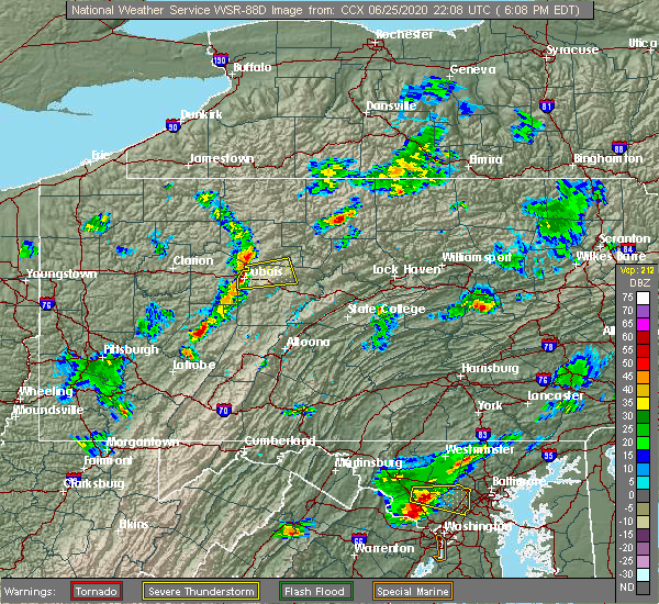 At 612 pm edt, a severe thunderstorm was located over dubois, moving east at 30 mph (radar indicated). Hazards include 60 mph wind gusts and half dollar size hail. Hail damage to vehicles is expected. Expect wind damage to trees, roofs, and siding. At 612 pm edt, a severe thunderstorm was located over dubois, moving east at 30 mph (radar indicated). Hazards include 60 mph wind gusts and half dollar size hail. Hail damage to vehicles is expected. Expect wind damage to trees, roofs, and siding.
|
| 6/25/2020 6:10 PM EDT | Multiple trees and wires down across duboi in clearfield county PA, 0.3 miles NE of DuBois, PA |
| 6/25/2020 6:10 PM EDT | Tree down on a house on hill s in clearfield county PA, 1.4 miles ESE of DuBois, PA |
| 6/4/2020 7:13 PM EDT |
 At 711 pm edt, severe thunderstorms were located along a line extending from near dubois to near curwensville to 10 miles north of prince gallitzin state park to near patton, moving northeast at 30 mph (radar indicated). Hazards include 60 mph wind gusts and penny size hail. Expect damage to trees, roofs, and siding. severe thunderstorms will be near, curwensville around 720 pm edt. clearfield, penfield, hyde, jeffries, plymptonville, blandburg, houtzdale, bellwood and s. b. elliot state park around 730 pm edt. tipton, woodland, parker dam state park and osceola mills around 740 pm edt. tyrone, north philipsburg, philipsburg, lecontes mills, chester hill, south philipsburg and birmingham around 750 pm edt. for those driving on interstate 80, this includes areas between the dubois and milesburg exits, specifically from mile markers 97 to 148. This includes interstate 99 from mile markers 41 to 72. At 711 pm edt, severe thunderstorms were located along a line extending from near dubois to near curwensville to 10 miles north of prince gallitzin state park to near patton, moving northeast at 30 mph (radar indicated). Hazards include 60 mph wind gusts and penny size hail. Expect damage to trees, roofs, and siding. severe thunderstorms will be near, curwensville around 720 pm edt. clearfield, penfield, hyde, jeffries, plymptonville, blandburg, houtzdale, bellwood and s. b. elliot state park around 730 pm edt. tipton, woodland, parker dam state park and osceola mills around 740 pm edt. tyrone, north philipsburg, philipsburg, lecontes mills, chester hill, south philipsburg and birmingham around 750 pm edt. for those driving on interstate 80, this includes areas between the dubois and milesburg exits, specifically from mile markers 97 to 148. This includes interstate 99 from mile markers 41 to 72.
|
| 3/20/2020 2:20 PM EDT |
 At 220 pm edt, severe thunderstorms were located along a line extending from near ridgway to near portland mills to near reynoldsville to 7 miles east of new bethlehem, moving east at 55 mph (radar indicated). Hazards include 60 mph wind gusts. Expect damage to trees, roofs, and siding. severe thunderstorms will be near, dubois, johnsonburg, ridgway, brandy camp, sandy, brockport and rockton around 230 pm edt. st. marys, s. b. elliot state park, force, medix run, parker dam state park, truman and penfield around 240 pm edt. benezette, hicks run, plymptonville and woodland around 250 pm edt. clearfield, curwensville, lecontes mills, hyde, cameron, karthaus and stevenson dam around 300 pm edt. other locations impacted by these severe thunderstorms include troutville, wallaceton, weedville, grampian, driftwood, lumber city, kersey, treasure lake, clearfield-lawrence airport and penn state dubois. For those driving on interstate 80, this includes areas between the dubois and kylertown exits, specifically from mile markers 97 to 131. At 220 pm edt, severe thunderstorms were located along a line extending from near ridgway to near portland mills to near reynoldsville to 7 miles east of new bethlehem, moving east at 55 mph (radar indicated). Hazards include 60 mph wind gusts. Expect damage to trees, roofs, and siding. severe thunderstorms will be near, dubois, johnsonburg, ridgway, brandy camp, sandy, brockport and rockton around 230 pm edt. st. marys, s. b. elliot state park, force, medix run, parker dam state park, truman and penfield around 240 pm edt. benezette, hicks run, plymptonville and woodland around 250 pm edt. clearfield, curwensville, lecontes mills, hyde, cameron, karthaus and stevenson dam around 300 pm edt. other locations impacted by these severe thunderstorms include troutville, wallaceton, weedville, grampian, driftwood, lumber city, kersey, treasure lake, clearfield-lawrence airport and penn state dubois. For those driving on interstate 80, this includes areas between the dubois and kylertown exits, specifically from mile markers 97 to 131.
|
| 8/17/2019 5:46 PM EDT |
 At 546 pm edt, a severe thunderstorm was located near dubois, moving east at 30 mph (radar indicated). Hazards include 60 mph wind gusts and quarter size hail. Hail damage to vehicles is expected. Expect wind damage to trees, roofs, and siding. At 546 pm edt, a severe thunderstorm was located near dubois, moving east at 30 mph (radar indicated). Hazards include 60 mph wind gusts and quarter size hail. Hail damage to vehicles is expected. Expect wind damage to trees, roofs, and siding.
|
| 7/19/2019 7:39 PM EDT |
 At 738 pm edt, a severe thunderstorm was located near penfield, moving southeast at 25 mph (radar indicated). Hazards include 60 mph wind gusts. Expect damage to trees, roofs, and siding. locations impacted include, dubois, clearfield, sandy, penfield, plymptonville, rockton, karthaus, force, brandy camp, brockport, parker dam state park, lecontes mills, s. b. elliot state park, portland mills, weedville, treasure lake, clearfield-lawrence airport and penn state dubois. For those driving on interstate 80, this includes areas between the dubois and woodland exits, specifically from mile markers 97 to 121. At 738 pm edt, a severe thunderstorm was located near penfield, moving southeast at 25 mph (radar indicated). Hazards include 60 mph wind gusts. Expect damage to trees, roofs, and siding. locations impacted include, dubois, clearfield, sandy, penfield, plymptonville, rockton, karthaus, force, brandy camp, brockport, parker dam state park, lecontes mills, s. b. elliot state park, portland mills, weedville, treasure lake, clearfield-lawrence airport and penn state dubois. For those driving on interstate 80, this includes areas between the dubois and woodland exits, specifically from mile markers 97 to 121.
|
| 7/19/2019 6:48 PM EDT |
 At 647 pm edt, severe thunderstorms were located along a line extending from near emporium to medix run to near brockport, moving east at 25 mph (radar indicated). Hazards include 60 mph wind gusts. expect damage to trees, roofs, and siding At 647 pm edt, severe thunderstorms were located along a line extending from near emporium to medix run to near brockport, moving east at 25 mph (radar indicated). Hazards include 60 mph wind gusts. expect damage to trees, roofs, and siding
|
| 7/6/2019 3:26 PM EDT |
 At 324 pm edt, severe thunderstorms were located along a line extending from 6 miles east of parker dam state park to plymptonville to near curwensville to 12 miles southeast of punxsutawney, moving east at 50 mph (radar indicated). Hazards include 65 mph wind gusts and penny size hail. Expect damage to trees, roofs, and siding. locations impacted include, dubois, clearfield, sandy, woodland, curwensville, penfield, hyde, plymptonville, rockton, jeffries, parker dam state park, lecontes mills, s. b. elliot state park, mahaffey, grampian, wallaceton, troutville, lumber city, treasure lake and clearfield-lawrence airport. For those driving on interstate 80, this includes areas between the dubois and kylertown exits, specifically from mile markers 97 to 129. At 324 pm edt, severe thunderstorms were located along a line extending from 6 miles east of parker dam state park to plymptonville to near curwensville to 12 miles southeast of punxsutawney, moving east at 50 mph (radar indicated). Hazards include 65 mph wind gusts and penny size hail. Expect damage to trees, roofs, and siding. locations impacted include, dubois, clearfield, sandy, woodland, curwensville, penfield, hyde, plymptonville, rockton, jeffries, parker dam state park, lecontes mills, s. b. elliot state park, mahaffey, grampian, wallaceton, troutville, lumber city, treasure lake and clearfield-lawrence airport. For those driving on interstate 80, this includes areas between the dubois and kylertown exits, specifically from mile markers 97 to 129.
|
| 7/6/2019 3:00 PM EDT | Trees down in clearfield county PA, 0.3 miles NE of DuBois, PA |
| 7/6/2019 2:59 PM EDT |
 At 258 pm edt, severe thunderstorms were located along a line extending from near brockport to near reynoldsville to 8 miles southwest of sandy to near punxsutawney, moving east at 45 mph (radar indicated). Hazards include 70 mph wind gusts. Expect considerable tree damage. Damage is likely to mobile homes, roofs, and outbuildings. At 258 pm edt, severe thunderstorms were located along a line extending from near brockport to near reynoldsville to 8 miles southwest of sandy to near punxsutawney, moving east at 45 mph (radar indicated). Hazards include 70 mph wind gusts. Expect considerable tree damage. Damage is likely to mobile homes, roofs, and outbuildings.
|
| 6/29/2019 5:58 PM EDT |
 The severe thunderstorm warning for clearfield county will expire at 600 pm edt, the storm which prompted the warning has weakened below severe limits, and no longer poses an immediate threat to life or property. therefore, the warning will be allowed to expire. a severe thunderstorm watch remains in effect until 700 pm edt for central pennsylvania. The severe thunderstorm warning for clearfield county will expire at 600 pm edt, the storm which prompted the warning has weakened below severe limits, and no longer poses an immediate threat to life or property. therefore, the warning will be allowed to expire. a severe thunderstorm watch remains in effect until 700 pm edt for central pennsylvania.
|
| 6/29/2019 5:01 PM EDT |
 At 501 pm edt, a severe thunderstorm was located near curwensville, moving southeast at 35 mph (radar indicated). Hazards include 60 mph wind gusts and penny size hail. expect damage to trees, roofs, and siding At 501 pm edt, a severe thunderstorm was located near curwensville, moving southeast at 35 mph (radar indicated). Hazards include 60 mph wind gusts and penny size hail. expect damage to trees, roofs, and siding
|
| 5/29/2019 2:32 PM EDT |
 At 232 pm edt, a severe thunderstorm was located near hastings, moving east at 40 mph (radar indicated). Hazards include 60 mph wind gusts and quarter size hail. Hail damage to vehicles is expected. Expect wind damage to trees, roofs, and siding. At 232 pm edt, a severe thunderstorm was located near hastings, moving east at 40 mph (radar indicated). Hazards include 60 mph wind gusts and quarter size hail. Hail damage to vehicles is expected. Expect wind damage to trees, roofs, and siding.
|
| 5/23/2019 7:50 PM EDT |
 At 749 pm edt, a severe thunderstorm was located over reynoldsville, moving east at 45 mph (radar indicated). Hazards include 60 mph wind gusts and small hail. expect damage to trees and siding in some locations At 749 pm edt, a severe thunderstorm was located over reynoldsville, moving east at 45 mph (radar indicated). Hazards include 60 mph wind gusts and small hail. expect damage to trees and siding in some locations
|
| 10/2/2018 7:00 PM EDT |
 At 659 pm edt, severe thunderstorms were located along a line extending from near bald eagle state park to near snow shoe to near north philipsburg to s.b. elliot state park to near sandy, moving southeast at 25 mph (radar indicated). Hazards include 60 mph wind gusts and quarter size hail. Hail damage to vehicles is expected. Expect wind damage to roofs, siding, and trees. At 659 pm edt, severe thunderstorms were located along a line extending from near bald eagle state park to near snow shoe to near north philipsburg to s.b. elliot state park to near sandy, moving southeast at 25 mph (radar indicated). Hazards include 60 mph wind gusts and quarter size hail. Hail damage to vehicles is expected. Expect wind damage to roofs, siding, and trees.
|
| 10/2/2018 6:12 PM EDT |
 At 605 pm edt, 2 tornado producing storms were located along a line extending from near plymptonville to near reynoldsville, moving east southeast at 35 mph (law enforcement confirmed tornado). Hazards include damaging tornado and ping pong ball size hail. Flying debris will be dangerous to those caught without shelter. mobile homes will be damaged or destroyed. damage to roofs, windows, and vehicles will occur. tree damage is likely. these tornadic storms will be near, clearfield, plymptonville, hyde and curwensville around 610 pm edt. woodland and lecontes mills around 620 pm edt. s. b. elliot state park around 630 pm edt. other locations impacted by these tornadic storms include troutville, wallaceton, morrisdale, kylertown, treasure lake, clearfield-lawrence airport, penn state dubois and grassflat. For those driving on interstate 80, this includes areas between the dubois and snow shoe exits, specifically from mile markers 97 to 134. At 605 pm edt, 2 tornado producing storms were located along a line extending from near plymptonville to near reynoldsville, moving east southeast at 35 mph (law enforcement confirmed tornado). Hazards include damaging tornado and ping pong ball size hail. Flying debris will be dangerous to those caught without shelter. mobile homes will be damaged or destroyed. damage to roofs, windows, and vehicles will occur. tree damage is likely. these tornadic storms will be near, clearfield, plymptonville, hyde and curwensville around 610 pm edt. woodland and lecontes mills around 620 pm edt. s. b. elliot state park around 630 pm edt. other locations impacted by these tornadic storms include troutville, wallaceton, morrisdale, kylertown, treasure lake, clearfield-lawrence airport, penn state dubois and grassflat. For those driving on interstate 80, this includes areas between the dubois and snow shoe exits, specifically from mile markers 97 to 134.
|
| 10/2/2018 5:32 PM EDT |
 At 532 pm edt, a severe thunderstorm capable of producing a tornado was located over sandy, moving east at 35 mph (radar indicated rotation). Hazards include tornado and quarter size hail. Flying debris will be dangerous to those caught without shelter. mobile homes will be damaged or destroyed. damage to roofs, windows, and vehicles will occur. tree damage is likely. this dangerous storm will be near, rockton around 550 pm edt. s. b. elliot state park and curwensville around 600 pm edt. clearfield, plymptonville and hyde around 610 pm edt. lecontes mills and woodland around 620 pm edt. other locations impacted by this tornadic thunderstorm include troutville, wallaceton, morrisdale, kylertown, treasure lake, clearfield-lawrence airport, penn state dubois and grassflat. For those driving on interstate 80, this includes areas between the dubois and snow shoe exits, specifically from mile markers 97 to 134. At 532 pm edt, a severe thunderstorm capable of producing a tornado was located over sandy, moving east at 35 mph (radar indicated rotation). Hazards include tornado and quarter size hail. Flying debris will be dangerous to those caught without shelter. mobile homes will be damaged or destroyed. damage to roofs, windows, and vehicles will occur. tree damage is likely. this dangerous storm will be near, rockton around 550 pm edt. s. b. elliot state park and curwensville around 600 pm edt. clearfield, plymptonville and hyde around 610 pm edt. lecontes mills and woodland around 620 pm edt. other locations impacted by this tornadic thunderstorm include troutville, wallaceton, morrisdale, kylertown, treasure lake, clearfield-lawrence airport, penn state dubois and grassflat. For those driving on interstate 80, this includes areas between the dubois and snow shoe exits, specifically from mile markers 97 to 134.
|
| 10/2/2018 5:27 PM EDT |
 At 526 pm edt, severe thunderstorms were located along a line extending from 6 miles northeast of east branch dam to 6 miles north of portland mills to reynoldsville, moving east at 45 mph (radar indicated). Hazards include ping pong ball size hail and 60 mph wind gusts. People and animals outdoors will be injured. expect hail damage to roofs, siding, windows, and vehicles. Expect wind damage to roofs, siding, and trees. At 526 pm edt, severe thunderstorms were located along a line extending from 6 miles northeast of east branch dam to 6 miles north of portland mills to reynoldsville, moving east at 45 mph (radar indicated). Hazards include ping pong ball size hail and 60 mph wind gusts. People and animals outdoors will be injured. expect hail damage to roofs, siding, windows, and vehicles. Expect wind damage to roofs, siding, and trees.
|
| 10/2/2018 4:26 PM EDT |
 At 425 pm edt, severe thunderstorms were located along a line extending from near st. marys to 7 miles west of portland mills to near sandy, moving east at 30 mph (radar indicated). Hazards include 60 mph wind gusts. expect damage to roofs, siding, and trees At 425 pm edt, severe thunderstorms were located along a line extending from near st. marys to 7 miles west of portland mills to near sandy, moving east at 30 mph (radar indicated). Hazards include 60 mph wind gusts. expect damage to roofs, siding, and trees
|
| 6/18/2018 10:19 PM EDT |
 At 1016 pm edt, severe thunderstorms were located along a line extending from 8 miles northeast of brookville to near clarion, moving southeast at 45 mph (radar indicated). Hazards include 60 mph wind gusts. Expect damage to roofs, siding, and trees, resulting in some power outages. severe thunderstorms will be near, dubois and sandy around 1030 pm edt. rockton, s. b. elliot state park and penfield around 1040 pm edt. clearfield, plymptonville, hyde and curwensville around 1050 pm edt. woodland, jeffries and lecontes mills around 1100 pm edt. other locations impacted by these severe thunderstorms include west decatur, ramey, glen hope, grampian, brisbin, westover, lumber city, kylertown, grassflat and troutville. For those driving on interstate 80, this includes areas between the dubois and snow shoe exits, specifically from mile markers 97 to 138. At 1016 pm edt, severe thunderstorms were located along a line extending from 8 miles northeast of brookville to near clarion, moving southeast at 45 mph (radar indicated). Hazards include 60 mph wind gusts. Expect damage to roofs, siding, and trees, resulting in some power outages. severe thunderstorms will be near, dubois and sandy around 1030 pm edt. rockton, s. b. elliot state park and penfield around 1040 pm edt. clearfield, plymptonville, hyde and curwensville around 1050 pm edt. woodland, jeffries and lecontes mills around 1100 pm edt. other locations impacted by these severe thunderstorms include west decatur, ramey, glen hope, grampian, brisbin, westover, lumber city, kylertown, grassflat and troutville. For those driving on interstate 80, this includes areas between the dubois and snow shoe exits, specifically from mile markers 97 to 138.
|
| 5/15/2018 12:58 PM EDT |
 At 1258 pm edt, severe thunderstorms were located along a line extending from force to near reynoldsville to 9 miles northwest of indiana to near homer city, moving south at 45 mph (radar indicated). Hazards include 70 mph wind gusts and quarter size hail. Hail damage to vehicles is possible. expect considerable tree damage. Wind damage is also likely to mobile homes, roofs, and outbuildings. At 1258 pm edt, severe thunderstorms were located along a line extending from force to near reynoldsville to 9 miles northwest of indiana to near homer city, moving south at 45 mph (radar indicated). Hazards include 70 mph wind gusts and quarter size hail. Hail damage to vehicles is possible. expect considerable tree damage. Wind damage is also likely to mobile homes, roofs, and outbuildings.
|
| 5/4/2018 6:29 PM EDT |
 At 628 pm edt, severe thunderstorms were located along a line extending from near pine glen to 8 miles southeast of punxsutawney, moving east at 50 mph (radar indicated). Hazards include 70 mph wind gusts. Expect considerable tree damage. damage is likely to mobile homes, roofs, and outbuildings. these storms have a history of producing wind damage. locations impacted include, dubois, clearfield, curwensville, jeffries, woodland, hyde, lecontes mills, s. b. Elliot state park, penfield and houtzdale. At 628 pm edt, severe thunderstorms were located along a line extending from near pine glen to 8 miles southeast of punxsutawney, moving east at 50 mph (radar indicated). Hazards include 70 mph wind gusts. Expect considerable tree damage. damage is likely to mobile homes, roofs, and outbuildings. these storms have a history of producing wind damage. locations impacted include, dubois, clearfield, curwensville, jeffries, woodland, hyde, lecontes mills, s. b. Elliot state park, penfield and houtzdale.
|
| 5/4/2018 5:22 PM EDT |
 At 521 pm edt, severe thunderstorms were located along a line extending from near shinglehouse to near brookville, moving east at 50 mph (radar indicated). Hazards include 70 mph wind gusts. Expect considerable tree damage. Damage is likely to mobile homes, roofs, and outbuildings. At 521 pm edt, severe thunderstorms were located along a line extending from near shinglehouse to near brookville, moving east at 50 mph (radar indicated). Hazards include 70 mph wind gusts. Expect considerable tree damage. Damage is likely to mobile homes, roofs, and outbuildings.
|
| 8/22/2017 2:55 PM EDT |
 At 254 pm edt, a severe thunderstorm was located 10 miles east of punxsutawney, moving east at 40 mph (radar indicated). Hazards include 70 mph wind gusts and quarter size hail. Hail damage to vehicles is possible. expect considerable tree damage. Wind damage is also likely to mobile homes, roofs, and outbuildings. At 254 pm edt, a severe thunderstorm was located 10 miles east of punxsutawney, moving east at 40 mph (radar indicated). Hazards include 70 mph wind gusts and quarter size hail. Hail damage to vehicles is possible. expect considerable tree damage. Wind damage is also likely to mobile homes, roofs, and outbuildings.
|
| 8/22/2017 2:39 PM EDT |
 At 235 pm edt, severe thunderstorms were located along a line extending from 6 miles southwest of kinzua bridge state park to johnsonburg to near brockport, moving east at 50 mph. these are very dangerous storms (radar indicated). Hazards include 80 mph wind gusts near johnsonburg and ridgway. these very strong winds will be impacting east branch dam, elk river and emporium between 240 pm and 3 pm. Flying debris will be dangerous to those caught without shelter. mobile homes will be heavily damaged. expect considerable damage to roofs, windows, and vehicles. extensive tree damage and power outages are likely. locations impacted include, ridgway, kane, dubois, st. marys, johnsonburg, force, crosby, ludlow, east branch dam and hicks run. A tornado watch remains in effect until 900 pm edt for north central pennsylvania. At 235 pm edt, severe thunderstorms were located along a line extending from 6 miles southwest of kinzua bridge state park to johnsonburg to near brockport, moving east at 50 mph. these are very dangerous storms (radar indicated). Hazards include 80 mph wind gusts near johnsonburg and ridgway. these very strong winds will be impacting east branch dam, elk river and emporium between 240 pm and 3 pm. Flying debris will be dangerous to those caught without shelter. mobile homes will be heavily damaged. expect considerable damage to roofs, windows, and vehicles. extensive tree damage and power outages are likely. locations impacted include, ridgway, kane, dubois, st. marys, johnsonburg, force, crosby, ludlow, east branch dam and hicks run. A tornado watch remains in effect until 900 pm edt for north central pennsylvania.
|
| 8/22/2017 2:09 PM EDT |
 At 208 pm edt, severe thunderstorms were located along a line extending from near sheffield to near marienville to near brookville, moving east at 30 mph (radar indicated). Hazards include 60 mph wind gusts. expect damage to trees and power lines At 208 pm edt, severe thunderstorms were located along a line extending from near sheffield to near marienville to near brookville, moving east at 30 mph (radar indicated). Hazards include 60 mph wind gusts. expect damage to trees and power lines
|
| 8/4/2017 7:55 PM EDT |
 At 754 pm edt, severe thunderstorms were located along a line extending from 6 miles south of marienville to near brookville to near kittanning, moving northeast at 40 mph (radar indicated). Hazards include 60 mph wind gusts. expect damage to trees and power lines At 754 pm edt, severe thunderstorms were located along a line extending from 6 miles south of marienville to near brookville to near kittanning, moving northeast at 40 mph (radar indicated). Hazards include 60 mph wind gusts. expect damage to trees and power lines
|
| 6/15/2017 5:47 PM EDT |
 At 546 pm edt, severe thunderstorms were located along a line extending from near reynoldsville to 9 miles south of punxsutawney to 8 miles northwest of westmont, moving east at 30 mph (radar indicated). Hazards include 60 mph wind gusts. expect damage to trees and power lines At 546 pm edt, severe thunderstorms were located along a line extending from near reynoldsville to 9 miles south of punxsutawney to 8 miles northwest of westmont, moving east at 30 mph (radar indicated). Hazards include 60 mph wind gusts. expect damage to trees and power lines
|
| 5/30/2017 1:14 PM EDT |
 At 113 pm edt, a severe thunderstorm was located over reynoldsville, moving east at 40 mph (radar indicated). Hazards include 60 mph wind gusts and quarter size hail. Hail damage to vehicles is possible. Expect wind damage to trees and power lines. At 113 pm edt, a severe thunderstorm was located over reynoldsville, moving east at 40 mph (radar indicated). Hazards include 60 mph wind gusts and quarter size hail. Hail damage to vehicles is possible. Expect wind damage to trees and power lines.
|
| 5/1/2017 4:28 PM EDT |
 At 427 pm edt, severe thunderstorms were located along a line extending from penfield to curwensville to northern cambria to southmont, moving east at 35 mph (radar indicated). Hazards include 70 mph wind gusts. Expect considerable tree damage. damage is likely to mobile homes, roofs, and outbuildings. locations impacted include, belmont, johnstown, dubois, westmont, nanty-glo, portage, ebensburg, clearfield, windber and salix-beauty line park. A tornado watch remains in effect until 1000 pm edt for south central, central and north central pennsylvania. At 427 pm edt, severe thunderstorms were located along a line extending from penfield to curwensville to northern cambria to southmont, moving east at 35 mph (radar indicated). Hazards include 70 mph wind gusts. Expect considerable tree damage. damage is likely to mobile homes, roofs, and outbuildings. locations impacted include, belmont, johnstown, dubois, westmont, nanty-glo, portage, ebensburg, clearfield, windber and salix-beauty line park. A tornado watch remains in effect until 1000 pm edt for south central, central and north central pennsylvania.
|
| 5/1/2017 3:56 PM EDT |
 At 355 pm edt, severe thunderstorms were located along a line from just west of dubois to latrobe, moving east at 40 mph (radar indicated). Hazards include 70 mph wind gusts. Expect considerable tree damage. damage is likely to mobile homes, roofs, and outbuildings. severe thunderstorms will be near, dubois and sandy around 410 pm edt. westmont, southmont, rockton and belsano around 420 pm edt. belmont, johnstown, windber, ebensburg, carrolltown, s. b. elliot state park, geistown, daisytown, dale and east conemaugh around 430 pm edt. portage, clearfield, beaverdale-lloydell, dunlo, salix-beauty line park, sidman, st. michael, prince gallitzin state park, patton and ehrenfeld around 440 pm edt. for those driving on interstate 80, this includes areas between the dubois and snow shoe exits, specifically from mile markers 97 to 138. A tornado watch remains in effect until 1000 pm edt for south central, central and north central pennsylvania. At 355 pm edt, severe thunderstorms were located along a line from just west of dubois to latrobe, moving east at 40 mph (radar indicated). Hazards include 70 mph wind gusts. Expect considerable tree damage. damage is likely to mobile homes, roofs, and outbuildings. severe thunderstorms will be near, dubois and sandy around 410 pm edt. westmont, southmont, rockton and belsano around 420 pm edt. belmont, johnstown, windber, ebensburg, carrolltown, s. b. elliot state park, geistown, daisytown, dale and east conemaugh around 430 pm edt. portage, clearfield, beaverdale-lloydell, dunlo, salix-beauty line park, sidman, st. michael, prince gallitzin state park, patton and ehrenfeld around 440 pm edt. for those driving on interstate 80, this includes areas between the dubois and snow shoe exits, specifically from mile markers 97 to 138. A tornado watch remains in effect until 1000 pm edt for south central, central and north central pennsylvania.
|
| 4/16/2017 5:17 PM EDT |
 At 516 pm edt, a severe thunderstorm was located near force, moving east at 50 mph (radar indicated). Hazards include 60 mph wind gusts. expect damage to roofs, siding, and trees At 516 pm edt, a severe thunderstorm was located near force, moving east at 50 mph (radar indicated). Hazards include 60 mph wind gusts. expect damage to roofs, siding, and trees
|
| 6/16/2016 11:25 AM EDT |
 At 1124 am edt, severe thunderstorms were located along a line extending from near sandy to 10 miles north of northern cambria, moving east at 40 mph (law enforcement). Hazards include 70 mph wind gusts. Expect considerable tree damage. damage is possible to mobile homes, roofs, and outbuildings. these severe storms will be near, curwensville, rockton and hyde around 1140 am edt. Other locations impacted by these severe thunderstorms include lumber city, brisbin, troutville, weedville, coalport, new washington, driftwood, irvona, grampian and morrisdale. At 1124 am edt, severe thunderstorms were located along a line extending from near sandy to 10 miles north of northern cambria, moving east at 40 mph (law enforcement). Hazards include 70 mph wind gusts. Expect considerable tree damage. damage is possible to mobile homes, roofs, and outbuildings. these severe storms will be near, curwensville, rockton and hyde around 1140 am edt. Other locations impacted by these severe thunderstorms include lumber city, brisbin, troutville, weedville, coalport, new washington, driftwood, irvona, grampian and morrisdale.
|
| 6/16/2016 11:18 AM EDT | Trees and wires down knarr stree in clearfield county PA, 0.3 miles NE of DuBois, PA |
| 6/16/2016 11:04 AM EDT |
 At 1102 am edt, severe thunderstorms were located along a line extending from near punxsutawney to 12 miles northwest of northern cambria, moving east at 40 mph. Hazards include 70 mph wind gusts. Expect tree damage. severe thunderstorms will be near, sandy around 1110 am edt. rockton around 1120 am edt. curwensville and s. b. elliot state park around 1130 am edt. clearfield, hyde, plymptonville, woodland, houtzdale and jeffries around 1140 am edt. other locations impacted by these severe thunderstorms include lumber city, brisbin, troutville, weedville, coalport, new washington, driftwood, irvona, grampian and morrisdale. For those driving on interstate 80, this includes areas between the dubois and kylertown exits, specifically from mile markers 97 to 132. At 1102 am edt, severe thunderstorms were located along a line extending from near punxsutawney to 12 miles northwest of northern cambria, moving east at 40 mph. Hazards include 70 mph wind gusts. Expect tree damage. severe thunderstorms will be near, sandy around 1110 am edt. rockton around 1120 am edt. curwensville and s. b. elliot state park around 1130 am edt. clearfield, hyde, plymptonville, woodland, houtzdale and jeffries around 1140 am edt. other locations impacted by these severe thunderstorms include lumber city, brisbin, troutville, weedville, coalport, new washington, driftwood, irvona, grampian and morrisdale. For those driving on interstate 80, this includes areas between the dubois and kylertown exits, specifically from mile markers 97 to 132.
|
| 7/19/2015 9:07 PM EDT |
 At 905 pm edt, doppler radar indicated a severe thunderstorm capable of producing damaging winds in excess of 60 mph. this storm was located near karthaus, moving east at 40 mph. locations impacted include, clearfield, dubois, hyde, karthaus, kettle creek state park, lecontes mills, parker dam state park, penfield, plymptonville, rockton, s.b. elliot state park, sandy, tamarack, westport, grassflat, kylertown, clearfield-lawrence airport. At 905 pm edt, doppler radar indicated a severe thunderstorm capable of producing damaging winds in excess of 60 mph. this storm was located near karthaus, moving east at 40 mph. locations impacted include, clearfield, dubois, hyde, karthaus, kettle creek state park, lecontes mills, parker dam state park, penfield, plymptonville, rockton, s.b. elliot state park, sandy, tamarack, westport, grassflat, kylertown, clearfield-lawrence airport.
|
| 7/19/2015 8:30 PM EDT |
 At 830 pm edt, doppler radar indicated a severe thunderstorm capable of producing damaging winds around 60 mph. this storm was located near penfield, and moving east at 40 mph. At 830 pm edt, doppler radar indicated a severe thunderstorm capable of producing damaging winds around 60 mph. this storm was located near penfield, and moving east at 40 mph.
|
| 7/7/2015 9:19 PM EDT |
 At 919 pm edt, doppler radar indicated a line of severe thunderstorms capable of producing damaging winds around 60 mph. these storms were located along a line extending from near marienville to 11 miles west of brockway to near brookville to near new bethlehem, and moving east at 40 mph. At 919 pm edt, doppler radar indicated a line of severe thunderstorms capable of producing damaging winds around 60 mph. these storms were located along a line extending from near marienville to 11 miles west of brockway to near brookville to near new bethlehem, and moving east at 40 mph.
|
| 6/23/2015 8:02 AM EDT |
 At 800 am edt, doppler radar indicated a severe thunderstorm capable of producing quarter size hail and damaging winds around 60 mph. this storm was located near punxsutawney, and moving east at 50 mph. At 800 am edt, doppler radar indicated a severe thunderstorm capable of producing quarter size hail and damaging winds around 60 mph. this storm was located near punxsutawney, and moving east at 50 mph.
|
| 6/23/2015 6:59 AM EDT |
 At 659 am edt, doppler radar indicated a line of severe thunderstorms capable of producing damaging winds in excess of 60 mph. these storms were located along a line extending from near kettle creek state park to near reynoldsville, moving east at 60 mph. locations impacted include, clearfield, dubois, st. marys, benezette, brandy camp, brockport, cameron, curwensville, force, hicks run, hyde, karthaus, lecontes mills, medix run, parker dam state park, penfield, plymptonville, rockton, s.b. elliot state park and sandy. At 659 am edt, doppler radar indicated a line of severe thunderstorms capable of producing damaging winds in excess of 60 mph. these storms were located along a line extending from near kettle creek state park to near reynoldsville, moving east at 60 mph. locations impacted include, clearfield, dubois, st. marys, benezette, brandy camp, brockport, cameron, curwensville, force, hicks run, hyde, karthaus, lecontes mills, medix run, parker dam state park, penfield, plymptonville, rockton, s.b. elliot state park and sandy.
|
| 6/23/2015 6:18 AM EDT |
 At 617 am edt, doppler radar indicated a line of severe thunderstorms capable of producing damaging winds around 60 mph. these storms were located along a line extending from near portland mills to near emlenton, and moving east at 60 mph. At 617 am edt, doppler radar indicated a line of severe thunderstorms capable of producing damaging winds around 60 mph. these storms were located along a line extending from near portland mills to near emlenton, and moving east at 60 mph.
|
| 6/12/2015 6:58 PM EDT | Large tree fell on wayne road near sr 5523. motorcyclist crashed into fallen tre in clearfield county PA, 0.3 miles NE of DuBois, PA |
| 6/12/2015 6:32 PM EDT |
 At 631 pm edt, doppler radar indicated a line of severe thunderstorms capable of producing damaging winds of 60 to 70 mph. these storms were located along a line extending from clear creek state park to near brookville to near rural valley, and moving east at 50 mph. At 631 pm edt, doppler radar indicated a line of severe thunderstorms capable of producing damaging winds of 60 to 70 mph. these storms were located along a line extending from clear creek state park to near brookville to near rural valley, and moving east at 50 mph.
|
| 5/11/2015 10:37 PM EDT | At 1037 pm edt, doppler radar indicated a line of severe thunderstorms capable of producing damaging winds around 60 mph. these storms were located along a line extending from near falls creek to near curwensville to near loretto to near davidsville, and moving east at 40 mph. |
| 6/18/2014 9:35 PM EDT | Numerous trees down dubois in clearfield county PA, 0.3 miles NE of DuBois, PA |
| 6/17/2014 11:42 PM EDT | Trees and wires down in clearfield county PA, 0.3 miles NE of DuBois, PA |
| 11/1/2013 4:40 AM EDT | Trees and wires down in clearfield county PA, 0.3 miles NE of DuBois, PA |
| 8/7/2013 5:15 PM EDT | Tree down on wires in clearfield county PA, 0.8 miles WNW of DuBois, PA |
| 9/8/2012 11:30 AM EDT | Trees and power lines down. shingles off roofs. caller also reported funnel clou in clearfield county PA, 0.3 miles NE of DuBois, PA |
| 1/1/0001 12:00 AM | Shed damaged and tree down on quarry ave in clearfield county PA, 0.3 miles NE of DuBois, PA |
| 1/1/0001 12:00 AM | Shed damaged and tree down on quarry ave. public reported a funnel cloud in clearfield county PA, 0.3 miles NE of DuBois, PA |
| 1/1/0001 12:00 AM | Trees and wires down in the city in clearfield county PA, 0.3 miles NE of DuBois, PA |
| 1/1/0001 12:00 AM | Trees and wires down in the city in clearfield county PA, 0.3 miles NE of DuBois, PA |
| 1/1/0001 12:00 AM | Shed damaged and tree down on quarry ave. public reported a funnel cloud in clearfield county PA, 0.3 miles NE of DuBois, PA |
Hail Maps for DuBois, PA
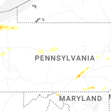
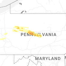


Connect with Interactive Hail Maps