

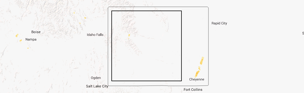
Hail Map for Dubois, WY
The Dubois, WY area has had 1 report of on-the-ground hail by trained spotters, and has been under severe weather warnings 1 time during the past 12 months. Doppler radar has detected hail at or near Dubois, WY on 3 occasions.
| Name: | Dubois, WY |
| Where Located: | 72.6 miles WNW of Riverton, WY |
| Map: | Google Map for Dubois, WY |
| Population: | 971 |
| Housing Units: | 625 |
| More Info: | Search Google for Dubois, WY |
5
The Top Recent Hail Date for Dubois, WY is Monday, July 1, 2013 (1st out of 3)
Hail and Wind Damage Spotted near Dubois, WY
| Date / Time | Report Details |
|---|---|
| 7/15/2025 3:57 PM MDT | Mesonet station elkw4 elkhor in fremont county WY, 10 miles S of Dubois, WY |
| 7/15/2025 3:34 PM MDT |
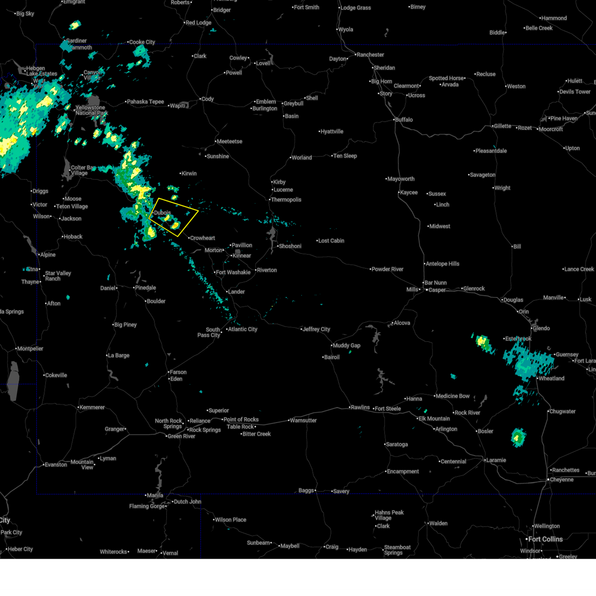 Svrriw the national weather service in riverton has issued a * severe thunderstorm warning for, northwestern fremont county in central wyoming, * until 400 pm mdt. * at 333 pm mdt, a severe thunderstorm was located near torrey lake, which is near dubois, moving east at 35 mph (radar indicated. at 3:30 pm a 61 mph wind gust was reported dubois municipal airport). Hazards include 60 mph wind gusts. Expect damage to roofs, siding, and trees. This severe thunderstorm will remain over mainly rural areas of northwestern fremont county. Svrriw the national weather service in riverton has issued a * severe thunderstorm warning for, northwestern fremont county in central wyoming, * until 400 pm mdt. * at 333 pm mdt, a severe thunderstorm was located near torrey lake, which is near dubois, moving east at 35 mph (radar indicated. at 3:30 pm a 61 mph wind gust was reported dubois municipal airport). Hazards include 60 mph wind gusts. Expect damage to roofs, siding, and trees. This severe thunderstorm will remain over mainly rural areas of northwestern fremont county.
|
| 7/15/2025 3:30 PM MDT | Storm damage reported in fremont county WY, 0.2 miles S of Dubois, WY |
| 5/11/2025 1:23 PM MDT | Awos station kdub dubois airpor in fremont county WY, 2.2 miles ESE of Dubois, WY |
| 6/27/2020 8:15 PM MDT | Awos station kdub dubois airpor in fremont county WY, 2.2 miles ESE of Dubois, WY |
| 8/22/2018 7:15 PM MDT | Dubois airpor in fremont county WY, 2.7 miles ESE of Dubois, WY |
| 7/3/2018 2:15 PM MDT | Dubois airport - occurred with weak convectio in fremont county WY, 2.7 miles ESE of Dubois, WY |
| 7/20/2017 3:32 PM MDT |
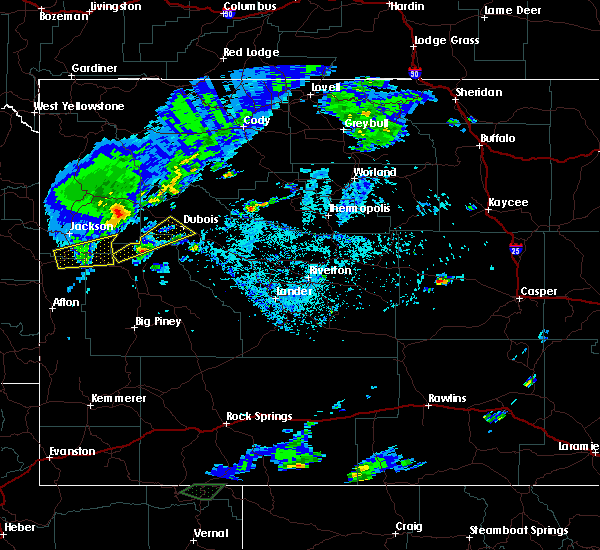 At 332 pm mdt, a severe thunderstorm was located near union pass, which is 17 miles southwest of dubois, moving northeast at 40 mph (radar indicated). Hazards include 60 mph wind gusts and quarter size hail. Hail damage to vehicles is expected. expect wind damage to roofs, siding, and trees. Locations impacted include, union pass to dubois. At 332 pm mdt, a severe thunderstorm was located near union pass, which is 17 miles southwest of dubois, moving northeast at 40 mph (radar indicated). Hazards include 60 mph wind gusts and quarter size hail. Hail damage to vehicles is expected. expect wind damage to roofs, siding, and trees. Locations impacted include, union pass to dubois.
|
| 7/20/2017 3:08 PM MDT |
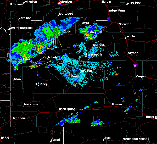 At 308 pm mdt, a severe thunderstorm was located 11 miles northeast of bondurant, which is 31 miles southeast of jackson, moving northeast at 40 mph (radar indicated). Hazards include 60 mph wind gusts and quarter size hail. Hail damage to vehicles is expected. expect wind damage to roofs, siding, and trees. this severe thunderstorm will be near, union pass around 340 pm mdt. dubois and torrey lake around 400 pm mdt. Other locations impacted by this severe thunderstorm include dubois municipal airport, antelope hills golf course, crooked creek guest ranch and longhorn ranch lodge and rv resort. At 308 pm mdt, a severe thunderstorm was located 11 miles northeast of bondurant, which is 31 miles southeast of jackson, moving northeast at 40 mph (radar indicated). Hazards include 60 mph wind gusts and quarter size hail. Hail damage to vehicles is expected. expect wind damage to roofs, siding, and trees. this severe thunderstorm will be near, union pass around 340 pm mdt. dubois and torrey lake around 400 pm mdt. Other locations impacted by this severe thunderstorm include dubois municipal airport, antelope hills golf course, crooked creek guest ranch and longhorn ranch lodge and rv resort.
|
| 6/27/2017 12:55 PM MDT | Dubois airpor in fremont county WY, 2.7 miles ESE of Dubois, WY |
| 7/21/2014 5:57 PM MDT | Elkhorn raw in fremont county WY, 10 miles S of Dubois, WY |
| 7/21/2014 5:55 PM MDT | Dubois airpor in fremont county WY, 2.7 miles ESE of Dubois, WY |
| 7/1/2013 6:40 PM MDT | Quarter sized hail reported 1.1 miles ESE of Dubois, WY |
Hail Maps for Dubois, WY


Connect with Interactive Hail Maps