

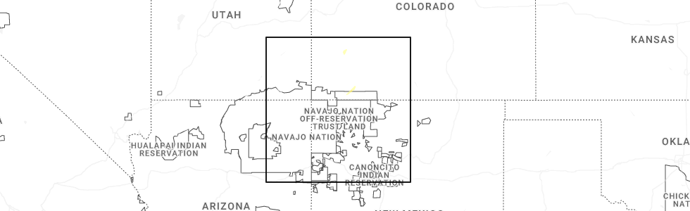
Hail Map for Durango, CO
The Durango, CO area has had 9 reports of on-the-ground hail by trained spotters, and has been under severe weather warnings 5 times during the past 12 months. Doppler radar has detected hail at or near Durango, CO on 10 occasions, including 2 occasions during the past year.
| Name: | Durango, CO |
| Where Located: | 42 miles NNE of Farmington, NM |
| Map: | Google Map for Durango, CO |
| Population: | 16887 |
| Housing Units: | 7851 |
| More Info: | Search Google for Durango, CO |
3
The Top Recent Hail Date for Durango, CO is Thursday, September 11, 2025 (3rd out of 10)
Hail and Wind Damage Spotted near Durango, CO
| Date / Time | Report Details |
|---|---|
| 9/11/2025 4:21 PM MDT | The storm which prompted the warning has weakened below severe limits, and no longer poses an immediate threat to life or property. therefore, the warning will be allowed to expire. however, small hail and heavy rain are still possible with this thunderstorm. |
| 9/11/2025 3:58 PM MDT | At 357 pm mdt, a severe thunderstorm was located 7 miles west of bayfield, or 8 miles east of durango, moving northeast at 30 mph (radar indicated. local storm spotters also reported quarter sized hail near the airport turnoff along highway 550). Hazards include 60 mph wind gusts and quarter size hail. Hail damage to vehicles is expected. expect wind damage to roofs, siding, and trees. Locations impacted include, durango, bayfield, vallecito, and falfa. |
| 9/11/2025 3:52 PM MDT | Quarter sized hail reported 4.2 miles NW of Durango, CO |
| 9/11/2025 3:48 PM MDT | Svrgjt the national weather service in grand junction has issued a * severe thunderstorm warning for, southeastern la plata county in southwestern colorado, * until 430 pm mdt. * at 347 pm mdt, a severe thunderstorm was located near durango, moving northeast at 30 mph (radar indicated). Hazards include 60 mph wind gusts and quarter size hail. Hail damage to vehicles is expected. Expect wind damage to roofs, siding, and trees. |
| 9/11/2025 3:36 PM MDT | At 336 pm mdt, a severe thunderstorm was located 8 miles south of durango, moving northeast at 30 mph (radar indicated). Hazards include 60 mph wind gusts and quarter size hail. Hail damage to vehicles is expected. expect wind damage to roofs, siding, and trees. Locations impacted include, durango and bondad. |
| 9/11/2025 3:21 PM MDT | Svrgjt the national weather service in grand junction has issued a * severe thunderstorm warning for, south central la plata county in southwestern colorado, * until 400 pm mdt. * at 320 pm mdt, a severe thunderstorm was located 11 miles northwest of cedar hill, or 14 miles southwest of durango, moving northeast at 30 mph (radar indicated). Hazards include 60 mph wind gusts and quarter size hail. very heavy rainfall can also be expected. Hail damage to vehicles is expected. Expect wind damage to roofs, siding, and trees. |
| 5/26/2025 1:53 PM MDT | Asos station kdro durango la plata cnty airpor in la plata county CO, 9.6 miles NNW of Durango, CO |
| 9/17/2024 9:25 AM MDT | Asos station kdro durango la plata cnty airpor in la plata county CO, 9.6 miles NNW of Durango, CO |
| 8/23/2024 6:29 PM MDT | Asos station kdro durango la plata cnty airpor in la plata county CO, 9.6 miles NNW of Durango, CO |
| 8/10/2024 10:28 PM MDT | Asos station kdro durango la plata cnty airpor in la plata county CO, 9.6 miles NNW of Durango, CO |
| 7/11/2024 7:33 PM MDT | Asos station kdro durango la plata cnty airpor in la plata county CO, 9.6 miles NNW of Durango, CO |
| 6/30/2024 6:33 PM MDT | Asos station kdro durango la plata cnty airpor in la plata county CO, 9.6 miles NNW of Durango, CO |
| 6/20/2024 1:51 PM MDT | Half Dollar sized hail reported 4.4 miles W of Durango, CO, varied from 1/2 inch to over quarter size. lasted 20 minutes. |
| 6/20/2024 12:06 PM MDT |
 Svrgjt the national weather service in grand junction has issued a * severe thunderstorm warning for, east central la plata county in southwestern colorado, * until 1230 pm mdt. * at 1206 pm mdt, a severe thunderstorm was located 7 miles east of durango, moving north at 20 mph (radar indicated). Hazards include quarter size hail. wind gusts up to 50 mph. damage to vehicles is expected Svrgjt the national weather service in grand junction has issued a * severe thunderstorm warning for, east central la plata county in southwestern colorado, * until 1230 pm mdt. * at 1206 pm mdt, a severe thunderstorm was located 7 miles east of durango, moving north at 20 mph (radar indicated). Hazards include quarter size hail. wind gusts up to 50 mph. damage to vehicles is expected
|
| 5/20/2024 5:53 PM MDT | Asos station kdro durango la plata cnty airport. gust from nearby virga shower in la plata county CO, 9.6 miles NNW of Durango, CO |
| 6/14/2023 11:07 PM MDT | Storm damage reported in la plata county CO, 10.5 miles NNW of Durango, CO |
| 6/14/2023 9:33 PM MDT | Corrects previous tstm wnd gst report from 3 sw oxfor in la plata county CO, 10.5 miles NNW of Durango, CO |
| 4/14/2023 3:10 PM MDT | Asos station kdro durango la plata cnty airpor in la plata county CO, 9.6 miles NNW of Durango, CO |
| 6/19/2022 3:23 PM MDT |
 At 323 pm mdt, a severe thunderstorm was located 8 miles west of ignacio, or 10 miles southeast of durango, moving east at 25 mph (radar indicated). Hazards include 60 mph wind gusts and quarter size hail. Hail damage to vehicles is expected. Expect wind damage to roofs, siding, and trees. At 323 pm mdt, a severe thunderstorm was located 8 miles west of ignacio, or 10 miles southeast of durango, moving east at 25 mph (radar indicated). Hazards include 60 mph wind gusts and quarter size hail. Hail damage to vehicles is expected. Expect wind damage to roofs, siding, and trees.
|
| 12/15/2021 4:26 AM MST | Asos station kdro durango la plata cnty airpor in la plata county CO, 9.6 miles NNW of Durango, CO |
| 10/25/2020 2:27 PM MDT | Asos station kdro durango la plata cnty airpor in la plata county CO, 9.6 miles NNW of Durango, CO |
| 8/2/2020 4:08 PM MDT |
 The severe thunderstorm warning for southeastern la plata county will expire at 415 pm mdt, the storm which prompted the warning has weakened below severe limits, and no longer poses an immediate threat to life or property. therefore the warning will be allowed to expire. however gusty winds and heavy rain are still possible with this thunderstorm. The severe thunderstorm warning for southeastern la plata county will expire at 415 pm mdt, the storm which prompted the warning has weakened below severe limits, and no longer poses an immediate threat to life or property. therefore the warning will be allowed to expire. however gusty winds and heavy rain are still possible with this thunderstorm.
|
| 8/2/2020 4:02 PM MDT |
 At 401 pm mdt, a severe thunderstorm was located 7 miles southeast of durango, moving southeast at 20 mph (radar indicated). Hazards include 60 mph wind gusts and penny size hail. Expect damage to roofs, siding, and trees. locations impacted include, durango, falfa and oxford. this includes the following highways, u. s. highway 550 in colorado between mile markers 8 and 16. u. s. highway 160 in colorado between mile markers 86 and 98. Colorado 172 between mile markers 14 and 24. At 401 pm mdt, a severe thunderstorm was located 7 miles southeast of durango, moving southeast at 20 mph (radar indicated). Hazards include 60 mph wind gusts and penny size hail. Expect damage to roofs, siding, and trees. locations impacted include, durango, falfa and oxford. this includes the following highways, u. s. highway 550 in colorado between mile markers 8 and 16. u. s. highway 160 in colorado between mile markers 86 and 98. Colorado 172 between mile markers 14 and 24.
|
| 8/2/2020 3:47 PM MDT |
 At 347 pm mdt, a severe thunderstorm was located near durango, moving southeast at 20 mph (radar indicated). Hazards include 60 mph wind gusts and quarter size hail. Hail damage to vehicles is expected. Expect wind damage to roofs, siding, and trees. At 347 pm mdt, a severe thunderstorm was located near durango, moving southeast at 20 mph (radar indicated). Hazards include 60 mph wind gusts and quarter size hail. Hail damage to vehicles is expected. Expect wind damage to roofs, siding, and trees.
|
| 8/2/2020 3:20 PM MDT |
 At 320 pm mdt, a severe thunderstorm was located near durango, moving south at 30 mph (radar indicated). Hazards include 60 mph wind gusts and quarter size hail. Hail damage to vehicles is expected. Expect wind damage to roofs, siding, and trees. At 320 pm mdt, a severe thunderstorm was located near durango, moving south at 30 mph (radar indicated). Hazards include 60 mph wind gusts and quarter size hail. Hail damage to vehicles is expected. Expect wind damage to roofs, siding, and trees.
|
| 8/1/2020 2:31 PM MDT | Asos station kdro durango la plata cnty airpor in la plata county CO, 9.6 miles NNW of Durango, CO |
| 5/25/2017 9:15 PM MDT | Trained weather spotter reported power outage in hermosa due to downed trees potentially associated with the dry microburst and line of thunderstorms that went through in la plata county CO, 10.4 miles S of Durango, CO |
| 5/25/2017 8:32 PM MDT | Law enforcement reported trees and power lines down at the corner of junction and pleasant st... durango... c in la plata county CO, 2.4 miles SSE of Durango, CO |
| 5/25/2017 8:30 PM MDT | Trees and power lines down reported at aspen dr and aspen pl... durango... c in la plata county CO, 1.4 miles S of Durango, CO |
| 5/9/2017 1:55 PM MDT |
 The severe thunderstorm warning for south central la plata county will expire at 200 pm mdt, the storm which prompted the warning has weakened below severe limits, and no longer pose an immediate threat to life or property. therefore the warning will be allowed to expire. however small hail and gusty winds are still possible with this thunderstorm. The severe thunderstorm warning for south central la plata county will expire at 200 pm mdt, the storm which prompted the warning has weakened below severe limits, and no longer pose an immediate threat to life or property. therefore the warning will be allowed to expire. however small hail and gusty winds are still possible with this thunderstorm.
|
| 5/9/2017 1:48 PM MDT |
 At 147 pm mdt, a severe thunderstorm was located 7 miles west of ignacio, or 13 miles southeast of durango, moving north at 35 mph (radar indicated). Hazards include 70 mph wind gusts and quarter size hail. Hail damage to vehicles is expected. expect considerable tree damage. wind damage is also likely to mobile homes, roofs, and outbuildings. locations impacted include, durango, bondad, hesperus, falfa and oxford. this includes the following highways, u. s. highway 550 in colorado between mile markers 1 and 25. u. s. Highway 160 in colorado between mile markers 70 and 97. At 147 pm mdt, a severe thunderstorm was located 7 miles west of ignacio, or 13 miles southeast of durango, moving north at 35 mph (radar indicated). Hazards include 70 mph wind gusts and quarter size hail. Hail damage to vehicles is expected. expect considerable tree damage. wind damage is also likely to mobile homes, roofs, and outbuildings. locations impacted include, durango, bondad, hesperus, falfa and oxford. this includes the following highways, u. s. highway 550 in colorado between mile markers 1 and 25. u. s. Highway 160 in colorado between mile markers 70 and 97.
|
| 5/9/2017 1:30 PM MDT |
 At 129 pm mdt, a severe thunderstorm was located 8 miles northeast of cedar hill, or 16 miles northwest of navajo dam, moving north at 35 mph (radar indicated). Hazards include 70 mph wind gusts and quarter size hail. Hail damage to vehicles is expected. expect considerable tree damage. Wind damage is also likely to mobile homes, roofs, and outbuildings. At 129 pm mdt, a severe thunderstorm was located 8 miles northeast of cedar hill, or 16 miles northwest of navajo dam, moving north at 35 mph (radar indicated). Hazards include 70 mph wind gusts and quarter size hail. Hail damage to vehicles is expected. expect considerable tree damage. Wind damage is also likely to mobile homes, roofs, and outbuildings.
|
| 5/9/2017 1:24 PM MDT |
 At 122 pm mdt, a severe thunderstorm was located 7 miles east of cedar hill, or 13 miles northwest of navajo dam, moving north at 35 mph (radar indicated). Hazards include 70 mph wind gusts and quarter size hail. Hail damage to vehicles is expected. expect considerable tree damage. Wind damage is also likely to mobile homes, roofs, and outbuildings. At 122 pm mdt, a severe thunderstorm was located 7 miles east of cedar hill, or 13 miles northwest of navajo dam, moving north at 35 mph (radar indicated). Hazards include 70 mph wind gusts and quarter size hail. Hail damage to vehicles is expected. expect considerable tree damage. Wind damage is also likely to mobile homes, roofs, and outbuildings.
|
| 10/19/2015 3:25 PM MDT | Quarter sized hail reported 8.8 miles NNW of Durango, CO, large hail occurred from 325 to 330 pm mdt. |
| 6/11/2015 12:28 PM MDT | Quarter sized hail reported 0.6 miles E of Durango, CO |
| 7/13/2014 10:14 AM MDT | Em reports vehicles and trailers damaged from strong thunderstorm wind gusts at individuals hom in la plata county CO, 16.2 miles SSW of Durango, CO |
| 9/22/2013 2:38 PM MDT | Peak thunderstorm wind gust at durango la plata county airport in la plata county CO, 9.6 miles NW of Durango, CO |
| 9/22/2013 2:30 PM MDT | Hen Egg sized hail reported 13.7 miles ENE of Durango, CO, estimated up to 2 inch diameter hail fell |
| 9/22/2013 2:23 PM MDT | Half Dollar sized hail reported 1.5 miles SSE of Durango, CO, skywarn spotter reported half dollar sized hail in durango...1.25 inch diameter |
| 9/22/2013 1:30 PM MDT | Hen Egg sized hail reported 13.7 miles ENE of Durango, CO, estimated up to 2 inch diameter hail fell |
| 9/18/2013 6:30 PM MDT | Golf Ball sized hail reported 1.2 miles E of Durango, CO, 8 inch accumulation of hail up to golfball size on county rd 240 |
| 9/18/2013 5:41 PM MDT | Golf Ball sized hail reported 7.6 miles SW of Durango, CO, emergency manager received call of golf ball sized hail 7 miles ne of durango |
| 8/10/2013 3:45 PM MDT | Several trees down in the durango area in la plata county CO, 1.5 miles SSE of Durango, CO |
| 8/10/2013 3:25 PM MDT | Storm damage reported in la plata county CO, 9.6 miles NW of Durango, CO |
| 8/10/2013 3:13 PM MDT | Storm damage reported in la plata county CO, 9.6 miles NW of Durango, CO |
Hail Maps for Durango, CO


Connect with Interactive Hail Maps