

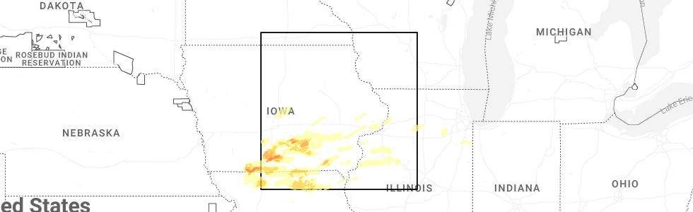
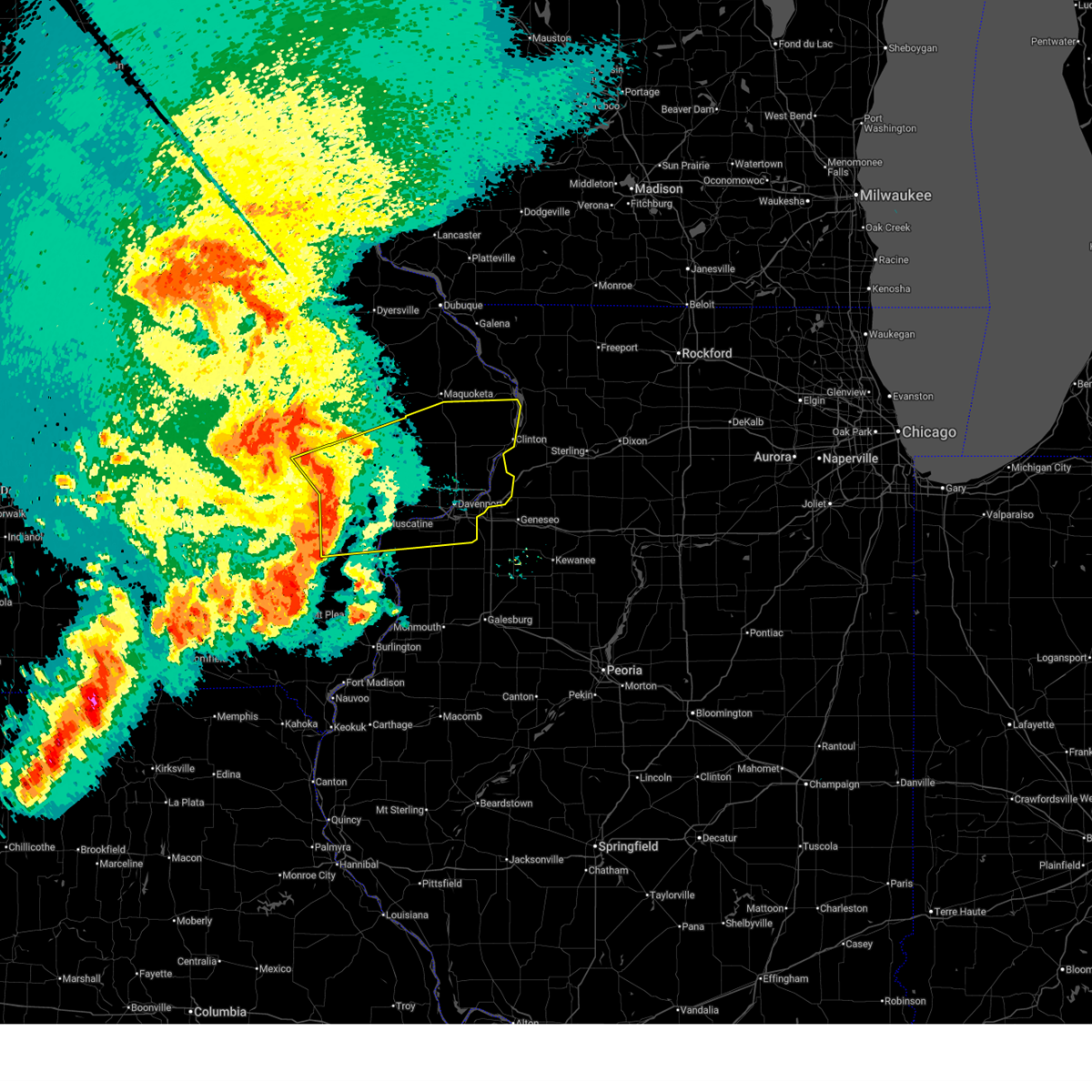
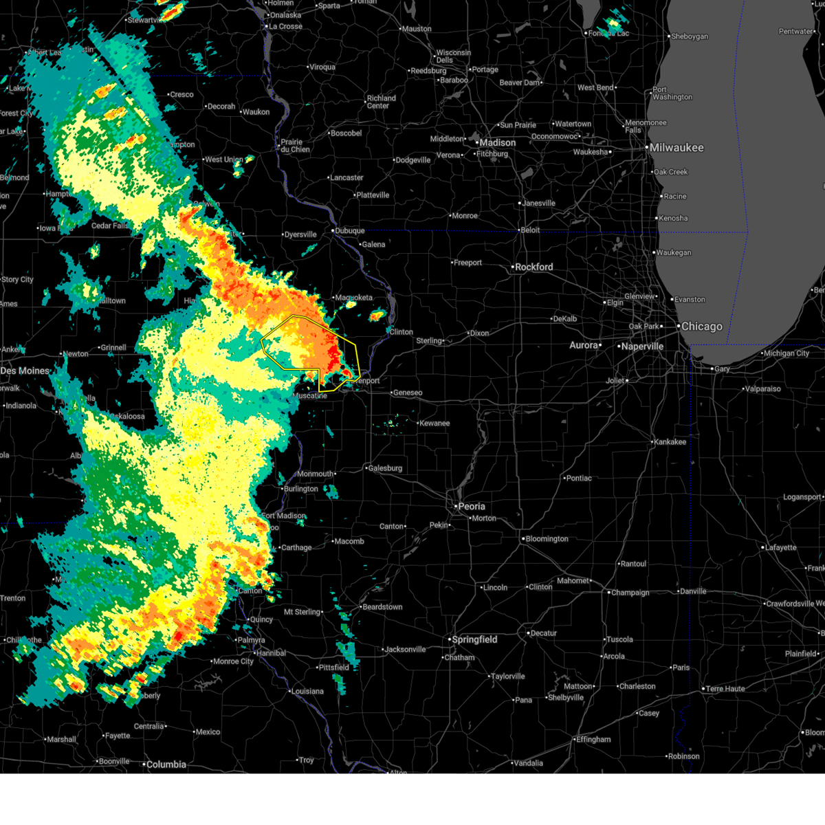
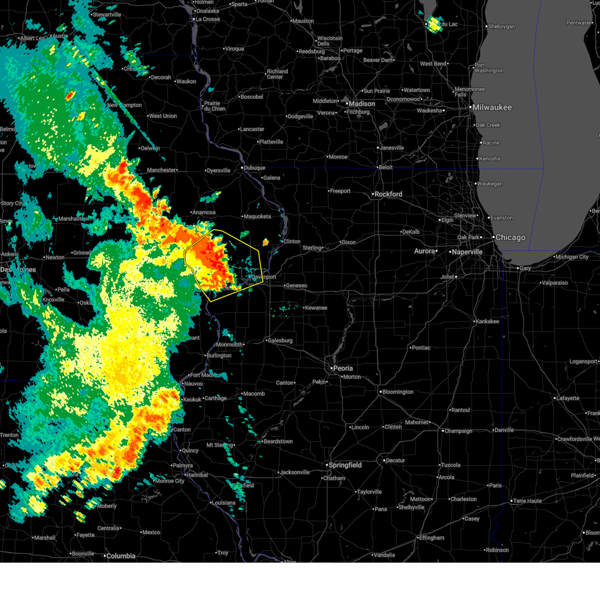
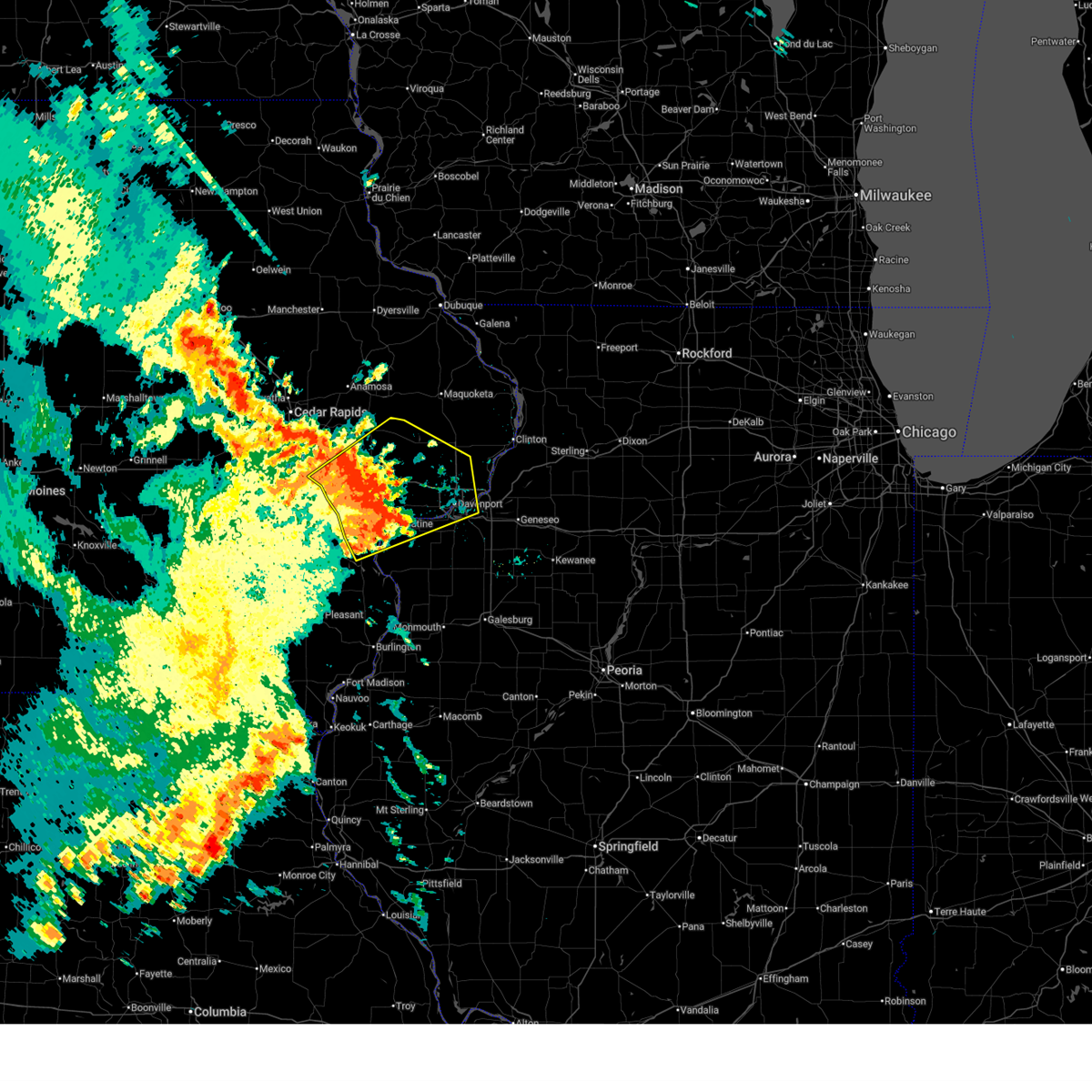
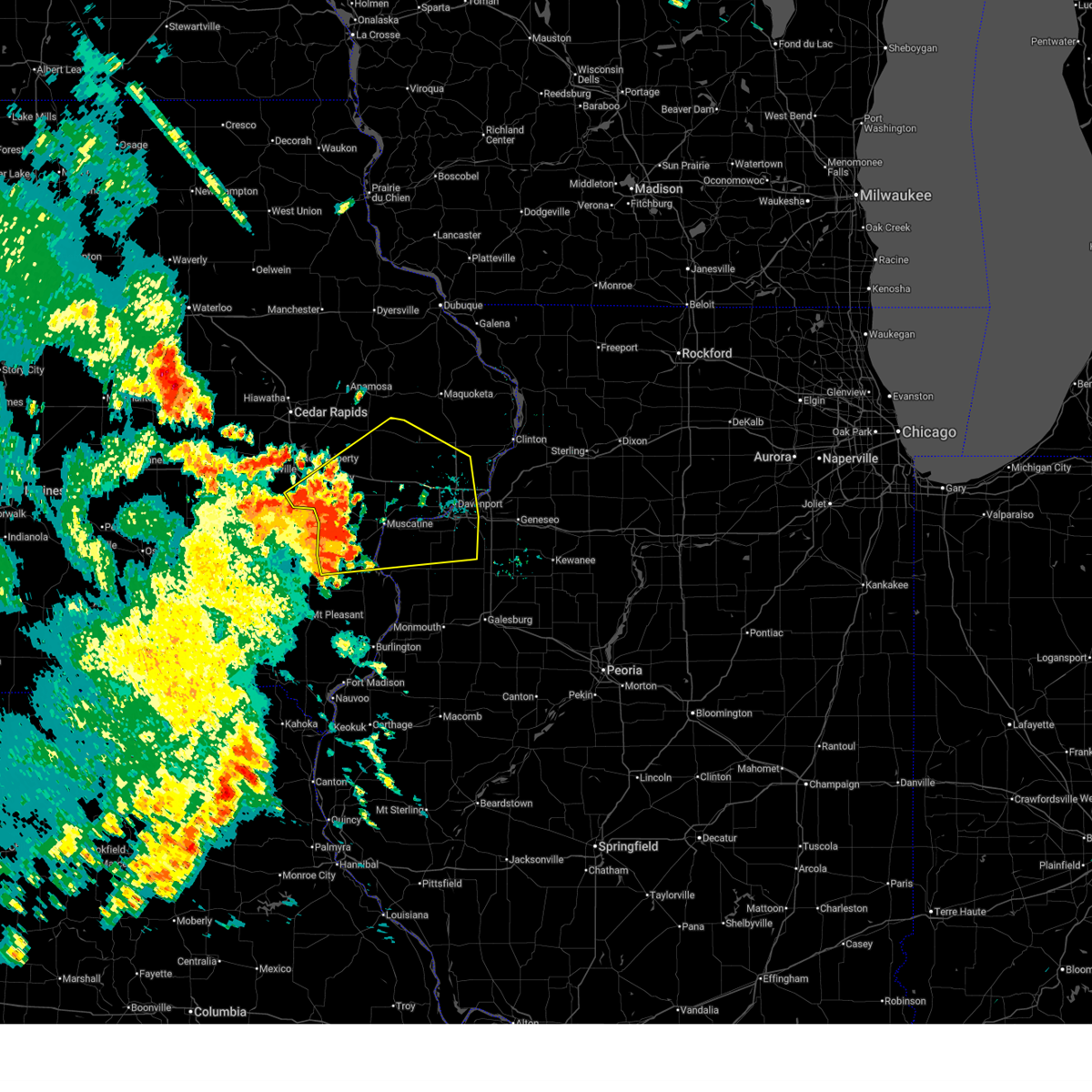
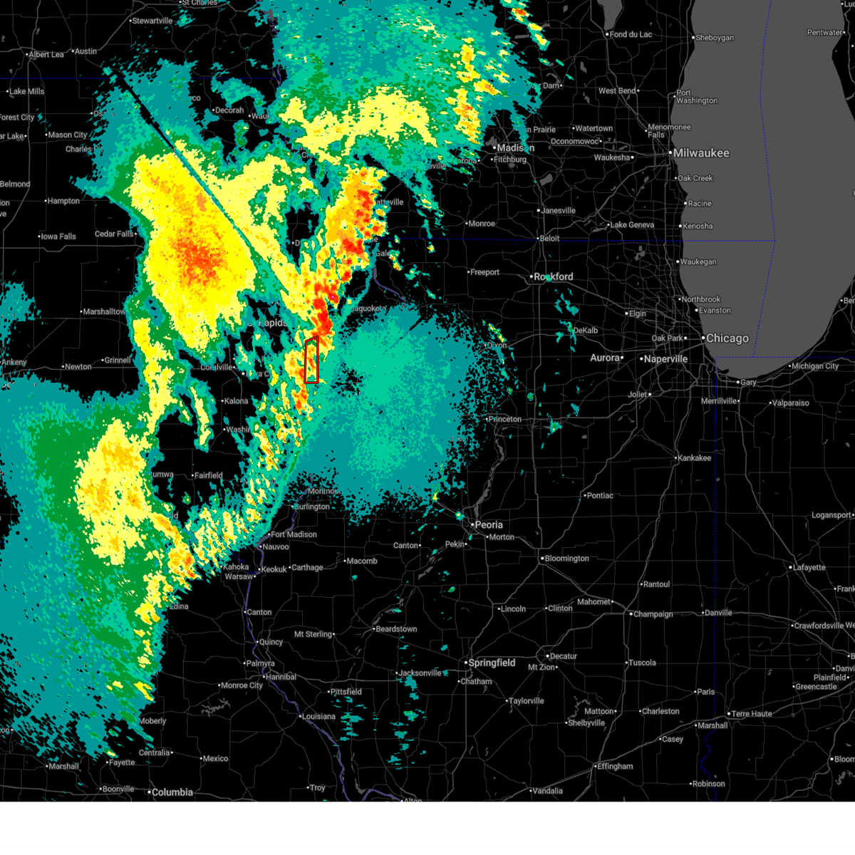
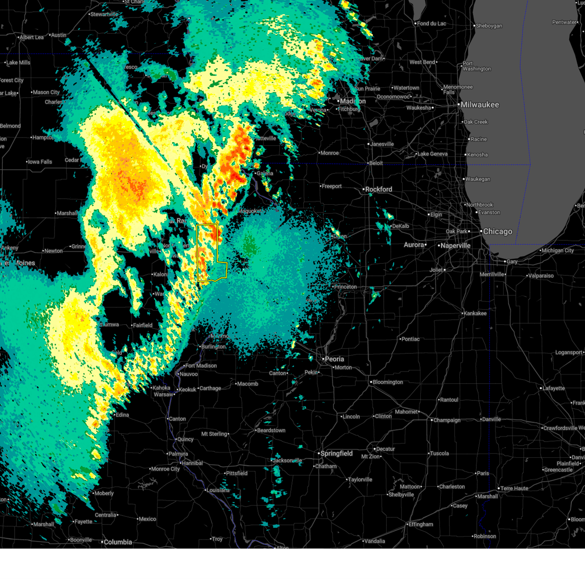
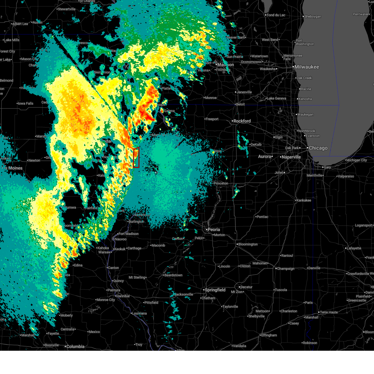
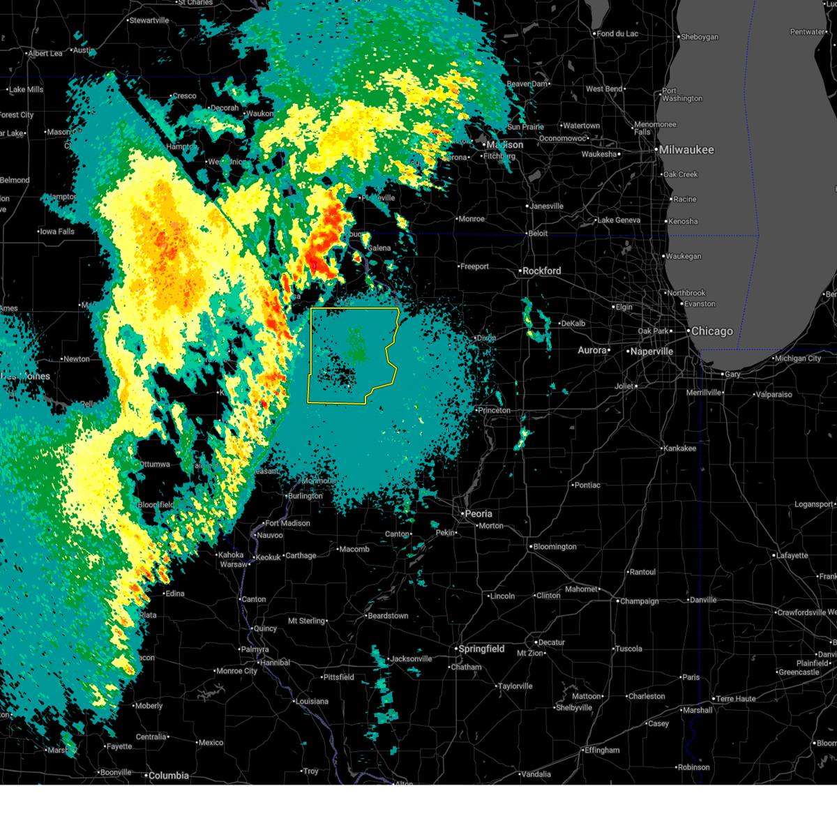
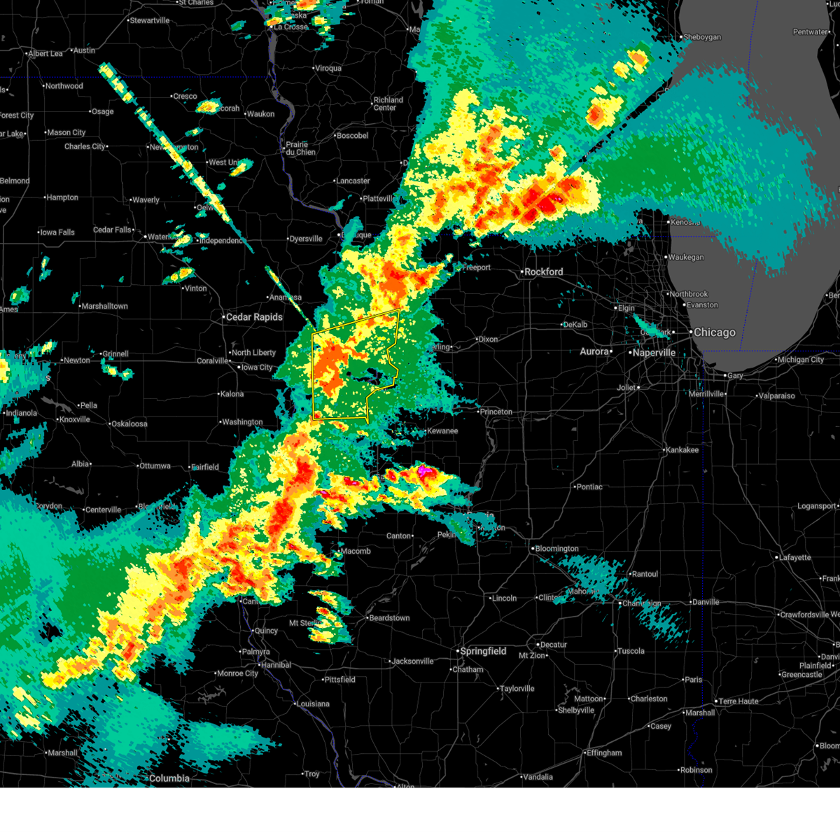
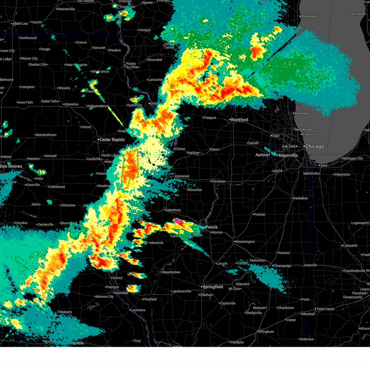
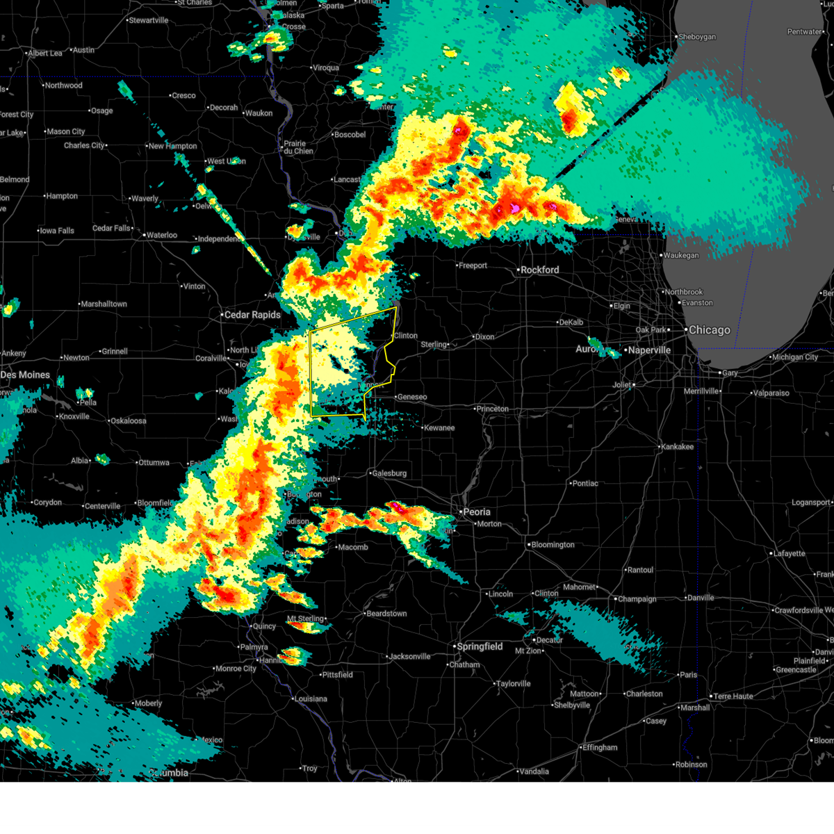
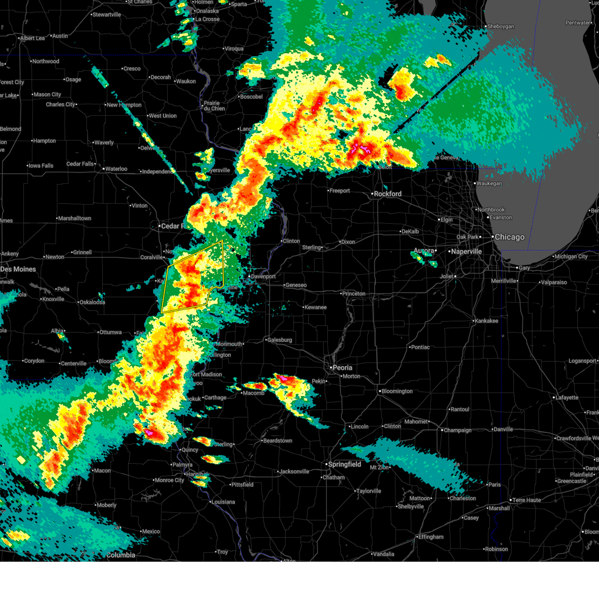
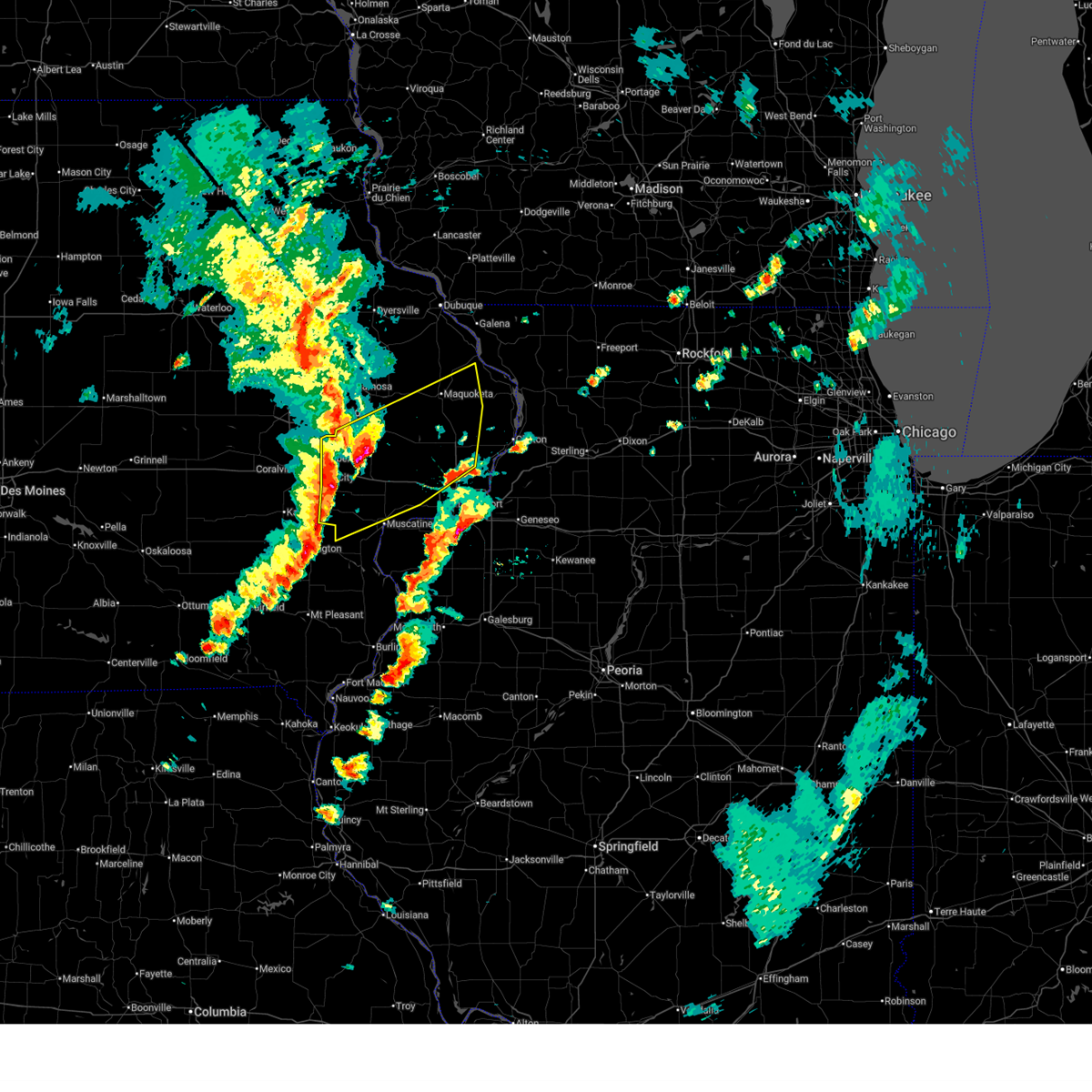
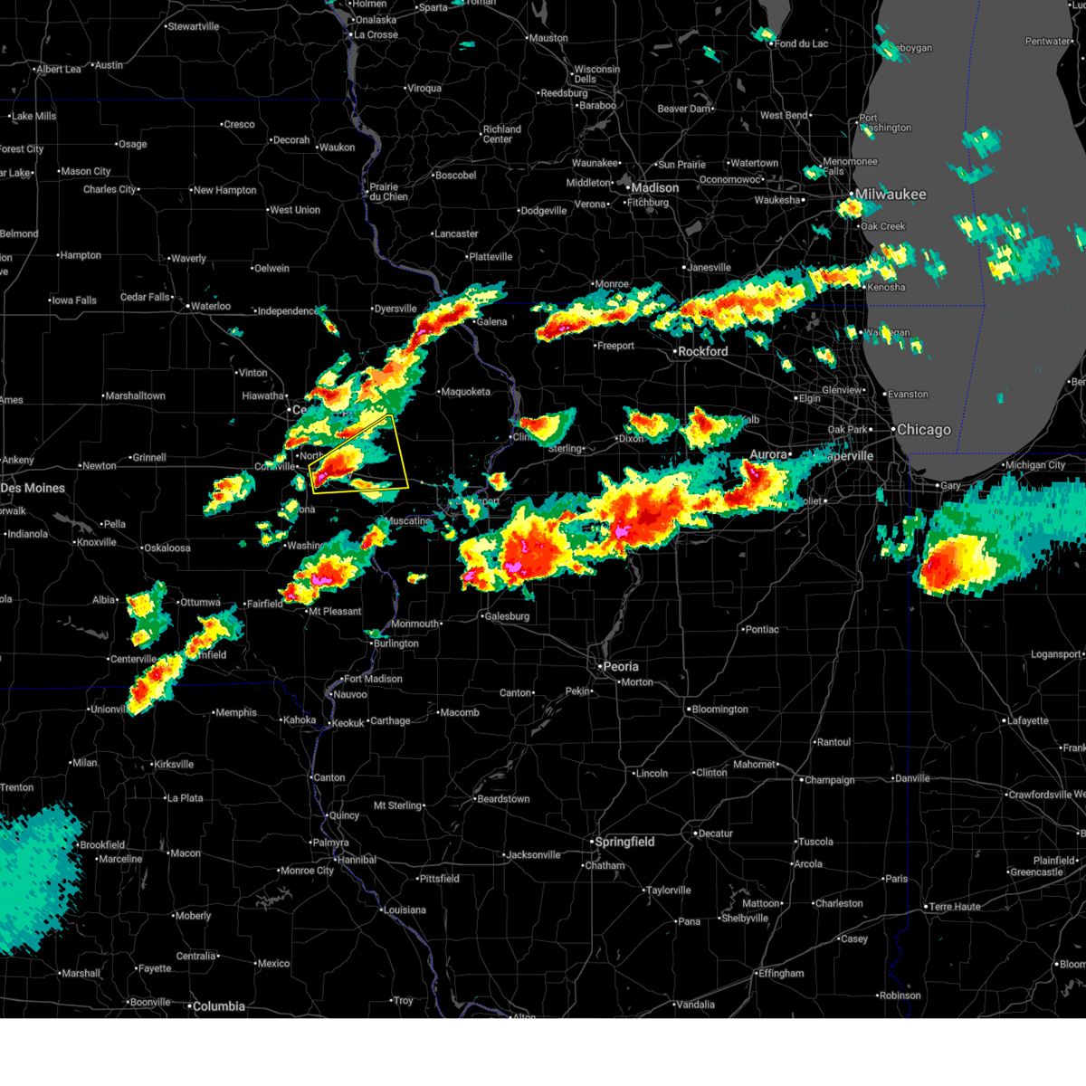
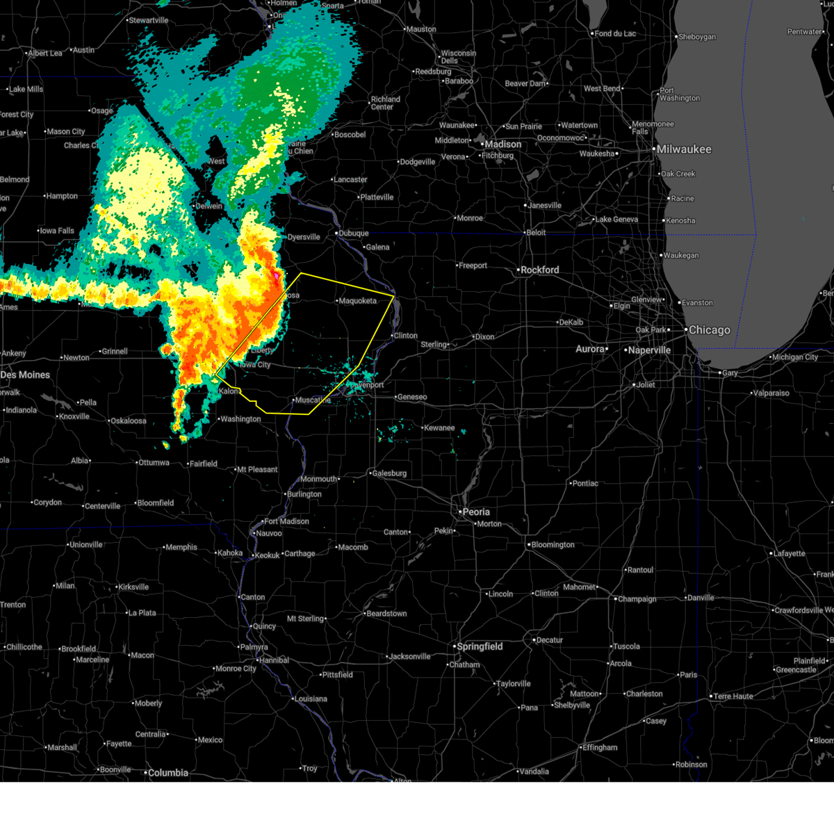
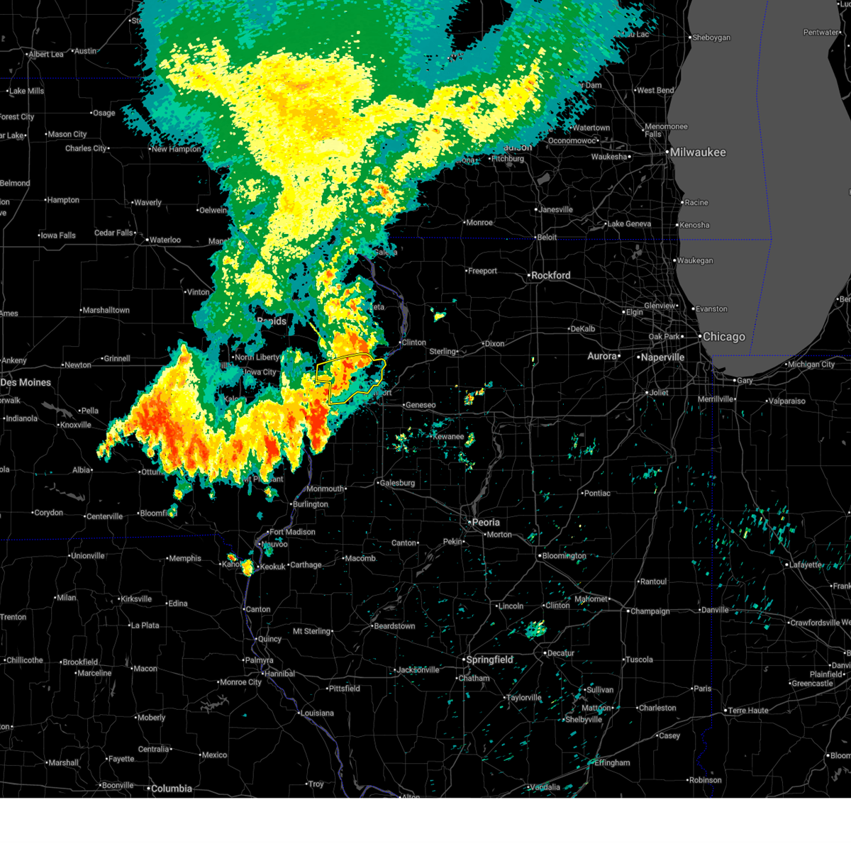
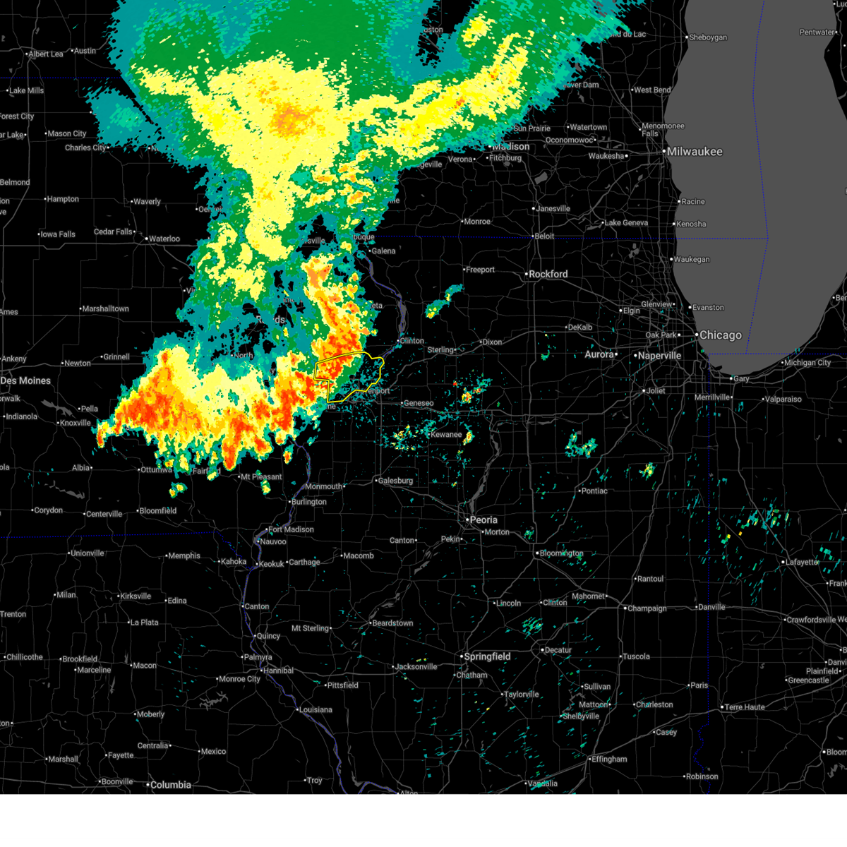
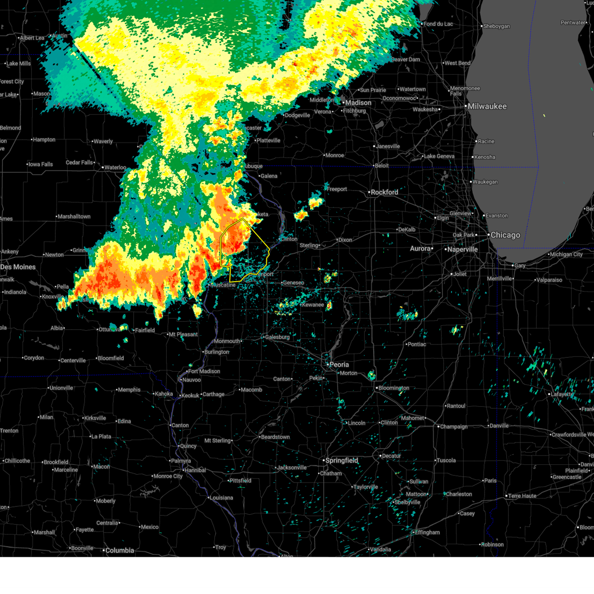
Hail Map for Durant, IA
The Durant, IA area has had 4 reports of on-the-ground hail by trained spotters, and has been under severe weather warnings 73 times during the past 12 months. Doppler radar has detected hail at or near Durant, IA on 59 occasions, including 6 occasions during the past year.
| Name: | Durant, IA |
| Where Located: | 47.2 miles ESE of Cedar Rapids, IA |
| Map: | Google Map for Durant, IA |
| Population: | 1832 |
| Housing Units: | 783 |
| More Info: | Search Google for Durant, IA |
3
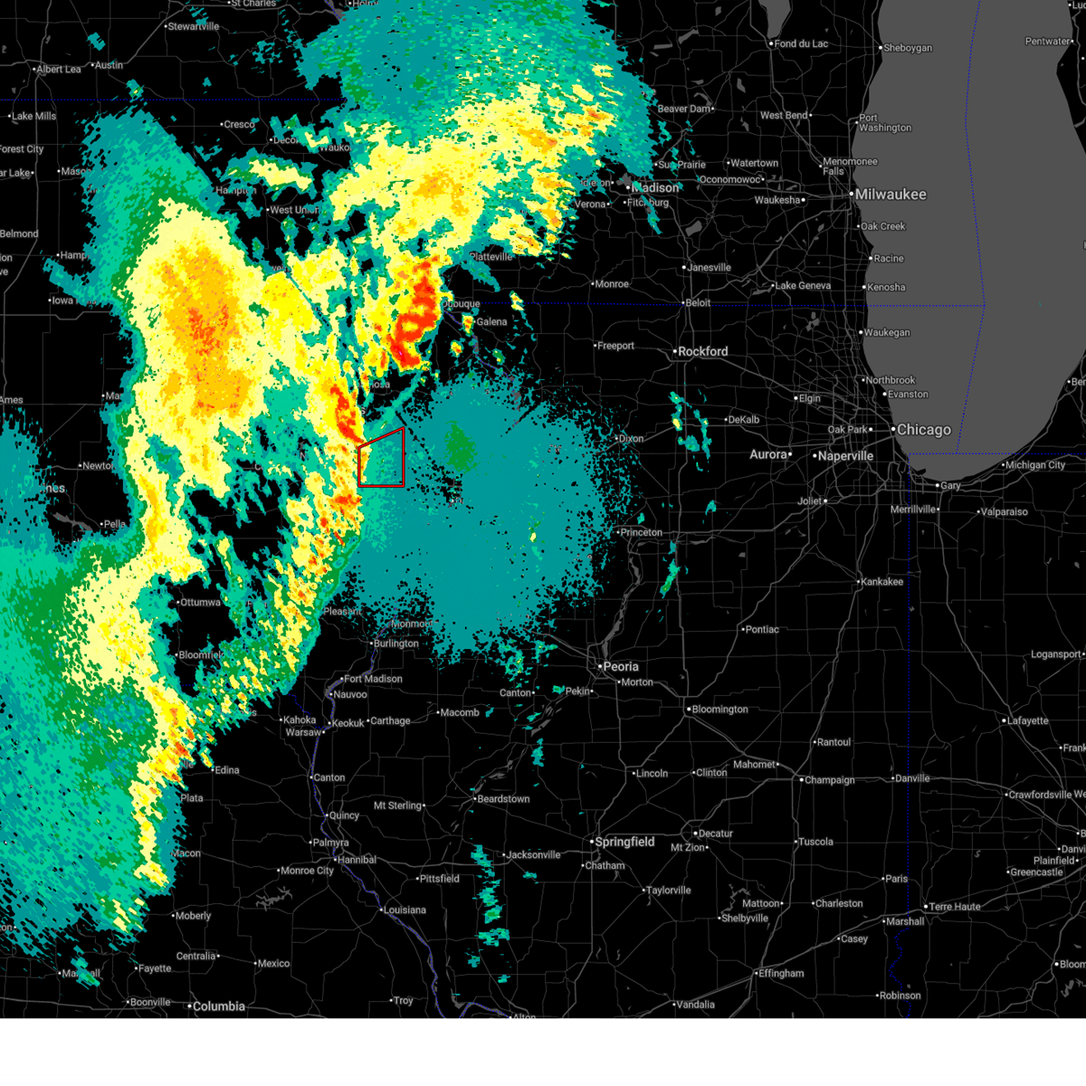
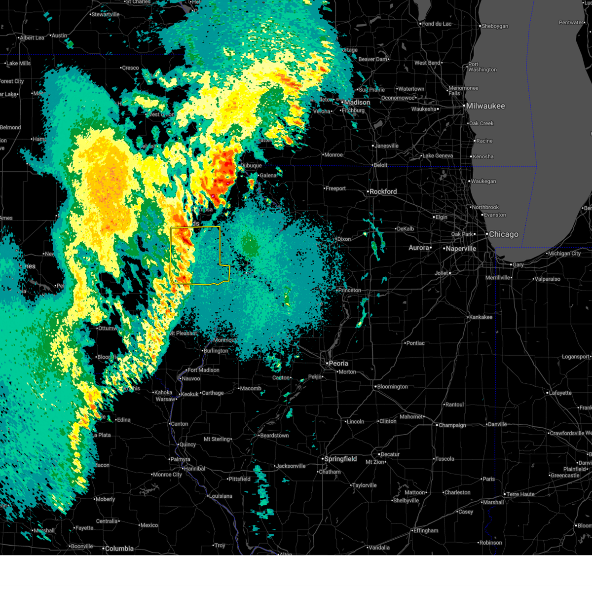
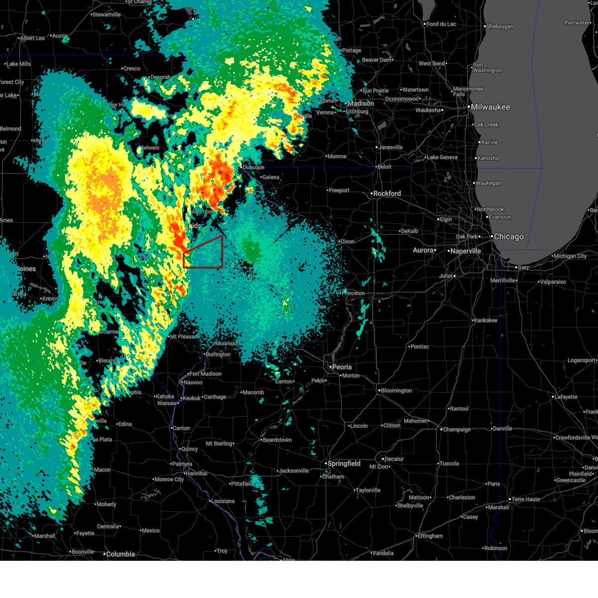
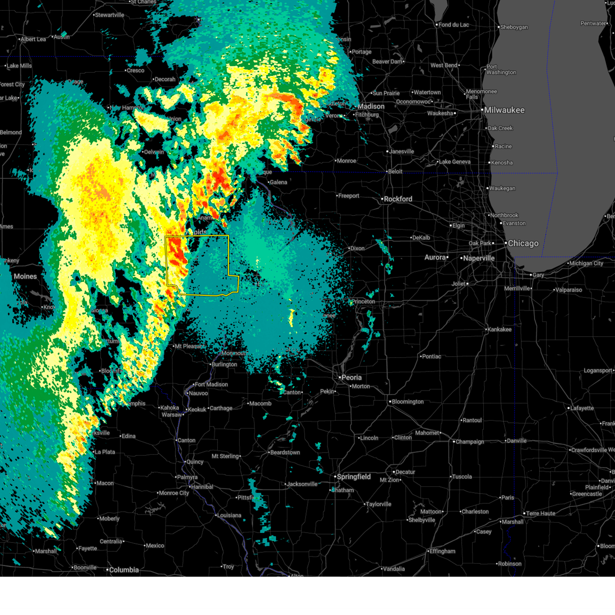
The Top Recent Hail Date for Durant, IA is Thursday, June 11, 2026 (13th out of 59)
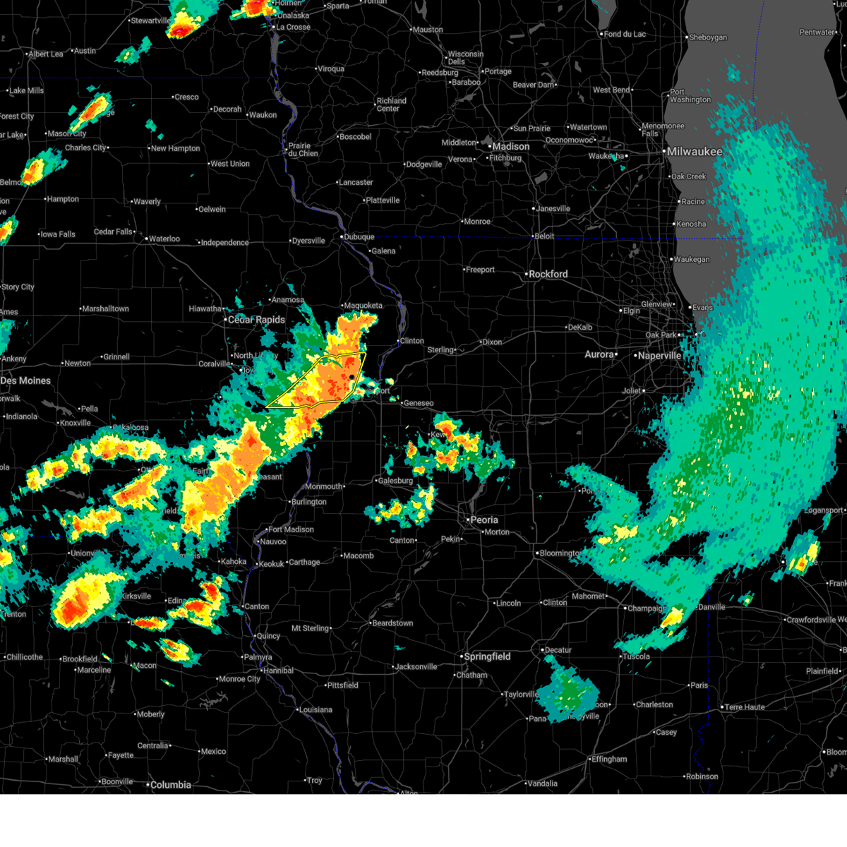
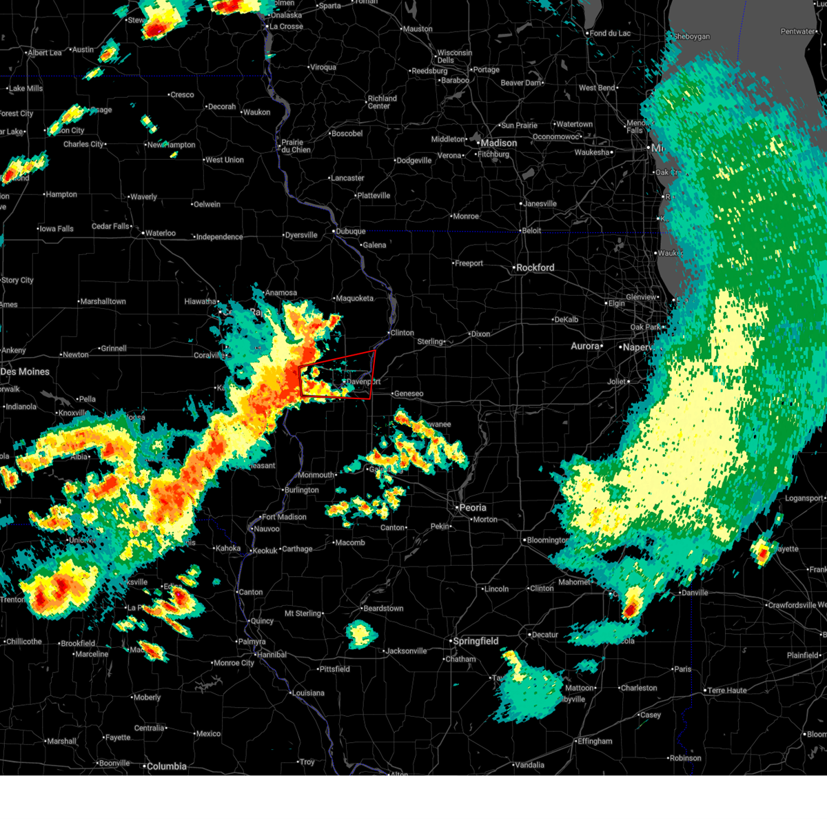
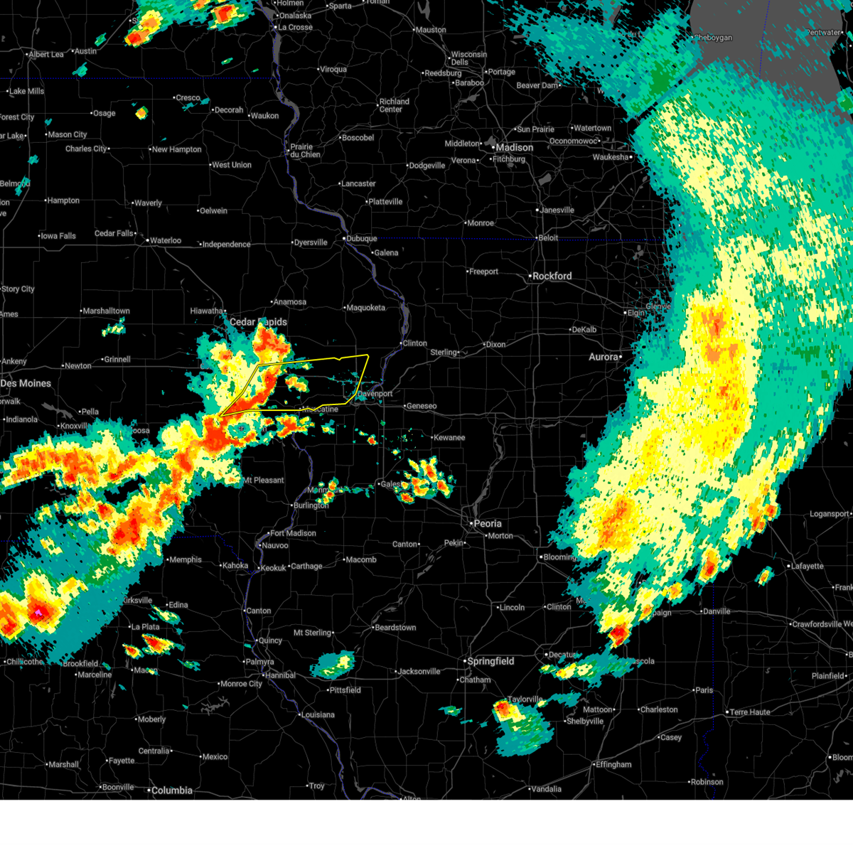
Hail and Wind Damage Spotted near Durant, IA
| Date / Time | Report Details |
|---|---|
| 6/11/2026 9:55 AM CDT |
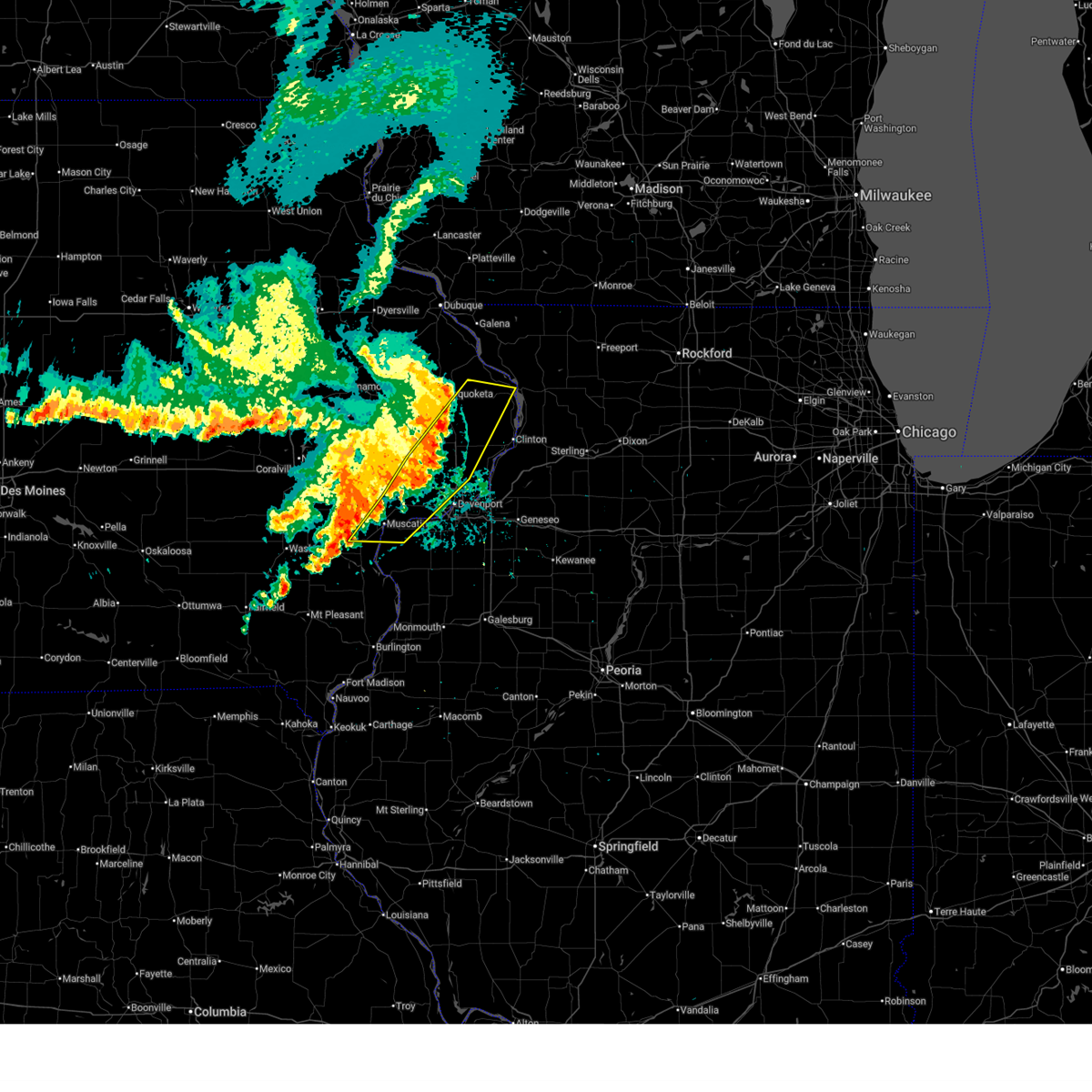
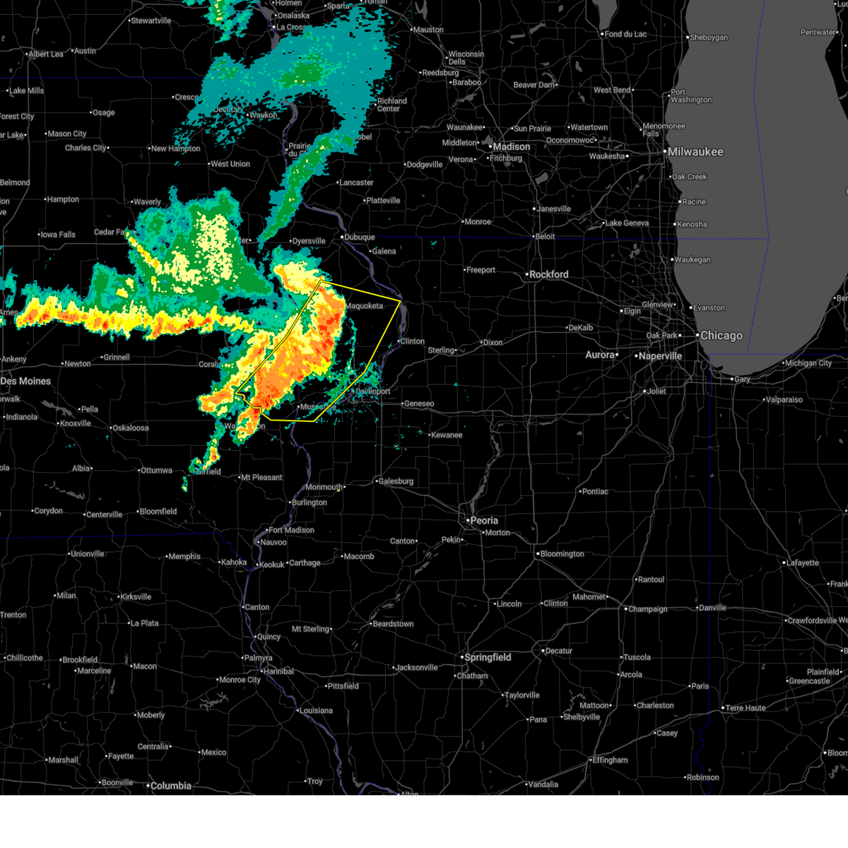
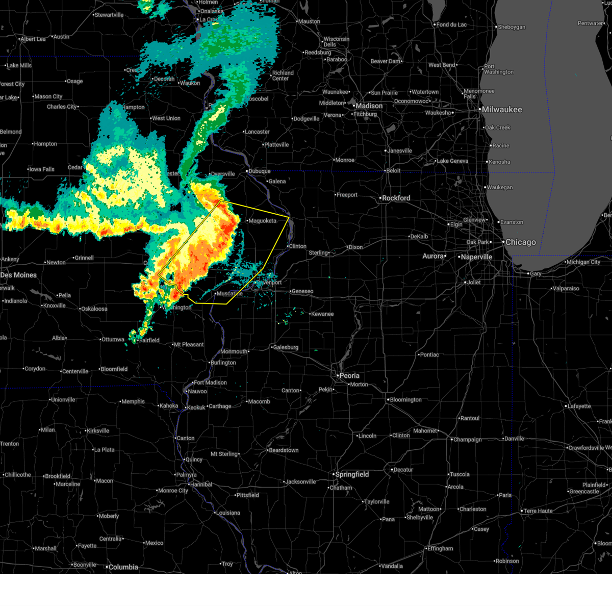
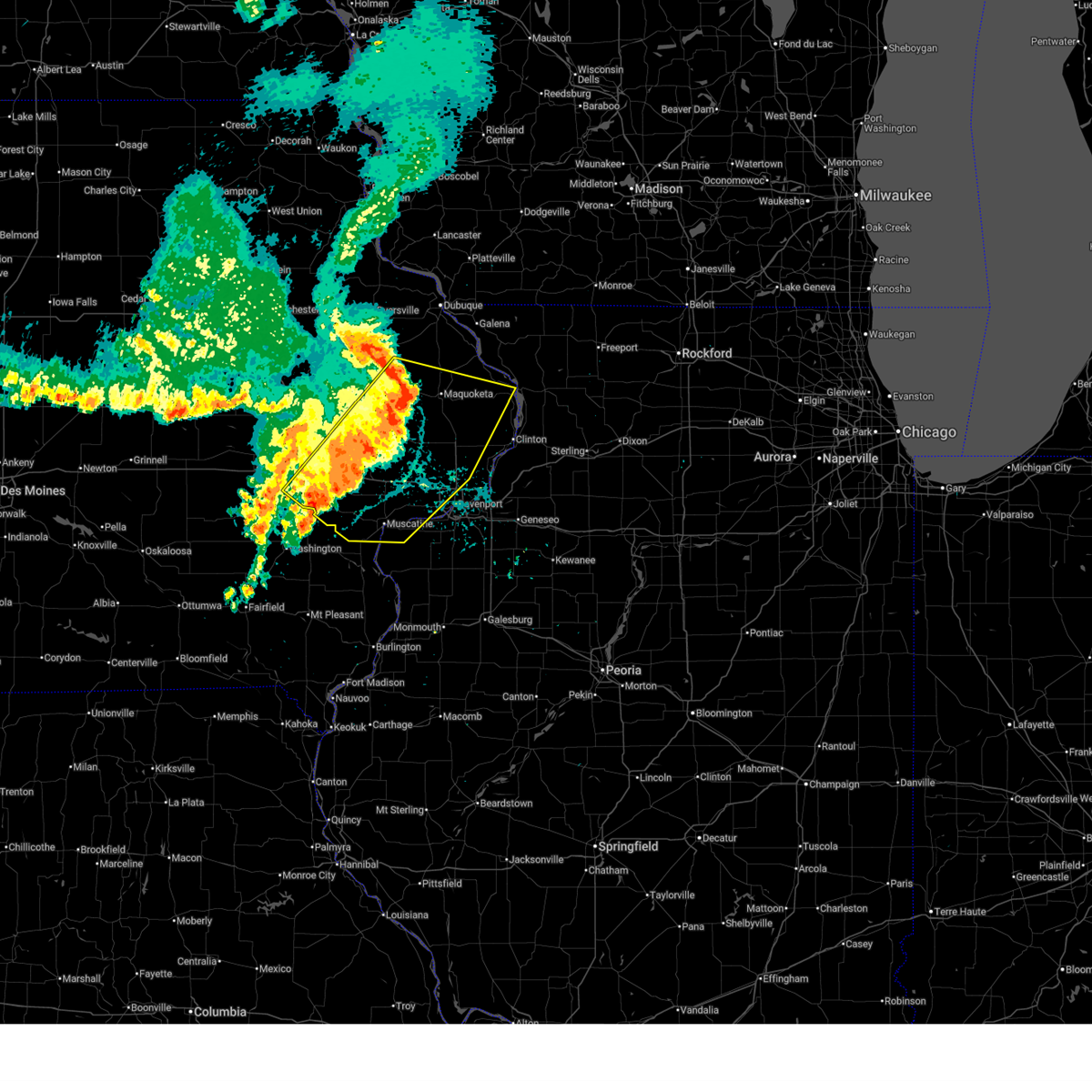
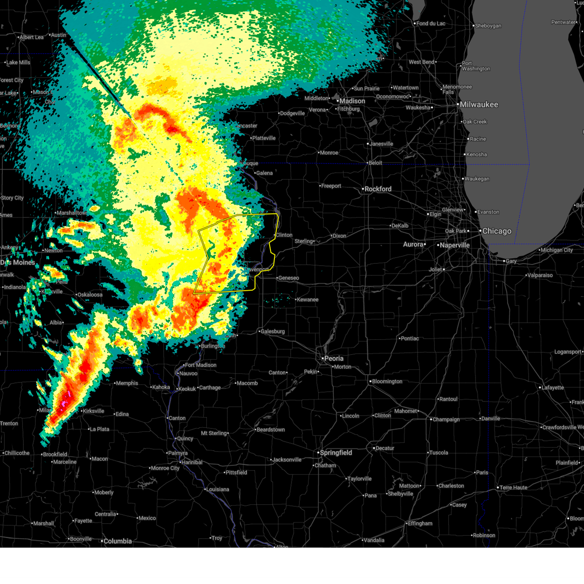 At 955 am cdt, severe thunderstorms were located along a line extending from near lyons to near long grove to edgington, moving east at 60 mph (radar indicated). Hazards include 60 mph wind gusts and penny size hail. Expect damage to roofs, siding, and trees. locations impacted include, davenport, moline, rock island, bettendorf, clinton, muscatine, east moline, durant, silvis, eldridge, dewitt, milan, camanche, le claire, coal valley, wilton, hampton, port byron, walcott, and blue grass. this includes the following highways, interstate 74 in iowa between mile markers 1 and 5. interstate 80 in iowa between mile markers 273 and 306. interstate 80 in illinois between mile markers 1 and 5. interstate 74 in illinois between mile markers 1 and 7. interstate 88 between mile markers 1 and 11. Interstate 280 between mile markers 1 and 18. At 955 am cdt, severe thunderstorms were located along a line extending from near lyons to near long grove to edgington, moving east at 60 mph (radar indicated). Hazards include 60 mph wind gusts and penny size hail. Expect damage to roofs, siding, and trees. locations impacted include, davenport, moline, rock island, bettendorf, clinton, muscatine, east moline, durant, silvis, eldridge, dewitt, milan, camanche, le claire, coal valley, wilton, hampton, port byron, walcott, and blue grass. this includes the following highways, interstate 74 in iowa between mile markers 1 and 5. interstate 80 in iowa between mile markers 273 and 306. interstate 80 in illinois between mile markers 1 and 5. interstate 74 in illinois between mile markers 1 and 7. interstate 88 between mile markers 1 and 11. Interstate 280 between mile markers 1 and 18.
|
| 6/11/2026 9:49 AM CDT |
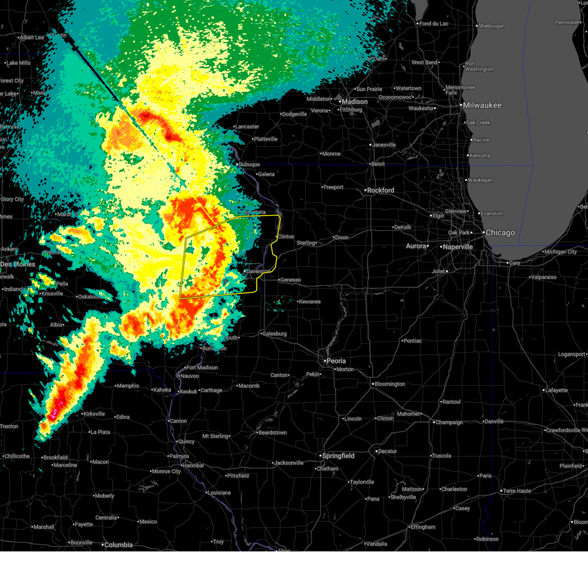 At 949 am cdt, severe thunderstorms were located along a line extending from near hale to big rock to shady creek campground, moving east at 60 mph (radar indicated). Hazards include 60 mph wind gusts and penny size hail. Expect damage to roofs, siding, and trees. locations impacted include, davenport, moline, rock island, bettendorf, clinton, muscatine, east moline, tipton, columbus junction, durant, silvis, eldridge, dewitt, milan, camanche, le claire, coal valley, west liberty, wilton, and hampton. this includes the following highways, interstate 74 in iowa between mile markers 1 and 5. interstate 80 in iowa between mile markers 256 and 306. interstate 80 in illinois between mile markers 1 and 5. interstate 74 in illinois between mile markers 1 and 7. interstate 88 between mile markers 1 and 11. Interstate 280 between mile markers 1 and 18. At 949 am cdt, severe thunderstorms were located along a line extending from near hale to big rock to shady creek campground, moving east at 60 mph (radar indicated). Hazards include 60 mph wind gusts and penny size hail. Expect damage to roofs, siding, and trees. locations impacted include, davenport, moline, rock island, bettendorf, clinton, muscatine, east moline, tipton, columbus junction, durant, silvis, eldridge, dewitt, milan, camanche, le claire, coal valley, west liberty, wilton, and hampton. this includes the following highways, interstate 74 in iowa between mile markers 1 and 5. interstate 80 in iowa between mile markers 256 and 306. interstate 80 in illinois between mile markers 1 and 5. interstate 74 in illinois between mile markers 1 and 7. interstate 88 between mile markers 1 and 11. Interstate 280 between mile markers 1 and 18.
|
| 6/11/2026 9:30 AM CDT |
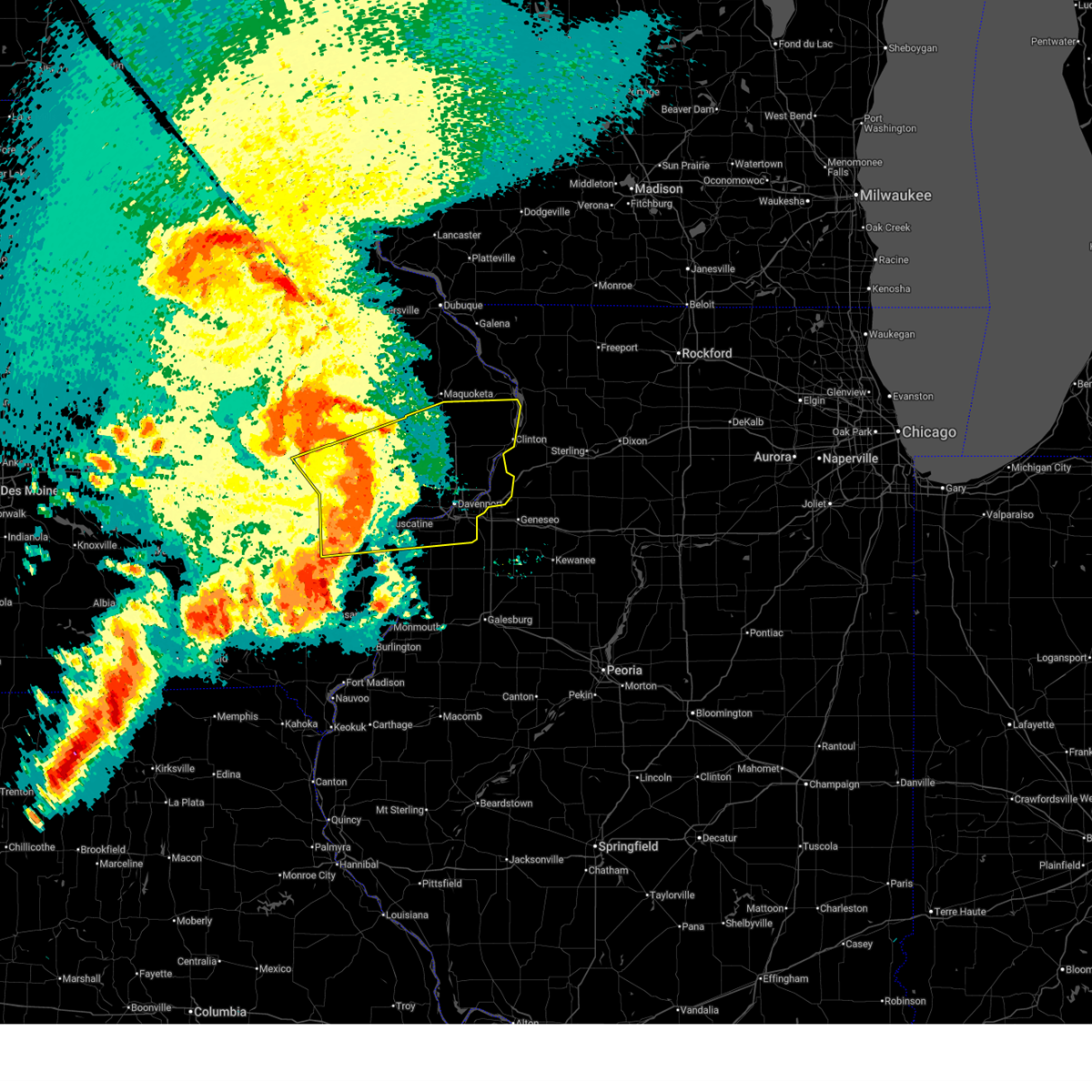 At 930 am cdt, severe thunderstorms were located along a line extending from near lisbon to rochester to sand springs, moving east at 60 mph (radar indicated). Hazards include 60 mph wind gusts and penny size hail. Expect damage to roofs, siding, and trees. locations impacted include, davenport, iowa city, moline, rock island, bettendorf, clinton, muscatine, east moline, tipton, west branch, columbus junction, durant, coralville, north liberty, silvis, eldridge, dewitt, milan, camanche, and le claire. this includes the following highways, interstate 74 in iowa between mile markers 1 and 5. interstate 80 in iowa between mile markers 242 and 306. interstate 380 between mile markers 3 and 4. interstate 80 in illinois between mile markers 1 and 5. interstate 74 in illinois between mile markers 1 and 7. interstate 88 between mile markers 1 and 11. Interstate 280 between mile markers 1 and 18. At 930 am cdt, severe thunderstorms were located along a line extending from near lisbon to rochester to sand springs, moving east at 60 mph (radar indicated). Hazards include 60 mph wind gusts and penny size hail. Expect damage to roofs, siding, and trees. locations impacted include, davenport, iowa city, moline, rock island, bettendorf, clinton, muscatine, east moline, tipton, west branch, columbus junction, durant, coralville, north liberty, silvis, eldridge, dewitt, milan, camanche, and le claire. this includes the following highways, interstate 74 in iowa between mile markers 1 and 5. interstate 80 in iowa between mile markers 242 and 306. interstate 380 between mile markers 3 and 4. interstate 80 in illinois between mile markers 1 and 5. interstate 74 in illinois between mile markers 1 and 7. interstate 88 between mile markers 1 and 11. Interstate 280 between mile markers 1 and 18.
|
| 6/11/2026 9:18 AM CDT |
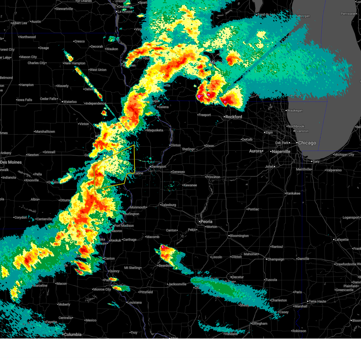
 Svrdvn the national weather service in the quad cities has issued a * severe thunderstorm warning for, rock island county in northwestern illinois, northwestern mercer county in northwestern illinois, northwestern louisa county in southeastern iowa, southeastern jackson county in east central iowa, cedar county in east central iowa, scott county in east central iowa, eastern johnson county in east central iowa, muscatine county in east central iowa, clinton county in east central iowa, * until 1030 am cdt. * at 917 am cdt, severe thunderstorms were located along a line extending from twin view heights to near west branch to columbus junction, moving east at 55 mph (radar indicated). Hazards include 70 mph wind gusts and penny size hail. Expect considerable tree damage. Damage is likely to mobile homes, roofs, and outbuildings. Svrdvn the national weather service in the quad cities has issued a * severe thunderstorm warning for, rock island county in northwestern illinois, northwestern mercer county in northwestern illinois, northwestern louisa county in southeastern iowa, southeastern jackson county in east central iowa, cedar county in east central iowa, scott county in east central iowa, eastern johnson county in east central iowa, muscatine county in east central iowa, clinton county in east central iowa, * until 1030 am cdt. * at 917 am cdt, severe thunderstorms were located along a line extending from twin view heights to near west branch to columbus junction, moving east at 55 mph (radar indicated). Hazards include 70 mph wind gusts and penny size hail. Expect considerable tree damage. Damage is likely to mobile homes, roofs, and outbuildings.
|
| 6/10/2026 6:09 PM CDT |
 At 609 pm cdt, severe thunderstorms were located along a line extending from near long grove to davenport to loud thunder forest preserve, moving east at 55 mph (radar indicated). Hazards include 70 mph wind gusts and penny size hail. Expect considerable tree damage. damage is likely to mobile homes, roofs, and outbuildings. locations impacted include, davenport, rock island, muscatine, durant, eldridge, wilton, walcott, blue grass, buffalo, long grove, donahue, montpelier, fairport, dixon, stockton, maysville, clark's ferry recreation area, camp liberty, west lake park, and new era. this includes the following highways, interstate 80 in iowa between mile markers 275 and 297. Interstate 280 between mile markers 1 and 10. At 609 pm cdt, severe thunderstorms were located along a line extending from near long grove to davenport to loud thunder forest preserve, moving east at 55 mph (radar indicated). Hazards include 70 mph wind gusts and penny size hail. Expect considerable tree damage. damage is likely to mobile homes, roofs, and outbuildings. locations impacted include, davenport, rock island, muscatine, durant, eldridge, wilton, walcott, blue grass, buffalo, long grove, donahue, montpelier, fairport, dixon, stockton, maysville, clark's ferry recreation area, camp liberty, west lake park, and new era. this includes the following highways, interstate 80 in iowa between mile markers 275 and 297. Interstate 280 between mile markers 1 and 10.
|
| 6/10/2026 6:03 PM CDT |
 Tordvn the national weather service in the quad cities has issued a * tornado warning for, southeastern rock island county in northwestern illinois, northwestern henry county in northwestern illinois, southeastern cedar county in east central iowa, scott county in east central iowa, northeastern muscatine county in east central iowa, * until 645 pm cdt. * at 603 pm cdt, a severe thunderstorm capable of producing a tornado was located over pleasant prairie, or near durant, moving east at 45 mph (radar indicated rotation). Hazards include tornado. Flying debris will be dangerous to those caught without shelter. mobile homes will be damaged or destroyed. damage to roofs, windows, and vehicles will occur. tree damage is likely. this dangerous storm will be near, davenport, rock island, walcott, blue grass, buffalo, andalusia, maysville, west lake park, rock island arsenal, and credit island around 610 pm cdt. moline, bettendorf, eldridge, milan, blackhawk state park, and davenport municipal airport around 615 pm cdt. east moline, riverdale, panorama park, moline quad-city airport, and fruitland around 620 pm cdt. other locations in the path of this tornadic thunderstorm include silvis, le claire, coal valley, hampton, carbon cliff, campbells island, silvis heights, illiniwek forest preserve, pleasant valley, indian bluff golf course, colona, port byron, rapids city, barstow, princeton and cordova. this includes the following highways, interstate 74 in iowa between mile markers 1 and 5. interstate 80 in iowa between mile markers 279 and 306. interstate 80 in illinois between mile markers 1 and 7. interstate 74 in illinois between mile markers 1 and 13. Interstate 280 between mile markers 1 and 18. Tordvn the national weather service in the quad cities has issued a * tornado warning for, southeastern rock island county in northwestern illinois, northwestern henry county in northwestern illinois, southeastern cedar county in east central iowa, scott county in east central iowa, northeastern muscatine county in east central iowa, * until 645 pm cdt. * at 603 pm cdt, a severe thunderstorm capable of producing a tornado was located over pleasant prairie, or near durant, moving east at 45 mph (radar indicated rotation). Hazards include tornado. Flying debris will be dangerous to those caught without shelter. mobile homes will be damaged or destroyed. damage to roofs, windows, and vehicles will occur. tree damage is likely. this dangerous storm will be near, davenport, rock island, walcott, blue grass, buffalo, andalusia, maysville, west lake park, rock island arsenal, and credit island around 610 pm cdt. moline, bettendorf, eldridge, milan, blackhawk state park, and davenport municipal airport around 615 pm cdt. east moline, riverdale, panorama park, moline quad-city airport, and fruitland around 620 pm cdt. other locations in the path of this tornadic thunderstorm include silvis, le claire, coal valley, hampton, carbon cliff, campbells island, silvis heights, illiniwek forest preserve, pleasant valley, indian bluff golf course, colona, port byron, rapids city, barstow, princeton and cordova. this includes the following highways, interstate 74 in iowa between mile markers 1 and 5. interstate 80 in iowa between mile markers 279 and 306. interstate 80 in illinois between mile markers 1 and 7. interstate 74 in illinois between mile markers 1 and 13. Interstate 280 between mile markers 1 and 18.
|
| 6/10/2026 5:58 PM CDT |
 At 558 pm cdt, severe thunderstorms were located along a line extending from dixon to near stockton to near muscatine, moving east at 45 mph (radar indicated). Hazards include 60 mph wind gusts and penny size hail. Expect damage to roofs, siding, and trees. locations impacted include, davenport, rock island, muscatine, durant, eldridge, west liberty, wilton, walcott, blue grass, lone tree, buffalo, long grove, nichols, donahue, atalissa, montpelier, rochester, fairport, dixon, and stockton. this includes the following highways, interstate 80 in iowa between mile markers 262 and 297. Interstate 280 between mile markers 1 and 10. At 558 pm cdt, severe thunderstorms were located along a line extending from dixon to near stockton to near muscatine, moving east at 45 mph (radar indicated). Hazards include 60 mph wind gusts and penny size hail. Expect damage to roofs, siding, and trees. locations impacted include, davenport, rock island, muscatine, durant, eldridge, west liberty, wilton, walcott, blue grass, lone tree, buffalo, long grove, nichols, donahue, atalissa, montpelier, rochester, fairport, dixon, and stockton. this includes the following highways, interstate 80 in iowa between mile markers 262 and 297. Interstate 280 between mile markers 1 and 10.
|
| 6/10/2026 5:30 PM CDT |
 Svrdvn the national weather service in the quad cities has issued a * severe thunderstorm warning for, southern cedar county in east central iowa, scott county in east central iowa, southeastern johnson county in east central iowa, northeastern washington county in southeastern iowa, muscatine county in east central iowa, * until 630 pm cdt. * at 530 pm cdt, severe thunderstorms were located along a line extending from springdale to muscatine county fairgrounds to near gladwin, moving east at 45 mph (radar indicated). Hazards include 60 mph wind gusts and penny size hail. expect damage to roofs, siding, and trees Svrdvn the national weather service in the quad cities has issued a * severe thunderstorm warning for, southern cedar county in east central iowa, scott county in east central iowa, southeastern johnson county in east central iowa, northeastern washington county in southeastern iowa, muscatine county in east central iowa, * until 630 pm cdt. * at 530 pm cdt, severe thunderstorms were located along a line extending from springdale to muscatine county fairgrounds to near gladwin, moving east at 45 mph (radar indicated). Hazards include 60 mph wind gusts and penny size hail. expect damage to roofs, siding, and trees
|
| 6/10/2026 12:09 PM CDT |
 At 1209 pm cdt, severe thunderstorms were located along a line extending from near clarence to sherman park to near andalusia, moving northeast at 50 mph (trained weather spotters). Hazards include 60 mph wind gusts. Expect damage to roofs, siding, and trees. locations impacted include, davenport, rock island, bettendorf, tipton, durant, eldridge, walcott, blue grass, buffalo, long grove, lowden, wheatland, grand mound, calamus, bennett, riverdale, donahue, toronto, rochester, and buchanan. this includes the following highways, interstate 74 in iowa between mile markers 1 and 4. interstate 80 in iowa between mile markers 264 and 302. Interstate 280 between mile markers 1 and 10. At 1209 pm cdt, severe thunderstorms were located along a line extending from near clarence to sherman park to near andalusia, moving northeast at 50 mph (trained weather spotters). Hazards include 60 mph wind gusts. Expect damage to roofs, siding, and trees. locations impacted include, davenport, rock island, bettendorf, tipton, durant, eldridge, walcott, blue grass, buffalo, long grove, lowden, wheatland, grand mound, calamus, bennett, riverdale, donahue, toronto, rochester, and buchanan. this includes the following highways, interstate 74 in iowa between mile markers 1 and 4. interstate 80 in iowa between mile markers 264 and 302. Interstate 280 between mile markers 1 and 10.
|
| 6/10/2026 11:54 AM CDT |
 At 1154 am cdt, severe thunderstorms were located along a line extending from near mechanicsville to sunbury to near illinois city, moving northeast at 55 mph (trained weather spotters). Hazards include 60 mph wind gusts. Expect damage to roofs, siding, and trees. locations impacted include, davenport, moline, rock island, bettendorf, muscatine, east moline, tipton, west branch, durant, silvis, eldridge, milan, west liberty, wilton, walcott, blue grass, buffalo, andalusia, long grove, and lowden. this includes the following highways, interstate 74 in iowa between mile markers 1 and 5. interstate 80 in iowa between mile markers 254 and 302. interstate 74 in illinois between mile markers 1 and 4. Interstate 280 between mile markers 1 and 18. At 1154 am cdt, severe thunderstorms were located along a line extending from near mechanicsville to sunbury to near illinois city, moving northeast at 55 mph (trained weather spotters). Hazards include 60 mph wind gusts. Expect damage to roofs, siding, and trees. locations impacted include, davenport, moline, rock island, bettendorf, muscatine, east moline, tipton, west branch, durant, silvis, eldridge, milan, west liberty, wilton, walcott, blue grass, buffalo, andalusia, long grove, and lowden. this includes the following highways, interstate 74 in iowa between mile markers 1 and 5. interstate 80 in iowa between mile markers 254 and 302. interstate 74 in illinois between mile markers 1 and 4. Interstate 280 between mile markers 1 and 18.
|
| 6/10/2026 11:43 AM CDT |
 At 1143 am cdt, severe thunderstorms were located along a line extending from near cedar bluff to moscow to near eliza, moving northeast at 55 mph (trained weather spotters). Hazards include 60 mph wind gusts. Expect damage to roofs, siding, and trees. locations impacted include, davenport, iowa city, moline, rock island, bettendorf, muscatine, east moline, tipton, west branch, durant, silvis, eldridge, milan, west liberty, wilton, walcott, blue grass, buffalo, andalusia, and long grove. this includes the following highways, interstate 74 in iowa between mile markers 1 and 5. interstate 80 in iowa between mile markers 247 and 302. interstate 74 in illinois between mile markers 1 and 4. Interstate 280 between mile markers 1 and 18. At 1143 am cdt, severe thunderstorms were located along a line extending from near cedar bluff to moscow to near eliza, moving northeast at 55 mph (trained weather spotters). Hazards include 60 mph wind gusts. Expect damage to roofs, siding, and trees. locations impacted include, davenport, iowa city, moline, rock island, bettendorf, muscatine, east moline, tipton, west branch, durant, silvis, eldridge, milan, west liberty, wilton, walcott, blue grass, buffalo, andalusia, and long grove. this includes the following highways, interstate 74 in iowa between mile markers 1 and 5. interstate 80 in iowa between mile markers 247 and 302. interstate 74 in illinois between mile markers 1 and 4. Interstate 280 between mile markers 1 and 18.
|
| 6/10/2026 11:26 AM CDT |
 Svrdvn the national weather service in the quad cities has issued a * severe thunderstorm warning for, rock island county in northwestern illinois, northern mercer county in northwestern illinois, northwestern louisa county in southeastern iowa, cedar county in east central iowa, scott county in east central iowa, southeastern johnson county in east central iowa, muscatine county in east central iowa, southwestern clinton county in east central iowa, * until 1230 pm cdt. * at 1126 am cdt, severe thunderstorms were located along a line extending from near sharon center to near nichols to morning sun, moving northeast at 50 mph (radar indicated). Hazards include 60 mph wind gusts. expect damage to roofs, siding, and trees Svrdvn the national weather service in the quad cities has issued a * severe thunderstorm warning for, rock island county in northwestern illinois, northern mercer county in northwestern illinois, northwestern louisa county in southeastern iowa, cedar county in east central iowa, scott county in east central iowa, southeastern johnson county in east central iowa, muscatine county in east central iowa, southwestern clinton county in east central iowa, * until 1230 pm cdt. * at 1126 am cdt, severe thunderstorms were located along a line extending from near sharon center to near nichols to morning sun, moving northeast at 50 mph (radar indicated). Hazards include 60 mph wind gusts. expect damage to roofs, siding, and trees
|
| 4/23/2026 11:59 PM CDT |
 The storms which prompted the warning have weakened below severe limits, and have exited the warned area. therefore, the warning will be allowed to expire. however, gusty winds are still possible with these thunderstorms. a severe thunderstorm watch remains in effect until midnight cdt for east central iowa. The storms which prompted the warning have weakened below severe limits, and have exited the warned area. therefore, the warning will be allowed to expire. however, gusty winds are still possible with these thunderstorms. a severe thunderstorm watch remains in effect until midnight cdt for east central iowa.
|
| 4/23/2026 11:52 PM CDT |
 At 1152 pm cdt, severe thunderstorms were located along a line extending from calamus to near walcott to marston, moving east at 55 mph (trained weather spotters). Hazards include 60 mph wind gusts. Expect damage to roofs, siding, and trees. locations impacted include, muscatine, tipton, durant, stanwood, wilton, walcott, lowden, bennett, montpelier, fairport, clarence, stockton, clark's ferry recreation area, new era, bennett park, pleasant prairie, moscow, sunbury, tipton matthews airport, and massillon park. This includes interstate 80 in iowa between mile markers 266 and 278. At 1152 pm cdt, severe thunderstorms were located along a line extending from calamus to near walcott to marston, moving east at 55 mph (trained weather spotters). Hazards include 60 mph wind gusts. Expect damage to roofs, siding, and trees. locations impacted include, muscatine, tipton, durant, stanwood, wilton, walcott, lowden, bennett, montpelier, fairport, clarence, stockton, clark's ferry recreation area, new era, bennett park, pleasant prairie, moscow, sunbury, tipton matthews airport, and massillon park. This includes interstate 80 in iowa between mile markers 266 and 278.
|
| 4/23/2026 11:50 PM CDT |
 At 1149 pm cdt, severe thunderstorms capable of producing tornadoes were located along a line extending from lowden to durant, moving east at 45 mph (radar indicated rotation). Hazards include tornado. Flying debris will be dangerous to those caught without shelter. mobile homes will be damaged or destroyed. damage to roofs, windows, and vehicles will occur. tree damage is likely. these tornadic storms will remain over mainly rural areas of southeastern cedar county, including the following locations, bennett park and sunbury. This includes interstate 80 in iowa between mile markers 273 and 278. At 1149 pm cdt, severe thunderstorms capable of producing tornadoes were located along a line extending from lowden to durant, moving east at 45 mph (radar indicated rotation). Hazards include tornado. Flying debris will be dangerous to those caught without shelter. mobile homes will be damaged or destroyed. damage to roofs, windows, and vehicles will occur. tree damage is likely. these tornadic storms will remain over mainly rural areas of southeastern cedar county, including the following locations, bennett park and sunbury. This includes interstate 80 in iowa between mile markers 273 and 278.
|
| 4/23/2026 11:47 PM CDT |
 At 1147 pm cdt, severe thunderstorms capable of producing tornadoes were located along a line extending from lowden to durant, moving east at 60 mph (radar indicated rotation). Hazards include tornado. Flying debris will be dangerous to those caught without shelter. mobile homes will be damaged or destroyed. damage to roofs, windows, and vehicles will occur. tree damage is likely. these dangerous storms will be near, davenport, walcott, grand mound, calamus, donahue, dixon, maysville, lyons, sherman park, and plainview around 1155 pm cdt. eldridge, dewitt, long grove, delmar, and welton around 1200 am cdt. charlotte, clinton county fairgrounds, scott county park, park view, and davenport municipal airport around 1205 am cdt. other locations in the path of these tornadic storms include mccausland, goose lake, malone, clinton, camanche, princeton, low moor, bryant, elvira, rock creek park, folletts, clinton municipal airport, rock creek marina and campground, andover, teeds grove and camp miss-elk-ton. this includes the following highways, interstate 80 in iowa between mile markers 274 and 297. Interstate 280 near mile marker 1. At 1147 pm cdt, severe thunderstorms capable of producing tornadoes were located along a line extending from lowden to durant, moving east at 60 mph (radar indicated rotation). Hazards include tornado. Flying debris will be dangerous to those caught without shelter. mobile homes will be damaged or destroyed. damage to roofs, windows, and vehicles will occur. tree damage is likely. these dangerous storms will be near, davenport, walcott, grand mound, calamus, donahue, dixon, maysville, lyons, sherman park, and plainview around 1155 pm cdt. eldridge, dewitt, long grove, delmar, and welton around 1200 am cdt. charlotte, clinton county fairgrounds, scott county park, park view, and davenport municipal airport around 1205 am cdt. other locations in the path of these tornadic storms include mccausland, goose lake, malone, clinton, camanche, princeton, low moor, bryant, elvira, rock creek park, folletts, clinton municipal airport, rock creek marina and campground, andover, teeds grove and camp miss-elk-ton. this includes the following highways, interstate 80 in iowa between mile markers 274 and 297. Interstate 280 near mile marker 1.
|
| 4/23/2026 11:45 PM CDT |
 Svrdvn the national weather service in the quad cities has issued a * severe thunderstorm warning for, southeastern rock island county in northwestern illinois, scott county in east central iowa, northeastern muscatine county in east central iowa, clinton county in east central iowa, * until 1245 am cdt. * at 1144 pm cdt, severe thunderstorms were located along a line extending from near massillon park to near bennett park to near fairport recreation area, moving east at 45 mph (radar indicated). Hazards include 60 mph wind gusts. expect damage to roofs, siding, and trees Svrdvn the national weather service in the quad cities has issued a * severe thunderstorm warning for, southeastern rock island county in northwestern illinois, scott county in east central iowa, northeastern muscatine county in east central iowa, clinton county in east central iowa, * until 1245 am cdt. * at 1144 pm cdt, severe thunderstorms were located along a line extending from near massillon park to near bennett park to near fairport recreation area, moving east at 45 mph (radar indicated). Hazards include 60 mph wind gusts. expect damage to roofs, siding, and trees
|
| 4/23/2026 11:36 PM CDT |
 At 1135 pm cdt, severe thunderstorms were located along a line extending from near tipton to near sweetland center to near flaming prairie park, moving east at 55 mph (trained weather spotters). Hazards include 60 mph wind gusts. Expect damage to roofs, siding, and trees. locations impacted include, muscatine, tipton, west branch, durant, mechanicsville, stanwood, west liberty, wilton, walcott, lowden, bennett, nichols, atalissa, montpelier, rochester, fairport, buchanan, clarence, stockton, and cedar valley. This includes interstate 80 in iowa between mile markers 254 and 278. At 1135 pm cdt, severe thunderstorms were located along a line extending from near tipton to near sweetland center to near flaming prairie park, moving east at 55 mph (trained weather spotters). Hazards include 60 mph wind gusts. Expect damage to roofs, siding, and trees. locations impacted include, muscatine, tipton, west branch, durant, mechanicsville, stanwood, west liberty, wilton, walcott, lowden, bennett, nichols, atalissa, montpelier, rochester, fairport, buchanan, clarence, stockton, and cedar valley. This includes interstate 80 in iowa between mile markers 254 and 278.
|
| 4/23/2026 11:34 PM CDT |
 At 1133 pm cdt, severe thunderstorms capable of producing tornadoes were located along a line extending from near stanwood to atalissa, moving east at 45 mph (radar indicated rotation). Hazards include tornado. Flying debris will be dangerous to those caught without shelter. mobile homes will be damaged or destroyed. damage to roofs, windows, and vehicles will occur. tree damage is likely. these dangerous storms will be near, durant, lowden, bennett, and sunbury around 1140 pm cdt. other locations in the path of these tornadic storms include bennett park. This includes interstate 80 in iowa between mile markers 263 and 278. At 1133 pm cdt, severe thunderstorms capable of producing tornadoes were located along a line extending from near stanwood to atalissa, moving east at 45 mph (radar indicated rotation). Hazards include tornado. Flying debris will be dangerous to those caught without shelter. mobile homes will be damaged or destroyed. damage to roofs, windows, and vehicles will occur. tree damage is likely. these dangerous storms will be near, durant, lowden, bennett, and sunbury around 1140 pm cdt. other locations in the path of these tornadic storms include bennett park. This includes interstate 80 in iowa between mile markers 263 and 278.
|
| 4/23/2026 11:25 PM CDT |
 At 1125 pm cdt, severe thunderstorms were located along a line extending from buchanan to saulsbury bridge campground to near grandview, moving east at 55 mph (trained weather spotters). Hazards include 60 mph wind gusts. Expect damage to roofs, siding, and trees. locations impacted include, iowa city, muscatine, tipton, west branch, durant, mechanicsville, stanwood, mount vernon, west liberty, wilton, lisbon, solon, walcott, lone tree, lowden, bennett, nichols, atalissa, rochester, and fairport. This includes interstate 80 in iowa between mile markers 247 and 278. At 1125 pm cdt, severe thunderstorms were located along a line extending from buchanan to saulsbury bridge campground to near grandview, moving east at 55 mph (trained weather spotters). Hazards include 60 mph wind gusts. Expect damage to roofs, siding, and trees. locations impacted include, iowa city, muscatine, tipton, west branch, durant, mechanicsville, stanwood, mount vernon, west liberty, wilton, lisbon, solon, walcott, lone tree, lowden, bennett, nichols, atalissa, rochester, and fairport. This includes interstate 80 in iowa between mile markers 247 and 278.
|
| 4/23/2026 11:23 PM CDT |
 At 1122 pm cdt, a severe thunderstorm capable of producing a tornado was located over springdale, or near west branch, moving east at 45 mph (radar indicated rotation). Hazards include tornado. Flying debris will be dangerous to those caught without shelter. mobile homes will be damaged or destroyed. damage to roofs, windows, and vehicles will occur. tree damage is likely. this dangerous storm will be near, tipton, rochester, tipton matthews airport, and cedar county fairgrounds around 1130 pm cdt. bennett, sunbury, and bennett park around 1135 pm cdt. other locations in the path of this tornadic thunderstorm include durant. This includes interstate 80 in iowa between mile markers 254 and 278. At 1122 pm cdt, a severe thunderstorm capable of producing a tornado was located over springdale, or near west branch, moving east at 45 mph (radar indicated rotation). Hazards include tornado. Flying debris will be dangerous to those caught without shelter. mobile homes will be damaged or destroyed. damage to roofs, windows, and vehicles will occur. tree damage is likely. this dangerous storm will be near, tipton, rochester, tipton matthews airport, and cedar county fairgrounds around 1130 pm cdt. bennett, sunbury, and bennett park around 1135 pm cdt. other locations in the path of this tornadic thunderstorm include durant. This includes interstate 80 in iowa between mile markers 254 and 278.
|
| 4/23/2026 11:13 PM CDT |
 Svrdvn the national weather service in the quad cities has issued a * severe thunderstorm warning for, cedar county in east central iowa, eastern johnson county in east central iowa, southeastern jones county in east central iowa, muscatine county in east central iowa, southeastern linn county in east central iowa, * until midnight cdt. * at 1113 pm cdt, severe thunderstorms were located along a line extending from morse to near nichols to near columbus city, moving east at 55 mph (radar indicated). Hazards include 60 mph wind gusts. expect damage to roofs, siding, and trees Svrdvn the national weather service in the quad cities has issued a * severe thunderstorm warning for, cedar county in east central iowa, eastern johnson county in east central iowa, southeastern jones county in east central iowa, muscatine county in east central iowa, southeastern linn county in east central iowa, * until midnight cdt. * at 1113 pm cdt, severe thunderstorms were located along a line extending from morse to near nichols to near columbus city, moving east at 55 mph (radar indicated). Hazards include 60 mph wind gusts. expect damage to roofs, siding, and trees
|
| 4/17/2026 6:15 PM CDT |
 At 615 pm cdt, severe thunderstorms were located along a line extending from near goose lake to indian bluff golf course, moving east at 70 mph (radar indicated). Hazards include 70 mph wind gusts. Expect considerable tree damage. damage is likely to mobile homes, roofs, and outbuildings. locations impacted include, davenport, moline, rock island, bettendorf, clinton, east moline, silvis, eldridge, dewitt, milan, camanche, le claire, coal valley, hampton, port byron, walcott, blue grass, buffalo, andalusia, and rapids city. this includes the following highways, interstate 74 in iowa between mile markers 1 and 5. interstate 80 in iowa between mile markers 279 and 306. interstate 80 in illinois between mile markers 1 and 5. interstate 74 in illinois between mile markers 1 and 8. interstate 88 between mile markers 1 and 13. Interstate 280 between mile markers 1 and 18. At 615 pm cdt, severe thunderstorms were located along a line extending from near goose lake to indian bluff golf course, moving east at 70 mph (radar indicated). Hazards include 70 mph wind gusts. Expect considerable tree damage. damage is likely to mobile homes, roofs, and outbuildings. locations impacted include, davenport, moline, rock island, bettendorf, clinton, east moline, silvis, eldridge, dewitt, milan, camanche, le claire, coal valley, hampton, port byron, walcott, blue grass, buffalo, andalusia, and rapids city. this includes the following highways, interstate 74 in iowa between mile markers 1 and 5. interstate 80 in iowa between mile markers 279 and 306. interstate 80 in illinois between mile markers 1 and 5. interstate 74 in illinois between mile markers 1 and 8. interstate 88 between mile markers 1 and 13. Interstate 280 between mile markers 1 and 18.
|
| 4/17/2026 6:04 PM CDT |
 At 604 pm cdt, severe thunderstorms were located along a line extending from near stockton to near illinois city, moving east at 50 mph. these are destructive storms for durant iowa (trained weather spotters). Hazards include 80 mph wind gusts and nickel size hail. Flying debris will be dangerous to those caught without shelter. mobile homes will be heavily damaged. expect considerable damage to roofs, windows, and vehicles. extensive tree damage and power outages are likely. locations impacted include, muscatine, tipton, durant, wilton, fruitland, grandview, bennett, atalissa, rochester, sand springs, new era, bennett park, moscow, sunbury, fairport recreation area, saulsbury bridge campground, ardon, muscatine municipal airport, and sweetland center. This includes interstate 80 in iowa between mile markers 264 and 278. At 604 pm cdt, severe thunderstorms were located along a line extending from near stockton to near illinois city, moving east at 50 mph. these are destructive storms for durant iowa (trained weather spotters). Hazards include 80 mph wind gusts and nickel size hail. Flying debris will be dangerous to those caught without shelter. mobile homes will be heavily damaged. expect considerable damage to roofs, windows, and vehicles. extensive tree damage and power outages are likely. locations impacted include, muscatine, tipton, durant, wilton, fruitland, grandview, bennett, atalissa, rochester, sand springs, new era, bennett park, moscow, sunbury, fairport recreation area, saulsbury bridge campground, ardon, muscatine municipal airport, and sweetland center. This includes interstate 80 in iowa between mile markers 264 and 278.
|
| 4/17/2026 6:04 PM CDT |
 the severe thunderstorm warning has been cancelled and is no longer in effect the severe thunderstorm warning has been cancelled and is no longer in effect
|
| 4/17/2026 5:56 PM CDT | Measured using a car anemomete in cedar county IA, 2.1 miles SSE of Durant, IA |
| 4/17/2026 5:51 PM CDT |
 Svrdvn the national weather service in the quad cities has issued a * severe thunderstorm warning for, rock island county in northwestern illinois, north central mercer county in northwestern illinois, northwestern henry county in northwestern illinois, scott county in east central iowa, northeastern muscatine county in east central iowa, clinton county in east central iowa, * until 645 pm cdt. * at 550 pm cdt, severe thunderstorms were located along a line extending from near lowden to near eliza, moving east at 70 mph (radar indicated). Hazards include 70 mph wind gusts. Expect considerable tree damage. Damage is likely to mobile homes, roofs, and outbuildings. Svrdvn the national weather service in the quad cities has issued a * severe thunderstorm warning for, rock island county in northwestern illinois, north central mercer county in northwestern illinois, northwestern henry county in northwestern illinois, scott county in east central iowa, northeastern muscatine county in east central iowa, clinton county in east central iowa, * until 645 pm cdt. * at 550 pm cdt, severe thunderstorms were located along a line extending from near lowden to near eliza, moving east at 70 mph (radar indicated). Hazards include 70 mph wind gusts. Expect considerable tree damage. Damage is likely to mobile homes, roofs, and outbuildings.
|
| 4/17/2026 5:43 PM CDT |
 Tordvn the national weather service in the quad cities has issued a * tornado warning for, southeastern cedar county in east central iowa, northern scott county in east central iowa, western clinton county in east central iowa, * until 645 pm cdt. * at 542 pm cdt, a severe thunderstorm capable of producing a tornado was located over atalissa, or 11 miles west of durant, moving northeast at 50 mph (radar indicated rotation). Hazards include tornado. Flying debris will be dangerous to those caught without shelter. mobile homes will be damaged or destroyed. damage to roofs, windows, and vehicles will occur. tree damage is likely. this dangerous storm will be near, durant, bennett, and sunbury around 550 pm cdt. walcott, new liberty, plainview, camp liberty, and bennett park around 555 pm cdt. dixon, maysville, big rock, and sherman park around 600 pm cdt. other locations in the path of this tornadic thunderstorm include wheatland, calamus, donahue, long grove, grand mound, dewitt, scott county park, park view, clinton county fairgrounds, mccausland, welton, malone and low moor. This includes interstate 80 in iowa between mile markers 263 and 286. Tordvn the national weather service in the quad cities has issued a * tornado warning for, southeastern cedar county in east central iowa, northern scott county in east central iowa, western clinton county in east central iowa, * until 645 pm cdt. * at 542 pm cdt, a severe thunderstorm capable of producing a tornado was located over atalissa, or 11 miles west of durant, moving northeast at 50 mph (radar indicated rotation). Hazards include tornado. Flying debris will be dangerous to those caught without shelter. mobile homes will be damaged or destroyed. damage to roofs, windows, and vehicles will occur. tree damage is likely. this dangerous storm will be near, durant, bennett, and sunbury around 550 pm cdt. walcott, new liberty, plainview, camp liberty, and bennett park around 555 pm cdt. dixon, maysville, big rock, and sherman park around 600 pm cdt. other locations in the path of this tornadic thunderstorm include wheatland, calamus, donahue, long grove, grand mound, dewitt, scott county park, park view, clinton county fairgrounds, mccausland, welton, malone and low moor. This includes interstate 80 in iowa between mile markers 263 and 286.
|
| 4/17/2026 5:35 PM CDT |
 At 535 pm cdt, severe thunderstorms were located along a line extending from muscatine county fairgrounds to near letts, moving east at 50 mph. these are destructive storms for west liberty, atalissa, and towards wilton iowa (trained weather spotters). Hazards include 80 mph wind gusts and nickel size hail. Flying debris will be dangerous to those caught without shelter. mobile homes will be heavily damaged. expect considerable damage to roofs, windows, and vehicles. extensive tree damage and power outages are likely. locations impacted include, iowa city, muscatine, tipton, west branch, columbus junction, durant, west liberty, wilton, lone tree, riverside, fruitland, hills, ainsworth, grandview, conesville, bennett, columbus city, letts, nichols, and atalissa. This includes interstate 80 in iowa between mile markers 252 and 278. At 535 pm cdt, severe thunderstorms were located along a line extending from muscatine county fairgrounds to near letts, moving east at 50 mph. these are destructive storms for west liberty, atalissa, and towards wilton iowa (trained weather spotters). Hazards include 80 mph wind gusts and nickel size hail. Flying debris will be dangerous to those caught without shelter. mobile homes will be heavily damaged. expect considerable damage to roofs, windows, and vehicles. extensive tree damage and power outages are likely. locations impacted include, iowa city, muscatine, tipton, west branch, columbus junction, durant, west liberty, wilton, lone tree, riverside, fruitland, hills, ainsworth, grandview, conesville, bennett, columbus city, letts, nichols, and atalissa. This includes interstate 80 in iowa between mile markers 252 and 278.
|
| 4/17/2026 5:12 PM CDT |
 Svrdvn the national weather service in the quad cities has issued a * severe thunderstorm warning for, northwestern louisa county in southeastern iowa, southern cedar county in east central iowa, southeastern johnson county in east central iowa, eastern washington county in southeastern iowa, muscatine county in east central iowa, * until 615 pm cdt. * at 511 pm cdt, severe thunderstorms were located along a line extending from near riverside to near noble, moving east at 50 mph. these are destructive storms for lone tree iowa to wilton iowa (radar indicated). Hazards include 90 mph wind gusts and quarter size hail. You are in a life-threatening situation. flying debris may be deadly to those caught without shelter. mobile homes will be heavily damaged or destroyed. homes and businesses will have substantial roof and window damage. Expect extensive tree damage and power outages. Svrdvn the national weather service in the quad cities has issued a * severe thunderstorm warning for, northwestern louisa county in southeastern iowa, southern cedar county in east central iowa, southeastern johnson county in east central iowa, eastern washington county in southeastern iowa, muscatine county in east central iowa, * until 615 pm cdt. * at 511 pm cdt, severe thunderstorms were located along a line extending from near riverside to near noble, moving east at 50 mph. these are destructive storms for lone tree iowa to wilton iowa (radar indicated). Hazards include 90 mph wind gusts and quarter size hail. You are in a life-threatening situation. flying debris may be deadly to those caught without shelter. mobile homes will be heavily damaged or destroyed. homes and businesses will have substantial roof and window damage. Expect extensive tree damage and power outages.
|
| 4/15/2026 8:27 PM CDT |
 At 827 pm cdt, severe thunderstorms were located along a line extending from near big rock to near fairport recreation area, moving east at 30 mph (radar indicated). Hazards include 60 mph wind gusts and quarter size hail. Hail damage to vehicles is expected. expect wind damage to roofs, siding, and trees. locations impacted include, davenport, rock island, muscatine, durant, eldridge, milan, walcott, blue grass, buffalo, andalusia, fruitland, reynolds, eliza, oak grove, hamlet, taylor ridge, montpelier, illinois city, fairport, and preemption. this includes the following highways, interstate 80 in iowa between mile markers 275 and 296. Interstate 280 between mile markers 1 and 15. At 827 pm cdt, severe thunderstorms were located along a line extending from near big rock to near fairport recreation area, moving east at 30 mph (radar indicated). Hazards include 60 mph wind gusts and quarter size hail. Hail damage to vehicles is expected. expect wind damage to roofs, siding, and trees. locations impacted include, davenport, rock island, muscatine, durant, eldridge, milan, walcott, blue grass, buffalo, andalusia, fruitland, reynolds, eliza, oak grove, hamlet, taylor ridge, montpelier, illinois city, fairport, and preemption. this includes the following highways, interstate 80 in iowa between mile markers 275 and 296. Interstate 280 between mile markers 1 and 15.
|
| 4/15/2026 7:51 PM CDT |
 Svrdvn the national weather service in the quad cities has issued a * severe thunderstorm warning for, southwestern rock island county in northwestern illinois, northern mercer county in northwestern illinois, central louisa county in southeastern iowa, southern cedar county in east central iowa, scott county in east central iowa, muscatine county in east central iowa, * until 845 pm cdt. * at 751 pm cdt, severe thunderstorms were located along a line extending from cedar valley park to near cranston, moving east at 30 mph (radar indicated). Hazards include 60 mph wind gusts and quarter size hail. Hail damage to vehicles is expected. Expect wind damage to roofs, siding, and trees. Svrdvn the national weather service in the quad cities has issued a * severe thunderstorm warning for, southwestern rock island county in northwestern illinois, northern mercer county in northwestern illinois, central louisa county in southeastern iowa, southern cedar county in east central iowa, scott county in east central iowa, muscatine county in east central iowa, * until 845 pm cdt. * at 751 pm cdt, severe thunderstorms were located along a line extending from cedar valley park to near cranston, moving east at 30 mph (radar indicated). Hazards include 60 mph wind gusts and quarter size hail. Hail damage to vehicles is expected. Expect wind damage to roofs, siding, and trees.
|
| 4/2/2026 5:19 PM CDT |
 the severe thunderstorm warning has been cancelled and is no longer in effect the severe thunderstorm warning has been cancelled and is no longer in effect
|
| 4/2/2026 5:19 PM CDT |
 At 517 pm cdt, severe thunderstorms were located along a line extending from near oxford mills to near lowden to moscow, moving northeast at 55 mph (trained weather spotters. at 512 pm, 60 mph winds were reported in lowden). Hazards include 60 mph wind gusts and half dollar size hail. Hail damage to vehicles is expected. expect wind damage to roofs, siding, and trees. locations impacted include, davenport, muscatine, maquoketa, tipton, durant, eldridge, dewitt, wilton, walcott, preston, long grove, lowden, wheatland, grand mound, delmar, oxford junction, lost nation, calamus, andrew, and bennett. this includes the following highways, interstate 80 in iowa between mile markers 266 and 291. Interstate 280 near mile marker 1. At 517 pm cdt, severe thunderstorms were located along a line extending from near oxford mills to near lowden to moscow, moving northeast at 55 mph (trained weather spotters. at 512 pm, 60 mph winds were reported in lowden). Hazards include 60 mph wind gusts and half dollar size hail. Hail damage to vehicles is expected. expect wind damage to roofs, siding, and trees. locations impacted include, davenport, muscatine, maquoketa, tipton, durant, eldridge, dewitt, wilton, walcott, preston, long grove, lowden, wheatland, grand mound, delmar, oxford junction, lost nation, calamus, andrew, and bennett. this includes the following highways, interstate 80 in iowa between mile markers 266 and 291. Interstate 280 near mile marker 1.
|
| 4/2/2026 4:56 PM CDT |
 Svrdvn the national weather service in the quad cities has issued a * severe thunderstorm warning for, southwestern jackson county in east central iowa, cedar county in east central iowa, northwestern scott county in east central iowa, eastern johnson county in east central iowa, southeastern jones county in east central iowa, muscatine county in east central iowa, clinton county in east central iowa, * until 600 pm cdt. * at 456 pm cdt, severe thunderstorms were located along a line extending from near sutliff to springdale to near lone tree, moving northeast at 55 mph (radar indicated). Hazards include 60 mph wind gusts and quarter size hail. Hail damage to vehicles is expected. Expect wind damage to roofs, siding, and trees. Svrdvn the national weather service in the quad cities has issued a * severe thunderstorm warning for, southwestern jackson county in east central iowa, cedar county in east central iowa, northwestern scott county in east central iowa, eastern johnson county in east central iowa, southeastern jones county in east central iowa, muscatine county in east central iowa, clinton county in east central iowa, * until 600 pm cdt. * at 456 pm cdt, severe thunderstorms were located along a line extending from near sutliff to springdale to near lone tree, moving northeast at 55 mph (radar indicated). Hazards include 60 mph wind gusts and quarter size hail. Hail damage to vehicles is expected. Expect wind damage to roofs, siding, and trees.
|
| 4/2/2026 4:47 PM CDT |
 At 445 pm cdt, a confirmed tornado was located near springdale, or near west branch, moving east at 45 mph (weather spotters confirmed tornado. at 445 pm, trained weather spotters reported a tornado approximately 4 miles northwest of west liberty). Hazards include damaging tornado and quarter size hail. Flying debris will be dangerous to those caught without shelter. mobile homes will be damaged or destroyed. damage to roofs, windows, and vehicles will occur. tree damage is likely. locations impacted include, tipton, wilton, atalissa, rochester, cedar valley, moscow, cedar valley park, tipton matthews airport and durant. This includes interstate 80 in iowa between mile markers 254 and 275. At 445 pm cdt, a confirmed tornado was located near springdale, or near west branch, moving east at 45 mph (weather spotters confirmed tornado. at 445 pm, trained weather spotters reported a tornado approximately 4 miles northwest of west liberty). Hazards include damaging tornado and quarter size hail. Flying debris will be dangerous to those caught without shelter. mobile homes will be damaged or destroyed. damage to roofs, windows, and vehicles will occur. tree damage is likely. locations impacted include, tipton, wilton, atalissa, rochester, cedar valley, moscow, cedar valley park, tipton matthews airport and durant. This includes interstate 80 in iowa between mile markers 254 and 275.
|
| 4/2/2026 4:47 PM CDT |
 the tornado warning has been cancelled and is no longer in effect the tornado warning has been cancelled and is no longer in effect
|
| 3/10/2026 7:43 PM CDT |
 Svrdvn the national weather service in the quad cities has issued a * severe thunderstorm warning for, southern cedar county in east central iowa, northwestern scott county in east central iowa, southwestern clinton county in east central iowa, * until 830 pm cdt. * at 742 pm cdt, a severe thunderstorm was located over rochester, or 7 miles south of tipton, moving east at 40 mph (trained weather spotters. at 740 pm cdt, trained spotters reported ping pong ball size hail in rochester). Hazards include ping pong ball size hail. People and animals outdoors will be injured. expect damage to roofs, siding, windows, and vehicles. this severe thunderstorm will be near, durant, bennett, new liberty, sunbury, and bennett park around 750 pm cdt. walcott, plainview, and camp liberty around 755 pm cdt. dixon, maysville, big rock, and sherman park around 800 pm cdt. other locations in the path of this severe thunderstorm include donahue, davenport, eldridge and grand mound. this includes the following highways, interstate 80 in iowa between mile markers 259 and 293. Interstate 280 near mile marker 1. Svrdvn the national weather service in the quad cities has issued a * severe thunderstorm warning for, southern cedar county in east central iowa, northwestern scott county in east central iowa, southwestern clinton county in east central iowa, * until 830 pm cdt. * at 742 pm cdt, a severe thunderstorm was located over rochester, or 7 miles south of tipton, moving east at 40 mph (trained weather spotters. at 740 pm cdt, trained spotters reported ping pong ball size hail in rochester). Hazards include ping pong ball size hail. People and animals outdoors will be injured. expect damage to roofs, siding, windows, and vehicles. this severe thunderstorm will be near, durant, bennett, new liberty, sunbury, and bennett park around 750 pm cdt. walcott, plainview, and camp liberty around 755 pm cdt. dixon, maysville, big rock, and sherman park around 800 pm cdt. other locations in the path of this severe thunderstorm include donahue, davenport, eldridge and grand mound. this includes the following highways, interstate 80 in iowa between mile markers 259 and 293. Interstate 280 near mile marker 1.
|
| 3/10/2026 7:34 PM CDT |
 the severe thunderstorm warning has been cancelled and is no longer in effect the severe thunderstorm warning has been cancelled and is no longer in effect
|
| 3/10/2026 7:34 PM CDT |
 At 734 pm cdt, a severe thunderstorm was located over springdale, or near west branch, moving east at 40 mph (radar indicated). Hazards include golf ball size hail. People and animals outdoors will be injured. expect damage to roofs, siding, windows, and vehicles. this severe storm will be near, tipton, bennett, rochester, tipton matthews airport, and cedar county fairgrounds around 740 pm cdt. other locations in the path of this severe thunderstorm include sunbury and bennett park. This includes interstate 80 in iowa between mile markers 254 and 278. At 734 pm cdt, a severe thunderstorm was located over springdale, or near west branch, moving east at 40 mph (radar indicated). Hazards include golf ball size hail. People and animals outdoors will be injured. expect damage to roofs, siding, windows, and vehicles. this severe storm will be near, tipton, bennett, rochester, tipton matthews airport, and cedar county fairgrounds around 740 pm cdt. other locations in the path of this severe thunderstorm include sunbury and bennett park. This includes interstate 80 in iowa between mile markers 254 and 278.
|
| 3/10/2026 7:23 PM CDT |
 At 722 pm cdt, a severe thunderstorm was located over west branch, moving east at 35 mph (public. at 716 pm cdt, public reported ping pong ball size hail two miles southeast of iowa city). Hazards include ping pong ball size hail. People and animals outdoors will be injured. expect damage to roofs, siding, windows, and vehicles. this severe storm will be near, west liberty, rochester, buchanan, cedar bluff, cedar valley, springdale, cedar valley park, and cedar county fairgrounds around 730 pm cdt. other locations in the path of this severe thunderstorm include tipton, tipton matthews airport, bennett, sunbury and bennett park. This includes interstate 80 in iowa between mile markers 245 and 278. At 722 pm cdt, a severe thunderstorm was located over west branch, moving east at 35 mph (public. at 716 pm cdt, public reported ping pong ball size hail two miles southeast of iowa city). Hazards include ping pong ball size hail. People and animals outdoors will be injured. expect damage to roofs, siding, windows, and vehicles. this severe storm will be near, west liberty, rochester, buchanan, cedar bluff, cedar valley, springdale, cedar valley park, and cedar county fairgrounds around 730 pm cdt. other locations in the path of this severe thunderstorm include tipton, tipton matthews airport, bennett, sunbury and bennett park. This includes interstate 80 in iowa between mile markers 245 and 278.
|
| 3/10/2026 7:10 PM CDT |
 At 710 pm cdt, a severe thunderstorm was located over iowa city, moving northeast at 35 mph (public. at 704 pm cdt, public reported hail the size of tennis balls 3 miles west of the iowa city airport). Hazards include tennis ball size hail. People and animals outdoors will be injured. expect damage to roofs, siding, windows, and vehicles. this severe storm will be near, iowa city, west branch, newport, morse, elmira, oasis, and herbert hoover national historic site around 715 pm cdt. cedar bluff, cedar valley, springdale, and cedar valley park around 720 pm cdt. buchanan around 725 pm cdt. other locations in the path of this severe thunderstorm include tipton, rochester, tipton matthews airport, cedar county fairgrounds, stanwood, bennett, clarence and bennett park. This includes interstate 80 in iowa between mile markers 242 and 278. At 710 pm cdt, a severe thunderstorm was located over iowa city, moving northeast at 35 mph (public. at 704 pm cdt, public reported hail the size of tennis balls 3 miles west of the iowa city airport). Hazards include tennis ball size hail. People and animals outdoors will be injured. expect damage to roofs, siding, windows, and vehicles. this severe storm will be near, iowa city, west branch, newport, morse, elmira, oasis, and herbert hoover national historic site around 715 pm cdt. cedar bluff, cedar valley, springdale, and cedar valley park around 720 pm cdt. buchanan around 725 pm cdt. other locations in the path of this severe thunderstorm include tipton, rochester, tipton matthews airport, cedar county fairgrounds, stanwood, bennett, clarence and bennett park. This includes interstate 80 in iowa between mile markers 242 and 278.
|
| 3/10/2026 7:07 PM CDT |
 At 706 pm cdt, a severe thunderstorm was located over iowa city municipal airport, or over iowa city, moving northeast at 35 mph (radar indicated). Hazards include ping pong ball size hail. People and animals outdoors will be injured. expect damage to roofs, siding, windows, and vehicles. this severe storm will be near, iowa city, west branch, coralville, university heights, newport, west overlook, iowa city municipal airport, morse, elmira, and university of iowa around 710 pm cdt. other locations in the path of this severe thunderstorm include cedar bluff, cedar valley, springdale, buchanan, cedar valley park, tipton, rochester, tipton matthews airport, cedar county fairgrounds, stanwood, bennett, clarence and bennett park. This includes interstate 80 in iowa between mile markers 242 and 278. At 706 pm cdt, a severe thunderstorm was located over iowa city municipal airport, or over iowa city, moving northeast at 35 mph (radar indicated). Hazards include ping pong ball size hail. People and animals outdoors will be injured. expect damage to roofs, siding, windows, and vehicles. this severe storm will be near, iowa city, west branch, coralville, university heights, newport, west overlook, iowa city municipal airport, morse, elmira, and university of iowa around 710 pm cdt. other locations in the path of this severe thunderstorm include cedar bluff, cedar valley, springdale, buchanan, cedar valley park, tipton, rochester, tipton matthews airport, cedar county fairgrounds, stanwood, bennett, clarence and bennett park. This includes interstate 80 in iowa between mile markers 242 and 278.
|
| 3/10/2026 7:07 PM CDT |
 the severe thunderstorm warning has been cancelled and is no longer in effect the severe thunderstorm warning has been cancelled and is no longer in effect
|
| 3/10/2026 6:57 PM CDT |
 Svrdvn the national weather service in the quad cities has issued a * severe thunderstorm warning for, cedar county in east central iowa, west central scott county in east central iowa, central johnson county in east central iowa, north central washington county in southeastern iowa, northwestern muscatine county in east central iowa, * until 745 pm cdt. * at 657 pm cdt, a severe thunderstorm was located over sharon center, or 7 miles southwest of iowa city, moving northeast at 35 mph (radar indicated). Hazards include half dollar size hail. Damage to vehicles is expected. this severe thunderstorm will be near, iowa city, coralville, university heights, hills, oakdale, iowa city municipal airport, university of iowa, hills access, and johnson county fairgrounds around 700 pm cdt. west overlook and coralville lake dam complex around 705 pm cdt. west branch, newport, morse, elmira, and oasis around 710 pm cdt. herbert hoover national historic site around 715 pm cdt. other locations in the path of this severe thunderstorm include springdale, buchanan, cedar bluff, cedar valley, cedar valley park, rochester, tipton matthews airport, cedar county fairgrounds and tipton. This includes interstate 80 in iowa between mile markers 241 and 278. Svrdvn the national weather service in the quad cities has issued a * severe thunderstorm warning for, cedar county in east central iowa, west central scott county in east central iowa, central johnson county in east central iowa, north central washington county in southeastern iowa, northwestern muscatine county in east central iowa, * until 745 pm cdt. * at 657 pm cdt, a severe thunderstorm was located over sharon center, or 7 miles southwest of iowa city, moving northeast at 35 mph (radar indicated). Hazards include half dollar size hail. Damage to vehicles is expected. this severe thunderstorm will be near, iowa city, coralville, university heights, hills, oakdale, iowa city municipal airport, university of iowa, hills access, and johnson county fairgrounds around 700 pm cdt. west overlook and coralville lake dam complex around 705 pm cdt. west branch, newport, morse, elmira, and oasis around 710 pm cdt. herbert hoover national historic site around 715 pm cdt. other locations in the path of this severe thunderstorm include springdale, buchanan, cedar bluff, cedar valley, cedar valley park, rochester, tipton matthews airport, cedar county fairgrounds and tipton. This includes interstate 80 in iowa between mile markers 241 and 278.
|
| 8/15/2025 7:06 PM CDT |
 The storms which prompted the warning have weakened below severe limits, and no longer pose an immediate threat to life or property. therefore, the warning will be allowed to expire. however, gusty winds to 50 mph are still possible with these thunderstorms. a severe thunderstorm watch remains in effect until 800 pm cdt for northwestern illinois, and east central iowa. The storms which prompted the warning have weakened below severe limits, and no longer pose an immediate threat to life or property. therefore, the warning will be allowed to expire. however, gusty winds to 50 mph are still possible with these thunderstorms. a severe thunderstorm watch remains in effect until 800 pm cdt for northwestern illinois, and east central iowa.
|
| 8/15/2025 6:56 PM CDT |
 At 656 pm cdt, severe thunderstorms were located along a line extending from near goose lake to near eliza, moving southeast at 40 mph (radar indicated). Hazards include 60 mph wind gusts. Expect damage to roofs, siding, and trees. locations impacted include, davenport, muscatine, durant, eldridge, dewitt, wilton, walcott, blue grass, buffalo, preston, fruitland, long grove, grand mound, delmar, miles, calamus, charlotte, donahue, mccausland, and welton. this includes the following highways, interstate 80 in iowa between mile markers 274 and 296. Interstate 280 between mile markers 1 and 6. At 656 pm cdt, severe thunderstorms were located along a line extending from near goose lake to near eliza, moving southeast at 40 mph (radar indicated). Hazards include 60 mph wind gusts. Expect damage to roofs, siding, and trees. locations impacted include, davenport, muscatine, durant, eldridge, dewitt, wilton, walcott, blue grass, buffalo, preston, fruitland, long grove, grand mound, delmar, miles, calamus, charlotte, donahue, mccausland, and welton. this includes the following highways, interstate 80 in iowa between mile markers 274 and 296. Interstate 280 between mile markers 1 and 6.
|
| 8/15/2025 6:56 PM CDT |
 the severe thunderstorm warning has been cancelled and is no longer in effect the severe thunderstorm warning has been cancelled and is no longer in effect
|
| 8/15/2025 6:46 PM CDT |
 At 645 pm cdt, severe thunderstorms were located along a line extending from jackson county fairgrounds to ardon, moving east at 30 mph (radar indicated). Hazards include 60 mph wind gusts. Expect damage to roofs, siding, and trees. locations impacted include, davenport, muscatine, maquoketa, tipton, west branch, durant, eldridge, dewitt, west liberty, wilton, walcott, blue grass, lone tree, buffalo, preston, fruitland, long grove, lowden, wheatland, and hills. this includes the following highways, interstate 80 in iowa between mile markers 253 and 296. Interstate 280 between mile markers 1 and 6. At 645 pm cdt, severe thunderstorms were located along a line extending from jackson county fairgrounds to ardon, moving east at 30 mph (radar indicated). Hazards include 60 mph wind gusts. Expect damage to roofs, siding, and trees. locations impacted include, davenport, muscatine, maquoketa, tipton, west branch, durant, eldridge, dewitt, west liberty, wilton, walcott, blue grass, lone tree, buffalo, preston, fruitland, long grove, lowden, wheatland, and hills. this includes the following highways, interstate 80 in iowa between mile markers 253 and 296. Interstate 280 between mile markers 1 and 6.
|
| 8/15/2025 6:44 PM CDT |
 the severe thunderstorm warning has been cancelled and is no longer in effect the severe thunderstorm warning has been cancelled and is no longer in effect
|
| 8/15/2025 6:44 PM CDT |
 At 644 pm cdt, severe thunderstorms were located along a line extending from jackson county fairgrounds to ardon, moving southeast at 30 mph (radar indicated). Hazards include 60 mph wind gusts. Expect damage to roofs, siding, and trees. locations impacted include, davenport, muscatine, maquoketa, tipton, west branch, durant, eldridge, dewitt, west liberty, wilton, walcott, blue grass, lone tree, buffalo, preston, fruitland, long grove, lowden, wheatland, and hills. this includes the following highways, interstate 80 in iowa between mile markers 253 and 296. Interstate 280 between mile markers 1 and 6. At 644 pm cdt, severe thunderstorms were located along a line extending from jackson county fairgrounds to ardon, moving southeast at 30 mph (radar indicated). Hazards include 60 mph wind gusts. Expect damage to roofs, siding, and trees. locations impacted include, davenport, muscatine, maquoketa, tipton, west branch, durant, eldridge, dewitt, west liberty, wilton, walcott, blue grass, lone tree, buffalo, preston, fruitland, long grove, lowden, wheatland, and hills. this includes the following highways, interstate 80 in iowa between mile markers 253 and 296. Interstate 280 between mile markers 1 and 6.
|
| 8/15/2025 6:28 PM CDT |
 At 628 pm cdt, severe thunderstorms were located along a line extending from near oxford junction to near west liberty, moving southeast at 30 mph (radar indicated). Hazards include 60 mph wind gusts and penny size hail. Expect damage to roofs, siding, and trees. locations impacted include, davenport, iowa city, muscatine, maquoketa, tipton, west branch, durant, mechanicsville, stanwood, coralville, eldridge, dewitt, west liberty, wilton, solon, walcott, blue grass, lone tree, buffalo, and university heights. this includes the following highways, interstate 80 in iowa between mile markers 241 and 296. Interstate 280 between mile markers 1 and 6. At 628 pm cdt, severe thunderstorms were located along a line extending from near oxford junction to near west liberty, moving southeast at 30 mph (radar indicated). Hazards include 60 mph wind gusts and penny size hail. Expect damage to roofs, siding, and trees. locations impacted include, davenport, iowa city, muscatine, maquoketa, tipton, west branch, durant, mechanicsville, stanwood, coralville, eldridge, dewitt, west liberty, wilton, solon, walcott, blue grass, lone tree, buffalo, and university heights. this includes the following highways, interstate 80 in iowa between mile markers 241 and 296. Interstate 280 between mile markers 1 and 6.
|
| 8/15/2025 6:25 PM CDT |
 At 624 pm cdt, severe thunderstorms were located along a line extending from oxford junction to west liberty, moving southeast at 30 mph (trained weather spotters. a 62 mph wind gust was measured recently in iowa city). Hazards include 70 mph wind gusts and penny size hail. Expect considerable tree damage. damage is likely to mobile homes, roofs, and outbuildings. locations impacted include, davenport, iowa city, muscatine, maquoketa, tipton, west branch, durant, mechanicsville, stanwood, coralville, eldridge, dewitt, west liberty, wilton, solon, walcott, blue grass, lone tree, buffalo, and university heights. this includes the following highways, interstate 80 in iowa between mile markers 241 and 296. Interstate 280 between mile markers 1 and 6. At 624 pm cdt, severe thunderstorms were located along a line extending from oxford junction to west liberty, moving southeast at 30 mph (trained weather spotters. a 62 mph wind gust was measured recently in iowa city). Hazards include 70 mph wind gusts and penny size hail. Expect considerable tree damage. damage is likely to mobile homes, roofs, and outbuildings. locations impacted include, davenport, iowa city, muscatine, maquoketa, tipton, west branch, durant, mechanicsville, stanwood, coralville, eldridge, dewitt, west liberty, wilton, solon, walcott, blue grass, lone tree, buffalo, and university heights. this includes the following highways, interstate 80 in iowa between mile markers 241 and 296. Interstate 280 between mile markers 1 and 6.
|
| 8/15/2025 6:13 PM CDT |
 Svrdvn the national weather service in the quad cities has issued a * severe thunderstorm warning for, southwestern rock island county in northwestern illinois, southern jackson county in east central iowa, cedar county in east central iowa, scott county in east central iowa, eastern johnson county in east central iowa, eastern jones county in east central iowa, muscatine county in east central iowa, southeastern linn county in east central iowa, clinton county in east central iowa, * until 715 pm cdt. * at 613 pm cdt, severe thunderstorms were located along a line extending from wyoming to herbert hoover national historic site, moving southeast at 35 mph (radar indicated). Hazards include 70 mph wind gusts and penny size hail. Expect considerable tree damage. Damage is likely to mobile homes, roofs, and outbuildings. Svrdvn the national weather service in the quad cities has issued a * severe thunderstorm warning for, southwestern rock island county in northwestern illinois, southern jackson county in east central iowa, cedar county in east central iowa, scott county in east central iowa, eastern johnson county in east central iowa, eastern jones county in east central iowa, muscatine county in east central iowa, southeastern linn county in east central iowa, clinton county in east central iowa, * until 715 pm cdt. * at 613 pm cdt, severe thunderstorms were located along a line extending from wyoming to herbert hoover national historic site, moving southeast at 35 mph (radar indicated). Hazards include 70 mph wind gusts and penny size hail. Expect considerable tree damage. Damage is likely to mobile homes, roofs, and outbuildings.
|
| 7/29/2025 3:40 AM CDT |
 The storms which prompted the warning have moved out of the area. therefore, the warning will be allowed to expire. however, gusty winds and heavy rain are still possible with these thunderstorms. a severe thunderstorm watch remains in effect until 400 am cdt for northwestern illinois, and east central iowa. The storms which prompted the warning have moved out of the area. therefore, the warning will be allowed to expire. however, gusty winds and heavy rain are still possible with these thunderstorms. a severe thunderstorm watch remains in effect until 400 am cdt for northwestern illinois, and east central iowa.
|
| 7/29/2025 3:35 AM CDT |
 the severe thunderstorm warning has been cancelled and is no longer in effect the severe thunderstorm warning has been cancelled and is no longer in effect
|
| 7/29/2025 3:35 AM CDT |
 At 335 am cdt, severe thunderstorms were located along a line extending from near bryant to near park view to near loud thunder scout camp, moving southeast at 45 mph (trained weather spotters). Hazards include 70 mph wind gusts. Expect considerable tree damage. damage is likely to mobile homes, roofs, and outbuildings. locations impacted include, davenport, rock island, bettendorf, durant, eldridge, le claire, hampton, walcott, blue grass, buffalo, princeton, long grove, riverdale, donahue, mccausland, maysville, panorama park, west lake park, mississippi valley fairgrounds, and davenport municipal airport. this includes the following highways, interstate 74 in iowa between mile markers 1 and 4. interstate 80 in iowa between mile markers 279 and 306. Interstate 280 between mile markers 1 and 9. At 335 am cdt, severe thunderstorms were located along a line extending from near bryant to near park view to near loud thunder scout camp, moving southeast at 45 mph (trained weather spotters). Hazards include 70 mph wind gusts. Expect considerable tree damage. damage is likely to mobile homes, roofs, and outbuildings. locations impacted include, davenport, rock island, bettendorf, durant, eldridge, le claire, hampton, walcott, blue grass, buffalo, princeton, long grove, riverdale, donahue, mccausland, maysville, panorama park, west lake park, mississippi valley fairgrounds, and davenport municipal airport. this includes the following highways, interstate 74 in iowa between mile markers 1 and 4. interstate 80 in iowa between mile markers 279 and 306. Interstate 280 between mile markers 1 and 9.
|
| 7/29/2025 3:31 AM CDT |
 At 331 am cdt, severe thunderstorms were located along a line extending from goose lake to near park view to near loud thunder scout camp, moving southeast at 45 mph (trained weather spotters). Hazards include 70 mph wind gusts. Expect considerable tree damage. damage is likely to mobile homes, roofs, and outbuildings. locations impacted include, davenport, rock island, bettendorf, durant, eldridge, dewitt, le claire, walcott, blue grass, buffalo, princeton, long grove, grand mound, calamus, riverdale, donahue, mccausland, low moor, dixon, and maysville. this includes the following highways, interstate 74 in iowa between mile markers 1 and 4. interstate 80 in iowa between mile markers 279 and 306. Interstate 280 between mile markers 1 and 9. At 331 am cdt, severe thunderstorms were located along a line extending from goose lake to near park view to near loud thunder scout camp, moving southeast at 45 mph (trained weather spotters). Hazards include 70 mph wind gusts. Expect considerable tree damage. damage is likely to mobile homes, roofs, and outbuildings. locations impacted include, davenport, rock island, bettendorf, durant, eldridge, dewitt, le claire, walcott, blue grass, buffalo, princeton, long grove, grand mound, calamus, riverdale, donahue, mccausland, low moor, dixon, and maysville. this includes the following highways, interstate 74 in iowa between mile markers 1 and 4. interstate 80 in iowa between mile markers 279 and 306. Interstate 280 between mile markers 1 and 9.
|
| 7/29/2025 3:16 AM CDT |
 At 316 am cdt, severe thunderstorms were located along a line extending from near spragueville to near donahue to sweetland center, moving southeast at 55 mph (radar indicated). Hazards include 70 mph wind gusts. Expect considerable tree damage. damage is likely to mobile homes, roofs, and outbuildings. locations impacted include, davenport, rock island, bettendorf, durant, eldridge, dewitt, le claire, walcott, blue grass, buffalo, princeton, long grove, wheatland, grand mound, delmar, calamus, riverdale, donahue, mccausland, and low moor. this includes the following highways, interstate 74 in iowa between mile markers 1 and 4. interstate 80 in iowa between mile markers 279 and 306. Interstate 280 between mile markers 1 and 9. At 316 am cdt, severe thunderstorms were located along a line extending from near spragueville to near donahue to sweetland center, moving southeast at 55 mph (radar indicated). Hazards include 70 mph wind gusts. Expect considerable tree damage. damage is likely to mobile homes, roofs, and outbuildings. locations impacted include, davenport, rock island, bettendorf, durant, eldridge, dewitt, le claire, walcott, blue grass, buffalo, princeton, long grove, wheatland, grand mound, delmar, calamus, riverdale, donahue, mccausland, and low moor. this includes the following highways, interstate 74 in iowa between mile markers 1 and 4. interstate 80 in iowa between mile markers 279 and 306. Interstate 280 between mile markers 1 and 9.
|
| 7/29/2025 3:11 AM CDT |
 At 310 am cdt, severe thunderstorms were located along a line extending from near jackson county fairgrounds to near calamus to near moscow, moving southeast at 50 mph (radar indicated). Hazards include 70 mph wind gusts. Expect considerable tree damage. damage is likely to mobile homes, roofs, and outbuildings. locations impacted include, davenport, rock island, bettendorf, durant, eldridge, dewitt, le claire, walcott, blue grass, buffalo, princeton, long grove, wheatland, grand mound, delmar, calamus, riverdale, donahue, mccausland, and low moor. this includes the following highways, interstate 74 in iowa between mile markers 1 and 4. interstate 80 in iowa between mile markers 279 and 306. Interstate 280 between mile markers 1 and 9. At 310 am cdt, severe thunderstorms were located along a line extending from near jackson county fairgrounds to near calamus to near moscow, moving southeast at 50 mph (radar indicated). Hazards include 70 mph wind gusts. Expect considerable tree damage. damage is likely to mobile homes, roofs, and outbuildings. locations impacted include, davenport, rock island, bettendorf, durant, eldridge, dewitt, le claire, walcott, blue grass, buffalo, princeton, long grove, wheatland, grand mound, delmar, calamus, riverdale, donahue, mccausland, and low moor. this includes the following highways, interstate 74 in iowa between mile markers 1 and 4. interstate 80 in iowa between mile markers 279 and 306. Interstate 280 between mile markers 1 and 9.
|
| 7/29/2025 3:11 AM CDT |
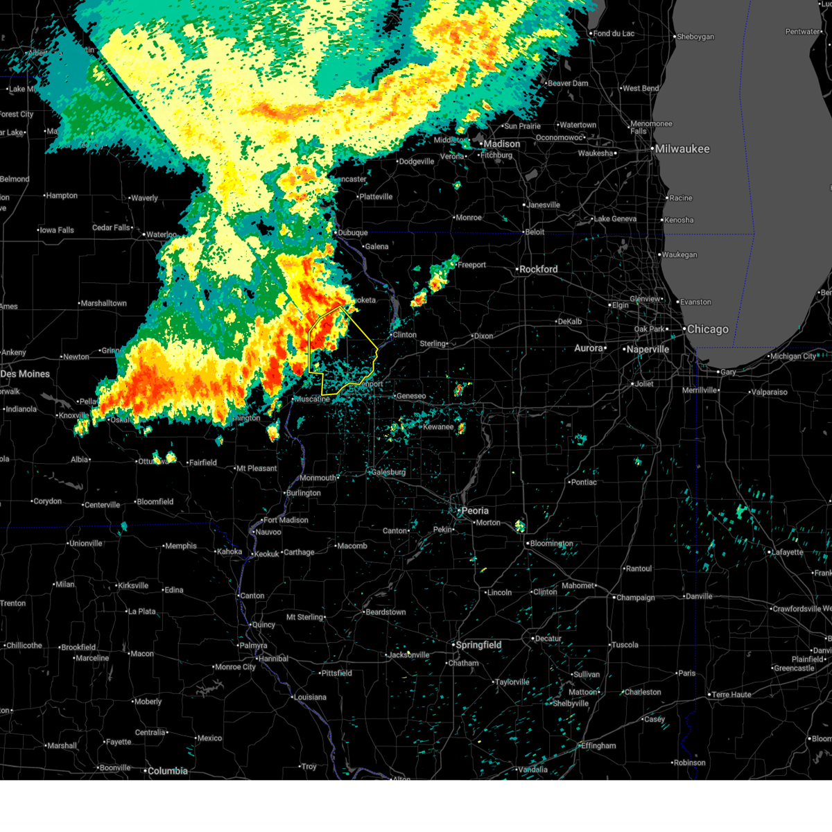 the severe thunderstorm warning has been cancelled and is no longer in effect the severe thunderstorm warning has been cancelled and is no longer in effect
|
| 7/29/2025 3:08 AM CDT |
 the severe thunderstorm warning has been cancelled and is no longer in effect the severe thunderstorm warning has been cancelled and is no longer in effect
|
| 7/29/2025 3:08 AM CDT |
 At 308 am cdt, severe thunderstorms were located along a line extending from jackson county fairgrounds to sherman park to near saulsbury bridge campground, moving southeast at 55 mph (radar indicated). Hazards include 60 mph wind gusts. Expect damage to roofs, siding, and trees. locations impacted include, davenport, rock island, bettendorf, muscatine, durant, eldridge, dewitt, le claire, wilton, hampton, port byron, walcott, blue grass, buffalo, fruitland, princeton, long grove, wheatland, cordova, and grand mound. this includes the following highways, interstate 74 in iowa between mile markers 1 and 4. interstate 80 in iowa between mile markers 279 and 306. Interstate 280 between mile markers 1 and 10. At 308 am cdt, severe thunderstorms were located along a line extending from jackson county fairgrounds to sherman park to near saulsbury bridge campground, moving southeast at 55 mph (radar indicated). Hazards include 60 mph wind gusts. Expect damage to roofs, siding, and trees. locations impacted include, davenport, rock island, bettendorf, muscatine, durant, eldridge, dewitt, le claire, wilton, hampton, port byron, walcott, blue grass, buffalo, fruitland, princeton, long grove, wheatland, cordova, and grand mound. this includes the following highways, interstate 74 in iowa between mile markers 1 and 4. interstate 80 in iowa between mile markers 279 and 306. Interstate 280 between mile markers 1 and 10.
|
| 7/29/2025 3:08 AM CDT |
 The storms which prompted the warning have moved out of the area. therefore, the warning will be allowed to expire. however, gusty winds and heavy rain are still possible with these thunderstorms. a severe thunderstorm watch remains in effect until 400 am cdt for northeastern and east central iowa. The storms which prompted the warning have moved out of the area. therefore, the warning will be allowed to expire. however, gusty winds and heavy rain are still possible with these thunderstorms. a severe thunderstorm watch remains in effect until 400 am cdt for northeastern and east central iowa.
|
| 7/29/2025 2:53 AM CDT |
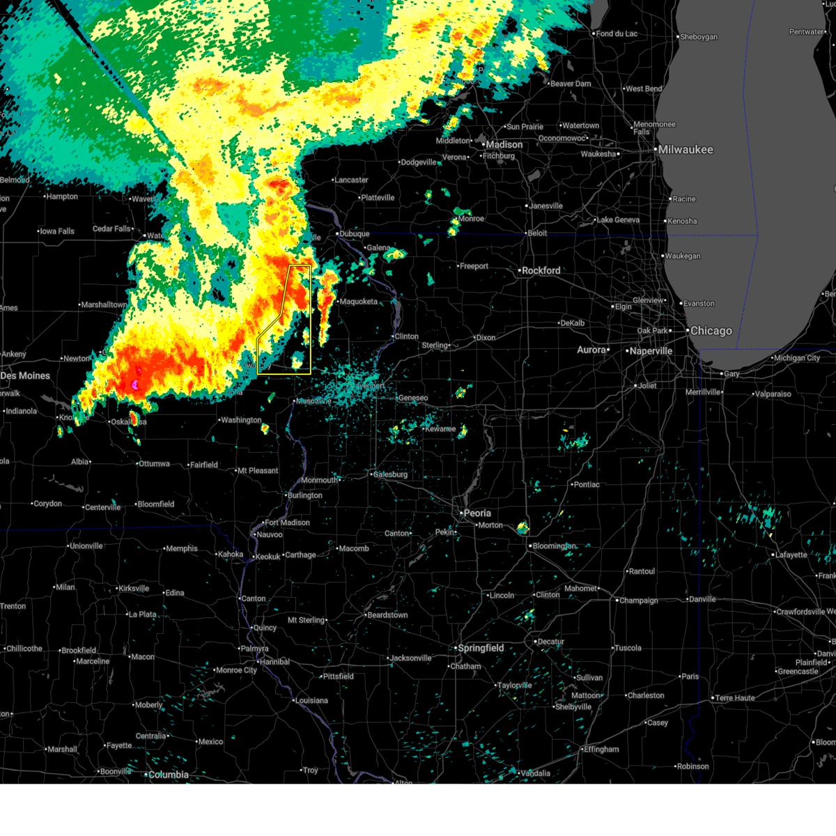 At 253 am cdt, severe thunderstorms were located along a line extending from bernard to oxford junction to rochester to near hills access, moving southeast at 50 mph (radar indicated). Hazards include 70 mph wind gusts. Expect considerable tree damage. damage is likely to mobile homes, roofs, and outbuildings. locations impacted include, tipton, west branch, durant, mechanicsville, stanwood, cascade, lowden, olin, wyoming, oxford junction, bennett, onslow, center junction, rochester, canton, buchanan, clarence, cedar valley, bennett park, and sunbury. This includes interstate 80 in iowa between mile markers 254 and 278. At 253 am cdt, severe thunderstorms were located along a line extending from bernard to oxford junction to rochester to near hills access, moving southeast at 50 mph (radar indicated). Hazards include 70 mph wind gusts. Expect considerable tree damage. damage is likely to mobile homes, roofs, and outbuildings. locations impacted include, tipton, west branch, durant, mechanicsville, stanwood, cascade, lowden, olin, wyoming, oxford junction, bennett, onslow, center junction, rochester, canton, buchanan, clarence, cedar valley, bennett park, and sunbury. This includes interstate 80 in iowa between mile markers 254 and 278.
|
| 7/29/2025 2:53 AM CDT |
 the severe thunderstorm warning has been cancelled and is no longer in effect the severe thunderstorm warning has been cancelled and is no longer in effect
|
| 7/29/2025 2:47 AM CDT |
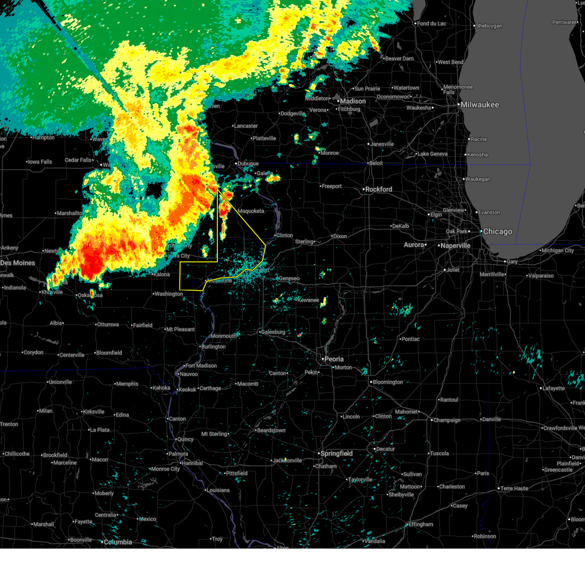 Svrdvn the national weather service in the quad cities has issued a * severe thunderstorm warning for, southwestern jackson county in east central iowa, scott county in east central iowa, muscatine county in east central iowa, western clinton county in east central iowa, * until 345 am cdt. * at 247 am cdt, severe thunderstorms were located along a line extending from near temple hill to near clarence to near west branch, moving southeast at 45 mph (radar indicated). Hazards include 60 mph wind gusts. expect damage to roofs, siding, and trees Svrdvn the national weather service in the quad cities has issued a * severe thunderstorm warning for, southwestern jackson county in east central iowa, scott county in east central iowa, muscatine county in east central iowa, western clinton county in east central iowa, * until 345 am cdt. * at 247 am cdt, severe thunderstorms were located along a line extending from near temple hill to near clarence to near west branch, moving southeast at 45 mph (radar indicated). Hazards include 60 mph wind gusts. expect damage to roofs, siding, and trees
|
| 7/29/2025 2:31 AM CDT |
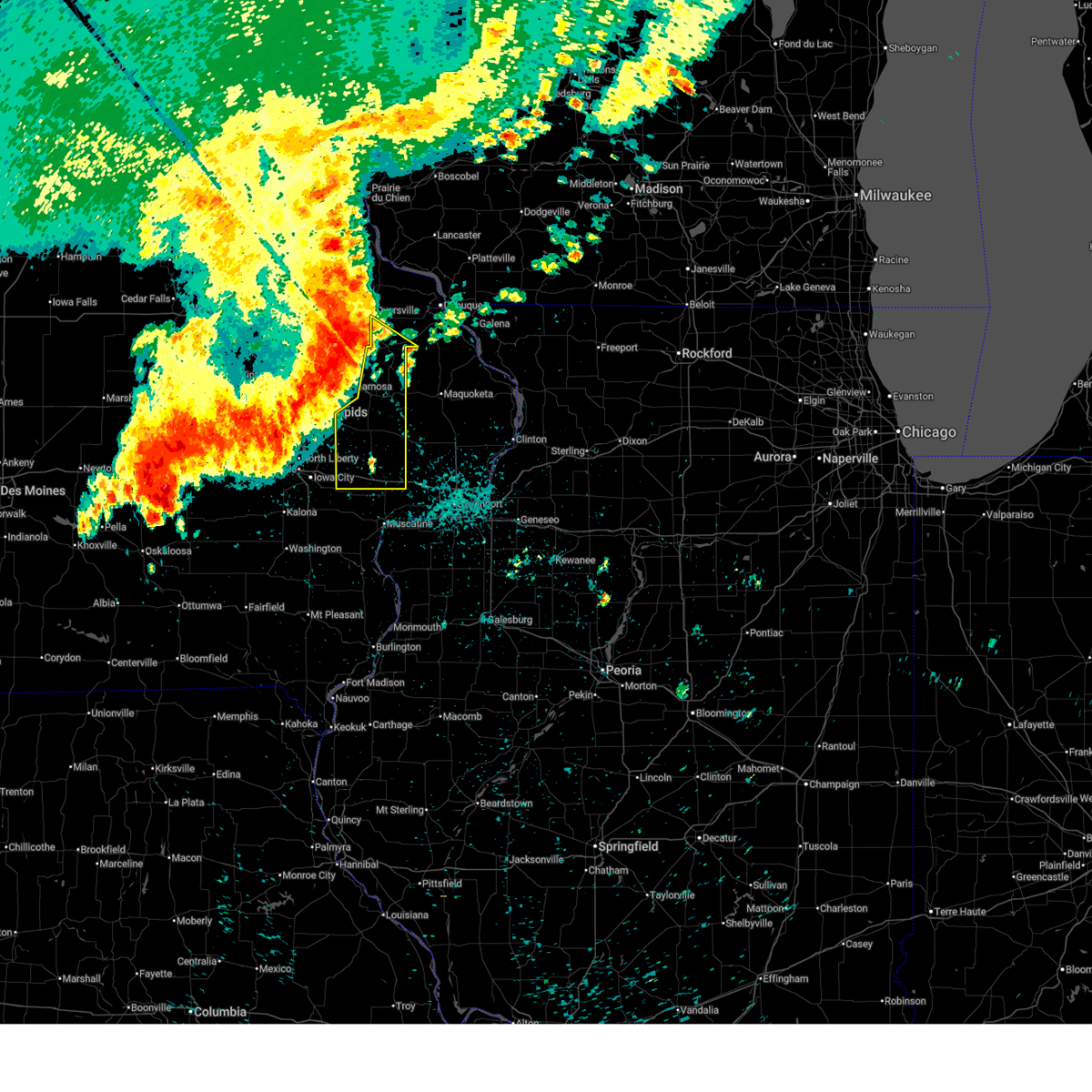 Svrdvn the national weather service in the quad cities has issued a * severe thunderstorm warning for, cedar county in east central iowa, southwestern dubuque county in northeastern iowa, jones county in east central iowa, * until 315 am cdt. * at 231 am cdt, severe thunderstorms were located along a line extending from near worthington to anamosa to solon to oxford, moving southeast at 50 mph (radar indicated). Hazards include 70 mph wind gusts. Expect considerable tree damage. Damage is likely to mobile homes, roofs, and outbuildings. Svrdvn the national weather service in the quad cities has issued a * severe thunderstorm warning for, cedar county in east central iowa, southwestern dubuque county in northeastern iowa, jones county in east central iowa, * until 315 am cdt. * at 231 am cdt, severe thunderstorms were located along a line extending from near worthington to anamosa to solon to oxford, moving southeast at 50 mph (radar indicated). Hazards include 70 mph wind gusts. Expect considerable tree damage. Damage is likely to mobile homes, roofs, and outbuildings.
|
| 7/11/2025 4:57 PM CDT |
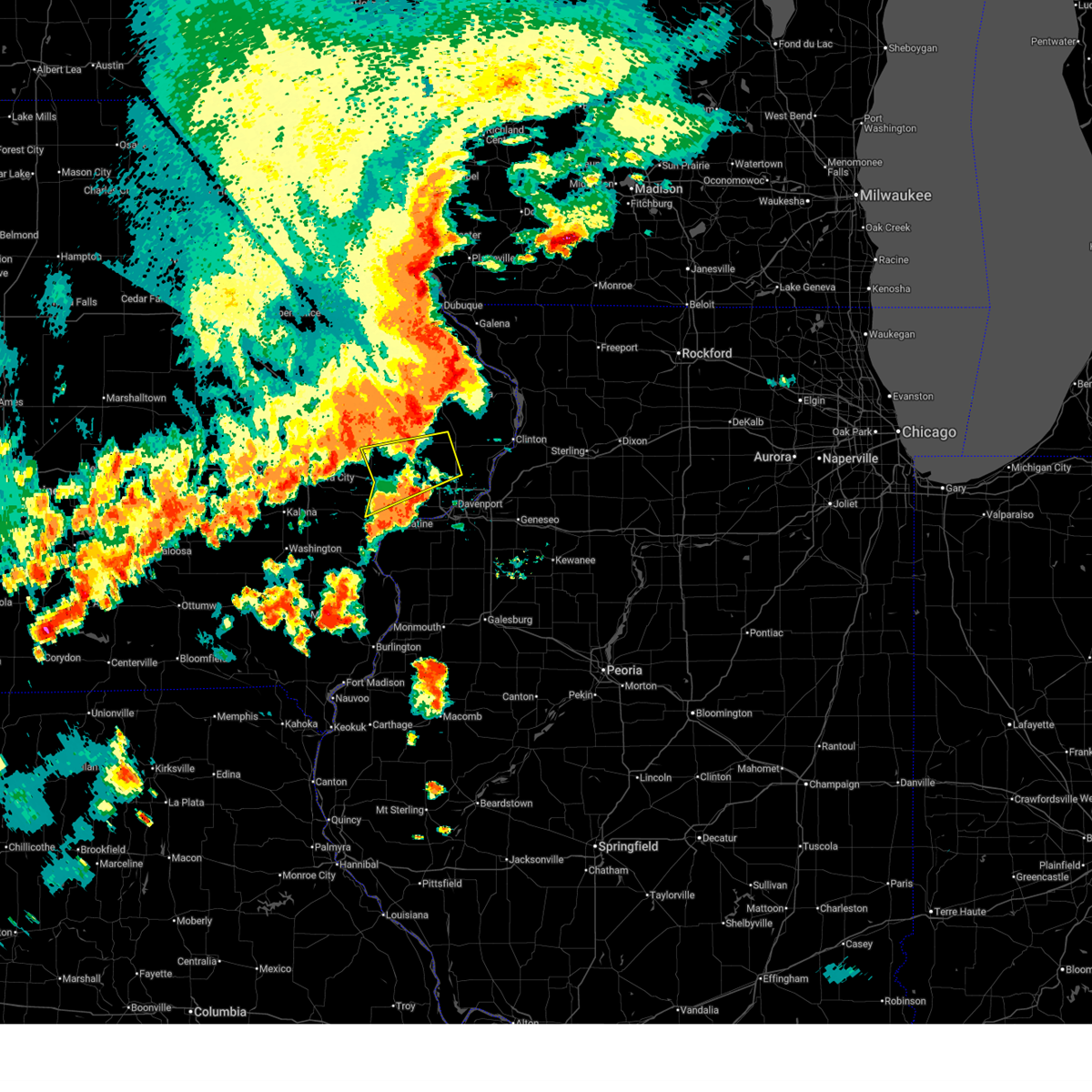 The storm which prompted the warning has weakened below severe limits, and no longer poses an immediate threat to life or property. therefore, the warning will be allowed to expire. however, gusty winds and heavy rain are still possible with this thunderstorm. a tornado watch remains in effect until 800 pm cdt for east central iowa. The storm which prompted the warning has weakened below severe limits, and no longer poses an immediate threat to life or property. therefore, the warning will be allowed to expire. however, gusty winds and heavy rain are still possible with this thunderstorm. a tornado watch remains in effect until 800 pm cdt for east central iowa.
|
| 7/11/2025 4:37 PM CDT |
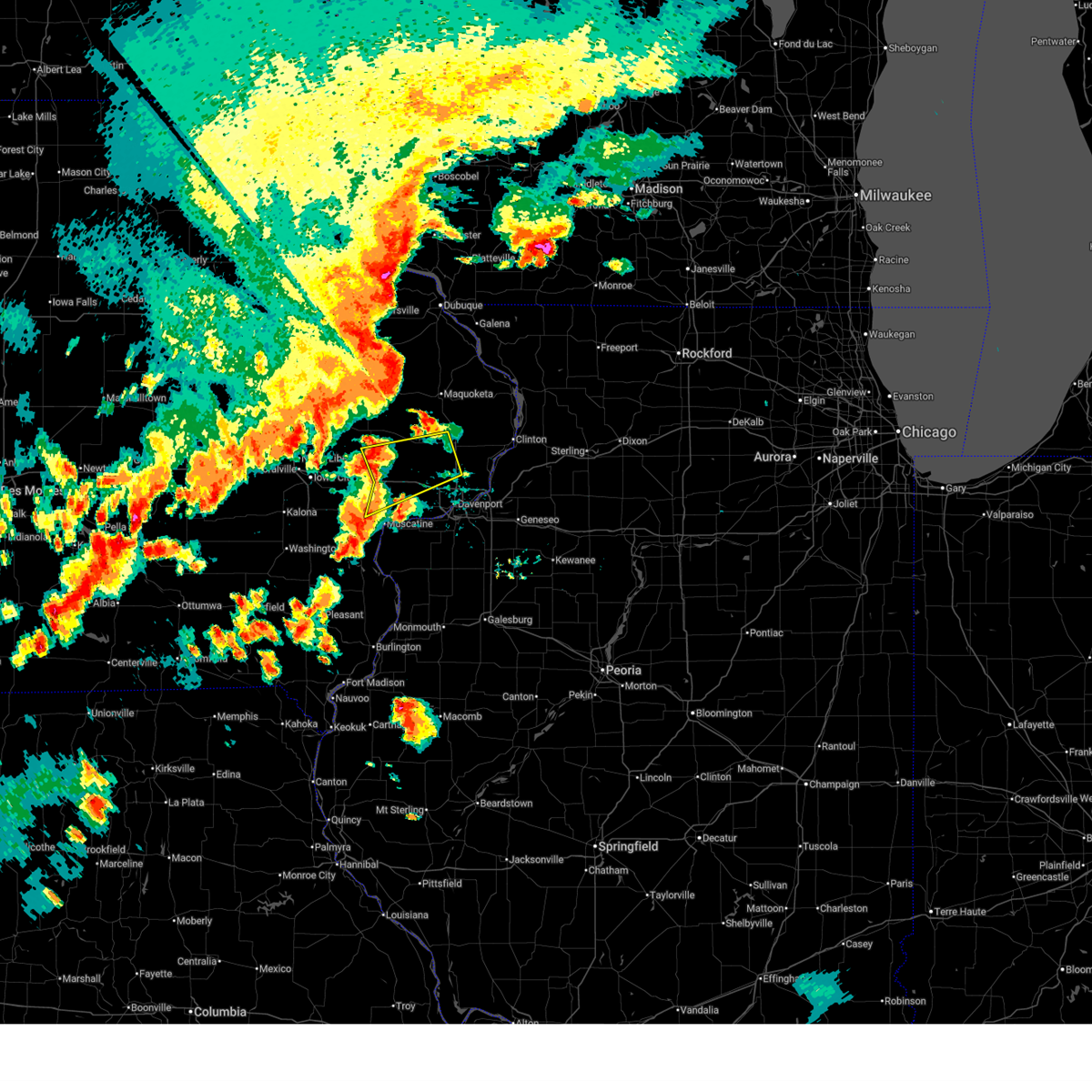 At 436 pm cdt, a severe thunderstorm was located near sunbury, or near durant, moving northeast at 45 mph (radar indicated). Hazards include 60 mph wind gusts and quarter size hail. Hail damage to vehicles is expected. expect wind damage to roofs, siding, and trees. locations impacted include, tipton, durant, eldridge, wilton, walcott, long grove, wheatland, grand mound, calamus, bennett, donahue, dixon, stockton, maysville, new liberty, camp liberty, bennett park, moscow, sunbury, and tipton matthews airport. This includes interstate 80 in iowa between mile markers 267 and 287. At 436 pm cdt, a severe thunderstorm was located near sunbury, or near durant, moving northeast at 45 mph (radar indicated). Hazards include 60 mph wind gusts and quarter size hail. Hail damage to vehicles is expected. expect wind damage to roofs, siding, and trees. locations impacted include, tipton, durant, eldridge, wilton, walcott, long grove, wheatland, grand mound, calamus, bennett, donahue, dixon, stockton, maysville, new liberty, camp liberty, bennett park, moscow, sunbury, and tipton matthews airport. This includes interstate 80 in iowa between mile markers 267 and 287.
|
| 7/11/2025 4:26 PM CDT |
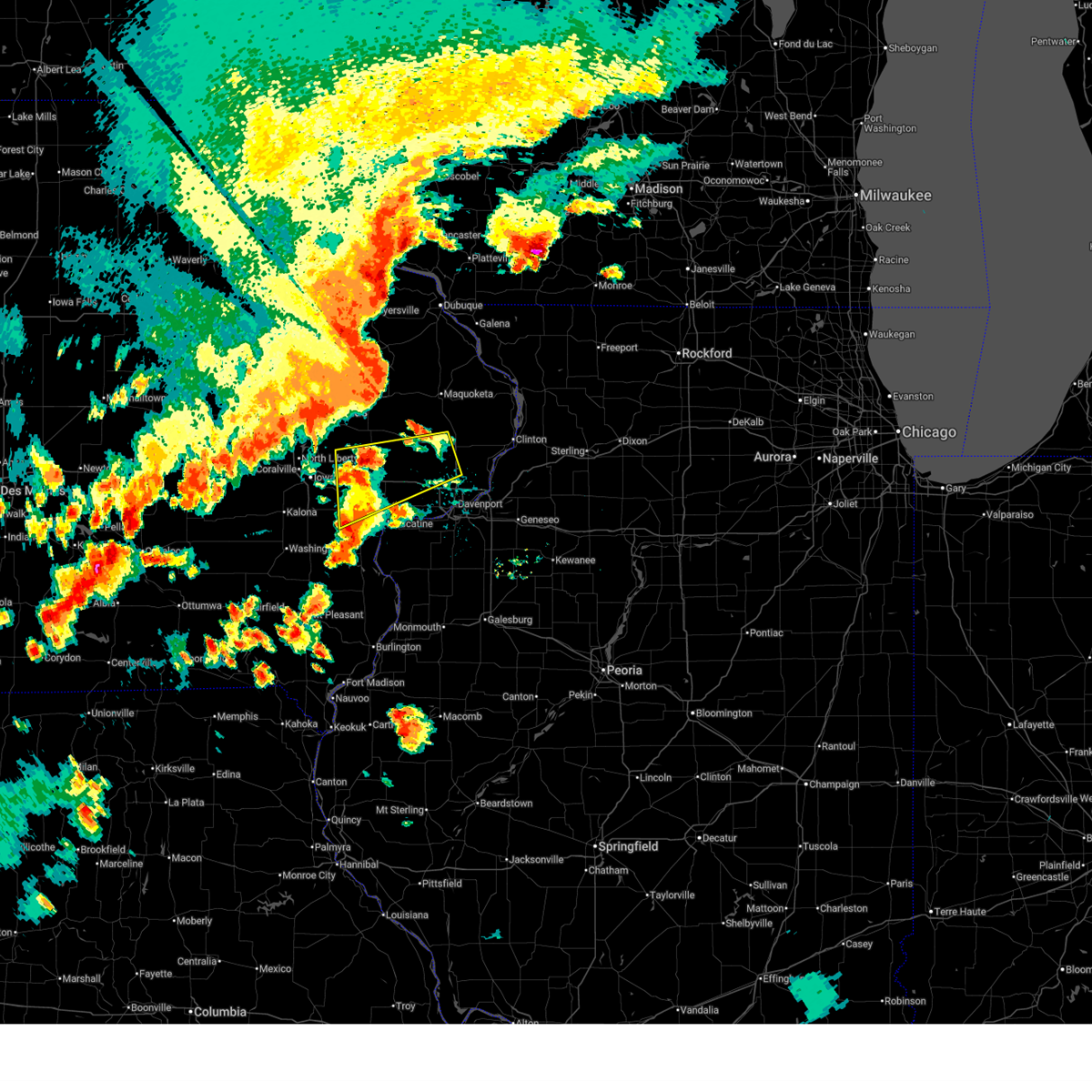 Svrdvn the national weather service in the quad cities has issued a * severe thunderstorm warning for, cedar county in east central iowa, northwestern scott county in east central iowa, northern muscatine county in east central iowa, southwestern clinton county in east central iowa, * until 500 pm cdt. * at 426 pm cdt, a severe thunderstorm was located near atalissa, or 11 miles south of tipton, moving northeast at 45 mph (radar indicated). Hazards include 60 mph wind gusts and quarter size hail. Hail damage to vehicles is expected. Expect wind damage to roofs, siding, and trees. Svrdvn the national weather service in the quad cities has issued a * severe thunderstorm warning for, cedar county in east central iowa, northwestern scott county in east central iowa, northern muscatine county in east central iowa, southwestern clinton county in east central iowa, * until 500 pm cdt. * at 426 pm cdt, a severe thunderstorm was located near atalissa, or 11 miles south of tipton, moving northeast at 45 mph (radar indicated). Hazards include 60 mph wind gusts and quarter size hail. Hail damage to vehicles is expected. Expect wind damage to roofs, siding, and trees.
|
| 7/5/2025 4:22 PM CDT |
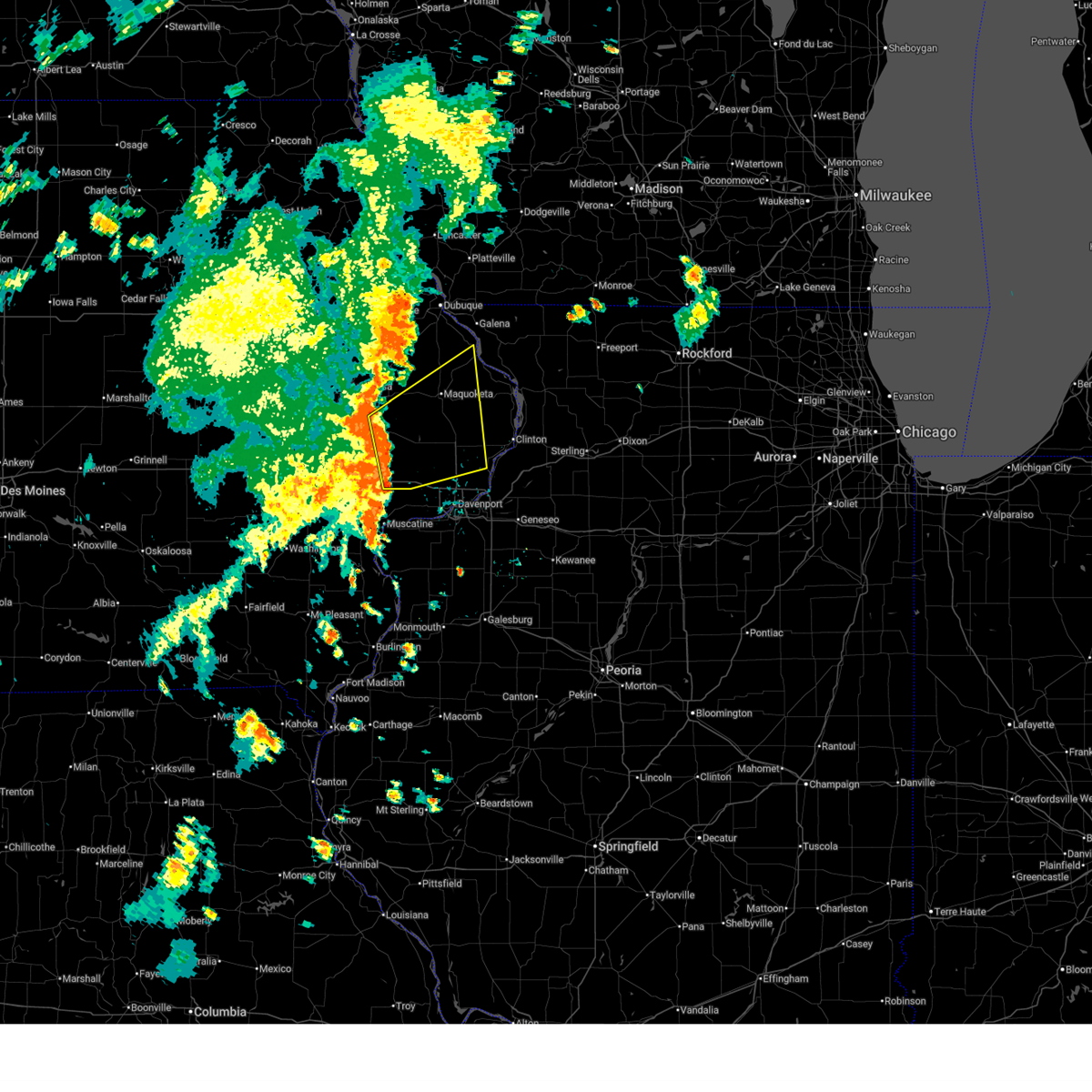 At 421 pm cdt, severe thunderstorms were located along a line extending from near clarence to near wilton, moving northeast at 50 mph (radar indicated). Hazards include 60 mph wind gusts. Expect damage to roofs, siding, and trees. locations impacted include, maquoketa, durant, eldridge, dewitt, bellevue, walcott, long grove, lowden, wheatland, grand mound, delmar, oxford junction, lost nation, calamus, andrew, bennett, charlotte, donahue, mccausland, and welton. This includes interstate 80 in iowa between mile markers 270 and 284. At 421 pm cdt, severe thunderstorms were located along a line extending from near clarence to near wilton, moving northeast at 50 mph (radar indicated). Hazards include 60 mph wind gusts. Expect damage to roofs, siding, and trees. locations impacted include, maquoketa, durant, eldridge, dewitt, bellevue, walcott, long grove, lowden, wheatland, grand mound, delmar, oxford junction, lost nation, calamus, andrew, bennett, charlotte, donahue, mccausland, and welton. This includes interstate 80 in iowa between mile markers 270 and 284.
|
| 7/5/2025 4:22 PM CDT |
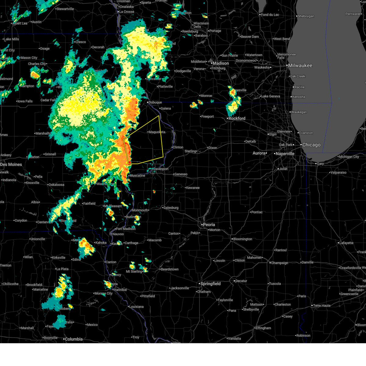 the severe thunderstorm warning has been cancelled and is no longer in effect the severe thunderstorm warning has been cancelled and is no longer in effect
|
| 7/5/2025 3:59 PM CDT |
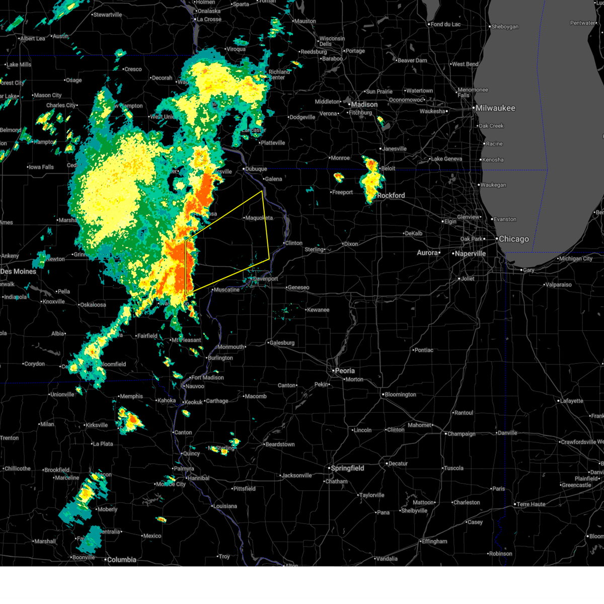 Svrdvn the national weather service in the quad cities has issued a * severe thunderstorm warning for, western jackson county in east central iowa, cedar county in east central iowa, northern scott county in east central iowa, southeastern jones county in east central iowa, northern muscatine county in east central iowa, clinton county in east central iowa, * until 500 pm cdt. * at 358 pm cdt, severe thunderstorms were located along a line extending from cedar bluff to near nichols, moving northeast at 55 mph (radar indicated). Hazards include 60 mph wind gusts. expect damage to roofs, siding, and trees Svrdvn the national weather service in the quad cities has issued a * severe thunderstorm warning for, western jackson county in east central iowa, cedar county in east central iowa, northern scott county in east central iowa, southeastern jones county in east central iowa, northern muscatine county in east central iowa, clinton county in east central iowa, * until 500 pm cdt. * at 358 pm cdt, severe thunderstorms were located along a line extending from cedar bluff to near nichols, moving northeast at 55 mph (radar indicated). Hazards include 60 mph wind gusts. expect damage to roofs, siding, and trees
|
| 5/20/2025 2:39 PM CDT |
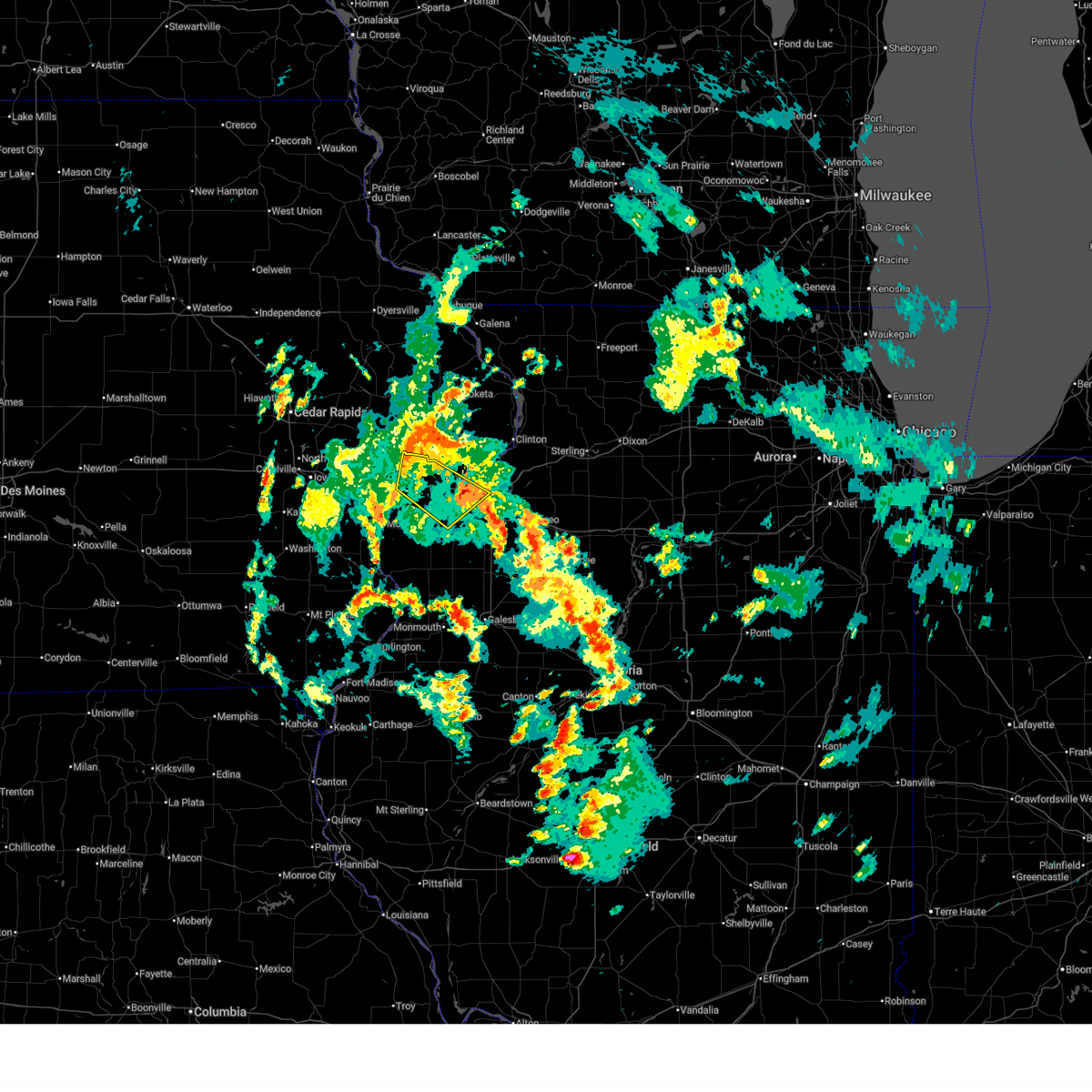 The storm which prompted the warning has weakened below severe limits, and has exited the warned area. therefore, the warning will be allowed to expire. The storm which prompted the warning has weakened below severe limits, and has exited the warned area. therefore, the warning will be allowed to expire.
|
| 5/20/2025 2:17 PM CDT |
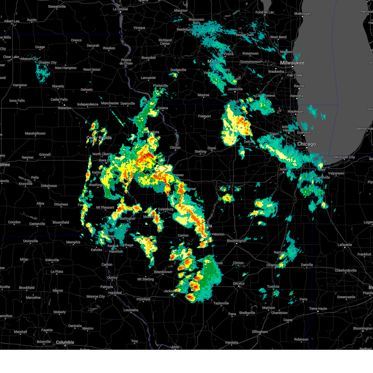 At 216 pm cdt, a severe thunderstorm was located over maysville, or 9 miles northwest of davenport, moving northeast at 30 mph (radar indicated). Hazards include 60 mph wind gusts and penny size hail. Expect damage to roofs, siding, and trees. locations impacted include, davenport, moline, rock island, bettendorf, east moline, durant, eldridge, milan, le claire, hampton, walcott, blue grass, buffalo, rapids city, riverdale, donahue, dixon, stockton, maysville, and new liberty. this includes the following highways, interstate 74 in iowa between mile markers 1 and 5. interstate 80 in iowa between mile markers 276 and 306. interstate 74 in illinois between mile markers 1 and 3. Interstate 280 between mile markers 1 and 16. At 216 pm cdt, a severe thunderstorm was located over maysville, or 9 miles northwest of davenport, moving northeast at 30 mph (radar indicated). Hazards include 60 mph wind gusts and penny size hail. Expect damage to roofs, siding, and trees. locations impacted include, davenport, moline, rock island, bettendorf, east moline, durant, eldridge, milan, le claire, hampton, walcott, blue grass, buffalo, rapids city, riverdale, donahue, dixon, stockton, maysville, and new liberty. this includes the following highways, interstate 74 in iowa between mile markers 1 and 5. interstate 80 in iowa between mile markers 276 and 306. interstate 74 in illinois between mile markers 1 and 3. Interstate 280 between mile markers 1 and 16.
|
| 5/20/2025 2:05 PM CDT |
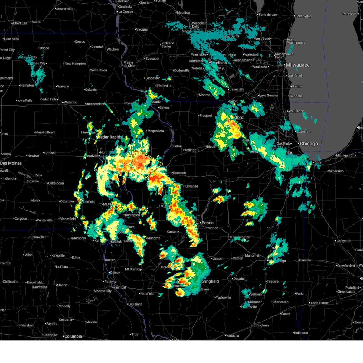 the severe thunderstorm warning has been cancelled and is no longer in effect the severe thunderstorm warning has been cancelled and is no longer in effect
|
| 5/20/2025 2:05 PM CDT |
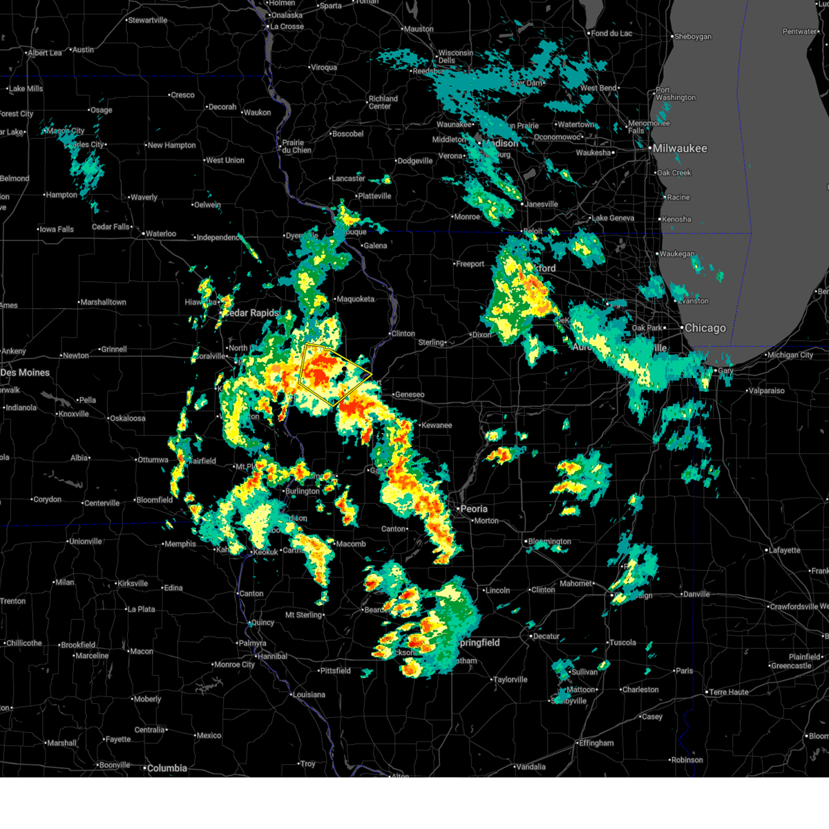 At 205 pm cdt, a severe thunderstorm was located over walcott, or 7 miles east of durant, moving northeast at 30 mph (radar indicated). Hazards include 60 mph wind gusts and penny size hail. Expect damage to roofs, siding, and trees. locations impacted include, davenport, moline, rock island, bettendorf, east moline, durant, eldridge, milan, le claire, hampton, walcott, blue grass, buffalo, andalusia, rapids city, riverdale, donahue, taylor ridge, montpelier, and dixon. this includes the following highways, interstate 74 in iowa between mile markers 1 and 5. interstate 80 in iowa between mile markers 276 and 306. interstate 74 in illinois between mile markers 1 and 2. Interstate 280 between mile markers 1 and 15. At 205 pm cdt, a severe thunderstorm was located over walcott, or 7 miles east of durant, moving northeast at 30 mph (radar indicated). Hazards include 60 mph wind gusts and penny size hail. Expect damage to roofs, siding, and trees. locations impacted include, davenport, moline, rock island, bettendorf, east moline, durant, eldridge, milan, le claire, hampton, walcott, blue grass, buffalo, andalusia, rapids city, riverdale, donahue, taylor ridge, montpelier, and dixon. this includes the following highways, interstate 74 in iowa between mile markers 1 and 5. interstate 80 in iowa between mile markers 276 and 306. interstate 74 in illinois between mile markers 1 and 2. Interstate 280 between mile markers 1 and 15.
|
| 5/20/2025 1:49 PM CDT |
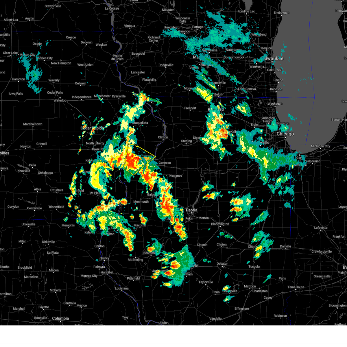 At 149 pm cdt, a severe thunderstorm was located over midway beach, or 8 miles southeast of durant, moving northeast at 30 mph (radar indicated). Hazards include 60 mph wind gusts and penny size hail. Expect damage to roofs, siding, and trees. locations impacted include, davenport, moline, rock island, bettendorf, east moline, durant, eldridge, milan, le claire, hampton, walcott, blue grass, buffalo, andalusia, rapids city, riverdale, donahue, taylor ridge, fairport, and montpelier. this includes the following highways, interstate 74 in iowa between mile markers 1 and 5. interstate 80 in iowa between mile markers 276 and 306. interstate 74 in illinois between mile markers 1 and 2. Interstate 280 between mile markers 1 and 15. At 149 pm cdt, a severe thunderstorm was located over midway beach, or 8 miles southeast of durant, moving northeast at 30 mph (radar indicated). Hazards include 60 mph wind gusts and penny size hail. Expect damage to roofs, siding, and trees. locations impacted include, davenport, moline, rock island, bettendorf, east moline, durant, eldridge, milan, le claire, hampton, walcott, blue grass, buffalo, andalusia, rapids city, riverdale, donahue, taylor ridge, fairport, and montpelier. this includes the following highways, interstate 74 in iowa between mile markers 1 and 5. interstate 80 in iowa between mile markers 276 and 306. interstate 74 in illinois between mile markers 1 and 2. Interstate 280 between mile markers 1 and 15.
|
| 5/20/2025 1:39 PM CDT |
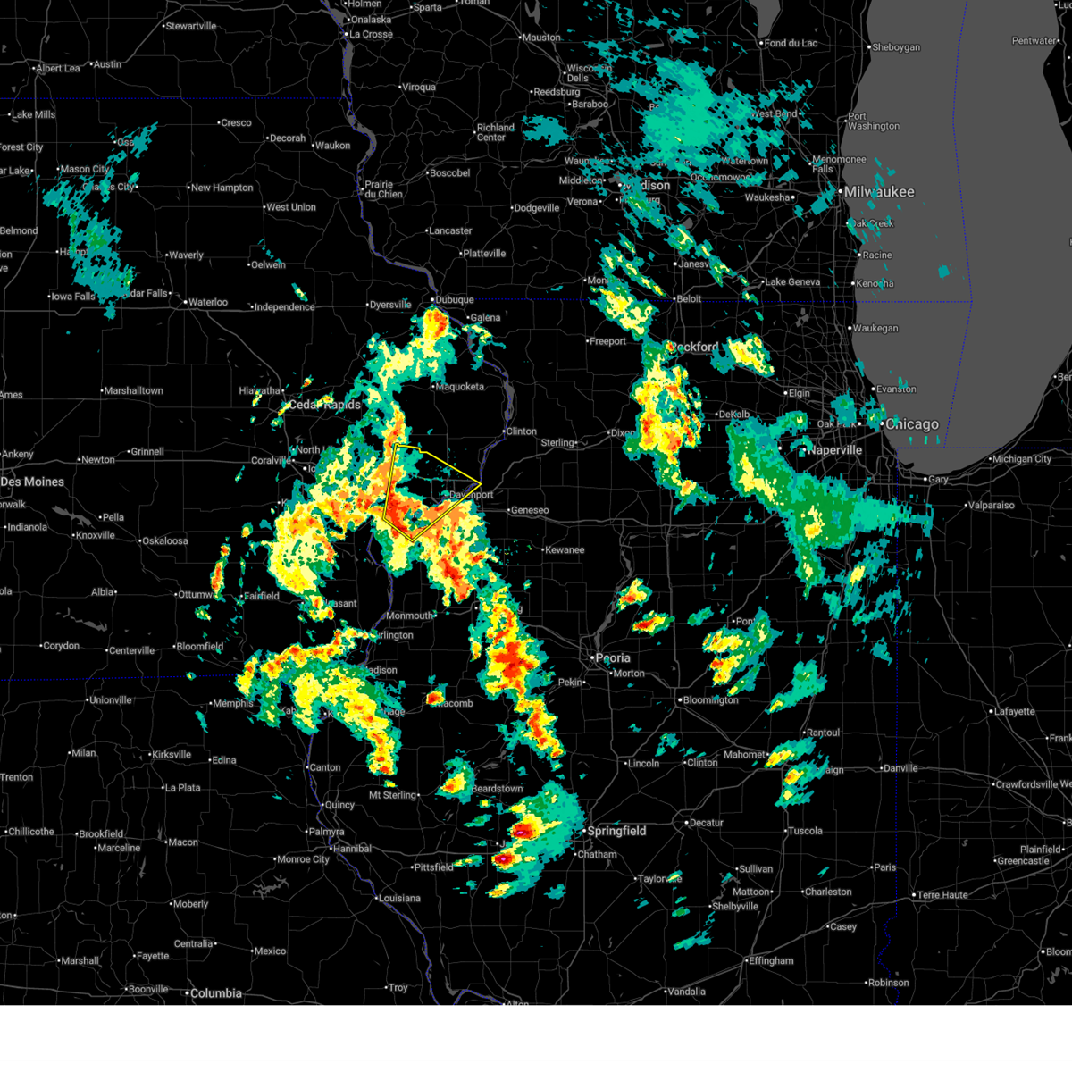 Svrdvn the national weather service in the quad cities has issued a * severe thunderstorm warning for, southern rock island county in northwestern illinois, north central mercer county in northwestern illinois, southeastern cedar county in east central iowa, scott county in east central iowa, northeastern muscatine county in east central iowa, * until 245 pm cdt. * at 139 pm cdt, a severe thunderstorm was located over fairport, or 9 miles east of muscatine, moving northeast at 30 mph (radar indicated). Hazards include 60 mph wind gusts and penny size hail. expect damage to roofs, siding, and trees Svrdvn the national weather service in the quad cities has issued a * severe thunderstorm warning for, southern rock island county in northwestern illinois, north central mercer county in northwestern illinois, southeastern cedar county in east central iowa, scott county in east central iowa, northeastern muscatine county in east central iowa, * until 245 pm cdt. * at 139 pm cdt, a severe thunderstorm was located over fairport, or 9 miles east of muscatine, moving northeast at 30 mph (radar indicated). Hazards include 60 mph wind gusts and penny size hail. expect damage to roofs, siding, and trees
|
| 4/20/2025 8:30 PM CDT |
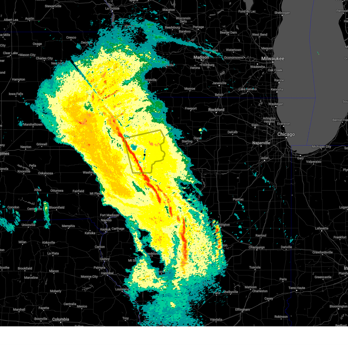 At 830 pm cdt, severe thunderstorms were located along a line extending from near walnut grove park to indian bluff golf course, moving east at 45 mph (radar indicated). Hazards include 60 mph wind gusts. Expect damage to roofs, siding, and trees. locations impacted include, silvis heights, moline, charlotte, clark's ferry recreation area, rapids city, west lake park, campbells island, bennett park, elvira, sunbury, new liberty, taylor ridge, port byron, panorama park, davenport municipal airport, riverdale, loud thunder scout camp, wheatland, buffalo, and calamus. this includes the following highways, interstate 74 in iowa between mile markers 1 and 5. interstate 80 in iowa between mile markers 277 and 306. interstate 80 in illinois between mile markers 1 and 5. interstate 74 in illinois between mile markers 1 and 7. interstate 88 between mile markers 1 and 13. Interstate 280 between mile markers 1 and 18. At 830 pm cdt, severe thunderstorms were located along a line extending from near walnut grove park to indian bluff golf course, moving east at 45 mph (radar indicated). Hazards include 60 mph wind gusts. Expect damage to roofs, siding, and trees. locations impacted include, silvis heights, moline, charlotte, clark's ferry recreation area, rapids city, west lake park, campbells island, bennett park, elvira, sunbury, new liberty, taylor ridge, port byron, panorama park, davenport municipal airport, riverdale, loud thunder scout camp, wheatland, buffalo, and calamus. this includes the following highways, interstate 74 in iowa between mile markers 1 and 5. interstate 80 in iowa between mile markers 277 and 306. interstate 80 in illinois between mile markers 1 and 5. interstate 74 in illinois between mile markers 1 and 7. interstate 88 between mile markers 1 and 13. Interstate 280 between mile markers 1 and 18.
|
| 4/20/2025 8:16 PM CDT |
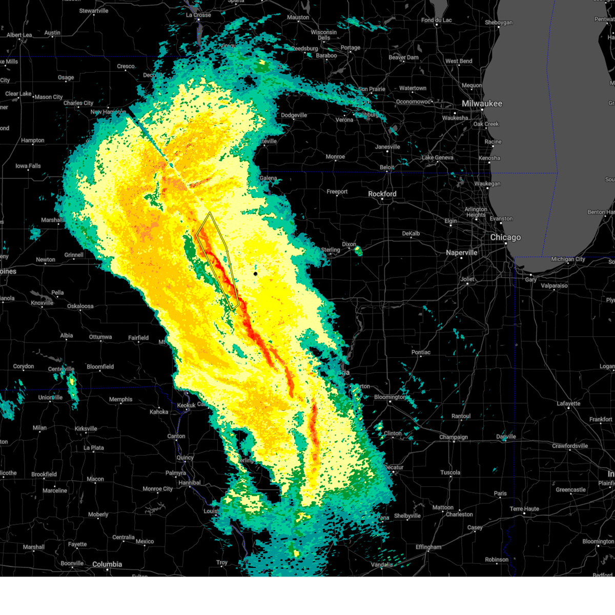 the severe thunderstorm warning has been cancelled and is no longer in effect the severe thunderstorm warning has been cancelled and is no longer in effect
|
| 4/20/2025 8:16 PM CDT |
 At 816 pm cdt, severe thunderstorms were located along a line extending from near central park to near bennett to near pleasant prairie, moving northeast at 40 mph (radar indicated). Hazards include 60 mph wind gusts. Expect damage to roofs, siding, and trees. locations impacted include, olin, new era, bennett park, durant, pleasant prairie, sunbury, clarence, bennett, tipton matthews airport, loud thunder scout camp, illinois city, midway beach, loud thunder forest preserve, wilton, tipton, fairport recreation area, wildcat den state park, hale, fairport, and shady creek campground. This includes interstate 80 in iowa between mile markers 269 and 279. At 816 pm cdt, severe thunderstorms were located along a line extending from near central park to near bennett to near pleasant prairie, moving northeast at 40 mph (radar indicated). Hazards include 60 mph wind gusts. Expect damage to roofs, siding, and trees. locations impacted include, olin, new era, bennett park, durant, pleasant prairie, sunbury, clarence, bennett, tipton matthews airport, loud thunder scout camp, illinois city, midway beach, loud thunder forest preserve, wilton, tipton, fairport recreation area, wildcat den state park, hale, fairport, and shady creek campground. This includes interstate 80 in iowa between mile markers 269 and 279.
|
| 4/20/2025 8:08 PM CDT |
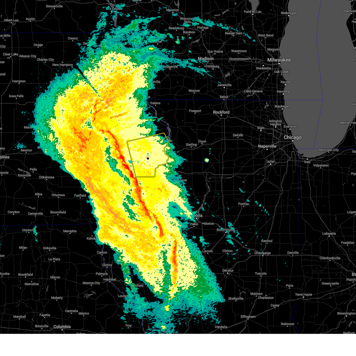 Svrdvn the national weather service in the quad cities has issued a * severe thunderstorm warning for, rock island county in northwestern illinois, eastern cedar county in east central iowa, scott county in east central iowa, northeastern muscatine county in east central iowa, clinton county in east central iowa, * until 915 pm cdt. * at 808 pm cdt, severe thunderstorms were located along a line extending from near tipton to marston, moving northeast at 45 mph (radar indicated). Hazards include 60 mph wind gusts. expect damage to roofs, siding, and trees Svrdvn the national weather service in the quad cities has issued a * severe thunderstorm warning for, rock island county in northwestern illinois, eastern cedar county in east central iowa, scott county in east central iowa, northeastern muscatine county in east central iowa, clinton county in east central iowa, * until 915 pm cdt. * at 808 pm cdt, severe thunderstorms were located along a line extending from near tipton to marston, moving northeast at 45 mph (radar indicated). Hazards include 60 mph wind gusts. expect damage to roofs, siding, and trees
|
| 4/20/2025 7:49 PM CDT |
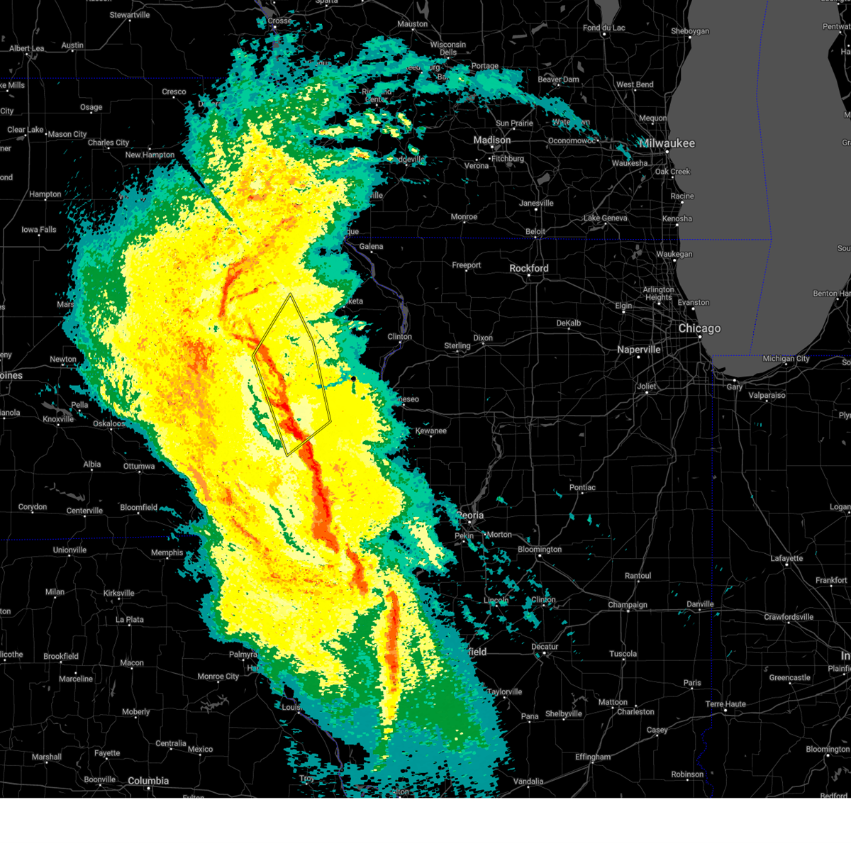 At 749 pm cdt, severe thunderstorms were located along a line extending from near mechanicsville to moscow to near eliza, moving northeast at 40 mph (radar indicated). Hazards include 60 mph wind gusts. Expect damage to roofs, siding, and trees. locations impacted include, sand springs, muscatine county fairgrounds, new era, bennett park, sunbury, bennett, petersville, tipton matthews airport, ardon, cedar county fairgrounds, muscatine municipal airport, loud thunder scout camp, flaming prairie park, atalissa, rochester, fruitland, wilton, tipton, oasis, and buchanan. This includes interstate 80 in iowa between mile markers 252 and 279. At 749 pm cdt, severe thunderstorms were located along a line extending from near mechanicsville to moscow to near eliza, moving northeast at 40 mph (radar indicated). Hazards include 60 mph wind gusts. Expect damage to roofs, siding, and trees. locations impacted include, sand springs, muscatine county fairgrounds, new era, bennett park, sunbury, bennett, petersville, tipton matthews airport, ardon, cedar county fairgrounds, muscatine municipal airport, loud thunder scout camp, flaming prairie park, atalissa, rochester, fruitland, wilton, tipton, oasis, and buchanan. This includes interstate 80 in iowa between mile markers 252 and 279.
|
| 4/20/2025 7:37 PM CDT |
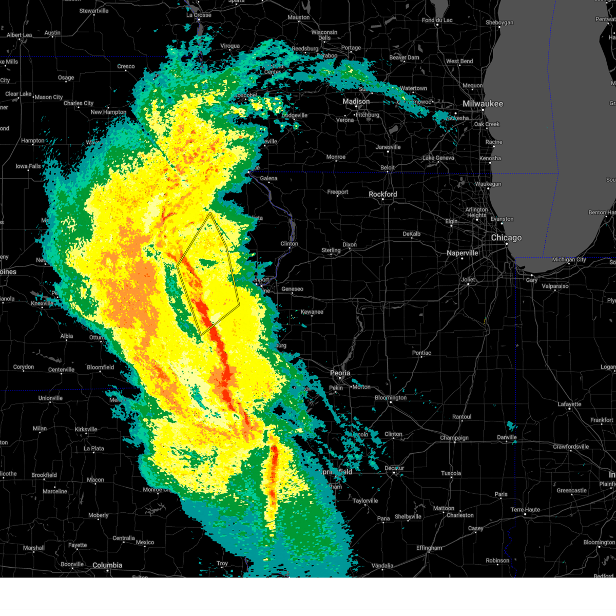 the severe thunderstorm warning has been cancelled and is no longer in effect the severe thunderstorm warning has been cancelled and is no longer in effect
|
| 4/20/2025 7:37 PM CDT |
 At 736 pm cdt, severe thunderstorms were located along a line extending from near cedar bluff to near saulsbury bridge campground to near snively access campground, moving northeast at 40 mph (radar indicated). Hazards include 60 mph wind gusts. Expect damage to roofs, siding, and trees. locations impacted include, sand springs, muscatine county fairgrounds, amber, new era, bennett park, sunbury, bennett, petersville, tipton matthews airport, ardon, cedar county fairgrounds, muscatine municipal airport, loud thunder scout camp, flaming prairie park, atalissa, rochester, fruitland, wilton, conesville, and tipton. This includes interstate 80 in iowa between mile markers 247 and 279. At 736 pm cdt, severe thunderstorms were located along a line extending from near cedar bluff to near saulsbury bridge campground to near snively access campground, moving northeast at 40 mph (radar indicated). Hazards include 60 mph wind gusts. Expect damage to roofs, siding, and trees. locations impacted include, sand springs, muscatine county fairgrounds, amber, new era, bennett park, sunbury, bennett, petersville, tipton matthews airport, ardon, cedar county fairgrounds, muscatine municipal airport, loud thunder scout camp, flaming prairie park, atalissa, rochester, fruitland, wilton, conesville, and tipton. This includes interstate 80 in iowa between mile markers 247 and 279.
|
| 4/20/2025 7:25 PM CDT |
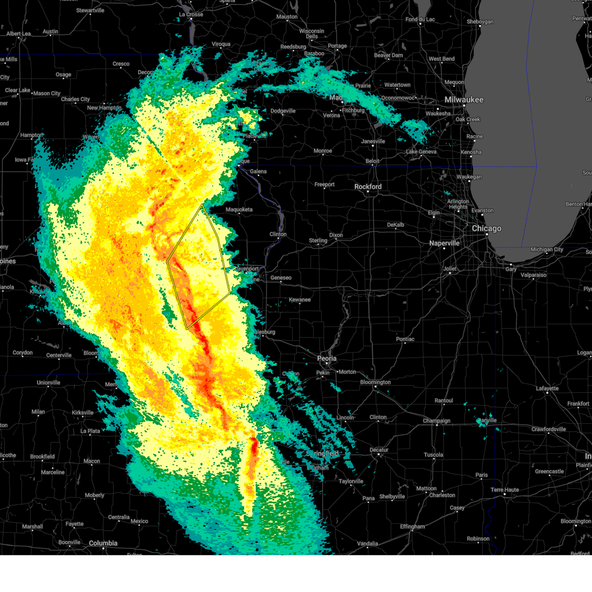 Svrdvn the national weather service in the quad cities has issued a * severe thunderstorm warning for, southwestern rock island county in northwestern illinois, northwestern mercer county in northwestern illinois, north central des moines county in southeastern iowa, louisa county in southeastern iowa, cedar county in east central iowa, west central scott county in east central iowa, southeastern johnson county in east central iowa, south central jones county in east central iowa, muscatine county in east central iowa, * until 830 pm cdt. * at 724 pm cdt, severe thunderstorms were located along a line extending from near elmira to letts to amber, moving northeast at 40 mph (radar indicated). Hazards include 60 mph wind gusts. expect damage to roofs, siding, and trees Svrdvn the national weather service in the quad cities has issued a * severe thunderstorm warning for, southwestern rock island county in northwestern illinois, northwestern mercer county in northwestern illinois, north central des moines county in southeastern iowa, louisa county in southeastern iowa, cedar county in east central iowa, west central scott county in east central iowa, southeastern johnson county in east central iowa, south central jones county in east central iowa, muscatine county in east central iowa, * until 830 pm cdt. * at 724 pm cdt, severe thunderstorms were located along a line extending from near elmira to letts to amber, moving northeast at 40 mph (radar indicated). Hazards include 60 mph wind gusts. expect damage to roofs, siding, and trees
|
| 3/19/2025 1:01 PM CDT |
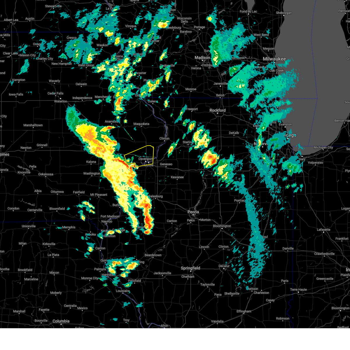 Svrdvn the national weather service in the quad cities has issued a * severe thunderstorm warning for, central rock island county in northwestern illinois, southeastern cedar county in east central iowa, scott county in east central iowa, northeastern muscatine county in east central iowa, * until 145 pm cdt. * at 101 pm cdt, a severe thunderstorm was located over durant, moving east at 35 mph (radar indicated). Hazards include 60 mph wind gusts. expect damage to roofs, siding, and trees Svrdvn the national weather service in the quad cities has issued a * severe thunderstorm warning for, central rock island county in northwestern illinois, southeastern cedar county in east central iowa, scott county in east central iowa, northeastern muscatine county in east central iowa, * until 145 pm cdt. * at 101 pm cdt, a severe thunderstorm was located over durant, moving east at 35 mph (radar indicated). Hazards include 60 mph wind gusts. expect damage to roofs, siding, and trees
|
| 3/14/2025 9:19 PM CDT |
 At 919 pm cdt, severe thunderstorms were located along a line extending from near temple hill to near nekoma, moving northeast at 50 mph (radar indicated). Hazards include 70 mph wind gusts. Expect considerable tree damage. damage is likely to mobile homes, roofs, and outbuildings. locations impacted include, ideal, west lake park, cambridge, manlius, kewanee municipal airport, jackson county fairgrounds, east clinton, port byron, davenport municipal airport, stone city, union grove, thomson causeway, osborn, elwood, albany, bryant, blackhawk state park, maquoketa, princeton, and fruitland. this includes the following highways, interstate 74 in iowa between mile markers 1 and 5. interstate 80 in iowa between mile markers 272 and 306. interstate 80 in illinois between mile markers 1 and 46. interstate 74 in illinois between mile markers 1 and 33. interstate 88 between mile markers 1 and 36. Interstate 280 between mile markers 1 and 18. At 919 pm cdt, severe thunderstorms were located along a line extending from near temple hill to near nekoma, moving northeast at 50 mph (radar indicated). Hazards include 70 mph wind gusts. Expect considerable tree damage. damage is likely to mobile homes, roofs, and outbuildings. locations impacted include, ideal, west lake park, cambridge, manlius, kewanee municipal airport, jackson county fairgrounds, east clinton, port byron, davenport municipal airport, stone city, union grove, thomson causeway, osborn, elwood, albany, bryant, blackhawk state park, maquoketa, princeton, and fruitland. this includes the following highways, interstate 74 in iowa between mile markers 1 and 5. interstate 80 in iowa between mile markers 272 and 306. interstate 80 in illinois between mile markers 1 and 46. interstate 74 in illinois between mile markers 1 and 33. interstate 88 between mile markers 1 and 36. Interstate 280 between mile markers 1 and 18.
|
| 3/14/2025 9:08 PM CDT |
 Svrdvn the national weather service in the quad cities has issued a * severe thunderstorm warning for, rock island county in northwestern illinois, eastern mercer county in northwestern illinois, whiteside county in northwestern illinois, south central carroll county in northwestern illinois, northeastern warren county in west central illinois, henry county in northwestern illinois, northwestern bureau county in north central illinois, southern jackson county in east central iowa, eastern cedar county in east central iowa, northeastern muscatine county in east central iowa, scott county in east central iowa, southern jones county in east central iowa, clinton county in east central iowa, * until 1000 pm cdt. * at 906 pm cdt, severe thunderstorms were located along a line extending from near central park to near alpha, moving northeast at 50 mph (radar indicated). Hazards include 70 mph wind gusts. Expect considerable tree damage. Damage is likely to mobile homes, roofs, and outbuildings. Svrdvn the national weather service in the quad cities has issued a * severe thunderstorm warning for, rock island county in northwestern illinois, eastern mercer county in northwestern illinois, whiteside county in northwestern illinois, south central carroll county in northwestern illinois, northeastern warren county in west central illinois, henry county in northwestern illinois, northwestern bureau county in north central illinois, southern jackson county in east central iowa, eastern cedar county in east central iowa, northeastern muscatine county in east central iowa, scott county in east central iowa, southern jones county in east central iowa, clinton county in east central iowa, * until 1000 pm cdt. * at 906 pm cdt, severe thunderstorms were located along a line extending from near central park to near alpha, moving northeast at 50 mph (radar indicated). Hazards include 70 mph wind gusts. Expect considerable tree damage. Damage is likely to mobile homes, roofs, and outbuildings.
|
| 3/14/2025 8:59 PM CDT |
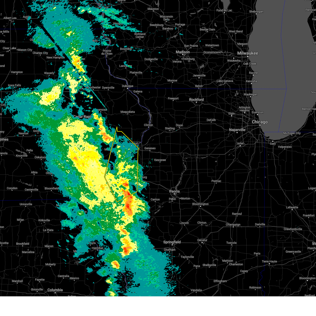 At 858 pm cdt, severe thunderstorms were located along a line extending from near pleasant prairie to near cable, moving north at 50 mph (radar indicated). Hazards include 70 mph wind gusts. Expect considerable tree damage. damage is likely to mobile homes, roofs, and outbuildings. locations impacted include, west lake park, moline quad-city airport, milan, rock island arsenal, eldridge, plainview, moline, coyne center, fruitland, credit island and camp liberty. this includes the following highways, interstate 74 in iowa between mile markers 3 and 5. interstate 80 in iowa between mile markers 274 and 295. interstate 74 in illinois between mile markers 1 and 7. Interstate 280 between mile markers 1 and 18. At 858 pm cdt, severe thunderstorms were located along a line extending from near pleasant prairie to near cable, moving north at 50 mph (radar indicated). Hazards include 70 mph wind gusts. Expect considerable tree damage. damage is likely to mobile homes, roofs, and outbuildings. locations impacted include, west lake park, moline quad-city airport, milan, rock island arsenal, eldridge, plainview, moline, coyne center, fruitland, credit island and camp liberty. this includes the following highways, interstate 74 in iowa between mile markers 3 and 5. interstate 80 in iowa between mile markers 274 and 295. interstate 74 in illinois between mile markers 1 and 7. Interstate 280 between mile markers 1 and 18.
|
| 3/14/2025 8:42 PM CDT |
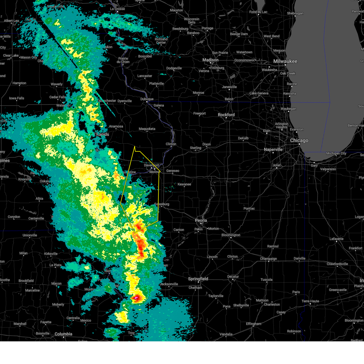 At 842 pm cdt, severe thunderstorms were located along a line extending from near edgington to bald bluff, moving north at 50 mph (radar indicated). Hazards include 70 mph wind gusts. Expect considerable tree damage. damage is likely to mobile homes, roofs, and outbuildings. these severe storms will be near, ogle, loud thunder forest preserve, marston, bald bluff, edgington, wildcat den state park, montpelier, sunbeam, millersburg, and gingle corners around 845 pm cdt. west lake park, pleasant prairie, davenport, and walcott around 850 pm cdt. other locations in the path of these severe thunderstorms include taylor ridge, plainview, maysville, reynolds, dixon, eldridge, rock island, credit island and mississippi valley fairgrounds. this includes the following highways, interstate 74 in iowa between mile markers 3 and 5. interstate 80 in iowa between mile markers 274 and 295. interstate 74 in illinois between mile markers 1 and 7. Interstate 280 between mile markers 1 and 18. At 842 pm cdt, severe thunderstorms were located along a line extending from near edgington to bald bluff, moving north at 50 mph (radar indicated). Hazards include 70 mph wind gusts. Expect considerable tree damage. damage is likely to mobile homes, roofs, and outbuildings. these severe storms will be near, ogle, loud thunder forest preserve, marston, bald bluff, edgington, wildcat den state park, montpelier, sunbeam, millersburg, and gingle corners around 845 pm cdt. west lake park, pleasant prairie, davenport, and walcott around 850 pm cdt. other locations in the path of these severe thunderstorms include taylor ridge, plainview, maysville, reynolds, dixon, eldridge, rock island, credit island and mississippi valley fairgrounds. this includes the following highways, interstate 74 in iowa between mile markers 3 and 5. interstate 80 in iowa between mile markers 274 and 295. interstate 74 in illinois between mile markers 1 and 7. Interstate 280 between mile markers 1 and 18.
|
| 3/14/2025 8:31 PM CDT |
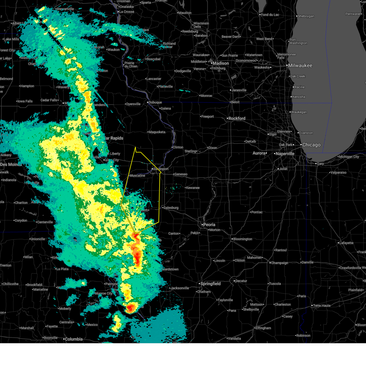 At 829 pm cdt, severe thunderstorms were located along a line extending from near joy to biggsville, moving north at 70 mph. a trained spotter reported a 77 mph gust near kingston iowa (radar indicated). Hazards include 70 mph wind gusts. Expect considerable tree damage. damage is likely to mobile homes, roofs, and outbuildings. these severe storms will be near, petersville, ogle, marston, bald bluff, little york, millersburg, keithsburg, joy, seaton, and big river state forest around 835 pm cdt. other locations in the path of these severe thunderstorms include loud thunder forest preserve, edgington, sunbeam, gingle corners, hamlet, aledo mercer county airport, illinois city, loud thunder scout camp, wildcat den state park, montpelier, andalusia, midway beach, clark's ferry recreation area, shady creek campground, buffalo shores, blue grass, buffalo, west lake park, pleasant prairie, reynolds, davenport, walcott, taylor ridge, plainview, maysville, eldridge, dixon, rock island, credit island and mississippi valley fairgrounds. this includes the following highways, interstate 74 in iowa between mile markers 3 and 5. interstate 80 in iowa between mile markers 274 and 295. interstate 74 in illinois between mile markers 1 and 7. Interstate 280 between mile markers 1 and 18. At 829 pm cdt, severe thunderstorms were located along a line extending from near joy to biggsville, moving north at 70 mph. a trained spotter reported a 77 mph gust near kingston iowa (radar indicated). Hazards include 70 mph wind gusts. Expect considerable tree damage. damage is likely to mobile homes, roofs, and outbuildings. these severe storms will be near, petersville, ogle, marston, bald bluff, little york, millersburg, keithsburg, joy, seaton, and big river state forest around 835 pm cdt. other locations in the path of these severe thunderstorms include loud thunder forest preserve, edgington, sunbeam, gingle corners, hamlet, aledo mercer county airport, illinois city, loud thunder scout camp, wildcat den state park, montpelier, andalusia, midway beach, clark's ferry recreation area, shady creek campground, buffalo shores, blue grass, buffalo, west lake park, pleasant prairie, reynolds, davenport, walcott, taylor ridge, plainview, maysville, eldridge, dixon, rock island, credit island and mississippi valley fairgrounds. this includes the following highways, interstate 74 in iowa between mile markers 3 and 5. interstate 80 in iowa between mile markers 274 and 295. interstate 74 in illinois between mile markers 1 and 7. Interstate 280 between mile markers 1 and 18.
|
| 3/14/2025 8:18 PM CDT |
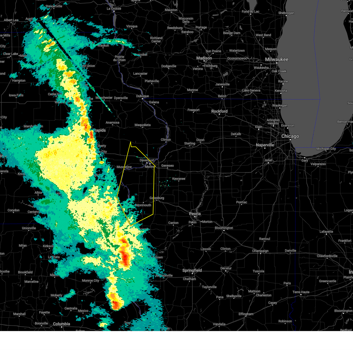 Svrdvn the national weather service in the quad cities has issued a * severe thunderstorm warning for, northeastern hancock county in west central illinois, henderson county in west central illinois, warren county in west central illinois, rock island county in northwestern illinois, northwestern mcdonough county in west central illinois, mercer county in northwestern illinois, northeastern des moines county in southeastern iowa, southeastern louisa county in southeastern iowa, southeastern cedar county in east central iowa, western scott county in east central iowa, eastern muscatine county in east central iowa, * until 915 pm cdt. * at 817 pm cdt, severe thunderstorms were located along a line extending from delabar state park to near terre haute, moving north at 70 mph (radar indicated). Hazards include 70 mph wind gusts. Expect considerable tree damage. damage is likely to mobile homes, roofs, and outbuildings. severe thunderstorms will be near, oquawka, ogle, bald bluff, olena, media, biggsville, keithsburg, joy, seaton, and big river state forest around 825 pm cdt. mannon and millersburg around 830 pm cdt. petersville, marston, little york, aledo, and mercer county fairgrounds around 835 pm cdt. other locations in the path of these severe thunderstorms include loud thunder forest preserve, edgington, sunbeam, gingle corners, hamlet, aledo mercer county airport, illinois city, loud thunder scout camp, wildcat den state park, montpelier, andalusia, midway beach, clark's ferry recreation area, shady creek campground, buffalo shores, blue grass, buffalo, west lake park, taylor ridge, pleasant prairie, reynolds, davenport, walcott, plainview, maysville, rock island, eldridge, credit island, dixon and mississippi valley fairgrounds. this includes the following highways, interstate 74 in iowa between mile markers 3 and 5. interstate 80 in iowa between mile markers 274 and 295. interstate 74 in illinois between mile markers 1 and 7. Interstate 280 between mile markers 1 and 18. Svrdvn the national weather service in the quad cities has issued a * severe thunderstorm warning for, northeastern hancock county in west central illinois, henderson county in west central illinois, warren county in west central illinois, rock island county in northwestern illinois, northwestern mcdonough county in west central illinois, mercer county in northwestern illinois, northeastern des moines county in southeastern iowa, southeastern louisa county in southeastern iowa, southeastern cedar county in east central iowa, western scott county in east central iowa, eastern muscatine county in east central iowa, * until 915 pm cdt. * at 817 pm cdt, severe thunderstorms were located along a line extending from delabar state park to near terre haute, moving north at 70 mph (radar indicated). Hazards include 70 mph wind gusts. Expect considerable tree damage. damage is likely to mobile homes, roofs, and outbuildings. severe thunderstorms will be near, oquawka, ogle, bald bluff, olena, media, biggsville, keithsburg, joy, seaton, and big river state forest around 825 pm cdt. mannon and millersburg around 830 pm cdt. petersville, marston, little york, aledo, and mercer county fairgrounds around 835 pm cdt. other locations in the path of these severe thunderstorms include loud thunder forest preserve, edgington, sunbeam, gingle corners, hamlet, aledo mercer county airport, illinois city, loud thunder scout camp, wildcat den state park, montpelier, andalusia, midway beach, clark's ferry recreation area, shady creek campground, buffalo shores, blue grass, buffalo, west lake park, taylor ridge, pleasant prairie, reynolds, davenport, walcott, plainview, maysville, rock island, eldridge, credit island, dixon and mississippi valley fairgrounds. this includes the following highways, interstate 74 in iowa between mile markers 3 and 5. interstate 80 in iowa between mile markers 274 and 295. interstate 74 in illinois between mile markers 1 and 7. Interstate 280 between mile markers 1 and 18.
|
| 10/24/2024 8:43 PM CDT |
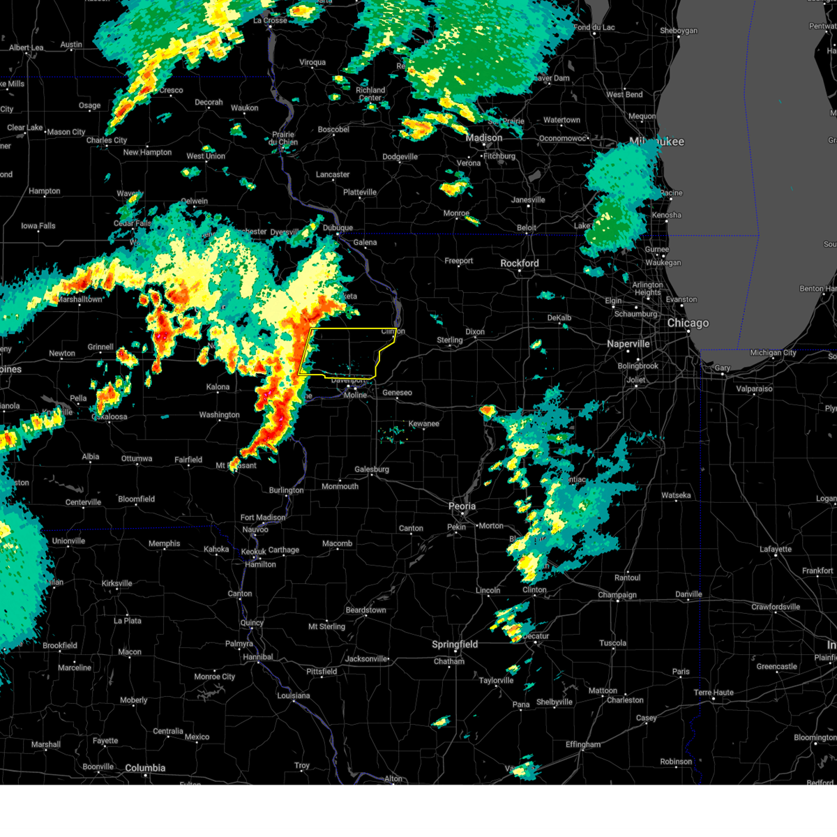 Svrdvn the national weather service in the quad cities has issued a * severe thunderstorm warning for, southeastern cedar county in east central iowa, scott county in east central iowa, southern clinton county in east central iowa, * until 930 pm cdt. * at 842 pm cdt, severe thunderstorms were located along a line extending from toronto to near wilton, moving east at 50 mph (radar indicated). Hazards include 60 mph wind gusts. expect damage to roofs, siding, and trees Svrdvn the national weather service in the quad cities has issued a * severe thunderstorm warning for, southeastern cedar county in east central iowa, scott county in east central iowa, southern clinton county in east central iowa, * until 930 pm cdt. * at 842 pm cdt, severe thunderstorms were located along a line extending from toronto to near wilton, moving east at 50 mph (radar indicated). Hazards include 60 mph wind gusts. expect damage to roofs, siding, and trees
|
| 7/15/2024 6:57 PM CDT |
 At 657 pm cdt, severe thunderstorms were located along a line extending from near calamus to near cranston, moving southeast at 40 mph (radar indicated). Hazards include 70 mph wind gusts and penny size hail. Expect considerable tree damage. damage is likely to mobile homes, roofs, and outbuildings. locations impacted include, davenport, moline, rock island, bettendorf, muscatine, west branch, durant, eldridge, milan, west liberty, wilton, walcott, blue grass, buffalo, andalusia, princeton, long grove, reynolds, conesville, and riverdale. this includes the following highways, interstate 74 in iowa between mile markers 1 and 5. interstate 80 in iowa between mile markers 254 and 303. interstate 74 in illinois between mile markers 1 and 2. Interstate 280 between mile markers 1 and 16. At 657 pm cdt, severe thunderstorms were located along a line extending from near calamus to near cranston, moving southeast at 40 mph (radar indicated). Hazards include 70 mph wind gusts and penny size hail. Expect considerable tree damage. damage is likely to mobile homes, roofs, and outbuildings. locations impacted include, davenport, moline, rock island, bettendorf, muscatine, west branch, durant, eldridge, milan, west liberty, wilton, walcott, blue grass, buffalo, andalusia, princeton, long grove, reynolds, conesville, and riverdale. this includes the following highways, interstate 74 in iowa between mile markers 1 and 5. interstate 80 in iowa between mile markers 254 and 303. interstate 74 in illinois between mile markers 1 and 2. Interstate 280 between mile markers 1 and 16.
|
| 7/15/2024 6:37 PM CDT |
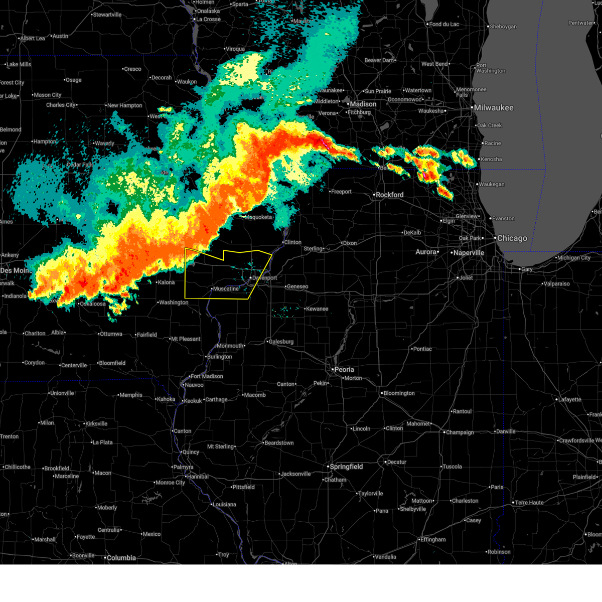 At 637 pm cdt, severe thunderstorms were located along a line extending from near walnut grove park to near west branch, moving southeast at 40 mph (radar indicated). Hazards include 70 mph wind gusts and penny size hail. Expect considerable tree damage. damage is likely to mobile homes, roofs, and outbuildings. locations impacted include, davenport, moline, rock island, bettendorf, muscatine, west branch, durant, eldridge, milan, west liberty, wilton, walcott, blue grass, buffalo, andalusia, princeton, long grove, reynolds, conesville, and riverdale. this includes the following highways, interstate 74 in iowa between mile markers 1 and 5. interstate 80 in iowa between mile markers 254 and 303. interstate 74 in illinois between mile markers 1 and 2. Interstate 280 between mile markers 1 and 16. At 637 pm cdt, severe thunderstorms were located along a line extending from near walnut grove park to near west branch, moving southeast at 40 mph (radar indicated). Hazards include 70 mph wind gusts and penny size hail. Expect considerable tree damage. damage is likely to mobile homes, roofs, and outbuildings. locations impacted include, davenport, moline, rock island, bettendorf, muscatine, west branch, durant, eldridge, milan, west liberty, wilton, walcott, blue grass, buffalo, andalusia, princeton, long grove, reynolds, conesville, and riverdale. this includes the following highways, interstate 74 in iowa between mile markers 1 and 5. interstate 80 in iowa between mile markers 254 and 303. interstate 74 in illinois between mile markers 1 and 2. Interstate 280 between mile markers 1 and 16.
|
| 7/15/2024 6:27 PM CDT |
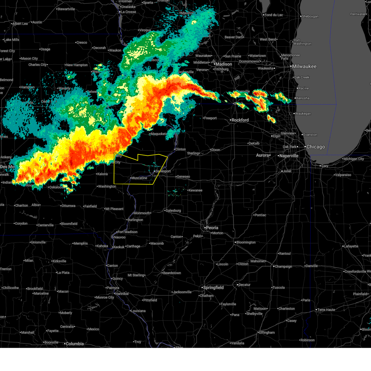 Svrdvn the national weather service in the quad cities has issued a * severe thunderstorm warning for, southwestern rock island county in northwestern illinois, southern cedar county in east central iowa, scott county in east central iowa, muscatine county in east central iowa, south central clinton county in east central iowa, * until 730 pm cdt. * at 626 pm cdt, severe thunderstorms were located along a line extending from oxford mills to herbert hoover national historic site, moving southeast at 35 mph (radar indicated). Hazards include 70 mph wind gusts and penny size hail. Expect considerable tree damage. Damage is likely to mobile homes, roofs, and outbuildings. Svrdvn the national weather service in the quad cities has issued a * severe thunderstorm warning for, southwestern rock island county in northwestern illinois, southern cedar county in east central iowa, scott county in east central iowa, muscatine county in east central iowa, south central clinton county in east central iowa, * until 730 pm cdt. * at 626 pm cdt, severe thunderstorms were located along a line extending from oxford mills to herbert hoover national historic site, moving southeast at 35 mph (radar indicated). Hazards include 70 mph wind gusts and penny size hail. Expect considerable tree damage. Damage is likely to mobile homes, roofs, and outbuildings.
|
| 7/10/2024 4:14 PM CDT |
 At 414 pm cdt, a severe thunderstorm was located near sweetland center, or 7 miles southwest of durant, moving southeast at 15 mph (radar indicated). Hazards include 60 mph wind gusts. Expect damage to roofs, siding, and trees. locations impacted include, muscatine, durant, wilton, walcott, atalissa, rochester, montpelier, stockton, clark's ferry recreation area, midway beach, new era, pleasant prairie, moscow, sunbury, wildcat den state park, sweetland center, shady creek campground, and saulsbury bridge campground. This includes interstate 80 in iowa between mile markers 265 and 278. At 414 pm cdt, a severe thunderstorm was located near sweetland center, or 7 miles southwest of durant, moving southeast at 15 mph (radar indicated). Hazards include 60 mph wind gusts. Expect damage to roofs, siding, and trees. locations impacted include, muscatine, durant, wilton, walcott, atalissa, rochester, montpelier, stockton, clark's ferry recreation area, midway beach, new era, pleasant prairie, moscow, sunbury, wildcat den state park, sweetland center, shady creek campground, and saulsbury bridge campground. This includes interstate 80 in iowa between mile markers 265 and 278.
|
| 7/10/2024 4:06 PM CDT |
 At 406 pm cdt, a severe thunderstorm was located near moscow, or 8 miles southwest of durant, moving southeast at 15 mph (radar indicated). Hazards include 60 mph wind gusts. Expect damage to roofs, siding, and trees. locations impacted include, muscatine, west branch, durant, west liberty, wilton, walcott, nichols, atalissa, rochester, montpelier, stockton, springdale, clark's ferry recreation area, muscatine county fairgrounds, midway beach, new era, pleasant prairie, moscow, sunbury, and wildcat den state park. This includes interstate 80 in iowa between mile markers 254 and 278. At 406 pm cdt, a severe thunderstorm was located near moscow, or 8 miles southwest of durant, moving southeast at 15 mph (radar indicated). Hazards include 60 mph wind gusts. Expect damage to roofs, siding, and trees. locations impacted include, muscatine, west branch, durant, west liberty, wilton, walcott, nichols, atalissa, rochester, montpelier, stockton, springdale, clark's ferry recreation area, muscatine county fairgrounds, midway beach, new era, pleasant prairie, moscow, sunbury, and wildcat den state park. This includes interstate 80 in iowa between mile markers 254 and 278.
|
| 7/10/2024 3:51 PM CDT |
 At 351 pm cdt, a severe thunderstorm was located over atalissa, or 11 miles southeast of west branch, moving southeast at 10 mph (radar indicated). Hazards include 60 mph wind gusts. Expect damage to roofs, siding, and trees. locations impacted include, muscatine, west branch, durant, west liberty, wilton, walcott, bennett, nichols, atalissa, montpelier, rochester, stockton, cedar valley, clark's ferry recreation area, muscatine county fairgrounds, new era, bennett park, pleasant prairie, moscow, and sunbury. This includes interstate 80 in iowa between mile markers 254 and 278. At 351 pm cdt, a severe thunderstorm was located over atalissa, or 11 miles southeast of west branch, moving southeast at 10 mph (radar indicated). Hazards include 60 mph wind gusts. Expect damage to roofs, siding, and trees. locations impacted include, muscatine, west branch, durant, west liberty, wilton, walcott, bennett, nichols, atalissa, montpelier, rochester, stockton, cedar valley, clark's ferry recreation area, muscatine county fairgrounds, new era, bennett park, pleasant prairie, moscow, and sunbury. This includes interstate 80 in iowa between mile markers 254 and 278.
|
| 7/10/2024 3:40 PM CDT |
 Svrdvn the national weather service in the quad cities has issued a * severe thunderstorm warning for, southern cedar county in east central iowa, muscatine county in east central iowa, * until 430 pm cdt. * at 339 pm cdt, a severe thunderstorm was located over springdale, or near west branch, moving east at 10 mph (radar indicated). Hazards include 60 mph wind gusts and quarter size hail. Hail damage to vehicles is expected. expect wind damage to roofs, siding, and trees. this severe thunderstorm will be near, west liberty, atalissa, and rochester around 345 pm cdt. This includes interstate 80 in iowa between mile markers 254 and 278. Svrdvn the national weather service in the quad cities has issued a * severe thunderstorm warning for, southern cedar county in east central iowa, muscatine county in east central iowa, * until 430 pm cdt. * at 339 pm cdt, a severe thunderstorm was located over springdale, or near west branch, moving east at 10 mph (radar indicated). Hazards include 60 mph wind gusts and quarter size hail. Hail damage to vehicles is expected. expect wind damage to roofs, siding, and trees. this severe thunderstorm will be near, west liberty, atalissa, and rochester around 345 pm cdt. This includes interstate 80 in iowa between mile markers 254 and 278.
|
| 7/2/2024 7:00 PM CDT |
 At 700 pm cdt, a severe squall line capable of producing both tornadoes and extensive straight line wind damage was located along a line extending from welton to eldridge to credit island, moving east at 50 mph (radar indicated rotation). Hazards include tornado. Flying debris will be dangerous to those caught without shelter. mobile homes will be damaged or destroyed. damage to roofs, windows, and vehicles will occur. tree damage is likely. locations impacted include, davenport, rock island, bettendorf, clinton, durant, eldridge, dewitt, camanche, le claire, port byron, walcott, blue grass, buffalo, princeton, long grove, wheatland, grand mound, calamus, riverdale, and charlotte. this includes the following highways, interstate 74 in iowa between mile markers 1 and 4. interstate 80 in iowa between mile markers 279 and 306. Interstate 280 between mile markers 1 and 9. At 700 pm cdt, a severe squall line capable of producing both tornadoes and extensive straight line wind damage was located along a line extending from welton to eldridge to credit island, moving east at 50 mph (radar indicated rotation). Hazards include tornado. Flying debris will be dangerous to those caught without shelter. mobile homes will be damaged or destroyed. damage to roofs, windows, and vehicles will occur. tree damage is likely. locations impacted include, davenport, rock island, bettendorf, clinton, durant, eldridge, dewitt, camanche, le claire, port byron, walcott, blue grass, buffalo, princeton, long grove, wheatland, grand mound, calamus, riverdale, and charlotte. this includes the following highways, interstate 74 in iowa between mile markers 1 and 4. interstate 80 in iowa between mile markers 279 and 306. Interstate 280 between mile markers 1 and 9.
|
| 7/2/2024 7:00 PM CDT |
 the tornado warning has been cancelled and is no longer in effect the tornado warning has been cancelled and is no longer in effect
|
| 7/2/2024 6:48 PM CDT |
 At 648 pm cdt, a severe thunderstorm was located over blue grass, or near davenport, moving east at 50 mph (radar indicated). Hazards include 70 mph wind gusts. Expect considerable tree damage. damage is likely to mobile homes, roofs, and outbuildings. locations impacted include, davenport, rock island and credit island. this includes the following highways, interstate 80 in iowa between mile markers 267 and 291. Interstate 280 between mile markers 1 and 12. At 648 pm cdt, a severe thunderstorm was located over blue grass, or near davenport, moving east at 50 mph (radar indicated). Hazards include 70 mph wind gusts. Expect considerable tree damage. damage is likely to mobile homes, roofs, and outbuildings. locations impacted include, davenport, rock island and credit island. this includes the following highways, interstate 80 in iowa between mile markers 267 and 291. Interstate 280 between mile markers 1 and 12.
|
| 7/2/2024 6:48 PM CDT |
 the severe thunderstorm warning has been cancelled and is no longer in effect the severe thunderstorm warning has been cancelled and is no longer in effect
|
| 7/2/2024 6:44 PM CDT |
 Svrdvn the national weather service in the quad cities has issued a * severe thunderstorm warning for, rock island county in northwestern illinois, western whiteside county in northwestern illinois, northern henry county in northwestern illinois, southeastern cedar county in east central iowa, scott county in east central iowa, northeastern muscatine county in east central iowa, southern clinton county in east central iowa, * until 730 pm cdt. * at 643 pm cdt, a severe thunderstorm was located over walcott, or 8 miles northwest of davenport, moving east at 50 mph (radar indicated). Hazards include 70 mph wind gusts. Expect considerable tree damage. damage is likely to mobile homes, roofs, and outbuildings. this severe thunderstorm will be near, davenport, bettendorf, eldridge, long grove, donahue, rock island arsenal, scott county park, park view, davenport municipal airport, and mississippi valley fairgrounds around 650 pm cdt. le claire, hampton, princeton, riverdale, mccausland, panorama park, illiniwek forest preserve, and pleasant valley around 655 pm cdt. east moline, port byron, rapids city, cordova, campbells island, princeton wildlife area, and fishermans corner around 700 pm cdt. other locations in the path of this severe thunderstorm include rock creek park, folletts, rock creek marina and campground, camanche, hillsdale, joslin, erie, albany, newton corners, fenton and spring hill. this includes the following highways, interstate 74 in iowa between mile markers 1 and 5. interstate 80 in iowa between mile markers 277 and 306. interstate 80 in illinois between mile markers 1 and 29. interstate 74 in illinois between mile markers 1 and 18. interstate 88 between mile markers 1 and 24. Interstate 280 between mile markers 1 and 18. Svrdvn the national weather service in the quad cities has issued a * severe thunderstorm warning for, rock island county in northwestern illinois, western whiteside county in northwestern illinois, northern henry county in northwestern illinois, southeastern cedar county in east central iowa, scott county in east central iowa, northeastern muscatine county in east central iowa, southern clinton county in east central iowa, * until 730 pm cdt. * at 643 pm cdt, a severe thunderstorm was located over walcott, or 8 miles northwest of davenport, moving east at 50 mph (radar indicated). Hazards include 70 mph wind gusts. Expect considerable tree damage. damage is likely to mobile homes, roofs, and outbuildings. this severe thunderstorm will be near, davenport, bettendorf, eldridge, long grove, donahue, rock island arsenal, scott county park, park view, davenport municipal airport, and mississippi valley fairgrounds around 650 pm cdt. le claire, hampton, princeton, riverdale, mccausland, panorama park, illiniwek forest preserve, and pleasant valley around 655 pm cdt. east moline, port byron, rapids city, cordova, campbells island, princeton wildlife area, and fishermans corner around 700 pm cdt. other locations in the path of this severe thunderstorm include rock creek park, folletts, rock creek marina and campground, camanche, hillsdale, joslin, erie, albany, newton corners, fenton and spring hill. this includes the following highways, interstate 74 in iowa between mile markers 1 and 5. interstate 80 in iowa between mile markers 277 and 306. interstate 80 in illinois between mile markers 1 and 29. interstate 74 in illinois between mile markers 1 and 18. interstate 88 between mile markers 1 and 24. Interstate 280 between mile markers 1 and 18.
|
| 7/2/2024 6:37 PM CDT |
 At 637 pm cdt, a severe squall line capable of producing both tornadoes and extensive straight line wind damage was located along a line extending from bennett park to stockton to new era, moving east at 55 mph (radar indicated rotation). Hazards include tornado. Flying debris will be dangerous to those caught without shelter. mobile homes will be damaged or destroyed. damage to roofs, windows, and vehicles will occur. tree damage is likely. locations impacted include, davenport, eldridge, walcott, blue grass, buffalo, calamus, donahue, montpelier, dixon, maysville, rock island, bettendorf, long grove, grand mound, park view, davenport municipal airport, dewitt, riverdale, panorama park, scott county park, clinton county fairgrounds, le claire, princeton, mccausland, pleasant valley, malone, clinton, camanche, cordova, low moor, rock creek park, folletts, rock creek marina and campground and clinton municipal airport. this includes the following highways, interstate 74 in iowa between mile markers 1 and 4. interstate 80 in iowa between mile markers 261 and 306. Interstate 280 between mile markers 1 and 9. At 637 pm cdt, a severe squall line capable of producing both tornadoes and extensive straight line wind damage was located along a line extending from bennett park to stockton to new era, moving east at 55 mph (radar indicated rotation). Hazards include tornado. Flying debris will be dangerous to those caught without shelter. mobile homes will be damaged or destroyed. damage to roofs, windows, and vehicles will occur. tree damage is likely. locations impacted include, davenport, eldridge, walcott, blue grass, buffalo, calamus, donahue, montpelier, dixon, maysville, rock island, bettendorf, long grove, grand mound, park view, davenport municipal airport, dewitt, riverdale, panorama park, scott county park, clinton county fairgrounds, le claire, princeton, mccausland, pleasant valley, malone, clinton, camanche, cordova, low moor, rock creek park, folletts, rock creek marina and campground and clinton municipal airport. this includes the following highways, interstate 74 in iowa between mile markers 1 and 4. interstate 80 in iowa between mile markers 261 and 306. Interstate 280 between mile markers 1 and 9.
|
| 7/2/2024 6:37 PM CDT |
 the tornado warning has been cancelled and is no longer in effect the tornado warning has been cancelled and is no longer in effect
|
| 7/2/2024 6:32 PM CDT |
 At 632 pm cdt, a severe thunderstorm was located over sweetland center, or near durant, moving east at 45 mph (radar indicated). Hazards include 70 mph wind gusts. Expect considerable tree damage. damage is likely to mobile homes, roofs, and outbuildings. locations impacted include, durant, walcott, blue grass, buffalo, montpelier, stockton, new era, wildcat den state park, pleasant prairie, midway beach, davenport, maysville, west lake park, plainview, buffalo shores, rock island and credit island. this includes the following highways, interstate 80 in iowa between mile markers 264 and 291. Interstate 280 between mile markers 1 and 12. At 632 pm cdt, a severe thunderstorm was located over sweetland center, or near durant, moving east at 45 mph (radar indicated). Hazards include 70 mph wind gusts. Expect considerable tree damage. damage is likely to mobile homes, roofs, and outbuildings. locations impacted include, durant, walcott, blue grass, buffalo, montpelier, stockton, new era, wildcat den state park, pleasant prairie, midway beach, davenport, maysville, west lake park, plainview, buffalo shores, rock island and credit island. this includes the following highways, interstate 80 in iowa between mile markers 264 and 291. Interstate 280 between mile markers 1 and 12.
|
| 7/2/2024 6:21 PM CDT |
 Tordvn the national weather service in the quad cities has issued a * tornado warning for, cedar county in east central iowa, scott county in east central iowa, southeastern johnson county in east central iowa, muscatine county in east central iowa, central clinton county in east central iowa, * until 715 pm cdt. * at 621 pm cdt, severe thunderstorms capable of producing both tornadoes and extensive straight line wind damage were located along a line extending from cedar county fairgrounds to near moscow to near saulsbury bridge campground, moving east at 55 mph (radar indicated rotation). Hazards include tornado. Flying debris will be dangerous to those caught without shelter. mobile homes will be damaged or destroyed. damage to roofs, windows, and vehicles will occur. tree damage is likely. these dangerous storms will be near, muscatine, tipton, durant, wilton, bennett, sweetland center, moscow, and tipton matthews airport around 625 pm cdt. stockton, new liberty, new era, wildcat den state park, pleasant prairie, sunbury, bennett park, and shady creek campground around 630 pm cdt. walcott, blue grass, buffalo, wheatland, montpelier, dixon, plainview, midway beach, big rock, and camp liberty around 635 pm cdt. davenport, calamus, donahue, maysville, west lake park, and sherman park around 640 pm cdt. other locations in the path of these tornadic storms include rock island, eldridge, long grove, grand mound, credit island, davenport municipal airport, mississippi valley fairgrounds, bettendorf, dewitt, riverdale, scott county park, park view, le claire, mccausland, panorama park, pleasant valley, malone, clinton county fairgrounds, clinton, princeton, cordova, low moor, rock creek park, folletts and rock creek marina and campground. this includes the following highways, interstate 74 in iowa between mile markers 1 and 4. interstate 80 in iowa between mile markers 254 and 306. Interstate 280 between mile markers 1 and 9. Tordvn the national weather service in the quad cities has issued a * tornado warning for, cedar county in east central iowa, scott county in east central iowa, southeastern johnson county in east central iowa, muscatine county in east central iowa, central clinton county in east central iowa, * until 715 pm cdt. * at 621 pm cdt, severe thunderstorms capable of producing both tornadoes and extensive straight line wind damage were located along a line extending from cedar county fairgrounds to near moscow to near saulsbury bridge campground, moving east at 55 mph (radar indicated rotation). Hazards include tornado. Flying debris will be dangerous to those caught without shelter. mobile homes will be damaged or destroyed. damage to roofs, windows, and vehicles will occur. tree damage is likely. these dangerous storms will be near, muscatine, tipton, durant, wilton, bennett, sweetland center, moscow, and tipton matthews airport around 625 pm cdt. stockton, new liberty, new era, wildcat den state park, pleasant prairie, sunbury, bennett park, and shady creek campground around 630 pm cdt. walcott, blue grass, buffalo, wheatland, montpelier, dixon, plainview, midway beach, big rock, and camp liberty around 635 pm cdt. davenport, calamus, donahue, maysville, west lake park, and sherman park around 640 pm cdt. other locations in the path of these tornadic storms include rock island, eldridge, long grove, grand mound, credit island, davenport municipal airport, mississippi valley fairgrounds, bettendorf, dewitt, riverdale, scott county park, park view, le claire, mccausland, panorama park, pleasant valley, malone, clinton county fairgrounds, clinton, princeton, cordova, low moor, rock creek park, folletts and rock creek marina and campground. this includes the following highways, interstate 74 in iowa between mile markers 1 and 4. interstate 80 in iowa between mile markers 254 and 306. Interstate 280 between mile markers 1 and 9.
|
| 7/2/2024 6:13 PM CDT |
 Svrdvn the national weather service in the quad cities has issued a * severe thunderstorm warning for, southwestern rock island county in northwestern illinois, northwestern louisa county in southeastern iowa, southern cedar county in east central iowa, southwestern scott county in east central iowa, southeastern johnson county in east central iowa, northern washington county in southeastern iowa, muscatine county in east central iowa, * until 700 pm cdt. * at 612 pm cdt, a severe thunderstorm was located over conesville, or 8 miles north of columbus junction, moving east at 50 mph (radar indicated). Hazards include 70 mph wind gusts. Expect considerable tree damage. damage is likely to mobile homes, roofs, and outbuildings. this severe thunderstorm will be near, muscatine, fruitland, letts, ardon, muscatine municipal airport, cranston, and saulsbury bridge campground around 620 pm cdt. fairport, illinois city, sweetland center, and fairport recreation area around 630 pm cdt. other locations in the path of this severe thunderstorm include loud thunder forest preserve, new era, wildcat den state park, midway beach, shady creek campground, blue grass, buffalo, montpelier, edgington, pleasant prairie, clark's ferry recreation area, loud thunder scout camp, buffalo shores, davenport, andalusia, reynolds, taylor ridge and west lake park. this includes the following highways, interstate 80 in iowa between mile markers 264 and 291. Interstate 280 between mile markers 1 and 12. Svrdvn the national weather service in the quad cities has issued a * severe thunderstorm warning for, southwestern rock island county in northwestern illinois, northwestern louisa county in southeastern iowa, southern cedar county in east central iowa, southwestern scott county in east central iowa, southeastern johnson county in east central iowa, northern washington county in southeastern iowa, muscatine county in east central iowa, * until 700 pm cdt. * at 612 pm cdt, a severe thunderstorm was located over conesville, or 8 miles north of columbus junction, moving east at 50 mph (radar indicated). Hazards include 70 mph wind gusts. Expect considerable tree damage. damage is likely to mobile homes, roofs, and outbuildings. this severe thunderstorm will be near, muscatine, fruitland, letts, ardon, muscatine municipal airport, cranston, and saulsbury bridge campground around 620 pm cdt. fairport, illinois city, sweetland center, and fairport recreation area around 630 pm cdt. other locations in the path of this severe thunderstorm include loud thunder forest preserve, new era, wildcat den state park, midway beach, shady creek campground, blue grass, buffalo, montpelier, edgington, pleasant prairie, clark's ferry recreation area, loud thunder scout camp, buffalo shores, davenport, andalusia, reynolds, taylor ridge and west lake park. this includes the following highways, interstate 80 in iowa between mile markers 264 and 291. Interstate 280 between mile markers 1 and 12.
|
| 6/25/2024 8:03 PM CDT |
 At 803 pm cdt, severe thunderstorms were located along a line extending from walcott to marston, moving east at 30 mph. trained spotters indicated estimated maximum winds near 70 mph north of muscatine (trained weather spotters). Hazards include 70 mph wind gusts and quarter size hail. Hail damage to vehicles is expected. expect considerable tree damage. wind damage is also likely to mobile homes, roofs, and outbuildings. locations impacted include, davenport, durant, walcott, blue grass, buffalo, andalusia, reynolds, taylor ridge, montpelier, illinois city, fairport, edgington, stockton, clark's ferry recreation area, west lake park, new era, pleasant prairie, buffalo shores, loud thunder scout camp, and midway beach. This includes interstate 280 between mile markers 1 and 7. At 803 pm cdt, severe thunderstorms were located along a line extending from walcott to marston, moving east at 30 mph. trained spotters indicated estimated maximum winds near 70 mph north of muscatine (trained weather spotters). Hazards include 70 mph wind gusts and quarter size hail. Hail damage to vehicles is expected. expect considerable tree damage. wind damage is also likely to mobile homes, roofs, and outbuildings. locations impacted include, davenport, durant, walcott, blue grass, buffalo, andalusia, reynolds, taylor ridge, montpelier, illinois city, fairport, edgington, stockton, clark's ferry recreation area, west lake park, new era, pleasant prairie, buffalo shores, loud thunder scout camp, and midway beach. This includes interstate 280 between mile markers 1 and 7.
|
| 6/25/2024 7:55 PM CDT |
 At 754 pm cdt, a severe thunderstorm capable of producing a tornado was located over blue grass, or 8 miles southeast of durant, moving east at 40 mph (radar indicated rotation). Hazards include tornado. Flying debris will be dangerous to those caught without shelter. mobile homes will be damaged or destroyed. damage to roofs, windows, and vehicles will occur. tree damage is likely. this dangerous storm will be near, davenport, rock island, milan, blue grass, buffalo, west lake park, rock island arsenal, credit island, blackhawk state park, and mississippi valley fairgrounds around 800 pm cdt. other locations in the path of this tornadic thunderstorm include moline. This includes interstate 280 between mile markers 2 and 12, and near mile marker 16. At 754 pm cdt, a severe thunderstorm capable of producing a tornado was located over blue grass, or 8 miles southeast of durant, moving east at 40 mph (radar indicated rotation). Hazards include tornado. Flying debris will be dangerous to those caught without shelter. mobile homes will be damaged or destroyed. damage to roofs, windows, and vehicles will occur. tree damage is likely. this dangerous storm will be near, davenport, rock island, milan, blue grass, buffalo, west lake park, rock island arsenal, credit island, blackhawk state park, and mississippi valley fairgrounds around 800 pm cdt. other locations in the path of this tornadic thunderstorm include moline. This includes interstate 280 between mile markers 2 and 12, and near mile marker 16.
|
| 6/25/2024 7:49 PM CDT |
 Svrdvn the national weather service in the quad cities has issued a * severe thunderstorm warning for, scott county in east central iowa, * until 845 pm cdt. * at 749 pm cdt, severe thunderstorms were located along a line extending from bennett park to durant, moving east at 30 mph (radar indicated). Hazards include 60 mph wind gusts. expect damage to roofs, siding, and trees Svrdvn the national weather service in the quad cities has issued a * severe thunderstorm warning for, scott county in east central iowa, * until 845 pm cdt. * at 749 pm cdt, severe thunderstorms were located along a line extending from bennett park to durant, moving east at 30 mph (radar indicated). Hazards include 60 mph wind gusts. expect damage to roofs, siding, and trees
|
| 6/25/2024 7:44 PM CDT |
 Tordvn the national weather service in the quad cities has issued a * tornado warning for, central rock island county in northwestern illinois, southwestern scott county in east central iowa, northeastern muscatine county in east central iowa, * until 830 pm cdt. * at 744 pm cdt, a severe thunderstorm capable of producing a tornado was located over pleasant prairie, or near durant, moving east at 40 mph (radar indicated rotation). Hazards include tornado. Flying debris will be dangerous to those caught without shelter. mobile homes will be damaged or destroyed. damage to roofs, windows, and vehicles will occur. tree damage is likely. this dangerous storm will be near, davenport, walcott, blue grass, buffalo, stockton, west lake park, and pleasant prairie around 750 pm cdt. rock island, credit island, and mississippi valley fairgrounds around 755 pm cdt. moline, milan, rock island arsenal, and blackhawk state park around 800 pm cdt. This includes interstate 280 between mile markers 2 and 12, and near mile marker 16. Tordvn the national weather service in the quad cities has issued a * tornado warning for, central rock island county in northwestern illinois, southwestern scott county in east central iowa, northeastern muscatine county in east central iowa, * until 830 pm cdt. * at 744 pm cdt, a severe thunderstorm capable of producing a tornado was located over pleasant prairie, or near durant, moving east at 40 mph (radar indicated rotation). Hazards include tornado. Flying debris will be dangerous to those caught without shelter. mobile homes will be damaged or destroyed. damage to roofs, windows, and vehicles will occur. tree damage is likely. this dangerous storm will be near, davenport, walcott, blue grass, buffalo, stockton, west lake park, and pleasant prairie around 750 pm cdt. rock island, credit island, and mississippi valley fairgrounds around 755 pm cdt. moline, milan, rock island arsenal, and blackhawk state park around 800 pm cdt. This includes interstate 280 between mile markers 2 and 12, and near mile marker 16.
|
| 6/25/2024 7:35 PM CDT |
 At 735 pm cdt, severe thunderstorms were located along a line extending from wilton to muscatine, moving east at 40 mph. these are destructive storms for muscatine county! (radar indicated). Hazards include 80 mph wind gusts and quarter size hail. Flying debris will be dangerous to those caught without shelter. mobile homes will be heavily damaged. expect considerable damage to roofs, windows, and vehicles. extensive tree damage and power outages are likely. locations impacted include, davenport, muscatine, durant, wilton, walcott, blue grass, buffalo, andalusia, fruitland, reynolds, taylor ridge, montpelier, illinois city, fairport, edgington, stockton, clark's ferry recreation area, west lake park, new era, and pleasant prairie. This includes interstate 280 between mile markers 1 and 7. At 735 pm cdt, severe thunderstorms were located along a line extending from wilton to muscatine, moving east at 40 mph. these are destructive storms for muscatine county! (radar indicated). Hazards include 80 mph wind gusts and quarter size hail. Flying debris will be dangerous to those caught without shelter. mobile homes will be heavily damaged. expect considerable damage to roofs, windows, and vehicles. extensive tree damage and power outages are likely. locations impacted include, davenport, muscatine, durant, wilton, walcott, blue grass, buffalo, andalusia, fruitland, reynolds, taylor ridge, montpelier, illinois city, fairport, edgington, stockton, clark's ferry recreation area, west lake park, new era, and pleasant prairie. This includes interstate 280 between mile markers 1 and 7.
|
| 6/25/2024 7:30 PM CDT |
 At 730 pm cdt, severe thunderstorms were located along a line extending from near west branch to solon, moving northwest at 20 mph. these storms have a history of producing large hail and severe winds (trained weather spotters). Hazards include 70 mph wind gusts and half dollar size hail. Hail damage to vehicles is expected. expect considerable tree damage. wind damage is also likely to mobile homes, roofs, and outbuildings. locations impacted include, iowa city, tipton, west branch, durant, coralville, north liberty, solon, university heights, hills, lake macbride state park, rochester, buchanan, newport, cedar valley, sugar bottom camp ground, johnson county fairgrounds, sunbury, tipton matthews airport, west overlook, and cedar county fairgrounds. this includes the following highways, interstate 80 in iowa between mile markers 242 and 278. Interstate 380 between mile markers 7 and 8. At 730 pm cdt, severe thunderstorms were located along a line extending from near west branch to solon, moving northwest at 20 mph. these storms have a history of producing large hail and severe winds (trained weather spotters). Hazards include 70 mph wind gusts and half dollar size hail. Hail damage to vehicles is expected. expect considerable tree damage. wind damage is also likely to mobile homes, roofs, and outbuildings. locations impacted include, iowa city, tipton, west branch, durant, coralville, north liberty, solon, university heights, hills, lake macbride state park, rochester, buchanan, newport, cedar valley, sugar bottom camp ground, johnson county fairgrounds, sunbury, tipton matthews airport, west overlook, and cedar county fairgrounds. this includes the following highways, interstate 80 in iowa between mile markers 242 and 278. Interstate 380 between mile markers 7 and 8.
|
| 6/25/2024 7:22 PM CDT |
 Svrdvn the national weather service in the quad cities has issued a * severe thunderstorm warning for, southwestern rock island county in northwestern illinois, southwestern scott county in east central iowa, central muscatine county in east central iowa, * until 830 pm cdt. * at 722 pm cdt, severe thunderstorms were located along a line extending from near west liberty to near nichols, moving east at 40 mph. these are destructive storms for muscatine county! (radar indicated). Hazards include 80 mph wind gusts and quarter size hail. Flying debris will be dangerous to those caught without shelter. mobile homes will be heavily damaged. expect considerable damage to roofs, windows, and vehicles. Extensive tree damage and power outages are likely. Svrdvn the national weather service in the quad cities has issued a * severe thunderstorm warning for, southwestern rock island county in northwestern illinois, southwestern scott county in east central iowa, central muscatine county in east central iowa, * until 830 pm cdt. * at 722 pm cdt, severe thunderstorms were located along a line extending from near west liberty to near nichols, moving east at 40 mph. these are destructive storms for muscatine county! (radar indicated). Hazards include 80 mph wind gusts and quarter size hail. Flying debris will be dangerous to those caught without shelter. mobile homes will be heavily damaged. expect considerable damage to roofs, windows, and vehicles. Extensive tree damage and power outages are likely.
|
| 6/25/2024 7:09 PM CDT |
 At 709 pm cdt, severe thunderstorms were located along a line extending from near tiffin to cedar valley park, moving southeast at 15 mph. iowa city airport gusted to 68 mph with these storms (trained weather spotters). Hazards include 70 mph wind gusts and quarter size hail. Hail damage to vehicles is expected. expect considerable tree damage. wind damage is also likely to mobile homes, roofs, and outbuildings. locations impacted include, iowa city, tipton, west branch, durant, coralville, north liberty, solon, tiffin, university heights, hills, oakdale, lake macbride state park, rochester, buchanan, newport, cedar valley, sugar bottom camp ground, johnson county fairgrounds, sunbury, and tipton matthews airport. this includes the following highways, interstate 80 in iowa between mile markers 236 and 278. Interstate 380 between mile markers 1 and 8. At 709 pm cdt, severe thunderstorms were located along a line extending from near tiffin to cedar valley park, moving southeast at 15 mph. iowa city airport gusted to 68 mph with these storms (trained weather spotters). Hazards include 70 mph wind gusts and quarter size hail. Hail damage to vehicles is expected. expect considerable tree damage. wind damage is also likely to mobile homes, roofs, and outbuildings. locations impacted include, iowa city, tipton, west branch, durant, coralville, north liberty, solon, tiffin, university heights, hills, oakdale, lake macbride state park, rochester, buchanan, newport, cedar valley, sugar bottom camp ground, johnson county fairgrounds, sunbury, and tipton matthews airport. this includes the following highways, interstate 80 in iowa between mile markers 236 and 278. Interstate 380 between mile markers 1 and 8.
|
| 6/25/2024 6:58 PM CDT |
 At 657 pm cdt, severe thunderstorms were located along a line extending from tiffin to cedar valley, moving south at 15 mph. hail over one inch in diameter was reported with one of these storms in solon (trained weather spotters). Hazards include 60 mph wind gusts and quarter size hail. Hail damage to vehicles is expected. expect wind damage to roofs, siding, and trees. locations impacted include, iowa city, tipton, west branch, durant, coralville, north liberty, solon, tiffin, university heights, hills, oakdale, lake macbride state park, rochester, buchanan, newport, cedar valley, sugar bottom camp ground, johnson county fairgrounds, sutliff, and sunbury. this includes the following highways, interstate 80 in iowa between mile markers 236 and 278. Interstate 380 between mile markers 1 and 9. At 657 pm cdt, severe thunderstorms were located along a line extending from tiffin to cedar valley, moving south at 15 mph. hail over one inch in diameter was reported with one of these storms in solon (trained weather spotters). Hazards include 60 mph wind gusts and quarter size hail. Hail damage to vehicles is expected. expect wind damage to roofs, siding, and trees. locations impacted include, iowa city, tipton, west branch, durant, coralville, north liberty, solon, tiffin, university heights, hills, oakdale, lake macbride state park, rochester, buchanan, newport, cedar valley, sugar bottom camp ground, johnson county fairgrounds, sutliff, and sunbury. this includes the following highways, interstate 80 in iowa between mile markers 236 and 278. Interstate 380 between mile markers 1 and 9.
|
| 6/25/2024 6:41 PM CDT |
 At 640 pm cdt, severe thunderstorms were located along a line extending from sugar bottom camp ground to tipton, moving southeast at 15 mph. trained weather spotters reported quarter size hail near solon with one of these storms (trained weather spotters). Hazards include 60 mph wind gusts and quarter size hail. Hail damage to vehicles is expected. expect wind damage to roofs, siding, and trees. locations impacted include, iowa city, tipton, west branch, durant, coralville, north liberty, solon, tiffin, university heights, hills, bennett, oakdale, lake macbride state park, rochester, buchanan, newport, cedar valley, sugar bottom camp ground, johnson county fairgrounds, and sutliff. this includes the following highways, interstate 80 in iowa between mile markers 236 and 278. Interstate 380 between mile markers 1 and 9. At 640 pm cdt, severe thunderstorms were located along a line extending from sugar bottom camp ground to tipton, moving southeast at 15 mph. trained weather spotters reported quarter size hail near solon with one of these storms (trained weather spotters). Hazards include 60 mph wind gusts and quarter size hail. Hail damage to vehicles is expected. expect wind damage to roofs, siding, and trees. locations impacted include, iowa city, tipton, west branch, durant, coralville, north liberty, solon, tiffin, university heights, hills, bennett, oakdale, lake macbride state park, rochester, buchanan, newport, cedar valley, sugar bottom camp ground, johnson county fairgrounds, and sutliff. this includes the following highways, interstate 80 in iowa between mile markers 236 and 278. Interstate 380 between mile markers 1 and 9.
|
| 6/25/2024 6:28 PM CDT |
 Svrdvn the national weather service in the quad cities has issued a * severe thunderstorm warning for, cedar county in east central iowa, northern johnson county in east central iowa, * until 745 pm cdt. * at 628 pm cdt, severe thunderstorms were located along a line extending from north liberty to near cedar county fairgrounds, moving southeast at 15 mph (radar indicated). Hazards include 60 mph wind gusts and quarter size hail. Hail damage to vehicles is expected. Expect wind damage to roofs, siding, and trees. Svrdvn the national weather service in the quad cities has issued a * severe thunderstorm warning for, cedar county in east central iowa, northern johnson county in east central iowa, * until 745 pm cdt. * at 628 pm cdt, severe thunderstorms were located along a line extending from north liberty to near cedar county fairgrounds, moving southeast at 15 mph (radar indicated). Hazards include 60 mph wind gusts and quarter size hail. Hail damage to vehicles is expected. Expect wind damage to roofs, siding, and trees.
|
| 5/24/2024 4:05 PM CDT |
 At 405 pm cdt, a severe thunderstorm was located over camp liberty, or 10 miles northeast of durant, moving northeast at 45 mph (public). Hazards include 60 mph wind gusts and quarter size hail. Hail damage to vehicles is expected. expect wind damage to roofs, siding, and trees. locations impacted include, clinton, durant, eldridge, dewitt, camanche, walcott, princeton, long grove, wheatland, grand mound, calamus, charlotte, donahue, mccausland, low moor, welton, dixon, goose lake, maysville, and new liberty. This includes interstate 80 in iowa between mile markers 278 and 285. At 405 pm cdt, a severe thunderstorm was located over camp liberty, or 10 miles northeast of durant, moving northeast at 45 mph (public). Hazards include 60 mph wind gusts and quarter size hail. Hail damage to vehicles is expected. expect wind damage to roofs, siding, and trees. locations impacted include, clinton, durant, eldridge, dewitt, camanche, walcott, princeton, long grove, wheatland, grand mound, calamus, charlotte, donahue, mccausland, low moor, welton, dixon, goose lake, maysville, and new liberty. This includes interstate 80 in iowa between mile markers 278 and 285.
|
| 5/24/2024 4:05 PM CDT |
 the severe thunderstorm warning has been cancelled and is no longer in effect the severe thunderstorm warning has been cancelled and is no longer in effect
|
| 5/24/2024 3:53 PM CDT |
 Svrdvn the national weather service in the quad cities has issued a * severe thunderstorm warning for, southeastern cedar county in east central iowa, northern scott county in east central iowa, northeastern muscatine county in east central iowa, central clinton county in east central iowa, * until 445 pm cdt. * at 353 pm cdt, a severe thunderstorm was located over sunbury, or near durant, moving northeast at 50 mph (radar indicated). Hazards include 60 mph wind gusts and half dollar size hail. Hail damage to vehicles is expected. Expect wind damage to roofs, siding, and trees. Svrdvn the national weather service in the quad cities has issued a * severe thunderstorm warning for, southeastern cedar county in east central iowa, northern scott county in east central iowa, northeastern muscatine county in east central iowa, central clinton county in east central iowa, * until 445 pm cdt. * at 353 pm cdt, a severe thunderstorm was located over sunbury, or near durant, moving northeast at 50 mph (radar indicated). Hazards include 60 mph wind gusts and half dollar size hail. Hail damage to vehicles is expected. Expect wind damage to roofs, siding, and trees.
|
| 5/24/2024 8:02 AM CDT |
 At 802 am cdt, severe thunderstorms were located along a line extending from near massillon park to near rock island arsenal to near rozetta, moving east at 45 mph (radar indicated). Hazards include 60 mph wind gusts and penny size hail. Expect damage to roofs, siding, and trees. locations impacted include, davenport, moline, rock island, bettendorf, clinton, east moline, monmouth, aledo, durant, oquawka, silvis, geneseo, eldridge, dewitt, milan, colona, camanche, le claire, coal valley, and burgess. this includes the following highways, interstate 74 in iowa between mile markers 1 and 5. interstate 80 in iowa between mile markers 275 and 306. interstate 80 in illinois between mile markers 1 and 19. interstate 74 in illinois between mile markers 1 and 33. interstate 88 between mile markers 1 and 14. Interstate 280 between mile markers 1 and 18. At 802 am cdt, severe thunderstorms were located along a line extending from near massillon park to near rock island arsenal to near rozetta, moving east at 45 mph (radar indicated). Hazards include 60 mph wind gusts and penny size hail. Expect damage to roofs, siding, and trees. locations impacted include, davenport, moline, rock island, bettendorf, clinton, east moline, monmouth, aledo, durant, oquawka, silvis, geneseo, eldridge, dewitt, milan, colona, camanche, le claire, coal valley, and burgess. this includes the following highways, interstate 74 in iowa between mile markers 1 and 5. interstate 80 in iowa between mile markers 275 and 306. interstate 80 in illinois between mile markers 1 and 19. interstate 74 in illinois between mile markers 1 and 33. interstate 88 between mile markers 1 and 14. Interstate 280 between mile markers 1 and 18.
|
| 5/24/2024 7:50 AM CDT |
 At 750 am cdt, severe thunderstorms were located along a line extending from stanwood to west lake park to oquawka, moving east at 45 mph (radar indicated). Hazards include 70 mph wind gusts and penny size hail. Expect considerable tree damage. damage is likely to mobile homes, roofs, and outbuildings. locations impacted include, davenport, moline, rock island, bettendorf, clinton, muscatine, east moline, monmouth, aledo, tipton, wapello, durant, oquawka, silvis, geneseo, eldridge, dewitt, milan, colona, and camanche. this includes the following highways, interstate 74 in iowa between mile markers 1 and 5. interstate 80 in iowa between mile markers 268 and 306. interstate 80 in illinois between mile markers 1 and 19. interstate 74 in illinois between mile markers 1 and 33. interstate 88 between mile markers 1 and 14. Interstate 280 between mile markers 1 and 18. At 750 am cdt, severe thunderstorms were located along a line extending from stanwood to west lake park to oquawka, moving east at 45 mph (radar indicated). Hazards include 70 mph wind gusts and penny size hail. Expect considerable tree damage. damage is likely to mobile homes, roofs, and outbuildings. locations impacted include, davenport, moline, rock island, bettendorf, clinton, muscatine, east moline, monmouth, aledo, tipton, wapello, durant, oquawka, silvis, geneseo, eldridge, dewitt, milan, colona, and camanche. this includes the following highways, interstate 74 in iowa between mile markers 1 and 5. interstate 80 in iowa between mile markers 268 and 306. interstate 80 in illinois between mile markers 1 and 19. interstate 74 in illinois between mile markers 1 and 33. interstate 88 between mile markers 1 and 14. Interstate 280 between mile markers 1 and 18.
|
| 5/24/2024 7:36 AM CDT |
 At 731 am cdt, tornado producing storms were located along a line extending from mechanicsville to near sunbury to near illinois city, moving east at 55 mph (radar confirmed tornado). Hazards include damaging tornado and half dollar size hail. Flying debris will be dangerous to those caught without shelter. mobile homes will be damaged or destroyed. damage to roofs, windows, and vehicles will occur. tree damage is likely. these tornadic storms will be near, tipton, durant, mechanicsville, stanwood, walcott, blue grass, bennett, montpelier, fairport, and clarence around 735 am cdt. lowden and olin around 740 am cdt. This includes interstate 80 in iowa between mile markers 269 and 278. At 731 am cdt, tornado producing storms were located along a line extending from mechanicsville to near sunbury to near illinois city, moving east at 55 mph (radar confirmed tornado). Hazards include damaging tornado and half dollar size hail. Flying debris will be dangerous to those caught without shelter. mobile homes will be damaged or destroyed. damage to roofs, windows, and vehicles will occur. tree damage is likely. these tornadic storms will be near, tipton, durant, mechanicsville, stanwood, walcott, blue grass, bennett, montpelier, fairport, and clarence around 735 am cdt. lowden and olin around 740 am cdt. This includes interstate 80 in iowa between mile markers 269 and 278.
|
| 5/24/2024 7:33 AM CDT |
 At 733 am cdt, severe thunderstorms were located along a line extending from oxford junction to near west lake park to near kossuth, moving east at 60 mph (radar indicated). Hazards include 70 mph wind gusts and penny size hail. Expect considerable tree damage. damage is likely to mobile homes, roofs, and outbuildings. locations impacted include, davenport, muscatine, mount pleasant, tipton, west branch, wapello, columbus junction, durant, west liberty, wilton, solon, new london, walcott, mediapolis, blue grass, buffalo, andalusia, winfield, fruitland, and morning sun. this includes the following highways, interstate 80 in iowa between mile markers 252 and 292. Interstate 280 between mile markers 1 and 8. At 733 am cdt, severe thunderstorms were located along a line extending from oxford junction to near west lake park to near kossuth, moving east at 60 mph (radar indicated). Hazards include 70 mph wind gusts and penny size hail. Expect considerable tree damage. damage is likely to mobile homes, roofs, and outbuildings. locations impacted include, davenport, muscatine, mount pleasant, tipton, west branch, wapello, columbus junction, durant, west liberty, wilton, solon, new london, walcott, mediapolis, blue grass, buffalo, andalusia, winfield, fruitland, and morning sun. this includes the following highways, interstate 80 in iowa between mile markers 252 and 292. Interstate 280 between mile markers 1 and 8.
|
| 5/24/2024 7:33 AM CDT |
 the severe thunderstorm warning has been cancelled and is no longer in effect the severe thunderstorm warning has been cancelled and is no longer in effect
|
| 5/24/2024 7:32 AM CDT |
 Svrdvn the national weather service in the quad cities has issued a * severe thunderstorm warning for, northeastern henderson county in west central illinois, northern warren county in west central illinois, rock island county in northwestern illinois, mercer county in northwestern illinois, southwestern whiteside county in northwestern illinois, western henry county in northwestern illinois, northern des moines county in southeastern iowa, southeastern louisa county in southeastern iowa, cedar county in east central iowa, scott county in east central iowa, eastern muscatine county in east central iowa, southern clinton county in east central iowa, * until 830 am cdt. * at 732 am cdt, severe thunderstorms were located along a line extending from near lisbon to near sweetland center to big hollow recreation area, moving east at 45 mph (radar indicated). Hazards include 70 mph wind gusts and penny size hail. Expect considerable tree damage. Damage is likely to mobile homes, roofs, and outbuildings. Svrdvn the national weather service in the quad cities has issued a * severe thunderstorm warning for, northeastern henderson county in west central illinois, northern warren county in west central illinois, rock island county in northwestern illinois, mercer county in northwestern illinois, southwestern whiteside county in northwestern illinois, western henry county in northwestern illinois, northern des moines county in southeastern iowa, southeastern louisa county in southeastern iowa, cedar county in east central iowa, scott county in east central iowa, eastern muscatine county in east central iowa, southern clinton county in east central iowa, * until 830 am cdt. * at 732 am cdt, severe thunderstorms were located along a line extending from near lisbon to near sweetland center to big hollow recreation area, moving east at 45 mph (radar indicated). Hazards include 70 mph wind gusts and penny size hail. Expect considerable tree damage. Damage is likely to mobile homes, roofs, and outbuildings.
|
| 5/24/2024 7:27 AM CDT |
 At 725 am cdt, tornado producing storms were located along a line extending from near sutliff to near rochester to near eliza, moving east at 40 mph (weather spotters confirmed tornado at 725 am between lisbon and sutliff). Hazards include damaging tornado and half dollar size hail. Flying debris will be dangerous to those caught without shelter. mobile homes will be damaged or destroyed. damage to roofs, windows, and vehicles will occur. tree damage is likely. these tornadic storms will be near, tipton, durant, mechanicsville, stanwood, wilton, fairport, illinois city, loud thunder forest preserve, new era, and sweetland center around 730 am cdt. bennett, montpelier, stockton, midway beach, bennett park, clark's ferry recreation area, and loud thunder scout camp around 735 am cdt. other locations in the path of these tornadic storms include walcott, blue grass, clarence, lowden and olin. This includes interstate 80 in iowa between mile markers 263 and 278. At 725 am cdt, tornado producing storms were located along a line extending from near sutliff to near rochester to near eliza, moving east at 40 mph (weather spotters confirmed tornado at 725 am between lisbon and sutliff). Hazards include damaging tornado and half dollar size hail. Flying debris will be dangerous to those caught without shelter. mobile homes will be damaged or destroyed. damage to roofs, windows, and vehicles will occur. tree damage is likely. these tornadic storms will be near, tipton, durant, mechanicsville, stanwood, wilton, fairport, illinois city, loud thunder forest preserve, new era, and sweetland center around 730 am cdt. bennett, montpelier, stockton, midway beach, bennett park, clark's ferry recreation area, and loud thunder scout camp around 735 am cdt. other locations in the path of these tornadic storms include walcott, blue grass, clarence, lowden and olin. This includes interstate 80 in iowa between mile markers 263 and 278.
|
| 5/24/2024 7:20 AM CDT |
 At 720 am cdt, severe thunderstorms were located along a line extending from near olin to near sweetland center to near mount union, moving east at 60 mph (radar indicated). Hazards include 70 mph wind gusts and penny size hail. Expect considerable tree damage. damage is likely to mobile homes, roofs, and outbuildings. locations impacted include, davenport, iowa city, muscatine, mount pleasant, tipton, west branch, wapello, columbus junction, durant, coralville, north liberty, west liberty, wilton, solon, tiffin, new london, walcott, mediapolis, blue grass, and lone tree. this includes the following highways, interstate 80 in iowa between mile markers 235 and 292. interstate 380 between mile markers 1 and 11. Interstate 280 between mile markers 1 and 8. At 720 am cdt, severe thunderstorms were located along a line extending from near olin to near sweetland center to near mount union, moving east at 60 mph (radar indicated). Hazards include 70 mph wind gusts and penny size hail. Expect considerable tree damage. damage is likely to mobile homes, roofs, and outbuildings. locations impacted include, davenport, iowa city, muscatine, mount pleasant, tipton, west branch, wapello, columbus junction, durant, coralville, north liberty, west liberty, wilton, solon, tiffin, new london, walcott, mediapolis, blue grass, and lone tree. this includes the following highways, interstate 80 in iowa between mile markers 235 and 292. interstate 380 between mile markers 1 and 11. Interstate 280 between mile markers 1 and 8.
|
| 5/24/2024 7:20 AM CDT |
 the severe thunderstorm warning has been cancelled and is no longer in effect the severe thunderstorm warning has been cancelled and is no longer in effect
|
| 5/24/2024 7:17 AM CDT |
 At 716 am cdt, a severe squall line capable of producing both tornadoes and extensive straight line wind damage was located along a line extending from near solon to near atalissa to near flaming prairie park, moving northeast at 55 mph (radar indicated rotation. no recent reports of tornadoes). Hazards include tornado and half dollar size hail. Flying debris will be dangerous to those caught without shelter. mobile homes will be damaged or destroyed. damage to roofs, windows, and vehicles will occur. tree damage is likely. these dangerous storms will be near, muscatine, mount vernon, wilton, lisbon, atalissa, rochester, buchanan, cedar bluff, sweetland center, and cedar valley around 720 am cdt. tipton, durant, mechanicsville, fairport, illinois city, new era, wildcat den state park, tipton matthews airport, shady creek campground, and fairport recreation area around 725 am cdt. other locations in the path of these tornadic storms include stanwood, bennett, montpelier, clarence, stockton, loud thunder forest preserve, pleasant prairie, midway beach, sunbury, clark's ferry recreation area, walcott, blue grass, lowden, olin and bennett park. this includes the following highways, interstate 80 in iowa between mile markers 248 and 278. Interstate 380 between mile markers 8 and 14. At 716 am cdt, a severe squall line capable of producing both tornadoes and extensive straight line wind damage was located along a line extending from near solon to near atalissa to near flaming prairie park, moving northeast at 55 mph (radar indicated rotation. no recent reports of tornadoes). Hazards include tornado and half dollar size hail. Flying debris will be dangerous to those caught without shelter. mobile homes will be damaged or destroyed. damage to roofs, windows, and vehicles will occur. tree damage is likely. these dangerous storms will be near, muscatine, mount vernon, wilton, lisbon, atalissa, rochester, buchanan, cedar bluff, sweetland center, and cedar valley around 720 am cdt. tipton, durant, mechanicsville, fairport, illinois city, new era, wildcat den state park, tipton matthews airport, shady creek campground, and fairport recreation area around 725 am cdt. other locations in the path of these tornadic storms include stanwood, bennett, montpelier, clarence, stockton, loud thunder forest preserve, pleasant prairie, midway beach, sunbury, clark's ferry recreation area, walcott, blue grass, lowden, olin and bennett park. this includes the following highways, interstate 80 in iowa between mile markers 248 and 278. Interstate 380 between mile markers 8 and 14.
|
| 5/24/2024 7:09 AM CDT |
 At 709 am cdt, severe thunderstorms were located along a line extending from near lisbon to near saulsbury bridge campground to mount pleasant, moving east at 60 mph (radar indicated). Hazards include 70 mph wind gusts and penny size hail. Expect considerable tree damage. damage is likely to mobile homes, roofs, and outbuildings. locations impacted include, davenport, iowa city, muscatine, fairfield, mount pleasant, washington, tipton, west branch, wapello, columbus junction, durant, coralville, north liberty, west liberty, wilton, kalona, solon, tiffin, new london, and walcott. this includes the following highways, interstate 80 in iowa between mile markers 231 and 292. interstate 380 between mile markers 1 and 11. Interstate 280 between mile markers 1 and 8. At 709 am cdt, severe thunderstorms were located along a line extending from near lisbon to near saulsbury bridge campground to mount pleasant, moving east at 60 mph (radar indicated). Hazards include 70 mph wind gusts and penny size hail. Expect considerable tree damage. damage is likely to mobile homes, roofs, and outbuildings. locations impacted include, davenport, iowa city, muscatine, fairfield, mount pleasant, washington, tipton, west branch, wapello, columbus junction, durant, coralville, north liberty, west liberty, wilton, kalona, solon, tiffin, new london, and walcott. this includes the following highways, interstate 80 in iowa between mile markers 231 and 292. interstate 380 between mile markers 1 and 11. Interstate 280 between mile markers 1 and 8.
|
| 5/24/2024 7:09 AM CDT |
 the severe thunderstorm warning has been cancelled and is no longer in effect the severe thunderstorm warning has been cancelled and is no longer in effect
|
| 5/24/2024 7:06 AM CDT |
 At 705 am cdt, tornado producing storms were located along a line extending from sandy beach camp ground to nichols to near grandview, moving east at 55 mph (radar confirmed tornado between lone tree and nichols, and another radar confirmed tornado southwest of west branch). Hazards include damaging tornado and half dollar size hail. Flying debris will be dangerous to those caught without shelter. mobile homes will be damaged or destroyed. damage to roofs, windows, and vehicles will occur. tree damage is likely. these tornadic storms will be near, muscatine, west branch, west liberty, solon, fruitland, atalissa, lake macbride state park, ardon, muscatine municipal airport, and oasis around 710 am cdt. wilton, lisbon, rochester, buchanan, cedar bluff, cedar valley, moscow, and cedar valley park around 715 am cdt. tipton, mechanicsville, fairport, illinois city, new era, sweetland center, tipton matthews airport, cedar county fairgrounds, and fairport recreation area around 720 am cdt. other locations in the path of these tornadic storms include durant, stanwood, montpelier, stockton, loud thunder forest preserve, wildcat den state park, pleasant prairie, midway beach, sunbury, clark's ferry recreation area, walcott, blue grass, bennett, clarence, bennett park and lowden. this includes the following highways, interstate 80 in iowa between mile markers 247 and 278. Interstate 380 between mile markers 7 and 17. At 705 am cdt, tornado producing storms were located along a line extending from sandy beach camp ground to nichols to near grandview, moving east at 55 mph (radar confirmed tornado between lone tree and nichols, and another radar confirmed tornado southwest of west branch). Hazards include damaging tornado and half dollar size hail. Flying debris will be dangerous to those caught without shelter. mobile homes will be damaged or destroyed. damage to roofs, windows, and vehicles will occur. tree damage is likely. these tornadic storms will be near, muscatine, west branch, west liberty, solon, fruitland, atalissa, lake macbride state park, ardon, muscatine municipal airport, and oasis around 710 am cdt. wilton, lisbon, rochester, buchanan, cedar bluff, cedar valley, moscow, and cedar valley park around 715 am cdt. tipton, mechanicsville, fairport, illinois city, new era, sweetland center, tipton matthews airport, cedar county fairgrounds, and fairport recreation area around 720 am cdt. other locations in the path of these tornadic storms include durant, stanwood, montpelier, stockton, loud thunder forest preserve, wildcat den state park, pleasant prairie, midway beach, sunbury, clark's ferry recreation area, walcott, blue grass, bennett, clarence, bennett park and lowden. this includes the following highways, interstate 80 in iowa between mile markers 247 and 278. Interstate 380 between mile markers 7 and 17.
|
| 5/24/2024 7:02 AM CDT | Tordvn the national weather service in the quad cities has issued a * tornado warning for, southwestern rock island county in northwestern illinois, cedar county in east central iowa, eastern johnson county in east central iowa, southwestern jones county in east central iowa, muscatine county in east central iowa, southeastern linn county in east central iowa, * until 745 am cdt. * at 701 am cdt, severe thunderstorms capable of producing both tornadoes and extensive straight line wind damage were located along a line extending from near cou falls to near hills access to near fredonia, moving east at 55 mph (radar indicated rotation). Hazards include tornado and half dollar size hail. Flying debris will be dangerous to those caught without shelter. mobile homes will be damaged or destroyed. damage to roofs, windows, and vehicles will occur. tree damage is likely. these dangerous storms will be near, iowa city, muscatine, west branch, west liberty, solon, ely, fruitland, shueyville, nichols, and lake macbride state park around 705 am cdt. atalissa, springdale, and saulsbury bridge campground around 710 am cdt. mount vernon, wilton, lisbon, rochester, buchanan, cedar bluff, cedar valley, moscow, sutliff, and cedar valley park around 715 am cdt. tipton, mechanicsville, fairport, illinois city, sweetland center, tipton matthews airport, cedar county fairgrounds, and fairport recreation area around 720 am cdt. other locations in the path of these tornadic storms include durant, stanwood, bennett, loud thunder forest preserve, new era, wildcat den state park, pleasant prairie, midway beach, sunbury, shady creek campground, walcott, blue grass, montpelier, clarence, stockton, bennett park, clark's ferry recreation area, lowden and olin. this includes the following highways, interstate 80 in iowa between mile markers 247 and 278. Interstate 380 between mile markers 7 and 17. |
| 5/24/2024 6:57 AM CDT |
 At 657 am cdt, severe thunderstorms were located along a line extending from palisades-kepler state park to nichols to near glasgow, moving east at 60 mph (radar indicated). Hazards include 70 mph wind gusts and penny size hail. Expect considerable tree damage. damage is likely to mobile homes, roofs, and outbuildings. locations impacted include, davenport, iowa city, muscatine, fairfield, mount pleasant, washington, tipton, west branch, wapello, columbus junction, durant, coralville, north liberty, west liberty, wilton, kalona, solon, tiffin, new london, and walcott. this includes the following highways, interstate 80 in iowa between mile markers 222 and 292. interstate 380 between mile markers 1 and 11. Interstate 280 between mile markers 1 and 8. At 657 am cdt, severe thunderstorms were located along a line extending from palisades-kepler state park to nichols to near glasgow, moving east at 60 mph (radar indicated). Hazards include 70 mph wind gusts and penny size hail. Expect considerable tree damage. damage is likely to mobile homes, roofs, and outbuildings. locations impacted include, davenport, iowa city, muscatine, fairfield, mount pleasant, washington, tipton, west branch, wapello, columbus junction, durant, coralville, north liberty, west liberty, wilton, kalona, solon, tiffin, new london, and walcott. this includes the following highways, interstate 80 in iowa between mile markers 222 and 292. interstate 380 between mile markers 1 and 11. Interstate 280 between mile markers 1 and 8.
|
| 5/24/2024 6:38 AM CDT |
 Svrdvn the national weather service in the quad cities has issued a * severe thunderstorm warning for, southwestern rock island county in northwestern illinois, northwestern mercer county in northwestern illinois, southeastern keokuk county in southeastern iowa, cedar county in east central iowa, washington county in southeastern iowa, muscatine county in east central iowa, jefferson county in southeastern iowa, henry county in southeastern iowa, northwestern des moines county in southeastern iowa, louisa county in southeastern iowa, western scott county in east central iowa, johnson county in east central iowa, southwestern clinton county in east central iowa, eastern iowa county in east central iowa, * until 745 am cdt. * at 638 am cdt, severe thunderstorms were located along a line extending from near walford to near richmond to near libertyville, moving east at 55 mph (radar indicated). Hazards include 70 mph wind gusts and penny size hail. Expect considerable tree damage. Damage is likely to mobile homes, roofs, and outbuildings. Svrdvn the national weather service in the quad cities has issued a * severe thunderstorm warning for, southwestern rock island county in northwestern illinois, northwestern mercer county in northwestern illinois, southeastern keokuk county in southeastern iowa, cedar county in east central iowa, washington county in southeastern iowa, muscatine county in east central iowa, jefferson county in southeastern iowa, henry county in southeastern iowa, northwestern des moines county in southeastern iowa, louisa county in southeastern iowa, western scott county in east central iowa, johnson county in east central iowa, southwestern clinton county in east central iowa, eastern iowa county in east central iowa, * until 745 am cdt. * at 638 am cdt, severe thunderstorms were located along a line extending from near walford to near richmond to near libertyville, moving east at 55 mph (radar indicated). Hazards include 70 mph wind gusts and penny size hail. Expect considerable tree damage. Damage is likely to mobile homes, roofs, and outbuildings.
|
| 5/24/2024 5:25 AM CDT |
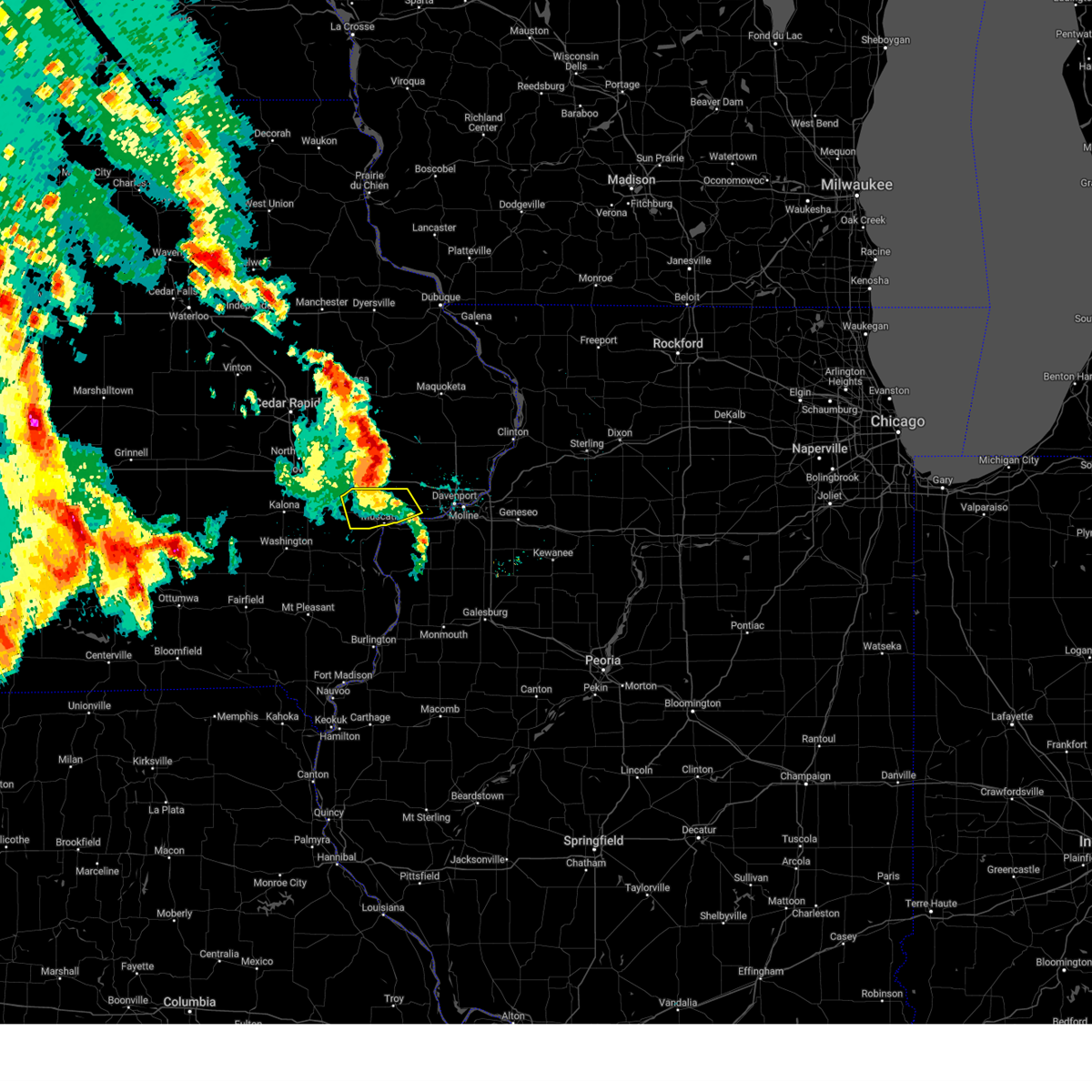 The storm which prompted the warning has weakened below severe limits, and no longer poses an immediate threat to life or property. therefore, the warning will be allowed to expire. a severe thunderstorm watch remains in effect until 1000 am cdt for east central iowa. to report severe weather, contact your nearest law enforcement agency. they will relay your report to the national weather service the quad cities. The storm which prompted the warning has weakened below severe limits, and no longer poses an immediate threat to life or property. therefore, the warning will be allowed to expire. a severe thunderstorm watch remains in effect until 1000 am cdt for east central iowa. to report severe weather, contact your nearest law enforcement agency. they will relay your report to the national weather service the quad cities.
|
| 5/24/2024 5:13 AM CDT |
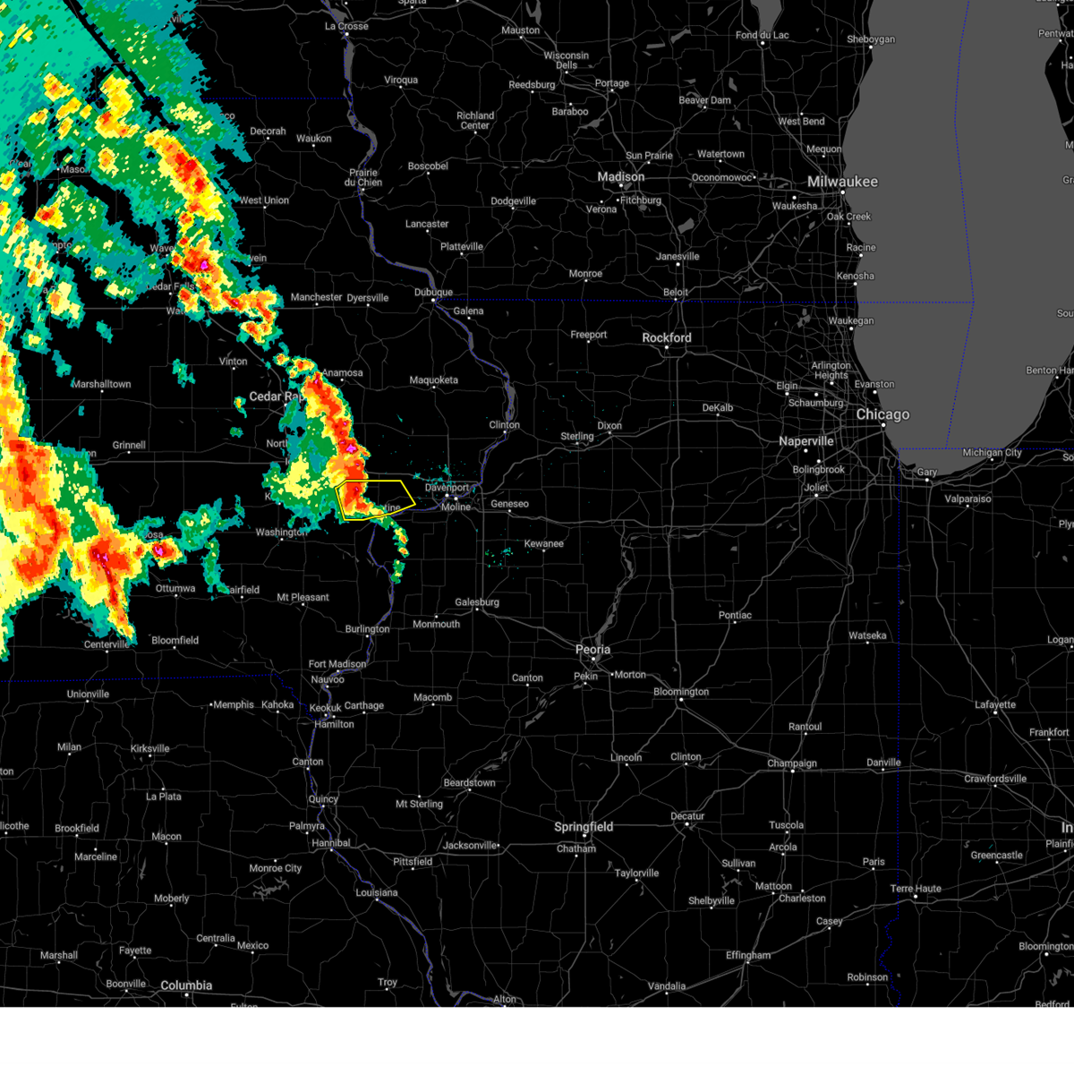 At 513 am cdt, a severe thunderstorm was located near sweetland center, or 7 miles north of muscatine, moving northeast at 45 mph (radar indicated). Hazards include 60 mph wind gusts and quarter size hail. Hail damage to vehicles is expected. expect wind damage to roofs, siding, and trees. Locations impacted include, muscatine, durant, west liberty, wilton, atalissa, muscatine county fairgrounds, new era, pleasant prairie, moscow, wildcat den state park, saulsbury bridge campground, sweetland center, ardon, and midway beach. At 513 am cdt, a severe thunderstorm was located near sweetland center, or 7 miles north of muscatine, moving northeast at 45 mph (radar indicated). Hazards include 60 mph wind gusts and quarter size hail. Hail damage to vehicles is expected. expect wind damage to roofs, siding, and trees. Locations impacted include, muscatine, durant, west liberty, wilton, atalissa, muscatine county fairgrounds, new era, pleasant prairie, moscow, wildcat den state park, saulsbury bridge campground, sweetland center, ardon, and midway beach.
|
| 5/24/2024 4:59 AM CDT |
 the severe thunderstorm warning has been cancelled and is no longer in effect the severe thunderstorm warning has been cancelled and is no longer in effect
|
| 5/24/2024 4:59 AM CDT |
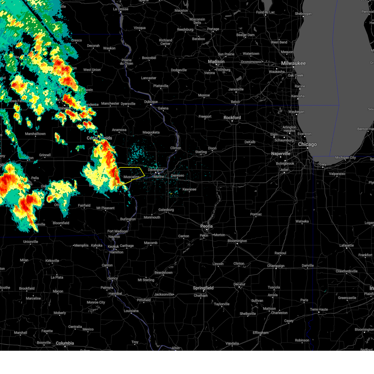 At 459 am cdt, a severe thunderstorm was located over ardon, or 7 miles west of muscatine, moving northeast at 45 mph (radar indicated). Hazards include 60 mph wind gusts and quarter size hail. Hail damage to vehicles is expected. expect wind damage to roofs, siding, and trees. Locations impacted include, muscatine, durant, west liberty, wilton, conesville, nichols, atalissa, cranston, muscatine county fairgrounds, new era, pleasant prairie, moscow, wildcat den state park, saulsbury bridge campground, ardon, sweetland center, and midway beach. At 459 am cdt, a severe thunderstorm was located over ardon, or 7 miles west of muscatine, moving northeast at 45 mph (radar indicated). Hazards include 60 mph wind gusts and quarter size hail. Hail damage to vehicles is expected. expect wind damage to roofs, siding, and trees. Locations impacted include, muscatine, durant, west liberty, wilton, conesville, nichols, atalissa, cranston, muscatine county fairgrounds, new era, pleasant prairie, moscow, wildcat den state park, saulsbury bridge campground, ardon, sweetland center, and midway beach.
|
| 5/24/2024 4:51 AM CDT |
 the severe thunderstorm warning has been cancelled and is no longer in effect the severe thunderstorm warning has been cancelled and is no longer in effect
|
| 5/24/2024 4:51 AM CDT |
 At 451 am cdt, a severe thunderstorm was located over conesville, or near columbus junction, moving northeast at 45 mph (radar indicated). Hazards include 60 mph wind gusts and quarter size hail. Hail damage to vehicles is expected. expect wind damage to roofs, siding, and trees. Locations impacted include, muscatine, columbus junction, durant, west liberty, wilton, fruitland, conesville, columbus city, letts, nichols, atalissa, fairport, fredonia, sand springs, cranston, muscatine county fairgrounds, new era, pleasant prairie, moscow, and saulsbury bridge campground. At 451 am cdt, a severe thunderstorm was located over conesville, or near columbus junction, moving northeast at 45 mph (radar indicated). Hazards include 60 mph wind gusts and quarter size hail. Hail damage to vehicles is expected. expect wind damage to roofs, siding, and trees. Locations impacted include, muscatine, columbus junction, durant, west liberty, wilton, fruitland, conesville, columbus city, letts, nichols, atalissa, fairport, fredonia, sand springs, cranston, muscatine county fairgrounds, new era, pleasant prairie, moscow, and saulsbury bridge campground.
|
| 5/24/2024 4:47 AM CDT |
 Svrdvn the national weather service in the quad cities has issued a * severe thunderstorm warning for, western rock island county in northwestern illinois, northwestern louisa county in southeastern iowa, east central washington county in southeastern iowa, muscatine county in east central iowa, * until 530 am cdt. * at 447 am cdt, a severe thunderstorm was located near columbus junction, moving northeast at 45 mph (radar indicated). Hazards include 60 mph wind gusts and nickel size hail. expect damage to roofs, siding, and trees Svrdvn the national weather service in the quad cities has issued a * severe thunderstorm warning for, western rock island county in northwestern illinois, northwestern louisa county in southeastern iowa, east central washington county in southeastern iowa, muscatine county in east central iowa, * until 530 am cdt. * at 447 am cdt, a severe thunderstorm was located near columbus junction, moving northeast at 45 mph (radar indicated). Hazards include 60 mph wind gusts and nickel size hail. expect damage to roofs, siding, and trees
|
| 5/21/2024 7:48 PM CDT |
 the tornado warning has been cancelled and is no longer in effect the tornado warning has been cancelled and is no longer in effect
|
| 5/21/2024 7:48 PM CDT |
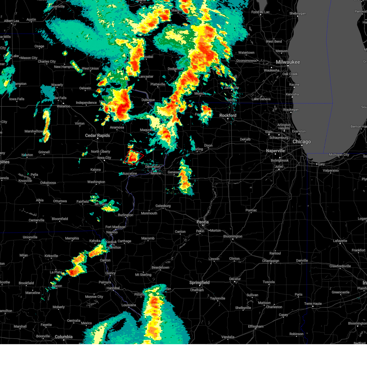 At 748 pm cdt, a severe thunderstorm capable of producing a tornado was located over sunbury, or near durant, moving northeast at 65 mph (radar indicated rotation). Hazards include tornado and half dollar size hail. Flying debris will be dangerous to those caught without shelter. mobile homes will be damaged or destroyed. damage to roofs, windows, and vehicles will occur. tree damage is likely. this dangerous storm will be near, dixon, new liberty, camp liberty, and bennett park around 755 pm cdt. This includes interstate 80 in iowa between mile markers 266 and 278. At 748 pm cdt, a severe thunderstorm capable of producing a tornado was located over sunbury, or near durant, moving northeast at 65 mph (radar indicated rotation). Hazards include tornado and half dollar size hail. Flying debris will be dangerous to those caught without shelter. mobile homes will be damaged or destroyed. damage to roofs, windows, and vehicles will occur. tree damage is likely. this dangerous storm will be near, dixon, new liberty, camp liberty, and bennett park around 755 pm cdt. This includes interstate 80 in iowa between mile markers 266 and 278.
|
| 5/21/2024 7:42 PM CDT |
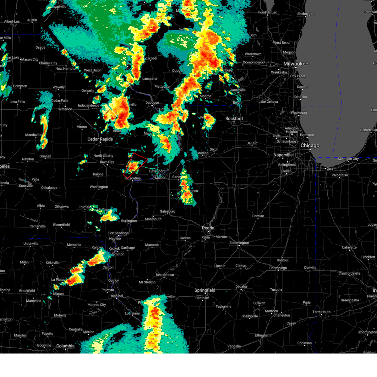 At 741 pm cdt, a confirmed tornado was located over wilton, or 7 miles west of durant, moving northeast at 70 mph (weather spotters confirmed tornado). Hazards include damaging tornado and half dollar size hail. Flying debris will be dangerous to those caught without shelter. mobile homes will be damaged or destroyed. damage to roofs, windows, and vehicles will occur. tree damage is likely. this tornado will be near, wilton, bennett, new liberty, sunbury, and bennett park around 745 pm cdt. dixon and camp liberty around 750 pm cdt. This includes interstate 80 in iowa between mile markers 266 and 278. At 741 pm cdt, a confirmed tornado was located over wilton, or 7 miles west of durant, moving northeast at 70 mph (weather spotters confirmed tornado). Hazards include damaging tornado and half dollar size hail. Flying debris will be dangerous to those caught without shelter. mobile homes will be damaged or destroyed. damage to roofs, windows, and vehicles will occur. tree damage is likely. this tornado will be near, wilton, bennett, new liberty, sunbury, and bennett park around 745 pm cdt. dixon and camp liberty around 750 pm cdt. This includes interstate 80 in iowa between mile markers 266 and 278.
|
| 5/21/2024 7:38 PM CDT |
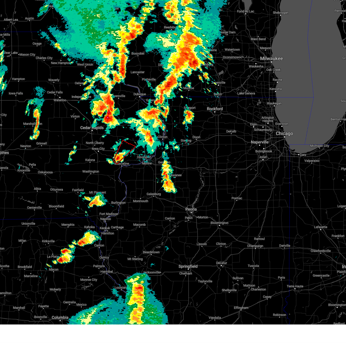 Tordvn the national weather service in the quad cities has issued a * tornado warning for, southeastern cedar county in east central iowa, northwestern scott county in east central iowa, north central muscatine county in east central iowa, * until 800 pm cdt. * at 738 pm cdt, a confirmed large and extremely dangerous tornado was located near atalissa, or 8 miles north of muscatine, moving northeast at 65 mph. this is a particularly dangerous situation. take cover now! (weather spotters confirmed tornado). Hazards include damaging tornado. You are in a life-threatening situation. flying debris may be deadly to those caught without shelter. mobile homes will be destroyed. considerable damage to homes, businesses, and vehicles is likely and complete destruction is possible. the tornado will be near, wilton, bennett, new liberty, sunbury, and bennett park around 745 pm cdt. dixon and camp liberty around 750 pm cdt. This includes interstate 80 in iowa between mile markers 266 and 278. Tordvn the national weather service in the quad cities has issued a * tornado warning for, southeastern cedar county in east central iowa, northwestern scott county in east central iowa, north central muscatine county in east central iowa, * until 800 pm cdt. * at 738 pm cdt, a confirmed large and extremely dangerous tornado was located near atalissa, or 8 miles north of muscatine, moving northeast at 65 mph. this is a particularly dangerous situation. take cover now! (weather spotters confirmed tornado). Hazards include damaging tornado. You are in a life-threatening situation. flying debris may be deadly to those caught without shelter. mobile homes will be destroyed. considerable damage to homes, businesses, and vehicles is likely and complete destruction is possible. the tornado will be near, wilton, bennett, new liberty, sunbury, and bennett park around 745 pm cdt. dixon and camp liberty around 750 pm cdt. This includes interstate 80 in iowa between mile markers 266 and 278.
|
| 5/21/2024 7:34 PM CDT |
 At 734 pm cdt, severe thunderstorms were located along a line extending from near muscatine county fairgrounds to near saulsbury bridge campground to near muscatine, moving northeast at 55 mph (radar indicated). Hazards include 70 mph wind gusts and quarter size hail. Hail damage to vehicles is expected. expect considerable tree damage. wind damage is also likely to mobile homes, roofs, and outbuildings. locations impacted include, tipton, durant, wilton, walcott, lowden, wheatland, calamus, bennett, donahue, rochester, clarence, dixon, stockton, maysville, new liberty, camp liberty, bennett park, moscow, big rock, and sunbury. This includes interstate 80 in iowa between mile markers 261 and 285. At 734 pm cdt, severe thunderstorms were located along a line extending from near muscatine county fairgrounds to near saulsbury bridge campground to near muscatine, moving northeast at 55 mph (radar indicated). Hazards include 70 mph wind gusts and quarter size hail. Hail damage to vehicles is expected. expect considerable tree damage. wind damage is also likely to mobile homes, roofs, and outbuildings. locations impacted include, tipton, durant, wilton, walcott, lowden, wheatland, calamus, bennett, donahue, rochester, clarence, dixon, stockton, maysville, new liberty, camp liberty, bennett park, moscow, big rock, and sunbury. This includes interstate 80 in iowa between mile markers 261 and 285.
|
| 5/21/2024 7:13 PM CDT |
 Svrdvn the national weather service in the quad cities has issued a * severe thunderstorm warning for, cedar county in east central iowa, scott county in east central iowa, northeastern muscatine county in east central iowa, southwestern clinton county in east central iowa, * until 800 pm cdt. * at 713 pm cdt, severe thunderstorms were located along a line extending from near wilton to near stockton to near taylor ridge, moving northeast at 70 mph (radar indicated). Hazards include 60 mph wind gusts and quarter size hail. Hail damage to vehicles is expected. Expect wind damage to roofs, siding, and trees. Svrdvn the national weather service in the quad cities has issued a * severe thunderstorm warning for, cedar county in east central iowa, scott county in east central iowa, northeastern muscatine county in east central iowa, southwestern clinton county in east central iowa, * until 800 pm cdt. * at 713 pm cdt, severe thunderstorms were located along a line extending from near wilton to near stockton to near taylor ridge, moving northeast at 70 mph (radar indicated). Hazards include 60 mph wind gusts and quarter size hail. Hail damage to vehicles is expected. Expect wind damage to roofs, siding, and trees.
|
| 5/21/2024 7:04 PM CDT |
 At 702 pm cdt, a severe thunderstorm was located near tipton, moving northeast at 70 mph. this is a destructive storm for tipton and lowden (trained weather spotters). Hazards include 80 mph wind gusts and penny size hail. Flying debris will be dangerous to those caught without shelter. mobile homes will be heavily damaged. expect considerable damage to roofs, windows, and vehicles. extensive tree damage and power outages are likely. locations impacted include, tipton, durant, stanwood, wilton, lowden, wheatland, bennett, rochester, clarence, dixon, new liberty, cedar valley, camp liberty, bennett park, big rock, sunbury, cedar valley park, tipton matthews airport, cedar county fairgrounds, and sherman park. This includes interstate 80 in iowa between mile markers 262 and 280. At 702 pm cdt, a severe thunderstorm was located near tipton, moving northeast at 70 mph. this is a destructive storm for tipton and lowden (trained weather spotters). Hazards include 80 mph wind gusts and penny size hail. Flying debris will be dangerous to those caught without shelter. mobile homes will be heavily damaged. expect considerable damage to roofs, windows, and vehicles. extensive tree damage and power outages are likely. locations impacted include, tipton, durant, stanwood, wilton, lowden, wheatland, bennett, rochester, clarence, dixon, new liberty, cedar valley, camp liberty, bennett park, big rock, sunbury, cedar valley park, tipton matthews airport, cedar county fairgrounds, and sherman park. This includes interstate 80 in iowa between mile markers 262 and 280.
|
| 5/21/2024 6:56 PM CDT |
 At 656 pm cdt, a severe thunderstorm was located over atalissa, or 9 miles southeast of west branch, moving northeast at 50 mph (emergency management). Hazards include 70 mph wind gusts and penny size hail. Expect considerable tree damage. damage is likely to mobile homes, roofs, and outbuildings. locations impacted include, muscatine, tipton, durant, stanwood, wilton, lowden, wheatland, bennett, atalissa, rochester, clarence, dixon, new liberty, springdale, cedar valley, camp liberty, bennett park, moscow, big rock, and sunbury. This includes interstate 80 in iowa between mile markers 258 and 280. At 656 pm cdt, a severe thunderstorm was located over atalissa, or 9 miles southeast of west branch, moving northeast at 50 mph (emergency management). Hazards include 70 mph wind gusts and penny size hail. Expect considerable tree damage. damage is likely to mobile homes, roofs, and outbuildings. locations impacted include, muscatine, tipton, durant, stanwood, wilton, lowden, wheatland, bennett, atalissa, rochester, clarence, dixon, new liberty, springdale, cedar valley, camp liberty, bennett park, moscow, big rock, and sunbury. This includes interstate 80 in iowa between mile markers 258 and 280.
|
| 5/21/2024 6:56 PM CDT |
 the severe thunderstorm warning has been cancelled and is no longer in effect the severe thunderstorm warning has been cancelled and is no longer in effect
|
| 5/21/2024 6:54 PM CDT |
 At 654 pm cdt, a severe thunderstorm was located over atalissa, or 9 miles southeast of west branch, moving northeast at 50 mph (emergency management). Hazards include 70 mph wind gusts and penny size hail. Expect considerable tree damage. damage is likely to mobile homes, roofs, and outbuildings. locations impacted include, muscatine, tipton, durant, stanwood, west liberty, wilton, fruitland, lowden, wheatland, bennett, letts, nichols, atalissa, rochester, clarence, dixon, new liberty, sand springs, cedar valley, and cranston. This includes interstate 80 in iowa between mile markers 258 and 280. At 654 pm cdt, a severe thunderstorm was located over atalissa, or 9 miles southeast of west branch, moving northeast at 50 mph (emergency management). Hazards include 70 mph wind gusts and penny size hail. Expect considerable tree damage. damage is likely to mobile homes, roofs, and outbuildings. locations impacted include, muscatine, tipton, durant, stanwood, west liberty, wilton, fruitland, lowden, wheatland, bennett, letts, nichols, atalissa, rochester, clarence, dixon, new liberty, sand springs, cedar valley, and cranston. This includes interstate 80 in iowa between mile markers 258 and 280.
|
| 5/21/2024 6:46 PM CDT |
 At 646 pm cdt, a severe thunderstorm was located over muscatine county fairgrounds, or 10 miles southeast of west branch, moving northeast at 50 mph (radar indicated). Hazards include 60 mph wind gusts and penny size hail. Expect damage to roofs, siding, and trees. locations impacted include, muscatine, tipton, durant, stanwood, west liberty, wilton, fruitland, lowden, wheatland, bennett, letts, nichols, atalissa, rochester, clarence, dixon, new liberty, sand springs, cedar valley, and cranston. This includes interstate 80 in iowa between mile markers 258 and 280. At 646 pm cdt, a severe thunderstorm was located over muscatine county fairgrounds, or 10 miles southeast of west branch, moving northeast at 50 mph (radar indicated). Hazards include 60 mph wind gusts and penny size hail. Expect damage to roofs, siding, and trees. locations impacted include, muscatine, tipton, durant, stanwood, west liberty, wilton, fruitland, lowden, wheatland, bennett, letts, nichols, atalissa, rochester, clarence, dixon, new liberty, sand springs, cedar valley, and cranston. This includes interstate 80 in iowa between mile markers 258 and 280.
|
| 5/21/2024 6:38 PM CDT |
 Svrdvn the national weather service in the quad cities has issued a * severe thunderstorm warning for, northwestern louisa county in southeastern iowa, cedar county in east central iowa, northwestern scott county in east central iowa, southeastern johnson county in east central iowa, muscatine county in east central iowa, southwestern clinton county in east central iowa, * until 730 pm cdt. * at 637 pm cdt, a severe thunderstorm was located near nichols, or 11 miles north of columbus junction, moving northeast at 50 mph (radar indicated). Hazards include 60 mph wind gusts and penny size hail. expect damage to roofs, siding, and trees Svrdvn the national weather service in the quad cities has issued a * severe thunderstorm warning for, northwestern louisa county in southeastern iowa, cedar county in east central iowa, northwestern scott county in east central iowa, southeastern johnson county in east central iowa, muscatine county in east central iowa, southwestern clinton county in east central iowa, * until 730 pm cdt. * at 637 pm cdt, a severe thunderstorm was located near nichols, or 11 miles north of columbus junction, moving northeast at 50 mph (radar indicated). Hazards include 60 mph wind gusts and penny size hail. expect damage to roofs, siding, and trees
|
| 5/20/2024 12:11 AM CDT |
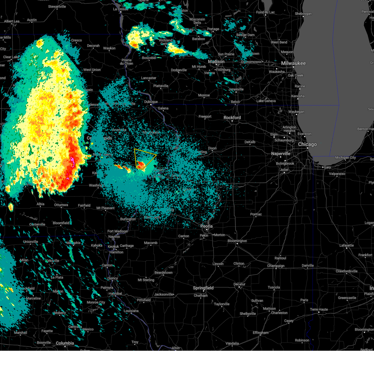 At 1211 am cdt, a severe thunderstorm was located over new liberty, or near durant, moving north at 30 mph (radar indicated). Hazards include quarter size hail. Damage to vehicles is expected. locations impacted include, durant, walcott, lowden, wheatland, calamus, bennett, donahue, dixon, stockton, new liberty, camp liberty, bennett park, big rock, sunbury, sherman park, and plainview. This includes interstate 80 in iowa between mile markers 276 and 284. At 1211 am cdt, a severe thunderstorm was located over new liberty, or near durant, moving north at 30 mph (radar indicated). Hazards include quarter size hail. Damage to vehicles is expected. locations impacted include, durant, walcott, lowden, wheatland, calamus, bennett, donahue, dixon, stockton, new liberty, camp liberty, bennett park, big rock, sunbury, sherman park, and plainview. This includes interstate 80 in iowa between mile markers 276 and 284.
|
| 5/20/2024 12:03 AM CDT |
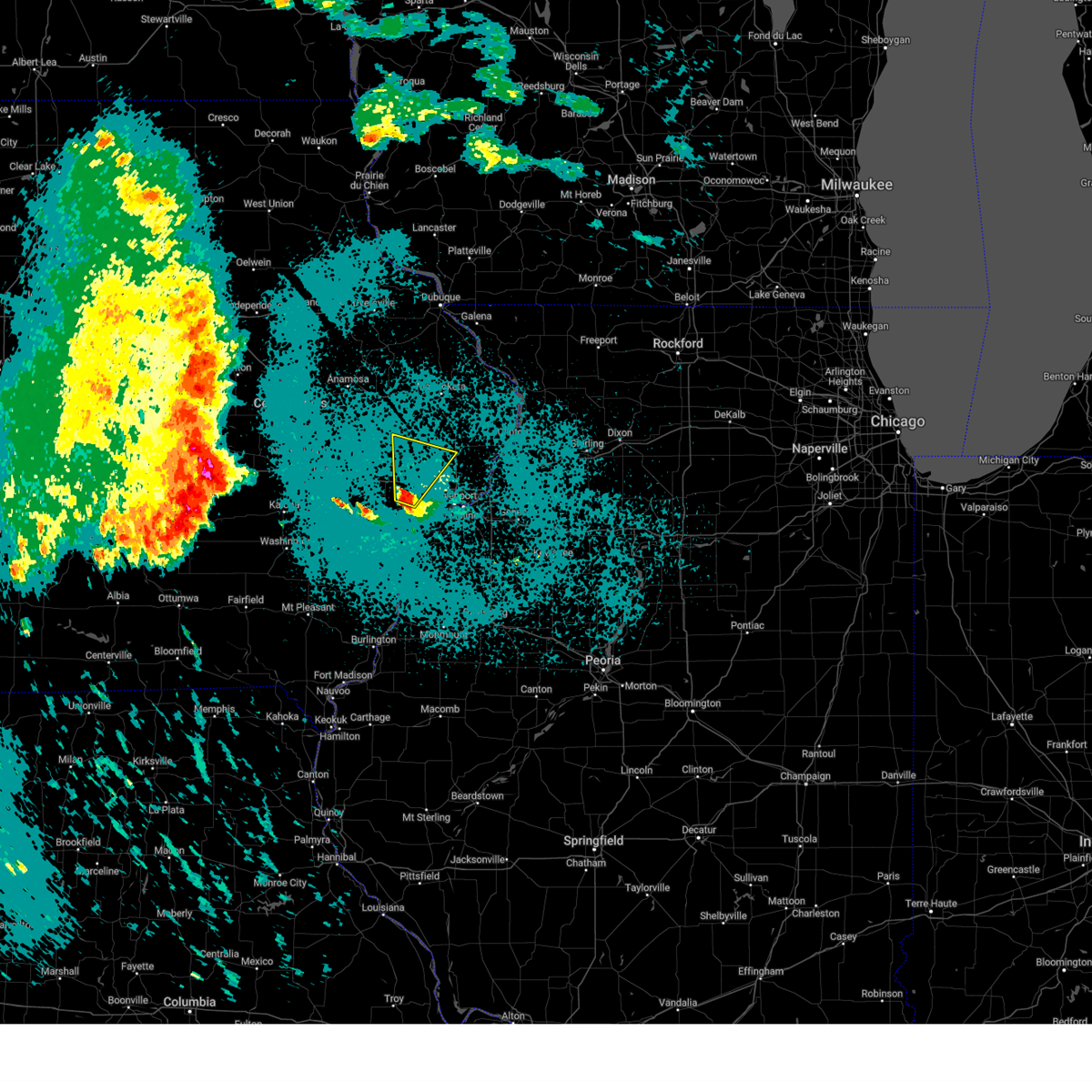 At 1202 am cdt, a severe thunderstorm was located over stockton, or over durant, moving north at 30 mph (radar indicated). Hazards include quarter size hail. Damage to vehicles is expected. locations impacted include, durant, walcott, lowden, wheatland, calamus, bennett, donahue, dixon, stockton, maysville, new liberty, camp liberty, bennett park, pleasant prairie, big rock, sunbury, sherman park, and plainview. This includes interstate 80 in iowa between mile markers 275 and 286. At 1202 am cdt, a severe thunderstorm was located over stockton, or over durant, moving north at 30 mph (radar indicated). Hazards include quarter size hail. Damage to vehicles is expected. locations impacted include, durant, walcott, lowden, wheatland, calamus, bennett, donahue, dixon, stockton, maysville, new liberty, camp liberty, bennett park, pleasant prairie, big rock, sunbury, sherman park, and plainview. This includes interstate 80 in iowa between mile markers 275 and 286.
|
| 5/19/2024 11:54 PM CDT |
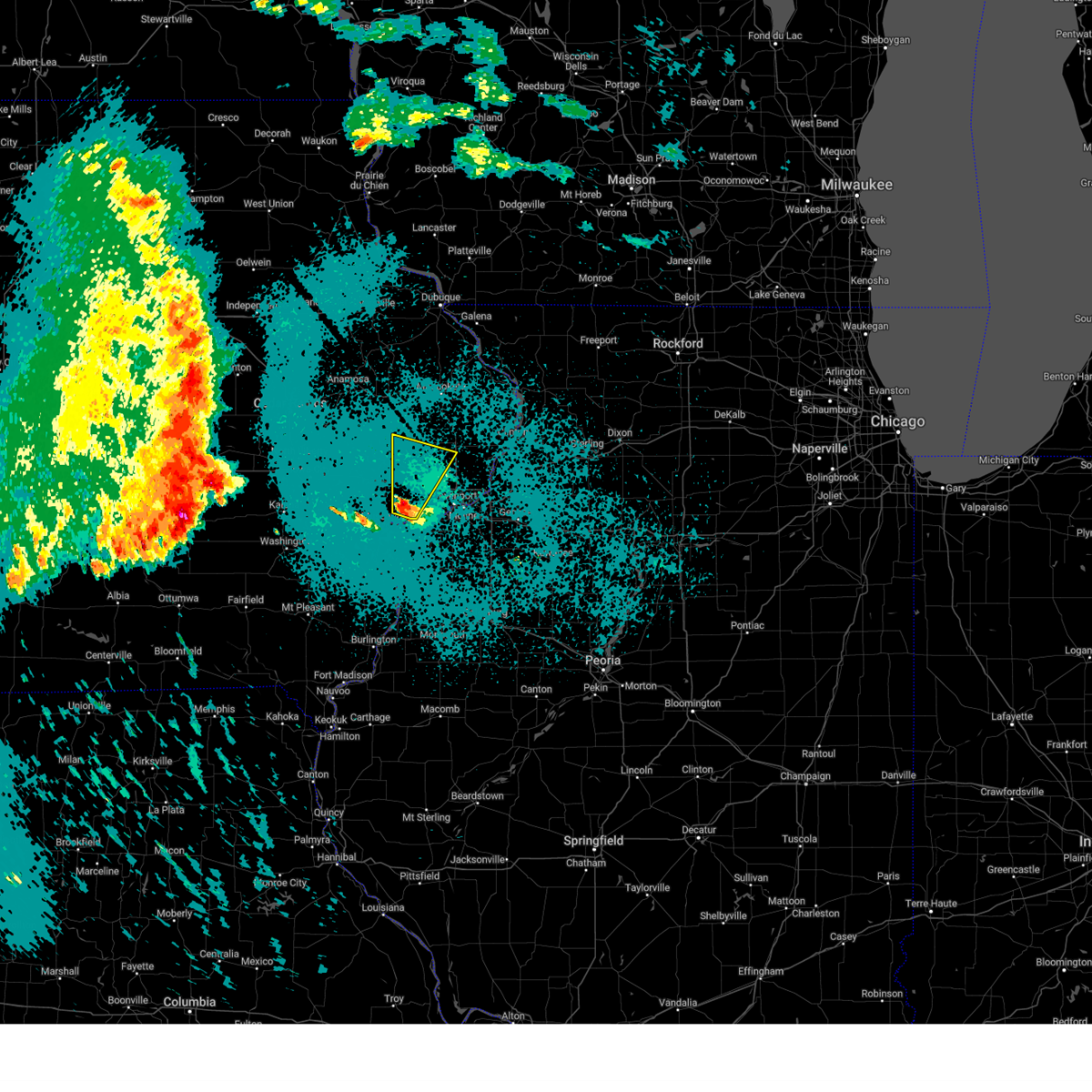 Svrdvn the national weather service in the quad cities has issued a * severe thunderstorm warning for, southeastern cedar county in east central iowa, western scott county in east central iowa, northeastern muscatine county in east central iowa, southwestern clinton county in east central iowa, * until 1245 am cdt. * at 1154 pm cdt, a severe thunderstorm was located near pleasant prairie, or near durant, moving north at 30 mph (radar indicated). Hazards include quarter size hail. damage to vehicles is expected Svrdvn the national weather service in the quad cities has issued a * severe thunderstorm warning for, southeastern cedar county in east central iowa, western scott county in east central iowa, northeastern muscatine county in east central iowa, southwestern clinton county in east central iowa, * until 1245 am cdt. * at 1154 pm cdt, a severe thunderstorm was located near pleasant prairie, or near durant, moving north at 30 mph (radar indicated). Hazards include quarter size hail. damage to vehicles is expected
|
| 5/7/2024 5:11 AM CDT |
 the severe thunderstorm warning has been cancelled and is no longer in effect the severe thunderstorm warning has been cancelled and is no longer in effect
|
| 5/7/2024 4:55 AM CDT |
 At 455 am cdt, severe thunderstorms were located along a line extending from near hale to near plainview to oak grove, moving northeast at 50 mph (radar indicated). Hazards include 60 mph wind gusts. Expect damage to roofs, siding, and trees. locations impacted include, davenport, rock island, bettendorf, aledo, tipton, durant, stanwood, eldridge, milan, wilton, walcott, blue grass, buffalo, andalusia, lowden, millersburg, reynolds, bennett, donahue, and seaton. this includes the following highways, interstate 74 in iowa between mile markers 1 and 3. interstate 80 in iowa between mile markers 270 and 299. Interstate 280 between mile markers 1 and 13. At 455 am cdt, severe thunderstorms were located along a line extending from near hale to near plainview to oak grove, moving northeast at 50 mph (radar indicated). Hazards include 60 mph wind gusts. Expect damage to roofs, siding, and trees. locations impacted include, davenport, rock island, bettendorf, aledo, tipton, durant, stanwood, eldridge, milan, wilton, walcott, blue grass, buffalo, andalusia, lowden, millersburg, reynolds, bennett, donahue, and seaton. this includes the following highways, interstate 74 in iowa between mile markers 1 and 3. interstate 80 in iowa between mile markers 270 and 299. Interstate 280 between mile markers 1 and 13.
|
| 5/7/2024 4:55 AM CDT |
 the severe thunderstorm warning has been cancelled and is no longer in effect the severe thunderstorm warning has been cancelled and is no longer in effect
|
| 5/7/2024 4:46 AM CDT |
 At 445 am cdt, severe thunderstorms were located along a line extending from stanwood to durant to near aledo, moving northeast at 50 mph (radar indicated). Hazards include 60 mph wind gusts. Expect damage to roofs, siding, and trees. locations impacted include, davenport, rock island, bettendorf, muscatine, aledo, tipton, durant, stanwood, eldridge, milan, wilton, walcott, blue grass, buffalo, andalusia, lowden, millersburg, reynolds, eliza, and joy. this includes the following highways, interstate 74 in iowa between mile markers 1 and 3. interstate 80 in iowa between mile markers 261 and 299. Interstate 280 between mile markers 1 and 13. At 445 am cdt, severe thunderstorms were located along a line extending from stanwood to durant to near aledo, moving northeast at 50 mph (radar indicated). Hazards include 60 mph wind gusts. Expect damage to roofs, siding, and trees. locations impacted include, davenport, rock island, bettendorf, muscatine, aledo, tipton, durant, stanwood, eldridge, milan, wilton, walcott, blue grass, buffalo, andalusia, lowden, millersburg, reynolds, eliza, and joy. this includes the following highways, interstate 74 in iowa between mile markers 1 and 3. interstate 80 in iowa between mile markers 261 and 299. Interstate 280 between mile markers 1 and 13.
|
| 5/7/2024 4:46 AM CDT |
 the severe thunderstorm warning has been cancelled and is no longer in effect the severe thunderstorm warning has been cancelled and is no longer in effect
|
| 5/7/2024 4:34 AM CDT |
 At 434 am cdt, severe thunderstorms were located along a line extending from cedar bluff to near sweetland center to bald bluff, moving northeast at 45 mph (radar indicated). Hazards include 60 mph wind gusts and penny size hail. Expect damage to roofs, siding, and trees. locations impacted include, davenport, rock island, bettendorf, muscatine, aledo, tipton, durant, stanwood, eldridge, milan, west liberty, wilton, walcott, blue grass, buffalo, andalusia, fruitland, lowden, millersburg, and new boston. this includes the following highways, interstate 74 in iowa between mile markers 1 and 3. interstate 80 in iowa between mile markers 256 and 299. Interstate 280 between mile markers 1 and 13. At 434 am cdt, severe thunderstorms were located along a line extending from cedar bluff to near sweetland center to bald bluff, moving northeast at 45 mph (radar indicated). Hazards include 60 mph wind gusts and penny size hail. Expect damage to roofs, siding, and trees. locations impacted include, davenport, rock island, bettendorf, muscatine, aledo, tipton, durant, stanwood, eldridge, milan, west liberty, wilton, walcott, blue grass, buffalo, andalusia, fruitland, lowden, millersburg, and new boston. this includes the following highways, interstate 74 in iowa between mile markers 1 and 3. interstate 80 in iowa between mile markers 256 and 299. Interstate 280 between mile markers 1 and 13.
|
| 5/7/2024 4:34 AM CDT |
 the severe thunderstorm warning has been cancelled and is no longer in effect the severe thunderstorm warning has been cancelled and is no longer in effect
|
| 5/7/2024 4:26 AM CDT |
 Svrdvn the national weather service in the quad cities has issued a * severe thunderstorm warning for, northeastern henderson county in west central illinois, southwestern rock island county in northwestern illinois, western mercer county in northwestern illinois, northeastern des moines county in southeastern iowa, southeastern louisa county in southeastern iowa, cedar county in east central iowa, scott county in east central iowa, east central johnson county in east central iowa, muscatine county in east central iowa, southwestern clinton county in east central iowa, * until 530 am cdt. * at 425 am cdt, severe thunderstorms were located along a line extending from oasis to muscatine to oquawka, moving northeast at 45 mph (radar indicated). Hazards include 60 mph wind gusts and penny size hail. expect damage to roofs, siding, and trees Svrdvn the national weather service in the quad cities has issued a * severe thunderstorm warning for, northeastern henderson county in west central illinois, southwestern rock island county in northwestern illinois, western mercer county in northwestern illinois, northeastern des moines county in southeastern iowa, southeastern louisa county in southeastern iowa, cedar county in east central iowa, scott county in east central iowa, east central johnson county in east central iowa, muscatine county in east central iowa, southwestern clinton county in east central iowa, * until 530 am cdt. * at 425 am cdt, severe thunderstorms were located along a line extending from oasis to muscatine to oquawka, moving northeast at 45 mph (radar indicated). Hazards include 60 mph wind gusts and penny size hail. expect damage to roofs, siding, and trees
|
| 4/27/2024 8:37 PM CDT |
 The storms which prompted the warning have weakened below severe limits, and no longer pose an immediate threat to life or property. therefore, the warning will be allowed to expire. a tornado watch remains in effect until midnight cdt for northwestern illinois, and east central iowa. The storms which prompted the warning have weakened below severe limits, and no longer pose an immediate threat to life or property. therefore, the warning will be allowed to expire. a tornado watch remains in effect until midnight cdt for northwestern illinois, and east central iowa.
|
| 4/27/2024 8:34 PM CDT |
 At 834 pm cdt, severe thunderstorms were located along a line extending from sunbury to pleasant prairie to near illinois city, moving east at 40 mph (radar indicated). Hazards include 60 mph wind gusts. Expect damage to roofs, siding, and trees. locations impacted include, durant, walcott, blue grass, buffalo, andalusia, montpelier, stockton, clark's ferry recreation area, midway beach, new era, pleasant prairie, sunbury, wildcat den state park, shady creek campground, buffalo shores, and plainview. This includes interstate 80 in iowa between mile markers 276 and 288. At 834 pm cdt, severe thunderstorms were located along a line extending from sunbury to pleasant prairie to near illinois city, moving east at 40 mph (radar indicated). Hazards include 60 mph wind gusts. Expect damage to roofs, siding, and trees. locations impacted include, durant, walcott, blue grass, buffalo, andalusia, montpelier, stockton, clark's ferry recreation area, midway beach, new era, pleasant prairie, sunbury, wildcat den state park, shady creek campground, buffalo shores, and plainview. This includes interstate 80 in iowa between mile markers 276 and 288.
|
| 4/27/2024 8:21 PM CDT |
 At 820 pm cdt, severe thunderstorms were located along a line extending from near rochester to near sweetland center to near fruitland, moving east at 40 mph (radar indicated). Hazards include 60 mph wind gusts. Expect damage to roofs, siding, and trees. locations impacted include, muscatine, durant, wilton, walcott, blue grass, buffalo, andalusia, atalissa, montpelier, rochester, fairport, stockton, clark's ferry recreation area, new era, pleasant prairie, moscow, sunbury, saulsbury bridge campground, buffalo shores, and plainview. This includes interstate 80 in iowa between mile markers 263 and 288. At 820 pm cdt, severe thunderstorms were located along a line extending from near rochester to near sweetland center to near fruitland, moving east at 40 mph (radar indicated). Hazards include 60 mph wind gusts. Expect damage to roofs, siding, and trees. locations impacted include, muscatine, durant, wilton, walcott, blue grass, buffalo, andalusia, atalissa, montpelier, rochester, fairport, stockton, clark's ferry recreation area, new era, pleasant prairie, moscow, sunbury, saulsbury bridge campground, buffalo shores, and plainview. This includes interstate 80 in iowa between mile markers 263 and 288.
|
| 4/27/2024 8:07 PM CDT |
 Svrdvn the national weather service in the quad cities has issued a * severe thunderstorm warning for, southwestern rock island county in northwestern illinois, southeastern cedar county in east central iowa, southwestern scott county in east central iowa, muscatine county in east central iowa, * until 845 pm cdt. * at 806 pm cdt, severe thunderstorms were located along a line extending from springdale to saulsbury bridge campground to letts, moving east at 40 mph (radar indicated). Hazards include 60 mph wind gusts. expect damage to roofs, siding, and trees Svrdvn the national weather service in the quad cities has issued a * severe thunderstorm warning for, southwestern rock island county in northwestern illinois, southeastern cedar county in east central iowa, southwestern scott county in east central iowa, muscatine county in east central iowa, * until 845 pm cdt. * at 806 pm cdt, severe thunderstorms were located along a line extending from springdale to saulsbury bridge campground to letts, moving east at 40 mph (radar indicated). Hazards include 60 mph wind gusts. expect damage to roofs, siding, and trees
|
| 4/16/2024 5:14 PM CDT |
 Svrdvn the national weather service in the quad cities has issued a * severe thunderstorm warning for, south central jo daviess county in northwestern illinois, jackson county in east central iowa, eastern cedar county in east central iowa, northwestern scott county in east central iowa, southeastern jones county in east central iowa, northeastern muscatine county in east central iowa, clinton county in east central iowa, * until 600 pm cdt. * at 513 pm cdt, severe thunderstorms were located along a line extending from near oxford junction to near bennett to near moscow, moving northeast at 65 mph (radar indicated). Hazards include 60 mph wind gusts. expect damage to roofs, siding, and trees Svrdvn the national weather service in the quad cities has issued a * severe thunderstorm warning for, south central jo daviess county in northwestern illinois, jackson county in east central iowa, eastern cedar county in east central iowa, northwestern scott county in east central iowa, southeastern jones county in east central iowa, northeastern muscatine county in east central iowa, clinton county in east central iowa, * until 600 pm cdt. * at 513 pm cdt, severe thunderstorms were located along a line extending from near oxford junction to near bennett to near moscow, moving northeast at 65 mph (radar indicated). Hazards include 60 mph wind gusts. expect damage to roofs, siding, and trees
|
| 4/16/2024 4:57 PM CDT |
 At 456 pm cdt, severe thunderstorms were located along a line extending from jones county fairgrounds to near hale to bennett, moving east at 50 mph (trained weather spotters). Hazards include 70 mph wind gusts and quarter size hail. Hail damage to vehicles is expected. expect considerable tree damage. wind damage is also likely to mobile homes, roofs, and outbuildings. locations impacted include, tipton, west branch, durant, mechanicsville, stanwood, west liberty, wilton, walcott, lowden, wheatland, olin, wyoming, oxford junction, lost nation, bennett, atalissa, onslow, monmouth, toronto, and morley. This includes interstate 80 in iowa between mile markers 251 and 285. At 456 pm cdt, severe thunderstorms were located along a line extending from jones county fairgrounds to near hale to bennett, moving east at 50 mph (trained weather spotters). Hazards include 70 mph wind gusts and quarter size hail. Hail damage to vehicles is expected. expect considerable tree damage. wind damage is also likely to mobile homes, roofs, and outbuildings. locations impacted include, tipton, west branch, durant, mechanicsville, stanwood, west liberty, wilton, walcott, lowden, wheatland, olin, wyoming, oxford junction, lost nation, bennett, atalissa, onslow, monmouth, toronto, and morley. This includes interstate 80 in iowa between mile markers 251 and 285.
|
| 4/16/2024 4:57 PM CDT |
 the severe thunderstorm warning has been cancelled and is no longer in effect the severe thunderstorm warning has been cancelled and is no longer in effect
|
| 4/16/2024 4:45 PM CDT |
 the severe thunderstorm warning has been cancelled and is no longer in effect the severe thunderstorm warning has been cancelled and is no longer in effect
|
| 4/16/2024 4:45 PM CDT |
 At 445 pm cdt, severe thunderstorms were located along a line extending from near langworthy to olin to near tipton, moving east at 50 mph (radar indicated). Hazards include 60 mph wind gusts and quarter size hail. Hail damage to vehicles is expected. expect wind damage to roofs, siding, and trees. locations impacted include, iowa city, tipton, west branch, durant, mechanicsville, stanwood, mount vernon, west liberty, wilton, lisbon, walcott, lowden, wheatland, olin, wyoming, oxford junction, lost nation, bennett, atalissa, and onslow. This includes interstate 80 in iowa between mile markers 247 and 285. At 445 pm cdt, severe thunderstorms were located along a line extending from near langworthy to olin to near tipton, moving east at 50 mph (radar indicated). Hazards include 60 mph wind gusts and quarter size hail. Hail damage to vehicles is expected. expect wind damage to roofs, siding, and trees. locations impacted include, iowa city, tipton, west branch, durant, mechanicsville, stanwood, mount vernon, west liberty, wilton, lisbon, walcott, lowden, wheatland, olin, wyoming, oxford junction, lost nation, bennett, atalissa, and onslow. This includes interstate 80 in iowa between mile markers 247 and 285.
|
| 4/16/2024 4:39 PM CDT |
 the severe thunderstorm warning has been cancelled and is no longer in effect the severe thunderstorm warning has been cancelled and is no longer in effect
|
| 4/16/2024 4:39 PM CDT |
 At 439 pm cdt, severe thunderstorms were located along a line extending from near prairieburg to near morley to near rochester, moving east at 50 mph (radar indicated). Hazards include 60 mph wind gusts and quarter size hail. Hail damage to vehicles is expected. expect wind damage to roofs, siding, and trees. locations impacted include, iowa city, anamosa, tipton, west branch, durant, mechanicsville, stanwood, marion, mount vernon, monticello, west liberty, wilton, cascade, lisbon, solon, walcott, farley, central city, springville, and lowden. This includes interstate 80 in iowa between mile markers 246 and 285. At 439 pm cdt, severe thunderstorms were located along a line extending from near prairieburg to near morley to near rochester, moving east at 50 mph (radar indicated). Hazards include 60 mph wind gusts and quarter size hail. Hail damage to vehicles is expected. expect wind damage to roofs, siding, and trees. locations impacted include, iowa city, anamosa, tipton, west branch, durant, mechanicsville, stanwood, marion, mount vernon, monticello, west liberty, wilton, cascade, lisbon, solon, walcott, farley, central city, springville, and lowden. This includes interstate 80 in iowa between mile markers 246 and 285.
|
| 4/16/2024 4:32 PM CDT |
 At 431 pm cdt, severe thunderstorms were located along a line extending from howard h cherry scout reservation to near lisbon to springdale, moving east at 50 mph (radar indicated). Hazards include 60 mph wind gusts and quarter size hail. Hail damage to vehicles is expected. expect wind damage to roofs, siding, and trees. locations impacted include, cedar rapids, iowa city, anamosa, tipton, west branch, durant, mechanicsville, stanwood, marion, coralville, mount vernon, monticello, west liberty, wilton, cascade, lisbon, solon, walcott, farley, and central city. This includes interstate 80 in iowa between mile markers 243 and 285. At 431 pm cdt, severe thunderstorms were located along a line extending from howard h cherry scout reservation to near lisbon to springdale, moving east at 50 mph (radar indicated). Hazards include 60 mph wind gusts and quarter size hail. Hail damage to vehicles is expected. expect wind damage to roofs, siding, and trees. locations impacted include, cedar rapids, iowa city, anamosa, tipton, west branch, durant, mechanicsville, stanwood, marion, coralville, mount vernon, monticello, west liberty, wilton, cascade, lisbon, solon, walcott, farley, and central city. This includes interstate 80 in iowa between mile markers 243 and 285.
|
| 4/16/2024 4:23 PM CDT |
 Svrdvn the national weather service in the quad cities has issued a * severe thunderstorm warning for, southwestern jackson county in east central iowa, cedar county in east central iowa, northwestern scott county in east central iowa, southwestern dubuque county in northeastern iowa, eastern johnson county in east central iowa, northeastern washington county in southeastern iowa, jones county in east central iowa, southeastern delaware county in northeastern iowa, northern muscatine county in east central iowa, eastern linn county in east central iowa, western clinton county in east central iowa, * until 515 pm cdt. * at 423 pm cdt, severe thunderstorms were located along a line extending from alburnett to mount vernon to near west branch, moving east at 50 mph (radar indicated). Hazards include 60 mph wind gusts and quarter size hail. Hail damage to vehicles is expected. Expect wind damage to roofs, siding, and trees. Svrdvn the national weather service in the quad cities has issued a * severe thunderstorm warning for, southwestern jackson county in east central iowa, cedar county in east central iowa, northwestern scott county in east central iowa, southwestern dubuque county in northeastern iowa, eastern johnson county in east central iowa, northeastern washington county in southeastern iowa, jones county in east central iowa, southeastern delaware county in northeastern iowa, northern muscatine county in east central iowa, eastern linn county in east central iowa, western clinton county in east central iowa, * until 515 pm cdt. * at 423 pm cdt, severe thunderstorms were located along a line extending from alburnett to mount vernon to near west branch, moving east at 50 mph (radar indicated). Hazards include 60 mph wind gusts and quarter size hail. Hail damage to vehicles is expected. Expect wind damage to roofs, siding, and trees.
|
| 7/28/2023 9:16 PM CDT |
 At 915 pm cdt, severe thunderstorms were located along a line extending from south sabula lake park to near princeton wildlife area to oak grove, moving east at 60 mph (trained weather spotters). Hazards include 70 mph wind gusts. Expect considerable tree damage. damage is likely to mobile homes, roofs, and outbuildings. locations impacted include, davenport, moline, rock island, bettendorf, clinton, east moline, maquoketa, morrison, durant, mount carroll, silvis, geneseo, eldridge, dewitt, milan, colona, camanche, le claire, coal valley and savanna. thunderstorm damage threat, considerable hail threat, radar indicated max hail size, <. 75 in wind threat, observed max wind gust, 70 mph. At 915 pm cdt, severe thunderstorms were located along a line extending from south sabula lake park to near princeton wildlife area to oak grove, moving east at 60 mph (trained weather spotters). Hazards include 70 mph wind gusts. Expect considerable tree damage. damage is likely to mobile homes, roofs, and outbuildings. locations impacted include, davenport, moline, rock island, bettendorf, clinton, east moline, maquoketa, morrison, durant, mount carroll, silvis, geneseo, eldridge, dewitt, milan, colona, camanche, le claire, coal valley and savanna. thunderstorm damage threat, considerable hail threat, radar indicated max hail size, <. 75 in wind threat, observed max wind gust, 70 mph.
|
| 7/28/2023 8:52 PM CDT |
 At 851 pm cdt, severe thunderstorms were located along a line extending from near springbrook to grand mound to near wilton, moving east at 65 mph. these are destructive storms for portions of eastern iowa and northwest illinois (radar indicated). Hazards include 80 mph wind gusts. Flying debris will be dangerous to those caught without shelter. mobile homes will be heavily damaged. expect considerable damage to roofs, windows, and vehicles. extensive tree damage and power outages are likely. locations impacted include, davenport, moline, rock island, bettendorf, clinton, east moline, maquoketa, morrison, durant, mount carroll, silvis, geneseo, eldridge, dewitt, milan, colona, camanche, le claire, coal valley and savanna. thunderstorm damage threat, destructive hail threat, radar indicated max hail size, <. 75 in wind threat, observed max wind gust, 80 mph. At 851 pm cdt, severe thunderstorms were located along a line extending from near springbrook to grand mound to near wilton, moving east at 65 mph. these are destructive storms for portions of eastern iowa and northwest illinois (radar indicated). Hazards include 80 mph wind gusts. Flying debris will be dangerous to those caught without shelter. mobile homes will be heavily damaged. expect considerable damage to roofs, windows, and vehicles. extensive tree damage and power outages are likely. locations impacted include, davenport, moline, rock island, bettendorf, clinton, east moline, maquoketa, morrison, durant, mount carroll, silvis, geneseo, eldridge, dewitt, milan, colona, camanche, le claire, coal valley and savanna. thunderstorm damage threat, destructive hail threat, radar indicated max hail size, <. 75 in wind threat, observed max wind gust, 80 mph.
|
| 7/28/2023 8:31 PM CDT |
 At 830 pm cdt, severe thunderstorms were located along a line extending from otter creek to lost nation to near cedar bluff, moving east at 70 mph. these are destructive storms for portions of eastern iowa and northwest illinois (radar indicated). Hazards include 80 mph wind gusts. Flying debris will be dangerous to those caught without shelter. mobile homes will be heavily damaged. expect considerable damage to roofs, windows, and vehicles. Extensive tree damage and power outages are likely. At 830 pm cdt, severe thunderstorms were located along a line extending from otter creek to lost nation to near cedar bluff, moving east at 70 mph. these are destructive storms for portions of eastern iowa and northwest illinois (radar indicated). Hazards include 80 mph wind gusts. Flying debris will be dangerous to those caught without shelter. mobile homes will be heavily damaged. expect considerable damage to roofs, windows, and vehicles. Extensive tree damage and power outages are likely.
|
| 7/12/2023 9:26 AM CDT | The severe thunderstorm warning for cedar and muscatine counties will expire at 930 am cdt, the storms which prompted the warning have weakened below severe limits, and no longer pose an immediate threat to life or property. therefore, the warning will be allowed to expire. however heavy rain is still possible with these thunderstorms. a severe thunderstorm watch remains in effect until 1100 am cdt for northwestern illinois, and east central iowa. to report severe weather, contact your nearest law enforcement agency. they will relay your report to the national weather service the quad cities. |
| 7/12/2023 9:21 AM CDT | At 921 am cdt, severe thunderstorms were located along a line extending from clarence to near bennett to saulsbury bridge campground, moving east at 50 mph (radar indicated). Hazards include 60 mph wind gusts. Expect damage to roofs, siding, and trees. locations impacted include, muscatine, tipton, durant, stanwood, west liberty, wilton, fruitland, lowden, bennett, nichols, atalissa, rochester, clarence, stockton, cranston, muscatine county fairgrounds, bennett park, moscow, sunbury and saulsbury bridge campground. hail threat, radar indicated max hail size, <. 75 in wind threat, radar indicated max wind gust, 60 mph. |
| 7/12/2023 9:15 AM CDT |
 At 914 am cdt, severe thunderstorms were located along a line extending from stanwood to tipton to near muscatine county fairgrounds, moving east at 50 mph (radar indicated). Hazards include 60 mph wind gusts. Expect damage to roofs, siding, and trees. locations impacted include, muscatine, tipton, west branch, durant, mechanicsville, stanwood, west liberty, wilton, lone tree, riverside, fruitland, lowden, conesville, bennett, nichols, atalissa, rochester, buchanan, clarence and stockton. hail threat, radar indicated max hail size, <. 75 in wind threat, radar indicated max wind gust, 60 mph. At 914 am cdt, severe thunderstorms were located along a line extending from stanwood to tipton to near muscatine county fairgrounds, moving east at 50 mph (radar indicated). Hazards include 60 mph wind gusts. Expect damage to roofs, siding, and trees. locations impacted include, muscatine, tipton, west branch, durant, mechanicsville, stanwood, west liberty, wilton, lone tree, riverside, fruitland, lowden, conesville, bennett, nichols, atalissa, rochester, buchanan, clarence and stockton. hail threat, radar indicated max hail size, <. 75 in wind threat, radar indicated max wind gust, 60 mph.
|
| 7/12/2023 9:06 AM CDT |
 At 906 am cdt, severe thunderstorms were located along a line extending from near mechanicsville to cedar valley to lone tree, moving east at 50 mph (radar indicated). Hazards include 60 mph wind gusts. Expect damage to roofs, siding, and trees. locations impacted include, iowa city, muscatine, tipton, west branch, durant, mechanicsville, stanwood, west liberty, wilton, lisbon, lone tree, riverside, fruitland, lowden, hills, conesville, bennett, nichols, atalissa and rochester. hail threat, radar indicated max hail size, <. 75 in wind threat, radar indicated max wind gust, 60 mph. At 906 am cdt, severe thunderstorms were located along a line extending from near mechanicsville to cedar valley to lone tree, moving east at 50 mph (radar indicated). Hazards include 60 mph wind gusts. Expect damage to roofs, siding, and trees. locations impacted include, iowa city, muscatine, tipton, west branch, durant, mechanicsville, stanwood, west liberty, wilton, lisbon, lone tree, riverside, fruitland, lowden, hills, conesville, bennett, nichols, atalissa and rochester. hail threat, radar indicated max hail size, <. 75 in wind threat, radar indicated max wind gust, 60 mph.
|
| 7/12/2023 9:01 AM CDT |
 At 901 am cdt, severe thunderstorms were located along a line extending from lisbon to near oasis to river junction, moving east at 50 mph (radar indicated). Hazards include 60 mph wind gusts. Expect damage to roofs, siding, and trees. locations impacted include, iowa city, muscatine, tipton, west branch, durant, mechanicsville, stanwood, coralville, west liberty, wilton, lisbon, solon, lone tree, university heights, riverside, fruitland, lowden, hills, conesville and bennett. hail threat, radar indicated max hail size, <. 75 in wind threat, radar indicated max wind gust, 60 mph. At 901 am cdt, severe thunderstorms were located along a line extending from lisbon to near oasis to river junction, moving east at 50 mph (radar indicated). Hazards include 60 mph wind gusts. Expect damage to roofs, siding, and trees. locations impacted include, iowa city, muscatine, tipton, west branch, durant, mechanicsville, stanwood, coralville, west liberty, wilton, lisbon, solon, lone tree, university heights, riverside, fruitland, lowden, hills, conesville and bennett. hail threat, radar indicated max hail size, <. 75 in wind threat, radar indicated max wind gust, 60 mph.
|
| 7/12/2023 8:55 AM CDT |
 At 854 am cdt, severe thunderstorms were located along a line extending from near mount vernon to near elmira to near riverside, moving east at 50 mph (radar indicated). Hazards include 60 mph wind gusts. Expect damage to roofs, siding, and trees. locations impacted include, iowa city, muscatine, tipton, west branch, durant, mechanicsville, stanwood, coralville, west liberty, wilton, lisbon, solon, lone tree, university heights, riverside, fruitland, lowden, hills, conesville and bennett. hail threat, radar indicated max hail size, <. 75 in wind threat, radar indicated max wind gust, 60 mph. At 854 am cdt, severe thunderstorms were located along a line extending from near mount vernon to near elmira to near riverside, moving east at 50 mph (radar indicated). Hazards include 60 mph wind gusts. Expect damage to roofs, siding, and trees. locations impacted include, iowa city, muscatine, tipton, west branch, durant, mechanicsville, stanwood, coralville, west liberty, wilton, lisbon, solon, lone tree, university heights, riverside, fruitland, lowden, hills, conesville and bennett. hail threat, radar indicated max hail size, <. 75 in wind threat, radar indicated max wind gust, 60 mph.
|
| 7/12/2023 8:43 AM CDT |
 At 842 am cdt, severe thunderstorms were located along a line extending from near shueyville to near coralville to near wellman, moving east at 50 mph (radar indicated). Hazards include 60 mph wind gusts. expect damage to roofs, siding, and trees At 842 am cdt, severe thunderstorms were located along a line extending from near shueyville to near coralville to near wellman, moving east at 50 mph (radar indicated). Hazards include 60 mph wind gusts. expect damage to roofs, siding, and trees
|
| 6/24/2023 10:21 PM CDT |
 At 1020 pm cdt, severe thunderstorms were located along a line extending from near calamus to near stockton to near sweetland center, moving east at 40 mph. the most intense part of these storms are near interstate 80 (radar indicated). Hazards include 70 mph wind gusts. Expect considerable tree damage. damage is likely to mobile homes, roofs, and outbuildings. Locations impacted include, davenport, rock island, bettendorf, clinton, durant, eldridge, dewitt, camanche, le claire, west liberty, wilton, walcott, blue grass, buffalo, princeton, long grove, lowden, wheatland, cordova and grand mound. At 1020 pm cdt, severe thunderstorms were located along a line extending from near calamus to near stockton to near sweetland center, moving east at 40 mph. the most intense part of these storms are near interstate 80 (radar indicated). Hazards include 70 mph wind gusts. Expect considerable tree damage. damage is likely to mobile homes, roofs, and outbuildings. Locations impacted include, davenport, rock island, bettendorf, clinton, durant, eldridge, dewitt, camanche, le claire, west liberty, wilton, walcott, blue grass, buffalo, princeton, long grove, lowden, wheatland, cordova and grand mound.
|
| 6/24/2023 10:18 PM CDT | Report of tree limbs down in durant. a tree was blown over onto a homes roof. in cedar county IA, 0.1 miles N of Durant, IA |
| 6/24/2023 10:05 PM CDT |
 At 1005 pm cdt, severe thunderstorms were located along a line extending from near lowden to near sunbury to near muscatine county fairgrounds, moving east at 40 mph (radar indicated). Hazards include 60 mph wind gusts. Expect damage to roofs, siding, and trees. severe thunderstorms will be near, lowden, bennett, sunbury and bennett park around 1010 pm cdt. durant, wheatland, stockton, new liberty and big rock around 1015 pm cdt. calamus, dixon, plainview, camp liberty and sherman park around 1020 pm cdt. walcott, grand mound, maysville and sweetland center around 1025 pm cdt. Other locations in the path of these severe thunderstorms include donahue, new era, wildcat den state park, fairport recreation area, davenport, eldridge, dewitt, long grove, clinton county fairgrounds, pleasant prairie, davenport municipal airport, midway beach, shady creek campground, blue grass, montpelier, clark`s ferry recreation area, park view, scott county park, bettendorf, riverdale, mccausland, panorama park, malone and west lake park. At 1005 pm cdt, severe thunderstorms were located along a line extending from near lowden to near sunbury to near muscatine county fairgrounds, moving east at 40 mph (radar indicated). Hazards include 60 mph wind gusts. Expect damage to roofs, siding, and trees. severe thunderstorms will be near, lowden, bennett, sunbury and bennett park around 1010 pm cdt. durant, wheatland, stockton, new liberty and big rock around 1015 pm cdt. calamus, dixon, plainview, camp liberty and sherman park around 1020 pm cdt. walcott, grand mound, maysville and sweetland center around 1025 pm cdt. Other locations in the path of these severe thunderstorms include donahue, new era, wildcat den state park, fairport recreation area, davenport, eldridge, dewitt, long grove, clinton county fairgrounds, pleasant prairie, davenport municipal airport, midway beach, shady creek campground, blue grass, montpelier, clark`s ferry recreation area, park view, scott county park, bettendorf, riverdale, mccausland, panorama park, malone and west lake park.
|
| 5/7/2023 6:27 PM CDT |
 At 627 pm cdt, severe thunderstorms were located along a line extending from stockton to loud thunder scout camp to near eliza, moving east at 40 mph (trained weather spotters). Hazards include golf ball size hail and 70 mph wind gusts. People and animals outdoors will be injured. expect hail damage to roofs, siding, windows, and vehicles. expect considerable tree damage. wind damage is also likely to mobile homes, roofs, and outbuildings. Locations impacted include, davenport, moline, rock island, bettendorf, muscatine, aledo, durant, eldridge, milan, wilton, burgess, walcott, blue grass, buffalo, andalusia, viola, long grove, millersburg, matherville and sherrard. At 627 pm cdt, severe thunderstorms were located along a line extending from stockton to loud thunder scout camp to near eliza, moving east at 40 mph (trained weather spotters). Hazards include golf ball size hail and 70 mph wind gusts. People and animals outdoors will be injured. expect hail damage to roofs, siding, windows, and vehicles. expect considerable tree damage. wind damage is also likely to mobile homes, roofs, and outbuildings. Locations impacted include, davenport, moline, rock island, bettendorf, muscatine, aledo, durant, eldridge, milan, wilton, burgess, walcott, blue grass, buffalo, andalusia, viola, long grove, millersburg, matherville and sherrard.
|
| 5/7/2023 6:20 PM CDT |
 At 615 pm cdt, severe thunderstorms were located along a line extending from near wilton to near fairport recreation area to near flaming prairie park, moving southeast at 35 mph (law enforcement). Hazards include 70 mph wind gusts and ping pong ball size hail. People and animals outdoors will be injured. expect hail damage to roofs, siding, windows, and vehicles. expect considerable tree damage. wind damage is also likely to mobile homes, roofs, and outbuildings. Locations impacted include, fairport, fairport recreation area, shady creek campground, new era, wildcat den state park, eliza, illinois city, montpelier, loud thunder forest preserve, midway beach, clark`s ferry recreation area, mannon, stockton, petersville, loud thunder scout camp, pleasant prairie, plainview, walcott, edgington, maysville, marston, blue grass, millersburg, joy, hamlet, taylor ridge, andalusia, reynolds, west lake park, aledo mercer county airport, buffalo shores, gingle corners, aledo, buffalo, preemption, credit island, mercer county fairgrounds, mississippi valley fairgrounds, old gilchrist, rock island, viola, matherville, boden, shale city, blackhawk state park, sunbeam and wanlock. At 615 pm cdt, severe thunderstorms were located along a line extending from near wilton to near fairport recreation area to near flaming prairie park, moving southeast at 35 mph (law enforcement). Hazards include 70 mph wind gusts and ping pong ball size hail. People and animals outdoors will be injured. expect hail damage to roofs, siding, windows, and vehicles. expect considerable tree damage. wind damage is also likely to mobile homes, roofs, and outbuildings. Locations impacted include, fairport, fairport recreation area, shady creek campground, new era, wildcat den state park, eliza, illinois city, montpelier, loud thunder forest preserve, midway beach, clark`s ferry recreation area, mannon, stockton, petersville, loud thunder scout camp, pleasant prairie, plainview, walcott, edgington, maysville, marston, blue grass, millersburg, joy, hamlet, taylor ridge, andalusia, reynolds, west lake park, aledo mercer county airport, buffalo shores, gingle corners, aledo, buffalo, preemption, credit island, mercer county fairgrounds, mississippi valley fairgrounds, old gilchrist, rock island, viola, matherville, boden, shale city, blackhawk state park, sunbeam and wanlock.
|
| 5/7/2023 6:16 PM CDT |
 At 607 pm cdt, severe thunderstorms were located along a line extending from near rochester to near muscatine to sand springs, moving southeast at 40 mph (law enforcement). Hazards include two inch hail and 70 mph wind gusts. People and animals outdoors will be injured. expect hail damage to roofs, siding, windows, and vehicles. expect considerable tree damage. wind damage is also likely to mobile homes, roofs, and outbuildings. these severe storms will be near, muscatine and sweetland center around 610 pm cdt. sunbury around 615 pm cdt. Other locations in the path of these severe thunderstorms include durant, fairport, illinois city, new liberty, fairport recreation area, shady creek campground, new era, wildcat den state park, eliza, montpelier, stockton, loud thunder scout camp, loud thunder forest preserve, midway beach, clark`s ferry recreation area, andalusia, mannon, edgington, petersville, buffalo shores, marston, pleasant prairie, plainview, walcott, blue grass, joy, hamlet, maysville, millersburg, reynolds, taylor ridge, west lake park, davenport, aledo, buffalo, mercer county fairgrounds, mississippi valley fairgrounds, aledo mercer county airport, gingle corners and davenport municipal airport. At 607 pm cdt, severe thunderstorms were located along a line extending from near rochester to near muscatine to sand springs, moving southeast at 40 mph (law enforcement). Hazards include two inch hail and 70 mph wind gusts. People and animals outdoors will be injured. expect hail damage to roofs, siding, windows, and vehicles. expect considerable tree damage. wind damage is also likely to mobile homes, roofs, and outbuildings. these severe storms will be near, muscatine and sweetland center around 610 pm cdt. sunbury around 615 pm cdt. Other locations in the path of these severe thunderstorms include durant, fairport, illinois city, new liberty, fairport recreation area, shady creek campground, new era, wildcat den state park, eliza, montpelier, stockton, loud thunder scout camp, loud thunder forest preserve, midway beach, clark`s ferry recreation area, andalusia, mannon, edgington, petersville, buffalo shores, marston, pleasant prairie, plainview, walcott, blue grass, joy, hamlet, maysville, millersburg, reynolds, taylor ridge, west lake park, davenport, aledo, buffalo, mercer county fairgrounds, mississippi valley fairgrounds, aledo mercer county airport, gingle corners and davenport municipal airport.
|
| 5/7/2023 5:55 PM CDT |
 At 555 pm cdt, severe thunderstorms were located along a line extending from near rochester to saulsbury bridge campground to cranston, moving southeast at 40 mph (law enforcement). Hazards include two inch hail and 70 mph wind gusts. People and animals outdoors will be injured. expect hail damage to roofs, siding, windows, and vehicles. expect considerable tree damage. wind damage is also likely to mobile homes, roofs, and outbuildings. these severe storms will be near, muscatine, fruitland, grandview, muscatine municipal airport, sand springs and moscow around 605 pm cdt. Other locations in the path of these severe thunderstorms include wilton, bennett, sweetland center, flaming prairie park, bennett park, fairport, new liberty, fairport recreation area, new era, wildcat den state park, sunbury, durant, eliza, illinois city, loud thunder forest preserve, shady creek campground, midway beach, clark`s ferry recreation area, mannon, montpelier, stockton, petersville, loud thunder scout camp, buffalo shores, pleasant prairie, plainview, walcott, andalusia, edgington, maysville, marston, blue grass, millersburg, joy, taylor ridge, hamlet, buffalo, reynolds, west lake park, aledo mercer county airport and gingle corners. At 555 pm cdt, severe thunderstorms were located along a line extending from near rochester to saulsbury bridge campground to cranston, moving southeast at 40 mph (law enforcement). Hazards include two inch hail and 70 mph wind gusts. People and animals outdoors will be injured. expect hail damage to roofs, siding, windows, and vehicles. expect considerable tree damage. wind damage is also likely to mobile homes, roofs, and outbuildings. these severe storms will be near, muscatine, fruitland, grandview, muscatine municipal airport, sand springs and moscow around 605 pm cdt. Other locations in the path of these severe thunderstorms include wilton, bennett, sweetland center, flaming prairie park, bennett park, fairport, new liberty, fairport recreation area, new era, wildcat den state park, sunbury, durant, eliza, illinois city, loud thunder forest preserve, shady creek campground, midway beach, clark`s ferry recreation area, mannon, montpelier, stockton, petersville, loud thunder scout camp, buffalo shores, pleasant prairie, plainview, walcott, andalusia, edgington, maysville, marston, blue grass, millersburg, joy, taylor ridge, hamlet, buffalo, reynolds, west lake park, aledo mercer county airport and gingle corners.
|
| 5/7/2023 5:50 PM CDT |
 At 550 pm cdt, a confirmed tornado was located over west liberty, or 8 miles southeast of west branch, moving southeast at 35 mph (weather spotters confirmed tornado). Hazards include damaging tornado and hail up to two inches in diameter. Flying debris will be dangerous to those caught without shelter. mobile homes will be damaged or destroyed. damage to roofs, windows, and vehicles will occur. tree damage is likely. the tornado will be near, atalissa around 555 pm cdt. saulsbury bridge campground around 600 pm cdt. moscow around 605 pm cdt. wilton around 610 pm cdt. Other locations in the path of this tornadic thunderstorm include muscatine, fairport, sweetland center, new era, wildcat den state park, fairport recreation area, pleasant prairie and shady creek campground. At 550 pm cdt, a confirmed tornado was located over west liberty, or 8 miles southeast of west branch, moving southeast at 35 mph (weather spotters confirmed tornado). Hazards include damaging tornado and hail up to two inches in diameter. Flying debris will be dangerous to those caught without shelter. mobile homes will be damaged or destroyed. damage to roofs, windows, and vehicles will occur. tree damage is likely. the tornado will be near, atalissa around 555 pm cdt. saulsbury bridge campground around 600 pm cdt. moscow around 605 pm cdt. wilton around 610 pm cdt. Other locations in the path of this tornadic thunderstorm include muscatine, fairport, sweetland center, new era, wildcat den state park, fairport recreation area, pleasant prairie and shady creek campground.
|
| 5/7/2023 5:50 PM CDT |
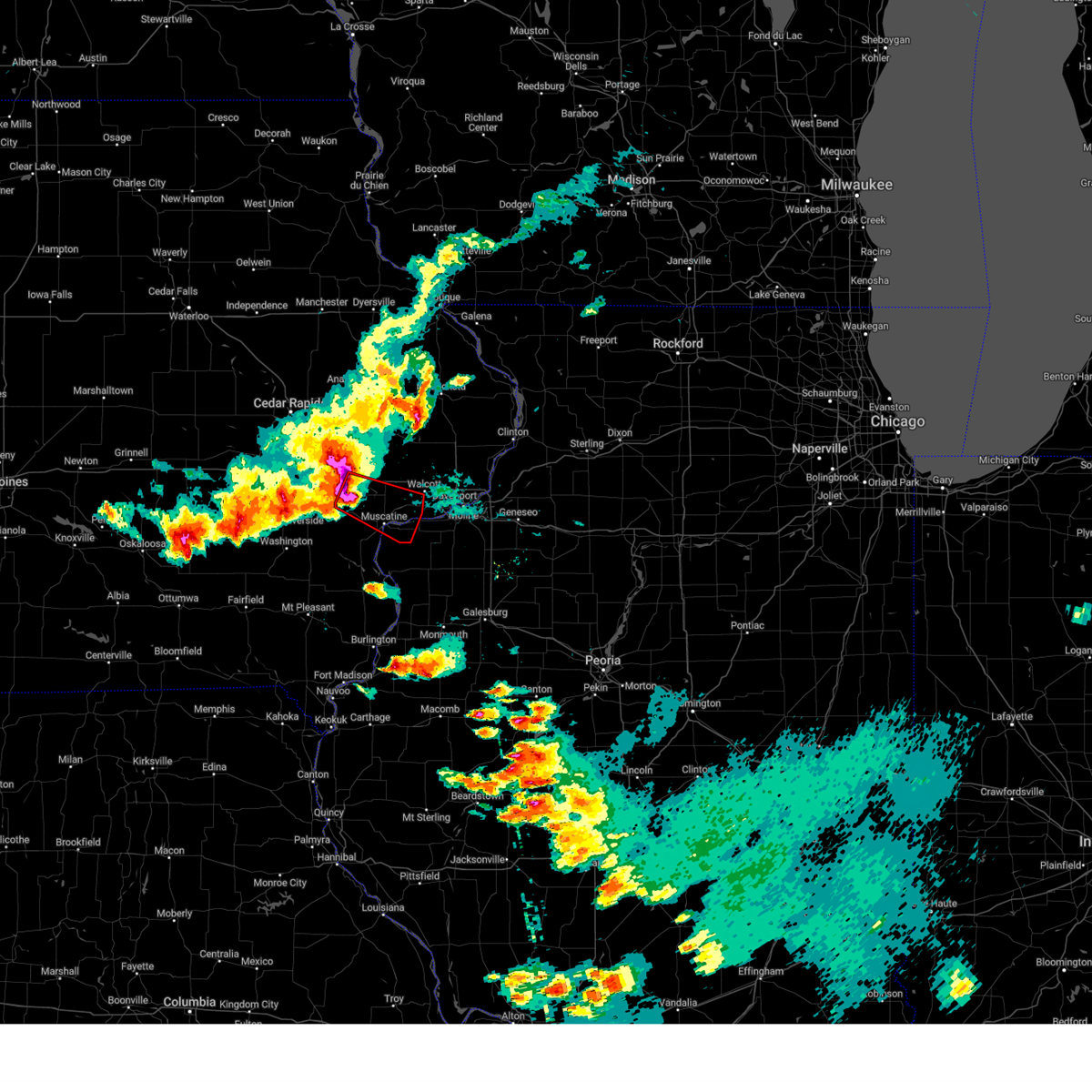 At 550 pm cdt, a confirmed tornado was located over west liberty, or 8 miles southeast of west branch, moving southeast at 35 mph (weather spotters confirmed tornado). Hazards include damaging tornado and hail up to two inches in diameter. Flying debris will be dangerous to those caught without shelter. mobile homes will be damaged or destroyed. damage to roofs, windows, and vehicles will occur. tree damage is likely. the tornado will be near, atalissa around 555 pm cdt. saulsbury bridge campground around 600 pm cdt. moscow around 605 pm cdt. wilton around 610 pm cdt. Other locations in the path of this tornadic thunderstorm include muscatine, fairport, sweetland center, new era, wildcat den state park, fairport recreation area, pleasant prairie and shady creek campground. At 550 pm cdt, a confirmed tornado was located over west liberty, or 8 miles southeast of west branch, moving southeast at 35 mph (weather spotters confirmed tornado). Hazards include damaging tornado and hail up to two inches in diameter. Flying debris will be dangerous to those caught without shelter. mobile homes will be damaged or destroyed. damage to roofs, windows, and vehicles will occur. tree damage is likely. the tornado will be near, atalissa around 555 pm cdt. saulsbury bridge campground around 600 pm cdt. moscow around 605 pm cdt. wilton around 610 pm cdt. Other locations in the path of this tornadic thunderstorm include muscatine, fairport, sweetland center, new era, wildcat den state park, fairport recreation area, pleasant prairie and shady creek campground.
|
| 5/7/2023 5:49 PM CDT |
 At 549 pm cdt, severe thunderstorms were located along a line extending from cedar valley park to near saulsbury bridge campground to near nichols, moving southeast at 40 mph (radar indicated). Hazards include two inch hail and 70 mph wind gusts. People and animals outdoors will be injured. expect hail damage to roofs, siding, windows, and vehicles. expect considerable tree damage. wind damage is also likely to mobile homes, roofs, and outbuildings. severe thunderstorms will be near, ardon around 555 pm cdt. fruitland, muscatine municipal airport and sand springs around 600 pm cdt. muscatine, bennett, sweetland center and moscow around 605 pm cdt. other locations in the path of these severe thunderstorms include wilton, fairport, fairport recreation area, new era, wildcat den state park, sunbury, durant, eliza, illinois city, new liberty, shady creek campground, loud thunder forest preserve, midway beach, clark`s ferry recreation area, petersville, montpelier, stockton, loud thunder scout camp, buffalo shores, pleasant prairie, plainview, andalusia, millersburg, edgington, maysville, marston, walcott, blue grass, reynolds, taylor ridge, hamlet, gingle corners and aledo mercer county airport. thunderstorm damage threat, considerable hail threat, radar indicated max hail size, 2. 00 in wind threat, radar indicated max wind gust, 70 mph. At 549 pm cdt, severe thunderstorms were located along a line extending from cedar valley park to near saulsbury bridge campground to near nichols, moving southeast at 40 mph (radar indicated). Hazards include two inch hail and 70 mph wind gusts. People and animals outdoors will be injured. expect hail damage to roofs, siding, windows, and vehicles. expect considerable tree damage. wind damage is also likely to mobile homes, roofs, and outbuildings. severe thunderstorms will be near, ardon around 555 pm cdt. fruitland, muscatine municipal airport and sand springs around 600 pm cdt. muscatine, bennett, sweetland center and moscow around 605 pm cdt. other locations in the path of these severe thunderstorms include wilton, fairport, fairport recreation area, new era, wildcat den state park, sunbury, durant, eliza, illinois city, new liberty, shady creek campground, loud thunder forest preserve, midway beach, clark`s ferry recreation area, petersville, montpelier, stockton, loud thunder scout camp, buffalo shores, pleasant prairie, plainview, andalusia, millersburg, edgington, maysville, marston, walcott, blue grass, reynolds, taylor ridge, hamlet, gingle corners and aledo mercer county airport. thunderstorm damage threat, considerable hail threat, radar indicated max hail size, 2. 00 in wind threat, radar indicated max wind gust, 70 mph.
|
| 4/4/2023 9:27 AM CDT |
 At 926 am cdt, a severe thunderstorm was located over walcott, or near durant, moving east at 40 mph (trained weather spotters. at 914 am, a trained spotter reported two inch hail south of wilton). Hazards include two inch hail. People and animals outdoors will be injured. expect damage to roofs, siding, windows, and vehicles. this severe storm will be near, plainview around 930 am cdt. maysville and west lake park around 935 am cdt. donahue and mississippi valley fairgrounds around 940 am cdt. other locations in the path of this severe thunderstorm include davenport, eldridge, long grove, davenport municipal airport, park view, scott county park, bettendorf, mccausland, le claire, princeton, port byron, cordova, low moor, princeton wildlife area, rock creek park, rock creek marina and campground and folletts. thunderstorm damage threat, considerable hail threat, radar indicated max hail size, 2. 00 in wind threat, radar indicated max wind gust, <50 mph. At 926 am cdt, a severe thunderstorm was located over walcott, or near durant, moving east at 40 mph (trained weather spotters. at 914 am, a trained spotter reported two inch hail south of wilton). Hazards include two inch hail. People and animals outdoors will be injured. expect damage to roofs, siding, windows, and vehicles. this severe storm will be near, plainview around 930 am cdt. maysville and west lake park around 935 am cdt. donahue and mississippi valley fairgrounds around 940 am cdt. other locations in the path of this severe thunderstorm include davenport, eldridge, long grove, davenport municipal airport, park view, scott county park, bettendorf, mccausland, le claire, princeton, port byron, cordova, low moor, princeton wildlife area, rock creek park, rock creek marina and campground and folletts. thunderstorm damage threat, considerable hail threat, radar indicated max hail size, 2. 00 in wind threat, radar indicated max wind gust, <50 mph.
|
| 4/4/2023 9:24 AM CDT |
 At 924 am cdt, a severe thunderstorm was located over stockton, or near durant, moving east at 40 mph (radar indicated). Hazards include golf ball size hail. People and animals outdoors will be injured. expect damage to roofs, siding, windows, and vehicles. this severe thunderstorm will be near, plainview around 930 am cdt. maysville and west lake park around 935 am cdt. donahue and mississippi valley fairgrounds around 940 am cdt. other locations in the path of this severe thunderstorm include davenport, eldridge, long grove, davenport municipal airport, bettendorf, riverdale, panorama park, park view, scott county park, mccausland, pleasant valley, fishermans corner, le claire, rapids city, princeton, camanche, port byron, cordova, low moor, princeton wildlife area, rock creek park, rock creek marina and campground and folletts. thunderstorm damage threat, considerable hail threat, radar indicated max hail size, 1. 75 in wind threat, radar indicated max wind gust, <50 mph. At 924 am cdt, a severe thunderstorm was located over stockton, or near durant, moving east at 40 mph (radar indicated). Hazards include golf ball size hail. People and animals outdoors will be injured. expect damage to roofs, siding, windows, and vehicles. this severe thunderstorm will be near, plainview around 930 am cdt. maysville and west lake park around 935 am cdt. donahue and mississippi valley fairgrounds around 940 am cdt. other locations in the path of this severe thunderstorm include davenport, eldridge, long grove, davenport municipal airport, bettendorf, riverdale, panorama park, park view, scott county park, mccausland, pleasant valley, fishermans corner, le claire, rapids city, princeton, camanche, port byron, cordova, low moor, princeton wildlife area, rock creek park, rock creek marina and campground and folletts. thunderstorm damage threat, considerable hail threat, radar indicated max hail size, 1. 75 in wind threat, radar indicated max wind gust, <50 mph.
|
| 4/4/2023 9:05 AM CDT |
 At 905 am cdt, a severe thunderstorm was located near wilton, or near durant, moving northeast at 45 mph (radar indicated). Hazards include golf ball size hail. People and animals outdoors will be injured. expect damage to roofs, siding, windows, and vehicles. this severe storm will be near, pleasant prairie and wildcat den state park around 910 am cdt. other locations in the path of this severe thunderstorm include durant, stockton, sunbury, blue grass, new liberty, walcott, plainview, camp liberty, dixon, maysville, davenport, eldridge, donahue, davenport municipal airport, long grove, park view and scott county park. thunderstorm damage threat, considerable hail threat, radar indicated max hail size, 1. 75 in wind threat, radar indicated max wind gust, <50 mph. At 905 am cdt, a severe thunderstorm was located near wilton, or near durant, moving northeast at 45 mph (radar indicated). Hazards include golf ball size hail. People and animals outdoors will be injured. expect damage to roofs, siding, windows, and vehicles. this severe storm will be near, pleasant prairie and wildcat den state park around 910 am cdt. other locations in the path of this severe thunderstorm include durant, stockton, sunbury, blue grass, new liberty, walcott, plainview, camp liberty, dixon, maysville, davenport, eldridge, donahue, davenport municipal airport, long grove, park view and scott county park. thunderstorm damage threat, considerable hail threat, radar indicated max hail size, 1. 75 in wind threat, radar indicated max wind gust, <50 mph.
|
| 4/4/2023 8:52 AM CDT |
 At 851 am cdt, a severe thunderstorm was located over saulsbury bridge campground, or near muscatine, moving northeast at 45 mph (radar indicated). Hazards include golf ball size hail. People and animals outdoors will be injured. expect damage to roofs, siding, windows, and vehicles. this severe thunderstorm will be near, atalissa around 855 am cdt. muscatine and moscow around 900 am cdt. wilton and sweetland center around 905 am cdt. pleasant prairie and new era around 910 am cdt. other locations in the path of this severe thunderstorm include durant, stockton, sunbury, blue grass, new liberty, walcott, plainview, camp liberty, davenport, eldridge, long grove, donahue, dixon, maysville and davenport municipal airport. thunderstorm damage threat, considerable hail threat, radar indicated max hail size, 1. 75 in wind threat, radar indicated max wind gust, <50 mph. At 851 am cdt, a severe thunderstorm was located over saulsbury bridge campground, or near muscatine, moving northeast at 45 mph (radar indicated). Hazards include golf ball size hail. People and animals outdoors will be injured. expect damage to roofs, siding, windows, and vehicles. this severe thunderstorm will be near, atalissa around 855 am cdt. muscatine and moscow around 900 am cdt. wilton and sweetland center around 905 am cdt. pleasant prairie and new era around 910 am cdt. other locations in the path of this severe thunderstorm include durant, stockton, sunbury, blue grass, new liberty, walcott, plainview, camp liberty, davenport, eldridge, long grove, donahue, dixon, maysville and davenport municipal airport. thunderstorm damage threat, considerable hail threat, radar indicated max hail size, 1. 75 in wind threat, radar indicated max wind gust, <50 mph.
|
| 11/5/2022 8:13 AM CDT |
 At 813 am cdt, severe thunderstorms were located along a line extending from near tipton to new liberty to near reynolds, moving northeast at 50 mph (radar indicated). Hazards include 60 mph wind gusts. Expect damage to roofs, siding, and trees. locations impacted include, davenport, moline, rock island, bettendorf, tipton, durant, stanwood, eldridge, milan, coal valley, wilton, walcott, blue grass, buffalo, andalusia, lowden, wheatland, reynolds, calamus and bennett. hail threat, radar indicated max hail size, <. 75 in wind threat, radar indicated max wind gust, 60 mph. At 813 am cdt, severe thunderstorms were located along a line extending from near tipton to new liberty to near reynolds, moving northeast at 50 mph (radar indicated). Hazards include 60 mph wind gusts. Expect damage to roofs, siding, and trees. locations impacted include, davenport, moline, rock island, bettendorf, tipton, durant, stanwood, eldridge, milan, coal valley, wilton, walcott, blue grass, buffalo, andalusia, lowden, wheatland, reynolds, calamus and bennett. hail threat, radar indicated max hail size, <. 75 in wind threat, radar indicated max wind gust, 60 mph.
|
| 11/5/2022 8:01 AM CDT |
 At 800 am cdt, severe thunderstorms were located along a line extending from rochester to wilton to millersburg, moving northeast at 50 mph (radar indicated. at 755 am a 59 mph gust was measured at the muscatine airport). Hazards include 60 mph wind gusts. Expect damage to roofs, siding, and trees. severe thunderstorms will be near, durant, wilton, rochester, stockton, cedar valley park and cedar valley around 805 am cdt. tipton, sunbury, tipton matthews airport and cedar county fairgrounds around 810 am cdt. bennett, taylor ridge, new liberty, bennett park, camp liberty, plainview and loud thunder scout camp around 815 am cdt. stanwood, milan, andalusia, oak grove, clarence, dixon, big rock, sherman park, coyne center and buffalo shores around 820 am cdt. other locations in the path of these severe thunderstorms include buffalo, lowden, wheatland, calamus, credit island, blackhawk state park, west lake park, fruitland, indian bluff golf course, moline quad-city airport, davenport, moline, rock island, mississippi valley fairgrounds, rock island arsenal and davenport municipal airport. hail threat, radar indicated max hail size, <. 75 in wind threat, observed max wind gust, 60 mph. At 800 am cdt, severe thunderstorms were located along a line extending from rochester to wilton to millersburg, moving northeast at 50 mph (radar indicated. at 755 am a 59 mph gust was measured at the muscatine airport). Hazards include 60 mph wind gusts. Expect damage to roofs, siding, and trees. severe thunderstorms will be near, durant, wilton, rochester, stockton, cedar valley park and cedar valley around 805 am cdt. tipton, sunbury, tipton matthews airport and cedar county fairgrounds around 810 am cdt. bennett, taylor ridge, new liberty, bennett park, camp liberty, plainview and loud thunder scout camp around 815 am cdt. stanwood, milan, andalusia, oak grove, clarence, dixon, big rock, sherman park, coyne center and buffalo shores around 820 am cdt. other locations in the path of these severe thunderstorms include buffalo, lowden, wheatland, calamus, credit island, blackhawk state park, west lake park, fruitland, indian bluff golf course, moline quad-city airport, davenport, moline, rock island, mississippi valley fairgrounds, rock island arsenal and davenport municipal airport. hail threat, radar indicated max hail size, <. 75 in wind threat, observed max wind gust, 60 mph.
|
| 9/18/2022 9:15 PM CDT | Golf Ball sized hail reported 0.1 miles N of Durant, IA |
| 9/18/2022 9:15 PM CDT | Tennis Ball sized hail reported 0.1 miles N of Durant, IA |
| 8/2/2022 5:32 AM CDT |
 At 532 am cdt, a severe thunderstorm was located over new era, or 8 miles east of muscatine, moving southeast at 45 mph (radar indicated). Hazards include 60 mph wind gusts. Expect damage to roofs, siding, and trees. locations impacted include, muscatine, durant, west liberty, wilton, fruitland, atalissa, rochester, fairport, montpelier, stockton, clark`s ferry recreation area, muscatine county fairgrounds, midway beach, new era, pleasant prairie, moscow, fairport recreation area, wildcat den state park, saulsbury bridge campground and shady creek campground. hail threat, radar indicated max hail size, <. 75 in wind threat, radar indicated max wind gust, 60 mph. At 532 am cdt, a severe thunderstorm was located over new era, or 8 miles east of muscatine, moving southeast at 45 mph (radar indicated). Hazards include 60 mph wind gusts. Expect damage to roofs, siding, and trees. locations impacted include, muscatine, durant, west liberty, wilton, fruitland, atalissa, rochester, fairport, montpelier, stockton, clark`s ferry recreation area, muscatine county fairgrounds, midway beach, new era, pleasant prairie, moscow, fairport recreation area, wildcat den state park, saulsbury bridge campground and shady creek campground. hail threat, radar indicated max hail size, <. 75 in wind threat, radar indicated max wind gust, 60 mph.
|
| 8/2/2022 5:22 AM CDT |
 At 521 am cdt, a severe thunderstorm was located near saulsbury bridge campground, or 8 miles north of muscatine, moving southeast at 50 mph (radar indicated). Hazards include 60 mph wind gusts. Expect damage to roofs, siding, and trees. locations impacted include, muscatine, west branch, durant, west liberty, wilton, fruitland, nichols, atalissa, montpelier, rochester, fairport, stockton, clark`s ferry recreation area, muscatine county fairgrounds, new era, pleasant prairie, moscow, saulsbury bridge campground, ardon and muscatine municipal airport. hail threat, radar indicated max hail size, <. 75 in wind threat, radar indicated max wind gust, 60 mph. At 521 am cdt, a severe thunderstorm was located near saulsbury bridge campground, or 8 miles north of muscatine, moving southeast at 50 mph (radar indicated). Hazards include 60 mph wind gusts. Expect damage to roofs, siding, and trees. locations impacted include, muscatine, west branch, durant, west liberty, wilton, fruitland, nichols, atalissa, montpelier, rochester, fairport, stockton, clark`s ferry recreation area, muscatine county fairgrounds, new era, pleasant prairie, moscow, saulsbury bridge campground, ardon and muscatine municipal airport. hail threat, radar indicated max hail size, <. 75 in wind threat, radar indicated max wind gust, 60 mph.
|
| 8/2/2022 5:11 AM CDT |
 At 511 am cdt, a severe thunderstorm was located over west liberty, or near west branch, moving southeast at 45 mph (radar indicated). Hazards include 60 mph wind gusts. expect damage to roofs, siding, and trees At 511 am cdt, a severe thunderstorm was located over west liberty, or near west branch, moving southeast at 45 mph (radar indicated). Hazards include 60 mph wind gusts. expect damage to roofs, siding, and trees
|
| 7/11/2022 7:09 AM CDT |
 At 709 am cdt, severe thunderstorms were located along a line extending from dixon to near edgington, moving east at 55 mph (radar indicated). Hazards include 60 mph wind gusts. Expect damage to roofs, siding, and trees. locations impacted include, davenport, moline, rock island, bettendorf, muscatine, east moline, durant, silvis, eldridge, milan, coal valley, wilton, hampton, walcott, blue grass, buffalo, andalusia, long grove, bennett and riverdale. hail threat, radar indicated max hail size, <. 75 in wind threat, radar indicated max wind gust, 60 mph. At 709 am cdt, severe thunderstorms were located along a line extending from dixon to near edgington, moving east at 55 mph (radar indicated). Hazards include 60 mph wind gusts. Expect damage to roofs, siding, and trees. locations impacted include, davenport, moline, rock island, bettendorf, muscatine, east moline, durant, silvis, eldridge, milan, coal valley, wilton, hampton, walcott, blue grass, buffalo, andalusia, long grove, bennett and riverdale. hail threat, radar indicated max hail size, <. 75 in wind threat, radar indicated max wind gust, 60 mph.
|
| 7/11/2022 7:00 AM CDT | At 700 am cdt, severe thunderstorms were located along a line extending from near lowden to near illinois city, moving east at 45 mph (radar indicated). Hazards include 60 mph wind gusts. Expect damage to roofs, siding, and trees. locations impacted include, davenport, moline, rock island, bettendorf, muscatine, east moline, tipton, durant, silvis, eldridge, dewitt, milan, coal valley, wilton, hampton, walcott, blue grass, buffalo, andalusia and long grove. hail threat, radar indicated max hail size, <. 75 in wind threat, radar indicated max wind gust, 60 mph. |
| 7/11/2022 7:00 AM CDT | At 700 am cdt, severe thunderstorms were located along a line extending from near lowden to near illinois city, moving east at 45 mph (radar indicated). Hazards include 60 mph wind gusts. Expect damage to roofs, siding, and trees. locations impacted include, davenport, moline, rock island, bettendorf, muscatine, east moline, tipton, durant, silvis, eldridge, dewitt, milan, coal valley, wilton, hampton, walcott, blue grass, buffalo, andalusia and long grove. hail threat, radar indicated max hail size, <. 75 in wind threat, radar indicated max wind gust, 60 mph. |
| 7/11/2022 6:40 AM CDT |
 At 640 am cdt, severe thunderstorms were located along a line extending from mount vernon to west liberty, moving east at 50 mph (radar indicated). Hazards include 60 mph wind gusts. expect damage to roofs, siding, and trees At 640 am cdt, severe thunderstorms were located along a line extending from mount vernon to west liberty, moving east at 50 mph (radar indicated). Hazards include 60 mph wind gusts. expect damage to roofs, siding, and trees
|
| 7/5/2022 10:27 PM CDT |
 At 1027 pm cdt, severe thunderstorms were located along a line extending from near maquoketa to grand mound to near marston, moving southeast at 45 mph (radar indicated). Hazards include 60 mph wind gusts. Expect damage to roofs, siding, and trees. locations impacted include, davenport, moline, rock island, bettendorf, clinton, east moline, maquoketa, durant, silvis, eldridge, dewitt, milan, camanche, le claire, coal valley, hampton, port byron, walcott, blue grass and buffalo. hail threat, radar indicated max hail size, <. 75 in wind threat, observed max wind gust, 60 mph. At 1027 pm cdt, severe thunderstorms were located along a line extending from near maquoketa to grand mound to near marston, moving southeast at 45 mph (radar indicated). Hazards include 60 mph wind gusts. Expect damage to roofs, siding, and trees. locations impacted include, davenport, moline, rock island, bettendorf, clinton, east moline, maquoketa, durant, silvis, eldridge, dewitt, milan, camanche, le claire, coal valley, hampton, port byron, walcott, blue grass and buffalo. hail threat, radar indicated max hail size, <. 75 in wind threat, observed max wind gust, 60 mph.
|
| 7/5/2022 10:20 PM CDT |
 At 1019 pm cdt, severe thunderstorms were located along a line extending from maquoketa municipal airport to calamus to wapello, moving southeast at 45 mph (radar indicated). Hazards include 60 mph wind gusts. Expect damage to roofs, siding, and trees. locations impacted include, davenport, moline, rock island, bettendorf, clinton, muscatine, east moline, maquoketa, durant, silvis, eldridge, dewitt, milan, camanche, le claire, coal valley, wilton, hampton, port byron and walcott. hail threat, radar indicated max hail size, <. 75 in wind threat, observed max wind gust, 60 mph. At 1019 pm cdt, severe thunderstorms were located along a line extending from maquoketa municipal airport to calamus to wapello, moving southeast at 45 mph (radar indicated). Hazards include 60 mph wind gusts. Expect damage to roofs, siding, and trees. locations impacted include, davenport, moline, rock island, bettendorf, clinton, muscatine, east moline, maquoketa, durant, silvis, eldridge, dewitt, milan, camanche, le claire, coal valley, wilton, hampton, port byron and walcott. hail threat, radar indicated max hail size, <. 75 in wind threat, observed max wind gust, 60 mph.
|
| 7/5/2022 10:07 PM CDT |
 At 1007 pm cdt, severe thunderstorms were located along a line extending from near monmouth to lowden to near columbus city, moving southeast at 45 mph (radar indicated). Hazards include 60 mph wind gusts. expect damage to roofs, siding, and trees At 1007 pm cdt, severe thunderstorms were located along a line extending from near monmouth to lowden to near columbus city, moving southeast at 45 mph (radar indicated). Hazards include 60 mph wind gusts. expect damage to roofs, siding, and trees
|
| 7/5/2022 9:55 PM CDT |
 At 955 pm cdt, a severe thunderstorm was located near bennett park, or 10 miles east of tipton, moving southeast at 50 mph (radar indicated). Hazards include 60 mph wind gusts. Expect damage to roofs, siding, and trees. locations impacted include, tipton, durant, mechanicsville, stanwood, lowden, wyoming, oxford junction, bennett, buchanan, clarence, cedar valley, massillon park, cedar bluff, oxford mills, bennett park, sunbury, cedar valley park, tipton matthews airport and cedar county fairgrounds. hail threat, radar indicated max hail size, <. 75 in wind threat, radar indicated max wind gust, 60 mph. At 955 pm cdt, a severe thunderstorm was located near bennett park, or 10 miles east of tipton, moving southeast at 50 mph (radar indicated). Hazards include 60 mph wind gusts. Expect damage to roofs, siding, and trees. locations impacted include, tipton, durant, mechanicsville, stanwood, lowden, wyoming, oxford junction, bennett, buchanan, clarence, cedar valley, massillon park, cedar bluff, oxford mills, bennett park, sunbury, cedar valley park, tipton matthews airport and cedar county fairgrounds. hail threat, radar indicated max hail size, <. 75 in wind threat, radar indicated max wind gust, 60 mph.
|
| 7/5/2022 9:42 PM CDT |
 At 941 pm cdt, a severe thunderstorm was located over stanwood, moving southeast at 50 mph (radar indicated). Hazards include 70 mph wind gusts. Expect considerable tree damage. damage is likely to mobile homes, roofs, and outbuildings. locations impacted include, tipton, durant, mechanicsville, stanwood, lowden, wyoming, oxford junction, bennett, buchanan, clarence, cedar valley, massillon park, cedar bluff, oxford mills, bennett park, sunbury, cedar valley park, tipton matthews airport and cedar county fairgrounds. thunderstorm damage threat, considerable hail threat, radar indicated max hail size, <. 75 in wind threat, observed max wind gust, 70 mph. At 941 pm cdt, a severe thunderstorm was located over stanwood, moving southeast at 50 mph (radar indicated). Hazards include 70 mph wind gusts. Expect considerable tree damage. damage is likely to mobile homes, roofs, and outbuildings. locations impacted include, tipton, durant, mechanicsville, stanwood, lowden, wyoming, oxford junction, bennett, buchanan, clarence, cedar valley, massillon park, cedar bluff, oxford mills, bennett park, sunbury, cedar valley park, tipton matthews airport and cedar county fairgrounds. thunderstorm damage threat, considerable hail threat, radar indicated max hail size, <. 75 in wind threat, observed max wind gust, 70 mph.
|
| 7/5/2022 9:24 PM CDT |
 At 924 pm cdt, a severe thunderstorm was located near mount vernon, or 9 miles northwest of mechanicsville, moving southeast at 50 mph (radar indicated). Hazards include 60 mph wind gusts. expect damage to roofs, siding, and trees At 924 pm cdt, a severe thunderstorm was located near mount vernon, or 9 miles northwest of mechanicsville, moving southeast at 50 mph (radar indicated). Hazards include 60 mph wind gusts. expect damage to roofs, siding, and trees
|
| 6/25/2022 6:57 AM CDT |
 At 657 am cdt, severe thunderstorms were located along a line extending from near clinton county fairgrounds to near fairport recreation area, moving east at 50 mph (radar indicated). Hazards include 60 mph wind gusts. Expect damage to roofs, siding, and trees. locations impacted include, davenport, moline, rock island, bettendorf, clinton, east moline, durant, silvis, eldridge, dewitt, milan, camanche, le claire, coal valley, fulton, hampton, port byron, walcott, blue grass and buffalo. hail threat, radar indicated max hail size, <. 75 in wind threat, radar indicated max wind gust, 60 mph. At 657 am cdt, severe thunderstorms were located along a line extending from near clinton county fairgrounds to near fairport recreation area, moving east at 50 mph (radar indicated). Hazards include 60 mph wind gusts. Expect damage to roofs, siding, and trees. locations impacted include, davenport, moline, rock island, bettendorf, clinton, east moline, durant, silvis, eldridge, dewitt, milan, camanche, le claire, coal valley, fulton, hampton, port byron, walcott, blue grass and buffalo. hail threat, radar indicated max hail size, <. 75 in wind threat, radar indicated max wind gust, 60 mph.
|
| 6/25/2022 6:45 AM CDT |
 At 645 am cdt, severe thunderstorms were located along a line extending from welton to muscatine, moving east at 60 mph (radar indicated). Hazards include 60 mph wind gusts. Expect damage to roofs, siding, and trees. severe thunderstorms will be near, dewitt, welton and clinton county fairgrounds around 650 am cdt. malone and pleasant prairie around 655 am cdt. blue grass, low moor, montpelier, edgington, loud thunder scout camp, elvira, buffalo shores, clark`s ferry recreation area and clinton municipal airport around 700 am cdt. buffalo, andalusia, taylor ridge and west lake park around 705 am cdt. other locations in the path of these severe thunderstorms include clinton, milan, oak grove, coyne center, blackhawk state park, credit island, mississippi valley fairgrounds, moline, rock island, indian bluff golf course, moline quad-city airport, fruitland, rock island arsenal, east moline, silvis, coal valley, carbon cliff, rock island county fairgrounds, silvis heights, campbells island and barstow. hail threat, radar indicated max hail size, <. 75 in wind threat, radar indicated max wind gust, 60 mph. At 645 am cdt, severe thunderstorms were located along a line extending from welton to muscatine, moving east at 60 mph (radar indicated). Hazards include 60 mph wind gusts. Expect damage to roofs, siding, and trees. severe thunderstorms will be near, dewitt, welton and clinton county fairgrounds around 650 am cdt. malone and pleasant prairie around 655 am cdt. blue grass, low moor, montpelier, edgington, loud thunder scout camp, elvira, buffalo shores, clark`s ferry recreation area and clinton municipal airport around 700 am cdt. buffalo, andalusia, taylor ridge and west lake park around 705 am cdt. other locations in the path of these severe thunderstorms include clinton, milan, oak grove, coyne center, blackhawk state park, credit island, mississippi valley fairgrounds, moline, rock island, indian bluff golf course, moline quad-city airport, fruitland, rock island arsenal, east moline, silvis, coal valley, carbon cliff, rock island county fairgrounds, silvis heights, campbells island and barstow. hail threat, radar indicated max hail size, <. 75 in wind threat, radar indicated max wind gust, 60 mph.
|
| 6/15/2022 10:31 PM CDT |
 At 1031 pm cdt, a severe thunderstorm was located near blue grass, or near durant, moving east at 45 mph (radar indicated). Hazards include 60 mph wind gusts and quarter size hail. Hail damage to vehicles is expected. expect wind damage to roofs, siding, and trees. this severe storm will be near, plainview around 1035 pm cdt. maysville and west lake park around 1040 pm cdt. donahue, davenport municipal airport and mississippi valley fairgrounds around 1045 pm cdt. other locations in the path of this severe thunderstorm include davenport, eldridge, long grove, riverdale, park view, rock island arsenal and bettendorf. hail threat, radar indicated max hail size, 1. 00 in wind threat, radar indicated max wind gust, 60 mph. At 1031 pm cdt, a severe thunderstorm was located near blue grass, or near durant, moving east at 45 mph (radar indicated). Hazards include 60 mph wind gusts and quarter size hail. Hail damage to vehicles is expected. expect wind damage to roofs, siding, and trees. this severe storm will be near, plainview around 1035 pm cdt. maysville and west lake park around 1040 pm cdt. donahue, davenport municipal airport and mississippi valley fairgrounds around 1045 pm cdt. other locations in the path of this severe thunderstorm include davenport, eldridge, long grove, riverdale, park view, rock island arsenal and bettendorf. hail threat, radar indicated max hail size, 1. 00 in wind threat, radar indicated max wind gust, 60 mph.
|
| 6/15/2022 10:27 PM CDT |
 At 1027 pm cdt, a severe thunderstorm was located over pleasant prairie, or near durant, moving east at 45 mph (radar indicated). Hazards include 60 mph wind gusts and quarter size hail. Hail damage to vehicles is expected. expect wind damage to roofs, siding, and trees. this severe storm will be near, montpelier around 1030 pm cdt. walcott, blue grass and plainview around 1035 pm cdt. maysville and west lake park around 1040 pm cdt. other locations in the path of this severe thunderstorm include donahue, mississippi valley fairgrounds, davenport, eldridge, long grove, riverdale, davenport municipal airport, rock island arsenal, bettendorf and park view. hail threat, radar indicated max hail size, 1. 00 in wind threat, radar indicated max wind gust, 60 mph. At 1027 pm cdt, a severe thunderstorm was located over pleasant prairie, or near durant, moving east at 45 mph (radar indicated). Hazards include 60 mph wind gusts and quarter size hail. Hail damage to vehicles is expected. expect wind damage to roofs, siding, and trees. this severe storm will be near, montpelier around 1030 pm cdt. walcott, blue grass and plainview around 1035 pm cdt. maysville and west lake park around 1040 pm cdt. other locations in the path of this severe thunderstorm include donahue, mississippi valley fairgrounds, davenport, eldridge, long grove, riverdale, davenport municipal airport, rock island arsenal, bettendorf and park view. hail threat, radar indicated max hail size, 1. 00 in wind threat, radar indicated max wind gust, 60 mph.
|
| 6/15/2022 10:20 PM CDT |
 At 1019 pm cdt, a severe thunderstorm was located over sweetland center, or 7 miles northeast of muscatine, moving east at 45 mph (radar indicated). Hazards include ping pong ball size hail and 60 mph wind gusts. People and animals outdoors will be injured. expect hail damage to roofs, siding, windows, and vehicles. expect wind damage to roofs, siding, and trees. this severe storm will be near, durant, wildcat den state park and shady creek campground around 1025 pm cdt. montpelier, stockton, pleasant prairie, midway beach and clark`s ferry recreation area around 1030 pm cdt. other locations in the path of this severe thunderstorm include walcott, blue grass, maysville, west lake park, plainview, donahue, mississippi valley fairgrounds, davenport, eldridge, long grove, davenport municipal airport, rock island arsenal, bettendorf, riverdale and park view. hail threat, radar indicated max hail size, 1. 50 in wind threat, radar indicated max wind gust, 60 mph. At 1019 pm cdt, a severe thunderstorm was located over sweetland center, or 7 miles northeast of muscatine, moving east at 45 mph (radar indicated). Hazards include ping pong ball size hail and 60 mph wind gusts. People and animals outdoors will be injured. expect hail damage to roofs, siding, windows, and vehicles. expect wind damage to roofs, siding, and trees. this severe storm will be near, durant, wildcat den state park and shady creek campground around 1025 pm cdt. montpelier, stockton, pleasant prairie, midway beach and clark`s ferry recreation area around 1030 pm cdt. other locations in the path of this severe thunderstorm include walcott, blue grass, maysville, west lake park, plainview, donahue, mississippi valley fairgrounds, davenport, eldridge, long grove, davenport municipal airport, rock island arsenal, bettendorf, riverdale and park view. hail threat, radar indicated max hail size, 1. 50 in wind threat, radar indicated max wind gust, 60 mph.
|
| 6/15/2022 10:12 PM CDT |
 At 1012 pm cdt, a severe thunderstorm was located near saulsbury bridge campground, or near muscatine, moving east at 45 mph (radar indicated). Hazards include ping pong ball size hail and 60 mph wind gusts. People and animals outdoors will be injured. expect hail damage to roofs, siding, windows, and vehicles. expect wind damage to roofs, siding, and trees. this severe storm will be near, sweetland center around 1020 pm cdt. new era, wildcat den state park and shady creek campground around 1025 pm cdt. other locations in the path of this severe thunderstorm include durant, montpelier, stockton, pleasant prairie, midway beach, clark`s ferry recreation area, blue grass, walcott, maysville, west lake park, plainview, davenport, eldridge, long grove, donahue, davenport municipal airport and mississippi valley fairgrounds. hail threat, radar indicated max hail size, 1. 50 in wind threat, radar indicated max wind gust, 60 mph. At 1012 pm cdt, a severe thunderstorm was located near saulsbury bridge campground, or near muscatine, moving east at 45 mph (radar indicated). Hazards include ping pong ball size hail and 60 mph wind gusts. People and animals outdoors will be injured. expect hail damage to roofs, siding, windows, and vehicles. expect wind damage to roofs, siding, and trees. this severe storm will be near, sweetland center around 1020 pm cdt. new era, wildcat den state park and shady creek campground around 1025 pm cdt. other locations in the path of this severe thunderstorm include durant, montpelier, stockton, pleasant prairie, midway beach, clark`s ferry recreation area, blue grass, walcott, maysville, west lake park, plainview, davenport, eldridge, long grove, donahue, davenport municipal airport and mississippi valley fairgrounds. hail threat, radar indicated max hail size, 1. 50 in wind threat, radar indicated max wind gust, 60 mph.
|
| 6/15/2022 10:07 PM CDT |
 At 1007 pm cdt, a severe thunderstorm was located near saulsbury bridge campground, or near muscatine, moving east at 50 mph (radar indicated). Hazards include ping pong ball size hail and 60 mph wind gusts. People and animals outdoors will be injured. expect hail damage to roofs, siding, windows, and vehicles. expect wind damage to roofs, siding, and trees. this severe thunderstorm will be near, muscatine, wilton and sweetland center around 1020 pm cdt. fairport, new era, wildcat den state park, shady creek campground and fairport recreation area around 1025 pm cdt. other locations in the path of this severe thunderstorm include durant, montpelier, stockton, pleasant prairie, midway beach, clark`s ferry recreation area, blue grass, walcott, buffalo, maysville, west lake park, plainview, davenport, rock island, eldridge, long grove, donahue, davenport municipal airport and mississippi valley fairgrounds. hail threat, radar indicated max hail size, 1. 50 in wind threat, radar indicated max wind gust, 60 mph. At 1007 pm cdt, a severe thunderstorm was located near saulsbury bridge campground, or near muscatine, moving east at 50 mph (radar indicated). Hazards include ping pong ball size hail and 60 mph wind gusts. People and animals outdoors will be injured. expect hail damage to roofs, siding, windows, and vehicles. expect wind damage to roofs, siding, and trees. this severe thunderstorm will be near, muscatine, wilton and sweetland center around 1020 pm cdt. fairport, new era, wildcat den state park, shady creek campground and fairport recreation area around 1025 pm cdt. other locations in the path of this severe thunderstorm include durant, montpelier, stockton, pleasant prairie, midway beach, clark`s ferry recreation area, blue grass, walcott, buffalo, maysville, west lake park, plainview, davenport, rock island, eldridge, long grove, donahue, davenport municipal airport and mississippi valley fairgrounds. hail threat, radar indicated max hail size, 1. 50 in wind threat, radar indicated max wind gust, 60 mph.
|
| 6/15/2022 7:26 PM CDT |
 At 726 pm cdt, severe thunderstorms were located along a line extending from long grove to buffalo, moving northeast at 50 mph (trained weather spotters). Hazards include 60 mph wind gusts and quarter size hail. Hail damage to vehicles is expected. expect wind damage to roofs, siding, and trees. these severe storms will be near, eldridge, long grove, scott county park and park view around 730 pm cdt. mccausland around 735 pm cdt. other locations in the path of these severe thunderstorms include princeton, riverdale, folletts, davenport municipal airport, bettendorf, camanche, low moor, panorama park, pleasant valley, illiniwek forest preserve, fishermans corner, rock creek marina and campground, rock creek park, le claire, hampton, rapids city, albany, clinton, port byron, cordova, princeton wildlife area and hillsdale. hail threat, radar indicated max hail size, 1. 00 in wind threat, radar indicated max wind gust, 60 mph. At 726 pm cdt, severe thunderstorms were located along a line extending from long grove to buffalo, moving northeast at 50 mph (trained weather spotters). Hazards include 60 mph wind gusts and quarter size hail. Hail damage to vehicles is expected. expect wind damage to roofs, siding, and trees. these severe storms will be near, eldridge, long grove, scott county park and park view around 730 pm cdt. mccausland around 735 pm cdt. other locations in the path of these severe thunderstorms include princeton, riverdale, folletts, davenport municipal airport, bettendorf, camanche, low moor, panorama park, pleasant valley, illiniwek forest preserve, fishermans corner, rock creek marina and campground, rock creek park, le claire, hampton, rapids city, albany, clinton, port byron, cordova, princeton wildlife area and hillsdale. hail threat, radar indicated max hail size, 1. 00 in wind threat, radar indicated max wind gust, 60 mph.
|
| 6/15/2022 7:19 PM CDT |
 At 719 pm cdt, severe thunderstorms were located along a line extending from near park view to wildcat den state park, moving northeast at 55 mph (trained weather spotters). Hazards include 60 mph wind gusts and quarter size hail. Hail damage to vehicles is expected. expect wind damage to roofs, siding, and trees. these severe storms will be near, long grove, mccausland, scott county park and park view around 725 pm cdt. other locations in the path of these severe thunderstorms include folletts, rock island, camanche, low moor, maysville, rock creek park, rock creek marina and campground, mississippi valley fairgrounds, credit island, blackhawk state park, davenport, moline, eldridge, albany, riverdale, davenport municipal airport, rock island arsenal, bettendorf, clinton, east moline, hampton, panorama park, pleasant valley, illiniwek forest preserve, fishermans corner, campbells island, le claire, port byron, rapids city, princeton, cordova and princeton wildlife area. hail threat, radar indicated max hail size, 1. 00 in wind threat, radar indicated max wind gust, 60 mph. At 719 pm cdt, severe thunderstorms were located along a line extending from near park view to wildcat den state park, moving northeast at 55 mph (trained weather spotters). Hazards include 60 mph wind gusts and quarter size hail. Hail damage to vehicles is expected. expect wind damage to roofs, siding, and trees. these severe storms will be near, long grove, mccausland, scott county park and park view around 725 pm cdt. other locations in the path of these severe thunderstorms include folletts, rock island, camanche, low moor, maysville, rock creek park, rock creek marina and campground, mississippi valley fairgrounds, credit island, blackhawk state park, davenport, moline, eldridge, albany, riverdale, davenport municipal airport, rock island arsenal, bettendorf, clinton, east moline, hampton, panorama park, pleasant valley, illiniwek forest preserve, fishermans corner, campbells island, le claire, port byron, rapids city, princeton, cordova and princeton wildlife area. hail threat, radar indicated max hail size, 1. 00 in wind threat, radar indicated max wind gust, 60 mph.
|
| 6/15/2022 7:07 PM CDT |
 At 707 pm cdt, severe thunderstorms were located along a line extending from walcott to muscatine, moving northeast at 60 mph (radar indicated). Hazards include 60 mph wind gusts and quarter size hail. Hail damage to vehicles is expected. expect wind damage to roofs, siding, and trees. severe thunderstorms will be near, walcott, maysville and plainview around 710 pm cdt. davenport, eldridge, donahue and davenport municipal airport around 715 pm cdt. long grove, montpelier, midway beach, wildcat den state park, clark`s ferry recreation area, park view, pleasant prairie, loud thunder forest preserve, scott county park and loud thunder scout camp around 720 pm cdt. blue grass, andalusia, mccausland, stockton and buffalo shores around 725 pm cdt. other locations in the path of these severe thunderstorms include buffalo, princeton, cordova, folletts, west lake park, rock creek marina and campground, rock creek park, princeton wildlife area, credit island, rock island, camanche, albany, low moor, mississippi valley fairgrounds, rock island arsenal, blackhawk state park, moline, east moline, silvis, riverdale, panorama park, campbells island, bettendorf, clinton, le claire, hampton, port byron, rapids city, fishermans corner, pleasant valley and illiniwek forest preserve. hail threat, radar indicated max hail size, 1. 00 in wind threat, radar indicated max wind gust, 60 mph. At 707 pm cdt, severe thunderstorms were located along a line extending from walcott to muscatine, moving northeast at 60 mph (radar indicated). Hazards include 60 mph wind gusts and quarter size hail. Hail damage to vehicles is expected. expect wind damage to roofs, siding, and trees. severe thunderstorms will be near, walcott, maysville and plainview around 710 pm cdt. davenport, eldridge, donahue and davenport municipal airport around 715 pm cdt. long grove, montpelier, midway beach, wildcat den state park, clark`s ferry recreation area, park view, pleasant prairie, loud thunder forest preserve, scott county park and loud thunder scout camp around 720 pm cdt. blue grass, andalusia, mccausland, stockton and buffalo shores around 725 pm cdt. other locations in the path of these severe thunderstorms include buffalo, princeton, cordova, folletts, west lake park, rock creek marina and campground, rock creek park, princeton wildlife area, credit island, rock island, camanche, albany, low moor, mississippi valley fairgrounds, rock island arsenal, blackhawk state park, moline, east moline, silvis, riverdale, panorama park, campbells island, bettendorf, clinton, le claire, hampton, port byron, rapids city, fishermans corner, pleasant valley and illiniwek forest preserve. hail threat, radar indicated max hail size, 1. 00 in wind threat, radar indicated max wind gust, 60 mph.
|
| 3/5/2022 8:26 PM CST |
 At 826 pm cst, severe thunderstorms were located along a line extending from near wilton to illinois city to new boston, moving northeast at 65 mph (radar indicated). Hazards include 60 mph wind gusts and quarter size hail. Hail damage to vehicles is expected. expect wind damage to roofs, siding, and trees. severe thunderstorms will be near, durant around 830 pm cst. blue grass, andalusia and montpelier around 835 pm cst. aledo, walcott and buffalo around 840 pm cst. davenport, rock island, eldridge, viola, long grove, matherville, reynolds, donahue, hamlet and boden around 845 pm cst. other locations in the path of these severe thunderstorms include moline, bettendorf, east moline, silvis, sherrard, riverdale, cable, taylor ridge, dewitt, milan, le claire, hampton, rapids city, oak grove, mccausland, camanche, coal valley, orion, port byron, princeton, cordova, low moor, warner, lynn center, colona and cleveland. hail threat, radar indicated max hail size, 1. 00 in wind threat, radar indicated max wind gust, 60 mph. At 826 pm cst, severe thunderstorms were located along a line extending from near wilton to illinois city to new boston, moving northeast at 65 mph (radar indicated). Hazards include 60 mph wind gusts and quarter size hail. Hail damage to vehicles is expected. expect wind damage to roofs, siding, and trees. severe thunderstorms will be near, durant around 830 pm cst. blue grass, andalusia and montpelier around 835 pm cst. aledo, walcott and buffalo around 840 pm cst. davenport, rock island, eldridge, viola, long grove, matherville, reynolds, donahue, hamlet and boden around 845 pm cst. other locations in the path of these severe thunderstorms include moline, bettendorf, east moline, silvis, sherrard, riverdale, cable, taylor ridge, dewitt, milan, le claire, hampton, rapids city, oak grove, mccausland, camanche, coal valley, orion, port byron, princeton, cordova, low moor, warner, lynn center, colona and cleveland. hail threat, radar indicated max hail size, 1. 00 in wind threat, radar indicated max wind gust, 60 mph.
|
| 12/15/2021 9:40 PM CST |
 The severe thunderstorm warning for louisa, cedar and muscatine counties will expire at 945 pm cst, the storms which prompted the warning have moved out of the warned area. therefore, the warning will be allowed to expire. very strong winds are expected to continue behind the line of showers and thunderstorms. a tornado watch remains in effect until 1100 pm cst for northwestern illinois, and southeastern and east central iowa. The severe thunderstorm warning for louisa, cedar and muscatine counties will expire at 945 pm cst, the storms which prompted the warning have moved out of the warned area. therefore, the warning will be allowed to expire. very strong winds are expected to continue behind the line of showers and thunderstorms. a tornado watch remains in effect until 1100 pm cst for northwestern illinois, and southeastern and east central iowa.
|
| 12/15/2021 9:37 PM CST |
 At 935 pm cst, severe thunderstorms were located along a line extending from near platteville to near hamlet, moving east at 55 mph (trained weather spotters). Hazards include 70 mph wind gusts. Expect considerable tree damage. damage is likely to mobile homes, roofs, and outbuildings. locations impacted include, davenport, dubuque, moline, rock island, bettendorf, clinton, east moline, maquoketa, galena, durant, silvis, eldridge, dewitt, milan, colona, camanche, asbury, le claire, coal valley and savanna. thunderstorm damage threat, considerable hail threat, radar indicated max hail size, <. 75 in wind threat, observed max wind gust, 70 mph. At 935 pm cst, severe thunderstorms were located along a line extending from near platteville to near hamlet, moving east at 55 mph (trained weather spotters). Hazards include 70 mph wind gusts. Expect considerable tree damage. damage is likely to mobile homes, roofs, and outbuildings. locations impacted include, davenport, dubuque, moline, rock island, bettendorf, clinton, east moline, maquoketa, galena, durant, silvis, eldridge, dewitt, milan, colona, camanche, asbury, le claire, coal valley and savanna. thunderstorm damage threat, considerable hail threat, radar indicated max hail size, <. 75 in wind threat, observed max wind gust, 70 mph.
|
| 12/15/2021 9:16 PM CST |
 At 915 pm cst, severe thunderstorms were located along a line extending from wyoming to mediapolis, moving east at 60 mph (trained weather spotters). Hazards include 70 mph wind gusts. Expect considerable tree damage. damage is likely to mobile homes, roofs, and outbuildings. locations impacted include, muscatine, tipton, west branch, wapello, columbus junction, durant, mechanicsville, stanwood, west liberty, wilton, walcott, fruitland, morning sun, lowden, new boston, grandview, conesville, bennett, columbus city and letts. thunderstorm damage threat, considerable hail threat, radar indicated max hail size, <. 75 in wind threat, observed max wind gust, 70 mph. At 915 pm cst, severe thunderstorms were located along a line extending from wyoming to mediapolis, moving east at 60 mph (trained weather spotters). Hazards include 70 mph wind gusts. Expect considerable tree damage. damage is likely to mobile homes, roofs, and outbuildings. locations impacted include, muscatine, tipton, west branch, wapello, columbus junction, durant, mechanicsville, stanwood, west liberty, wilton, walcott, fruitland, morning sun, lowden, new boston, grandview, conesville, bennett, columbus city and letts. thunderstorm damage threat, considerable hail threat, radar indicated max hail size, <. 75 in wind threat, observed max wind gust, 70 mph.
|
| 12/15/2021 9:12 PM CST |
 At 911 pm cst, severe thunderstorms were located along a line extending from balltown to near fruitland, moving east at 55 mph (radar indicated). Hazards include 70 mph wind gusts. Expect considerable tree damage. damage is likely to mobile homes, roofs, and outbuildings. severe thunderstorms will be near, rickardsville, sherrill and balltown around 915 pm cst. fairport and illinois city around 930 pm cst. other locations in the path of these severe thunderstorms include blue grass, andalusia, taylor ridge, buffalo, rock island, milan, oak grove, moline, bettendorf, riverdale, east moline, silvis, colona, coal valley, hampton, le claire, port byron, rapids city, cleveland and osborn. thunderstorm damage threat, considerable hail threat, radar indicated max hail size, <. 75 in wind threat, radar indicated max wind gust, 70 mph. At 911 pm cst, severe thunderstorms were located along a line extending from balltown to near fruitland, moving east at 55 mph (radar indicated). Hazards include 70 mph wind gusts. Expect considerable tree damage. damage is likely to mobile homes, roofs, and outbuildings. severe thunderstorms will be near, rickardsville, sherrill and balltown around 915 pm cst. fairport and illinois city around 930 pm cst. other locations in the path of these severe thunderstorms include blue grass, andalusia, taylor ridge, buffalo, rock island, milan, oak grove, moline, bettendorf, riverdale, east moline, silvis, colona, coal valley, hampton, le claire, port byron, rapids city, cleveland and osborn. thunderstorm damage threat, considerable hail threat, radar indicated max hail size, <. 75 in wind threat, radar indicated max wind gust, 70 mph.
|
| 12/15/2021 8:50 PM CST |
 At 850 pm cst, severe thunderstorms were located along a line extending from near morley to near mount pleasant, moving northeast at 65 mph (trained weather spotters). Hazards include 70 mph wind gusts. Expect considerable tree damage. damage is likely to mobile homes, roofs, and outbuildings. severe thunderstorms will be near, morning sun around 905 pm cst. amber around 910 pm cst. other locations in the path of these severe thunderstorms include oakville, toolesboro and new boston. thunderstorm damage threat, considerable hail threat, radar indicated max hail size, <. 75 in wind threat, observed max wind gust, 70 mph. At 850 pm cst, severe thunderstorms were located along a line extending from near morley to near mount pleasant, moving northeast at 65 mph (trained weather spotters). Hazards include 70 mph wind gusts. Expect considerable tree damage. damage is likely to mobile homes, roofs, and outbuildings. severe thunderstorms will be near, morning sun around 905 pm cst. amber around 910 pm cst. other locations in the path of these severe thunderstorms include oakville, toolesboro and new boston. thunderstorm damage threat, considerable hail threat, radar indicated max hail size, <. 75 in wind threat, observed max wind gust, 70 mph.
|
| 7/14/2021 10:56 PM CDT |
 At 1038 pm cdt, severe thunderstorms were located along a line extending from mechanicsville to near rochester, moving east at 45 mph (trained weather spotters). Hazards include 60 mph wind gusts. Expect damage to roofs, siding, and trees. Locations impacted include, tipton, west branch, durant, mechanicsville, stanwood, olin, wyoming, bennett, morley, rochester, buchanan, clarence, springdale, cedar valley, cedar bluff, sunbury, hale, cedar valley park, herbert hoover national historic site and tipton matthews airport. At 1038 pm cdt, severe thunderstorms were located along a line extending from mechanicsville to near rochester, moving east at 45 mph (trained weather spotters). Hazards include 60 mph wind gusts. Expect damage to roofs, siding, and trees. Locations impacted include, tipton, west branch, durant, mechanicsville, stanwood, olin, wyoming, bennett, morley, rochester, buchanan, clarence, springdale, cedar valley, cedar bluff, sunbury, hale, cedar valley park, herbert hoover national historic site and tipton matthews airport.
|
| 7/14/2021 10:39 PM CDT |
 At 1038 pm cdt, severe thunderstorms were located along a line extending from mechanicsville to near rochester, moving east at 45 mph (trained weather spotters). Hazards include 60 mph wind gusts. Expect damage to roofs, siding, and trees. Locations impacted include, tipton, west branch, durant, mechanicsville, stanwood, olin, wyoming, bennett, morley, rochester, buchanan, clarence, springdale, cedar valley, cedar bluff, sunbury, hale, cedar valley park, herbert hoover national historic site and tipton matthews airport. At 1038 pm cdt, severe thunderstorms were located along a line extending from mechanicsville to near rochester, moving east at 45 mph (trained weather spotters). Hazards include 60 mph wind gusts. Expect damage to roofs, siding, and trees. Locations impacted include, tipton, west branch, durant, mechanicsville, stanwood, olin, wyoming, bennett, morley, rochester, buchanan, clarence, springdale, cedar valley, cedar bluff, sunbury, hale, cedar valley park, herbert hoover national historic site and tipton matthews airport.
|
| 7/14/2021 10:30 PM CDT |
 At 1030 pm cdt, severe thunderstorms were located along a line extending from near lisbon to near west branch, moving east at 40 mph (radar indicated). Hazards include 60 mph wind gusts. Expect damage to roofs, siding, and trees. Locations impacted include, mechanicsville, morley, tipton, stanwood, olin, rochester, bennett and durant. At 1030 pm cdt, severe thunderstorms were located along a line extending from near lisbon to near west branch, moving east at 40 mph (radar indicated). Hazards include 60 mph wind gusts. Expect damage to roofs, siding, and trees. Locations impacted include, mechanicsville, morley, tipton, stanwood, olin, rochester, bennett and durant.
|
| 7/14/2021 10:14 PM CDT |
 At 1013 pm cdt, severe thunderstorms were located along a line extending from near bertram to near iowa city, moving east at 40 mph (radar indicated). Hazards include 60 mph wind gusts. Expect damage to roofs, siding, and trees. severe thunderstorms will be near, west branch, mount vernon, lisbon and martelle around 1025 pm cdt. Other locations in the path of these severe thunderstorms include mechanicsville, morley, tipton, olin, rochester, stanwood, bennett and durant. At 1013 pm cdt, severe thunderstorms were located along a line extending from near bertram to near iowa city, moving east at 40 mph (radar indicated). Hazards include 60 mph wind gusts. Expect damage to roofs, siding, and trees. severe thunderstorms will be near, west branch, mount vernon, lisbon and martelle around 1025 pm cdt. Other locations in the path of these severe thunderstorms include mechanicsville, morley, tipton, olin, rochester, stanwood, bennett and durant.
|
| 8/10/2020 2:07 PM CDT |
 At 206 pm cdt, severe thunderstorms were located along a line extending from near shannon to near emerson to near sheffield, moving east at 60 mph. these are very dangerous storms (trained weather spotters. this line of storms has a history of producing up to 90 mph wind gusts and significant tree damage). Hazards include 90 mph wind gusts. You are in a life-threatening situation. flying debris may be deadly to those caught without shelter. mobile homes will be heavily damaged or destroyed. homes and businesses will have substantial roof and window damage. expect extensive tree damage and power outages. locations impacted include, davenport, moline, rock island, bettendorf, clinton, east moline, sterling, rock falls, maquoketa, morrison, durant, mount carroll, silvis, geneseo, eldridge, dewitt, milan, colona, camanche and le claire. this includes the following highways, interstate 74 in iowa between mile markers 1 and 5. interstate 80 in iowa between mile markers 279 and 306. interstate 80 in illinois between mile markers 1 and 48. interstate 74 in illinois between mile markers 1 and 21. interstate 88 between mile markers 1 and 44. Interstate 280 between mile markers 1 and 18. At 206 pm cdt, severe thunderstorms were located along a line extending from near shannon to near emerson to near sheffield, moving east at 60 mph. these are very dangerous storms (trained weather spotters. this line of storms has a history of producing up to 90 mph wind gusts and significant tree damage). Hazards include 90 mph wind gusts. You are in a life-threatening situation. flying debris may be deadly to those caught without shelter. mobile homes will be heavily damaged or destroyed. homes and businesses will have substantial roof and window damage. expect extensive tree damage and power outages. locations impacted include, davenport, moline, rock island, bettendorf, clinton, east moline, sterling, rock falls, maquoketa, morrison, durant, mount carroll, silvis, geneseo, eldridge, dewitt, milan, colona, camanche and le claire. this includes the following highways, interstate 74 in iowa between mile markers 1 and 5. interstate 80 in iowa between mile markers 279 and 306. interstate 80 in illinois between mile markers 1 and 48. interstate 74 in illinois between mile markers 1 and 21. interstate 88 between mile markers 1 and 44. Interstate 280 between mile markers 1 and 18.
|
| 8/10/2020 1:33 PM CDT |
 At 132 pm cdt, severe thunderstorms were located along a line extending from fulton to near low moor to near coal valley, moving east at 70 mph. these are very dangerous storms (trained weather spotters. this line of storms has a history of producing up to 80 to 100 mph wind gusts and significant tree damage). Hazards include 90 mph wind gusts. You are in a life-threatening situation. flying debris may be deadly to those caught without shelter. mobile homes will be heavily damaged or destroyed. homes and businesses will have substantial roof and window damage. expect extensive tree damage and power outages. locations impacted include, davenport, moline, rock island, bettendorf, clinton, east moline, sterling, rock falls, maquoketa, morrison, durant, mount carroll, silvis, geneseo, eldridge, dewitt, milan, colona, camanche and le claire. this includes the following highways, interstate 74 in iowa between mile markers 1 and 5. interstate 80 in iowa between mile markers 276 and 306. interstate 80 in illinois between mile markers 1 and 48. interstate 74 in illinois between mile markers 1 and 21. interstate 88 between mile markers 1 and 44. Interstate 280 between mile markers 1 and 18. At 132 pm cdt, severe thunderstorms were located along a line extending from fulton to near low moor to near coal valley, moving east at 70 mph. these are very dangerous storms (trained weather spotters. this line of storms has a history of producing up to 80 to 100 mph wind gusts and significant tree damage). Hazards include 90 mph wind gusts. You are in a life-threatening situation. flying debris may be deadly to those caught without shelter. mobile homes will be heavily damaged or destroyed. homes and businesses will have substantial roof and window damage. expect extensive tree damage and power outages. locations impacted include, davenport, moline, rock island, bettendorf, clinton, east moline, sterling, rock falls, maquoketa, morrison, durant, mount carroll, silvis, geneseo, eldridge, dewitt, milan, colona, camanche and le claire. this includes the following highways, interstate 74 in iowa between mile markers 1 and 5. interstate 80 in iowa between mile markers 276 and 306. interstate 80 in illinois between mile markers 1 and 48. interstate 74 in illinois between mile markers 1 and 21. interstate 88 between mile markers 1 and 44. Interstate 280 between mile markers 1 and 18.
|
| 8/10/2020 1:15 PM CDT |
 At 114 pm cdt, severe thunderstorms were located along a line extending from near center junction to calamus to near montpelier, moving east at 70 mph. these are very dangerous storms! (trained weather spotters. this line of storms has a history of producing winds up to 80 to 100 mph and significant tree damage). Hazards include 90 mph wind gusts. You are in a life-threatening situation. flying debris may be deadly to those caught without shelter. mobile homes will be heavily damaged or destroyed. homes and businesses will have substantial roof and window damage. Expect extensive tree damage and power outages. At 114 pm cdt, severe thunderstorms were located along a line extending from near center junction to calamus to near montpelier, moving east at 70 mph. these are very dangerous storms! (trained weather spotters. this line of storms has a history of producing winds up to 80 to 100 mph and significant tree damage). Hazards include 90 mph wind gusts. You are in a life-threatening situation. flying debris may be deadly to those caught without shelter. mobile homes will be heavily damaged or destroyed. homes and businesses will have substantial roof and window damage. Expect extensive tree damage and power outages.
|
| 8/10/2020 12:50 PM CDT |
 At 1249 pm cdt, severe thunderstorms were located along a line extending from waubeek to mechanicsville to lone tree, moving east at 70 mph. these are very dangerous storms (trained weather spotters. this line of storms has a history of producing up to 80 to 100 mph wind gusts and significant tree damage). Hazards include 90 mph wind gusts. You are in a life-threatening situation. flying debris may be deadly to those caught without shelter. mobile homes will be heavily damaged or destroyed. homes and businesses will have substantial roof and window damage. expect extensive tree damage and power outages. locations impacted include, cedar rapids, davenport, iowa city, moline, rock island, bettendorf, clinton, muscatine, east moline, maquoketa, anamosa, tipton, west branch, durant, mechanicsville, stanwood, marion, coralville, north liberty and silvis. this includes the following highways, interstate 74 in iowa between mile markers 1 and 5. interstate 80 in iowa between mile markers 235 and 306. interstate 380 between mile markers 1 and 30. interstate 80 in illinois between mile markers 1 and 4. interstate 74 in illinois between mile markers 1 and 7. interstate 88 between mile markers 1 and 13. Interstate 280 between mile markers 1 and 18. At 1249 pm cdt, severe thunderstorms were located along a line extending from waubeek to mechanicsville to lone tree, moving east at 70 mph. these are very dangerous storms (trained weather spotters. this line of storms has a history of producing up to 80 to 100 mph wind gusts and significant tree damage). Hazards include 90 mph wind gusts. You are in a life-threatening situation. flying debris may be deadly to those caught without shelter. mobile homes will be heavily damaged or destroyed. homes and businesses will have substantial roof and window damage. expect extensive tree damage and power outages. locations impacted include, cedar rapids, davenport, iowa city, moline, rock island, bettendorf, clinton, muscatine, east moline, maquoketa, anamosa, tipton, west branch, durant, mechanicsville, stanwood, marion, coralville, north liberty and silvis. this includes the following highways, interstate 74 in iowa between mile markers 1 and 5. interstate 80 in iowa between mile markers 235 and 306. interstate 380 between mile markers 1 and 30. interstate 80 in illinois between mile markers 1 and 4. interstate 74 in illinois between mile markers 1 and 7. interstate 88 between mile markers 1 and 13. Interstate 280 between mile markers 1 and 18.
|
| 8/10/2020 12:34 PM CDT |
 At 1233 pm cdt, severe thunderstorms were located along a line extending from near center point to ely to near wellman, moving east at 70 mph. these are very dangerous storms! (trained weather spotters. this line of storms has a history of producing 70 to 90 mph winds and significant tree damage). Hazards include 80 mph wind gusts. Flying debris will be dangerous to those caught without shelter. mobile homes will be heavily damaged. expect considerable damage to roofs, windows, and vehicles. Extensive tree damage and power outages are likely. At 1233 pm cdt, severe thunderstorms were located along a line extending from near center point to ely to near wellman, moving east at 70 mph. these are very dangerous storms! (trained weather spotters. this line of storms has a history of producing 70 to 90 mph winds and significant tree damage). Hazards include 80 mph wind gusts. Flying debris will be dangerous to those caught without shelter. mobile homes will be heavily damaged. expect considerable damage to roofs, windows, and vehicles. Extensive tree damage and power outages are likely.
|
| 7/11/2020 7:05 PM CDT |
 At 704 pm cdt, severe thunderstorms were located along a line extending from near dewitt to near eldridge to near blue grass, moving southeast at 40 mph. these are very dangerous storms (trained weather spotters). Hazards include 80 mph wind gusts. Flying debris will be dangerous to those caught without shelter. mobile homes will be heavily damaged. expect considerable damage to roofs, windows, and vehicles. extensive tree damage and power outages are likely. locations impacted include, davenport, rock island, bettendorf, clinton, durant, eldridge, dewitt, camanche, le claire, walcott, blue grass, buffalo, albany, princeton, long grove, grand mound, riverdale, donahue, mccausland and low moor. this includes the following highways, interstate 74 in iowa between mile markers 1 and 4. interstate 80 in iowa between mile markers 279 and 306. Interstate 280 between mile markers 1 and 10. At 704 pm cdt, severe thunderstorms were located along a line extending from near dewitt to near eldridge to near blue grass, moving southeast at 40 mph. these are very dangerous storms (trained weather spotters). Hazards include 80 mph wind gusts. Flying debris will be dangerous to those caught without shelter. mobile homes will be heavily damaged. expect considerable damage to roofs, windows, and vehicles. extensive tree damage and power outages are likely. locations impacted include, davenport, rock island, bettendorf, clinton, durant, eldridge, dewitt, camanche, le claire, walcott, blue grass, buffalo, albany, princeton, long grove, grand mound, riverdale, donahue, mccausland and low moor. this includes the following highways, interstate 74 in iowa between mile markers 1 and 4. interstate 80 in iowa between mile markers 279 and 306. Interstate 280 between mile markers 1 and 10.
|
| 7/11/2020 6:50 PM CDT |
 At 650 pm cdt, severe thunderstorms were located along a line extending from near lost nation to near donahue to near durant, moving southeast at 55 mph. these are very dangerous storms (radar indicated). Hazards include 80 mph wind gusts. Flying debris will be dangerous to those caught without shelter. mobile homes will be heavily damaged. expect considerable damage to roofs, windows, and vehicles. extensive tree damage and power outages are likely. locations impacted include, davenport, rock island, bettendorf, clinton, durant, eldridge, dewitt, camanche, le claire, wilton, walcott, blue grass, buffalo, albany, princeton, long grove, wheatland, grand mound, calamus and riverdale. this includes the following highways, interstate 74 in iowa between mile markers 1 and 4. interstate 80 in iowa between mile markers 270 and 306. Interstate 280 between mile markers 1 and 9. At 650 pm cdt, severe thunderstorms were located along a line extending from near lost nation to near donahue to near durant, moving southeast at 55 mph. these are very dangerous storms (radar indicated). Hazards include 80 mph wind gusts. Flying debris will be dangerous to those caught without shelter. mobile homes will be heavily damaged. expect considerable damage to roofs, windows, and vehicles. extensive tree damage and power outages are likely. locations impacted include, davenport, rock island, bettendorf, clinton, durant, eldridge, dewitt, camanche, le claire, wilton, walcott, blue grass, buffalo, albany, princeton, long grove, wheatland, grand mound, calamus and riverdale. this includes the following highways, interstate 74 in iowa between mile markers 1 and 4. interstate 80 in iowa between mile markers 270 and 306. Interstate 280 between mile markers 1 and 9.
|
| 7/11/2020 6:45 PM CDT |
 At 644 pm cdt, severe thunderstorms were located along a line extending from lost nation to near calamus to near wilton, moving southeast at 60 mph. these are very dangerous storms (radar indicated). Hazards include 80 mph wind gusts. Flying debris will be dangerous to those caught without shelter. mobile homes will be heavily damaged. expect considerable damage to roofs, windows, and vehicles. extensive tree damage and power outages are likely. locations impacted include, davenport, rock island, bettendorf, clinton, durant, eldridge, dewitt, camanche, le claire, wilton, walcott, blue grass, buffalo, albany, princeton, long grove, lowden, wheatland, grand mound and lost nation. this includes the following highways, interstate 74 in iowa between mile markers 1 and 4. interstate 80 in iowa between mile markers 266 and 306. Interstate 280 between mile markers 1 and 9. At 644 pm cdt, severe thunderstorms were located along a line extending from lost nation to near calamus to near wilton, moving southeast at 60 mph. these are very dangerous storms (radar indicated). Hazards include 80 mph wind gusts. Flying debris will be dangerous to those caught without shelter. mobile homes will be heavily damaged. expect considerable damage to roofs, windows, and vehicles. extensive tree damage and power outages are likely. locations impacted include, davenport, rock island, bettendorf, clinton, durant, eldridge, dewitt, camanche, le claire, wilton, walcott, blue grass, buffalo, albany, princeton, long grove, lowden, wheatland, grand mound and lost nation. this includes the following highways, interstate 74 in iowa between mile markers 1 and 4. interstate 80 in iowa between mile markers 266 and 306. Interstate 280 between mile markers 1 and 9.
|
| 7/11/2020 6:42 PM CDT |
 At 641 pm cdt, severe thunderstorms were located along a line extending from near lost nation to near wheatland to near wilton, moving southeast at 60 mph. these are very dangerous storms (radar indicated). Hazards include 80 mph wind gusts. Flying debris will be dangerous to those caught without shelter. mobile homes will be heavily damaged. expect considerable damage to roofs, windows, and vehicles. extensive tree damage and power outages are likely. locations impacted include, davenport, rock island, bettendorf, clinton, durant, eldridge, dewitt, camanche, le claire, wilton, walcott, blue grass, buffalo, albany, princeton, long grove, lowden, wheatland, grand mound and wyoming. this includes the following highways, interstate 74 in iowa between mile markers 1 and 4. interstate 80 in iowa between mile markers 266 and 306. Interstate 280 between mile markers 1 and 9. At 641 pm cdt, severe thunderstorms were located along a line extending from near lost nation to near wheatland to near wilton, moving southeast at 60 mph. these are very dangerous storms (radar indicated). Hazards include 80 mph wind gusts. Flying debris will be dangerous to those caught without shelter. mobile homes will be heavily damaged. expect considerable damage to roofs, windows, and vehicles. extensive tree damage and power outages are likely. locations impacted include, davenport, rock island, bettendorf, clinton, durant, eldridge, dewitt, camanche, le claire, wilton, walcott, blue grass, buffalo, albany, princeton, long grove, lowden, wheatland, grand mound and wyoming. this includes the following highways, interstate 74 in iowa between mile markers 1 and 4. interstate 80 in iowa between mile markers 266 and 306. Interstate 280 between mile markers 1 and 9.
|
| 7/11/2020 6:34 PM CDT |
 At 634 pm cdt, severe thunderstorms were located along a line extending from near oxford junction to near lowden to near rochester, moving southeast at 55 mph. these are very dangerous storms! (radar indicated). Hazards include 80 mph wind gusts. Flying debris will be dangerous to those caught without shelter. mobile homes will be heavily damaged. expect considerable damage to roofs, windows, and vehicles. Extensive tree damage and power outages are likely. At 634 pm cdt, severe thunderstorms were located along a line extending from near oxford junction to near lowden to near rochester, moving southeast at 55 mph. these are very dangerous storms! (radar indicated). Hazards include 80 mph wind gusts. Flying debris will be dangerous to those caught without shelter. mobile homes will be heavily damaged. expect considerable damage to roofs, windows, and vehicles. Extensive tree damage and power outages are likely.
|
| 7/11/2020 11:30 AM CDT |
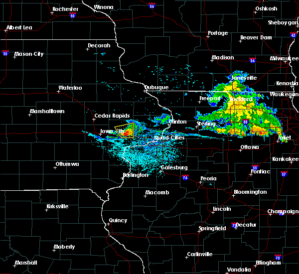 At 1129 am cdt, a severe thunderstorm was located over wilton, or near durant, moving southeast at 40 mph (radar indicated). Hazards include 60 mph wind gusts and quarter size hail. Hail damage to vehicles is expected. Expect wind damage to roofs, siding, and trees. At 1129 am cdt, a severe thunderstorm was located over wilton, or near durant, moving southeast at 40 mph (radar indicated). Hazards include 60 mph wind gusts and quarter size hail. Hail damage to vehicles is expected. Expect wind damage to roofs, siding, and trees.
|
| 7/11/2020 11:17 AM CDT |
 At 1117 am cdt, a severe thunderstorm was located over bennett, or 7 miles southeast of tipton, moving southeast at 45 mph (radar indicated). Hazards include 70 mph wind gusts and ping pong ball size hail. People and animals outdoors will be injured. expect hail damage to roofs, siding, windows, and vehicles. expect considerable tree damage. wind damage is also likely to mobile homes, roofs, and outbuildings. locations impacted include, tipton, durant, lowden, bennett, rochester, tipton matthews airport, bennett park, cedar county fairgrounds and sunbury. This includes interstate 80 in iowa between mile markers 265 and 278. At 1117 am cdt, a severe thunderstorm was located over bennett, or 7 miles southeast of tipton, moving southeast at 45 mph (radar indicated). Hazards include 70 mph wind gusts and ping pong ball size hail. People and animals outdoors will be injured. expect hail damage to roofs, siding, windows, and vehicles. expect considerable tree damage. wind damage is also likely to mobile homes, roofs, and outbuildings. locations impacted include, tipton, durant, lowden, bennett, rochester, tipton matthews airport, bennett park, cedar county fairgrounds and sunbury. This includes interstate 80 in iowa between mile markers 265 and 278.
|
| 7/11/2020 10:52 AM CDT |
 At 1051 am cdt, a severe thunderstorm was located over mechanicsville, moving southeast at 45 mph (radar indicated). Hazards include 70 mph wind gusts and ping pong ball size hail. People and animals outdoors will be injured. expect hail damage to roofs, siding, windows, and vehicles. expect considerable tree damage. Wind damage is also likely to mobile homes, roofs, and outbuildings. At 1051 am cdt, a severe thunderstorm was located over mechanicsville, moving southeast at 45 mph (radar indicated). Hazards include 70 mph wind gusts and ping pong ball size hail. People and animals outdoors will be injured. expect hail damage to roofs, siding, windows, and vehicles. expect considerable tree damage. Wind damage is also likely to mobile homes, roofs, and outbuildings.
|
| 7/9/2020 5:50 PM CDT |
 At 549 pm cdt, severe thunderstorms were located along a line extending from near bennett to illinois city, moving northeast at 45 mph (radar indicated). Hazards include 60 mph wind gusts and quarter size hail. Hail damage to vehicles is expected. expect wind damage to roofs, siding, and trees. locations impacted include, davenport, rock island, bettendorf, muscatine, durant, eldridge, wilton, walcott, blue grass, buffalo, andalusia, fruitland, long grove, grand mound, calamus, eliza, donahue, atalissa, fairport and montpelier. this includes the following highways, interstate 74 in iowa between mile markers 1 and 3. interstate 80 in iowa between mile markers 270 and 303. Interstate 280 between mile markers 1 and 10. At 549 pm cdt, severe thunderstorms were located along a line extending from near bennett to illinois city, moving northeast at 45 mph (radar indicated). Hazards include 60 mph wind gusts and quarter size hail. Hail damage to vehicles is expected. expect wind damage to roofs, siding, and trees. locations impacted include, davenport, rock island, bettendorf, muscatine, durant, eldridge, wilton, walcott, blue grass, buffalo, andalusia, fruitland, long grove, grand mound, calamus, eliza, donahue, atalissa, fairport and montpelier. this includes the following highways, interstate 74 in iowa between mile markers 1 and 3. interstate 80 in iowa between mile markers 270 and 303. Interstate 280 between mile markers 1 and 10.
|
| 7/9/2020 5:39 PM CDT |
 At 539 pm cdt, severe thunderstorms were located along a line extending from near wilton to eliza, moving northeast at 45 mph (radar indicated). Hazards include 60 mph wind gusts and quarter size hail. Hail damage to vehicles is expected. expect wind damage to roofs, siding, and trees. locations impacted include, davenport, rock island, bettendorf, muscatine, durant, eldridge, wilton, walcott, blue grass, buffalo, andalusia, fruitland, long grove, grand mound, calamus, eliza, donahue, atalissa, fairport and montpelier. this includes the following highways, interstate 74 in iowa between mile markers 1 and 3. interstate 80 in iowa between mile markers 270 and 303. Interstate 280 between mile markers 1 and 10. At 539 pm cdt, severe thunderstorms were located along a line extending from near wilton to eliza, moving northeast at 45 mph (radar indicated). Hazards include 60 mph wind gusts and quarter size hail. Hail damage to vehicles is expected. expect wind damage to roofs, siding, and trees. locations impacted include, davenport, rock island, bettendorf, muscatine, durant, eldridge, wilton, walcott, blue grass, buffalo, andalusia, fruitland, long grove, grand mound, calamus, eliza, donahue, atalissa, fairport and montpelier. this includes the following highways, interstate 74 in iowa between mile markers 1 and 3. interstate 80 in iowa between mile markers 270 and 303. Interstate 280 between mile markers 1 and 10.
|
| 7/9/2020 5:35 PM CDT |
 At 535 pm cdt, severe thunderstorms were located along a line extending from wilton to near eliza, moving northeast at 45 mph (radar indicated). Hazards include 60 mph wind gusts and quarter size hail. Hail damage to vehicles is expected. Expect wind damage to roofs, siding, and trees. At 535 pm cdt, severe thunderstorms were located along a line extending from wilton to near eliza, moving northeast at 45 mph (radar indicated). Hazards include 60 mph wind gusts and quarter size hail. Hail damage to vehicles is expected. Expect wind damage to roofs, siding, and trees.
|
| 6/4/2020 9:44 PM CDT |
 At 944 pm cdt, a severe thunderstorm was located near wilton, or near durant, moving southeast at 20 mph (radar indicated). Hazards include 60 mph wind gusts and penny size hail. Expect damage to roofs, siding, and trees. locations impacted include, davenport, muscatine, durant, wilton, walcott, blue grass, buffalo, andalusia, montpelier, illinois city, fairport, edgington, stockton, clark`s ferry recreation area, west lake park, new era, pleasant prairie, moscow, saulsbury bridge campground and buffalo shores. this includes the following highways, interstate 80 in iowa between mile markers 267 and 273. Interstate 280 between mile markers 3 and 7. At 944 pm cdt, a severe thunderstorm was located near wilton, or near durant, moving southeast at 20 mph (radar indicated). Hazards include 60 mph wind gusts and penny size hail. Expect damage to roofs, siding, and trees. locations impacted include, davenport, muscatine, durant, wilton, walcott, blue grass, buffalo, andalusia, montpelier, illinois city, fairport, edgington, stockton, clark`s ferry recreation area, west lake park, new era, pleasant prairie, moscow, saulsbury bridge campground and buffalo shores. this includes the following highways, interstate 80 in iowa between mile markers 267 and 273. Interstate 280 between mile markers 3 and 7.
|
| 6/4/2020 9:25 PM CDT |
 At 924 pm cdt, a severe thunderstorm was located over wilton, or 7 miles southwest of durant, moving southeast at 25 mph (radar indicated). Hazards include 60 mph wind gusts and quarter size hail. Hail damage to vehicles is expected. expect wind damage to roofs, siding, and trees. locations impacted include, davenport, muscatine, durant, west liberty, wilton, walcott, blue grass, buffalo, andalusia, atalissa, montpelier, illinois city, fairport, rochester, edgington, stockton, clark`s ferry recreation area, muscatine county fairgrounds, west lake park and new era. this includes the following highways, interstate 80 in iowa between mile markers 258 and 274. Interstate 280 between mile markers 3 and 7. At 924 pm cdt, a severe thunderstorm was located over wilton, or 7 miles southwest of durant, moving southeast at 25 mph (radar indicated). Hazards include 60 mph wind gusts and quarter size hail. Hail damage to vehicles is expected. expect wind damage to roofs, siding, and trees. locations impacted include, davenport, muscatine, durant, west liberty, wilton, walcott, blue grass, buffalo, andalusia, atalissa, montpelier, illinois city, fairport, rochester, edgington, stockton, clark`s ferry recreation area, muscatine county fairgrounds, west lake park and new era. this includes the following highways, interstate 80 in iowa between mile markers 258 and 274. Interstate 280 between mile markers 3 and 7.
|
| 6/4/2020 9:11 PM CDT |
 At 911 pm cdt, a severe thunderstorm was located over atalissa, or 10 miles southeast of west branch, moving southeast at 35 mph (radar indicated). Hazards include 60 mph wind gusts and quarter size hail. Hail damage to vehicles is expected. Expect wind damage to roofs, siding, and trees. At 911 pm cdt, a severe thunderstorm was located over atalissa, or 10 miles southeast of west branch, moving southeast at 35 mph (radar indicated). Hazards include 60 mph wind gusts and quarter size hail. Hail damage to vehicles is expected. Expect wind damage to roofs, siding, and trees.
|
| 6/30/2019 6:45 PM CDT |
 At 645 pm cdt, severe thunderstorms were located along a line extending from near erie to illinois city to near oxford, moving south at 45 mph (trained weather spotters). Hazards include 70 mph wind gusts. Expect considerable tree damage. damage is likely to mobile homes, roofs, and outbuildings. locations impacted include, davenport, iowa city, moline, rock island, bettendorf, muscatine, east moline, sterling, kewanee, rock falls, washington, morrison, aledo, cambridge, wapello, columbus junction, durant, silvis, geneseo and eldridge. if you are at henry county fairgrounds in cambridge, or davenport airport you should seek safe shelter immediately! this includes the following highways, interstate 74 in iowa between mile markers 1 and 5. interstate 80 in iowa between mile markers 280 and 306. interstate 80 in illinois between mile markers 1 and 45. interstate 74 in illinois between mile markers 1 and 33. interstate 88 between mile markers 1 and 43. Interstate 280 between mile markers 1 and 18. At 645 pm cdt, severe thunderstorms were located along a line extending from near erie to illinois city to near oxford, moving south at 45 mph (trained weather spotters). Hazards include 70 mph wind gusts. Expect considerable tree damage. damage is likely to mobile homes, roofs, and outbuildings. locations impacted include, davenport, iowa city, moline, rock island, bettendorf, muscatine, east moline, sterling, kewanee, rock falls, washington, morrison, aledo, cambridge, wapello, columbus junction, durant, silvis, geneseo and eldridge. if you are at henry county fairgrounds in cambridge, or davenport airport you should seek safe shelter immediately! this includes the following highways, interstate 74 in iowa between mile markers 1 and 5. interstate 80 in iowa between mile markers 280 and 306. interstate 80 in illinois between mile markers 1 and 45. interstate 74 in illinois between mile markers 1 and 33. interstate 88 between mile markers 1 and 43. Interstate 280 between mile markers 1 and 18.
|
| 6/30/2019 6:37 PM CDT |
 At 637 pm cdt, severe thunderstorms were located along a line extending from near fulton to fairport to oxford, moving south at 45 mph (trained weather spotters). Hazards include 70 mph wind gusts. Expect considerable tree damage. damage is likely to mobile homes, roofs, and outbuildings. locations impacted include, davenport, iowa city, moline, rock island, bettendorf, muscatine, east moline, sterling, kewanee, rock falls, washington, morrison, aledo, cambridge, wapello, columbus junction, durant, silvis, geneseo and eldridge. if you are at henry county fairgrounds in cambridge, or davenport airport you should seek safe shelter immediately! this includes the following highways, interstate 74 in iowa between mile markers 1 and 5. interstate 80 in iowa between mile markers 280 and 306. interstate 80 in illinois between mile markers 1 and 45. interstate 74 in illinois between mile markers 1 and 33. interstate 88 between mile markers 1 and 43. Interstate 280 between mile markers 1 and 18. At 637 pm cdt, severe thunderstorms were located along a line extending from near fulton to fairport to oxford, moving south at 45 mph (trained weather spotters). Hazards include 70 mph wind gusts. Expect considerable tree damage. damage is likely to mobile homes, roofs, and outbuildings. locations impacted include, davenport, iowa city, moline, rock island, bettendorf, muscatine, east moline, sterling, kewanee, rock falls, washington, morrison, aledo, cambridge, wapello, columbus junction, durant, silvis, geneseo and eldridge. if you are at henry county fairgrounds in cambridge, or davenport airport you should seek safe shelter immediately! this includes the following highways, interstate 74 in iowa between mile markers 1 and 5. interstate 80 in iowa between mile markers 280 and 306. interstate 80 in illinois between mile markers 1 and 45. interstate 74 in illinois between mile markers 1 and 33. interstate 88 between mile markers 1 and 43. Interstate 280 between mile markers 1 and 18.
|
| 6/30/2019 6:29 PM CDT |
 At 622 pm cdt, severe thunderstorms were located along a line extending from near charlotte to near rochester to amana, moving south at 45 mph (trained weather spotters). Hazards include 70 mph wind gusts. Expect considerable tree damage. Damage is likely to mobile homes, roofs, and outbuildings. At 622 pm cdt, severe thunderstorms were located along a line extending from near charlotte to near rochester to amana, moving south at 45 mph (trained weather spotters). Hazards include 70 mph wind gusts. Expect considerable tree damage. Damage is likely to mobile homes, roofs, and outbuildings.
|
| 6/30/2019 6:22 PM CDT |
 At 622 pm cdt, severe thunderstorms were located along a line extending from near charlotte to near rochester to amana, moving south at 45 mph (trained weather spotters). Hazards include 70 mph wind gusts. Expect considerable tree damage. Damage is likely to mobile homes, roofs, and outbuildings. At 622 pm cdt, severe thunderstorms were located along a line extending from near charlotte to near rochester to amana, moving south at 45 mph (trained weather spotters). Hazards include 70 mph wind gusts. Expect considerable tree damage. Damage is likely to mobile homes, roofs, and outbuildings.
|
| 6/15/2019 8:00 PM CDT |
 At 800 pm cdt, a severe thunderstorm was located near durant, moving east at 40 mph (radar indicated). Hazards include 60 mph wind gusts. Expect damage to roofs, siding, and trees. locations impacted include, tipton, durant, bennett, tipton matthews airport, bennett park, cedar county fairgrounds and sunbury. This includes interstate 80 in iowa between mile markers 264 and 278. At 800 pm cdt, a severe thunderstorm was located near durant, moving east at 40 mph (radar indicated). Hazards include 60 mph wind gusts. Expect damage to roofs, siding, and trees. locations impacted include, tipton, durant, bennett, tipton matthews airport, bennett park, cedar county fairgrounds and sunbury. This includes interstate 80 in iowa between mile markers 264 and 278.
|
| 6/15/2019 7:48 PM CDT |
 At 747 pm cdt, severe thunderstorms were located along a line extending from near atalissa to near letts to near lockridge, moving east at 45 mph (radar indicated). Hazards include 60 mph wind gusts and quarter size hail. Hail damage to vehicles is expected. expect wind damage to roofs, siding, and trees. Locations impacted include, muscatine, fairfield, washington, wapello, columbus junction, durant, west liberty, wilton, winfield, fruitland, wayland, morning sun, brighton, ainsworth, grandview, conesville, columbus city, letts, nichols and atalissa. At 747 pm cdt, severe thunderstorms were located along a line extending from near atalissa to near letts to near lockridge, moving east at 45 mph (radar indicated). Hazards include 60 mph wind gusts and quarter size hail. Hail damage to vehicles is expected. expect wind damage to roofs, siding, and trees. Locations impacted include, muscatine, fairfield, washington, wapello, columbus junction, durant, west liberty, wilton, winfield, fruitland, wayland, morning sun, brighton, ainsworth, grandview, conesville, columbus city, letts, nichols and atalissa.
|
| 6/15/2019 7:30 PM CDT |
 At 729 pm cdt, a severe thunderstorm was located over west branch, moving east at 40 mph (radar indicated). Hazards include 60 mph wind gusts. expect damage to roofs, siding, and trees At 729 pm cdt, a severe thunderstorm was located over west branch, moving east at 40 mph (radar indicated). Hazards include 60 mph wind gusts. expect damage to roofs, siding, and trees
|
| 6/15/2019 7:20 PM CDT |
 At 720 pm cdt, severe thunderstorms were located along a line extending from near lone tree to near ainsworth to near abingdon, moving east at 40 mph (radar indicated). Hazards include 60 mph wind gusts and quarter size hail. Hail damage to vehicles is expected. Expect wind damage to roofs, siding, and trees. At 720 pm cdt, severe thunderstorms were located along a line extending from near lone tree to near ainsworth to near abingdon, moving east at 40 mph (radar indicated). Hazards include 60 mph wind gusts and quarter size hail. Hail damage to vehicles is expected. Expect wind damage to roofs, siding, and trees.
|
| 5/16/2019 10:14 PM CDT |
 At 1013 pm cdt, severe thunderstorms were located along a line extending from near walcott to near illinois city, moving east at 50 mph (trained weather spotters). Hazards include 60 mph wind gusts and penny size hail. Expect damage to roofs, siding, and trees. locations impacted include, davenport, muscatine, durant, eldridge, wilton, walcott, blue grass, buffalo, andalusia, fruitland, conesville, atalissa, montpelier, illinois city, fairport, edgington, stockton, cranston, clark`s ferry recreation area and west lake park. this includes the following highways, interstate 80 in iowa between mile markers 266 and 295. Interstate 280 between mile markers 1 and 10. At 1013 pm cdt, severe thunderstorms were located along a line extending from near walcott to near illinois city, moving east at 50 mph (trained weather spotters). Hazards include 60 mph wind gusts and penny size hail. Expect damage to roofs, siding, and trees. locations impacted include, davenport, muscatine, durant, eldridge, wilton, walcott, blue grass, buffalo, andalusia, fruitland, conesville, atalissa, montpelier, illinois city, fairport, edgington, stockton, cranston, clark`s ferry recreation area and west lake park. this includes the following highways, interstate 80 in iowa between mile markers 266 and 295. Interstate 280 between mile markers 1 and 10.
|
| 5/16/2019 9:56 PM CDT |
 At 954 pm cdt, severe thunderstorms were located along a line extending from near wilton to fruitland, moving east at 40 mph (trained weather spotters have reported 60 mph winds in parts of johnson county. the iowa city airport had a measured gust to 62 mph with this storm). Hazards include 60 mph wind gusts and quarter size hail. Hail damage to vehicles is expected. expect wind damage to roofs, siding, and trees. locations impacted include, davenport, iowa city, muscatine, west branch, durant, eldridge, west liberty, wilton, walcott, blue grass, lone tree, buffalo, andalusia, university heights, riverside, fruitland, hills, conesville, nichols and atalissa. this includes the following highways, interstate 80 in iowa between mile markers 245 and 295. Interstate 280 between mile markers 1 and 10. At 954 pm cdt, severe thunderstorms were located along a line extending from near wilton to fruitland, moving east at 40 mph (trained weather spotters have reported 60 mph winds in parts of johnson county. the iowa city airport had a measured gust to 62 mph with this storm). Hazards include 60 mph wind gusts and quarter size hail. Hail damage to vehicles is expected. expect wind damage to roofs, siding, and trees. locations impacted include, davenport, iowa city, muscatine, west branch, durant, eldridge, west liberty, wilton, walcott, blue grass, lone tree, buffalo, andalusia, university heights, riverside, fruitland, hills, conesville, nichols and atalissa. this includes the following highways, interstate 80 in iowa between mile markers 245 and 295. Interstate 280 between mile markers 1 and 10.
|
| 5/16/2019 9:44 PM CDT |
 At 943 pm cdt, severe thunderstorms were located along a line extending from near west branch to near lone tree, moving east at 50 mph (trained weather spotters). Hazards include 60 mph wind gusts and quarter size hail. Hail damage to vehicles is expected. Expect wind damage to roofs, siding, and trees. At 943 pm cdt, severe thunderstorms were located along a line extending from near west branch to near lone tree, moving east at 50 mph (trained weather spotters). Hazards include 60 mph wind gusts and quarter size hail. Hail damage to vehicles is expected. Expect wind damage to roofs, siding, and trees.
|
| 4/22/2019 6:54 PM CDT |
 At 654 pm cdt, severe thunderstorms were located along a line extending from grand mound to donahue to near fairport, moving east at 40 mph (radar indicated). Hazards include 60 mph wind gusts and penny size hail. Expect damage to roofs, siding, and trees. locations impacted include, davenport, moline, rock island, bettendorf, clinton, muscatine, east moline, durant, silvis, eldridge, dewitt, milan, camanche, le claire, coal valley, hampton, port byron, walcott, blue grass and buffalo. this includes the following highways, interstate 74 in iowa between mile markers 1 and 5. interstate 80 in iowa between mile markers 277 and 306. interstate 80 in illinois near mile marker 1. interstate 74 in illinois between mile markers 1 and 7. Interstate 280 between mile markers 1 and 18. At 654 pm cdt, severe thunderstorms were located along a line extending from grand mound to donahue to near fairport, moving east at 40 mph (radar indicated). Hazards include 60 mph wind gusts and penny size hail. Expect damage to roofs, siding, and trees. locations impacted include, davenport, moline, rock island, bettendorf, clinton, muscatine, east moline, durant, silvis, eldridge, dewitt, milan, camanche, le claire, coal valley, hampton, port byron, walcott, blue grass and buffalo. this includes the following highways, interstate 74 in iowa between mile markers 1 and 5. interstate 80 in iowa between mile markers 277 and 306. interstate 80 in illinois near mile marker 1. interstate 74 in illinois between mile markers 1 and 7. Interstate 280 between mile markers 1 and 18.
|
| 4/22/2019 6:46 PM CDT |
 At 646 pm cdt, severe thunderstorms were located along a line extending from calamus to 6 miles north of walcott to near muscatine, moving east at 35 mph (radar indicated). Hazards include 60 mph wind gusts and penny size hail. expect damage to roofs, siding, and trees At 646 pm cdt, severe thunderstorms were located along a line extending from calamus to 6 miles north of walcott to near muscatine, moving east at 35 mph (radar indicated). Hazards include 60 mph wind gusts and penny size hail. expect damage to roofs, siding, and trees
|
| 4/22/2019 2:18 PM CDT |
 At 218 pm cdt, a severe thunderstorm was located over fairport, or 7 miles northeast of muscatine, moving northeast at 40 mph (radar indicated). Hazards include quarter size hail. Damage to vehicles is expected. locations impacted include, davenport, moline, rock island, bettendorf, muscatine, east moline, silvis, eldridge, milan, le claire, hampton, port byron, walcott, blue grass, buffalo, andalusia, rapids city, princeton, long grove and riverdale. this includes the following highways, interstate 74 in iowa between mile markers 1 and 5. interstate 80 in iowa between mile markers 282 and 306. interstate 80 in illinois between mile markers 1 and 5. interstate 74 in illinois between mile markers 1 and 3. interstate 88 between mile markers 1 and 7. Interstate 280 between mile markers 1 and 13. At 218 pm cdt, a severe thunderstorm was located over fairport, or 7 miles northeast of muscatine, moving northeast at 40 mph (radar indicated). Hazards include quarter size hail. Damage to vehicles is expected. locations impacted include, davenport, moline, rock island, bettendorf, muscatine, east moline, silvis, eldridge, milan, le claire, hampton, port byron, walcott, blue grass, buffalo, andalusia, rapids city, princeton, long grove and riverdale. this includes the following highways, interstate 74 in iowa between mile markers 1 and 5. interstate 80 in iowa between mile markers 282 and 306. interstate 80 in illinois between mile markers 1 and 5. interstate 74 in illinois between mile markers 1 and 3. interstate 88 between mile markers 1 and 7. Interstate 280 between mile markers 1 and 13.
|
| 4/22/2019 2:10 PM CDT |
 At 210 pm cdt, a severe thunderstorm was located over muscatine, moving northeast at 40 mph (radar indicated). Hazards include quarter size hail. damage to vehicles is expected At 210 pm cdt, a severe thunderstorm was located over muscatine, moving northeast at 40 mph (radar indicated). Hazards include quarter size hail. damage to vehicles is expected
|
| 9/25/2018 2:44 PM CDT |
 At 243 pm cdt, severe thunderstorms were located along a line extending from near charlotte to long grove to near illinois city, moving east at 55 mph (radar indicated). Hazards include 60 mph wind gusts. Expect damage to roofs, siding, and trees. locations impacted include, davenport, moline, rock island, bettendorf, clinton, muscatine, east moline, durant, silvis, eldridge, dewitt, milan, camanche, le claire, coal valley, fulton, hampton, port byron, walcott and blue grass. this includes the following highways, interstate 74 in iowa between mile markers 1 and 5. interstate 80 in iowa between mile markers 275 and 306. interstate 80 in illinois between mile markers 1 and 3. interstate 74 in illinois between mile markers 1 and 7. Interstate 280 between mile markers 1 and 18. At 243 pm cdt, severe thunderstorms were located along a line extending from near charlotte to long grove to near illinois city, moving east at 55 mph (radar indicated). Hazards include 60 mph wind gusts. Expect damage to roofs, siding, and trees. locations impacted include, davenport, moline, rock island, bettendorf, clinton, muscatine, east moline, durant, silvis, eldridge, dewitt, milan, camanche, le claire, coal valley, fulton, hampton, port byron, walcott and blue grass. this includes the following highways, interstate 74 in iowa between mile markers 1 and 5. interstate 80 in iowa between mile markers 275 and 306. interstate 80 in illinois between mile markers 1 and 3. interstate 74 in illinois between mile markers 1 and 7. Interstate 280 between mile markers 1 and 18.
|
| 9/25/2018 2:34 PM CDT |
 At 234 pm cdt, severe thunderstorms were located along a line extending from near welton to 7 miles west of donahue to near letts, moving east at 35 mph (radar indicated). Hazards include 60 mph wind gusts. Expect damage to roofs, siding, and trees. locations impacted include, davenport, moline, rock island, bettendorf, clinton, muscatine, east moline, durant, silvis, eldridge, dewitt, milan, camanche, le claire, coal valley, fulton, wilton, hampton, port byron and walcott. this includes the following highways, interstate 74 in iowa between mile markers 1 and 5. interstate 80 in iowa between mile markers 270 and 306. interstate 80 in illinois between mile markers 1 and 3. interstate 74 in illinois between mile markers 1 and 7. Interstate 280 between mile markers 1 and 18. At 234 pm cdt, severe thunderstorms were located along a line extending from near welton to 7 miles west of donahue to near letts, moving east at 35 mph (radar indicated). Hazards include 60 mph wind gusts. Expect damage to roofs, siding, and trees. locations impacted include, davenport, moline, rock island, bettendorf, clinton, muscatine, east moline, durant, silvis, eldridge, dewitt, milan, camanche, le claire, coal valley, fulton, wilton, hampton, port byron and walcott. this includes the following highways, interstate 74 in iowa between mile markers 1 and 5. interstate 80 in iowa between mile markers 270 and 306. interstate 80 in illinois between mile markers 1 and 3. interstate 74 in illinois between mile markers 1 and 7. Interstate 280 between mile markers 1 and 18.
|
| 9/25/2018 2:27 PM CDT |
 At 227 pm cdt, severe thunderstorms were located along a line extending from near lost nation to near bennett to near letts, moving east at 35 mph (radar indicated). Hazards include 60 mph wind gusts. expect damage to roofs, siding, and trees At 227 pm cdt, severe thunderstorms were located along a line extending from near lost nation to near bennett to near letts, moving east at 35 mph (radar indicated). Hazards include 60 mph wind gusts. expect damage to roofs, siding, and trees
|
| 9/18/2018 12:08 PM CDT |
 At 1208 pm cdt, severe thunderstorms were located along a line extending from durant to near fruitland to near wyman, moving southeast at 25 mph (radar indicated). Hazards include 60 mph wind gusts and penny size hail. Expect damage to roofs, siding, and trees. locations impacted include, davenport, rock island, muscatine, wapello, columbus junction, durant, west liberty, wilton, blue grass, buffalo, andalusia, fruitland, ainsworth, grandview, conesville, eliza, columbus city, letts, nichols and atalissa. This includes interstate 280 between mile markers 4 and 10. At 1208 pm cdt, severe thunderstorms were located along a line extending from durant to near fruitland to near wyman, moving southeast at 25 mph (radar indicated). Hazards include 60 mph wind gusts and penny size hail. Expect damage to roofs, siding, and trees. locations impacted include, davenport, rock island, muscatine, wapello, columbus junction, durant, west liberty, wilton, blue grass, buffalo, andalusia, fruitland, ainsworth, grandview, conesville, eliza, columbus city, letts, nichols and atalissa. This includes interstate 280 between mile markers 4 and 10.
|
| 9/18/2018 11:54 AM CDT |
 At 1153 am cdt, severe thunderstorms were located along a line extending from near wilton to near conesville to ainsworth, moving southeast at 25 mph (radar indicated). Hazards include 60 mph wind gusts and penny size hail. Expect damage to roofs, siding, and trees. locations impacted include, davenport, rock island, muscatine, washington, wapello, columbus junction, durant, west liberty, wilton, walcott, blue grass, buffalo, andalusia, fruitland, ainsworth, grandview, conesville, eliza, columbus city and letts. this includes the following highways, interstate 80 in iowa between mile markers 261 and 288. Interstate 280 between mile markers 1 and 10. At 1153 am cdt, severe thunderstorms were located along a line extending from near wilton to near conesville to ainsworth, moving southeast at 25 mph (radar indicated). Hazards include 60 mph wind gusts and penny size hail. Expect damage to roofs, siding, and trees. locations impacted include, davenport, rock island, muscatine, washington, wapello, columbus junction, durant, west liberty, wilton, walcott, blue grass, buffalo, andalusia, fruitland, ainsworth, grandview, conesville, eliza, columbus city and letts. this includes the following highways, interstate 80 in iowa between mile markers 261 and 288. Interstate 280 between mile markers 1 and 10.
|
| 9/18/2018 11:47 AM CDT |
 At 1146 am cdt, severe thunderstorms were located along a line extending from near bennett to near conesville to ainsworth, moving southeast at 25 mph (radar indicated). Hazards include 60 mph wind gusts and penny size hail. expect damage to roofs, siding, and trees At 1146 am cdt, severe thunderstorms were located along a line extending from near bennett to near conesville to ainsworth, moving southeast at 25 mph (radar indicated). Hazards include 60 mph wind gusts and penny size hail. expect damage to roofs, siding, and trees
|
| 8/28/2018 7:03 PM CDT |
 At 703 pm cdt, severe thunderstorms were located along a line extending from near wheatland to near hamlet, moving east at 60 mph (radar indicated). Hazards include 70 mph wind gusts. Expect considerable tree damage. damage is likely to mobile homes, roofs, and outbuildings. locations impacted include, davenport, moline, rock island, bettendorf, clinton, muscatine, east moline, morrison, durant, silvis, geneseo, eldridge, dewitt, milan, colona, camanche, le claire, coal valley, fulton and wilton. this includes the following highways, interstate 74 in iowa between mile markers 1 and 5. interstate 80 in iowa between mile markers 270 and 306. interstate 80 in illinois between mile markers 1 and 35. interstate 74 in illinois between mile markers 1 and 19. interstate 88 between mile markers 1 and 30. Interstate 280 between mile markers 1 and 18. At 703 pm cdt, severe thunderstorms were located along a line extending from near wheatland to near hamlet, moving east at 60 mph (radar indicated). Hazards include 70 mph wind gusts. Expect considerable tree damage. damage is likely to mobile homes, roofs, and outbuildings. locations impacted include, davenport, moline, rock island, bettendorf, clinton, muscatine, east moline, morrison, durant, silvis, geneseo, eldridge, dewitt, milan, colona, camanche, le claire, coal valley, fulton and wilton. this includes the following highways, interstate 74 in iowa between mile markers 1 and 5. interstate 80 in iowa between mile markers 270 and 306. interstate 80 in illinois between mile markers 1 and 35. interstate 74 in illinois between mile markers 1 and 19. interstate 88 between mile markers 1 and 30. Interstate 280 between mile markers 1 and 18.
|
| 8/28/2018 6:50 PM CDT |
 At 650 pm cdt, severe thunderstorms were located along a line extending from near wheatland to near illinois city, moving east at 60 mph (radar indicated). Hazards include 70 mph wind gusts. Expect considerable tree damage. damage is likely to mobile homes, roofs, and outbuildings. locations impacted include, davenport, moline, rock island, bettendorf, clinton, muscatine, east moline, morrison, durant, silvis, geneseo, eldridge, dewitt, milan, colona, camanche, le claire, coal valley, fulton and wilton. this includes the following highways, interstate 74 in iowa between mile markers 1 and 5. interstate 80 in iowa between mile markers 270 and 306. interstate 80 in illinois between mile markers 1 and 35. interstate 74 in illinois between mile markers 1 and 19. interstate 88 between mile markers 1 and 30. Interstate 280 between mile markers 1 and 18. At 650 pm cdt, severe thunderstorms were located along a line extending from near wheatland to near illinois city, moving east at 60 mph (radar indicated). Hazards include 70 mph wind gusts. Expect considerable tree damage. damage is likely to mobile homes, roofs, and outbuildings. locations impacted include, davenport, moline, rock island, bettendorf, clinton, muscatine, east moline, morrison, durant, silvis, geneseo, eldridge, dewitt, milan, colona, camanche, le claire, coal valley, fulton and wilton. this includes the following highways, interstate 74 in iowa between mile markers 1 and 5. interstate 80 in iowa between mile markers 270 and 306. interstate 80 in illinois between mile markers 1 and 35. interstate 74 in illinois between mile markers 1 and 19. interstate 88 between mile markers 1 and 30. Interstate 280 between mile markers 1 and 18.
|
| 8/28/2018 6:47 PM CDT |
 At 647 pm cdt, severe thunderstorms were located along a line extending from near bennett to near illinois city, moving east at 60 mph (radar indicated). Hazards include 70 mph wind gusts. Expect considerable tree damage. damage is likely to mobile homes, roofs, and outbuildings. locations impacted include, iowa city, muscatine, tipton, west branch, durant, coralville, north liberty, west liberty, wilton, tiffin, lone tree, university heights, riverside, fruitland, hills, conesville, bennett, letts, nichols and atalissa. this includes the following highways, interstate 80 in iowa between mile markers 237 and 278. Interstate 380 between mile markers 1 and 2. At 647 pm cdt, severe thunderstorms were located along a line extending from near bennett to near illinois city, moving east at 60 mph (radar indicated). Hazards include 70 mph wind gusts. Expect considerable tree damage. damage is likely to mobile homes, roofs, and outbuildings. locations impacted include, iowa city, muscatine, tipton, west branch, durant, coralville, north liberty, west liberty, wilton, tiffin, lone tree, university heights, riverside, fruitland, hills, conesville, bennett, letts, nichols and atalissa. this includes the following highways, interstate 80 in iowa between mile markers 237 and 278. Interstate 380 between mile markers 1 and 2.
|
| 8/28/2018 6:41 PM CDT |
 At 640 pm cdt, severe thunderstorms were located along a line extending from near tipton to near fruitland, moving east at 65 mph (radar indicated). Hazards include 70 mph wind gusts and penny size hail. Expect considerable tree damage. Damage is likely to mobile homes, roofs, and outbuildings. At 640 pm cdt, severe thunderstorms were located along a line extending from near tipton to near fruitland, moving east at 65 mph (radar indicated). Hazards include 70 mph wind gusts and penny size hail. Expect considerable tree damage. Damage is likely to mobile homes, roofs, and outbuildings.
|
| 8/28/2018 6:35 PM CDT |
 At 634 pm cdt, severe thunderstorms were located along a line extending from near tipton to near fruitland, moving east at 60 mph. these are very dangerous storms (trained weather spotters). Hazards include 80 mph wind gusts. an 83 mph wind gust was measured at the iowa city airport at 628 pm. Flying debris will be dangerous to those caught without shelter. mobile homes will be heavily damaged. expect considerable damage to roofs, windows, and vehicles. extensive tree damage and power outages are likely. locations impacted include, iowa city, muscatine, tipton, west branch, durant, coralville, north liberty, west liberty, wilton, tiffin, lone tree, university heights, riverside, fruitland, hills, conesville, bennett, letts, nichols and atalissa. this includes the following highways, interstate 80 in iowa between mile markers 237 and 278. Interstate 380 between mile markers 1 and 2. At 634 pm cdt, severe thunderstorms were located along a line extending from near tipton to near fruitland, moving east at 60 mph. these are very dangerous storms (trained weather spotters). Hazards include 80 mph wind gusts. an 83 mph wind gust was measured at the iowa city airport at 628 pm. Flying debris will be dangerous to those caught without shelter. mobile homes will be heavily damaged. expect considerable damage to roofs, windows, and vehicles. extensive tree damage and power outages are likely. locations impacted include, iowa city, muscatine, tipton, west branch, durant, coralville, north liberty, west liberty, wilton, tiffin, lone tree, university heights, riverside, fruitland, hills, conesville, bennett, letts, nichols and atalissa. this includes the following highways, interstate 80 in iowa between mile markers 237 and 278. Interstate 380 between mile markers 1 and 2.
|
| 8/28/2018 6:27 PM CDT |
 At 627 pm cdt, severe thunderstorms were located along a line extending from 6 miles northeast of west branch to near letts, moving east at 60 mph (radar indicated). Hazards include 70 mph wind gusts. Expect considerable tree damage. damage is likely to mobile homes, roofs, and outbuildings. locations impacted include, iowa city, muscatine, tipton, west branch, durant, coralville, north liberty, west liberty, wilton, tiffin, lone tree, university heights, riverside, fruitland, hills, conesville, bennett, letts, nichols and atalissa. this includes the following highways, interstate 80 in iowa between mile markers 237 and 278. Interstate 380 between mile markers 1 and 2. At 627 pm cdt, severe thunderstorms were located along a line extending from 6 miles northeast of west branch to near letts, moving east at 60 mph (radar indicated). Hazards include 70 mph wind gusts. Expect considerable tree damage. damage is likely to mobile homes, roofs, and outbuildings. locations impacted include, iowa city, muscatine, tipton, west branch, durant, coralville, north liberty, west liberty, wilton, tiffin, lone tree, university heights, riverside, fruitland, hills, conesville, bennett, letts, nichols and atalissa. this includes the following highways, interstate 80 in iowa between mile markers 237 and 278. Interstate 380 between mile markers 1 and 2.
|
| 8/28/2018 6:11 PM CDT |
 At 611 pm cdt, severe thunderstorms were located along a line extending from near oxford to 6 miles west of washington, moving east at 60 mph. these are very dangerous storms (radar indicated). Hazards include 80 mph wind gusts. Flying debris will be dangerous to those caught without shelter. mobile homes will be heavily damaged. expect considerable damage to roofs, windows, and vehicles. extensive tree damage and power outages are likely. locations impacted include, iowa city, muscatine, tipton, west branch, durant, coralville, north liberty, west liberty, wilton, tiffin, lone tree, university heights, riverside, fruitland, hills, conesville, bennett, letts, nichols and atalissa. this includes the following highways, interstate 80 in iowa between mile markers 237 and 278. Interstate 380 between mile markers 1 and 2. At 611 pm cdt, severe thunderstorms were located along a line extending from near oxford to 6 miles west of washington, moving east at 60 mph. these are very dangerous storms (radar indicated). Hazards include 80 mph wind gusts. Flying debris will be dangerous to those caught without shelter. mobile homes will be heavily damaged. expect considerable damage to roofs, windows, and vehicles. extensive tree damage and power outages are likely. locations impacted include, iowa city, muscatine, tipton, west branch, durant, coralville, north liberty, west liberty, wilton, tiffin, lone tree, university heights, riverside, fruitland, hills, conesville, bennett, letts, nichols and atalissa. this includes the following highways, interstate 80 in iowa between mile markers 237 and 278. Interstate 380 between mile markers 1 and 2.
|
| 8/28/2018 5:59 PM CDT |
 At 559 pm cdt, severe thunderstorms were located along a line extending from williamsburg to near harper, moving east at 60 mph (radar indicated). Hazards include 70 mph wind gusts. Expect considerable tree damage. Damage is likely to mobile homes, roofs, and outbuildings. At 559 pm cdt, severe thunderstorms were located along a line extending from williamsburg to near harper, moving east at 60 mph (radar indicated). Hazards include 70 mph wind gusts. Expect considerable tree damage. Damage is likely to mobile homes, roofs, and outbuildings.
|
| 8/28/2018 5:59 PM CDT |
 The national weather service in the quad cities has issued a * severe thunderstorm warning for. southwestern rock island county in northwestern illinois. northwestern louisa county in southeastern iowa. southern cedar county in east central iowa. Southeastern johnson county in east central iowa. The national weather service in the quad cities has issued a * severe thunderstorm warning for. southwestern rock island county in northwestern illinois. northwestern louisa county in southeastern iowa. southern cedar county in east central iowa. Southeastern johnson county in east central iowa.
|
| 5/29/2018 10:56 PM CDT |
 At 1055 pm cdt, a severe thunderstorm was located near donahue, or 10 miles northeast of durant, moving northwest at 45 mph (radar indicated). Hazards include 60 mph wind gusts and penny size hail. Expect damage to roofs, siding, and trees. locations impacted include, davenport, bettendorf, durant, eldridge, le claire, walcott, princeton, long grove, riverdale, donahue, dixon, maysville, new liberty, panorama park, camp liberty, pleasant valley, park view, mississippi valley fairgrounds, davenport municipal airport and scott county park. this includes the following highways, interstate 74 in iowa between mile markers 1 and 5. interstate 80 in iowa between mile markers 279 and 305. Interstate 280 between mile markers 1 and 5. At 1055 pm cdt, a severe thunderstorm was located near donahue, or 10 miles northeast of durant, moving northwest at 45 mph (radar indicated). Hazards include 60 mph wind gusts and penny size hail. Expect damage to roofs, siding, and trees. locations impacted include, davenport, bettendorf, durant, eldridge, le claire, walcott, princeton, long grove, riverdale, donahue, dixon, maysville, new liberty, panorama park, camp liberty, pleasant valley, park view, mississippi valley fairgrounds, davenport municipal airport and scott county park. this includes the following highways, interstate 74 in iowa between mile markers 1 and 5. interstate 80 in iowa between mile markers 279 and 305. Interstate 280 between mile markers 1 and 5.
|
| 5/29/2018 10:47 PM CDT |
 At 1046 pm cdt, a severe thunderstorm was located over eldridge, or 7 miles north of davenport, moving northwest at 35 mph (radar indicated). Hazards include 60 mph wind gusts and penny size hail. Expect damage to roofs, siding, and trees. locations impacted include, davenport, bettendorf, durant, eldridge, le claire, walcott, princeton, long grove, riverdale, donahue, dixon, maysville, new liberty, panorama park, camp liberty, pleasant valley, park view, mississippi valley fairgrounds, davenport municipal airport and scott county park. this includes the following highways, interstate 74 in iowa between mile markers 1 and 5. interstate 80 in iowa between mile markers 279 and 305. Interstate 280 between mile markers 1 and 5. At 1046 pm cdt, a severe thunderstorm was located over eldridge, or 7 miles north of davenport, moving northwest at 35 mph (radar indicated). Hazards include 60 mph wind gusts and penny size hail. Expect damage to roofs, siding, and trees. locations impacted include, davenport, bettendorf, durant, eldridge, le claire, walcott, princeton, long grove, riverdale, donahue, dixon, maysville, new liberty, panorama park, camp liberty, pleasant valley, park view, mississippi valley fairgrounds, davenport municipal airport and scott county park. this includes the following highways, interstate 74 in iowa between mile markers 1 and 5. interstate 80 in iowa between mile markers 279 and 305. Interstate 280 between mile markers 1 and 5.
|
| 5/29/2018 10:38 PM CDT |
 At 1038 pm cdt, a severe thunderstorm was located near bettendorf, moving northwest at 30 mph (radar indicated). Hazards include 60 mph wind gusts. expect damage to roofs, siding, and trees At 1038 pm cdt, a severe thunderstorm was located near bettendorf, moving northwest at 30 mph (radar indicated). Hazards include 60 mph wind gusts. expect damage to roofs, siding, and trees
|
| 5/2/2018 8:51 PM CDT |
 The severe thunderstorm warning for southern cedar, southeastern johnson and northwestern muscatine counties will expire at 900 pm cdt, the severe thunderstorm which prompted the warning has moved out of the warned area. therefore, the warning will be allowed to expire. however heavy rain is still possible with this thunderstorm. a severe thunderstorm watch remains in effect until 1100 pm cdt for southeastern and east central iowa. The severe thunderstorm warning for southern cedar, southeastern johnson and northwestern muscatine counties will expire at 900 pm cdt, the severe thunderstorm which prompted the warning has moved out of the warned area. therefore, the warning will be allowed to expire. however heavy rain is still possible with this thunderstorm. a severe thunderstorm watch remains in effect until 1100 pm cdt for southeastern and east central iowa.
|
| 5/2/2018 8:35 PM CDT |
 At 835 pm cdt, a severe thunderstorm was located near wilton, or 9 miles west of durant, moving east at 40 mph (radar indicated). Hazards include 60 mph wind gusts and quarter size hail. Hail damage to vehicles is expected. expect wind damage to roofs, siding, and trees. locations impacted include, iowa city, west branch, durant, west liberty, wilton, hills, bennett, atalissa, rochester, springdale, cedar valley, muscatine county fairgrounds, bennett park, hills access, moscow, sunbury, cedar valley park and herbert hoover national historic site. This includes interstate 80 in iowa between mile markers 250 and 278. At 835 pm cdt, a severe thunderstorm was located near wilton, or 9 miles west of durant, moving east at 40 mph (radar indicated). Hazards include 60 mph wind gusts and quarter size hail. Hail damage to vehicles is expected. expect wind damage to roofs, siding, and trees. locations impacted include, iowa city, west branch, durant, west liberty, wilton, hills, bennett, atalissa, rochester, springdale, cedar valley, muscatine county fairgrounds, bennett park, hills access, moscow, sunbury, cedar valley park and herbert hoover national historic site. This includes interstate 80 in iowa between mile markers 250 and 278.
|
| 5/2/2018 8:34 PM CDT |
 At 834 pm cdt, a severe thunderstorm was located near bennett, or 7 miles north of durant, moving east at 25 mph (radar indicated). Hazards include 60 mph wind gusts and quarter size hail. Hail damage to vehicles is expected. Expect wind damage to roofs, siding, and trees. At 834 pm cdt, a severe thunderstorm was located near bennett, or 7 miles north of durant, moving east at 25 mph (radar indicated). Hazards include 60 mph wind gusts and quarter size hail. Hail damage to vehicles is expected. Expect wind damage to roofs, siding, and trees.
|
| 5/2/2018 8:27 PM CDT |
 At 827 pm cdt, a severe thunderstorm was located over west liberty, or 7 miles southeast of west branch, moving east at 30 mph (radar indicated). Hazards include 60 mph wind gusts and half dollar size hail. Hail damage to vehicles is expected. expect wind damage to roofs, siding, and trees. locations impacted include, iowa city, west branch, durant, west liberty, wilton, hills, bennett, atalissa, rochester, springdale, cedar valley, muscatine county fairgrounds, bennett park, hills access, moscow, sunbury, cedar valley park and herbert hoover national historic site. This includes interstate 80 in iowa between mile markers 250 and 278. At 827 pm cdt, a severe thunderstorm was located over west liberty, or 7 miles southeast of west branch, moving east at 30 mph (radar indicated). Hazards include 60 mph wind gusts and half dollar size hail. Hail damage to vehicles is expected. expect wind damage to roofs, siding, and trees. locations impacted include, iowa city, west branch, durant, west liberty, wilton, hills, bennett, atalissa, rochester, springdale, cedar valley, muscatine county fairgrounds, bennett park, hills access, moscow, sunbury, cedar valley park and herbert hoover national historic site. This includes interstate 80 in iowa between mile markers 250 and 278.
|
| 5/2/2018 8:07 PM CDT |
 At 806 pm cdt, a severe thunderstorm was located near hills, or near iowa city, moving east at 30 mph (radar indicated). Hazards include 60 mph wind gusts and half dollar size hail. Hail damage to vehicles is expected. Expect wind damage to roofs, siding, and trees. At 806 pm cdt, a severe thunderstorm was located near hills, or near iowa city, moving east at 30 mph (radar indicated). Hazards include 60 mph wind gusts and half dollar size hail. Hail damage to vehicles is expected. Expect wind damage to roofs, siding, and trees.
|
| 7/20/2017 9:44 PM CDT |
 At 943 pm cdt, a severe thunderstorm was located over montpelier, or 10 miles west of rock island, moving northeast at 20 mph (spotter indicated). Hazards include 60 mph wind gusts and quarter size hail. Hail damage to vehicles is expected. Expect wind damage to roofs, siding, and trees. At 943 pm cdt, a severe thunderstorm was located over montpelier, or 10 miles west of rock island, moving northeast at 20 mph (spotter indicated). Hazards include 60 mph wind gusts and quarter size hail. Hail damage to vehicles is expected. Expect wind damage to roofs, siding, and trees.
|
| 7/12/2017 7:40 PM CDT |
 At 740 pm cdt, severe thunderstorms were located along a line extending from near mechanicsville to near tipton to near atalissa, moving east at 45 mph (radar indicated). Hazards include 60 mph wind gusts and penny size hail. Expect damage to roofs, siding, and trees. locations impacted include, tipton, west branch, durant, stanwood, west liberty, wilton, lowden, bennett, atalissa, rochester, buchanan, clarence, springdale, cedar valley, massillon park, cedar bluff, bennett park, moscow, sunbury and cedar valley park. This includes interstate 80 in iowa between mile markers 254 and 278. At 740 pm cdt, severe thunderstorms were located along a line extending from near mechanicsville to near tipton to near atalissa, moving east at 45 mph (radar indicated). Hazards include 60 mph wind gusts and penny size hail. Expect damage to roofs, siding, and trees. locations impacted include, tipton, west branch, durant, stanwood, west liberty, wilton, lowden, bennett, atalissa, rochester, buchanan, clarence, springdale, cedar valley, massillon park, cedar bluff, bennett park, moscow, sunbury and cedar valley park. This includes interstate 80 in iowa between mile markers 254 and 278.
|
| 7/12/2017 7:37 PM CDT |
 At 737 pm cdt, severe thunderstorms were located along a line extending from near mechanicsville to near tipton to near west liberty, moving east at 35 mph (radar indicated). Hazards include 60 mph wind gusts and penny size hail. Expect damage to roofs, siding, and trees. locations impacted include, tipton, west branch, durant, stanwood, west liberty, wilton, lowden, bennett, atalissa, rochester, buchanan, clarence, cedar valley, muscatine county fairgrounds, bennett park, moscow, sutliff, sunbury, tipton matthews airport and cedar county fairgrounds. This includes interstate 80 in iowa between mile markers 251 and 278. At 737 pm cdt, severe thunderstorms were located along a line extending from near mechanicsville to near tipton to near west liberty, moving east at 35 mph (radar indicated). Hazards include 60 mph wind gusts and penny size hail. Expect damage to roofs, siding, and trees. locations impacted include, tipton, west branch, durant, stanwood, west liberty, wilton, lowden, bennett, atalissa, rochester, buchanan, clarence, cedar valley, muscatine county fairgrounds, bennett park, moscow, sutliff, sunbury, tipton matthews airport and cedar county fairgrounds. This includes interstate 80 in iowa between mile markers 251 and 278.
|
| 7/12/2017 7:27 PM CDT |
 At 727 pm cdt, severe thunderstorms were located along a line extending from 6 miles southeast of lisbon to near west branch to near lone tree, moving east at 45 mph (radar indicated). Hazards include 60 mph wind gusts. expect damage to roofs, siding, and trees At 727 pm cdt, severe thunderstorms were located along a line extending from 6 miles southeast of lisbon to near west branch to near lone tree, moving east at 45 mph (radar indicated). Hazards include 60 mph wind gusts. expect damage to roofs, siding, and trees
|
| 6/17/2017 5:58 PM CDT |
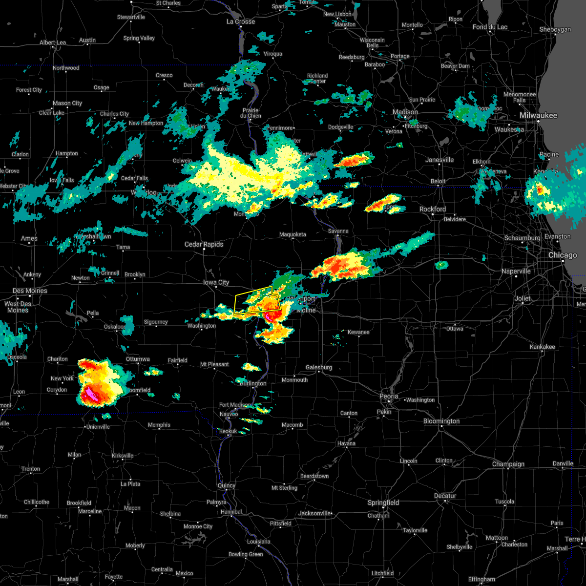 The severe thunderstorm warning for southeastern cedar and northern muscatine counties will expire at 600 pm cdt, the storm which prompted the warning has moved out of the area. therefore, the warning will be allowed to expire. however small hail and gusty winds are still possible with this thunderstorm. a severe thunderstorm watch remains in effect until 100 am cdt for east central iowa. The severe thunderstorm warning for southeastern cedar and northern muscatine counties will expire at 600 pm cdt, the storm which prompted the warning has moved out of the area. therefore, the warning will be allowed to expire. however small hail and gusty winds are still possible with this thunderstorm. a severe thunderstorm watch remains in effect until 100 am cdt for east central iowa.
|
| 6/17/2017 5:42 PM CDT |
 At 541 pm cdt, a severe thunderstorm was located near muscatine, moving east at 35 mph (radar indicated). Hazards include 60 mph wind gusts and half dollar size hail. Hail damage to vehicles is expected. expect wind damage to roofs, siding, and trees. locations impacted include, muscatine, durant, west liberty, wilton, nichols, atalissa, stockton, muscatine county fairgrounds, new era, pleasant prairie, moscow, wildcat den state park, saulsbury bridge campground, sweetland center and midway beach. This includes interstate 80 in iowa between mile markers 271 and 278. At 541 pm cdt, a severe thunderstorm was located near muscatine, moving east at 35 mph (radar indicated). Hazards include 60 mph wind gusts and half dollar size hail. Hail damage to vehicles is expected. expect wind damage to roofs, siding, and trees. locations impacted include, muscatine, durant, west liberty, wilton, nichols, atalissa, stockton, muscatine county fairgrounds, new era, pleasant prairie, moscow, wildcat den state park, saulsbury bridge campground, sweetland center and midway beach. This includes interstate 80 in iowa between mile markers 271 and 278.
|
| 6/17/2017 5:29 PM CDT |
 At 528 pm cdt, a severe thunderstorm was located over nichols, or 12 miles south of west branch, moving east at 35 mph (radar indicated). Hazards include 60 mph wind gusts and quarter size hail. Hail damage to vehicles is expected. expect wind damage to roofs, siding, and trees. locations impacted include, iowa city, muscatine, west branch, durant, west liberty, wilton, lone tree, bennett, nichols, atalissa, rochester, stockton, new liberty, muscatine county fairgrounds, new era, bennett park, pleasant prairie, moscow, sunbury and saulsbury bridge campground. This includes interstate 80 in iowa between mile markers 250 and 280. At 528 pm cdt, a severe thunderstorm was located over nichols, or 12 miles south of west branch, moving east at 35 mph (radar indicated). Hazards include 60 mph wind gusts and quarter size hail. Hail damage to vehicles is expected. expect wind damage to roofs, siding, and trees. locations impacted include, iowa city, muscatine, west branch, durant, west liberty, wilton, lone tree, bennett, nichols, atalissa, rochester, stockton, new liberty, muscatine county fairgrounds, new era, bennett park, pleasant prairie, moscow, sunbury and saulsbury bridge campground. This includes interstate 80 in iowa between mile markers 250 and 280.
|
| 6/17/2017 5:11 PM CDT |
 At 510 pm cdt, a severe thunderstorm was located over riverside, or 10 miles south of iowa city, moving east at 35 mph (radar indicated). Hazards include 60 mph wind gusts and quarter size hail. Hail damage to vehicles is expected. Expect wind damage to roofs, siding, and trees. At 510 pm cdt, a severe thunderstorm was located over riverside, or 10 miles south of iowa city, moving east at 35 mph (radar indicated). Hazards include 60 mph wind gusts and quarter size hail. Hail damage to vehicles is expected. Expect wind damage to roofs, siding, and trees.
|
| 6/15/2017 10:09 PM CDT |
 At 1009 pm cdt, severe thunderstorms were located along a line extending from near eldridge to davenport to blue grass, moving southeast at 45 mph (radar indicated). Hazards include 70 mph wind gusts and quarter size hail. Hail damage to vehicles is expected. expect considerable tree damage. wind damage is also likely to mobile homes, roofs, and outbuildings. locations impacted include, davenport, moline, rock island, bettendorf, east moline, durant, silvis, eldridge, milan, le claire, coal valley, hampton, walcott, blue grass, buffalo, andalusia, long grove, reynolds, riverdale and oak grove. this includes the following highways, interstate 74 in iowa between mile markers 1 and 5. interstate 80 in iowa between mile markers 279 and 303. interstate 80 in illinois between mile markers 2 and 5. interstate 74 in illinois between mile markers 1 and 7. interstate 88 between mile markers 1 and 2. Interstate 280 between mile markers 1 and 18. At 1009 pm cdt, severe thunderstorms were located along a line extending from near eldridge to davenport to blue grass, moving southeast at 45 mph (radar indicated). Hazards include 70 mph wind gusts and quarter size hail. Hail damage to vehicles is expected. expect considerable tree damage. wind damage is also likely to mobile homes, roofs, and outbuildings. locations impacted include, davenport, moline, rock island, bettendorf, east moline, durant, silvis, eldridge, milan, le claire, coal valley, hampton, walcott, blue grass, buffalo, andalusia, long grove, reynolds, riverdale and oak grove. this includes the following highways, interstate 74 in iowa between mile markers 1 and 5. interstate 80 in iowa between mile markers 279 and 303. interstate 80 in illinois between mile markers 2 and 5. interstate 74 in illinois between mile markers 1 and 7. interstate 88 between mile markers 1 and 2. Interstate 280 between mile markers 1 and 18.
|
| 6/15/2017 10:02 PM CDT |
 At 956 pm cdt, severe thunderstorms were located along a line extending from near donahue to near walcott to durant, moving southeast at 45 mph (radar indicated). Hazards include 60 mph wind gusts and quarter size hail. Hail damage to vehicles is expected. expect wind damage to roofs, siding, and trees. locations impacted include, davenport, moline, rock island, bettendorf, east moline, durant, silvis, eldridge, milan, le claire, coal valley, wilton, hampton, walcott, blue grass, buffalo, andalusia, long grove, lowden and reynolds. this includes the following highways, interstate 74 in iowa between mile markers 1 and 5. interstate 80 in iowa between mile markers 265 and 303. interstate 80 in illinois between mile markers 2 and 5. interstate 74 in illinois between mile markers 1 and 7. interstate 88 between mile markers 1 and 2. Interstate 280 between mile markers 1 and 18. At 956 pm cdt, severe thunderstorms were located along a line extending from near donahue to near walcott to durant, moving southeast at 45 mph (radar indicated). Hazards include 60 mph wind gusts and quarter size hail. Hail damage to vehicles is expected. expect wind damage to roofs, siding, and trees. locations impacted include, davenport, moline, rock island, bettendorf, east moline, durant, silvis, eldridge, milan, le claire, coal valley, wilton, hampton, walcott, blue grass, buffalo, andalusia, long grove, lowden and reynolds. this includes the following highways, interstate 74 in iowa between mile markers 1 and 5. interstate 80 in iowa between mile markers 265 and 303. interstate 80 in illinois between mile markers 2 and 5. interstate 74 in illinois between mile markers 1 and 7. interstate 88 between mile markers 1 and 2. Interstate 280 between mile markers 1 and 18.
|
| 6/15/2017 9:56 PM CDT |
 At 956 pm cdt, severe thunderstorms were located along a line extending from near donahue to near walcott to durant, moving southeast at 45 mph (radar indicated). Hazards include 60 mph wind gusts and quarter size hail. Hail damage to vehicles is expected. expect wind damage to roofs, siding, and trees. locations impacted include, davenport, moline, rock island, bettendorf, east moline, durant, silvis, eldridge, milan, le claire, coal valley, wilton, hampton, walcott, blue grass, buffalo, andalusia, long grove, lowden and reynolds. this includes the following highways, interstate 74 in iowa between mile markers 1 and 5. interstate 80 in iowa between mile markers 265 and 303. interstate 80 in illinois between mile markers 2 and 5. interstate 74 in illinois between mile markers 1 and 7. interstate 88 between mile markers 1 and 2. Interstate 280 between mile markers 1 and 18. At 956 pm cdt, severe thunderstorms were located along a line extending from near donahue to near walcott to durant, moving southeast at 45 mph (radar indicated). Hazards include 60 mph wind gusts and quarter size hail. Hail damage to vehicles is expected. expect wind damage to roofs, siding, and trees. locations impacted include, davenport, moline, rock island, bettendorf, east moline, durant, silvis, eldridge, milan, le claire, coal valley, wilton, hampton, walcott, blue grass, buffalo, andalusia, long grove, lowden and reynolds. this includes the following highways, interstate 74 in iowa between mile markers 1 and 5. interstate 80 in iowa between mile markers 265 and 303. interstate 80 in illinois between mile markers 2 and 5. interstate 74 in illinois between mile markers 1 and 7. interstate 88 between mile markers 1 and 2. Interstate 280 between mile markers 1 and 18.
|
| 6/15/2017 9:44 PM CDT |
 At 943 pm cdt, severe thunderstorms were located along a line extending from near wheatland to near bennett to near rochester, moving southeast at 50 mph (radar indicated). Hazards include 60 mph wind gusts and quarter size hail. Hail damage to vehicles is expected. Expect wind damage to roofs, siding, and trees. At 943 pm cdt, severe thunderstorms were located along a line extending from near wheatland to near bennett to near rochester, moving southeast at 50 mph (radar indicated). Hazards include 60 mph wind gusts and quarter size hail. Hail damage to vehicles is expected. Expect wind damage to roofs, siding, and trees.
|
| 5/17/2017 8:00 PM CDT |
 A severe thunderstorm warning remains in effect until 815 pm cdt for rock island. northwestern mercer. jo daviess. western carroll. jackson. scott. southeastern dubuque. eastern muscatine and clinton counties. At 800 pm cdt, severe thunderstorms were located along a line extending from near hazel green to near bellevue to near dewitt to. A severe thunderstorm warning remains in effect until 815 pm cdt for rock island. northwestern mercer. jo daviess. western carroll. jackson. scott. southeastern dubuque. eastern muscatine and clinton counties. At 800 pm cdt, severe thunderstorms were located along a line extending from near hazel green to near bellevue to near dewitt to.
|
| 5/17/2017 8:00 PM CDT |
 At 800 pm cdt, severe thunderstorms were located along a line extending from near hazel green to near bellevue to near dewitt to andalusia, moving northeast at 70 mph (trained weather spotters). Hazards include 70 mph wind gusts and quarter size hail. Hail damage to vehicles is expected. expect considerable tree damage. wind damage is also likely to mobile homes, roofs, and outbuildings. locations impacted include, davenport, dubuque, moline, rock island, bettendorf, clinton, muscatine, east moline, maquoketa, galena, durant, silvis, eldridge, dewitt, milan, camanche, le claire, coal valley, savanna and bellevue. this includes the following highways, interstate 74 in iowa between mile markers 1 and 5. interstate 80 in iowa between mile markers 279 and 306. interstate 80 in illinois between mile markers 1 and 4. interstate 74 in illinois between mile markers 1 and 7. interstate 88 between mile markers 1 and 4. interstate 280 between mile markers 1 and 18. A tornado watch remains in effect until 1100 pm cdt for northwestern illinois, and southeastern, northeastern and east central iowa. At 800 pm cdt, severe thunderstorms were located along a line extending from near hazel green to near bellevue to near dewitt to andalusia, moving northeast at 70 mph (trained weather spotters). Hazards include 70 mph wind gusts and quarter size hail. Hail damage to vehicles is expected. expect considerable tree damage. wind damage is also likely to mobile homes, roofs, and outbuildings. locations impacted include, davenport, dubuque, moline, rock island, bettendorf, clinton, muscatine, east moline, maquoketa, galena, durant, silvis, eldridge, dewitt, milan, camanche, le claire, coal valley, savanna and bellevue. this includes the following highways, interstate 74 in iowa between mile markers 1 and 5. interstate 80 in iowa between mile markers 279 and 306. interstate 80 in illinois between mile markers 1 and 4. interstate 74 in illinois between mile markers 1 and 7. interstate 88 between mile markers 1 and 4. interstate 280 between mile markers 1 and 18. A tornado watch remains in effect until 1100 pm cdt for northwestern illinois, and southeastern, northeastern and east central iowa.
|
| 5/17/2017 7:55 PM CDT |
 At 755 pm cdt, severe thunderstorms were located along a line extending from near east dubuque to near springbrook to near dewitt to near illinois city, moving northeast at 40 mph (trained weather spotters). Hazards include 70 mph wind gusts and quarter size hail. Hail damage to vehicles is expected. expect considerable tree damage. wind damage is also likely to mobile homes, roofs, and outbuildings. locations impacted include, davenport, dubuque, moline, rock island, bettendorf, clinton, muscatine, east moline, maquoketa, galena, durant, silvis, eldridge, dewitt, milan, camanche, asbury, le claire, coal valley and savanna. this includes the following highways, interstate 74 in iowa between mile markers 1 and 5. interstate 80 in iowa between mile markers 271 and 306. interstate 80 in illinois between mile markers 1 and 4. interstate 74 in illinois between mile markers 1 and 8. interstate 88 between mile markers 1 and 4. interstate 280 between mile markers 1 and 18. A tornado watch remains in effect until 1100 pm cdt for northwestern illinois, and southeastern, northeastern and east central iowa. At 755 pm cdt, severe thunderstorms were located along a line extending from near east dubuque to near springbrook to near dewitt to near illinois city, moving northeast at 40 mph (trained weather spotters). Hazards include 70 mph wind gusts and quarter size hail. Hail damage to vehicles is expected. expect considerable tree damage. wind damage is also likely to mobile homes, roofs, and outbuildings. locations impacted include, davenport, dubuque, moline, rock island, bettendorf, clinton, muscatine, east moline, maquoketa, galena, durant, silvis, eldridge, dewitt, milan, camanche, asbury, le claire, coal valley and savanna. this includes the following highways, interstate 74 in iowa between mile markers 1 and 5. interstate 80 in iowa between mile markers 271 and 306. interstate 80 in illinois between mile markers 1 and 4. interstate 74 in illinois between mile markers 1 and 8. interstate 88 between mile markers 1 and 4. interstate 280 between mile markers 1 and 18. A tornado watch remains in effect until 1100 pm cdt for northwestern illinois, and southeastern, northeastern and east central iowa.
|
| 5/17/2017 7:49 PM CDT |
 At 748 pm cdt, severe thunderstorms were located along a line extending from near peosta to near andrew to delmar to near illinois city, moving northeast at 45 mph (trained weather spotters). Hazards include 70 mph wind gusts and half dollar size hail. Hail damage to vehicles is expected. expect considerable tree damage. wind damage is also likely to mobile homes, roofs, and outbuildings. locations impacted include, davenport, dubuque, moline, rock island, bettendorf, clinton, muscatine, east moline, maquoketa, galena, durant, silvis, eldridge, dewitt, milan, camanche, asbury, le claire, coal valley and savanna. this includes the following highways, interstate 74 in iowa between mile markers 1 and 5. interstate 80 in iowa between mile markers 271 and 306. interstate 80 in illinois between mile markers 1 and 4. interstate 74 in illinois between mile markers 1 and 8. interstate 88 between mile markers 1 and 4. interstate 280 between mile markers 1 and 18. A tornado watch remains in effect until 1100 pm cdt for northwestern illinois, and southeastern, northeastern and east central iowa. At 748 pm cdt, severe thunderstorms were located along a line extending from near peosta to near andrew to delmar to near illinois city, moving northeast at 45 mph (trained weather spotters). Hazards include 70 mph wind gusts and half dollar size hail. Hail damage to vehicles is expected. expect considerable tree damage. wind damage is also likely to mobile homes, roofs, and outbuildings. locations impacted include, davenport, dubuque, moline, rock island, bettendorf, clinton, muscatine, east moline, maquoketa, galena, durant, silvis, eldridge, dewitt, milan, camanche, asbury, le claire, coal valley and savanna. this includes the following highways, interstate 74 in iowa between mile markers 1 and 5. interstate 80 in iowa between mile markers 271 and 306. interstate 80 in illinois between mile markers 1 and 4. interstate 74 in illinois between mile markers 1 and 8. interstate 88 between mile markers 1 and 4. interstate 280 between mile markers 1 and 18. A tornado watch remains in effect until 1100 pm cdt for northwestern illinois, and southeastern, northeastern and east central iowa.
|
| 5/17/2017 7:42 PM CDT |
 At 741 pm cdt, severe thunderstorms were located along a line extending from near epworth to near fulton to near welton to near eliza, moving east at 30 mph (trained weather spotters). Hazards include 70 mph wind gusts and quarter size hail. Hail damage to vehicles is expected. expect considerable tree damage. wind damage is also likely to mobile homes, roofs, and outbuildings. locations impacted include, davenport, dubuque, moline, rock island, bettendorf, clinton, muscatine, east moline, maquoketa, galena, durant, silvis, eldridge, dewitt, milan, camanche, asbury, le claire, coal valley and savanna. this includes the following highways, interstate 74 in iowa between mile markers 1 and 5. interstate 80 in iowa between mile markers 271 and 306. interstate 80 in illinois between mile markers 1 and 4. interstate 74 in illinois between mile markers 1 and 8. interstate 88 between mile markers 1 and 4. interstate 280 between mile markers 1 and 18. A tornado watch remains in effect until 1100 pm cdt for northwestern illinois, and southeastern, northeastern and east central iowa. At 741 pm cdt, severe thunderstorms were located along a line extending from near epworth to near fulton to near welton to near eliza, moving east at 30 mph (trained weather spotters). Hazards include 70 mph wind gusts and quarter size hail. Hail damage to vehicles is expected. expect considerable tree damage. wind damage is also likely to mobile homes, roofs, and outbuildings. locations impacted include, davenport, dubuque, moline, rock island, bettendorf, clinton, muscatine, east moline, maquoketa, galena, durant, silvis, eldridge, dewitt, milan, camanche, asbury, le claire, coal valley and savanna. this includes the following highways, interstate 74 in iowa between mile markers 1 and 5. interstate 80 in iowa between mile markers 271 and 306. interstate 80 in illinois between mile markers 1 and 4. interstate 74 in illinois between mile markers 1 and 8. interstate 88 between mile markers 1 and 4. interstate 280 between mile markers 1 and 18. A tornado watch remains in effect until 1100 pm cdt for northwestern illinois, and southeastern, northeastern and east central iowa.
|
| 5/17/2017 7:39 PM CDT |
 At 738 pm cdt, severe thunderstorms were located along a line extending from near fennimore to near galena to near calamus to eliza, moving northeast at 40 mph (trained weather spotters). Hazards include 70 mph wind gusts and quarter size hail. Hail damage to vehicles is expected. expect considerable tree damage. wind damage is also likely to mobile homes, roofs, and outbuildings. locations impacted include, davenport, dubuque, moline, rock island, bettendorf, clinton, muscatine, east moline, maquoketa, galena, durant, silvis, eldridge, dewitt, milan, camanche, asbury, le claire, coal valley and savanna. this includes the following highways, interstate 74 in iowa between mile markers 1 and 5. interstate 80 in iowa between mile markers 271 and 306. interstate 80 in illinois between mile markers 1 and 4. interstate 74 in illinois between mile markers 1 and 8. interstate 88 between mile markers 1 and 4. interstate 280 between mile markers 1 and 18. A tornado watch remains in effect until 1100 pm cdt for northwestern illinois, and southeastern, northeastern and east central iowa. At 738 pm cdt, severe thunderstorms were located along a line extending from near fennimore to near galena to near calamus to eliza, moving northeast at 40 mph (trained weather spotters). Hazards include 70 mph wind gusts and quarter size hail. Hail damage to vehicles is expected. expect considerable tree damage. wind damage is also likely to mobile homes, roofs, and outbuildings. locations impacted include, davenport, dubuque, moline, rock island, bettendorf, clinton, muscatine, east moline, maquoketa, galena, durant, silvis, eldridge, dewitt, milan, camanche, asbury, le claire, coal valley and savanna. this includes the following highways, interstate 74 in iowa between mile markers 1 and 5. interstate 80 in iowa between mile markers 271 and 306. interstate 80 in illinois between mile markers 1 and 4. interstate 74 in illinois between mile markers 1 and 8. interstate 88 between mile markers 1 and 4. interstate 280 between mile markers 1 and 18. A tornado watch remains in effect until 1100 pm cdt for northwestern illinois, and southeastern, northeastern and east central iowa.
|
| 5/17/2017 7:31 PM CDT |
 At 730 pm cdt, severe thunderstorms were located along a line extending from near fennimore to east dubuque to near nashville to near muscatine, moving east at 35 mph (trained weather spotters). Hazards include 70 mph wind gusts and quarter size hail. Hail damage to vehicles is expected. expect considerable tree damage. wind damage is also likely to mobile homes, roofs, and outbuildings. locations impacted include, davenport, dubuque, moline, rock island, bettendorf, clinton, muscatine, east moline, maquoketa, galena, durant, silvis, eldridge, dewitt, milan, camanche, asbury, le claire, coal valley and savanna. this includes the following highways, interstate 74 in iowa between mile markers 1 and 5. interstate 80 in iowa between mile markers 270 and 306. interstate 80 in illinois between mile markers 1 and 5. interstate 74 in illinois between mile markers 1 and 8. interstate 88 between mile markers 1 and 4. interstate 280 between mile markers 1 and 18. A tornado watch remains in effect until 1100 pm cdt for northwestern illinois, and southeastern, northeastern and east central iowa. At 730 pm cdt, severe thunderstorms were located along a line extending from near fennimore to east dubuque to near nashville to near muscatine, moving east at 35 mph (trained weather spotters). Hazards include 70 mph wind gusts and quarter size hail. Hail damage to vehicles is expected. expect considerable tree damage. wind damage is also likely to mobile homes, roofs, and outbuildings. locations impacted include, davenport, dubuque, moline, rock island, bettendorf, clinton, muscatine, east moline, maquoketa, galena, durant, silvis, eldridge, dewitt, milan, camanche, asbury, le claire, coal valley and savanna. this includes the following highways, interstate 74 in iowa between mile markers 1 and 5. interstate 80 in iowa between mile markers 270 and 306. interstate 80 in illinois between mile markers 1 and 5. interstate 74 in illinois between mile markers 1 and 8. interstate 88 between mile markers 1 and 4. interstate 280 between mile markers 1 and 18. A tornado watch remains in effect until 1100 pm cdt for northwestern illinois, and southeastern, northeastern and east central iowa.
|
| 5/17/2017 7:30 PM CDT |
 At 730 pm cdt, a severe thunderstorm was located over grandview, or 8 miles north of wapello, moving northeast at 50 mph (radar indicated). Hazards include golf ball size hail and 60 mph wind gusts. People and animals outdoors will be injured. expect hail damage to roofs, siding, windows, and vehicles. Expect wind damage to roofs, siding, and trees. At 730 pm cdt, a severe thunderstorm was located over grandview, or 8 miles north of wapello, moving northeast at 50 mph (radar indicated). Hazards include golf ball size hail and 60 mph wind gusts. People and animals outdoors will be injured. expect hail damage to roofs, siding, windows, and vehicles. Expect wind damage to roofs, siding, and trees.
|
| 5/17/2017 7:22 PM CDT |
 At 721 pm cdt, severe thunderstorms were located along a line extending from near farmersburg to 6 miles north of cassville to asbury to fruitland, moving northeast at 45 mph (radar indicated). Hazards include 70 mph wind gusts and quarter size hail. Hail damage to vehicles is expected. expect considerable tree damage. wind damage is also likely to mobile homes, roofs, and outbuildings. locations impacted include, davenport, dubuque, moline, rock island, bettendorf, clinton, muscatine, east moline, maquoketa, galena, durant, silvis, eldridge, dewitt, milan, camanche, asbury, le claire, coal valley and savanna. this includes the following highways, interstate 74 in iowa between mile markers 1 and 5. interstate 80 in iowa between mile markers 270 and 306. interstate 80 in illinois between mile markers 1 and 5. interstate 74 in illinois between mile markers 1 and 8. interstate 88 between mile markers 1 and 4. interstate 280 between mile markers 1 and 18. A tornado watch remains in effect until 1100 pm cdt for northwestern illinois, and southeastern, northeastern and east central iowa. At 721 pm cdt, severe thunderstorms were located along a line extending from near farmersburg to 6 miles north of cassville to asbury to fruitland, moving northeast at 45 mph (radar indicated). Hazards include 70 mph wind gusts and quarter size hail. Hail damage to vehicles is expected. expect considerable tree damage. wind damage is also likely to mobile homes, roofs, and outbuildings. locations impacted include, davenport, dubuque, moline, rock island, bettendorf, clinton, muscatine, east moline, maquoketa, galena, durant, silvis, eldridge, dewitt, milan, camanche, asbury, le claire, coal valley and savanna. this includes the following highways, interstate 74 in iowa between mile markers 1 and 5. interstate 80 in iowa between mile markers 270 and 306. interstate 80 in illinois between mile markers 1 and 5. interstate 74 in illinois between mile markers 1 and 8. interstate 88 between mile markers 1 and 4. interstate 280 between mile markers 1 and 18. A tornado watch remains in effect until 1100 pm cdt for northwestern illinois, and southeastern, northeastern and east central iowa.
|
| 5/17/2017 7:14 PM CDT |
 At 713 pm cdt, severe thunderstorms were located along a line extending from near elkader to near cassville to peosta to grandview, moving northeast at 45 mph (radar indicated). Hazards include 70 mph wind gusts and half dollar size hail. Hail damage to vehicles is expected. expect considerable tree damage. Wind damage is also likely to mobile homes, roofs, and outbuildings. At 713 pm cdt, severe thunderstorms were located along a line extending from near elkader to near cassville to peosta to grandview, moving northeast at 45 mph (radar indicated). Hazards include 70 mph wind gusts and half dollar size hail. Hail damage to vehicles is expected. expect considerable tree damage. Wind damage is also likely to mobile homes, roofs, and outbuildings.
|
| 5/17/2017 7:06 PM CDT |
 At 706 pm cdt, a severe thunderstorm capable of producing a tornado was located over rochester, or near tipton, moving northeast at 60 mph (radar indicated rotation). Hazards include tornado and ping pong ball size hail. Flying debris will be dangerous to those caught without shelter. mobile homes will be damaged or destroyed. damage to roofs, windows, and vehicles will occur. tree damage is likely. this dangerous storm will be near, tipton around 710 pm cdt. bennett around 715 pm cdt. stanwood around 720 pm cdt. lowden around 725 pm cdt. other locations impacted by this tornadic thunderstorm include springdale, cedar valley, cedar valley park, herbert hoover national historic site, massillon park, tipton matthews airport, bennett park, cedar county fairgrounds, sunbury and clarence. This includes interstate 80 in iowa between mile markers 254 and 278. At 706 pm cdt, a severe thunderstorm capable of producing a tornado was located over rochester, or near tipton, moving northeast at 60 mph (radar indicated rotation). Hazards include tornado and ping pong ball size hail. Flying debris will be dangerous to those caught without shelter. mobile homes will be damaged or destroyed. damage to roofs, windows, and vehicles will occur. tree damage is likely. this dangerous storm will be near, tipton around 710 pm cdt. bennett around 715 pm cdt. stanwood around 720 pm cdt. lowden around 725 pm cdt. other locations impacted by this tornadic thunderstorm include springdale, cedar valley, cedar valley park, herbert hoover national historic site, massillon park, tipton matthews airport, bennett park, cedar county fairgrounds, sunbury and clarence. This includes interstate 80 in iowa between mile markers 254 and 278.
|
| 5/17/2017 6:55 PM CDT |
 At 655 pm cdt, a confirmed tornado was located near west branch, moving northeast at 60 mph (weather spotters confirmed tornado). Hazards include damaging tornado and ping pong ball size hail. Flying debris will be dangerous to those caught without shelter. mobile homes will be damaged or destroyed. damage to roofs, windows, and vehicles will occur. tree damage is likely. this tornado will be near, rochester around 705 pm cdt. tipton around 710 pm cdt. stanwood around 720 pm cdt. lowden around 725 pm cdt. other locations impacted by this tornadic thunderstorm include springdale, cedar valley, muscatine county fairgrounds, massillon park, bennett park, hills access, oasis, moscow, sunbury and clarence. This includes interstate 80 in iowa between mile markers 249 and 278. At 655 pm cdt, a confirmed tornado was located near west branch, moving northeast at 60 mph (weather spotters confirmed tornado). Hazards include damaging tornado and ping pong ball size hail. Flying debris will be dangerous to those caught without shelter. mobile homes will be damaged or destroyed. damage to roofs, windows, and vehicles will occur. tree damage is likely. this tornado will be near, rochester around 705 pm cdt. tipton around 710 pm cdt. stanwood around 720 pm cdt. lowden around 725 pm cdt. other locations impacted by this tornadic thunderstorm include springdale, cedar valley, muscatine county fairgrounds, massillon park, bennett park, hills access, oasis, moscow, sunbury and clarence. This includes interstate 80 in iowa between mile markers 249 and 278.
|
| 5/17/2017 6:48 PM CDT |
 At 647 pm cdt, a severe thunderstorm capable of producing a tornado was located over lone tree, or 12 miles southeast of iowa city, moving northeast at 60 mph (radar indicated rotation). Hazards include tornado and ping pong ball size hail. Flying debris will be dangerous to those caught without shelter. mobile homes will be damaged or destroyed. damage to roofs, windows, and vehicles will occur. tree damage is likely. this dangerous storm will be near, west branch, west liberty and atalissa around 700 pm cdt. rochester around 705 pm cdt. tipton around 715 pm cdt. bennett around 720 pm cdt. lowden around 725 pm cdt. other locations impacted by this tornadic thunderstorm include springdale, cedar valley, muscatine county fairgrounds, massillon park, bennett park, hills access, oasis, moscow, sunbury and clarence. This includes interstate 80 in iowa between mile markers 249 and 278. At 647 pm cdt, a severe thunderstorm capable of producing a tornado was located over lone tree, or 12 miles southeast of iowa city, moving northeast at 60 mph (radar indicated rotation). Hazards include tornado and ping pong ball size hail. Flying debris will be dangerous to those caught without shelter. mobile homes will be damaged or destroyed. damage to roofs, windows, and vehicles will occur. tree damage is likely. this dangerous storm will be near, west branch, west liberty and atalissa around 700 pm cdt. rochester around 705 pm cdt. tipton around 715 pm cdt. bennett around 720 pm cdt. lowden around 725 pm cdt. other locations impacted by this tornadic thunderstorm include springdale, cedar valley, muscatine county fairgrounds, massillon park, bennett park, hills access, oasis, moscow, sunbury and clarence. This includes interstate 80 in iowa between mile markers 249 and 278.
|
| 5/17/2017 5:34 PM CDT |
 At 533 pm cdt, a severe thunderstorm was located 7 miles north of walcott, or 7 miles northeast of durant, moving northeast at 45 mph (trained weather spotters). Hazards include ping pong ball size hail and 60 mph wind gusts. People and animals outdoors will be injured. expect hail damage to roofs, siding, windows, and vehicles. expect wind damage to roofs, siding, and trees. locations impacted include, durant, dewitt, wilton, walcott, long grove, lowden, wheatland, grand mound, lost nation, calamus, bennett, donahue, welton, toronto, dixon, stockton, maysville, new liberty, malone and camp liberty. this includes interstate 80 in iowa between mile markers 271 and 289. A tornado watch remains in effect until 1100 pm cdt for east central iowa. At 533 pm cdt, a severe thunderstorm was located 7 miles north of walcott, or 7 miles northeast of durant, moving northeast at 45 mph (trained weather spotters). Hazards include ping pong ball size hail and 60 mph wind gusts. People and animals outdoors will be injured. expect hail damage to roofs, siding, windows, and vehicles. expect wind damage to roofs, siding, and trees. locations impacted include, durant, dewitt, wilton, walcott, long grove, lowden, wheatland, grand mound, lost nation, calamus, bennett, donahue, welton, toronto, dixon, stockton, maysville, new liberty, malone and camp liberty. this includes interstate 80 in iowa between mile markers 271 and 289. A tornado watch remains in effect until 1100 pm cdt for east central iowa.
|
| 5/17/2017 5:24 PM CDT |
 At 523 pm cdt, a severe thunderstorm was located over durant, moving northeast at 45 mph. golf ball hail was reported south of durant around 522 pm cdt (radar indicated). Hazards include golf ball size hail and 60 mph wind gusts. People and animals outdoors will be injured. expect hail damage to roofs, siding, windows, and vehicles. Expect wind damage to roofs, siding, and trees. At 523 pm cdt, a severe thunderstorm was located over durant, moving northeast at 45 mph. golf ball hail was reported south of durant around 522 pm cdt (radar indicated). Hazards include golf ball size hail and 60 mph wind gusts. People and animals outdoors will be injured. expect hail damage to roofs, siding, windows, and vehicles. Expect wind damage to roofs, siding, and trees.
|
| 5/17/2017 4:55 PM CDT |
 At 454 pm cdt, a severe thunderstorm capable of producing a tornado was located over fruitland, or 7 miles southwest of muscatine, moving northeast at 45 mph (radar indicated rotation). Hazards include tornado and ping pong ball size hail. Flying debris will be dangerous to those caught without shelter. mobile homes will be damaged or destroyed. damage to roofs, windows, and vehicles will occur. tree damage is likely. this dangerous storm will be near, muscatine and fairport around 510 pm cdt. wilton around 515 pm cdt. durant around 520 pm cdt. Other locations impacted by this tornadic thunderstorm include cranston, muscatine county fairgrounds, fredonia, midway beach, new era, pleasant prairie, moscow, fairport recreation area, wildcat den state park and saulsbury bridge campground. At 454 pm cdt, a severe thunderstorm capable of producing a tornado was located over fruitland, or 7 miles southwest of muscatine, moving northeast at 45 mph (radar indicated rotation). Hazards include tornado and ping pong ball size hail. Flying debris will be dangerous to those caught without shelter. mobile homes will be damaged or destroyed. damage to roofs, windows, and vehicles will occur. tree damage is likely. this dangerous storm will be near, muscatine and fairport around 510 pm cdt. wilton around 515 pm cdt. durant around 520 pm cdt. Other locations impacted by this tornadic thunderstorm include cranston, muscatine county fairgrounds, fredonia, midway beach, new era, pleasant prairie, moscow, fairport recreation area, wildcat den state park and saulsbury bridge campground.
|
| 5/17/2017 4:40 PM CDT |
 At 439 pm cdt, a severe thunderstorm capable of producing a tornado was located near wapello, moving northeast at 55 mph (radar indicated rotation). Hazards include tornado and ping pong ball size hail. Flying debris will be dangerous to those caught without shelter. mobile homes will be damaged or destroyed. damage to roofs, windows, and vehicles will occur. tree damage is likely. this dangerous storm will be near, grandview around 445 pm cdt. letts around 450 pm cdt. fruitland around 455 pm cdt. muscatine around 505 pm cdt. durant and wilton around 515 pm cdt. Other locations impacted by this tornadic thunderstorm include cranston, muscatine county fairgrounds, elrick junction, fredonia, midway beach, new era, pleasant prairie, moscow, fairport recreation area and wildcat den state park. At 439 pm cdt, a severe thunderstorm capable of producing a tornado was located near wapello, moving northeast at 55 mph (radar indicated rotation). Hazards include tornado and ping pong ball size hail. Flying debris will be dangerous to those caught without shelter. mobile homes will be damaged or destroyed. damage to roofs, windows, and vehicles will occur. tree damage is likely. this dangerous storm will be near, grandview around 445 pm cdt. letts around 450 pm cdt. fruitland around 455 pm cdt. muscatine around 505 pm cdt. durant and wilton around 515 pm cdt. Other locations impacted by this tornadic thunderstorm include cranston, muscatine county fairgrounds, elrick junction, fredonia, midway beach, new era, pleasant prairie, moscow, fairport recreation area and wildcat den state park.
|
| 3/6/2017 10:04 PM CST |
 At 1003 pm cst, severe thunderstorms were located along a line extending from near stanwood to lone tree, moving east at 40 mph (radar indicated). Hazards include 60 mph wind gusts. expect damage to roofs, siding, and trees At 1003 pm cst, severe thunderstorms were located along a line extending from near stanwood to lone tree, moving east at 40 mph (radar indicated). Hazards include 60 mph wind gusts. expect damage to roofs, siding, and trees
|
| 3/6/2017 9:52 PM CST |
 At 952 pm cst, severe thunderstorms were located along a line extending from near lone tree to near wapello to near donnellson, moving east at 55 mph (trained weather spotters. this line of storms has a history of producing damaging winds). Hazards include 70 mph wind gusts. Expect considerable tree damage. Damage is likely to mobile homes, roofs, and outbuildings. At 952 pm cst, severe thunderstorms were located along a line extending from near lone tree to near wapello to near donnellson, moving east at 55 mph (trained weather spotters. this line of storms has a history of producing damaging winds). Hazards include 70 mph wind gusts. Expect considerable tree damage. Damage is likely to mobile homes, roofs, and outbuildings.
|
| 3/6/2017 9:36 PM CST |
 At 936 pm cst, severe thunderstorms were located along a line extending from near worthington to cascade to near center junction to near olin to 8 miles north of west branch to near iowa city, moving northeast at 60 mph (trained weather spotters). Hazards include 70 mph wind gusts. Expect considerable tree damage. damage is likely to mobile homes, roofs, and outbuildings. locations impacted include, anamosa, tipton, west branch, durant, mechanicsville, stanwood, monticello, cascade, lowden, olin, wyoming, oxford junction, bennett, martelle, onslow, morley, center junction, stone city, rochester and langworthy. this includes interstate 80 in iowa between mile markers 254 and 278. a tornado watch remains in effect until 1000 pm cst for northeastern and east central iowa. A tornado watch also remains in effect until 400 am cst for northeastern and east central iowa. At 936 pm cst, severe thunderstorms were located along a line extending from near worthington to cascade to near center junction to near olin to 8 miles north of west branch to near iowa city, moving northeast at 60 mph (trained weather spotters). Hazards include 70 mph wind gusts. Expect considerable tree damage. damage is likely to mobile homes, roofs, and outbuildings. locations impacted include, anamosa, tipton, west branch, durant, mechanicsville, stanwood, monticello, cascade, lowden, olin, wyoming, oxford junction, bennett, martelle, onslow, morley, center junction, stone city, rochester and langworthy. this includes interstate 80 in iowa between mile markers 254 and 278. a tornado watch remains in effect until 1000 pm cst for northeastern and east central iowa. A tornado watch also remains in effect until 400 am cst for northeastern and east central iowa.
|
| 3/6/2017 9:05 PM CST |
 At 903 pm cst, severe thunderstorms were located along a line extending from troy mills to near alburnett to near marion to near bertram to near oxford to 7 miles north of kalona, moving east at 65 mph (radar indicated). Hazards include 70 mph wind gusts. Expect considerable tree damage. Damage is likely to mobile homes, roofs, and outbuildings. At 903 pm cst, severe thunderstorms were located along a line extending from troy mills to near alburnett to near marion to near bertram to near oxford to 7 miles north of kalona, moving east at 65 mph (radar indicated). Hazards include 70 mph wind gusts. Expect considerable tree damage. Damage is likely to mobile homes, roofs, and outbuildings.
|
| 2/28/2017 6:14 PM CST |
 At 614 pm cst, a severe thunderstorm was located near west branch, moving east at 45 mph (radar indicated). Hazards include quarter size hail. Damage to vehicles is expected. locations impacted include, tipton, west branch, durant, west liberty, wilton, bennett, atalissa, rochester, buchanan, springdale, cedar valley, muscatine county fairgrounds, bennett park, sunbury, cedar valley park, herbert hoover national historic site, tipton matthews airport, cedar county fairgrounds and moscow. this includes interstate 80 in iowa between mile markers 254 and 278. A tornado watch remains in effect until 1000 pm cst for east central iowa. At 614 pm cst, a severe thunderstorm was located near west branch, moving east at 45 mph (radar indicated). Hazards include quarter size hail. Damage to vehicles is expected. locations impacted include, tipton, west branch, durant, west liberty, wilton, bennett, atalissa, rochester, buchanan, springdale, cedar valley, muscatine county fairgrounds, bennett park, sunbury, cedar valley park, herbert hoover national historic site, tipton matthews airport, cedar county fairgrounds and moscow. this includes interstate 80 in iowa between mile markers 254 and 278. A tornado watch remains in effect until 1000 pm cst for east central iowa.
|
| 2/28/2017 6:05 PM CST |
 At 605 pm cst, a severe thunderstorm was located near west branch, moving east at 45 mph (radar indicated). Hazards include quarter size hail. damage to vehicles is expected At 605 pm cst, a severe thunderstorm was located near west branch, moving east at 45 mph (radar indicated). Hazards include quarter size hail. damage to vehicles is expected
|
| 10/6/2016 10:15 PM CDT |
 At 1015 pm cdt, a severe thunderstorm capable of producing a tornado was located near durant, moving northeast at 55 mph (radar indicated rotation). Hazards include tornado. Flying debris will be dangerous to those caught without shelter. mobile homes will be damaged or destroyed. damage to roofs, windows, and vehicles will occur. tree damage is likely. this dangerous storm will be near, walcott around 1025 pm cdt. davenport around 1030 pm cdt. other locations impacted by this tornadic thunderstorm include stockton, sweetland center, pleasant prairie, plainview and maysville. this includes the following highways, interstate 80 in iowa between mile markers 279 and 290. Interstate 280 between mile markers 1 and 2. At 1015 pm cdt, a severe thunderstorm capable of producing a tornado was located near durant, moving northeast at 55 mph (radar indicated rotation). Hazards include tornado. Flying debris will be dangerous to those caught without shelter. mobile homes will be damaged or destroyed. damage to roofs, windows, and vehicles will occur. tree damage is likely. this dangerous storm will be near, walcott around 1025 pm cdt. davenport around 1030 pm cdt. other locations impacted by this tornadic thunderstorm include stockton, sweetland center, pleasant prairie, plainview and maysville. this includes the following highways, interstate 80 in iowa between mile markers 279 and 290. Interstate 280 between mile markers 1 and 2.
|
| 10/6/2016 10:08 PM CDT |
 At 1008 pm cdt, severe thunderstorms were located along a line extending from near atalissa to near eliza, moving northeast at 55 mph (radar indicated). Hazards include 60 mph wind gusts. Expect damage to roofs. siding. And trees. At 1008 pm cdt, severe thunderstorms were located along a line extending from near atalissa to near eliza, moving northeast at 55 mph (radar indicated). Hazards include 60 mph wind gusts. Expect damage to roofs. siding. And trees.
|
| 8/11/2016 11:13 AM CDT |
 At 1112 am cdt, severe thunderstorms were located along a line extending from near calamus to near blue grass to near muscatine, moving east at 25 mph (radar indicated). Hazards include 60 mph wind gusts. Expect damage to roofs. siding. And trees. At 1112 am cdt, severe thunderstorms were located along a line extending from near calamus to near blue grass to near muscatine, moving east at 25 mph (radar indicated). Hazards include 60 mph wind gusts. Expect damage to roofs. siding. And trees.
|
| 8/4/2016 9:08 PM CDT |
 The severe thunderstorm warning for southern cedar and northwestern muscatine counties will expire at 915 pm cdt, the storms which prompted the warning have weakened below severe limits, and no longer pose an immediate threat to life or property. therefore the warning will be allowed to expire. however gusty winds and torrential rains are still possible with these thunderstorms. a severe thunderstorm watch remains in effect until midnight cdt for east central iowa. a severe thunderstorm watch also remains in effect until 200 am cdt for southeastern iowa. The severe thunderstorm warning for southern cedar and northwestern muscatine counties will expire at 915 pm cdt, the storms which prompted the warning have weakened below severe limits, and no longer pose an immediate threat to life or property. therefore the warning will be allowed to expire. however gusty winds and torrential rains are still possible with these thunderstorms. a severe thunderstorm watch remains in effect until midnight cdt for east central iowa. a severe thunderstorm watch also remains in effect until 200 am cdt for southeastern iowa.
|
| 8/4/2016 8:48 PM CDT |
 At 847 pm cdt, severe thunderstorms were located along a line extending from toronto to near wilton to near west branch, moving east at 50 mph (trained weather spotters). Hazards include 60 mph wind gusts. Expect damage to roofs. siding. and trees. Locations impacted include, tipton, west branch, durant, west liberty, wilton, bennett, nichols, atalissa, rochester, buchanan, cedar county fairgrounds, muscatine county fairgrounds, moscow, bennett park, tipton matthews airport, cedar valley park, herbert hoover national historic site, cedar bluff, sunbury and springdale. At 847 pm cdt, severe thunderstorms were located along a line extending from toronto to near wilton to near west branch, moving east at 50 mph (trained weather spotters). Hazards include 60 mph wind gusts. Expect damage to roofs. siding. and trees. Locations impacted include, tipton, west branch, durant, west liberty, wilton, bennett, nichols, atalissa, rochester, buchanan, cedar county fairgrounds, muscatine county fairgrounds, moscow, bennett park, tipton matthews airport, cedar valley park, herbert hoover national historic site, cedar bluff, sunbury and springdale.
|
| 8/4/2016 8:43 PM CDT |
 At 843 pm cdt, severe thunderstorms were located along a line extending from near delmar to 7 miles west of donahue to near west liberty, moving east at 60 mph (trained weather spotters). Hazards include 60 mph wind gusts. Expect damage to roofs. siding. And trees. At 843 pm cdt, severe thunderstorms were located along a line extending from near delmar to 7 miles west of donahue to near west liberty, moving east at 60 mph (trained weather spotters). Hazards include 60 mph wind gusts. Expect damage to roofs. siding. And trees.
|
| 8/4/2016 8:19 PM CDT |
 At 819 pm cdt, severe thunderstorms were located along a line extending from near morley to near oxford to 8 miles south of victor, moving east at 55 mph (radar indicated). Hazards include 60 mph wind gusts. Expect damage to roofs. siding. And trees. At 819 pm cdt, severe thunderstorms were located along a line extending from near morley to near oxford to 8 miles south of victor, moving east at 55 mph (radar indicated). Hazards include 60 mph wind gusts. Expect damage to roofs. siding. And trees.
|
| 7/17/2016 6:14 AM CDT |
 At 614 am cdt, severe thunderstorms were located along a line extending from near delmar to near calamus to near wilton, moving east at 60 mph (radar indicated). Hazards include 60 mph wind gusts. Expect damage to roofs. siding. And trees. At 614 am cdt, severe thunderstorms were located along a line extending from near delmar to near calamus to near wilton, moving east at 60 mph (radar indicated). Hazards include 60 mph wind gusts. Expect damage to roofs. siding. And trees.
|
| 7/17/2016 5:58 AM CDT |
 At 558 am cdt, severe thunderstorms were located along a line extending from near toronto to near rochester to near harper, moving east at 60 mph (radar indicated). Hazards include 60 mph wind gusts. Expect damage to roofs. siding. and trees. Locations impacted include, iowa city, muscatine, tipton, west branch, durant, mechanicsville, stanwood, coralville, north liberty, dewitt, west liberty, wilton, solon, tiffin, walcott, lone tree, university heights, lowden, wheatland and hills. At 558 am cdt, severe thunderstorms were located along a line extending from near toronto to near rochester to near harper, moving east at 60 mph (radar indicated). Hazards include 60 mph wind gusts. Expect damage to roofs. siding. and trees. Locations impacted include, iowa city, muscatine, tipton, west branch, durant, mechanicsville, stanwood, coralville, north liberty, dewitt, west liberty, wilton, solon, tiffin, walcott, lone tree, university heights, lowden, wheatland and hills.
|
| 7/17/2016 5:31 AM CDT |
 At 531 am cdt, severe thunderstorms were located along a line extending from martelle to lake macbride state park to near what cheer, moving east at 65 mph (radar indicated). Hazards include 60 mph wind gusts. Expect damage to roofs. siding. And trees. At 531 am cdt, severe thunderstorms were located along a line extending from martelle to lake macbride state park to near what cheer, moving east at 65 mph (radar indicated). Hazards include 60 mph wind gusts. Expect damage to roofs. siding. And trees.
|
| 7/6/2016 3:13 AM CDT |
 At 312 am cdt, a severe thunderstorm was located near bennett, or 12 miles north of durant, moving east at 60 mph (trained weather spotters). Hazards include 70 mph wind gusts. Expect considerable tree damage. damage is likely to mobile homes, roofs, and outbuildings. locations impacted include, cedar rapids, iowa city, maquoketa, anamosa, tipton, west branch, durant, mechanicsville, stanwood, marion, coralville, north liberty, mount vernon, robins, wilton, lisbon, solon, tiffin, ely and walcott. this includes the following highways, interstate 80 in iowa between mile markers 244 and 286. interstate 380 between mile markers 2 and 23. An 80 mph wind gust was recorded 1 mile northeast of marion at 247 am. At 312 am cdt, a severe thunderstorm was located near bennett, or 12 miles north of durant, moving east at 60 mph (trained weather spotters). Hazards include 70 mph wind gusts. Expect considerable tree damage. damage is likely to mobile homes, roofs, and outbuildings. locations impacted include, cedar rapids, iowa city, maquoketa, anamosa, tipton, west branch, durant, mechanicsville, stanwood, marion, coralville, north liberty, mount vernon, robins, wilton, lisbon, solon, tiffin, ely and walcott. this includes the following highways, interstate 80 in iowa between mile markers 244 and 286. interstate 380 between mile markers 2 and 23. An 80 mph wind gust was recorded 1 mile northeast of marion at 247 am.
|
| 7/6/2016 2:51 AM CDT |
 At 250 am cdt, a severe thunderstorm was located over mechanicsville, moving east at 60 mph (trained weather spotters reported winds over 60 mph in cedar rapids around 235 am). Hazards include 70 mph wind gusts and penny size hail. Expect considerable tree damage. damage is likely to mobile homes, roofs, and outbuildings. locations impacted include, cedar rapids, iowa city, maquoketa, anamosa, tipton, west branch, durant, mechanicsville, stanwood, marion, coralville, north liberty, mount vernon, robins, wilton, lisbon, solon, tiffin, ely and walcott. this includes the following highways, interstate 80 in iowa between mile markers 244 and 286. Interstate 380 between mile markers 2 and 23. At 250 am cdt, a severe thunderstorm was located over mechanicsville, moving east at 60 mph (trained weather spotters reported winds over 60 mph in cedar rapids around 235 am). Hazards include 70 mph wind gusts and penny size hail. Expect considerable tree damage. damage is likely to mobile homes, roofs, and outbuildings. locations impacted include, cedar rapids, iowa city, maquoketa, anamosa, tipton, west branch, durant, mechanicsville, stanwood, marion, coralville, north liberty, mount vernon, robins, wilton, lisbon, solon, tiffin, ely and walcott. this includes the following highways, interstate 80 in iowa between mile markers 244 and 286. Interstate 380 between mile markers 2 and 23.
|
| 7/6/2016 2:42 AM CDT |
 At 241 am cdt, a severe thunderstorm was located over mount vernon, or 9 miles west of mechanicsville, moving east at 70 mph (radar indicated). Hazards include 70 mph wind gusts and penny size hail. Expect considerable tree damage. Damage is likely to mobile homes, roofs, and outbuildings. At 241 am cdt, a severe thunderstorm was located over mount vernon, or 9 miles west of mechanicsville, moving east at 70 mph (radar indicated). Hazards include 70 mph wind gusts and penny size hail. Expect considerable tree damage. Damage is likely to mobile homes, roofs, and outbuildings.
|
| 3/15/2016 7:09 PM CDT |
 At 709 pm cdt, a severe thunderstorm was located over rock island, moving northeast at 45 mph (radar indicated). Hazards include 60 mph wind gusts and half dollar size hail. Hail damage to vehicles is expected. expect wind damage to roofs, siding, and trees. locations impacted include, davenport, moline, rock island, bettendorf, clinton, east moline, durant, silvis, eldridge, dewitt, milan, camanche, le claire, coal valley, wilton, hampton, port byron, walcott, blue grass and buffalo. this includes the following highways, interstate 74 in iowa between mile markers 1 and 5. interstate 80 in iowa between mile markers 269 and 306. interstate 80 in illinois between mile markers 1 and 5. interstate 74 in illinois between mile markers 2 and 3. interstate 88 between mile markers 1 and 3, and between mile markers 7 and 16. interstate 280 between mile markers 1 and 18. A tornado watch remains in effect until 900 pm cdt for northwestern illinois and east central iowa. At 709 pm cdt, a severe thunderstorm was located over rock island, moving northeast at 45 mph (radar indicated). Hazards include 60 mph wind gusts and half dollar size hail. Hail damage to vehicles is expected. expect wind damage to roofs, siding, and trees. locations impacted include, davenport, moline, rock island, bettendorf, clinton, east moline, durant, silvis, eldridge, dewitt, milan, camanche, le claire, coal valley, wilton, hampton, port byron, walcott, blue grass and buffalo. this includes the following highways, interstate 74 in iowa between mile markers 1 and 5. interstate 80 in iowa between mile markers 269 and 306. interstate 80 in illinois between mile markers 1 and 5. interstate 74 in illinois between mile markers 2 and 3. interstate 88 between mile markers 1 and 3, and between mile markers 7 and 16. interstate 280 between mile markers 1 and 18. A tornado watch remains in effect until 900 pm cdt for northwestern illinois and east central iowa.
|
| 3/15/2016 6:58 PM CDT | Hen Egg sized hail reported 0.1 miles N of Durant, IA |
| 3/15/2016 6:58 PM CDT |
 At 657 pm cdt, a severe thunderstorm was located near blue grass, or near durant, moving northeast at 50 mph (radar indicated). Hazards include 60 mph wind gusts and quarter size hail. Hail damage to vehicles is expected. expect wind damage to roofs, siding, and trees. this severe thunderstorm will remain over mainly rural areas of southwestern rock island, southeastern cedar and northeastern muscatine counties, including the following locations: sweetland center, pleasant prairie, moscow, new era, stockton, shady creek campground, loud thunder scout camp, edgington, sunbury and midway beach. this includes interstate 80 in iowa between mile markers 269 and 278. A tornado watch remains in effect until 900 pm cdt for northwestern illinois and east central iowa. At 657 pm cdt, a severe thunderstorm was located near blue grass, or near durant, moving northeast at 50 mph (radar indicated). Hazards include 60 mph wind gusts and quarter size hail. Hail damage to vehicles is expected. expect wind damage to roofs, siding, and trees. this severe thunderstorm will remain over mainly rural areas of southwestern rock island, southeastern cedar and northeastern muscatine counties, including the following locations: sweetland center, pleasant prairie, moscow, new era, stockton, shady creek campground, loud thunder scout camp, edgington, sunbury and midway beach. this includes interstate 80 in iowa between mile markers 269 and 278. A tornado watch remains in effect until 900 pm cdt for northwestern illinois and east central iowa.
|
| 3/15/2016 6:58 PM CDT |
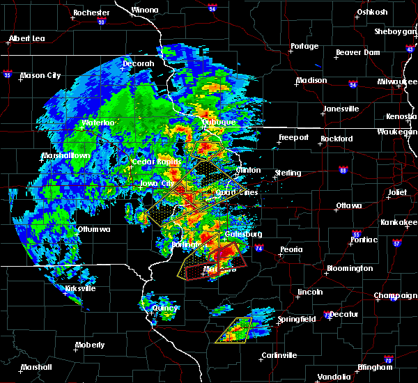 At 657 pm cdt, a severe thunderstorm was located near blue grass, or near durant, moving northeast at 50 mph (radar indicated). Hazards include 60 mph wind gusts and quarter size hail. Hail damage to vehicles is expected. expect wind damage to roofs, siding, and trees. this severe thunderstorm will remain over mainly rural areas of southwestern rock island, southeastern cedar and northeastern muscatine counties, including the following locations: sweetland center, pleasant prairie, moscow, new era, stockton, shady creek campground, loud thunder scout camp, edgington, sunbury and midway beach. this includes interstate 80 in iowa between mile markers 269 and 278. A tornado watch remains in effect until 900 pm cdt for northwestern illinois and east central iowa. At 657 pm cdt, a severe thunderstorm was located near blue grass, or near durant, moving northeast at 50 mph (radar indicated). Hazards include 60 mph wind gusts and quarter size hail. Hail damage to vehicles is expected. expect wind damage to roofs, siding, and trees. this severe thunderstorm will remain over mainly rural areas of southwestern rock island, southeastern cedar and northeastern muscatine counties, including the following locations: sweetland center, pleasant prairie, moscow, new era, stockton, shady creek campground, loud thunder scout camp, edgington, sunbury and midway beach. this includes interstate 80 in iowa between mile markers 269 and 278. A tornado watch remains in effect until 900 pm cdt for northwestern illinois and east central iowa.
|
| 3/15/2016 6:50 PM CDT |
 At 649 pm cdt, a severe thunderstorm was located near fairport, or near durant, moving northeast at 40 mph (radar indicated). Hazards include 60 mph wind gusts and half dollar size hail. Hail damage to vehicles is expected. Expect wind damage to roofs, siding, and trees. At 649 pm cdt, a severe thunderstorm was located near fairport, or near durant, moving northeast at 40 mph (radar indicated). Hazards include 60 mph wind gusts and half dollar size hail. Hail damage to vehicles is expected. Expect wind damage to roofs, siding, and trees.
|
| 3/15/2016 6:26 PM CDT |
 At 625 pm cdt, a severe thunderstorm was located over letts, or near columbus junction, moving quickly northeast at 45 mph (radar indicated). Hazards include 60 mph wind gusts and quarter size hail. Hail damage to vehicles is expected. expect wind damage to roofs, siding, and trees. this severe thunderstorm will be near, fruitland around 635 pm cdt. muscatine around 645 pm cdt. fairport and illinois city around 650 pm cdt. montpelier around 655 pm cdt. durant around 700 pm cdt. other locations impacted by this severe thunderstorm include sweetland center, ardon, pleasant prairie, moscow, new era, flaming prairie park, stockton, shady creek campground, louisa county fairgrounds and loud thunder scout camp. this includes interstate 80 in iowa between mile markers 270 and 278. A tornado watch remains in effect until 900 pm cdt for northwestern illinois and southeastern iowa. At 625 pm cdt, a severe thunderstorm was located over letts, or near columbus junction, moving quickly northeast at 45 mph (radar indicated). Hazards include 60 mph wind gusts and quarter size hail. Hail damage to vehicles is expected. expect wind damage to roofs, siding, and trees. this severe thunderstorm will be near, fruitland around 635 pm cdt. muscatine around 645 pm cdt. fairport and illinois city around 650 pm cdt. montpelier around 655 pm cdt. durant around 700 pm cdt. other locations impacted by this severe thunderstorm include sweetland center, ardon, pleasant prairie, moscow, new era, flaming prairie park, stockton, shady creek campground, louisa county fairgrounds and loud thunder scout camp. this includes interstate 80 in iowa between mile markers 270 and 278. A tornado watch remains in effect until 900 pm cdt for northwestern illinois and southeastern iowa.
|
| 11/11/2015 5:47 PM CST |
 At 546 pm cst, severe thunderstorms were located along a line extending from near amber to near lowden to wilton to near fairport to wapello, moving northeast at 60 mph (radar indicated). Hazards include 60 mph wind gusts. Expect damage to roofs. siding and trees. locations impacted include, davenport, moline, rock island, bettendorf, muscatine, east moline, anamosa, tipton, wapello, durant, mechanicsville, stanwood, eldridge, dewitt, milan, coal valley, west liberty, wilton, walcott and blue grass. this includes the following highways, interstate 74 in iowa between mile markers 1 and 5. interstate 80 in iowa between mile markers 259 and 302. interstate 74 in illinois between mile markers 2 and 3. interstate 280 between mile markers 1 and 18. A tornado watch remains in effect until 900 pm cst for northwestern illinois and southeastern iowa. At 546 pm cst, severe thunderstorms were located along a line extending from near amber to near lowden to wilton to near fairport to wapello, moving northeast at 60 mph (radar indicated). Hazards include 60 mph wind gusts. Expect damage to roofs. siding and trees. locations impacted include, davenport, moline, rock island, bettendorf, muscatine, east moline, anamosa, tipton, wapello, durant, mechanicsville, stanwood, eldridge, dewitt, milan, coal valley, west liberty, wilton, walcott and blue grass. this includes the following highways, interstate 74 in iowa between mile markers 1 and 5. interstate 80 in iowa between mile markers 259 and 302. interstate 74 in illinois between mile markers 2 and 3. interstate 280 between mile markers 1 and 18. A tornado watch remains in effect until 900 pm cst for northwestern illinois and southeastern iowa.
|
| 11/11/2015 5:21 PM CST |
 At 521 pm cst, severe thunderstorms were located along a line extending from near lake macbride state park to near lone tree to near mount pleasant, moving east at 40 mph (radar indicated). Hazards include 60 mph wind gusts. Expect damage to roofs. siding and trees. locations impacted include, davenport, moline, rock island, bettendorf, muscatine, east moline, anamosa, tipton, west branch, wapello, columbus junction, durant, mechanicsville, stanwood, eldridge, dewitt, milan, coal valley, west liberty and wilton. this includes the following highways, interstate 74 in iowa between mile markers 1 and 5. interstate 80 in iowa between mile markers 254 and 302. interstate 74 in illinois between mile markers 2 and 3. interstate 280 between mile markers 1 and 18. A tornado watch remains in effect until 900 pm cst for northwestern illinois and southeastern iowa. At 521 pm cst, severe thunderstorms were located along a line extending from near lake macbride state park to near lone tree to near mount pleasant, moving east at 40 mph (radar indicated). Hazards include 60 mph wind gusts. Expect damage to roofs. siding and trees. locations impacted include, davenport, moline, rock island, bettendorf, muscatine, east moline, anamosa, tipton, west branch, wapello, columbus junction, durant, mechanicsville, stanwood, eldridge, dewitt, milan, coal valley, west liberty and wilton. this includes the following highways, interstate 74 in iowa between mile markers 1 and 5. interstate 80 in iowa between mile markers 254 and 302. interstate 74 in illinois between mile markers 2 and 3. interstate 280 between mile markers 1 and 18. A tornado watch remains in effect until 900 pm cst for northwestern illinois and southeastern iowa.
|
| 8/18/2015 5:03 PM CDT |
 At 502 pm cdt, severe thunderstorms were located along a line extending from near durant to near walcott to near oak grove, moving northeast at 45 mph (radar indicated). Hazards include 60 mph wind gusts. Expect damage to roofs. siding and trees. locations impacted include, davenport, moline, rock island, bettendorf, east moline, durant, eldridge, milan, le claire, hampton, port byron, walcott, blue grass, buffalo, andalusia, long grove, riverdale, oak grove, donahue and montpelier. this includes the following highways, interstate 74 in iowa between mile markers 1 and 5. interstate 80 in iowa between mile markers 279 and 306. interstate 74 in illinois between mile markers 1 and 5. interstate 280 between mile markers 1 and 18. A tornado watch remains in effect until 1000 pm cdt for northwestern illinois and east central iowa. At 502 pm cdt, severe thunderstorms were located along a line extending from near durant to near walcott to near oak grove, moving northeast at 45 mph (radar indicated). Hazards include 60 mph wind gusts. Expect damage to roofs. siding and trees. locations impacted include, davenport, moline, rock island, bettendorf, east moline, durant, eldridge, milan, le claire, hampton, port byron, walcott, blue grass, buffalo, andalusia, long grove, riverdale, oak grove, donahue and montpelier. this includes the following highways, interstate 74 in iowa between mile markers 1 and 5. interstate 80 in iowa between mile markers 279 and 306. interstate 74 in illinois between mile markers 1 and 5. interstate 280 between mile markers 1 and 18. A tornado watch remains in effect until 1000 pm cdt for northwestern illinois and east central iowa.
|
| 8/18/2015 4:54 PM CDT |
 At 454 pm cdt, severe thunderstorms were located along a line extending from near durant to blue grass to near taylor ridge, moving northeast at 45 mph (radar indicated). Hazards include 60 mph wind gusts. Expect damage to roofs. siding and trees. locations impacted include, davenport, moline, rock island, bettendorf, east moline, durant, silvis, eldridge, milan, le claire, coal valley, hampton, port byron, walcott, blue grass, buffalo, andalusia, rapids city, long grove and reynolds. this includes the following highways, interstate 74 in iowa between mile markers 1 and 5. interstate 80 in iowa between mile markers 279 and 306. interstate 80 in illinois between mile markers 1 and 2. interstate 74 in illinois between mile markers 1 and 7. interstate 280 between mile markers 1 and 18. A tornado watch remains in effect until 1000 pm cdt for northwestern illinois and east central iowa. At 454 pm cdt, severe thunderstorms were located along a line extending from near durant to blue grass to near taylor ridge, moving northeast at 45 mph (radar indicated). Hazards include 60 mph wind gusts. Expect damage to roofs. siding and trees. locations impacted include, davenport, moline, rock island, bettendorf, east moline, durant, silvis, eldridge, milan, le claire, coal valley, hampton, port byron, walcott, blue grass, buffalo, andalusia, rapids city, long grove and reynolds. this includes the following highways, interstate 74 in iowa between mile markers 1 and 5. interstate 80 in iowa between mile markers 279 and 306. interstate 80 in illinois between mile markers 1 and 2. interstate 74 in illinois between mile markers 1 and 7. interstate 280 between mile markers 1 and 18. A tornado watch remains in effect until 1000 pm cdt for northwestern illinois and east central iowa.
|
| 8/18/2015 4:46 PM CDT |
 At 446 pm cdt, severe thunderstorms were located along a line extending from near muscatine to near illinois city to near aledo, moving northeast at 45 mph (radar indicated). Hazards include 60 mph wind gusts. Expect damage to roofs. siding and trees. locations impacted include, davenport, moline, rock island, bettendorf, muscatine, east moline, aledo, durant, silvis, eldridge, milan, colona, le claire, coal valley, burgess, hampton, port byron, walcott, blue grass and buffalo. this includes the following highways, interstate 74 in iowa between mile markers 1 and 5. interstate 80 in iowa between mile markers 275 and 306. interstate 80 in illinois between mile markers 1 and 9. interstate 74 in illinois between mile markers 1 and 13. interstate 88 between mile markers 1 and 4, and near mile marker 11. interstate 280 between mile markers 1 and 18. A tornado watch remains in effect until 1000 pm cdt for northwestern illinois and east central iowa. At 446 pm cdt, severe thunderstorms were located along a line extending from near muscatine to near illinois city to near aledo, moving northeast at 45 mph (radar indicated). Hazards include 60 mph wind gusts. Expect damage to roofs. siding and trees. locations impacted include, davenport, moline, rock island, bettendorf, muscatine, east moline, aledo, durant, silvis, eldridge, milan, colona, le claire, coal valley, burgess, hampton, port byron, walcott, blue grass and buffalo. this includes the following highways, interstate 74 in iowa between mile markers 1 and 5. interstate 80 in iowa between mile markers 275 and 306. interstate 80 in illinois between mile markers 1 and 9. interstate 74 in illinois between mile markers 1 and 13. interstate 88 between mile markers 1 and 4, and near mile marker 11. interstate 280 between mile markers 1 and 18. A tornado watch remains in effect until 1000 pm cdt for northwestern illinois and east central iowa.
|
| 8/18/2015 4:39 PM CDT |
 At 438 pm cdt, severe thunderstorms were located along a line extending from near muscatine to near millersburg to near aledo, moving north at 45 mph (radar indicated). Hazards include 60 mph wind gusts. Expect damage to roofs. siding and trees. locations impacted include, davenport, moline, rock island, bettendorf, muscatine, east moline, aledo, durant, silvis, eldridge, milan, colona, le claire, coal valley, wilton, burgess, hampton, port byron, walcott and blue grass. this includes the following highways, interstate 74 in iowa between mile markers 1 and 5. interstate 80 in iowa between mile markers 273 and 306. interstate 80 in illinois between mile markers 1 and 9. interstate 74 in illinois between mile markers 1 and 13. interstate 88 between mile markers 1 and 4, and near mile marker 11. interstate 280 between mile markers 1 and 18. A tornado watch remains in effect until 1000 pm cdt for northwestern illinois and southeastern iowa. At 438 pm cdt, severe thunderstorms were located along a line extending from near muscatine to near millersburg to near aledo, moving north at 45 mph (radar indicated). Hazards include 60 mph wind gusts. Expect damage to roofs. siding and trees. locations impacted include, davenport, moline, rock island, bettendorf, muscatine, east moline, aledo, durant, silvis, eldridge, milan, colona, le claire, coal valley, wilton, burgess, hampton, port byron, walcott and blue grass. this includes the following highways, interstate 74 in iowa between mile markers 1 and 5. interstate 80 in iowa between mile markers 273 and 306. interstate 80 in illinois between mile markers 1 and 9. interstate 74 in illinois between mile markers 1 and 13. interstate 88 between mile markers 1 and 4, and near mile marker 11. interstate 280 between mile markers 1 and 18. A tornado watch remains in effect until 1000 pm cdt for northwestern illinois and southeastern iowa.
|
| 8/18/2015 4:34 PM CDT |
 At 434 pm cdt, severe thunderstorms were located along a line extending from near grandview to near millersburg to seaton, moving northeast at 45 mph (radar indicated). Hazards include 60 mph wind gusts. Expect damage to roofs. siding and trees. locations impacted include, davenport, moline, rock island, bettendorf, muscatine, east moline, aledo, durant, silvis, eldridge, milan, colona, le claire, coal valley, wilton, burgess, hampton, port byron, walcott and blue grass. this includes the following highways, interstate 80 in iowa between mile markers 273 and 306. interstate 80 in illinois between mile markers 1 and 9. interstate 74 in illinois between mile markers 1 and 13. interstate 280 between mile markers 1 and 18. A tornado watch remains in effect until 1000 pm cdt for northwestern illinois and southeastern iowa. At 434 pm cdt, severe thunderstorms were located along a line extending from near grandview to near millersburg to seaton, moving northeast at 45 mph (radar indicated). Hazards include 60 mph wind gusts. Expect damage to roofs. siding and trees. locations impacted include, davenport, moline, rock island, bettendorf, muscatine, east moline, aledo, durant, silvis, eldridge, milan, colona, le claire, coal valley, wilton, burgess, hampton, port byron, walcott and blue grass. this includes the following highways, interstate 80 in iowa between mile markers 273 and 306. interstate 80 in illinois between mile markers 1 and 9. interstate 74 in illinois between mile markers 1 and 13. interstate 280 between mile markers 1 and 18. A tornado watch remains in effect until 1000 pm cdt for northwestern illinois and southeastern iowa.
|
| 8/18/2015 4:26 PM CDT |
 At 426 pm cdt, severe thunderstorms were located along a line extending from grandview to near seaton, moving northeast at 45 mph (radar indicated). Hazards include 60 mph wind gusts. Expect damage to roofs. Siding and trees. At 426 pm cdt, severe thunderstorms were located along a line extending from grandview to near seaton, moving northeast at 45 mph (radar indicated). Hazards include 60 mph wind gusts. Expect damage to roofs. Siding and trees.
|
| 4/9/2015 5:12 PM CDT | Golf Ball sized hail reported 0.1 miles N of Durant, IA, reports north and west of durant- courtesy of wqad |
| 4/9/2015 5:06 PM CDT | The national weather service in the quad cities has issued a * tornado warning for. northwestern scott county in east central iowa. until 530 pm cdt * at 504 pm cdt. a severe thunderstorm capable of producing a tornado was located near durant. And moving northeast at 45 mph. |
| 4/9/2015 5:00 PM CDT | The national weather service in the quad cities has issued a * severe thunderstorm warning for. southeastern cedar county in east central iowa. southwestern clinton county in east central iowa. northeastern muscatine county in east central iowa. Scott county in east central iowa. |
| 4/9/2015 4:47 PM CDT | A severe thunderstorm warning remains in effect for southern cedar. southeastern johnson. northwestern louisa. northwestern muscatine and northeastern washington counties until 500 pm cdt. at 443 pm cdt. a severe thunderstorm was located near west liberty. and moving northeast at 40 mph. A second severe thunderstorm was located just south of lone tree. |
| 4/9/2015 4:25 PM CDT | A severe thunderstorm warning remains in effect for southern cedar. southeastern johnson. northwestern louisa. northwestern muscatine and northeastern washington counties until 500 pm cdt. at 422 pm cdt. severe thunderstorms were located along a line extending from hills to conesville. and moving northeast at 40 mph. at 415 pm the public reported 1. 25 inch hail. |
| 4/9/2015 4:14 PM CDT | The national weather service in the quad cities has issued a * severe thunderstorm warning for. southern cedar county in east central iowa. southeastern johnson county in east central iowa. northwestern louisa county in southeast iowa. Northwestern muscatine county in east central iowa. |
| 7/19/2013 7:51 PM CDT | Branches about 4 to 6 inches in diameter were broken off of apple and fruit trees. roof was ripped off of a barn. reports via nssl shav in cedar county IA, 5.4 miles SSE of Durant, IA |
| 7/19/2013 7:00 PM CDT | Several tree branches approximately 3-4 inches in diameter blown down on 300th street. several large tree limbs greater than 4 inches in diameter were blown down on ver in cedar county IA, 3.5 miles SSE of Durant, IA |
Hail Maps for Durant, IA
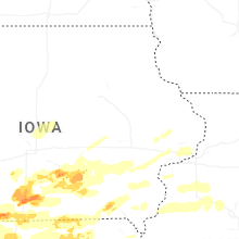
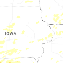
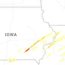
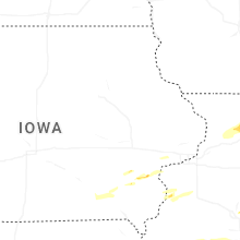
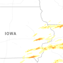


Connect with Interactive Hail Maps