

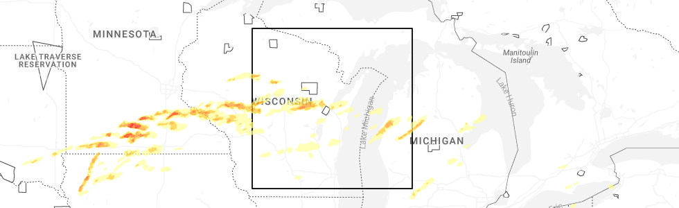
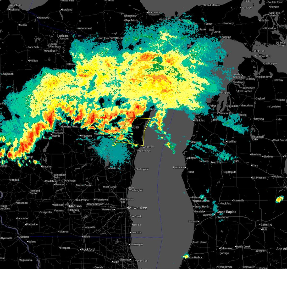
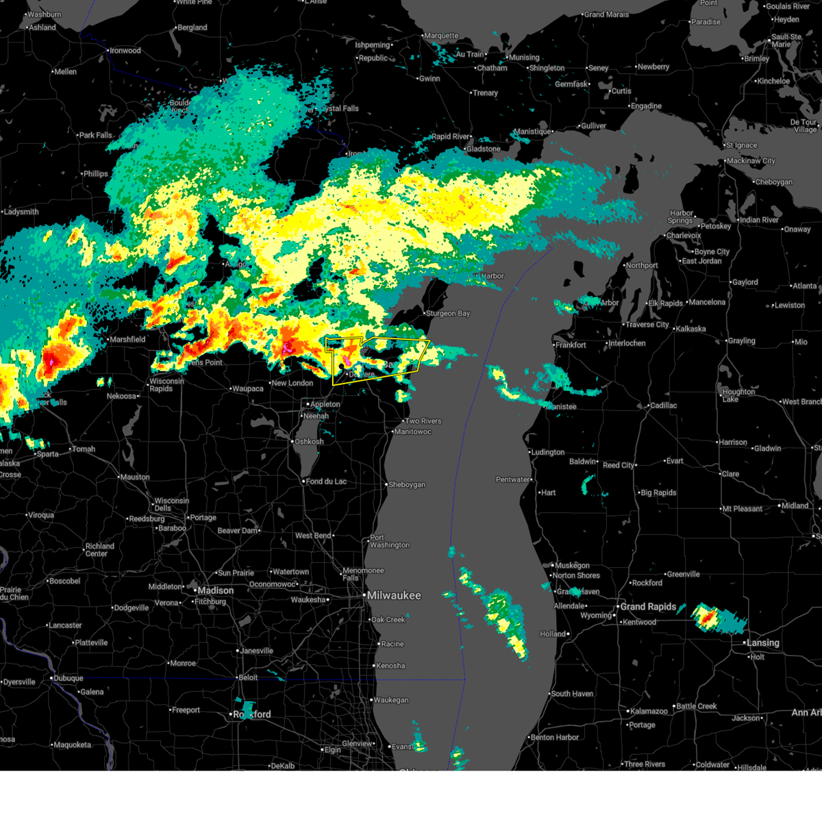
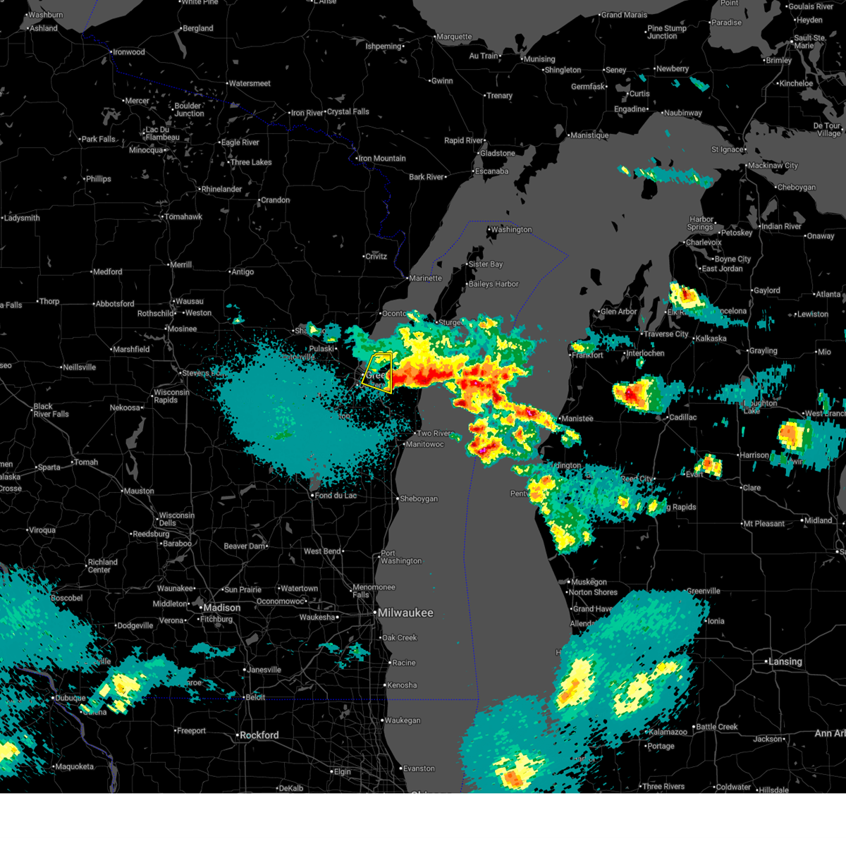
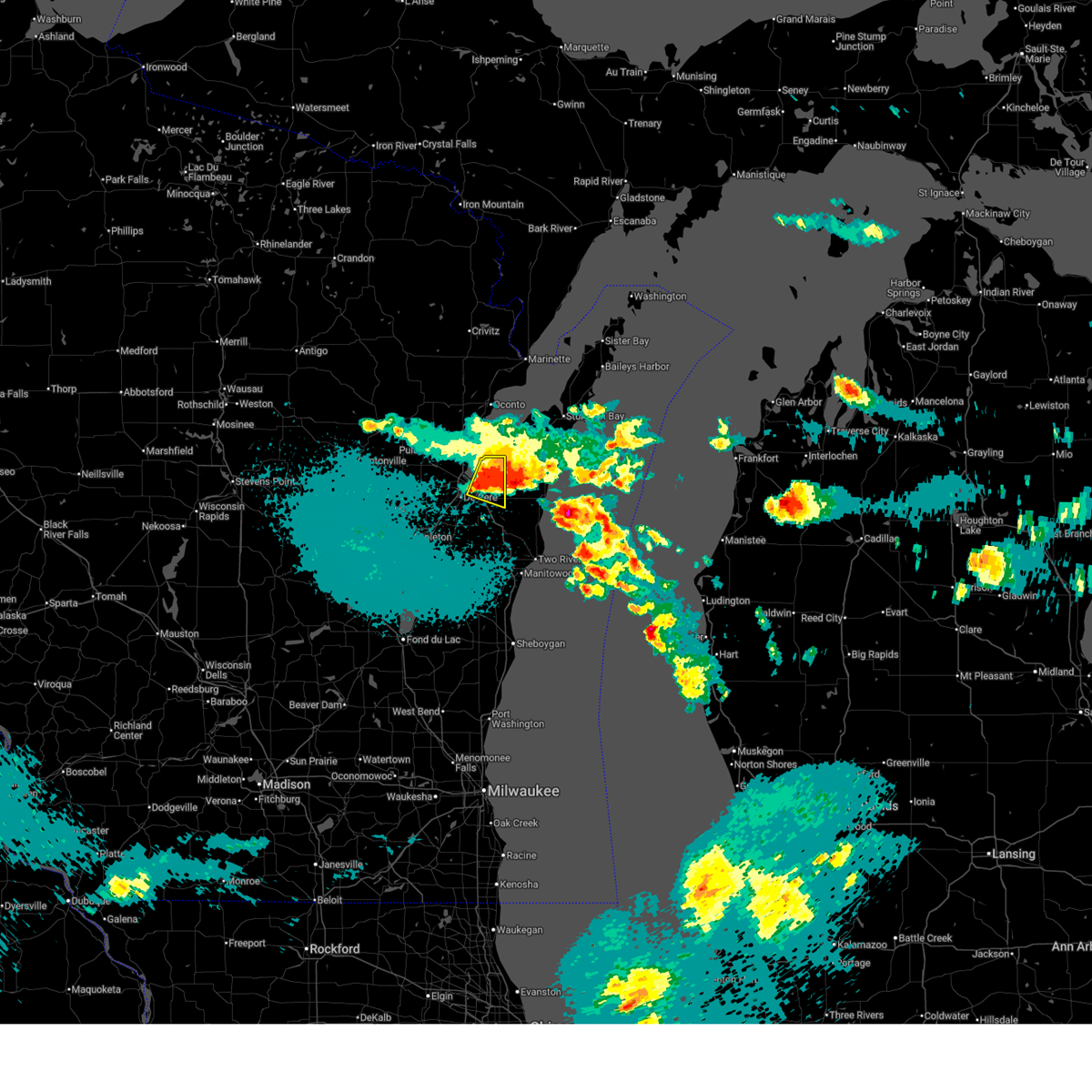
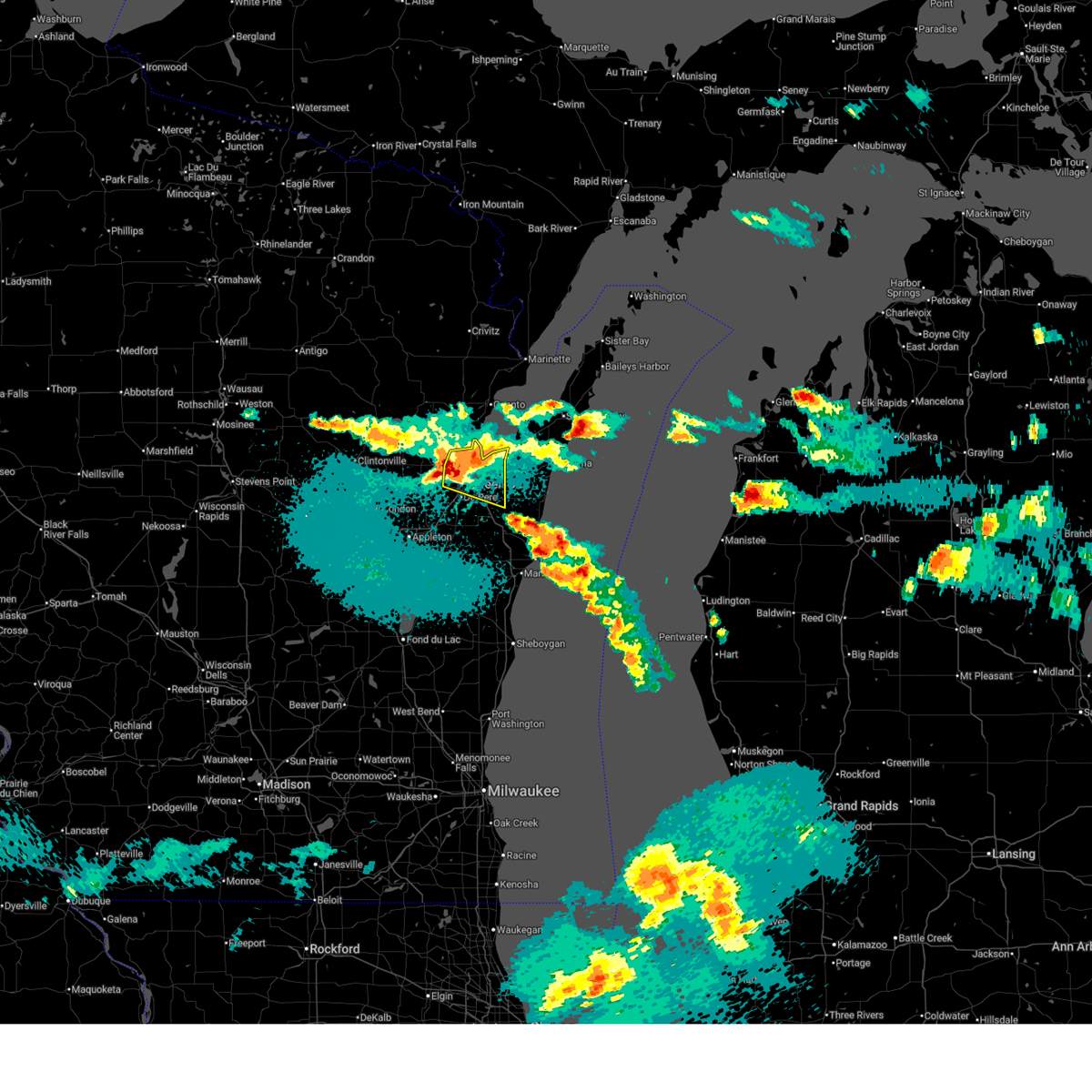
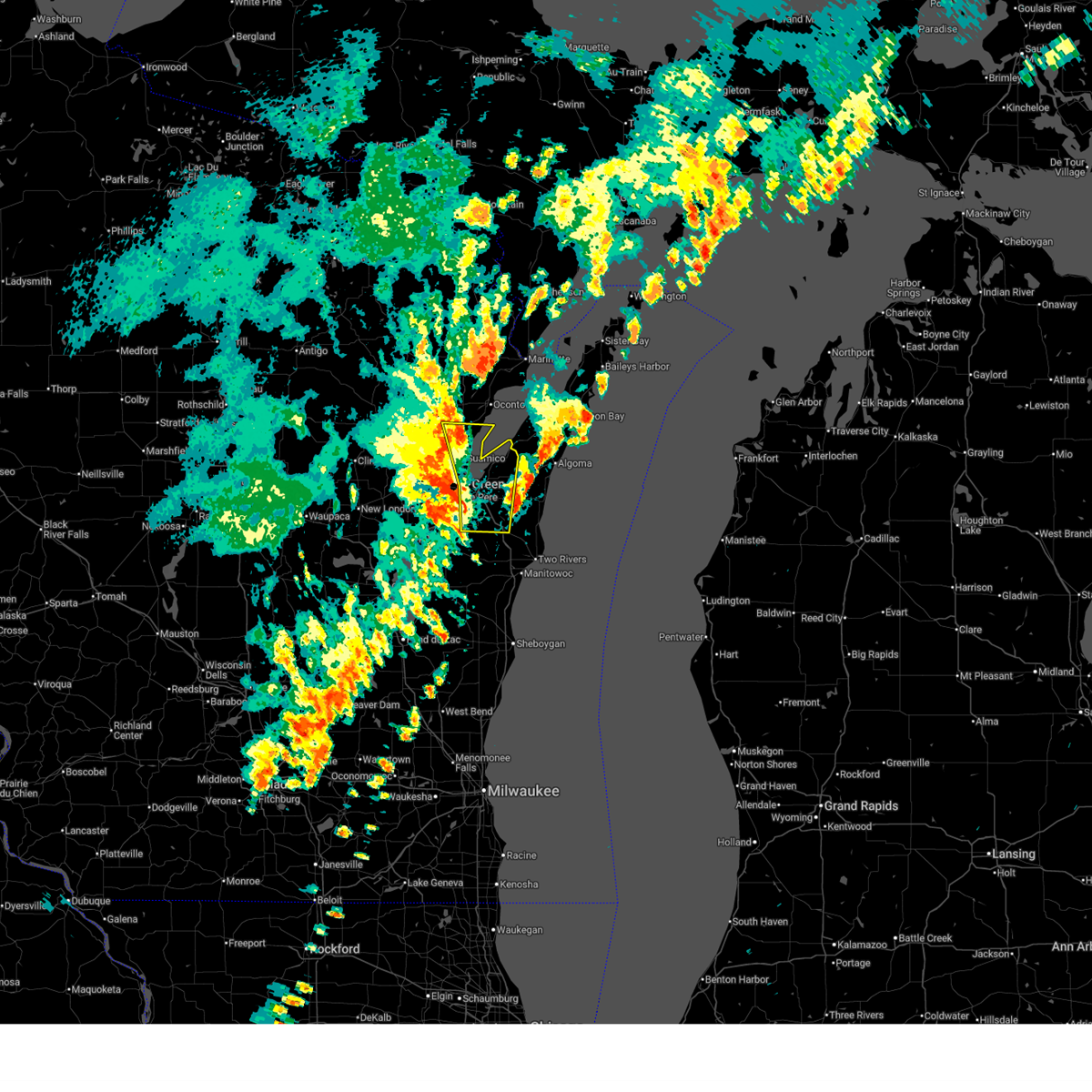
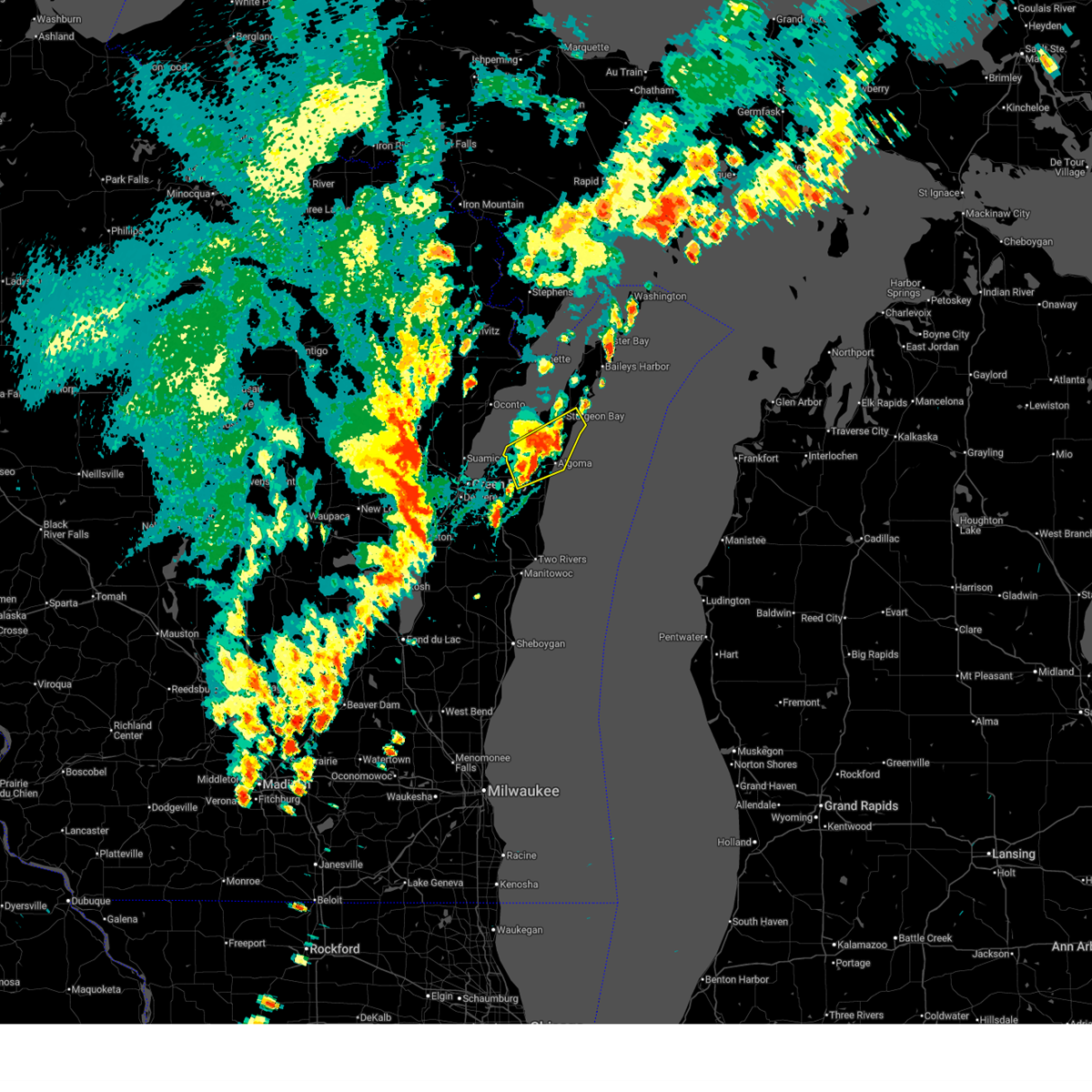
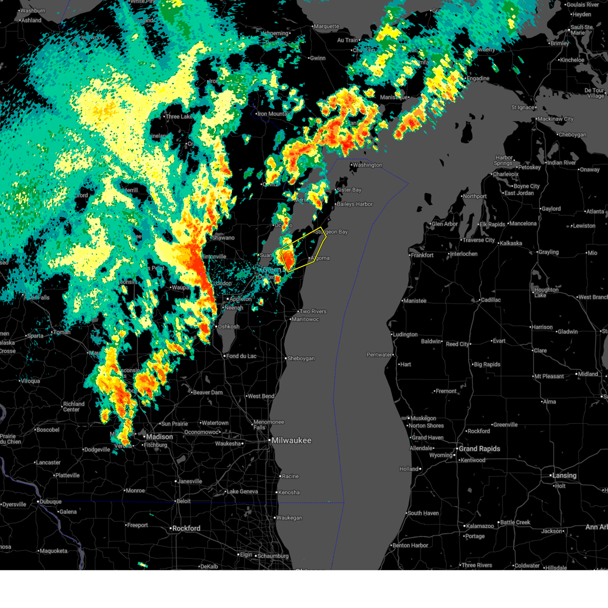
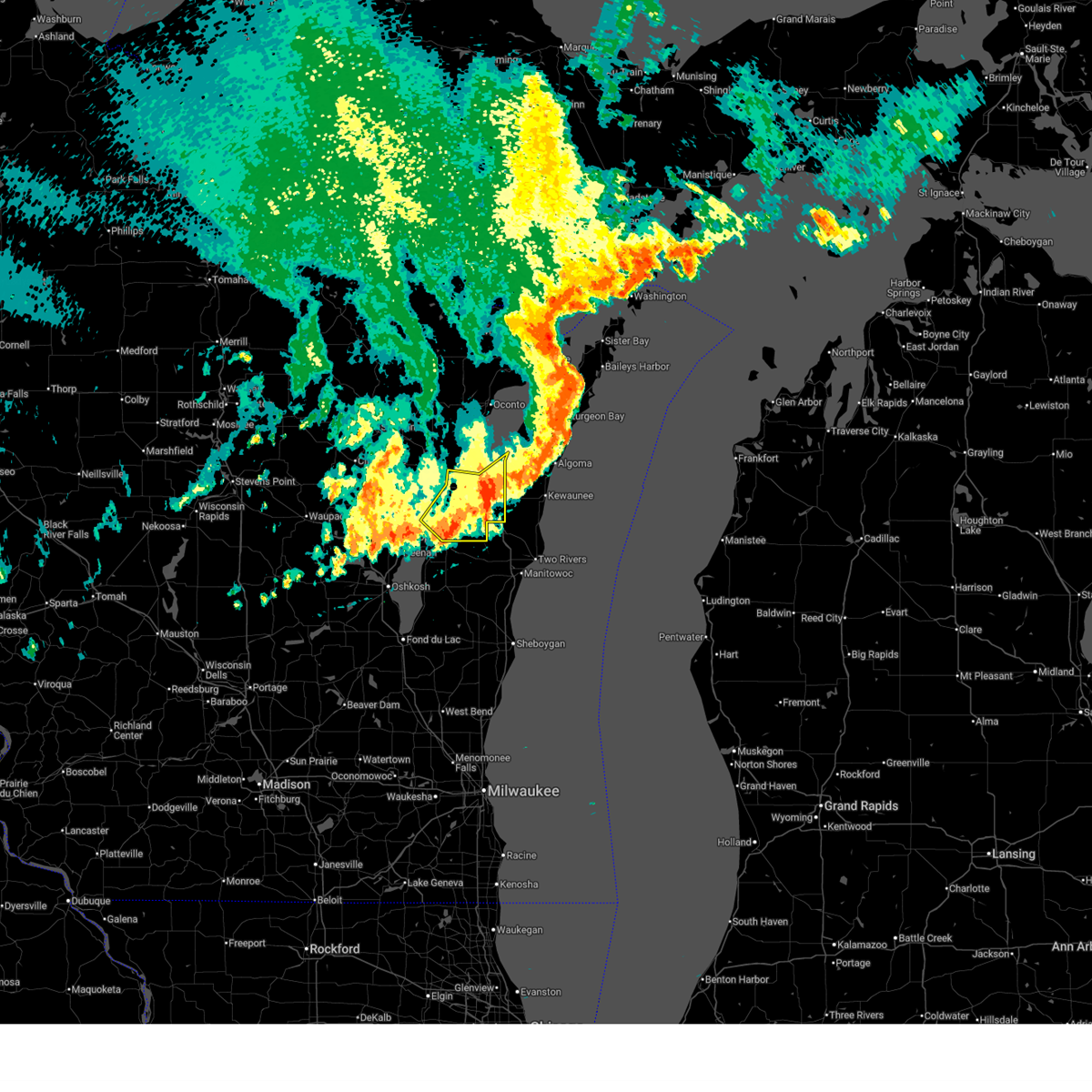
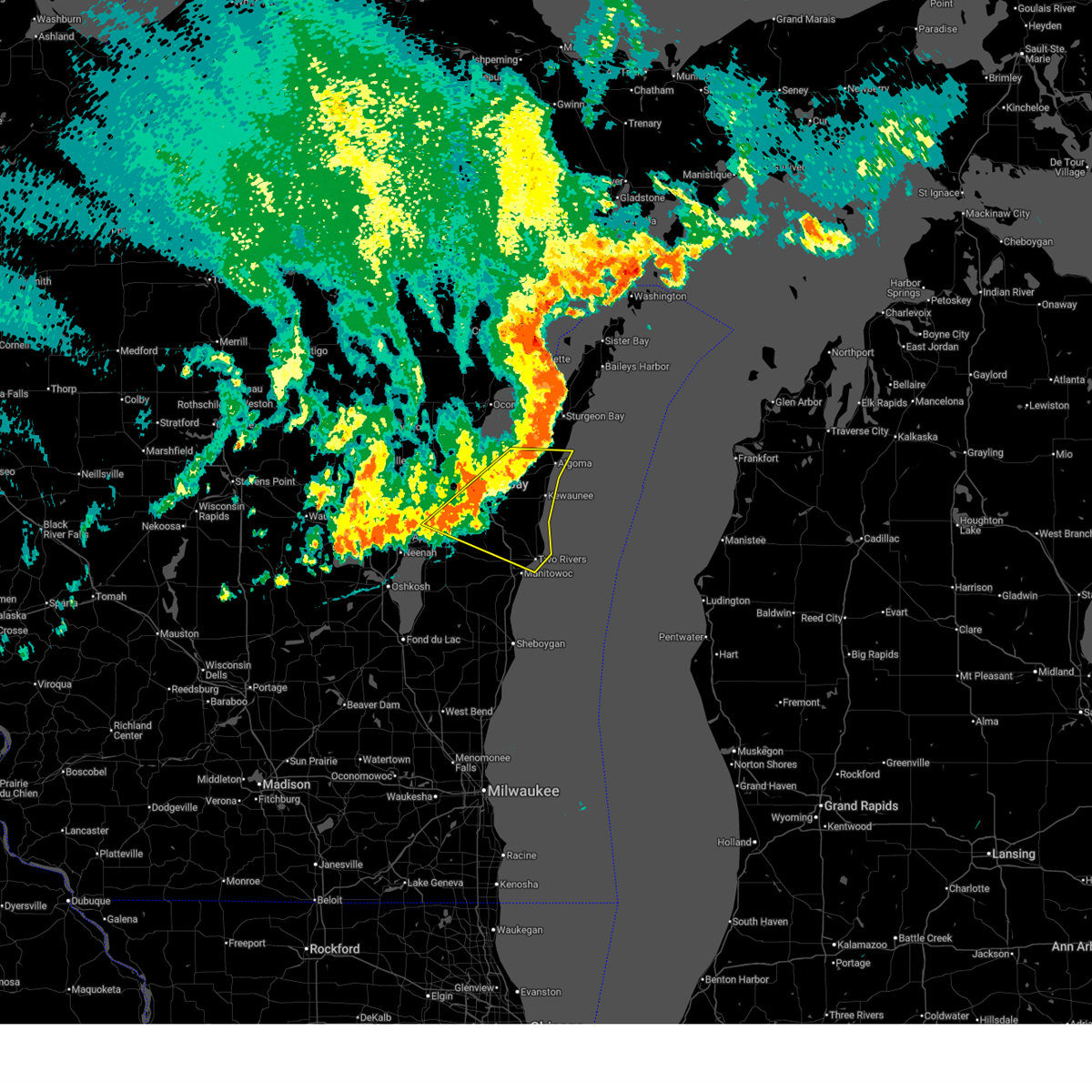
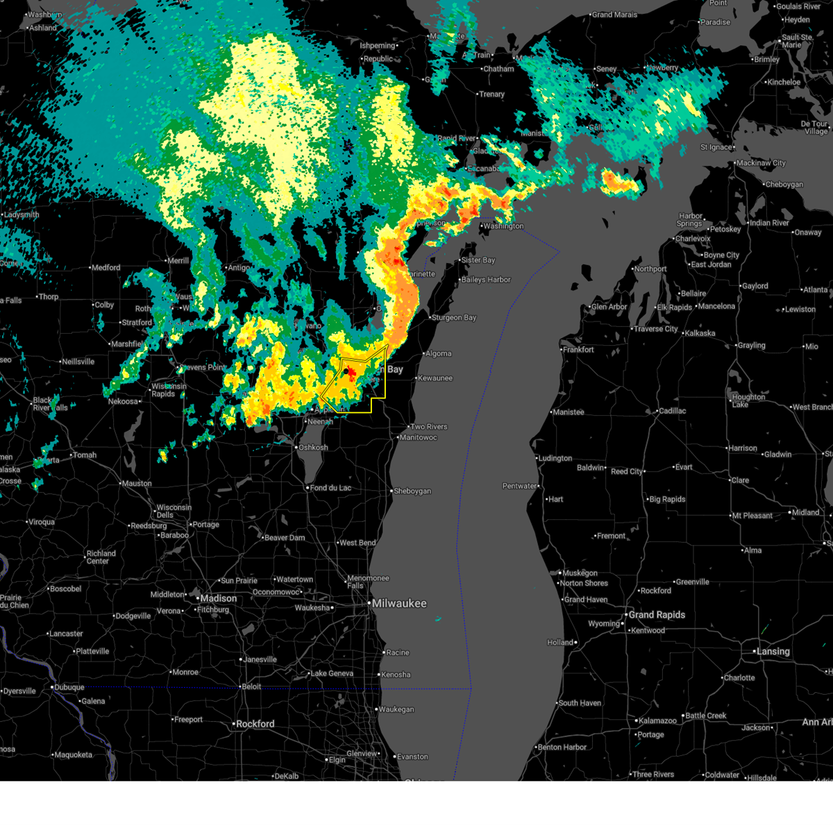
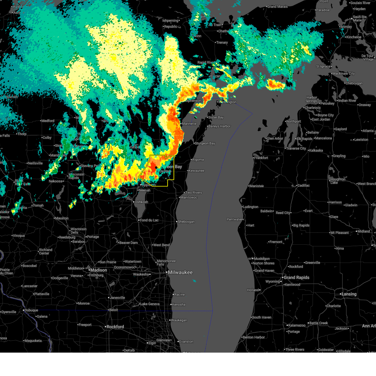
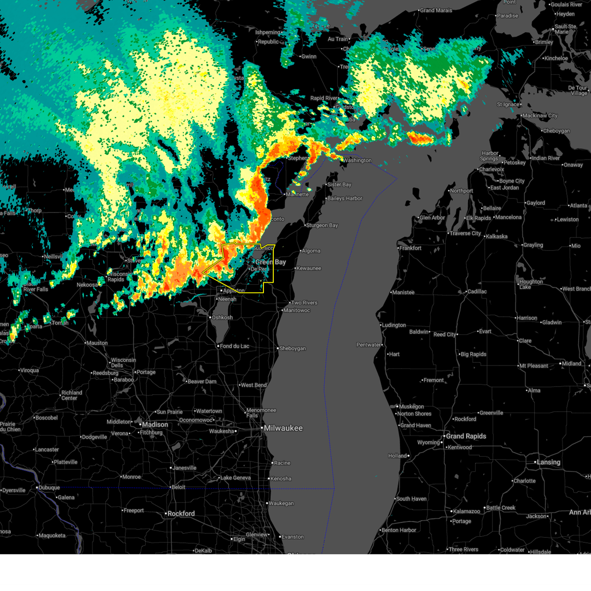
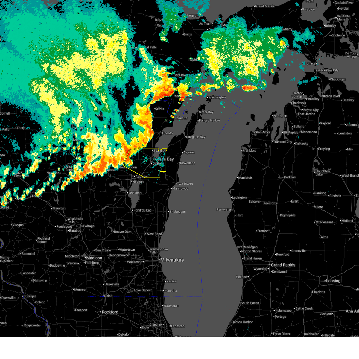
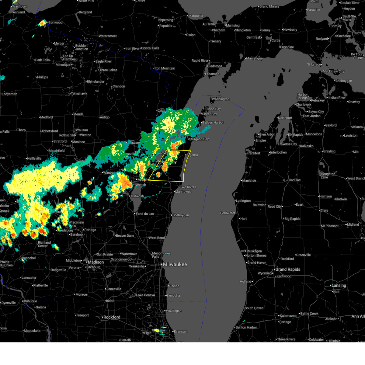
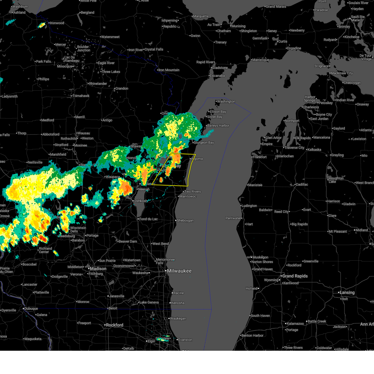
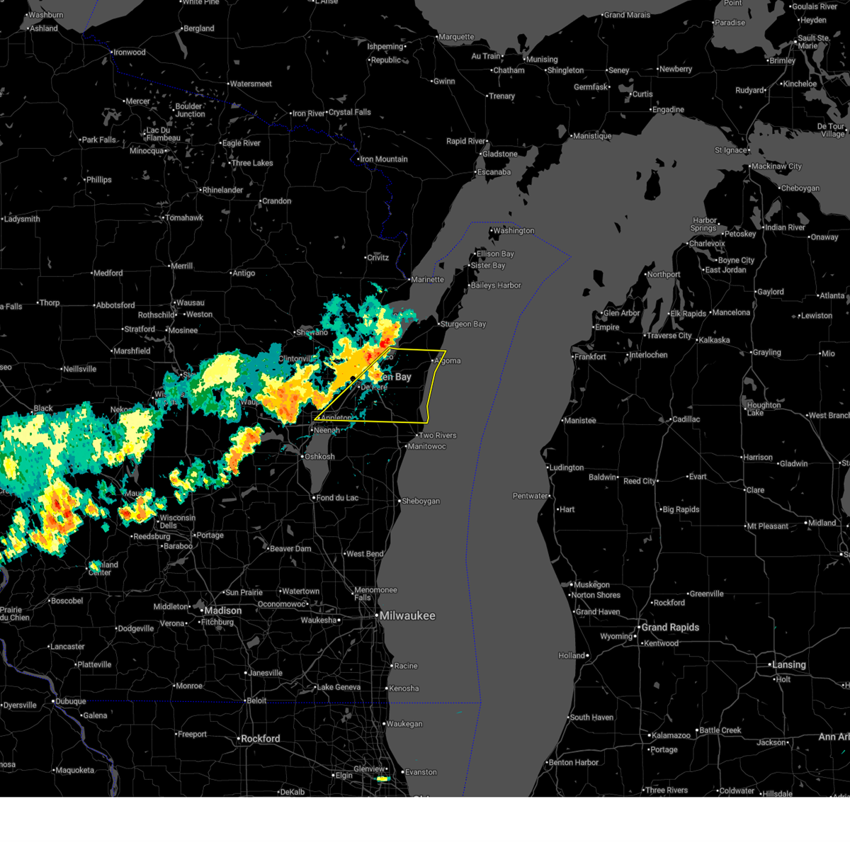
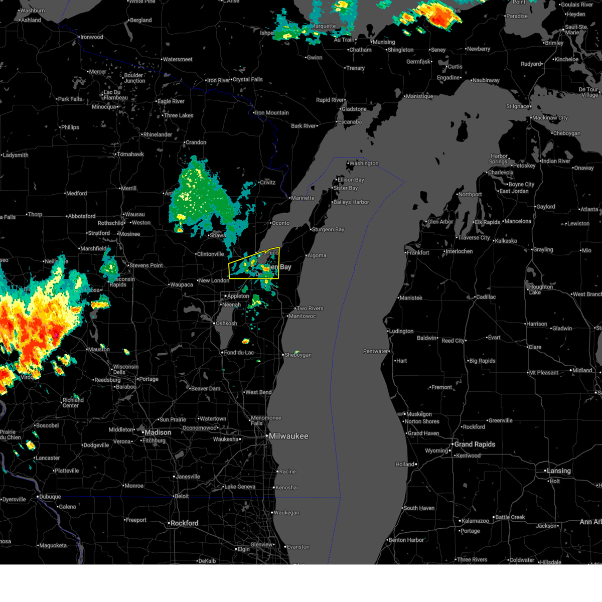
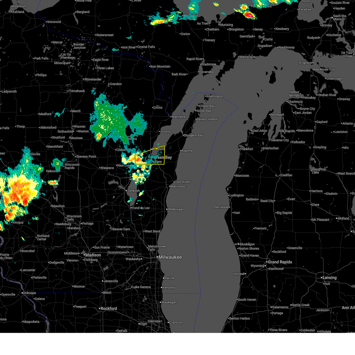
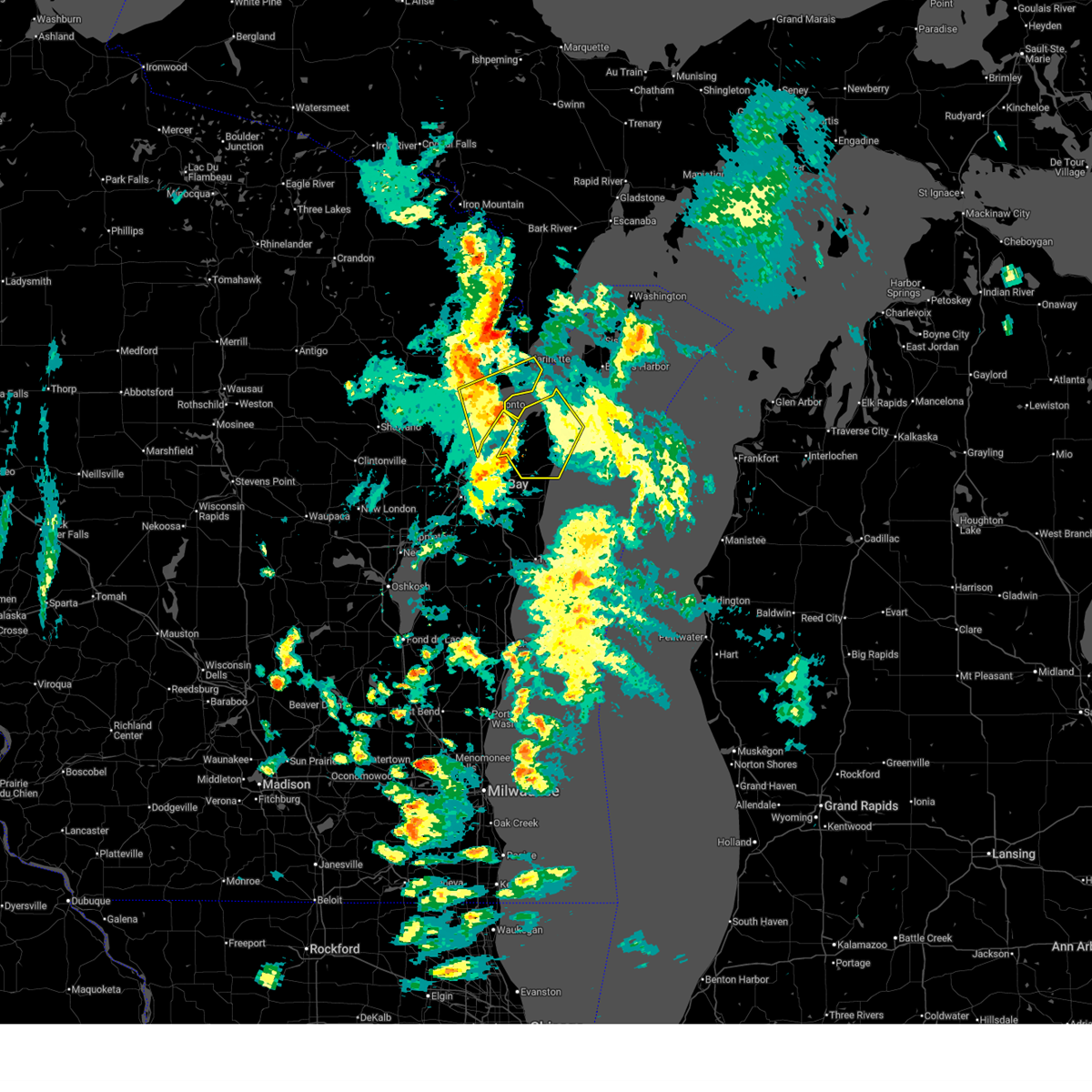
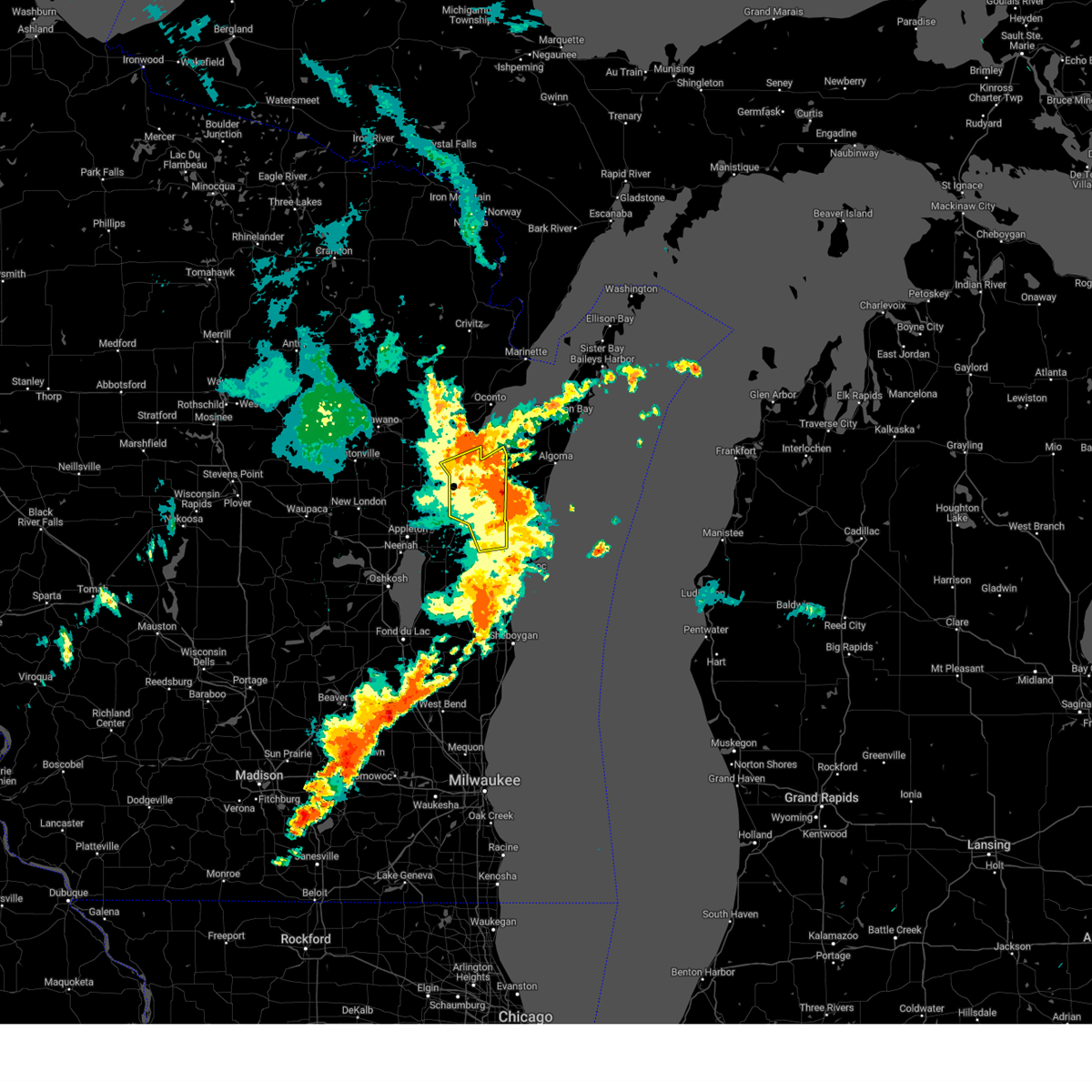
Hail Map for Dyckesville, WI
The Dyckesville, WI area has had 0 reports of on-the-ground hail by trained spotters, and has been under severe weather warnings 46 times during the past 12 months. Doppler radar has detected hail at or near Dyckesville, WI on 34 occasions, including 4 occasions during the past year.
| Name: | Dyckesville, WI |
| Where Located: | 15.3 miles NE of Green Bay, WI |
| Map: | Google Map for Dyckesville, WI |
| Population: | 538 |
| Housing Units: | 330 |
| More Info: | Search Google for Dyckesville, WI |
2
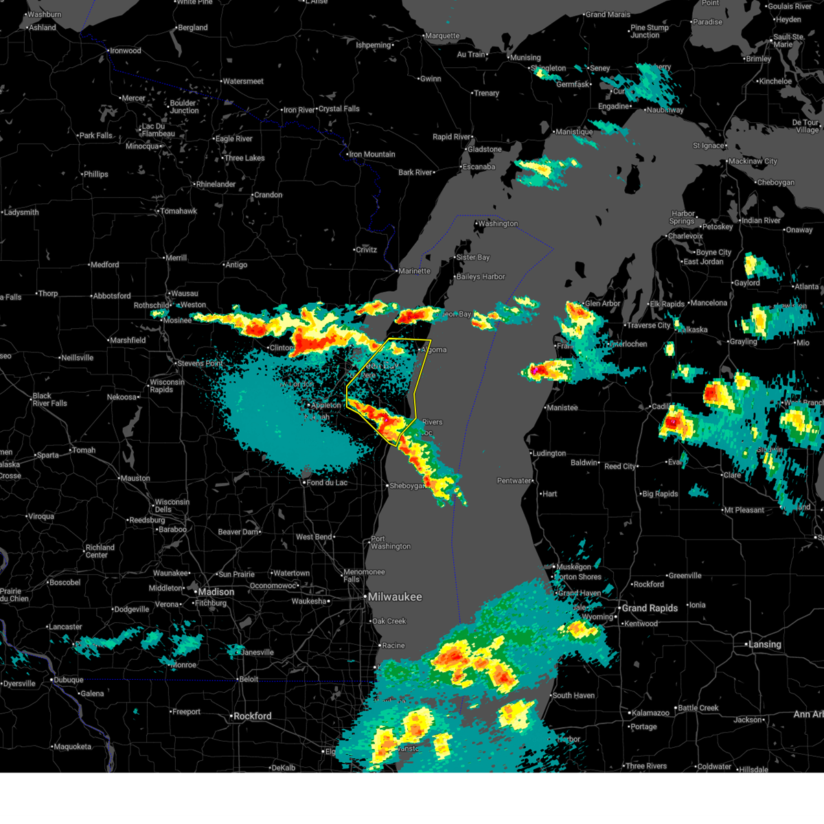
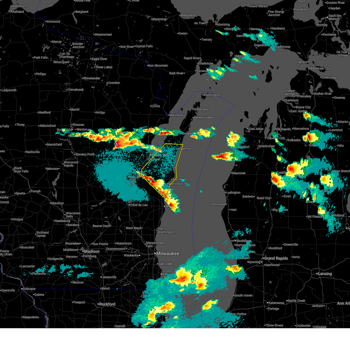
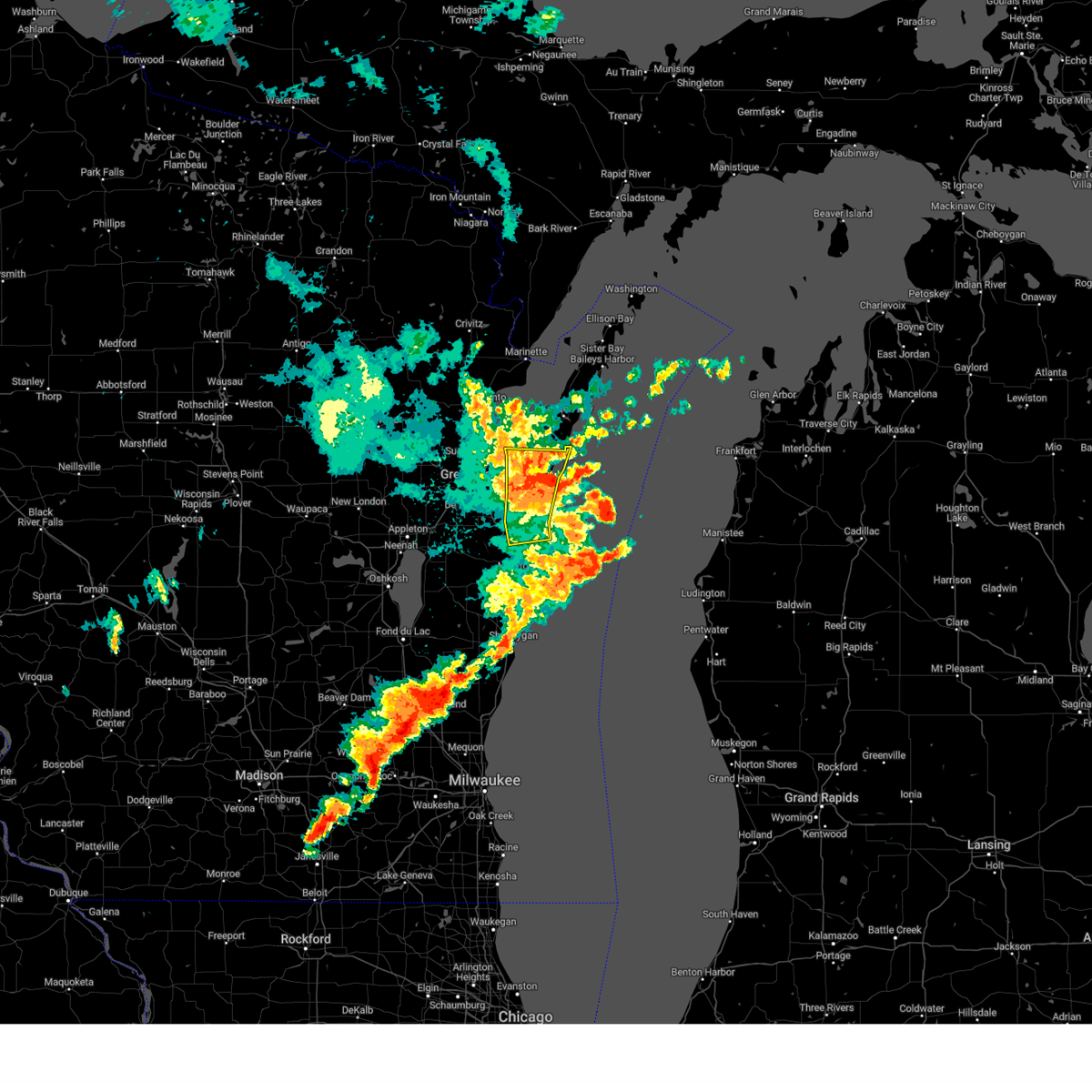
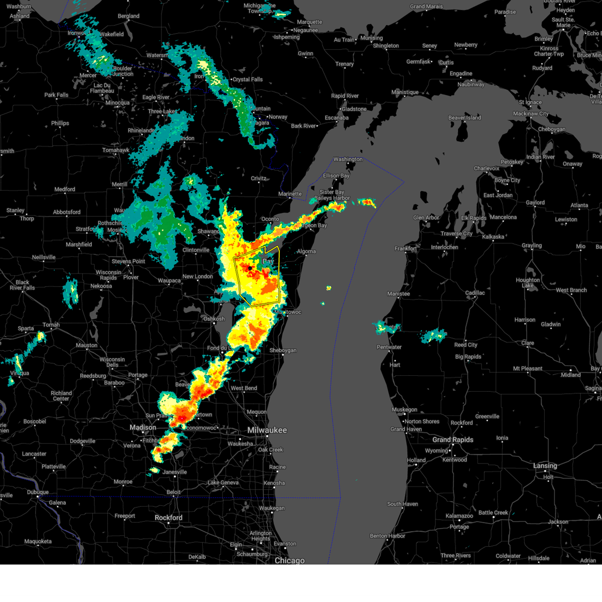
The Top Recent Hail Date for Dyckesville, WI is Monday, April 13, 2026 (8th out of 34)
Hail and Wind Damage Spotted near Dyckesville, WI
| Date / Time | Report Details |
|---|---|
| 6/5/2026 8:47 PM CDT |
 At 847 pm cdt, severe thunderstorms were located along a line extending from 10 miles southeast of oconto to near green bay, moving southeast at 35 mph (radar indicated). Hazards include 60 mph wind gusts. Expect damage to roofs, siding, and trees. these severe storms will be near, green bay and bay shore park around 850 pm cdt. Other locations impacted by these severe thunderstorms include champion, suamico, red banks, bay settlement, new franken, and howard. At 847 pm cdt, severe thunderstorms were located along a line extending from 10 miles southeast of oconto to near green bay, moving southeast at 35 mph (radar indicated). Hazards include 60 mph wind gusts. Expect damage to roofs, siding, and trees. these severe storms will be near, green bay and bay shore park around 850 pm cdt. Other locations impacted by these severe thunderstorms include champion, suamico, red banks, bay settlement, new franken, and howard.
|
| 6/5/2026 8:47 PM CDT |
 the severe thunderstorm warning has been cancelled and is no longer in effect the severe thunderstorm warning has been cancelled and is no longer in effect
|
| 6/5/2026 8:33 PM CDT |
 At 833 pm cdt, severe thunderstorms were located along a line extending from near oconto to near green bay, moving southeast at 35 mph (radar indicated). Hazards include 60 mph wind gusts. Expect damage to roofs, siding, and trees. these severe storms will be near, green bay and bay shore park around 840 pm cdt. Other locations impacted by these severe thunderstorms include anston, stiles, sobieski, kunesh, south chase, pensaukee, chase, suamico, little suamico, and abrams. At 833 pm cdt, severe thunderstorms were located along a line extending from near oconto to near green bay, moving southeast at 35 mph (radar indicated). Hazards include 60 mph wind gusts. Expect damage to roofs, siding, and trees. these severe storms will be near, green bay and bay shore park around 840 pm cdt. Other locations impacted by these severe thunderstorms include anston, stiles, sobieski, kunesh, south chase, pensaukee, chase, suamico, little suamico, and abrams.
|
| 6/5/2026 8:13 PM CDT |
 Svrgrb the national weather service in green bay has issued a * severe thunderstorm warning for, northern brown county in northeastern wisconsin, southern oconto county in northeastern wisconsin, eastern shawano county in northeastern wisconsin, * until 900 pm cdt. * at 812 pm cdt, severe thunderstorms were located along a line extending from 7 miles west of oconto to near pulaski, moving southeast at 35 mph (radar indicated). Hazards include 60 mph wind gusts. Expect damage to roofs, siding, powerlines, and trees. severe thunderstorms will be near, oconto and pulaski around 815 pm cdt. green bay around 825 pm cdt. bay shore park around 835 pm cdt. Other locations impacted by these severe thunderstorms include hofa park, sobieski, kunesh, south chase, pensaukee, zachow, landstad, morgan, abrams, and frazer corners. Svrgrb the national weather service in green bay has issued a * severe thunderstorm warning for, northern brown county in northeastern wisconsin, southern oconto county in northeastern wisconsin, eastern shawano county in northeastern wisconsin, * until 900 pm cdt. * at 812 pm cdt, severe thunderstorms were located along a line extending from 7 miles west of oconto to near pulaski, moving southeast at 35 mph (radar indicated). Hazards include 60 mph wind gusts. Expect damage to roofs, siding, powerlines, and trees. severe thunderstorms will be near, oconto and pulaski around 815 pm cdt. green bay around 825 pm cdt. bay shore park around 835 pm cdt. Other locations impacted by these severe thunderstorms include hofa park, sobieski, kunesh, south chase, pensaukee, zachow, landstad, morgan, abrams, and frazer corners.
|
| 4/13/2026 9:04 PM CDT |
 the severe thunderstorm warning has been cancelled and is no longer in effect the severe thunderstorm warning has been cancelled and is no longer in effect
|
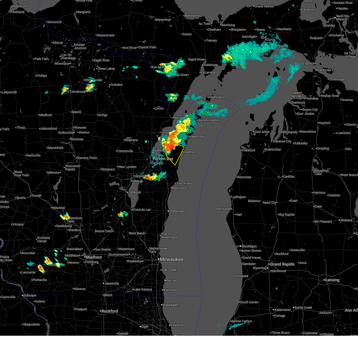
| 4/13/2026 8:54 PM CDT |
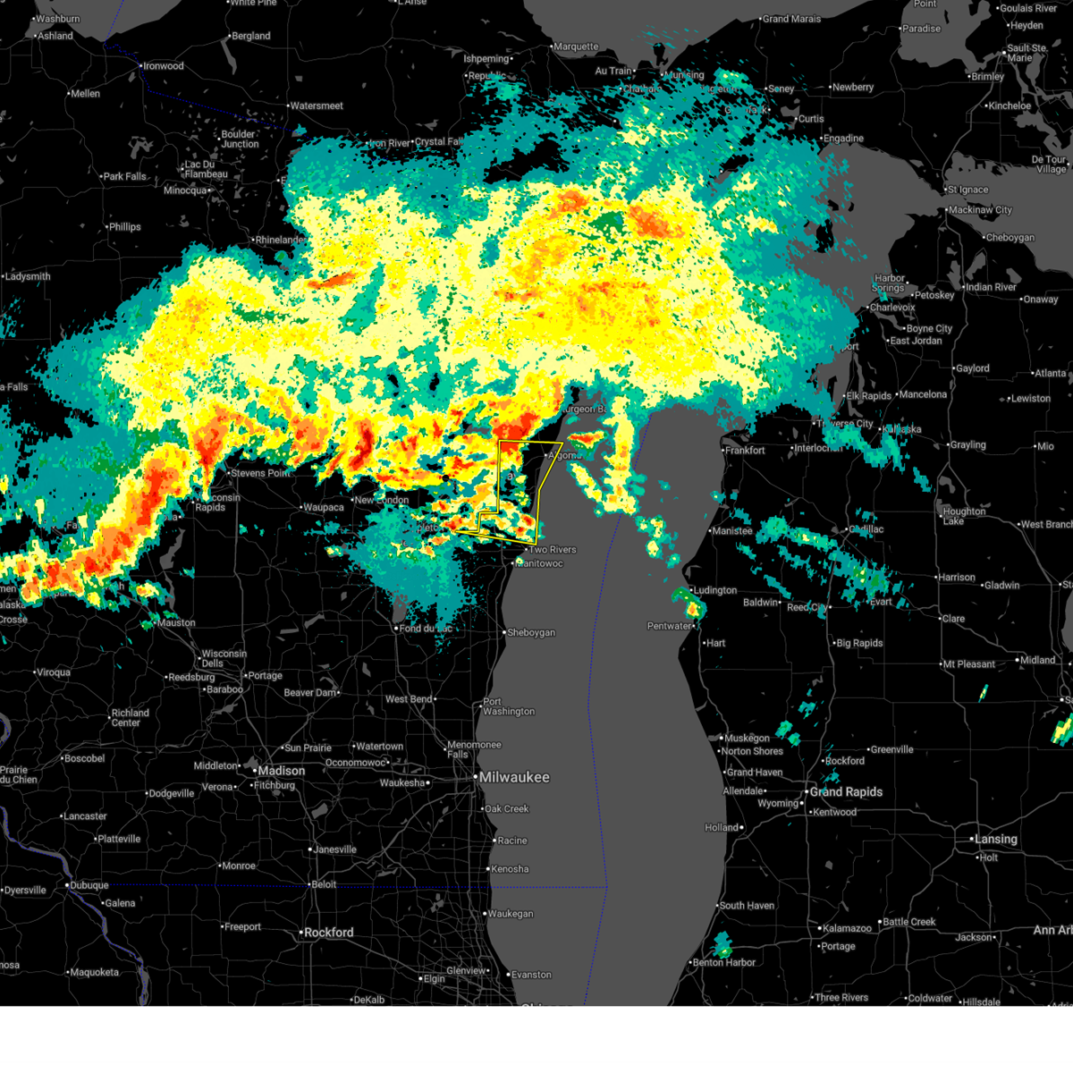
 At 854 pm cdt, severe thunderstorms were located along a line from 7 miles northeast of luxemburg to 8 miles southwest of denmark, or along a line from 8 miles east of bay shore park to 15 miles northwest of manitowoc, moving east at 35 mph (radar indicated). Hazards include 60 mph wind gusts. Expect damage to roofs, siding, and trees. this severe thunderstorm will be near, luxemburg around 855 pm cdt. kewaunee around 905 pm cdt. kewaunee pierhead light around 910 pm cdt. Other locations impacted by the severe thunderstorm include stangelville, casco, curran, lincoln, hickory grove, scarboro, ellisville, menchalville, duvall and cherneyville. At 854 pm cdt, severe thunderstorms were located along a line from 7 miles northeast of luxemburg to 8 miles southwest of denmark, or along a line from 8 miles east of bay shore park to 15 miles northwest of manitowoc, moving east at 35 mph (radar indicated). Hazards include 60 mph wind gusts. Expect damage to roofs, siding, and trees. this severe thunderstorm will be near, luxemburg around 855 pm cdt. kewaunee around 905 pm cdt. kewaunee pierhead light around 910 pm cdt. Other locations impacted by the severe thunderstorm include stangelville, casco, curran, lincoln, hickory grove, scarboro, ellisville, menchalville, duvall and cherneyville.
|
| 4/13/2026 8:40 PM CDT |
 At 840 pm cdt, severe thunderstorms were located along a line from over bay shore park to near brillion, or along a line from over bay shore park to 14 miles east of appleton, moving southeast at 35 mph (radar indicated). Hazards include 60 mph wind gusts. Expect damage to roofs, siding, and trees. this severe thunderstorm will be near, bellevue around 840 pm cdt. luxemburg around 855 pm cdt. kewaunee around 905 pm cdt. Other locations impacted by the severe thunderstorm include new franken, shirley, humboldt, poland, morrison, langes corners, red banks, lark, askeaton and glenmore. At 840 pm cdt, severe thunderstorms were located along a line from over bay shore park to near brillion, or along a line from over bay shore park to 14 miles east of appleton, moving southeast at 35 mph (radar indicated). Hazards include 60 mph wind gusts. Expect damage to roofs, siding, and trees. this severe thunderstorm will be near, bellevue around 840 pm cdt. luxemburg around 855 pm cdt. kewaunee around 905 pm cdt. Other locations impacted by the severe thunderstorm include new franken, shirley, humboldt, poland, morrison, langes corners, red banks, lark, askeaton and glenmore.
|
| 4/13/2026 8:23 PM CDT |
 The severe thunderstorm warning that was previously in effect has been reissued for brown and kewaunee counties and is in effect until 915 pm cdt. please refer to that bulletin for the latest severe weather information. The severe thunderstorm warning that was previously in effect has been reissued for brown and kewaunee counties and is in effect until 915 pm cdt. please refer to that bulletin for the latest severe weather information.
|
| 4/13/2026 8:22 PM CDT |
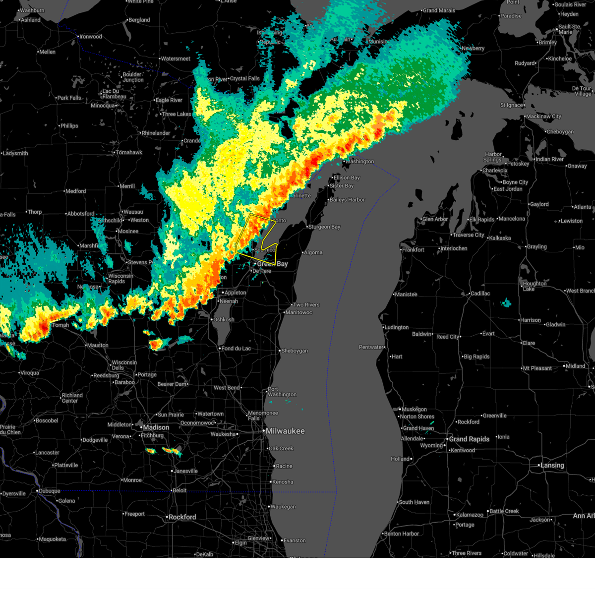
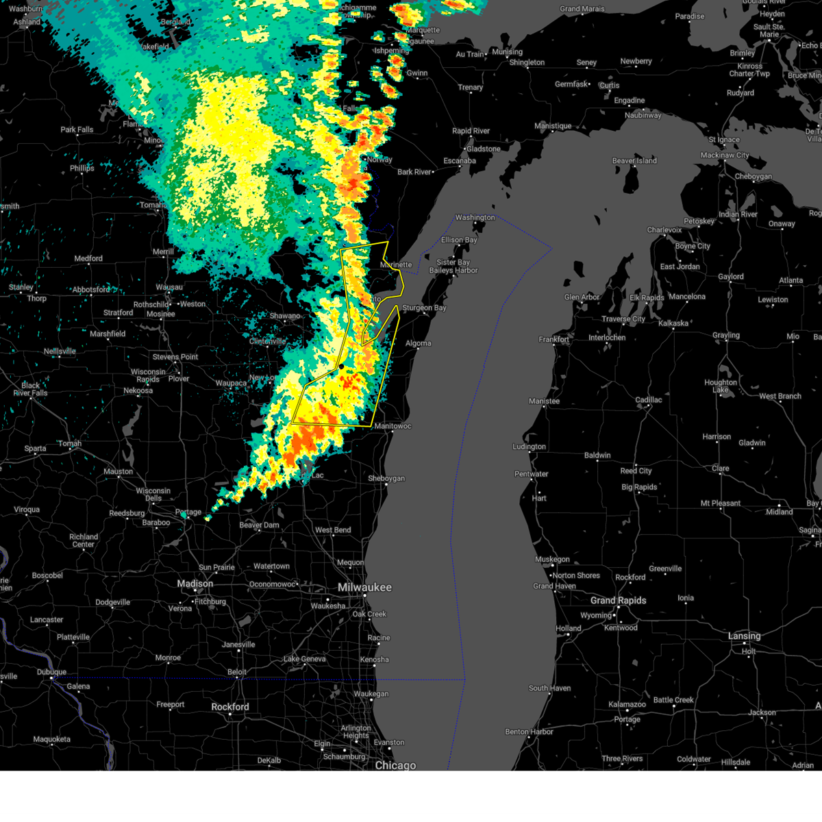
 Svrgrb the national weather service in green bay has issued a * severe thunderstorm warning for, northern manitowoc county in east central wisconsin, brown county in northeastern wisconsin, kewaunee county in northeastern wisconsin, * until 915 pm cdt. * at 822 pm cdt, severe thunderstorms were located along a line from 10 miles north of green bay to near kaukauna, or along a line from 9 miles west of bay shore park to 11 miles east of appleton, moving east at 35 mph (radar indicated). Hazards include 60 mph wind gusts. Expect damage to roofs, siding, and trees. this severe thunderstorm will be near, bellevue and long tail point light around 825 pm cdt. luxemburg around 850 pm cdt. Other locations impacted by the severe thunderstorm include greenleaf, ledgeview, askeaton, holland, leo frigo bridge, allouez, wrightstown, lambeau field, suamico and little rapids. Svrgrb the national weather service in green bay has issued a * severe thunderstorm warning for, northern manitowoc county in east central wisconsin, brown county in northeastern wisconsin, kewaunee county in northeastern wisconsin, * until 915 pm cdt. * at 822 pm cdt, severe thunderstorms were located along a line from 10 miles north of green bay to near kaukauna, or along a line from 9 miles west of bay shore park to 11 miles east of appleton, moving east at 35 mph (radar indicated). Hazards include 60 mph wind gusts. Expect damage to roofs, siding, and trees. this severe thunderstorm will be near, bellevue and long tail point light around 825 pm cdt. luxemburg around 850 pm cdt. Other locations impacted by the severe thunderstorm include greenleaf, ledgeview, askeaton, holland, leo frigo bridge, allouez, wrightstown, lambeau field, suamico and little rapids.
|
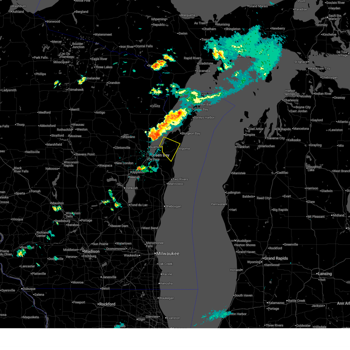
| 4/13/2026 7:51 PM CDT |
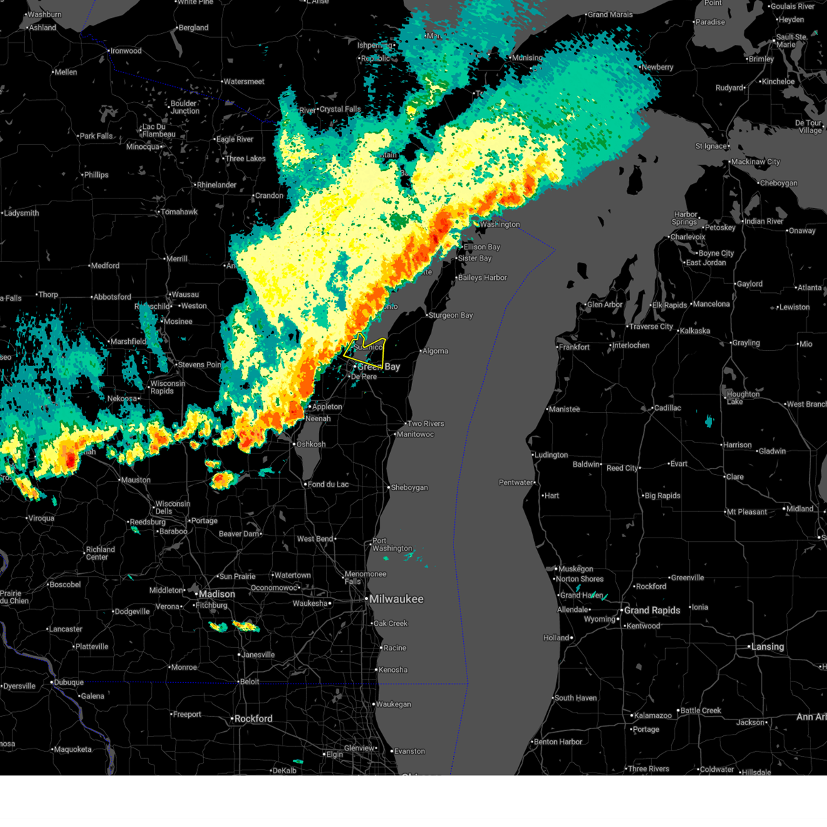
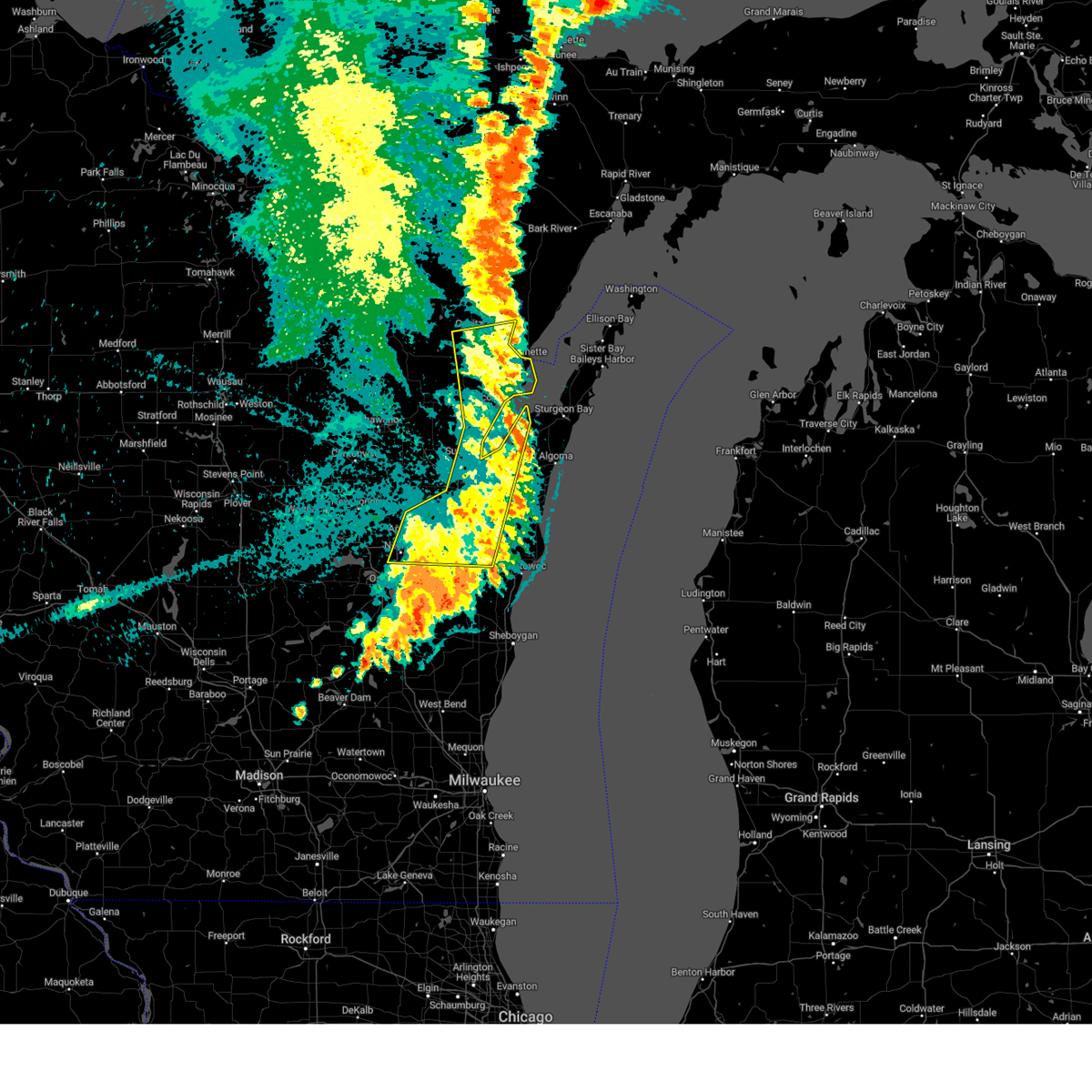
 At 751 pm cdt, severe thunderstorms were located along a line from over bay shore park to near luxemburg, or along a line from over bay shore park to 6 miles south of bay shore park, moving east at 40 mph (radar indicated). Hazards include ping pong ball size hail and 60 mph wind gusts. People and animals outdoors will be injured. expect hail damage to roofs, siding, windows, and vehicles. expect wind damage to roofs, siding, and trees. this severe thunderstorm will be near, green bay harbor entrance light around 755 pm cdt. luxemburg around 800 pm cdt. kewaunee around 810 pm cdt. Other locations impacted by the severe thunderstorm include thiry daems, dyckesville, champion, neuern, new franken, humboldt, red banks, bay settlement, pilsen and lincoln. At 751 pm cdt, severe thunderstorms were located along a line from over bay shore park to near luxemburg, or along a line from over bay shore park to 6 miles south of bay shore park, moving east at 40 mph (radar indicated). Hazards include ping pong ball size hail and 60 mph wind gusts. People and animals outdoors will be injured. expect hail damage to roofs, siding, windows, and vehicles. expect wind damage to roofs, siding, and trees. this severe thunderstorm will be near, green bay harbor entrance light around 755 pm cdt. luxemburg around 800 pm cdt. kewaunee around 810 pm cdt. Other locations impacted by the severe thunderstorm include thiry daems, dyckesville, champion, neuern, new franken, humboldt, red banks, bay settlement, pilsen and lincoln.
|
| 4/13/2026 7:39 PM CDT |
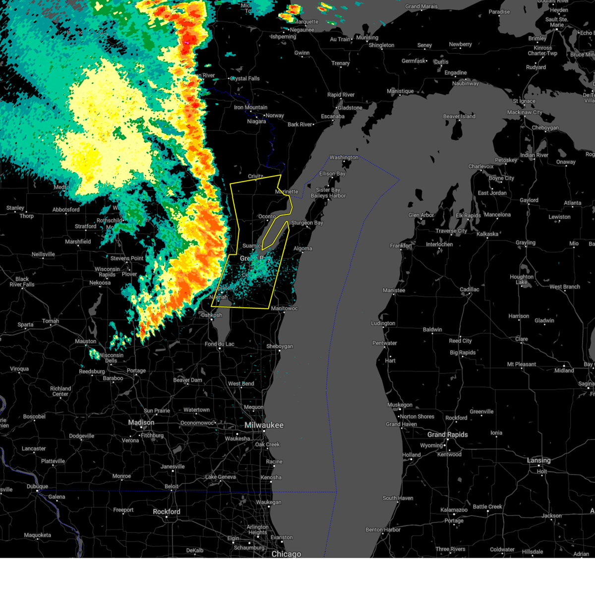
 Svrgrb the national weather service in green bay has issued a * severe thunderstorm warning for, brown county in northeastern wisconsin, kewaunee county in northeastern wisconsin, * until 830 pm cdt. * at 739 pm cdt, severe thunderstorms were located along a line from 10 miles north of green bay to near green bay, or along a line from 8 miles west of bay shore park to near green bay, moving east at 40 mph (trained spotters reported). Hazards include 60 mph wind gusts and half dollar size hail. Hail damage to vehicles is expected. expect wind damage to roofs, siding, and trees. this severe thunderstorm will be near, long tail point light and bellevue around 740 pm cdt. green bay harbor entrance light around 745 pm cdt. luxemburg around 755 pm cdt. Other locations impacted by the severe thunderstorm include uw green bay, leo frigo bridge, suamico, allouez, lambeau field, flintville, howard, ledgeview, bay settlement and red banks. Svrgrb the national weather service in green bay has issued a * severe thunderstorm warning for, brown county in northeastern wisconsin, kewaunee county in northeastern wisconsin, * until 830 pm cdt. * at 739 pm cdt, severe thunderstorms were located along a line from 10 miles north of green bay to near green bay, or along a line from 8 miles west of bay shore park to near green bay, moving east at 40 mph (trained spotters reported). Hazards include 60 mph wind gusts and half dollar size hail. Hail damage to vehicles is expected. expect wind damage to roofs, siding, and trees. this severe thunderstorm will be near, long tail point light and bellevue around 740 pm cdt. green bay harbor entrance light around 745 pm cdt. luxemburg around 755 pm cdt. Other locations impacted by the severe thunderstorm include uw green bay, leo frigo bridge, suamico, allouez, lambeau field, flintville, howard, ledgeview, bay settlement and red banks.
|
| 3/31/2026 12:29 AM CDT |
 The storm which prompted the warning has moved out of the area. therefore, the warning will be allowed to expire. The storm which prompted the warning has moved out of the area. therefore, the warning will be allowed to expire.
|
| 3/31/2026 12:14 AM CDT |
 At 1213 am cdt, a severe thunderstorm was located near bay shore park, moving east at 40 mph (radar indicated). Hazards include half dollar size hail. Damage to vehicles is expected. This severe thunderstorm will remain over mainly rural areas of northeastern brown county, including the following locations, red banks, bay settlement, poland, humboldt, champion, uw green bay, new franken, and allouez. At 1213 am cdt, a severe thunderstorm was located near bay shore park, moving east at 40 mph (radar indicated). Hazards include half dollar size hail. Damage to vehicles is expected. This severe thunderstorm will remain over mainly rural areas of northeastern brown county, including the following locations, red banks, bay settlement, poland, humboldt, champion, uw green bay, new franken, and allouez.
|
| 3/31/2026 12:12 AM CDT |
 Svrgrb the national weather service in green bay has issued a * severe thunderstorm warning for, kewaunee county in northeastern wisconsin, * until 1245 am cdt. * at 1212 am cdt, a severe thunderstorm was located over luxemburg, or 7 miles south of bay shore park, moving east at 55 mph (radar indicated). Hazards include half dollar size hail. Damage to vehicles is expected. this severe thunderstorm will be near, kewaunee around 1225 am cdt. Other locations impacted by this severe thunderstorm include krok, slovan, gregorville, rankin, ellisville, euren, east krok, kodan, alaska, and birchwood. Svrgrb the national weather service in green bay has issued a * severe thunderstorm warning for, kewaunee county in northeastern wisconsin, * until 1245 am cdt. * at 1212 am cdt, a severe thunderstorm was located over luxemburg, or 7 miles south of bay shore park, moving east at 55 mph (radar indicated). Hazards include half dollar size hail. Damage to vehicles is expected. this severe thunderstorm will be near, kewaunee around 1225 am cdt. Other locations impacted by this severe thunderstorm include krok, slovan, gregorville, rankin, ellisville, euren, east krok, kodan, alaska, and birchwood.
|
| 3/30/2026 11:59 PM CDT |
 At 1159 pm cdt, a severe thunderstorm was located near green bay, moving east at 50 mph (radar indicated). Hazards include quarter size hail. Damage to vehicles is expected. this severe storm will be near, green bay around 1205 am cdt. Other locations impacted by this severe thunderstorm include anston, humboldt, lambeau field, leo frigo bridge, suamico, howard, red banks, ashwaubenon, bay settlement, and flintville. At 1159 pm cdt, a severe thunderstorm was located near green bay, moving east at 50 mph (radar indicated). Hazards include quarter size hail. Damage to vehicles is expected. this severe storm will be near, green bay around 1205 am cdt. Other locations impacted by this severe thunderstorm include anston, humboldt, lambeau field, leo frigo bridge, suamico, howard, red banks, ashwaubenon, bay settlement, and flintville.
|
| 3/30/2026 11:59 PM CDT |
 the severe thunderstorm warning has been cancelled and is no longer in effect the severe thunderstorm warning has been cancelled and is no longer in effect
|
| 3/30/2026 11:56 PM CDT |
 At 1156 pm cdt, severe thunderstorms were located along a line extending from two creeks to 18 miles east of manitowoc, moving east at 50 mph (radar indicated). Hazards include quarter size hail. Damage to vehicles is expected. these severe storms will be near, two creeks around 1200 am cdt. Other locations impacted by these severe thunderstorms include krok, mishicot, slovan, gregorville, curran, rankin, ellisville, euren, humboldt, and ledgeview. At 1156 pm cdt, severe thunderstorms were located along a line extending from two creeks to 18 miles east of manitowoc, moving east at 50 mph (radar indicated). Hazards include quarter size hail. Damage to vehicles is expected. these severe storms will be near, two creeks around 1200 am cdt. Other locations impacted by these severe thunderstorms include krok, mishicot, slovan, gregorville, curran, rankin, ellisville, euren, humboldt, and ledgeview.
|
| 3/30/2026 11:41 PM CDT |
 Svrgrb the national weather service in green bay has issued a * severe thunderstorm warning for, northern brown county in northeastern wisconsin, northeastern outagamie county in northeastern wisconsin, * until 1230 am cdt. * at 1140 pm cdt, a severe thunderstorm was located 7 miles east of navarino wildlife area, or 14 miles southeast of shawano, moving east at 40 mph (radar indicated). Hazards include quarter size hail. Damage to vehicles is expected. this severe thunderstorm will be near, green bay around 1155 pm cdt. Other locations impacted by this severe thunderstorm include nichols, anston, briarton, rose lawn, humboldt, kunesh, oneida, pittsfield, lambeau field, and hobart. Svrgrb the national weather service in green bay has issued a * severe thunderstorm warning for, northern brown county in northeastern wisconsin, northeastern outagamie county in northeastern wisconsin, * until 1230 am cdt. * at 1140 pm cdt, a severe thunderstorm was located 7 miles east of navarino wildlife area, or 14 miles southeast of shawano, moving east at 40 mph (radar indicated). Hazards include quarter size hail. Damage to vehicles is expected. this severe thunderstorm will be near, green bay around 1155 pm cdt. Other locations impacted by this severe thunderstorm include nichols, anston, briarton, rose lawn, humboldt, kunesh, oneida, pittsfield, lambeau field, and hobart.
|
| 3/30/2026 11:36 PM CDT |
 At 1136 pm cdt, severe thunderstorms were located along a line extending from 7 miles northeast of brillion to manitowoc to 12 miles east of cleveland, moving east at 60 mph (radar indicated). Hazards include quarter size hail. Damage to vehicles is expected. these severe storms will be near, manitowoc around 1140 pm cdt. two creeks around 1150 pm cdt. Other locations impacted by these severe thunderstorms include krok, maribel, larrabee, slovan, gregorville, curran, wayside, morrison, rankin, and humboldt. At 1136 pm cdt, severe thunderstorms were located along a line extending from 7 miles northeast of brillion to manitowoc to 12 miles east of cleveland, moving east at 60 mph (radar indicated). Hazards include quarter size hail. Damage to vehicles is expected. these severe storms will be near, manitowoc around 1140 pm cdt. two creeks around 1150 pm cdt. Other locations impacted by these severe thunderstorms include krok, maribel, larrabee, slovan, gregorville, curran, wayside, morrison, rankin, and humboldt.
|
| 3/30/2026 11:36 PM CDT |
 the severe thunderstorm warning has been cancelled and is no longer in effect the severe thunderstorm warning has been cancelled and is no longer in effect
|
| 3/30/2026 11:26 PM CDT |
 Svrgrb the national weather service in green bay has issued a * severe thunderstorm warning for, southern brown county in northeastern wisconsin, kewaunee county in northeastern wisconsin, northeastern calumet county in east central wisconsin, manitowoc county in east central wisconsin, * until 1215 am cdt. * at 1126 pm cdt, severe thunderstorms were located along a line extending from near brillion to valders to near cleveland, moving east at 60 mph (radar indicated). Hazards include quarter size hail. Damage to vehicles is expected. severe thunderstorms will be near, manitowoc and brillion around 1130 pm cdt. two creeks around 1150 pm cdt. Other locations impacted by these severe thunderstorms include krok, maribel, larrabee, slovan, gregorville, curran, wayside, morrison, rankin, and humboldt. Svrgrb the national weather service in green bay has issued a * severe thunderstorm warning for, southern brown county in northeastern wisconsin, kewaunee county in northeastern wisconsin, northeastern calumet county in east central wisconsin, manitowoc county in east central wisconsin, * until 1215 am cdt. * at 1126 pm cdt, severe thunderstorms were located along a line extending from near brillion to valders to near cleveland, moving east at 60 mph (radar indicated). Hazards include quarter size hail. Damage to vehicles is expected. severe thunderstorms will be near, manitowoc and brillion around 1130 pm cdt. two creeks around 1150 pm cdt. Other locations impacted by these severe thunderstorms include krok, maribel, larrabee, slovan, gregorville, curran, wayside, morrison, rankin, and humboldt.
|
| 8/9/2025 3:26 PM CDT |
 The storms which prompted the warning have weakened below severe limits, and have exited the warned area. therefore, the warning will be allowed to expire. however, gusty winds and heavy rain are still possible with these thunderstorms. The storms which prompted the warning have weakened below severe limits, and have exited the warned area. therefore, the warning will be allowed to expire. however, gusty winds and heavy rain are still possible with these thunderstorms.
|
| 8/9/2025 3:17 PM CDT |
 At 316 pm cdt, severe thunderstorms were located along a line extending from near bay shore park to near luxemburg to 6 miles north of denmark to 10 miles northwest of manitowoc, moving east at 35 mph (radar indicated). Hazards include 60 mph wind gusts. Expect damage to roofs, siding, and trees. these severe storms will be near, bay shore park and luxemburg around 320 pm cdt. Other locations impacted by these severe thunderstorms include cooperstown, langes corners, curran, humboldt, dyckesville, red banks, pilsen, hickory grove, poland, and champion. At 316 pm cdt, severe thunderstorms were located along a line extending from near bay shore park to near luxemburg to 6 miles north of denmark to 10 miles northwest of manitowoc, moving east at 35 mph (radar indicated). Hazards include 60 mph wind gusts. Expect damage to roofs, siding, and trees. these severe storms will be near, bay shore park and luxemburg around 320 pm cdt. Other locations impacted by these severe thunderstorms include cooperstown, langes corners, curran, humboldt, dyckesville, red banks, pilsen, hickory grove, poland, and champion.
|
| 8/9/2025 3:17 PM CDT |
 the severe thunderstorm warning has been cancelled and is no longer in effect the severe thunderstorm warning has been cancelled and is no longer in effect
|
| 8/9/2025 2:56 PM CDT |
 Svrgrb the national weather service in green bay has issued a * severe thunderstorm warning for, brown county in northeastern wisconsin, western kewaunee county in northeastern wisconsin, southern oconto county in northeastern wisconsin, north central manitowoc county in east central wisconsin, * until 330 pm cdt. * at 256 pm cdt, severe thunderstorms were located along a line extending from 9 miles northeast of pulaski to near green bay to near bellevue town, moving east at 45 mph (radar indicated). Hazards include 60 mph wind gusts. Expect damage to roofs, siding, and trees. severe thunderstorms will be near, green bay and bellevue town around 300 pm cdt. bay shore park around 310 pm cdt. luxemburg around 315 pm cdt. Other locations impacted by these severe thunderstorms include curran, morrison, sobieski, humboldt, lambeau field, ledgeview, leo frigo bridge, abrams, howard, and poland. Svrgrb the national weather service in green bay has issued a * severe thunderstorm warning for, brown county in northeastern wisconsin, western kewaunee county in northeastern wisconsin, southern oconto county in northeastern wisconsin, north central manitowoc county in east central wisconsin, * until 330 pm cdt. * at 256 pm cdt, severe thunderstorms were located along a line extending from 9 miles northeast of pulaski to near green bay to near bellevue town, moving east at 45 mph (radar indicated). Hazards include 60 mph wind gusts. Expect damage to roofs, siding, and trees. severe thunderstorms will be near, green bay and bellevue town around 300 pm cdt. bay shore park around 310 pm cdt. luxemburg around 315 pm cdt. Other locations impacted by these severe thunderstorms include curran, morrison, sobieski, humboldt, lambeau field, ledgeview, leo frigo bridge, abrams, howard, and poland.
|
| 8/9/2025 2:40 PM CDT |
 The storm which prompted the warning has weakened below severe limits, and no longer poses an immediate threat to life or property. therefore, the warning will be allowed to expire. however, gusty winds are still possible with this thunderstorm. The storm which prompted the warning has weakened below severe limits, and no longer poses an immediate threat to life or property. therefore, the warning will be allowed to expire. however, gusty winds are still possible with this thunderstorm.
|
| 8/9/2025 2:21 PM CDT |
 At 221 pm cdt, a severe thunderstorm was located near algoma, or 11 miles north of kewaunee, moving northeast at 30 mph (radar indicated). Hazards include 60 mph wind gusts and quarter size hail. Hail damage to vehicles is expected. expect wind damage to roofs, siding, and trees. this severe storm will be near, algoma around 225 pm cdt. Other locations impacted by this severe thunderstorm include brussels, slovan, gregorville, rankin, euren, dyckesville, rosiere, duvall, scarboro, and rio creek. At 221 pm cdt, a severe thunderstorm was located near algoma, or 11 miles north of kewaunee, moving northeast at 30 mph (radar indicated). Hazards include 60 mph wind gusts and quarter size hail. Hail damage to vehicles is expected. expect wind damage to roofs, siding, and trees. this severe storm will be near, algoma around 225 pm cdt. Other locations impacted by this severe thunderstorm include brussels, slovan, gregorville, rankin, euren, dyckesville, rosiere, duvall, scarboro, and rio creek.
|
| 8/9/2025 2:21 PM CDT |
 the severe thunderstorm warning has been cancelled and is no longer in effect the severe thunderstorm warning has been cancelled and is no longer in effect
|
| 8/9/2025 2:06 PM CDT |
 Svrgrb the national weather service in green bay has issued a * severe thunderstorm warning for, northeastern brown county in northeastern wisconsin, northern kewaunee county in northeastern wisconsin, southern door county in northeastern wisconsin, * until 245 pm cdt. * at 206 pm cdt, a severe thunderstorm was located over luxemburg, or 7 miles southeast of bay shore park, moving northeast at 30 mph (radar indicated). Hazards include 60 mph wind gusts and quarter size hail. Hail damage to vehicles is expected. expect wind damage to roofs, siding, and trees. this severe thunderstorm will be near, algoma around 225 pm cdt. Other locations impacted by this severe thunderstorm include brussels, slovan, gregorville, rankin, euren, dyckesville, rosiere, shoemaker point, duvall, and scarboro. Svrgrb the national weather service in green bay has issued a * severe thunderstorm warning for, northeastern brown county in northeastern wisconsin, northern kewaunee county in northeastern wisconsin, southern door county in northeastern wisconsin, * until 245 pm cdt. * at 206 pm cdt, a severe thunderstorm was located over luxemburg, or 7 miles southeast of bay shore park, moving northeast at 30 mph (radar indicated). Hazards include 60 mph wind gusts and quarter size hail. Hail damage to vehicles is expected. expect wind damage to roofs, siding, and trees. this severe thunderstorm will be near, algoma around 225 pm cdt. Other locations impacted by this severe thunderstorm include brussels, slovan, gregorville, rankin, euren, dyckesville, rosiere, shoemaker point, duvall, and scarboro.
|
| 7/23/2025 6:43 PM CDT |
 The storm which prompted the warning continues to impact brown county. a new severe thunderstorm warning has been issued. remember, a severe thunderstorm warning still remains in effect for brown county until 730 pm. The storm which prompted the warning continues to impact brown county. a new severe thunderstorm warning has been issued. remember, a severe thunderstorm warning still remains in effect for brown county until 730 pm.
|
| 7/23/2025 6:37 PM CDT |
 Svrgrb the national weather service in green bay has issued a * severe thunderstorm warning for, brown county in northeastern wisconsin, kewaunee county in northeastern wisconsin, east central outagamie county in northeastern wisconsin, northern manitowoc county in east central wisconsin, * until 715 pm cdt. * at 636 pm cdt, a severe thunderstorm was located near bellevue town, or 7 miles southeast of green bay, moving east at 45 mph (radar indicated). Hazards include 60 mph wind gusts. Expect damage to roofs, siding, and trees. this severe thunderstorm will be near, denmark around 640 pm cdt. two creeks around 700 pm cdt. Other locations impacted by this severe thunderstorm include krok, maribel, larrabee, slovan, gregorville, curran, wayside, morrison, rankin, and humboldt. Svrgrb the national weather service in green bay has issued a * severe thunderstorm warning for, brown county in northeastern wisconsin, kewaunee county in northeastern wisconsin, east central outagamie county in northeastern wisconsin, northern manitowoc county in east central wisconsin, * until 715 pm cdt. * at 636 pm cdt, a severe thunderstorm was located near bellevue town, or 7 miles southeast of green bay, moving east at 45 mph (radar indicated). Hazards include 60 mph wind gusts. Expect damage to roofs, siding, and trees. this severe thunderstorm will be near, denmark around 640 pm cdt. two creeks around 700 pm cdt. Other locations impacted by this severe thunderstorm include krok, maribel, larrabee, slovan, gregorville, curran, wayside, morrison, rankin, and humboldt.
|
| 7/23/2025 6:32 PM CDT |
 At 632 pm cdt, a severe thunderstorm was located over bellevue town, or near green bay, moving east at 45 mph (radar indicated). Hazards include 60 mph wind gusts. Expect damage to roofs, siding, and trees. this severe storm will be near, green bay and bellevue town around 635 pm cdt. Other locations impacted by this severe thunderstorm include little rapids, wayside, morrison, humboldt, de pere, lambeau field, freedom, ledgeview, hobart, and leo frigo bridge. At 632 pm cdt, a severe thunderstorm was located over bellevue town, or near green bay, moving east at 45 mph (radar indicated). Hazards include 60 mph wind gusts. Expect damage to roofs, siding, and trees. this severe storm will be near, green bay and bellevue town around 635 pm cdt. Other locations impacted by this severe thunderstorm include little rapids, wayside, morrison, humboldt, de pere, lambeau field, freedom, ledgeview, hobart, and leo frigo bridge.
|
| 7/23/2025 6:22 PM CDT |
 the severe thunderstorm warning has been cancelled and is no longer in effect the severe thunderstorm warning has been cancelled and is no longer in effect
|
| 7/23/2025 6:22 PM CDT |
 At 622 pm cdt, a severe thunderstorm was located near green bay, moving east at 45 mph (radar indicated). Hazards include 60 mph wind gusts. Expect damage to roofs, siding, and trees. this severe storm will be near, green bay and bellevue town around 630 pm cdt. Other locations impacted by this severe thunderstorm include little rapids, wayside, morrison, humboldt, kunesh, de pere, lambeau field, freedom, ledgeview, and hobart. At 622 pm cdt, a severe thunderstorm was located near green bay, moving east at 45 mph (radar indicated). Hazards include 60 mph wind gusts. Expect damage to roofs, siding, and trees. this severe storm will be near, green bay and bellevue town around 630 pm cdt. Other locations impacted by this severe thunderstorm include little rapids, wayside, morrison, humboldt, kunesh, de pere, lambeau field, freedom, ledgeview, and hobart.
|
| 7/23/2025 6:14 PM CDT |
 At 614 pm cdt, a severe thunderstorm was located 8 miles west of green bay, moving east at 45 mph (radar indicated). Hazards include 60 mph wind gusts. Expect damage to roofs, siding, and trees. this severe storm will be near, green bay and bellevue town around 620 pm cdt. Other locations impacted by this severe thunderstorm include little rapids, mackville, hofa park, wayside, morrison, rose lawn, humboldt, kunesh, de pere, and lambeau field. At 614 pm cdt, a severe thunderstorm was located 8 miles west of green bay, moving east at 45 mph (radar indicated). Hazards include 60 mph wind gusts. Expect damage to roofs, siding, and trees. this severe storm will be near, green bay and bellevue town around 620 pm cdt. Other locations impacted by this severe thunderstorm include little rapids, mackville, hofa park, wayside, morrison, rose lawn, humboldt, kunesh, de pere, and lambeau field.
|
| 7/23/2025 5:59 PM CDT |
 Svrgrb the national weather service in green bay has issued a * severe thunderstorm warning for, brown county in northeastern wisconsin, outagamie county in northeastern wisconsin, eastern shawano county in northeastern wisconsin, * until 645 pm cdt. * at 559 pm cdt, a severe thunderstorm was located near black creek, or 18 miles north of appleton, moving east at 45 mph (radar indicated). Hazards include 60 mph wind gusts. Expect damage to roofs, siding, and trees. this severe thunderstorm will be near, green bay around 610 pm cdt. bellevue town around 620 pm cdt. Other locations impacted by this severe thunderstorm include mackville, leeman, wayside, morrison, rose lawn, humboldt, freedom, ledgeview, leo frigo bridge, and askeaton. Svrgrb the national weather service in green bay has issued a * severe thunderstorm warning for, brown county in northeastern wisconsin, outagamie county in northeastern wisconsin, eastern shawano county in northeastern wisconsin, * until 645 pm cdt. * at 559 pm cdt, a severe thunderstorm was located near black creek, or 18 miles north of appleton, moving east at 45 mph (radar indicated). Hazards include 60 mph wind gusts. Expect damage to roofs, siding, and trees. this severe thunderstorm will be near, green bay around 610 pm cdt. bellevue town around 620 pm cdt. Other locations impacted by this severe thunderstorm include mackville, leeman, wayside, morrison, rose lawn, humboldt, freedom, ledgeview, leo frigo bridge, and askeaton.
|
| 7/8/2025 6:42 PM CDT |
 The storm which prompted the warning has weakened below severe limits, and no longer poses an immediate threat to life or property. therefore, the warning will be allowed to expire. however, small hail, gusty winds and heavy rain are still possible with this thunderstorm as it shifts toward lake michigan between forestville and kewaunee. The storm which prompted the warning has weakened below severe limits, and no longer poses an immediate threat to life or property. therefore, the warning will be allowed to expire. however, small hail, gusty winds and heavy rain are still possible with this thunderstorm as it shifts toward lake michigan between forestville and kewaunee.
|
| 7/8/2025 6:17 PM CDT |
 At 617 pm cdt, a severe thunderstorm was located 7 miles northeast of bay shore park, moving southeast at 30 mph (radar indicated). Hazards include 60 mph wind gusts and quarter size hail. Hail damage to vehicles is expected. expect wind damage to roofs, siding, and trees. this severe storm will be near, algoma around 630 pm cdt. Other locations impacted by this severe thunderstorm include brussels, slovan, gregorville, rankin, euren, dyckesville, rosiere, shoemaker point, duvall, and scarboro. At 617 pm cdt, a severe thunderstorm was located 7 miles northeast of bay shore park, moving southeast at 30 mph (radar indicated). Hazards include 60 mph wind gusts and quarter size hail. Hail damage to vehicles is expected. expect wind damage to roofs, siding, and trees. this severe storm will be near, algoma around 630 pm cdt. Other locations impacted by this severe thunderstorm include brussels, slovan, gregorville, rankin, euren, dyckesville, rosiere, shoemaker point, duvall, and scarboro.
|
| 7/8/2025 6:06 PM CDT |
 Svrgrb the national weather service in green bay has issued a * severe thunderstorm warning for, northern kewaunee county in northeastern wisconsin, southern door county in northeastern wisconsin, * until 645 pm cdt. * at 606 pm cdt, a severe thunderstorm was located near bay shore park, moving southeast at 30 mph (radar indicated). Hazards include 60 mph wind gusts and penny size hail. Expect damage to roofs, siding, and trees. this severe thunderstorm will be near, algoma around 630 pm cdt. Other locations impacted by this severe thunderstorm include brussels, slovan, gregorville, rankin, euren, dyckesville, rosiere, shoemaker point, duvall, and scarboro. Svrgrb the national weather service in green bay has issued a * severe thunderstorm warning for, northern kewaunee county in northeastern wisconsin, southern door county in northeastern wisconsin, * until 645 pm cdt. * at 606 pm cdt, a severe thunderstorm was located near bay shore park, moving southeast at 30 mph (radar indicated). Hazards include 60 mph wind gusts and penny size hail. Expect damage to roofs, siding, and trees. this severe thunderstorm will be near, algoma around 630 pm cdt. Other locations impacted by this severe thunderstorm include brussels, slovan, gregorville, rankin, euren, dyckesville, rosiere, shoemaker point, duvall, and scarboro.
|
| 6/29/2025 4:14 PM CDT |
 the severe thunderstorm warning has been cancelled and is no longer in effect the severe thunderstorm warning has been cancelled and is no longer in effect
|
| 6/29/2025 4:06 PM CDT |
 At 405 pm cdt, severe thunderstorms were located along a line extending from near algoma to near high cliff state park, moving east at 25 mph (radar indicated). Hazards include 60 mph wind gusts. Expect damage to roofs, siding, and trees. these severe storms will be near, algoma and denmark around 410 pm cdt. kewaunee around 415 pm cdt. two creeks around 435 pm cdt. Other locations impacted by these severe thunderstorms include krok, maribel, larrabee, slovan, gregorville, curran, wayside, morrison, rankin, and humboldt. At 405 pm cdt, severe thunderstorms were located along a line extending from near algoma to near high cliff state park, moving east at 25 mph (radar indicated). Hazards include 60 mph wind gusts. Expect damage to roofs, siding, and trees. these severe storms will be near, algoma and denmark around 410 pm cdt. kewaunee around 415 pm cdt. two creeks around 435 pm cdt. Other locations impacted by these severe thunderstorms include krok, maribel, larrabee, slovan, gregorville, curran, wayside, morrison, rankin, and humboldt.
|
| 6/29/2025 4:06 PM CDT |
 the severe thunderstorm warning has been cancelled and is no longer in effect the severe thunderstorm warning has been cancelled and is no longer in effect
|
| 6/29/2025 3:36 PM CDT |
 Svrgrb the national weather service in green bay has issued a * severe thunderstorm warning for, brown county in northeastern wisconsin, kewaunee county in northeastern wisconsin, southeastern outagamie county in northeastern wisconsin, northeastern manitowoc county in east central wisconsin, * until 430 pm cdt. * at 335 pm cdt, severe thunderstorms were located along a line extending from near bay shore park to near menasha, moving east at 25 mph (radar indicated). Hazards include 60 mph wind gusts and quarter size hail. Hail damage to vehicles is expected. expect wind damage to roofs, siding, and trees. severe thunderstorms will be near, green bay, kaukauna, little chute, and bellevue town around 340 pm cdt. luxemburg around 345 pm cdt. algoma and denmark around 400 pm cdt. kewaunee around 415 pm cdt. Other locations impacted by these severe thunderstorms include krok, maribel, larrabee, slovan, gregorville, curran, wayside, morrison, rankin, and humboldt. Svrgrb the national weather service in green bay has issued a * severe thunderstorm warning for, brown county in northeastern wisconsin, kewaunee county in northeastern wisconsin, southeastern outagamie county in northeastern wisconsin, northeastern manitowoc county in east central wisconsin, * until 430 pm cdt. * at 335 pm cdt, severe thunderstorms were located along a line extending from near bay shore park to near menasha, moving east at 25 mph (radar indicated). Hazards include 60 mph wind gusts and quarter size hail. Hail damage to vehicles is expected. expect wind damage to roofs, siding, and trees. severe thunderstorms will be near, green bay, kaukauna, little chute, and bellevue town around 340 pm cdt. luxemburg around 345 pm cdt. algoma and denmark around 400 pm cdt. kewaunee around 415 pm cdt. Other locations impacted by these severe thunderstorms include krok, maribel, larrabee, slovan, gregorville, curran, wayside, morrison, rankin, and humboldt.
|
| 6/23/2025 3:56 PM CDT |
 The storm which prompted the warning has weakened below severe limits, and no longer poses an immediate threat to life or property. therefore, the warning will be allowed to expire. however, gusty winds are still possible with this thunderstorm. a severe thunderstorm watch remains in effect until 900 pm cdt for northeastern wisconsin. The storm which prompted the warning has weakened below severe limits, and no longer poses an immediate threat to life or property. therefore, the warning will be allowed to expire. however, gusty winds are still possible with this thunderstorm. a severe thunderstorm watch remains in effect until 900 pm cdt for northeastern wisconsin.
|
| 6/23/2025 3:37 PM CDT |
 At 337 pm cdt, a severe thunderstorm was located near green bay, moving east at 55 mph (radar indicated). Hazards include 60 mph wind gusts. Expect damage to roofs, siding, and trees. this severe storm will be near, green bay and bellevue town around 345 pm cdt. Other locations impacted by this severe thunderstorm include humboldt, chicago corners, bellevue, oneida, de pere, lambeau field, ledgeview, hobart, leo frigo bridge, and howard. At 337 pm cdt, a severe thunderstorm was located near green bay, moving east at 55 mph (radar indicated). Hazards include 60 mph wind gusts. Expect damage to roofs, siding, and trees. this severe storm will be near, green bay and bellevue town around 345 pm cdt. Other locations impacted by this severe thunderstorm include humboldt, chicago corners, bellevue, oneida, de pere, lambeau field, ledgeview, hobart, leo frigo bridge, and howard.
|
| 6/23/2025 3:25 PM CDT |
 Svrgrb the national weather service in green bay has issued a * severe thunderstorm warning for, brown county in northeastern wisconsin, eastern outagamie county in northeastern wisconsin, * until 400 pm cdt. * at 325 pm cdt, a severe thunderstorm was located near black creek, or 13 miles north of appleton, moving east at 55 mph (radar indicated). Hazards include 60 mph wind gusts. Expect damage to roofs, siding, and trees. this severe thunderstorm will be near, green bay around 330 pm cdt. bellevue town around 335 pm cdt. Other locations impacted by this severe thunderstorm include little rapids, mackville, humboldt, de pere, lambeau field, freedom, ledgeview, wolf river bottoms wildlife area, hobart, and leo frigo bridge. Svrgrb the national weather service in green bay has issued a * severe thunderstorm warning for, brown county in northeastern wisconsin, eastern outagamie county in northeastern wisconsin, * until 400 pm cdt. * at 325 pm cdt, a severe thunderstorm was located near black creek, or 13 miles north of appleton, moving east at 55 mph (radar indicated). Hazards include 60 mph wind gusts. Expect damage to roofs, siding, and trees. this severe thunderstorm will be near, green bay around 330 pm cdt. bellevue town around 335 pm cdt. Other locations impacted by this severe thunderstorm include little rapids, mackville, humboldt, de pere, lambeau field, freedom, ledgeview, wolf river bottoms wildlife area, hobart, and leo frigo bridge.
|
| 5/16/2025 6:43 PM CDT |
 The storms which prompted the warning have weakened below severe limits, and have exited the warned area. therefore, the warning will be allowed to expire. The storms which prompted the warning have weakened below severe limits, and have exited the warned area. therefore, the warning will be allowed to expire.
|
| 5/16/2025 6:28 PM CDT |
 At 627 pm cdt, severe thunderstorms were located along a line extending from near marinette to 7 miles west of sturgeon bay to near luxemburg, moving northeast at 75 mph (radar indicated). Hazards include 60 mph wind gusts. Expect damage to roofs, siding, and trees. these severe storms will be near, marinette and sturgeon bay around 635 pm cdt. Other locations impacted by these severe thunderstorms include cullen, gregorville, rankin, euren, pensaukee, vignes, maplewood, potawatomi state park, kodan, and thiry daems. At 627 pm cdt, severe thunderstorms were located along a line extending from near marinette to 7 miles west of sturgeon bay to near luxemburg, moving northeast at 75 mph (radar indicated). Hazards include 60 mph wind gusts. Expect damage to roofs, siding, and trees. these severe storms will be near, marinette and sturgeon bay around 635 pm cdt. Other locations impacted by these severe thunderstorms include cullen, gregorville, rankin, euren, pensaukee, vignes, maplewood, potawatomi state park, kodan, and thiry daems.
|
| 5/16/2025 6:28 PM CDT |
 the severe thunderstorm warning has been cancelled and is no longer in effect the severe thunderstorm warning has been cancelled and is no longer in effect
|
| 5/16/2025 6:18 PM CDT |
 At 618 pm cdt, severe thunderstorms were located along a line extending from near oconto to 8 miles east of bay shore park to denmark, moving northeast at 55 mph (radar indicated). Hazards include 60 mph wind gusts. Expect damage to roofs, siding, and trees. these severe storms will be near, kewaunee and algoma around 625 pm cdt. marinette and sturgeon bay around 630 pm cdt. Other locations impacted by these severe thunderstorms include krok, maribel, larrabee, slovan, gregorville, curran, wayside, morrison, rankin, and humboldt. At 618 pm cdt, severe thunderstorms were located along a line extending from near oconto to 8 miles east of bay shore park to denmark, moving northeast at 55 mph (radar indicated). Hazards include 60 mph wind gusts. Expect damage to roofs, siding, and trees. these severe storms will be near, kewaunee and algoma around 625 pm cdt. marinette and sturgeon bay around 630 pm cdt. Other locations impacted by these severe thunderstorms include krok, maribel, larrabee, slovan, gregorville, curran, wayside, morrison, rankin, and humboldt.
|
| 5/16/2025 6:01 PM CDT |
 Svrgrb the national weather service in green bay has issued a * severe thunderstorm warning for, eastern brown county in northeastern wisconsin, kewaunee county in northeastern wisconsin, southern marinette county in northeastern wisconsin, southern door county in northeastern wisconsin, southern oconto county in northeastern wisconsin, northern manitowoc county in east central wisconsin, * until 645 pm cdt. * at 601 pm cdt, severe thunderstorms were located along a line extending from near gillett to near green bay to 6 miles northeast of brillion, moving east at 60 mph (radar indicated). Hazards include 60 mph wind gusts. Expect damage to roofs, siding, and trees. severe thunderstorms will be near, green bay, bay shore park, denmark, and bellevue town around 605 pm cdt. oconto and luxemburg around 610 pm cdt. kewaunee, algoma, and two creeks around 620 pm cdt. marinette and sturgeon bay around 630 pm cdt. Other locations impacted by these severe thunderstorms include krok, maribel, larrabee, curran, slovan, wayside, gregorville, morrison, rankin, and humboldt. Svrgrb the national weather service in green bay has issued a * severe thunderstorm warning for, eastern brown county in northeastern wisconsin, kewaunee county in northeastern wisconsin, southern marinette county in northeastern wisconsin, southern door county in northeastern wisconsin, southern oconto county in northeastern wisconsin, northern manitowoc county in east central wisconsin, * until 645 pm cdt. * at 601 pm cdt, severe thunderstorms were located along a line extending from near gillett to near green bay to 6 miles northeast of brillion, moving east at 60 mph (radar indicated). Hazards include 60 mph wind gusts. Expect damage to roofs, siding, and trees. severe thunderstorms will be near, green bay, bay shore park, denmark, and bellevue town around 605 pm cdt. oconto and luxemburg around 610 pm cdt. kewaunee, algoma, and two creeks around 620 pm cdt. marinette and sturgeon bay around 630 pm cdt. Other locations impacted by these severe thunderstorms include krok, maribel, larrabee, curran, slovan, wayside, gregorville, morrison, rankin, and humboldt.
|
| 8/27/2024 12:02 PM CDT |
 the severe thunderstorm warning has been cancelled and is no longer in effect the severe thunderstorm warning has been cancelled and is no longer in effect
|
| 8/27/2024 11:53 AM CDT |
 the severe thunderstorm warning has been cancelled and is no longer in effect the severe thunderstorm warning has been cancelled and is no longer in effect
|
| 8/27/2024 11:53 AM CDT |
 At 1153 am cdt, severe thunderstorms were located along a line extending from near luxemburg to 14 miles east of kewaunee to 13 miles east of two creeks, moving east at 45 mph (radar indicated). Hazards include 60 mph wind gusts and penny size hail. Expect damage to roofs, siding, and trees. Locations impacted include, kewaunee, algoma, luxemburg, two creeks, mishicot, larrabee, cooperstown, casco, birchwood, and curran. At 1153 am cdt, severe thunderstorms were located along a line extending from near luxemburg to 14 miles east of kewaunee to 13 miles east of two creeks, moving east at 45 mph (radar indicated). Hazards include 60 mph wind gusts and penny size hail. Expect damage to roofs, siding, and trees. Locations impacted include, kewaunee, algoma, luxemburg, two creeks, mishicot, larrabee, cooperstown, casco, birchwood, and curran.
|
| 8/27/2024 11:48 AM CDT |
 Although the original severe thunderstorm warning expired at 1145 am cdt, a new severe thunderstorm warning has been issued for eastern brown and northeastern manitowoc counties until 1230 pm cdt. Although the original severe thunderstorm warning expired at 1145 am cdt, a new severe thunderstorm warning has been issued for eastern brown and northeastern manitowoc counties until 1230 pm cdt.
|
| 8/27/2024 11:40 AM CDT |
 At 1140 am cdt, severe thunderstorms were located along a line extending from near luxemburg to 8 miles southeast of kewaunee to near two creeks, moving northeast at 60 mph (trained weather spotters). Hazards include 60 mph wind gusts and penny size hail. Expect damage to roofs, siding, and trees. Locations impacted include, green bay, kewaunee, bay shore park, algoma, luxemburg, denmark, two creeks, bellevue town, mishicot, and larrabee. At 1140 am cdt, severe thunderstorms were located along a line extending from near luxemburg to 8 miles southeast of kewaunee to near two creeks, moving northeast at 60 mph (trained weather spotters). Hazards include 60 mph wind gusts and penny size hail. Expect damage to roofs, siding, and trees. Locations impacted include, green bay, kewaunee, bay shore park, algoma, luxemburg, denmark, two creeks, bellevue town, mishicot, and larrabee.
|
| 8/27/2024 11:39 AM CDT |
 the severe thunderstorm warning has been cancelled and is no longer in effect the severe thunderstorm warning has been cancelled and is no longer in effect
|
| 8/27/2024 11:39 AM CDT |
 At 1139 am cdt, severe thunderstorms were located along a line extending from near bay shore park to near bellevue town to 10 miles northwest of two creeks to near denmark, moving east at 45 mph (trained weather spotters). Hazards include 60 mph wind gusts and penny size hail. Expect damage to roofs, siding, and trees. these severe storms will be near, bay shore park around 1145 am cdt. Other locations impacted by these severe thunderstorms include little rapids, kellnersville, maribel, wayside, morrison, humboldt, de pere, lambeau field, ledgeview, and leo frigo bridge. At 1139 am cdt, severe thunderstorms were located along a line extending from near bay shore park to near bellevue town to 10 miles northwest of two creeks to near denmark, moving east at 45 mph (trained weather spotters). Hazards include 60 mph wind gusts and penny size hail. Expect damage to roofs, siding, and trees. these severe storms will be near, bay shore park around 1145 am cdt. Other locations impacted by these severe thunderstorms include little rapids, kellnersville, maribel, wayside, morrison, humboldt, de pere, lambeau field, ledgeview, and leo frigo bridge.
|
| 8/27/2024 11:27 AM CDT |
 At 1127 am cdt, severe thunderstorms were located along a line extending from near green bay to near bellevue town to near denmark to 11 miles northeast of brillion, moving east at 45 mph (trained weather spotters). Hazards include 60 mph wind gusts and penny size hail. Expect damage to roofs, siding, and trees. these severe storms will be near, green bay, denmark, and bellevue town around 1130 am cdt. bay shore park around 1140 am cdt. Other locations impacted by these severe thunderstorms include little rapids, kellnersville, maribel, wayside, morrison, rose lawn, humboldt, de pere, lambeau field, and ledgeview. At 1127 am cdt, severe thunderstorms were located along a line extending from near green bay to near bellevue town to near denmark to 11 miles northeast of brillion, moving east at 45 mph (trained weather spotters). Hazards include 60 mph wind gusts and penny size hail. Expect damage to roofs, siding, and trees. these severe storms will be near, green bay, denmark, and bellevue town around 1130 am cdt. bay shore park around 1140 am cdt. Other locations impacted by these severe thunderstorms include little rapids, kellnersville, maribel, wayside, morrison, rose lawn, humboldt, de pere, lambeau field, and ledgeview.
|
| 8/27/2024 11:26 AM CDT |
 Svrgrb the national weather service in green bay has issued a * severe thunderstorm warning for, eastern brown county in northeastern wisconsin, kewaunee county in northeastern wisconsin, northeastern manitowoc county in east central wisconsin, * until 1230 pm cdt. * at 1126 am cdt, severe thunderstorms were located along a line extending from near green bay to near bellevue town to near denmark to 11 miles northeast of brillion, moving east at 45 mph (trained weather spotters). Hazards include 60 mph wind gusts and penny size hail. expect damage to roofs, siding, and trees Svrgrb the national weather service in green bay has issued a * severe thunderstorm warning for, eastern brown county in northeastern wisconsin, kewaunee county in northeastern wisconsin, northeastern manitowoc county in east central wisconsin, * until 1230 pm cdt. * at 1126 am cdt, severe thunderstorms were located along a line extending from near green bay to near bellevue town to near denmark to 11 miles northeast of brillion, moving east at 45 mph (trained weather spotters). Hazards include 60 mph wind gusts and penny size hail. expect damage to roofs, siding, and trees
|
| 8/27/2024 11:15 AM CDT |
 At 1114 am cdt, severe thunderstorms were located along a line extending from 10 miles south of pulaski to 10 miles north of kaukauna to 8 miles southwest of bellevue town to near brillion, moving east at 45 mph (trained weather spotters). Hazards include 60 mph wind gusts and penny size hail. Expect damage to roofs, siding, and trees. these severe storms will be near, green bay, denmark, and bellevue town around 1120 am cdt. bay shore park around 1140 am cdt. Other locations impacted by these severe thunderstorms include mackville, little rapids, kellnersville, maribel, wayside, morrison, rose lawn, humboldt, de pere, and lambeau field. At 1114 am cdt, severe thunderstorms were located along a line extending from 10 miles south of pulaski to 10 miles north of kaukauna to 8 miles southwest of bellevue town to near brillion, moving east at 45 mph (trained weather spotters). Hazards include 60 mph wind gusts and penny size hail. Expect damage to roofs, siding, and trees. these severe storms will be near, green bay, denmark, and bellevue town around 1120 am cdt. bay shore park around 1140 am cdt. Other locations impacted by these severe thunderstorms include mackville, little rapids, kellnersville, maribel, wayside, morrison, rose lawn, humboldt, de pere, and lambeau field.
|
| 8/27/2024 11:01 AM CDT |
 Svrgrb the national weather service in green bay has issued a * severe thunderstorm warning for, brown county in northeastern wisconsin, northern calumet county in east central wisconsin, eastern outagamie county in northeastern wisconsin, northwestern manitowoc county in east central wisconsin, * until 1145 am cdt. * at 1101 am cdt, severe thunderstorms were located along a line extending from near black creek to 8 miles north of appleton to near kaukauna to near darboy, moving east at 45 mph (trained weather spotters). Hazards include 60 mph wind gusts and penny size hail. Expect damage to roofs, siding, and trees. severe thunderstorms will be near, kaukauna around 1105 am cdt. green bay around 1115 am cdt. denmark and bellevue town around 1120 am cdt. Other locations impacted by these severe thunderstorms include mackville, little rapids, kellnersville, maribel, wayside, morrison, rose lawn, humboldt, de pere, and lambeau field. Svrgrb the national weather service in green bay has issued a * severe thunderstorm warning for, brown county in northeastern wisconsin, northern calumet county in east central wisconsin, eastern outagamie county in northeastern wisconsin, northwestern manitowoc county in east central wisconsin, * until 1145 am cdt. * at 1101 am cdt, severe thunderstorms were located along a line extending from near black creek to 8 miles north of appleton to near kaukauna to near darboy, moving east at 45 mph (trained weather spotters). Hazards include 60 mph wind gusts and penny size hail. Expect damage to roofs, siding, and trees. severe thunderstorms will be near, kaukauna around 1105 am cdt. green bay around 1115 am cdt. denmark and bellevue town around 1120 am cdt. Other locations impacted by these severe thunderstorms include mackville, little rapids, kellnersville, maribel, wayside, morrison, rose lawn, humboldt, de pere, and lambeau field.
|
| 8/27/2024 1:23 AM CDT |
 The storms which prompted the warning have weakened below severe limits, and no longer pose an immediate threat to life or property. therefore, the warning will be allowed to expire. however, small hail, gusty winds and heavy rain are still possible with these thunderstorms. a severe thunderstorm watch remains in effect until 400 am cdt for northeastern and east central wisconsin. The storms which prompted the warning have weakened below severe limits, and no longer pose an immediate threat to life or property. therefore, the warning will be allowed to expire. however, small hail, gusty winds and heavy rain are still possible with these thunderstorms. a severe thunderstorm watch remains in effect until 400 am cdt for northeastern and east central wisconsin.
|
| 8/27/2024 1:08 AM CDT |
 At 106 am cdt, severe thunderstorms were located along a line extending from 9 miles east of pound to 9 miles southeast of oconto to near brillion, moving east at 40 mph (radar indicated). Hazards include 60 mph wind gusts. Expect damage to roofs, siding, and trees. Locations impacted include, green bay, appleton, marinette, bay shore park, menasha, kaukauna, little chute, kimberly, oconto, and brillion. At 106 am cdt, severe thunderstorms were located along a line extending from 9 miles east of pound to 9 miles southeast of oconto to near brillion, moving east at 40 mph (radar indicated). Hazards include 60 mph wind gusts. Expect damage to roofs, siding, and trees. Locations impacted include, green bay, appleton, marinette, bay shore park, menasha, kaukauna, little chute, kimberly, oconto, and brillion.
|
| 8/27/2024 12:26 AM CDT |
 Svrgrb the national weather service in green bay has issued a * severe thunderstorm warning for, brown county in northeastern wisconsin, northwestern kewaunee county in northeastern wisconsin, southern marinette county in northeastern wisconsin, southern door county in northeastern wisconsin, northern calumet county in east central wisconsin, northeastern winnebago county in east central wisconsin, southern oconto county in northeastern wisconsin, eastern outagamie county in northeastern wisconsin, northwestern manitowoc county in east central wisconsin, * until 130 am cdt. * at 1225 am cdt, severe thunderstorms were located along a line extending from near bear paw scout camp to 6 miles south of gillett to 7 miles west of menasha, moving east at 40 mph (radar indicated). Hazards include 60 mph wind gusts. expect damage to roofs, siding, and trees Svrgrb the national weather service in green bay has issued a * severe thunderstorm warning for, brown county in northeastern wisconsin, northwestern kewaunee county in northeastern wisconsin, southern marinette county in northeastern wisconsin, southern door county in northeastern wisconsin, northern calumet county in east central wisconsin, northeastern winnebago county in east central wisconsin, southern oconto county in northeastern wisconsin, eastern outagamie county in northeastern wisconsin, northwestern manitowoc county in east central wisconsin, * until 130 am cdt. * at 1225 am cdt, severe thunderstorms were located along a line extending from near bear paw scout camp to 6 miles south of gillett to 7 miles west of menasha, moving east at 40 mph (radar indicated). Hazards include 60 mph wind gusts. expect damage to roofs, siding, and trees
|
| 7/13/2024 6:29 PM CDT |
 The storms which prompted the warning have weakened below severe limits, and no longer pose an immediate threat to life or property. therefore, the warning will be allowed to expire. however, gusty winds of 40 to 50 mph are still possible with these thunderstorms. a severe thunderstorm watch remains in effect until 1000 pm cdt for northeastern wisconsin. The storms which prompted the warning have weakened below severe limits, and no longer pose an immediate threat to life or property. therefore, the warning will be allowed to expire. however, gusty winds of 40 to 50 mph are still possible with these thunderstorms. a severe thunderstorm watch remains in effect until 1000 pm cdt for northeastern wisconsin.
|
| 7/13/2024 6:10 PM CDT |
 At 610 pm cdt, severe thunderstorms were located along a line extending from near pulaski to near black creek, moving east at 35 mph (radar indicated). Hazards include 60 mph wind gusts and penny size hail. Expect damage to roofs, siding, and trees. Locations impacted include, green bay, bay shore park, pulaski, black creek, bellevue town, navarino wildlife area, oneida, de pere, howard, and ashwaubenon. At 610 pm cdt, severe thunderstorms were located along a line extending from near pulaski to near black creek, moving east at 35 mph (radar indicated). Hazards include 60 mph wind gusts and penny size hail. Expect damage to roofs, siding, and trees. Locations impacted include, green bay, bay shore park, pulaski, black creek, bellevue town, navarino wildlife area, oneida, de pere, howard, and ashwaubenon.
|
| 7/13/2024 5:50 PM CDT |
 Svrgrb the national weather service in green bay has issued a * severe thunderstorm warning for, brown county in northeastern wisconsin, south central oconto county in northeastern wisconsin, northern outagamie county in northeastern wisconsin, eastern shawano county in northeastern wisconsin, * until 630 pm cdt. * at 550 pm cdt, severe thunderstorms were located along a line extending from 7 miles east of shawano to 7 miles northeast of new london, moving east at 35 mph (radar indicated). Hazards include 60 mph wind gusts. expect damage to roofs, siding, and trees Svrgrb the national weather service in green bay has issued a * severe thunderstorm warning for, brown county in northeastern wisconsin, south central oconto county in northeastern wisconsin, northern outagamie county in northeastern wisconsin, eastern shawano county in northeastern wisconsin, * until 630 pm cdt. * at 550 pm cdt, severe thunderstorms were located along a line extending from 7 miles east of shawano to 7 miles northeast of new london, moving east at 35 mph (radar indicated). Hazards include 60 mph wind gusts. expect damage to roofs, siding, and trees
|
| 5/21/2024 9:40 PM CDT |
 the severe thunderstorm warning has been cancelled and is no longer in effect the severe thunderstorm warning has been cancelled and is no longer in effect
|
| 5/21/2024 9:40 PM CDT |
 At 939 pm cdt, severe thunderstorms were located along a line extending from 6 miles southeast of oconto to 8 miles northeast of luxemburg to near two creeks to near cleveland, moving northeast at 65 mph (radar indicated). Hazards include 60 mph wind gusts. Expect damage to roofs, siding, and trees. Locations impacted include, manitowoc, sturgeon bay, kewaunee, algoma, luxemburg, cleveland, jacksonport, two creeks, egg harbor, and whitefish bay. At 939 pm cdt, severe thunderstorms were located along a line extending from 6 miles southeast of oconto to 8 miles northeast of luxemburg to near two creeks to near cleveland, moving northeast at 65 mph (radar indicated). Hazards include 60 mph wind gusts. Expect damage to roofs, siding, and trees. Locations impacted include, manitowoc, sturgeon bay, kewaunee, algoma, luxemburg, cleveland, jacksonport, two creeks, egg harbor, and whitefish bay.
|
| 5/21/2024 9:28 PM CDT |
 At 928 pm cdt, severe thunderstorms were located along a line extending from 8 miles west of bay shore park to denmark to near valders to near camp rokilio scout camp, moving northeast at 65 mph (radar indicated). Hazards include 60 mph wind gusts. Expect damage to roofs, siding, and trees. Locations impacted include, green bay, manitowoc, sturgeon bay, kewaunee, bay shore park, algoma, luxemburg, denmark, cleveland, and valders. At 928 pm cdt, severe thunderstorms were located along a line extending from 8 miles west of bay shore park to denmark to near valders to near camp rokilio scout camp, moving northeast at 65 mph (radar indicated). Hazards include 60 mph wind gusts. Expect damage to roofs, siding, and trees. Locations impacted include, green bay, manitowoc, sturgeon bay, kewaunee, bay shore park, algoma, luxemburg, denmark, cleveland, and valders.
|
| 5/21/2024 9:28 PM CDT |
 the severe thunderstorm warning has been cancelled and is no longer in effect the severe thunderstorm warning has been cancelled and is no longer in effect
|
| 5/21/2024 9:21 PM CDT |
 Svrgrb the national weather service in green bay has issued a * severe thunderstorm warning for, brown county in northeastern wisconsin, kewaunee county in northeastern wisconsin, door county in northeastern wisconsin, southeastern calumet county in east central wisconsin, manitowoc county in east central wisconsin, * until 1000 pm cdt. * at 920 pm cdt, severe thunderstorms were located along a line extending from 7 miles northwest of green bay to 6 miles west of denmark to near elkhart lake, moving northeast at 65 mph. gusts to 56 mph were reported at green bay, and trees have been snapped (radar indicated). Hazards include 60 mph wind gusts. expect damage to roofs, siding, and trees Svrgrb the national weather service in green bay has issued a * severe thunderstorm warning for, brown county in northeastern wisconsin, kewaunee county in northeastern wisconsin, door county in northeastern wisconsin, southeastern calumet county in east central wisconsin, manitowoc county in east central wisconsin, * until 1000 pm cdt. * at 920 pm cdt, severe thunderstorms were located along a line extending from 7 miles northwest of green bay to 6 miles west of denmark to near elkhart lake, moving northeast at 65 mph. gusts to 56 mph were reported at green bay, and trees have been snapped (radar indicated). Hazards include 60 mph wind gusts. expect damage to roofs, siding, and trees
|
| 7/23/2022 7:02 PM CDT |
 At 702 pm cdt, severe thunderstorms were located along a line extending from near bay shore park to near algoma to near kewaunee to 10 miles east of two creeks, moving northeast at 60 mph (radar indicated). Hazards include 60 mph wind gusts. Expect damage to roofs, siding, and trees. locations impacted include, kewaunee, algoma, luxemburg, casco, birchwood, lincoln, kewaunee power station, rostok, slovan and gregorville. hail threat, radar indicated max hail size, <. 75 in wind threat, radar indicated max wind gust, 60 mph. At 702 pm cdt, severe thunderstorms were located along a line extending from near bay shore park to near algoma to near kewaunee to 10 miles east of two creeks, moving northeast at 60 mph (radar indicated). Hazards include 60 mph wind gusts. Expect damage to roofs, siding, and trees. locations impacted include, kewaunee, algoma, luxemburg, casco, birchwood, lincoln, kewaunee power station, rostok, slovan and gregorville. hail threat, radar indicated max hail size, <. 75 in wind threat, radar indicated max wind gust, 60 mph.
|
| 7/23/2022 6:48 PM CDT |
 At 648 pm cdt, severe thunderstorms were located along a line extending from near bay shore park to near luxemburg to 6 miles west of kewaunee to two creeks to 7 miles northeast of manitowoc, moving northeast at 45 mph (radar indicated). Hazards include 60 mph wind gusts. Expect damage to roofs, siding, and trees. these severe storms will be near, kewaunee around 700 pm cdt. algoma around 710 pm cdt. other locations impacted by these severe thunderstorms include krok, curran, slovan, gregorville, rankin, ellisville, euren, east krok, kodan and alaska. hail threat, radar indicated max hail size, <. 75 in wind threat, radar indicated max wind gust, 60 mph. At 648 pm cdt, severe thunderstorms were located along a line extending from near bay shore park to near luxemburg to 6 miles west of kewaunee to two creeks to 7 miles northeast of manitowoc, moving northeast at 45 mph (radar indicated). Hazards include 60 mph wind gusts. Expect damage to roofs, siding, and trees. these severe storms will be near, kewaunee around 700 pm cdt. algoma around 710 pm cdt. other locations impacted by these severe thunderstorms include krok, curran, slovan, gregorville, rankin, ellisville, euren, east krok, kodan and alaska. hail threat, radar indicated max hail size, <. 75 in wind threat, radar indicated max wind gust, 60 mph.
|
| 7/23/2022 6:38 PM CDT |
 At 638 pm cdt, severe thunderstorms were located along a line extending from 9 miles east of black creek to green bay to near denmark to 10 miles west of two creeks to near manitowoc, moving northeast at 30 mph (radar indicated). Hazards include 60 mph wind gusts. Expect damage to roofs, siding, and trees. these severe storms will be near, manitowoc and denmark around 645 pm cdt. two creeks around 700 pm cdt. bay shore park around 730 pm cdt. other locations impacted by these severe thunderstorms include maribel, larrabee, wayside, morrison, humboldt, ledgeview, leo frigo bridge, askeaton, howard and shirley. hail threat, radar indicated max hail size, <. 75 in wind threat, radar indicated max wind gust, 60 mph. At 638 pm cdt, severe thunderstorms were located along a line extending from 9 miles east of black creek to green bay to near denmark to 10 miles west of two creeks to near manitowoc, moving northeast at 30 mph (radar indicated). Hazards include 60 mph wind gusts. Expect damage to roofs, siding, and trees. these severe storms will be near, manitowoc and denmark around 645 pm cdt. two creeks around 700 pm cdt. bay shore park around 730 pm cdt. other locations impacted by these severe thunderstorms include maribel, larrabee, wayside, morrison, humboldt, ledgeview, leo frigo bridge, askeaton, howard and shirley. hail threat, radar indicated max hail size, <. 75 in wind threat, radar indicated max wind gust, 60 mph.
|
| 7/23/2022 6:34 PM CDT |
 At 634 pm cdt, severe thunderstorms were located along a line extending from near green bay to bellevue town to denmark to 11 miles northwest of manitowoc to near valders, moving northeast at 45 mph (radar indicated). Hazards include 60 mph wind gusts. Expect damage to roofs, siding, and trees. severe thunderstorms will be near, luxemburg around 650 pm cdt. kewaunee around 700 pm cdt. algoma around 710 pm cdt. other locations impacted by these severe thunderstorms include krok, curran, slovan, gregorville, rankin, ellisville, euren, east krok, kodan and alaska. hail threat, radar indicated max hail size, <. 75 in wind threat, radar indicated max wind gust, 60 mph. At 634 pm cdt, severe thunderstorms were located along a line extending from near green bay to bellevue town to denmark to 11 miles northwest of manitowoc to near valders, moving northeast at 45 mph (radar indicated). Hazards include 60 mph wind gusts. Expect damage to roofs, siding, and trees. severe thunderstorms will be near, luxemburg around 650 pm cdt. kewaunee around 700 pm cdt. algoma around 710 pm cdt. other locations impacted by these severe thunderstorms include krok, curran, slovan, gregorville, rankin, ellisville, euren, east krok, kodan and alaska. hail threat, radar indicated max hail size, <. 75 in wind threat, radar indicated max wind gust, 60 mph.
|
| 7/23/2022 6:24 PM CDT |
 At 624 pm cdt, severe thunderstorms were located along a line extending from 9 miles east of black creek to 7 miles southwest of bellevue town to 7 miles northeast of brillion to near st. nazianz, moving east at 45 mph (trained weather spotters). Hazards include 70 mph wind gusts. Expect considerable tree damage. damage is likely to mobile homes, roofs, and outbuildings. these severe storms will be near, denmark around 635 pm cdt. green bay, manitowoc and bellevue town around 640 pm cdt. two creeks around 650 pm cdt. bay shore park around 655 pm cdt. other locations impacted by these severe thunderstorms include maribel, larrabee, wayside, morrison, humboldt, ledgeview, leo frigo bridge, askeaton, howard and shirley. thunderstorm damage threat, considerable hail threat, radar indicated max hail size, <. 75 in wind threat, observed max wind gust, 70 mph. At 624 pm cdt, severe thunderstorms were located along a line extending from 9 miles east of black creek to 7 miles southwest of bellevue town to 7 miles northeast of brillion to near st. nazianz, moving east at 45 mph (trained weather spotters). Hazards include 70 mph wind gusts. Expect considerable tree damage. damage is likely to mobile homes, roofs, and outbuildings. these severe storms will be near, denmark around 635 pm cdt. green bay, manitowoc and bellevue town around 640 pm cdt. two creeks around 650 pm cdt. bay shore park around 655 pm cdt. other locations impacted by these severe thunderstorms include maribel, larrabee, wayside, morrison, humboldt, ledgeview, leo frigo bridge, askeaton, howard and shirley. thunderstorm damage threat, considerable hail threat, radar indicated max hail size, <. 75 in wind threat, observed max wind gust, 70 mph.
|
| 7/23/2022 6:08 PM CDT |
 At 607 pm cdt, severe thunderstorms were located along a line extending from 6 miles south of black creek to kaukauna to near brillion to near chilton to near st. nazianz, moving northeast at 60 mph (trained weather spotters). Hazards include 70 mph wind gusts. Expect considerable tree damage. damage is likely to mobile homes, roofs, and outbuildings. severe thunderstorms will be near, valders around 615 pm cdt. manitowoc around 620 pm cdt. green bay, denmark and bellevue town around 630 pm cdt. bay shore park around 640 pm cdt. two creeks around 645 pm cdt. other locations impacted by these severe thunderstorms include maribel, larrabee, wayside, morrison, humboldt, ledgeview, leo frigo bridge, askeaton, howard and shirley. thunderstorm damage threat, considerable hail threat, radar indicated max hail size, <. 75 in wind threat, observed max wind gust, 70 mph. At 607 pm cdt, severe thunderstorms were located along a line extending from 6 miles south of black creek to kaukauna to near brillion to near chilton to near st. nazianz, moving northeast at 60 mph (trained weather spotters). Hazards include 70 mph wind gusts. Expect considerable tree damage. damage is likely to mobile homes, roofs, and outbuildings. severe thunderstorms will be near, valders around 615 pm cdt. manitowoc around 620 pm cdt. green bay, denmark and bellevue town around 630 pm cdt. bay shore park around 640 pm cdt. two creeks around 645 pm cdt. other locations impacted by these severe thunderstorms include maribel, larrabee, wayside, morrison, humboldt, ledgeview, leo frigo bridge, askeaton, howard and shirley. thunderstorm damage threat, considerable hail threat, radar indicated max hail size, <. 75 in wind threat, observed max wind gust, 70 mph.
|
| 7/23/2022 12:31 AM CDT |
 At 1230 am cdt, a severe thunderstorm was located 10 miles west of bay shore park, moving southeast at 25 mph (radar indicated). Hazards include 60 mph wind gusts and quarter size hail. Hail damage to vehicles is expected. expect wind damage to roofs, siding, and trees. this severe storm will be near, bay shore park around 1255 am cdt. luxemburg around 110 am cdt. other locations impacted by this severe thunderstorm include little suamico, red banks, sobieski, champion, dyckesville, thiry daems, neuern, lincoln, duvall and casco. hail threat, radar indicated max hail size, 1. 00 in wind threat, radar indicated max wind gust, 60 mph. At 1230 am cdt, a severe thunderstorm was located 10 miles west of bay shore park, moving southeast at 25 mph (radar indicated). Hazards include 60 mph wind gusts and quarter size hail. Hail damage to vehicles is expected. expect wind damage to roofs, siding, and trees. this severe storm will be near, bay shore park around 1255 am cdt. luxemburg around 110 am cdt. other locations impacted by this severe thunderstorm include little suamico, red banks, sobieski, champion, dyckesville, thiry daems, neuern, lincoln, duvall and casco. hail threat, radar indicated max hail size, 1. 00 in wind threat, radar indicated max wind gust, 60 mph.
|
| 7/23/2022 12:16 AM CDT |
 At 1215 am cdt, a severe thunderstorm was located near pulaski, or 16 miles northwest of green bay, moving southeast at 25 mph (radar indicated). Hazards include 60 mph wind gusts and quarter size hail. Hail damage to vehicles is expected. expect wind damage to roofs, siding, and trees. this severe thunderstorm will be near, bay shore park around 1255 am cdt. luxemburg around 100 am cdt. other locations impacted by this severe thunderstorm include krok, slovan, gregorville, rankin, ellisville, euren, sobieski, humboldt, south chase and morgan. hail threat, radar indicated max hail size, 1. 00 in wind threat, radar indicated max wind gust, 60 mph. At 1215 am cdt, a severe thunderstorm was located near pulaski, or 16 miles northwest of green bay, moving southeast at 25 mph (radar indicated). Hazards include 60 mph wind gusts and quarter size hail. Hail damage to vehicles is expected. expect wind damage to roofs, siding, and trees. this severe thunderstorm will be near, bay shore park around 1255 am cdt. luxemburg around 100 am cdt. other locations impacted by this severe thunderstorm include krok, slovan, gregorville, rankin, ellisville, euren, sobieski, humboldt, south chase and morgan. hail threat, radar indicated max hail size, 1. 00 in wind threat, radar indicated max wind gust, 60 mph.
|
| 6/15/2022 6:51 PM CDT |
 At 651 pm cdt, severe thunderstorms were located along a line extending from 7 miles southeast of pound to 9 miles northeast of oconto to 12 miles west of sturgeon bay to near luxemburg to bellevue town, moving northeast at 70 mph (radar indicated). Hazards include 70 mph wind gusts. Expect considerable tree damage. damage is likely to mobile homes, roofs, and outbuildings. severe thunderstorms will be near, bay shore park, algoma and luxemburg around 700 pm cdt. marinette, sturgeon bay and menominee around 705 pm cdt. egg harbor around 710 pm cdt. other locations in the path of these severe thunderstorms include jacksonport, ephraim and newport state park. thunderstorm damage threat, considerable hail threat, radar indicated max hail size, <. 75 in wind threat, radar indicated max wind gust, 70 mph. At 651 pm cdt, severe thunderstorms were located along a line extending from 7 miles southeast of pound to 9 miles northeast of oconto to 12 miles west of sturgeon bay to near luxemburg to bellevue town, moving northeast at 70 mph (radar indicated). Hazards include 70 mph wind gusts. Expect considerable tree damage. damage is likely to mobile homes, roofs, and outbuildings. severe thunderstorms will be near, bay shore park, algoma and luxemburg around 700 pm cdt. marinette, sturgeon bay and menominee around 705 pm cdt. egg harbor around 710 pm cdt. other locations in the path of these severe thunderstorms include jacksonport, ephraim and newport state park. thunderstorm damage threat, considerable hail threat, radar indicated max hail size, <. 75 in wind threat, radar indicated max wind gust, 70 mph.
|
| 6/15/2022 6:49 PM CDT |
 At 649 pm cdt, severe thunderstorms were located along a line extending from 8 miles south of pound to near oconto to 7 miles northeast of bay shore park to luxemburg, moving northeast at 75 mph (radar indicated). Hazards include 70 mph wind gusts. Expect considerable tree damage. damage is likely to mobile homes, roofs, and outbuildings. locations impacted include, marinette, sturgeon bay, kewaunee, bay shore park, menominee, oconto, algoma, luxemburg, egg harbor and whitefish bay. thunderstorm damage threat, considerable hail threat, radar indicated max hail size, <. 75 in wind threat, radar indicated max wind gust, 70 mph. At 649 pm cdt, severe thunderstorms were located along a line extending from 8 miles south of pound to near oconto to 7 miles northeast of bay shore park to luxemburg, moving northeast at 75 mph (radar indicated). Hazards include 70 mph wind gusts. Expect considerable tree damage. damage is likely to mobile homes, roofs, and outbuildings. locations impacted include, marinette, sturgeon bay, kewaunee, bay shore park, menominee, oconto, algoma, luxemburg, egg harbor and whitefish bay. thunderstorm damage threat, considerable hail threat, radar indicated max hail size, <. 75 in wind threat, radar indicated max wind gust, 70 mph.
|
| 6/15/2022 6:34 PM CDT |
 At 633 pm cdt, severe thunderstorms were located along a line extending from near gillett to 8 miles northeast of pulaski to near green bay to near bellevue town, moving northeast at 70 mph (radar indicated). Hazards include 70 mph wind gusts. Expect considerable tree damage. damage is likely to mobile homes, roofs, and outbuildings. locations impacted include, bay shore park, oconto, luxemburg, kewaunee, algoma, marinette, sturgeon bay, menominee and egg harbor. thunderstorm damage threat, considerable hail threat, radar indicated max hail size, <. 75 in wind threat, radar indicated max wind gust, 70 mph. At 633 pm cdt, severe thunderstorms were located along a line extending from near gillett to 8 miles northeast of pulaski to near green bay to near bellevue town, moving northeast at 70 mph (radar indicated). Hazards include 70 mph wind gusts. Expect considerable tree damage. damage is likely to mobile homes, roofs, and outbuildings. locations impacted include, bay shore park, oconto, luxemburg, kewaunee, algoma, marinette, sturgeon bay, menominee and egg harbor. thunderstorm damage threat, considerable hail threat, radar indicated max hail size, <. 75 in wind threat, radar indicated max wind gust, 70 mph.
|
| 6/15/2022 6:15 PM CDT |
 At 615 pm cdt, severe thunderstorms were located along a line extending from near navarino wildlife area to 8 miles north of black creek to 9 miles north of little chute to near darboy, moving northeast at 75 mph (radar indicated). Hazards include 70 mph wind gusts. Expect considerable tree damage. damage is likely to mobile homes, roofs, and outbuildings. severe thunderstorms will be near, green bay, pulaski and bellevue town around 625 pm cdt. gillett around 630 pm cdt. bay shore park and denmark around 635 pm cdt. other locations in the path of these severe thunderstorms include oconto, luxemburg, kewaunee, algoma, marinette, sturgeon bay, menominee and egg harbor. thunderstorm damage threat, considerable hail threat, radar indicated max hail size, <. 75 in wind threat, radar indicated max wind gust, 70 mph. At 615 pm cdt, severe thunderstorms were located along a line extending from near navarino wildlife area to 8 miles north of black creek to 9 miles north of little chute to near darboy, moving northeast at 75 mph (radar indicated). Hazards include 70 mph wind gusts. Expect considerable tree damage. damage is likely to mobile homes, roofs, and outbuildings. severe thunderstorms will be near, green bay, pulaski and bellevue town around 625 pm cdt. gillett around 630 pm cdt. bay shore park and denmark around 635 pm cdt. other locations in the path of these severe thunderstorms include oconto, luxemburg, kewaunee, algoma, marinette, sturgeon bay, menominee and egg harbor. thunderstorm damage threat, considerable hail threat, radar indicated max hail size, <. 75 in wind threat, radar indicated max wind gust, 70 mph.
|
| 8/27/2021 8:54 PM CDT |
 The severe thunderstorm warning for eastern brown county will expire at 900 pm cdt, the storms which prompted the warning have weakened below severe limits, and have exited the warned area. therefore, the warning will be allowed to expire. to report severe weather, contact your nearest law enforcement agency. they will relay your report to the national weather service green bay. The severe thunderstorm warning for eastern brown county will expire at 900 pm cdt, the storms which prompted the warning have weakened below severe limits, and have exited the warned area. therefore, the warning will be allowed to expire. to report severe weather, contact your nearest law enforcement agency. they will relay your report to the national weather service green bay.
|
| 8/27/2021 8:44 PM CDT |
 At 843 pm cdt, severe thunderstorms were located along a line extending from 8 miles north of bay shore park to near luxemburg to near denmark, moving east at 35 mph (radar indicated). Hazards include 60 mph wind gusts. Expect damage to roofs, siding, and trees. these severe thunderstorms will remain over mainly rural areas of eastern brown county, including the following locations, langes corners, humboldt, bellevue, glenmore, ledgeview, leo frigo bridge, red banks, bay settlement, poland and champion. hail threat, radar indicated max hail size, <. 75 in wind threat, radar indicated max wind gust, 60 mph. At 843 pm cdt, severe thunderstorms were located along a line extending from 8 miles north of bay shore park to near luxemburg to near denmark, moving east at 35 mph (radar indicated). Hazards include 60 mph wind gusts. Expect damage to roofs, siding, and trees. these severe thunderstorms will remain over mainly rural areas of eastern brown county, including the following locations, langes corners, humboldt, bellevue, glenmore, ledgeview, leo frigo bridge, red banks, bay settlement, poland and champion. hail threat, radar indicated max hail size, <. 75 in wind threat, radar indicated max wind gust, 60 mph.
|
| 8/27/2021 8:31 PM CDT |
 At 831 pm cdt, severe thunderstorms were located along a line extending from 8 miles northwest of bay shore park to near luxemburg to near bellevue town, moving east at 40 mph (radar indicated). Hazards include 60 mph wind gusts. Expect damage to roofs, siding, and trees. these severe storms will be near, bay shore park around 835 pm cdt. denmark around 840 pm cdt. hail threat, radar indicated max hail size, <. 75 in wind threat, radar indicated max wind gust, 60 mph. At 831 pm cdt, severe thunderstorms were located along a line extending from 8 miles northwest of bay shore park to near luxemburg to near bellevue town, moving east at 40 mph (radar indicated). Hazards include 60 mph wind gusts. Expect damage to roofs, siding, and trees. these severe storms will be near, bay shore park around 835 pm cdt. denmark around 840 pm cdt. hail threat, radar indicated max hail size, <. 75 in wind threat, radar indicated max wind gust, 60 mph.
|
| 8/27/2021 8:21 PM CDT |
 At 821 pm cdt, severe thunderstorms were located along a line extending from 10 miles east of pulaski to near green bay to 9 miles southwest of bellevue town, moving east at 40 mph (radar indicated). Hazards include 60 mph wind gusts. Expect damage to roofs, siding, and trees. these severe storms will be near, bellevue town around 825 pm cdt. other locations in the path of these severe thunderstorms include bay shore park and denmark. hail threat, radar indicated max hail size, <. 75 in wind threat, radar indicated max wind gust, 60 mph. At 821 pm cdt, severe thunderstorms were located along a line extending from 10 miles east of pulaski to near green bay to 9 miles southwest of bellevue town, moving east at 40 mph (radar indicated). Hazards include 60 mph wind gusts. Expect damage to roofs, siding, and trees. these severe storms will be near, bellevue town around 825 pm cdt. other locations in the path of these severe thunderstorms include bay shore park and denmark. hail threat, radar indicated max hail size, <. 75 in wind threat, radar indicated max wind gust, 60 mph.
|
| 8/27/2021 8:07 PM CDT |
 At 807 pm cdt, severe thunderstorms were located along a line extending from near pulaski to 6 miles northwest of green bay to 8 miles north of kaukauna, moving east at 45 mph (radar indicated). Hazards include 60 mph wind gusts. Expect damage to roofs, siding, and trees. these severe storms will be near, green bay around 810 pm cdt. bellevue town around 815 pm cdt. other locations in the path of these severe thunderstorms include bay shore park and denmark. hail threat, radar indicated max hail size, <. 75 in wind threat, radar indicated max wind gust, 60 mph. At 807 pm cdt, severe thunderstorms were located along a line extending from near pulaski to 6 miles northwest of green bay to 8 miles north of kaukauna, moving east at 45 mph (radar indicated). Hazards include 60 mph wind gusts. Expect damage to roofs, siding, and trees. these severe storms will be near, green bay around 810 pm cdt. bellevue town around 815 pm cdt. other locations in the path of these severe thunderstorms include bay shore park and denmark. hail threat, radar indicated max hail size, <. 75 in wind threat, radar indicated max wind gust, 60 mph.
|
| 8/27/2021 7:55 PM CDT |
 At 755 pm cdt, severe thunderstorms were located along a line extending from 6 miles northwest of pulaski to near black creek, moving east at 40 mph (radar indicated). Hazards include 60 mph wind gusts. Expect damage to roofs, siding, and trees. severe thunderstorms will be near, pulaski around 800 pm cdt. other locations in the path of these severe thunderstorms include bellevue town, bay shore park and denmark. hail threat, radar indicated max hail size, <. 75 in wind threat, radar indicated max wind gust, 60 mph. At 755 pm cdt, severe thunderstorms were located along a line extending from 6 miles northwest of pulaski to near black creek, moving east at 40 mph (radar indicated). Hazards include 60 mph wind gusts. Expect damage to roofs, siding, and trees. severe thunderstorms will be near, pulaski around 800 pm cdt. other locations in the path of these severe thunderstorms include bellevue town, bay shore park and denmark. hail threat, radar indicated max hail size, <. 75 in wind threat, radar indicated max wind gust, 60 mph.
|
| 8/11/2021 4:21 PM CDT |
 The severe thunderstorm warning for kewaunee and southern door counties will expire at 430 pm cdt, the storms which prompted the warning have moved out of the area. therefore, the warning will be allowed to expire. a tornado watch remains in effect until 800 pm cdt for northeastern wisconsin. The severe thunderstorm warning for kewaunee and southern door counties will expire at 430 pm cdt, the storms which prompted the warning have moved out of the area. therefore, the warning will be allowed to expire. a tornado watch remains in effect until 800 pm cdt for northeastern wisconsin.
|
| 8/11/2021 4:11 PM CDT |
 At 410 pm cdt, severe thunderstorms were located along a line extending from 11 miles southwest of sturgeon bay to near algoma to near kewaunee, moving east at 65 mph (radar indicated). Hazards include 70 mph wind gusts and quarter size hail. Hail damage to vehicles is expected. expect considerable tree damage. wind damage is also likely to mobile homes, roofs, and outbuildings. locations impacted include, kewaunee, bay shore park, algoma, luxemburg, little suamico, casco, birchwood, forestville, lincoln and krok. thunderstorm damage threat, considerable hail threat, radar indicated max hail size, 1. 00 in wind threat, radar indicated max wind gust, 70 mph. At 410 pm cdt, severe thunderstorms were located along a line extending from 11 miles southwest of sturgeon bay to near algoma to near kewaunee, moving east at 65 mph (radar indicated). Hazards include 70 mph wind gusts and quarter size hail. Hail damage to vehicles is expected. expect considerable tree damage. wind damage is also likely to mobile homes, roofs, and outbuildings. locations impacted include, kewaunee, bay shore park, algoma, luxemburg, little suamico, casco, birchwood, forestville, lincoln and krok. thunderstorm damage threat, considerable hail threat, radar indicated max hail size, 1. 00 in wind threat, radar indicated max wind gust, 70 mph.
|
| 8/11/2021 4:05 PM CDT |
 At 405 pm cdt, severe thunderstorms were located along a line extending from 8 miles northeast of bay shore park to near luxemburg to 8 miles northeast of denmark, moving east at 65 mph (radar indicated). Hazards include 60 mph wind gusts and quarter size hail. Hail damage to vehicles is expected. expect wind damage to roofs, siding, and trees. locations impacted include, kewaunee, bay shore park, algoma, luxemburg, little suamico, brussels, casco, birchwood, forestville and lincoln. hail threat, radar indicated max hail size, 1. 00 in wind threat, radar indicated max wind gust, 60 mph. At 405 pm cdt, severe thunderstorms were located along a line extending from 8 miles northeast of bay shore park to near luxemburg to 8 miles northeast of denmark, moving east at 65 mph (radar indicated). Hazards include 60 mph wind gusts and quarter size hail. Hail damage to vehicles is expected. expect wind damage to roofs, siding, and trees. locations impacted include, kewaunee, bay shore park, algoma, luxemburg, little suamico, brussels, casco, birchwood, forestville and lincoln. hail threat, radar indicated max hail size, 1. 00 in wind threat, radar indicated max wind gust, 60 mph.
|
| 8/11/2021 3:57 PM CDT |
 At 357 pm cdt, severe thunderstorms were located along a line extending from near bay shore park to near luxemburg to near bellevue town, moving east at 60 mph (radar indicated). Hazards include 60 mph wind gusts and quarter size hail. Hail damage to vehicles is expected. expect wind damage to roofs, siding, and trees. locations impacted include, green bay, kewaunee, bay shore park, algoma, luxemburg, bellevue town, little suamico, humboldt, brussels and casco. hail threat, radar indicated max hail size, 1. 00 in wind threat, radar indicated max wind gust, 60 mph. At 357 pm cdt, severe thunderstorms were located along a line extending from near bay shore park to near luxemburg to near bellevue town, moving east at 60 mph (radar indicated). Hazards include 60 mph wind gusts and quarter size hail. Hail damage to vehicles is expected. expect wind damage to roofs, siding, and trees. locations impacted include, green bay, kewaunee, bay shore park, algoma, luxemburg, bellevue town, little suamico, humboldt, brussels and casco. hail threat, radar indicated max hail size, 1. 00 in wind threat, radar indicated max wind gust, 60 mph.
|
| 8/11/2021 3:50 PM CDT |
 At 350 pm cdt, severe thunderstorms were located along a line extending from 8 miles northwest of bay shore park to near green bay to near bellevue town, moving east at 55 mph (radar indicated). Hazards include 60 mph wind gusts. Expect damage to roofs, siding, and trees. locations impacted include, green bay, kewaunee, bay shore park, algoma, luxemburg, bellevue town, de pere, howard, ashwaubenon and bellevue. hail threat, radar indicated max hail size, <. 75 in wind threat, radar indicated max wind gust, 60 mph. At 350 pm cdt, severe thunderstorms were located along a line extending from 8 miles northwest of bay shore park to near green bay to near bellevue town, moving east at 55 mph (radar indicated). Hazards include 60 mph wind gusts. Expect damage to roofs, siding, and trees. locations impacted include, green bay, kewaunee, bay shore park, algoma, luxemburg, bellevue town, de pere, howard, ashwaubenon and bellevue. hail threat, radar indicated max hail size, <. 75 in wind threat, radar indicated max wind gust, 60 mph.
|
| 8/11/2021 3:48 PM CDT |
 At 347 pm cdt, severe thunderstorms were located along a line extending from 9 miles northwest of bay shore park to near green bay to near bellevue town, moving east at 55 mph. gusts to 47 mph were reported at austin straubel airport in green bay (radar indicated). Hazards include 60 mph wind gusts. Expect damage to roofs, siding, and trees. locations impacted include, green bay, kewaunee, bay shore park, pulaski, algoma, luxemburg, black creek, bellevue town, oneida and de pere. hail threat, radar indicated max hail size, <. 75 in wind threat, radar indicated max wind gust, 60 mph. At 347 pm cdt, severe thunderstorms were located along a line extending from 9 miles northwest of bay shore park to near green bay to near bellevue town, moving east at 55 mph. gusts to 47 mph were reported at austin straubel airport in green bay (radar indicated). Hazards include 60 mph wind gusts. Expect damage to roofs, siding, and trees. locations impacted include, green bay, kewaunee, bay shore park, pulaski, algoma, luxemburg, black creek, bellevue town, oneida and de pere. hail threat, radar indicated max hail size, <. 75 in wind threat, radar indicated max wind gust, 60 mph.
|
| 8/11/2021 3:36 PM CDT |
 At 336 pm cdt, severe thunderstorms were located along a line extending from near pulaski to 9 miles northwest of green bay to near black creek, moving east at 60 mph (radar indicated). Hazards include 70 mph wind gusts. Expect considerable tree damage. damage is likely to mobile homes, roofs, and outbuildings. locations impacted include, green bay, kewaunee, bay shore park, pulaski, algoma, luxemburg, black creek, bellevue town, oneida and de pere. thunderstorm damage threat, considerable hail threat, radar indicated max hail size, <. 75 in wind threat, radar indicated max wind gust, 70 mph. At 336 pm cdt, severe thunderstorms were located along a line extending from near pulaski to 9 miles northwest of green bay to near black creek, moving east at 60 mph (radar indicated). Hazards include 70 mph wind gusts. Expect considerable tree damage. damage is likely to mobile homes, roofs, and outbuildings. locations impacted include, green bay, kewaunee, bay shore park, pulaski, algoma, luxemburg, black creek, bellevue town, oneida and de pere. thunderstorm damage threat, considerable hail threat, radar indicated max hail size, <. 75 in wind threat, radar indicated max wind gust, 70 mph.
|
| 8/11/2021 3:30 PM CDT |
 At 330 pm cdt, severe thunderstorms were located along a line extending from near pulaski to 13 miles southeast of navarino wildlife area to near black creek, moving east at 55 mph (radar indicated). Hazards include 60 mph wind gusts. expect damage to roofs, siding, and trees At 330 pm cdt, severe thunderstorms were located along a line extending from near pulaski to 13 miles southeast of navarino wildlife area to near black creek, moving east at 55 mph (radar indicated). Hazards include 60 mph wind gusts. expect damage to roofs, siding, and trees
|
| 8/11/2021 2:51 PM CDT |
 At 251 pm cdt, severe thunderstorms were located along a line extending from 10 miles west of sturgeon bay to near bay shore park to 6 miles northeast of green bay, moving east at 30 mph (radar indicated). Hazards include 60 mph wind gusts. expect damage to roofs, siding, and trees At 251 pm cdt, severe thunderstorms were located along a line extending from 10 miles west of sturgeon bay to near bay shore park to 6 miles northeast of green bay, moving east at 30 mph (radar indicated). Hazards include 60 mph wind gusts. expect damage to roofs, siding, and trees
|
| 8/10/2021 7:19 PM CDT |
 At 717 pm cdt, a severe thunderstorm was located near luxemburg, or 8 miles southeast of bay shore park, moving east at 30 mph (radar indicated). Hazards include 60 mph wind gusts. Expect damage to roofs, siding, and trees. locations impacted include, kewaunee and algoma. hail threat, radar indicated max hail size, <. 75 in wind threat, radar indicated max wind gust, 60 mph. At 717 pm cdt, a severe thunderstorm was located near luxemburg, or 8 miles southeast of bay shore park, moving east at 30 mph (radar indicated). Hazards include 60 mph wind gusts. Expect damage to roofs, siding, and trees. locations impacted include, kewaunee and algoma. hail threat, radar indicated max hail size, <. 75 in wind threat, radar indicated max wind gust, 60 mph.
|
| 8/10/2021 7:08 PM CDT |
 The severe thunderstorm warning for northeastern brown county will expire at 715 pm cdt, the storm which prompted the warning has moved out of the area. therefore, the warning will be allowed to expire. however heavy rain and flooding are still possible with this thunderstorm. a severe thunderstorm watch remains in effect until 1000 pm cdt for northeastern wisconsin. The severe thunderstorm warning for northeastern brown county will expire at 715 pm cdt, the storm which prompted the warning has moved out of the area. therefore, the warning will be allowed to expire. however heavy rain and flooding are still possible with this thunderstorm. a severe thunderstorm watch remains in effect until 1000 pm cdt for northeastern wisconsin.
|
| 8/10/2021 6:59 PM CDT |
 At 659 pm cdt, a severe thunderstorm was located near bay shore park, moving east at 30 mph (radar indicated). Hazards include 70 mph wind gusts. Expect considerable tree damage. damage is likely to mobile homes, roofs, and outbuildings. this severe thunderstorm will be near, bay shore park around 705 pm cdt. luxemburg around 715 pm cdt. Other locations in the path of this severe thunderstorm include kewaunee and algoma. At 659 pm cdt, a severe thunderstorm was located near bay shore park, moving east at 30 mph (radar indicated). Hazards include 70 mph wind gusts. Expect considerable tree damage. damage is likely to mobile homes, roofs, and outbuildings. this severe thunderstorm will be near, bay shore park around 705 pm cdt. luxemburg around 715 pm cdt. Other locations in the path of this severe thunderstorm include kewaunee and algoma.
|
| 8/10/2021 6:49 PM CDT |
 At 648 pm cdt, a severe thunderstorm was located near green bay, moving east at 25 mph. heavy rainfall and lowered visibility are occurring with these storms (radar indicated). Hazards include 60 mph wind gusts. Expect damage to roofs, siding, and trees. Locations impacted include, green bay, bay shore park, bellevue town, oneida, de pere, howard, ashwaubenon, bellevue, allouez and suamico. At 648 pm cdt, a severe thunderstorm was located near green bay, moving east at 25 mph. heavy rainfall and lowered visibility are occurring with these storms (radar indicated). Hazards include 60 mph wind gusts. Expect damage to roofs, siding, and trees. Locations impacted include, green bay, bay shore park, bellevue town, oneida, de pere, howard, ashwaubenon, bellevue, allouez and suamico.
|
| 8/10/2021 6:29 PM CDT |
 At 629 pm cdt, a severe thunderstorm was located 9 miles south of pulaski, or 13 miles west of green bay, moving east at 20 mph (radar indicated). Hazards include 60 mph wind gusts. expect damage to roofs, siding, and trees At 629 pm cdt, a severe thunderstorm was located 9 miles south of pulaski, or 13 miles west of green bay, moving east at 20 mph (radar indicated). Hazards include 60 mph wind gusts. expect damage to roofs, siding, and trees
|
| 8/8/2021 6:55 PM CDT |
 At 655 pm cdt, a severe thunderstorm was located 8 miles east of bay shore park, moving northeast at 55 mph (radar indicated). Hazards include 60 mph wind gusts. Expect damage to roofs, siding, and trees. Locations impacted include, sturgeon bay. At 655 pm cdt, a severe thunderstorm was located 8 miles east of bay shore park, moving northeast at 55 mph (radar indicated). Hazards include 60 mph wind gusts. Expect damage to roofs, siding, and trees. Locations impacted include, sturgeon bay.
|
| 8/8/2021 6:46 PM CDT |
 At 646 pm cdt, a severe thunderstorm was located over luxemburg, or near bay shore park, moving northeast at 55 mph (radar indicated). Hazards include 60 mph wind gusts. expect damage to roofs, siding, and trees At 646 pm cdt, a severe thunderstorm was located over luxemburg, or near bay shore park, moving northeast at 55 mph (radar indicated). Hazards include 60 mph wind gusts. expect damage to roofs, siding, and trees
|
| 7/27/2021 1:22 AM CDT |
 The severe thunderstorm warning for brown county will expire at 130 am cdt, the storms which prompted the warning have moved out of the warned area. therefore, the warning will be allowed to expire. The severe thunderstorm warning for brown county will expire at 130 am cdt, the storms which prompted the warning have moved out of the warned area. therefore, the warning will be allowed to expire.
|
| 7/27/2021 1:11 AM CDT |
 At 111 am cdt, severe thunderstorms were located along a line extending from near jacksonport to near kewaunee to near brillion, moving southeast at 55 mph (trained weather spotters). Hazards include 60 mph wind gusts. Expect damage to roofs, siding, and trees. Locations impacted include, green bay, bay shore park, denmark, bellevue town, oneida, de pere, howard, ashwaubenon, bellevue and allouez. At 111 am cdt, severe thunderstorms were located along a line extending from near jacksonport to near kewaunee to near brillion, moving southeast at 55 mph (trained weather spotters). Hazards include 60 mph wind gusts. Expect damage to roofs, siding, and trees. Locations impacted include, green bay, bay shore park, denmark, bellevue town, oneida, de pere, howard, ashwaubenon, bellevue and allouez.
|
| 7/27/2021 1:08 AM CDT |
 At 108 am cdt, severe thunderstorms were located along a line extending from near egg harbor to near kewaunee to near brillion, moving southeast at 55 mph (radar indicated). Hazards include 60 mph wind gusts. Expect damage to roofs, siding, and trees. Locations impacted include, sturgeon bay, kewaunee, algoma, luxemburg, jacksonport, ephraim, egg harbor, newport state park, whitefish bay and brussels. At 108 am cdt, severe thunderstorms were located along a line extending from near egg harbor to near kewaunee to near brillion, moving southeast at 55 mph (radar indicated). Hazards include 60 mph wind gusts. Expect damage to roofs, siding, and trees. Locations impacted include, sturgeon bay, kewaunee, algoma, luxemburg, jacksonport, ephraim, egg harbor, newport state park, whitefish bay and brussels.
|
| 7/27/2021 12:59 AM CDT |
 At 1258 am cdt, severe thunderstorms were located along a line extending from 8 miles southwest of egg harbor to near luxemburg to near brillion, moving southeast at 55 mph (trained weather spotters. at 1247 am a wind gust to 61 mph was measured at the green bay airport). Hazards include 60 mph wind gusts. Expect damage to roofs, siding, and trees. Locations impacted include, green bay, marinette, bay shore park, menominee, oconto, denmark, bellevue town, oneida, de pere and howard. At 1258 am cdt, severe thunderstorms were located along a line extending from 8 miles southwest of egg harbor to near luxemburg to near brillion, moving southeast at 55 mph (trained weather spotters. at 1247 am a wind gust to 61 mph was measured at the green bay airport). Hazards include 60 mph wind gusts. Expect damage to roofs, siding, and trees. Locations impacted include, green bay, marinette, bay shore park, menominee, oconto, denmark, bellevue town, oneida, de pere and howard.
|
| 7/27/2021 12:51 AM CDT |
 At 1251 am cdt, severe thunderstorms were located along a line extending from 6 miles east of menominee to near bay shore park to kaukauna, moving southeast at 55 mph (radar indicated). Hazards include 60 mph wind gusts. Expect damage to roofs, siding, and trees. severe thunderstorms will be near, luxemburg around 100 am cdt. egg harbor around 105 am cdt. kewaunee and jacksonport around 110 am cdt. Other locations impacted by these severe thunderstorms include krok, peninsula state park, valmy, curran, slovan, gregorville, rankin, rock island state park, carlsville and vignes. At 1251 am cdt, severe thunderstorms were located along a line extending from 6 miles east of menominee to near bay shore park to kaukauna, moving southeast at 55 mph (radar indicated). Hazards include 60 mph wind gusts. Expect damage to roofs, siding, and trees. severe thunderstorms will be near, luxemburg around 100 am cdt. egg harbor around 105 am cdt. kewaunee and jacksonport around 110 am cdt. Other locations impacted by these severe thunderstorms include krok, peninsula state park, valmy, curran, slovan, gregorville, rankin, rock island state park, carlsville and vignes.
|
| 7/27/2021 12:48 AM CDT |
 At 1248 am cdt, severe thunderstorms were located along a line extending from near marinette to 6 miles southwest of bay shore park to little chute, moving southeast at 55 mph (radar indicated). Hazards include 60 mph wind gusts. Expect damage to roofs, siding, and trees. Locations impacted include, green bay, marinette, bay shore park, menominee, oconto, pulaski, denmark, crivitz, pound and bellevue town. At 1248 am cdt, severe thunderstorms were located along a line extending from near marinette to 6 miles southwest of bay shore park to little chute, moving southeast at 55 mph (radar indicated). Hazards include 60 mph wind gusts. Expect damage to roofs, siding, and trees. Locations impacted include, green bay, marinette, bay shore park, menominee, oconto, pulaski, denmark, crivitz, pound and bellevue town.
|
| 7/27/2021 12:24 AM CDT |
 At 1224 am cdt, severe thunderstorms were located along a line extending from near crivitz to near pulaski to near new london, moving southeast at 55 mph (radar indicated). Hazards include 70 mph wind gusts. Expect considerable tree damage. damage is likely to mobile homes, roofs, and outbuildings. severe thunderstorms will be near, pulaski around 1230 am cdt. green bay and marinette around 1240 am cdt. Other locations in the path of these severe thunderstorms include menominee, bellevue town and bay shore park. At 1224 am cdt, severe thunderstorms were located along a line extending from near crivitz to near pulaski to near new london, moving southeast at 55 mph (radar indicated). Hazards include 70 mph wind gusts. Expect considerable tree damage. damage is likely to mobile homes, roofs, and outbuildings. severe thunderstorms will be near, pulaski around 1230 am cdt. green bay and marinette around 1240 am cdt. Other locations in the path of these severe thunderstorms include menominee, bellevue town and bay shore park.
|
| 7/14/2021 4:16 PM CDT |
 At 414 pm cdt, severe thunderstorms were located along a line extending from 8 miles northeast of oconto to near manitowoc, moving east at 50 mph. some tree branches were reported down in the green bay metro area around 4 pm (radar indicated). Hazards include 60 mph wind gusts. Expect damage to roofs, siding, and trees. Locations impacted include, manitowoc, sturgeon bay, kewaunee, algoma, luxemburg, two creeks, two rivers, newton, mishicot and larrabee. At 414 pm cdt, severe thunderstorms were located along a line extending from 8 miles northeast of oconto to near manitowoc, moving east at 50 mph. some tree branches were reported down in the green bay metro area around 4 pm (radar indicated). Hazards include 60 mph wind gusts. Expect damage to roofs, siding, and trees. Locations impacted include, manitowoc, sturgeon bay, kewaunee, algoma, luxemburg, two creeks, two rivers, newton, mishicot and larrabee.
|
| 7/14/2021 4:09 PM CDT |
 At 409 pm cdt, severe thunderstorms were located along a line extending from 6 miles northeast of oconto to near valders, moving east at 50 mph (radar indicated). Hazards include 60 mph wind gusts. expect damage to roofs, siding, and trees At 409 pm cdt, severe thunderstorms were located along a line extending from 6 miles northeast of oconto to near valders, moving east at 50 mph (radar indicated). Hazards include 60 mph wind gusts. expect damage to roofs, siding, and trees
|
| 7/18/2020 7:13 AM CDT |
 At 712 am cdt, severe thunderstorms were located along a line extending from 11 miles east of cedar river to 7 miles northwest of ephraim to 9 miles southeast of marinette to near bay shore park, moving east at 40 mph (radar indicated). Hazards include 60 mph wind gusts. Expect damage to roofs, siding, and trees. severe thunderstorms will be near, ephraim around 720 am cdt. sturgeon bay around 725 am cdt. egg harbor and newport state park around 730 am cdt. jacksonport around 735 am cdt. algoma around 740 am cdt. Other locations impacted by these severe thunderstorms include peninsula state park, valmy, gregorville, whitefish bay, rock island state park, carlsville, vignes, maplewood, sister bay and institute. At 712 am cdt, severe thunderstorms were located along a line extending from 11 miles east of cedar river to 7 miles northwest of ephraim to 9 miles southeast of marinette to near bay shore park, moving east at 40 mph (radar indicated). Hazards include 60 mph wind gusts. Expect damage to roofs, siding, and trees. severe thunderstorms will be near, ephraim around 720 am cdt. sturgeon bay around 725 am cdt. egg harbor and newport state park around 730 am cdt. jacksonport around 735 am cdt. algoma around 740 am cdt. Other locations impacted by these severe thunderstorms include peninsula state park, valmy, gregorville, whitefish bay, rock island state park, carlsville, vignes, maplewood, sister bay and institute.
|
| 4/20/2020 8:23 PM CDT |
 At 823 pm cdt, severe thunderstorms were located along a line extending from near two creeks to near manitowoc to near plymouth, moving east at 55 mph (radar indicated). Hazards include 60 mph wind gusts and penny size hail. Expect damage to roofs, siding, and trees. locations impacted include, green bay, manitowoc, kewaunee, bay shore park, algoma, luxemburg, denmark, cleveland, valders and st. Nazianz. At 823 pm cdt, severe thunderstorms were located along a line extending from near two creeks to near manitowoc to near plymouth, moving east at 55 mph (radar indicated). Hazards include 60 mph wind gusts and penny size hail. Expect damage to roofs, siding, and trees. locations impacted include, green bay, manitowoc, kewaunee, bay shore park, algoma, luxemburg, denmark, cleveland, valders and st. Nazianz.
|
| 4/20/2020 8:05 PM CDT |
 At 805 pm cdt, severe thunderstorms were located along a line extending from 6 miles northeast of bellevue town to 7 miles southwest of denmark to near southern lake winnebago, moving east at 60 mph (radar indicated). Hazards include 60 mph wind gusts and penny size hail. Expect damage to roofs, siding, and trees. these severe storms will be near, denmark around 810 pm cdt. chilton and luxemburg around 815 pm cdt. two creeks around 820 pm cdt. kewaunee, algoma, st. nazianz and camp rokilio scout camp around 825 pm cdt. cleveland around 830 pm cdt. Other locations impacted by these severe thunderstorms include curran, wayside, gregorville, rankin, newtonberg, howard, st john, shirley, potter and lincoln. At 805 pm cdt, severe thunderstorms were located along a line extending from 6 miles northeast of bellevue town to 7 miles southwest of denmark to near southern lake winnebago, moving east at 60 mph (radar indicated). Hazards include 60 mph wind gusts and penny size hail. Expect damage to roofs, siding, and trees. these severe storms will be near, denmark around 810 pm cdt. chilton and luxemburg around 815 pm cdt. two creeks around 820 pm cdt. kewaunee, algoma, st. nazianz and camp rokilio scout camp around 825 pm cdt. cleveland around 830 pm cdt. Other locations impacted by these severe thunderstorms include curran, wayside, gregorville, rankin, newtonberg, howard, st john, shirley, potter and lincoln.
|
| 4/20/2020 7:37 PM CDT |
 At 736 pm cdt, severe thunderstorms were located along a line extending from 6 miles northeast of black creek to appleton to near rush lake, moving east at 60 mph (radar indicated). Hazards include 60 mph wind gusts and penny size hail. Expect damage to roofs, siding, and trees. severe thunderstorms will be near, appleton, menasha, little chute, kimberly and darboy around 740 pm cdt. kaukauna and high cliff state park around 745 pm cdt. green bay, brillion and bellevue town around 755 pm cdt. central lake winnebago around 805 pm cdt. luxemburg around 810 pm cdt. st anna around 815 pm cdt. kewaunee and two creeks around 820 pm cdt. st. nazianz and camp rokilio scout camp around 825 pm cdt. Other locations impacted by these severe thunderstorms include pickett, butte des morts, curran, wayside, gregorville, rankin, rose lawn, freedom, newtonberg and harbor springs. At 736 pm cdt, severe thunderstorms were located along a line extending from 6 miles northeast of black creek to appleton to near rush lake, moving east at 60 mph (radar indicated). Hazards include 60 mph wind gusts and penny size hail. Expect damage to roofs, siding, and trees. severe thunderstorms will be near, appleton, menasha, little chute, kimberly and darboy around 740 pm cdt. kaukauna and high cliff state park around 745 pm cdt. green bay, brillion and bellevue town around 755 pm cdt. central lake winnebago around 805 pm cdt. luxemburg around 810 pm cdt. st anna around 815 pm cdt. kewaunee and two creeks around 820 pm cdt. st. nazianz and camp rokilio scout camp around 825 pm cdt. Other locations impacted by these severe thunderstorms include pickett, butte des morts, curran, wayside, gregorville, rankin, rose lawn, freedom, newtonberg and harbor springs.
|
| 4/7/2020 3:19 PM CDT |
 At 318 pm cdt, a severe thunderstorm was located near algoma, or 10 miles south of sturgeon bay, moving east at 55 mph. an additional thunderstorm capable of creating large hail up to an inch in size was also crossing the bay of green bay, in the wake of the initial storm (radar indicated). Hazards include half dollar size hail. Damage to vehicles is expected. Locations impacted include, sturgeon bay, algoma, brussels, forestville, clay banks, dyckesville, rosiere, shoemaker point, duvall and namur. At 318 pm cdt, a severe thunderstorm was located near algoma, or 10 miles south of sturgeon bay, moving east at 55 mph. an additional thunderstorm capable of creating large hail up to an inch in size was also crossing the bay of green bay, in the wake of the initial storm (radar indicated). Hazards include half dollar size hail. Damage to vehicles is expected. Locations impacted include, sturgeon bay, algoma, brussels, forestville, clay banks, dyckesville, rosiere, shoemaker point, duvall and namur.
|
| 4/7/2020 2:48 PM CDT |
 At 248 pm cdt, a severe thunderstorm was located 8 miles northwest of bay shore park, moving east at 45 mph (trained weather spotters). Hazards include quarter size hail. damage to vehicles is expected At 248 pm cdt, a severe thunderstorm was located 8 miles northwest of bay shore park, moving east at 45 mph (trained weather spotters). Hazards include quarter size hail. damage to vehicles is expected
|
| 8/7/2019 6:20 PM CDT |
 At 620 pm cdt, a severe thunderstorm was located near kewaunee, moving east at 50 mph (radar indicated). Hazards include 60 mph wind gusts and quarter size hail. Hail damage to vehicles is expected. expect wind damage to roofs, siding, and trees. Locations impacted include, green bay, sturgeon bay, kewaunee, bay shore park, algoma, luxemburg, denmark, bellevue town, bellevue and ledgeview. At 620 pm cdt, a severe thunderstorm was located near kewaunee, moving east at 50 mph (radar indicated). Hazards include 60 mph wind gusts and quarter size hail. Hail damage to vehicles is expected. expect wind damage to roofs, siding, and trees. Locations impacted include, green bay, sturgeon bay, kewaunee, bay shore park, algoma, luxemburg, denmark, bellevue town, bellevue and ledgeview.
|
| 8/7/2019 5:59 PM CDT |
 At 559 pm cdt, a severe thunderstorm was located near bellevue town, or 9 miles southeast of green bay, moving east at 40 mph (radar indicated). Hazards include 70 mph wind gusts and quarter size hail. Hail damage to vehicles is expected. expect considerable tree damage. wind damage is also likely to mobile homes, roofs, and outbuildings. Locations impacted include, green bay, sturgeon bay, kewaunee, bay shore park, algoma, luxemburg, denmark, bellevue town, bellevue and ledgeview. At 559 pm cdt, a severe thunderstorm was located near bellevue town, or 9 miles southeast of green bay, moving east at 40 mph (radar indicated). Hazards include 70 mph wind gusts and quarter size hail. Hail damage to vehicles is expected. expect considerable tree damage. wind damage is also likely to mobile homes, roofs, and outbuildings. Locations impacted include, green bay, sturgeon bay, kewaunee, bay shore park, algoma, luxemburg, denmark, bellevue town, bellevue and ledgeview.
|
| 8/7/2019 5:54 PM CDT |
 At 553 pm cdt, a severe thunderstorm was located near bay shore park, moving east at 35 mph (radar indicated). Hazards include 60 mph wind gusts and quarter size hail. Hail damage to vehicles is expected. expect wind damage to roofs, siding, and trees. Locations impacted include, green bay, sturgeon bay, kewaunee, bay shore park, algoma, luxemburg, denmark, bellevue town, bellevue and ledgeview. At 553 pm cdt, a severe thunderstorm was located near bay shore park, moving east at 35 mph (radar indicated). Hazards include 60 mph wind gusts and quarter size hail. Hail damage to vehicles is expected. expect wind damage to roofs, siding, and trees. Locations impacted include, green bay, sturgeon bay, kewaunee, bay shore park, algoma, luxemburg, denmark, bellevue town, bellevue and ledgeview.
|
| 8/7/2019 5:48 PM CDT |
 The national weather service in green bay has issued a * severe thunderstorm warning for. northeastern brown county in northeastern wisconsin. kewaunee county in northeastern wisconsin. southern door county in northeastern wisconsin. Until 645 pm cdt. The national weather service in green bay has issued a * severe thunderstorm warning for. northeastern brown county in northeastern wisconsin. kewaunee county in northeastern wisconsin. southern door county in northeastern wisconsin. Until 645 pm cdt.
|
| 8/7/2019 4:58 PM CDT |
 At 457 pm cdt, a severe thunderstorm was located near bay shore park, moving southeast at 40 mph (radar indicated). Hazards include 60 mph wind gusts and quarter size hail. Hail damage to vehicles is expected. Expect wind damage to roofs, siding, and trees. At 457 pm cdt, a severe thunderstorm was located near bay shore park, moving southeast at 40 mph (radar indicated). Hazards include 60 mph wind gusts and quarter size hail. Hail damage to vehicles is expected. Expect wind damage to roofs, siding, and trees.
|
| 8/7/2019 4:36 PM CDT |
 At 436 pm cdt, a severe thunderstorm was located over sturgeon bay, moving southeast at 35 mph (radar indicated). Hazards include 60 mph wind gusts and quarter size hail. Hail damage to vehicles is expected. expect wind damage to roofs, siding, and trees. Locations impacted include, sturgeon bay, kewaunee, algoma, luxemburg, brussels, casco, forestville, clay banks, lincoln and slovan. At 436 pm cdt, a severe thunderstorm was located over sturgeon bay, moving southeast at 35 mph (radar indicated). Hazards include 60 mph wind gusts and quarter size hail. Hail damage to vehicles is expected. expect wind damage to roofs, siding, and trees. Locations impacted include, sturgeon bay, kewaunee, algoma, luxemburg, brussels, casco, forestville, clay banks, lincoln and slovan.
|
| 8/7/2019 4:20 PM CDT |
 At 420 pm cdt, a severe thunderstorm was located near oconto, or 16 miles southwest of marinette, moving southeast at 40 mph (radar indicated). Hazards include 60 mph wind gusts and quarter size hail. Hail damage to vehicles is expected. expect wind damage to roofs, siding, and trees. Locations impacted include, sturgeon bay, kewaunee, algoma, luxemburg, brussels, casco, forestville, clay banks, lincoln and slovan. At 420 pm cdt, a severe thunderstorm was located near oconto, or 16 miles southwest of marinette, moving southeast at 40 mph (radar indicated). Hazards include 60 mph wind gusts and quarter size hail. Hail damage to vehicles is expected. expect wind damage to roofs, siding, and trees. Locations impacted include, sturgeon bay, kewaunee, algoma, luxemburg, brussels, casco, forestville, clay banks, lincoln and slovan.
|
| 8/7/2019 4:17 PM CDT |
 The national weather service in green bay has issued a * severe thunderstorm warning for. northern kewaunee county in northeastern wisconsin. southern door county in northeastern wisconsin. until 500 pm cdt. At 417 pm cdt, a severe thunderstorm was located near oconto, or 16. The national weather service in green bay has issued a * severe thunderstorm warning for. northern kewaunee county in northeastern wisconsin. southern door county in northeastern wisconsin. until 500 pm cdt. At 417 pm cdt, a severe thunderstorm was located near oconto, or 16.
|
| 7/20/2019 12:37 PM CDT |
 The severe thunderstorm warning for northeastern brown, kewaunee and northeastern manitowoc counties will expire at 1245 pm cdt, the storms which prompted the warning have weakened below severe limits, and no longer pose an immediate threat to life or property. therefore, the warning will be allowed to expire. however gusty winds and heavy rain are still possible with these thunderstorms. a severe thunderstorm watch remains in effect until 400 pm cdt for northeastern and east central wisconsin. The severe thunderstorm warning for northeastern brown, kewaunee and northeastern manitowoc counties will expire at 1245 pm cdt, the storms which prompted the warning have weakened below severe limits, and no longer pose an immediate threat to life or property. therefore, the warning will be allowed to expire. however gusty winds and heavy rain are still possible with these thunderstorms. a severe thunderstorm watch remains in effect until 400 pm cdt for northeastern and east central wisconsin.
|
| 7/20/2019 12:29 PM CDT |
 At 1228 pm cdt, severe thunderstorms were located along a line extending from 9 miles northeast of bay shore park to 15 miles east of two creeks, moving northeast at 50 mph (radar indicated). Hazards include 60 mph wind gusts. Expect damage to roofs, siding, and trees. Locations impacted include, green bay, kewaunee, bay shore park, algoma, luxemburg, two creeks, bellevue town, humboldt, casco and birchwood. At 1228 pm cdt, severe thunderstorms were located along a line extending from 9 miles northeast of bay shore park to 15 miles east of two creeks, moving northeast at 50 mph (radar indicated). Hazards include 60 mph wind gusts. Expect damage to roofs, siding, and trees. Locations impacted include, green bay, kewaunee, bay shore park, algoma, luxemburg, two creeks, bellevue town, humboldt, casco and birchwood.
|
| 7/20/2019 12:14 PM CDT |
 At 1213 pm cdt, severe thunderstorms were located along a line extending from near bay shore park to 11 miles southeast of two creeks, moving northeast at 50 mph (radar indicated). Hazards include 70 mph wind gusts. Expect considerable tree damage. damage is likely to mobile homes, roofs, and outbuildings. these severe thunderstorms will remain over mainly rural areas of eastern brown, kewaunee and northeastern manitowoc counties, including the following locations, krok, maribel, larrabee, curran, slovan, gregorville, rankin, humboldt, leo frigo bridge and lincoln. This warning extends the severe thunderstorm warning already in effect for brown, kewaunee and manitowoc counties. At 1213 pm cdt, severe thunderstorms were located along a line extending from near bay shore park to 11 miles southeast of two creeks, moving northeast at 50 mph (radar indicated). Hazards include 70 mph wind gusts. Expect considerable tree damage. damage is likely to mobile homes, roofs, and outbuildings. these severe thunderstorms will remain over mainly rural areas of eastern brown, kewaunee and northeastern manitowoc counties, including the following locations, krok, maribel, larrabee, curran, slovan, gregorville, rankin, humboldt, leo frigo bridge and lincoln. This warning extends the severe thunderstorm warning already in effect for brown, kewaunee and manitowoc counties.
|
| 7/20/2019 12:06 PM CDT |
 At 1205 pm cdt, severe thunderstorms were located along a line extending from 9 miles east of gillett to 9 miles northwest of bay shore park to 6 miles west of luxemburg to 6 miles northwest of two creeks to 8 miles northwest of manitowoc to near st anna, moving east at 55 mph. these are very dangerous storms (radar indicated). Hazards include 80 mph wind gusts. Flying debris will be dangerous to those caught without shelter. mobile homes will be heavily damaged. expect considerable damage to roofs, windows, and vehicles. extensive tree damage and power outages are likely. these severe storms will be near, bay shore park, luxemburg and two creeks around 1210 pm cdt. kewaunee and valders around 1215 pm cdt. other locations impacted by these severe thunderstorms include curran, wayside, gregorville, rankin, rose lawn, freedom, newtonberg, howard, st john and shirley. People at pulaski community park should seek safe shelter immediately!. At 1205 pm cdt, severe thunderstorms were located along a line extending from 9 miles east of gillett to 9 miles northwest of bay shore park to 6 miles west of luxemburg to 6 miles northwest of two creeks to 8 miles northwest of manitowoc to near st anna, moving east at 55 mph. these are very dangerous storms (radar indicated). Hazards include 80 mph wind gusts. Flying debris will be dangerous to those caught without shelter. mobile homes will be heavily damaged. expect considerable damage to roofs, windows, and vehicles. extensive tree damage and power outages are likely. these severe storms will be near, bay shore park, luxemburg and two creeks around 1210 pm cdt. kewaunee and valders around 1215 pm cdt. other locations impacted by these severe thunderstorms include curran, wayside, gregorville, rankin, rose lawn, freedom, newtonberg, howard, st john and shirley. People at pulaski community park should seek safe shelter immediately!.
|
| 7/20/2019 11:45 AM CDT |
 At 1144 am cdt, severe thunderstorms were located along a line extending from near legend lake to near pulaski to 8 miles west of green bay to 9 miles west of denmark to near brillion to near southern lake winnebago, moving east at 55 mph (radar indicated). Hazards include 70 mph wind gusts and quarter size hail. Hail damage to vehicles is expected. expect considerable tree damage. wind damage is also likely to mobile homes, roofs, and outbuildings. these severe storms will be near, green bay and brillion around 1150 am cdt. denmark, valders and bellevue town around 1155 am cdt. bay shore park, chilton and st anna around 1205 pm cdt. luxemburg and two creeks around 1210 pm cdt. kewaunee, st. nazianz and camp rokilio scout camp around 1215 pm cdt. other locations impacted by these severe thunderstorms include wayside, gregorville, freedom, whitcomb, allenville, frazer corners, metz, buckbee, uw fox valley and dyckesville. People at pulaski community park, downtown green bay, ford festival park, and experimental aircraft association grounds should seek safe shelter immediately! a tornado warning remains in effect until noon for western brown and outagamie counties. At 1144 am cdt, severe thunderstorms were located along a line extending from near legend lake to near pulaski to 8 miles west of green bay to 9 miles west of denmark to near brillion to near southern lake winnebago, moving east at 55 mph (radar indicated). Hazards include 70 mph wind gusts and quarter size hail. Hail damage to vehicles is expected. expect considerable tree damage. wind damage is also likely to mobile homes, roofs, and outbuildings. these severe storms will be near, green bay and brillion around 1150 am cdt. denmark, valders and bellevue town around 1155 am cdt. bay shore park, chilton and st anna around 1205 pm cdt. luxemburg and two creeks around 1210 pm cdt. kewaunee, st. nazianz and camp rokilio scout camp around 1215 pm cdt. other locations impacted by these severe thunderstorms include wayside, gregorville, freedom, whitcomb, allenville, frazer corners, metz, buckbee, uw fox valley and dyckesville. People at pulaski community park, downtown green bay, ford festival park, and experimental aircraft association grounds should seek safe shelter immediately! a tornado warning remains in effect until noon for western brown and outagamie counties.
|
| 7/20/2019 11:21 AM CDT |
 The national weather service in green bay has issued a * severe thunderstorm warning for. brown county in northeastern wisconsin. kewaunee county in northeastern wisconsin. calumet county in east central wisconsin. Winnebago county in east central wisconsin. The national weather service in green bay has issued a * severe thunderstorm warning for. brown county in northeastern wisconsin. kewaunee county in northeastern wisconsin. calumet county in east central wisconsin. Winnebago county in east central wisconsin.
|
| 7/19/2019 10:01 PM CDT |
 At 959 pm cdt, severe thunderstorms were located along a line extending from 8 miles south of cedar river to near jacksonport to 11 miles southeast of sturgeon bay to near kewaunee, moving east at 55 mph (radar indicated). Hazards include 70 mph wind gusts. Expect considerable tree damage. damage is likely to mobile homes, roofs, and outbuildings. Locations impacted include, marinette, sturgeon bay, bay shore park, menominee, algoma, luxemburg, jacksonport, ephraim, egg harbor and newport state park. At 959 pm cdt, severe thunderstorms were located along a line extending from 8 miles south of cedar river to near jacksonport to 11 miles southeast of sturgeon bay to near kewaunee, moving east at 55 mph (radar indicated). Hazards include 70 mph wind gusts. Expect considerable tree damage. damage is likely to mobile homes, roofs, and outbuildings. Locations impacted include, marinette, sturgeon bay, bay shore park, menominee, algoma, luxemburg, jacksonport, ephraim, egg harbor and newport state park.
|
| 7/19/2019 9:46 PM CDT |
 At 945 pm cdt, severe thunderstorms were located along a line extending from near stephenson to 7 miles southwest of egg harbor to near sturgeon bay to luxemburg, moving east at 60 mph (radar indicated). Hazards include 70 mph wind gusts. Expect considerable tree damage. damage is likely to mobile homes, roofs, and outbuildings. Locations impacted include, marinette, sturgeon bay, bay shore park, menominee, oconto, algoma, luxemburg, crivitz, jacksonport and pound. At 945 pm cdt, severe thunderstorms were located along a line extending from near stephenson to 7 miles southwest of egg harbor to near sturgeon bay to luxemburg, moving east at 60 mph (radar indicated). Hazards include 70 mph wind gusts. Expect considerable tree damage. damage is likely to mobile homes, roofs, and outbuildings. Locations impacted include, marinette, sturgeon bay, bay shore park, menominee, oconto, algoma, luxemburg, crivitz, jacksonport and pound.
|
| 7/19/2019 9:34 PM CDT |
 At 933 pm cdt, severe thunderstorms were located along a line extending from 7 miles west of stephenson to near marinette to 10 miles northeast of bay shore park to near green bay, moving southeast at 60 mph (radar indicated). Hazards include 70 mph wind gusts. Expect considerable tree damage. damage is likely to mobile homes, roofs, and outbuildings. Locations impacted include, marinette, sturgeon bay, bay shore park, menominee, oconto, algoma, luxemburg, crivitz, jacksonport and wausaukee. At 933 pm cdt, severe thunderstorms were located along a line extending from 7 miles west of stephenson to near marinette to 10 miles northeast of bay shore park to near green bay, moving southeast at 60 mph (radar indicated). Hazards include 70 mph wind gusts. Expect considerable tree damage. damage is likely to mobile homes, roofs, and outbuildings. Locations impacted include, marinette, sturgeon bay, bay shore park, menominee, oconto, algoma, luxemburg, crivitz, jacksonport and wausaukee.
|
| 7/19/2019 9:22 PM CDT |
 At 922 pm cdt, severe thunderstorms were located along a line extending from near wausaukee to 6 miles west of menominee to near oconto to pulaski, moving east at 60 mph (radar indicated). Hazards include 70 mph wind gusts. Expect considerable tree damage. damage is likely to mobile homes, roofs, and outbuildings. locations impacted include, marinette, sturgeon bay, bay shore park, menominee, oconto, pulaski, algoma, luxemburg, crivitz and jacksonport. People at pulaski community park should seek safe shelter immediately!. At 922 pm cdt, severe thunderstorms were located along a line extending from near wausaukee to 6 miles west of menominee to near oconto to pulaski, moving east at 60 mph (radar indicated). Hazards include 70 mph wind gusts. Expect considerable tree damage. damage is likely to mobile homes, roofs, and outbuildings. locations impacted include, marinette, sturgeon bay, bay shore park, menominee, oconto, pulaski, algoma, luxemburg, crivitz and jacksonport. People at pulaski community park should seek safe shelter immediately!.
|
| 7/19/2019 9:08 PM CDT |
 At 907 pm cdt, severe thunderstorms were located along a line extending from 11 miles northwest of wausaukee to near pound to 10 miles east of gillett to near navarino wildlife area, moving east at 60 mph (radar indicated). Hazards include 70 mph wind gusts. Expect considerable tree damage. Damage is likely to mobile homes, roofs, and outbuildings. At 907 pm cdt, severe thunderstorms were located along a line extending from 11 miles northwest of wausaukee to near pound to 10 miles east of gillett to near navarino wildlife area, moving east at 60 mph (radar indicated). Hazards include 70 mph wind gusts. Expect considerable tree damage. Damage is likely to mobile homes, roofs, and outbuildings.
|
| 6/27/2019 6:06 PM CDT |
 The severe thunderstorm warning for brown and southern oconto counties will expire at 615 pm cdt, the storms which prompted the warning have weakened below severe limits, and no longer pose an immediate threat to life or property. therefore, the warning will be allowed to expire. however heavy rain is still possible with these thunderstorms. a severe thunderstorm watch remains in effect until 700 pm cdt for northeastern and east central wisconsin. The severe thunderstorm warning for brown and southern oconto counties will expire at 615 pm cdt, the storms which prompted the warning have weakened below severe limits, and no longer pose an immediate threat to life or property. therefore, the warning will be allowed to expire. however heavy rain is still possible with these thunderstorms. a severe thunderstorm watch remains in effect until 700 pm cdt for northeastern and east central wisconsin.
|
| 6/27/2019 5:56 PM CDT |
 At 556 pm cdt, severe thunderstorms were located along a line extending from 8 miles southeast of gillett to near bay shore park to near denmark, moving northeast at 40 mph (radar indicated). Hazards include 60 mph wind gusts. Expect damage to roofs, siding, and trees. these severe storms will be near, bay shore park around 600 pm cdt. Other locations impacted by these severe thunderstorms include wayside, morrison, sobieski, humboldt, kunesh, south chase, pensaukee, de pere, lambeau field and ledgeview. At 556 pm cdt, severe thunderstorms were located along a line extending from 8 miles southeast of gillett to near bay shore park to near denmark, moving northeast at 40 mph (radar indicated). Hazards include 60 mph wind gusts. Expect damage to roofs, siding, and trees. these severe storms will be near, bay shore park around 600 pm cdt. Other locations impacted by these severe thunderstorms include wayside, morrison, sobieski, humboldt, kunesh, south chase, pensaukee, de pere, lambeau field and ledgeview.
|
| 6/27/2019 5:45 PM CDT |
 At 545 pm cdt, severe thunderstorms were located along a line extending from 6 miles north of pulaski to near green bay to near denmark, moving northeast at 40 mph (radar indicated). Hazards include 60 mph wind gusts. Expect damage to roofs, siding, and trees. these severe storms will be near, bay shore park around 600 pm cdt. Other locations impacted by these severe thunderstorms include wayside, morrison, humboldt, ledgeview, leo frigo bridge, askeaton, howard, shirley, frazer corners and angelica. At 545 pm cdt, severe thunderstorms were located along a line extending from 6 miles north of pulaski to near green bay to near denmark, moving northeast at 40 mph (radar indicated). Hazards include 60 mph wind gusts. Expect damage to roofs, siding, and trees. these severe storms will be near, bay shore park around 600 pm cdt. Other locations impacted by these severe thunderstorms include wayside, morrison, humboldt, ledgeview, leo frigo bridge, askeaton, howard, shirley, frazer corners and angelica.
|
| 6/27/2019 5:18 PM CDT |
 At 518 pm cdt, severe thunderstorms were located along a line extending from navarino wildlife area to 11 miles east of black creek to 6 miles southeast of kaukauna, moving northeast at 40 mph (radar indicated). Hazards include 60 mph wind gusts. Expect damage to roofs, siding, and trees. severe thunderstorms will be near, green bay around 535 pm cdt. denmark and bellevue town around 545 pm cdt. bay shore park around 610 pm cdt. Other locations impacted by these severe thunderstorms include wayside, morrison, humboldt, ledgeview, leo frigo bridge, askeaton, howard, shirley, frazer corners and angelica. At 518 pm cdt, severe thunderstorms were located along a line extending from navarino wildlife area to 11 miles east of black creek to 6 miles southeast of kaukauna, moving northeast at 40 mph (radar indicated). Hazards include 60 mph wind gusts. Expect damage to roofs, siding, and trees. severe thunderstorms will be near, green bay around 535 pm cdt. denmark and bellevue town around 545 pm cdt. bay shore park around 610 pm cdt. Other locations impacted by these severe thunderstorms include wayside, morrison, humboldt, ledgeview, leo frigo bridge, askeaton, howard, shirley, frazer corners and angelica.
|
| 8/27/2018 10:47 PM CDT |
 At 1045 pm cdt, severe thunderstorms were located along a line extending from near luxemburg to near st. nazianz, moving east at 60 mph (radar indicated). Hazards include 60 mph wind gusts. Expect damage to roofs, siding, and trees. locations impacted include, green bay, manitowoc, kewaunee, bay shore park, chilton, algoma, brillion, luxemburg, denmark and valders. A few trees were reported down on the west side of green bay at 1025 pm cdt. At 1045 pm cdt, severe thunderstorms were located along a line extending from near luxemburg to near st. nazianz, moving east at 60 mph (radar indicated). Hazards include 60 mph wind gusts. Expect damage to roofs, siding, and trees. locations impacted include, green bay, manitowoc, kewaunee, bay shore park, chilton, algoma, brillion, luxemburg, denmark and valders. A few trees were reported down on the west side of green bay at 1025 pm cdt.
|
| 8/27/2018 10:32 PM CDT |
 At 1032 pm cdt, severe thunderstorms were located along a line extending from near green bay to near chilton, moving southeast at 60 mph (radar indicated). Hazards include 60 mph wind gusts. expect damage to roofs, siding, and trees At 1032 pm cdt, severe thunderstorms were located along a line extending from near green bay to near chilton, moving southeast at 60 mph (radar indicated). Hazards include 60 mph wind gusts. expect damage to roofs, siding, and trees
|
| 7/1/2018 3:13 PM CDT |
 At 312 pm cdt, severe thunderstorms were located along a line extending from 10 miles southeast of gillett to near bay shore park, moving northeast at 60 mph (radar indicated). Hazards include 60 mph wind gusts and penny size hail. expect damage to roofs, siding, and trees At 312 pm cdt, severe thunderstorms were located along a line extending from 10 miles southeast of gillett to near bay shore park, moving northeast at 60 mph (radar indicated). Hazards include 60 mph wind gusts and penny size hail. expect damage to roofs, siding, and trees
|
| 8/10/2017 3:39 PM CDT |
 At 337 pm cdt, severe thunderstorms were located along a line extending from bay shore park to near luxemburg, moving northeast at 15 mph (radar indicated). Hazards include 60 mph wind gusts and quarter size hail. Hail damage to vehicles is expected. expect wind damage to roofs, siding, and trees. Locations impacted include, luxemburg, casco, lincoln, slovan, euren, dyckesville, thiry daems, neuern, duvall and scarboro. At 337 pm cdt, severe thunderstorms were located along a line extending from bay shore park to near luxemburg, moving northeast at 15 mph (radar indicated). Hazards include 60 mph wind gusts and quarter size hail. Hail damage to vehicles is expected. expect wind damage to roofs, siding, and trees. Locations impacted include, luxemburg, casco, lincoln, slovan, euren, dyckesville, thiry daems, neuern, duvall and scarboro.
|
| 8/10/2017 3:29 PM CDT |
 At 328 pm cdt, severe thunderstorms were located along a line extending from bay shore park to 6 miles northeast of bellevue town, moving east at 20 mph. the storm was part of cluster of strong to severe storms moving through the warned area (radar indicated). Hazards include 60 mph wind gusts and quarter size hail. Hail damage to vehicles is expected. expect wind damage to roofs, siding, and trees. Locations impacted include, green bay, bay shore park, luxemburg, bellevue town, humboldt, brussels, casco, lincoln, slovan and euren. At 328 pm cdt, severe thunderstorms were located along a line extending from bay shore park to 6 miles northeast of bellevue town, moving east at 20 mph. the storm was part of cluster of strong to severe storms moving through the warned area (radar indicated). Hazards include 60 mph wind gusts and quarter size hail. Hail damage to vehicles is expected. expect wind damage to roofs, siding, and trees. Locations impacted include, green bay, bay shore park, luxemburg, bellevue town, humboldt, brussels, casco, lincoln, slovan and euren.
|
| 8/10/2017 3:19 PM CDT |
 At 318 pm cdt, a severe thunderstorm was located over east green bay, moving northeast at 15 mph. this storm was part of a cluster of strong to severe storms moving through the warned area (radar indicated). Hazards include 60 mph wind gusts and quarter size hail. Hail damage to vehicles is expected. expect wind damage to roofs, siding, and trees. Locations impacted include, green bay, bay shore park, luxemburg, bellevue town, humboldt, brussels, casco, lincoln, slovan and euren. At 318 pm cdt, a severe thunderstorm was located over east green bay, moving northeast at 15 mph. this storm was part of a cluster of strong to severe storms moving through the warned area (radar indicated). Hazards include 60 mph wind gusts and quarter size hail. Hail damage to vehicles is expected. expect wind damage to roofs, siding, and trees. Locations impacted include, green bay, bay shore park, luxemburg, bellevue town, humboldt, brussels, casco, lincoln, slovan and euren.
|
| 8/10/2017 3:10 PM CDT |
 At 309 pm cdt, a severe thunderstorm was located over green bay, moving northeast at 15 mph (radar indicated). Hazards include 60 mph wind gusts and quarter size hail. Hail damage to vehicles is expected. Expect wind damage to roofs, siding, and trees. At 309 pm cdt, a severe thunderstorm was located over green bay, moving northeast at 15 mph (radar indicated). Hazards include 60 mph wind gusts and quarter size hail. Hail damage to vehicles is expected. Expect wind damage to roofs, siding, and trees.
|
| 6/16/2017 11:05 PM CDT |
 At 1105 pm cdt, severe thunderstorms were located along a line extending from near egg harbor to 8 miles east of bay shore park to near luxemburg, moving east at 35 mph (radar indicated). Hazards include 60 mph wind gusts. Expect damage to roofs, siding, and trees. these severe storms will be near, egg harbor around 1115 pm cdt. algoma around 1120 pm cdt. jacksonport around 1125 pm cdt. Other locations impacted by these severe thunderstorms include valmy, slovan, gregorville, rankin, euren, whitefish bay, carlsville, vignes, maplewood and institute. At 1105 pm cdt, severe thunderstorms were located along a line extending from near egg harbor to 8 miles east of bay shore park to near luxemburg, moving east at 35 mph (radar indicated). Hazards include 60 mph wind gusts. Expect damage to roofs, siding, and trees. these severe storms will be near, egg harbor around 1115 pm cdt. algoma around 1120 pm cdt. jacksonport around 1125 pm cdt. Other locations impacted by these severe thunderstorms include valmy, slovan, gregorville, rankin, euren, whitefish bay, carlsville, vignes, maplewood and institute.
|
| 6/16/2017 10:52 PM CDT |
 At 1051 pm cdt, severe thunderstorms were located along a line extending from near marinette to bay shore park to near bellevue town, moving northeast at 35 mph (radar indicated). Hazards include 60 mph wind gusts. Expect damage to roofs, siding, and trees. severe thunderstorms will be near, egg harbor around 1110 pm cdt. sturgeon bay around 1135 pm cdt. jacksonport around 1145 pm cdt. Other locations impacted by these severe thunderstorms include valmy, slovan, gregorville, rankin, euren, humboldt, whitefish bay, carlsville, vignes and maplewood. At 1051 pm cdt, severe thunderstorms were located along a line extending from near marinette to bay shore park to near bellevue town, moving northeast at 35 mph (radar indicated). Hazards include 60 mph wind gusts. Expect damage to roofs, siding, and trees. severe thunderstorms will be near, egg harbor around 1110 pm cdt. sturgeon bay around 1135 pm cdt. jacksonport around 1145 pm cdt. Other locations impacted by these severe thunderstorms include valmy, slovan, gregorville, rankin, euren, humboldt, whitefish bay, carlsville, vignes and maplewood.
|
| 6/16/2017 4:14 PM CDT |
 At 413 pm cdt, a severe thunderstorm was located near algoma, or 11 miles north of kewaunee, moving east at 40 mph (radar indicated). Hazards include 60 mph wind gusts and quarter size hail. Hail damage to vehicles is expected. Expect wind damage to roofs, siding, and trees. At 413 pm cdt, a severe thunderstorm was located near algoma, or 11 miles north of kewaunee, moving east at 40 mph (radar indicated). Hazards include 60 mph wind gusts and quarter size hail. Hail damage to vehicles is expected. Expect wind damage to roofs, siding, and trees.
|
| 6/16/2017 3:28 PM CDT |
 At 326 pm cdt, a severe thunderstorm was located over pulaski, or 15 miles northwest of green bay, moving east at 40 mph. the storm had weakened over the past 15 minutes and if this trend continues, the warning will be canceled shortly (radar indicated). Hazards include 60 mph wind gusts and quarter size hail. Hail damage to vehicles is expected. expect wind damage to roofs, siding, and trees. Locations impacted include, green bay, bay shore park, pulaski, howard, suamico, little suamico, chase, pittsfield, angelica and humboldt. At 326 pm cdt, a severe thunderstorm was located over pulaski, or 15 miles northwest of green bay, moving east at 40 mph. the storm had weakened over the past 15 minutes and if this trend continues, the warning will be canceled shortly (radar indicated). Hazards include 60 mph wind gusts and quarter size hail. Hail damage to vehicles is expected. expect wind damage to roofs, siding, and trees. Locations impacted include, green bay, bay shore park, pulaski, howard, suamico, little suamico, chase, pittsfield, angelica and humboldt.
|
| 6/16/2017 3:15 PM CDT |
 At 314 pm cdt, a severe thunderstorm was located 7 miles east of navarino wildlife area, or 12 miles southeast of shawano, moving east at 40 mph (radar indicated). Hazards include 60 mph wind gusts and quarter size hail. Hail damage to vehicles is expected. expect wind damage to roofs, siding, and trees. Locations impacted include, green bay, bay shore park, pulaski, howard, suamico, little suamico, chase, pittsfield, angelica and bonduel. At 314 pm cdt, a severe thunderstorm was located 7 miles east of navarino wildlife area, or 12 miles southeast of shawano, moving east at 40 mph (radar indicated). Hazards include 60 mph wind gusts and quarter size hail. Hail damage to vehicles is expected. expect wind damage to roofs, siding, and trees. Locations impacted include, green bay, bay shore park, pulaski, howard, suamico, little suamico, chase, pittsfield, angelica and bonduel.
|
| 6/16/2017 3:03 PM CDT |
 At 302 pm cdt, a severe thunderstorm was located over navarino wildlife area, or 7 miles south of shawano, moving east at 40 mph (radar indicated). Hazards include 60 mph wind gusts and quarter size hail. Hail damage to vehicles is expected. Expect wind damage to roofs, siding, and trees. At 302 pm cdt, a severe thunderstorm was located over navarino wildlife area, or 7 miles south of shawano, moving east at 40 mph (radar indicated). Hazards include 60 mph wind gusts and quarter size hail. Hail damage to vehicles is expected. Expect wind damage to roofs, siding, and trees.
|
| 6/14/2017 4:30 PM CDT |
 At 429 pm cdt, severe thunderstorms were located along a line extending from near oconto to near kewaunee to 7 miles south of manitowoc, moving northeast at 50 mph (radar indicated). Hazards include 70 mph wind gusts and penny size hail. Expect considerable tree damage. damage is likely to mobile homes, roofs, and outbuildings. these severe storms will be near, egg harbor around 500 pm cdt. Other locations impacted by these severe thunderstorms include krok, maribel, peninsula state park, larrabee, valmy, curran, slovan, gregorville, rankin and carlsville. At 429 pm cdt, severe thunderstorms were located along a line extending from near oconto to near kewaunee to 7 miles south of manitowoc, moving northeast at 50 mph (radar indicated). Hazards include 70 mph wind gusts and penny size hail. Expect considerable tree damage. damage is likely to mobile homes, roofs, and outbuildings. these severe storms will be near, egg harbor around 500 pm cdt. Other locations impacted by these severe thunderstorms include krok, maribel, peninsula state park, larrabee, valmy, curran, slovan, gregorville, rankin and carlsville.
|
| 6/14/2017 4:23 PM CDT |
 At 423 pm cdt, severe thunderstorms were located along a line extending from near oconto to near kewaunee to 8 miles southeast of manitowoc, moving northeast at 65 mph (radar indicated). Hazards include 70 mph wind gusts and penny size hail. Expect considerable tree damage. damage is likely to mobile homes, roofs, and outbuildings. these severe storms will be near, egg harbor around 450 pm cdt. ephraim around 455 pm cdt. newport state park around 500 pm cdt. Other locations impacted by these severe thunderstorms include krok, maribel, peninsula state park, larrabee, valmy, curran, slovan, gregorville, rankin and rock island state park. At 423 pm cdt, severe thunderstorms were located along a line extending from near oconto to near kewaunee to 8 miles southeast of manitowoc, moving northeast at 65 mph (radar indicated). Hazards include 70 mph wind gusts and penny size hail. Expect considerable tree damage. damage is likely to mobile homes, roofs, and outbuildings. these severe storms will be near, egg harbor around 450 pm cdt. ephraim around 455 pm cdt. newport state park around 500 pm cdt. Other locations impacted by these severe thunderstorms include krok, maribel, peninsula state park, larrabee, valmy, curran, slovan, gregorville, rankin and rock island state park.
|
| 6/14/2017 4:00 PM CDT |
 At 400 pm cdt, severe thunderstorms were located along a line extending from near pulaski to near denmark to near elkhart lake, moving northeast at 65 mph (radar indicated). Hazards include 70 mph wind gusts. Expect considerable tree damage. Damage is likely to mobile homes, roofs, and outbuildings. At 400 pm cdt, severe thunderstorms were located along a line extending from near pulaski to near denmark to near elkhart lake, moving northeast at 65 mph (radar indicated). Hazards include 70 mph wind gusts. Expect considerable tree damage. Damage is likely to mobile homes, roofs, and outbuildings.
|
| 6/3/2017 8:55 PM CDT |
 The severe thunderstorm warning for brown county will expire at 900 pm cdt, the storms which prompted the warning have weakened below severe limits, and have exited the warned area. therefore the warning will be allowed to expire. however small hail, gusty winds and heavy rain are still possible with these thunderstorms. The severe thunderstorm warning for brown county will expire at 900 pm cdt, the storms which prompted the warning have weakened below severe limits, and have exited the warned area. therefore the warning will be allowed to expire. however small hail, gusty winds and heavy rain are still possible with these thunderstorms.
|
| 6/3/2017 8:31 PM CDT |
 At 831 pm cdt, severe thunderstorms were located along a line extending from 7 miles west of bay shore park to green bay to 10 miles southwest of bellevue town to kaukauna, moving east at 45 mph (radar indicated). Hazards include 60 mph wind gusts and penny size hail. Expect damage to roofs, siding, and trees. Locations impacted include, green bay, bay shore park, denmark, bellevue town, oneida, de pere, howard, ashwaubenon, bellevue and allouez. At 831 pm cdt, severe thunderstorms were located along a line extending from 7 miles west of bay shore park to green bay to 10 miles southwest of bellevue town to kaukauna, moving east at 45 mph (radar indicated). Hazards include 60 mph wind gusts and penny size hail. Expect damage to roofs, siding, and trees. Locations impacted include, green bay, bay shore park, denmark, bellevue town, oneida, de pere, howard, ashwaubenon, bellevue and allouez.
|
| 6/3/2017 8:01 PM CDT |
 At 800 pm cdt, severe thunderstorms were located along a line extending from 7 miles west of pulaski to black creek to fremont, moving east at 50 mph (radar indicated). Hazards include 70 mph wind gusts and penny size hail. Expect considerable tree damage. damage is likely to mobile homes, roofs, and outbuildings. severe thunderstorms will be near, pulaski around 810 pm cdt. green bay around 820 pm cdt. bellevue town around 825 pm cdt. denmark around 840 pm cdt. Other locations impacted by these severe thunderstorms include little rapids, wayside, morrison, humboldt, kunesh, de pere, lambeau field, ledgeview, hobart and leo frigo bridge. At 800 pm cdt, severe thunderstorms were located along a line extending from 7 miles west of pulaski to black creek to fremont, moving east at 50 mph (radar indicated). Hazards include 70 mph wind gusts and penny size hail. Expect considerable tree damage. damage is likely to mobile homes, roofs, and outbuildings. severe thunderstorms will be near, pulaski around 810 pm cdt. green bay around 820 pm cdt. bellevue town around 825 pm cdt. denmark around 840 pm cdt. Other locations impacted by these severe thunderstorms include little rapids, wayside, morrison, humboldt, kunesh, de pere, lambeau field, ledgeview, hobart and leo frigo bridge.
|
| 5/17/2017 11:08 PM CDT |
 At 1052 pm cdt, severe thunderstorms were located along a line extending from near pound to 11 miles southeast of oconto to 6 miles east of bay shore park to 9 miles southeast of two creeks, moving northeast at 90 mph (radar indicated). Hazards include 60 mph wind gusts. Expect damage to roofs, siding, and trees. locations impacted include, green bay, manitowoc, kewaunee, bay shore park, oconto, luxemburg, denmark, cleveland, gillett and two creeks. A tornado watch remains in effect until 100 am cdt for northeastern and east central wisconsin. At 1052 pm cdt, severe thunderstorms were located along a line extending from near pound to 11 miles southeast of oconto to 6 miles east of bay shore park to 9 miles southeast of two creeks, moving northeast at 90 mph (radar indicated). Hazards include 60 mph wind gusts. Expect damage to roofs, siding, and trees. locations impacted include, green bay, manitowoc, kewaunee, bay shore park, oconto, luxemburg, denmark, cleveland, gillett and two creeks. A tornado watch remains in effect until 100 am cdt for northeastern and east central wisconsin.
|
| 5/17/2017 10:52 PM CDT |
 At 1052 pm cdt, severe thunderstorms were located along a line extending from near pound to 11 miles southeast of oconto to 6 miles east of bay shore park to 9 miles southeast of two creeks, moving northeast at 90 mph (radar indicated). Hazards include 60 mph wind gusts. Expect damage to roofs, siding, and trees. locations impacted include, green bay, manitowoc, kewaunee, bay shore park, oconto, luxemburg, denmark, cleveland, gillett and two creeks. A tornado watch remains in effect until 100 am cdt for northeastern and east central wisconsin. At 1052 pm cdt, severe thunderstorms were located along a line extending from near pound to 11 miles southeast of oconto to 6 miles east of bay shore park to 9 miles southeast of two creeks, moving northeast at 90 mph (radar indicated). Hazards include 60 mph wind gusts. Expect damage to roofs, siding, and trees. locations impacted include, green bay, manitowoc, kewaunee, bay shore park, oconto, luxemburg, denmark, cleveland, gillett and two creeks. A tornado watch remains in effect until 100 am cdt for northeastern and east central wisconsin.
|
| 5/17/2017 10:48 PM CDT |
 The national weather service in green bay has issued a * severe thunderstorm warning for. northern kewaunee county in northeastern wisconsin. door county in northeastern wisconsin. until 1130 pm cdt. At 1048 pm cdt, severe thunderstorms were located along a line. The national weather service in green bay has issued a * severe thunderstorm warning for. northern kewaunee county in northeastern wisconsin. door county in northeastern wisconsin. until 1130 pm cdt. At 1048 pm cdt, severe thunderstorms were located along a line.
|
| 5/17/2017 10:35 PM CDT |
 A severe thunderstorm warning remains in effect until 1115 pm cdt for brown. kewaunee. southern oconto. northeastern outagamie. manitowoc and eastern shawano counties. At 1034 pm cdt, severe thunderstorms were located along a line extending from near gillett to near green bay to near bellevue town to near cleveland, moving northeast at 55 mph. A severe thunderstorm warning remains in effect until 1115 pm cdt for brown. kewaunee. southern oconto. northeastern outagamie. manitowoc and eastern shawano counties. At 1034 pm cdt, severe thunderstorms were located along a line extending from near gillett to near green bay to near bellevue town to near cleveland, moving northeast at 55 mph.
|
| 5/17/2017 10:35 PM CDT |
 At 1034 pm cdt, severe thunderstorms were located along a line extending from near gillett to near green bay to near bellevue town to near cleveland, moving northeast at 55 mph (radar indicated). Hazards include 60 mph wind gusts. a wind gust to 55 mph was reported at austin straubel airport in green bay. Expect damage to roofs, siding, and trees. these severe storms will be near, manitowoc around 1040 pm cdt. bay shore park around 1050 pm cdt. luxemburg around 1055 pm cdt. other locations impacted by these severe thunderstorms include curran, wayside, gregorville, rankin, newtonberg, howard, shirley, lincoln, cooperstown and stiles. A tornado watch remains in effect until 100 am cdt for northeastern and east central wisconsin. At 1034 pm cdt, severe thunderstorms were located along a line extending from near gillett to near green bay to near bellevue town to near cleveland, moving northeast at 55 mph (radar indicated). Hazards include 60 mph wind gusts. a wind gust to 55 mph was reported at austin straubel airport in green bay. Expect damage to roofs, siding, and trees. these severe storms will be near, manitowoc around 1040 pm cdt. bay shore park around 1050 pm cdt. luxemburg around 1055 pm cdt. other locations impacted by these severe thunderstorms include curran, wayside, gregorville, rankin, newtonberg, howard, shirley, lincoln, cooperstown and stiles. A tornado watch remains in effect until 100 am cdt for northeastern and east central wisconsin.
|
| 5/17/2017 10:25 PM CDT |
 At 1025 pm cdt, severe thunderstorms were located along a line extending from near legend lake to 10 miles west of green bay to 9 miles northeast of kaukauna to near st anna, moving northeast at 55 mph (radar indicated). Hazards include 60 mph wind gusts. Expect damage to roofs, siding, and trees. these severe storms will be near, green bay, st. nazianz and bellevue town around 1035 pm cdt. denmark, gillett and valders around 1040 pm cdt. manitowoc around 1045 pm cdt. bay shore park and luxemburg around 1050 pm cdt. kewaunee around 1100 pm cdt. other locations impacted by these severe thunderstorms include curran, wayside, gregorville, rankin, rose lawn, hayes, freedom, newtonberg, howard and st john. A tornado watch remains in effect until 100 am cdt for northeastern and east central wisconsin. At 1025 pm cdt, severe thunderstorms were located along a line extending from near legend lake to 10 miles west of green bay to 9 miles northeast of kaukauna to near st anna, moving northeast at 55 mph (radar indicated). Hazards include 60 mph wind gusts. Expect damage to roofs, siding, and trees. these severe storms will be near, green bay, st. nazianz and bellevue town around 1035 pm cdt. denmark, gillett and valders around 1040 pm cdt. manitowoc around 1045 pm cdt. bay shore park and luxemburg around 1050 pm cdt. kewaunee around 1100 pm cdt. other locations impacted by these severe thunderstorms include curran, wayside, gregorville, rankin, rose lawn, hayes, freedom, newtonberg, howard and st john. A tornado watch remains in effect until 100 am cdt for northeastern and east central wisconsin.
|
| 5/17/2017 10:14 PM CDT |
 At 1013 pm cdt, severe thunderstorms were located along a line extending from near shawano to 6 miles southeast of black creek to near st anna, moving northeast at 55 mph (radar indicated). Hazards include 60 mph wind gusts. a gust to 61 mph was reported at appleton international airport at 1005 pm. expect damage to roofs, siding, and trees At 1013 pm cdt, severe thunderstorms were located along a line extending from near shawano to 6 miles southeast of black creek to near st anna, moving northeast at 55 mph (radar indicated). Hazards include 60 mph wind gusts. a gust to 61 mph was reported at appleton international airport at 1005 pm. expect damage to roofs, siding, and trees
|
| 7/21/2016 8:54 AM CDT |
 At 853 am cdt, severe thunderstorms were located along a line extending from 6 miles east of luxemburg to near northern lake winnebago, moving east at 40 mph (radar indicated). Hazards include 60 mph wind gusts and penny size hail. Expect damage to roofs. siding. and trees. These severe thunderstorms will impact the following locations: askeaton, greenleaf, wrightstown, lark, langes corners, holland, bellevue, humboldt, champion and wayside. At 853 am cdt, severe thunderstorms were located along a line extending from 6 miles east of luxemburg to near northern lake winnebago, moving east at 40 mph (radar indicated). Hazards include 60 mph wind gusts and penny size hail. Expect damage to roofs. siding. and trees. These severe thunderstorms will impact the following locations: askeaton, greenleaf, wrightstown, lark, langes corners, holland, bellevue, humboldt, champion and wayside.
|
| 7/21/2016 8:39 AM CDT |
 At 837 am cdt, severe thunderstorms were located along a line extending from 7 miles north of luxemburg to near menasha, moving east at 40 mph (radar indicated). Hazards include 70 mph wind gusts and quarter size hail. Hail damage to vehicles is expected. expect considerable tree damage. wind damage is also likely to mobile homes, roofs, and outbuildings. these severe storms will be near, dyckesville, brussles and appleton around 845 am cdt. kimberly around 855 am cdt. other locations impacted by these severe thunderstorms include askeaton, greenleaf, anston, wrightstown, seymour. Oneida, lark, langes corners and holland. At 837 am cdt, severe thunderstorms were located along a line extending from 7 miles north of luxemburg to near menasha, moving east at 40 mph (radar indicated). Hazards include 70 mph wind gusts and quarter size hail. Hail damage to vehicles is expected. expect considerable tree damage. wind damage is also likely to mobile homes, roofs, and outbuildings. these severe storms will be near, dyckesville, brussles and appleton around 845 am cdt. kimberly around 855 am cdt. other locations impacted by these severe thunderstorms include askeaton, greenleaf, anston, wrightstown, seymour. Oneida, lark, langes corners and holland.
|
| 7/21/2016 8:30 AM CDT |
 At 830 am cdt, severe thunderstorms were located along a line extending from 10 miles west of sturgeon bay to green bay, moving southeast at 35 mph (radar indicated). Hazards include 70 mph wind gusts and quarter size hail. Hail damage to vehicles is expected. expect considerable tree damage. wind damage is also likely to mobile homes, roofs, and outbuildings. Locations impacted include, kewaunee, algoma, luxemburg, casco, birchwood, curran, lincoln, pilsen, krok and thiry daems. At 830 am cdt, severe thunderstorms were located along a line extending from 10 miles west of sturgeon bay to green bay, moving southeast at 35 mph (radar indicated). Hazards include 70 mph wind gusts and quarter size hail. Hail damage to vehicles is expected. expect considerable tree damage. wind damage is also likely to mobile homes, roofs, and outbuildings. Locations impacted include, kewaunee, algoma, luxemburg, casco, birchwood, curran, lincoln, pilsen, krok and thiry daems.
|
| 7/21/2016 8:12 AM CDT |
 At 811 am cdt, severe thunderstorms were located along a line extending from near oconto to near pulaski, moving east at 60 mph. these are very dangerous storms (radar indicated). Hazards include 80 mph wind gusts and quarter size hail. Flying debris will be dangerous to those caught without shelter. mobile homes will be heavily damaged. expect considerable damage to roofs, windows, and vehicles. Extensive tree damage and power outages are likely. At 811 am cdt, severe thunderstorms were located along a line extending from near oconto to near pulaski, moving east at 60 mph. these are very dangerous storms (radar indicated). Hazards include 80 mph wind gusts and quarter size hail. Flying debris will be dangerous to those caught without shelter. mobile homes will be heavily damaged. expect considerable damage to roofs, windows, and vehicles. Extensive tree damage and power outages are likely.
|
| 7/21/2016 8:07 AM CDT |
 At 806 am cdt, severe thunderstorms were located along a line extending from 7 miles southwest of oconto to near fremont, moving east at 60 mph. these are very dangerous storms capable of widespread wind damage (radar indicated). Hazards include 80 mph wind gusts and quarter size hail. Flying debris will be dangerous to those caught without shelter. mobile homes will be heavily damaged. expect considerable damage to roofs, windows, and vehicles. extensive tree damage and power outages are likely. these severe storms will be near, appleton around 825 am cdt. little chute and kimberly around 830 am cdt. kaukauna around 835 am cdt. Other locations impacted by these severe thunderstorms include askeaton, greenleaf, murphy corner, leeman, lark, langes corners, kunesh, leo frigo bridge, shiocton and champion. At 806 am cdt, severe thunderstorms were located along a line extending from 7 miles southwest of oconto to near fremont, moving east at 60 mph. these are very dangerous storms capable of widespread wind damage (radar indicated). Hazards include 80 mph wind gusts and quarter size hail. Flying debris will be dangerous to those caught without shelter. mobile homes will be heavily damaged. expect considerable damage to roofs, windows, and vehicles. extensive tree damage and power outages are likely. these severe storms will be near, appleton around 825 am cdt. little chute and kimberly around 830 am cdt. kaukauna around 835 am cdt. Other locations impacted by these severe thunderstorms include askeaton, greenleaf, murphy corner, leeman, lark, langes corners, kunesh, leo frigo bridge, shiocton and champion.
|
| 7/21/2016 7:53 AM CDT |
 At 752 am cdt, severe thunderstorms were located along a line extending from near gillett to near amherst, moving southeast at 40 mph (radar indicated). Hazards include 60 mph wind gusts and quarter size hail. Hail damage to vehicles is expected. Expect wind damage to roofs, siding, and trees. At 752 am cdt, severe thunderstorms were located along a line extending from near gillett to near amherst, moving southeast at 40 mph (radar indicated). Hazards include 60 mph wind gusts and quarter size hail. Hail damage to vehicles is expected. Expect wind damage to roofs, siding, and trees.
|
| 6/25/2016 11:40 PM CDT |
 At 1139 pm cdt, a severe thunderstorm was located 9 miles west of green bay, moving east at 25 mph (radar indicated). Hazards include 60 mph wind gusts and quarter size hail. Hail damage to vehicles is expected. expect wind damage to roofs, siding, and trees. this severe storm will be near, green bay and bellevue town around 1200 am cdt. bay shore park around 1230 am cdt. Other locations impacted by this severe thunderstorm include allouez, leo frigo bridge, humboldt, red banks, champion, uw green bay, ashwaubenon, hobart, bay settlement and lambeau field. At 1139 pm cdt, a severe thunderstorm was located 9 miles west of green bay, moving east at 25 mph (radar indicated). Hazards include 60 mph wind gusts and quarter size hail. Hail damage to vehicles is expected. expect wind damage to roofs, siding, and trees. this severe storm will be near, green bay and bellevue town around 1200 am cdt. bay shore park around 1230 am cdt. Other locations impacted by this severe thunderstorm include allouez, leo frigo bridge, humboldt, red banks, champion, uw green bay, ashwaubenon, hobart, bay settlement and lambeau field.
|
| 6/25/2016 11:21 PM CDT |
 At 1120 pm cdt, a severe thunderstorm was located near black creek, or 12 miles north of appleton, moving east at 20 mph (radar indicated). Hazards include 60 mph wind gusts and half dollar size hail. Hail damage to vehicles is expected. expect wind damage to roofs, siding, and trees. this severe thunderstorm will be near, green bay around 1210 am cdt. bellevue town around 1215 am cdt. Other locations impacted by this severe thunderstorm include wrightstown, langes corners, allouez, leo frigo bridge, bellevue, humboldt, red banks, champion, little rapids and uw green bay. At 1120 pm cdt, a severe thunderstorm was located near black creek, or 12 miles north of appleton, moving east at 20 mph (radar indicated). Hazards include 60 mph wind gusts and half dollar size hail. Hail damage to vehicles is expected. expect wind damage to roofs, siding, and trees. this severe thunderstorm will be near, green bay around 1210 am cdt. bellevue town around 1215 am cdt. Other locations impacted by this severe thunderstorm include wrightstown, langes corners, allouez, leo frigo bridge, bellevue, humboldt, red banks, champion, little rapids and uw green bay.
|
| 6/10/2016 7:51 PM CDT |
 At 751 pm cdt, a severe thunderstorm was located 7 miles northwest of green bay, moving southeast at 35 mph (radar indicated). Hazards include 60 mph wind gusts. Expect damage to roofs. siding. And trees. At 751 pm cdt, a severe thunderstorm was located 7 miles northwest of green bay, moving southeast at 35 mph (radar indicated). Hazards include 60 mph wind gusts. Expect damage to roofs. siding. And trees.
|
| 8/14/2015 4:45 PM CDT |
 At 444 pm cdt, severe thunderstorms were located along a line extending from near kewaunee to near green bay to near black creek, moving southeast at 25 mph (radar indicated). Hazards include 60 mph wind gusts and quarter size hail. Hail damage to vehicles is expected. expect wind damage to roofs, siding and trees. these severe thunderstorms will remain over mainly rural areas of brown, western kewaunee and northeastern outagamie counties, including the following locations, stangelville, seymour, chicago corners, leo frigo bridge, cherneyville, de pere, oneida, ashwaubenon, ledgeview and new franken. At 438 pm, the wind gusted to 62 mph at the green bay airport. At 444 pm cdt, severe thunderstorms were located along a line extending from near kewaunee to near green bay to near black creek, moving southeast at 25 mph (radar indicated). Hazards include 60 mph wind gusts and quarter size hail. Hail damage to vehicles is expected. expect wind damage to roofs, siding and trees. these severe thunderstorms will remain over mainly rural areas of brown, western kewaunee and northeastern outagamie counties, including the following locations, stangelville, seymour, chicago corners, leo frigo bridge, cherneyville, de pere, oneida, ashwaubenon, ledgeview and new franken. At 438 pm, the wind gusted to 62 mph at the green bay airport.
|
| 8/14/2015 4:37 PM CDT |
 At 436 pm cdt, severe thunderstorms were located along a line extending from near luxemburg to near green bay to black creek, moving southeast at 30 mph (radar indicated). Hazards include 60 mph wind gusts and quarter size hail. Hail damage to vehicles is expected. expect wind damage to roofs, siding and trees. these severe storms will be near, bellevue town around 440 pm cdt. Other locations impacted by these severe thunderstorms include kunesh, stangelville, chicago corners, frazer corners, de pere, oneida, ledgeview, humboldt, suamico and langes corners. At 436 pm cdt, severe thunderstorms were located along a line extending from near luxemburg to near green bay to black creek, moving southeast at 30 mph (radar indicated). Hazards include 60 mph wind gusts and quarter size hail. Hail damage to vehicles is expected. expect wind damage to roofs, siding and trees. these severe storms will be near, bellevue town around 440 pm cdt. Other locations impacted by these severe thunderstorms include kunesh, stangelville, chicago corners, frazer corners, de pere, oneida, ledgeview, humboldt, suamico and langes corners.
|
| 8/14/2015 4:26 PM CDT |
 At 425 pm cdt, severe thunderstorms were located along a line extending from 7 miles north of luxemburg to near pulaski to near navarino wildlife area, moving southeast at 25 mph (radar indicated). Hazards include 70 mph wind gusts and half dollar size hail. Hail damage to vehicles is expected. expect considerable tree damage. wind damage is also likely to mobile homes, roofs and outbuildings. these severe storms will be near, green bay around 435 pm cdt. luxemburg and black creek around 440 pm cdt. bellevue town around 445 pm cdt. Other locations impacted by these severe thunderstorms include kunesh, stangelville, chicago corners, chase, frazer corners, little suamico, de pere, brookside, oneida and ledgeview. At 425 pm cdt, severe thunderstorms were located along a line extending from 7 miles north of luxemburg to near pulaski to near navarino wildlife area, moving southeast at 25 mph (radar indicated). Hazards include 70 mph wind gusts and half dollar size hail. Hail damage to vehicles is expected. expect considerable tree damage. wind damage is also likely to mobile homes, roofs and outbuildings. these severe storms will be near, green bay around 435 pm cdt. luxemburg and black creek around 440 pm cdt. bellevue town around 445 pm cdt. Other locations impacted by these severe thunderstorms include kunesh, stangelville, chicago corners, chase, frazer corners, little suamico, de pere, brookside, oneida and ledgeview.
|
| 8/14/2015 4:11 PM CDT |
 At 410 pm cdt, a severe thunderstorm was located 10 miles northeast of pulaski, or 13 miles northwest of bay shore park, moving south at 25 mph (radar indicated). Hazards include 70 mph wind gusts and quarter size hail. Hail damage to vehicles is expected. expect considerable tree damage. wind damage is also likely to mobile homes, roofs and outbuildings. this severe thunderstorm will be near, green bay around 450 pm cdt. bellevue town around 505 pm cdt. Other locations impacted by this severe thunderstorm include kunesh, stangelville, chicago corners, chase, frazer corners, little suamico, de pere, brookside, oneida and ledgeview. At 410 pm cdt, a severe thunderstorm was located 10 miles northeast of pulaski, or 13 miles northwest of bay shore park, moving south at 25 mph (radar indicated). Hazards include 70 mph wind gusts and quarter size hail. Hail damage to vehicles is expected. expect considerable tree damage. wind damage is also likely to mobile homes, roofs and outbuildings. this severe thunderstorm will be near, green bay around 450 pm cdt. bellevue town around 505 pm cdt. Other locations impacted by this severe thunderstorm include kunesh, stangelville, chicago corners, chase, frazer corners, little suamico, de pere, brookside, oneida and ledgeview.
|
| 8/2/2015 4:10 PM CDT |
 At 408 pm cdt, clusters of strong to severe thunderstorms were situated over northeast brown and kewaunee counties, and were moving southeast at 45 mph (radar indicated). Hazards include quarter size hail. Damage to vehicles is expected. Locations impacted include, green bay, kewaunee, bay shore park, algoma, luxemburg, howard, suamico, brussels, casco, forestville, clay banks, lincoln, kodan, carnot, euren, scarboro, new franken, gregorville, alaska and thiry daems. At 408 pm cdt, clusters of strong to severe thunderstorms were situated over northeast brown and kewaunee counties, and were moving southeast at 45 mph (radar indicated). Hazards include quarter size hail. Damage to vehicles is expected. Locations impacted include, green bay, kewaunee, bay shore park, algoma, luxemburg, howard, suamico, brussels, casco, forestville, clay banks, lincoln, kodan, carnot, euren, scarboro, new franken, gregorville, alaska and thiry daems.
|
| 8/2/2015 3:44 PM CDT |
 At 342 pm cdt, severe thunderstorms were located along a line extending from near oconto to 6 miles northwest of green bay, moving east at 60 mph. several other clusters of strong to severe storms were occurring over much of the warning area (radar indicated). Hazards include 60 mph wind gusts and quarter size hail. Hail damage to vehicles is expected. Expect wind damage to roofs, siding and trees. At 342 pm cdt, severe thunderstorms were located along a line extending from near oconto to 6 miles northwest of green bay, moving east at 60 mph. several other clusters of strong to severe storms were occurring over much of the warning area (radar indicated). Hazards include 60 mph wind gusts and quarter size hail. Hail damage to vehicles is expected. Expect wind damage to roofs, siding and trees.
|
| 7/18/2015 6:31 AM CDT |
 At 630 am cdt, severe thunderstorms were located along a line extending from near bay shore park to 6 miles east of denmark to cleveland, moving east at 45 mph (trained weather spotters). Hazards include 60 mph wind gusts. Expect damage to roofs. siding and trees. these severe storms will be near, two creeks around 640 am cdt. algoma around 645 am cdt. Other locations impacted by these severe thunderstorms include stangelville, madsen, euren, osman, zander, gregorville, curran, clover, shoto and humboldt. At 630 am cdt, severe thunderstorms were located along a line extending from near bay shore park to 6 miles east of denmark to cleveland, moving east at 45 mph (trained weather spotters). Hazards include 60 mph wind gusts. Expect damage to roofs. siding and trees. these severe storms will be near, two creeks around 640 am cdt. algoma around 645 am cdt. Other locations impacted by these severe thunderstorms include stangelville, madsen, euren, osman, zander, gregorville, curran, clover, shoto and humboldt.
|
| 7/18/2015 6:12 AM CDT |
 At 611 am cdt, severe thunderstorms were located along a line extending from 7 miles north of green bay to 8 miles west of denmark to near st. nazianz, moving east at 45 mph (trained weather spotters). Hazards include 65 mph wind gusts. Expect damage to roofs. siding and trees. these severe storms will be near, st. nazianz around 615 am cdt. denmark and valders around 620 am cdt. manitowoc, luxemburg and cleveland around 630 am cdt. two creeks around 640 am cdt. algoma around 645 am cdt. Other locations impacted by these severe thunderstorms include millhome, stangelville, euren, de pere, zander, ledgeview, shoto, humboldt, suamico and hayton. At 611 am cdt, severe thunderstorms were located along a line extending from 7 miles north of green bay to 8 miles west of denmark to near st. nazianz, moving east at 45 mph (trained weather spotters). Hazards include 65 mph wind gusts. Expect damage to roofs. siding and trees. these severe storms will be near, st. nazianz around 615 am cdt. denmark and valders around 620 am cdt. manitowoc, luxemburg and cleveland around 630 am cdt. two creeks around 640 am cdt. algoma around 645 am cdt. Other locations impacted by these severe thunderstorms include millhome, stangelville, euren, de pere, zander, ledgeview, shoto, humboldt, suamico and hayton.
|
| 7/18/2015 5:59 AM CDT |
 At 557 am cdt, severe thunderstorms were located along a line extending from pulaski to near kaukauna to near chilton, moving east at 45 mph. several reports of 60 mph gusts and funnel clouds have been reported along the line of thunderstorms (trained weather spotters). Hazards include 60 mph wind gusts and possible weak tornadoes. Expect damage to roofs. siding and trees. these severe storms will be near, brillion around 605 am cdt. st. nazianz around 615 am cdt. denmark and valders around 620 am cdt. manitowoc around 630 am cdt. two creeks around 635 am cdt. kewaunee and algoma around 645 am cdt. Other locations impacted by these severe thunderstorms include kunesh, millhome, stangelville, euren, de pere, zander, oneida, dundas, ledgeview and shoto. At 557 am cdt, severe thunderstorms were located along a line extending from pulaski to near kaukauna to near chilton, moving east at 45 mph. several reports of 60 mph gusts and funnel clouds have been reported along the line of thunderstorms (trained weather spotters). Hazards include 60 mph wind gusts and possible weak tornadoes. Expect damage to roofs. siding and trees. these severe storms will be near, brillion around 605 am cdt. st. nazianz around 615 am cdt. denmark and valders around 620 am cdt. manitowoc around 630 am cdt. two creeks around 635 am cdt. kewaunee and algoma around 645 am cdt. Other locations impacted by these severe thunderstorms include kunesh, millhome, stangelville, euren, de pere, zander, oneida, dundas, ledgeview and shoto.
|
| 7/18/2015 5:47 AM CDT |
 At 547 am cdt, severe thunderstorms were located along a line extending from 7 miles north of black creek to appleton to 8 miles southeast of oshkosh, moving east at 45 mph (trained weather spotters). Hazards include 60 mph wind gusts. Expect damage to roofs. siding and trees. severe thunderstorms will be near, little chute, kimberly, darboy and high cliff state park around 550 am cdt. kaukauna around 555 am cdt. pulaski around 600 am cdt. chilton and st anna around 605 am cdt. green bay and bellevue town around 610 am cdt. valders and st. nazianz around 620 am cdt. denmark around 625 am cdt. manitowoc, luxemburg and cleveland around 630 am cdt. Other locations impacted by these severe thunderstorms include kunesh, millhome, stangelville, euren, de pere, zander, oneida, dundas, ledgeview and marytown. At 547 am cdt, severe thunderstorms were located along a line extending from 7 miles north of black creek to appleton to 8 miles southeast of oshkosh, moving east at 45 mph (trained weather spotters). Hazards include 60 mph wind gusts. Expect damage to roofs. siding and trees. severe thunderstorms will be near, little chute, kimberly, darboy and high cliff state park around 550 am cdt. kaukauna around 555 am cdt. pulaski around 600 am cdt. chilton and st anna around 605 am cdt. green bay and bellevue town around 610 am cdt. valders and st. nazianz around 620 am cdt. denmark around 625 am cdt. manitowoc, luxemburg and cleveland around 630 am cdt. Other locations impacted by these severe thunderstorms include kunesh, millhome, stangelville, euren, de pere, zander, oneida, dundas, ledgeview and marytown.
|
| 7/13/2015 5:25 AM CDT |
 The severe thunderstorm warning for kewaunee county will expire at 530 am cdt, the severe thunderstorm which prompted the warning has moved east of the area. scattered thunderstorms will continue through 6 am. however gusty winds and heavy rain are still possible with these storms. The severe thunderstorm warning for kewaunee county will expire at 530 am cdt, the severe thunderstorm which prompted the warning has moved east of the area. scattered thunderstorms will continue through 6 am. however gusty winds and heavy rain are still possible with these storms.
|
| 7/13/2015 5:19 AM CDT |
 At 517 am cdt, a line of severe thunderstorms extended from 12 miles north of kewaunee to ellisville, moving east at 45 mph (radar indicated). Hazards include 60 mph wind gusts and penny size hail. Expect damage to roofs. siding and trees. This severe thunderstorm will remain over mainly rural areas of kewaunee county, including the following locations, kodan, slovan, euren, ellisville, casco, birchwood, scarboro, lincoln, gregorville and rio creek. At 517 am cdt, a line of severe thunderstorms extended from 12 miles north of kewaunee to ellisville, moving east at 45 mph (radar indicated). Hazards include 60 mph wind gusts and penny size hail. Expect damage to roofs. siding and trees. This severe thunderstorm will remain over mainly rural areas of kewaunee county, including the following locations, kodan, slovan, euren, ellisville, casco, birchwood, scarboro, lincoln, gregorville and rio creek.
|
| 7/13/2015 5:08 AM CDT |
 The severe thunderstorm warning for northeastern brown county will expire at 515 am cdt, the severe thunderstorm which prompted the warning has moved east of the area. therefore the warning will be allowed to expire. The severe thunderstorm warning for northeastern brown county will expire at 515 am cdt, the severe thunderstorm which prompted the warning has moved east of the area. therefore the warning will be allowed to expire.
|
| 7/13/2015 5:01 AM CDT |
 At 459 am cdt, a severe thunderstorm was located over luxemburg, or 7 miles southeast of bay shore park, moving east at 45 mph (radar indicated). Hazards include 60 mph wind gusts and penny size hail. Expect damage to roofs. siding and trees. this severe storm will be near, kewaunee around 515 am cdt. algoma around 520 am cdt. Other locations impacted by this severe thunderstorm include kodan, slovan, euren, ellisville, casco, birchwood, scarboro, lincoln, gregorville and rio creek. At 459 am cdt, a severe thunderstorm was located over luxemburg, or 7 miles southeast of bay shore park, moving east at 45 mph (radar indicated). Hazards include 60 mph wind gusts and penny size hail. Expect damage to roofs. siding and trees. this severe storm will be near, kewaunee around 515 am cdt. algoma around 520 am cdt. Other locations impacted by this severe thunderstorm include kodan, slovan, euren, ellisville, casco, birchwood, scarboro, lincoln, gregorville and rio creek.
|
| 7/13/2015 4:52 AM CDT |
 At 451 am cdt, a severe thunderstorm was located near luxemburg, or 10 miles east of green bay, moving east at 45 mph (radar indicated). Hazards include 60 mph wind gusts and penny size hail. Expect damage to roofs. siding and trees. Locations impacted include, east green bay, bellevue, humboldt, bay settlement, new franken, champion, red banks, uw green bay and poland. At 451 am cdt, a severe thunderstorm was located near luxemburg, or 10 miles east of green bay, moving east at 45 mph (radar indicated). Hazards include 60 mph wind gusts and penny size hail. Expect damage to roofs. siding and trees. Locations impacted include, east green bay, bellevue, humboldt, bay settlement, new franken, champion, red banks, uw green bay and poland.
|
| 7/13/2015 4:47 AM CDT |
 At 447 am cdt, a severe thunderstorm was located near bay shore park, moving east at 45 mph (radar indicated). Hazards include 60 mph wind gusts and penny size hail. Expect damage to roofs. siding and trees. this severe thunderstorm will be near, luxemburg around 500 am cdt. kewaunee around 510 am cdt. algoma around 515 am cdt. Other locations impacted by this severe thunderstorm include kodan, slovan, euren, ellisville, casco, birchwood, scarboro, lincoln, gregorville and rio creek. At 447 am cdt, a severe thunderstorm was located near bay shore park, moving east at 45 mph (radar indicated). Hazards include 60 mph wind gusts and penny size hail. Expect damage to roofs. siding and trees. this severe thunderstorm will be near, luxemburg around 500 am cdt. kewaunee around 510 am cdt. algoma around 515 am cdt. Other locations impacted by this severe thunderstorm include kodan, slovan, euren, ellisville, casco, birchwood, scarboro, lincoln, gregorville and rio creek.
|
| 7/13/2015 4:42 AM CDT |
 At 440 am cdt, a severe thunderstorm was located over green bay, moving east at 45 mph (radar indicated). Hazards include 60 mph wind gusts and penny size hail. Expect damage to roofs. siding and trees. this severe thunderstorm will remain over mainly rural areas of brown county, including the following locations, bay settlement, flintville, little rapids, leo frigo bridge, champion, howard, anston, lambeau field, de pere and glenmore. The wind gusted to 48 mph at the green bay airport at 435 am. At 440 am cdt, a severe thunderstorm was located over green bay, moving east at 45 mph (radar indicated). Hazards include 60 mph wind gusts and penny size hail. Expect damage to roofs. siding and trees. this severe thunderstorm will remain over mainly rural areas of brown county, including the following locations, bay settlement, flintville, little rapids, leo frigo bridge, champion, howard, anston, lambeau field, de pere and glenmore. The wind gusted to 48 mph at the green bay airport at 435 am.
|
| 7/13/2015 4:30 AM CDT |
 At 430 am cdt, a severe thunderstorm was located near green bay, moving east at 45 mph (radar indicated). Hazards include 60 mph wind gusts and penny size hail. Expect damage to roofs. siding and trees. this severe thunderstorm will be near, green bay around 435 am cdt. bellevue town around 440 am cdt. Other locations impacted by this severe thunderstorm include kunesh, bay settlement, flintville, little rapids, leo frigo bridge, champion, howard, anston, lambeau field and de pere. At 430 am cdt, a severe thunderstorm was located near green bay, moving east at 45 mph (radar indicated). Hazards include 60 mph wind gusts and penny size hail. Expect damage to roofs. siding and trees. this severe thunderstorm will be near, green bay around 435 am cdt. bellevue town around 440 am cdt. Other locations impacted by this severe thunderstorm include kunesh, bay settlement, flintville, little rapids, leo frigo bridge, champion, howard, anston, lambeau field and de pere.
|
Hail Maps for Dyckesville, WI
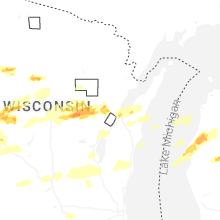
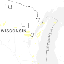
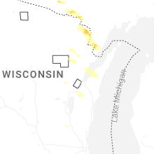
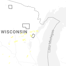


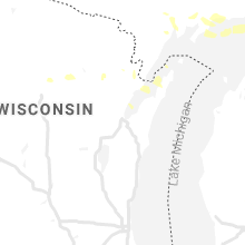


Connect with Interactive Hail Maps