

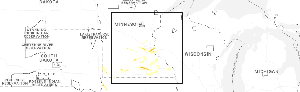
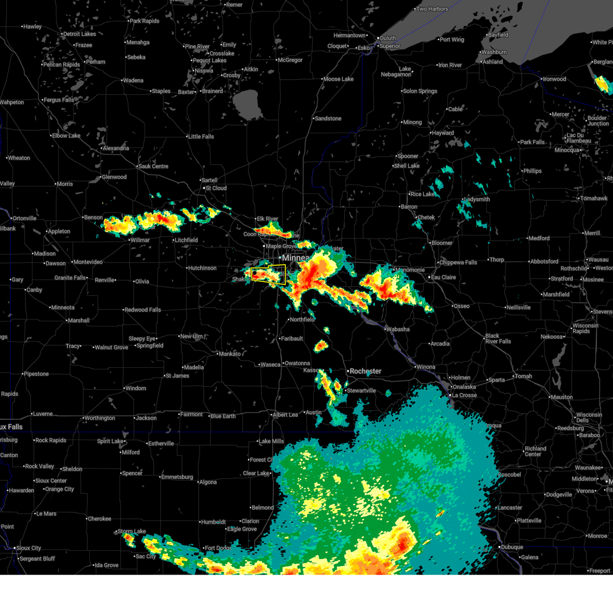
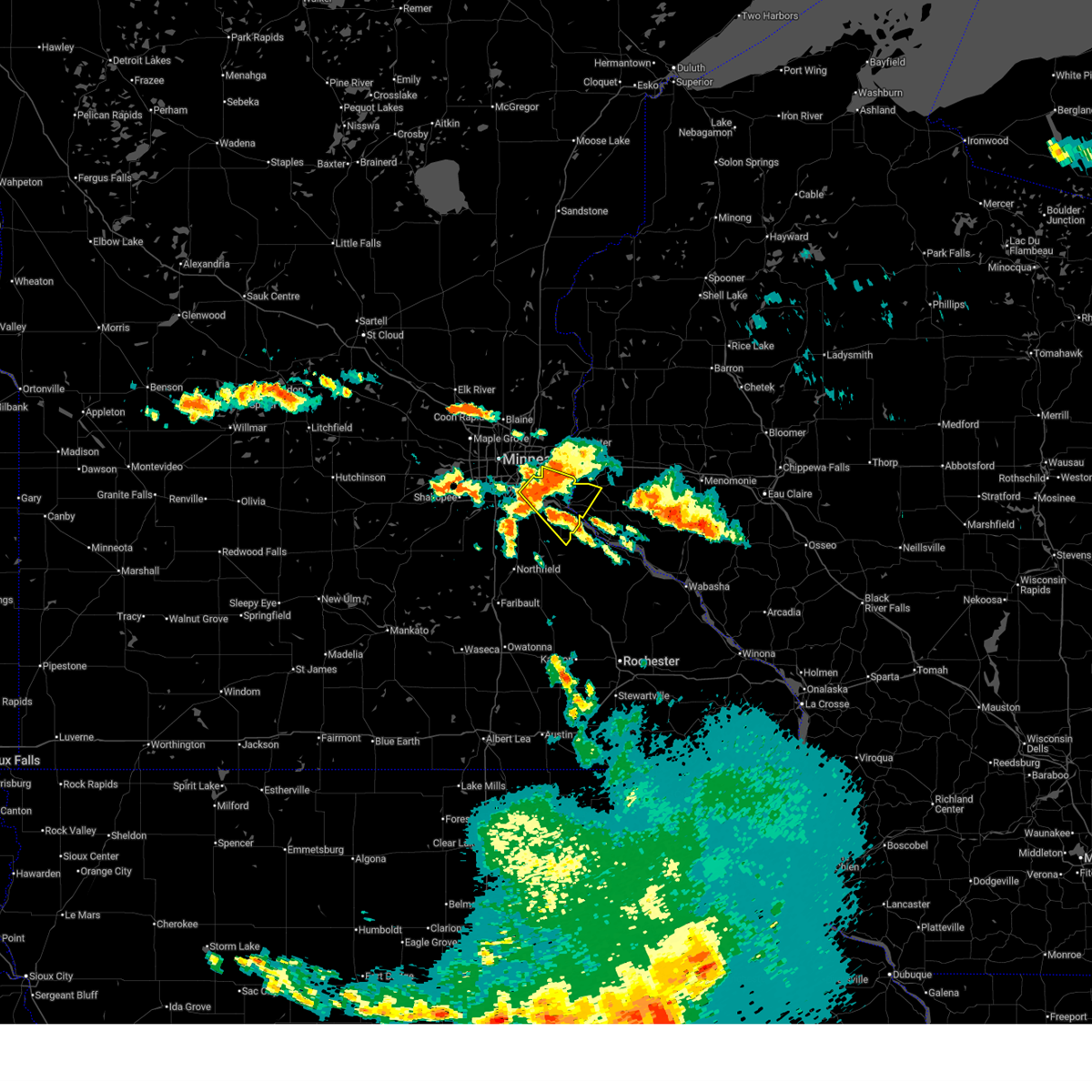
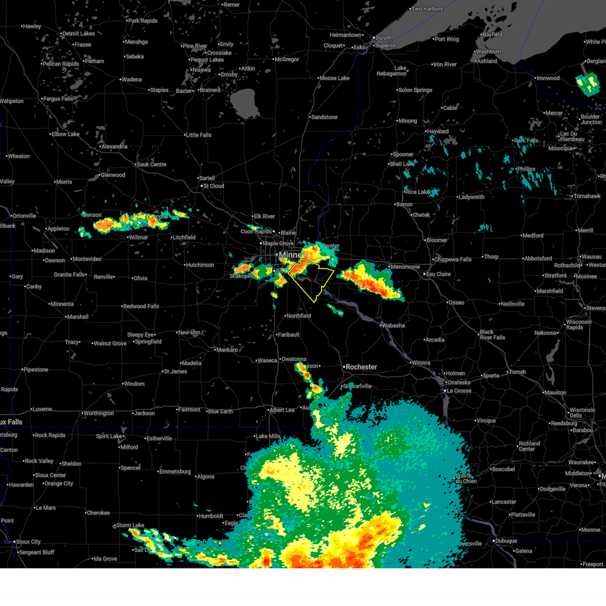
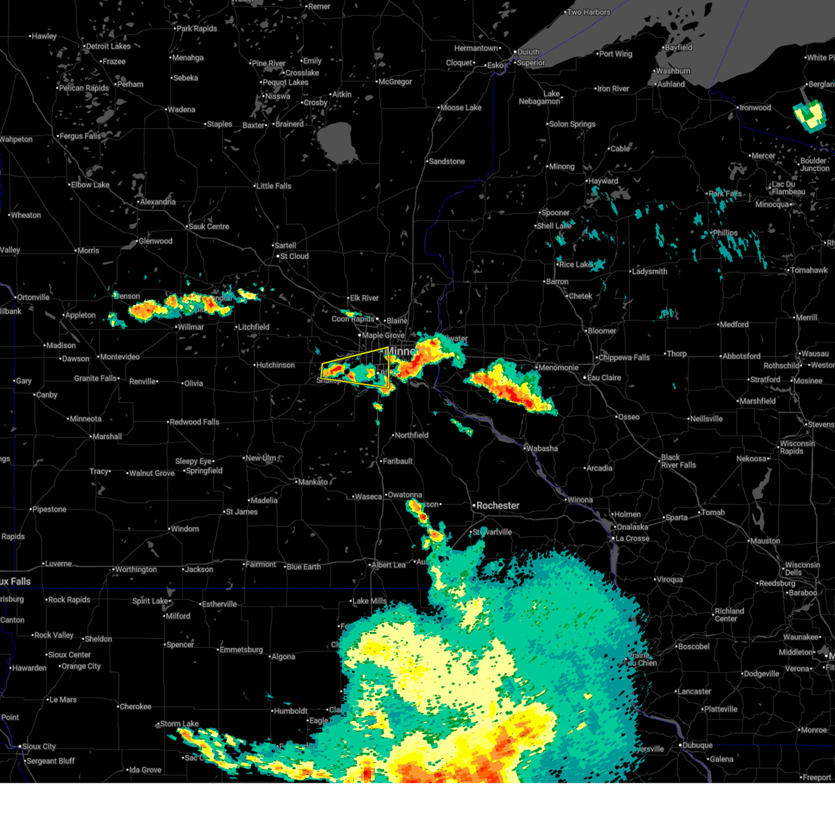
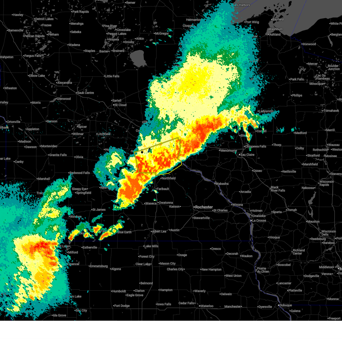
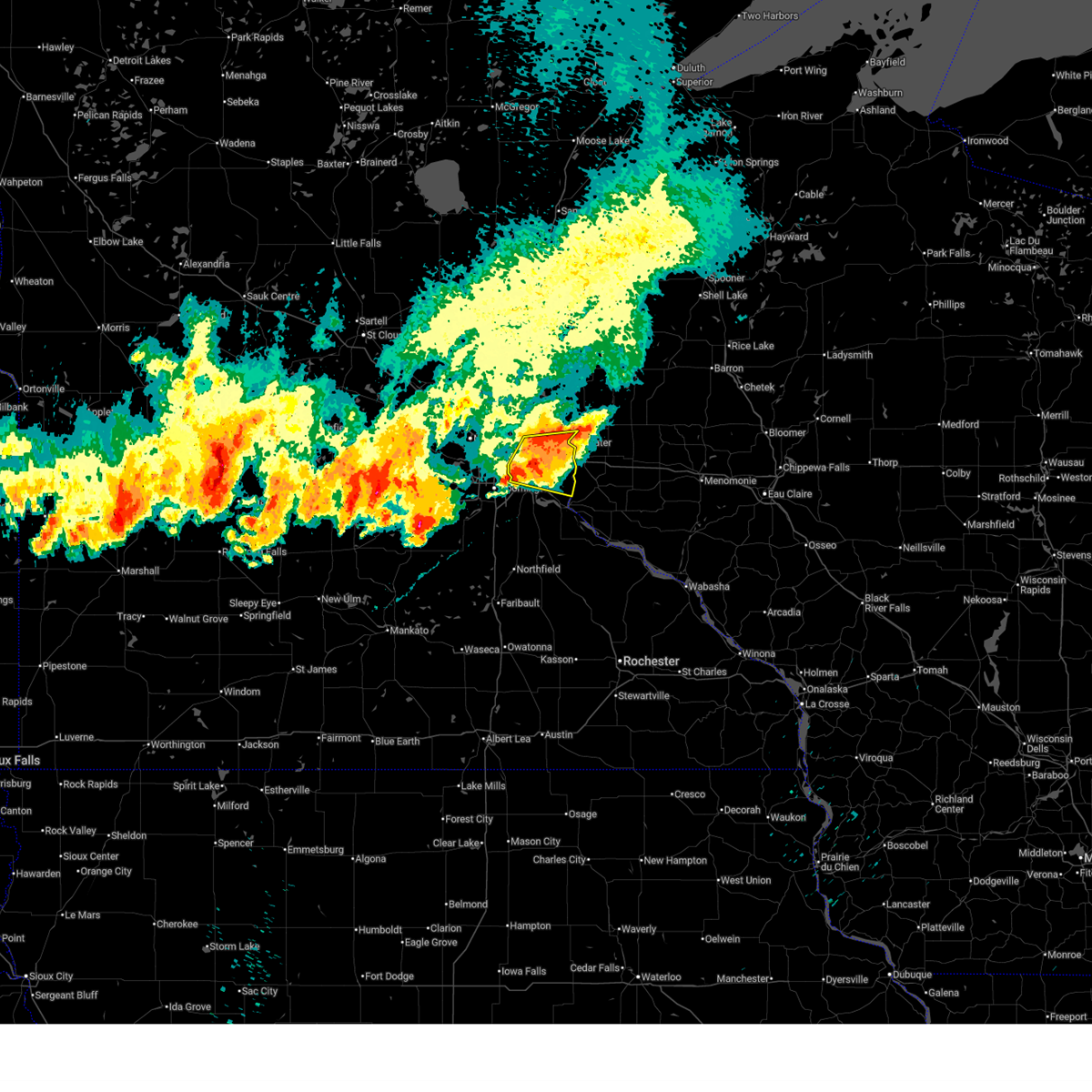
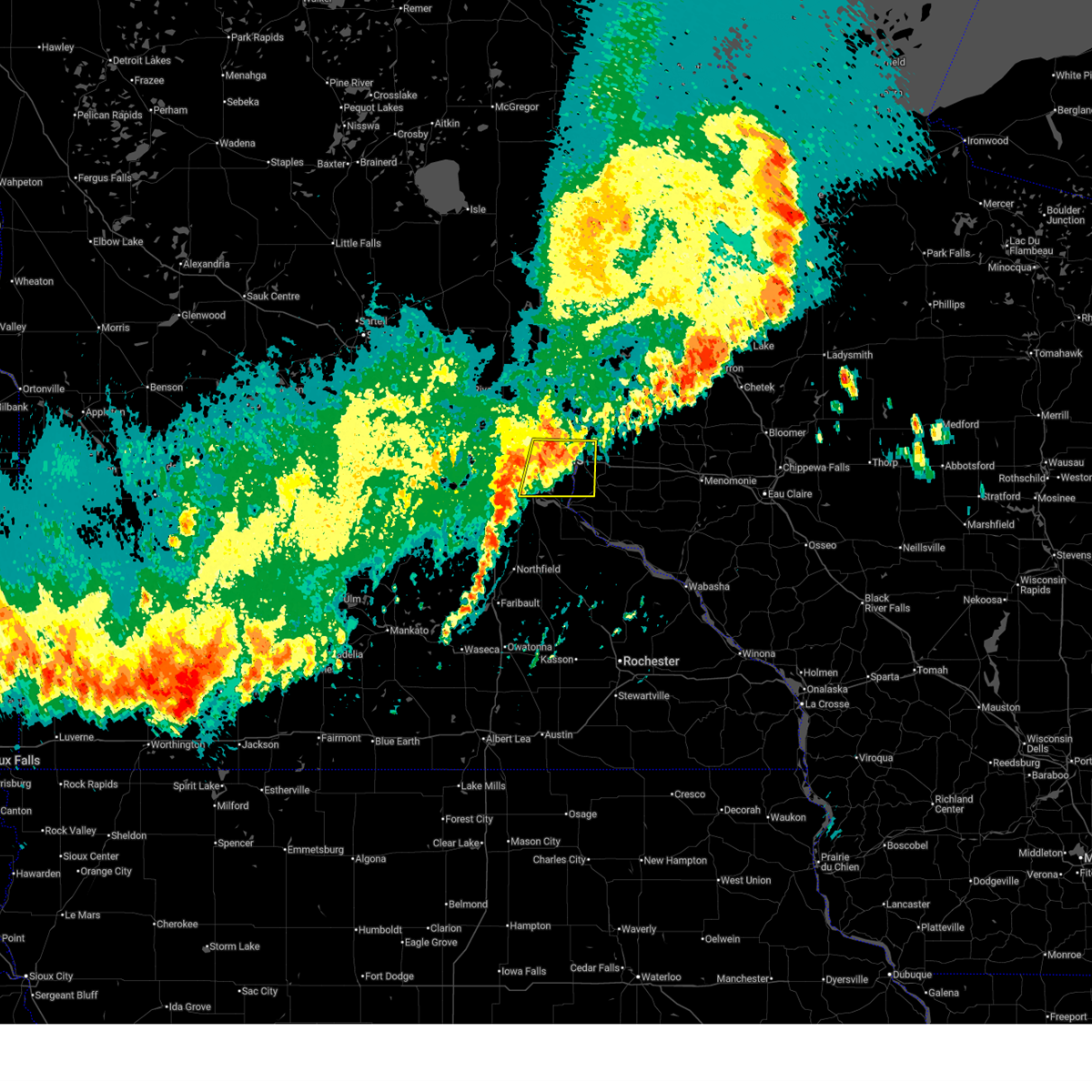
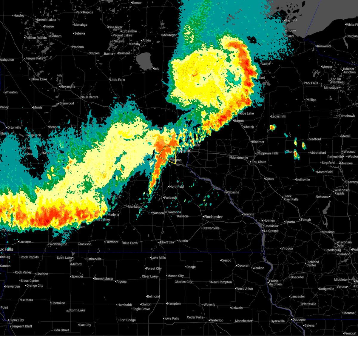
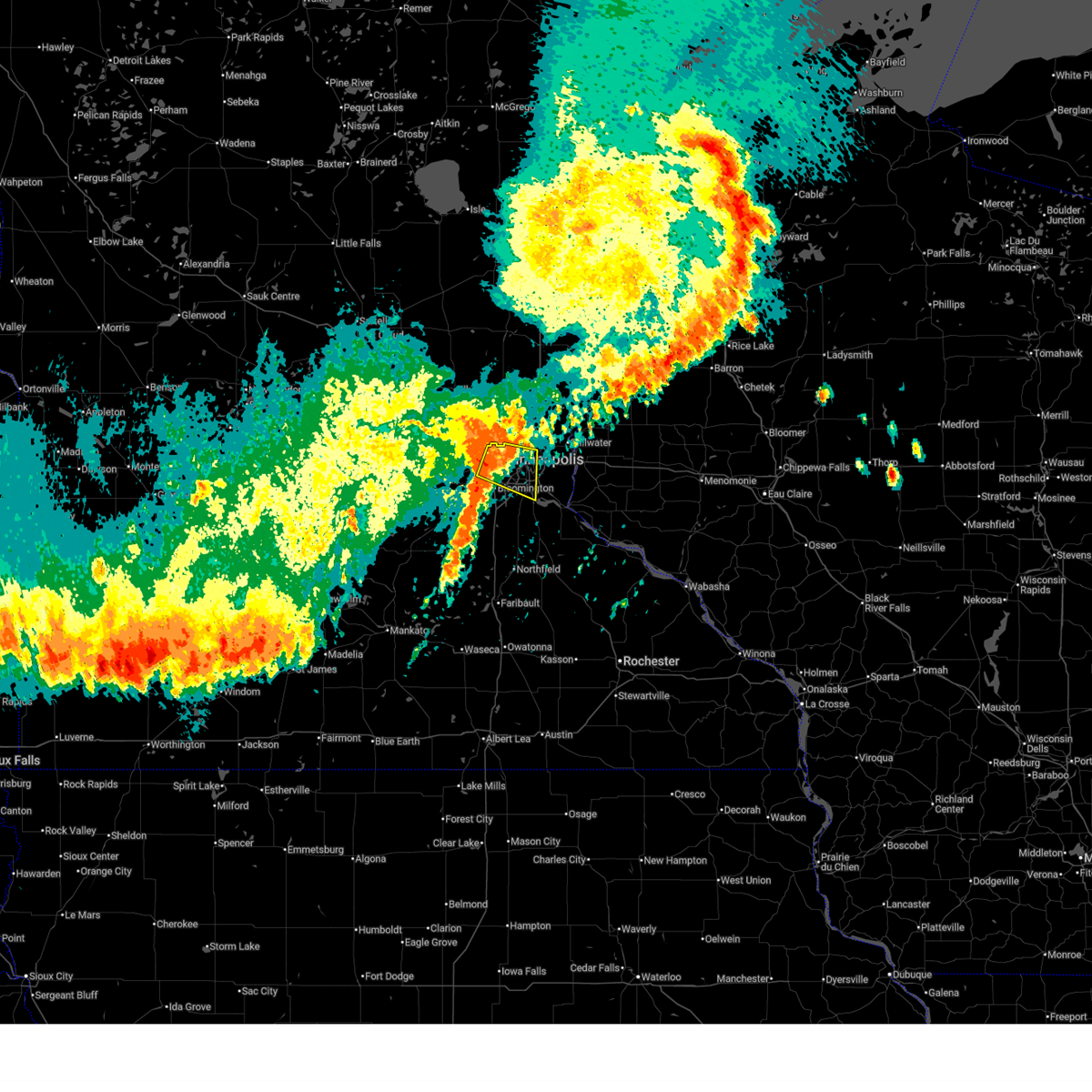
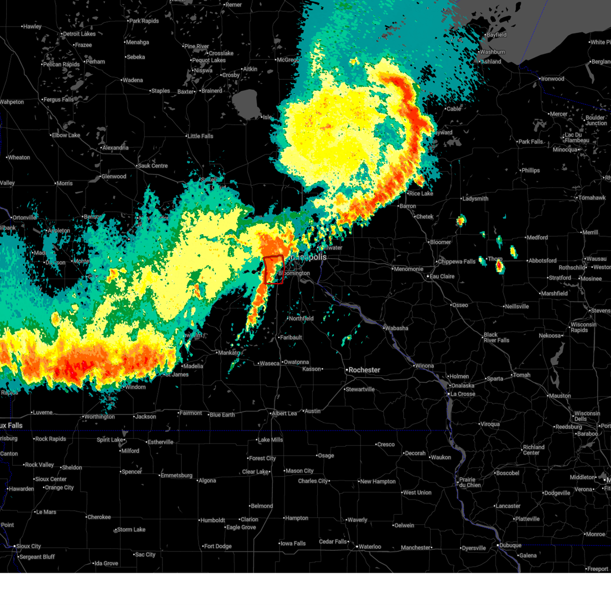
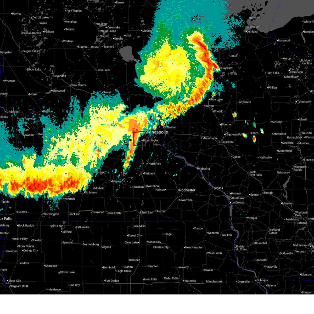
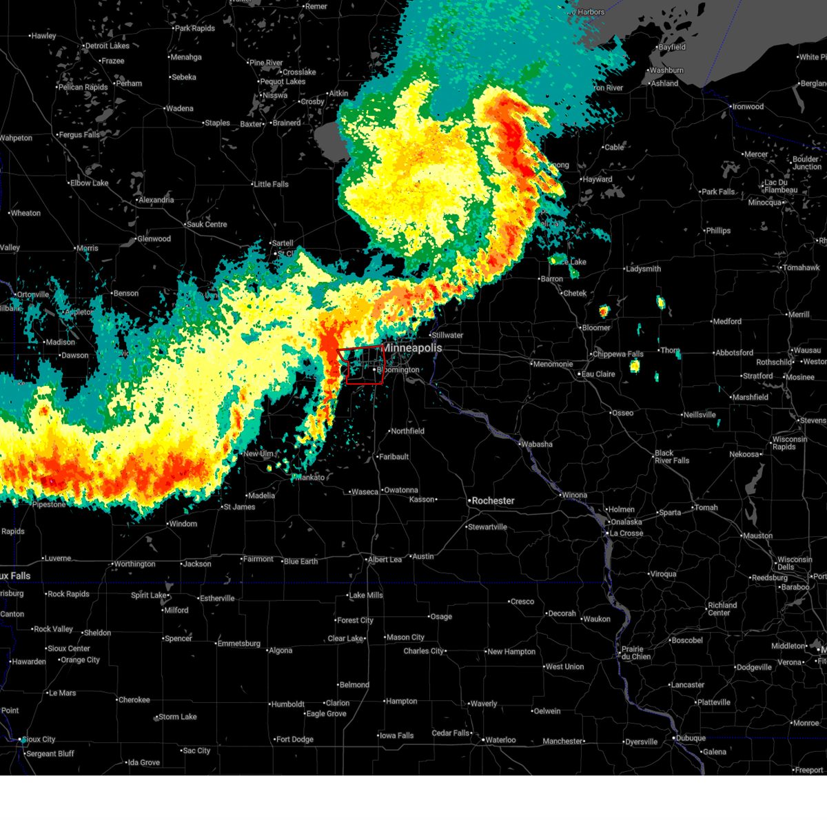
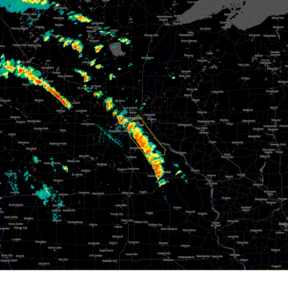
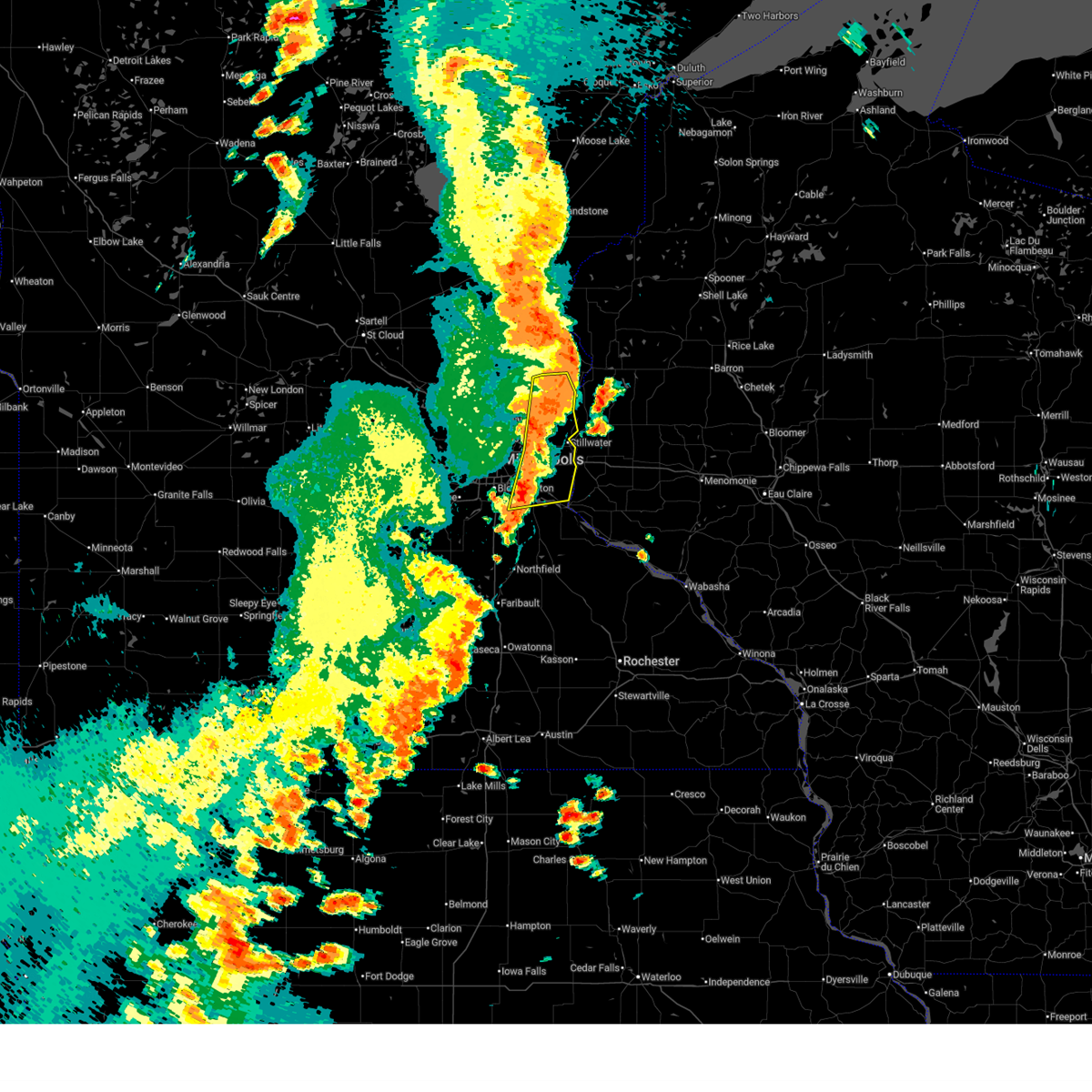
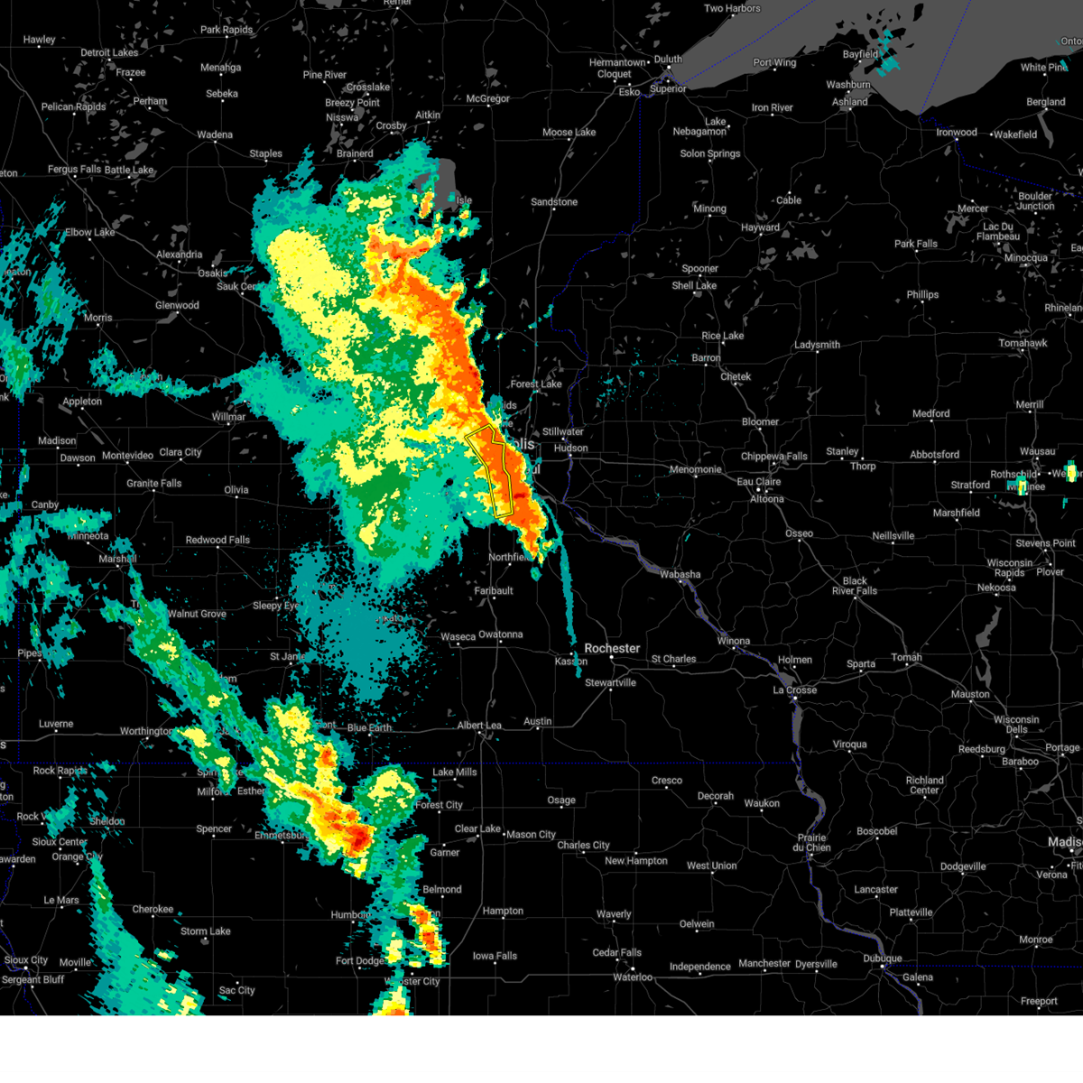
Hail Map for Eagan, MN
The Eagan, MN area has had 13 reports of on-the-ground hail by trained spotters, and has been under severe weather warnings 34 times during the past 12 months. Doppler radar has detected hail at or near Eagan, MN on 91 occasions, including 4 occasions during the past year.
| Name: | Eagan, MN |
| Where Located: | 11.6 miles SSE of Minneapolis, MN |
| Map: | Google Map for Eagan, MN |
| Population: | 64206 |
| Housing Units: | 26414 |
| More Info: | Search Google for Eagan, MN |
2
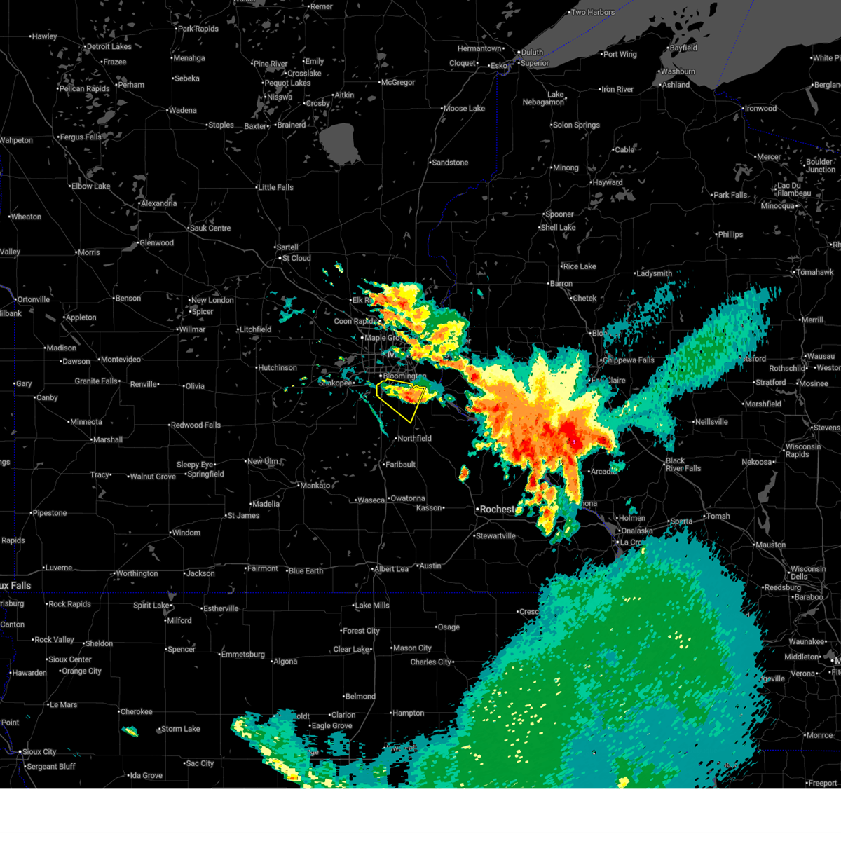
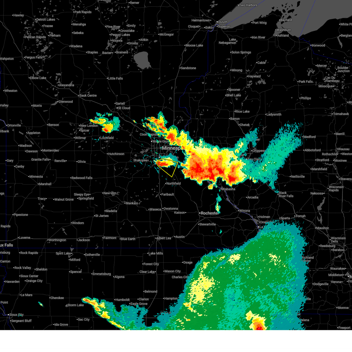
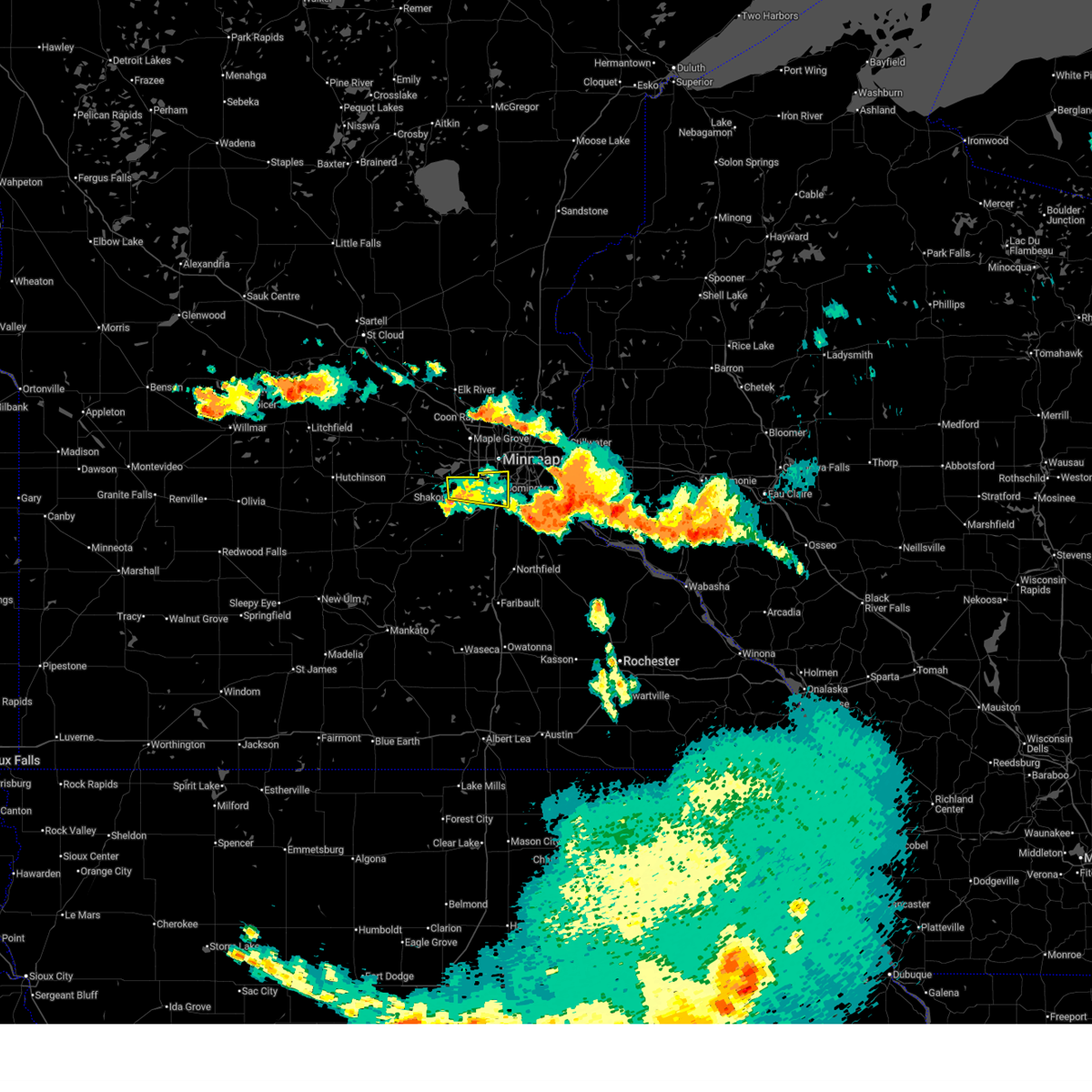
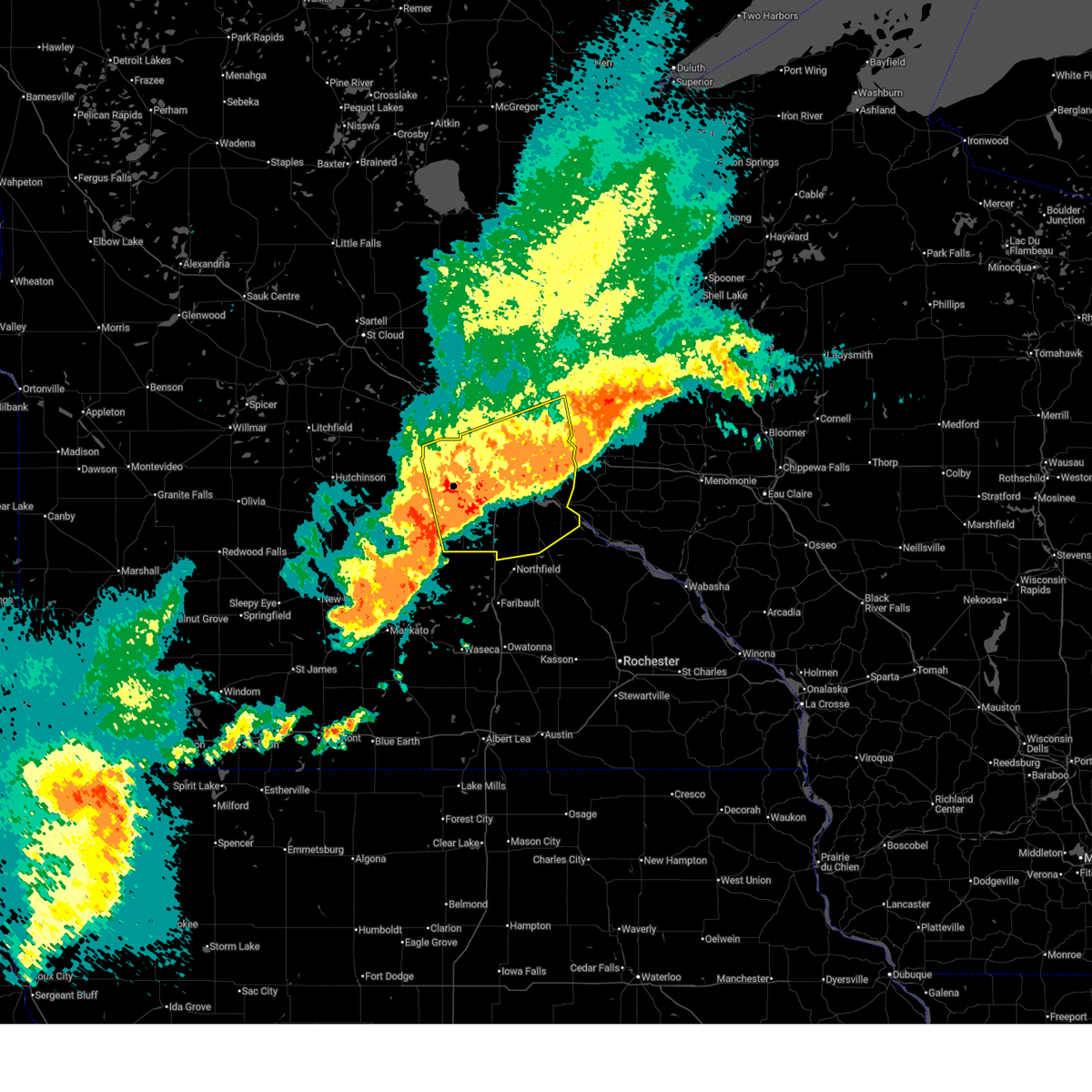
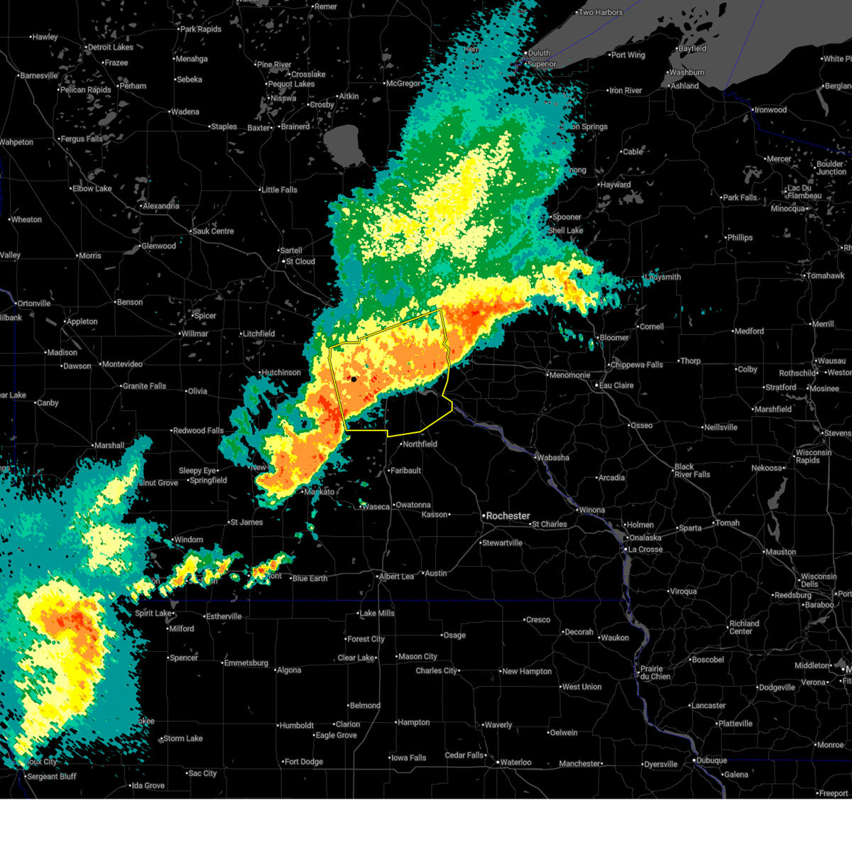
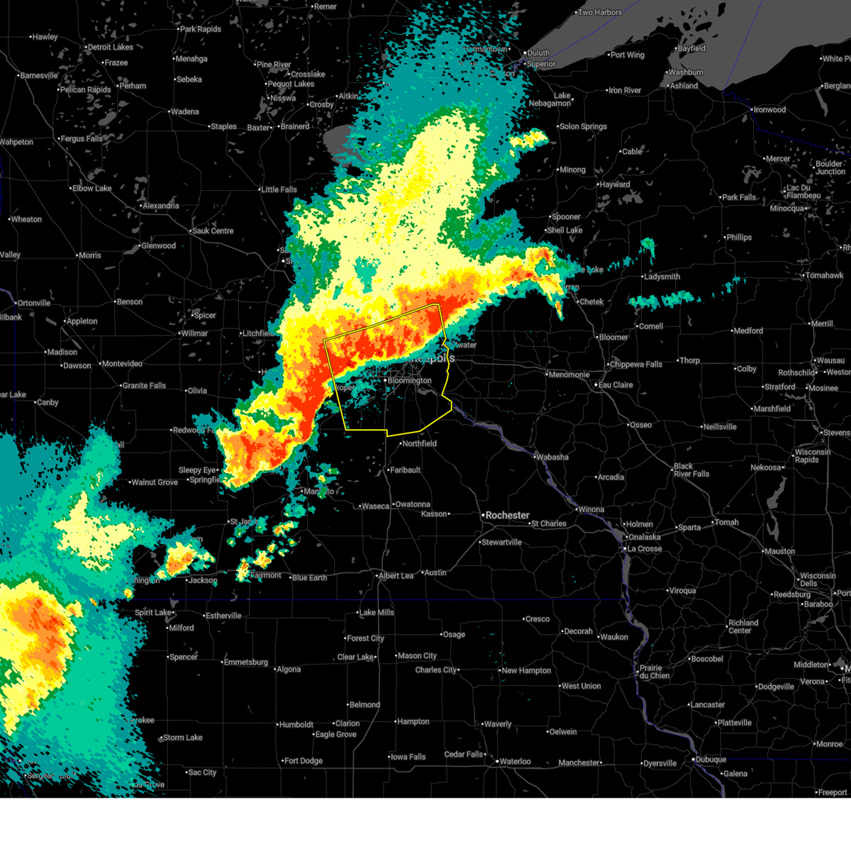
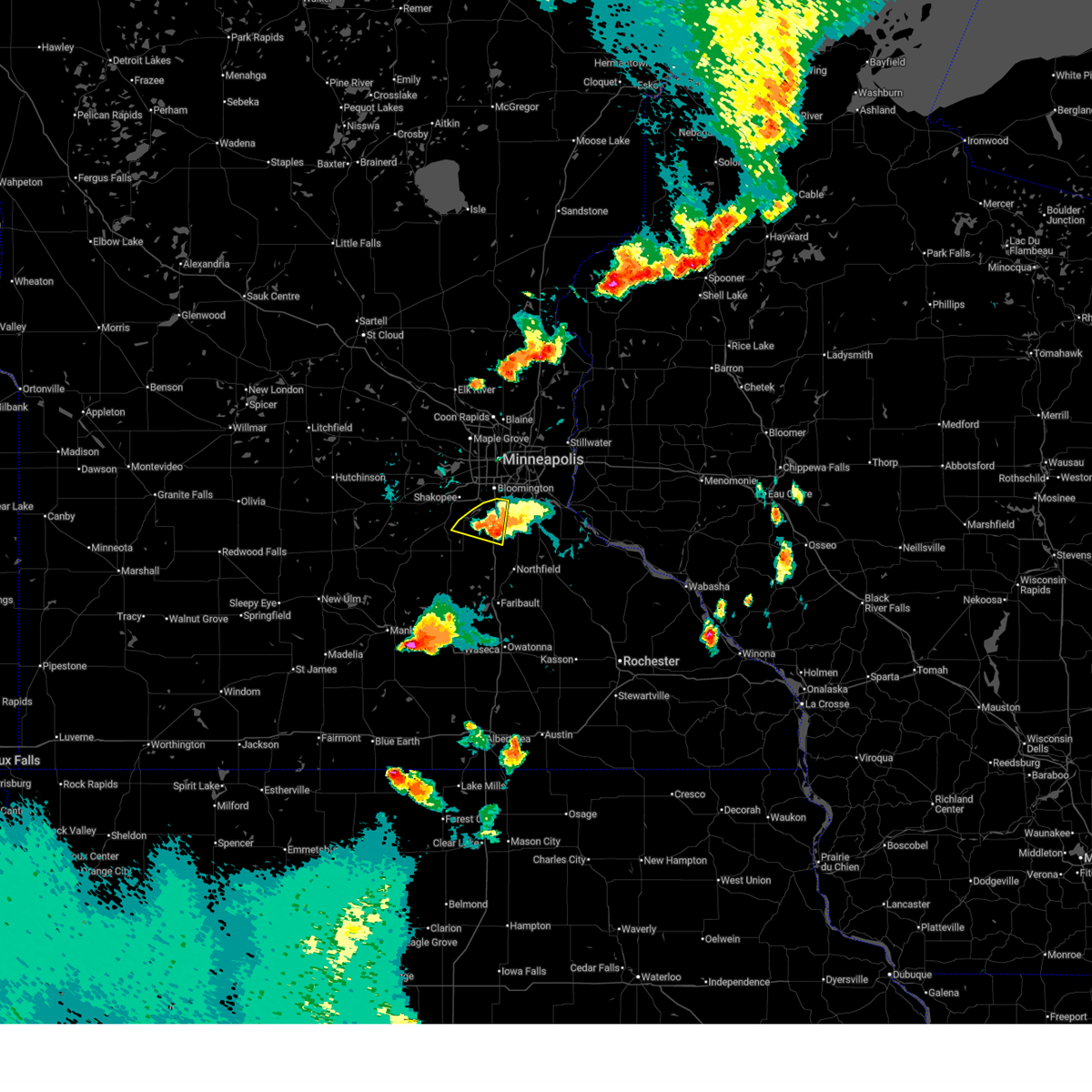
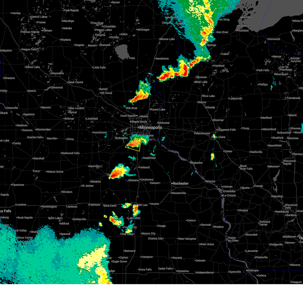
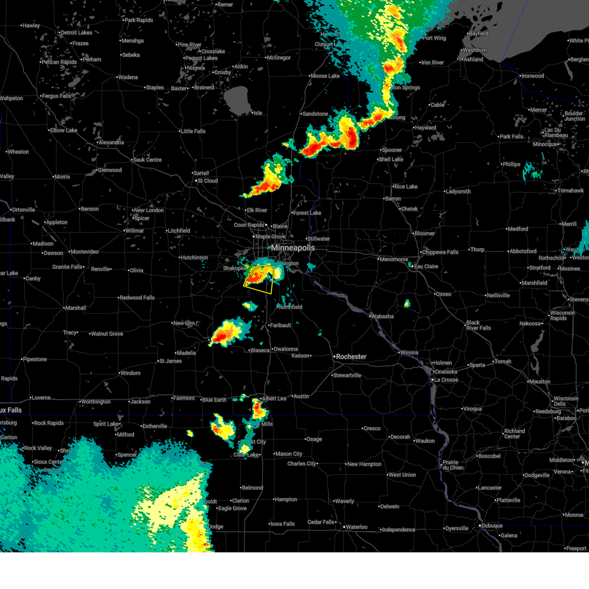
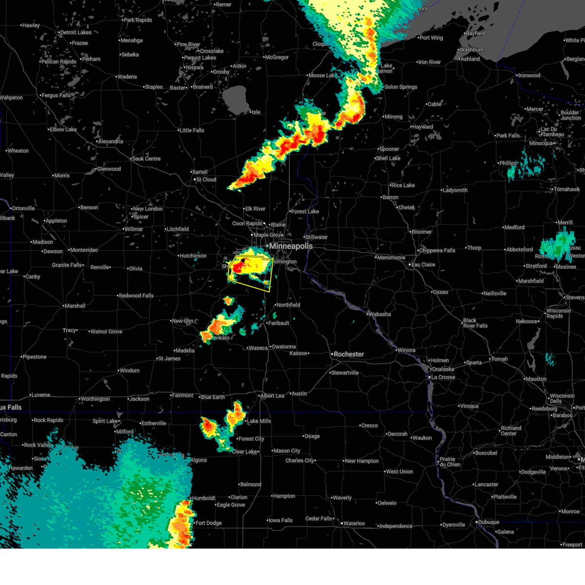
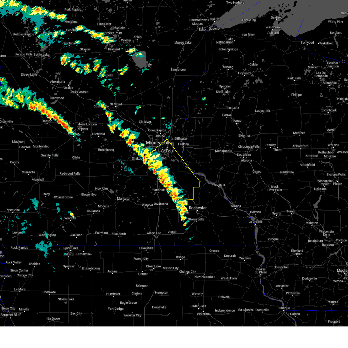
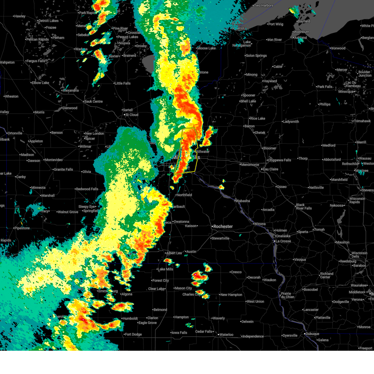
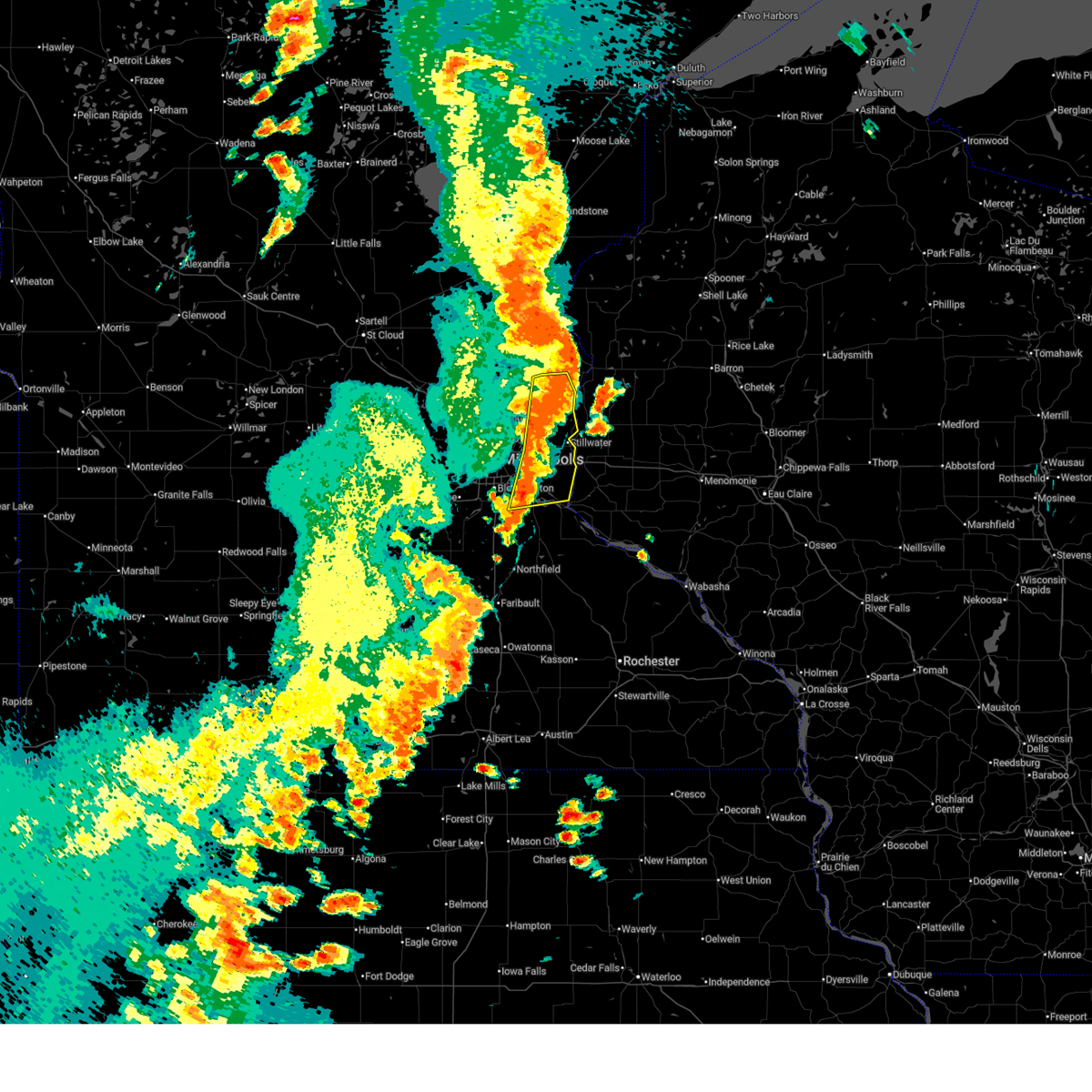
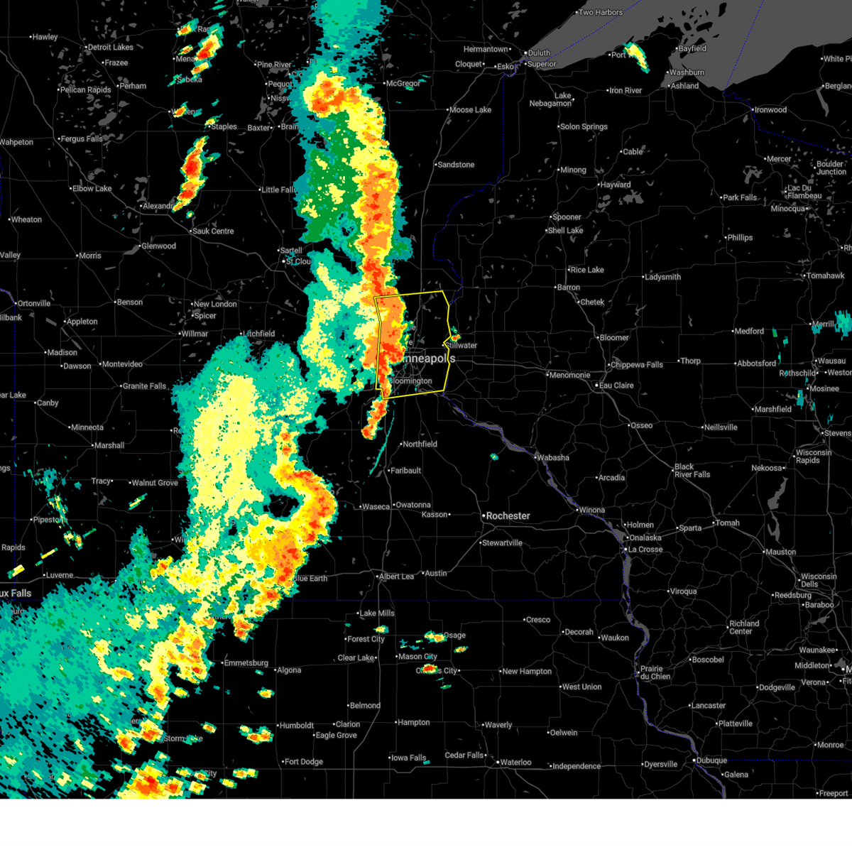
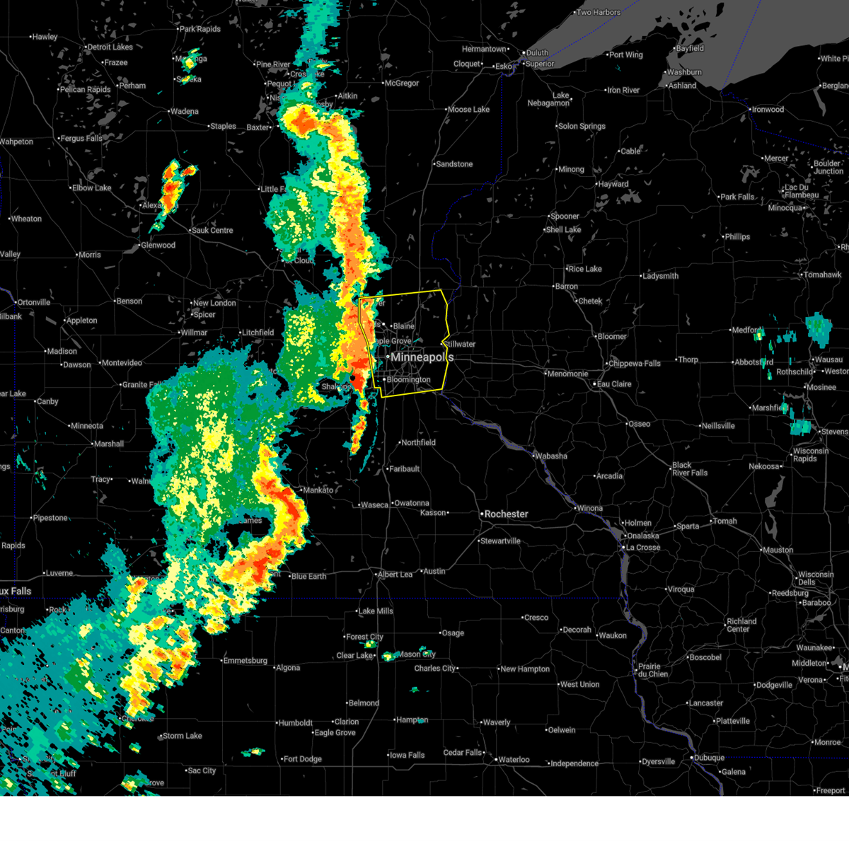
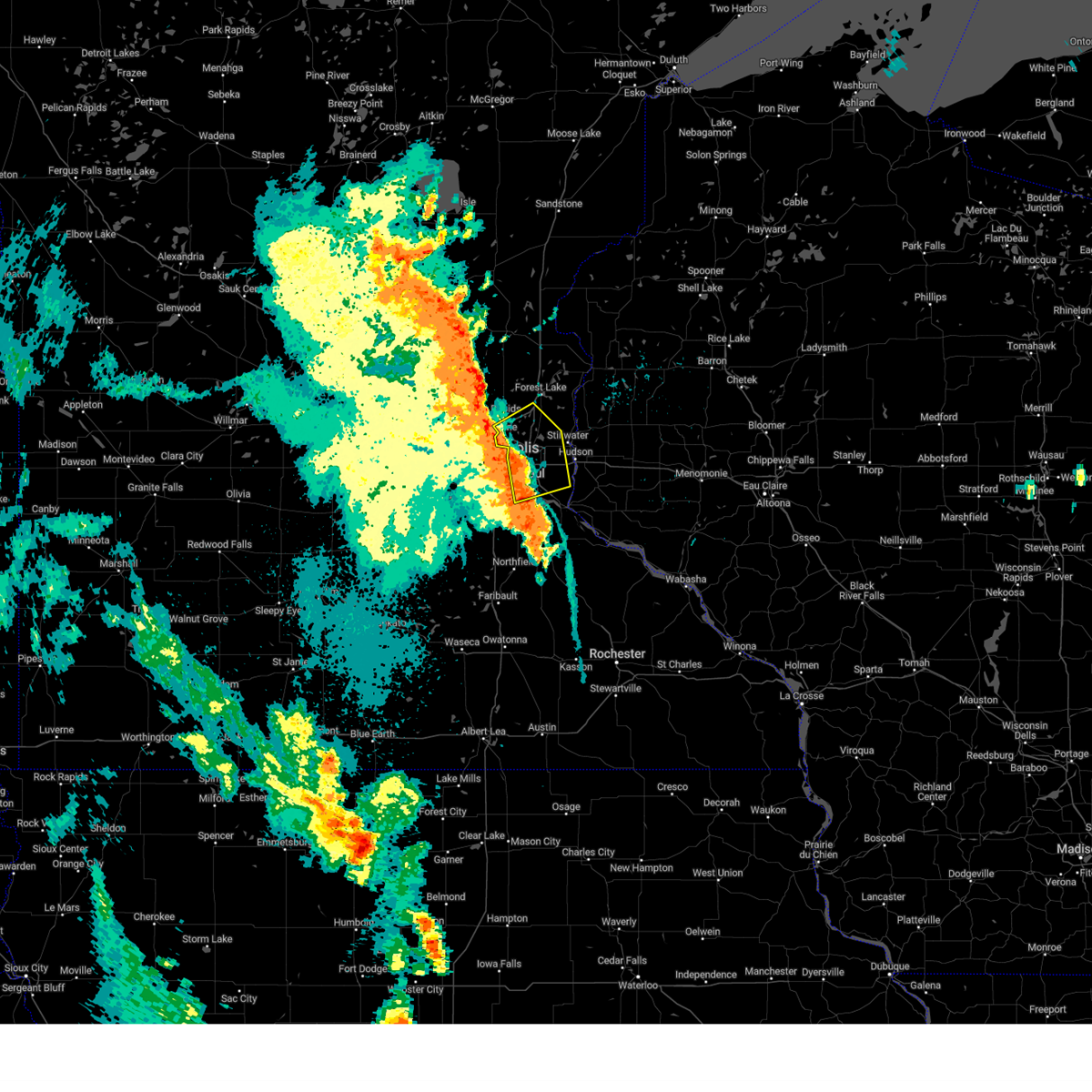
The Top Recent Hail Date for Eagan, MN is Sunday, September 21, 2025 (9th out of 91)
Hail and Wind Damage Spotted near Eagan, MN
| Date / Time | Report Details |
|---|---|
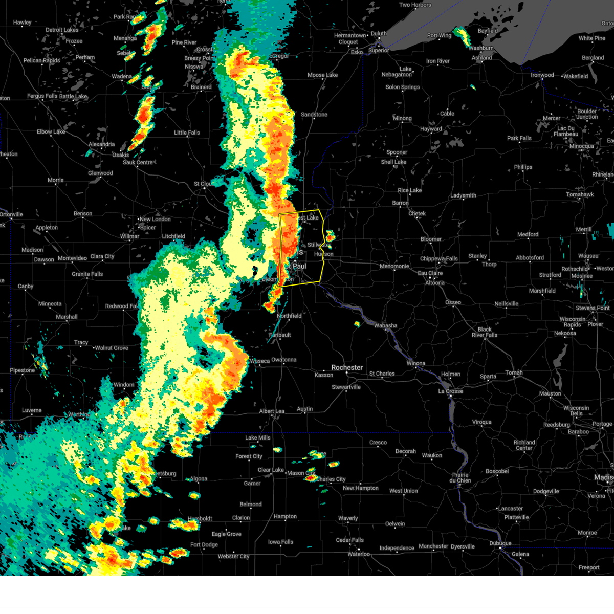
| 9/21/2025 9:51 PM CDT | The storm which prompted the warning has weakened below severe limits, and no longer poses an immediate threat to life or property. therefore, the warning will be allowed to expire. to report severe weather, contact your nearest law enforcement agency. they will send your report to the national weather service office. |
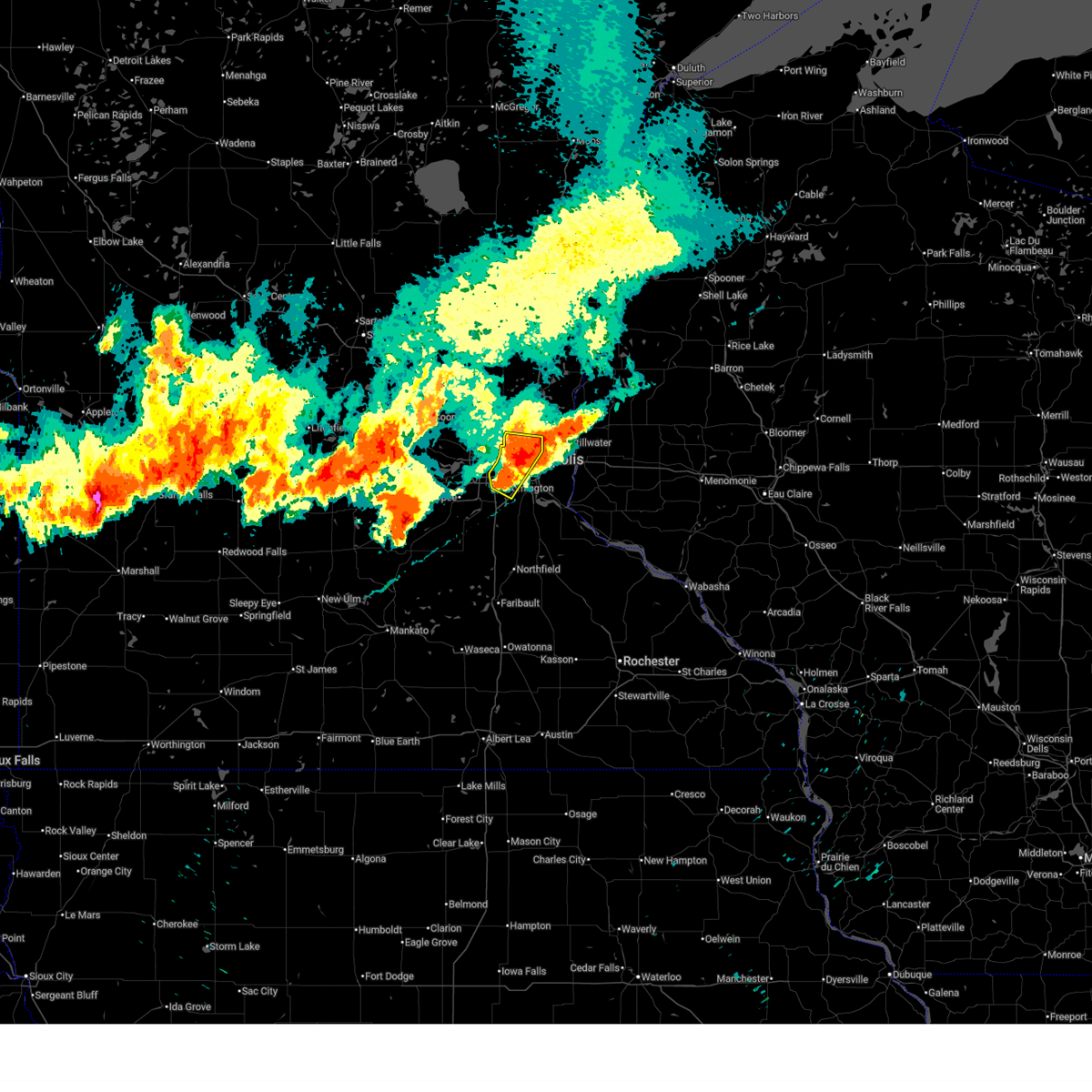
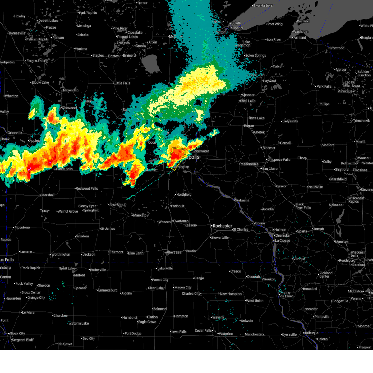
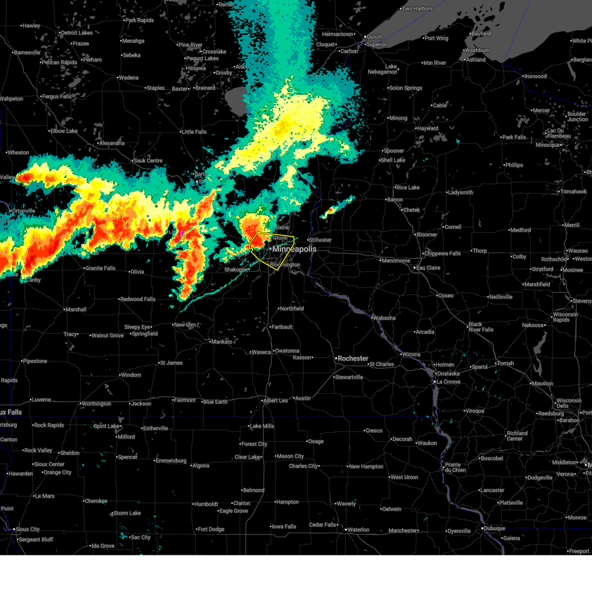
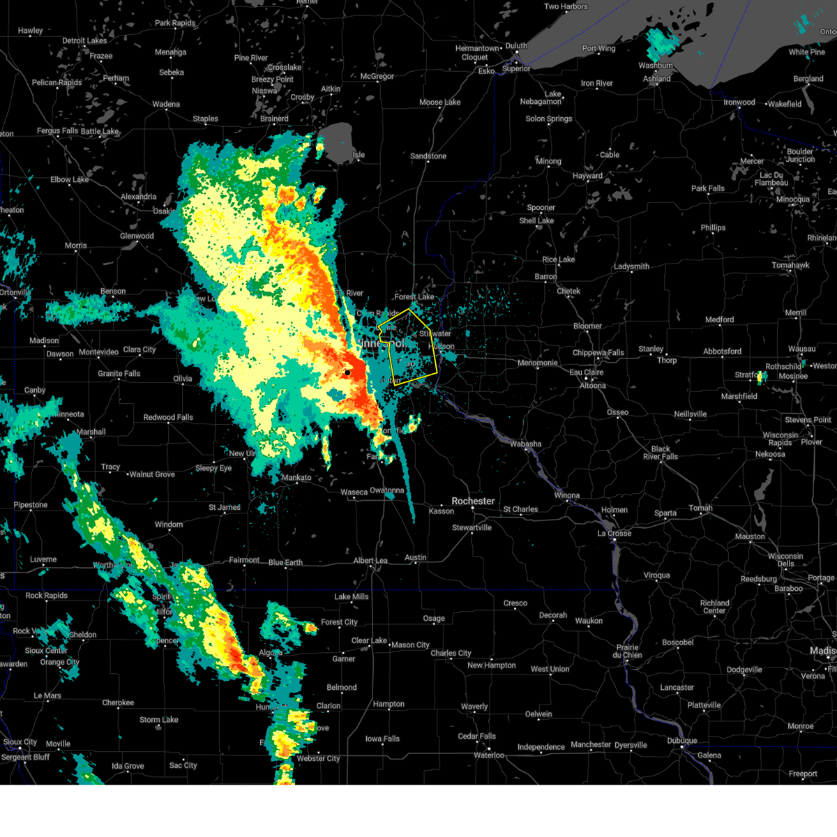
| 9/21/2025 9:41 PM CDT | At 941 pm cdt, a severe thunderstorm was located over eagan, or 9 miles south of st. paul, moving southeast at 30 mph (radar indicated). Hazards include quarter size hail. Damage to vehicles is expected. locations impacted include, minneapolis, st. paul, bloomington, eagan, burnsville, apple valley, richfield, cottage grove, inver grove heights, rosemount, south st. paul, mendota heights, st. Paul park, msp international airport, newport, sunfish lake, mendota, coates, south st paul airport and fort snelling state park. |
| 9/21/2025 9:41 PM CDT | the severe thunderstorm warning has been cancelled and is no longer in effect |
| 9/21/2025 9:24 PM CDT | At 924 pm cdt, a severe thunderstorm was located over richfield, or 6 miles south of minneapolis, moving southeast at 30 mph (trained spotters reported). Hazards include half dollar size hail. Damage to vehicles is expected. locations impacted include, minneapolis, st. paul, bloomington, eagan, burnsville, apple valley, edina, st. louis park, richfield, cottage grove, inver grove heights, rosemount, golden valley, south st. paul, west st. paul, mendota heights, st. Paul park, msp international airport, newport and lilydale. |
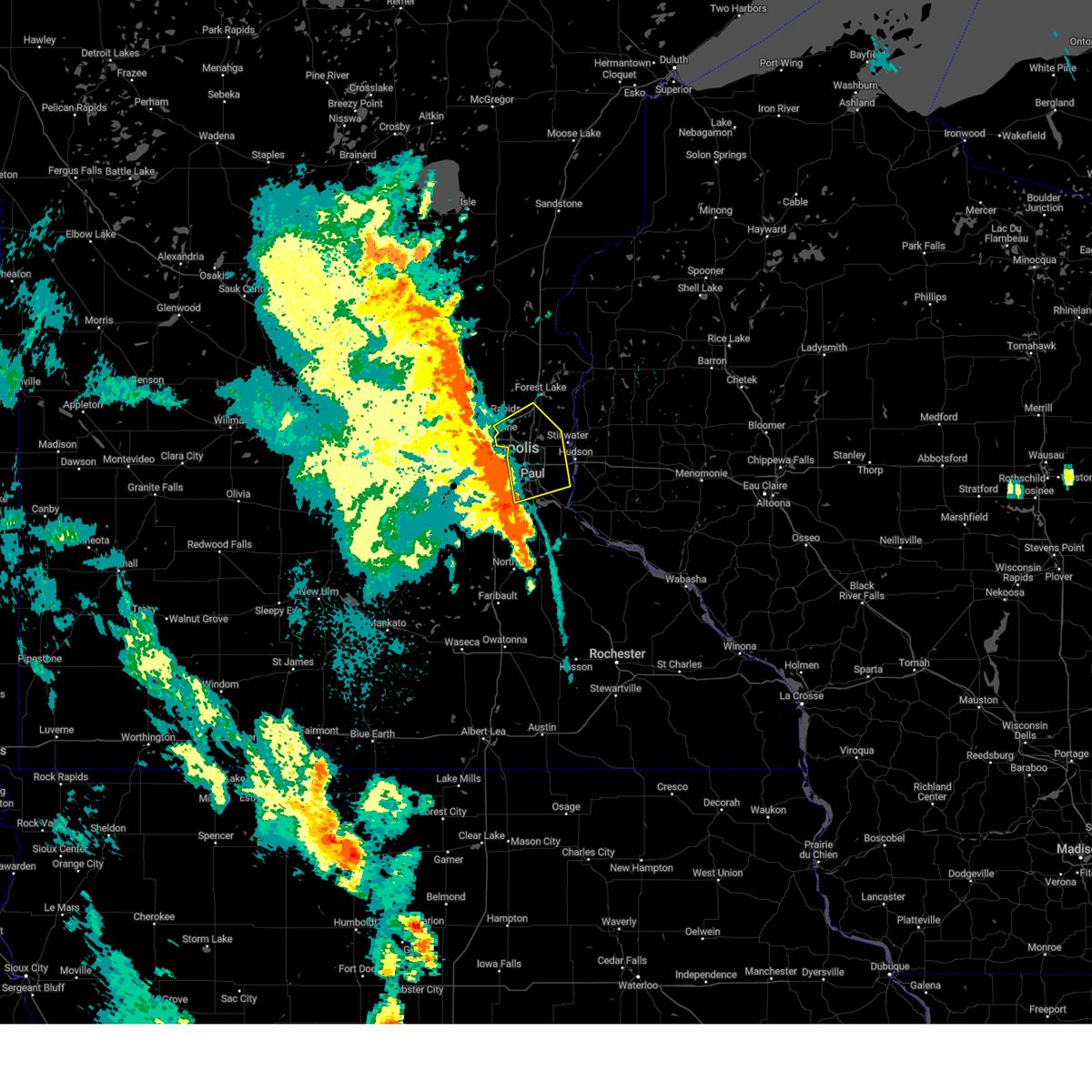
| 9/21/2025 9:12 PM CDT | Svrmpx the national weather service in the twin cities has issued a * severe thunderstorm warning for, northwestern dakota county in east central minnesota, central hennepin, east hennepin, and south hennepin county in east central minnesota, southwestern ramsey county in east central minnesota, * until 1000 pm cdt. * at 912 pm cdt, a severe thunderstorm was located over hopkins, or 7 miles southwest of minneapolis, moving southeast at 30 mph (trained spotters reported). Hazards include two inch hail and 60 mph wind gusts. People and animals outdoors will be injured. expect hail damage to roofs, siding, windows, and vehicles. Expect wind damage to roofs, siding, and trees. |
| 8/15/2025 6:36 PM CDT |
 the severe thunderstorm warning has been cancelled and is no longer in effect the severe thunderstorm warning has been cancelled and is no longer in effect
|
| 8/15/2025 6:04 PM CDT |
 Svrmpx the national weather service in the twin cities has issued a * severe thunderstorm warning for, southwestern dakota county in east central minnesota, * until 645 pm cdt. * at 604 pm cdt, a severe thunderstorm was located over burnsville, or 16 miles south of minneapolis, moving east at 20 mph (radar indicated). Hazards include 60 mph wind gusts and half dollar size hail. Hail damage to vehicles is expected. Expect wind damage to roofs, siding, and trees. Svrmpx the national weather service in the twin cities has issued a * severe thunderstorm warning for, southwestern dakota county in east central minnesota, * until 645 pm cdt. * at 604 pm cdt, a severe thunderstorm was located over burnsville, or 16 miles south of minneapolis, moving east at 20 mph (radar indicated). Hazards include 60 mph wind gusts and half dollar size hail. Hail damage to vehicles is expected. Expect wind damage to roofs, siding, and trees.
|
| 8/15/2025 5:23 PM CDT |
 The storm has weakened and the warning will be allowed to expire. however, heavy rain is still possible with this thunderstorm. The storm has weakened and the warning will be allowed to expire. however, heavy rain is still possible with this thunderstorm.
|
| 8/15/2025 5:10 PM CDT |
 At 510 pm cdt, a severe thunderstorm was located over eden prairie, or 11 miles southwest of minneapolis, moving east at 25 mph (radar indicated). Hazards include quarter size hail. Damage to vehicles is expected. locations impacted include, minneapolis, st. Paul, bloomington, eagan, eden prairie, burnsville, apple valley, edina, shakopee, richfield, savage, chaska, chanhassen, mendota heights, msp international airport, flying cloud airport, mall of america, fort snelling state park and minnesota valley state recreation area. At 510 pm cdt, a severe thunderstorm was located over eden prairie, or 11 miles southwest of minneapolis, moving east at 25 mph (radar indicated). Hazards include quarter size hail. Damage to vehicles is expected. locations impacted include, minneapolis, st. Paul, bloomington, eagan, eden prairie, burnsville, apple valley, edina, shakopee, richfield, savage, chaska, chanhassen, mendota heights, msp international airport, flying cloud airport, mall of america, fort snelling state park and minnesota valley state recreation area.
|
| 8/15/2025 4:56 PM CDT |
 At 456 pm cdt, a severe thunderstorm was located over cottage grove, or 12 miles southeast of st. paul, moving southeast at 20 mph (law enforcement reported). Hazards include half dollar size hail. Damage to vehicles is expected. locations impacted include, st. paul, river falls, eagan, woodbury, cottage grove, inver grove heights, hastings, rosemount, south st. paul, st. Paul park, prescott, afton, newport, vermillion, miesville, point douglas, afton state park, kinnickinnic state park, grey cloud township and st paul park. At 456 pm cdt, a severe thunderstorm was located over cottage grove, or 12 miles southeast of st. paul, moving southeast at 20 mph (law enforcement reported). Hazards include half dollar size hail. Damage to vehicles is expected. locations impacted include, st. paul, river falls, eagan, woodbury, cottage grove, inver grove heights, hastings, rosemount, south st. paul, st. Paul park, prescott, afton, newport, vermillion, miesville, point douglas, afton state park, kinnickinnic state park, grey cloud township and st paul park.
|
| 8/15/2025 4:50 PM CDT |
 Svrmpx the national weather service in the twin cities has issued a * severe thunderstorm warning for, northeastern dakota county in east central minnesota, southern washington county in east central minnesota, northwestern pierce county in west central wisconsin, * until 545 pm cdt. * at 450 pm cdt, a severe thunderstorm was located over st. paul park, or 10 miles southeast of st. paul, moving southeast at 20 mph (radar indicated). Hazards include half dollar size hail. damage to vehicles is expected Svrmpx the national weather service in the twin cities has issued a * severe thunderstorm warning for, northeastern dakota county in east central minnesota, southern washington county in east central minnesota, northwestern pierce county in west central wisconsin, * until 545 pm cdt. * at 450 pm cdt, a severe thunderstorm was located over st. paul park, or 10 miles southeast of st. paul, moving southeast at 20 mph (radar indicated). Hazards include half dollar size hail. damage to vehicles is expected
|
| 8/15/2025 4:44 PM CDT |
 Svrmpx the national weather service in the twin cities has issued a * severe thunderstorm warning for, east central carver county in east central minnesota, northwestern dakota county in east central minnesota, west hennepin, central hennepin, east hennepin, and south hennepin county in east central minnesota, northeastern scott county in east central minnesota, * until 530 pm cdt. * at 444 pm cdt, a severe thunderstorm was located over victoria, or 20 miles west of minneapolis, moving east at 25 mph (trained spotters reported). Hazards include half dollar size hail. damage to vehicles is expected Svrmpx the national weather service in the twin cities has issued a * severe thunderstorm warning for, east central carver county in east central minnesota, northwestern dakota county in east central minnesota, west hennepin, central hennepin, east hennepin, and south hennepin county in east central minnesota, northeastern scott county in east central minnesota, * until 530 pm cdt. * at 444 pm cdt, a severe thunderstorm was located over victoria, or 20 miles west of minneapolis, moving east at 25 mph (trained spotters reported). Hazards include half dollar size hail. damage to vehicles is expected
|
| 7/28/2025 10:19 PM CDT |
 the severe thunderstorm warning has been cancelled and is no longer in effect the severe thunderstorm warning has been cancelled and is no longer in effect
|
| 7/28/2025 10:19 PM CDT |
 At 1019 pm cdt, severe thunderstorms were located along a line from 5 miles northeast of prescott to 7 miles south of prior lake, or along a line from 6 miles southwest of river falls to 20 miles northwest of northfield, moving south at 40 mph (radar indicated). Hazards include 70 mph wind gusts and small hail. Expect considerable tree damage. damage is likely to mobile homes, roofs, and outbuildings. locations impacted include, minneapolis, st. paul, bloomington, eagan, woodbury, eden prairie, burnsville, lakeville, minnetonka, apple valley, edina, st. Louis park, maplewood, shakopee, richfield, cottage grove, inver grove heights, roseville, oakdale and savage. At 1019 pm cdt, severe thunderstorms were located along a line from 5 miles northeast of prescott to 7 miles south of prior lake, or along a line from 6 miles southwest of river falls to 20 miles northwest of northfield, moving south at 40 mph (radar indicated). Hazards include 70 mph wind gusts and small hail. Expect considerable tree damage. damage is likely to mobile homes, roofs, and outbuildings. locations impacted include, minneapolis, st. paul, bloomington, eagan, woodbury, eden prairie, burnsville, lakeville, minnetonka, apple valley, edina, st. Louis park, maplewood, shakopee, richfield, cottage grove, inver grove heights, roseville, oakdale and savage.
|
| 7/28/2025 10:02 PM CDT |
 At 1002 pm cdt, severe thunderstorms were located along a line from near north hudson to near chaska, or along a line from 11 miles northwest of river falls to 19 miles southwest of minneapolis, moving south at 40 mph (radar indicated). Hazards include 70 mph wind gusts and small hail. Expect considerable tree damage. damage is likely to mobile homes, roofs, and outbuildings. locations impacted include, minneapolis, st. paul, bloomington, brooklyn park, plymouth, eagan, woodbury, maple grove, coon rapids, eden prairie, burnsville, blaine, lakeville, minnetonka, apple valley, edina, st. Louis park, maplewood, shakopee and richfield. At 1002 pm cdt, severe thunderstorms were located along a line from near north hudson to near chaska, or along a line from 11 miles northwest of river falls to 19 miles southwest of minneapolis, moving south at 40 mph (radar indicated). Hazards include 70 mph wind gusts and small hail. Expect considerable tree damage. damage is likely to mobile homes, roofs, and outbuildings. locations impacted include, minneapolis, st. paul, bloomington, brooklyn park, plymouth, eagan, woodbury, maple grove, coon rapids, eden prairie, burnsville, blaine, lakeville, minnetonka, apple valley, edina, st. Louis park, maplewood, shakopee and richfield.
|
| 7/28/2025 10:02 PM CDT |
 the severe thunderstorm warning has been cancelled and is no longer in effect the severe thunderstorm warning has been cancelled and is no longer in effect
|
| 7/28/2025 9:39 PM CDT |
 Svrmpx the national weather service in the twin cities has issued a * severe thunderstorm warning for, south central wright county in central minnesota, southeastern anoka county in east central minnesota, eastern carver county in east central minnesota, dakota county in east central minnesota, hennepin county in east central minnesota, ramsey county in east central minnesota, scott county in east central minnesota, washington county in east central minnesota, * until 1030 pm cdt. * at 939 pm cdt, severe thunderstorms were located along a line from near hugo to over maple plain, or along a line from 18 miles northeast of st. paul to 17 miles southeast of buffalo, moving south at 40 mph (radar indicated). Hazards include 60 mph wind gusts and small hail. expect damage to roofs, siding, and trees Svrmpx the national weather service in the twin cities has issued a * severe thunderstorm warning for, south central wright county in central minnesota, southeastern anoka county in east central minnesota, eastern carver county in east central minnesota, dakota county in east central minnesota, hennepin county in east central minnesota, ramsey county in east central minnesota, scott county in east central minnesota, washington county in east central minnesota, * until 1030 pm cdt. * at 939 pm cdt, severe thunderstorms were located along a line from near hugo to over maple plain, or along a line from 18 miles northeast of st. paul to 17 miles southeast of buffalo, moving south at 40 mph (radar indicated). Hazards include 60 mph wind gusts and small hail. expect damage to roofs, siding, and trees
|
| 7/27/2025 8:29 PM CDT |
 At 829 pm cdt, a severe thunderstorm was located over lake elmo, or 10 miles east of st. paul, moving east at 35 mph (public reported). Hazards include 60 mph wind gusts and half dollar size hail. Hail damage to vehicles is expected. expect wind damage to roofs, siding, and trees. This severe thunderstorm will remain over mainly rural areas of north central dakota, ramsey and southern washington counties. At 829 pm cdt, a severe thunderstorm was located over lake elmo, or 10 miles east of st. paul, moving east at 35 mph (public reported). Hazards include 60 mph wind gusts and half dollar size hail. Hail damage to vehicles is expected. expect wind damage to roofs, siding, and trees. This severe thunderstorm will remain over mainly rural areas of north central dakota, ramsey and southern washington counties.
|
| 7/27/2025 8:25 PM CDT |
 At 825 pm cdt, a severe thunderstorm was located over oakdale, or 8 miles east of st. paul, moving east at 35 mph (radar indicated). Hazards include 60 mph wind gusts and quarter size hail. Hail damage to vehicles is expected. expect wind damage to roofs, siding, and trees. This severe thunderstorm will remain over mainly rural areas of north central dakota, ramsey and southern washington counties. At 825 pm cdt, a severe thunderstorm was located over oakdale, or 8 miles east of st. paul, moving east at 35 mph (radar indicated). Hazards include 60 mph wind gusts and quarter size hail. Hail damage to vehicles is expected. expect wind damage to roofs, siding, and trees. This severe thunderstorm will remain over mainly rural areas of north central dakota, ramsey and southern washington counties.
|
| 7/27/2025 8:25 PM CDT |
 the severe thunderstorm warning has been cancelled and is no longer in effect the severe thunderstorm warning has been cancelled and is no longer in effect
|
| 7/27/2025 8:14 PM CDT |
 The severe thunderstorm warning that was previously in effect has been reissued for hennepin, dakota, and ramsey counties and is in effect until 845 pm cdt. please refer to that bulletin for the latest severe weather information. a severe thunderstorm watch remains in effect until 1200 am cdt for a portion of east central minnesota. The severe thunderstorm warning that was previously in effect has been reissued for hennepin, dakota, and ramsey counties and is in effect until 845 pm cdt. please refer to that bulletin for the latest severe weather information. a severe thunderstorm watch remains in effect until 1200 am cdt for a portion of east central minnesota.
|
| 7/27/2025 8:08 PM CDT |
 At 808 pm cdt, a severe thunderstorm was located over maplewood, or over st. paul, moving east at 35 mph (trained spotters reported. at 750 pm cdt, golf ball hail was reported in plymouth). Hazards include golf ball size hail and 60 mph wind gusts. People and animals outdoors will be injured. expect hail damage to roofs, siding, windows, and vehicles. expect wind damage to roofs, siding, and trees. locations impacted include, minneapolis, st. paul, bloomington, eagan, burnsville, edina, maplewood, richfield, roseville, oakdale, fridley, shoreview, white bear lake, new brighton, south st. paul, west st. Paul, columbia heights, vadnais heights, mounds view and mendota heights. At 808 pm cdt, a severe thunderstorm was located over maplewood, or over st. paul, moving east at 35 mph (trained spotters reported. at 750 pm cdt, golf ball hail was reported in plymouth). Hazards include golf ball size hail and 60 mph wind gusts. People and animals outdoors will be injured. expect hail damage to roofs, siding, windows, and vehicles. expect wind damage to roofs, siding, and trees. locations impacted include, minneapolis, st. paul, bloomington, eagan, burnsville, edina, maplewood, richfield, roseville, oakdale, fridley, shoreview, white bear lake, new brighton, south st. paul, west st. Paul, columbia heights, vadnais heights, mounds view and mendota heights.
|
| 7/27/2025 8:08 PM CDT |
 the severe thunderstorm warning has been cancelled and is no longer in effect the severe thunderstorm warning has been cancelled and is no longer in effect
|
| 7/27/2025 8:07 PM CDT |
 Svrmpx the national weather service in the twin cities has issued a * severe thunderstorm warning for, north central dakota county in east central minnesota, east hennepin county in east central minnesota, ramsey county in east central minnesota, southern washington county in east central minnesota, * until 845 pm cdt. * at 807 pm cdt, a severe thunderstorm was located over roseville, or near st. paul, moving east at 35 mph (trained spotters reported). Hazards include golf ball size hail and 60 mph wind gusts. People and animals outdoors will be injured. expect hail damage to roofs, siding, windows, and vehicles. Expect wind damage to roofs, siding, and trees. Svrmpx the national weather service in the twin cities has issued a * severe thunderstorm warning for, north central dakota county in east central minnesota, east hennepin county in east central minnesota, ramsey county in east central minnesota, southern washington county in east central minnesota, * until 845 pm cdt. * at 807 pm cdt, a severe thunderstorm was located over roseville, or near st. paul, moving east at 35 mph (trained spotters reported). Hazards include golf ball size hail and 60 mph wind gusts. People and animals outdoors will be injured. expect hail damage to roofs, siding, windows, and vehicles. Expect wind damage to roofs, siding, and trees.
|
| 7/27/2025 7:52 PM CDT |
 At 752 pm cdt, a severe thunderstorm was located over minneapolis, moving east at 35 mph (trained spotters reported. at 750 pm cdt, golf ball hail was reported in plymouth). Hazards include golf ball size hail and 60 mph wind gusts. People and animals outdoors will be injured. expect hail damage to roofs, siding, windows, and vehicles. expect wind damage to roofs, siding, and trees. locations impacted include, minneapolis, st. paul, bloomington, brooklyn park, plymouth, eagan, maple grove, eden prairie, burnsville, minnetonka, edina, st. Louis park, maplewood, richfield, roseville, brooklyn center, oakdale, fridley, shoreview and white bear lake. At 752 pm cdt, a severe thunderstorm was located over minneapolis, moving east at 35 mph (trained spotters reported. at 750 pm cdt, golf ball hail was reported in plymouth). Hazards include golf ball size hail and 60 mph wind gusts. People and animals outdoors will be injured. expect hail damage to roofs, siding, windows, and vehicles. expect wind damage to roofs, siding, and trees. locations impacted include, minneapolis, st. paul, bloomington, brooklyn park, plymouth, eagan, maple grove, eden prairie, burnsville, minnetonka, edina, st. Louis park, maplewood, richfield, roseville, brooklyn center, oakdale, fridley, shoreview and white bear lake.
|
| 7/27/2025 7:43 PM CDT |
 Svrmpx the national weather service in the twin cities has issued a * severe thunderstorm warning for, south central anoka county in east central minnesota, northwestern dakota county in east central minnesota, northeast hennepin, central hennepin, east hennepin, and south hennepin county in east central minnesota, ramsey county in east central minnesota, * until 815 pm cdt. * at 743 pm cdt, a severe thunderstorm was located over golden valley, or 6 miles northwest of minneapolis, moving east at 35 mph (public reported). Hazards include 60 mph wind gusts and quarter size hail. Hail damage to vehicles is expected. Expect wind damage to roofs, siding, and trees. Svrmpx the national weather service in the twin cities has issued a * severe thunderstorm warning for, south central anoka county in east central minnesota, northwestern dakota county in east central minnesota, northeast hennepin, central hennepin, east hennepin, and south hennepin county in east central minnesota, ramsey county in east central minnesota, * until 815 pm cdt. * at 743 pm cdt, a severe thunderstorm was located over golden valley, or 6 miles northwest of minneapolis, moving east at 35 mph (public reported). Hazards include 60 mph wind gusts and quarter size hail. Hail damage to vehicles is expected. Expect wind damage to roofs, siding, and trees.
|
| 6/29/2025 1:15 AM CDT |
 The severe thunderstorm warning that was previously in effect has been reissued for dakota and ramsey counties and is in effect until 200 am cdt. please refer to that bulletin for the latest severe weather information. however, gusty winds are still possible with this thunderstorm. a severe thunderstorm watch remains in effect until 500 am cdt for a portion of east central minnesota. The severe thunderstorm warning that was previously in effect has been reissued for dakota and ramsey counties and is in effect until 200 am cdt. please refer to that bulletin for the latest severe weather information. however, gusty winds are still possible with this thunderstorm. a severe thunderstorm watch remains in effect until 500 am cdt for a portion of east central minnesota.
|
| 6/29/2025 1:14 AM CDT |
 Svrmpx the national weather service in the twin cities has issued a * severe thunderstorm warning for, north central dakota county in east central minnesota, southeastern ramsey county in east central minnesota, southern washington county in east central minnesota, northwestern pierce county in west central wisconsin, southwestern st. croix county in west central wisconsin, * until 200 am cdt. * at 114 am cdt, a severe thunderstorm was located over afton, or 11 miles northwest of river falls, moving east at 15 mph (radar indicated). Hazards include 60 mph wind gusts and small hail. expect damage to roofs, siding, and trees Svrmpx the national weather service in the twin cities has issued a * severe thunderstorm warning for, north central dakota county in east central minnesota, southeastern ramsey county in east central minnesota, southern washington county in east central minnesota, northwestern pierce county in west central wisconsin, southwestern st. croix county in west central wisconsin, * until 200 am cdt. * at 114 am cdt, a severe thunderstorm was located over afton, or 11 miles northwest of river falls, moving east at 15 mph (radar indicated). Hazards include 60 mph wind gusts and small hail. expect damage to roofs, siding, and trees
|
| 6/29/2025 1:04 AM CDT |
 At 104 am cdt, a severe thunderstorm was located over west st. paul, or near st. paul, moving east at 30 mph (radar indicated). Hazards include 60 mph wind gusts and small hail. Expect damage to roofs, siding, and trees. locations impacted include, minneapolis, st. paul, bloomington, eagan, edina, st. louis park, maplewood, richfield, cottage grove, inver grove heights, roseville, shoreview, new brighton, south st. paul, west st. paul, columbia heights, mendota heights, arden hills, st. Anthony and msp international airport. At 104 am cdt, a severe thunderstorm was located over west st. paul, or near st. paul, moving east at 30 mph (radar indicated). Hazards include 60 mph wind gusts and small hail. Expect damage to roofs, siding, and trees. locations impacted include, minneapolis, st. paul, bloomington, eagan, edina, st. louis park, maplewood, richfield, cottage grove, inver grove heights, roseville, shoreview, new brighton, south st. paul, west st. paul, columbia heights, mendota heights, arden hills, st. Anthony and msp international airport.
|
| 6/29/2025 12:59 AM CDT |
 The tornado threat has diminished and the tornado warning has been cancelled. however, large hail and damaging winds remain likely and a severe thunderstorm warning remains in effect for the area. however, heavy rain is still possible with these thunderstorms. to report severe weather, contact your nearest law enforcement agency. they will send your report to the national weather service office. a severe thunderstorm watch remains in effect until 500 am cdt for a portion of east central minnesota. a tornado watch remains in effect until 100 am cdt for a portion of east central minnesota. The tornado threat has diminished and the tornado warning has been cancelled. however, large hail and damaging winds remain likely and a severe thunderstorm warning remains in effect for the area. however, heavy rain is still possible with these thunderstorms. to report severe weather, contact your nearest law enforcement agency. they will send your report to the national weather service office. a severe thunderstorm watch remains in effect until 500 am cdt for a portion of east central minnesota. a tornado watch remains in effect until 100 am cdt for a portion of east central minnesota.
|
| 6/29/2025 12:52 AM CDT |
 Svrmpx the national weather service in the twin cities has issued a * severe thunderstorm warning for, north central dakota county in east central minnesota, central hennepin, east hennepin, and south hennepin county in east central minnesota, southern ramsey county in east central minnesota, * until 115 am cdt. * at 1252 am cdt, a severe thunderstorm was located over minneapolis, moving east at 40 mph (radar indicated). Hazards include 60 mph wind gusts and small hail. expect damage to roofs, siding, and trees Svrmpx the national weather service in the twin cities has issued a * severe thunderstorm warning for, north central dakota county in east central minnesota, central hennepin, east hennepin, and south hennepin county in east central minnesota, southern ramsey county in east central minnesota, * until 115 am cdt. * at 1252 am cdt, a severe thunderstorm was located over minneapolis, moving east at 40 mph (radar indicated). Hazards include 60 mph wind gusts and small hail. expect damage to roofs, siding, and trees
|
| 6/29/2025 12:51 AM CDT |
 At 1251 am cdt, severe thunderstorms capable of producing a tornado were located along a line from over golden valley to over savage, or along a line from 5 miles west of minneapolis to 14 miles south of minneapolis, moving east at 35 mph (radar indicated rotation). Hazards include tornado. Flying debris will be dangerous to those caught without shelter. mobile homes will be damaged or destroyed. damage to roofs, windows and vehicles will occur. tree damage is likely. this tornado will be near, eden prairie, minnetonka and shakopee around 1235 am cdt. prior lake and bloomington around 1240 am cdt. edina around 1245 am cdt. st. louis park, savage and golden valley around 1250 am cdt. minneapolis, burnsville and richfield around 1255 am cdt. Other locations impacted by the tornado include south minneapolis, mall of america, fort snelling state park and univ of mn minneapolis campus. At 1251 am cdt, severe thunderstorms capable of producing a tornado were located along a line from over golden valley to over savage, or along a line from 5 miles west of minneapolis to 14 miles south of minneapolis, moving east at 35 mph (radar indicated rotation). Hazards include tornado. Flying debris will be dangerous to those caught without shelter. mobile homes will be damaged or destroyed. damage to roofs, windows and vehicles will occur. tree damage is likely. this tornado will be near, eden prairie, minnetonka and shakopee around 1235 am cdt. prior lake and bloomington around 1240 am cdt. edina around 1245 am cdt. st. louis park, savage and golden valley around 1250 am cdt. minneapolis, burnsville and richfield around 1255 am cdt. Other locations impacted by the tornado include south minneapolis, mall of america, fort snelling state park and univ of mn minneapolis campus.
|
| 6/29/2025 12:45 AM CDT |
 At 1245 am cdt, severe thunderstorms capable of producing a tornado were located along a line from over minnetonka to over prior lake, or along a line from 9 miles west of minneapolis to 16 miles southwest of minneapolis, moving east at 35 mph (radar indicated rotation). Hazards include tornado. Flying debris will be dangerous to those caught without shelter. mobile homes will be damaged or destroyed. damage to roofs, windows and vehicles will occur. tree damage is likely. this tornado will be near, eden prairie, minnetonka and shakopee around 1235 am cdt. prior lake and wayzata around 1240 am cdt. bloomington and edina around 1245 am cdt. st. louis park, savage and golden valley around 1250 am cdt. minneapolis, burnsville and richfield around 1255 am cdt. Other locations impacted by the tornado include flying cloud airport, south minneapolis, mall of america, fort snelling state park and univ of mn minneapolis campus. At 1245 am cdt, severe thunderstorms capable of producing a tornado were located along a line from over minnetonka to over prior lake, or along a line from 9 miles west of minneapolis to 16 miles southwest of minneapolis, moving east at 35 mph (radar indicated rotation). Hazards include tornado. Flying debris will be dangerous to those caught without shelter. mobile homes will be damaged or destroyed. damage to roofs, windows and vehicles will occur. tree damage is likely. this tornado will be near, eden prairie, minnetonka and shakopee around 1235 am cdt. prior lake and wayzata around 1240 am cdt. bloomington and edina around 1245 am cdt. st. louis park, savage and golden valley around 1250 am cdt. minneapolis, burnsville and richfield around 1255 am cdt. Other locations impacted by the tornado include flying cloud airport, south minneapolis, mall of america, fort snelling state park and univ of mn minneapolis campus.
|
| 6/29/2025 12:35 AM CDT |
 Tormpx the national weather service in the twin cities has issued a * tornado warning for, west central dakota county in east central minnesota, west hennepin, central hennepin, east hennepin, and south hennepin county in east central minnesota, northeastern scott county in east central minnesota, * until 100 am cdt. * at 1235 am cdt, severe thunderstorms capable of producing a tornado were located along a line from over wayzata to over shakopee, or along a line from 14 miles west of minneapolis to 18 miles southwest of minneapolis, moving east at 40 mph (radar indicated rotation). Hazards include tornado. Flying debris will be dangerous to those caught without shelter. mobile homes will be damaged or destroyed. damage to roofs, windows and vehicles will occur. tree damage is likely. this tornado will be near, eden prairie, minnetonka, shakopee, orono and prior lake around 1235 am cdt. wayzata around 1240 am cdt. bloomington, edina, st. louis park and savage around 1245 am cdt. minneapolis, burnsville and richfield around 1250 am cdt. eagan, apple valley and msp international airport around 1255 am cdt. Other locations impacted by the tornado include deephaven, woodland, flying cloud airport, greenwood and shorewood. Tormpx the national weather service in the twin cities has issued a * tornado warning for, west central dakota county in east central minnesota, west hennepin, central hennepin, east hennepin, and south hennepin county in east central minnesota, northeastern scott county in east central minnesota, * until 100 am cdt. * at 1235 am cdt, severe thunderstorms capable of producing a tornado were located along a line from over wayzata to over shakopee, or along a line from 14 miles west of minneapolis to 18 miles southwest of minneapolis, moving east at 40 mph (radar indicated rotation). Hazards include tornado. Flying debris will be dangerous to those caught without shelter. mobile homes will be damaged or destroyed. damage to roofs, windows and vehicles will occur. tree damage is likely. this tornado will be near, eden prairie, minnetonka, shakopee, orono and prior lake around 1235 am cdt. wayzata around 1240 am cdt. bloomington, edina, st. louis park and savage around 1245 am cdt. minneapolis, burnsville and richfield around 1250 am cdt. eagan, apple valley and msp international airport around 1255 am cdt. Other locations impacted by the tornado include deephaven, woodland, flying cloud airport, greenwood and shorewood.
|
| 6/16/2025 8:11 PM CDT |
 The storm which prompted the warning has weakened below severe limits, and no longer poses an immediate threat to life or property. therefore, the warning will be allowed to expire. The storm which prompted the warning has weakened below severe limits, and no longer poses an immediate threat to life or property. therefore, the warning will be allowed to expire.
|
| 6/16/2025 7:53 PM CDT |
 At 753 pm cdt, a severe thunderstorm was located over prior lake, or 19 miles southwest of minneapolis, moving east at 25 mph (radar indicated). Hazards include quarter size hail. Damage to vehicles is expected. Locations impacted include, eagan, burnsville, lakeville, apple valley, shakopee, savage, prior lake, credit river and lakeville airport. At 753 pm cdt, a severe thunderstorm was located over prior lake, or 19 miles southwest of minneapolis, moving east at 25 mph (radar indicated). Hazards include quarter size hail. Damage to vehicles is expected. Locations impacted include, eagan, burnsville, lakeville, apple valley, shakopee, savage, prior lake, credit river and lakeville airport.
|
| 6/16/2025 7:53 PM CDT |
 the severe thunderstorm warning has been cancelled and is no longer in effect the severe thunderstorm warning has been cancelled and is no longer in effect
|
| 6/16/2025 7:51 PM CDT |
 the severe thunderstorm warning has been cancelled and is no longer in effect the severe thunderstorm warning has been cancelled and is no longer in effect
|
| 6/16/2025 7:51 PM CDT |
 At 751 pm cdt, a severe thunderstorm was located over prior lake, or 19 miles southwest of minneapolis, moving east at 25 mph (radar indicated). Hazards include half dollar size hail. Damage to vehicles is expected. Locations impacted include, bloomington, eagan, eden prairie, burnsville, lakeville, apple valley, shakopee, savage, prior lake, credit river, lakeville airport and minnesota valley state recreation area. At 751 pm cdt, a severe thunderstorm was located over prior lake, or 19 miles southwest of minneapolis, moving east at 25 mph (radar indicated). Hazards include half dollar size hail. Damage to vehicles is expected. Locations impacted include, bloomington, eagan, eden prairie, burnsville, lakeville, apple valley, shakopee, savage, prior lake, credit river, lakeville airport and minnesota valley state recreation area.
|
| 6/16/2025 7:25 PM CDT |
 Svrmpx the national weather service in the twin cities has issued a * severe thunderstorm warning for, southeastern carver county in east central minnesota, northwestern dakota county in east central minnesota, south hennepin county in east central minnesota, northeastern scott county in east central minnesota, * until 815 pm cdt. * at 725 pm cdt, a severe thunderstorm was located over carver, or 23 miles southwest of minneapolis, moving east at 25 mph (nws employee reported half dollar size hail in victoria). Hazards include golf ball size hail and 60 mph wind gusts. People and animals outdoors will be injured. expect hail damage to roofs, siding, windows, and vehicles. Expect wind damage to roofs, siding, and trees. Svrmpx the national weather service in the twin cities has issued a * severe thunderstorm warning for, southeastern carver county in east central minnesota, northwestern dakota county in east central minnesota, south hennepin county in east central minnesota, northeastern scott county in east central minnesota, * until 815 pm cdt. * at 725 pm cdt, a severe thunderstorm was located over carver, or 23 miles southwest of minneapolis, moving east at 25 mph (nws employee reported half dollar size hail in victoria). Hazards include golf ball size hail and 60 mph wind gusts. People and animals outdoors will be injured. expect hail damage to roofs, siding, windows, and vehicles. Expect wind damage to roofs, siding, and trees.
|
| 5/15/2025 2:31 PM CDT |
 Svrmpx the national weather service in the twin cities has issued a * severe thunderstorm warning for, northeastern dakota county in east central minnesota, southern ramsey county in east central minnesota, washington county in east central minnesota, central goodhue county in southeastern minnesota, pepin county in west central wisconsin, pierce county in west central wisconsin, st. croix county in west central wisconsin, * until 315 pm cdt. * at 231 pm cdt, a line of severe thunderstorms were located from mendota heights to 11 miles east of pine island, or along a line from near st. paul to 26 miles south of red wing, moving northeast at 50 mph (radar indicated). Hazards include 60 mph wind gusts and quarter size hail. Hail damage to vehicles is expected. Expect wind damage to roofs, siding, and trees. Svrmpx the national weather service in the twin cities has issued a * severe thunderstorm warning for, northeastern dakota county in east central minnesota, southern ramsey county in east central minnesota, washington county in east central minnesota, central goodhue county in southeastern minnesota, pepin county in west central wisconsin, pierce county in west central wisconsin, st. croix county in west central wisconsin, * until 315 pm cdt. * at 231 pm cdt, a line of severe thunderstorms were located from mendota heights to 11 miles east of pine island, or along a line from near st. paul to 26 miles south of red wing, moving northeast at 50 mph (radar indicated). Hazards include 60 mph wind gusts and quarter size hail. Hail damage to vehicles is expected. Expect wind damage to roofs, siding, and trees.
|
| 5/15/2025 2:20 PM CDT |
 At 220 pm cdt, severe thunderstorms were located along a line from over mendota heights to 14 miles southeast of pine island, or along a line from 7 miles south of st. paul to 32 miles south of red wing, moving northeast at 40 mph (radar indicated). Hazards include 60 mph wind gusts and quarter size hail. Hail damage to vehicles is expected. expect wind damage to roofs, siding, and trees. locations impacted include, minneapolis, st. paul, red wing, bloomington, eagan, woodbury, burnsville, apple valley, edina, st. louis park, maplewood, richfield, cottage grove, inver grove heights, roseville, oakdale, shoreview, hastings, rosemount and south st. Paul. At 220 pm cdt, severe thunderstorms were located along a line from over mendota heights to 14 miles southeast of pine island, or along a line from 7 miles south of st. paul to 32 miles south of red wing, moving northeast at 40 mph (radar indicated). Hazards include 60 mph wind gusts and quarter size hail. Hail damage to vehicles is expected. expect wind damage to roofs, siding, and trees. locations impacted include, minneapolis, st. paul, red wing, bloomington, eagan, woodbury, burnsville, apple valley, edina, st. louis park, maplewood, richfield, cottage grove, inver grove heights, roseville, oakdale, shoreview, hastings, rosemount and south st. Paul.
|
| 5/15/2025 2:08 PM CDT |
 At 208 pm cdt, severe thunderstorms were located along a line from over burnsville to 12 miles southeast of pine island, or along a line from 11 miles south of minneapolis to 35 miles east of owatonna, moving northeast at 40 mph (radar indicated). Hazards include 60 mph wind gusts and quarter size hail. Hail damage to vehicles is expected. expect wind damage to roofs, siding, and trees. locations impacted include, minneapolis, st. paul, red wing, bloomington, eagan, woodbury, eden prairie, burnsville, lakeville, apple valley, edina, st. Louis park, maplewood, richfield, cottage grove, inver grove heights, roseville, oakdale, savage and shoreview. At 208 pm cdt, severe thunderstorms were located along a line from over burnsville to 12 miles southeast of pine island, or along a line from 11 miles south of minneapolis to 35 miles east of owatonna, moving northeast at 40 mph (radar indicated). Hazards include 60 mph wind gusts and quarter size hail. Hail damage to vehicles is expected. expect wind damage to roofs, siding, and trees. locations impacted include, minneapolis, st. paul, red wing, bloomington, eagan, woodbury, eden prairie, burnsville, lakeville, apple valley, edina, st. Louis park, maplewood, richfield, cottage grove, inver grove heights, roseville, oakdale, savage and shoreview.
|
| 5/15/2025 2:08 PM CDT |
 the severe thunderstorm warning has been cancelled and is no longer in effect the severe thunderstorm warning has been cancelled and is no longer in effect
|
| 5/15/2025 1:55 PM CDT |
 Svrmpx the national weather service in the twin cities has issued a * severe thunderstorm warning for, dakota county in east central minnesota, east hennepin and south hennepin county in east central minnesota, ramsey county in east central minnesota, northeastern scott county in east central minnesota, southwestern washington county in east central minnesota, northeastern rice county in south central minnesota, goodhue county in southeastern minnesota, southwestern pierce county in west central wisconsin, * until 230 pm cdt. * at 155 pm cdt, a broken line of severe thunderstorms were located along a line from over prior lake to 14 miles south of pine island, or along a line from 17 miles southwest of minneapolis to 28 miles east of owatonna, moving northeast at 40 mph (radar indicated). Hazards include 60 mph wind gusts and quarter size hail. Hail damage to vehicles is expected. Expect wind damage to roofs, siding, and trees. Svrmpx the national weather service in the twin cities has issued a * severe thunderstorm warning for, dakota county in east central minnesota, east hennepin and south hennepin county in east central minnesota, ramsey county in east central minnesota, northeastern scott county in east central minnesota, southwestern washington county in east central minnesota, northeastern rice county in south central minnesota, goodhue county in southeastern minnesota, southwestern pierce county in west central wisconsin, * until 230 pm cdt. * at 155 pm cdt, a broken line of severe thunderstorms were located along a line from over prior lake to 14 miles south of pine island, or along a line from 17 miles southwest of minneapolis to 28 miles east of owatonna, moving northeast at 40 mph (radar indicated). Hazards include 60 mph wind gusts and quarter size hail. Hail damage to vehicles is expected. Expect wind damage to roofs, siding, and trees.
|
| 8/29/2024 5:15 PM CDT |
 The storms which prompted the warning have weakened below severe limits, and no longer pose an immediate threat to life or property. therefore, the warning has been allowed to expire. however, gusty winds and heavy rain are still possible with these thunderstorms. a severe thunderstorm watch remains in effect until 900 pm cdt for east central minnesota, and northwestern and west central wisconsin. The storms which prompted the warning have weakened below severe limits, and no longer pose an immediate threat to life or property. therefore, the warning has been allowed to expire. however, gusty winds and heavy rain are still possible with these thunderstorms. a severe thunderstorm watch remains in effect until 900 pm cdt for east central minnesota, and northwestern and west central wisconsin.
|
| 8/29/2024 5:02 PM CDT |
 At 502 pm cdt, severe thunderstorms were located along a line extending from lindstrom to near stillwater to cottage grove, moving east at 30 mph (radar indicated). Hazards include 60 mph wind gusts. Expect damage to roofs, siding, and trees. these severe storms will be near, stillwater, bayport, and afton around 510 pm cdt. other locations impacted by these severe thunderstorms include newport, otisville, lake st croix beach, wyoming, willernie, lakeland shores, north st. Paul, lilydale, sunfish, and oak park heights. At 502 pm cdt, severe thunderstorms were located along a line extending from lindstrom to near stillwater to cottage grove, moving east at 30 mph (radar indicated). Hazards include 60 mph wind gusts. Expect damage to roofs, siding, and trees. these severe storms will be near, stillwater, bayport, and afton around 510 pm cdt. other locations impacted by these severe thunderstorms include newport, otisville, lake st croix beach, wyoming, willernie, lakeland shores, north st. Paul, lilydale, sunfish, and oak park heights.
|
| 8/29/2024 5:02 PM CDT |
 the severe thunderstorm warning has been cancelled and is no longer in effect the severe thunderstorm warning has been cancelled and is no longer in effect
|
| 8/29/2024 4:56 PM CDT | Photo report via x. maple tree snapped near base. time estimated from rada in dakota county MN, 3.4 miles NW of Eagan, MN |
| 8/29/2024 4:56 PM CDT | Photo report via x. large tree snapped at base. time estimated from rada in dakota county MN, 0.6 miles NW of Eagan, MN |
| 8/29/2024 4:46 PM CDT |
 At 445 pm cdt, severe thunderstorms were located along a line extending from near stacy to near white bear lake to inver grove heights, moving northeast at 40 mph (radar indicated). Hazards include 60 mph wind gusts. Expect damage to roofs, siding, and trees. these severe storms will be near, st. paul, woodbury, maplewood, cottage grove, and inver grove heights around 450 pm cdt. scandia and bayport around 455 pm cdt. other locations impacted by these severe thunderstorms include lake st croix beach, wyoming, lakeland shores, north st. Paul, lexington, sunfish, oak park heights, dellwood, mall of america, and pine springs. At 445 pm cdt, severe thunderstorms were located along a line extending from near stacy to near white bear lake to inver grove heights, moving northeast at 40 mph (radar indicated). Hazards include 60 mph wind gusts. Expect damage to roofs, siding, and trees. these severe storms will be near, st. paul, woodbury, maplewood, cottage grove, and inver grove heights around 450 pm cdt. scandia and bayport around 455 pm cdt. other locations impacted by these severe thunderstorms include lake st croix beach, wyoming, lakeland shores, north st. Paul, lexington, sunfish, oak park heights, dellwood, mall of america, and pine springs.
|
| 8/29/2024 4:35 PM CDT |
 At 435 pm cdt, severe thunderstorms were located along a line extending from near east bethel to near shoreview to near eagan, moving east at 40 mph (radar indicated). Hazards include 60 mph wind gusts. Expect damage to roofs, siding, and trees. these severe storms will be near, st. paul, woodbury, maplewood, cottage grove, and inver grove heights around 440 pm cdt. chisago city around 445 pm cdt. stillwater and afton around 450 pm cdt. lindstrom, scandia, and bayport around 455 pm cdt. other locations impacted by these severe thunderstorms include robbinsdale, lake st croix beach, wyoming, lakeland shores, north st. Paul, cedar, lexington, sunfish, oak park heights, and north minneapolis. At 435 pm cdt, severe thunderstorms were located along a line extending from near east bethel to near shoreview to near eagan, moving east at 40 mph (radar indicated). Hazards include 60 mph wind gusts. Expect damage to roofs, siding, and trees. these severe storms will be near, st. paul, woodbury, maplewood, cottage grove, and inver grove heights around 440 pm cdt. chisago city around 445 pm cdt. stillwater and afton around 450 pm cdt. lindstrom, scandia, and bayport around 455 pm cdt. other locations impacted by these severe thunderstorms include robbinsdale, lake st croix beach, wyoming, lakeland shores, north st. Paul, cedar, lexington, sunfish, oak park heights, and north minneapolis.
|
| 8/29/2024 4:21 PM CDT |
 At 420 pm cdt, severe thunderstorms were located along a line extending from near brooklyn center to near edina to burnsville, moving east at 40 mph (radar indicated). Hazards include 60 mph wind gusts. Expect damage to roofs, siding, and trees. these severe storms will be near, minneapolis, st. paul, bloomington, brooklyn park, and eagan around 425 pm cdt. inver grove heights, shoreview, and west st. Paul around 430 pm cdt. At 420 pm cdt, severe thunderstorms were located along a line extending from near brooklyn center to near edina to burnsville, moving east at 40 mph (radar indicated). Hazards include 60 mph wind gusts. Expect damage to roofs, siding, and trees. these severe storms will be near, minneapolis, st. paul, bloomington, brooklyn park, and eagan around 425 pm cdt. inver grove heights, shoreview, and west st. Paul around 430 pm cdt.
|
| 8/29/2024 4:21 PM CDT |
 the severe thunderstorm warning has been cancelled and is no longer in effect the severe thunderstorm warning has been cancelled and is no longer in effect
|
| 8/29/2024 4:18 PM CDT |
 Svrmpx the national weather service in the twin cities has issued a * severe thunderstorm warning for, eastern hennepin county in east central minnesota, northwestern dakota county in east central minnesota, south central chisago county in east central minnesota, anoka county in east central minnesota, washington county in east central minnesota, ramsey county in east central minnesota, * until 515 pm cdt. * at 417 pm cdt, severe thunderstorms were located along a line extending from near elk river to near brooklyn park to bloomington, moving east at 45 mph (radar indicated). Hazards include 60 mph wind gusts. Expect damage to roofs, siding, and trees. severe thunderstorms will be near, minneapolis, st. paul, bloomington, brooklyn park, and eagan around 425 pm cdt. maplewood, inver grove heights, lino lakes, south st. paul, and west st. paul around 430 pm cdt. woodbury, white bear lake, and hugo around 435 pm cdt. oakdale, forest lake, lake elmo, and mahtomedi around 440 pm cdt. stillwater, chisago city, and afton around 445 pm cdt. those attending the minnesota state fair are in the path of these storms and should prepare for imminent dangerous weather conditions. Seek shelter now!. Svrmpx the national weather service in the twin cities has issued a * severe thunderstorm warning for, eastern hennepin county in east central minnesota, northwestern dakota county in east central minnesota, south central chisago county in east central minnesota, anoka county in east central minnesota, washington county in east central minnesota, ramsey county in east central minnesota, * until 515 pm cdt. * at 417 pm cdt, severe thunderstorms were located along a line extending from near elk river to near brooklyn park to bloomington, moving east at 45 mph (radar indicated). Hazards include 60 mph wind gusts. Expect damage to roofs, siding, and trees. severe thunderstorms will be near, minneapolis, st. paul, bloomington, brooklyn park, and eagan around 425 pm cdt. maplewood, inver grove heights, lino lakes, south st. paul, and west st. paul around 430 pm cdt. woodbury, white bear lake, and hugo around 435 pm cdt. oakdale, forest lake, lake elmo, and mahtomedi around 440 pm cdt. stillwater, chisago city, and afton around 445 pm cdt. those attending the minnesota state fair are in the path of these storms and should prepare for imminent dangerous weather conditions. Seek shelter now!.
|
| 8/29/2024 4:13 PM CDT |
 At 412 pm cdt, severe thunderstorms were located along a line extending from plymouth to edina to savage, moving east at 40 mph (radar indicated). Hazards include 60 mph wind gusts. Expect damage to roofs, siding, and trees. these severe storms will be near, minneapolis, bloomington, brooklyn park, plymouth, and maple grove around 415 pm cdt. st. paul, eagan, roseville, fridley, and new brighton around 420 pm cdt. inver grove heights, west st. paul, mounds view, arden hills, and spring lake park around 425 pm cdt. blaine and shoreview around 430 pm cdt. other locations impacted by these severe thunderstorms include medicine lake, robbinsdale, hilltop, lilydale, flying cloud airport, circle pines, lexington, sunfish, woodland, and sunfish lake. those attending the minnesota state fair are in the path of these storms and should prepare for imminent dangerous weather conditions. Seek shelter now!. At 412 pm cdt, severe thunderstorms were located along a line extending from plymouth to edina to savage, moving east at 40 mph (radar indicated). Hazards include 60 mph wind gusts. Expect damage to roofs, siding, and trees. these severe storms will be near, minneapolis, bloomington, brooklyn park, plymouth, and maple grove around 415 pm cdt. st. paul, eagan, roseville, fridley, and new brighton around 420 pm cdt. inver grove heights, west st. paul, mounds view, arden hills, and spring lake park around 425 pm cdt. blaine and shoreview around 430 pm cdt. other locations impacted by these severe thunderstorms include medicine lake, robbinsdale, hilltop, lilydale, flying cloud airport, circle pines, lexington, sunfish, woodland, and sunfish lake. those attending the minnesota state fair are in the path of these storms and should prepare for imminent dangerous weather conditions. Seek shelter now!.
|
| 8/29/2024 3:42 PM CDT |
 Svrmpx the national weather service in the twin cities has issued a * severe thunderstorm warning for, hennepin county in east central minnesota, northwestern dakota county in east central minnesota, northeastern scott county in east central minnesota, south central anoka county in east central minnesota, central carver county in east central minnesota, western ramsey county in east central minnesota, * until 430 pm cdt. * at 341 pm cdt, a severe thunderstorm was located over waconia, or 23 miles south of buffalo, moving east at 40 mph (radar indicated). Hazards include 60 mph wind gusts. expect damage to roofs, siding, and trees Svrmpx the national weather service in the twin cities has issued a * severe thunderstorm warning for, hennepin county in east central minnesota, northwestern dakota county in east central minnesota, northeastern scott county in east central minnesota, south central anoka county in east central minnesota, central carver county in east central minnesota, western ramsey county in east central minnesota, * until 430 pm cdt. * at 341 pm cdt, a severe thunderstorm was located over waconia, or 23 miles south of buffalo, moving east at 40 mph (radar indicated). Hazards include 60 mph wind gusts. expect damage to roofs, siding, and trees
|
| 8/27/2024 5:40 AM CDT |
 At 540 am cdt, severe thunderstorms were located along a line extending from cottage grove to 7 miles south of hastings, moving east at 50 mph (radar indicated). Hazards include 60 mph wind gusts. Expect damage to roofs, siding, and trees. these severe storms will be near, cottage grove, hastings, and prescott around 545 am cdt. Other locations impacted by these severe thunderstorms include kinnickinnic state park, coates, vermillion, grey cloud township, diamond bluff, point douglas, new trier, and afton state park. At 540 am cdt, severe thunderstorms were located along a line extending from cottage grove to 7 miles south of hastings, moving east at 50 mph (radar indicated). Hazards include 60 mph wind gusts. Expect damage to roofs, siding, and trees. these severe storms will be near, cottage grove, hastings, and prescott around 545 am cdt. Other locations impacted by these severe thunderstorms include kinnickinnic state park, coates, vermillion, grey cloud township, diamond bluff, point douglas, new trier, and afton state park.
|
| 8/27/2024 5:38 AM CDT |
 The storms which prompted the warning have moved out of the area. therefore, the warning will be allowed to expire. to report severe weather, contact your nearest law enforcement agency. they will relay your report to the national weather service the twin cities. The storms which prompted the warning have moved out of the area. therefore, the warning will be allowed to expire. to report severe weather, contact your nearest law enforcement agency. they will relay your report to the national weather service the twin cities.
|
| 8/27/2024 5:35 AM CDT |
 At 535 am cdt, severe thunderstorms were located along a line extending from spring lake park to near the minnesota state fairgrounds to inver grove heights, moving east at 50 mph (radar indicated). Hazards include 60 mph wind gusts. Expect damage to roofs, siding, and trees. these severe storms will be near, st. paul, woodbury, blaine, maplewood, and cottage grove around 540 am cdt. stillwater around 545 am cdt. other locations impacted by these severe thunderstorms include newport, willernie, hilltop, north st. paul, lilydale, circle pines, lexington, sunfish, st paul airport, and sunfish lake. those attending the minnesota state fair are in the path of these storms and should prepare for imminent dangerous weather conditions. Seek shelter now!. At 535 am cdt, severe thunderstorms were located along a line extending from spring lake park to near the minnesota state fairgrounds to inver grove heights, moving east at 50 mph (radar indicated). Hazards include 60 mph wind gusts. Expect damage to roofs, siding, and trees. these severe storms will be near, st. paul, woodbury, blaine, maplewood, and cottage grove around 540 am cdt. stillwater around 545 am cdt. other locations impacted by these severe thunderstorms include newport, willernie, hilltop, north st. paul, lilydale, circle pines, lexington, sunfish, st paul airport, and sunfish lake. those attending the minnesota state fair are in the path of these storms and should prepare for imminent dangerous weather conditions. Seek shelter now!.
|
| 8/27/2024 5:34 AM CDT |
 the severe thunderstorm warning has been cancelled and is no longer in effect the severe thunderstorm warning has been cancelled and is no longer in effect
|
| 8/27/2024 5:34 AM CDT |
 At 534 am cdt, severe thunderstorms were located along a line extending from near plymouth to near st. paul to rosemount, moving east at 50 mph (radar indicated). Hazards include 60 mph wind gusts. Expect damage to roofs, siding, and trees. these severe storms will be near, minneapolis, brooklyn park, roseville, brooklyn center, and fridley around 540 am cdt. Other locations impacted by these severe thunderstorms include univ of mn minneapolis campus, robbinsdale, fort snelling state park, crystal airport, north minneapolis, lauderdale, mall of america, south minneapolis, como park, and new hope. At 534 am cdt, severe thunderstorms were located along a line extending from near plymouth to near st. paul to rosemount, moving east at 50 mph (radar indicated). Hazards include 60 mph wind gusts. Expect damage to roofs, siding, and trees. these severe storms will be near, minneapolis, brooklyn park, roseville, brooklyn center, and fridley around 540 am cdt. Other locations impacted by these severe thunderstorms include univ of mn minneapolis campus, robbinsdale, fort snelling state park, crystal airport, north minneapolis, lauderdale, mall of america, south minneapolis, como park, and new hope.
|
| 8/27/2024 5:31 AM CDT |
 At 530 am cdt, severe thunderstorms were located along a line extending from brooklyn center to near roseville to eagan, moving northeast at 50 mph (radar indicated. a few reports of 60 mph winds have been measured across hennepin county). Hazards include 60 mph wind gusts. Expect damage to roofs, siding, and trees. these severe storms will be near, st. paul, eagan, woodbury, coon rapids, and blaine around 535 am cdt. oakdale, hugo, lake elmo, and mahtomedi around 540 am cdt. stillwater and afton around 545 am cdt. those attending the minnesota state fair are in the path of these storms and should prepare for imminent dangerous weather conditions. Seek shelter now!. At 530 am cdt, severe thunderstorms were located along a line extending from brooklyn center to near roseville to eagan, moving northeast at 50 mph (radar indicated. a few reports of 60 mph winds have been measured across hennepin county). Hazards include 60 mph wind gusts. Expect damage to roofs, siding, and trees. these severe storms will be near, st. paul, eagan, woodbury, coon rapids, and blaine around 535 am cdt. oakdale, hugo, lake elmo, and mahtomedi around 540 am cdt. stillwater and afton around 545 am cdt. those attending the minnesota state fair are in the path of these storms and should prepare for imminent dangerous weather conditions. Seek shelter now!.
|
| 8/27/2024 5:28 AM CDT |
 Svrmpx the national weather service in the twin cities has issued a * severe thunderstorm warning for, central dakota county in east central minnesota, northern goodhue county in southeastern minnesota, southern washington county in east central minnesota, northwestern pierce county in west central wisconsin, * until 615 am cdt. * at 528 am cdt, a severe thunderstorm was located near farmington, or 16 miles north of northfield, moving east at 50 mph (radar indicated). Hazards include 60 mph wind gusts. Expect damage to roofs, siding, and trees. this severe thunderstorm will be near, cottage grove, hastings, and rosemount around 535 am cdt. prescott around 540 am cdt. Other locations impacted by this severe thunderstorm include kinnickinnic state park, coates, vermillion, grey cloud township, diamond bluff, hampton, point douglas, new trier, and afton state park. Svrmpx the national weather service in the twin cities has issued a * severe thunderstorm warning for, central dakota county in east central minnesota, northern goodhue county in southeastern minnesota, southern washington county in east central minnesota, northwestern pierce county in west central wisconsin, * until 615 am cdt. * at 528 am cdt, a severe thunderstorm was located near farmington, or 16 miles north of northfield, moving east at 50 mph (radar indicated). Hazards include 60 mph wind gusts. Expect damage to roofs, siding, and trees. this severe thunderstorm will be near, cottage grove, hastings, and rosemount around 535 am cdt. prescott around 540 am cdt. Other locations impacted by this severe thunderstorm include kinnickinnic state park, coates, vermillion, grey cloud township, diamond bluff, hampton, point douglas, new trier, and afton state park.
|
| 8/27/2024 5:21 AM CDT |
 the severe thunderstorm warning has been cancelled and is no longer in effect the severe thunderstorm warning has been cancelled and is no longer in effect
|
| 8/27/2024 5:21 AM CDT |
 At 521 am cdt, severe thunderstorms were located along a line extending from maple plain to st. louis park to near lakeville, moving northeast at 50 mph (radar indicated). Hazards include 60 mph wind gusts. Expect damage to roofs, siding, and trees. these severe storms will be near, minneapolis, bloomington, plymouth, eagan, and maple grove around 525 am cdt. brooklyn park and columbia heights around 530 am cdt. Other locations impacted by these severe thunderstorms include medicine lake, robbinsdale, crystal airport, lauderdale, greenwood, deephaven, flying cloud airport, credit river, woodland, and univ of mn minneapolis campus. At 521 am cdt, severe thunderstorms were located along a line extending from maple plain to st. louis park to near lakeville, moving northeast at 50 mph (radar indicated). Hazards include 60 mph wind gusts. Expect damage to roofs, siding, and trees. these severe storms will be near, minneapolis, bloomington, plymouth, eagan, and maple grove around 525 am cdt. brooklyn park and columbia heights around 530 am cdt. Other locations impacted by these severe thunderstorms include medicine lake, robbinsdale, crystal airport, lauderdale, greenwood, deephaven, flying cloud airport, credit river, woodland, and univ of mn minneapolis campus.
|
| 8/27/2024 5:18 AM CDT |
 Svrmpx the national weather service in the twin cities has issued a * severe thunderstorm warning for, north central dakota county in east central minnesota, southeastern anoka county in east central minnesota, southern washington county in east central minnesota, ramsey county in east central minnesota, * until 600 am cdt. * at 518 am cdt, severe thunderstorms were located along a line extending from near wayzata to st. louis park to near savage, moving northeast at 50 mph (radar indicated). Hazards include 60 mph wind gusts. Expect damage to roofs, siding, and trees. severe thunderstorms will be near, st. paul, eagan, roseville, brooklyn center, and fridley around 525 am cdt. coon rapids, blaine, maplewood, inver grove heights, and shoreview around 530 am cdt. white bear lake and lino lakes around 535 am cdt. woodbury, oakdale, hugo, lake elmo, and mahtomedi around 540 am cdt. stillwater around 545 am cdt. other locations impacted by these severe thunderstorms include newport, willernie, hilltop, north st. paul, lilydale, circle pines, lexington, sunfish, st paul airport, and sunfish lake. those attending the minnesota state fair are in the path of these storms and should prepare for imminent dangerous weather conditions. Seek shelter now!. Svrmpx the national weather service in the twin cities has issued a * severe thunderstorm warning for, north central dakota county in east central minnesota, southeastern anoka county in east central minnesota, southern washington county in east central minnesota, ramsey county in east central minnesota, * until 600 am cdt. * at 518 am cdt, severe thunderstorms were located along a line extending from near wayzata to st. louis park to near savage, moving northeast at 50 mph (radar indicated). Hazards include 60 mph wind gusts. Expect damage to roofs, siding, and trees. severe thunderstorms will be near, st. paul, eagan, roseville, brooklyn center, and fridley around 525 am cdt. coon rapids, blaine, maplewood, inver grove heights, and shoreview around 530 am cdt. white bear lake and lino lakes around 535 am cdt. woodbury, oakdale, hugo, lake elmo, and mahtomedi around 540 am cdt. stillwater around 545 am cdt. other locations impacted by these severe thunderstorms include newport, willernie, hilltop, north st. paul, lilydale, circle pines, lexington, sunfish, st paul airport, and sunfish lake. those attending the minnesota state fair are in the path of these storms and should prepare for imminent dangerous weather conditions. Seek shelter now!.
|
| 8/27/2024 5:12 AM CDT |
 At 511 am cdt, severe thunderstorms were located along a line extending from near minnetrista to near minnetonka to near prior lake, moving northeast at 50 mph (radar indicated). Hazards include 60 mph wind gusts. Expect damage to roofs, siding, and trees. these severe storms will be near, minneapolis, bloomington, plymouth, eden prairie, and burnsville around 515 am cdt. eagan, apple valley, and msp international airport around 520 am cdt. Brooklyn park, maple grove, roseville, brooklyn center, and fridley around 525 am cdt. At 511 am cdt, severe thunderstorms were located along a line extending from near minnetrista to near minnetonka to near prior lake, moving northeast at 50 mph (radar indicated). Hazards include 60 mph wind gusts. Expect damage to roofs, siding, and trees. these severe storms will be near, minneapolis, bloomington, plymouth, eden prairie, and burnsville around 515 am cdt. eagan, apple valley, and msp international airport around 520 am cdt. Brooklyn park, maple grove, roseville, brooklyn center, and fridley around 525 am cdt.
|
| 8/27/2024 5:00 AM CDT |
 Svrmpx the national weather service in the twin cities has issued a * severe thunderstorm warning for, hennepin county in east central minnesota, northwestern dakota county in east central minnesota, scott county in east central minnesota, carver county in east central minnesota, * until 545 am cdt. * at 459 am cdt, severe thunderstorms were located along a line extending from near mayer to near victoria to near new prague, moving northeast at 45 mph (radar indicated). Hazards include 60 mph wind gusts. Expect damage to roofs, siding, and trees. severe thunderstorms will be near, eden prairie, minnetonka, shakopee, chaska, and chanhassen around 505 am cdt. bloomington, savage, hopkins, wayzata, and independence around 510 am cdt. plymouth, burnsville, lakeville, edina, and st. louis park around 515 am cdt. minneapolis, apple valley, and richfield around 520 am cdt. Eagan, maple grove, brooklyn center, mendota heights, and msp international airport around 525 am cdt. Svrmpx the national weather service in the twin cities has issued a * severe thunderstorm warning for, hennepin county in east central minnesota, northwestern dakota county in east central minnesota, scott county in east central minnesota, carver county in east central minnesota, * until 545 am cdt. * at 459 am cdt, severe thunderstorms were located along a line extending from near mayer to near victoria to near new prague, moving northeast at 45 mph (radar indicated). Hazards include 60 mph wind gusts. Expect damage to roofs, siding, and trees. severe thunderstorms will be near, eden prairie, minnetonka, shakopee, chaska, and chanhassen around 505 am cdt. bloomington, savage, hopkins, wayzata, and independence around 510 am cdt. plymouth, burnsville, lakeville, edina, and st. louis park around 515 am cdt. minneapolis, apple valley, and richfield around 520 am cdt. Eagan, maple grove, brooklyn center, mendota heights, and msp international airport around 525 am cdt.
|
| 8/26/2024 7:35 PM CDT |
 the severe thunderstorm warning has been cancelled and is no longer in effect the severe thunderstorm warning has been cancelled and is no longer in effect
|
| 8/26/2024 7:35 PM CDT |
 At 734 pm cdt, a severe thunderstorm was located over woodbury, or 8 miles southeast of st. paul, moving east at 35 mph (multiple trees down and power outages reported across the warned area). Hazards include 70 mph wind gusts and quarter size hail. Hail damage to vehicles is expected. expect considerable tree damage. wind damage is also likely to mobile homes, roofs, and outbuildings. locations impacted include, minneapolis, st. paul, bloomington, eagan, burnsville, apple valley, edina, st. Louis park, richfield, roseville, brooklyn center, and fridley. At 734 pm cdt, a severe thunderstorm was located over woodbury, or 8 miles southeast of st. paul, moving east at 35 mph (multiple trees down and power outages reported across the warned area). Hazards include 70 mph wind gusts and quarter size hail. Hail damage to vehicles is expected. expect considerable tree damage. wind damage is also likely to mobile homes, roofs, and outbuildings. locations impacted include, minneapolis, st. paul, bloomington, eagan, burnsville, apple valley, edina, st. Louis park, richfield, roseville, brooklyn center, and fridley.
|
| 8/26/2024 7:23 PM CDT |
 Svrmpx the national weather service in the twin cities has issued a * severe thunderstorm warning for, northern dakota county in east central minnesota, washington county in east central minnesota, ramsey county in east central minnesota, pierce county in west central wisconsin, st. croix county in west central wisconsin, * until 815 pm cdt. * at 723 pm cdt, a severe thunderstorm was located over south st. paul, or near st. paul, moving east at 50 mph (multiple reports of large trees down). Hazards include 70 mph wind gusts and quarter size hail. Hail damage to vehicles is expected. expect considerable tree damage. Wind damage is also likely to mobile homes, roofs, and outbuildings. Svrmpx the national weather service in the twin cities has issued a * severe thunderstorm warning for, northern dakota county in east central minnesota, washington county in east central minnesota, ramsey county in east central minnesota, pierce county in west central wisconsin, st. croix county in west central wisconsin, * until 815 pm cdt. * at 723 pm cdt, a severe thunderstorm was located over south st. paul, or near st. paul, moving east at 50 mph (multiple reports of large trees down). Hazards include 70 mph wind gusts and quarter size hail. Hail damage to vehicles is expected. expect considerable tree damage. Wind damage is also likely to mobile homes, roofs, and outbuildings.
|
| 8/26/2024 7:17 PM CDT |
 At 716 pm cdt, a severe thunderstorm was located over mendota heights, or 6 miles southwest of st. paul, moving east at 55 mph (emergency management has reported large trees down and numerous power outages across eastern carver and western hennepin counties). Hazards include 70 mph wind gusts and quarter size hail. Hail damage to vehicles is expected. expect considerable tree damage. wind damage is also likely to mobile homes, roofs, and outbuildings. locations impacted include, minneapolis, st. paul, bloomington, plymouth, eagan, eden prairie, burnsville, minnetonka, apple valley, edina, st. Louis park, and shakopee. At 716 pm cdt, a severe thunderstorm was located over mendota heights, or 6 miles southwest of st. paul, moving east at 55 mph (emergency management has reported large trees down and numerous power outages across eastern carver and western hennepin counties). Hazards include 70 mph wind gusts and quarter size hail. Hail damage to vehicles is expected. expect considerable tree damage. wind damage is also likely to mobile homes, roofs, and outbuildings. locations impacted include, minneapolis, st. paul, bloomington, plymouth, eagan, eden prairie, burnsville, minnetonka, apple valley, edina, st. Louis park, and shakopee.
|
| 8/26/2024 6:54 PM CDT |
 Svrmpx the national weather service in the twin cities has issued a * severe thunderstorm warning for, southern hennepin county in east central minnesota, northwestern dakota county in east central minnesota, northeastern scott county in east central minnesota, carver county in east central minnesota, southwestern ramsey county in east central minnesota, * until 745 pm cdt. * at 654 pm cdt, a severe thunderstorm was located near waconia, or 23 miles south of buffalo, moving east at 35 mph (radar indicated). Hazards include 70 mph wind gusts and quarter size hail. Hail damage to vehicles is expected. expect considerable tree damage. Wind damage is also likely to mobile homes, roofs, and outbuildings. Svrmpx the national weather service in the twin cities has issued a * severe thunderstorm warning for, southern hennepin county in east central minnesota, northwestern dakota county in east central minnesota, northeastern scott county in east central minnesota, carver county in east central minnesota, southwestern ramsey county in east central minnesota, * until 745 pm cdt. * at 654 pm cdt, a severe thunderstorm was located near waconia, or 23 miles south of buffalo, moving east at 35 mph (radar indicated). Hazards include 70 mph wind gusts and quarter size hail. Hail damage to vehicles is expected. expect considerable tree damage. Wind damage is also likely to mobile homes, roofs, and outbuildings.
|
| 7/22/2024 6:17 PM CDT |
 the severe thunderstorm warning has been cancelled and is no longer in effect the severe thunderstorm warning has been cancelled and is no longer in effect
|
| 7/22/2024 6:04 PM CDT |
 At 603 pm cdt, severe thunderstorms were located along a line extending from near lake elmo to near minneapolis, moving south at 25 mph (radar indicated). Hazards include 60 mph wind gusts and quarter size hail. Hail damage to vehicles is expected. expect wind damage to roofs, siding, and trees. locations impacted include, minneapolis, st. paul, bloomington, plymouth, eagan, woodbury, eden prairie, minnetonka, edina, st. Louis park, maplewood, and richfield. At 603 pm cdt, severe thunderstorms were located along a line extending from near lake elmo to near minneapolis, moving south at 25 mph (radar indicated). Hazards include 60 mph wind gusts and quarter size hail. Hail damage to vehicles is expected. expect wind damage to roofs, siding, and trees. locations impacted include, minneapolis, st. paul, bloomington, plymouth, eagan, woodbury, eden prairie, minnetonka, edina, st. Louis park, maplewood, and richfield.
|
| 7/22/2024 5:53 PM CDT |
 Svrmpx the national weather service in the twin cities has issued a * severe thunderstorm warning for, southeastern hennepin county in east central minnesota, north central dakota county in east central minnesota, southern washington county in east central minnesota, ramsey county in east central minnesota, southwestern st. croix county in west central wisconsin, * until 630 pm cdt. * at 553 pm cdt, severe thunderstorms were located along a line extending from stillwater to columbia heights, moving south at 20 mph (radar indicated). Hazards include 60 mph wind gusts and quarter size hail. Hail damage to vehicles is expected. Expect wind damage to roofs, siding, and trees. Svrmpx the national weather service in the twin cities has issued a * severe thunderstorm warning for, southeastern hennepin county in east central minnesota, north central dakota county in east central minnesota, southern washington county in east central minnesota, ramsey county in east central minnesota, southwestern st. croix county in west central wisconsin, * until 630 pm cdt. * at 553 pm cdt, severe thunderstorms were located along a line extending from stillwater to columbia heights, moving south at 20 mph (radar indicated). Hazards include 60 mph wind gusts and quarter size hail. Hail damage to vehicles is expected. Expect wind damage to roofs, siding, and trees.
|
| 7/14/2024 1:45 AM CDT |
 the severe thunderstorm warning has been cancelled and is no longer in effect the severe thunderstorm warning has been cancelled and is no longer in effect
|
| 7/14/2024 1:35 AM CDT |
 the severe thunderstorm warning has been cancelled and is no longer in effect the severe thunderstorm warning has been cancelled and is no longer in effect
|
| 7/14/2024 1:35 AM CDT |
 At 135 am cdt, a severe thunderstorm was located near cannon falls, or 15 miles northeast of northfield, moving southeast at 45 mph (radar indicated). Hazards include 60 mph wind gusts and quarter size hail. Hail damage to vehicles is expected. expect wind damage to roofs, siding, and trees. locations impacted include, st. Paul, northfield, eagan, woodbury, burnsville, lakeville, apple valley, maplewood, cottage grove, inver grove heights, hastings, and rosemount. At 135 am cdt, a severe thunderstorm was located near cannon falls, or 15 miles northeast of northfield, moving southeast at 45 mph (radar indicated). Hazards include 60 mph wind gusts and quarter size hail. Hail damage to vehicles is expected. expect wind damage to roofs, siding, and trees. locations impacted include, st. Paul, northfield, eagan, woodbury, burnsville, lakeville, apple valley, maplewood, cottage grove, inver grove heights, hastings, and rosemount.
|
| 7/14/2024 1:13 AM CDT |
 Svrmpx the national weather service in the twin cities has issued a * severe thunderstorm warning for, dakota county in east central minnesota, southeastern scott county in east central minnesota, southern washington county in east central minnesota, * until 200 am cdt. * at 113 am cdt, a severe thunderstorm was located near eagan, or 12 miles south of st. paul, moving southeast at 45 mph (radar indicated). Hazards include 60 mph wind gusts and quarter size hail. Hail damage to vehicles is expected. Expect wind damage to roofs, siding, and trees. Svrmpx the national weather service in the twin cities has issued a * severe thunderstorm warning for, dakota county in east central minnesota, southeastern scott county in east central minnesota, southern washington county in east central minnesota, * until 200 am cdt. * at 113 am cdt, a severe thunderstorm was located near eagan, or 12 miles south of st. paul, moving southeast at 45 mph (radar indicated). Hazards include 60 mph wind gusts and quarter size hail. Hail damage to vehicles is expected. Expect wind damage to roofs, siding, and trees.
|
| 7/10/2024 3:43 PM CDT |
 The severe thunderstorm which prompted the warning has weakened. therefore, the warning will be allowed to expire. however, heavy rain is still possible with this thunderstorm. The severe thunderstorm which prompted the warning has weakened. therefore, the warning will be allowed to expire. however, heavy rain is still possible with this thunderstorm.
|
| 7/10/2024 3:33 PM CDT |
 At 333 pm cdt, a severe thunderstorm was located over msp international airport, or near minneapolis, moving south at 15 mph (radar indicated). Hazards include 60 mph wind gusts and quarter size hail. Hail damage to vehicles is expected. expect wind damage to roofs, siding, and trees. locations impacted include, minneapolis, st. paul, bloomington, eagan, eden prairie, burnsville, minnetonka, edina, st. Louis park, richfield, inver grove heights, and golden valley. At 333 pm cdt, a severe thunderstorm was located over msp international airport, or near minneapolis, moving south at 15 mph (radar indicated). Hazards include 60 mph wind gusts and quarter size hail. Hail damage to vehicles is expected. expect wind damage to roofs, siding, and trees. locations impacted include, minneapolis, st. paul, bloomington, eagan, eden prairie, burnsville, minnetonka, edina, st. Louis park, richfield, inver grove heights, and golden valley.
|
| 7/10/2024 3:19 PM CDT |
 Svrmpx the national weather service in the twin cities has issued a * severe thunderstorm warning for, southeastern hennepin county in east central minnesota, northwestern dakota county in east central minnesota, southwestern ramsey county in east central minnesota, * until 345 pm cdt. * at 318 pm cdt, a severe thunderstorm was located over minneapolis, moving south at 15 mph (radar indicated). Hazards include 60 mph wind gusts and quarter size hail. Hail damage to vehicles is expected. Expect wind damage to roofs, siding, and trees. Svrmpx the national weather service in the twin cities has issued a * severe thunderstorm warning for, southeastern hennepin county in east central minnesota, northwestern dakota county in east central minnesota, southwestern ramsey county in east central minnesota, * until 345 pm cdt. * at 318 pm cdt, a severe thunderstorm was located over minneapolis, moving south at 15 mph (radar indicated). Hazards include 60 mph wind gusts and quarter size hail. Hail damage to vehicles is expected. Expect wind damage to roofs, siding, and trees.
|
| 6/5/2024 6:39 PM CDT |
 the severe thunderstorm warning has been cancelled and is no longer in effect the severe thunderstorm warning has been cancelled and is no longer in effect
|
| 6/5/2024 6:32 PM CDT |
 At 632 pm cdt, a severe thunderstorm was located over south st. paul, or near st. paul, moving east at 40 mph (radar indicated). Hazards include 60 mph wind gusts and quarter size hail. Hail damage to vehicles is expected. expect wind damage to roofs, siding, and trees. locations impacted include, st. paul, eagan, woodbury, maplewood, cottage grove, inver grove heights, oakdale, south st. paul, west st. paul, mendota heights, lake elmo, and st. Paul park. At 632 pm cdt, a severe thunderstorm was located over south st. paul, or near st. paul, moving east at 40 mph (radar indicated). Hazards include 60 mph wind gusts and quarter size hail. Hail damage to vehicles is expected. expect wind damage to roofs, siding, and trees. locations impacted include, st. paul, eagan, woodbury, maplewood, cottage grove, inver grove heights, oakdale, south st. paul, west st. paul, mendota heights, lake elmo, and st. Paul park.
|
| 6/5/2024 6:32 PM CDT |
 the severe thunderstorm warning has been cancelled and is no longer in effect the severe thunderstorm warning has been cancelled and is no longer in effect
|
| 6/5/2024 6:18 PM CDT |
 Svrmpx the national weather service in the twin cities has issued a * severe thunderstorm warning for, east central hennepin county in east central minnesota, northeastern dakota county in east central minnesota, southern washington county in east central minnesota, southern ramsey county in east central minnesota, * until 700 pm cdt. * at 618 pm cdt, a severe thunderstorm was located near minneapolis, moving east at 40 mph (radar indicated). Hazards include 60 mph wind gusts and quarter size hail. Hail damage to vehicles is expected. Expect wind damage to roofs, siding, and trees. Svrmpx the national weather service in the twin cities has issued a * severe thunderstorm warning for, east central hennepin county in east central minnesota, northeastern dakota county in east central minnesota, southern washington county in east central minnesota, southern ramsey county in east central minnesota, * until 700 pm cdt. * at 618 pm cdt, a severe thunderstorm was located near minneapolis, moving east at 40 mph (radar indicated). Hazards include 60 mph wind gusts and quarter size hail. Hail damage to vehicles is expected. Expect wind damage to roofs, siding, and trees.
|
| 10/24/2023 2:20 PM CDT |
 The severe thunderstorm warning for southeastern hennepin and northwestern dakota counties will expire at 230 pm cdt, the storm which prompted the warning has weakened below severe limits, and has exited the warned area. therefore, the warning will be allowed to expire. The severe thunderstorm warning for southeastern hennepin and northwestern dakota counties will expire at 230 pm cdt, the storm which prompted the warning has weakened below severe limits, and has exited the warned area. therefore, the warning will be allowed to expire.
|
| 10/24/2023 2:10 PM CDT |
 At 210 pm cdt, a severe thunderstorm was located over bloomington, or 8 miles south of minneapolis, moving east at 45 mph (trained weather spotters). Hazards include quarter size hail. Damage to vehicles is expected. locations impacted include, minneapolis, bloomington, eagan, eden prairie, burnsville, edina, richfield, mendota heights, msp international airport, fort snelling state park, and mall of america. hail threat, radar indicated max hail size, 1. 00 in wind threat, radar indicated max wind gust, <50 mph. At 210 pm cdt, a severe thunderstorm was located over bloomington, or 8 miles south of minneapolis, moving east at 45 mph (trained weather spotters). Hazards include quarter size hail. Damage to vehicles is expected. locations impacted include, minneapolis, bloomington, eagan, eden prairie, burnsville, edina, richfield, mendota heights, msp international airport, fort snelling state park, and mall of america. hail threat, radar indicated max hail size, 1. 00 in wind threat, radar indicated max wind gust, <50 mph.
|
| 10/24/2023 1:52 PM CDT |
 At 152 pm cdt, a severe thunderstorm was located near carver, or 19 miles southwest of minneapolis, moving east at 45 mph (radar indicated). Hazards include quarter size hail. damage to vehicles is expected At 152 pm cdt, a severe thunderstorm was located near carver, or 19 miles southwest of minneapolis, moving east at 45 mph (radar indicated). Hazards include quarter size hail. damage to vehicles is expected
|
| 8/11/2023 6:06 PM CDT |
 The severe thunderstorm warning for northern dakota, southern washington and northwestern pierce counties will expire at 615 pm cdt, the storm which prompted the warning has weakened below severe limits, and has exited the warned area. therefore, the warning will be allowed to expire. a severe thunderstorm watch remains in effect until 1000 pm cdt for southeastern and east central minnesota, and west central wisconsin. to report severe weather, contact your nearest law enforcement agency. they will relay your report to the national weather service the twin cities. The severe thunderstorm warning for northern dakota, southern washington and northwestern pierce counties will expire at 615 pm cdt, the storm which prompted the warning has weakened below severe limits, and has exited the warned area. therefore, the warning will be allowed to expire. a severe thunderstorm watch remains in effect until 1000 pm cdt for southeastern and east central minnesota, and west central wisconsin. to report severe weather, contact your nearest law enforcement agency. they will relay your report to the national weather service the twin cities.
|
| 8/11/2023 5:54 PM CDT |
 The severe thunderstorm warning for southeastern hennepin, central washington, southern ramsey and west central st. croix counties will expire at 600 pm cdt, the storms which prompted the warning have moved out of the area. therefore, the warning will be allowed to expire. a severe thunderstorm watch remains in effect until 1000 pm cdt for east central minnesota, and west central wisconsin. to report severe weather, contact your nearest law enforcement agency. they will relay your report to the national weather service the twin cities. The severe thunderstorm warning for southeastern hennepin, central washington, southern ramsey and west central st. croix counties will expire at 600 pm cdt, the storms which prompted the warning have moved out of the area. therefore, the warning will be allowed to expire. a severe thunderstorm watch remains in effect until 1000 pm cdt for east central minnesota, and west central wisconsin. to report severe weather, contact your nearest law enforcement agency. they will relay your report to the national weather service the twin cities.
|
| 8/11/2023 5:46 PM CDT |
 At 546 pm cdt, severe thunderstorms were located along a line extending from near afton to near minneapolis to shakopee, moving east at 40 mph (radar indicated). Hazards include quarter size hail. Damage to vehicles is expected. locations impacted include, minneapolis, st. paul, bloomington, woodbury, maplewood, richfield, roseville, oakdale, white bear lake, west st. paul, stillwater and hudson. hail threat, radar indicated max hail size, 1. 00 in wind threat, radar indicated max wind gust, <50 mph. At 546 pm cdt, severe thunderstorms were located along a line extending from near afton to near minneapolis to shakopee, moving east at 40 mph (radar indicated). Hazards include quarter size hail. Damage to vehicles is expected. locations impacted include, minneapolis, st. paul, bloomington, woodbury, maplewood, richfield, roseville, oakdale, white bear lake, west st. paul, stillwater and hudson. hail threat, radar indicated max hail size, 1. 00 in wind threat, radar indicated max wind gust, <50 mph.
|
| 8/11/2023 5:29 PM CDT |
 At 529 pm cdt, a severe thunderstorm was located over mendota heights, or near st. paul, moving east at 45 mph (radar indicated). Hazards include golf ball size hail and 60 mph wind gusts. People and animals outdoors will be injured. expect hail damage to roofs, siding, windows, and vehicles. expect wind damage to roofs, siding, and trees. this severe thunderstorm will be near, inver grove heights, south st. paul and west st. paul around 535 pm cdt. st. paul park around 540 pm cdt. woodbury and cottage grove around 545 pm cdt. other locations in the path of this severe thunderstorm include afton, hastings and prescott. thunderstorm damage threat, considerable hail threat, radar indicated max hail size, 1. 75 in wind threat, radar indicated max wind gust, 60 mph. At 529 pm cdt, a severe thunderstorm was located over mendota heights, or near st. paul, moving east at 45 mph (radar indicated). Hazards include golf ball size hail and 60 mph wind gusts. People and animals outdoors will be injured. expect hail damage to roofs, siding, windows, and vehicles. expect wind damage to roofs, siding, and trees. this severe thunderstorm will be near, inver grove heights, south st. paul and west st. paul around 535 pm cdt. st. paul park around 540 pm cdt. woodbury and cottage grove around 545 pm cdt. other locations in the path of this severe thunderstorm include afton, hastings and prescott. thunderstorm damage threat, considerable hail threat, radar indicated max hail size, 1. 75 in wind threat, radar indicated max wind gust, 60 mph.
|
| 8/11/2023 5:24 PM CDT |
 At 524 pm cdt, severe thunderstorms were located along a line extending from st. paul to plymouth to near waconia, moving east at 40 mph (radar indicated). Hazards include golf ball size hail and 60 mph wind gusts. People and animals outdoors will be injured. expect hail damage to roofs, siding, windows, and vehicles. expect wind damage to roofs, siding, and trees. locations impacted include, st. paul, st. louis park, maplewood, brooklyn center, minneapolis, woodbury, edina, columbia heights, afton, shakopee, richfield, roseville, msp international airport, bloomington, savage, burnsville, west st. paul and mendota heights. thunderstorm damage threat, considerable hail threat, radar indicated max hail size, 1. 75 in wind threat, radar indicated max wind gust, 60 mph. At 524 pm cdt, severe thunderstorms were located along a line extending from st. paul to plymouth to near waconia, moving east at 40 mph (radar indicated). Hazards include golf ball size hail and 60 mph wind gusts. People and animals outdoors will be injured. expect hail damage to roofs, siding, windows, and vehicles. expect wind damage to roofs, siding, and trees. locations impacted include, st. paul, st. louis park, maplewood, brooklyn center, minneapolis, woodbury, edina, columbia heights, afton, shakopee, richfield, roseville, msp international airport, bloomington, savage, burnsville, west st. paul and mendota heights. thunderstorm damage threat, considerable hail threat, radar indicated max hail size, 1. 75 in wind threat, radar indicated max wind gust, 60 mph.
|
| 8/11/2023 5:00 PM CDT |
 At 500 pm cdt, severe thunderstorms were located along a line extending from plymouth to near delano to lester prairie, moving east at 40 mph (radar indicated). Hazards include golf ball size hail and 60 mph wind gusts. People and animals outdoors will be injured. expect hail damage to roofs, siding, windows, and vehicles. expect wind damage to roofs, siding, and trees. severe thunderstorms will be near, plymouth, brooklyn center and golden valley around 505 pm cdt. minneapolis, columbia heights and maple plain around 510 pm cdt. mound, minnetrista, watertown and norwood young america around 515 pm cdt. roseville, waconia, orono, medina and wayzata around 520 pm cdt. other locations in the path of these severe thunderstorms include st. paul, maplewood, west st. paul, mendota heights, cologne, eden prairie, minnetonka, st. louis park, chaska, chanhassen, edina, carver, excelsior, woodbury and afton. thunderstorm damage threat, considerable hail threat, radar indicated max hail size, 1. 75 in wind threat, radar indicated max wind gust, 60 mph. At 500 pm cdt, severe thunderstorms were located along a line extending from plymouth to near delano to lester prairie, moving east at 40 mph (radar indicated). Hazards include golf ball size hail and 60 mph wind gusts. People and animals outdoors will be injured. expect hail damage to roofs, siding, windows, and vehicles. expect wind damage to roofs, siding, and trees. severe thunderstorms will be near, plymouth, brooklyn center and golden valley around 505 pm cdt. minneapolis, columbia heights and maple plain around 510 pm cdt. mound, minnetrista, watertown and norwood young america around 515 pm cdt. roseville, waconia, orono, medina and wayzata around 520 pm cdt. other locations in the path of these severe thunderstorms include st. paul, maplewood, west st. paul, mendota heights, cologne, eden prairie, minnetonka, st. louis park, chaska, chanhassen, edina, carver, excelsior, woodbury and afton. thunderstorm damage threat, considerable hail threat, radar indicated max hail size, 1. 75 in wind threat, radar indicated max wind gust, 60 mph.
|
| 7/28/2023 4:59 PM CDT |
 At 459 pm cdt, a severe thunderstorm was located over rosemount, or 13 miles south of st. paul, moving southeast at 35 mph (radar indicated). Hazards include 60 mph wind gusts and quarter size hail. Hail damage to vehicles is expected. expect wind damage to roofs, siding, and trees. this severe thunderstorm will be near, hastings around 515 pm cdt. other locations in the path of this severe thunderstorm include prescott. hail threat, radar indicated max hail size, 1. 00 in wind threat, radar indicated max wind gust, 60 mph. At 459 pm cdt, a severe thunderstorm was located over rosemount, or 13 miles south of st. paul, moving southeast at 35 mph (radar indicated). Hazards include 60 mph wind gusts and quarter size hail. Hail damage to vehicles is expected. expect wind damage to roofs, siding, and trees. this severe thunderstorm will be near, hastings around 515 pm cdt. other locations in the path of this severe thunderstorm include prescott. hail threat, radar indicated max hail size, 1. 00 in wind threat, radar indicated max wind gust, 60 mph.
|
| 7/28/2023 4:52 PM CDT |
 At 451 pm cdt, a severe thunderstorm was located over apple valley, or 13 miles south of st. paul, moving southeast at 30 mph (radar indicated). Hazards include 60 mph wind gusts and quarter size hail. Hail damage to vehicles is expected. expect wind damage to roofs, siding, and trees. this severe storm will be near, rosemount around 455 pm cdt. hail threat, radar indicated max hail size, 1. 00 in wind threat, radar indicated max wind gust, 60 mph. At 451 pm cdt, a severe thunderstorm was located over apple valley, or 13 miles south of st. paul, moving southeast at 30 mph (radar indicated). Hazards include 60 mph wind gusts and quarter size hail. Hail damage to vehicles is expected. expect wind damage to roofs, siding, and trees. this severe storm will be near, rosemount around 455 pm cdt. hail threat, radar indicated max hail size, 1. 00 in wind threat, radar indicated max wind gust, 60 mph.
|
| 7/28/2023 4:49 PM CDT | Large branch down. report from slack with photo. time estimated from rada in dakota county MN, 2.5 miles N of Eagan, MN |
| 7/28/2023 4:46 PM CDT | Several medium to large tree branches down. time estimated via radar. photo included on twitte in dakota county MN, 2.4 miles ENE of Eagan, MN |
| 7/28/2023 4:45 PM CDT | Report from twitter with photo. large pine tree knocked over in eagan. time estimated via rada in dakota county MN, 0.6 miles NW of Eagan, MN |
| 7/28/2023 4:44 PM CDT | Multiple trees uprooted along ballantrae rd. report from twitter with photo in dakota county MN, 1.7 miles ENE of Eagan, MN |
| 7/28/2023 4:37 PM CDT |
 At 437 pm cdt, a severe thunderstorm was located over bloomington, or 9 miles south of minneapolis, moving southeast at 30 mph (radar indicated). Hazards include 60 mph wind gusts and quarter size hail. Hail damage to vehicles is expected. expect wind damage to roofs, siding, and trees. this severe thunderstorm will be near, eagan, lakeville and apple valley around 450 pm cdt. rosemount around 455 pm cdt. other locations in the path of this severe thunderstorm include farmington. hail threat, radar indicated max hail size, 1. 00 in wind threat, radar indicated max wind gust, 60 mph. At 437 pm cdt, a severe thunderstorm was located over bloomington, or 9 miles south of minneapolis, moving southeast at 30 mph (radar indicated). Hazards include 60 mph wind gusts and quarter size hail. Hail damage to vehicles is expected. expect wind damage to roofs, siding, and trees. this severe thunderstorm will be near, eagan, lakeville and apple valley around 450 pm cdt. rosemount around 455 pm cdt. other locations in the path of this severe thunderstorm include farmington. hail threat, radar indicated max hail size, 1. 00 in wind threat, radar indicated max wind gust, 60 mph.
|
| 7/24/2023 2:56 PM CDT |
 At 256 pm cdt, a severe thunderstorm was located over rosemount, or 15 miles south of st. paul, moving south at 20 mph (radar indicated). Hazards include 60 mph wind gusts and half dollar size hail. Hail damage to vehicles is expected. expect wind damage to roofs, siding, and trees. this severe thunderstorm will be near, farmington around 310 pm cdt. hail threat, radar indicated max hail size, 1. 25 in wind threat, radar indicated max wind gust, 60 mph. At 256 pm cdt, a severe thunderstorm was located over rosemount, or 15 miles south of st. paul, moving south at 20 mph (radar indicated). Hazards include 60 mph wind gusts and half dollar size hail. Hail damage to vehicles is expected. expect wind damage to roofs, siding, and trees. this severe thunderstorm will be near, farmington around 310 pm cdt. hail threat, radar indicated max hail size, 1. 25 in wind threat, radar indicated max wind gust, 60 mph.
|
| 7/13/2023 10:05 PM CDT |
 At 1003 pm cdt, a severe thunderstorm was located over woodbury, or 7 miles east of st. paul, moving east at 45 mph (radar indicated. minneapolis st. paul international airport reported a 60 mph gust around 955 pm). Hazards include 60 mph wind gusts and nickel size hail. Expect damage to roofs, siding, and trees. locations impacted include, st. paul, eagan, maplewood, inver grove heights, roseville, white bear lake, south st. paul, west st. paul, vadnais heights, mendota heights, north st. paul and little canada. hail threat, radar indicated max hail size, 0. 88 in wind threat, observed max wind gust, 60 mph. At 1003 pm cdt, a severe thunderstorm was located over woodbury, or 7 miles east of st. paul, moving east at 45 mph (radar indicated. minneapolis st. paul international airport reported a 60 mph gust around 955 pm). Hazards include 60 mph wind gusts and nickel size hail. Expect damage to roofs, siding, and trees. locations impacted include, st. paul, eagan, maplewood, inver grove heights, roseville, white bear lake, south st. paul, west st. paul, vadnais heights, mendota heights, north st. paul and little canada. hail threat, radar indicated max hail size, 0. 88 in wind threat, observed max wind gust, 60 mph.
|
| 7/13/2023 9:53 PM CDT |
 At 952 pm cdt, a severe thunderstorm was located over st. paul, moving east at 45 mph (radar indicated). Hazards include 60 mph wind gusts and nickel size hail. Expect damage to roofs, siding, and trees. this severe thunderstorm will remain over mainly rural areas of east central hennepin, north central dakota and southern ramsey counties, including the following locations, lake phalen, highland park, lauderdale, south st paul airport, st paul battlecreek regional park, north st. paul, lilydale, sunfish, univ of mn minneapolis campus and fort snelling state park. hail threat, radar indicated max hail size, 0. 88 in wind threat, radar indicated max wind gust, 60 mph. At 952 pm cdt, a severe thunderstorm was located over st. paul, moving east at 45 mph (radar indicated). Hazards include 60 mph wind gusts and nickel size hail. Expect damage to roofs, siding, and trees. this severe thunderstorm will remain over mainly rural areas of east central hennepin, north central dakota and southern ramsey counties, including the following locations, lake phalen, highland park, lauderdale, south st paul airport, st paul battlecreek regional park, north st. paul, lilydale, sunfish, univ of mn minneapolis campus and fort snelling state park. hail threat, radar indicated max hail size, 0. 88 in wind threat, radar indicated max wind gust, 60 mph.
|
| 8/27/2022 9:01 PM CDT | At 900 pm cdt, severe thunderstorms were located along a line extending from near roseville to south st. paul to near cottage grove, moving northeast at 45 mph (radar indicated). Hazards include 60 mph wind gusts. Expect damage to roofs, siding, and trees. these severe storms will be near, woodbury, maplewood, shoreview, white bear lake and vadnais heights around 910 pm cdt. other locations in the path of these severe thunderstorms include oakdale, mahtomedi, lake elmo and afton. those attending the minnesota state fair are in the path of these storms and should prepare for imminent dangerous weather conditions. Seek shelter now!. |
| 8/27/2022 9:00 PM CDT | Trees down... branches down in central eagan. time estimate in dakota county MN, 1.8 miles SSW of Eagan, MN |
| 8/27/2022 8:51 PM CDT | At 850 pm cdt, a severe thunderstorm capable of producing a tornado was located over eagan, or 7 miles south of st. paul, moving northeast at 45 mph (radar indicated rotation). Hazards include tornado. Flying debris will be dangerous to those caught without shelter. mobile homes will be damaged or destroyed. damage to roofs, windows, and vehicles will occur. tree damage is likely. this dangerous storm will be near, south st. paul and west st. Paul around 900 pm cdt. |
| 8/27/2022 8:50 PM CDT | At 849 pm cdt, severe thunderstorms were located along a line extending from msp international airport to near eagan to near rosemount, moving northeast at 50 mph (radar indicated). Hazards include 60 mph wind gusts. Expect damage to roofs, siding, and trees. these severe storms will be near, st. paul park around 855 pm cdt. other locations in the path of these severe thunderstorms include cottage grove, hastings, south st. paul, west st. paul, st. paul, woodbury, roseville, maplewood, oakdale, white bear lake, vadnais heights, arden hills, lake elmo, mahtomedi and afton. those attending the minnesota state fair are in the path of these storms and should prepare for imminent dangerous weather conditions. Seek shelter now!. |
| 8/27/2022 8:45 PM CDT | At 844 pm cdt, a severe thunderstorm capable of producing a tornado was located over eagan, or 11 miles south of st. paul, moving northeast at 50 mph (radar indicated rotation). Hazards include tornado. Flying debris will be dangerous to those caught without shelter. mobile homes will be damaged or destroyed. damage to roofs, windows, and vehicles will occur. tree damage is likely. this dangerous storm will be near, inver grove heights, south st. paul, west st. Paul and mendota heights around 855 pm cdt. |
| 8/27/2022 8:40 PM CDT | At 839 pm cdt, a severe squall line capable of producing both tornadoes and extensive straight line wind damage was located over apple valley, or 15 miles south of minneapolis, moving northeast at 45 mph (radar indicated rotation). Hazards include tornado. Flying debris will be dangerous to those caught without shelter. mobile homes will be damaged or destroyed. damage to roofs, windows, and vehicles will occur. tree damage is likely. These dangerous storms will be near, rosemount around 845 pm cdt. |
| 8/27/2022 8:38 PM CDT | At 837 pm cdt, severe thunderstorms were located along a line extending from savage to lakeville to 5 miles south of farmington, moving northeast at 45 mph (radar indicated). Hazards include 60 mph wind gusts. Expect damage to roofs, siding, and trees. severe thunderstorms will be near, rosemount around 845 pm cdt. richfield and msp international airport around 850 pm cdt. eagan and inver grove heights around 855 pm cdt. other locations in the path of these severe thunderstorms include cottage grove, south st. paul, west st. paul, mendota heights, st. paul park, st. paul, roseville, hastings, woodbury, maplewood, oakdale, white bear lake, vadnais heights, lake elmo and mahtomedi. those attending the minnesota state fair are in the path of these storms and should prepare for imminent dangerous weather conditions. Seek shelter now!. |
| 8/27/2022 8:26 PM CDT | At 826 pm cdt, severe thunderstorms capable of producing both tornadoes and extensive straight line wind damage were located near elko new market, or 16 miles northwest of northfield, moving northeast at 50 mph (radar indicated rotation). Hazards include tornado. Flying debris will be dangerous to those caught without shelter. mobile homes will be damaged or destroyed. damage to roofs, windows, and vehicles will occur. tree damage is likely. these dangerous storms will be near, lakeville around 835 pm cdt. burnsville and apple valley around 840 pm cdt. Rosemount around 845 pm cdt. |
| 8/3/2022 12:29 AM CDT |
 At 1229 am cdt, severe thunderstorms were located along a line extending from near columbia heights to st. paul park to 5 miles southeast of rosemount, moving east at 60 mph (radar indicated). Hazards include 60 mph wind gusts. Expect damage to roofs, siding, and trees. severe thunderstorms will be near, cottage grove and hastings around 1235 am cdt. oakdale and prescott around 1240 am cdt. woodbury and mahtomedi around 1245 am cdt. other locations in the path of these severe thunderstorms include river falls, stillwater, lake elmo, bayport, afton, hudson, north hudson, ellsworth, bay city, somerset and roberts. hail threat, radar indicated max hail size, <. 75 in wind threat, radar indicated max wind gust, 60 mph. At 1229 am cdt, severe thunderstorms were located along a line extending from near columbia heights to st. paul park to 5 miles southeast of rosemount, moving east at 60 mph (radar indicated). Hazards include 60 mph wind gusts. Expect damage to roofs, siding, and trees. severe thunderstorms will be near, cottage grove and hastings around 1235 am cdt. oakdale and prescott around 1240 am cdt. woodbury and mahtomedi around 1245 am cdt. other locations in the path of these severe thunderstorms include river falls, stillwater, lake elmo, bayport, afton, hudson, north hudson, ellsworth, bay city, somerset and roberts. hail threat, radar indicated max hail size, <. 75 in wind threat, radar indicated max wind gust, 60 mph.
|
| 8/3/2022 12:22 AM CDT |
 At 1221 am cdt, a severe thunderstorm was located over mendota heights, or 6 miles south of st. paul, moving east at 55 mph (radar indicated. at 1218 am, a 62 mph wind gust was measured at minneapolis/st. paul international airport). Hazards include 60 mph wind gusts. Expect damage to roofs, siding, and trees. locations impacted include, minneapolis, st. paul, bloomington, brooklyn park, plymouth, eagan, eden prairie, burnsville, lakeville, minnetonka, apple valley and edina. hail threat, radar indicated max hail size, <. 75 in wind threat, observed max wind gust, 60 mph. At 1221 am cdt, a severe thunderstorm was located over mendota heights, or 6 miles south of st. paul, moving east at 55 mph (radar indicated. at 1218 am, a 62 mph wind gust was measured at minneapolis/st. paul international airport). Hazards include 60 mph wind gusts. Expect damage to roofs, siding, and trees. locations impacted include, minneapolis, st. paul, bloomington, brooklyn park, plymouth, eagan, eden prairie, burnsville, lakeville, minnetonka, apple valley and edina. hail threat, radar indicated max hail size, <. 75 in wind threat, observed max wind gust, 60 mph.
|
| 8/3/2022 12:11 AM CDT |
 At 1211 am cdt, a severe thunderstorm was located near msp international airport, or 9 miles south of minneapolis, moving east at 60 mph (radar indicated). Hazards include 60 mph wind gusts. Expect damage to roofs, siding, and trees. locations impacted include, minneapolis, st. paul, bloomington, brooklyn park, plymouth, eagan, eden prairie, burnsville, lakeville, minnetonka, apple valley and edina. hail threat, radar indicated max hail size, <. 75 in wind threat, radar indicated max wind gust, 60 mph. At 1211 am cdt, a severe thunderstorm was located near msp international airport, or 9 miles south of minneapolis, moving east at 60 mph (radar indicated). Hazards include 60 mph wind gusts. Expect damage to roofs, siding, and trees. locations impacted include, minneapolis, st. paul, bloomington, brooklyn park, plymouth, eagan, eden prairie, burnsville, lakeville, minnetonka, apple valley and edina. hail threat, radar indicated max hail size, <. 75 in wind threat, radar indicated max wind gust, 60 mph.
|
| 8/2/2022 11:52 PM CDT |
 At 1152 pm cdt, a severe thunderstorm was located over victoria, or 19 miles southwest of minneapolis, moving east at 60 mph (radar indicated). Hazards include 60 mph wind gusts. Expect damage to roofs, siding, and trees. this severe thunderstorm will be near, chanhassen and excelsior around 1155 pm cdt. eden prairie, shakopee and prior lake around 1200 am cdt. burnsville, minnetonka, st. louis park, savage and hopkins around 1205 am cdt. edina, richfield and msp international airport around 1210 am cdt. other locations in the path of this severe thunderstorm include bloomington, st. paul, eagan, inver grove heights, south st. paul and west st. paul. hail threat, radar indicated max hail size, <. 75 in wind threat, radar indicated max wind gust, 60 mph. At 1152 pm cdt, a severe thunderstorm was located over victoria, or 19 miles southwest of minneapolis, moving east at 60 mph (radar indicated). Hazards include 60 mph wind gusts. Expect damage to roofs, siding, and trees. this severe thunderstorm will be near, chanhassen and excelsior around 1155 pm cdt. eden prairie, shakopee and prior lake around 1200 am cdt. burnsville, minnetonka, st. louis park, savage and hopkins around 1205 am cdt. edina, richfield and msp international airport around 1210 am cdt. other locations in the path of this severe thunderstorm include bloomington, st. paul, eagan, inver grove heights, south st. paul and west st. paul. hail threat, radar indicated max hail size, <. 75 in wind threat, radar indicated max wind gust, 60 mph.
|
| 7/12/2022 9:20 PM CDT |
 The severe thunderstorm warning for southeastern hennepin, northwestern dakota, southwestern washington and southern ramsey counties will expire at 930 pm cdt, the storm which prompted the warning has weakened below severe limits, and has exited the warned area. therefore, the warning will be allowed to expire. The severe thunderstorm warning for southeastern hennepin, northwestern dakota, southwestern washington and southern ramsey counties will expire at 930 pm cdt, the storm which prompted the warning has weakened below severe limits, and has exited the warned area. therefore, the warning will be allowed to expire.
|
| 7/12/2022 9:14 PM CDT |
 At 913 pm cdt, a severe thunderstorm was located over inver grove heights, or 6 miles south of st. paul, moving southeast at 40 mph (radar indicated). Hazards include 60 mph wind gusts and nickel size hail. Expect damage to roofs, siding, and trees. Locations impacted include, cottage grove and rosemount. At 913 pm cdt, a severe thunderstorm was located over inver grove heights, or 6 miles south of st. paul, moving southeast at 40 mph (radar indicated). Hazards include 60 mph wind gusts and nickel size hail. Expect damage to roofs, siding, and trees. Locations impacted include, cottage grove and rosemount.
|
| 7/12/2022 8:57 PM CDT |
 At 857 pm cdt, a severe thunderstorm was located over minneapolis, moving southeast at 40 mph (radar indicated). Hazards include 60 mph wind gusts and nickel size hail. Expect damage to roofs, siding, and trees. this severe thunderstorm will be near, msp international airport around 900 pm cdt. st. paul, bloomington and mendota heights around 905 pm cdt. eagan, inver grove heights, south st. paul and west st. paul around 910 pm cdt. rosemount and st. paul park around 915 pm cdt. Other locations in the path of this severe thunderstorm include cottage grove. At 857 pm cdt, a severe thunderstorm was located over minneapolis, moving southeast at 40 mph (radar indicated). Hazards include 60 mph wind gusts and nickel size hail. Expect damage to roofs, siding, and trees. this severe thunderstorm will be near, msp international airport around 900 pm cdt. st. paul, bloomington and mendota heights around 905 pm cdt. eagan, inver grove heights, south st. paul and west st. paul around 910 pm cdt. rosemount and st. paul park around 915 pm cdt. Other locations in the path of this severe thunderstorm include cottage grove.
|
| 5/30/2022 8:01 PM CDT |
 At 801 pm cdt, a severe thunderstorm was located over savage, or 13 miles southwest of minneapolis, moving northeast at 75 mph (radar indicated). Hazards include 60 mph wind gusts and nickel size hail. Expect damage to roofs, siding, and trees. locations impacted include, edina, st. louis park, richfield, golden valley, hopkins, minneapolis, st. paul, roseville, west st. paul, columbia heights, maplewood, fridley, shoreview, white bear lake, new brighton and blaine. hail threat, radar indicated max hail size, 0. 88 in wind threat, radar indicated max wind gust, 60 mph. At 801 pm cdt, a severe thunderstorm was located over savage, or 13 miles southwest of minneapolis, moving northeast at 75 mph (radar indicated). Hazards include 60 mph wind gusts and nickel size hail. Expect damage to roofs, siding, and trees. locations impacted include, edina, st. louis park, richfield, golden valley, hopkins, minneapolis, st. paul, roseville, west st. paul, columbia heights, maplewood, fridley, shoreview, white bear lake, new brighton and blaine. hail threat, radar indicated max hail size, 0. 88 in wind threat, radar indicated max wind gust, 60 mph.
|
| 5/30/2022 7:48 PM CDT |
 At 747 pm cdt, a severe thunderstorm was located over new prague, or 21 miles northwest of northfield, moving northeast at 75 mph (radar indicated). Hazards include 60 mph wind gusts and nickel size hail. Expect damage to roofs, siding, and trees. this severe thunderstorm will be near, shakopee, savage and prior lake around 800 pm cdt. eden prairie, burnsville and apple valley around 805 pm cdt. other locations in the path of this severe thunderstorm include bloomington, edina, st. louis park, richfield, hopkins, minneapolis, st. paul, roseville, golden valley, west st. paul, maplewood, fridley, shoreview, white bear lake, new brighton and blaine. hail threat, radar indicated max hail size, 0. 88 in wind threat, radar indicated max wind gust, 60 mph. At 747 pm cdt, a severe thunderstorm was located over new prague, or 21 miles northwest of northfield, moving northeast at 75 mph (radar indicated). Hazards include 60 mph wind gusts and nickel size hail. Expect damage to roofs, siding, and trees. this severe thunderstorm will be near, shakopee, savage and prior lake around 800 pm cdt. eden prairie, burnsville and apple valley around 805 pm cdt. other locations in the path of this severe thunderstorm include bloomington, edina, st. louis park, richfield, hopkins, minneapolis, st. paul, roseville, golden valley, west st. paul, maplewood, fridley, shoreview, white bear lake, new brighton and blaine. hail threat, radar indicated max hail size, 0. 88 in wind threat, radar indicated max wind gust, 60 mph.
|
| 5/19/2022 3:57 PM CDT |
 At 357 pm cdt, a severe thunderstorm was located over oakdale, or 6 miles east of st. paul, moving east at 60 mph (trained weather spotters). Hazards include golf ball size hail and 60 mph wind gusts. People and animals outdoors will be injured. expect hail damage to roofs, siding, windows, and vehicles. expect wind damage to roofs, siding, and trees. this severe storm will be near, lake elmo and afton around 405 pm cdt. thunderstorm damage threat, considerable hail threat, radar indicated max hail size, 1. 75 in wind threat, radar indicated max wind gust, 60 mph. At 357 pm cdt, a severe thunderstorm was located over oakdale, or 6 miles east of st. paul, moving east at 60 mph (trained weather spotters). Hazards include golf ball size hail and 60 mph wind gusts. People and animals outdoors will be injured. expect hail damage to roofs, siding, windows, and vehicles. expect wind damage to roofs, siding, and trees. this severe storm will be near, lake elmo and afton around 405 pm cdt. thunderstorm damage threat, considerable hail threat, radar indicated max hail size, 1. 75 in wind threat, radar indicated max wind gust, 60 mph.
|
| 5/19/2022 3:51 PM CDT |
 At 351 pm cdt, a severe thunderstorm was located over st. paul, moving east at 60 mph (radar indicated). Hazards include half dollar size hail. Damage to vehicles is expected. this severe thunderstorm will be near, maplewood, cottage grove and st. paul park around 355 pm cdt. woodbury and oakdale around 400 pm cdt. lake elmo and afton around 405 pm cdt. hail threat, radar indicated max hail size, 1. 25 in wind threat, radar indicated max wind gust, <50 mph. At 351 pm cdt, a severe thunderstorm was located over st. paul, moving east at 60 mph (radar indicated). Hazards include half dollar size hail. Damage to vehicles is expected. this severe thunderstorm will be near, maplewood, cottage grove and st. paul park around 355 pm cdt. woodbury and oakdale around 400 pm cdt. lake elmo and afton around 405 pm cdt. hail threat, radar indicated max hail size, 1. 25 in wind threat, radar indicated max wind gust, <50 mph.
|
| 5/12/2022 8:41 PM CDT |
 At 840 pm cdt, a gust front was located along a line extending from 6 miles northeast of cambridge to near ham lake to near roseville to near elko new market, moving east at 50 mph (radar indicated). Hazards include 60 mph wind gusts. Expect damage to roofs, siding, and trees. the gust front will be near, maplewood, lino lakes, hugo and vadnais heights around 845 pm cdt. oakdale, white bear lake, forest lake, north branch and mahtomedi around 850 pm cdt. lake elmo, chisago city and rush city around 855 pm cdt. stillwater, lindstrom, cannon falls, scandia and bayport around 900 pm cdt. hudson and osceola around 905 pm cdt. taylors falls around 910 pm cdt. hail threat, radar indicated max hail size, <. 75 in wind threat, radar indicated max wind gust, 60 mph. At 840 pm cdt, a gust front was located along a line extending from 6 miles northeast of cambridge to near ham lake to near roseville to near elko new market, moving east at 50 mph (radar indicated). Hazards include 60 mph wind gusts. Expect damage to roofs, siding, and trees. the gust front will be near, maplewood, lino lakes, hugo and vadnais heights around 845 pm cdt. oakdale, white bear lake, forest lake, north branch and mahtomedi around 850 pm cdt. lake elmo, chisago city and rush city around 855 pm cdt. stillwater, lindstrom, cannon falls, scandia and bayport around 900 pm cdt. hudson and osceola around 905 pm cdt. taylors falls around 910 pm cdt. hail threat, radar indicated max hail size, <. 75 in wind threat, radar indicated max wind gust, 60 mph.
|
| 5/12/2022 8:25 PM CDT |
 At 823 pm cdt, a gust front was located along a line extending from 7 miles east of princeton to anoka to near plymouth to 5 miles east of new prague, moving east at 50 mph (radar indicated. at 819 pm cdt, a 67 mph wind gust was reported 1 mile west southwest of shakopee). Hazards include 60 mph wind gusts. Expect damage to roofs, siding, and trees. severe thunderstorms will be near, minneapolis, columbia heights and ham lake around 830 pm cdt. blaine, roseville, new brighton, lino lakes and mounds view around 835 pm cdt. shoreview and arden hills around 840 pm cdt. st. paul, maplewood, farmington, hugo and vadnais heights around 845 pm cdt. oakdale, white bear lake, forest lake, north branch and mahtomedi around 850 pm cdt. lake elmo, chisago city, cannon falls and rush city around 855 pm cdt. stillwater, lindstrom, scandia, bayport and center city around 900 pm cdt. thunderstorms with heavy rain will follow the gust front by up to 30 minutes. hail threat, radar indicated max hail size, <. 75 in wind threat, observed max wind gust, 60 mph. At 823 pm cdt, a gust front was located along a line extending from 7 miles east of princeton to anoka to near plymouth to 5 miles east of new prague, moving east at 50 mph (radar indicated. at 819 pm cdt, a 67 mph wind gust was reported 1 mile west southwest of shakopee). Hazards include 60 mph wind gusts. Expect damage to roofs, siding, and trees. severe thunderstorms will be near, minneapolis, columbia heights and ham lake around 830 pm cdt. blaine, roseville, new brighton, lino lakes and mounds view around 835 pm cdt. shoreview and arden hills around 840 pm cdt. st. paul, maplewood, farmington, hugo and vadnais heights around 845 pm cdt. oakdale, white bear lake, forest lake, north branch and mahtomedi around 850 pm cdt. lake elmo, chisago city, cannon falls and rush city around 855 pm cdt. stillwater, lindstrom, scandia, bayport and center city around 900 pm cdt. thunderstorms with heavy rain will follow the gust front by up to 30 minutes. hail threat, radar indicated max hail size, <. 75 in wind threat, observed max wind gust, 60 mph.
|
| 5/11/2022 8:36 PM CDT | At 836 pm cdt, a severe thunderstorm capable of producing a tornado was located near rosemount, or 12 miles south of st. paul, moving east at 35 mph (radar indicated rotation). Hazards include tornado and quarter size hail. Flying debris will be dangerous to those caught without shelter. mobile homes will be damaged or destroyed. damage to roofs, windows, and vehicles will occur. tree damage is likely. This tornadic thunderstorm will remain over mainly rural areas of central dakota county, including the following locations, coates, sunfish lake, south st paul airport, south st paul, mendota, hampton, randolph, sunfish, newport and fort snelling state park. |
| 5/11/2022 8:29 PM CDT | Quarter sized hail reported 0.5 miles NNE of Eagan, MN |
| 5/11/2022 8:09 PM CDT |
 At 809 pm cdt, a severe thunderstorm capable of producing a tornado was located near savage, or 18 miles south of minneapolis, moving east at 35 mph (radar indicated rotation). Hazards include tornado and quarter size hail. Flying debris will be dangerous to those caught without shelter. mobile homes will be damaged or destroyed. damage to roofs, windows, and vehicles will occur. tree damage is likely. this dangerous storm will be near, burnsville and lakeville around 815 pm cdt. apple valley around 820 pm cdt. rosemount and farmington around 825 pm cdt. Other locations in the path of this tornadic thunderstorm include eagan. At 809 pm cdt, a severe thunderstorm capable of producing a tornado was located near savage, or 18 miles south of minneapolis, moving east at 35 mph (radar indicated rotation). Hazards include tornado and quarter size hail. Flying debris will be dangerous to those caught without shelter. mobile homes will be damaged or destroyed. damage to roofs, windows, and vehicles will occur. tree damage is likely. this dangerous storm will be near, burnsville and lakeville around 815 pm cdt. apple valley around 820 pm cdt. rosemount and farmington around 825 pm cdt. Other locations in the path of this tornadic thunderstorm include eagan.
|
| 5/11/2022 7:58 PM CDT |
 At 757 pm cdt, a severe thunderstorm was located near prior lake, or 20 miles northwest of northfield, moving east at 50 mph (radar indicated). Hazards include 70 mph wind gusts. Expect considerable tree damage. damage is likely to mobile homes, roofs, and outbuildings. this severe thunderstorm will be near, burnsville and lakeville around 810 pm cdt. apple valley and farmington around 815 pm cdt. Other locations in the path of this severe thunderstorm include rosemount, eagan and inver grove heights. At 757 pm cdt, a severe thunderstorm was located near prior lake, or 20 miles northwest of northfield, moving east at 50 mph (radar indicated). Hazards include 70 mph wind gusts. Expect considerable tree damage. damage is likely to mobile homes, roofs, and outbuildings. this severe thunderstorm will be near, burnsville and lakeville around 810 pm cdt. apple valley and farmington around 815 pm cdt. Other locations in the path of this severe thunderstorm include rosemount, eagan and inver grove heights.
|
| 5/9/2022 5:41 PM CDT |
 The severe thunderstorm warning for north central dakota, southwestern washington and southeastern ramsey counties will expire at 545 pm cdt, the storm which prompted the warning has moved out of the area. therefore, the warning will be allowed to expire. a tornado watch remains in effect until 1000 pm cdt for east central minnesota. The severe thunderstorm warning for north central dakota, southwestern washington and southeastern ramsey counties will expire at 545 pm cdt, the storm which prompted the warning has moved out of the area. therefore, the warning will be allowed to expire. a tornado watch remains in effect until 1000 pm cdt for east central minnesota.
|
| 5/9/2022 5:28 PM CDT |
 At 527 pm cdt, a severe thunderstorm was located near south st. paul, or near st. paul, moving northeast at 55 mph (radar indicated). Hazards include 60 mph wind gusts and half dollar size hail. Hail damage to vehicles is expected. expect wind damage to roofs, siding, and trees. Locations impacted include, afton, lake elmo and mahtomedi. At 527 pm cdt, a severe thunderstorm was located near south st. paul, or near st. paul, moving northeast at 55 mph (radar indicated). Hazards include 60 mph wind gusts and half dollar size hail. Hail damage to vehicles is expected. expect wind damage to roofs, siding, and trees. Locations impacted include, afton, lake elmo and mahtomedi.
|
| 5/9/2022 5:21 PM CDT | Golf Ball sized hail reported 1.8 miles SSW of Eagan, MN, picture via twitter. |
| 5/9/2022 5:15 PM CDT | Half Dollar sized hail reported 1 miles WNW of Eagan, MN |
| 5/9/2022 5:10 PM CDT |
 At 510 pm cdt, a severe thunderstorm was located over apple valley, or 13 miles southwest of st. paul, moving northeast at 55 mph (radar indicated). Hazards include 60 mph wind gusts and half dollar size hail. Hail damage to vehicles is expected. expect wind damage to roofs, siding, and trees. this severe thunderstorm will be near, rosemount around 515 pm cdt. eagan around 520 pm cdt. cottage grove, inver grove heights, south st. paul, west st. paul and mendota heights around 525 pm cdt. st. paul around 530 pm cdt. Other locations in the path of this severe thunderstorm include woodbury, maplewood, oakdale, white bear lake, afton, lake elmo and mahtomedi. At 510 pm cdt, a severe thunderstorm was located over apple valley, or 13 miles southwest of st. paul, moving northeast at 55 mph (radar indicated). Hazards include 60 mph wind gusts and half dollar size hail. Hail damage to vehicles is expected. expect wind damage to roofs, siding, and trees. this severe thunderstorm will be near, rosemount around 515 pm cdt. eagan around 520 pm cdt. cottage grove, inver grove heights, south st. paul, west st. paul and mendota heights around 525 pm cdt. st. paul around 530 pm cdt. Other locations in the path of this severe thunderstorm include woodbury, maplewood, oakdale, white bear lake, afton, lake elmo and mahtomedi.
|
| 4/12/2022 9:58 PM CDT |
 The severe thunderstorm warning for southeastern hennepin. northwestern dakota and northeastern scott counties will expire at 1000 pm cdt. the storms which prompted the warning have moved out of the area. therefore, the warning will be allowed to expire. A severe thunderstorm watch remains in effect until midnight cdt for. The severe thunderstorm warning for southeastern hennepin. northwestern dakota and northeastern scott counties will expire at 1000 pm cdt. the storms which prompted the warning have moved out of the area. therefore, the warning will be allowed to expire. A severe thunderstorm watch remains in effect until midnight cdt for.
|
| 4/12/2022 9:43 PM CDT |
 At 943 pm cdt, severe thunderstorms were located along a line extending from near carver to near prior lake to near lakeville, moving northeast at 60 mph (radar indicated). Hazards include 60 mph wind gusts and quarter size hail. Hail damage to vehicles is expected. expect wind damage to roofs, siding, and trees. these severe storms will be near, burnsville and lakeville around 950 pm cdt. apple valley and rosemount around 955 pm cdt. bloomington, edina and richfield around 1000 pm cdt. eagan, inver grove heights, west st. paul, mendota heights and msp international airport around 1005 pm cdt. other locations impacted by these severe thunderstorms include fort snelling state park, south st paul airport, mall of america, south st paul, mendota, marystown, lilydale, and flying cloud airport. hail threat, radar indicated max hail size, 1. 00 in wind threat, radar indicated max wind gust, 60 mph. At 943 pm cdt, severe thunderstorms were located along a line extending from near carver to near prior lake to near lakeville, moving northeast at 60 mph (radar indicated). Hazards include 60 mph wind gusts and quarter size hail. Hail damage to vehicles is expected. expect wind damage to roofs, siding, and trees. these severe storms will be near, burnsville and lakeville around 950 pm cdt. apple valley and rosemount around 955 pm cdt. bloomington, edina and richfield around 1000 pm cdt. eagan, inver grove heights, west st. paul, mendota heights and msp international airport around 1005 pm cdt. other locations impacted by these severe thunderstorms include fort snelling state park, south st paul airport, mall of america, south st paul, mendota, marystown, lilydale, and flying cloud airport. hail threat, radar indicated max hail size, 1. 00 in wind threat, radar indicated max wind gust, 60 mph.
|
| 4/12/2022 9:35 PM CDT |
 At 935 pm cdt, severe thunderstorms were located along a line extending from jordan to near elko new market, moving northeast at 60 mph (emergency management). Hazards include 60 mph wind gusts and quarter size hail. Hail damage to vehicles is expected. expect wind damage to roofs, siding, and trees. severe thunderstorms will be near, elko new market around 940 pm cdt. lakeville around 945 pm cdt. apple valley, shakopee, savage, prior lake and rosemount around 950 pm cdt. eden prairie and burnsville around 955 pm cdt. bloomington, eagan, edina, richfield and inver grove heights around 1000 pm cdt. other locations impacted by these severe thunderstorms include south st paul airport, lilydale, flying cloud airport, credit river, sunfish, fort snelling state park, sunfish lake, mall of america, south st paul and helena. hail threat, radar indicated max hail size, 1. 00 in wind threat, radar indicated max wind gust, 60 mph. At 935 pm cdt, severe thunderstorms were located along a line extending from jordan to near elko new market, moving northeast at 60 mph (emergency management). Hazards include 60 mph wind gusts and quarter size hail. Hail damage to vehicles is expected. expect wind damage to roofs, siding, and trees. severe thunderstorms will be near, elko new market around 940 pm cdt. lakeville around 945 pm cdt. apple valley, shakopee, savage, prior lake and rosemount around 950 pm cdt. eden prairie and burnsville around 955 pm cdt. bloomington, eagan, edina, richfield and inver grove heights around 1000 pm cdt. other locations impacted by these severe thunderstorms include south st paul airport, lilydale, flying cloud airport, credit river, sunfish, fort snelling state park, sunfish lake, mall of america, south st paul and helena. hail threat, radar indicated max hail size, 1. 00 in wind threat, radar indicated max wind gust, 60 mph.
|
| 9/17/2021 3:08 AM CDT | 4-6 inch tree limbs down over roadways. picture via twitter. time estimated via rada in dakota county MN, 2.7 miles NNW of Eagan, MN |
| 9/17/2021 3:08 AM CDT |
 At 308 am cdt, severe thunderstorms were located along a line extending from near mounds view to near burnsville, moving northeast at 65 mph (radar indicated). Hazards include 60 mph wind gusts and penny size hail. Expect damage to roofs, siding, and trees. these severe storms will be near, lino lakes, hugo, vadnais heights and mahtomedi around 315 am cdt. other locations in the path of these severe thunderstorms include cottage grove, forest lake, st. paul park, woodbury and lake elmo. hail threat, radar indicated max hail size, 0. 75 in wind threat, radar indicated max wind gust, 60 mph. At 308 am cdt, severe thunderstorms were located along a line extending from near mounds view to near burnsville, moving northeast at 65 mph (radar indicated). Hazards include 60 mph wind gusts and penny size hail. Expect damage to roofs, siding, and trees. these severe storms will be near, lino lakes, hugo, vadnais heights and mahtomedi around 315 am cdt. other locations in the path of these severe thunderstorms include cottage grove, forest lake, st. paul park, woodbury and lake elmo. hail threat, radar indicated max hail size, 0. 75 in wind threat, radar indicated max wind gust, 60 mph.
|
| 9/17/2021 2:59 AM CDT |
 At 259 am cdt, severe thunderstorms were located along a line extending from brooklyn park to shakopee, moving northeast at 60 mph (radar indicated). Hazards include 60 mph wind gusts and penny size hail. Expect damage to roofs, siding, and trees. severe thunderstorms will be near, minneapolis, brooklyn park, coon rapids, roseville and brooklyn center around 305 am cdt. apple valley, shoreview, new brighton, arden hills and msp international airport around 310 am cdt. bloomington, eagan, blaine, inver grove heights and rosemount around 315 am cdt. hail threat, radar indicated max hail size, 0. 75 in wind threat, radar indicated max wind gust, 60 mph. At 259 am cdt, severe thunderstorms were located along a line extending from brooklyn park to shakopee, moving northeast at 60 mph (radar indicated). Hazards include 60 mph wind gusts and penny size hail. Expect damage to roofs, siding, and trees. severe thunderstorms will be near, minneapolis, brooklyn park, coon rapids, roseville and brooklyn center around 305 am cdt. apple valley, shoreview, new brighton, arden hills and msp international airport around 310 am cdt. bloomington, eagan, blaine, inver grove heights and rosemount around 315 am cdt. hail threat, radar indicated max hail size, 0. 75 in wind threat, radar indicated max wind gust, 60 mph.
|
| 9/17/2021 2:45 AM CDT |
 At 244 am cdt, severe thunderstorms were located along a line extending from near waconia to near belle plaine, moving northeast at 70 mph (radar indicated). Hazards include 60 mph wind gusts. Expect damage to roofs, siding, and trees. severe thunderstorms will be near, carver and st. bonifacius around 250 am cdt. chaska, chanhassen, prior lake, mound and victoria around 255 am cdt. eden prairie, shakopee, savage, hopkins and orono around 300 am cdt. hail threat, radar indicated max hail size, <. 75 in wind threat, radar indicated max wind gust, 60 mph. At 244 am cdt, severe thunderstorms were located along a line extending from near waconia to near belle plaine, moving northeast at 70 mph (radar indicated). Hazards include 60 mph wind gusts. Expect damage to roofs, siding, and trees. severe thunderstorms will be near, carver and st. bonifacius around 250 am cdt. chaska, chanhassen, prior lake, mound and victoria around 255 am cdt. eden prairie, shakopee, savage, hopkins and orono around 300 am cdt. hail threat, radar indicated max hail size, <. 75 in wind threat, radar indicated max wind gust, 60 mph.
|
| 8/26/2021 2:36 PM CDT |
 At 234 pm cdt, a severe thunderstorm was located near st. paul park, or 11 miles southeast of st. paul, moving east at 45 mph. trained spotters have reported measured wind gusts of 63 mph and 65 mph in eden prairie and shakopee (trained weather spotters). Hazards include 60 mph wind gusts. Expect damage to roofs, siding, and trees. this severe storm will be near, hastings around 240 pm cdt. hail threat, radar indicated max hail size, <. 75 in wind threat, observed max wind gust, 60 mph. At 234 pm cdt, a severe thunderstorm was located near st. paul park, or 11 miles southeast of st. paul, moving east at 45 mph. trained spotters have reported measured wind gusts of 63 mph and 65 mph in eden prairie and shakopee (trained weather spotters). Hazards include 60 mph wind gusts. Expect damage to roofs, siding, and trees. this severe storm will be near, hastings around 240 pm cdt. hail threat, radar indicated max hail size, <. 75 in wind threat, observed max wind gust, 60 mph.
|
| 8/26/2021 2:21 PM CDT |
 At 220 pm cdt, a severe thunderstorm was located over apple valley, or 13 miles southwest of st. paul, moving east at 45 mph. recent wind gust of 55 mph at flying cloud airport asos in eden prairie (trained weather spotters). Hazards include 60 mph wind gusts. Expect damage to roofs, siding, and trees. this severe storm will be near, rosemount around 225 pm cdt. other locations in the path of this severe thunderstorm include inver grove heights, cottage grove, st. paul park and hastings. hail threat, radar indicated max hail size, <. 75 in wind threat, radar indicated max wind gust, 60 mph. At 220 pm cdt, a severe thunderstorm was located over apple valley, or 13 miles southwest of st. paul, moving east at 45 mph. recent wind gust of 55 mph at flying cloud airport asos in eden prairie (trained weather spotters). Hazards include 60 mph wind gusts. Expect damage to roofs, siding, and trees. this severe storm will be near, rosemount around 225 pm cdt. other locations in the path of this severe thunderstorm include inver grove heights, cottage grove, st. paul park and hastings. hail threat, radar indicated max hail size, <. 75 in wind threat, radar indicated max wind gust, 60 mph.
|
| 8/26/2021 2:05 PM CDT |
 At 204 pm cdt, a severe thunderstorm was located over prior lake, or 17 miles southwest of minneapolis, moving east at 45 mph. trained spotter reported 63 mph gust west of shakopee, mn (trained weather spotters). Hazards include 60 mph wind gusts. Expect damage to roofs, siding, and trees. this severe thunderstorm will be near, burnsville around 210 pm cdt. lakeville around 215 pm cdt. bloomington and apple valley around 220 pm cdt. other locations in the path of this severe thunderstorm include eagan, rosemount, inver grove heights, cottage grove, st. paul park and hastings. hail threat, radar indicated max hail size, <. 75 in wind threat, radar indicated max wind gust, 60 mph. At 204 pm cdt, a severe thunderstorm was located over prior lake, or 17 miles southwest of minneapolis, moving east at 45 mph. trained spotter reported 63 mph gust west of shakopee, mn (trained weather spotters). Hazards include 60 mph wind gusts. Expect damage to roofs, siding, and trees. this severe thunderstorm will be near, burnsville around 210 pm cdt. lakeville around 215 pm cdt. bloomington and apple valley around 220 pm cdt. other locations in the path of this severe thunderstorm include eagan, rosemount, inver grove heights, cottage grove, st. paul park and hastings. hail threat, radar indicated max hail size, <. 75 in wind threat, radar indicated max wind gust, 60 mph.
|
| 8/24/2021 6:25 AM CDT |
 At 625 am cdt, a severe thunderstorm was located over brooklyn park, or 12 miles northwest of minneapolis, moving east at 50 mph (radar indicated). Hazards include 60 mph wind gusts and nickel size hail. Expect damage to roofs, siding, and trees. this severe thunderstorm will be near, minneapolis, brooklyn center, fridley and spring lake park around 630 am cdt. shoreview, new brighton, columbia heights and mounds view around 635 am cdt. roseville and arden hills around 640 am cdt. st. paul, maplewood and vadnais heights around 645 am cdt. other locations in the path of this severe thunderstorm include oakdale, white bear lake, mahtomedi, woodbury, lake elmo, stillwater, hudson, bayport and afton. hail threat, radar indicated max hail size, 0. 88 in wind threat, radar indicated max wind gust, 60 mph. At 625 am cdt, a severe thunderstorm was located over brooklyn park, or 12 miles northwest of minneapolis, moving east at 50 mph (radar indicated). Hazards include 60 mph wind gusts and nickel size hail. Expect damage to roofs, siding, and trees. this severe thunderstorm will be near, minneapolis, brooklyn center, fridley and spring lake park around 630 am cdt. shoreview, new brighton, columbia heights and mounds view around 635 am cdt. roseville and arden hills around 640 am cdt. st. paul, maplewood and vadnais heights around 645 am cdt. other locations in the path of this severe thunderstorm include oakdale, white bear lake, mahtomedi, woodbury, lake elmo, stillwater, hudson, bayport and afton. hail threat, radar indicated max hail size, 0. 88 in wind threat, radar indicated max wind gust, 60 mph.
|
| 6/9/2021 7:26 PM CDT |
 The severe thunderstorm warning for north central dakota, central washington and ramsey counties will expire at 730 pm cdt, the storm which prompted the warning has weakened below severe limits. therefore, the warning will be allowed to expire. however gusty winds and heavy rain are still possible with this thunderstorm. to report severe weather, contact your nearest law enforcement agency. they will relay your report to the national weather service the twin cities. The severe thunderstorm warning for north central dakota, central washington and ramsey counties will expire at 730 pm cdt, the storm which prompted the warning has weakened below severe limits. therefore, the warning will be allowed to expire. however gusty winds and heavy rain are still possible with this thunderstorm. to report severe weather, contact your nearest law enforcement agency. they will relay your report to the national weather service the twin cities.
|
| 6/9/2021 7:06 PM CDT |
 At 706 pm cdt, a severe thunderstorm was located over st. paul, moving northeast at 25 mph (radar indicated). Hazards include 60 mph wind gusts and penny size hail. Expect damage to roofs, siding, and trees. this severe thunderstorm will be near, roseville around 715 pm cdt. woodbury around 720 pm cdt. maplewood and oakdale around 725 pm cdt. Other locations in the path of this severe thunderstorm include white bear lake, vadnais heights, lake elmo and mahtomedi. At 706 pm cdt, a severe thunderstorm was located over st. paul, moving northeast at 25 mph (radar indicated). Hazards include 60 mph wind gusts and penny size hail. Expect damage to roofs, siding, and trees. this severe thunderstorm will be near, roseville around 715 pm cdt. woodbury around 720 pm cdt. maplewood and oakdale around 725 pm cdt. Other locations in the path of this severe thunderstorm include white bear lake, vadnais heights, lake elmo and mahtomedi.
|
| 5/19/2021 9:01 PM CDT |
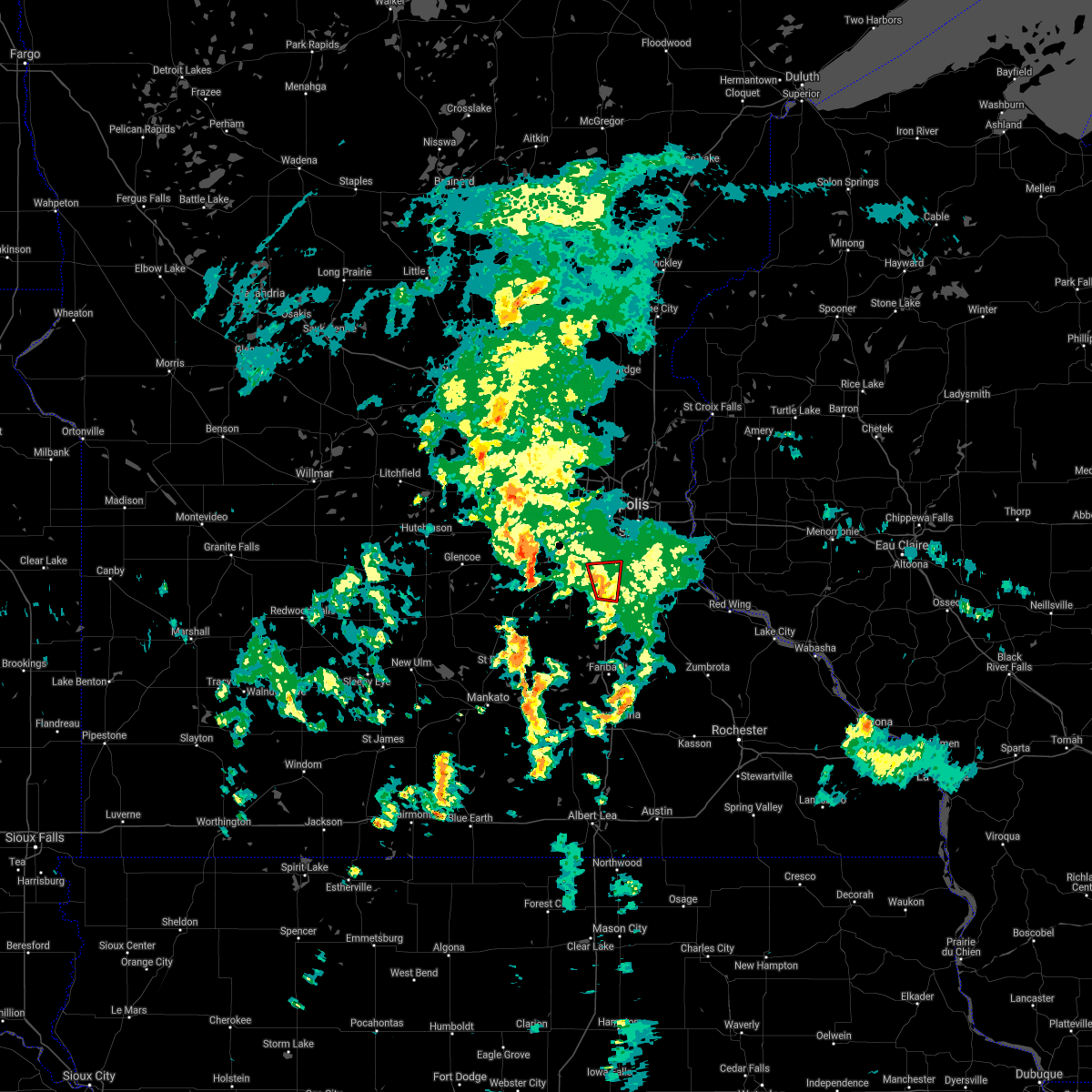 At 901 pm cdt, a confirmed tornado was located over lakeville, or 16 miles north of northfield, moving north at 25 mph (weather spotters confirmed tornado). Hazards include damaging tornado. Flying debris will be dangerous to those caught without shelter. mobile homes will be damaged or destroyed. damage to roofs, windows, and vehicles will occur. tree damage is likely. Locations impacted include, eagan, burnsville, lakeville, apple valley, savage, prior lake and lakeville airport. At 901 pm cdt, a confirmed tornado was located over lakeville, or 16 miles north of northfield, moving north at 25 mph (weather spotters confirmed tornado). Hazards include damaging tornado. Flying debris will be dangerous to those caught without shelter. mobile homes will be damaged or destroyed. damage to roofs, windows, and vehicles will occur. tree damage is likely. Locations impacted include, eagan, burnsville, lakeville, apple valley, savage, prior lake and lakeville airport.
|
| 5/19/2021 8:49 PM CDT |
 At 848 pm cdt, a confirmed tornado was located near lakeville, or 16 miles northwest of northfield, moving north at 30 mph (weather spotters confirmed tornado). Hazards include damaging tornado. Flying debris will be dangerous to those caught without shelter. mobile homes will be damaged or destroyed. damage to roofs, windows, and vehicles will occur. tree damage is likely. Locations impacted include, apple valley, prior lake, burnsville, savage and shakopee. At 848 pm cdt, a confirmed tornado was located near lakeville, or 16 miles northwest of northfield, moving north at 30 mph (weather spotters confirmed tornado). Hazards include damaging tornado. Flying debris will be dangerous to those caught without shelter. mobile homes will be damaged or destroyed. damage to roofs, windows, and vehicles will occur. tree damage is likely. Locations impacted include, apple valley, prior lake, burnsville, savage and shakopee.
|
| 5/19/2021 8:25 PM CDT |
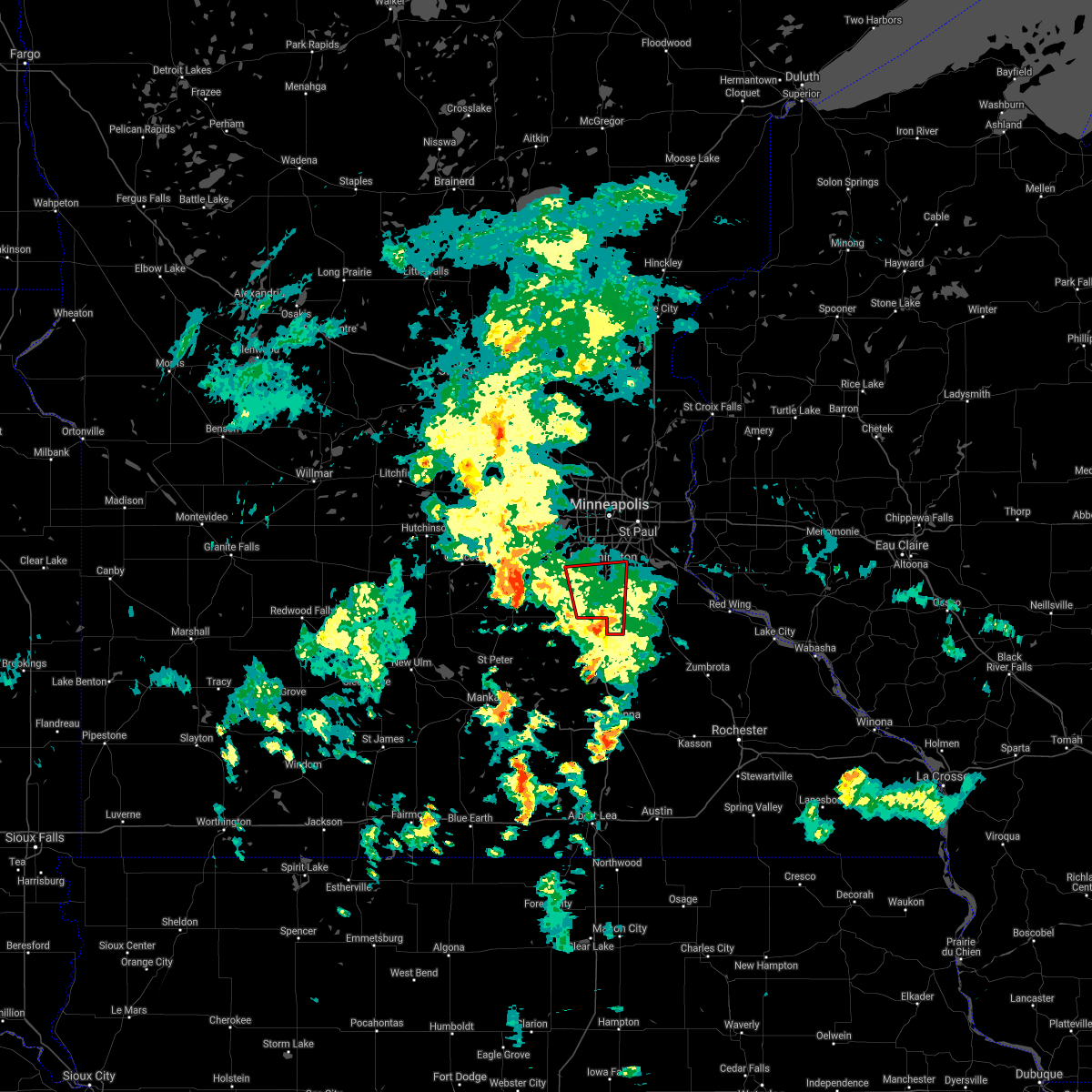 At 824 pm cdt, a confirmed tornado was located near webster, or 7 miles west of northfield, moving north at 30 mph (law enforcement confirmed tornado). Hazards include damaging tornado. Flying debris will be dangerous to those caught without shelter. mobile homes will be damaged or destroyed. damage to roofs, windows, and vehicles will occur. tree damage is likely. the tornado will be near, elko new market around 840 pm cdt. other locations in the path of this tornadic thunderstorm include lakeville, apple valley, prior lake, burnsville, savage and shakopee. This includes mystic lake casino. At 824 pm cdt, a confirmed tornado was located near webster, or 7 miles west of northfield, moving north at 30 mph (law enforcement confirmed tornado). Hazards include damaging tornado. Flying debris will be dangerous to those caught without shelter. mobile homes will be damaged or destroyed. damage to roofs, windows, and vehicles will occur. tree damage is likely. the tornado will be near, elko new market around 840 pm cdt. other locations in the path of this tornadic thunderstorm include lakeville, apple valley, prior lake, burnsville, savage and shakopee. This includes mystic lake casino.
|
| 3/10/2021 5:27 PM CST |
 At 527 pm cst, a severe thunderstorm was located over inver grove heights, or 10 miles south of st. paul, moving northeast at 30 mph (public). Hazards include half dollar size hail. Damage to vehicles is expected. this severe thunderstorm will be near, st. paul park around 535 pm cst. cottage grove and south st. paul around 540 pm cst. woodbury around 550 pm cst. afton around 555 pm cst. lake elmo and bayport around 605 pm cst. stillwater around 610 pm cst. other locations impacted by this severe thunderstorm include newport, lake phalen, grant, lake st croix beach, willernie, lakeland shores, st paul battlecreek regional park, north st. Paul, st paul park and st marys point. At 527 pm cst, a severe thunderstorm was located over inver grove heights, or 10 miles south of st. paul, moving northeast at 30 mph (public). Hazards include half dollar size hail. Damage to vehicles is expected. this severe thunderstorm will be near, st. paul park around 535 pm cst. cottage grove and south st. paul around 540 pm cst. woodbury around 550 pm cst. afton around 555 pm cst. lake elmo and bayport around 605 pm cst. stillwater around 610 pm cst. other locations impacted by this severe thunderstorm include newport, lake phalen, grant, lake st croix beach, willernie, lakeland shores, st paul battlecreek regional park, north st. Paul, st paul park and st marys point.
|
| 3/10/2021 5:25 PM CST | Ping Pong Ball sized hail reported 3.8 miles NW of Eagan, MN, photo from twitter. |
| 9/6/2020 4:30 AM CDT |
 At 429 am cdt, a severe thunderstorm was located over rosemount, or 16 miles south of st. paul, moving southeast at 45 mph (radar indicated). Hazards include quarter size hail. Damage to vehicles is expected. This severe thunderstorm will remain over mainly rural areas of central dakota county, including the following locations, coates, miesville, vermillion, hampton and new trier. At 429 am cdt, a severe thunderstorm was located over rosemount, or 16 miles south of st. paul, moving southeast at 45 mph (radar indicated). Hazards include quarter size hail. Damage to vehicles is expected. This severe thunderstorm will remain over mainly rural areas of central dakota county, including the following locations, coates, miesville, vermillion, hampton and new trier.
|
| 9/6/2020 12:50 AM CDT |
 The severe thunderstorm warning for southeastern hennepin county will expire at 100 am cdt, the storm which prompted the warning has weakened below severe limits, and no longer poses an immediate threat to life or property. therefore, the warning will be allowed to expire. a severe thunderstorm watch remains in effect until 300 am cdt for east central minnesota. The severe thunderstorm warning for southeastern hennepin county will expire at 100 am cdt, the storm which prompted the warning has weakened below severe limits, and no longer poses an immediate threat to life or property. therefore, the warning will be allowed to expire. a severe thunderstorm watch remains in effect until 300 am cdt for east central minnesota.
|
| 9/6/2020 12:38 AM CDT |
 At 1238 am cdt, a severe thunderstorm was located over eden prairie, or 12 miles southwest of minneapolis, moving east at 45 mph (trained weather spotters). Hazards include half dollar size hail. Damage to vehicles is expected. this severe thunderstorm will be near, savage around 1245 am cdt. burnsville, richfield and msp international airport around 1250 am cdt. bloomington around 1255 am cdt. Other locations impacted by this severe thunderstorm include mall of america, flying cloud airport and fort snelling state park. At 1238 am cdt, a severe thunderstorm was located over eden prairie, or 12 miles southwest of minneapolis, moving east at 45 mph (trained weather spotters). Hazards include half dollar size hail. Damage to vehicles is expected. this severe thunderstorm will be near, savage around 1245 am cdt. burnsville, richfield and msp international airport around 1250 am cdt. bloomington around 1255 am cdt. Other locations impacted by this severe thunderstorm include mall of america, flying cloud airport and fort snelling state park.
|
| 8/14/2020 8:57 PM CDT |
 The severe thunderstorm warning for northern dakota and southern washington counties will expire at 900 pm cdt, the storm which prompted the warning has moved out of the area. therefore, the warning will be allowed to expire. a severe thunderstorm watch remains in effect until midnight cdt for east central minnesota, and west central wisconsin. The severe thunderstorm warning for northern dakota and southern washington counties will expire at 900 pm cdt, the storm which prompted the warning has moved out of the area. therefore, the warning will be allowed to expire. a severe thunderstorm watch remains in effect until midnight cdt for east central minnesota, and west central wisconsin.
|
| 8/14/2020 8:36 PM CDT |
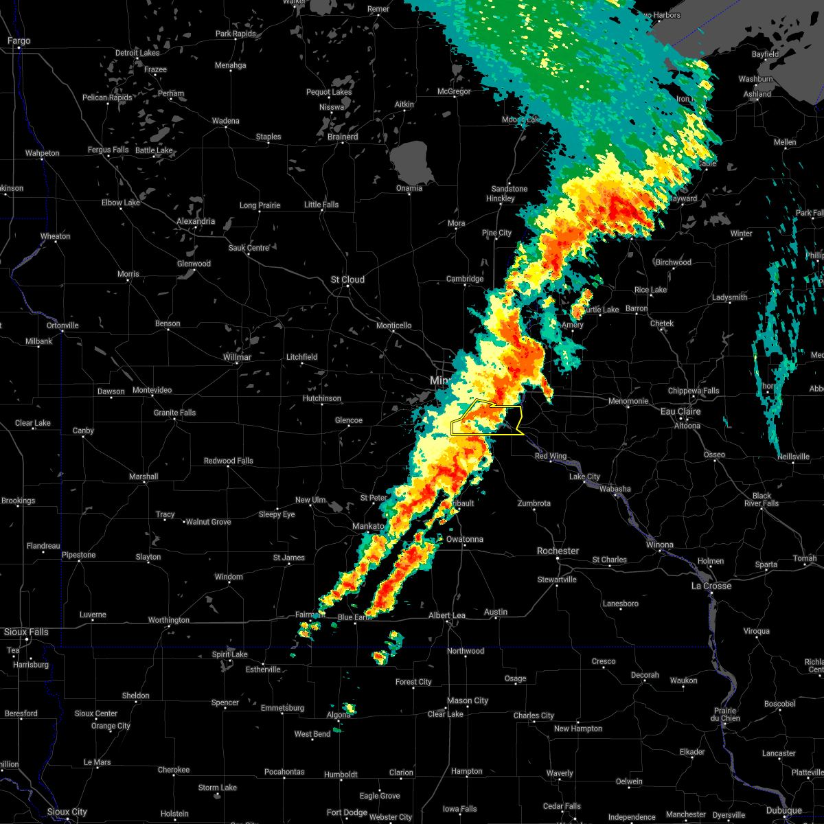 At 836 pm cdt, a severe thunderstorm was located over woodbury, or 10 miles east of st. paul, moving east at 40 mph (radar indicated). Hazards include 60 mph wind gusts. Expect damage to roofs, siding, and trees. this severe storm will be near, afton around 840 pm cdt. Other locations impacted by this severe thunderstorm include newport, fort snelling state park, afton state park, sunfish lake, south st paul airport, south st paul, mendota, grey cloud township, st paul park and lilydale. At 836 pm cdt, a severe thunderstorm was located over woodbury, or 10 miles east of st. paul, moving east at 40 mph (radar indicated). Hazards include 60 mph wind gusts. Expect damage to roofs, siding, and trees. this severe storm will be near, afton around 840 pm cdt. Other locations impacted by this severe thunderstorm include newport, fort snelling state park, afton state park, sunfish lake, south st paul airport, south st paul, mendota, grey cloud township, st paul park and lilydale.
|
| 8/14/2020 8:32 PM CDT |
 At 831 pm cdt, a severe thunderstorm was located over woodbury, or 7 miles southeast of st. paul, moving east at 40 mph (radar indicated). Hazards include 60 mph wind gusts. Expect damage to roofs, siding, and trees. this severe storm will be near, woodbury and afton around 840 pm cdt. Other locations impacted by this severe thunderstorm include newport, afton state park, south st paul airport, st paul park, lilydale, sunfish, fort snelling state park, coates, sunfish lake and south st paul. At 831 pm cdt, a severe thunderstorm was located over woodbury, or 7 miles southeast of st. paul, moving east at 40 mph (radar indicated). Hazards include 60 mph wind gusts. Expect damage to roofs, siding, and trees. this severe storm will be near, woodbury and afton around 840 pm cdt. Other locations impacted by this severe thunderstorm include newport, afton state park, south st paul airport, st paul park, lilydale, sunfish, fort snelling state park, coates, sunfish lake and south st paul.
|
| 8/14/2020 8:16 PM CDT |
 At 816 pm cdt, a severe thunderstorm was located over msp international airport, or near st. paul, moving east at 40 mph (radar indicated). Hazards include 60 mph wind gusts. Expect damage to roofs, siding, and trees. this severe thunderstorm will be near, rosemount around 820 pm cdt. st. paul, inver grove heights, south st. paul and west st. paul around 825 pm cdt. cottage grove and st. paul park around 830 pm cdt. woodbury and afton around 840 pm cdt. Other locations impacted by this severe thunderstorm include newport, afton state park, lake st croix beach, south st paul airport, st paul park, lilydale, st marys point, sunfish, fort snelling state park and coates. At 816 pm cdt, a severe thunderstorm was located over msp international airport, or near st. paul, moving east at 40 mph (radar indicated). Hazards include 60 mph wind gusts. Expect damage to roofs, siding, and trees. this severe thunderstorm will be near, rosemount around 820 pm cdt. st. paul, inver grove heights, south st. paul and west st. paul around 825 pm cdt. cottage grove and st. paul park around 830 pm cdt. woodbury and afton around 840 pm cdt. Other locations impacted by this severe thunderstorm include newport, afton state park, lake st croix beach, south st paul airport, st paul park, lilydale, st marys point, sunfish, fort snelling state park and coates.
|
| 8/10/2020 2:45 AM CDT |
 At 244 am cdt, a severe thunderstorm was located over apple valley, or 15 miles south of st. paul, moving east at 30 mph (trained weather spotters). Hazards include 60 mph wind gusts and quarter size hail. Hail damage to vehicles is expected. expect wind damage to roofs, siding, and trees. Locations impacted include, eagan, burnsville, lakeville, apple valley, inver grove heights, rosemount, farmington, coates and lakeville airport. At 244 am cdt, a severe thunderstorm was located over apple valley, or 15 miles south of st. paul, moving east at 30 mph (trained weather spotters). Hazards include 60 mph wind gusts and quarter size hail. Hail damage to vehicles is expected. expect wind damage to roofs, siding, and trees. Locations impacted include, eagan, burnsville, lakeville, apple valley, inver grove heights, rosemount, farmington, coates and lakeville airport.
|
| 8/10/2020 2:41 AM CDT |
 At 240 am cdt, severe thunderstorms were located along a line extending from near rosemount to near elko new market to near montgomery, moving east at 25 mph (radar indicated). Hazards include 60 mph wind gusts and quarter size hail. Hail damage to vehicles is expected. Expect wind damage to roofs, siding, and trees. At 240 am cdt, severe thunderstorms were located along a line extending from near rosemount to near elko new market to near montgomery, moving east at 25 mph (radar indicated). Hazards include 60 mph wind gusts and quarter size hail. Hail damage to vehicles is expected. Expect wind damage to roofs, siding, and trees.
|
| 8/10/2020 2:29 AM CDT |
 At 228 am cdt, a severe thunderstorm was located near cottage grove, or 13 miles southeast of st. paul, moving east at 20 mph (trained weather spotters). Hazards include 60 mph wind gusts and quarter size hail. Hail damage to vehicles is expected. expect wind damage to roofs, siding, and trees. locations impacted include, eagan, apple valley, cottage grove, inver grove heights, rosemount, south st. paul, st. Paul park, newport, sunfish lake, grey cloud township, st paul park and sunfish. At 228 am cdt, a severe thunderstorm was located near cottage grove, or 13 miles southeast of st. paul, moving east at 20 mph (trained weather spotters). Hazards include 60 mph wind gusts and quarter size hail. Hail damage to vehicles is expected. expect wind damage to roofs, siding, and trees. locations impacted include, eagan, apple valley, cottage grove, inver grove heights, rosemount, south st. paul, st. Paul park, newport, sunfish lake, grey cloud township, st paul park and sunfish.
|
| 8/10/2020 2:20 AM CDT |
 At 220 am cdt, a severe thunderstorm was located near prior lake, or 20 miles southwest of minneapolis, moving east at 30 mph (trained weather spotters). Hazards include 60 mph wind gusts and quarter size hail. Hail damage to vehicles is expected. Expect wind damage to roofs, siding, and trees. At 220 am cdt, a severe thunderstorm was located near prior lake, or 20 miles southwest of minneapolis, moving east at 30 mph (trained weather spotters). Hazards include 60 mph wind gusts and quarter size hail. Hail damage to vehicles is expected. Expect wind damage to roofs, siding, and trees.
|
| 8/10/2020 2:12 AM CDT | Quarter sized hail reported 2.3 miles NW of Eagan, MN |
| 8/10/2020 1:57 AM CDT |
 At 156 am cdt, a severe thunderstorm was located over eagan, or 9 miles southwest of st. paul, moving east at 20 mph (trained weather spotters). Hazards include 60 mph wind gusts and quarter size hail. Hail damage to vehicles is expected. Expect wind damage to roofs, siding, and trees. At 156 am cdt, a severe thunderstorm was located over eagan, or 9 miles southwest of st. paul, moving east at 20 mph (trained weather spotters). Hazards include 60 mph wind gusts and quarter size hail. Hail damage to vehicles is expected. Expect wind damage to roofs, siding, and trees.
|
| 8/10/2020 1:31 AM CDT |
 At 131 am cdt, a severe thunderstorm was located over bloomington, or 9 miles southwest of minneapolis, moving east at 20 mph (trained weather spotters). Hazards include two inch hail and 60 mph wind gusts. People and animals outdoors will be injured. expect hail damage to roofs, siding, windows, and vehicles. expect wind damage to roofs, siding, and trees. locations impacted include, minneapolis, st. paul, bloomington, eagan, eden prairie, burnsville, lakeville, minnetonka, apple valley, edina, st. Louis park and shakopee. At 131 am cdt, a severe thunderstorm was located over bloomington, or 9 miles southwest of minneapolis, moving east at 20 mph (trained weather spotters). Hazards include two inch hail and 60 mph wind gusts. People and animals outdoors will be injured. expect hail damage to roofs, siding, windows, and vehicles. expect wind damage to roofs, siding, and trees. locations impacted include, minneapolis, st. paul, bloomington, eagan, eden prairie, burnsville, lakeville, minnetonka, apple valley, edina, st. Louis park and shakopee.
|
| 8/10/2020 1:21 AM CDT |
 At 121 am cdt, a severe thunderstorm was located over eden prairie, or 10 miles southwest of minneapolis, moving east at 20 mph (trained weather spotters). Hazards include 60 mph wind gusts and quarter size hail. Hail damage to vehicles is expected. Expect wind damage to roofs, siding, and trees. At 121 am cdt, a severe thunderstorm was located over eden prairie, or 10 miles southwest of minneapolis, moving east at 20 mph (trained weather spotters). Hazards include 60 mph wind gusts and quarter size hail. Hail damage to vehicles is expected. Expect wind damage to roofs, siding, and trees.
|
| 8/9/2020 10:41 PM CDT |
 At 1040 pm cdt, a severe thunderstorm was located over bloomington, or 10 miles south of minneapolis, moving east at 20 mph (trained weather spotters). Hazards include half dollar size hail. Damage to vehicles is expected. this severe storm will be near, apple valley around 1050 pm cdt. rosemount around 1100 pm cdt. eagan around 1105 pm cdt. inver grove heights around 1110 pm cdt. Other locations impacted by this severe thunderstorm include south st paul airport, mall of america and fort snelling state park. At 1040 pm cdt, a severe thunderstorm was located over bloomington, or 10 miles south of minneapolis, moving east at 20 mph (trained weather spotters). Hazards include half dollar size hail. Damage to vehicles is expected. this severe storm will be near, apple valley around 1050 pm cdt. rosemount around 1100 pm cdt. eagan around 1105 pm cdt. inver grove heights around 1110 pm cdt. Other locations impacted by this severe thunderstorm include south st paul airport, mall of america and fort snelling state park.
|
| 8/9/2020 10:27 PM CDT |
 At 1025 pm cdt, a severe thunderstorm was located near eden prairie, or 12 miles southwest of minneapolis, moving east at 15 mph (trained weather spotters. at 1015 pm quarter sized hail was reported in eden prairie). Hazards include half dollar size hail. Damage to vehicles is expected. this severe thunderstorm will be near, savage around 1030 pm cdt. burnsville around 1045 pm cdt. lakeville around 1105 pm cdt. bloomington and apple valley around 1110 pm cdt. eagan and rosemount around 1115 pm cdt. Other locations impacted by this severe thunderstorm include south st paul airport, flying cloud airport and fort snelling state park. At 1025 pm cdt, a severe thunderstorm was located near eden prairie, or 12 miles southwest of minneapolis, moving east at 15 mph (trained weather spotters. at 1015 pm quarter sized hail was reported in eden prairie). Hazards include half dollar size hail. Damage to vehicles is expected. this severe thunderstorm will be near, savage around 1030 pm cdt. burnsville around 1045 pm cdt. lakeville around 1105 pm cdt. bloomington and apple valley around 1110 pm cdt. eagan and rosemount around 1115 pm cdt. Other locations impacted by this severe thunderstorm include south st paul airport, flying cloud airport and fort snelling state park.
|
| 7/18/2020 3:03 AM CDT |
 At 303 am cdt, severe thunderstorms were located along a line extending from near jordan to near st. paul park, moving southeast at 35 mph (radar indicated). Hazards include 60 mph wind gusts. Expect damage to roofs, siding, and trees. severe thunderstorms will be near, cottage grove, inver grove heights and st. paul park around 310 am cdt. hastings around 320 am cdt. new prague and prescott around 325 am cdt. elko new market around 335 am cdt. other locations impacted by these severe thunderstorms include newport, vermillion, south st paul airport, lakeville airport, st paul park, flying cloud airport, credit river, hampton, sunfish and fort snelling state park. This includes mystic lake casino. At 303 am cdt, severe thunderstorms were located along a line extending from near jordan to near st. paul park, moving southeast at 35 mph (radar indicated). Hazards include 60 mph wind gusts. Expect damage to roofs, siding, and trees. severe thunderstorms will be near, cottage grove, inver grove heights and st. paul park around 310 am cdt. hastings around 320 am cdt. new prague and prescott around 325 am cdt. elko new market around 335 am cdt. other locations impacted by these severe thunderstorms include newport, vermillion, south st paul airport, lakeville airport, st paul park, flying cloud airport, credit river, hampton, sunfish and fort snelling state park. This includes mystic lake casino.
|
| 5/26/2020 7:13 PM CDT |
 At 713 pm cdt, a severe thunderstorm capable of producing a tornado was located over rosemount, or 14 miles south of st. paul, moving northeast at 25 mph (radar indicated rotation). Hazards include tornado. Flying debris will be dangerous to those caught without shelter. mobile homes will be damaged or destroyed. damage to roofs, windows, and vehicles will occur. tree damage is likely. this dangerous storm will be near, eagan around 735 pm cdt. cottage grove, inver grove heights and st. paul park around 740 pm cdt. south st. paul and west st. paul around 745 pm cdt. woodbury, oakdale, lake elmo and afton around 800 pm cdt. Other locations impacted by this tornadic thunderstorm include newport, st paul airport, coates, sunfish lake, south st paul, south maplewood, st paul battlecreek regional park, grey cloud township, st paul park and landfall. At 713 pm cdt, a severe thunderstorm capable of producing a tornado was located over rosemount, or 14 miles south of st. paul, moving northeast at 25 mph (radar indicated rotation). Hazards include tornado. Flying debris will be dangerous to those caught without shelter. mobile homes will be damaged or destroyed. damage to roofs, windows, and vehicles will occur. tree damage is likely. this dangerous storm will be near, eagan around 735 pm cdt. cottage grove, inver grove heights and st. paul park around 740 pm cdt. south st. paul and west st. paul around 745 pm cdt. woodbury, oakdale, lake elmo and afton around 800 pm cdt. Other locations impacted by this tornadic thunderstorm include newport, st paul airport, coates, sunfish lake, south st paul, south maplewood, st paul battlecreek regional park, grey cloud township, st paul park and landfall.
|
| 9/24/2019 8:14 PM CDT |
 At 813 pm cdt, a severe thunderstorm was located over inver grove heights, or 10 miles south of st. paul, moving northeast at 30 mph (radar indicated). Hazards include half dollar size hail. Damage to vehicles is expected. this severe thunderstorm will be near, south st. paul and st. paul park around 820 pm cdt. cottage grove around 825 pm cdt. woodbury around 835 pm cdt. afton around 840 pm cdt. Other locations impacted by this severe thunderstorm include newport, grey cloud township, st paul park, afton state park and lake elmo airport. At 813 pm cdt, a severe thunderstorm was located over inver grove heights, or 10 miles south of st. paul, moving northeast at 30 mph (radar indicated). Hazards include half dollar size hail. Damage to vehicles is expected. this severe thunderstorm will be near, south st. paul and st. paul park around 820 pm cdt. cottage grove around 825 pm cdt. woodbury around 835 pm cdt. afton around 840 pm cdt. Other locations impacted by this severe thunderstorm include newport, grey cloud township, st paul park, afton state park and lake elmo airport.
|
| 9/2/2019 10:56 PM CDT |
 At 1056 pm cdt, severe thunderstorms were located along a line extending from 6 miles east of star prairie to near rosemount to near montgomery, moving east at 55 mph (radar indicated). Hazards include 60 mph wind gusts and quarter size hail. Hail damage to vehicles is expected. expect wind damage to roofs, siding, and trees. locations impacted include, st. Paul, eagan, woodbury, burnsville, lakeville, apple valley, maplewood, cottage grove, inver grove heights, oakdale, savage and white bear lake. At 1056 pm cdt, severe thunderstorms were located along a line extending from 6 miles east of star prairie to near rosemount to near montgomery, moving east at 55 mph (radar indicated). Hazards include 60 mph wind gusts and quarter size hail. Hail damage to vehicles is expected. expect wind damage to roofs, siding, and trees. locations impacted include, st. Paul, eagan, woodbury, burnsville, lakeville, apple valley, maplewood, cottage grove, inver grove heights, oakdale, savage and white bear lake.
|
| 9/2/2019 10:48 PM CDT |
 At 1048 pm cdt, severe thunderstorms were located along a line extending from star prairie to near rosemount to near le center, moving east at 45 mph (radar indicated). Hazards include 60 mph wind gusts and quarter size hail. Hail damage to vehicles is expected. expect wind damage to roofs, siding, and trees. locations impacted include, minneapolis, st. paul, bloomington, eagan, woodbury, eden prairie, burnsville, lakeville, minnetonka, apple valley, edina and st. Louis park. At 1048 pm cdt, severe thunderstorms were located along a line extending from star prairie to near rosemount to near le center, moving east at 45 mph (radar indicated). Hazards include 60 mph wind gusts and quarter size hail. Hail damage to vehicles is expected. expect wind damage to roofs, siding, and trees. locations impacted include, minneapolis, st. paul, bloomington, eagan, woodbury, eden prairie, burnsville, lakeville, minnetonka, apple valley, edina and st. Louis park.
|
| 9/2/2019 10:37 PM CDT |
 At 1037 pm cdt, severe thunderstorms were located along a line extending from near somerset to burnsville to near le sueur, moving east at 60 mph (radar indicated). Hazards include 70 mph wind gusts. Expect considerable tree damage. damage is likely to mobile homes, roofs, and outbuildings. locations impacted include, minneapolis, st. Paul, bloomington, brooklyn park, plymouth, eagan, woodbury, eden prairie, burnsville, lakeville, minnetonka and apple valley. At 1037 pm cdt, severe thunderstorms were located along a line extending from near somerset to burnsville to near le sueur, moving east at 60 mph (radar indicated). Hazards include 70 mph wind gusts. Expect considerable tree damage. damage is likely to mobile homes, roofs, and outbuildings. locations impacted include, minneapolis, st. Paul, bloomington, brooklyn park, plymouth, eagan, woodbury, eden prairie, burnsville, lakeville, minnetonka and apple valley.
|
| 9/2/2019 10:22 PM CDT |
 At 1022 pm cdt, severe thunderstorms were located along a line extending from near forest lake to 6 miles south of arlington, moving east at 45 mph (radar indicated). Hazards include 70 mph wind gusts. Expect considerable tree damage. Damage is likely to mobile homes, roofs, and outbuildings. At 1022 pm cdt, severe thunderstorms were located along a line extending from near forest lake to 6 miles south of arlington, moving east at 45 mph (radar indicated). Hazards include 70 mph wind gusts. Expect considerable tree damage. Damage is likely to mobile homes, roofs, and outbuildings.
|
| 7/18/2019 4:37 AM CDT |
 At 437 am cdt, a severe thunderstorm was located over apple valley, or 11 miles southwest of st. paul, moving northeast at 45 mph (radar indicated). Hazards include quarter size hail. Damage to vehicles is expected. locations impacted include, bloomington, eagan, burnsville, apple valley, inver grove heights, rosemount, west st. Paul, mendota heights, sunfish lake, south st paul airport, sunfish and fort snelling state park. At 437 am cdt, a severe thunderstorm was located over apple valley, or 11 miles southwest of st. paul, moving northeast at 45 mph (radar indicated). Hazards include quarter size hail. Damage to vehicles is expected. locations impacted include, bloomington, eagan, burnsville, apple valley, inver grove heights, rosemount, west st. Paul, mendota heights, sunfish lake, south st paul airport, sunfish and fort snelling state park.
|
| 7/18/2019 4:28 AM CDT |
 At 427 am cdt, a severe thunderstorm was located over savage, or 16 miles south of minneapolis, moving northeast at 45 mph (trained weather spotters). Hazards include quarter size hail. damage to vehicles is expected At 427 am cdt, a severe thunderstorm was located over savage, or 16 miles south of minneapolis, moving northeast at 45 mph (trained weather spotters). Hazards include quarter size hail. damage to vehicles is expected
|
| 7/15/2019 6:33 PM CDT |
 At 632 pm cdt, a severe thunderstorm was located over burnsville, or 13 miles south of minneapolis, moving east at 30 mph (radar indicated). Hazards include 60 mph wind gusts and half dollar size hail. Hail damage to vehicles is expected. expect wind damage to roofs, siding, and trees. locations impacted include, bloomington, eagan, burnsville, lakeville, apple valley, cottage grove, inver grove heights, rosemount, farmington, st. Paul park and fort snelling state park. At 632 pm cdt, a severe thunderstorm was located over burnsville, or 13 miles south of minneapolis, moving east at 30 mph (radar indicated). Hazards include 60 mph wind gusts and half dollar size hail. Hail damage to vehicles is expected. expect wind damage to roofs, siding, and trees. locations impacted include, bloomington, eagan, burnsville, lakeville, apple valley, cottage grove, inver grove heights, rosemount, farmington, st. Paul park and fort snelling state park.
|
| 7/15/2019 6:22 PM CDT |
 At 622 pm cdt, a severe thunderstorm was located near savage, or 14 miles southwest of minneapolis, moving east at 30 mph (radar indicated). Hazards include 60 mph wind gusts and half dollar size hail. Hail damage to vehicles is expected. Expect wind damage to roofs, siding, and trees. At 622 pm cdt, a severe thunderstorm was located near savage, or 14 miles southwest of minneapolis, moving east at 30 mph (radar indicated). Hazards include 60 mph wind gusts and half dollar size hail. Hail damage to vehicles is expected. Expect wind damage to roofs, siding, and trees.
|
| 7/12/2019 1:50 PM CDT |
 The severe thunderstorm warning for central dakota county will expire at 200 pm cdt, the storm which prompted the warning has weakened below severe limits, and has exited the warned area. therefore, the warning will be allowed to expire. however gusty winds are still possible with this thunderstorm. The severe thunderstorm warning for central dakota county will expire at 200 pm cdt, the storm which prompted the warning has weakened below severe limits, and has exited the warned area. therefore, the warning will be allowed to expire. however gusty winds are still possible with this thunderstorm.
|
| 7/12/2019 1:26 PM CDT |
 At 126 pm cdt, a severe thunderstorm was located near lakeville, or 17 miles northwest of northfield, moving east at 50 mph (emergency management reported near 60 mph wind gusts with this storm in savage and jordan 122 pm cdt). Hazards include 60 mph wind gusts. expect damage to roofs, siding, and trees At 126 pm cdt, a severe thunderstorm was located near lakeville, or 17 miles northwest of northfield, moving east at 50 mph (emergency management reported near 60 mph wind gusts with this storm in savage and jordan 122 pm cdt). Hazards include 60 mph wind gusts. expect damage to roofs, siding, and trees
|
| 6/4/2019 4:59 PM CDT |
 At 458 pm cdt, a severe thunderstorm was located near stanton, or 9 miles northeast of northfield, moving east at 40 mph (trained weather spotters). Hazards include 70 mph wind gusts and penny size hail. Expect considerable tree damage. Damage is likely to mobile homes, roofs, and outbuildings. At 458 pm cdt, a severe thunderstorm was located near stanton, or 9 miles northeast of northfield, moving east at 40 mph (trained weather spotters). Hazards include 70 mph wind gusts and penny size hail. Expect considerable tree damage. Damage is likely to mobile homes, roofs, and outbuildings.
|
| 6/4/2019 4:38 PM CDT |
 At 438 pm cdt, a severe thunderstorm capable of producing a tornado was located near prior lake, or 20 miles northwest of northfield, moving northeast at 35 mph (radar indicated rotation). Hazards include tornado and ping pong ball size hail. Flying debris will be dangerous to those caught without shelter. mobile homes will be damaged or destroyed. damage to roofs, windows, and vehicles will occur. tree damage is likely. this dangerous storm will be near, savage around 450 pm cdt. burnsville and lakeville around 455 pm cdt. apple valley around 500 pm cdt. rosemount around 505 pm cdt. eagan around 515 pm cdt. Other locations impacted by this tornadic thunderstorm include credit river. At 438 pm cdt, a severe thunderstorm capable of producing a tornado was located near prior lake, or 20 miles northwest of northfield, moving northeast at 35 mph (radar indicated rotation). Hazards include tornado and ping pong ball size hail. Flying debris will be dangerous to those caught without shelter. mobile homes will be damaged or destroyed. damage to roofs, windows, and vehicles will occur. tree damage is likely. this dangerous storm will be near, savage around 450 pm cdt. burnsville and lakeville around 455 pm cdt. apple valley around 500 pm cdt. rosemount around 505 pm cdt. eagan around 515 pm cdt. Other locations impacted by this tornadic thunderstorm include credit river.
|
| 10/3/2018 5:46 PM CDT |
 At 546 pm cdt, severe thunderstorms were located along a line extending from near lake elmo to st paul airport to near eagan, moving east at 45 mph (radar indicated). Hazards include 60 mph wind gusts. Expect damage to roofs, siding, and trees. these severe storms will be near, oakdale, lake elmo and mahtomedi around 550 pm cdt. woodbury, stillwater, hudson, north hudson and bayport around 555 pm cdt. cottage grove and afton around 600 pm cdt. hastings around 610 pm cdt. prescott around 615 pm cdt. roberts around 620 pm cdt. river falls and baldwin around 630 pm cdt. other locations impacted by these severe thunderstorms include newport, lake st croix beach, willernie, lakeland shores, north st. paul, lilydale, sunfish, oak park heights, st paul airport and sunfish lake. A tornado watch remains in effect until 1100 pm cdt for west central wisconsin. At 546 pm cdt, severe thunderstorms were located along a line extending from near lake elmo to st paul airport to near eagan, moving east at 45 mph (radar indicated). Hazards include 60 mph wind gusts. Expect damage to roofs, siding, and trees. these severe storms will be near, oakdale, lake elmo and mahtomedi around 550 pm cdt. woodbury, stillwater, hudson, north hudson and bayport around 555 pm cdt. cottage grove and afton around 600 pm cdt. hastings around 610 pm cdt. prescott around 615 pm cdt. roberts around 620 pm cdt. river falls and baldwin around 630 pm cdt. other locations impacted by these severe thunderstorms include newport, lake st croix beach, willernie, lakeland shores, north st. paul, lilydale, sunfish, oak park heights, st paul airport and sunfish lake. A tornado watch remains in effect until 1100 pm cdt for west central wisconsin.
|
| 10/3/2018 5:37 PM CDT |
 At 537 pm cdt, severe thunderstorms were located along a line extending from north st. paul to lilydale to bloomington, moving east at 45 mph (radar indicated). Hazards include 60 mph wind gusts. Expect damage to roofs, siding, and trees. severe thunderstorms will be near, maplewood, inver grove heights, oakdale, white bear lake and west st. paul around 540 pm cdt. st. paul, rosemount, south st. paul and lake elmo around 545 pm cdt. stillwater and bayport around 550 pm cdt. woodbury, hudson, north hudson and afton around 555 pm cdt. cottage grove and st. paul park around 600 pm cdt. hastings around 605 pm cdt. prescott around 610 pm cdt. roberts around 620 pm cdt. A tornado watch remains in effect until 1100 pm cdt for west central wisconsin. At 537 pm cdt, severe thunderstorms were located along a line extending from north st. paul to lilydale to bloomington, moving east at 45 mph (radar indicated). Hazards include 60 mph wind gusts. Expect damage to roofs, siding, and trees. severe thunderstorms will be near, maplewood, inver grove heights, oakdale, white bear lake and west st. paul around 540 pm cdt. st. paul, rosemount, south st. paul and lake elmo around 545 pm cdt. stillwater and bayport around 550 pm cdt. woodbury, hudson, north hudson and afton around 555 pm cdt. cottage grove and st. paul park around 600 pm cdt. hastings around 605 pm cdt. prescott around 610 pm cdt. roberts around 620 pm cdt. A tornado watch remains in effect until 1100 pm cdt for west central wisconsin.
|
| 9/20/2018 7:09 PM CDT |
 The severe thunderstorm warning for southeastern hennepin, dakota, northwestern goodhue, southeastern anoka, washington and ramsey counties will expire at 715 pm cdt, the storms which prompted the warning have weakened below severe limits. therefore, the warning will be allowed to expire. however gusty winds and heavy rain are still possible with these thunderstorms. a tornado watch remains in effect until 1100 pm cdt for south central, southeastern and east central minnesota. a tornado watch also remains in effect until midnight cdt for west central wisconsin. to report severe weather, contact your nearest law enforcement agency. they will relay your report to the national weather service the twin cities. remember, a tornado warning still remains in effect for dakota county until 730 pm. The severe thunderstorm warning for southeastern hennepin, dakota, northwestern goodhue, southeastern anoka, washington and ramsey counties will expire at 715 pm cdt, the storms which prompted the warning have weakened below severe limits. therefore, the warning will be allowed to expire. however gusty winds and heavy rain are still possible with these thunderstorms. a tornado watch remains in effect until 1100 pm cdt for south central, southeastern and east central minnesota. a tornado watch also remains in effect until midnight cdt for west central wisconsin. to report severe weather, contact your nearest law enforcement agency. they will relay your report to the national weather service the twin cities. remember, a tornado warning still remains in effect for dakota county until 730 pm.
|
| 9/20/2018 6:49 PM CDT |
 A severe thunderstorm warning remains in effect until 700 pm cdt for southeastern hennepin. western dakota. eastern scott and western ramsey counties. At 649 pm cdt, severe thunderstorms were located along a line extending from circle pines to south st paul airport to lakeville airport, moving northeast at 50 mph. A severe thunderstorm warning remains in effect until 700 pm cdt for southeastern hennepin. western dakota. eastern scott and western ramsey counties. At 649 pm cdt, severe thunderstorms were located along a line extending from circle pines to south st paul airport to lakeville airport, moving northeast at 50 mph.
|
| 9/20/2018 6:41 PM CDT |
 The national weather service in the twin cities has issued a * severe thunderstorm warning for. southeastern hennepin county in east central minnesota. dakota county in east central minnesota. northwestern goodhue county in southeastern minnesota. Southeastern anoka county in east central minnesota. The national weather service in the twin cities has issued a * severe thunderstorm warning for. southeastern hennepin county in east central minnesota. dakota county in east central minnesota. northwestern goodhue county in southeastern minnesota. Southeastern anoka county in east central minnesota.
|
| 9/20/2018 6:24 PM CDT |
 At 624 pm cdt, severe thunderstorms were located along a line extending from loretto to chaska to st benedict, moving northeast at 70 mph (radar indicated). Hazards include 60 mph wind gusts and penny size hail. Expect damage to roofs, siding, and trees. locations impacted include, minneapolis, st. paul, bloomington, brooklyn park, plymouth, eagan, maple grove, eden prairie, burnsville, lakeville, minnetonka and apple valley. A tornado watch remains in effect until 1100 pm cdt for south central and east central minnesota. At 624 pm cdt, severe thunderstorms were located along a line extending from loretto to chaska to st benedict, moving northeast at 70 mph (radar indicated). Hazards include 60 mph wind gusts and penny size hail. Expect damage to roofs, siding, and trees. locations impacted include, minneapolis, st. paul, bloomington, brooklyn park, plymouth, eagan, maple grove, eden prairie, burnsville, lakeville, minnetonka and apple valley. A tornado watch remains in effect until 1100 pm cdt for south central and east central minnesota.
|
| 9/20/2018 6:13 PM CDT |
 At 613 pm cdt, severe thunderstorms were located along a line extending from independence to near heidelberg, moving east at 70 mph (radar indicated). Hazards include 60 mph wind gusts and penny size hail. expect damage to roofs, siding, and trees At 613 pm cdt, severe thunderstorms were located along a line extending from independence to near heidelberg, moving east at 70 mph (radar indicated). Hazards include 60 mph wind gusts and penny size hail. expect damage to roofs, siding, and trees
|
| 9/17/2018 2:17 PM CDT |
 At 216 pm cdt, severe thunderstorms were located along a line extending from afton state park to near dundas, moving east at 45 mph (law enforcement). Hazards include 60 mph wind gusts. expect damage to roofs, siding, and trees At 216 pm cdt, severe thunderstorms were located along a line extending from afton state park to near dundas, moving east at 45 mph (law enforcement). Hazards include 60 mph wind gusts. expect damage to roofs, siding, and trees
|
| 9/17/2018 2:15 PM CDT | Trees and powerlines dow in dakota county MN, 1.3 miles SW of Eagan, MN |
| 8/27/2018 5:51 PM CDT |
 At 550 pm cdt, severe thunderstorms were located along a line extending from univ of mn minneapolis campus to maplewood to kinnickinnic state park, moving northeast at 50 mph (radar indicated). Hazards include 60 mph wind gusts. Expect damage to roofs, siding, and trees. these severe storms will be near, white bear lake and afton around 555 pm cdt. lake elmo and mahtomedi around 600 pm cdt. other locations impacted by these severe thunderstorms include newport, robbinsdale, lake st croix beach, north st. Paul, lilydale, sunfish, st paul airport, sunfish lake, north minneapolis and south maplewood. At 550 pm cdt, severe thunderstorms were located along a line extending from univ of mn minneapolis campus to maplewood to kinnickinnic state park, moving northeast at 50 mph (radar indicated). Hazards include 60 mph wind gusts. Expect damage to roofs, siding, and trees. these severe storms will be near, white bear lake and afton around 555 pm cdt. lake elmo and mahtomedi around 600 pm cdt. other locations impacted by these severe thunderstorms include newport, robbinsdale, lake st croix beach, north st. Paul, lilydale, sunfish, st paul airport, sunfish lake, north minneapolis and south maplewood.
|
| 8/27/2018 5:40 PM CDT | Numerous tree branches down. time estimated from rada in dakota county MN, 0.6 miles NW of Eagan, MN |
| 8/27/2018 5:40 PM CDT |
 At 540 pm cdt, severe thunderstorms were located along a line extending from edina to lilydale to near hastings, moving northeast at 50 mph (radar indicated). Hazards include 60 mph wind gusts. Expect damage to roofs, siding, and trees. these severe storms will be near, cottage grove, hastings and prescott around 545 pm cdt. woodbury and maplewood around 550 pm cdt. roseville, oakdale, fridley, white bear lake and new brighton around 555 pm cdt. shoreview, vadnais heights, arden hills, lake elmo and mahtomedi around 600 pm cdt. other locations impacted by these severe thunderstorms include newport, medicine lake, robbinsdale, vermillion, lake st croix beach, north st. Paul, lilydale, sunfish, st paul airport and sunfish lake. At 540 pm cdt, severe thunderstorms were located along a line extending from edina to lilydale to near hastings, moving northeast at 50 mph (radar indicated). Hazards include 60 mph wind gusts. Expect damage to roofs, siding, and trees. these severe storms will be near, cottage grove, hastings and prescott around 545 pm cdt. woodbury and maplewood around 550 pm cdt. roseville, oakdale, fridley, white bear lake and new brighton around 555 pm cdt. shoreview, vadnais heights, arden hills, lake elmo and mahtomedi around 600 pm cdt. other locations impacted by these severe thunderstorms include newport, medicine lake, robbinsdale, vermillion, lake st croix beach, north st. Paul, lilydale, sunfish, st paul airport and sunfish lake.
|
| 8/27/2018 5:26 PM CDT |
 At 526 pm cdt, severe thunderstorms were located along a line extending from near shakopee to near burnsville to near hampton, moving northeast at 50 mph (radar indicated). Hazards include 60 mph wind gusts. Expect damage to roofs, siding, and trees. these severe storms will be near, rosemount around 530 pm cdt. eagan around 535 pm cdt. minnetonka, edina, st. louis park, richfield and inver grove heights around 540 pm cdt. st. paul, cottage grove, golden valley and south st. paul around 545 pm cdt. minneapolis, woodbury, maplewood and columbia heights around 550 pm cdt. roseville, oakdale, fridley, white bear lake and new brighton around 555 pm cdt. shoreview, vadnais heights, arden hills and lake elmo around 600 pm cdt. other locations impacted by these severe thunderstorms include newport, medicine lake, robbinsdale, vermillion, lake st croix beach, north st. Paul, lilydale, flying cloud airport, sunfish and st paul airport. At 526 pm cdt, severe thunderstorms were located along a line extending from near shakopee to near burnsville to near hampton, moving northeast at 50 mph (radar indicated). Hazards include 60 mph wind gusts. Expect damage to roofs, siding, and trees. these severe storms will be near, rosemount around 530 pm cdt. eagan around 535 pm cdt. minnetonka, edina, st. louis park, richfield and inver grove heights around 540 pm cdt. st. paul, cottage grove, golden valley and south st. paul around 545 pm cdt. minneapolis, woodbury, maplewood and columbia heights around 550 pm cdt. roseville, oakdale, fridley, white bear lake and new brighton around 555 pm cdt. shoreview, vadnais heights, arden hills and lake elmo around 600 pm cdt. other locations impacted by these severe thunderstorms include newport, medicine lake, robbinsdale, vermillion, lake st croix beach, north st. Paul, lilydale, flying cloud airport, sunfish and st paul airport.
|
| 8/27/2018 5:02 PM CDT |
 At 500 pm cdt, severe thunderstorms were located along a line extending from near belle plaine to helena to near bridgewater, moving northeast at 50 mph (radar indicated). Hazards include 60 mph wind gusts. Expect damage to roofs, siding, and trees. severe thunderstorms will be near, northfield and elko new market around 510 pm cdt. lakeville, farmington and carver around 520 pm cdt. burnsville, apple valley, chaska and prior lake around 525 pm cdt. shakopee, savage, rosemount and excelsior around 530 pm cdt. bloomington, eagan and eden prairie around 535 pm cdt. minnetonka, edina, st. louis park, richfield and cottage grove around 540 pm cdt. st. paul and golden valley around 545 pm cdt. minneapolis, woodbury, maplewood, oakdale and columbia heights around 550 pm cdt. This warning also includes the minnesota state fair and mystic lake casino. At 500 pm cdt, severe thunderstorms were located along a line extending from near belle plaine to helena to near bridgewater, moving northeast at 50 mph (radar indicated). Hazards include 60 mph wind gusts. Expect damage to roofs, siding, and trees. severe thunderstorms will be near, northfield and elko new market around 510 pm cdt. lakeville, farmington and carver around 520 pm cdt. burnsville, apple valley, chaska and prior lake around 525 pm cdt. shakopee, savage, rosemount and excelsior around 530 pm cdt. bloomington, eagan and eden prairie around 535 pm cdt. minnetonka, edina, st. louis park, richfield and cottage grove around 540 pm cdt. st. paul and golden valley around 545 pm cdt. minneapolis, woodbury, maplewood, oakdale and columbia heights around 550 pm cdt. This warning also includes the minnesota state fair and mystic lake casino.
|
| 8/3/2018 9:29 AM CDT |
 At 928 am cdt, a severe thunderstorm was located over vermillion, or 18 miles northeast of northfield, moving east at 50 mph. quarter- sized hail was reported in burnsville (public). Hazards include half dollar size hail. Damage to vehicles is expected. Locations impacted include, eagan, burnsville, lakeville, apple valley, cottage grove, inver grove heights, hastings, rosemount, farmington, hampton, vermillion and coates. At 928 am cdt, a severe thunderstorm was located over vermillion, or 18 miles northeast of northfield, moving east at 50 mph. quarter- sized hail was reported in burnsville (public). Hazards include half dollar size hail. Damage to vehicles is expected. Locations impacted include, eagan, burnsville, lakeville, apple valley, cottage grove, inver grove heights, hastings, rosemount, farmington, hampton, vermillion and coates.
|
| 8/3/2018 9:10 AM CDT |
 At 910 am cdt, a severe thunderstorm was located over burnsville, or 15 miles south of minneapolis, moving east at 50 mph (radar indicated). Hazards include half dollar size hail. damage to vehicles is expected At 910 am cdt, a severe thunderstorm was located over burnsville, or 15 miles south of minneapolis, moving east at 50 mph (radar indicated). Hazards include half dollar size hail. damage to vehicles is expected
|
| 7/12/2018 6:34 PM CDT |
 At 634 pm cdt, a severe thunderstorm was located over apple valley, or 11 miles south of st. paul, moving east at 25 mph (radar indicated). Hazards include 60 mph wind gusts. Expect damage to roofs, siding, and trees. locations impacted include, st. paul, bloomington, eagan, burnsville, lakeville, apple valley, inver grove heights, rosemount, farmington, south st. paul, west st. Paul and mendota heights. At 634 pm cdt, a severe thunderstorm was located over apple valley, or 11 miles south of st. paul, moving east at 25 mph (radar indicated). Hazards include 60 mph wind gusts. Expect damage to roofs, siding, and trees. locations impacted include, st. paul, bloomington, eagan, burnsville, lakeville, apple valley, inver grove heights, rosemount, farmington, south st. paul, west st. Paul and mendota heights.
|
| 7/12/2018 6:02 PM CDT |
 At 601 pm cdt, a severe thunderstorm was located over flying cloud airport, or 11 miles southwest of minneapolis, moving east at 25 mph (radar indicated). Hazards include 60 mph wind gusts. expect damage to roofs, siding, and trees At 601 pm cdt, a severe thunderstorm was located over flying cloud airport, or 11 miles southwest of minneapolis, moving east at 25 mph (radar indicated). Hazards include 60 mph wind gusts. expect damage to roofs, siding, and trees
|
| 5/29/2018 5:57 PM CDT |
 The severe thunderstorm warning for west central dakota and southeastern scott counties will expire at 600 pm cdt, the storm which prompted the warning has weakened below severe limits, and no longer poses an immediate threat to life or property. therefore the warning will be allowed to expire. however gusty winds are still possible with this thunderstorm. a severe thunderstorm watch remains in effect until 800 pm cdt for east central minnesota. The severe thunderstorm warning for west central dakota and southeastern scott counties will expire at 600 pm cdt, the storm which prompted the warning has weakened below severe limits, and no longer poses an immediate threat to life or property. therefore the warning will be allowed to expire. however gusty winds are still possible with this thunderstorm. a severe thunderstorm watch remains in effect until 800 pm cdt for east central minnesota.
|
| 5/29/2018 5:48 PM CDT |
 At 547 pm cdt, a severe thunderstorm was located over lakeville airport, or 12 miles north of northfield, moving north at 35 mph (radar indicated). Hazards include 60 mph wind gusts and nickel size hail. Expect damage to roofs, siding, and trees. this severe storm will be near, burnsville, apple valley and rosemount around 600 pm cdt. Other locations impacted by this severe thunderstorm include credit river and lakeville airport. At 547 pm cdt, a severe thunderstorm was located over lakeville airport, or 12 miles north of northfield, moving north at 35 mph (radar indicated). Hazards include 60 mph wind gusts and nickel size hail. Expect damage to roofs, siding, and trees. this severe storm will be near, burnsville, apple valley and rosemount around 600 pm cdt. Other locations impacted by this severe thunderstorm include credit river and lakeville airport.
|
| 5/29/2018 5:37 PM CDT |
 At 536 pm cdt, a severe thunderstorm was located near castle rock, or near northfield, moving north at 35 mph (radar indicated). Hazards include 60 mph wind gusts and quarter size hail. Hail damage to vehicles is expected. expect wind damage to roofs, siding, and trees. this severe thunderstorm will be near, elko new market around 540 pm cdt. farmington around 550 pm cdt. burnsville, lakeville, apple valley and rosemount around 600 pm cdt. other locations impacted by this severe thunderstorm include castle rock, credit river and lakeville airport. This includes interstate 35 between mile markers 70 and 80. At 536 pm cdt, a severe thunderstorm was located near castle rock, or near northfield, moving north at 35 mph (radar indicated). Hazards include 60 mph wind gusts and quarter size hail. Hail damage to vehicles is expected. expect wind damage to roofs, siding, and trees. this severe thunderstorm will be near, elko new market around 540 pm cdt. farmington around 550 pm cdt. burnsville, lakeville, apple valley and rosemount around 600 pm cdt. other locations impacted by this severe thunderstorm include castle rock, credit river and lakeville airport. This includes interstate 35 between mile markers 70 and 80.
|
| 5/29/2018 2:46 PM CDT |
 At 246 pm cdt, a severe thunderstorm was located over mendota heights, or near st. paul, moving north at 20 mph (radar indicated). Hazards include 60 mph wind gusts and quarter size hail. Hail damage to vehicles is expected. expect wind damage to roofs, siding, and trees. this severe storm will be near, richfield around 250 pm cdt. st. paul around 300 pm cdt. Other locations impacted by this severe thunderstorm include highland park, south st paul airport, st paul battlecreek regional park, lilydale, sunfish, fort snelling state park, st paul airport, sunfish lake, mall of america and south st paul. At 246 pm cdt, a severe thunderstorm was located over mendota heights, or near st. paul, moving north at 20 mph (radar indicated). Hazards include 60 mph wind gusts and quarter size hail. Hail damage to vehicles is expected. expect wind damage to roofs, siding, and trees. this severe storm will be near, richfield around 250 pm cdt. st. paul around 300 pm cdt. Other locations impacted by this severe thunderstorm include highland park, south st paul airport, st paul battlecreek regional park, lilydale, sunfish, fort snelling state park, st paul airport, sunfish lake, mall of america and south st paul.
|
| 5/29/2018 2:40 PM CDT | Quarter sized hail reported 1.2 miles NNW of Eagan, MN, photograph relayed through social media... 13 solid minutes of pea to quarter sized hail in central eagan. |
| 5/29/2018 2:40 PM CDT | Quarter sized hail reported 0.9 miles WSW of Eagan, MN, photograph relayed through social media. |
| 5/29/2018 2:35 PM CDT | Quarter sized hail reported 1.9 miles WNW of Eagan, MN, photograph relayed through broadcast media via social media. |
| 5/29/2018 2:26 PM CDT |
 At 226 pm cdt, a severe thunderstorm was located over eagan, or 9 miles south of st. paul, moving north at 20 mph (radar indicated). Hazards include 60 mph wind gusts and quarter size hail. Hail damage to vehicles is expected. expect wind damage to roofs, siding, and trees. this severe thunderstorm will be near, st. paul park around 235 pm cdt. bloomington and eagan around 240 pm cdt. richfield, south st. paul and msp international airport around 250 pm cdt. west st. paul and mendota heights around 255 pm cdt. st. paul around 300 pm cdt. Other locations impacted by this severe thunderstorm include highland park, south st paul airport, st paul battlecreek regional park, lilydale, sunfish, fort snelling state park, st paul airport, sunfish lake, mall of america and south st paul. At 226 pm cdt, a severe thunderstorm was located over eagan, or 9 miles south of st. paul, moving north at 20 mph (radar indicated). Hazards include 60 mph wind gusts and quarter size hail. Hail damage to vehicles is expected. expect wind damage to roofs, siding, and trees. this severe thunderstorm will be near, st. paul park around 235 pm cdt. bloomington and eagan around 240 pm cdt. richfield, south st. paul and msp international airport around 250 pm cdt. west st. paul and mendota heights around 255 pm cdt. st. paul around 300 pm cdt. Other locations impacted by this severe thunderstorm include highland park, south st paul airport, st paul battlecreek regional park, lilydale, sunfish, fort snelling state park, st paul airport, sunfish lake, mall of america and south st paul.
|
| 5/24/2018 7:52 PM CDT |
 The severe thunderstorm warning for eastern hennepin, northwestern dakota, southeastern anoka and ramsey counties will expire at 800 pm cdt, the storms which prompted the warning have moved out of the area. therefore the warning will be allowed to expire. however gusty winds and heavy rain are still possible with these thunderstorms over eastern hennepin county and ramsey county. The severe thunderstorm warning for eastern hennepin, northwestern dakota, southeastern anoka and ramsey counties will expire at 800 pm cdt, the storms which prompted the warning have moved out of the area. therefore the warning will be allowed to expire. however gusty winds and heavy rain are still possible with these thunderstorms over eastern hennepin county and ramsey county.
|
| 5/24/2018 7:38 PM CDT |
 At 737 pm cdt, severe thunderstorms were located along a line extending from lexington to sunfish to near farmington, moving east at 35 mph (trained spotter). Hazards include 60 mph wind gusts and quarter size hail. Hail damage to vehicles is expected. expect wind damage to roofs, siding, and trees. these severe storms will be near, cottage grove around 745 pm cdt. maplewood around 750 pm cdt. white bear lake and mahtomedi around 755 pm cdt. other locations impacted by these severe thunderstorms include robbinsdale, hilltop, north st. Paul, lilydale, circle pines, sunfish, lexington, st paul airport, sunfish lake and north minneapolis. At 737 pm cdt, severe thunderstorms were located along a line extending from lexington to sunfish to near farmington, moving east at 35 mph (trained spotter). Hazards include 60 mph wind gusts and quarter size hail. Hail damage to vehicles is expected. expect wind damage to roofs, siding, and trees. these severe storms will be near, cottage grove around 745 pm cdt. maplewood around 750 pm cdt. white bear lake and mahtomedi around 755 pm cdt. other locations impacted by these severe thunderstorms include robbinsdale, hilltop, north st. Paul, lilydale, circle pines, sunfish, lexington, st paul airport, sunfish lake and north minneapolis.
|
| 5/24/2018 7:10 PM CDT |
 At 709 pm cdt, severe thunderstorms were located along a line extending from near corcoran to eden prairie to near helena, moving east at 30 mph (law enforcement has reported widespread wind damage across carver county). Hazards include 60 mph wind gusts and quarter size hail. Hail damage to vehicles is expected. expect wind damage to roofs, siding, and trees. severe thunderstorms will be near, savage, prior lake and hopkins around 715 pm cdt. burnsville, minnetonka and edina around 720 pm cdt. brooklyn park, st. louis park, richfield, brooklyn center and msp international airport around 725 pm cdt. minneapolis, bloomington, lakeville, apple valley and golden valley around 730 pm cdt. other locations impacted by these severe thunderstorms include medicine lake, robbinsdale, hilltop, north st. Paul, lilydale, flying cloud airport, circle pines, sunfish, lexington and st paul airport. At 709 pm cdt, severe thunderstorms were located along a line extending from near corcoran to eden prairie to near helena, moving east at 30 mph (law enforcement has reported widespread wind damage across carver county). Hazards include 60 mph wind gusts and quarter size hail. Hail damage to vehicles is expected. expect wind damage to roofs, siding, and trees. severe thunderstorms will be near, savage, prior lake and hopkins around 715 pm cdt. burnsville, minnetonka and edina around 720 pm cdt. brooklyn park, st. louis park, richfield, brooklyn center and msp international airport around 725 pm cdt. minneapolis, bloomington, lakeville, apple valley and golden valley around 730 pm cdt. other locations impacted by these severe thunderstorms include medicine lake, robbinsdale, hilltop, north st. Paul, lilydale, flying cloud airport, circle pines, sunfish, lexington and st paul airport.
|
| 5/5/2018 6:21 PM CDT |
 At 620 pm cdt, a severe thunderstorm was located over eagan, or 8 miles south of st. paul, moving east at 25 mph (radar indicated). Hazards include 60 mph wind gusts and quarter size hail. Hail damage to vehicles is expected. expect wind damage to roofs, siding, and trees. this severe storm will be near, inver grove heights, rosemount and south st. paul around 625 pm cdt. Other locations impacted by this severe thunderstorm include fort snelling state park, coates, sunfish lake, south st paul airport, south st paul, mendota, sunfish and newport. At 620 pm cdt, a severe thunderstorm was located over eagan, or 8 miles south of st. paul, moving east at 25 mph (radar indicated). Hazards include 60 mph wind gusts and quarter size hail. Hail damage to vehicles is expected. expect wind damage to roofs, siding, and trees. this severe storm will be near, inver grove heights, rosemount and south st. paul around 625 pm cdt. Other locations impacted by this severe thunderstorm include fort snelling state park, coates, sunfish lake, south st paul airport, south st paul, mendota, sunfish and newport.
|
| 5/5/2018 6:11 PM CDT |
 At 610 pm cdt, a severe thunderstorm was located over apple valley, or 11 miles south of st. paul, moving east at 35 mph (radar indicated). Hazards include 60 mph wind gusts and quarter size hail. Hail damage to vehicles is expected. expect wind damage to roofs, siding, and trees. this severe thunderstorm will be near, rosemount around 615 pm cdt. inver grove heights around 620 pm cdt. Other locations impacted by this severe thunderstorm include fort snelling state park, coates, sunfish lake, south st paul airport, mall of america, south st paul, mendota, sunfish and newport. At 610 pm cdt, a severe thunderstorm was located over apple valley, or 11 miles south of st. paul, moving east at 35 mph (radar indicated). Hazards include 60 mph wind gusts and quarter size hail. Hail damage to vehicles is expected. expect wind damage to roofs, siding, and trees. this severe thunderstorm will be near, rosemount around 615 pm cdt. inver grove heights around 620 pm cdt. Other locations impacted by this severe thunderstorm include fort snelling state park, coates, sunfish lake, south st paul airport, mall of america, south st paul, mendota, sunfish and newport.
|
| 7/26/2017 4:27 AM CDT |
 At 427 am cdt, a severe thunderstorm was located over coates, or 14 miles south of st. paul, moving east at 55 mph (radar indicated). Hazards include 60 mph wind gusts and penny size hail. Expect damage to roofs, siding, and trees. this severe storm will be near, hastings around 435 am cdt. prescott around 440 am cdt. Other locations impacted by this severe thunderstorm include grey cloud township, afton state park, coates, vermillion and point douglas. At 427 am cdt, a severe thunderstorm was located over coates, or 14 miles south of st. paul, moving east at 55 mph (radar indicated). Hazards include 60 mph wind gusts and penny size hail. Expect damage to roofs, siding, and trees. this severe storm will be near, hastings around 435 am cdt. prescott around 440 am cdt. Other locations impacted by this severe thunderstorm include grey cloud township, afton state park, coates, vermillion and point douglas.
|
| 7/26/2017 4:20 AM CDT |
 At 420 am cdt, a severe thunderstorm was located over rosemount, or 15 miles south of st. paul, moving east at 55 mph (radar indicated). Hazards include 60 mph wind gusts and penny size hail. Expect damage to roofs, siding, and trees. this severe thunderstorm will be near, hastings around 430 am cdt. prescott around 435 am cdt. Other locations impacted by this severe thunderstorm include grey cloud township, afton state park, coates, vermillion and point douglas. At 420 am cdt, a severe thunderstorm was located over rosemount, or 15 miles south of st. paul, moving east at 55 mph (radar indicated). Hazards include 60 mph wind gusts and penny size hail. Expect damage to roofs, siding, and trees. this severe thunderstorm will be near, hastings around 430 am cdt. prescott around 435 am cdt. Other locations impacted by this severe thunderstorm include grey cloud township, afton state park, coates, vermillion and point douglas.
|
| 7/12/2017 3:10 AM CDT |
 The severe thunderstorm warning for northeastern dakota, washington, southern ramsey, western pierce, st. croix and south central polk counties will expire at 315 am cdt, the gust front which prompted the warning has weakened below severe limits. therefore the warning will be allowed to expire. however gusty winds are still possible for the next hour. The severe thunderstorm warning for northeastern dakota, washington, southern ramsey, western pierce, st. croix and south central polk counties will expire at 315 am cdt, the gust front which prompted the warning has weakened below severe limits. therefore the warning will be allowed to expire. however gusty winds are still possible for the next hour.
|
| 7/12/2017 2:48 AM CDT |
 At 248 am cdt, severe thunderstorms were located along a line extending from east farmington to near lake elmo airport to st. paul, moving southeast at 70 mph (radar indicated). Hazards include 60 mph wind gusts. Expect damage to roofs, siding, and trees. severe thunderstorms will be near, hudson, new richmond, afton and star prairie around 255 am cdt. river falls around 300 am cdt. hastings and prescott around 305 am cdt. ellsworth, baldwin and hammond around 310 am cdt. Woodville around 315 am cdt. At 248 am cdt, severe thunderstorms were located along a line extending from east farmington to near lake elmo airport to st. paul, moving southeast at 70 mph (radar indicated). Hazards include 60 mph wind gusts. Expect damage to roofs, siding, and trees. severe thunderstorms will be near, hudson, new richmond, afton and star prairie around 255 am cdt. river falls around 300 am cdt. hastings and prescott around 305 am cdt. ellsworth, baldwin and hammond around 310 am cdt. Woodville around 315 am cdt.
|
| 7/9/2017 9:51 PM CDT |
 The severe thunderstorm warning for eastern dakota, southern washington and southeastern ramsey counties will expire at 1000 pm cdt, the storms which prompted the warning have weakened and moved out of the warned area. therefore, the warning will be allowed to expire. a tornado watch remains in effect until 100 am cdt for southeastern and east central minnesota. The severe thunderstorm warning for eastern dakota, southern washington and southeastern ramsey counties will expire at 1000 pm cdt, the storms which prompted the warning have weakened and moved out of the warned area. therefore, the warning will be allowed to expire. a tornado watch remains in effect until 100 am cdt for southeastern and east central minnesota.
|
| 7/9/2017 9:34 PM CDT |
 At 933 pm cdt, severe thunderstorms were located along a line extending from south st paul to near vermillion to near hampton, moving east at 30 mph (trained weather spotters). Hazards include 60 mph wind gusts and quarter size hail. Hail damage to vehicles is expected. expect wind damage to roofs, siding, and trees. these severe storms will be near, hastings around 940 pm cdt. prescott around 945 pm cdt. afton around 950 pm cdt. other locations impacted by these severe thunderstorms include newport, afton state park, vermillion, lake st croix beach, lakeland shores, st paul park, lilydale, hampton and st marys point. A tornado watch remains in effect until 100 am cdt for southeastern and east central minnesota. At 933 pm cdt, severe thunderstorms were located along a line extending from south st paul to near vermillion to near hampton, moving east at 30 mph (trained weather spotters). Hazards include 60 mph wind gusts and quarter size hail. Hail damage to vehicles is expected. expect wind damage to roofs, siding, and trees. these severe storms will be near, hastings around 940 pm cdt. prescott around 945 pm cdt. afton around 950 pm cdt. other locations impacted by these severe thunderstorms include newport, afton state park, vermillion, lake st croix beach, lakeland shores, st paul park, lilydale, hampton and st marys point. A tornado watch remains in effect until 100 am cdt for southeastern and east central minnesota.
|
| 7/9/2017 9:16 PM CDT |
 At 915 pm cdt, severe thunderstorms were located along a line extending from near south minneapolis to rosemount to near farmington, moving east at 30 mph (trained weather spotters). Hazards include 60 mph wind gusts and quarter size hail. Hail damage to vehicles is expected. expect wind damage to roofs, siding, and trees. severe thunderstorms will be near, rosemount around 920 pm cdt. inver grove heights, south st. paul and west st. paul around 930 pm cdt. cottage grove, hastings and st. paul park around 940 pm cdt. woodbury around 945 pm cdt. A tornado watch remains in effect until 100 am cdt for southeastern and east central minnesota. At 915 pm cdt, severe thunderstorms were located along a line extending from near south minneapolis to rosemount to near farmington, moving east at 30 mph (trained weather spotters). Hazards include 60 mph wind gusts and quarter size hail. Hail damage to vehicles is expected. expect wind damage to roofs, siding, and trees. severe thunderstorms will be near, rosemount around 920 pm cdt. inver grove heights, south st. paul and west st. paul around 930 pm cdt. cottage grove, hastings and st. paul park around 940 pm cdt. woodbury around 945 pm cdt. A tornado watch remains in effect until 100 am cdt for southeastern and east central minnesota.
|
| 6/14/2017 12:56 AM CDT |
 At 1255 am cdt, severe thunderstorms were located along a line extending from chisago city to st. paul park, moving east at 50 mph (radar indicated). Hazards include 60 mph wind gusts and penny size hail. Expect damage to roofs, siding, and trees. these severe storms will be near, chisago city, lindstrom and center city around 100 am cdt. other locations impacted by these severe thunderstorms include newport, otisville, wyoming, willernie, north st. Paul, sunfish, shafer, oak park heights, st paul airport and sunfish lake. At 1255 am cdt, severe thunderstorms were located along a line extending from chisago city to st. paul park, moving east at 50 mph (radar indicated). Hazards include 60 mph wind gusts and penny size hail. Expect damage to roofs, siding, and trees. these severe storms will be near, chisago city, lindstrom and center city around 100 am cdt. other locations impacted by these severe thunderstorms include newport, otisville, wyoming, willernie, north st. Paul, sunfish, shafer, oak park heights, st paul airport and sunfish lake.
|
| 6/14/2017 12:25 AM CDT |
 At 1225 am cdt, severe thunderstorms were located along a line extending from near rogers to mn valley state rec area, moving east at 45 mph (radar indicated). Hazards include 60 mph wind gusts. Expect damage to roofs, siding, and trees. severe thunderstorms will be near, maple grove around 1230 am cdt. brooklyn park, ramsey and champlin around 1235 am cdt. coon rapids, andover and anoka around 1240 am cdt. savage around 1245 am cdt. burnsville and ham lake around 1250 am cdt. apple valley and east bethel around 1255 am cdt. bloomington and rosemount around 100 am cdt. eagan, forest lake and stacy around 105 am cdt. other locations impacted by these severe thunderstorms include wyoming, north st. paul, cedar, sunfish, lexington, shafer, oak park heights, mall of america, pine springs and fort snelling. this includes the following highways, interstate 35 between mile markers 130 and 139. u. s. highway 8 in minnesota between mile markers 0 and 5, and between mile markers 7 and 18. u. s. Highway 61 between mile markers 163 and 164. At 1225 am cdt, severe thunderstorms were located along a line extending from near rogers to mn valley state rec area, moving east at 45 mph (radar indicated). Hazards include 60 mph wind gusts. Expect damage to roofs, siding, and trees. severe thunderstorms will be near, maple grove around 1230 am cdt. brooklyn park, ramsey and champlin around 1235 am cdt. coon rapids, andover and anoka around 1240 am cdt. savage around 1245 am cdt. burnsville and ham lake around 1250 am cdt. apple valley and east bethel around 1255 am cdt. bloomington and rosemount around 100 am cdt. eagan, forest lake and stacy around 105 am cdt. other locations impacted by these severe thunderstorms include wyoming, north st. paul, cedar, sunfish, lexington, shafer, oak park heights, mall of america, pine springs and fort snelling. this includes the following highways, interstate 35 between mile markers 130 and 139. u. s. highway 8 in minnesota between mile markers 0 and 5, and between mile markers 7 and 18. u. s. Highway 61 between mile markers 163 and 164.
|
| 6/11/2017 9:05 AM CDT |
 At 905 am cdt, severe thunderstorms were located along a line extending from near grant to near vermillion, moving east at 55 mph (law enforcement). Hazards include 70 mph wind gusts and ping pong ball size hail. People and animals outdoors will be injured. expect hail damage to roofs, siding, windows, and vehicles. expect considerable tree damage. wind damage is also likely to mobile homes, roofs, and outbuildings. these severe thunderstorms will remain over mainly rural areas of southeastern hennepin, northwestern dakota, eastern scott, southeastern anoka and ramsey counties, including the following locations: hilltop, north st. Paul, lilydale, circle pines, sunfish, lexington, st paul airport, sunfish lake, north minneapolis and mall of america. At 905 am cdt, severe thunderstorms were located along a line extending from near grant to near vermillion, moving east at 55 mph (law enforcement). Hazards include 70 mph wind gusts and ping pong ball size hail. People and animals outdoors will be injured. expect hail damage to roofs, siding, windows, and vehicles. expect considerable tree damage. wind damage is also likely to mobile homes, roofs, and outbuildings. these severe thunderstorms will remain over mainly rural areas of southeastern hennepin, northwestern dakota, eastern scott, southeastern anoka and ramsey counties, including the following locations: hilltop, north st. Paul, lilydale, circle pines, sunfish, lexington, st paul airport, sunfish lake, north minneapolis and mall of america.
|
| 6/11/2017 8:54 AM CDT |
 At 854 am cdt, severe thunderstorms were located along a line extending from near centerville to near coates, moving east at 55 mph (law enforcement). Hazards include 70 mph wind gusts and ping pong ball size hail. People and animals outdoors will be injured. expect hail damage to roofs, siding, windows, and vehicles. expect considerable tree damage. wind damage is also likely to mobile homes, roofs, and outbuildings. these severe thunderstorms will remain over mainly rural areas of eastern hennepin, northwestern dakota, eastern scott, central anoka and ramsey counties, including the following locations: robbinsdale, hilltop, north st. Paul, lilydale, circle pines, dayton, sunfish, lexington, st paul airport and sunfish lake. At 854 am cdt, severe thunderstorms were located along a line extending from near centerville to near coates, moving east at 55 mph (law enforcement). Hazards include 70 mph wind gusts and ping pong ball size hail. People and animals outdoors will be injured. expect hail damage to roofs, siding, windows, and vehicles. expect considerable tree damage. wind damage is also likely to mobile homes, roofs, and outbuildings. these severe thunderstorms will remain over mainly rural areas of eastern hennepin, northwestern dakota, eastern scott, central anoka and ramsey counties, including the following locations: robbinsdale, hilltop, north st. Paul, lilydale, circle pines, dayton, sunfish, lexington, st paul airport and sunfish lake.
|
| 6/11/2017 8:41 AM CDT |
 At 840 am cdt, severe thunderstorms were located along a line extending from near spring lake park to near credit river, moving east at 55 mph (law enforcement reported severe wind damage). Hazards include ping pong ball size hail and 60 mph wind gusts. People and animals outdoors will be injured. expect hail damage to roofs, siding, windows, and vehicles. expect wind damage to roofs, siding, and trees. these severe storms will be near, apple valley, roseville, shoreview, new brighton and mounds view around 845 am cdt. blaine, rosemount, farmington, lino lakes and vadnais heights around 850 am cdt. maplewood and white bear lake around 855 am cdt. mahtomedi around 900 am cdt. other locations impacted by these severe thunderstorms include medicine lake, robbinsdale, hilltop, north st. Paul, lilydale, flying cloud airport, circle pines, dayton, sunfish and lexington. At 840 am cdt, severe thunderstorms were located along a line extending from near spring lake park to near credit river, moving east at 55 mph (law enforcement reported severe wind damage). Hazards include ping pong ball size hail and 60 mph wind gusts. People and animals outdoors will be injured. expect hail damage to roofs, siding, windows, and vehicles. expect wind damage to roofs, siding, and trees. these severe storms will be near, apple valley, roseville, shoreview, new brighton and mounds view around 845 am cdt. blaine, rosemount, farmington, lino lakes and vadnais heights around 850 am cdt. maplewood and white bear lake around 855 am cdt. mahtomedi around 900 am cdt. other locations impacted by these severe thunderstorms include medicine lake, robbinsdale, hilltop, north st. Paul, lilydale, flying cloud airport, circle pines, dayton, sunfish and lexington.
|
| 6/11/2017 8:27 AM CDT |
 At 827 am cdt, severe thunderstorms were located along a line extending from corcoran to near marystown, moving east at 55 mph (radar indicated). Hazards include ping pong ball size hail and 60 mph wind gusts. People and animals outdoors will be injured. expect hail damage to roofs, siding, windows, and vehicles. expect wind damage to roofs, siding, and trees. severe thunderstorms will be near, maple grove around 830 am cdt. brooklyn park, plymouth, champlin, prior lake and anoka around 835 am cdt. minneapolis, coon rapids, burnsville, brooklyn center and fridley around 840 am cdt. lakeville, apple valley, roseville, shoreview and new brighton around 845 am cdt. blaine, rosemount, farmington, lino lakes and arden hills around 850 am cdt. maplewood and vadnais heights around 855 am cdt. white bear lake and mahtomedi around 900 am cdt. other locations impacted by these severe thunderstorms include robbinsdale, north st. paul, flying cloud airport, sunfish, lexington, north minneapolis, mall of america, marystown, fort snelling and new hope. This includes interstate 35 between mile markers 78 and 80. At 827 am cdt, severe thunderstorms were located along a line extending from corcoran to near marystown, moving east at 55 mph (radar indicated). Hazards include ping pong ball size hail and 60 mph wind gusts. People and animals outdoors will be injured. expect hail damage to roofs, siding, windows, and vehicles. expect wind damage to roofs, siding, and trees. severe thunderstorms will be near, maple grove around 830 am cdt. brooklyn park, plymouth, champlin, prior lake and anoka around 835 am cdt. minneapolis, coon rapids, burnsville, brooklyn center and fridley around 840 am cdt. lakeville, apple valley, roseville, shoreview and new brighton around 845 am cdt. blaine, rosemount, farmington, lino lakes and arden hills around 850 am cdt. maplewood and vadnais heights around 855 am cdt. white bear lake and mahtomedi around 900 am cdt. other locations impacted by these severe thunderstorms include robbinsdale, north st. paul, flying cloud airport, sunfish, lexington, north minneapolis, mall of america, marystown, fort snelling and new hope. This includes interstate 35 between mile markers 78 and 80.
|
| 5/16/2017 4:17 PM CDT |
 At 416 pm cdt, a severe thunderstorm was located over st. paul park, or 9 miles southeast of st. paul, moving northeast at 30 mph. golf ball sized hail was reported in inner grove heights at 410 pm cdt (spotter reported). Hazards include golf ball size hail. People and animals outdoors will be injured. expect damage to roofs, siding, windows, and vehicles. locations impacted include, eagan, woodbury, cottage grove, inver grove heights, rosemount, south st. paul, st. paul park, afton, newport, lakeland, lakeland shores and afton state park. A tornado watch remains in effect until 1000 pm cdt for west central wisconsin. At 416 pm cdt, a severe thunderstorm was located over st. paul park, or 9 miles southeast of st. paul, moving northeast at 30 mph. golf ball sized hail was reported in inner grove heights at 410 pm cdt (spotter reported). Hazards include golf ball size hail. People and animals outdoors will be injured. expect damage to roofs, siding, windows, and vehicles. locations impacted include, eagan, woodbury, cottage grove, inver grove heights, rosemount, south st. paul, st. paul park, afton, newport, lakeland, lakeland shores and afton state park. A tornado watch remains in effect until 1000 pm cdt for west central wisconsin.
|
| 5/16/2017 4:06 PM CDT |
 At 406 pm cdt, a severe thunderstorm was located over inver grove heights, or 10 miles south of st. paul, moving northeast at 30 mph (radar indicated). Hazards include ping pong ball size hail. People and animals outdoors will be injured. expect damage to roofs, siding, windows, and vehicles. this severe thunderstorm will be near, south st. paul and st. paul park around 415 pm cdt. cottage grove around 420 pm cdt. woodbury around 430 pm cdt. afton around 435 pm cdt. other locations impacted by this severe thunderstorm include kinnickinnic state park, newport, afton state park, lake st croix beach, lakeland, grey cloud township, st paul park, st marys point and lakeland shores. A tornado watch remains in effect until 1000 pm cdt for west central wisconsin. At 406 pm cdt, a severe thunderstorm was located over inver grove heights, or 10 miles south of st. paul, moving northeast at 30 mph (radar indicated). Hazards include ping pong ball size hail. People and animals outdoors will be injured. expect damage to roofs, siding, windows, and vehicles. this severe thunderstorm will be near, south st. paul and st. paul park around 415 pm cdt. cottage grove around 420 pm cdt. woodbury around 430 pm cdt. afton around 435 pm cdt. other locations impacted by this severe thunderstorm include kinnickinnic state park, newport, afton state park, lake st croix beach, lakeland, grey cloud township, st paul park, st marys point and lakeland shores. A tornado watch remains in effect until 1000 pm cdt for west central wisconsin.
|
| 5/16/2017 4:06 PM CDT |
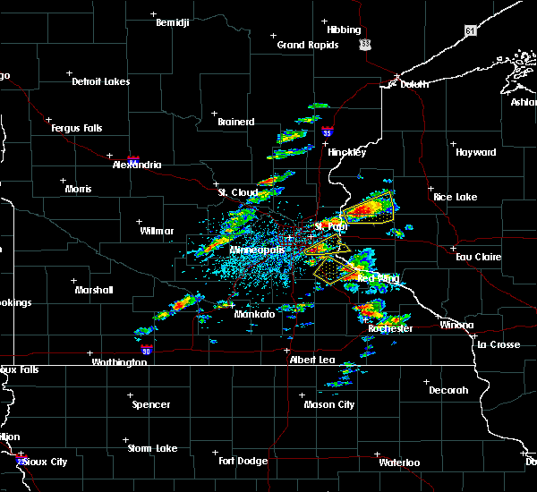 At 406 pm cdt, a severe thunderstorm was located over inver grove heights, or 10 miles south of st. paul, moving northeast at 30 mph (radar indicated). Hazards include ping pong ball size hail. People and animals outdoors will be injured. expect damage to roofs, siding, windows, and vehicles. this severe thunderstorm will be near, south st. paul and st. paul park around 415 pm cdt. cottage grove around 420 pm cdt. woodbury around 430 pm cdt. afton around 435 pm cdt. other locations impacted by this severe thunderstorm include kinnickinnic state park, newport, afton state park, lake st croix beach, lakeland, grey cloud township, st paul park, st marys point and lakeland shores. A tornado watch remains in effect until 1000 pm cdt for west central wisconsin. At 406 pm cdt, a severe thunderstorm was located over inver grove heights, or 10 miles south of st. paul, moving northeast at 30 mph (radar indicated). Hazards include ping pong ball size hail. People and animals outdoors will be injured. expect damage to roofs, siding, windows, and vehicles. this severe thunderstorm will be near, south st. paul and st. paul park around 415 pm cdt. cottage grove around 420 pm cdt. woodbury around 430 pm cdt. afton around 435 pm cdt. other locations impacted by this severe thunderstorm include kinnickinnic state park, newport, afton state park, lake st croix beach, lakeland, grey cloud township, st paul park, st marys point and lakeland shores. A tornado watch remains in effect until 1000 pm cdt for west central wisconsin.
|
| 9/21/2016 8:10 PM CDT |
 At 810 pm cdt, a severe thunderstorm was located over st. louis park, or near minneapolis, moving southeast at 20 mph (radar indicated). Hazards include half dollar size hail. Damage to vehicles is expected. this severe thunderstorm will be near, minneapolis around 815 pm cdt. edina around 820 pm cdt. richfield and msp international airport around 835 pm cdt. bloomington around 845 pm cdt. mendota heights around 855 pm cdt. Other locations impacted by this severe thunderstorm include woodland, fort snelling, north minneapolis, new hope, como park, mn state fair, univ of mn minneapolis campus, crystal, medicine lake and falcon heights. At 810 pm cdt, a severe thunderstorm was located over st. louis park, or near minneapolis, moving southeast at 20 mph (radar indicated). Hazards include half dollar size hail. Damage to vehicles is expected. this severe thunderstorm will be near, minneapolis around 815 pm cdt. edina around 820 pm cdt. richfield and msp international airport around 835 pm cdt. bloomington around 845 pm cdt. mendota heights around 855 pm cdt. Other locations impacted by this severe thunderstorm include woodland, fort snelling, north minneapolis, new hope, como park, mn state fair, univ of mn minneapolis campus, crystal, medicine lake and falcon heights.
|
| 7/23/2016 10:52 AM CDT |
 At 1052 am cdt, a severe thunderstorm was located over roseville, or near st. paul, moving north at 45 mph (radar indicated). Hazards include 60 mph wind gusts. Expect damage to roofs. siding. and trees. This severe thunderstorm will remain over mainly rural areas of southeastern hennepin, northwestern dakota and southern ramsey counties, including the following locations: fort snelling, south st paul airport, south st paul, como park, fort snelling state park, mn state fair, lilydale, univ of mn minneapolis campus, sunfish lake and lake phalen. At 1052 am cdt, a severe thunderstorm was located over roseville, or near st. paul, moving north at 45 mph (radar indicated). Hazards include 60 mph wind gusts. Expect damage to roofs. siding. and trees. This severe thunderstorm will remain over mainly rural areas of southeastern hennepin, northwestern dakota and southern ramsey counties, including the following locations: fort snelling, south st paul airport, south st paul, como park, fort snelling state park, mn state fair, lilydale, univ of mn minneapolis campus, sunfish lake and lake phalen.
|
| 7/23/2016 10:36 AM CDT |
 At 1036 am cdt, a severe thunderstorm was located over eagan, or 8 miles southwest of st. paul, moving north at 35 mph (radar indicated). Hazards include 60 mph wind gusts and penny size hail. Expect damage to roofs. siding. and trees. this severe storm will be near, mendota heights and msp international airport around 1045 am cdt. south st. paul and west st. paul around 1050 am cdt. st. paul around 1055 am cdt. maplewood and roseville around 1100 am cdt. Other locations impacted by this severe thunderstorm include fort snelling, south st paul airport, south st paul, como park, fort snelling state park, mn state fair, lilydale, univ of mn minneapolis campus, sunfish lake and lake phalen. At 1036 am cdt, a severe thunderstorm was located over eagan, or 8 miles southwest of st. paul, moving north at 35 mph (radar indicated). Hazards include 60 mph wind gusts and penny size hail. Expect damage to roofs. siding. and trees. this severe storm will be near, mendota heights and msp international airport around 1045 am cdt. south st. paul and west st. paul around 1050 am cdt. st. paul around 1055 am cdt. maplewood and roseville around 1100 am cdt. Other locations impacted by this severe thunderstorm include fort snelling, south st paul airport, south st paul, como park, fort snelling state park, mn state fair, lilydale, univ of mn minneapolis campus, sunfish lake and lake phalen.
|
| 7/23/2016 10:14 AM CDT |
 At 1014 am cdt, a severe thunderstorm was located over farmington, or 12 miles north of northfield, moving north at 45 mph (radar indicated). Hazards include 60 mph wind gusts and penny size hail. Expect damage to roofs. siding. and trees. this severe thunderstorm will be near, apple valley and rosemount around 1030 am cdt. bloomington around 1035 am cdt. eagan, richfield, inver grove heights and msp international airport around 1040 am cdt. south st. paul, west st. paul and mendota heights around 1045 am cdt. st. paul around 1050 am cdt. maplewood and roseville around 1055 am cdt. other locations impacted by this severe thunderstorm include fort snelling, south st paul airport, south st paul, como park, fort snelling state park, mn state fair, castle rock, lilydale, univ of mn minneapolis campus and sunfish lake. this includes the following highways, interstate 94 in minnesota between mile markers 234 and 246. u. s. Highway 61 between mile markers 133 and 142. At 1014 am cdt, a severe thunderstorm was located over farmington, or 12 miles north of northfield, moving north at 45 mph (radar indicated). Hazards include 60 mph wind gusts and penny size hail. Expect damage to roofs. siding. and trees. this severe thunderstorm will be near, apple valley and rosemount around 1030 am cdt. bloomington around 1035 am cdt. eagan, richfield, inver grove heights and msp international airport around 1040 am cdt. south st. paul, west st. paul and mendota heights around 1045 am cdt. st. paul around 1050 am cdt. maplewood and roseville around 1055 am cdt. other locations impacted by this severe thunderstorm include fort snelling, south st paul airport, south st paul, como park, fort snelling state park, mn state fair, castle rock, lilydale, univ of mn minneapolis campus and sunfish lake. this includes the following highways, interstate 94 in minnesota between mile markers 234 and 246. u. s. Highway 61 between mile markers 133 and 142.
|
| 7/5/2016 7:33 PM CDT |
 At 732 pm cdt, a severe thunderstorm was located over burnsville, or 11 miles south of minneapolis, moving southeast at 40 mph (radar indicated). Hazards include 60 mph wind gusts. Expect damage to roofs. siding. and trees. this severe storm will be near, rosemount around 740 pm cdt. Other locations impacted by this severe thunderstorm include fort snelling, north minneapolis, flying cloud airport, south st paul airport, new hope, south st paul, como park, crystal airport, univ of mn minneapolis campus and medicine lake. At 732 pm cdt, a severe thunderstorm was located over burnsville, or 11 miles south of minneapolis, moving southeast at 40 mph (radar indicated). Hazards include 60 mph wind gusts. Expect damage to roofs. siding. and trees. this severe storm will be near, rosemount around 740 pm cdt. Other locations impacted by this severe thunderstorm include fort snelling, north minneapolis, flying cloud airport, south st paul airport, new hope, south st paul, como park, crystal airport, univ of mn minneapolis campus and medicine lake.
|
| 7/5/2016 7:24 PM CDT |
 At 724 pm cdt, a severe thunderstorm was located over bloomington, or 10 miles southwest of minneapolis, moving southeast at 35 mph (radar indicated). Hazards include 60 mph wind gusts. Expect damage to roofs. siding. and trees. this severe thunderstorm will be near, burnsville and msp international airport around 730 pm cdt. eagan and apple valley around 740 pm cdt. rosemount around 745 pm cdt. Other locations impacted by this severe thunderstorm include fort snelling, north minneapolis, flying cloud airport, osseo, south st paul airport, new hope, south st paul, como park, crystal airport and univ of mn minneapolis campus. At 724 pm cdt, a severe thunderstorm was located over bloomington, or 10 miles southwest of minneapolis, moving southeast at 35 mph (radar indicated). Hazards include 60 mph wind gusts. Expect damage to roofs. siding. and trees. this severe thunderstorm will be near, burnsville and msp international airport around 730 pm cdt. eagan and apple valley around 740 pm cdt. rosemount around 745 pm cdt. Other locations impacted by this severe thunderstorm include fort snelling, north minneapolis, flying cloud airport, osseo, south st paul airport, new hope, south st paul, como park, crystal airport and univ of mn minneapolis campus.
|
| 7/5/2016 6:36 PM CDT |
 At 635 pm cdt, a severe thunderstorm was located near river falls, moving east at 40 mph (law enforcement). Hazards include 60 mph wind gusts and quarter size hail. Hail damage to vehicles is expected. expect wind damage to roofs, siding, and trees. this severe thunderstorm will remain over mainly rural areas of southern washington, northern dakota and eastern ramsey counties, including the following locations: south st paul airport, afton state park, lakeland shores, north st. Paul, birchwood, south st paul, st paul park, newport, grant and birchwood village. At 635 pm cdt, a severe thunderstorm was located near river falls, moving east at 40 mph (law enforcement). Hazards include 60 mph wind gusts and quarter size hail. Hail damage to vehicles is expected. expect wind damage to roofs, siding, and trees. this severe thunderstorm will remain over mainly rural areas of southern washington, northern dakota and eastern ramsey counties, including the following locations: south st paul airport, afton state park, lakeland shores, north st. Paul, birchwood, south st paul, st paul park, newport, grant and birchwood village.
|
| 7/5/2016 5:42 PM CDT |
 At 541 pm cdt, a severe thunderstorm was located over north minneapolis, or near minneapolis, moving east at 40 mph (radar indicated). Hazards include 60 mph wind gusts and quarter size hail. Hail damage to vehicles is expected. expect wind damage to roofs, siding, and trees. this severe thunderstorm will be near, minneapolis and new brighton around 545 pm cdt. richfield, roseville and msp international airport around 550 pm cdt. bloomington around 555 pm cdt. st. paul, eagan, maplewood, inver grove heights and oakdale around 600 pm cdt. st. paul park around 605 pm cdt. woodbury and cottage grove around 610 pm cdt. afton around 615 pm cdt. Prescott around 625 pm cdt. At 541 pm cdt, a severe thunderstorm was located over north minneapolis, or near minneapolis, moving east at 40 mph (radar indicated). Hazards include 60 mph wind gusts and quarter size hail. Hail damage to vehicles is expected. expect wind damage to roofs, siding, and trees. this severe thunderstorm will be near, minneapolis and new brighton around 545 pm cdt. richfield, roseville and msp international airport around 550 pm cdt. bloomington around 555 pm cdt. st. paul, eagan, maplewood, inver grove heights and oakdale around 600 pm cdt. st. paul park around 605 pm cdt. woodbury and cottage grove around 610 pm cdt. afton around 615 pm cdt. Prescott around 625 pm cdt.
|
| 7/18/2015 1:12 AM CDT | The severe thunderstorm warning for northern dakota, eastern hennepin, ramsey, washington and anoka counties will expire at 115 am cdt, the storms which prompted the warning have moved out of the area. therefore the warning will be allowed to expire. a severe thunderstorm watch remains in effect until 200 am cdt for east central minnesota. a severe thunderstorm watch also remains in effect until 700 am cdt for west central wisconsin. |
| 7/18/2015 1:00 AM CDT |
 At 100 am cdt, severe thunderstorms were located along a line extending from near ham lake to woodbury to near cottage grove, moving east at 45 mph (radar indicated). Hazards include 60 mph wind gusts. Expect damage to roofs. siding and trees. these severe storms will be near, woodbury, hastings, lake elmo, bayport and afton around 105 am cdt. hudson and prescott around 110 am cdt. other locations impacted by these severe thunderstorms include north minneapolis, south st paul airport, afton state park, lakeland shores, north st. paul, south st paul, como park, st paul park, univ of mn minneapolis campus and newport. this includes the following highways, interstate 35 between mile markers 128 and 133. interstate 94 in minnesota between mile markers 225 and 258. u. s. highway 10 in minnesota between mile markers 226 and 302. u. s. highway 8 in minnesota between mile markers 0 and 1. u. s. Highway 61 between mile markers 119 and 162. At 100 am cdt, severe thunderstorms were located along a line extending from near ham lake to woodbury to near cottage grove, moving east at 45 mph (radar indicated). Hazards include 60 mph wind gusts. Expect damage to roofs. siding and trees. these severe storms will be near, woodbury, hastings, lake elmo, bayport and afton around 105 am cdt. hudson and prescott around 110 am cdt. other locations impacted by these severe thunderstorms include north minneapolis, south st paul airport, afton state park, lakeland shores, north st. paul, south st paul, como park, st paul park, univ of mn minneapolis campus and newport. this includes the following highways, interstate 35 between mile markers 128 and 133. interstate 94 in minnesota between mile markers 225 and 258. u. s. highway 10 in minnesota between mile markers 226 and 302. u. s. highway 8 in minnesota between mile markers 0 and 1. u. s. Highway 61 between mile markers 119 and 162.
|
| 7/18/2015 12:55 AM CDT |
 At 1254 am cdt, severe thunderstorms were located along a line extending from grey cloud township to near northfield to near waldorf, moving east at 45 mph (radar indicated). Hazards include 70 mph wind gusts. Expect considerable tree damage. damage is likely to mobile homes, roofs and outbuildings. severe thunderstorms will be near, northfield, cottage grove, st. paul park, stanton and randolph around 100 am cdt. hastings and cannon falls around 105 am cdt. prescott around 110 am cdt. river falls and ellendale around 120 am cdt. goodhue around 125 am cdt. ellsworth around 130 am cdt. blooming prairie around 135 am cdt. stockholm and frontenac around 145 am cdt. Other locations impacted by these severe thunderstorms include lemond, frontenac state park, bixby, afton state park, owatonna airport, hader, clinton falls, bridgewater, st paul park and diamond bluff. At 1254 am cdt, severe thunderstorms were located along a line extending from grey cloud township to near northfield to near waldorf, moving east at 45 mph (radar indicated). Hazards include 70 mph wind gusts. Expect considerable tree damage. damage is likely to mobile homes, roofs and outbuildings. severe thunderstorms will be near, northfield, cottage grove, st. paul park, stanton and randolph around 100 am cdt. hastings and cannon falls around 105 am cdt. prescott around 110 am cdt. river falls and ellendale around 120 am cdt. goodhue around 125 am cdt. ellsworth around 130 am cdt. blooming prairie around 135 am cdt. stockholm and frontenac around 145 am cdt. Other locations impacted by these severe thunderstorms include lemond, frontenac state park, bixby, afton state park, owatonna airport, hader, clinton falls, bridgewater, st paul park and diamond bluff.
|
| 7/18/2015 12:46 AM CDT |
 At 1246 am cdt, severe thunderstorms were located along a line extending from nowthen to near st. paul to eagan, moving east at 45 mph (radar indicated). Hazards include 60 mph wind gusts. Expect damage to roofs. siding and trees. these severe storms will be near, st. paul, eagan, maplewood, inver grove heights and roseville around 1250 am cdt. cottage grove, oakdale, white bear lake and st. paul park around 1255 am cdt. woodbury around 100 am cdt. blaine, hastings, lino lakes, lake elmo and bayport around 105 am cdt. hudson and prescott around 110 am cdt. forest lake and hugo around 115 am cdt. other locations impacted by these severe thunderstorms include north minneapolis, flying cloud airport, south st paul airport, afton state park, lakeland shores, new hope, north st. Paul, south st paul, como park and st paul park. At 1246 am cdt, severe thunderstorms were located along a line extending from nowthen to near st. paul to eagan, moving east at 45 mph (radar indicated). Hazards include 60 mph wind gusts. Expect damage to roofs. siding and trees. these severe storms will be near, st. paul, eagan, maplewood, inver grove heights and roseville around 1250 am cdt. cottage grove, oakdale, white bear lake and st. paul park around 1255 am cdt. woodbury around 100 am cdt. blaine, hastings, lino lakes, lake elmo and bayport around 105 am cdt. hudson and prescott around 110 am cdt. forest lake and hugo around 115 am cdt. other locations impacted by these severe thunderstorms include north minneapolis, flying cloud airport, south st paul airport, afton state park, lakeland shores, new hope, north st. Paul, south st paul, como park and st paul park.
|
| 7/18/2015 12:44 AM CDT |
 At 1244 am cdt, severe thunderstorms were located along a line extending from eagan to near webster to waterville, moving east at 50 mph (trained weather spotters). Hazards include 70 mph wind gusts. Expect considerable tree damage. damage is likely to mobile homes, roofs and outbuildings. these severe storms will be near, eagan, apple valley, rosemount and dundas around 1250 am cdt. northfield around 1255 am cdt. faribault, hastings and randolph around 100 am cdt. Other locations impacted by these severe thunderstorms include credit river, ruskin, veseli, coates, hampton, new trier, kilkenny, bridgewater, castle rock and faribault airport. At 1244 am cdt, severe thunderstorms were located along a line extending from eagan to near webster to waterville, moving east at 50 mph (trained weather spotters). Hazards include 70 mph wind gusts. Expect considerable tree damage. damage is likely to mobile homes, roofs and outbuildings. these severe storms will be near, eagan, apple valley, rosemount and dundas around 1250 am cdt. northfield around 1255 am cdt. faribault, hastings and randolph around 100 am cdt. Other locations impacted by these severe thunderstorms include credit river, ruskin, veseli, coates, hampton, new trier, kilkenny, bridgewater, castle rock and faribault airport.
|
| 7/18/2015 12:29 AM CDT |
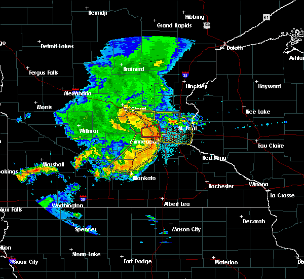 At 1229 am cdt, severe thunderstorms were located along a line extending from flying cloud airport to new prague to near lake jefferson, moving east at 50 mph (radar indicated). Hazards include 60 mph wind gusts. Expect damage to roofs. siding and trees. severe thunderstorms will be near, burnsville, savage, prior lake and lonsdale around 1235 am cdt. bloomington, lakeville, apple valley, webster and elko new market around 1240 am cdt. eagan and rosemount around 1245 am cdt. dundas and morristown around 1250 am cdt. faribault, northfield and warsaw around 1255 am cdt. hastings and randolph around 100 am cdt. other locations impacted by these severe thunderstorms include credit river, ruskin, veseli, coates, hampton, new trier, kilkenny, bridgewater, castle rock and faribault airport. this includes the following highways, interstate 35 between mile markers 50 and 88. u. s. highway 169 between mile markers 113 and 116. u. s. Highway 61 between mile markers 105 and 118. At 1229 am cdt, severe thunderstorms were located along a line extending from flying cloud airport to new prague to near lake jefferson, moving east at 50 mph (radar indicated). Hazards include 60 mph wind gusts. Expect damage to roofs. siding and trees. severe thunderstorms will be near, burnsville, savage, prior lake and lonsdale around 1235 am cdt. bloomington, lakeville, apple valley, webster and elko new market around 1240 am cdt. eagan and rosemount around 1245 am cdt. dundas and morristown around 1250 am cdt. faribault, northfield and warsaw around 1255 am cdt. hastings and randolph around 100 am cdt. other locations impacted by these severe thunderstorms include credit river, ruskin, veseli, coates, hampton, new trier, kilkenny, bridgewater, castle rock and faribault airport. this includes the following highways, interstate 35 between mile markers 50 and 88. u. s. highway 169 between mile markers 113 and 116. u. s. Highway 61 between mile markers 105 and 118.
|
| 7/18/2015 12:26 AM CDT |
 At 1226 am cdt, severe thunderstorms were located along a line extending from near big lake to wayzata to near flying cloud airport, moving east at 45 mph (radar indicated). Hazards include 60 mph wind gusts. Expect damage to roofs. siding and trees. severe thunderstorms will be near, plymouth, eden prairie, minnetonka, st. louis park and shakopee around 1230 am cdt. minneapolis, edina, brooklyn center and golden valley around 1235 am cdt. burnsville, richfield and columbia heights around 1240 am cdt. bloomington, roseville, st. michael, otsego and st. francis around 1245 am cdt. eagan, ramsey, champlin, rosemount and mendota heights around 1250 am cdt. st. paul, maplewood, inver grove heights, andover and south st. paul around 1255 am cdt. coon rapids, cottage grove, oakdale, ham lake and st. paul park around 100 am cdt. woodbury, lake elmo and afton around 105 am cdt. other locations impacted by these severe thunderstorms include north minneapolis, flying cloud airport, south st paul airport, afton state park, lakeland shores, new hope, north st. paul, south st paul, como park and st paul park. this includes the following highways, interstate 35 between mile markers 128 and 133. interstate 94 in minnesota between mile markers 194 and 258. u. s. highway 10 in minnesota between mile markers 195 and 302. u. s. highway 12 between mile markers 153 and 156. u. s. highway 169 between mile markers 118 and 165. u. s. highway 212 between mile markers 155 and 162. u. s. highway 8 in minnesota between mile markers 0 and 1. u. s. Highway 61 between mile markers 119 and 162. At 1226 am cdt, severe thunderstorms were located along a line extending from near big lake to wayzata to near flying cloud airport, moving east at 45 mph (radar indicated). Hazards include 60 mph wind gusts. Expect damage to roofs. siding and trees. severe thunderstorms will be near, plymouth, eden prairie, minnetonka, st. louis park and shakopee around 1230 am cdt. minneapolis, edina, brooklyn center and golden valley around 1235 am cdt. burnsville, richfield and columbia heights around 1240 am cdt. bloomington, roseville, st. michael, otsego and st. francis around 1245 am cdt. eagan, ramsey, champlin, rosemount and mendota heights around 1250 am cdt. st. paul, maplewood, inver grove heights, andover and south st. paul around 1255 am cdt. coon rapids, cottage grove, oakdale, ham lake and st. paul park around 100 am cdt. woodbury, lake elmo and afton around 105 am cdt. other locations impacted by these severe thunderstorms include north minneapolis, flying cloud airport, south st paul airport, afton state park, lakeland shores, new hope, north st. paul, south st paul, como park and st paul park. this includes the following highways, interstate 35 between mile markers 128 and 133. interstate 94 in minnesota between mile markers 194 and 258. u. s. highway 10 in minnesota between mile markers 195 and 302. u. s. highway 12 between mile markers 153 and 156. u. s. highway 169 between mile markers 118 and 165. u. s. highway 212 between mile markers 155 and 162. u. s. highway 8 in minnesota between mile markers 0 and 1. u. s. Highway 61 between mile markers 119 and 162.
|
| 7/12/2015 11:23 PM CDT |
 At 1123 pm cdt, a severe thunderstorm was located over chanhassen, or 14 miles southwest of minneapolis, moving southeast at 45 mph (radar indicated). Hazards include 60 mph wind gusts and nickel size hail. Expect damage to roofs. siding and trees. locations impacted include, minneapolis, st. paul, bloomington, eden prairie, burnsville, minnetonka, edina, st. louis park, shakopee, richfield, savage and chaska. This includes interstate 94 in minnesota between mile markers 232 and 237. At 1123 pm cdt, a severe thunderstorm was located over chanhassen, or 14 miles southwest of minneapolis, moving southeast at 45 mph (radar indicated). Hazards include 60 mph wind gusts and nickel size hail. Expect damage to roofs. siding and trees. locations impacted include, minneapolis, st. paul, bloomington, eden prairie, burnsville, minnetonka, edina, st. louis park, shakopee, richfield, savage and chaska. This includes interstate 94 in minnesota between mile markers 232 and 237.
|
| 7/12/2015 11:18 PM CDT |
 At 1118 pm cdt, a severe thunderstorm was located over chanhassen, or 16 miles west of minneapolis, moving southeast at 20 mph (radar indicated). Hazards include 60 mph wind gusts and nickel size hail. Expect damage to roofs. siding and trees. this severe thunderstorm will be near, eden prairie around 1125 pm cdt. carver around 1130 pm cdt. shakopee around 1140 pm cdt. savage and prior lake around 1145 pm cdt. burnsville around 1150 pm cdt. elko new market around 1215 am cdt. other locations impacted by this severe thunderstorm include credit river, marystown, randolph, st benedict, lakeville airport, helena, castle rock, lake byllesby and fort snelling state park. This includes interstate 35 between mile markers 75 and 88. At 1118 pm cdt, a severe thunderstorm was located over chanhassen, or 16 miles west of minneapolis, moving southeast at 20 mph (radar indicated). Hazards include 60 mph wind gusts and nickel size hail. Expect damage to roofs. siding and trees. this severe thunderstorm will be near, eden prairie around 1125 pm cdt. carver around 1130 pm cdt. shakopee around 1140 pm cdt. savage and prior lake around 1145 pm cdt. burnsville around 1150 pm cdt. elko new market around 1215 am cdt. other locations impacted by this severe thunderstorm include credit river, marystown, randolph, st benedict, lakeville airport, helena, castle rock, lake byllesby and fort snelling state park. This includes interstate 35 between mile markers 75 and 88.
|
| 7/12/2015 11:15 PM CDT |
 At 1115 pm cdt, a severe thunderstorm was located over orono, or 17 miles west of minneapolis, moving southeast at 20 mph (radar indicated). Hazards include 70 mph wind gusts and nickel size hail. Expect considerable tree damage. damage is likely to mobile homes, roofs and outbuildings. this severe storm will be near, wayzata around 1120 pm cdt. eden prairie, chaska, chanhassen, victoria and excelsior around 1130 pm cdt. other locations impacted by this severe thunderstorm include woodland, north minneapolis, flying cloud airport, new hope, como park, lake waconia, hamel, univ of mn minneapolis campus, crystal and medicine lake. This includes interstate 94 in minnesota between mile markers 227 and 236. At 1115 pm cdt, a severe thunderstorm was located over orono, or 17 miles west of minneapolis, moving southeast at 20 mph (radar indicated). Hazards include 70 mph wind gusts and nickel size hail. Expect considerable tree damage. damage is likely to mobile homes, roofs and outbuildings. this severe storm will be near, wayzata around 1120 pm cdt. eden prairie, chaska, chanhassen, victoria and excelsior around 1130 pm cdt. other locations impacted by this severe thunderstorm include woodland, north minneapolis, flying cloud airport, new hope, como park, lake waconia, hamel, univ of mn minneapolis campus, crystal and medicine lake. This includes interstate 94 in minnesota between mile markers 227 and 236.
|
| 7/12/2015 11:06 PM CDT |
 At 1105 pm cdt, a severe thunderstorm was located over maple plain, or 16 miles southeast of buffalo, moving southeast at 40 mph (radar indicated). Hazards include 70 mph wind gusts and nickel size hail. Expect considerable tree damage. damage is likely to mobile homes, roofs and outbuildings. this severe storm will be near, chanhassen, victoria, wayzata and excelsior around 1115 pm cdt. minnetonka and st. louis park around 1120 pm cdt. eden prairie and hopkins around 1125 pm cdt. bloomington, burnsville, edina, shakopee and richfield around 1130 pm cdt. other locations impacted by this severe thunderstorm include woodland, north minneapolis, flying cloud airport, new hope, como park, lake waconia, crystal airport, hamel, univ of mn minneapolis campus and crystal. This includes interstate 94 in minnesota between mile markers 209 and 223, and between mile markers 227 and 236. At 1105 pm cdt, a severe thunderstorm was located over maple plain, or 16 miles southeast of buffalo, moving southeast at 40 mph (radar indicated). Hazards include 70 mph wind gusts and nickel size hail. Expect considerable tree damage. damage is likely to mobile homes, roofs and outbuildings. this severe storm will be near, chanhassen, victoria, wayzata and excelsior around 1115 pm cdt. minnetonka and st. louis park around 1120 pm cdt. eden prairie and hopkins around 1125 pm cdt. bloomington, burnsville, edina, shakopee and richfield around 1130 pm cdt. other locations impacted by this severe thunderstorm include woodland, north minneapolis, flying cloud airport, new hope, como park, lake waconia, crystal airport, hamel, univ of mn minneapolis campus and crystal. This includes interstate 94 in minnesota between mile markers 209 and 223, and between mile markers 227 and 236.
|
| 7/12/2015 10:55 PM CDT |
 At 1054 pm cdt, a severe thunderstorm was located over delano, or 13 miles south of buffalo, moving southeast at 40 mph (radar indicated). Hazards include 60 mph wind gusts and nickel size hail. Expect damage to roofs. siding and trees. this severe thunderstorm will be near, maple plain around 1100 pm cdt. mound, orono, minnetrista and st. bonifacius around 1105 pm cdt. chanhassen and victoria around 1110 pm cdt. chaska and excelsior around 1115 pm cdt. eden prairie and carver around 1120 pm cdt. shakopee around 1125 pm cdt. burnsville and savage around 1130 pm cdt. other locations impacted by this severe thunderstorm include north minneapolis, flying cloud airport, osseo, new hope, como park, lake waconia, crystal airport, univ of mn minneapolis campus, medicine lake and long lake. This includes interstate 94 in minnesota near mile marker 203, between mile markers 206 and 224, and between mile markers 226 and 237. At 1054 pm cdt, a severe thunderstorm was located over delano, or 13 miles south of buffalo, moving southeast at 40 mph (radar indicated). Hazards include 60 mph wind gusts and nickel size hail. Expect damage to roofs. siding and trees. this severe thunderstorm will be near, maple plain around 1100 pm cdt. mound, orono, minnetrista and st. bonifacius around 1105 pm cdt. chanhassen and victoria around 1110 pm cdt. chaska and excelsior around 1115 pm cdt. eden prairie and carver around 1120 pm cdt. shakopee around 1125 pm cdt. burnsville and savage around 1130 pm cdt. other locations impacted by this severe thunderstorm include north minneapolis, flying cloud airport, osseo, new hope, como park, lake waconia, crystal airport, univ of mn minneapolis campus, medicine lake and long lake. This includes interstate 94 in minnesota near mile marker 203, between mile markers 206 and 224, and between mile markers 226 and 237.
|
| 6/29/2015 8:39 PM CDT |
 At 839 pm cdt, a severe thunderstorm was located over south st paul airport, or near st. paul, moving southeast at 35 mph (trained weather spotters). Hazards include ping pong ball size hail. People and animals outdoors will be injured. expect damage to roofs, siding, windows and vehicles. this severe thunderstorm will be near, apple valley, cottage grove and inver grove heights around 845 pm cdt. rosemount around 850 pm cdt. farmington around 900 pm cdt. Other locations impacted by this severe thunderstorm include sunfish lake, south st paul airport, coates, fort snelling state park, sunfish, mendota and vermillion. At 839 pm cdt, a severe thunderstorm was located over south st paul airport, or near st. paul, moving southeast at 35 mph (trained weather spotters). Hazards include ping pong ball size hail. People and animals outdoors will be injured. expect damage to roofs, siding, windows and vehicles. this severe thunderstorm will be near, apple valley, cottage grove and inver grove heights around 845 pm cdt. rosemount around 850 pm cdt. farmington around 900 pm cdt. Other locations impacted by this severe thunderstorm include sunfish lake, south st paul airport, coates, fort snelling state park, sunfish, mendota and vermillion.
|
| 6/29/2015 7:40 PM CDT |
 At 740 pm cdt, a severe thunderstorm was located over fort snelling, or near st. paul, moving south at 25 mph (radar indicated). Hazards include quarter size hail. Damage to vehicles is expected. this severe storm will be near, bloomington, eagan and inver grove heights around 745 pm cdt. burnsville around 755 pm cdt. other locations impacted by this severe thunderstorm include fort snelling, south st paul airport, south st paul, fort snelling state park, mn state fair, lilydale, sunfish lake, highland park, mall of america and sunfish. This includes interstate 94 in minnesota between mile markers 232 and 241. At 740 pm cdt, a severe thunderstorm was located over fort snelling, or near st. paul, moving south at 25 mph (radar indicated). Hazards include quarter size hail. Damage to vehicles is expected. this severe storm will be near, bloomington, eagan and inver grove heights around 745 pm cdt. burnsville around 755 pm cdt. other locations impacted by this severe thunderstorm include fort snelling, south st paul airport, south st paul, fort snelling state park, mn state fair, lilydale, sunfish lake, highland park, mall of america and sunfish. This includes interstate 94 in minnesota between mile markers 232 and 241.
|
| 6/29/2015 7:29 PM CDT |
 At 718 pm cdt, a severe thunderstorm was located over columbia heights, or near minneapolis, moving south at 25 mph (trained weather spotters). Hazards include ping pong ball size hail. People and animals outdoors will be injured. expect damage to roofs, siding, windows and vehicles. this severe storm will be near, minneapolis and golden valley around 725 pm cdt. st. louis park around 730 pm cdt. hopkins around 735 pm cdt. edina and mendota heights around 740 pm cdt. richfield and msp international airport around 745 pm cdt. bloomington and eagan around 750 pm cdt. other locations impacted by this severe thunderstorm include fort snelling, north minneapolis, south st paul airport, south st paul, como park, fort snelling state park, mn state fair, lilydale, univ of mn minneapolis campus and sunfish lake. This includes interstate 94 in minnesota between mile markers 222 and 246. At 718 pm cdt, a severe thunderstorm was located over columbia heights, or near minneapolis, moving south at 25 mph (trained weather spotters). Hazards include ping pong ball size hail. People and animals outdoors will be injured. expect damage to roofs, siding, windows and vehicles. this severe storm will be near, minneapolis and golden valley around 725 pm cdt. st. louis park around 730 pm cdt. hopkins around 735 pm cdt. edina and mendota heights around 740 pm cdt. richfield and msp international airport around 745 pm cdt. bloomington and eagan around 750 pm cdt. other locations impacted by this severe thunderstorm include fort snelling, north minneapolis, south st paul airport, south st paul, como park, fort snelling state park, mn state fair, lilydale, univ of mn minneapolis campus and sunfish lake. This includes interstate 94 in minnesota between mile markers 222 and 246.
|
| 6/29/2015 7:09 PM CDT |
 At 709 pm cdt, a severe thunderstorm was located over fridley, or 9 miles north of minneapolis, moving south at 25 mph (radar indicated). Hazards include half dollar size hail. Damage to vehicles is expected. this severe thunderstorm will be near, brooklyn center and columbia heights around 715 pm cdt. minneapolis and roseville around 720 pm cdt. golden valley around 725 pm cdt. minnetonka and st. louis park around 730 pm cdt. edina and hopkins around 735 pm cdt. msp international airport around 740 pm cdt. bloomington, eden prairie and richfield around 745 pm cdt. other locations impacted by this severe thunderstorm include fort snelling, north minneapolis, south st paul airport, south st paul, como park, fort snelling state park, mn state fair, lilydale, univ of mn minneapolis campus and sunfish lake. This includes interstate 94 in minnesota between mile markers 222 and 246. At 709 pm cdt, a severe thunderstorm was located over fridley, or 9 miles north of minneapolis, moving south at 25 mph (radar indicated). Hazards include half dollar size hail. Damage to vehicles is expected. this severe thunderstorm will be near, brooklyn center and columbia heights around 715 pm cdt. minneapolis and roseville around 720 pm cdt. golden valley around 725 pm cdt. minnetonka and st. louis park around 730 pm cdt. edina and hopkins around 735 pm cdt. msp international airport around 740 pm cdt. bloomington, eden prairie and richfield around 745 pm cdt. other locations impacted by this severe thunderstorm include fort snelling, north minneapolis, south st paul airport, south st paul, como park, fort snelling state park, mn state fair, lilydale, univ of mn minneapolis campus and sunfish lake. This includes interstate 94 in minnesota between mile markers 222 and 246.
|
| 6/22/2015 6:35 AM CDT |
 At 634 am cdt, a severe thunderstorm was located over farmington, or 16 miles south of st. paul, moving northeast at 40 mph (radar indicated). Hazards include 60 mph wind gusts and quarter size hail. Hail damage to vehicles is expected. expect wind damage to roofs, siding and trees. this severe storm will be near, rosemount around 640 am cdt. eagan around 650 am cdt. cottage grove, inver grove heights and mendota heights around 655 am cdt. st. paul, south st. paul and west st. paul around 700 am cdt. other locations impacted by this severe thunderstorm include lilydale, sunfish lake, lakeville airport, south st paul airport, south st paul, coates, sunfish, mendota, fort snelling state park and newport. This includes interstate 35 between mile markers 84 and 87. At 634 am cdt, a severe thunderstorm was located over farmington, or 16 miles south of st. paul, moving northeast at 40 mph (radar indicated). Hazards include 60 mph wind gusts and quarter size hail. Hail damage to vehicles is expected. expect wind damage to roofs, siding and trees. this severe storm will be near, rosemount around 640 am cdt. eagan around 650 am cdt. cottage grove, inver grove heights and mendota heights around 655 am cdt. st. paul, south st. paul and west st. paul around 700 am cdt. other locations impacted by this severe thunderstorm include lilydale, sunfish lake, lakeville airport, south st paul airport, south st paul, coates, sunfish, mendota, fort snelling state park and newport. This includes interstate 35 between mile markers 84 and 87.
|
| 6/22/2015 6:23 AM CDT |
 At 622 am cdt, a severe thunderstorm was located over lakeville airport, or 12 miles north of northfield, moving northeast at 40 mph (radar indicated). Hazards include half dollar size hail. Damage to vehicles is expected. this severe thunderstorm will be near, apple valley around 635 am cdt. rosemount around 640 am cdt. bloomington around 645 am cdt. eagan and inver grove heights around 650 am cdt. cottage grove, south st. paul, west st. paul and mendota heights around 655 am cdt. other locations impacted by this severe thunderstorm include lilydale, sunfish lake, lakeville airport, south st paul airport, south st paul, coates, fort snelling state park, sunfish, mendota and castle rock. This includes interstate 35 between mile markers 76 and 88. At 622 am cdt, a severe thunderstorm was located over lakeville airport, or 12 miles north of northfield, moving northeast at 40 mph (radar indicated). Hazards include half dollar size hail. Damage to vehicles is expected. this severe thunderstorm will be near, apple valley around 635 am cdt. rosemount around 640 am cdt. bloomington around 645 am cdt. eagan and inver grove heights around 650 am cdt. cottage grove, south st. paul, west st. paul and mendota heights around 655 am cdt. other locations impacted by this severe thunderstorm include lilydale, sunfish lake, lakeville airport, south st paul airport, south st paul, coates, fort snelling state park, sunfish, mendota and castle rock. This includes interstate 35 between mile markers 76 and 88.
|
| 5/3/2015 5:23 PM CDT | At 522 pm cdt, severe thunderstorms were located along a line extending from near lino lakes to minneapolis, moving east at 40 mph (radar indicated). Hazards include 60 mph wind gusts and half dollar size hail. Hail damage to vehicles is expected. expect wind damage to roofs, siding and trees. locations impacted include, minneapolis, st. paul, bloomington, brooklyn park, eagan, woodbury, coon rapids, eden prairie, burnsville, blaine, minnetonka and edina. 1. 25in. |
| 5/3/2015 5:23 PM CDT | At 522 pm cdt, severe thunderstorms were located along a line extending from near lino lakes to minneapolis, moving east at 40 mph (radar indicated). Hazards include 60 mph wind gusts and half dollar size hail. Hail damage to vehicles is expected. expect wind damage to roofs, siding and trees. locations impacted include, minneapolis, st. paul, bloomington, brooklyn park, eagan, woodbury, coon rapids, eden prairie, burnsville, blaine, minnetonka and edina. 1. 25in. |
| 5/3/2015 5:08 PM CDT | At 507 pm cdt, severe thunderstorms were located along a line extending from near ham lake to medicine lake, moving east at 50 mph (radar indicated). Hazards include half dollar size hail. damage to vehicles is expected |
| 5/3/2015 5:08 PM CDT | At 507 pm cdt, severe thunderstorms were located along a line extending from near ham lake to medicine lake, moving east at 50 mph (radar indicated). Hazards include half dollar size hail. damage to vehicles is expected |
| 5/3/2015 5:04 PM CDT | At 503 pm cdt, severe thunderstorms were located along a line extending from near eagan to near credit river, moving east at 25 mph (radar indicated). Hazards include half dollar size hail. Damage to vehicles is expected. locations impacted include, bloomington, eagan, burnsville, lakeville, apple valley, shakopee, inver grove heights, savage, prior lake, rosemount, farmington and south st. paul. 1. 25in. |
| 5/3/2015 4:50 PM CDT | At 449 pm cdt, severe thunderstorms were located along a line extending from richfield to carver, moving east at 25 mph (radar indicated. hail up to one and one half inch in diameter has been reported in multiple locations including the national weather service twin cities office). Hazards include half dollar size hail. Damage to vehicles is expected. locations impacted include, minneapolis, st. paul, bloomington, eagan, eden prairie, burnsville, lakeville, minnetonka, apple valley, edina, st. louis park and maplewood. 1. 25in. |
| 5/3/2015 4:50 PM CDT | At 449 pm cdt, severe thunderstorms were located along a line extending from richfield to carver, moving east at 25 mph (radar indicated. hail up to one and one half inch in diameter has been reported in multiple locations including the national weather service twin cities office). Hazards include half dollar size hail. Damage to vehicles is expected. locations impacted include, minneapolis, st. paul, bloomington, eagan, eden prairie, burnsville, lakeville, minnetonka, apple valley, edina, st. louis park and maplewood. 1. 25in. |
| 5/3/2015 4:39 PM CDT | At 437 pm cdt, severe thunderstorms were located along a line extending from edina to near carver, moving east at 25 mph (radar indicated. hail up to one and one half inch in diameter was reported at the national weather service twin cities office). Hazards include half dollar size hail. Damage to vehicles is expected. locations impacted include, minneapolis, st. paul, bloomington, eagan, eden prairie, burnsville, lakeville, minnetonka, apple valley, edina, st. louis park and maplewood. 1. 25in. |
| 5/3/2015 4:20 PM CDT | At 419 pm cdt, severe thunderstorms were located along a line extending from eden prairie to near cologne, moving east at 25 mph (radar indicated). Hazards include half dollar size hail. damage to vehicles is expected |
| 5/8/2014 3:45 PM CDT | Street signs blown ove in dakota county MN, 0.3 miles SSE of Eagan, MN |
| 8/6/2013 7:55 PM CDT | Half Dollar sized hail reported 2 miles NE of Eagan, MN |
| 8/6/2013 7:54 PM CDT | Golf Ball sized hail reported 0.6 miles NW of Eagan, MN |
| 8/6/2013 7:54 PM CDT | Large tree limbs down in dakota county MN, 0.6 miles NW of Eagan, MN |
| 8/6/2013 7:50 PM CDT | Hen Egg sized hail reported 2.8 miles SW of Eagan, MN |
| 6/21/2013 8:25 PM CDT | Tree dow in dakota county MN, 3.1 miles NW of Eagan, MN |
| 6/21/2013 8:10 PM CDT | Large tree blown down on to power lines along yankee doodle roa in dakota county MN, 0.7 miles ESE of Eagan, MN |
| 6/21/2013 8:05 PM CDT | Large tree blown down on to power lines along yankee doodle roa in dakota county MN, 0.7 miles ESE of Eagan, MN |
| 6/21/2013 8:05 PM CDT | Tree dow in dakota county MN, 3.1 miles NW of Eagan, MN |
| 11/10/2012 11:06 PM CST | Trees down. time estimate in dakota county MN, 0.6 miles NW of Eagan, MN |
| 6/19/2012 4:23 AM CDT | 30 ft tall pine tree uprooted. branches broken off other tree in dakota county MN, 0.6 miles NW of Eagan, MN |
| 5/26/2012 3:15 PM CDT | Quarter sized hail reported 2 miles NE of Eagan, MN |
| 5/19/2012 8:00 PM CDT | Quarter sized hail reported 1.7 miles ENE of Eagan, MN |
Hail Maps for Eagan, MN
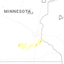

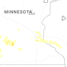

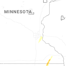
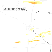


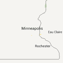


Connect with Interactive Hail Maps