

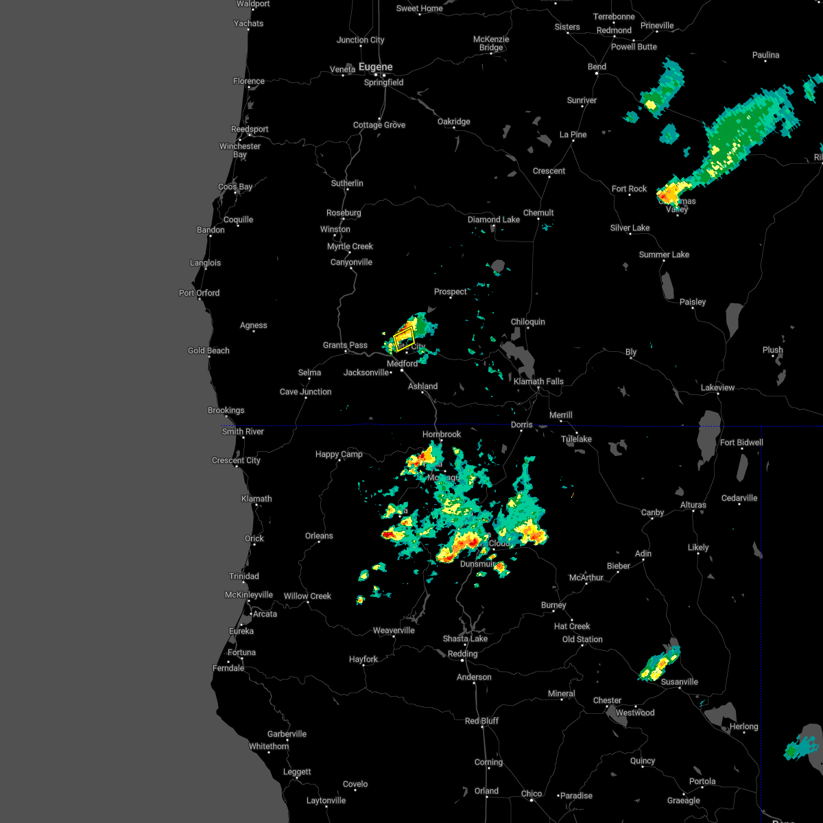
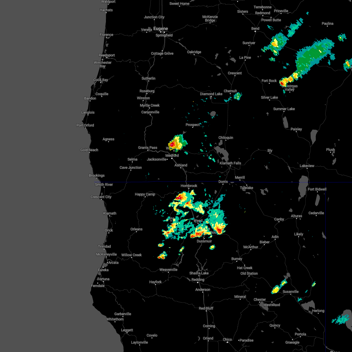
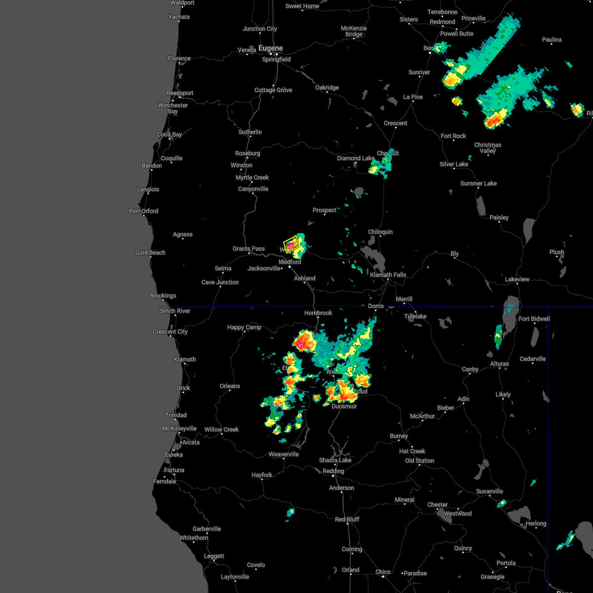
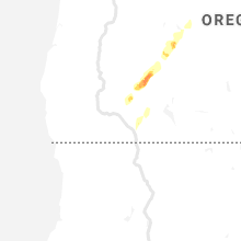
Hail Map for Eagle Point, OR
The Eagle Point, OR area has had 1 report of on-the-ground hail by trained spotters, and has been under severe weather warnings 2 times during the past 12 months. Doppler radar has detected hail at or near Eagle Point, OR on 4 occasions.
| Name: | Eagle Point, OR |
| Where Located: | 10.6 miles NNE of Medford, OR |
| Map: | Google Map for Eagle Point, OR |
| Population: | 8469 |
| Housing Units: | 3611 |
| More Info: | Search Google for Eagle Point, OR |
3
The Top Recent Hail Date for Eagle Point, OR is Tuesday, August 2, 2022 (2nd out of 4)

Hail and Wind Damage Spotted near Eagle Point, OR
| Date / Time | Report Details |
|---|---|
| 6/7/2023 8:58 PM PDT |
 The severe thunderstorm warning for south central jackson county will expire at 900 pm pdt, the storm which prompted the warning has weakened below severe limits, and no longer poses an immediate threat to life or property. therefore, the warning will be allowed to expire. to report severe weather, contact your nearest law enforcement agency. they will relay your report to the national weather service medford. The severe thunderstorm warning for south central jackson county will expire at 900 pm pdt, the storm which prompted the warning has weakened below severe limits, and no longer poses an immediate threat to life or property. therefore, the warning will be allowed to expire. to report severe weather, contact your nearest law enforcement agency. they will relay your report to the national weather service medford.
|
| 6/7/2023 8:28 PM PDT |
 At 828 pm pdt, a severe thunderstorm was located over medford, moving east at 15 mph (radar indicated). Hazards include quarter size hail. damage to vehicles is expected At 828 pm pdt, a severe thunderstorm was located over medford, moving east at 15 mph (radar indicated). Hazards include quarter size hail. damage to vehicles is expected
|
| 8/2/2022 7:52 PM PDT |
 The severe thunderstorm warning for central jackson county will expire at 800 pm pdt, the storm which prompted the warning has weakened below severe limits, and no longer poses an immediate threat to life or property. therefore, the warning will be allowed to expire. however heavy rain is still possible with this thunderstorm. The severe thunderstorm warning for central jackson county will expire at 800 pm pdt, the storm which prompted the warning has weakened below severe limits, and no longer poses an immediate threat to life or property. therefore, the warning will be allowed to expire. however heavy rain is still possible with this thunderstorm.
|
| 8/2/2022 7:27 PM PDT |
 At 726 pm pdt, a severe thunderstorm was located over dodge bridge jackson county park, or 11 miles north of medford, and is nearly stationary (radar indicated). Hazards include quarter size hail. damage to vehicles is expected At 726 pm pdt, a severe thunderstorm was located over dodge bridge jackson county park, or 11 miles north of medford, and is nearly stationary (radar indicated). Hazards include quarter size hail. damage to vehicles is expected
|
| 8/2/2022 6:58 PM PDT |
 At 658 pm pdt, a severe thunderstorm was located over dodge bridge jackson county park, or 12 miles north of medford, moving northeast at 10 mph (radar indicated). Hazards include quarter size hail. damage to vehicles is expected At 658 pm pdt, a severe thunderstorm was located over dodge bridge jackson county park, or 12 miles north of medford, moving northeast at 10 mph (radar indicated). Hazards include quarter size hail. damage to vehicles is expected
|
| 7/2/2022 7:40 PM PDT |
 At 738 pm pdt, a severe thunderstorm was located over central point, or over medford, moving north at 20 mph (radar indicated). Hazards include quarter size hail. Damage to vehicles is expected. locations impacted include, medford, central point, eagle point, touvelle state park, agate reservoir, white city and upper table rock trailhead. hail threat, radar indicated max hail size, 1. 00 in wind threat, radar indicated max wind gust, <50 mph. At 738 pm pdt, a severe thunderstorm was located over central point, or over medford, moving north at 20 mph (radar indicated). Hazards include quarter size hail. Damage to vehicles is expected. locations impacted include, medford, central point, eagle point, touvelle state park, agate reservoir, white city and upper table rock trailhead. hail threat, radar indicated max hail size, 1. 00 in wind threat, radar indicated max wind gust, <50 mph.
|
| 7/2/2022 7:22 PM PDT |
 At 722 pm pdt, a severe thunderstorm was located near medford, moving north at 20 mph (radar indicated). Hazards include quarter size hail. damage to vehicles is expected At 722 pm pdt, a severe thunderstorm was located near medford, moving north at 20 mph (radar indicated). Hazards include quarter size hail. damage to vehicles is expected
|
| 5/4/2017 9:21 PM PDT | Spotter reported downed trees along road. not sure about timing... so left as i in jackson county OR, 11.8 miles SW of Eagle Point, OR |
| 5/4/2017 5:45 PM PDT | Quarter sized hail reported 0.9 miles SSW of Eagle Point, OR |
Hail Maps for Eagle Point, OR


Connect with Interactive Hail Maps