

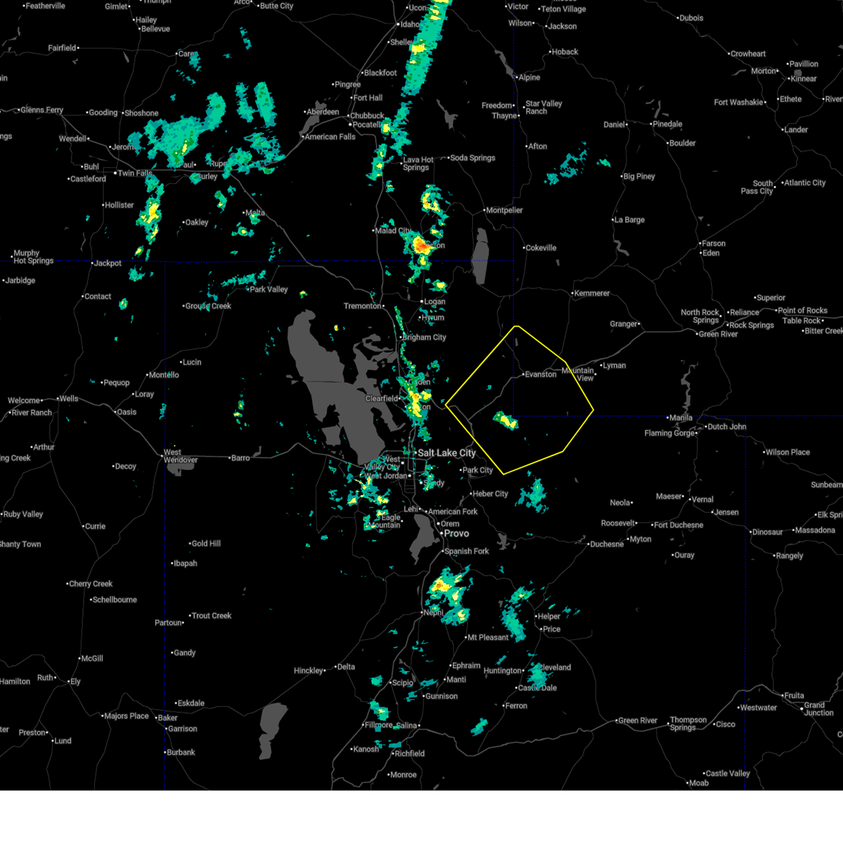
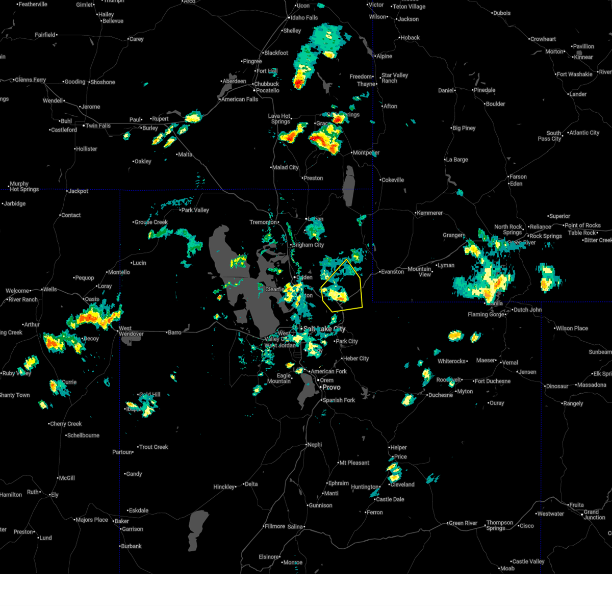
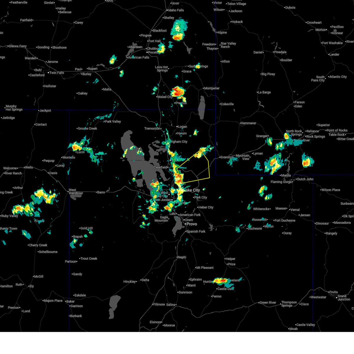
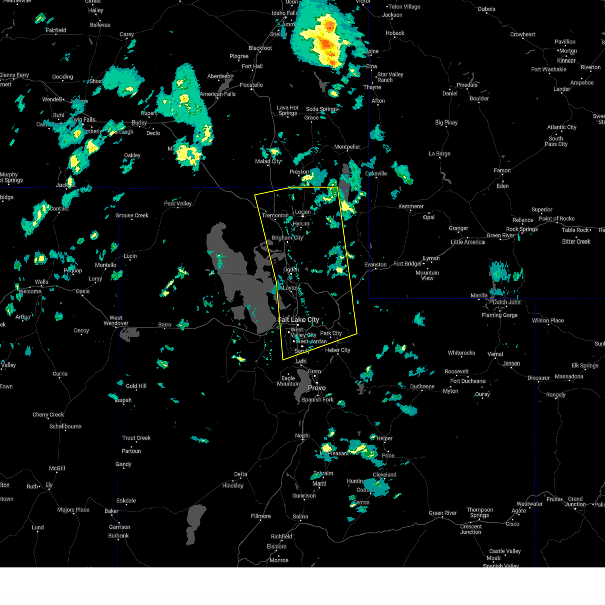
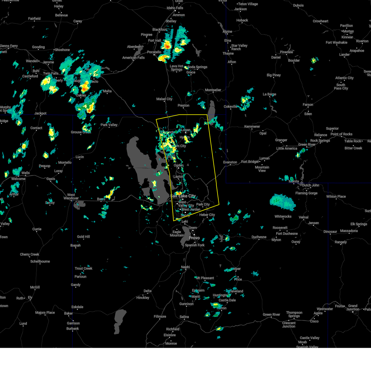
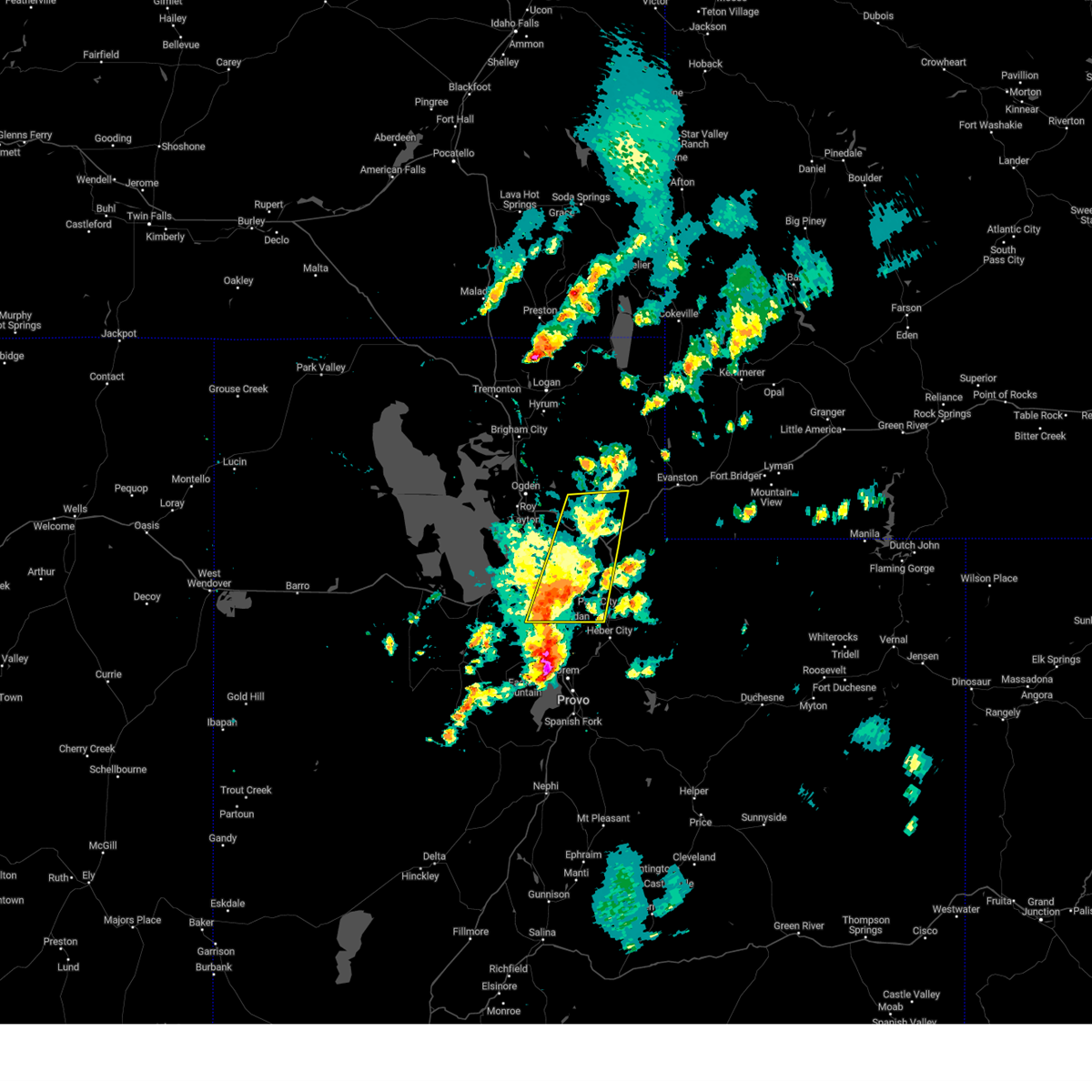
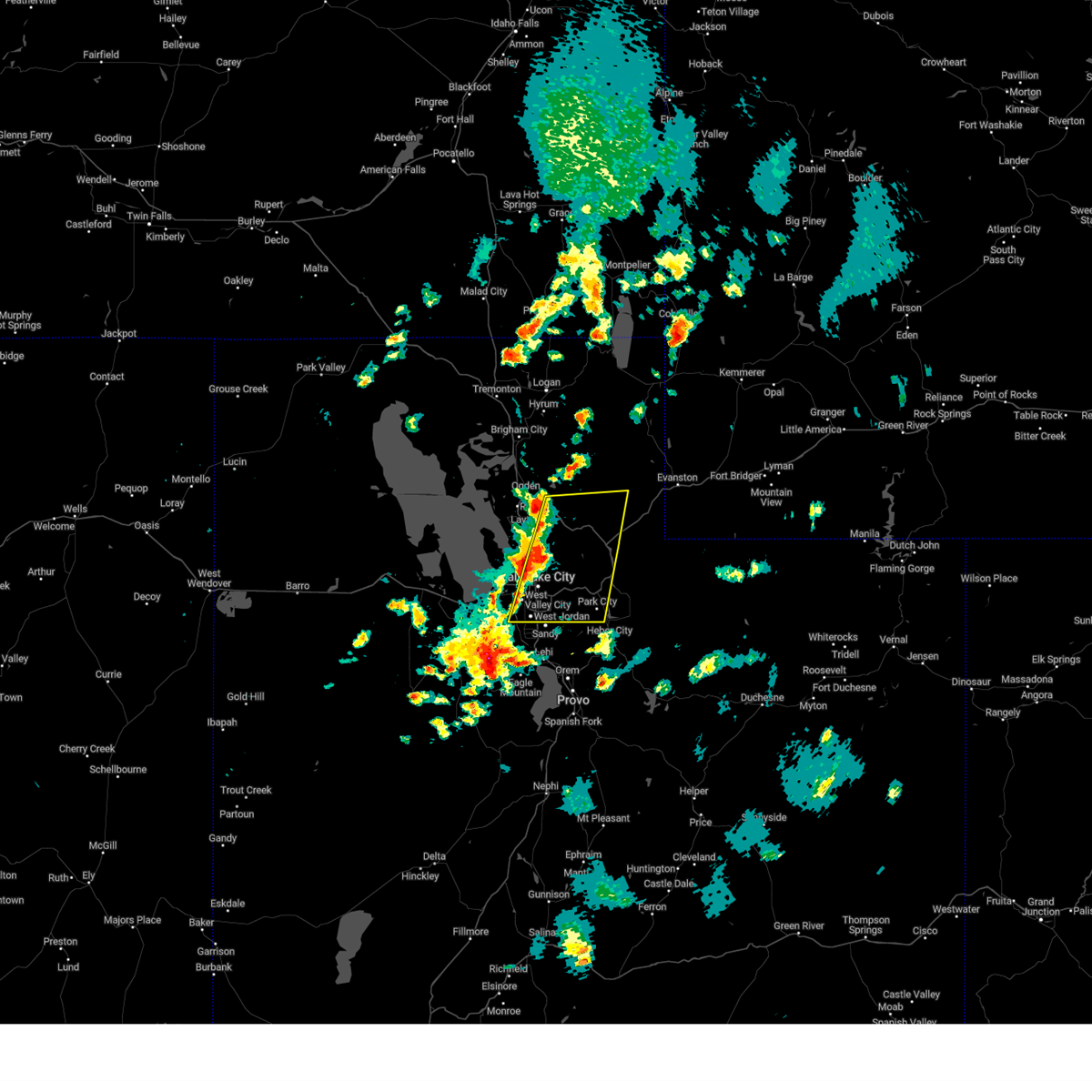
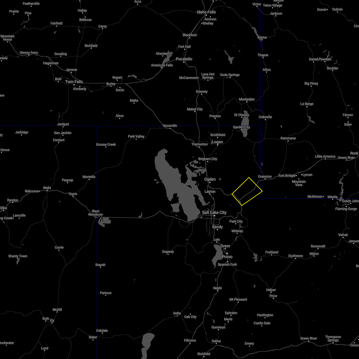
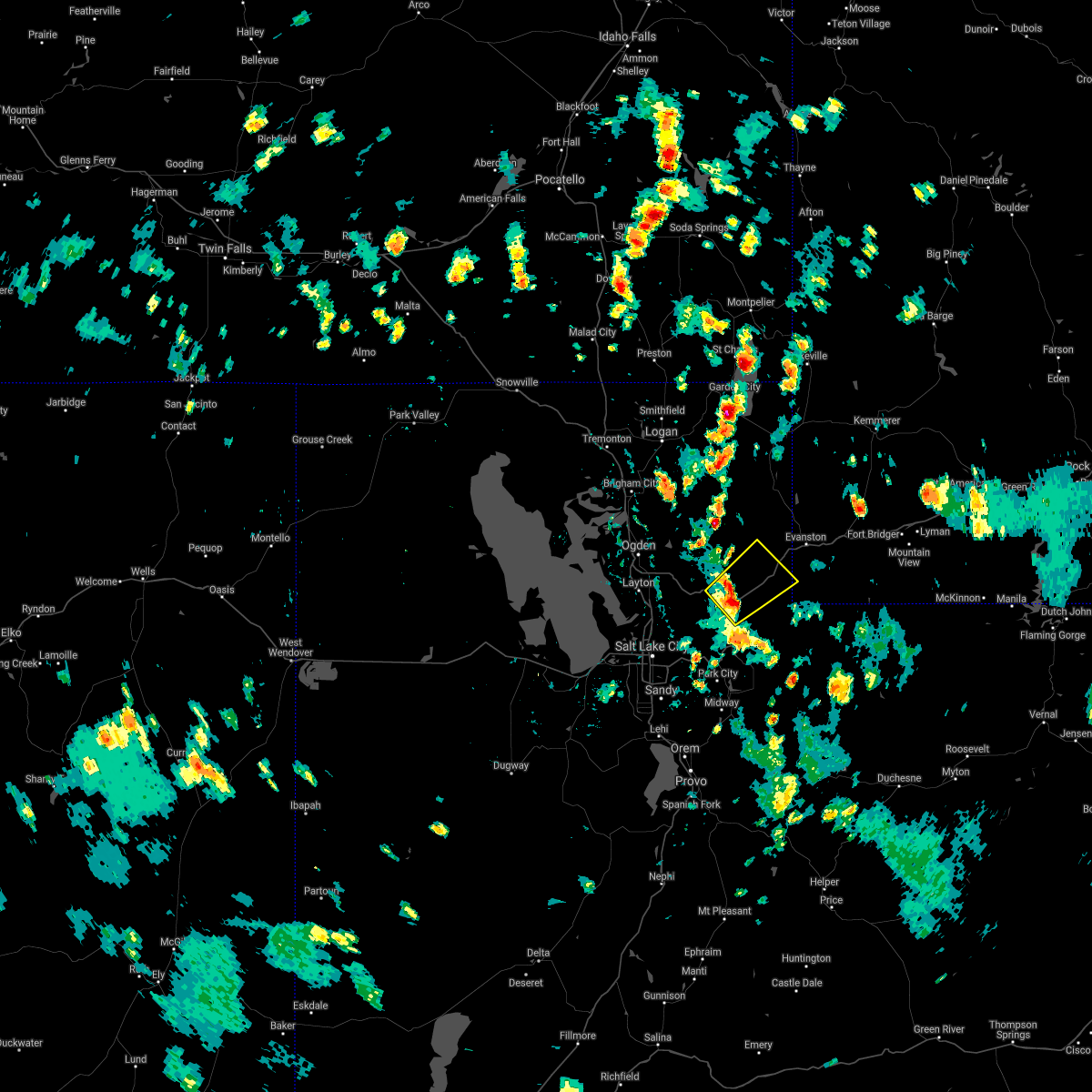
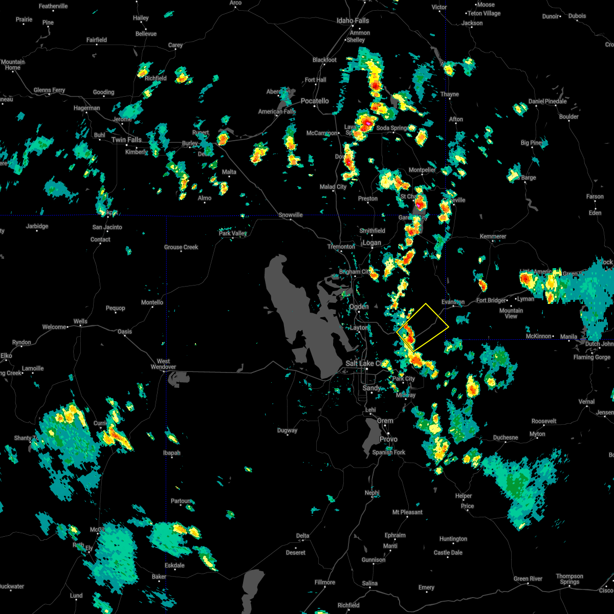
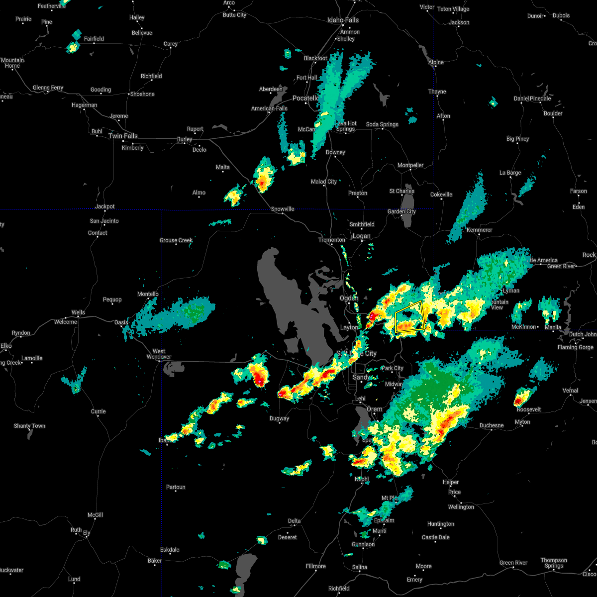
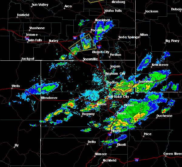
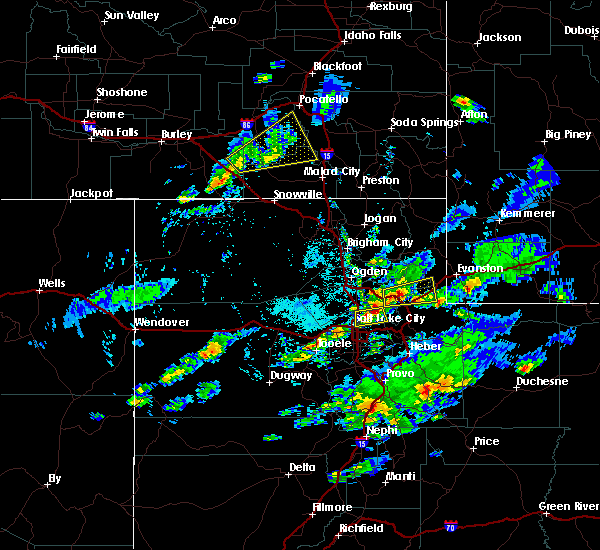
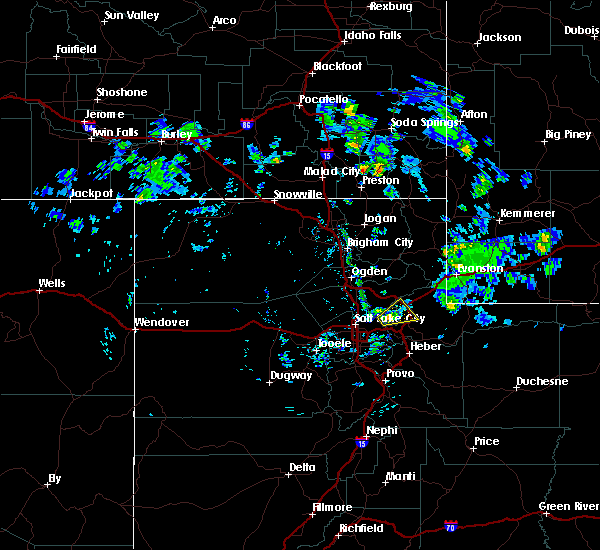
Hail Map for Echo, UT
The Echo, UT area has had 0 reports of on-the-ground hail by trained spotters, and has been under severe weather warnings 1 time during the past 12 months. Doppler radar has detected hail at or near Echo, UT on 7 occasions.
| Name: | Echo, UT |
| Where Located: | 28 miles ENE of Salt Lake City, UT |
| Map: | Google Map for Echo, UT |
| Population: | 56 |
| Housing Units: | 31 |
| More Info: | Search Google for Echo, UT |
0
The Top Recent Hail Date for Echo, UT is Thursday, August 22, 2024 (7th out of 7)

Hail and Wind Damage Spotted near Echo, UT
| Date / Time | Report Details |
|---|---|
| 5/13/2026 4:05 PM MDT |
 Svrslc the national weather service in salt lake city has issued a * severe thunderstorm warning for, southeastern rich county in northern utah, northwestern duchesne county in northern utah, northeastern morgan county in northern utah, summit county in northern utah, western uinta county in southwestern wyoming, * until 500 pm mdt. * at 403 pm mdt, elevated thunderstorms with a history of producing gusty and erratic outflow winds in excess of 70 mph were located along a line extending from 8 miles east of morgan to 6 miles northwest of mirror lake, moving north at 45 mph (radar indicated. the windy peak weather station on the north slope of the uintas recorded a gust to 72 mph). Hazards include 70 mph wind gusts. Expect considerable tree damage. Damage is likely to mobile homes, roofs, and outbuildings. Svrslc the national weather service in salt lake city has issued a * severe thunderstorm warning for, southeastern rich county in northern utah, northwestern duchesne county in northern utah, northeastern morgan county in northern utah, summit county in northern utah, western uinta county in southwestern wyoming, * until 500 pm mdt. * at 403 pm mdt, elevated thunderstorms with a history of producing gusty and erratic outflow winds in excess of 70 mph were located along a line extending from 8 miles east of morgan to 6 miles northwest of mirror lake, moving north at 45 mph (radar indicated. the windy peak weather station on the north slope of the uintas recorded a gust to 72 mph). Hazards include 70 mph wind gusts. Expect considerable tree damage. Damage is likely to mobile homes, roofs, and outbuildings.
|
| 7/4/2025 6:45 PM MDT |
 The storms which prompted the warning have moved out of the area. therefore, the warning has been allowed to expire. The storms which prompted the warning have moved out of the area. therefore, the warning has been allowed to expire.
|
| 7/4/2025 6:21 PM MDT |
 At 620 pm mdt, severe thunderstorms were located along a line extending from 19 miles east of weber state university to 12 miles east of morgan to near coalville, moving northeast at 40 mph (radar indicated). Hazards include 60 mph wind gusts and quarter size hail. Hail damage to vehicles is expected. expect wind damage to roofs, siding, and trees. locations impacted include, coalville, henefer, emory, croydon, echo, and echo reservoir. this includes the following highways, interstate 84 between mile markers 106 and 119. Interstate 80 in utah between mile markers 164 and 184. At 620 pm mdt, severe thunderstorms were located along a line extending from 19 miles east of weber state university to 12 miles east of morgan to near coalville, moving northeast at 40 mph (radar indicated). Hazards include 60 mph wind gusts and quarter size hail. Hail damage to vehicles is expected. expect wind damage to roofs, siding, and trees. locations impacted include, coalville, henefer, emory, croydon, echo, and echo reservoir. this includes the following highways, interstate 84 between mile markers 106 and 119. Interstate 80 in utah between mile markers 164 and 184.
|
| 7/4/2025 5:55 PM MDT |
 Svrslc the national weather service in salt lake city has issued a * severe thunderstorm warning for, east central weber county in northern utah, south central rich county in northern utah, morgan county in northern utah, northwestern summit county in northern utah, * until 645 pm mdt. * at 554 pm mdt, severe thunderstorms were located along a line extending from 9 miles east of uintah to near morgan to near east canyon state park, moving northeast at 40 mph (radar indicated). Hazards include 60 mph wind gusts and quarter size hail. Hail damage to vehicles is expected. Expect wind damage to roofs, siding, and trees. Svrslc the national weather service in salt lake city has issued a * severe thunderstorm warning for, east central weber county in northern utah, south central rich county in northern utah, morgan county in northern utah, northwestern summit county in northern utah, * until 645 pm mdt. * at 554 pm mdt, severe thunderstorms were located along a line extending from 9 miles east of uintah to near morgan to near east canyon state park, moving northeast at 40 mph (radar indicated). Hazards include 60 mph wind gusts and quarter size hail. Hail damage to vehicles is expected. Expect wind damage to roofs, siding, and trees.
|
| 5/11/2025 2:46 PM MDT |
 The storms which prompted the warning have moved out of the area. therefore, the warning has been allowed to expire. a severe thunderstorm watch remains in effect until 800 pm mdt for northern utah. The storms which prompted the warning have moved out of the area. therefore, the warning has been allowed to expire. a severe thunderstorm watch remains in effect until 800 pm mdt for northern utah.
|
| 5/11/2025 2:00 PM MDT |
 Svrslc the national weather service in salt lake city has issued a * severe thunderstorm warning for, weber county in northern utah, cache county in northern utah, northeastern box elder county in northern utah, western rich county in northern utah, northwestern wasatch county in northern utah, salt lake county in northern utah, eastern davis county in northern utah, morgan county in northern utah, western summit county in northern utah, northwestern utah county in northern utah, * until 245 pm mdt. * at 159 pm mdt, severe thunderstorms were located along a line extending from near riverside to near bluffdale, moving northeast at 40 mph. gusts up to 70 mph have been observed (radar indicated). Hazards include 70 mph wind gusts. Expect considerable tree damage. Damage is likely to mobile homes, roofs, and outbuildings. Svrslc the national weather service in salt lake city has issued a * severe thunderstorm warning for, weber county in northern utah, cache county in northern utah, northeastern box elder county in northern utah, western rich county in northern utah, northwestern wasatch county in northern utah, salt lake county in northern utah, eastern davis county in northern utah, morgan county in northern utah, western summit county in northern utah, northwestern utah county in northern utah, * until 245 pm mdt. * at 159 pm mdt, severe thunderstorms were located along a line extending from near riverside to near bluffdale, moving northeast at 40 mph. gusts up to 70 mph have been observed (radar indicated). Hazards include 70 mph wind gusts. Expect considerable tree damage. Damage is likely to mobile homes, roofs, and outbuildings.
|
| 8/13/2024 6:12 PM MDT |
 At 609 pm mdt, severe thunderstorms were located along a line extending from 15 miles northeast of morgan to mill creek canyon, moving east at 25 mph (public). Hazards include 60 mph wind gusts. Possible damage to roofs, siding, and trees. locations impacted include, salt lake city, sandy, murray, bountiful, park city, morgan, coalville, west jordan, taylorsville, cottonwood heights, midvale, holladay, south salt lake, summit park, millcreek, wanship, south snyderville basin, mill creek canyon, cottonwood west, and east canyon state park. this includes the following highways, interstate 15 between mile markers 296 and 305. interstate 84 between mile markers 99 and 119. interstate 80 in utah between mile markers 123 and 173. Us route 40 between mile markers 0 and 8. At 609 pm mdt, severe thunderstorms were located along a line extending from 15 miles northeast of morgan to mill creek canyon, moving east at 25 mph (public). Hazards include 60 mph wind gusts. Possible damage to roofs, siding, and trees. locations impacted include, salt lake city, sandy, murray, bountiful, park city, morgan, coalville, west jordan, taylorsville, cottonwood heights, midvale, holladay, south salt lake, summit park, millcreek, wanship, south snyderville basin, mill creek canyon, cottonwood west, and east canyon state park. this includes the following highways, interstate 15 between mile markers 296 and 305. interstate 84 between mile markers 99 and 119. interstate 80 in utah between mile markers 123 and 173. Us route 40 between mile markers 0 and 8.
|
| 8/13/2024 5:26 PM MDT |
 Svrslc the national weather service in salt lake city has issued a * severe thunderstorm warning for, southeastern weber county in northern utah, northwestern wasatch county in northern utah, eastern davis county in northern utah, central salt lake county in northern utah, morgan county in northern utah, western summit county in northern utah, * until 615 pm mdt. * at 524 pm mdt, severe thunderstorms were located along a line extending from 6 miles east of uintah to oquirrh, moving east at 30 mph (public). Hazards include 60 mph wind gusts and quarter size hail. hail damage to vehicles is possible, as well as wind damage to roofs, siding, and trees Svrslc the national weather service in salt lake city has issued a * severe thunderstorm warning for, southeastern weber county in northern utah, northwestern wasatch county in northern utah, eastern davis county in northern utah, central salt lake county in northern utah, morgan county in northern utah, western summit county in northern utah, * until 615 pm mdt. * at 524 pm mdt, severe thunderstorms were located along a line extending from 6 miles east of uintah to oquirrh, moving east at 30 mph (public). Hazards include 60 mph wind gusts and quarter size hail. hail damage to vehicles is possible, as well as wind damage to roofs, siding, and trees
|
| 7/3/2023 6:24 PM MDT |
 At 623 pm mdt, severe thunderstorms were located along a line extending from 15 miles northeast of morgan to 8 miles northwest of fruitland, moving east at 55 mph (radar indicated). Hazards include 60 mph wind gusts. expect damage to roofs, siding, and trees At 623 pm mdt, severe thunderstorms were located along a line extending from 15 miles northeast of morgan to 8 miles northwest of fruitland, moving east at 55 mph (radar indicated). Hazards include 60 mph wind gusts. expect damage to roofs, siding, and trees
|
| 7/3/2023 6:14 PM MDT |
 At 614 pm mdt, severe thunderstorms were located along a line extending from 8 miles north of morgan to 10 miles south of timber lakes, moving northeast at 40 mph (radar indicated). Hazards include 60 mph wind gusts. Expect damage to roofs, siding, and trees. locations impacted include, park city, morgan, coalville, heber city, heber, summit park, kamas, oakley, francis, daniel, wanship, wasatch mountain state park, south snyderville basin, samak, east canyon state park, north snyderville basin, timber lakes, emigration canyon, mill creek canyon and big cottonwood canyon. this includes the following highways, interstate 84 between mile markers 92 and 119. interstate 80 in utah between mile markers 136 and 177. us route 40 between mile markers 0 and 47. utah route 35 between mile markers 0 and 21. mirror lake highway between mile markers 0 and 14. hail threat, radar indicated max hail size, <. 75 in wind threat, observed max wind gust, 60 mph. At 614 pm mdt, severe thunderstorms were located along a line extending from 8 miles north of morgan to 10 miles south of timber lakes, moving northeast at 40 mph (radar indicated). Hazards include 60 mph wind gusts. Expect damage to roofs, siding, and trees. locations impacted include, park city, morgan, coalville, heber city, heber, summit park, kamas, oakley, francis, daniel, wanship, wasatch mountain state park, south snyderville basin, samak, east canyon state park, north snyderville basin, timber lakes, emigration canyon, mill creek canyon and big cottonwood canyon. this includes the following highways, interstate 84 between mile markers 92 and 119. interstate 80 in utah between mile markers 136 and 177. us route 40 between mile markers 0 and 47. utah route 35 between mile markers 0 and 21. mirror lake highway between mile markers 0 and 14. hail threat, radar indicated max hail size, <. 75 in wind threat, observed max wind gust, 60 mph.
|
| 7/3/2023 5:52 PM MDT |
 At 552 pm mdt, severe thunderstorms were located along a line extending from layton to 9 miles northeast of mapleton, moving northeast at 40 mph (radar indicated). Hazards include 60 mph wind gusts. expect damage to roofs, siding, and trees At 552 pm mdt, severe thunderstorms were located along a line extending from layton to 9 miles northeast of mapleton, moving northeast at 40 mph (radar indicated). Hazards include 60 mph wind gusts. expect damage to roofs, siding, and trees
|
| 7/17/2022 7:24 PM MDT |
 The severe thunderstorm warning for eastern weber, northern wasatch, northeastern salt lake, northeastern davis, morgan, western summit and north central utah counties will expire at 730 pm mdt, the storms which prompted the warning have weakened below severe limits, though wind gusts to 55 mph are still possible from mountain green to sundance and east. a special weather statement is now in effect. The severe thunderstorm warning for eastern weber, northern wasatch, northeastern salt lake, northeastern davis, morgan, western summit and north central utah counties will expire at 730 pm mdt, the storms which prompted the warning have weakened below severe limits, though wind gusts to 55 mph are still possible from mountain green to sundance and east. a special weather statement is now in effect.
|
| 7/17/2022 7:10 PM MDT |
 At 708 pm mdt, severe thunderstorms were located along a line extending from 14 miles east of weber state university to timber lakes, moving east at 35 mph (trained weather spotters). Hazards include 60 mph wind gusts. Expect damage to roofs, siding, and trees. locations impacted include, park city, morgan, coalville, heber city, heber, summit park, kamas, oakley, francis, daniel, wanship, south snyderville basin, mill creek canyon, samak, east canyon state park and emigration canyon. this includes the following highways, interstate 84 between mile markers 88 and 119. interstate 80 in utah between mile markers 131 and 179. us route 40 between mile markers 0 and 27. utah route 35 between mile markers 0 and 14. mirror lake highway between mile markers 0 and 17. hail threat, radar indicated max hail size, <. 75 in wind threat, radar indicated max wind gust, 60 mph. At 708 pm mdt, severe thunderstorms were located along a line extending from 14 miles east of weber state university to timber lakes, moving east at 35 mph (trained weather spotters). Hazards include 60 mph wind gusts. Expect damage to roofs, siding, and trees. locations impacted include, park city, morgan, coalville, heber city, heber, summit park, kamas, oakley, francis, daniel, wanship, south snyderville basin, mill creek canyon, samak, east canyon state park and emigration canyon. this includes the following highways, interstate 84 between mile markers 88 and 119. interstate 80 in utah between mile markers 131 and 179. us route 40 between mile markers 0 and 27. utah route 35 between mile markers 0 and 14. mirror lake highway between mile markers 0 and 17. hail threat, radar indicated max hail size, <. 75 in wind threat, radar indicated max wind gust, 60 mph.
|
| 7/17/2022 6:45 PM MDT |
 At 644 pm mdt, severe thunderstorms were located along a line extending from near weber state university to near daniel, moving east at 40 mph (trained weather spotters). Hazards include 60 mph wind gusts. expect damage to roofs, siding, and trees At 644 pm mdt, severe thunderstorms were located along a line extending from near weber state university to near daniel, moving east at 40 mph (trained weather spotters). Hazards include 60 mph wind gusts. expect damage to roofs, siding, and trees
|
| 8/21/2021 7:28 PM MDT |
 The severe thunderstorm warning for eastern weber, southern rich, salt lake, davis, morgan, northwestern summit and east central tooele counties will expire at 730 pm mdt, the storms which prompted the warning have moved out of the area. therefore, the warning will be allowed to expire. however gusty winds and heavy rain are still possible with these thunderstorms. The severe thunderstorm warning for eastern weber, southern rich, salt lake, davis, morgan, northwestern summit and east central tooele counties will expire at 730 pm mdt, the storms which prompted the warning have moved out of the area. therefore, the warning will be allowed to expire. however gusty winds and heavy rain are still possible with these thunderstorms.
|
| 8/21/2021 7:10 PM MDT |
 At 709 pm mdt, severe thunderstorms were located along a line extending from 6 miles southwest of randolph to 6 miles north of east canyon state park to near ophir, moving east at 40 mph (trained weather spotters). Hazards include 70 mph wind gusts and penny size hail. Expect considerable tree damage. damage is likely to mobile homes, roofs, and outbuildings. locations impacted include, salt lake city, west valley city, sandy, ogden, layton, murray, bountiful, tooele, farmington, park city, morgan, coalville, hill air force base, west jordan, taylorsville, south jordan, draper, riverton, roy and cottonwood heights. this includes the following highways, interstate 15 between mile markers 286 and 342. interstate 84 between mile markers 82 and 119. interstate 80 in utah between mile markers 92 and 196. us route 40 between mile markers 0 and 5. thunderstorm damage threat, considerable hail threat, radar indicated max hail size, 0. 75 in wind threat, observed max wind gust, 70 mph. At 709 pm mdt, severe thunderstorms were located along a line extending from 6 miles southwest of randolph to 6 miles north of east canyon state park to near ophir, moving east at 40 mph (trained weather spotters). Hazards include 70 mph wind gusts and penny size hail. Expect considerable tree damage. damage is likely to mobile homes, roofs, and outbuildings. locations impacted include, salt lake city, west valley city, sandy, ogden, layton, murray, bountiful, tooele, farmington, park city, morgan, coalville, hill air force base, west jordan, taylorsville, south jordan, draper, riverton, roy and cottonwood heights. this includes the following highways, interstate 15 between mile markers 286 and 342. interstate 84 between mile markers 82 and 119. interstate 80 in utah between mile markers 92 and 196. us route 40 between mile markers 0 and 5. thunderstorm damage threat, considerable hail threat, radar indicated max hail size, 0. 75 in wind threat, observed max wind gust, 70 mph.
|
| 8/21/2021 6:40 PM MDT |
 At 639 pm mdt, severe thunderstorms were located along a line extending from 12 miles east of hyrum to farmington to 7 miles southeast of skull valley, moving east at 40 mph (trained weather spotters reported wind gusts to 73 mph with widespread property damage). Hazards include 70 mph wind gusts and penny size hail. Expect considerable tree damage. Damage is likely to mobile homes, roofs, and outbuildings. At 639 pm mdt, severe thunderstorms were located along a line extending from 12 miles east of hyrum to farmington to 7 miles southeast of skull valley, moving east at 40 mph (trained weather spotters reported wind gusts to 73 mph with widespread property damage). Hazards include 70 mph wind gusts and penny size hail. Expect considerable tree damage. Damage is likely to mobile homes, roofs, and outbuildings.
|
| 7/31/2021 3:08 PM MDT |
 The severe thunderstorm warning for southern rich, east central morgan, northwestern summit and southwestern uinta counties will expire at 315 pm mdt, the storm which prompted the warning has weakened below severe limits, and no longer poses an immediate threat to life or property. therefore, the warning will be allowed to expire. however small hail and gusty winds are still possible with this thunderstorm. The severe thunderstorm warning for southern rich, east central morgan, northwestern summit and southwestern uinta counties will expire at 315 pm mdt, the storm which prompted the warning has weakened below severe limits, and no longer poses an immediate threat to life or property. therefore, the warning will be allowed to expire. however small hail and gusty winds are still possible with this thunderstorm.
|
| 7/31/2021 2:56 PM MDT |
 At 246 pm mdt, a severe thunderstorm was located near coalville, moving northeast at 25 mph (radar indicated). Hazards include 60 mph wind gusts and quarter size hail. Hail damage to vehicles is expected. Expect wind damage to roofs, siding, and trees. At 246 pm mdt, a severe thunderstorm was located near coalville, moving northeast at 25 mph (radar indicated). Hazards include 60 mph wind gusts and quarter size hail. Hail damage to vehicles is expected. Expect wind damage to roofs, siding, and trees.
|
| 7/31/2021 2:56 PM MDT |
 At 256 pm mdt, a severe thunderstorm was located 9 miles north of coalville, moving northeast at 25 mph (radar indicated). Hazards include 60 mph wind gusts and quarter size hail. Hail damage to vehicles is expected. expect wind damage to roofs, siding, and trees. locations impacted include, coalville, henefer, emory, croydon, castle rock, echo and echo reservoir. this includes the following highways, interstate 84 between mile markers 110 and 119. Interstate 80 in utah between mile markers 163 and 190. At 256 pm mdt, a severe thunderstorm was located 9 miles north of coalville, moving northeast at 25 mph (radar indicated). Hazards include 60 mph wind gusts and quarter size hail. Hail damage to vehicles is expected. expect wind damage to roofs, siding, and trees. locations impacted include, coalville, henefer, emory, croydon, castle rock, echo and echo reservoir. this includes the following highways, interstate 84 between mile markers 110 and 119. Interstate 80 in utah between mile markers 163 and 190.
|
| 7/31/2021 2:47 PM MDT |
 At 246 pm mdt, a severe thunderstorm was located near coalville, moving northeast at 25 mph (radar indicated). Hazards include 60 mph wind gusts and quarter size hail. Hail damage to vehicles is expected. Expect wind damage to roofs, siding, and trees. At 246 pm mdt, a severe thunderstorm was located near coalville, moving northeast at 25 mph (radar indicated). Hazards include 60 mph wind gusts and quarter size hail. Hail damage to vehicles is expected. Expect wind damage to roofs, siding, and trees.
|
| 7/4/2019 6:24 PM MDT |
 At 621 pm mdt, a severe thunderstorm was located near morgan, moving east at 50 mph (radar indicated). Hazards include 60 mph wind gusts. Expect damage to roofs, siding, and trees. Locations impacted include, salt lake city, west valley city, ogden, layton, bountiful, farmington, park city, morgan, coalville, roy, clearfield, kaysville, syracuse, south salt lake, clinton, north ogden, south ogden, north salt lake, centerville and woods cross. At 621 pm mdt, a severe thunderstorm was located near morgan, moving east at 50 mph (radar indicated). Hazards include 60 mph wind gusts. Expect damage to roofs, siding, and trees. Locations impacted include, salt lake city, west valley city, ogden, layton, bountiful, farmington, park city, morgan, coalville, roy, clearfield, kaysville, syracuse, south salt lake, clinton, north ogden, south ogden, north salt lake, centerville and woods cross.
|
| 7/4/2019 6:08 PM MDT |
 At 607 pm mdt, a severe thunderstorm was located over kaysville, or near layton, moving east at 50 mph (radar indicated). Hazards include 60 mph wind gusts. expect damage to roofs, siding, and trees At 607 pm mdt, a severe thunderstorm was located over kaysville, or near layton, moving east at 50 mph (radar indicated). Hazards include 60 mph wind gusts. expect damage to roofs, siding, and trees
|
| 8/22/2018 4:10 PM MDT |
 The severe thunderstorm warning for south central rich, east central morgan and northwestern summit counties will expire at 415 pm mdt, the storm which prompted the warning has weakened below severe limits, and no longer poses an immediate threat to life or property. therefore, the warning will be allowed to expire. however small hail and heavy rain are still possible with this thunderstorm. a severe thunderstorm watch remains in effect until 900 pm mdt for northern utah. to report severe weather, contact your nearest law enforcement agency. they will relay your report to the national weather service salt lake city. The severe thunderstorm warning for south central rich, east central morgan and northwestern summit counties will expire at 415 pm mdt, the storm which prompted the warning has weakened below severe limits, and no longer poses an immediate threat to life or property. therefore, the warning will be allowed to expire. however small hail and heavy rain are still possible with this thunderstorm. a severe thunderstorm watch remains in effect until 900 pm mdt for northern utah. to report severe weather, contact your nearest law enforcement agency. they will relay your report to the national weather service salt lake city.
|
| 8/22/2018 4:00 PM MDT |
 At 339 pm mdt, a severe thunderstorm was located 8 miles east of morgan, moving east at 40 mph (radar indicated). Hazards include 60 mph wind gusts and quarter size hail. Hail damage to vehicles is expected. Expect wind damage to roofs, siding, and trees. At 339 pm mdt, a severe thunderstorm was located 8 miles east of morgan, moving east at 40 mph (radar indicated). Hazards include 60 mph wind gusts and quarter size hail. Hail damage to vehicles is expected. Expect wind damage to roofs, siding, and trees.
|
| 8/22/2018 3:40 PM MDT |
 At 339 pm mdt, a severe thunderstorm was located 8 miles east of morgan, moving east at 40 mph (radar indicated). Hazards include 60 mph wind gusts and quarter size hail. Hail damage to vehicles is expected. Expect wind damage to roofs, siding, and trees. At 339 pm mdt, a severe thunderstorm was located 8 miles east of morgan, moving east at 40 mph (radar indicated). Hazards include 60 mph wind gusts and quarter size hail. Hail damage to vehicles is expected. Expect wind damage to roofs, siding, and trees.
|
| 6/18/2018 12:25 PM MDT |
 At 1224 pm mdt, a severe thunderstorm was located near summit park, or 12 miles east of bountiful, moving northeast at 25 mph (trained weather spotters). Hazards include 60 mph wind gusts and quarter size hail. Hail damage to vehicles is expected. expect wind damage to roofs, siding, and trees. Locations impacted include, coalville, summit park, henefer, hoytsville, echo and echo reservoir. At 1224 pm mdt, a severe thunderstorm was located near summit park, or 12 miles east of bountiful, moving northeast at 25 mph (trained weather spotters). Hazards include 60 mph wind gusts and quarter size hail. Hail damage to vehicles is expected. expect wind damage to roofs, siding, and trees. Locations impacted include, coalville, summit park, henefer, hoytsville, echo and echo reservoir.
|
| 6/18/2018 12:12 PM MDT |
 At 1211 pm mdt, a severe thunderstorm was located 7 miles northwest of summit park, or 8 miles east of salt lake city, moving northeast at 25 mph (trained weather spotters). Hazards include 60 mph wind gusts and quarter size hail. Hail damage to vehicles is expected. Expect wind damage to roofs, siding, and trees. At 1211 pm mdt, a severe thunderstorm was located 7 miles northwest of summit park, or 8 miles east of salt lake city, moving northeast at 25 mph (trained weather spotters). Hazards include 60 mph wind gusts and quarter size hail. Hail damage to vehicles is expected. Expect wind damage to roofs, siding, and trees.
|
| 12/16/2016 12:00 PM MST |
 At 1154 am mst, doppler radar indicated a line of severe thunderstorms capable of producing damaging winds in excess of 60 mph. these storms were located along a line extending from 8 mile northeast of morgan to 8 miles southwest of vernon, moving southeast at 45 mph. the strongest storms along this line will exist across salt lake, northwest utah and southeast tooele counties through 1215 pm mst. locations impacted include, salt lake city, west valley city, sandy, murray, bountiful, tooele, farmington, park city, morgan, coalville, west jordan, taylorsville, south jordan, lehi, draper, riverton, pleasant grove, cottonwood heights, midvale and kaysville. At 1154 am mst, doppler radar indicated a line of severe thunderstorms capable of producing damaging winds in excess of 60 mph. these storms were located along a line extending from 8 mile northeast of morgan to 8 miles southwest of vernon, moving southeast at 45 mph. the strongest storms along this line will exist across salt lake, northwest utah and southeast tooele counties through 1215 pm mst. locations impacted include, salt lake city, west valley city, sandy, murray, bountiful, tooele, farmington, park city, morgan, coalville, west jordan, taylorsville, south jordan, lehi, draper, riverton, pleasant grove, cottonwood heights, midvale and kaysville.
|
| 12/16/2016 11:40 AM MST |
 At 1138 am mst, doppler radar indicated a line of severe thunderstorms capable of producing damaging winds in excess of 60 mph. these storms were located along a line extending from 14 miles north of morgan to 12 miles south of dugway, and moving southeast at 45 mph. At 1138 am mst, doppler radar indicated a line of severe thunderstorms capable of producing damaging winds in excess of 60 mph. these storms were located along a line extending from 14 miles north of morgan to 12 miles south of dugway, and moving southeast at 45 mph.
|
| 10/2/2016 9:40 PM MDT |
 The severe thunderstorm warning for east central davis, morgan and northwestern summit counties will expire at 945 pm mdt, the storm which prompted the warning has weakened below severe limits, and no longer poses an immediate threat to life or property. therefore the warning will be allowed to expire. The severe thunderstorm warning for east central davis, morgan and northwestern summit counties will expire at 945 pm mdt, the storm which prompted the warning has weakened below severe limits, and no longer poses an immediate threat to life or property. therefore the warning will be allowed to expire.
|
| 10/2/2016 9:16 PM MDT |
 At 915 pm mdt, doppler radar indicated a severe thunderstorm capable of producing destructive winds in excess of 70 mph. this storm was located near centerville, or near bountiful, and moving northeast at 55 mph. another similar storm was in eastern salt lake county moving northeast. penny size hail may also accompany the damaging winds. At 915 pm mdt, doppler radar indicated a severe thunderstorm capable of producing destructive winds in excess of 70 mph. this storm was located near centerville, or near bountiful, and moving northeast at 55 mph. another similar storm was in eastern salt lake county moving northeast. penny size hail may also accompany the damaging winds.
|
| 8/7/2015 7:58 PM MDT |
 At 757 pm mdt, doppler radar indicated a line of severe thunderstorms capable of producing destructive winds in excess of 70 mph. these storms were located along a line extending from 13 miles east of north ogden to 10 miles north of coalville to oakley, moving east at 45 mph. at 740pm, an 80 mph gust occured at sr-65 at big mountain pass. locations impacted include, park city, morgan, coalville, north ogden, summit park, kamas, oakley, francis, south snyderville basin, wanship, samak, north snyderville basin, henefer, huntsville, croydon, pineview reservoir, peterson, liberty, mountain green and echo reservoir. At 757 pm mdt, doppler radar indicated a line of severe thunderstorms capable of producing destructive winds in excess of 70 mph. these storms were located along a line extending from 13 miles east of north ogden to 10 miles north of coalville to oakley, moving east at 45 mph. at 740pm, an 80 mph gust occured at sr-65 at big mountain pass. locations impacted include, park city, morgan, coalville, north ogden, summit park, kamas, oakley, francis, south snyderville basin, wanship, samak, north snyderville basin, henefer, huntsville, croydon, pineview reservoir, peterson, liberty, mountain green and echo reservoir.
|
| 8/7/2015 7:45 PM MDT |
 At 744 pm mdt, doppler radar indicated a line of severe thunderstorms capable of producing destructive winds in excess of 70 mph. these storms were located along a line extending from near north ogden to near morgan to near park city, moving east at 35 mph. these storms have a long history of producing 70 mph winds, copious lightning, and a brief heavy rain. locations impacted include, ogden, park city, morgan, coalville, roy, clinton, north ogden, south ogden, washington terrace, riverdale, hooper, summit park, south weber, kamas, marriott-slaterville, oakley, uintah, francis, south snyderville basin and samak. At 744 pm mdt, doppler radar indicated a line of severe thunderstorms capable of producing destructive winds in excess of 70 mph. these storms were located along a line extending from near north ogden to near morgan to near park city, moving east at 35 mph. these storms have a long history of producing 70 mph winds, copious lightning, and a brief heavy rain. locations impacted include, ogden, park city, morgan, coalville, roy, clinton, north ogden, south ogden, washington terrace, riverdale, hooper, summit park, south weber, kamas, marriott-slaterville, oakley, uintah, francis, south snyderville basin and samak.
|
| 8/7/2015 7:18 PM MDT |
 At 717 pm mdt, doppler radar indicated a line of severe thunderstorms capable of producing destructive winds in excess of 70 mph. these storms were located along a line extending from 12 miles west of willard to near farmington to holladay, and moving northeast at 35 mph. At 717 pm mdt, doppler radar indicated a line of severe thunderstorms capable of producing destructive winds in excess of 70 mph. these storms were located along a line extending from 12 miles west of willard to near farmington to holladay, and moving northeast at 35 mph.
|
Hail Maps for Echo, UT


Connect with Interactive Hail Maps