

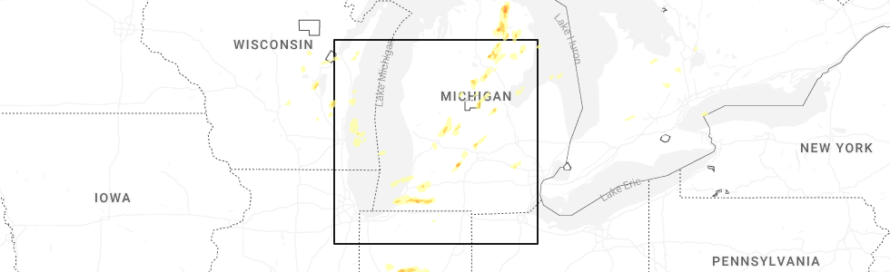
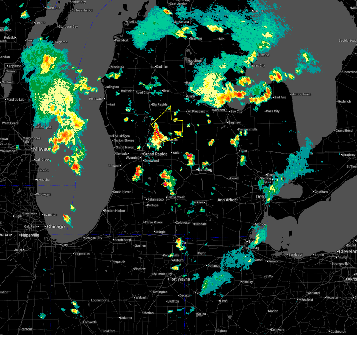
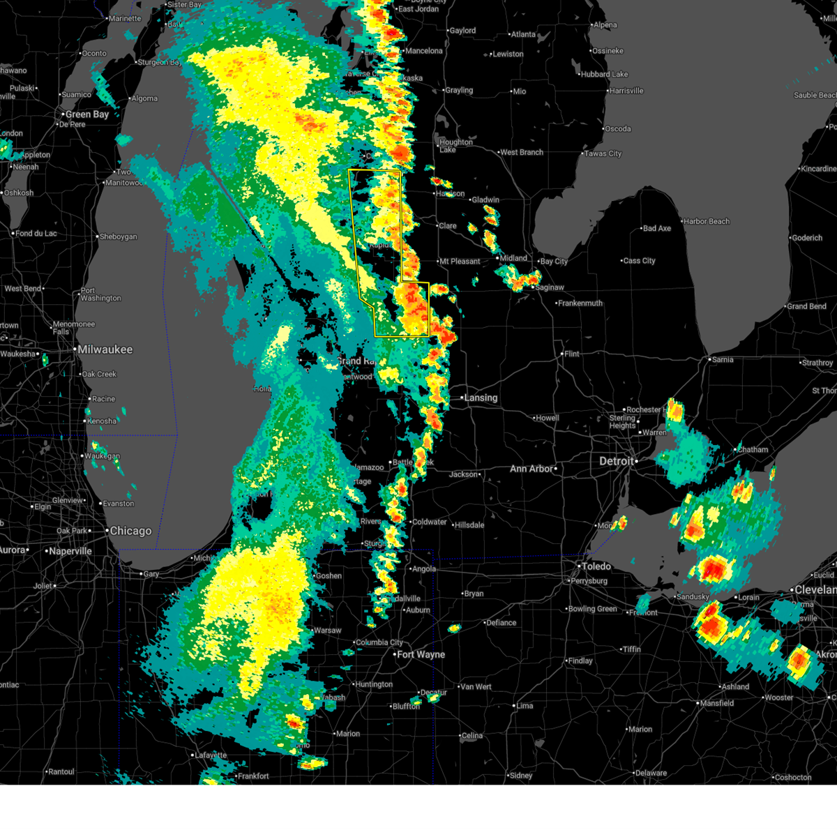
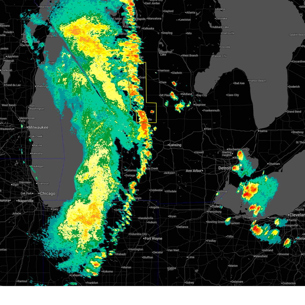
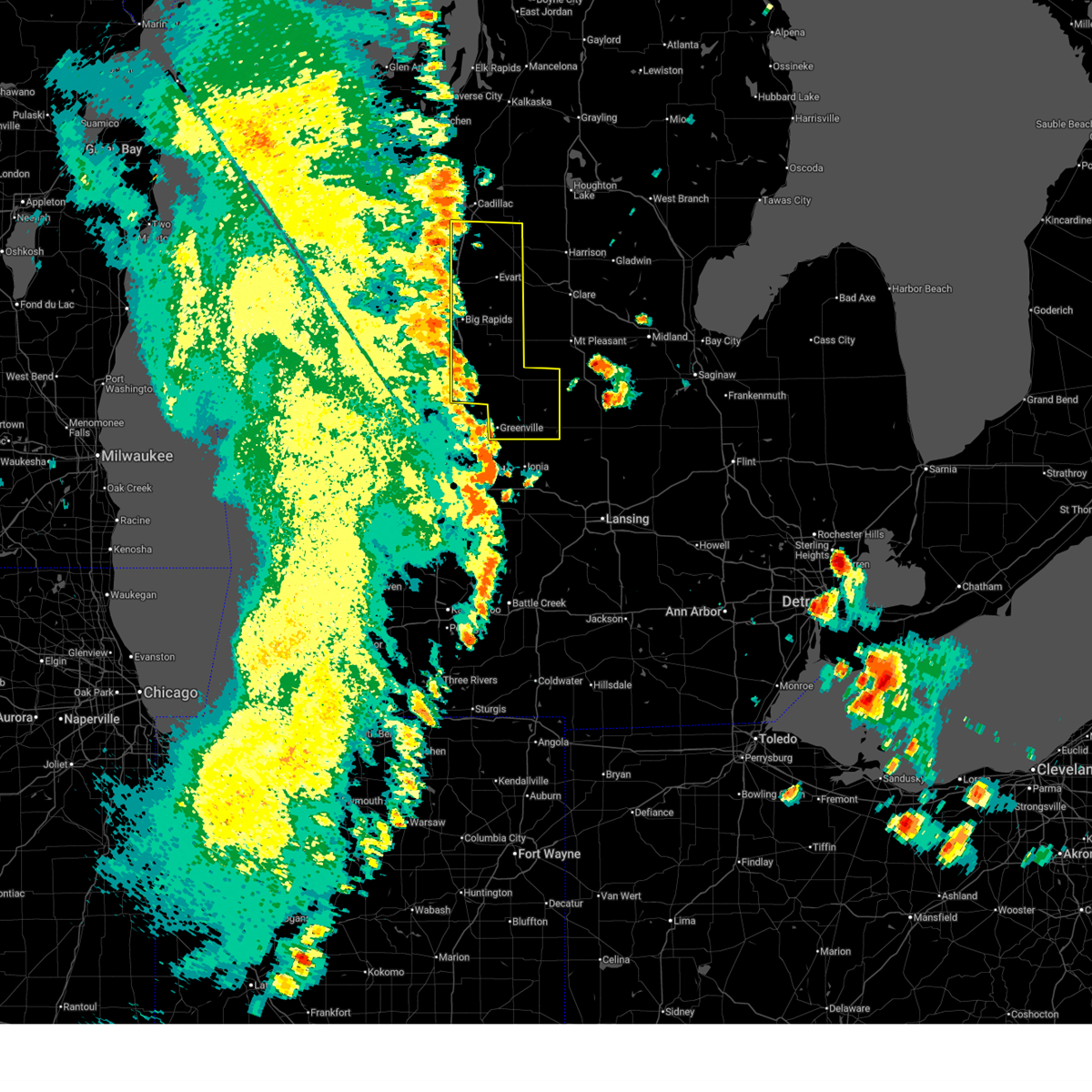
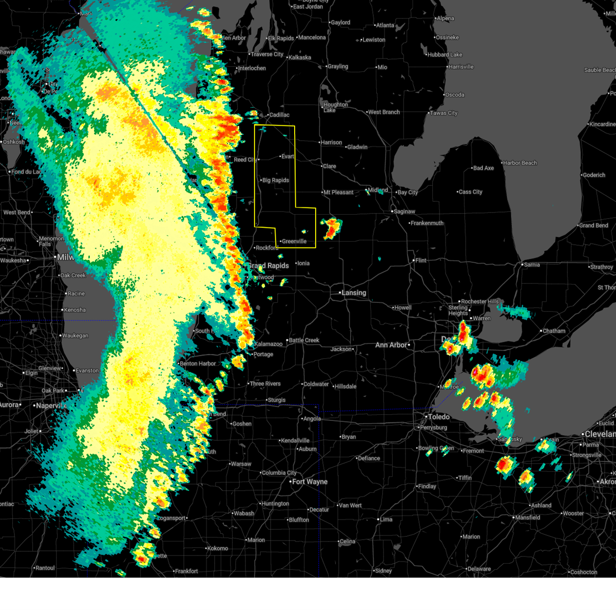
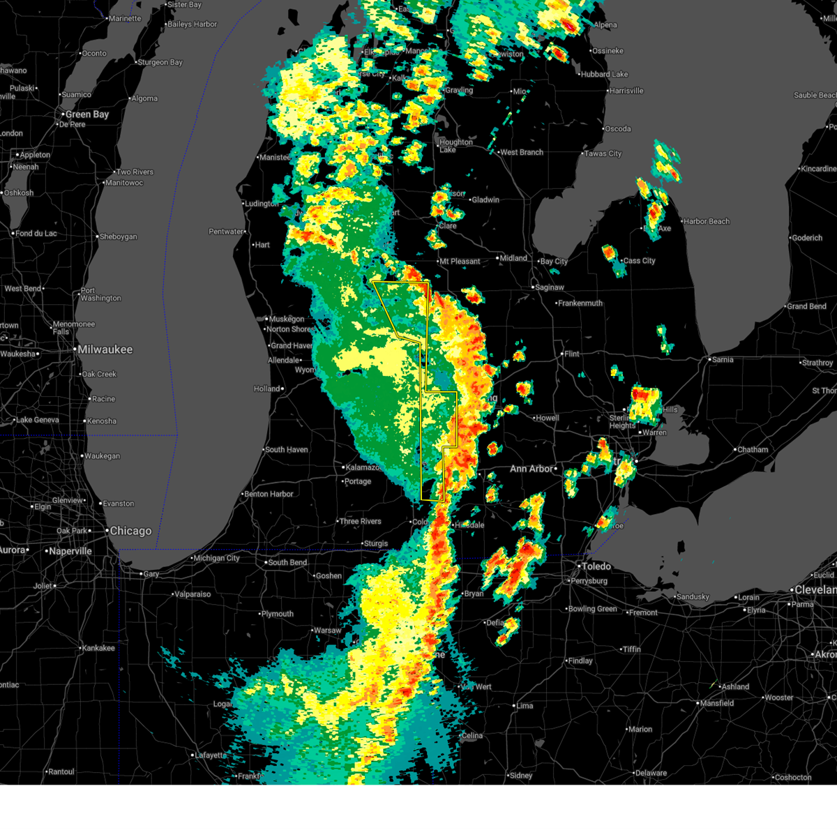
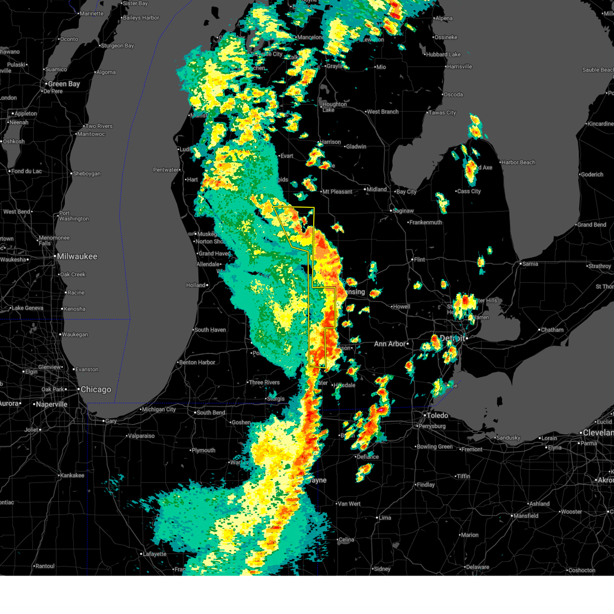
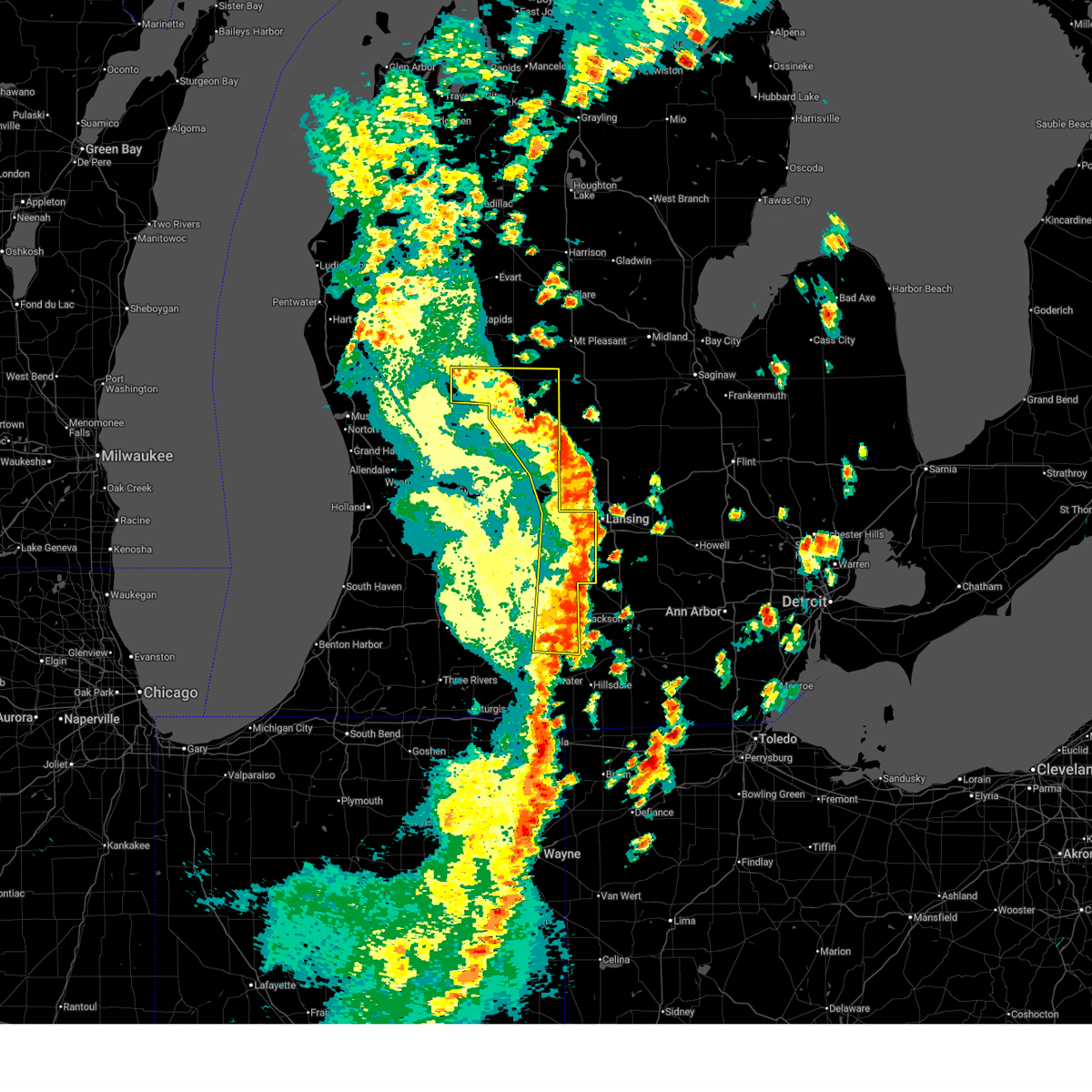
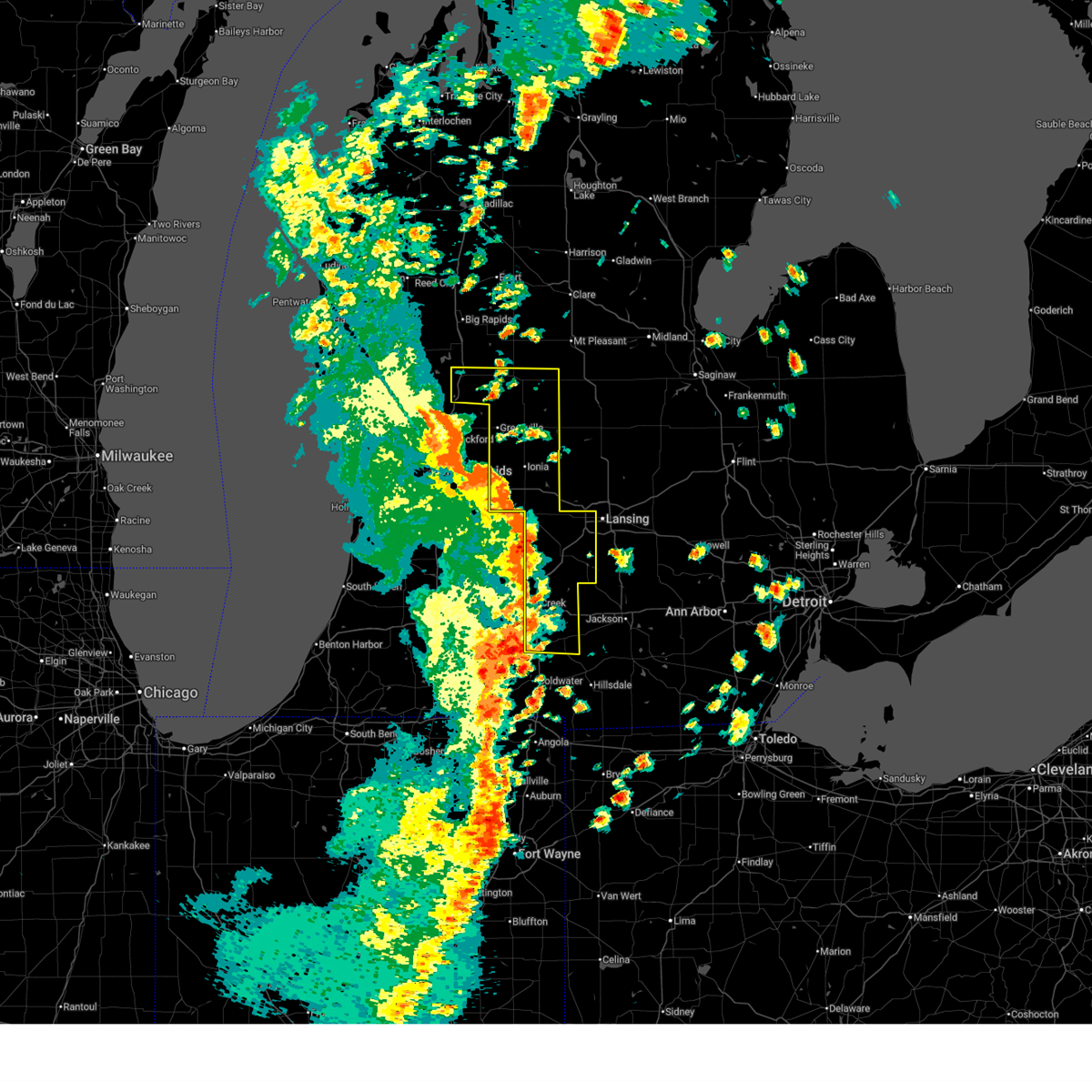
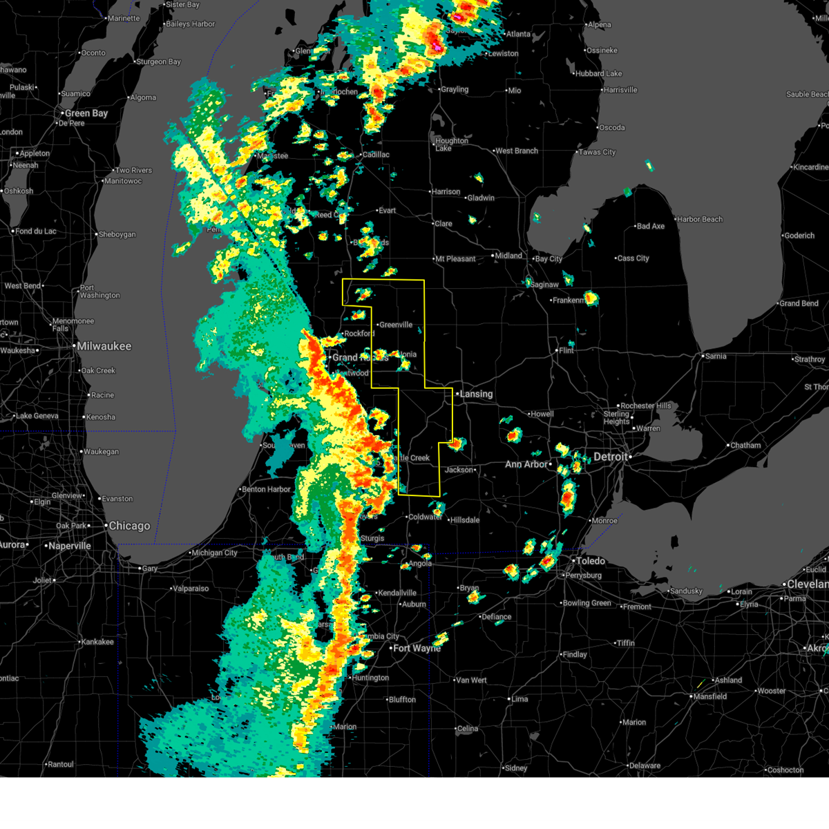
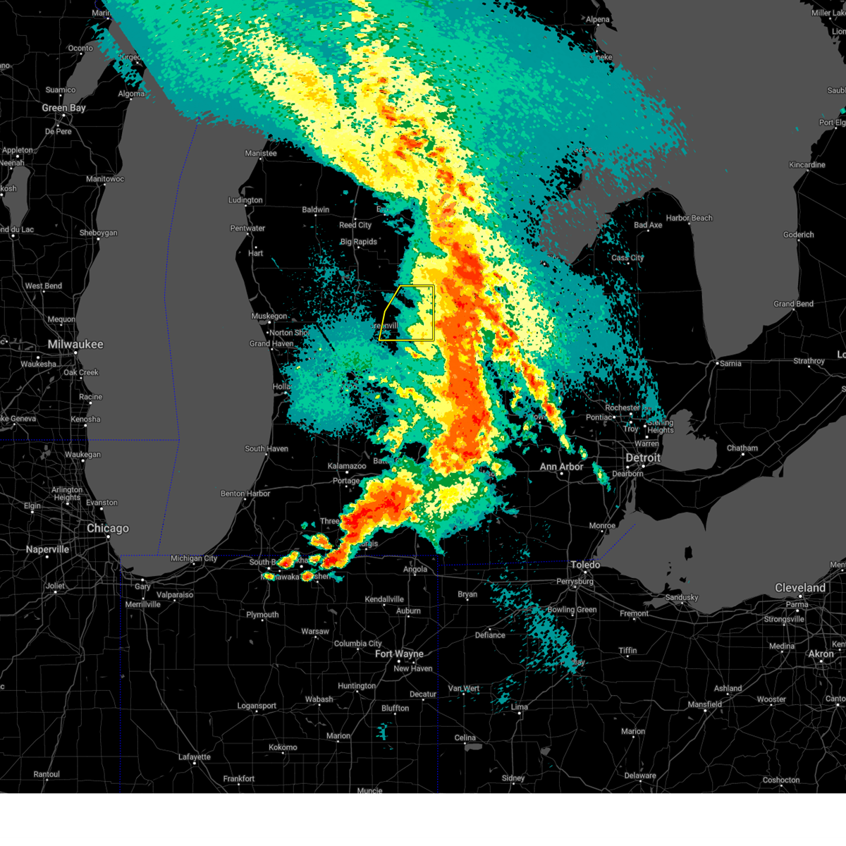
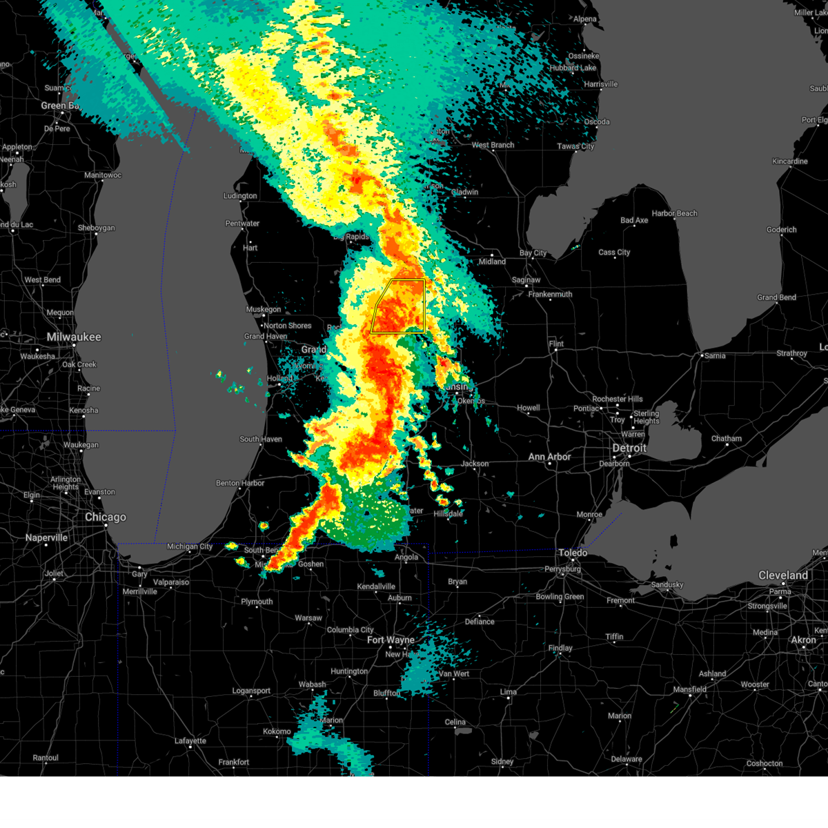
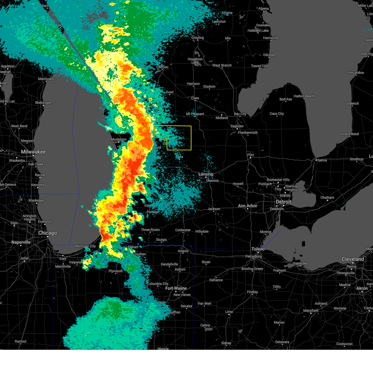
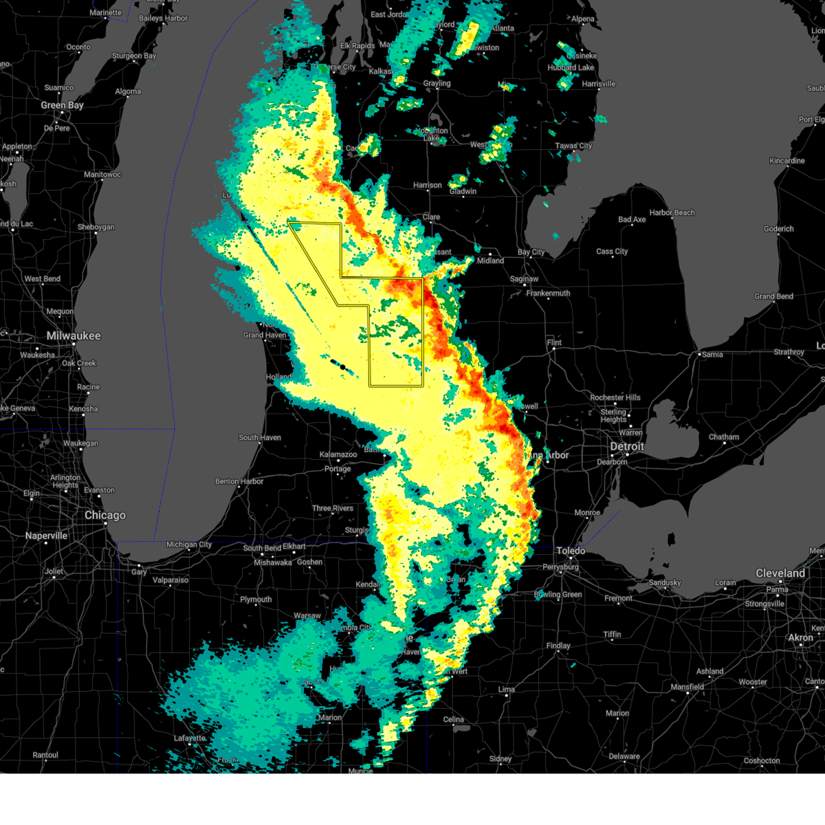
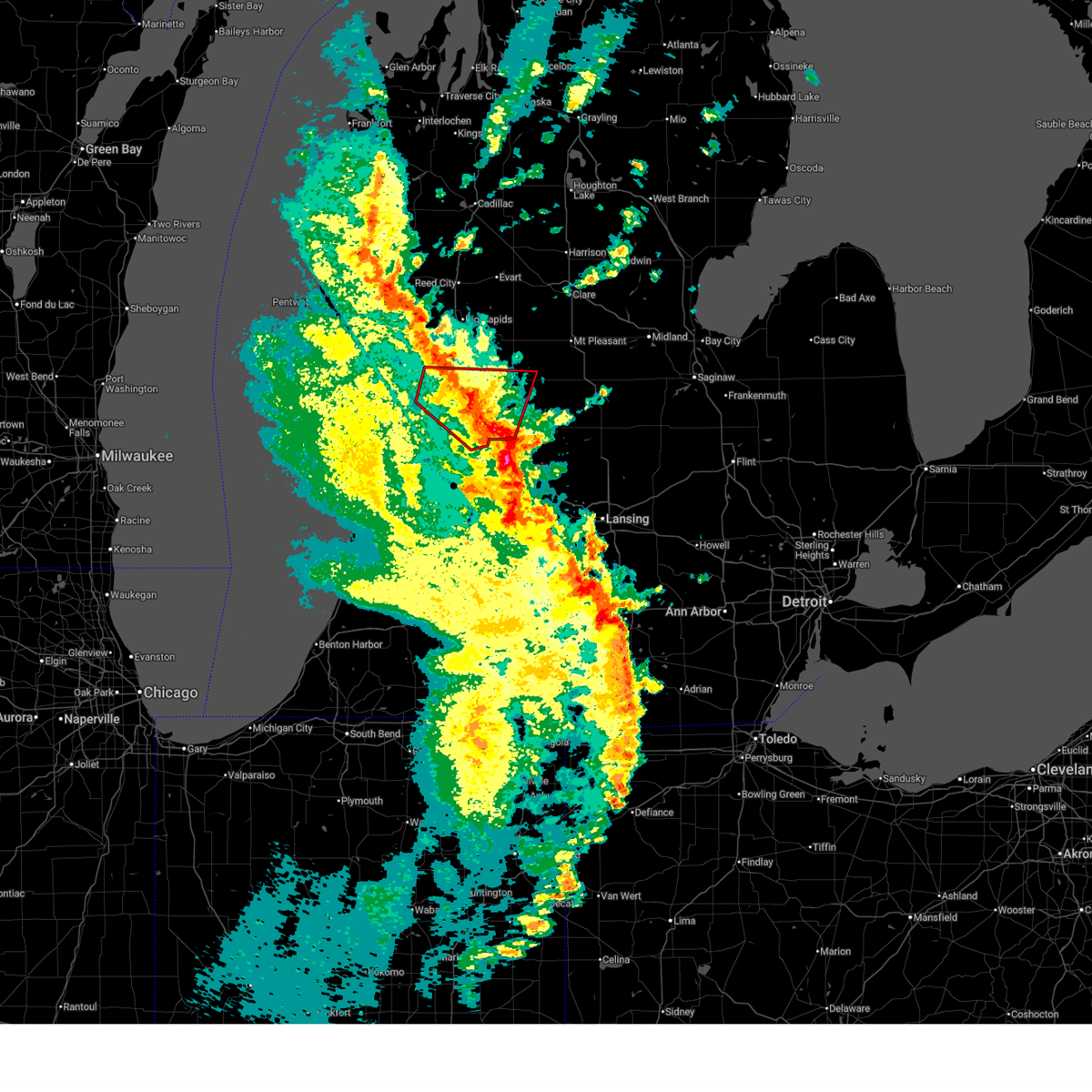
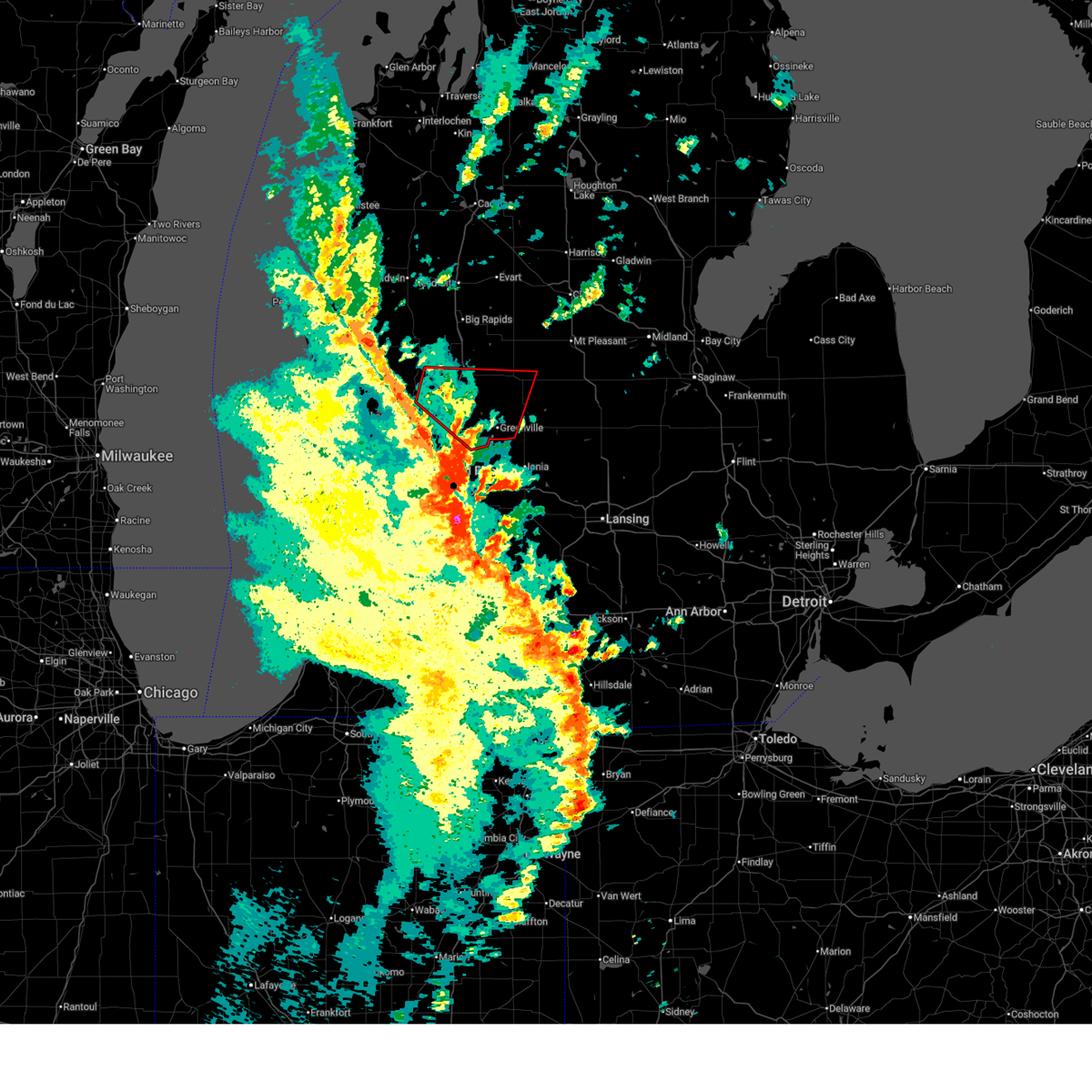
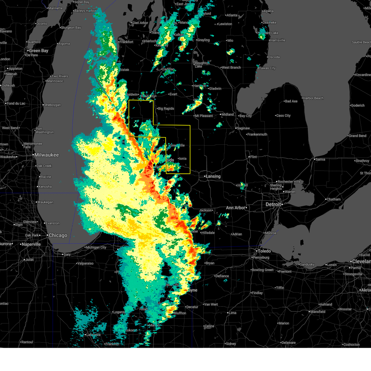
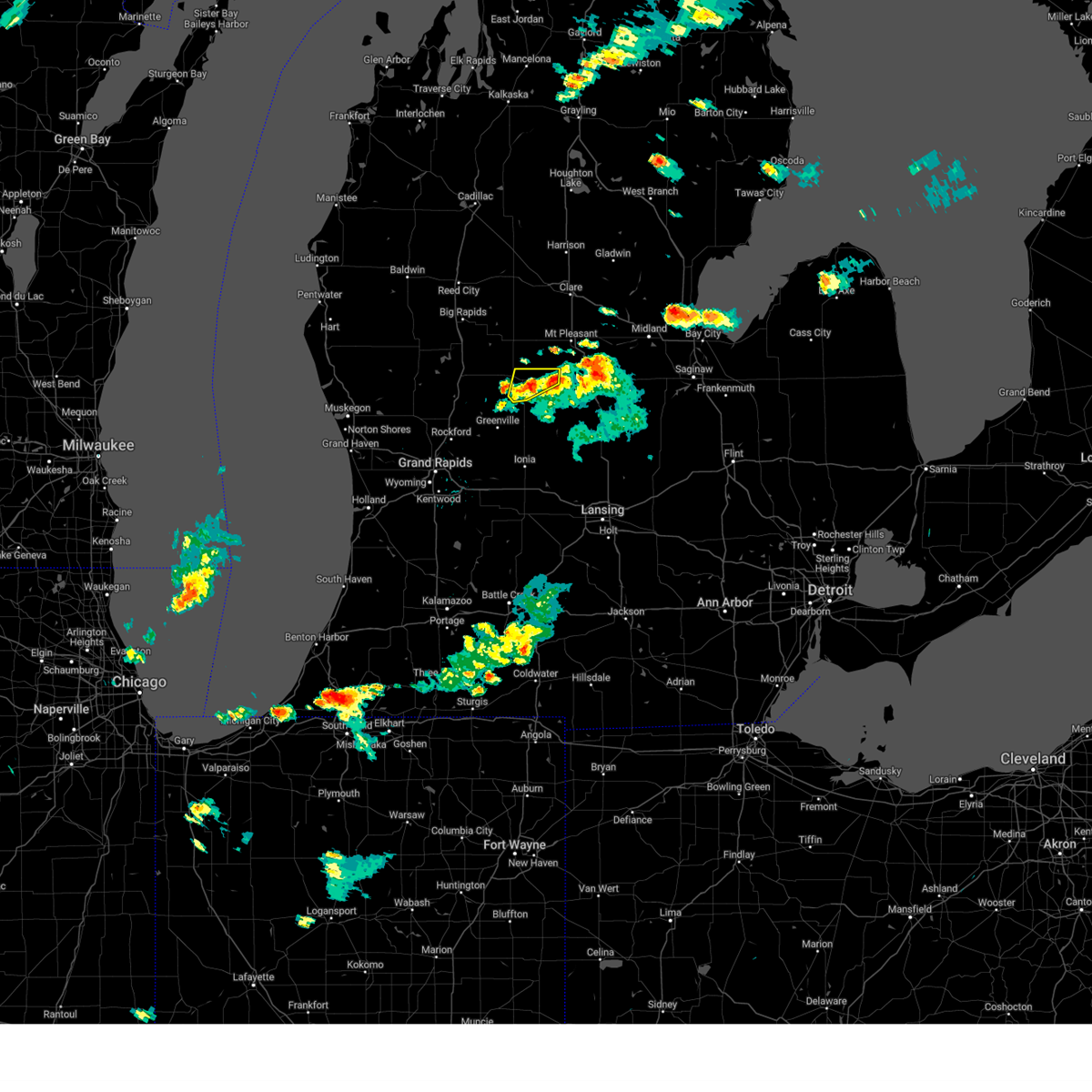
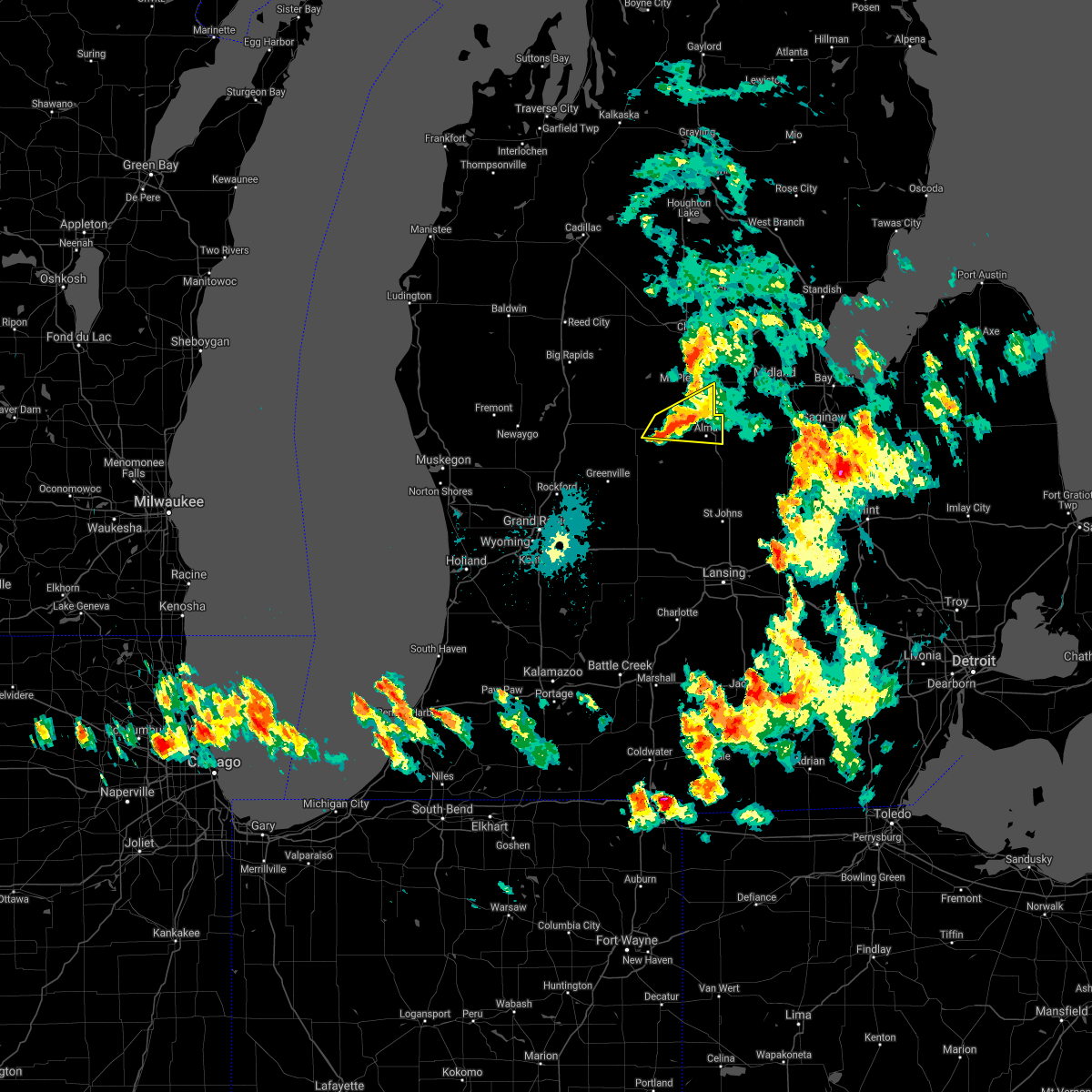
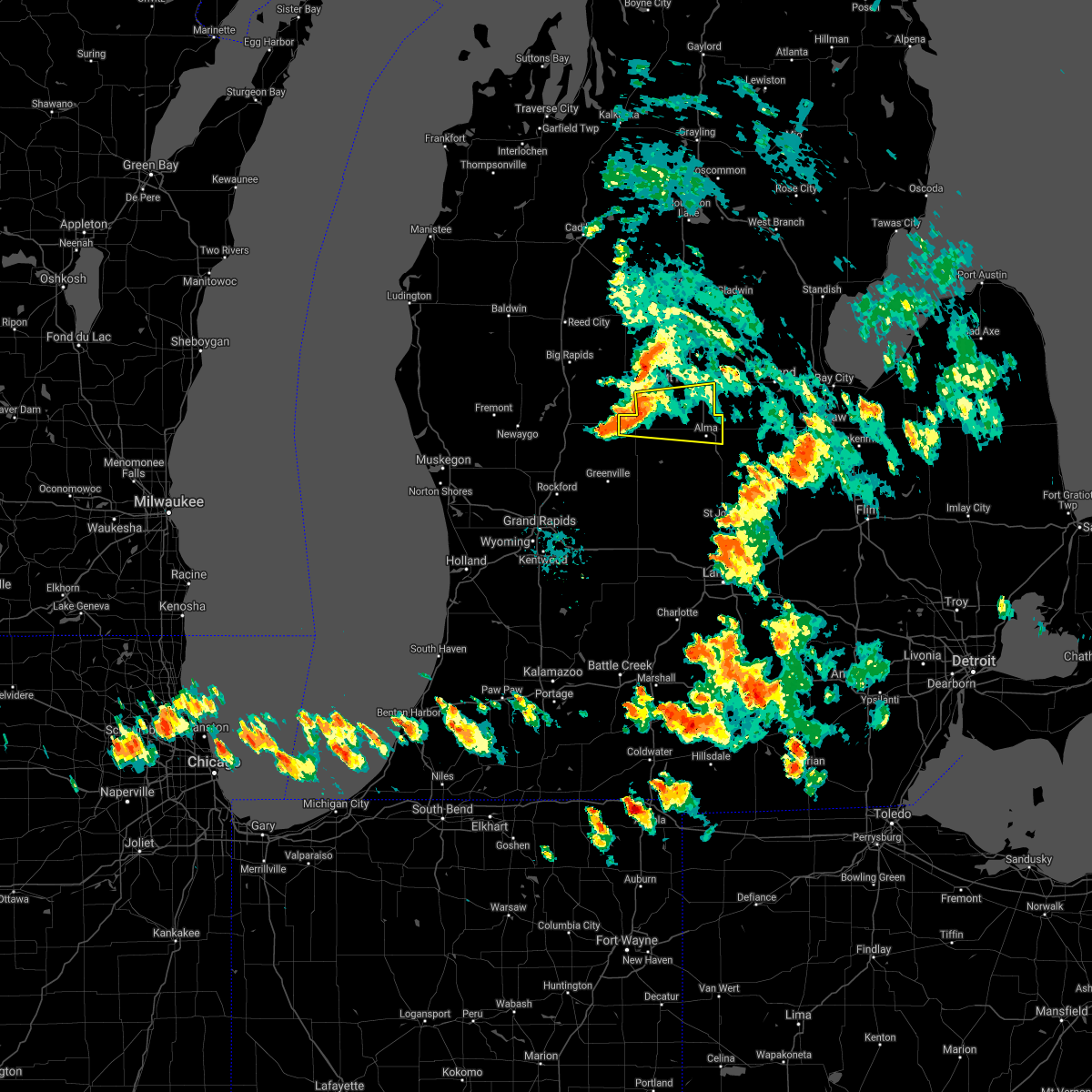
Hail Map for Edmore, MI
The Edmore, MI area has had 14 reports of on-the-ground hail by trained spotters, and has been under severe weather warnings 13 times during the past 12 months. Doppler radar has detected hail at or near Edmore, MI on 31 occasions, including 2 occasions during the past year.
| Name: | Edmore, MI |
| Where Located: | 44.1 miles NE of Grand Rapids, MI |
| Map: | Google Map for Edmore, MI |
| Population: | 1201 |
| Housing Units: | 565 |
| More Info: | Search Google for Edmore, MI |
0
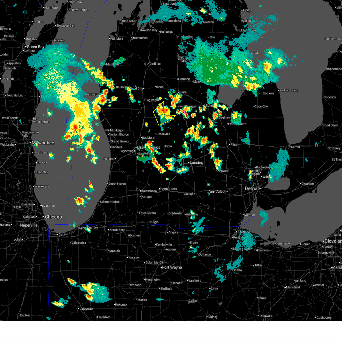
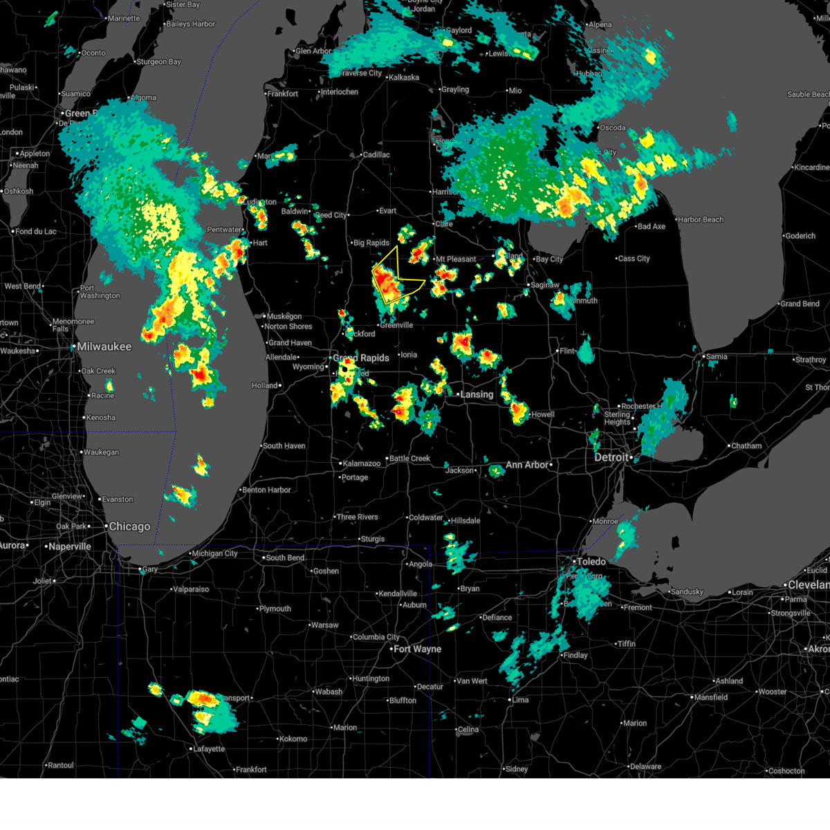
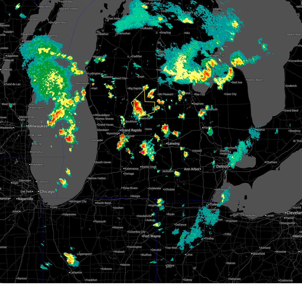
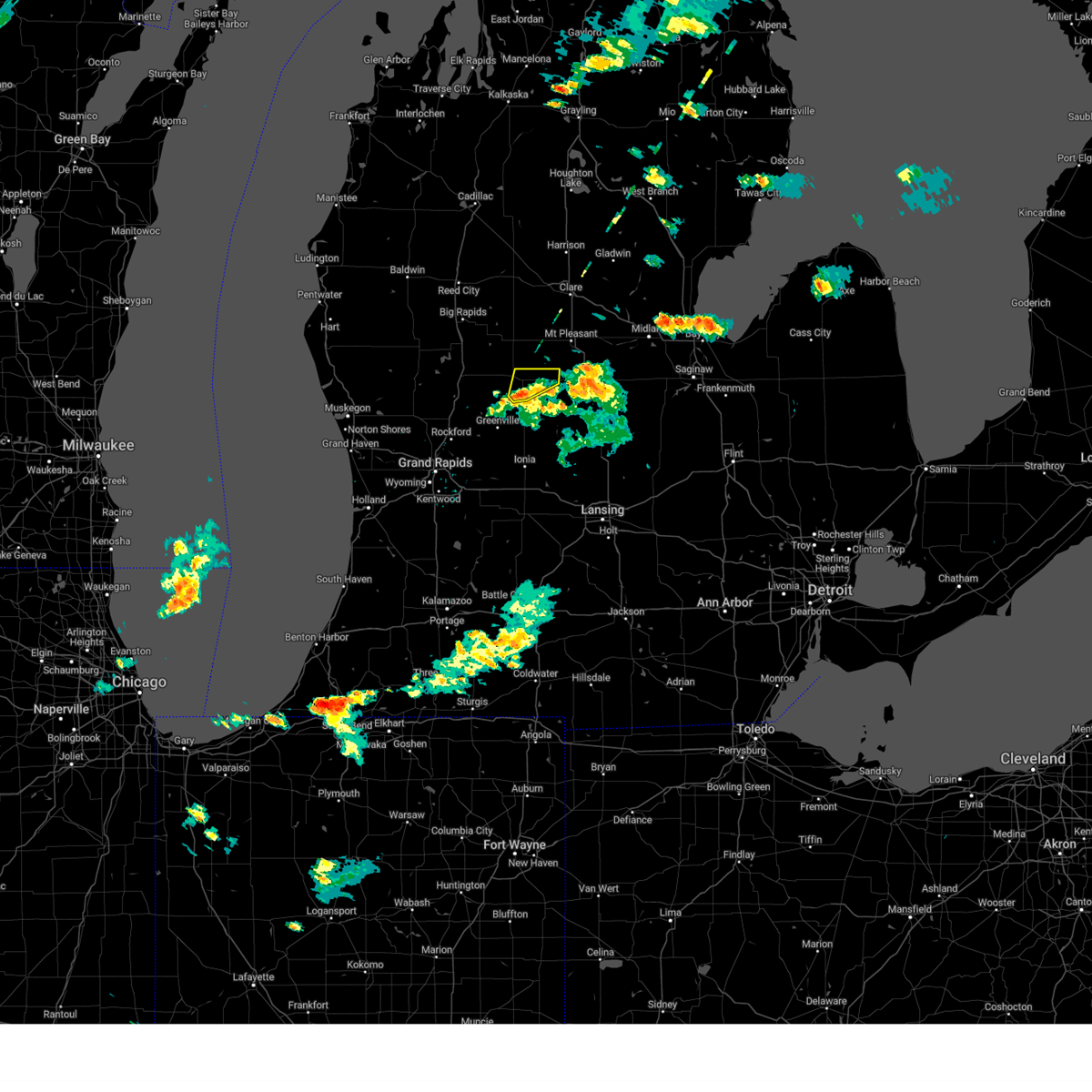
The Top Recent Hail Date for Edmore, MI is Tuesday, June 16, 2026 (31st out of 31)
Hail and Wind Damage Spotted near Edmore, MI
| Date / Time | Report Details |
|---|---|
| 6/16/2026 5:10 PM EDT |
 The storms which prompted the warning have weakened below severe limits, and have exited the warned area. therefore, the warning will be allowed to expire. a severe thunderstorm watch remains in effect until 1100 pm edt for central michigan. The storms which prompted the warning have weakened below severe limits, and have exited the warned area. therefore, the warning will be allowed to expire. a severe thunderstorm watch remains in effect until 1100 pm edt for central michigan.
|
| 6/16/2026 4:59 PM EDT |
 At 459 pm edt, severe thunderstorms were located along a line extending from 6 miles southeast of mecosta to 5 miles east of stanton, moving northeast at 30 mph (radar indicated). Hazards include 60 mph wind gusts and penny size hail. Expect damage to roofs, siding, and trees. Locations impacted include, edmore, lakeview, canadian lakes, remus, millbrook, mcbride, sylvester, westville, cedar lake, entrican, six lakes, wyman,. At 459 pm edt, severe thunderstorms were located along a line extending from 6 miles southeast of mecosta to 5 miles east of stanton, moving northeast at 30 mph (radar indicated). Hazards include 60 mph wind gusts and penny size hail. Expect damage to roofs, siding, and trees. Locations impacted include, edmore, lakeview, canadian lakes, remus, millbrook, mcbride, sylvester, westville, cedar lake, entrican, six lakes, wyman,.
|
| 6/16/2026 4:44 PM EDT |
 At 444 pm edt, severe thunderstorms were located along a line extending from near lakeview to near stanton, moving northeast at 30 mph (radar indicated). Hazards include 60 mph wind gusts and quarter size hail. Hail damage to vehicles is expected. expect wind damage to roofs, siding, and trees. Locations impacted include, stanton, edmore, lakeview, canadian lakes, sidney, remus, millbrook, mcbride, langston, sylvester, westville, cedar lake, entrican, amble, six lakes, vestaburg, wyman, kings corner,. At 444 pm edt, severe thunderstorms were located along a line extending from near lakeview to near stanton, moving northeast at 30 mph (radar indicated). Hazards include 60 mph wind gusts and quarter size hail. Hail damage to vehicles is expected. expect wind damage to roofs, siding, and trees. Locations impacted include, stanton, edmore, lakeview, canadian lakes, sidney, remus, millbrook, mcbride, langston, sylvester, westville, cedar lake, entrican, amble, six lakes, vestaburg, wyman, kings corner,.
|
| 6/16/2026 4:33 PM EDT |
 Svrgrr the national weather service in grand rapids has issued a * severe thunderstorm warning for, northeastern kent county in southwestern michigan, southeastern mecosta county in central michigan, montcalm county in central michigan, * until 515 pm edt. * at 433 pm edt, severe thunderstorms were located along a line extending from near morley to 5 miles east of greenville, moving northeast at 30 mph (radar indicated). Hazards include ping pong ball size hail and 60 mph wind gusts. People and animals outdoors will be injured. expect hail damage to roofs, siding, windows, and vehicles. Expect wind damage to roofs, siding, and trees. Svrgrr the national weather service in grand rapids has issued a * severe thunderstorm warning for, northeastern kent county in southwestern michigan, southeastern mecosta county in central michigan, montcalm county in central michigan, * until 515 pm edt. * at 433 pm edt, severe thunderstorms were located along a line extending from near morley to 5 miles east of greenville, moving northeast at 30 mph (radar indicated). Hazards include ping pong ball size hail and 60 mph wind gusts. People and animals outdoors will be injured. expect hail damage to roofs, siding, windows, and vehicles. Expect wind damage to roofs, siding, and trees.
|
| 6/10/2026 8:00 PM EDT |
 The storms which prompted the warning have moved out of the area. therefore, the warning has been allowed to expire. a severe thunderstorm watch remains in effect until 1100 pm edt for central, south central and southwestern michigan. The storms which prompted the warning have moved out of the area. therefore, the warning has been allowed to expire. a severe thunderstorm watch remains in effect until 1100 pm edt for central, south central and southwestern michigan.
|
| 6/10/2026 7:40 PM EDT |
 At 740 pm edt, severe thunderstorms were located along a line extending from 7 miles southwest of mcbain to near mecosta to 9 miles east of belding, moving east at 20 mph (radar indicated). Hazards include 60 mph wind gusts. Expect damage to roofs, siding, and trees. Locations impacted include, big rapids, greenville, evart, stanton, reed city, edmore, carson city, lakeview, marion, morley, mecosta, canadian lakes, crystal, sidney, remus, highland, millbrook, sheridan, barryton, hersey,. At 740 pm edt, severe thunderstorms were located along a line extending from 7 miles southwest of mcbain to near mecosta to 9 miles east of belding, moving east at 20 mph (radar indicated). Hazards include 60 mph wind gusts. Expect damage to roofs, siding, and trees. Locations impacted include, big rapids, greenville, evart, stanton, reed city, edmore, carson city, lakeview, marion, morley, mecosta, canadian lakes, crystal, sidney, remus, highland, millbrook, sheridan, barryton, hersey,.
|
| 6/10/2026 7:24 PM EDT |
 At 723 pm edt, severe thunderstorms were located along a line extending from cadillac to 6 miles southeast of reed city to near morley, moving northeast at 60 mph (radar indicated). Hazards include 60 mph wind gusts. Expect damage to roofs, siding, and trees. Locations impacted include, big rapids, greenville, evart, stanton, reed city, howard city, edmore, carson city, lakeview, marion, morley, mecosta, canadian lakes, crystal, sidney, remus, highland, millbrook, sheridan, paris,. At 723 pm edt, severe thunderstorms were located along a line extending from cadillac to 6 miles southeast of reed city to near morley, moving northeast at 60 mph (radar indicated). Hazards include 60 mph wind gusts. Expect damage to roofs, siding, and trees. Locations impacted include, big rapids, greenville, evart, stanton, reed city, howard city, edmore, carson city, lakeview, marion, morley, mecosta, canadian lakes, crystal, sidney, remus, highland, millbrook, sheridan, paris,.
|
| 6/10/2026 7:07 PM EDT |
 Svrgrr the national weather service in grand rapids has issued a * severe thunderstorm warning for, osceola county in central michigan, mecosta county in central michigan, montcalm county in central michigan, * until 800 pm edt. * at 706 pm edt, severe thunderstorms were located along a line extending from near hoxeyville to 8 miles east of newaygo, moving northeast at 60 mph (radar indicated). Hazards include 60 mph wind gusts. expect damage to roofs, siding, and trees Svrgrr the national weather service in grand rapids has issued a * severe thunderstorm warning for, osceola county in central michigan, mecosta county in central michigan, montcalm county in central michigan, * until 800 pm edt. * at 706 pm edt, severe thunderstorms were located along a line extending from near hoxeyville to 8 miles east of newaygo, moving northeast at 60 mph (radar indicated). Hazards include 60 mph wind gusts. expect damage to roofs, siding, and trees
|
| 5/18/2026 3:44 PM EDT |
 the severe thunderstorm warning has been cancelled and is no longer in effect the severe thunderstorm warning has been cancelled and is no longer in effect
|
| 5/18/2026 3:28 PM EDT |
 At 327 pm edt, severe thunderstorms were located along a line extending from near lakeview to near st. johns to 7 miles northeast of litchfield, moving northeast at 55 mph (radar indicated). Hazards include 70 mph wind gusts and quarter size hail. Hail damage to vehicles is expected. expect considerable tree damage. wind damage is also likely to mobile homes, roofs, and outbuildings. Locations impacted include, lansing, charlotte, albion, eaton rapids, portland, stanton, grand ledge, potterville, homer, edmore, lakeview, edgemont park, crystal, sidney, marengo, brookfield, dimondale, sheridan, mulliken, waverly,. At 327 pm edt, severe thunderstorms were located along a line extending from near lakeview to near st. johns to 7 miles northeast of litchfield, moving northeast at 55 mph (radar indicated). Hazards include 70 mph wind gusts and quarter size hail. Hail damage to vehicles is expected. expect considerable tree damage. wind damage is also likely to mobile homes, roofs, and outbuildings. Locations impacted include, lansing, charlotte, albion, eaton rapids, portland, stanton, grand ledge, potterville, homer, edmore, lakeview, edgemont park, crystal, sidney, marengo, brookfield, dimondale, sheridan, mulliken, waverly,.
|
| 5/18/2026 3:19 PM EDT |
 At 319 pm edt, severe thunderstorms were located along a line extending from near lakeview to 5 miles west of st. johns to near litchfield, moving northeast at 55 mph (radar indicated). Hazards include 70 mph wind gusts and quarter size hail. Hail damage to vehicles is expected. expect considerable tree damage. wind damage is also likely to mobile homes, roofs, and outbuildings. Locations impacted include, lansing, ionia, charlotte, albion, greenville, marshall, eaton rapids, portland, stanton, grand ledge, potterville, howard city, homer, edmore, carson city, lakeview, edgemont park, orleans, crystal, sidney,. At 319 pm edt, severe thunderstorms were located along a line extending from near lakeview to 5 miles west of st. johns to near litchfield, moving northeast at 55 mph (radar indicated). Hazards include 70 mph wind gusts and quarter size hail. Hail damage to vehicles is expected. expect considerable tree damage. wind damage is also likely to mobile homes, roofs, and outbuildings. Locations impacted include, lansing, ionia, charlotte, albion, greenville, marshall, eaton rapids, portland, stanton, grand ledge, potterville, howard city, homer, edmore, carson city, lakeview, edgemont park, orleans, crystal, sidney,.
|
| 5/18/2026 2:55 PM EDT |
 At 254 pm edt, severe thunderstorms were located along a line extending from 7 miles south of howard city to 8 miles southwest of portland to 5 miles west of homer, moving east at 75 mph (asos. at 244 pm 74 mph winds were reported at battle creek asos). Hazards include 70 mph wind gusts and quarter size hail. Hail damage to vehicles is expected. expect considerable tree damage. wind damage is also likely to mobile homes, roofs, and outbuildings. Locations impacted include, lansing, ionia, charlotte, albion, greenville, marshall, eaton rapids, portland, stanton, grand ledge, belding, potterville, lake odessa, howard city, homer, saranac, bellevue, edmore, carson city, lakeview,. At 254 pm edt, severe thunderstorms were located along a line extending from 7 miles south of howard city to 8 miles southwest of portland to 5 miles west of homer, moving east at 75 mph (asos. at 244 pm 74 mph winds were reported at battle creek asos). Hazards include 70 mph wind gusts and quarter size hail. Hail damage to vehicles is expected. expect considerable tree damage. wind damage is also likely to mobile homes, roofs, and outbuildings. Locations impacted include, lansing, ionia, charlotte, albion, greenville, marshall, eaton rapids, portland, stanton, grand ledge, belding, potterville, lake odessa, howard city, homer, saranac, bellevue, edmore, carson city, lakeview,.
|
| 5/18/2026 2:34 PM EDT |
 Svrgrr the national weather service in grand rapids has issued a * severe thunderstorm warning for, calhoun county in south central michigan, ionia county in south central michigan, eaton county in south central michigan, montcalm county in central michigan, * until 400 pm edt. * at 234 pm edt, severe thunderstorms were located along a line extending from near walker to near middleville to near battle creek, moving northeast at 55 mph (radar indicated). Hazards include 70 mph wind gusts. Expect considerable tree damage. Damage is likely to mobile homes, roofs, and outbuildings. Svrgrr the national weather service in grand rapids has issued a * severe thunderstorm warning for, calhoun county in south central michigan, ionia county in south central michigan, eaton county in south central michigan, montcalm county in central michigan, * until 400 pm edt. * at 234 pm edt, severe thunderstorms were located along a line extending from near walker to near middleville to near battle creek, moving northeast at 55 mph (radar indicated). Hazards include 70 mph wind gusts. Expect considerable tree damage. Damage is likely to mobile homes, roofs, and outbuildings.
|
| 5/15/2025 11:45 PM EDT |
 the severe thunderstorm warning has been cancelled and is no longer in effect the severe thunderstorm warning has been cancelled and is no longer in effect
|
| 5/15/2025 11:14 PM EDT |
 At 1114 pm edt, severe thunderstorms were located along a line extending from 9 miles east of edmore to 10 miles east of stanton to 5 miles southwest of carson city, moving east at 35 mph (radar indicated). Hazards include 60 mph wind gusts. Expect damage to roofs, siding, and trees. Locations impacted include, greenville, stanton, edmore, carson city, crystal, sidney, sheridan, mcbride, langston, westville, cedar lake, entrican, six lakes, vestaburg, wyman, butternut, fenwick, kings corner,. At 1114 pm edt, severe thunderstorms were located along a line extending from 9 miles east of edmore to 10 miles east of stanton to 5 miles southwest of carson city, moving east at 35 mph (radar indicated). Hazards include 60 mph wind gusts. Expect damage to roofs, siding, and trees. Locations impacted include, greenville, stanton, edmore, carson city, crystal, sidney, sheridan, mcbride, langston, westville, cedar lake, entrican, six lakes, vestaburg, wyman, butternut, fenwick, kings corner,.
|
| 5/15/2025 10:24 PM EDT |
 Svrgrr the national weather service in grand rapids has issued a * severe thunderstorm warning for, montcalm county in central michigan, * until midnight edt. * at 1024 pm edt, severe thunderstorms were located along a line extending from 7 miles east of white cloud to near rockford to 6 miles southeast of hudsonville, moving east at 50 mph (radar indicated). Hazards include 70 mph wind gusts. Expect considerable tree damage. Damage is likely to mobile homes, roofs, and outbuildings. Svrgrr the national weather service in grand rapids has issued a * severe thunderstorm warning for, montcalm county in central michigan, * until midnight edt. * at 1024 pm edt, severe thunderstorms were located along a line extending from 7 miles east of white cloud to near rockford to 6 miles southeast of hudsonville, moving east at 50 mph (radar indicated). Hazards include 70 mph wind gusts. Expect considerable tree damage. Damage is likely to mobile homes, roofs, and outbuildings.
|
| 5/15/2025 11:09 AM EDT | Large healthy tree down. time estimated from rada in montcalm county MI, 5.8 miles W of Edmore, MI |
| 4/18/2025 10:08 AM EDT |
 At 1005 am edt, severe thunderstorms were located along a line extending from near fruitport to near beechwood, moving east at 55 mph. this is a second area of thunderstorms that was following strong but non severe thunderstorms currently over the grand rapids area that were also moving east (radar indicated). Hazards include 60 mph wind gusts and quarter size hail. Hail damage to vehicles is expected. expect wind damage to roofs, siding, and trees. Locations impacted include, port sheldon, clarksville, reeman, cedar lake, stanton, belmont, lakewood club, muskegon heights, dalton, alto, wyman, orleans, whitehall, marne, dutton, brunswick, holton, comstock park, hudsonville, sheridan,. At 1005 am edt, severe thunderstorms were located along a line extending from near fruitport to near beechwood, moving east at 55 mph. this is a second area of thunderstorms that was following strong but non severe thunderstorms currently over the grand rapids area that were also moving east (radar indicated). Hazards include 60 mph wind gusts and quarter size hail. Hail damage to vehicles is expected. expect wind damage to roofs, siding, and trees. Locations impacted include, port sheldon, clarksville, reeman, cedar lake, stanton, belmont, lakewood club, muskegon heights, dalton, alto, wyman, orleans, whitehall, marne, dutton, brunswick, holton, comstock park, hudsonville, sheridan,.
|
| 4/18/2025 9:48 AM EDT |
 Svrgrr the national weather service in grand rapids has issued a * severe thunderstorm warning for, kent county in southwestern michigan, ottawa county in southwestern michigan, southern newaygo county in west central michigan, ionia county in south central michigan, muskegon county in west central michigan, northwestern eaton county in south central michigan, southeastern oceana county in west central michigan, montcalm county in central michigan, * until 1115 am edt. * at 947 am edt, severe thunderstorms were located along a line extending from near fruitport to 5 miles southwest of allendale to near zeeland, moving east at 65 mph (radar indicated). Hazards include 60 mph wind gusts and quarter size hail. Hail damage to vehicles is expected. Expect wind damage to roofs, siding, and trees. Svrgrr the national weather service in grand rapids has issued a * severe thunderstorm warning for, kent county in southwestern michigan, ottawa county in southwestern michigan, southern newaygo county in west central michigan, ionia county in south central michigan, muskegon county in west central michigan, northwestern eaton county in south central michigan, southeastern oceana county in west central michigan, montcalm county in central michigan, * until 1115 am edt. * at 947 am edt, severe thunderstorms were located along a line extending from near fruitport to 5 miles southwest of allendale to near zeeland, moving east at 65 mph (radar indicated). Hazards include 60 mph wind gusts and quarter size hail. Hail damage to vehicles is expected. Expect wind damage to roofs, siding, and trees.
|
| 3/30/2025 6:39 PM EDT |
 The storms which prompted the warning are moving out of the area. therefore, the warning will be allowed to expire. a severe thunderstorm watch remains in effect until 900 pm edt for south central, central and southwestern michigan. The storms which prompted the warning are moving out of the area. therefore, the warning will be allowed to expire. a severe thunderstorm watch remains in effect until 900 pm edt for south central, central and southwestern michigan.
|
| 3/30/2025 6:21 PM EDT |
 the tornado warning has been cancelled and is no longer in effect the tornado warning has been cancelled and is no longer in effect
|
| 3/30/2025 6:21 PM EDT |
 At 621 pm edt, a severe squall line capable of producing both tornadoes and extensive straight line wind damage was located along a line extending from near howard city to near greenville, moving northeast at 50 mph (radar indicated rotation). Hazards include tornado. Flying debris will be dangerous to those caught without shelter. mobile homes will be damaged or destroyed. damage to roofs, windows, and vehicles will occur. tree damage is likely. these dangerous storms will be near, lakeview and stanton around 625 pm edt. Other locations in the path of these tornadic storms include edmore. At 621 pm edt, a severe squall line capable of producing both tornadoes and extensive straight line wind damage was located along a line extending from near howard city to near greenville, moving northeast at 50 mph (radar indicated rotation). Hazards include tornado. Flying debris will be dangerous to those caught without shelter. mobile homes will be damaged or destroyed. damage to roofs, windows, and vehicles will occur. tree damage is likely. these dangerous storms will be near, lakeview and stanton around 625 pm edt. Other locations in the path of these tornadic storms include edmore.
|
| 3/30/2025 6:19 PM EDT |
 At 618 pm edt, severe thunderstorms were located along a line extending from 10 miles southeast of baldwin to 7 miles east of greenville to 6 miles south of ionia, moving northeast at 75 mph. these are destructive storms for western and southern michigan (radar indicated). Hazards include 80 mph wind gusts and penny size hail. Flying debris will be dangerous to those caught without shelter. mobile homes will be heavily damaged. expect considerable damage to roofs, windows, and vehicles. extensive tree damage and power outages are likely. Locations impacted include, clarksville, cedar lake, stanton, vestaburg, wyman, orleans, langston, hawkins, lakeview, greenville, six lakes, pierson, woodville, sidney, sheridan, howard city, belding, carson city, bitely, ionia,. At 618 pm edt, severe thunderstorms were located along a line extending from 10 miles southeast of baldwin to 7 miles east of greenville to 6 miles south of ionia, moving northeast at 75 mph. these are destructive storms for western and southern michigan (radar indicated). Hazards include 80 mph wind gusts and penny size hail. Flying debris will be dangerous to those caught without shelter. mobile homes will be heavily damaged. expect considerable damage to roofs, windows, and vehicles. extensive tree damage and power outages are likely. Locations impacted include, clarksville, cedar lake, stanton, vestaburg, wyman, orleans, langston, hawkins, lakeview, greenville, six lakes, pierson, woodville, sidney, sheridan, howard city, belding, carson city, bitely, ionia,.
|
| 3/30/2025 6:12 PM EDT |
 At 611 pm edt, tornado producing storms were located along a line extending from 5 miles east of newaygo to near greenville, moving northeast at 50 mph (radar confirmed tornado just east of newaygo). Hazards include damaging tornado. Flying debris will be dangerous to those caught without shelter. mobile homes will be damaged or destroyed. damage to roofs, windows, and vehicles will occur. tree damage is likely. these tornadic storms will be near, greenville and howard city around 615 pm edt. Other locations in the path of these tornadic storms include lakeview and edmore. At 611 pm edt, tornado producing storms were located along a line extending from 5 miles east of newaygo to near greenville, moving northeast at 50 mph (radar confirmed tornado just east of newaygo). Hazards include damaging tornado. Flying debris will be dangerous to those caught without shelter. mobile homes will be damaged or destroyed. damage to roofs, windows, and vehicles will occur. tree damage is likely. these tornadic storms will be near, greenville and howard city around 615 pm edt. Other locations in the path of these tornadic storms include lakeview and edmore.
|
| 3/30/2025 6:02 PM EDT |
 At 601 pm edt, severe thunderstorms were located along a line extending from near hesperia to near freeport, moving east at 60 mph. these are destructive storms for western michigan (at 5:50 pm 80 mph winds were observed at grand rapids asos). Hazards include 80 mph wind gusts and penny size hail. Flying debris will be dangerous to those caught without shelter. mobile homes will be heavily damaged. expect considerable damage to roofs, windows, and vehicles. extensive tree damage and power outages are likely. Locations impacted include, clarksville, reeman, cedar lake, stanton, vestaburg, wyman, newaygo, orleans, langston, hawkins, lakeview, greenville, six lakes, pierson, woodville, sidney, sheridan, howard city, belding, carson city,. At 601 pm edt, severe thunderstorms were located along a line extending from near hesperia to near freeport, moving east at 60 mph. these are destructive storms for western michigan (at 5:50 pm 80 mph winds were observed at grand rapids asos). Hazards include 80 mph wind gusts and penny size hail. Flying debris will be dangerous to those caught without shelter. mobile homes will be heavily damaged. expect considerable damage to roofs, windows, and vehicles. extensive tree damage and power outages are likely. Locations impacted include, clarksville, reeman, cedar lake, stanton, vestaburg, wyman, newaygo, orleans, langston, hawkins, lakeview, greenville, six lakes, pierson, woodville, sidney, sheridan, howard city, belding, carson city,.
|
| 3/30/2025 6:02 PM EDT |
 Torgrr the national weather service in grand rapids has issued a * tornado warning for, northeastern kent county in southwestern michigan, southeastern newaygo county in west central michigan, central montcalm county in central michigan, * until 630 pm edt. * at 602 pm edt, severe thunderstorms capable of producing both tornadoes and extensive straight line wind damage were located along a line extending from 5 miles southeast of grant to near rockford, moving northeast at 55 mph (radar indicated rotation). Hazards include tornado. Flying debris will be dangerous to those caught without shelter. mobile homes will be damaged or destroyed. damage to roofs, windows, and vehicles will occur. tree damage is likely. these dangerous storms will be near, howard city around 610 pm edt. Other locations in the path of these tornadic storms include lakeview. Torgrr the national weather service in grand rapids has issued a * tornado warning for, northeastern kent county in southwestern michigan, southeastern newaygo county in west central michigan, central montcalm county in central michigan, * until 630 pm edt. * at 602 pm edt, severe thunderstorms capable of producing both tornadoes and extensive straight line wind damage were located along a line extending from 5 miles southeast of grant to near rockford, moving northeast at 55 mph (radar indicated rotation). Hazards include tornado. Flying debris will be dangerous to those caught without shelter. mobile homes will be damaged or destroyed. damage to roofs, windows, and vehicles will occur. tree damage is likely. these dangerous storms will be near, howard city around 610 pm edt. Other locations in the path of these tornadic storms include lakeview.
|
| 3/30/2025 5:48 PM EDT |
 Svrgrr the national weather service in grand rapids has issued a * severe thunderstorm warning for, newaygo county in west central michigan, ionia county in south central michigan, montcalm county in central michigan, * until 645 pm edt. * at 547 pm edt, severe thunderstorms were located along a line extending from 6 miles northeast of hart to near middleville, moving northeast at 85 mph (radar indicated). Hazards include 70 mph wind gusts and penny size hail. Expect considerable tree damage. Damage is likely to mobile homes, roofs, and outbuildings. Svrgrr the national weather service in grand rapids has issued a * severe thunderstorm warning for, newaygo county in west central michigan, ionia county in south central michigan, montcalm county in central michigan, * until 645 pm edt. * at 547 pm edt, severe thunderstorms were located along a line extending from 6 miles northeast of hart to near middleville, moving northeast at 85 mph (radar indicated). Hazards include 70 mph wind gusts and penny size hail. Expect considerable tree damage. Damage is likely to mobile homes, roofs, and outbuildings.
|
| 7/8/2024 6:45 PM EDT |
 the severe thunderstorm warning has been cancelled and is no longer in effect the severe thunderstorm warning has been cancelled and is no longer in effect
|
| 7/8/2024 6:31 PM EDT |
 At 630 pm edt, a severe thunderstorm was located near mcbride, moving northeast at 30 mph (radar indicated). Hazards include 60 mph wind gusts. Expect damage to roofs, siding, and trees. Locations impacted include, edmore, mcbride, westville, cedar lake, entrican, six lakes, wyman, vestaburg,. At 630 pm edt, a severe thunderstorm was located near mcbride, moving northeast at 30 mph (radar indicated). Hazards include 60 mph wind gusts. Expect damage to roofs, siding, and trees. Locations impacted include, edmore, mcbride, westville, cedar lake, entrican, six lakes, wyman, vestaburg,.
|
| 7/8/2024 6:12 PM EDT |
 Svrgrr the national weather service in grand rapids has issued a * severe thunderstorm warning for, northeastern montcalm county in central michigan, * until 700 pm edt. * at 611 pm edt, a severe thunderstorm was located just north of greenville, moving northeast at 30 mph (radar indicated). Hazards include 60 mph wind gusts and penny size hail. expect damage to roofs, siding, and trees Svrgrr the national weather service in grand rapids has issued a * severe thunderstorm warning for, northeastern montcalm county in central michigan, * until 700 pm edt. * at 611 pm edt, a severe thunderstorm was located just north of greenville, moving northeast at 30 mph (radar indicated). Hazards include 60 mph wind gusts and penny size hail. expect damage to roofs, siding, and trees
|
| 5/20/2024 7:42 PM EDT |
 Svrgrr the national weather service in grand rapids has issued a * severe thunderstorm warning for, northern gratiot county in central michigan, southern isabella county in central michigan, eastern montcalm county in central michigan, * until 845 pm edt. * at 741 pm edt, a severe thunderstorm was located over stanton, moving northeast at 30 mph (radar indicated). Hazards include 60 mph wind gusts. expect damage to roofs, siding, and trees Svrgrr the national weather service in grand rapids has issued a * severe thunderstorm warning for, northern gratiot county in central michigan, southern isabella county in central michigan, eastern montcalm county in central michigan, * until 845 pm edt. * at 741 pm edt, a severe thunderstorm was located over stanton, moving northeast at 30 mph (radar indicated). Hazards include 60 mph wind gusts. expect damage to roofs, siding, and trees
|
| 11/6/2023 10:11 AM EST |
 At 1010 am est, severe thunderstorms were located along a line extending from near oil city to near stanton, moving east at 70 mph (radar indicated). Hazards include 60 mph wind gusts and quarter size hail. Hail damage to vehicles is expected. expect wind damage to roofs, siding, and trees. locations impacted include, alma, stanton, st. louis, edmore, sidney, sumner, mcbride, westville, elm hall, cedar lake, vestaburg, forest hill, riverdale, wyman, kings corner, entrican, hail threat, radar indicated max hail size, 1. 00 in wind threat, radar indicated max wind gust, 60 mph. At 1010 am est, severe thunderstorms were located along a line extending from near oil city to near stanton, moving east at 70 mph (radar indicated). Hazards include 60 mph wind gusts and quarter size hail. Hail damage to vehicles is expected. expect wind damage to roofs, siding, and trees. locations impacted include, alma, stanton, st. louis, edmore, sidney, sumner, mcbride, westville, elm hall, cedar lake, vestaburg, forest hill, riverdale, wyman, kings corner, entrican, hail threat, radar indicated max hail size, 1. 00 in wind threat, radar indicated max wind gust, 60 mph.
|
| 11/6/2023 9:45 AM EST |
 At 944 am est, severe thunderstorms were located along a line extending from near lakeview to 6 miles northeast of sparta, moving east at 75 mph (radar indicated). Hazards include 60 mph wind gusts and quarter size hail. Hail damage to vehicles is expected. Expect wind damage to roofs, siding, and trees. At 944 am est, severe thunderstorms were located along a line extending from near lakeview to 6 miles northeast of sparta, moving east at 75 mph (radar indicated). Hazards include 60 mph wind gusts and quarter size hail. Hail damage to vehicles is expected. Expect wind damage to roofs, siding, and trees.
|
| 7/20/2023 12:49 PM EDT |
 At 1249 pm edt, severe thunderstorms were located along a line extending from near edmore to 8 miles north of greenville, moving east at 50 mph (radar indicated). Hazards include 60 mph wind gusts and quarter size hail. Hail damage to vehicles is expected. Expect wind damage to roofs, siding, and trees. At 1249 pm edt, severe thunderstorms were located along a line extending from near edmore to 8 miles north of greenville, moving east at 50 mph (radar indicated). Hazards include 60 mph wind gusts and quarter size hail. Hail damage to vehicles is expected. Expect wind damage to roofs, siding, and trees.
|
| 6/25/2023 5:32 PM EDT |
 At 531 pm edt, severe thunderstorms were located along a line extending from 6 miles northeast of mecosta to near carson city, moving northeast at 30 mph (radar indicated). Hazards include 60 mph wind gusts and penny size hail. expect damage to roofs, siding, and trees At 531 pm edt, severe thunderstorms were located along a line extending from 6 miles northeast of mecosta to near carson city, moving northeast at 30 mph (radar indicated). Hazards include 60 mph wind gusts and penny size hail. expect damage to roofs, siding, and trees
|
| 6/25/2023 5:06 PM EDT |
 At 505 pm edt, a severe thunderstorm was located near lakeview, or 13 miles northwest of stanton, moving northeast at 50 mph (radar indicated). Hazards include 60 mph wind gusts. Expect damage to roofs, siding, and trees. locations impacted include, greenville, stanton, howard city, edmore, lakeview, sidney, sand lake, mcbride, pierson, langston, westville, gowen, cedar lake, entrican, six lakes, amble, trufant, turk lake, coral, wyman, hail threat, radar indicated max hail size, <. 75 in wind threat, radar indicated max wind gust, 60 mph. At 505 pm edt, a severe thunderstorm was located near lakeview, or 13 miles northwest of stanton, moving northeast at 50 mph (radar indicated). Hazards include 60 mph wind gusts. Expect damage to roofs, siding, and trees. locations impacted include, greenville, stanton, howard city, edmore, lakeview, sidney, sand lake, mcbride, pierson, langston, westville, gowen, cedar lake, entrican, six lakes, amble, trufant, turk lake, coral, wyman, hail threat, radar indicated max hail size, <. 75 in wind threat, radar indicated max wind gust, 60 mph.
|
| 6/25/2023 4:47 PM EDT |
 At 446 pm edt, a severe thunderstorm was located 8 miles west of greenville, moving northeast at 40 mph (radar indicated). Hazards include 60 mph wind gusts. expect damage to roofs, siding, and trees At 446 pm edt, a severe thunderstorm was located 8 miles west of greenville, moving northeast at 40 mph (radar indicated). Hazards include 60 mph wind gusts. expect damage to roofs, siding, and trees
|
| 4/5/2023 10:17 AM EDT |
 At 1017 am edt, severe thunderstorms were located along a line extending from lakeview to near freeport, moving east at 60 mph (radar indicated). Hazards include 60 mph wind gusts. expect damage to roofs, siding, and trees At 1017 am edt, severe thunderstorms were located along a line extending from lakeview to near freeport, moving east at 60 mph (radar indicated). Hazards include 60 mph wind gusts. expect damage to roofs, siding, and trees
|
| 8/29/2022 3:47 PM EDT |
 At 345 pm edt, a line of severe thunderstorms was located along a line from grand rapids to near stanton, moving east at 45 mph. these storms have a history of producing wind damage and power outages. seek shelter inside a sturdy building (trained weather spotters). Hazards include 60 mph wind gusts and quarter size hail. Hail damage to vehicles is expected. Expect wind damage to roofs, siding, and trees. At 345 pm edt, a line of severe thunderstorms was located along a line from grand rapids to near stanton, moving east at 45 mph. these storms have a history of producing wind damage and power outages. seek shelter inside a sturdy building (trained weather spotters). Hazards include 60 mph wind gusts and quarter size hail. Hail damage to vehicles is expected. Expect wind damage to roofs, siding, and trees.
|
| 8/3/2022 2:11 PM EDT |
 At 210 pm edt, a severe thunderstorm was located 7 miles east of edmore, or 11 miles northeast of stanton, moving east at 40 mph (radar indicated). Hazards include 60 mph wind gusts. expect damage to roofs, siding, and trees At 210 pm edt, a severe thunderstorm was located 7 miles east of edmore, or 11 miles northeast of stanton, moving east at 40 mph (radar indicated). Hazards include 60 mph wind gusts. expect damage to roofs, siding, and trees
|
| 7/23/2022 10:16 PM EDT |
 At 1016 pm edt, severe thunderstorms were located along a line extending from 5 miles southwest of howard city to 6 miles southeast of rockford to near caledonia, moving east at 40 mph (radar indicated). Hazards include 60 mph wind gusts. expect damage to roofs, siding, and trees At 1016 pm edt, severe thunderstorms were located along a line extending from 5 miles southwest of howard city to 6 miles southeast of rockford to near caledonia, moving east at 40 mph (radar indicated). Hazards include 60 mph wind gusts. expect damage to roofs, siding, and trees
|
| 4/24/2022 3:22 PM EDT |
 At 321 pm edt, a severe thunderstorm was located over edmore, or 7 miles north of stanton, moving northeast at 50 mph (radar indicated). Hazards include 60 mph wind gusts. Expect damage to roofs, siding, and trees. this severe thunderstorm will be near, mount pleasant and shepherd around 345 pm edt. rosebush around 355 pm edt. Other locations impacted by this severe thunderstorm include mcbride, westville, cedar lake, six lakes, loomis, vestaburg, blanchard, wyman, delwin and winn. At 321 pm edt, a severe thunderstorm was located over edmore, or 7 miles north of stanton, moving northeast at 50 mph (radar indicated). Hazards include 60 mph wind gusts. Expect damage to roofs, siding, and trees. this severe thunderstorm will be near, mount pleasant and shepherd around 345 pm edt. rosebush around 355 pm edt. Other locations impacted by this severe thunderstorm include mcbride, westville, cedar lake, six lakes, loomis, vestaburg, blanchard, wyman, delwin and winn.
|
| 9/12/2021 7:22 PM EDT | Quarter sized hail reported 2.7 miles NNE of Edmore, MI, from social media. |
| 9/12/2021 7:16 PM EDT |
 At 715 pm edt, a severe thunderstorm was located over edmore, or 6 miles north of stanton, moving east at 50 mph (radar indicated). Hazards include quarter size hail. Damage to vehicles is expected. this severe thunderstorm will be near, alma and st. louis around 740 pm edt. ithaca around 745 pm edt. breckenridge around 750 pm edt. other locations impacted by this severe thunderstorm include mcbride, westville, elm hall, cedar lake, north star, vestaburg, forest hill, sumner, riverdale and ashley. hail threat, radar indicated max hail size, 1. 00 in wind threat, radar indicated max wind gust, <50 mph. At 715 pm edt, a severe thunderstorm was located over edmore, or 6 miles north of stanton, moving east at 50 mph (radar indicated). Hazards include quarter size hail. Damage to vehicles is expected. this severe thunderstorm will be near, alma and st. louis around 740 pm edt. ithaca around 745 pm edt. breckenridge around 750 pm edt. other locations impacted by this severe thunderstorm include mcbride, westville, elm hall, cedar lake, north star, vestaburg, forest hill, sumner, riverdale and ashley. hail threat, radar indicated max hail size, 1. 00 in wind threat, radar indicated max wind gust, <50 mph.
|
| 9/7/2021 3:25 PM EDT | Multiple trees and wires down in vestaburg... m in montcalm county MI, 5.8 miles W of Edmore, MI |
| 9/7/2021 3:04 PM EDT |
 At 304 pm edt, a severe thunderstorm was located 7 miles north of greenville, moving east at 55 mph (radar indicated). Hazards include 60 mph wind gusts and penny size hail. expect damage to roofs, siding, and trees At 304 pm edt, a severe thunderstorm was located 7 miles north of greenville, moving east at 55 mph (radar indicated). Hazards include 60 mph wind gusts and penny size hail. expect damage to roofs, siding, and trees
|
| 8/24/2021 6:06 PM EDT |
 At 606 pm edt, a severe thunderstorm was located near carson city, or 10 miles southeast of stanton, moving east at 20 mph (radar indicated). Hazards include 60 mph wind gusts. expect damage to roofs, siding, and trees At 606 pm edt, a severe thunderstorm was located near carson city, or 10 miles southeast of stanton, moving east at 20 mph (radar indicated). Hazards include 60 mph wind gusts. expect damage to roofs, siding, and trees
|
| 8/10/2021 11:35 PM EDT |
 The severe thunderstorm warning for calhoun, ionia, osceola, eaton, mecosta and montcalm counties will expire at 1145 pm edt, the storms which prompted the warning have moved out of the area. therefore, the warning will be allowed to expire. a severe thunderstorm watch remains in effect until 300 am edt for south central, central and southwestern michigan. The severe thunderstorm warning for calhoun, ionia, osceola, eaton, mecosta and montcalm counties will expire at 1145 pm edt, the storms which prompted the warning have moved out of the area. therefore, the warning will be allowed to expire. a severe thunderstorm watch remains in effect until 300 am edt for south central, central and southwestern michigan.
|
| 8/10/2021 10:41 PM EDT |
 At 1040 pm edt, severe thunderstorms were located along a line extending from near copemish to near reed city to near rockford to middleville to portage, moving east at 55 mph (radar indicated). Hazards include 60 mph wind gusts. expect damage to roofs, siding, and trees At 1040 pm edt, severe thunderstorms were located along a line extending from near copemish to near reed city to near rockford to middleville to portage, moving east at 55 mph (radar indicated). Hazards include 60 mph wind gusts. expect damage to roofs, siding, and trees
|
| 6/12/2021 8:25 PM EDT |
 The severe thunderstorm warning for gratiot and eastern montcalm counties will expire at 830 pm edt, the storm near alma that prompted the warning has weakened below severe limits. a severe thunderstorm south of carson city will move southeast out of gratiot county. therefore, the warning will be allowed to expire. however, small hail, gusty winds and lightning are still possible with any remaining thunderstorms in the area. The severe thunderstorm warning for gratiot and eastern montcalm counties will expire at 830 pm edt, the storm near alma that prompted the warning has weakened below severe limits. a severe thunderstorm south of carson city will move southeast out of gratiot county. therefore, the warning will be allowed to expire. however, small hail, gusty winds and lightning are still possible with any remaining thunderstorms in the area.
|
| 6/12/2021 8:06 PM EDT |
 At 805 pm edt, a severe thunderstorm was located 7 miles east of edmore, or 11 miles west of alma. another severe storm was located just northwest of carson city. both storms were moving southeast at 30 mph (radar indicated). Hazards include 60 mph wind gusts and quarter size hail. Hail damage to vehicles is expected. expect wind damage to roofs, siding, and trees. locations impacted include, alma, ithaca, st. Louis, breckenridge, carson city, wheeler, crystal, sumner, north star, sheridan, ashley, perrinton, elm hall, cedar lake, bannister, vestaburg, forest hill, pompeii, riverdale, middleton,. At 805 pm edt, a severe thunderstorm was located 7 miles east of edmore, or 11 miles west of alma. another severe storm was located just northwest of carson city. both storms were moving southeast at 30 mph (radar indicated). Hazards include 60 mph wind gusts and quarter size hail. Hail damage to vehicles is expected. expect wind damage to roofs, siding, and trees. locations impacted include, alma, ithaca, st. Louis, breckenridge, carson city, wheeler, crystal, sumner, north star, sheridan, ashley, perrinton, elm hall, cedar lake, bannister, vestaburg, forest hill, pompeii, riverdale, middleton,.
|
| 6/12/2021 7:52 PM EDT |
 At 750 pm edt, a severe thunderstorm was located 7 miles northeast of edmore, or 11 miles southwest of mount pleasant. another severe storm was located southeast of stanton. both storms were moving east at 25 mph (radar indicated). Hazards include 60 mph wind gusts and quarter size hail. Hail damage to vehicles is expected. expect wind damage to roofs, siding, and trees. locations impacted include, alma, ithaca, stanton, st. Louis, shepherd, breckenridge, edmore, carson city, wheeler, crystal, sidney, sumner, north star, sheridan, ashley, perrinton, mcbride, westville, elm hall, cedar lake,. At 750 pm edt, a severe thunderstorm was located 7 miles northeast of edmore, or 11 miles southwest of mount pleasant. another severe storm was located southeast of stanton. both storms were moving east at 25 mph (radar indicated). Hazards include 60 mph wind gusts and quarter size hail. Hail damage to vehicles is expected. expect wind damage to roofs, siding, and trees. locations impacted include, alma, ithaca, stanton, st. Louis, shepherd, breckenridge, edmore, carson city, wheeler, crystal, sidney, sumner, north star, sheridan, ashley, perrinton, mcbride, westville, elm hall, cedar lake,.
|
| 6/12/2021 7:43 PM EDT |
 At 743 pm edt, a severe thunderstorm was located 6 miles northeast of edmore, or 11 miles southwest of mount pleasant, moving southeast at 35 mph (radar indicated). Hazards include golf ball size hail and 60 mph wind gusts. People and animals outdoors will be injured. expect hail damage to roofs, siding, windows, and vehicles. Expect wind damage to roofs, siding, and trees. At 743 pm edt, a severe thunderstorm was located 6 miles northeast of edmore, or 11 miles southwest of mount pleasant, moving southeast at 35 mph (radar indicated). Hazards include golf ball size hail and 60 mph wind gusts. People and animals outdoors will be injured. expect hail damage to roofs, siding, windows, and vehicles. Expect wind damage to roofs, siding, and trees.
|
| 6/12/2021 6:24 PM EDT |
 The severe thunderstorm warning for gratiot, northeastern clinton and eastern montcalm counties will expire at 630 pm edt, the storm which prompted the warning has moved out of the area. therefore, the warning will be allowed to expire. to report severe weather, contact your nearest law enforcement agency. they will relay your report to the national weather service grand rapids. The severe thunderstorm warning for gratiot, northeastern clinton and eastern montcalm counties will expire at 630 pm edt, the storm which prompted the warning has moved out of the area. therefore, the warning will be allowed to expire. to report severe weather, contact your nearest law enforcement agency. they will relay your report to the national weather service grand rapids.
|
| 6/12/2021 6:23 PM EDT |
 At 622 pm edt, a severe thunderstorm was located over durand, moving southeast at 35 mph. this is a very dangerous storm (radar indicated). Hazards include baseball size hail and 60 mph wind gusts. People and animals outdoors will be severely injured. expect shattered windows, extensive damage to roofs, siding, and vehicles. locations impacted include, alma, st. johns, ithaca, st. Louis, breckenridge, carson city, elsie, eureka, crystal, sumner, ovid, north star, maple rapids, ashley, perrinton, elm hall, cedar lake, bannister, vestaburg, pompeii,. At 622 pm edt, a severe thunderstorm was located over durand, moving southeast at 35 mph. this is a very dangerous storm (radar indicated). Hazards include baseball size hail and 60 mph wind gusts. People and animals outdoors will be severely injured. expect shattered windows, extensive damage to roofs, siding, and vehicles. locations impacted include, alma, st. johns, ithaca, st. Louis, breckenridge, carson city, elsie, eureka, crystal, sumner, ovid, north star, maple rapids, ashley, perrinton, elm hall, cedar lake, bannister, vestaburg, pompeii,.
|
| 6/12/2021 6:07 PM EDT |
 At 607 pm edt, a severe thunderstorm was located near owosso, moving southeast at 55 mph. this is a very dangerous storm (radar indicated). Hazards include baseball size hail and 60 mph wind gusts. People and animals outdoors will be severely injured. expect shattered windows, extensive damage to roofs, siding, and vehicles. locations impacted include, alma, st. johns, ithaca, st. Louis, breckenridge, carson city, elsie, eureka, crystal, sumner, ovid, north star, maple rapids, ashley, perrinton, elm hall, cedar lake, bannister, vestaburg, pompeii,. At 607 pm edt, a severe thunderstorm was located near owosso, moving southeast at 55 mph. this is a very dangerous storm (radar indicated). Hazards include baseball size hail and 60 mph wind gusts. People and animals outdoors will be severely injured. expect shattered windows, extensive damage to roofs, siding, and vehicles. locations impacted include, alma, st. johns, ithaca, st. Louis, breckenridge, carson city, elsie, eureka, crystal, sumner, ovid, north star, maple rapids, ashley, perrinton, elm hall, cedar lake, bannister, vestaburg, pompeii,.
|
| 6/12/2021 5:51 PM EDT |
 At 551 pm edt, a severe thunderstorm was located near elsie, or 11 miles northeast of st. johns, moving southeast at 15 mph (radar indicated). Hazards include 60 mph wind gusts and quarter size hail. Hail damage to vehicles is expected. expect wind damage to roofs, siding, and trees. locations impacted include, alma, st. johns, ithaca, st. Louis, breckenridge, carson city, elsie, eureka, crystal, sumner, ovid, north star, maple rapids, ashley, perrinton, elm hall, cedar lake, bannister, vestaburg, pompeii,. At 551 pm edt, a severe thunderstorm was located near elsie, or 11 miles northeast of st. johns, moving southeast at 15 mph (radar indicated). Hazards include 60 mph wind gusts and quarter size hail. Hail damage to vehicles is expected. expect wind damage to roofs, siding, and trees. locations impacted include, alma, st. johns, ithaca, st. Louis, breckenridge, carson city, elsie, eureka, crystal, sumner, ovid, north star, maple rapids, ashley, perrinton, elm hall, cedar lake, bannister, vestaburg, pompeii,.
|
| 6/12/2021 5:44 PM EDT |
 At 543 pm edt, a severe thunderstorm was located near elsie, or 11 miles northeast of st. johns, moving southeast at 35 mph (radar indicated). Hazards include 60 mph wind gusts and quarter size hail. Hail damage to vehicles is expected. Expect wind damage to roofs, siding, and trees. At 543 pm edt, a severe thunderstorm was located near elsie, or 11 miles northeast of st. johns, moving southeast at 35 mph (radar indicated). Hazards include 60 mph wind gusts and quarter size hail. Hail damage to vehicles is expected. Expect wind damage to roofs, siding, and trees.
|
| 11/10/2020 9:43 PM EST |
 The severe thunderstorm warning for montcalm county will expire at 945 pm est, the storms which prompted the warning have weakened below severe limits, and no longer pose an immediate threat to life or property. therefore, the warning will be allowed to expire. however, gusty winds to 50 mph are still possible with these thunderstorms in southeast montcalm county. a severe thunderstorm watch remains in effect until midnight est for central and south central michigan. The severe thunderstorm warning for montcalm county will expire at 945 pm est, the storms which prompted the warning have weakened below severe limits, and no longer pose an immediate threat to life or property. therefore, the warning will be allowed to expire. however, gusty winds to 50 mph are still possible with these thunderstorms in southeast montcalm county. a severe thunderstorm watch remains in effect until midnight est for central and south central michigan.
|
| 11/10/2020 9:19 PM EST |
 At 919 pm est, severe thunderstorms were located along a line extending from near edmore to near greenville, moving east at 45 mph (radar indicated). Hazards include 60 mph wind gusts. Expect damage to roofs, siding, and trees. Locations impacted include, greenville, stanton, edmore, carson city, crystal, sidney, sheridan, mcbride, westville, cedar lake, entrican, six lakes, vestaburg, wyman, butternut, fenwick, kings corner,. At 919 pm est, severe thunderstorms were located along a line extending from near edmore to near greenville, moving east at 45 mph (radar indicated). Hazards include 60 mph wind gusts. Expect damage to roofs, siding, and trees. Locations impacted include, greenville, stanton, edmore, carson city, crystal, sidney, sheridan, mcbride, westville, cedar lake, entrican, six lakes, vestaburg, wyman, butternut, fenwick, kings corner,.
|
| 11/10/2020 9:08 PM EST |
 At 907 pm est, severe thunderstorms were located along a line extending from near lakeview to 5 miles west of greenville, moving east at 50 mph (radar indicated). Hazards include 60 mph wind gusts. Expect damage to roofs, siding, and trees. Locations impacted include, greenville, stanton, howard city, edmore, carson city, lakeview, crystal, sidney, sheridan, mcbride, pierson, westville, gowen, cedar lake, entrican, amble, vestaburg, turk lake, wyman, langston,. At 907 pm est, severe thunderstorms were located along a line extending from near lakeview to 5 miles west of greenville, moving east at 50 mph (radar indicated). Hazards include 60 mph wind gusts. Expect damage to roofs, siding, and trees. Locations impacted include, greenville, stanton, howard city, edmore, carson city, lakeview, crystal, sidney, sheridan, mcbride, pierson, westville, gowen, cedar lake, entrican, amble, vestaburg, turk lake, wyman, langston,.
|
| 11/10/2020 8:50 PM EST |
 At 850 pm est, a severe thunderstorm was located 8 miles southwest of howard city, or 13 miles southeast of newaygo, moving east at 45 mph (radar indicated). Hazards include 60 mph wind gusts. expect damage to roofs, siding, and trees At 850 pm est, a severe thunderstorm was located 8 miles southwest of howard city, or 13 miles southeast of newaygo, moving east at 45 mph (radar indicated). Hazards include 60 mph wind gusts. expect damage to roofs, siding, and trees
|
| 6/10/2020 12:50 PM EDT |
 At 1250 pm edt, severe thunderstorms were located along a line extending from near big rapids to near lakeview to 7 miles south of stanton, moving northeast at 60 mph (radar indicated). Hazards include 60 mph wind gusts. Expect damage to roofs, siding, and trees. Locations impacted include, big rapids, greenville, stanton, white cloud, howard city, edmore, carson city, lakeview, morley, mecosta, canadian lakes, croton, crystal, sidney, remus, millbrook, sheridan, paris, barryton, stanwood,. At 1250 pm edt, severe thunderstorms were located along a line extending from near big rapids to near lakeview to 7 miles south of stanton, moving northeast at 60 mph (radar indicated). Hazards include 60 mph wind gusts. Expect damage to roofs, siding, and trees. Locations impacted include, big rapids, greenville, stanton, white cloud, howard city, edmore, carson city, lakeview, morley, mecosta, canadian lakes, croton, crystal, sidney, remus, millbrook, sheridan, paris, barryton, stanwood,.
|
| 6/10/2020 12:09 PM EDT |
 At 1209 pm edt, severe thunderstorms were located along a line extending from near fruitport to near kentwood, moving northeast at 60 mph (radar indicated). Hazards include 60 mph wind gusts. expect damage to roofs, siding, and trees At 1209 pm edt, severe thunderstorms were located along a line extending from near fruitport to near kentwood, moving northeast at 60 mph (radar indicated). Hazards include 60 mph wind gusts. expect damage to roofs, siding, and trees
|
| 6/3/2020 1:27 AM EDT |
 The severe thunderstorm warning for kent, ionia, southern osceola, mecosta and montcalm counties will expire at 130 am edt, the storms which prompted the warning have weakened below severe limits, and no longer pose an immediate threat to life or property. therefore, the warning will be allowed to expire. however gusty winds are still possible with these thunderstorms through 200 am. a severe thunderstorm watch remains in effect until 400 am edt for central, south central, southwestern and west central michigan. The severe thunderstorm warning for kent, ionia, southern osceola, mecosta and montcalm counties will expire at 130 am edt, the storms which prompted the warning have weakened below severe limits, and no longer pose an immediate threat to life or property. therefore, the warning will be allowed to expire. however gusty winds are still possible with these thunderstorms through 200 am. a severe thunderstorm watch remains in effect until 400 am edt for central, south central, southwestern and west central michigan.
|
| 6/3/2020 12:58 AM EDT |
 At 1255 am edt, severe thunderstorms were located along a line extending from 5 miles northwest of barryton to near belding, moving east at 35 mph (radar indicated). Hazards include 60 mph wind gusts. Expect damage to roofs, siding, and trees. Locations impacted include, grand rapids, ionia, big rapids, greenville, belding, portland, lowell, evart, stanton, wyoming, kentwood, walker, east grand rapids, rockford, sparta, reed city, lake odessa, howard city, caledonia, saranac,. At 1255 am edt, severe thunderstorms were located along a line extending from 5 miles northwest of barryton to near belding, moving east at 35 mph (radar indicated). Hazards include 60 mph wind gusts. Expect damage to roofs, siding, and trees. Locations impacted include, grand rapids, ionia, big rapids, greenville, belding, portland, lowell, evart, stanton, wyoming, kentwood, walker, east grand rapids, rockford, sparta, reed city, lake odessa, howard city, caledonia, saranac,.
|
| 6/3/2020 12:26 AM EDT |
 At 1225 am edt, severe thunderstorms were located along a line extending from near reed city to near walker, moving east at 50 mph (radar indicated). Hazards include 60 mph wind gusts. expect damage to roofs, siding, and trees At 1225 am edt, severe thunderstorms were located along a line extending from near reed city to near walker, moving east at 50 mph (radar indicated). Hazards include 60 mph wind gusts. expect damage to roofs, siding, and trees
|
| 4/7/2020 9:09 PM EDT | Quarter sized hail reported 4.8 miles W of Edmore, MI, report from mping: quarter (1.00 in.). |
| 4/7/2020 9:09 PM EDT |
 The severe thunderstorm warning for southwestern isabella, southeastern mecosta and northeastern montcalm counties will expire at 915 pm edt, the storm which prompted the warning has moved into southeastern isabella county near shephard. therefore, this warning will be allowed to expire. a severe thunderstorm warning remains in effect for southeast isabella county until 930 pm edt. a severe thunderstorm watch remains in effect until 1000 pm edt for central michigan. The severe thunderstorm warning for southwestern isabella, southeastern mecosta and northeastern montcalm counties will expire at 915 pm edt, the storm which prompted the warning has moved into southeastern isabella county near shephard. therefore, this warning will be allowed to expire. a severe thunderstorm warning remains in effect for southeast isabella county until 930 pm edt. a severe thunderstorm watch remains in effect until 1000 pm edt for central michigan.
|
| 4/7/2020 8:50 PM EDT |
 At 849 pm edt, severe thunderstorms were located near edmore and near blanchard, and were moving east at 60 mph (radar indicated). Hazards include quarter size hail. Damage to vehicles is expected. Locations impacted include, edmore, lakeview, mcbride, sylvester, westville, cedar lake, entrican, six lakes, altona, vestaburg, blanchard, wyman, winn,. At 849 pm edt, severe thunderstorms were located near edmore and near blanchard, and were moving east at 60 mph (radar indicated). Hazards include quarter size hail. Damage to vehicles is expected. Locations impacted include, edmore, lakeview, mcbride, sylvester, westville, cedar lake, entrican, six lakes, altona, vestaburg, blanchard, wyman, winn,.
|
| 4/7/2020 8:36 PM EDT |
 At 836 pm edt, a severe thunderstorm was located near morley, or 15 miles south of big rapids, moving east at 50 mph (radar indicated). Hazards include quarter size hail. damage to vehicles is expected At 836 pm edt, a severe thunderstorm was located near morley, or 15 miles south of big rapids, moving east at 50 mph (radar indicated). Hazards include quarter size hail. damage to vehicles is expected
|
| 10/1/2019 10:44 PM EDT |
 At 1043 pm edt, a severe thunderstorm was located near trufant moving east southeast at 35 mph (radar indicated). Hazards include 60 mph wind gusts and penny size hail. Expect damage to roofs, siding, and trees. this severe thunderstorm will be near, greenville around 1100 pm edt. edmore around 1105 pm edt. stanton around 1110 pm edt. carson city around 1130 pm edt. Other locations impacted by this severe thunderstorm include langston, mcbride, westville, gowen, cedar lake, entrican, amble, six lakes, pierson and trufant. At 1043 pm edt, a severe thunderstorm was located near trufant moving east southeast at 35 mph (radar indicated). Hazards include 60 mph wind gusts and penny size hail. Expect damage to roofs, siding, and trees. this severe thunderstorm will be near, greenville around 1100 pm edt. edmore around 1105 pm edt. stanton around 1110 pm edt. carson city around 1130 pm edt. Other locations impacted by this severe thunderstorm include langston, mcbride, westville, gowen, cedar lake, entrican, amble, six lakes, pierson and trufant.
|
| 9/11/2019 6:44 PM EDT |
 At 643 pm edt, a severe thunderstorm was located near stanton, moving east at 25 mph (radar indicated). Hazards include 60 mph wind gusts and quarter size hail. Hail damage to vehicles is expected. expect wind damage to roofs, siding, and trees. Locations impacted include, stanton, edmore, mcbride, westville, cedar lake, entrican, six lakes, wyman, vestaburg,. At 643 pm edt, a severe thunderstorm was located near stanton, moving east at 25 mph (radar indicated). Hazards include 60 mph wind gusts and quarter size hail. Hail damage to vehicles is expected. expect wind damage to roofs, siding, and trees. Locations impacted include, stanton, edmore, mcbride, westville, cedar lake, entrican, six lakes, wyman, vestaburg,.
|
| 9/11/2019 6:42 PM EDT | Ping Pong Ball sized hail reported 6.3 miles W of Edmore, MI, social media picture. time estimated by radar. |
| 9/11/2019 6:33 PM EDT |
 At 633 pm edt, a severe thunderstorm was located near edmore, or 6 miles north of stanton, moving east at 35 mph (radar indicated). Hazards include 60 mph wind gusts and penny size hail. Expect damage to roofs, siding, and trees. Locations impacted include, stanton, edmore, mcbride, westville, cedar lake, entrican, six lakes, wyman, vestaburg,. At 633 pm edt, a severe thunderstorm was located near edmore, or 6 miles north of stanton, moving east at 35 mph (radar indicated). Hazards include 60 mph wind gusts and penny size hail. Expect damage to roofs, siding, and trees. Locations impacted include, stanton, edmore, mcbride, westville, cedar lake, entrican, six lakes, wyman, vestaburg,.
|
| 9/11/2019 6:20 PM EDT | Report of trees down. time estimate in montcalm county MI, 6 miles ESE of Edmore, MI |
| 9/11/2019 6:06 PM EDT |
 At 605 pm edt, a severe thunderstorm was located over howard city, or 18 miles east of newaygo, moving east at 35 mph (radar indicated. power outages and trees have been reported down in newaygo county with this storm, as well). Hazards include 60 mph wind gusts and penny size hail. expect damage to roofs, siding, and trees At 605 pm edt, a severe thunderstorm was located over howard city, or 18 miles east of newaygo, moving east at 35 mph (radar indicated. power outages and trees have been reported down in newaygo county with this storm, as well). Hazards include 60 mph wind gusts and penny size hail. expect damage to roofs, siding, and trees
|
| 5/19/2019 6:02 PM EDT | Trees down at the intersection of wyman and deaner roads. time estimated by rada in montcalm county MI, 1.1 miles N of Edmore, MI |
| 9/1/2018 8:55 PM EDT |
 At 854 pm edt, a severe thunderstorm was located near shepherd, or 8 miles south of mount pleasant, moving east at 25 mph (radar indicated). Hazards include 60 mph wind gusts. Expect damage to roofs, siding, and trees. locations impacted include, alma, st. Louis, shepherd, forest hill, elm hall, cedar lake, riverdale, vestaburg,. At 854 pm edt, a severe thunderstorm was located near shepherd, or 8 miles south of mount pleasant, moving east at 25 mph (radar indicated). Hazards include 60 mph wind gusts. Expect damage to roofs, siding, and trees. locations impacted include, alma, st. Louis, shepherd, forest hill, elm hall, cedar lake, riverdale, vestaburg,.
|
| 9/1/2018 8:18 PM EDT |
 At 817 pm edt, a severe thunderstorm was located near edmore, or 12 miles north of stanton, moving east at 25 mph (radar indicated). Hazards include 60 mph wind gusts. expect damage to roofs, siding, and trees At 817 pm edt, a severe thunderstorm was located near edmore, or 12 miles north of stanton, moving east at 25 mph (radar indicated). Hazards include 60 mph wind gusts. expect damage to roofs, siding, and trees
|
| 4/20/2017 4:15 AM EDT | Quarter sized hail reported 8.2 miles SSE of Edmore, MI, photo from broadcast media viewer. |
| 8/20/2016 3:33 PM EDT |
 At 332 pm edt, severe thunderstorms were located along a line extending from edmore to carson city to near ionia, moving northeast at 55 mph (radar indicated). Hazards include 60 mph wind gusts. Expect damage to roofs. siding. And trees. At 332 pm edt, severe thunderstorms were located along a line extending from edmore to carson city to near ionia, moving northeast at 55 mph (radar indicated). Hazards include 60 mph wind gusts. Expect damage to roofs. siding. And trees.
|
| 8/20/2016 3:27 PM EDT |
 At 327 pm edt, a severe thunderstorm capable of producing a tornado was located 7 miles south of stanton, moving north at 35 mph (radar indicated rotation). Hazards include tornado. Flying debris will be dangerous to those caught without shelter. mobile homes will be damaged or destroyed. damage to roofs, windows, and vehicles will occur. tree damage is likely. this dangerous storm will be near, stanton around 340 pm edt. edmore around 345 pm edt. Other locations impacted by this tornadic thunderstorm include vestaburg, cedar lake, crystal, kings corner, westville, fenwick, sheridan and mcbride. At 327 pm edt, a severe thunderstorm capable of producing a tornado was located 7 miles south of stanton, moving north at 35 mph (radar indicated rotation). Hazards include tornado. Flying debris will be dangerous to those caught without shelter. mobile homes will be damaged or destroyed. damage to roofs, windows, and vehicles will occur. tree damage is likely. this dangerous storm will be near, stanton around 340 pm edt. edmore around 345 pm edt. Other locations impacted by this tornadic thunderstorm include vestaburg, cedar lake, crystal, kings corner, westville, fenwick, sheridan and mcbride.
|
| 8/20/2016 3:17 PM EDT |
 At 316 pm edt, a severe thunderstorm capable of producing a tornado was located near orleans, moving north at 35 mph (radar indicated rotation). Hazards include tornado. Flying debris will be dangerous to those caught without shelter. mobile homes will be damaged or destroyed. damage to roofs, windows, and vehicles will occur. tree damage is likely. this dangerous storm will be near, stanton around 340 pm edt. edmore around 345 pm edt. Other locations impacted by this tornadic thunderstorm include palo, vestaburg, cedar lake, crystal, kings corner, westville, fenwick, sidney, sheridan and orleans. At 316 pm edt, a severe thunderstorm capable of producing a tornado was located near orleans, moving north at 35 mph (radar indicated rotation). Hazards include tornado. Flying debris will be dangerous to those caught without shelter. mobile homes will be damaged or destroyed. damage to roofs, windows, and vehicles will occur. tree damage is likely. this dangerous storm will be near, stanton around 340 pm edt. edmore around 345 pm edt. Other locations impacted by this tornadic thunderstorm include palo, vestaburg, cedar lake, crystal, kings corner, westville, fenwick, sidney, sheridan and orleans.
|
| 9/8/2015 4:21 PM EDT |
 The severe thunderstorm warning for southeastern isabella and northeastern montcalm counties will expire at 430 pm edt, the storms which prompted the warning have moved out of the area. therefore the warning will be allowed to expire. The severe thunderstorm warning for southeastern isabella and northeastern montcalm counties will expire at 430 pm edt, the storms which prompted the warning have moved out of the area. therefore the warning will be allowed to expire.
|
| 9/8/2015 4:13 PM EDT |
 At 411 pm edt, severe thunderstorms were located along a line extending from oil city to 9 miles east of edmore, moving east at 45 mph. trees were knocked down near shepard from these storms. shepard will see another round of storms by 425 pm (radar indicated). Hazards include 60 mph wind gusts. Expect damage to roofs. siding and trees. these severe storms will be near, shepherd around 425 pm edt. Other locations impacted by these severe thunderstorms include cedar lake and delwin. At 411 pm edt, severe thunderstorms were located along a line extending from oil city to 9 miles east of edmore, moving east at 45 mph. trees were knocked down near shepard from these storms. shepard will see another round of storms by 425 pm (radar indicated). Hazards include 60 mph wind gusts. Expect damage to roofs. siding and trees. these severe storms will be near, shepherd around 425 pm edt. Other locations impacted by these severe thunderstorms include cedar lake and delwin.
|
| 9/8/2015 4:00 PM EDT |
 At 400 pm edt, a severe thunderstorm was located near edmore, moving northeast at 55 mph (radar indicated). Hazards include 60 mph wind gusts. Expect damage to roofs. siding and trees. this severe thunderstorm will be near, alma and st. louis around 415 pm edt. Other locations impacted by this severe thunderstorm include vestaburg, cedar lake, crystal, kings corner, riverdale, wheeler, westville, elm hall, sheridan and mcbride. At 400 pm edt, a severe thunderstorm was located near edmore, moving northeast at 55 mph (radar indicated). Hazards include 60 mph wind gusts. Expect damage to roofs. siding and trees. this severe thunderstorm will be near, alma and st. louis around 415 pm edt. Other locations impacted by this severe thunderstorm include vestaburg, cedar lake, crystal, kings corner, riverdale, wheeler, westville, elm hall, sheridan and mcbride.
|
| 9/8/2015 3:55 PM EDT |
 At 354 pm edt, severe thunderstorms were located along a line extending from near oil city to near edmore, moving northeast at 50 mph (radar indicated). Hazards include 60 mph wind gusts. Expect damage to roofs. siding and trees. these severe storms will be near, shepherd around 415 pm edt. Other locations impacted by these severe thunderstorms include wyman, delwin, six lakes, winn, blanchard and cedar lake. At 354 pm edt, severe thunderstorms were located along a line extending from near oil city to near edmore, moving northeast at 50 mph (radar indicated). Hazards include 60 mph wind gusts. Expect damage to roofs. siding and trees. these severe storms will be near, shepherd around 415 pm edt. Other locations impacted by these severe thunderstorms include wyman, delwin, six lakes, winn, blanchard and cedar lake.
|
| 9/8/2015 3:27 PM EDT |
 At 327 pm edt, severe thunderstorms were located along a line extending from near rosebush to 6 miles southwest of mount pleasant, moving northeast at 65 mph (radar indicated). Hazards include 60 mph wind gusts. Expect damage to roofs. siding and trees. severe thunderstorms will be near, rosebush around 330 pm edt. clare and shepherd around 335 pm edt. Other locations impacted by these severe thunderstorms include wyman, sylvester, winn, loomis, weidman, beal city, delwin, six lakes, altona and brinton. At 327 pm edt, severe thunderstorms were located along a line extending from near rosebush to 6 miles southwest of mount pleasant, moving northeast at 65 mph (radar indicated). Hazards include 60 mph wind gusts. Expect damage to roofs. siding and trees. severe thunderstorms will be near, rosebush around 330 pm edt. clare and shepherd around 335 pm edt. Other locations impacted by these severe thunderstorms include wyman, sylvester, winn, loomis, weidman, beal city, delwin, six lakes, altona and brinton.
|
| 9/3/2015 4:33 PM EDT |
 At 432 pm edt, severe thunderstorms were located along a line extending from stanton to near ithaca, moving southeast at 5 mph (radar indicated). Hazards include 60 mph wind gusts. Expect damage to roofs. siding and trees. Locations impacted include, alma, ithaca, stanton, edmore, carson city, crystal, sumner, sheridan, ashley, perrinton, mcbride, kings corner, fenwick, butternut, bannister, elm hall,. At 432 pm edt, severe thunderstorms were located along a line extending from stanton to near ithaca, moving southeast at 5 mph (radar indicated). Hazards include 60 mph wind gusts. Expect damage to roofs. siding and trees. Locations impacted include, alma, ithaca, stanton, edmore, carson city, crystal, sumner, sheridan, ashley, perrinton, mcbride, kings corner, fenwick, butternut, bannister, elm hall,.
|
| 9/3/2015 4:09 PM EDT |
 At 408 pm edt, severe thunderstorms were located along a line extending from near stanton to near ithaca, moving southeast at 25 mph (radar indicated). Hazards include 60 mph wind gusts. Expect damage to roofs. Siding and trees. At 408 pm edt, severe thunderstorms were located along a line extending from near stanton to near ithaca, moving southeast at 25 mph (radar indicated). Hazards include 60 mph wind gusts. Expect damage to roofs. Siding and trees.
|
| 7/14/2015 1:09 AM EDT |
 The severe thunderstorm warning for newaygo, mecosta and northwestern montcalm counties will expire at 115 am edt, the storms which prompted the warning have moved out of the area. therefore the warning will be allowed to expire. The severe thunderstorm warning for newaygo, mecosta and northwestern montcalm counties will expire at 115 am edt, the storms which prompted the warning have moved out of the area. therefore the warning will be allowed to expire.
|
| 7/14/2015 12:39 AM EDT |
 At 1238 am edt, severe thunderstorms were located along a line extending from near reed city to 6 miles southeast of howard city, moving east at 45 mph (radar indicated). Hazards include 60 mph wind gusts. Expect damage to roofs. siding and trees. Locations impacted include, big rapids, newaygo, stanton, white cloud, howard city, edmore, lakeview, grant, morley, mecosta, barryton, canadian lakes, croton, paris, stanwood, mcbride, pierson, rodney, langston, six lakes,. At 1238 am edt, severe thunderstorms were located along a line extending from near reed city to 6 miles southeast of howard city, moving east at 45 mph (radar indicated). Hazards include 60 mph wind gusts. Expect damage to roofs. siding and trees. Locations impacted include, big rapids, newaygo, stanton, white cloud, howard city, edmore, lakeview, grant, morley, mecosta, barryton, canadian lakes, croton, paris, stanwood, mcbride, pierson, rodney, langston, six lakes,.
|
| 7/14/2015 12:27 AM EDT |
 At 1227 am edt, severe thunderstorms were located along a line extending from 7 miles southwest of reed city to 8 miles southwest of howard city, moving east at 40 mph (radar indicated). Hazards include 60 mph wind gusts. Expect damage to roofs. Siding and trees. At 1227 am edt, severe thunderstorms were located along a line extending from 7 miles southwest of reed city to 8 miles southwest of howard city, moving east at 40 mph (radar indicated). Hazards include 60 mph wind gusts. Expect damage to roofs. Siding and trees.
|
| 7/27/2014 5:30 PM EDT | Half Dollar sized hail reported 0.4 miles SW of Edmore, MI |
| 7/27/2014 4:30 PM EDT | Quarter sized hail reported 0.4 miles SW of Edmore, MI |
| 5/8/2014 8:07 PM EDT | Quarter sized hail reported 2 miles ENE of Edmore, MI |
| 4/29/2014 5:58 PM EDT | Quarter sized hail reported 8.2 miles SSE of Edmore, MI |
| 4/29/2014 5:50 PM EDT | Half Dollar sized hail reported 5.8 miles S of Edmore, MI |
| 4/29/2014 5:42 PM EDT | Quarter sized hail reported 6 miles ESE of Edmore, MI |
| 4/29/2014 5:40 PM EDT | Ping Pong Ball sized hail reported 6 miles ESE of Edmore, MI, picture sent in to local broadcast media. courtesy of fox 17. time estimated by radar. |
| 4/12/2014 9:30 PM EDT | A few healthy trees down near the intersection of jerseyville road and wyman road. one tree is on a hous in isabella county MI, 5.9 miles S of Edmore, MI |
| 7/27/2012 2:50 PM EDT | Quarter sized hail reported 0.4 miles SSE of Edmore, MI |
| 7/4/2012 6:27 PM EDT | Ping Pong Ball sized hail reported 8.2 miles SSE of Edmore, MI, been hailing for over 30 minutes. hail has ranged from penny size to walnut size. |
| 7/4/2012 6:12 PM EDT | Quarter sized hail reported 8.2 miles SSE of Edmore, MI |
| 1/1/0001 12:00 AM | Trees down in montcalm county MI, 6 miles ESE of Edmore, MI |
| 1/1/0001 12:00 AM | Roof blown off pole barn. report from emergency manage in isabella county MI, 8.4 miles SW of Edmore, MI |
Hail Maps for Edmore, MI


Connect with Interactive Hail Maps