

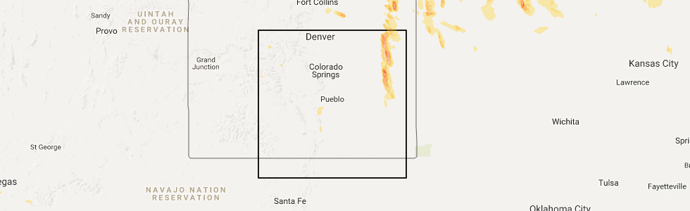
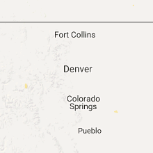
Hail Map for Edwards, CO
The Edwards, CO area has had 0 reports of on-the-ground hail by trained spotters, and has been under severe weather warnings 0 times during the past 12 months. Doppler radar has detected hail at or near Edwards, CO on 4 occasions.
| Name: | Edwards, CO |
| Where Located: | 78.6 miles SE of Craig, CO |
| Map: | Google Map for Edwards, CO |
| Population: | 10266 |
| Housing Units: | 5260 |
| More Info: | Search Google for Edwards, CO |
5
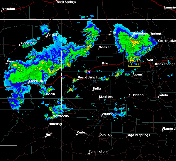
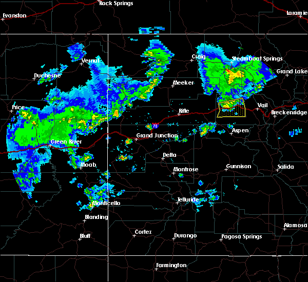
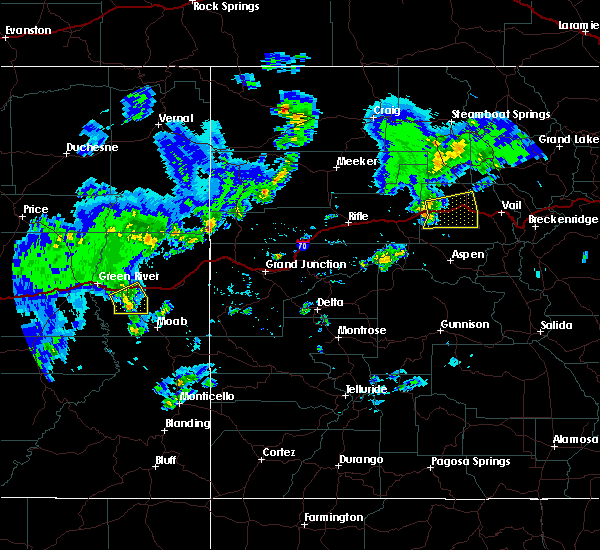
The Top Recent Hail Date for Edwards, CO is Wednesday, August 2, 2017 (1st out of 4)
Hail and Wind Damage Spotted near Edwards, CO
| Date / Time | Report Details |
|---|---|
| 6/26/2020 5:08 PM MDT |
 The severe thunderstorm warning for central eagle county will expire at 515 pm mdt, the storm which prompted the warning has moved out of the area. therefore the warning will be allowed to expire. however gusty winds are still possible with this thunderstorm, especially east of edwards along i-70. The severe thunderstorm warning for central eagle county will expire at 515 pm mdt, the storm which prompted the warning has moved out of the area. therefore the warning will be allowed to expire. however gusty winds are still possible with this thunderstorm, especially east of edwards along i-70.
|
| 6/26/2020 5:03 PM MDT |
 At 502 pm mdt, weather radar and surface observations continued to indicate the potential for damaging winds in excess of 60 mph along the i-70 corridor. this storm was located near eagle, or 30 miles east of glenwood springs, moving east at 20 mph. locations impacted include, eagle, gypsum, edwards and wolcott. At 502 pm mdt, weather radar and surface observations continued to indicate the potential for damaging winds in excess of 60 mph along the i-70 corridor. this storm was located near eagle, or 30 miles east of glenwood springs, moving east at 20 mph. locations impacted include, eagle, gypsum, edwards and wolcott.
|
| 6/26/2020 4:44 PM MDT |
 At 443 pm mdt, a severe thunderstorm was located over eagle, or 25 miles east of glenwood springs, moving east at 20 mph (a 61 mph wind gust was observed at eagle airport in gypsum). Hazards include 60 mph wind gusts. expect damage to roofs, siding, and trees At 443 pm mdt, a severe thunderstorm was located over eagle, or 25 miles east of glenwood springs, moving east at 20 mph (a 61 mph wind gust was observed at eagle airport in gypsum). Hazards include 60 mph wind gusts. expect damage to roofs, siding, and trees
|
| 9/8/2019 2:50 PM MDT |
 At 249 pm mdt, severe thunderstorms were located along a line extending from 15 miles west of radium to avon to near minturn, moving east at 35 mph (61 mph wind gust observed at eagle airport). Hazards include 60 mph wind gusts. Expect damage to roofs, siding, and trees. locations impacted include, avon, vail, minturn, redcliff, edwards, red cliff, gilman, mc coy, eagle-vail, dowd, bond and state bridge. this includes the following highways, interstate 70 in colorado between mile markers 162 and 189. Colorado 131 between mile markers 3 and 28. At 249 pm mdt, severe thunderstorms were located along a line extending from 15 miles west of radium to avon to near minturn, moving east at 35 mph (61 mph wind gust observed at eagle airport). Hazards include 60 mph wind gusts. Expect damage to roofs, siding, and trees. locations impacted include, avon, vail, minturn, redcliff, edwards, red cliff, gilman, mc coy, eagle-vail, dowd, bond and state bridge. this includes the following highways, interstate 70 in colorado between mile markers 162 and 189. Colorado 131 between mile markers 3 and 28.
|
| 9/8/2019 2:33 PM MDT |
 At 232 pm mdt, severe thunderstorms were located along a line extending from 15 miles north of gypsum to 6 miles east of eagle to 13 miles southwest of avon, moving east at 35 mph (61 mph wind gust observed at eagle airport). Hazards include 60 mph wind gusts. expect damage to roofs, siding, and trees At 232 pm mdt, severe thunderstorms were located along a line extending from 15 miles north of gypsum to 6 miles east of eagle to 13 miles southwest of avon, moving east at 35 mph (61 mph wind gust observed at eagle airport). Hazards include 60 mph wind gusts. expect damage to roofs, siding, and trees
|
Hail Maps for Edwards, CO


Connect with Interactive Hail Maps