

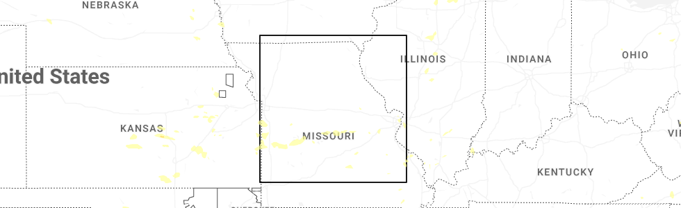
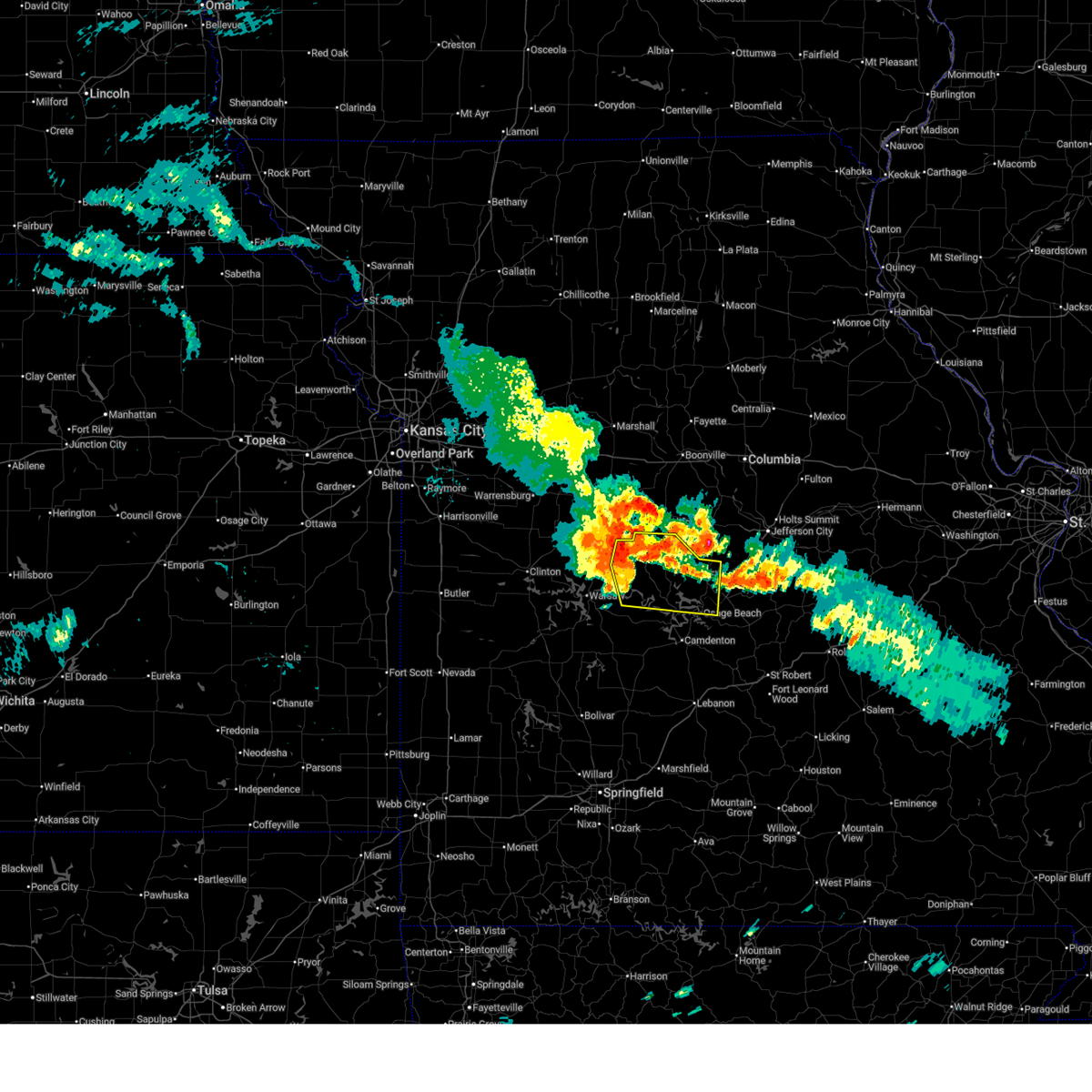
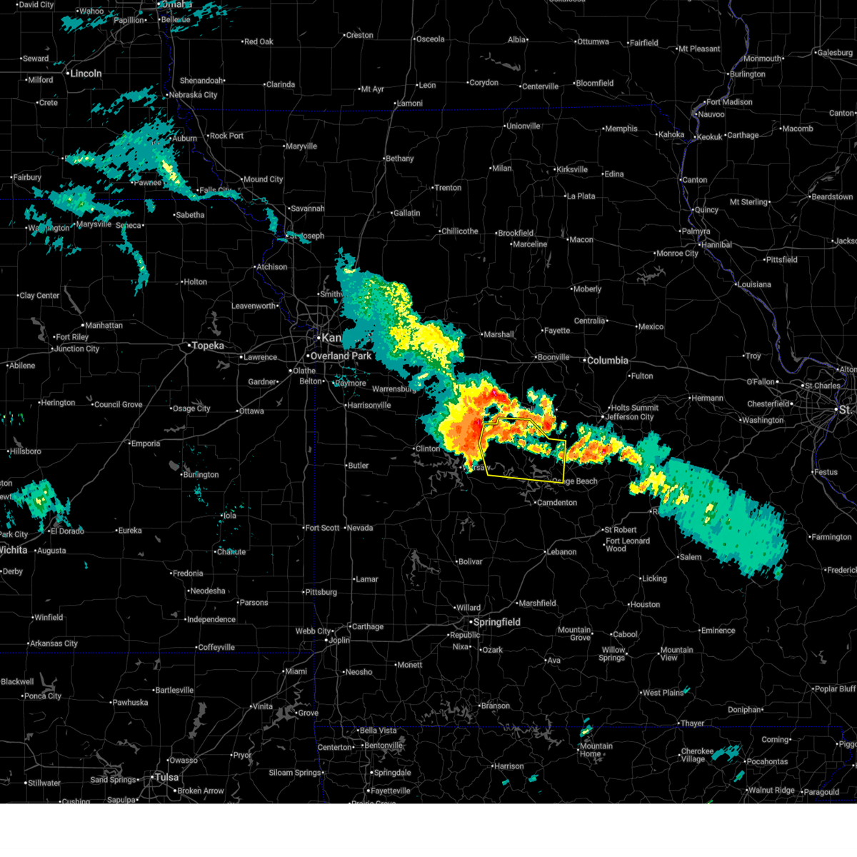
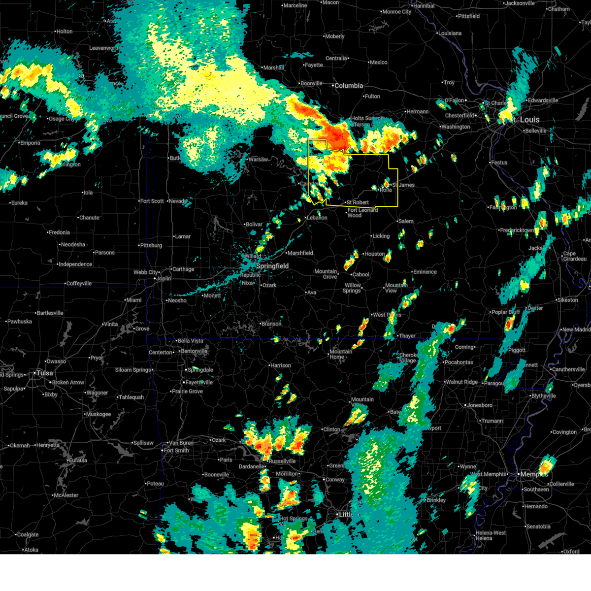
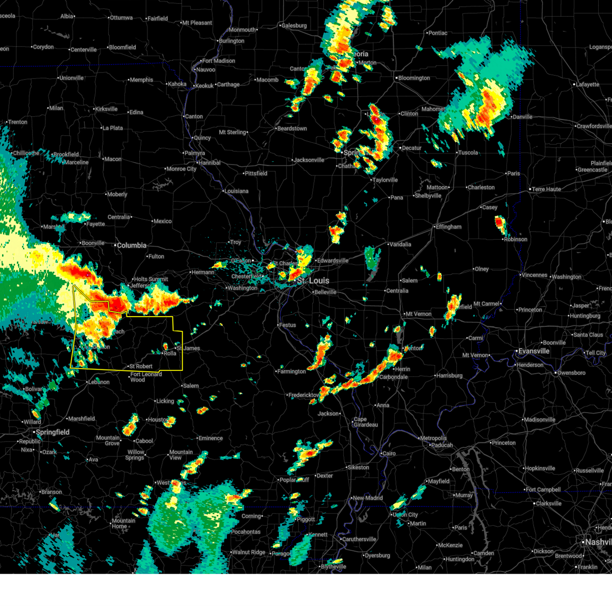
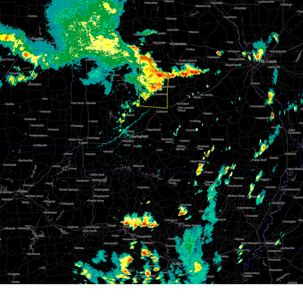
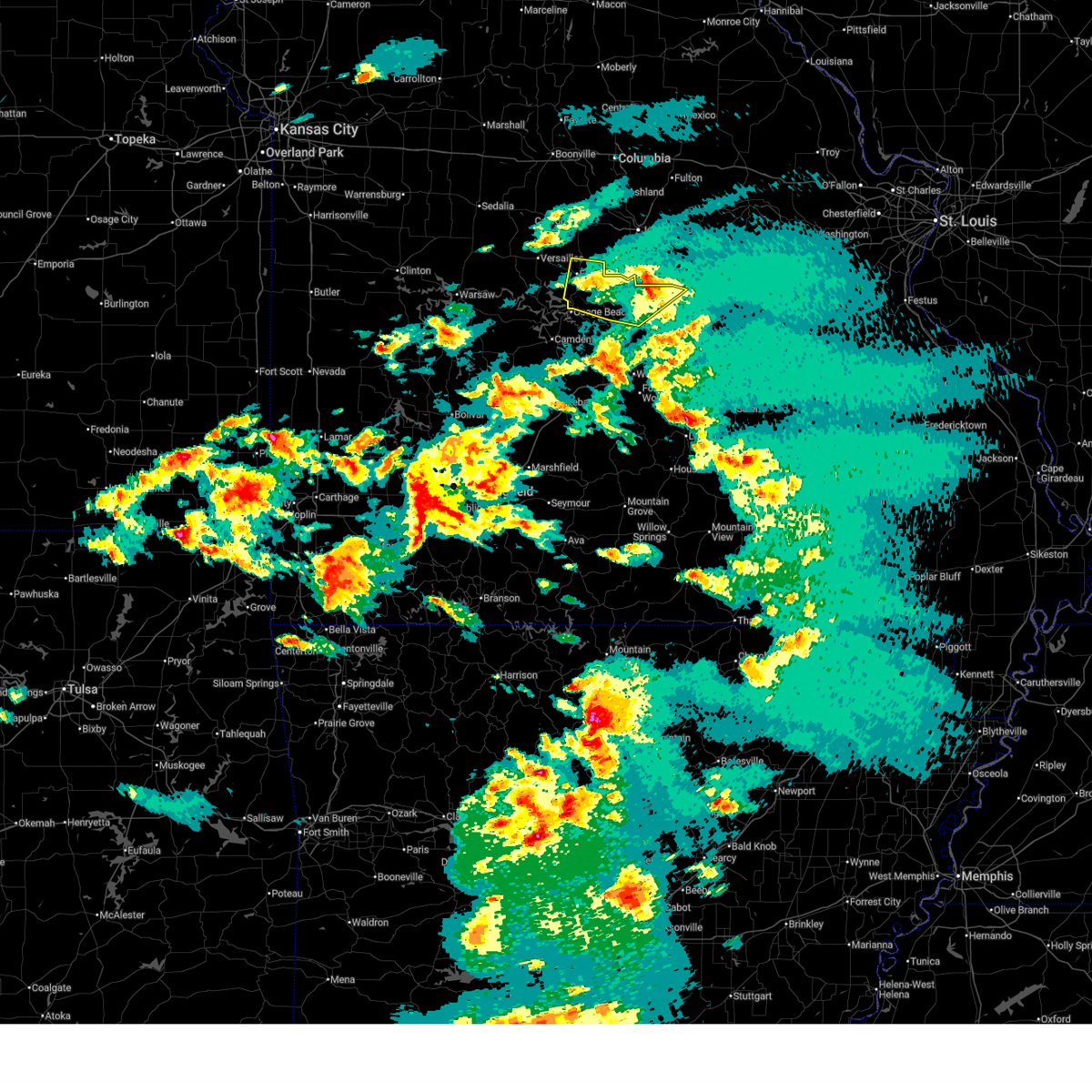
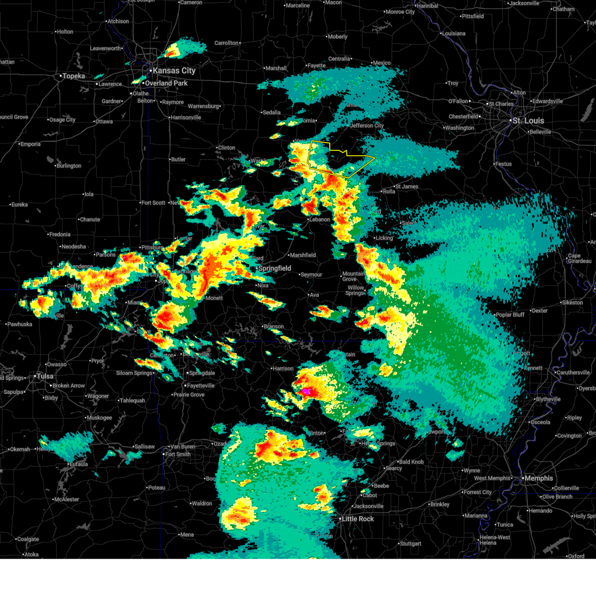
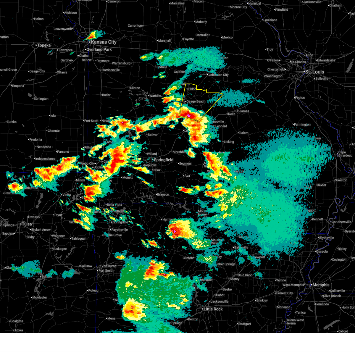
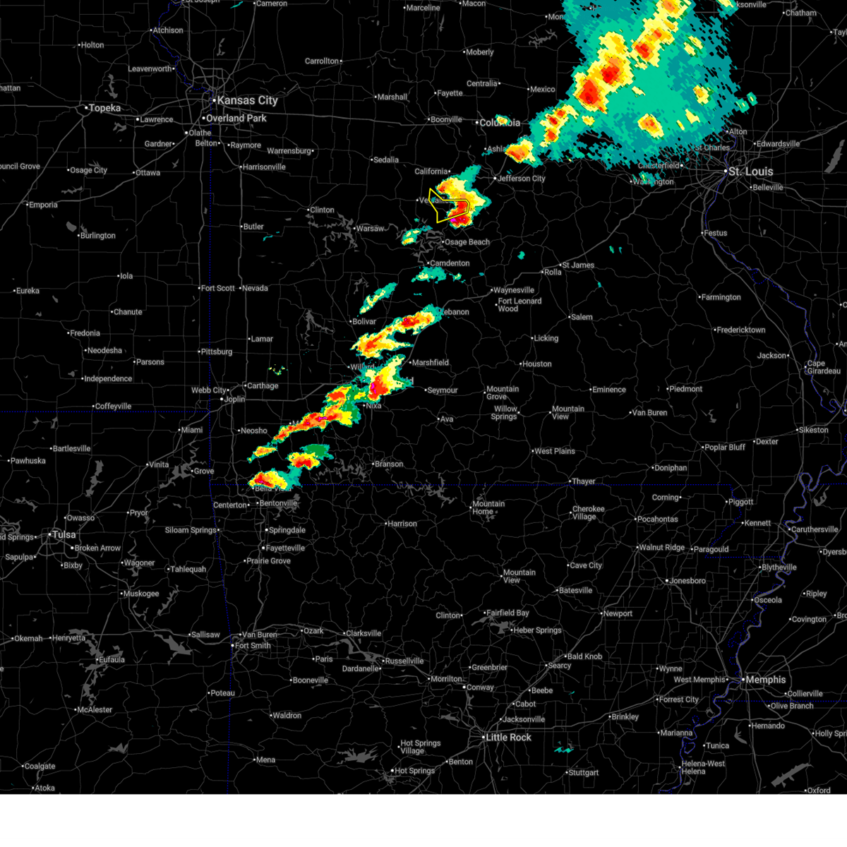
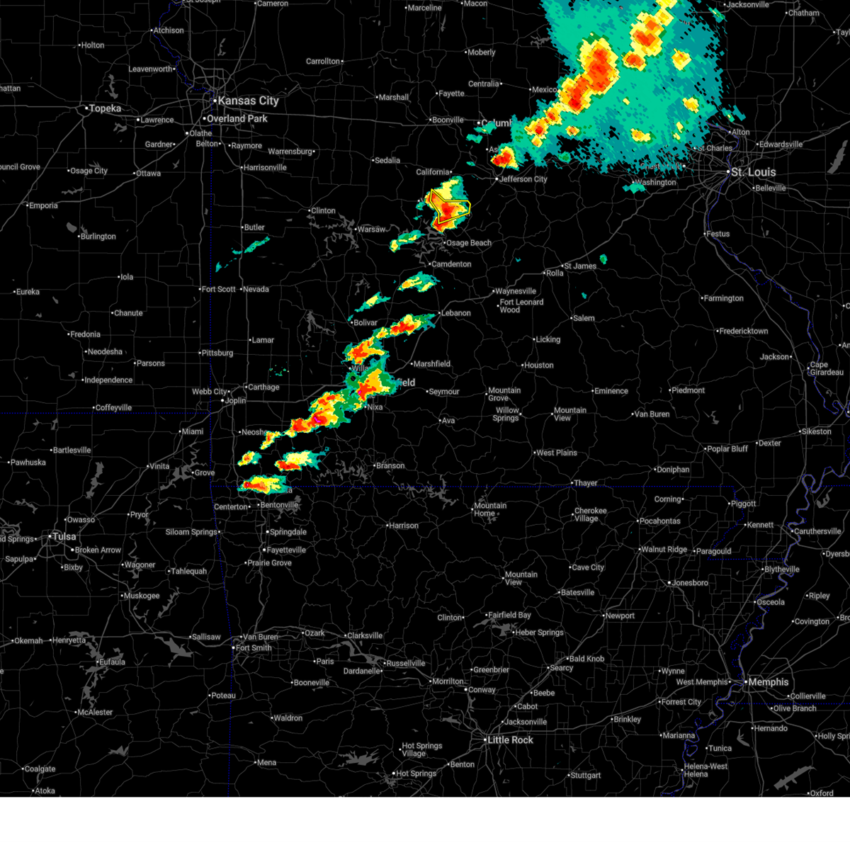
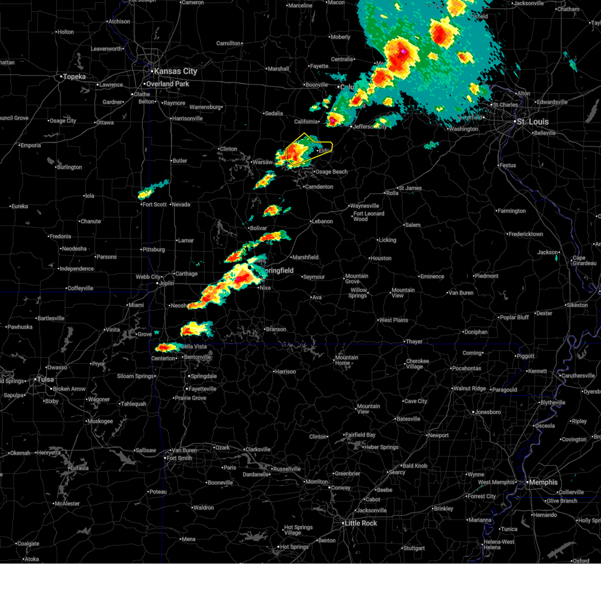
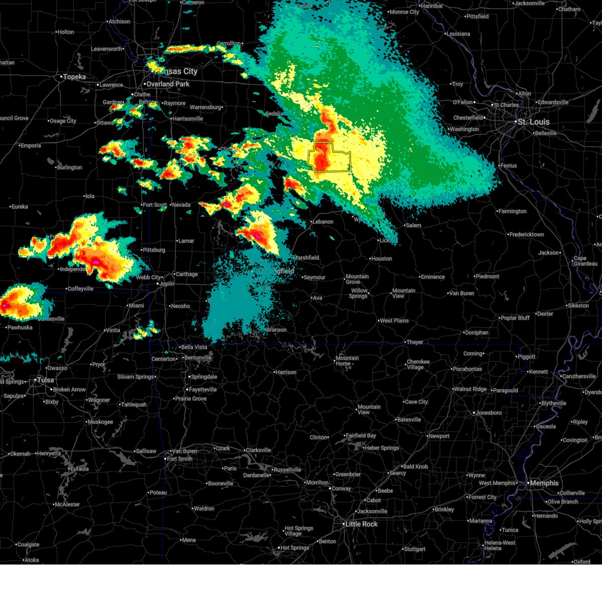
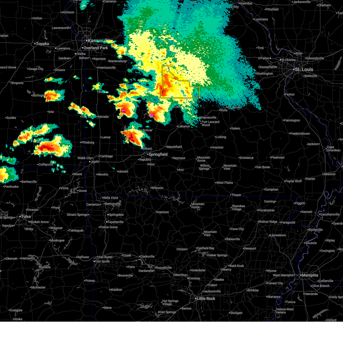
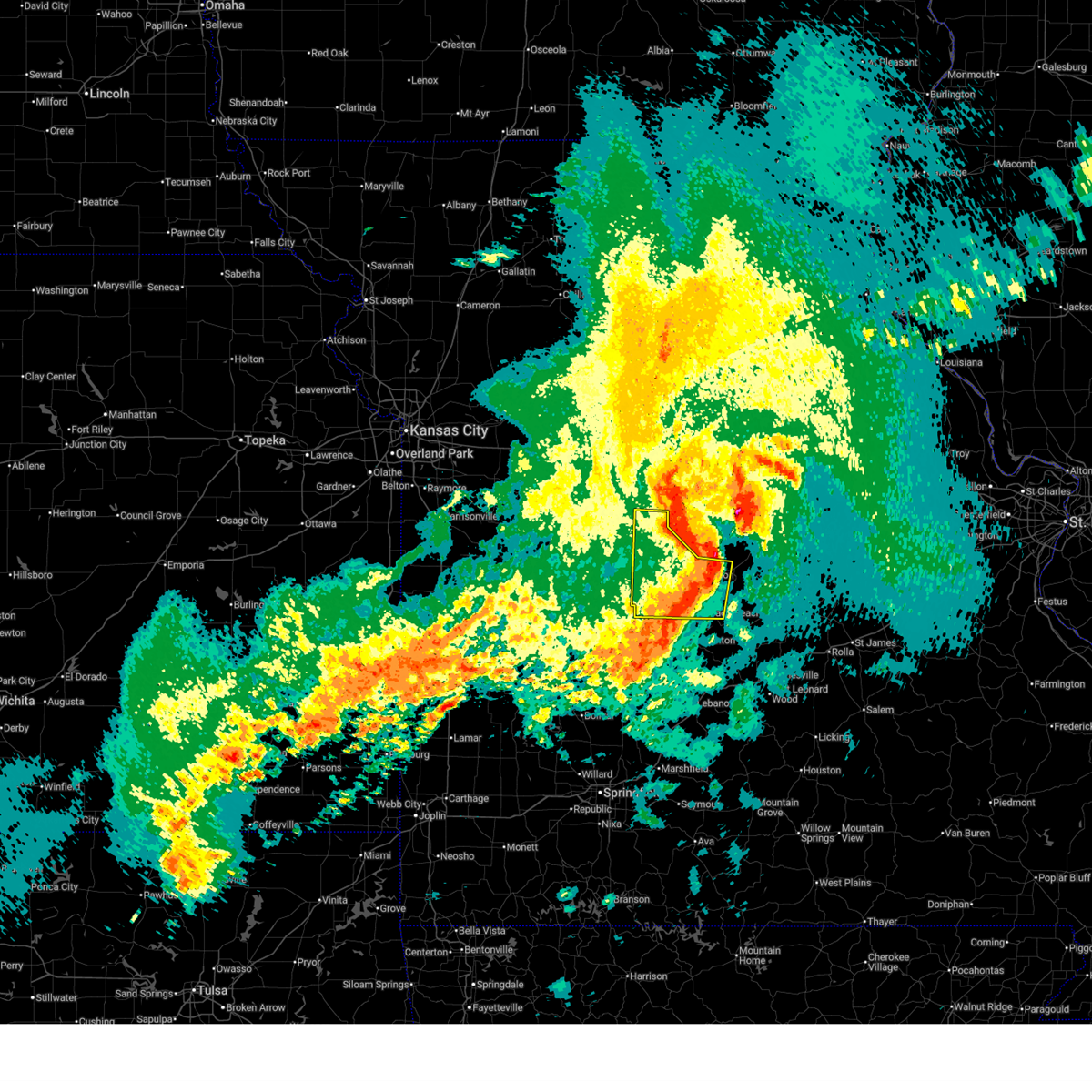
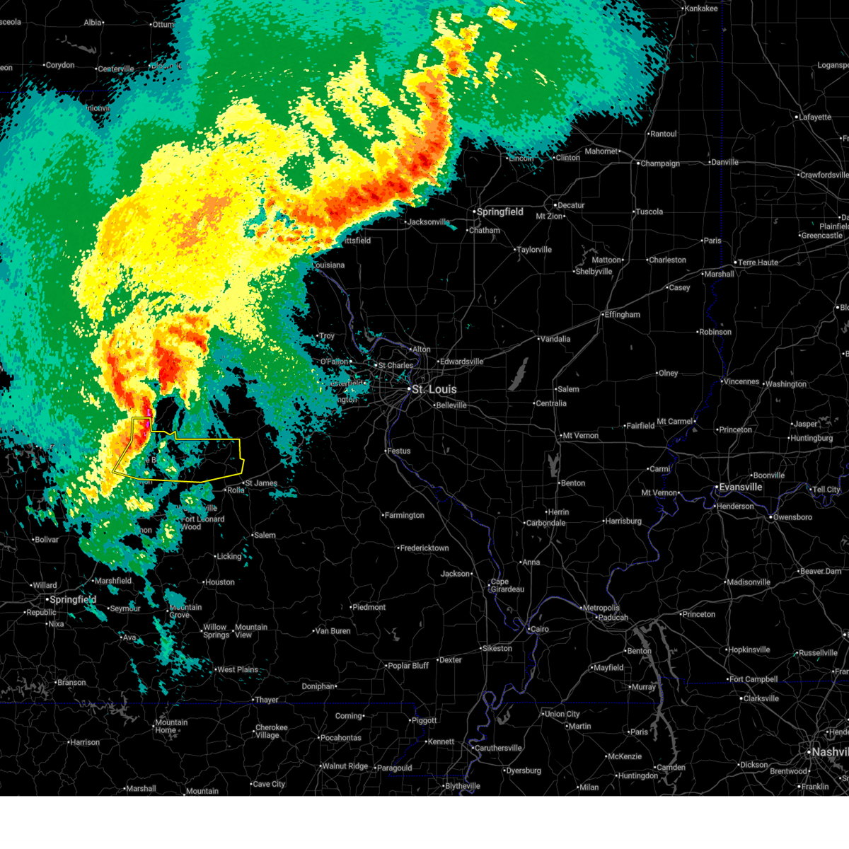
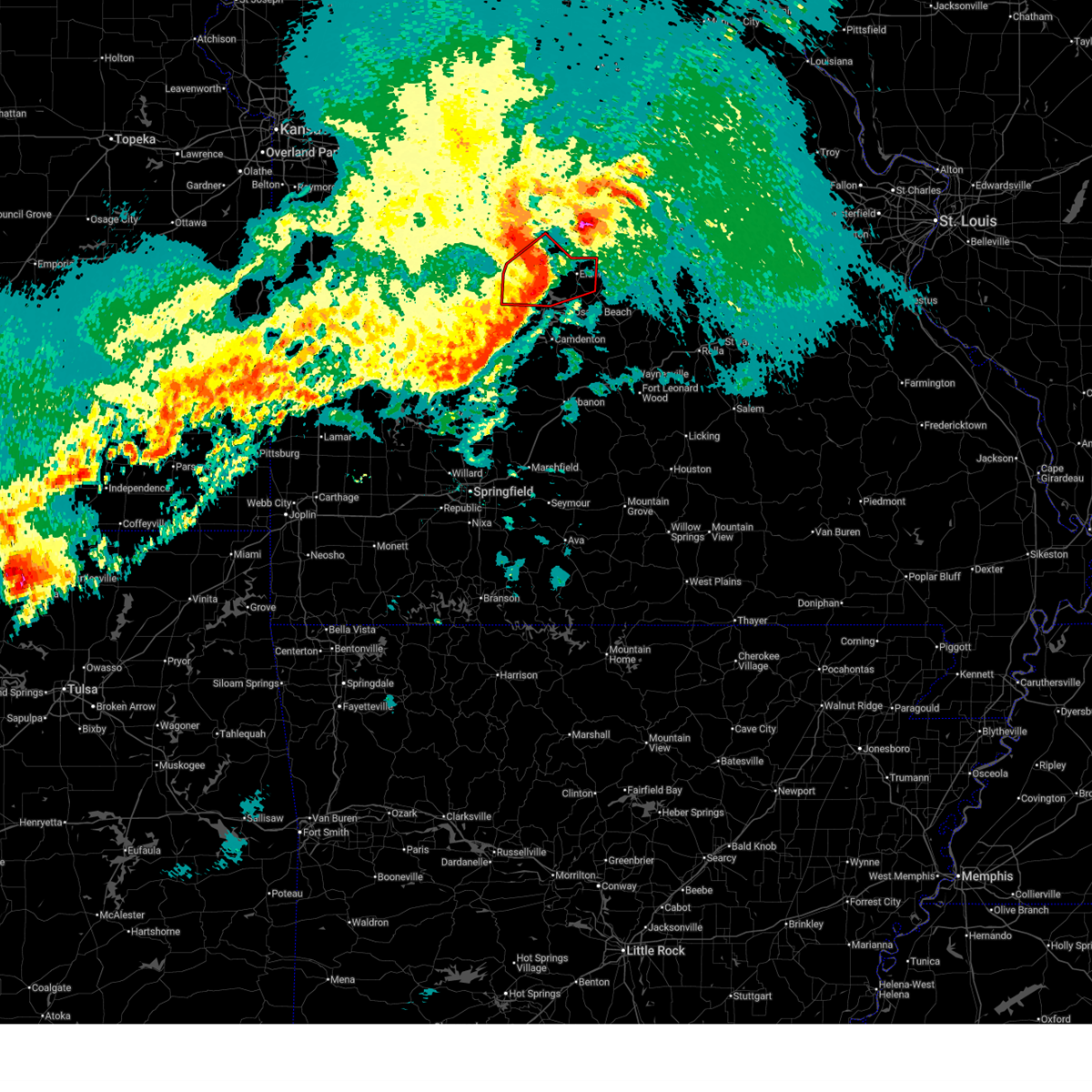
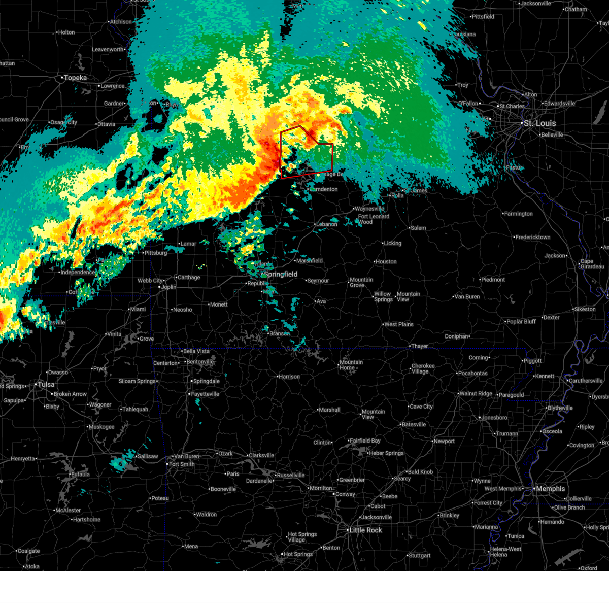
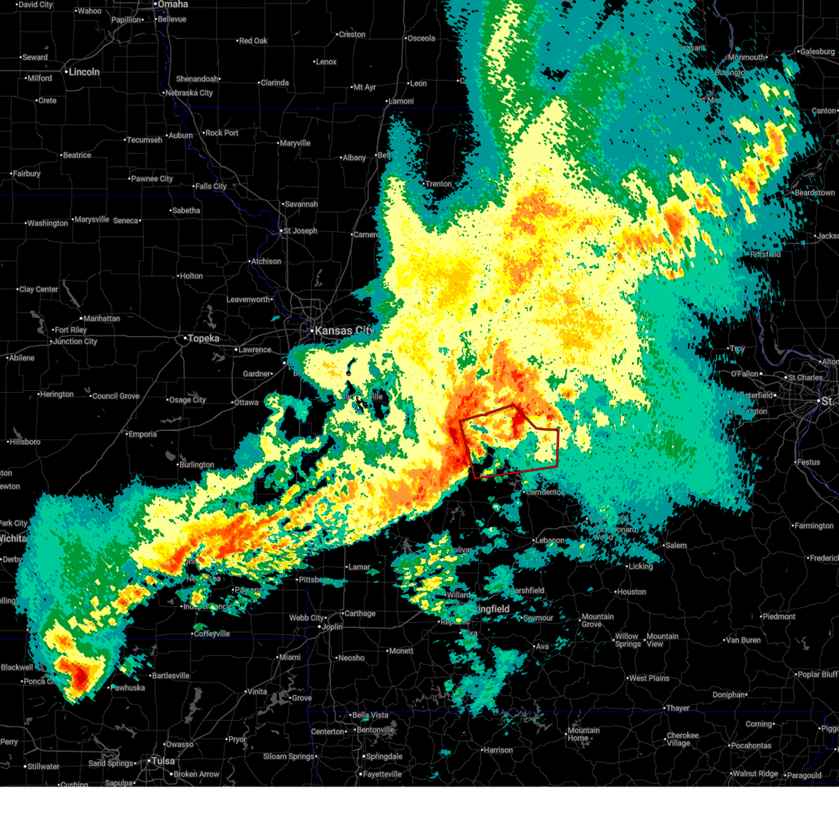
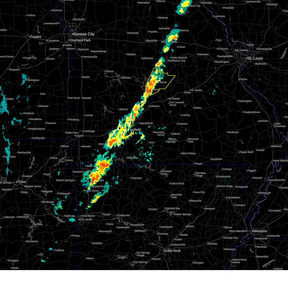
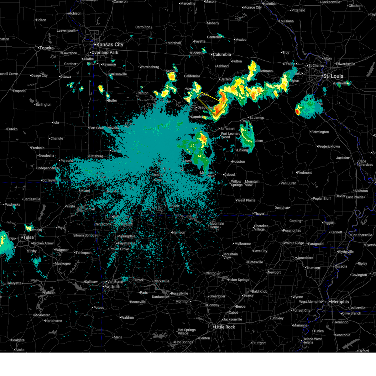
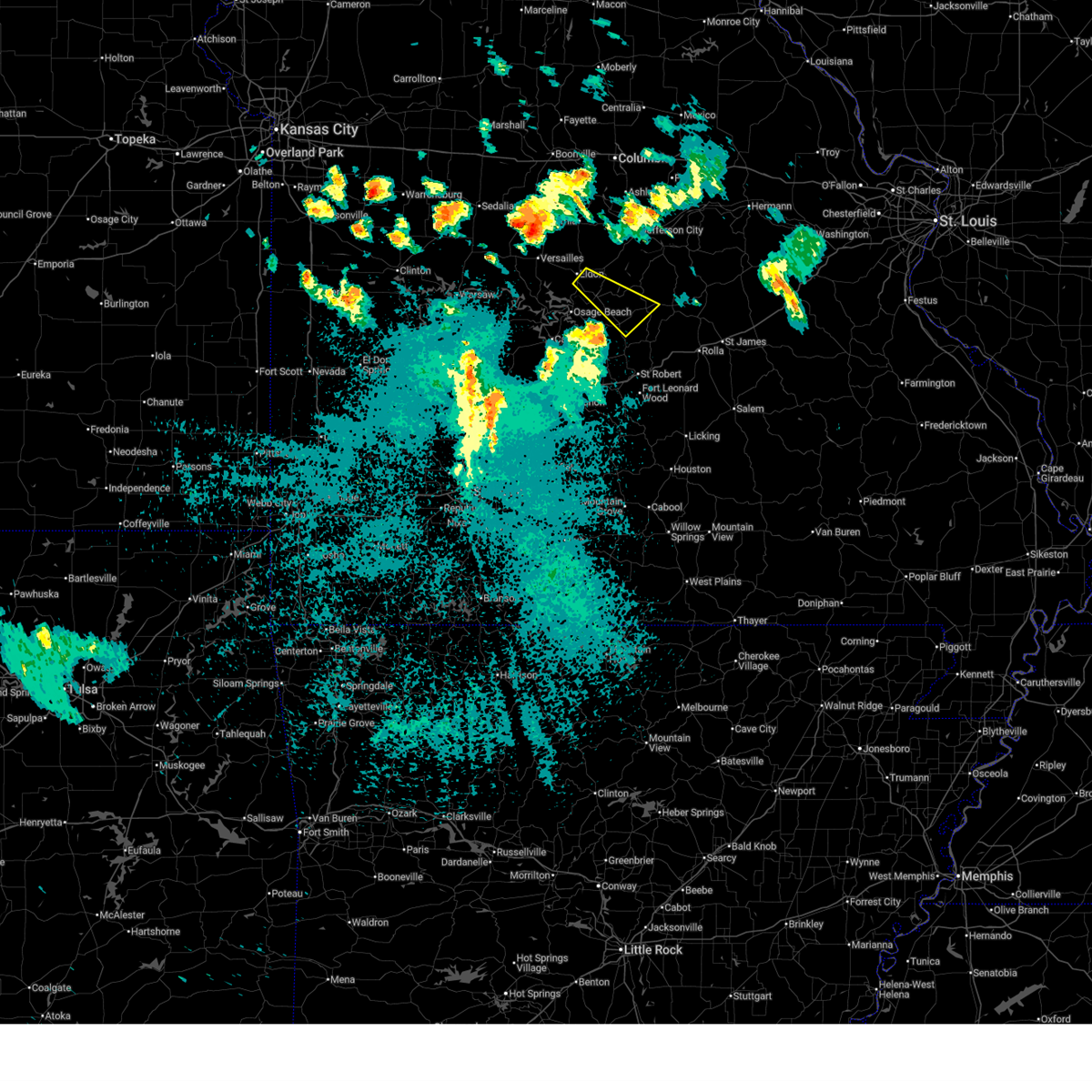
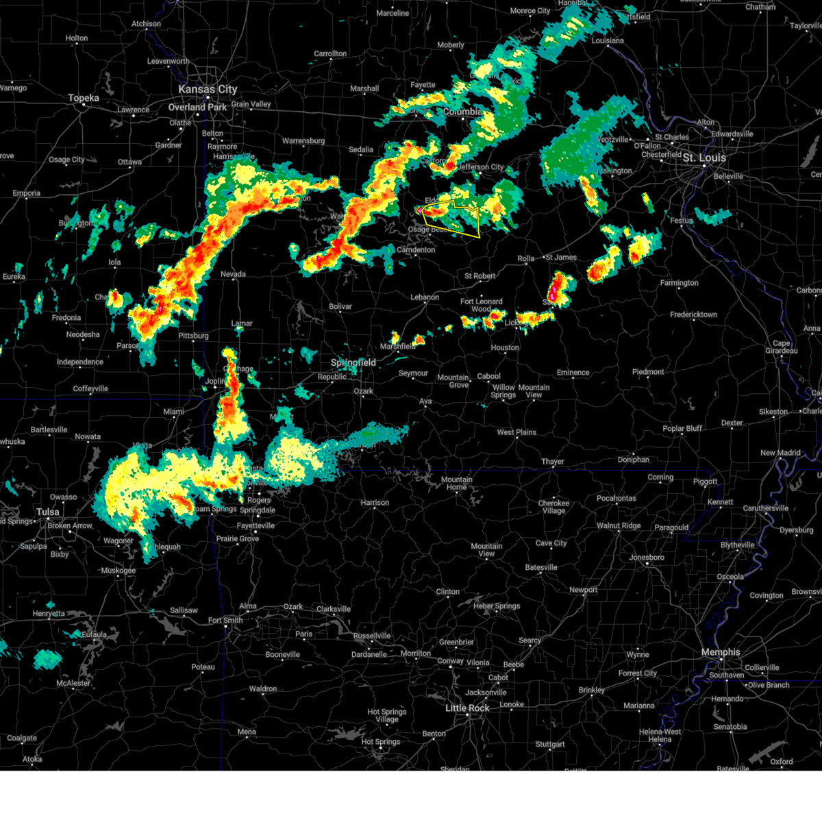
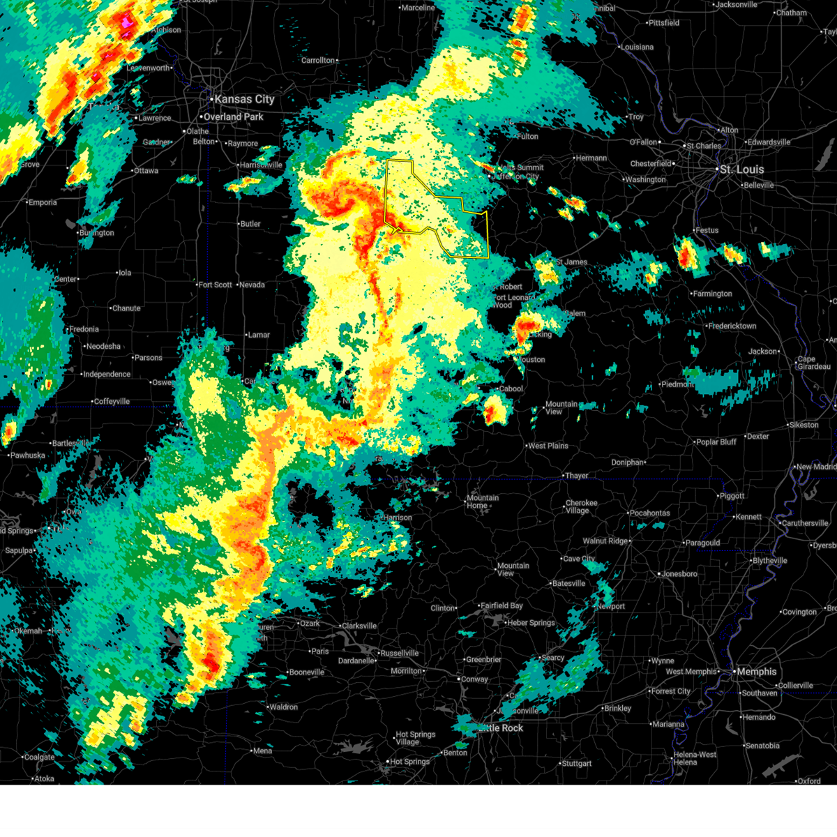
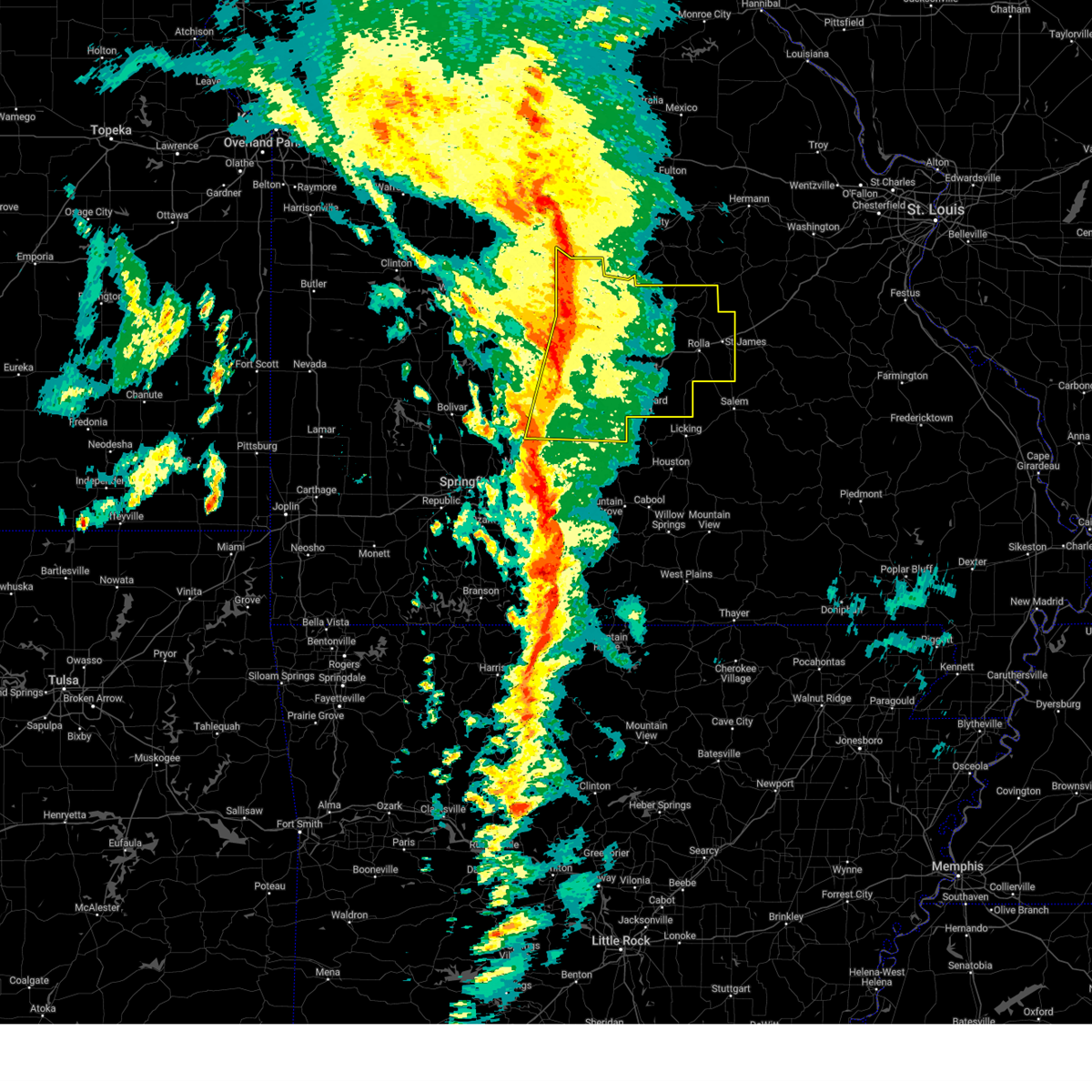
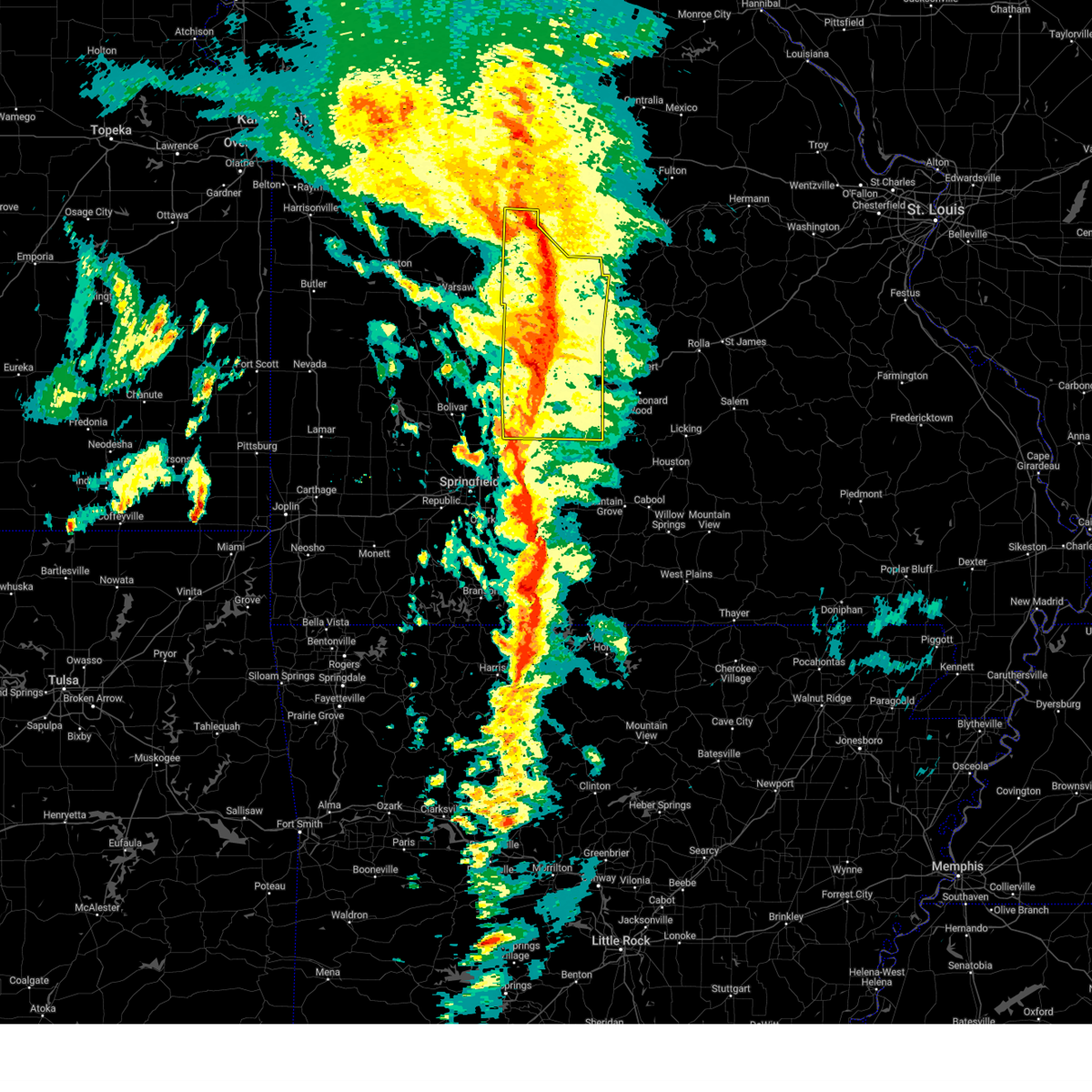
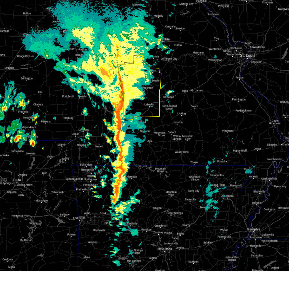
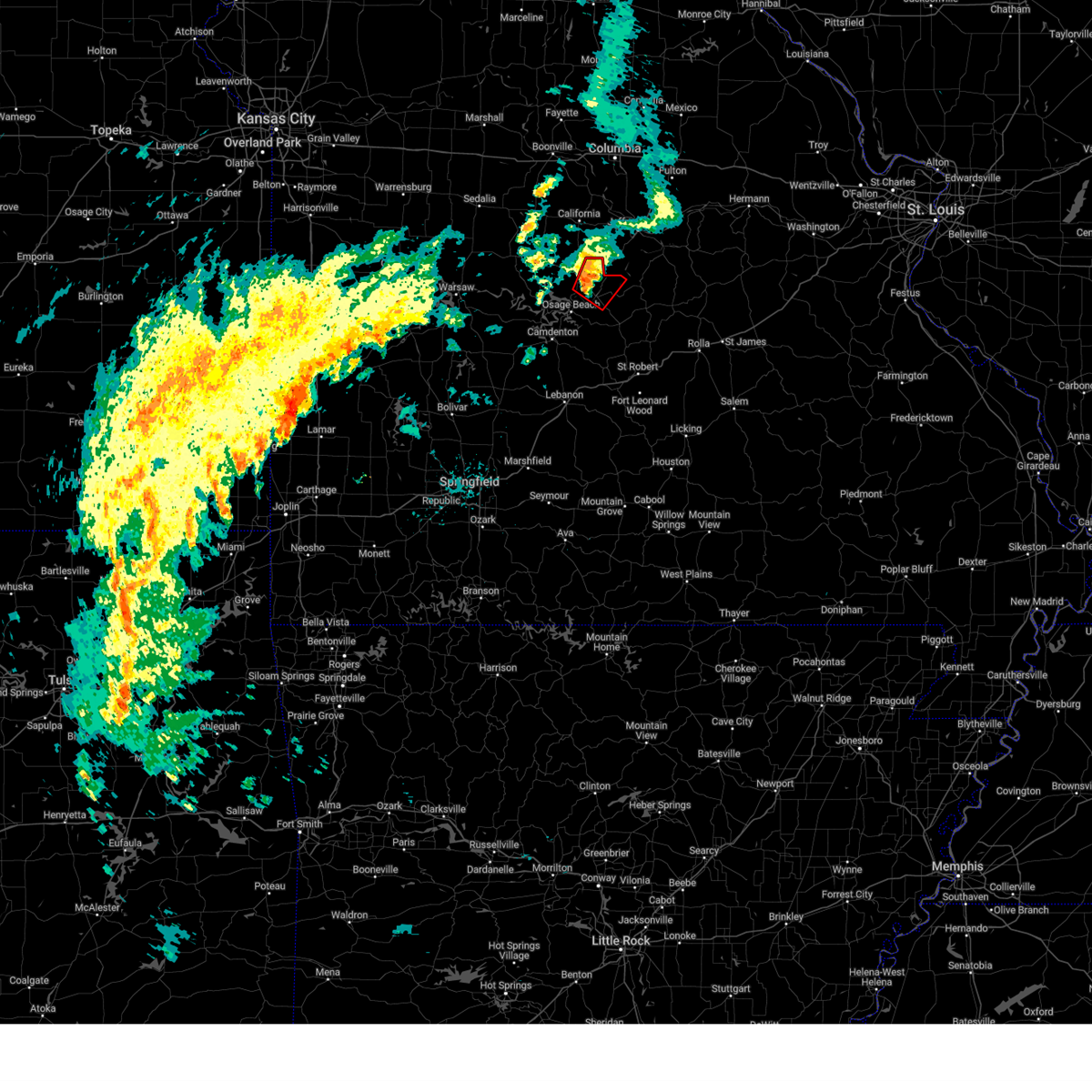
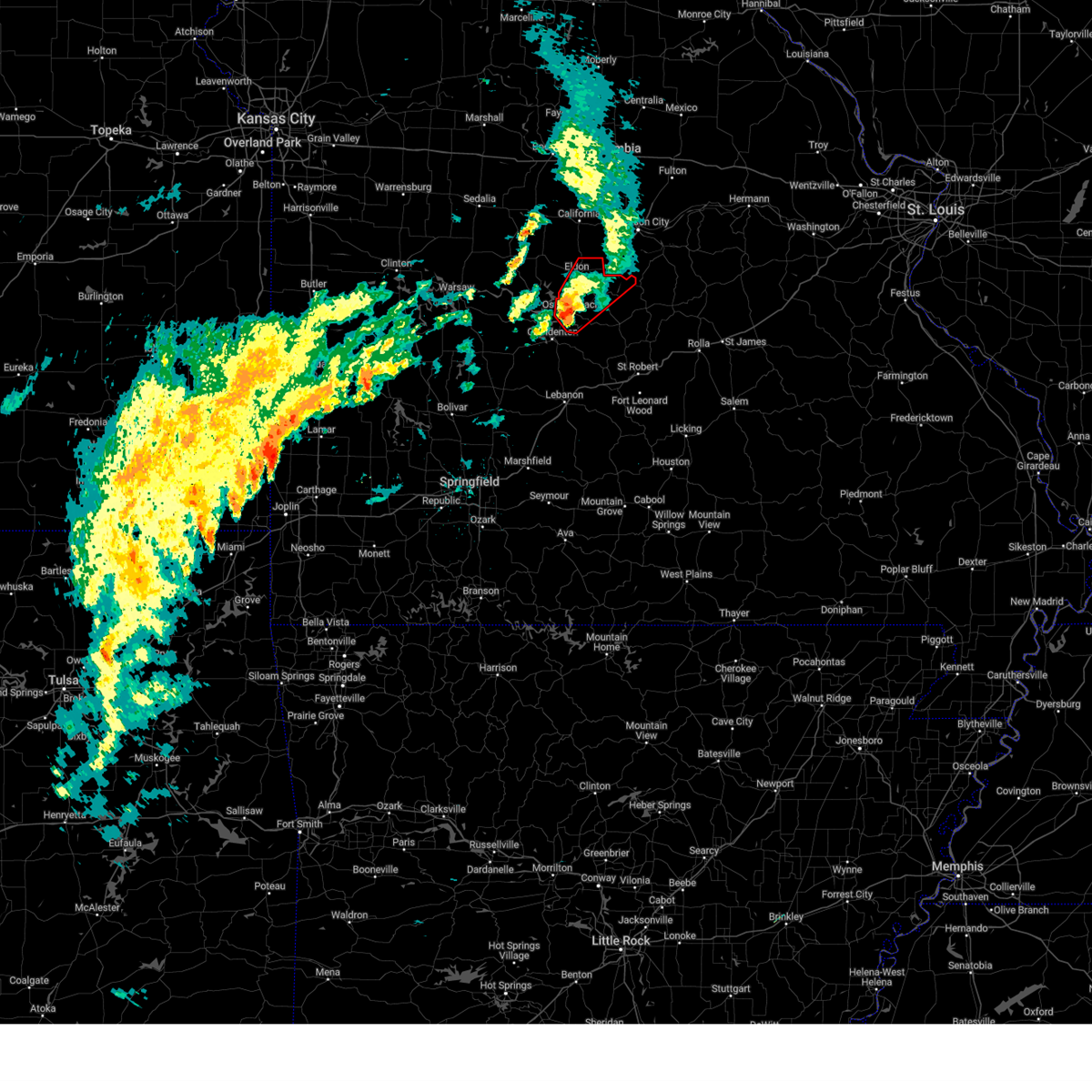
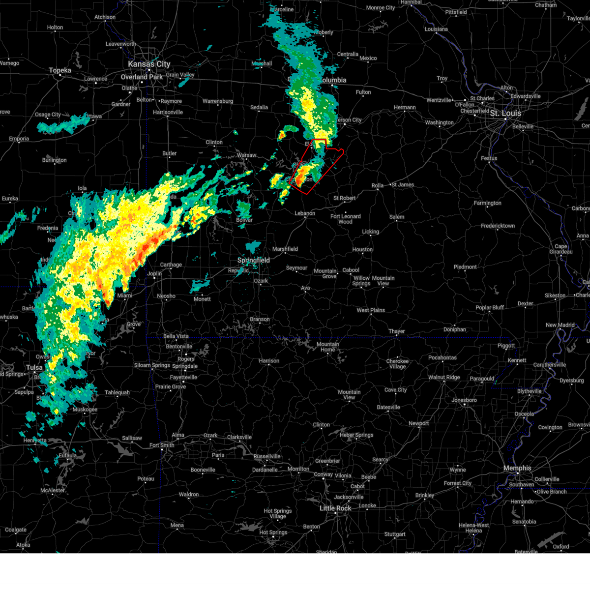
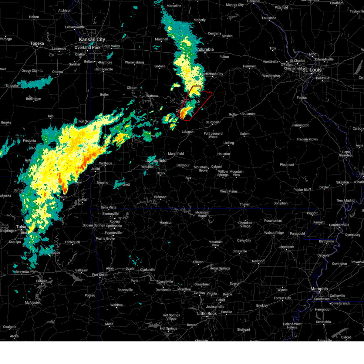
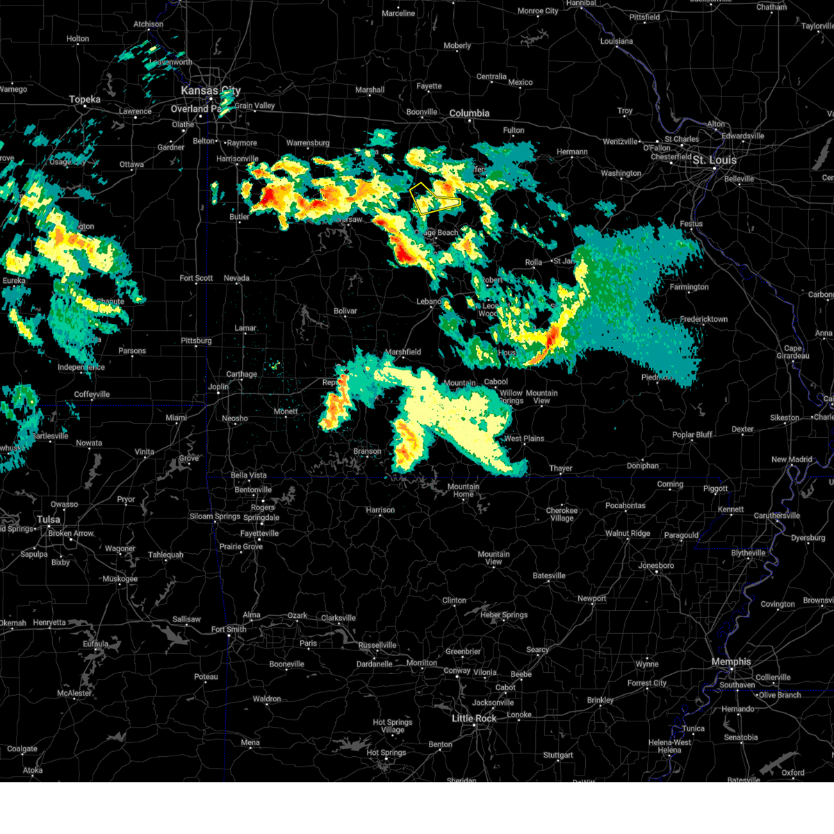
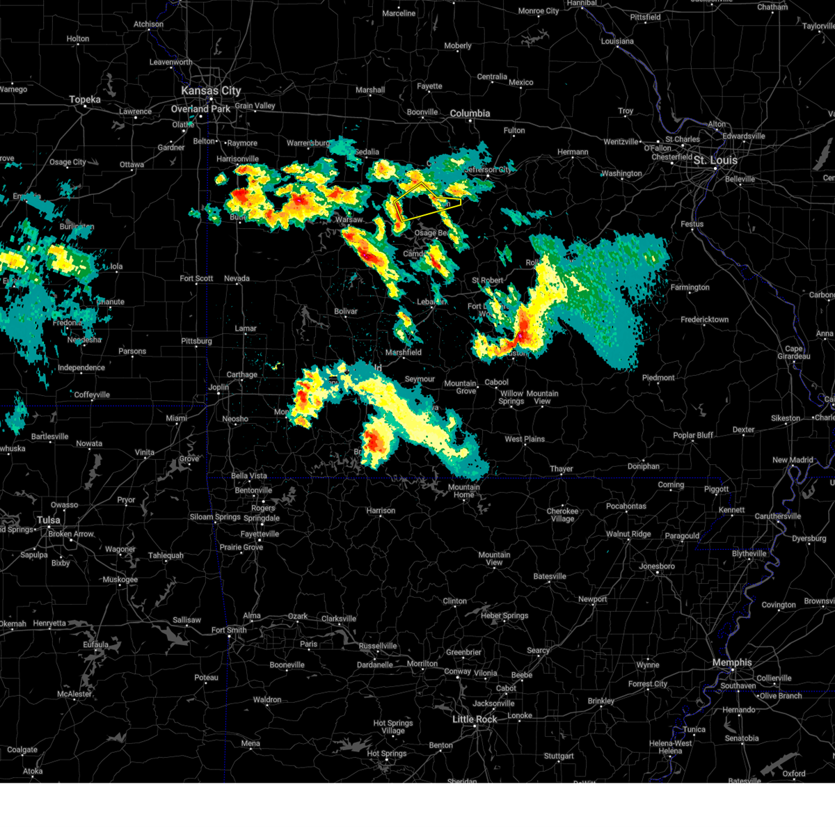
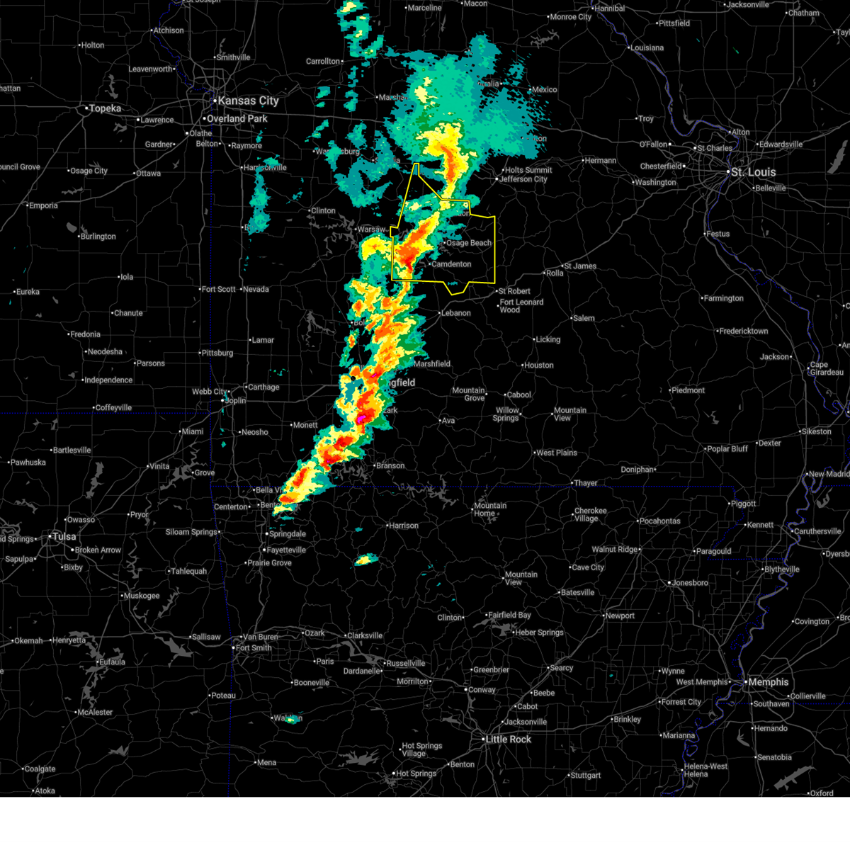
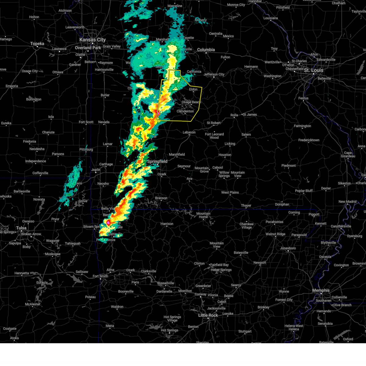
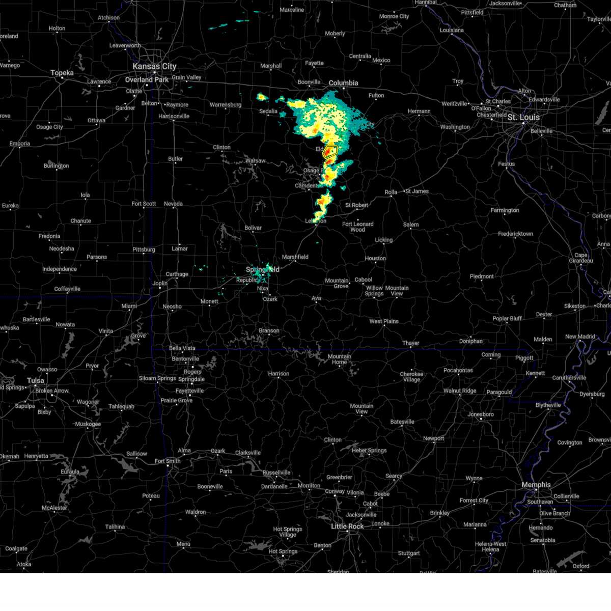
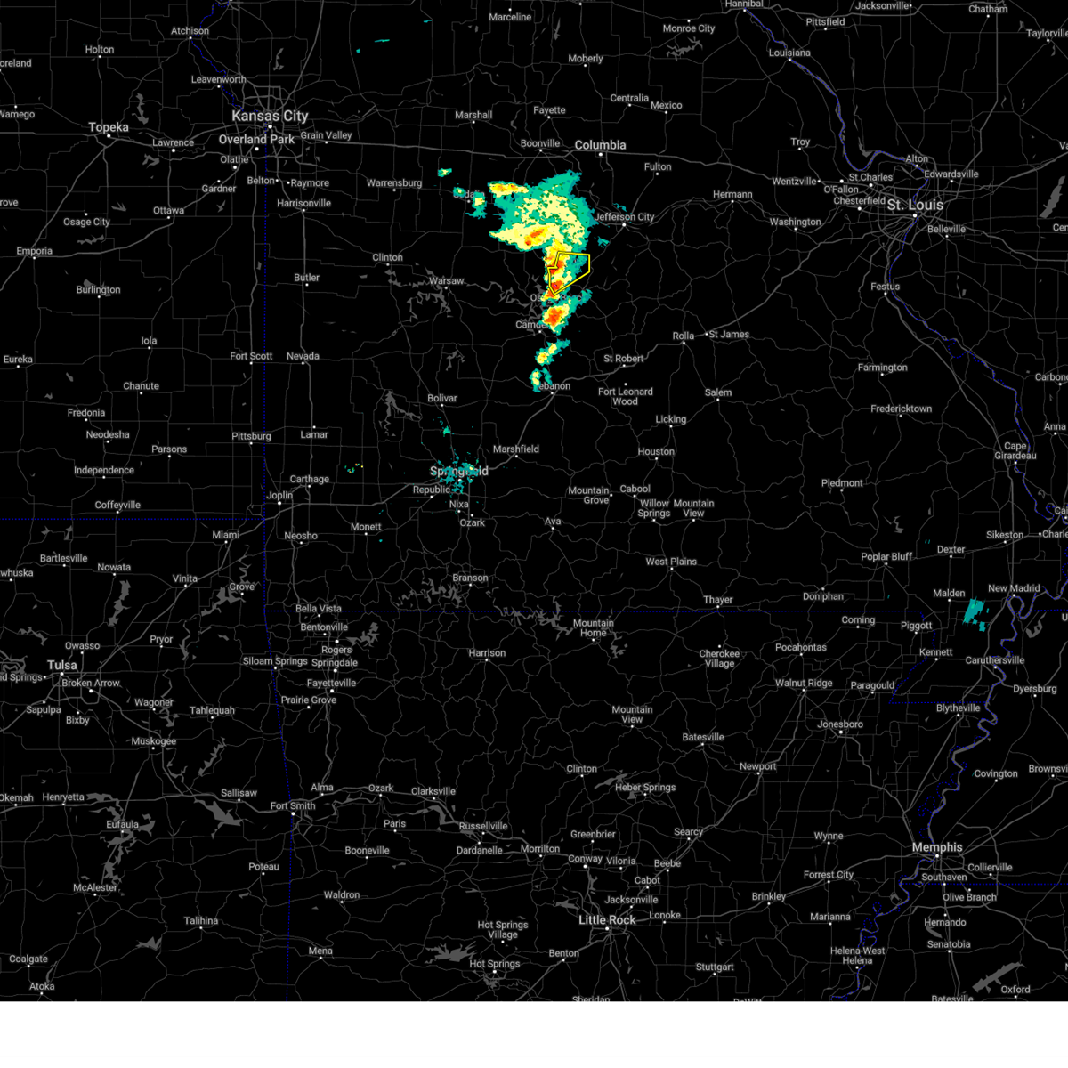
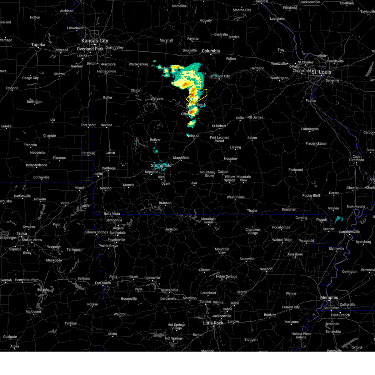
Hail Map for Eldon, MO
The Eldon, MO area has had 12 reports of on-the-ground hail by trained spotters, and has been under severe weather warnings 35 times during the past 12 months. Doppler radar has detected hail at or near Eldon, MO on 70 occasions, including 6 occasions during the past year.
| Name: | Eldon, MO |
| Where Located: | 43.8 miles SSW of Columbia, MO |
| Map: | Google Map for Eldon, MO |
| Population: | 4567 |
| Housing Units: | 2242 |
| More Info: | Search Google for Eldon, MO |
2
The Top Recent Hail Date for Eldon, MO is Saturday, July 4, 2026 (20th out of 70)
Hail and Wind Damage Spotted near Eldon, MO
| Date / Time | Report Details |
|---|---|
| 7/10/2026 8:08 AM CDT |
 At 808 am cdt, severe thunderstorms were located along a line extending from near eldon to 8 miles northeast of lake ozark to near osage beach, moving east at 45 mph (radar indicated). Hazards include 60 mph wind gusts and penny size hail. Expect damage to roofs, siding, and trees. locations impacted include, lake of the ozarks, lake of the ozarks state park, eldon, osage beach, village of four seasons, lake ozark, iberia, st. Elizabeth, tuscumbia, eugene, olean, bagnell, brumley, lakeside, ulman, etterville, lakeview, kaiser, marys home, and aurora springs. At 808 am cdt, severe thunderstorms were located along a line extending from near eldon to 8 miles northeast of lake ozark to near osage beach, moving east at 45 mph (radar indicated). Hazards include 60 mph wind gusts and penny size hail. Expect damage to roofs, siding, and trees. locations impacted include, lake of the ozarks, lake of the ozarks state park, eldon, osage beach, village of four seasons, lake ozark, iberia, st. Elizabeth, tuscumbia, eugene, olean, bagnell, brumley, lakeside, ulman, etterville, lakeview, kaiser, marys home, and aurora springs.
|
| 7/10/2026 7:58 AM CDT |
 Svrsgf the national weather service in springfield has issued a * severe thunderstorm warning for, western maries county in central missouri, miller county in central missouri, north central camden county in central missouri, southeastern morgan county in central missouri, * until 845 am cdt. * at 757 am cdt, severe thunderstorms were located along a line extending from 9 miles south of high point to near eldon to osage beach, moving east at 40 mph (radar indicated). Hazards include 60 mph wind gusts. expect damage to roofs, siding, and trees Svrsgf the national weather service in springfield has issued a * severe thunderstorm warning for, western maries county in central missouri, miller county in central missouri, north central camden county in central missouri, southeastern morgan county in central missouri, * until 845 am cdt. * at 757 am cdt, severe thunderstorms were located along a line extending from 9 miles south of high point to near eldon to osage beach, moving east at 40 mph (radar indicated). Hazards include 60 mph wind gusts. expect damage to roofs, siding, and trees
|
| 7/10/2026 7:36 AM CDT |
 At 735 am cdt, severe thunderstorms were located along a line extending from near stover to near versailles to near laurie, moving east at 45 mph (radar indicated). Hazards include 70 mph wind gusts. Expect considerable tree damage. damage is likely to mobile homes, roofs, and outbuildings. Locations impacted include, lake of the ozarks, lake of the ozarks state park, eldon, osage beach, versailles, village of four seasons, lake ozark, stover, laurie, sunrise beach, barnett, gravois mills, olean, bagnell, lakeside, rocky mount, lakeview, purvis, and aurora springs. At 735 am cdt, severe thunderstorms were located along a line extending from near stover to near versailles to near laurie, moving east at 45 mph (radar indicated). Hazards include 70 mph wind gusts. Expect considerable tree damage. damage is likely to mobile homes, roofs, and outbuildings. Locations impacted include, lake of the ozarks, lake of the ozarks state park, eldon, osage beach, versailles, village of four seasons, lake ozark, stover, laurie, sunrise beach, barnett, gravois mills, olean, bagnell, lakeside, rocky mount, lakeview, purvis, and aurora springs.
|
| 7/10/2026 7:22 AM CDT |
 At 722 am cdt, severe thunderstorms were located along a line extending from near cole camp to near stover, moving east at 50 mph (radar indicated). Hazards include 70 mph wind gusts. Expect considerable tree damage. damage is likely to mobile homes, roofs, and outbuildings. Locations impacted include, lake of the ozarks, lake of the ozarks state park, eldon, osage beach, versailles, village of four seasons, lake ozark, cole camp, stover, laurie, sunrise beach, barnett, gravois mills, olean, bagnell, lakeside, rocky mount, lakeview heights, lakeview, and crockerville. At 722 am cdt, severe thunderstorms were located along a line extending from near cole camp to near stover, moving east at 50 mph (radar indicated). Hazards include 70 mph wind gusts. Expect considerable tree damage. damage is likely to mobile homes, roofs, and outbuildings. Locations impacted include, lake of the ozarks, lake of the ozarks state park, eldon, osage beach, versailles, village of four seasons, lake ozark, cole camp, stover, laurie, sunrise beach, barnett, gravois mills, olean, bagnell, lakeside, rocky mount, lakeview heights, lakeview, and crockerville.
|
| 7/10/2026 7:15 AM CDT |
 Svrsgf the national weather service in springfield has issued a * severe thunderstorm warning for, northeastern benton county in central missouri, northwestern miller county in central missouri, northwestern camden county in central missouri, morgan county in central missouri, * until 800 am cdt. * at 715 am cdt, severe thunderstorms were located along a line extending from cole camp to 7 miles west of stover to 10 miles east of warsaw, moving east at 50 mph (radar indicated). Hazards include 70 mph wind gusts. Expect considerable tree damage. Damage is likely to mobile homes, roofs, and outbuildings. Svrsgf the national weather service in springfield has issued a * severe thunderstorm warning for, northeastern benton county in central missouri, northwestern miller county in central missouri, northwestern camden county in central missouri, morgan county in central missouri, * until 800 am cdt. * at 715 am cdt, severe thunderstorms were located along a line extending from cole camp to 7 miles west of stover to 10 miles east of warsaw, moving east at 50 mph (radar indicated). Hazards include 70 mph wind gusts. Expect considerable tree damage. Damage is likely to mobile homes, roofs, and outbuildings.
|
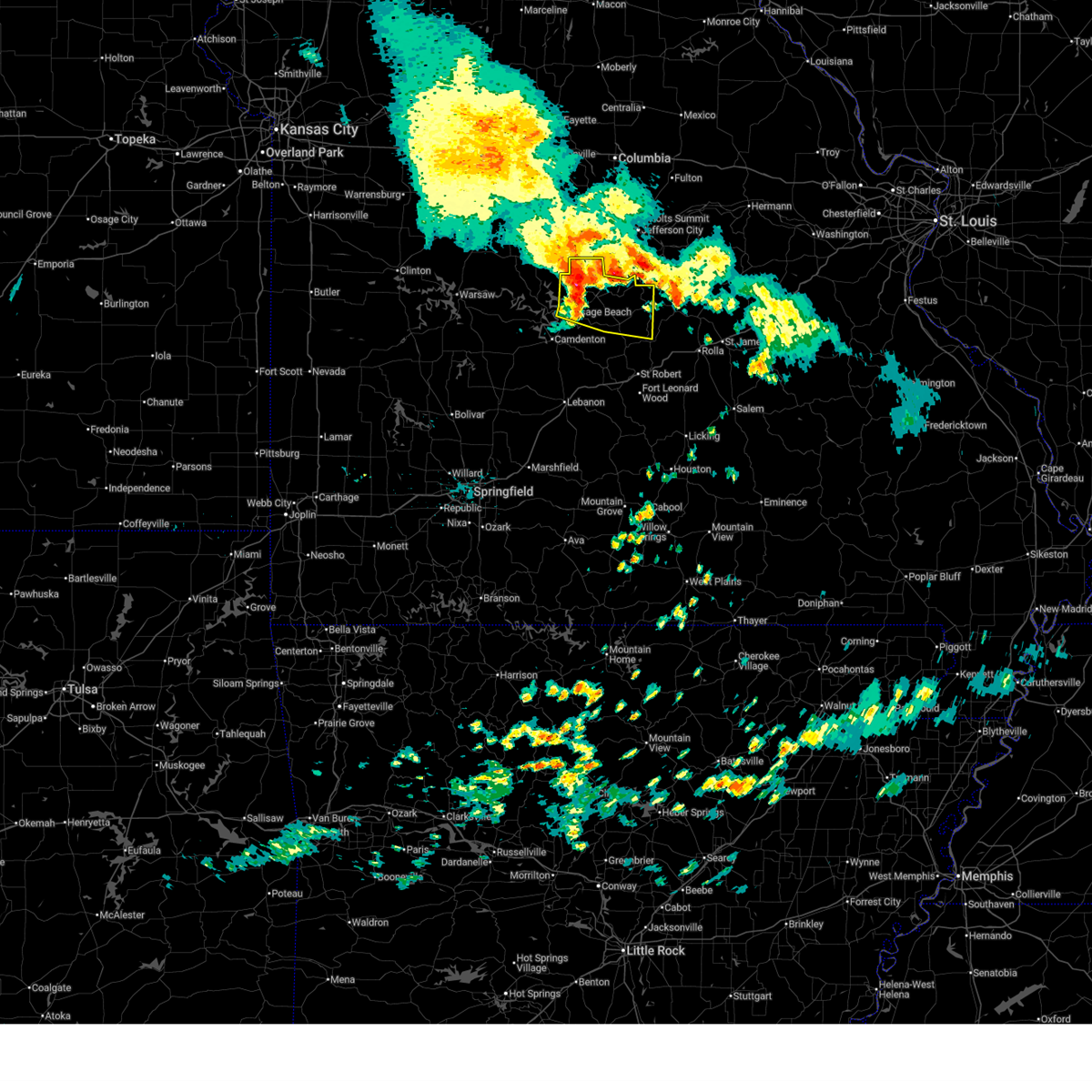
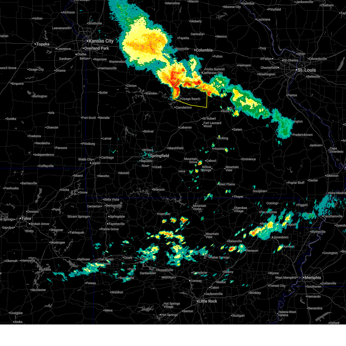
| 7/4/2026 2:40 PM CDT |
 At 238 pm cdt, severe thunderstorms were located along a line extending from near st. thomas to near dixon to near richland, moving east at 50 mph (law enforcement. these storms have a long history of producing widespread wind damage in the truman lake and lake of the ozarks region). Hazards include 70 mph wind gusts and quarter size hail. Hail damage to vehicles is expected. expect considerable tree damage. wind damage is also likely to mobile homes, roofs, and outbuildings. these severe storms will be near, northern fort leonard wood, waynesville, st. robert, dixon, and vienna around 245 pm cdt. doolittle and newburg around 255 pm cdt. rolla and belle around 300 pm cdt. st. james around 310 pm cdt. other locations impacted by these severe thunderstorms include lake of the ozarks, lake of the ozarks state park, st. elizabeth, tuscumbia, eugene, olean, bagnell, brumley, lakeside, and etterville. This includes interstate 44 between mile markers 156 and 169, and between mile markers 171 and 200. At 238 pm cdt, severe thunderstorms were located along a line extending from near st. thomas to near dixon to near richland, moving east at 50 mph (law enforcement. these storms have a long history of producing widespread wind damage in the truman lake and lake of the ozarks region). Hazards include 70 mph wind gusts and quarter size hail. Hail damage to vehicles is expected. expect considerable tree damage. wind damage is also likely to mobile homes, roofs, and outbuildings. these severe storms will be near, northern fort leonard wood, waynesville, st. robert, dixon, and vienna around 245 pm cdt. doolittle and newburg around 255 pm cdt. rolla and belle around 300 pm cdt. st. james around 310 pm cdt. other locations impacted by these severe thunderstorms include lake of the ozarks, lake of the ozarks state park, st. elizabeth, tuscumbia, eugene, olean, bagnell, brumley, lakeside, and etterville. This includes interstate 44 between mile markers 156 and 169, and between mile markers 171 and 200.
|
| 7/4/2026 2:30 PM CDT | Large tree branches broken off tree. trees fallen. via social media pics. time based on rada in miller county MO, 3.9 miles SW of Eldon, MO |
| 7/4/2026 2:27 PM CDT |
 At 225 pm cdt, severe thunderstorms were located along a line extending from 6 miles south of hickory hill to near iberia to 6 miles southwest of richland, moving southeast at 55 mph (law enforcement). Hazards include 70 mph wind gusts and quarter size hail. Hail damage to vehicles is expected. expect considerable tree damage. wind damage is also likely to mobile homes, roofs, and outbuildings. these severe storms will be near, waynesville, richland, crocker, and iberia around 230 pm cdt. northern fort leonard wood, st. robert, and dixon around 235 pm cdt. doolittle and vienna around 245 pm cdt. newburg around 250 pm cdt. rolla around 255 pm cdt. st. james around 305 pm cdt. other locations impacted by these severe thunderstorms include lake of the ozarks, lake of the ozarks state park, ha ha tonka state park, sunrise beach, st. elizabeth, linn creek, tuscumbia, barnett, stoutland, and eugene. This includes interstate 44 between mile markers 154 and 169, and between mile markers 171 and 200. At 225 pm cdt, severe thunderstorms were located along a line extending from 6 miles south of hickory hill to near iberia to 6 miles southwest of richland, moving southeast at 55 mph (law enforcement). Hazards include 70 mph wind gusts and quarter size hail. Hail damage to vehicles is expected. expect considerable tree damage. wind damage is also likely to mobile homes, roofs, and outbuildings. these severe storms will be near, waynesville, richland, crocker, and iberia around 230 pm cdt. northern fort leonard wood, st. robert, and dixon around 235 pm cdt. doolittle and vienna around 245 pm cdt. newburg around 250 pm cdt. rolla around 255 pm cdt. st. james around 305 pm cdt. other locations impacted by these severe thunderstorms include lake of the ozarks, lake of the ozarks state park, ha ha tonka state park, sunrise beach, st. elizabeth, linn creek, tuscumbia, barnett, stoutland, and eugene. This includes interstate 44 between mile markers 154 and 169, and between mile markers 171 and 200.
|
| 7/4/2026 2:14 PM CDT |
 At 212 pm cdt, severe thunderstorms were located along a line extending from eldon to near osage beach to 8 miles southeast of macks creek, moving east at 40 mph (law enforcement). Hazards include 70 mph wind gusts and quarter size hail. Hail damage to vehicles is expected. expect considerable tree damage. wind damage is also likely to mobile homes, roofs, and outbuildings. these severe storms will be near, richland around 235 pm cdt. other locations impacted by these severe thunderstorms include lake of the ozarks, lake of the ozarks state park, ha ha tonka state park, sunrise beach, linn creek, tuscumbia, barnett, stoutland, syracuse, and gravois mills. This includes interstate 44 between mile markers 137 and 144. At 212 pm cdt, severe thunderstorms were located along a line extending from eldon to near osage beach to 8 miles southeast of macks creek, moving east at 40 mph (law enforcement). Hazards include 70 mph wind gusts and quarter size hail. Hail damage to vehicles is expected. expect considerable tree damage. wind damage is also likely to mobile homes, roofs, and outbuildings. these severe storms will be near, richland around 235 pm cdt. other locations impacted by these severe thunderstorms include lake of the ozarks, lake of the ozarks state park, ha ha tonka state park, sunrise beach, linn creek, tuscumbia, barnett, stoutland, syracuse, and gravois mills. This includes interstate 44 between mile markers 137 and 144.
|
| 7/4/2026 2:06 PM CDT | A few limbs and trees on city streets and one on a hous in miller county MO, 0.2 miles SSE of Eldon, MO |
| 7/4/2026 2:05 PM CDT |
 Svrsgf the national weather service in springfield has issued a * severe thunderstorm warning for, maries county in central missouri, miller county in central missouri, northwestern laclede county in southwestern missouri, pulaski county in central missouri, phelps county in east central missouri, eastern camden county in central missouri, southeastern morgan county in central missouri, * until 300 pm cdt. * at 202 pm cdt, severe thunderstorms were located along a line extending from near tipton to near village of four seasons to near camdenton, moving east at 50 mph (radar indicated). Hazards include 70 mph wind gusts and quarter size hail. these storms have a history of producing widespread wind damage in the truman lake region. Hail damage to vehicles is expected. expect considerable tree damage. wind damage is also likely to mobile homes, roofs, and outbuildings. severe thunderstorms will be near, eldon, osage beach, and lake ozark around 210 pm cdt. iberia around 225 pm cdt. crocker around 230 pm cdt. dixon around 240 pm cdt. vienna around 245 pm cdt. other locations impacted by these severe thunderstorms include lake of the ozarks, lake of the ozarks state park, ha ha tonka state park, sunrise beach, st. elizabeth, linn creek, tuscumbia, barnett, stoutland, and eugene. This includes interstate 44 between mile markers 154 and 169, and between mile markers 171 and 200. Svrsgf the national weather service in springfield has issued a * severe thunderstorm warning for, maries county in central missouri, miller county in central missouri, northwestern laclede county in southwestern missouri, pulaski county in central missouri, phelps county in east central missouri, eastern camden county in central missouri, southeastern morgan county in central missouri, * until 300 pm cdt. * at 202 pm cdt, severe thunderstorms were located along a line extending from near tipton to near village of four seasons to near camdenton, moving east at 50 mph (radar indicated). Hazards include 70 mph wind gusts and quarter size hail. these storms have a history of producing widespread wind damage in the truman lake region. Hail damage to vehicles is expected. expect considerable tree damage. wind damage is also likely to mobile homes, roofs, and outbuildings. severe thunderstorms will be near, eldon, osage beach, and lake ozark around 210 pm cdt. iberia around 225 pm cdt. crocker around 230 pm cdt. dixon around 240 pm cdt. vienna around 245 pm cdt. other locations impacted by these severe thunderstorms include lake of the ozarks, lake of the ozarks state park, ha ha tonka state park, sunrise beach, st. elizabeth, linn creek, tuscumbia, barnett, stoutland, and eugene. This includes interstate 44 between mile markers 154 and 169, and between mile markers 171 and 200.
|
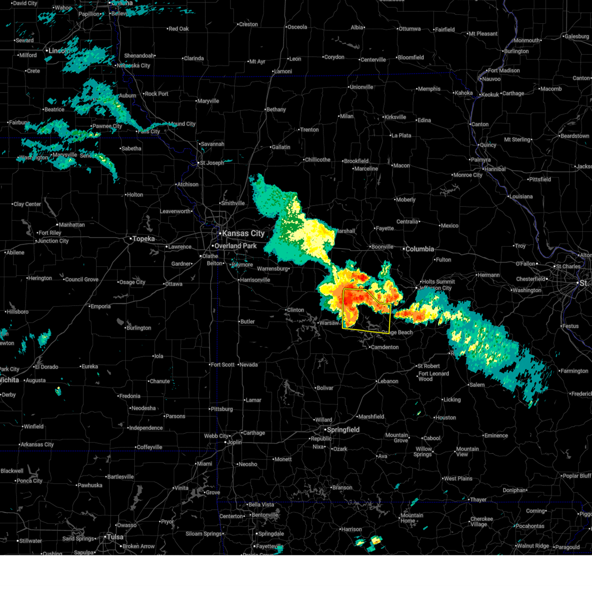
| 7/4/2026 1:36 PM CDT |
 Svrsgf the national weather service in springfield has issued a * severe thunderstorm warning for, eastern hickory county in central missouri, northern dallas county in southwestern missouri, eastern benton county in central missouri, western miller county in central missouri, northwestern laclede county in southwestern missouri, camden county in central missouri, morgan county in central missouri, * until 230 pm cdt. * at 131 pm cdt, severe thunderstorms were located along a line extending from near sedalia to 6 miles southeast of warsaw to near wheatland, moving east at 50 mph (law enforcement). Hazards include 70 mph wind gusts and quarter size hail. these storms have a history of downing trees and power lines around schell city and producing quarter sized hail near fort scott. Hail damage to vehicles is expected. expect considerable tree damage. wind damage is also likely to mobile homes, roofs, and outbuildings. severe thunderstorms will be near, hermitage and cole camp around 135 pm cdt. stover around 145 pm cdt. versailles around 150 pm cdt. laurie around 155 pm cdt. village of four seasons and macks creek around 200 pm cdt. lake ozark around 205 pm cdt. eldon, osage beach, and camdenton around 210 pm cdt. other locations impacted by these severe thunderstorms include lake of the ozarks, pomme de terre lake, lake of the ozarks state park, pomme de terre state park, ha ha tonka state park, pittsburg, sunrise beach, linn creek, preston, and cross timbers. This includes interstate 44 between mile markers 137 and 144. Svrsgf the national weather service in springfield has issued a * severe thunderstorm warning for, eastern hickory county in central missouri, northern dallas county in southwestern missouri, eastern benton county in central missouri, western miller county in central missouri, northwestern laclede county in southwestern missouri, camden county in central missouri, morgan county in central missouri, * until 230 pm cdt. * at 131 pm cdt, severe thunderstorms were located along a line extending from near sedalia to 6 miles southeast of warsaw to near wheatland, moving east at 50 mph (law enforcement). Hazards include 70 mph wind gusts and quarter size hail. these storms have a history of downing trees and power lines around schell city and producing quarter sized hail near fort scott. Hail damage to vehicles is expected. expect considerable tree damage. wind damage is also likely to mobile homes, roofs, and outbuildings. severe thunderstorms will be near, hermitage and cole camp around 135 pm cdt. stover around 145 pm cdt. versailles around 150 pm cdt. laurie around 155 pm cdt. village of four seasons and macks creek around 200 pm cdt. lake ozark around 205 pm cdt. eldon, osage beach, and camdenton around 210 pm cdt. other locations impacted by these severe thunderstorms include lake of the ozarks, pomme de terre lake, lake of the ozarks state park, pomme de terre state park, ha ha tonka state park, pittsburg, sunrise beach, linn creek, preston, and cross timbers. This includes interstate 44 between mile markers 137 and 144.
|
| 4/28/2026 2:36 PM CDT |
 Svrsgf the national weather service in springfield has issued a * severe thunderstorm warning for, northwestern miller county in central missouri, southeastern morgan county in central missouri, * until 315 pm cdt. * at 236 pm cdt, a severe thunderstorm was located near versailles, moving northeast at 50 mph (trained weather spotters). Hazards include ping pong ball size hail. People and animals outdoors will be injured. Expect damage to roofs, siding, windows, and vehicles. Svrsgf the national weather service in springfield has issued a * severe thunderstorm warning for, northwestern miller county in central missouri, southeastern morgan county in central missouri, * until 315 pm cdt. * at 236 pm cdt, a severe thunderstorm was located near versailles, moving northeast at 50 mph (trained weather spotters). Hazards include ping pong ball size hail. People and animals outdoors will be injured. Expect damage to roofs, siding, windows, and vehicles.
|
| 4/28/2026 1:35 PM CDT |
 The storm which prompted the warning has moved out of the area. therefore, the warning will be allowed to expire. a severe thunderstorm watch remains in effect until 600 pm cdt for central missouri. to report severe weather, contact your nearest law enforcement agency. they will relay your report to the national weather service springfield. The storm which prompted the warning has moved out of the area. therefore, the warning will be allowed to expire. a severe thunderstorm watch remains in effect until 600 pm cdt for central missouri. to report severe weather, contact your nearest law enforcement agency. they will relay your report to the national weather service springfield.
|
| 4/28/2026 1:15 PM CDT |
 the severe thunderstorm warning has been cancelled and is no longer in effect the severe thunderstorm warning has been cancelled and is no longer in effect
|
| 4/28/2026 1:15 PM CDT |
 At 114 pm cdt, a severe thunderstorm was located near iberia, or 19 miles east of osage beach, moving northeast at 60 mph (radar indicated). Hazards include golf ball size hail. People and animals outdoors will be injured. expect damage to roofs, siding, windows, and vehicles. locations impacted include, lake of the ozarks, lake of the ozarks state park, eldon, osage beach, lake ozark, st. Elizabeth, tuscumbia, eugene, olean, bagnell, lakeside, ulman, etterville, lakeview, marys home, and aurora springs. At 114 pm cdt, a severe thunderstorm was located near iberia, or 19 miles east of osage beach, moving northeast at 60 mph (radar indicated). Hazards include golf ball size hail. People and animals outdoors will be injured. expect damage to roofs, siding, windows, and vehicles. locations impacted include, lake of the ozarks, lake of the ozarks state park, eldon, osage beach, lake ozark, st. Elizabeth, tuscumbia, eugene, olean, bagnell, lakeside, ulman, etterville, lakeview, marys home, and aurora springs.
|
| 4/28/2026 12:58 PM CDT |
 Svrsgf the national weather service in springfield has issued a * severe thunderstorm warning for, western maries county in central missouri, miller county in central missouri, northwestern pulaski county in central missouri, eastern camden county in central missouri, * until 145 pm cdt. * at 1257 pm cdt, a severe thunderstorm was located 9 miles northwest of richland, or 13 miles east of camdenton, moving northeast at 60 mph (radar indicated). Hazards include two inch hail. People and animals outdoors will be injured. Expect damage to roofs, siding, windows, and vehicles. Svrsgf the national weather service in springfield has issued a * severe thunderstorm warning for, western maries county in central missouri, miller county in central missouri, northwestern pulaski county in central missouri, eastern camden county in central missouri, * until 145 pm cdt. * at 1257 pm cdt, a severe thunderstorm was located 9 miles northwest of richland, or 13 miles east of camdenton, moving northeast at 60 mph (radar indicated). Hazards include two inch hail. People and animals outdoors will be injured. Expect damage to roofs, siding, windows, and vehicles.
|
| 4/27/2026 5:27 PM CDT |
 The storm which prompted the warning has moved out of the area. therefore, the warning will be allowed to expire. however, small hail is still possible with this thunderstorm. a tornado watch remains in effect until 900 pm cdt for central missouri. remember, a severe thunderstorm warning still remains in effect for central miller county. The storm which prompted the warning has moved out of the area. therefore, the warning will be allowed to expire. however, small hail is still possible with this thunderstorm. a tornado watch remains in effect until 900 pm cdt for central missouri. remember, a severe thunderstorm warning still remains in effect for central miller county.
|
| 4/27/2026 5:15 PM CDT |
 At 515 pm cdt, a severe thunderstorm was located near high point, or near eldon, moving northeast at 60 mph (radar indicated). Hazards include 60 mph wind gusts and half dollar size hail. Hail damage to vehicles is expected. expect wind damage to roofs, siding, and trees. Locations impacted include, eldon, barnett, olean, etterville, and aurora springs. At 515 pm cdt, a severe thunderstorm was located near high point, or near eldon, moving northeast at 60 mph (radar indicated). Hazards include 60 mph wind gusts and half dollar size hail. Hail damage to vehicles is expected. expect wind damage to roofs, siding, and trees. Locations impacted include, eldon, barnett, olean, etterville, and aurora springs.
|
| 4/27/2026 5:12 PM CDT | Golf Ball sized hail reported 2.2 miles WSW of Eldon, MO, quarter and golf ball size hail. |
| 4/27/2026 5:00 PM CDT |
 Svrsgf the national weather service in springfield has issued a * severe thunderstorm warning for, northwestern miller county in central missouri, southeastern morgan county in central missouri, * until 530 pm cdt. * at 500 pm cdt, a severe thunderstorm was located 7 miles south of versailles, moving northeast at 60 mph (radar indicated). Hazards include 60 mph wind gusts and half dollar size hail. Hail damage to vehicles is expected. Expect wind damage to roofs, siding, and trees. Svrsgf the national weather service in springfield has issued a * severe thunderstorm warning for, northwestern miller county in central missouri, southeastern morgan county in central missouri, * until 530 pm cdt. * at 500 pm cdt, a severe thunderstorm was located 7 miles south of versailles, moving northeast at 60 mph (radar indicated). Hazards include 60 mph wind gusts and half dollar size hail. Hail damage to vehicles is expected. Expect wind damage to roofs, siding, and trees.
|
| 4/26/2026 8:39 PM CDT |
 Svrsgf the national weather service in springfield has issued a * severe thunderstorm warning for, western maries county in central missouri, miller county in central missouri, * until 945 pm cdt. * at 839 pm cdt, severe thunderstorms were located along a line extending from 6 miles west of hickory hill to 9 miles east of lake ozark to near osage beach, moving east at 40 mph (radar indicated). Hazards include 60 mph wind gusts and quarter size hail. Hail damage to vehicles is expected. Expect wind damage to roofs, siding, and trees. Svrsgf the national weather service in springfield has issued a * severe thunderstorm warning for, western maries county in central missouri, miller county in central missouri, * until 945 pm cdt. * at 839 pm cdt, severe thunderstorms were located along a line extending from 6 miles west of hickory hill to 9 miles east of lake ozark to near osage beach, moving east at 40 mph (radar indicated). Hazards include 60 mph wind gusts and quarter size hail. Hail damage to vehicles is expected. Expect wind damage to roofs, siding, and trees.
|
| 4/26/2026 8:35 PM CDT |
 At 835 pm cdt, severe thunderstorms were located along a line extending from near centertown to 6 miles south of hickory hill to 7 miles southeast of lake ozark, moving east at 35 mph (radar indicated). Hazards include 60 mph wind gusts and quarter size hail. Hail damage to vehicles is expected. expect wind damage to roofs, siding, and trees. locations impacted include, lake of the ozarks, lake of the ozarks state park, eldon, osage beach, lake ozark, st. Elizabeth, tuscumbia, eugene, olean, bagnell, lakeside, etterville, lakeview, marys home, aurora springs, and ulman. At 835 pm cdt, severe thunderstorms were located along a line extending from near centertown to 6 miles south of hickory hill to 7 miles southeast of lake ozark, moving east at 35 mph (radar indicated). Hazards include 60 mph wind gusts and quarter size hail. Hail damage to vehicles is expected. expect wind damage to roofs, siding, and trees. locations impacted include, lake of the ozarks, lake of the ozarks state park, eldon, osage beach, lake ozark, st. Elizabeth, tuscumbia, eugene, olean, bagnell, lakeside, etterville, lakeview, marys home, aurora springs, and ulman.
|
| 4/26/2026 7:55 PM CDT |
 Svrsgf the national weather service in springfield has issued a * severe thunderstorm warning for, miller county in central missouri, northwestern camden county in central missouri, morgan county in central missouri, * until 845 pm cdt. * at 755 pm cdt, severe thunderstorms were located along a line extending from near otterville to 8 miles north of village of four seasons to near laurie, moving east at 45 mph (radar indicated). Hazards include 60 mph wind gusts and quarter size hail. Hail damage to vehicles is expected. Expect wind damage to roofs, siding, and trees. Svrsgf the national weather service in springfield has issued a * severe thunderstorm warning for, miller county in central missouri, northwestern camden county in central missouri, morgan county in central missouri, * until 845 pm cdt. * at 755 pm cdt, severe thunderstorms were located along a line extending from near otterville to 8 miles north of village of four seasons to near laurie, moving east at 45 mph (radar indicated). Hazards include 60 mph wind gusts and quarter size hail. Hail damage to vehicles is expected. Expect wind damage to roofs, siding, and trees.
|
| 4/17/2026 8:12 PM CDT |
 The storm which prompted the warning has moved out of the area. therefore, the warning will be allowed to expire. however, gusty winds are still possible with this thunderstorm. a tornado watch remains in effect until 900 pm cdt for central missouri. remember, a severe thunderstorm warning still remains in effect for miller and maries county. The storm which prompted the warning has moved out of the area. therefore, the warning will be allowed to expire. however, gusty winds are still possible with this thunderstorm. a tornado watch remains in effect until 900 pm cdt for central missouri. remember, a severe thunderstorm warning still remains in effect for miller and maries county.
|
| 4/17/2026 8:09 PM CDT |
 Svrsgf the national weather service in springfield has issued a * severe thunderstorm warning for, maries county in central missouri, miller county in central missouri, northwestern phelps county in east central missouri, northeastern camden county in central missouri, * until 900 pm cdt. * at 809 pm cdt, severe thunderstorms were located along a line extending from russellville to 7 miles southeast of eldon to 7 miles southwest of camdenton, moving east at 60 mph (radar indicated). Hazards include 60 mph wind gusts and quarter size hail. Hail damage to vehicles is expected. Expect wind damage to roofs, siding, and trees. Svrsgf the national weather service in springfield has issued a * severe thunderstorm warning for, maries county in central missouri, miller county in central missouri, northwestern phelps county in east central missouri, northeastern camden county in central missouri, * until 900 pm cdt. * at 809 pm cdt, severe thunderstorms were located along a line extending from russellville to 7 miles southeast of eldon to 7 miles southwest of camdenton, moving east at 60 mph (radar indicated). Hazards include 60 mph wind gusts and quarter size hail. Hail damage to vehicles is expected. Expect wind damage to roofs, siding, and trees.
|
| 4/17/2026 7:57 PM CDT |
 At 756 pm cdt, a severe thunderstorm capable of producing a tornado was located near versailles, moving northeast at 60 mph (radar indicated rotation). Hazards include tornado and quarter size hail. Flying debris will be dangerous to those caught without shelter. mobile homes will be damaged or destroyed. damage to roofs, windows, and vehicles will occur. tree damage is likely. Locations impacted include, lake of the ozarks, eldon, versailles, village of four seasons, lake ozark, stover, laurie, sunrise beach, barnett, gravois mills, olean, bagnell, rocky mount, etterville, and aurora springs. At 756 pm cdt, a severe thunderstorm capable of producing a tornado was located near versailles, moving northeast at 60 mph (radar indicated rotation). Hazards include tornado and quarter size hail. Flying debris will be dangerous to those caught without shelter. mobile homes will be damaged or destroyed. damage to roofs, windows, and vehicles will occur. tree damage is likely. Locations impacted include, lake of the ozarks, eldon, versailles, village of four seasons, lake ozark, stover, laurie, sunrise beach, barnett, gravois mills, olean, bagnell, rocky mount, etterville, and aurora springs.
|
| 4/17/2026 7:45 PM CDT |
 At 744 pm cdt, a severe squall line capable of producing both tornadoes and extensive straight line wind damage was located 8 miles south of stover, or 9 miles southwest of versailles, moving east at 65 mph (radar indicated rotation). Hazards include tornado and quarter size hail. Flying debris will be dangerous to those caught without shelter. mobile homes will be damaged or destroyed. damage to roofs, windows, and vehicles will occur. tree damage is likely. Locations impacted include, lake of the ozarks, eldon, osage beach, versailles, village of four seasons, lake ozark, stover, laurie, sunrise beach, tuscumbia, barnett, gravois mills, olean, bagnell, lakeside, rocky mount, etterville, lakeview, purvis, and aurora springs. At 744 pm cdt, a severe squall line capable of producing both tornadoes and extensive straight line wind damage was located 8 miles south of stover, or 9 miles southwest of versailles, moving east at 65 mph (radar indicated rotation). Hazards include tornado and quarter size hail. Flying debris will be dangerous to those caught without shelter. mobile homes will be damaged or destroyed. damage to roofs, windows, and vehicles will occur. tree damage is likely. Locations impacted include, lake of the ozarks, eldon, osage beach, versailles, village of four seasons, lake ozark, stover, laurie, sunrise beach, tuscumbia, barnett, gravois mills, olean, bagnell, lakeside, rocky mount, etterville, lakeview, purvis, and aurora springs.
|
| 4/17/2026 7:45 PM CDT |
 the tornado warning has been cancelled and is no longer in effect the tornado warning has been cancelled and is no longer in effect
|
| 4/17/2026 7:36 PM CDT |
 Torsgf the national weather service in springfield has issued a * tornado warning for, eastern benton county in central missouri, northwestern miller county in central missouri, northwestern camden county in central missouri, morgan county in central missouri, * until 815 pm cdt. * at 736 pm cdt, severe thunderstorms capable of producing both tornadoes and extensive straight line wind damage were located 8 miles south of cole camp, or 13 miles northeast of warsaw, moving northeast at 65 mph (radar indicated rotation). Hazards include tornado and quarter size hail. Flying debris will be dangerous to those caught without shelter. mobile homes will be damaged or destroyed. damage to roofs, windows, and vehicles will occur. Tree damage is likely. Torsgf the national weather service in springfield has issued a * tornado warning for, eastern benton county in central missouri, northwestern miller county in central missouri, northwestern camden county in central missouri, morgan county in central missouri, * until 815 pm cdt. * at 736 pm cdt, severe thunderstorms capable of producing both tornadoes and extensive straight line wind damage were located 8 miles south of cole camp, or 13 miles northeast of warsaw, moving northeast at 65 mph (radar indicated rotation). Hazards include tornado and quarter size hail. Flying debris will be dangerous to those caught without shelter. mobile homes will be damaged or destroyed. damage to roofs, windows, and vehicles will occur. Tree damage is likely.
|
| 4/17/2026 7:30 PM CDT |
 Svrsgf the national weather service in springfield has issued a * severe thunderstorm warning for, northwestern miller county in central missouri, northwestern camden county in central missouri, morgan county in central missouri, * until 815 pm cdt. * at 730 pm cdt, a severe thunderstorm was located near warsaw, moving east at 55 mph (radar indicated). Hazards include 60 mph wind gusts and quarter size hail. Hail damage to vehicles is expected. Expect wind damage to roofs, siding, and trees. Svrsgf the national weather service in springfield has issued a * severe thunderstorm warning for, northwestern miller county in central missouri, northwestern camden county in central missouri, morgan county in central missouri, * until 815 pm cdt. * at 730 pm cdt, a severe thunderstorm was located near warsaw, moving east at 55 mph (radar indicated). Hazards include 60 mph wind gusts and quarter size hail. Hail damage to vehicles is expected. Expect wind damage to roofs, siding, and trees.
|
| 4/16/2026 5:20 PM CDT | Golf Ball sized hail reported 6.1 miles WSW of Eldon, MO, multiple reports of golf ball size hail reported by the public... relayed by regional skywarn ham operator. |
| 3/15/2026 1:55 PM CDT |
 Svrsgf the national weather service in springfield has issued a * severe thunderstorm warning for, northwestern maries county in central missouri, miller county in central missouri, eastern camden county in central missouri, * until 245 pm cdt. * at 155 pm cdt, a severe thunderstorm was located 8 miles southeast of osage beach, moving northeast at 55 mph (radar indicated). Hazards include 60 mph wind gusts and penny size hail. expect damage to roofs, siding, and trees Svrsgf the national weather service in springfield has issued a * severe thunderstorm warning for, northwestern maries county in central missouri, miller county in central missouri, eastern camden county in central missouri, * until 245 pm cdt. * at 155 pm cdt, a severe thunderstorm was located 8 miles southeast of osage beach, moving northeast at 55 mph (radar indicated). Hazards include 60 mph wind gusts and penny size hail. expect damage to roofs, siding, and trees
|
| 9/18/2025 6:24 PM CDT | the severe thunderstorm warning has been cancelled and is no longer in effect |
| 9/18/2025 6:15 PM CDT | the severe thunderstorm warning has been cancelled and is no longer in effect |
| 9/18/2025 6:15 PM CDT | At 615 pm cdt, severe thunderstorms were located along a line extending from near smithton to near versailles to near laurie, moving east at 30 mph (radar indicated). Hazards include 60 mph wind gusts and quarter size hail. Hail damage to vehicles is expected. expect wind damage to roofs, siding, and trees. Locations impacted include, lake of the ozarks, lake of the ozarks state park, eldon, osage beach, versailles, village of four seasons, lake ozark, cole camp, stover, laurie, sunrise beach, tuscumbia, barnett, syracuse, gravois mills, olean, climax springs, bagnell, lakeside, and etterville. |
| 9/18/2025 5:59 PM CDT | Svrsgf the national weather service in springfield has issued a * severe thunderstorm warning for, northeastern hickory county in central missouri, eastern benton county in central missouri, western miller county in central missouri, camden county in central missouri, morgan county in central missouri, * until 645 pm cdt. * at 558 pm cdt, severe thunderstorms were located along a line extending from 7 miles north of cole camp to near laurie to near macks creek, moving northeast at 30 mph (radar indicated). Hazards include 60 mph wind gusts and quarter size hail. Hail damage to vehicles is expected. Expect wind damage to roofs, siding, and trees. |
| 9/3/2025 11:53 PM CDT |
 The storm which prompted the warning has weakened below severe limits, and no longer poses an immediate threat to life or property. therefore, the warning will be allowed to expire. The storm which prompted the warning has weakened below severe limits, and no longer poses an immediate threat to life or property. therefore, the warning will be allowed to expire.
|
| 9/3/2025 11:23 PM CDT |
 Svrsgf the national weather service in springfield has issued a * severe thunderstorm warning for, west central maries county in central missouri, northeastern miller county in central missouri, * until midnight cdt. * at 1123 pm cdt, a severe thunderstorm was located near eldon, moving southeast at 45 mph (radar indicated). Hazards include 60 mph wind gusts and quarter size hail. Hail damage to vehicles is expected. Expect wind damage to roofs, siding, and trees. Svrsgf the national weather service in springfield has issued a * severe thunderstorm warning for, west central maries county in central missouri, northeastern miller county in central missouri, * until midnight cdt. * at 1123 pm cdt, a severe thunderstorm was located near eldon, moving southeast at 45 mph (radar indicated). Hazards include 60 mph wind gusts and quarter size hail. Hail damage to vehicles is expected. Expect wind damage to roofs, siding, and trees.
|
| 6/8/2025 8:09 PM CDT | Golf Ball sized hail reported 4.7 miles N of Eldon, MO, photo from social media of several stones between half dollar and golf ball size hail. large volume of hail reported within the storm... with missouri state highway pat |
| 6/8/2025 8:06 PM CDT | Quarter sized hail reported 4.7 miles NE of Eldon, MO, hail reported to cover the ground. |
| 6/8/2025 8:05 PM CDT |
 Svrsgf the national weather service in springfield has issued a * severe thunderstorm warning for, central miller county in central missouri, * until 845 pm cdt. * at 805 pm cdt, a severe thunderstorm was located near eldon, moving east at 25 mph (radar indicated). Hazards include quarter size hail. damage to vehicles is expected Svrsgf the national weather service in springfield has issued a * severe thunderstorm warning for, central miller county in central missouri, * until 845 pm cdt. * at 805 pm cdt, a severe thunderstorm was located near eldon, moving east at 25 mph (radar indicated). Hazards include quarter size hail. damage to vehicles is expected
|
| 6/3/2025 9:26 PM CDT |
 The storms which prompted the warning have moved out of the area. therefore, the warning will be allowed to expire. to report severe weather, contact your nearest law enforcement agency. they will relay your report to the national weather service springfield. The storms which prompted the warning have moved out of the area. therefore, the warning will be allowed to expire. to report severe weather, contact your nearest law enforcement agency. they will relay your report to the national weather service springfield.
|
| 6/3/2025 9:01 PM CDT | Time estimated by radar. tree down blocking allen roa in miller county MO, 6 miles N of Eldon, MO |
| 6/3/2025 8:59 PM CDT | Time estimated by radar. tree down blocking vaughan roa in miller county MO, 3.9 miles NNW of Eldon, MO |
| 6/3/2025 8:58 PM CDT |
 Svrsgf the national weather service in springfield has issued a * severe thunderstorm warning for, northern miller county in central missouri, southeastern morgan county in central missouri, * until 930 pm cdt. * at 858 pm cdt, severe thunderstorms were located along a line extending from near high point to near eldon to near lake ozark, moving northeast at 45 mph (radar indicated). Hazards include 60 mph wind gusts. expect damage to roofs, siding, and trees Svrsgf the national weather service in springfield has issued a * severe thunderstorm warning for, northern miller county in central missouri, southeastern morgan county in central missouri, * until 930 pm cdt. * at 858 pm cdt, severe thunderstorms were located along a line extending from near high point to near eldon to near lake ozark, moving northeast at 45 mph (radar indicated). Hazards include 60 mph wind gusts. expect damage to roofs, siding, and trees
|
| 6/3/2025 8:54 PM CDT | Time estimated by radar. trees down on blue springs driv in miller county MO, 6.6 miles NE of Eldon, MO |
| 5/19/2025 8:25 PM CDT |
 The storms which prompted the warning have moved out of the area. therefore, the warning will be allowed to expire. a tornado watch remains in effect until 900 pm cdt for central missouri. a tornado watch also remains in effect until 300 am cdt for central missouri. The storms which prompted the warning have moved out of the area. therefore, the warning will be allowed to expire. a tornado watch remains in effect until 900 pm cdt for central missouri. a tornado watch also remains in effect until 300 am cdt for central missouri.
|
| 5/19/2025 8:20 PM CDT |
 At 820 pm cdt, severe thunderstorms were located along a line extending from rocheport to osage beach, moving northeast at 50 mph (radar indicated). Hazards include 60 mph wind gusts. Expect damage to roofs, siding, and trees. locations impacted include, lake of the ozarks, lake of the ozarks state park, eldon, osage beach, versailles, village of four seasons, lake ozark, laurie, iberia, sunrise beach, st. Elizabeth, tuscumbia, barnett, eugene, gravois mills, olean, bagnell, brumley, lakeside, and etterville. At 820 pm cdt, severe thunderstorms were located along a line extending from rocheport to osage beach, moving northeast at 50 mph (radar indicated). Hazards include 60 mph wind gusts. Expect damage to roofs, siding, and trees. locations impacted include, lake of the ozarks, lake of the ozarks state park, eldon, osage beach, versailles, village of four seasons, lake ozark, laurie, iberia, sunrise beach, st. Elizabeth, tuscumbia, barnett, eugene, gravois mills, olean, bagnell, brumley, lakeside, and etterville.
|
| 5/19/2025 7:42 PM CDT |
 Svrsgf the national weather service in springfield has issued a * severe thunderstorm warning for, miller county in central missouri, morgan county in central missouri, * until 830 pm cdt. * at 741 pm cdt, severe thunderstorms were located along a line extending from near otterville to near urbana, moving northeast at 50 mph (radar indicated). Hazards include 60 mph wind gusts. expect damage to roofs, siding, and trees Svrsgf the national weather service in springfield has issued a * severe thunderstorm warning for, miller county in central missouri, morgan county in central missouri, * until 830 pm cdt. * at 741 pm cdt, severe thunderstorms were located along a line extending from near otterville to near urbana, moving northeast at 50 mph (radar indicated). Hazards include 60 mph wind gusts. expect damage to roofs, siding, and trees
|
| 4/20/2025 4:54 PM CDT |
 Svrsgf the national weather service in springfield has issued a * severe thunderstorm warning for, maries county in central missouri, southeastern dallas county in southwestern missouri, miller county in central missouri, laclede county in southwestern missouri, pulaski county in central missouri, phelps county in east central missouri, eastern camden county in central missouri, southeastern morgan county in central missouri, * until 600 pm cdt. * at 453 pm cdt, severe thunderstorms were located along a line extending from mcgirk to 9 miles south of hickory hill to 14 miles northwest of gainesville, moving northeast at 55 mph (public). Hazards include 70 mph wind gusts and nickel size hail. Expect considerable tree damage. Damage is likely to mobile homes, roofs, and outbuildings. Svrsgf the national weather service in springfield has issued a * severe thunderstorm warning for, maries county in central missouri, southeastern dallas county in southwestern missouri, miller county in central missouri, laclede county in southwestern missouri, pulaski county in central missouri, phelps county in east central missouri, eastern camden county in central missouri, southeastern morgan county in central missouri, * until 600 pm cdt. * at 453 pm cdt, severe thunderstorms were located along a line extending from mcgirk to 9 miles south of hickory hill to 14 miles northwest of gainesville, moving northeast at 55 mph (public). Hazards include 70 mph wind gusts and nickel size hail. Expect considerable tree damage. Damage is likely to mobile homes, roofs, and outbuildings.
|
| 4/20/2025 4:41 PM CDT |
 At 440 pm cdt, severe thunderstorms were located along a line extending from near bunceton to near village of four seasons to 10 miles west of ava, moving northeast at 55 mph (radar indicated). Hazards include 70 mph wind gusts and quarter size hail. Hail damage to vehicles is expected. expect considerable tree damage. wind damage is also likely to mobile homes, roofs, and outbuildings. locations impacted include, competition, osage beach, florence, tunas, pumpkin center, sleeper, freedom, tuscumbia, old linn creek, barnumton, linn creek, syracuse, decaturville, lake of the ozarks state park, plad, long lane, brumley, lake of the ozarks, bagnell, and eldridge. This includes interstate 44 between mile markers 110 and 144. At 440 pm cdt, severe thunderstorms were located along a line extending from near bunceton to near village of four seasons to 10 miles west of ava, moving northeast at 55 mph (radar indicated). Hazards include 70 mph wind gusts and quarter size hail. Hail damage to vehicles is expected. expect considerable tree damage. wind damage is also likely to mobile homes, roofs, and outbuildings. locations impacted include, competition, osage beach, florence, tunas, pumpkin center, sleeper, freedom, tuscumbia, old linn creek, barnumton, linn creek, syracuse, decaturville, lake of the ozarks state park, plad, long lane, brumley, lake of the ozarks, bagnell, and eldridge. This includes interstate 44 between mile markers 110 and 144.
|
| 4/20/2025 4:41 PM CDT |
 the severe thunderstorm warning has been cancelled and is no longer in effect the severe thunderstorm warning has been cancelled and is no longer in effect
|
| 4/20/2025 3:58 PM CDT |
 Svrsgf the national weather service in springfield has issued a * severe thunderstorm warning for, eastern hickory county in central missouri, dallas county in southwestern missouri, benton county in central missouri, miller county in central missouri, eastern polk county in southwestern missouri, laclede county in southwestern missouri, camden county in central missouri, morgan county in central missouri, * until 500 pm cdt. * at 354 pm cdt, severe thunderstorms were located along a line extending from near lincoln to 10 miles northwest of buffalo to 6 miles northwest of roberson hollow, moving northeast at 55 mph (radar indicated). Hazards include 70 mph wind gusts and quarter size hail. Hail damage to vehicles is expected. expect considerable tree damage. Wind damage is also likely to mobile homes, roofs, and outbuildings. Svrsgf the national weather service in springfield has issued a * severe thunderstorm warning for, eastern hickory county in central missouri, dallas county in southwestern missouri, benton county in central missouri, miller county in central missouri, eastern polk county in southwestern missouri, laclede county in southwestern missouri, camden county in central missouri, morgan county in central missouri, * until 500 pm cdt. * at 354 pm cdt, severe thunderstorms were located along a line extending from near lincoln to 10 miles northwest of buffalo to 6 miles northwest of roberson hollow, moving northeast at 55 mph (radar indicated). Hazards include 70 mph wind gusts and quarter size hail. Hail damage to vehicles is expected. expect considerable tree damage. Wind damage is also likely to mobile homes, roofs, and outbuildings.
|
| 4/20/2025 12:31 PM CDT |
 Torsgf the national weather service in springfield has issued a * tornado warning for, northern miller county in central missouri, * until 1245 pm cdt. * at 1230 pm cdt, a severe thunderstorm capable of producing a tornado was located 7 miles southeast of eldon, moving northeast at 50 mph (radar indicated rotation). Hazards include tornado. Flying debris will be dangerous to those caught without shelter. mobile homes will be damaged or destroyed. damage to roofs, windows, and vehicles will occur. Tree damage is likely. Torsgf the national weather service in springfield has issued a * tornado warning for, northern miller county in central missouri, * until 1245 pm cdt. * at 1230 pm cdt, a severe thunderstorm capable of producing a tornado was located 7 miles southeast of eldon, moving northeast at 50 mph (radar indicated rotation). Hazards include tornado. Flying debris will be dangerous to those caught without shelter. mobile homes will be damaged or destroyed. damage to roofs, windows, and vehicles will occur. Tree damage is likely.
|
| 4/20/2025 12:09 PM CDT |
 At 1208 pm cdt, a severe thunderstorm capable of producing a tornado was located over osage beach, moving northeast at 40 mph (radar indicated rotation). Hazards include tornado. Flying debris will be dangerous to those caught without shelter. mobile homes will be damaged or destroyed. damage to roofs, windows, and vehicles will occur. tree damage is likely. locations impacted include, lake ozark, eldon, ulman, etterville, lakeview, village of four seasons, osage beach, kaiser, tuscumbia, lakeside, marys home, lake of the ozarks state park, eugene, aurora springs, olean, st. Elizabeth, bagnell, and lake of the ozarks. At 1208 pm cdt, a severe thunderstorm capable of producing a tornado was located over osage beach, moving northeast at 40 mph (radar indicated rotation). Hazards include tornado. Flying debris will be dangerous to those caught without shelter. mobile homes will be damaged or destroyed. damage to roofs, windows, and vehicles will occur. tree damage is likely. locations impacted include, lake ozark, eldon, ulman, etterville, lakeview, village of four seasons, osage beach, kaiser, tuscumbia, lakeside, marys home, lake of the ozarks state park, eugene, aurora springs, olean, st. Elizabeth, bagnell, and lake of the ozarks.
|
| 4/20/2025 11:58 AM CDT |
 At 1158 am cdt, a severe thunderstorm capable of producing a tornado was located over camdenton, moving northeast at 40 mph (radar indicated rotation). Hazards include tornado. Flying debris will be dangerous to those caught without shelter. mobile homes will be damaged or destroyed. damage to roofs, windows, and vehicles will occur. tree damage is likely. locations impacted include, etterville, osage beach, freedom, kaiser, tuscumbia, old linn creek, linn creek, lake of the ozarks state park, ha ha tonka state park, st. Elizabeth, brumley, bagnell, lake ozark, eldon, green bay terrace, ulman, lakeview, village of four seasons, lakeside, and marys home. At 1158 am cdt, a severe thunderstorm capable of producing a tornado was located over camdenton, moving northeast at 40 mph (radar indicated rotation). Hazards include tornado. Flying debris will be dangerous to those caught without shelter. mobile homes will be damaged or destroyed. damage to roofs, windows, and vehicles will occur. tree damage is likely. locations impacted include, etterville, osage beach, freedom, kaiser, tuscumbia, old linn creek, linn creek, lake of the ozarks state park, ha ha tonka state park, st. Elizabeth, brumley, bagnell, lake ozark, eldon, green bay terrace, ulman, lakeview, village of four seasons, lakeside, and marys home.
|
| 4/20/2025 11:49 AM CDT |
 Torsgf the national weather service in springfield has issued a * tornado warning for, miller county in central missouri, central camden county in central missouri, * until 1230 pm cdt. * at 1149 am cdt, a severe thunderstorm capable of producing a tornado was located near camdenton, moving northeast at 40 mph (radar indicated rotation). Hazards include tornado. Flying debris will be dangerous to those caught without shelter. mobile homes will be damaged or destroyed. damage to roofs, windows, and vehicles will occur. Tree damage is likely. Torsgf the national weather service in springfield has issued a * tornado warning for, miller county in central missouri, central camden county in central missouri, * until 1230 pm cdt. * at 1149 am cdt, a severe thunderstorm capable of producing a tornado was located near camdenton, moving northeast at 40 mph (radar indicated rotation). Hazards include tornado. Flying debris will be dangerous to those caught without shelter. mobile homes will be damaged or destroyed. damage to roofs, windows, and vehicles will occur. Tree damage is likely.
|
| 3/23/2025 12:38 AM CDT |
 The storm which prompted the warning has weakened below severe limits, and has exited the warned area. therefore, the warning will be allowed to expire. The storm which prompted the warning has weakened below severe limits, and has exited the warned area. therefore, the warning will be allowed to expire.
|
| 3/23/2025 12:28 AM CDT |
 At 1228 am cdt, a severe thunderstorm was located near eldon, moving northeast at 60 mph (radar indicated). Hazards include 60 mph wind gusts and quarter size hail. Hail damage to vehicles is expected. expect wind damage to roofs, siding, and trees. Locations impacted include, barnett, eldon, olean, and etterville. At 1228 am cdt, a severe thunderstorm was located near eldon, moving northeast at 60 mph (radar indicated). Hazards include 60 mph wind gusts and quarter size hail. Hail damage to vehicles is expected. expect wind damage to roofs, siding, and trees. Locations impacted include, barnett, eldon, olean, and etterville.
|
| 3/23/2025 12:17 AM CDT |
 Svrsgf the national weather service in springfield has issued a * severe thunderstorm warning for, northwestern miller county in central missouri, central morgan county in central missouri, * until 1245 am cdt. * at 1217 am cdt, a severe thunderstorm was located near versailles, moving northeast at 60 mph (radar indicated). Hazards include 60 mph wind gusts and quarter size hail. Hail damage to vehicles is expected. Expect wind damage to roofs, siding, and trees. Svrsgf the national weather service in springfield has issued a * severe thunderstorm warning for, northwestern miller county in central missouri, central morgan county in central missouri, * until 1245 am cdt. * at 1217 am cdt, a severe thunderstorm was located near versailles, moving northeast at 60 mph (radar indicated). Hazards include 60 mph wind gusts and quarter size hail. Hail damage to vehicles is expected. Expect wind damage to roofs, siding, and trees.
|
| 3/14/2025 6:11 PM CDT |
 Svrsgf the national weather service in springfield has issued a * severe thunderstorm warning for, miller county in central missouri, northwestern pulaski county in central missouri, camden county in central missouri, morgan county in central missouri, * until 715 pm cdt. * at 610 pm cdt, a severe thunderstorm was located near camdenton, moving northeast at 65 mph (radar indicated). Hazards include 70 mph wind gusts and quarter size hail. Hail damage to vehicles is expected. expect considerable tree damage. Wind damage is also likely to mobile homes, roofs, and outbuildings. Svrsgf the national weather service in springfield has issued a * severe thunderstorm warning for, miller county in central missouri, northwestern pulaski county in central missouri, camden county in central missouri, morgan county in central missouri, * until 715 pm cdt. * at 610 pm cdt, a severe thunderstorm was located near camdenton, moving northeast at 65 mph (radar indicated). Hazards include 70 mph wind gusts and quarter size hail. Hail damage to vehicles is expected. expect considerable tree damage. Wind damage is also likely to mobile homes, roofs, and outbuildings.
|
| 3/14/2025 5:18 PM CDT |
 Svrsgf the national weather service in springfield has issued a * severe thunderstorm warning for, northeastern hickory county in central missouri, eastern benton county in central missouri, western miller county in central missouri, camden county in central missouri, morgan county in central missouri, * until 615 pm cdt. * at 518 pm cdt, a severe thunderstorm was located 13 miles southeast of warsaw, moving northeast at 65 mph (radar indicated). Hazards include 70 mph wind gusts and quarter size hail. Hail damage to vehicles is expected. expect considerable tree damage. Wind damage is also likely to mobile homes, roofs, and outbuildings. Svrsgf the national weather service in springfield has issued a * severe thunderstorm warning for, northeastern hickory county in central missouri, eastern benton county in central missouri, western miller county in central missouri, camden county in central missouri, morgan county in central missouri, * until 615 pm cdt. * at 518 pm cdt, a severe thunderstorm was located 13 miles southeast of warsaw, moving northeast at 65 mph (radar indicated). Hazards include 70 mph wind gusts and quarter size hail. Hail damage to vehicles is expected. expect considerable tree damage. Wind damage is also likely to mobile homes, roofs, and outbuildings.
|
| 12/14/2024 4:45 PM CST |
 At 445 pm cst, a severe thunderstorm was located near eldon, moving east at 25 mph (radar indicated). Hazards include 60 mph wind gusts and quarter size hail. Hail damage to vehicles is expected. expect wind damage to roofs, siding, and trees. Locations impacted include, eldon, olean, and etterville. At 445 pm cst, a severe thunderstorm was located near eldon, moving east at 25 mph (radar indicated). Hazards include 60 mph wind gusts and quarter size hail. Hail damage to vehicles is expected. expect wind damage to roofs, siding, and trees. Locations impacted include, eldon, olean, and etterville.
|
| 12/14/2024 4:32 PM CST |
 At 432 pm cst, a severe thunderstorm was located near eldon, moving northeast at 30 mph (radar indicated). Hazards include 60 mph wind gusts and quarter size hail. Hail damage to vehicles is expected. expect wind damage to roofs, siding, and trees. Locations impacted include, eldon, lake ozark, olean, bagnell, etterville, and aurora springs. At 432 pm cst, a severe thunderstorm was located near eldon, moving northeast at 30 mph (radar indicated). Hazards include 60 mph wind gusts and quarter size hail. Hail damage to vehicles is expected. expect wind damage to roofs, siding, and trees. Locations impacted include, eldon, lake ozark, olean, bagnell, etterville, and aurora springs.
|
| 12/14/2024 4:32 PM CST |
 the severe thunderstorm warning has been cancelled and is no longer in effect the severe thunderstorm warning has been cancelled and is no longer in effect
|
| 12/14/2024 4:26 PM CST |
 Svrsgf the national weather service in springfield has issued a * severe thunderstorm warning for, northwestern miller county in central missouri, southeastern morgan county in central missouri, * until 515 pm cst. * at 426 pm cst, a severe thunderstorm was located near lake ozark, or 7 miles north of osage beach, moving northeast at 25 mph (radar indicated). Hazards include 60 mph wind gusts and quarter size hail. Hail damage to vehicles is expected. Expect wind damage to roofs, siding, and trees. Svrsgf the national weather service in springfield has issued a * severe thunderstorm warning for, northwestern miller county in central missouri, southeastern morgan county in central missouri, * until 515 pm cst. * at 426 pm cst, a severe thunderstorm was located near lake ozark, or 7 miles north of osage beach, moving northeast at 25 mph (radar indicated). Hazards include 60 mph wind gusts and quarter size hail. Hail damage to vehicles is expected. Expect wind damage to roofs, siding, and trees.
|
| 6/29/2024 5:46 PM CDT | Tree down at intersection of hwy 87 and northridge d in miller county MO, 1 miles SSW of Eldon, MO |
| 6/29/2024 5:37 PM CDT | Tree down on champain st in eldon and fell on a power pol in miller county MO, 1.1 miles SE of Eldon, MO |
| 6/14/2024 12:27 AM CDT |
 At 1227 am cdt, severe thunderstorms were located along a line extending from 9 miles south of versailles to near laurie to near macks creek, moving east at 30 mph (radar indicated). Hazards include 60 mph wind gusts and penny size hail. Expect damage to roofs, siding, and trees. Locations impacted include, lake of the ozarks, lake of the ozarks state park, ha ha tonka state park, eldon, osage beach, camdenton, village of four seasons, lake ozark, laurie, sunrise beach, macks creek, linn creek, barnett, gravois mills, climax springs, bagnell, brumley, lakeside, freedom, and kaiser. At 1227 am cdt, severe thunderstorms were located along a line extending from 9 miles south of versailles to near laurie to near macks creek, moving east at 30 mph (radar indicated). Hazards include 60 mph wind gusts and penny size hail. Expect damage to roofs, siding, and trees. Locations impacted include, lake of the ozarks, lake of the ozarks state park, ha ha tonka state park, eldon, osage beach, camdenton, village of four seasons, lake ozark, laurie, sunrise beach, macks creek, linn creek, barnett, gravois mills, climax springs, bagnell, brumley, lakeside, freedom, and kaiser.
|
| 6/14/2024 12:17 AM CDT |
 Svrsgf the national weather service in springfield has issued a * severe thunderstorm warning for, western miller county in central missouri, camden county in central missouri, southern morgan county in central missouri, * until 100 am cdt. * at 1216 am cdt, severe thunderstorms were located along a line extending from 8 miles south of stover to 6 miles southwest of laurie to 6 miles north of macks creek, moving east at 30 mph (radar indicated). Hazards include 60 mph wind gusts and penny size hail. expect damage to roofs, siding, and trees Svrsgf the national weather service in springfield has issued a * severe thunderstorm warning for, western miller county in central missouri, camden county in central missouri, southern morgan county in central missouri, * until 100 am cdt. * at 1216 am cdt, severe thunderstorms were located along a line extending from 8 miles south of stover to 6 miles southwest of laurie to 6 miles north of macks creek, moving east at 30 mph (radar indicated). Hazards include 60 mph wind gusts and penny size hail. expect damage to roofs, siding, and trees
|
| 5/26/2024 4:28 PM CDT |
 At 426 pm cdt, a severe thunderstorm was located over osage beach, moving east at 35 mph. this is a destructive storm for osage beach (radar indicated. at 425 pm, 2 inch hail was reported in osage beach). Hazards include baseball size hail and 60 mph wind gusts. People and animals outdoors will be severely injured. expect shattered windows, extensive damage to roofs, siding, and vehicles. locations impacted include, lake of the ozarks, lake of the ozarks state park, eldon, osage beach, village of four seasons, lake ozark, iberia, vienna, st. Elizabeth, tuscumbia, bagnell, brumley, lakeside, brinktown, ulman, lakeview, kaiser, marys home, and aurora springs. At 426 pm cdt, a severe thunderstorm was located over osage beach, moving east at 35 mph. this is a destructive storm for osage beach (radar indicated. at 425 pm, 2 inch hail was reported in osage beach). Hazards include baseball size hail and 60 mph wind gusts. People and animals outdoors will be severely injured. expect shattered windows, extensive damage to roofs, siding, and vehicles. locations impacted include, lake of the ozarks, lake of the ozarks state park, eldon, osage beach, village of four seasons, lake ozark, iberia, vienna, st. Elizabeth, tuscumbia, bagnell, brumley, lakeside, brinktown, ulman, lakeview, kaiser, marys home, and aurora springs.
|
| 5/26/2024 4:28 PM CDT |
 the severe thunderstorm warning has been cancelled and is no longer in effect the severe thunderstorm warning has been cancelled and is no longer in effect
|
| 5/26/2024 4:17 PM CDT |
 At 416 pm cdt, a severe thunderstorm was located over versailles, moving east at 55 mph (radar indicated). Hazards include ping pong ball size hail and 60 mph wind gusts. People and animals outdoors will be injured. expect hail damage to roofs, siding, windows, and vehicles. expect wind damage to roofs, siding, and trees. Locations impacted include, lake of the ozarks, eldon, versailles, stover, barnett, gravois mills, and aurora springs. At 416 pm cdt, a severe thunderstorm was located over versailles, moving east at 55 mph (radar indicated). Hazards include ping pong ball size hail and 60 mph wind gusts. People and animals outdoors will be injured. expect hail damage to roofs, siding, windows, and vehicles. expect wind damage to roofs, siding, and trees. Locations impacted include, lake of the ozarks, eldon, versailles, stover, barnett, gravois mills, and aurora springs.
|
| 5/26/2024 4:17 PM CDT |
 the severe thunderstorm warning has been cancelled and is no longer in effect the severe thunderstorm warning has been cancelled and is no longer in effect
|
| 5/26/2024 4:09 PM CDT |
 Svrsgf the national weather service in springfield has issued a * severe thunderstorm warning for, western maries county in central missouri, miller county in central missouri, north central camden county in central missouri, southeastern morgan county in central missouri, * until 515 pm cdt. * at 408 pm cdt, a severe thunderstorm was located over village of four seasons, or near osage beach, moving east at 50 mph. this is a destructive storm for laurie, village of four seasons, lake ozark (radar indicated). Hazards include baseball size hail and 60 mph wind gusts. People and animals outdoors will be severely injured. Expect shattered windows, extensive damage to roofs, siding, and vehicles. Svrsgf the national weather service in springfield has issued a * severe thunderstorm warning for, western maries county in central missouri, miller county in central missouri, north central camden county in central missouri, southeastern morgan county in central missouri, * until 515 pm cdt. * at 408 pm cdt, a severe thunderstorm was located over village of four seasons, or near osage beach, moving east at 50 mph. this is a destructive storm for laurie, village of four seasons, lake ozark (radar indicated). Hazards include baseball size hail and 60 mph wind gusts. People and animals outdoors will be severely injured. Expect shattered windows, extensive damage to roofs, siding, and vehicles.
|
| 5/26/2024 3:51 PM CDT |
 Svrsgf the national weather service in springfield has issued a * severe thunderstorm warning for, northern benton county in central missouri, northwestern miller county in central missouri, central morgan county in central missouri, * until 445 pm cdt. * at 351 pm cdt, a severe thunderstorm was located over lincoln, or 10 miles north of warsaw, moving east at 40 mph (radar indicated). Hazards include two inch hail and 60 mph wind gusts. People and animals outdoors will be injured. expect hail damage to roofs, siding, windows, and vehicles. Expect wind damage to roofs, siding, and trees. Svrsgf the national weather service in springfield has issued a * severe thunderstorm warning for, northern benton county in central missouri, northwestern miller county in central missouri, central morgan county in central missouri, * until 445 pm cdt. * at 351 pm cdt, a severe thunderstorm was located over lincoln, or 10 miles north of warsaw, moving east at 40 mph (radar indicated). Hazards include two inch hail and 60 mph wind gusts. People and animals outdoors will be injured. expect hail damage to roofs, siding, windows, and vehicles. Expect wind damage to roofs, siding, and trees.
|
| 5/21/2024 7:40 PM CDT |
 The storm which prompted the warning has weakened below severe limits, and no longer poses an immediate threat to life or property. therefore, the warning will be allowed to expire. a tornado watch remains in effect until 1000 pm cdt for central missouri. a tornado watch also remains in effect until midnight cdt for central missouri. The storm which prompted the warning has weakened below severe limits, and no longer poses an immediate threat to life or property. therefore, the warning will be allowed to expire. a tornado watch remains in effect until 1000 pm cdt for central missouri. a tornado watch also remains in effect until midnight cdt for central missouri.
|
| 5/21/2024 7:17 PM CDT |
 the severe thunderstorm warning has been cancelled and is no longer in effect the severe thunderstorm warning has been cancelled and is no longer in effect
|
| 5/21/2024 7:17 PM CDT |
 At 717 pm cdt, a severe thunderstorm was located near hickory hill, or 10 miles east of eldon, moving east at 45 mph (radar indicated). Hazards include 60 mph wind gusts and half dollar size hail. Hail damage to vehicles is expected. expect wind damage to roofs, siding, and trees. locations impacted include, lake of the ozarks, eldon, lake ozark, st. Elizabeth, tuscumbia, olean, bagnell, etterville, marys home, aurora springs, and lakeview. At 717 pm cdt, a severe thunderstorm was located near hickory hill, or 10 miles east of eldon, moving east at 45 mph (radar indicated). Hazards include 60 mph wind gusts and half dollar size hail. Hail damage to vehicles is expected. expect wind damage to roofs, siding, and trees. locations impacted include, lake of the ozarks, eldon, lake ozark, st. Elizabeth, tuscumbia, olean, bagnell, etterville, marys home, aurora springs, and lakeview.
|
| 5/21/2024 7:14 PM CDT |
 The tornado threat has diminished and the tornado warning has been cancelled. however, large hail and damaging winds remain likely and a severe thunderstorm warning remains in effect for the area. a tornado watch remains in effect until midnight cdt for central missouri. The tornado threat has diminished and the tornado warning has been cancelled. however, large hail and damaging winds remain likely and a severe thunderstorm warning remains in effect for the area. a tornado watch remains in effect until midnight cdt for central missouri.
|
| 5/21/2024 7:10 PM CDT | Delayed report of multiple trees down and damage to an outbuildin in miller county MO, 5.4 miles W of Eldon, MO |
| 5/21/2024 7:10 PM CDT | Tree took down powerlines in eldon m in miller county MO, 0.2 miles SSE of Eldon, MO |
| 5/21/2024 7:06 PM CDT | Tree also down colorado ave eldon mo hit 2 vehicles and downed powerline in miller county MO, 0.7 miles NW of Eldon, MO |
| 5/21/2024 7:06 PM CDT |
 the tornado warning has been cancelled and is no longer in effect the tornado warning has been cancelled and is no longer in effect
|
| 5/21/2024 7:06 PM CDT |
 At 706 pm cdt, a severe thunderstorm capable of producing a tornado was located near eldon, moving east at 40 mph (radar indicated rotation). Hazards include tornado and half dollar size hail. Flying debris will be dangerous to those caught without shelter. mobile homes will be damaged or destroyed. damage to roofs, windows, and vehicles will occur. tree damage is likely. Locations impacted include, eldon, olean, and etterville. At 706 pm cdt, a severe thunderstorm capable of producing a tornado was located near eldon, moving east at 40 mph (radar indicated rotation). Hazards include tornado and half dollar size hail. Flying debris will be dangerous to those caught without shelter. mobile homes will be damaged or destroyed. damage to roofs, windows, and vehicles will occur. tree damage is likely. Locations impacted include, eldon, olean, and etterville.
|
| 5/21/2024 7:03 PM CDT |
 At 702 pm cdt, a severe thunderstorm was located near high point, or 7 miles northwest of eldon, moving northeast at 60 mph (radar indicated). Hazards include 60 mph wind gusts and half dollar size hail. Hail damage to vehicles is expected. expect wind damage to roofs, siding, and trees. locations impacted include, lake of the ozarks, eldon, lake ozark, laurie, st. Elizabeth, tuscumbia, barnett, gravois mills, olean, bagnell, rocky mount, etterville, marys home, aurora springs, and lakeview. At 702 pm cdt, a severe thunderstorm was located near high point, or 7 miles northwest of eldon, moving northeast at 60 mph (radar indicated). Hazards include 60 mph wind gusts and half dollar size hail. Hail damage to vehicles is expected. expect wind damage to roofs, siding, and trees. locations impacted include, lake of the ozarks, eldon, lake ozark, laurie, st. Elizabeth, tuscumbia, barnett, gravois mills, olean, bagnell, rocky mount, etterville, marys home, aurora springs, and lakeview.
|
| 5/21/2024 7:03 PM CDT |
 the severe thunderstorm warning has been cancelled and is no longer in effect the severe thunderstorm warning has been cancelled and is no longer in effect
|
| 5/21/2024 6:58 PM CDT |
 At 658 pm cdt, a severe thunderstorm capable of producing a tornado was located near eldon, moving east at 55 mph (radar indicated rotation). Hazards include tornado and half dollar size hail. Flying debris will be dangerous to those caught without shelter. mobile homes will be damaged or destroyed. damage to roofs, windows, and vehicles will occur. tree damage is likely. Locations impacted include, eldon, barnett, olean, and etterville. At 658 pm cdt, a severe thunderstorm capable of producing a tornado was located near eldon, moving east at 55 mph (radar indicated rotation). Hazards include tornado and half dollar size hail. Flying debris will be dangerous to those caught without shelter. mobile homes will be damaged or destroyed. damage to roofs, windows, and vehicles will occur. tree damage is likely. Locations impacted include, eldon, barnett, olean, and etterville.
|
| 5/21/2024 6:51 PM CDT |
 Torsgf the national weather service in springfield has issued a * tornado warning for, northwestern miller county in central missouri, east central morgan county in central missouri, * until 715 pm cdt. * at 651 pm cdt, a severe thunderstorm capable of producing a tornado was located near versailles, moving east at 40 mph (radar indicated rotation). Hazards include tornado and half dollar size hail. Flying debris will be dangerous to those caught without shelter. mobile homes will be damaged or destroyed. damage to roofs, windows, and vehicles will occur. Tree damage is likely. Torsgf the national weather service in springfield has issued a * tornado warning for, northwestern miller county in central missouri, east central morgan county in central missouri, * until 715 pm cdt. * at 651 pm cdt, a severe thunderstorm capable of producing a tornado was located near versailles, moving east at 40 mph (radar indicated rotation). Hazards include tornado and half dollar size hail. Flying debris will be dangerous to those caught without shelter. mobile homes will be damaged or destroyed. damage to roofs, windows, and vehicles will occur. Tree damage is likely.
|
| 5/21/2024 6:45 PM CDT |
 At 644 pm cdt, a severe thunderstorm was located 7 miles southeast of stover, or 8 miles southwest of versailles, moving northeast at 60 mph (radar indicated. at 602 pm, downed trees were reported in warsaw. numerous power outages have been observed across the area). Hazards include 60 mph wind gusts and half dollar size hail. Hail damage to vehicles is expected. expect wind damage to roofs, siding, and trees. locations impacted include, lake of the ozarks, eldon, versailles, village of four seasons, lake ozark, stover, laurie, st. Elizabeth, barnett, tuscumbia, gravois mills, olean, bagnell, rocky mount, etterville, marys home, and aurora springs. At 644 pm cdt, a severe thunderstorm was located 7 miles southeast of stover, or 8 miles southwest of versailles, moving northeast at 60 mph (radar indicated. at 602 pm, downed trees were reported in warsaw. numerous power outages have been observed across the area). Hazards include 60 mph wind gusts and half dollar size hail. Hail damage to vehicles is expected. expect wind damage to roofs, siding, and trees. locations impacted include, lake of the ozarks, eldon, versailles, village of four seasons, lake ozark, stover, laurie, st. Elizabeth, barnett, tuscumbia, gravois mills, olean, bagnell, rocky mount, etterville, marys home, and aurora springs.
|
| 5/21/2024 6:40 PM CDT |
 Svrsgf the national weather service in springfield has issued a * severe thunderstorm warning for, northern miller county in central missouri, northwestern camden county in central missouri, morgan county in central missouri, * until 745 pm cdt. * at 640 pm cdt, a severe thunderstorm was located 8 miles south of stover, or 12 miles southwest of versailles, moving northeast at 60 mph (radar indicated). Hazards include 60 mph wind gusts and half dollar size hail. Hail damage to vehicles is expected. Expect wind damage to roofs, siding, and trees. Svrsgf the national weather service in springfield has issued a * severe thunderstorm warning for, northern miller county in central missouri, northwestern camden county in central missouri, morgan county in central missouri, * until 745 pm cdt. * at 640 pm cdt, a severe thunderstorm was located 8 miles south of stover, or 12 miles southwest of versailles, moving northeast at 60 mph (radar indicated). Hazards include 60 mph wind gusts and half dollar size hail. Hail damage to vehicles is expected. Expect wind damage to roofs, siding, and trees.
|
| 5/8/2024 9:43 AM CDT |
 Svrsgf the national weather service in springfield has issued a * severe thunderstorm warning for, northwestern maries county in central missouri, central miller county in central missouri, * until 1030 am cdt. * at 943 am cdt, a severe thunderstorm was located near eldon, moving east at 45 mph (radar indicated). Hazards include 60 mph wind gusts and half dollar size hail. Hail damage to vehicles is expected. Expect wind damage to roofs, siding, and trees. Svrsgf the national weather service in springfield has issued a * severe thunderstorm warning for, northwestern maries county in central missouri, central miller county in central missouri, * until 1030 am cdt. * at 943 am cdt, a severe thunderstorm was located near eldon, moving east at 45 mph (radar indicated). Hazards include 60 mph wind gusts and half dollar size hail. Hail damage to vehicles is expected. Expect wind damage to roofs, siding, and trees.
|
| 5/8/2024 9:35 AM CDT | High winds pushed in a large double garage door on an outbuildin in miller county MO, 2.2 miles SW of Eldon, MO |
| 5/8/2024 9:33 AM CDT |
 At 932 am cdt, a severe thunderstorm was located near eldon, moving east at 50 mph (radar indicated). Hazards include 60 mph wind gusts and quarter size hail. Hail damage to vehicles is expected. expect wind damage to roofs, siding, and trees. Locations impacted include, eldon, tuscumbia, olean, bagnell, etterville, and aurora springs. At 932 am cdt, a severe thunderstorm was located near eldon, moving east at 50 mph (radar indicated). Hazards include 60 mph wind gusts and quarter size hail. Hail damage to vehicles is expected. expect wind damage to roofs, siding, and trees. Locations impacted include, eldon, tuscumbia, olean, bagnell, etterville, and aurora springs.
|
| 5/8/2024 9:18 AM CDT |
 At 917 am cdt, a severe thunderstorm was located near lake ozark, or near eldon, moving northeast at 50 mph (radar indicated). Hazards include 60 mph wind gusts and quarter size hail. Hail damage to vehicles is expected. expect wind damage to roofs, siding, and trees. Locations impacted include, lake of the ozarks, eldon, lake ozark, tuscumbia, olean, bagnell, lakeside, etterville, lakeview, and aurora springs. At 917 am cdt, a severe thunderstorm was located near lake ozark, or near eldon, moving northeast at 50 mph (radar indicated). Hazards include 60 mph wind gusts and quarter size hail. Hail damage to vehicles is expected. expect wind damage to roofs, siding, and trees. Locations impacted include, lake of the ozarks, eldon, lake ozark, tuscumbia, olean, bagnell, lakeside, etterville, lakeview, and aurora springs.
|
| 5/8/2024 9:18 AM CDT |
 the severe thunderstorm warning has been cancelled and is no longer in effect the severe thunderstorm warning has been cancelled and is no longer in effect
|
| 5/8/2024 9:08 AM CDT |
 Svrsgf the national weather service in springfield has issued a * severe thunderstorm warning for, northwestern miller county in central missouri, north central camden county in central missouri, * until 945 am cdt. * at 908 am cdt, a severe thunderstorm was located over osage beach, moving northeast at 50 mph (radar indicated). Hazards include 60 mph wind gusts and quarter size hail. Hail damage to vehicles is expected. Expect wind damage to roofs, siding, and trees. Svrsgf the national weather service in springfield has issued a * severe thunderstorm warning for, northwestern miller county in central missouri, north central camden county in central missouri, * until 945 am cdt. * at 908 am cdt, a severe thunderstorm was located over osage beach, moving northeast at 50 mph (radar indicated). Hazards include 60 mph wind gusts and quarter size hail. Hail damage to vehicles is expected. Expect wind damage to roofs, siding, and trees.
|
| 5/7/2024 1:57 AM CDT |
 the severe thunderstorm warning has been cancelled and is no longer in effect the severe thunderstorm warning has been cancelled and is no longer in effect
|
| 5/7/2024 1:57 AM CDT |
 At 156 am cdt, severe thunderstorms were located along a line extending from near high point to near richland to 7 miles north of hartville, moving northeast at 50 mph (radar indicated). Hazards include 60 mph wind gusts. Expect damage to roofs, siding, and trees. locations impacted include, southwestern fort leonard wood, lebanon, lake of the ozarks, lake of the ozarks state park, waynesville, eldon, osage beach, richland, lake ozark, morgan, crocker, iberia, st. elizabeth, tuscumbia, stoutland, eugene, olean, bagnell, brumley, and twin bridges. This includes interstate 44 between mile markers 120 and 157. At 156 am cdt, severe thunderstorms were located along a line extending from near high point to near richland to 7 miles north of hartville, moving northeast at 50 mph (radar indicated). Hazards include 60 mph wind gusts. Expect damage to roofs, siding, and trees. locations impacted include, southwestern fort leonard wood, lebanon, lake of the ozarks, lake of the ozarks state park, waynesville, eldon, osage beach, richland, lake ozark, morgan, crocker, iberia, st. elizabeth, tuscumbia, stoutland, eugene, olean, bagnell, brumley, and twin bridges. This includes interstate 44 between mile markers 120 and 157.
|
| 5/7/2024 1:24 AM CDT |
 Svrsgf the national weather service in springfield has issued a * severe thunderstorm warning for, northeastern webster county in southwestern missouri, northwestern wright county in southwestern missouri, miller county in central missouri, laclede county in southwestern missouri, western pulaski county in central missouri, camden county in central missouri, morgan county in central missouri, * until 230 am cdt. * at 123 am cdt, severe thunderstorms were located along a line extending from 6 miles west of tipton to 7 miles north of conway to near fordland, moving northeast at 50 mph (radar indicated). Hazards include 60 mph wind gusts. expect damage to roofs, siding, and trees Svrsgf the national weather service in springfield has issued a * severe thunderstorm warning for, northeastern webster county in southwestern missouri, northwestern wright county in southwestern missouri, miller county in central missouri, laclede county in southwestern missouri, western pulaski county in central missouri, camden county in central missouri, morgan county in central missouri, * until 230 am cdt. * at 123 am cdt, severe thunderstorms were located along a line extending from 6 miles west of tipton to 7 miles north of conway to near fordland, moving northeast at 50 mph (radar indicated). Hazards include 60 mph wind gusts. expect damage to roofs, siding, and trees
|
| 5/7/2024 1:17 AM CDT |
 At 116 am cdt, severe thunderstorms were located along a line extending from near otterville to 7 miles northwest of conway to near rogersville, moving northeast at 55 mph (radar indicated). Hazards include 60 mph wind gusts. Expect damage to roofs, siding, and trees. locations impacted include, lebanon, lake of the ozarks, lake of the ozarks state park, ha ha tonka state park, bennett spring state park, marshfield, mountain grove, eldon, osage beach, camdenton, buffalo, rogersville, versailles, village of four seasons, seymour, richland, lake ozark, morgan, mansfield, and stover. This includes interstate 44 between mile markers 91 and 148. At 116 am cdt, severe thunderstorms were located along a line extending from near otterville to 7 miles northwest of conway to near rogersville, moving northeast at 55 mph (radar indicated). Hazards include 60 mph wind gusts. Expect damage to roofs, siding, and trees. locations impacted include, lebanon, lake of the ozarks, lake of the ozarks state park, ha ha tonka state park, bennett spring state park, marshfield, mountain grove, eldon, osage beach, camdenton, buffalo, rogersville, versailles, village of four seasons, seymour, richland, lake ozark, morgan, mansfield, and stover. This includes interstate 44 between mile markers 91 and 148.
|
| 5/7/2024 1:17 AM CDT |
 the severe thunderstorm warning has been cancelled and is no longer in effect the severe thunderstorm warning has been cancelled and is no longer in effect
|
| 5/7/2024 12:40 AM CDT |
 Svrsgf the national weather service in springfield has issued a * severe thunderstorm warning for, hickory county in central missouri, webster county in southwestern missouri, dallas county in southwestern missouri, wright county in southwestern missouri, benton county in central missouri, western miller county in central missouri, laclede county in southwestern missouri, northwestern pulaski county in central missouri, camden county in central missouri, morgan county in central missouri, * until 130 am cdt. * at 1240 am cdt, severe thunderstorms were located along a line extending from 8 miles northwest of warsaw to near bolivar to 8 miles southwest of crane, moving northeast at 60 mph (radar indicated). Hazards include 60 mph wind gusts. expect damage to roofs, siding, and trees Svrsgf the national weather service in springfield has issued a * severe thunderstorm warning for, hickory county in central missouri, webster county in southwestern missouri, dallas county in southwestern missouri, wright county in southwestern missouri, benton county in central missouri, western miller county in central missouri, laclede county in southwestern missouri, northwestern pulaski county in central missouri, camden county in central missouri, morgan county in central missouri, * until 130 am cdt. * at 1240 am cdt, severe thunderstorms were located along a line extending from 8 miles northwest of warsaw to near bolivar to 8 miles southwest of crane, moving northeast at 60 mph (radar indicated). Hazards include 60 mph wind gusts. expect damage to roofs, siding, and trees
|
| 4/18/2024 3:15 PM CDT | Quarter sized hail reported 0.5 miles NNE of Eldon, MO, photo received via social media of quarter size hail in eldon... mo. time estimated via radar. |
| 4/18/2024 3:15 PM CDT | Ping Pong Ball sized hail reported 0.2 miles SSE of Eldon, MO, pictures received via social media with the largest hailstone estimated at ping pong size. time estimated via radar. |
| 4/18/2024 3:15 PM CDT | Golf Ball sized hail reported 0.5 miles NNE of Eldon, MO, image of golf ball sized hail received through the media via nwschat. time estimated via radar. |
| 4/18/2024 3:13 PM CDT |
 At 313 pm cdt, a severe thunderstorm was located over eldon, moving east at 40 mph (radar indicated). Hazards include ping pong ball size hail and 60 mph wind gusts. People and animals outdoors will be injured. expect hail damage to roofs, siding, windows, and vehicles. expect wind damage to roofs, siding, and trees. Locations impacted include, eldon, eugene, olean, marys home, etterville, and aurora springs. At 313 pm cdt, a severe thunderstorm was located over eldon, moving east at 40 mph (radar indicated). Hazards include ping pong ball size hail and 60 mph wind gusts. People and animals outdoors will be injured. expect hail damage to roofs, siding, windows, and vehicles. expect wind damage to roofs, siding, and trees. Locations impacted include, eldon, eugene, olean, marys home, etterville, and aurora springs.
|
| 4/18/2024 3:02 PM CDT |
 Svrsgf the national weather service in springfield has issued a * severe thunderstorm warning for, northern miller county in central missouri, * until 345 pm cdt. * at 302 pm cdt, a severe thunderstorm was located near eldon, moving east at 40 mph (radar indicated). Hazards include 60 mph wind gusts and quarter size hail. Hail damage to vehicles is expected. Expect wind damage to roofs, siding, and trees. Svrsgf the national weather service in springfield has issued a * severe thunderstorm warning for, northern miller county in central missouri, * until 345 pm cdt. * at 302 pm cdt, a severe thunderstorm was located near eldon, moving east at 40 mph (radar indicated). Hazards include 60 mph wind gusts and quarter size hail. Hail damage to vehicles is expected. Expect wind damage to roofs, siding, and trees.
|
| 4/1/2024 8:02 PM CDT |
 Svrsgf the national weather service in springfield has issued a * severe thunderstorm warning for, miller county in central missouri, * until 900 pm cdt. * at 802 pm cdt, severe thunderstorms were located along a line extending from 14 miles south of stover to 7 miles southwest of laurie to 7 miles west of camdenton to near macks creek, moving east at 55 mph (radar indicated). Hazards include 60 mph wind gusts and quarter size hail. Hail damage to vehicles is expected. Expect wind damage to roofs, siding, and trees. Svrsgf the national weather service in springfield has issued a * severe thunderstorm warning for, miller county in central missouri, * until 900 pm cdt. * at 802 pm cdt, severe thunderstorms were located along a line extending from 14 miles south of stover to 7 miles southwest of laurie to 7 miles west of camdenton to near macks creek, moving east at 55 mph (radar indicated). Hazards include 60 mph wind gusts and quarter size hail. Hail damage to vehicles is expected. Expect wind damage to roofs, siding, and trees.
|
| 4/1/2024 5:53 PM CDT |
 The storm which prompted the warning has moved out of the area. therefore, the warning will be allowed to expire. a tornado watch remains in effect until 1100 pm cdt for central missouri. The storm which prompted the warning has moved out of the area. therefore, the warning will be allowed to expire. a tornado watch remains in effect until 1100 pm cdt for central missouri.
|
| 4/1/2024 5:29 PM CDT |
 Svrsgf the national weather service in springfield has issued a * severe thunderstorm warning for, northwestern miller county in central missouri, east central morgan county in central missouri, * until 600 pm cdt. * at 529 pm cdt, a severe thunderstorm was located near eldon, moving northeast at 40 mph (radar indicated). Hazards include 60 mph wind gusts and quarter size hail. Hail damage to vehicles is expected. Expect wind damage to roofs, siding, and trees. Svrsgf the national weather service in springfield has issued a * severe thunderstorm warning for, northwestern miller county in central missouri, east central morgan county in central missouri, * until 600 pm cdt. * at 529 pm cdt, a severe thunderstorm was located near eldon, moving northeast at 40 mph (radar indicated). Hazards include 60 mph wind gusts and quarter size hail. Hail damage to vehicles is expected. Expect wind damage to roofs, siding, and trees.
|
| 3/14/2024 6:08 PM CDT |
 The storm which prompted the warning has weakened below severe limits, and has exited the warned area. therefore, the warning will be allowed to expire. a tornado watch remains in effect until 900 pm cdt for central missouri. The storm which prompted the warning has weakened below severe limits, and has exited the warned area. therefore, the warning will be allowed to expire. a tornado watch remains in effect until 900 pm cdt for central missouri.
|
| 3/14/2024 5:51 PM CDT |
 Svrsgf the national weather service in springfield has issued a * severe thunderstorm warning for, northwestern miller county in central missouri, east central morgan county in central missouri, * until 615 pm cdt. * at 551 pm cdt, a severe thunderstorm was located near high point, or near eldon, moving east at 30 mph (radar indicated). Hazards include half dollar size hail. damage to vehicles is expected Svrsgf the national weather service in springfield has issued a * severe thunderstorm warning for, northwestern miller county in central missouri, east central morgan county in central missouri, * until 615 pm cdt. * at 551 pm cdt, a severe thunderstorm was located near high point, or near eldon, moving east at 30 mph (radar indicated). Hazards include half dollar size hail. damage to vehicles is expected
|
| 3/13/2024 12:54 AM CDT |
 The storms which prompted the warning have weakened below severe limits, and no longer pose an immediate threat to life or property. therefore, the warning will be allowed to expire. The storms which prompted the warning have weakened below severe limits, and no longer pose an immediate threat to life or property. therefore, the warning will be allowed to expire.
|
| 3/13/2024 12:22 AM CDT |
 Svrsgf the national weather service in springfield has issued a * severe thunderstorm warning for, northwestern miller county in central missouri, north central camden county in central missouri, southern morgan county in central missouri, * until 100 am cdt. * at 1221 am cdt, severe thunderstorms were located along a line extending from near versailles to 8 miles northwest of laurie to 9 miles southwest of stover, moving southeast at 25 mph (radar indicated). Hazards include 60 mph wind gusts and quarter size hail. Hail damage to vehicles is expected. Expect wind damage to roofs, siding, and trees. Svrsgf the national weather service in springfield has issued a * severe thunderstorm warning for, northwestern miller county in central missouri, north central camden county in central missouri, southern morgan county in central missouri, * until 100 am cdt. * at 1221 am cdt, severe thunderstorms were located along a line extending from near versailles to 8 miles northwest of laurie to 9 miles southwest of stover, moving southeast at 25 mph (radar indicated). Hazards include 60 mph wind gusts and quarter size hail. Hail damage to vehicles is expected. Expect wind damage to roofs, siding, and trees.
|
| 9/5/2023 9:22 PM CDT | Reports of trees downed in eldon and tuscumbi in miller county MO, 0.2 miles SSE of Eldon, MO |
| 8/2/2023 11:43 PM CDT |
 At 1143 pm cdt, a severe thunderstorm was located near hickory hill, or 7 miles east of eldon, moving southeast at 40 mph (radar indicated). Hazards include 60 mph wind gusts and quarter size hail. Hail damage to vehicles is expected. expect wind damage to roofs, siding, and trees. locations impacted include, eldon, saint elizabeth, st. elizabeth, tuscumbia, eugene, olean, etterville, marys home and aurora springs. hail threat, radar indicated max hail size, 1. 00 in wind threat, radar indicated max wind gust, 60 mph. At 1143 pm cdt, a severe thunderstorm was located near hickory hill, or 7 miles east of eldon, moving southeast at 40 mph (radar indicated). Hazards include 60 mph wind gusts and quarter size hail. Hail damage to vehicles is expected. expect wind damage to roofs, siding, and trees. locations impacted include, eldon, saint elizabeth, st. elizabeth, tuscumbia, eugene, olean, etterville, marys home and aurora springs. hail threat, radar indicated max hail size, 1. 00 in wind threat, radar indicated max wind gust, 60 mph.
|
| 8/2/2023 11:22 PM CDT |
 At 1122 pm cdt, a severe thunderstorm was located near high point, or 7 miles northwest of eldon, moving southeast at 45 mph (radar indicated). Hazards include 60 mph wind gusts and quarter size hail. Hail damage to vehicles is expected. Expect wind damage to roofs, siding, and trees. At 1122 pm cdt, a severe thunderstorm was located near high point, or 7 miles northwest of eldon, moving southeast at 45 mph (radar indicated). Hazards include 60 mph wind gusts and quarter size hail. Hail damage to vehicles is expected. Expect wind damage to roofs, siding, and trees.
|
| 8/2/2023 10:08 PM CDT |
 At 1007 pm cdt, a severe thunderstorm was located over lake ozark, or near osage beach, moving southeast at 30 mph (radar indicated). Hazards include 60 mph wind gusts and quarter size hail. Hail damage to vehicles is expected. Expect wind damage to roofs, siding, and trees. At 1007 pm cdt, a severe thunderstorm was located over lake ozark, or near osage beach, moving southeast at 30 mph (radar indicated). Hazards include 60 mph wind gusts and quarter size hail. Hail damage to vehicles is expected. Expect wind damage to roofs, siding, and trees.
|
| 8/2/2023 9:11 PM CDT |
 At 911 pm cdt, a severe thunderstorm was located near lake ozark, or 9 miles southeast of eldon, moving southeast at 35 mph (radar indicated). Hazards include 60 mph wind gusts and quarter size hail. Hail damage to vehicles is expected. expect wind damage to roofs, siding, and trees. locations impacted include, lake of the ozarks, lake of the ozarks state park, eldon, osage beach, versailles, village of four seasons, lake ozark, laurie, iberia, sunrise beach, st. elizabeth, saint elizabeth, tuscumbia, barnett, eugene, gravois mills, olean, bagnell, lakeside and etterville. hail threat, radar indicated max hail size, 1. 00 in wind threat, radar indicated max wind gust, 60 mph. At 911 pm cdt, a severe thunderstorm was located near lake ozark, or 9 miles southeast of eldon, moving southeast at 35 mph (radar indicated). Hazards include 60 mph wind gusts and quarter size hail. Hail damage to vehicles is expected. expect wind damage to roofs, siding, and trees. locations impacted include, lake of the ozarks, lake of the ozarks state park, eldon, osage beach, versailles, village of four seasons, lake ozark, laurie, iberia, sunrise beach, st. elizabeth, saint elizabeth, tuscumbia, barnett, eugene, gravois mills, olean, bagnell, lakeside and etterville. hail threat, radar indicated max hail size, 1. 00 in wind threat, radar indicated max wind gust, 60 mph.
|
| 8/2/2023 8:54 PM CDT |
 At 854 pm cdt, a severe thunderstorm was located over eldon, moving southeast at 35 mph (radar indicated). Hazards include golf ball size hail and 60 mph wind gusts. People and animals outdoors will be injured. expect hail damage to roofs, siding, windows, and vehicles. Expect wind damage to roofs, siding, and trees. At 854 pm cdt, a severe thunderstorm was located over eldon, moving southeast at 35 mph (radar indicated). Hazards include golf ball size hail and 60 mph wind gusts. People and animals outdoors will be injured. expect hail damage to roofs, siding, windows, and vehicles. Expect wind damage to roofs, siding, and trees.
|
| 7/18/2023 8:59 AM CDT |
 At 858 am cdt, a severe thunderstorm was located near versailles, moving southeast at 40 mph (radar indicated). Hazards include 60 mph wind gusts and quarter size hail. Hail damage to vehicles is expected. Expect wind damage to roofs, siding, and trees. At 858 am cdt, a severe thunderstorm was located near versailles, moving southeast at 40 mph (radar indicated). Hazards include 60 mph wind gusts and quarter size hail. Hail damage to vehicles is expected. Expect wind damage to roofs, siding, and trees.
|
| 7/17/2023 2:15 PM CDT |
 At 215 pm cdt, a severe thunderstorm was located 9 miles southeast of eldon, moving southeast at 15 mph (radar indicated). Hazards include 60 mph wind gusts and quarter size hail. Hail damage to vehicles is expected. expect wind damage to roofs, siding, and trees. locations impacted include, lake of the ozarks, lake of the ozarks state park, eldon, osage beach, lake ozark, saint elizabeth, st. elizabeth, tuscumbia, bagnell, brumley, lakeside, ulman, lakeview, kaiser, marys home and aurora springs. hail threat, radar indicated max hail size, 1. 00 in wind threat, radar indicated max wind gust, 60 mph. At 215 pm cdt, a severe thunderstorm was located 9 miles southeast of eldon, moving southeast at 15 mph (radar indicated). Hazards include 60 mph wind gusts and quarter size hail. Hail damage to vehicles is expected. expect wind damage to roofs, siding, and trees. locations impacted include, lake of the ozarks, lake of the ozarks state park, eldon, osage beach, lake ozark, saint elizabeth, st. elizabeth, tuscumbia, bagnell, brumley, lakeside, ulman, lakeview, kaiser, marys home and aurora springs. hail threat, radar indicated max hail size, 1. 00 in wind threat, radar indicated max wind gust, 60 mph.
|
| 7/17/2023 2:06 PM CDT | Quarter sized hail reported 0.8 miles NE of Eldon, MO, via social media. |
| 7/17/2023 2:04 PM CDT | Powerlines down in eldon are in miller county MO, 0.8 miles NE of Eldon, MO |
| 7/17/2023 1:49 PM CDT |
 At 148 pm cdt, a severe thunderstorm was located near eldon, moving southeast at 20 mph (radar indicated). Hazards include 60 mph wind gusts and quarter size hail. Hail damage to vehicles is expected. Expect wind damage to roofs, siding, and trees. At 148 pm cdt, a severe thunderstorm was located near eldon, moving southeast at 20 mph (radar indicated). Hazards include 60 mph wind gusts and quarter size hail. Hail damage to vehicles is expected. Expect wind damage to roofs, siding, and trees.
|
| 7/16/2023 1:15 PM CDT | Trees down. time based on rada in miller county MO, 9.5 miles NNE of Eldon, MO |
| 7/16/2023 1:00 PM CDT | Tree down on hwy 87 north of eldo in miller county MO, 4.6 miles SSW of Eldon, MO |
| 7/14/2023 5:38 PM CDT |
 At 534 pm cdt, severe thunderstorms were located along a line extending from blackburn to 6 miles southwest of warsaw, moving east at 50 mph (radar indicated). Hazards include 60 mph wind gusts and quarter size hail. Hail damage to vehicles is expected. Expect wind damage to roofs, siding, and trees. At 534 pm cdt, severe thunderstorms were located along a line extending from blackburn to 6 miles southwest of warsaw, moving east at 50 mph (radar indicated). Hazards include 60 mph wind gusts and quarter size hail. Hail damage to vehicles is expected. Expect wind damage to roofs, siding, and trees.
|
| 7/12/2023 10:15 PM CDT | At 1015 pm cdt, a severe thunderstorm was located near versailles, moving southeast at 40 mph (radar indicated). Hazards include 60 mph wind gusts and quarter size hail. Hail damage to vehicles is expected. Expect wind damage to roofs, siding, and trees. |
| 7/1/2023 10:01 PM CDT | Law enforcement reported trees down in roadway near hwy 87 and olea in miller county MO, 4.6 miles SSW of Eldon, MO |
| 7/1/2023 9:36 PM CDT |
 At 936 pm cdt, severe thunderstorms were located along a line extending from 7 miles west of high point to near camdenton, moving east at 30 mph (radar indicated). Hazards include 60 mph wind gusts and quarter size hail. Hail damage to vehicles is expected. expect wind damage to roofs, siding, and trees. locations impacted include, lake of the ozarks, lake of the ozarks state park, eldon, osage beach, camdenton, versailles, village of four seasons, lake ozark, laurie, sunrise beach, linn creek, barnett, gravois mills, olean, bagnell, lakeside, freedom, kaiser, hurricane deck and old linn creek. hail threat, radar indicated max hail size, 1. 00 in wind threat, radar indicated max wind gust, 60 mph. At 936 pm cdt, severe thunderstorms were located along a line extending from 7 miles west of high point to near camdenton, moving east at 30 mph (radar indicated). Hazards include 60 mph wind gusts and quarter size hail. Hail damage to vehicles is expected. expect wind damage to roofs, siding, and trees. locations impacted include, lake of the ozarks, lake of the ozarks state park, eldon, osage beach, camdenton, versailles, village of four seasons, lake ozark, laurie, sunrise beach, linn creek, barnett, gravois mills, olean, bagnell, lakeside, freedom, kaiser, hurricane deck and old linn creek. hail threat, radar indicated max hail size, 1. 00 in wind threat, radar indicated max wind gust, 60 mph.
|
| 7/1/2023 9:15 PM CDT |
 At 915 pm cdt, severe thunderstorms were located along a line extending from near stover to 7 miles north of macks creek, moving east at 30 mph (radar indicated). Hazards include 60 mph wind gusts and quarter size hail. Hail damage to vehicles is expected. expect wind damage to roofs, siding, and trees. locations impacted include, lake of the ozarks, lake of the ozarks state park, eldon, osage beach, versailles, village of four seasons, lake ozark, stover, laurie, sunrise beach, linn creek, barnett, gravois mills, olean, climax springs, bagnell, lakeside, freedom, kaiser and hurricane deck. hail threat, radar indicated max hail size, 1. 00 in wind threat, radar indicated max wind gust, 60 mph. At 915 pm cdt, severe thunderstorms were located along a line extending from near stover to 7 miles north of macks creek, moving east at 30 mph (radar indicated). Hazards include 60 mph wind gusts and quarter size hail. Hail damage to vehicles is expected. expect wind damage to roofs, siding, and trees. locations impacted include, lake of the ozarks, lake of the ozarks state park, eldon, osage beach, versailles, village of four seasons, lake ozark, stover, laurie, sunrise beach, linn creek, barnett, gravois mills, olean, climax springs, bagnell, lakeside, freedom, kaiser and hurricane deck. hail threat, radar indicated max hail size, 1. 00 in wind threat, radar indicated max wind gust, 60 mph.
|
| 7/1/2023 8:58 PM CDT |
 At 857 pm cdt, a severe thunderstorm was located 11 miles south of cole camp, or 12 miles east of warsaw, moving east at 35 mph (radar indicated). Hazards include 60 mph wind gusts and quarter size hail. Hail damage to vehicles is expected. Expect wind damage to roofs, siding, and trees. At 857 pm cdt, a severe thunderstorm was located 11 miles south of cole camp, or 12 miles east of warsaw, moving east at 35 mph (radar indicated). Hazards include 60 mph wind gusts and quarter size hail. Hail damage to vehicles is expected. Expect wind damage to roofs, siding, and trees.
|
| 4/15/2023 7:24 AM CDT |
 At 724 am cdt, a severe thunderstorm was located near laurie, or 8 miles west of osage beach, moving northeast at 35 mph (radar indicated). Hazards include quarter size hail. Damage to vehicles is expected. locations impacted include, lake of the ozarks, lake of the ozarks state park, eldon, osage beach, village of four seasons, lake ozark, laurie, sunrise beach, tuscumbia, barnett, gravois mills, olean, bagnell, lakeside, rocky mount, green bay terrace, etterville, lakeview, kaiser and hurricane deck. hail threat, radar indicated max hail size, 1. 00 in wind threat, radar indicated max wind gust, <50 mph. At 724 am cdt, a severe thunderstorm was located near laurie, or 8 miles west of osage beach, moving northeast at 35 mph (radar indicated). Hazards include quarter size hail. Damage to vehicles is expected. locations impacted include, lake of the ozarks, lake of the ozarks state park, eldon, osage beach, village of four seasons, lake ozark, laurie, sunrise beach, tuscumbia, barnett, gravois mills, olean, bagnell, lakeside, rocky mount, green bay terrace, etterville, lakeview, kaiser and hurricane deck. hail threat, radar indicated max hail size, 1. 00 in wind threat, radar indicated max wind gust, <50 mph.
|
| 4/15/2023 7:09 AM CDT |
 At 708 am cdt, a severe thunderstorm was located 8 miles north of macks creek, or 10 miles northwest of camdenton, moving northeast at 35 mph (radar indicated). Hazards include quarter size hail. damage to vehicles is expected At 708 am cdt, a severe thunderstorm was located 8 miles north of macks creek, or 10 miles northwest of camdenton, moving northeast at 35 mph (radar indicated). Hazards include quarter size hail. damage to vehicles is expected
|
| 2/27/2023 3:21 AM CST |
 The severe thunderstorm warning for western miller, northwestern laclede, camden and southeastern morgan counties will expire at 330 am cst, the storms which prompted the warning have moved out of the area. therefore, the warning will be allowed to expire. however gusty winds are still possible with these thunderstorms. The severe thunderstorm warning for western miller, northwestern laclede, camden and southeastern morgan counties will expire at 330 am cst, the storms which prompted the warning have moved out of the area. therefore, the warning will be allowed to expire. however gusty winds are still possible with these thunderstorms.
|
| 2/27/2023 2:45 AM CST |
 At 245 am cst, severe thunderstorms were located along a line extending from 11 miles west of laurie to near macks creek to 13 miles east of urbana, moving northeast at 60 mph (radar indicated). Hazards include 60 mph wind gusts. expect damage to roofs, siding, and trees At 245 am cst, severe thunderstorms were located along a line extending from 11 miles west of laurie to near macks creek to 13 miles east of urbana, moving northeast at 60 mph (radar indicated). Hazards include 60 mph wind gusts. expect damage to roofs, siding, and trees
|
| 6/8/2022 3:40 AM CDT |
 At 340 am cdt, severe thunderstorms were located along a line extending from near st. martins to near osage beach to near macks creek, moving east at 60 mph (radar indicated). Hazards include 60 mph wind gusts. Expect damage to roofs, siding, and trees. locations impacted include, lake of the ozarks, ha ha tonka state park, lake of the ozarks state park, eldon, osage beach, camdenton, village of four seasons, lake ozark, laurie, sunrise beach, macks creek, linn creek, barnett, gravois mills, olean, bagnell, lakeside, etterville, hurricane deck, old linn creek, hail threat, radar indicated max hail size, <. 75 in wind threat, radar indicated max wind gust, 60 mph. At 340 am cdt, severe thunderstorms were located along a line extending from near st. martins to near osage beach to near macks creek, moving east at 60 mph (radar indicated). Hazards include 60 mph wind gusts. Expect damage to roofs, siding, and trees. locations impacted include, lake of the ozarks, ha ha tonka state park, lake of the ozarks state park, eldon, osage beach, camdenton, village of four seasons, lake ozark, laurie, sunrise beach, macks creek, linn creek, barnett, gravois mills, olean, bagnell, lakeside, etterville, hurricane deck, old linn creek, hail threat, radar indicated max hail size, <. 75 in wind threat, radar indicated max wind gust, 60 mph.
|
| 6/8/2022 3:19 AM CDT |
 At 319 am cdt, severe thunderstorms were located along a line extending from near bunceton to near stover to near hermitage, moving east at 40 mph (radar indicated). Hazards include 60 mph wind gusts and quarter size hail. Hail damage to vehicles is expected. Expect wind damage to roofs, siding, and trees. At 319 am cdt, severe thunderstorms were located along a line extending from near bunceton to near stover to near hermitage, moving east at 40 mph (radar indicated). Hazards include 60 mph wind gusts and quarter size hail. Hail damage to vehicles is expected. Expect wind damage to roofs, siding, and trees.
|
| 5/19/2022 9:39 AM CDT |
 At 939 am cdt, severe thunderstorms were located along a line extending from near hickory hill to 6 miles south of vienna to 9 miles north of licking, moving northeast at 55 mph (radar indicated). Hazards include 60 mph wind gusts and quarter size hail. Hail damage to vehicles is expected. Expect wind damage to roofs, siding, and trees. At 939 am cdt, severe thunderstorms were located along a line extending from near hickory hill to 6 miles south of vienna to 9 miles north of licking, moving northeast at 55 mph (radar indicated). Hazards include 60 mph wind gusts and quarter size hail. Hail damage to vehicles is expected. Expect wind damage to roofs, siding, and trees.
|
| 4/7/2021 3:56 PM CDT |
 At 355 pm cdt, severe thunderstorms were located along a line extending from near eldon to iberia, moving northeast at 45 mph (asos). Hazards include 60 mph wind gusts and quarter size hail. Hail damage to vehicles is expected. Expect wind damage to roofs, siding, and trees. At 355 pm cdt, severe thunderstorms were located along a line extending from near eldon to iberia, moving northeast at 45 mph (asos). Hazards include 60 mph wind gusts and quarter size hail. Hail damage to vehicles is expected. Expect wind damage to roofs, siding, and trees.
|
| 8/31/2020 11:19 AM CDT |
 At 1119 am cdt, severe thunderstorms were located along a line extending from 6 miles southwest of high point to near eldon to near osage beach to near camdenton, moving east at 40 mph (public). Hazards include 60 mph wind gusts. Expect damage to roofs, siding, and trees. locations impacted include, lake of the ozarks, lake of the ozarks state park, eldon, osage beach, village of four seasons, lake ozark, laurie, iberia, sunrise beach, st. Elizabeth, saint elizabeth, linn creek, tuscumbia, barnett, eugene, olean, bagnell, brumley, etterville, kaiser,. At 1119 am cdt, severe thunderstorms were located along a line extending from 6 miles southwest of high point to near eldon to near osage beach to near camdenton, moving east at 40 mph (public). Hazards include 60 mph wind gusts. Expect damage to roofs, siding, and trees. locations impacted include, lake of the ozarks, lake of the ozarks state park, eldon, osage beach, village of four seasons, lake ozark, laurie, iberia, sunrise beach, st. Elizabeth, saint elizabeth, linn creek, tuscumbia, barnett, eugene, olean, bagnell, brumley, etterville, kaiser,.
|
| 8/31/2020 11:01 AM CDT |
 At 1100 am cdt, severe thunderstorms were located along a line extending from near stover to near versailles to near laurie to 9 miles northwest of macks creek, moving east at 35 mph (public. had a report of 60 mph winds in fristoe). Hazards include 60 mph wind gusts. Expect damage to roofs, siding, and trees. locations impacted include, lake of the ozarks, lake of the ozarks state park, eldon, osage beach, village of four seasons, lake ozark, laurie, iberia, sunrise beach, st. Elizabeth, saint elizabeth, linn creek, tuscumbia, barnett, eugene, gravois mills, olean, climax springs, bagnell, brumley,. At 1100 am cdt, severe thunderstorms were located along a line extending from near stover to near versailles to near laurie to 9 miles northwest of macks creek, moving east at 35 mph (public. had a report of 60 mph winds in fristoe). Hazards include 60 mph wind gusts. Expect damage to roofs, siding, and trees. locations impacted include, lake of the ozarks, lake of the ozarks state park, eldon, osage beach, village of four seasons, lake ozark, laurie, iberia, sunrise beach, st. Elizabeth, saint elizabeth, linn creek, tuscumbia, barnett, eugene, gravois mills, olean, climax springs, bagnell, brumley,.
|
| 8/31/2020 10:36 AM CDT |
 At 1036 am cdt, severe thunderstorms were located along a line extending from cole camp to 6 miles east of lincoln to near warsaw to 13 miles northeast of lowry city, moving east at 40 mph (radar indicated). Hazards include 60 mph wind gusts. expect damage to roofs, siding, and trees At 1036 am cdt, severe thunderstorms were located along a line extending from cole camp to 6 miles east of lincoln to near warsaw to 13 miles northeast of lowry city, moving east at 40 mph (radar indicated). Hazards include 60 mph wind gusts. expect damage to roofs, siding, and trees
|
| 11/29/2019 7:54 PM CST |
 The national weather service in springfield has issued a * severe thunderstorm warning for. central miller county in central missouri. until 830 pm cst. at 753 pm cst, a severe thunderstorm was located over osage beach, moving northeast at 65 mph. At 752 pm cst there was report of. The national weather service in springfield has issued a * severe thunderstorm warning for. central miller county in central missouri. until 830 pm cst. at 753 pm cst, a severe thunderstorm was located over osage beach, moving northeast at 65 mph. At 752 pm cst there was report of.
|
| 9/28/2019 10:22 PM CDT |
 At 1022 pm cdt, severe thunderstorms were located along a line extending from 8 miles northeast of stover to 8 miles south of versailles to laurie to 8 miles north of macks creek, moving east at 25 mph (radar indicated). Hazards include 60 mph wind gusts. expect damage to roofs, siding, and trees At 1022 pm cdt, severe thunderstorms were located along a line extending from 8 miles northeast of stover to 8 miles south of versailles to laurie to 8 miles north of macks creek, moving east at 25 mph (radar indicated). Hazards include 60 mph wind gusts. expect damage to roofs, siding, and trees
|
| 8/26/2019 1:41 PM CDT |
 The severe thunderstorm warning for benton, western miller, northwestern camden and morgan counties will expire at 145 pm cdt, the storms which prompted the warning have weakened below severe limits, and no longer pose an immediate threat to life or property. therefore, the warning will be allowed to expire. a severe thunderstorm watch remains in effect until 500 pm cdt for central and west central missouri. The severe thunderstorm warning for benton, western miller, northwestern camden and morgan counties will expire at 145 pm cdt, the storms which prompted the warning have weakened below severe limits, and no longer pose an immediate threat to life or property. therefore, the warning will be allowed to expire. a severe thunderstorm watch remains in effect until 500 pm cdt for central and west central missouri.
|
| 8/26/2019 12:59 PM CDT |
 The national weather service in springfield has issued a * severe thunderstorm warning for. benton county in central missouri. western miller county in central missouri. northwestern camden county in central missouri. Morgan county in central missouri. The national weather service in springfield has issued a * severe thunderstorm warning for. benton county in central missouri. western miller county in central missouri. northwestern camden county in central missouri. Morgan county in central missouri.
|
| 8/26/2019 12:22 PM CDT |
 At 1222 pm cdt, severe thunderstorms were located along a line extending from near sedalia to near windsor to near clinton, moving east at 70 mph (radar indicated). Hazards include 60 mph wind gusts. expect damage to roofs, siding, and trees At 1222 pm cdt, severe thunderstorms were located along a line extending from near sedalia to near windsor to near clinton, moving east at 70 mph (radar indicated). Hazards include 60 mph wind gusts. expect damage to roofs, siding, and trees
|
| 8/16/2019 12:34 AM CDT |
 A severe thunderstorm warning remains in effect until 100 am cdt for southeastern benton. northwestern miller. northwestern camden and southern morgan counties. At 1234 am cdt, severe thunderstorms were located along a line extending from near stover to 11 miles northwest of laurie to 14 miles southeast of cole camp, moving southeast at 45 mph. A severe thunderstorm warning remains in effect until 100 am cdt for southeastern benton. northwestern miller. northwestern camden and southern morgan counties. At 1234 am cdt, severe thunderstorms were located along a line extending from near stover to 11 miles northwest of laurie to 14 miles southeast of cole camp, moving southeast at 45 mph.
|
| 8/16/2019 12:22 AM CDT |
 At 1222 am cdt, severe thunderstorms were located along a line extending from near stover to 12 miles east of lincoln to 7 miles south of cole camp, moving southeast at 45 mph (radar indicated). Hazards include 70 mph wind gusts and half dollar size hail. Hail damage to vehicles is expected. expect considerable tree damage. Wind damage is also likely to mobile homes, roofs, and outbuildings. At 1222 am cdt, severe thunderstorms were located along a line extending from near stover to 12 miles east of lincoln to 7 miles south of cole camp, moving southeast at 45 mph (radar indicated). Hazards include 70 mph wind gusts and half dollar size hail. Hail damage to vehicles is expected. expect considerable tree damage. Wind damage is also likely to mobile homes, roofs, and outbuildings.
|
| 8/13/2019 2:36 AM CDT |
 At 236 am cdt, severe thunderstorms were located along a line extending from near versailles to near village of four seasons to 9 miles east of camdenton, moving east at 25 mph (radar indicated). Hazards include 60 mph wind gusts. Expect damage to roofs, siding, and trees. Locations impacted include, lake of the ozarks, lake of the ozarks state park, ha ha tonka state park, eldon, osage beach, camdenton, versailles, village of four seasons, lake ozark, laurie, sunrise beach, linn creek, tuscumbia, barnett, gravois mills, olean, bagnell, brumley, etterville, freedom,. At 236 am cdt, severe thunderstorms were located along a line extending from near versailles to near village of four seasons to 9 miles east of camdenton, moving east at 25 mph (radar indicated). Hazards include 60 mph wind gusts. Expect damage to roofs, siding, and trees. Locations impacted include, lake of the ozarks, lake of the ozarks state park, ha ha tonka state park, eldon, osage beach, camdenton, versailles, village of four seasons, lake ozark, laurie, sunrise beach, linn creek, tuscumbia, barnett, gravois mills, olean, bagnell, brumley, etterville, freedom,.
|
| 8/13/2019 2:16 AM CDT |
 At 216 am cdt, severe thunderstorms were located along a line extending from near stover to near laurie to near camdenton, moving east at 45 mph (radar indicated). Hazards include 60 mph wind gusts and nickel size hail. Expect damage to roofs, siding, and trees. Locations impacted include, lake of the ozarks, lake of the ozarks state park, ha ha tonka state park, eldon, osage beach, camdenton, versailles, village of four seasons, lake ozark, laurie, sunrise beach, linn creek, tuscumbia, barnett, gravois mills, olean, climax springs, bagnell, brumley, etterville,. At 216 am cdt, severe thunderstorms were located along a line extending from near stover to near laurie to near camdenton, moving east at 45 mph (radar indicated). Hazards include 60 mph wind gusts and nickel size hail. Expect damage to roofs, siding, and trees. Locations impacted include, lake of the ozarks, lake of the ozarks state park, ha ha tonka state park, eldon, osage beach, camdenton, versailles, village of four seasons, lake ozark, laurie, sunrise beach, linn creek, tuscumbia, barnett, gravois mills, olean, climax springs, bagnell, brumley, etterville,.
|
| 8/13/2019 1:50 AM CDT |
 At 149 am cdt, severe thunderstorms were located along a line extending from 8 miles south of cole camp to 12 miles northeast of hermitage, moving east at 40 mph (radar indicated). Hazards include 60 mph wind gusts and nickel size hail. expect damage to roofs, siding, and trees At 149 am cdt, severe thunderstorms were located along a line extending from 8 miles south of cole camp to 12 miles northeast of hermitage, moving east at 40 mph (radar indicated). Hazards include 60 mph wind gusts and nickel size hail. expect damage to roofs, siding, and trees
|
| 6/23/2019 12:35 AM CDT |
 The severe thunderstorm warning for western miller, central camden and southeastern morgan counties will expire at 1245 am cdt, the storms which prompted the warning have weakened below severe limits, and no longer pose an immediate threat to life or property. therefore, the warning will be allowed to expire. however gusty winds are still possible with these thunderstorms. a severe thunderstorm watch remains in effect until 500 am cdt for central missouri. The severe thunderstorm warning for western miller, central camden and southeastern morgan counties will expire at 1245 am cdt, the storms which prompted the warning have weakened below severe limits, and no longer pose an immediate threat to life or property. therefore, the warning will be allowed to expire. however gusty winds are still possible with these thunderstorms. a severe thunderstorm watch remains in effect until 500 am cdt for central missouri.
|
| 6/23/2019 12:21 AM CDT |
 At 1220 am cdt, severe thunderstorms were located along a line extending from near high point to village of four seasons to macks creek, moving east at 55 mph (radar indicated). Hazards include 60 mph wind gusts. Expect damage to roofs, siding, and trees. Locations impacted include, lake of the ozarks, lake of the ozarks state park, ha ha tonka state park, eldon, osage beach, camdenton, village of four seasons, lake ozark, laurie, sunrise beach, macks creek, linn creek, tuscumbia, barnett, olean, bagnell, brumley, etterville, freedom, kaiser,. At 1220 am cdt, severe thunderstorms were located along a line extending from near high point to village of four seasons to macks creek, moving east at 55 mph (radar indicated). Hazards include 60 mph wind gusts. Expect damage to roofs, siding, and trees. Locations impacted include, lake of the ozarks, lake of the ozarks state park, ha ha tonka state park, eldon, osage beach, camdenton, village of four seasons, lake ozark, laurie, sunrise beach, macks creek, linn creek, tuscumbia, barnett, olean, bagnell, brumley, etterville, freedom, kaiser,.
|
| 6/22/2019 11:51 PM CDT |
 At 1150 pm cdt, severe thunderstorms were located along a line extending from near smithton to 7 miles southwest of stover to 10 miles east of warsaw to 9 miles north of wheatland to near weaubleau, moving east at 50 mph (radar indicated). Hazards include 60 mph wind gusts. expect damage to roofs, siding, and trees At 1150 pm cdt, severe thunderstorms were located along a line extending from near smithton to 7 miles southwest of stover to 10 miles east of warsaw to 9 miles north of wheatland to near weaubleau, moving east at 50 mph (radar indicated). Hazards include 60 mph wind gusts. expect damage to roofs, siding, and trees
|
| 6/1/2019 9:31 PM CDT |
 At 931 pm cdt, a severe thunderstorm was located near versailles, moving east at 20 mph (radar indicated). Hazards include 60 mph wind gusts and quarter size hail. Hail damage to vehicles is expected. expect wind damage to roofs, siding, and trees. Locations impacted include, eldon, versailles, barnett, olean, etterville, aurora springs,. At 931 pm cdt, a severe thunderstorm was located near versailles, moving east at 20 mph (radar indicated). Hazards include 60 mph wind gusts and quarter size hail. Hail damage to vehicles is expected. expect wind damage to roofs, siding, and trees. Locations impacted include, eldon, versailles, barnett, olean, etterville, aurora springs,.
|
| 6/1/2019 9:03 PM CDT |
 The national weather service in springfield has issued a * severe thunderstorm warning for. northwestern miller county in central missouri. central morgan county in central missouri. until 1000 pm cdt. At 903 pm cdt, a severe thunderstorm was located over versailles,. The national weather service in springfield has issued a * severe thunderstorm warning for. northwestern miller county in central missouri. central morgan county in central missouri. until 1000 pm cdt. At 903 pm cdt, a severe thunderstorm was located over versailles,.
|
| 5/22/2019 11:26 PM CDT |
 The severe thunderstorm warning for northwestern miller and southeastern morgan counties will expire at 1130 pm cdt, the storm which prompted the warning has moved out of the area. therefore, the warning will be allowed to expire. a tornado watch remains in effect until 400 am cdt for central missouri. to report severe weather, contact your nearest law enforcement agency. they will relay your report to the national weather service springfield. The severe thunderstorm warning for northwestern miller and southeastern morgan counties will expire at 1130 pm cdt, the storm which prompted the warning has moved out of the area. therefore, the warning will be allowed to expire. a tornado watch remains in effect until 400 am cdt for central missouri. to report severe weather, contact your nearest law enforcement agency. they will relay your report to the national weather service springfield.
|
| 5/22/2019 11:02 PM CDT | Getting reports of damage in eldon. details uncertain at this time. possible td in miller county MO, 0.2 miles SSE of Eldon, MO |
| 5/22/2019 10:59 PM CDT |
 At 1058 pm cdt, a severe thunderstorm capable of producing a tornado was located over eldon, moving east at 35 mph (radar indicated rotation). Hazards include tornado and ping pong ball size hail. Flying debris will be dangerous to those caught without shelter. mobile homes will be damaged or destroyed. damage to roofs, windows, and vehicles will occur. tree damage is likely. Locations impacted include, eldon, barnett, olean, etterville, aurora springs,. At 1058 pm cdt, a severe thunderstorm capable of producing a tornado was located over eldon, moving east at 35 mph (radar indicated rotation). Hazards include tornado and ping pong ball size hail. Flying debris will be dangerous to those caught without shelter. mobile homes will be damaged or destroyed. damage to roofs, windows, and vehicles will occur. tree damage is likely. Locations impacted include, eldon, barnett, olean, etterville, aurora springs,.
|
| 5/22/2019 10:45 PM CDT |
 The national weather service in springfield has issued a * tornado warning for. northwestern miller county in central missouri. southeastern morgan county in central missouri. until 1115 pm cdt. At 1045 pm cdt, a severe thunderstorm capable of producing a. The national weather service in springfield has issued a * tornado warning for. northwestern miller county in central missouri. southeastern morgan county in central missouri. until 1115 pm cdt. At 1045 pm cdt, a severe thunderstorm capable of producing a.
|
| 5/22/2019 10:38 PM CDT |
 At 1038 pm cdt, a severe thunderstorm was located near versailles, moving northeast at 40 mph (radar indicated). Hazards include 60 mph wind gusts and half dollar size hail. Hail damage to vehicles is expected. Expect wind damage to roofs, siding, and trees. At 1038 pm cdt, a severe thunderstorm was located near versailles, moving northeast at 40 mph (radar indicated). Hazards include 60 mph wind gusts and half dollar size hail. Hail damage to vehicles is expected. Expect wind damage to roofs, siding, and trees.
|
| 5/21/2019 3:53 PM CDT |
 The national weather service in springfield has issued a * severe thunderstorm warning for. maries county in central missouri. miller county in central missouri. northeastern pulaski county in central missouri. Until 445 pm cdt. The national weather service in springfield has issued a * severe thunderstorm warning for. maries county in central missouri. miller county in central missouri. northeastern pulaski county in central missouri. Until 445 pm cdt.
|
| 5/18/2019 5:37 PM CDT |
 The severe thunderstorm warning for western maries, eastern miller and northeastern pulaski counties will expire at 545 pm cdt, the storms which prompted the warning have moved out of the area. therefore, the warning will be allowed to expire. a severe thunderstorm watch remains in effect until midnight cdt for central and east central missouri. to report severe weather, contact your nearest law enforcement agency. they will relay your report to the national weather service springfield. The severe thunderstorm warning for western maries, eastern miller and northeastern pulaski counties will expire at 545 pm cdt, the storms which prompted the warning have moved out of the area. therefore, the warning will be allowed to expire. a severe thunderstorm watch remains in effect until midnight cdt for central and east central missouri. to report severe weather, contact your nearest law enforcement agency. they will relay your report to the national weather service springfield.
|
| 5/18/2019 5:29 PM CDT |
 A severe thunderstorm warning remains in effect until 545 pm cdt for western maries. eastern miller and northeastern pulaski counties. At 529 pm cdt, severe thunderstorms were located along a line extending from 6 miles northwest of high point to 8 miles northeast of iberia, moving northeast at 45 mph. A severe thunderstorm warning remains in effect until 545 pm cdt for western maries. eastern miller and northeastern pulaski counties. At 529 pm cdt, severe thunderstorms were located along a line extending from 6 miles northwest of high point to 8 miles northeast of iberia, moving northeast at 45 mph.
|
| 5/18/2019 5:07 PM CDT | Pictures via social media of large trees uprooted and damage to a recreational vehicl in miller county MO, 8.2 miles N of Eldon, MO |
| 5/18/2019 5:06 PM CDT |
 At 506 pm cdt, severe thunderstorms were located along a line extending from 6 miles south of versailles to 7 miles southwest of iberia, moving northeast at 45 mph (radar indicated). Hazards include 60 mph wind gusts. Expect damage to roofs, siding, and trees. locations impacted include, lake of the ozarks, lake of the ozarks state park, waynesville, eldon, osage beach, st. robert, versailles, village of four seasons, richland, lake ozark, dixon, crocker, laurie, iberia, vienna, sunrise beach, st. Elizabeth, saint elizabeth, tuscumbia, barnett,. At 506 pm cdt, severe thunderstorms were located along a line extending from 6 miles south of versailles to 7 miles southwest of iberia, moving northeast at 45 mph (radar indicated). Hazards include 60 mph wind gusts. Expect damage to roofs, siding, and trees. locations impacted include, lake of the ozarks, lake of the ozarks state park, waynesville, eldon, osage beach, st. robert, versailles, village of four seasons, richland, lake ozark, dixon, crocker, laurie, iberia, vienna, sunrise beach, st. Elizabeth, saint elizabeth, tuscumbia, barnett,.
|
| 5/18/2019 4:47 PM CDT |
 At 446 pm cdt, severe thunderstorms were located along a line extending from 10 miles west of laurie to 7 miles west of richland, moving northeast at 45 mph (radar indicated). Hazards include 60 mph wind gusts. expect damage to roofs, siding, and trees At 446 pm cdt, severe thunderstorms were located along a line extending from 10 miles west of laurie to 7 miles west of richland, moving northeast at 45 mph (radar indicated). Hazards include 60 mph wind gusts. expect damage to roofs, siding, and trees
|
| 12/1/2018 2:38 AM CST |
 The severe thunderstorm warning for miller, pulaski, eastern camden and morgan counties will expire at 245 am cst, the storms which prompted the warning have weakened below severe limits, and no longer pose an immediate threat to life or property. therefore, the warning will be allowed to expire. however heavy rain is still possible with these thunderstorms. a tornado watch remains in effect until 500 am cst for south central and southwestern missouri. to report severe weather, contact your nearest law enforcement agency. they will relay your report to the national weather service springfield. The severe thunderstorm warning for miller, pulaski, eastern camden and morgan counties will expire at 245 am cst, the storms which prompted the warning have weakened below severe limits, and no longer pose an immediate threat to life or property. therefore, the warning will be allowed to expire. however heavy rain is still possible with these thunderstorms. a tornado watch remains in effect until 500 am cst for south central and southwestern missouri. to report severe weather, contact your nearest law enforcement agency. they will relay your report to the national weather service springfield.
|
| 12/1/2018 2:19 AM CST |
 At 219 am cst, severe thunderstorms were located along a line extending from 7 miles south of stover to near osage beach to 14 miles southwest of fort leonard wood, moving northeast at 60 mph (radar indicated). Hazards include 60 mph wind gusts. Expect damage to roofs, siding, and trees. locations impacted include, fort leonard wood, lake of the ozarks, lake of the ozarks state park, waynesville, eldon, osage beach, st. robert, camdenton, versailles, village of four seasons, richland, lake ozark, dixon, crocker, stover, laurie, iberia, sunrise beach, st. elizabeth, saint elizabeth, this includes interstate 44 between mile markers 145 and 168. A tornado watch remains in effect until 500 am cst for south central and southwestern missouri. At 219 am cst, severe thunderstorms were located along a line extending from 7 miles south of stover to near osage beach to 14 miles southwest of fort leonard wood, moving northeast at 60 mph (radar indicated). Hazards include 60 mph wind gusts. Expect damage to roofs, siding, and trees. locations impacted include, fort leonard wood, lake of the ozarks, lake of the ozarks state park, waynesville, eldon, osage beach, st. robert, camdenton, versailles, village of four seasons, richland, lake ozark, dixon, crocker, stover, laurie, iberia, sunrise beach, st. elizabeth, saint elizabeth, this includes interstate 44 between mile markers 145 and 168. A tornado watch remains in effect until 500 am cst for south central and southwestern missouri.
|
| 12/1/2018 1:45 AM CST |
 At 145 am cst, severe thunderstorms were located along a line extending from 8 miles northwest of warsaw to near conway, moving east at 55 mph (radar indicated). Hazards include 60 mph wind gusts. expect damage to roofs, siding, and trees At 145 am cst, severe thunderstorms were located along a line extending from 8 miles northwest of warsaw to near conway, moving east at 55 mph (radar indicated). Hazards include 60 mph wind gusts. expect damage to roofs, siding, and trees
|
| 5/31/2018 5:34 AM CDT |
 At 534 am cdt, a severe thunderstorm was located 7 miles north of village of four seasons, or 8 miles west of eldon, moving northeast at 30 mph (radar indicated). Hazards include 60 mph wind gusts and quarter size hail. Hail damage to vehicles is expected. expect wind damage to roofs, siding, and trees. Locations impacted include, lake of the ozarks, eldon, rocky mount, aurora springs,. At 534 am cdt, a severe thunderstorm was located 7 miles north of village of four seasons, or 8 miles west of eldon, moving northeast at 30 mph (radar indicated). Hazards include 60 mph wind gusts and quarter size hail. Hail damage to vehicles is expected. expect wind damage to roofs, siding, and trees. Locations impacted include, lake of the ozarks, eldon, rocky mount, aurora springs,.
|
| 5/31/2018 5:15 AM CDT |
 At 515 am cdt, a severe thunderstorm was located near laurie, or 12 miles northwest of osage beach, moving east at 15 mph (radar indicated). Hazards include 60 mph wind gusts and quarter size hail. Hail damage to vehicles is expected. Expect wind damage to roofs, siding, and trees. At 515 am cdt, a severe thunderstorm was located near laurie, or 12 miles northwest of osage beach, moving east at 15 mph (radar indicated). Hazards include 60 mph wind gusts and quarter size hail. Hail damage to vehicles is expected. Expect wind damage to roofs, siding, and trees.
|
| 1/21/2018 9:23 PM CST |
 At 922 pm cst, severe thunderstorms were located along a line extending from 7 miles southwest of high point to near eldon to 6 miles east of osage beach, moving northeast at 40 mph (radar indicated). Hazards include 60 mph wind gusts. Expect damage to roofs, siding, and trees. Locations impacted include, lake of the ozarks state park, eldon, lake ozark, barnett, tuscumbia, eugene, olean, etterville, marys home, aurora springs,. At 922 pm cst, severe thunderstorms were located along a line extending from 7 miles southwest of high point to near eldon to 6 miles east of osage beach, moving northeast at 40 mph (radar indicated). Hazards include 60 mph wind gusts. Expect damage to roofs, siding, and trees. Locations impacted include, lake of the ozarks state park, eldon, lake ozark, barnett, tuscumbia, eugene, olean, etterville, marys home, aurora springs,.
|
| 1/21/2018 9:10 PM CST |
 At 910 pm cst, a severe thunderstorm was located over lake ozark, or near osage beach, moving northeast at 50 mph (radar indicated). Hazards include 60 mph wind gusts. expect damage to roofs, siding, and trees At 910 pm cst, a severe thunderstorm was located over lake ozark, or near osage beach, moving northeast at 50 mph (radar indicated). Hazards include 60 mph wind gusts. expect damage to roofs, siding, and trees
|
| 12/4/2017 5:35 PM CST |
 At 535 pm cst, a severe thunderstorm was located near eldon, moving east at 50 mph (radar indicated). Hazards include 60 mph wind gusts and penny size hail. Expect damage to roofs, siding, and trees. Locations impacted include, lake of the ozarks, eldon, barnett, gravois mills, olean, rocky mount, etterville, aurora springs,. At 535 pm cst, a severe thunderstorm was located near eldon, moving east at 50 mph (radar indicated). Hazards include 60 mph wind gusts and penny size hail. Expect damage to roofs, siding, and trees. Locations impacted include, lake of the ozarks, eldon, barnett, gravois mills, olean, rocky mount, etterville, aurora springs,.
|
| 12/4/2017 5:09 PM CST |
 At 508 pm cst, a severe thunderstorm was located near stover, or near versailles, moving east at 45 mph (radar indicated). Hazards include 60 mph wind gusts and nickel size hail. expect damage to roofs, siding, and trees At 508 pm cst, a severe thunderstorm was located near stover, or near versailles, moving east at 45 mph (radar indicated). Hazards include 60 mph wind gusts and nickel size hail. expect damage to roofs, siding, and trees
|
| 8/18/2017 11:38 PM CDT |
 At 1138 pm cdt, a severe thunderstorm was located near laurie, or 8 miles south of versailles, moving southeast at 35 mph (radar indicated). Hazards include golf ball size hail and 60 mph wind gusts. People and animals outdoors will be injured. expect hail damage to roofs, siding, windows, and vehicles. expect wind damage to roofs, siding, and trees. locations impacted include, lake of the ozarks, lake of the ozarks state park, eldon, osage beach, village of four seasons, lake ozark, laurie, iberia, sunrise beach, st. Elizabeth, saint elizabeth, linn creek, tuscumbia, barnett, eugene, gravois mills, olean, bagnell, brumley, etterville,. At 1138 pm cdt, a severe thunderstorm was located near laurie, or 8 miles south of versailles, moving southeast at 35 mph (radar indicated). Hazards include golf ball size hail and 60 mph wind gusts. People and animals outdoors will be injured. expect hail damage to roofs, siding, windows, and vehicles. expect wind damage to roofs, siding, and trees. locations impacted include, lake of the ozarks, lake of the ozarks state park, eldon, osage beach, village of four seasons, lake ozark, laurie, iberia, sunrise beach, st. Elizabeth, saint elizabeth, linn creek, tuscumbia, barnett, eugene, gravois mills, olean, bagnell, brumley, etterville,.
|
| 8/18/2017 11:23 PM CDT |
 At 1123 pm cdt, a severe thunderstorm was located 7 miles southeast of versailles, moving southeast at 25 mph (radar indicated). Hazards include ping pong ball size hail and 60 mph wind gusts. People and animals outdoors will be injured. expect hail damage to roofs, siding, windows, and vehicles. Expect wind damage to roofs, siding, and trees. At 1123 pm cdt, a severe thunderstorm was located 7 miles southeast of versailles, moving southeast at 25 mph (radar indicated). Hazards include ping pong ball size hail and 60 mph wind gusts. People and animals outdoors will be injured. expect hail damage to roofs, siding, windows, and vehicles. Expect wind damage to roofs, siding, and trees.
|
| 6/17/2017 1:35 AM CDT |
 At 135 am cdt, severe thunderstorms were located along a line extending from near calhoun to near lincoln to near cole camp to near versailles to near mcgirk to near ashland, moving southeast at 50 mph (radar indicated). Hazards include 60 mph wind gusts. expect damage to roofs, siding, and trees At 135 am cdt, severe thunderstorms were located along a line extending from near calhoun to near lincoln to near cole camp to near versailles to near mcgirk to near ashland, moving southeast at 50 mph (radar indicated). Hazards include 60 mph wind gusts. expect damage to roofs, siding, and trees
|
| 5/27/2017 3:04 PM CDT |
 A severe thunderstorm warning remains in effect until 330 pm cdt for western maries. miller. northwestern pulaski and central camden counties. at 304 pm cdt, severe thunderstorms were located along a line extending from near st. Thomas to 6 miles north of iberia to camdenton, moving east at 55 mph. A severe thunderstorm warning remains in effect until 330 pm cdt for western maries. miller. northwestern pulaski and central camden counties. at 304 pm cdt, severe thunderstorms were located along a line extending from near st. Thomas to 6 miles north of iberia to camdenton, moving east at 55 mph.
|
| 5/27/2017 3:00 PM CDT | Large tree down rock island park. via social medi in miller county MO, 0.2 miles SSE of Eldon, MO |
| 5/27/2017 2:56 PM CDT |
 At 255 pm cdt, a severe thunderstorm capable of producing a tornado was located near osage beach, moving east at 35 mph (radar indicated rotation). Hazards include tornado. Flying debris will be dangerous to those caught without shelter. mobile homes will be damaged or destroyed. damage to roofs, windows, and vehicles will occur. Tree damage is likely. At 255 pm cdt, a severe thunderstorm capable of producing a tornado was located near osage beach, moving east at 35 mph (radar indicated rotation). Hazards include tornado. Flying debris will be dangerous to those caught without shelter. mobile homes will be damaged or destroyed. damage to roofs, windows, and vehicles will occur. Tree damage is likely.
|
| 5/27/2017 2:51 PM CDT |
 At 251 pm cdt, a severe thunderstorm capable of producing a tornado was located near lake ozark, or near eldon, moving east at 35 mph (radar indicated rotation). Hazards include tornado and golf ball size hail. Flying debris will be dangerous to those caught without shelter. mobile homes will be damaged or destroyed. damage to roofs, windows, and vehicles will occur. tree damage is likely. Locations impacted include, lake of the ozarks, eldon, lake ozark, bagnell, rocky mount, lakeview, aurora springs,. At 251 pm cdt, a severe thunderstorm capable of producing a tornado was located near lake ozark, or near eldon, moving east at 35 mph (radar indicated rotation). Hazards include tornado and golf ball size hail. Flying debris will be dangerous to those caught without shelter. mobile homes will be damaged or destroyed. damage to roofs, windows, and vehicles will occur. tree damage is likely. Locations impacted include, lake of the ozarks, eldon, lake ozark, bagnell, rocky mount, lakeview, aurora springs,.
|
| 5/27/2017 2:41 PM CDT |
 At 240 pm cdt, severe thunderstorms were located along a line extending from near high point to lake ozark to 8 miles west of macks creek, moving east at 55 mph (radar indicated). Hazards include 70 mph wind gusts and half dollar size hail. Hail damage to vehicles is expected. expect considerable tree damage. Wind damage is also likely to mobile homes, roofs, and outbuildings. At 240 pm cdt, severe thunderstorms were located along a line extending from near high point to lake ozark to 8 miles west of macks creek, moving east at 55 mph (radar indicated). Hazards include 70 mph wind gusts and half dollar size hail. Hail damage to vehicles is expected. expect considerable tree damage. Wind damage is also likely to mobile homes, roofs, and outbuildings.
|
| 5/27/2017 2:23 PM CDT |
 At 223 pm cdt, a severe thunderstorm capable of producing a tornado was located near laurie, or 10 miles south of versailles, moving east at 55 mph (radar indicated rotation). Hazards include tornado and golf ball size hail. Flying debris will be dangerous to those caught without shelter. mobile homes will be damaged or destroyed. damage to roofs, windows, and vehicles will occur. Tree damage is likely. At 223 pm cdt, a severe thunderstorm capable of producing a tornado was located near laurie, or 10 miles south of versailles, moving east at 55 mph (radar indicated rotation). Hazards include tornado and golf ball size hail. Flying debris will be dangerous to those caught without shelter. mobile homes will be damaged or destroyed. damage to roofs, windows, and vehicles will occur. Tree damage is likely.
|
| 5/19/2017 6:06 PM CDT |
 At 605 pm cdt, severe thunderstorms were located along a line extending from near stover to near eldon to near iberia, moving northeast at 45 mph (emergency management. these storms have downed trees in portions of morgan county). Hazards include 60 mph wind gusts and penny size hail. Expect damage to roofs, siding, and trees. locations impacted include, lake of the ozarks state park, eldon, osage beach, versailles, lake ozark, stover, iberia, saint elizabeth, st. Elizabeth, tuscumbia, barnett, syracuse, eugene, olean, bagnell, brumley, ulman, etterville, lakeview, florence, a tornado watch remains in effect until 1000 pm cdt for central missouri. At 605 pm cdt, severe thunderstorms were located along a line extending from near stover to near eldon to near iberia, moving northeast at 45 mph (emergency management. these storms have downed trees in portions of morgan county). Hazards include 60 mph wind gusts and penny size hail. Expect damage to roofs, siding, and trees. locations impacted include, lake of the ozarks state park, eldon, osage beach, versailles, lake ozark, stover, iberia, saint elizabeth, st. Elizabeth, tuscumbia, barnett, syracuse, eugene, olean, bagnell, brumley, ulman, etterville, lakeview, florence, a tornado watch remains in effect until 1000 pm cdt for central missouri.
|
| 5/19/2017 5:50 PM CDT |
 At 549 pm cdt, severe thunderstorms were located along a line extending from 7 miles southwest of stover to 7 miles north of village of four seasons to 7 miles southeast of osage beach, moving northeast at 55 mph (radar indicated). Hazards include 60 mph wind gusts. expect damage to roofs, siding, and trees At 549 pm cdt, severe thunderstorms were located along a line extending from 7 miles southwest of stover to 7 miles north of village of four seasons to 7 miles southeast of osage beach, moving northeast at 55 mph (radar indicated). Hazards include 60 mph wind gusts. expect damage to roofs, siding, and trees
|
| 5/19/2017 3:12 AM CDT | A few large limbs reported dow in miller county MO, 0.2 miles SSE of Eldon, MO |
| 3/29/2017 9:28 PM CDT |
 At 928 pm cdt, a severe thunderstorm was located 7 miles east of osage beach, moving north at 60 mph (radar indicated). Hazards include 60 mph wind gusts and quarter size hail. Hail damage to vehicles is expected. expect wind damage to roofs, siding, and trees. Locations impacted include, lake of the ozarks state park, eldon, tuscumbia, eugene, olean, brumley, ulman, etterville, marys home, a tornado watch remains in effect until 1100 pm cdt for central missouri. At 928 pm cdt, a severe thunderstorm was located 7 miles east of osage beach, moving north at 60 mph (radar indicated). Hazards include 60 mph wind gusts and quarter size hail. Hail damage to vehicles is expected. expect wind damage to roofs, siding, and trees. Locations impacted include, lake of the ozarks state park, eldon, tuscumbia, eugene, olean, brumley, ulman, etterville, marys home, a tornado watch remains in effect until 1100 pm cdt for central missouri.
|
| 3/29/2017 9:18 PM CDT |
 At 918 pm cdt, a severe thunderstorm was located 11 miles southeast of osage beach, moving north at 60 mph (radar indicated). Hazards include 60 mph wind gusts and quarter size hail. Hail damage to vehicles is expected. Expect wind damage to roofs, siding, and trees. At 918 pm cdt, a severe thunderstorm was located 11 miles southeast of osage beach, moving north at 60 mph (radar indicated). Hazards include 60 mph wind gusts and quarter size hail. Hail damage to vehicles is expected. Expect wind damage to roofs, siding, and trees.
|
| 3/29/2017 8:17 PM CDT |
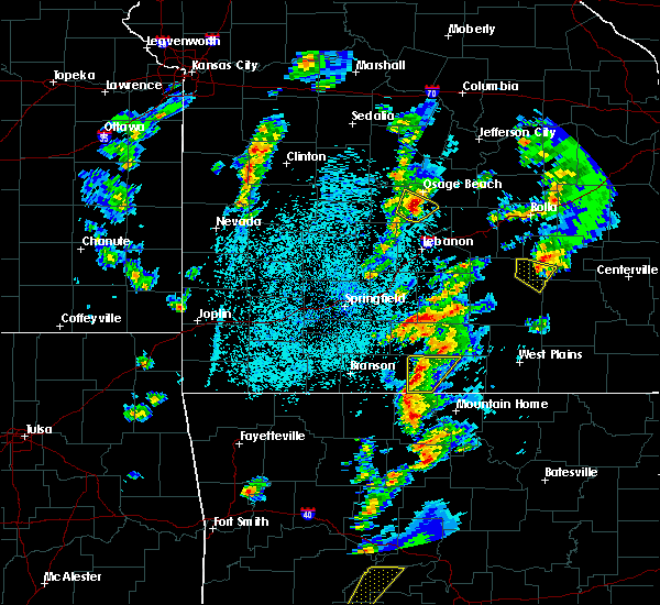 At 816 pm cdt, a severe thunderstorm was located near camdenton, moving northeast at 50 mph (radar indicated). Hazards include 60 mph wind gusts and quarter size hail. Hail damage to vehicles is expected. Expect wind damage to roofs, siding, and trees. At 816 pm cdt, a severe thunderstorm was located near camdenton, moving northeast at 50 mph (radar indicated). Hazards include 60 mph wind gusts and quarter size hail. Hail damage to vehicles is expected. Expect wind damage to roofs, siding, and trees.
|
| 3/21/2017 12:20 PM CDT |
 The severe thunderstorm warning for northern miller and east central morgan counties will expire at 1230 pm cdt, the storm which prompted the warning has moved out of the area. therefore the warning will be allowed to expire. to report severe weather, contact your nearest law enforcement agency. they will relay your report to the national weather service springfield. The severe thunderstorm warning for northern miller and east central morgan counties will expire at 1230 pm cdt, the storm which prompted the warning has moved out of the area. therefore the warning will be allowed to expire. to report severe weather, contact your nearest law enforcement agency. they will relay your report to the national weather service springfield.
|
| 3/21/2017 11:58 AM CDT |
 At 1157 am cdt, a severe thunderstorm was located near barnett moving east at 35 mph (radar indicated). Hazards include quarter size hail. Damage to vehicles is expected. Locations impacted include, eldon, barnett, eugene, olean, etterville, aurora springs,. At 1157 am cdt, a severe thunderstorm was located near barnett moving east at 35 mph (radar indicated). Hazards include quarter size hail. Damage to vehicles is expected. Locations impacted include, eldon, barnett, eugene, olean, etterville, aurora springs,.
|
| 3/21/2017 11:34 AM CDT |
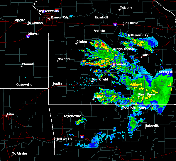 At 1134 am cdt, a severe thunderstorm was located near versailles, moving east at 55 mph (radar indicated). Hazards include quarter size hail. Damage to vehicles is expected. this severe thunderstorm will be near, eldon around 1155 am cdt. other locations impacted by this severe thunderstorm include lake of the ozarks, saint elizabeth, st. Elizabeth, barnett, tuscumbia, eugene, gravois mills, olean, bagnell and rocky mount. At 1134 am cdt, a severe thunderstorm was located near versailles, moving east at 55 mph (radar indicated). Hazards include quarter size hail. Damage to vehicles is expected. this severe thunderstorm will be near, eldon around 1155 am cdt. other locations impacted by this severe thunderstorm include lake of the ozarks, saint elizabeth, st. Elizabeth, barnett, tuscumbia, eugene, gravois mills, olean, bagnell and rocky mount.
|
| 3/6/2017 10:56 PM CST |
 At 1056 pm cst, severe thunderstorms were located along a line extending from near hickory hill to near osage beach to 7 miles south of camdenton, moving east at 45 mph (radar indicated). Hazards include 60 mph wind gusts and quarter size hail. Hail damage to vehicles is expected. expect wind damage to roofs, siding, and trees. locations impacted include, northern fort leonard wood, lake of the ozarks, lake of the ozarks state park, ha ha tonka state park, waynesville, eldon, osage beach, st. robert, camdenton, village of four seasons, richland, lake ozark, crocker, laurie, iberia, sunrise beach, urbana, saint elizabeth, st. elizabeth, macks creek, this includes interstate 44 between mile markers 154 and 158. A tornado watch remains in effect until 300 am cst for central and southwestern missouri. At 1056 pm cst, severe thunderstorms were located along a line extending from near hickory hill to near osage beach to 7 miles south of camdenton, moving east at 45 mph (radar indicated). Hazards include 60 mph wind gusts and quarter size hail. Hail damage to vehicles is expected. expect wind damage to roofs, siding, and trees. locations impacted include, northern fort leonard wood, lake of the ozarks, lake of the ozarks state park, ha ha tonka state park, waynesville, eldon, osage beach, st. robert, camdenton, village of four seasons, richland, lake ozark, crocker, laurie, iberia, sunrise beach, urbana, saint elizabeth, st. elizabeth, macks creek, this includes interstate 44 between mile markers 154 and 158. A tornado watch remains in effect until 300 am cst for central and southwestern missouri.
|
| 3/6/2017 10:23 PM CST |
 At 1022 pm cst, severe thunderstorms were located along a line extending from near versailles to 10 miles west of laurie to near urbana, moving east at 45 mph (radar indicated). Hazards include 60 mph wind gusts and quarter size hail. Hail damage to vehicles is expected. expect wind damage to roofs, siding, and trees. locations impacted include, northern fort leonard wood, lake of the ozarks, pomme de terre lake, truman lake, lake of the ozarks state park, pomme de terre state park, ha ha tonka state park, waynesville, eldon, osage beach, st. robert, camdenton, village of four seasons, richland, lake ozark, pittsburg, crocker, laurie, iberia, hermitage, this includes interstate 44 between mile markers 154 and 158. A tornado watch remains in effect until 300 am cst for central, southwestern and west central missouri. At 1022 pm cst, severe thunderstorms were located along a line extending from near versailles to 10 miles west of laurie to near urbana, moving east at 45 mph (radar indicated). Hazards include 60 mph wind gusts and quarter size hail. Hail damage to vehicles is expected. expect wind damage to roofs, siding, and trees. locations impacted include, northern fort leonard wood, lake of the ozarks, pomme de terre lake, truman lake, lake of the ozarks state park, pomme de terre state park, ha ha tonka state park, waynesville, eldon, osage beach, st. robert, camdenton, village of four seasons, richland, lake ozark, pittsburg, crocker, laurie, iberia, hermitage, this includes interstate 44 between mile markers 154 and 158. A tornado watch remains in effect until 300 am cst for central, southwestern and west central missouri.
|
| 3/6/2017 10:11 PM CST |
 At 1010 pm cst, severe thunderstorms were located along a line extending from near stover to 13 miles southeast of warsaw to near hermitage, moving east at 45 mph (radar indicated). Hazards include 60 mph wind gusts and quarter size hail. Hail damage to vehicles is expected. Expect wind damage to roofs, siding, and trees. At 1010 pm cst, severe thunderstorms were located along a line extending from near stover to 13 miles southeast of warsaw to near hermitage, moving east at 45 mph (radar indicated). Hazards include 60 mph wind gusts and quarter size hail. Hail damage to vehicles is expected. Expect wind damage to roofs, siding, and trees.
|
| 3/1/2017 12:39 AM CST |
 At 1238 am cst, severe thunderstorms were located along a line extending from near eldon to near macks creek, moving east at 50 mph (radar indicated). Hazards include 60 mph wind gusts and quarter size hail. Hail damage to vehicles is expected. expect wind damage to roofs, siding, and trees. A tornado watch remains in effect until 400 am cst for central and southwestern missouri. At 1238 am cst, severe thunderstorms were located along a line extending from near eldon to near macks creek, moving east at 50 mph (radar indicated). Hazards include 60 mph wind gusts and quarter size hail. Hail damage to vehicles is expected. expect wind damage to roofs, siding, and trees. A tornado watch remains in effect until 400 am cst for central and southwestern missouri.
|
| 3/1/2017 12:12 AM CST |
 At 1211 am cst, severe thunderstorms were located along a line extending from 13 miles east of warsaw to 10 miles northeast of hermitage to 6 miles south of wheatland, moving east at 65 mph (radar indicated). Hazards include 60 mph wind gusts and quarter size hail. Hail damage to vehicles is expected. expect wind damage to roofs, siding, and trees. severe thunderstorms will be near, urbana around 1225 am cst. laurie around 1230 am cst. village of four seasons, lake ozark and macks creek around 1235 am cst. eldon and osage beach around 1240 am cst. camdenton around 1250 am cst. iberia around 110 am cst. other locations impacted by these severe thunderstorms include lake of the ozarks, pomme de terre lake, lake of the ozarks state park, ha ha tonka state park, pomme de terre state park, pittsburg, sunrise beach, st. elizabeth, saint elizabeth and linn creek. A tornado watch remains in effect until 400 am cst for central and southwestern missouri. At 1211 am cst, severe thunderstorms were located along a line extending from 13 miles east of warsaw to 10 miles northeast of hermitage to 6 miles south of wheatland, moving east at 65 mph (radar indicated). Hazards include 60 mph wind gusts and quarter size hail. Hail damage to vehicles is expected. expect wind damage to roofs, siding, and trees. severe thunderstorms will be near, urbana around 1225 am cst. laurie around 1230 am cst. village of four seasons, lake ozark and macks creek around 1235 am cst. eldon and osage beach around 1240 am cst. camdenton around 1250 am cst. iberia around 110 am cst. other locations impacted by these severe thunderstorms include lake of the ozarks, pomme de terre lake, lake of the ozarks state park, ha ha tonka state park, pomme de terre state park, pittsburg, sunrise beach, st. elizabeth, saint elizabeth and linn creek. A tornado watch remains in effect until 400 am cst for central and southwestern missouri.
|
| 8/2/2016 11:11 PM CDT |
 The severe thunderstorm warning for southeastern morgan, northwestern miller and north central camden counties will expire at 1115 pm cdt, the storm which prompted the warning has weakened below severe limits, and no longer pose an immediate threat to life or property. therefore the warning will be allowed to expire. The severe thunderstorm warning for southeastern morgan, northwestern miller and north central camden counties will expire at 1115 pm cdt, the storm which prompted the warning has weakened below severe limits, and no longer pose an immediate threat to life or property. therefore the warning will be allowed to expire.
|
| 8/2/2016 10:57 PM CDT |
 At 1057 pm cdt, a severe thunderstorm was located near village of four seasons, or 9 miles northwest of osage beach, moving east at 20 mph (radar indicated). Hazards include 60 mph wind gusts and quarter size hail. Hail damage to vehicles is expected. expect wind damage to roofs, siding, and trees. Locations impacted include, lake of the ozarks, lake of the ozarks state park, eldon, osage beach, village of four seasons, lake ozark, laurie, sunrise beach, tuscumbia, eugene, gravois mills, bagnell, lakeview, aurora springs, purvis, etterville, rocky mount, ulman,. At 1057 pm cdt, a severe thunderstorm was located near village of four seasons, or 9 miles northwest of osage beach, moving east at 20 mph (radar indicated). Hazards include 60 mph wind gusts and quarter size hail. Hail damage to vehicles is expected. expect wind damage to roofs, siding, and trees. Locations impacted include, lake of the ozarks, lake of the ozarks state park, eldon, osage beach, village of four seasons, lake ozark, laurie, sunrise beach, tuscumbia, eugene, gravois mills, bagnell, lakeview, aurora springs, purvis, etterville, rocky mount, ulman,.
|
| 8/2/2016 10:32 PM CDT |
 At 1031 pm cdt, a severe thunderstorm was located near laurie, or 11 miles south of versailles, moving east at 25 mph (radar indicated). Hazards include 60 mph wind gusts and quarter size hail. Hail damage to vehicles is expected. Expect wind damage to roofs, siding, and trees. At 1031 pm cdt, a severe thunderstorm was located near laurie, or 11 miles south of versailles, moving east at 25 mph (radar indicated). Hazards include 60 mph wind gusts and quarter size hail. Hail damage to vehicles is expected. Expect wind damage to roofs, siding, and trees.
|
| 8/1/2016 3:35 AM CDT | Tree down in miller county MO, 9.1 miles NE of Eldon, MO |
| 7/13/2016 1:45 PM CDT |
 At 145 pm cdt, severe thunderstorms were located along a line extending from near st. thomas to 8 miles southeast of camdenton, moving east at 60 mph (radar indicated). Hazards include 60 mph wind gusts and quarter size hail. Hail damage to vehicles is expected. expect wind damage to roofs, siding, and trees. locations impacted include, lake of the ozarks, lake of the ozarks state park, ha ha tonka state park, eldon, osage beach, camdenton, village of four seasons, richland, lake ozark, crocker, iberia, sunrise beach, saint elizabeth, st. Elizabeth, macks creek, linn creek, tuscumbia, stoutland, eugene, olean, this includes interstate 44 between mile markers 134 and 147. At 145 pm cdt, severe thunderstorms were located along a line extending from near st. thomas to 8 miles southeast of camdenton, moving east at 60 mph (radar indicated). Hazards include 60 mph wind gusts and quarter size hail. Hail damage to vehicles is expected. expect wind damage to roofs, siding, and trees. locations impacted include, lake of the ozarks, lake of the ozarks state park, ha ha tonka state park, eldon, osage beach, camdenton, village of four seasons, richland, lake ozark, crocker, iberia, sunrise beach, saint elizabeth, st. Elizabeth, macks creek, linn creek, tuscumbia, stoutland, eugene, olean, this includes interstate 44 between mile markers 134 and 147.
|
| 7/13/2016 1:35 PM CDT |
 At 134 pm cdt, severe thunderstorms were located along a line extending from near hickory hill to near camdenton, moving east at 50 mph (radar indicated). Hazards include 60 mph wind gusts and quarter size hail. Hail damage to vehicles is expected. expect wind damage to roofs, siding, and trees. locations impacted include, lake of the ozarks, lake of the ozarks state park, ha ha tonka state park, eldon, osage beach, camdenton, versailles, village of four seasons, richland, lake ozark, crocker, laurie, iberia, sunrise beach, urbana, saint elizabeth, st. Elizabeth, macks creek, linn creek, tuscumbia, this includes interstate 44 between mile markers 134 and 147. At 134 pm cdt, severe thunderstorms were located along a line extending from near hickory hill to near camdenton, moving east at 50 mph (radar indicated). Hazards include 60 mph wind gusts and quarter size hail. Hail damage to vehicles is expected. expect wind damage to roofs, siding, and trees. locations impacted include, lake of the ozarks, lake of the ozarks state park, ha ha tonka state park, eldon, osage beach, camdenton, versailles, village of four seasons, richland, lake ozark, crocker, laurie, iberia, sunrise beach, urbana, saint elizabeth, st. Elizabeth, macks creek, linn creek, tuscumbia, this includes interstate 44 between mile markers 134 and 147.
|
| 7/13/2016 1:14 PM CDT |
 At 114 pm cdt, severe thunderstorms were located along a line extending from versailles to 8 miles west of macks creek, moving east at 60 mph (radar indicated). Hazards include 60 mph wind gusts and quarter size hail. Hail damage to vehicles is expected. Expect wind damage to roofs, siding, and trees. At 114 pm cdt, severe thunderstorms were located along a line extending from versailles to 8 miles west of macks creek, moving east at 60 mph (radar indicated). Hazards include 60 mph wind gusts and quarter size hail. Hail damage to vehicles is expected. Expect wind damage to roofs, siding, and trees.
|
| 7/7/2016 7:21 AM CDT |
 At 721 am cdt, severe thunderstorms were located along a line extending from 6 miles south of hickory hill to near hermitage, moving southeast at 35 mph (radar indicated). Hazards include 60 mph wind gusts. Expect damage to roofs. siding. and trees. locations impacted include, lake of the ozarks, lake of the ozarks state park, ha ha tonka state park, eldon, osage beach, camdenton, village of four seasons, richland, lake ozark, iberia, hermitage, sunrise beach, saint elizabeth, st. Elizabeth, macks creek, linn creek, preston, cross timbers, tuscumbia, stoutland,. At 721 am cdt, severe thunderstorms were located along a line extending from 6 miles south of hickory hill to near hermitage, moving southeast at 35 mph (radar indicated). Hazards include 60 mph wind gusts. Expect damage to roofs. siding. and trees. locations impacted include, lake of the ozarks, lake of the ozarks state park, ha ha tonka state park, eldon, osage beach, camdenton, village of four seasons, richland, lake ozark, iberia, hermitage, sunrise beach, saint elizabeth, st. Elizabeth, macks creek, linn creek, preston, cross timbers, tuscumbia, stoutland,.
|
| 7/7/2016 6:41 AM CDT |
 At 640 am cdt, severe thunderstorms were located along a line extending from near tipton to 7 miles southwest of warsaw, moving southeast at 45 mph (radar indicated). Hazards include 60 mph wind gusts. Expect damage to roofs. siding. And trees. At 640 am cdt, severe thunderstorms were located along a line extending from near tipton to 7 miles southwest of warsaw, moving southeast at 45 mph (radar indicated). Hazards include 60 mph wind gusts. Expect damage to roofs. siding. And trees.
|
| 5/26/2016 6:55 PM CDT | Severe thunderstorm wind gusts downed several trees and power line in miller county MO, 6.2 miles WNW of Eldon, MO |
| 5/26/2016 6:35 PM CDT |
 At 635 pm cdt, a severe thunderstorm was located near osage beach, moving north at 25 mph (radar indicated). Hazards include 60 mph wind gusts and half dollar size hail. Hail damage to vehicles is expected. Expect wind damage to roofs, siding, and trees. At 635 pm cdt, a severe thunderstorm was located near osage beach, moving north at 25 mph (radar indicated). Hazards include 60 mph wind gusts and half dollar size hail. Hail damage to vehicles is expected. Expect wind damage to roofs, siding, and trees.
|
| 5/26/2016 5:04 PM CDT |
 At 503 pm cdt, a severe thunderstorm was located over village of four seasons, or near osage beach, moving north at 20 mph (radar indicated). Hazards include 60 mph wind gusts and half dollar size hail. Hail damage to vehicles is expected. expect wind damage to roofs, siding, and trees. Locations impacted include, lake of the ozarks, lake of the ozarks state park, eldon, osage beach, versailles, village of four seasons, lake ozark, laurie, sunrise beach, linn creek, barnett, gravois mills, olean, bagnell, green bay terrace, lakeview, aurora springs, purvis, hurricane deck, rocky mount,. At 503 pm cdt, a severe thunderstorm was located over village of four seasons, or near osage beach, moving north at 20 mph (radar indicated). Hazards include 60 mph wind gusts and half dollar size hail. Hail damage to vehicles is expected. expect wind damage to roofs, siding, and trees. Locations impacted include, lake of the ozarks, lake of the ozarks state park, eldon, osage beach, versailles, village of four seasons, lake ozark, laurie, sunrise beach, linn creek, barnett, gravois mills, olean, bagnell, green bay terrace, lakeview, aurora springs, purvis, hurricane deck, rocky mount,.
|
| 5/26/2016 4:50 PM CDT |
 At 449 pm cdt, a severe thunderstorm was located near village of four seasons, or near osage beach, moving north at 20 mph (radar indicated). Hazards include 60 mph wind gusts and quarter size hail. Hail damage to vehicles is expected. Expect wind damage to roofs, siding, and trees. At 449 pm cdt, a severe thunderstorm was located near village of four seasons, or near osage beach, moving north at 20 mph (radar indicated). Hazards include 60 mph wind gusts and quarter size hail. Hail damage to vehicles is expected. Expect wind damage to roofs, siding, and trees.
|
| 4/26/2016 11:59 AM CDT | Quarter sized hail reported 0.2 miles SSE of Eldon, MO |
| 4/26/2016 11:50 AM CDT |
 At 1149 am cdt, severe thunderstorms were located along a line extending from near russellville to near village of four seasons to 8 miles northwest of macks creek, moving southeast at 40 mph (radar indicated). Hazards include 60 mph wind gusts and quarter size hail. Hail damage to vehicles is expected. expect wind damage to roofs, siding, and trees. locations impacted include, lake of the ozarks, lake of the ozarks state park, ha ha tonka state park, eldon, osage beach, camdenton, versailles, village of four seasons, lake ozark, laurie, sunrise beach, st. Elizabeth, saint elizabeth, linn creek, tuscumbia, barnett, eugene, gravois mills, olean, climax springs,. At 1149 am cdt, severe thunderstorms were located along a line extending from near russellville to near village of four seasons to 8 miles northwest of macks creek, moving southeast at 40 mph (radar indicated). Hazards include 60 mph wind gusts and quarter size hail. Hail damage to vehicles is expected. expect wind damage to roofs, siding, and trees. locations impacted include, lake of the ozarks, lake of the ozarks state park, ha ha tonka state park, eldon, osage beach, camdenton, versailles, village of four seasons, lake ozark, laurie, sunrise beach, st. Elizabeth, saint elizabeth, linn creek, tuscumbia, barnett, eugene, gravois mills, olean, climax springs,.
|
| 4/26/2016 11:21 AM CDT |
 At 1120 am cdt, severe thunderstorms were located along a line extending from near california to 6 miles southeast of versailles to 13 miles west of laurie, moving southeast at 35 mph (trained weather spotters. multiple large trees have been reported down north of versailles in morgan county). Hazards include 60 mph wind gusts and half dollar size hail. Hail damage to vehicles is expected. expect wind damage to roofs, siding, and trees. locations impacted include, lake of the ozarks, lake of the ozarks state park, ha ha tonka state park, eldon, osage beach, camdenton, versailles, village of four seasons, lake ozark, stover, laurie, sunrise beach, st. Elizabeth, saint elizabeth, macks creek, linn creek, tuscumbia, barnett, eugene, gravois mills,. At 1120 am cdt, severe thunderstorms were located along a line extending from near california to 6 miles southeast of versailles to 13 miles west of laurie, moving southeast at 35 mph (trained weather spotters. multiple large trees have been reported down north of versailles in morgan county). Hazards include 60 mph wind gusts and half dollar size hail. Hail damage to vehicles is expected. expect wind damage to roofs, siding, and trees. locations impacted include, lake of the ozarks, lake of the ozarks state park, ha ha tonka state park, eldon, osage beach, camdenton, versailles, village of four seasons, lake ozark, stover, laurie, sunrise beach, st. Elizabeth, saint elizabeth, macks creek, linn creek, tuscumbia, barnett, eugene, gravois mills,.
|
| 4/26/2016 11:14 AM CDT |
 At 1113 am cdt, severe thunderstorms were located along a line extending from near california to near versailles to 12 miles east of warsaw, moving southeast at 35 mph (radar indicated. these storms do have a history of producing 60 mph winds in morgan county). Hazards include 60 mph wind gusts and half dollar size hail. Hail damage to vehicles is expected. Expect wind damage to roofs, siding, and trees. At 1113 am cdt, severe thunderstorms were located along a line extending from near california to near versailles to 12 miles east of warsaw, moving southeast at 35 mph (radar indicated. these storms do have a history of producing 60 mph winds in morgan county). Hazards include 60 mph wind gusts and half dollar size hail. Hail damage to vehicles is expected. Expect wind damage to roofs, siding, and trees.
|
| 8/18/2015 11:35 PM CDT |
 The severe thunderstorm warning for morgan and northern miller counties will expire at 1145 pm cdt, the storms which prompted the warning have weakened below severe limits, and no longer pose an immediate threat to life or property. therefore the warning will be allowed to expire. however heavy rain is still possible with these thunderstorms. The severe thunderstorm warning for morgan and northern miller counties will expire at 1145 pm cdt, the storms which prompted the warning have weakened below severe limits, and no longer pose an immediate threat to life or property. therefore the warning will be allowed to expire. however heavy rain is still possible with these thunderstorms.
|
| 8/18/2015 11:02 PM CDT |
 At 1102 pm cdt, severe thunderstorms were located along a line extending from 6 miles west of high point to near stover, moving southeast at 30 mph (radar indicated). Hazards include 60 mph wind gusts. Expect damage to roofs. siding and trees. Locations impacted include, lake of the ozarks, eldon, versailles, lake ozark, stover, laurie, sunrise beach, barnett, eugene, gravois mills, olean, bagnell, lakeview, aurora springs, etterville, rocky mount, marys home,. At 1102 pm cdt, severe thunderstorms were located along a line extending from 6 miles west of high point to near stover, moving southeast at 30 mph (radar indicated). Hazards include 60 mph wind gusts. Expect damage to roofs. siding and trees. Locations impacted include, lake of the ozarks, eldon, versailles, lake ozark, stover, laurie, sunrise beach, barnett, eugene, gravois mills, olean, bagnell, lakeview, aurora springs, etterville, rocky mount, marys home,.
|
| 8/18/2015 10:48 PM CDT |
 At 1048 pm cdt, severe thunderstorms were located along a line extending from 7 miles northeast of versailles to near stover, moving southeast at 30 mph (radar indicated). Hazards include 60 mph wind gusts. Expect damage to roofs. Siding and trees. At 1048 pm cdt, severe thunderstorms were located along a line extending from 7 miles northeast of versailles to near stover, moving southeast at 30 mph (radar indicated). Hazards include 60 mph wind gusts. Expect damage to roofs. Siding and trees.
|
| 8/9/2015 5:10 PM CDT | Numerous tree branches and limbs blown down near eldon. picture sent via facebook. wind gusts estimated around 60 mp in miller county MO, 0.2 miles SSE of Eldon, MO |
| 7/25/2015 4:41 AM CDT |
 At 440 am cdt, a severe thunderstorm was located 15 miles northwest of iberia, and moving southeast at 25 mph (radar indicated). Hazards include 60 mph wind gusts. Expect damage to roofs. Siding and trees. At 440 am cdt, a severe thunderstorm was located 15 miles northwest of iberia, and moving southeast at 25 mph (radar indicated). Hazards include 60 mph wind gusts. Expect damage to roofs. Siding and trees.
|
| 7/24/2015 6:53 PM CDT |
 At 650 pm cdt, severe thunderstorms were located along a line extending from 10 miles south of cole camp to 10 miles northwest of laurie to 5 miles southwest of eldon to 8 miles southeast of osage beach, and moving south at 25 mph (law enforcement. these storms have downed trees and power lines in and around versailles and stover). Hazards include 60 mph wind gusts and nickel size hail. Expect damage to roofs. siding and trees. locations impacted include, aurora springs, bagnell, barnett, barnumton, brumley, camdenton, cole camp, crockerville, eldon, freedom, gravois mills, green bay terrace, hastain, hurricane deck, kaiser, knobby, lake ozark, lakeland, lakeview heights, lakeview, laurie, linn creek, montreal, old linn creek, osage beach, purvis, rocky mount, stover, sunrise beach, tuscumbia, ulman, versailles, village of four seasons, wet glaize and zora. This warning also includes lake of the ozarks state park and lake of the ozarks. At 650 pm cdt, severe thunderstorms were located along a line extending from 10 miles south of cole camp to 10 miles northwest of laurie to 5 miles southwest of eldon to 8 miles southeast of osage beach, and moving south at 25 mph (law enforcement. these storms have downed trees and power lines in and around versailles and stover). Hazards include 60 mph wind gusts and nickel size hail. Expect damage to roofs. siding and trees. locations impacted include, aurora springs, bagnell, barnett, barnumton, brumley, camdenton, cole camp, crockerville, eldon, freedom, gravois mills, green bay terrace, hastain, hurricane deck, kaiser, knobby, lake ozark, lakeland, lakeview heights, lakeview, laurie, linn creek, montreal, old linn creek, osage beach, purvis, rocky mount, stover, sunrise beach, tuscumbia, ulman, versailles, village of four seasons, wet glaize and zora. This warning also includes lake of the ozarks state park and lake of the ozarks.
|
| 7/24/2015 6:49 PM CDT |
 At 647 pm cdt, severe thunderstorms were located along a line extending from 8 miles southeast of cole camp to 9 miles south of stover to eldon to 7 miles east of osage beach, and moving south at 25 mph (radar indicated). Hazards include 60 mph wind gusts and nickel size hail. Expect damage to roofs. siding and trees. locations impacted include, aurora springs, bagnell, barnett, barnumton, brumley, camdenton, cole camp, crockerville, eldon, freedom, gravois mills, green bay terrace, hastain, hurricane deck, kaiser, knobby, lake ozark, lakeland, lakeview heights, lakeview, laurie, linn creek, montreal, old linn creek, osage beach, purvis, rocky mount, stover, sunrise beach, tuscumbia, ulman, versailles, village of four seasons, wet glaize and zora. This warning also includes lake of the ozarks state park and lake of the ozarks. At 647 pm cdt, severe thunderstorms were located along a line extending from 8 miles southeast of cole camp to 9 miles south of stover to eldon to 7 miles east of osage beach, and moving south at 25 mph (radar indicated). Hazards include 60 mph wind gusts and nickel size hail. Expect damage to roofs. siding and trees. locations impacted include, aurora springs, bagnell, barnett, barnumton, brumley, camdenton, cole camp, crockerville, eldon, freedom, gravois mills, green bay terrace, hastain, hurricane deck, kaiser, knobby, lake ozark, lakeland, lakeview heights, lakeview, laurie, linn creek, montreal, old linn creek, osage beach, purvis, rocky mount, stover, sunrise beach, tuscumbia, ulman, versailles, village of four seasons, wet glaize and zora. This warning also includes lake of the ozarks state park and lake of the ozarks.
|
| 7/24/2015 6:32 PM CDT |
 At 630 pm cdt, severe thunderstorms were located along a line extending from 8 miles northeast of cole camp to stover to 6 miles northwest of eldon to 8 miles east of lakeland, and moving south at 25 mph (radar indicated). Hazards include 70 mph wind gusts and nickel size hail. Expect considerable tree damage. damage is likely to mobile homes, roofs and outbuildings. locations impacted include, aurora springs, bagnell, barnett, barnumton, brumley, camdenton, cole camp, crockerville, eldon, florence, freedom, gravois mills, green bay terrace, hastain, hurricane deck, kaiser, knobby, lake ozark, lakeland, lakeview heights, lakeview, laurie, linn creek, montreal, old linn creek, osage beach, purvis, rocky mount, stover, sunrise beach, tuscumbia, ulman, versailles, village of four seasons, wet glaize and zora. This warning also includes lake of the ozarks state park and lake of the ozarks. At 630 pm cdt, severe thunderstorms were located along a line extending from 8 miles northeast of cole camp to stover to 6 miles northwest of eldon to 8 miles east of lakeland, and moving south at 25 mph (radar indicated). Hazards include 70 mph wind gusts and nickel size hail. Expect considerable tree damage. damage is likely to mobile homes, roofs and outbuildings. locations impacted include, aurora springs, bagnell, barnett, barnumton, brumley, camdenton, cole camp, crockerville, eldon, florence, freedom, gravois mills, green bay terrace, hastain, hurricane deck, kaiser, knobby, lake ozark, lakeland, lakeview heights, lakeview, laurie, linn creek, montreal, old linn creek, osage beach, purvis, rocky mount, stover, sunrise beach, tuscumbia, ulman, versailles, village of four seasons, wet glaize and zora. This warning also includes lake of the ozarks state park and lake of the ozarks.
|
| 7/24/2015 6:25 PM CDT |
 At 622 pm cdt, severe thunderstorms were located along a line extending from 11 miles northeast of cole camp to 6 miles southeast of eldon, and moving south at 25 mph (radar indicated). Hazards include 60 mph wind gusts and nickel size hail. Expect damage to roofs. Siding and trees. At 622 pm cdt, severe thunderstorms were located along a line extending from 11 miles northeast of cole camp to 6 miles southeast of eldon, and moving south at 25 mph (radar indicated). Hazards include 60 mph wind gusts and nickel size hail. Expect damage to roofs. Siding and trees.
|
| 7/1/2015 10:23 PM CDT |
 At 1021 pm cdt, severe thunderstorms were located along a line extending from 6 miles southeast of osage beach to 8 miles north of dixon to belle, and moving southeast at 25 mph (radar indicated). Hazards include 60 mph wind gusts and quarter size hail. Hail damage to vehicles is expected. expect wind damage to roofs, siding and trees. locations impacted include, belle, crocker, dixon, doolittle, eldon, iberia, lake ozark, lakeland, newburg, osage beach, rolla, st. james and vienna. this warning also includes lake of the ozarks state park and lake of the ozarks. interstate 44 between mile markers 169 and 199 will also be impacted by severe thunderstorms. A tornado watch remains in effect until midnight cdt thursday morning for southeast kansas and southern missouri. At 1021 pm cdt, severe thunderstorms were located along a line extending from 6 miles southeast of osage beach to 8 miles north of dixon to belle, and moving southeast at 25 mph (radar indicated). Hazards include 60 mph wind gusts and quarter size hail. Hail damage to vehicles is expected. expect wind damage to roofs, siding and trees. locations impacted include, belle, crocker, dixon, doolittle, eldon, iberia, lake ozark, lakeland, newburg, osage beach, rolla, st. james and vienna. this warning also includes lake of the ozarks state park and lake of the ozarks. interstate 44 between mile markers 169 and 199 will also be impacted by severe thunderstorms. A tornado watch remains in effect until midnight cdt thursday morning for southeast kansas and southern missouri.
|
| 7/1/2015 10:02 PM CDT |
 At 958 pm cdt, severe thunderstorms were located along a line extending from lake ozark to 6 miles northeast of iberia to 6 miles northeast of vienna, and moving southeast at 40 mph (radar indicated). Hazards include 60 mph wind gusts and quarter size hail. Hail damage to vehicles is expected. Expect wind damage to roofs, siding and trees. At 958 pm cdt, severe thunderstorms were located along a line extending from lake ozark to 6 miles northeast of iberia to 6 miles northeast of vienna, and moving southeast at 40 mph (radar indicated). Hazards include 60 mph wind gusts and quarter size hail. Hail damage to vehicles is expected. Expect wind damage to roofs, siding and trees.
|
| 7/1/2015 9:36 PM CDT |
 At 935 pm cdt, severe thunderstorms were located along a line extending from eldon to 13 miles southeast of eldon to 7 miles northwest of vienna, and moving south southeast at 25 mph (radar indicated). Hazards include 60 mph wind gusts and quarter size hail. Hail damage to vehicles is expected. expect wind damage to roofs, siding and trees. locations impacted include, eldon, iberia, lake ozark, lakeland, laurie, osage beach, vienna and village of four seasons. this warning also includes lake of the ozarks state park and lake of the ozarks. A tornado watch remains in effect until midnight cdt thursday morning for southeast kansas and southern missouri. At 935 pm cdt, severe thunderstorms were located along a line extending from eldon to 13 miles southeast of eldon to 7 miles northwest of vienna, and moving south southeast at 25 mph (radar indicated). Hazards include 60 mph wind gusts and quarter size hail. Hail damage to vehicles is expected. expect wind damage to roofs, siding and trees. locations impacted include, eldon, iberia, lake ozark, lakeland, laurie, osage beach, vienna and village of four seasons. this warning also includes lake of the ozarks state park and lake of the ozarks. A tornado watch remains in effect until midnight cdt thursday morning for southeast kansas and southern missouri.
|
| 7/1/2015 9:32 PM CDT |
 At 930 pm cdt, a severe thunderstorm capable of producing a tornado was located near eldon, and moving south southeast at 25 mph (radar indicated rotation). Hazards include tornado and quarter size hail. Flying debris will be dangerous to those caught without shelter. mobile homes will be damaged or destroyed. damage to roofs, windows and vehicles will occur. tree damage is likely. locations impacted include, eldon. this warning also includes lake of the ozarks state park. A tornado watch remains in effect until midnight cdt thursday morning for southeast kansas and southern missouri. At 930 pm cdt, a severe thunderstorm capable of producing a tornado was located near eldon, and moving south southeast at 25 mph (radar indicated rotation). Hazards include tornado and quarter size hail. Flying debris will be dangerous to those caught without shelter. mobile homes will be damaged or destroyed. damage to roofs, windows and vehicles will occur. tree damage is likely. locations impacted include, eldon. this warning also includes lake of the ozarks state park. A tornado watch remains in effect until midnight cdt thursday morning for southeast kansas and southern missouri.
|
| 7/1/2015 9:15 PM CDT |
 At 913 pm cdt, a severe thunderstorm capable of producing a tornado was located 8 miles north of eldon, and moving south southeast at 25 mph (radar indicated rotation). Hazards include tornado and half dollar size hail. Flying debris will be dangerous to those caught without shelter. mobile homes will be damaged or destroyed. damage to roofs, windows and vehicles will occur. Tree damage is likely. At 913 pm cdt, a severe thunderstorm capable of producing a tornado was located 8 miles north of eldon, and moving south southeast at 25 mph (radar indicated rotation). Hazards include tornado and half dollar size hail. Flying debris will be dangerous to those caught without shelter. mobile homes will be damaged or destroyed. damage to roofs, windows and vehicles will occur. Tree damage is likely.
|
| 7/1/2015 9:05 PM CDT |
 At 903 pm cdt, severe thunderstorms were located along a line extending from 9 miles north of eldon to 20 miles northwest of vienna, and moving southeast at 25 mph (radar indicated). Hazards include 60 mph wind gusts and half dollar size hail. Hail damage to vehicles is expected. Expect wind damage to roofs, siding and trees. At 903 pm cdt, severe thunderstorms were located along a line extending from 9 miles north of eldon to 20 miles northwest of vienna, and moving southeast at 25 mph (radar indicated). Hazards include 60 mph wind gusts and half dollar size hail. Hail damage to vehicles is expected. Expect wind damage to roofs, siding and trees.
|
| 6/26/2015 5:13 AM CDT | The severe thunderstorm warning for southern dallas, dade, northern webster, southern polk, western miller, laclede, northern greene and eastern camden counties will expire at 515 am cdt, the line of storms which prompted the warning has weakened below severe limits, and no longer poses an immediate threat to life or property. however, gusty winds and heavy rain are still possible with these thunderstorms. a severe thunderstorm watch remains in effect until 900 am cdt friday morning for portions of southeast kansas and southern missouri. |
| 6/26/2015 4:51 AM CDT |
 At 449 am cdt, severe thunderstorms were located along a line extending from 10 miles east of lakeland to lebanon to 9 miles northeast of fair grove to greenfield, and moving southeast at 30 mph (radar indicated). Hazards include 60 mph wind gusts. Expect damage to roofs. siding and trees. locations impacted include, ash grove, bolivar, buffalo, camdenton, conway, eldon, everton, fair grove, fair play, greenfield, lake ozark, lakeland, lebanon, lockwood, marshfield, morrisville, niangua, osage beach, pleasant hope, village of four seasons, walnut grove and willard. this warning also includes bennett spring state park, ha ha tonka state park, lake of the ozarks state park, lake of the ozarks and stockton lake. Interstate 44 between mile markers 94 and 142 will also be impacted by severe thunderstorms. At 449 am cdt, severe thunderstorms were located along a line extending from 10 miles east of lakeland to lebanon to 9 miles northeast of fair grove to greenfield, and moving southeast at 30 mph (radar indicated). Hazards include 60 mph wind gusts. Expect damage to roofs. siding and trees. locations impacted include, ash grove, bolivar, buffalo, camdenton, conway, eldon, everton, fair grove, fair play, greenfield, lake ozark, lakeland, lebanon, lockwood, marshfield, morrisville, niangua, osage beach, pleasant hope, village of four seasons, walnut grove and willard. this warning also includes bennett spring state park, ha ha tonka state park, lake of the ozarks state park, lake of the ozarks and stockton lake. Interstate 44 between mile markers 94 and 142 will also be impacted by severe thunderstorms.
|
| 6/26/2015 4:10 AM CDT |
 At 407 am cdt, severe thunderstorms were located along a line extending from 10 miles northwest of eldon to 12 miles southwest of camdenton to 8 miles northeast of bolivar to 21 miles north of lockwood, and moving southeast at 30 mph (radar indicated). Hazards include 60 mph wind gusts and penny size hail. Expect damage to roofs. Siding and trees. At 407 am cdt, severe thunderstorms were located along a line extending from 10 miles northwest of eldon to 12 miles southwest of camdenton to 8 miles northeast of bolivar to 21 miles north of lockwood, and moving southeast at 30 mph (radar indicated). Hazards include 60 mph wind gusts and penny size hail. Expect damage to roofs. Siding and trees.
|
| 5/17/2015 3:24 AM CDT | At 323 am cdt, severe thunderstorms were located along a line extending from 5 miles north of eldon to 10 miles northwest of richland to 23 miles southwest of fort leonard wood, and moving east at 45 mph (radar indicated). Hazards include 60 mph wind gusts. Expect damage to roofs. Siding and trees. |
| 5/17/2015 3:12 AM CDT | At 310 am cdt, severe thunderstorms were located along a line extending from 6 miles northeast of laurie to 7 miles south of camdenton to 7 miles southwest of lebanon, and moving east at 50 mph (radar indicated). Hazards include 60 mph wind gusts and penny size hail. Expect damage to roofs. siding and trees. locations impacted include, camdenton, conway, eldon, lake ozark, lakeland, laurie, lebanon, osage beach and village of four seasons. this warning also includes bennett spring state park, ha ha tonka state park, lake of the ozarks state park and lake of the ozarks. interstate 44 between mile markers 109 and 143 will also be impacted by severe thunderstorms. 0. 75in. |
| 5/17/2015 2:33 AM CDT | At 231 am cdt, severe thunderstorms were located along a line extending from 19 miles west of laurie to 20 miles west of conway, and moving east at 50 mph. these storms have a history of producing wind damage (radar indicated). Hazards include 60 mph wind gusts and penny size hail. Expect damage to roofs. Siding and trees. |
| 4/8/2015 5:58 PM CDT | The national weather service in springfield has issued a * severe thunderstorm warning for. northern camden county in central missouri. miller county in central missouri. until 645 pm cdt * at 556 pm cdt. A severe thunderstorm was located near camdenton. |
| 4/8/2015 11:52 AM CDT | The severe thunderstorm warning for north central miller county will expire at noon cdt. the storm which prompted the warning has moved out of the warned area. A severe thunderstorm watch remains in effect until 100 pm cdt wednesday afternoon for southern missouri. |
| 4/8/2015 11:36 AM CDT | A severe thunderstorm warning remains in effect for north central miller county until noon cdt. at 1133 am cdt. a severe thunderstorm was located 7 miles east of eldon. and moving east at 30 mph. hazard. quarter size hail. source. Radar indicated. |
| 4/8/2015 11:24 AM CDT | The national weather service in springfield has issued a * severe thunderstorm warning for. northwestern miller county in central missouri. until noon cdt * at 1123 am cdt. a severe thunderstorm was located near eldon. And moving east at 40 mph. |
| 7/8/2014 12:17 AM CDT | Trees down in eldo in miller county MO, 0.2 miles SSE of Eldon, MO |
| 6/28/2013 1:01 AM CDT | Tree reported down across highway 5 in miller county MO, 1.1 miles SE of Eldon, MO |
| 1/1/0001 12:00 AM | Quarter sized hail reported 0.2 miles SSE of Eldon, MO |
| 1/1/0001 12:00 AM | Golf Ball sized hail reported 0.2 miles SSE of Eldon, MO |
| 1/1/0001 12:00 AM | A national weather service storm survey revealed that a microburst with winds estimated around 90 mph snapped several trees that were 2 to 3 feet in diameter. one tree in miller county MO, 5.9 miles W of Eldon, MO |
| 1/1/0001 12:00 AM | Quarter sized hail reported 0.2 miles SSE of Eldon, MO, relayed by krcg tv |
| 1/1/0001 12:00 AM | Several large tree limbs were downed by wind in miller county MO, 0.2 miles SSE of Eldon, MO |
| 1/1/0001 12:00 AM | Three foot diameter tree down in eldo in miller county MO, 0.2 miles SSE of Eldon, MO |
| 1/1/0001 12:00 AM | Law enforcement reported large tree down over highway m east of eldo in miller county MO, 5 miles WNW of Eldon, MO |
Hail Maps for Eldon, MO
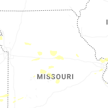
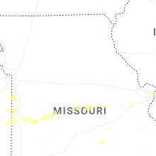


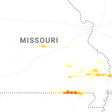
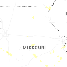


Connect with Interactive Hail Maps