

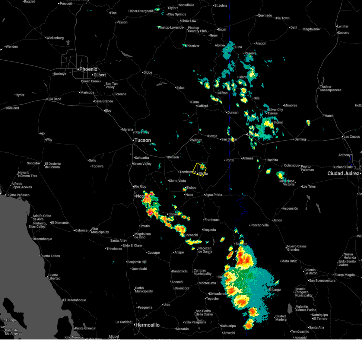
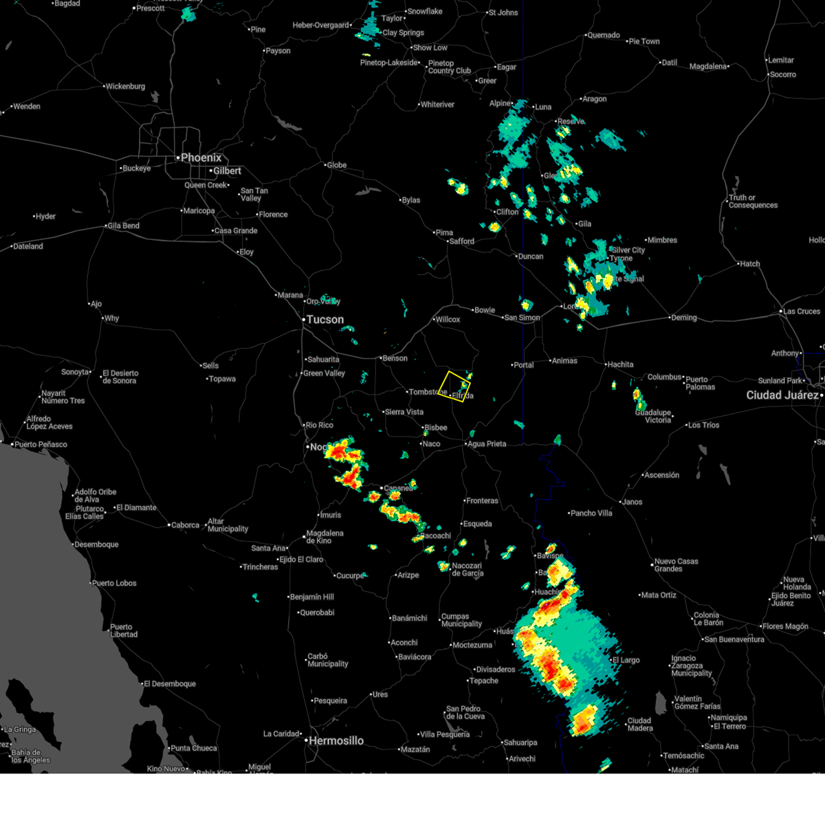
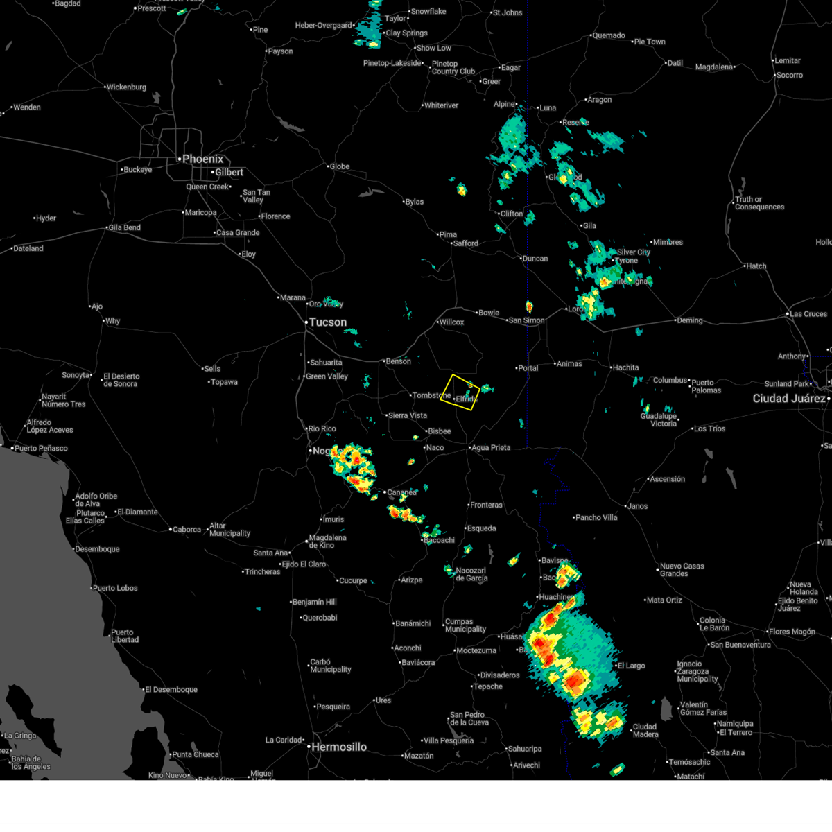
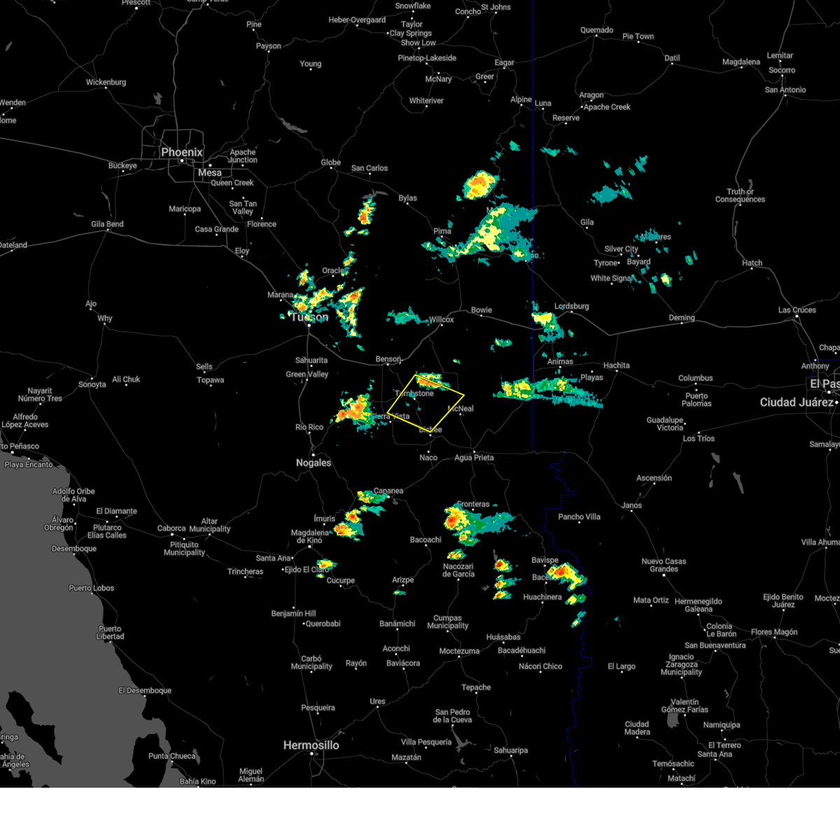
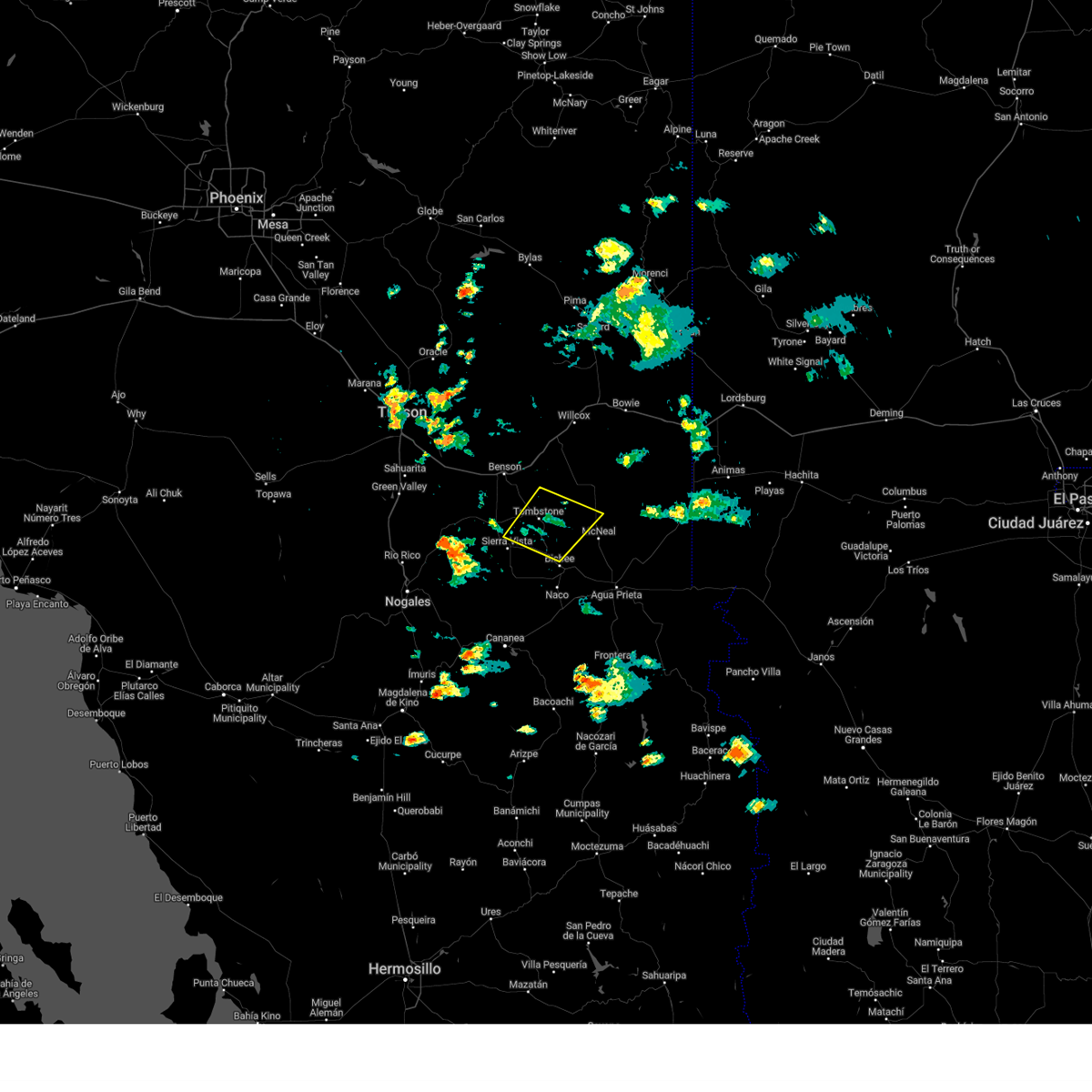
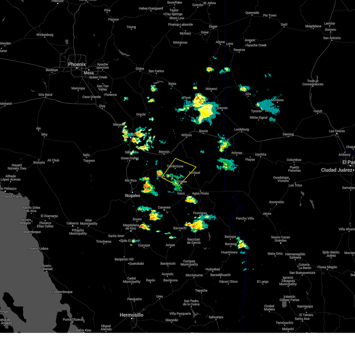
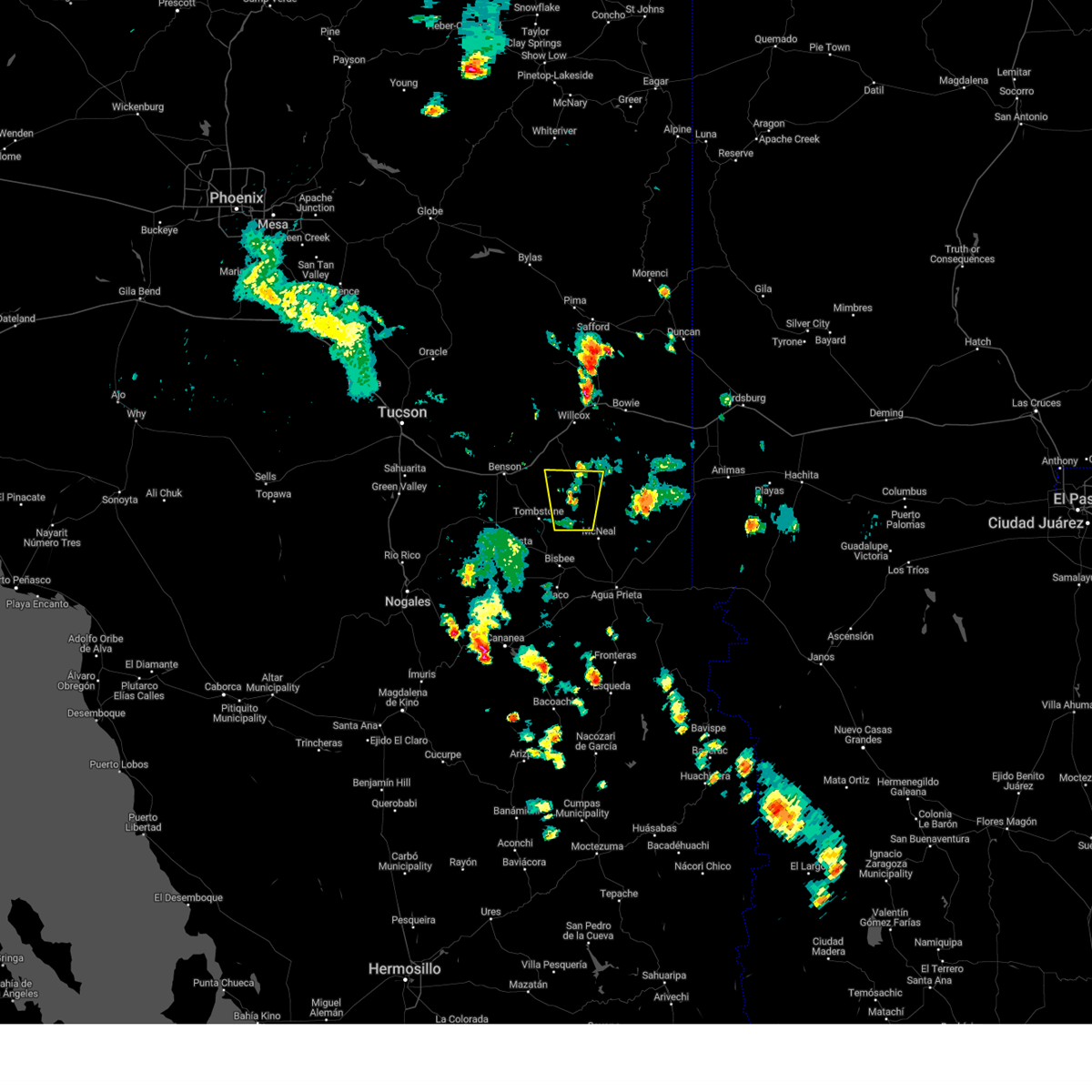
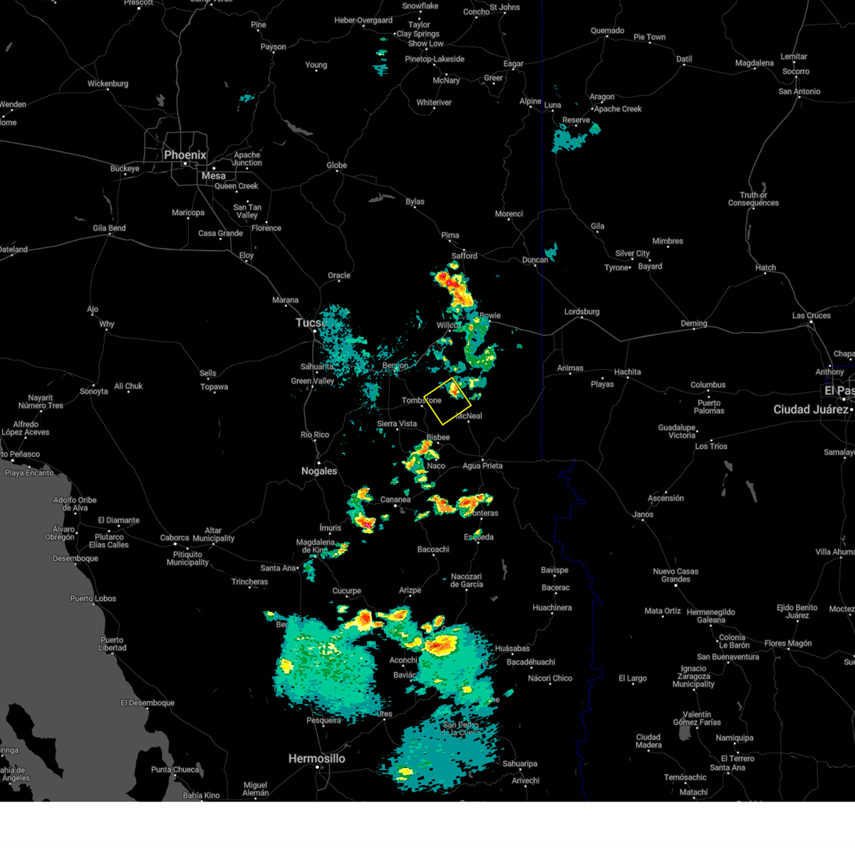
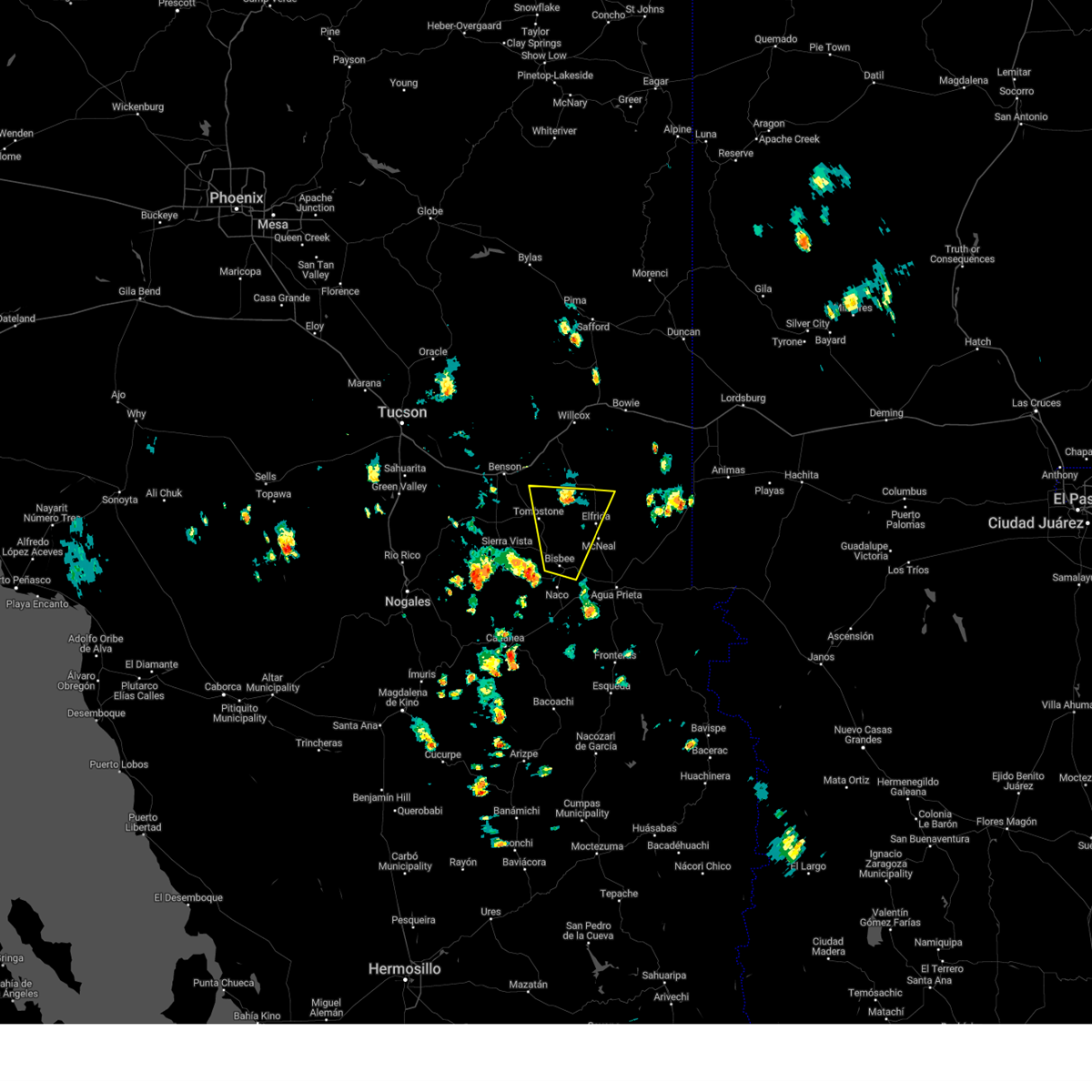
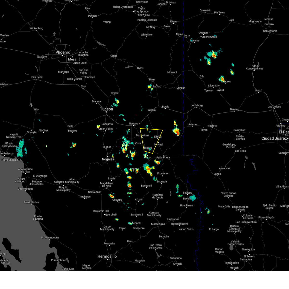
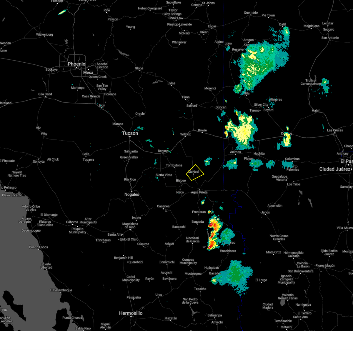
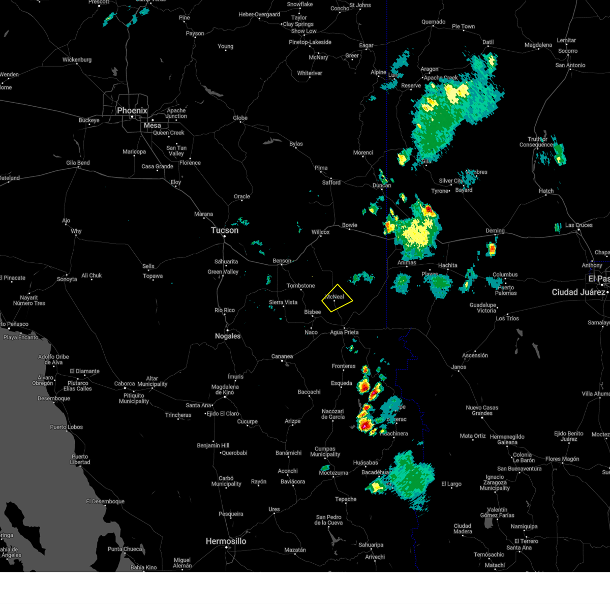
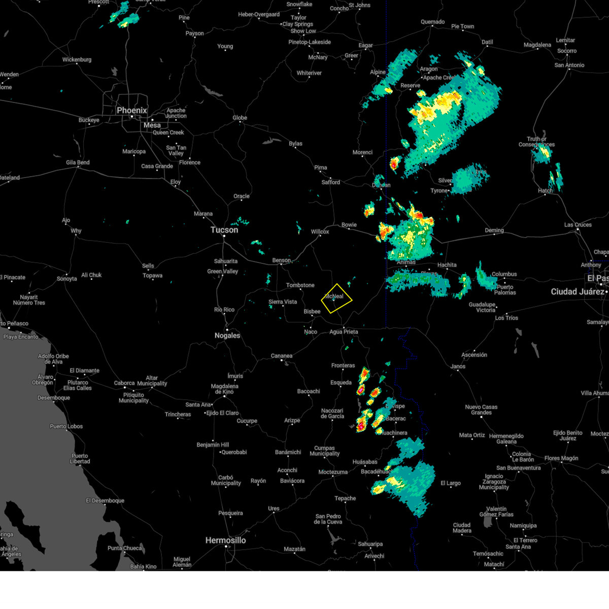
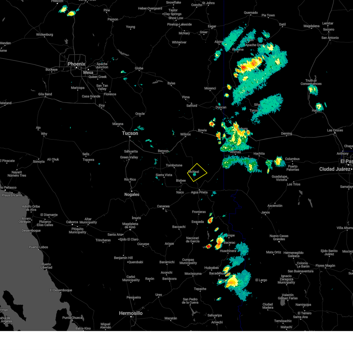
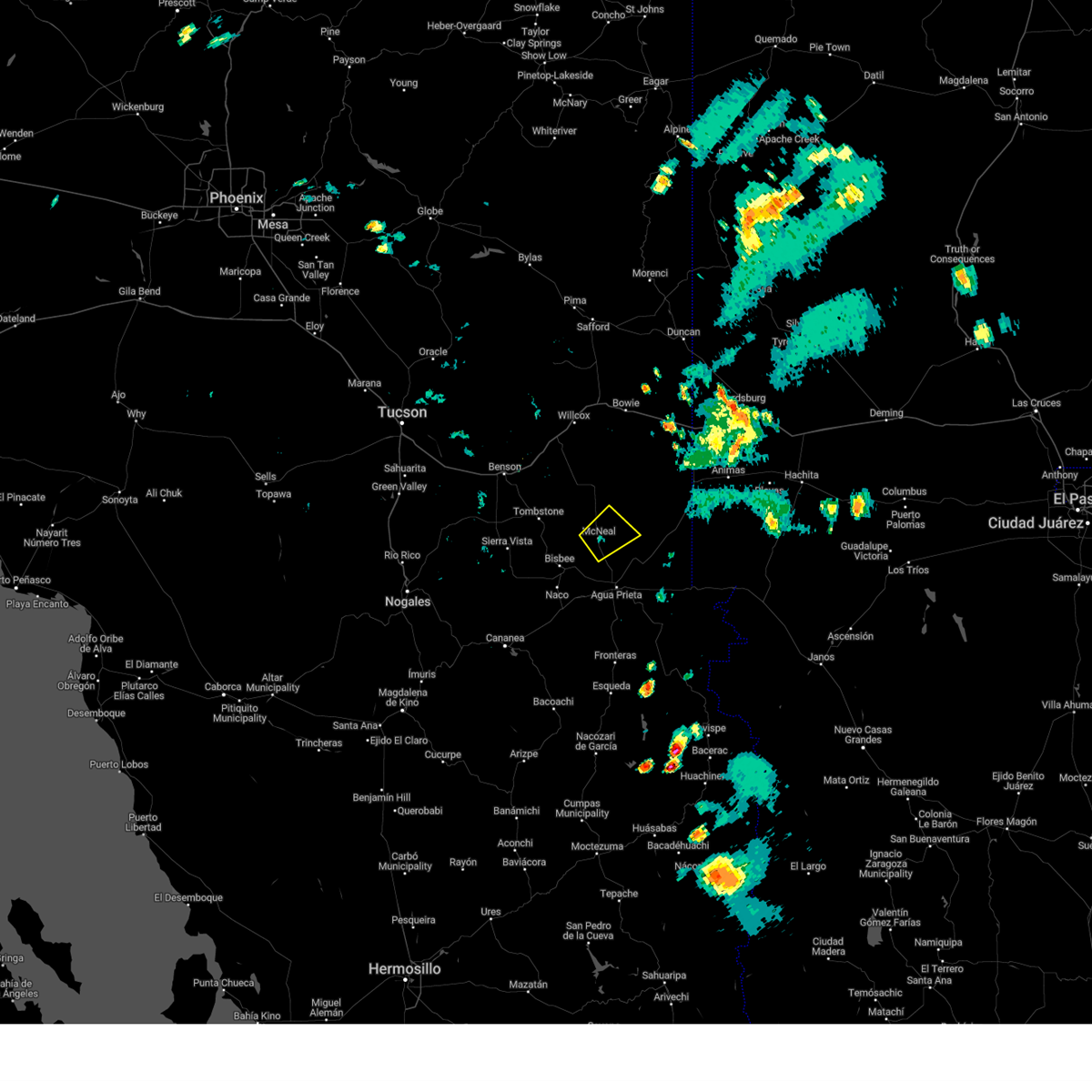
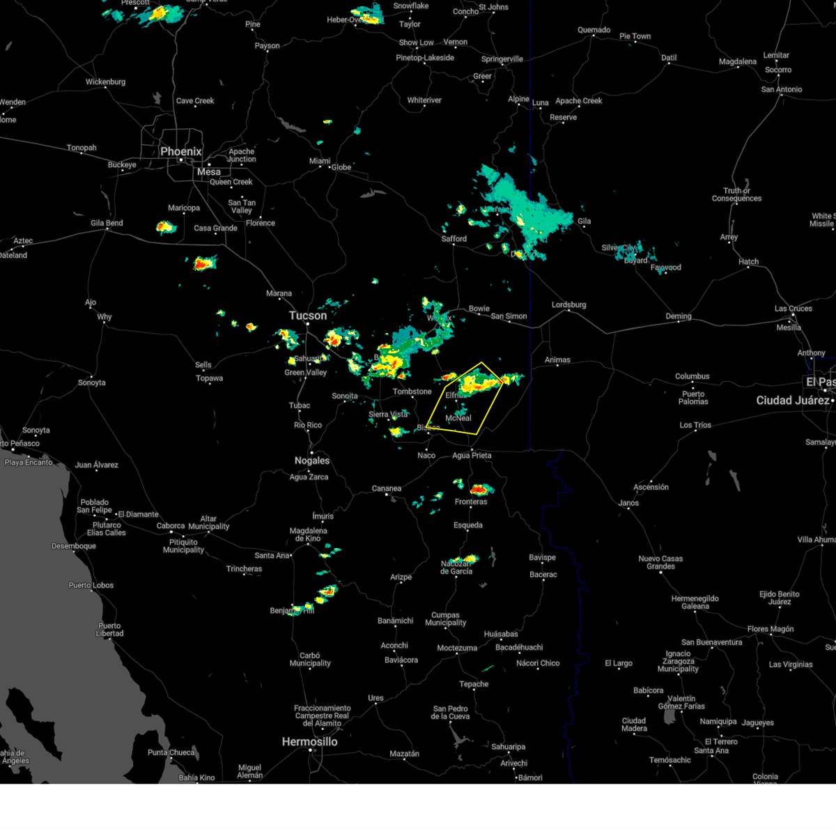
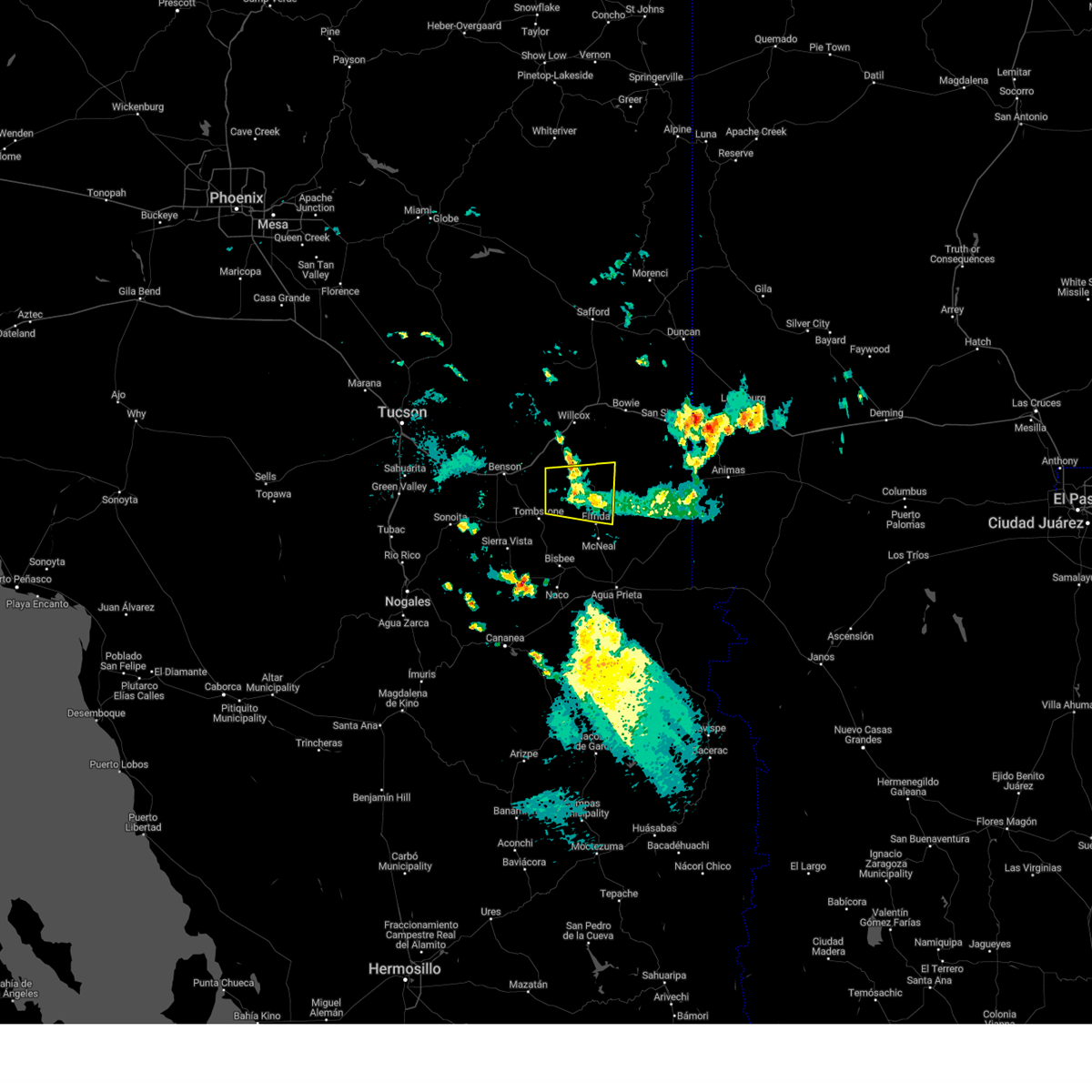
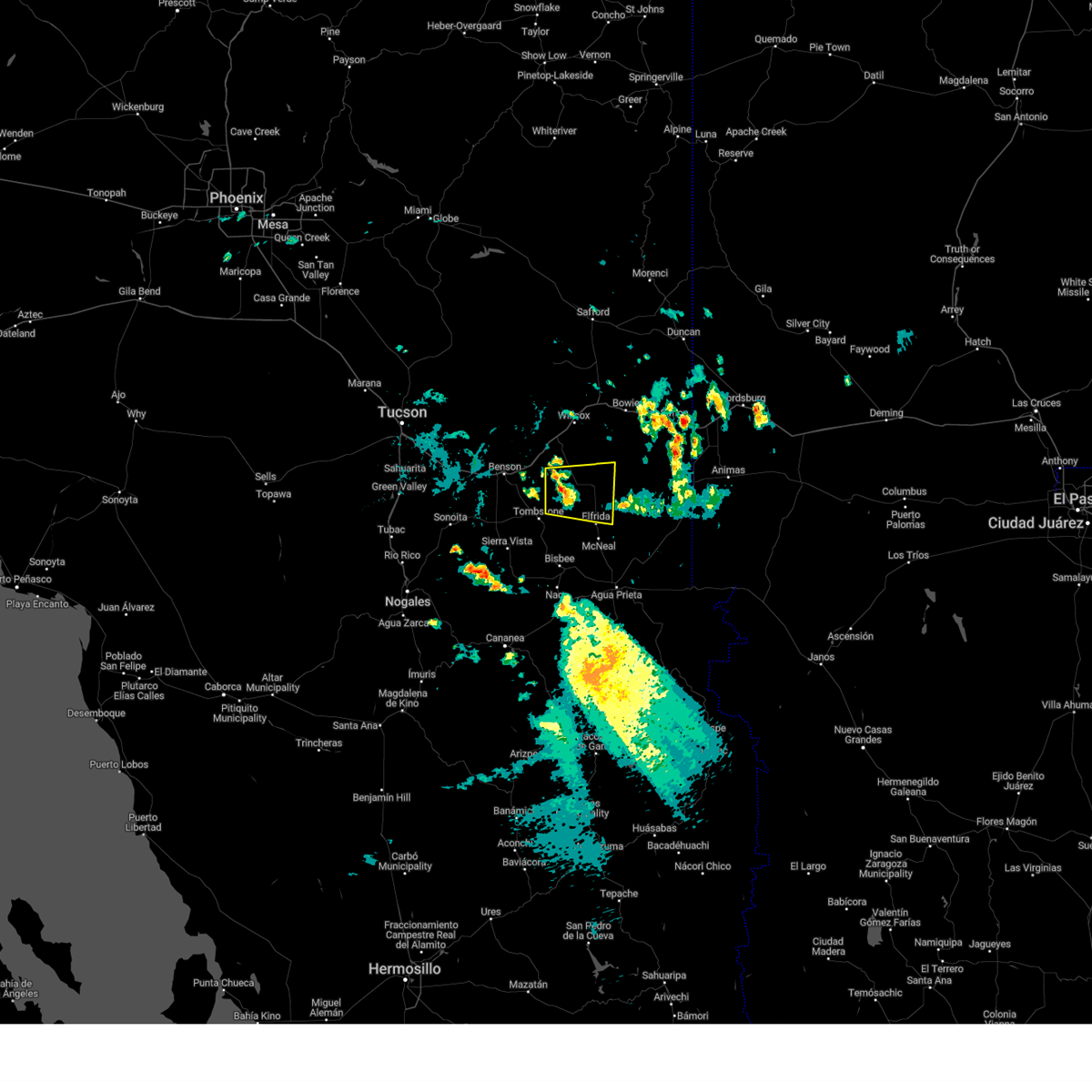
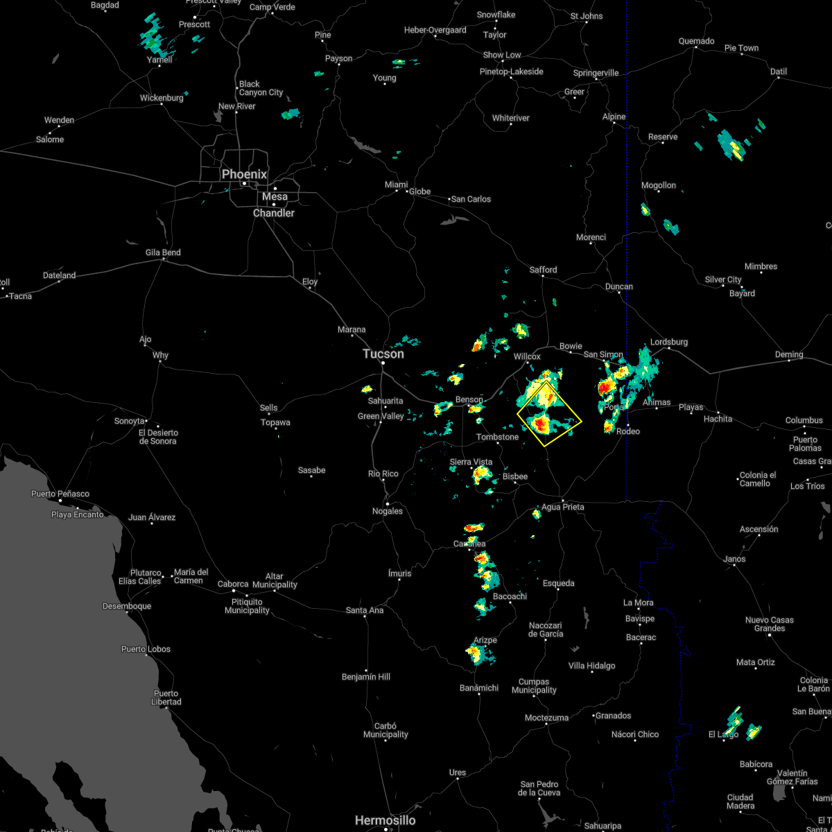
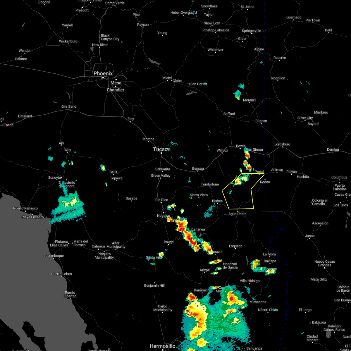
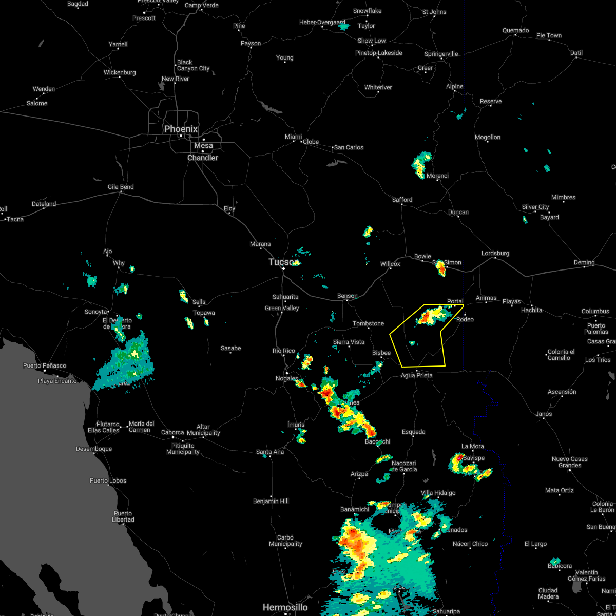
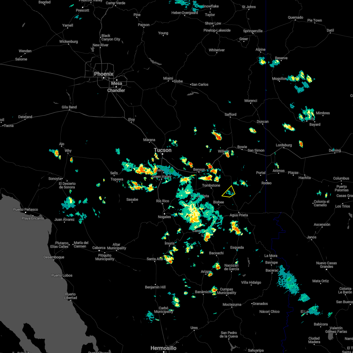
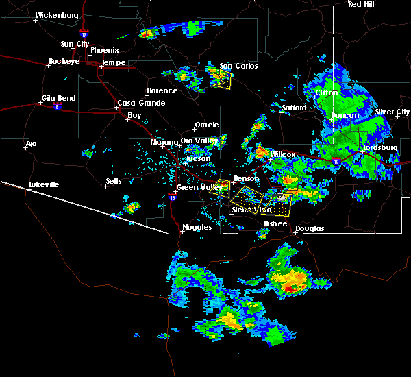
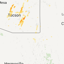
Hail Map for Elfrida, AZ
The Elfrida, AZ area has had 0 reports of on-the-ground hail by trained spotters, and has been under severe weather warnings 6 times during the past 12 months. Doppler radar has detected hail at or near Elfrida, AZ on 8 occasions.
| Name: | Elfrida, AZ |
| Where Located: | 24.2 miles NNW of Douglas, AZ |
| Map: | Google Map for Elfrida, AZ |
| Population: | 459 |
| Housing Units: | 243 |
| More Info: | Search Google for Elfrida, AZ |
5
The Top Recent Hail Date for Elfrida, AZ is Wednesday, July 10, 2013 (1st out of 8)

Hail and Wind Damage Spotted near Elfrida, AZ
| Date / Time | Report Details |
|---|---|
| 9/19/2025 3:15 PM MST | The storm which prompted the warning has weakened below severe limits, and no longer poses an immediate threat to life or property. therefore, the warning has been allowed to expire. however, gusty winds and brief heavy rain are still possible with this thunderstorm. |
| 9/19/2025 2:55 PM MST | At 255 pm mst, a severe thunderstorm was located 15 miles southeast of pearce-sunsites, moving east at 20 mph (radar indicated). Hazards include 60 mph wind gusts and quarter size hail. Hail damage to vehicles is expected. expect wind damage to roofs, siding, and trees. locations impacted include, sunizona. this includes the following highways, route 181 between mile markers 39 and 49. Route 191 between mile markers 26 and 43. |
| 9/19/2025 2:35 PM MST | Svrtwc the national weather service in tucson has issued a * severe thunderstorm warning for, central cochise county in southeastern arizona, * until 315 pm mst. * at 235 pm mst, a severe thunderstorm was located 12 miles southeast of pearce-sunsites, moving east at 20 mph (radar indicated). Hazards include 60 mph wind gusts and quarter size hail. Hail damage to vehicles is expected. Expect wind damage to roofs, siding, and trees. |
| 8/9/2025 3:51 PM MST |
 The storm which prompted the warning has weakened below severe limits, and has exited the warned area. therefore, the warning will be allowed to expire. The storm which prompted the warning has weakened below severe limits, and has exited the warned area. therefore, the warning will be allowed to expire.
|
| 8/9/2025 3:31 PM MST |
 At 331 pm mst, a severe thunderstorm was located 19 miles north of bisbee-douglas airport, moving northwest at 15 mph (radar indicated). Hazards include 60 mph wind gusts and quarter size hail. Hail damage to vehicles is expected. expect wind damage to roofs, siding, and trees. locations impacted include, elfrida. This includes route 191 between mile markers 24 and 37. At 331 pm mst, a severe thunderstorm was located 19 miles north of bisbee-douglas airport, moving northwest at 15 mph (radar indicated). Hazards include 60 mph wind gusts and quarter size hail. Hail damage to vehicles is expected. expect wind damage to roofs, siding, and trees. locations impacted include, elfrida. This includes route 191 between mile markers 24 and 37.
|
| 8/9/2025 3:11 PM MST |
 Svrtwc the national weather service in tucson has issued a * severe thunderstorm warning for, central cochise county in southeastern arizona, * until 400 pm mst. * at 311 pm mst, a severe thunderstorm was located 17 miles north of bisbee-douglas airport, moving northwest at 15 mph (radar indicated). Hazards include 60 mph wind gusts and quarter size hail. Hail damage to vehicles is expected. Expect wind damage to roofs, siding, and trees. Svrtwc the national weather service in tucson has issued a * severe thunderstorm warning for, central cochise county in southeastern arizona, * until 400 pm mst. * at 311 pm mst, a severe thunderstorm was located 17 miles north of bisbee-douglas airport, moving northwest at 15 mph (radar indicated). Hazards include 60 mph wind gusts and quarter size hail. Hail damage to vehicles is expected. Expect wind damage to roofs, siding, and trees.
|
| 9/15/2024 5:06 PM MST |
 The storm which prompted the warning has weakened below severe limits, and no longer poses an immediate threat to life or property. therefore, the warning will be allowed to expire. however, heavy rain is still possible with this thunderstorm. The storm which prompted the warning has weakened below severe limits, and no longer poses an immediate threat to life or property. therefore, the warning will be allowed to expire. however, heavy rain is still possible with this thunderstorm.
|
| 9/15/2024 4:48 PM MST |
 At 448 pm mst, a severe thunderstorm was located near tombstone, or 16 miles northeast of sierra vista, moving northeast at 20 mph (radar indicated). Hazards include 60 mph wind gusts. Expect damage to roofs, siding, and trees. locations impacted include, tombstone, fairbank, and charleston. this includes the following highways, route 80 between mile markers 310 and 335. route 82 between mile markers 61 and 67. route 90 between mile markers 329 and 336. Route 191 between mile markers 26 and 29. At 448 pm mst, a severe thunderstorm was located near tombstone, or 16 miles northeast of sierra vista, moving northeast at 20 mph (radar indicated). Hazards include 60 mph wind gusts. Expect damage to roofs, siding, and trees. locations impacted include, tombstone, fairbank, and charleston. this includes the following highways, route 80 between mile markers 310 and 335. route 82 between mile markers 61 and 67. route 90 between mile markers 329 and 336. Route 191 between mile markers 26 and 29.
|
| 9/15/2024 4:29 PM MST |
 Svrtwc the national weather service in tucson has issued a * severe thunderstorm warning for, southwestern cochise county in southeastern arizona, * until 515 pm mst. * at 429 pm mst, a severe thunderstorm was located 8 miles south of tombstone, or 10 miles northeast of sierra vista, moving northeast at 20 mph (radar indicated). Hazards include 60 mph wind gusts. expect damage to roofs, siding, and trees Svrtwc the national weather service in tucson has issued a * severe thunderstorm warning for, southwestern cochise county in southeastern arizona, * until 515 pm mst. * at 429 pm mst, a severe thunderstorm was located 8 miles south of tombstone, or 10 miles northeast of sierra vista, moving northeast at 20 mph (radar indicated). Hazards include 60 mph wind gusts. expect damage to roofs, siding, and trees
|
| 8/21/2024 2:27 PM MST |
 Svrtwc the national weather service in tucson has issued a * severe thunderstorm warning for, central cochise county in southeastern arizona, * until 315 pm mst. * at 227 pm mst, a severe thunderstorm was located 13 miles east of tombstone, or 23 miles north of bisbee, moving north at 15 mph (radar indicated). Hazards include 60 mph wind gusts and quarter size hail. Hail damage to vehicles is expected. Expect wind damage to roofs, siding, and trees. Svrtwc the national weather service in tucson has issued a * severe thunderstorm warning for, central cochise county in southeastern arizona, * until 315 pm mst. * at 227 pm mst, a severe thunderstorm was located 13 miles east of tombstone, or 23 miles north of bisbee, moving north at 15 mph (radar indicated). Hazards include 60 mph wind gusts and quarter size hail. Hail damage to vehicles is expected. Expect wind damage to roofs, siding, and trees.
|
| 8/5/2024 9:03 PM MST |
 Svrtwc the national weather service in tucson has issued a * severe thunderstorm warning for, central cochise county in southeastern arizona, * until 945 pm mst. * at 903 pm mst, a severe thunderstorm was located 11 miles south of pearce-sunsites, or 27 miles north of bisbee, moving southwest at 10 mph (radar indicated). Hazards include 60 mph wind gusts and quarter size hail. Hail damage to vehicles is expected. Expect wind damage to roofs, siding, and trees. Svrtwc the national weather service in tucson has issued a * severe thunderstorm warning for, central cochise county in southeastern arizona, * until 945 pm mst. * at 903 pm mst, a severe thunderstorm was located 11 miles south of pearce-sunsites, or 27 miles north of bisbee, moving southwest at 10 mph (radar indicated). Hazards include 60 mph wind gusts and quarter size hail. Hail damage to vehicles is expected. Expect wind damage to roofs, siding, and trees.
|
| 7/28/2024 1:08 PM MST |
 The storm which prompted the warning has weakened below severe limits, and no longer poses an immediate threat to life or property. therefore, the warning will be allowed to expire. The storm which prompted the warning has weakened below severe limits, and no longer poses an immediate threat to life or property. therefore, the warning will be allowed to expire.
|
| 7/28/2024 12:27 PM MST |
 Svrtwc the national weather service in tucson has issued a * severe thunderstorm warning for, south central cochise county in southeastern arizona, * until 115 pm mst. * at 1226 pm mst, two severe thunderstorma were located near bisbee and tombstone, moving north at 5 mph (radar indicated). Hazards include 60 mph wind gusts. expect damage to roofs, siding, and trees Svrtwc the national weather service in tucson has issued a * severe thunderstorm warning for, south central cochise county in southeastern arizona, * until 115 pm mst. * at 1226 pm mst, two severe thunderstorma were located near bisbee and tombstone, moving north at 5 mph (radar indicated). Hazards include 60 mph wind gusts. expect damage to roofs, siding, and trees
|
| 7/1/2024 7:05 PM MST |
 The storm which prompted the warning has weakened below severe limits, and no longer poses an immediate threat to life or property. therefore, the warning will be allowed to expire. The storm which prompted the warning has weakened below severe limits, and no longer poses an immediate threat to life or property. therefore, the warning will be allowed to expire.
|
| 7/1/2024 6:48 PM MST |
 At 648 pm mst, a severe thunderstorm was located 11 miles northwest of bisbee-douglas airport, or 14 miles northeast of bisbee, moving northeast at 10 mph (radar indicated). Hazards include 60 mph wind gusts and quarter size hail. Hail damage to vehicles is expected. expect wind damage to roofs, siding, and trees. locations impacted include, elfrida and mcneal. This includes route 191 between mile markers 13 and 26. At 648 pm mst, a severe thunderstorm was located 11 miles northwest of bisbee-douglas airport, or 14 miles northeast of bisbee, moving northeast at 10 mph (radar indicated). Hazards include 60 mph wind gusts and quarter size hail. Hail damage to vehicles is expected. expect wind damage to roofs, siding, and trees. locations impacted include, elfrida and mcneal. This includes route 191 between mile markers 13 and 26.
|
| 7/1/2024 6:26 PM MST |
 Svrtwc the national weather service in tucson has issued a * severe thunderstorm warning for, south central cochise county in southeastern arizona, * until 715 pm mst. * at 626 pm mst, a severe thunderstorm was located 9 miles northwest of bisbee-douglas airport, or 16 miles northeast of bisbee, moving northeast at 10 mph (radar indicated). Hazards include 60 mph wind gusts and quarter size hail. Hail damage to vehicles is expected. Expect wind damage to roofs, siding, and trees. Svrtwc the national weather service in tucson has issued a * severe thunderstorm warning for, south central cochise county in southeastern arizona, * until 715 pm mst. * at 626 pm mst, a severe thunderstorm was located 9 miles northwest of bisbee-douglas airport, or 16 miles northeast of bisbee, moving northeast at 10 mph (radar indicated). Hazards include 60 mph wind gusts and quarter size hail. Hail damage to vehicles is expected. Expect wind damage to roofs, siding, and trees.
|
| 7/1/2024 6:06 PM MST |
 At 606 pm mst, a severe thunderstorm was located 8 miles north of bisbee-douglas airport, or 17 miles north of douglas, moving northeast at 10 mph (radar indicated). Hazards include 60 mph wind gusts and quarter size hail. Hail damage to vehicles is expected. expect wind damage to roofs, siding, and trees. locations impacted include, elfrida and mcneal. This includes route 191 between mile markers 11 and 26. At 606 pm mst, a severe thunderstorm was located 8 miles north of bisbee-douglas airport, or 17 miles north of douglas, moving northeast at 10 mph (radar indicated). Hazards include 60 mph wind gusts and quarter size hail. Hail damage to vehicles is expected. expect wind damage to roofs, siding, and trees. locations impacted include, elfrida and mcneal. This includes route 191 between mile markers 11 and 26.
|
| 7/1/2024 5:51 PM MST |
 Svrtwc the national weather service in tucson has issued a * severe thunderstorm warning for, south central cochise county in southeastern arizona, * until 630 pm mst. * at 551 pm mst, a severe thunderstorm was located 8 miles northwest of bisbee-douglas airport, or 17 miles northwest of douglas, moving northeast at 15 mph (radar indicated). Hazards include 60 mph wind gusts and quarter size hail. Hail damage to vehicles is expected. Expect wind damage to roofs, siding, and trees. Svrtwc the national weather service in tucson has issued a * severe thunderstorm warning for, south central cochise county in southeastern arizona, * until 630 pm mst. * at 551 pm mst, a severe thunderstorm was located 8 miles northwest of bisbee-douglas airport, or 17 miles northwest of douglas, moving northeast at 15 mph (radar indicated). Hazards include 60 mph wind gusts and quarter size hail. Hail damage to vehicles is expected. Expect wind damage to roofs, siding, and trees.
|
| 9/13/2023 2:02 PM MST |
 At 202 pm mst, a severe thunderstorm was located 20 miles southeast of pearce-sunsites, or 29 miles north of douglas, moving east at 25 mph (radar indicated). Hazards include 60 mph wind gusts and penny size hail. expect damage to roofs, siding, and trees At 202 pm mst, a severe thunderstorm was located 20 miles southeast of pearce-sunsites, or 29 miles north of douglas, moving east at 25 mph (radar indicated). Hazards include 60 mph wind gusts and penny size hail. expect damage to roofs, siding, and trees
|
| 9/13/2023 1:08 PM MST |
 At 108 pm mst, a severe thunderstorm was located 7 miles northeast of tombstone, or 24 miles southeast of benson, moving east at 25 mph (radar indicated). Hazards include 60 mph wind gusts and penny size hail. expect damage to roofs, siding, and trees At 108 pm mst, a severe thunderstorm was located 7 miles northeast of tombstone, or 24 miles southeast of benson, moving east at 25 mph (radar indicated). Hazards include 60 mph wind gusts and penny size hail. expect damage to roofs, siding, and trees
|
| 8/7/2023 11:51 PM MST |
 The severe thunderstorm warning for central cochise county will expire at midnight mst, the storm which prompted the warning has weakened below severe limits, and no longer poses an immediate threat to life or property. therefore, the warning will be allowed to expire. however gusty winds are still possible with this thunderstorm. The severe thunderstorm warning for central cochise county will expire at midnight mst, the storm which prompted the warning has weakened below severe limits, and no longer poses an immediate threat to life or property. therefore, the warning will be allowed to expire. however gusty winds are still possible with this thunderstorm.
|
| 8/7/2023 11:10 PM MST |
 At 1110 pm mst, a severe thunderstorm was located near pearce-sunsites, or 24 miles south of willcox, moving east at 20 mph (radar indicated). Hazards include 60 mph wind gusts and quarter size hail. Hail damage to vehicles is expected. Expect wind damage to roofs, siding, and trees. At 1110 pm mst, a severe thunderstorm was located near pearce-sunsites, or 24 miles south of willcox, moving east at 20 mph (radar indicated). Hazards include 60 mph wind gusts and quarter size hail. Hail damage to vehicles is expected. Expect wind damage to roofs, siding, and trees.
|
| 8/7/2023 10:25 PM MST |
 The severe thunderstorm warning for southeastern cochise county will expire at 1030 pm mst, the storms which prompted the warning have weakened below severe limits. therefore, the warning will be allowed to expire. however gusty winds to 40 mph are still possible with these thunderstorms. The severe thunderstorm warning for southeastern cochise county will expire at 1030 pm mst, the storms which prompted the warning have weakened below severe limits. therefore, the warning will be allowed to expire. however gusty winds to 40 mph are still possible with these thunderstorms.
|
| 8/7/2023 10:15 PM MST |
 At 1014 pm mst, severe thunderstorms were located along a line extending from just east of elfrida to 17 miles north of douglas to 7 miles west of bisbee-douglas airport, moving east at 15 to 20 mph (radar indicated). Hazards include 60 mph wind gusts and penny size hail. Expect damage to roofs, siding, and trees. locations impacted include, douglas, bisbee, bisbee-douglas airport, pirtleville, elfrida, mcneal. hail threat, radar indicated max hail size, 0. 75 in wind threat, radar indicated max wind gust, 60 mph. At 1014 pm mst, severe thunderstorms were located along a line extending from just east of elfrida to 17 miles north of douglas to 7 miles west of bisbee-douglas airport, moving east at 15 to 20 mph (radar indicated). Hazards include 60 mph wind gusts and penny size hail. Expect damage to roofs, siding, and trees. locations impacted include, douglas, bisbee, bisbee-douglas airport, pirtleville, elfrida, mcneal. hail threat, radar indicated max hail size, 0. 75 in wind threat, radar indicated max wind gust, 60 mph.
|
| 8/7/2023 9:50 PM MST |
 At 949 pm mst, severe thunderstorms were located along a line extending from near elfrida to 11 miles northwest of bisbee- douglas airport to 6 miles east of bisbee, moving east at 15 to 20 mph (radar indicated). Hazards include 60 mph wind gusts and penny size hail. expect damage to roofs, siding, and trees At 949 pm mst, severe thunderstorms were located along a line extending from near elfrida to 11 miles northwest of bisbee- douglas airport to 6 miles east of bisbee, moving east at 15 to 20 mph (radar indicated). Hazards include 60 mph wind gusts and penny size hail. expect damage to roofs, siding, and trees
|
| 9/13/2022 1:53 PM MST |
 The severe thunderstorm warning for central cochise county will expire at 200 pm mst, the storm which prompted the warning has weakened below severe limits, and no longer poses an immediate threat to life or property. therefore, the warning will be allowed to expire. The severe thunderstorm warning for central cochise county will expire at 200 pm mst, the storm which prompted the warning has weakened below severe limits, and no longer poses an immediate threat to life or property. therefore, the warning will be allowed to expire.
|
| 9/13/2022 1:33 PM MST |
 At 133 pm mst, a severe thunderstorm was located 11 miles southeast of pearce-sunsites, or 28 miles south of willcox, moving northeast at 15 mph (radar indicated). Hazards include 60 mph wind gusts and quarter size hail. Hail damage to vehicles is expected. expect wind damage to roofs, siding, and trees. locations impacted include, pearce-sunsites and sunizona. hail threat, radar indicated max hail size, 1. 00 in wind threat, radar indicated max wind gust, 60 mph. At 133 pm mst, a severe thunderstorm was located 11 miles southeast of pearce-sunsites, or 28 miles south of willcox, moving northeast at 15 mph (radar indicated). Hazards include 60 mph wind gusts and quarter size hail. Hail damage to vehicles is expected. expect wind damage to roofs, siding, and trees. locations impacted include, pearce-sunsites and sunizona. hail threat, radar indicated max hail size, 1. 00 in wind threat, radar indicated max wind gust, 60 mph.
|
| 9/13/2022 1:18 PM MST |
 At 118 pm mst, a severe thunderstorm was located 11 miles southeast of pearce-sunsites, or 28 miles north of bisbee, moving northeast at 15 mph (radar indicated). Hazards include 60 mph wind gusts and quarter size hail. Hail damage to vehicles is expected. Expect wind damage to roofs, siding, and trees. At 118 pm mst, a severe thunderstorm was located 11 miles southeast of pearce-sunsites, or 28 miles north of bisbee, moving northeast at 15 mph (radar indicated). Hazards include 60 mph wind gusts and quarter size hail. Hail damage to vehicles is expected. Expect wind damage to roofs, siding, and trees.
|
| 8/7/2022 7:08 PM MST |
 At 707 pm mst, severe thunderstorms were located along a line extending from 8 miles south of willcox to 9 miles southeast of pearce-sunsites to 12 miles north of bisbee, moving southwest at 10 mph (radar indicated). Hazards include 60 mph wind gusts and quarter size hail. Hail damage to vehicles is expected. Expect wind damage to roofs, siding, and trees. At 707 pm mst, severe thunderstorms were located along a line extending from 8 miles south of willcox to 9 miles southeast of pearce-sunsites to 12 miles north of bisbee, moving southwest at 10 mph (radar indicated). Hazards include 60 mph wind gusts and quarter size hail. Hail damage to vehicles is expected. Expect wind damage to roofs, siding, and trees.
|
| 8/6/2022 7:00 PM MST | Lines are down across the road causing road closures. radar indicated reported by cochise sheriffs offic in cochise county AZ, 2 miles SSW of Elfrida, AZ |
| 8/6/2022 6:51 PM MST |
 At 651 pm mst, a severe thunderstorm was located 13 miles southeast of tombstone, or 15 miles north of bisbee, moving west at 25 mph (radar indicated). Hazards include 60 mph wind gusts and quarter size hail. Hail damage to vehicles is expected. Expect wind damage to roofs, siding, and trees. At 651 pm mst, a severe thunderstorm was located 13 miles southeast of tombstone, or 15 miles north of bisbee, moving west at 25 mph (radar indicated). Hazards include 60 mph wind gusts and quarter size hail. Hail damage to vehicles is expected. Expect wind damage to roofs, siding, and trees.
|
| 8/6/2022 6:41 PM MST |
 The severe thunderstorm warning for southeastern cochise county will expire at 645 pm mst, the storms which prompted the warning have weakened below severe limits, and no longer pose an immediate threat to life or property. therefore, the warning will be allowed to expire. however small hail and gusty winds are still possible with these thunderstorms. The severe thunderstorm warning for southeastern cochise county will expire at 645 pm mst, the storms which prompted the warning have weakened below severe limits, and no longer pose an immediate threat to life or property. therefore, the warning will be allowed to expire. however small hail and gusty winds are still possible with these thunderstorms.
|
| 8/6/2022 6:21 PM MST |
 At 620 pm mst, severe thunderstorms were located along a line extending from 13 miles south of chiricahua national monument to 21 miles north of douglas to near bisbee-douglas airport, moving west at 30 mph. the strongest part of the storm is approaching mcneal from the east (radar indicated). Hazards include 70 mph wind gusts and ping pong ball size hail. People and animals outdoors will be injured. expect hail damage to roofs, siding, windows, and vehicles. expect considerable tree damage. wind damage is also likely to mobile homes, roofs, and outbuildings. locations impacted include, douglas, portal, bisbee-douglas airport, pirtleville, elfrida, mcneal and rucker canyon. thunderstorm damage threat, considerable hail threat, radar indicated max hail size, 1. 50 in wind threat, radar indicated max wind gust, 70 mph. At 620 pm mst, severe thunderstorms were located along a line extending from 13 miles south of chiricahua national monument to 21 miles north of douglas to near bisbee-douglas airport, moving west at 30 mph. the strongest part of the storm is approaching mcneal from the east (radar indicated). Hazards include 70 mph wind gusts and ping pong ball size hail. People and animals outdoors will be injured. expect hail damage to roofs, siding, windows, and vehicles. expect considerable tree damage. wind damage is also likely to mobile homes, roofs, and outbuildings. locations impacted include, douglas, portal, bisbee-douglas airport, pirtleville, elfrida, mcneal and rucker canyon. thunderstorm damage threat, considerable hail threat, radar indicated max hail size, 1. 50 in wind threat, radar indicated max wind gust, 70 mph.
|
| 8/6/2022 5:58 PM MST |
 At 557 pm mst, severe thunderstorms were located along a line extending from 9 miles southwest of portal to 23 miles north of douglas to 7 miles east of bisbee-douglas airport, moving west at 25 mph (radar indicated). Hazards include 60 mph wind gusts and quarter size hail. Hail damage to vehicles is expected. Expect wind damage to roofs, siding, and trees. At 557 pm mst, severe thunderstorms were located along a line extending from 9 miles southwest of portal to 23 miles north of douglas to 7 miles east of bisbee-douglas airport, moving west at 25 mph (radar indicated). Hazards include 60 mph wind gusts and quarter size hail. Hail damage to vehicles is expected. Expect wind damage to roofs, siding, and trees.
|
| 7/24/2022 1:54 PM MST |
 At 154 pm mst, a severe thunderstorm was located 10 miles northwest of bisbee-douglas airport, or 19 miles northeast of bisbee, moving northwest at 5 mph (radar indicated). Hazards include 60 mph wind gusts and penny size hail. Expect damage to roofs, siding, and trees. locations impacted include, elfrida and mcneal. hail threat, radar indicated max hail size, 0. 75 in wind threat, radar indicated max wind gust, 60 mph. At 154 pm mst, a severe thunderstorm was located 10 miles northwest of bisbee-douglas airport, or 19 miles northeast of bisbee, moving northwest at 5 mph (radar indicated). Hazards include 60 mph wind gusts and penny size hail. Expect damage to roofs, siding, and trees. locations impacted include, elfrida and mcneal. hail threat, radar indicated max hail size, 0. 75 in wind threat, radar indicated max wind gust, 60 mph.
|
| 7/24/2022 1:39 PM MST |
 At 139 pm mst, a severe thunderstorm was located 9 miles north of bisbee-douglas airport, or 17 miles northwest of douglas, moving northwest at 5 mph (radar indicated). Hazards include 60 mph wind gusts and quarter size hail. Hail damage to vehicles is expected. Expect wind damage to roofs, siding, and trees. At 139 pm mst, a severe thunderstorm was located 9 miles north of bisbee-douglas airport, or 17 miles northwest of douglas, moving northwest at 5 mph (radar indicated). Hazards include 60 mph wind gusts and quarter size hail. Hail damage to vehicles is expected. Expect wind damage to roofs, siding, and trees.
|
| 8/23/2019 5:27 PM MST |
 The severe thunderstorm warning for central cochise county will expire at 530 pm mst, the storm which prompted the warning has weakened below severe limits, and has exited the warned area. therefore, the warning will be allowed to expire. however gusty winds are still possible with this thunderstorm. The severe thunderstorm warning for central cochise county will expire at 530 pm mst, the storm which prompted the warning has weakened below severe limits, and has exited the warned area. therefore, the warning will be allowed to expire. however gusty winds are still possible with this thunderstorm.
|
| 8/23/2019 4:53 PM MST |
 At 452 pm mst, a severe thunderstorm was located 7 miles southeast of pearce-sunsites, or 28 miles south of willcox, moving southwest at 5 mph. radar and spotter reports indicate this storm is severe (radar indicated and spotter). Hazards include 60 mph wind gusts. expect damage to roofs, siding, and trees At 452 pm mst, a severe thunderstorm was located 7 miles southeast of pearce-sunsites, or 28 miles south of willcox, moving southwest at 5 mph. radar and spotter reports indicate this storm is severe (radar indicated and spotter). Hazards include 60 mph wind gusts. expect damage to roofs, siding, and trees
|
| 7/17/2019 6:28 PM MST |
 At 627 pm mst, a severe thunderstorm was located 16 miles south of pearce-sunsites, or 22 miles northeast of bisbee, and is nearly stationary or slowly moving to the west (radar indicated). Hazards include 60 mph wind gusts and quarter size hail. Hail damage to vehicles is expected. Expect wind damage to roofs, siding, and trees. At 627 pm mst, a severe thunderstorm was located 16 miles south of pearce-sunsites, or 22 miles northeast of bisbee, and is nearly stationary or slowly moving to the west (radar indicated). Hazards include 60 mph wind gusts and quarter size hail. Hail damage to vehicles is expected. Expect wind damage to roofs, siding, and trees.
|
| 7/30/2018 7:23 PM MST |
 The severe thunderstorm warning for southwestern cochise county will expire at 730 pm mst, the storms which prompted the warning have weakened below severe limits, and no longer pose an immediate threat to life or property. therefore, the warning will be allowed to expire. The severe thunderstorm warning for southwestern cochise county will expire at 730 pm mst, the storms which prompted the warning have weakened below severe limits, and no longer pose an immediate threat to life or property. therefore, the warning will be allowed to expire.
|
| 7/30/2018 6:50 PM MST |
 At 648 pm mst, doppler radar indicated a line of severe thunderstorms capable of producing quarter size hail and damaging winds in excess of 60 mph. these storms were located along a line extending from 29 miles north of douglas to 12 miles northwest of bisbee, and moving west at 15 mph. At 648 pm mst, doppler radar indicated a line of severe thunderstorms capable of producing quarter size hail and damaging winds in excess of 60 mph. these storms were located along a line extending from 29 miles north of douglas to 12 miles northwest of bisbee, and moving west at 15 mph.
|
| 7/13/2017 5:43 PM MST |
 At 542 pm mst, a severe thunderstorm was located 10 miles north of bisbee, moving southwest at 20 mph (radar indicated). Hazards include 60 mph wind gusts and quarter size hail. Hail damage to vehicles is expected. expect wind damage to roofs, siding, and trees. Storms may be preceded by damaging outflow winds. At 542 pm mst, a severe thunderstorm was located 10 miles north of bisbee, moving southwest at 20 mph (radar indicated). Hazards include 60 mph wind gusts and quarter size hail. Hail damage to vehicles is expected. expect wind damage to roofs, siding, and trees. Storms may be preceded by damaging outflow winds.
|
| 7/13/2017 5:13 PM MST |
 At 512 pm mst, a severe thunderstorm was located near elfrida, or about 24 miles northeast of bisbee, moving south at 5 to 10 mph (radar indicated). Hazards include 60 mph wind gusts and quarter size hail along with heavy rain. Hail damage to vehicles is expected. Expect wind damage to roofs, siding, and trees. At 512 pm mst, a severe thunderstorm was located near elfrida, or about 24 miles northeast of bisbee, moving south at 5 to 10 mph (radar indicated). Hazards include 60 mph wind gusts and quarter size hail along with heavy rain. Hail damage to vehicles is expected. Expect wind damage to roofs, siding, and trees.
|
| 8/22/2015 12:26 PM MST |
 At 1223 pm mst, doppler radar indicated a pair of severe thunderstorms capable of producing quarter size hail and damaging winds in excess of 60 mph. the first storm was just west of bisbee while the second one was west of mcneal. these storms are moving east southeast at 5 to 10 mph. heavy rain will also accompany these storms. At 1223 pm mst, doppler radar indicated a pair of severe thunderstorms capable of producing quarter size hail and damaging winds in excess of 60 mph. the first storm was just west of bisbee while the second one was west of mcneal. these storms are moving east southeast at 5 to 10 mph. heavy rain will also accompany these storms.
|
Hail Maps for Elfrida, AZ


Connect with Interactive Hail Maps