

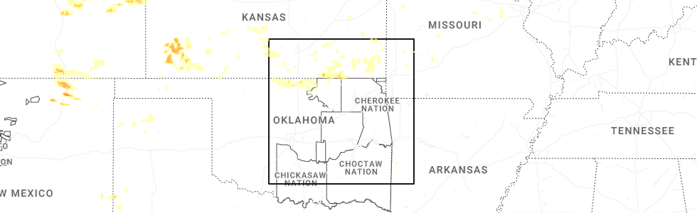
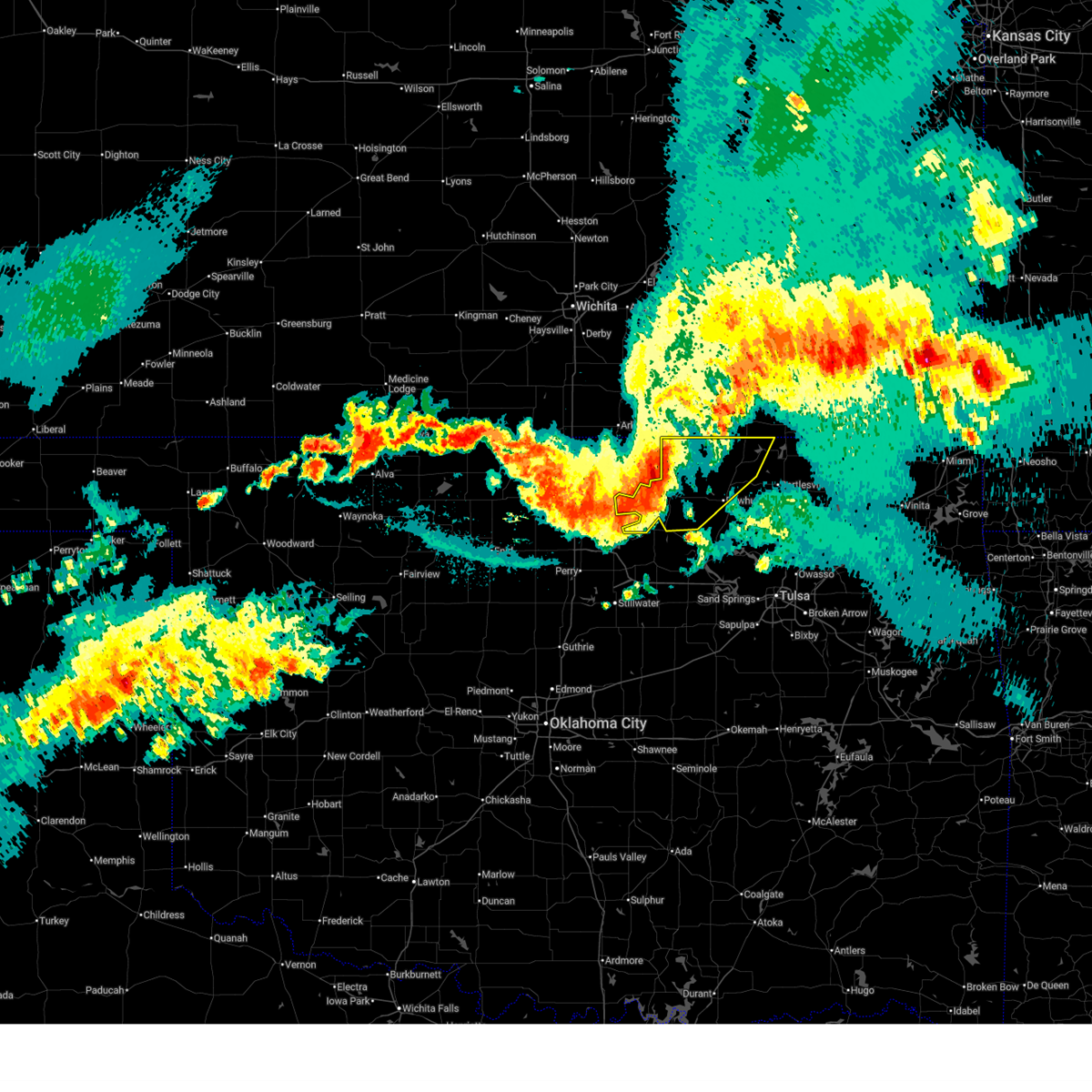
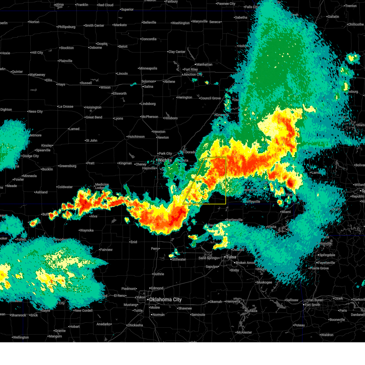
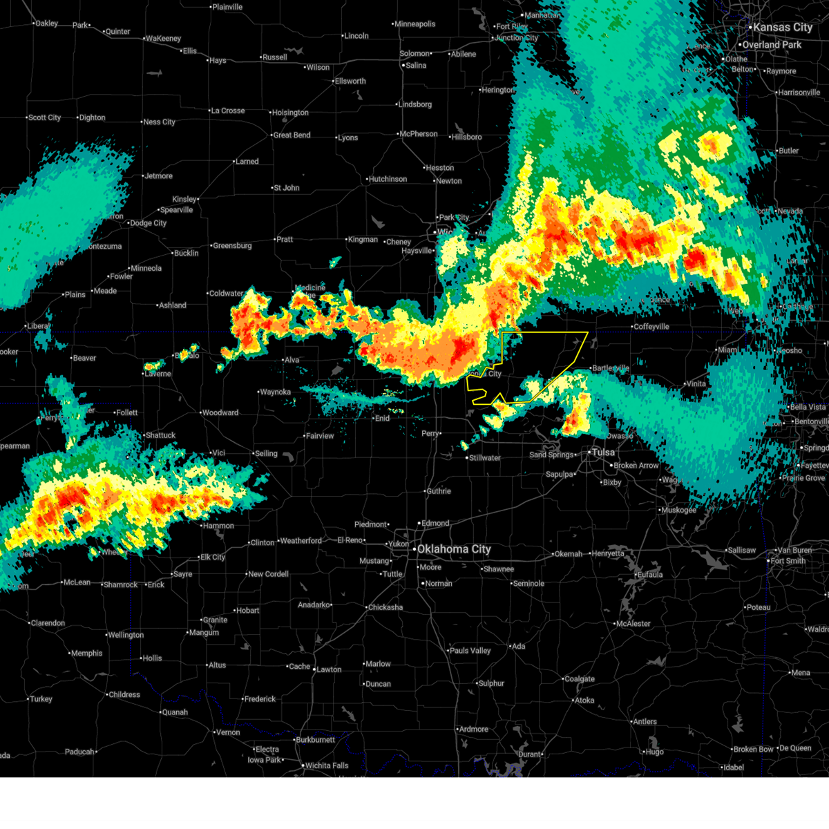
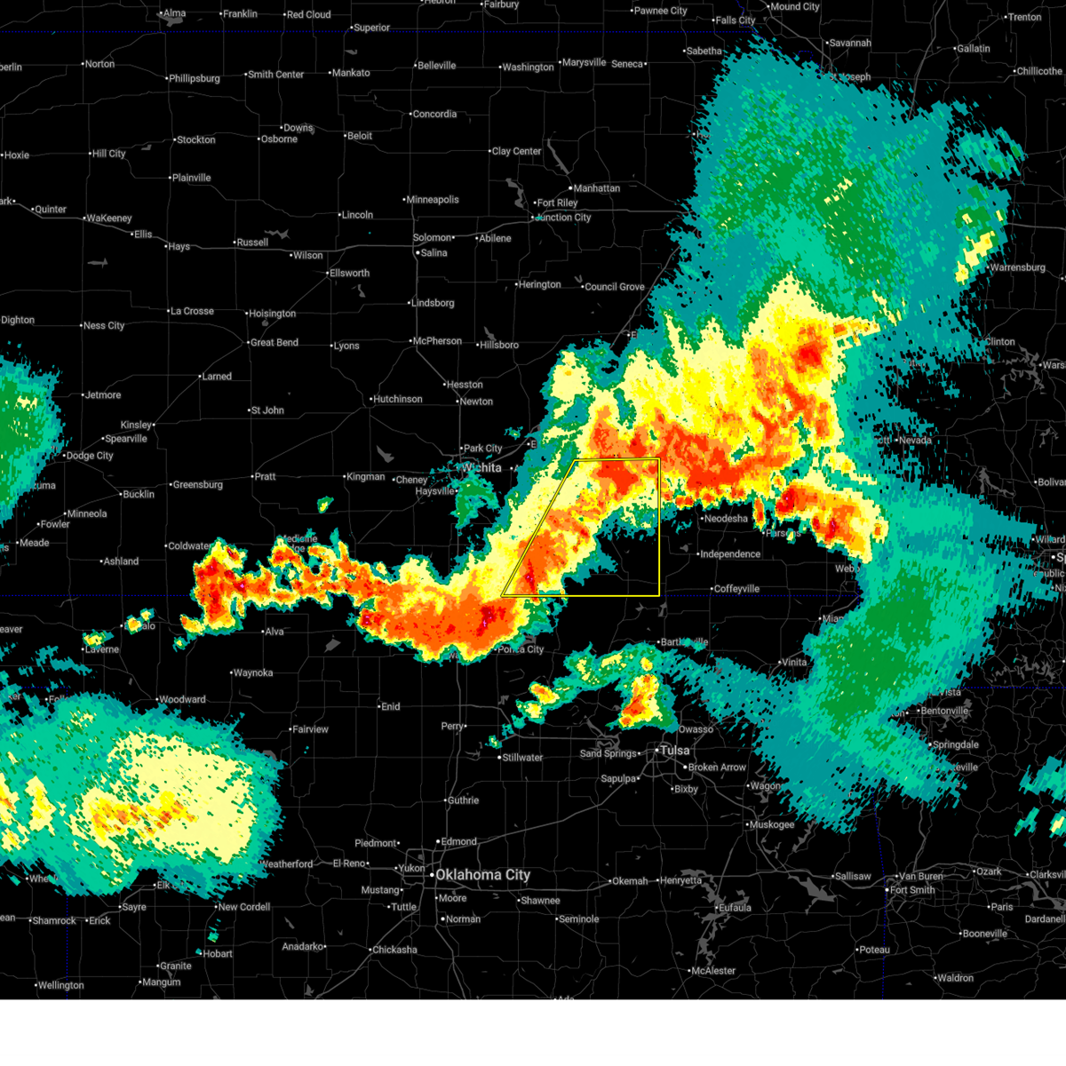
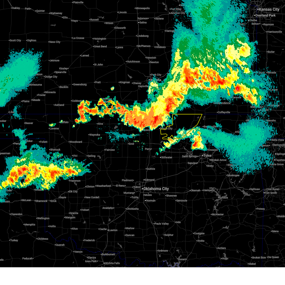
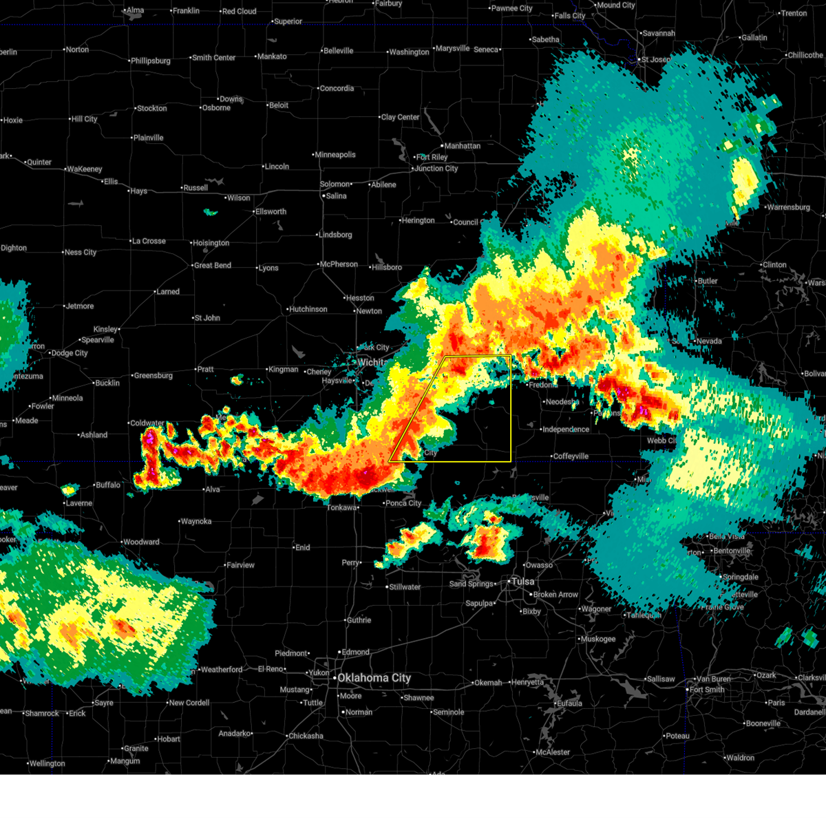
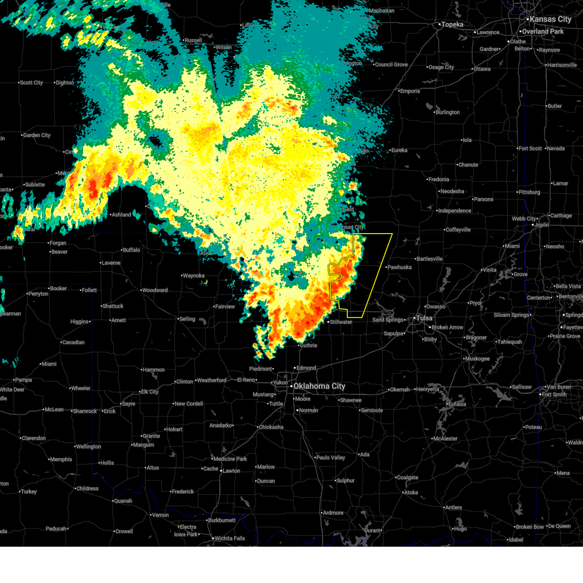
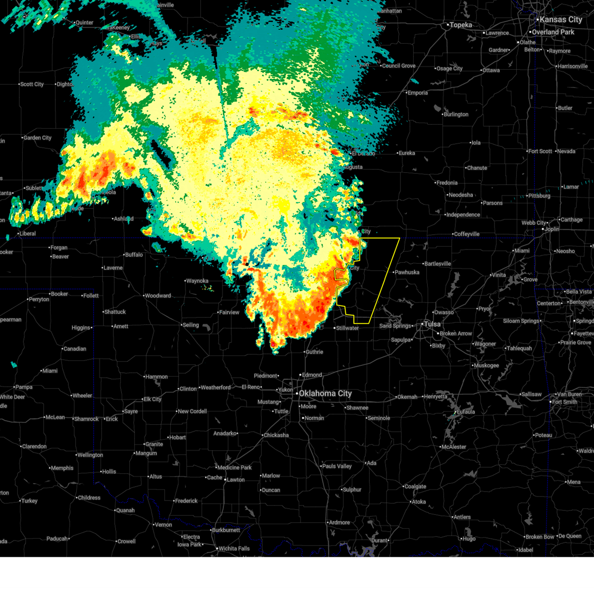
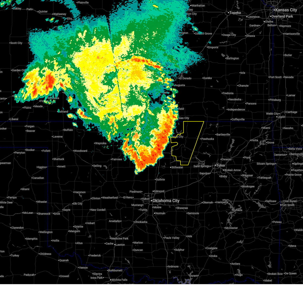
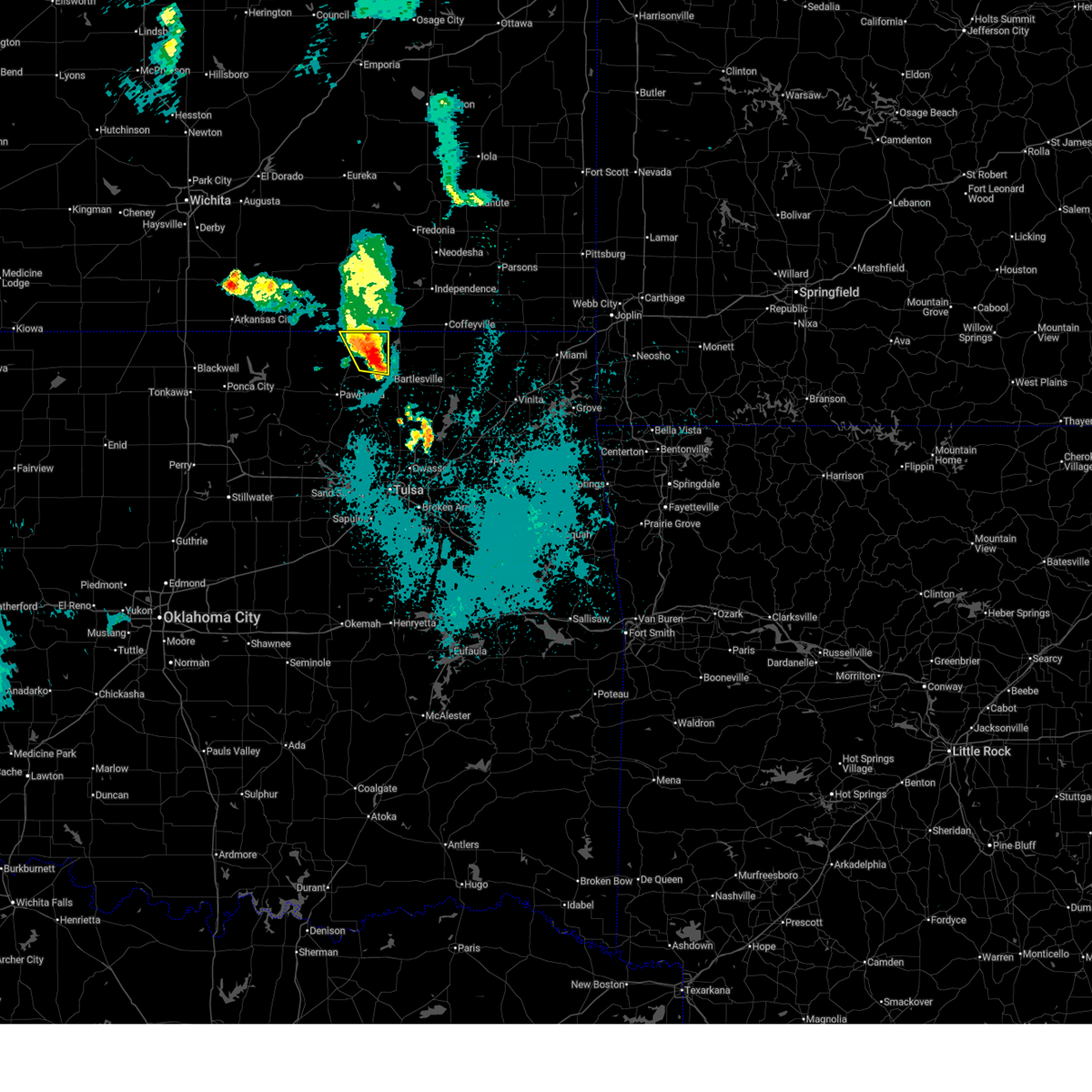
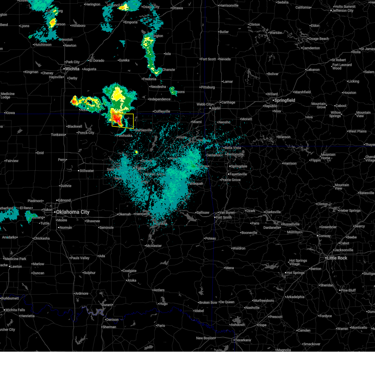
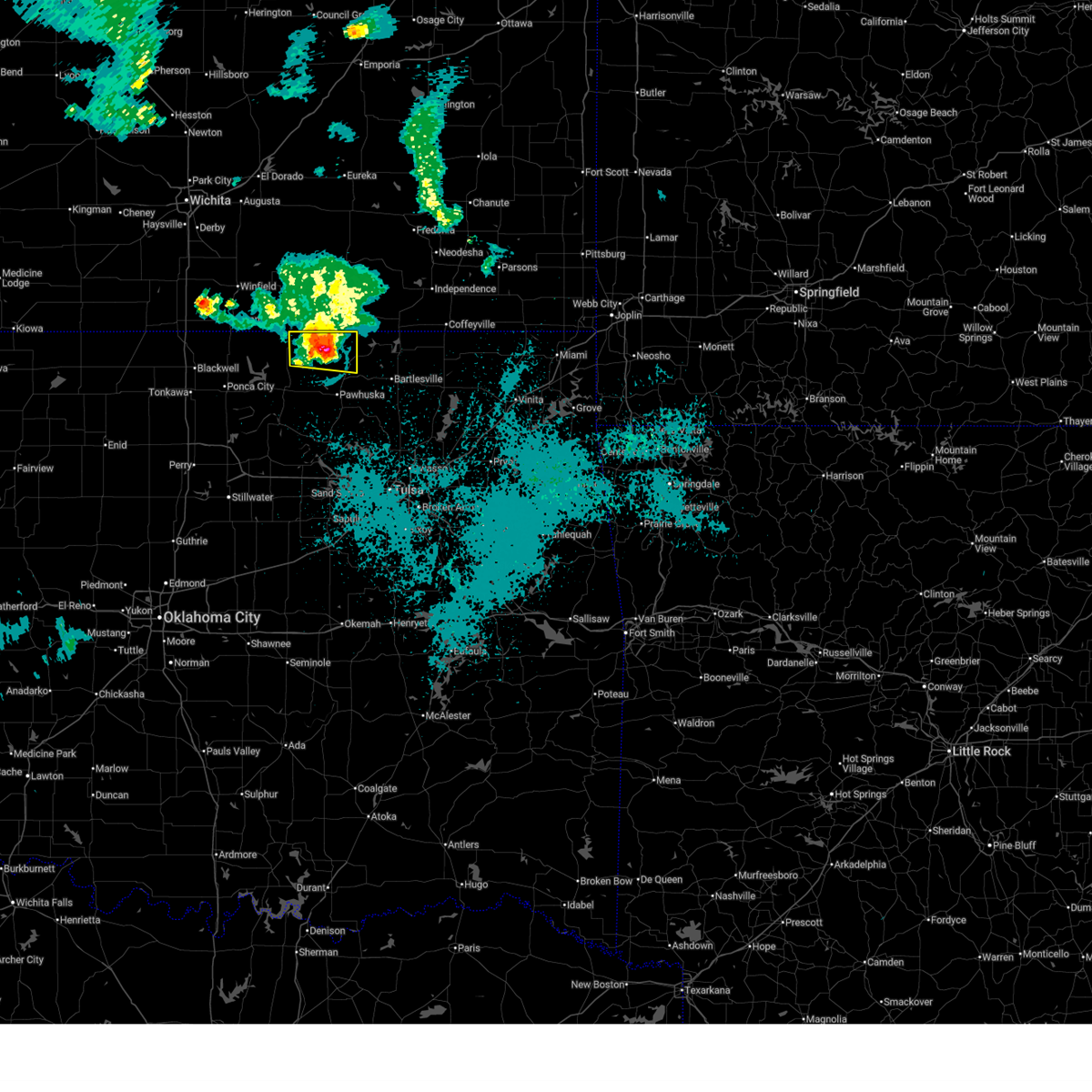
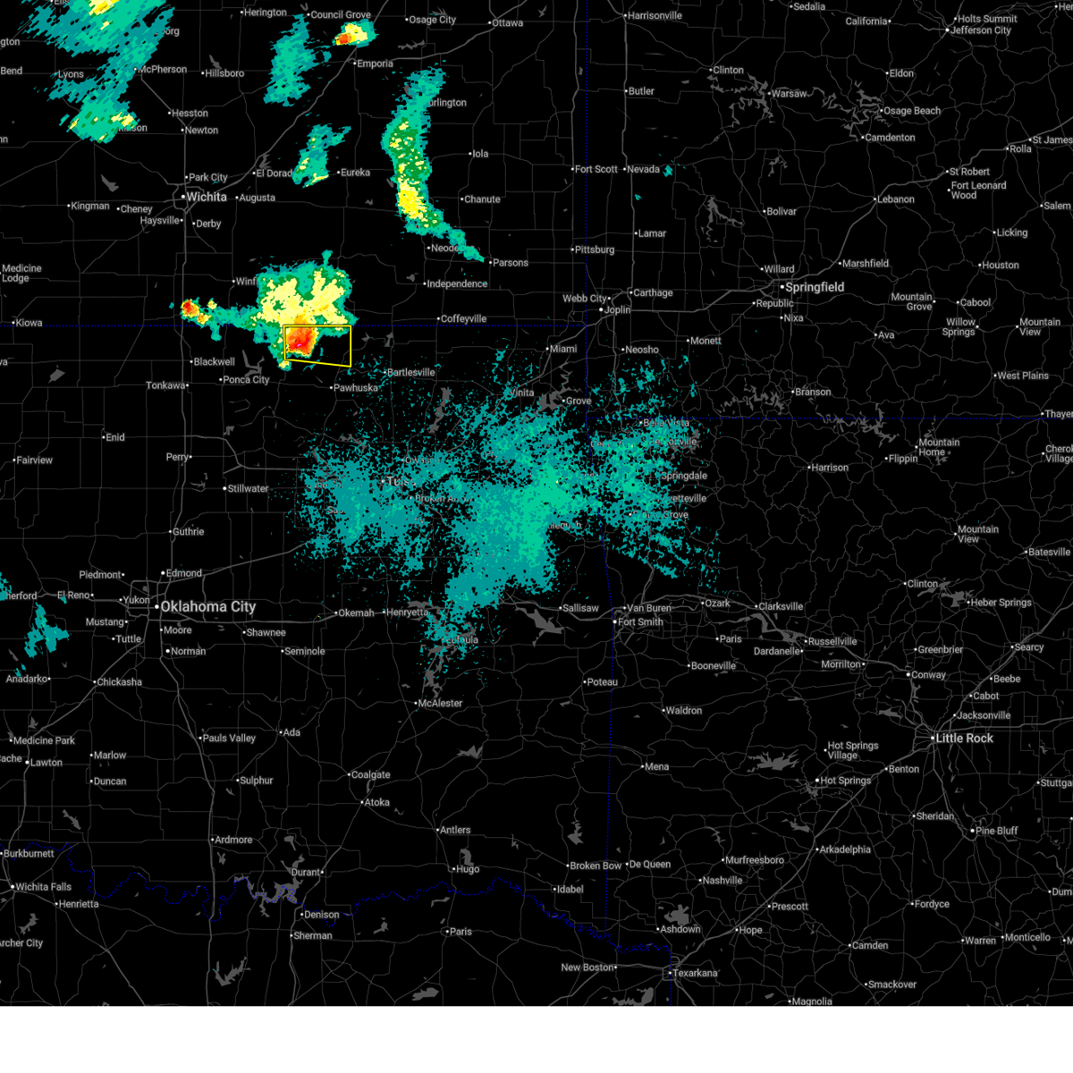
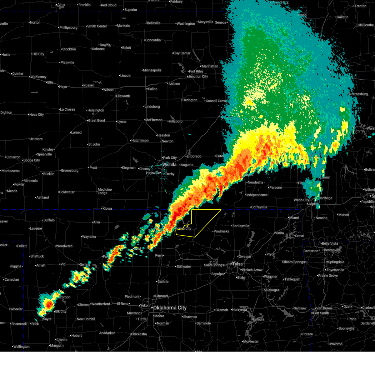
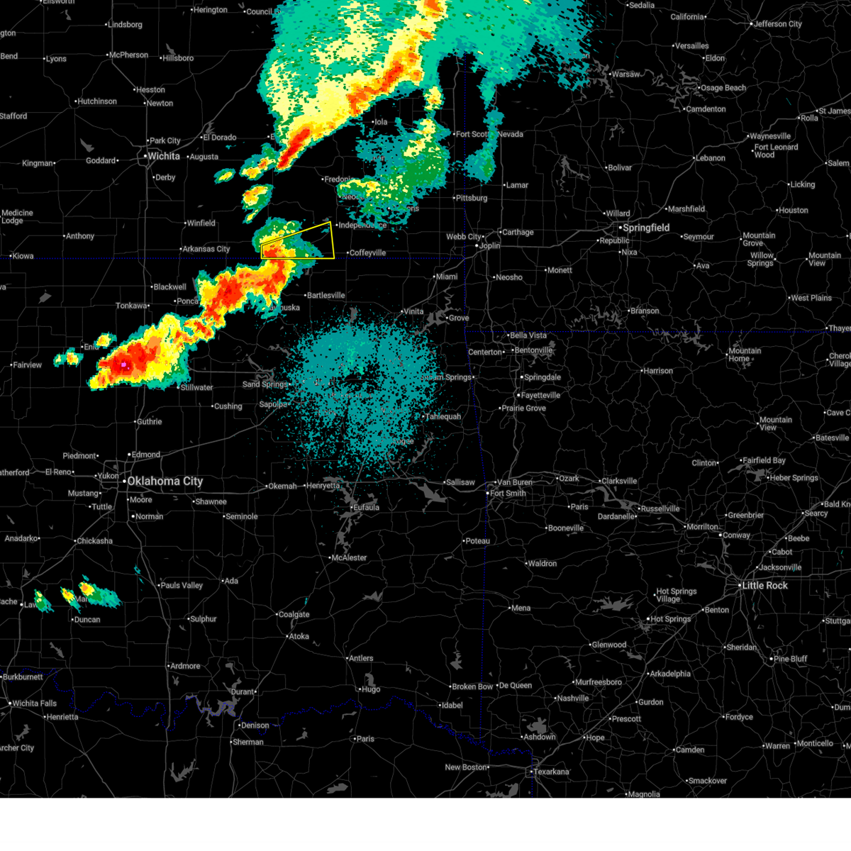
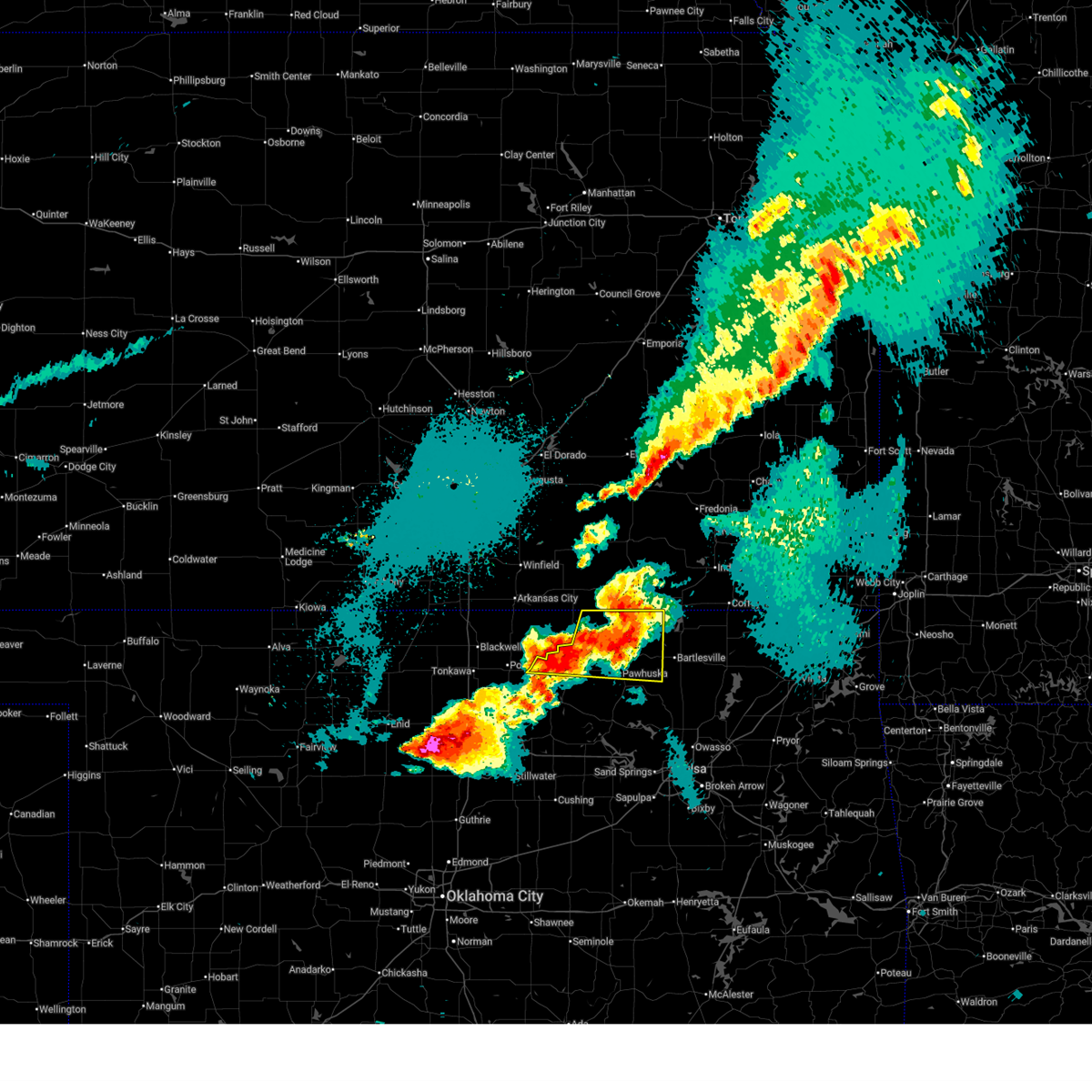
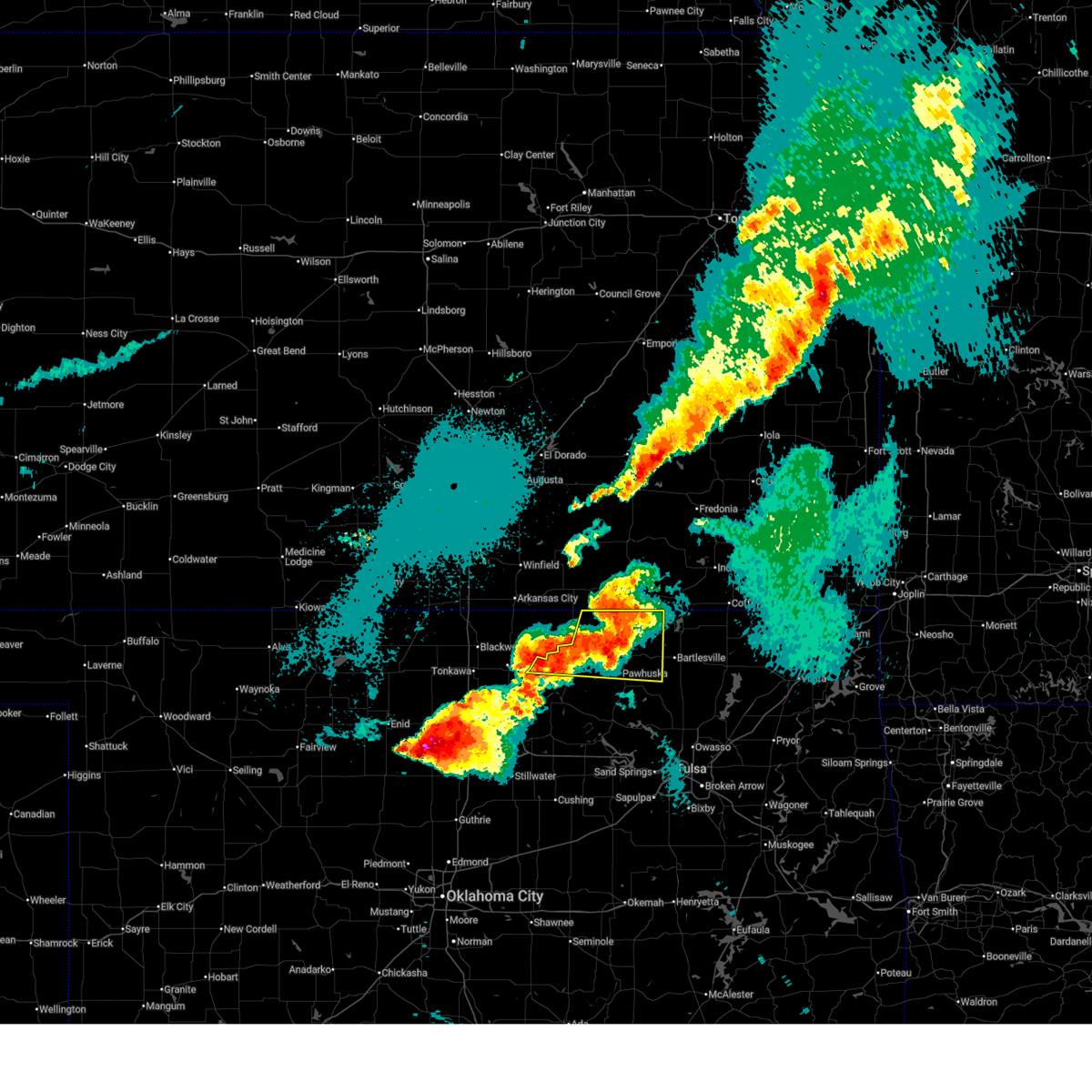
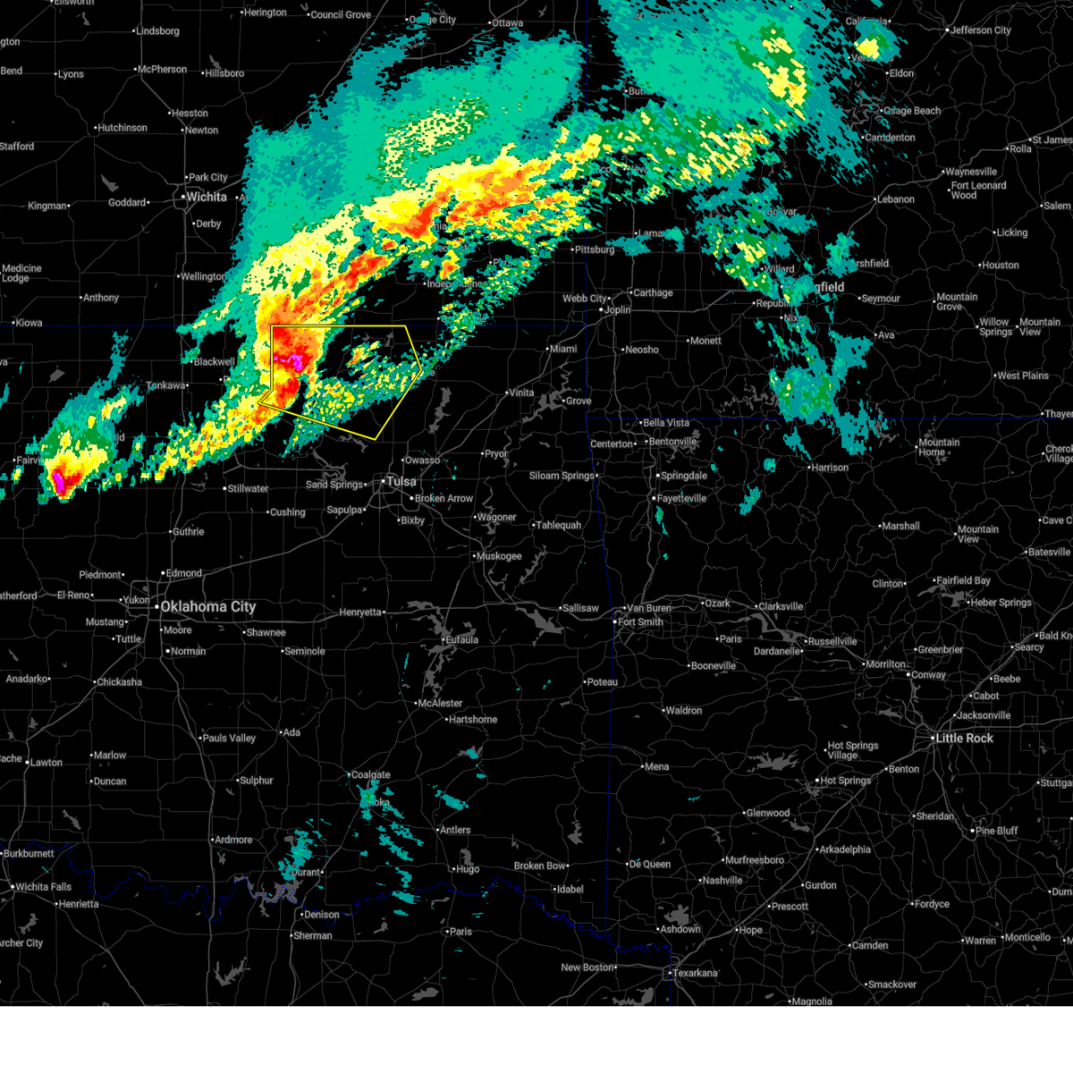
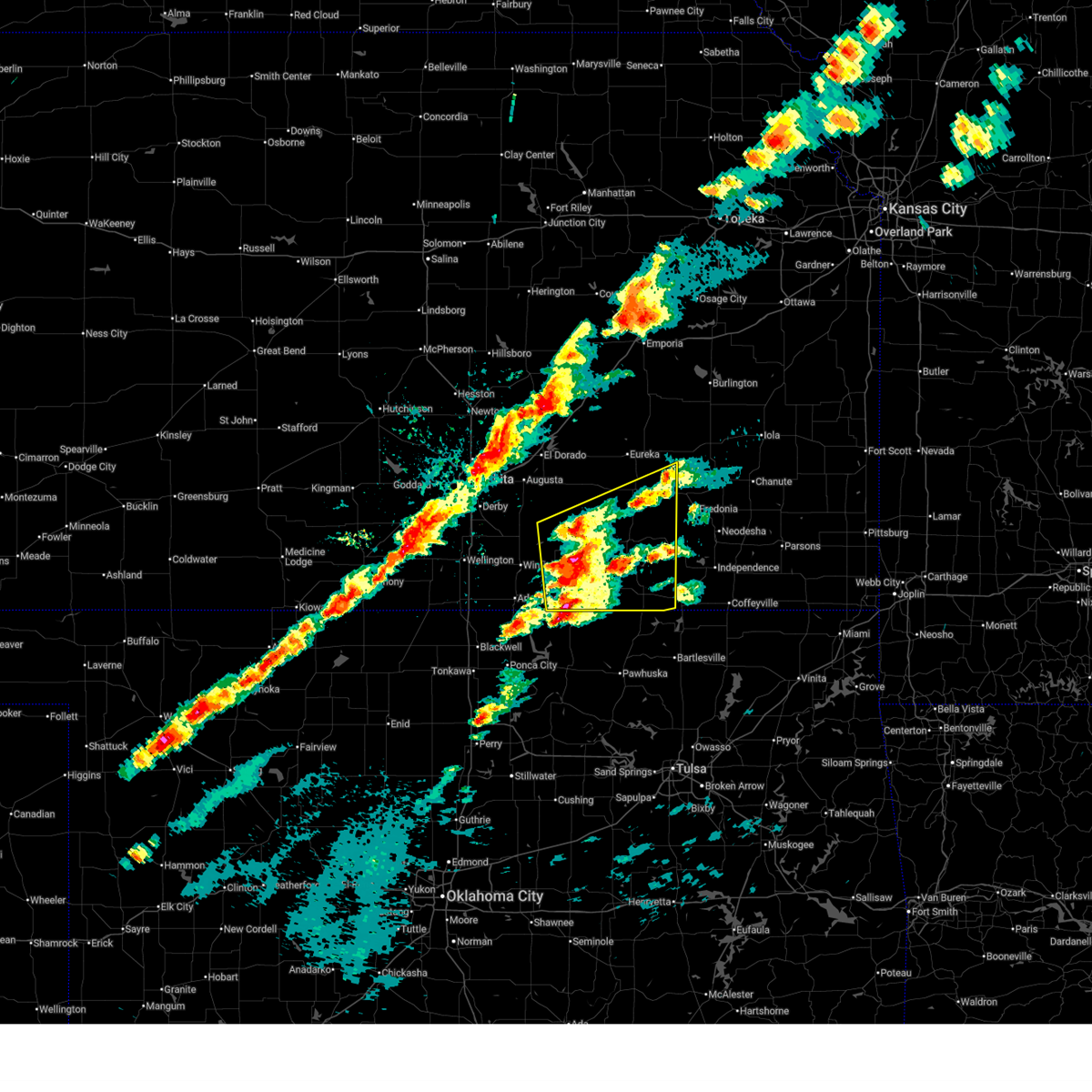
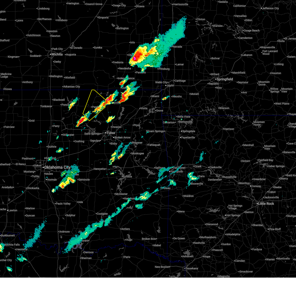
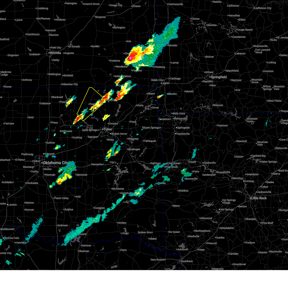
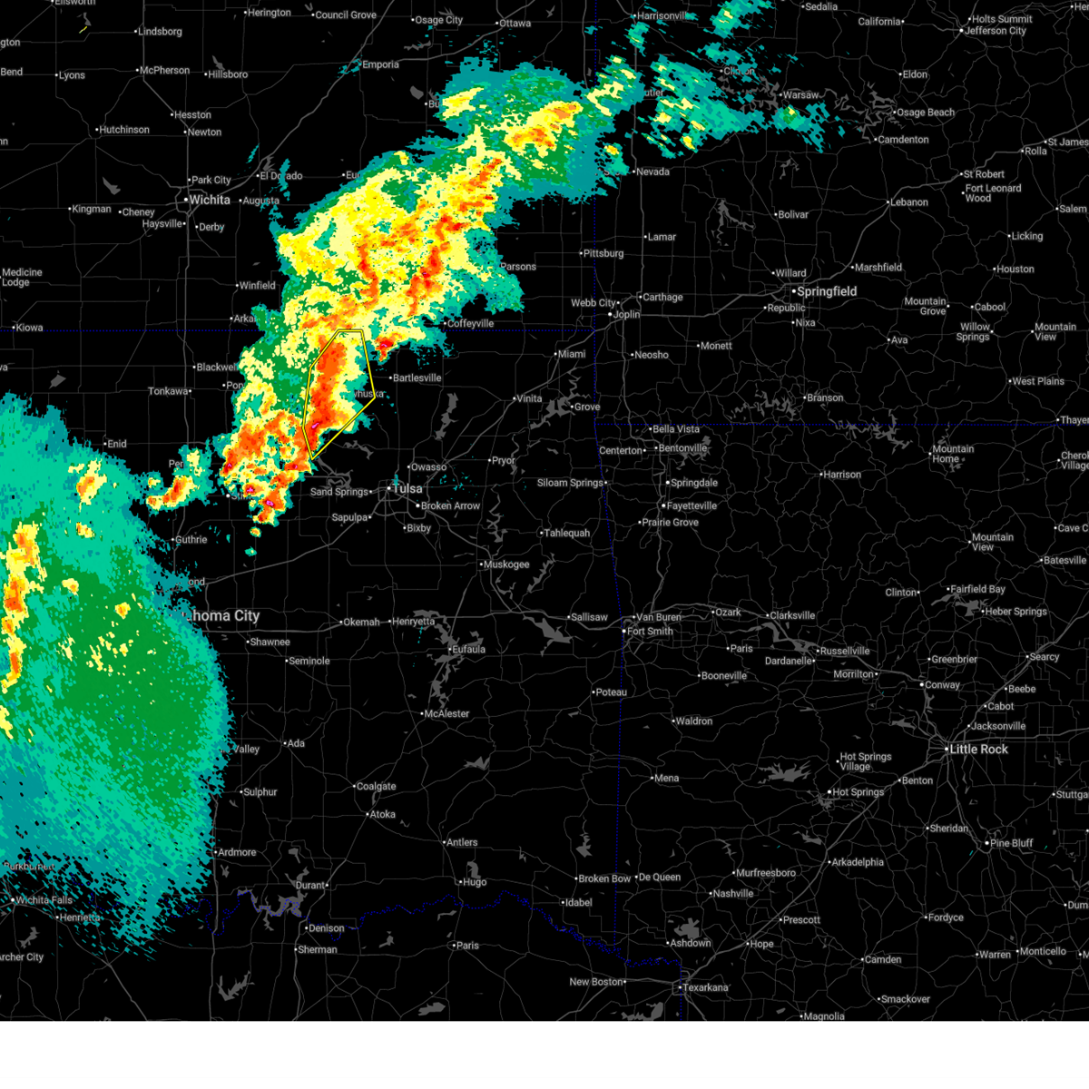
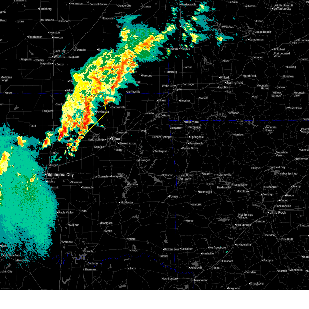
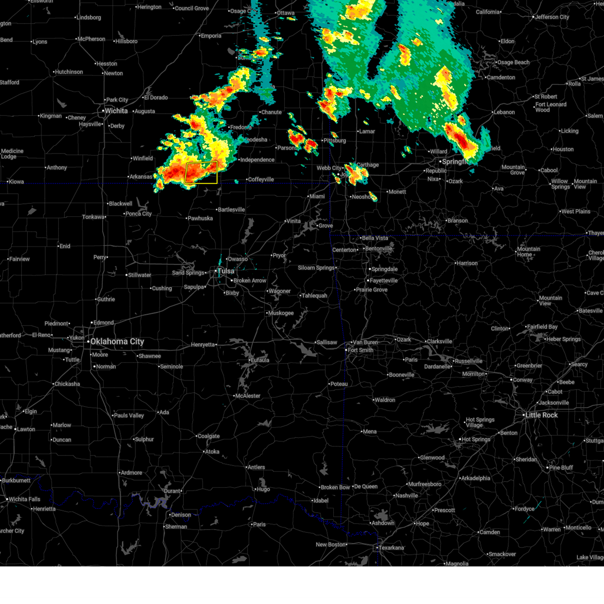
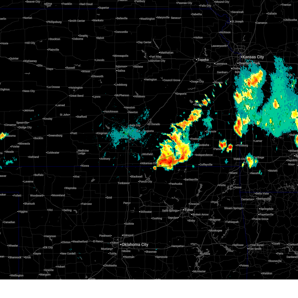
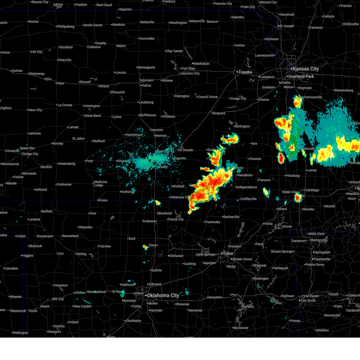
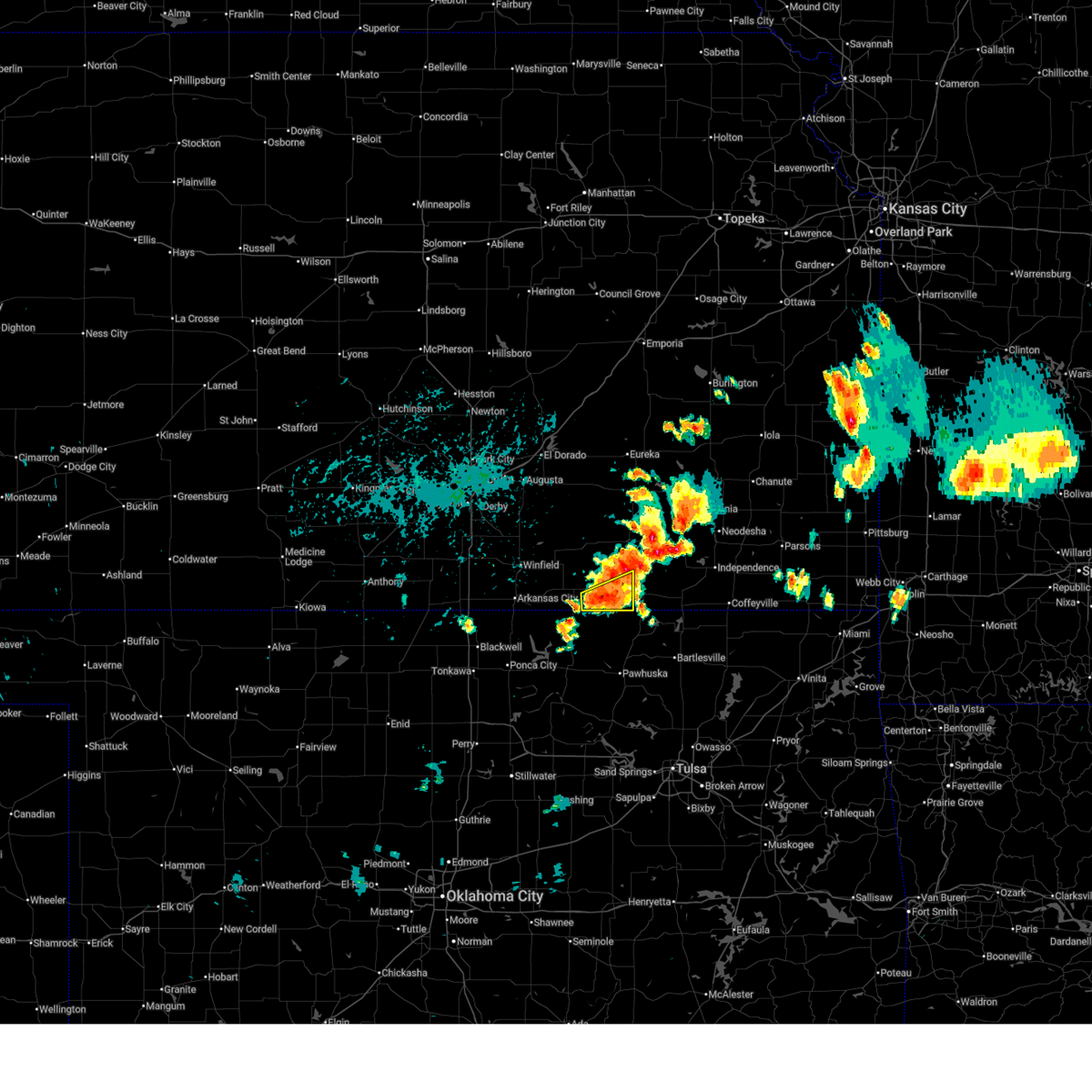
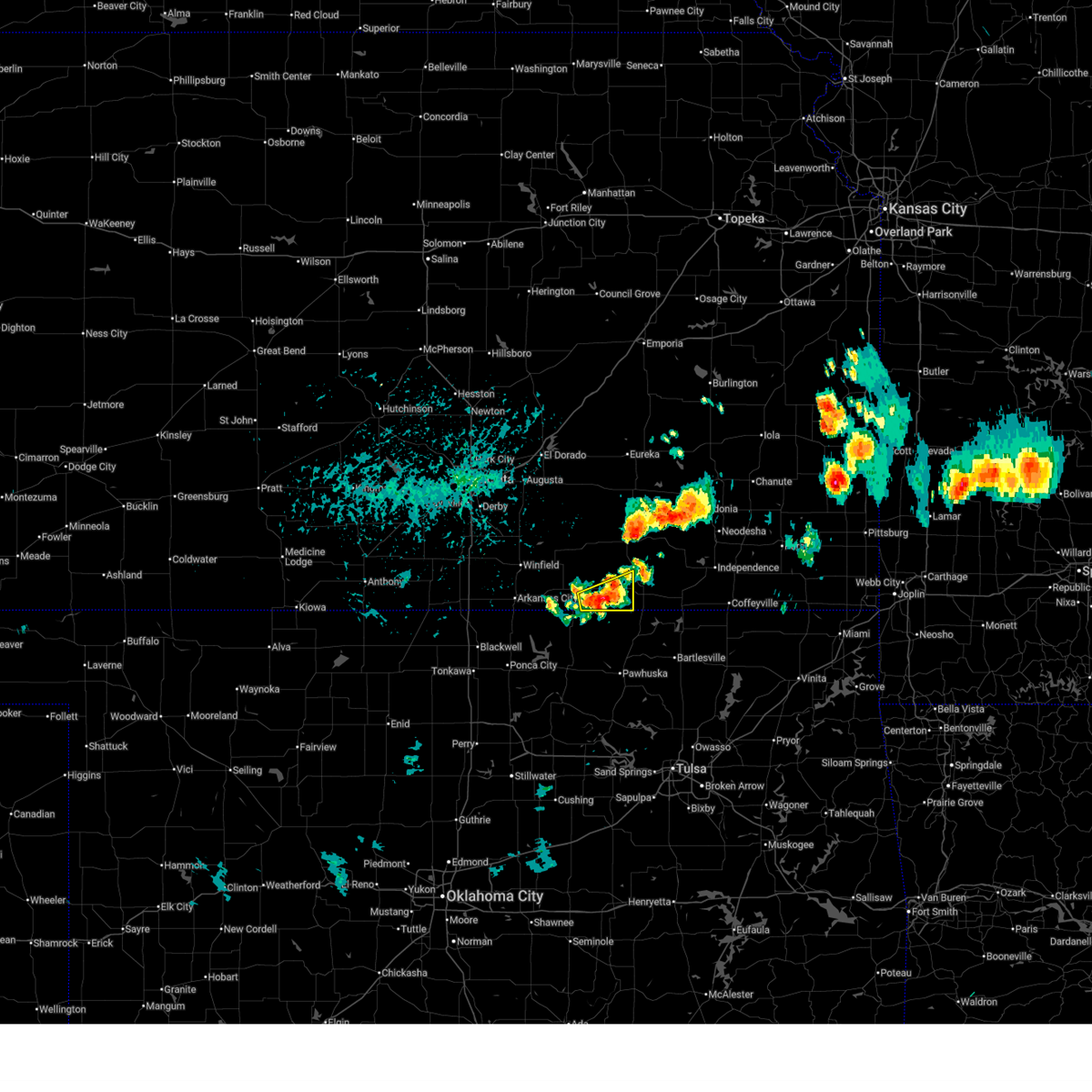
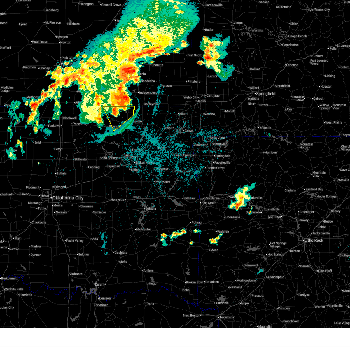
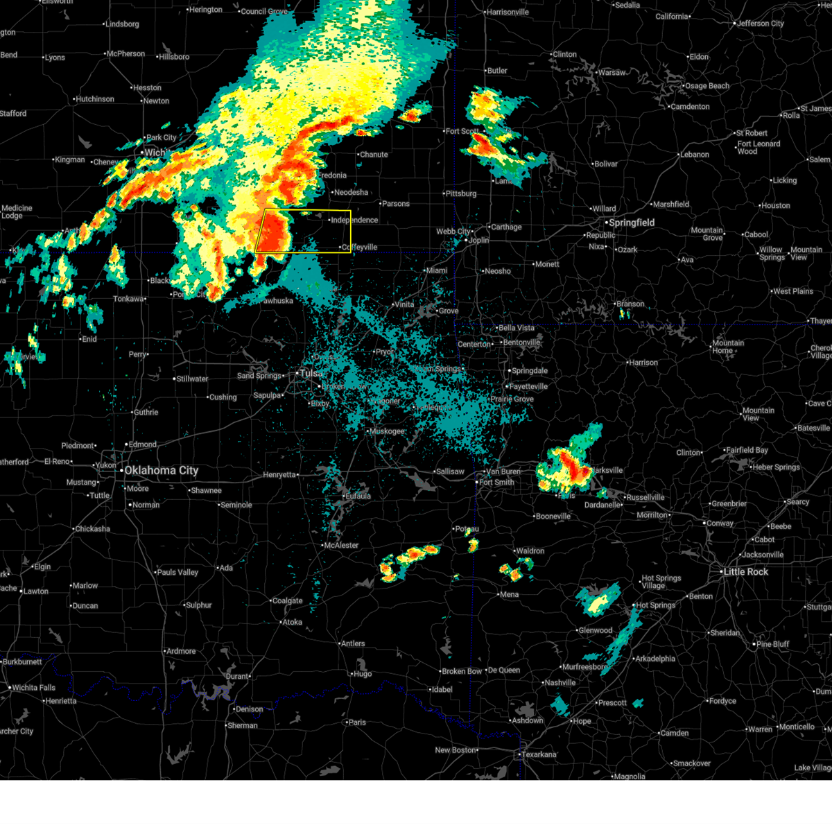
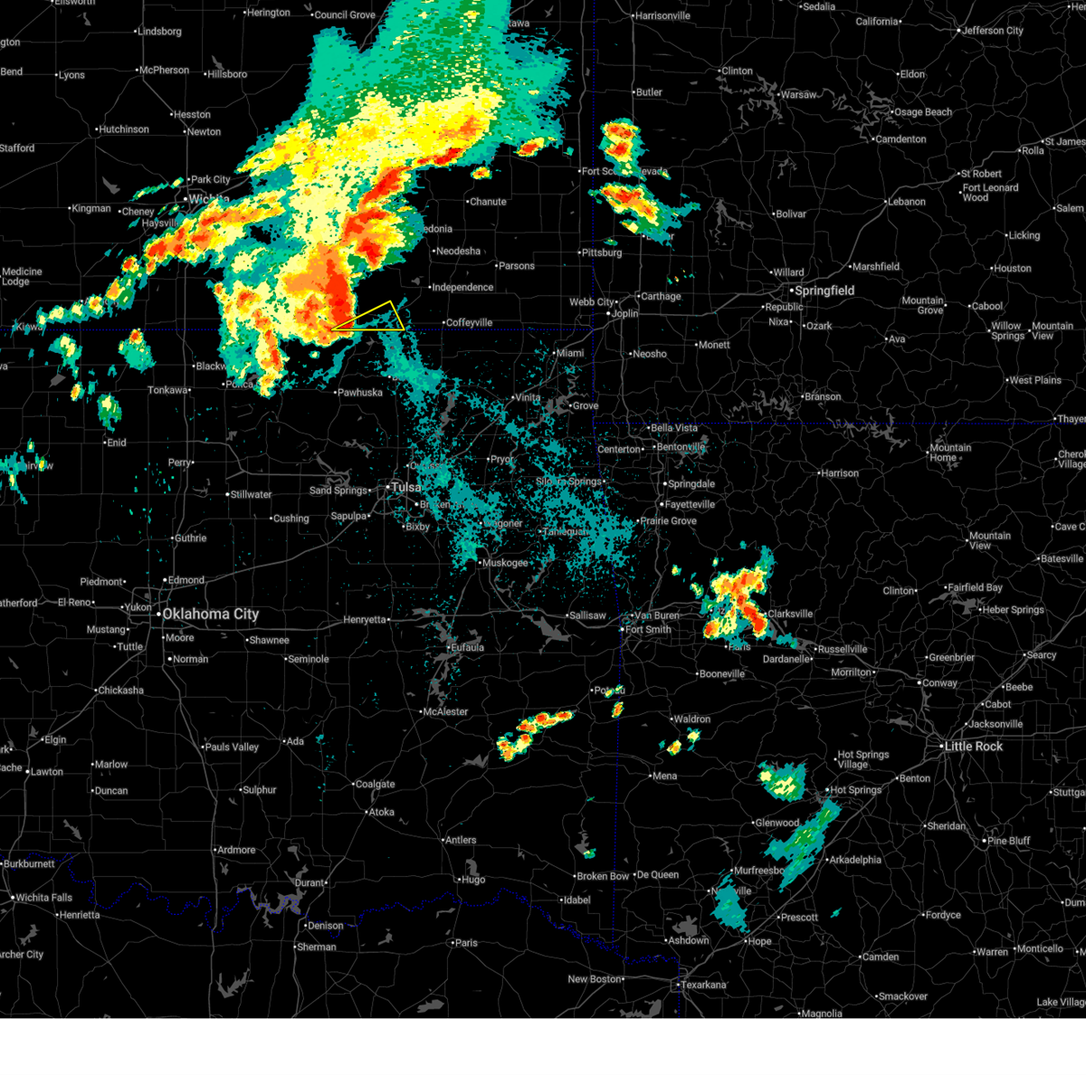
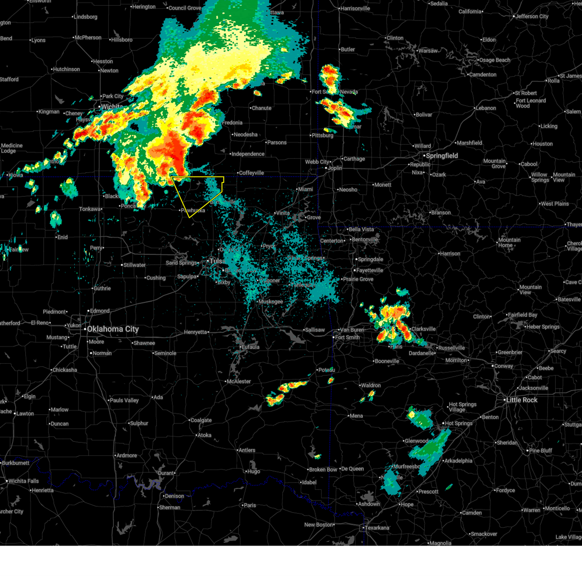
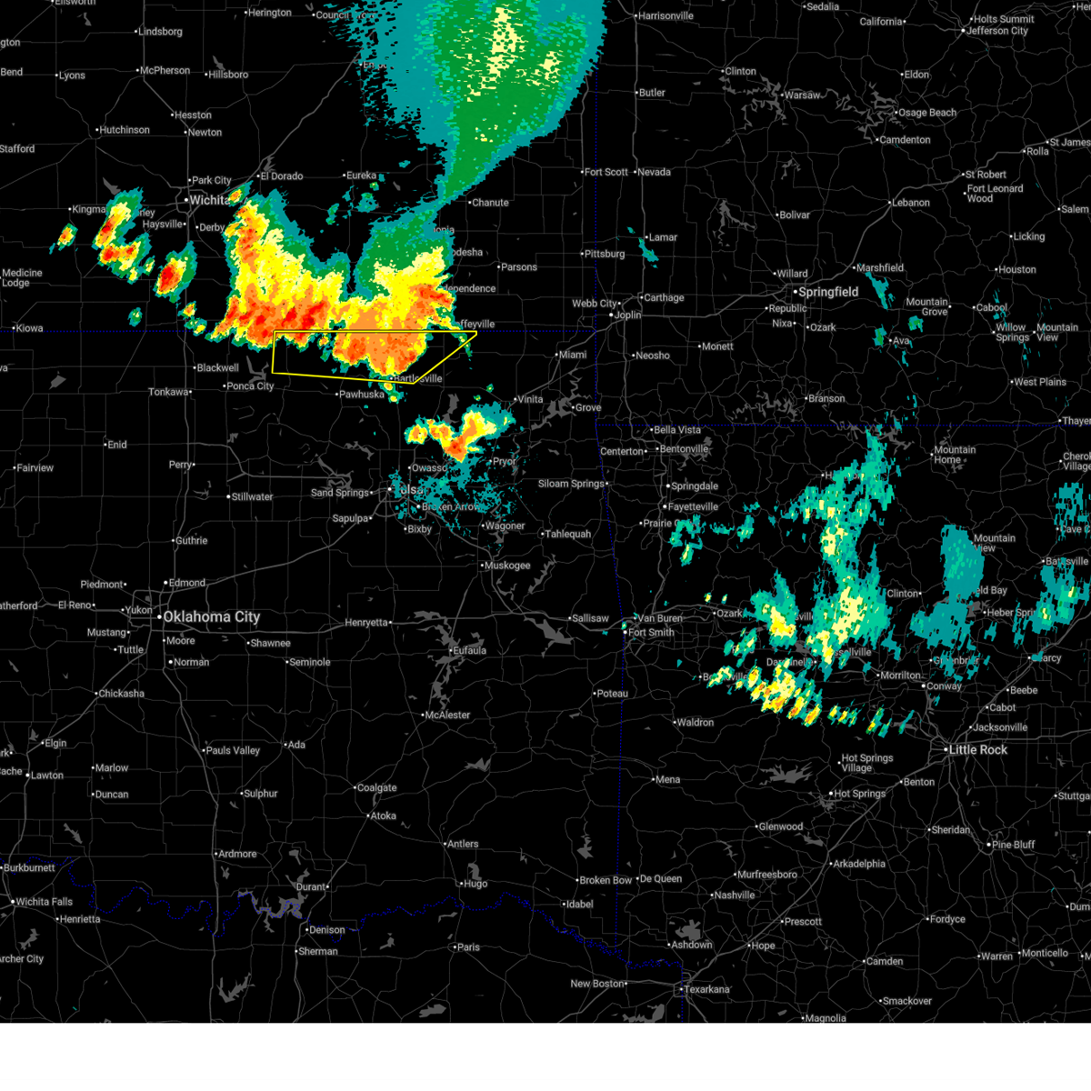
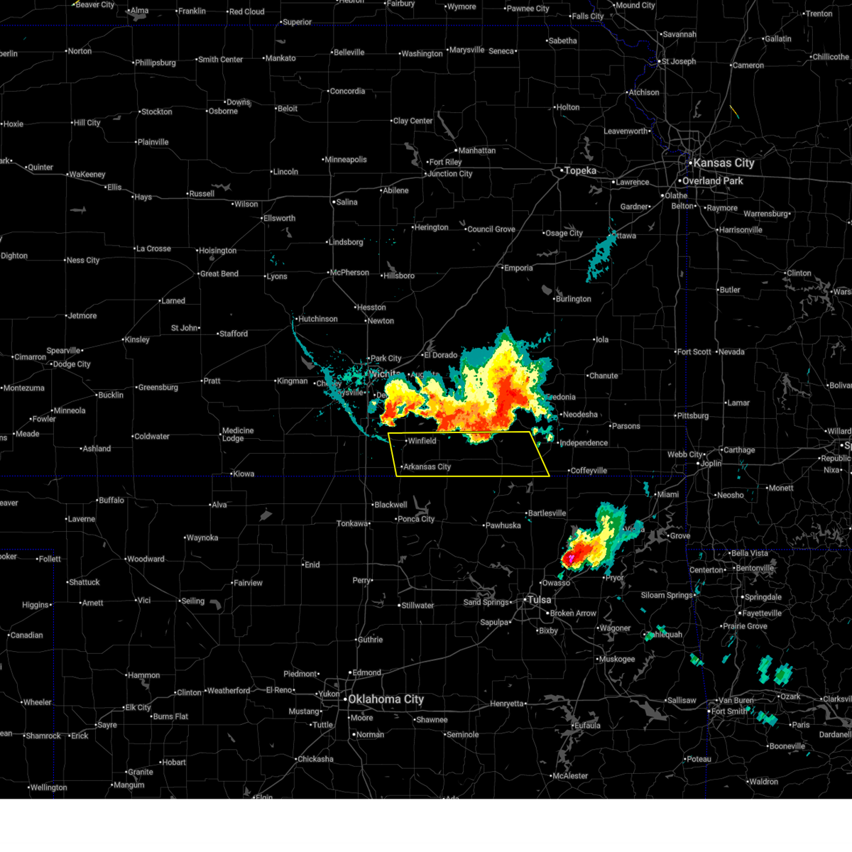
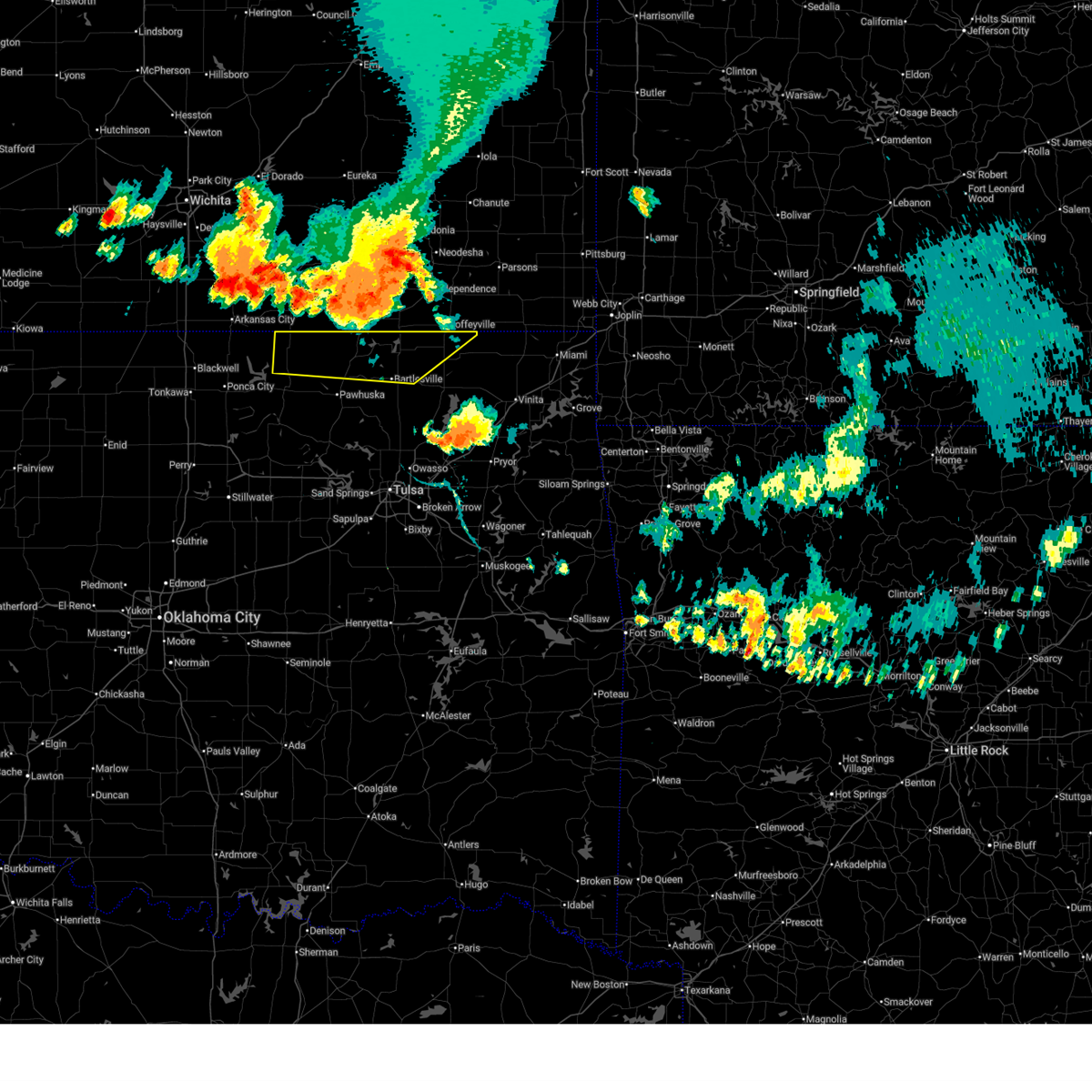
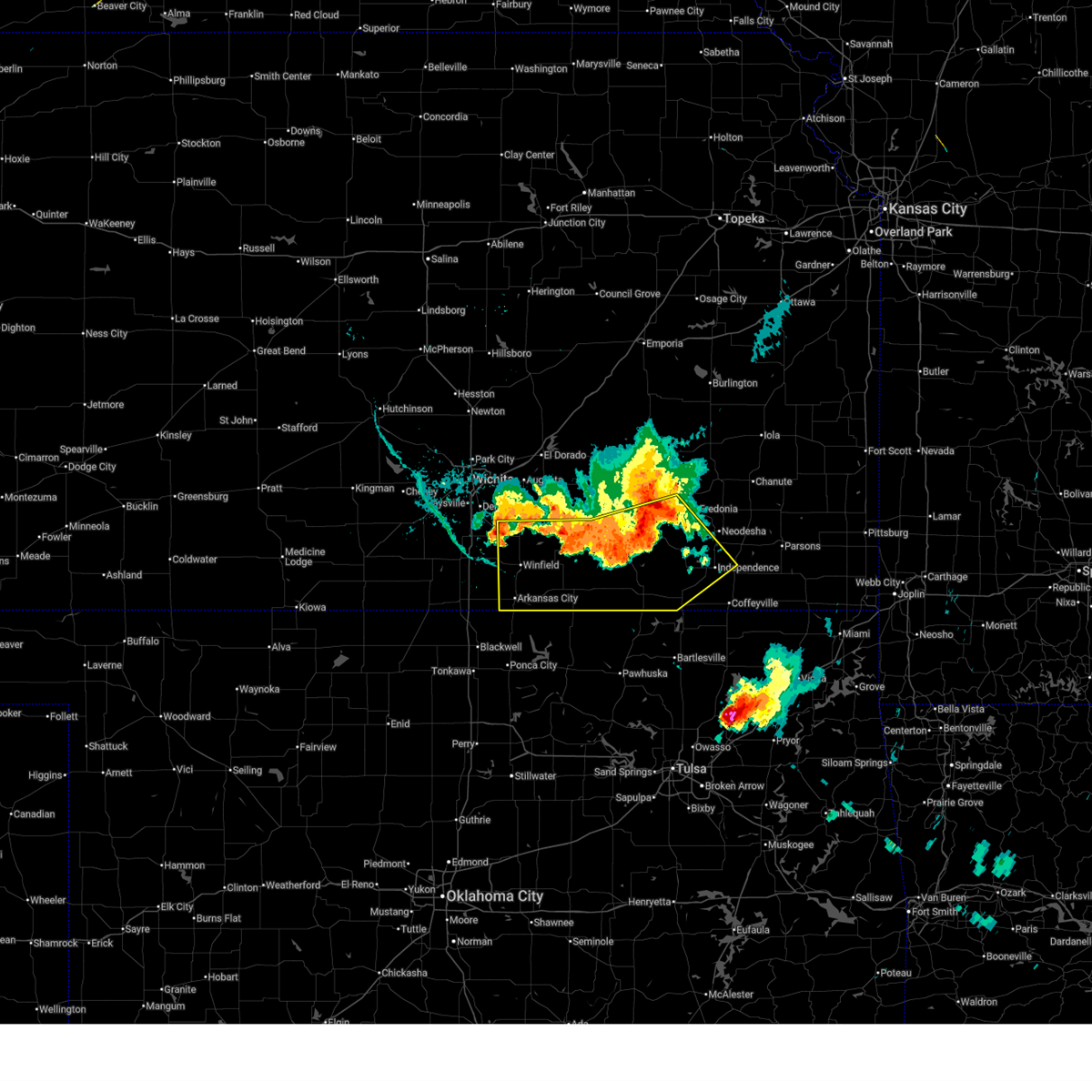
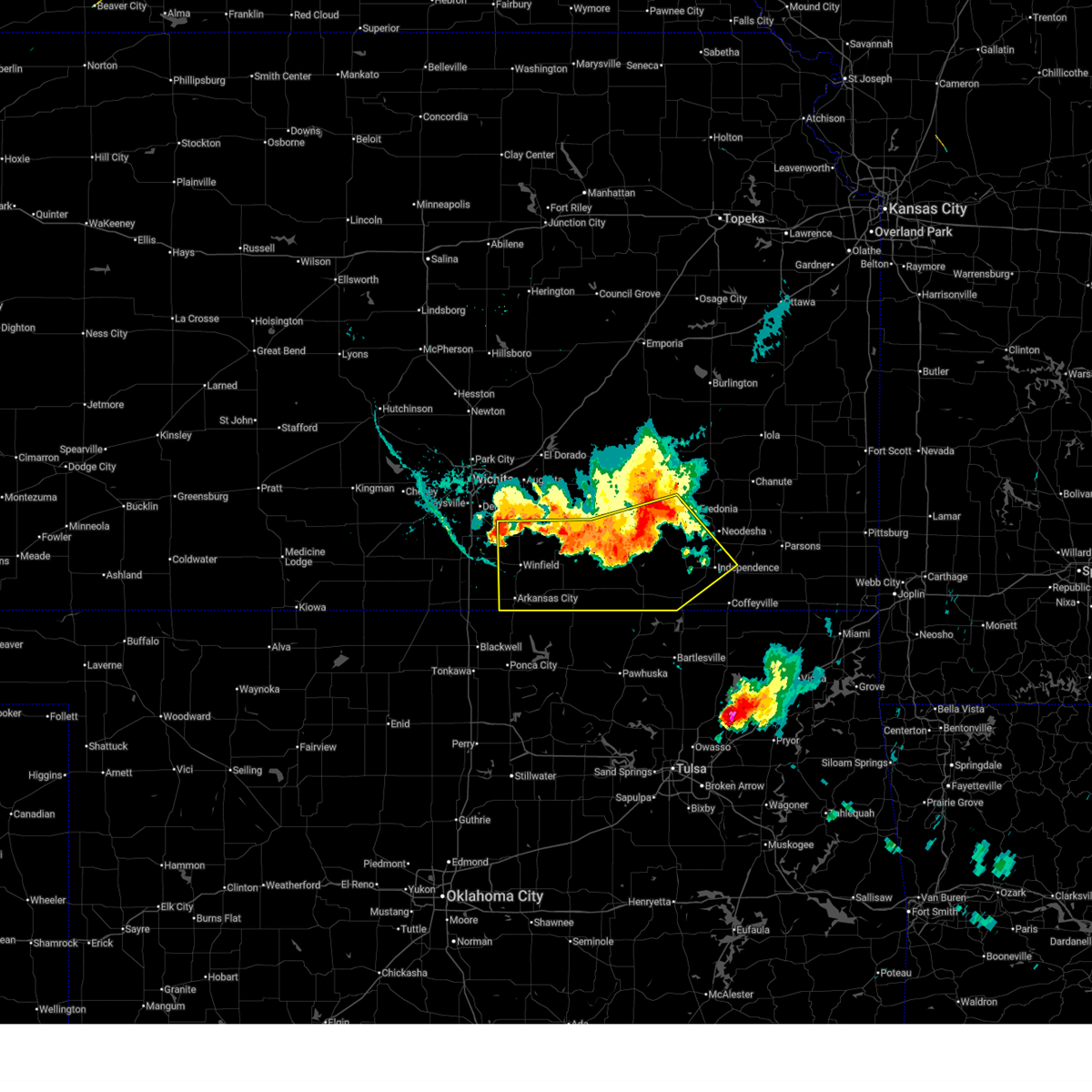
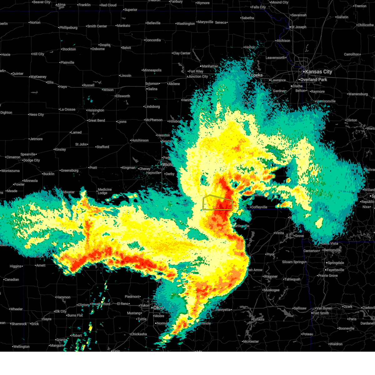
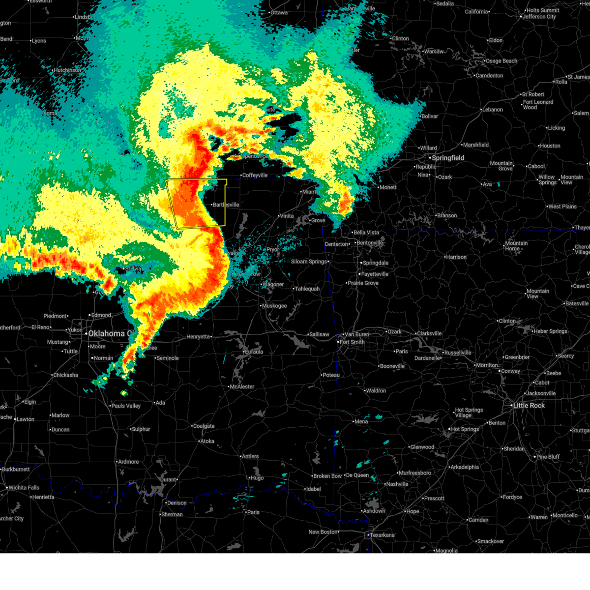
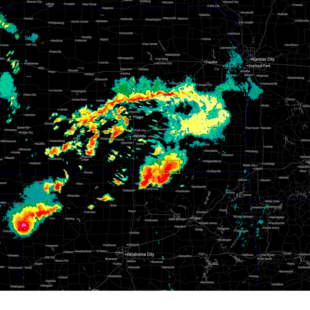
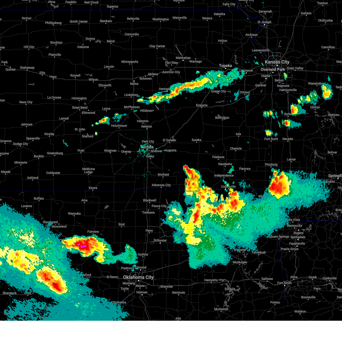
Hail Map for Elgin, KS
The Elgin, KS area has had 1 report of on-the-ground hail by trained spotters, and has been under severe weather warnings 58 times during the past 12 months. Doppler radar has detected hail at or near Elgin, KS on 100 occasions, including 7 occasions during the past year.
| Name: | Elgin, KS |
| Where Located: | 60.9 miles NNW of Tulsa, OK |
| Map: | Google Map for Elgin, KS |
| Population: | 89 |
| Housing Units: | 57 |
| More Info: | Search Google for Elgin, KS |
2
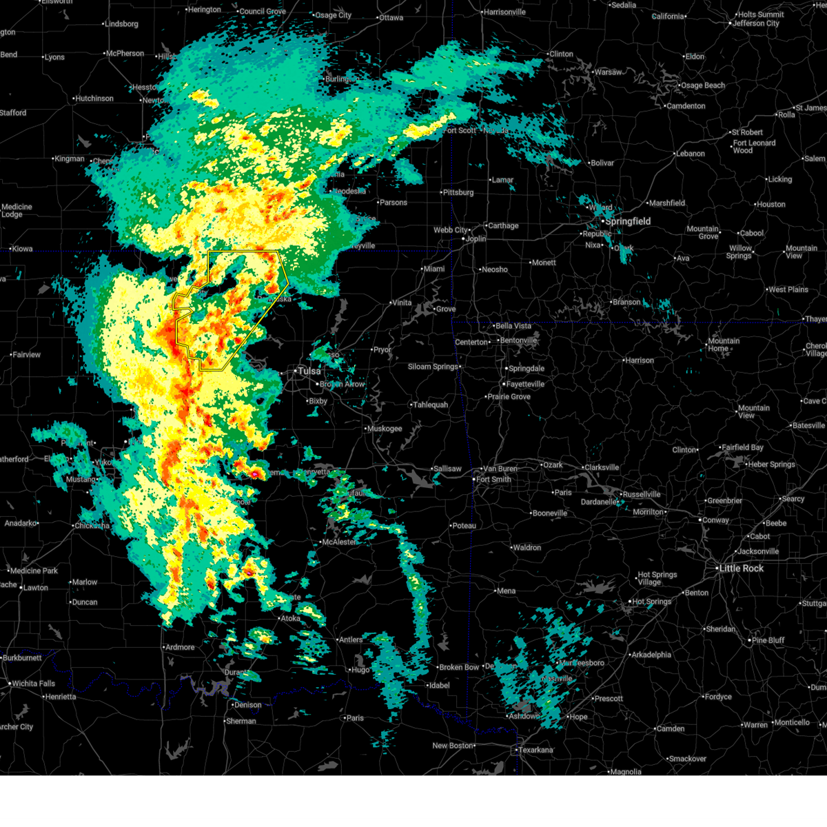
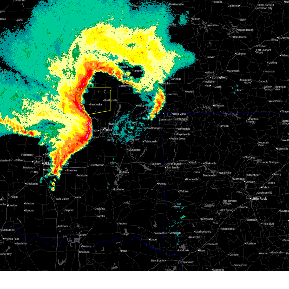
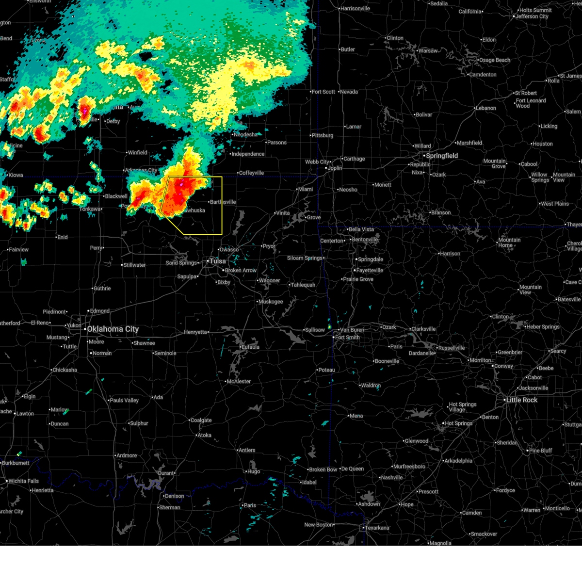
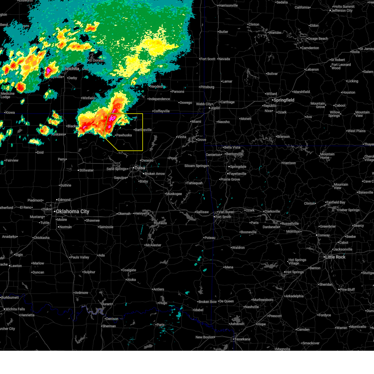
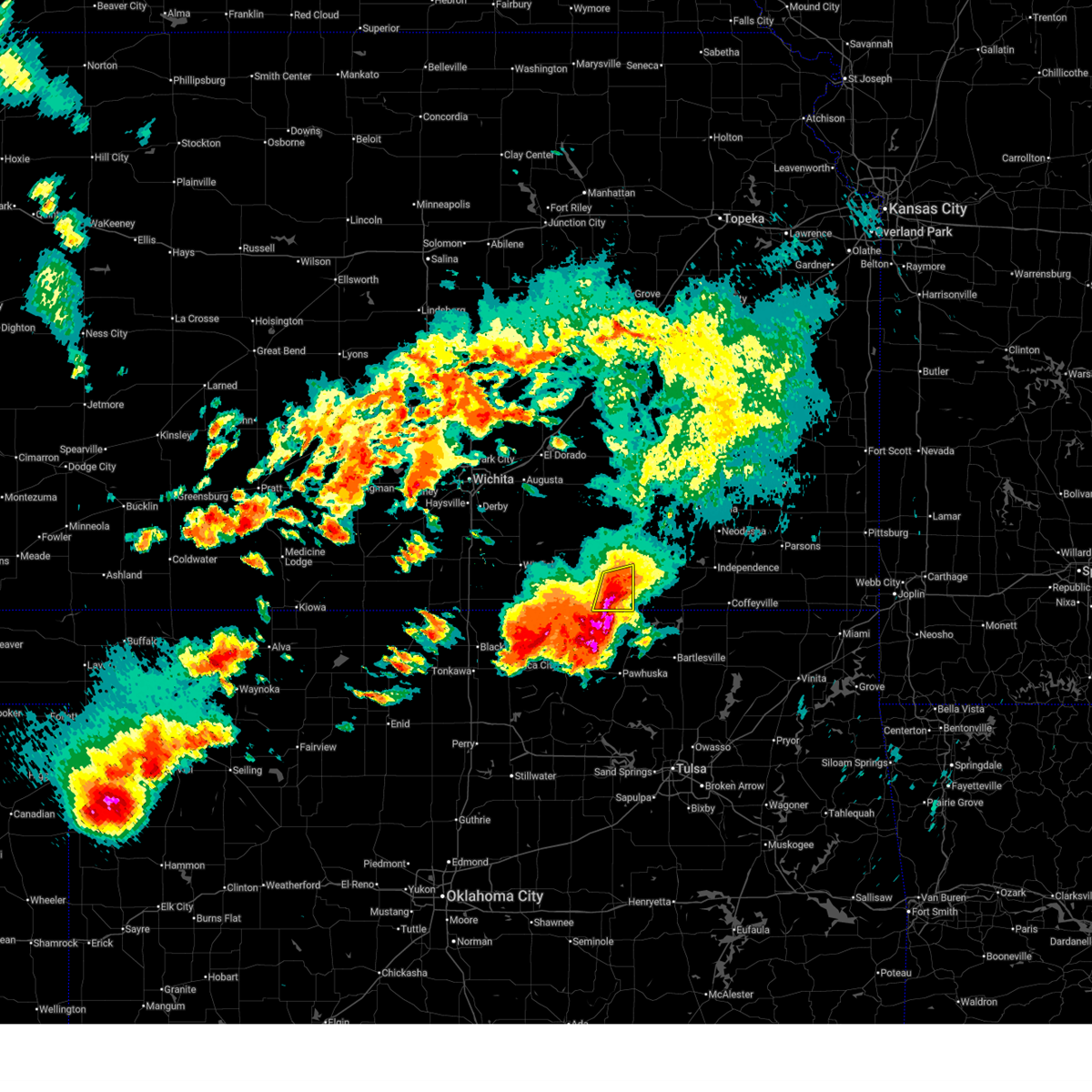
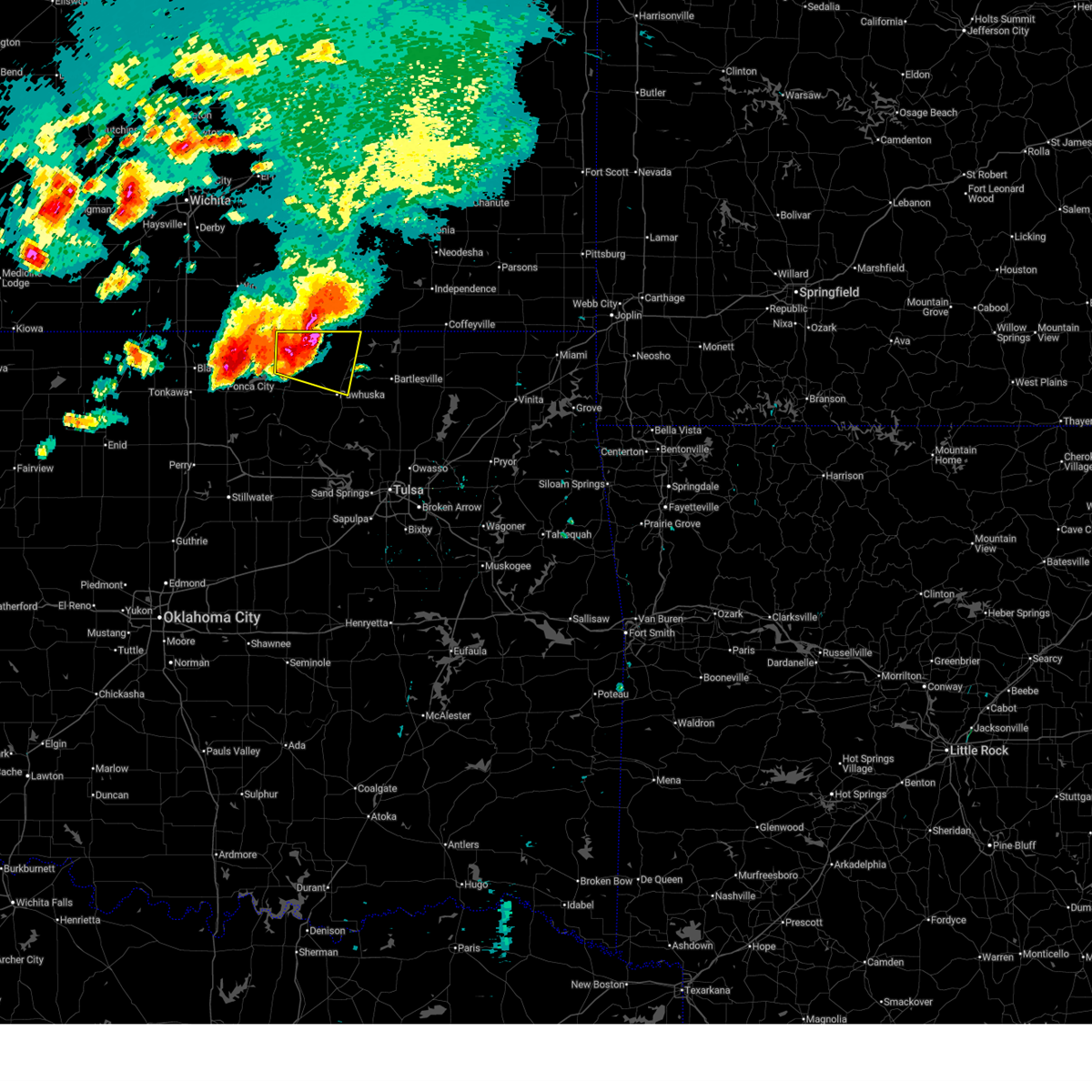
The Top Recent Hail Date for Elgin, KS is Sunday, August 10, 2025 (35th out of 100)
Hail and Wind Damage Spotted near Elgin, KS
| Date / Time | Report Details |
|---|---|
| 6/18/2026 9:55 AM CDT |
 Svrtsa the national weather service in tulsa has issued a * severe thunderstorm warning for, northeastern osage county in northeastern oklahoma, northern washington county in northeastern oklahoma, northwestern nowata county in northeastern oklahoma, * until 1045 am cdt. * at 955 am cdt, a severe thunderstorm was located 5 miles southeast of elgin, moving east at 25 mph (radar indicated). Hazards include 60 mph wind gusts and quarter size hail. Hail damage to vehicles is expected. expect wind damage to roofs, siding, and trees. Locations in or near the path include, bartlesville, dewey, copan, wann, hulah, wah sha she state park,. Svrtsa the national weather service in tulsa has issued a * severe thunderstorm warning for, northeastern osage county in northeastern oklahoma, northern washington county in northeastern oklahoma, northwestern nowata county in northeastern oklahoma, * until 1045 am cdt. * at 955 am cdt, a severe thunderstorm was located 5 miles southeast of elgin, moving east at 25 mph (radar indicated). Hazards include 60 mph wind gusts and quarter size hail. Hail damage to vehicles is expected. expect wind damage to roofs, siding, and trees. Locations in or near the path include, bartlesville, dewey, copan, wann, hulah, wah sha she state park,.
|
| 6/13/2026 10:26 PM CDT |
 At 1026 pm cdt, severe thunderstorms were located along a line extending from 6 miles southwest of cedar vale to 5 miles northeast of fairfax to 3 miles west of sooner lake, moving east at 40 mph (radar indicated). Hazards include 70 mph wind gusts and penny size hail. Expect considerable tree damage. damage is likely to mobile homes, roofs, and outbuildings. Locations in or near the path include, pawhuska, fairfax, shidler, burbank, grainola, foraker, bigheart, pearsonia, sunset lake, webb city, wah sha she state park, apperson,. At 1026 pm cdt, severe thunderstorms were located along a line extending from 6 miles southwest of cedar vale to 5 miles northeast of fairfax to 3 miles west of sooner lake, moving east at 40 mph (radar indicated). Hazards include 70 mph wind gusts and penny size hail. Expect considerable tree damage. damage is likely to mobile homes, roofs, and outbuildings. Locations in or near the path include, pawhuska, fairfax, shidler, burbank, grainola, foraker, bigheart, pearsonia, sunset lake, webb city, wah sha she state park, apperson,.
|
| 6/13/2026 10:25 PM CDT |
 At 1024 pm cdt, severe thunderstorms were located along a line extending from 5 miles northwest of elk city to near sedan to elgin, moving east at 45 mph (radar indicated. this storm has a history of producing winds greater than 60 mph). Hazards include 60 mph wind gusts. Expect damage to roofs, siding, and trees. Locations impacted include, sedan, moline, longton, peru, chautauqua, elk falls, elgin, niotaze, and hale. At 1024 pm cdt, severe thunderstorms were located along a line extending from 5 miles northwest of elk city to near sedan to elgin, moving east at 45 mph (radar indicated. this storm has a history of producing winds greater than 60 mph). Hazards include 60 mph wind gusts. Expect damage to roofs, siding, and trees. Locations impacted include, sedan, moline, longton, peru, chautauqua, elk falls, elgin, niotaze, and hale.
|
| 6/13/2026 10:21 PM CDT |
 At 1020 pm cdt, severe thunderstorms were located along a line extending from 5 miles north of grainola to 3 miles north of fairfax to near red rock, moving southeast at 30 mph. these are destructive storms for burbank, shidler, apperson and fairfax (radar indicated). Hazards include 80 mph wind gusts and penny size hail. Flying debris will be dangerous to those caught without shelter. mobile homes will be heavily damaged. expect considerable damage to roofs, windows, and vehicles. extensive tree damage and power outages are likely. Locations in or near the path include, pawhuska, fairfax, shidler, burbank, grainola, foraker, bigheart, pearsonia, sunset lake, webb city, wah sha she state park, apperson,. At 1020 pm cdt, severe thunderstorms were located along a line extending from 5 miles north of grainola to 3 miles north of fairfax to near red rock, moving southeast at 30 mph. these are destructive storms for burbank, shidler, apperson and fairfax (radar indicated). Hazards include 80 mph wind gusts and penny size hail. Flying debris will be dangerous to those caught without shelter. mobile homes will be heavily damaged. expect considerable damage to roofs, windows, and vehicles. extensive tree damage and power outages are likely. Locations in or near the path include, pawhuska, fairfax, shidler, burbank, grainola, foraker, bigheart, pearsonia, sunset lake, webb city, wah sha she state park, apperson,.
|
| 6/13/2026 10:09 PM CDT |
 At 1009 pm cdt, severe thunderstorms were located along a line extending from 6 miles south of fall river to 7 miles southeast of moline to 7 miles northeast of foraker, moving east at 50 mph (radar indicated. this storm has a history of producing winds greater than 60 mph). Hazards include 70 mph wind gusts. Expect considerable tree damage. damage is likely to mobile homes, roofs, and outbuildings. Locations impacted include, sedan, howard, cedar vale, moline, longton, severy, grenola, fall river, peru, chautauqua, elk falls, elgin, niotaze, climax, fall river state park, hale, maple city, fall river lake, and piedmont. At 1009 pm cdt, severe thunderstorms were located along a line extending from 6 miles south of fall river to 7 miles southeast of moline to 7 miles northeast of foraker, moving east at 50 mph (radar indicated. this storm has a history of producing winds greater than 60 mph). Hazards include 70 mph wind gusts. Expect considerable tree damage. damage is likely to mobile homes, roofs, and outbuildings. Locations impacted include, sedan, howard, cedar vale, moline, longton, severy, grenola, fall river, peru, chautauqua, elk falls, elgin, niotaze, climax, fall river state park, hale, maple city, fall river lake, and piedmont.
|
| 6/13/2026 10:01 PM CDT |
 At 959 pm cdt, severe thunderstorms were located along a line extending from 3 miles north of moline to 4 miles south of grainola to 4 miles southwest of ponca city, moving east at 40 mph. these are destructive storms for burbank, shidler, grainola, and foraker (mesonet. at 950 pm, a 76 mph wind gust was measured 8 miles east of newkirk in kay county). Hazards include 80 mph wind gusts and penny size hail. Flying debris will be dangerous to those caught without shelter. mobile homes will be heavily damaged. expect considerable damage to roofs, windows, and vehicles. extensive tree damage and power outages are likely. Locations in or near the path include, pawhuska, fairfax, shidler, burbank, grainola, foraker, bigheart, pearsonia, sunset lake, webb city, wah sha she state park, apperson,. At 959 pm cdt, severe thunderstorms were located along a line extending from 3 miles north of moline to 4 miles south of grainola to 4 miles southwest of ponca city, moving east at 40 mph. these are destructive storms for burbank, shidler, grainola, and foraker (mesonet. at 950 pm, a 76 mph wind gust was measured 8 miles east of newkirk in kay county). Hazards include 80 mph wind gusts and penny size hail. Flying debris will be dangerous to those caught without shelter. mobile homes will be heavily damaged. expect considerable damage to roofs, windows, and vehicles. extensive tree damage and power outages are likely. Locations in or near the path include, pawhuska, fairfax, shidler, burbank, grainola, foraker, bigheart, pearsonia, sunset lake, webb city, wah sha she state park, apperson,.
|
| 6/13/2026 9:55 PM CDT |
 At 954 pm cdt, severe thunderstorms were located along a line extending from severy to near grenola to near grainola, moving east to southeast at 50 mph (radar indicated). Hazards include 70 mph wind gusts. Expect considerable tree damage. damage is likely to mobile homes, roofs, and outbuildings. Locations impacted include, sedan, howard, cedar vale, burden, moline, longton, dexter, severy, grenola, fall river, latham, peru, chautauqua, elk falls, elgin, niotaze, cambridge, climax, fall river state park, and hale. At 954 pm cdt, severe thunderstorms were located along a line extending from severy to near grenola to near grainola, moving east to southeast at 50 mph (radar indicated). Hazards include 70 mph wind gusts. Expect considerable tree damage. damage is likely to mobile homes, roofs, and outbuildings. Locations impacted include, sedan, howard, cedar vale, burden, moline, longton, dexter, severy, grenola, fall river, latham, peru, chautauqua, elk falls, elgin, niotaze, cambridge, climax, fall river state park, and hale.
|
| 6/13/2026 9:46 PM CDT |
 Svrtsa the national weather service in tulsa has issued a * severe thunderstorm warning for, northern osage county in northeastern oklahoma, * until 1045 pm cdt. * at 946 pm cdt, severe thunderstorms were located along a line extending from 5 miles north of grenola to 6 miles south of hardy to 3 miles south of blackwell, moving east at 40 mph (radar indicated). Hazards include 70 mph wind gusts and penny size hail. Expect considerable tree damage. damage is likely to mobile homes, roofs, and outbuildings. Locations in or near the path include, pawhuska, fairfax, shidler, burbank, grainola, foraker, bigheart, pearsonia, sunset lake, webb city, wah sha she state park, apperson,. Svrtsa the national weather service in tulsa has issued a * severe thunderstorm warning for, northern osage county in northeastern oklahoma, * until 1045 pm cdt. * at 946 pm cdt, severe thunderstorms were located along a line extending from 5 miles north of grenola to 6 miles south of hardy to 3 miles south of blackwell, moving east at 40 mph (radar indicated). Hazards include 70 mph wind gusts and penny size hail. Expect considerable tree damage. damage is likely to mobile homes, roofs, and outbuildings. Locations in or near the path include, pawhuska, fairfax, shidler, burbank, grainola, foraker, bigheart, pearsonia, sunset lake, webb city, wah sha she state park, apperson,.
|
| 6/13/2026 9:43 PM CDT |
 Svrict the national weather service in wichita has issued a * severe thunderstorm warning for, elk county in southeastern kansas, eastern cowley county in south central kansas, southeastern butler county in south central kansas, chautauqua county in southeastern kansas, southern greenwood county in southeastern kansas, * until 1045 pm cdt. * at 943 pm cdt, severe thunderstorms were located along a line extending from 5 miles west of severy to 5 miles southwest of grenola to near hardy, moving east to southeast at 50 mph (radar indicated). Hazards include 70 mph wind gusts. Expect considerable tree damage. Damage is likely to mobile homes, roofs, and outbuildings. Svrict the national weather service in wichita has issued a * severe thunderstorm warning for, elk county in southeastern kansas, eastern cowley county in south central kansas, southeastern butler county in south central kansas, chautauqua county in southeastern kansas, southern greenwood county in southeastern kansas, * until 1045 pm cdt. * at 943 pm cdt, severe thunderstorms were located along a line extending from 5 miles west of severy to 5 miles southwest of grenola to near hardy, moving east to southeast at 50 mph (radar indicated). Hazards include 70 mph wind gusts. Expect considerable tree damage. Damage is likely to mobile homes, roofs, and outbuildings.
|
| 6/2/2026 3:24 AM CDT |
 The storms which prompted the warning have weakened below severe limits, and no longer pose an immediate threat to life or property. therefore, the warning will be allowed to expire. however, gusty winds are still possible with these thunderstorms. The storms which prompted the warning have weakened below severe limits, and no longer pose an immediate threat to life or property. therefore, the warning will be allowed to expire. however, gusty winds are still possible with these thunderstorms.
|
| 6/2/2026 3:05 AM CDT |
 At 305 am cdt, severe thunderstorms were located along a line extending from 4 miles southeast of hardy to 6 miles northwest of ralston to 2 miles south of lake carl blackwell, moving east at 35 mph (radar indicated). Hazards include 60 to 70 mph wind gusts. Expect considerable tree damage. damage is likely to mobile homes, roofs, and outbuildings. Locations in or near the path include, pawnee, fairfax, shidler, ralston, burbank, blackburn, maramec, skedee, grainola, foraker, pearsonia, webb city, apperson,. At 305 am cdt, severe thunderstorms were located along a line extending from 4 miles southeast of hardy to 6 miles northwest of ralston to 2 miles south of lake carl blackwell, moving east at 35 mph (radar indicated). Hazards include 60 to 70 mph wind gusts. Expect considerable tree damage. damage is likely to mobile homes, roofs, and outbuildings. Locations in or near the path include, pawnee, fairfax, shidler, ralston, burbank, blackburn, maramec, skedee, grainola, foraker, pearsonia, webb city, apperson,.
|
| 6/2/2026 2:40 AM CDT |
 Svrtsa the national weather service in tulsa has issued a * severe thunderstorm warning for, western osage county in northeastern oklahoma, pawnee county in northeastern oklahoma, * until 330 am cdt. * at 239 am cdt, severe thunderstorms were located along a line extending from 7 miles east of chilocco to 6 miles east of marland to 3 miles west of orlando, moving east at 35 mph (radar indicated). Hazards include 60 to 70 mph wind gusts. Expect considerable tree damage. damage is likely to mobile homes, roofs, and outbuildings. Locations in or near the path include, pawnee, fairfax, shidler, ralston, burbank, blackburn, maramec, skedee, grainola, foraker, pearsonia, webb city, apperson,. Svrtsa the national weather service in tulsa has issued a * severe thunderstorm warning for, western osage county in northeastern oklahoma, pawnee county in northeastern oklahoma, * until 330 am cdt. * at 239 am cdt, severe thunderstorms were located along a line extending from 7 miles east of chilocco to 6 miles east of marland to 3 miles west of orlando, moving east at 35 mph (radar indicated). Hazards include 60 to 70 mph wind gusts. Expect considerable tree damage. damage is likely to mobile homes, roofs, and outbuildings. Locations in or near the path include, pawnee, fairfax, shidler, ralston, burbank, blackburn, maramec, skedee, grainola, foraker, pearsonia, webb city, apperson,.
|
| 5/29/2026 11:14 PM CDT |
 At 1114 pm cdt, a severe thunderstorm was located 6 miles southwest of hulah, moving east at 35 mph (radar indicated). Hazards include 60 mph wind gusts and half dollar size hail. Hail damage to vehicles is expected. expect wind damage to roofs, siding, and trees. Locations in or near the path include, bartlesville, bigheart, hulah, wah sha she state park,. At 1114 pm cdt, a severe thunderstorm was located 6 miles southwest of hulah, moving east at 35 mph (radar indicated). Hazards include 60 mph wind gusts and half dollar size hail. Hail damage to vehicles is expected. expect wind damage to roofs, siding, and trees. Locations in or near the path include, bartlesville, bigheart, hulah, wah sha she state park,.
|
| 5/29/2026 10:56 PM CDT |
 Svrtsa the national weather service in tulsa has issued a * severe thunderstorm warning for, northeastern osage county in northeastern oklahoma, * until 1130 pm cdt. * at 1056 pm cdt, a severe thunderstorm was located 4 miles northwest of bigheart, moving east at 30 mph (radar indicated). Hazards include 60 mph wind gusts and half dollar size hail. Hail damage to vehicles is expected. expect wind damage to roofs, siding, and trees. Locations in or near the path include, bartlesville, bigheart, hulah, wah sha she state park,. Svrtsa the national weather service in tulsa has issued a * severe thunderstorm warning for, northeastern osage county in northeastern oklahoma, * until 1130 pm cdt. * at 1056 pm cdt, a severe thunderstorm was located 4 miles northwest of bigheart, moving east at 30 mph (radar indicated). Hazards include 60 mph wind gusts and half dollar size hail. Hail damage to vehicles is expected. expect wind damage to roofs, siding, and trees. Locations in or near the path include, bartlesville, bigheart, hulah, wah sha she state park,.
|
| 5/29/2026 10:47 PM CDT |
 At 1047 pm cdt, a severe thunderstorm was located 7 miles northeast of pearsonia, moving east at 25 mph (radar indicated). Hazards include ping pong ball size hail and 60 mph wind gusts. People and animals outdoors will be injured. expect hail damage to roofs, siding, windows, and vehicles. expect wind damage to roofs, siding, and trees. Locations in or near the path include, grainola, foraker, bigheart, sunset lake, pearsonia,. At 1047 pm cdt, a severe thunderstorm was located 7 miles northeast of pearsonia, moving east at 25 mph (radar indicated). Hazards include ping pong ball size hail and 60 mph wind gusts. People and animals outdoors will be injured. expect hail damage to roofs, siding, windows, and vehicles. expect wind damage to roofs, siding, and trees. Locations in or near the path include, grainola, foraker, bigheart, sunset lake, pearsonia,.
|
| 5/29/2026 10:29 PM CDT |
 Svrtsa the national weather service in tulsa has issued a * severe thunderstorm warning for, northeastern osage county in northeastern oklahoma, * until 1100 pm cdt. * at 1029 pm cdt, a severe thunderstorm was located 5 miles east of foraker, moving east at 25 mph (radar indicated). Hazards include 60 mph wind gusts and quarter size hail. Hail damage to vehicles is expected. expect wind damage to roofs, siding, and trees. Locations in or near the path include, grainola, foraker, bigheart, sunset lake, pearsonia,. Svrtsa the national weather service in tulsa has issued a * severe thunderstorm warning for, northeastern osage county in northeastern oklahoma, * until 1100 pm cdt. * at 1029 pm cdt, a severe thunderstorm was located 5 miles east of foraker, moving east at 25 mph (radar indicated). Hazards include 60 mph wind gusts and quarter size hail. Hail damage to vehicles is expected. expect wind damage to roofs, siding, and trees. Locations in or near the path include, grainola, foraker, bigheart, sunset lake, pearsonia,.
|
| 5/19/2026 1:02 AM CDT |
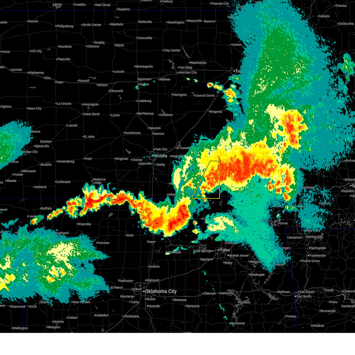
 Svrtsa the national weather service in tulsa has issued a * severe thunderstorm warning for, northwestern osage county in northeastern oklahoma, * until 200 am cdt. * at 101 am cdt, severe thunderstorms were located along a line extending from near hardy to 4 miles southwest of ponca city, moving east at 30 mph (radar indicated). Hazards include 70 mph wind gusts and half dollar size hail. Hail damage to vehicles is expected. expect considerable tree damage. wind damage is also likely to mobile homes, roofs, and outbuildings. Locations in or near the path include, fairfax, shidler, burbank, grainola, foraker, pearsonia, webb city, apperson,. Svrtsa the national weather service in tulsa has issued a * severe thunderstorm warning for, northwestern osage county in northeastern oklahoma, * until 200 am cdt. * at 101 am cdt, severe thunderstorms were located along a line extending from near hardy to 4 miles southwest of ponca city, moving east at 30 mph (radar indicated). Hazards include 70 mph wind gusts and half dollar size hail. Hail damage to vehicles is expected. expect considerable tree damage. wind damage is also likely to mobile homes, roofs, and outbuildings. Locations in or near the path include, fairfax, shidler, burbank, grainola, foraker, pearsonia, webb city, apperson,.
|
| 4/23/2026 9:49 PM CDT |
 At 949 pm cdt, a severe thunderstorm was located near peru, or 7 miles southeast of sedan, moving east at 35 mph (radar indicated). Hazards include 60 mph wind gusts. Expect damage to roofs, siding, and trees. Locations impacted include, caney, sedan, tyro, peru, chautauqua, havana, elgin, bolton, niotaze, independence airport, and elk city state park. At 949 pm cdt, a severe thunderstorm was located near peru, or 7 miles southeast of sedan, moving east at 35 mph (radar indicated). Hazards include 60 mph wind gusts. Expect damage to roofs, siding, and trees. Locations impacted include, caney, sedan, tyro, peru, chautauqua, havana, elgin, bolton, niotaze, independence airport, and elk city state park.
|
| 4/23/2026 9:41 PM CDT |
 At 941 pm cdt, severe thunderstorms were located along a line extending from chautauqua to 3 miles west of sunset lake to near burbank, moving east at 40 mph (radar indicated). Hazards include 60 mph wind gusts. Expect damage to roofs, siding, and trees. Locations in or near the path include, pawhuska, shidler, burbank, foraker, bigheart, osage hills state park, pearsonia, okesa, sunset lake, webb city, wah sha she state park, apperson,. At 941 pm cdt, severe thunderstorms were located along a line extending from chautauqua to 3 miles west of sunset lake to near burbank, moving east at 40 mph (radar indicated). Hazards include 60 mph wind gusts. Expect damage to roofs, siding, and trees. Locations in or near the path include, pawhuska, shidler, burbank, foraker, bigheart, osage hills state park, pearsonia, okesa, sunset lake, webb city, wah sha she state park, apperson,.
|
| 4/23/2026 9:35 PM CDT |
 At 934 pm cdt, severe thunderstorms were located along a line extending from near elgin to 5 miles northwest of pawhuska to burbank, moving east at 30 mph (radar indicated). Hazards include 70 mph wind gusts and nickel size hail. Expect considerable tree damage. damage is likely to mobile homes, roofs, and outbuildings. Locations in or near the path include, pawhuska, shidler, burbank, foraker, bigheart, osage hills state park, pearsonia, okesa, sunset lake, webb city, wah sha she state park, apperson,. At 934 pm cdt, severe thunderstorms were located along a line extending from near elgin to 5 miles northwest of pawhuska to burbank, moving east at 30 mph (radar indicated). Hazards include 70 mph wind gusts and nickel size hail. Expect considerable tree damage. damage is likely to mobile homes, roofs, and outbuildings. Locations in or near the path include, pawhuska, shidler, burbank, foraker, bigheart, osage hills state park, pearsonia, okesa, sunset lake, webb city, wah sha she state park, apperson,.
|
| 4/23/2026 9:32 PM CDT |
 Svrict the national weather service in wichita has issued a * severe thunderstorm warning for, southwestern montgomery county in southeastern kansas, southern chautauqua county in southeastern kansas, * until 1030 pm cdt. * at 932 pm cdt, a severe thunderstorm was located over elgin, or 9 miles southwest of sedan, moving east at 45 mph (radar indicated). Hazards include 60 mph wind gusts. expect damage to roofs, siding, and trees Svrict the national weather service in wichita has issued a * severe thunderstorm warning for, southwestern montgomery county in southeastern kansas, southern chautauqua county in southeastern kansas, * until 1030 pm cdt. * at 932 pm cdt, a severe thunderstorm was located over elgin, or 9 miles southwest of sedan, moving east at 45 mph (radar indicated). Hazards include 60 mph wind gusts. expect damage to roofs, siding, and trees
|
| 4/23/2026 9:14 PM CDT |
 Svrtsa the national weather service in tulsa has issued a * severe thunderstorm warning for, northern osage county in northeastern oklahoma, * until 1000 pm cdt. * at 914 pm cdt, severe thunderstorms were located along a line extending from 7 miles south of cedar vale to 5 miles southwest of pearsonia to near burbank, moving east at 45 mph (radar indicated). Hazards include 70 mph wind gusts and half dollar size hail. Hail damage to vehicles is expected. expect considerable tree damage. wind damage is also likely to mobile homes, roofs, and outbuildings. Locations in or near the path include, pawhuska, barnsdall, shidler, burbank, foraker, bigheart, pearsonia, sunset lake, osage hills state park, okesa, webb city, wah sha she state park, tallant, apperson, pershing, nelagoney, wolco,. Svrtsa the national weather service in tulsa has issued a * severe thunderstorm warning for, northern osage county in northeastern oklahoma, * until 1000 pm cdt. * at 914 pm cdt, severe thunderstorms were located along a line extending from 7 miles south of cedar vale to 5 miles southwest of pearsonia to near burbank, moving east at 45 mph (radar indicated). Hazards include 70 mph wind gusts and half dollar size hail. Hail damage to vehicles is expected. expect considerable tree damage. wind damage is also likely to mobile homes, roofs, and outbuildings. Locations in or near the path include, pawhuska, barnsdall, shidler, burbank, foraker, bigheart, pearsonia, sunset lake, osage hills state park, okesa, webb city, wah sha she state park, tallant, apperson, pershing, nelagoney, wolco,.
|
| 4/17/2026 7:47 PM CDT |
 At 747 pm cdt, severe thunderstorms were located along a line extending from 4 miles southwest of elgin to 5 miles west of bigheart to 2 miles northwest of pawhuska to 9 miles west of wynona, moving east at 55 to 60 mph (radar indicated). Hazards include 70 mph wind gusts and ping pong ball size hail. People and animals outdoors will be injured. expect hail damage to roofs, siding, windows, and vehicles. expect considerable tree damage. wind damage is also likely to mobile homes, roofs, and outbuildings. Locations in or near the path include, bartlesville, pawhuska, dewey, barnsdall, copan, ramona, wynona, ochelata, avant, wann, bigheart, pearsonia, bartlesville municipal airport, hulah, sunset lake, osage hills state park, okesa, wah sha she state park, tallant, pershing,. At 747 pm cdt, severe thunderstorms were located along a line extending from 4 miles southwest of elgin to 5 miles west of bigheart to 2 miles northwest of pawhuska to 9 miles west of wynona, moving east at 55 to 60 mph (radar indicated). Hazards include 70 mph wind gusts and ping pong ball size hail. People and animals outdoors will be injured. expect hail damage to roofs, siding, windows, and vehicles. expect considerable tree damage. wind damage is also likely to mobile homes, roofs, and outbuildings. Locations in or near the path include, bartlesville, pawhuska, dewey, barnsdall, copan, ramona, wynona, ochelata, avant, wann, bigheart, pearsonia, bartlesville municipal airport, hulah, sunset lake, osage hills state park, okesa, wah sha she state park, tallant, pershing,.
|
| 4/17/2026 7:38 PM CDT |
 Svrtsa the national weather service in tulsa has issued a * severe thunderstorm warning for, osage county in northeastern oklahoma, washington county in northeastern oklahoma, west central nowata county in northeastern oklahoma, * until 830 pm cdt. * at 737 pm cdt, severe thunderstorms were located along a line extending from 6 miles northeast of foraker to 2 miles northwest of pearsonia to 9 miles southeast of shidler to 4 miles southeast of fairfax, moving east at 55 mph (radar indicated). Hazards include 70 mph wind gusts and ping pong ball size hail. People and animals outdoors will be injured. expect hail damage to roofs, siding, windows, and vehicles. expect considerable tree damage. wind damage is also likely to mobile homes, roofs, and outbuildings. Locations in or near the path include, bartlesville, pawhuska, dewey, fairfax, barnsdall, copan, ramona, shidler, wynona, ochelata, avant, burbank, wann, grainola, foraker, bigheart, bartlesville municipal airport, osage hills state park, pearsonia, hulah,. Svrtsa the national weather service in tulsa has issued a * severe thunderstorm warning for, osage county in northeastern oklahoma, washington county in northeastern oklahoma, west central nowata county in northeastern oklahoma, * until 830 pm cdt. * at 737 pm cdt, severe thunderstorms were located along a line extending from 6 miles northeast of foraker to 2 miles northwest of pearsonia to 9 miles southeast of shidler to 4 miles southeast of fairfax, moving east at 55 mph (radar indicated). Hazards include 70 mph wind gusts and ping pong ball size hail. People and animals outdoors will be injured. expect hail damage to roofs, siding, windows, and vehicles. expect considerable tree damage. wind damage is also likely to mobile homes, roofs, and outbuildings. Locations in or near the path include, bartlesville, pawhuska, dewey, fairfax, barnsdall, copan, ramona, shidler, wynona, ochelata, avant, burbank, wann, grainola, foraker, bigheart, bartlesville municipal airport, osage hills state park, pearsonia, hulah,.
|
| 4/17/2026 3:28 PM CDT |
 At 328 pm cdt, a severe thunderstorm was located 6 miles northwest of sedan, moving northeast at 55 mph (radar indicated). Hazards include 60 to 70 mph wind gusts and half dollar size hail. Hail damage to vehicles is expected. expect considerable tree damage. wind damage is also likely to mobile homes, roofs, and outbuildings. Locations impacted include, sedan, longton, peru, chautauqua, elk falls, elgin, niotaze, and hale. At 328 pm cdt, a severe thunderstorm was located 6 miles northwest of sedan, moving northeast at 55 mph (radar indicated). Hazards include 60 to 70 mph wind gusts and half dollar size hail. Hail damage to vehicles is expected. expect considerable tree damage. wind damage is also likely to mobile homes, roofs, and outbuildings. Locations impacted include, sedan, longton, peru, chautauqua, elk falls, elgin, niotaze, and hale.
|
| 4/17/2026 3:17 PM CDT |
 the severe thunderstorm warning has been cancelled and is no longer in effect the severe thunderstorm warning has been cancelled and is no longer in effect
|
| 4/17/2026 3:17 PM CDT |
 At 316 pm cdt, a severe thunderstorm was located 6 miles northwest of sedan, moving northeast at 45 mph (radar indicated). Hazards include 60 to 70 mph wind gusts and half dollar size hail. Hail damage to vehicles is expected. expect considerable tree damage. wind damage is also likely to mobile homes, roofs, and outbuildings. Locations impacted include, sedan, howard, cedar vale, moline, longton, severy, grenola, fall river, peru, chautauqua, elk falls, elgin, niotaze, fall river state park, hale, and fall river lake. At 316 pm cdt, a severe thunderstorm was located 6 miles northwest of sedan, moving northeast at 45 mph (radar indicated). Hazards include 60 to 70 mph wind gusts and half dollar size hail. Hail damage to vehicles is expected. expect considerable tree damage. wind damage is also likely to mobile homes, roofs, and outbuildings. Locations impacted include, sedan, howard, cedar vale, moline, longton, severy, grenola, fall river, peru, chautauqua, elk falls, elgin, niotaze, fall river state park, hale, and fall river lake.
|
| 4/17/2026 3:03 PM CDT |
 At 302 pm cdt, a severe thunderstorm was located 5 miles southwest of cedar vale, moving northeast at 45 mph (radar indicated). Hazards include 60 mph wind gusts and half dollar size hail. Hail damage to vehicles is expected. expect wind damage to roofs, siding, and trees. Locations impacted include, sedan, howard, cedar vale, moline, longton, severy, grenola, fall river, peru, chautauqua, elk falls, elgin, niotaze, fall river state park, hale, and fall river lake. At 302 pm cdt, a severe thunderstorm was located 5 miles southwest of cedar vale, moving northeast at 45 mph (radar indicated). Hazards include 60 mph wind gusts and half dollar size hail. Hail damage to vehicles is expected. expect wind damage to roofs, siding, and trees. Locations impacted include, sedan, howard, cedar vale, moline, longton, severy, grenola, fall river, peru, chautauqua, elk falls, elgin, niotaze, fall river state park, hale, and fall river lake.
|
| 4/17/2026 2:46 PM CDT |
 Svrict the national weather service in wichita has issued a * severe thunderstorm warning for, elk county in southeastern kansas, eastern cowley county in south central kansas, southeastern butler county in south central kansas, chautauqua county in southeastern kansas, southeastern greenwood county in southeastern kansas, * until 345 pm cdt. * at 246 pm cdt, a severe thunderstorm was located 9 miles southwest of grenola, or 10 miles north of cedar vale, moving northeast at 55 mph (radar indicated). Hazards include 60 mph wind gusts and half dollar size hail. Hail damage to vehicles is expected. Expect wind damage to roofs, siding, and trees. Svrict the national weather service in wichita has issued a * severe thunderstorm warning for, elk county in southeastern kansas, eastern cowley county in south central kansas, southeastern butler county in south central kansas, chautauqua county in southeastern kansas, southeastern greenwood county in southeastern kansas, * until 345 pm cdt. * at 246 pm cdt, a severe thunderstorm was located 9 miles southwest of grenola, or 10 miles north of cedar vale, moving northeast at 55 mph (radar indicated). Hazards include 60 mph wind gusts and half dollar size hail. Hail damage to vehicles is expected. Expect wind damage to roofs, siding, and trees.
|
| 4/15/2026 3:49 PM CDT |
 At 349 pm cdt, a severe thunderstorm was located 3 miles southwest of pawhuska, moving northeast at 45 mph (radar indicated). Hazards include 60 mph wind gusts and half dollar size hail. Hail damage to vehicles is expected. expect wind damage to roofs, siding, and trees. Locations in or near the path include, barnsdall, bigheart, hominy, wynona, bartlesville municipal airport, tallant, pawhuska, sunset lake, osage hills state park, pershing, nelagoney, okesa, bartlesville,. At 349 pm cdt, a severe thunderstorm was located 3 miles southwest of pawhuska, moving northeast at 45 mph (radar indicated). Hazards include 60 mph wind gusts and half dollar size hail. Hail damage to vehicles is expected. expect wind damage to roofs, siding, and trees. Locations in or near the path include, barnsdall, bigheart, hominy, wynona, bartlesville municipal airport, tallant, pawhuska, sunset lake, osage hills state park, pershing, nelagoney, okesa, bartlesville,.
|
| 4/15/2026 3:37 PM CDT |
 Svrtsa the national weather service in tulsa has issued a * severe thunderstorm warning for, eastern osage county in northeastern oklahoma, * until 415 pm cdt. * at 337 pm cdt, a severe thunderstorm was located 8 miles west of wynona and a second was located 3 miles northwest of hominy, moving northeast at 55 mph (radar indicated). Hazards include 60 mph wind gusts and quarter size hail. Hail damage to vehicles is expected. expect wind damage to roofs, siding, and trees. Locations in or near the path include, barnsdall, bigheart, hominy, wynona, bartlesville municipal airport, tallant, pawhuska, sunset lake, osage hills state park, pershing, nelagoney, okesa, bartlesville,. Svrtsa the national weather service in tulsa has issued a * severe thunderstorm warning for, eastern osage county in northeastern oklahoma, * until 415 pm cdt. * at 337 pm cdt, a severe thunderstorm was located 8 miles west of wynona and a second was located 3 miles northwest of hominy, moving northeast at 55 mph (radar indicated). Hazards include 60 mph wind gusts and quarter size hail. Hail damage to vehicles is expected. expect wind damage to roofs, siding, and trees. Locations in or near the path include, barnsdall, bigheart, hominy, wynona, bartlesville municipal airport, tallant, pawhuska, sunset lake, osage hills state park, pershing, nelagoney, okesa, bartlesville,.
|
| 4/1/2026 8:12 PM CDT |
 At 811 pm cdt, severe thunderstorms were located along a line extending from 4 miles southeast of pearsonia to 4 miles southwest of hominy, moving northeast at 30 mph (radar indicated). Hazards include 60 mph wind gusts and quarter size hail. Hail damage to vehicles is expected. expect wind damage to roofs, siding, and trees. Locations in or near the path include, bigheart, osage hills state park, pershing, hominy, pearsonia, wynona, nelagoney, okesa, tallant, pawhuska, sunset lake,. At 811 pm cdt, severe thunderstorms were located along a line extending from 4 miles southeast of pearsonia to 4 miles southwest of hominy, moving northeast at 30 mph (radar indicated). Hazards include 60 mph wind gusts and quarter size hail. Hail damage to vehicles is expected. expect wind damage to roofs, siding, and trees. Locations in or near the path include, bigheart, osage hills state park, pershing, hominy, pearsonia, wynona, nelagoney, okesa, tallant, pawhuska, sunset lake,.
|
| 4/1/2026 8:12 PM CDT |
 the severe thunderstorm warning has been cancelled and is no longer in effect the severe thunderstorm warning has been cancelled and is no longer in effect
|
| 4/1/2026 7:53 PM CDT |
 Svrtsa the national weather service in tulsa has issued a * severe thunderstorm warning for, central osage county in northeastern oklahoma, central pawnee county in northeastern oklahoma, * until 845 pm cdt. * at 753 pm cdt, severe thunderstorms were located along a line extending from 10 miles east of fairfax to 2 miles northeast of blackburn, moving northeast at 30 mph (radar indicated). Hazards include 60 mph wind gusts and quarter size hail. Hail damage to vehicles is expected. expect wind damage to roofs, siding, and trees. Locations in or near the path include, bigheart, osage hills state park, pershing, hominy, pearsonia, wynona, nelagoney, okesa, tallant, pawhuska, sunset lake, blackburn,. Svrtsa the national weather service in tulsa has issued a * severe thunderstorm warning for, central osage county in northeastern oklahoma, central pawnee county in northeastern oklahoma, * until 845 pm cdt. * at 753 pm cdt, severe thunderstorms were located along a line extending from 10 miles east of fairfax to 2 miles northeast of blackburn, moving northeast at 30 mph (radar indicated). Hazards include 60 mph wind gusts and quarter size hail. Hail damage to vehicles is expected. expect wind damage to roofs, siding, and trees. Locations in or near the path include, bigheart, osage hills state park, pershing, hominy, pearsonia, wynona, nelagoney, okesa, tallant, pawhuska, sunset lake, blackburn,.
|
| 1/8/2026 9:12 AM CST |
 The storms which prompted the warning have moved out of the area. therefore, the warning will be allowed to expire. however, gusty winds and heavy rain are still possible with these thunderstorms. a tornado watch remains in effect until noon cst for northeastern oklahoma. remember, a severe thunderstorm warning still remains in effect for washington county until 10 am cst. The storms which prompted the warning have moved out of the area. therefore, the warning will be allowed to expire. however, gusty winds and heavy rain are still possible with these thunderstorms. a tornado watch remains in effect until noon cst for northeastern oklahoma. remember, a severe thunderstorm warning still remains in effect for washington county until 10 am cst.
|
| 1/8/2026 8:37 AM CST |
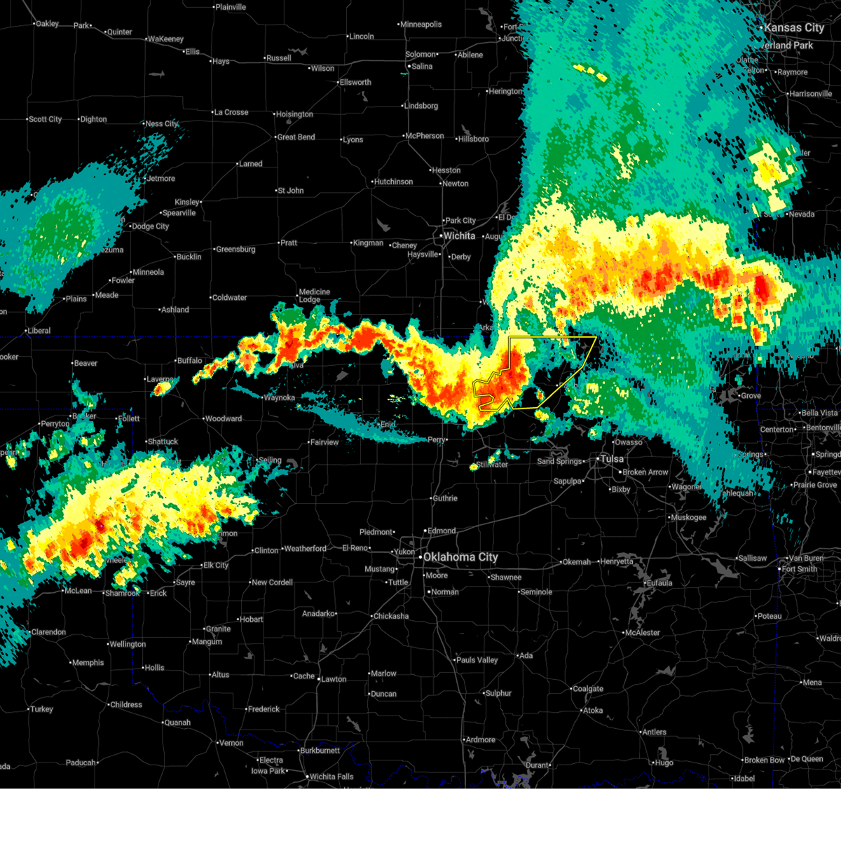
 Svrtsa the national weather service in tulsa has issued a * severe thunderstorm warning for, eastern osage county in northeastern oklahoma, washington county in northeastern oklahoma, * until 915 am cst. * at 837 am cst, severe thunderstorms were located along a line extending from 5 miles northeast of grainola to 4 miles southeast of hominy, moving northeast at 55 mph (radar indicated). Hazards include 70 mph wind gusts and quarter size hail. Hail damage to vehicles is expected. expect considerable tree damage. wind damage is also likely to mobile homes, roofs, and outbuildings. Locations in or near the path include, barnsdall, bigheart, hominy, pearsonia, wah sha she state park, wynona, dewey, bartlesville municipal airport, hulah, ochelata, tallant, pawhuska, sunset lake, osage hills state park, pershing, foraker, bartlesville, copan, nelagoney, avant,. Svrtsa the national weather service in tulsa has issued a * severe thunderstorm warning for, eastern osage county in northeastern oklahoma, washington county in northeastern oklahoma, * until 915 am cst. * at 837 am cst, severe thunderstorms were located along a line extending from 5 miles northeast of grainola to 4 miles southeast of hominy, moving northeast at 55 mph (radar indicated). Hazards include 70 mph wind gusts and quarter size hail. Hail damage to vehicles is expected. expect considerable tree damage. wind damage is also likely to mobile homes, roofs, and outbuildings. Locations in or near the path include, barnsdall, bigheart, hominy, pearsonia, wah sha she state park, wynona, dewey, bartlesville municipal airport, hulah, ochelata, tallant, pawhuska, sunset lake, osage hills state park, pershing, foraker, bartlesville, copan, nelagoney, avant,.
|
| 1/8/2026 8:25 AM CST |
 At 825 am cst, severe thunderstorms were located along a line extending from 4 miles southwest of grainola to 5 miles northeast of fairfax to 2 miles west of cleveland, moving northeast at 65 mph (radar indicated). Hazards include 60 mph wind gusts and quarter size hail. Hail damage to vehicles is expected. expect wind damage to roofs, siding, and trees. Locations in or near the path include, bigheart, hominy, pearsonia, wynona, webb city, hallett, apperson, pawhuska, burbank, sunset lake, fairfax, blackburn, ralston, osage hills state park, pershing, foraker, grainola, nelagoney, shidler, okesa,. At 825 am cst, severe thunderstorms were located along a line extending from 4 miles southwest of grainola to 5 miles northeast of fairfax to 2 miles west of cleveland, moving northeast at 65 mph (radar indicated). Hazards include 60 mph wind gusts and quarter size hail. Hail damage to vehicles is expected. expect wind damage to roofs, siding, and trees. Locations in or near the path include, bigheart, hominy, pearsonia, wynona, webb city, hallett, apperson, pawhuska, burbank, sunset lake, fairfax, blackburn, ralston, osage hills state park, pershing, foraker, grainola, nelagoney, shidler, okesa,.
|
| 1/8/2026 7:58 AM CST |
 Svrtsa the national weather service in tulsa has issued a * severe thunderstorm warning for, osage county in northeastern oklahoma, pawnee county in northeastern oklahoma, * until 845 am cst. * at 757 am cst, severe thunderstorms were located along a line extending from 5 miles southeast of marland to 2 miles north of glencoe to 3 miles northeast of ripley, moving northeast at 75 mph (radar indicated). Hazards include 60 mph wind gusts and quarter size hail. Hail damage to vehicles is expected. expect wind damage to roofs, siding, and trees. Locations in or near the path include, bigheart, hominy, pearsonia, skedee, wynona, webb city, hallett, apperson, pawhuska, burbank, sunset lake, fairfax, blackburn, ralston, osage hills state park, pershing, foraker, maramec, grainola, nelagoney,. Svrtsa the national weather service in tulsa has issued a * severe thunderstorm warning for, osage county in northeastern oklahoma, pawnee county in northeastern oklahoma, * until 845 am cst. * at 757 am cst, severe thunderstorms were located along a line extending from 5 miles southeast of marland to 2 miles north of glencoe to 3 miles northeast of ripley, moving northeast at 75 mph (radar indicated). Hazards include 60 mph wind gusts and quarter size hail. Hail damage to vehicles is expected. expect wind damage to roofs, siding, and trees. Locations in or near the path include, bigheart, hominy, pearsonia, skedee, wynona, webb city, hallett, apperson, pawhuska, burbank, sunset lake, fairfax, blackburn, ralston, osage hills state park, pershing, foraker, maramec, grainola, nelagoney,.
|
| 8/10/2025 9:10 PM CDT |
 The storm which prompted the warning has moved out of the area. therefore, the warning will be allowed to expire. however, gusty winds are still possible with this thunderstorm. The storm which prompted the warning has moved out of the area. therefore, the warning will be allowed to expire. however, gusty winds are still possible with this thunderstorm.
|
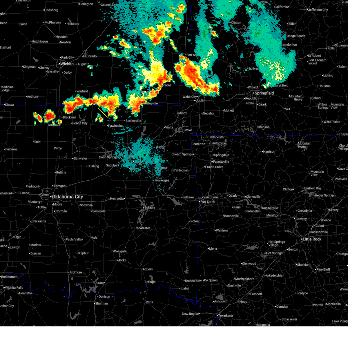
| 8/10/2025 8:43 PM CDT |
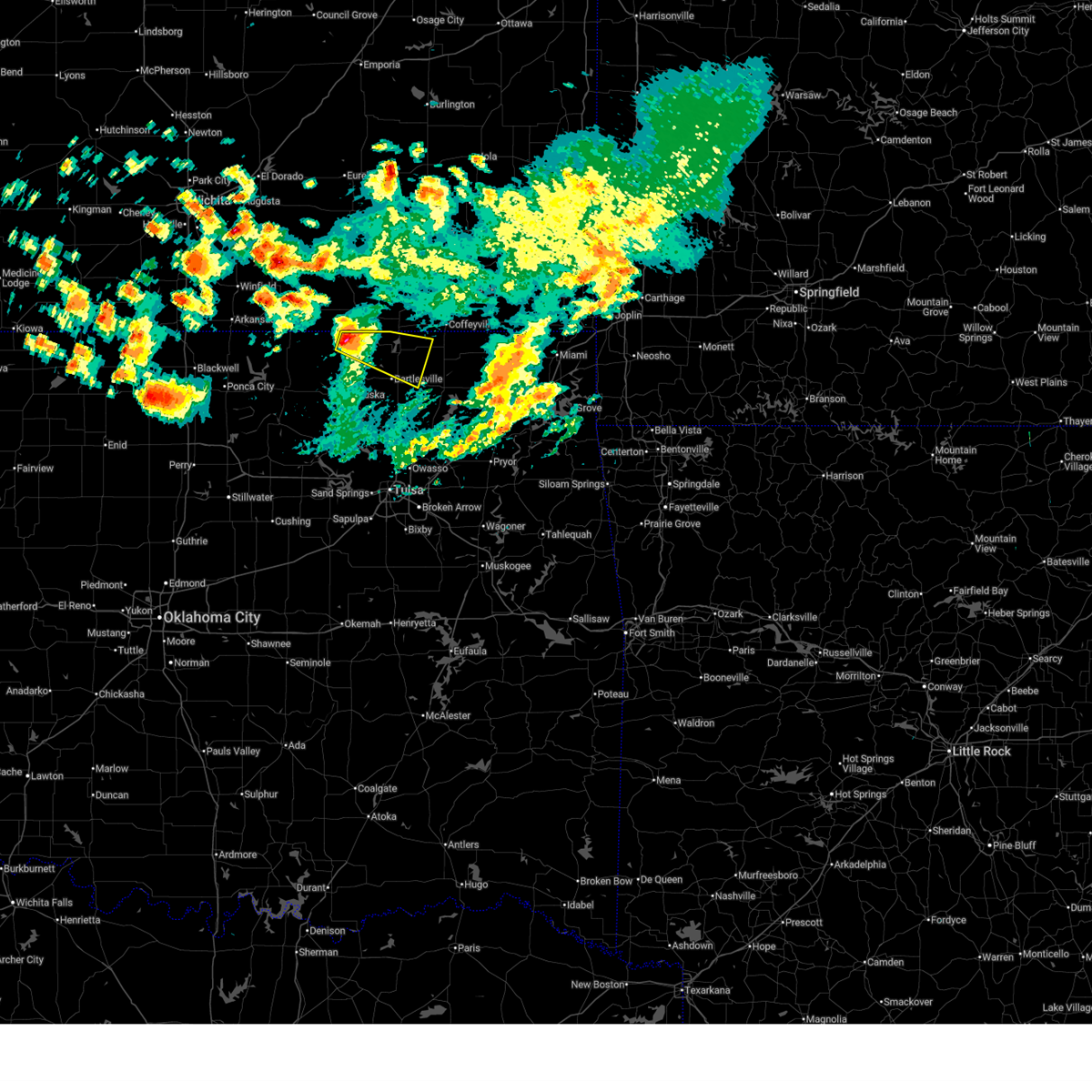
 Svrtsa the national weather service in tulsa has issued a * severe thunderstorm warning for, north central osage county in northeastern oklahoma, * until 915 pm cdt. * at 843 pm cdt, a severe thunderstorm was located 5 miles southwest of elgin, moving northeast at 25 mph (radar indicated). Hazards include 60 mph wind gusts and quarter size hail. Hail damage to vehicles is expected. expect wind damage to roofs, siding, and trees. This severe thunderstorm will remain over mainly rural areas of north central osage county. Svrtsa the national weather service in tulsa has issued a * severe thunderstorm warning for, north central osage county in northeastern oklahoma, * until 915 pm cdt. * at 843 pm cdt, a severe thunderstorm was located 5 miles southwest of elgin, moving northeast at 25 mph (radar indicated). Hazards include 60 mph wind gusts and quarter size hail. Hail damage to vehicles is expected. expect wind damage to roofs, siding, and trees. This severe thunderstorm will remain over mainly rural areas of north central osage county.
|
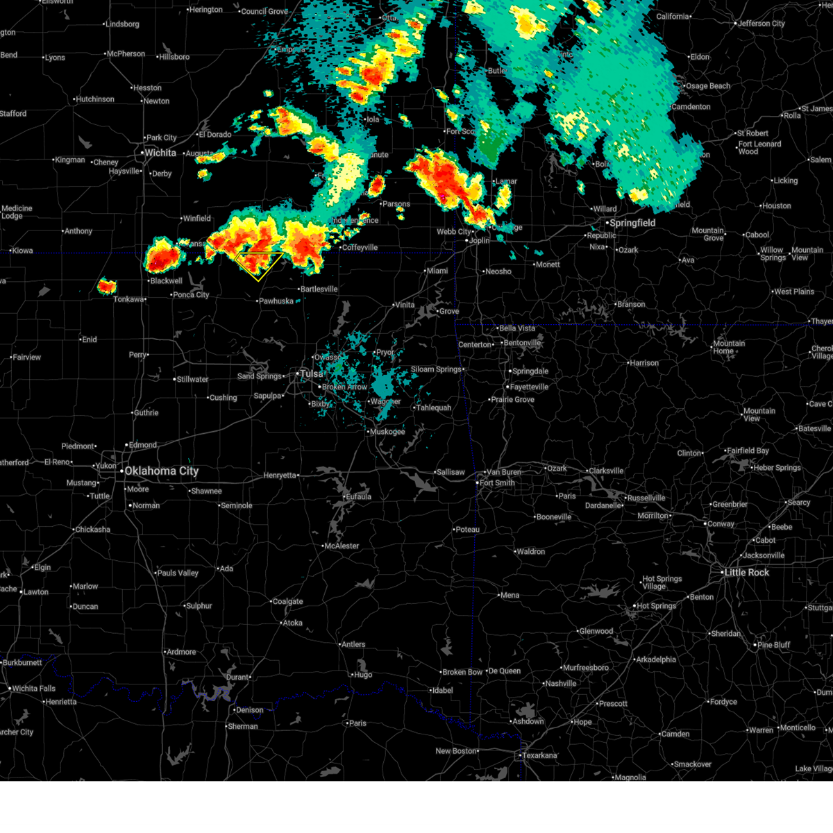
| 8/10/2025 8:19 PM CDT |
 At 819 pm cdt, a severe thunderstorm was located near caney, moving east at 25 mph (radar indicated). Hazards include 60 mph wind gusts and quarter size hail. Hail damage to vehicles is expected. expect wind damage to roofs, siding, and trees. Locations impacted include, sedan, peru, chautauqua, elgin, and niotaze. At 819 pm cdt, a severe thunderstorm was located near caney, moving east at 25 mph (radar indicated). Hazards include 60 mph wind gusts and quarter size hail. Hail damage to vehicles is expected. expect wind damage to roofs, siding, and trees. Locations impacted include, sedan, peru, chautauqua, elgin, and niotaze.
|
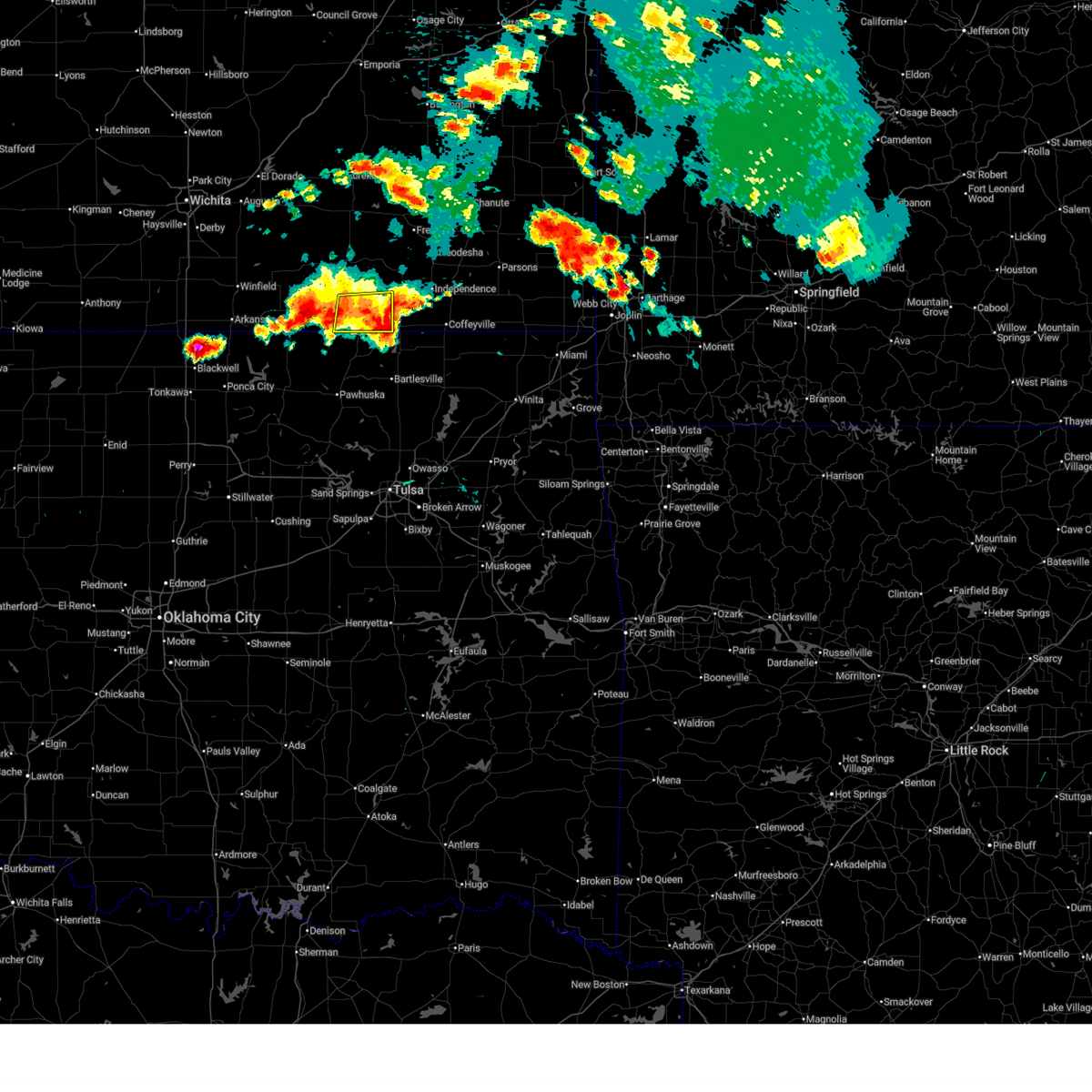
| 8/10/2025 7:45 PM CDT |
 Svrict the national weather service in wichita has issued a * severe thunderstorm warning for, southeastern chautauqua county in southeastern kansas, * until 845 pm cdt. * at 744 pm cdt, a severe thunderstorm was located near elgin, or 6 miles southwest of sedan, moving east at 15 mph (radar indicated). Hazards include 60 mph wind gusts and quarter size hail. Hail damage to vehicles is expected. Expect wind damage to roofs, siding, and trees. Svrict the national weather service in wichita has issued a * severe thunderstorm warning for, southeastern chautauqua county in southeastern kansas, * until 845 pm cdt. * at 744 pm cdt, a severe thunderstorm was located near elgin, or 6 miles southwest of sedan, moving east at 15 mph (radar indicated). Hazards include 60 mph wind gusts and quarter size hail. Hail damage to vehicles is expected. Expect wind damage to roofs, siding, and trees.
|
| 8/10/2025 7:36 PM CDT |
 At 735 pm cdt, a severe thunderstorm was located 6 miles east of cedar vale, and is nearly stationary (radar indicated). Hazards include 60 mph wind gusts and quarter size hail. Hail damage to vehicles is expected. expect wind damage to roofs, siding, and trees. Locations impacted include, cedar vale and elgin. At 735 pm cdt, a severe thunderstorm was located 6 miles east of cedar vale, and is nearly stationary (radar indicated). Hazards include 60 mph wind gusts and quarter size hail. Hail damage to vehicles is expected. expect wind damage to roofs, siding, and trees. Locations impacted include, cedar vale and elgin.
|
| 8/10/2025 6:56 PM CDT |
 Svrict the national weather service in wichita has issued a * severe thunderstorm warning for, southeastern cowley county in south central kansas, southwestern chautauqua county in southeastern kansas, * until 800 pm cdt. * at 655 pm cdt, a severe thunderstorm was located near cedar vale, and is nearly stationary (radar indicated). Hazards include 60 mph wind gusts and half dollar size hail. Hail damage to vehicles is expected. Expect wind damage to roofs, siding, and trees. Svrict the national weather service in wichita has issued a * severe thunderstorm warning for, southeastern cowley county in south central kansas, southwestern chautauqua county in southeastern kansas, * until 800 pm cdt. * at 655 pm cdt, a severe thunderstorm was located near cedar vale, and is nearly stationary (radar indicated). Hazards include 60 mph wind gusts and half dollar size hail. Hail damage to vehicles is expected. Expect wind damage to roofs, siding, and trees.
|
| 8/10/2025 6:38 PM CDT |
 At 638 pm cdt, a severe thunderstorm was located near cedar vale, moving northeast at 5 mph (radar indicated). Hazards include 60 mph wind gusts and half dollar size hail. Hail damage to vehicles is expected. expect wind damage to roofs, siding, and trees. Locations impacted include, cedar vale and elgin. At 638 pm cdt, a severe thunderstorm was located near cedar vale, moving northeast at 5 mph (radar indicated). Hazards include 60 mph wind gusts and half dollar size hail. Hail damage to vehicles is expected. expect wind damage to roofs, siding, and trees. Locations impacted include, cedar vale and elgin.
|
| 8/10/2025 6:03 PM CDT |
 Svrict the national weather service in wichita has issued a * severe thunderstorm warning for, southeastern cowley county in south central kansas, southwestern chautauqua county in southeastern kansas, * until 700 pm cdt. * at 603 pm cdt, a severe thunderstorm was located near cedar vale, moving northeast at 15 mph (radar indicated). Hazards include 60 mph wind gusts and quarter size hail. Hail damage to vehicles is expected. Expect wind damage to roofs, siding, and trees. Svrict the national weather service in wichita has issued a * severe thunderstorm warning for, southeastern cowley county in south central kansas, southwestern chautauqua county in southeastern kansas, * until 700 pm cdt. * at 603 pm cdt, a severe thunderstorm was located near cedar vale, moving northeast at 15 mph (radar indicated). Hazards include 60 mph wind gusts and quarter size hail. Hail damage to vehicles is expected. Expect wind damage to roofs, siding, and trees.
|
| 7/30/2025 11:29 PM CDT |
 The storm which prompted the warning has weakened below severe limits, and no longer poses an immediate threat to life or property. therefore, the warning will be allowed to expire. however, gusty winds are still possible with this thunderstorm. The storm which prompted the warning has weakened below severe limits, and no longer poses an immediate threat to life or property. therefore, the warning will be allowed to expire. however, gusty winds are still possible with this thunderstorm.
|
| 7/30/2025 10:59 PM CDT |
 Svrict the national weather service in wichita has issued a * severe thunderstorm warning for, montgomery county in southeastern kansas, chautauqua county in southeastern kansas, * until midnight cdt. * at 1059 pm cdt, a severe thunderstorm was located over peru, or 6 miles southeast of sedan, moving east at 25 mph (radar indicated). Hazards include 60 mph wind gusts. expect damage to roofs, siding, and trees Svrict the national weather service in wichita has issued a * severe thunderstorm warning for, montgomery county in southeastern kansas, chautauqua county in southeastern kansas, * until midnight cdt. * at 1059 pm cdt, a severe thunderstorm was located over peru, or 6 miles southeast of sedan, moving east at 25 mph (radar indicated). Hazards include 60 mph wind gusts. expect damage to roofs, siding, and trees
|
| 7/30/2025 10:47 PM CDT |
 Svrict the national weather service in wichita has issued a * severe thunderstorm warning for, southwestern montgomery county in southeastern kansas, southeastern chautauqua county in southeastern kansas, * until 1100 pm cdt. * at 1046 pm cdt, a severe thunderstorm was located over chautauqua, or 7 miles south of sedan, moving southeast at 30 mph (radar indicated). Hazards include 60 mph wind gusts. expect damage to roofs, siding, and trees Svrict the national weather service in wichita has issued a * severe thunderstorm warning for, southwestern montgomery county in southeastern kansas, southeastern chautauqua county in southeastern kansas, * until 1100 pm cdt. * at 1046 pm cdt, a severe thunderstorm was located over chautauqua, or 7 miles south of sedan, moving southeast at 30 mph (radar indicated). Hazards include 60 mph wind gusts. expect damage to roofs, siding, and trees
|
| 7/30/2025 10:40 PM CDT |
 Svrtsa the national weather service in tulsa has issued a * severe thunderstorm warning for, northeastern osage county in northeastern oklahoma, northern washington county in northeastern oklahoma, * until 1130 pm cdt. * at 1039 pm cdt, a severe thunderstorm was located 8 miles northwest of elgin, moving southeast at 30 mph (radar indicated). Hazards include 60 mph wind gusts. Expect damage to roofs, siding, and trees. Locations in or near the path include, bigheart, osage hills state park, wah sha she state park, copan, dewey, bartlesville municipal airport, hulah, okesa, sunset lake, bartlesville,. Svrtsa the national weather service in tulsa has issued a * severe thunderstorm warning for, northeastern osage county in northeastern oklahoma, northern washington county in northeastern oklahoma, * until 1130 pm cdt. * at 1039 pm cdt, a severe thunderstorm was located 8 miles northwest of elgin, moving southeast at 30 mph (radar indicated). Hazards include 60 mph wind gusts. Expect damage to roofs, siding, and trees. Locations in or near the path include, bigheart, osage hills state park, wah sha she state park, copan, dewey, bartlesville municipal airport, hulah, okesa, sunset lake, bartlesville,.
|
| 6/29/2025 9:28 PM CDT |
 At 927 pm cdt, severe thunderstorms were located along a line extending from 3 miles southwest of south coffeyville to 2 miles east of bartlesville to 5 miles southwest of grainola, moving southeast at 35 mph (radar indicated). Hazards include 60 mph wind gusts and nickel size hail. Expect damage to roofs, siding, and trees. Locations in or near the path include, bigheart, pearsonia, wann, wah sha she state park, webb city, lenapah, dewey, bartlesville municipal airport, south coffeyville, hulah, sunset lake, foraker, grainola, bartlesville, copan, shidler, osage hills state park,. At 927 pm cdt, severe thunderstorms were located along a line extending from 3 miles southwest of south coffeyville to 2 miles east of bartlesville to 5 miles southwest of grainola, moving southeast at 35 mph (radar indicated). Hazards include 60 mph wind gusts and nickel size hail. Expect damage to roofs, siding, and trees. Locations in or near the path include, bigheart, pearsonia, wann, wah sha she state park, webb city, lenapah, dewey, bartlesville municipal airport, south coffeyville, hulah, sunset lake, foraker, grainola, bartlesville, copan, shidler, osage hills state park,.
|
| 6/29/2025 9:14 PM CDT |
 Svrict the national weather service in wichita has issued a * severe thunderstorm warning for, southern cowley county in south central kansas, southwestern montgomery county in southeastern kansas, chautauqua county in southeastern kansas, * until 1000 pm cdt. * at 913 pm cdt, severe thunderstorms were located along a line extending from near tyro to arkansas city, moving southeast at 50 mph (at 903 pm cdt, a 69 mph wind gust was reported at winfield). Hazards include 70 mph wind gusts. Expect considerable tree damage. Damage is likely to mobile homes, roofs, and outbuildings. Svrict the national weather service in wichita has issued a * severe thunderstorm warning for, southern cowley county in south central kansas, southwestern montgomery county in southeastern kansas, chautauqua county in southeastern kansas, * until 1000 pm cdt. * at 913 pm cdt, severe thunderstorms were located along a line extending from near tyro to arkansas city, moving southeast at 50 mph (at 903 pm cdt, a 69 mph wind gust was reported at winfield). Hazards include 70 mph wind gusts. Expect considerable tree damage. Damage is likely to mobile homes, roofs, and outbuildings.
|
| 6/29/2025 9:03 PM CDT |
 the severe thunderstorm warning has been cancelled and is no longer in effect the severe thunderstorm warning has been cancelled and is no longer in effect
|
| 6/29/2025 9:03 PM CDT |
 At 902 pm cdt, severe thunderstorms were located along a line extending from near independence to near hulah to 6 miles northwest of hardy, moving southeast at 40 mph (at 858 pm cdt, a 68 mph wind gust was reported at winfield). Hazards include 70 mph wind gusts and quarter size hail. Hail damage to vehicles is expected. expect considerable tree damage. wind damage is also likely to mobile homes, roofs, and outbuildings. Locations impacted include, arkansas city, winfield, independence, caney, sedan, cedar vale, elk city, dexter, peru, chautauqua, havana, elgin, bolton, niotaze, elk city lake, elk city state park, hale, maple city, independence airport, and strother field airport. At 902 pm cdt, severe thunderstorms were located along a line extending from near independence to near hulah to 6 miles northwest of hardy, moving southeast at 40 mph (at 858 pm cdt, a 68 mph wind gust was reported at winfield). Hazards include 70 mph wind gusts and quarter size hail. Hail damage to vehicles is expected. expect considerable tree damage. wind damage is also likely to mobile homes, roofs, and outbuildings. Locations impacted include, arkansas city, winfield, independence, caney, sedan, cedar vale, elk city, dexter, peru, chautauqua, havana, elgin, bolton, niotaze, elk city lake, elk city state park, hale, maple city, independence airport, and strother field airport.
|
| 6/29/2025 8:54 PM CDT |
 Svrtsa the national weather service in tulsa has issued a * severe thunderstorm warning for, northeastern osage county in northeastern oklahoma, northern washington county in northeastern oklahoma, northern nowata county in northeastern oklahoma, * until 945 pm cdt. * at 854 pm cdt, severe thunderstorms were located along a line extending from 6 miles north of havana to chautauqua to 6 miles northeast of hardy, moving southeast at 25 mph (radar indicated). Hazards include 70 mph wind gusts and quarter size hail. Hail damage to vehicles is expected. expect considerable tree damage. wind damage is also likely to mobile homes, roofs, and outbuildings. Locations in or near the path include, bigheart, pearsonia, wann, wah sha she state park, webb city, lenapah, dewey, bartlesville municipal airport, south coffeyville, hulah, sunset lake, foraker, grainola, bartlesville, copan, shidler, osage hills state park,. Svrtsa the national weather service in tulsa has issued a * severe thunderstorm warning for, northeastern osage county in northeastern oklahoma, northern washington county in northeastern oklahoma, northern nowata county in northeastern oklahoma, * until 945 pm cdt. * at 854 pm cdt, severe thunderstorms were located along a line extending from 6 miles north of havana to chautauqua to 6 miles northeast of hardy, moving southeast at 25 mph (radar indicated). Hazards include 70 mph wind gusts and quarter size hail. Hail damage to vehicles is expected. expect considerable tree damage. wind damage is also likely to mobile homes, roofs, and outbuildings. Locations in or near the path include, bigheart, pearsonia, wann, wah sha she state park, webb city, lenapah, dewey, bartlesville municipal airport, south coffeyville, hulah, sunset lake, foraker, grainola, bartlesville, copan, shidler, osage hills state park,.
|
| 6/29/2025 8:49 PM CDT |
 At 848 pm cdt, severe thunderstorms were located along a line extending from 7 miles south of fredonia to near peru to near winfield, moving southeast at 40 mph (trained weather spotters. at 845 pm cdt, 60 mph wind was reported west of winfield). Hazards include 60 mph wind gusts and quarter size hail. Hail damage to vehicles is expected. expect wind damage to roofs, siding, and trees. Locations impacted include, arkansas city, winfield, independence, caney, sedan, udall, howard, cedar vale, burden, moline, longton, elk city, dexter, grenola, atlanta, peru, chautauqua, elk falls, havana, and elgin. At 848 pm cdt, severe thunderstorms were located along a line extending from 7 miles south of fredonia to near peru to near winfield, moving southeast at 40 mph (trained weather spotters. at 845 pm cdt, 60 mph wind was reported west of winfield). Hazards include 60 mph wind gusts and quarter size hail. Hail damage to vehicles is expected. expect wind damage to roofs, siding, and trees. Locations impacted include, arkansas city, winfield, independence, caney, sedan, udall, howard, cedar vale, burden, moline, longton, elk city, dexter, grenola, atlanta, peru, chautauqua, elk falls, havana, and elgin.
|
| 6/29/2025 8:49 PM CDT |
 the severe thunderstorm warning has been cancelled and is no longer in effect the severe thunderstorm warning has been cancelled and is no longer in effect
|
| 6/29/2025 8:24 PM CDT |
 Svrict the national weather service in wichita has issued a * severe thunderstorm warning for, elk county in southeastern kansas, southwestern wilson county in southeastern kansas, cowley county in south central kansas, montgomery county in southeastern kansas, northeastern sumner county in south central kansas, chautauqua county in southeastern kansas, southeastern greenwood county in southeastern kansas, * until 915 pm cdt. * at 822 pm cdt, severe thunderstorms were located along a line extending from near fall river to near moline to near udall, moving southeast at 40 mph (radar indicated). Hazards include 60 mph wind gusts and quarter size hail. Hail damage to vehicles is expected. Expect wind damage to roofs, siding, and trees. Svrict the national weather service in wichita has issued a * severe thunderstorm warning for, elk county in southeastern kansas, southwestern wilson county in southeastern kansas, cowley county in south central kansas, montgomery county in southeastern kansas, northeastern sumner county in south central kansas, chautauqua county in southeastern kansas, southeastern greenwood county in southeastern kansas, * until 915 pm cdt. * at 822 pm cdt, severe thunderstorms were located along a line extending from near fall river to near moline to near udall, moving southeast at 40 mph (radar indicated). Hazards include 60 mph wind gusts and quarter size hail. Hail damage to vehicles is expected. Expect wind damage to roofs, siding, and trees.
|
| 6/18/2025 12:14 AM CDT |
 The storms which prompted the warning have moved out of the area. therefore, the warning will be allowed to expire. however, gusty winds are still possible with these thunderstorms. a severe thunderstorm watch remains in effect until 400 am cdt for south central and southeastern kansas. The storms which prompted the warning have moved out of the area. therefore, the warning will be allowed to expire. however, gusty winds are still possible with these thunderstorms. a severe thunderstorm watch remains in effect until 400 am cdt for south central and southeastern kansas.
|
| 6/18/2025 12:13 AM CDT |
 At 1212 am cdt, severe thunderstorms were located along a line extending from near elgin to 4 miles northeast of barnsdall, moving east at 50 mph (radar indicated). Hazards include 70 mph wind gusts and penny size hail. Expect considerable tree damage. damage is likely to mobile homes, roofs, and outbuildings. Locations impacted include, bartlesville, pawhuska, dewey, barnsdall, copan, ramona, wynona, ochelata, elgin, bigheart, pearsonia, bartlesville municipal airport, hulah, sunset lake, osage hills state park, okesa, wah sha she state park, tallant, pershing, and nelagoney. At 1212 am cdt, severe thunderstorms were located along a line extending from near elgin to 4 miles northeast of barnsdall, moving east at 50 mph (radar indicated). Hazards include 70 mph wind gusts and penny size hail. Expect considerable tree damage. damage is likely to mobile homes, roofs, and outbuildings. Locations impacted include, bartlesville, pawhuska, dewey, barnsdall, copan, ramona, wynona, ochelata, elgin, bigheart, pearsonia, bartlesville municipal airport, hulah, sunset lake, osage hills state park, okesa, wah sha she state park, tallant, pershing, and nelagoney.
|
| 6/17/2025 11:50 PM CDT |
 Svrtsa the national weather service in tulsa has issued a * severe thunderstorm warning for, northeastern osage county in northeastern oklahoma, washington county in northeastern oklahoma, * until 1230 am cdt. * at 1150 pm cdt, severe thunderstorms were located along a line extending from 3 miles north of foraker to 5 miles west of wynona, moving northeast at 70 mph (radar indicated). Hazards include 70 mph wind gusts and quarter size hail. Hail damage to vehicles is expected. expect considerable tree damage. Wind damage is also likely to mobile homes, roofs, and outbuildings. Svrtsa the national weather service in tulsa has issued a * severe thunderstorm warning for, northeastern osage county in northeastern oklahoma, washington county in northeastern oklahoma, * until 1230 am cdt. * at 1150 pm cdt, severe thunderstorms were located along a line extending from 3 miles north of foraker to 5 miles west of wynona, moving northeast at 70 mph (radar indicated). Hazards include 70 mph wind gusts and quarter size hail. Hail damage to vehicles is expected. expect considerable tree damage. Wind damage is also likely to mobile homes, roofs, and outbuildings.
|
| 6/17/2025 11:47 PM CDT |
 the severe thunderstorm warning has been cancelled and is no longer in effect the severe thunderstorm warning has been cancelled and is no longer in effect
|
| 6/17/2025 11:47 PM CDT |
 At 1146 pm cdt, severe thunderstorms were located along a line extending from 8 miles west of elgin to 6 miles northwest of sedan, moving east at 40 mph (radar indicated). Hazards include 60 mph wind gusts. Expect damage to roofs, siding, and trees. Locations impacted include, sedan, cedar vale, peru, chautauqua, elgin, and niotaze. At 1146 pm cdt, severe thunderstorms were located along a line extending from 8 miles west of elgin to 6 miles northwest of sedan, moving east at 40 mph (radar indicated). Hazards include 60 mph wind gusts. Expect damage to roofs, siding, and trees. Locations impacted include, sedan, cedar vale, peru, chautauqua, elgin, and niotaze.
|
| 6/17/2025 11:27 PM CDT |
 Svrict the national weather service in wichita has issued a * severe thunderstorm warning for, southeastern cowley county in south central kansas, chautauqua county in southeastern kansas, * until 1215 am cdt. * at 1127 pm cdt, severe thunderstorms were located along a line extending from near chilocco to 9 miles northwest of sedan, moving east at 50 mph (radar indicated). Hazards include 60 mph wind gusts. expect damage to roofs, siding, and trees Svrict the national weather service in wichita has issued a * severe thunderstorm warning for, southeastern cowley county in south central kansas, chautauqua county in southeastern kansas, * until 1215 am cdt. * at 1127 pm cdt, severe thunderstorms were located along a line extending from near chilocco to 9 miles northwest of sedan, moving east at 50 mph (radar indicated). Hazards include 60 mph wind gusts. expect damage to roofs, siding, and trees
|
| 6/17/2025 9:01 PM CDT |
 At 901 pm cdt, a severe thunderstorm was located near bigheart, moving southeast at 45 mph (radar indicated). Hazards include golf ball size hail and 70 mph wind gusts. People and animals outdoors will be injured. expect hail damage to roofs, siding, windows, and vehicles. expect considerable tree damage. wind damage is also likely to mobile homes, roofs, and outbuildings. Locations impacted include, bartlesville, pawhuska, dewey, barnsdall, copan, ramona, wynona, ochelata, avant, vera, elgin, bigheart, pearsonia, bartlesville municipal airport, hulah, sunset lake, osage hills state park, okesa, wah sha she state park, and tallant. At 901 pm cdt, a severe thunderstorm was located near bigheart, moving southeast at 45 mph (radar indicated). Hazards include golf ball size hail and 70 mph wind gusts. People and animals outdoors will be injured. expect hail damage to roofs, siding, windows, and vehicles. expect considerable tree damage. wind damage is also likely to mobile homes, roofs, and outbuildings. Locations impacted include, bartlesville, pawhuska, dewey, barnsdall, copan, ramona, wynona, ochelata, avant, vera, elgin, bigheart, pearsonia, bartlesville municipal airport, hulah, sunset lake, osage hills state park, okesa, wah sha she state park, and tallant.
|
| 6/17/2025 8:50 PM CDT |
 At 850 pm cdt, a severe thunderstorm was located near pawhuska, moving southeast at 40 mph (radar indicated). Hazards include golf ball size hail and 70 mph wind gusts. People and animals outdoors will be injured. expect hail damage to roofs, siding, windows, and vehicles. expect considerable tree damage. wind damage is also likely to mobile homes, roofs, and outbuildings. locations impacted include, bartlesville, pawhuska, dewey, barnsdall, copan, ramona, wynona, ochelata, avant, vera, elgin, bigheart, pearsonia, bartlesville municipal airport, hulah, sunset lake, osage hills state park, okesa, wah sha she state park, and tallant. At around 8:50 pm, a 70 mph wind gust was reported near pawhuska. At 850 pm cdt, a severe thunderstorm was located near pawhuska, moving southeast at 40 mph (radar indicated). Hazards include golf ball size hail and 70 mph wind gusts. People and animals outdoors will be injured. expect hail damage to roofs, siding, windows, and vehicles. expect considerable tree damage. wind damage is also likely to mobile homes, roofs, and outbuildings. locations impacted include, bartlesville, pawhuska, dewey, barnsdall, copan, ramona, wynona, ochelata, avant, vera, elgin, bigheart, pearsonia, bartlesville municipal airport, hulah, sunset lake, osage hills state park, okesa, wah sha she state park, and tallant. At around 8:50 pm, a 70 mph wind gust was reported near pawhuska.
|
| 6/17/2025 8:44 PM CDT |
 Svrtsa the national weather service in tulsa has issued a * severe thunderstorm warning for, northeastern osage county in northeastern oklahoma, washington county in northeastern oklahoma, * until 930 pm cdt. * at 844 pm cdt, a severe thunderstorm was located 5 miles southwest of sunset lake, moving southeast at 55 mph (radar indicated). Hazards include golf ball size hail and 70 mph wind gusts. People and animals outdoors will be injured. expect hail damage to roofs, siding, windows, and vehicles. expect considerable tree damage. Wind damage is also likely to mobile homes, roofs, and outbuildings. Svrtsa the national weather service in tulsa has issued a * severe thunderstorm warning for, northeastern osage county in northeastern oklahoma, washington county in northeastern oklahoma, * until 930 pm cdt. * at 844 pm cdt, a severe thunderstorm was located 5 miles southwest of sunset lake, moving southeast at 55 mph (radar indicated). Hazards include golf ball size hail and 70 mph wind gusts. People and animals outdoors will be injured. expect hail damage to roofs, siding, windows, and vehicles. expect considerable tree damage. Wind damage is also likely to mobile homes, roofs, and outbuildings.
|
| 6/17/2025 8:32 PM CDT |
 the severe thunderstorm warning has been cancelled and is no longer in effect the severe thunderstorm warning has been cancelled and is no longer in effect
|
| 6/17/2025 8:32 PM CDT |
 At 832 pm cdt, a severe thunderstorm was located near cedar vale, moving east at 25 mph (radar indicated). Hazards include 60 mph wind gusts and quarter size hail. Hail damage to vehicles is expected. expect wind damage to roofs, siding, and trees. Locations impacted include, elgin. At 832 pm cdt, a severe thunderstorm was located near cedar vale, moving east at 25 mph (radar indicated). Hazards include 60 mph wind gusts and quarter size hail. Hail damage to vehicles is expected. expect wind damage to roofs, siding, and trees. Locations impacted include, elgin.
|
| 6/17/2025 8:23 PM CDT |
 Svrtsa the national weather service in tulsa has issued a * severe thunderstorm warning for, northeastern osage county in northeastern oklahoma, * until 915 pm cdt. * at 823 pm cdt, a severe thunderstorm was located 8 miles northeast of foraker, moving east at 20 mph (radar indicated). Hazards include golf ball size hail and 70 mph wind gusts. People and animals outdoors will be injured. expect hail damage to roofs, siding, windows, and vehicles. expect considerable tree damage. Wind damage is also likely to mobile homes, roofs, and outbuildings. Svrtsa the national weather service in tulsa has issued a * severe thunderstorm warning for, northeastern osage county in northeastern oklahoma, * until 915 pm cdt. * at 823 pm cdt, a severe thunderstorm was located 8 miles northeast of foraker, moving east at 20 mph (radar indicated). Hazards include golf ball size hail and 70 mph wind gusts. People and animals outdoors will be injured. expect hail damage to roofs, siding, windows, and vehicles. expect considerable tree damage. Wind damage is also likely to mobile homes, roofs, and outbuildings.
|
| 6/17/2025 8:18 PM CDT |
 At 817 pm cdt, a severe thunderstorm was located near cedar vale, moving east at 25 mph (radar indicated). Hazards include 60 mph wind gusts and quarter size hail. Hail damage to vehicles is expected. expect wind damage to roofs, siding, and trees. Locations impacted include, cedar vale, dexter, and elgin. At 817 pm cdt, a severe thunderstorm was located near cedar vale, moving east at 25 mph (radar indicated). Hazards include 60 mph wind gusts and quarter size hail. Hail damage to vehicles is expected. expect wind damage to roofs, siding, and trees. Locations impacted include, cedar vale, dexter, and elgin.
|
| 6/17/2025 8:14 PM CDT |
 At 814 pm cdt, a severe thunderstorm was located 4 miles northeast of foraker, moving east at 25 mph (radar indicated). Hazards include 70 mph wind gusts and ping pong ball size hail. People and animals outdoors will be injured. expect hail damage to roofs, siding, windows, and vehicles. expect considerable tree damage. wind damage is also likely to mobile homes, roofs, and outbuildings. Locations impacted include, shidler, elgin, grainola, foraker, pearsonia, and webb city. At 814 pm cdt, a severe thunderstorm was located 4 miles northeast of foraker, moving east at 25 mph (radar indicated). Hazards include 70 mph wind gusts and ping pong ball size hail. People and animals outdoors will be injured. expect hail damage to roofs, siding, windows, and vehicles. expect considerable tree damage. wind damage is also likely to mobile homes, roofs, and outbuildings. Locations impacted include, shidler, elgin, grainola, foraker, pearsonia, and webb city.
|
| 6/17/2025 8:00 PM CDT |
 Svrict the national weather service in wichita has issued a * severe thunderstorm warning for, southeastern cowley county in south central kansas, western chautauqua county in southeastern kansas, * until 845 pm cdt. * at 800 pm cdt, a severe thunderstorm was located 8 miles north of grainola, or 9 miles west of cedar vale, moving east at 25 mph (radar indicated). Hazards include 60 mph wind gusts and quarter size hail. Hail damage to vehicles is expected. Expect wind damage to roofs, siding, and trees. Svrict the national weather service in wichita has issued a * severe thunderstorm warning for, southeastern cowley county in south central kansas, western chautauqua county in southeastern kansas, * until 845 pm cdt. * at 800 pm cdt, a severe thunderstorm was located 8 miles north of grainola, or 9 miles west of cedar vale, moving east at 25 mph (radar indicated). Hazards include 60 mph wind gusts and quarter size hail. Hail damage to vehicles is expected. Expect wind damage to roofs, siding, and trees.
|
| 6/17/2025 7:44 PM CDT |
 Svrtsa the national weather service in tulsa has issued a * severe thunderstorm warning for, north central osage county in northeastern oklahoma, * until 830 pm cdt. * at 744 pm cdt, a severe thunderstorm was located 4 miles east of hardy, moving east at 25 mph (radar indicated). Hazards include 70 mph wind gusts and quarter size hail. Hail damage to vehicles is expected. expect considerable tree damage. Wind damage is also likely to mobile homes, roofs, and outbuildings. Svrtsa the national weather service in tulsa has issued a * severe thunderstorm warning for, north central osage county in northeastern oklahoma, * until 830 pm cdt. * at 744 pm cdt, a severe thunderstorm was located 4 miles east of hardy, moving east at 25 mph (radar indicated). Hazards include 70 mph wind gusts and quarter size hail. Hail damage to vehicles is expected. expect considerable tree damage. Wind damage is also likely to mobile homes, roofs, and outbuildings.
|
| 6/8/2025 5:57 PM CDT |
 the severe thunderstorm warning has been cancelled and is no longer in effect the severe thunderstorm warning has been cancelled and is no longer in effect
|
| 6/8/2025 5:52 PM CDT |
 At 551 pm cdt, a severe thunderstorm was located near cedar vale, moving east at 25 mph (public reported 60 mph winds in cedar vale). Hazards include 60 mph wind gusts. Expect damage to roofs, siding, and trees. Locations impacted include, cedar vale and elgin. At 551 pm cdt, a severe thunderstorm was located near cedar vale, moving east at 25 mph (public reported 60 mph winds in cedar vale). Hazards include 60 mph wind gusts. Expect damage to roofs, siding, and trees. Locations impacted include, cedar vale and elgin.
|
| 6/8/2025 5:52 PM CDT |
 the severe thunderstorm warning has been cancelled and is no longer in effect the severe thunderstorm warning has been cancelled and is no longer in effect
|
| 6/8/2025 5:34 PM CDT |
 At 533 pm cdt, a severe thunderstorm was located near cedar vale, moving east at 30 mph (.quarter size hail was reported in dexter). Hazards include 60 mph wind gusts. Expect damage to roofs, siding, and trees. Locations impacted include, cedar vale and elgin. At 533 pm cdt, a severe thunderstorm was located near cedar vale, moving east at 30 mph (.quarter size hail was reported in dexter). Hazards include 60 mph wind gusts. Expect damage to roofs, siding, and trees. Locations impacted include, cedar vale and elgin.
|
| 6/8/2025 5:10 PM CDT |
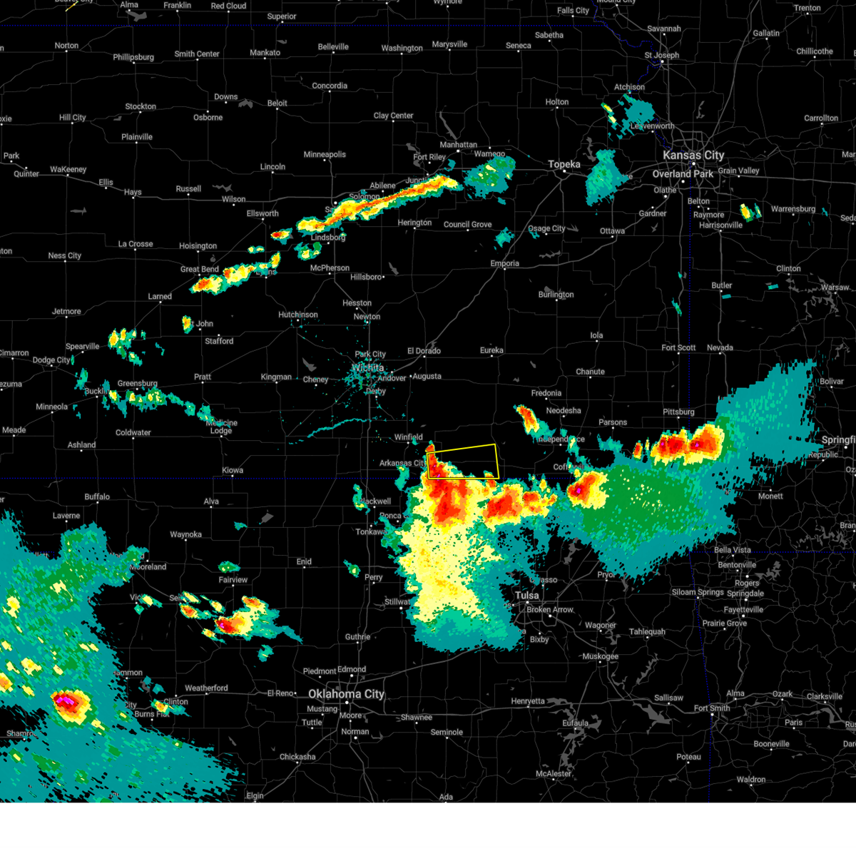 Svrict the national weather service in wichita has issued a * severe thunderstorm warning for, southeastern cowley county in south central kansas, southwestern chautauqua county in southeastern kansas, * until 615 pm cdt. * at 510 pm cdt, a severe thunderstorm was located near hardy, or 13 miles west of cedar vale, moving east at 40 mph (radar indicated). Hazards include 60 mph wind gusts and quarter size hail. Hail damage to vehicles is expected. Expect wind damage to roofs, siding, and trees. Svrict the national weather service in wichita has issued a * severe thunderstorm warning for, southeastern cowley county in south central kansas, southwestern chautauqua county in southeastern kansas, * until 615 pm cdt. * at 510 pm cdt, a severe thunderstorm was located near hardy, or 13 miles west of cedar vale, moving east at 40 mph (radar indicated). Hazards include 60 mph wind gusts and quarter size hail. Hail damage to vehicles is expected. Expect wind damage to roofs, siding, and trees.
|
| 6/8/2025 4:35 PM CDT |
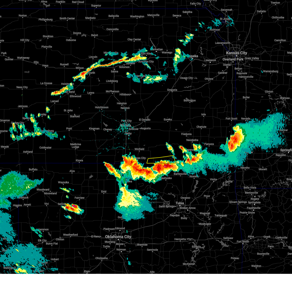 The storms which prompted the warning have moved out of the area. therefore, the warning will be allowed to expire. however, gusty winds are still possible with these thunderstorms. a severe thunderstorm watch remains in effect until 1000 pm cdt for south central and southeastern kansas. The storms which prompted the warning have moved out of the area. therefore, the warning will be allowed to expire. however, gusty winds are still possible with these thunderstorms. a severe thunderstorm watch remains in effect until 1000 pm cdt for south central and southeastern kansas.
|
| 6/8/2025 4:26 PM CDT |
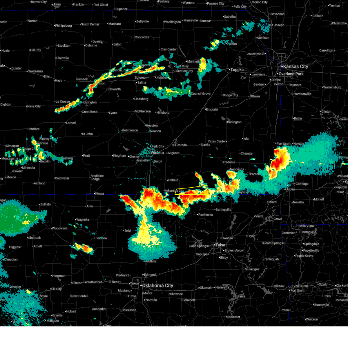 At 426 pm cdt, severe thunderstorms were located along a line extending from elgin to near grainola, moving south at 10 mph (radar indicated). Hazards include 60 mph wind gusts and quarter size hail. Hail damage to vehicles is expected. expect wind damage to roofs, siding, and trees. Locations impacted include, sedan, cedar vale, chautauqua, elgin, and maple city. At 426 pm cdt, severe thunderstorms were located along a line extending from elgin to near grainola, moving south at 10 mph (radar indicated). Hazards include 60 mph wind gusts and quarter size hail. Hail damage to vehicles is expected. expect wind damage to roofs, siding, and trees. Locations impacted include, sedan, cedar vale, chautauqua, elgin, and maple city.
|
| 6/8/2025 4:15 PM CDT |
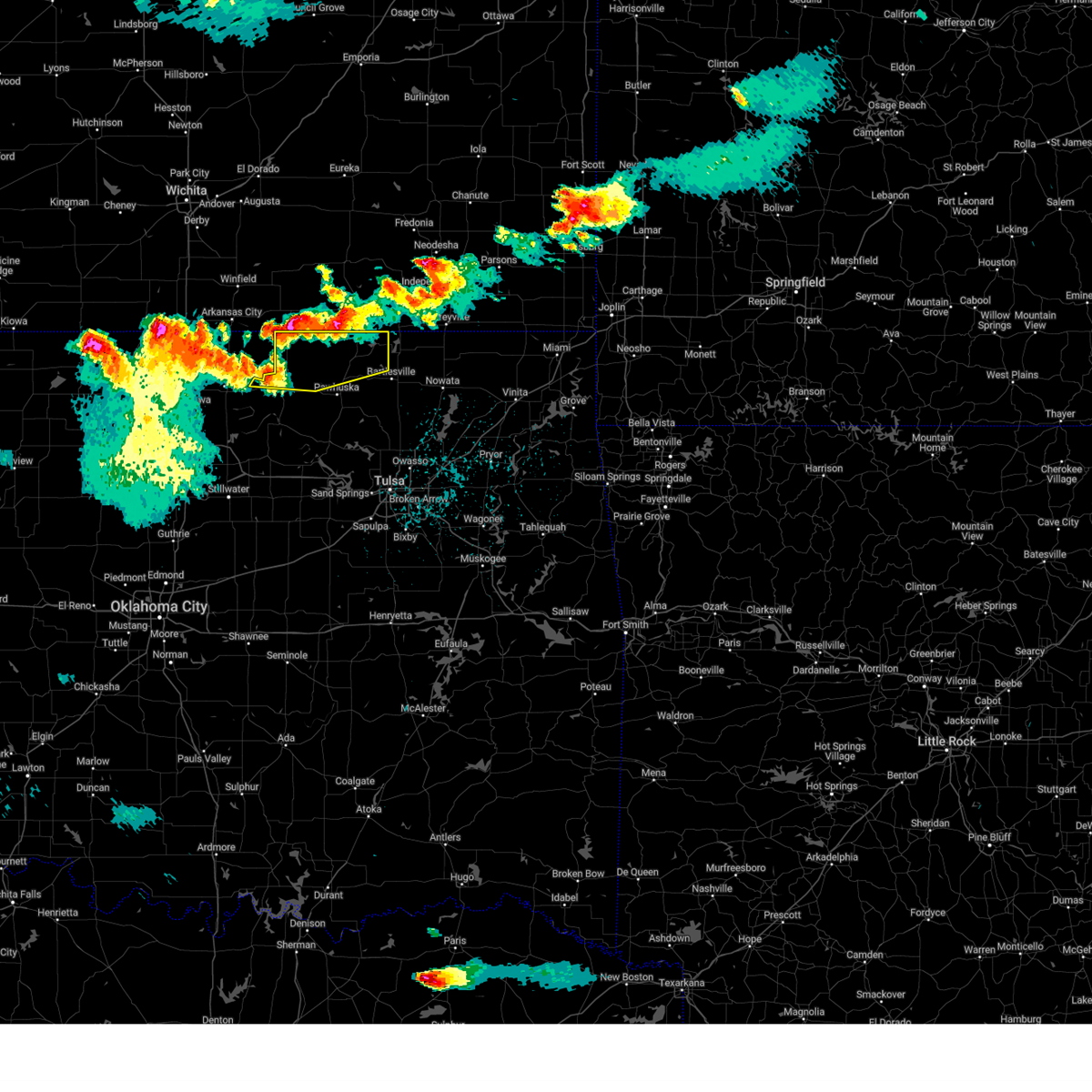 At 415 pm cdt, severe thunderstorms were located along a line extending from 2 miles northwest of elgin to 5 miles northeast of grainola to 4 miles east of hardy, moving southeast at 20 mph (radar indicated). Hazards include 60 mph wind gusts and quarter size hail. Hail damage to vehicles is expected. expect wind damage to roofs, siding, and trees. Locations in or near the path include, bigheart, foraker, grainola, pearsonia, wah sha she state park, webb city, shidler, hulah, apperson, sunset lake, burbank,. At 415 pm cdt, severe thunderstorms were located along a line extending from 2 miles northwest of elgin to 5 miles northeast of grainola to 4 miles east of hardy, moving southeast at 20 mph (radar indicated). Hazards include 60 mph wind gusts and quarter size hail. Hail damage to vehicles is expected. expect wind damage to roofs, siding, and trees. Locations in or near the path include, bigheart, foraker, grainola, pearsonia, wah sha she state park, webb city, shidler, hulah, apperson, sunset lake, burbank,.
|
| 6/8/2025 4:11 PM CDT |
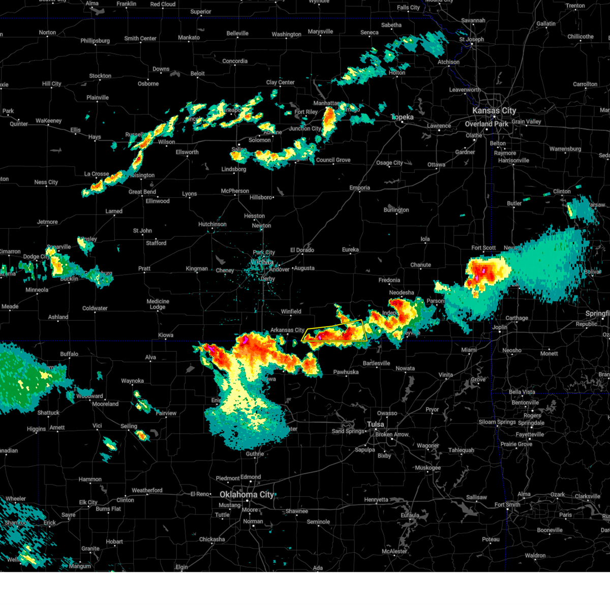 Svrict the national weather service in wichita has issued a * severe thunderstorm warning for, southeastern cowley county in south central kansas, southwestern chautauqua county in southeastern kansas, * until 445 pm cdt. * at 410 pm cdt, severe thunderstorms were located along a line extending from near elgin to 5 miles north of grainola, moving south at 10 mph. this warning replaces the previous severe thunderstorm warning that was in effect for the same area (radar indicated). Hazards include 60 mph wind gusts and quarter size hail. Hail damage to vehicles is expected. Expect wind damage to roofs, siding, and trees. Svrict the national weather service in wichita has issued a * severe thunderstorm warning for, southeastern cowley county in south central kansas, southwestern chautauqua county in southeastern kansas, * until 445 pm cdt. * at 410 pm cdt, severe thunderstorms were located along a line extending from near elgin to 5 miles north of grainola, moving south at 10 mph. this warning replaces the previous severe thunderstorm warning that was in effect for the same area (radar indicated). Hazards include 60 mph wind gusts and quarter size hail. Hail damage to vehicles is expected. Expect wind damage to roofs, siding, and trees.
|
| 6/8/2025 4:03 PM CDT |
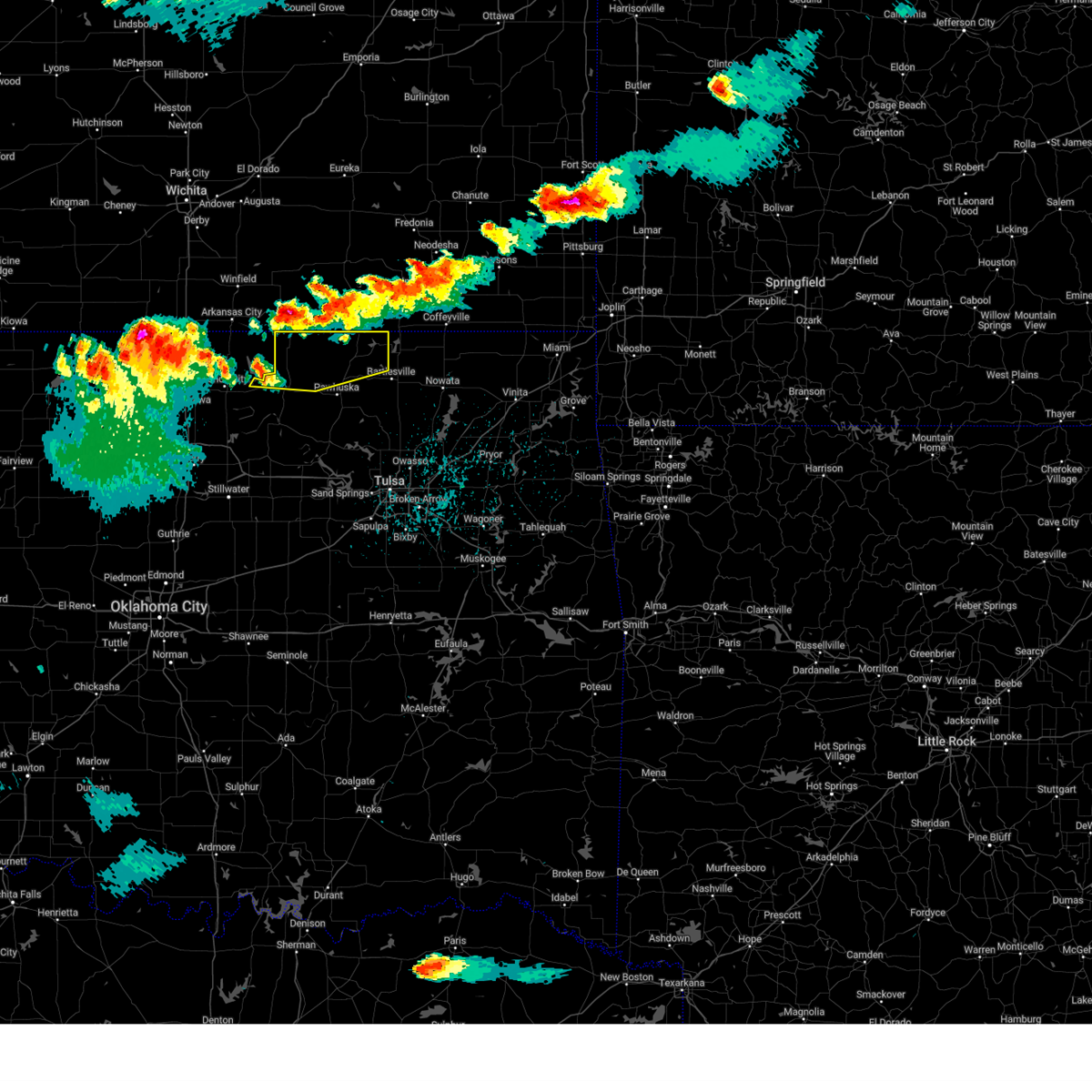 Svrtsa the national weather service in tulsa has issued a * severe thunderstorm warning for, northern osage county in northeastern oklahoma, * until 500 pm cdt. * at 403 pm cdt, severe thunderstorms were located along a line extending from 6 miles northwest of elgin to 7 miles north of grainola, moving east at 30 mph (radar indicated). Hazards include 60 mph wind gusts and quarter size hail. Hail damage to vehicles is expected. expect wind damage to roofs, siding, and trees. Locations in or near the path include, bigheart, foraker, grainola, pearsonia, wah sha she state park, webb city, shidler, hulah, apperson, sunset lake, burbank,. Svrtsa the national weather service in tulsa has issued a * severe thunderstorm warning for, northern osage county in northeastern oklahoma, * until 500 pm cdt. * at 403 pm cdt, severe thunderstorms were located along a line extending from 6 miles northwest of elgin to 7 miles north of grainola, moving east at 30 mph (radar indicated). Hazards include 60 mph wind gusts and quarter size hail. Hail damage to vehicles is expected. expect wind damage to roofs, siding, and trees. Locations in or near the path include, bigheart, foraker, grainola, pearsonia, wah sha she state park, webb city, shidler, hulah, apperson, sunset lake, burbank,.
|
| 6/8/2025 3:58 PM CDT |
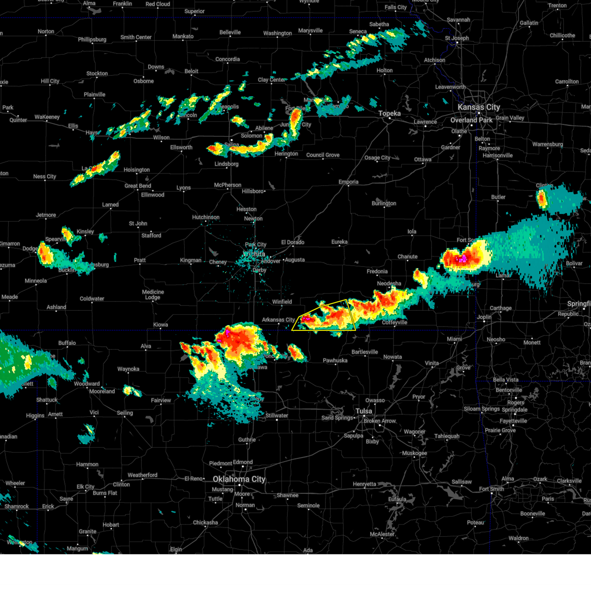 At 357 pm cdt, severe thunderstorms were located along a line extending from near sedan to 8 miles north of grainola, moving southeast at 15 mph (radar indicated). Hazards include 60 mph wind gusts and quarter size hail. Hail damage to vehicles is expected. expect wind damage to roofs, siding, and trees. Locations impacted include, sedan, cedar vale, chautauqua, elgin, and maple city. At 357 pm cdt, severe thunderstorms were located along a line extending from near sedan to 8 miles north of grainola, moving southeast at 15 mph (radar indicated). Hazards include 60 mph wind gusts and quarter size hail. Hail damage to vehicles is expected. expect wind damage to roofs, siding, and trees. Locations impacted include, sedan, cedar vale, chautauqua, elgin, and maple city.
|
| 6/8/2025 3:26 PM CDT |
 At 325 pm cdt, severe thunderstorms were located along a line extending from 5 miles northwest of sedan to near dexter, moving southeast at 30 mph (radar indicated). Hazards include 60 mph wind gusts and half dollar size hail. Hail damage to vehicles is expected. expect wind damage to roofs, siding, and trees. Locations impacted include, sedan, cedar vale, dexter, chautauqua, elgin, and maple city. At 325 pm cdt, severe thunderstorms were located along a line extending from 5 miles northwest of sedan to near dexter, moving southeast at 30 mph (radar indicated). Hazards include 60 mph wind gusts and half dollar size hail. Hail damage to vehicles is expected. expect wind damage to roofs, siding, and trees. Locations impacted include, sedan, cedar vale, dexter, chautauqua, elgin, and maple city.
|
| 6/8/2025 3:26 PM CDT |
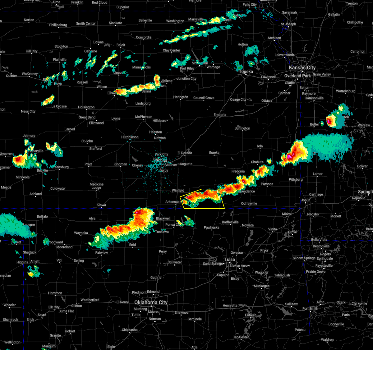 the severe thunderstorm warning has been cancelled and is no longer in effect the severe thunderstorm warning has been cancelled and is no longer in effect
|
| 6/8/2025 3:16 PM CDT |
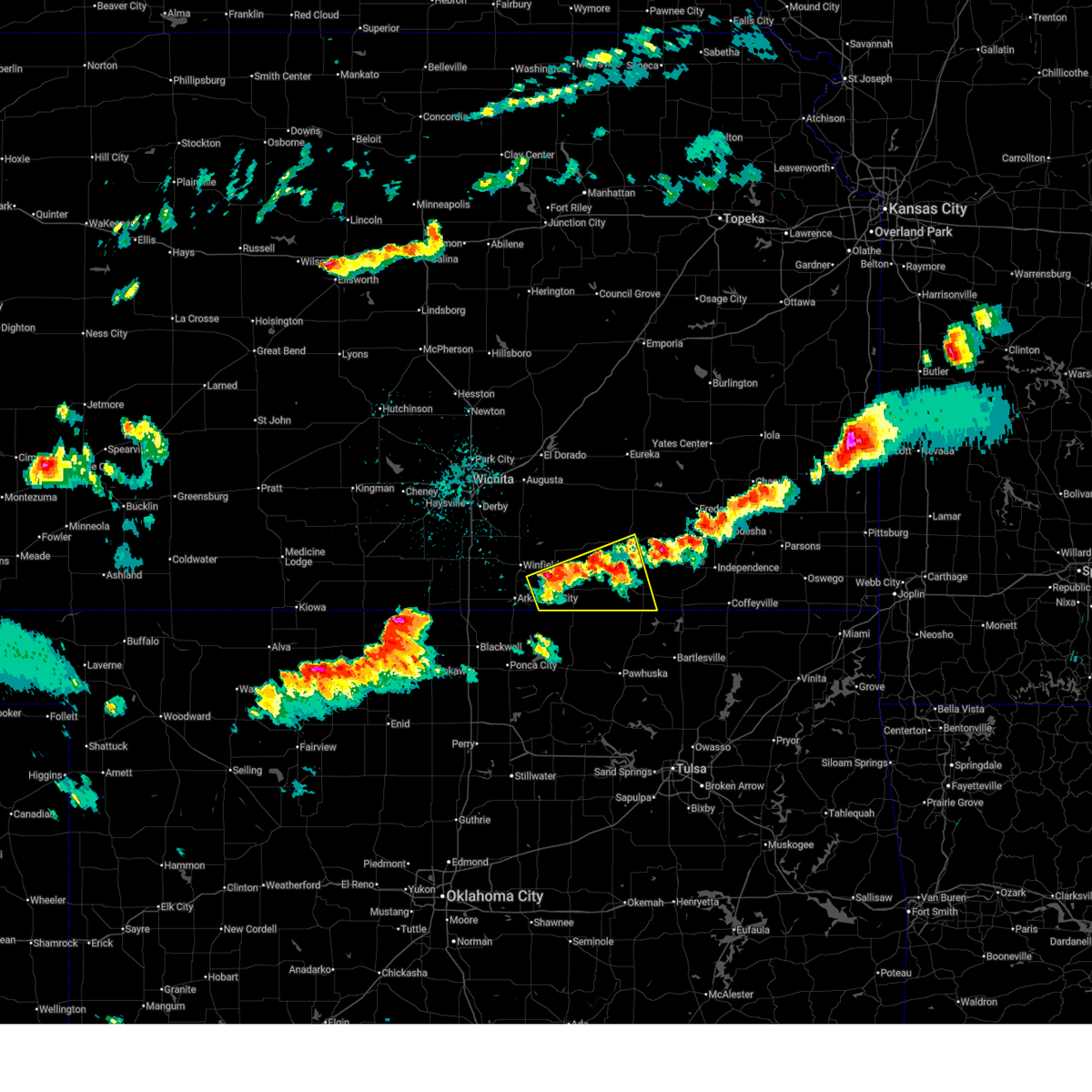 Svrict the national weather service in wichita has issued a * severe thunderstorm warning for, southwestern elk county in southeastern kansas, southeastern cowley county in south central kansas, chautauqua county in southeastern kansas, * until 415 pm cdt. * at 316 pm cdt, a severe thunderstorm was located near dexter, or 14 miles west of cedar vale, moving southeast at 15 mph (radar indicated). Hazards include 60 mph wind gusts and half dollar size hail. Hail damage to vehicles is expected. Expect wind damage to roofs, siding, and trees. Svrict the national weather service in wichita has issued a * severe thunderstorm warning for, southwestern elk county in southeastern kansas, southeastern cowley county in south central kansas, chautauqua county in southeastern kansas, * until 415 pm cdt. * at 316 pm cdt, a severe thunderstorm was located near dexter, or 14 miles west of cedar vale, moving southeast at 15 mph (radar indicated). Hazards include 60 mph wind gusts and half dollar size hail. Hail damage to vehicles is expected. Expect wind damage to roofs, siding, and trees.
|
| 6/7/2025 3:39 AM CDT |
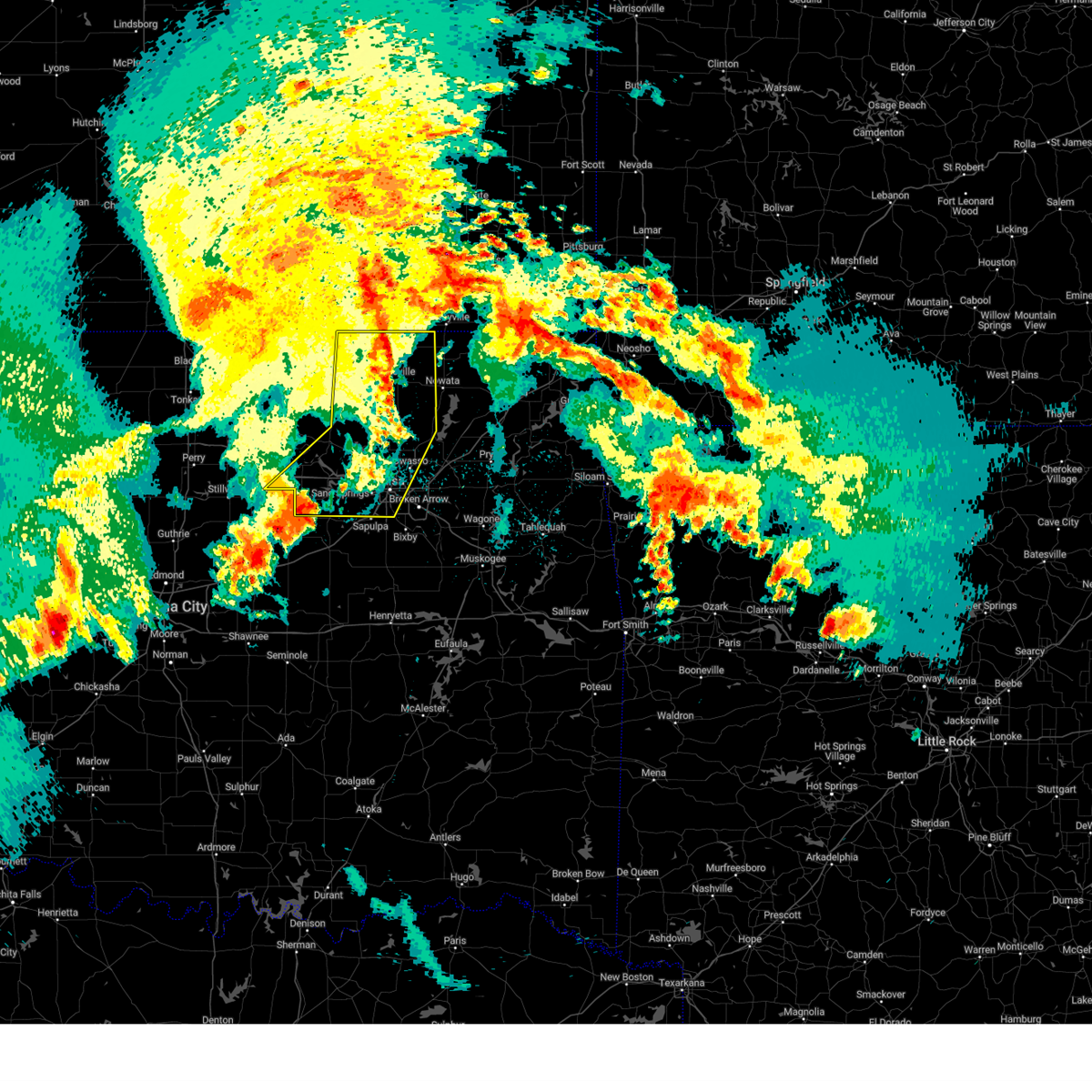 At 339 am cdt, severe thunderstorms were located along a line extending from 3 miles east of hulah to 2 miles south of ramona to 2 miles west of sand springs, moving east at 55 mph (radar indicated). Hazards include 60 mph wind gusts. Expect damage to roofs, siding, and trees. Locations in or near the path include, barnsdall, sand springs, bigheart, wann, mannford, dewey, hallett, bartlesville municipal airport, collinsville, jenks riverside airport, jennings, tallant, sperry, pawhuska, cleveland, osage hills state park, skiatook, pershing, ramona, vera, this includes interstate 44 between mile markers 212 and 226. At 339 am cdt, severe thunderstorms were located along a line extending from 3 miles east of hulah to 2 miles south of ramona to 2 miles west of sand springs, moving east at 55 mph (radar indicated). Hazards include 60 mph wind gusts. Expect damage to roofs, siding, and trees. Locations in or near the path include, barnsdall, sand springs, bigheart, wann, mannford, dewey, hallett, bartlesville municipal airport, collinsville, jenks riverside airport, jennings, tallant, sperry, pawhuska, cleveland, osage hills state park, skiatook, pershing, ramona, vera, this includes interstate 44 between mile markers 212 and 226.
|
| 6/7/2025 3:27 AM CDT |
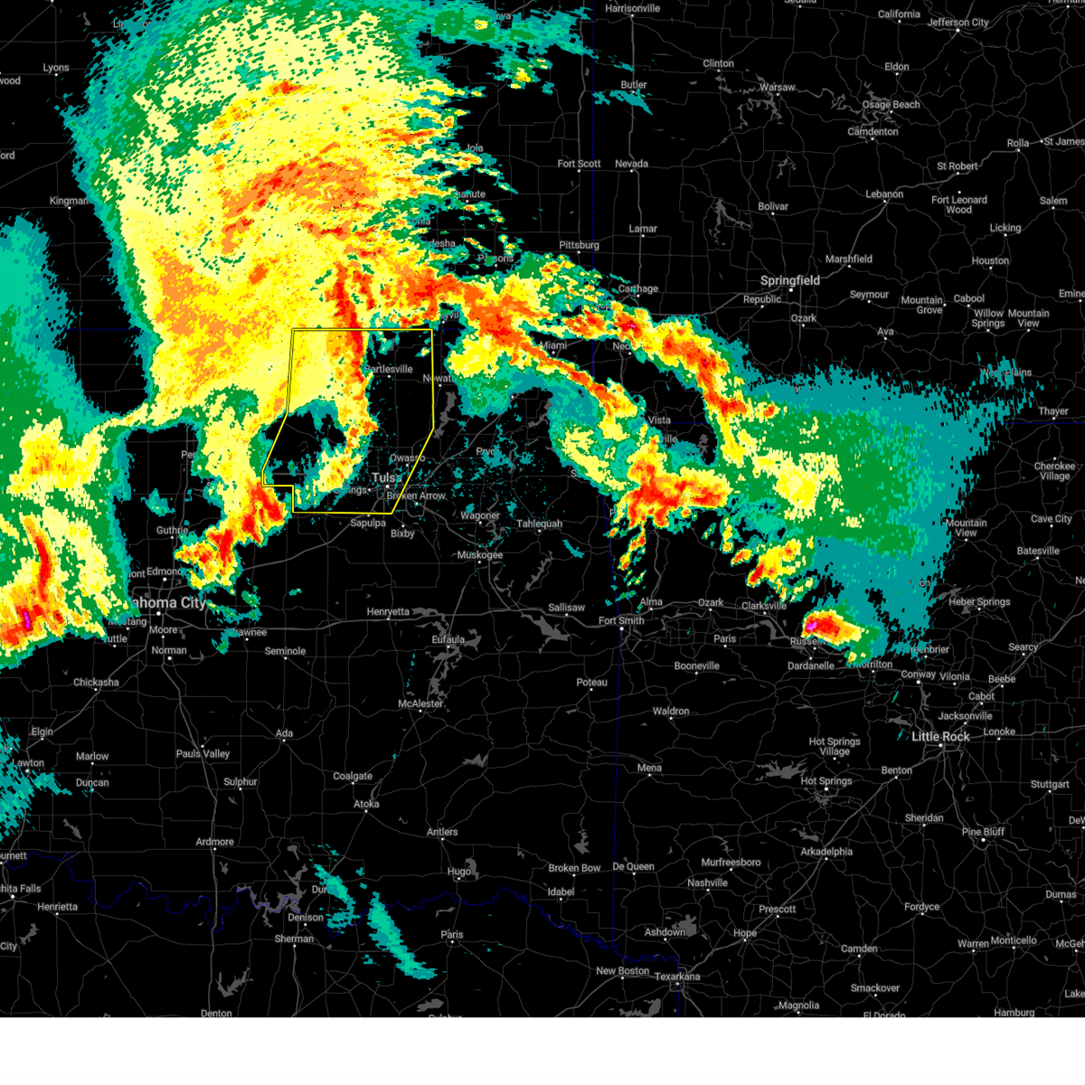 At 326 am cdt, severe thunderstorms were located along a line extending from 5 miles south of chautauqua to 3 miles southeast of barnsdall to near mannford, moving east at 55 mph (radar indicated). Hazards include 60 to 70 mph wind gusts. Expect considerable tree damage. damage is likely to mobile homes, roofs, and outbuildings. Locations in or near the path include, barnsdall, sand springs, wann, collinsville, jenks riverside airport, pawhuska, osage hills state park, vera, nelagoney, wolco, owasso, keystone state park, hominy, oilton, ochelata, sunset lake, tulsa, silver city, maramec, bartlesville, this includes interstate 44 between mile markers 212 and 226. At 326 am cdt, severe thunderstorms were located along a line extending from 5 miles south of chautauqua to 3 miles southeast of barnsdall to near mannford, moving east at 55 mph (radar indicated). Hazards include 60 to 70 mph wind gusts. Expect considerable tree damage. damage is likely to mobile homes, roofs, and outbuildings. Locations in or near the path include, barnsdall, sand springs, wann, collinsville, jenks riverside airport, pawhuska, osage hills state park, vera, nelagoney, wolco, owasso, keystone state park, hominy, oilton, ochelata, sunset lake, tulsa, silver city, maramec, bartlesville, this includes interstate 44 between mile markers 212 and 226.
|
| 6/7/2025 3:11 AM CDT |
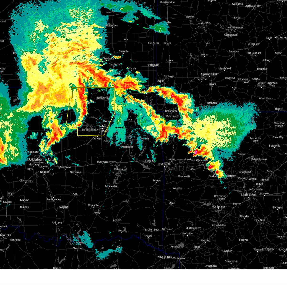 Svrtsa the national weather service in tulsa has issued a * severe thunderstorm warning for, northwestern rogers county in northeastern oklahoma, osage county in northeastern oklahoma, northern creek county in northeastern oklahoma, washington county in northeastern oklahoma, western nowata county in northeastern oklahoma, pawnee county in northeastern oklahoma, central tulsa county in northeastern oklahoma, * until 400 am cdt. * at 310 am cdt, severe thunderstorms were located along a line extending from 9 miles northeast of foraker to 4 miles west of wynona to 3 miles southwest of jennings, moving east at 55 mph (radar indicated). Hazards include 60 to 70 mph wind gusts and penny size hail. Expect considerable tree damage. damage is likely to mobile homes, roofs, and outbuildings. Locations in or near the path include, barnsdall, sand springs, wann, collinsville, jenks riverside airport, pawhuska, ralston, osage hills state park, grainola, vera, nelagoney, wolco, owasso, keystone state park, hominy, oilton, ochelata, apperson, sunset lake, fairfax, this includes interstate 44 between mile markers 212 and 226. Svrtsa the national weather service in tulsa has issued a * severe thunderstorm warning for, northwestern rogers county in northeastern oklahoma, osage county in northeastern oklahoma, northern creek county in northeastern oklahoma, washington county in northeastern oklahoma, western nowata county in northeastern oklahoma, pawnee county in northeastern oklahoma, central tulsa county in northeastern oklahoma, * until 400 am cdt. * at 310 am cdt, severe thunderstorms were located along a line extending from 9 miles northeast of foraker to 4 miles west of wynona to 3 miles southwest of jennings, moving east at 55 mph (radar indicated). Hazards include 60 to 70 mph wind gusts and penny size hail. Expect considerable tree damage. damage is likely to mobile homes, roofs, and outbuildings. Locations in or near the path include, barnsdall, sand springs, wann, collinsville, jenks riverside airport, pawhuska, ralston, osage hills state park, grainola, vera, nelagoney, wolco, owasso, keystone state park, hominy, oilton, ochelata, apperson, sunset lake, fairfax, this includes interstate 44 between mile markers 212 and 226.
|
| 6/7/2025 3:00 AM CDT |
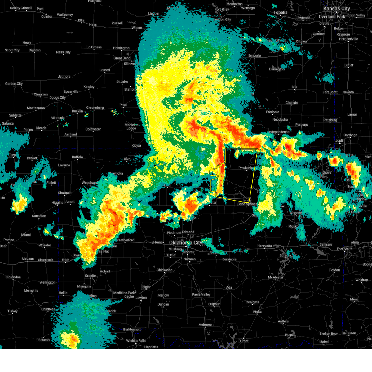 At 259 am cdt, severe thunderstorms were located along a line extending from near grainola to skedee, moving east at 60 mph (radar indicated). Hazards include 70 mph wind gusts and nickel size hail. Expect considerable tree damage. damage is likely to mobile homes, roofs, and outbuildings. Locations in or near the path include, bigheart, skedee, hallett, pawhuska, cleveland, blackburn, ralston, osage hills state park, pershing, foraker, grainola, nelagoney, shidler, pawnee, westport, hominy, pearsonia, walnut creek state park, wynona, webb city,. At 259 am cdt, severe thunderstorms were located along a line extending from near grainola to skedee, moving east at 60 mph (radar indicated). Hazards include 70 mph wind gusts and nickel size hail. Expect considerable tree damage. damage is likely to mobile homes, roofs, and outbuildings. Locations in or near the path include, bigheart, skedee, hallett, pawhuska, cleveland, blackburn, ralston, osage hills state park, pershing, foraker, grainola, nelagoney, shidler, pawnee, westport, hominy, pearsonia, walnut creek state park, wynona, webb city,.
|
| 6/7/2025 2:52 AM CDT |
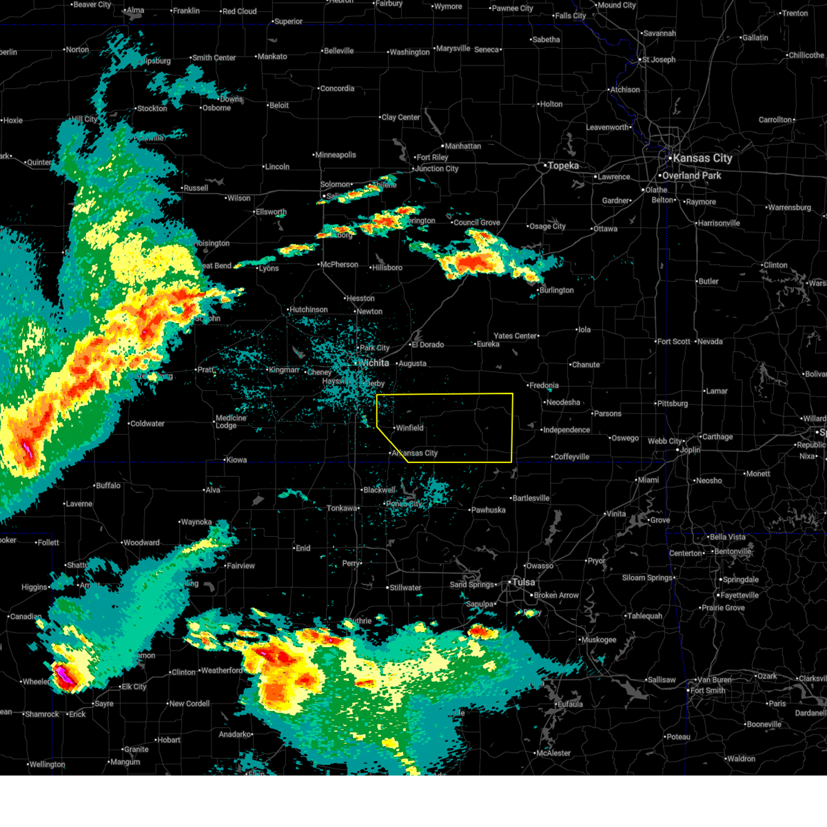 Svrict the national weather service in wichita has issued a * severe thunderstorm warning for, southern elk county in southeastern kansas, cowley county in south central kansas, chautauqua county in southeastern kansas, * until 345 am cdt. * at 252 am cdt, a severe thunderstorm was located 5 miles south of dexter, moving east at 60 mph (radar indicated). Hazards include 60 mph wind gusts. expect damage to roofs, siding, and trees Svrict the national weather service in wichita has issued a * severe thunderstorm warning for, southern elk county in southeastern kansas, cowley county in south central kansas, chautauqua county in southeastern kansas, * until 345 am cdt. * at 252 am cdt, a severe thunderstorm was located 5 miles south of dexter, moving east at 60 mph (radar indicated). Hazards include 60 mph wind gusts. expect damage to roofs, siding, and trees
|
| 6/7/2025 2:32 AM CDT |
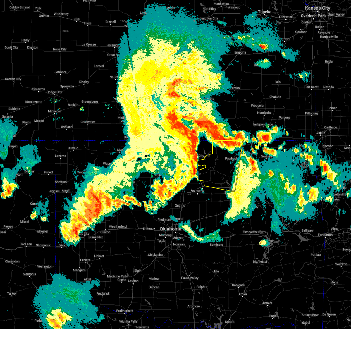 Svrtsa the national weather service in tulsa has issued a * severe thunderstorm warning for, osage county in northeastern oklahoma, pawnee county in northeastern oklahoma, * until 315 am cdt. * at 232 am cdt, severe thunderstorms were located along a line extending from 2 miles southeast of chilocco to 5 miles southeast of red rock, moving east at 60 mph (radar indicated). Hazards include 70 mph wind gusts and nickel size hail. Expect considerable tree damage. damage is likely to mobile homes, roofs, and outbuildings. Locations in or near the path include, bigheart, skedee, hallett, pawhuska, cleveland, blackburn, ralston, osage hills state park, pershing, foraker, grainola, nelagoney, shidler, pawnee, westport, hominy, pearsonia, walnut creek state park, wynona, webb city,. Svrtsa the national weather service in tulsa has issued a * severe thunderstorm warning for, osage county in northeastern oklahoma, pawnee county in northeastern oklahoma, * until 315 am cdt. * at 232 am cdt, severe thunderstorms were located along a line extending from 2 miles southeast of chilocco to 5 miles southeast of red rock, moving east at 60 mph (radar indicated). Hazards include 70 mph wind gusts and nickel size hail. Expect considerable tree damage. damage is likely to mobile homes, roofs, and outbuildings. Locations in or near the path include, bigheart, skedee, hallett, pawhuska, cleveland, blackburn, ralston, osage hills state park, pershing, foraker, grainola, nelagoney, shidler, pawnee, westport, hominy, pearsonia, walnut creek state park, wynona, webb city,.
|
| 6/7/2025 2:29 AM CDT |
 Svrict the national weather service in wichita has issued a * severe thunderstorm warning for, southeastern cowley county in south central kansas, chautauqua county in southeastern kansas, * until 300 am cdt. * at 229 am cdt, a severe thunderstorm was located 8 miles northeast of foraker, moving northeast at 55 mph (radar indicated). Hazards include 60 mph wind gusts and quarter size hail. Hail damage to vehicles is expected. Expect wind damage to roofs, siding, and trees. Svrict the national weather service in wichita has issued a * severe thunderstorm warning for, southeastern cowley county in south central kansas, chautauqua county in southeastern kansas, * until 300 am cdt. * at 229 am cdt, a severe thunderstorm was located 8 miles northeast of foraker, moving northeast at 55 mph (radar indicated). Hazards include 60 mph wind gusts and quarter size hail. Hail damage to vehicles is expected. Expect wind damage to roofs, siding, and trees.
|
| 6/7/2025 2:28 AM CDT |
 At 228 am cdt, a severe thunderstorm was located 7 miles northeast of foraker, moving northeast at 50 mph (radar indicated). Hazards include 60 mph wind gusts and quarter size hail. Hail damage to vehicles is expected. expect wind damage to roofs, siding, and trees. Locations in or near the path include, foraker, grainola,. At 228 am cdt, a severe thunderstorm was located 7 miles northeast of foraker, moving northeast at 50 mph (radar indicated). Hazards include 60 mph wind gusts and quarter size hail. Hail damage to vehicles is expected. expect wind damage to roofs, siding, and trees. Locations in or near the path include, foraker, grainola,.
|
| 6/7/2025 2:13 AM CDT |
 Svrtsa the national weather service in tulsa has issued a * severe thunderstorm warning for, north central osage county in northeastern oklahoma, * until 245 am cdt. * at 213 am cdt, a severe thunderstorm was located near shidler, moving northeast at 50 mph (radar indicated). Hazards include 60 mph wind gusts and quarter size hail. Hail damage to vehicles is expected. expect wind damage to roofs, siding, and trees. Locations in or near the path include, foraker, grainola, shidler, webb city,. Svrtsa the national weather service in tulsa has issued a * severe thunderstorm warning for, north central osage county in northeastern oklahoma, * until 245 am cdt. * at 213 am cdt, a severe thunderstorm was located near shidler, moving northeast at 50 mph (radar indicated). Hazards include 60 mph wind gusts and quarter size hail. Hail damage to vehicles is expected. expect wind damage to roofs, siding, and trees. Locations in or near the path include, foraker, grainola, shidler, webb city,.
|
| 6/3/2025 5:42 PM CDT |
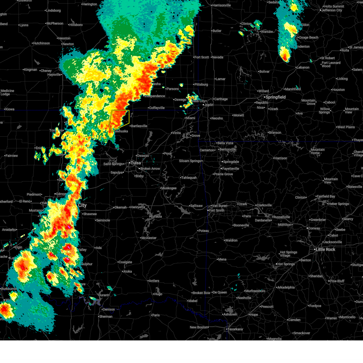 The storm which prompted the warning has weakened below severe limits, and no longer poses an immediate threat to life or property. therefore, the warning will be allowed to expire. however, gusty winds to 50 mph are still possible with this thunderstorm. a severe thunderstorm watch remains in effect until 900 pm cdt for northeastern oklahoma. The storm which prompted the warning has weakened below severe limits, and no longer poses an immediate threat to life or property. therefore, the warning will be allowed to expire. however, gusty winds to 50 mph are still possible with this thunderstorm. a severe thunderstorm watch remains in effect until 900 pm cdt for northeastern oklahoma.
|
| 6/3/2025 5:35 PM CDT |
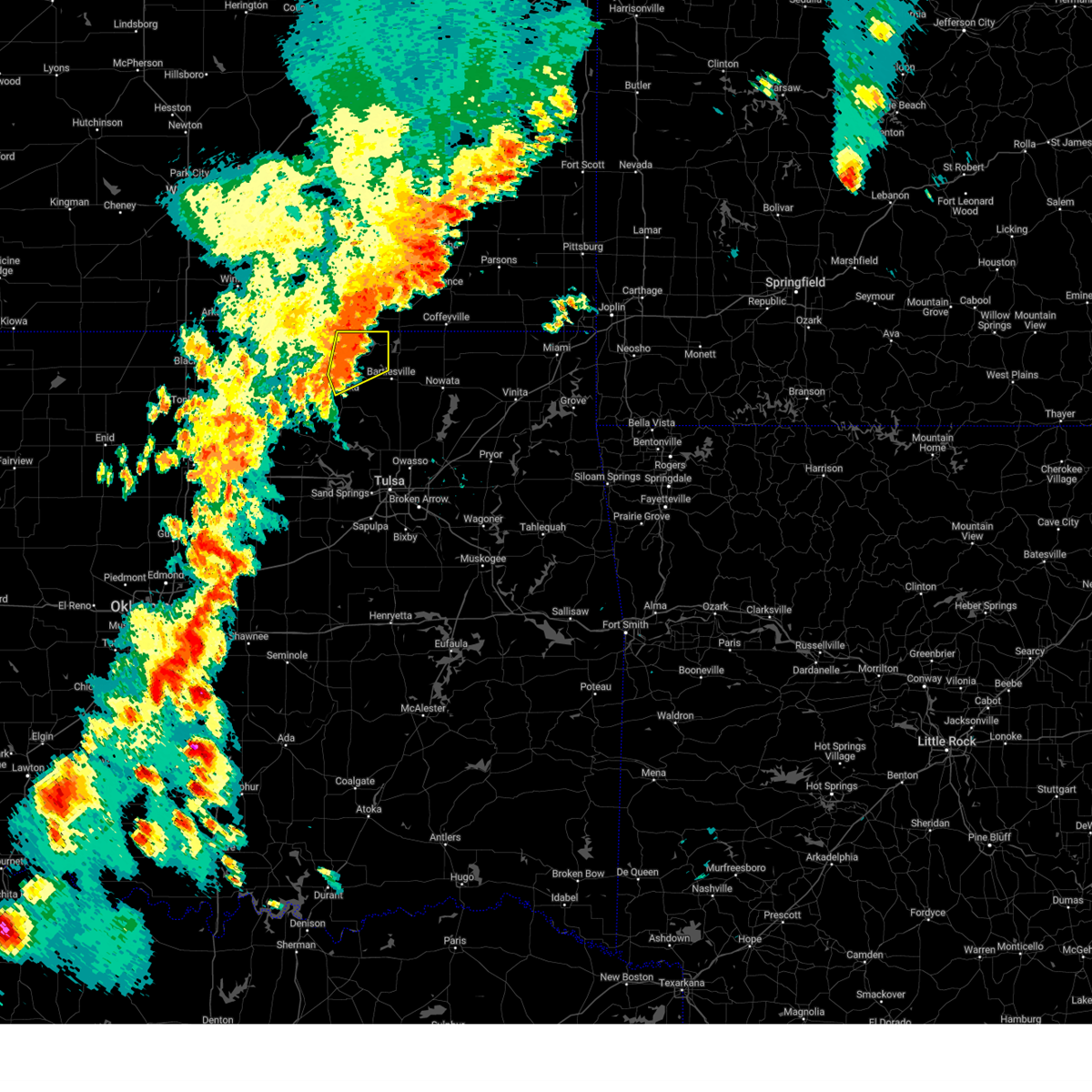 At 535 pm cdt, a severe thunderstorm was located near osage hills state park, moving northeast at 35 mph (radar indicated). Hazards include 60 mph wind gusts. Expect damage to roofs, siding, and trees. Locations in or near the path include, bigheart, osage hills state park, wah sha she state park, hulah, pawhuska, sunset lake,. At 535 pm cdt, a severe thunderstorm was located near osage hills state park, moving northeast at 35 mph (radar indicated). Hazards include 60 mph wind gusts. Expect damage to roofs, siding, and trees. Locations in or near the path include, bigheart, osage hills state park, wah sha she state park, hulah, pawhuska, sunset lake,.
|
| 6/3/2025 5:20 PM CDT |
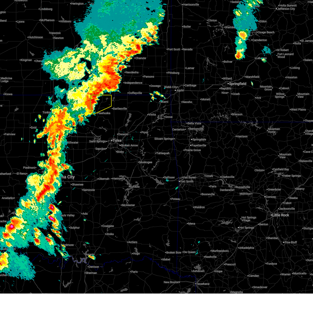 At 520 pm cdt, a severe thunderstorm was located 5 miles east of pearsonia, moving northeast at 50 mph (radar indicated). Hazards include 60 mph wind gusts and penny size hail. Expect damage to roofs, siding, and trees. Locations in or near the path include, bigheart, osage hills state park, pearsonia, wah sha she state park, hulah, pawhuska, sunset lake,. At 520 pm cdt, a severe thunderstorm was located 5 miles east of pearsonia, moving northeast at 50 mph (radar indicated). Hazards include 60 mph wind gusts and penny size hail. Expect damage to roofs, siding, and trees. Locations in or near the path include, bigheart, osage hills state park, pearsonia, wah sha she state park, hulah, pawhuska, sunset lake,.
|
| 6/3/2025 5:09 PM CDT |
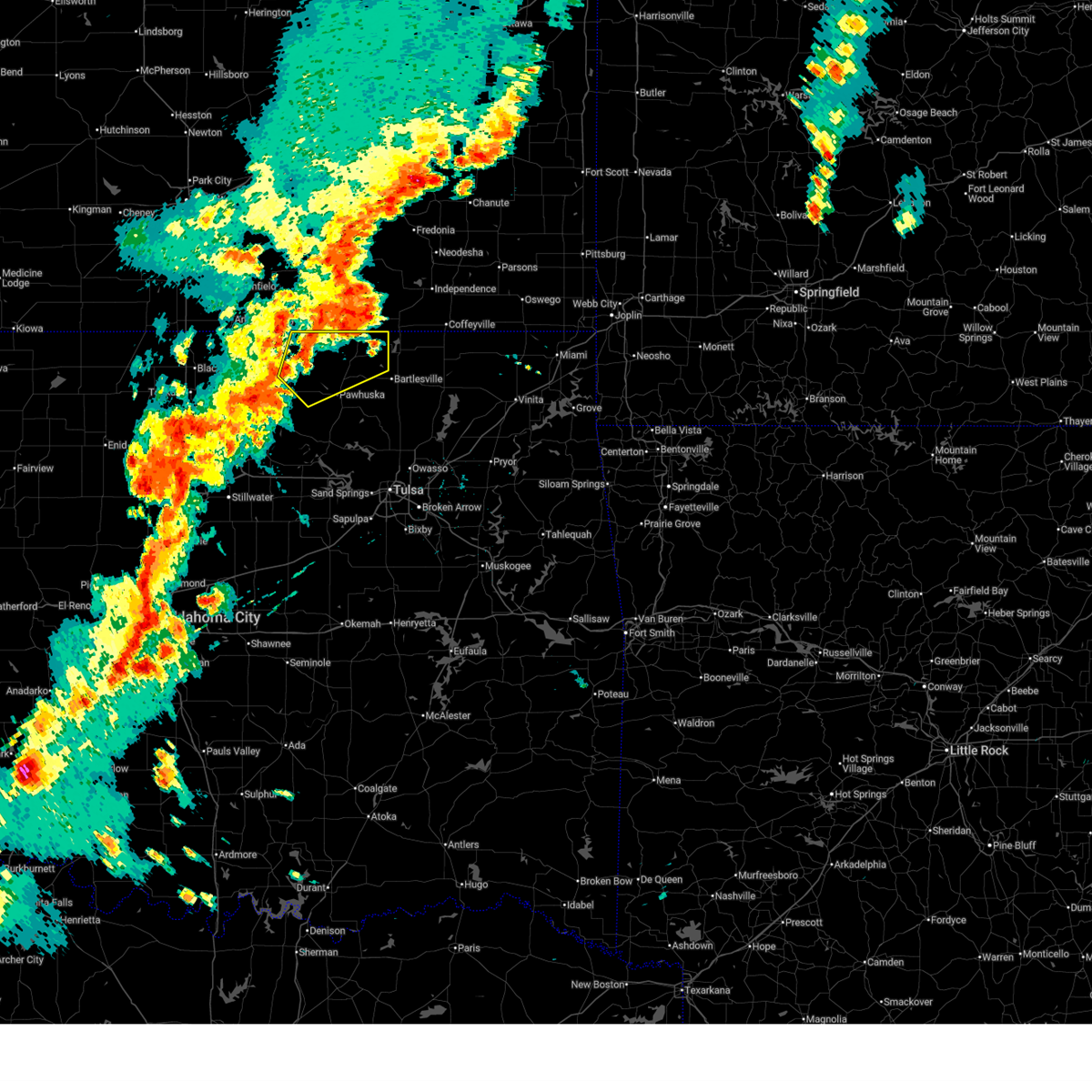 At 509 pm cdt, a severe thunderstorm was located 4 miles southwest of pearsonia, moving northeast at 50 mph (radar indicated). Hazards include 60 mph wind gusts and nickel size hail. Expect damage to roofs, siding, and trees. Locations in or near the path include, bigheart, osage hills state park, foraker, grainola, pearsonia, wah sha she state park, webb city, shidler, hulah, sunset lake, pawhuska,. At 509 pm cdt, a severe thunderstorm was located 4 miles southwest of pearsonia, moving northeast at 50 mph (radar indicated). Hazards include 60 mph wind gusts and nickel size hail. Expect damage to roofs, siding, and trees. Locations in or near the path include, bigheart, osage hills state park, foraker, grainola, pearsonia, wah sha she state park, webb city, shidler, hulah, sunset lake, pawhuska,.
|
| 6/3/2025 4:50 PM CDT |
 Svrtsa the national weather service in tulsa has issued a * severe thunderstorm warning for, northeastern osage county in northeastern oklahoma, * until 545 pm cdt. * at 450 pm cdt, a severe thunderstorm was located 3 miles south of burbank, moving northeast at 55 mph (radar indicated). Hazards include 60 mph wind gusts and nickel size hail. Expect damage to roofs, siding, and trees. Locations in or near the path include, bigheart, pearsonia, wah sha she state park, webb city, hulah, apperson, pawhuska, burbank, sunset lake, osage hills state park, foraker, grainola, shidler, fairfax,. Svrtsa the national weather service in tulsa has issued a * severe thunderstorm warning for, northeastern osage county in northeastern oklahoma, * until 545 pm cdt. * at 450 pm cdt, a severe thunderstorm was located 3 miles south of burbank, moving northeast at 55 mph (radar indicated). Hazards include 60 mph wind gusts and nickel size hail. Expect damage to roofs, siding, and trees. Locations in or near the path include, bigheart, pearsonia, wah sha she state park, webb city, hulah, apperson, pawhuska, burbank, sunset lake, osage hills state park, foraker, grainola, shidler, fairfax,.
|
| 5/25/2025 1:24 AM CDT |
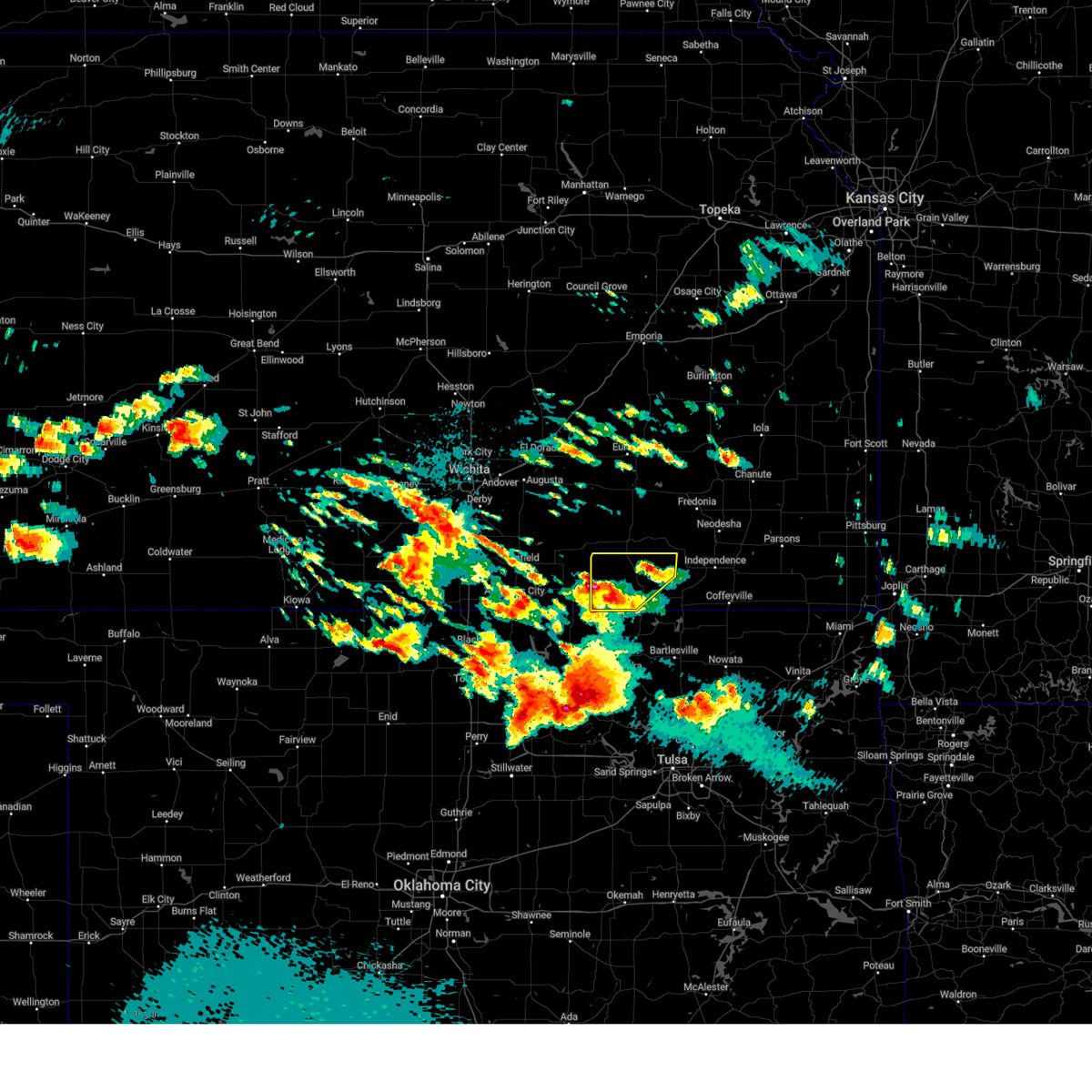 Svrict the national weather service in wichita has issued a * severe thunderstorm warning for, chautauqua county in southeastern kansas, * until 230 am cdt. * at 123 am cdt, a severe thunderstorm was located near cedar vale, moving northeast at 25 mph (radar indicated). Hazards include quarter size hail. damage to vehicles is expected Svrict the national weather service in wichita has issued a * severe thunderstorm warning for, chautauqua county in southeastern kansas, * until 230 am cdt. * at 123 am cdt, a severe thunderstorm was located near cedar vale, moving northeast at 25 mph (radar indicated). Hazards include quarter size hail. damage to vehicles is expected
|
| 5/24/2025 5:13 AM CDT |
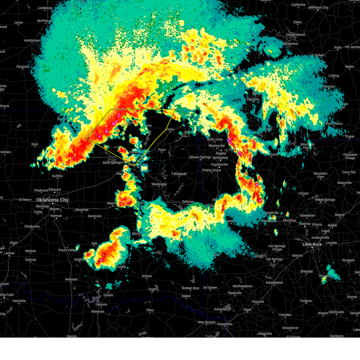 Svrtsa the national weather service in tulsa has issued a * severe thunderstorm warning for, western craig county in northeastern oklahoma, northern rogers county in northeastern oklahoma, osage county in northeastern oklahoma, washington county in northeastern oklahoma, nowata county in northeastern oklahoma, north central pawnee county in northeastern oklahoma, northeastern tulsa county in northeastern oklahoma, * until 600 am cdt. * at 513 am cdt, severe thunderstorms were located along a line extending from 4 miles north of hulah to 9 miles north of blackburn, moving southeast at 65 mph (radar indicated). Hazards include 60 mph wind gusts and nickel size hail. Expect damage to roofs, siding, and trees. Locations in or near the path include, barnsdall, bigheart, wann, dewey, bartlesville municipal airport, collinsville, tallant, sperry, pawhuska, ralston, osage hills state park, skiatook, pershing, watova, ramona, vera, talala, chelsea, nelagoney, foyil, this includes interstate 44 between mile markers 226 and 233. Svrtsa the national weather service in tulsa has issued a * severe thunderstorm warning for, western craig county in northeastern oklahoma, northern rogers county in northeastern oklahoma, osage county in northeastern oklahoma, washington county in northeastern oklahoma, nowata county in northeastern oklahoma, north central pawnee county in northeastern oklahoma, northeastern tulsa county in northeastern oklahoma, * until 600 am cdt. * at 513 am cdt, severe thunderstorms were located along a line extending from 4 miles north of hulah to 9 miles north of blackburn, moving southeast at 65 mph (radar indicated). Hazards include 60 mph wind gusts and nickel size hail. Expect damage to roofs, siding, and trees. Locations in or near the path include, barnsdall, bigheart, wann, dewey, bartlesville municipal airport, collinsville, tallant, sperry, pawhuska, ralston, osage hills state park, skiatook, pershing, watova, ramona, vera, talala, chelsea, nelagoney, foyil, this includes interstate 44 between mile markers 226 and 233.
|
| 5/24/2025 5:10 AM CDT |
 At 510 am cdt, severe thunderstorms were located along a line extending from 5 miles southeast of elk city to near elgin, moving east at 50 mph (radar indicated). Hazards include 60 mph wind gusts. Expect damage to roofs, siding, and trees. Locations impacted include, caney, sedan, peru, chautauqua, havana, elgin, niotaze, and hale. At 510 am cdt, severe thunderstorms were located along a line extending from 5 miles southeast of elk city to near elgin, moving east at 50 mph (radar indicated). Hazards include 60 mph wind gusts. Expect damage to roofs, siding, and trees. Locations impacted include, caney, sedan, peru, chautauqua, havana, elgin, niotaze, and hale.
|
| 5/24/2025 5:09 AM CDT |
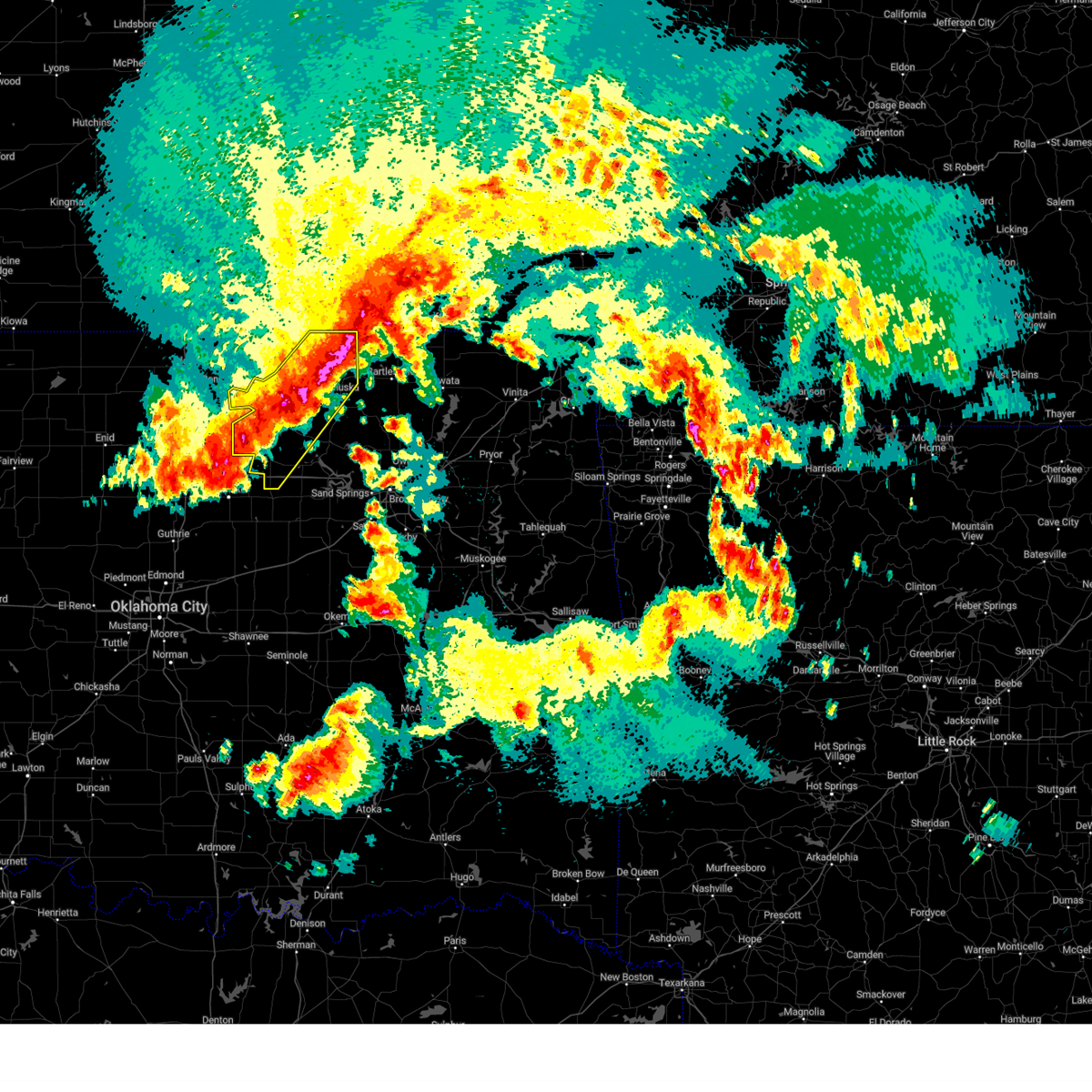 At 508 am cdt, severe thunderstorms were located along a line extending from 3 miles south of elgin to 4 miles east of morrison, moving east at 50 mph (trained weather spotters. at 458 am cdt, 60 to 70 mph winds and nickel sized hail were reported in burbank. the burbank mesonet also gusted to 61 mph). Hazards include 60 mph wind gusts and nickel size hail. Expect damage to roofs, siding, and trees. Locations in or near the path include, bigheart, pearsonia, skedee, webb city, apperson, pawhuska, burbank, sunset lake, fairfax, blackburn, ralston, foraker, maramec, shidler, pawnee,. At 508 am cdt, severe thunderstorms were located along a line extending from 3 miles south of elgin to 4 miles east of morrison, moving east at 50 mph (trained weather spotters. at 458 am cdt, 60 to 70 mph winds and nickel sized hail were reported in burbank. the burbank mesonet also gusted to 61 mph). Hazards include 60 mph wind gusts and nickel size hail. Expect damage to roofs, siding, and trees. Locations in or near the path include, bigheart, pearsonia, skedee, webb city, apperson, pawhuska, burbank, sunset lake, fairfax, blackburn, ralston, foraker, maramec, shidler, pawnee,.
|
| 5/24/2025 4:51 AM CDT |
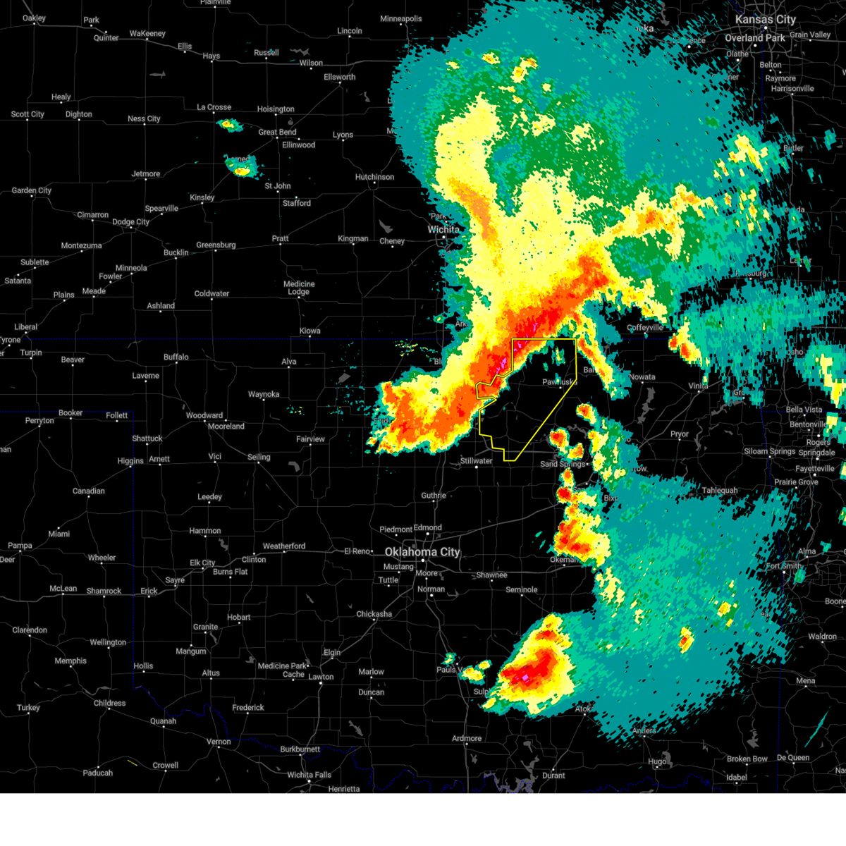 At 451 am cdt, severe thunderstorms were located along a line extending from 6 miles northeast of grainola to 7 miles west of morrison, moving east at 55 mph (radar indicated). Hazards include 60 mph wind gusts and penny size hail. Expect damage to roofs, siding, and trees. Locations in or near the path include, bigheart, pearsonia, skedee, webb city, apperson, pawhuska, burbank, sunset lake, fairfax, blackburn, ralston, foraker, maramec, grainola, shidler, pawnee,. At 451 am cdt, severe thunderstorms were located along a line extending from 6 miles northeast of grainola to 7 miles west of morrison, moving east at 55 mph (radar indicated). Hazards include 60 mph wind gusts and penny size hail. Expect damage to roofs, siding, and trees. Locations in or near the path include, bigheart, pearsonia, skedee, webb city, apperson, pawhuska, burbank, sunset lake, fairfax, blackburn, ralston, foraker, maramec, grainola, shidler, pawnee,.
|
| 5/24/2025 4:48 AM CDT |
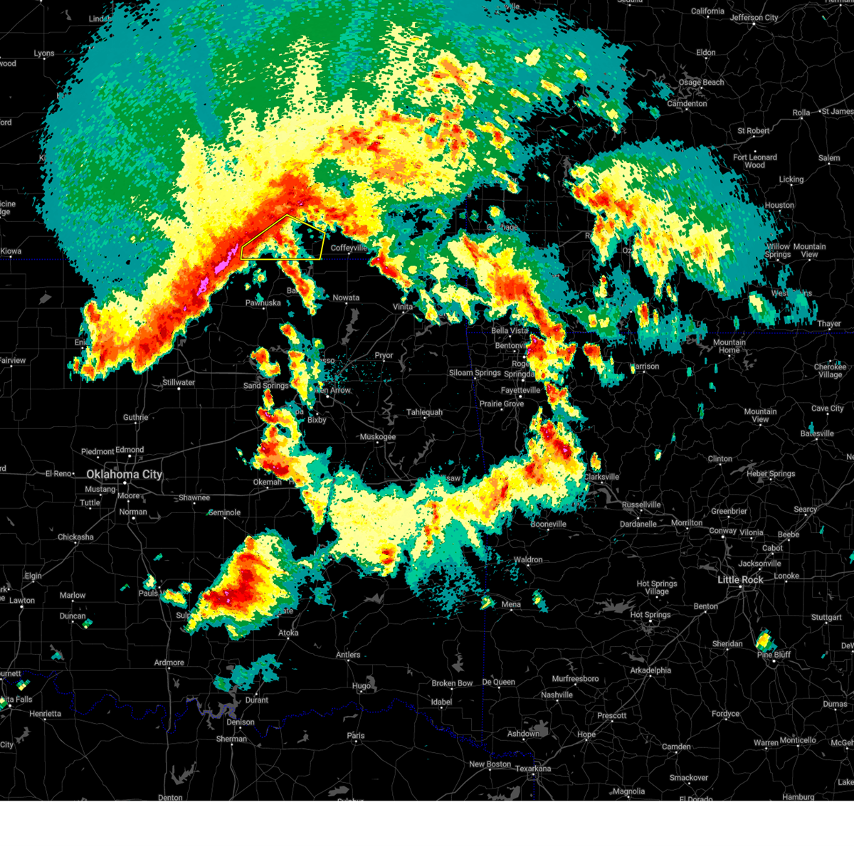 Svrict the national weather service in wichita has issued a * severe thunderstorm warning for, southwestern montgomery county in southeastern kansas, chautauqua county in southeastern kansas, * until 545 am cdt. * at 448 am cdt, severe thunderstorms were located along a line extending from 7 miles south of elk falls to 6 miles northeast of grainola, moving east at 50 mph (radar indicated). Hazards include 60 mph wind gusts. expect damage to roofs, siding, and trees Svrict the national weather service in wichita has issued a * severe thunderstorm warning for, southwestern montgomery county in southeastern kansas, chautauqua county in southeastern kansas, * until 545 am cdt. * at 448 am cdt, severe thunderstorms were located along a line extending from 7 miles south of elk falls to 6 miles northeast of grainola, moving east at 50 mph (radar indicated). Hazards include 60 mph wind gusts. expect damage to roofs, siding, and trees
|
| 5/24/2025 4:39 AM CDT |
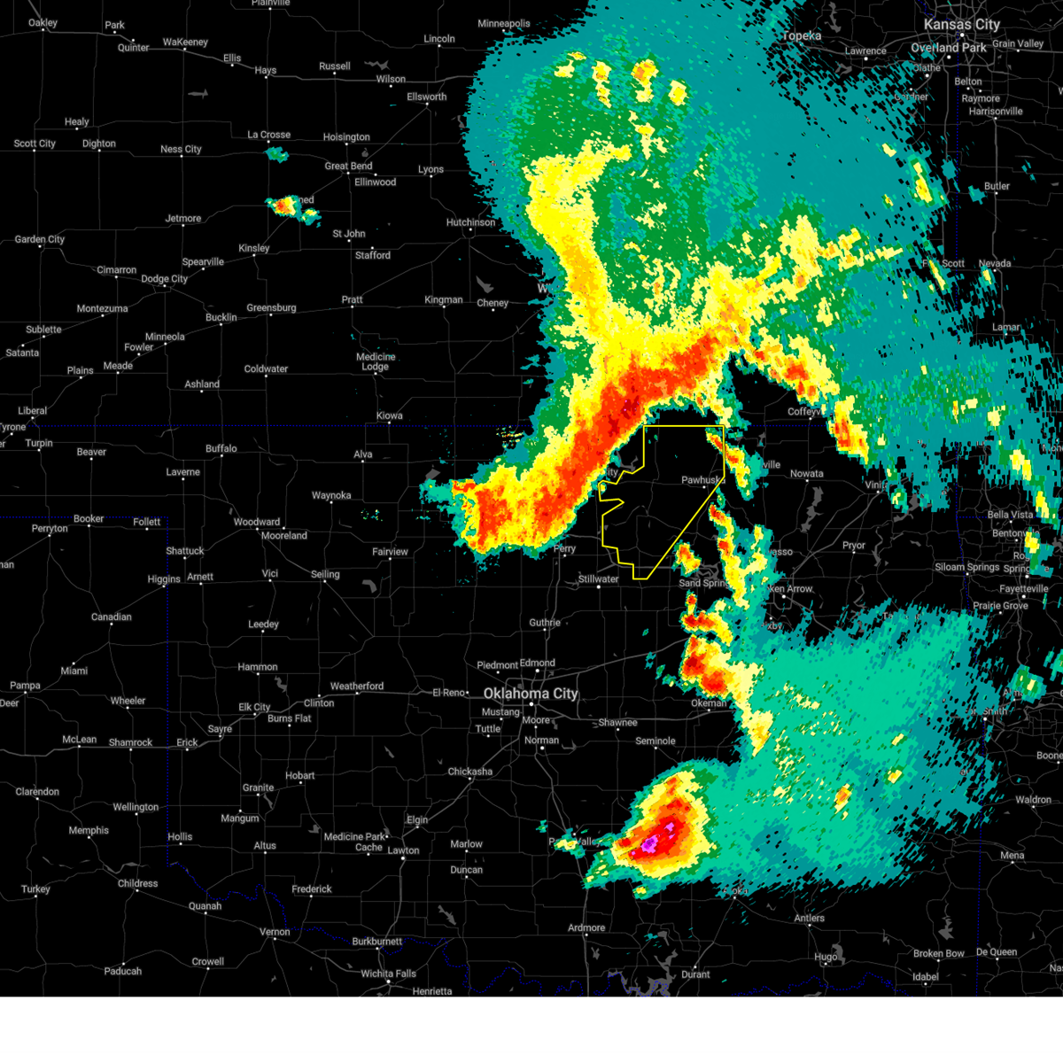 Svrtsa the national weather service in tulsa has issued a * severe thunderstorm warning for, northwestern osage county in northeastern oklahoma, pawnee county in northeastern oklahoma, * until 530 am cdt. * at 439 am cdt, severe thunderstorms were located along a line extending from 2 miles northeast of hardy to 5 miles northwest of perry, moving southeast at 50 mph (radar indicated). Hazards include 60 mph wind gusts and penny size hail. Expect damage to roofs, siding, and trees. Locations in or near the path include, bigheart, pearsonia, skedee, webb city, apperson, pawhuska, burbank, sunset lake, fairfax, blackburn, ralston, foraker, maramec, grainola, shidler, pawnee,. Svrtsa the national weather service in tulsa has issued a * severe thunderstorm warning for, northwestern osage county in northeastern oklahoma, pawnee county in northeastern oklahoma, * until 530 am cdt. * at 439 am cdt, severe thunderstorms were located along a line extending from 2 miles northeast of hardy to 5 miles northwest of perry, moving southeast at 50 mph (radar indicated). Hazards include 60 mph wind gusts and penny size hail. Expect damage to roofs, siding, and trees. Locations in or near the path include, bigheart, pearsonia, skedee, webb city, apperson, pawhuska, burbank, sunset lake, fairfax, blackburn, ralston, foraker, maramec, grainola, shidler, pawnee,.
|
| 5/18/2025 12:13 AM CDT |
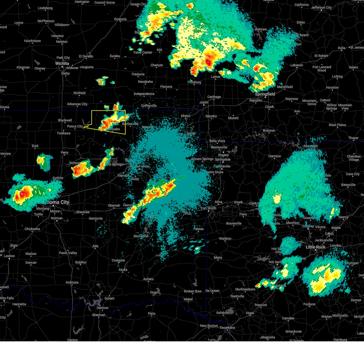 The storm which prompted the warning has weakened below severe limits, and no longer poses an immediate threat to life or property. therefore, the warning will be allowed to expire. a severe thunderstorm watch remains in effect until 400 am cdt for northeastern oklahoma. The storm which prompted the warning has weakened below severe limits, and no longer poses an immediate threat to life or property. therefore, the warning will be allowed to expire. a severe thunderstorm watch remains in effect until 400 am cdt for northeastern oklahoma.
|
| 5/17/2025 11:40 PM CDT |
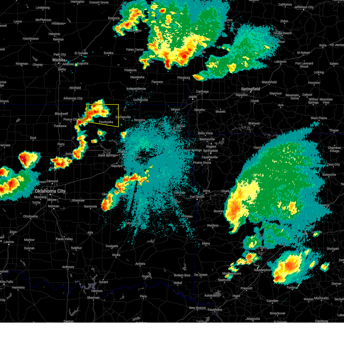 At 1139 pm cdt, a severe thunderstorm was located over foraker, moving east at 35 mph (radar indicated). Hazards include 60 mph wind gusts and quarter size hail. Hail damage to vehicles is expected. expect wind damage to roofs, siding, and trees. Locations in or near the path include, bigheart, osage hills state park, foraker, grainola, pearsonia, wah sha she state park, webb city, shidler, okesa, apperson, pawhuska, sunset lake,. At 1139 pm cdt, a severe thunderstorm was located over foraker, moving east at 35 mph (radar indicated). Hazards include 60 mph wind gusts and quarter size hail. Hail damage to vehicles is expected. expect wind damage to roofs, siding, and trees. Locations in or near the path include, bigheart, osage hills state park, foraker, grainola, pearsonia, wah sha she state park, webb city, shidler, okesa, apperson, pawhuska, sunset lake,.
|
| 5/17/2025 11:21 PM CDT |
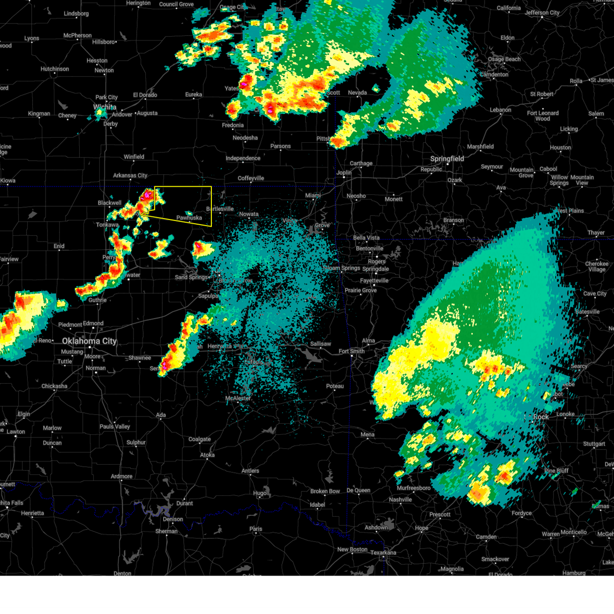 Svrtsa the national weather service in tulsa has issued a * severe thunderstorm warning for, northern osage county in northeastern oklahoma, * until 1215 am cdt. * at 1120 pm cdt, a severe thunderstorm was located 5 miles south of hardy, moving east at 35 mph (radar indicated). Hazards include 60 mph wind gusts and half dollar size hail. Hail damage to vehicles is expected. expect wind damage to roofs, siding, and trees. Locations in or near the path include, bigheart, osage hills state park, foraker, grainola, pearsonia, wah sha she state park, webb city, shidler, okesa, apperson, pawhuska, sunset lake,. Svrtsa the national weather service in tulsa has issued a * severe thunderstorm warning for, northern osage county in northeastern oklahoma, * until 1215 am cdt. * at 1120 pm cdt, a severe thunderstorm was located 5 miles south of hardy, moving east at 35 mph (radar indicated). Hazards include 60 mph wind gusts and half dollar size hail. Hail damage to vehicles is expected. expect wind damage to roofs, siding, and trees. Locations in or near the path include, bigheart, osage hills state park, foraker, grainola, pearsonia, wah sha she state park, webb city, shidler, okesa, apperson, pawhuska, sunset lake,.
|
| 4/29/2025 6:27 AM CDT |
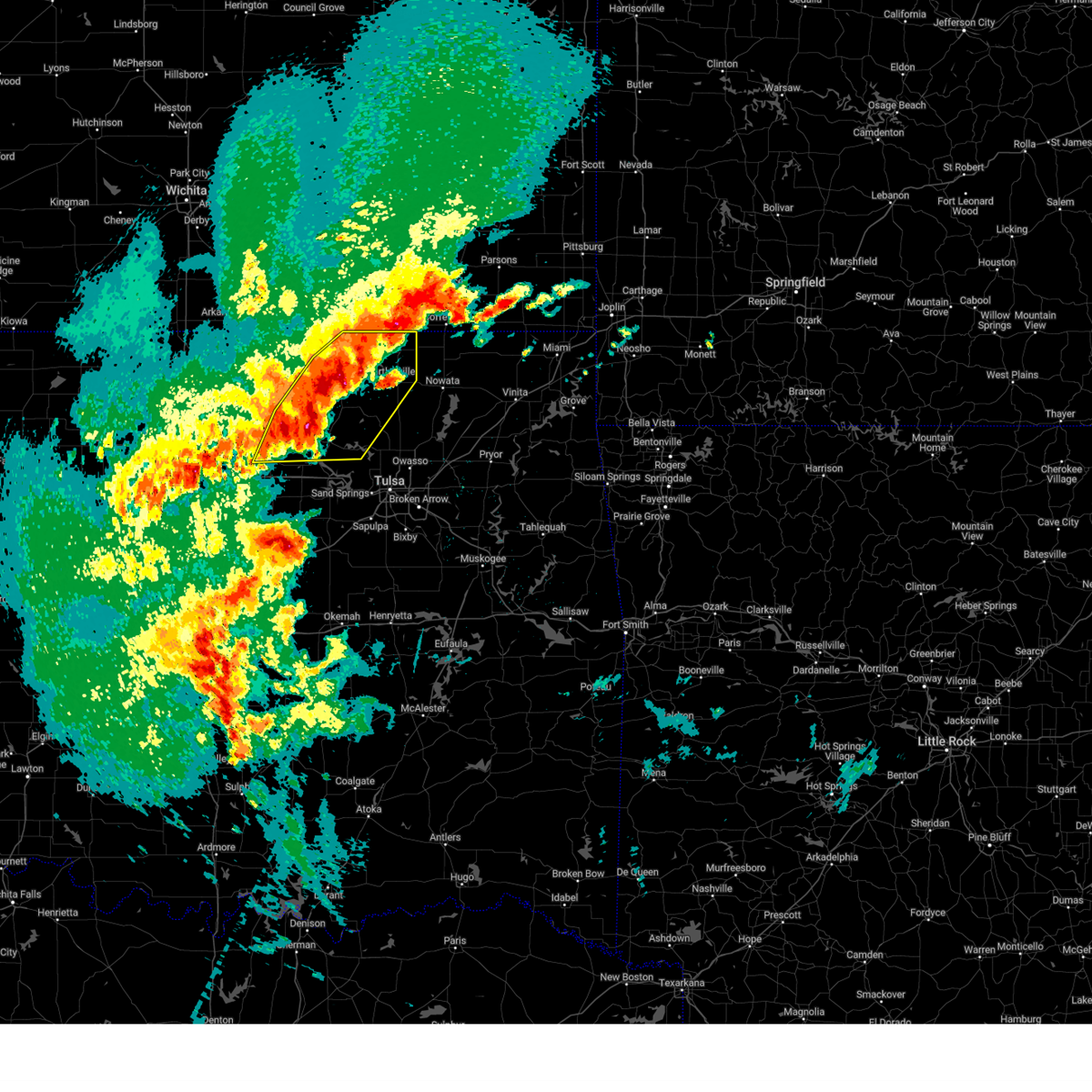 At 627 am cdt, severe thunderstorms were located along a line extending from 5 miles east of bigheart to 3 miles northeast of pawhuska to 9 miles west of wynona, moving east at 45 mph (radar indicated). Hazards include 60 mph wind gusts and quarter size hail. Hail damage to vehicles is expected. expect wind damage to roofs, siding, and trees. Locations in or near the path include, barnsdall, bigheart, skedee, dewey, bartlesville municipal airport, tallant, pawhuska, blackburn, ralston, osage hills state park, pershing, nelagoney, pawnee, wolco, hominy, pearsonia, wah sha she state park, wynona, hulah, ochelata,. At 627 am cdt, severe thunderstorms were located along a line extending from 5 miles east of bigheart to 3 miles northeast of pawhuska to 9 miles west of wynona, moving east at 45 mph (radar indicated). Hazards include 60 mph wind gusts and quarter size hail. Hail damage to vehicles is expected. expect wind damage to roofs, siding, and trees. Locations in or near the path include, barnsdall, bigheart, skedee, dewey, bartlesville municipal airport, tallant, pawhuska, blackburn, ralston, osage hills state park, pershing, nelagoney, pawnee, wolco, hominy, pearsonia, wah sha she state park, wynona, hulah, ochelata,.
|
| 4/29/2025 6:08 AM CDT |
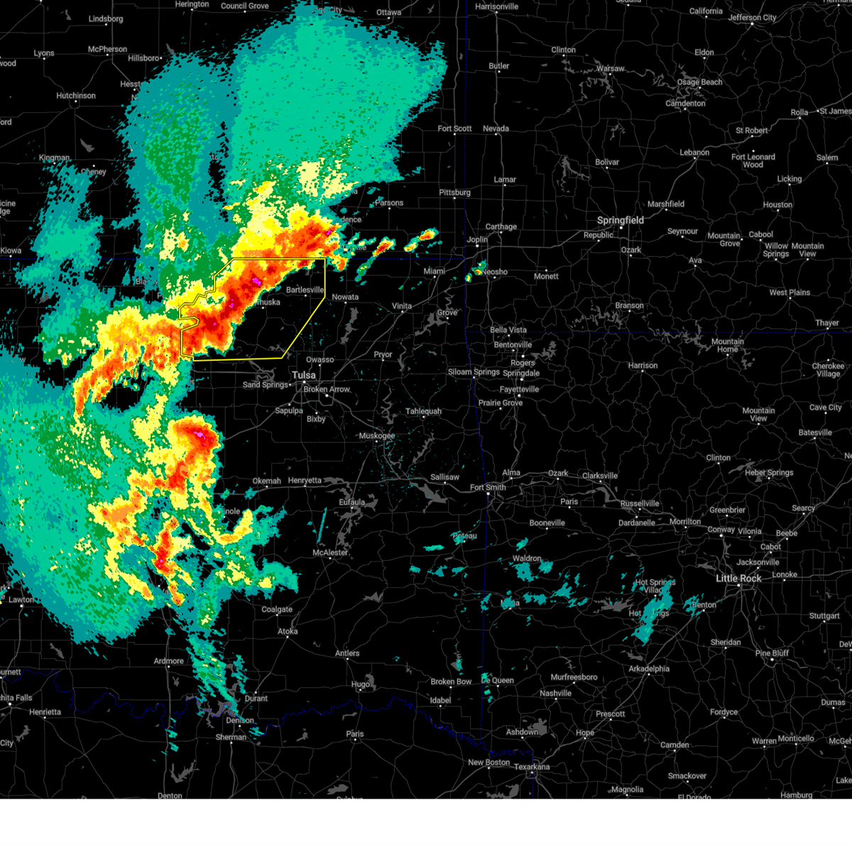 Svrtsa the national weather service in tulsa has issued a * severe thunderstorm warning for, osage county in northeastern oklahoma, washington county in northeastern oklahoma, northwestern pawnee county in northeastern oklahoma, * until 700 am cdt. * at 608 am cdt, severe thunderstorms were located along a line extending from 4 miles northeast of pearsonia to 9 miles southeast of shidler to near ralston, moving east at 45 mph (radar indicated). Hazards include 60 mph wind gusts and quarter size hail. Hail damage to vehicles is expected. expect wind damage to roofs, siding, and trees. Locations in or near the path include, barnsdall, bigheart, skedee, dewey, bartlesville municipal airport, tallant, pawhuska, blackburn, ralston, osage hills state park, pershing, foraker, grainola, nelagoney, shidler, pawnee, wolco, hominy, pearsonia, wah sha she state park,. Svrtsa the national weather service in tulsa has issued a * severe thunderstorm warning for, osage county in northeastern oklahoma, washington county in northeastern oklahoma, northwestern pawnee county in northeastern oklahoma, * until 700 am cdt. * at 608 am cdt, severe thunderstorms were located along a line extending from 4 miles northeast of pearsonia to 9 miles southeast of shidler to near ralston, moving east at 45 mph (radar indicated). Hazards include 60 mph wind gusts and quarter size hail. Hail damage to vehicles is expected. expect wind damage to roofs, siding, and trees. Locations in or near the path include, barnsdall, bigheart, skedee, dewey, bartlesville municipal airport, tallant, pawhuska, blackburn, ralston, osage hills state park, pershing, foraker, grainola, nelagoney, shidler, pawnee, wolco, hominy, pearsonia, wah sha she state park,.
|
| 4/2/2025 5:32 AM CDT |
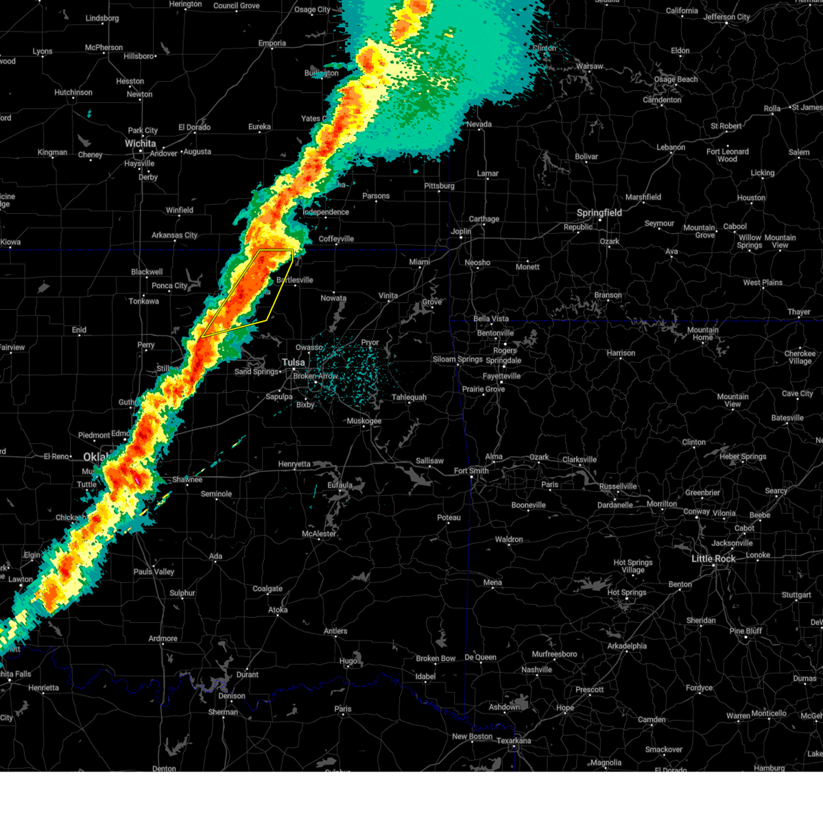 At 531 am cdt, severe thunderstorms were located along a line extending from 3 miles west of caney to 2 miles west of cleveland, moving east at 45 mph (radar indicated). Hazards include 60 mph wind gusts and quarter size hail. Hail damage to vehicles is expected. expect wind damage to roofs, siding, and trees. Locations in or near the path include, bigheart, osage hills state park, pershing, pearsonia, wah sha she state park, wynona, nelagoney, hulah, okesa, tallant, pawhuska, sunset lake,. At 531 am cdt, severe thunderstorms were located along a line extending from 3 miles west of caney to 2 miles west of cleveland, moving east at 45 mph (radar indicated). Hazards include 60 mph wind gusts and quarter size hail. Hail damage to vehicles is expected. expect wind damage to roofs, siding, and trees. Locations in or near the path include, bigheart, osage hills state park, pershing, pearsonia, wah sha she state park, wynona, nelagoney, hulah, okesa, tallant, pawhuska, sunset lake,.
|
| 4/2/2025 5:15 AM CDT |
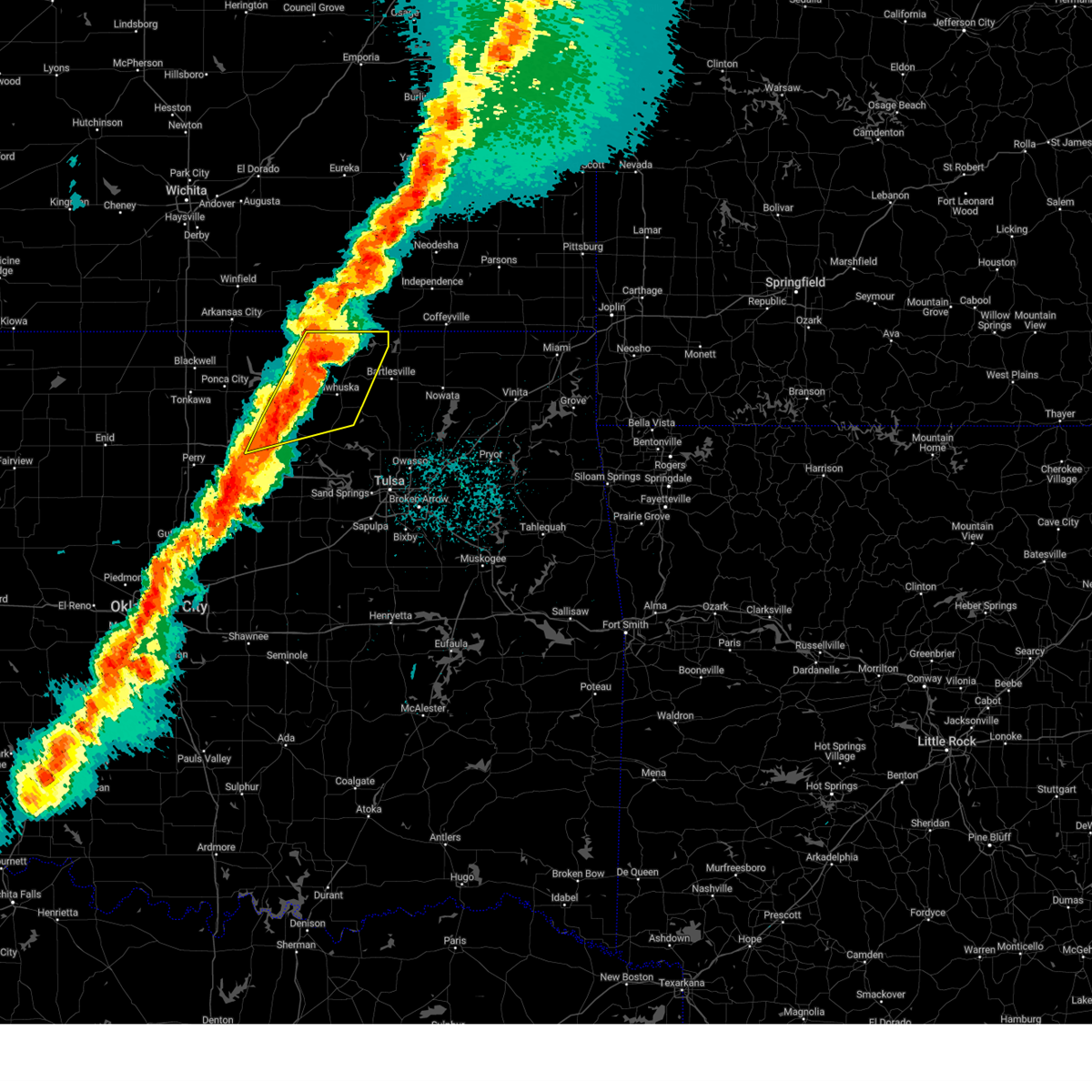 At 515 am cdt, severe thunderstorms were located along a line extending from 2 miles east of elgin to 4 miles east of pawnee, moving east at 45 mph (radar indicated). Hazards include 60 mph wind gusts and half dollar size hail. Hail damage to vehicles is expected. expect wind damage to roofs, siding, and trees. Locations in or near the path include, bigheart, pearsonia, wah sha she state park, wynona, hulah, tallant, pawhuska, burbank, sunset lake, fairfax, ralston, osage hills state park, pershing, foraker, nelagoney, shidler, okesa,. At 515 am cdt, severe thunderstorms were located along a line extending from 2 miles east of elgin to 4 miles east of pawnee, moving east at 45 mph (radar indicated). Hazards include 60 mph wind gusts and half dollar size hail. Hail damage to vehicles is expected. expect wind damage to roofs, siding, and trees. Locations in or near the path include, bigheart, pearsonia, wah sha she state park, wynona, hulah, tallant, pawhuska, burbank, sunset lake, fairfax, ralston, osage hills state park, pershing, foraker, nelagoney, shidler, okesa,.
|
| 4/2/2025 4:58 AM CDT |
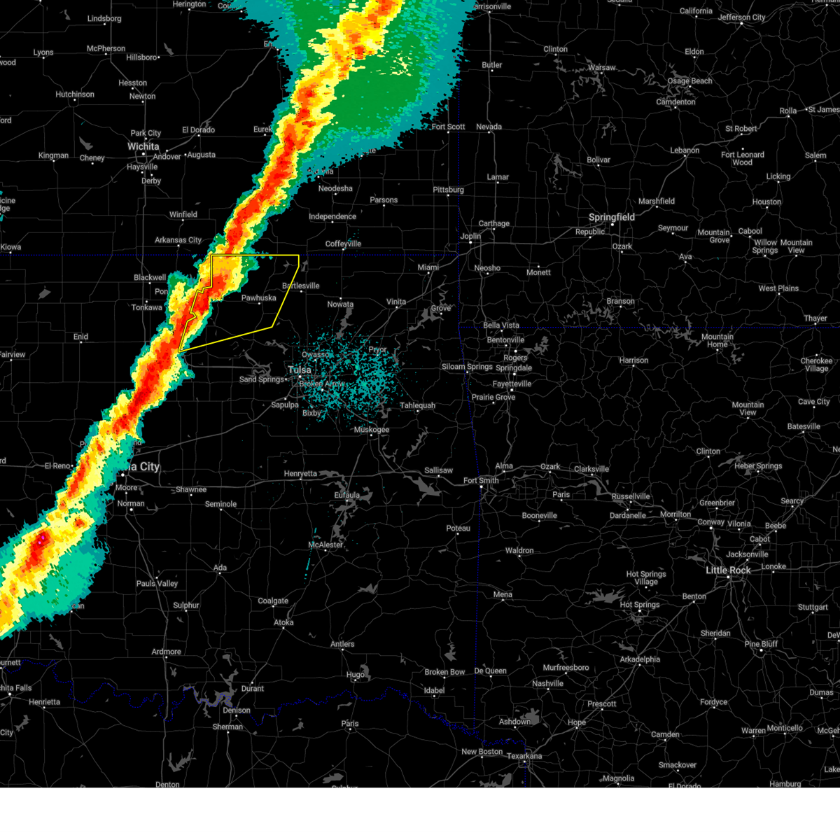 Svrtsa the national weather service in tulsa has issued a * severe thunderstorm warning for, osage county in northeastern oklahoma, northwestern pawnee county in northeastern oklahoma, * until 545 am cdt. * at 458 am cdt, severe thunderstorms were located along a line extending from 7 miles south of cedar vale to 3 miles northeast of morrison, moving east at 45 mph (radar indicated). Hazards include 60 mph wind gusts and half dollar size hail. Hail damage to vehicles is expected. expect wind damage to roofs, siding, and trees. Locations in or near the path include, bigheart, pearsonia, wah sha she state park, wynona, webb city, hulah, tallant, apperson, pawhuska, burbank, sunset lake, fairfax, ralston, osage hills state park, pershing, foraker, grainola, nelagoney, shidler, okesa,. Svrtsa the national weather service in tulsa has issued a * severe thunderstorm warning for, osage county in northeastern oklahoma, northwestern pawnee county in northeastern oklahoma, * until 545 am cdt. * at 458 am cdt, severe thunderstorms were located along a line extending from 7 miles south of cedar vale to 3 miles northeast of morrison, moving east at 45 mph (radar indicated). Hazards include 60 mph wind gusts and half dollar size hail. Hail damage to vehicles is expected. expect wind damage to roofs, siding, and trees. Locations in or near the path include, bigheart, pearsonia, wah sha she state park, wynona, webb city, hulah, tallant, apperson, pawhuska, burbank, sunset lake, fairfax, ralston, osage hills state park, pershing, foraker, grainola, nelagoney, shidler, okesa,.
|
| 4/2/2025 4:55 AM CDT |
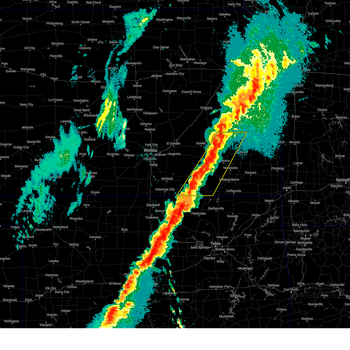 At 454 am cdt, severe thunderstorms were located along a line extending from near burlington to 8 miles south of fall river to 7 miles northwest of elgin, moving east at 55 mph (radar indicated). Hazards include 60 mph wind gusts and quarter size hail. Hail damage to vehicles is expected. expect wind damage to roofs, siding, and trees. Locations impacted include, severy, moline, buxton, benedict, rose, elk falls, howard, fall river, grenola, elgin, piqua, chautauqua, sedan, buffalo, fredonia, toronto lake, batesville, coyville, niotaze, and new albany. At 454 am cdt, severe thunderstorms were located along a line extending from near burlington to 8 miles south of fall river to 7 miles northwest of elgin, moving east at 55 mph (radar indicated). Hazards include 60 mph wind gusts and quarter size hail. Hail damage to vehicles is expected. expect wind damage to roofs, siding, and trees. Locations impacted include, severy, moline, buxton, benedict, rose, elk falls, howard, fall river, grenola, elgin, piqua, chautauqua, sedan, buffalo, fredonia, toronto lake, batesville, coyville, niotaze, and new albany.
|
| 4/2/2025 4:31 AM CDT |
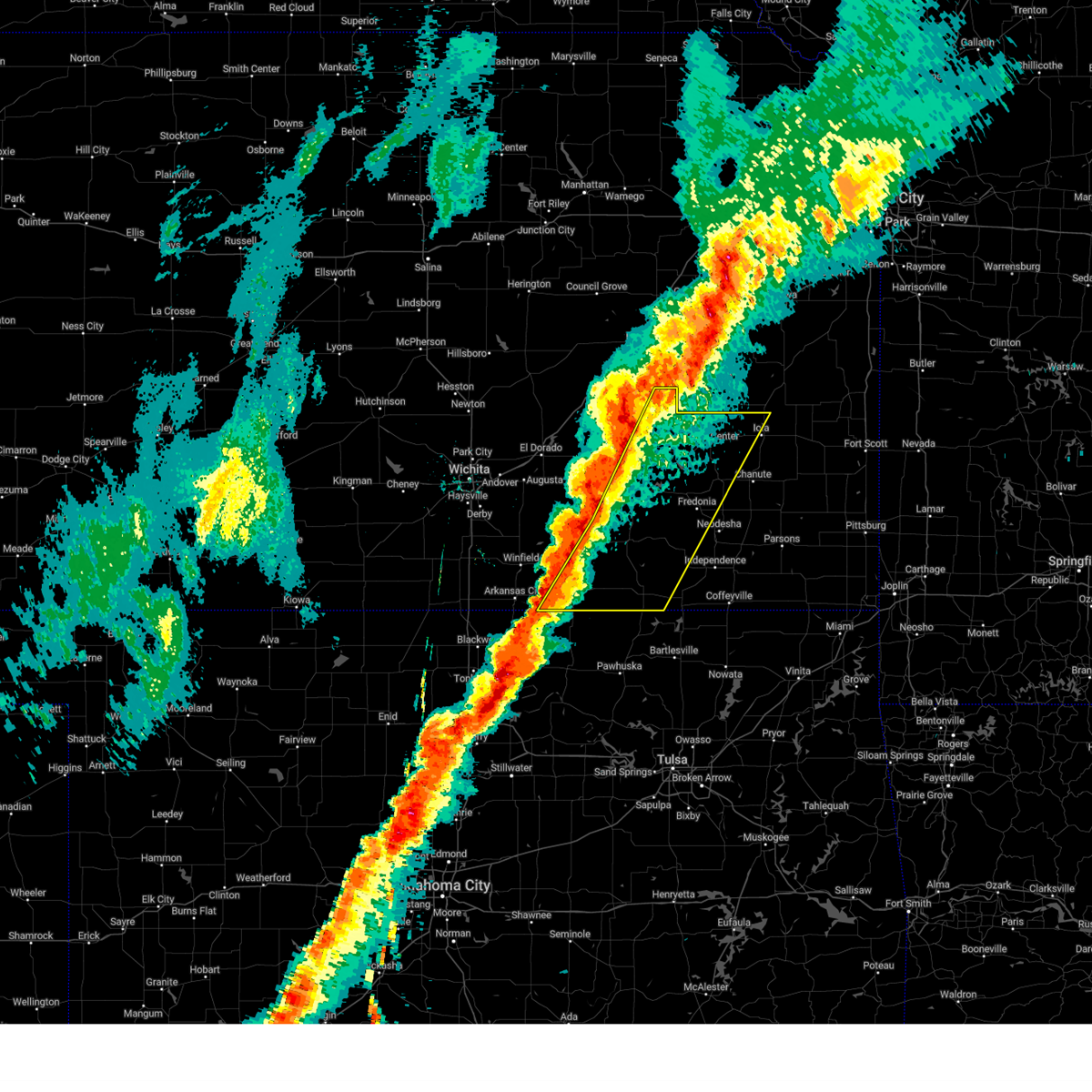 Svrict the national weather service in wichita has issued a * severe thunderstorm warning for, elk county in southeastern kansas, wilson county in southeastern kansas, southeastern cowley county in south central kansas, northwestern montgomery county in southeastern kansas, chautauqua county in southeastern kansas, woodson county in southeastern kansas, eastern greenwood county in southeastern kansas, northwestern allen county in southeastern kansas, * until 515 am cdt. * at 430 am cdt, severe thunderstorms were located along a line extending from near madison to 5 miles northwest of howard to 5 miles southeast of dexter, moving northeast at 60 mph (radar indicated). Hazards include 60 mph wind gusts and quarter size hail. Hail damage to vehicles is expected. Expect wind damage to roofs, siding, and trees. Svrict the national weather service in wichita has issued a * severe thunderstorm warning for, elk county in southeastern kansas, wilson county in southeastern kansas, southeastern cowley county in south central kansas, northwestern montgomery county in southeastern kansas, chautauqua county in southeastern kansas, woodson county in southeastern kansas, eastern greenwood county in southeastern kansas, northwestern allen county in southeastern kansas, * until 515 am cdt. * at 430 am cdt, severe thunderstorms were located along a line extending from near madison to 5 miles northwest of howard to 5 miles southeast of dexter, moving northeast at 60 mph (radar indicated). Hazards include 60 mph wind gusts and quarter size hail. Hail damage to vehicles is expected. Expect wind damage to roofs, siding, and trees.
|
| 4/2/2025 4:29 AM CDT |
 Svrict the national weather service in wichita has issued a * severe thunderstorm warning for, elk county in southeastern kansas, wilson county in southeastern kansas, southeastern cowley county in south central kansas, northwestern montgomery county in southeastern kansas, chautauqua county in southeastern kansas, woodson county in southeastern kansas, eastern greenwood county in southeastern kansas, northwestern allen county in southeastern kansas, * until 515 am cdt. * at 428 am cdt, severe thunderstorms were located along a line extending from near madison to 5 miles northwest of howard to 5 miles southeast of dexter, moving northeast at 110 mph (radar indicated). Hazards include 60 mph wind gusts and quarter size hail. Hail damage to vehicles is expected. Expect wind damage to roofs, siding, and trees. Svrict the national weather service in wichita has issued a * severe thunderstorm warning for, elk county in southeastern kansas, wilson county in southeastern kansas, southeastern cowley county in south central kansas, northwestern montgomery county in southeastern kansas, chautauqua county in southeastern kansas, woodson county in southeastern kansas, eastern greenwood county in southeastern kansas, northwestern allen county in southeastern kansas, * until 515 am cdt. * at 428 am cdt, severe thunderstorms were located along a line extending from near madison to 5 miles northwest of howard to 5 miles southeast of dexter, moving northeast at 110 mph (radar indicated). Hazards include 60 mph wind gusts and quarter size hail. Hail damage to vehicles is expected. Expect wind damage to roofs, siding, and trees.
|
| 4/2/2025 4:16 AM CDT |
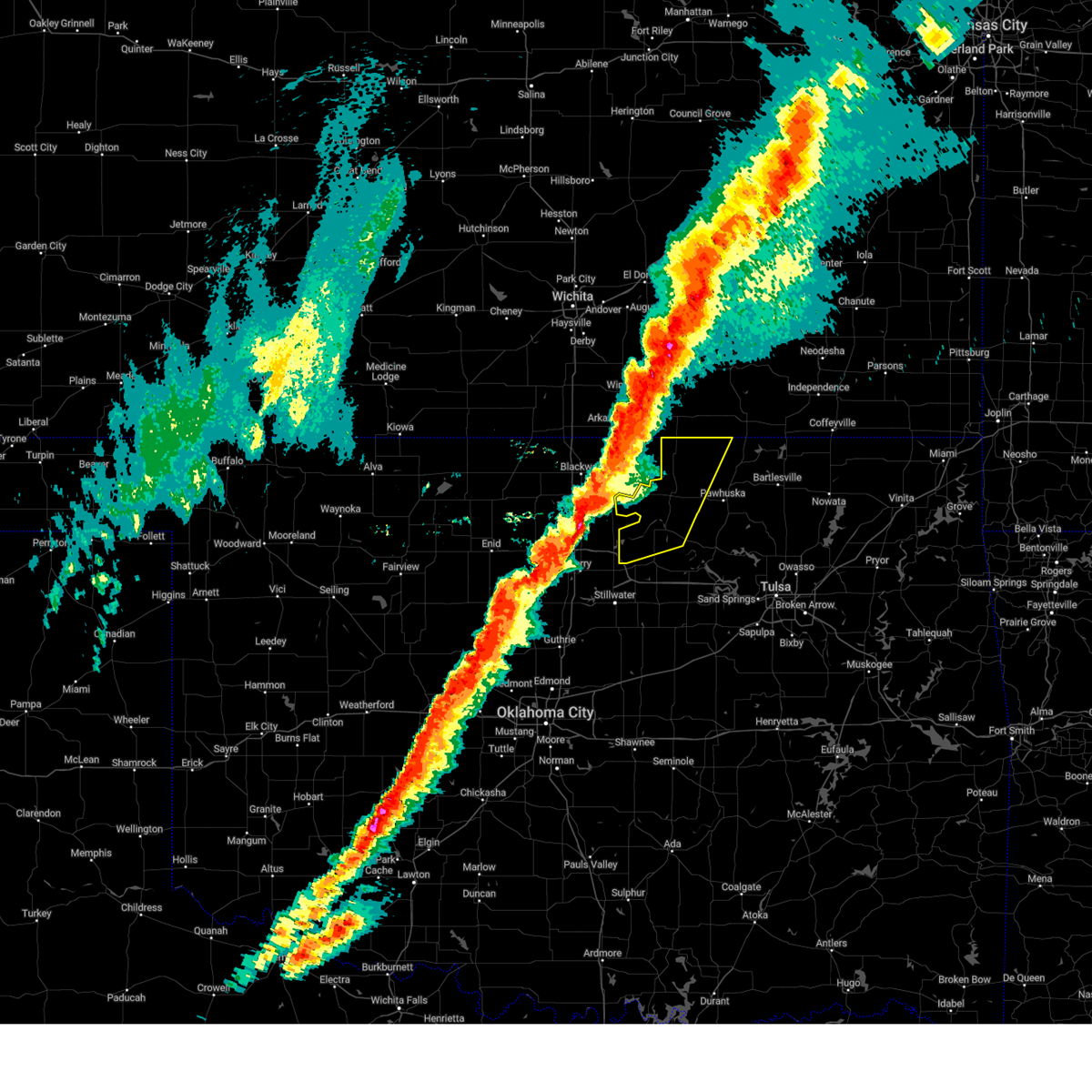 Svrtsa the national weather service in tulsa has issued a * severe thunderstorm warning for, northwestern osage county in northeastern oklahoma, northwestern pawnee county in northeastern oklahoma, * until 500 am cdt. * at 416 am cdt, severe thunderstorms were located along a line extending from 7 miles north of hardy to 3 miles northwest of perry, moving east at 55 mph (radar indicated). Hazards include 60 mph wind gusts and half dollar size hail. Hail damage to vehicles is expected. expect wind damage to roofs, siding, and trees. Locations in or near the path include, ralston, foraker, grainola, pearsonia, webb city, shidler, apperson, burbank, fairfax,. Svrtsa the national weather service in tulsa has issued a * severe thunderstorm warning for, northwestern osage county in northeastern oklahoma, northwestern pawnee county in northeastern oklahoma, * until 500 am cdt. * at 416 am cdt, severe thunderstorms were located along a line extending from 7 miles north of hardy to 3 miles northwest of perry, moving east at 55 mph (radar indicated). Hazards include 60 mph wind gusts and half dollar size hail. Hail damage to vehicles is expected. expect wind damage to roofs, siding, and trees. Locations in or near the path include, ralston, foraker, grainola, pearsonia, webb city, shidler, apperson, burbank, fairfax,.
|
| 10/30/2024 7:28 PM CDT |
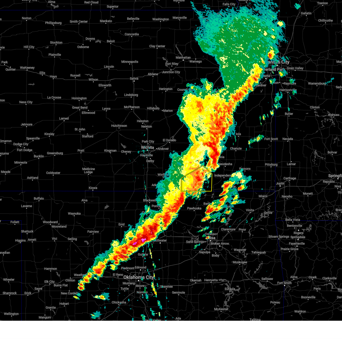 the severe thunderstorm warning has been cancelled and is no longer in effect the severe thunderstorm warning has been cancelled and is no longer in effect
|
| 10/30/2024 7:13 PM CDT |
 At 713 pm cdt, severe thunderstorms were located along a line extending from 8 miles south of grenola to 5 miles east of cedar vale to near foraker, moving northeast at 55 mph (radar indicated). Hazards include 60 mph wind gusts and penny size hail. Expect damage to roofs, siding, and trees. Locations impacted include, sedan, cedar vale, moline, longton, peru, chautauqua, elk falls, elgin, niotaze, and hale. At 713 pm cdt, severe thunderstorms were located along a line extending from 8 miles south of grenola to 5 miles east of cedar vale to near foraker, moving northeast at 55 mph (radar indicated). Hazards include 60 mph wind gusts and penny size hail. Expect damage to roofs, siding, and trees. Locations impacted include, sedan, cedar vale, moline, longton, peru, chautauqua, elk falls, elgin, niotaze, and hale.
|
| 10/30/2024 7:01 PM CDT |
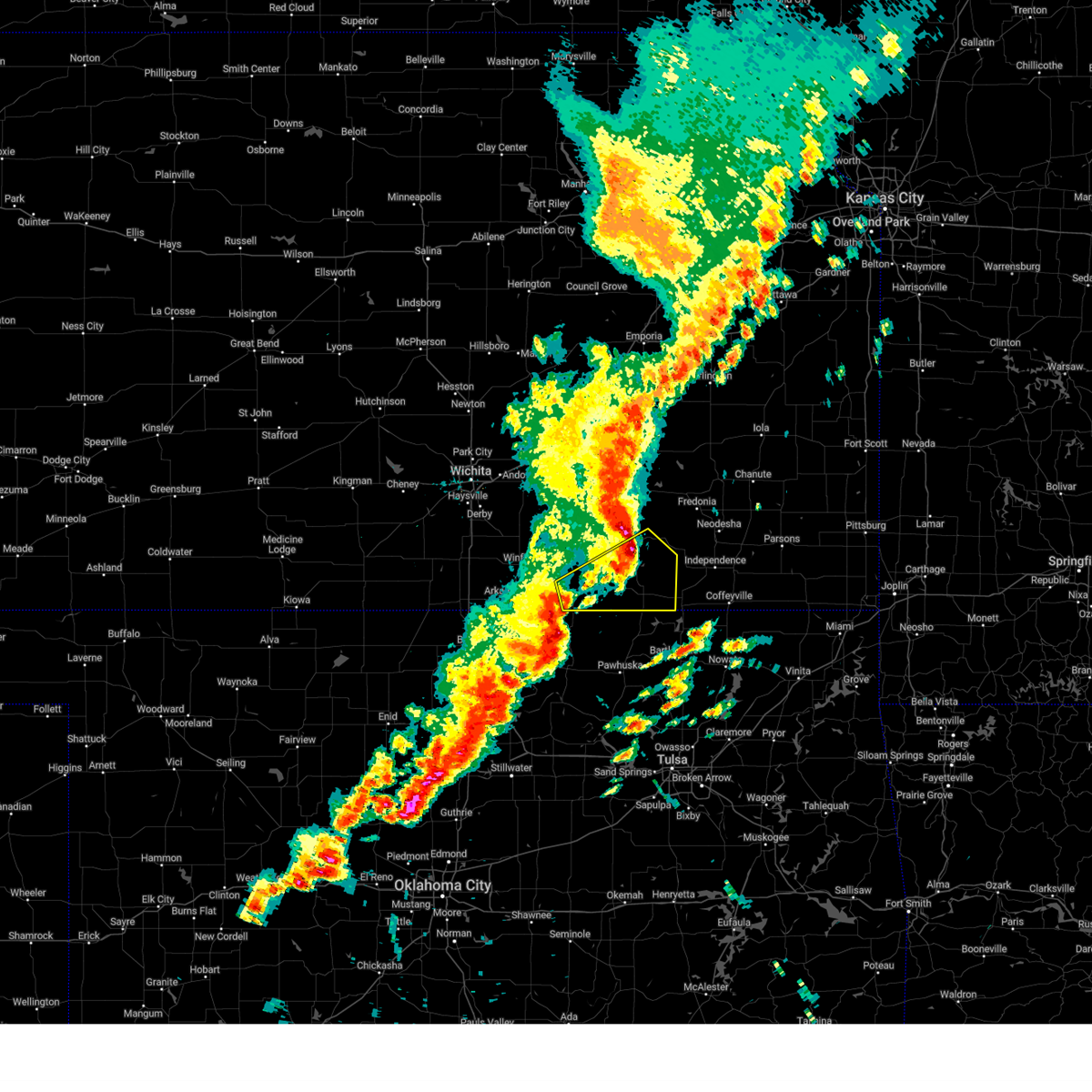 Svrict the national weather service in wichita has issued a * severe thunderstorm warning for, southeastern elk county in southeastern kansas, southeastern cowley county in south central kansas, chautauqua county in southeastern kansas, * until 800 pm cdt. * at 700 pm cdt, severe thunderstorms were located along a line extending from near dexter to grainola to near shidler, moving northeast at 55 mph (radar indicated). Hazards include 60 mph wind gusts and penny size hail. expect damage to roofs, siding, and trees Svrict the national weather service in wichita has issued a * severe thunderstorm warning for, southeastern elk county in southeastern kansas, southeastern cowley county in south central kansas, chautauqua county in southeastern kansas, * until 800 pm cdt. * at 700 pm cdt, severe thunderstorms were located along a line extending from near dexter to grainola to near shidler, moving northeast at 55 mph (radar indicated). Hazards include 60 mph wind gusts and penny size hail. expect damage to roofs, siding, and trees
|
| 9/19/2024 6:09 PM CDT |
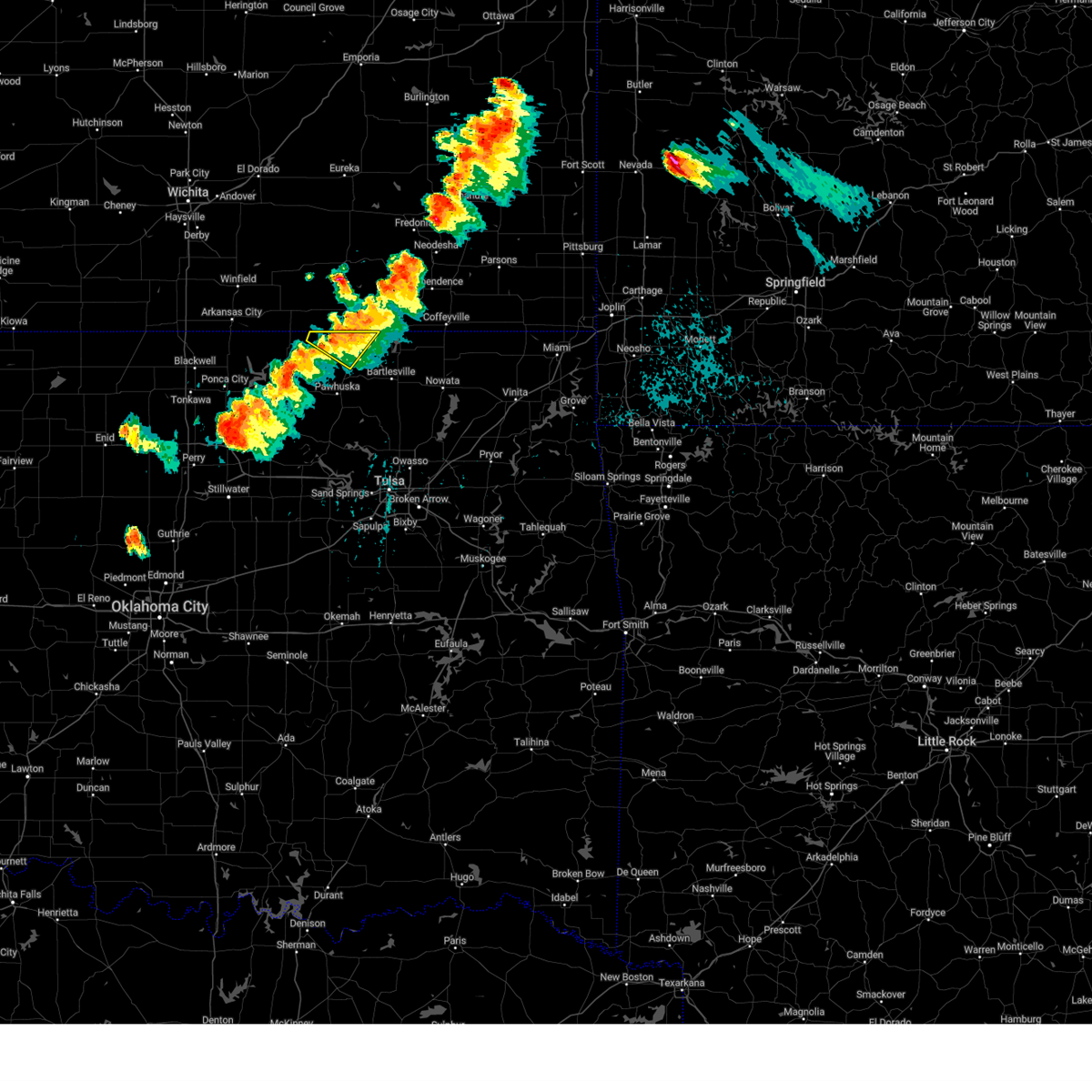 the severe thunderstorm warning has been cancelled and is no longer in effect the severe thunderstorm warning has been cancelled and is no longer in effect
|
| 9/19/2024 6:05 PM CDT |
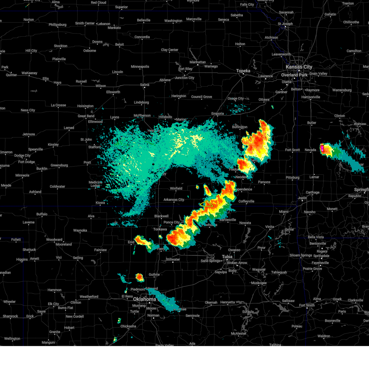 The storm which prompted the warning has weakened below severe limits, and has exited the warned area. therefore, the warning will be allowed to expire. however, heavy rain is still possible with this thunderstorm. a severe thunderstorm watch remains in effect until midnight cdt for south central and southeastern kansas. The storm which prompted the warning has weakened below severe limits, and has exited the warned area. therefore, the warning will be allowed to expire. however, heavy rain is still possible with this thunderstorm. a severe thunderstorm watch remains in effect until midnight cdt for south central and southeastern kansas.
|
| 9/19/2024 5:56 PM CDT |
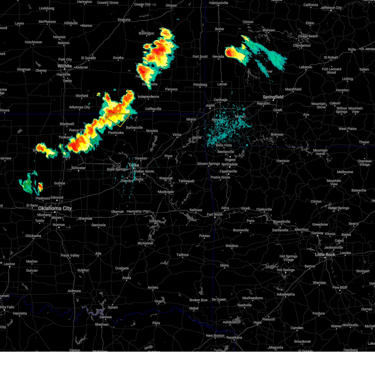 Svrtsa the national weather service in tulsa has issued a * severe thunderstorm warning for, northeastern osage county in northeastern oklahoma, * until 630 pm cdt. * at 556 pm cdt, a severe thunderstorm was located 5 miles west of elgin, moving east at 25 mph (radar indicated). Hazards include 60 mph wind gusts and quarter size hail. Hail damage to vehicles is expected. expect wind damage to roofs, siding, and trees. Locations in or near the path include, bigheart,. Svrtsa the national weather service in tulsa has issued a * severe thunderstorm warning for, northeastern osage county in northeastern oklahoma, * until 630 pm cdt. * at 556 pm cdt, a severe thunderstorm was located 5 miles west of elgin, moving east at 25 mph (radar indicated). Hazards include 60 mph wind gusts and quarter size hail. Hail damage to vehicles is expected. expect wind damage to roofs, siding, and trees. Locations in or near the path include, bigheart,.
|
| 9/19/2024 5:53 PM CDT |
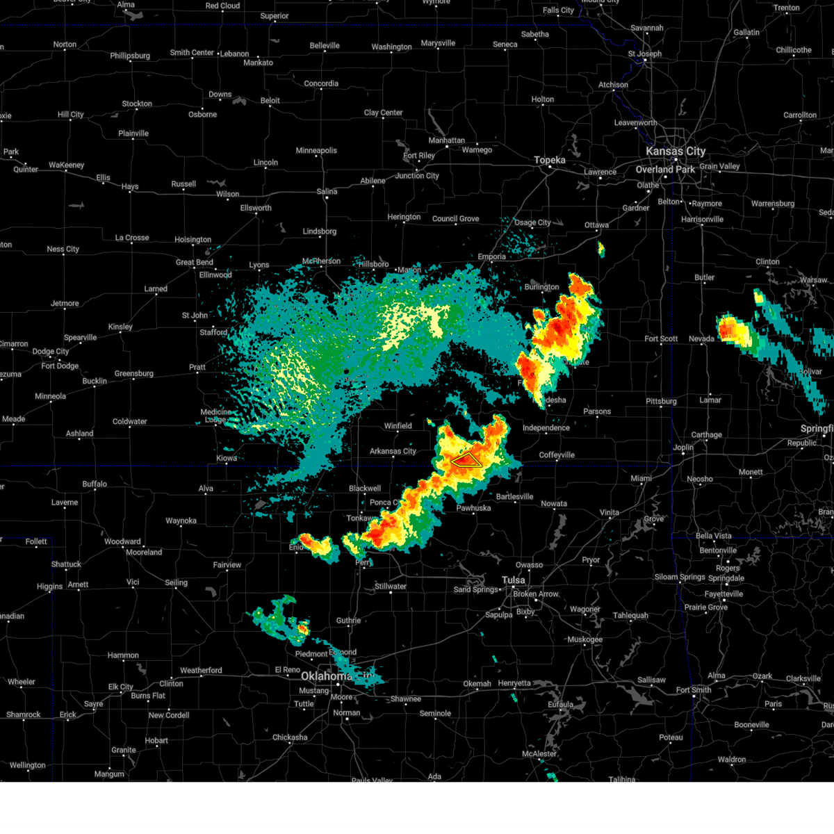 At 552 pm cdt, a severe thunderstorm was located 8 miles southeast of cedar vale, moving southeast at 15 mph (radar indicated). Hazards include 60 mph wind gusts and quarter size hail. Hail damage to vehicles is expected. expect wind damage to roofs, siding, and trees. Locations impacted include, elgin. At 552 pm cdt, a severe thunderstorm was located 8 miles southeast of cedar vale, moving southeast at 15 mph (radar indicated). Hazards include 60 mph wind gusts and quarter size hail. Hail damage to vehicles is expected. expect wind damage to roofs, siding, and trees. Locations impacted include, elgin.
|
| 9/19/2024 5:42 PM CDT |
 At 541 pm cdt, a severe thunderstorm was located 6 miles south of cedar vale, moving southeast at 25 mph (radar indicated). Hazards include 70 mph wind gusts and ping pong ball size hail. People and animals outdoors will be injured. expect hail damage to roofs, siding, windows, and vehicles. expect considerable tree damage. wind damage is also likely to mobile homes, roofs, and outbuildings. Locations impacted include, cedar vale and elgin. At 541 pm cdt, a severe thunderstorm was located 6 miles south of cedar vale, moving southeast at 25 mph (radar indicated). Hazards include 70 mph wind gusts and ping pong ball size hail. People and animals outdoors will be injured. expect hail damage to roofs, siding, windows, and vehicles. expect considerable tree damage. wind damage is also likely to mobile homes, roofs, and outbuildings. Locations impacted include, cedar vale and elgin.
|
| 9/19/2024 5:42 PM CDT |
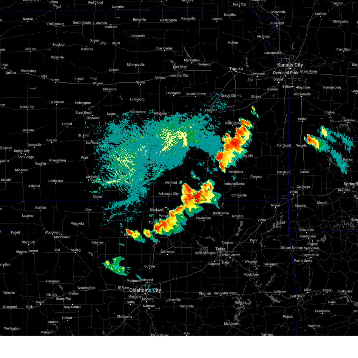 the severe thunderstorm warning has been cancelled and is no longer in effect the severe thunderstorm warning has been cancelled and is no longer in effect
|
| 9/19/2024 5:32 PM CDT |
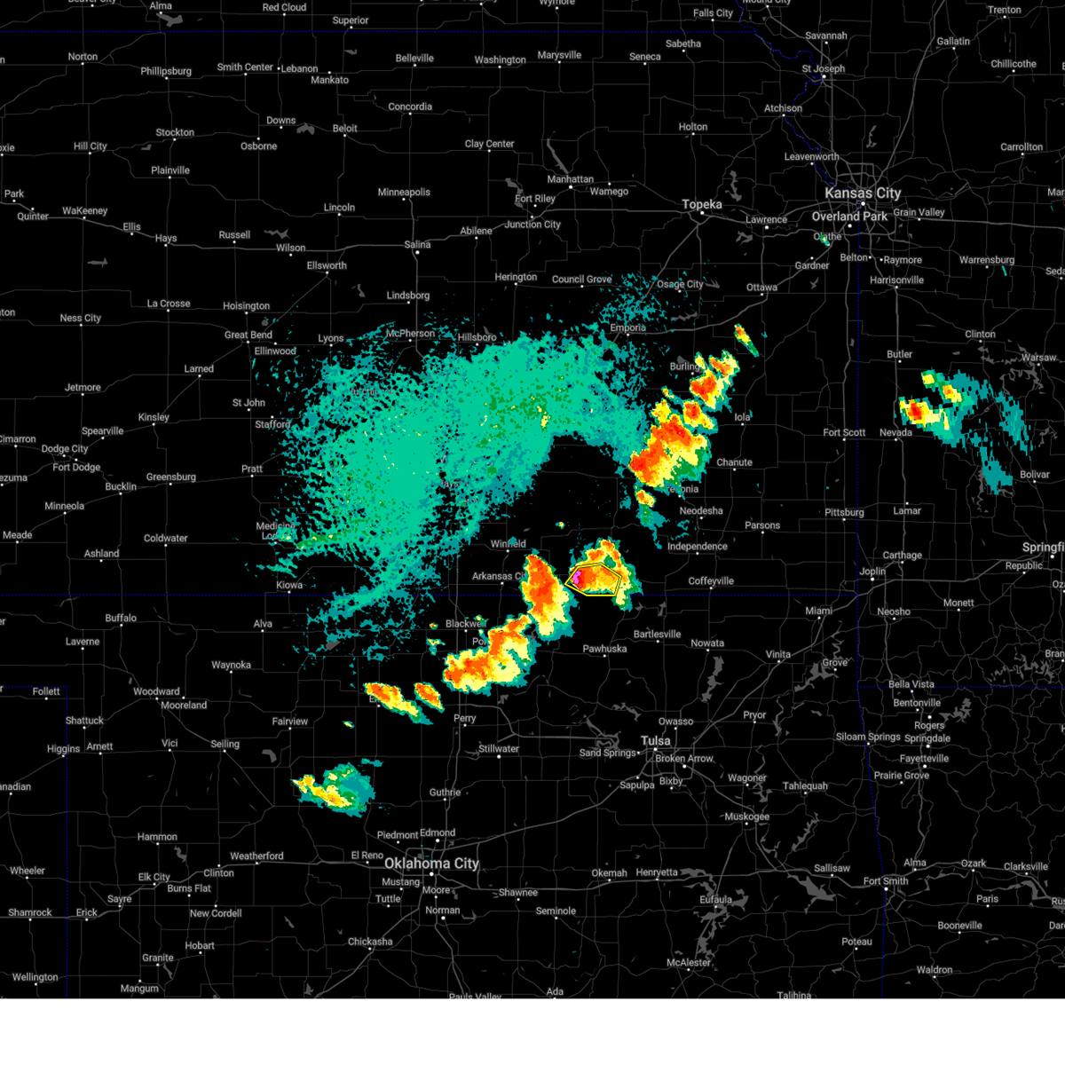 At 532 pm cdt, a severe thunderstorm was located over cedar vale, moving east at 20 mph (radar indicated). Hazards include 70 mph wind gusts and ping pong ball size hail. People and animals outdoors will be injured. expect hail damage to roofs, siding, windows, and vehicles. expect considerable tree damage. wind damage is also likely to mobile homes, roofs, and outbuildings. Locations impacted include, cedar vale and elgin. At 532 pm cdt, a severe thunderstorm was located over cedar vale, moving east at 20 mph (radar indicated). Hazards include 70 mph wind gusts and ping pong ball size hail. People and animals outdoors will be injured. expect hail damage to roofs, siding, windows, and vehicles. expect considerable tree damage. wind damage is also likely to mobile homes, roofs, and outbuildings. Locations impacted include, cedar vale and elgin.
|
| 9/19/2024 5:29 PM CDT |
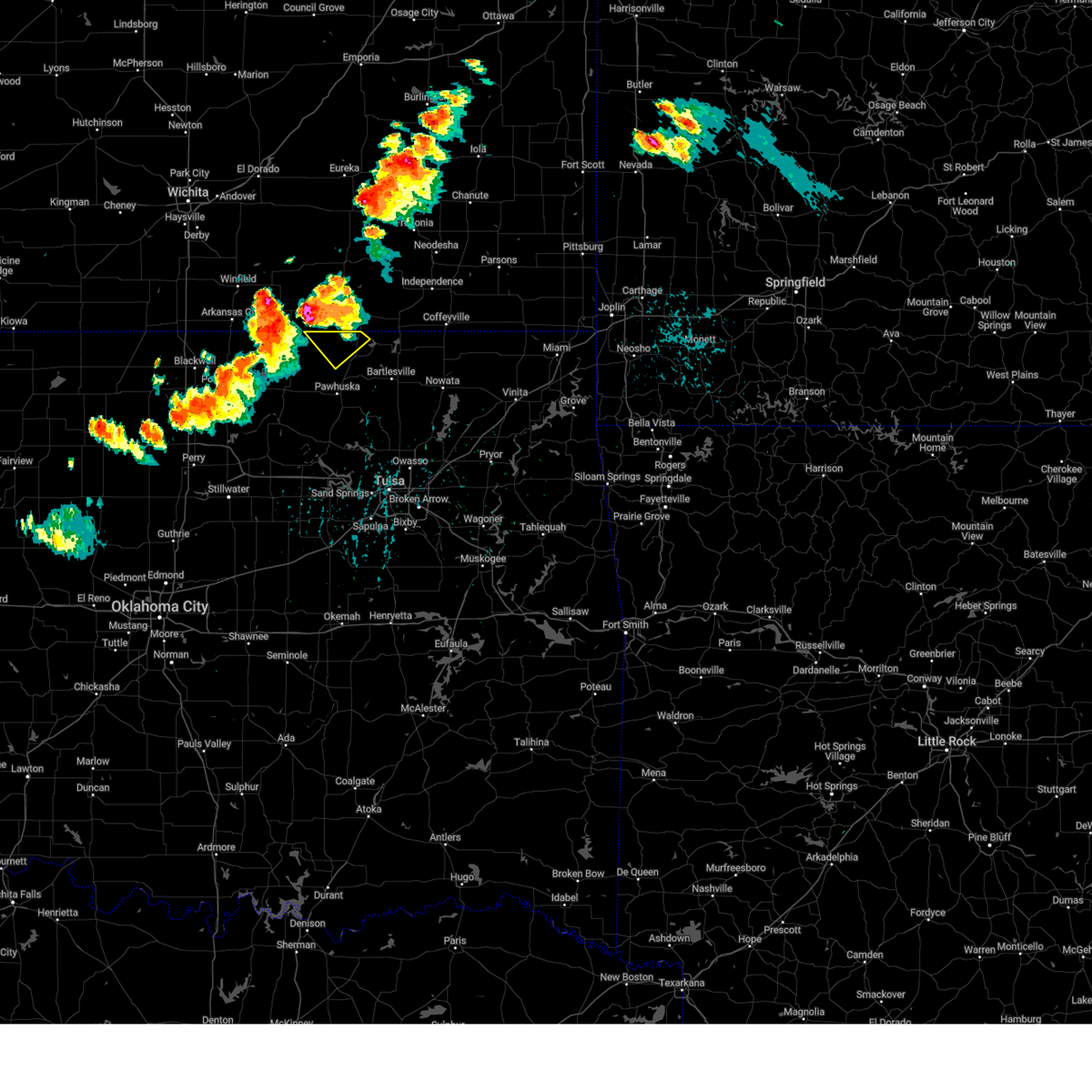 Svrtsa the national weather service in tulsa has issued a * severe thunderstorm warning for, north central osage county in northeastern oklahoma, * until 600 pm cdt. * at 529 pm cdt, a severe thunderstorm was located near cedar vale, moving southeast at 30 mph (radar indicated). Hazards include 70 mph wind gusts and ping pong ball size hail. People and animals outdoors will be injured. expect hail damage to roofs, siding, windows, and vehicles. expect considerable tree damage. wind damage is also likely to mobile homes, roofs, and outbuildings. This severe thunderstorm will remain over mainly rural areas of north central osage county. Svrtsa the national weather service in tulsa has issued a * severe thunderstorm warning for, north central osage county in northeastern oklahoma, * until 600 pm cdt. * at 529 pm cdt, a severe thunderstorm was located near cedar vale, moving southeast at 30 mph (radar indicated). Hazards include 70 mph wind gusts and ping pong ball size hail. People and animals outdoors will be injured. expect hail damage to roofs, siding, windows, and vehicles. expect considerable tree damage. wind damage is also likely to mobile homes, roofs, and outbuildings. This severe thunderstorm will remain over mainly rural areas of north central osage county.
|
| 9/19/2024 5:21 PM CDT |
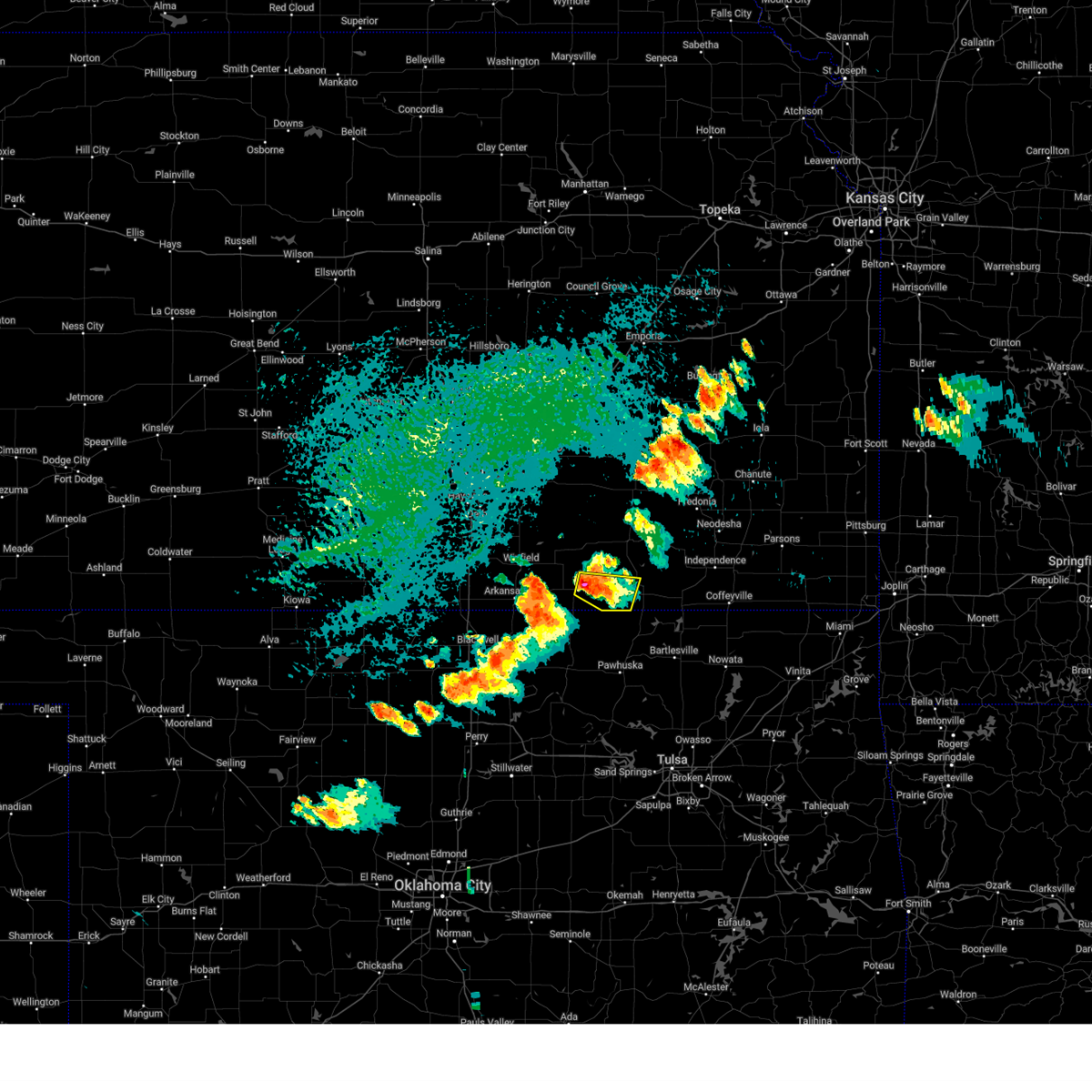 Svrict the national weather service in wichita has issued a * severe thunderstorm warning for, southeastern cowley county in south central kansas, southwestern chautauqua county in southeastern kansas, * until 615 pm cdt. * at 521 pm cdt, a severe thunderstorm was located near cedar vale, moving east at 20 mph (radar indicated). Hazards include 70 mph wind gusts and ping pong ball size hail. People and animals outdoors will be injured. expect hail damage to roofs, siding, windows, and vehicles. expect considerable tree damage. Wind damage is also likely to mobile homes, roofs, and outbuildings. Svrict the national weather service in wichita has issued a * severe thunderstorm warning for, southeastern cowley county in south central kansas, southwestern chautauqua county in southeastern kansas, * until 615 pm cdt. * at 521 pm cdt, a severe thunderstorm was located near cedar vale, moving east at 20 mph (radar indicated). Hazards include 70 mph wind gusts and ping pong ball size hail. People and animals outdoors will be injured. expect hail damage to roofs, siding, windows, and vehicles. expect considerable tree damage. Wind damage is also likely to mobile homes, roofs, and outbuildings.
|
| 8/16/2024 3:37 PM CDT |
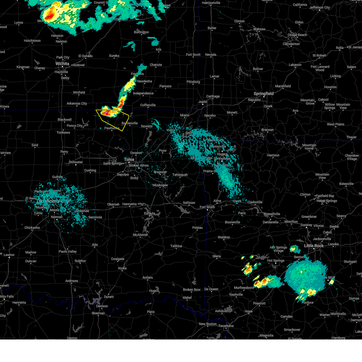 At 336 pm cdt, a severe thunderstorm was located 8 miles northeast of foraker, moving southeast at 30 mph (radar indicated). Hazards include ping pong ball size hail and 60 mph wind gusts. People and animals outdoors will be injured. expect hail damage to roofs, siding, windows, and vehicles. expect wind damage to roofs, siding, and trees. Locations in or near the path include, bigheart, osage hills state park, pearsonia, okesa, sunset lake, wah sha she state park,. At 336 pm cdt, a severe thunderstorm was located 8 miles northeast of foraker, moving southeast at 30 mph (radar indicated). Hazards include ping pong ball size hail and 60 mph wind gusts. People and animals outdoors will be injured. expect hail damage to roofs, siding, windows, and vehicles. expect wind damage to roofs, siding, and trees. Locations in or near the path include, bigheart, osage hills state park, pearsonia, okesa, sunset lake, wah sha she state park,.
|
| 8/16/2024 3:25 PM CDT |
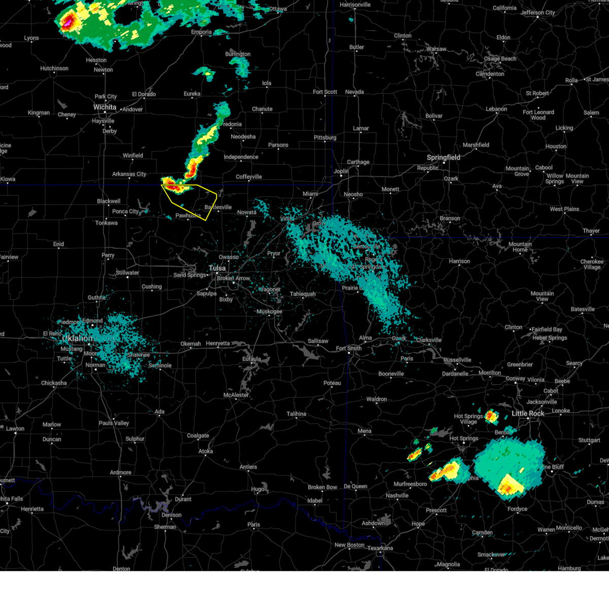 Svrtsa the national weather service in tulsa has issued a * severe thunderstorm warning for, northeastern osage county in northeastern oklahoma, * until 415 pm cdt. * at 325 pm cdt, a severe thunderstorm was located 8 miles northeast of foraker, moving southeast at 35 mph (radar indicated). Hazards include 60 mph wind gusts and quarter size hail. Hail damage to vehicles is expected. expect wind damage to roofs, siding, and trees. Locations in or near the path include, bigheart, osage hills state park, pearsonia, okesa, sunset lake, wah sha she state park,. Svrtsa the national weather service in tulsa has issued a * severe thunderstorm warning for, northeastern osage county in northeastern oklahoma, * until 415 pm cdt. * at 325 pm cdt, a severe thunderstorm was located 8 miles northeast of foraker, moving southeast at 35 mph (radar indicated). Hazards include 60 mph wind gusts and quarter size hail. Hail damage to vehicles is expected. expect wind damage to roofs, siding, and trees. Locations in or near the path include, bigheart, osage hills state park, pearsonia, okesa, sunset lake, wah sha she state park,.
|
| 6/25/2024 8:07 PM CDT |
 Svrict the national weather service in wichita has issued a * severe thunderstorm warning for, southeastern elk county in southeastern kansas, chautauqua county in southeastern kansas, * until 915 pm cdt. * at 807 pm cdt, a severe thunderstorm was located near sedan, moving east at 20 mph (radar indicated). Hazards include ping pong ball size hail and 60 mph wind gusts. People and animals outdoors will be injured. expect hail damage to roofs, siding, windows, and vehicles. Expect wind damage to roofs, siding, and trees. Svrict the national weather service in wichita has issued a * severe thunderstorm warning for, southeastern elk county in southeastern kansas, chautauqua county in southeastern kansas, * until 915 pm cdt. * at 807 pm cdt, a severe thunderstorm was located near sedan, moving east at 20 mph (radar indicated). Hazards include ping pong ball size hail and 60 mph wind gusts. People and animals outdoors will be injured. expect hail damage to roofs, siding, windows, and vehicles. Expect wind damage to roofs, siding, and trees.
|
| 5/26/2024 1:20 AM CDT |
 the tornado warning has been cancelled and is no longer in effect the tornado warning has been cancelled and is no longer in effect
|
| 5/26/2024 12:55 AM CDT |
 At 1255 am cdt, a severe thunderstorm capable of producing a tornado was located just west of chautauqua, or 8 miles south of sedan, moving east at 45 mph (radar indicated rotation). Hazards include tornado and golf ball size hail. Flying debris will be dangerous to those caught without shelter. mobile homes will be damaged or destroyed. damage to roofs, windows, and vehicles will occur. tree damage is likely. This tornadic thunderstorm will remain over mainly rural areas of southern chautauqua county, including the following locations, niotaze. At 1255 am cdt, a severe thunderstorm capable of producing a tornado was located just west of chautauqua, or 8 miles south of sedan, moving east at 45 mph (radar indicated rotation). Hazards include tornado and golf ball size hail. Flying debris will be dangerous to those caught without shelter. mobile homes will be damaged or destroyed. damage to roofs, windows, and vehicles will occur. tree damage is likely. This tornadic thunderstorm will remain over mainly rural areas of southern chautauqua county, including the following locations, niotaze.
|
| 5/26/2024 12:44 AM CDT |
 At 1244 am cdt, a severe thunderstorm capable of producing a tornado was located 3 miles west of elgin, or 9 miles southeast of cedar vale, moving east at 40 mph (radar indicated rotation). Hazards include tornado and golf ball size hail. Flying debris will be dangerous to those caught without shelter. mobile homes will be damaged or destroyed. damage to roofs, windows, and vehicles will occur. tree damage is likely. this dangerous storm will be near, elgin around 1250 am cdt. chautauqua around 1255 am cdt. peru around 105 am cdt. Other locations impacted by this tornadic thunderstorm include niotaze. At 1244 am cdt, a severe thunderstorm capable of producing a tornado was located 3 miles west of elgin, or 9 miles southeast of cedar vale, moving east at 40 mph (radar indicated rotation). Hazards include tornado and golf ball size hail. Flying debris will be dangerous to those caught without shelter. mobile homes will be damaged or destroyed. damage to roofs, windows, and vehicles will occur. tree damage is likely. this dangerous storm will be near, elgin around 1250 am cdt. chautauqua around 1255 am cdt. peru around 105 am cdt. Other locations impacted by this tornadic thunderstorm include niotaze.
|
| 5/26/2024 12:44 AM CDT |
 the tornado warning has been cancelled and is no longer in effect the tornado warning has been cancelled and is no longer in effect
|
| 5/26/2024 12:41 AM CDT |
 At 1241 am cdt, a severe thunderstorm capable of producing a tornado was located 6 miles west of elgin, moving east at 40 mph (radar indicated rotation). Hazards include tornado and golf ball size hail. Flying debris will be dangerous to those caught without shelter. mobile homes will be damaged or destroyed. damage to roofs, windows, and vehicles will occur. tree damage is likely. Locations in or near the path include, hulah, wah sha she state park,. At 1241 am cdt, a severe thunderstorm capable of producing a tornado was located 6 miles west of elgin, moving east at 40 mph (radar indicated rotation). Hazards include tornado and golf ball size hail. Flying debris will be dangerous to those caught without shelter. mobile homes will be damaged or destroyed. damage to roofs, windows, and vehicles will occur. tree damage is likely. Locations in or near the path include, hulah, wah sha she state park,.
|
| 5/26/2024 12:37 AM CDT |
 At 1237 am cdt, a severe thunderstorm capable of producing a tornado was located 7 miles southeast of cedar vale, moving east at 40 mph (radar indicated rotation). Hazards include tornado and golf ball size hail. Flying debris will be dangerous to those caught without shelter. mobile homes will be damaged or destroyed. damage to roofs, windows, and vehicles will occur. tree damage is likely. this dangerous storm will be near, elgin around 1245 am cdt. chautauqua around 1255 am cdt. Other locations impacted by this tornadic thunderstorm include niotaze. At 1237 am cdt, a severe thunderstorm capable of producing a tornado was located 7 miles southeast of cedar vale, moving east at 40 mph (radar indicated rotation). Hazards include tornado and golf ball size hail. Flying debris will be dangerous to those caught without shelter. mobile homes will be damaged or destroyed. damage to roofs, windows, and vehicles will occur. tree damage is likely. this dangerous storm will be near, elgin around 1245 am cdt. chautauqua around 1255 am cdt. Other locations impacted by this tornadic thunderstorm include niotaze.
|
| 5/26/2024 12:29 AM CDT |
 Tortsa the national weather service in tulsa has issued a * tornado warning for, northeastern osage county in northeastern oklahoma, * until 115 am cdt. * at 1229 am cdt, a severe thunderstorm capable of producing a tornado was located 6 miles northeast of grainola, moving east at 35 mph (radar indicated rotation). Hazards include tornado. Flying debris will be dangerous to those caught without shelter. mobile homes will be damaged or destroyed. damage to roofs, windows, and vehicles will occur. tree damage is likely. Locations in or near the path include, grainola, hulah, wah sha she state park,. Tortsa the national weather service in tulsa has issued a * tornado warning for, northeastern osage county in northeastern oklahoma, * until 115 am cdt. * at 1229 am cdt, a severe thunderstorm capable of producing a tornado was located 6 miles northeast of grainola, moving east at 35 mph (radar indicated rotation). Hazards include tornado. Flying debris will be dangerous to those caught without shelter. mobile homes will be damaged or destroyed. damage to roofs, windows, and vehicles will occur. tree damage is likely. Locations in or near the path include, grainola, hulah, wah sha she state park,.
|
| 5/26/2024 12:24 AM CDT |
 Torict the national weather service in wichita has issued a * tornado warning for, southeastern cowley county in south central kansas, southern chautauqua county in southeastern kansas, * until 130 am cdt. * at 1223 am cdt, a severe thunderstorm capable of producing a tornado was located 8 miles southwest of cedar vale, moving east at 40 mph (radar indicated rotation). Hazards include tornado and golf ball size hail. Flying debris will be dangerous to those caught without shelter. mobile homes will be damaged or destroyed. damage to roofs, windows, and vehicles will occur. tree damage is likely. this dangerous storm will be near, elgin around 1245 am cdt. chautauqua around 1255 am cdt. peru around 105 am cdt. Other locations impacted by this tornadic thunderstorm include niotaze. Torict the national weather service in wichita has issued a * tornado warning for, southeastern cowley county in south central kansas, southern chautauqua county in southeastern kansas, * until 130 am cdt. * at 1223 am cdt, a severe thunderstorm capable of producing a tornado was located 8 miles southwest of cedar vale, moving east at 40 mph (radar indicated rotation). Hazards include tornado and golf ball size hail. Flying debris will be dangerous to those caught without shelter. mobile homes will be damaged or destroyed. damage to roofs, windows, and vehicles will occur. tree damage is likely. this dangerous storm will be near, elgin around 1245 am cdt. chautauqua around 1255 am cdt. peru around 105 am cdt. Other locations impacted by this tornadic thunderstorm include niotaze.
|
| 5/26/2024 12:17 AM CDT |
 At 1217 am cdt, a severe thunderstorm was located 3 miles northeast of hardy, moving east at 40 mph (radar indicated). Hazards include golf ball size hail and 60 mph wind gusts. People and animals outdoors will be injured. expect hail damage to roofs, siding, windows, and vehicles. expect wind damage to roofs, siding, and trees. Locations in or near the path include, grainola, foraker, bigheart,. At 1217 am cdt, a severe thunderstorm was located 3 miles northeast of hardy, moving east at 40 mph (radar indicated). Hazards include golf ball size hail and 60 mph wind gusts. People and animals outdoors will be injured. expect hail damage to roofs, siding, windows, and vehicles. expect wind damage to roofs, siding, and trees. Locations in or near the path include, grainola, foraker, bigheart,.
|
| 5/26/2024 12:02 AM CDT |
 Svrtsa the national weather service in tulsa has issued a * severe thunderstorm warning for, northeastern osage county in northeastern oklahoma, * until 1245 am cdt. * at 1201 am cdt, a severe thunderstorm was located just north of the kansas border, moving east at 55 mph (radar indicated). Hazards include 60 mph wind gusts. Expect damage to roofs, siding, and trees. Locations in or near the path include, grainola, foraker, bigheart,. Svrtsa the national weather service in tulsa has issued a * severe thunderstorm warning for, northeastern osage county in northeastern oklahoma, * until 1245 am cdt. * at 1201 am cdt, a severe thunderstorm was located just north of the kansas border, moving east at 55 mph (radar indicated). Hazards include 60 mph wind gusts. Expect damage to roofs, siding, and trees. Locations in or near the path include, grainola, foraker, bigheart,.
|
| 5/6/2024 9:36 PM CDT |
 At 936 pm cdt, a severe thunderstorm was located near sedan, moving northeast at 30 mph (radar indicated). Hazards include 70 mph wind gusts and penny size hail. Expect considerable tree damage. damage is likely to mobile homes, roofs, and outbuildings. Locations impacted include, sedan, howard, cedar vale, moline, longton, grenola, elk falls, elgin, and hale. At 936 pm cdt, a severe thunderstorm was located near sedan, moving northeast at 30 mph (radar indicated). Hazards include 70 mph wind gusts and penny size hail. Expect considerable tree damage. damage is likely to mobile homes, roofs, and outbuildings. Locations impacted include, sedan, howard, cedar vale, moline, longton, grenola, elk falls, elgin, and hale.
|
| 5/6/2024 9:36 PM CDT |
 the severe thunderstorm warning has been cancelled and is no longer in effect the severe thunderstorm warning has been cancelled and is no longer in effect
|
| 5/6/2024 9:30 PM CDT |
 The storm which prompted the warning has weakened and no longer appears capable of producing a tornado. therefore, the warning will be allowed to expire. a tornado watch remains in effect until 1100 pm cdt for southeastern kansas. remember, a severe thunderstorm warning still remains in effect for chautauqua and elk counties. The storm which prompted the warning has weakened and no longer appears capable of producing a tornado. therefore, the warning will be allowed to expire. a tornado watch remains in effect until 1100 pm cdt for southeastern kansas. remember, a severe thunderstorm warning still remains in effect for chautauqua and elk counties.
|
| 5/6/2024 9:26 PM CDT |
 At 926 pm cdt, a severe thunderstorm capable of producing a tornado was located 6 miles southwest of elgin, moving northeast at 65 mph (radar indicated rotation). Hazards include tornado. Flying debris will be dangerous to those caught without shelter. mobile homes will be damaged or destroyed. damage to roofs, windows, and vehicles will occur. tree damage is likely. Locations in or near the path include, foraker,. At 926 pm cdt, a severe thunderstorm capable of producing a tornado was located 6 miles southwest of elgin, moving northeast at 65 mph (radar indicated rotation). Hazards include tornado. Flying debris will be dangerous to those caught without shelter. mobile homes will be damaged or destroyed. damage to roofs, windows, and vehicles will occur. tree damage is likely. Locations in or near the path include, foraker,.
|
| 5/6/2024 9:22 PM CDT |
 Svrict the national weather service in wichita has issued a * severe thunderstorm warning for, southern elk county in southeastern kansas, eastern cowley county in south central kansas, chautauqua county in southeastern kansas, * until 1015 pm cdt. * at 921 pm cdt, a severe thunderstorm was located near cedar vale, moving northeast at 50 mph (radar indicated). Hazards include 70 mph wind gusts and penny size hail. Expect considerable tree damage. Damage is likely to mobile homes, roofs, and outbuildings. Svrict the national weather service in wichita has issued a * severe thunderstorm warning for, southern elk county in southeastern kansas, eastern cowley county in south central kansas, chautauqua county in southeastern kansas, * until 1015 pm cdt. * at 921 pm cdt, a severe thunderstorm was located near cedar vale, moving northeast at 50 mph (radar indicated). Hazards include 70 mph wind gusts and penny size hail. Expect considerable tree damage. Damage is likely to mobile homes, roofs, and outbuildings.
|
| 5/6/2024 9:14 PM CDT |
 Tortsa the national weather service in tulsa has issued a * tornado warning for, north central osage county in northeastern oklahoma, * until 945 pm cdt. * at 913 pm cdt, a severe thunderstorm capable of producing a tornado was located 4 miles southwest of pearsonia, moving northeast at 55 mph (radar indicated rotation). Hazards include tornado. Flying debris will be dangerous to those caught without shelter. mobile homes will be damaged or destroyed. damage to roofs, windows, and vehicles will occur. tree damage is likely. Locations in or near the path include, shidler, foraker, pearsonia,. Tortsa the national weather service in tulsa has issued a * tornado warning for, north central osage county in northeastern oklahoma, * until 945 pm cdt. * at 913 pm cdt, a severe thunderstorm capable of producing a tornado was located 4 miles southwest of pearsonia, moving northeast at 55 mph (radar indicated rotation). Hazards include tornado. Flying debris will be dangerous to those caught without shelter. mobile homes will be damaged or destroyed. damage to roofs, windows, and vehicles will occur. tree damage is likely. Locations in or near the path include, shidler, foraker, pearsonia,.
|
| 5/6/2024 9:11 PM CDT |
 At 908 pm cdt, a severe thunderstorm capable of producing a tornado was located 7 miles west of sedan, moving northeast at 45 mph. a second area of rotation capable of producing a tornado was located 2 miles south of moline, moving northeast at 45 mph. public reported possible tornado crossing the stateline at 855pm (radar indicated rotation). Hazards include tornado. Flying debris will be dangerous to those caught without shelter. mobile homes will be damaged or destroyed. damage to roofs, windows, and vehicles will occur. tree damage is likely. Locations impacted include, sedan, moline, longton, chautauqua, elk falls, elgin, and hale. At 908 pm cdt, a severe thunderstorm capable of producing a tornado was located 7 miles west of sedan, moving northeast at 45 mph. a second area of rotation capable of producing a tornado was located 2 miles south of moline, moving northeast at 45 mph. public reported possible tornado crossing the stateline at 855pm (radar indicated rotation). Hazards include tornado. Flying debris will be dangerous to those caught without shelter. mobile homes will be damaged or destroyed. damage to roofs, windows, and vehicles will occur. tree damage is likely. Locations impacted include, sedan, moline, longton, chautauqua, elk falls, elgin, and hale.
|
| 5/6/2024 9:00 PM CDT |
 the tornado warning has been cancelled and is no longer in effect the tornado warning has been cancelled and is no longer in effect
|
| 5/6/2024 8:51 PM CDT |
 Torict the national weather service in wichita has issued a * tornado warning for, southeastern elk county in southeastern kansas, chautauqua county in southeastern kansas, * until 930 pm cdt. * at 851 pm cdt, a severe thunderstorm capable of producing a tornado was located 8 miles west of elgin, or 10 miles south of cedar vale, moving northeast at 45 mph (radar indicated rotation). Hazards include tornado and quarter size hail. Flying debris will be dangerous to those caught without shelter. mobile homes will be damaged or destroyed. damage to roofs, windows, and vehicles will occur. Tree damage is likely. Torict the national weather service in wichita has issued a * tornado warning for, southeastern elk county in southeastern kansas, chautauqua county in southeastern kansas, * until 930 pm cdt. * at 851 pm cdt, a severe thunderstorm capable of producing a tornado was located 8 miles west of elgin, or 10 miles south of cedar vale, moving northeast at 45 mph (radar indicated rotation). Hazards include tornado and quarter size hail. Flying debris will be dangerous to those caught without shelter. mobile homes will be damaged or destroyed. damage to roofs, windows, and vehicles will occur. Tree damage is likely.
|
| 5/6/2024 8:51 PM CDT |
 At 851 pm cdt, a severe thunderstorm capable of producing a tornado was located 7 miles northeast of foraker, moving northeast at 40 mph (radar indicated rotation). Hazards include tornado and ping pong ball size hail. Flying debris will be dangerous to those caught without shelter. mobile homes will be damaged or destroyed. damage to roofs, windows, and vehicles will occur. tree damage is likely. This tornadic thunderstorm will remain over mainly rural areas of north central osage county. At 851 pm cdt, a severe thunderstorm capable of producing a tornado was located 7 miles northeast of foraker, moving northeast at 40 mph (radar indicated rotation). Hazards include tornado and ping pong ball size hail. Flying debris will be dangerous to those caught without shelter. mobile homes will be damaged or destroyed. damage to roofs, windows, and vehicles will occur. tree damage is likely. This tornadic thunderstorm will remain over mainly rural areas of north central osage county.
|
| 5/6/2024 8:40 PM CDT |
 At 840 pm cdt, a severe thunderstorm capable of producing a tornado was located near foraker, moving northeast at 40 mph (radar indicated rotation). Hazards include tornado and ping pong ball size hail. Flying debris will be dangerous to those caught without shelter. mobile homes will be damaged or destroyed. damage to roofs, windows, and vehicles will occur. tree damage is likely. Locations in or near the path include, foraker,. At 840 pm cdt, a severe thunderstorm capable of producing a tornado was located near foraker, moving northeast at 40 mph (radar indicated rotation). Hazards include tornado and ping pong ball size hail. Flying debris will be dangerous to those caught without shelter. mobile homes will be damaged or destroyed. damage to roofs, windows, and vehicles will occur. tree damage is likely. Locations in or near the path include, foraker,.
|
| 5/6/2024 8:34 PM CDT |
 Tortsa the national weather service in tulsa has issued a * tornado warning for, north central osage county in northeastern oklahoma, * until 915 pm cdt. * at 834 pm cdt, a severe thunderstorm capable of producing a tornado was located 4 miles south of foraker, moving northeast at 50 mph (radar indicated rotation). Hazards include tornado. Flying debris will be dangerous to those caught without shelter. mobile homes will be damaged or destroyed. damage to roofs, windows, and vehicles will occur. tree damage is likely. Locations in or near the path include, shidler, foraker, pearsonia,. Tortsa the national weather service in tulsa has issued a * tornado warning for, north central osage county in northeastern oklahoma, * until 915 pm cdt. * at 834 pm cdt, a severe thunderstorm capable of producing a tornado was located 4 miles south of foraker, moving northeast at 50 mph (radar indicated rotation). Hazards include tornado. Flying debris will be dangerous to those caught without shelter. mobile homes will be damaged or destroyed. damage to roofs, windows, and vehicles will occur. tree damage is likely. Locations in or near the path include, shidler, foraker, pearsonia,.
|
| 5/6/2024 8:31 PM CDT |
 Svrtsa the national weather service in tulsa has issued a * severe thunderstorm warning for, north central osage county in northeastern oklahoma, * until 915 pm cdt. * at 831 pm cdt, a severe thunderstorm was located 4 miles south of foraker, moving northeast at 50 mph (radar indicated). Hazards include 60 mph wind gusts and quarter size hail. Hail damage to vehicles is expected. expect wind damage to roofs, siding, and trees. Locations in or near the path include, shidler, foraker, pearsonia,. Svrtsa the national weather service in tulsa has issued a * severe thunderstorm warning for, north central osage county in northeastern oklahoma, * until 915 pm cdt. * at 831 pm cdt, a severe thunderstorm was located 4 miles south of foraker, moving northeast at 50 mph (radar indicated). Hazards include 60 mph wind gusts and quarter size hail. Hail damage to vehicles is expected. expect wind damage to roofs, siding, and trees. Locations in or near the path include, shidler, foraker, pearsonia,.
|
| 4/30/2024 9:37 PM CDT |
 the severe thunderstorm warning has been cancelled and is no longer in effect the severe thunderstorm warning has been cancelled and is no longer in effect
|
| 4/30/2024 9:30 PM CDT |
 Svrtsa the national weather service in tulsa has issued a * severe thunderstorm warning for, osage county in northeastern oklahoma, washington county in northeastern oklahoma, * until 1015 pm cdt. * at 930 pm cdt, severe thunderstorms were located along a line extending from 2 miles southwest of ponca city to 3 miles south of wann, moving southeast at 20 mph (radar indicated). Hazards include 60 mph wind gusts and penny size hail. Expect damage to roofs, siding, and trees. Locations in or near the path include, bartlesville, pawhuska, dewey, fairfax, barnsdall, copan, ramona, shidler, wynona, ochelata, burbank, grainola, foraker, bigheart, bartlesville municipal airport, osage hills state park, pearsonia, hulah, sunset lake, okesa,. Svrtsa the national weather service in tulsa has issued a * severe thunderstorm warning for, osage county in northeastern oklahoma, washington county in northeastern oklahoma, * until 1015 pm cdt. * at 930 pm cdt, severe thunderstorms were located along a line extending from 2 miles southwest of ponca city to 3 miles south of wann, moving southeast at 20 mph (radar indicated). Hazards include 60 mph wind gusts and penny size hail. Expect damage to roofs, siding, and trees. Locations in or near the path include, bartlesville, pawhuska, dewey, fairfax, barnsdall, copan, ramona, shidler, wynona, ochelata, burbank, grainola, foraker, bigheart, bartlesville municipal airport, osage hills state park, pearsonia, hulah, sunset lake, okesa,.
|
| 4/30/2024 9:11 PM CDT |
 the severe thunderstorm warning has been cancelled and is no longer in effect the severe thunderstorm warning has been cancelled and is no longer in effect
|
| 4/30/2024 9:11 PM CDT |
 At 910 pm cdt, a severe thunderstorm was located over tyro, or near caney, moving southeast at 30 mph (radar indicated). Hazards include 60 to 70 mph wind gusts and penny size hail. Expect considerable tree damage. damage is likely to mobile homes, roofs, and outbuildings. Locations impacted include, coffeyville, independence, caney, sedan, dearing, elk city, tyro, peru, liberty, chautauqua, havana, elgin, bolton, niotaze, hale, independence airport, coffeyville airport, elk city lake, and elk city state park. At 910 pm cdt, a severe thunderstorm was located over tyro, or near caney, moving southeast at 30 mph (radar indicated). Hazards include 60 to 70 mph wind gusts and penny size hail. Expect considerable tree damage. damage is likely to mobile homes, roofs, and outbuildings. Locations impacted include, coffeyville, independence, caney, sedan, dearing, elk city, tyro, peru, liberty, chautauqua, havana, elgin, bolton, niotaze, hale, independence airport, coffeyville airport, elk city lake, and elk city state park.
|
| 4/30/2024 9:07 PM CDT |
 At 906 pm cdt, severe thunderstorms were located along a line extending from 2 miles west of tyro to near copan to 4 miles northeast of osage hills state park, moving southeast at 40 mph (radar indicated). Hazards include 70 mph wind gusts and quarter size hail. Hail damage to vehicles is expected. expect considerable tree damage. wind damage is also likely to mobile homes, roofs, and outbuildings. Locations in or near the path include, bartlesville, dewey, copan, bigheart, osage hills state park, bartlesville municipal airport, hulah, sunset lake, wah sha she state park,. At 906 pm cdt, severe thunderstorms were located along a line extending from 2 miles west of tyro to near copan to 4 miles northeast of osage hills state park, moving southeast at 40 mph (radar indicated). Hazards include 70 mph wind gusts and quarter size hail. Hail damage to vehicles is expected. expect considerable tree damage. wind damage is also likely to mobile homes, roofs, and outbuildings. Locations in or near the path include, bartlesville, dewey, copan, bigheart, osage hills state park, bartlesville municipal airport, hulah, sunset lake, wah sha she state park,.
|
| 4/30/2024 8:53 PM CDT |
 Svrict the national weather service in wichita has issued a * severe thunderstorm warning for, southeastern elk county in southeastern kansas, montgomery county in southeastern kansas, eastern chautauqua county in southeastern kansas, * until 1000 pm cdt. * at 853 pm cdt, a severe thunderstorm was located near havana, or 7 miles northwest of caney, moving southeast at 30 mph (radar indicated). Hazards include 60 to 70 mph wind gusts and quarter size hail. Hail damage to vehicles is expected. expect considerable tree damage. Wind damage is also likely to mobile homes, roofs, and outbuildings. Svrict the national weather service in wichita has issued a * severe thunderstorm warning for, southeastern elk county in southeastern kansas, montgomery county in southeastern kansas, eastern chautauqua county in southeastern kansas, * until 1000 pm cdt. * at 853 pm cdt, a severe thunderstorm was located near havana, or 7 miles northwest of caney, moving southeast at 30 mph (radar indicated). Hazards include 60 to 70 mph wind gusts and quarter size hail. Hail damage to vehicles is expected. expect considerable tree damage. Wind damage is also likely to mobile homes, roofs, and outbuildings.
|
| 4/30/2024 8:34 PM CDT |
 Svrtsa the national weather service in tulsa has issued a * severe thunderstorm warning for, northeastern osage county in northeastern oklahoma, northern washington county in northeastern oklahoma, * until 930 pm cdt. * at 834 pm cdt, severe thunderstorms were located along a line extending from 5 miles north of sedan to 4 miles northwest of chautauqua to 8 miles south of cedar vale, moving southeast at 30 mph (radar indicated). Hazards include 70 mph wind gusts and quarter size hail. Hail damage to vehicles is expected. expect considerable tree damage. wind damage is also likely to mobile homes, roofs, and outbuildings. Locations in or near the path include, bartlesville, dewey, copan, bigheart, osage hills state park, bartlesville municipal airport, hulah, sunset lake, wah sha she state park,. Svrtsa the national weather service in tulsa has issued a * severe thunderstorm warning for, northeastern osage county in northeastern oklahoma, northern washington county in northeastern oklahoma, * until 930 pm cdt. * at 834 pm cdt, severe thunderstorms were located along a line extending from 5 miles north of sedan to 4 miles northwest of chautauqua to 8 miles south of cedar vale, moving southeast at 30 mph (radar indicated). Hazards include 70 mph wind gusts and quarter size hail. Hail damage to vehicles is expected. expect considerable tree damage. wind damage is also likely to mobile homes, roofs, and outbuildings. Locations in or near the path include, bartlesville, dewey, copan, bigheart, osage hills state park, bartlesville municipal airport, hulah, sunset lake, wah sha she state park,.
|
| 4/30/2024 8:16 PM CDT |
 At 816 pm cdt, severe thunderstorms were located along a line extending from 5 miles northeast of cedar vale to 5 miles northeast of hardy, moving southeast at 35 mph (radar indicated). Hazards include 60 mph wind gusts and quarter size hail. Hail damage to vehicles is expected. expect wind damage to roofs, siding, and trees. Locations impacted include, arkansas city, sedan, cedar vale, dexter, grenola, peru, chautauqua, elgin, niotaze, maple city, and strother field airport. At 816 pm cdt, severe thunderstorms were located along a line extending from 5 miles northeast of cedar vale to 5 miles northeast of hardy, moving southeast at 35 mph (radar indicated). Hazards include 60 mph wind gusts and quarter size hail. Hail damage to vehicles is expected. expect wind damage to roofs, siding, and trees. Locations impacted include, arkansas city, sedan, cedar vale, dexter, grenola, peru, chautauqua, elgin, niotaze, maple city, and strother field airport.
|
| 4/30/2024 7:49 PM CDT |
 Svrict the national weather service in wichita has issued a * severe thunderstorm warning for, southwestern elk county in southeastern kansas, southern cowley county in south central kansas, chautauqua county in southeastern kansas, * until 845 pm cdt. * at 749 pm cdt, severe thunderstorms were located along a line extending from near burden to near winfield, moving southeast at 35 mph (radar indicated). Hazards include 60 to 70 mph wind gusts and quarter size hail. Hail damage to vehicles is expected. expect considerable tree damage. Wind damage is also likely to mobile homes, roofs, and outbuildings. Svrict the national weather service in wichita has issued a * severe thunderstorm warning for, southwestern elk county in southeastern kansas, southern cowley county in south central kansas, chautauqua county in southeastern kansas, * until 845 pm cdt. * at 749 pm cdt, severe thunderstorms were located along a line extending from near burden to near winfield, moving southeast at 35 mph (radar indicated). Hazards include 60 to 70 mph wind gusts and quarter size hail. Hail damage to vehicles is expected. expect considerable tree damage. Wind damage is also likely to mobile homes, roofs, and outbuildings.
|
| 4/28/2024 12:43 AM CDT |
 the severe thunderstorm warning has been cancelled and is no longer in effect the severe thunderstorm warning has been cancelled and is no longer in effect
|
| 4/28/2024 12:29 AM CDT |
 At 1229 am cdt, severe thunderstorms were located along a line extending from 7 miles southwest of elk city to dearing to 5 miles southeast of south coffeyville to 6 miles east of lenapah to 5 miles northeast of new alluwe, moving northeast at 55 mph (radar indicated). Hazards include 60 mph wind gusts. Expect damage to roofs, siding, and trees. Locations impacted include, coffeyville, independence, cherryvale, caney, sedan, dearing, longton, elk city, tyro, peru, liberty, chautauqua, havana, elgin, bolton, niotaze, angola, elk city lake, elk city state park, and hale. At 1229 am cdt, severe thunderstorms were located along a line extending from 7 miles southwest of elk city to dearing to 5 miles southeast of south coffeyville to 6 miles east of lenapah to 5 miles northeast of new alluwe, moving northeast at 55 mph (radar indicated). Hazards include 60 mph wind gusts. Expect damage to roofs, siding, and trees. Locations impacted include, coffeyville, independence, cherryvale, caney, sedan, dearing, longton, elk city, tyro, peru, liberty, chautauqua, havana, elgin, bolton, niotaze, angola, elk city lake, elk city state park, and hale.
|
| 4/28/2024 12:23 AM CDT |
 At 1223 am cdt, severe thunderstorms were located along a line extending from 5 miles north of peru to 5 miles northeast of wann to lenapah to near delaware to new alluwe, moving northeast at 55 mph (radar indicated). Hazards include 60 mph wind gusts and penny size hail. Expect damage to roofs, siding, and trees. Locations impacted include, coffeyville, independence, cherryvale, caney, sedan, dearing, longton, elk city, tyro, peru, liberty, chautauqua, havana, elgin, bolton, niotaze, angola, elk city lake, elk city state park, and hale. At 1223 am cdt, severe thunderstorms were located along a line extending from 5 miles north of peru to 5 miles northeast of wann to lenapah to near delaware to new alluwe, moving northeast at 55 mph (radar indicated). Hazards include 60 mph wind gusts and penny size hail. Expect damage to roofs, siding, and trees. Locations impacted include, coffeyville, independence, cherryvale, caney, sedan, dearing, longton, elk city, tyro, peru, liberty, chautauqua, havana, elgin, bolton, niotaze, angola, elk city lake, elk city state park, and hale.
|
| 4/28/2024 12:21 AM CDT |
 the tornado warning has been cancelled and is no longer in effect the tornado warning has been cancelled and is no longer in effect
|
| 4/28/2024 12:16 AM CDT |
 At 1216 am cdt, severe thunderstorms were located along a line extending from 4 miles northeast of grainola to 5 miles northwest of bigheart, moving northeast at 30 mph (radar indicated). Hazards include 60 mph wind gusts and penny size hail. Expect damage to roofs, siding, and trees. These severe thunderstorms will remain over mainly rural areas of north central osage county. At 1216 am cdt, severe thunderstorms were located along a line extending from 4 miles northeast of grainola to 5 miles northwest of bigheart, moving northeast at 30 mph (radar indicated). Hazards include 60 mph wind gusts and penny size hail. Expect damage to roofs, siding, and trees. These severe thunderstorms will remain over mainly rural areas of north central osage county.
|
| 4/28/2024 12:16 AM CDT |
 At 1215 am cdt, a severe thunderstorm capable of producing a tornado was located 7 miles southwest of elgin, moving northeast at 30 mph (radar indicated rotation). Hazards include tornado. Flying debris will be dangerous to those caught without shelter. mobile homes will be damaged or destroyed. damage to roofs, windows, and vehicles will occur. tree damage is likely. This tornadic thunderstorm will remain over mainly rural areas of north central osage county. At 1215 am cdt, a severe thunderstorm capable of producing a tornado was located 7 miles southwest of elgin, moving northeast at 30 mph (radar indicated rotation). Hazards include tornado. Flying debris will be dangerous to those caught without shelter. mobile homes will be damaged or destroyed. damage to roofs, windows, and vehicles will occur. tree damage is likely. This tornadic thunderstorm will remain over mainly rural areas of north central osage county.
|
| 4/28/2024 12:10 AM CDT |
 Svrict the national weather service in wichita has issued a * severe thunderstorm warning for, southeastern elk county in southeastern kansas, southwestern labette county in southeastern kansas, montgomery county in southeastern kansas, chautauqua county in southeastern kansas, * until 115 am cdt. * at 1210 am cdt, severe thunderstorms were located along a line extending from chautauqua to 5 miles east of dewey to 5 miles west of nowata to watova to near foyil, moving northeast at 50 mph (radar indicated). Hazards include 70 mph wind gusts and penny size hail. Expect considerable tree damage. Damage is likely to mobile homes, roofs, and outbuildings. Svrict the national weather service in wichita has issued a * severe thunderstorm warning for, southeastern elk county in southeastern kansas, southwestern labette county in southeastern kansas, montgomery county in southeastern kansas, chautauqua county in southeastern kansas, * until 115 am cdt. * at 1210 am cdt, severe thunderstorms were located along a line extending from chautauqua to 5 miles east of dewey to 5 miles west of nowata to watova to near foyil, moving northeast at 50 mph (radar indicated). Hazards include 70 mph wind gusts and penny size hail. Expect considerable tree damage. Damage is likely to mobile homes, roofs, and outbuildings.
|
| 4/27/2024 11:51 PM CDT |
 Tortsa the national weather service in tulsa has issued a * tornado warning for, north central osage county in northeastern oklahoma, * until 1245 am cdt. * at 1150 pm cdt, a severe thunderstorm capable of producing a tornado was located 4 miles southwest of pearsonia, moving northeast at 30 mph (radar indicated rotation). Hazards include tornado. Flying debris will be dangerous to those caught without shelter. mobile homes will be damaged or destroyed. damage to roofs, windows, and vehicles will occur. tree damage is likely. Locations in or near the path include, pearsonia,. Tortsa the national weather service in tulsa has issued a * tornado warning for, north central osage county in northeastern oklahoma, * until 1245 am cdt. * at 1150 pm cdt, a severe thunderstorm capable of producing a tornado was located 4 miles southwest of pearsonia, moving northeast at 30 mph (radar indicated rotation). Hazards include tornado. Flying debris will be dangerous to those caught without shelter. mobile homes will be damaged or destroyed. damage to roofs, windows, and vehicles will occur. tree damage is likely. Locations in or near the path include, pearsonia,.
|
| 4/27/2024 11:45 PM CDT |
 Svrtsa the national weather service in tulsa has issued a * severe thunderstorm warning for, north central osage county in northeastern oklahoma, * until 1230 am cdt. * at 1144 pm cdt, severe thunderstorms were located along a line extending from 4 miles west of shidler to 5 miles west of pawhuska, moving northeast at 35 mph (radar indicated). Hazards include 60 mph wind gusts and penny size hail. Expect damage to roofs, siding, and trees. Locations in or near the path include, shidler, grainola, foraker, pearsonia, webb city,. Svrtsa the national weather service in tulsa has issued a * severe thunderstorm warning for, north central osage county in northeastern oklahoma, * until 1230 am cdt. * at 1144 pm cdt, severe thunderstorms were located along a line extending from 4 miles west of shidler to 5 miles west of pawhuska, moving northeast at 35 mph (radar indicated). Hazards include 60 mph wind gusts and penny size hail. Expect damage to roofs, siding, and trees. Locations in or near the path include, shidler, grainola, foraker, pearsonia, webb city,.
|
| 4/27/2024 7:30 PM CDT |
 Svrict the national weather service in wichita has issued a * severe thunderstorm warning for, eastern elk county in southeastern kansas, chautauqua county in southeastern kansas, * until 830 pm cdt. * at 729 pm cdt, a severe thunderstorm was located 6 miles north of elgin, or 6 miles west of sedan, moving northeast at 50 mph (radar indicated). Hazards include 60 mph wind gusts and quarter size hail. Hail damage to vehicles is expected. Expect wind damage to roofs, siding, and trees. Svrict the national weather service in wichita has issued a * severe thunderstorm warning for, eastern elk county in southeastern kansas, chautauqua county in southeastern kansas, * until 830 pm cdt. * at 729 pm cdt, a severe thunderstorm was located 6 miles north of elgin, or 6 miles west of sedan, moving northeast at 50 mph (radar indicated). Hazards include 60 mph wind gusts and quarter size hail. Hail damage to vehicles is expected. Expect wind damage to roofs, siding, and trees.
|
| 4/27/2024 6:30 PM CDT |
 the tornado warning has been cancelled and is no longer in effect the tornado warning has been cancelled and is no longer in effect
|
| 4/27/2024 6:08 PM CDT |
 At 607 pm cdt, a severe thunderstorm capable of producing a tornado was located over sedan, moving northeast at 35 mph (radar indicated rotation. funnel clouds have been reported in the vicinity of sedan). Hazards include tornado and golf ball size hail. Flying debris will be dangerous to those caught without shelter. mobile homes will be damaged or destroyed. damage to roofs, windows, and vehicles will occur. tree damage is likely. This tornadic thunderstorm will remain over mainly rural areas of central chautauqua county, including the following locations, hale. At 607 pm cdt, a severe thunderstorm capable of producing a tornado was located over sedan, moving northeast at 35 mph (radar indicated rotation. funnel clouds have been reported in the vicinity of sedan). Hazards include tornado and golf ball size hail. Flying debris will be dangerous to those caught without shelter. mobile homes will be damaged or destroyed. damage to roofs, windows, and vehicles will occur. tree damage is likely. This tornadic thunderstorm will remain over mainly rural areas of central chautauqua county, including the following locations, hale.
|
| 4/27/2024 6:06 PM CDT |
 At 606 pm cdt, a severe thunderstorm capable of producing a tornado was located 5 miles southeast of elgin, moving east at 35 mph (radar indicated rotation). Hazards include tornado and quarter size hail. Flying debris will be dangerous to those caught without shelter. mobile homes will be damaged or destroyed. damage to roofs, windows, and vehicles will occur. tree damage is likely. Locations in or near the path include, hulah, wah sha she state park,. At 606 pm cdt, a severe thunderstorm capable of producing a tornado was located 5 miles southeast of elgin, moving east at 35 mph (radar indicated rotation). Hazards include tornado and quarter size hail. Flying debris will be dangerous to those caught without shelter. mobile homes will be damaged or destroyed. damage to roofs, windows, and vehicles will occur. tree damage is likely. Locations in or near the path include, hulah, wah sha she state park,.
|
| 4/27/2024 6:03 PM CDT |
 At 603 pm cdt, a severe thunderstorm capable of producing a tornado was located 6 miles west of sedan, moving northeast at 30 mph (radar indicated rotation). Hazards include tornado and golf ball size hail. Flying debris will be dangerous to those caught without shelter. mobile homes will be damaged or destroyed. damage to roofs, windows, and vehicles will occur. tree damage is likely. This tornadic thunderstorm will remain over mainly rural areas of central chautauqua county, including the following locations, hale. At 603 pm cdt, a severe thunderstorm capable of producing a tornado was located 6 miles west of sedan, moving northeast at 30 mph (radar indicated rotation). Hazards include tornado and golf ball size hail. Flying debris will be dangerous to those caught without shelter. mobile homes will be damaged or destroyed. damage to roofs, windows, and vehicles will occur. tree damage is likely. This tornadic thunderstorm will remain over mainly rural areas of central chautauqua county, including the following locations, hale.
|
| 4/27/2024 5:53 PM CDT |
 Tortsa the national weather service in tulsa has issued a * tornado warning for, northeastern osage county in northeastern oklahoma, * until 645 pm cdt. * at 552 pm cdt, a severe thunderstorm capable of producing a tornado was located 6 miles southwest of elgin, moving northeast at 35 mph (radar indicated rotation). Hazards include tornado and quarter size hail. Flying debris will be dangerous to those caught without shelter. mobile homes will be damaged or destroyed. damage to roofs, windows, and vehicles will occur. tree damage is likely. Locations in or near the path include, bigheart, hulah, wah sha she state park,. Tortsa the national weather service in tulsa has issued a * tornado warning for, northeastern osage county in northeastern oklahoma, * until 645 pm cdt. * at 552 pm cdt, a severe thunderstorm capable of producing a tornado was located 6 miles southwest of elgin, moving northeast at 35 mph (radar indicated rotation). Hazards include tornado and quarter size hail. Flying debris will be dangerous to those caught without shelter. mobile homes will be damaged or destroyed. damage to roofs, windows, and vehicles will occur. tree damage is likely. Locations in or near the path include, bigheart, hulah, wah sha she state park,.
|
| 4/27/2024 5:52 PM CDT |
 Torict the national weather service in wichita has issued a * tornado warning for, central chautauqua county in southeastern kansas, * until 630 pm cdt. * at 552 pm cdt, a large and extremely dangerous tornado was located near elgin, or 8 miles east of cedar vale, moving northeast at 25 mph. this is a particularly dangerous situation. take cover now! (radar indicated rotation). Hazards include damaging tornado. You are in a life-threatening situation. flying debris may be deadly to those caught without shelter. mobile homes will be destroyed. considerable damage to homes, businesses, and vehicles is likely and complete destruction is possible. This tornadic thunderstorm will remain over mainly rural areas of central chautauqua county, including the following locations, hale. Torict the national weather service in wichita has issued a * tornado warning for, central chautauqua county in southeastern kansas, * until 630 pm cdt. * at 552 pm cdt, a large and extremely dangerous tornado was located near elgin, or 8 miles east of cedar vale, moving northeast at 25 mph. this is a particularly dangerous situation. take cover now! (radar indicated rotation). Hazards include damaging tornado. You are in a life-threatening situation. flying debris may be deadly to those caught without shelter. mobile homes will be destroyed. considerable damage to homes, businesses, and vehicles is likely and complete destruction is possible. This tornadic thunderstorm will remain over mainly rural areas of central chautauqua county, including the following locations, hale.
|
| 4/1/2024 4:20 PM CDT |
 At 420 pm cdt, a severe thunderstorm was located 5 miles west of hulah, moving east at 45 mph (radar indicated). Hazards include tennis ball size hail and 70 mph wind gusts. People and animals outdoors will be injured. expect hail damage to roofs, siding, windows, and vehicles. expect considerable tree damage. wind damage is also likely to mobile homes, roofs, and outbuildings. Locations in or near the path include, south coffeyville, copan, lenapah, wann, hulah, wah sha she state park,. At 420 pm cdt, a severe thunderstorm was located 5 miles west of hulah, moving east at 45 mph (radar indicated). Hazards include tennis ball size hail and 70 mph wind gusts. People and animals outdoors will be injured. expect hail damage to roofs, siding, windows, and vehicles. expect considerable tree damage. wind damage is also likely to mobile homes, roofs, and outbuildings. Locations in or near the path include, south coffeyville, copan, lenapah, wann, hulah, wah sha she state park,.
|
| 4/1/2024 4:15 PM CDT |
 Svrtsa the national weather service in tulsa has issued a * severe thunderstorm warning for, northeastern osage county in northeastern oklahoma, northern washington county in northeastern oklahoma, northwestern nowata county in northeastern oklahoma, * until 500 pm cdt. * at 414 pm cdt, a severe thunderstorm was located 4 miles north of bigheart, moving east-northeast at 50 mph (radar indicated). Hazards include golf ball size hail and 70 mph wind gusts. People and animals outdoors will be injured. expect hail damage to roofs, siding, windows, and vehicles. expect considerable tree damage. wind damage is also likely to mobile homes, roofs, and outbuildings. Locations in or near the path include, south coffeyville, copan, lenapah, wann, bigheart, hulah, wah sha she state park,. Svrtsa the national weather service in tulsa has issued a * severe thunderstorm warning for, northeastern osage county in northeastern oklahoma, northern washington county in northeastern oklahoma, northwestern nowata county in northeastern oklahoma, * until 500 pm cdt. * at 414 pm cdt, a severe thunderstorm was located 4 miles north of bigheart, moving east-northeast at 50 mph (radar indicated). Hazards include golf ball size hail and 70 mph wind gusts. People and animals outdoors will be injured. expect hail damage to roofs, siding, windows, and vehicles. expect considerable tree damage. wind damage is also likely to mobile homes, roofs, and outbuildings. Locations in or near the path include, south coffeyville, copan, lenapah, wann, bigheart, hulah, wah sha she state park,.
|
| 4/1/2024 4:15 PM CDT |
 Svrict the national weather service in wichita has issued a * severe thunderstorm warning for, montgomery county in southeastern kansas, southeastern chautauqua county in southeastern kansas, * until 500 pm cdt. * at 414 pm cdt, a severe thunderstorm was located near chautauqua, or 10 miles south of sedan, moving northeast at 65 mph (radar indicated). Hazards include 70 mph wind gusts and ping pong ball size hail. People and animals outdoors will be injured. expect hail damage to roofs, siding, windows, and vehicles. expect considerable tree damage. Wind damage is also likely to mobile homes, roofs, and outbuildings. Svrict the national weather service in wichita has issued a * severe thunderstorm warning for, montgomery county in southeastern kansas, southeastern chautauqua county in southeastern kansas, * until 500 pm cdt. * at 414 pm cdt, a severe thunderstorm was located near chautauqua, or 10 miles south of sedan, moving northeast at 65 mph (radar indicated). Hazards include 70 mph wind gusts and ping pong ball size hail. People and animals outdoors will be injured. expect hail damage to roofs, siding, windows, and vehicles. expect considerable tree damage. Wind damage is also likely to mobile homes, roofs, and outbuildings.
|
| 4/1/2024 4:01 PM CDT |
 At 401 pm cdt, a severe thunderstorm was located 5 miles northeast of pearsonia, moving northeast at 55 mph (radar indicated). Hazards include 70 mph wind gusts and half dollar size hail. Hail damage to vehicles is expected. expect considerable tree damage. wind damage is also likely to mobile homes, roofs, and outbuildings. Locations in or near the path include, bartlesville, pawhuska, foraker, bigheart, osage hills state park, pearsonia, bartlesville municipal airport, hulah, sunset lake, wah sha she state park,. At 401 pm cdt, a severe thunderstorm was located 5 miles northeast of pearsonia, moving northeast at 55 mph (radar indicated). Hazards include 70 mph wind gusts and half dollar size hail. Hail damage to vehicles is expected. expect considerable tree damage. wind damage is also likely to mobile homes, roofs, and outbuildings. Locations in or near the path include, bartlesville, pawhuska, foraker, bigheart, osage hills state park, pearsonia, bartlesville municipal airport, hulah, sunset lake, wah sha she state park,.
|
| 4/1/2024 3:49 PM CDT |
 Svrtsa the national weather service in tulsa has issued a * severe thunderstorm warning for, northeastern osage county in northeastern oklahoma, * until 430 pm cdt. * at 349 pm cdt, a severe thunderstorm was located 3 miles east of shidler, moving east at 50 mph (radar indicated). Hazards include 70 mph wind gusts and quarter size hail. Hail damage to vehicles is expected. expect considerable tree damage. wind damage is also likely to mobile homes, roofs, and outbuildings. Locations in or near the path include, bartlesville, pawhuska, shidler, foraker, bigheart, osage hills state park, pearsonia, bartlesville municipal airport, hulah, sunset lake, okesa, wah sha she state park,. Svrtsa the national weather service in tulsa has issued a * severe thunderstorm warning for, northeastern osage county in northeastern oklahoma, * until 430 pm cdt. * at 349 pm cdt, a severe thunderstorm was located 3 miles east of shidler, moving east at 50 mph (radar indicated). Hazards include 70 mph wind gusts and quarter size hail. Hail damage to vehicles is expected. expect considerable tree damage. wind damage is also likely to mobile homes, roofs, and outbuildings. Locations in or near the path include, bartlesville, pawhuska, shidler, foraker, bigheart, osage hills state park, pearsonia, bartlesville municipal airport, hulah, sunset lake, okesa, wah sha she state park,.
|
| 4/1/2024 3:41 PM CDT |
 the severe thunderstorm warning has been cancelled and is no longer in effect the severe thunderstorm warning has been cancelled and is no longer in effect
|
| 4/1/2024 3:38 PM CDT |
 At 338 pm cdt, a severe thunderstorm was located over chautauqua, or near sedan, moving northeast at 55 mph (radar indicated). Hazards include 60 mph wind gusts and half dollar size hail. Hail damage to vehicles is expected. expect wind damage to roofs, siding, and trees. Locations impacted include, sedan, peru, chautauqua, elgin, niotaze, and hale. At 338 pm cdt, a severe thunderstorm was located over chautauqua, or near sedan, moving northeast at 55 mph (radar indicated). Hazards include 60 mph wind gusts and half dollar size hail. Hail damage to vehicles is expected. expect wind damage to roofs, siding, and trees. Locations impacted include, sedan, peru, chautauqua, elgin, niotaze, and hale.
|
| 4/1/2024 3:27 PM CDT |
 At 326 pm cdt, a severe thunderstorm was located over elgin, moving northeast at 55 mph (radar indicated). Hazards include ping pong ball size hail and 60 mph wind gusts. People and animals outdoors will be injured. expect hail damage to roofs, siding, windows, and vehicles. expect wind damage to roofs, siding, and trees. This severe thunderstorm will remain over mainly rural areas of northeastern osage county. At 326 pm cdt, a severe thunderstorm was located over elgin, moving northeast at 55 mph (radar indicated). Hazards include ping pong ball size hail and 60 mph wind gusts. People and animals outdoors will be injured. expect hail damage to roofs, siding, windows, and vehicles. expect wind damage to roofs, siding, and trees. This severe thunderstorm will remain over mainly rural areas of northeastern osage county.
|
| 4/1/2024 3:23 PM CDT |
 Svrict the national weather service in wichita has issued a * severe thunderstorm warning for, southeastern chautauqua county in southeastern kansas, * until 400 pm cdt. * at 322 pm cdt, a severe thunderstorm was located 7 miles southwest of elgin, or 12 miles southeast of cedar vale, moving northeast at 50 mph (radar indicated). Hazards include 60 mph wind gusts and half dollar size hail. Hail damage to vehicles is expected. Expect wind damage to roofs, siding, and trees. Svrict the national weather service in wichita has issued a * severe thunderstorm warning for, southeastern chautauqua county in southeastern kansas, * until 400 pm cdt. * at 322 pm cdt, a severe thunderstorm was located 7 miles southwest of elgin, or 12 miles southeast of cedar vale, moving northeast at 50 mph (radar indicated). Hazards include 60 mph wind gusts and half dollar size hail. Hail damage to vehicles is expected. Expect wind damage to roofs, siding, and trees.
|
| 4/1/2024 3:17 PM CDT |
 Svrtsa the national weather service in tulsa has issued a * severe thunderstorm warning for, northeastern osage county in northeastern oklahoma, * until 400 pm cdt. * at 317 pm cdt, a severe thunderstorm was located 7 miles east of foraker, moving northeast at 50 mph (radar indicated). Hazards include ping pong ball size hail and 60 mph wind gusts. People and animals outdoors will be injured. expect hail damage to roofs, siding, windows, and vehicles. expect wind damage to roofs, siding, and trees. Locations in or near the path include, pearsonia,. Svrtsa the national weather service in tulsa has issued a * severe thunderstorm warning for, northeastern osage county in northeastern oklahoma, * until 400 pm cdt. * at 317 pm cdt, a severe thunderstorm was located 7 miles east of foraker, moving northeast at 50 mph (radar indicated). Hazards include ping pong ball size hail and 60 mph wind gusts. People and animals outdoors will be injured. expect hail damage to roofs, siding, windows, and vehicles. expect wind damage to roofs, siding, and trees. Locations in or near the path include, pearsonia,.
|
| 3/7/2024 8:41 PM CST |
 At 840 pm cst, severe thunderstorms were located along a line extending from 6 miles southwest of elgin to 3 miles west of bigheart to 4 miles northwest of pawhuska, moving east at 35 mph (radar indicated). Hazards include 60 mph wind gusts and nickel size hail. Expect damage to roofs, siding, and trees. Locations in or near the path include, pawhuska, bigheart, osage hills state park, pearsonia, hulah, okesa, sunset lake, wah sha she state park,. At 840 pm cst, severe thunderstorms were located along a line extending from 6 miles southwest of elgin to 3 miles west of bigheart to 4 miles northwest of pawhuska, moving east at 35 mph (radar indicated). Hazards include 60 mph wind gusts and nickel size hail. Expect damage to roofs, siding, and trees. Locations in or near the path include, pawhuska, bigheart, osage hills state park, pearsonia, hulah, okesa, sunset lake, wah sha she state park,.
|
| 3/7/2024 8:18 PM CST |
 Svrtsa the national weather service in tulsa has issued a * severe thunderstorm warning for, northern osage county in northeastern oklahoma, * until 915 pm cst. * at 817 pm cst, severe thunderstorms were located along a line extending from near foraker to 4 miles southwest of pearsonia to 6 miles southeast of burbank, moving east at 35 mph (radar indicated). Hazards include 60 mph wind gusts and nickel size hail. Expect damage to roofs, siding, and trees. Locations in or near the path include, pawhuska, shidler, foraker, bigheart, osage hills state park, pearsonia, hulah, okesa, sunset lake, wah sha she state park,. Svrtsa the national weather service in tulsa has issued a * severe thunderstorm warning for, northern osage county in northeastern oklahoma, * until 915 pm cst. * at 817 pm cst, severe thunderstorms were located along a line extending from near foraker to 4 miles southwest of pearsonia to 6 miles southeast of burbank, moving east at 35 mph (radar indicated). Hazards include 60 mph wind gusts and nickel size hail. Expect damage to roofs, siding, and trees. Locations in or near the path include, pawhuska, shidler, foraker, bigheart, osage hills state park, pearsonia, hulah, okesa, sunset lake, wah sha she state park,.
|
| 8/12/2023 6:36 PM CDT |
 At 635 pm cdt, a severe thunderstorm was located 8 miles east of cedar vale, moving southeast at 15 mph (radar indicated). Hazards include 60 mph wind gusts and quarter size hail. Hail damage to vehicles is expected. expect wind damage to roofs, siding, and trees. locations impacted include, sedan, cedar vale, and elgin. hail threat, radar indicated max hail size, 1. 00 in wind threat, radar indicated max wind gust, 60 mph. At 635 pm cdt, a severe thunderstorm was located 8 miles east of cedar vale, moving southeast at 15 mph (radar indicated). Hazards include 60 mph wind gusts and quarter size hail. Hail damage to vehicles is expected. expect wind damage to roofs, siding, and trees. locations impacted include, sedan, cedar vale, and elgin. hail threat, radar indicated max hail size, 1. 00 in wind threat, radar indicated max wind gust, 60 mph.
|
| 8/12/2023 6:21 PM CDT |
 At 621 pm cdt, a severe thunderstorm was located 6 miles northeast of cedar vale, moving southeast at 15 mph (radar indicated). Hazards include 60 mph wind gusts and quarter size hail. Hail damage to vehicles is expected. Expect wind damage to roofs, siding, and trees. At 621 pm cdt, a severe thunderstorm was located 6 miles northeast of cedar vale, moving southeast at 15 mph (radar indicated). Hazards include 60 mph wind gusts and quarter size hail. Hail damage to vehicles is expected. Expect wind damage to roofs, siding, and trees.
|
| 8/6/2023 12:56 AM CDT |
 At 1255 am cdt, severe thunderstorms were located along a line extending from near yates center to 6 miles southwest of fredonia to 6 miles east of dexter, moving east-southeast at 60 mph (radar indicated). Hazards include 60 mph wind gusts and penny size hail. Expect damage to roofs, siding, and trees. locations impacted include, independence, neodesha, fredonia, yates center, sedan, howard, cedar vale, altoona, moline, longton, elk city, toronto, dexter, severy, buffalo, grenola, fall river, peru, chautauqua and elk falls. hail threat, radar indicated max hail size, 0. 75 in wind threat, radar indicated max wind gust, 60 mph. At 1255 am cdt, severe thunderstorms were located along a line extending from near yates center to 6 miles southwest of fredonia to 6 miles east of dexter, moving east-southeast at 60 mph (radar indicated). Hazards include 60 mph wind gusts and penny size hail. Expect damage to roofs, siding, and trees. locations impacted include, independence, neodesha, fredonia, yates center, sedan, howard, cedar vale, altoona, moline, longton, elk city, toronto, dexter, severy, buffalo, grenola, fall river, peru, chautauqua and elk falls. hail threat, radar indicated max hail size, 0. 75 in wind threat, radar indicated max wind gust, 60 mph.
|
| 8/6/2023 12:34 AM CDT |
 At 1233 am cdt, severe thunderstorms were located along a line extending from 7 miles southeast of hamilton to near severy to burden, moving east at 70 mph (radar indicated). Hazards include 70 mph wind gusts and nickel size hail. Expect considerable tree damage. Damage is likely to mobile homes, roofs, and outbuildings. At 1233 am cdt, severe thunderstorms were located along a line extending from 7 miles southeast of hamilton to near severy to burden, moving east at 70 mph (radar indicated). Hazards include 70 mph wind gusts and nickel size hail. Expect considerable tree damage. Damage is likely to mobile homes, roofs, and outbuildings.
|
| 8/5/2023 7:40 AM CDT |
 The severe thunderstorm warning for southwestern elk and chautauqua counties will expire at 745 am cdt, the storms which prompted the warning have moved out of the area. therefore, the warning will be allowed to expire. a severe thunderstorm watch remains in effect until 1000 am cdt for southeastern kansas. The severe thunderstorm warning for southwestern elk and chautauqua counties will expire at 745 am cdt, the storms which prompted the warning have moved out of the area. therefore, the warning will be allowed to expire. a severe thunderstorm watch remains in effect until 1000 am cdt for southeastern kansas.
|
| 8/5/2023 7:25 AM CDT |
 At 724 am cdt, severe thunderstorms were located along a line extending from 4 miles north of hulah to near okesa to 5 miles southwest of wynona, moving east at 40 mph (radar indicated). Hazards include 60 mph wind gusts. Expect damage to roofs, siding, and trees. locations in or near the path include, bartlesville, nowata, pawhuska, dewey, barnsdall, south coffeyville, copan, ramona, wynona, ochelata, delaware, avant, lenapah, vera, wann, bigheart, bartlesville municipal airport, osage hills state park, hulah, sunset lake, hail threat, radar indicated max hail size, <. 75 in wind threat, radar indicated max wind gust, 60 mph. At 724 am cdt, severe thunderstorms were located along a line extending from 4 miles north of hulah to near okesa to 5 miles southwest of wynona, moving east at 40 mph (radar indicated). Hazards include 60 mph wind gusts. Expect damage to roofs, siding, and trees. locations in or near the path include, bartlesville, nowata, pawhuska, dewey, barnsdall, south coffeyville, copan, ramona, wynona, ochelata, delaware, avant, lenapah, vera, wann, bigheart, bartlesville municipal airport, osage hills state park, hulah, sunset lake, hail threat, radar indicated max hail size, <. 75 in wind threat, radar indicated max wind gust, 60 mph.
|
| 8/5/2023 7:02 AM CDT |
 At 701 am cdt, severe thunderstorms were located along a line extending from near grenola to 7 miles northeast of cedar vale to 7 miles west of elgin, moving east at 35 mph (radar indicated). Hazards include 60 to 70 mph wind gusts. Expect considerable tree damage. damage is likely to mobile homes, roofs, and outbuildings. locations impacted include, sedan, cedar vale, moline, grenola, peru, chautauqua and elgin. thunderstorm damage threat, considerable hail threat, radar indicated max hail size, <. 75 in wind threat, radar indicated max wind gust, 70 mph. At 701 am cdt, severe thunderstorms were located along a line extending from near grenola to 7 miles northeast of cedar vale to 7 miles west of elgin, moving east at 35 mph (radar indicated). Hazards include 60 to 70 mph wind gusts. Expect considerable tree damage. damage is likely to mobile homes, roofs, and outbuildings. locations impacted include, sedan, cedar vale, moline, grenola, peru, chautauqua and elgin. thunderstorm damage threat, considerable hail threat, radar indicated max hail size, <. 75 in wind threat, radar indicated max wind gust, 70 mph.
|
| 8/5/2023 6:36 AM CDT |
 At 636 am cdt, severe thunderstorms were located along a line extending from near burden to dexter to near hardy, moving east at 30 mph (radar indicated). Hazards include 60 to 70 mph wind gusts. Expect considerable tree damage. Damage is likely to mobile homes, roofs, and outbuildings. At 636 am cdt, severe thunderstorms were located along a line extending from near burden to dexter to near hardy, moving east at 30 mph (radar indicated). Hazards include 60 to 70 mph wind gusts. Expect considerable tree damage. Damage is likely to mobile homes, roofs, and outbuildings.
|
| 7/21/2023 6:50 AM CDT |
 The severe thunderstorm warning for chautauqua county will expire at 700 am cdt, the storm which prompted the warning has weakened below severe limits, and no longer poses an immediate threat to life or property. therefore, the warning will be allowed to expire. The severe thunderstorm warning for chautauqua county will expire at 700 am cdt, the storm which prompted the warning has weakened below severe limits, and no longer poses an immediate threat to life or property. therefore, the warning will be allowed to expire.
|
| 7/21/2023 6:18 AM CDT |
 At 618 am cdt, a severe thunderstorm was located near elgin, or 9 miles southwest of sedan, moving northeast at 40 mph (radar indicated). Hazards include 60 mph wind gusts. expect damage to roofs, siding, and trees At 618 am cdt, a severe thunderstorm was located near elgin, or 9 miles southwest of sedan, moving northeast at 40 mph (radar indicated). Hazards include 60 mph wind gusts. expect damage to roofs, siding, and trees
|
| 7/17/2023 12:20 PM CDT |
 The severe thunderstorm warning for southern chautauqua county will expire at 1230 pm cdt, the storms which prompted the warning have moved out of the area. therefore, the warning will be allowed to expire. however gusty winds are still possible with these thunderstorms. a severe thunderstorm watch remains in effect until 500 pm cdt for south central and southeastern kansas. The severe thunderstorm warning for southern chautauqua county will expire at 1230 pm cdt, the storms which prompted the warning have moved out of the area. therefore, the warning will be allowed to expire. however gusty winds are still possible with these thunderstorms. a severe thunderstorm watch remains in effect until 500 pm cdt for south central and southeastern kansas.
|
| 7/17/2023 12:08 PM CDT |
 At 1208 pm cdt, severe thunderstorms were located along a line extending from near peru to elgin, moving southeast at 30 mph (radar indicated). Hazards include 70 mph wind gusts and quarter size hail. Hail damage to vehicles is expected. expect considerable tree damage. wind damage is also likely to mobile homes, roofs, and outbuildings. locations impacted include, peru, chautauqua, elgin and niotaze. thunderstorm damage threat, considerable hail threat, radar indicated max hail size, 1. 00 in wind threat, radar indicated max wind gust, 70 mph. At 1208 pm cdt, severe thunderstorms were located along a line extending from near peru to elgin, moving southeast at 30 mph (radar indicated). Hazards include 70 mph wind gusts and quarter size hail. Hail damage to vehicles is expected. expect considerable tree damage. wind damage is also likely to mobile homes, roofs, and outbuildings. locations impacted include, peru, chautauqua, elgin and niotaze. thunderstorm damage threat, considerable hail threat, radar indicated max hail size, 1. 00 in wind threat, radar indicated max wind gust, 70 mph.
|
| 7/17/2023 11:43 AM CDT |
 At 1143 am cdt, severe thunderstorms were located along a line extending from 6 miles northeast of sedan to near cedar vale, moving south at 30 mph (radar indicated). Hazards include 70 mph wind gusts and quarter size hail. Hail damage to vehicles is expected. expect considerable tree damage. Wind damage is also likely to mobile homes, roofs, and outbuildings. At 1143 am cdt, severe thunderstorms were located along a line extending from 6 miles northeast of sedan to near cedar vale, moving south at 30 mph (radar indicated). Hazards include 70 mph wind gusts and quarter size hail. Hail damage to vehicles is expected. expect considerable tree damage. Wind damage is also likely to mobile homes, roofs, and outbuildings.
|
| 7/14/2023 6:31 PM CDT |
 At 631 pm cdt, severe thunderstorms were located along a line extending from 3 miles west of bigheart to 4 miles southeast of kaw city, moving east at 45 mph (radar indicated). Hazards include 70 mph wind gusts and quarter size hail. Hail damage to vehicles is expected. expect considerable tree damage. wind damage is also likely to mobile homes, roofs, and outbuildings. locations in or near the path include, bartlesville, pawhuska, fairfax, shidler, burbank, grainola, foraker, bigheart, pearsonia, bartlesville municipal airport, hulah, sunset lake, osage hills state park, okesa, webb city, wah sha she state park, apperson, thunderstorm damage threat, considerable hail threat, radar indicated max hail size, 1. 00 in wind threat, radar indicated max wind gust, 70 mph. At 631 pm cdt, severe thunderstorms were located along a line extending from 3 miles west of bigheart to 4 miles southeast of kaw city, moving east at 45 mph (radar indicated). Hazards include 70 mph wind gusts and quarter size hail. Hail damage to vehicles is expected. expect considerable tree damage. wind damage is also likely to mobile homes, roofs, and outbuildings. locations in or near the path include, bartlesville, pawhuska, fairfax, shidler, burbank, grainola, foraker, bigheart, pearsonia, bartlesville municipal airport, hulah, sunset lake, osage hills state park, okesa, webb city, wah sha she state park, apperson, thunderstorm damage threat, considerable hail threat, radar indicated max hail size, 1. 00 in wind threat, radar indicated max wind gust, 70 mph.
|
| 7/14/2023 6:28 PM CDT |
 At 628 pm cdt, severe thunderstorms were located along a line extending from oswego to dearing to 5 miles north of grainola, moving east at 35 mph (radar indicated). Hazards include 60 mph wind gusts. Expect damage to roofs, siding, and trees. locations impacted include, parsons, coffeyville, independence, cherryvale, caney, oswego, chetopa, sedan, altamont, cedar vale, edna, dearing, mound valley, tyro, peru, liberty, chautauqua, havana, elgin and bolton. hail threat, radar indicated max hail size, <. 75 in wind threat, radar indicated max wind gust, 60 mph. At 628 pm cdt, severe thunderstorms were located along a line extending from oswego to dearing to 5 miles north of grainola, moving east at 35 mph (radar indicated). Hazards include 60 mph wind gusts. Expect damage to roofs, siding, and trees. locations impacted include, parsons, coffeyville, independence, cherryvale, caney, oswego, chetopa, sedan, altamont, cedar vale, edna, dearing, mound valley, tyro, peru, liberty, chautauqua, havana, elgin and bolton. hail threat, radar indicated max hail size, <. 75 in wind threat, radar indicated max wind gust, 60 mph.
|
| 7/14/2023 6:15 PM CDT |
 At 615 pm cdt, severe thunderstorms were located along a line extending from 5 miles southeast of parsons to near tyro to 7 miles northeast of hardy, moving southeast at 30 mph (radar indicated). Hazards include 60 mph wind gusts. expect damage to roofs, siding, and trees At 615 pm cdt, severe thunderstorms were located along a line extending from 5 miles southeast of parsons to near tyro to 7 miles northeast of hardy, moving southeast at 30 mph (radar indicated). Hazards include 60 mph wind gusts. expect damage to roofs, siding, and trees
|
| 7/14/2023 6:13 PM CDT |
 At 612 pm cdt, severe thunderstorms were located along a line extending from 5 miles northeast of grainola to near kildare, moving southeast at 30 mph (radar indicated). Hazards include 70 mph wind gusts and quarter size hail. Hail damage to vehicles is expected. expect considerable tree damage. wind damage is also likely to mobile homes, roofs, and outbuildings. locations in or near the path include, bartlesville, pawhuska, fairfax, shidler, burbank, grainola, foraker, bigheart, pearsonia, bartlesville municipal airport, hulah, sunset lake, osage hills state park, okesa, webb city, wah sha she state park, apperson, thunderstorm damage threat, considerable hail threat, radar indicated max hail size, 1. 00 in wind threat, radar indicated max wind gust, 70 mph. At 612 pm cdt, severe thunderstorms were located along a line extending from 5 miles northeast of grainola to near kildare, moving southeast at 30 mph (radar indicated). Hazards include 70 mph wind gusts and quarter size hail. Hail damage to vehicles is expected. expect considerable tree damage. wind damage is also likely to mobile homes, roofs, and outbuildings. locations in or near the path include, bartlesville, pawhuska, fairfax, shidler, burbank, grainola, foraker, bigheart, pearsonia, bartlesville municipal airport, hulah, sunset lake, osage hills state park, okesa, webb city, wah sha she state park, apperson, thunderstorm damage threat, considerable hail threat, radar indicated max hail size, 1. 00 in wind threat, radar indicated max wind gust, 70 mph.
|
| 7/14/2023 5:51 PM CDT |
 At 551 pm cdt, severe thunderstorms were located along a line extending from 6 miles southwest of dexter to braman, moving southeast at 35 mph (radar indicated). Hazards include 70 mph wind gusts and quarter size hail. Hail damage to vehicles is expected. expect considerable tree damage. wind damage is also likely to mobile homes, roofs, and outbuildings. locations in or near the path include, shidler, burbank, grainola, foraker, bigheart, pearsonia, hulah, sunset lake, webb city, wah sha she state park, apperson, thunderstorm damage threat, considerable hail threat, radar indicated max hail size, 1. 00 in wind threat, radar indicated max wind gust, 70 mph. At 551 pm cdt, severe thunderstorms were located along a line extending from 6 miles southwest of dexter to braman, moving southeast at 35 mph (radar indicated). Hazards include 70 mph wind gusts and quarter size hail. Hail damage to vehicles is expected. expect considerable tree damage. wind damage is also likely to mobile homes, roofs, and outbuildings. locations in or near the path include, shidler, burbank, grainola, foraker, bigheart, pearsonia, hulah, sunset lake, webb city, wah sha she state park, apperson, thunderstorm damage threat, considerable hail threat, radar indicated max hail size, 1. 00 in wind threat, radar indicated max wind gust, 70 mph.
|
| 7/14/2023 5:51 PM CDT |
 At 551 pm cdt, severe thunderstorms were located along a line extending from near st. paul to near independence to 6 miles north of grainola, moving southeast at 45 mph (radar indicated). Hazards include 70 mph wind gusts. Expect considerable tree damage. damage is likely to mobile homes, roofs, and outbuildings. locations impacted include, parsons, coffeyville, independence, neodesha, fredonia, cherryvale, caney, oswego, erie, chetopa, sedan, altamont, st. paul, cedar vale, thayer, edna, dearing, altoona, mound valley and elk city. thunderstorm damage threat, considerable hail threat, radar indicated max hail size, <. 75 in wind threat, radar indicated max wind gust, 70 mph. At 551 pm cdt, severe thunderstorms were located along a line extending from near st. paul to near independence to 6 miles north of grainola, moving southeast at 45 mph (radar indicated). Hazards include 70 mph wind gusts. Expect considerable tree damage. damage is likely to mobile homes, roofs, and outbuildings. locations impacted include, parsons, coffeyville, independence, neodesha, fredonia, cherryvale, caney, oswego, erie, chetopa, sedan, altamont, st. paul, cedar vale, thayer, edna, dearing, altoona, mound valley and elk city. thunderstorm damage threat, considerable hail threat, radar indicated max hail size, <. 75 in wind threat, radar indicated max wind gust, 70 mph.
|
| 7/14/2023 5:41 PM CDT |
 At 540 pm cdt, severe thunderstorms were located along a line extending from near erie to near independence to 6 miles north of hardy, moving east at 60 mph (radar indicated). Hazards include 70 mph wind gusts. Expect considerable tree damage. damage is likely to mobile homes, roofs, and outbuildings. locations impacted include, parsons, coffeyville, independence, neodesha, fredonia, cherryvale, caney, oswego, erie, chetopa, sedan, altamont, st. paul, cedar vale, thayer, edna, dearing, altoona, mound valley and elk city. thunderstorm damage threat, considerable hail threat, radar indicated max hail size, <. 75 in wind threat, radar indicated max wind gust, 70 mph. At 540 pm cdt, severe thunderstorms were located along a line extending from near erie to near independence to 6 miles north of hardy, moving east at 60 mph (radar indicated). Hazards include 70 mph wind gusts. Expect considerable tree damage. damage is likely to mobile homes, roofs, and outbuildings. locations impacted include, parsons, coffeyville, independence, neodesha, fredonia, cherryvale, caney, oswego, erie, chetopa, sedan, altamont, st. paul, cedar vale, thayer, edna, dearing, altoona, mound valley and elk city. thunderstorm damage threat, considerable hail threat, radar indicated max hail size, <. 75 in wind threat, radar indicated max wind gust, 70 mph.
|
| 7/14/2023 5:34 PM CDT |
 At 534 pm cdt, severe thunderstorms were located along a line extending from 4 miles southeast of winfield to 6 miles southeast of caldwell, moving southeast at 45 mph (radar indicated). Hazards include 70 mph wind gusts and quarter size hail. Hail damage to vehicles is expected. expect considerable tree damage. wind damage is also likely to mobile homes, roofs, and outbuildings. locations in or near the path include, shidler, burbank, grainola, foraker, bigheart, pearsonia, hulah, sunset lake, webb city, wah sha she state park, apperson, thunderstorm damage threat, considerable hail threat, radar indicated max hail size, 1. 00 in wind threat, radar indicated max wind gust, 70 mph. At 534 pm cdt, severe thunderstorms were located along a line extending from 4 miles southeast of winfield to 6 miles southeast of caldwell, moving southeast at 45 mph (radar indicated). Hazards include 70 mph wind gusts and quarter size hail. Hail damage to vehicles is expected. expect considerable tree damage. wind damage is also likely to mobile homes, roofs, and outbuildings. locations in or near the path include, shidler, burbank, grainola, foraker, bigheart, pearsonia, hulah, sunset lake, webb city, wah sha she state park, apperson, thunderstorm damage threat, considerable hail threat, radar indicated max hail size, 1. 00 in wind threat, radar indicated max wind gust, 70 mph.
|
| 7/14/2023 5:25 PM CDT |
 At 525 pm cdt, severe thunderstorms were located along a line extending from near altoona to 6 miles south of longton to near arkansas city, moving east at 50 mph (radar indicated). Hazards include 70 mph wind gusts. Expect considerable tree damage. Damage is likely to mobile homes, roofs, and outbuildings. At 525 pm cdt, severe thunderstorms were located along a line extending from near altoona to 6 miles south of longton to near arkansas city, moving east at 50 mph (radar indicated). Hazards include 70 mph wind gusts. Expect considerable tree damage. Damage is likely to mobile homes, roofs, and outbuildings.
|
| 6/28/2023 12:48 AM CDT |
 At 1247 am cdt, severe thunderstorms were located along a line extending from 3 miles south of caney to near dewey to 3 miles west of barnsdall, moving east at 60 mph (radar indicated). Hazards include 60 mph wind gusts and penny size hail. Expect damage to roofs, siding, and trees. locations in or near the path include, bartlesville, nowata, pawhuska, dewey, barnsdall, oologah, south coffeyville, copan, ramona, wynona, ochelata, delaware, avant, lenapah, talala, vera, wann, bigheart, bartlesville municipal airport, osage hills state park, hail threat, radar indicated max hail size, 0. 75 in wind threat, radar indicated max wind gust, 60 mph. At 1247 am cdt, severe thunderstorms were located along a line extending from 3 miles south of caney to near dewey to 3 miles west of barnsdall, moving east at 60 mph (radar indicated). Hazards include 60 mph wind gusts and penny size hail. Expect damage to roofs, siding, and trees. locations in or near the path include, bartlesville, nowata, pawhuska, dewey, barnsdall, oologah, south coffeyville, copan, ramona, wynona, ochelata, delaware, avant, lenapah, talala, vera, wann, bigheart, bartlesville municipal airport, osage hills state park, hail threat, radar indicated max hail size, 0. 75 in wind threat, radar indicated max wind gust, 60 mph.
|
| 6/28/2023 12:32 AM CDT |
 At 1231 am cdt, severe thunderstorms were located along a line extending from 7 miles south of grenola to 6 miles west of elgin to 7 miles north of pearsonia, moving east at 60 mph (radar indicated). Hazards include 60 mph wind gusts. expect damage to roofs, siding, and trees At 1231 am cdt, severe thunderstorms were located along a line extending from 7 miles south of grenola to 6 miles west of elgin to 7 miles north of pearsonia, moving east at 60 mph (radar indicated). Hazards include 60 mph wind gusts. expect damage to roofs, siding, and trees
|
| 6/28/2023 12:30 AM CDT |
 At 1230 am cdt, severe thunderstorms were located along a line extending from 2 miles south of elgin to 7 miles southeast of fairfax, moving east at 60 mph (radar indicated). Hazards include 60 mph wind gusts and penny size hail. Expect damage to roofs, siding, and trees. locations in or near the path include, pawhuska, fairfax, shidler, wynona, burbank, grainola, foraker, bigheart, pearsonia, sunset lake, webb city, apperson, pershing, hail threat, radar indicated max hail size, 0. 75 in wind threat, radar indicated max wind gust, 60 mph. At 1230 am cdt, severe thunderstorms were located along a line extending from 2 miles south of elgin to 7 miles southeast of fairfax, moving east at 60 mph (radar indicated). Hazards include 60 mph wind gusts and penny size hail. Expect damage to roofs, siding, and trees. locations in or near the path include, pawhuska, fairfax, shidler, wynona, burbank, grainola, foraker, bigheart, pearsonia, sunset lake, webb city, apperson, pershing, hail threat, radar indicated max hail size, 0. 75 in wind threat, radar indicated max wind gust, 60 mph.
|
| 6/28/2023 12:26 AM CDT |
 At 1226 am cdt, severe thunderstorms were located along a line extending from elgin to 4 miles west of bigheart to 7 miles northeast of fairfax, moving east at 60 mph (radar indicated). Hazards include 60 mph wind gusts and penny size hail. Expect damage to roofs, siding, and trees. locations in or near the path include, bartlesville, nowata, pawhuska, dewey, barnsdall, oologah, south coffeyville, copan, ramona, wynona, ochelata, delaware, avant, lenapah, talala, vera, wann, bigheart, bartlesville municipal airport, osage hills state park, hail threat, radar indicated max hail size, 0. 75 in wind threat, radar indicated max wind gust, 60 mph. At 1226 am cdt, severe thunderstorms were located along a line extending from elgin to 4 miles west of bigheart to 7 miles northeast of fairfax, moving east at 60 mph (radar indicated). Hazards include 60 mph wind gusts and penny size hail. Expect damage to roofs, siding, and trees. locations in or near the path include, bartlesville, nowata, pawhuska, dewey, barnsdall, oologah, south coffeyville, copan, ramona, wynona, ochelata, delaware, avant, lenapah, talala, vera, wann, bigheart, bartlesville municipal airport, osage hills state park, hail threat, radar indicated max hail size, 0. 75 in wind threat, radar indicated max wind gust, 60 mph.
|
| 6/28/2023 12:13 AM CDT |
 At 1212 am cdt, severe thunderstorms were located along a line extending from 6 miles north of foraker to 3 miles northwest of fairfax, moving east at 60 mph (radar indicated. at 1155 pm, a 63 mph wind gust was measured 8 miles east of newkirk in northeast kay county). Hazards include 60 mph wind gusts and penny size hail. Expect damage to roofs, siding, and trees. locations in or near the path include, pawhuska, fairfax, shidler, wynona, burbank, grainola, foraker, bigheart, pearsonia, sunset lake, webb city, apperson, pershing, hail threat, radar indicated max hail size, 0. 75 in wind threat, observed max wind gust, 60 mph. At 1212 am cdt, severe thunderstorms were located along a line extending from 6 miles north of foraker to 3 miles northwest of fairfax, moving east at 60 mph (radar indicated. at 1155 pm, a 63 mph wind gust was measured 8 miles east of newkirk in northeast kay county). Hazards include 60 mph wind gusts and penny size hail. Expect damage to roofs, siding, and trees. locations in or near the path include, pawhuska, fairfax, shidler, wynona, burbank, grainola, foraker, bigheart, pearsonia, sunset lake, webb city, apperson, pershing, hail threat, radar indicated max hail size, 0. 75 in wind threat, observed max wind gust, 60 mph.
|
| 6/27/2023 11:58 PM CDT |
 At 1158 pm cdt, severe thunderstorms were located along a line extending from near hardy to 6 miles south of ponca city, moving east at 50 mph (radar indicated). Hazards include 60 mph wind gusts and penny size hail. Expect damage to roofs, siding, and trees. locations in or near the path include, pawhuska, fairfax, shidler, wynona, burbank, grainola, foraker, bigheart, pearsonia, sunset lake, webb city, apperson, pershing, hail threat, radar indicated max hail size, 0. 75 in wind threat, radar indicated max wind gust, 60 mph. At 1158 pm cdt, severe thunderstorms were located along a line extending from near hardy to 6 miles south of ponca city, moving east at 50 mph (radar indicated). Hazards include 60 mph wind gusts and penny size hail. Expect damage to roofs, siding, and trees. locations in or near the path include, pawhuska, fairfax, shidler, wynona, burbank, grainola, foraker, bigheart, pearsonia, sunset lake, webb city, apperson, pershing, hail threat, radar indicated max hail size, 0. 75 in wind threat, radar indicated max wind gust, 60 mph.
|
| 6/27/2023 11:53 PM CDT |
 At 1152 pm cdt, severe thunderstorms were located along a line extending from near atlanta to near dexter to kaw lake, moving east at 60 mph (radar indicated). Hazards include 60 mph wind gusts. expect damage to roofs, siding, and trees At 1152 pm cdt, severe thunderstorms were located along a line extending from near atlanta to near dexter to kaw lake, moving east at 60 mph (radar indicated). Hazards include 60 mph wind gusts. expect damage to roofs, siding, and trees
|
| 6/27/2023 11:43 PM CDT |
 At 1143 pm cdt, severe thunderstorms were located along a line extending from 3 miles east of chilocco to 6 miles northwest of marland, moving east at 50 mph (radar indicated). Hazards include 60 mph wind gusts and penny size hail. Expect damage to roofs, siding, and trees. locations in or near the path include, pawhuska, fairfax, shidler, wynona, burbank, grainola, foraker, bigheart, pearsonia, sunset lake, webb city, apperson, pershing, hail threat, radar indicated max hail size, 0. 75 in wind threat, radar indicated max wind gust, 60 mph. At 1143 pm cdt, severe thunderstorms were located along a line extending from 3 miles east of chilocco to 6 miles northwest of marland, moving east at 50 mph (radar indicated). Hazards include 60 mph wind gusts and penny size hail. Expect damage to roofs, siding, and trees. locations in or near the path include, pawhuska, fairfax, shidler, wynona, burbank, grainola, foraker, bigheart, pearsonia, sunset lake, webb city, apperson, pershing, hail threat, radar indicated max hail size, 0. 75 in wind threat, radar indicated max wind gust, 60 mph.
|
| 6/18/2023 12:22 AM CDT |
 The severe thunderstorm warning for western elk, eastern cowley, western chase, eastern butler, eastern marion, chautauqua and southwestern greenwood counties will expire at 1230 am cdt, the storms which prompted the warning have weakened below severe limits, and no longer pose an immediate threat to life or property. therefore, the warning will be allowed to expire. however gusty winds and heavy rain are still possible with these thunderstorms. a severe thunderstorm watch remains in effect until 200 am cdt for south central and southeastern kansas. The severe thunderstorm warning for western elk, eastern cowley, western chase, eastern butler, eastern marion, chautauqua and southwestern greenwood counties will expire at 1230 am cdt, the storms which prompted the warning have weakened below severe limits, and no longer pose an immediate threat to life or property. therefore, the warning will be allowed to expire. however gusty winds and heavy rain are still possible with these thunderstorms. a severe thunderstorm watch remains in effect until 200 am cdt for south central and southeastern kansas.
|
| 6/18/2023 12:16 AM CDT |
 At 1216 am cdt, severe thunderstorms were located along a line extending from caney to westport, moving east at 45 mph (radar indicated). Hazards include 60 mph wind gusts and nickel size hail. Expect damage to roofs, siding, and trees. locations in or near the path include, bartlesville, pawhuska, skiatook, hominy, cleveland, barnsdall, wynona, avant, osage, bigheart, bartlesville municipal airport, hulah, sunset lake, osage hills state park, okesa, wah sha she state park, tallant, pershing, nelagoney, wolco, hail threat, radar indicated max hail size, 0. 88 in wind threat, radar indicated max wind gust, 60 mph. At 1216 am cdt, severe thunderstorms were located along a line extending from caney to westport, moving east at 45 mph (radar indicated). Hazards include 60 mph wind gusts and nickel size hail. Expect damage to roofs, siding, and trees. locations in or near the path include, bartlesville, pawhuska, skiatook, hominy, cleveland, barnsdall, wynona, avant, osage, bigheart, bartlesville municipal airport, hulah, sunset lake, osage hills state park, okesa, wah sha she state park, tallant, pershing, nelagoney, wolco, hail threat, radar indicated max hail size, 0. 88 in wind threat, radar indicated max wind gust, 60 mph.
|
| 6/18/2023 12:06 AM CDT |
 At 1206 am cdt, severe thunderstorms were located along a line extending from 7 miles east of florence to 12 miles southwest of eureka to 6 miles northwest of elgin, moving east at 40 mph (radar indicated). Hazards include 60 mph wind gusts and penny size hail. Expect damage to roofs, siding, and trees. locations impacted include, el dorado, marion, sedan, leon, howard, cedar vale, florence, burden, moline, dexter, burns, grenola, lincolnville, atlanta, latham, peru, chautauqua, elk falls, elgin and rosalia. hail threat, radar indicated max hail size, 0. 75 in wind threat, radar indicated max wind gust, 60 mph. At 1206 am cdt, severe thunderstorms were located along a line extending from 7 miles east of florence to 12 miles southwest of eureka to 6 miles northwest of elgin, moving east at 40 mph (radar indicated). Hazards include 60 mph wind gusts and penny size hail. Expect damage to roofs, siding, and trees. locations impacted include, el dorado, marion, sedan, leon, howard, cedar vale, florence, burden, moline, dexter, burns, grenola, lincolnville, atlanta, latham, peru, chautauqua, elk falls, elgin and rosalia. hail threat, radar indicated max hail size, 0. 75 in wind threat, radar indicated max wind gust, 60 mph.
|
| 6/17/2023 11:51 PM CDT |
 At 1150 pm cdt, severe thunderstorms were located along a line extending from near florence to 7 miles east of leon to near cedar vale, moving east at 45 mph (radar indicated). Hazards include 70 mph wind gusts and nickel size hail. Expect considerable tree damage. damage is likely to mobile homes, roofs, and outbuildings. locations impacted include, el dorado, arkansas city, winfield, andover, augusta, rose hill, marion, douglass, towanda, peabody, sedan, benton, udall, whitewater, leon, howard, cedar vale, florence, burden and potwin. thunderstorm damage threat, considerable hail threat, radar indicated max hail size, 0. 88 in wind threat, radar indicated max wind gust, 70 mph. At 1150 pm cdt, severe thunderstorms were located along a line extending from near florence to 7 miles east of leon to near cedar vale, moving east at 45 mph (radar indicated). Hazards include 70 mph wind gusts and nickel size hail. Expect considerable tree damage. damage is likely to mobile homes, roofs, and outbuildings. locations impacted include, el dorado, arkansas city, winfield, andover, augusta, rose hill, marion, douglass, towanda, peabody, sedan, benton, udall, whitewater, leon, howard, cedar vale, florence, burden and potwin. thunderstorm damage threat, considerable hail threat, radar indicated max hail size, 0. 88 in wind threat, radar indicated max wind gust, 70 mph.
|
| 6/17/2023 11:43 PM CDT |
 At 1142 pm cdt, severe thunderstorms were located along a line extending from 6 miles west of elgin to 5 miles northwest of quay, moving east at 45 mph (radar indicated). Hazards include 60 mph wind gusts and nickel size hail. Expect damage to roofs, siding, and trees. locations in or near the path include, bartlesville, pawhuska, pawnee, skiatook, hominy, cleveland, fairfax, barnsdall, shidler, wynona, ralston, avant, osage, hallett, blackburn, maramec, skedee, foraker, bigheart, bartlesville municipal airport, hail threat, radar indicated max hail size, 0. 88 in wind threat, radar indicated max wind gust, 60 mph. At 1142 pm cdt, severe thunderstorms were located along a line extending from 6 miles west of elgin to 5 miles northwest of quay, moving east at 45 mph (radar indicated). Hazards include 60 mph wind gusts and nickel size hail. Expect damage to roofs, siding, and trees. locations in or near the path include, bartlesville, pawhuska, pawnee, skiatook, hominy, cleveland, fairfax, barnsdall, shidler, wynona, ralston, avant, osage, hallett, blackburn, maramec, skedee, foraker, bigheart, bartlesville municipal airport, hail threat, radar indicated max hail size, 0. 88 in wind threat, radar indicated max wind gust, 60 mph.
|
| 6/17/2023 11:43 PM CDT |
 At 1143 pm cdt, severe thunderstorms were located along a line extending from 5 miles south of marion to near leon to 6 miles southwest of cedar vale, moving northeast at 55 mph (radar indicated). Hazards include 70 mph wind gusts and quarter size hail. Hail damage to vehicles is expected. expect considerable tree damage. wind damage is also likely to mobile homes, roofs, and outbuildings. locations impacted include, wichita, derby, newton, el dorado, arkansas city, winfield, andover, haysville, augusta, wellington, park city, valley center, bel aire, mulvane, rose hill, hesston, maize, hillsboro, clearwater and marion. thunderstorm damage threat, considerable hail threat, radar indicated max hail size, 1. 00 in wind threat, radar indicated max wind gust, 70 mph. At 1143 pm cdt, severe thunderstorms were located along a line extending from 5 miles south of marion to near leon to 6 miles southwest of cedar vale, moving northeast at 55 mph (radar indicated). Hazards include 70 mph wind gusts and quarter size hail. Hail damage to vehicles is expected. expect considerable tree damage. wind damage is also likely to mobile homes, roofs, and outbuildings. locations impacted include, wichita, derby, newton, el dorado, arkansas city, winfield, andover, haysville, augusta, wellington, park city, valley center, bel aire, mulvane, rose hill, hesston, maize, hillsboro, clearwater and marion. thunderstorm damage threat, considerable hail threat, radar indicated max hail size, 1. 00 in wind threat, radar indicated max wind gust, 70 mph.
|
| 6/17/2023 11:26 PM CDT |
 At 1125 pm cdt, severe thunderstorms were located along a line extending from near potwin to 8 miles east of arkansas city, moving east at 40 mph (radar indicated). Hazards include 70 mph wind gusts and quarter size hail. Hail damage to vehicles is expected. expect considerable tree damage. Wind damage is also likely to mobile homes, roofs, and outbuildings. At 1125 pm cdt, severe thunderstorms were located along a line extending from near potwin to 8 miles east of arkansas city, moving east at 40 mph (radar indicated). Hazards include 70 mph wind gusts and quarter size hail. Hail damage to vehicles is expected. expect considerable tree damage. Wind damage is also likely to mobile homes, roofs, and outbuildings.
|
| 6/17/2023 11:07 PM CDT |
 At 1106 pm cdt, severe thunderstorms were located along a line extending from near hardy to kaw lake to 7 miles west of morrison, moving east at 40 mph (radar indicated). Hazards include 70 mph wind gusts and quarter size hail. Hail damage to vehicles is expected. expect considerable tree damage. wind damage is also likely to mobile homes, roofs, and outbuildings. locations in or near the path include, pawhuska, pawnee, hominy, fairfax, shidler, wynona, ralston, burbank, hallett, blackburn, maramec, skedee, grainola, foraker, bigheart, pearsonia, sunset lake, osage hills state park, webb city, apperson, thunderstorm damage threat, considerable hail threat, radar indicated max hail size, 1. 00 in wind threat, radar indicated max wind gust, 70 mph. At 1106 pm cdt, severe thunderstorms were located along a line extending from near hardy to kaw lake to 7 miles west of morrison, moving east at 40 mph (radar indicated). Hazards include 70 mph wind gusts and quarter size hail. Hail damage to vehicles is expected. expect considerable tree damage. wind damage is also likely to mobile homes, roofs, and outbuildings. locations in or near the path include, pawhuska, pawnee, hominy, fairfax, shidler, wynona, ralston, burbank, hallett, blackburn, maramec, skedee, grainola, foraker, bigheart, pearsonia, sunset lake, osage hills state park, webb city, apperson, thunderstorm damage threat, considerable hail threat, radar indicated max hail size, 1. 00 in wind threat, radar indicated max wind gust, 70 mph.
|
| 6/17/2023 10:41 PM CDT |
 At 1041 pm cdt, severe thunderstorms were located along a line extending from 7 miles southwest of geuda springs to 4 miles east of blackwell to 4 miles northeast of covington, moving east at 55 mph (radar indicated). Hazards include 70 mph wind gusts and quarter size hail. Hail damage to vehicles is expected. expect considerable tree damage. wind damage is also likely to mobile homes, roofs, and outbuildings. locations in or near the path include, pawhuska, pawnee, hominy, fairfax, shidler, wynona, ralston, burbank, hallett, blackburn, maramec, skedee, grainola, foraker, bigheart, pearsonia, sunset lake, osage hills state park, webb city, apperson, thunderstorm damage threat, considerable hail threat, radar indicated max hail size, 1. 00 in wind threat, radar indicated max wind gust, 70 mph. At 1041 pm cdt, severe thunderstorms were located along a line extending from 7 miles southwest of geuda springs to 4 miles east of blackwell to 4 miles northeast of covington, moving east at 55 mph (radar indicated). Hazards include 70 mph wind gusts and quarter size hail. Hail damage to vehicles is expected. expect considerable tree damage. wind damage is also likely to mobile homes, roofs, and outbuildings. locations in or near the path include, pawhuska, pawnee, hominy, fairfax, shidler, wynona, ralston, burbank, hallett, blackburn, maramec, skedee, grainola, foraker, bigheart, pearsonia, sunset lake, osage hills state park, webb city, apperson, thunderstorm damage threat, considerable hail threat, radar indicated max hail size, 1. 00 in wind threat, radar indicated max wind gust, 70 mph.
|
| 5/9/2023 7:01 PM CDT |
 At 701 pm cdt, severe thunderstorms were located along a line extending from 5 miles east of coffeyville to 3 miles west of sunset lake, moving southeast at 25 mph (radar indicated). Hazards include 60 mph wind gusts. Expect damage to roofs, siding, and trees. locations in or near the path include, bartlesville, dewey, south coffeyville, copan, lenapah, wann, bigheart, hulah, sunset lake, wah sha she state park, hail threat, radar indicated max hail size, <. 75 in wind threat, radar indicated max wind gust, 60 mph. At 701 pm cdt, severe thunderstorms were located along a line extending from 5 miles east of coffeyville to 3 miles west of sunset lake, moving southeast at 25 mph (radar indicated). Hazards include 60 mph wind gusts. Expect damage to roofs, siding, and trees. locations in or near the path include, bartlesville, dewey, south coffeyville, copan, lenapah, wann, bigheart, hulah, sunset lake, wah sha she state park, hail threat, radar indicated max hail size, <. 75 in wind threat, radar indicated max wind gust, 60 mph.
|
| 5/9/2023 6:39 PM CDT |
 At 638 pm cdt, severe thunderstorms were located along a line extending from 3 miles southeast of independence to 6 miles west of elgin, moving southeast at 35 mph (radar indicated). Hazards include 60 mph wind gusts. Expect damage to roofs, siding, and trees. locations in or near the path include, bartlesville, dewey, south coffeyville, copan, lenapah, wann, bigheart, hulah, sunset lake, wah sha she state park, hail threat, radar indicated max hail size, <. 75 in wind threat, radar indicated max wind gust, 60 mph. At 638 pm cdt, severe thunderstorms were located along a line extending from 3 miles southeast of independence to 6 miles west of elgin, moving southeast at 35 mph (radar indicated). Hazards include 60 mph wind gusts. Expect damage to roofs, siding, and trees. locations in or near the path include, bartlesville, dewey, south coffeyville, copan, lenapah, wann, bigheart, hulah, sunset lake, wah sha she state park, hail threat, radar indicated max hail size, <. 75 in wind threat, radar indicated max wind gust, 60 mph.
|
| 5/9/2023 5:11 PM CDT |
 At 509 pm cdt, severe thunderstorms were located along a line extending from 7 miles west of humboldt to near grenola, moving south at 15 mph. damaging winds are occurring far beyond the area of precipitation, and along the leading gust front (radar indicated). Hazards include 70 mph wind gusts and penny size hail. Expect considerable tree damage. Damage is likely to mobile homes, roofs, and outbuildings. At 509 pm cdt, severe thunderstorms were located along a line extending from 7 miles west of humboldt to near grenola, moving south at 15 mph. damaging winds are occurring far beyond the area of precipitation, and along the leading gust front (radar indicated). Hazards include 70 mph wind gusts and penny size hail. Expect considerable tree damage. Damage is likely to mobile homes, roofs, and outbuildings.
|
| 2/26/2023 11:05 PM CST |
 At 1104 pm cst, severe thunderstorms were located along a line extending from 8 miles west of madison to near severy to 7 miles west of sedan, moving east at 55 mph (radar indicated). Hazards include 60 mph wind gusts. Expect damage to roofs, siding, and trees. locations impacted include, eureka, howard, cedar vale, moline, grenola, elgin, eureka city lake, eureka airport, thrall and piedmont. hail threat, radar indicated max hail size, <. 75 in wind threat, radar indicated max wind gust, 60 mph. At 1104 pm cst, severe thunderstorms were located along a line extending from 8 miles west of madison to near severy to 7 miles west of sedan, moving east at 55 mph (radar indicated). Hazards include 60 mph wind gusts. Expect damage to roofs, siding, and trees. locations impacted include, eureka, howard, cedar vale, moline, grenola, elgin, eureka city lake, eureka airport, thrall and piedmont. hail threat, radar indicated max hail size, <. 75 in wind threat, radar indicated max wind gust, 60 mph.
|
| 2/26/2023 11:02 PM CST |
 At 1102 pm cst, severe thunderstorms were located along a line extending from 10 miles northwest of eureka to near howard to near cedar vale, moving northeast at 65 mph (radar indicated). Hazards include 60 mph wind gusts. expect damage to roofs, siding, and trees At 1102 pm cst, severe thunderstorms were located along a line extending from 10 miles northwest of eureka to near howard to near cedar vale, moving northeast at 65 mph (radar indicated). Hazards include 60 mph wind gusts. expect damage to roofs, siding, and trees
|
| 2/26/2023 10:58 PM CST |
 The severe thunderstorm warning for northwestern osage county will expire at 1100 pm cst, the storms which prompted the warning have weakened below severe limits, and no longer pose an immediate threat to life or property. therefore, the warning will be allowed to expire. a tornado watch remains in effect until 100 am cst for northeastern oklahoma. The severe thunderstorm warning for northwestern osage county will expire at 1100 pm cst, the storms which prompted the warning have weakened below severe limits, and no longer pose an immediate threat to life or property. therefore, the warning will be allowed to expire. a tornado watch remains in effect until 100 am cst for northeastern oklahoma.
|
| 2/26/2023 10:45 PM CST |
 At 1044 pm cst, severe thunderstorms were located along a line extending from 5 miles east of dexter to 9 miles east of marland, moving northeast at 60 mph (radar indicated). Hazards include 70 mph wind gusts. Expect considerable tree damage. damage is likely to mobile homes, roofs, and outbuildings. Locations in or near the path include, shidler, burbank, grainola, foraker, pearsonia, webb city, apperson,. At 1044 pm cst, severe thunderstorms were located along a line extending from 5 miles east of dexter to 9 miles east of marland, moving northeast at 60 mph (radar indicated). Hazards include 70 mph wind gusts. Expect considerable tree damage. damage is likely to mobile homes, roofs, and outbuildings. Locations in or near the path include, shidler, burbank, grainola, foraker, pearsonia, webb city, apperson,.
|
| 2/26/2023 10:45 PM CST |
 At 1044 pm cst, severe thunderstorms were located along a line extending from 14 miles east of burns to near latham to 6 miles north of grainola, moving northeast at 55 mph (radar indicated). Hazards include 60 mph wind gusts. Expect damage to roofs, siding, and trees. locations impacted include, el dorado, eureka, leon, howard, cedar vale, burden, moline, dexter, grenola, atlanta, latham, elgin, rosalia, cassoday, cambridge, eureka city lake, el dorado state park, eureka airport, thrall and el dorado lake. hail threat, radar indicated max hail size, <. 75 in wind threat, radar indicated max wind gust, 60 mph. At 1044 pm cst, severe thunderstorms were located along a line extending from 14 miles east of burns to near latham to 6 miles north of grainola, moving northeast at 55 mph (radar indicated). Hazards include 60 mph wind gusts. Expect damage to roofs, siding, and trees. locations impacted include, el dorado, eureka, leon, howard, cedar vale, burden, moline, dexter, grenola, atlanta, latham, elgin, rosalia, cassoday, cambridge, eureka city lake, el dorado state park, eureka airport, thrall and el dorado lake. hail threat, radar indicated max hail size, <. 75 in wind threat, radar indicated max wind gust, 60 mph.
|
| 2/26/2023 10:32 PM CST |
 At 1032 pm cst, severe thunderstorms were located along a line extending from 7 miles north of hardy to 3 miles south of marland, moving east at 30 mph (radar indicated). Hazards include 70 mph wind gusts. Expect considerable tree damage. damage is likely to mobile homes, roofs, and outbuildings. Locations in or near the path include, fairfax, shidler, ralston, burbank, grainola, foraker, pearsonia, webb city, apperson,. At 1032 pm cst, severe thunderstorms were located along a line extending from 7 miles north of hardy to 3 miles south of marland, moving east at 30 mph (radar indicated). Hazards include 70 mph wind gusts. Expect considerable tree damage. damage is likely to mobile homes, roofs, and outbuildings. Locations in or near the path include, fairfax, shidler, ralston, burbank, grainola, foraker, pearsonia, webb city, apperson,.
|
| 2/26/2023 10:26 PM CST |
 At 1026 pm cst, severe thunderstorms were located along a line extending from 6 miles south of burns to 9 miles north of hardy, moving northeast at 55 mph (radar indicated). Hazards include 60 mph wind gusts. Expect damage to roofs, siding, and trees. locations impacted include, el dorado, arkansas city, winfield, augusta, eureka, douglass, towanda, leon, howard, cedar vale, burden, potwin, moline, dexter, grenola, atlanta, latham, elgin, rosalia and rock. hail threat, radar indicated max hail size, <. 75 in wind threat, radar indicated max wind gust, 60 mph. At 1026 pm cst, severe thunderstorms were located along a line extending from 6 miles south of burns to 9 miles north of hardy, moving northeast at 55 mph (radar indicated). Hazards include 60 mph wind gusts. Expect damage to roofs, siding, and trees. locations impacted include, el dorado, arkansas city, winfield, augusta, eureka, douglass, towanda, leon, howard, cedar vale, burden, potwin, moline, dexter, grenola, atlanta, latham, elgin, rosalia and rock. hail threat, radar indicated max hail size, <. 75 in wind threat, radar indicated max wind gust, 60 mph.
|
| 2/26/2023 10:00 PM CST |
 At 1000 pm cst, severe thunderstorms were located along a line extending from 6 miles west of chilocco to 5 miles northeast of covington, moving northeast at 60 mph (radar indicated). Hazards include 70 mph wind gusts. Expect considerable tree damage. damage is likely to mobile homes, roofs, and outbuildings. Locations in or near the path include, fairfax, shidler, ralston, burbank, grainola, foraker, pearsonia, webb city, apperson,. At 1000 pm cst, severe thunderstorms were located along a line extending from 6 miles west of chilocco to 5 miles northeast of covington, moving northeast at 60 mph (radar indicated). Hazards include 70 mph wind gusts. Expect considerable tree damage. damage is likely to mobile homes, roofs, and outbuildings. Locations in or near the path include, fairfax, shidler, ralston, burbank, grainola, foraker, pearsonia, webb city, apperson,.
|
| 2/26/2023 9:58 PM CST |
 At 958 pm cst, severe thunderstorms were located along a line extending from near whitewater to 6 miles west of chilocco, moving east at 55 mph (radar indicated). Hazards include 70 mph wind gusts. Expect considerable tree damage. Damage is likely to mobile homes, roofs, and outbuildings. At 958 pm cst, severe thunderstorms were located along a line extending from near whitewater to 6 miles west of chilocco, moving east at 55 mph (radar indicated). Hazards include 70 mph wind gusts. Expect considerable tree damage. Damage is likely to mobile homes, roofs, and outbuildings.
|
| 6/11/2022 11:15 PM CDT |
 At 1115 pm cdt, severe thunderstorms were located along a line extending from near elk city to peru to near sedan, moving south at 35 mph (radar indicated). Hazards include 60 mph wind gusts and nickel size hail. Expect damage to roofs, siding, and trees. locations impacted include, coffeyville, independence, caney, sedan, dearing, elk city, tyro, peru, chautauqua, havana, elgin, bolton, niotaze, elk city lake, elk city state park, hale and independence airport. hail threat, radar indicated max hail size, 0. 88 in wind threat, radar indicated max wind gust, 60 mph. At 1115 pm cdt, severe thunderstorms were located along a line extending from near elk city to peru to near sedan, moving south at 35 mph (radar indicated). Hazards include 60 mph wind gusts and nickel size hail. Expect damage to roofs, siding, and trees. locations impacted include, coffeyville, independence, caney, sedan, dearing, elk city, tyro, peru, chautauqua, havana, elgin, bolton, niotaze, elk city lake, elk city state park, hale and independence airport. hail threat, radar indicated max hail size, 0. 88 in wind threat, radar indicated max wind gust, 60 mph.
|
| 6/11/2022 10:58 PM CDT |
 At 1058 pm cdt, severe thunderstorms were located along a line extending from near elk city to 7 miles northeast of sedan to 8 miles southeast of grenola, moving south at 35 mph (radar indicated). Hazards include 60 mph wind gusts and nickel size hail. expect damage to roofs, siding, and trees At 1058 pm cdt, severe thunderstorms were located along a line extending from near elk city to 7 miles northeast of sedan to 8 miles southeast of grenola, moving south at 35 mph (radar indicated). Hazards include 60 mph wind gusts and nickel size hail. expect damage to roofs, siding, and trees
|
| 5/31/2022 8:46 PM CDT |
 At 846 pm cdt, a severe thunderstorm was located near cedar vale, moving east at 30 mph (radar indicated). Hazards include ping pong ball size hail and 60 mph wind gusts. People and animals outdoors will be injured. expect hail damage to roofs, siding, windows, and vehicles. expect wind damage to roofs, siding, and trees. Locations impacted include, winfield, sedan, cedar vale, burden, dexter, atlanta, chautauqua, elgin, rock, cambridge, maple city and winfield city lake. At 846 pm cdt, a severe thunderstorm was located near cedar vale, moving east at 30 mph (radar indicated). Hazards include ping pong ball size hail and 60 mph wind gusts. People and animals outdoors will be injured. expect hail damage to roofs, siding, windows, and vehicles. expect wind damage to roofs, siding, and trees. Locations impacted include, winfield, sedan, cedar vale, burden, dexter, atlanta, chautauqua, elgin, rock, cambridge, maple city and winfield city lake.
|
| 5/31/2022 8:26 PM CDT |
 At 826 pm cdt, a severe thunderstorm was located near dexter, or 13 miles west of cedar vale, moving east at 25 mph (radar indicated). Hazards include two inch hail and 60 mph wind gusts. People and animals outdoors will be injured. expect hail damage to roofs, siding, windows, and vehicles. Expect wind damage to roofs, siding, and trees. At 826 pm cdt, a severe thunderstorm was located near dexter, or 13 miles west of cedar vale, moving east at 25 mph (radar indicated). Hazards include two inch hail and 60 mph wind gusts. People and animals outdoors will be injured. expect hail damage to roofs, siding, windows, and vehicles. Expect wind damage to roofs, siding, and trees.
|
| 5/19/2022 4:17 AM CDT |
 At 416 am cdt, severe thunderstorms were located along a line extending from 3 miles southwest of elgin to 4 miles northeast of pawhuska to near walnut creek state park, moving northeast at 60 mph (radar indicated). Hazards include 60 mph wind gusts. Expect damage to roofs, siding, and trees. locations in or near the path include, bartlesville, nowata, pawhuska, skiatook, dewey, barnsdall, south coffeyville, copan, ramona, wynona, ochelata, delaware, avant, westport, lenapah, talala, vera, wann, bigheart, bartlesville municipal airport, hail threat, radar indicated max hail size, <. 75 in wind threat, radar indicated max wind gust, 60 mph. At 416 am cdt, severe thunderstorms were located along a line extending from 3 miles southwest of elgin to 4 miles northeast of pawhuska to near walnut creek state park, moving northeast at 60 mph (radar indicated). Hazards include 60 mph wind gusts. Expect damage to roofs, siding, and trees. locations in or near the path include, bartlesville, nowata, pawhuska, skiatook, dewey, barnsdall, south coffeyville, copan, ramona, wynona, ochelata, delaware, avant, westport, lenapah, talala, vera, wann, bigheart, bartlesville municipal airport, hail threat, radar indicated max hail size, <. 75 in wind threat, radar indicated max wind gust, 60 mph.
|
| 5/4/2022 11:08 PM CDT |
 At 1108 pm cdt, a severe thunderstorm was located 4 miles south of hardy, moving northeast at 45 mph (radar indicated). Hazards include 70 mph wind gusts. Expect considerable tree damage. damage is likely to mobile homes, roofs, and outbuildings. locations in or near the path include, shidler, grainola, foraker, webb city, apperson, thunderstorm damage threat, considerable hail threat, radar indicated max hail size, <. 75 in wind threat, radar indicated max wind gust, 70 mph. At 1108 pm cdt, a severe thunderstorm was located 4 miles south of hardy, moving northeast at 45 mph (radar indicated). Hazards include 70 mph wind gusts. Expect considerable tree damage. damage is likely to mobile homes, roofs, and outbuildings. locations in or near the path include, shidler, grainola, foraker, webb city, apperson, thunderstorm damage threat, considerable hail threat, radar indicated max hail size, <. 75 in wind threat, radar indicated max wind gust, 70 mph.
|
| 5/2/2022 5:35 PM CDT |
 At 535 pm cdt, severe thunderstorms were located along a line extending from 7 miles west of hardy to lake carl blackwell, moving east at 40 mph (radar indicated). Hazards include 60 mph wind gusts and quarter size hail. Hail damage to vehicles is expected. expect wind damage to roofs, siding, and trees. Locations in or near the path include, pawnee, fairfax, shidler, jennings, ralston, burbank, hallett, blackburn, maramec, skedee, grainola, foraker, pearsonia, webb city, apperson,. At 535 pm cdt, severe thunderstorms were located along a line extending from 7 miles west of hardy to lake carl blackwell, moving east at 40 mph (radar indicated). Hazards include 60 mph wind gusts and quarter size hail. Hail damage to vehicles is expected. expect wind damage to roofs, siding, and trees. Locations in or near the path include, pawnee, fairfax, shidler, jennings, ralston, burbank, hallett, blackburn, maramec, skedee, grainola, foraker, pearsonia, webb city, apperson,.
|
| 4/30/2022 12:26 AM CDT |
 At 1225 am cdt, severe thunderstorms were located along a line extending from near galesburg to near chautauqua, moving east at 40 mph (radar indicated). Hazards include 60 mph wind gusts and penny size hail. Expect damage to roofs, siding, and trees. locations impacted include, independence, caney, peru, chautauqua, havana, elgin, bolton, niotaze, elk city lake, independence airport and elk city state park. hail threat, radar indicated max hail size, 0. 75 in wind threat, radar indicated max wind gust, 60 mph. At 1225 am cdt, severe thunderstorms were located along a line extending from near galesburg to near chautauqua, moving east at 40 mph (radar indicated). Hazards include 60 mph wind gusts and penny size hail. Expect damage to roofs, siding, and trees. locations impacted include, independence, caney, peru, chautauqua, havana, elgin, bolton, niotaze, elk city lake, independence airport and elk city state park. hail threat, radar indicated max hail size, 0. 75 in wind threat, radar indicated max wind gust, 60 mph.
|
| 4/30/2022 12:22 AM CDT |
 At 1222 am cdt, severe thunderstorms were located along a line extending from 3 miles south of chautauqua to 4 miles south of glencoe, moving east at 45 mph (radar indicated). Hazards include 60 mph wind gusts and quarter size hail. Hail damage to vehicles is expected. expect wind damage to roofs, siding, and trees. locations in or near the path include, bartlesville, pawhuska, pawnee, hominy, dewey, cleveland, mannford, fairfax, barnsdall, oilton, south coffeyville, copan, ramona, wynona, ochelata, jennings, ralston, avant, westport, lenapah, hail threat, radar indicated max hail size, 1. 00 in wind threat, radar indicated max wind gust, 60 mph. At 1222 am cdt, severe thunderstorms were located along a line extending from 3 miles south of chautauqua to 4 miles south of glencoe, moving east at 45 mph (radar indicated). Hazards include 60 mph wind gusts and quarter size hail. Hail damage to vehicles is expected. expect wind damage to roofs, siding, and trees. locations in or near the path include, bartlesville, pawhuska, pawnee, hominy, dewey, cleveland, mannford, fairfax, barnsdall, oilton, south coffeyville, copan, ramona, wynona, ochelata, jennings, ralston, avant, westport, lenapah, hail threat, radar indicated max hail size, 1. 00 in wind threat, radar indicated max wind gust, 60 mph.
|
| 4/30/2022 12:15 AM CDT |
 At 1214 am cdt, severe thunderstorms were located along a line extending from 3 miles southeast of elgin to 2 miles west of pawnee, moving east at 35 mph (radar indicated). Hazards include 60 mph wind gusts and half dollar size hail. Hail damage to vehicles is expected. expect wind damage to roofs, siding, and trees. locations in or near the path include, pawhuska, pawnee, fairfax, shidler, wynona, ralston, burbank, blackburn, maramec, skedee, foraker, bigheart, pearsonia, hulah, sunset lake, osage hills state park, wah sha she state park, pershing, hail threat, radar indicated max hail size, 1. 25 in wind threat, radar indicated max wind gust, 60 mph. At 1214 am cdt, severe thunderstorms were located along a line extending from 3 miles southeast of elgin to 2 miles west of pawnee, moving east at 35 mph (radar indicated). Hazards include 60 mph wind gusts and half dollar size hail. Hail damage to vehicles is expected. expect wind damage to roofs, siding, and trees. locations in or near the path include, pawhuska, pawnee, fairfax, shidler, wynona, ralston, burbank, blackburn, maramec, skedee, foraker, bigheart, pearsonia, hulah, sunset lake, osage hills state park, wah sha she state park, pershing, hail threat, radar indicated max hail size, 1. 25 in wind threat, radar indicated max wind gust, 60 mph.
|
| 4/30/2022 12:02 AM CDT |
 At 1202 am cdt, severe thunderstorms were located along a line extending from neodesha to 5 miles southeast of cedar vale, moving east at 40 mph (radar indicated). Hazards include 60 mph wind gusts and penny size hail. Expect damage to roofs, siding, and trees. locations impacted include, independence, neodesha, caney, sedan, elk city, peru, chautauqua, havana, elgin, bolton, sycamore, niotaze, buxton, elk city lake, elk city state park, hale and independence airport. hail threat, radar indicated max hail size, 0. 75 in wind threat, radar indicated max wind gust, 60 mph. At 1202 am cdt, severe thunderstorms were located along a line extending from neodesha to 5 miles southeast of cedar vale, moving east at 40 mph (radar indicated). Hazards include 60 mph wind gusts and penny size hail. Expect damage to roofs, siding, and trees. locations impacted include, independence, neodesha, caney, sedan, elk city, peru, chautauqua, havana, elgin, bolton, sycamore, niotaze, buxton, elk city lake, elk city state park, hale and independence airport. hail threat, radar indicated max hail size, 0. 75 in wind threat, radar indicated max wind gust, 60 mph.
|
| 4/29/2022 11:52 PM CDT |
 At 1152 pm cdt, severe thunderstorms were located along a line extending from 8 miles south of cedar vale to sooner lake, moving east at 40 mph (radar indicated). Hazards include 60 mph wind gusts and half dollar size hail. Hail damage to vehicles is expected. expect wind damage to roofs, siding, and trees. locations in or near the path include, pawhuska, pawnee, fairfax, shidler, wynona, ralston, burbank, blackburn, maramec, skedee, grainola, foraker, bigheart, pearsonia, hulah, sunset lake, osage hills state park, webb city, wah sha she state park, apperson, hail threat, radar indicated max hail size, 1. 25 in wind threat, radar indicated max wind gust, 60 mph. At 1152 pm cdt, severe thunderstorms were located along a line extending from 8 miles south of cedar vale to sooner lake, moving east at 40 mph (radar indicated). Hazards include 60 mph wind gusts and half dollar size hail. Hail damage to vehicles is expected. expect wind damage to roofs, siding, and trees. locations in or near the path include, pawhuska, pawnee, fairfax, shidler, wynona, ralston, burbank, blackburn, maramec, skedee, grainola, foraker, bigheart, pearsonia, hulah, sunset lake, osage hills state park, webb city, wah sha she state park, apperson, hail threat, radar indicated max hail size, 1. 25 in wind threat, radar indicated max wind gust, 60 mph.
|
| 4/29/2022 11:39 PM CDT |
 At 1139 pm cdt, severe thunderstorms were located along a line extending from 7 miles northeast of longton to 5 miles northeast of hardy, moving east at 40 mph (radar indicated). Hazards include 60 mph wind gusts and penny size hail. expect damage to roofs, siding, and trees At 1139 pm cdt, severe thunderstorms were located along a line extending from 7 miles northeast of longton to 5 miles northeast of hardy, moving east at 40 mph (radar indicated). Hazards include 60 mph wind gusts and penny size hail. expect damage to roofs, siding, and trees
|
| 4/29/2022 11:30 PM CDT |
 At 1130 pm cdt, severe thunderstorms were located along a line extending from 3 miles northeast of hardy to 5 miles west of red rock, moving east at 50 mph (radar indicated). Hazards include 60 mph wind gusts and half dollar size hail. Hail damage to vehicles is expected. expect wind damage to roofs, siding, and trees. locations in or near the path include, pawhuska, pawnee, fairfax, shidler, wynona, ralston, burbank, blackburn, maramec, skedee, grainola, foraker, bigheart, pearsonia, hulah, sunset lake, osage hills state park, webb city, wah sha she state park, apperson, hail threat, radar indicated max hail size, 1. 25 in wind threat, radar indicated max wind gust, 60 mph. At 1130 pm cdt, severe thunderstorms were located along a line extending from 3 miles northeast of hardy to 5 miles west of red rock, moving east at 50 mph (radar indicated). Hazards include 60 mph wind gusts and half dollar size hail. Hail damage to vehicles is expected. expect wind damage to roofs, siding, and trees. locations in or near the path include, pawhuska, pawnee, fairfax, shidler, wynona, ralston, burbank, blackburn, maramec, skedee, grainola, foraker, bigheart, pearsonia, hulah, sunset lake, osage hills state park, webb city, wah sha she state park, apperson, hail threat, radar indicated max hail size, 1. 25 in wind threat, radar indicated max wind gust, 60 mph.
|
| 4/29/2022 11:03 PM CDT |
 At 1103 pm cdt, a severe thunderstorm was located near burden, or 11 miles east of winfield, moving east at 45 mph (radar indicated). Hazards include 60 mph wind gusts and nickel size hail. expect damage to roofs, siding, and trees At 1103 pm cdt, a severe thunderstorm was located near burden, or 11 miles east of winfield, moving east at 45 mph (radar indicated). Hazards include 60 mph wind gusts and nickel size hail. expect damage to roofs, siding, and trees
|
| 3/29/2022 11:52 PM CDT |
 The severe thunderstorm warning for elk and chautauqua counties will expire at midnight cdt, the storms which prompted the warning have weakened below severe limits, and no longer pose an immediate threat to life or property. therefore, the warning will be allowed to expire. however gusty winds and heavy rain are still possible with these thunderstorms. a severe thunderstorm watch remains in effect until 200 am cdt for south central and southeastern kansas. The severe thunderstorm warning for elk and chautauqua counties will expire at midnight cdt, the storms which prompted the warning have weakened below severe limits, and no longer pose an immediate threat to life or property. therefore, the warning will be allowed to expire. however gusty winds and heavy rain are still possible with these thunderstorms. a severe thunderstorm watch remains in effect until 200 am cdt for south central and southeastern kansas.
|
| 3/29/2022 11:32 PM CDT |
 At 1131 pm cdt, severe thunderstorms were located along a line extending from 7 miles north of grenola to 6 miles south of moline to near elgin, moving east at 55 mph (radar indicated). Hazards include 60 mph wind gusts and penny size hail. Expect damage to roofs, siding, and trees. locations impacted include, sedan, howard, cedar vale, moline, longton, grenola, peru, chautauqua, elk falls, elgin, niotaze and hale. hail threat, radar indicated max hail size, 0. 75 in wind threat, radar indicated max wind gust, 60 mph. At 1131 pm cdt, severe thunderstorms were located along a line extending from 7 miles north of grenola to 6 miles south of moline to near elgin, moving east at 55 mph (radar indicated). Hazards include 60 mph wind gusts and penny size hail. Expect damage to roofs, siding, and trees. locations impacted include, sedan, howard, cedar vale, moline, longton, grenola, peru, chautauqua, elk falls, elgin, niotaze and hale. hail threat, radar indicated max hail size, 0. 75 in wind threat, radar indicated max wind gust, 60 mph.
|
| 3/29/2022 11:09 PM CDT |
 At 1108 pm cdt, severe thunderstorms were located along a line extending from near burden to 5 miles east of dexter to grainola, moving northeast at 55 mph (radar indicated). Hazards include 60 mph wind gusts and quarter size hail. Hail damage to vehicles is expected. Expect wind damage to roofs, siding, and trees. At 1108 pm cdt, severe thunderstorms were located along a line extending from near burden to 5 miles east of dexter to grainola, moving northeast at 55 mph (radar indicated). Hazards include 60 mph wind gusts and quarter size hail. Hail damage to vehicles is expected. Expect wind damage to roofs, siding, and trees.
|
| 10/10/2021 8:25 PM CDT |
 At 825 pm cdt, a severe thunderstorm was located near cedar vale, moving northeast at 25 mph (radar indicated). Hazards include 60 mph wind gusts and quarter size hail. Hail damage to vehicles is expected. expect wind damage to roofs, siding, and trees. locations impacted include, sedan, cedar vale and elgin. hail threat, radar indicated max hail size, 1. 00 in wind threat, radar indicated max wind gust, 60 mph. At 825 pm cdt, a severe thunderstorm was located near cedar vale, moving northeast at 25 mph (radar indicated). Hazards include 60 mph wind gusts and quarter size hail. Hail damage to vehicles is expected. expect wind damage to roofs, siding, and trees. locations impacted include, sedan, cedar vale and elgin. hail threat, radar indicated max hail size, 1. 00 in wind threat, radar indicated max wind gust, 60 mph.
|
| 10/10/2021 7:57 PM CDT |
 At 757 pm cdt, a severe thunderstorm was located 7 miles northeast of grainola, or 8 miles south of cedar vale, moving northeast at 30 mph (radar indicated). Hazards include 60 mph wind gusts and quarter size hail. Hail damage to vehicles is expected. Expect wind damage to roofs, siding, and trees. At 757 pm cdt, a severe thunderstorm was located 7 miles northeast of grainola, or 8 miles south of cedar vale, moving northeast at 30 mph (radar indicated). Hazards include 60 mph wind gusts and quarter size hail. Hail damage to vehicles is expected. Expect wind damage to roofs, siding, and trees.
|
| 10/10/2021 7:23 PM CDT |
 At 723 pm cdt, a severe thunderstorm was located 3 miles north of burbank, moving northeast at 30 mph (radar indicated). Hazards include 60 mph wind gusts and half dollar size hail. Hail damage to vehicles is expected. expect wind damage to roofs, siding, and trees. locations in or near the path include, shidler, burbank, grainola, foraker, webb city, apperson, hail threat, radar indicated max hail size, 1. 25 in wind threat, radar indicated max wind gust, 60 mph. At 723 pm cdt, a severe thunderstorm was located 3 miles north of burbank, moving northeast at 30 mph (radar indicated). Hazards include 60 mph wind gusts and half dollar size hail. Hail damage to vehicles is expected. expect wind damage to roofs, siding, and trees. locations in or near the path include, shidler, burbank, grainola, foraker, webb city, apperson, hail threat, radar indicated max hail size, 1. 25 in wind threat, radar indicated max wind gust, 60 mph.
|
| 10/10/2021 7:03 PM CDT |
 At 701 pm cdt, a severe thunderstorm was located 7 miles south of kaw city, moving northeast at 30 mph (trained weather spotters reported 2-inch diameter hail in mccord at 649 pm). Hazards include golf ball size hail and 60 mph wind gusts. People and animals outdoors will be injured. expect hail damage to roofs, siding, windows, and vehicles. expect wind damage to roofs, siding, and trees. locations in or near the path include, shidler, burbank, grainola, foraker, webb city, apperson, thunderstorm damage threat, considerable hail threat, radar indicated max hail size, 1. 75 in wind threat, radar indicated max wind gust, 60 mph. At 701 pm cdt, a severe thunderstorm was located 7 miles south of kaw city, moving northeast at 30 mph (trained weather spotters reported 2-inch diameter hail in mccord at 649 pm). Hazards include golf ball size hail and 60 mph wind gusts. People and animals outdoors will be injured. expect hail damage to roofs, siding, windows, and vehicles. expect wind damage to roofs, siding, and trees. locations in or near the path include, shidler, burbank, grainola, foraker, webb city, apperson, thunderstorm damage threat, considerable hail threat, radar indicated max hail size, 1. 75 in wind threat, radar indicated max wind gust, 60 mph.
|
| 10/10/2021 6:47 PM CDT |
 At 647 pm cdt, a severe thunderstorm was located 8 miles southeast of ponca city, moving northeast at 45 mph (radar indicated). Hazards include 60 mph wind gusts and half dollar size hail. Hail damage to vehicles is expected. expect wind damage to roofs, siding, and trees. locations in or near the path include, shidler, burbank, grainola, foraker, webb city, apperson, hail threat, radar indicated max hail size, 1. 25 in wind threat, radar indicated max wind gust, 60 mph. At 647 pm cdt, a severe thunderstorm was located 8 miles southeast of ponca city, moving northeast at 45 mph (radar indicated). Hazards include 60 mph wind gusts and half dollar size hail. Hail damage to vehicles is expected. expect wind damage to roofs, siding, and trees. locations in or near the path include, shidler, burbank, grainola, foraker, webb city, apperson, hail threat, radar indicated max hail size, 1. 25 in wind threat, radar indicated max wind gust, 60 mph.
|
| 7/10/2021 4:59 PM CDT |
 At 459 pm cdt, severe thunderstorms were located along a line extending from 3 miles southeast of copan to 4 miles northeast of osage hills state park, moving east at 35 mph (radar indicated). Hazards include 60 mph wind gusts and quarter size hail. Hail damage to vehicles is expected. expect wind damage to roofs, siding, and trees. Locations in or near the path include, bartlesville, dewey, copan, delaware, lenapah, wann, bigheart, bartlesville municipal airport, hulah, sunset lake, osage hills state park, okesa, wah sha she state park,. At 459 pm cdt, severe thunderstorms were located along a line extending from 3 miles southeast of copan to 4 miles northeast of osage hills state park, moving east at 35 mph (radar indicated). Hazards include 60 mph wind gusts and quarter size hail. Hail damage to vehicles is expected. expect wind damage to roofs, siding, and trees. Locations in or near the path include, bartlesville, dewey, copan, delaware, lenapah, wann, bigheart, bartlesville municipal airport, hulah, sunset lake, osage hills state park, okesa, wah sha she state park,.
|
| 7/10/2021 4:43 PM CDT |
 At 442 pm cdt, severe thunderstorms were located along a line extending from 3 miles southwest of caney to 4 miles north of bigheart, moving southeast at 35 mph (radar indicated). Hazards include 60 mph wind gusts and quarter size hail. Hail damage to vehicles is expected. expect wind damage to roofs, siding, and trees. Locations in or near the path include, bartlesville, pawhuska, dewey, copan, delaware, lenapah, wann, bigheart, pearsonia, bartlesville municipal airport, hulah, sunset lake, osage hills state park, okesa, wah sha she state park, a 60 mph wind gust was reported at chautauqua at 429 pm. At 442 pm cdt, severe thunderstorms were located along a line extending from 3 miles southwest of caney to 4 miles north of bigheart, moving southeast at 35 mph (radar indicated). Hazards include 60 mph wind gusts and quarter size hail. Hail damage to vehicles is expected. expect wind damage to roofs, siding, and trees. Locations in or near the path include, bartlesville, pawhuska, dewey, copan, delaware, lenapah, wann, bigheart, pearsonia, bartlesville municipal airport, hulah, sunset lake, osage hills state park, okesa, wah sha she state park, a 60 mph wind gust was reported at chautauqua at 429 pm.
|
| 7/10/2021 4:36 PM CDT |
 At 436 pm cdt, severe thunderstorms were located along a line extending from near havana to 7 miles northeast of foraker, moving southeast at 45 mph (public). Hazards include 60 mph wind gusts and penny size hail. Expect damage to roofs, siding, and trees. Locations impacted include, sedan, cedar vale, peru, chautauqua, havana, elgin, bolton, niotaze, hale and independence airport. At 436 pm cdt, severe thunderstorms were located along a line extending from near havana to 7 miles northeast of foraker, moving southeast at 45 mph (public). Hazards include 60 mph wind gusts and penny size hail. Expect damage to roofs, siding, and trees. Locations impacted include, sedan, cedar vale, peru, chautauqua, havana, elgin, bolton, niotaze, hale and independence airport.
|
| 7/10/2021 4:06 PM CDT |
 At 405 pm cdt, severe thunderstorms were located along a line extending from 8 miles northeast of sedan to 8 miles southeast of dexter, moving southeast at 25 mph (radar indicated). Hazards include 60 mph wind gusts and quarter size hail. Hail damage to vehicles is expected. expect wind damage to roofs, siding, and trees. Locations impacted include, sedan, cedar vale, moline, peru, chautauqua, havana, elgin, bolton, niotaze, hale, maple city and independence airport. At 405 pm cdt, severe thunderstorms were located along a line extending from 8 miles northeast of sedan to 8 miles southeast of dexter, moving southeast at 25 mph (radar indicated). Hazards include 60 mph wind gusts and quarter size hail. Hail damage to vehicles is expected. expect wind damage to roofs, siding, and trees. Locations impacted include, sedan, cedar vale, moline, peru, chautauqua, havana, elgin, bolton, niotaze, hale, maple city and independence airport.
|
| 7/10/2021 3:51 PM CDT |
 At 349 pm cdt, a severe thunderstorm was located 7 miles northeast of cedar vale and a second severe thunderstorm was located 2 miles southeast of dexter, moving southeast at 35 mph (radar indicated). Hazards include two inch hail and 60 mph wind gusts. People and animals outdoors will be injured. expect hail damage to roofs, siding, windows, and vehicles. Expect wind damage to roofs, siding, and trees. At 349 pm cdt, a severe thunderstorm was located 7 miles northeast of cedar vale and a second severe thunderstorm was located 2 miles southeast of dexter, moving southeast at 35 mph (radar indicated). Hazards include two inch hail and 60 mph wind gusts. People and animals outdoors will be injured. expect hail damage to roofs, siding, windows, and vehicles. Expect wind damage to roofs, siding, and trees.
|
| 3/17/2021 4:42 AM CDT |
 At 442 am cdt, severe thunderstorms were located along a line extending from chautauqua to 3 miles northwest of pawhuska to 4 miles west of hominy, moving east at 50 mph (radar indicated). Hazards include 60 mph wind gusts and nickel size hail. Expect damage to roofs, siding, and trees. Locations in or near the path include, bartlesville, pawhuska, hominy, dewey, barnsdall, copan, ramona, wynona, ochelata, avant, vera, wann, blackburn, skedee, bigheart, bartlesville municipal airport, osage hills state park, pearsonia, hulah, sunset lake,. At 442 am cdt, severe thunderstorms were located along a line extending from chautauqua to 3 miles northwest of pawhuska to 4 miles west of hominy, moving east at 50 mph (radar indicated). Hazards include 60 mph wind gusts and nickel size hail. Expect damage to roofs, siding, and trees. Locations in or near the path include, bartlesville, pawhuska, hominy, dewey, barnsdall, copan, ramona, wynona, ochelata, avant, vera, wann, blackburn, skedee, bigheart, bartlesville municipal airport, osage hills state park, pearsonia, hulah, sunset lake,.
|
| 3/17/2021 4:25 AM CDT |
 At 424 am cdt, severe thunderstorms were located along a line extending from 8 miles south of cedar vale to 6 miles southeast of shidler to 3 miles west of skedee, moving east at 55 mph (radar indicated). Hazards include 60 mph wind gusts and quarter size hail. Hail damage to vehicles is expected. expect wind damage to roofs, siding, and trees. Locations in or near the path include, bartlesville, pawhuska, pawnee, hominy, dewey, fairfax, barnsdall, copan, ramona, shidler, wynona, ochelata, ralston, avant, vera, burbank, wann, blackburn, skedee, foraker,. At 424 am cdt, severe thunderstorms were located along a line extending from 8 miles south of cedar vale to 6 miles southeast of shidler to 3 miles west of skedee, moving east at 55 mph (radar indicated). Hazards include 60 mph wind gusts and quarter size hail. Hail damage to vehicles is expected. expect wind damage to roofs, siding, and trees. Locations in or near the path include, bartlesville, pawhuska, pawnee, hominy, dewey, fairfax, barnsdall, copan, ramona, shidler, wynona, ochelata, ralston, avant, vera, burbank, wann, blackburn, skedee, foraker,.
|
| 3/17/2021 3:44 AM CDT |
 At 343 am cdt, a severe thunderstorm was located 4 miles southwest of elgin, moving northeast at 35 mph (radar indicated). Hazards include 60 mph wind gusts and quarter size hail. Hail damage to vehicles is expected. expect wind damage to roofs, siding, and trees. Locations in or near the path include, wah sha she state park,. At 343 am cdt, a severe thunderstorm was located 4 miles southwest of elgin, moving northeast at 35 mph (radar indicated). Hazards include 60 mph wind gusts and quarter size hail. Hail damage to vehicles is expected. expect wind damage to roofs, siding, and trees. Locations in or near the path include, wah sha she state park,.
|
| 3/17/2021 3:28 AM CDT |
 At 328 am cdt, a severe thunderstorm was located 4 miles northwest of pearsonia, moving northeast at 55 mph (radar indicated). Hazards include 60 mph wind gusts and quarter size hail. Hail damage to vehicles is expected. expect wind damage to roofs, siding, and trees. Locations in or near the path include, foraker, pearsonia, wah sha she state park,. At 328 am cdt, a severe thunderstorm was located 4 miles northwest of pearsonia, moving northeast at 55 mph (radar indicated). Hazards include 60 mph wind gusts and quarter size hail. Hail damage to vehicles is expected. expect wind damage to roofs, siding, and trees. Locations in or near the path include, foraker, pearsonia, wah sha she state park,.
|
| 3/17/2021 2:44 AM CDT |
 At 244 am cdt, severe thunderstorms were located along a line extending from 7 miles north of kaw lake to 10 miles south of kaw city to 3 miles north of sooner lake, moving northeast at 50 mph (radar indicated). Hazards include 60 mph wind gusts and quarter size hail. Hail damage to vehicles is expected. expect wind damage to roofs, siding, and trees. Locations in or near the path include, fairfax, shidler, burbank, grainola, foraker, pearsonia, webb city, apperson,. At 244 am cdt, severe thunderstorms were located along a line extending from 7 miles north of kaw lake to 10 miles south of kaw city to 3 miles north of sooner lake, moving northeast at 50 mph (radar indicated). Hazards include 60 mph wind gusts and quarter size hail. Hail damage to vehicles is expected. expect wind damage to roofs, siding, and trees. Locations in or near the path include, fairfax, shidler, burbank, grainola, foraker, pearsonia, webb city, apperson,.
|
| 11/24/2020 7:35 PM CST |
 The severe thunderstorm warning for northeastern osage county will expire at 745 pm cst, the storm which prompted the warning has moved out of the area. therefore the warning will be allowed to expire. The severe thunderstorm warning for northeastern osage county will expire at 745 pm cst, the storm which prompted the warning has moved out of the area. therefore the warning will be allowed to expire.
|
| 11/24/2020 7:26 PM CST |
 At 726 pm cst, severe thunderstorms were located along a line extending from near sedan to near hulah, oklahoma, moving northeast at 40 mph (radar indicated). Hazards include 60 mph wind gusts and penny size hail. expect damage to roofs, siding, and trees At 726 pm cst, severe thunderstorms were located along a line extending from near sedan to near hulah, oklahoma, moving northeast at 40 mph (radar indicated). Hazards include 60 mph wind gusts and penny size hail. expect damage to roofs, siding, and trees
|
| 11/24/2020 7:11 PM CST |
 At 711 pm cst, a severe thunderstorm was located 6 miles northwest of bigheart, moving northeast at 40 mph (radar indicated). Hazards include 60 mph wind gusts and quarter size hail. Hail damage to vehicles is expected. expect wind damage to roofs, siding, and trees. This severe thunderstorm will remain over mainly rural areas of northeastern osage county. At 711 pm cst, a severe thunderstorm was located 6 miles northwest of bigheart, moving northeast at 40 mph (radar indicated). Hazards include 60 mph wind gusts and quarter size hail. Hail damage to vehicles is expected. expect wind damage to roofs, siding, and trees. This severe thunderstorm will remain over mainly rural areas of northeastern osage county.
|
| 11/24/2020 6:45 PM CST |
 At 645 pm cst, a severe thunderstorm was located 3 miles east of shidler, moving northeast at 50 mph (radar indicated). Hazards include 60 mph wind gusts and quarter size hail. Hail damage to vehicles is expected. expect wind damage to roofs, siding, and trees. Locations in or near the path include, shidler, grainola, foraker, pearsonia, webb city,. At 645 pm cst, a severe thunderstorm was located 3 miles east of shidler, moving northeast at 50 mph (radar indicated). Hazards include 60 mph wind gusts and quarter size hail. Hail damage to vehicles is expected. expect wind damage to roofs, siding, and trees. Locations in or near the path include, shidler, grainola, foraker, pearsonia, webb city,.
|
| 11/24/2020 6:25 PM CST |
 At 625 pm cst, a severe thunderstorm was located 6 miles southwest of burbank, moving northeast at 45 mph (radar indicated). Hazards include 60 mph wind gusts and quarter size hail. Hail damage to vehicles is expected. expect wind damage to roofs, siding, and trees. Locations in or near the path include, shidler, burbank, grainola, foraker, pearsonia, webb city, apperson,. At 625 pm cst, a severe thunderstorm was located 6 miles southwest of burbank, moving northeast at 45 mph (radar indicated). Hazards include 60 mph wind gusts and quarter size hail. Hail damage to vehicles is expected. expect wind damage to roofs, siding, and trees. Locations in or near the path include, shidler, burbank, grainola, foraker, pearsonia, webb city, apperson,.
|
| 8/10/2020 6:22 PM CDT |
 At 622 pm cdt, severe thunderstorms were located along a line extending from 7 miles north of foraker to 3 miles west of burbank, moving east at 30 mph (radar indicated). Hazards include 60 mph wind gusts and quarter size hail. Hail damage to vehicles is expected. expect wind damage to roofs, siding, and trees. Locations in or near the path include, pawhuska, fairfax, shidler, burbank, foraker, bigheart, pearsonia, sunset lake, webb city, wah sha she state park, apperson,. At 622 pm cdt, severe thunderstorms were located along a line extending from 7 miles north of foraker to 3 miles west of burbank, moving east at 30 mph (radar indicated). Hazards include 60 mph wind gusts and quarter size hail. Hail damage to vehicles is expected. expect wind damage to roofs, siding, and trees. Locations in or near the path include, pawhuska, fairfax, shidler, burbank, foraker, bigheart, pearsonia, sunset lake, webb city, wah sha she state park, apperson,.
|
| 7/11/2020 8:00 PM CDT |
 At 800 pm cdt, severe thunderstorms were located along a line extending from 2 miles east of south coffeyville to near elgin, moving south at 30 mph (radar indicated). Hazards include 60 mph wind gusts and quarter size hail. Hail damage to vehicles is expected. expect wind damage to roofs, siding, and trees. Locations in or near the path include, dewey, south coffeyville, copan, delaware, lenapah, wann, bigheart, hulah, wah sha she state park,. At 800 pm cdt, severe thunderstorms were located along a line extending from 2 miles east of south coffeyville to near elgin, moving south at 30 mph (radar indicated). Hazards include 60 mph wind gusts and quarter size hail. Hail damage to vehicles is expected. expect wind damage to roofs, siding, and trees. Locations in or near the path include, dewey, south coffeyville, copan, delaware, lenapah, wann, bigheart, hulah, wah sha she state park,.
|
| 7/11/2020 7:37 PM CDT |
 At 737 pm cdt, severe thunderstorms were located along a line extending from near elk city to near longton, moving southeast at 25 mph (radar indicated). Hazards include two inch hail and 70 mph wind gusts. People and animals outdoors will be injured. expect hail damage to roofs, siding, windows, and vehicles. expect considerable tree damage. wind damage is also likely to mobile homes, roofs, and outbuildings. Locations impacted include, coffeyville, independence, cherryvale, caney, sedan, dearing, moline, longton, elk city, tyro, peru, liberty, chautauqua, elk falls, havana, elgin, bolton, sycamore, niotaze and elk city lake. At 737 pm cdt, severe thunderstorms were located along a line extending from near elk city to near longton, moving southeast at 25 mph (radar indicated). Hazards include two inch hail and 70 mph wind gusts. People and animals outdoors will be injured. expect hail damage to roofs, siding, windows, and vehicles. expect considerable tree damage. wind damage is also likely to mobile homes, roofs, and outbuildings. Locations impacted include, coffeyville, independence, cherryvale, caney, sedan, dearing, moline, longton, elk city, tyro, peru, liberty, chautauqua, elk falls, havana, elgin, bolton, sycamore, niotaze and elk city lake.
|
| 7/11/2020 7:27 PM CDT |
 At 726 pm cdt, severe thunderstorms were located along a line extending from 7 miles southwest of neodesha to elk falls, moving southeast at 20 mph. these are very dangerous storms (radar indicated). Hazards include three inch hail and 70 mph wind gusts. People and animals outdoors will be severely injured. expect shattered windows, extensive damage to roofs, siding, and vehicles. Locations impacted include, coffeyville, independence, cherryvale, caney, sedan, dearing, moline, longton, elk city, tyro, peru, liberty, chautauqua, elk falls, havana, elgin, bolton, sycamore, niotaze and elk city lake. At 726 pm cdt, severe thunderstorms were located along a line extending from 7 miles southwest of neodesha to elk falls, moving southeast at 20 mph. these are very dangerous storms (radar indicated). Hazards include three inch hail and 70 mph wind gusts. People and animals outdoors will be severely injured. expect shattered windows, extensive damage to roofs, siding, and vehicles. Locations impacted include, coffeyville, independence, cherryvale, caney, sedan, dearing, moline, longton, elk city, tyro, peru, liberty, chautauqua, elk falls, havana, elgin, bolton, sycamore, niotaze and elk city lake.
|
| 7/11/2020 7:17 PM CDT |
 At 717 pm cdt, severe thunderstorms were located along a line extending from 7 miles north of independence to near elk falls, and near chetopa moving southeast at 40 mph.. these are very dangerous storms (radar indicated). Hazards include three inch hail and 70 mph wind gusts. People and animals outdoors will be severely injured. Expect shattered windows, extensive damage to roofs, siding, and vehicles. At 717 pm cdt, severe thunderstorms were located along a line extending from 7 miles north of independence to near elk falls, and near chetopa moving southeast at 40 mph.. these are very dangerous storms (radar indicated). Hazards include three inch hail and 70 mph wind gusts. People and animals outdoors will be severely injured. Expect shattered windows, extensive damage to roofs, siding, and vehicles.
|
| 5/7/2020 5:10 PM CDT |
 At 510 pm cdt, a severe thunderstorm was located over sedan, moving east at 55 mph (radar indicated). Hazards include 60 mph wind gusts and quarter size hail. Hail damage to vehicles is expected. Expect wind damage to roofs, siding, and trees. At 510 pm cdt, a severe thunderstorm was located over sedan, moving east at 55 mph (radar indicated). Hazards include 60 mph wind gusts and quarter size hail. Hail damage to vehicles is expected. Expect wind damage to roofs, siding, and trees.
|
| 4/28/2020 4:49 PM CDT |
 At 449 pm cdt, severe thunderstorms were located along a line extending from 4 miles east of foraker to 4 miles southeast of shidler, moving east at 40 mph (radar indicated). Hazards include 60 mph wind gusts and quarter size hail. Hail damage to vehicles is expected. expect wind damage to roofs, siding, and trees. Locations in or near the path include, pawhuska, fairfax, shidler, ralston, burbank, foraker, bigheart, pearsonia, sunset lake, a tornado watch remains in effect until 1100 pm cdt for northeastern oklahoma. At 449 pm cdt, severe thunderstorms were located along a line extending from 4 miles east of foraker to 4 miles southeast of shidler, moving east at 40 mph (radar indicated). Hazards include 60 mph wind gusts and quarter size hail. Hail damage to vehicles is expected. expect wind damage to roofs, siding, and trees. Locations in or near the path include, pawhuska, fairfax, shidler, ralston, burbank, foraker, bigheart, pearsonia, sunset lake, a tornado watch remains in effect until 1100 pm cdt for northeastern oklahoma.
|
| 4/28/2020 4:27 PM CDT |
 At 426 pm cdt, severe thunderstorms were located along a line extending from 7 miles southwest of buffalo to 5 miles south of longton to near cedar vale, moving east-southeast at 35 mph (radar indicated). Hazards include 70 mph wind gusts and ping pong ball size hail. People and animals outdoors will be injured. expect hail damage to roofs, siding, windows, and vehicles. expect considerable tree damage. wind damage is also likely to mobile homes, roofs, and outbuildings. Locations impacted include, independence, neodesha, fredonia, sedan, howard, cedar vale, altoona, moline, longton, elk city, buffalo, grenola, peru, chautauqua, elk falls, havana, elgin, bolton, sycamore and niotaze. At 426 pm cdt, severe thunderstorms were located along a line extending from 7 miles southwest of buffalo to 5 miles south of longton to near cedar vale, moving east-southeast at 35 mph (radar indicated). Hazards include 70 mph wind gusts and ping pong ball size hail. People and animals outdoors will be injured. expect hail damage to roofs, siding, windows, and vehicles. expect considerable tree damage. wind damage is also likely to mobile homes, roofs, and outbuildings. Locations impacted include, independence, neodesha, fredonia, sedan, howard, cedar vale, altoona, moline, longton, elk city, buffalo, grenola, peru, chautauqua, elk falls, havana, elgin, bolton, sycamore and niotaze.
|
| 4/28/2020 4:25 PM CDT |
 At 424 pm cdt, severe thunderstorms were located along a line extending from near foraker to 3 miles south of pearsonia to near burbank to 9 miles southeast of ponca city, moving east at 30 mph (radar indicated). Hazards include golf ball size hail and 60 mph wind gusts. People and animals outdoors will be injured. expect hail damage to roofs, siding, windows, and vehicles. expect wind damage to roofs, siding, and trees. Locations in or near the path include, pawhuska, fairfax, shidler, ralston, burbank, foraker, bigheart, pearsonia, sunset lake, webb city, apperson, a tornado watch remains in effect until 1100 pm cdt for northeastern oklahoma. At 424 pm cdt, severe thunderstorms were located along a line extending from near foraker to 3 miles south of pearsonia to near burbank to 9 miles southeast of ponca city, moving east at 30 mph (radar indicated). Hazards include golf ball size hail and 60 mph wind gusts. People and animals outdoors will be injured. expect hail damage to roofs, siding, windows, and vehicles. expect wind damage to roofs, siding, and trees. Locations in or near the path include, pawhuska, fairfax, shidler, ralston, burbank, foraker, bigheart, pearsonia, sunset lake, webb city, apperson, a tornado watch remains in effect until 1100 pm cdt for northeastern oklahoma.
|
| 4/28/2020 4:18 PM CDT |
 At 418 pm cdt, severe thunderstorms were located along a line extending from 2 miles southwest of foraker to 3 miles southwest of pearsonia to 3 miles west of burbank to 8 miles southeast of ponca city, moving east at 35 mph (radar indicated). Hazards include golf ball size hail and 60 mph wind gusts. People and animals outdoors will be injured. expect hail damage to roofs, siding, windows, and vehicles. expect wind damage to roofs, siding, and trees. Locations in or near the path include, pawhuska, fairfax, shidler, ralston, burbank, grainola, foraker, bigheart, pearsonia, sunset lake, webb city, apperson, a tornado watch remains in effect until 1100 pm cdt for northeastern oklahoma. At 418 pm cdt, severe thunderstorms were located along a line extending from 2 miles southwest of foraker to 3 miles southwest of pearsonia to 3 miles west of burbank to 8 miles southeast of ponca city, moving east at 35 mph (radar indicated). Hazards include golf ball size hail and 60 mph wind gusts. People and animals outdoors will be injured. expect hail damage to roofs, siding, windows, and vehicles. expect wind damage to roofs, siding, and trees. Locations in or near the path include, pawhuska, fairfax, shidler, ralston, burbank, grainola, foraker, bigheart, pearsonia, sunset lake, webb city, apperson, a tornado watch remains in effect until 1100 pm cdt for northeastern oklahoma.
|
| 4/28/2020 4:17 PM CDT |
 At 416 pm cdt, severe thunderstorms were located along a line extending from 9 miles west of buffalo to near elk falls to 7 miles southwest of dexter, moving east at 35 mph (radar indicated). Hazards include 70 mph wind gusts and ping pong ball size hail. People and animals outdoors will be injured. expect hail damage to roofs, siding, windows, and vehicles. expect considerable tree damage. wind damage is also likely to mobile homes, roofs, and outbuildings. Locations impacted include, independence, neodesha, fredonia, sedan, howard, cedar vale, altoona, moline, longton, elk city, dexter, buffalo, grenola, fall river, peru, chautauqua, elk falls, havana, elgin and bolton. At 416 pm cdt, severe thunderstorms were located along a line extending from 9 miles west of buffalo to near elk falls to 7 miles southwest of dexter, moving east at 35 mph (radar indicated). Hazards include 70 mph wind gusts and ping pong ball size hail. People and animals outdoors will be injured. expect hail damage to roofs, siding, windows, and vehicles. expect considerable tree damage. wind damage is also likely to mobile homes, roofs, and outbuildings. Locations impacted include, independence, neodesha, fredonia, sedan, howard, cedar vale, altoona, moline, longton, elk city, dexter, buffalo, grenola, fall river, peru, chautauqua, elk falls, havana, elgin and bolton.
|
| 4/28/2020 4:14 PM CDT |
 At 413 pm cdt, severe thunderstorms were located along a line extending from 7 miles northeast of fall river to near elk falls to 8 miles north of hardy, moving east-southeast at 35 mph (radar indicated). Hazards include 70 mph wind gusts and ping pong ball size hail. People and animals outdoors will be injured. expect hail damage to roofs, siding, windows, and vehicles. expect considerable tree damage. wind damage is also likely to mobile homes, roofs, and outbuildings. Locations impacted include, independence, neodesha, fredonia, sedan, howard, cedar vale, altoona, moline, longton, elk city, dexter, buffalo, grenola, fall river, peru, chautauqua, elk falls, havana, elgin and bolton. At 413 pm cdt, severe thunderstorms were located along a line extending from 7 miles northeast of fall river to near elk falls to 8 miles north of hardy, moving east-southeast at 35 mph (radar indicated). Hazards include 70 mph wind gusts and ping pong ball size hail. People and animals outdoors will be injured. expect hail damage to roofs, siding, windows, and vehicles. expect considerable tree damage. wind damage is also likely to mobile homes, roofs, and outbuildings. Locations impacted include, independence, neodesha, fredonia, sedan, howard, cedar vale, altoona, moline, longton, elk city, dexter, buffalo, grenola, fall river, peru, chautauqua, elk falls, havana, elgin and bolton.
|
| 4/28/2020 4:07 PM CDT |
 At 406 pm cdt, severe thunderstorms were located along a line extending from 6 miles northwest of shidler to 5 miles southwest of kaw city to 8 miles southeast of ponca city, moving east at 30 mph (radar indicated). Hazards include 60 mph wind gusts and quarter size hail. Hail damage to vehicles is expected. expect wind damage to roofs, siding, and trees. Locations in or near the path include, pawhuska, fairfax, shidler, ralston, burbank, grainola, foraker, bigheart, pearsonia, sunset lake, webb city, apperson, a tornado watch remains in effect until 1100 pm cdt for northeastern oklahoma. At 406 pm cdt, severe thunderstorms were located along a line extending from 6 miles northwest of shidler to 5 miles southwest of kaw city to 8 miles southeast of ponca city, moving east at 30 mph (radar indicated). Hazards include 60 mph wind gusts and quarter size hail. Hail damage to vehicles is expected. expect wind damage to roofs, siding, and trees. Locations in or near the path include, pawhuska, fairfax, shidler, ralston, burbank, grainola, foraker, bigheart, pearsonia, sunset lake, webb city, apperson, a tornado watch remains in effect until 1100 pm cdt for northeastern oklahoma.
|
| 4/28/2020 4:06 PM CDT |
 At 406 pm cdt, severe thunderstorms were located along a line extending from 6 miles southwest of toronto to near moline to 9 miles northwest of hardy, moving east-southeast at 30 mph (radar indicated). Hazards include 70 mph wind gusts and half dollar size hail. Hail damage to vehicles is expected. expect considerable tree damage. Wind damage is also likely to mobile homes, roofs, and outbuildings. At 406 pm cdt, severe thunderstorms were located along a line extending from 6 miles southwest of toronto to near moline to 9 miles northwest of hardy, moving east-southeast at 30 mph (radar indicated). Hazards include 70 mph wind gusts and half dollar size hail. Hail damage to vehicles is expected. expect considerable tree damage. Wind damage is also likely to mobile homes, roofs, and outbuildings.
|
| 8/30/2019 2:28 AM CDT |
 At 227 am cdt, severe thunderstorms were located along a line extending from 5 miles northeast of havana to near hulah to 3 miles south of sunset lake to 8 miles southeast of shidler to near ponca city, moving southeast at 50 mph (radar indicated. at 2:19 am a 64 mph wind gust was reported by the foraker oklahoma mesonet station, 8 miles east southeast of foraker). Hazards include 60 mph wind gusts and penny size hail. Expect damage to roofs, siding, and trees. Locations in or near the path include, bartlesville, pawhuska, hominy, dewey, fairfax, barnsdall, south coffeyville, copan, shidler, wynona, ochelata, ralston, lenapah, burbank, wann, grainola, foraker, bigheart, bartlesville municipal airport, osage hills state park,. At 227 am cdt, severe thunderstorms were located along a line extending from 5 miles northeast of havana to near hulah to 3 miles south of sunset lake to 8 miles southeast of shidler to near ponca city, moving southeast at 50 mph (radar indicated. at 2:19 am a 64 mph wind gust was reported by the foraker oklahoma mesonet station, 8 miles east southeast of foraker). Hazards include 60 mph wind gusts and penny size hail. Expect damage to roofs, siding, and trees. Locations in or near the path include, bartlesville, pawhuska, hominy, dewey, fairfax, barnsdall, south coffeyville, copan, shidler, wynona, ochelata, ralston, lenapah, burbank, wann, grainola, foraker, bigheart, bartlesville municipal airport, osage hills state park,.
|
| 8/30/2019 2:15 AM CDT |
 At 215 am cdt, severe thunderstorms were located along a line extending from 6 miles northwest of fredonia to 5 miles southeast of longton to 6 miles northwest of elgin, moving southeast at 55 mph (radar indicated). Hazards include 60 mph wind gusts and nickel size hail. expect damage to roofs, siding, and trees At 215 am cdt, severe thunderstorms were located along a line extending from 6 miles northwest of fredonia to 5 miles southeast of longton to 6 miles northwest of elgin, moving southeast at 55 mph (radar indicated). Hazards include 60 mph wind gusts and nickel size hail. expect damage to roofs, siding, and trees
|
| 8/30/2019 2:13 AM CDT |
 At 213 am cdt, severe thunderstorms were located along a line extending from 9 miles northeast of sedan to 2 miles southwest of chautauqua to 3 miles north of pearsonia to near kaw city to 2 miles northeast of tonkawa, moving southeast at 40 mph (radar indicated). Hazards include 60 mph wind gusts. Expect damage to roofs, siding, and trees. Locations in or near the path include, bartlesville, pawhuska, hominy, dewey, fairfax, barnsdall, south coffeyville, copan, shidler, wynona, ochelata, ralston, lenapah, burbank, wann, grainola, foraker, bigheart, bartlesville municipal airport, osage hills state park,. At 213 am cdt, severe thunderstorms were located along a line extending from 9 miles northeast of sedan to 2 miles southwest of chautauqua to 3 miles north of pearsonia to near kaw city to 2 miles northeast of tonkawa, moving southeast at 40 mph (radar indicated). Hazards include 60 mph wind gusts. Expect damage to roofs, siding, and trees. Locations in or near the path include, bartlesville, pawhuska, hominy, dewey, fairfax, barnsdall, south coffeyville, copan, shidler, wynona, ochelata, ralston, lenapah, burbank, wann, grainola, foraker, bigheart, bartlesville municipal airport, osage hills state park,.
|
| 8/17/2019 8:06 AM CDT |
 The severe thunderstorm warning for southeastern cowley and chautauqua counties will expire at 815 am cdt, the storms which prompted the warning have moved out of the area. therefore, the warning will be allowed to expire. The severe thunderstorm warning for southeastern cowley and chautauqua counties will expire at 815 am cdt, the storms which prompted the warning have moved out of the area. therefore, the warning will be allowed to expire.
|
| 8/17/2019 7:47 AM CDT |
 A severe thunderstorm warning remains in effect until 815 am cdt for southeastern cowley and chautauqua counties. at 747 am cdt, severe thunderstorms were located along a line extending from 8 miles north of cedar vale to elgin, moving east at 25 mph. hazard. 60 mph wind gusts and quarter size hail. A severe thunderstorm warning remains in effect until 815 am cdt for southeastern cowley and chautauqua counties. at 747 am cdt, severe thunderstorms were located along a line extending from 8 miles north of cedar vale to elgin, moving east at 25 mph. hazard. 60 mph wind gusts and quarter size hail.
|
| 8/17/2019 7:33 AM CDT |
 At 733 am cdt, severe thunderstorms were located along a line extending from 6 miles north of cedar vale to 8 miles west of elgin, moving east at 30 mph (radar indicated). Hazards include 60 mph wind gusts and quarter size hail. Hail damage to vehicles is expected. Expect wind damage to roofs, siding, and trees. At 733 am cdt, severe thunderstorms were located along a line extending from 6 miles north of cedar vale to 8 miles west of elgin, moving east at 30 mph (radar indicated). Hazards include 60 mph wind gusts and quarter size hail. Hail damage to vehicles is expected. Expect wind damage to roofs, siding, and trees.
|
| 6/23/2019 6:33 AM CDT |
 At 633 am cdt, severe thunderstorms were located along a line extending from 7 miles southwest of gridley to 6 miles northeast of longton to chautauqua, moving east at 45 mph (radar indicated). Hazards include 60 mph wind gusts. Expect damage to roofs, siding, and trees. Locations impacted include, coffeyville, independence, neodesha, fredonia, cherryvale, caney, yates center, sedan, madison, dearing, altoona, longton, elk city, toronto, hamilton, severy, buffalo, tyro, fall river and neosho falls. At 633 am cdt, severe thunderstorms were located along a line extending from 7 miles southwest of gridley to 6 miles northeast of longton to chautauqua, moving east at 45 mph (radar indicated). Hazards include 60 mph wind gusts. Expect damage to roofs, siding, and trees. Locations impacted include, coffeyville, independence, neodesha, fredonia, cherryvale, caney, yates center, sedan, madison, dearing, altoona, longton, elk city, toronto, hamilton, severy, buffalo, tyro, fall river and neosho falls.
|
| 6/23/2019 6:07 AM CDT |
 At 607 am cdt, severe thunderstorms were located along a line extending from 11 miles west of hamilton to near howard to 6 miles southeast of cedar vale, moving east at 45 mph (radar indicated). Hazards include 60 mph wind gusts and penny size hail. expect damage to roofs, siding, and trees At 607 am cdt, severe thunderstorms were located along a line extending from 11 miles west of hamilton to near howard to 6 miles southeast of cedar vale, moving east at 45 mph (radar indicated). Hazards include 60 mph wind gusts and penny size hail. expect damage to roofs, siding, and trees
|
| 6/18/2019 7:54 PM CDT |
 The national weather service in wichita has issued a * severe thunderstorm warning for. southwestern montgomery county in southeastern kansas. eastern chautauqua county in southeastern kansas. until 900 pm cdt. At 754 pm cdt, a severe thunderstorm was located over sedan, moving. The national weather service in wichita has issued a * severe thunderstorm warning for. southwestern montgomery county in southeastern kansas. eastern chautauqua county in southeastern kansas. until 900 pm cdt. At 754 pm cdt, a severe thunderstorm was located over sedan, moving.
|
| 5/25/2019 10:57 PM CDT |
 At 1056 pm cdt, a severe thunderstorm was located 4 miles west of hulah, moving east at 40 mph. the storm had begun to weaken. if this trend continues, the warning may be cancelled early (radar indicated). Hazards include 60 mph wind gusts. Expect damage to roofs, siding, and trees. Locations in or near the path include, elgin, bigheart, hulah, wah sha she state park,. At 1056 pm cdt, a severe thunderstorm was located 4 miles west of hulah, moving east at 40 mph. the storm had begun to weaken. if this trend continues, the warning may be cancelled early (radar indicated). Hazards include 60 mph wind gusts. Expect damage to roofs, siding, and trees. Locations in or near the path include, elgin, bigheart, hulah, wah sha she state park,.
|
| 5/25/2019 10:51 PM CDT |
 The severe thunderstorm warning for elk, chautauqua and southern greenwood counties will expire at 1100 pm cdt, the storms which prompted the warning have weakened, therefore the warning will be allowed to expire. however heavy rain is still possible with these thunderstorms. a severe thunderstorm watch remains in effect until midnight cdt for south central kansas. a severe thunderstorm watch also remains in effect until 300 am cdt for southeastern kansas. The severe thunderstorm warning for elk, chautauqua and southern greenwood counties will expire at 1100 pm cdt, the storms which prompted the warning have weakened, therefore the warning will be allowed to expire. however heavy rain is still possible with these thunderstorms. a severe thunderstorm watch remains in effect until midnight cdt for south central kansas. a severe thunderstorm watch also remains in effect until 300 am cdt for southeastern kansas.
|
| 5/25/2019 10:47 PM CDT |
 At 1047 pm cdt, severe thunderstorms were located along a line extending from 2 miles east of elgin to 3 miles northeast of bigheart to 2 miles southwest of osage hills state park, moving east at 35 mph (radar indicated). Hazards include 60 mph wind gusts. Expect damage to roofs, siding, and trees. Locations in or near the path include, bartlesville, elgin, bigheart, osage hills state park, bartlesville municipal airport, hulah, okesa, sunset lake, wah sha she state park,. At 1047 pm cdt, severe thunderstorms were located along a line extending from 2 miles east of elgin to 3 miles northeast of bigheart to 2 miles southwest of osage hills state park, moving east at 35 mph (radar indicated). Hazards include 60 mph wind gusts. Expect damage to roofs, siding, and trees. Locations in or near the path include, bartlesville, elgin, bigheart, osage hills state park, bartlesville municipal airport, hulah, okesa, sunset lake, wah sha she state park,.
|
| 5/25/2019 10:41 PM CDT |
 At 1041 pm cdt, severe thunderstorms were located along a line extending from elgin to 3 miles north of bigheart to 4 miles north of wynona, moving east at 35 mph (radar indicated). Hazards include 60 mph wind gusts. Expect damage to roofs, siding, and trees. Locations in or near the path include, bartlesville, pawhuska, elgin, bigheart, bartlesville municipal airport, hulah, sunset lake, osage hills state park, okesa, wah sha she state park, tallant, pershing, nelagoney,. At 1041 pm cdt, severe thunderstorms were located along a line extending from elgin to 3 miles north of bigheart to 4 miles north of wynona, moving east at 35 mph (radar indicated). Hazards include 60 mph wind gusts. Expect damage to roofs, siding, and trees. Locations in or near the path include, bartlesville, pawhuska, elgin, bigheart, bartlesville municipal airport, hulah, sunset lake, osage hills state park, okesa, wah sha she state park, tallant, pershing, nelagoney,.
|
| 5/25/2019 10:36 PM CDT |
 At 1035 pm cdt, severe thunderstorms were located along a line extending from 8 miles northeast of cedar vale to 5 miles northwest of bigheart to 6 miles west of wynona, moving east at 35 mph (radar indicated). Hazards include 60 mph wind gusts. Expect damage to roofs, siding, and trees. Locations in or near the path include, pawhuska, elgin, bigheart, osage hills state park, pearsonia, sunset lake, pershing, nelagoney, tallant,. At 1035 pm cdt, severe thunderstorms were located along a line extending from 8 miles northeast of cedar vale to 5 miles northwest of bigheart to 6 miles west of wynona, moving east at 35 mph (radar indicated). Hazards include 60 mph wind gusts. Expect damage to roofs, siding, and trees. Locations in or near the path include, pawhuska, elgin, bigheart, osage hills state park, pearsonia, sunset lake, pershing, nelagoney, tallant,.
|
| 5/25/2019 10:26 PM CDT |
 At 1024 pm cdt, severe thunderstorms were located along a line extending from 13 miles northeast of latham to near moline to 7 miles west of elgin, moving east at 40 mph (radar indicated). Hazards include 60 mph wind gusts. Expect damage to roofs, siding, and trees. Locations impacted include, eureka, sedan, howard, cedar vale, moline, longton, severy, grenola, fall river, peru, chautauqua, elk falls, elgin, niotaze, climax, fall river state park, hale, fall river lake and piedmont. At 1024 pm cdt, severe thunderstorms were located along a line extending from 13 miles northeast of latham to near moline to 7 miles west of elgin, moving east at 40 mph (radar indicated). Hazards include 60 mph wind gusts. Expect damage to roofs, siding, and trees. Locations impacted include, eureka, sedan, howard, cedar vale, moline, longton, severy, grenola, fall river, peru, chautauqua, elk falls, elgin, niotaze, climax, fall river state park, hale, fall river lake and piedmont.
|
| 5/25/2019 10:23 PM CDT |
 At 1023 pm cdt, severe thunderstorms were located along a line extending from 4 miles north of cedar vale to 6 miles north of pearsonia to 8 miles east of fairfax, moving east at 35 mph (radar indicated). Hazards include 60 mph wind gusts. Expect damage to roofs, siding, and trees. Locations in or near the path include, pawhuska, elgin, bigheart, osage hills state park, pearsonia, sunset lake, pershing, nelagoney, tallant,. At 1023 pm cdt, severe thunderstorms were located along a line extending from 4 miles north of cedar vale to 6 miles north of pearsonia to 8 miles east of fairfax, moving east at 35 mph (radar indicated). Hazards include 60 mph wind gusts. Expect damage to roofs, siding, and trees. Locations in or near the path include, pawhuska, elgin, bigheart, osage hills state park, pearsonia, sunset lake, pershing, nelagoney, tallant,.
|
| 5/25/2019 10:08 PM CDT |
 At 1008 pm cdt, severe thunderstorms were located along a line extending from 4 miles southeast of dexter to near foraker to 2 miles south of fairfax, moving east at 35 mph (radar indicated). Hazards include 60 mph wind gusts. Expect damage to roofs, siding, and trees. Locations in or near the path include, pawhuska, elgin, bigheart, osage hills state park, pearsonia, sunset lake, pershing, nelagoney, tallant,. At 1008 pm cdt, severe thunderstorms were located along a line extending from 4 miles southeast of dexter to near foraker to 2 miles south of fairfax, moving east at 35 mph (radar indicated). Hazards include 60 mph wind gusts. Expect damage to roofs, siding, and trees. Locations in or near the path include, pawhuska, elgin, bigheart, osage hills state park, pearsonia, sunset lake, pershing, nelagoney, tallant,.
|
| 5/25/2019 10:04 PM CDT |
 At 1004 pm cdt, severe thunderstorms were located along a line extending from near leon to 7 miles west of grenola to near grainola, moving east at 45 mph (radar indicated). Hazards include 60 mph wind gusts. expect damage to roofs, siding, and trees At 1004 pm cdt, severe thunderstorms were located along a line extending from near leon to 7 miles west of grenola to near grainola, moving east at 45 mph (radar indicated). Hazards include 60 mph wind gusts. expect damage to roofs, siding, and trees
|
| 5/24/2019 8:28 PM CDT |
 At 828 pm cdt, severe thunderstorms were located along a line extending from 3 miles northeast of grainola to 10 miles east of fairfax to 3 miles south of pawnee, moving east at 40 mph (radar indicated). Hazards include 60 mph wind gusts and nickel size hail. Expect damage to roofs, siding, and trees. Locations in or near the path include, bartlesville, pawhuska, pawnee, hominy, cleveland, fairfax, barnsdall, shidler, wynona, ralston, osage, burbank, hallett, blackburn, maramec, elgin, skedee, grainola, foraker, bigheart, a tornado watch remains in effect until 1000 pm cdt for northeastern oklahoma. At 828 pm cdt, severe thunderstorms were located along a line extending from 3 miles northeast of grainola to 10 miles east of fairfax to 3 miles south of pawnee, moving east at 40 mph (radar indicated). Hazards include 60 mph wind gusts and nickel size hail. Expect damage to roofs, siding, and trees. Locations in or near the path include, bartlesville, pawhuska, pawnee, hominy, cleveland, fairfax, barnsdall, shidler, wynona, ralston, osage, burbank, hallett, blackburn, maramec, elgin, skedee, grainola, foraker, bigheart, a tornado watch remains in effect until 1000 pm cdt for northeastern oklahoma.
|
| 5/20/2019 6:14 PM CDT |
 At 614 pm cdt, severe thunderstorms were located along a line extending from 5 miles south of cedar vale to near pearsonia to 10 miles east of fairfax, moving east at 50 mph (radar indicated). Hazards include 70 mph wind gusts and quarter size hail. Hail damage to vehicles is expected. expect considerable tree damage. wind damage is also likely to mobile homes, roofs, and outbuildings. locations in or near the path include, bartlesville, pawhuska, dewey, copan, elgin, foraker, bigheart, pearsonia, bartlesville municipal airport, hulah, sunset lake, osage hills state park, okesa, wah sha she state park, nelagoney, a tornado watch remains in effect until 1000 pm cdt for northeastern oklahoma. A tornado watch also remains in effect until 100 am cdt for northeastern oklahoma. At 614 pm cdt, severe thunderstorms were located along a line extending from 5 miles south of cedar vale to near pearsonia to 10 miles east of fairfax, moving east at 50 mph (radar indicated). Hazards include 70 mph wind gusts and quarter size hail. Hail damage to vehicles is expected. expect considerable tree damage. wind damage is also likely to mobile homes, roofs, and outbuildings. locations in or near the path include, bartlesville, pawhuska, dewey, copan, elgin, foraker, bigheart, pearsonia, bartlesville municipal airport, hulah, sunset lake, osage hills state park, okesa, wah sha she state park, nelagoney, a tornado watch remains in effect until 1000 pm cdt for northeastern oklahoma. A tornado watch also remains in effect until 100 am cdt for northeastern oklahoma.
|
| 5/20/2019 5:51 PM CDT |
 At 549 pm cdt, a severe thunderstorm was located over foraker, moving east at 30 mph. another line of severe thunderstorms with winds measured near 60 mph was located from near newkirk to sooner lake. these storms were moving east at 35 mph (radar indicated). Hazards include 70 mph wind gusts and half dollar size hail. Hail damage to vehicles is expected. expect considerable tree damage. wind damage is also likely to mobile homes, roofs, and outbuildings. Locations in or near the path include, pawhuska, fairfax, shidler, ralston, burbank, elgin, grainola, foraker, bigheart, pearsonia, sunset lake, osage hills state park, sooner lake, southern kaw lake, webb city, apperson, a tornado watch remains in effect until 1000 pm cdt for northeastern oklahoma. At 549 pm cdt, a severe thunderstorm was located over foraker, moving east at 30 mph. another line of severe thunderstorms with winds measured near 60 mph was located from near newkirk to sooner lake. these storms were moving east at 35 mph (radar indicated). Hazards include 70 mph wind gusts and half dollar size hail. Hail damage to vehicles is expected. expect considerable tree damage. wind damage is also likely to mobile homes, roofs, and outbuildings. Locations in or near the path include, pawhuska, fairfax, shidler, ralston, burbank, elgin, grainola, foraker, bigheart, pearsonia, sunset lake, osage hills state park, sooner lake, southern kaw lake, webb city, apperson, a tornado watch remains in effect until 1000 pm cdt for northeastern oklahoma.
|
| 5/20/2019 5:36 PM CDT |
 At 536 pm cdt, a severe thunderstorm was located near burbank, moving east at 45 mph (radar indicated). Hazards include 70 mph wind gusts and half dollar size hail. Hail damage to vehicles is expected. expect considerable tree damage. wind damage is also likely to mobile homes, roofs, and outbuildings. Locations in or near the path include, pawhuska, fairfax, shidler, ralston, burbank, elgin, grainola, foraker, bigheart, pearsonia, sunset lake, osage hills state park, sooner lake, southern kaw lake, webb city, apperson, a tornado watch remains in effect until 1000 pm cdt for northeastern oklahoma. At 536 pm cdt, a severe thunderstorm was located near burbank, moving east at 45 mph (radar indicated). Hazards include 70 mph wind gusts and half dollar size hail. Hail damage to vehicles is expected. expect considerable tree damage. wind damage is also likely to mobile homes, roofs, and outbuildings. Locations in or near the path include, pawhuska, fairfax, shidler, ralston, burbank, elgin, grainola, foraker, bigheart, pearsonia, sunset lake, osage hills state park, sooner lake, southern kaw lake, webb city, apperson, a tornado watch remains in effect until 1000 pm cdt for northeastern oklahoma.
|
| 5/18/2019 11:34 PM CDT |
 At 1134 pm cdt, a severe thunderstorm was located over sedan, moving east at 50 mph (radar indicated). Hazards include 60 mph wind gusts. Expect damage to roofs, siding, and trees. Locations impacted include, sedan, peru, chautauqua, elgin, niotaze and hale. At 1134 pm cdt, a severe thunderstorm was located over sedan, moving east at 50 mph (radar indicated). Hazards include 60 mph wind gusts. Expect damage to roofs, siding, and trees. Locations impacted include, sedan, peru, chautauqua, elgin, niotaze and hale.
|
| 5/18/2019 11:25 PM CDT |
 At 1124 pm cdt, a severe thunderstorm was located 6 miles north of elgin, or 8 miles west of sedan, moving east at 50 mph (radar indicated). Hazards include 60 mph wind gusts. Expect damage to roofs, siding, and trees. Locations impacted include, sedan, peru, chautauqua, elgin, niotaze and hale. At 1124 pm cdt, a severe thunderstorm was located 6 miles north of elgin, or 8 miles west of sedan, moving east at 50 mph (radar indicated). Hazards include 60 mph wind gusts. Expect damage to roofs, siding, and trees. Locations impacted include, sedan, peru, chautauqua, elgin, niotaze and hale.
|
| 5/18/2019 11:23 PM CDT |
 At 1123 pm cdt, severe thunderstorms were located along a line extending from near elgin to 2 miles northeast of pawhuska to near blackburn, moving east at 50 mph (radar indicated). Hazards include 60 mph wind gusts. Expect damage to roofs, siding, and trees. Locations in or near the path include, bartlesville, pawhuska, skiatook, hominy, dewey, barnsdall, copan, ramona, wynona, ochelata, avant, wann, elgin, bigheart, bartlesville municipal airport, hulah, sunset lake, osage hills state park, okesa, wah sha she state park,. At 1123 pm cdt, severe thunderstorms were located along a line extending from near elgin to 2 miles northeast of pawhuska to near blackburn, moving east at 50 mph (radar indicated). Hazards include 60 mph wind gusts. Expect damage to roofs, siding, and trees. Locations in or near the path include, bartlesville, pawhuska, skiatook, hominy, dewey, barnsdall, copan, ramona, wynona, ochelata, avant, wann, elgin, bigheart, bartlesville municipal airport, hulah, sunset lake, osage hills state park, okesa, wah sha she state park,.
|
| 5/18/2019 11:06 PM CDT |
 At 1105 pm cdt, a severe thunderstorm was located 6 miles north of grainola, or 7 miles southwest of cedar vale, moving east at 50 mph (radar indicated). Hazards include 60 mph wind gusts. expect damage to roofs, siding, and trees At 1105 pm cdt, a severe thunderstorm was located 6 miles north of grainola, or 7 miles southwest of cedar vale, moving east at 50 mph (radar indicated). Hazards include 60 mph wind gusts. expect damage to roofs, siding, and trees
|
| 5/18/2019 11:06 PM CDT |
 At 1106 pm cdt, a severe thunderstorm was located 7 miles north of grainola, or 7 miles southwest of cedar vale, moving east at 50 mph (radar indicated). Hazards include 60 mph wind gusts. expect damage to roofs, siding, and trees At 1106 pm cdt, a severe thunderstorm was located 7 miles north of grainola, or 7 miles southwest of cedar vale, moving east at 50 mph (radar indicated). Hazards include 60 mph wind gusts. expect damage to roofs, siding, and trees
|
| 5/18/2019 11:01 PM CDT |
 At 1047 pm cdt, severe thunderstorms were located along a line extending from 5 miles southeast of chilocco to 5 miles south of kaw city to 5 miles northeast of sooner lake, moving east at 45 mph (radar indicated). Hazards include 60 mph wind gusts and nickel size hail. Expect damage to roofs, siding, and trees. Locations in or near the path include, pawhuska, hominy, fairfax, shidler, wynona, ralston, burbank, elgin, grainola, foraker, bigheart, pearsonia, sunset lake, osage hills state park, okesa, sooner lake, southern kaw lake, webb city, tallant, apperson,. At 1047 pm cdt, severe thunderstorms were located along a line extending from 5 miles southeast of chilocco to 5 miles south of kaw city to 5 miles northeast of sooner lake, moving east at 45 mph (radar indicated). Hazards include 60 mph wind gusts and nickel size hail. Expect damage to roofs, siding, and trees. Locations in or near the path include, pawhuska, hominy, fairfax, shidler, wynona, ralston, burbank, elgin, grainola, foraker, bigheart, pearsonia, sunset lake, osage hills state park, okesa, sooner lake, southern kaw lake, webb city, tallant, apperson,.
|
| 5/18/2019 10:47 PM CDT |
 At 1047 pm cdt, severe thunderstorms were located along a line extending from 5 miles southeast of chilocco to 5 miles south of kaw city to 5 miles northeast of sooner lake, moving east at 45 mph (radar indicated). Hazards include 60 mph wind gusts and nickel size hail. Expect damage to roofs, siding, and trees. Locations in or near the path include, pawhuska, hominy, fairfax, shidler, wynona, ralston, burbank, elgin, grainola, foraker, bigheart, pearsonia, sunset lake, osage hills state park, okesa, sooner lake, southern kaw lake, webb city, tallant, apperson,. At 1047 pm cdt, severe thunderstorms were located along a line extending from 5 miles southeast of chilocco to 5 miles south of kaw city to 5 miles northeast of sooner lake, moving east at 45 mph (radar indicated). Hazards include 60 mph wind gusts and nickel size hail. Expect damage to roofs, siding, and trees. Locations in or near the path include, pawhuska, hominy, fairfax, shidler, wynona, ralston, burbank, elgin, grainola, foraker, bigheart, pearsonia, sunset lake, osage hills state park, okesa, sooner lake, southern kaw lake, webb city, tallant, apperson,.
|
| 5/18/2019 10:38 AM CDT |
 At 1037 am cdt, a severe thunderstorm was located 3 miles east of foraker, moving north at 45 mph (radar indicated). Hazards include 60 mph wind gusts. Expect damage to roofs, siding, and trees. Locations in or near the path include, pawhuska, shidler, burbank, elgin, grainola, foraker, pearsonia, webb city, a tornado watch remains in effect until 500 pm cdt for northeastern oklahoma. At 1037 am cdt, a severe thunderstorm was located 3 miles east of foraker, moving north at 45 mph (radar indicated). Hazards include 60 mph wind gusts. Expect damage to roofs, siding, and trees. Locations in or near the path include, pawhuska, shidler, burbank, elgin, grainola, foraker, pearsonia, webb city, a tornado watch remains in effect until 500 pm cdt for northeastern oklahoma.
|
| 5/18/2019 10:18 AM CDT |
 At 1018 am cdt, a severe thunderstorm was located 4 miles south of foraker, moving north at 55 mph (radar indicated). Hazards include 60 mph wind gusts. Expect damage to roofs, siding, and trees. Locations in or near the path include, pawhuska, fairfax, shidler, burbank, elgin, grainola, foraker, pearsonia, southern kaw lake, webb city, apperson, a tornado watch remains in effect until 500 pm cdt for northeastern oklahoma. At 1018 am cdt, a severe thunderstorm was located 4 miles south of foraker, moving north at 55 mph (radar indicated). Hazards include 60 mph wind gusts. Expect damage to roofs, siding, and trees. Locations in or near the path include, pawhuska, fairfax, shidler, burbank, elgin, grainola, foraker, pearsonia, southern kaw lake, webb city, apperson, a tornado watch remains in effect until 500 pm cdt for northeastern oklahoma.
|
| 5/8/2019 1:57 AM CDT |
 The severe thunderstorm warning for osage and southeastern pawnee counties will expire at 200 am cdt, the storms which prompted the warning have weakened below severe limits, and have exited the warned area. therefore the warning will be allowed to expire. however gusty winds up to 50 mph are still possible with these thunderstorms. a tornado watch remains in effect until 500 am cdt for northeastern oklahoma. The severe thunderstorm warning for osage and southeastern pawnee counties will expire at 200 am cdt, the storms which prompted the warning have weakened below severe limits, and have exited the warned area. therefore the warning will be allowed to expire. however gusty winds up to 50 mph are still possible with these thunderstorms. a tornado watch remains in effect until 500 am cdt for northeastern oklahoma.
|
| 5/8/2019 1:33 AM CDT |
 At 133 am cdt, severe thunderstorms were located along a line extending from 4 miles southwest of sedan to 2 miles northwest of westport, moving northeast at 45 mph (radar indicated). Hazards include 60 mph wind gusts and penny size hail. Expect damage to roofs, siding, and trees. Locations in or near the path include, tulsa, bartlesville, sand springs, pawhuska, skiatook, hominy, cleveland, barnsdall, sperry, wynona, avant, westport, osage, terlton, elgin, bigheart, bartlesville municipal airport, osage hills state park, walnut creek state park, hulah, a tornado watch remains in effect until 500 am cdt for northeastern oklahoma. At 133 am cdt, severe thunderstorms were located along a line extending from 4 miles southwest of sedan to 2 miles northwest of westport, moving northeast at 45 mph (radar indicated). Hazards include 60 mph wind gusts and penny size hail. Expect damage to roofs, siding, and trees. Locations in or near the path include, tulsa, bartlesville, sand springs, pawhuska, skiatook, hominy, cleveland, barnsdall, sperry, wynona, avant, westport, osage, terlton, elgin, bigheart, bartlesville municipal airport, osage hills state park, walnut creek state park, hulah, a tornado watch remains in effect until 500 am cdt for northeastern oklahoma.
|
| 5/8/2019 1:23 AM CDT |
 At 123 am cdt, severe thunderstorms were located along a line extending from 13 miles west of eureka to 8 miles northwest of howard to near elgin, moving northeast at 35 mph (radar indicated). Hazards include 60 mph wind gusts. expect damage to roofs, siding, and trees At 123 am cdt, severe thunderstorms were located along a line extending from 13 miles west of eureka to 8 miles northwest of howard to near elgin, moving northeast at 35 mph (radar indicated). Hazards include 60 mph wind gusts. expect damage to roofs, siding, and trees
|
| 5/8/2019 1:08 AM CDT |
 At 108 am cdt, severe thunderstorms were located along a line extending from 8 miles south of cedar vale to 5 miles north of blackburn, moving east at 45 mph (radar indicated). Hazards include 60 mph wind gusts and penny size hail. Expect damage to roofs, siding, and trees. Locations in or near the path include, fairfax, shidler, ralston, burbank, elgin, grainola, foraker, pearsonia, webb city, a tornado watch remains in effect until 500 am cdt for northeastern oklahoma. At 108 am cdt, severe thunderstorms were located along a line extending from 8 miles south of cedar vale to 5 miles north of blackburn, moving east at 45 mph (radar indicated). Hazards include 60 mph wind gusts and penny size hail. Expect damage to roofs, siding, and trees. Locations in or near the path include, fairfax, shidler, ralston, burbank, elgin, grainola, foraker, pearsonia, webb city, a tornado watch remains in effect until 500 am cdt for northeastern oklahoma.
|
| 5/8/2019 1:04 AM CDT |
 At 104 am cdt, severe thunderstorms were located along a line extending from 7 miles northeast of grainola to 3 miles east of quay, moving east at 40 mph (radar indicated). Hazards include 60 mph wind gusts and penny size hail. Expect damage to roofs, siding, and trees. Locations in or near the path include, tulsa, bartlesville, sand springs, pawhuska, skiatook, hominy, cleveland, barnsdall, sperry, wynona, jennings, avant, westport, osage, hallett, blackburn, terlton, maramec, elgin, foraker, a tornado watch remains in effect until 500 am cdt for northeastern oklahoma. At 104 am cdt, severe thunderstorms were located along a line extending from 7 miles northeast of grainola to 3 miles east of quay, moving east at 40 mph (radar indicated). Hazards include 60 mph wind gusts and penny size hail. Expect damage to roofs, siding, and trees. Locations in or near the path include, tulsa, bartlesville, sand springs, pawhuska, skiatook, hominy, cleveland, barnsdall, sperry, wynona, jennings, avant, westport, osage, hallett, blackburn, terlton, maramec, elgin, foraker, a tornado watch remains in effect until 500 am cdt for northeastern oklahoma.
|
| 5/8/2019 1:04 AM CDT |
 At 103 am cdt, severe thunderstorms were located along a line extending from 11 miles northeast of leon to 6 miles northwest of grenola to 7 miles south of cedar vale, moving northeast at 35 mph (radar indicated). Hazards include 60 mph wind gusts. Expect damage to roofs, siding, and trees. Locations impacted include, eureka, leon, howard, cedar vale, moline, dexter, severy, grenola, latham, elgin, rosalia, cassoday, cambridge, eureka city lake, el dorado state park, thrall, eureka airport, beaumont, el dorado lake and piedmont. At 103 am cdt, severe thunderstorms were located along a line extending from 11 miles northeast of leon to 6 miles northwest of grenola to 7 miles south of cedar vale, moving northeast at 35 mph (radar indicated). Hazards include 60 mph wind gusts. Expect damage to roofs, siding, and trees. Locations impacted include, eureka, leon, howard, cedar vale, moline, dexter, severy, grenola, latham, elgin, rosalia, cassoday, cambridge, eureka city lake, el dorado state park, thrall, eureka airport, beaumont, el dorado lake and piedmont.
|
| 5/8/2019 12:31 AM CDT |
 At 1230 am cdt, severe thunderstorms were located along a line extending from near el dorado to 5 miles east of leon to near atlanta to 5 miles northeast of hardy, moving northeast at 35 mph (radar indicated). Hazards include 60 mph wind gusts. expect damage to roofs, siding, and trees At 1230 am cdt, severe thunderstorms were located along a line extending from near el dorado to 5 miles east of leon to near atlanta to 5 miles northeast of hardy, moving northeast at 35 mph (radar indicated). Hazards include 60 mph wind gusts. expect damage to roofs, siding, and trees
|
| 5/8/2019 12:30 AM CDT |
 At 1230 am cdt, severe thunderstorms were located along a line extending from 5 miles northeast of hardy to 7 miles northeast of sooner lake, moving northeast at 30 mph (radar indicated). Hazards include 60 mph wind gusts and penny size hail. Expect damage to roofs, siding, and trees. Locations in or near the path include, fairfax, shidler, ralston, burbank, elgin, grainola, foraker, pearsonia, sooner lake, southern kaw lake, webb city, apperson, a tornado watch remains in effect until 500 am cdt for northeastern oklahoma. At 1230 am cdt, severe thunderstorms were located along a line extending from 5 miles northeast of hardy to 7 miles northeast of sooner lake, moving northeast at 30 mph (radar indicated). Hazards include 60 mph wind gusts and penny size hail. Expect damage to roofs, siding, and trees. Locations in or near the path include, fairfax, shidler, ralston, burbank, elgin, grainola, foraker, pearsonia, sooner lake, southern kaw lake, webb city, apperson, a tornado watch remains in effect until 500 am cdt for northeastern oklahoma.
|
| 4/17/2019 10:44 PM CDT |
 At 1044 pm cdt, severe thunderstorms were located along a line extending from 2 miles east of elgin to 3 miles southwest of osage hills state park to 2 miles southwest of avant, moving northeast at 65 mph (radar indicated). Hazards include 70 mph wind gusts and quarter size hail. Hail damage to vehicles is expected. expect considerable tree damage. wind damage is also likely to mobile homes, roofs, and outbuildings. Locations in or near the path include, bartlesville, nowata, skiatook, dewey, barnsdall, south coffeyville, copan, ramona, ochelata, delaware, avant, lenapah, talala, vera, wann, new alluwe, elgin, bigheart, bartlesville municipal airport, osage hills state park,. At 1044 pm cdt, severe thunderstorms were located along a line extending from 2 miles east of elgin to 3 miles southwest of osage hills state park to 2 miles southwest of avant, moving northeast at 65 mph (radar indicated). Hazards include 70 mph wind gusts and quarter size hail. Hail damage to vehicles is expected. expect considerable tree damage. wind damage is also likely to mobile homes, roofs, and outbuildings. Locations in or near the path include, bartlesville, nowata, skiatook, dewey, barnsdall, south coffeyville, copan, ramona, ochelata, delaware, avant, lenapah, talala, vera, wann, new alluwe, elgin, bigheart, bartlesville municipal airport, osage hills state park,.
|
| 4/17/2019 10:39 PM CDT |
 At 1039 pm cdt, severe thunderstorms were located along a line extending from 3 miles north of elgin to 2 miles northwest of pawhuska to 4 miles southeast of wynona to near westport, moving northeast at 50 mph (radar indicated). Hazards include 70 mph wind gusts and quarter size hail. Hail damage to vehicles is expected. expect considerable tree damage. wind damage is also likely to mobile homes, roofs, and outbuildings. Locations in or near the path include, tulsa, bartlesville, sand springs, pawhuska, skiatook, hominy, cleveland, barnsdall, sperry, wynona, jennings, avant, westport, osage, hallett, terlton, elgin, bigheart, bartlesville municipal airport, osage hills state park,. At 1039 pm cdt, severe thunderstorms were located along a line extending from 3 miles north of elgin to 2 miles northwest of pawhuska to 4 miles southeast of wynona to near westport, moving northeast at 50 mph (radar indicated). Hazards include 70 mph wind gusts and quarter size hail. Hail damage to vehicles is expected. expect considerable tree damage. wind damage is also likely to mobile homes, roofs, and outbuildings. Locations in or near the path include, tulsa, bartlesville, sand springs, pawhuska, skiatook, hominy, cleveland, barnsdall, sperry, wynona, jennings, avant, westport, osage, hallett, terlton, elgin, bigheart, bartlesville municipal airport, osage hills state park,.
|
| 4/17/2019 10:21 PM CDT |
 At 1021 pm cdt, severe thunderstorms were located along a line extending from 6 miles northeast of grainola to 5 miles east of burbank to 6 miles northeast of blackburn to 2 miles northwest of jennings, moving northeast at 50 mph (radar indicated). Hazards include 70 mph wind gusts and nickel size hail. Expect considerable tree damage. damage is likely to mobile homes, roofs, and outbuildings. Locations in or near the path include, tulsa, bartlesville, sand springs, pawhuska, skiatook, hominy, cleveland, barnsdall, sperry, shidler, wynona, jennings, avant, westport, osage, hallett, blackburn, terlton, maramec, elgin,. At 1021 pm cdt, severe thunderstorms were located along a line extending from 6 miles northeast of grainola to 5 miles east of burbank to 6 miles northeast of blackburn to 2 miles northwest of jennings, moving northeast at 50 mph (radar indicated). Hazards include 70 mph wind gusts and nickel size hail. Expect considerable tree damage. damage is likely to mobile homes, roofs, and outbuildings. Locations in or near the path include, tulsa, bartlesville, sand springs, pawhuska, skiatook, hominy, cleveland, barnsdall, sperry, shidler, wynona, jennings, avant, westport, osage, hallett, blackburn, terlton, maramec, elgin,.
|
| 11/30/2018 10:05 PM CST |
 At 1005 pm cst, severe thunderstorms were located along a line extending from near howard to near havana, moving northeast at 50 mph (radar indicated). Hazards include 60 mph wind gusts and quarter size hail. Hail damage to vehicles is expected. expect wind damage to roofs, siding, and trees. locations impacted include, caney, sedan, moline, longton, elk city, tyro, grenola, peru, chautauqua, elk falls, havana, elgin, niotaze and hale. A tornado watch remains in effect until 500 am cst for southeastern kansas. At 1005 pm cst, severe thunderstorms were located along a line extending from near howard to near havana, moving northeast at 50 mph (radar indicated). Hazards include 60 mph wind gusts and quarter size hail. Hail damage to vehicles is expected. expect wind damage to roofs, siding, and trees. locations impacted include, caney, sedan, moline, longton, elk city, tyro, grenola, peru, chautauqua, elk falls, havana, elgin, niotaze and hale. A tornado watch remains in effect until 500 am cst for southeastern kansas.
|
| 11/30/2018 9:55 PM CST |
 At 955 pm cst, severe thunderstorms were located along a line extending from near moline to peru, moving northeast at 40 mph (radar indicated). Hazards include 60 mph wind gusts and quarter size hail. Hail damage to vehicles is expected. Expect wind damage to roofs, siding, and trees. At 955 pm cst, severe thunderstorms were located along a line extending from near moline to peru, moving northeast at 40 mph (radar indicated). Hazards include 60 mph wind gusts and quarter size hail. Hail damage to vehicles is expected. Expect wind damage to roofs, siding, and trees.
|
| 11/30/2018 9:43 PM CST |
 At 943 pm cst, severe thunderstorms were located along a line extending from near chautauqua to 3 miles north of bartlesville municipal airport to near ochelata, moving northeast at 45 mph (radar indicated). Hazards include 60 mph wind gusts. Expect damage to roofs, siding, and trees. Locations in or near the path include, bartlesville, dewey, barnsdall, copan, elgin, bigheart, bartlesville municipal airport, hulah, sunset lake, osage hills state park, okesa, wah sha she state park, tallant, a tornado watch remains in effect until midnight cst for northeastern oklahoma. At 943 pm cst, severe thunderstorms were located along a line extending from near chautauqua to 3 miles north of bartlesville municipal airport to near ochelata, moving northeast at 45 mph (radar indicated). Hazards include 60 mph wind gusts. Expect damage to roofs, siding, and trees. Locations in or near the path include, bartlesville, dewey, barnsdall, copan, elgin, bigheart, bartlesville municipal airport, hulah, sunset lake, osage hills state park, okesa, wah sha she state park, tallant, a tornado watch remains in effect until midnight cst for northeastern oklahoma.
|
| 11/30/2018 9:23 PM CST |
 At 922 pm cst, severe thunderstorms were located along a line extending from 8 miles north of pearsonia to 3 miles southwest of osage hills state park to 4 miles southwest of barnsdall, moving northeast at 60 mph (radar indicated). Hazards include 60 mph wind gusts and penny size hail. Expect damage to roofs, siding, and trees. Locations in or near the path include, bartlesville, pawhuska, hominy, dewey, barnsdall, copan, wynona, osage, elgin, foraker, bigheart, pearsonia, bartlesville municipal airport, hulah, sunset lake, osage hills state park, okesa, wah sha she state park, tallant, pershing, a tornado watch remains in effect until midnight cst for northeastern oklahoma. At 922 pm cst, severe thunderstorms were located along a line extending from 8 miles north of pearsonia to 3 miles southwest of osage hills state park to 4 miles southwest of barnsdall, moving northeast at 60 mph (radar indicated). Hazards include 60 mph wind gusts and penny size hail. Expect damage to roofs, siding, and trees. Locations in or near the path include, bartlesville, pawhuska, hominy, dewey, barnsdall, copan, wynona, osage, elgin, foraker, bigheart, pearsonia, bartlesville municipal airport, hulah, sunset lake, osage hills state park, okesa, wah sha she state park, tallant, pershing, a tornado watch remains in effect until midnight cst for northeastern oklahoma.
|
| 11/30/2018 9:07 PM CST |
 At 907 pm cst, severe thunderstorms were located along a line extending from 6 miles southwest of pearsonia to 4 miles northwest of wynona to 2 miles southwest of hominy, moving northeast at 55 mph (radar indicated). Hazards include 60 mph wind gusts and penny size hail. Expect damage to roofs, siding, and trees. Locations in or near the path include, bartlesville, pawhuska, hominy, dewey, cleveland, barnsdall, copan, shidler, wynona, osage, blackburn, elgin, foraker, bigheart, bartlesville municipal airport, osage hills state park, pearsonia, hulah, sunset lake, okesa, a tornado watch remains in effect until midnight cst for northeastern oklahoma. At 907 pm cst, severe thunderstorms were located along a line extending from 6 miles southwest of pearsonia to 4 miles northwest of wynona to 2 miles southwest of hominy, moving northeast at 55 mph (radar indicated). Hazards include 60 mph wind gusts and penny size hail. Expect damage to roofs, siding, and trees. Locations in or near the path include, bartlesville, pawhuska, hominy, dewey, cleveland, barnsdall, copan, shidler, wynona, osage, blackburn, elgin, foraker, bigheart, bartlesville municipal airport, osage hills state park, pearsonia, hulah, sunset lake, okesa, a tornado watch remains in effect until midnight cst for northeastern oklahoma.
|
| 10/7/2018 9:39 PM CDT |
 At 938 pm cdt, a severe thunderstorm was located near sedan, moving northeast at 20 mph (radar indicated). Hazards include 60 mph wind gusts. Expect damage to roofs, siding, and trees. Locations impacted include, sedan, peru, chautauqua, elgin, niotaze and hale. At 938 pm cdt, a severe thunderstorm was located near sedan, moving northeast at 20 mph (radar indicated). Hazards include 60 mph wind gusts. Expect damage to roofs, siding, and trees. Locations impacted include, sedan, peru, chautauqua, elgin, niotaze and hale.
|
| 10/7/2018 9:27 PM CDT |
 At 926 pm cdt, a severe thunderstorm was located just west of chautauqua, or 6 miles south of sedan, moving northeast at 25 mph (radar indicated). Hazards include 60 mph wind gusts. Expect damage to roofs, siding, and trees. Locations impacted include, sedan, peru, chautauqua, elgin, niotaze and hale. At 926 pm cdt, a severe thunderstorm was located just west of chautauqua, or 6 miles south of sedan, moving northeast at 25 mph (radar indicated). Hazards include 60 mph wind gusts. Expect damage to roofs, siding, and trees. Locations impacted include, sedan, peru, chautauqua, elgin, niotaze and hale.
|
| 10/7/2018 9:18 PM CDT |
 At 918 pm cdt, a severe thunderstorm capable of producing a tornado was located 3 miles southeast of elgin, moving northeast at 20 mph (radar indicated rotation). Hazards include tornado and quarter size hail. Flying debris will be dangerous to those caught without shelter. mobile homes will be damaged or destroyed. damage to roofs, windows, and vehicles will occur. tree damage is likely. Locations in or near the path include, elgin,. At 918 pm cdt, a severe thunderstorm capable of producing a tornado was located 3 miles southeast of elgin, moving northeast at 20 mph (radar indicated rotation). Hazards include tornado and quarter size hail. Flying debris will be dangerous to those caught without shelter. mobile homes will be damaged or destroyed. damage to roofs, windows, and vehicles will occur. tree damage is likely. Locations in or near the path include, elgin,.
|
| 10/7/2018 9:13 PM CDT |
 At 912 pm cdt, a severe thunderstorm was located over elgin, or 10 miles south of sedan, moving northeast at 25 mph (radar indicated). Hazards include 60 mph wind gusts and penny size hail. expect damage to roofs, siding, and trees At 912 pm cdt, a severe thunderstorm was located over elgin, or 10 miles south of sedan, moving northeast at 25 mph (radar indicated). Hazards include 60 mph wind gusts and penny size hail. expect damage to roofs, siding, and trees
|
| 10/7/2018 9:08 PM CDT |
 At 908 pm cdt, a severe thunderstorm with strong low level rotation that could produce a tornado at any time was located 5 miles southwest of elgin, moving northeast at 20 mph (radar indicated rotation). Hazards include tornado and quarter size hail. Flying debris will be dangerous to those caught without shelter. mobile homes will be damaged or destroyed. damage to roofs, windows, and vehicles will occur. tree damage is likely. Locations in or near the path include, elgin,. At 908 pm cdt, a severe thunderstorm with strong low level rotation that could produce a tornado at any time was located 5 miles southwest of elgin, moving northeast at 20 mph (radar indicated rotation). Hazards include tornado and quarter size hail. Flying debris will be dangerous to those caught without shelter. mobile homes will be damaged or destroyed. damage to roofs, windows, and vehicles will occur. tree damage is likely. Locations in or near the path include, elgin,.
|
| 10/7/2018 9:03 PM CDT |
 At 902 pm cdt, a severe thunderstorm with strong low level rotation that could produce a tornado at any time was located 6 miles southwest of elgin, moving northeast at 25 mph (radar indicated rotation). Hazards include tornado and quarter size hail. Flying debris will be dangerous to those caught without shelter. mobile homes will be damaged or destroyed. damage to roofs, windows, and vehicles will occur. tree damage is likely. Locations in or near the path include, elgin,. At 902 pm cdt, a severe thunderstorm with strong low level rotation that could produce a tornado at any time was located 6 miles southwest of elgin, moving northeast at 25 mph (radar indicated rotation). Hazards include tornado and quarter size hail. Flying debris will be dangerous to those caught without shelter. mobile homes will be damaged or destroyed. damage to roofs, windows, and vehicles will occur. tree damage is likely. Locations in or near the path include, elgin,.
|
| 10/7/2018 8:54 PM CDT |
 At 854 pm cdt, a severe thunderstorm with strong low level rotation that could produce a tornado at any time was located 7 miles northeast of pearsonia, moving northeast at 35 mph (radar indicated rotation). Hazards include tornado and quarter size hail. Flying debris will be dangerous to those caught without shelter. mobile homes will be damaged or destroyed. damage to roofs, windows, and vehicles will occur. tree damage is likely. Locations in or near the path include, elgin, pearsonia,. At 854 pm cdt, a severe thunderstorm with strong low level rotation that could produce a tornado at any time was located 7 miles northeast of pearsonia, moving northeast at 35 mph (radar indicated rotation). Hazards include tornado and quarter size hail. Flying debris will be dangerous to those caught without shelter. mobile homes will be damaged or destroyed. damage to roofs, windows, and vehicles will occur. tree damage is likely. Locations in or near the path include, elgin, pearsonia,.
|
| 10/7/2018 8:46 PM CDT |
 At 846 pm cdt, a severe thunderstorm with strong low level rotation that could produce a tornado at any time was located near pearsonia, moving northeast at 25 mph (radar indicated rotation). Hazards include tornado and quarter size hail. Flying debris will be dangerous to those caught without shelter. mobile homes will be damaged or destroyed. damage to roofs, windows, and vehicles will occur. tree damage is likely. Locations in or near the path include, elgin, pearsonia,. At 846 pm cdt, a severe thunderstorm with strong low level rotation that could produce a tornado at any time was located near pearsonia, moving northeast at 25 mph (radar indicated rotation). Hazards include tornado and quarter size hail. Flying debris will be dangerous to those caught without shelter. mobile homes will be damaged or destroyed. damage to roofs, windows, and vehicles will occur. tree damage is likely. Locations in or near the path include, elgin, pearsonia,.
|
| 10/7/2018 8:38 PM CDT |
 At 838 pm cdt, a severe thunderstorm with strong low level rotation that could produce a tornado at any time was located over pearsonia, moving northeast at 25 mph (radar indicated rotation). Hazards include tornado and quarter size hail. Flying debris will be dangerous to those caught without shelter. mobile homes will be damaged or destroyed. damage to roofs, windows, and vehicles will occur. tree damage is likely. Locations in or near the path include, elgin, pearsonia,. At 838 pm cdt, a severe thunderstorm with strong low level rotation that could produce a tornado at any time was located over pearsonia, moving northeast at 25 mph (radar indicated rotation). Hazards include tornado and quarter size hail. Flying debris will be dangerous to those caught without shelter. mobile homes will be damaged or destroyed. damage to roofs, windows, and vehicles will occur. tree damage is likely. Locations in or near the path include, elgin, pearsonia,.
|
| 10/7/2018 8:32 PM CDT |
 At 831 pm cdt, a severe thunderstorm with strong low level rotation that could produce a tornado at any time was located 3 miles southwest of pearsonia, moving northeast at 20 mph (radar indicated rotation). Hazards include tornado and quarter size hail. Flying debris will be dangerous to those caught without shelter. mobile homes will be damaged or destroyed. damage to roofs, windows, and vehicles will occur. tree damage is likely. Locations in or near the path include, elgin, pearsonia,. At 831 pm cdt, a severe thunderstorm with strong low level rotation that could produce a tornado at any time was located 3 miles southwest of pearsonia, moving northeast at 20 mph (radar indicated rotation). Hazards include tornado and quarter size hail. Flying debris will be dangerous to those caught without shelter. mobile homes will be damaged or destroyed. damage to roofs, windows, and vehicles will occur. tree damage is likely. Locations in or near the path include, elgin, pearsonia,.
|
| 10/7/2018 8:24 PM CDT |
 At 823 pm cdt, a severe thunderstorm with strong low level rotation that could produce a tornado at any time was located 5 miles southwest of pearsonia, moving northeast at 25 mph. this storm has a history of producing tornadoes (radar indicated rotation). Hazards include tornado and quarter size hail. Flying debris will be dangerous to those caught without shelter. mobile homes will be damaged or destroyed. damage to roofs, windows, and vehicles will occur. tree damage is likely. Locations in or near the path include, elgin, pearsonia,. At 823 pm cdt, a severe thunderstorm with strong low level rotation that could produce a tornado at any time was located 5 miles southwest of pearsonia, moving northeast at 25 mph. this storm has a history of producing tornadoes (radar indicated rotation). Hazards include tornado and quarter size hail. Flying debris will be dangerous to those caught without shelter. mobile homes will be damaged or destroyed. damage to roofs, windows, and vehicles will occur. tree damage is likely. Locations in or near the path include, elgin, pearsonia,.
|
| 8/16/2018 4:49 PM CDT |
 At 449 pm cdt, a severe thunderstorm was located near cedar vale, moving northeast at 30 mph (radar indicated). Hazards include 60 mph wind gusts and quarter size hail. Hail damage to vehicles is expected. expect wind damage to roofs, siding, and trees. Locations impacted include, cedar vale, dexter and elgin. At 449 pm cdt, a severe thunderstorm was located near cedar vale, moving northeast at 30 mph (radar indicated). Hazards include 60 mph wind gusts and quarter size hail. Hail damage to vehicles is expected. expect wind damage to roofs, siding, and trees. Locations impacted include, cedar vale, dexter and elgin.
|
| 8/16/2018 4:34 PM CDT |
 At 433 pm cdt, a severe thunderstorm was located near dexter, or 8 miles west of cedar vale, moving northeast at 25 mph (radar indicated). Hazards include 60 mph wind gusts and quarter size hail. Hail damage to vehicles is expected. Expect wind damage to roofs, siding, and trees. At 433 pm cdt, a severe thunderstorm was located near dexter, or 8 miles west of cedar vale, moving northeast at 25 mph (radar indicated). Hazards include 60 mph wind gusts and quarter size hail. Hail damage to vehicles is expected. Expect wind damage to roofs, siding, and trees.
|
| 7/30/2018 3:01 PM CDT |
 At 301 pm cdt, severe thunderstorms were located along a line extending from 4 miles northeast of bigheart to 3 miles northeast of pawhuska to near ralston, moving southeast at 55 mph (radar indicated). Hazards include 70 mph wind gusts. Expect considerable tree damage. damage is likely to mobile homes, roofs, and outbuildings. Locations in or near the path include, bartlesville, pawhuska, hominy, dewey, cleveland, fairfax, barnsdall, copan, ramona, shidler, wynona, ochelata, jennings, ralston, avant, osage, burbank, wann, hallett, blackburn,. At 301 pm cdt, severe thunderstorms were located along a line extending from 4 miles northeast of bigheart to 3 miles northeast of pawhuska to near ralston, moving southeast at 55 mph (radar indicated). Hazards include 70 mph wind gusts. Expect considerable tree damage. damage is likely to mobile homes, roofs, and outbuildings. Locations in or near the path include, bartlesville, pawhuska, hominy, dewey, cleveland, fairfax, barnsdall, copan, ramona, shidler, wynona, ochelata, jennings, ralston, avant, osage, burbank, wann, hallett, blackburn,.
|
| 7/30/2018 2:50 PM CDT |
 At 250 pm cdt, severe thunderstorms were located along a line extending from 3 miles south of elgin to 5 miles west of fairfax, moving southeast at 40 mph (radar indicated). Hazards include 60 mph wind gusts. Expect damage to roofs, siding, and trees. Locations in or near the path include, bartlesville, pawhuska, hominy, dewey, cleveland, fairfax, barnsdall, copan, ramona, shidler, wynona, ochelata, jennings, ralston, avant, osage, burbank, wann, hallett, blackburn,. At 250 pm cdt, severe thunderstorms were located along a line extending from 3 miles south of elgin to 5 miles west of fairfax, moving southeast at 40 mph (radar indicated). Hazards include 60 mph wind gusts. Expect damage to roofs, siding, and trees. Locations in or near the path include, bartlesville, pawhuska, hominy, dewey, cleveland, fairfax, barnsdall, copan, ramona, shidler, wynona, ochelata, jennings, ralston, avant, osage, burbank, wann, hallett, blackburn,.
|
| 7/19/2018 9:56 PM CDT |
 At 956 pm cdt, a severe thunderstorm was located 5 miles southeast of cedar vale, moving southeast at 40 mph (radar indicated). Hazards include 60 mph wind gusts and quarter size hail. Hail damage to vehicles is expected. expect wind damage to roofs, siding, and trees. Locations in or near the path include, elgin, bigheart, osage hills state park, hulah, sunset lake, wah sha she state park,. At 956 pm cdt, a severe thunderstorm was located 5 miles southeast of cedar vale, moving southeast at 40 mph (radar indicated). Hazards include 60 mph wind gusts and quarter size hail. Hail damage to vehicles is expected. expect wind damage to roofs, siding, and trees. Locations in or near the path include, elgin, bigheart, osage hills state park, hulah, sunset lake, wah sha she state park,.
|
| 6/26/2018 2:23 PM CDT |
 At 222 pm cdt, a severe thunderstorm was located 8 miles northeast of foraker, moving east at 50 mph (radar indicated). Hazards include 70 mph wind gusts and nickel size hail. Expect considerable tree damage. damage is likely to mobile homes, roofs, and outbuildings. Locations in or near the path include, bartlesville, copan, elgin, foraker, bigheart, bartlesville municipal airport, hulah, sunset lake, wah sha she state park,. At 222 pm cdt, a severe thunderstorm was located 8 miles northeast of foraker, moving east at 50 mph (radar indicated). Hazards include 70 mph wind gusts and nickel size hail. Expect considerable tree damage. damage is likely to mobile homes, roofs, and outbuildings. Locations in or near the path include, bartlesville, copan, elgin, foraker, bigheart, bartlesville municipal airport, hulah, sunset lake, wah sha she state park,.
|
| 6/26/2018 2:19 PM CDT |
 At 218 pm cdt, a severe thunderstorm was located 5 miles northeast of foraker, moving east at 45 mph (radar indicated). Hazards include 70 mph wind gusts and nickel size hail. Expect considerable tree damage. damage is likely to mobile homes, roofs, and outbuildings. Locations in or near the path include, bartlesville, copan, elgin, grainola, foraker, bigheart, pearsonia, bartlesville municipal airport, hulah, sunset lake, wah sha she state park,. At 218 pm cdt, a severe thunderstorm was located 5 miles northeast of foraker, moving east at 45 mph (radar indicated). Hazards include 70 mph wind gusts and nickel size hail. Expect considerable tree damage. damage is likely to mobile homes, roofs, and outbuildings. Locations in or near the path include, bartlesville, copan, elgin, grainola, foraker, bigheart, pearsonia, bartlesville municipal airport, hulah, sunset lake, wah sha she state park,.
|
| 6/26/2018 2:02 PM CDT |
 At 201 pm cdt, severe thunderstorms were located along a line extending from 3 miles northwest of grainola to 5 miles southeast of chautauqua, moving east at 40 mph (radar indicated). Hazards include 70 mph wind gusts and quarter size hail. Hail damage to vehicles is expected. expect considerable tree damage. wind damage is also likely to mobile homes, roofs, and outbuildings. Locations in or near the path include, bartlesville, copan, elgin, grainola, foraker, bigheart, pearsonia, bartlesville municipal airport, hulah, sunset lake, wah sha she state park,. At 201 pm cdt, severe thunderstorms were located along a line extending from 3 miles northwest of grainola to 5 miles southeast of chautauqua, moving east at 40 mph (radar indicated). Hazards include 70 mph wind gusts and quarter size hail. Hail damage to vehicles is expected. expect considerable tree damage. wind damage is also likely to mobile homes, roofs, and outbuildings. Locations in or near the path include, bartlesville, copan, elgin, grainola, foraker, bigheart, pearsonia, bartlesville municipal airport, hulah, sunset lake, wah sha she state park,.
|
| 6/26/2018 1:41 PM CDT |
 At 141 pm cdt, severe thunderstorms were located along a line extending from near hardy to 4 miles southwest of elgin, moving east at 60 mph (radar indicated). Hazards include 70 mph wind gusts. Expect considerable tree damage. damage is likely to mobile homes, roofs, and outbuildings. Locations in or near the path include, bartlesville, copan, shidler, elgin, grainola, foraker, bigheart, pearsonia, bartlesville municipal airport, hulah, sunset lake, osage hills state park, webb city, wah sha she state park,. At 141 pm cdt, severe thunderstorms were located along a line extending from near hardy to 4 miles southwest of elgin, moving east at 60 mph (radar indicated). Hazards include 70 mph wind gusts. Expect considerable tree damage. damage is likely to mobile homes, roofs, and outbuildings. Locations in or near the path include, bartlesville, copan, shidler, elgin, grainola, foraker, bigheart, pearsonia, bartlesville municipal airport, hulah, sunset lake, osage hills state park, webb city, wah sha she state park,.
|
| 6/25/2018 3:53 AM CDT |
 The severe thunderstorm warning for eastern osage, northwestern creek and southeastern pawnee counties will expire at 400 am cdt, the line of storms which prompted the warning have weakened below severe limits, and no longer pose an immediate threat to life or property. therefore the warning will be allowed to expire. however gusty winds to 50 mph are still possible with these thunderstorms. a severe thunderstorm watch remains in effect until 800 am cdt for northeastern oklahoma. The severe thunderstorm warning for eastern osage, northwestern creek and southeastern pawnee counties will expire at 400 am cdt, the line of storms which prompted the warning have weakened below severe limits, and no longer pose an immediate threat to life or property. therefore the warning will be allowed to expire. however gusty winds to 50 mph are still possible with these thunderstorms. a severe thunderstorm watch remains in effect until 800 am cdt for northeastern oklahoma.
|
| 6/25/2018 3:51 AM CDT |
 The severe thunderstorm warning for elk and chautauqua counties will expire at 400 am cdt, the storms which prompted the warning have weakened below severe limits, and no longer pose an immediate threat to life or property. therefore, the warning will be allowed to expire. however, gusty winds and heavy rain are still possible with these thunderstorms. a severe thunderstorm watch remains in effect until 800 am cdt for south central and southeastern kansas. The severe thunderstorm warning for elk and chautauqua counties will expire at 400 am cdt, the storms which prompted the warning have weakened below severe limits, and no longer pose an immediate threat to life or property. therefore, the warning will be allowed to expire. however, gusty winds and heavy rain are still possible with these thunderstorms. a severe thunderstorm watch remains in effect until 800 am cdt for south central and southeastern kansas.
|
| 6/25/2018 3:42 AM CDT |
 At 342 am cdt, severe thunderstorms were located along a line extending from 4 miles northwest of caney to 8 miles north of bristow, moving east at 35 mph (radar indicated). Hazards include 60 mph wind gusts and penny size hail. Expect damage to roofs, siding, and trees. Locations in or near the path include, pawhuska, hominy, cleveland, mannford, drumright, barnsdall, oilton, depew, wynona, westport, osage, terlton, shamrock, elgin, bigheart, osage hills state park, walnut creek state park, hulah, sunset lake, okesa, this includes interstate 44 between mile markers 182 and 190. At 342 am cdt, severe thunderstorms were located along a line extending from 4 miles northwest of caney to 8 miles north of bristow, moving east at 35 mph (radar indicated). Hazards include 60 mph wind gusts and penny size hail. Expect damage to roofs, siding, and trees. Locations in or near the path include, pawhuska, hominy, cleveland, mannford, drumright, barnsdall, oilton, depew, wynona, westport, osage, terlton, shamrock, elgin, bigheart, osage hills state park, walnut creek state park, hulah, sunset lake, okesa, this includes interstate 44 between mile markers 182 and 190.
|
| 6/25/2018 3:35 AM CDT |
 At 335 am cdt, severe thunderstorms were located along a line extending from near severy, to 5 miles south of elk falls, to near chautauqua, moving east at 35 mph (radar indicated). Hazards include 60 mph wind gusts. Expect damage to roofs, siding, and trees. Locations impacted include, sedan, howard, cedar vale, moline, longton, grenola, peru, chautauqua, elk falls, elgin, niotaze and hale. At 335 am cdt, severe thunderstorms were located along a line extending from near severy, to 5 miles south of elk falls, to near chautauqua, moving east at 35 mph (radar indicated). Hazards include 60 mph wind gusts. Expect damage to roofs, siding, and trees. Locations impacted include, sedan, howard, cedar vale, moline, longton, grenola, peru, chautauqua, elk falls, elgin, niotaze and hale.
|
| 6/25/2018 3:30 AM CDT |
 At 301 am cdt, severe thunderstorms were located along a line extending from 7 miles south of cedar vale to cushing, moving east at 35 mph (radar indicated). Hazards include 60 mph wind gusts and penny size hail. Expect damage to roofs, siding, and trees. Locations in or near the path include, pawhuska, pawnee, hominy, cleveland, mannford, drumright, fairfax, barnsdall, oilton, depew, shidler, wynona, jennings, ralston, westport, osage, hallett, blackburn, terlton, shamrock, this includes interstate 44 between mile markers 182 and 190. At 301 am cdt, severe thunderstorms were located along a line extending from 7 miles south of cedar vale to cushing, moving east at 35 mph (radar indicated). Hazards include 60 mph wind gusts and penny size hail. Expect damage to roofs, siding, and trees. Locations in or near the path include, pawhuska, pawnee, hominy, cleveland, mannford, drumright, fairfax, barnsdall, oilton, depew, shidler, wynona, jennings, ralston, westport, osage, hallett, blackburn, terlton, shamrock, this includes interstate 44 between mile markers 182 and 190.
|
| 6/25/2018 3:01 AM CDT |
 At 301 am cdt, severe thunderstorms were located along a line extending from 5 miles southeast of latham, to 9 miles southwest of grenola, to 6 miles south of cedar vale, moving east at 35 mph (radar indicated). Hazards include 60 mph wind gusts and penny size hail. Expect damage to roofs, siding, and trees. Locations impacted include, sedan, howard, cedar vale, burden, moline, longton, dexter, grenola, atlanta, peru, chautauqua, elk falls, elgin, niotaze, cambridge, hale and maple city. At 301 am cdt, severe thunderstorms were located along a line extending from 5 miles southeast of latham, to 9 miles southwest of grenola, to 6 miles south of cedar vale, moving east at 35 mph (radar indicated). Hazards include 60 mph wind gusts and penny size hail. Expect damage to roofs, siding, and trees. Locations impacted include, sedan, howard, cedar vale, burden, moline, longton, dexter, grenola, atlanta, peru, chautauqua, elk falls, elgin, niotaze, cambridge, hale and maple city.
|
| 6/25/2018 3:01 AM CDT |
 The national weather service in tulsa has issued a * severe thunderstorm warning for. osage county in northeastern oklahoma. northwestern creek county in northeastern oklahoma. pawnee county in northeastern oklahoma. Until 400 am cdt. The national weather service in tulsa has issued a * severe thunderstorm warning for. osage county in northeastern oklahoma. northwestern creek county in northeastern oklahoma. pawnee county in northeastern oklahoma. Until 400 am cdt.
|
| 6/25/2018 2:47 AM CDT |
 At 247 am cdt, severe thunderstorms were located along a line extending from atlanta to near dexter to 6 miles northwest of grainola, moving east at 40 mph (radar indicated). Hazards include 60 mph wind gusts and penny size hail. expect damage to roofs, siding, and trees At 247 am cdt, severe thunderstorms were located along a line extending from atlanta to near dexter to 6 miles northwest of grainola, moving east at 40 mph (radar indicated). Hazards include 60 mph wind gusts and penny size hail. expect damage to roofs, siding, and trees
|
| 6/12/2018 4:32 AM CDT |
 At 432 am cdt, a severe thunderstorm was located 6 miles northwest of bigheart, moving southeast at 20 mph (radar indicated). Hazards include 60 mph wind gusts and half dollar size hail. Hail damage to vehicles is expected. expect wind damage to roofs, siding, and trees. Locations in or near the path include, pawhuska, elgin, bigheart, osage hills state park, sunset lake, okesa,. At 432 am cdt, a severe thunderstorm was located 6 miles northwest of bigheart, moving southeast at 20 mph (radar indicated). Hazards include 60 mph wind gusts and half dollar size hail. Hail damage to vehicles is expected. expect wind damage to roofs, siding, and trees. Locations in or near the path include, pawhuska, elgin, bigheart, osage hills state park, sunset lake, okesa,.
|
| 6/12/2018 4:11 AM CDT |
 At 409 am cdt, severe thunderstorms were located along a line extending from near dearing to caney to 5 miles south of elgin, moving southeast at 40 mph (radar indicated). Hazards include 70 mph wind gusts and quarter size hail. Hail damage to vehicles is expected. expect considerable tree damage. wind damage is also likely to mobile homes, roofs, and outbuildings. Locations impacted include, coffeyville, caney, sedan, dearing, elk city, tyro, peru, chautauqua, havana, elgin, bolton, niotaze, hale, independence airport and coffeyville airport. At 409 am cdt, severe thunderstorms were located along a line extending from near dearing to caney to 5 miles south of elgin, moving southeast at 40 mph (radar indicated). Hazards include 70 mph wind gusts and quarter size hail. Hail damage to vehicles is expected. expect considerable tree damage. wind damage is also likely to mobile homes, roofs, and outbuildings. Locations impacted include, coffeyville, caney, sedan, dearing, elk city, tyro, peru, chautauqua, havana, elgin, bolton, niotaze, hale, independence airport and coffeyville airport.
|
| 6/12/2018 3:57 AM CDT |
 At 355 am cdt, severe thunderstorms were located along a line extending from 5 miles north of dearing to near havana to near elgin, moving southeast at 45 mph (radar indicated). Hazards include 70 mph wind gusts and quarter size hail. Hail damage to vehicles is expected. expect considerable tree damage. wind damage is also likely to mobile homes, roofs, and outbuildings. Locations impacted include, coffeyville, caney, sedan, dearing, elk city, tyro, peru, chautauqua, havana, elgin, bolton, niotaze, hale, independence airport and coffeyville airport. At 355 am cdt, severe thunderstorms were located along a line extending from 5 miles north of dearing to near havana to near elgin, moving southeast at 45 mph (radar indicated). Hazards include 70 mph wind gusts and quarter size hail. Hail damage to vehicles is expected. expect considerable tree damage. wind damage is also likely to mobile homes, roofs, and outbuildings. Locations impacted include, coffeyville, caney, sedan, dearing, elk city, tyro, peru, chautauqua, havana, elgin, bolton, niotaze, hale, independence airport and coffeyville airport.
|
| 6/12/2018 3:27 AM CDT |
 At 326 am cdt, severe thunderstorms were located along a line extending from near elk city to sedan to near cedar vale, moving southeast at 45 mph (radar indicated). Hazards include 70 mph wind gusts and quarter size hail. Hail damage to vehicles is expected. expect considerable tree damage. Wind damage is also likely to mobile homes, roofs, and outbuildings. At 326 am cdt, severe thunderstorms were located along a line extending from near elk city to sedan to near cedar vale, moving southeast at 45 mph (radar indicated). Hazards include 70 mph wind gusts and quarter size hail. Hail damage to vehicles is expected. expect considerable tree damage. Wind damage is also likely to mobile homes, roofs, and outbuildings.
|
| 5/31/2018 2:26 AM CDT |
 At 226 am cdt, severe thunderstorms were located along a line extending from 2 miles southeast of elgin to 4 miles north of hominy, moving east at 50 mph (radar indicated). Hazards include 70 mph wind gusts and penny size hail. Expect considerable tree damage. damage is likely to mobile homes, roofs, and outbuildings. Locations in or near the path include, bartlesville, pawhuska, barnsdall, wynona, avant, elgin, foraker, bigheart, pearsonia, bartlesville municipal airport, hulah, sunset lake, osage hills state park, okesa, wah sha she state park, tallant, pershing, nelagoney, wolco,. At 226 am cdt, severe thunderstorms were located along a line extending from 2 miles southeast of elgin to 4 miles north of hominy, moving east at 50 mph (radar indicated). Hazards include 70 mph wind gusts and penny size hail. Expect considerable tree damage. damage is likely to mobile homes, roofs, and outbuildings. Locations in or near the path include, bartlesville, pawhuska, barnsdall, wynona, avant, elgin, foraker, bigheart, pearsonia, bartlesville municipal airport, hulah, sunset lake, osage hills state park, okesa, wah sha she state park, tallant, pershing, nelagoney, wolco,.
|
| 5/31/2018 2:25 AM CDT |
 At 225 am cdt, severe thunderstorms were located along a line extending from near elk falls to chautauqua, moving east at 50 mph (radar indicated). Hazards include 60 mph wind gusts. Expect damage to roofs, siding, and trees. Locations impacted include, fredonia, caney, sedan, howard, cedar vale, moline, longton, elk city, tyro, grenola, peru, chautauqua, elk falls, havana, elgin, bolton, niotaze, buxton, elk city lake and elk city state park. At 225 am cdt, severe thunderstorms were located along a line extending from near elk falls to chautauqua, moving east at 50 mph (radar indicated). Hazards include 60 mph wind gusts. Expect damage to roofs, siding, and trees. Locations impacted include, fredonia, caney, sedan, howard, cedar vale, moline, longton, elk city, tyro, grenola, peru, chautauqua, elk falls, havana, elgin, bolton, niotaze, buxton, elk city lake and elk city state park.
|
| 5/31/2018 2:10 AM CDT |
 At 210 am cdt, severe thunderstorms were located along a line extending from near grenola to 6 miles west of elgin, moving east at 50 mph (radar indicated). Hazards include 60 mph wind gusts. Expect damage to roofs, siding, and trees. This warning replaces the previous warning in affect for the area. At 210 am cdt, severe thunderstorms were located along a line extending from near grenola to 6 miles west of elgin, moving east at 50 mph (radar indicated). Hazards include 60 mph wind gusts. Expect damage to roofs, siding, and trees. This warning replaces the previous warning in affect for the area.
|
| 5/31/2018 1:55 AM CDT |
 At 155 am cdt, severe thunderstorms were located along a line extending from 5 miles northeast of grainola to ralston, moving east at 55 mph (radar indicated). Hazards include 70 mph wind gusts and nickel size hail. Expect considerable tree damage. damage is likely to mobile homes, roofs, and outbuildings. Locations in or near the path include, bartlesville, pawhuska, barnsdall, shidler, wynona, avant, elgin, foraker, bigheart, pearsonia, bartlesville municipal airport, hulah, sunset lake, osage hills state park, okesa, wah sha she state park, tallant, pershing, nelagoney, wolco,. At 155 am cdt, severe thunderstorms were located along a line extending from 5 miles northeast of grainola to ralston, moving east at 55 mph (radar indicated). Hazards include 70 mph wind gusts and nickel size hail. Expect considerable tree damage. damage is likely to mobile homes, roofs, and outbuildings. Locations in or near the path include, bartlesville, pawhuska, barnsdall, shidler, wynona, avant, elgin, foraker, bigheart, pearsonia, bartlesville municipal airport, hulah, sunset lake, osage hills state park, okesa, wah sha she state park, tallant, pershing, nelagoney, wolco,.
|
| 5/31/2018 1:49 AM CDT |
 At 148 am cdt, severe thunderstorms were located along a line extending from 6 miles northeast of winfield to near dexter to near hardy, moving east at 55 mph (radar indicated). Hazards include 70 mph wind gusts and penny size hail. Expect considerable tree damage. damage is likely to mobile homes, roofs, and outbuildings. Locations impacted include, arkansas city, winfield, douglass, sedan, udall, howard, cedar vale, burden, moline, longton, dexter, severy, grenola, atlanta, geuda springs, latham, peru, chautauqua, elk falls and elgin. At 148 am cdt, severe thunderstorms were located along a line extending from 6 miles northeast of winfield to near dexter to near hardy, moving east at 55 mph (radar indicated). Hazards include 70 mph wind gusts and penny size hail. Expect considerable tree damage. damage is likely to mobile homes, roofs, and outbuildings. Locations impacted include, arkansas city, winfield, douglass, sedan, udall, howard, cedar vale, burden, moline, longton, dexter, severy, grenola, atlanta, geuda springs, latham, peru, chautauqua, elk falls and elgin.
|
| 5/31/2018 1:36 AM CDT |
 At 136 am cdt, severe thunderstorms were located along a line extending from udall to 8 miles south of winfield to near newkirk, moving east at 55 mph. these are very dangerous storms (radar indicated). Hazards include 70 to 80 mph wind gusts and penny size hail. Flying debris will be dangerous to those caught without shelter. mobile homes will be heavily damaged. expect considerable damage to roofs, windows, and vehicles. extensive tree damage and power outages are likely. Locations impacted include, arkansas city, winfield, mulvane, douglass, belle plaine, sedan, oxford, udall, howard, cedar vale, burden, moline, longton, dexter, severy, grenola, atlanta, geuda springs, latham and peru. At 136 am cdt, severe thunderstorms were located along a line extending from udall to 8 miles south of winfield to near newkirk, moving east at 55 mph. these are very dangerous storms (radar indicated). Hazards include 70 to 80 mph wind gusts and penny size hail. Flying debris will be dangerous to those caught without shelter. mobile homes will be heavily damaged. expect considerable damage to roofs, windows, and vehicles. extensive tree damage and power outages are likely. Locations impacted include, arkansas city, winfield, mulvane, douglass, belle plaine, sedan, oxford, udall, howard, cedar vale, burden, moline, longton, dexter, severy, grenola, atlanta, geuda springs, latham and peru.
|
| 5/31/2018 1:22 AM CDT |
 At 122 am cdt, severe thunderstorms were located along a line extending from mulvane to 6 miles southwest of winfield to 6 miles west of newkirk, moving east at 60 mph. these are very dangerous storms (radar indicated). Hazards include 80 mph wind gusts and quarter size hail. Flying debris will be dangerous to those caught without shelter. mobile homes will be heavily damaged. expect considerable damage to roofs, windows, and vehicles. Extensive tree damage and power outages are likely. At 122 am cdt, severe thunderstorms were located along a line extending from mulvane to 6 miles southwest of winfield to 6 miles west of newkirk, moving east at 60 mph. these are very dangerous storms (radar indicated). Hazards include 80 mph wind gusts and quarter size hail. Flying debris will be dangerous to those caught without shelter. mobile homes will be heavily damaged. expect considerable damage to roofs, windows, and vehicles. Extensive tree damage and power outages are likely.
|
| 5/29/2018 10:55 PM CDT |
 The severe thunderstorm warning for osage county will expire at 1100 pm cdt, the storms which prompted the warning have weakened below severe limits, and no longer pose an immediate threat to life or property. therefore the warning will be allowed to expire. however gusty winds around 40 to 50 mph and heavy rain are still possible with these thunderstorms. a severe thunderstorm watch remains in effect until 400 am cdt for northeastern oklahoma. The severe thunderstorm warning for osage county will expire at 1100 pm cdt, the storms which prompted the warning have weakened below severe limits, and no longer pose an immediate threat to life or property. therefore the warning will be allowed to expire. however gusty winds around 40 to 50 mph and heavy rain are still possible with these thunderstorms. a severe thunderstorm watch remains in effect until 400 am cdt for northeastern oklahoma.
|
| 5/29/2018 10:39 PM CDT |
 At 1038 pm cdt, severe thunderstorms were located along a line extending from 3 miles northeast of hardy to near shidler to 5 miles northwest of fairfax, moving east at 45 mph (radar indicated). Hazards include 60 mph wind gusts and quarter size hail. Hail damage to vehicles is expected. expect wind damage to roofs, siding, and trees. Locations in or near the path include, pawhuska, fairfax, barnsdall, shidler, wynona, avant, burbank, elgin, grainola, foraker, bigheart, pearsonia, hulah, sunset lake, osage hills state park, okesa, eastern kaw lake, webb city, wah sha she state park, tallant,. At 1038 pm cdt, severe thunderstorms were located along a line extending from 3 miles northeast of hardy to near shidler to 5 miles northwest of fairfax, moving east at 45 mph (radar indicated). Hazards include 60 mph wind gusts and quarter size hail. Hail damage to vehicles is expected. expect wind damage to roofs, siding, and trees. Locations in or near the path include, pawhuska, fairfax, barnsdall, shidler, wynona, avant, burbank, elgin, grainola, foraker, bigheart, pearsonia, hulah, sunset lake, osage hills state park, okesa, eastern kaw lake, webb city, wah sha she state park, tallant,.
|
| 5/29/2018 10:12 PM CDT |
 At 1012 pm cdt, severe thunderstorms were located along a line extending from 3 miles east of chilocco to 4 miles west of kaw city to 7 miles east of marland, moving east at 45 mph (radar indicated). Hazards include 60 mph wind gusts and quarter size hail. Hail damage to vehicles is expected. expect wind damage to roofs, siding, and trees. Locations in or near the path include, pawhuska, fairfax, barnsdall, shidler, wynona, ralston, avant, burbank, elgin, grainola, foraker, bigheart, osage hills state park, pearsonia, hulah, sunset lake, okesa, southern kaw lake, webb city, tallant,. At 1012 pm cdt, severe thunderstorms were located along a line extending from 3 miles east of chilocco to 4 miles west of kaw city to 7 miles east of marland, moving east at 45 mph (radar indicated). Hazards include 60 mph wind gusts and quarter size hail. Hail damage to vehicles is expected. expect wind damage to roofs, siding, and trees. Locations in or near the path include, pawhuska, fairfax, barnsdall, shidler, wynona, ralston, avant, burbank, elgin, grainola, foraker, bigheart, osage hills state park, pearsonia, hulah, sunset lake, okesa, southern kaw lake, webb city, tallant,.
|
| 5/20/2018 2:32 AM CDT |
 At 232 am cdt, severe thunderstorms were located along a line extending from 5 miles north of sedan to near peru, moving northeast at 40 mph (radar indicated). Hazards include 60 mph wind gusts and quarter size hail. Hail damage to vehicles is expected. expect wind damage to roofs, siding, and trees. Locations impacted include, caney, sedan, tyro, peru, chautauqua, havana and elgin. At 232 am cdt, severe thunderstorms were located along a line extending from 5 miles north of sedan to near peru, moving northeast at 40 mph (radar indicated). Hazards include 60 mph wind gusts and quarter size hail. Hail damage to vehicles is expected. expect wind damage to roofs, siding, and trees. Locations impacted include, caney, sedan, tyro, peru, chautauqua, havana and elgin.
|
| 5/20/2018 2:19 AM CDT |
 At 205 am cdt, a severe thunderstorm was located 6 miles northwest of elgin, moving northeast at 35 mph (radar indicated). Hazards include 60 mph wind gusts and quarter size hail. Hail damage to vehicles is expected. Expect wind damage to roofs, siding, and trees. At 205 am cdt, a severe thunderstorm was located 6 miles northwest of elgin, moving northeast at 35 mph (radar indicated). Hazards include 60 mph wind gusts and quarter size hail. Hail damage to vehicles is expected. Expect wind damage to roofs, siding, and trees.
|
| 5/20/2018 2:06 AM CDT |
 At 205 am cdt, a severe thunderstorm was located 6 miles northwest of elgin, moving northeast at 35 mph (radar indicated). Hazards include 60 mph wind gusts and quarter size hail. Hail damage to vehicles is expected. Expect wind damage to roofs, siding, and trees. At 205 am cdt, a severe thunderstorm was located 6 miles northwest of elgin, moving northeast at 35 mph (radar indicated). Hazards include 60 mph wind gusts and quarter size hail. Hail damage to vehicles is expected. Expect wind damage to roofs, siding, and trees.
|
| 5/19/2018 10:36 PM CDT |
 At 1035 pm cdt, severe thunderstorms were located along a line extending from 7 miles southeast of elk falls to just southeast of cedar vale, moving east-northeast at 25 mph (radar indicated). Hazards include 60 mph wind gusts and quarter size hail. Hail damage to vehicles is expected. expect wind damage to roofs, siding, and trees. Locations impacted include, sedan, peru, chautauqua, elgin, niotaze and hale. At 1035 pm cdt, severe thunderstorms were located along a line extending from 7 miles southeast of elk falls to just southeast of cedar vale, moving east-northeast at 25 mph (radar indicated). Hazards include 60 mph wind gusts and quarter size hail. Hail damage to vehicles is expected. expect wind damage to roofs, siding, and trees. Locations impacted include, sedan, peru, chautauqua, elgin, niotaze and hale.
|
| 5/19/2018 10:23 PM CDT |
 At 1023 pm cdt, severe thunderstorms were scattered along a line extending from 7 miles south of moline to 6 miles south of cedar vale, moving east-northeast at 30 mph (radar indicated). Hazards include 60 mph wind gusts and quarter size hail. Hail damage to vehicles is expected. Expect wind damage to roofs, siding, and trees. At 1023 pm cdt, severe thunderstorms were scattered along a line extending from 7 miles south of moline to 6 miles south of cedar vale, moving east-northeast at 30 mph (radar indicated). Hazards include 60 mph wind gusts and quarter size hail. Hail damage to vehicles is expected. Expect wind damage to roofs, siding, and trees.
|
| 5/19/2018 1:06 AM CDT |
 At 106 am cdt, severe thunderstorms were located along a line extending from near leon, to near latham, to 8 miles north of cedar vale, to 6 miles northeast of grainola, moving northeast at 40 mph (radar indicated). Hazards include 60 mph wind gusts. expect damage to roofs, siding, and trees At 106 am cdt, severe thunderstorms were located along a line extending from near leon, to near latham, to 8 miles north of cedar vale, to 6 miles northeast of grainola, moving northeast at 40 mph (radar indicated). Hazards include 60 mph wind gusts. expect damage to roofs, siding, and trees
|
| 5/15/2018 12:38 AM CDT |
 At 1238 am cdt, a severe thunderstorm was located 7 miles north of pearsonia, moving east at 55 mph (radar indicated). Hazards include 60 mph wind gusts and quarter size hail. Hail damage to vehicles is expected. expect wind damage to roofs, siding, and trees. Locations in or near the path include, elgin, foraker, bigheart, pearsonia, hulah, webb city, wah sha she state park,. At 1238 am cdt, a severe thunderstorm was located 7 miles north of pearsonia, moving east at 55 mph (radar indicated). Hazards include 60 mph wind gusts and quarter size hail. Hail damage to vehicles is expected. expect wind damage to roofs, siding, and trees. Locations in or near the path include, elgin, foraker, bigheart, pearsonia, hulah, webb city, wah sha she state park,.
|
| 5/14/2018 10:53 PM CDT |
 At 1053 pm cdt, severe thunderstorms were located along a line extending from 3 miles southeast of peru to 4 miles east of bigheart to 2 miles northeast of pawhuska, moving east at 45 mph (radar indicated). Hazards include 60 mph wind gusts and nickel size hail. Expect damage to roofs, siding, and trees. Locations in or near the path include, bartlesville, pawhuska, dewey, copan, elgin, bigheart, pearsonia, bartlesville municipal airport, hulah, sunset lake, osage hills state park, okesa, wah sha she state park, nelagoney,. At 1053 pm cdt, severe thunderstorms were located along a line extending from 3 miles southeast of peru to 4 miles east of bigheart to 2 miles northeast of pawhuska, moving east at 45 mph (radar indicated). Hazards include 60 mph wind gusts and nickel size hail. Expect damage to roofs, siding, and trees. Locations in or near the path include, bartlesville, pawhuska, dewey, copan, elgin, bigheart, pearsonia, bartlesville municipal airport, hulah, sunset lake, osage hills state park, okesa, wah sha she state park, nelagoney,.
|
| 5/14/2018 10:52 PM CDT |
 The severe thunderstorm warning for southeastern cowley and southwestern chautauqua counties will expire at 1100 pm cdt, the storm which prompted the warning has moved out of the area. therefore the warning will be allowed to expire. a severe thunderstorm watch remains in effect until midnight cdt for south central and southeastern kansas. The severe thunderstorm warning for southeastern cowley and southwestern chautauqua counties will expire at 1100 pm cdt, the storm which prompted the warning has moved out of the area. therefore the warning will be allowed to expire. a severe thunderstorm watch remains in effect until midnight cdt for south central and southeastern kansas.
|
| 5/14/2018 10:32 PM CDT |
 At 1031 pm cdt, severe thunderstorms were located along a line extending from 4 miles southeast of cedar vale to 4 miles north of pearsonia to 2 miles south of shidler, moving east at 40 mph (radar indicated). Hazards include 60 mph wind gusts and quarter size hail. Hail damage to vehicles is expected. expect wind damage to roofs, siding, and trees. Locations in or near the path include, bartlesville, pawhuska, dewey, copan, shidler, burbank, elgin, foraker, bigheart, pearsonia, bartlesville municipal airport, hulah, sunset lake, osage hills state park, okesa, wah sha she state park, apperson, nelagoney,. At 1031 pm cdt, severe thunderstorms were located along a line extending from 4 miles southeast of cedar vale to 4 miles north of pearsonia to 2 miles south of shidler, moving east at 40 mph (radar indicated). Hazards include 60 mph wind gusts and quarter size hail. Hail damage to vehicles is expected. expect wind damage to roofs, siding, and trees. Locations in or near the path include, bartlesville, pawhuska, dewey, copan, shidler, burbank, elgin, foraker, bigheart, pearsonia, bartlesville municipal airport, hulah, sunset lake, osage hills state park, okesa, wah sha she state park, apperson, nelagoney,.
|
| 5/14/2018 10:31 PM CDT |
 At 1031 pm cdt, a severe thunderstorm was located near cedar vale, moving east at 30 mph (radar indicated). Hazards include 70 mph wind gusts and ping pong ball size hail. People and animals outdoors will be injured. expect hail damage to roofs, siding, windows, and vehicles. expect considerable tree damage. Wind damage is also likely to mobile homes, roofs, and outbuildings. At 1031 pm cdt, a severe thunderstorm was located near cedar vale, moving east at 30 mph (radar indicated). Hazards include 70 mph wind gusts and ping pong ball size hail. People and animals outdoors will be injured. expect hail damage to roofs, siding, windows, and vehicles. expect considerable tree damage. Wind damage is also likely to mobile homes, roofs, and outbuildings.
|
| 5/14/2018 10:16 PM CDT |
 At 1016 pm cdt, a severe thunderstorm capable of producing a tornado was located 6 miles west of cedar vale, moving east at 20 mph (radar indicated rotation). Hazards include tornado and golf ball size hail. Flying debris will be dangerous to those caught without shelter. mobile homes will be damaged or destroyed. damage to roofs, windows, and vehicles will occur. Tree damage is likely. At 1016 pm cdt, a severe thunderstorm capable of producing a tornado was located 6 miles west of cedar vale, moving east at 20 mph (radar indicated rotation). Hazards include tornado and golf ball size hail. Flying debris will be dangerous to those caught without shelter. mobile homes will be damaged or destroyed. damage to roofs, windows, and vehicles will occur. Tree damage is likely.
|
| 5/14/2018 10:13 PM CDT |
 At 1013 pm cdt, severe thunderstorms were located along a line extending from 4 miles east of dexter to 6 miles west of cedar vale to grainola to 6 miles northwest of shidler to 5 miles east of kildare, moving east at 45 mph (radar indicated). Hazards include 60 mph wind gusts and quarter size hail. Hail damage to vehicles is expected. expect wind damage to roofs, siding, and trees. Locations in or near the path include, shidler, elgin, grainola, foraker, eastern kaw lake, webb city, apperson,. At 1013 pm cdt, severe thunderstorms were located along a line extending from 4 miles east of dexter to 6 miles west of cedar vale to grainola to 6 miles northwest of shidler to 5 miles east of kildare, moving east at 45 mph (radar indicated). Hazards include 60 mph wind gusts and quarter size hail. Hail damage to vehicles is expected. expect wind damage to roofs, siding, and trees. Locations in or near the path include, shidler, elgin, grainola, foraker, eastern kaw lake, webb city, apperson,.
|
| 5/14/2018 9:54 PM CDT |
 At 954 pm cdt, severe thunderstorms were located along a line extending from 5 miles southeast of winfield to 9 miles southwest of dexter to 5 miles west of hardy to 2 miles south of newkirk to 4 miles southwest of blackwell, moving east at 50 mph (radar indicated). Hazards include 60 mph wind gusts and half dollar size hail. Hail damage to vehicles is expected. expect wind damage to roofs, siding, and trees. Locations in or near the path include, shidler, elgin, grainola, foraker, eastern kaw lake, webb city, apperson,. At 954 pm cdt, severe thunderstorms were located along a line extending from 5 miles southeast of winfield to 9 miles southwest of dexter to 5 miles west of hardy to 2 miles south of newkirk to 4 miles southwest of blackwell, moving east at 50 mph (radar indicated). Hazards include 60 mph wind gusts and half dollar size hail. Hail damage to vehicles is expected. expect wind damage to roofs, siding, and trees. Locations in or near the path include, shidler, elgin, grainola, foraker, eastern kaw lake, webb city, apperson,.
|
| 5/2/2018 10:30 PM CDT |
 At 1030 pm cdt, a severe thunderstorm capable of producing a tornado was located 3 miles southwest of sunset lake, moving northeast at 40 mph (radar indicated rotation). Hazards include tornado. Flying debris will be dangerous to those caught without shelter. mobile homes will be damaged or destroyed. damage to roofs, windows, and vehicles will occur. tree damage is likely. Locations in or near the path include, elgin, bigheart, osage hills state park, hulah, sunset lake, wah sha she state park,. At 1030 pm cdt, a severe thunderstorm capable of producing a tornado was located 3 miles southwest of sunset lake, moving northeast at 40 mph (radar indicated rotation). Hazards include tornado. Flying debris will be dangerous to those caught without shelter. mobile homes will be damaged or destroyed. damage to roofs, windows, and vehicles will occur. tree damage is likely. Locations in or near the path include, elgin, bigheart, osage hills state park, hulah, sunset lake, wah sha she state park,.
|
| 5/2/2018 10:16 PM CDT |
 At 1016 pm cdt, a severe thunderstorm capable of producing a tornado was located near pawhuska, moving northeast at 50 mph (radar indicated rotation). Hazards include tornado. Flying debris will be dangerous to those caught without shelter. mobile homes will be damaged or destroyed. damage to roofs, windows, and vehicles will occur. tree damage is likely. Locations in or near the path include, pawhuska, elgin, bigheart, osage hills state park, hulah, sunset lake, wah sha she state park,. At 1016 pm cdt, a severe thunderstorm capable of producing a tornado was located near pawhuska, moving northeast at 50 mph (radar indicated rotation). Hazards include tornado. Flying debris will be dangerous to those caught without shelter. mobile homes will be damaged or destroyed. damage to roofs, windows, and vehicles will occur. tree damage is likely. Locations in or near the path include, pawhuska, elgin, bigheart, osage hills state park, hulah, sunset lake, wah sha she state park,.
|
| 5/2/2018 10:08 PM CDT |
 At 1008 pm cdt, a severe thunderstorm capable of producing a tornado was located 10 miles east of fairfax, moving northeast at 40 mph (radar indicated rotation). Hazards include tornado. Flying debris will be dangerous to those caught without shelter. mobile homes will be damaged or destroyed. damage to roofs, windows, and vehicles will occur. tree damage is likely. Locations in or near the path include, pawhuska, elgin, bigheart, osage hills state park, pearsonia, hulah, sunset lake, wah sha she state park,. At 1008 pm cdt, a severe thunderstorm capable of producing a tornado was located 10 miles east of fairfax, moving northeast at 40 mph (radar indicated rotation). Hazards include tornado. Flying debris will be dangerous to those caught without shelter. mobile homes will be damaged or destroyed. damage to roofs, windows, and vehicles will occur. tree damage is likely. Locations in or near the path include, pawhuska, elgin, bigheart, osage hills state park, pearsonia, hulah, sunset lake, wah sha she state park,.
|
| 10/21/2017 8:46 PM CDT |
 At 845 pm cdt, severe thunderstorms were located along a line extending from 3 miles southwest of caney to 3 miles west of jennings, moving east at 45 mph (radar indicated). Hazards include 60 mph wind gusts. Expect damage to roofs, siding, and trees. Locations in or near the path include, northwestern tulsa, bartlesville, sand springs, pawhuska, pawnee, skiatook, hominy, dewey, cleveland, fairfax, barnsdall, copan, wynona, ochelata, jennings, ralston, avant, westport, osage, hallett, a tornado watch remains in effect until 200 am cdt for northeastern oklahoma. At 845 pm cdt, severe thunderstorms were located along a line extending from 3 miles southwest of caney to 3 miles west of jennings, moving east at 45 mph (radar indicated). Hazards include 60 mph wind gusts. Expect damage to roofs, siding, and trees. Locations in or near the path include, northwestern tulsa, bartlesville, sand springs, pawhuska, pawnee, skiatook, hominy, dewey, cleveland, fairfax, barnsdall, copan, wynona, ochelata, jennings, ralston, avant, westport, osage, hallett, a tornado watch remains in effect until 200 am cdt for northeastern oklahoma.
|
| 10/21/2017 8:30 PM CDT |
 At 829 pm cdt, severe thunderstorms were located along a line extending from 4 miles east of chautauqua to 4 miles west of hominy, moving east at 40 mph (at 819 pm a wind gust of 50 mph was reported near foraker by the oklahoma mesonet). Hazards include 70 mph wind gusts. Expect considerable tree damage. damage is likely to mobile homes, roofs, and outbuildings. Locations in or near the path include, northwestern tulsa, bartlesville, sand springs, pawhuska, pawnee, skiatook, hominy, dewey, cleveland, fairfax, barnsdall, copan, shidler, wynona, ochelata, jennings, ralston, avant, westport, osage, a tornado watch remains in effect until 200 am cdt for northeastern oklahoma. At 829 pm cdt, severe thunderstorms were located along a line extending from 4 miles east of chautauqua to 4 miles west of hominy, moving east at 40 mph (at 819 pm a wind gust of 50 mph was reported near foraker by the oklahoma mesonet). Hazards include 70 mph wind gusts. Expect considerable tree damage. damage is likely to mobile homes, roofs, and outbuildings. Locations in or near the path include, northwestern tulsa, bartlesville, sand springs, pawhuska, pawnee, skiatook, hominy, dewey, cleveland, fairfax, barnsdall, copan, shidler, wynona, ochelata, jennings, ralston, avant, westport, osage, a tornado watch remains in effect until 200 am cdt for northeastern oklahoma.
|
| 10/21/2017 8:13 PM CDT |
 At 813 pm cdt, severe thunderstorms were located along a line extending from 5 miles west of elgin to 3 miles north of maramec, moving east at 40 mph (radar indicated). Hazards include 70 mph wind gusts. Expect considerable tree damage. damage is likely to mobile homes, roofs, and outbuildings. Locations in or near the path include, northwestern tulsa, bartlesville, sand springs, pawhuska, pawnee, skiatook, hominy, dewey, cleveland, fairfax, barnsdall, copan, shidler, wynona, ochelata, jennings, ralston, avant, westport, osage, a tornado watch remains in effect until 200 am cdt for northeastern oklahoma. At 813 pm cdt, severe thunderstorms were located along a line extending from 5 miles west of elgin to 3 miles north of maramec, moving east at 40 mph (radar indicated). Hazards include 70 mph wind gusts. Expect considerable tree damage. damage is likely to mobile homes, roofs, and outbuildings. Locations in or near the path include, northwestern tulsa, bartlesville, sand springs, pawhuska, pawnee, skiatook, hominy, dewey, cleveland, fairfax, barnsdall, copan, shidler, wynona, ochelata, jennings, ralston, avant, westport, osage, a tornado watch remains in effect until 200 am cdt for northeastern oklahoma.
|
| 9/16/2017 4:12 PM CDT |
 At 411 pm cdt, a severe thunderstorm was located near peru, or 7 miles east of sedan, moving east at 30 mph (radar indicated). Hazards include 60 mph wind gusts and quarter size hail. Hail damage to vehicles is expected. expect wind damage to roofs, siding, and trees. Locations impacted include, sedan, peru, chautauqua, elgin, niotaze and hale. At 411 pm cdt, a severe thunderstorm was located near peru, or 7 miles east of sedan, moving east at 30 mph (radar indicated). Hazards include 60 mph wind gusts and quarter size hail. Hail damage to vehicles is expected. expect wind damage to roofs, siding, and trees. Locations impacted include, sedan, peru, chautauqua, elgin, niotaze and hale.
|
| 9/16/2017 3:47 PM CDT |
 At 347 pm cdt, severe thunderstorms were located along a line extending from 4 miles south of cedar vale to 7 miles northeast of foraker to 5 miles east of burbank, moving northeast at 35 mph (radar indicated). Hazards include 60 mph wind gusts and quarter size hail. Hail damage to vehicles is expected. expect wind damage to roofs, siding, and trees. Locations in or near the path include, shidler, burbank, elgin, foraker, pearsonia,. At 347 pm cdt, severe thunderstorms were located along a line extending from 4 miles south of cedar vale to 7 miles northeast of foraker to 5 miles east of burbank, moving northeast at 35 mph (radar indicated). Hazards include 60 mph wind gusts and quarter size hail. Hail damage to vehicles is expected. expect wind damage to roofs, siding, and trees. Locations in or near the path include, shidler, burbank, elgin, foraker, pearsonia,.
|
| 9/16/2017 3:38 PM CDT |
 At 338 pm cdt, a severe thunderstorm was located 6 miles south of cedar vale, moving east at 30 mph (radar indicated). Hazards include 60 mph wind gusts and quarter size hail. Hail damage to vehicles is expected. Expect wind damage to roofs, siding, and trees. At 338 pm cdt, a severe thunderstorm was located 6 miles south of cedar vale, moving east at 30 mph (radar indicated). Hazards include 60 mph wind gusts and quarter size hail. Hail damage to vehicles is expected. Expect wind damage to roofs, siding, and trees.
|
| 9/16/2017 3:34 PM CDT |
 At 334 pm cdt, severe thunderstorms were located along a line extending from 6 miles northeast of grainola to near foraker to 2 miles northeast of burbank, moving northeast at 20 mph (radar indicated). Hazards include 60 mph wind gusts and quarter size hail. Hail damage to vehicles is expected. expect wind damage to roofs, siding, and trees. Locations in or near the path include, shidler, burbank, elgin, grainola, foraker, pearsonia, webb city,. At 334 pm cdt, severe thunderstorms were located along a line extending from 6 miles northeast of grainola to near foraker to 2 miles northeast of burbank, moving northeast at 20 mph (radar indicated). Hazards include 60 mph wind gusts and quarter size hail. Hail damage to vehicles is expected. expect wind damage to roofs, siding, and trees. Locations in or near the path include, shidler, burbank, elgin, grainola, foraker, pearsonia, webb city,.
|
| 9/16/2017 3:13 PM CDT |
 At 313 pm cdt, severe thunderstorms were located along a line extending from 3 miles southeast of hardy to 4 miles northwest of shidler to 7 miles south of kaw city, moving northeast at 35 mph (radar indicated). Hazards include 60 mph wind gusts and quarter size hail. Hail damage to vehicles is expected. expect wind damage to roofs, siding, and trees. Locations in or near the path include, shidler, burbank, elgin, grainola, foraker, pearsonia, eastern kaw lake, webb city, apperson,. At 313 pm cdt, severe thunderstorms were located along a line extending from 3 miles southeast of hardy to 4 miles northwest of shidler to 7 miles south of kaw city, moving northeast at 35 mph (radar indicated). Hazards include 60 mph wind gusts and quarter size hail. Hail damage to vehicles is expected. expect wind damage to roofs, siding, and trees. Locations in or near the path include, shidler, burbank, elgin, grainola, foraker, pearsonia, eastern kaw lake, webb city, apperson,.
|
| 8/16/2017 8:00 PM CDT |
 At 800 pm cdt, severe thunderstorms were located along a line extending from 4 miles east of burbank to 2 miles north of hulah, moving east at 40 mph (radar indicated). Hazards include 70 mph wind gusts and penny size hail. Expect considerable tree damage. damage is likely to mobile homes, roofs, and outbuildings. Locations in or near the path include, shidler, elgin, grainola, foraker, bigheart, pearsonia, eastern kaw lake, webb city, wah sha she state park, apperson,. At 800 pm cdt, severe thunderstorms were located along a line extending from 4 miles east of burbank to 2 miles north of hulah, moving east at 40 mph (radar indicated). Hazards include 70 mph wind gusts and penny size hail. Expect considerable tree damage. damage is likely to mobile homes, roofs, and outbuildings. Locations in or near the path include, shidler, elgin, grainola, foraker, bigheart, pearsonia, eastern kaw lake, webb city, wah sha she state park, apperson,.
|
| 8/16/2017 7:46 PM CDT |
 At 745 pm cdt, severe thunderstorms were located along a line extending from near shidler to 4 miles southeast of chautauqua, moving east at 40 mph (radar indicated). Hazards include 70 mph wind gusts. Expect considerable tree damage. damage is likely to mobile homes, roofs, and outbuildings. Locations in or near the path include, shidler, elgin, grainola, foraker, bigheart, pearsonia, eastern kaw lake, webb city, wah sha she state park, apperson,. At 745 pm cdt, severe thunderstorms were located along a line extending from near shidler to 4 miles southeast of chautauqua, moving east at 40 mph (radar indicated). Hazards include 70 mph wind gusts. Expect considerable tree damage. damage is likely to mobile homes, roofs, and outbuildings. Locations in or near the path include, shidler, elgin, grainola, foraker, bigheart, pearsonia, eastern kaw lake, webb city, wah sha she state park, apperson,.
|
| 8/16/2017 7:21 PM CDT |
 At 721 pm cdt, a severe thunderstorm was located 7 miles east of cedar vale, moving east at 35 mph (radar indicated). Hazards include 60 mph wind gusts and quarter size hail. Hail damage to vehicles is expected. Expect wind damage to roofs, siding, and trees. At 721 pm cdt, a severe thunderstorm was located 7 miles east of cedar vale, moving east at 35 mph (radar indicated). Hazards include 60 mph wind gusts and quarter size hail. Hail damage to vehicles is expected. Expect wind damage to roofs, siding, and trees.
|
| 8/16/2017 7:17 PM CDT |
 At 717 pm cdt, severe thunderstorms were located along a line extending from 2 miles southeast of kildare to 7 miles southeast of cedar vale, moving east at 45 mph (radar indicated). Hazards include 70 mph wind gusts. Expect considerable tree damage. damage is likely to mobile homes, roofs, and outbuildings. Locations in or near the path include, shidler, elgin, grainola, foraker, bigheart, pearsonia, eastern kaw lake, webb city, wah sha she state park, apperson,. At 717 pm cdt, severe thunderstorms were located along a line extending from 2 miles southeast of kildare to 7 miles southeast of cedar vale, moving east at 45 mph (radar indicated). Hazards include 70 mph wind gusts. Expect considerable tree damage. damage is likely to mobile homes, roofs, and outbuildings. Locations in or near the path include, shidler, elgin, grainola, foraker, bigheart, pearsonia, eastern kaw lake, webb city, wah sha she state park, apperson,.
|
| 8/5/2017 8:25 PM CDT |
 The severe thunderstorm warning for northeastern osage county will expire at 830 pm cdt, the storms which prompted the warning have weakened below severe limits, and no longer pose an immediate threat to life or property. therefore the warning will be allowed to expire. however gusty winds and heavy rain are still possible with these thunderstorms. a severe thunderstorm watch remains in effect until 200 am cdt for northeastern oklahoma. The severe thunderstorm warning for northeastern osage county will expire at 830 pm cdt, the storms which prompted the warning have weakened below severe limits, and no longer pose an immediate threat to life or property. therefore the warning will be allowed to expire. however gusty winds and heavy rain are still possible with these thunderstorms. a severe thunderstorm watch remains in effect until 200 am cdt for northeastern oklahoma.
|
| 8/5/2017 7:54 PM CDT |
 At 752 pm cdt, severe thunderstorms were located along a line extending from 3 miles east of cedar vale to near hardy, moving east at 30 mph (radar indicated. at 745 pm, the oklahoma mesonet station at newkirk in kay county measured a 56 mph wind gusts with the storms). Hazards include 60 mph wind gusts and quarter size hail. Hail damage to vehicles is expected. expect wind damage to roofs, siding, and trees. Locations in or near the path include, shidler, elgin, grainola, foraker, bigheart, pearsonia, hulah, webb city, wah sha she state park, apperson,. At 752 pm cdt, severe thunderstorms were located along a line extending from 3 miles east of cedar vale to near hardy, moving east at 30 mph (radar indicated. at 745 pm, the oklahoma mesonet station at newkirk in kay county measured a 56 mph wind gusts with the storms). Hazards include 60 mph wind gusts and quarter size hail. Hail damage to vehicles is expected. expect wind damage to roofs, siding, and trees. Locations in or near the path include, shidler, elgin, grainola, foraker, bigheart, pearsonia, hulah, webb city, wah sha she state park, apperson,.
|
| 8/5/2017 7:32 PM CDT |
 At 732 pm cdt, severe thunderstorms were located along a line extending from 5 miles southeast of dexter to 6 miles east of chilocco, moving southeast at 30 mph (radar indicated). Hazards include 60 mph wind gusts and quarter size hail. Hail damage to vehicles is expected. expect wind damage to roofs, siding, and trees. Locations in or near the path include, shidler, elgin, grainola, foraker, bigheart, pearsonia, hulah, webb city, wah sha she state park, apperson,. At 732 pm cdt, severe thunderstorms were located along a line extending from 5 miles southeast of dexter to 6 miles east of chilocco, moving southeast at 30 mph (radar indicated). Hazards include 60 mph wind gusts and quarter size hail. Hail damage to vehicles is expected. expect wind damage to roofs, siding, and trees. Locations in or near the path include, shidler, elgin, grainola, foraker, bigheart, pearsonia, hulah, webb city, wah sha she state park, apperson,.
|
| 7/3/2017 9:39 PM CDT |
 At 939 pm cdt, severe thunderstorms were located along a line extending from 3 miles north of burbank to 7 miles southeast of fairfax to 4 miles west of maramec, moving east at 50 mph (radar indicated). Hazards include 60 mph wind gusts and quarter size hail. Hail damage to vehicles is expected. expect wind damage to roofs, siding, and trees. Locations in or near the path include, northwestern tulsa, bartlesville, sand springs, pawhuska, pawnee, skiatook, hominy, cleveland, fairfax, barnsdall, sperry, shidler, wynona, jennings, ralston, avant, westport, osage, burbank, hallett,. At 939 pm cdt, severe thunderstorms were located along a line extending from 3 miles north of burbank to 7 miles southeast of fairfax to 4 miles west of maramec, moving east at 50 mph (radar indicated). Hazards include 60 mph wind gusts and quarter size hail. Hail damage to vehicles is expected. expect wind damage to roofs, siding, and trees. Locations in or near the path include, northwestern tulsa, bartlesville, sand springs, pawhuska, pawnee, skiatook, hominy, cleveland, fairfax, barnsdall, sperry, shidler, wynona, jennings, ralston, avant, westport, osage, burbank, hallett,.
|
| 7/2/2017 5:29 PM CDT |
 At 529 pm cdt, a severe thunderstorm was located 5 miles southwest of bigheart, moving northwest at 10 mph (radar indicated). Hazards include 60 mph wind gusts and quarter size hail. Hail damage to vehicles is expected. expect wind damage to roofs, siding, and trees. Locations in or near the path include, pawhuska, elgin, bigheart, osage hills state park, okesa, wah sha she state park,. At 529 pm cdt, a severe thunderstorm was located 5 miles southwest of bigheart, moving northwest at 10 mph (radar indicated). Hazards include 60 mph wind gusts and quarter size hail. Hail damage to vehicles is expected. expect wind damage to roofs, siding, and trees. Locations in or near the path include, pawhuska, elgin, bigheart, osage hills state park, okesa, wah sha she state park,.
|
| 7/2/2017 5:15 PM CDT |
 At 515 pm cdt, a severe thunderstorm was located 3 miles northwest of osage hills state park, moving north at 20 mph (radar indicated). Hazards include 60 mph wind gusts and quarter size hail. Hail damage to vehicles is expected. expect wind damage to roofs, siding, and trees. Locations in or near the path include, pawhuska, elgin, bigheart, osage hills state park, okesa, wah sha she state park,. At 515 pm cdt, a severe thunderstorm was located 3 miles northwest of osage hills state park, moving north at 20 mph (radar indicated). Hazards include 60 mph wind gusts and quarter size hail. Hail damage to vehicles is expected. expect wind damage to roofs, siding, and trees. Locations in or near the path include, pawhuska, elgin, bigheart, osage hills state park, okesa, wah sha she state park,.
|
| 6/17/2017 11:49 PM CDT |
 At 1149 pm cdt, a severe thunderstorm was located over hardy, moving southeast at 50 mph (radar indicated). Hazards include 60 mph wind gusts and quarter size hail. Hail damage to vehicles is expected. expect wind damage to roofs, siding, and trees. Locations in or near the path include, pawhuska, shidler, burbank, elgin, grainola, foraker, bigheart, pearsonia, osage hills state park, webb city, wah sha she state park, apperson, pershing, nelagoney,. At 1149 pm cdt, a severe thunderstorm was located over hardy, moving southeast at 50 mph (radar indicated). Hazards include 60 mph wind gusts and quarter size hail. Hail damage to vehicles is expected. expect wind damage to roofs, siding, and trees. Locations in or near the path include, pawhuska, shidler, burbank, elgin, grainola, foraker, bigheart, pearsonia, osage hills state park, webb city, wah sha she state park, apperson, pershing, nelagoney,.
|
| 6/17/2017 11:00 PM CDT |
 At 1100 pm cdt, severe thunderstorms were located along a line extending from 8 miles northeast of dexter to 8 miles southeast of moline to near longton to 8 miles south of fall river, moving southeast at 45 mph (radar indicated). Hazards include 60 mph wind gusts. expect damage to roofs, siding, and trees At 1100 pm cdt, severe thunderstorms were located along a line extending from 8 miles northeast of dexter to 8 miles southeast of moline to near longton to 8 miles south of fall river, moving southeast at 45 mph (radar indicated). Hazards include 60 mph wind gusts. expect damage to roofs, siding, and trees
|
| 6/15/2017 9:46 PM CDT |
 At 946 pm cdt, severe thunderstorms were located along a line extending from 10 miles west of welch to 9 miles east of ochelata to 7 miles southwest of pawhuska, moving southeast at 45 mph (radar indicated). Hazards include 70 mph wind gusts and penny size hail. Expect considerable tree damage. damage is likely to mobile homes, roofs, and outbuildings. Locations in or near the path include, bartlesville, nowata, pawhuska, dewey, fairfax, barnsdall, south coffeyville, copan, shidler, wynona, ochelata, delaware, ralston, lenapah, burbank, wann, elgin, grainola, foraker, bigheart,. At 946 pm cdt, severe thunderstorms were located along a line extending from 10 miles west of welch to 9 miles east of ochelata to 7 miles southwest of pawhuska, moving southeast at 45 mph (radar indicated). Hazards include 70 mph wind gusts and penny size hail. Expect considerable tree damage. damage is likely to mobile homes, roofs, and outbuildings. Locations in or near the path include, bartlesville, nowata, pawhuska, dewey, fairfax, barnsdall, south coffeyville, copan, shidler, wynona, ochelata, delaware, ralston, lenapah, burbank, wann, elgin, grainola, foraker, bigheart,.
|
| 6/15/2017 9:40 PM CDT |
 At 939 pm cdt, severe thunderstorms were located along a line extending from 8 miles southwest of chetopa to 3 miles east of nowata to 2 miles southwest of wynona, moving southeast at 35 mph (radar indicated). Hazards include 70 mph wind gusts. Expect considerable tree damage. damage is likely to mobile homes, roofs, and outbuildings. Locations in or near the path include, northwestern tulsa, bartlesville, claremore, vinita, nowata, pawhuska, owasso, skiatook, collinsville, dewey, chelsea, barnsdall, sperry, oologah, adair, south coffeyville, copan, welch, ramona, ketchum, this includes interstate 44 between mile markers 260 and 292. At 939 pm cdt, severe thunderstorms were located along a line extending from 8 miles southwest of chetopa to 3 miles east of nowata to 2 miles southwest of wynona, moving southeast at 35 mph (radar indicated). Hazards include 70 mph wind gusts. Expect considerable tree damage. damage is likely to mobile homes, roofs, and outbuildings. Locations in or near the path include, northwestern tulsa, bartlesville, claremore, vinita, nowata, pawhuska, owasso, skiatook, collinsville, dewey, chelsea, barnsdall, sperry, oologah, adair, south coffeyville, copan, welch, ramona, ketchum, this includes interstate 44 between mile markers 260 and 292.
|
| 6/15/2017 9:18 PM CDT |
 At 917 pm cdt, severe thunderstorms were located along a line extending from 2 miles southeast of dearing to bigheart to 3 miles north of kaw lake, moving east at 40 mph (radar indicated). Hazards include 70 mph wind gusts and nickel size hail. Expect considerable tree damage. damage is likely to mobile homes, roofs, and outbuildings. Locations in or near the path include, bartlesville, nowata, pawhuska, dewey, fairfax, barnsdall, south coffeyville, copan, shidler, wynona, ochelata, delaware, ralston, lenapah, burbank, wann, elgin, grainola, foraker, bigheart,. At 917 pm cdt, severe thunderstorms were located along a line extending from 2 miles southeast of dearing to bigheart to 3 miles north of kaw lake, moving east at 40 mph (radar indicated). Hazards include 70 mph wind gusts and nickel size hail. Expect considerable tree damage. damage is likely to mobile homes, roofs, and outbuildings. Locations in or near the path include, bartlesville, nowata, pawhuska, dewey, fairfax, barnsdall, south coffeyville, copan, shidler, wynona, ochelata, delaware, ralston, lenapah, burbank, wann, elgin, grainola, foraker, bigheart,.
|
| 6/15/2017 9:16 PM CDT |
 At 916 pm cdt, severe thunderstorms were located along a line extending from near mound valley to 5 miles southwest of elgin, moving southeast at 40 mph (radar indicated). Hazards include 60 mph wind gusts and penny size hail. Expect damage to roofs, siding, and trees. Locations impacted include, coffeyville, independence, cherryvale, caney, sedan, altamont, cedar vale, edna, dearing, mound valley, elk city, tyro, peru, liberty, chautauqua, havana, elgin, bolton, sycamore and niotaze. At 916 pm cdt, severe thunderstorms were located along a line extending from near mound valley to 5 miles southwest of elgin, moving southeast at 40 mph (radar indicated). Hazards include 60 mph wind gusts and penny size hail. Expect damage to roofs, siding, and trees. Locations impacted include, coffeyville, independence, cherryvale, caney, sedan, altamont, cedar vale, edna, dearing, mound valley, elk city, tyro, peru, liberty, chautauqua, havana, elgin, bolton, sycamore and niotaze.
|
| 6/15/2017 8:59 PM CDT |
 At 859 pm cdt, severe thunderstorms were located along a line extending from 7 miles south of thayer to near cedar vale, moving southeast at 40 mph (radar indicated). Hazards include 60 mph wind gusts and penny size hail. expect damage to roofs, siding, and trees At 859 pm cdt, severe thunderstorms were located along a line extending from 7 miles south of thayer to near cedar vale, moving southeast at 40 mph (radar indicated). Hazards include 60 mph wind gusts and penny size hail. expect damage to roofs, siding, and trees
|
| 6/15/2017 8:53 PM CDT |
 At 852 pm cdt, severe thunderstorms were located along a line extending from 5 miles west of independence to 4 miles northwest of elgin to 4 miles southeast of arkansas city, moving south at 40 mph (radar indicated). Hazards include 70 mph wind gusts and nickel size hail. Expect considerable tree damage. damage is likely to mobile homes, roofs, and outbuildings. Locations in or near the path include, bartlesville, nowata, pawhuska, dewey, fairfax, barnsdall, south coffeyville, copan, shidler, wynona, ochelata, delaware, ralston, lenapah, burbank, wann, elgin, grainola, foraker, bigheart,. At 852 pm cdt, severe thunderstorms were located along a line extending from 5 miles west of independence to 4 miles northwest of elgin to 4 miles southeast of arkansas city, moving south at 40 mph (radar indicated). Hazards include 70 mph wind gusts and nickel size hail. Expect considerable tree damage. damage is likely to mobile homes, roofs, and outbuildings. Locations in or near the path include, bartlesville, nowata, pawhuska, dewey, fairfax, barnsdall, south coffeyville, copan, shidler, wynona, ochelata, delaware, ralston, lenapah, burbank, wann, elgin, grainola, foraker, bigheart,.
|
| 5/18/2017 8:05 PM CDT |
 At 805 pm cdt, a severe thunderstorm was located 6 miles southeast of cedar vale, moving northeast at 45 mph (radar indicated). Hazards include 60 mph wind gusts. expect damage to roofs, siding, and trees At 805 pm cdt, a severe thunderstorm was located 6 miles southeast of cedar vale, moving northeast at 45 mph (radar indicated). Hazards include 60 mph wind gusts. expect damage to roofs, siding, and trees
|
| 5/10/2017 4:42 PM CDT |
 At 442 pm cdt, a severe thunderstorm was located near foraker, moving northeast at 35 mph (radar indicated). Hazards include golf ball size hail and 60 mph wind gusts. People and animals outdoors will be injured. expect hail damage to roofs, siding, windows, and vehicles. expect wind damage to roofs, siding, and trees. Locations in or near the path include, elgin, foraker,. At 442 pm cdt, a severe thunderstorm was located near foraker, moving northeast at 35 mph (radar indicated). Hazards include golf ball size hail and 60 mph wind gusts. People and animals outdoors will be injured. expect hail damage to roofs, siding, windows, and vehicles. expect wind damage to roofs, siding, and trees. Locations in or near the path include, elgin, foraker,.
|
| 5/10/2017 4:40 PM CDT |
 At 439 pm cdt, a severe thunderstorm was located over foraker, moving northeast at 35 mph (radar indicated). Hazards include 60 mph wind gusts and half dollar size hail. Hail damage to vehicles is expected. expect wind damage to roofs, siding, and trees. Locations in or near the path include, elgin, foraker,. At 439 pm cdt, a severe thunderstorm was located over foraker, moving northeast at 35 mph (radar indicated). Hazards include 60 mph wind gusts and half dollar size hail. Hail damage to vehicles is expected. expect wind damage to roofs, siding, and trees. Locations in or near the path include, elgin, foraker,.
|
| 5/10/2017 4:25 PM CDT |
 At 424 pm cdt, a severe thunderstorm was located near shidler, moving northeast at 35 mph (radar indicated). Hazards include 60 mph wind gusts and quarter size hail. Hail damage to vehicles is expected. expect wind damage to roofs, siding, and trees. Locations in or near the path include, shidler, burbank, elgin, grainola, foraker, pearsonia, eastern kaw lake, webb city, apperson,. At 424 pm cdt, a severe thunderstorm was located near shidler, moving northeast at 35 mph (radar indicated). Hazards include 60 mph wind gusts and quarter size hail. Hail damage to vehicles is expected. expect wind damage to roofs, siding, and trees. Locations in or near the path include, shidler, burbank, elgin, grainola, foraker, pearsonia, eastern kaw lake, webb city, apperson,.
|
| 5/3/2017 3:50 AM CDT |
 At 350 am cdt, severe thunderstorms were located along a line extending from 3 miles south of chautauqua to 3 miles northeast of pawhuska to 3 miles northeast of hominy, moving east at 60 mph (radar indicated). Hazards include 60 mph wind gusts and penny size hail. Expect damage to roofs, siding, and trees. Locations in or near the path include, bartlesville, pawhuska, barnsdall, wynona, avant, elgin, foraker, bigheart, pearsonia, hulah, osage hills state park, okesa, wah sha she state park, tallant, pershing, nelagoney, wolco,. At 350 am cdt, severe thunderstorms were located along a line extending from 3 miles south of chautauqua to 3 miles northeast of pawhuska to 3 miles northeast of hominy, moving east at 60 mph (radar indicated). Hazards include 60 mph wind gusts and penny size hail. Expect damage to roofs, siding, and trees. Locations in or near the path include, bartlesville, pawhuska, barnsdall, wynona, avant, elgin, foraker, bigheart, pearsonia, hulah, osage hills state park, okesa, wah sha she state park, tallant, pershing, nelagoney, wolco,.
|
| 5/3/2017 3:30 AM CDT |
 At 330 am cdt, severe thunderstorms were located along a line extending from 5 miles northeast of grainola to 5 miles southwest of pearsonia to 6 miles north of blackburn, moving northeast at 60 mph (radar indicated). Hazards include 60 mph wind gusts and penny size hail. Expect damage to roofs, siding, and trees. Locations in or near the path include, bartlesville, pawhuska, barnsdall, wynona, avant, elgin, foraker, bigheart, pearsonia, hulah, osage hills state park, okesa, wah sha she state park, tallant, pershing, nelagoney, wolco,. At 330 am cdt, severe thunderstorms were located along a line extending from 5 miles northeast of grainola to 5 miles southwest of pearsonia to 6 miles north of blackburn, moving northeast at 60 mph (radar indicated). Hazards include 60 mph wind gusts and penny size hail. Expect damage to roofs, siding, and trees. Locations in or near the path include, bartlesville, pawhuska, barnsdall, wynona, avant, elgin, foraker, bigheart, pearsonia, hulah, osage hills state park, okesa, wah sha she state park, tallant, pershing, nelagoney, wolco,.
|
| 4/16/2017 7:54 PM CDT |
 At 754 pm cdt, severe thunderstorms were located along a line extending from bigheart to 4 miles northwest of pawhuska, moving southeast at 10 mph (radar indicated). Hazards include 60 mph wind gusts and half dollar size hail. Hail damage to vehicles is expected. expect wind damage to roofs, siding, and trees. Locations in or near the path include, pawhuska, elgin, bigheart, osage hills state park, pearsonia, hulah, okesa, wah sha she state park,. At 754 pm cdt, severe thunderstorms were located along a line extending from bigheart to 4 miles northwest of pawhuska, moving southeast at 10 mph (radar indicated). Hazards include 60 mph wind gusts and half dollar size hail. Hail damage to vehicles is expected. expect wind damage to roofs, siding, and trees. Locations in or near the path include, pawhuska, elgin, bigheart, osage hills state park, pearsonia, hulah, okesa, wah sha she state park,.
|
| 4/16/2017 7:42 PM CDT |
 At 742 pm cdt, severe thunderstorms were located along a line extending from 5 miles northwest of bigheart to 5 miles northwest of pawhuska, moving east at 5 mph (radar indicated). Hazards include golf ball size hail and 60 mph wind gusts. People and animals outdoors will be injured. expect hail damage to roofs, siding, windows, and vehicles. expect wind damage to roofs, siding, and trees. Locations in or near the path include, pawhuska, elgin, bigheart, osage hills state park, pearsonia, hulah, okesa, wah sha she state park,. At 742 pm cdt, severe thunderstorms were located along a line extending from 5 miles northwest of bigheart to 5 miles northwest of pawhuska, moving east at 5 mph (radar indicated). Hazards include golf ball size hail and 60 mph wind gusts. People and animals outdoors will be injured. expect hail damage to roofs, siding, windows, and vehicles. expect wind damage to roofs, siding, and trees. Locations in or near the path include, pawhuska, elgin, bigheart, osage hills state park, pearsonia, hulah, okesa, wah sha she state park,.
|
| 4/16/2017 7:36 PM CDT |
 At 736 pm cdt, a severe thunderstorm was located over elgin, or 8 miles southwest of sedan, moving east at 10 mph (radar indicated). Hazards include 60 mph wind gusts and quarter size hail. Hail damage to vehicles is expected. expect wind damage to roofs, siding, and trees. Locations impacted include, chautauqua and elgin. At 736 pm cdt, a severe thunderstorm was located over elgin, or 8 miles southwest of sedan, moving east at 10 mph (radar indicated). Hazards include 60 mph wind gusts and quarter size hail. Hail damage to vehicles is expected. expect wind damage to roofs, siding, and trees. Locations impacted include, chautauqua and elgin.
|
| 4/16/2017 7:28 PM CDT |
 At 728 pm cdt, severe thunderstorms were located along a line extending from 2 miles southwest of elgin to 5 miles south of pearsonia, moving east at 5 mph (radar indicated). Hazards include 60 mph wind gusts and quarter size hail. Hail damage to vehicles is expected. expect wind damage to roofs, siding, and trees. Locations in or near the path include, pawhuska, elgin, bigheart, osage hills state park, pearsonia, hulah, okesa, wah sha she state park,. At 728 pm cdt, severe thunderstorms were located along a line extending from 2 miles southwest of elgin to 5 miles south of pearsonia, moving east at 5 mph (radar indicated). Hazards include 60 mph wind gusts and quarter size hail. Hail damage to vehicles is expected. expect wind damage to roofs, siding, and trees. Locations in or near the path include, pawhuska, elgin, bigheart, osage hills state park, pearsonia, hulah, okesa, wah sha she state park,.
|
| 4/16/2017 7:19 PM CDT |
 At 719 pm cdt, severe thunderstorms were located along a line extending from 3 miles southwest of pearsonia to 3 miles southwest of elgin, moving east at 10 mph (radar indicated). Hazards include 60 mph wind gusts and quarter size hail. Hail damage to vehicles is expected. expect wind damage to roofs, siding, and trees. Locations in or near the path include, shidler, elgin, foraker, pearsonia,. At 719 pm cdt, severe thunderstorms were located along a line extending from 3 miles southwest of pearsonia to 3 miles southwest of elgin, moving east at 10 mph (radar indicated). Hazards include 60 mph wind gusts and quarter size hail. Hail damage to vehicles is expected. expect wind damage to roofs, siding, and trees. Locations in or near the path include, shidler, elgin, foraker, pearsonia,.
|
| 4/16/2017 7:15 PM CDT |
 At 715 pm cdt, a severe thunderstorm was located near elgin, or 10 miles southeast of cedar vale, moving northeast at 15 mph (radar indicated). Hazards include 60 mph wind gusts and quarter size hail. Hail damage to vehicles is expected. expect wind damage to roofs, siding, and trees. Locations impacted include, sedan, cedar vale, chautauqua and elgin. At 715 pm cdt, a severe thunderstorm was located near elgin, or 10 miles southeast of cedar vale, moving northeast at 15 mph (radar indicated). Hazards include 60 mph wind gusts and quarter size hail. Hail damage to vehicles is expected. expect wind damage to roofs, siding, and trees. Locations impacted include, sedan, cedar vale, chautauqua and elgin.
|
| 4/16/2017 7:06 PM CDT |
 At 705 pm cdt, severe thunderstorms were located along a line extending from 2 miles southeast of foraker to 6 miles west of elgin, moving east at 10 mph (radar indicated). Hazards include 60 mph wind gusts and quarter size hail. Hail damage to vehicles is expected. expect wind damage to roofs, siding, and trees. Locations in or near the path include, shidler, elgin, grainola, foraker, bigheart, pearsonia, webb city, wah sha she state park,. At 705 pm cdt, severe thunderstorms were located along a line extending from 2 miles southeast of foraker to 6 miles west of elgin, moving east at 10 mph (radar indicated). Hazards include 60 mph wind gusts and quarter size hail. Hail damage to vehicles is expected. expect wind damage to roofs, siding, and trees. Locations in or near the path include, shidler, elgin, grainola, foraker, bigheart, pearsonia, webb city, wah sha she state park,.
|
| 4/16/2017 7:01 PM CDT |
 At 701 pm cdt, a severe thunderstorm was located near elgin, or 9 miles southeast of cedar vale, moving northeast at 15 mph (radar indicated). Hazards include 60 mph wind gusts and quarter size hail. Hail damage to vehicles is expected. Expect wind damage to roofs, siding, and trees. At 701 pm cdt, a severe thunderstorm was located near elgin, or 9 miles southeast of cedar vale, moving northeast at 15 mph (radar indicated). Hazards include 60 mph wind gusts and quarter size hail. Hail damage to vehicles is expected. Expect wind damage to roofs, siding, and trees.
|
| 4/16/2017 6:44 PM CDT |
 At 644 pm cdt, severe thunderstorms were located along a line extending from 4 miles northwest of shidler to 5 miles northeast of foraker to 5 miles southwest of elgin, moving east at 15 mph (radar indicated). Hazards include golf ball size hail and 60 mph wind gusts. People and animals outdoors will be injured. expect hail damage to roofs, siding, windows, and vehicles. expect wind damage to roofs, siding, and trees. Locations in or near the path include, shidler, elgin, grainola, foraker, bigheart, pearsonia, webb city, wah sha she state park,. At 644 pm cdt, severe thunderstorms were located along a line extending from 4 miles northwest of shidler to 5 miles northeast of foraker to 5 miles southwest of elgin, moving east at 15 mph (radar indicated). Hazards include golf ball size hail and 60 mph wind gusts. People and animals outdoors will be injured. expect hail damage to roofs, siding, windows, and vehicles. expect wind damage to roofs, siding, and trees. Locations in or near the path include, shidler, elgin, grainola, foraker, bigheart, pearsonia, webb city, wah sha she state park,.
|
| 4/16/2017 6:37 PM CDT |
 At 637 pm cdt, severe thunderstorms were located along a line extending from 5 miles northwest of shidler to 4 miles northeast of foraker to 6 miles southwest of elgin, moving east at 15 mph (radar indicated). Hazards include 60 mph wind gusts and half dollar size hail. Hail damage to vehicles is expected. expect wind damage to roofs, siding, and trees. Locations in or near the path include, shidler, elgin, grainola, foraker, bigheart, pearsonia, webb city, wah sha she state park,. At 637 pm cdt, severe thunderstorms were located along a line extending from 5 miles northwest of shidler to 4 miles northeast of foraker to 6 miles southwest of elgin, moving east at 15 mph (radar indicated). Hazards include 60 mph wind gusts and half dollar size hail. Hail damage to vehicles is expected. expect wind damage to roofs, siding, and trees. Locations in or near the path include, shidler, elgin, grainola, foraker, bigheart, pearsonia, webb city, wah sha she state park,.
|
| 4/16/2017 6:29 PM CDT |
 At 629 pm cdt, severe thunderstorms were located along a line extending from 5 miles northwest of shidler to 7 miles southwest of elgin, moving east at 15 mph (radar indicated). Hazards include 60 mph wind gusts and quarter size hail. Hail damage to vehicles is expected. expect wind damage to roofs, siding, and trees. Locations in or near the path include, shidler, elgin, grainola, foraker, bigheart, pearsonia, webb city, wah sha she state park,. At 629 pm cdt, severe thunderstorms were located along a line extending from 5 miles northwest of shidler to 7 miles southwest of elgin, moving east at 15 mph (radar indicated). Hazards include 60 mph wind gusts and quarter size hail. Hail damage to vehicles is expected. expect wind damage to roofs, siding, and trees. Locations in or near the path include, shidler, elgin, grainola, foraker, bigheart, pearsonia, webb city, wah sha she state park,.
|
| 4/4/2017 7:25 PM CDT |
 At 723 pm cdt, severe thunderstorms were located along a line extending from near moline to near longton to 7 miles southwest of elk city, moving northeast at 40 mph (trained weather spotters). Hazards include 70 mph winds and quarter size hail. Hail damage to vehicles is expected. expect considerable tree damage. wind damage is also likely to mobile homes, roofs, and outbuildings. Locations impacted include, sedan, moline, longton, elk city, elk falls, elgin, hale and buxton. At 723 pm cdt, severe thunderstorms were located along a line extending from near moline to near longton to 7 miles southwest of elk city, moving northeast at 40 mph (trained weather spotters). Hazards include 70 mph winds and quarter size hail. Hail damage to vehicles is expected. expect considerable tree damage. wind damage is also likely to mobile homes, roofs, and outbuildings. Locations impacted include, sedan, moline, longton, elk city, elk falls, elgin, hale and buxton.
|
| 4/4/2017 7:09 PM CDT |
 At 708 pm cdt, a severe thunderstorm was located near sedan, moving northeast at 40 mph (radar indicated). Hazards include 70 mph wind gusts and quarter size hail. Hail damage to vehicles is expected. expect considerable tree damage. wind damage is also likely to mobile homes, roofs, and outbuildings. Locations impacted include, sedan, moline, longton, elk city, elk falls, elgin, hale and buxton. At 708 pm cdt, a severe thunderstorm was located near sedan, moving northeast at 40 mph (radar indicated). Hazards include 70 mph wind gusts and quarter size hail. Hail damage to vehicles is expected. expect considerable tree damage. wind damage is also likely to mobile homes, roofs, and outbuildings. Locations impacted include, sedan, moline, longton, elk city, elk falls, elgin, hale and buxton.
|
| 4/4/2017 6:53 PM CDT |
 At 652 pm cdt, severe thunderstorms were located along a line extending from 7 miles southwest of grenola to 3 miles east of pawhuska, moving northeast at 65 mph (radar indicated. wind damage was reported in shidler around 630 pm with this line of storms). Hazards include 60 mph wind gusts and quarter size hail. Hail damage to vehicles is expected. expect wind damage to roofs, siding, and trees. Locations in or near the path include, pawhuska, copan, elgin, bigheart, osage hills state park, pearsonia, hulah, okesa, pershing, wah sha she state park, nelagoney,. At 652 pm cdt, severe thunderstorms were located along a line extending from 7 miles southwest of grenola to 3 miles east of pawhuska, moving northeast at 65 mph (radar indicated. wind damage was reported in shidler around 630 pm with this line of storms). Hazards include 60 mph wind gusts and quarter size hail. Hail damage to vehicles is expected. expect wind damage to roofs, siding, and trees. Locations in or near the path include, pawhuska, copan, elgin, bigheart, osage hills state park, pearsonia, hulah, okesa, pershing, wah sha she state park, nelagoney,.
|
| 3/6/2017 8:44 PM CST |
 At 843 pm cst, severe thunderstorms were located along a line extending from neodesha to peru, moving east at 40 mph (radar indicated). Hazards include 60 mph wind gusts and quarter size hail. Hail damage to vehicles is expected. expect wind damage to roofs, siding, and trees. locations impacted include, independence, neodesha, sedan, elk city, peru, chautauqua, havana, elgin, bolton, sycamore, niotaze, elk city lake, elk city state park, hale and buxton. A tornado watch remains in effect until 300 am cst for southeastern kansas. At 843 pm cst, severe thunderstorms were located along a line extending from neodesha to peru, moving east at 40 mph (radar indicated). Hazards include 60 mph wind gusts and quarter size hail. Hail damage to vehicles is expected. expect wind damage to roofs, siding, and trees. locations impacted include, independence, neodesha, sedan, elk city, peru, chautauqua, havana, elgin, bolton, sycamore, niotaze, elk city lake, elk city state park, hale and buxton. A tornado watch remains in effect until 300 am cst for southeastern kansas.
|
| 3/6/2017 8:36 PM CST |
 At 836 pm cst, severe thunderstorms were located along a line extending from 6 miles south of fredonia to near sedan, moving east at 40 mph (radar indicated). Hazards include 60 mph wind gusts and half dollar size hail. Hail damage to vehicles is expected. expect wind damage to roofs, siding, and trees. locations impacted include, independence, neodesha, sedan, elk city, peru, chautauqua, havana, elgin, bolton, sycamore, niotaze, elk city lake, elk city state park, hale and buxton. A tornado watch remains in effect until 300 am cst for southeastern kansas. At 836 pm cst, severe thunderstorms were located along a line extending from 6 miles south of fredonia to near sedan, moving east at 40 mph (radar indicated). Hazards include 60 mph wind gusts and half dollar size hail. Hail damage to vehicles is expected. expect wind damage to roofs, siding, and trees. locations impacted include, independence, neodesha, sedan, elk city, peru, chautauqua, havana, elgin, bolton, sycamore, niotaze, elk city lake, elk city state park, hale and buxton. A tornado watch remains in effect until 300 am cst for southeastern kansas.
|
| 3/6/2017 8:32 PM CST |
 At 832 pm cst, a severe thunderstorm was located 6 miles southwest of elgin, moving east at 25 mph (radar indicated). Hazards include 60 mph wind gusts and quarter size hail. Hail damage to vehicles is expected. expect wind damage to roofs, siding, and trees. Locations in or near the path include, elgin, hulah, wah sha she state park, a tornado watch remains in effect until 300 am cst for northeastern oklahoma. At 832 pm cst, a severe thunderstorm was located 6 miles southwest of elgin, moving east at 25 mph (radar indicated). Hazards include 60 mph wind gusts and quarter size hail. Hail damage to vehicles is expected. expect wind damage to roofs, siding, and trees. Locations in or near the path include, elgin, hulah, wah sha she state park, a tornado watch remains in effect until 300 am cst for northeastern oklahoma.
|
| 3/6/2017 8:32 PM CST |
 At 832 pm cst, severe thunderstorms were located along a line extending from 5 miles south of fredonia to near sedan, moving east at 40 mph (radar indicated). Hazards include 60 mph wind gusts and half dollar size hail. Hail damage to vehicles is expected. expect wind damage to roofs, siding, and trees. locations impacted include, independence, neodesha, sedan, howard, cedar vale, moline, longton, elk city, peru, chautauqua, elk falls, havana, elgin, bolton, sycamore, niotaze, buxton, elk city lake, elk city state park and hale. A tornado watch remains in effect until 300 am cst for south central and southeastern kansas. At 832 pm cst, severe thunderstorms were located along a line extending from 5 miles south of fredonia to near sedan, moving east at 40 mph (radar indicated). Hazards include 60 mph wind gusts and half dollar size hail. Hail damage to vehicles is expected. expect wind damage to roofs, siding, and trees. locations impacted include, independence, neodesha, sedan, howard, cedar vale, moline, longton, elk city, peru, chautauqua, elk falls, havana, elgin, bolton, sycamore, niotaze, buxton, elk city lake, elk city state park and hale. A tornado watch remains in effect until 300 am cst for south central and southeastern kansas.
|
| 3/6/2017 8:28 PM CST |
 At 828 pm cst, a severe thunderstorm capable of producing a tornado was located over peru, or near sedan, moving east at 65 mph (radar indicated rotation). Hazards include tornado and golf ball size hail. Flying debris will be dangerous to those caught without shelter. mobile homes will be damaged or destroyed. damage to roofs, windows, and vehicles will occur. tree damage is likely. This tornadic thunderstorm will remain over mainly rural areas of southeastern chautauqua county, including the following locations: niotaze. At 828 pm cst, a severe thunderstorm capable of producing a tornado was located over peru, or near sedan, moving east at 65 mph (radar indicated rotation). Hazards include tornado and golf ball size hail. Flying debris will be dangerous to those caught without shelter. mobile homes will be damaged or destroyed. damage to roofs, windows, and vehicles will occur. tree damage is likely. This tornadic thunderstorm will remain over mainly rural areas of southeastern chautauqua county, including the following locations: niotaze.
|
| 3/6/2017 8:20 PM CST |
 At 820 pm cst, a severe thunderstorm capable of producing a tornado was located near elgin, or 8 miles southwest of sedan, moving east at 65 mph (radar indicated rotation). Hazards include tornado and golf ball size hail. Flying debris will be dangerous to those caught without shelter. mobile homes will be damaged or destroyed. damage to roofs, windows, and vehicles will occur. tree damage is likely. this dangerous storm will be near, sedan and chautauqua around 825 pm cst. peru around 830 pm cst. Other locations impacted by this tornadic thunderstorm include niotaze. At 820 pm cst, a severe thunderstorm capable of producing a tornado was located near elgin, or 8 miles southwest of sedan, moving east at 65 mph (radar indicated rotation). Hazards include tornado and golf ball size hail. Flying debris will be dangerous to those caught without shelter. mobile homes will be damaged or destroyed. damage to roofs, windows, and vehicles will occur. tree damage is likely. this dangerous storm will be near, sedan and chautauqua around 825 pm cst. peru around 830 pm cst. Other locations impacted by this tornadic thunderstorm include niotaze.
|
| 3/6/2017 8:17 PM CST |
 At 817 pm cst, severe thunderstorms were located along a line extending from 8 miles northeast of longton to 6 miles east of cedar vale, moving east at 40 mph (radar indicated). Hazards include 60 mph wind gusts and half dollar size hail. Hail damage to vehicles is expected. expect wind damage to roofs, siding, and trees. locations impacted include, independence, neodesha, sedan, howard, cedar vale, moline, longton, elk city, peru, chautauqua, elk falls, havana, elgin, bolton, sycamore, niotaze, buxton, elk city lake, elk city state park and hale. A tornado watch remains in effect until 300 am cst for south central and southeastern kansas. At 817 pm cst, severe thunderstorms were located along a line extending from 8 miles northeast of longton to 6 miles east of cedar vale, moving east at 40 mph (radar indicated). Hazards include 60 mph wind gusts and half dollar size hail. Hail damage to vehicles is expected. expect wind damage to roofs, siding, and trees. locations impacted include, independence, neodesha, sedan, howard, cedar vale, moline, longton, elk city, peru, chautauqua, elk falls, havana, elgin, bolton, sycamore, niotaze, buxton, elk city lake, elk city state park and hale. A tornado watch remains in effect until 300 am cst for south central and southeastern kansas.
|
| 3/6/2017 8:12 PM CST |
 At 811 pm cst, a severe thunderstorm was located 4 miles north of foraker, moving east at 50 mph (radar indicated). Hazards include quarter size hail. Damage to vehicles is expected. Locations in or near the path include, elgin, hulah, wah sha she state park, a tornado watch remains in effect until 300 am cst for northeastern oklahoma. At 811 pm cst, a severe thunderstorm was located 4 miles north of foraker, moving east at 50 mph (radar indicated). Hazards include quarter size hail. Damage to vehicles is expected. Locations in or near the path include, elgin, hulah, wah sha she state park, a tornado watch remains in effect until 300 am cst for northeastern oklahoma.
|
| 3/6/2017 8:00 PM CST |
 At 800 pm cst, severe thunderstorms were located along a line extending from near howard to 6 miles northwest of cedar vale, moving east at 40 mph (radar indicated). Hazards include 70 mph wind gusts and quarter size hail. Hail damage to vehicles is expected. expect considerable tree damage. Wind damage is also likely to mobile homes, roofs, and outbuildings. At 800 pm cst, severe thunderstorms were located along a line extending from near howard to 6 miles northwest of cedar vale, moving east at 40 mph (radar indicated). Hazards include 70 mph wind gusts and quarter size hail. Hail damage to vehicles is expected. expect considerable tree damage. Wind damage is also likely to mobile homes, roofs, and outbuildings.
|
| 2/28/2017 10:51 PM CST |
 The severe thunderstorm warning for northeastern osage county will expire at 1100 pm cst, the storm which prompted the warning has moved out of the area. therefore the warning will be allowed to expire. a tornado watch remains in effect until 400 am cst for northeastern oklahoma. The severe thunderstorm warning for northeastern osage county will expire at 1100 pm cst, the storm which prompted the warning has moved out of the area. therefore the warning will be allowed to expire. a tornado watch remains in effect until 400 am cst for northeastern oklahoma.
|
| 2/28/2017 10:38 PM CST |
 At 1038 pm cst, a severe thunderstorm was located near chautauqua, moving east at 55 mph (radar indicated). Hazards include 60 mph wind gusts and quarter size hail. Hail damage to vehicles is expected. expect wind damage to roofs, siding, and trees. Locations in or near the path include, elgin, wah sha she state park, a tornado watch remains in effect until 400 am cst for northeastern oklahoma. At 1038 pm cst, a severe thunderstorm was located near chautauqua, moving east at 55 mph (radar indicated). Hazards include 60 mph wind gusts and quarter size hail. Hail damage to vehicles is expected. expect wind damage to roofs, siding, and trees. Locations in or near the path include, elgin, wah sha she state park, a tornado watch remains in effect until 400 am cst for northeastern oklahoma.
|
| 2/28/2017 10:29 PM CST |
 At 1029 pm cst, a severe thunderstorm was located 3 miles southwest of elgin, moving northeast at 60 mph (radar indicated). Hazards include 60 mph wind gusts and quarter size hail. Hail damage to vehicles is expected. expect wind damage to roofs, siding, and trees. Locations in or near the path include, elgin, wah sha she state park, a tornado watch remains in effect until 400 am cst for northeastern oklahoma. At 1029 pm cst, a severe thunderstorm was located 3 miles southwest of elgin, moving northeast at 60 mph (radar indicated). Hazards include 60 mph wind gusts and quarter size hail. Hail damage to vehicles is expected. expect wind damage to roofs, siding, and trees. Locations in or near the path include, elgin, wah sha she state park, a tornado watch remains in effect until 400 am cst for northeastern oklahoma.
|
| 2/28/2017 10:24 PM CST |
 At 1023 pm cst, severe thunderstorms were located along a line extending from near longton to 5 miles west of elgin, moving east at 70 mph (radar indicated). Hazards include 70 mph wind gusts and quarter size hail. Hail damage to vehicles is expected. expect considerable tree damage. wind damage is also likely to mobile homes, roofs, and outbuildings. locations impacted include, fredonia, sedan, howard, cedar vale, moline, longton, elk city, peru, chautauqua, elk falls, havana, elgin, niotaze, buxton and hale. A tornado watch remains in effect until 400 am cst for southeastern kansas. At 1023 pm cst, severe thunderstorms were located along a line extending from near longton to 5 miles west of elgin, moving east at 70 mph (radar indicated). Hazards include 70 mph wind gusts and quarter size hail. Hail damage to vehicles is expected. expect considerable tree damage. wind damage is also likely to mobile homes, roofs, and outbuildings. locations impacted include, fredonia, sedan, howard, cedar vale, moline, longton, elk city, peru, chautauqua, elk falls, havana, elgin, niotaze, buxton and hale. A tornado watch remains in effect until 400 am cst for southeastern kansas.
|
| 2/28/2017 10:02 PM CST |
 At 1002 pm cst, severe thunderstorms were located along a line extending from near moline to just north of hardy, moving east at 50 mph (radar indicated). Hazards include 70 mph wind gusts and half dollar size hail. Hail damage to vehicles is expected. expect considerable tree damage. Wind damage is also likely to mobile homes, roofs, and outbuildings. At 1002 pm cst, severe thunderstorms were located along a line extending from near moline to just north of hardy, moving east at 50 mph (radar indicated). Hazards include 70 mph wind gusts and half dollar size hail. Hail damage to vehicles is expected. expect considerable tree damage. Wind damage is also likely to mobile homes, roofs, and outbuildings.
|
| 10/6/2016 8:28 PM CDT |
 At 828 pm cdt, severe thunderstorms were located along a line extending from 3 miles northeast of grainola to 5 miles southeast of ponca city, moving east at 50 mph (radar indicated). Hazards include 60 mph wind gusts. Expect damage to roofs. siding. and trees. Locations in or near the path include, fairfax, shidler, ralston, burbank, elgin, grainola, foraker, pearsonia, southern kaw lake, webb city, apperson,. At 828 pm cdt, severe thunderstorms were located along a line extending from 3 miles northeast of grainola to 5 miles southeast of ponca city, moving east at 50 mph (radar indicated). Hazards include 60 mph wind gusts. Expect damage to roofs. siding. and trees. Locations in or near the path include, fairfax, shidler, ralston, burbank, elgin, grainola, foraker, pearsonia, southern kaw lake, webb city, apperson,.
|
| 10/6/2016 8:07 PM CDT |
 At 807 pm cdt, severe thunderstorms were located along a line extending from 7 miles southeast of arkansas city to 4 miles south of tonkawa, moving east at 50 mph (radar indicated). Hazards include 60 mph wind gusts and penny size hail. Expect damage to roofs. siding. and trees. Locations in or near the path include, pawhuska, fairfax, shidler, ralston, burbank, elgin, grainola, foraker, pearsonia, bigheart, southern kaw lake, webb city, apperson,. At 807 pm cdt, severe thunderstorms were located along a line extending from 7 miles southeast of arkansas city to 4 miles south of tonkawa, moving east at 50 mph (radar indicated). Hazards include 60 mph wind gusts and penny size hail. Expect damage to roofs. siding. and trees. Locations in or near the path include, pawhuska, fairfax, shidler, ralston, burbank, elgin, grainola, foraker, pearsonia, bigheart, southern kaw lake, webb city, apperson,.
|
| 10/4/2016 10:43 PM CDT |
 At 1042 pm cdt, severe thunderstorms were located along a line extending from 2 miles southwest of chautauqua to 4 miles north of pawhuska, moving east at 30 mph (62 mph winds measured at foraker at 1024 pm). Hazards include 60 mph wind gusts and quarter size hail. Hail damage to vehicles is expected. expect wind damage to roofs, siding, and trees. Locations in or near the path include, bartlesville, elgin, hulah, osage hills state park, pearsonia, bigheart, wah sha she state park,. At 1042 pm cdt, severe thunderstorms were located along a line extending from 2 miles southwest of chautauqua to 4 miles north of pawhuska, moving east at 30 mph (62 mph winds measured at foraker at 1024 pm). Hazards include 60 mph wind gusts and quarter size hail. Hail damage to vehicles is expected. expect wind damage to roofs, siding, and trees. Locations in or near the path include, bartlesville, elgin, hulah, osage hills state park, pearsonia, bigheart, wah sha she state park,.
|
| 10/4/2016 10:13 PM CDT |
 At 1013 pm cdt, severe thunderstorms were located along a line extending from 7 miles west of elgin to 6 miles east of shidler, moving east at 50 mph (radar indicated). Hazards include 60 mph wind gusts and quarter size hail. Hail damage to vehicles is expected. expect wind damage to roofs, siding, and trees. Locations in or near the path include, bartlesville, elgin, hulah, osage hills state park, pearsonia, bigheart, wah sha she state park,. At 1013 pm cdt, severe thunderstorms were located along a line extending from 7 miles west of elgin to 6 miles east of shidler, moving east at 50 mph (radar indicated). Hazards include 60 mph wind gusts and quarter size hail. Hail damage to vehicles is expected. expect wind damage to roofs, siding, and trees. Locations in or near the path include, bartlesville, elgin, hulah, osage hills state park, pearsonia, bigheart, wah sha she state park,.
|
| 10/4/2016 9:59 PM CDT |
 At 959 pm cdt, severe thunderstorms were located along a line extending from 5 miles southwest of cedar vale to 2 miles northeast of shidler to 4 miles southwest of burbank, moving northeast at 40 mph (radar indicated). Hazards include 60 mph wind gusts. Expect damage to roofs. siding. and trees. Locations in or near the path include, shidler, burbank, elgin, grainola, foraker, pearsonia, eastern kaw lake, webb city, apperson,. At 959 pm cdt, severe thunderstorms were located along a line extending from 5 miles southwest of cedar vale to 2 miles northeast of shidler to 4 miles southwest of burbank, moving northeast at 40 mph (radar indicated). Hazards include 60 mph wind gusts. Expect damage to roofs. siding. and trees. Locations in or near the path include, shidler, burbank, elgin, grainola, foraker, pearsonia, eastern kaw lake, webb city, apperson,.
|
| 10/4/2016 9:41 PM CDT |
 At 941 pm cdt, severe thunderstorms were located along a line extending from 4 miles east of hardy to 2 miles northwest of burbank to 4 miles west of red rock, moving east at 50 mph (radar indicated). Hazards include 60 mph wind gusts. Expect damage to roofs. siding. and trees. Locations in or near the path include, shidler, burbank, elgin, grainola, foraker, pearsonia, eastern kaw lake, webb city, apperson,. At 941 pm cdt, severe thunderstorms were located along a line extending from 4 miles east of hardy to 2 miles northwest of burbank to 4 miles west of red rock, moving east at 50 mph (radar indicated). Hazards include 60 mph wind gusts. Expect damage to roofs. siding. and trees. Locations in or near the path include, shidler, burbank, elgin, grainola, foraker, pearsonia, eastern kaw lake, webb city, apperson,.
|
| 9/9/2016 10:06 PM CDT |
 At 1005 pm cdt, severe thunderstorms were located along a line extending from 5 miles northwest of cedar vale to 3 miles south of kaw city to 4 miles northeast of lake mcmurtry, moving east at 35 mph (radar indicated. at 955 pm...the red rock mesonet site reported a 60 mph wind gust). Hazards include 60 mph wind gusts. Expect damage to roofs. siding. and trees. Locations in or near the path include, pawhuska, pawnee, fairfax, shidler, ralston, burbank, hallett, blackburn, maramec, elgin, skedee, grainola, foraker, pearsonia, bigheart, southern kaw lake, webb city, apperson, wah sha she state park,. At 1005 pm cdt, severe thunderstorms were located along a line extending from 5 miles northwest of cedar vale to 3 miles south of kaw city to 4 miles northeast of lake mcmurtry, moving east at 35 mph (radar indicated. at 955 pm...the red rock mesonet site reported a 60 mph wind gust). Hazards include 60 mph wind gusts. Expect damage to roofs. siding. and trees. Locations in or near the path include, pawhuska, pawnee, fairfax, shidler, ralston, burbank, hallett, blackburn, maramec, elgin, skedee, grainola, foraker, pearsonia, bigheart, southern kaw lake, webb city, apperson, wah sha she state park,.
|
| 9/9/2016 9:48 PM CDT |
 At 948 pm cdt, severe thunderstorms were located along a line extending from 4 miles north of dexter to 2 miles southeast of kildare to 3 miles northwest of perry, moving east at 30 mph (radar indicated. at 939 pm, the newkirk mesonet site reported a 61 mph wind gust). Hazards include 60 mph wind gusts. Expect damage to roofs. siding. and trees. Locations in or near the path include, pawhuska, pawnee, fairfax, shidler, ralston, burbank, hallett, blackburn, maramec, elgin, skedee, grainola, foraker, pearsonia, bigheart, southern kaw lake, webb city, apperson, wah sha she state park,. At 948 pm cdt, severe thunderstorms were located along a line extending from 4 miles north of dexter to 2 miles southeast of kildare to 3 miles northwest of perry, moving east at 30 mph (radar indicated. at 939 pm, the newkirk mesonet site reported a 61 mph wind gust). Hazards include 60 mph wind gusts. Expect damage to roofs. siding. and trees. Locations in or near the path include, pawhuska, pawnee, fairfax, shidler, ralston, burbank, hallett, blackburn, maramec, elgin, skedee, grainola, foraker, pearsonia, bigheart, southern kaw lake, webb city, apperson, wah sha she state park,.
|
| 7/14/2016 11:23 AM CDT |
 At 1123 am cdt, severe thunderstorms were located along a line extending from 2 miles east of hardy to 4 miles northwest of fairfax to 6 miles northwest of pawnee, moving east at 40 mph (radar indicated). Hazards include 60 mph wind gusts and quarter size hail. Hail damage to vehicles is expected. expect wind damage to roofs, siding, and trees. Locations in or near the path include, bartlesville, pawhuska, hominy, fairfax, barnsdall, shidler, wynona, ralston, avant, burbank, blackburn, elgin, skedee, grainola, foraker, okesa, bigheart, hulah, osage hills state park, pearsonia,. At 1123 am cdt, severe thunderstorms were located along a line extending from 2 miles east of hardy to 4 miles northwest of fairfax to 6 miles northwest of pawnee, moving east at 40 mph (radar indicated). Hazards include 60 mph wind gusts and quarter size hail. Hail damage to vehicles is expected. expect wind damage to roofs, siding, and trees. Locations in or near the path include, bartlesville, pawhuska, hominy, fairfax, barnsdall, shidler, wynona, ralston, avant, burbank, blackburn, elgin, skedee, grainola, foraker, okesa, bigheart, hulah, osage hills state park, pearsonia,.
|
| 7/14/2016 11:01 AM CDT |
 At 1100 am cdt, severe thunderstorms were located along a line extending from 6 miles east of chilocco to 8 miles southeast of ponca city to 3 miles north of lake mcmurtry, moving east at 40 mph (radar indicated). Hazards include 60 mph wind gusts and quarter size hail. Hail damage to vehicles is expected. expect wind damage to roofs, siding, and trees. at 1052 am, the ponca city airport reported a 59 mph wind gust with the line of storms. Locations in or near the path include, bartlesville, pawhuska, hominy, fairfax, barnsdall, shidler, wynona, ralston, avant, burbank, blackburn, elgin, skedee, grainola, foraker, okesa, bigheart, hulah, osage hills state park, pearsonia,. At 1100 am cdt, severe thunderstorms were located along a line extending from 6 miles east of chilocco to 8 miles southeast of ponca city to 3 miles north of lake mcmurtry, moving east at 40 mph (radar indicated). Hazards include 60 mph wind gusts and quarter size hail. Hail damage to vehicles is expected. expect wind damage to roofs, siding, and trees. at 1052 am, the ponca city airport reported a 59 mph wind gust with the line of storms. Locations in or near the path include, bartlesville, pawhuska, hominy, fairfax, barnsdall, shidler, wynona, ralston, avant, burbank, blackburn, elgin, skedee, grainola, foraker, okesa, bigheart, hulah, osage hills state park, pearsonia,.
|
| 6/30/2016 6:23 PM CDT |
 The severe thunderstorm warning for northeastern osage county will expire at 630 pm cdt, the storm which prompted the warning has weakened below severe limits, and no longer poses an immediate threat to life or property. therefore the warning will be allowed to expire. however gusty winds and heavy rain are still possible with this thunderstorm. The severe thunderstorm warning for northeastern osage county will expire at 630 pm cdt, the storm which prompted the warning has weakened below severe limits, and no longer poses an immediate threat to life or property. therefore the warning will be allowed to expire. however gusty winds and heavy rain are still possible with this thunderstorm.
|
| 6/30/2016 5:58 PM CDT |
 At 557 pm cdt, a severe thunderstorm was located 3 miles north of bigheart, moving south at 20 mph (radar indicated). Hazards include 60 mph wind gusts and nickel size hail. Expect damage to roofs. siding. and trees. Locations in or near the path include, bartlesville, elgin, hulah, osage hills state park, bigheart, wah sha she state park,. At 557 pm cdt, a severe thunderstorm was located 3 miles north of bigheart, moving south at 20 mph (radar indicated). Hazards include 60 mph wind gusts and nickel size hail. Expect damage to roofs. siding. and trees. Locations in or near the path include, bartlesville, elgin, hulah, osage hills state park, bigheart, wah sha she state park,.
|
| 6/30/2016 5:43 PM CDT |
 At 542 pm cdt, a severe thunderstorm was located near chautauqua, moving south at 20 mph (radar indicated. at 539 pm...a 65 mph wind gust was reported at chautauqua kansas). Hazards include 70 mph wind gusts and quarter size hail. Hail damage to vehicles is expected. expect considerable tree damage. wind damage is also likely to mobile homes, roofs, and outbuildings. Locations in or near the path include, bartlesville, elgin, hulah, osage hills state park, bigheart, wah sha she state park,. At 542 pm cdt, a severe thunderstorm was located near chautauqua, moving south at 20 mph (radar indicated. at 539 pm...a 65 mph wind gust was reported at chautauqua kansas). Hazards include 70 mph wind gusts and quarter size hail. Hail damage to vehicles is expected. expect considerable tree damage. wind damage is also likely to mobile homes, roofs, and outbuildings. Locations in or near the path include, bartlesville, elgin, hulah, osage hills state park, bigheart, wah sha she state park,.
|
| 5/27/2016 9:10 PM CDT |
 At 908 pm cdt, a severe thunderstorm was located 3 miles south of chautauqua, moving east at 35 mph. another strong to severe thunderstorm was near foraker, also moving east at 35 mph (radar indicated). Hazards include quarter size hail. Damage to vehicles is expected. Locations in or near the path include, elgin, hulah, pearsonia, bigheart, wah sha she state park,. At 908 pm cdt, a severe thunderstorm was located 3 miles south of chautauqua, moving east at 35 mph. another strong to severe thunderstorm was near foraker, also moving east at 35 mph (radar indicated). Hazards include quarter size hail. Damage to vehicles is expected. Locations in or near the path include, elgin, hulah, pearsonia, bigheart, wah sha she state park,.
|
| 5/27/2016 8:51 PM CDT |
 At 850 pm cdt, a severe thunderstorm was located 7 miles southwest of elgin, moving east at 35 mph (radar indicated). Hazards include half dollar size hail. Damage to vehicles is expected. Locations in or near the path include, elgin, hulah, pearsonia, bigheart, wah sha she state park,. At 850 pm cdt, a severe thunderstorm was located 7 miles southwest of elgin, moving east at 35 mph (radar indicated). Hazards include half dollar size hail. Damage to vehicles is expected. Locations in or near the path include, elgin, hulah, pearsonia, bigheart, wah sha she state park,.
|
| 5/9/2016 8:55 PM CDT |
 At 855 pm cdt, a severe thunderstorm was located 3 miles northwest of pearsonia, moving east at 40 mph (radar indicated). Hazards include golf ball size hail and 60 mph wind gusts. People and animals outdoors will be injured. expect hail damage to roofs, siding, windows, and vehicles. expect wind damage to roofs, siding, and trees. Locations in or near the path include, pawhuska, elgin, foraker, osage hills state park, pearsonia, okesa, bigheart, wah sha she state park,. At 855 pm cdt, a severe thunderstorm was located 3 miles northwest of pearsonia, moving east at 40 mph (radar indicated). Hazards include golf ball size hail and 60 mph wind gusts. People and animals outdoors will be injured. expect hail damage to roofs, siding, windows, and vehicles. expect wind damage to roofs, siding, and trees. Locations in or near the path include, pawhuska, elgin, foraker, osage hills state park, pearsonia, okesa, bigheart, wah sha she state park,.
|
| 4/29/2016 2:54 PM CDT |
 At 253 pm cdt, severe thunderstorms were located along a line extending from near grenola to 8 miles northwest of sedan to 5 miles northwest of elgin, moving east at 55 mph (radar indicated). Hazards include golf ball size hail and 70 mph wind gusts. People and animals outdoors will be injured. expect hail damage to roofs, siding, windows, and vehicles. expect considerable tree damage. Wind damage is also likely to mobile homes, roofs, and outbuildings. At 253 pm cdt, severe thunderstorms were located along a line extending from near grenola to 8 miles northwest of sedan to 5 miles northwest of elgin, moving east at 55 mph (radar indicated). Hazards include golf ball size hail and 70 mph wind gusts. People and animals outdoors will be injured. expect hail damage to roofs, siding, windows, and vehicles. expect considerable tree damage. Wind damage is also likely to mobile homes, roofs, and outbuildings.
|
| 4/26/2016 10:26 PM CDT |
 At 1025 pm cdt, severe thunderstorms were located along a line extending from near moline to 6 miles northeast of havana, moving northeast at 60 mph (radar indicated). Hazards include 70 mph wind gusts. Expect considerable tree damage. damage is likely to mobile homes, roofs, and outbuildings. Locations impacted include, independence, caney, sedan, cedar vale, moline, longton, elk city, tyro, grenola, peru, chautauqua, elk falls, havana, elgin, bolton, sycamore, niotaze, independence airport, elk city state park and elk city lake. At 1025 pm cdt, severe thunderstorms were located along a line extending from near moline to 6 miles northeast of havana, moving northeast at 60 mph (radar indicated). Hazards include 70 mph wind gusts. Expect considerable tree damage. damage is likely to mobile homes, roofs, and outbuildings. Locations impacted include, independence, caney, sedan, cedar vale, moline, longton, elk city, tyro, grenola, peru, chautauqua, elk falls, havana, elgin, bolton, sycamore, niotaze, independence airport, elk city state park and elk city lake.
|
| 4/26/2016 10:15 PM CDT |
 At 1014 pm cdt, severe thunderstorms were located along a line extending from 5 miles northeast of cedar vale to caney, moving northeast at 55 mph (radar indicated). Hazards include 70 mph wind gusts. Expect considerable tree damage. damage is likely to mobile homes, roofs, and outbuildings. Locations impacted include, independence, caney, sedan, cedar vale, moline, longton, elk city, tyro, grenola, peru, chautauqua, elk falls, havana, elgin, bolton, sycamore, niotaze, independence airport, elk city state park and elk city lake. At 1014 pm cdt, severe thunderstorms were located along a line extending from 5 miles northeast of cedar vale to caney, moving northeast at 55 mph (radar indicated). Hazards include 70 mph wind gusts. Expect considerable tree damage. damage is likely to mobile homes, roofs, and outbuildings. Locations impacted include, independence, caney, sedan, cedar vale, moline, longton, elk city, tyro, grenola, peru, chautauqua, elk falls, havana, elgin, bolton, sycamore, niotaze, independence airport, elk city state park and elk city lake.
|
| 4/26/2016 10:13 PM CDT |
 At 1013 pm cdt, severe thunderstorms were located along a line extending from near elgin to near okesa to 8 miles southwest of avant, moving northeast at 70 mph (radar indicated). Hazards include 70 mph wind gusts. Expect considerable tree damage. damage is likely to mobile homes, roofs, and outbuildings. Locations in or near the path include, bartlesville, nowata, pawhuska, skiatook, dewey, barnsdall, south coffeyville, copan, ramona, ochelata, delaware, avant, lenapah, talala, vera, wann, new alluwe, elgin, okesa, bigheart, a tornado watch remains in effect until midnight cdt for northeastern oklahoma. At 1013 pm cdt, severe thunderstorms were located along a line extending from near elgin to near okesa to 8 miles southwest of avant, moving northeast at 70 mph (radar indicated). Hazards include 70 mph wind gusts. Expect considerable tree damage. damage is likely to mobile homes, roofs, and outbuildings. Locations in or near the path include, bartlesville, nowata, pawhuska, skiatook, dewey, barnsdall, south coffeyville, copan, ramona, ochelata, delaware, avant, lenapah, talala, vera, wann, new alluwe, elgin, okesa, bigheart, a tornado watch remains in effect until midnight cdt for northeastern oklahoma.
|
| 4/26/2016 10:06 PM CDT |
 At 1006 pm cdt, severe thunderstorms were located along a line extending from 7 miles southwest of elgin to 4 miles northeast of wynona to 2 miles northwest of keystone state park, moving east at 40 mph (radar indicated). Hazards include 70 mph wind gusts and penny size hail. Expect considerable tree damage. damage is likely to mobile homes, roofs, and outbuildings. Locations in or near the path include, shidler, blackburn, elgin, grainola, foraker, pearsonia, a tornado watch remains in effect until midnight cdt for northeastern oklahoma. At 1006 pm cdt, severe thunderstorms were located along a line extending from 7 miles southwest of elgin to 4 miles northeast of wynona to 2 miles northwest of keystone state park, moving east at 40 mph (radar indicated). Hazards include 70 mph wind gusts and penny size hail. Expect considerable tree damage. damage is likely to mobile homes, roofs, and outbuildings. Locations in or near the path include, shidler, blackburn, elgin, grainola, foraker, pearsonia, a tornado watch remains in effect until midnight cdt for northeastern oklahoma.
|
| 4/26/2016 10:00 PM CDT |
 At 1000 pm cdt, severe thunderstorms were located along a line extending from 6 miles southwest of cedar vale to 10 miles south of chautauqua, moving northeast at 55 mph (radar indicated). Hazards include 70 mph wind gusts. Expect considerable tree damage. Damage is likely to mobile homes, roofs, and outbuildings. At 1000 pm cdt, severe thunderstorms were located along a line extending from 6 miles southwest of cedar vale to 10 miles south of chautauqua, moving northeast at 55 mph (radar indicated). Hazards include 70 mph wind gusts. Expect considerable tree damage. Damage is likely to mobile homes, roofs, and outbuildings.
|
| 4/26/2016 9:50 PM CDT |
 At 950 pm cdt, severe thunderstorms were located along a line extending from 3 miles northeast of grainola to 8 miles southwest of pawhuska to near terlton, moving northeast at 70 mph (radar indicated). Hazards include 70 mph wind gusts and nickel size hail. Expect considerable tree damage. damage is likely to mobile homes, roofs, and outbuildings. Locations in or near the path include, pawnee, fairfax, shidler, ralston, burbank, blackburn, maramec, elgin, skedee, grainola, foraker, pearsonia, eastern kaw lake, webb city, apperson, a tornado watch remains in effect until midnight cdt for northeastern oklahoma. At 950 pm cdt, severe thunderstorms were located along a line extending from 3 miles northeast of grainola to 8 miles southwest of pawhuska to near terlton, moving northeast at 70 mph (radar indicated). Hazards include 70 mph wind gusts and nickel size hail. Expect considerable tree damage. damage is likely to mobile homes, roofs, and outbuildings. Locations in or near the path include, pawnee, fairfax, shidler, ralston, burbank, blackburn, maramec, elgin, skedee, grainola, foraker, pearsonia, eastern kaw lake, webb city, apperson, a tornado watch remains in effect until midnight cdt for northeastern oklahoma.
|
| 4/26/2016 9:14 PM CDT |
 At 913 pm cdt, a severe thunderstorm was located near perkins, moving northeast at 60 mph (radar indicated). Hazards include 70 mph wind gusts and nickel size hail. Expect considerable tree damage. damage is likely to mobile homes, roofs, and outbuildings. Locations in or near the path include, pawnee, fairfax, shidler, ralston, burbank, blackburn, maramec, elgin, skedee, grainola, foraker, pearsonia, southern kaw lake, webb city, apperson, a tornado watch remains in effect until midnight cdt for northeastern oklahoma. At 913 pm cdt, a severe thunderstorm was located near perkins, moving northeast at 60 mph (radar indicated). Hazards include 70 mph wind gusts and nickel size hail. Expect considerable tree damage. damage is likely to mobile homes, roofs, and outbuildings. Locations in or near the path include, pawnee, fairfax, shidler, ralston, burbank, blackburn, maramec, elgin, skedee, grainola, foraker, pearsonia, southern kaw lake, webb city, apperson, a tornado watch remains in effect until midnight cdt for northeastern oklahoma.
|
| 4/10/2016 9:53 PM CDT |
 At 952 pm cdt, severe thunderstorms were located along a line extending from 2 miles east of elgin to 4 miles east of pearsonia to 10 miles west of pawhuska, moving east at 40 mph (radar indicated. at 845 pm...62 mph winds were measured near foraker). Hazards include 70 mph wind gusts and nickel size hail. Expect considerable tree damage. damage is likely to mobile homes, roofs, and outbuildings. Locations in or near the path include, bartlesville, pawhuska, barnsdall, elgin, osage hills state park, hulah, okesa, pearsonia, bigheart, tallant, pershing, wah sha she state park, nelagoney,. At 952 pm cdt, severe thunderstorms were located along a line extending from 2 miles east of elgin to 4 miles east of pearsonia to 10 miles west of pawhuska, moving east at 40 mph (radar indicated. at 845 pm...62 mph winds were measured near foraker). Hazards include 70 mph wind gusts and nickel size hail. Expect considerable tree damage. damage is likely to mobile homes, roofs, and outbuildings. Locations in or near the path include, bartlesville, pawhuska, barnsdall, elgin, osage hills state park, hulah, okesa, pearsonia, bigheart, tallant, pershing, wah sha she state park, nelagoney,.
|
| 4/10/2016 9:34 PM CDT |
 At 934 pm cdt, severe thunderstorms were located along a line extending from 3 miles south of cedar vale to 4 miles south of foraker to 2 miles south of burbank, moving east at 50 mph (radar indicated). Hazards include 70 mph wind gusts and quarter size hail. Hail damage to vehicles is expected. expect considerable tree damage. wind damage is also likely to mobile homes, roofs, and outbuildings. Locations in or near the path include, bartlesville, pawhuska, barnsdall, elgin, osage hills state park, hulah, okesa, pearsonia, bigheart, tallant, pershing, wah sha she state park, nelagoney,. At 934 pm cdt, severe thunderstorms were located along a line extending from 3 miles south of cedar vale to 4 miles south of foraker to 2 miles south of burbank, moving east at 50 mph (radar indicated). Hazards include 70 mph wind gusts and quarter size hail. Hail damage to vehicles is expected. expect considerable tree damage. wind damage is also likely to mobile homes, roofs, and outbuildings. Locations in or near the path include, bartlesville, pawhuska, barnsdall, elgin, osage hills state park, hulah, okesa, pearsonia, bigheart, tallant, pershing, wah sha she state park, nelagoney,.
|
| 3/30/2016 7:08 PM CDT |
 The severe thunderstorm warning for chautauqua county will expire at 715 pm cdt, the storm which prompted the warning has moved out of the area. therefore the warning will be allowed to expire. a severe thunderstorm watch remains in effect until 900 pm cdt for southeastern kansas. The severe thunderstorm warning for chautauqua county will expire at 715 pm cdt, the storm which prompted the warning has moved out of the area. therefore the warning will be allowed to expire. a severe thunderstorm watch remains in effect until 900 pm cdt for southeastern kansas.
|
| 3/30/2016 6:51 PM CDT |
 At 651 pm cdt, a severe thunderstorm was located over caney, moving east at 30 mph (radar indicated). Hazards include golf ball size hail. People and animals outdoors will be injured. expect damage to roofs, siding, windows, and vehicles. Locations impacted include, sedan, peru, chautauqua, elgin, niotaze and hale. At 651 pm cdt, a severe thunderstorm was located over caney, moving east at 30 mph (radar indicated). Hazards include golf ball size hail. People and animals outdoors will be injured. expect damage to roofs, siding, windows, and vehicles. Locations impacted include, sedan, peru, chautauqua, elgin, niotaze and hale.
|
| 3/30/2016 6:37 PM CDT |
 At 637 pm cdt, a severe thunderstorm was located near chautauqua, or 9 miles west of caney, moving east at 50 mph (trained weather spotters). Hazards include golf ball size hail. People and animals outdoors will be injured. expect damage to roofs, siding, windows, and vehicles. Locations impacted include, sedan, peru, chautauqua, elgin, niotaze and hale. At 637 pm cdt, a severe thunderstorm was located near chautauqua, or 9 miles west of caney, moving east at 50 mph (trained weather spotters). Hazards include golf ball size hail. People and animals outdoors will be injured. expect damage to roofs, siding, windows, and vehicles. Locations impacted include, sedan, peru, chautauqua, elgin, niotaze and hale.
|
| 3/30/2016 6:27 PM CDT |
 At 626 pm cdt, a severe thunderstorm capable of producing a tornado was located 4 miles southeast of elgin, moving east at 45 mph (radar indicated rotation). Hazards include tornado and half dollar size hail. Flying debris will be dangerous to those caught without shelter. mobile homes will be damaged or destroyed. damage to roofs, windows, and vehicles will occur. tree damage is likely. Locations in or near the path include, elgin, hulah, wah sha she state park,. At 626 pm cdt, a severe thunderstorm capable of producing a tornado was located 4 miles southeast of elgin, moving east at 45 mph (radar indicated rotation). Hazards include tornado and half dollar size hail. Flying debris will be dangerous to those caught without shelter. mobile homes will be damaged or destroyed. damage to roofs, windows, and vehicles will occur. tree damage is likely. Locations in or near the path include, elgin, hulah, wah sha she state park,.
|
| 3/30/2016 6:24 PM CDT |
 At 624 pm cdt, a severe thunderstorm was located near chautauqua, or 6 miles southwest of sedan, moving northeast at 30 mph (radar indicated). Hazards include 60 mph wind gusts and quarter size hail. Hail damage to vehicles is expected. Expect wind damage to roofs, siding, and trees. At 624 pm cdt, a severe thunderstorm was located near chautauqua, or 6 miles southwest of sedan, moving northeast at 30 mph (radar indicated). Hazards include 60 mph wind gusts and quarter size hail. Hail damage to vehicles is expected. Expect wind damage to roofs, siding, and trees.
|
| 3/30/2016 6:15 PM CDT |
 At 614 pm cdt, a severe thunderstorm was located 5 miles southwest of elgin, moving northeast at 25 mph. another severe thunderstorm was near grainola, moving northeast at 25 mph (radar indicated). Hazards include 60 mph wind gusts and quarter size hail. Hail damage to vehicles is expected. expect wind damage to roofs, siding, and trees. Locations in or near the path include, elgin, grainola, foraker, hulah, wah sha she state park,. At 614 pm cdt, a severe thunderstorm was located 5 miles southwest of elgin, moving northeast at 25 mph. another severe thunderstorm was near grainola, moving northeast at 25 mph (radar indicated). Hazards include 60 mph wind gusts and quarter size hail. Hail damage to vehicles is expected. expect wind damage to roofs, siding, and trees. Locations in or near the path include, elgin, grainola, foraker, hulah, wah sha she state park,.
|
| 11/17/2015 2:50 AM CST |
 At 249 am cst, severe thunderstorms were located along a line extending from 3 miles northeast of foraker to 4 miles northwest of wynona to hallett, moving east at 45 mph (radar indicated). Hazards include 60 mph wind gusts. Damage to roofs. siding and trees is possible. Locations in or near the path include, northwestern tulsa, bartlesville, sand springs, pawhuska, pawnee, skiatook, hominy, cleveland, mannford, fairfax, barnsdall, oilton, shidler, wynona, jennings, ralston, avant, westport, osage, burbank,. At 249 am cst, severe thunderstorms were located along a line extending from 3 miles northeast of foraker to 4 miles northwest of wynona to hallett, moving east at 45 mph (radar indicated). Hazards include 60 mph wind gusts. Damage to roofs. siding and trees is possible. Locations in or near the path include, northwestern tulsa, bartlesville, sand springs, pawhuska, pawnee, skiatook, hominy, cleveland, mannford, fairfax, barnsdall, oilton, shidler, wynona, jennings, ralston, avant, westport, osage, burbank,.
|
| 11/17/2015 2:37 AM CST |
 At 237 am cst, severe thunderstorms were located along a line extending from 2 miles west of shidler to 8 miles east of fairfax to near maramec, moving east at 50 mph (radar indicated). Hazards include 70 mph wind gusts. Expect considerable tree damage. damage is likely to mobile homes, roofs and outbuildings. Locations in or near the path include, northwestern tulsa, bartlesville, sand springs, pawhuska, pawnee, skiatook, hominy, cleveland, mannford, fairfax, barnsdall, oilton, shidler, wynona, jennings, ralston, avant, westport, osage, burbank,. At 237 am cst, severe thunderstorms were located along a line extending from 2 miles west of shidler to 8 miles east of fairfax to near maramec, moving east at 50 mph (radar indicated). Hazards include 70 mph wind gusts. Expect considerable tree damage. damage is likely to mobile homes, roofs and outbuildings. Locations in or near the path include, northwestern tulsa, bartlesville, sand springs, pawhuska, pawnee, skiatook, hominy, cleveland, mannford, fairfax, barnsdall, oilton, shidler, wynona, jennings, ralston, avant, westport, osage, burbank,.
|
| 11/17/2015 2:22 AM CST |
 At 222 am cst, severe thunderstorms were located along a line extending from 7 miles south of hardy to 4 miles west of quay, moving east at 45 mph (radar indicated). Hazards include 70 mph wind gusts. Expect considerable tree damage. damage is likely to mobile homes, roofs, and outbuildings. Locations in or near the path include, northwestern tulsa, bartlesville, sand springs, pawhuska, pawnee, skiatook, hominy, cleveland, mannford, fairfax, barnsdall, oilton, shidler, wynona, jennings, ralston, avant, westport, osage, burbank,. At 222 am cst, severe thunderstorms were located along a line extending from 7 miles south of hardy to 4 miles west of quay, moving east at 45 mph (radar indicated). Hazards include 70 mph wind gusts. Expect considerable tree damage. damage is likely to mobile homes, roofs, and outbuildings. Locations in or near the path include, northwestern tulsa, bartlesville, sand springs, pawhuska, pawnee, skiatook, hominy, cleveland, mannford, fairfax, barnsdall, oilton, shidler, wynona, jennings, ralston, avant, westport, osage, burbank,.
|
| 5/23/2015 8:07 PM CDT | At 806 pm cdt, severe thunderstorms were located along a line extending from elgin to 6 miles north of barnsdall to walnut creek state park, and moving east at 15 mph (radar indicated). Hazards include 70 mph wind gusts. Expect considerable tree damage. damage is likely to mobile homes, roofs and outbuildings. Locations in or near the path include, osage hills state park, barnsdall, okesa, wolco, wah sha she state park, avant, bartlesville municipal airport, copan, dewey, ochelata, ramona, vera, bartlesville and hulah. |
| 5/23/2015 7:55 PM CDT | At 753 pm cdt, severe thunderstorms were located along a line extending from elgin to pawhuska to walnut creek state park, and moving east at 15 mph (radar indicated). Hazards include 60 mph wind gusts. Expect damage to roofs. siding and trees. Locations in or near the path include, nelagoney, sunset lake, bigheart, tallant, osage hills state park, barnsdall, okesa, wolco, wah sha she state park, avant, bartlesville municipal airport, copan, dewey, ochelata, ramona, vera, bartlesville and hulah. |
| 5/23/2015 7:38 PM CDT | At 736 pm cdt, severe thunderstorms were located along a line extending from 8 miles west of elgin to pawhuska to 5 miles north of hominy, and moving east at 20 mph (radar indicated). Hazards include 60 mph wind gusts. Expect damage to roofs. siding and trees. Locations in or near the path include, pawhuska, wynona, pershing, sunset lake, wah sha she state park, osage hills state park, hulah, bigheart, okesa, nelagoney, tallant, barnsdall, wolco and avant. |
| 5/23/2015 7:24 PM CDT | At 722 pm cdt, severe thunderstorms were located along a line extending from 8 miles northeast of foraker to 5 miles west of pawhuska to 7 miles northwest of hominy, and moving east at 25 mph (radar indicated). Hazards include 60 mph wind gusts. Expect damage to roofs. siding and trees. Locations in or near the path include, pawhuska, wynona, pershing, nelagoney, sunset lake, bigheart, osage hills state park, tallant, wah sha she state park, hulah, okesa, barnsdall, wolco and avant. |
| 5/23/2015 7:00 PM CDT | At 659 pm cdt, severe thunderstorms were located along a line extending from grainola to 8 miles east of burbank to 6 miles southeast of fairfax, and moving east at 25 mph (radar indicated). Hazards include 70 mph wind gusts. Expect considerable tree damage. damage is likely to mobile homes, roofs and outbuildings. Locations in or near the path include, grainola, foraker, pearsonia, pawhuska, wynona, pershing, nelagoney, sunset lake, tallant, bigheart, osage hills state park, bartlesville municipal airport, wah sha she state park, hulah, okesa, barnsdall, wolco and avant. |
| 3/25/2015 4:57 PM CDT | A severe thunderstorm warning remains in effect for central osage county until 515 pm cdt. at 455 pm cdt. severe thunderstorms were located along a line extending from 5 miles south of chautauqua to pawhuska. and moving northeast at 55 mph. hazard. 60 mph wind gusts and quarter size hail. |
| 3/25/2015 4:39 PM CDT | A severe thunderstorm warning remains in effect for central osage county until 515 pm cdt. at 438 pm cdt. severe thunderstorms were located along a line extending from 7 miles northeast of foraker to pawhuska. and moving northeast at 55 mph. hazard. 60 mph wind gusts and quarter size hail. |
| 3/25/2015 4:28 PM CDT | The national weather service in tulsa has issued a * severe thunderstorm warning for. central osage county in northeast oklahoma. until 515 pm cdt * at 426 pm cdt. severe thunderstorms were located along a line extending from foraker to 9 miles northeast of fairfax. And moving. |
| 5/31/2013 5:59 PM CDT | Small tree snapped and large branches dow in osage county OK, 6.9 miles NW of Elgin, KS |
| 5/19/2013 9:41 PM CDT | Few tree limbs down in osage county OK, 5.4 miles NE of Elgin, KS |
| 1/1/0001 12:00 AM | Ping Pong Ball sized hail reported 0.1 miles NNW of Elgin, KS |
| 1/1/0001 12:00 AM | Shingles ripped off roofs. motorcycles flipped. childrens swing sets tosse in osage county OK, 3.6 miles NW of Elgin, KS |
Hail Maps for Elgin, KS
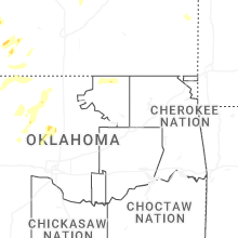

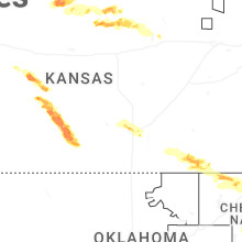
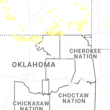
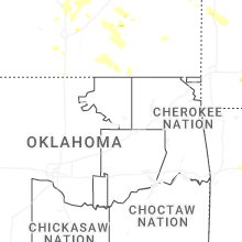

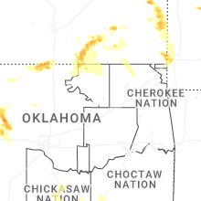
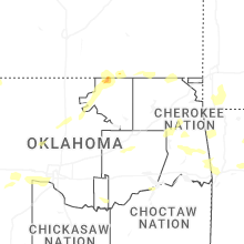


Connect with Interactive Hail Maps