

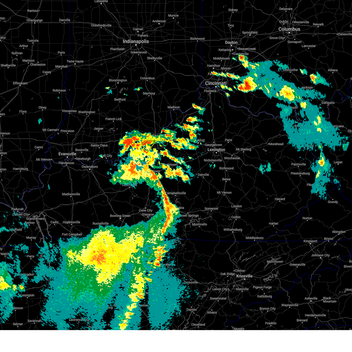
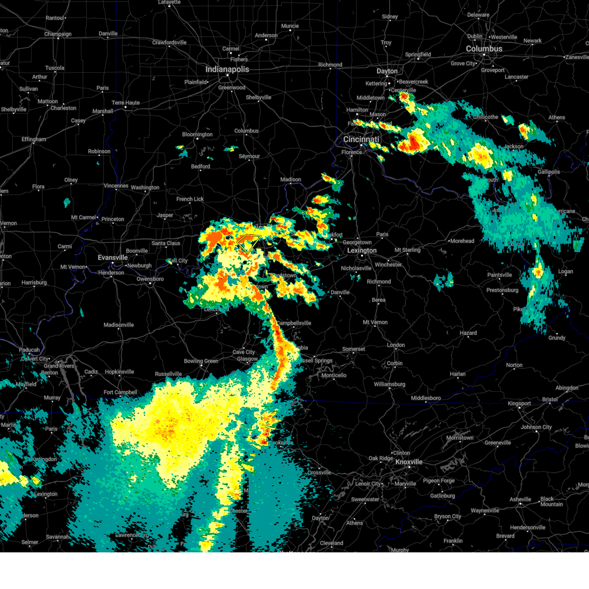
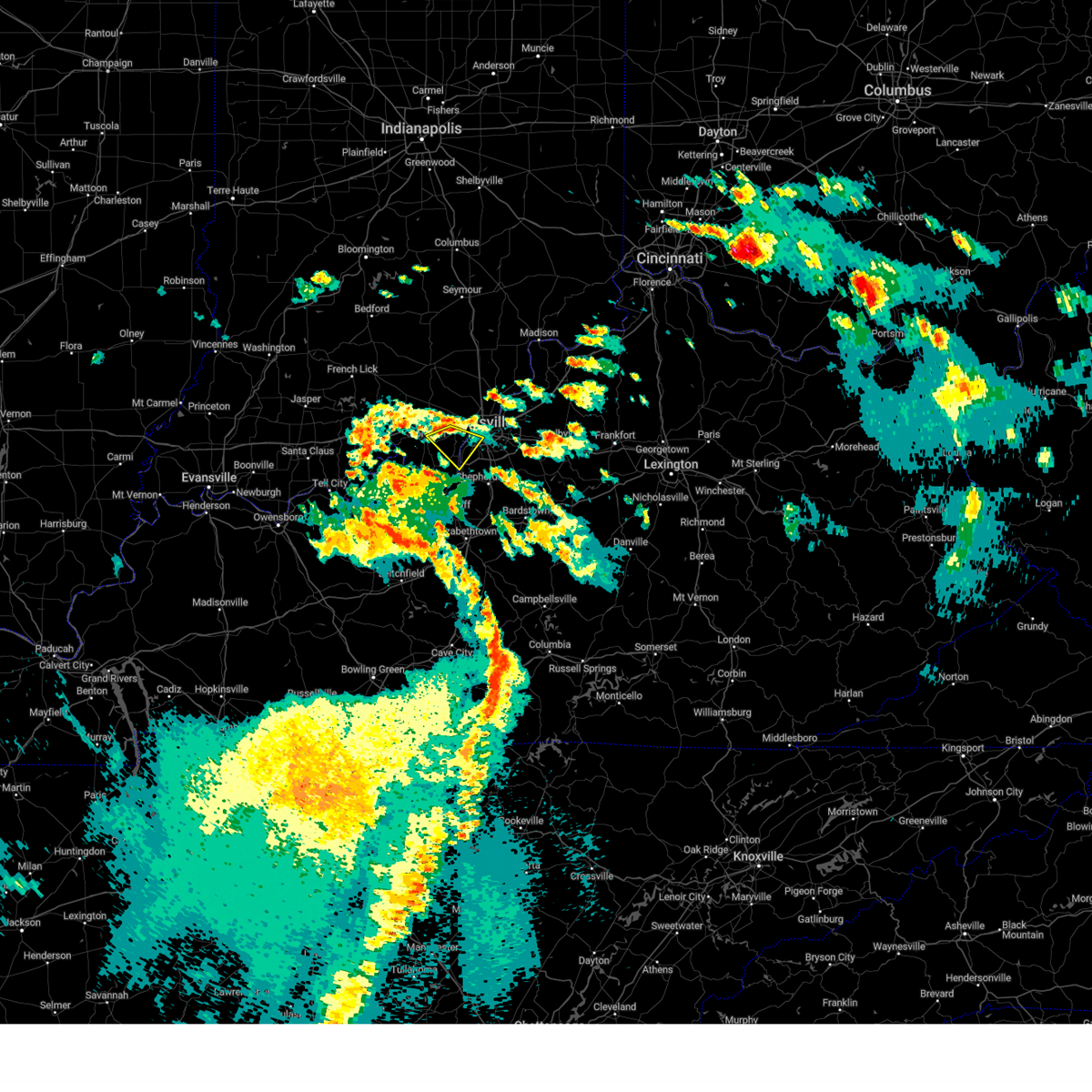
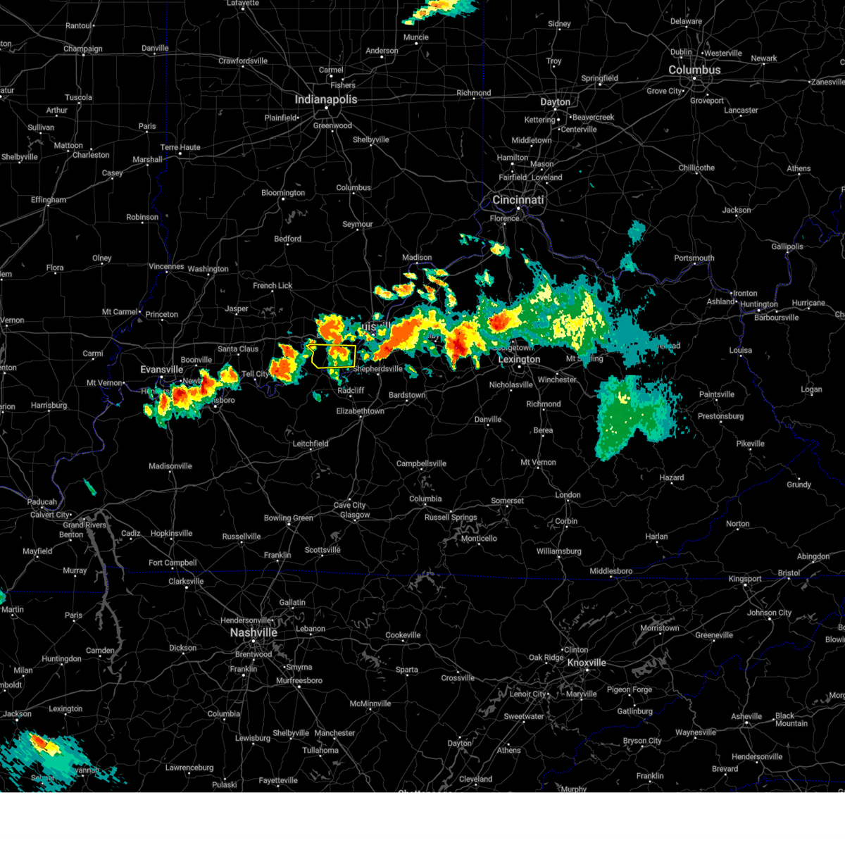
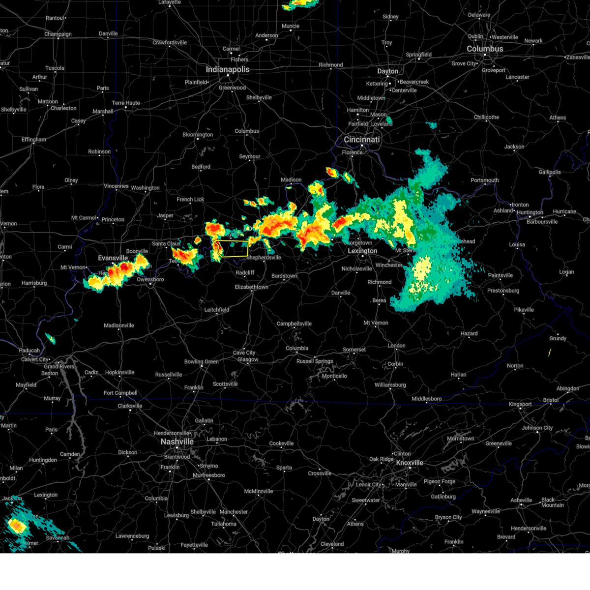
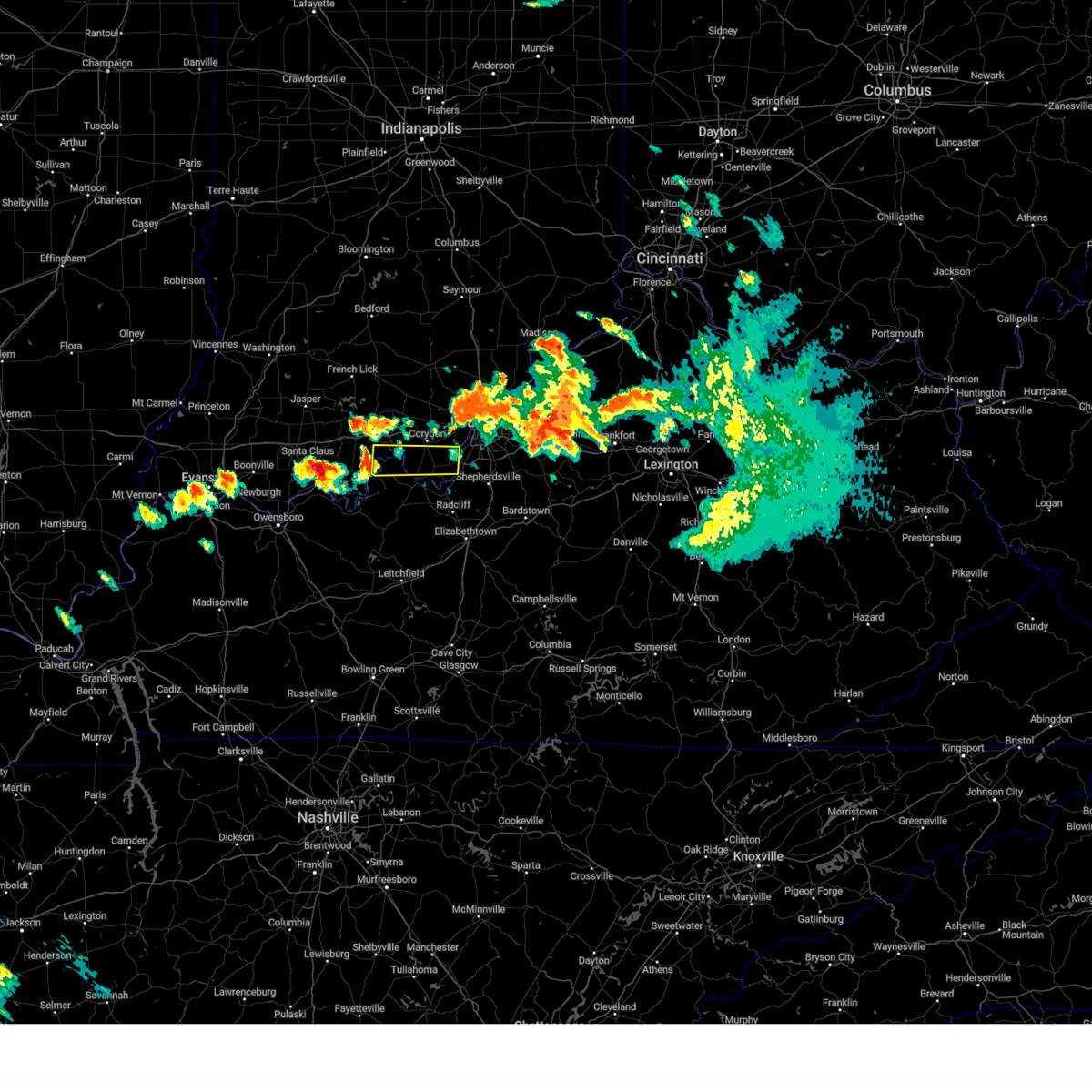
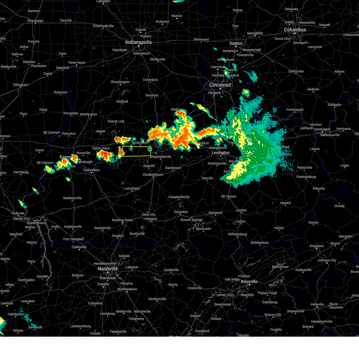
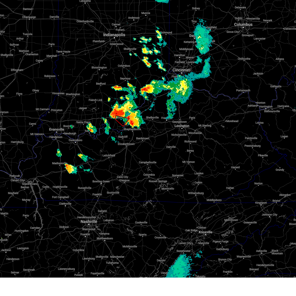
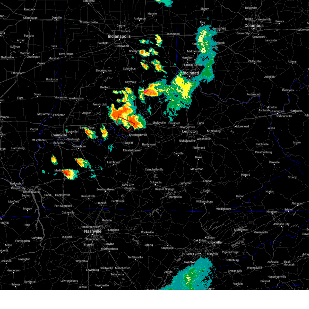
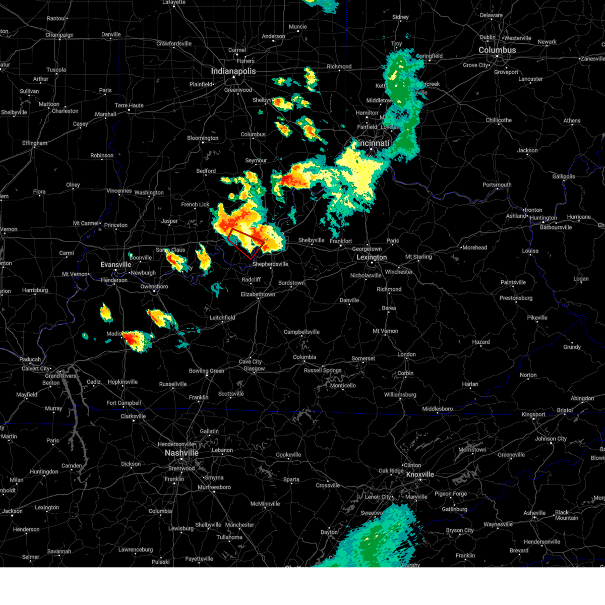
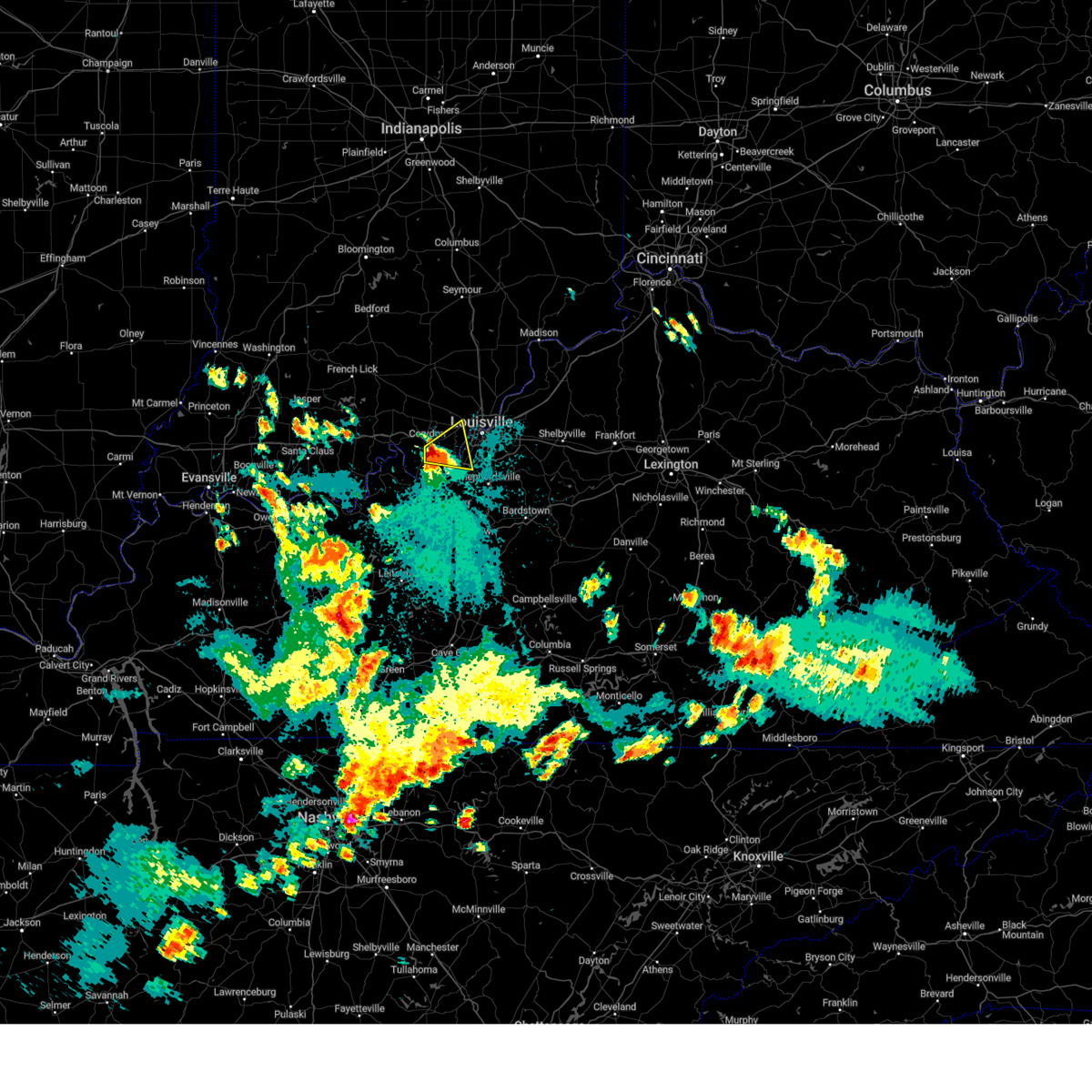
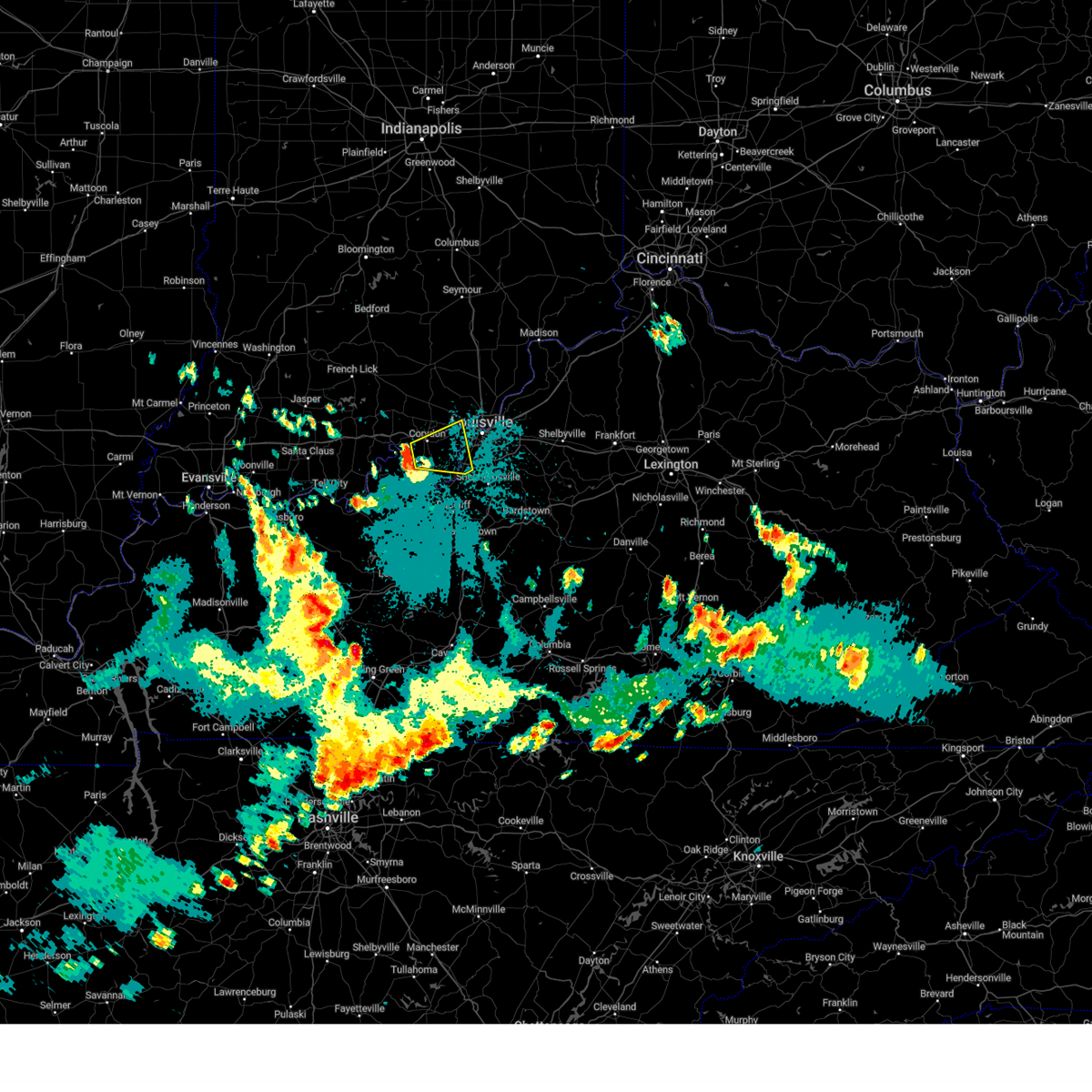
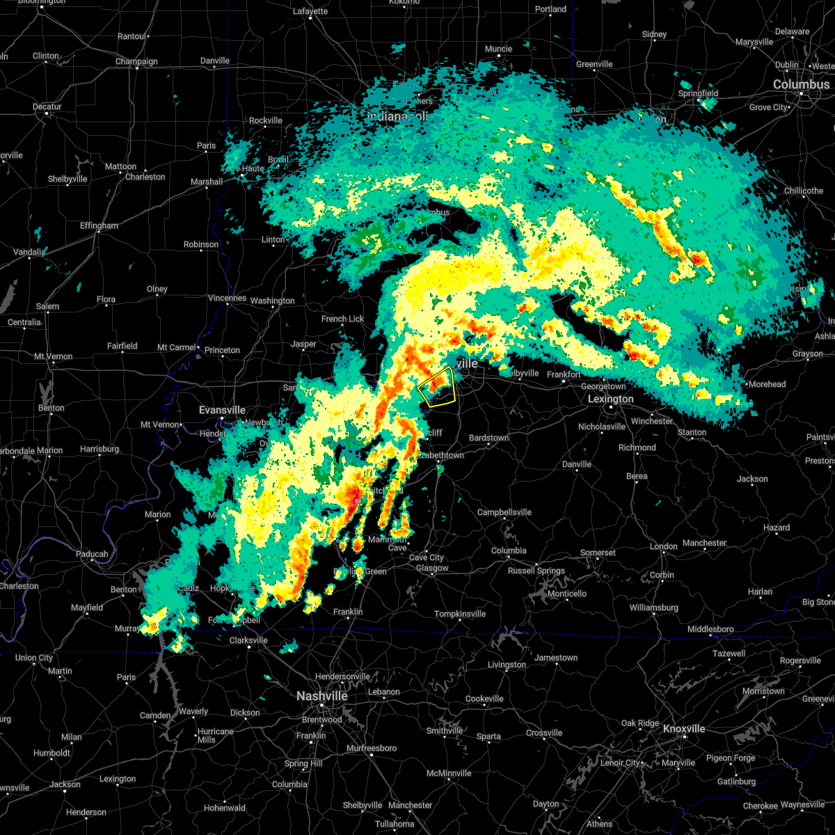
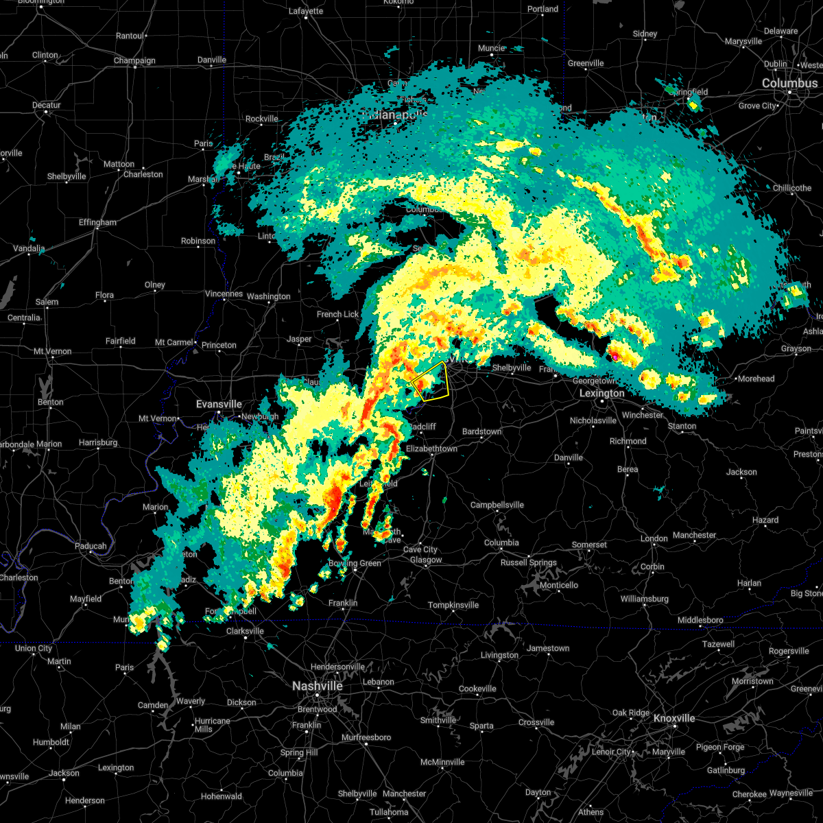
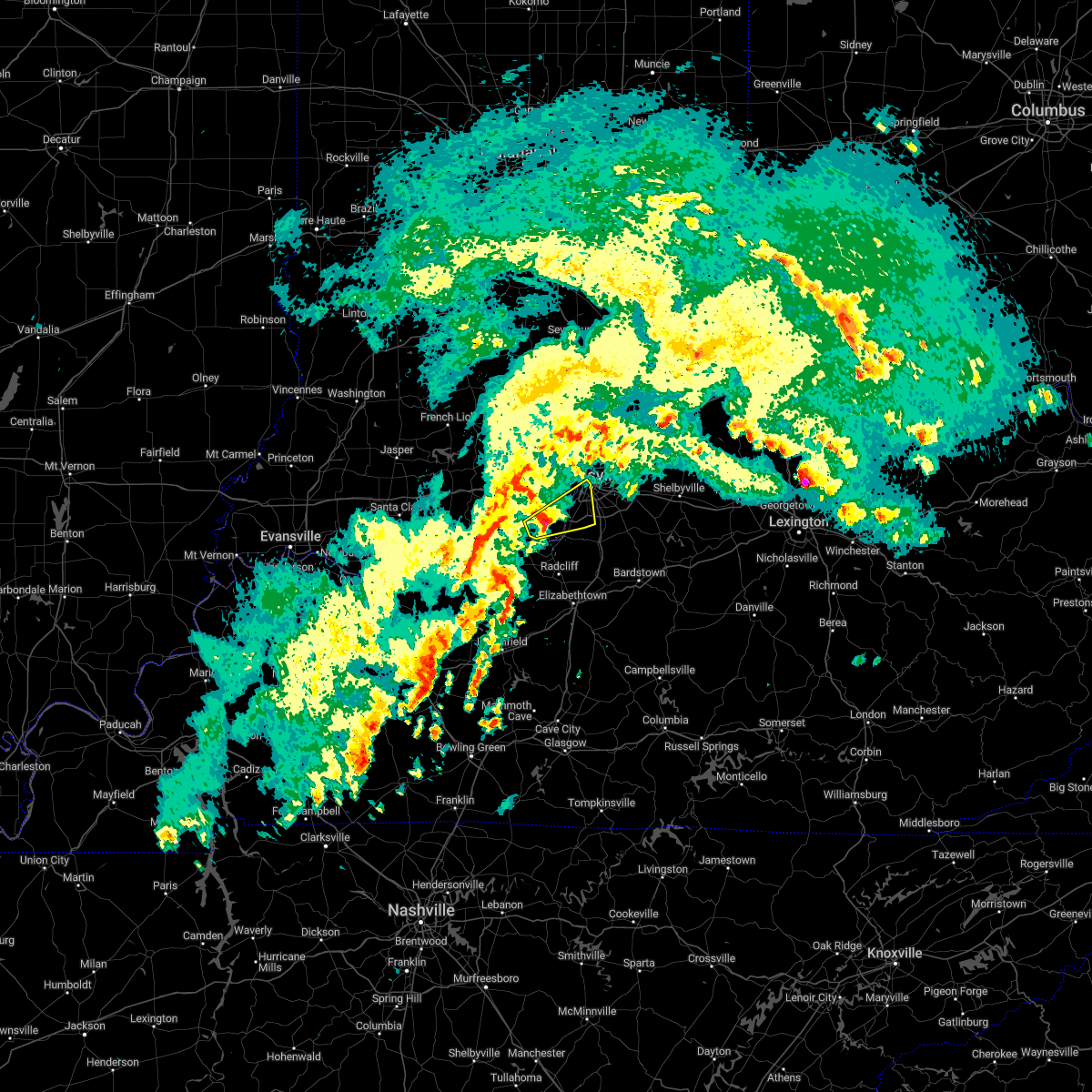
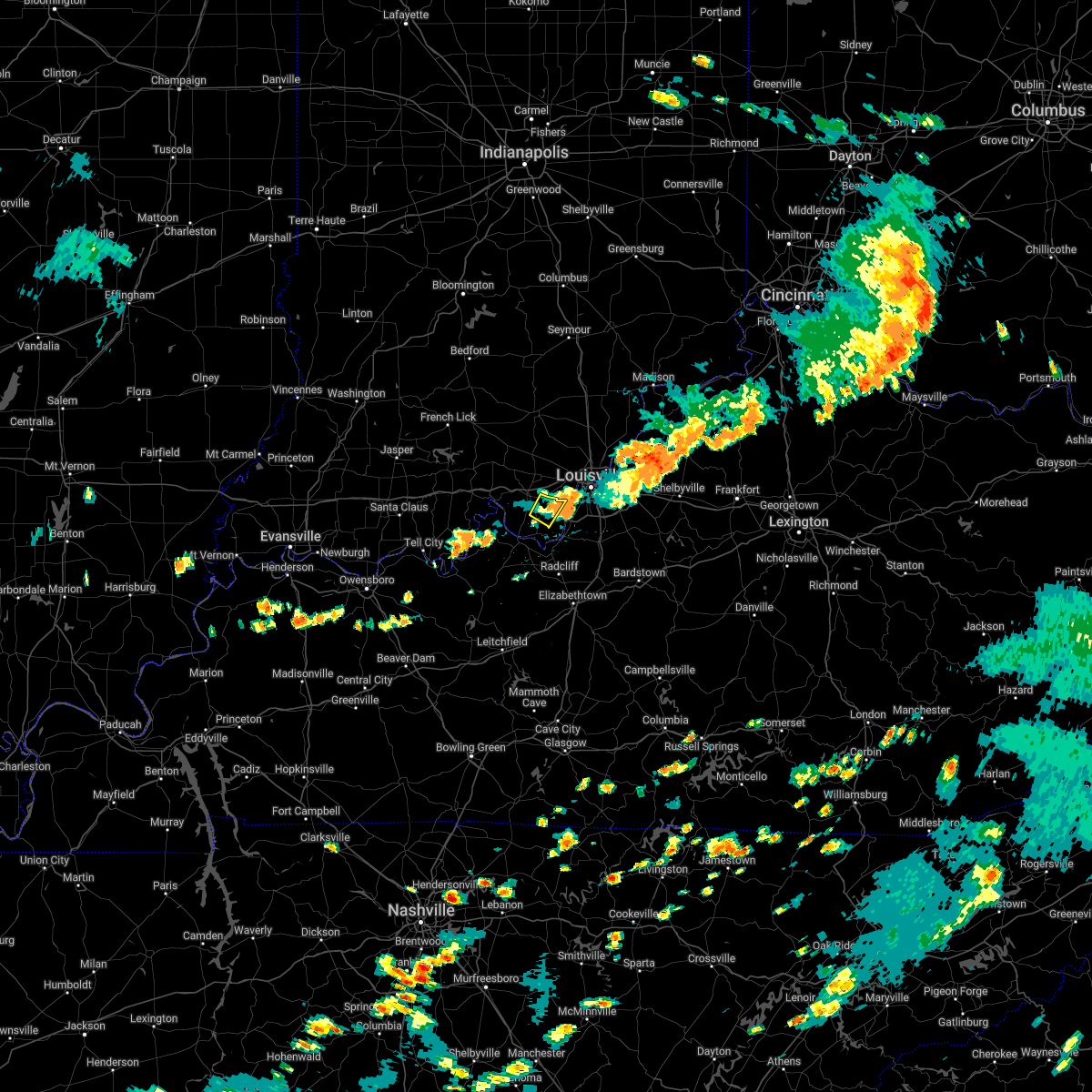
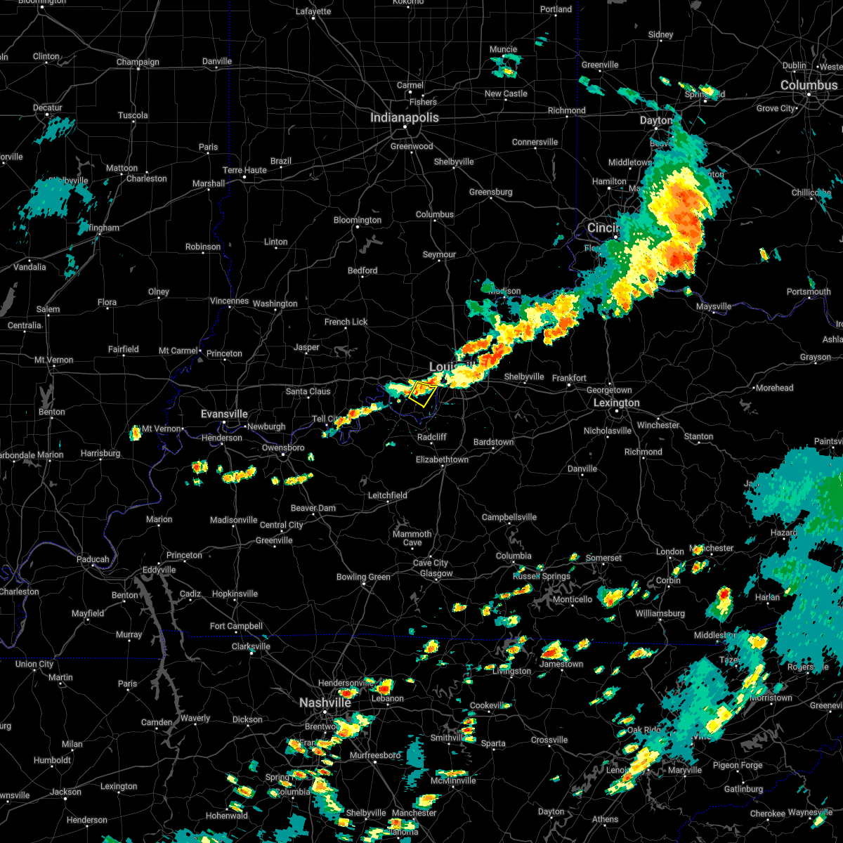
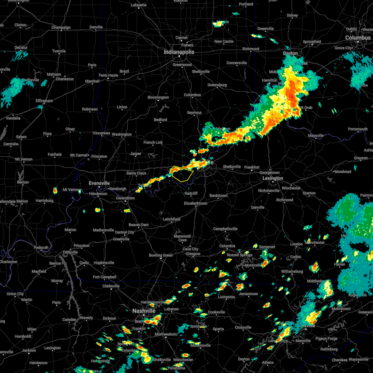
Hail Map for Elizabeth, IN
The Elizabeth, IN area has had 2 reports of on-the-ground hail by trained spotters, and has been under severe weather warnings 47 times during the past 12 months. Doppler radar has detected hail at or near Elizabeth, IN on 46 occasions, including 3 occasions during the past year.
| Name: | Elizabeth, IN |
| Where Located: | 16.8 miles WNW of Louisville, KY |
| Map: | Google Map for Elizabeth, IN |
| Population: | 162 |
| Housing Units: | 73 |
| More Info: | Search Google for Elizabeth, IN |
0
The Top Recent Hail Date for Elizabeth, IN is Tuesday, April 2, 2024 (28th out of 46)

Hail and Wind Damage Spotted near Elizabeth, IN
| Date / Time | Report Details |
|---|---|
| 4/19/2024 12:01 AM EDT |
 The storms which prompted the warning have moved out of the originial warning area and a new warning has been issued downstream. a severe thunderstorm watch remains in effect until 300 am edt for south central indiana, and central kentucky. remember, a severe thunderstorm warning still remains in effect for eastern harrison, floyd, and clark county until 1230 am edt. The storms which prompted the warning have moved out of the originial warning area and a new warning has been issued downstream. a severe thunderstorm watch remains in effect until 300 am edt for south central indiana, and central kentucky. remember, a severe thunderstorm warning still remains in effect for eastern harrison, floyd, and clark county until 1230 am edt.
|
| 4/18/2024 11:53 PM EDT |
 Svrlmk the national weather service in louisville has issued a * severe thunderstorm warning for, southeastern harrison county in south central indiana, south central clark county in south central indiana, floyd county in south central indiana, southwestern oldham county in central kentucky, jefferson county in central kentucky, northwestern bullitt county in central kentucky, * until 1230 am edt. * at 1152 pm edt, severe thunderstorms were located along a line extending from 11 miles west of new albany to 8 miles southeast of corydon to near brandenburg, moving east at 45 mph (radar indicated). Hazards include 60 mph wind gusts and penny size hail. expect damage to roofs, siding, and trees Svrlmk the national weather service in louisville has issued a * severe thunderstorm warning for, southeastern harrison county in south central indiana, south central clark county in south central indiana, floyd county in south central indiana, southwestern oldham county in central kentucky, jefferson county in central kentucky, northwestern bullitt county in central kentucky, * until 1230 am edt. * at 1152 pm edt, severe thunderstorms were located along a line extending from 11 miles west of new albany to 8 miles southeast of corydon to near brandenburg, moving east at 45 mph (radar indicated). Hazards include 60 mph wind gusts and penny size hail. expect damage to roofs, siding, and trees
|
| 4/18/2024 11:44 PM EDT |
 the severe thunderstorm warning has been cancelled and is no longer in effect the severe thunderstorm warning has been cancelled and is no longer in effect
|
| 4/18/2024 11:44 PM EDT |
 At 1143 pm edt, severe thunderstorms were located along a line extending from 11 miles northeast of carefree town to near corydon to 9 miles northwest of brandenburg, moving east at 45 mph (radar indicated). Hazards include 60 mph wind gusts. Expect damage to roofs, siding, and trees. Locations impacted include, new albany, corydon, brandenburg, galena, new pekin, palmyra, milltown, borden, and greenville. At 1143 pm edt, severe thunderstorms were located along a line extending from 11 miles northeast of carefree town to near corydon to 9 miles northwest of brandenburg, moving east at 45 mph (radar indicated). Hazards include 60 mph wind gusts. Expect damage to roofs, siding, and trees. Locations impacted include, new albany, corydon, brandenburg, galena, new pekin, palmyra, milltown, borden, and greenville.
|
| 4/18/2024 11:26 PM EDT |
 Svrlmk the national weather service in louisville has issued a * severe thunderstorm warning for, harrison county in south central indiana, west central clark county in south central indiana, crawford county in south central indiana, east central perry county in south central indiana, floyd county in south central indiana, southeastern orange county in south central indiana, southern washington county in south central indiana, northern meade county in central kentucky, * until midnight edt/1100 pm cdt/. * at 1126 pm edt/1026 pm cdt/, severe thunderstorms were located along a line extending from near english to carefree town to 17 miles northeast of tell city, moving east at 50 mph (radar indicated). Hazards include 60 mph wind gusts. expect damage to roofs, siding, and trees Svrlmk the national weather service in louisville has issued a * severe thunderstorm warning for, harrison county in south central indiana, west central clark county in south central indiana, crawford county in south central indiana, east central perry county in south central indiana, floyd county in south central indiana, southeastern orange county in south central indiana, southern washington county in south central indiana, northern meade county in central kentucky, * until midnight edt/1100 pm cdt/. * at 1126 pm edt/1026 pm cdt/, severe thunderstorms were located along a line extending from near english to carefree town to 17 miles northeast of tell city, moving east at 50 mph (radar indicated). Hazards include 60 mph wind gusts. expect damage to roofs, siding, and trees
|
| 3/14/2024 11:41 PM EDT |
 Svrlmk the national weather service in louisville has issued a * severe thunderstorm warning for, southeastern harrison county in south central indiana, south central clark county in south central indiana, southern floyd county in south central indiana, east central meade county in central kentucky, jefferson county in central kentucky, bullitt county in central kentucky, north central hardin county in central kentucky, * until 1215 am edt. * at 1141 pm edt, severe thunderstorms were located along a line extending from 7 miles west of new albany to near brandenburg, moving east at 55 mph (radar indicated). Hazards include 60 mph wind gusts. expect damage to roofs, siding, and trees Svrlmk the national weather service in louisville has issued a * severe thunderstorm warning for, southeastern harrison county in south central indiana, south central clark county in south central indiana, southern floyd county in south central indiana, east central meade county in central kentucky, jefferson county in central kentucky, bullitt county in central kentucky, north central hardin county in central kentucky, * until 1215 am edt. * at 1141 pm edt, severe thunderstorms were located along a line extending from 7 miles west of new albany to near brandenburg, moving east at 55 mph (radar indicated). Hazards include 60 mph wind gusts. expect damage to roofs, siding, and trees
|
| 7/18/2023 6:25 PM EDT |
 At 625 pm edt, a severe thunderstorm was located 7 miles east of corydon, moving southeast at 25 mph (radar indicated). Hazards include 60 mph wind gusts and penny size hail. Expect damage to roofs, siding, and trees. locations impacted include, louisville, shively, st. dennis, pleasure ridge par, pleasure ridge park, valley station, elizabeth, bridgeport, fishtown and sugar grove. hail threat, radar indicated max hail size, 0. 75 in wind threat, radar indicated max wind gust, 60 mph. At 625 pm edt, a severe thunderstorm was located 7 miles east of corydon, moving southeast at 25 mph (radar indicated). Hazards include 60 mph wind gusts and penny size hail. Expect damage to roofs, siding, and trees. locations impacted include, louisville, shively, st. dennis, pleasure ridge par, pleasure ridge park, valley station, elizabeth, bridgeport, fishtown and sugar grove. hail threat, radar indicated max hail size, 0. 75 in wind threat, radar indicated max wind gust, 60 mph.
|
| 7/18/2023 6:09 PM EDT |
 At 608 pm edt, a severe thunderstorm was located near corydon, moving southeast at 25 mph (radar indicated). Hazards include 60 mph wind gusts and penny size hail. expect damage to roofs, siding, and trees At 608 pm edt, a severe thunderstorm was located near corydon, moving southeast at 25 mph (radar indicated). Hazards include 60 mph wind gusts and penny size hail. expect damage to roofs, siding, and trees
|
| 7/18/2023 10:44 AM EDT |
 At 1044 am edt, a severe thunderstorm was located 8 miles northwest of brandenburg, moving southeast at 25 mph (radar indicated). Hazards include 60 mph wind gusts and quarter size hail. Hail damage to vehicles is expected. Expect wind damage to roofs, siding, and trees. At 1044 am edt, a severe thunderstorm was located 8 miles northwest of brandenburg, moving southeast at 25 mph (radar indicated). Hazards include 60 mph wind gusts and quarter size hail. Hail damage to vehicles is expected. Expect wind damage to roofs, siding, and trees.
|
| 7/2/2023 4:56 PM EDT |
 At 455 pm edt/355 pm cdt/, a severe thunderstorm was located 11 miles southwest of carefree town, moving east at 45 mph (radar indicated). Hazards include 70 mph wind gusts and penny size hail. Expect considerable tree damage. Damage is likely to mobile homes, roofs, and outbuildings. At 455 pm edt/355 pm cdt/, a severe thunderstorm was located 11 miles southwest of carefree town, moving east at 45 mph (radar indicated). Hazards include 70 mph wind gusts and penny size hail. Expect considerable tree damage. Damage is likely to mobile homes, roofs, and outbuildings.
|
| 7/2/2023 3:23 PM EDT |
 At 323 pm edt/223 pm cdt/, a severe thunderstorm was located 10 miles southwest of brandenburg, moving east at 35 mph (radar indicated). Hazards include 60 mph wind gusts and quarter size hail. Hail damage to vehicles is expected. Expect wind damage to roofs, siding, and trees. At 323 pm edt/223 pm cdt/, a severe thunderstorm was located 10 miles southwest of brandenburg, moving east at 35 mph (radar indicated). Hazards include 60 mph wind gusts and quarter size hail. Hail damage to vehicles is expected. Expect wind damage to roofs, siding, and trees.
|
| 7/2/2023 2:16 PM EDT |
 At 216 pm edt/116 pm cdt/, a severe thunderstorm was located 9 miles southwest of brandenburg, moving east at 35 mph (radar indicated). Hazards include 60 mph wind gusts and quarter size hail. Hail damage to vehicles is expected. Expect wind damage to roofs, siding, and trees. At 216 pm edt/116 pm cdt/, a severe thunderstorm was located 9 miles southwest of brandenburg, moving east at 35 mph (radar indicated). Hazards include 60 mph wind gusts and quarter size hail. Hail damage to vehicles is expected. Expect wind damage to roofs, siding, and trees.
|
| 6/25/2023 9:33 PM EDT |
 At 933 pm edt, a severe thunderstorm was located over pleasure ridge park, moving east at 45 mph (radar indicated). Hazards include quarter size hail. damage to vehicles is expected At 933 pm edt, a severe thunderstorm was located over pleasure ridge park, moving east at 45 mph (radar indicated). Hazards include quarter size hail. damage to vehicles is expected
|
| 6/25/2023 9:10 PM EDT |
 The severe thunderstorm warning for southern harrison county will expire at 915 pm edt, the storm which prompted the warning has weakened below severe limits, and no longer poses an immediate threat to life or property. therefore, the warning will be allowed to expire. however small hail, gusty winds and heavy rain are still possible with this thunderstorm. a tornado watch remains in effect until 1100 pm edt for south central indiana, and central kentucky. to report severe weather, contact your nearest law enforcement agency. they will relay your report to the national weather service louisville. The severe thunderstorm warning for southern harrison county will expire at 915 pm edt, the storm which prompted the warning has weakened below severe limits, and no longer poses an immediate threat to life or property. therefore, the warning will be allowed to expire. however small hail, gusty winds and heavy rain are still possible with this thunderstorm. a tornado watch remains in effect until 1100 pm edt for south central indiana, and central kentucky. to report severe weather, contact your nearest law enforcement agency. they will relay your report to the national weather service louisville.
|
| 6/25/2023 9:02 PM EDT |
 At 901 pm edt, a severe thunderstorm was located near corydon, moving east at 60 mph (radar indicated). Hazards include 60 mph wind gusts and quarter size hail. Hail damage to vehicles is expected. expect wind damage to roofs, siding, and trees. locations impacted include, elizabeth, new middletown, new amsterdam, central, titus, seven springs, lottick corner, valley city, glidas and macedonia. hail threat, radar indicated max hail size, 1. 00 in wind threat, radar indicated max wind gust, 60 mph. At 901 pm edt, a severe thunderstorm was located near corydon, moving east at 60 mph (radar indicated). Hazards include 60 mph wind gusts and quarter size hail. Hail damage to vehicles is expected. expect wind damage to roofs, siding, and trees. locations impacted include, elizabeth, new middletown, new amsterdam, central, titus, seven springs, lottick corner, valley city, glidas and macedonia. hail threat, radar indicated max hail size, 1. 00 in wind threat, radar indicated max wind gust, 60 mph.
|
| 6/25/2023 8:46 PM EDT |
 At 846 pm edt/746 pm cdt/, a severe thunderstorm was located 9 miles south of carefree town, moving east at 60 mph (radar indicated). Hazards include 60 mph wind gusts and quarter size hail. Hail damage to vehicles is expected. Expect wind damage to roofs, siding, and trees. At 846 pm edt/746 pm cdt/, a severe thunderstorm was located 9 miles south of carefree town, moving east at 60 mph (radar indicated). Hazards include 60 mph wind gusts and quarter size hail. Hail damage to vehicles is expected. Expect wind damage to roofs, siding, and trees.
|
| 6/25/2023 6:50 PM EDT |
 At 650 pm edt, a severe thunderstorm was located over fairdale, moving southeast at 35 mph (radar indicated). Hazards include two inch hail and 70 mph wind gusts. People and animals outdoors will be injured. expect hail damage to roofs, siding, windows, and vehicles. expect considerable tree damage. wind damage is also likely to mobile homes, roofs, and outbuildings. locations impacted include, louisville, jeffersonville, new albany, jeffersontown, st. matthews, shively, shepherdsville, lyndon, douglass hills and hurstbourne. thunderstorm damage threat, considerable hail threat, radar indicated max hail size, 2. 00 in wind threat, radar indicated max wind gust, 70 mph. At 650 pm edt, a severe thunderstorm was located over fairdale, moving southeast at 35 mph (radar indicated). Hazards include two inch hail and 70 mph wind gusts. People and animals outdoors will be injured. expect hail damage to roofs, siding, windows, and vehicles. expect considerable tree damage. wind damage is also likely to mobile homes, roofs, and outbuildings. locations impacted include, louisville, jeffersonville, new albany, jeffersontown, st. matthews, shively, shepherdsville, lyndon, douglass hills and hurstbourne. thunderstorm damage threat, considerable hail threat, radar indicated max hail size, 2. 00 in wind threat, radar indicated max wind gust, 70 mph.
|
| 6/25/2023 6:37 PM EDT |
 At 636 pm edt, a severe thunderstorm was located over st. dennis, moving southeast at 35 mph (radar indicated). Hazards include two inch hail and 70 mph wind gusts. People and animals outdoors will be injured. expect hail damage to roofs, siding, windows, and vehicles. expect considerable tree damage. wind damage is also likely to mobile homes, roofs, and outbuildings. locations impacted include, louisville, jeffersonville, new albany, jeffersontown, st. matthews, shively, shepherdsville, lyndon, douglass hills and hurstbourne. thunderstorm damage threat, considerable hail threat, radar indicated max hail size, 2. 00 in wind threat, radar indicated max wind gust, 70 mph. At 636 pm edt, a severe thunderstorm was located over st. dennis, moving southeast at 35 mph (radar indicated). Hazards include two inch hail and 70 mph wind gusts. People and animals outdoors will be injured. expect hail damage to roofs, siding, windows, and vehicles. expect considerable tree damage. wind damage is also likely to mobile homes, roofs, and outbuildings. locations impacted include, louisville, jeffersonville, new albany, jeffersontown, st. matthews, shively, shepherdsville, lyndon, douglass hills and hurstbourne. thunderstorm damage threat, considerable hail threat, radar indicated max hail size, 2. 00 in wind threat, radar indicated max wind gust, 70 mph.
|
| 6/25/2023 6:32 PM EDT |
 At 632 pm edt, a severe thunderstorm was located near st. dennis, moving southeast at 35 mph (radar indicated). Hazards include 70 mph wind gusts and half dollar size hail. Hail damage to vehicles is expected. expect considerable tree damage. wind damage is also likely to mobile homes, roofs, and outbuildings. locations impacted include, louisville, jeffersonville, new albany, jeffersontown, st. matthews, shively, shepherdsville, lyndon, douglass hills and hurstbourne. thunderstorm damage threat, considerable hail threat, radar indicated max hail size, 1. 25 in wind threat, radar indicated max wind gust, 70 mph. At 632 pm edt, a severe thunderstorm was located near st. dennis, moving southeast at 35 mph (radar indicated). Hazards include 70 mph wind gusts and half dollar size hail. Hail damage to vehicles is expected. expect considerable tree damage. wind damage is also likely to mobile homes, roofs, and outbuildings. locations impacted include, louisville, jeffersonville, new albany, jeffersontown, st. matthews, shively, shepherdsville, lyndon, douglass hills and hurstbourne. thunderstorm damage threat, considerable hail threat, radar indicated max hail size, 1. 25 in wind threat, radar indicated max wind gust, 70 mph.
|
| 6/25/2023 6:29 PM EDT |
 At 629 pm edt, a severe thunderstorm was located near st. dennis, moving southeast at 35 mph (radar indicated). Hazards include 60 mph wind gusts and quarter size hail. Hail damage to vehicles is expected. Expect wind damage to roofs, siding, and trees. At 629 pm edt, a severe thunderstorm was located near st. dennis, moving southeast at 35 mph (radar indicated). Hazards include 60 mph wind gusts and quarter size hail. Hail damage to vehicles is expected. Expect wind damage to roofs, siding, and trees.
|
| 6/25/2023 6:22 PM EDT |
 At 622 pm edt, a severe thunderstorm capable of producing a tornado was located near corydon, moving southeast at 40 mph (radar indicated rotation). Hazards include tornado and golf ball size hail. Flying debris will be dangerous to those caught without shelter. mobile homes will be damaged or destroyed. damage to roofs, windows, and vehicles will occur. tree damage is likely. locations impacted include, louisville, shively, corydon, st. Dennis, pleasure ridge park, lanesville, elizabeth, new middletown, seven springs and lottick corner. At 622 pm edt, a severe thunderstorm capable of producing a tornado was located near corydon, moving southeast at 40 mph (radar indicated rotation). Hazards include tornado and golf ball size hail. Flying debris will be dangerous to those caught without shelter. mobile homes will be damaged or destroyed. damage to roofs, windows, and vehicles will occur. tree damage is likely. locations impacted include, louisville, shively, corydon, st. Dennis, pleasure ridge park, lanesville, elizabeth, new middletown, seven springs and lottick corner.
|
| 6/25/2023 6:12 PM EDT |
 At 612 pm edt, a severe thunderstorm capable of producing a tornado was located near corydon, moving southeast at 40 mph (radar indicated rotation). Hazards include tornado and golf ball size hail. Flying debris will be dangerous to those caught without shelter. mobile homes will be damaged or destroyed. damage to roofs, windows, and vehicles will occur. Tree damage is likely. At 612 pm edt, a severe thunderstorm capable of producing a tornado was located near corydon, moving southeast at 40 mph (radar indicated rotation). Hazards include tornado and golf ball size hail. Flying debris will be dangerous to those caught without shelter. mobile homes will be damaged or destroyed. damage to roofs, windows, and vehicles will occur. Tree damage is likely.
|
| 6/25/2023 6:06 PM EDT |
 At 606 pm edt, a severe thunderstorm was located near st. dennis, moving southeast at 35 mph (radar indicated). Hazards include 60 mph wind gusts and quarter size hail. Hail damage to vehicles is expected. Expect wind damage to roofs, siding, and trees. At 606 pm edt, a severe thunderstorm was located near st. dennis, moving southeast at 35 mph (radar indicated). Hazards include 60 mph wind gusts and quarter size hail. Hail damage to vehicles is expected. Expect wind damage to roofs, siding, and trees.
|
| 6/25/2023 6:05 PM EDT |
 At 605 pm edt, a severe thunderstorm was located 7 miles northeast of carefree town, moving east at 45 mph (radar indicated). Hazards include 60 mph wind gusts and quarter size hail. Hail damage to vehicles is expected. Expect wind damage to roofs, siding, and trees. At 605 pm edt, a severe thunderstorm was located 7 miles northeast of carefree town, moving east at 45 mph (radar indicated). Hazards include 60 mph wind gusts and quarter size hail. Hail damage to vehicles is expected. Expect wind damage to roofs, siding, and trees.
|
| 6/25/2023 5:48 PM EDT |
 At 548 pm edt, a severe thunderstorm was located over corydon, moving southeast at 35 mph (radar indicated). Hazards include golf ball size hail and 60 mph wind gusts. People and animals outdoors will be injured. expect hail damage to roofs, siding, windows, and vehicles. Expect wind damage to roofs, siding, and trees. At 548 pm edt, a severe thunderstorm was located over corydon, moving southeast at 35 mph (radar indicated). Hazards include golf ball size hail and 60 mph wind gusts. People and animals outdoors will be injured. expect hail damage to roofs, siding, windows, and vehicles. Expect wind damage to roofs, siding, and trees.
|
| 5/9/2023 3:17 AM EDT |
 At 317 am edt, a severe thunderstorm was located 7 miles southeast of corydon, moving east at 30 mph (radar indicated). Hazards include 60 mph wind gusts and half dollar size hail. Hail damage to vehicles is expected. expect wind damage to roofs, siding, and trees. locations impacted include, valley station, pleasure ridge par, pleasure ridge park, st. dennis, elizabeth, new middletown, bridgeport, sugar grove, seven springs and lottick corner. hail threat, radar indicated max hail size, 1. 25 in wind threat, radar indicated max wind gust, 60 mph. At 317 am edt, a severe thunderstorm was located 7 miles southeast of corydon, moving east at 30 mph (radar indicated). Hazards include 60 mph wind gusts and half dollar size hail. Hail damage to vehicles is expected. expect wind damage to roofs, siding, and trees. locations impacted include, valley station, pleasure ridge par, pleasure ridge park, st. dennis, elizabeth, new middletown, bridgeport, sugar grove, seven springs and lottick corner. hail threat, radar indicated max hail size, 1. 25 in wind threat, radar indicated max wind gust, 60 mph.
|
| 5/9/2023 3:12 AM EDT |
 At 311 am edt, a severe thunderstorm was located near corydon, moving east at 35 mph (radar indicated). Hazards include golf ball size hail and 60 mph wind gusts. People and animals outdoors will be injured. expect hail damage to roofs, siding, windows, and vehicles. expect wind damage to roofs, siding, and trees. locations impacted include, valley station, pleasure ridge par, pleasure ridge park, st. dennis, lanesville, elizabeth, new middletown, seven springs, lottick corner and bridgeport. thunderstorm damage threat, considerable hail threat, radar indicated max hail size, 1. 75 in wind threat, radar indicated max wind gust, 60 mph. At 311 am edt, a severe thunderstorm was located near corydon, moving east at 35 mph (radar indicated). Hazards include golf ball size hail and 60 mph wind gusts. People and animals outdoors will be injured. expect hail damage to roofs, siding, windows, and vehicles. expect wind damage to roofs, siding, and trees. locations impacted include, valley station, pleasure ridge par, pleasure ridge park, st. dennis, lanesville, elizabeth, new middletown, seven springs, lottick corner and bridgeport. thunderstorm damage threat, considerable hail threat, radar indicated max hail size, 1. 75 in wind threat, radar indicated max wind gust, 60 mph.
|
| 5/9/2023 3:03 AM EDT |
 At 303 am edt, a severe thunderstorm was located near corydon, moving east at 35 mph (radar indicated). Hazards include ping pong ball size hail and 60 mph wind gusts. People and animals outdoors will be injured. expect hail damage to roofs, siding, windows, and vehicles. Expect wind damage to roofs, siding, and trees. At 303 am edt, a severe thunderstorm was located near corydon, moving east at 35 mph (radar indicated). Hazards include ping pong ball size hail and 60 mph wind gusts. People and animals outdoors will be injured. expect hail damage to roofs, siding, windows, and vehicles. Expect wind damage to roofs, siding, and trees.
|
| 4/5/2023 4:23 PM EDT |
 At 423 pm edt/323 pm cdt/, severe thunderstorms were located along a line extending from 7 miles southwest of carefree town to near hardinsburg, moving east at 55 mph (radar indicated). Hazards include 60 mph wind gusts. expect damage to roofs, siding, and trees At 423 pm edt/323 pm cdt/, severe thunderstorms were located along a line extending from 7 miles southwest of carefree town to near hardinsburg, moving east at 55 mph (radar indicated). Hazards include 60 mph wind gusts. expect damage to roofs, siding, and trees
|
| 3/3/2023 2:55 PM EST |
 The severe thunderstorm warning for harrison, northeastern crawford and eastern meade counties will expire at 300 pm est, the storms which prompted the warning have moved out of the area. therefore, the warning will be allowed to expire. a tornado watch remains in effect until 500 pm est for south central indiana, and central kentucky. The severe thunderstorm warning for harrison, northeastern crawford and eastern meade counties will expire at 300 pm est, the storms which prompted the warning have moved out of the area. therefore, the warning will be allowed to expire. a tornado watch remains in effect until 500 pm est for south central indiana, and central kentucky.
|
| 3/3/2023 2:47 PM EST |
 At 246 pm est, severe thunderstorms were located along a line extending from 7 miles southeast of paoli to 8 miles northeast of brandenburg, moving northeast at 70 mph (trained weather spotters and weather observing stations). Hazards include 70 mph wind gusts. Expect considerable tree damage. damage is likely to mobile homes, roofs, and outbuildings. Locations impacted include, corydon, palmyra, milltown, lanesville, elizabeth, crandall, new middletown, laconia, byrneville and white cloud. At 246 pm est, severe thunderstorms were located along a line extending from 7 miles southeast of paoli to 8 miles northeast of brandenburg, moving northeast at 70 mph (trained weather spotters and weather observing stations). Hazards include 70 mph wind gusts. Expect considerable tree damage. damage is likely to mobile homes, roofs, and outbuildings. Locations impacted include, corydon, palmyra, milltown, lanesville, elizabeth, crandall, new middletown, laconia, byrneville and white cloud.
|
| 3/3/2023 2:45 PM EST |
 At 245 pm est, severe thunderstorms were located along a line extending from 9 miles southwest of bedford to 8 miles west of valley station, moving northeast at 70 mph (trained weather spotters and weather observing stations). Hazards include 70 mph wind gusts. Expect considerable tree damage. damage is likely to mobile homes, roofs, and outbuildings. severe thunderstorms will be near, shively around 255 pm est. Louisville, jeffersonville and new albany around 300 pm est. At 245 pm est, severe thunderstorms were located along a line extending from 9 miles southwest of bedford to 8 miles west of valley station, moving northeast at 70 mph (trained weather spotters and weather observing stations). Hazards include 70 mph wind gusts. Expect considerable tree damage. damage is likely to mobile homes, roofs, and outbuildings. severe thunderstorms will be near, shively around 255 pm est. Louisville, jeffersonville and new albany around 300 pm est.
|
| 3/3/2023 2:35 PM EST |
 At 234 pm est/134 pm cst/, severe thunderstorms were located along a line extending from 6 miles southwest of carefree town to 16 miles east of hardinsburg, moving northeast at 75 mph. these are destructive storms! (trained weather spotters). Hazards include 80 mph wind gusts. Flying debris will be dangerous to those caught without shelter. mobile homes will be heavily damaged. expect considerable damage to roofs, windows, and vehicles. extensive tree damage and power outages are likely. Locations impacted include, corydon, brandenburg, carefree town, mount pleasant, webster, irvington, palmyra, milltown, lanesville and leavenworth. At 234 pm est/134 pm cst/, severe thunderstorms were located along a line extending from 6 miles southwest of carefree town to 16 miles east of hardinsburg, moving northeast at 75 mph. these are destructive storms! (trained weather spotters). Hazards include 80 mph wind gusts. Flying debris will be dangerous to those caught without shelter. mobile homes will be heavily damaged. expect considerable damage to roofs, windows, and vehicles. extensive tree damage and power outages are likely. Locations impacted include, corydon, brandenburg, carefree town, mount pleasant, webster, irvington, palmyra, milltown, lanesville and leavenworth.
|
| 3/3/2023 2:32 PM EST |
 At 231 pm est/131 pm cst/, severe thunderstorms were located along a line extending from near english to near brandenburg, moving northeast at 80 mph. these are destructive storms! (weather observing stations). Hazards include 80 mph wind gusts. Flying debris will be dangerous to those caught without shelter. mobile homes will be heavily damaged. expect considerable damage to roofs, windows, and vehicles. extensive tree damage and power outages are likely. Locations impacted include, corydon. At 231 pm est/131 pm cst/, severe thunderstorms were located along a line extending from near english to near brandenburg, moving northeast at 80 mph. these are destructive storms! (weather observing stations). Hazards include 80 mph wind gusts. Flying debris will be dangerous to those caught without shelter. mobile homes will be heavily damaged. expect considerable damage to roofs, windows, and vehicles. extensive tree damage and power outages are likely. Locations impacted include, corydon.
|
| 3/3/2023 2:20 PM EST |
 At 220 pm est/120 pm cst/, severe thunderstorms were located along a line extending from 11 miles southwest of english to 8 miles east of hardinsburg, moving northeast at 80 mph (radar indicated). Hazards include 70 mph wind gusts. Expect considerable tree damage. damage is likely to mobile homes, roofs, and outbuildings. severe thunderstorms will be near, brandenburg around 235 pm est. Other locations in the path of these severe thunderstorms include corydon. At 220 pm est/120 pm cst/, severe thunderstorms were located along a line extending from 11 miles southwest of english to 8 miles east of hardinsburg, moving northeast at 80 mph (radar indicated). Hazards include 70 mph wind gusts. Expect considerable tree damage. damage is likely to mobile homes, roofs, and outbuildings. severe thunderstorms will be near, brandenburg around 235 pm est. Other locations in the path of these severe thunderstorms include corydon.
|
| 1/12/2023 7:28 AM EST |
 The severe thunderstorm warning for east central harrison, south central floyd and southwestern jefferson counties will expire at 730 am est, the storm which prompted the warning has weakened below severe limits, and no longer poses an immediate threat to life or property. therefore, the warning will be allowed to expire. however small hail and heavy rain are still possible with this thunderstorm. a severe thunderstorm watch remains in effect until 100 pm est for south central indiana, and central kentucky. The severe thunderstorm warning for east central harrison, south central floyd and southwestern jefferson counties will expire at 730 am est, the storm which prompted the warning has weakened below severe limits, and no longer poses an immediate threat to life or property. therefore, the warning will be allowed to expire. however small hail and heavy rain are still possible with this thunderstorm. a severe thunderstorm watch remains in effect until 100 pm est for south central indiana, and central kentucky.
|
| 1/12/2023 7:22 AM EST |
 At 721 am est, a severe thunderstorm was located over pleasure ridge park, moving northeast at 55 mph (radar indicated). Hazards include 60 mph wind gusts and quarter size hail. Hail damage to vehicles is expected. expect wind damage to roofs, siding, and trees. this severe storm will be near, hollyvilla and fairdale around 725 am est. shively around 730 am est. other locations in the path of this severe thunderstorm include louisville. hail threat, radar indicated max hail size, 1. 00 in wind threat, radar indicated max wind gust, 60 mph. At 721 am est, a severe thunderstorm was located over pleasure ridge park, moving northeast at 55 mph (radar indicated). Hazards include 60 mph wind gusts and quarter size hail. Hail damage to vehicles is expected. expect wind damage to roofs, siding, and trees. this severe storm will be near, hollyvilla and fairdale around 725 am est. shively around 730 am est. other locations in the path of this severe thunderstorm include louisville. hail threat, radar indicated max hail size, 1. 00 in wind threat, radar indicated max wind gust, 60 mph.
|
| 1/12/2023 7:12 AM EST |
 At 712 am est, a severe thunderstorm was located 9 miles southeast of corydon, moving northeast at 60 mph (radar indicated). Hazards include 60 mph wind gusts and quarter size hail. Hail damage to vehicles is expected. expect wind damage to roofs, siding, and trees. this severe storm will be near, pleasure ridge park and valley station around 720 am est. other locations in the path of this severe thunderstorm include shively, st. dennis, fairdale and louisville. hail threat, radar indicated max hail size, 1. 00 in wind threat, radar indicated max wind gust, 60 mph. At 712 am est, a severe thunderstorm was located 9 miles southeast of corydon, moving northeast at 60 mph (radar indicated). Hazards include 60 mph wind gusts and quarter size hail. Hail damage to vehicles is expected. expect wind damage to roofs, siding, and trees. this severe storm will be near, pleasure ridge park and valley station around 720 am est. other locations in the path of this severe thunderstorm include shively, st. dennis, fairdale and louisville. hail threat, radar indicated max hail size, 1. 00 in wind threat, radar indicated max wind gust, 60 mph.
|
| 1/12/2023 7:00 AM EST | At 700 am est, a severe thunderstorm was located over brandenburg, moving northeast at 55 mph (radar indicated). Hazards include quarter size hail. Damage to vehicles is expected. this severe thunderstorm will be near, valley station around 720 am est. other locations in the path of this severe thunderstorm include hollyvilla, fairdale, pleasure ridge par, st. dennis, louisville, shively and minor lane heights. hail threat, radar indicated max hail size, 1. 00 in wind threat, radar indicated max wind gust, <50 mph. |
| 1/12/2023 7:00 AM EST | At 700 am est, a severe thunderstorm was located over brandenburg, moving northeast at 55 mph (radar indicated). Hazards include quarter size hail. Damage to vehicles is expected. this severe thunderstorm will be near, valley station around 720 am est. other locations in the path of this severe thunderstorm include hollyvilla, fairdale, pleasure ridge par, st. dennis, louisville, shively and minor lane heights. hail threat, radar indicated max hail size, 1. 00 in wind threat, radar indicated max wind gust, <50 mph. |
| 7/6/2022 3:40 PM EDT |
 The severe thunderstorm warning for southeastern harrison county will expire at 345 pm edt, the storm which prompted the warning has moved out of the area. therefore, the warning will be allowed to expire. a severe thunderstorm watch remains in effect until 700 pm edt for south central indiana. remember, a severe thunderstorm warning still remains in effect for eastern harrison county, indiana. The severe thunderstorm warning for southeastern harrison county will expire at 345 pm edt, the storm which prompted the warning has moved out of the area. therefore, the warning will be allowed to expire. a severe thunderstorm watch remains in effect until 700 pm edt for south central indiana. remember, a severe thunderstorm warning still remains in effect for eastern harrison county, indiana.
|
| 7/6/2022 3:37 PM EDT | Reports of trees and powerlines down along doolittle hill rd in elizabeth... i in harrison county IN, 0.2 miles NW of Elizabeth, IN |
| 7/6/2022 3:31 PM EDT |
 At 331 pm edt, a severe thunderstorm was located 7 miles west of valley station, moving east at 25 mph (radar indicated). Hazards include 60 mph wind gusts. Expect damage to roofs, siding, and trees. locations impacted include, elizabeth, new middletown, seven springs, dogwood and lottick corner. hail threat, radar indicated max hail size, <. 75 in wind threat, radar indicated max wind gust, 60 mph. At 331 pm edt, a severe thunderstorm was located 7 miles west of valley station, moving east at 25 mph (radar indicated). Hazards include 60 mph wind gusts. Expect damage to roofs, siding, and trees. locations impacted include, elizabeth, new middletown, seven springs, dogwood and lottick corner. hail threat, radar indicated max hail size, <. 75 in wind threat, radar indicated max wind gust, 60 mph.
|
| 7/6/2022 3:21 PM EDT |
 At 320 pm edt, a severe thunderstorm was located near corydon, moving southeast at 20 mph (radar indicated). Hazards include 60 mph wind gusts. Expect damage to roofs, siding, and trees. this severe thunderstorm will remain over mainly rural areas of central harrison county, including the following locations, elizabeth, valley city, central, new middletown, seven springs, dogwood and lottick corner. hail threat, radar indicated max hail size, <. 75 in wind threat, radar indicated max wind gust, 60 mph. At 320 pm edt, a severe thunderstorm was located near corydon, moving southeast at 20 mph (radar indicated). Hazards include 60 mph wind gusts. Expect damage to roofs, siding, and trees. this severe thunderstorm will remain over mainly rural areas of central harrison county, including the following locations, elizabeth, valley city, central, new middletown, seven springs, dogwood and lottick corner. hail threat, radar indicated max hail size, <. 75 in wind threat, radar indicated max wind gust, 60 mph.
|
| 7/6/2022 3:10 PM EDT |
 At 310 pm edt, a severe thunderstorm was located near corydon, moving southeast at 20 mph (radar indicated). Hazards include 60 mph wind gusts and penny size hail. Expect damage to roofs, siding, and trees. this severe thunderstorm will be near, corydon around 315 pm edt. hail threat, radar indicated max hail size, 0. 75 in wind threat, radar indicated max wind gust, 60 mph. At 310 pm edt, a severe thunderstorm was located near corydon, moving southeast at 20 mph (radar indicated). Hazards include 60 mph wind gusts and penny size hail. Expect damage to roofs, siding, and trees. this severe thunderstorm will be near, corydon around 315 pm edt. hail threat, radar indicated max hail size, 0. 75 in wind threat, radar indicated max wind gust, 60 mph.
|
| 6/22/2022 4:39 PM EDT |
 At 438 pm edt, severe thunderstorms were from graymoor-devondale to near fairdale to 6 miles southwest of valley station, moving southeast at 25 mph. multiple trees were blown down at the junction of zorn avenue and interstate 71 in louisville with these storms (radar indicated). Hazards include 60 mph wind gusts and quarter size hail. Hail damage to vehicles is expected. expect wind damage to roofs, siding, and trees. locations impacted include, louisville, jeffersonville, jeffersontown, st. matthews, shively, lyndon, middletown, douglass hills, prospect and hurstbourne. hail threat, radar indicated max hail size, 1. 00 in wind threat, radar indicated max wind gust, 60 mph. At 438 pm edt, severe thunderstorms were from graymoor-devondale to near fairdale to 6 miles southwest of valley station, moving southeast at 25 mph. multiple trees were blown down at the junction of zorn avenue and interstate 71 in louisville with these storms (radar indicated). Hazards include 60 mph wind gusts and quarter size hail. Hail damage to vehicles is expected. expect wind damage to roofs, siding, and trees. locations impacted include, louisville, jeffersonville, jeffersontown, st. matthews, shively, lyndon, middletown, douglass hills, prospect and hurstbourne. hail threat, radar indicated max hail size, 1. 00 in wind threat, radar indicated max wind gust, 60 mph.
|
| 6/22/2022 4:31 PM EDT |
 At 430 pm edt, severe thunderstorms were from glenview to shively to 7 miles southwest of valley station, moving east at 25 mph (radar indicated). Hazards include 60 mph wind gusts and quarter size hail. Hail damage to vehicles is expected. Expect wind damage to roofs, siding, and trees. At 430 pm edt, severe thunderstorms were from glenview to shively to 7 miles southwest of valley station, moving east at 25 mph (radar indicated). Hazards include 60 mph wind gusts and quarter size hail. Hail damage to vehicles is expected. Expect wind damage to roofs, siding, and trees.
|
| 6/22/2022 4:22 PM EDT |
 At 421 pm edt, the leading edge of strong gusty winds from severe thunderstorms was from near jeffersonville to shively to 8 miles west of valley station to 8 miles south of brandenburg, moving southeast at 35 mph (radar indicated). Hazards include 60 mph wind gusts and nickel size hail. Expect damage to roofs, siding, and trees. locations impacted include, louisville, jeffersonville, new albany, shively, brandenburg, glenview, pleasure ridge park, and st. dennis. hail threat, radar indicated max hail size, 0. 88 in wind threat, radar indicated max wind gust, 60 mph. At 421 pm edt, the leading edge of strong gusty winds from severe thunderstorms was from near jeffersonville to shively to 8 miles west of valley station to 8 miles south of brandenburg, moving southeast at 35 mph (radar indicated). Hazards include 60 mph wind gusts and nickel size hail. Expect damage to roofs, siding, and trees. locations impacted include, louisville, jeffersonville, new albany, shively, brandenburg, glenview, pleasure ridge park, and st. dennis. hail threat, radar indicated max hail size, 0. 88 in wind threat, radar indicated max wind gust, 60 mph.
|
| 6/22/2022 4:13 PM EDT |
 At 413 pm edt, severe thunderstorms were from near new albany to near corydon to 9 miles southwest of brandenburg, moving east at 25 mph (radar indicated). Hazards include 60 mph wind gusts and quarter size hail. Hail damage to vehicles is expected. Expect wind damage to roofs, siding, and trees. At 413 pm edt, severe thunderstorms were from near new albany to near corydon to 9 miles southwest of brandenburg, moving east at 25 mph (radar indicated). Hazards include 60 mph wind gusts and quarter size hail. Hail damage to vehicles is expected. Expect wind damage to roofs, siding, and trees.
|
| 4/13/2022 8:24 PM EDT |
 At 824 pm edt, a severe thunderstorm was located near woodland hills, moving northeast at 70 mph. this is a destructive storm for louisville (radar indicated). Hazards include 80 mph wind gusts and quarter size hail. Flying debris will be dangerous to those caught without shelter. mobile homes will be heavily damaged. expect considerable damage to roofs, windows, and vehicles. extensive tree damage and power outages are likely. This severe thunderstorm will remain over mainly rural areas of east central harrison, south central clark, southeastern floyd, northwestern spencer, southwestern oldham, southwestern shelby, jefferson, northeastern hardin and bullitt counties, including the following locations, yoder, clarksville, montclair, waterford, louisville bowman field, bardstown junction, hobbs, smithville, belmont and watson. At 824 pm edt, a severe thunderstorm was located near woodland hills, moving northeast at 70 mph. this is a destructive storm for louisville (radar indicated). Hazards include 80 mph wind gusts and quarter size hail. Flying debris will be dangerous to those caught without shelter. mobile homes will be heavily damaged. expect considerable damage to roofs, windows, and vehicles. extensive tree damage and power outages are likely. This severe thunderstorm will remain over mainly rural areas of east central harrison, south central clark, southeastern floyd, northwestern spencer, southwestern oldham, southwestern shelby, jefferson, northeastern hardin and bullitt counties, including the following locations, yoder, clarksville, montclair, waterford, louisville bowman field, bardstown junction, hobbs, smithville, belmont and watson.
|
| 4/13/2022 8:11 PM EDT |
 At 811 pm edt, a severe thunderstorm was located over hollyvilla, moving northeast at 70 mph (radar indicated). Hazards include 70 mph wind gusts and quarter size hail. Hail damage to vehicles is expected. expect considerable tree damage. wind damage is also likely to mobile homes, roofs, and outbuildings. this severe thunderstorm will be near, audubon park, lynnview, okolona and newburg around 815 pm edt. st. regis park, west buechel, watterson park, hollow creek, seneca gardens, strathmoor village, houston acres, norbourne estates, kingsley and meadowview estates around 820 pm edt. jeffersontown, lyndon, middletown, douglass hills, hurstbourne, anchorage, hurstbourne acres, beechwood village, rolling hills and langdon place around 825 pm edt. Worthington hills around 830 pm edt. At 811 pm edt, a severe thunderstorm was located over hollyvilla, moving northeast at 70 mph (radar indicated). Hazards include 70 mph wind gusts and quarter size hail. Hail damage to vehicles is expected. expect considerable tree damage. wind damage is also likely to mobile homes, roofs, and outbuildings. this severe thunderstorm will be near, audubon park, lynnview, okolona and newburg around 815 pm edt. st. regis park, west buechel, watterson park, hollow creek, seneca gardens, strathmoor village, houston acres, norbourne estates, kingsley and meadowview estates around 820 pm edt. jeffersontown, lyndon, middletown, douglass hills, hurstbourne, anchorage, hurstbourne acres, beechwood village, rolling hills and langdon place around 825 pm edt. Worthington hills around 830 pm edt.
|
| 4/13/2022 8:02 PM EDT |
 At 802 pm edt, a severe thunderstorm was located near valley station, moving east at 50 mph (radar indicated). Hazards include 70 mph wind gusts and quarter size hail. Hail damage to vehicles is expected. expect considerable tree damage. wind damage is also likely to mobile homes, roofs, and outbuildings. locations impacted include, shively, shepherdsville, valley station, pleasure ridge par, pleasure ridge park, st. Dennis, radcliff, muldraugh, west point and lanesville. At 802 pm edt, a severe thunderstorm was located near valley station, moving east at 50 mph (radar indicated). Hazards include 70 mph wind gusts and quarter size hail. Hail damage to vehicles is expected. expect considerable tree damage. wind damage is also likely to mobile homes, roofs, and outbuildings. locations impacted include, shively, shepherdsville, valley station, pleasure ridge par, pleasure ridge park, st. Dennis, radcliff, muldraugh, west point and lanesville.
|
| 4/13/2022 7:48 PM EDT |
 At 747 pm edt, a severe thunderstorm was located over brandenburg, moving east at 50 mph (radar indicated). Hazards include 70 mph wind gusts and penny size hail. Expect considerable tree damage. Damage is likely to mobile homes, roofs, and outbuildings. At 747 pm edt, a severe thunderstorm was located over brandenburg, moving east at 50 mph (radar indicated). Hazards include 70 mph wind gusts and penny size hail. Expect considerable tree damage. Damage is likely to mobile homes, roofs, and outbuildings.
|
| 7/12/2020 11:54 AM EDT |
 At 1154 am edt/1054 am cdt/, a severe thunderstorm was located near brandenburg, moving east at 45 mph (radar indicated). Hazards include 60 mph wind gusts and quarter size hail. Hail damage to vehicles is expected. Expect wind damage to roofs, siding, and trees. At 1154 am edt/1054 am cdt/, a severe thunderstorm was located near brandenburg, moving east at 45 mph (radar indicated). Hazards include 60 mph wind gusts and quarter size hail. Hail damage to vehicles is expected. Expect wind damage to roofs, siding, and trees.
|
| 7/11/2020 9:03 PM EDT |
 At 902 pm edt, severe thunderstorms were from near carefree town to near hollyvilla, moving southeast at 35 mph (radar indicated). Hazards include 60 mph wind gusts. Expect damage to roofs, siding, and trees. locations impacted include, louisville, jeffersonville, new albany, jeffersontown, st. Matthews, shively, shepherdsville, lyndon, hurstbourne, and corydon. At 902 pm edt, severe thunderstorms were from near carefree town to near hollyvilla, moving southeast at 35 mph (radar indicated). Hazards include 60 mph wind gusts. Expect damage to roofs, siding, and trees. locations impacted include, louisville, jeffersonville, new albany, jeffersontown, st. Matthews, shively, shepherdsville, lyndon, hurstbourne, and corydon.
|
| 7/11/2020 8:40 PM EDT |
 At 840 pm edt, severe thunderstorms were from near english to near pleasure ridge park, moving southeast at 35 mph (radar indicated). Hazards include 60 mph wind gusts and penny size hail. expect damage to roofs, siding, and trees At 840 pm edt, severe thunderstorms were from near english to near pleasure ridge park, moving southeast at 35 mph (radar indicated). Hazards include 60 mph wind gusts and penny size hail. expect damage to roofs, siding, and trees
|
| 7/11/2020 8:27 PM EDT |
 At 827 pm edt, severe thunderstorms were from near coldstream to fern creek to near corydon, moving southeast at 45 mph (radar indicated). Hazards include 60 mph wind gusts and nickel size hail. Expect damage to roofs, siding, and trees. locations impacted include, louisville, jeffersonville, new albany, jeffersontown, st. Matthews, shively, shepherdsville, lyndon, middletown, and douglass hills. At 827 pm edt, severe thunderstorms were from near coldstream to fern creek to near corydon, moving southeast at 45 mph (radar indicated). Hazards include 60 mph wind gusts and nickel size hail. Expect damage to roofs, siding, and trees. locations impacted include, louisville, jeffersonville, new albany, jeffersontown, st. Matthews, shively, shepherdsville, lyndon, middletown, and douglass hills.
|
| 7/11/2020 8:09 PM EDT |
 At 807 pm edt, severe thunderstorms were from 10 miles north of prospect to near jeffersonville to 6 miles north of corydon, moving southeast at 45 mph (radar indicated). Hazards include 60 mph wind gusts and nickel size hail. Expect damage to roofs, siding, and trees. severe thunderstorms will be near, louisville around 815 pm edt. jeffersontown around 820 pm edt. anchorage around 825 pm edt. middletown around 830 pm edt. Other locations impacted by these severe thunderstorms include crandall, clarksville, bradford, clark siding, buckner, watson, floyds knobs, and utica. At 807 pm edt, severe thunderstorms were from 10 miles north of prospect to near jeffersonville to 6 miles north of corydon, moving southeast at 45 mph (radar indicated). Hazards include 60 mph wind gusts and nickel size hail. Expect damage to roofs, siding, and trees. severe thunderstorms will be near, louisville around 815 pm edt. jeffersontown around 820 pm edt. anchorage around 825 pm edt. middletown around 830 pm edt. Other locations impacted by these severe thunderstorms include crandall, clarksville, bradford, clark siding, buckner, watson, floyds knobs, and utica.
|
| 6/21/2020 11:30 AM EDT | Dispatch reported tree damage on hwy 111 near rosewood. time estimated from rada in harrison county IN, 7.8 miles N of Elizabeth, IN |
| 4/8/2020 10:56 PM EDT |
 At 1055 pm edt, severe thunderstorms were located along a line extending from 8 miles north of new castle to near la grange to 8 miles east of brandenburg, moving east at 50 mph (radar indicated). Hazards include 60 mph wind gusts. Expect damage to roofs, siding, and trees. locations impacted include, louisville, jeffersonville, jeffersontown, st. Matthews, shively, shepherdsville, lyndon, la grange, middletown and douglass hills. At 1055 pm edt, severe thunderstorms were located along a line extending from 8 miles north of new castle to near la grange to 8 miles east of brandenburg, moving east at 50 mph (radar indicated). Hazards include 60 mph wind gusts. Expect damage to roofs, siding, and trees. locations impacted include, louisville, jeffersonville, jeffersontown, st. Matthews, shively, shepherdsville, lyndon, la grange, middletown and douglass hills.
|
| 4/8/2020 10:28 PM EDT |
 At 1028 pm edt, severe thunderstorms were located along a line extending from 8 miles southwest of madison to 10 miles northwest of prospect to 8 miles south of carefree town, moving east at 50 mph (radar indicated). Hazards include 70 mph wind gusts. Expect considerable tree damage. Damage is likely to mobile homes, roofs, and outbuildings. At 1028 pm edt, severe thunderstorms were located along a line extending from 8 miles southwest of madison to 10 miles northwest of prospect to 8 miles south of carefree town, moving east at 50 mph (radar indicated). Hazards include 70 mph wind gusts. Expect considerable tree damage. Damage is likely to mobile homes, roofs, and outbuildings.
|
| 3/28/2020 10:40 PM EDT |
 At 1040 pm edt, a severe thunderstorm was located near brandenburg, moving east at 45 mph (radar indicated). Hazards include 60 mph wind gusts. expect damage to roofs, siding, and trees At 1040 pm edt, a severe thunderstorm was located near brandenburg, moving east at 45 mph (radar indicated). Hazards include 60 mph wind gusts. expect damage to roofs, siding, and trees
|
| 8/22/2019 3:01 AM EDT |
 At 242 am edt, a severe thunderstorm was located near carefree town, moving east at 40 mph (radar indicated). Hazards include 60 mph wind gusts. expect damage to roofs, siding, and trees At 242 am edt, a severe thunderstorm was located near carefree town, moving east at 40 mph (radar indicated). Hazards include 60 mph wind gusts. expect damage to roofs, siding, and trees
|
| 8/22/2019 2:43 AM EDT |
 The national weather service in louisville has issued a * severe thunderstorm warning for. central harrison county in south central indiana. southwestern floyd county in south central indiana. until 315 am edt. At 242 am edt, a severe thunderstorm was located near carefree. The national weather service in louisville has issued a * severe thunderstorm warning for. central harrison county in south central indiana. southwestern floyd county in south central indiana. until 315 am edt. At 242 am edt, a severe thunderstorm was located near carefree.
|
| 6/23/2019 4:23 PM EDT |
 At 423 pm edt, severe thunderstorms were located along a line extending from 9 miles south of borden to 8 miles west of valley station to near brandenburg, moving east at 50 mph (radar indicated). Hazards include 60 mph wind gusts and penny size hail. expect damage to roofs, siding, and trees At 423 pm edt, severe thunderstorms were located along a line extending from 9 miles south of borden to 8 miles west of valley station to near brandenburg, moving east at 50 mph (radar indicated). Hazards include 60 mph wind gusts and penny size hail. expect damage to roofs, siding, and trees
|
| 6/21/2019 6:55 PM EDT |
 At 655 pm edt, a severe thunderstorm was located near brandenburg, moving east at 40 mph (radar indicated). Hazards include 60 mph wind gusts. expect damage to roofs, siding, and trees At 655 pm edt, a severe thunderstorm was located near brandenburg, moving east at 40 mph (radar indicated). Hazards include 60 mph wind gusts. expect damage to roofs, siding, and trees
|
| 6/5/2019 9:45 PM EDT |
 At 944 pm edt/844 pm cdt/, severe thunderstorms were located along a line extending from near pleasure ridge park to 10 miles south of carefree town, moving south at 35 mph (law enforcement reported trees down in crawford county). Hazards include 60 mph wind gusts. Expect damage to roofs, siding, and trees. Locations impacted include, corydon, carefree town, mount pleasant, lanesville, leavenworth, elizabeth, new middletown, alton, new amsterdam and roberta. At 944 pm edt/844 pm cdt/, severe thunderstorms were located along a line extending from near pleasure ridge park to 10 miles south of carefree town, moving south at 35 mph (law enforcement reported trees down in crawford county). Hazards include 60 mph wind gusts. Expect damage to roofs, siding, and trees. Locations impacted include, corydon, carefree town, mount pleasant, lanesville, leavenworth, elizabeth, new middletown, alton, new amsterdam and roberta.
|
| 6/5/2019 9:17 PM EDT |
 At 915 pm edt/815 pm cdt/, severe thunderstorms were located along a line extending from 9 miles southwest of new providence town to near english, moving south at 35 mph (radar indicated). Hazards include 60 to 70 mph wind gusts. Expect considerable tree damage. damage is likely to mobile homes, roofs, and outbuildings. Widespread trees down reported in orange county from this storm. At 915 pm edt/815 pm cdt/, severe thunderstorms were located along a line extending from 9 miles southwest of new providence town to near english, moving south at 35 mph (radar indicated). Hazards include 60 to 70 mph wind gusts. Expect considerable tree damage. damage is likely to mobile homes, roofs, and outbuildings. Widespread trees down reported in orange county from this storm.
|
| 12/31/2018 3:38 PM EST |
 At 338 pm est, a severe thunderstorm was located 8 miles southeast of corydon, moving east at 55 mph (radar indicated). Hazards include 70 mph wind gusts. Expect considerable tree damage. Damage is likely to mobile homes, roofs, and outbuildings. At 338 pm est, a severe thunderstorm was located 8 miles southeast of corydon, moving east at 55 mph (radar indicated). Hazards include 70 mph wind gusts. Expect considerable tree damage. Damage is likely to mobile homes, roofs, and outbuildings.
|
| 9/25/2018 4:54 PM EDT |
 At 454 pm edt, a severe thunderstorm was located near corydon, moving east at 20 mph (radar indicated). Hazards include 60 mph wind gusts. Expect damage to roofs, siding, and trees. Locations impacted include, corydon, lanesville, elizabeth, crandall, new middletown, rosewood, fishtown, central, seven springs and lottick corner. At 454 pm edt, a severe thunderstorm was located near corydon, moving east at 20 mph (radar indicated). Hazards include 60 mph wind gusts. Expect damage to roofs, siding, and trees. Locations impacted include, corydon, lanesville, elizabeth, crandall, new middletown, rosewood, fishtown, central, seven springs and lottick corner.
|
| 9/25/2018 4:28 PM EDT |
 At 426 pm edt, a severe thunderstorm was located 7 miles south of carefree town, moving east at 20 mph (radar indicated). Hazards include 60 mph wind gusts. Expect damage to roofs, siding, and trees. Saturated soils from recent rains could allow trees to topple over in the stronger wind gusts. At 426 pm edt, a severe thunderstorm was located 7 miles south of carefree town, moving east at 20 mph (radar indicated). Hazards include 60 mph wind gusts. Expect damage to roofs, siding, and trees. Saturated soils from recent rains could allow trees to topple over in the stronger wind gusts.
|
| 8/15/2018 8:07 PM EDT | Tree down on highway 11 at morgan lan in harrison county IN, 2.9 miles SSW of Elizabeth, IN |
| 8/15/2018 7:49 PM EDT |
 At 748 pm edt/648 pm cdt/, severe thunderstorms were located along a line extending from near seymour to new providence town to 10 miles southeast of hardinsburg, moving northeast at 45 mph (radar indicated). Hazards include 60 mph wind gusts. expect damage to roofs, siding, and trees At 748 pm edt/648 pm cdt/, severe thunderstorms were located along a line extending from near seymour to new providence town to 10 miles southeast of hardinsburg, moving northeast at 45 mph (radar indicated). Hazards include 60 mph wind gusts. expect damage to roofs, siding, and trees
|
| 7/20/2018 9:52 PM EDT |
 At 952 pm edt, severe thunderstorms were located along a line extending from near shively to near valley station, moving east at 50 mph (radar indicated). Hazards include 60 mph wind gusts and quarter size hail. Hail damage to vehicles is expected. expect wind damage to roofs, siding, and trees. locations impacted include, louisville, shively, audubon park, west buechel, watterson park, lynnview, hollow creek, parkway village, hollyvilla and poplar hills. A tornado watch remains in effect until 300 am edt for south central indiana, and central kentucky. At 952 pm edt, severe thunderstorms were located along a line extending from near shively to near valley station, moving east at 50 mph (radar indicated). Hazards include 60 mph wind gusts and quarter size hail. Hail damage to vehicles is expected. expect wind damage to roofs, siding, and trees. locations impacted include, louisville, shively, audubon park, west buechel, watterson park, lynnview, hollow creek, parkway village, hollyvilla and poplar hills. A tornado watch remains in effect until 300 am edt for south central indiana, and central kentucky.
|
| 7/20/2018 9:35 PM EDT |
 At 935 pm edt, severe thunderstorms were located along a line extending from near corydon to 7 miles north of brandenburg, moving east at 50 mph (radar indicated). Hazards include 60 mph wind gusts and quarter size hail. Hail damage to vehicles is expected. Expect wind damage to roofs, siding, and trees. At 935 pm edt, severe thunderstorms were located along a line extending from near corydon to 7 miles north of brandenburg, moving east at 50 mph (radar indicated). Hazards include 60 mph wind gusts and quarter size hail. Hail damage to vehicles is expected. Expect wind damage to roofs, siding, and trees.
|
| 7/20/2018 9:01 PM EDT | Quarter sized hail reported 5.5 miles WNW of Elizabeth, IN |
| 7/20/2018 2:28 PM EDT |
 At 227 pm edt, a severe thunderstorm was located near pleasure ridge park, moving east at 20 mph (radar indicated). Hazards include golf ball size hail and 70 mph wind gusts. People and animals outdoors will be injured. expect hail damage to roofs, siding, windows, and vehicles. expect considerable tree damage. Wind damage is also likely to mobile homes, roofs, and outbuildings. At 227 pm edt, a severe thunderstorm was located near pleasure ridge park, moving east at 20 mph (radar indicated). Hazards include golf ball size hail and 70 mph wind gusts. People and animals outdoors will be injured. expect hail damage to roofs, siding, windows, and vehicles. expect considerable tree damage. Wind damage is also likely to mobile homes, roofs, and outbuildings.
|
| 7/20/2018 2:16 PM EDT |
 At 216 pm edt, a confirmed large and extremely dangerous tornado was located near new middletown, moving east at 30 mph. this is a particularly dangerous situation. take cover now! (weather spotters confirmed tornado). Hazards include damaging tornado. You are in a life-threatening situation. flying debris may be deadly to those caught without shelter. mobile homes will be destroyed. considerable damage to homes, businesses, and vehicles is likely and complete destruction is possible. Locations impacted include, elizabeth, new middletown, bridgeport, fishtown, sugar grove, seven springs and lottick corner. At 216 pm edt, a confirmed large and extremely dangerous tornado was located near new middletown, moving east at 30 mph. this is a particularly dangerous situation. take cover now! (weather spotters confirmed tornado). Hazards include damaging tornado. You are in a life-threatening situation. flying debris may be deadly to those caught without shelter. mobile homes will be destroyed. considerable damage to homes, businesses, and vehicles is likely and complete destruction is possible. Locations impacted include, elizabeth, new middletown, bridgeport, fishtown, sugar grove, seven springs and lottick corner.
|
| 7/20/2018 2:09 PM EDT |
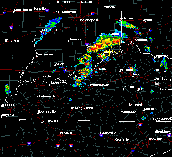 At 209 pm edt, a severe thunderstorm was located near st. dennis, moving east at 30 mph. this is a very dangerous storm (radar indicated). Hazards include baseball size hail and 70 mph wind gusts. People and animals outdoors will be severely injured. expect shattered windows, extensive damage to roofs, siding, and vehicles. locations impacted include, corydon, lanesville, elizabeth, new middletown, bridgeport, edwardsville, breckenridge, sugar grove, seven springs and lottick corner. A tornado watch remains in effect until 900 pm edt for south central indiana. At 209 pm edt, a severe thunderstorm was located near st. dennis, moving east at 30 mph. this is a very dangerous storm (radar indicated). Hazards include baseball size hail and 70 mph wind gusts. People and animals outdoors will be severely injured. expect shattered windows, extensive damage to roofs, siding, and vehicles. locations impacted include, corydon, lanesville, elizabeth, new middletown, bridgeport, edwardsville, breckenridge, sugar grove, seven springs and lottick corner. A tornado watch remains in effect until 900 pm edt for south central indiana.
|
| 7/20/2018 2:09 PM EDT |
 At 213 pm edt, a confirmed tornado was located near corydon, moving east at 30 mph (radar confirmed tornado). Hazards include damaging tornado and baseball size hail. Flying debris will be dangerous to those caught without shelter. mobile homes will be damaged or destroyed. damage to roofs, windows, and vehicles will occur. tree damage is likely. Locations impacted include, elizabeth, new middletown, bridgeport, fishtown, sugar grove, seven springs and lottick corner. At 213 pm edt, a confirmed tornado was located near corydon, moving east at 30 mph (radar confirmed tornado). Hazards include damaging tornado and baseball size hail. Flying debris will be dangerous to those caught without shelter. mobile homes will be damaged or destroyed. damage to roofs, windows, and vehicles will occur. tree damage is likely. Locations impacted include, elizabeth, new middletown, bridgeport, fishtown, sugar grove, seven springs and lottick corner.
|
| 7/20/2018 2:00 PM EDT |
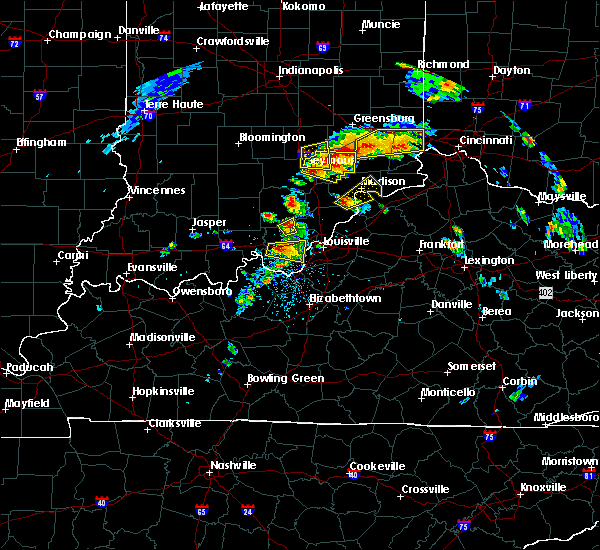 At 200 pm edt, a severe thunderstorm capable of producing a tornado was located near corydon, moving east at 25 mph (radar indicated rotation). Hazards include tornado and baseball size hail. Flying debris will be dangerous to those caught without shelter. mobile homes will be damaged or destroyed. damage to roofs, windows, and vehicles will occur. Tree damage is likely. At 200 pm edt, a severe thunderstorm capable of producing a tornado was located near corydon, moving east at 25 mph (radar indicated rotation). Hazards include tornado and baseball size hail. Flying debris will be dangerous to those caught without shelter. mobile homes will be damaged or destroyed. damage to roofs, windows, and vehicles will occur. Tree damage is likely.
|
| 7/20/2018 1:55 PM EDT |
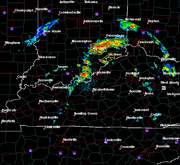 At 155 pm edt, a severe thunderstorm was located over corydon, moving east at 30 mph. this is a very dangerous storm (radar indicated). Hazards include baseball size hail and 70 mph wind gusts. People and animals outdoors will be severely injured. expect shattered windows, extensive damage to roofs, siding, and vehicles. locations impacted include, corydon, lanesville, elizabeth, new middletown, bridgeport, edwardsville, breckenridge, white cloud, sugar grove and seven springs. A tornado watch remains in effect until 900 pm edt for south central indiana. At 155 pm edt, a severe thunderstorm was located over corydon, moving east at 30 mph. this is a very dangerous storm (radar indicated). Hazards include baseball size hail and 70 mph wind gusts. People and animals outdoors will be severely injured. expect shattered windows, extensive damage to roofs, siding, and vehicles. locations impacted include, corydon, lanesville, elizabeth, new middletown, bridgeport, edwardsville, breckenridge, white cloud, sugar grove and seven springs. A tornado watch remains in effect until 900 pm edt for south central indiana.
|
| 7/20/2018 1:40 PM EDT |
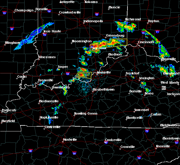 At 140 pm edt, a severe thunderstorm was located near corydon, moving east at 30 mph (radar indicated). Hazards include two inch hail and 70 mph wind gusts. People and animals outdoors will be injured. expect hail damage to roofs, siding, windows, and vehicles. expect considerable tree damage. Wind damage is also likely to mobile homes, roofs, and outbuildings. At 140 pm edt, a severe thunderstorm was located near corydon, moving east at 30 mph (radar indicated). Hazards include two inch hail and 70 mph wind gusts. People and animals outdoors will be injured. expect hail damage to roofs, siding, windows, and vehicles. expect considerable tree damage. Wind damage is also likely to mobile homes, roofs, and outbuildings.
|
| 6/26/2018 12:40 PM EDT |
 At 1240 pm edt/1140 am cdt/, severe thunderstorms were located along a line extending from near paoli to 6 miles south of carefree town to 9 miles north of hardinsburg, moving east at 55 mph (radar indicated). Hazards include 60 mph wind gusts. expect damage to roofs, siding, and trees At 1240 pm edt/1140 am cdt/, severe thunderstorms were located along a line extending from near paoli to 6 miles south of carefree town to 9 miles north of hardinsburg, moving east at 55 mph (radar indicated). Hazards include 60 mph wind gusts. expect damage to roofs, siding, and trees
|
| 5/31/2018 2:30 PM EDT | Trees down dixie highway at katherine station roa in jefferson county KY, 8 miles NNW of Elizabeth, IN |
| 5/31/2018 2:17 PM EDT |
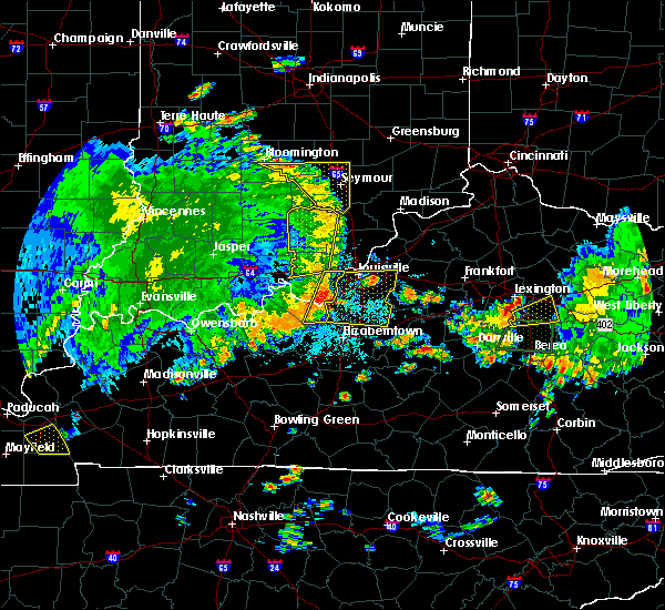 At 217 pm edt, severe thunderstorms were located along a line extending from 7 miles northwest of st. dennis to 13 miles south of brandenburg, moving east at 45 mph (radar indicated). Hazards include 60 mph wind gusts. expect damage to roofs, siding, and trees At 217 pm edt, severe thunderstorms were located along a line extending from 7 miles northwest of st. dennis to 13 miles south of brandenburg, moving east at 45 mph (radar indicated). Hazards include 60 mph wind gusts. expect damage to roofs, siding, and trees
|
| 5/31/2018 1:49 PM EDT |
 At 149 pm edt/1249 pm cdt/, severe thunderstorms were located along a line extending from near carefree town to near hardinsburg, moving east at 55 mph (radar indicated). Hazards include 70 mph wind gusts. Expect considerable tree damage. Damage is likely to mobile homes, roofs, and outbuildings. At 149 pm edt/1249 pm cdt/, severe thunderstorms were located along a line extending from near carefree town to near hardinsburg, moving east at 55 mph (radar indicated). Hazards include 70 mph wind gusts. Expect considerable tree damage. Damage is likely to mobile homes, roofs, and outbuildings.
|
| 4/3/2018 7:50 PM EDT | Shed destroyed with person inside... though not injured. glider was taken off porc in harrison county IN, 0.5 miles SSW of Elizabeth, IN |
| 2/24/2018 10:53 PM EST |
 The severe thunderstorm warning for southern harrison, south central floyd, southeastern meade, west central jefferson and northeastern breckinridge counties will expire at 1100 pm est/1000 pm cst/, the storms which prompted the warning are moving out of the warned area. therefore, the warning will be allowed to expire at 1100 pm est. report any severe weather to local law enforcement, post your report to the national weather service louisville facebook page, or tweet your report using hashtag l, m, k, spotter. The severe thunderstorm warning for southern harrison, south central floyd, southeastern meade, west central jefferson and northeastern breckinridge counties will expire at 1100 pm est/1000 pm cst/, the storms which prompted the warning are moving out of the warned area. therefore, the warning will be allowed to expire at 1100 pm est. report any severe weather to local law enforcement, post your report to the national weather service louisville facebook page, or tweet your report using hashtag l, m, k, spotter.
|
| 2/24/2018 10:53 PM EST |
 At 1025 pm est/925 pm cst/, severe thunderstorms were located along a line extending from near corydon to 7 miles northeast of hardinsburg, moving east at 60 to 65 mph (radar indicated). Hazards include 60 mph wind gusts. expect damage to roofs, siding, and trees At 1025 pm est/925 pm cst/, severe thunderstorms were located along a line extending from near corydon to 7 miles northeast of hardinsburg, moving east at 60 to 65 mph (radar indicated). Hazards include 60 mph wind gusts. expect damage to roofs, siding, and trees
|
| 2/24/2018 10:26 PM EST |
 The national weather service in louisville has issued a * severe thunderstorm warning for. southern harrison county in south central indiana. south central floyd county in south central indiana. southeastern meade county in central kentucky. West central jefferson county in central kentucky. The national weather service in louisville has issued a * severe thunderstorm warning for. southern harrison county in south central indiana. south central floyd county in south central indiana. southeastern meade county in central kentucky. West central jefferson county in central kentucky.
|
| 2/24/2018 10:26 PM EST |
 At 1025 pm est/925 pm cst/, severe thunderstorms were located along a line extending from near corydon to 7 miles northeast of hardinsburg, moving east at 60 to 65 mph (radar indicated). Hazards include 60 mph wind gusts. expect damage to roofs, siding, and trees At 1025 pm est/925 pm cst/, severe thunderstorms were located along a line extending from near corydon to 7 miles northeast of hardinsburg, moving east at 60 to 65 mph (radar indicated). Hazards include 60 mph wind gusts. expect damage to roofs, siding, and trees
|
| 11/18/2017 4:48 PM EST |
 At 448 pm est, a severe thunderstorm was located near brandenburg, moving east at 40 mph (radar indicated). Hazards include 60 mph wind gusts. Expect damage to roofs, siding, and trees. Locations impacted include, elizabeth, sugar grove, macedonia, rosewood and happy hollow. At 448 pm est, a severe thunderstorm was located near brandenburg, moving east at 40 mph (radar indicated). Hazards include 60 mph wind gusts. Expect damage to roofs, siding, and trees. Locations impacted include, elizabeth, sugar grove, macedonia, rosewood and happy hollow.
|
| 11/18/2017 4:40 PM EST |
 At 440 pm est, a severe thunderstorm was located near brandenburg, moving east at 40 mph (radar indicated). Hazards include 60 mph wind gusts. expect damage to roofs, siding, and trees At 440 pm est, a severe thunderstorm was located near brandenburg, moving east at 40 mph (radar indicated). Hazards include 60 mph wind gusts. expect damage to roofs, siding, and trees
|
| 7/7/2017 9:56 PM EDT |
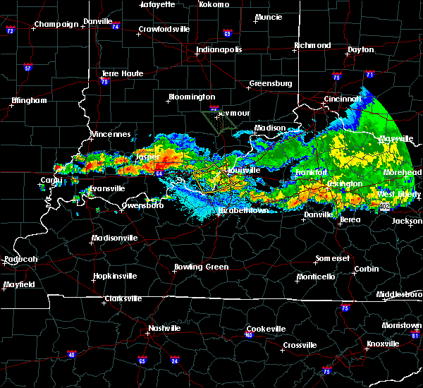 The severe thunderstorm warning for southeastern harrison, southwestern floyd, southwestern jefferson and northwestern bullitt counties will expire at 1000 pm edt, the storm which prompted the warning has weakened below severe limits, and no longer poses an immediate threat to life or property. therefore the warning will be allowed to expire. however gusty winds are still possible with this thunderstorm. a severe thunderstorm watch remains in effect until 1100 pm edt for south central indiana, and central kentucky. report severe weather to local law enforcement, post your report to the national weather service louisville facebook page, or tweet your report using hashtag l, m, k, spotter. The severe thunderstorm warning for southeastern harrison, southwestern floyd, southwestern jefferson and northwestern bullitt counties will expire at 1000 pm edt, the storm which prompted the warning has weakened below severe limits, and no longer poses an immediate threat to life or property. therefore the warning will be allowed to expire. however gusty winds are still possible with this thunderstorm. a severe thunderstorm watch remains in effect until 1100 pm edt for south central indiana, and central kentucky. report severe weather to local law enforcement, post your report to the national weather service louisville facebook page, or tweet your report using hashtag l, m, k, spotter.
|
| 7/7/2017 9:48 PM EDT |
 At 948 pm edt, a severe thunderstorm was located near pleasure ridge park, moving southeast at 40 mph (radar indicated). Hazards include 60 mph wind gusts. Expect damage to roofs, siding, and trees. Locations impacted include, louisville, new albany, shively, corydon, lynnview, hollyvilla, south park view, valley station, pleasure ridge par and pleasure ridge park. At 948 pm edt, a severe thunderstorm was located near pleasure ridge park, moving southeast at 40 mph (radar indicated). Hazards include 60 mph wind gusts. Expect damage to roofs, siding, and trees. Locations impacted include, louisville, new albany, shively, corydon, lynnview, hollyvilla, south park view, valley station, pleasure ridge par and pleasure ridge park.
|
| 7/7/2017 9:48 PM EDT |
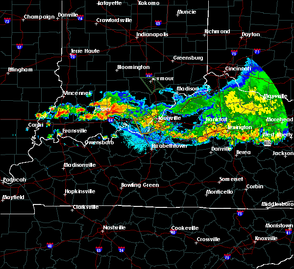 At 948 pm edt, a severe thunderstorm was located near pleasure ridge park, moving southeast at 40 mph (radar indicated). Hazards include 60 mph wind gusts. Expect damage to roofs, siding, and trees. Locations impacted include, louisville, new albany, shively, corydon, lynnview, hollyvilla, south park view, valley station, pleasure ridge par and pleasure ridge park. At 948 pm edt, a severe thunderstorm was located near pleasure ridge park, moving southeast at 40 mph (radar indicated). Hazards include 60 mph wind gusts. Expect damage to roofs, siding, and trees. Locations impacted include, louisville, new albany, shively, corydon, lynnview, hollyvilla, south park view, valley station, pleasure ridge par and pleasure ridge park.
|
| 7/7/2017 9:31 PM EDT |
 At 931 pm edt, a severe thunderstorm was located 9 miles northeast of corydon, moving southeast at 35 mph (radar indicated). Hazards include 60 mph wind gusts. expect damage to roofs, siding, and trees At 931 pm edt, a severe thunderstorm was located 9 miles northeast of corydon, moving southeast at 35 mph (radar indicated). Hazards include 60 mph wind gusts. expect damage to roofs, siding, and trees
|
| 7/7/2017 9:31 PM EDT |
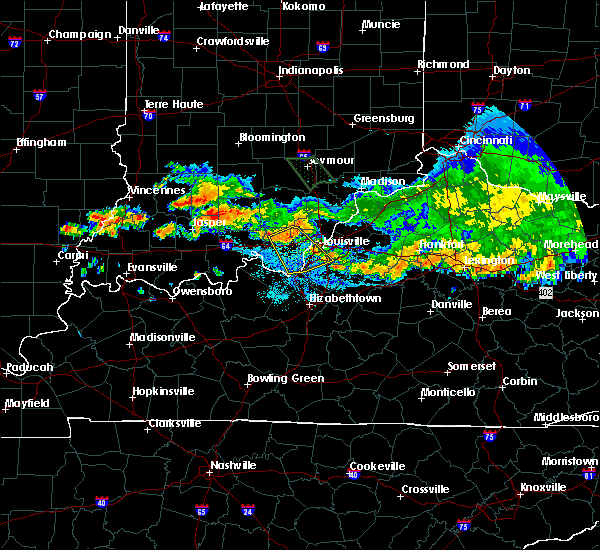 At 931 pm edt, a severe thunderstorm was located 9 miles northeast of corydon, moving southeast at 35 mph (radar indicated). Hazards include 60 mph wind gusts. expect damage to roofs, siding, and trees At 931 pm edt, a severe thunderstorm was located 9 miles northeast of corydon, moving southeast at 35 mph (radar indicated). Hazards include 60 mph wind gusts. expect damage to roofs, siding, and trees
|
| 6/30/2017 9:43 PM EDT |
 The severe thunderstorm warning for southeastern harrison. east central meade. southwestern jefferson. north central hardin and northwestern bullitt counties will expire at 945 pm edt. the storm which prompted the warning has weakened below severe limits, and no longer poses an immediate threat to life or property. therefore the warning will be allowed to expire. However gusty winds. The severe thunderstorm warning for southeastern harrison. east central meade. southwestern jefferson. north central hardin and northwestern bullitt counties will expire at 945 pm edt. the storm which prompted the warning has weakened below severe limits, and no longer poses an immediate threat to life or property. therefore the warning will be allowed to expire. However gusty winds.
|
| 6/30/2017 9:43 PM EDT |
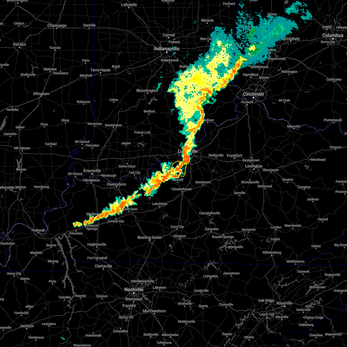 The severe thunderstorm warning for southeastern harrison. east central meade. southwestern jefferson. north central hardin and northwestern bullitt counties will expire at 945 pm edt. the storm which prompted the warning has weakened below severe limits, and no longer poses an immediate threat to life or property. therefore the warning will be allowed to expire. However gusty winds. The severe thunderstorm warning for southeastern harrison. east central meade. southwestern jefferson. north central hardin and northwestern bullitt counties will expire at 945 pm edt. the storm which prompted the warning has weakened below severe limits, and no longer poses an immediate threat to life or property. therefore the warning will be allowed to expire. However gusty winds.
|
| 6/30/2017 9:28 PM EDT |
 At 928 pm edt, a severe thunderstorm was located 8 miles southwest of valley station, moving east at 30 mph (radar indicated). Hazards include 60 mph wind gusts. Expect damage to roofs, siding, and trees. Locations impacted include, valley station, pleasure ridge park, fairdale, muldraugh, west point, elizabeth, laconia, cupio, rosewood and evans landing. At 928 pm edt, a severe thunderstorm was located 8 miles southwest of valley station, moving east at 30 mph (radar indicated). Hazards include 60 mph wind gusts. Expect damage to roofs, siding, and trees. Locations impacted include, valley station, pleasure ridge park, fairdale, muldraugh, west point, elizabeth, laconia, cupio, rosewood and evans landing.
|
| 6/30/2017 9:28 PM EDT |
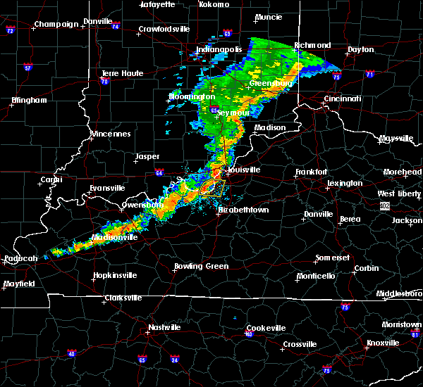 At 928 pm edt, a severe thunderstorm was located 8 miles southwest of valley station, moving east at 30 mph (radar indicated). Hazards include 60 mph wind gusts. Expect damage to roofs, siding, and trees. Locations impacted include, valley station, pleasure ridge park, fairdale, muldraugh, west point, elizabeth, laconia, cupio, rosewood and evans landing. At 928 pm edt, a severe thunderstorm was located 8 miles southwest of valley station, moving east at 30 mph (radar indicated). Hazards include 60 mph wind gusts. Expect damage to roofs, siding, and trees. Locations impacted include, valley station, pleasure ridge park, fairdale, muldraugh, west point, elizabeth, laconia, cupio, rosewood and evans landing.
|
| 6/30/2017 9:18 PM EDT |
 At 918 pm edt, a severe thunderstorm was located near brandenburg, moving east at 30 mph (radar indicated). Hazards include 60 mph wind gusts. expect damage to roofs, siding, and trees At 918 pm edt, a severe thunderstorm was located near brandenburg, moving east at 30 mph (radar indicated). Hazards include 60 mph wind gusts. expect damage to roofs, siding, and trees
|
| 4/5/2017 4:13 PM EDT |
 At 413 pm edt, a severe thunderstorm was located near brandenburg, moving northeast at 55 mph (radar indicated). Hazards include 60 mph wind gusts and quarter size hail. Hail damage to vehicles is expected. expect wind damage to roofs, siding, and trees. locations impacted include, brandenburg, ekron, mauckport, laconia, guston, central, haysville, buck grove, brandenburg station and hillgrove. A tornado watch remains in effect until 1000 pm edt for south central indiana, and central kentucky. At 413 pm edt, a severe thunderstorm was located near brandenburg, moving northeast at 55 mph (radar indicated). Hazards include 60 mph wind gusts and quarter size hail. Hail damage to vehicles is expected. expect wind damage to roofs, siding, and trees. locations impacted include, brandenburg, ekron, mauckport, laconia, guston, central, haysville, buck grove, brandenburg station and hillgrove. A tornado watch remains in effect until 1000 pm edt for south central indiana, and central kentucky.
|
| 4/5/2017 3:57 PM EDT |
 The national weather service in louisville has issued a * severe thunderstorm warning for. southern harrison county in south central indiana. meade county in central kentucky. central breckinridge county in central kentucky. Until 430 pm edt/330 pm cdt/. The national weather service in louisville has issued a * severe thunderstorm warning for. southern harrison county in south central indiana. meade county in central kentucky. central breckinridge county in central kentucky. Until 430 pm edt/330 pm cdt/.
|
| 3/1/2017 6:22 AM EST |
 At 621 am est, severe thunderstorms were located along a line extending from 8 miles north of brooksburg to 7 miles southwest of brandenburg, moving east at 55 mph (radar indicated). Hazards include 60 mph wind gusts. expect damage to roofs, siding, and trees At 621 am est, severe thunderstorms were located along a line extending from 8 miles north of brooksburg to 7 miles southwest of brandenburg, moving east at 55 mph (radar indicated). Hazards include 60 mph wind gusts. expect damage to roofs, siding, and trees
|
| 3/1/2017 5:57 AM EST |
 At 556 am est/456 am cst/, severe thunderstorms were located along a line extending from 9 miles northwest of scottsburg to 10 miles southwest of carefree town, moving east at 55 mph (radar indicated). Hazards include 60 mph wind gusts. expect damage to roofs, siding, and trees At 556 am est/456 am cst/, severe thunderstorms were located along a line extending from 9 miles northwest of scottsburg to 10 miles southwest of carefree town, moving east at 55 mph (radar indicated). Hazards include 60 mph wind gusts. expect damage to roofs, siding, and trees
|
| 3/1/2017 2:41 AM EST |
 At 240 am est, severe thunderstorms were located along a line extending from 7 miles southeast of corydon to near brandenburg to 15 miles east of hardinsburg, moving east at 55 mph (radar indicated). Hazards include 60 mph wind gusts. expect damage to roofs, siding, and trees At 240 am est, severe thunderstorms were located along a line extending from 7 miles southeast of corydon to near brandenburg to 15 miles east of hardinsburg, moving east at 55 mph (radar indicated). Hazards include 60 mph wind gusts. expect damage to roofs, siding, and trees
|
| 3/1/2017 2:25 AM EST |
 At 224 am est/124 am cst/, severe thunderstorms were located along a line extending from 13 miles south of carefree town to 7 miles southwest of brandenburg to 6 miles northeast of hardinsburg, moving east at 75 mph (radar indicated). Hazards include 60 mph wind gusts and quarter size hail. Hail damage to vehicles is expected. Expect wind damage to roofs, siding, and trees. At 224 am est/124 am cst/, severe thunderstorms were located along a line extending from 13 miles south of carefree town to 7 miles southwest of brandenburg to 6 miles northeast of hardinsburg, moving east at 75 mph (radar indicated). Hazards include 60 mph wind gusts and quarter size hail. Hail damage to vehicles is expected. Expect wind damage to roofs, siding, and trees.
|
| 2/24/2017 6:25 PM EST |
 At 624 pm est, severe thunderstorms were located along a line extending from near pleasure ridge park to 9 miles east of brandenburg, moving northeast at 40 mph (radar indicated). Hazards include 60 mph wind gusts and quarter size hail. Hail damage to vehicles is expected. Expect wind damage to roofs, siding, and trees. At 624 pm est, severe thunderstorms were located along a line extending from near pleasure ridge park to 9 miles east of brandenburg, moving northeast at 40 mph (radar indicated). Hazards include 60 mph wind gusts and quarter size hail. Hail damage to vehicles is expected. Expect wind damage to roofs, siding, and trees.
|
| 9/10/2016 3:21 PM EDT |
 At 321 pm edt, severe thunderstorms were located along a line extending from near corydon to 9 miles southwest of brandenburg, moving east at 35 mph (radar indicated). Hazards include 60 mph wind gusts. Expect damage to roofs. siding. And trees. At 321 pm edt, severe thunderstorms were located along a line extending from near corydon to 9 miles southwest of brandenburg, moving east at 35 mph (radar indicated). Hazards include 60 mph wind gusts. Expect damage to roofs. siding. And trees.
|
| 7/14/2016 4:54 PM EDT |
 At 454 pm edt, a severe thunderstorm was located near corydon, moving east at 35 mph (radar indicated). Hazards include 60 mph wind gusts and penny size hail. Expect damage to roofs. siding. And trees. At 454 pm edt, a severe thunderstorm was located near corydon, moving east at 35 mph (radar indicated). Hazards include 60 mph wind gusts and penny size hail. Expect damage to roofs. siding. And trees.
|
| 7/8/2016 8:25 PM EDT |
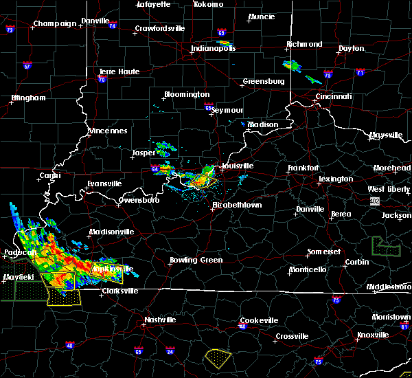 The severe thunderstorm warning for southeastern harrison and southwestern jefferson counties will expire at 830 pm edt, the storm which prompted the warning has weakened below severe limits, and no longer pose an immediate threat to life or property. therefore the warning will be allowed to expire. however gusty winds and heavy rain are still possible with this thunderstorm. The severe thunderstorm warning for southeastern harrison and southwestern jefferson counties will expire at 830 pm edt, the storm which prompted the warning has weakened below severe limits, and no longer pose an immediate threat to life or property. therefore the warning will be allowed to expire. however gusty winds and heavy rain are still possible with this thunderstorm.
|
| 7/8/2016 8:18 PM EDT |
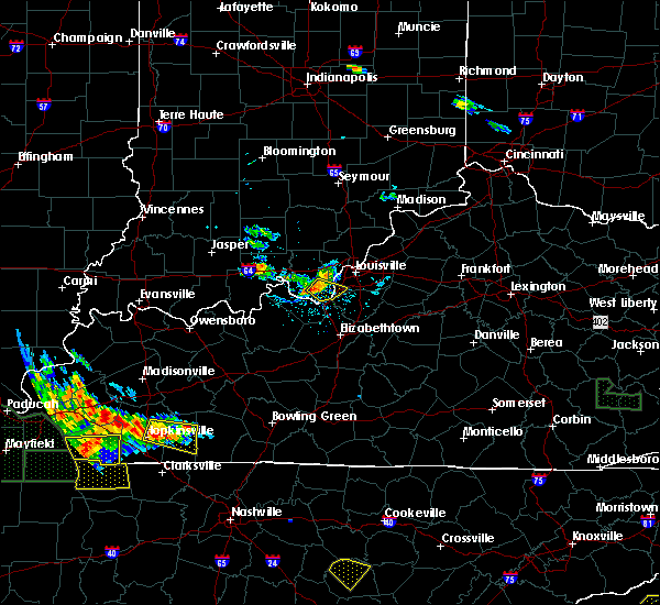 At 817 pm edt, a severe thunderstorm was located 8 miles west of valley station, moving southeast at 35 mph (radar indicated). Hazards include 60 mph wind gusts. Expect damage to roofs. siding. and trees. Locations impacted include, valley station, pleasure ridge park, elizabeth, new middletown, evans landing, dogwood, fishtown, seven springs, rosewood and macedonia. At 817 pm edt, a severe thunderstorm was located 8 miles west of valley station, moving southeast at 35 mph (radar indicated). Hazards include 60 mph wind gusts. Expect damage to roofs. siding. and trees. Locations impacted include, valley station, pleasure ridge park, elizabeth, new middletown, evans landing, dogwood, fishtown, seven springs, rosewood and macedonia.
|
| 7/8/2016 8:07 PM EDT |
 At 806 pm edt, a severe thunderstorm was located near corydon, moving southeast at 35 mph (radar indicated). Hazards include 60 mph wind gusts and nickel size hail. Expect damage to roofs. siding. And trees. At 806 pm edt, a severe thunderstorm was located near corydon, moving southeast at 35 mph (radar indicated). Hazards include 60 mph wind gusts and nickel size hail. Expect damage to roofs. siding. And trees.
|
| 7/8/2016 8:07 PM EDT |
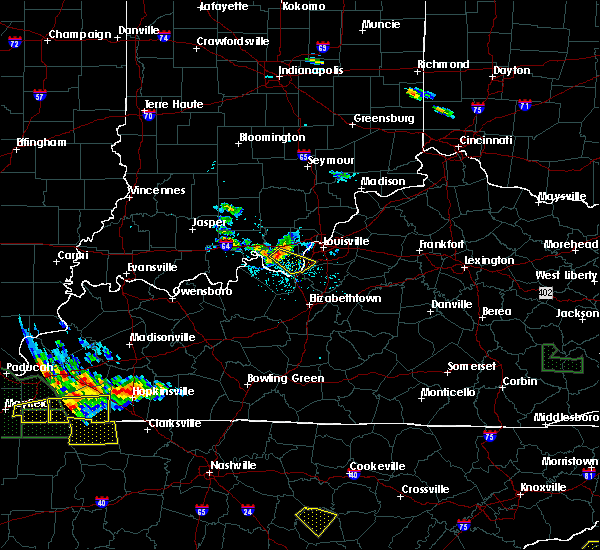 At 806 pm edt, a severe thunderstorm was located near corydon, moving southeast at 35 mph (radar indicated). Hazards include 60 mph wind gusts and nickel size hail. Expect damage to roofs. siding. And trees. At 806 pm edt, a severe thunderstorm was located near corydon, moving southeast at 35 mph (radar indicated). Hazards include 60 mph wind gusts and nickel size hail. Expect damage to roofs. siding. And trees.
|
| 7/8/2016 10:16 AM EDT |
 At 1016 am edt, a severe thunderstorm was located 8 miles southwest of valley station, moving east at 35 mph (radar indicated). Hazards include 60 mph wind gusts. Expect damage to roofs. siding. And trees. At 1016 am edt, a severe thunderstorm was located 8 miles southwest of valley station, moving east at 35 mph (radar indicated). Hazards include 60 mph wind gusts. Expect damage to roofs. siding. And trees.
|
| 6/23/2016 5:56 PM EDT | The severe thunderstorm warning for southeastern harrison, southern jefferson, northern hardin, northern nelson and bullitt counties will expire at 600 pm edt, the storms which prompted the warning have moved out of the warned area. therefore the warning will be allowed to expire. a severe thunderstorm watch remains in effect until 1100 pm edt for south central indiana, and central kentucky. |
| 6/23/2016 5:56 PM EDT | The severe thunderstorm warning for southeastern harrison, southern jefferson, northern hardin, northern nelson and bullitt counties will expire at 600 pm edt, the storms which prompted the warning have moved out of the warned area. therefore the warning will be allowed to expire. a severe thunderstorm watch remains in effect until 1100 pm edt for south central indiana, and central kentucky. |
| 6/23/2016 5:44 PM EDT |
 At 544 pm edt, severe thunderstorms were located along a line extending from 6 miles east of pioneer village to near valley station, moving southeast at 25 mph (public). Hazards include 60 mph wind gusts and half dollar size hail. Hail damage to vehicles is expected. expect wind damage to roofs, siding, and trees. Locations impacted include, louisville, shively, shepherdsville, pioneer village, hollow creek, hollyvilla, spring mill, south park view, okolona and minor lane heights. At 544 pm edt, severe thunderstorms were located along a line extending from 6 miles east of pioneer village to near valley station, moving southeast at 25 mph (public). Hazards include 60 mph wind gusts and half dollar size hail. Hail damage to vehicles is expected. expect wind damage to roofs, siding, and trees. Locations impacted include, louisville, shively, shepherdsville, pioneer village, hollow creek, hollyvilla, spring mill, south park view, okolona and minor lane heights.
|
| 6/23/2016 5:44 PM EDT |
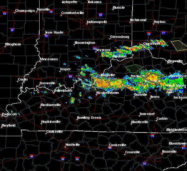 At 544 pm edt, severe thunderstorms were located along a line extending from 6 miles east of pioneer village to near valley station, moving southeast at 25 mph (public). Hazards include 60 mph wind gusts and half dollar size hail. Hail damage to vehicles is expected. expect wind damage to roofs, siding, and trees. Locations impacted include, louisville, shively, shepherdsville, pioneer village, hollow creek, hollyvilla, spring mill, south park view, okolona and minor lane heights. At 544 pm edt, severe thunderstorms were located along a line extending from 6 miles east of pioneer village to near valley station, moving southeast at 25 mph (public). Hazards include 60 mph wind gusts and half dollar size hail. Hail damage to vehicles is expected. expect wind damage to roofs, siding, and trees. Locations impacted include, louisville, shively, shepherdsville, pioneer village, hollow creek, hollyvilla, spring mill, south park view, okolona and minor lane heights.
|
| 6/23/2016 5:35 PM EDT | Quarter sized hail reported 0.6 miles SE of Elizabeth, IN, . |
| 6/23/2016 5:31 PM EDT |
 At 530 pm edt, severe thunderstorms were located along a line extending from near highview to 7 miles west of valley station, moving southeast at 25 mph (public reported trees down and dime size hail). Hazards include 60 mph wind gusts and nickel size hail. Expect damage to roofs. siding. And trees. At 530 pm edt, severe thunderstorms were located along a line extending from near highview to 7 miles west of valley station, moving southeast at 25 mph (public reported trees down and dime size hail). Hazards include 60 mph wind gusts and nickel size hail. Expect damage to roofs. siding. And trees.
|
| 6/23/2016 5:01 PM EDT |
 At 500 pm edt, a severe thunderstorm was located over newburg, moving east at 50 mph (radar indicated). Hazards include 60 mph wind gusts and penny size hail. Expect damage to roofs. siding. and trees. locations impacted include, louisville, jeffersonville, new albany, jeffersontown, st. Matthews, shively, shepherdsville, lyndon, middletown and douglass hills. At 500 pm edt, a severe thunderstorm was located over newburg, moving east at 50 mph (radar indicated). Hazards include 60 mph wind gusts and penny size hail. Expect damage to roofs. siding. and trees. locations impacted include, louisville, jeffersonville, new albany, jeffersontown, st. Matthews, shively, shepherdsville, lyndon, middletown and douglass hills.
|
| 6/23/2016 4:49 PM EDT |
 At 449 pm edt, a severe thunderstorm was located near corydon, moving southeast at 30 mph (radar indicated). Hazards include 60 mph wind gusts and quarter size hail. Hail damage to vehicles is expected. Expect wind damage to roofs, siding, and trees. At 449 pm edt, a severe thunderstorm was located near corydon, moving southeast at 30 mph (radar indicated). Hazards include 60 mph wind gusts and quarter size hail. Hail damage to vehicles is expected. Expect wind damage to roofs, siding, and trees.
|
| 6/23/2016 4:42 PM EDT |
 At 441 pm edt, a severe thunderstorm was located over corydon, moving southeast at 30 mph (radar indicated). Hazards include 60 mph wind gusts and quarter size hail. Hail damage to vehicles is expected. expect wind damage to roofs, siding, and trees. Locations impacted include, corydon, lanesville, elizabeth, crandall, new middletown, lottick corner, dogwood, seven springs, breckenridge and macedonia. At 441 pm edt, a severe thunderstorm was located over corydon, moving southeast at 30 mph (radar indicated). Hazards include 60 mph wind gusts and quarter size hail. Hail damage to vehicles is expected. expect wind damage to roofs, siding, and trees. Locations impacted include, corydon, lanesville, elizabeth, crandall, new middletown, lottick corner, dogwood, seven springs, breckenridge and macedonia.
|
| 6/23/2016 4:30 PM EDT |
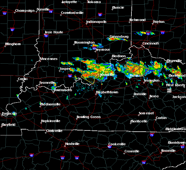 At 430 pm edt, a severe thunderstorm was located over corydon, moving southeast at 35 mph (radar indicated). Hazards include 60 mph wind gusts and quarter size hail. Hail damage to vehicles is expected. Expect wind damage to roofs, siding, and trees. At 430 pm edt, a severe thunderstorm was located over corydon, moving southeast at 35 mph (radar indicated). Hazards include 60 mph wind gusts and quarter size hail. Hail damage to vehicles is expected. Expect wind damage to roofs, siding, and trees.
|
| 5/11/2016 8:28 PM EDT |
 At 827 pm edt, a severe thunderstorm was located near brandenburg, moving east at 40 mph (radar indicated). Hazards include 60 mph wind gusts and quarter size hail. Hail damage to vehicles is expected. Expect wind damage to roofs, siding, and trees. At 827 pm edt, a severe thunderstorm was located near brandenburg, moving east at 40 mph (radar indicated). Hazards include 60 mph wind gusts and quarter size hail. Hail damage to vehicles is expected. Expect wind damage to roofs, siding, and trees.
|
| 5/7/2016 9:55 PM EDT |
 The severe thunderstorm warning for eastern harrison, floyd, southwestern clark, jefferson, east central meade, southwestern oldham, north central hardin and bullitt counties will expire at 1000 pm edt, the storms which prompted the warning have weakened. therefore the warning will be allowed to expire. a severe thunderstorm watch remains in effect until 200 am edt for south central indiana, and central kentucky. The severe thunderstorm warning for eastern harrison, floyd, southwestern clark, jefferson, east central meade, southwestern oldham, north central hardin and bullitt counties will expire at 1000 pm edt, the storms which prompted the warning have weakened. therefore the warning will be allowed to expire. a severe thunderstorm watch remains in effect until 200 am edt for south central indiana, and central kentucky.
|
| 5/7/2016 9:55 PM EDT | The severe thunderstorm warning for eastern harrison, floyd, southwestern clark, jefferson, east central meade, southwestern oldham, north central hardin and bullitt counties will expire at 1000 pm edt, the storms which prompted the warning have weakened. therefore the warning will be allowed to expire. a severe thunderstorm watch remains in effect until 200 am edt for south central indiana, and central kentucky. |
| 5/7/2016 9:55 PM EDT |
 The severe thunderstorm warning for eastern harrison, floyd, southwestern clark, jefferson, east central meade, southwestern oldham, north central hardin and bullitt counties will expire at 1000 pm edt, the storms which prompted the warning have weakened. therefore the warning will be allowed to expire. a severe thunderstorm watch remains in effect until 200 am edt for south central indiana, and central kentucky. The severe thunderstorm warning for eastern harrison, floyd, southwestern clark, jefferson, east central meade, southwestern oldham, north central hardin and bullitt counties will expire at 1000 pm edt, the storms which prompted the warning have weakened. therefore the warning will be allowed to expire. a severe thunderstorm watch remains in effect until 200 am edt for south central indiana, and central kentucky.
|
| 5/7/2016 9:40 PM EDT |
 At 940 pm edt, severe thunderstorms were located along a line extending from 8 miles southeast of new providence town to 9 miles west of shepherdsville, moving east at 60 mph (trained weather spotters). Hazards include 60 mph wind gusts and quarter size hail. Hail damage to vehicles is expected. expect wind damage to roofs, siding, and trees. locations impacted include, louisville, jeffersonville, new albany, jeffersontown, st. Matthews, shively, shepherdsville, lyndon, middletown and douglass hills. At 940 pm edt, severe thunderstorms were located along a line extending from 8 miles southeast of new providence town to 9 miles west of shepherdsville, moving east at 60 mph (trained weather spotters). Hazards include 60 mph wind gusts and quarter size hail. Hail damage to vehicles is expected. expect wind damage to roofs, siding, and trees. locations impacted include, louisville, jeffersonville, new albany, jeffersontown, st. Matthews, shively, shepherdsville, lyndon, middletown and douglass hills.
|
| 5/7/2016 9:18 PM EDT |
 At 917 pm edt/817 pm cdt/, severe thunderstorms were located along a line extending from 9 miles southwest of salem to 10 miles northeast of hardinsburg, moving east at 60 mph (trained weather spotters. these line of storms has a history of producing wind damage and 60 mph gusts). Hazards include 60 mph wind gusts and quarter size hail. Hail damage to vehicles is expected. Expect wind damage to roofs, siding, and trees. At 917 pm edt/817 pm cdt/, severe thunderstorms were located along a line extending from 9 miles southwest of salem to 10 miles northeast of hardinsburg, moving east at 60 mph (trained weather spotters. these line of storms has a history of producing wind damage and 60 mph gusts). Hazards include 60 mph wind gusts and quarter size hail. Hail damage to vehicles is expected. Expect wind damage to roofs, siding, and trees.
|
| 5/7/2016 8:59 PM EDT |
 At 858 pm edt, a severe thunderstorm was located over okolona, moving east at 55 mph (radar indicated). Hazards include 60 mph wind gusts and quarter size hail. Hail damage to vehicles is expected. Expect wind damage to roofs, siding, and trees. At 858 pm edt, a severe thunderstorm was located over okolona, moving east at 55 mph (radar indicated). Hazards include 60 mph wind gusts and quarter size hail. Hail damage to vehicles is expected. Expect wind damage to roofs, siding, and trees.
|
| 5/7/2016 8:50 PM EDT |
 At 849 pm edt, a severe thunderstorm was located near st. dennis, moving southeast at 55 mph (radar indicated). Hazards include 60 mph wind gusts and quarter size hail. Hail damage to vehicles is expected. expect wind damage to roofs, siding, and trees. locations impacted include, louisville, jeffersonville, new albany, shively, corydon, pleasure ridge par, pleasure ridge park, st. dennis, valley station and fairdale. those attending outdoor events in the path of this storm should prepare for imminent dangerous weather conditions. Seek shelter now!. At 849 pm edt, a severe thunderstorm was located near st. dennis, moving southeast at 55 mph (radar indicated). Hazards include 60 mph wind gusts and quarter size hail. Hail damage to vehicles is expected. expect wind damage to roofs, siding, and trees. locations impacted include, louisville, jeffersonville, new albany, shively, corydon, pleasure ridge par, pleasure ridge park, st. dennis, valley station and fairdale. those attending outdoor events in the path of this storm should prepare for imminent dangerous weather conditions. Seek shelter now!.
|
| 5/7/2016 8:36 PM EDT |
 At 836 pm edt, a severe thunderstorm was located over corydon, moving southeast at 55 mph (radar indicated). Hazards include 60 mph wind gusts and quarter size hail. Hail damage to vehicles is expected. Expect wind damage to roofs, siding, and trees. At 836 pm edt, a severe thunderstorm was located over corydon, moving southeast at 55 mph (radar indicated). Hazards include 60 mph wind gusts and quarter size hail. Hail damage to vehicles is expected. Expect wind damage to roofs, siding, and trees.
|
| 4/27/2016 9:04 PM EDT |
 At 903 pm edt, a severe thunderstorm was located 8 miles west of valley station, moving northeast at 45 mph (radar indicated). Hazards include 60 mph wind gusts. Expect damage to roofs. siding. and trees. Locations impacted include, brandenburg, lanesville, elizabeth, new middletown, mauckport, laconia, central, evans landing, lottick corner and dogwood. At 903 pm edt, a severe thunderstorm was located 8 miles west of valley station, moving northeast at 45 mph (radar indicated). Hazards include 60 mph wind gusts. Expect damage to roofs. siding. and trees. Locations impacted include, brandenburg, lanesville, elizabeth, new middletown, mauckport, laconia, central, evans landing, lottick corner and dogwood.
|
| 4/27/2016 8:48 PM EDT |
 At 846 pm edt/746 pm cdt/, a severe thunderstorm was located over brandenburg, moving northeast at 45 mph. at 838 pm edt, power lines were reported down in cloverport (radar indicated. schoettmer). Hazards include 60 mph wind gusts. Expect damage to roofs. siding. and trees. locations impacted include, brandenburg, irvington, lanesville, elizabeth, ekron, new middletown, mauckport, laconia, central and evans landing. A tornado watch remains in effect until midnight edt/1100 pm cdt/ for central kentucky. At 846 pm edt/746 pm cdt/, a severe thunderstorm was located over brandenburg, moving northeast at 45 mph. at 838 pm edt, power lines were reported down in cloverport (radar indicated. schoettmer). Hazards include 60 mph wind gusts. Expect damage to roofs. siding. and trees. locations impacted include, brandenburg, irvington, lanesville, elizabeth, ekron, new middletown, mauckport, laconia, central and evans landing. A tornado watch remains in effect until midnight edt/1100 pm cdt/ for central kentucky.
|
| 4/27/2016 8:25 PM EDT |
 At 824 pm edt/724 pm cdt/, a severe thunderstorm was located near hardinsburg, moving northeast at 40 mph (radar indicated). Hazards include 60 mph wind gusts. Expect damage to roofs. siding. And trees. At 824 pm edt/724 pm cdt/, a severe thunderstorm was located near hardinsburg, moving northeast at 40 mph (radar indicated). Hazards include 60 mph wind gusts. Expect damage to roofs. siding. And trees.
|
| 4/26/2016 8:47 PM EDT |
 At 847 pm edt, severe thunderstorms were located along a line extending from 11 miles west of new albany to near corydon, moving northeast at 35 mph (radar indicated). Hazards include 60 mph wind gusts and quarter size hail. Hail damage to vehicles is expected. Expect wind damage to roofs, siding, and trees. At 847 pm edt, severe thunderstorms were located along a line extending from 11 miles west of new albany to near corydon, moving northeast at 35 mph (radar indicated). Hazards include 60 mph wind gusts and quarter size hail. Hail damage to vehicles is expected. Expect wind damage to roofs, siding, and trees.
|
| 3/31/2016 4:12 PM EDT |
 At 412 pm edt, a severe thunderstorm was located near valley station, moving east at 65 mph (radar indicated). Hazards include 70 mph wind gusts. Expect considerable tree damage. damage is likely to mobile homes, roofs, and outbuildings. Locations impacted include, louisville, shepherdsville, pioneer village, hollyvilla, south park view, pleasure ridge par, pleasure ridge park, minor lane heights, valley station and fairdale. At 412 pm edt, a severe thunderstorm was located near valley station, moving east at 65 mph (radar indicated). Hazards include 70 mph wind gusts. Expect considerable tree damage. damage is likely to mobile homes, roofs, and outbuildings. Locations impacted include, louisville, shepherdsville, pioneer village, hollyvilla, south park view, pleasure ridge par, pleasure ridge park, minor lane heights, valley station and fairdale.
|
| 3/31/2016 4:11 PM EDT |
 At 410 pm edt, a severe thunderstorm was located near valley station, moving east at 60 mph (radar indicated). Hazards include 70 mph wind gusts. Expect considerable tree damage. Damage is likely to mobile homes, roofs, and outbuildings. At 410 pm edt, a severe thunderstorm was located near valley station, moving east at 60 mph (radar indicated). Hazards include 70 mph wind gusts. Expect considerable tree damage. Damage is likely to mobile homes, roofs, and outbuildings.
|
| 3/31/2016 3:54 PM EDT |
 At 353 pm edt, a severe thunderstorm was located near brandenburg, moving east at 65 mph (radar indicated). Hazards include 70 mph wind gusts. Expect considerable tree damage. Damage is likely to mobile homes, roofs, and outbuildings. At 353 pm edt, a severe thunderstorm was located near brandenburg, moving east at 65 mph (radar indicated). Hazards include 70 mph wind gusts. Expect considerable tree damage. Damage is likely to mobile homes, roofs, and outbuildings.
|
| 3/31/2016 3:54 PM EDT |
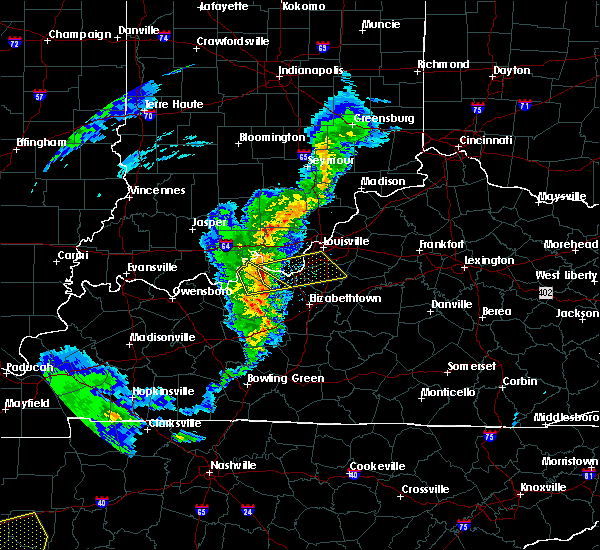 At 353 pm edt, a severe thunderstorm was located near brandenburg, moving east at 65 mph (radar indicated). Hazards include 70 mph wind gusts. Expect considerable tree damage. Damage is likely to mobile homes, roofs, and outbuildings. At 353 pm edt, a severe thunderstorm was located near brandenburg, moving east at 65 mph (radar indicated). Hazards include 70 mph wind gusts. Expect considerable tree damage. Damage is likely to mobile homes, roofs, and outbuildings.
|
| 3/27/2016 9:39 PM EDT |
 The severe thunderstorm warning for harrison, south central floyd, meade and central breckinridge counties will expire at 945 pm edt, the storms which prompted the warning have weakened below severe limits, and no longer pose an immediate threat to life or property. therefore the warning will be allowed to expire. a severe thunderstorm watch remains in effect until 1100 pm edt/1000 pm cdt/ for south central indiana and central kentucky. The severe thunderstorm warning for harrison, south central floyd, meade and central breckinridge counties will expire at 945 pm edt, the storms which prompted the warning have weakened below severe limits, and no longer pose an immediate threat to life or property. therefore the warning will be allowed to expire. a severe thunderstorm watch remains in effect until 1100 pm edt/1000 pm cdt/ for south central indiana and central kentucky.
|
| 3/27/2016 9:12 PM EDT |
 At 912 pm edt/812 pm cdt/, severe thunderstorms were located along a line extending from 6 miles southeast of carefree town to near hardinsburg, moving northeast at 50 mph (radar indicated). Hazards include 60 mph wind gusts and penny size hail. Expect damage to roofs. siding. And trees. At 912 pm edt/812 pm cdt/, severe thunderstorms were located along a line extending from 6 miles southeast of carefree town to near hardinsburg, moving northeast at 50 mph (radar indicated). Hazards include 60 mph wind gusts and penny size hail. Expect damage to roofs. siding. And trees.
|
| 12/23/2015 6:41 PM EST | At 641 pm est, a severe thunderstorm was located 7 miles northwest of st. dennis, moving northeast at 70 mph (radar indicated). Hazards include 60 mph wind gusts. Expect damage to roofs. Siding and trees. |
| 12/23/2015 6:41 PM EST | At 641 pm est, a severe thunderstorm was located 7 miles northwest of st. dennis, moving northeast at 70 mph (radar indicated). Hazards include 60 mph wind gusts. Expect damage to roofs. Siding and trees. |
| 8/4/2015 7:40 PM EDT | Tree reported down along elizabeth new middletown road in harrison county IN, 0.5 miles SSW of Elizabeth, IN |
| 8/4/2015 7:25 PM EDT |
 At 725 pm edt, a severe thunderstorm was located just south of brandenburg, moving east at 30 mph (radar indicated). Hazards include 60 mph wind gusts. Expect damage to roofs. siding and trees. Locations impacted include, brandenburg, west point, elizabeth, new middletown, mauckport, laconia, new amsterdam, central, evans landing, payneville, cedar flat, valley city, seven springs, sirocco, rosewood, macedonia, new boston, titus, wolf creek and lottick corner. At 725 pm edt, a severe thunderstorm was located just south of brandenburg, moving east at 30 mph (radar indicated). Hazards include 60 mph wind gusts. Expect damage to roofs. siding and trees. Locations impacted include, brandenburg, west point, elizabeth, new middletown, mauckport, laconia, new amsterdam, central, evans landing, payneville, cedar flat, valley city, seven springs, sirocco, rosewood, macedonia, new boston, titus, wolf creek and lottick corner.
|
| 8/4/2015 7:15 PM EDT |
 At 714 pm edt, a severe thunderstorm was located 7 miles northwest of brandenburg, moving east at 30 mph (radar indicated). Hazards include 60 mph wind gusts. Expect damage to roofs. Siding and trees. At 714 pm edt, a severe thunderstorm was located 7 miles northwest of brandenburg, moving east at 30 mph (radar indicated). Hazards include 60 mph wind gusts. Expect damage to roofs. Siding and trees.
|
| 7/10/2015 10:39 AM EDT |
 At 1036 am edt, severe thunderstorms were located along a line extending from pleasure ridge park to 10 miles north of elizabethtown to 8 miles west of elizabethtown, and moving east at 55 mph (radar indicated). Hazards include 60 mph wind gusts. Expect damage to roofs. siding and trees. Locations impacted include, fairdale, shepherdsville, elizabethtown, okolona, highview, cecilia, addington field airport, gaithers, barrallton, crest, beech grove, indian hills, louisville international airport, booth, belmont, tunnel hills, lebanon junction, brooks, fox chase and gap in knob. At 1036 am edt, severe thunderstorms were located along a line extending from pleasure ridge park to 10 miles north of elizabethtown to 8 miles west of elizabethtown, and moving east at 55 mph (radar indicated). Hazards include 60 mph wind gusts. Expect damage to roofs. siding and trees. Locations impacted include, fairdale, shepherdsville, elizabethtown, okolona, highview, cecilia, addington field airport, gaithers, barrallton, crest, beech grove, indian hills, louisville international airport, booth, belmont, tunnel hills, lebanon junction, brooks, fox chase and gap in knob.
|
| 7/10/2015 10:20 AM EDT |
 At 1017 am edt, severe thunderstorms were located along a line extending from 6 miles south of corydon to 14 miles south of brandenburg to 9 miles north of leitchfield, and moving east at 55 mph (radar indicated). Hazards include 60 mph wind gusts. Expect damage to roofs. Siding and trees. At 1017 am edt, severe thunderstorms were located along a line extending from 6 miles south of corydon to 14 miles south of brandenburg to 9 miles north of leitchfield, and moving east at 55 mph (radar indicated). Hazards include 60 mph wind gusts. Expect damage to roofs. Siding and trees.
|
| 6/26/2015 5:33 PM EDT | At 529 pm edt, a severe thunderstorm was located 8 miles southwest of corydon, and moving east at 25 mph (radar indicated). Hazards include 70 mph wind gusts. Expect considerable tree damage. damage is likely to mobile homes, roofs and outbuildings. Locations impacted include, corydon, central, dogwood, new salisbury, new middletown, crandall, seven springs and breckenridge. |
| 6/26/2015 5:17 PM EDT | At 515 pm edt, a severe thunderstorm was located 12 miles southwest of corydon, and moving east at 25 mph (radar indicated). Hazards include 70 mph wind gusts. Expect considerable tree damage. damage is likely to mobile homes, roofs and outbuildings. Locations impacted include, corydon, new amsterdam, wyandotte, valley city, white cloud, central, moberly, dogwood, breckenridge, new middletown, crandall, seven springs and new salisbury. |
| 6/26/2015 5:17 PM EDT | At 515 pm edt, a severe thunderstorm was located 12 miles southwest of corydon, and moving east at 25 mph (radar indicated). Hazards include 70 mph wind gusts. Expect considerable tree damage. damage is likely to mobile homes, roofs and outbuildings. Locations impacted include, corydon, new amsterdam, wyandotte, valley city, white cloud, central, moberly, dogwood, breckenridge, new middletown, crandall, seven springs and new salisbury. |
| 6/26/2015 5:12 PM EDT | At 510 pm edt, a severe thunderstorm was located 14 miles northwest of brandenburg, and moving east at 25 mph (radar indicated). Hazards include 60 mph wind gusts. Expect damage to roofs. Siding and trees. |
| 6/26/2015 5:12 PM EDT | At 510 pm edt, a severe thunderstorm was located 14 miles northwest of brandenburg, and moving east at 25 mph (radar indicated). Hazards include 60 mph wind gusts. Expect damage to roofs. Siding and trees. |
| 6/18/2015 4:59 PM EDT | At 457 pm edt, a severe thunderstorm was located 10 miles north of elizabethtown, and moving north at 50 mph (radar indicated). Hazards include 60 mph wind gusts. Expect damage to roofs. Siding and trees. |
| 6/18/2015 4:59 PM EDT | At 457 pm edt, a severe thunderstorm was located 10 miles north of elizabethtown, and moving north at 50 mph (radar indicated). Hazards include 60 mph wind gusts. Expect damage to roofs. Siding and trees. |
| 5/27/2015 1:54 PM EDT | At 151 pm edt, a severe thunderstorm was located 5 miles west of pleasure ridge park, and moving east at 40 mph (radar indicated). Hazards include 60 mph wind gusts. Expect damage to roofs. Siding and trees. |
| 5/27/2015 1:54 PM EDT | At 151 pm edt, a severe thunderstorm was located 5 miles west of pleasure ridge park, and moving east at 40 mph (radar indicated). Hazards include 60 mph wind gusts. Expect damage to roofs. Siding and trees. |
| 4/10/2015 3:02 AM EDT | A severe thunderstorm warning remains in effect for northwestern bullitt. southwestern jefferson and east central harrison counties until 325 am edt. at 300 am edt. severe thunderstorms were located along a line extending from 7 miles west of pleasure ridge park to fairdale to 7 miles southwest of shepherdsville. And moving northeast at 55 mph. |
| 4/10/2015 3:02 AM EDT | A severe thunderstorm warning remains in effect for northwestern bullitt. southwestern jefferson and east central harrison counties until 325 am edt. at 300 am edt. severe thunderstorms were located along a line extending from 7 miles west of pleasure ridge park to fairdale to 7 miles southwest of shepherdsville. And moving northeast at 55 mph. |
| 4/10/2015 2:55 AM EDT | A severe thunderstorm warning remains in effect for north central hardin. northwestern bullitt. east central meade. southwestern jefferson and southeastern harrison counties until 325 am edt. at 252 am edt. severe thunderstorms were located along a line extending from 7 miles northeast of brandenburg to 11 miles east of brandenburg to 12 miles southeast of brandenburg. And moving. |
| 4/10/2015 2:55 AM EDT | A severe thunderstorm warning remains in effect for north central hardin. northwestern bullitt. east central meade. southwestern jefferson and southeastern harrison counties until 325 am edt. at 252 am edt. severe thunderstorms were located along a line extending from 7 miles northeast of brandenburg to 11 miles east of brandenburg to 12 miles southeast of brandenburg. And moving. |
| 4/10/2015 2:43 AM EDT | The national weather service in louisville has issued a * severe thunderstorm warning for. southeastern harrison county in south central indiana. western bullitt county in north central kentucky. north central hardin county in north central kentucky. Southwestern jefferson county in north central kentucky. |
| 4/10/2015 2:43 AM EDT | The national weather service in louisville has issued a * severe thunderstorm warning for. southeastern harrison county in south central indiana. western bullitt county in north central kentucky. north central hardin county in north central kentucky. Southwestern jefferson county in north central kentucky. |
| 4/7/2015 5:33 PM EDT | The national weather service in louisville has issued a * severe thunderstorm warning for. southeastern floyd county in south central indiana. east central harrison county in south central indiana. jefferson county in north central kentucky. Until 605 pm edt. |
| 4/7/2015 5:33 PM EDT | The national weather service in louisville has issued a * severe thunderstorm warning for. southeastern floyd county in south central indiana. east central harrison county in south central indiana. jefferson county in north central kentucky. Until 605 pm edt. |
| 4/7/2015 5:04 PM EDT | The national weather service in louisville has issued a * severe thunderstorm warning for. southeastern harrison county in south central indiana. bullitt county in north central kentucky. northern hardin county in north central kentucky. Southern jefferson county in north central kentucky. |
| 4/7/2015 5:04 PM EDT | The national weather service in louisville has issued a * severe thunderstorm warning for. southeastern harrison county in south central indiana. bullitt county in north central kentucky. northern hardin county in north central kentucky. Southern jefferson county in north central kentucky. |
| 4/7/2015 4:50 PM EDT | A tornado warning remains in effect for southern harrison county until 455 pm edt. at 448 pm edt. a severe thunderstorm capable of producing a tornado was located 5 miles northwest of brandenburg. and moving east at 50 mph. hazard. Tornado and small hail. |
| 4/7/2015 4:37 PM EDT | The national weather service in louisville has issued a * tornado warning for. southern harrison county in south central indiana. northern meade county in north central kentucky. until 455 pm edt * at 435 pm edt. A severe squall line capable of producing tornadoes. |
| 4/7/2015 4:37 PM EDT | The national weather service in louisville has issued a * tornado warning for. southern harrison county in south central indiana. northern meade county in north central kentucky. until 455 pm edt * at 435 pm edt. A severe squall line capable of producing tornadoes. |
| 4/7/2015 4:34 PM EDT | The national weather service in louisville has issued a * severe thunderstorm warning for. southern harrison county in south central indiana. north central breckinridge county in north central kentucky. meade county in north central kentucky. Until 505 pm edt/405 pm cdt/. |
| 4/7/2015 4:34 PM EDT | The national weather service in louisville has issued a * severe thunderstorm warning for. southern harrison county in south central indiana. north central breckinridge county in north central kentucky. meade county in north central kentucky. Until 505 pm edt/405 pm cdt/. |
| 4/2/2015 3:46 PM EDT | A severe thunderstorm warning remains in effect for jefferson. south central floyd and southeastern harrison counties until 425 pm edt. at 343 pm edt. severe thunderstorms were located along a line extending from anchorage to okolona to valley station to 9 miles east of brandenburg. And moving east at 40 mph. |
| 4/2/2015 3:46 PM EDT | A severe thunderstorm warning remains in effect for jefferson. south central floyd and southeastern harrison counties until 425 pm edt. at 343 pm edt. severe thunderstorms were located along a line extending from anchorage to okolona to valley station to 9 miles east of brandenburg. And moving east at 40 mph. |
| 4/2/2015 3:46 PM EDT | A severe thunderstorm warning remains in effect for jefferson. south central floyd and southeastern harrison counties until 425 pm edt. at 343 pm edt. severe thunderstorms were located along a line extending from anchorage to okolona to valley station to 9 miles east of brandenburg. And moving east at 40 mph. |
| 4/2/2015 3:33 PM EDT | The national weather service in louisville has issued a * severe thunderstorm warning for. south central floyd county in south central indiana. southeastern harrison county in south central indiana. jefferson county in north central kentucky. Until 425 pm edt. |
| 4/2/2015 3:33 PM EDT | The national weather service in louisville has issued a * severe thunderstorm warning for. south central floyd county in south central indiana. southeastern harrison county in south central indiana. jefferson county in north central kentucky. Until 425 pm edt. |
| 1/30/2013 4:15 AM EST | Buildings damaged in harrison county IN, 0.5 miles SSW of Elizabeth, IN |
| 7/8/2012 1:20 PM EDT | Trees down on cars and in yard in harrison county IN, 0.5 miles SSW of Elizabeth, IN |
| 1/1/0001 12:00 AM | Power line dow in harrison county IN, 0.5 miles SSW of Elizabeth, IN |
| 1/1/0001 12:00 AM | Trees dow in harrison county IN, 0.5 miles SSW of Elizabeth, IN |
Hail Maps for Elizabeth, IN


Connect with Interactive Hail Maps