

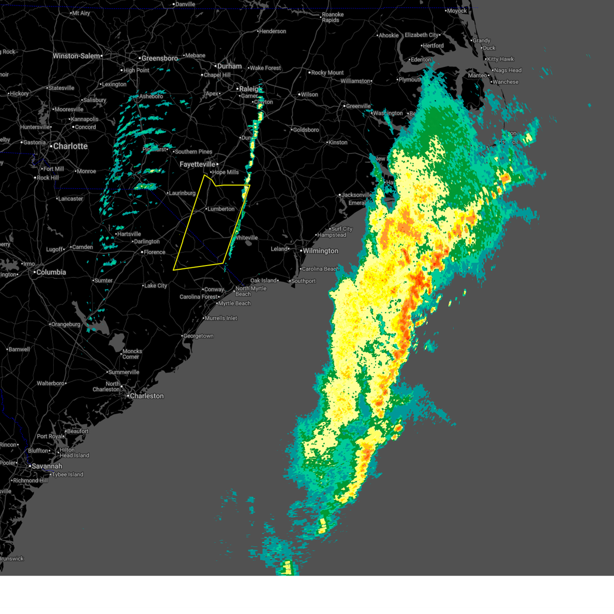
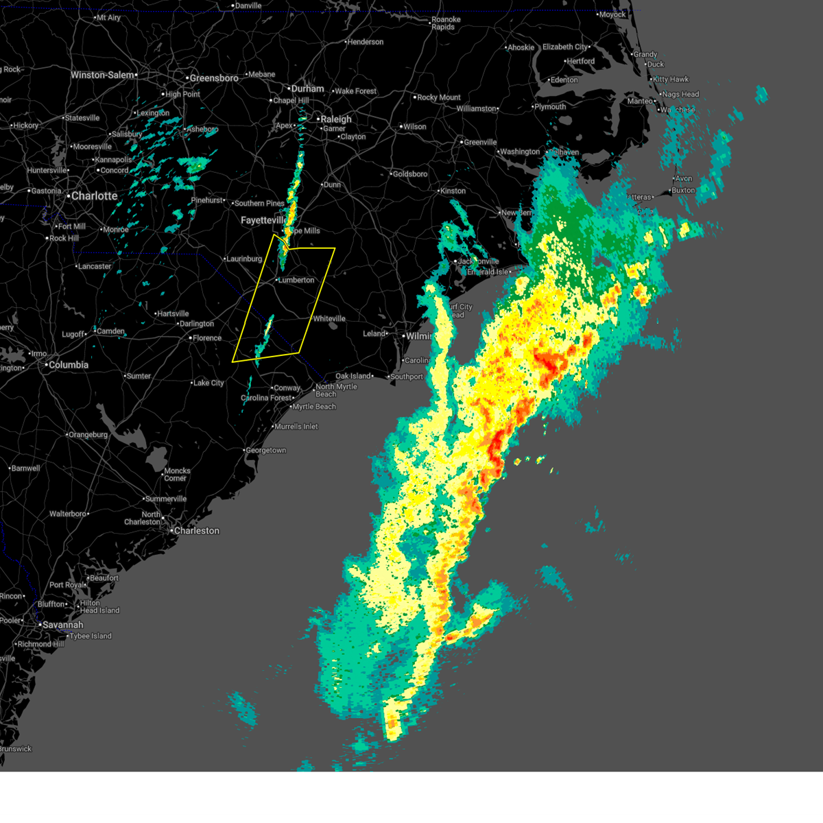
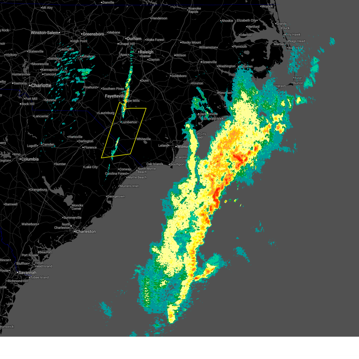
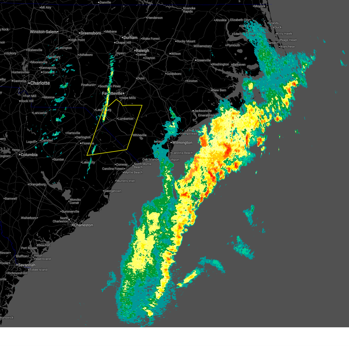
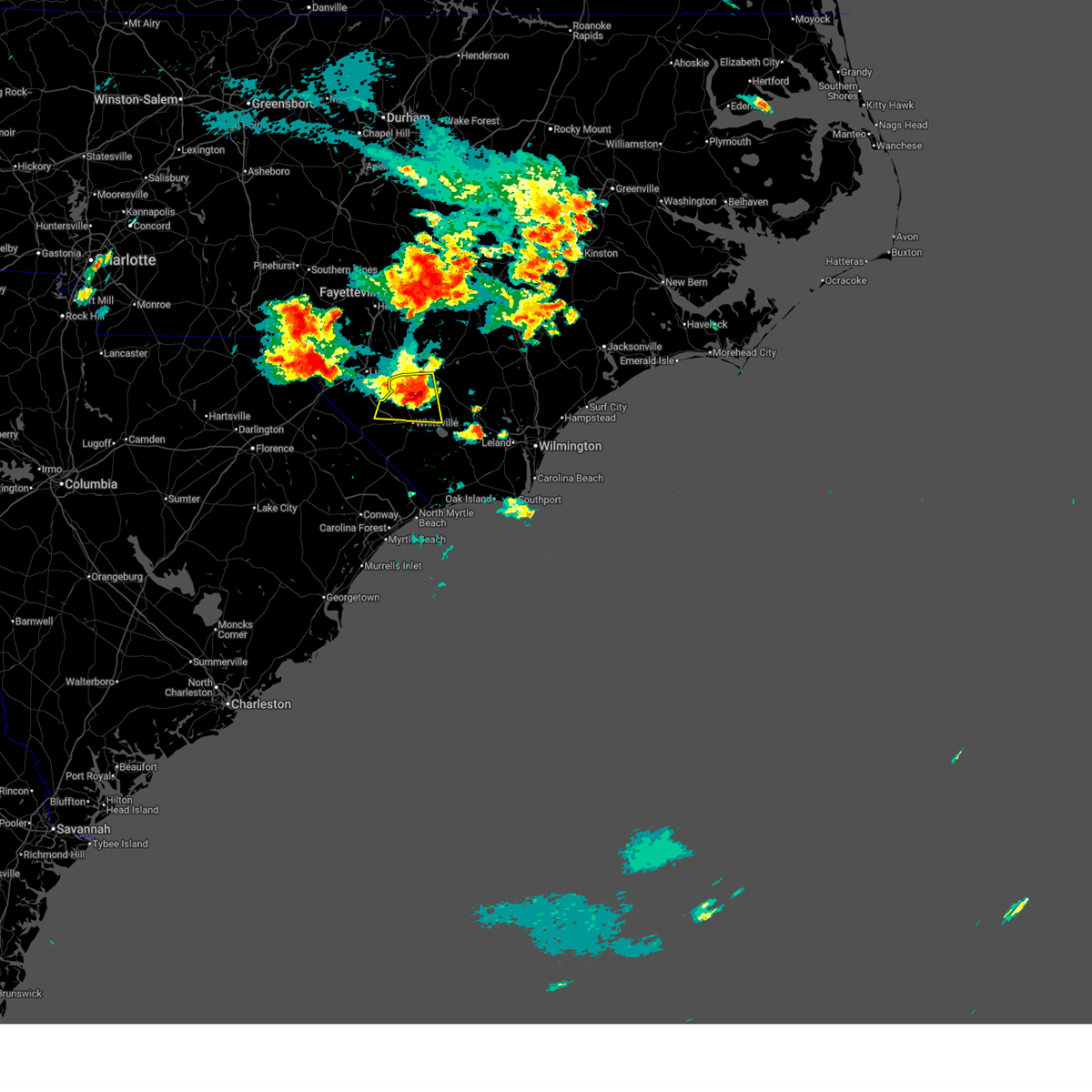
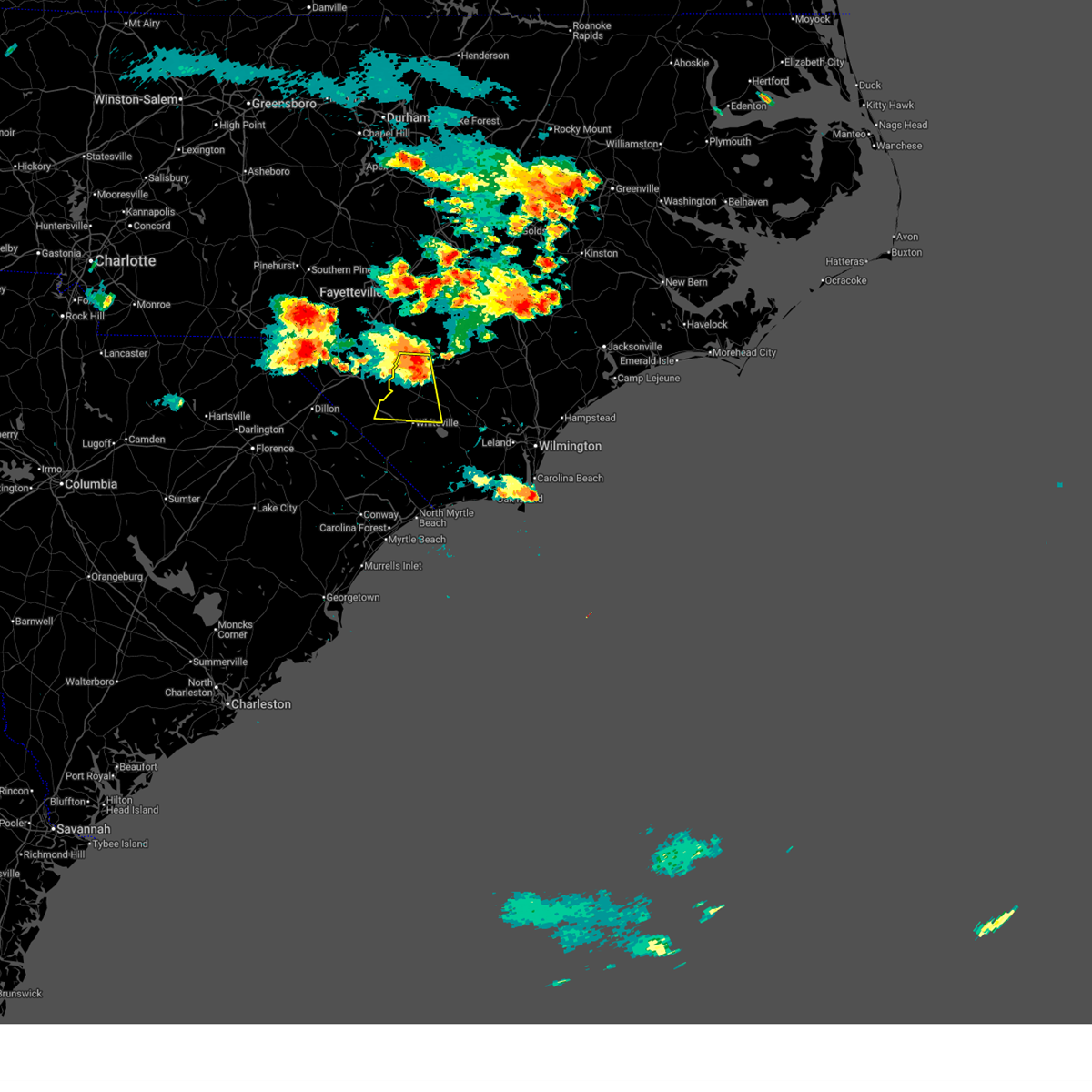
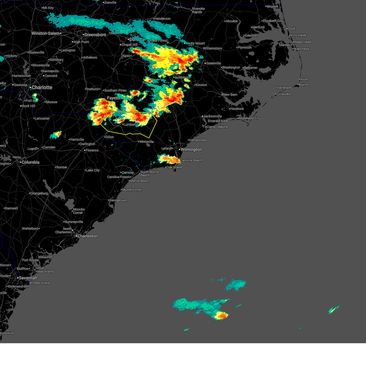
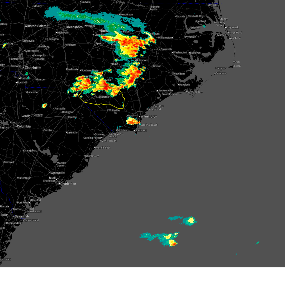
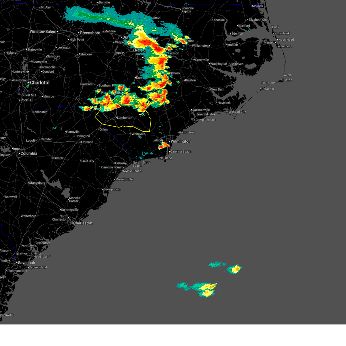
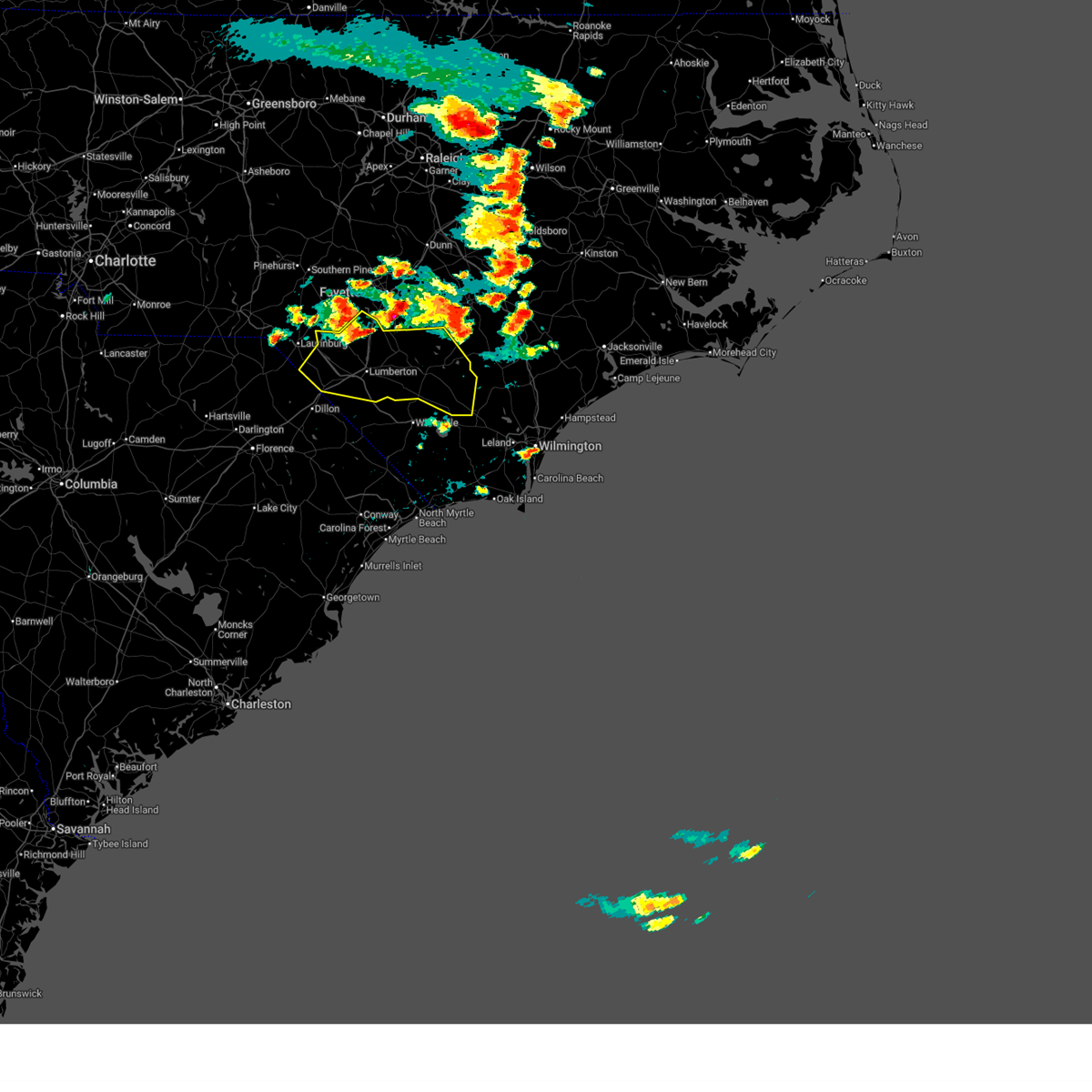
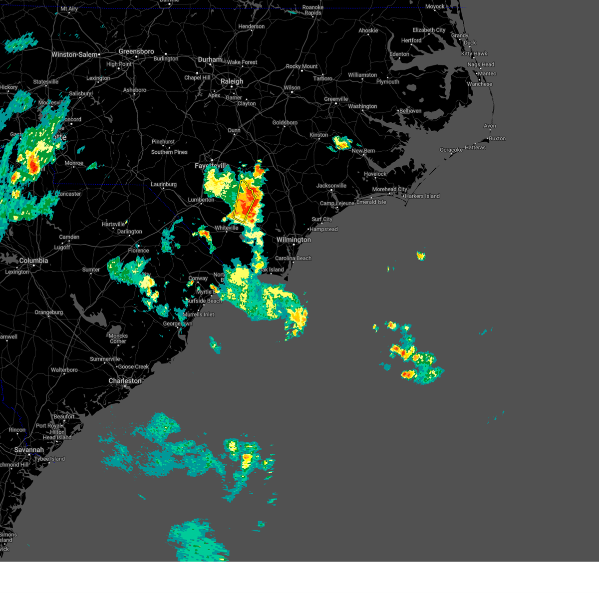
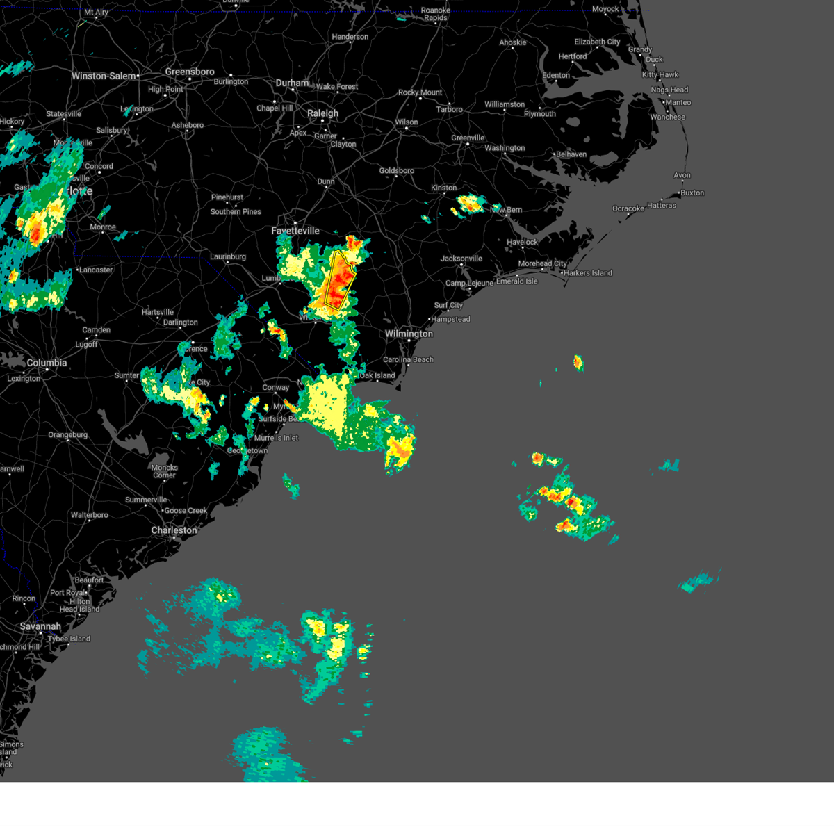
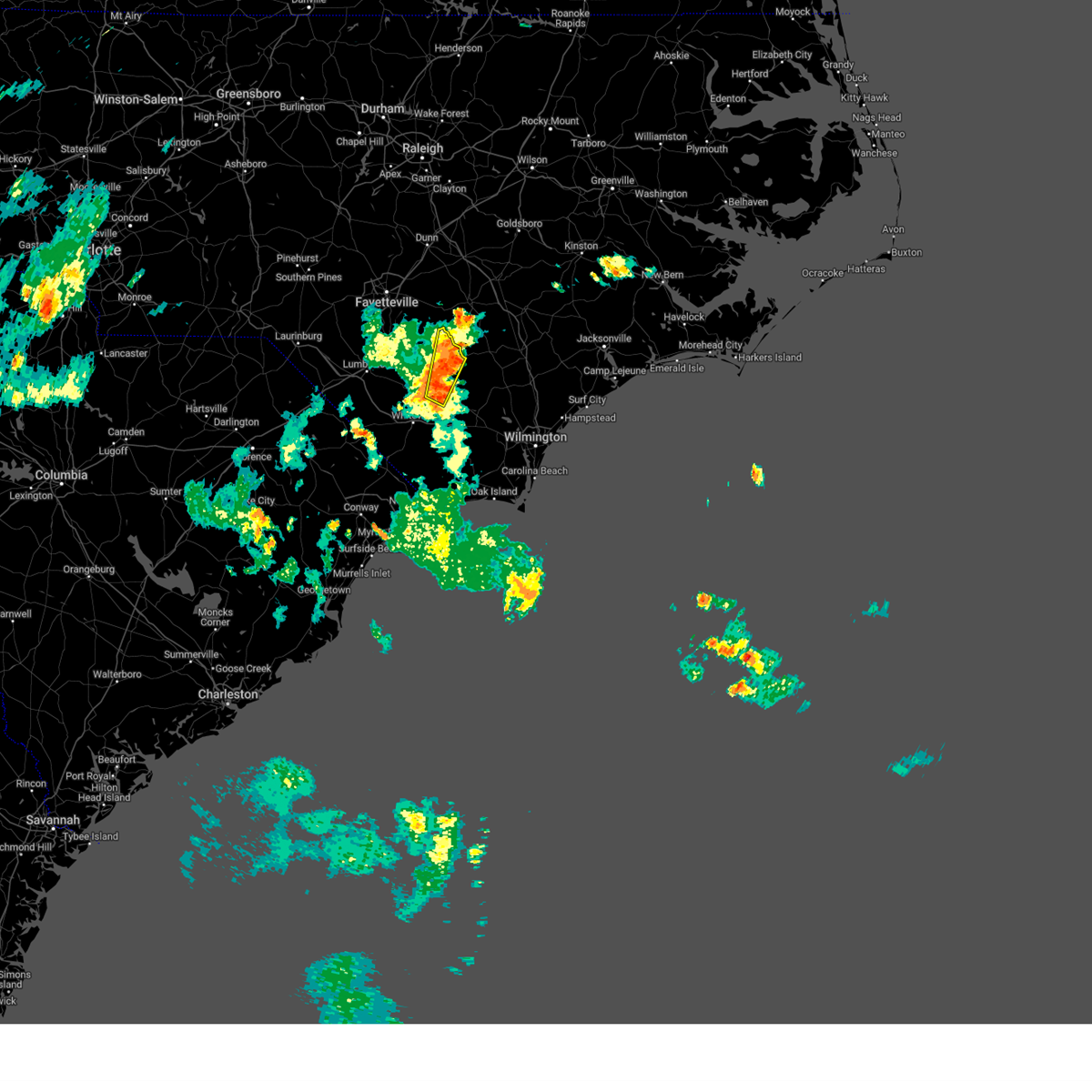
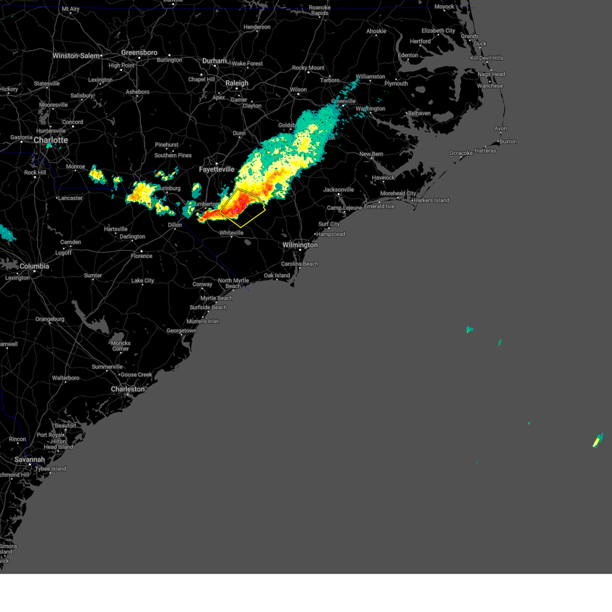
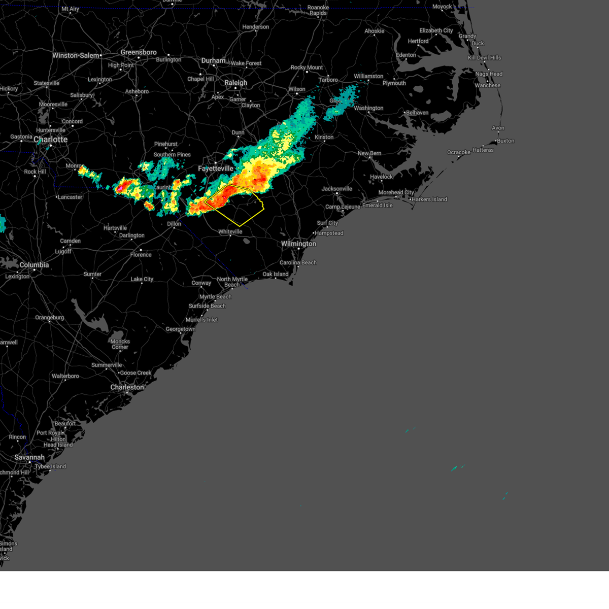
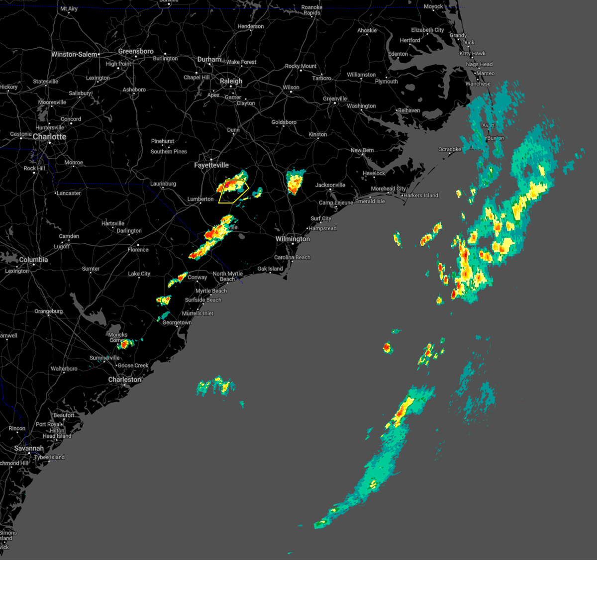
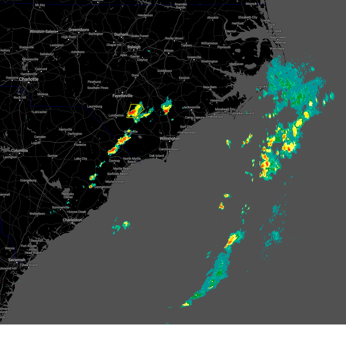
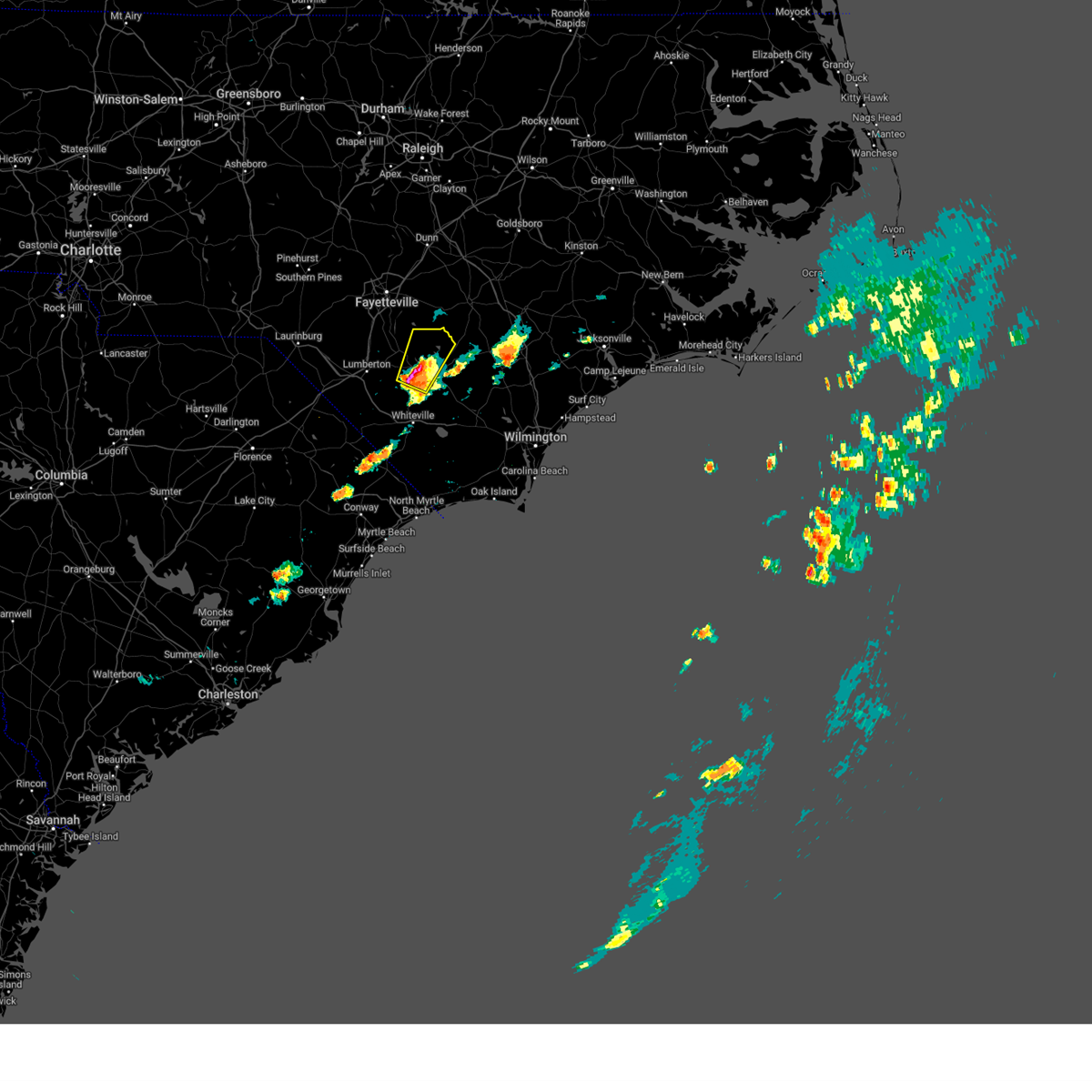
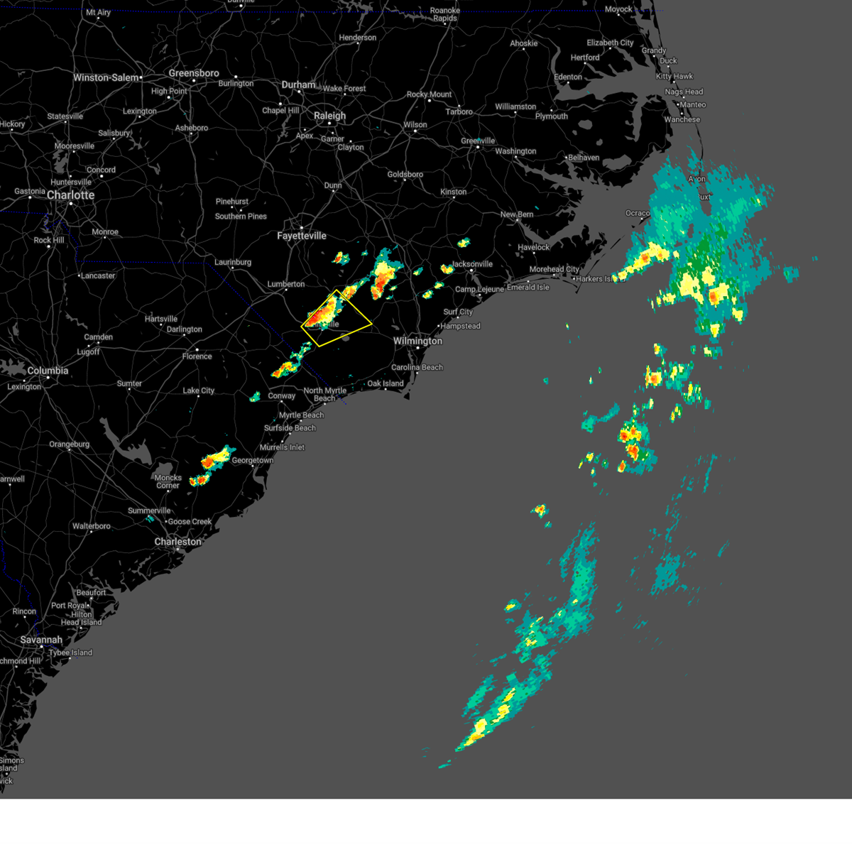
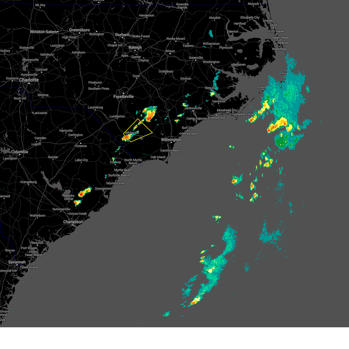
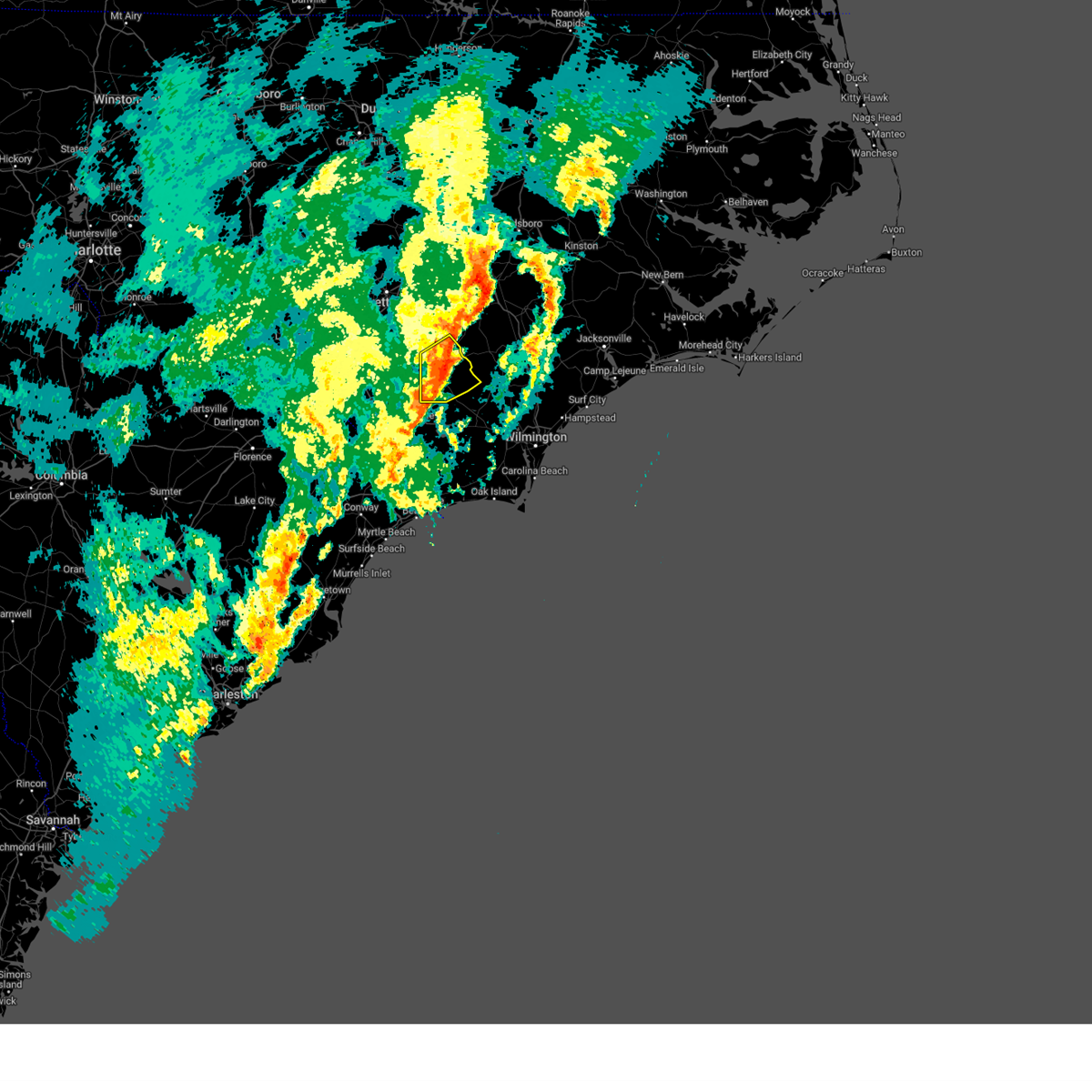
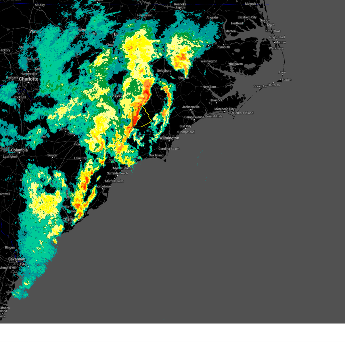
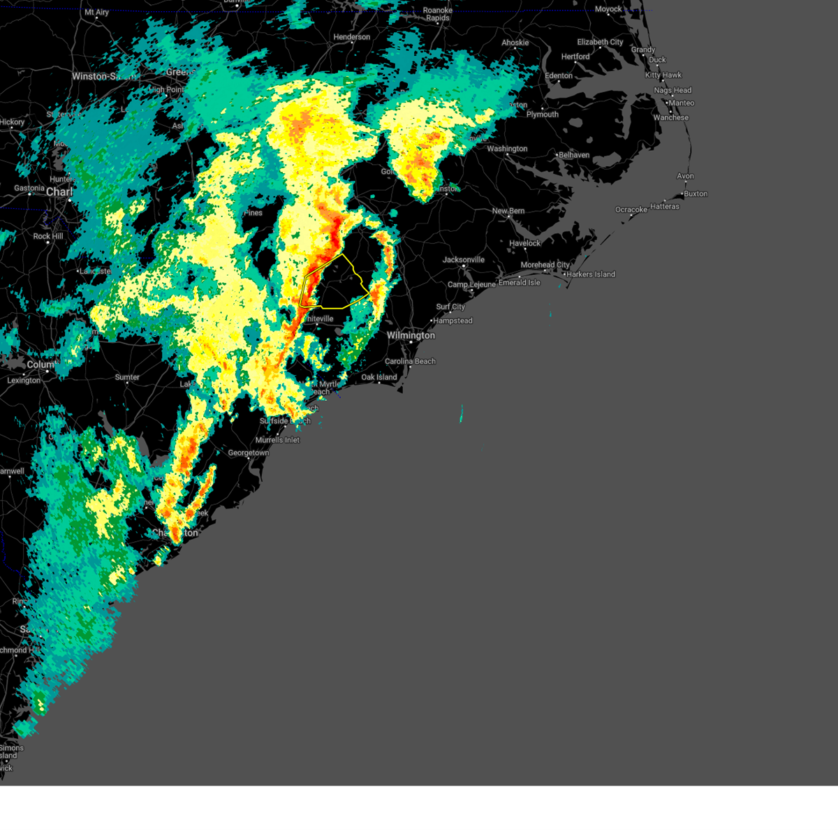
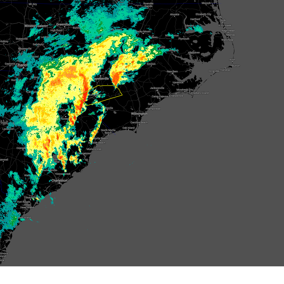
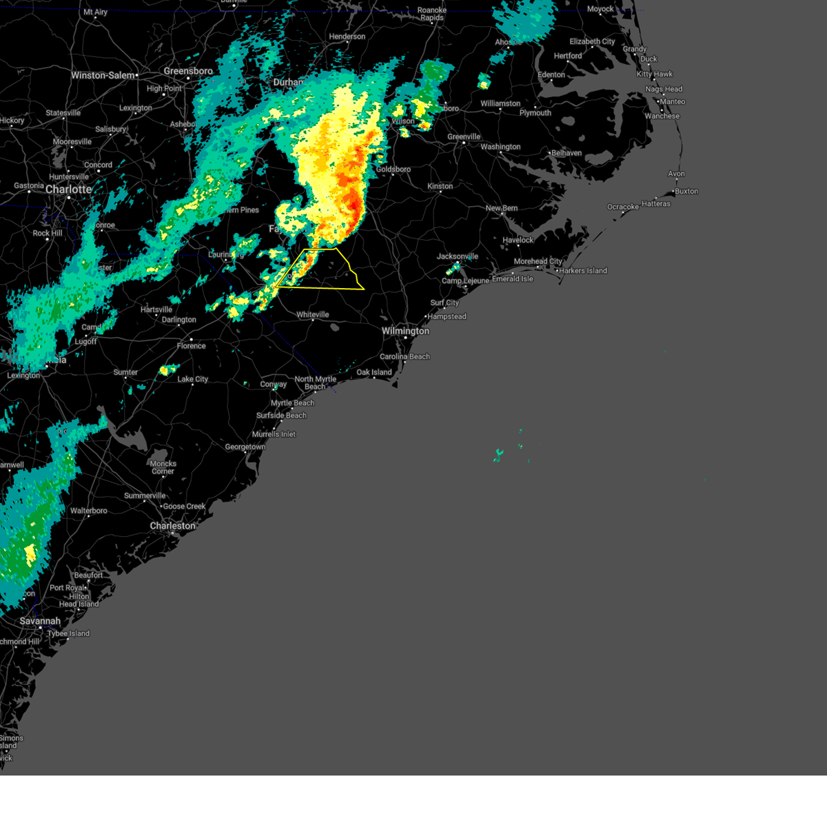
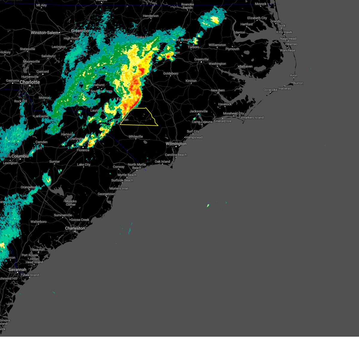
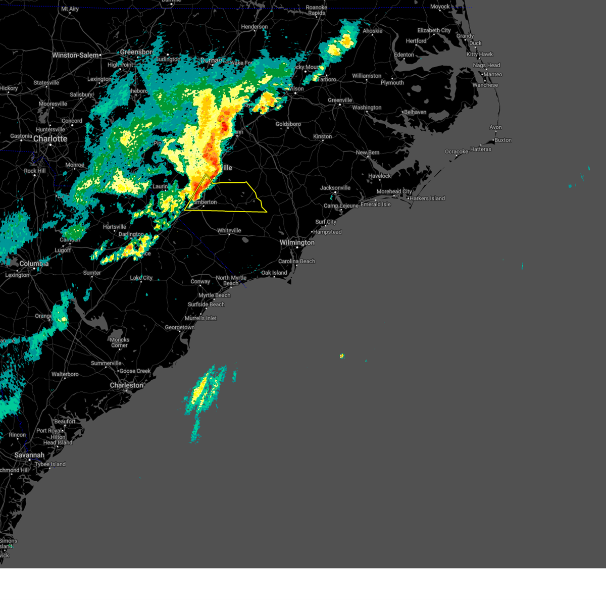
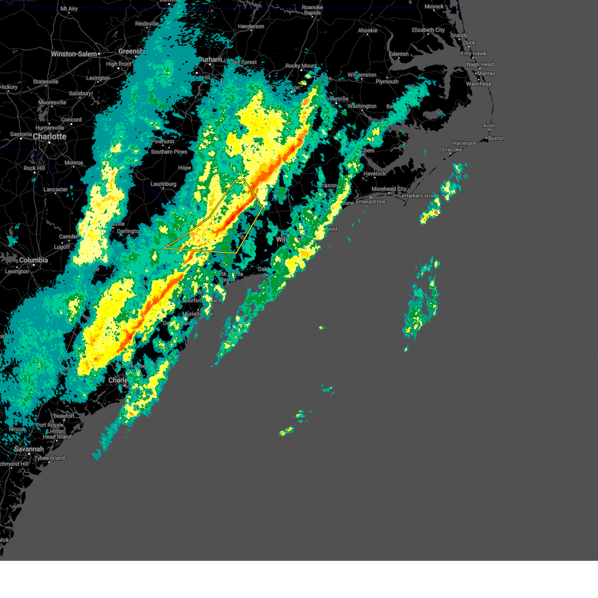
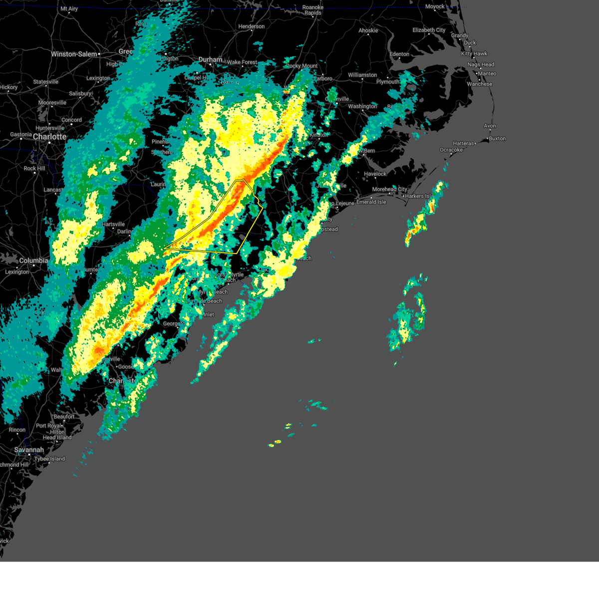
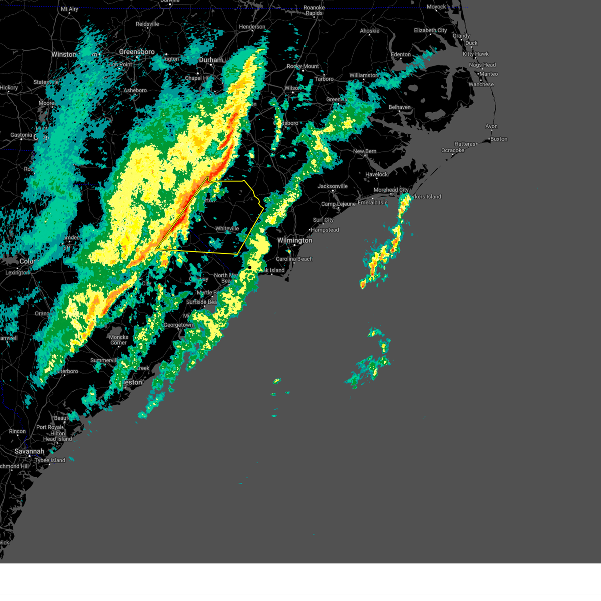
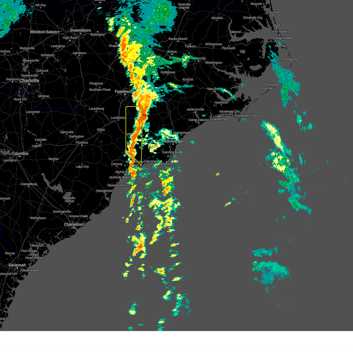
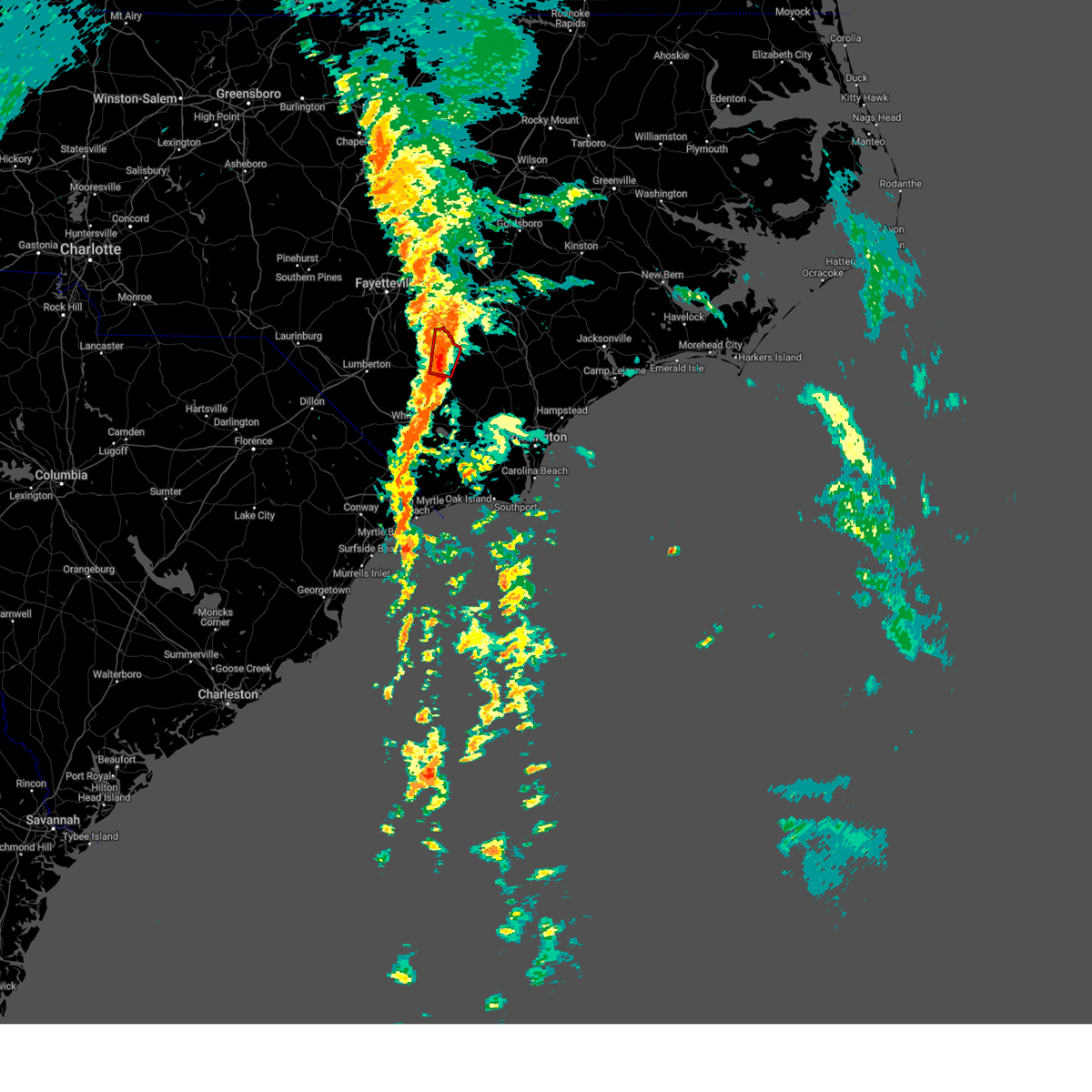
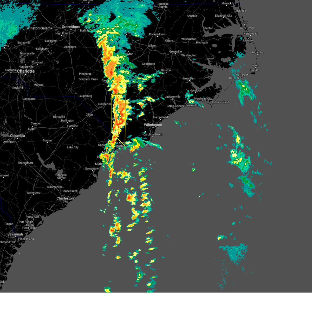
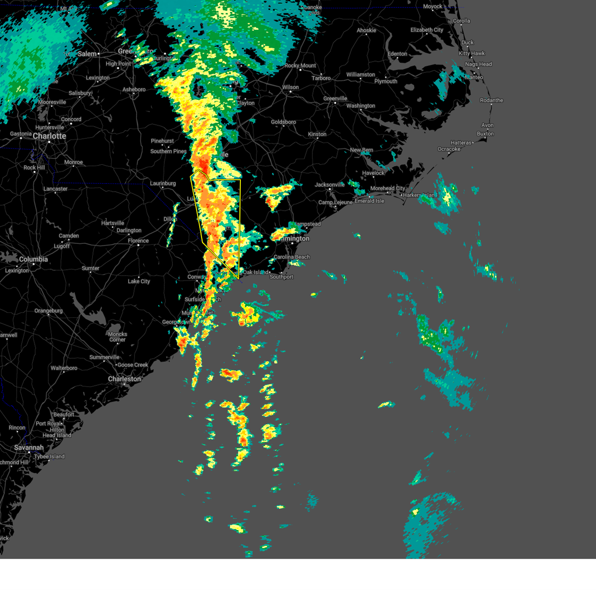
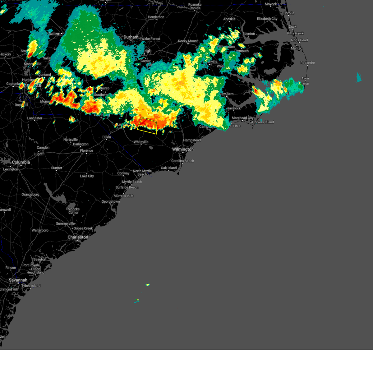
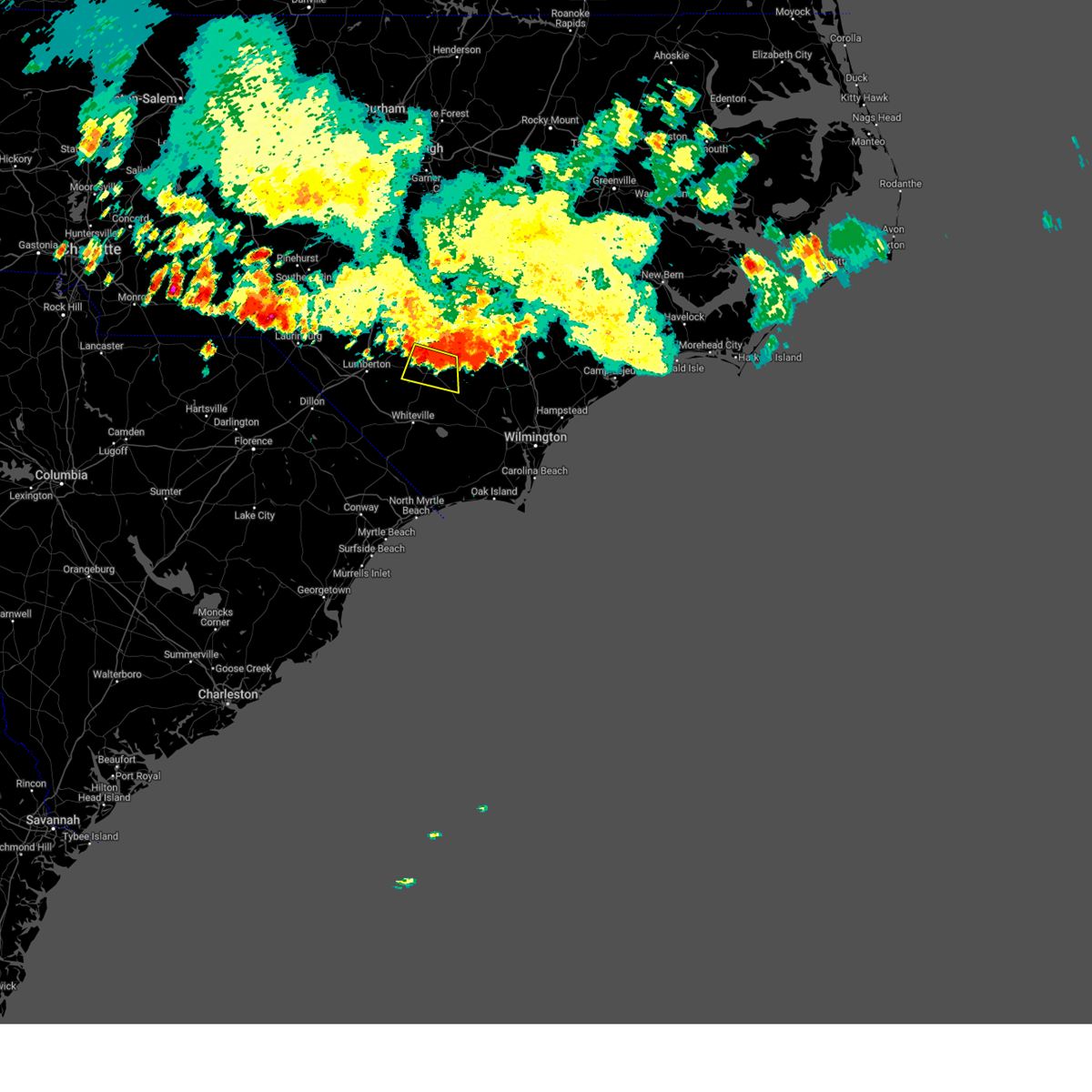
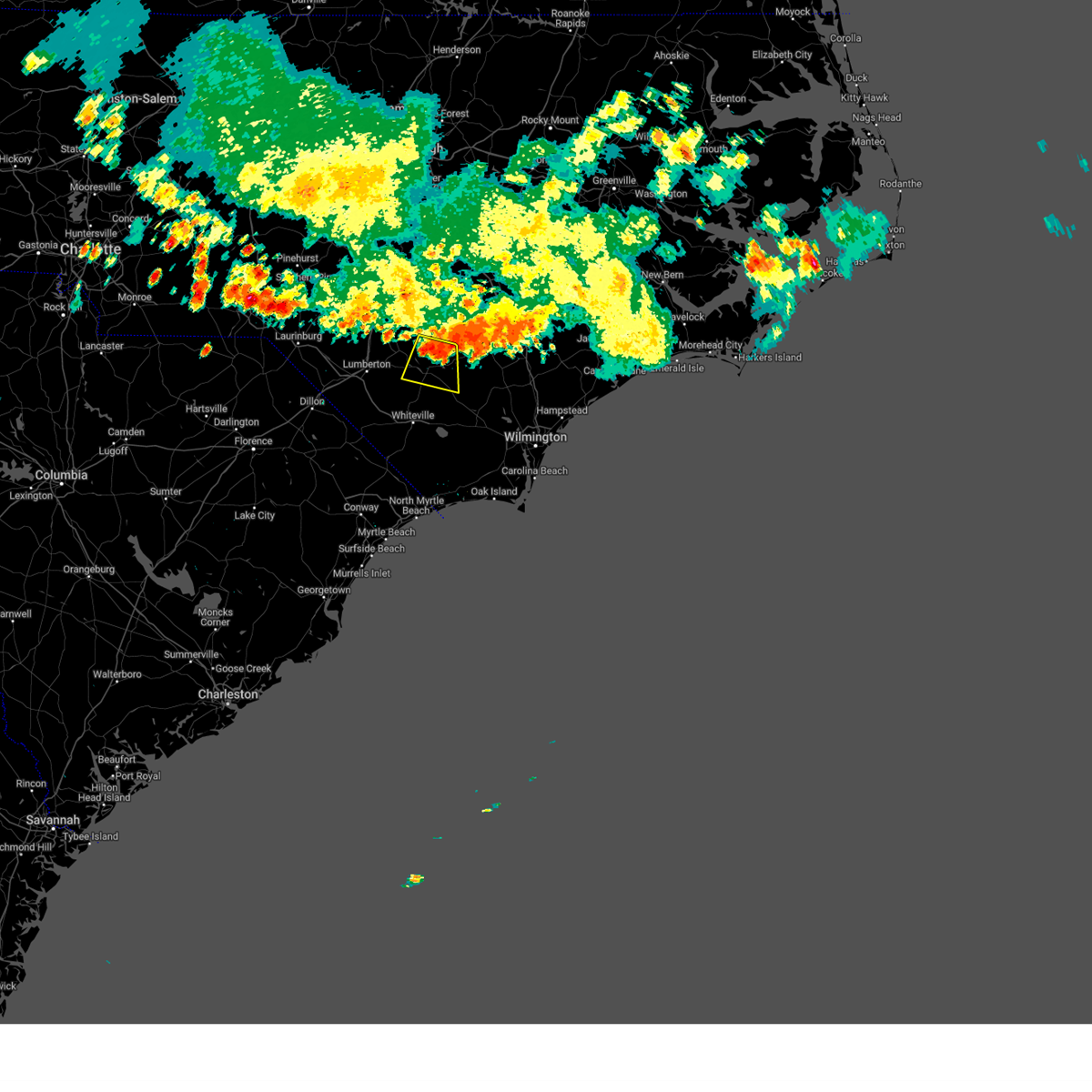
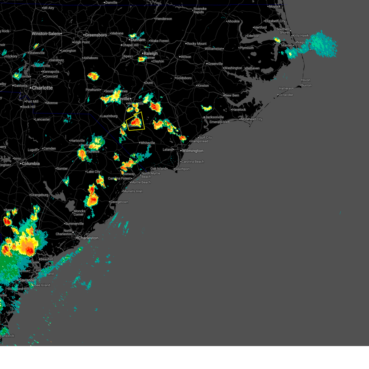
Hail Map for Elizabethtown, NC
The Elizabethtown, NC area has had 14 reports of on-the-ground hail by trained spotters, and has been under severe weather warnings 21 times during the past 12 months. Doppler radar has detected hail at or near Elizabethtown, NC on 59 occasions, including 2 occasions during the past year.
| Name: | Elizabethtown, NC |
| Where Located: | 46.5 miles NW of Wilmington, NC |
| Map: | Google Map for Elizabethtown, NC |
| Population: | 3583 |
| Housing Units: | 1832 |
| More Info: | Search Google for Elizabethtown, NC |
1
The Top Recent Hail Date for Elizabethtown, NC is Wednesday, June 25, 2025 (16th out of 59)

Hail and Wind Damage Spotted near Elizabethtown, NC
| Date / Time | Report Details |
|---|---|
| 3/16/2026 7:21 PM EDT |
 The warning will be allowed to expire. however, gusty winds are still possible. please send your reports of wind damage, including trees or large limbs downed, by calling the national weather service office in wilmington at 1 800 697 3901. The warning will be allowed to expire. however, gusty winds are still possible. please send your reports of wind damage, including trees or large limbs downed, by calling the national weather service office in wilmington at 1 800 697 3901.
|
| 3/16/2026 6:50 PM EDT |
 At 649 pm edt, showers producing strong winds were located along a line extending from tobermory to 6 miles southeast of gapway, moving east at 40 mph (lumberton airport reported a peak wind gust of 58 mph). Hazards include 60 mph wind gusts. Expect wind damage to trees and power lines. locations impacted include, lumberton, whiteville, mullins, elizabethtown, fairmont, tabor city, st. Pauls, chadbourn, bladenboro, fair bluff, lake view, boardman, rex, ammon, hestertown, rains, southeastern community college, white oak, galivants ferry, and smiths. At 649 pm edt, showers producing strong winds were located along a line extending from tobermory to 6 miles southeast of gapway, moving east at 40 mph (lumberton airport reported a peak wind gust of 58 mph). Hazards include 60 mph wind gusts. Expect wind damage to trees and power lines. locations impacted include, lumberton, whiteville, mullins, elizabethtown, fairmont, tabor city, st. Pauls, chadbourn, bladenboro, fair bluff, lake view, boardman, rex, ammon, hestertown, rains, southeastern community college, white oak, galivants ferry, and smiths.
|
| 3/16/2026 6:50 PM EDT |
 the severe thunderstorm warning has been cancelled and is no longer in effect the severe thunderstorm warning has been cancelled and is no longer in effect
|
| 3/16/2026 6:17 PM EDT |
 Svrilm the national weather service in wilmington has issued a * severe thunderstorm warning for, robeson county in southeastern north carolina, western bladen county in southeastern north carolina, northwestern columbus county in southeastern north carolina, central florence county in northeastern south carolina, dillon county in northeastern south carolina, northwestern horry county in northeastern south carolina, marion county in northeastern south carolina, * until 730 pm edt. * at 616 pm edt, showers producing strong wind gusts were located along a line extending from near antioch to dillon to near blue brick, moving east at 35 mph (radar indicated. at 5:53 pm the florence airport reported a gust of 58 mph). Hazards include 60 mph wind gusts. expect wind damage to trees and power lines Svrilm the national weather service in wilmington has issued a * severe thunderstorm warning for, robeson county in southeastern north carolina, western bladen county in southeastern north carolina, northwestern columbus county in southeastern north carolina, central florence county in northeastern south carolina, dillon county in northeastern south carolina, northwestern horry county in northeastern south carolina, marion county in northeastern south carolina, * until 730 pm edt. * at 616 pm edt, showers producing strong wind gusts were located along a line extending from near antioch to dillon to near blue brick, moving east at 35 mph (radar indicated. at 5:53 pm the florence airport reported a gust of 58 mph). Hazards include 60 mph wind gusts. expect wind damage to trees and power lines
|
| 11/9/2025 8:54 PM EST | The storm which prompted the warning has weakened below severe limits, and has exited the warned area. therefore, the warning will be allowed to expire. please send your reports of hail or wind damage, including trees or large limbs downed, by calling the national weather service office in wilmington at 1 800 697 3901. |
| 11/9/2025 8:41 PM EST | At 841 pm est, a severe thunderstorm was located near lagoon, or 10 miles east of elizabethtown, moving northeast at 55 mph (radar indicated). Hazards include 60 mph wind gusts and quarter size hail. Minor hail damage to vehicles is possible. expect wind damage to trees and power lines. Locations impacted include, elizabethtown, lagoon, emerson, lisbon, elkton, and white lake. |
| 11/9/2025 8:41 PM EST | the severe thunderstorm warning has been cancelled and is no longer in effect |
| 11/9/2025 8:28 PM EST | At 828 pm est, a severe thunderstorm was located near abbottsburg, or 7 miles south of elizabethtown, moving northeast at 50 mph (radar indicated). Hazards include 60 mph wind gusts and quarter size hail. Minor hail damage to vehicles is possible. expect wind damage to trees and power lines. Locations impacted include, elizabethtown, abbottsburg, lisbon, lagoon, elkton, emerson, clarkton, white lake, and bladen county hospital. |
| 11/9/2025 8:14 PM EST | Svrilm the national weather service in wilmington has issued a * severe thunderstorm warning for, central bladen county in southeastern north carolina, north central columbus county in southeastern north carolina, * until 900 pm est. * at 814 pm est, a severe thunderstorm was located near evergreen, or 8 miles northwest of whiteville, moving northeast at 50 mph (radar indicated). Hazards include 60 mph wind gusts and quarter size hail. Minor hail damage to vehicles is possible. Expect wind damage to trees and power lines. |
| 9/26/2025 5:35 PM EDT | the severe thunderstorm warning has been cancelled and is no longer in effect |
| 9/26/2025 5:22 PM EDT | At 522 pm edt, a severe thunderstorm was located over lagoon, or 9 miles east of elizabethtown, moving east at 20 mph (radar indicated). Hazards include 60 mph wind gusts. Expect wind damage to trees and power lines. Locations impacted include, lagoon, lisbon, and white lake. |
| 9/26/2025 5:01 PM EDT | Svrilm the national weather service in wilmington has issued a * severe thunderstorm warning for, central bladen county in southeastern north carolina, * until 545 pm edt. * at 501 pm edt, a severe thunderstorm was located near lisbon, or near elizabethtown, moving east at 20 mph (radar indicated). Hazards include 60 mph wind gusts and quarter size hail. Minor hail damage to vehicles is possible. Expect wind damage to trees and power lines. |
| 9/25/2025 5:25 PM EDT | the severe thunderstorm warning has been cancelled and is no longer in effect |
| 9/25/2025 5:09 PM EDT | At 508 pm edt, a severe thunderstorm was located near elkton, or 9 miles north of whiteville, moving east at 15 mph (radar indicated). Hazards include 60 mph wind gusts and quarter size hail. Minor hail damage to vehicles is possible. expect wind damage to trees and power lines. Locations impacted include, carvers, abbottsburg, lisbon, lagoon, elkton, council, emerson, and clarkton. |
| 9/25/2025 4:48 PM EDT | Svrilm the national weather service in wilmington has issued a * severe thunderstorm warning for, southwestern bladen county in southeastern north carolina, north central columbus county in southeastern north carolina, * until 545 pm edt. * at 448 pm edt, a severe thunderstorm was located near abbottsburg, or 8 miles northwest of whiteville, moving east at 15 mph (radar indicated). Hazards include 60 mph wind gusts and quarter size hail. Minor hail damage to vehicles is possible. Expect wind damage to trees and power lines. |
| 6/25/2025 5:08 PM EDT |
 At 507 pm edt, a severe thunderstorm was located over abbottsburg, or 10 miles southwest of elizabethtown, moving south at 20 mph (radar indicated). Hazards include 60 mph wind gusts and quarter size hail. Minor hail damage to vehicles is possible. expect wind damage to trees and power lines. Locations impacted include, whiteville, bladenboro, abbottsburg, butters, elkton, evergreen, emerson, and clarkton. At 507 pm edt, a severe thunderstorm was located over abbottsburg, or 10 miles southwest of elizabethtown, moving south at 20 mph (radar indicated). Hazards include 60 mph wind gusts and quarter size hail. Minor hail damage to vehicles is possible. expect wind damage to trees and power lines. Locations impacted include, whiteville, bladenboro, abbottsburg, butters, elkton, evergreen, emerson, and clarkton.
|
| 6/25/2025 4:47 PM EDT |
 Svrilm the national weather service in wilmington has issued a * severe thunderstorm warning for, western bladen county in southeastern north carolina, northern columbus county in southeastern north carolina, * until 545 pm edt. * at 447 pm edt, a severe thunderstorm was located over bladen community college, or near elizabethtown, moving south at 25 mph (radar indicated). Hazards include 60 mph wind gusts and quarter size hail. Minor hail damage to vehicles is possible. Expect wind damage to trees and power lines. Svrilm the national weather service in wilmington has issued a * severe thunderstorm warning for, western bladen county in southeastern north carolina, northern columbus county in southeastern north carolina, * until 545 pm edt. * at 447 pm edt, a severe thunderstorm was located over bladen community college, or near elizabethtown, moving south at 25 mph (radar indicated). Hazards include 60 mph wind gusts and quarter size hail. Minor hail damage to vehicles is possible. Expect wind damage to trees and power lines.
|
| 6/25/2025 4:45 PM EDT | Roughly 20 trees down in elizabethtown. time estimated via rada in bladen county NC, 0.2 miles WNW of Elizabethtown, NC |
| 6/25/2025 4:32 PM EDT |
 At 432 pm edt, severe thunderstorms were located along a line extending from near elizabethtown to near laurinburg, moving southwest at 25 mph (radar indicated). Hazards include 60 mph wind gusts and quarter size hail. Minor hail damage to vehicles is possible. expect wind damage to trees and power lines. locations impacted include, lumberton, elizabethtown, red springs, pembroke, fairmont, maxton, st. Pauls, bladenboro, rowland, bladen community college, ammon, butters, hestertown, buie, robeson community college, wakulla, white oak, elrod, smiths, and howellsville. At 432 pm edt, severe thunderstorms were located along a line extending from near elizabethtown to near laurinburg, moving southwest at 25 mph (radar indicated). Hazards include 60 mph wind gusts and quarter size hail. Minor hail damage to vehicles is possible. expect wind damage to trees and power lines. locations impacted include, lumberton, elizabethtown, red springs, pembroke, fairmont, maxton, st. Pauls, bladenboro, rowland, bladen community college, ammon, butters, hestertown, buie, robeson community college, wakulla, white oak, elrod, smiths, and howellsville.
|
| 6/25/2025 4:16 PM EDT |
 At 416 pm edt, severe thunderstorms were located along a line extending from 8 miles southeast of ammon to near wakulla, moving southwest at 20 mph. a recent public report indicated quarter size hail was falling in red springs, nc (radar indicated). Hazards include 60 mph wind gusts and quarter size hail. Minor hail damage to vehicles is possible. expect wind damage to trees and power lines. locations impacted include, lumberton, elizabethtown, red springs, pembroke, fairmont, maxton, st. Pauls, bladenboro, rowland, rex, ammon, hestertown, shannon, white oak, carvers, smiths, howellsville, raemon, lisbon, and elkton. At 416 pm edt, severe thunderstorms were located along a line extending from 8 miles southeast of ammon to near wakulla, moving southwest at 20 mph. a recent public report indicated quarter size hail was falling in red springs, nc (radar indicated). Hazards include 60 mph wind gusts and quarter size hail. Minor hail damage to vehicles is possible. expect wind damage to trees and power lines. locations impacted include, lumberton, elizabethtown, red springs, pembroke, fairmont, maxton, st. Pauls, bladenboro, rowland, rex, ammon, hestertown, shannon, white oak, carvers, smiths, howellsville, raemon, lisbon, and elkton.
|
| 6/25/2025 4:01 PM EDT |
 At 400 pm edt, severe thunderstorms were located along a line extending from garland to near jerome to red springs, moving south at 20 mph (radar indicated). Hazards include 60 mph wind gusts. Expect wind damage to trees and power lines. locations impacted include, lumberton, elizabethtown, red springs, pembroke, fairmont, maxton, st. Pauls, bladenboro, rowland, rex, ammon, hestertown, shannon, white oak, carvers, smiths, howellsville, raemon, lisbon, and elkton. At 400 pm edt, severe thunderstorms were located along a line extending from garland to near jerome to red springs, moving south at 20 mph (radar indicated). Hazards include 60 mph wind gusts. Expect wind damage to trees and power lines. locations impacted include, lumberton, elizabethtown, red springs, pembroke, fairmont, maxton, st. Pauls, bladenboro, rowland, rex, ammon, hestertown, shannon, white oak, carvers, smiths, howellsville, raemon, lisbon, and elkton.
|
| 6/25/2025 3:41 PM EDT |
 Svrilm the national weather service in wilmington has issued a * severe thunderstorm warning for, robeson county in southeastern north carolina, bladen county in southeastern north carolina, * until 500 pm edt. * at 340 pm edt, severe thunderstorms were located along a line extending from 11 miles northwest of harrells to antioch, moving south at 25 mph (radar indicated). Hazards include 60 mph wind gusts. expect wind damage to trees and power lines Svrilm the national weather service in wilmington has issued a * severe thunderstorm warning for, robeson county in southeastern north carolina, bladen county in southeastern north carolina, * until 500 pm edt. * at 340 pm edt, severe thunderstorms were located along a line extending from 11 miles northwest of harrells to antioch, moving south at 25 mph (radar indicated). Hazards include 60 mph wind gusts. expect wind damage to trees and power lines
|
| 6/9/2025 8:21 PM EDT |
 The storms which prompted the warning have moved out of the area. therefore, the warning will be allowed to expire. however, heavy rain is still possible with these thunderstorms. please send your reports of hail and/or wind damage, including trees or large limbs downed, by calling the national weather service office in wilmington at 1-800-697-3901. The storms which prompted the warning have moved out of the area. therefore, the warning will be allowed to expire. however, heavy rain is still possible with these thunderstorms. please send your reports of hail and/or wind damage, including trees or large limbs downed, by calling the national weather service office in wilmington at 1-800-697-3901.
|
| 6/9/2025 8:07 PM EDT |
 At 807 pm edt, severe thunderstorms were located along a line extending from 8 miles southwest of clinton to lisbon, moving northeast at 40 mph (radar indicated). Hazards include 60 mph wind gusts and penny size hail. Expect wind damage to trees and power lines. Locations impacted include, lisbon, lagoon, and white lake. At 807 pm edt, severe thunderstorms were located along a line extending from 8 miles southwest of clinton to lisbon, moving northeast at 40 mph (radar indicated). Hazards include 60 mph wind gusts and penny size hail. Expect wind damage to trees and power lines. Locations impacted include, lisbon, lagoon, and white lake.
|
| 6/9/2025 8:07 PM EDT |
 the severe thunderstorm warning has been cancelled and is no longer in effect the severe thunderstorm warning has been cancelled and is no longer in effect
|
| 6/9/2025 7:55 PM EDT |
 At 755 pm edt, severe thunderstorms were located along a line extending from near ammon to near elkton, moving northeast at 40 mph (radar indicated). Hazards include 60 mph wind gusts and quarter size hail. Minor hail damage to vehicles is possible. expect wind damage to trees and power lines. Locations impacted include, whiteville, elizabethtown, hallsboro, lisbon, ammon, lagoon, elkton, emerson, clarkton, white lake, columbus regional healthcare system, and bladen county hospital. At 755 pm edt, severe thunderstorms were located along a line extending from near ammon to near elkton, moving northeast at 40 mph (radar indicated). Hazards include 60 mph wind gusts and quarter size hail. Minor hail damage to vehicles is possible. expect wind damage to trees and power lines. Locations impacted include, whiteville, elizabethtown, hallsboro, lisbon, ammon, lagoon, elkton, emerson, clarkton, white lake, columbus regional healthcare system, and bladen county hospital.
|
| 6/9/2025 7:40 PM EDT |
 Svrilm the national weather service in wilmington has issued a * severe thunderstorm warning for, bladen county in southeastern north carolina, northwestern columbus county in southeastern north carolina, * until 830 pm edt. * at 740 pm edt, severe thunderstorms were located along a line extending from near ammon to southeastern community college, moving northeast at 40 mph (radar indicated). Hazards include 60 mph wind gusts and quarter size hail. Minor hail damage to vehicles is possible. Expect wind damage to trees and power lines. Svrilm the national weather service in wilmington has issued a * severe thunderstorm warning for, bladen county in southeastern north carolina, northwestern columbus county in southeastern north carolina, * until 830 pm edt. * at 740 pm edt, severe thunderstorms were located along a line extending from near ammon to southeastern community college, moving northeast at 40 mph (radar indicated). Hazards include 60 mph wind gusts and quarter size hail. Minor hail damage to vehicles is possible. Expect wind damage to trees and power lines.
|
| 6/1/2025 7:38 PM EDT |
 At 738 pm edt, a severe thunderstorm was located from near white lake and elizabethtown to near bladenboro, moving southeast at 25 mph (radar indicated). Hazards include 60 mph wind gusts and penny size hail. Expect wind damage to trees and power lines. Locations impacted include, elizabethtown, ruskin, bladen community college, abbottsburg, lisbon, lagoon, elkton, emerson, clarkton, white lake, dublin, and bladen county hospital. At 738 pm edt, a severe thunderstorm was located from near white lake and elizabethtown to near bladenboro, moving southeast at 25 mph (radar indicated). Hazards include 60 mph wind gusts and penny size hail. Expect wind damage to trees and power lines. Locations impacted include, elizabethtown, ruskin, bladen community college, abbottsburg, lisbon, lagoon, elkton, emerson, clarkton, white lake, dublin, and bladen county hospital.
|
| 6/1/2025 7:38 PM EDT |
 the severe thunderstorm warning has been cancelled and is no longer in effect the severe thunderstorm warning has been cancelled and is no longer in effect
|
| 6/1/2025 7:14 PM EDT |
 Svrilm the national weather service in wilmington has issued a * severe thunderstorm warning for, eastern robeson county in southeastern north carolina, bladen county in southeastern north carolina, * until 815 pm edt. * at 713 pm edt, a severe thunderstorm was located over white oak, or 8 miles northwest of elizabethtown, moving southeast at 20 mph (radar indicated). Hazards include 60 mph wind gusts and penny size hail. expect wind damage to trees and power lines Svrilm the national weather service in wilmington has issued a * severe thunderstorm warning for, eastern robeson county in southeastern north carolina, bladen county in southeastern north carolina, * until 815 pm edt. * at 713 pm edt, a severe thunderstorm was located over white oak, or 8 miles northwest of elizabethtown, moving southeast at 20 mph (radar indicated). Hazards include 60 mph wind gusts and penny size hail. expect wind damage to trees and power lines
|
| 5/4/2025 7:10 PM EDT |
 The storm which prompted the warning has moved out of the area. therefore, the warning will be allowed to expire. please send your reports of hail and/or wind damage, including trees or large limbs downed, by calling the national weather service office in wilmington at 1-800-697-3901. The storm which prompted the warning has moved out of the area. therefore, the warning will be allowed to expire. please send your reports of hail and/or wind damage, including trees or large limbs downed, by calling the national weather service office in wilmington at 1-800-697-3901.
|
| 5/4/2025 6:53 PM EDT |
 At 652 pm edt, a severe thunderstorm was located near ruskin, or near elizabethtown, moving northeast at 30 mph (public). Hazards include ping pong ball size hail and 60 mph wind gusts. People and animals outdoors will be injured. expect hail damage to roofs, siding, windows, and vehicles. expect wind damage to trees and power lines. Locations impacted include, elizabethtown, ruskin, bladen community college, ammon, white oak, dublin, and bladen county hospital. At 652 pm edt, a severe thunderstorm was located near ruskin, or near elizabethtown, moving northeast at 30 mph (public). Hazards include ping pong ball size hail and 60 mph wind gusts. People and animals outdoors will be injured. expect hail damage to roofs, siding, windows, and vehicles. expect wind damage to trees and power lines. Locations impacted include, elizabethtown, ruskin, bladen community college, ammon, white oak, dublin, and bladen county hospital.
|
| 5/4/2025 6:50 PM EDT | Ping Pong Ball sized hail reported 4.8 miles ESE of Elizabethtown, NC |
| 5/4/2025 6:33 PM EDT |
 Svrilm the national weather service in wilmington has issued a * severe thunderstorm warning for, northwestern bladen county in southeastern north carolina, * until 715 pm edt. * at 632 pm edt, a severe thunderstorm was located near elizabethtown, moving northeast at 30 mph (radar indicated). Hazards include 60 mph wind gusts. expect wind damage to trees and power lines Svrilm the national weather service in wilmington has issued a * severe thunderstorm warning for, northwestern bladen county in southeastern north carolina, * until 715 pm edt. * at 632 pm edt, a severe thunderstorm was located near elizabethtown, moving northeast at 30 mph (radar indicated). Hazards include 60 mph wind gusts. expect wind damage to trees and power lines
|
| 5/4/2025 6:13 PM EDT |
 The storm which prompted the warning has moved out of the area. therefore, the warning will be allowed to expire. however, small hail is still possible with this thunderstorm. please send your reports of hail and/or wind damage, including trees or large limbs downed, by calling the national weather service office in wilmington at 1-800-697-3901. The storm which prompted the warning has moved out of the area. therefore, the warning will be allowed to expire. however, small hail is still possible with this thunderstorm. please send your reports of hail and/or wind damage, including trees or large limbs downed, by calling the national weather service office in wilmington at 1-800-697-3901.
|
| 5/4/2025 5:46 PM EDT |
 Svrilm the national weather service in wilmington has issued a * severe thunderstorm warning for, southwestern bladen county in southeastern north carolina, northern columbus county in southeastern north carolina, * until 615 pm edt. * at 545 pm edt, a severe thunderstorm was located over southeastern community college, or near whiteville, moving northeast at 30 mph (radar indicated). Hazards include 60 mph wind gusts and quarter size hail. Minor hail damage to vehicles is possible. Expect wind damage to trees and power lines. Svrilm the national weather service in wilmington has issued a * severe thunderstorm warning for, southwestern bladen county in southeastern north carolina, northern columbus county in southeastern north carolina, * until 615 pm edt. * at 545 pm edt, a severe thunderstorm was located over southeastern community college, or near whiteville, moving northeast at 30 mph (radar indicated). Hazards include 60 mph wind gusts and quarter size hail. Minor hail damage to vehicles is possible. Expect wind damage to trees and power lines.
|
| 4/7/2025 9:06 PM EDT |
 The storm which prompted the warning will be moving out of the warned area shortly. therefore, the warning will be allowed to expire. a severe thunderstorm watch remains in effect until 1000 pm edt for southeastern north carolina. please send your reports of hail and/or wind damage, including trees or large limbs downed, by calling the national weather service office in wilmington at 1-800-697-3901. The storm which prompted the warning will be moving out of the warned area shortly. therefore, the warning will be allowed to expire. a severe thunderstorm watch remains in effect until 1000 pm edt for southeastern north carolina. please send your reports of hail and/or wind damage, including trees or large limbs downed, by calling the national weather service office in wilmington at 1-800-697-3901.
|
| 4/7/2025 8:58 PM EDT |
 At 858 pm edt, a severe thunderstorm was located 7 miles north of lagoon, or 9 miles east of elizabethtown, moving northeast at 60 mph (radar indicated). Hazards include 60 mph wind gusts. Expect wind damage to trees and power lines. Locations impacted include, lisbon, white lake, bladen county hospital, elizabethtown, lagoon, elkton, emerson, and clarkton. At 858 pm edt, a severe thunderstorm was located 7 miles north of lagoon, or 9 miles east of elizabethtown, moving northeast at 60 mph (radar indicated). Hazards include 60 mph wind gusts. Expect wind damage to trees and power lines. Locations impacted include, lisbon, white lake, bladen county hospital, elizabethtown, lagoon, elkton, emerson, and clarkton.
|
| 4/7/2025 8:45 PM EDT |
 Svrilm the national weather service in wilmington has issued a * severe thunderstorm warning for, bladen county in southeastern north carolina, * until 915 pm edt. * at 845 pm edt, a severe thunderstorm was located near ruskin, or near elizabethtown, moving northeast at 75 mph (radar indicated). Hazards include 60 mph wind gusts and penny size hail. expect wind damage to trees and power lines Svrilm the national weather service in wilmington has issued a * severe thunderstorm warning for, bladen county in southeastern north carolina, * until 915 pm edt. * at 845 pm edt, a severe thunderstorm was located near ruskin, or near elizabethtown, moving northeast at 75 mph (radar indicated). Hazards include 60 mph wind gusts and penny size hail. expect wind damage to trees and power lines
|
| 4/7/2025 7:55 PM EDT |
 Svrilm the national weather service in wilmington has issued a * severe thunderstorm warning for, robeson county in southeastern north carolina, northern bladen county in southeastern north carolina, * until 900 pm edt. * at 755 pm edt, a severe thunderstorm was located over purvis, or 13 miles west of lumberton, moving northeast at 50 mph (radar indicated). Hazards include 60 mph wind gusts. expect wind damage to trees and power lines Svrilm the national weather service in wilmington has issued a * severe thunderstorm warning for, robeson county in southeastern north carolina, northern bladen county in southeastern north carolina, * until 900 pm edt. * at 755 pm edt, a severe thunderstorm was located over purvis, or 13 miles west of lumberton, moving northeast at 50 mph (radar indicated). Hazards include 60 mph wind gusts. expect wind damage to trees and power lines
|
| 4/7/2025 3:12 PM EDT |
 the severe thunderstorm warning has been cancelled and is no longer in effect the severe thunderstorm warning has been cancelled and is no longer in effect
|
| 4/7/2025 2:55 PM EDT |
 At 255 pm edt, severe thunderstorms were located along a line extending from near benson to 9 miles west of clinton to near smiths, moving east at 55 mph (radar indicated). Hazards include 60 mph wind gusts. Expect wind damage to trees and power lines. Locations impacted include, smiths, howellsville, bladen community college, duart, ammon, dublin, hestertown, tar heel, ruskin, white lake, bladen county hospital, white oak, elizabethtown, jerome, and lumberton. At 255 pm edt, severe thunderstorms were located along a line extending from near benson to 9 miles west of clinton to near smiths, moving east at 55 mph (radar indicated). Hazards include 60 mph wind gusts. Expect wind damage to trees and power lines. Locations impacted include, smiths, howellsville, bladen community college, duart, ammon, dublin, hestertown, tar heel, ruskin, white lake, bladen county hospital, white oak, elizabethtown, jerome, and lumberton.
|
| 4/7/2025 2:40 PM EDT |
 Svrilm the national weather service in wilmington has issued a * severe thunderstorm warning for, northeastern robeson county in southeastern north carolina, northern bladen county in southeastern north carolina, * until 345 pm edt. * at 239 pm edt, severe thunderstorms were located along a line extending from 7 miles east of lillington to 11 miles east of fayetteville to near lumberton, moving east at 65 mph (radar indicated). Hazards include 60 mph wind gusts. expect wind damage to trees and power lines Svrilm the national weather service in wilmington has issued a * severe thunderstorm warning for, northeastern robeson county in southeastern north carolina, northern bladen county in southeastern north carolina, * until 345 pm edt. * at 239 pm edt, severe thunderstorms were located along a line extending from 7 miles east of lillington to 11 miles east of fayetteville to near lumberton, moving east at 65 mph (radar indicated). Hazards include 60 mph wind gusts. expect wind damage to trees and power lines
|
| 2/16/2025 10:30 AM EST |
 The storms which prompted the warning have weakened below severe limits, and no longer pose an immediate threat to life or property. therefore, the warning has been allowed to expire. a severe thunderstorm watch remains in effect until 300 pm est for southeastern north carolina. please send your reports of hail and/or wind damage, including trees or large limbs downed, by calling the national weather service office in wilmington at 1-800-697-3901. The storms which prompted the warning have weakened below severe limits, and no longer pose an immediate threat to life or property. therefore, the warning has been allowed to expire. a severe thunderstorm watch remains in effect until 300 pm est for southeastern north carolina. please send your reports of hail and/or wind damage, including trees or large limbs downed, by calling the national weather service office in wilmington at 1-800-697-3901.
|
| 2/16/2025 10:20 AM EST | A personal weather station in white lake... nc reported a wind gust to 63 mp in bladen county NC, 7.3 miles WSW of Elizabethtown, NC |
| 2/16/2025 10:12 AM EST |
 At 1011 am est, severe thunderstorms were located along a line extending from 6 miles northeast of ammon to abbottsburg to near cherry grove, moving east at 45 mph (radar indicated). Hazards include 60 mph wind gusts. Expect wind damage to trees and power lines. Locations impacted include, marion, whiteville, mullins, elizabethtown, tabor city, chadbourn, bladenboro, lake waccamaw, fair bluff, boardman, hallsboro, bladen community college, ammon, nakina, redbug, council, southeastern community college, williams, carvers, and abbottsburg. At 1011 am est, severe thunderstorms were located along a line extending from 6 miles northeast of ammon to abbottsburg to near cherry grove, moving east at 45 mph (radar indicated). Hazards include 60 mph wind gusts. Expect wind damage to trees and power lines. Locations impacted include, marion, whiteville, mullins, elizabethtown, tabor city, chadbourn, bladenboro, lake waccamaw, fair bluff, boardman, hallsboro, bladen community college, ammon, nakina, redbug, council, southeastern community college, williams, carvers, and abbottsburg.
|
| 2/16/2025 9:35 AM EST |
 Svrilm the national weather service in wilmington has issued a * severe thunderstorm warning for, eastern robeson county in southeastern north carolina, bladen county in southeastern north carolina, columbus county in southeastern north carolina, southeastern dillon county in northeastern south carolina, northwestern horry county in northeastern south carolina, northern marion county in northeastern south carolina, * until 1030 am est. * at 935 am est, severe thunderstorms were located along a line extending from near tobermory to fairmont to near marion, moving east at 45 mph (radar indicated). Hazards include 60 mph wind gusts. expect wind damage to trees and power lines Svrilm the national weather service in wilmington has issued a * severe thunderstorm warning for, eastern robeson county in southeastern north carolina, bladen county in southeastern north carolina, columbus county in southeastern north carolina, southeastern dillon county in northeastern south carolina, northwestern horry county in northeastern south carolina, northern marion county in northeastern south carolina, * until 1030 am est. * at 935 am est, severe thunderstorms were located along a line extending from near tobermory to fairmont to near marion, moving east at 45 mph (radar indicated). Hazards include 60 mph wind gusts. expect wind damage to trees and power lines
|
| 9/27/2024 11:16 AM EDT |
 The storms which prompted the warning have moved out of the area. therefore, the warning has been allowed to expire. a tornado watch remains in effect until 600 pm edt for southeastern north carolina, and northeastern south carolina. please send your reports of hail and/or wind damage, including trees or large limbs downed, by calling the national weather service office in wilmington at 1-800-697-3901. The storms which prompted the warning have moved out of the area. therefore, the warning has been allowed to expire. a tornado watch remains in effect until 600 pm edt for southeastern north carolina, and northeastern south carolina. please send your reports of hail and/or wind damage, including trees or large limbs downed, by calling the national weather service office in wilmington at 1-800-697-3901.
|
| 9/27/2024 11:10 AM EDT |
 Torilm the national weather service in wilmington has issued a * tornado warning for, north central bladen county in southeastern north carolina, * until 1130 am edt. * at 1110 am edt, severe thunderstorms capable of producing both tornadoes and extensive straight line wind damage were located near elizabethtown, moving north at 45 mph (radar indicated rotation). Hazards include tornado. Flying debris will be dangerous to those caught without shelter. mobile homes will be damaged or destroyed. damage to roofs, windows, and vehicles will occur. tree damage is likely. This tornadic thunderstorm will remain over mainly rural areas of north central bladen county, including the following locations, white lake. Torilm the national weather service in wilmington has issued a * tornado warning for, north central bladen county in southeastern north carolina, * until 1130 am edt. * at 1110 am edt, severe thunderstorms capable of producing both tornadoes and extensive straight line wind damage were located near elizabethtown, moving north at 45 mph (radar indicated rotation). Hazards include tornado. Flying debris will be dangerous to those caught without shelter. mobile homes will be damaged or destroyed. damage to roofs, windows, and vehicles will occur. tree damage is likely. This tornadic thunderstorm will remain over mainly rural areas of north central bladen county, including the following locations, white lake.
|
| 9/27/2024 10:50 AM EDT |
 At 1049 am edt, severe thunderstorms were located along a line extending from jerome to near emerson to near pireway, moving north at 55 mph (radar indicated). Hazards include 60 mph wind gusts. Expect wind damage to trees and power lines. Locations impacted include, whiteville, elizabethtown, iredell, carolina shores, chadbourn, calabash, bladenboro, bethel, lake waccamaw, hallsboro, bladen community college, ammon, nakina, butters, redbug, bughill, longwood, southeastern community college, williams, and white oak. At 1049 am edt, severe thunderstorms were located along a line extending from jerome to near emerson to near pireway, moving north at 55 mph (radar indicated). Hazards include 60 mph wind gusts. Expect wind damage to trees and power lines. Locations impacted include, whiteville, elizabethtown, iredell, carolina shores, chadbourn, calabash, bladenboro, bethel, lake waccamaw, hallsboro, bladen community college, ammon, nakina, butters, redbug, bughill, longwood, southeastern community college, williams, and white oak.
|
| 9/27/2024 10:18 AM EDT |
 Svrilm the national weather service in wilmington has issued a * severe thunderstorm warning for, eastern robeson county in southeastern north carolina, western bladen county in southeastern north carolina, southwestern brunswick county in southeastern north carolina, columbus county in southeastern north carolina, * until 1115 am edt. * at 1015 am edt, severe thunderstorms were located along a line extending from 7 miles south of fayetteville to near bladen community college to sidney, moving north at 65 mph (radar indicated). Hazards include 60 mph wind gusts. expect wind damage to trees and power lines Svrilm the national weather service in wilmington has issued a * severe thunderstorm warning for, eastern robeson county in southeastern north carolina, western bladen county in southeastern north carolina, southwestern brunswick county in southeastern north carolina, columbus county in southeastern north carolina, * until 1115 am edt. * at 1015 am edt, severe thunderstorms were located along a line extending from 7 miles south of fayetteville to near bladen community college to sidney, moving north at 65 mph (radar indicated). Hazards include 60 mph wind gusts. expect wind damage to trees and power lines
|
| 8/30/2024 7:40 PM EDT |
 The storm which prompted the warning has weakened below severe limits, and no longer poses an immediate threat to life or property. therefore, the warning will be allowed to expire. however, gusty winds and heavy rain are still possible with this thunderstorm. please send your reports of hail and/or wind damage, including trees or large limbs downed, by calling the national weather service office in wilmington at 1-800-697-3901. The storm which prompted the warning has weakened below severe limits, and no longer poses an immediate threat to life or property. therefore, the warning will be allowed to expire. however, gusty winds and heavy rain are still possible with this thunderstorm. please send your reports of hail and/or wind damage, including trees or large limbs downed, by calling the national weather service office in wilmington at 1-800-697-3901.
|
| 8/30/2024 7:26 PM EDT |
 At 726 pm edt, a severe thunderstorm was located over elizabethtown, moving south at 15 mph (radar indicated). Hazards include 60 mph wind gusts and quarter size hail. Minor hail damage to vehicles is possible. expect wind damage to trees and power lines. Locations impacted include, elizabethtown, ruskin, bladen community college, lagoon, white lake, dublin, and bladen county hospital. At 726 pm edt, a severe thunderstorm was located over elizabethtown, moving south at 15 mph (radar indicated). Hazards include 60 mph wind gusts and quarter size hail. Minor hail damage to vehicles is possible. expect wind damage to trees and power lines. Locations impacted include, elizabethtown, ruskin, bladen community college, lagoon, white lake, dublin, and bladen county hospital.
|
| 8/30/2024 7:09 PM EDT |
 Svrilm the national weather service in wilmington has issued a * severe thunderstorm warning for, central bladen county in southeastern north carolina, * until 745 pm edt. * at 709 pm edt, a severe thunderstorm was located near elizabethtown, moving south at 15 mph (radar indicated). Hazards include 60 mph wind gusts and quarter size hail. Minor hail damage to vehicles is possible. Expect wind damage to trees and power lines. Svrilm the national weather service in wilmington has issued a * severe thunderstorm warning for, central bladen county in southeastern north carolina, * until 745 pm edt. * at 709 pm edt, a severe thunderstorm was located near elizabethtown, moving south at 15 mph (radar indicated). Hazards include 60 mph wind gusts and quarter size hail. Minor hail damage to vehicles is possible. Expect wind damage to trees and power lines.
|
| 7/15/2024 5:30 PM EDT |
 At 530 pm edt, a severe thunderstorm was located near bladen community college, or 10 miles northwest of elizabethtown, moving northeast at 5 mph (radar indicated). Hazards include 60 mph wind gusts and nickel size hail. Expect wind damage to trees and power lines. Locations impacted include, elizabethtown, bladenboro, smiths, ruskin, howellsville, bladen community college, butters, white oak, dublin, and tar heel. At 530 pm edt, a severe thunderstorm was located near bladen community college, or 10 miles northwest of elizabethtown, moving northeast at 5 mph (radar indicated). Hazards include 60 mph wind gusts and nickel size hail. Expect wind damage to trees and power lines. Locations impacted include, elizabethtown, bladenboro, smiths, ruskin, howellsville, bladen community college, butters, white oak, dublin, and tar heel.
|
| 7/15/2024 5:10 PM EDT |
 Svrilm the national weather service in wilmington has issued a * severe thunderstorm warning for, east central robeson county in southeastern north carolina, northwestern bladen county in southeastern north carolina, * until 600 pm edt. * at 510 pm edt, a severe thunderstorm was located near smiths, or 11 miles west of elizabethtown, moving east at 5 mph (radar indicated). Hazards include 60 mph wind gusts and penny size hail. expect wind damage to trees and power lines Svrilm the national weather service in wilmington has issued a * severe thunderstorm warning for, east central robeson county in southeastern north carolina, northwestern bladen county in southeastern north carolina, * until 600 pm edt. * at 510 pm edt, a severe thunderstorm was located near smiths, or 11 miles west of elizabethtown, moving east at 5 mph (radar indicated). Hazards include 60 mph wind gusts and penny size hail. expect wind damage to trees and power lines
|
| 6/27/2024 3:40 PM EDT |
 The storm which prompted the warning has weakened below severe limits, and no longer poses an immediate threat to life or property. therefore, the warning will be allowed to expire. please send your reports of hail and/or wind damage, including trees or large limbs downed, by calling the national weather service office in wilmington at 1-800-697-3901. The storm which prompted the warning has weakened below severe limits, and no longer poses an immediate threat to life or property. therefore, the warning will be allowed to expire. please send your reports of hail and/or wind damage, including trees or large limbs downed, by calling the national weather service office in wilmington at 1-800-697-3901.
|
| 6/27/2024 3:21 PM EDT |
 Svrilm the national weather service in wilmington has issued a * severe thunderstorm warning for, central bladen county in southeastern north carolina, * until 345 pm edt. * at 321 pm edt, a severe thunderstorm was located over ruskin, or near elizabethtown, moving southeast at 20 mph (radar indicated). Hazards include 60 mph wind gusts and half dollar size hail. Minor hail damage to vehicles is possible. Expect wind damage to trees and power lines. Svrilm the national weather service in wilmington has issued a * severe thunderstorm warning for, central bladen county in southeastern north carolina, * until 345 pm edt. * at 321 pm edt, a severe thunderstorm was located over ruskin, or near elizabethtown, moving southeast at 20 mph (radar indicated). Hazards include 60 mph wind gusts and half dollar size hail. Minor hail damage to vehicles is possible. Expect wind damage to trees and power lines.
|
| 5/15/2024 8:08 PM EDT |
 The storms which prompted the warning are weakening and no longer pose an immediate significant threat to life or property. therefore, the warning will be allowed to expire. however, gusty winds are still possible. a severe thunderstorm watch remains in effect until 900 pm edt for southeastern north carolina. please send your reports of hail and/or wind damage, including trees or large limbs downed, by calling the national weather service office in wilmington at 1-800-697-3901. The storms which prompted the warning are weakening and no longer pose an immediate significant threat to life or property. therefore, the warning will be allowed to expire. however, gusty winds are still possible. a severe thunderstorm watch remains in effect until 900 pm edt for southeastern north carolina. please send your reports of hail and/or wind damage, including trees or large limbs downed, by calling the national weather service office in wilmington at 1-800-697-3901.
|
| 5/15/2024 7:14 PM EDT |
 At 714 pm edt, a severe thunderstorm was located over elizabethtown, moving east at 30 mph (radar indicated). Hazards include two inch hail and 60 mph wind gusts. People and animals outdoors will be injured. expect hail damage to roofs, siding, windows, and vehicles. expect wind damage to trees and power lines. Locations impacted include, elizabethtown, rowan, carvers, abbottsburg, lisbon, lagoon, elkton, emerson, council, kelly, clarkton, white lake, east arcadia, and bladen county hospital. At 714 pm edt, a severe thunderstorm was located over elizabethtown, moving east at 30 mph (radar indicated). Hazards include two inch hail and 60 mph wind gusts. People and animals outdoors will be injured. expect hail damage to roofs, siding, windows, and vehicles. expect wind damage to trees and power lines. Locations impacted include, elizabethtown, rowan, carvers, abbottsburg, lisbon, lagoon, elkton, emerson, council, kelly, clarkton, white lake, east arcadia, and bladen county hospital.
|
| 5/15/2024 7:08 PM EDT |
 Svrilm the national weather service in wilmington has issued a * severe thunderstorm warning for, southern bladen county in southeastern north carolina, * until 815 pm edt. * at 708 pm edt, a severe thunderstorm was located over elizabethtown, moving east at 30 mph (radar indicated). Hazards include 60 mph wind gusts and quarter size hail. Minor hail damage to vehicles is possible. Expect wind damage to trees and power lines. Svrilm the national weather service in wilmington has issued a * severe thunderstorm warning for, southern bladen county in southeastern north carolina, * until 815 pm edt. * at 708 pm edt, a severe thunderstorm was located over elizabethtown, moving east at 30 mph (radar indicated). Hazards include 60 mph wind gusts and quarter size hail. Minor hail damage to vehicles is possible. Expect wind damage to trees and power lines.
|
| 5/14/2024 8:33 PM EDT |
 The tornado warning that was previously in effect has been reissued for southeastern bladen county and is in effect until 900 pm edt. please refer to that bulletin for the latest severe weather information. please send your reports of hail and/or wind damage, including trees or large limbs downed, by calling the national weather service office in wilmington at 1-800-697-3901. The tornado warning that was previously in effect has been reissued for southeastern bladen county and is in effect until 900 pm edt. please refer to that bulletin for the latest severe weather information. please send your reports of hail and/or wind damage, including trees or large limbs downed, by calling the national weather service office in wilmington at 1-800-697-3901.
|
| 5/14/2024 8:07 PM EDT |
 At 806 pm edt, a confirmed tornado was located near elkton, or 7 miles north of whiteville, moving east at 25 mph (emergency management confirmed tornado). Hazards include damaging tornado. Flying debris will be dangerous to those caught without shelter. mobile homes will be damaged or destroyed. damage to roofs, windows, and vehicles will occur. tree damage is likely. this tornado will be near, elkton around 810 pm edt. emerson around 815 pm edt. lisbon around 825 pm edt. Other locations impacted by this tornadic thunderstorm include clarkton. At 806 pm edt, a confirmed tornado was located near elkton, or 7 miles north of whiteville, moving east at 25 mph (emergency management confirmed tornado). Hazards include damaging tornado. Flying debris will be dangerous to those caught without shelter. mobile homes will be damaged or destroyed. damage to roofs, windows, and vehicles will occur. tree damage is likely. this tornado will be near, elkton around 810 pm edt. emerson around 815 pm edt. lisbon around 825 pm edt. Other locations impacted by this tornadic thunderstorm include clarkton.
|
| 5/14/2024 7:55 PM EDT |
 Torilm the national weather service in wilmington has issued a * tornado warning for, southwestern bladen county in southeastern north carolina, north central columbus county in southeastern north carolina, * until 830 pm edt. * at 754 pm edt, a severe thunderstorm capable of producing a tornado was located near abbottsburg, or 7 miles northwest of whiteville, moving northeast at 25 mph (radar indicated rotation). Hazards include tornado. Flying debris will be dangerous to those caught without shelter. mobile homes will be damaged or destroyed. damage to roofs, windows, and vehicles will occur. tree damage is likely. this dangerous storm will be near, abbottsburg around 805 pm edt. elkton around 810 pm edt. lisbon around 820 pm edt. Other locations impacted by this tornadic thunderstorm include clarkton. Torilm the national weather service in wilmington has issued a * tornado warning for, southwestern bladen county in southeastern north carolina, north central columbus county in southeastern north carolina, * until 830 pm edt. * at 754 pm edt, a severe thunderstorm capable of producing a tornado was located near abbottsburg, or 7 miles northwest of whiteville, moving northeast at 25 mph (radar indicated rotation). Hazards include tornado. Flying debris will be dangerous to those caught without shelter. mobile homes will be damaged or destroyed. damage to roofs, windows, and vehicles will occur. tree damage is likely. this dangerous storm will be near, abbottsburg around 805 pm edt. elkton around 810 pm edt. lisbon around 820 pm edt. Other locations impacted by this tornadic thunderstorm include clarkton.
|
| 5/10/2024 8:32 PM EDT |
 At 832 pm edt, a severe thunderstorm was located near elizabethtown, moving southeast at 40 mph (radar indicated). Hazards include 60 mph wind gusts and penny size hail. Expect wind damage to trees and power lines. this severe storm will be near, lisbon and lagoon around 840 pm edt. kelly around 850 pm edt. rowan around 855 pm edt. Other locations impacted by this severe thunderstorm include clarkton, white lake, and bladen county hospital. At 832 pm edt, a severe thunderstorm was located near elizabethtown, moving southeast at 40 mph (radar indicated). Hazards include 60 mph wind gusts and penny size hail. Expect wind damage to trees and power lines. this severe storm will be near, lisbon and lagoon around 840 pm edt. kelly around 850 pm edt. rowan around 855 pm edt. Other locations impacted by this severe thunderstorm include clarkton, white lake, and bladen county hospital.
|
| 5/10/2024 8:17 PM EDT |
 Svrilm the national weather service in wilmington has issued a * severe thunderstorm warning for, bladen county in southeastern north carolina, * until 915 pm edt. * at 817 pm edt, a severe thunderstorm was located near bladen community college, or 8 miles west of elizabethtown, moving southeast at 35 mph (radar indicated). Hazards include 60 mph wind gusts and penny size hail. Expect wind damage to trees and power lines. this severe thunderstorm will be near, bladen community college around 820 pm edt. elizabethtown around 825 pm edt. lisbon around 840 pm edt. lagoon around 845 pm edt. carvers around 850 pm edt. kelly around 900 pm edt. Other locations impacted by this severe thunderstorm include dublin, tar heel, clarkton, white lake, and bladen county hospital. Svrilm the national weather service in wilmington has issued a * severe thunderstorm warning for, bladen county in southeastern north carolina, * until 915 pm edt. * at 817 pm edt, a severe thunderstorm was located near bladen community college, or 8 miles west of elizabethtown, moving southeast at 35 mph (radar indicated). Hazards include 60 mph wind gusts and penny size hail. Expect wind damage to trees and power lines. this severe thunderstorm will be near, bladen community college around 820 pm edt. elizabethtown around 825 pm edt. lisbon around 840 pm edt. lagoon around 845 pm edt. carvers around 850 pm edt. kelly around 900 pm edt. Other locations impacted by this severe thunderstorm include dublin, tar heel, clarkton, white lake, and bladen county hospital.
|
| 5/8/2024 7:37 PM EDT |
 The storms which prompted the warning have weakened below severe limits. therefore, the warning will be allowed to expire. a severe thunderstorm watch remains in effect until 1000 pm edt for southeastern north carolina. please send your reports of hail and/or wind damage, including trees or large limbs downed, by calling the national weather service office in wilmington at 1-800-697-3901. The storms which prompted the warning have weakened below severe limits. therefore, the warning will be allowed to expire. a severe thunderstorm watch remains in effect until 1000 pm edt for southeastern north carolina. please send your reports of hail and/or wind damage, including trees or large limbs downed, by calling the national weather service office in wilmington at 1-800-697-3901.
|
| 5/8/2024 7:16 PM EDT |
 At 716 pm edt, severe thunderstorms were located along a line extending from 9 miles northeast of jerome to bladen community college to near fair bluff, moving southeast at 40 mph (radar indicated). Hazards include 60 mph wind gusts and quarter size hail. Minor hail damage to vehicles is possible. expect wind damage to trees and power lines. Locations impacted include, lumberton, whiteville, elizabethtown, fairmont, chadbourn, bladenboro, fair bluff, boardman, bladen community college, ammon, butters, hestertown, southeastern community college, robeson community college, white oak, carvers, smiths, howellsville, abbottsburg, and tolarsville. At 716 pm edt, severe thunderstorms were located along a line extending from 9 miles northeast of jerome to bladen community college to near fair bluff, moving southeast at 40 mph (radar indicated). Hazards include 60 mph wind gusts and quarter size hail. Minor hail damage to vehicles is possible. expect wind damage to trees and power lines. Locations impacted include, lumberton, whiteville, elizabethtown, fairmont, chadbourn, bladenboro, fair bluff, boardman, bladen community college, ammon, butters, hestertown, southeastern community college, robeson community college, white oak, carvers, smiths, howellsville, abbottsburg, and tolarsville.
|
| 5/8/2024 7:01 PM EDT |
 Svrilm the national weather service in wilmington has issued a * severe thunderstorm warning for, robeson county in southeastern north carolina, bladen county in southeastern north carolina, northwestern columbus county in southeastern north carolina, * until 745 pm edt. * at 701 pm edt, severe thunderstorms were located along a line extending from 6 miles southeast of fayetteville to howellsville to near lake view, moving southeast at 40 mph (radar indicated). Hazards include 60 mph wind gusts and quarter size hail. Minor hail damage to vehicles is possible. Expect wind damage to trees and power lines. Svrilm the national weather service in wilmington has issued a * severe thunderstorm warning for, robeson county in southeastern north carolina, bladen county in southeastern north carolina, northwestern columbus county in southeastern north carolina, * until 745 pm edt. * at 701 pm edt, severe thunderstorms were located along a line extending from 6 miles southeast of fayetteville to howellsville to near lake view, moving southeast at 40 mph (radar indicated). Hazards include 60 mph wind gusts and quarter size hail. Minor hail damage to vehicles is possible. Expect wind damage to trees and power lines.
|
| 5/8/2024 6:44 PM EDT |
 At 643 pm edt, severe thunderstorms were located along a line extending from carvers to near the borough, moving east at 25 mph. the strongest storm was located between council and east arcadia where hail up to the size of golf balls remains possible (radar indicated). Hazards include golf ball size hail and 60 mph wind gusts. People and animals outdoors will be injured. expect hail damage to roofs, siding, windows, and vehicles. expect wind damage to trees and power lines. Locations impacted include, rowan, bladenboro, sandyfield, boardman, point caswell, butters, council, currie, wards corner, the borough, riegelwood, carvers, abbottsburg, lisbon, lagoon, elkton, rooks, montague, malpass corner, and emerson. At 643 pm edt, severe thunderstorms were located along a line extending from carvers to near the borough, moving east at 25 mph. the strongest storm was located between council and east arcadia where hail up to the size of golf balls remains possible (radar indicated). Hazards include golf ball size hail and 60 mph wind gusts. People and animals outdoors will be injured. expect hail damage to roofs, siding, windows, and vehicles. expect wind damage to trees and power lines. Locations impacted include, rowan, bladenboro, sandyfield, boardman, point caswell, butters, council, currie, wards corner, the borough, riegelwood, carvers, abbottsburg, lisbon, lagoon, elkton, rooks, montague, malpass corner, and emerson.
|
| 5/8/2024 6:14 PM EDT |
 At 613 pm edt, severe thunderstorms were located along a line extending from abbottsburg to sandyfield, moving east at 35 mph. the most intense thunderstorm cell was located near east arcadia where hail of golf ball size is possible (radar indicated). Hazards include golf ball size hail and 60 mph wind gusts. People and animals outdoors will be injured. expect hail damage to roofs, siding, windows, and vehicles. expect wind damage to trees and power lines. Locations impacted include, rowan, bladenboro, sandyfield, boardman, point caswell, butters, council, currie, wards corner, the borough, riegelwood, carvers, abbottsburg, lisbon, lagoon, elkton, rooks, montague, malpass corner, and emerson. At 613 pm edt, severe thunderstorms were located along a line extending from abbottsburg to sandyfield, moving east at 35 mph. the most intense thunderstorm cell was located near east arcadia where hail of golf ball size is possible (radar indicated). Hazards include golf ball size hail and 60 mph wind gusts. People and animals outdoors will be injured. expect hail damage to roofs, siding, windows, and vehicles. expect wind damage to trees and power lines. Locations impacted include, rowan, bladenboro, sandyfield, boardman, point caswell, butters, council, currie, wards corner, the borough, riegelwood, carvers, abbottsburg, lisbon, lagoon, elkton, rooks, montague, malpass corner, and emerson.
|
| 5/8/2024 6:03 PM EDT |
 At 602 pm edt, severe thunderstorms were located along a line extending from bladenboro to near carvers, moving east at 25 mph (radar indicated). Hazards include 60 mph wind gusts and quarter size hail. Minor hail damage to vehicles is possible. expect wind damage to trees and power lines. Locations impacted include, rowan, bladenboro, sandyfield, boardman, point caswell, butters, council, currie, wards corner, the borough, riegelwood, carvers, abbottsburg, lisbon, lagoon, elkton, rooks, montague, malpass corner, and emerson. At 602 pm edt, severe thunderstorms were located along a line extending from bladenboro to near carvers, moving east at 25 mph (radar indicated). Hazards include 60 mph wind gusts and quarter size hail. Minor hail damage to vehicles is possible. expect wind damage to trees and power lines. Locations impacted include, rowan, bladenboro, sandyfield, boardman, point caswell, butters, council, currie, wards corner, the borough, riegelwood, carvers, abbottsburg, lisbon, lagoon, elkton, rooks, montague, malpass corner, and emerson.
|
| 5/8/2024 5:53 PM EDT |
 Svrilm the national weather service in wilmington has issued a * severe thunderstorm warning for, southwestern pender county in southeastern north carolina, southern bladen county in southeastern north carolina, northeastern columbus county in southeastern north carolina, * until 700 pm edt. * at 552 pm edt, severe thunderstorms were located along a line extending from near butters to near carvers, moving east at 35 mph (radar indicated). Hazards include 60 mph wind gusts and quarter size hail. Minor hail damage to vehicles is possible. Expect wind damage to trees and power lines. Svrilm the national weather service in wilmington has issued a * severe thunderstorm warning for, southwestern pender county in southeastern north carolina, southern bladen county in southeastern north carolina, northeastern columbus county in southeastern north carolina, * until 700 pm edt. * at 552 pm edt, severe thunderstorms were located along a line extending from near butters to near carvers, moving east at 35 mph (radar indicated). Hazards include 60 mph wind gusts and quarter size hail. Minor hail damage to vehicles is possible. Expect wind damage to trees and power lines.
|
| 4/20/2024 5:57 PM EDT |
 At 556 pm edt, a severe thunderstorm was located near abbottsburg, or 7 miles north of whiteville, moving southeast at 35 mph (radar indicated). Hazards include 60 mph wind gusts and quarter size hail. Minor hail damage to vehicles is possible. expect wind damage to trees and power lines. Locations impacted include, whiteville, elizabethtown, rowan, chadbourn, bladenboro, fair bluff, boardman, carvers, abbottsburg, lisbon, cherry grove, lagoon, elkton, emerson, council, southeastern community college, evergreen, brunswick, clarkton, and cerro gordo. At 556 pm edt, a severe thunderstorm was located near abbottsburg, or 7 miles north of whiteville, moving southeast at 35 mph (radar indicated). Hazards include 60 mph wind gusts and quarter size hail. Minor hail damage to vehicles is possible. expect wind damage to trees and power lines. Locations impacted include, whiteville, elizabethtown, rowan, chadbourn, bladenboro, fair bluff, boardman, carvers, abbottsburg, lisbon, cherry grove, lagoon, elkton, emerson, council, southeastern community college, evergreen, brunswick, clarkton, and cerro gordo.
|
| 4/20/2024 5:57 PM EDT |
 the severe thunderstorm warning has been cancelled and is no longer in effect the severe thunderstorm warning has been cancelled and is no longer in effect
|
| 4/20/2024 5:15 PM EDT |
 Svrilm the national weather service in wilmington has issued a * severe thunderstorm warning for, northwestern pender county in southeastern north carolina, southeastern robeson county in southeastern north carolina, bladen county in southeastern north carolina, northwestern columbus county in southeastern north carolina, * until 630 pm edt. * at 513 pm edt, severe thunderstorms were located along a line extending from ammon to lumberton, moving southeast at 30 mph (public. golf ball size hail was recently reported near pembroke). Hazards include ping pong ball size hail and 60 mph wind gusts. People and animals outdoors will be injured. expect hail damage to roofs, siding, windows, and vehicles. Expect wind damage to trees and power lines. Svrilm the national weather service in wilmington has issued a * severe thunderstorm warning for, northwestern pender county in southeastern north carolina, southeastern robeson county in southeastern north carolina, bladen county in southeastern north carolina, northwestern columbus county in southeastern north carolina, * until 630 pm edt. * at 513 pm edt, severe thunderstorms were located along a line extending from ammon to lumberton, moving southeast at 30 mph (public. golf ball size hail was recently reported near pembroke). Hazards include ping pong ball size hail and 60 mph wind gusts. People and animals outdoors will be injured. expect hail damage to roofs, siding, windows, and vehicles. Expect wind damage to trees and power lines.
|
| 4/20/2024 5:01 PM EDT |
 At 458 pm edt, severe thunderstorms were located along a line extending from near ammon to near buie, moving southeast at 30 mph (public recently reported golf ball size hail in prospect). Hazards include golf ball size hail and 60 mph wind gusts. People and animals outdoors will be injured. expect hail damage to roofs, siding, windows, and vehicles. expect wind damage to trees and power lines. locations impacted include, lumberton, elizabethtown, red springs, pembroke, fairmont, maxton, st. Pauls, bladenboro, rex, bladen community college, ammon, butters, hestertown, shannon, buie, robeson community college, wakulla, white oak, smiths, and howellsville. At 458 pm edt, severe thunderstorms were located along a line extending from near ammon to near buie, moving southeast at 30 mph (public recently reported golf ball size hail in prospect). Hazards include golf ball size hail and 60 mph wind gusts. People and animals outdoors will be injured. expect hail damage to roofs, siding, windows, and vehicles. expect wind damage to trees and power lines. locations impacted include, lumberton, elizabethtown, red springs, pembroke, fairmont, maxton, st. Pauls, bladenboro, rex, bladen community college, ammon, butters, hestertown, shannon, buie, robeson community college, wakulla, white oak, smiths, and howellsville.
|
| 4/20/2024 4:40 PM EDT |
 At 438 pm edt, severe thunderstorms were located along a line extending from near jerome to near wakulla, moving southeast at 30 mph (radar indicated). Hazards include ping pong ball size hail and 60 mph wind gusts. People and animals outdoors will be injured. expect hail damage to roofs, siding, windows, and vehicles. expect wind damage to trees and power lines. locations impacted include, lumberton, elizabethtown, red springs, pembroke, fairmont, maxton, st. Pauls, bladenboro, rowland, rex, bladen community college, ammon, butters, hestertown, shannon, buie, robeson community college, wakulla, white oak, and elrod. At 438 pm edt, severe thunderstorms were located along a line extending from near jerome to near wakulla, moving southeast at 30 mph (radar indicated). Hazards include ping pong ball size hail and 60 mph wind gusts. People and animals outdoors will be injured. expect hail damage to roofs, siding, windows, and vehicles. expect wind damage to trees and power lines. locations impacted include, lumberton, elizabethtown, red springs, pembroke, fairmont, maxton, st. Pauls, bladenboro, rowland, rex, bladen community college, ammon, butters, hestertown, shannon, buie, robeson community college, wakulla, white oak, and elrod.
|
| 4/20/2024 4:12 PM EDT |
 Svrilm the national weather service in wilmington has issued a * severe thunderstorm warning for, robeson county in southeastern north carolina, northwestern bladen county in southeastern north carolina, * until 515 pm edt. * at 411 pm edt, severe thunderstorms were located along a line extending from 7 miles south of fayetteville to 7 miles northwest of laurinburg, moving southeast at 40 mph (radar indicated). Hazards include 60 mph wind gusts and quarter size hail. Minor hail damage to vehicles is possible. Expect wind damage to trees and power lines. Svrilm the national weather service in wilmington has issued a * severe thunderstorm warning for, robeson county in southeastern north carolina, northwestern bladen county in southeastern north carolina, * until 515 pm edt. * at 411 pm edt, severe thunderstorms were located along a line extending from 7 miles south of fayetteville to 7 miles northwest of laurinburg, moving southeast at 40 mph (radar indicated). Hazards include 60 mph wind gusts and quarter size hail. Minor hail damage to vehicles is possible. Expect wind damage to trees and power lines.
|
| 4/12/2024 7:43 PM EDT |
 the severe thunderstorm warning has been cancelled and is no longer in effect the severe thunderstorm warning has been cancelled and is no longer in effect
|
| 4/12/2024 7:15 PM EDT |
 The severe thunderstorm which prompted the warning has moved out of the warned area. please send your reports of hail and/or wind damage, including trees or large limbs downed, by calling the national weather service office in wilmington at 1-800-697-3901. The severe thunderstorm which prompted the warning has moved out of the warned area. please send your reports of hail and/or wind damage, including trees or large limbs downed, by calling the national weather service office in wilmington at 1-800-697-3901.
|
| 4/12/2024 7:10 PM EDT | Storm damage reported in bladen county NC, 2.4 miles NW of Elizabethtown, NC |
| 4/12/2024 7:06 PM EDT |
 Svrilm the national weather service in wilmington has issued a * severe thunderstorm warning for, southern bladen county in southeastern north carolina, * until 800 pm edt. * at 705 pm edt, a severe thunderstorm was located over elizabethtown, moving east, southeast at 40 mph. numerous reports of trees down and power outages have been reported with this activity (radar indicated). Hazards include 60 mph wind gusts and quarter size hail. Minor hail damage to vehicles is possible. Expect wind damage to trees and power lines. Svrilm the national weather service in wilmington has issued a * severe thunderstorm warning for, southern bladen county in southeastern north carolina, * until 800 pm edt. * at 705 pm edt, a severe thunderstorm was located over elizabethtown, moving east, southeast at 40 mph. numerous reports of trees down and power outages have been reported with this activity (radar indicated). Hazards include 60 mph wind gusts and quarter size hail. Minor hail damage to vehicles is possible. Expect wind damage to trees and power lines.
|
| 4/12/2024 7:05 PM EDT | Large tree down in bladen county NC, 1.3 miles W of Elizabethtown, NC |
| 4/12/2024 7:01 PM EDT |
 At 701 pm edt, a severe thunderstorm was located over white oak, or 9 miles north of elizabethtown, moving east at 40 mph (radar indicated). Hazards include 60 mph wind gusts and quarter size hail. Minor hail damage to vehicles is possible. expect wind damage to trees and power lines. Locations impacted include, elizabethtown, smiths, howellsville, bladen community college, tolarsville, duart, ammon, tobermory, ruskin, white oak, white lake, dublin, tar heel, and bladen county hospital. At 701 pm edt, a severe thunderstorm was located over white oak, or 9 miles north of elizabethtown, moving east at 40 mph (radar indicated). Hazards include 60 mph wind gusts and quarter size hail. Minor hail damage to vehicles is possible. expect wind damage to trees and power lines. Locations impacted include, elizabethtown, smiths, howellsville, bladen community college, tolarsville, duart, ammon, tobermory, ruskin, white oak, white lake, dublin, tar heel, and bladen county hospital.
|
| 4/12/2024 6:39 PM EDT |
 At 638 pm edt, a severe thunderstorm was located near st. pauls, or 8 miles north of lumberton, moving east at 40 mph (radar indicated). Hazards include 60 mph wind gusts and quarter size hail. Minor hail damage to vehicles is possible. expect wind damage to trees and power lines. locations impacted include, lumberton, elizabethtown, red springs, pembroke, st. Pauls, bladen community college, ammon, shannon, buie, robeson community college, white oak, smiths, howellsville, tolarsville, duart, tobermory, ruskin, barker ten mile, jerome, and rex. At 638 pm edt, a severe thunderstorm was located near st. pauls, or 8 miles north of lumberton, moving east at 40 mph (radar indicated). Hazards include 60 mph wind gusts and quarter size hail. Minor hail damage to vehicles is possible. expect wind damage to trees and power lines. locations impacted include, lumberton, elizabethtown, red springs, pembroke, st. Pauls, bladen community college, ammon, shannon, buie, robeson community college, white oak, smiths, howellsville, tolarsville, duart, tobermory, ruskin, barker ten mile, jerome, and rex.
|
| 4/12/2024 6:18 PM EDT |
 Svrilm the national weather service in wilmington has issued a * severe thunderstorm warning for, northern bladen county in southeastern north carolina, central robeson county in southeastern north carolina, * until 715 pm edt. * at 617 pm edt, a severe thunderstorm was located over prospect, or near red springs, moving east at 40 mph (radar indicated). Hazards include 60 mph wind gusts and quarter size hail. Minor hail damage to vehicles is possible. Expect wind damage to trees and power lines. Svrilm the national weather service in wilmington has issued a * severe thunderstorm warning for, northern bladen county in southeastern north carolina, central robeson county in southeastern north carolina, * until 715 pm edt. * at 617 pm edt, a severe thunderstorm was located over prospect, or near red springs, moving east at 40 mph (radar indicated). Hazards include 60 mph wind gusts and quarter size hail. Minor hail damage to vehicles is possible. Expect wind damage to trees and power lines.
|
| 1/9/2024 6:45 PM EST | Several trees and some power lines down in the elizabethtown are in bladen county NC, 0.2 miles WNW of Elizabethtown, NC |
| 1/9/2024 6:21 PM EST |
 At 618 pm est, severe thunderstorms were located along a line extending from 6 miles northeast of jerome to near winyah bay entrance, moving east at 65 mph (radar indicated). Hazards include 60 mph wind gusts. Expect wind damage to trees and power lines. Locations impacted include, myrtle beach, conway, north myrtle beach, georgetown, whiteville, debordieu colony, surfside beach, elizabethtown, pawleys island, myrtle beach airport, yawkey south island, murrells inlet, winyah bay entrance, socastee, red hill, springmaid pier, garden city, north myrtle beach airport, little river, and tabor city. At 618 pm est, severe thunderstorms were located along a line extending from 6 miles northeast of jerome to near winyah bay entrance, moving east at 65 mph (radar indicated). Hazards include 60 mph wind gusts. Expect wind damage to trees and power lines. Locations impacted include, myrtle beach, conway, north myrtle beach, georgetown, whiteville, debordieu colony, surfside beach, elizabethtown, pawleys island, myrtle beach airport, yawkey south island, murrells inlet, winyah bay entrance, socastee, red hill, springmaid pier, garden city, north myrtle beach airport, little river, and tabor city.
|
| 1/9/2024 5:45 PM EST |
 At 544 pm est, severe thunderstorms were located along a line extending from 9 miles north of rex to near hampton plantation state park, moving east at 45 mph (radar indicated). Hazards include 60 mph wind gusts. expect wind damage to trees and power lines At 544 pm est, severe thunderstorms were located along a line extending from 9 miles north of rex to near hampton plantation state park, moving east at 45 mph (radar indicated). Hazards include 60 mph wind gusts. expect wind damage to trees and power lines
|
| 1/9/2024 3:20 PM EST |
 The severe thunderstorm warning for bladen and north central columbus counties will expire at 330 pm est, the storm which prompted the warning has moved out of the area. therefore, the warning will be allowed to expire. however, gusty winds are still possible with this thunderstorm. a tornado watch remains in effect until 900 pm est for southeastern north carolina. The severe thunderstorm warning for bladen and north central columbus counties will expire at 330 pm est, the storm which prompted the warning has moved out of the area. therefore, the warning will be allowed to expire. however, gusty winds are still possible with this thunderstorm. a tornado watch remains in effect until 900 pm est for southeastern north carolina.
|
| 1/9/2024 3:18 PM EST | Power line down along hope drive near intersection with white lake driv in bladen county NC, 7.3 miles WSW of Elizabethtown, NC |
| 1/9/2024 3:07 PM EST |
 At 307 pm est, a severe thunderstorm was located near elizabethtown, moving northeast at 65 mph (radar indicated). Hazards include 60 mph wind gusts. Expect wind damage to trees and power lines. locations impacted include, whiteville, elizabethtown, hallsboro, bladen community college, abbottsburg, lisbon, ammon, redbug, lagoon, elkton, emerson, ruskin, white oak, brunswick, clarkton, white lake, dublin, columbus regional healthcare system, and bladen county hospital. hail threat, radar indicated max hail size, <. 75 in wind threat, radar indicated max wind gust, 60 mph. At 307 pm est, a severe thunderstorm was located near elizabethtown, moving northeast at 65 mph (radar indicated). Hazards include 60 mph wind gusts. Expect wind damage to trees and power lines. locations impacted include, whiteville, elizabethtown, hallsboro, bladen community college, abbottsburg, lisbon, ammon, redbug, lagoon, elkton, emerson, ruskin, white oak, brunswick, clarkton, white lake, dublin, columbus regional healthcare system, and bladen county hospital. hail threat, radar indicated max hail size, <. 75 in wind threat, radar indicated max wind gust, 60 mph.
|
| 1/9/2024 2:49 PM EST |
 At 249 pm est, a severe thunderstorm was located near southeastern community college, or near whiteville, moving northeast at 65 mph (radar indicated). Hazards include 60 mph wind gusts. expect wind damage to trees and power lines At 249 pm est, a severe thunderstorm was located near southeastern community college, or near whiteville, moving northeast at 65 mph (radar indicated). Hazards include 60 mph wind gusts. expect wind damage to trees and power lines
|
| 12/17/2023 2:39 PM EST |
 At 239 pm est, severe thunderstorms were located along a line extending from elizabethtown to near council, moving north at 80 mph (radar indicated). Hazards include 60 mph wind gusts. expect wind damage to trees and power lines At 239 pm est, severe thunderstorms were located along a line extending from elizabethtown to near council, moving north at 80 mph (radar indicated). Hazards include 60 mph wind gusts. expect wind damage to trees and power lines
|
| 8/7/2023 8:40 PM EDT |
 The severe thunderstorm warning for bladen, southeastern robeson, northwestern columbus, southern dillon, northwestern horry and northern marion counties will expire at 845 pm edt, the storm which prompted the warning has weakened below severe limits, and has exited the warned area. therefore, the warning will be allowed to expire. however, gusty winds are still possible with this thunderstorm. a severe thunderstorm watch remains in effect until midnight edt for southeastern north carolina, and northeastern south carolina. remember, a severe thunderstorm warning still remains in effect for northern and central horry county until 9:15 pm edt. The severe thunderstorm warning for bladen, southeastern robeson, northwestern columbus, southern dillon, northwestern horry and northern marion counties will expire at 845 pm edt, the storm which prompted the warning has weakened below severe limits, and has exited the warned area. therefore, the warning will be allowed to expire. however, gusty winds are still possible with this thunderstorm. a severe thunderstorm watch remains in effect until midnight edt for southeastern north carolina, and northeastern south carolina. remember, a severe thunderstorm warning still remains in effect for northern and central horry county until 9:15 pm edt.
|
| 8/7/2023 8:22 PM EDT |
 At 820 pm edt, a severe thunderstorm was located near evergreen, or 8 miles northwest of whiteville, moving southeast at 45 mph. a tornado warning remains in effect for central marion and central horry county until 8:45 pm edt (radar indicated). Hazards include 60 mph wind gusts and penny size hail. Expect wind damage to trees and power lines. locations impacted include, marion, dillon, whiteville, mullins, elizabethtown, fairmont, tabor city, chadbourn, bladenboro, latta, fair bluff, lake view, sellers, boardman, blue brick, hallsboro, ammon, hestertown, rains, and southeastern community college. hail threat, radar indicated max hail size, 0. 75 in wind threat, radar indicated max wind gust, 60 mph. At 820 pm edt, a severe thunderstorm was located near evergreen, or 8 miles northwest of whiteville, moving southeast at 45 mph. a tornado warning remains in effect for central marion and central horry county until 8:45 pm edt (radar indicated). Hazards include 60 mph wind gusts and penny size hail. Expect wind damage to trees and power lines. locations impacted include, marion, dillon, whiteville, mullins, elizabethtown, fairmont, tabor city, chadbourn, bladenboro, latta, fair bluff, lake view, sellers, boardman, blue brick, hallsboro, ammon, hestertown, rains, and southeastern community college. hail threat, radar indicated max hail size, 0. 75 in wind threat, radar indicated max wind gust, 60 mph.
|
| 8/7/2023 7:41 PM EDT |
 At 741 pm edt, a severe thunderstorm was located over elrod, or 13 miles southwest of red springs, moving southeast at 45 mph (radar indicated). Hazards include 60 mph wind gusts and penny size hail. expect wind damage to trees and power lines At 741 pm edt, a severe thunderstorm was located over elrod, or 13 miles southwest of red springs, moving southeast at 45 mph (radar indicated). Hazards include 60 mph wind gusts and penny size hail. expect wind damage to trees and power lines
|
| 7/14/2023 12:53 PM EDT |
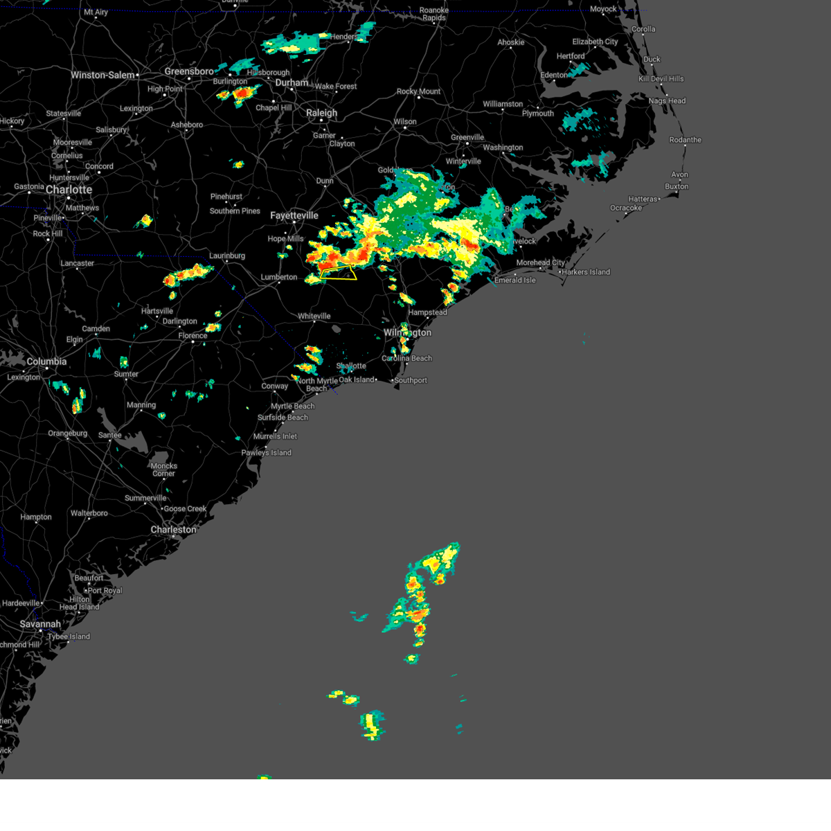 At 1252 pm edt, a severe thunderstorm was located near elizabethtown, moving east at 15 mph (radar indicated). Hazards include 70 mph wind gusts. Expect considerable tree damage. Damage is likely to mobile homes, roofs, and outbuildings. At 1252 pm edt, a severe thunderstorm was located near elizabethtown, moving east at 15 mph (radar indicated). Hazards include 70 mph wind gusts. Expect considerable tree damage. Damage is likely to mobile homes, roofs, and outbuildings.
|
| 7/9/2023 3:08 PM EDT |
 At 307 pm edt, severe thunderstorms were located along a line extending from near ammon to near bladenboro, moving east at 45 mph (radar indicated). Hazards include 60 mph wind gusts. expect wind damage to trees and power lines At 307 pm edt, severe thunderstorms were located along a line extending from near ammon to near bladenboro, moving east at 45 mph (radar indicated). Hazards include 60 mph wind gusts. expect wind damage to trees and power lines
|
| 7/7/2023 7:15 PM EDT |
 At 714 pm edt, a severe thunderstorm was located over lisbon, or 10 miles southeast of elizabethtown, moving southeast at 15 mph (radar indicated). Hazards include 60 mph wind gusts and quarter size hail. Minor hail damage to vehicles is possible. Expect wind damage to trees and power lines. At 714 pm edt, a severe thunderstorm was located over lisbon, or 10 miles southeast of elizabethtown, moving southeast at 15 mph (radar indicated). Hazards include 60 mph wind gusts and quarter size hail. Minor hail damage to vehicles is possible. Expect wind damage to trees and power lines.
|
| 7/3/2023 2:51 PM EDT |
 At 250 pm edt, a severe thunderstorm was located over elkton, or 8 miles south of elizabethtown, moving to the east, northeast at 25 mph (radar indicated). Hazards include 60 mph wind gusts. expect wind damage to trees and power lines At 250 pm edt, a severe thunderstorm was located over elkton, or 8 miles south of elizabethtown, moving to the east, northeast at 25 mph (radar indicated). Hazards include 60 mph wind gusts. expect wind damage to trees and power lines
|
| 11/11/2022 7:25 AM EST |
 At 725 am est, a severe thunderstorm capable of producing a tornado was located near southeastern community college, or 7 miles northwest of whiteville, moving north at 30 mph (radar indicated rotation). Hazards include tornado. Expect damage to mobile homes, roofs, and vehicles. this dangerous storm will be near, abbottsburg around 740 am est. bladenboro and butters around 745 am est. elizabethtown and bladen community college around 800 am est. Other locations impacted by this tornadic thunderstorm include tar heel, dublin, clarkton, columbus regional healthcare system, bladen county hospital, white lake and brunswick. At 725 am est, a severe thunderstorm capable of producing a tornado was located near southeastern community college, or 7 miles northwest of whiteville, moving north at 30 mph (radar indicated rotation). Hazards include tornado. Expect damage to mobile homes, roofs, and vehicles. this dangerous storm will be near, abbottsburg around 740 am est. bladenboro and butters around 745 am est. elizabethtown and bladen community college around 800 am est. Other locations impacted by this tornadic thunderstorm include tar heel, dublin, clarkton, columbus regional healthcare system, bladen county hospital, white lake and brunswick.
|
| 6/17/2022 8:46 PM EDT |
 At 845 pm edt, severe thunderstorms were located along a line extending from near penderlea to near redbug to near gresham, moving southeast at 45 mph (radar indicated). Hazards include 60 mph wind gusts. expect wind damage to trees and power lines At 845 pm edt, severe thunderstorms were located along a line extending from near penderlea to near redbug to near gresham, moving southeast at 45 mph (radar indicated). Hazards include 60 mph wind gusts. expect wind damage to trees and power lines
|
| 6/17/2022 8:18 PM EDT |
 At 818 pm edt, severe thunderstorms were located along a line extending from 6 miles east of ammon to 6 miles southwest of fairmont, moving southeast at 40 mph (radar indicated). Hazards include 60 mph wind gusts. Expect wind damage to trees and power lines. locations impacted include, lumberton, dillon, elizabethtown, fairmont, bladenboro, rowland, lake view, hamer, bladen community college, ammon, butters, south of the border, hestertown, robeson community college, white oak, elrod, smiths, howellsville, tolarsville and duart. hail threat, radar indicated max hail size, <. 75 in wind threat, radar indicated max wind gust, 60 mph. At 818 pm edt, severe thunderstorms were located along a line extending from 6 miles east of ammon to 6 miles southwest of fairmont, moving southeast at 40 mph (radar indicated). Hazards include 60 mph wind gusts. Expect wind damage to trees and power lines. locations impacted include, lumberton, dillon, elizabethtown, fairmont, bladenboro, rowland, lake view, hamer, bladen community college, ammon, butters, south of the border, hestertown, robeson community college, white oak, elrod, smiths, howellsville, tolarsville and duart. hail threat, radar indicated max hail size, <. 75 in wind threat, radar indicated max wind gust, 60 mph.
|
| 6/17/2022 8:15 PM EDT |
 At 814 pm edt, severe thunderstorms were located along a line extending from 9 miles northwest of harrells to near claussen, moving southeast at 35 mph (radar indicated). Hazards include 60 mph wind gusts. expect wind damage to trees and power lines At 814 pm edt, severe thunderstorms were located along a line extending from 9 miles northwest of harrells to near claussen, moving southeast at 35 mph (radar indicated). Hazards include 60 mph wind gusts. expect wind damage to trees and power lines
|
| 6/17/2022 8:01 PM EDT |
 At 801 pm edt, a severe thunderstorm capable of producing a tornado was located over smiths, or 9 miles northeast of lumberton, moving southeast at 25 mph (radar indicated rotation). Hazards include tornado. Flying debris will be dangerous to those caught without shelter. mobile homes will be damaged or destroyed. damage to roofs, windows, and vehicles will occur. tree damage is likely. this dangerous storm will be near, bladen community college and butters around 815 pm edt. bladenboro around 825 pm edt. elizabethtown and abbottsburg around 830 pm edt. Other locations impacted by this tornadic thunderstorm include dublin, bladen county hospital and tar heel. At 801 pm edt, a severe thunderstorm capable of producing a tornado was located over smiths, or 9 miles northeast of lumberton, moving southeast at 25 mph (radar indicated rotation). Hazards include tornado. Flying debris will be dangerous to those caught without shelter. mobile homes will be damaged or destroyed. damage to roofs, windows, and vehicles will occur. tree damage is likely. this dangerous storm will be near, bladen community college and butters around 815 pm edt. bladenboro around 825 pm edt. elizabethtown and abbottsburg around 830 pm edt. Other locations impacted by this tornadic thunderstorm include dublin, bladen county hospital and tar heel.
|
| 6/17/2022 7:24 PM EDT |
 At 724 pm edt, severe thunderstorms were located along a line extending from near fayetteville to 8 miles northeast of chavistown, moving southeast at 40 mph (radar indicated). Hazards include 60 mph wind gusts. expect wind damage to trees and power lines At 724 pm edt, severe thunderstorms were located along a line extending from near fayetteville to 8 miles northeast of chavistown, moving southeast at 40 mph (radar indicated). Hazards include 60 mph wind gusts. expect wind damage to trees and power lines
|
| 6/16/2022 3:09 PM EDT |
 At 309 pm edt, severe thunderstorms were located along a line extending from near whiteville to council to near rowan, moving south at 25 mph (radar indicated). Hazards include 60 mph wind gusts and quarter size hail. Minor hail damage to vehicles is possible. expect wind damage to trees and power lines. locations impacted include, whiteville, rowan, lake waccamaw, sandyfield, carvers, hallsboro, abbottsburg, lisbon, redbug, lagoon, elkton, emerson, council, kelly, freeman, delco, riegelwood, brunswick, clarkton and bolton. hail threat, radar indicated max hail size, 1. 00 in wind threat, radar indicated max wind gust, 60 mph. At 309 pm edt, severe thunderstorms were located along a line extending from near whiteville to council to near rowan, moving south at 25 mph (radar indicated). Hazards include 60 mph wind gusts and quarter size hail. Minor hail damage to vehicles is possible. expect wind damage to trees and power lines. locations impacted include, whiteville, rowan, lake waccamaw, sandyfield, carvers, hallsboro, abbottsburg, lisbon, redbug, lagoon, elkton, emerson, council, kelly, freeman, delco, riegelwood, brunswick, clarkton and bolton. hail threat, radar indicated max hail size, 1. 00 in wind threat, radar indicated max wind gust, 60 mph.
|
| 6/16/2022 2:59 PM EDT |
 At 259 pm edt, severe thunderstorms were located along a line extending from near abbottsburg to near rowan, moving south at 25 mph (radar indicated). Hazards include quarter size hail. minor damage to vehicles is possible At 259 pm edt, severe thunderstorms were located along a line extending from near abbottsburg to near rowan, moving south at 25 mph (radar indicated). Hazards include quarter size hail. minor damage to vehicles is possible
|
| 6/16/2022 2:35 PM EDT |
 At 235 pm edt, severe thunderstorms were located along a line extending from near elizabethtown to near harrells, moving south at 15 mph (radar indicated). Hazards include quarter size hail. minor damage to vehicles is possible At 235 pm edt, severe thunderstorms were located along a line extending from near elizabethtown to near harrells, moving south at 15 mph (radar indicated). Hazards include quarter size hail. minor damage to vehicles is possible
|
| 5/16/2022 8:30 PM EDT |
 At 830 pm edt, severe thunderstorms were located along a line extending from abbottsburg to 6 miles southwest of fair bluff, moving east at 25 mph (radar indicated). Hazards include 60 mph wind gusts. Expect wind damage to trees and power lines. locations impacted include, whiteville, elizabethtown, chadbourn, bladenboro, fair bluff, bladen community college, abbottsburg, lisbon, cherry grove, sidney, elkton, emerson, southeastern community college, clarendon, williams, evergreen, brunswick, clarkton, white lake and cerro gordo. hail threat, radar indicated max hail size, <. 75 in wind threat, radar indicated max wind gust, 60 mph. At 830 pm edt, severe thunderstorms were located along a line extending from abbottsburg to 6 miles southwest of fair bluff, moving east at 25 mph (radar indicated). Hazards include 60 mph wind gusts. Expect wind damage to trees and power lines. locations impacted include, whiteville, elizabethtown, chadbourn, bladenboro, fair bluff, bladen community college, abbottsburg, lisbon, cherry grove, sidney, elkton, emerson, southeastern community college, clarendon, williams, evergreen, brunswick, clarkton, white lake and cerro gordo. hail threat, radar indicated max hail size, <. 75 in wind threat, radar indicated max wind gust, 60 mph.
|
| 5/16/2022 8:15 PM EDT |
 At 815 pm edt, severe thunderstorms were located along a line extending from near butters to fair bluff, moving east at 30 mph (radar indicated). Hazards include 60 mph wind gusts. expect wind damage to trees and power lines At 815 pm edt, severe thunderstorms were located along a line extending from near butters to fair bluff, moving east at 30 mph (radar indicated). Hazards include 60 mph wind gusts. expect wind damage to trees and power lines
|
| 5/6/2022 7:50 PM EDT |
 At 750 pm edt, a severe thunderstorm was located near elizabethtown, moving northeast at 50 mph (radar indicated). Hazards include 60 mph wind gusts and quarter size hail. Minor hail damage to vehicles is possible. Expect wind damage to trees and power lines. At 750 pm edt, a severe thunderstorm was located near elizabethtown, moving northeast at 50 mph (radar indicated). Hazards include 60 mph wind gusts and quarter size hail. Minor hail damage to vehicles is possible. Expect wind damage to trees and power lines.
|
| 4/26/2022 5:40 PM EDT |
 At 540 pm edt, a severe thunderstorm was located over whiteville, moving northeast at 35 mph (radar indicated). Hazards include 60 mph wind gusts and quarter size hail. Minor hail damage to vehicles is possible. Expect wind damage to trees and power lines. At 540 pm edt, a severe thunderstorm was located over whiteville, moving northeast at 35 mph (radar indicated). Hazards include 60 mph wind gusts and quarter size hail. Minor hail damage to vehicles is possible. Expect wind damage to trees and power lines.
|
| 1/3/2022 6:50 AM EST |
 At 649 am est, severe thunderstorms were located along a line extending from rex to nixonville, moving east at 50 mph (radar indicated). Hazards include 60 mph wind gusts. expect wind damage to trees and power lines At 649 am est, severe thunderstorms were located along a line extending from rex to nixonville, moving east at 50 mph (radar indicated). Hazards include 60 mph wind gusts. expect wind damage to trees and power lines
|
| 8/1/2021 4:51 PM EDT |
 At 451 pm edt, a severe thunderstorm was located near bladenboro, or 11 miles northwest of whiteville, moving east at 55 mph (radar indicated). Hazards include 60 mph wind gusts and penny size hail. expect wind damage to trees and power lines At 451 pm edt, a severe thunderstorm was located near bladenboro, or 11 miles northwest of whiteville, moving east at 55 mph (radar indicated). Hazards include 60 mph wind gusts and penny size hail. expect wind damage to trees and power lines
|
| 5/7/2021 9:10 AM EDT | Quarter sized hail reported 6.6 miles WSW of Elizabethtown, NC |
| 5/7/2021 9:00 AM EDT | Hen Egg sized hail reported 0.2 miles WNW of Elizabethtown, NC, picture shared by broadcast media of hen egg sized hail in elizabethtown |
| 5/7/2021 8:58 AM EDT |
 At 858 am edt, a severe thunderstorm was located near elizabethtown, moving east at 20 mph (radar indicated). Hazards include quarter size hail. Minor damage to vehicles is possible. Locations impacted include, elizabethtown, lagoon, white lake and bladen county hospital. At 858 am edt, a severe thunderstorm was located near elizabethtown, moving east at 20 mph (radar indicated). Hazards include quarter size hail. Minor damage to vehicles is possible. Locations impacted include, elizabethtown, lagoon, white lake and bladen county hospital.
|
| 5/7/2021 8:51 AM EDT | Quarter sized hail reported 0.2 miles WNW of Elizabethtown, NC, several quarter sized hail stones... but mostly pea sized to half inch sized hail. |
| 5/7/2021 8:50 AM EDT | Golf Ball sized hail reported 0.2 miles WNW of Elizabethtown, NC, pictures relayed via twitter. |
| 5/7/2021 8:47 AM EDT |
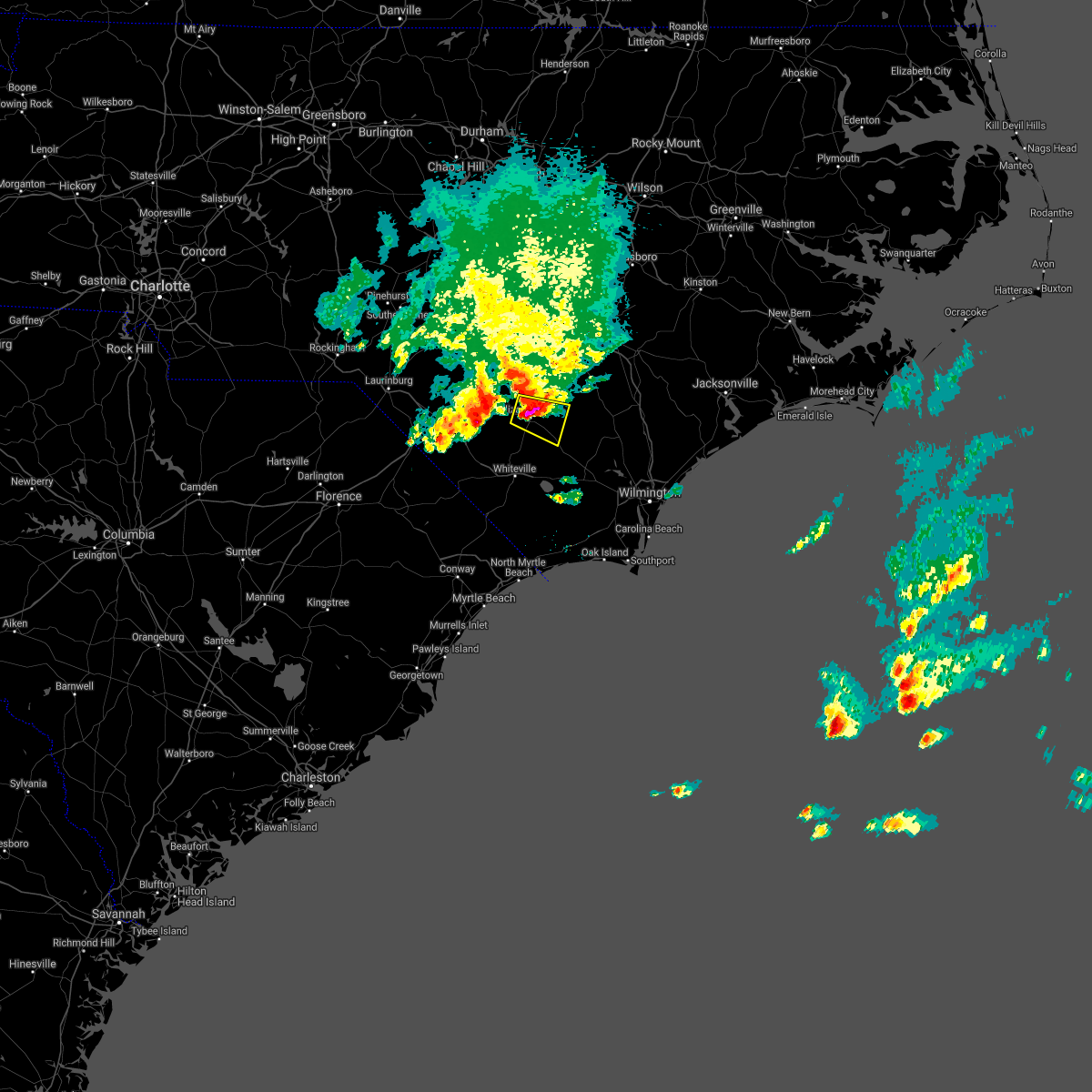 At 847 am edt, a severe thunderstorm was located over elizabethtown, moving east at 15 mph (radar indicated). Hazards include quarter size hail. minor damage to vehicles is possible At 847 am edt, a severe thunderstorm was located over elizabethtown, moving east at 15 mph (radar indicated). Hazards include quarter size hail. minor damage to vehicles is possible
|
| 12/24/2020 3:55 PM EST |
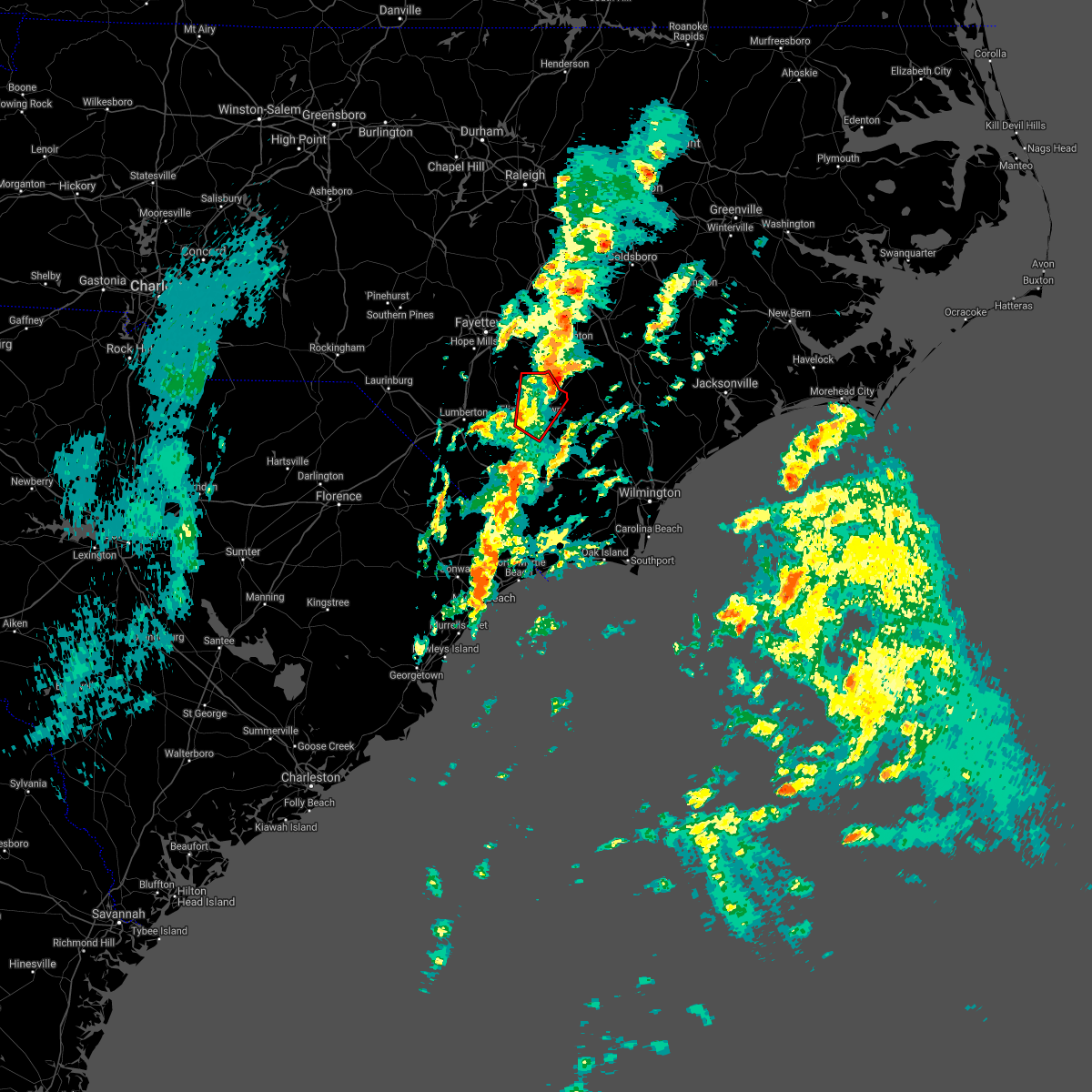 The tornado warning for north central bladen county will expire at 400 pm est, the storm which prompted the warning has moved out of the area. therefore, the warning will be allowed to expire. however gusty winds are still possible with this thunderstorm. a tornado watch remains in effect until 1000 pm est for southeastern north carolina. The tornado warning for north central bladen county will expire at 400 pm est, the storm which prompted the warning has moved out of the area. therefore, the warning will be allowed to expire. however gusty winds are still possible with this thunderstorm. a tornado watch remains in effect until 1000 pm est for southeastern north carolina.
|
| 12/24/2020 3:45 PM EST |
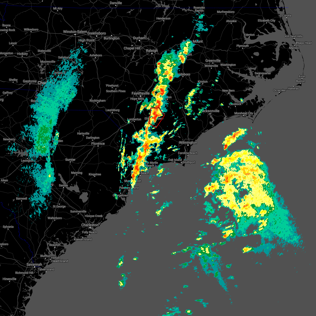 At 345 pm est, a severe thunderstorm capable of producing a tornado was located near elizabethtown, moving northeast at 45 mph (weather spotters reported a funnel cloud). Hazards include tornado. Expect damage to mobile homes, roofs, and vehicles. This tornadic thunderstorm will remain over mainly rural areas of north central bladen county, including the following locations, white lake and bladen county hospital. At 345 pm est, a severe thunderstorm capable of producing a tornado was located near elizabethtown, moving northeast at 45 mph (weather spotters reported a funnel cloud). Hazards include tornado. Expect damage to mobile homes, roofs, and vehicles. This tornadic thunderstorm will remain over mainly rural areas of north central bladen county, including the following locations, white lake and bladen county hospital.
|
| 12/24/2020 3:34 PM EST |
 At 333 pm est, a severe thunderstorm capable of producing a tornado was located over elizabethtown, moving northeast at 40 mph (radar indicated rotation). Hazards include tornado. Expect damage to mobile homes, roofs, and vehicles. this dangerous storm will be near, ruskin around 340 pm est. ammon around 350 pm est. Other locations impacted by this tornadic thunderstorm include clarkton, white lake and bladen county hospital. At 333 pm est, a severe thunderstorm capable of producing a tornado was located over elizabethtown, moving northeast at 40 mph (radar indicated rotation). Hazards include tornado. Expect damage to mobile homes, roofs, and vehicles. this dangerous storm will be near, ruskin around 340 pm est. ammon around 350 pm est. Other locations impacted by this tornadic thunderstorm include clarkton, white lake and bladen county hospital.
|
| 12/24/2020 3:23 PM EST |
 At 321 pm est, a severe thunderstorm capable of producing a tornado was located over abbottsburg, or 9 miles southwest of elizabethtown, moving northeast at 40 mph. at 313 pm est, trained spotters reported a funnel cloud on us-701 west of whiteville, but no tornado was visible at the time (radar indicated rotation). Hazards include tornado. Expect damage to mobile homes, roofs, and vehicles. this dangerous storm will be near, elizabethtown and bladen community college around 335 pm est. ruskin around 340 pm est. white oak around 345 pm est. ammon around 355 pm est. other locations impacted by this tornadic thunderstorm include dublin, clarkton, white lake and bladen county hospital. This includes us route 74 near mile marker 382, and between mile markers 391 and 392. At 321 pm est, a severe thunderstorm capable of producing a tornado was located over abbottsburg, or 9 miles southwest of elizabethtown, moving northeast at 40 mph. at 313 pm est, trained spotters reported a funnel cloud on us-701 west of whiteville, but no tornado was visible at the time (radar indicated rotation). Hazards include tornado. Expect damage to mobile homes, roofs, and vehicles. this dangerous storm will be near, elizabethtown and bladen community college around 335 pm est. ruskin around 340 pm est. white oak around 345 pm est. ammon around 355 pm est. other locations impacted by this tornadic thunderstorm include dublin, clarkton, white lake and bladen county hospital. This includes us route 74 near mile marker 382, and between mile markers 391 and 392.
|
| 12/24/2020 2:36 PM EST |
 The national weather service in wilmington has issued a * tornado warning for. north central bladen county in southeastern north carolina. until 300 pm est. At 236 pm est, a severe thunderstorm capable of producing a tornado was located near elizabethtown, moving north at 35 mph. The national weather service in wilmington has issued a * tornado warning for. north central bladen county in southeastern north carolina. until 300 pm est. At 236 pm est, a severe thunderstorm capable of producing a tornado was located near elizabethtown, moving north at 35 mph.
|
| 12/24/2020 1:38 PM EST |
 The tornado warning for central bladen county will expire at 145 pm est, the storm which prompted the warning has weakened below severe limits, and no longer appears capable of producing a tornado. therefore, the warning will be allowed to expire. however gusty winds are still possible with this thunderstorm. The tornado warning for central bladen county will expire at 145 pm est, the storm which prompted the warning has weakened below severe limits, and no longer appears capable of producing a tornado. therefore, the warning will be allowed to expire. however gusty winds are still possible with this thunderstorm.
|
| 12/24/2020 1:28 PM EST |
 At 128 pm est, a severe thunderstorm capable of producing a tornado was located near abbottsburg, or 8 miles southwest of elizabethtown, moving north at 40 mph (radar indicated rotation). Hazards include tornado. Expect damage to mobile homes, roofs, and vehicles. this dangerous storm will be near, bladen community college around 140 pm est. elizabethtown around 145 pm est. ruskin around 150 pm est. white oak around 155 pm est. Other locations impacted by this tornadic thunderstorm include dublin, clarkton, white lake and bladen county hospital. At 128 pm est, a severe thunderstorm capable of producing a tornado was located near abbottsburg, or 8 miles southwest of elizabethtown, moving north at 40 mph (radar indicated rotation). Hazards include tornado. Expect damage to mobile homes, roofs, and vehicles. this dangerous storm will be near, bladen community college around 140 pm est. elizabethtown around 145 pm est. ruskin around 150 pm est. white oak around 155 pm est. Other locations impacted by this tornadic thunderstorm include dublin, clarkton, white lake and bladen county hospital.
|
| 12/24/2020 1:16 PM EST |
 At 116 pm est, a severe thunderstorm capable of producing a tornado was located near whiteville, moving north at 40 mph (radar indicated rotation). Hazards include tornado. Expect damage to mobile homes, roofs, and vehicles. this dangerous storm will be near, elkton and emerson around 125 pm est. bladenboro, abbottsburg and lisbon around 130 pm est. bladen community college around 140 pm est. elizabethtown and ruskin around 145 pm est. other locations impacted by this tornadic thunderstorm include dublin, clarkton, white lake, bladen county hospital, columbus regional healthcare system and brunswick. This includes us route 74 between mile markers 386 and 398. At 116 pm est, a severe thunderstorm capable of producing a tornado was located near whiteville, moving north at 40 mph (radar indicated rotation). Hazards include tornado. Expect damage to mobile homes, roofs, and vehicles. this dangerous storm will be near, elkton and emerson around 125 pm est. bladenboro, abbottsburg and lisbon around 130 pm est. bladen community college around 140 pm est. elizabethtown and ruskin around 145 pm est. other locations impacted by this tornadic thunderstorm include dublin, clarkton, white lake, bladen county hospital, columbus regional healthcare system and brunswick. This includes us route 74 between mile markers 386 and 398.
|
| 12/24/2020 12:34 PM EST |
 At 1234 pm est, a severe thunderstorm capable of producing a tornado was located over bladen community college, or 7 miles west of elizabethtown, moving north at 45 mph (radar indicated rotation). Hazards include tornado. Expect damage to mobile homes, roofs, and vehicles. This tornadic thunderstorm will remain over mainly rural areas of southwestern bladen county, including the following locations, dublin, bladen county hospital and clarkton. At 1234 pm est, a severe thunderstorm capable of producing a tornado was located over bladen community college, or 7 miles west of elizabethtown, moving north at 45 mph (radar indicated rotation). Hazards include tornado. Expect damage to mobile homes, roofs, and vehicles. This tornadic thunderstorm will remain over mainly rural areas of southwestern bladen county, including the following locations, dublin, bladen county hospital and clarkton.
|
| 12/24/2020 12:23 PM EST |
 At 1222 pm est, a severe thunderstorm capable of producing a tornado was located near bladenboro, or 11 miles northwest of whiteville, moving north at 45 mph (radar indicated rotation). Hazards include tornado. Expect damage to mobile homes, roofs, and vehicles. this dangerous storm will be near, elizabethtown and bladen community college around 1240 pm est. Other locations impacted by this tornadic thunderstorm include dublin, clarkton and bladen county hospital. At 1222 pm est, a severe thunderstorm capable of producing a tornado was located near bladenboro, or 11 miles northwest of whiteville, moving north at 45 mph (radar indicated rotation). Hazards include tornado. Expect damage to mobile homes, roofs, and vehicles. this dangerous storm will be near, elizabethtown and bladen community college around 1240 pm est. Other locations impacted by this tornadic thunderstorm include dublin, clarkton and bladen county hospital.
|
| 12/24/2020 12:12 PM EST |
 At 1212 pm est, a severe thunderstorm capable of producing a tornado was located near chadbourn, or 8 miles west of whiteville, moving north at 45 mph (radar indicated rotation). Hazards include tornado. Expect damage to mobile homes, roofs, and vehicles. this dangerous storm will be near, bladenboro, abbottsburg and butters around 1230 pm est. elizabethtown and bladen community college around 1240 pm est. other locations impacted by this tornadic thunderstorm include dublin, clarkton and bladen county hospital. This includes us route 74 between mile markers 380 and 391. At 1212 pm est, a severe thunderstorm capable of producing a tornado was located near chadbourn, or 8 miles west of whiteville, moving north at 45 mph (radar indicated rotation). Hazards include tornado. Expect damage to mobile homes, roofs, and vehicles. this dangerous storm will be near, bladenboro, abbottsburg and butters around 1230 pm est. elizabethtown and bladen community college around 1240 pm est. other locations impacted by this tornadic thunderstorm include dublin, clarkton and bladen county hospital. This includes us route 74 between mile markers 380 and 391.
|
| 5/22/2020 6:24 PM EDT |
 At 623 pm edt, severe thunderstorms were located along a line extending from near rex to near kemper, moving east at 50 mph (radar indicated). Hazards include 60 mph wind gusts. expect wind damage to trees and power lines At 623 pm edt, severe thunderstorms were located along a line extending from near rex to near kemper, moving east at 50 mph (radar indicated). Hazards include 60 mph wind gusts. expect wind damage to trees and power lines
|
| 5/5/2020 9:24 PM EDT |
 The severe thunderstorm warning for southeastern robeson, western bladen and northwestern columbus counties will expire at 930 pm edt, the storms which prompted the warning have weakened below severe limits, and no longer pose an immediate threat to life or property. therefore, the warning will be allowed to expire. however small hail and gusty winds are still possible with these thunderstorms. a severe thunderstorm watch remains in effect until 1100 pm edt for southeastern north carolina. a severe thunderstorm watch also remains in effect until 100 am edt for southeastern north carolina. The severe thunderstorm warning for southeastern robeson, western bladen and northwestern columbus counties will expire at 930 pm edt, the storms which prompted the warning have weakened below severe limits, and no longer pose an immediate threat to life or property. therefore, the warning will be allowed to expire. however small hail and gusty winds are still possible with these thunderstorms. a severe thunderstorm watch remains in effect until 1100 pm edt for southeastern north carolina. a severe thunderstorm watch also remains in effect until 100 am edt for southeastern north carolina.
|
| 5/5/2020 9:15 PM EDT |
 At 915 pm edt, severe thunderstorms were located along a line extending from near ruskin to near fair bluff, moving east at 40 mph (radar indicated). Hazards include 60 mph wind gusts and quarter size hail. Minor hail damage to vehicles is possible. expect wind damage to trees and power lines. locations impacted include, elizabethtown, fairmont, bladenboro, fair bluff, boardman, smiths, bladen community college, abbottsburg, butters, barnesville, ruskin, white oak, evergreen, clarkton, white lake, dublin, cerro gordo, marietta, proctorville and orrum. People attending bladen county hospital outdoor tent facilities may be affected by this storm and are urged to follow the precautionary measures of the onsite officials. At 915 pm edt, severe thunderstorms were located along a line extending from near ruskin to near fair bluff, moving east at 40 mph (radar indicated). Hazards include 60 mph wind gusts and quarter size hail. Minor hail damage to vehicles is possible. expect wind damage to trees and power lines. locations impacted include, elizabethtown, fairmont, bladenboro, fair bluff, boardman, smiths, bladen community college, abbottsburg, butters, barnesville, ruskin, white oak, evergreen, clarkton, white lake, dublin, cerro gordo, marietta, proctorville and orrum. People attending bladen county hospital outdoor tent facilities may be affected by this storm and are urged to follow the precautionary measures of the onsite officials.
|
| 5/5/2020 8:53 PM EDT |
 At 853 pm edt, severe thunderstorms were located along a line extending from duart to 6 miles northwest of kemper, moving east at 40 mph (radar indicated). Hazards include 60 mph wind gusts and quarter size hail. Minor hail damage to vehicles is possible. Expect wind damage to trees and power lines. At 853 pm edt, severe thunderstorms were located along a line extending from duart to 6 miles northwest of kemper, moving east at 40 mph (radar indicated). Hazards include 60 mph wind gusts and quarter size hail. Minor hail damage to vehicles is possible. Expect wind damage to trees and power lines.
|
| 4/13/2020 8:27 AM EDT |
 At 827 am edt, a severe thunderstorm was located near ammon, or 13 miles north of elizabethtown, moving northeast at 65 mph (radar indicated). Hazards include 70 mph wind gusts. Expect considerable tree damage. damage is likely to mobile homes, roofs, and outbuildings. locations impacted include, whiteville, elizabethtown, chadbourn, bladenboro, fair bluff, boardman, bladen community college, ammon, butters, southeastern community college, white oak, abbottsburg, lisbon, cherry grove, lagoon, elkton, emerson, ruskin, evergreen and clarkton. People attending bladen county hospital outdoor tent facilities should seek safe shelter immediately!. At 827 am edt, a severe thunderstorm was located near ammon, or 13 miles north of elizabethtown, moving northeast at 65 mph (radar indicated). Hazards include 70 mph wind gusts. Expect considerable tree damage. damage is likely to mobile homes, roofs, and outbuildings. locations impacted include, whiteville, elizabethtown, chadbourn, bladenboro, fair bluff, boardman, bladen community college, ammon, butters, southeastern community college, white oak, abbottsburg, lisbon, cherry grove, lagoon, elkton, emerson, ruskin, evergreen and clarkton. People attending bladen county hospital outdoor tent facilities should seek safe shelter immediately!.
|
| 4/13/2020 7:53 AM EDT |
 At 752 am edt, a severe thunderstorm was located near lumberton, moving northeast at 90 mph (radar indicated). Hazards include 70 mph wind gusts. Expect considerable tree damage. Damage is likely to mobile homes, roofs, and outbuildings. At 752 am edt, a severe thunderstorm was located near lumberton, moving northeast at 90 mph (radar indicated). Hazards include 70 mph wind gusts. Expect considerable tree damage. Damage is likely to mobile homes, roofs, and outbuildings.
|
| 1/12/2020 1:39 AM EST |
 At 138 am est, severe thunderstorms were located along a line extending from 11 miles north of ammon to near smiths, moving northeast at 40 mph (radar indicated). Hazards include 60 mph wind gusts. Expect wind damage to trees and power lines. Locations impacted include, tobermory, smiths, howellsville, ruskin, bladen community college, tolarsville, duart, ammon, white oak, jerome, dublin and tar heel. At 138 am est, severe thunderstorms were located along a line extending from 11 miles north of ammon to near smiths, moving northeast at 40 mph (radar indicated). Hazards include 60 mph wind gusts. Expect wind damage to trees and power lines. Locations impacted include, tobermory, smiths, howellsville, ruskin, bladen community college, tolarsville, duart, ammon, white oak, jerome, dublin and tar heel.
|
| 1/12/2020 1:20 AM EST |
 At 120 am est, severe thunderstorms were located along a line extending from near jerome to near fairmont, moving northeast at 40 mph (radar indicated). Hazards include 60 mph wind gusts. Expect wind damage to trees and power lines. locations impacted include, lumberton, elizabethtown, fairmont, st. Pauls, bladenboro, rex, bladen community college, ammon, butters, hestertown, robeson community college, white oak, smiths, howellsville, tolarsville, duart, tobermory, ruskin, barker ten mile and jerome. At 120 am est, severe thunderstorms were located along a line extending from near jerome to near fairmont, moving northeast at 40 mph (radar indicated). Hazards include 60 mph wind gusts. Expect wind damage to trees and power lines. locations impacted include, lumberton, elizabethtown, fairmont, st. Pauls, bladenboro, rex, bladen community college, ammon, butters, hestertown, robeson community college, white oak, smiths, howellsville, tolarsville, duart, tobermory, ruskin, barker ten mile and jerome.
|
| 1/12/2020 1:10 AM EST |
 At 109 am est, severe thunderstorms were located along a line extending from near tobermory to near fairmont, moving northeast at 40 mph (radar indicated). Hazards include 60 mph wind gusts. expect wind damage to trees and power lines At 109 am est, severe thunderstorms were located along a line extending from near tobermory to near fairmont, moving northeast at 40 mph (radar indicated). Hazards include 60 mph wind gusts. expect wind damage to trees and power lines
|
| 7/23/2019 6:08 PM EDT |
 The tornado warning for southwestern bladen county will expire at 615 pm edt. the storm which prompted the warning has weakened below severe limits, and no longer appears capable of producing a tornado. therefore, the warning will be allowed to expire. However gusty winds and heavy rain are still possible with this thunderstorm. The tornado warning for southwestern bladen county will expire at 615 pm edt. the storm which prompted the warning has weakened below severe limits, and no longer appears capable of producing a tornado. therefore, the warning will be allowed to expire. However gusty winds and heavy rain are still possible with this thunderstorm.
|
| 7/23/2019 5:59 PM EDT |
 At 559 pm edt, a severe thunderstorm capable of producing a tornado was located over abbottsburg, or 8 miles southwest of elizabethtown, moving northeast at 20 mph (radar indicated rotation). Hazards include tornado. Expect damage to mobile homes, roofs, and vehicles. this dangerous storm will be near, bladen community college around 615 pm edt. Other locations impacted by this tornadic thunderstorm include dublin and clarkton. At 559 pm edt, a severe thunderstorm capable of producing a tornado was located over abbottsburg, or 8 miles southwest of elizabethtown, moving northeast at 20 mph (radar indicated rotation). Hazards include tornado. Expect damage to mobile homes, roofs, and vehicles. this dangerous storm will be near, bladen community college around 615 pm edt. Other locations impacted by this tornadic thunderstorm include dublin and clarkton.
|
| 7/23/2019 5:43 PM EDT |
 The national weather service in wilmington has issued a * tornado warning for. southwestern bladen county in southeastern north carolina. until 615 pm edt. At 543 pm edt, a severe thunderstorm capable of producing a tornado was located near bladenboro, or 12 miles northwest of whiteville,. The national weather service in wilmington has issued a * tornado warning for. southwestern bladen county in southeastern north carolina. until 615 pm edt. At 543 pm edt, a severe thunderstorm capable of producing a tornado was located near bladenboro, or 12 miles northwest of whiteville,.
|
| 7/23/2019 5:40 PM EDT |
 The national weather service in wilmington has issued a * severe thunderstorm warning for. east central robeson county in southeastern north carolina. southwestern bladen county in southeastern north carolina. north central columbus county in southeastern north carolina. Until 615 pm edt. The national weather service in wilmington has issued a * severe thunderstorm warning for. east central robeson county in southeastern north carolina. southwestern bladen county in southeastern north carolina. north central columbus county in southeastern north carolina. Until 615 pm edt.
|
| 5/31/2019 3:49 PM EDT |
 At 330 pm edt, a severe thunderstorm was located near elizabethtown, moving east at 40 mph (radar indicated). Hazards include 60 mph wind gusts and quarter size hail. Minor hail damage to vehicles is possible. Expect wind damage to trees and powerlines. At 330 pm edt, a severe thunderstorm was located near elizabethtown, moving east at 40 mph (radar indicated). Hazards include 60 mph wind gusts and quarter size hail. Minor hail damage to vehicles is possible. Expect wind damage to trees and powerlines.
|
| 5/31/2019 3:30 PM EDT |
 At 330 pm edt, a severe thunderstorm was located near elizabethtown, moving east at 40 mph (radar indicated). Hazards include 60 mph wind gusts and quarter size hail. Minor hail damage to vehicles is possible. Expect wind damage to trees and powerlines. At 330 pm edt, a severe thunderstorm was located near elizabethtown, moving east at 40 mph (radar indicated). Hazards include 60 mph wind gusts and quarter size hail. Minor hail damage to vehicles is possible. Expect wind damage to trees and powerlines.
|
| 5/31/2019 3:26 PM EDT |
 At 326 pm edt, a severe thunderstorm was located 7 miles west of elizabethtown, moving east at 40 mph (radar indicated). Hazards include 60 mph wind gusts and quarter size hail. Minor hail damage to vehicles is possible. expect wind damage to trees and powerlines. Locations impacted include, bladen community college and smiths. At 326 pm edt, a severe thunderstorm was located 7 miles west of elizabethtown, moving east at 40 mph (radar indicated). Hazards include 60 mph wind gusts and quarter size hail. Minor hail damage to vehicles is possible. expect wind damage to trees and powerlines. Locations impacted include, bladen community college and smiths.
|
| 5/31/2019 3:10 PM EDT |
 At 310 pm edt, a severe thunderstorm was located 10 miles east of lumberton, moving east at 30 mph (radar indicated). Hazards include 60 mph wind gusts and quarter size hail. Minor hail damage to vehicles is possible. expect wind damage to trees and powerlines. Locations impacted include, lumberton, robeson community college, smiths, ruskin, howellsville, bladen community college, barker ten mile and white oak. At 310 pm edt, a severe thunderstorm was located 10 miles east of lumberton, moving east at 30 mph (radar indicated). Hazards include 60 mph wind gusts and quarter size hail. Minor hail damage to vehicles is possible. expect wind damage to trees and powerlines. Locations impacted include, lumberton, robeson community college, smiths, ruskin, howellsville, bladen community college, barker ten mile and white oak.
|
| 5/31/2019 2:53 PM EDT |
 At 253 pm edt, a severe thunderstorm was located over lumberton, moving east at 35 mph (radar indicated). Hazards include 60 mph wind gusts and quarter size hail. Minor hail damage to vehicles is possible. Expect wind damage to trees and powerlines. At 253 pm edt, a severe thunderstorm was located over lumberton, moving east at 35 mph (radar indicated). Hazards include 60 mph wind gusts and quarter size hail. Minor hail damage to vehicles is possible. Expect wind damage to trees and powerlines.
|
| 4/26/2019 5:51 PM EDT |
 The severe thunderstorm warning for northeastern bladen county will expire at 600 pm edt, the storm which prompted the warning has moved out of the area. therefore, the warning will be allowed to expire. The severe thunderstorm warning for northeastern bladen county will expire at 600 pm edt, the storm which prompted the warning has moved out of the area. therefore, the warning will be allowed to expire.
|
| 4/26/2019 5:31 PM EDT |
 At 531 pm edt, a severe thunderstorm was located near ammon, or 9 miles north of elizabethtown, moving east at 45 mph (radar indicated). Hazards include 60 mph wind gusts. Expect wind damage to trees and power lines. Locations impacted include, ruskin, ammon and white lake. At 531 pm edt, a severe thunderstorm was located near ammon, or 9 miles north of elizabethtown, moving east at 45 mph (radar indicated). Hazards include 60 mph wind gusts. Expect wind damage to trees and power lines. Locations impacted include, ruskin, ammon and white lake.
|
| 4/26/2019 5:16 PM EDT |
 At 515 pm edt, a severe thunderstorm was located over tolarsville, or 13 miles northeast of lumberton, moving east at 45 mph (radar indicated). Hazards include 60 mph wind gusts and quarter size hail. Minor hail damage to vehicles is possible. Expect wind damage to trees and power lines. At 515 pm edt, a severe thunderstorm was located over tolarsville, or 13 miles northeast of lumberton, moving east at 45 mph (radar indicated). Hazards include 60 mph wind gusts and quarter size hail. Minor hail damage to vehicles is possible. Expect wind damage to trees and power lines.
|
| 4/19/2019 5:12 PM EDT |
 At 512 pm edt, severe thunderstorms were located along a line extending from near ammon to supply, moving east at 50 mph (radar indicated). Hazards include 60 mph wind gusts. Expect wind damage to trees and power lines. locations impacted include, oak island, whiteville, shallotte, elizabethtown, holden beach, yaupon beach, rowan, st. James, bladenboro, lake waccamaw, northwest, sandyfield, makatoka, hallsboro, ammon, exum, white oak, carvers, lisbon and honey island. At 512 pm edt, severe thunderstorms were located along a line extending from near ammon to supply, moving east at 50 mph (radar indicated). Hazards include 60 mph wind gusts. Expect wind damage to trees and power lines. locations impacted include, oak island, whiteville, shallotte, elizabethtown, holden beach, yaupon beach, rowan, st. James, bladenboro, lake waccamaw, northwest, sandyfield, makatoka, hallsboro, ammon, exum, white oak, carvers, lisbon and honey island.
|
| 4/19/2019 4:57 PM EDT |
 At 457 pm edt, severe thunderstorms were located along a line extending from 6 miles northeast of jerome to near sunset beach, moving east at 45 mph (radar indicated). Hazards include 60 mph wind gusts. expect wind damage to trees and power lines At 457 pm edt, severe thunderstorms were located along a line extending from 6 miles northeast of jerome to near sunset beach, moving east at 45 mph (radar indicated). Hazards include 60 mph wind gusts. expect wind damage to trees and power lines
|
| 4/19/2019 4:49 PM EDT |
 At 449 pm edt, severe thunderstorms were located along a line extending from 10 miles southeast of pittsboro to 9 miles south of godwin, moving north at 75 mph (radar indicated). Hazards include 60 mph wind gusts. Expect wind damage to trees and power lines. Locations impacted include, elizabethtown, bladenboro, bladen community college, abbottsburg, duart, ammon, butters, tobermory, ruskin, white oak, jerome, clarkton, white lake, dublin, tar heel and bladen county hospital. At 449 pm edt, severe thunderstorms were located along a line extending from 10 miles southeast of pittsboro to 9 miles south of godwin, moving north at 75 mph (radar indicated). Hazards include 60 mph wind gusts. Expect wind damage to trees and power lines. Locations impacted include, elizabethtown, bladenboro, bladen community college, abbottsburg, duart, ammon, butters, tobermory, ruskin, white oak, jerome, clarkton, white lake, dublin, tar heel and bladen county hospital.
|
| 4/19/2019 4:13 PM EDT |
 At 412 pm edt, severe thunderstorms were located along a line extending from raeford to boardman, moving north at 75 mph (radar indicated). Hazards include 70 mph wind gusts. Expect considerable tree damage. Damage is likely to mobile homes, roofs, and outbuildings. At 412 pm edt, severe thunderstorms were located along a line extending from raeford to boardman, moving north at 75 mph (radar indicated). Hazards include 70 mph wind gusts. Expect considerable tree damage. Damage is likely to mobile homes, roofs, and outbuildings.
|
| 4/19/2019 11:36 AM EDT |
 The severe thunderstorm warning for southeastern bladen, central brunswick and northeastern columbus counties will expire at 1145 am edt, the storm which prompted the warning has weakened below severe limits, and has exited the warned area. therefore, the warning will be allowed to expire. however gusty winds are still possible with this thunderstorm. The severe thunderstorm warning for southeastern bladen, central brunswick and northeastern columbus counties will expire at 1145 am edt, the storm which prompted the warning has weakened below severe limits, and has exited the warned area. therefore, the warning will be allowed to expire. however gusty winds are still possible with this thunderstorm.
|
| 4/19/2019 11:08 AM EDT |
 At 1108 am edt, a severe thunderstorm was located over honey island, or 11 miles north of shallotte, moving northeast at 45 mph (radar indicated). Hazards include 70 mph wind gusts. Expect considerable tree damage. damage is likely to mobile homes, roofs, and outbuildings. Locations impacted include, shallotte, elizabethtown, lake waccamaw, northwest, sandyfield, makatoka, hallsboro, redbug, exum, council, phoenix, riegelwood, carvers, lisbon, honey island, lagoon, elkton, emerson, kelly and batarora. At 1108 am edt, a severe thunderstorm was located over honey island, or 11 miles north of shallotte, moving northeast at 45 mph (radar indicated). Hazards include 70 mph wind gusts. Expect considerable tree damage. damage is likely to mobile homes, roofs, and outbuildings. Locations impacted include, shallotte, elizabethtown, lake waccamaw, northwest, sandyfield, makatoka, hallsboro, redbug, exum, council, phoenix, riegelwood, carvers, lisbon, honey island, lagoon, elkton, emerson, kelly and batarora.
|
| 4/19/2019 10:55 AM EDT |
 At 1054 am edt, a severe thunderstorm was located near longwood, or near shallotte, moving northeast at 45 mph (radar indicated). Hazards include 60 mph wind gusts. expect wind damage to trees and power lines At 1054 am edt, a severe thunderstorm was located near longwood, or near shallotte, moving northeast at 45 mph (radar indicated). Hazards include 60 mph wind gusts. expect wind damage to trees and power lines
|
| 12/28/2018 5:09 PM EST |
 At 509 pm est, potentially severe thunderstorms were located along a line extending from 9 miles southwest of clinton to 6 miles north of whiteville, moving northeast at 45 mph (radar indicated). Hazards include 60 mph wind gusts. Expect wind damage to trees and power lines. locations impacted include, whiteville, elizabethtown, rowan, carvers, lisbon, abbottsburg, ammon, lagoon, elkton, emerson, council, southeastern community college, kelly, clarkton, white lake. This includes us route 74 between mile markers 387 and 395. At 509 pm est, potentially severe thunderstorms were located along a line extending from 9 miles southwest of clinton to 6 miles north of whiteville, moving northeast at 45 mph (radar indicated). Hazards include 60 mph wind gusts. Expect wind damage to trees and power lines. locations impacted include, whiteville, elizabethtown, rowan, carvers, lisbon, abbottsburg, ammon, lagoon, elkton, emerson, council, southeastern community college, kelly, clarkton, white lake. This includes us route 74 between mile markers 387 and 395.
|
| 12/28/2018 4:56 PM EST |
 At 455 pm est, severe thunderstorms were located along a line extending from near jerome to near evergreen, moving northeast at 45 mph (radar indicated). Hazards include 60 mph wind gusts. Expect wind damage to trees and power lines. locations impacted include, whiteville, elizabethtown, rowan, chadbourn, bladenboro, bladen community college, ammon, butters, council, white oak, carvers, lisbon, abbottsburg, lagoon, elkton, emerson, kelly, ruskin and evergreen. This includes us route 74 between mile markers 378 and 395. At 455 pm est, severe thunderstorms were located along a line extending from near jerome to near evergreen, moving northeast at 45 mph (radar indicated). Hazards include 60 mph wind gusts. Expect wind damage to trees and power lines. locations impacted include, whiteville, elizabethtown, rowan, chadbourn, bladenboro, bladen community college, ammon, butters, council, white oak, carvers, lisbon, abbottsburg, lagoon, elkton, emerson, kelly, ruskin and evergreen. This includes us route 74 between mile markers 378 and 395.
|
| 12/28/2018 4:43 PM EST |
 At 443 pm est, severe thunderstorms were located along a line extending from near duart to fair bluff, moving northeast at 45 mph (radar indicated). Hazards include 60 mph wind gusts. expect wind damage to trees and power lines At 443 pm est, severe thunderstorms were located along a line extending from near duart to fair bluff, moving northeast at 45 mph (radar indicated). Hazards include 60 mph wind gusts. expect wind damage to trees and power lines
|
| 9/17/2018 3:41 AM EDT |
 The tornado warning for southwestern bladen county will expire at 345 am edt, the storm which prompted the warning has weakened below severe limits, and no longer appears capable of producing a tornado. therefore, the warning will be allowed to expire. a tornado watch remains in effect until 500 am edt for southeastern north carolina. The tornado warning for southwestern bladen county will expire at 345 am edt, the storm which prompted the warning has weakened below severe limits, and no longer appears capable of producing a tornado. therefore, the warning will be allowed to expire. a tornado watch remains in effect until 500 am edt for southeastern north carolina.
|
| 9/17/2018 3:31 AM EDT |
 At 323 am edt, a severe thunderstorm capable of producing a tornado was located over elkton, or 9 miles south of elizabethtown, moving north at 30 mph (radar indicated rotation). Hazards include tornado. Flying debris will be dangerous to those caught without shelter. mobile homes will be damaged or destroyed. damage to roofs, windows, and vehicles will occur. tree damage is likely. Locations impacted include, elkton, lisbon and clarkton. At 323 am edt, a severe thunderstorm capable of producing a tornado was located over elkton, or 9 miles south of elizabethtown, moving north at 30 mph (radar indicated rotation). Hazards include tornado. Flying debris will be dangerous to those caught without shelter. mobile homes will be damaged or destroyed. damage to roofs, windows, and vehicles will occur. tree damage is likely. Locations impacted include, elkton, lisbon and clarkton.
|
| 9/17/2018 3:23 AM EDT |
 At 323 am edt, a severe thunderstorm capable of producing a tornado was located over elkton, or 9 miles south of elizabethtown, moving north at 30 mph (radar indicated rotation). Hazards include tornado. Flying debris will be dangerous to those caught without shelter. mobile homes will be damaged or destroyed. damage to roofs, windows, and vehicles will occur. tree damage is likely. Locations impacted include, elkton, lisbon and clarkton. At 323 am edt, a severe thunderstorm capable of producing a tornado was located over elkton, or 9 miles south of elizabethtown, moving north at 30 mph (radar indicated rotation). Hazards include tornado. Flying debris will be dangerous to those caught without shelter. mobile homes will be damaged or destroyed. damage to roofs, windows, and vehicles will occur. tree damage is likely. Locations impacted include, elkton, lisbon and clarkton.
|
| 9/17/2018 3:14 AM EDT |
 At 314 am edt, a severe thunderstorm capable of producing a tornado was located near elkton, or 7 miles northeast of whiteville, moving north at 30 mph (radar indicated rotation). Hazards include tornado. Flying debris will be dangerous to those caught without shelter. mobile homes will be damaged or destroyed. damage to roofs, windows, and vehicles will occur. Tree damage is likely. At 314 am edt, a severe thunderstorm capable of producing a tornado was located near elkton, or 7 miles northeast of whiteville, moving north at 30 mph (radar indicated rotation). Hazards include tornado. Flying debris will be dangerous to those caught without shelter. mobile homes will be damaged or destroyed. damage to roofs, windows, and vehicles will occur. Tree damage is likely.
|
| 9/16/2018 11:45 PM EDT |
 At 1144 pm edt, a severe thunderstorm was located near elizabethtown, moving north at 35 mph (radar indicated). Hazards include 60 mph wind gusts. expect wind damage to trees and power lines At 1144 pm edt, a severe thunderstorm was located near elizabethtown, moving north at 35 mph (radar indicated). Hazards include 60 mph wind gusts. expect wind damage to trees and power lines
|
| 9/16/2018 10:55 PM EDT |
 At 1055 pm edt, a severe thunderstorm was located near williams, or near whiteville, moving northeast at 30 mph (radar indicated). Hazards include 60 mph wind gusts. expect wind damage to trees and power lines At 1055 pm edt, a severe thunderstorm was located near williams, or near whiteville, moving northeast at 30 mph (radar indicated). Hazards include 60 mph wind gusts. expect wind damage to trees and power lines
|
| 6/25/2018 6:13 PM EDT |
 At 613 pm edt, a severe thunderstorm was located near elizabethtown, moving south at 10 mph (radar indicated). Hazards include 60 mph wind gusts and quarter size hail. Minor hail damage to vehicles is possible. Expect wind damage to trees and power lines. At 613 pm edt, a severe thunderstorm was located near elizabethtown, moving south at 10 mph (radar indicated). Hazards include 60 mph wind gusts and quarter size hail. Minor hail damage to vehicles is possible. Expect wind damage to trees and power lines.
|
| 6/24/2018 10:29 PM EDT |
 At 1028 pm edt, severe thunderstorms extending from 7 miles northeast of rowan to near kelly to elkton, moving southeast at 30 mph (radar indicated). Hazards include 60 mph wind gusts. Expect damage to trees and power lines. locations impacted include, rowan, lake waccamaw, carvers, lisbon, lagoon, elkton, emerson, council, kelly, clarkton, white lake, bolton, east arcadia and atkinson. This includes us route 74 between mile markers 403 and 410. At 1028 pm edt, severe thunderstorms extending from 7 miles northeast of rowan to near kelly to elkton, moving southeast at 30 mph (radar indicated). Hazards include 60 mph wind gusts. Expect damage to trees and power lines. locations impacted include, rowan, lake waccamaw, carvers, lisbon, lagoon, elkton, emerson, council, kelly, clarkton, white lake, bolton, east arcadia and atkinson. This includes us route 74 between mile markers 403 and 410.
|
| 6/24/2018 9:57 PM EDT |
 At 957 pm edt, a severe thunderstorm was located over elizabethtown, moving southeast at 20 mph (radar indicated). Hazards include 60 mph wind gusts. expect damage to trees and power lines At 957 pm edt, a severe thunderstorm was located over elizabethtown, moving southeast at 20 mph (radar indicated). Hazards include 60 mph wind gusts. expect damage to trees and power lines
|
| 3/1/2018 5:57 PM EST |
 The severe thunderstorm warning for western bladen. southeastern robeson. western columbus and northwestern horry counties will expire at 600 pm est. the storms which prompted the warning have moved out of the area. Therefore the warning will be allowed to expire at 6 pm est. The severe thunderstorm warning for western bladen. southeastern robeson. western columbus and northwestern horry counties will expire at 600 pm est. the storms which prompted the warning have moved out of the area. Therefore the warning will be allowed to expire at 6 pm est.
|
| 3/1/2018 5:44 PM EST |
 At 543 pm est, severe thunderstorms were located along a line extending from 7 miles east of ammon to near elizabethtown, clarkton, whiteville and green sea, moving east at 50 to 55 mph. this line of storms has a history of producing wind damage (radar indicated). Hazards include 60 mph wind gusts. expect downed trees and power lines in those areas that receive the highest winds At 543 pm est, severe thunderstorms were located along a line extending from 7 miles east of ammon to near elizabethtown, clarkton, whiteville and green sea, moving east at 50 to 55 mph. this line of storms has a history of producing wind damage (radar indicated). Hazards include 60 mph wind gusts. expect downed trees and power lines in those areas that receive the highest winds
|
| 3/1/2018 5:36 PM EST |
 At 534 pm est, severe thunderstorms were located along a line extending from near jerome to dublin, cerro gordo, and north of galivants ferry, moving east at 50 mph (radar indicated). Hazards include 60 mph wind gusts. Expect damage to trees and power lines, especially in the areas that receive the highest winds. this line of storms has a history of producing wind damage. Locations impacted include, whiteville, elizabethtown, tabor city, loris, chadbourn, bladenboro, fair bluff, boardman, ammon, goretown, white oak, smiths, abbottsburg, mollie and sidney. At 534 pm est, severe thunderstorms were located along a line extending from near jerome to dublin, cerro gordo, and north of galivants ferry, moving east at 50 mph (radar indicated). Hazards include 60 mph wind gusts. Expect damage to trees and power lines, especially in the areas that receive the highest winds. this line of storms has a history of producing wind damage. Locations impacted include, whiteville, elizabethtown, tabor city, loris, chadbourn, bladenboro, fair bluff, boardman, ammon, goretown, white oak, smiths, abbottsburg, mollie and sidney.
|
| 3/1/2018 5:22 PM EST |
 At 521 pm est, severe thunderstorms were located along a line extending from near tolarsville to proctorville, nichols, and rains, moving east at 50 to 55 mph (radar indicated). Hazards include 60 mph wind gusts. Expect downed trees and power lines in the areas that receive the strongest winds. locations impacted include, lumberton, marion, whiteville, mullins, elizabethtown, fairmont, tabor city, loris, st. Pauls, chadbourn, bladenboro, fair bluff, lake view, boardman, ammon, hestertown, white oak, smiths and howellsville. At 521 pm est, severe thunderstorms were located along a line extending from near tolarsville to proctorville, nichols, and rains, moving east at 50 to 55 mph (radar indicated). Hazards include 60 mph wind gusts. Expect downed trees and power lines in the areas that receive the strongest winds. locations impacted include, lumberton, marion, whiteville, mullins, elizabethtown, fairmont, tabor city, loris, st. Pauls, chadbourn, bladenboro, fair bluff, lake view, boardman, ammon, hestertown, white oak, smiths and howellsville.
|
| 3/1/2018 5:04 PM EST |
 At 502 pm est, severe thunderstorms were located along a line extending from near parkton to rowland to near latta to just southwest of sellers, moving east at 40 to 50 mph (radar indicated). Hazards include 60 mph wind gusts. expect downed trees and power lines with the strongest winds At 502 pm est, severe thunderstorms were located along a line extending from near parkton to rowland to near latta to just southwest of sellers, moving east at 40 to 50 mph (radar indicated). Hazards include 60 mph wind gusts. expect downed trees and power lines with the strongest winds
|
| 8/23/2017 8:03 PM EDT |
 At 802 pm edt, severe thunderstorms were located along a line extending from sidney to near bayboro, moving southeast at 20 mph (radar indicated). Hazards include 60 mph wind gusts and quarter size hail. Minor hail damage to vehicles is possible. expect wind damage to trees and power lines. locations impacted include, marion, whiteville, mullins, elizabethtown, rowan, tabor city, chadbourn, bladenboro, lake waccamaw, fair bluff, sandyfield, boardman, hallsboro, rains, southeastern community college, carvers, galivants ferry, lisbon, sidney and elkton. This includes us route 74 between mile markers 375 and 417. At 802 pm edt, severe thunderstorms were located along a line extending from sidney to near bayboro, moving southeast at 20 mph (radar indicated). Hazards include 60 mph wind gusts and quarter size hail. Minor hail damage to vehicles is possible. expect wind damage to trees and power lines. locations impacted include, marion, whiteville, mullins, elizabethtown, rowan, tabor city, chadbourn, bladenboro, lake waccamaw, fair bluff, sandyfield, boardman, hallsboro, rains, southeastern community college, carvers, galivants ferry, lisbon, sidney and elkton. This includes us route 74 between mile markers 375 and 417.
|
| 8/23/2017 7:10 PM EDT |
 At 710 pm edt, severe thunderstorms were located along a line extending from near barnesville to near zion, moving southeast at 20 mph (radar indicated). Hazards include 60 mph wind gusts and quarter size hail. Minor hail damage to vehicles is possible. Expect wind damage to trees and power lines. At 710 pm edt, severe thunderstorms were located along a line extending from near barnesville to near zion, moving southeast at 20 mph (radar indicated). Hazards include 60 mph wind gusts and quarter size hail. Minor hail damage to vehicles is possible. Expect wind damage to trees and power lines.
|
| 7/15/2017 7:13 PM EDT |
 At 712 pm edt, a severe thunderstorm was located near duart, or 13 miles northwest of elizabethtown, moving east at 30 mph (radar indicated). Hazards include 60 mph wind gusts and nickel size hail. Expect damage trees and power lines. Locations impacted include, bladenboro, tobermory, ruskin, bladen community college, abbottsburg, duart, butters, white oak, jerome, dublin and tar heel. At 712 pm edt, a severe thunderstorm was located near duart, or 13 miles northwest of elizabethtown, moving east at 30 mph (radar indicated). Hazards include 60 mph wind gusts and nickel size hail. Expect damage trees and power lines. Locations impacted include, bladenboro, tobermory, ruskin, bladen community college, abbottsburg, duart, butters, white oak, jerome, dublin and tar heel.
|
| 7/15/2017 6:47 PM EDT |
 At 647 pm edt, a severe thunderstorm was located near barker ten mile, or 7 miles north of lumberton, moving east at 30 mph (radar indicated). Hazards include 60 mph wind gusts and nickel size hail. expect damage trees and power lines At 647 pm edt, a severe thunderstorm was located near barker ten mile, or 7 miles north of lumberton, moving east at 30 mph (radar indicated). Hazards include 60 mph wind gusts and nickel size hail. expect damage trees and power lines
|
| 7/10/2017 6:25 PM EDT |
 The severe thunderstorm warning for northeastern robeson and northwestern bladen counties will expire at 630 pm edt, the storm which prompted the warning has weakened below severe limits, and no longer poses an immediate threat to life or property. therefore the warning will be allowed to expire. however heavy rain is still possible with this thunderstorm. The severe thunderstorm warning for northeastern robeson and northwestern bladen counties will expire at 630 pm edt, the storm which prompted the warning has weakened below severe limits, and no longer poses an immediate threat to life or property. therefore the warning will be allowed to expire. however heavy rain is still possible with this thunderstorm.
|
| 7/10/2017 5:36 PM EDT |
 At 536 pm edt, a severe thunderstorm was located over st. pauls, or 10 miles north of lumberton, moving east at 25 mph (radar indicated). Hazards include 70 mph wind gusts and quarter size hail. Minor hail damage to vehicles is possible. expect considerable tree damage. Wind damage is also likely to mobile homes, roofs, and outbuildings. At 536 pm edt, a severe thunderstorm was located over st. pauls, or 10 miles north of lumberton, moving east at 25 mph (radar indicated). Hazards include 70 mph wind gusts and quarter size hail. Minor hail damage to vehicles is possible. expect considerable tree damage. Wind damage is also likely to mobile homes, roofs, and outbuildings.
|
| 5/24/2017 4:44 PM EDT |
 At 444 pm edt, a severe thunderstorm capable of producing a tornado was located near bladen community college, or 10 miles northwest of elizabethtown, moving north at 35 mph (radar indicated rotation). Hazards include tornado. Expect damage to mobile homes, roofs, and vehicles. Locations impacted include, ruskin, bladen community college, duart, ammon, white oak, jerome, dublin and tar heel. At 444 pm edt, a severe thunderstorm capable of producing a tornado was located near bladen community college, or 10 miles northwest of elizabethtown, moving north at 35 mph (radar indicated rotation). Hazards include tornado. Expect damage to mobile homes, roofs, and vehicles. Locations impacted include, ruskin, bladen community college, duart, ammon, white oak, jerome, dublin and tar heel.
|
| 5/24/2017 4:33 PM EDT |
 At 433 pm edt, a severe thunderstorm capable of producing a tornado was located near bladen community college, or 10 miles west of elizabethtown, moving north at 35 mph (radar indicated rotation). Hazards include tornado. expect damage to mobile homes, roofs, and vehicles At 433 pm edt, a severe thunderstorm capable of producing a tornado was located near bladen community college, or 10 miles west of elizabethtown, moving north at 35 mph (radar indicated rotation). Hazards include tornado. expect damage to mobile homes, roofs, and vehicles
|
| 5/5/2017 5:11 AM EDT |
 The severe thunderstorm warning for bladen and north central columbus counties will expire at 515 am edt, the storms which prompted the warning have weakened below severe limits, and no longer pose an immediate threat to life or property. therefore the warning will be allowed to expire. however gusty winds and heavy rain are still possible with these thunderstorms. a tornado watch remains in effect until 900 am edt for southeastern north carolina. The severe thunderstorm warning for bladen and north central columbus counties will expire at 515 am edt, the storms which prompted the warning have weakened below severe limits, and no longer pose an immediate threat to life or property. therefore the warning will be allowed to expire. however gusty winds and heavy rain are still possible with these thunderstorms. a tornado watch remains in effect until 900 am edt for southeastern north carolina.
|
| 5/5/2017 5:03 AM EDT |
 At 502 am edt, severe thunderstorms were located along a line extending from 6 miles northeast of jerome to near abbottsburg, moving northeast at 50 mph (radar indicated). Hazards include 60 mph wind gusts. Expect damage trees and power lines. locations impacted include, whiteville, elizabethtown, bladen community college, lisbon, abbottsburg, ammon, lagoon, elkton, emerson, ruskin, white oak, jerome, brunswick, clarkton, white lake, dublin. this includes us route 74 between mile markers 390 and 395. a tornado warning remains in effect for a portion of the area in a severe thunderstorm warning. A tornado watch remains in effect until 900 am edt for southeastern north carolina. At 502 am edt, severe thunderstorms were located along a line extending from 6 miles northeast of jerome to near abbottsburg, moving northeast at 50 mph (radar indicated). Hazards include 60 mph wind gusts. Expect damage trees and power lines. locations impacted include, whiteville, elizabethtown, bladen community college, lisbon, abbottsburg, ammon, lagoon, elkton, emerson, ruskin, white oak, jerome, brunswick, clarkton, white lake, dublin. this includes us route 74 between mile markers 390 and 395. a tornado warning remains in effect for a portion of the area in a severe thunderstorm warning. A tornado watch remains in effect until 900 am edt for southeastern north carolina.
|
| 5/5/2017 4:47 AM EDT |
 At 446 am edt, severe thunderstorms were located along a line extending from near duart to near chadbourn, moving northeast at 40 mph (radar indicated). Hazards include 60 mph wind gusts. Expect damage trees and power lines. locations impacted include, whiteville, elizabethtown, tabor city, chadbourn, bladenboro, ammon, butters, white oak, lisbon, abbottsburg, duart, lagoon, elkton, emerson, clarendon, tobermory, ruskin and jerome. this includes us route 74 between mile markers 380 and 395. A tornado watch remains in effect until 900 am edt for southeastern north carolina, and northeastern south carolina. At 446 am edt, severe thunderstorms were located along a line extending from near duart to near chadbourn, moving northeast at 40 mph (radar indicated). Hazards include 60 mph wind gusts. Expect damage trees and power lines. locations impacted include, whiteville, elizabethtown, tabor city, chadbourn, bladenboro, ammon, butters, white oak, lisbon, abbottsburg, duart, lagoon, elkton, emerson, clarendon, tobermory, ruskin and jerome. this includes us route 74 between mile markers 380 and 395. A tornado watch remains in effect until 900 am edt for southeastern north carolina, and northeastern south carolina.
|
| 5/5/2017 4:30 AM EDT |
 At 430 am edt, severe thunderstorms were located along a line extending from robeson community college to near fair bluff, moving northeast at 50 mph (radar indicated). Hazards include 60 mph wind gusts. Expect damage trees and power lines. locations impacted include, lumberton, whiteville, elizabethtown, tabor city, st. pauls, chadbourn, bladenboro, fair bluff, boardman, bladen community college, ammon, butters, hestertown, white oak, smiths, howellsville, lisbon and abbottsburg. this includes the following highways, interstate 74 mile marker 213 and near mile marker 214. interstate 95 in north carolina between mile markers 17 and 37. us route 74 between mile markers 365 and 395. A tornado watch remains in effect until 900 am edt for southeastern north carolina, and northeastern south carolina. At 430 am edt, severe thunderstorms were located along a line extending from robeson community college to near fair bluff, moving northeast at 50 mph (radar indicated). Hazards include 60 mph wind gusts. Expect damage trees and power lines. locations impacted include, lumberton, whiteville, elizabethtown, tabor city, st. pauls, chadbourn, bladenboro, fair bluff, boardman, bladen community college, ammon, butters, hestertown, white oak, smiths, howellsville, lisbon and abbottsburg. this includes the following highways, interstate 74 mile marker 213 and near mile marker 214. interstate 95 in north carolina between mile markers 17 and 37. us route 74 between mile markers 365 and 395. A tornado watch remains in effect until 900 am edt for southeastern north carolina, and northeastern south carolina.
|
| 5/5/2017 4:11 AM EDT |
 At 411 am edt, severe thunderstorms were located along a line extending from near fairmont to 7 miles northeast of galivants ferry, moving northeast at 50 mph (radar indicated). Hazards include 60 mph wind gusts. expect damage trees and power lines At 411 am edt, severe thunderstorms were located along a line extending from near fairmont to 7 miles northeast of galivants ferry, moving northeast at 50 mph (radar indicated). Hazards include 60 mph wind gusts. expect damage trees and power lines
|
| 4/5/2017 6:24 PM EDT |
 At 624 pm edt, a severe thunderstorm was located near lagoon, or 8 miles east of elizabethtown, moving northeast at 35 mph (radar indicated). Hazards include 60 mph wind gusts and quarter size hail. Hail damage to vehicles is expected. expect wind damage to roofs, siding, and trees. locations impacted include, elizabethtown, rowan, carvers, lisbon, ammon, lagoon, emerson, kelly, white lake and bladen county hospital. A tornado watch remains in effect until 800 pm edt for southeastern north carolina. At 624 pm edt, a severe thunderstorm was located near lagoon, or 8 miles east of elizabethtown, moving northeast at 35 mph (radar indicated). Hazards include 60 mph wind gusts and quarter size hail. Hail damage to vehicles is expected. expect wind damage to roofs, siding, and trees. locations impacted include, elizabethtown, rowan, carvers, lisbon, ammon, lagoon, emerson, kelly, white lake and bladen county hospital. A tornado watch remains in effect until 800 pm edt for southeastern north carolina.
|
| 4/5/2017 5:59 PM EDT |
 At 558 pm edt, a severe thunderstorm was located over abbottsburg, or 9 miles southwest of elizabethtown, moving east at 35 mph (radar indicated). Hazards include 60 mph wind gusts and quarter size hail. Hail damage to vehicles is expected. Expect wind damage to roofs, siding, and trees. At 558 pm edt, a severe thunderstorm was located over abbottsburg, or 9 miles southwest of elizabethtown, moving east at 35 mph (radar indicated). Hazards include 60 mph wind gusts and quarter size hail. Hail damage to vehicles is expected. Expect wind damage to roofs, siding, and trees.
|
| 3/18/2017 7:34 PM EDT |
 At 733 pm edt, a severe thunderstorm was located near lagoon, or near elizabethtown, moving east at 40 mph (law enforcement). Hazards include 60 mph wind gusts and quarter size hail. Hail damage to vehicles is expected. expect wind damage to roofs, siding, and trees. Locations impacted include, elizabethtown, rowan, carvers, lisbon, lagoon, elkton, emerson, council, kelly, clarkton, white lake, east arcadia and bladen county hospital. At 733 pm edt, a severe thunderstorm was located near lagoon, or near elizabethtown, moving east at 40 mph (law enforcement). Hazards include 60 mph wind gusts and quarter size hail. Hail damage to vehicles is expected. expect wind damage to roofs, siding, and trees. Locations impacted include, elizabethtown, rowan, carvers, lisbon, lagoon, elkton, emerson, council, kelly, clarkton, white lake, east arcadia and bladen county hospital.
|
| 3/18/2017 7:25 PM EDT | Quarter sized hail reported 0.6 miles SSW of Elizabethtown, NC, report of dime and quarter size hail in elizabethtown near courthouse. |
| 3/18/2017 7:18 PM EDT |
 At 718 pm edt, a severe thunderstorm was located near bladen community college, or near elizabethtown, moving east at 40 mph (radar indicated). Hazards include 60 mph wind gusts and quarter size hail. Hail damage to vehicles is expected. expect wind damage to roofs, siding, and trees. Locations impacted include, elizabethtown, rowan, bladenboro, carvers, bladen community college, lisbon, abbottsburg, duart, ammon, butters, lagoon, elkton, emerson, council, kelly, tobermory, ruskin, white oak, clarkton and white lake. At 718 pm edt, a severe thunderstorm was located near bladen community college, or near elizabethtown, moving east at 40 mph (radar indicated). Hazards include 60 mph wind gusts and quarter size hail. Hail damage to vehicles is expected. expect wind damage to roofs, siding, and trees. Locations impacted include, elizabethtown, rowan, bladenboro, carvers, bladen community college, lisbon, abbottsburg, duart, ammon, butters, lagoon, elkton, emerson, council, kelly, tobermory, ruskin, white oak, clarkton and white lake.
|
| 3/18/2017 6:59 PM EDT |
 At 659 pm edt, a severe thunderstorm was located over smiths, or near lumberton, moving east at 40 mph (radar indicated). Hazards include 60 mph wind gusts and quarter size hail. Hail damage to vehicles is expected. Expect wind damage to roofs, siding, and trees. At 659 pm edt, a severe thunderstorm was located over smiths, or near lumberton, moving east at 40 mph (radar indicated). Hazards include 60 mph wind gusts and quarter size hail. Hail damage to vehicles is expected. Expect wind damage to roofs, siding, and trees.
|
| 3/1/2017 11:39 PM EST |
 The severe thunderstorm warning for central bladen county will expire at 1145 pm est, the storm which prompted the warning has weakened below severe limits, and no longer poses an immediate threat to life or property. therefore the warning will be allowed to expire. however gusty winds are still possible with this thunderstorm. The severe thunderstorm warning for central bladen county will expire at 1145 pm est, the storm which prompted the warning has weakened below severe limits, and no longer poses an immediate threat to life or property. therefore the warning will be allowed to expire. however gusty winds are still possible with this thunderstorm.
|
| 3/1/2017 11:23 PM EST |
 At 1123 pm est, a severe thunderstorm was located 9 miles west of harrells, or 15 miles northeast of elizabethtown, moving east at 55 mph (radar indicated). Hazards include 60 mph wind gusts and penny size hail. Expect damage to roofs, siding, and trees. Locations impacted include, elizabethtown, rowan, bladenboro, lisbon, lagoon, kelly, white lake and bladen county hospital. At 1123 pm est, a severe thunderstorm was located 9 miles west of harrells, or 15 miles northeast of elizabethtown, moving east at 55 mph (radar indicated). Hazards include 60 mph wind gusts and penny size hail. Expect damage to roofs, siding, and trees. Locations impacted include, elizabethtown, rowan, bladenboro, lisbon, lagoon, kelly, white lake and bladen county hospital.
|
| 3/1/2017 11:10 PM EST |
 At 1109 pm est, a severe thunderstorm was located near elizabethtown, moving east at 55 mph (radar indicated). Hazards include 60 mph wind gusts and penny size hail. Expect damage to roofs, siding, and trees. Locations impacted include, elizabethtown, rowan, bladenboro, bladen community college, lisbon, ammon, lagoon, kelly, ruskin, white oak, jerome, butters, white lake, dublin, tar heel and bladen county hospital. At 1109 pm est, a severe thunderstorm was located near elizabethtown, moving east at 55 mph (radar indicated). Hazards include 60 mph wind gusts and penny size hail. Expect damage to roofs, siding, and trees. Locations impacted include, elizabethtown, rowan, bladenboro, bladen community college, lisbon, ammon, lagoon, kelly, ruskin, white oak, jerome, butters, white lake, dublin, tar heel and bladen county hospital.
|
| 3/1/2017 10:55 PM EST |
 At 1055 pm est, a severe thunderstorm was located near smiths, or 10 miles east of lumberton, moving east at 55 mph (radar indicated). Hazards include 60 mph wind gusts and penny size hail. expect damage to roofs, siding, and trees At 1055 pm est, a severe thunderstorm was located near smiths, or 10 miles east of lumberton, moving east at 55 mph (radar indicated). Hazards include 60 mph wind gusts and penny size hail. expect damage to roofs, siding, and trees
|
| 1/3/2017 5:32 AM EST |
 At 532 am est, a severe thunderstorm capable of producing a tornado was located near abbottsburg, or near elizabethtown, moving northeast at 55 mph (radar indicated rotation). Hazards include tornado. Expect damage to mobile homes, roofs, and vehicles. this dangerous storm will be near, elizabethtown and lisbon around 540 am est. lagoon around 545 am est. Other locations impacted by this tornadic thunderstorm include dublin, clarkton, white lake and bladen county hospital. At 532 am est, a severe thunderstorm capable of producing a tornado was located near abbottsburg, or near elizabethtown, moving northeast at 55 mph (radar indicated rotation). Hazards include tornado. Expect damage to mobile homes, roofs, and vehicles. this dangerous storm will be near, elizabethtown and lisbon around 540 am est. lagoon around 545 am est. Other locations impacted by this tornadic thunderstorm include dublin, clarkton, white lake and bladen county hospital.
|
| 10/8/2016 9:22 AM EDT |
 The tornado warning for bladen, northeastern columbus, eastern brunswick, western pender and east central robeson counties will expire at 930 am edt, the storm which prompted the warning has weakened below severe limits, and no longer appears capable of producing a tornado. therefore the warning will be allowed to expire. a tornado watch remains in effect until 400 pm edt for southeastern north carolina. The tornado warning for bladen, northeastern columbus, eastern brunswick, western pender and east central robeson counties will expire at 930 am edt, the storm which prompted the warning has weakened below severe limits, and no longer appears capable of producing a tornado. therefore the warning will be allowed to expire. a tornado watch remains in effect until 400 pm edt for southeastern north carolina.
|
| 10/8/2016 8:36 AM EDT |
 At 836 am edt, a severe thunderstorm capable of producing a tornado was located over boiling spring lakes, or 8 miles north of oak island, moving northwest at 45 mph (radar indicated rotation). Hazards include tornado...quarter size hail...and 60 mph wind gusts. Expect damage to mobile homes. roofs. and vehicles. this dangerous storm will be near, mill creek and brunswick county community college main campus around 840 am edt. winnabow, town creek and bishop around 845 am edt. batarora around 850 am edt. honey island around 855 am edt. freeman, delco and riegelwood around 900 am edt. sandyfield around 905 am edt. kelly around 910 am edt. carvers and council around 915 am edt. Other locations impacted by this tornadic thunderstorm include white lake, east arcadia, dublin, atkinson, clarkton, sandy creek, bolton, bolivia, bladen county hospital and navassa. At 836 am edt, a severe thunderstorm capable of producing a tornado was located over boiling spring lakes, or 8 miles north of oak island, moving northwest at 45 mph (radar indicated rotation). Hazards include tornado...quarter size hail...and 60 mph wind gusts. Expect damage to mobile homes. roofs. and vehicles. this dangerous storm will be near, mill creek and brunswick county community college main campus around 840 am edt. winnabow, town creek and bishop around 845 am edt. batarora around 850 am edt. honey island around 855 am edt. freeman, delco and riegelwood around 900 am edt. sandyfield around 905 am edt. kelly around 910 am edt. carvers and council around 915 am edt. Other locations impacted by this tornadic thunderstorm include white lake, east arcadia, dublin, atkinson, clarkton, sandy creek, bolton, bolivia, bladen county hospital and navassa.
|
| 7/19/2016 5:05 PM EDT |
 At 504 pm edt, a severe thunderstorm was located near lagoon, or 12 miles east of elizabethtown, moving southeast at 25 mph (radar indicated). Hazards include 60 mph wind gusts and quarter size hail. Hail damage to vehicles is expected. expect wind damage to roofs, siding, and trees. Locations impacted include, elizabethtown, rowan, lagoon, currie, the borough, malpass corner, wards corner, rooks, willard, penderlea, point caswell, white lake, atkinson and watha. At 504 pm edt, a severe thunderstorm was located near lagoon, or 12 miles east of elizabethtown, moving southeast at 25 mph (radar indicated). Hazards include 60 mph wind gusts and quarter size hail. Hail damage to vehicles is expected. expect wind damage to roofs, siding, and trees. Locations impacted include, elizabethtown, rowan, lagoon, currie, the borough, malpass corner, wards corner, rooks, willard, penderlea, point caswell, white lake, atkinson and watha.
|
| 7/19/2016 4:42 PM EDT |
 At 442 pm edt, a severe thunderstorm was located near ammon, or 7 miles northeast of elizabethtown, moving southeast at 25 mph (radar indicated). Hazards include 60 mph wind gusts and quarter size hail. Hail damage to vehicles is expected. Expect wind damage to roofs, siding, and trees. At 442 pm edt, a severe thunderstorm was located near ammon, or 7 miles northeast of elizabethtown, moving southeast at 25 mph (radar indicated). Hazards include 60 mph wind gusts and quarter size hail. Hail damage to vehicles is expected. Expect wind damage to roofs, siding, and trees.
|
| 7/15/2016 4:48 PM EDT |
 At 447 pm edt, a severe thunderstorm was located 7 miles southeast of ammon, or 9 miles northeast of elizabethtown, moving northeast at 55 mph (emergency management). Hazards include 60 mph wind gusts and nickel size hail. Expect damage to roofs. siding. And trees. At 447 pm edt, a severe thunderstorm was located 7 miles southeast of ammon, or 9 miles northeast of elizabethtown, moving northeast at 55 mph (emergency management). Hazards include 60 mph wind gusts and nickel size hail. Expect damage to roofs. siding. And trees.
|
| 5/2/2016 4:16 PM EDT |
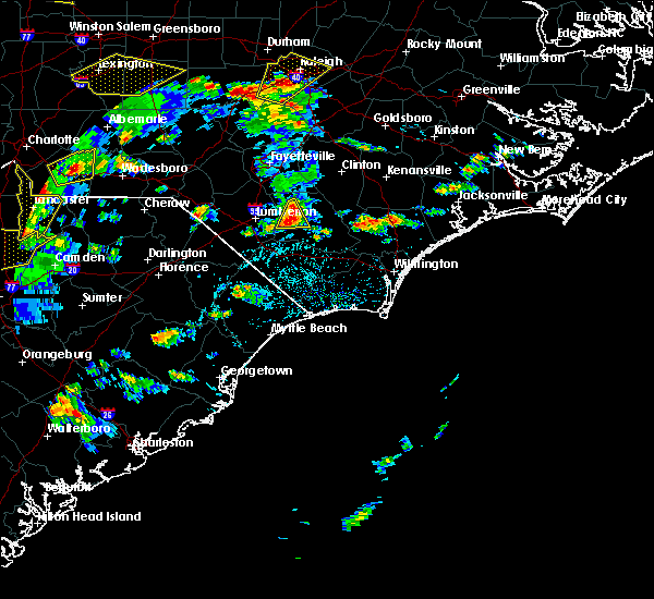 At 415 pm edt, a severe thunderstorm was located over bladen community college, or near elizabethtown, moving east at 20 mph (radar indicated). Hazards include 60 mph wind gusts and quarter size hail. Hail damage to vehicles is expected. expect wind damage to roofs, siding, and trees. Locations impacted include, elizabethtown, ruskin, white oak, bladen community college, dublin and bladen county hospital. At 415 pm edt, a severe thunderstorm was located over bladen community college, or near elizabethtown, moving east at 20 mph (radar indicated). Hazards include 60 mph wind gusts and quarter size hail. Hail damage to vehicles is expected. expect wind damage to roofs, siding, and trees. Locations impacted include, elizabethtown, ruskin, white oak, bladen community college, dublin and bladen county hospital.
|
| 5/2/2016 3:55 PM EDT |
 At 355 pm edt, a severe thunderstorm was located over smiths, or 9 miles east of lumberton, moving east at 15 mph (radar indicated). Hazards include 60 mph wind gusts and quarter size hail. Hail damage to vehicles is expected. expect wind damage to roofs, siding, and trees. Locations impacted include, elizabethtown, smiths, ruskin, white oak, bladen community college, butters, dublin, tar heel and bladen county hospital. At 355 pm edt, a severe thunderstorm was located over smiths, or 9 miles east of lumberton, moving east at 15 mph (radar indicated). Hazards include 60 mph wind gusts and quarter size hail. Hail damage to vehicles is expected. expect wind damage to roofs, siding, and trees. Locations impacted include, elizabethtown, smiths, ruskin, white oak, bladen community college, butters, dublin, tar heel and bladen county hospital.
|
| 5/2/2016 3:39 PM EDT |
 At 339 pm edt, a severe thunderstorm was located near smiths, or near lumberton, moving east at 15 mph (radar indicated). Hazards include 60 mph wind gusts and quarter size hail. Hail damage to vehicles is expected. Expect wind damage to roofs, siding, and trees. At 339 pm edt, a severe thunderstorm was located near smiths, or near lumberton, moving east at 15 mph (radar indicated). Hazards include 60 mph wind gusts and quarter size hail. Hail damage to vehicles is expected. Expect wind damage to roofs, siding, and trees.
|
| 4/7/2016 7:17 AM EDT |
 At 717 am edt, doppler radar indicated a severe thunderstorm capable of producing quarter size hail and damaging winds in excess of 60 mph. this storm was located over lagoon, or 10 miles southeast of elizabethtown, and moving northeast at 45 mph. At 717 am edt, doppler radar indicated a severe thunderstorm capable of producing quarter size hail and damaging winds in excess of 60 mph. this storm was located over lagoon, or 10 miles southeast of elizabethtown, and moving northeast at 45 mph.
|
| 2/24/2016 6:04 PM EST |
 At 604 pm est, doppler radar indicated a severe thunderstorm capable of producing a tornado. this dangerous storm was located over smiths, or near lumberton, moving northeast at 60 mph. locations impacted include, lumberton, st. pauls, smiths, ruskin, white oak, howellsville, tolarsville, robeson community college, tobermory, ammon, hestertown, jerome, duart, barker ten mile, bladen community college, dublin, tar heel and southeastern regional medical center. this includes interstate 95 in north carolina between mile markers 17 and 31, and near mile marker 34. At 604 pm est, doppler radar indicated a severe thunderstorm capable of producing a tornado. this dangerous storm was located over smiths, or near lumberton, moving northeast at 60 mph. locations impacted include, lumberton, st. pauls, smiths, ruskin, white oak, howellsville, tolarsville, robeson community college, tobermory, ammon, hestertown, jerome, duart, barker ten mile, bladen community college, dublin, tar heel and southeastern regional medical center. this includes interstate 95 in north carolina between mile markers 17 and 31, and near mile marker 34.
|
| 2/24/2016 5:52 PM EST |
 At 552 pm est, doppler radar indicated a severe thunderstorm capable of producing a tornado. this dangerous storm was located over fairmont, or 9 miles southwest of lumberton, moving northeast at 60 mph. locations impacted include, lumberton, fairmont, st. pauls, smiths, ruskin, white oak, howellsville, tolarsville, robeson community college, tobermory, butters, ammon, hestertown, jerome, duart, barker ten mile, bladen community college, dublin, tar heel and proctorville. this includes the following highways, interstate 74 between mile markers 212 and 207, and between mile markers 209 and 210, and near mile marker 214. interstate 95 in north carolina between mile markers 8 and 35. us route 74 between mile markers 365 and 371. At 552 pm est, doppler radar indicated a severe thunderstorm capable of producing a tornado. this dangerous storm was located over fairmont, or 9 miles southwest of lumberton, moving northeast at 60 mph. locations impacted include, lumberton, fairmont, st. pauls, smiths, ruskin, white oak, howellsville, tolarsville, robeson community college, tobermory, butters, ammon, hestertown, jerome, duart, barker ten mile, bladen community college, dublin, tar heel and proctorville. this includes the following highways, interstate 74 between mile markers 212 and 207, and between mile markers 209 and 210, and near mile marker 214. interstate 95 in north carolina between mile markers 8 and 35. us route 74 between mile markers 365 and 371.
|
| 2/24/2016 5:44 PM EST |
 At 543 pm est, doppler radar indicated a severe thunderstorm capable of producing a tornado. this dangerous storm was located near lake view, or 10 miles east of dillon, and moving northeast at 60 mph. At 543 pm est, doppler radar indicated a severe thunderstorm capable of producing a tornado. this dangerous storm was located near lake view, or 10 miles east of dillon, and moving northeast at 60 mph.
|
| 2/24/2016 12:18 PM EST |
 At 1217 pm est, doppler radar indicated a severe thunderstorm capable of producing a tornado. this dangerous storm was located near warsaw, moving northeast at 60 mph. locations impacted include, elizabethtown, rowan, lagoon, elkton, carvers, lisbon, emerson, clarkton, white lake and bladen county hospital. At 1217 pm est, doppler radar indicated a severe thunderstorm capable of producing a tornado. this dangerous storm was located near warsaw, moving northeast at 60 mph. locations impacted include, elizabethtown, rowan, lagoon, elkton, carvers, lisbon, emerson, clarkton, white lake and bladen county hospital.
|
| 2/24/2016 12:03 PM EST |
 At 1203 pm est, doppler radar indicated a severe thunderstorm capable of producing a tornado. this dangerous storm was located near elkton, or 7 miles northeast of whiteville, and moving northeast at 60 mph. At 1203 pm est, doppler radar indicated a severe thunderstorm capable of producing a tornado. this dangerous storm was located near elkton, or 7 miles northeast of whiteville, and moving northeast at 60 mph.
|
| 2/24/2016 11:58 AM EST |
 At 1158 am est, doppler radar indicated a severe thunderstorm capable of producing quarter size hail and damaging winds in excess of 60 mph. this storm was located near whiteville, and moving northeast at 80 mph. At 1158 am est, doppler radar indicated a severe thunderstorm capable of producing quarter size hail and damaging winds in excess of 60 mph. this storm was located near whiteville, and moving northeast at 80 mph.
|
| 12/30/2015 3:47 PM EST |
 At 347 pm est, doppler radar indicated a severe thunderstorm capable of producing quarter size hail and damaging winds in excess of 60 mph. this storm was located over elizabethtown, and moving northeast at 20 mph. At 347 pm est, doppler radar indicated a severe thunderstorm capable of producing quarter size hail and damaging winds in excess of 60 mph. this storm was located over elizabethtown, and moving northeast at 20 mph.
|
| 12/30/2015 3:06 PM EST |
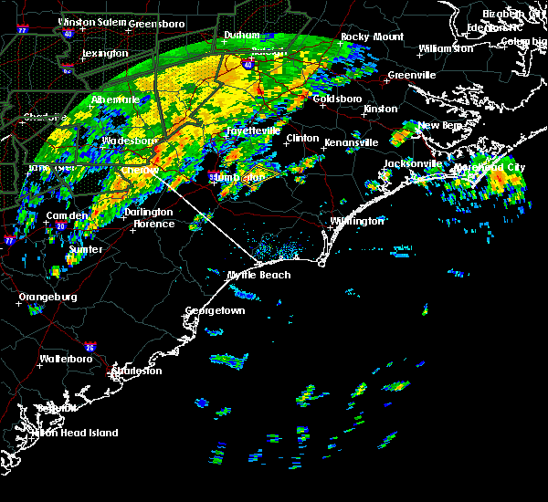 At 305 pm est, doppler radar indicated a severe thunderstorm capable of producing quarter size hail and damaging winds in excess of 60 mph. this storm was located near ruskin, or near elizabethtown, moving northeast at 25 mph. locations impacted include, elizabethtown, ruskin, bladen community college, dublin and bladen county hospital. At 305 pm est, doppler radar indicated a severe thunderstorm capable of producing quarter size hail and damaging winds in excess of 60 mph. this storm was located near ruskin, or near elizabethtown, moving northeast at 25 mph. locations impacted include, elizabethtown, ruskin, bladen community college, dublin and bladen county hospital.
|
| 12/30/2015 2:49 PM EST |
 At 248 pm est, doppler radar indicated a severe thunderstorm capable of producing quarter size hail and damaging winds in excess of 60 mph. this storm was located over bladen community college, or 8 miles west of elizabethtown, moving northeast at 30 mph. locations impacted include, elizabethtown, ruskin, white oak, bladen community college, dublin, tar heel and bladen county hospital. At 248 pm est, doppler radar indicated a severe thunderstorm capable of producing quarter size hail and damaging winds in excess of 60 mph. this storm was located over bladen community college, or 8 miles west of elizabethtown, moving northeast at 30 mph. locations impacted include, elizabethtown, ruskin, white oak, bladen community college, dublin, tar heel and bladen county hospital.
|
| 12/30/2015 2:33 PM EST |
 At 233 pm est, doppler radar indicated a severe thunderstorm capable of producing quarter size hail and damaging winds in excess of 60 mph. this storm was located over butters, or 7 miles southeast of lumberton, moving northeast at 25 mph. locations impacted include, lumberton, elizabethtown, bladenboro, smiths, ruskin, white oak, howellsville, tolarsville, robeson community college, tobermory, butters, jerome, duart, barker ten mile, bladen community college, hestertown, dublin, tar heel, southeastern regional medical center and bladen county hospital. this includes interstate 95 in north carolina between mile markers 19 and 25. At 233 pm est, doppler radar indicated a severe thunderstorm capable of producing quarter size hail and damaging winds in excess of 60 mph. this storm was located over butters, or 7 miles southeast of lumberton, moving northeast at 25 mph. locations impacted include, lumberton, elizabethtown, bladenboro, smiths, ruskin, white oak, howellsville, tolarsville, robeson community college, tobermory, butters, jerome, duart, barker ten mile, bladen community college, hestertown, dublin, tar heel, southeastern regional medical center and bladen county hospital. this includes interstate 95 in north carolina between mile markers 19 and 25.
|
| 12/30/2015 2:24 PM EST |
 At 224 pm est, doppler radar indicated a severe thunderstorm capable of producing quarter size hail and damaging winds in excess of 60 mph. this storm was located near butters, or 7 miles southeast of lumberton, and moving northeast at 25 mph. At 224 pm est, doppler radar indicated a severe thunderstorm capable of producing quarter size hail and damaging winds in excess of 60 mph. this storm was located near butters, or 7 miles southeast of lumberton, and moving northeast at 25 mph.
|
| 7/13/2015 1:31 PM EDT |
 At 131 pm edt, doppler radar indicated a severe thunderstorm capable of producing quarter size hail and damaging winds in excess of 60 mph. this storm was located near bladen community college, or 10 miles west of elizabethtown, and moving southeast at 35 mph. At 131 pm edt, doppler radar indicated a severe thunderstorm capable of producing quarter size hail and damaging winds in excess of 60 mph. this storm was located near bladen community college, or 10 miles west of elizabethtown, and moving southeast at 35 mph.
|
| 6/27/2015 9:13 PM EDT | A few trees down in the city of elizabethtown. time estimated by rada in bladen county NC, 0.2 miles WNW of Elizabethtown, NC |
| 6/27/2015 8:50 PM EDT |
 At 849 pm edt, doppler radar indicated a severe thunderstorm capable of producing a tornado. this dangerous storm was located over smiths, or 8 miles east of lumberton, moving east at 50 mph. locations impacted include, lumberton, bladenboro, smiths, white oak, howellsville, bladen community college, butters, barker ten mile, dublin and tar heel. At 849 pm edt, doppler radar indicated a severe thunderstorm capable of producing a tornado. this dangerous storm was located over smiths, or 8 miles east of lumberton, moving east at 50 mph. locations impacted include, lumberton, bladenboro, smiths, white oak, howellsville, bladen community college, butters, barker ten mile, dublin and tar heel.
|
| 6/27/2015 8:29 PM EDT |
 At 829 pm edt, doppler radar indicated a severe thunderstorm capable of producing a tornado. this dangerous storm was located near lumberton, and moving east at 30 mph. At 829 pm edt, doppler radar indicated a severe thunderstorm capable of producing a tornado. this dangerous storm was located near lumberton, and moving east at 30 mph.
|
| 6/27/2015 8:23 PM EDT |
 At 823 pm edt, doppler radar indicated a severe thunderstorm capable of producing quarter size hail and damaging winds in excess of 60 mph. this storm was located near elrod, or 9 miles west of lumberton, and moving east at 25 mph. At 823 pm edt, doppler radar indicated a severe thunderstorm capable of producing quarter size hail and damaging winds in excess of 60 mph. this storm was located near elrod, or 9 miles west of lumberton, and moving east at 25 mph.
|
| 6/22/2015 4:49 PM EDT |
 At 448 pm edt, doppler radar indicated a severe thunderstorm capable of producing quarter size hail and damaging winds in excess of 60 mph. this storm was located over whiteville, and moving northeast at 15 mph. At 448 pm edt, doppler radar indicated a severe thunderstorm capable of producing quarter size hail and damaging winds in excess of 60 mph. this storm was located over whiteville, and moving northeast at 15 mph.
|
| 6/18/2015 5:16 PM EDT | At 515 pm edt, doppler radar indicated a severe thunderstorm capable of producing quarter size hail and damaging winds in excess of 60 mph. this storm was located near abbottsburg, or 9 miles northwest of whiteville, moving east at 15 mph. locations impacted include, whiteville, elizabethtown, chadbourn, bladenboro, boardman, southeastern community college, barnesville, abbottsburg, evergreen, butters, elkton, brunswick, clarkton, white lake, cerro gordo, proctorville, orrum, columbus regional healthcare system and bladen county hospital. this includes us route 74 between mile markers 367 and 394. |
| 6/18/2015 4:54 PM EDT | At 453 pm edt, doppler radar indicated a severe thunderstorm capable of producing quarter size hail and damaging winds in excess of 60 mph. this storm was located near boardman, or 9 miles south of lumberton, and moving east at 15 mph. |
| 6/9/2015 8:27 PM EDT |
 At 826 pm edt, doppler radar indicated a severe thunderstorm capable of producing quarter size hail and damaging winds in excess of 60 mph. this storm was located near ammon, or near elizabethtown, moving east at 35 mph. locations impacted include, elizabethtown, ammon, lisbon, ruskin, white oak, jerome, bladen community college, white lake, dublin, tar heel and bladen county hospital. At 826 pm edt, doppler radar indicated a severe thunderstorm capable of producing quarter size hail and damaging winds in excess of 60 mph. this storm was located near ammon, or near elizabethtown, moving east at 35 mph. locations impacted include, elizabethtown, ammon, lisbon, ruskin, white oak, jerome, bladen community college, white lake, dublin, tar heel and bladen county hospital.
|
| 6/9/2015 8:05 PM EDT |
 At 805 pm edt, doppler radar indicated a severe thunderstorm capable of producing quarter size hail and damaging winds in excess of 60 mph. this storm was located near white oak, or 12 miles northwest of elizabethtown, moving east at 35 mph. locations impacted include, lumberton, elizabethtown, st. pauls, smiths, ruskin, white oak, howellsville, tolarsville, tobermory, ammon, lisbon, hestertown, jerome, duart, bladen community college, barker ten mile, butters, white lake, dublin and tar heel. this includes interstate 95 in north carolina between mile markers 35 and 38. At 805 pm edt, doppler radar indicated a severe thunderstorm capable of producing quarter size hail and damaging winds in excess of 60 mph. this storm was located near white oak, or 12 miles northwest of elizabethtown, moving east at 35 mph. locations impacted include, lumberton, elizabethtown, st. pauls, smiths, ruskin, white oak, howellsville, tolarsville, tobermory, ammon, lisbon, hestertown, jerome, duart, bladen community college, barker ten mile, butters, white lake, dublin and tar heel. this includes interstate 95 in north carolina between mile markers 35 and 38.
|
| 6/9/2015 7:48 PM EDT |
 At 748 pm edt, doppler radar indicated a severe thunderstorm capable of producing quarter size hail and damaging winds in excess of 60 mph. this storm was located over tobermory, or 11 miles northeast of lumberton, and moving east at 35 mph. At 748 pm edt, doppler radar indicated a severe thunderstorm capable of producing quarter size hail and damaging winds in excess of 60 mph. this storm was located over tobermory, or 11 miles northeast of lumberton, and moving east at 35 mph.
|
| 6/9/2015 6:08 PM EDT | Picnic table blown away and large tree limbs reportedly down on nc 24 in bladen county NC, 4.8 miles NE of Elizabethtown, NC |
| 5/21/2015 3:32 PM EDT | At 330 pm edt, doppler radar indicated a cluster of severe thunderstorms capable of producing quarter size hail and damaging winds in excess of 60 mph. these storms were located 9 miles north of lagoon, and 5 miles west of garland, and both were moving northeast at 30 mph. locations impacted include, ammon, white lake. additional strong thunderstorms just west of elizabethtown could intensify and become severe as they cross the city and move toward white lake over the next 30 minutes. |
| 5/21/2015 3:20 PM EDT | At 319 pm edt, doppler radar indicated a severe thunderstorm capable of producing quarter size hail and damaging winds in excess of 60 mph. this storm was located near elizabethtown, and moving east at 30 mph. a second severe thunderstorm was 10 miles west of garland, also moving east at 30 mph. |
| 7/10/2014 3:20 PM EDT | Tree reported down at intersection of hwy 87 and coley rd. time estimated by rada in bladen county NC, 5 miles NW of Elizabethtown, NC |
| 4/28/2014 8:30 PM EDT | Quarter sized hail reported 3.1 miles NNW of Elizabethtown, NC |
| 4/28/2014 8:11 PM EDT | Golf Ball sized hail reported 0.2 miles WNW of Elizabethtown, NC |
| 4/28/2014 8:06 PM EDT | Golf Ball sized hail reported 0.2 miles WNW of Elizabethtown, NC |
| 2/21/2014 1:09 PM EST | Two to three foot diameter tree uprooted and damaged a fence on alta street - time estimated based on radar in bladen county NC, 1.2 miles NE of Elizabethtown, NC |
| 6/13/2013 8:10 PM EDT | Half Dollar sized hail reported 2.5 miles NNW of Elizabethtown, NC, half dollar size hail reported at gibson dairy rd and mercer mill rd - time estimated based on radar |
| 7/1/2012 5:20 PM EDT | Tree down along white plains r in bladen county NC, 8.6 miles NW of Elizabethtown, NC |
| 7/1/2012 5:20 PM EDT | Tree down at lisbon rd and bladen springs r in bladen county NC, 10.3 miles NW of Elizabethtown, NC |
| 7/1/2012 5:15 PM EDT | Tree down along genes d in bladen county NC, 2.8 miles NW of Elizabethtown, NC |
| 7/1/2012 5:05 PM EDT | Tree down along martin luther king r in bladen county NC, 0.9 miles NNE of Elizabethtown, NC |
| 7/1/2012 5:05 PM EDT | 4.5 foot diameter tree down along coley r in bladen county NC, 4.6 miles NNW of Elizabethtown, NC |
| 6/1/2012 3:21 PM EDT | Quarter sized hail reported 0.6 miles SSW of Elizabethtown, NC |
| 1/1/0001 12:00 AM | Tree down on mercer mill roa in bladen county NC, 1.1 miles NW of Elizabethtown, NC |
| 1/1/0001 12:00 AM | 5 pine trees snapped midway up along cromartie roa in bladen county NC, 2.2 miles ESE of Elizabethtown, NC |
| 1/1/0001 12:00 AM | A few trees down on highway 701 between white lake and elizabethtown in bladen county NC, 4.2 miles W of Elizabethtown, NC |
| 1/1/0001 12:00 AM | Tree down across power lines at the 7100 block of white plains church rd in bladen county NC, 0.2 miles WNW of Elizabethtown, NC |
| 1/1/0001 12:00 AM | Quarter sized hail reported 3.2 miles SW of Elizabethtown, NC, hail to the size of quarters was reported on highway 53 east. the hail lasted for about 15 minutes. |
| 1/1/0001 12:00 AM | Skirting ripped off a mobile home on airport road. tree limbs down. pea size hai in bladen county NC, 5 miles NW of Elizabethtown, NC |
| 1/1/0001 12:00 AM | Quarter sized hail reported 9.1 miles NW of Elizabethtown, NC, quarter size hail reported near lisbon rd. time of event estimated by radar. |
| 1/1/0001 12:00 AM | Tree down on house located on coley rd. time of event estimated by rada in bladen county NC, 4.6 miles NW of Elizabethtown, NC |
| 1/1/0001 12:00 AM | Multiple large limbs and powerlines down near lisbon rd. time of event estimated by rada in bladen county NC, 9.1 miles NW of Elizabethtown, NC |
| 1/1/0001 12:00 AM | Quarter sized hail reported 12.5 miles S of Elizabethtown, NC, dime to quarter size hail in ammon. time estimated by radar. |
Hail Maps for Elizabethtown, NC

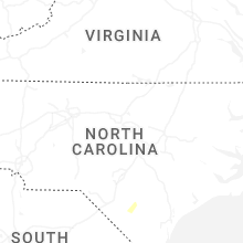
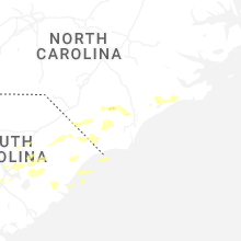
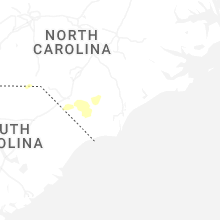
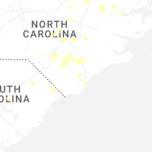
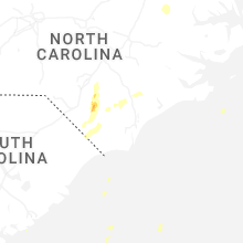


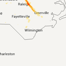


Connect with Interactive Hail Maps