

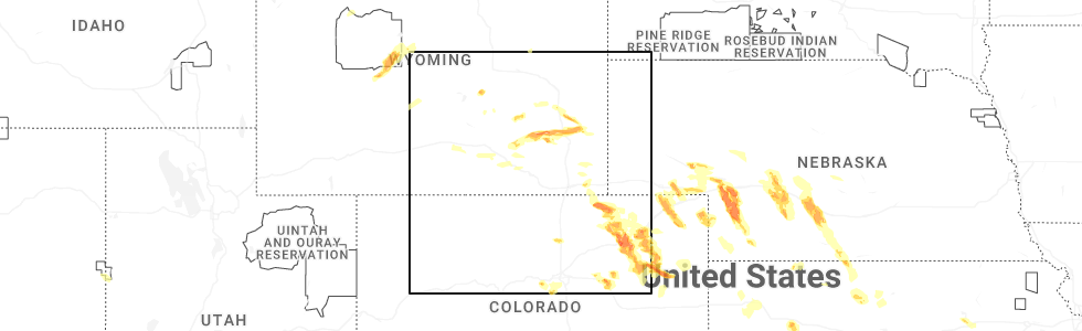
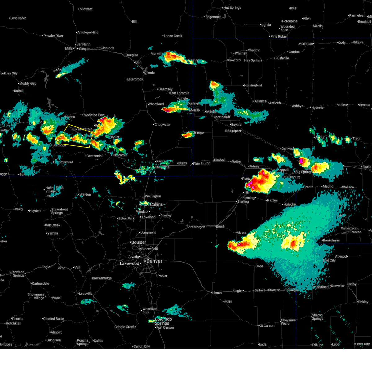
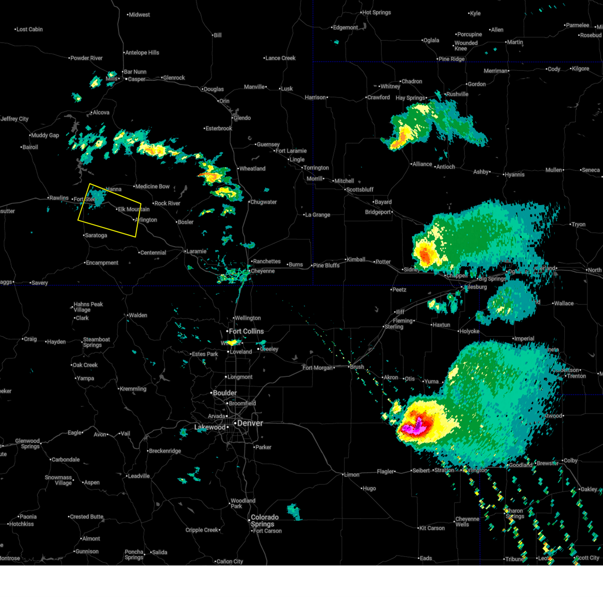
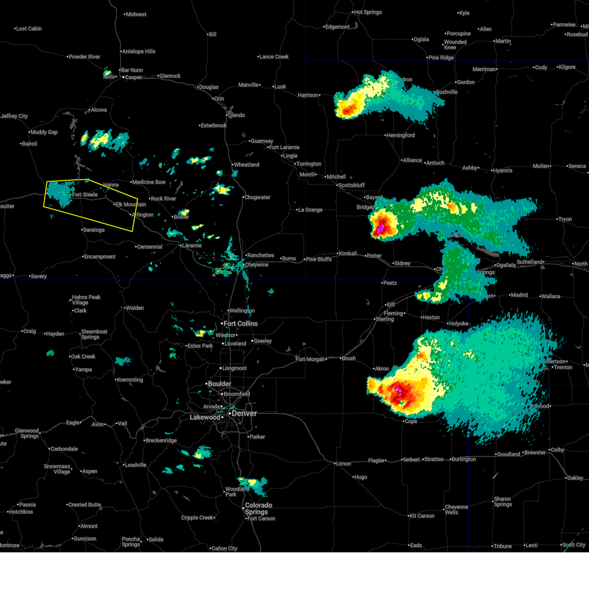
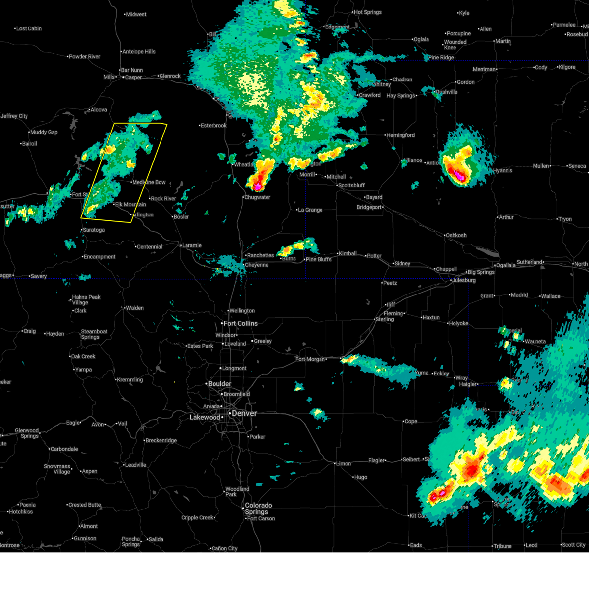
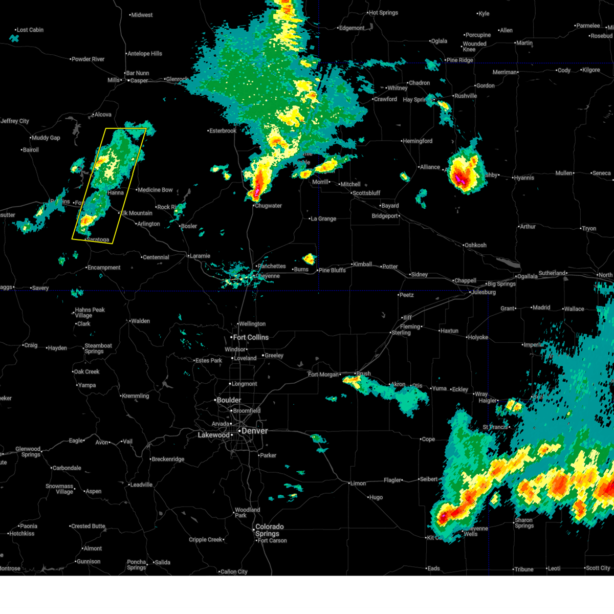
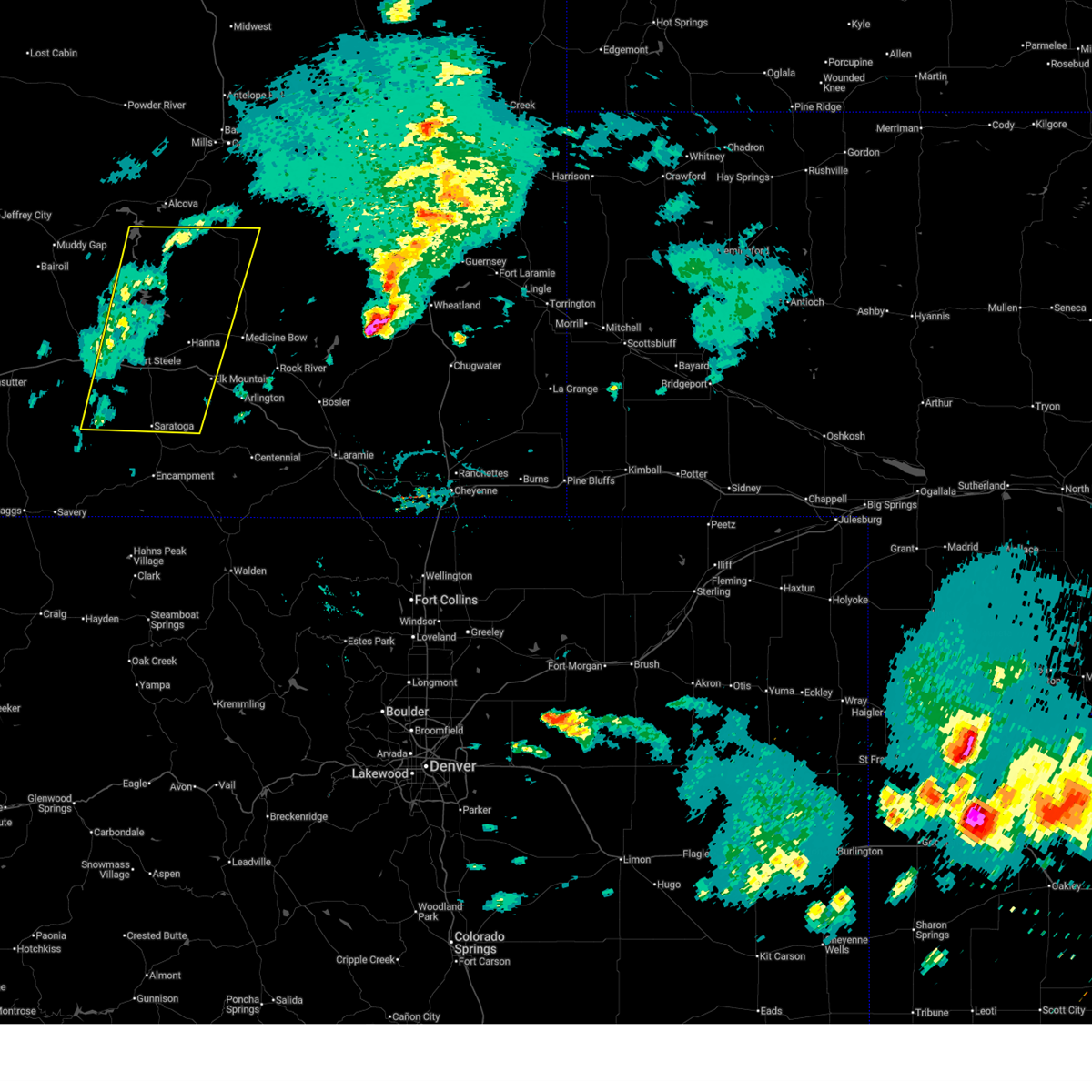
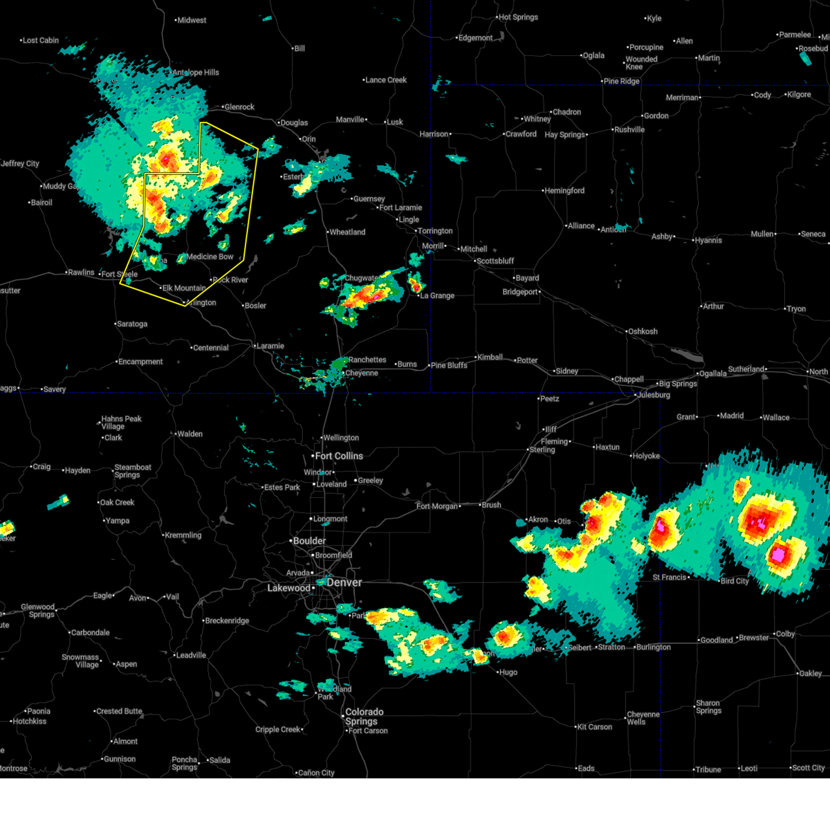
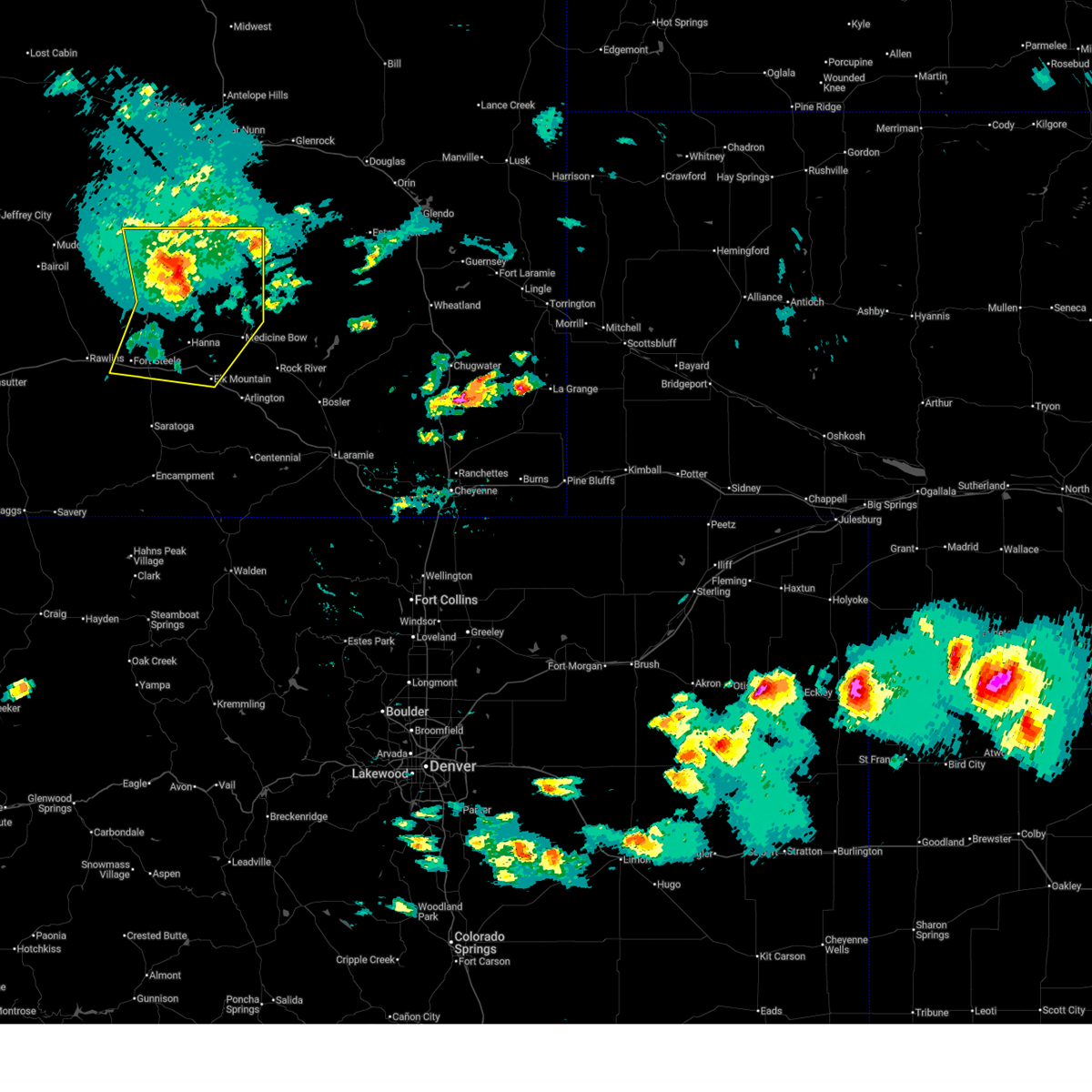
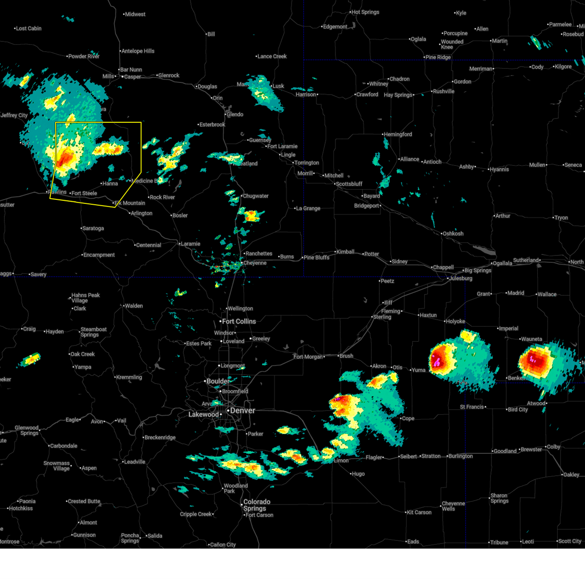
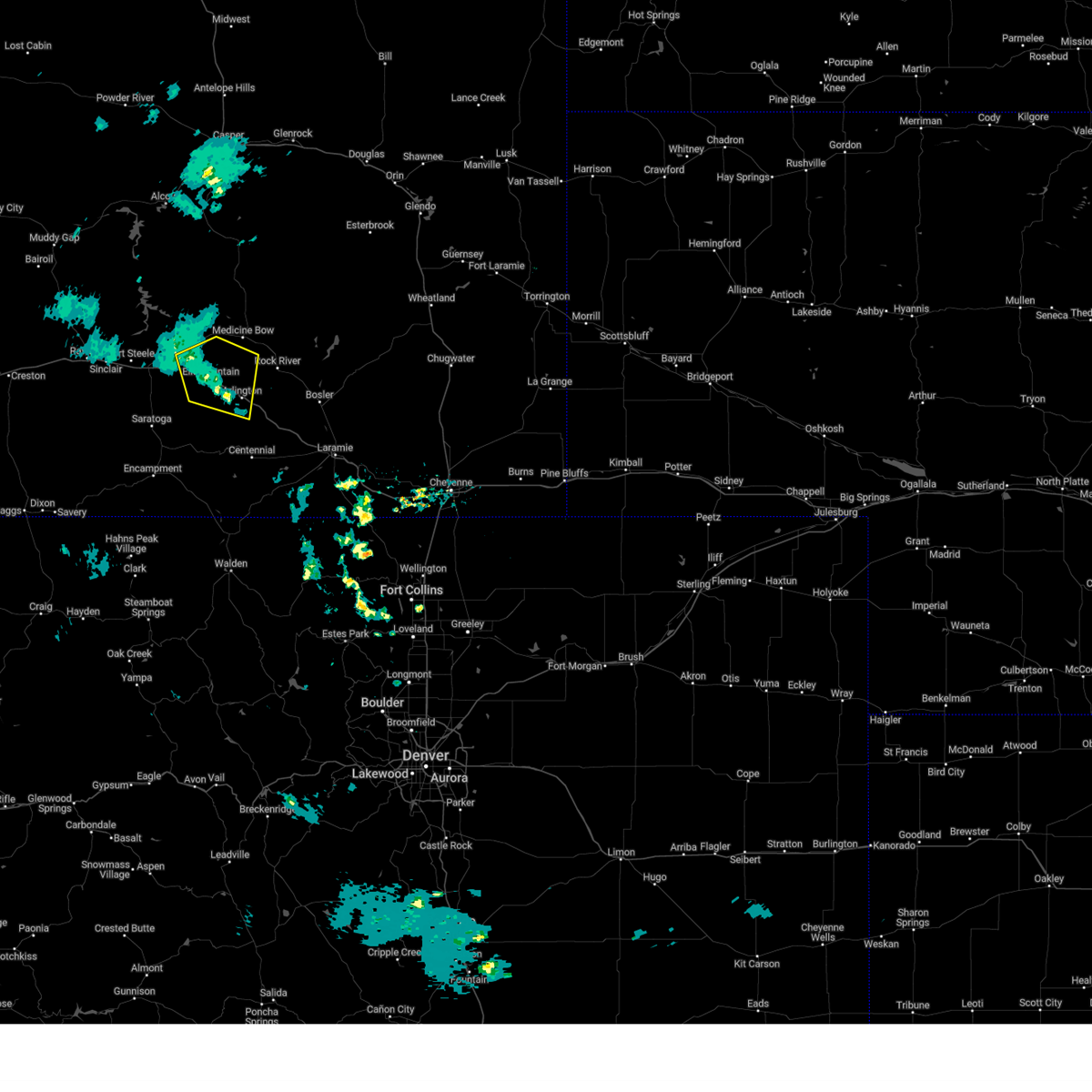
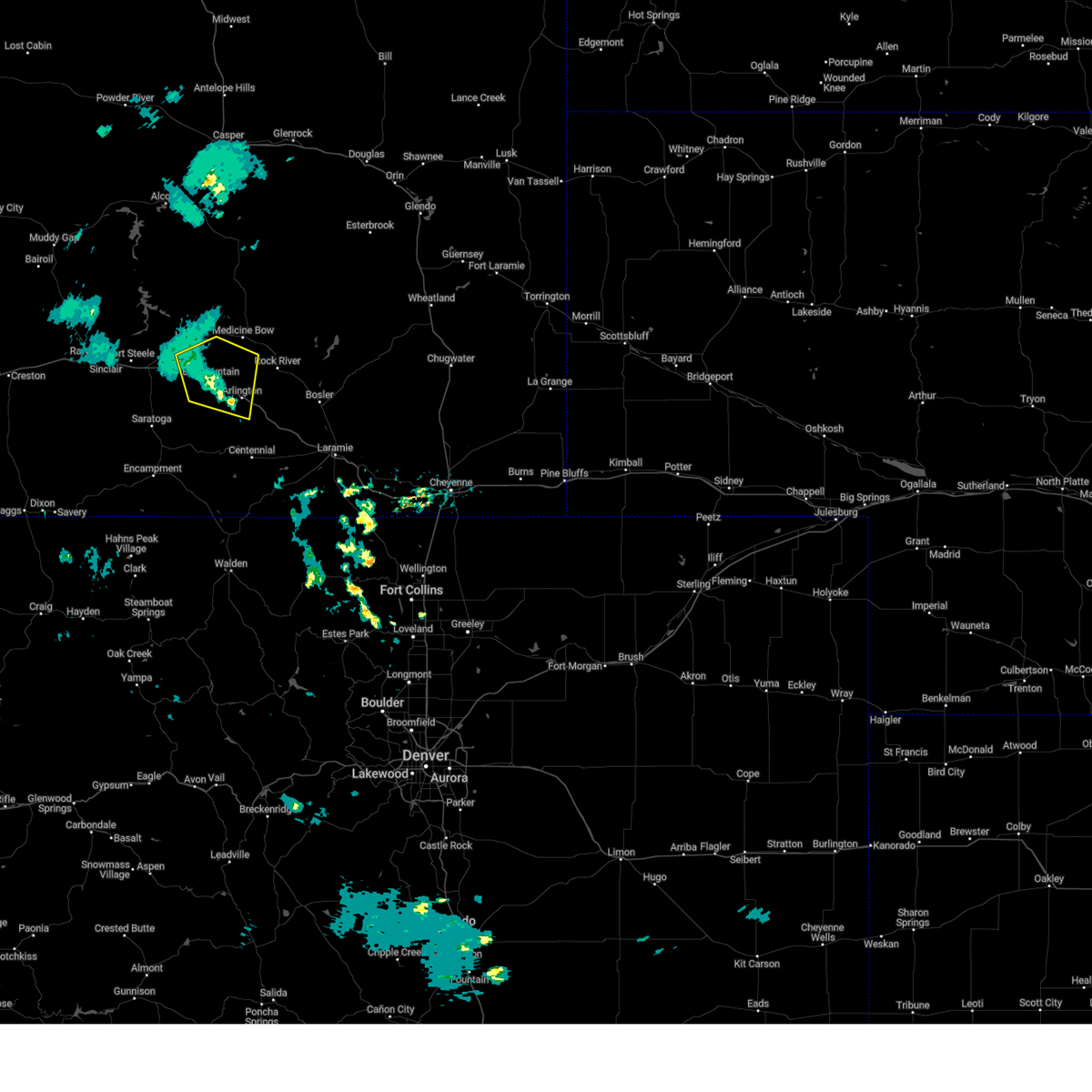
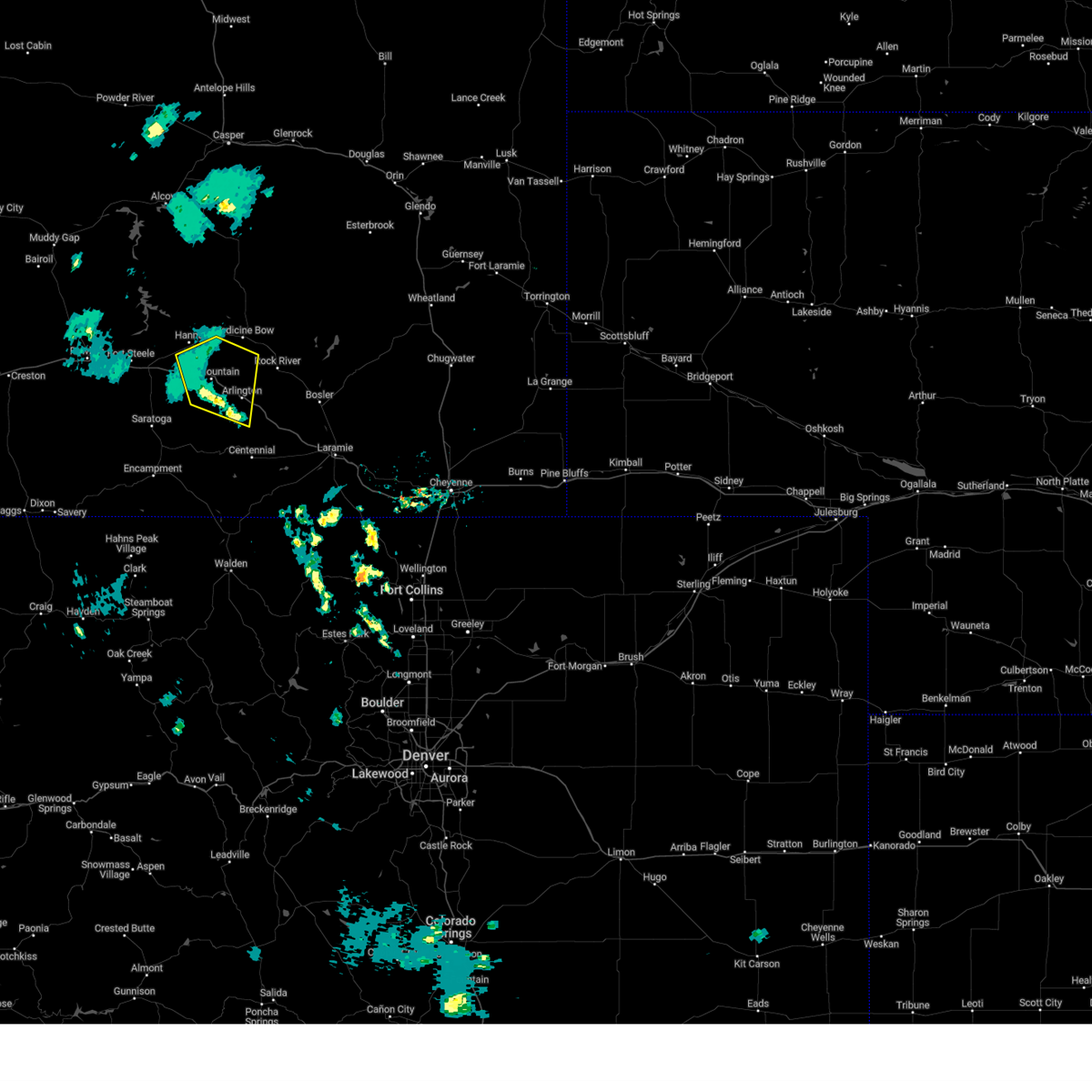
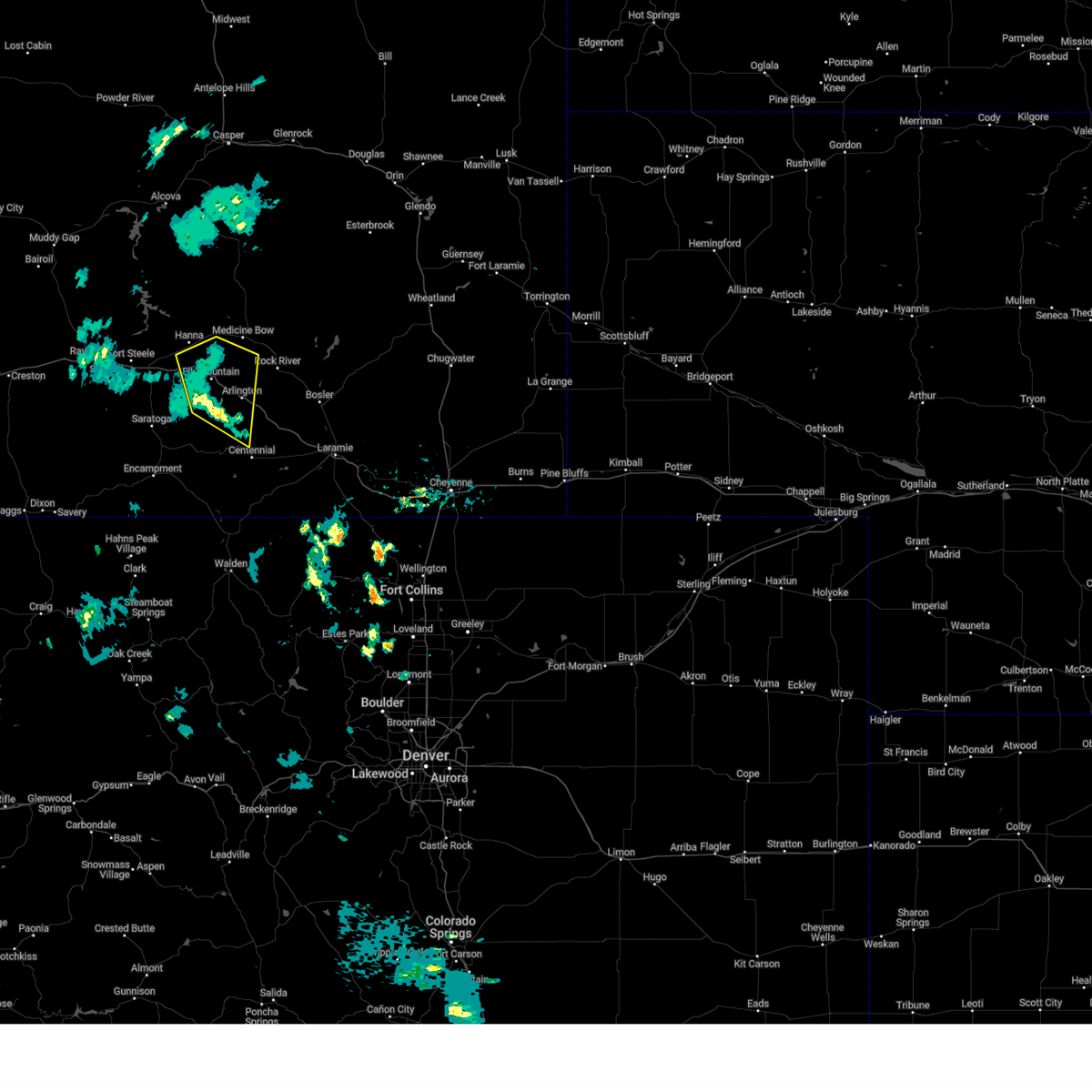
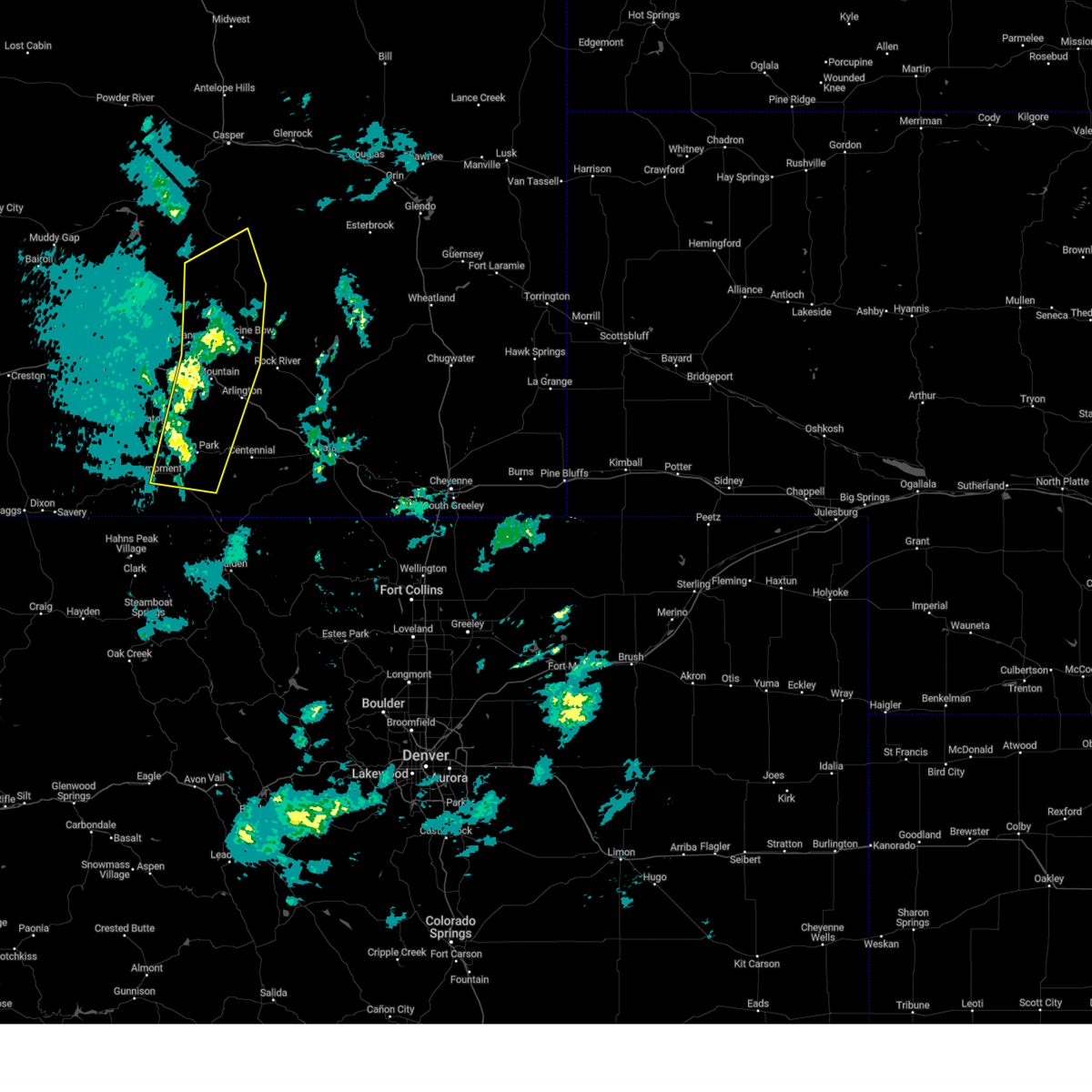
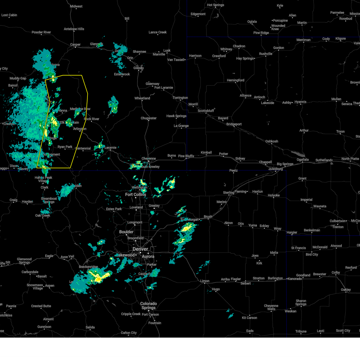
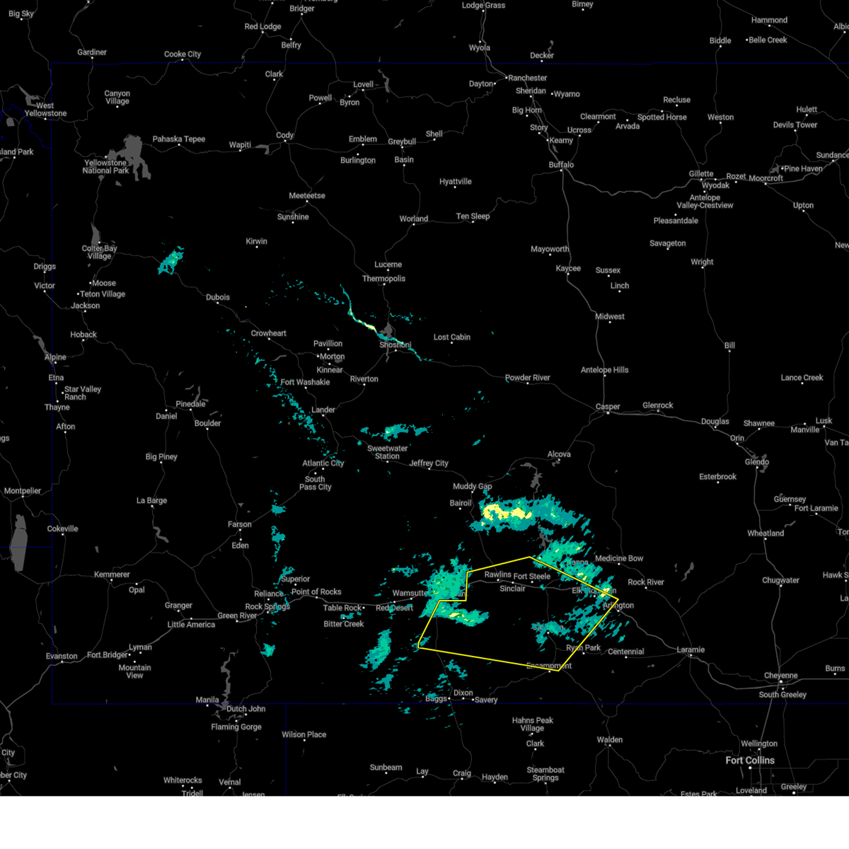
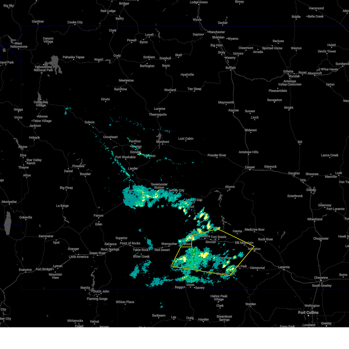
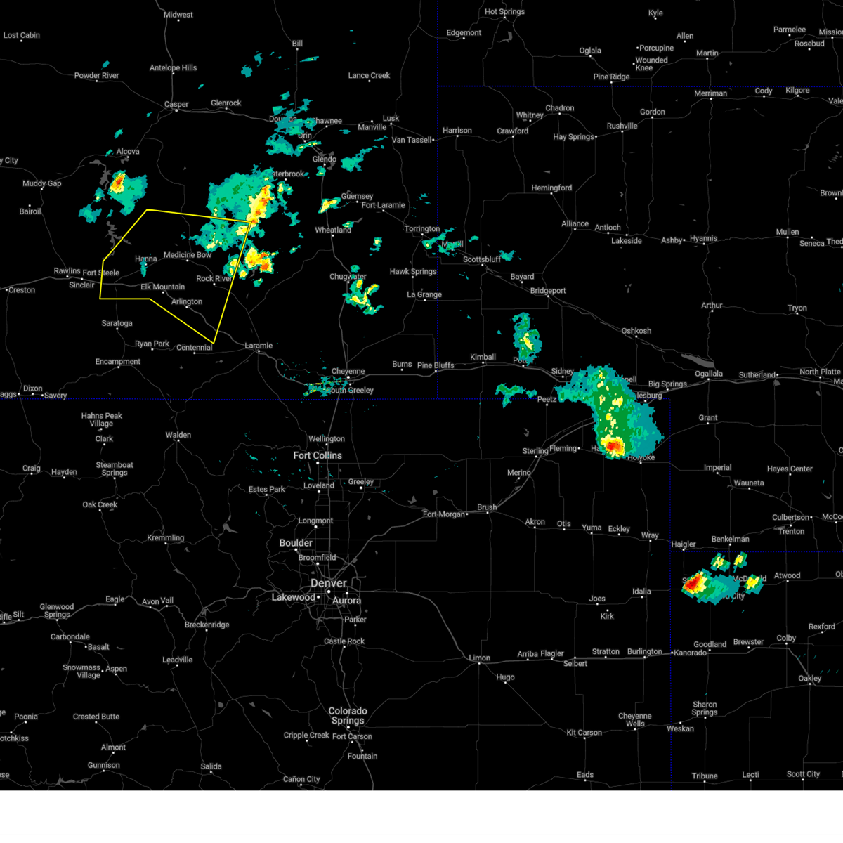
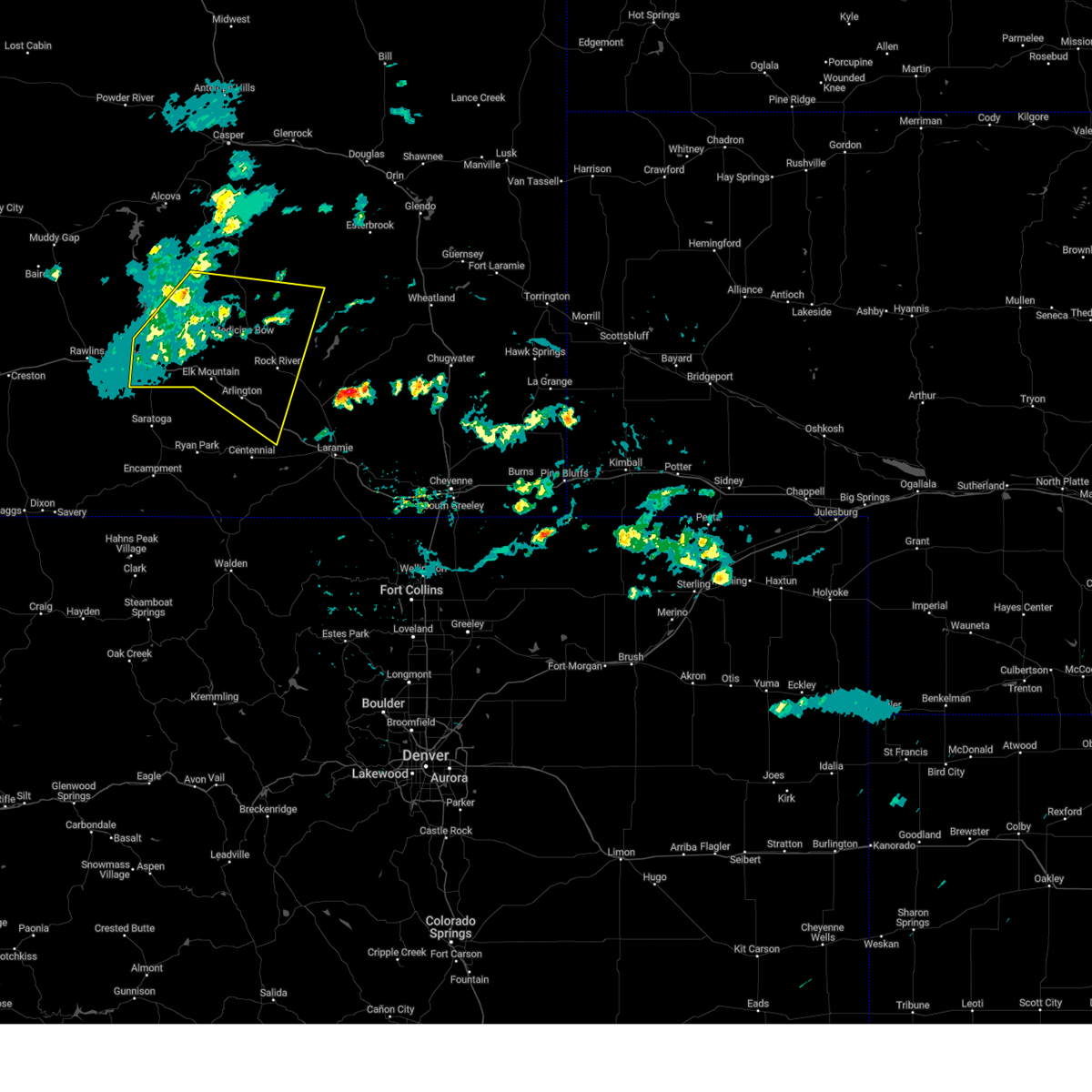
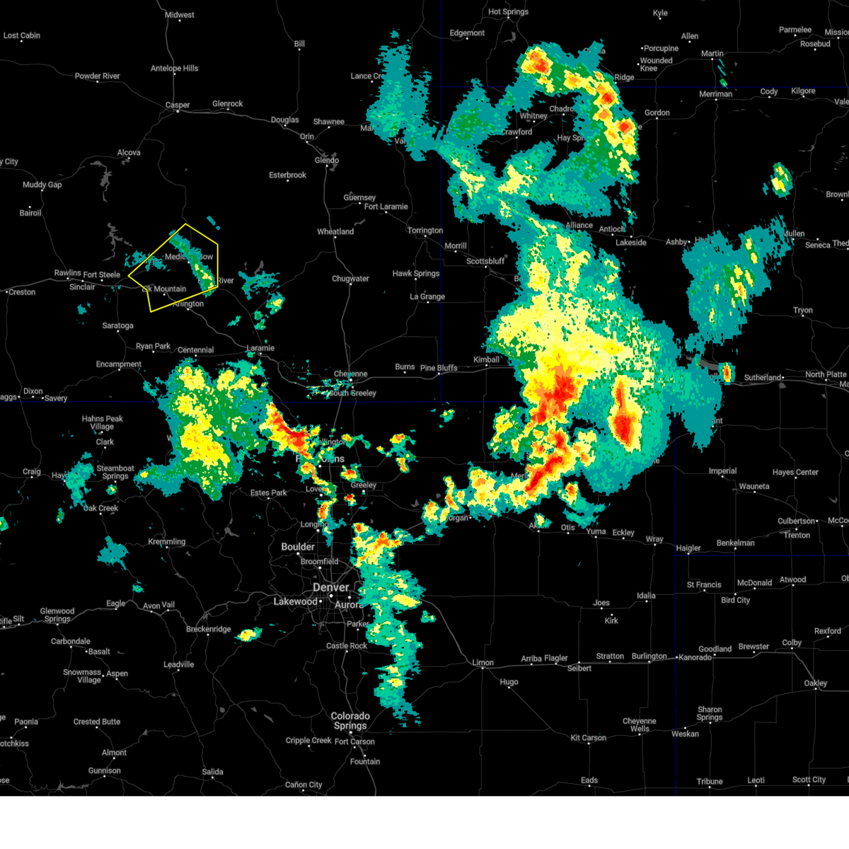
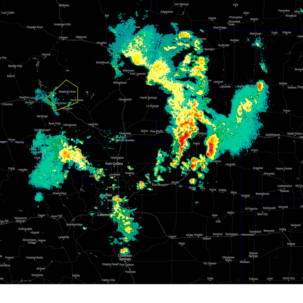
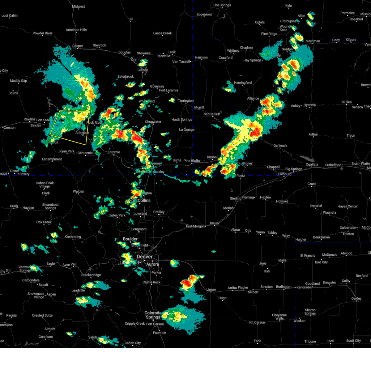
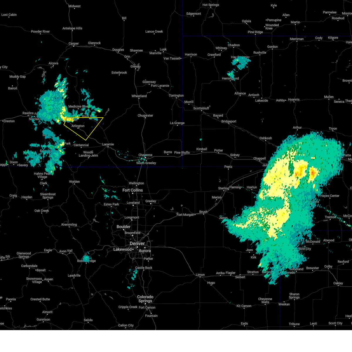
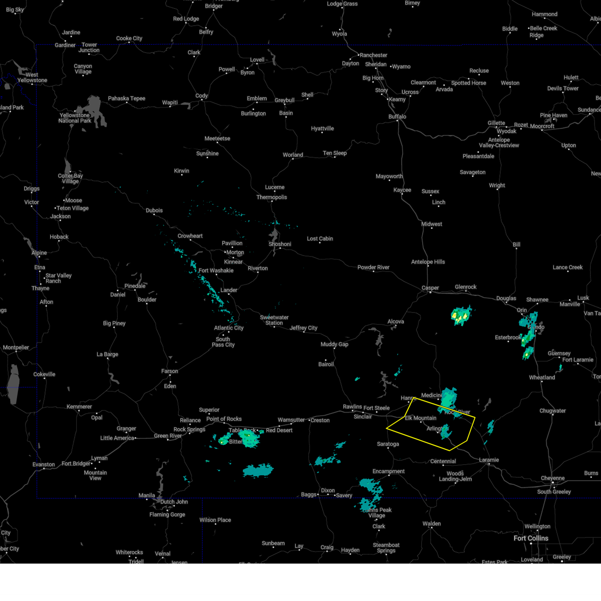
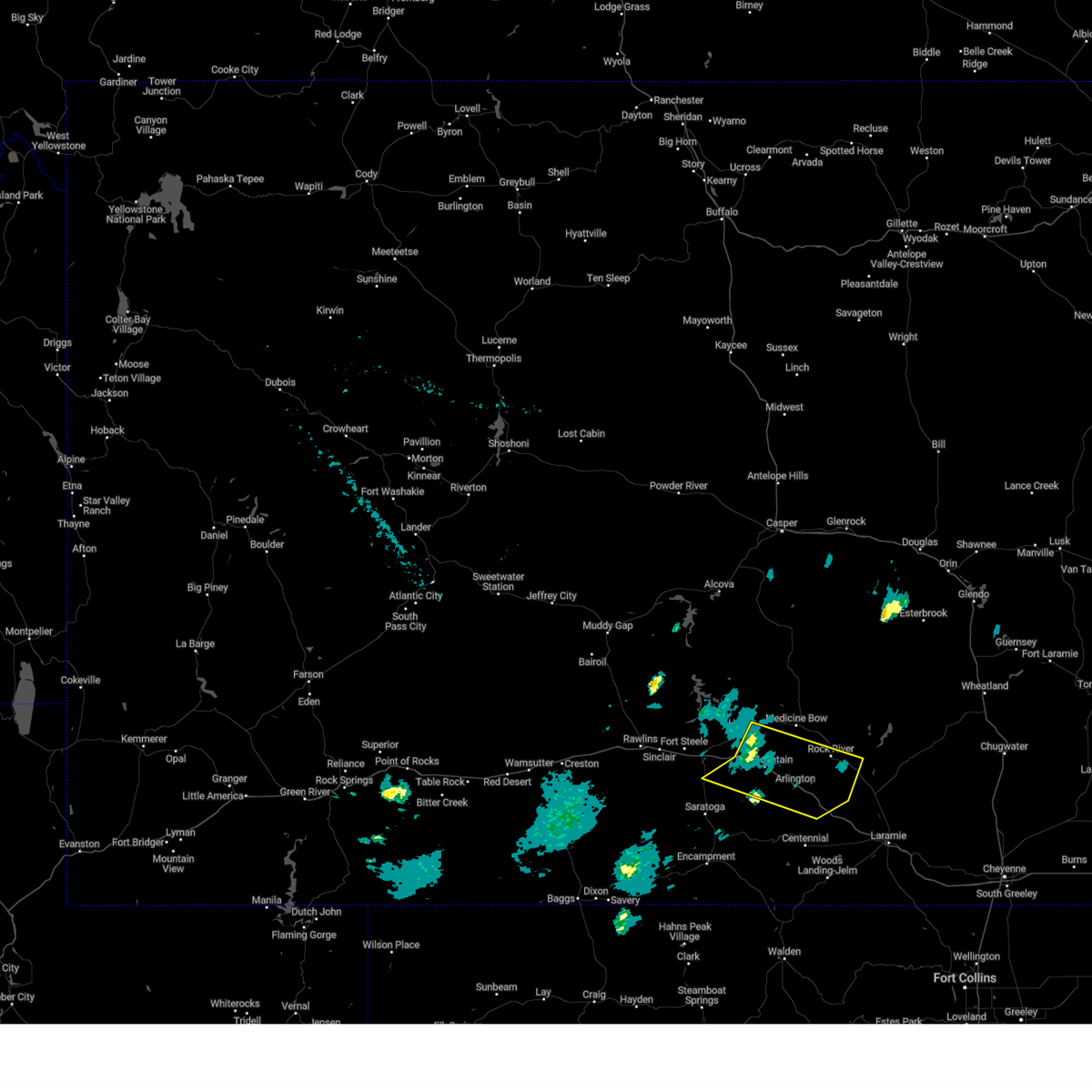
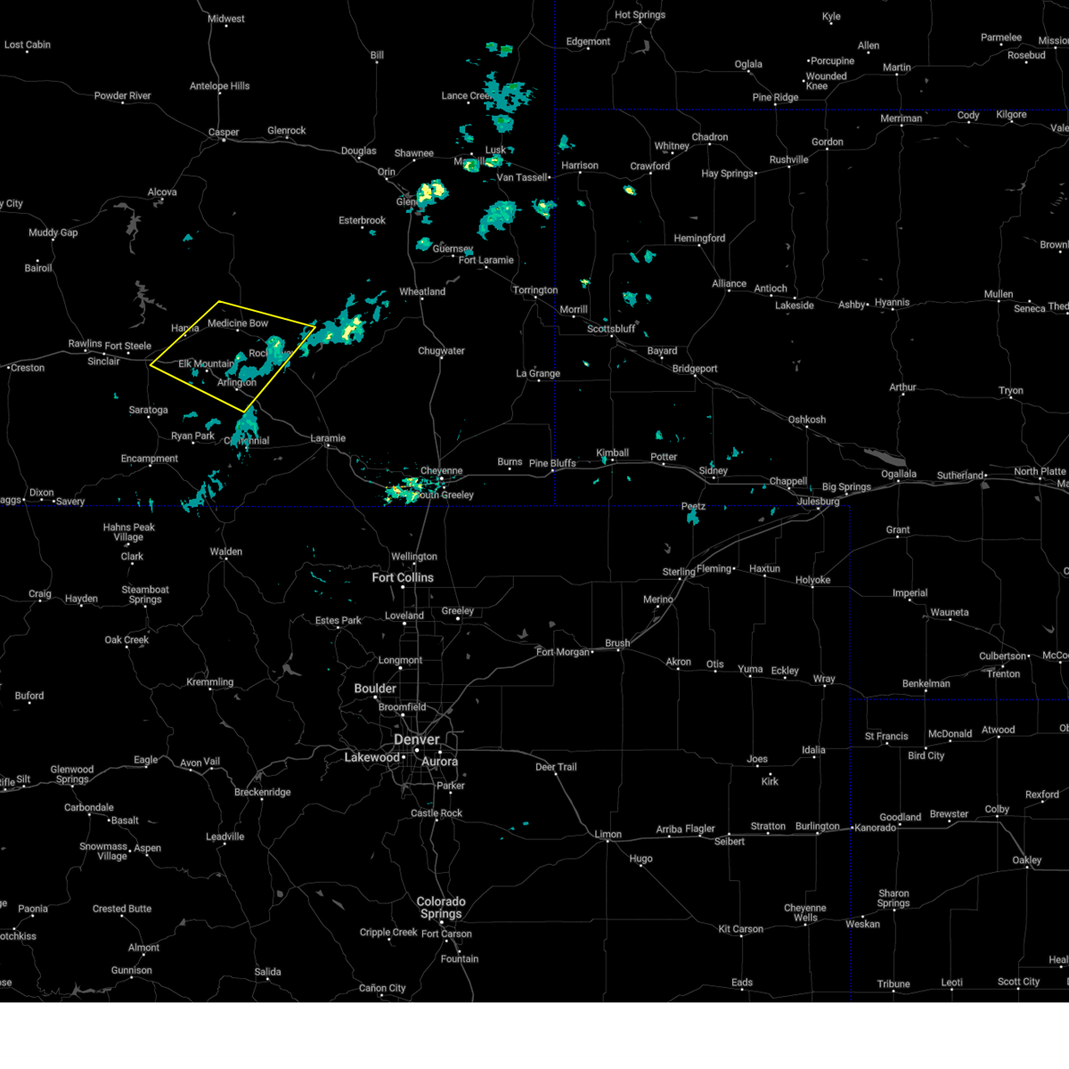
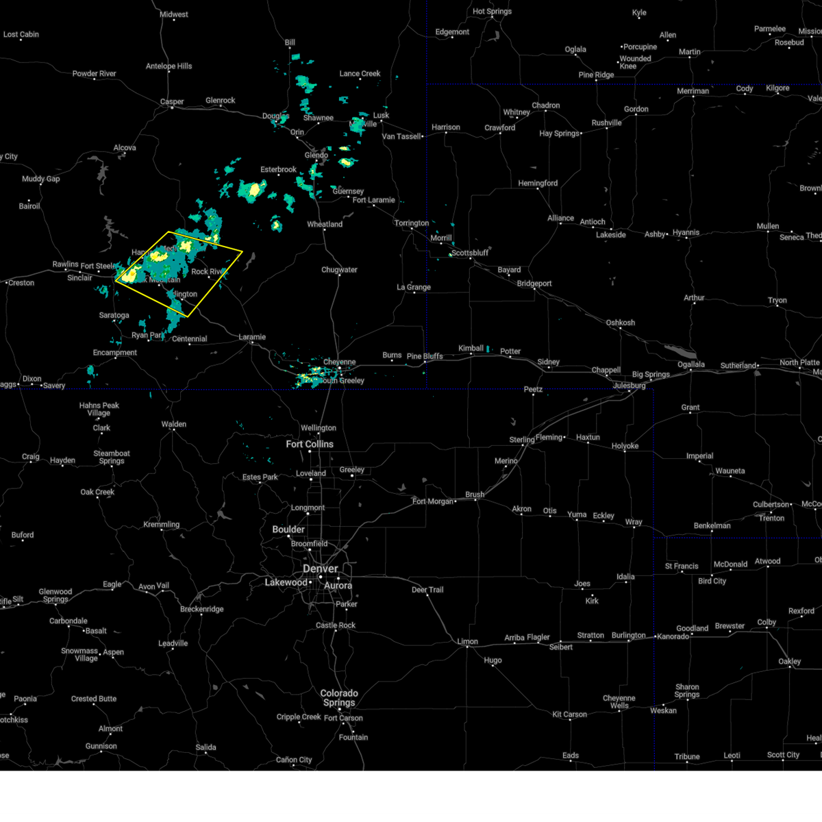
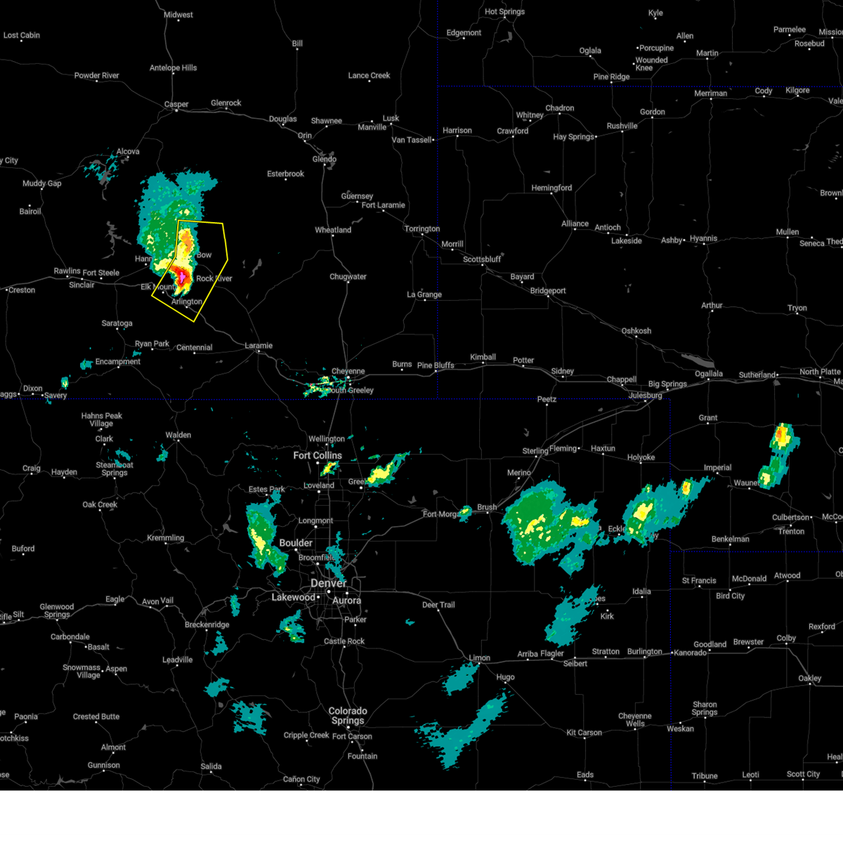
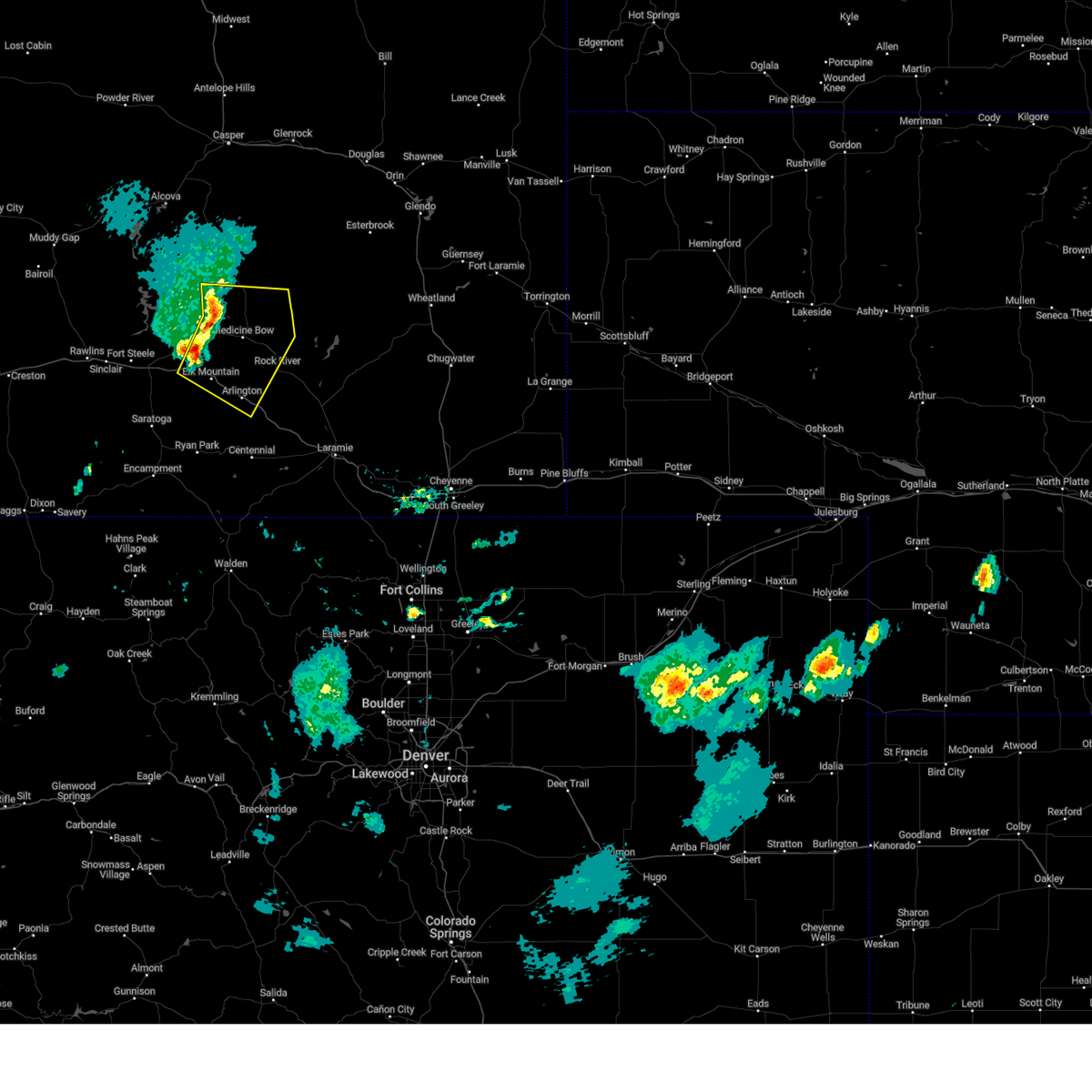
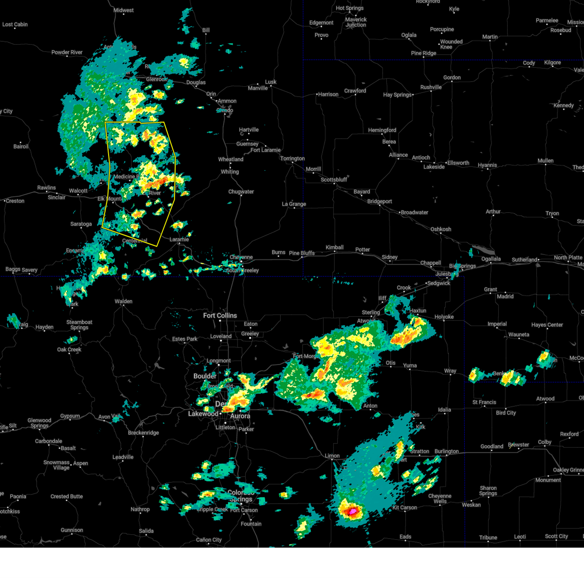
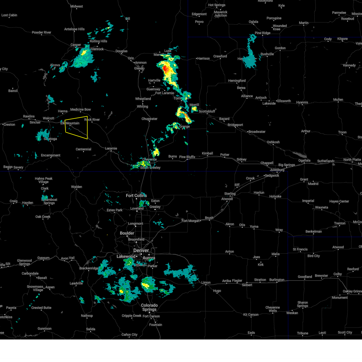
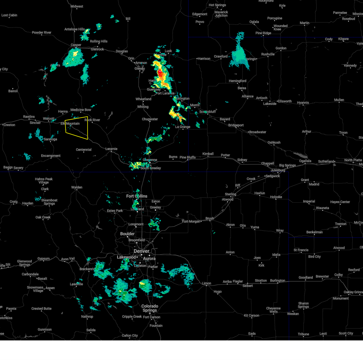
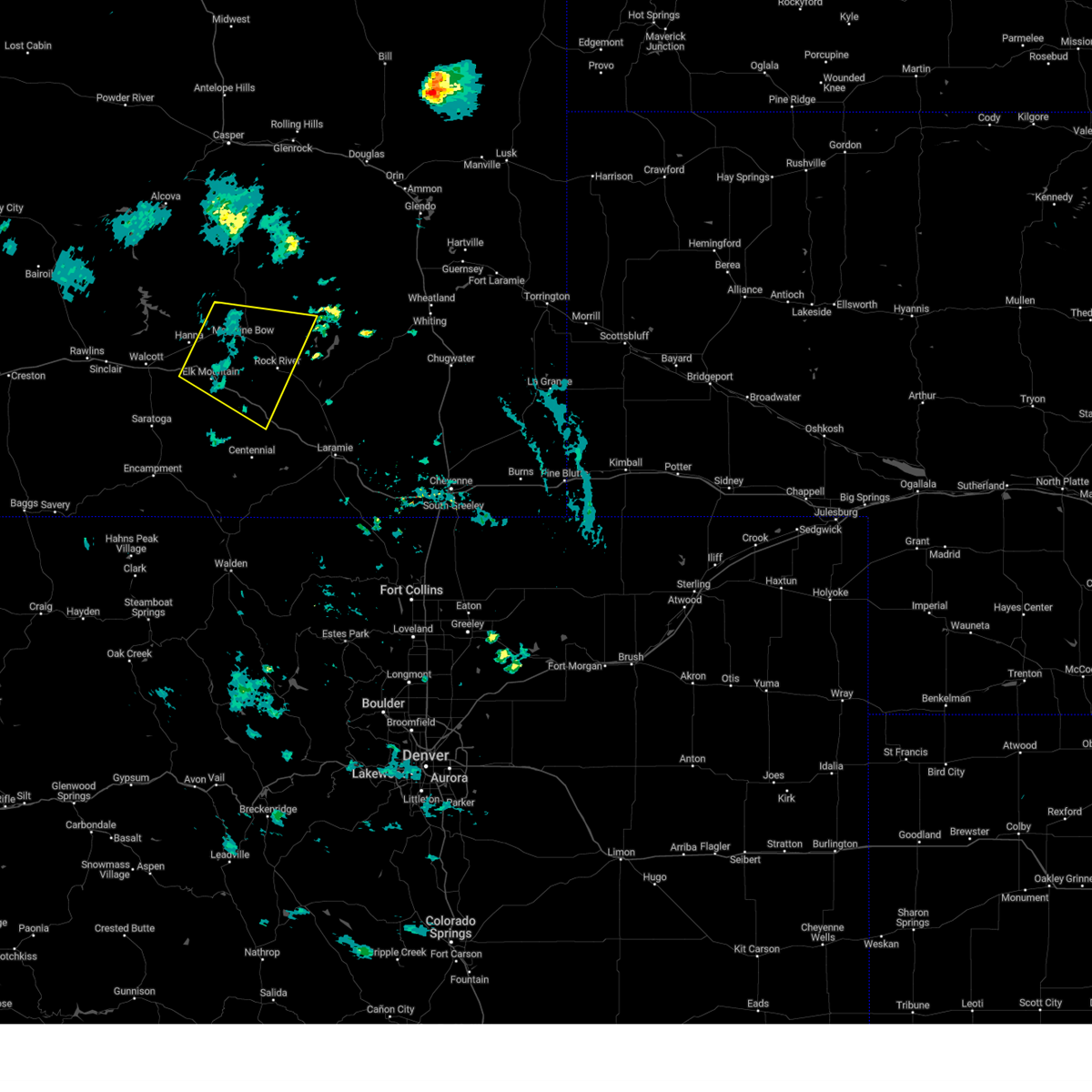
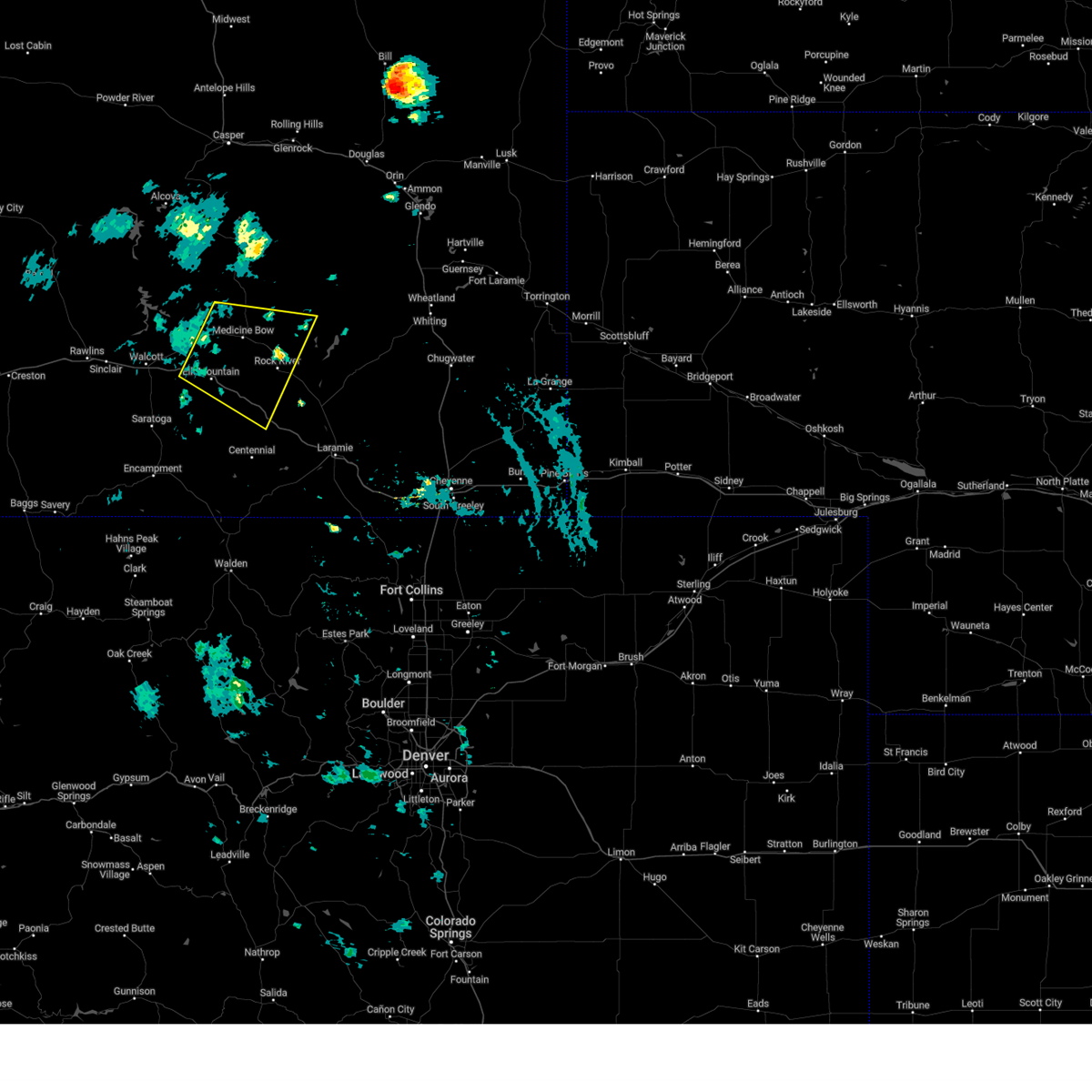
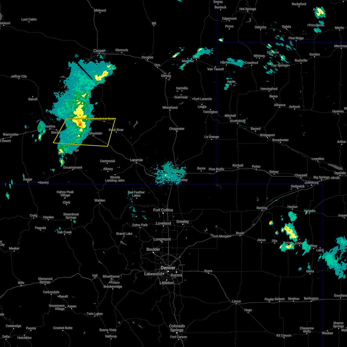
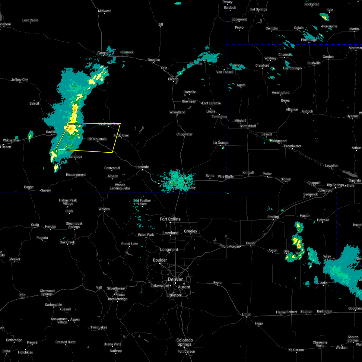
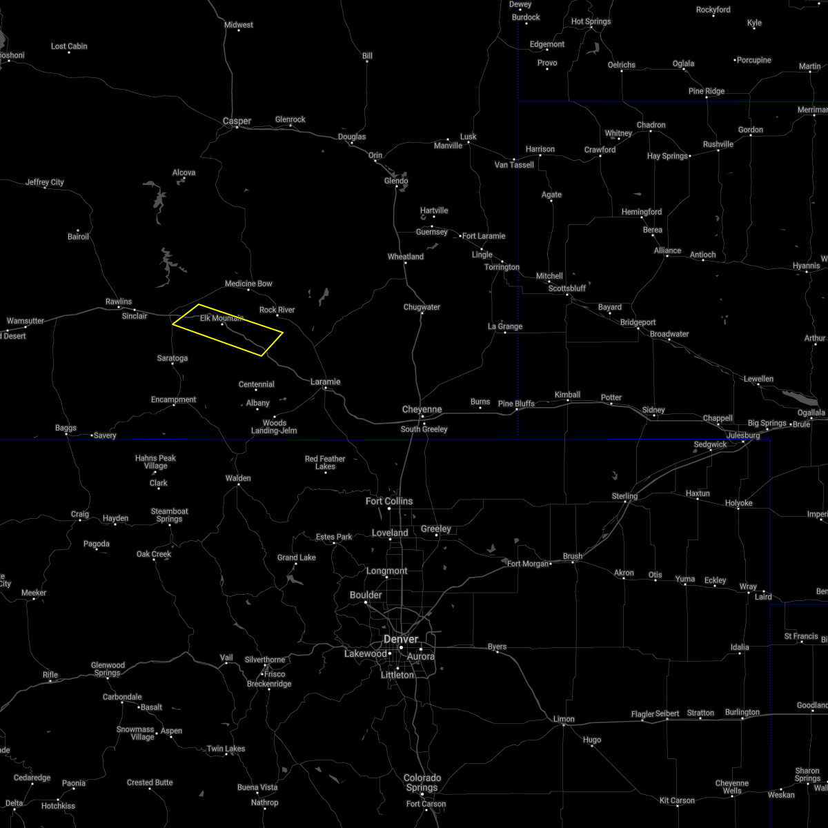
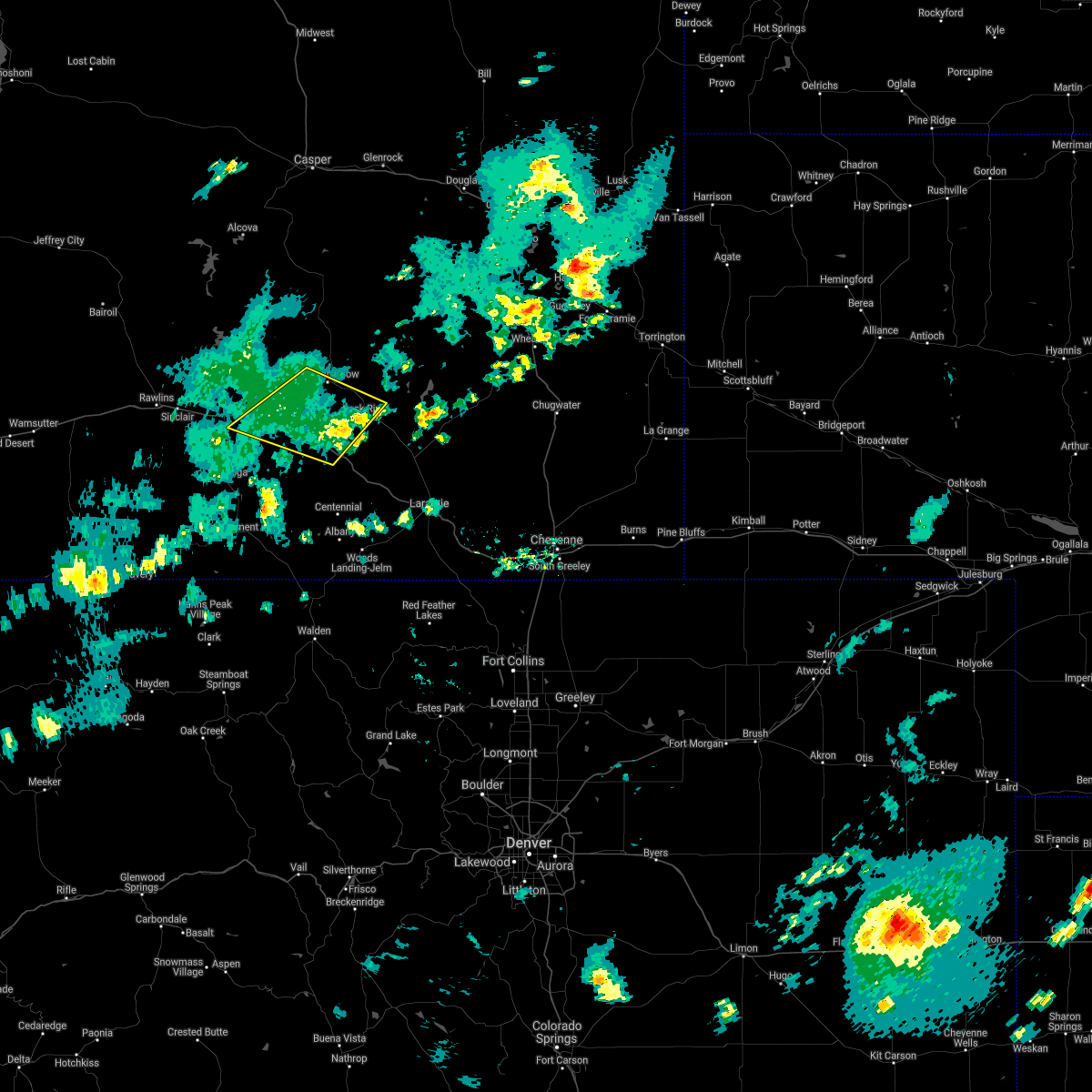
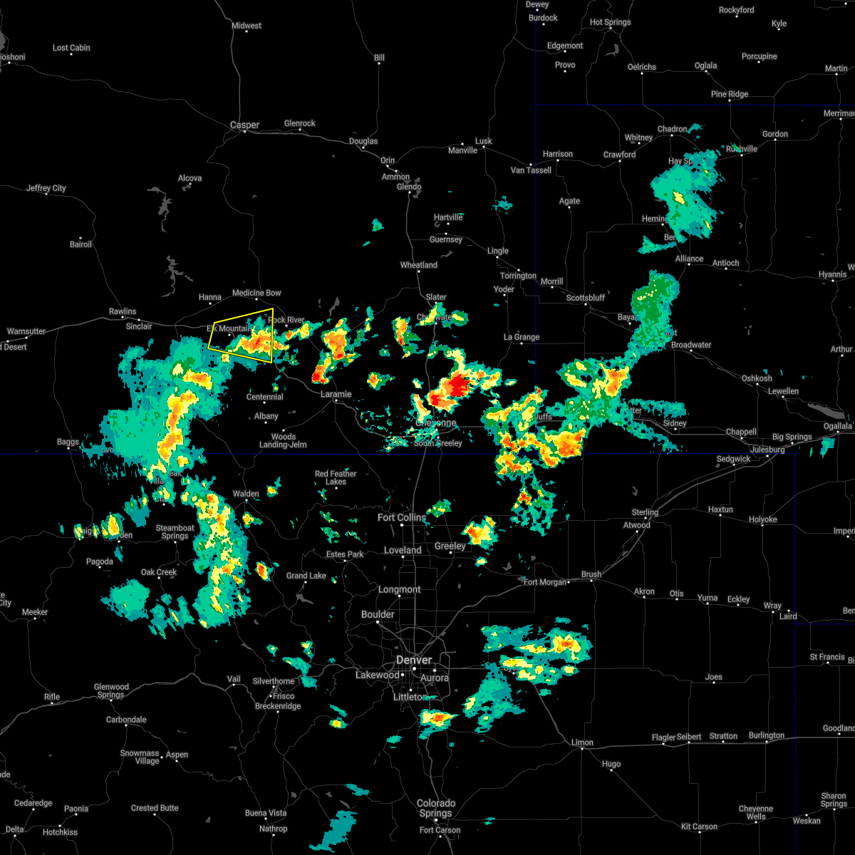
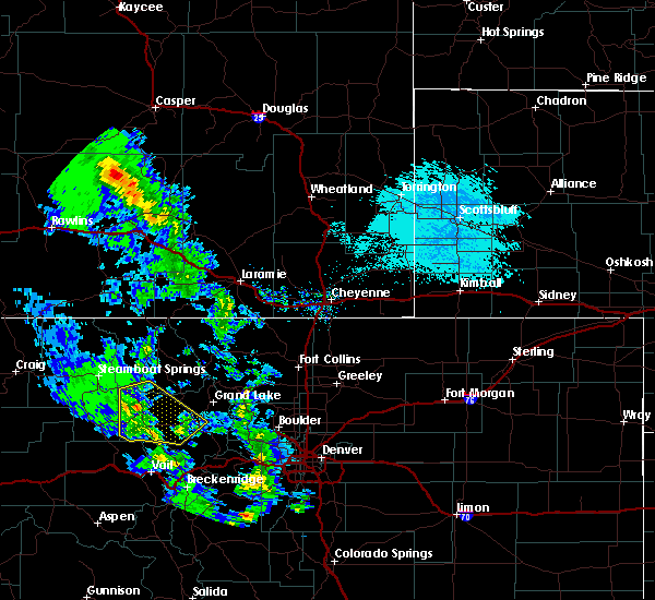
Hail Map for Elk Mountain, WY
The Elk Mountain, WY area has had 0 reports of on-the-ground hail by trained spotters, and has been under severe weather warnings 15 times during the past 12 months. Doppler radar has detected hail at or near Elk Mountain, WY on 3 occasions, including 1 occasion during the past year.
| Name: | Elk Mountain, WY |
| Where Located: | 49.9 miles WNW of Laramie, WY |
| Map: | Google Map for Elk Mountain, WY |
| Population: | 191 |
| Housing Units: | 109 |
| More Info: | Search Google for Elk Mountain, WY |
0
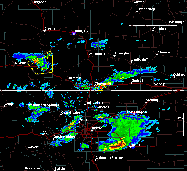
The Top Recent Hail Date for Elk Mountain, WY is Wednesday, June 24, 2026 (3rd out of 3)
Hail and Wind Damage Spotted near Elk Mountain, WY
| Date / Time | Report Details |
|---|---|
| 6/26/2026 7:56 PM MDT | Storm damage reported in carbon county WY, 3 miles SE of Elk Mountain, WY |
| 6/26/2026 7:52 PM MDT | Lightning detected in the vicinity at the time of the mesowest observatio in carbon county WY, 3 miles SE of Elk Mountain, WY |
| 6/25/2026 3:52 PM MDT |
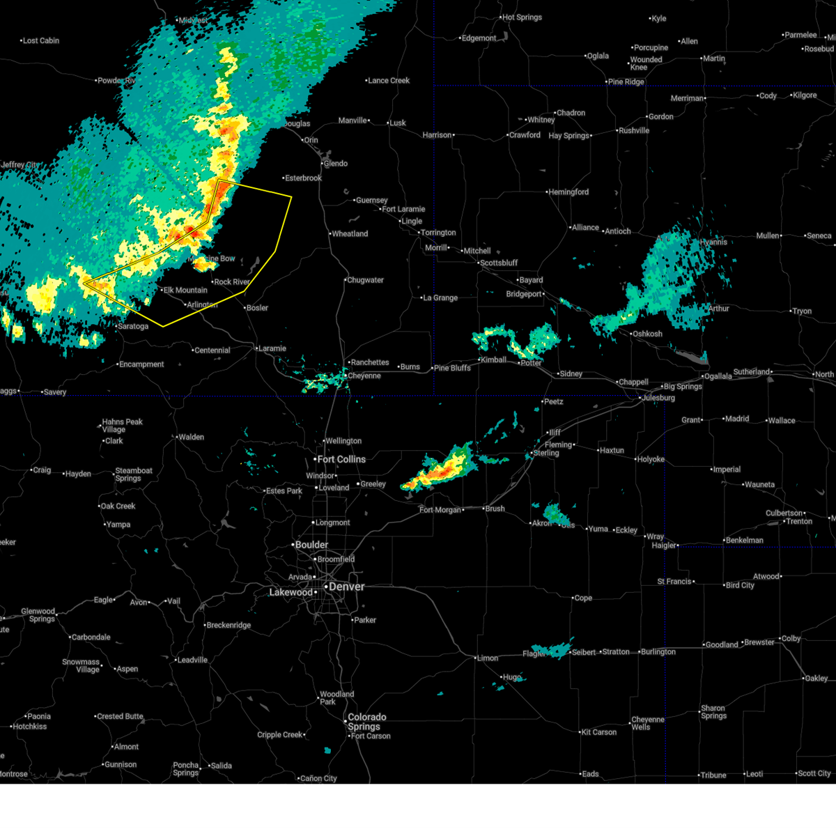 Svrcys the national weather service in cheyenne has issued a * severe thunderstorm warning for, east central carbon county in south central wyoming, northeastern albany county in southeastern wyoming, south central converse county in east central wyoming, * until 415 pm mdt. * at 351 pm mdt, severe thunderstorms were located along a line extending from 9 miles south of campbell creek campground to 13 miles east of battle mountain to near medicine bow to 10 miles southeast of fort steele historic site, moving east at 45 mph (60 mph wind gusts have been observed along i-80). Hazards include 60 mph wind gusts and penny size hail. expect damage to roofs, siding, and trees Svrcys the national weather service in cheyenne has issued a * severe thunderstorm warning for, east central carbon county in south central wyoming, northeastern albany county in southeastern wyoming, south central converse county in east central wyoming, * until 415 pm mdt. * at 351 pm mdt, severe thunderstorms were located along a line extending from 9 miles south of campbell creek campground to 13 miles east of battle mountain to near medicine bow to 10 miles southeast of fort steele historic site, moving east at 45 mph (60 mph wind gusts have been observed along i-80). Hazards include 60 mph wind gusts and penny size hail. expect damage to roofs, siding, and trees
|
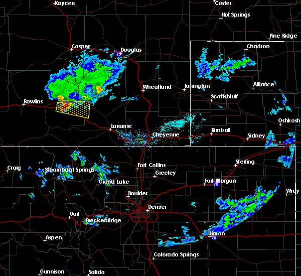
| 6/24/2026 7:20 PM MDT |
 The storm which prompted the warning has weakened below severe limits, and has exited the warned area. therefore, the warning will be allowed to expire. however, small hail and gusty winds are still possible with this thunderstorm. a tornado watch remains in effect until 1100 pm mdt for southeastern wyoming. The storm which prompted the warning has weakened below severe limits, and has exited the warned area. therefore, the warning will be allowed to expire. however, small hail and gusty winds are still possible with this thunderstorm. a tornado watch remains in effect until 1100 pm mdt for southeastern wyoming.
|
| 6/24/2026 6:43 PM MDT |
 Svrcys the national weather service in cheyenne has issued a * severe thunderstorm warning for, east central carbon county in south central wyoming, central albany county in southeastern wyoming, * until 730 pm mdt. * at 643 pm mdt, a severe thunderstorm was located near arlington, or 41 miles northwest of laramie, moving east at 20 mph (radar indicated). Hazards include 60 mph wind gusts and penny size hail. expect damage to roofs, siding, and trees Svrcys the national weather service in cheyenne has issued a * severe thunderstorm warning for, east central carbon county in south central wyoming, central albany county in southeastern wyoming, * until 730 pm mdt. * at 643 pm mdt, a severe thunderstorm was located near arlington, or 41 miles northwest of laramie, moving east at 20 mph (radar indicated). Hazards include 60 mph wind gusts and penny size hail. expect damage to roofs, siding, and trees
|
| 6/24/2026 5:58 PM MDT |
 Svrcys the national weather service in cheyenne has issued a * severe thunderstorm warning for, east central carbon county in south central wyoming, southwestern albany county in southeastern wyoming, * until 645 pm mdt. * at 558 pm mdt, severe thunderstorms were located along a line extending from 10 miles northeast of saratoga lake to near arlington, moving east at 15 mph (radar indicated). Hazards include 60 mph wind gusts and quarter size hail. Hail damage to vehicles is expected. Expect wind damage to roofs, siding, and trees. Svrcys the national weather service in cheyenne has issued a * severe thunderstorm warning for, east central carbon county in south central wyoming, southwestern albany county in southeastern wyoming, * until 645 pm mdt. * at 558 pm mdt, severe thunderstorms were located along a line extending from 10 miles northeast of saratoga lake to near arlington, moving east at 15 mph (radar indicated). Hazards include 60 mph wind gusts and quarter size hail. Hail damage to vehicles is expected. Expect wind damage to roofs, siding, and trees.
|
| 6/22/2026 7:46 PM MDT | Mesonet station wy18 halleck ridge (wydot in carbon county WY, 6.7 miles SE of Elk Mountain, WY |
| 6/22/2026 7:36 PM MDT |
 At 736 pm mdt, a shower capable of producing strong, gusty winds was located near elk mountain, or 37 miles east of rawlins, moving east at 50 mph (radar indicated). Hazards include 60 mph wind gusts. Expect damage to roofs, siding, and trees. strong winds may be hazardous to light weight and high profile vehicles. locations impacted include, hanna, elk mountain, bow river campground, deep creek campground, and arlington. This includes interstate 80 in wyoming between mile markers 237 and 275. At 736 pm mdt, a shower capable of producing strong, gusty winds was located near elk mountain, or 37 miles east of rawlins, moving east at 50 mph (radar indicated). Hazards include 60 mph wind gusts. Expect damage to roofs, siding, and trees. strong winds may be hazardous to light weight and high profile vehicles. locations impacted include, hanna, elk mountain, bow river campground, deep creek campground, and arlington. This includes interstate 80 in wyoming between mile markers 237 and 275.
|
| 6/22/2026 7:01 PM MDT |
 Svrcys the national weather service in cheyenne has issued a * severe thunderstorm warning for, east central carbon county in south central wyoming, * until 800 pm mdt. * at 700 pm mdt, a shower producing strong, gusty winds was located near fort steele historic site, or 12 miles east of rawlins, moving east at 40 mph (public). Hazards include 70 mph wind gusts. Expect considerable tree damage. damage is likely to mobile homes, roofs, and outbuildings. Strong winds may be hazardous to light weight and high profile vehicles. Svrcys the national weather service in cheyenne has issued a * severe thunderstorm warning for, east central carbon county in south central wyoming, * until 800 pm mdt. * at 700 pm mdt, a shower producing strong, gusty winds was located near fort steele historic site, or 12 miles east of rawlins, moving east at 40 mph (public). Hazards include 70 mph wind gusts. Expect considerable tree damage. damage is likely to mobile homes, roofs, and outbuildings. Strong winds may be hazardous to light weight and high profile vehicles.
|
| 6/20/2026 6:29 PM MDT |
 The storms which prompted the warning have moved out of the warned area. therefore, the warning will be allowed to expire. however, gusty winds are still possible with these thunderstorms. a severe thunderstorm watch remains in effect until 900 pm mdt for south central wyoming. The storms which prompted the warning have moved out of the warned area. therefore, the warning will be allowed to expire. however, gusty winds are still possible with these thunderstorms. a severe thunderstorm watch remains in effect until 900 pm mdt for south central wyoming.
|
| 6/20/2026 6:26 PM MDT |
 Svrcys the national weather service in cheyenne has issued a * severe thunderstorm warning for, northeastern carbon county in south central wyoming, north central albany county in southeastern wyoming, * until 730 pm mdt. * at 626 pm mdt, severe thunderstorms were located along a line extending from 7 miles southwest of shirley basin to 13 miles northeast of saratoga lake, moving east at 25 mph (radar indicated). Hazards include 60 mph wind gusts. expect damage to roofs, siding, and trees Svrcys the national weather service in cheyenne has issued a * severe thunderstorm warning for, northeastern carbon county in south central wyoming, north central albany county in southeastern wyoming, * until 730 pm mdt. * at 626 pm mdt, severe thunderstorms were located along a line extending from 7 miles southwest of shirley basin to 13 miles northeast of saratoga lake, moving east at 25 mph (radar indicated). Hazards include 60 mph wind gusts. expect damage to roofs, siding, and trees
|
| 6/20/2026 6:18 PM MDT |
 At 618 pm mdt, severe thunderstorms were located along a line extending from 12 miles west of battle mountain to 11 miles north of saratoga lake, moving northeast at 25 mph (public). Hazards include 70 mph wind gusts. Expect considerable tree damage. damage is likely to mobile homes, roofs, and outbuildings. locations impacted include, saratoga, hanna, elk mountain, shirley basin, saratoga lake campground, prior flat campground, saratoga lake, and shively field. This includes interstate 80 in wyoming between mile markers 235 and 260. At 618 pm mdt, severe thunderstorms were located along a line extending from 12 miles west of battle mountain to 11 miles north of saratoga lake, moving northeast at 25 mph (public). Hazards include 70 mph wind gusts. Expect considerable tree damage. damage is likely to mobile homes, roofs, and outbuildings. locations impacted include, saratoga, hanna, elk mountain, shirley basin, saratoga lake campground, prior flat campground, saratoga lake, and shively field. This includes interstate 80 in wyoming between mile markers 235 and 260.
|
| 6/20/2026 5:27 PM MDT |
 Svrcys the national weather service in cheyenne has issued a * severe thunderstorm warning for, northeastern carbon county in south central wyoming, * until 630 pm mdt. * at 527 pm mdt, severe thunderstorms were located along a line extending from 8 miles northeast of dugway campground to 9 miles southeast of teton reservoir, moving east at 35 mph (public). Hazards include 60 mph wind gusts. expect damage to roofs, siding, and trees Svrcys the national weather service in cheyenne has issued a * severe thunderstorm warning for, northeastern carbon county in south central wyoming, * until 630 pm mdt. * at 527 pm mdt, severe thunderstorms were located along a line extending from 8 miles northeast of dugway campground to 9 miles southeast of teton reservoir, moving east at 35 mph (public). Hazards include 60 mph wind gusts. expect damage to roofs, siding, and trees
|
| 6/20/2026 3:25 PM MDT |
 Svrcys the national weather service in cheyenne has issued a * severe thunderstorm warning for, northeastern carbon county in south central wyoming, north central albany county in southeastern wyoming, southwestern converse county in east central wyoming, * until 430 pm mdt. * at 325 pm mdt, severe thunderstorms were located along a line extending from 8 miles west of shirley basin to 9 miles southwest of battle mountain to near hanna, moving east at 30 mph (radar indicated). Hazards include 60 mph wind gusts and penny size hail. expect damage to roofs, siding, and trees Svrcys the national weather service in cheyenne has issued a * severe thunderstorm warning for, northeastern carbon county in south central wyoming, north central albany county in southeastern wyoming, southwestern converse county in east central wyoming, * until 430 pm mdt. * at 325 pm mdt, severe thunderstorms were located along a line extending from 8 miles west of shirley basin to 9 miles southwest of battle mountain to near hanna, moving east at 30 mph (radar indicated). Hazards include 60 mph wind gusts and penny size hail. expect damage to roofs, siding, and trees
|
| 6/20/2026 3:09 PM MDT |
 At 309 pm mdt, severe thunderstorms were located along a line extending from near prior flat campground to 16 miles southeast of dome rock to 7 miles southeast of seminoe state park, moving east at 20 mph (radar indicated). Hazards include 60 mph wind gusts and quarter size hail. Hail damage to vehicles is expected. expect wind damage to roofs, siding, and trees. locations impacted include, hanna, medicine bow, elk mountain, seminoe campground, miracle mile, fort steele historic site, shirley basin, seminoe dam, prior flat campground, kortes dam, dome rock, and seminoe state park. This includes interstate 80 in wyoming between mile markers 223 and 262. At 309 pm mdt, severe thunderstorms were located along a line extending from near prior flat campground to 16 miles southeast of dome rock to 7 miles southeast of seminoe state park, moving east at 20 mph (radar indicated). Hazards include 60 mph wind gusts and quarter size hail. Hail damage to vehicles is expected. expect wind damage to roofs, siding, and trees. locations impacted include, hanna, medicine bow, elk mountain, seminoe campground, miracle mile, fort steele historic site, shirley basin, seminoe dam, prior flat campground, kortes dam, dome rock, and seminoe state park. This includes interstate 80 in wyoming between mile markers 223 and 262.
|
| 6/20/2026 2:40 PM MDT |
 Svrcys the national weather service in cheyenne has issued a * severe thunderstorm warning for, northeastern carbon county in south central wyoming, * until 330 pm mdt. * at 239 pm mdt, severe thunderstorms were located along a line extending from near dome rock to seminoe state park to 8 miles north of dugway campground, moving east at 45 mph (radar indicated). Hazards include 60 mph wind gusts and penny size hail. expect damage to roofs, siding, and trees Svrcys the national weather service in cheyenne has issued a * severe thunderstorm warning for, northeastern carbon county in south central wyoming, * until 330 pm mdt. * at 239 pm mdt, severe thunderstorms were located along a line extending from near dome rock to seminoe state park to 8 miles north of dugway campground, moving east at 45 mph (radar indicated). Hazards include 60 mph wind gusts and penny size hail. expect damage to roofs, siding, and trees
|
| 12/5/2025 9:22 PM MST | Wydot sensor at elk mountai in carbon county WY, 3 miles SE of Elk Mountain, WY |
| 9/10/2025 11:10 AM MDT | Mesonet station wy22 2.7 nw arlington (wydot in carbon county WY, 10.1 miles WNW of Elk Mountain, WY |
| 8/2/2025 5:57 PM MDT |
 The storm which prompted the warning has moved out of the area. therefore, the warning will be allowed to expire. however, gusty winds are still possible with this thunderstorm. The storm which prompted the warning has moved out of the area. therefore, the warning will be allowed to expire. however, gusty winds are still possible with this thunderstorm.
|
| 8/2/2025 5:26 PM MDT | Corrects previous non-tstm wnd gst report from 3 nw arlington. mesonet station wy22 2.7 nw arlington (wydot in carbon county WY, 10.1 miles WNW of Elk Mountain, WY |
| 8/2/2025 5:19 PM MDT |
 Svrcys the national weather service in cheyenne has issued a * severe thunderstorm warning for, east central carbon county in south central wyoming, southwestern albany county in southeastern wyoming, * until 600 pm mdt. * at 518 pm mdt, a severe thunderstorm was located over elk mountain, or 40 miles east of rawlins, moving southeast at 15 mph (radar indicated). Hazards include 70 mph wind gusts. Expect considerable tree damage. Damage is likely to mobile homes, roofs, and outbuildings. Svrcys the national weather service in cheyenne has issued a * severe thunderstorm warning for, east central carbon county in south central wyoming, southwestern albany county in southeastern wyoming, * until 600 pm mdt. * at 518 pm mdt, a severe thunderstorm was located over elk mountain, or 40 miles east of rawlins, moving southeast at 15 mph (radar indicated). Hazards include 70 mph wind gusts. Expect considerable tree damage. Damage is likely to mobile homes, roofs, and outbuildings.
|
| 8/2/2025 5:12 PM MDT | Corrects previous non-tstm wnd gst report from 7 nw elk mountain. mesonet station wy18 halleck ridge (wydot in carbon county WY, 6.7 miles SE of Elk Mountain, WY |
| 6/29/2025 3:08 PM MDT | Mesonet station wy22 2.7 nw arlington (wydot). gust was associated with decaying showers/storm in carbon county WY, 10.1 miles WNW of Elk Mountain, WY |
| 6/17/2025 4:12 PM MDT | Mesonet station wy22 2.7 nw arlington (wydot in carbon county WY, 10.1 miles WNW of Elk Mountain, WY |
| 6/17/2025 3:42 PM MDT | Mesonet station wy18 halleck ridge (wydot in carbon county WY, 6.7 miles SE of Elk Mountain, WY |
| 6/17/2025 3:41 PM MDT |
 Svrcys the national weather service in cheyenne has issued a * severe thunderstorm warning for, southeastern carbon county in south central wyoming, southwestern albany county in southeastern wyoming, * until 445 pm mdt. * at 341 pm mdt, severe thunderstorms were located along a line extending from near hanna to near pickaroon campground, moving east at 30 mph (radar indicated). Hazards include 70 mph wind gusts. Expect considerable tree damage. Damage is likely to mobile homes, roofs, and outbuildings. Svrcys the national weather service in cheyenne has issued a * severe thunderstorm warning for, southeastern carbon county in south central wyoming, southwestern albany county in southeastern wyoming, * until 445 pm mdt. * at 341 pm mdt, severe thunderstorms were located along a line extending from near hanna to near pickaroon campground, moving east at 30 mph (radar indicated). Hazards include 70 mph wind gusts. Expect considerable tree damage. Damage is likely to mobile homes, roofs, and outbuildings.
|
| 5/4/2025 4:42 PM MDT |
 The storm which prompted the warning has weakened below severe limits, and no longer poses an immediate threat to life or property. therefore, the warning will be allowed to expire. however, gusty winds are still possible with this thunderstorm. The storm which prompted the warning has weakened below severe limits, and no longer poses an immediate threat to life or property. therefore, the warning will be allowed to expire. however, gusty winds are still possible with this thunderstorm.
|
| 5/4/2025 4:35 PM MDT |
 At 434 pm mdt, a severe thunderstorm was located over elk mountain, or 44 miles east of rawlins, moving north at 20 mph (radar indicated). Hazards include 70 mph wind gusts. Expect considerable tree damage. damage is likely to mobile homes, roofs, and outbuildings. Locations impacted include, elk mountain, arlington, and mcfadden. At 434 pm mdt, a severe thunderstorm was located over elk mountain, or 44 miles east of rawlins, moving north at 20 mph (radar indicated). Hazards include 70 mph wind gusts. Expect considerable tree damage. damage is likely to mobile homes, roofs, and outbuildings. Locations impacted include, elk mountain, arlington, and mcfadden.
|
| 5/4/2025 4:17 PM MDT |
 the severe thunderstorm warning has been cancelled and is no longer in effect the severe thunderstorm warning has been cancelled and is no longer in effect
|
| 5/4/2025 4:17 PM MDT |
 At 416 pm mdt, a severe thunderstorm was located near elk mountain, or 45 miles northwest of laramie, moving north at 20 mph (radar indicated). Hazards include 70 mph wind gusts. Expect considerable tree damage. damage is likely to mobile homes, roofs, and outbuildings. Locations impacted include, elk mountain, bow river campground, arlington, and mcfadden. At 416 pm mdt, a severe thunderstorm was located near elk mountain, or 45 miles northwest of laramie, moving north at 20 mph (radar indicated). Hazards include 70 mph wind gusts. Expect considerable tree damage. damage is likely to mobile homes, roofs, and outbuildings. Locations impacted include, elk mountain, bow river campground, arlington, and mcfadden.
|
| 5/4/2025 4:06 PM MDT | Mesonet station wy18 halleck ridge (wydot in carbon county WY, 6.7 miles SE of Elk Mountain, WY |
| 5/4/2025 4:02 PM MDT |
 Svrcys the national weather service in cheyenne has issued a * severe thunderstorm warning for, east central carbon county in south central wyoming, southwestern albany county in southeastern wyoming, * until 445 pm mdt. * at 400 pm mdt, a severe thunderstorm was located over bow river campground, or 43 miles west of laramie, moving north at 20 mph (radar indicated. at 352 pm mdt, wydot road sensors reported wind gusts in excess of 60 mph). Hazards include 70 mph wind gusts. Expect considerable tree damage. Damage is likely to mobile homes, roofs, and outbuildings. Svrcys the national weather service in cheyenne has issued a * severe thunderstorm warning for, east central carbon county in south central wyoming, southwestern albany county in southeastern wyoming, * until 445 pm mdt. * at 400 pm mdt, a severe thunderstorm was located over bow river campground, or 43 miles west of laramie, moving north at 20 mph (radar indicated. at 352 pm mdt, wydot road sensors reported wind gusts in excess of 60 mph). Hazards include 70 mph wind gusts. Expect considerable tree damage. Damage is likely to mobile homes, roofs, and outbuildings.
|
| 5/4/2025 3:52 PM MDT | Sustained wind 58 mp in carbon county WY, 6.7 miles SE of Elk Mountain, WY |
| 5/4/2025 3:02 PM MDT | Mesonet station wy18 halleck ridge (wydot in carbon county WY, 6.7 miles SE of Elk Mountain, WY |
| 5/4/2025 3:00 PM MDT | Halleck ridg in carbon county WY, 6.7 miles SE of Elk Mountain, WY |
| 8/25/2024 7:12 PM MDT | Mesonet station wy22 2.7 nw arlington (wydot in carbon county WY, 10.1 miles WNW of Elk Mountain, WY |
| 8/25/2024 6:42 PM MDT |
 At 641 pm mdt, severe thunderstorms were located along a line extending from 10 miles northwest of battle mountain to 9 miles northwest of medicine bow to near elk mountain to bennett creek campground, moving east at 40 mph (radar indicated). Hazards include 60 mph wind gusts. Expect damage to roofs, siding, and trees. Locations impacted include, hanna, encampment, medicine bow, elk mountain, riverside, corral creek campground, pickaroon campground, odd fellows campground, ryan park campground, arlington, french creek campground, bennett creek campground, pike pole campground, savage run wilderness, shirley basin, ryan park, turpin reservoir, sugar loaf campground, bow river campground, and deep creek campground. At 641 pm mdt, severe thunderstorms were located along a line extending from 10 miles northwest of battle mountain to 9 miles northwest of medicine bow to near elk mountain to bennett creek campground, moving east at 40 mph (radar indicated). Hazards include 60 mph wind gusts. Expect damage to roofs, siding, and trees. Locations impacted include, hanna, encampment, medicine bow, elk mountain, riverside, corral creek campground, pickaroon campground, odd fellows campground, ryan park campground, arlington, french creek campground, bennett creek campground, pike pole campground, savage run wilderness, shirley basin, ryan park, turpin reservoir, sugar loaf campground, bow river campground, and deep creek campground.
|
| 8/25/2024 6:28 PM MDT | Mesonet station wy18 halleck ridge (wydot in carbon county WY, 6.7 miles SE of Elk Mountain, WY |
| 8/25/2024 6:19 PM MDT |
 Svrcys the national weather service in cheyenne has issued a * severe thunderstorm warning for, eastern carbon county in south central wyoming, northwestern albany county in southeastern wyoming, * until 700 pm mdt. * at 618 pm mdt, severe thunderstorms were located along a line extending from 8 miles northeast of dome rock to 11 miles south of prior flat campground to 7 miles southwest of hanna to saratoga lake to near hog park reservoir, moving east at 35 mph (radar indicated). Hazards include 60 mph wind gusts. expect damage to roofs, siding, and trees Svrcys the national weather service in cheyenne has issued a * severe thunderstorm warning for, eastern carbon county in south central wyoming, northwestern albany county in southeastern wyoming, * until 700 pm mdt. * at 618 pm mdt, severe thunderstorms were located along a line extending from 8 miles northeast of dome rock to 11 miles south of prior flat campground to 7 miles southwest of hanna to saratoga lake to near hog park reservoir, moving east at 35 mph (radar indicated). Hazards include 60 mph wind gusts. expect damage to roofs, siding, and trees
|
| 8/17/2024 6:45 PM MDT |
 The storms which prompted the warning have weakened below severe limits, and have exited the warned area. therefore, the warning will be allowed to expire. however, gusty winds around 50 mph are still possible with these thunderstorms. The storms which prompted the warning have weakened below severe limits, and have exited the warned area. therefore, the warning will be allowed to expire. however, gusty winds around 50 mph are still possible with these thunderstorms.
|
| 8/17/2024 6:42 PM MDT | Mesonet station wy20 2.5 se elk mountain (wydot in carbon county WY, 2.5 miles WNW of Elk Mountain, WY |
| 8/17/2024 6:36 PM MDT | Mesonet station wy18 halleck ridge (wydot in carbon county WY, 6.7 miles SE of Elk Mountain, WY |
| 8/17/2024 5:58 PM MDT |
 Svrcys the national weather service in cheyenne has issued a * severe thunderstorm warning for, central carbon county in south central wyoming, * until 645 pm mdt. * at 557 pm mdt, severe thunderstorms were located along a line extending from 18 miles southeast of wamsutter to 7 miles southwest of teton reservoir to 6 miles north of riverside, moving northeast at 30 mph (radar indicated). Hazards include 60 mph wind gusts. expect damage to roofs, siding, and trees Svrcys the national weather service in cheyenne has issued a * severe thunderstorm warning for, central carbon county in south central wyoming, * until 645 pm mdt. * at 557 pm mdt, severe thunderstorms were located along a line extending from 18 miles southeast of wamsutter to 7 miles southwest of teton reservoir to 6 miles north of riverside, moving northeast at 30 mph (radar indicated). Hazards include 60 mph wind gusts. expect damage to roofs, siding, and trees
|
| 7/28/2024 4:52 PM MDT |
 The storms which prompted the warning have weakened below severe limits, and have exited the warned area. therefore, the warning will be allowed to expire. however, gusty winds are still possible with these thunderstorms. The storms which prompted the warning have weakened below severe limits, and have exited the warned area. therefore, the warning will be allowed to expire. however, gusty winds are still possible with these thunderstorms.
|
| 7/28/2024 4:06 PM MDT | Mesonet station wy18 halleck ridge (wydot in carbon county WY, 6.7 miles SE of Elk Mountain, WY |
| 7/28/2024 3:48 PM MDT |
 Svrcys the national weather service in cheyenne has issued a * severe thunderstorm warning for, northeastern carbon county in south central wyoming, central albany county in southeastern wyoming, * until 500 pm mdt. * at 346 pm mdt, thunderstorms with strong gusty winds were located along a line extending from 6 miles southwest of battle mountain to 13 miles southeast of fort steele historic site, moving east at 30 mph (radar indicated). Hazards include 60 mph wind gusts. Expect damage to roofs, siding, and trees. Travelers in light weight and high profile vehicles should be alert for strong cross winds along interstate 80. Svrcys the national weather service in cheyenne has issued a * severe thunderstorm warning for, northeastern carbon county in south central wyoming, central albany county in southeastern wyoming, * until 500 pm mdt. * at 346 pm mdt, thunderstorms with strong gusty winds were located along a line extending from 6 miles southwest of battle mountain to 13 miles southeast of fort steele historic site, moving east at 30 mph (radar indicated). Hazards include 60 mph wind gusts. Expect damage to roofs, siding, and trees. Travelers in light weight and high profile vehicles should be alert for strong cross winds along interstate 80.
|
| 7/27/2024 7:56 PM MDT |
 The storm which prompted the warning has weakened below severe limits, and no longer poses an immediate threat to life or property. therefore, the warning will be allowed to expire. however, gusty winds are still possible with this thunderstorm. The storm which prompted the warning has weakened below severe limits, and no longer poses an immediate threat to life or property. therefore, the warning will be allowed to expire. however, gusty winds are still possible with this thunderstorm.
|
| 7/27/2024 7:20 PM MDT | Halleck ridge wydot sit in carbon county WY, 6.7 miles SE of Elk Mountain, WY |
| 7/27/2024 7:16 PM MDT |
 Svrcys the national weather service in cheyenne has issued a * severe thunderstorm warning for, east central carbon county in south central wyoming, northwestern albany county in southeastern wyoming, * until 800 pm mdt. * at 715 pm mdt, a severe thunderstorm was located 7 miles south of hanna, or 36 miles east of rawlins, moving northeast at 40 mph (radar indicated). Hazards include 70 mph wind gusts. Expect considerable tree damage. Damage is likely to mobile homes, roofs, and outbuildings. Svrcys the national weather service in cheyenne has issued a * severe thunderstorm warning for, east central carbon county in south central wyoming, northwestern albany county in southeastern wyoming, * until 800 pm mdt. * at 715 pm mdt, a severe thunderstorm was located 7 miles south of hanna, or 36 miles east of rawlins, moving northeast at 40 mph (radar indicated). Hazards include 70 mph wind gusts. Expect considerable tree damage. Damage is likely to mobile homes, roofs, and outbuildings.
|
| 7/27/2024 4:38 PM MDT |
 The storms which prompted the warning have weakened below severe limits, and no longer pose an immediate threat to life or property. therefore, the warning will be allowed to expire. however, gusty winds are still possible with these thunderstorms. The storms which prompted the warning have weakened below severe limits, and no longer pose an immediate threat to life or property. therefore, the warning will be allowed to expire. however, gusty winds are still possible with these thunderstorms.
|
| 7/27/2024 4:21 PM MDT |
 At 420 pm mdt, severe thunderstorms were located along a line extending from near medicine bow to 10 miles southwest of elk mountain, moving east at 35 mph (public. at 416 pm, a wind gust of 63 mph was reported at halleck ridge along interstate 80). Hazards include 60 mph wind gusts. Expect damage to roofs, siding, and trees. Locations impacted include, hanna, medicine bow, elk mountain, bow river campground, arlington, and mcfadden. At 420 pm mdt, severe thunderstorms were located along a line extending from near medicine bow to 10 miles southwest of elk mountain, moving east at 35 mph (public. at 416 pm, a wind gust of 63 mph was reported at halleck ridge along interstate 80). Hazards include 60 mph wind gusts. Expect damage to roofs, siding, and trees. Locations impacted include, hanna, medicine bow, elk mountain, bow river campground, arlington, and mcfadden.
|
| 7/27/2024 4:16 PM MDT | Mesonet station wy18 halleck ridge (wydot in carbon county WY, 6.7 miles SE of Elk Mountain, WY |
| 7/27/2024 3:52 PM MDT |
 Svrcys the national weather service in cheyenne has issued a * severe thunderstorm warning for, east central carbon county in south central wyoming, northwestern albany county in southeastern wyoming, * until 445 pm mdt. * at 352 pm mdt, severe thunderstorms were located along a line extending from 11 miles south of prior flat campground to 8 miles northeast of saratoga lake, moving east at 35 mph (radar indicated). Hazards include 60 mph wind gusts. expect damage to roofs, siding, and trees Svrcys the national weather service in cheyenne has issued a * severe thunderstorm warning for, east central carbon county in south central wyoming, northwestern albany county in southeastern wyoming, * until 445 pm mdt. * at 352 pm mdt, severe thunderstorms were located along a line extending from 11 miles south of prior flat campground to 8 miles northeast of saratoga lake, moving east at 35 mph (radar indicated). Hazards include 60 mph wind gusts. expect damage to roofs, siding, and trees
|
| 7/1/2024 4:15 AM MDT |
 the severe thunderstorm warning has been cancelled and is no longer in effect the severe thunderstorm warning has been cancelled and is no longer in effect
|
| 7/1/2024 4:08 AM MDT |
 At 406 am mdt, a severe thunderstorm was located near mcfadden, or 40 miles northwest of laramie, moving east at 40 mph (department of highway sensor). Hazards include 60 mph wind gusts. Expect damage to roofs, siding, and trees. Locations impacted include, rock river, elk mountain, and mcfadden. At 406 am mdt, a severe thunderstorm was located near mcfadden, or 40 miles northwest of laramie, moving east at 40 mph (department of highway sensor). Hazards include 60 mph wind gusts. Expect damage to roofs, siding, and trees. Locations impacted include, rock river, elk mountain, and mcfadden.
|
| 7/1/2024 3:52 AM MDT | Mesonet station wy19 2.9 nw elk mountain (wydot in carbon county WY, 3 miles SE of Elk Mountain, WY |
| 7/1/2024 3:51 AM MDT |
 Svrcys the national weather service in cheyenne has issued a * severe thunderstorm warning for, east central carbon county in south central wyoming, central albany county in southeastern wyoming, * until 430 am mdt. * at 350 am mdt, a severe thunderstorm was located near elk mountain, or 45 miles northwest of laramie, moving east at 40 mph (radar indicated). Hazards include 60 mph wind gusts. expect damage to roofs, siding, and trees Svrcys the national weather service in cheyenne has issued a * severe thunderstorm warning for, east central carbon county in south central wyoming, central albany county in southeastern wyoming, * until 430 am mdt. * at 350 am mdt, a severe thunderstorm was located near elk mountain, or 45 miles northwest of laramie, moving east at 40 mph (radar indicated). Hazards include 60 mph wind gusts. expect damage to roofs, siding, and trees
|
| 6/10/2024 5:25 PM MDT |
 The storms which prompted the warning have weakened below severe limits, and no longer pose an immediate threat to life or property. therefore, the warning will be allowed to expire. however, gusty winds are still possible with these thunderstorms. The storms which prompted the warning have weakened below severe limits, and no longer pose an immediate threat to life or property. therefore, the warning will be allowed to expire. however, gusty winds are still possible with these thunderstorms.
|
| 6/10/2024 4:52 PM MDT | Storm damage reported in carbon county WY, 6.7 miles SE of Elk Mountain, WY |
| 6/10/2024 4:48 PM MDT |
 Svrcys the national weather service in cheyenne has issued a * severe thunderstorm warning for, east central carbon county in south central wyoming, central albany county in southeastern wyoming, * until 530 pm mdt. * at 447 pm mdt, severe thunderstorms were located along a line extending from near rock river to arlington to 7 miles east of saratoga lake, moving east at 20 mph (wydot road sensors along i-80 observed wind gusts up to 74mph). Hazards include 70 mph wind gusts. Expect considerable tree damage. Damage is likely to mobile homes, roofs, and outbuildings. Svrcys the national weather service in cheyenne has issued a * severe thunderstorm warning for, east central carbon county in south central wyoming, central albany county in southeastern wyoming, * until 530 pm mdt. * at 447 pm mdt, severe thunderstorms were located along a line extending from near rock river to arlington to 7 miles east of saratoga lake, moving east at 20 mph (wydot road sensors along i-80 observed wind gusts up to 74mph). Hazards include 70 mph wind gusts. Expect considerable tree damage. Damage is likely to mobile homes, roofs, and outbuildings.
|
| 6/10/2024 4:42 PM MDT | Wind gusts measured between 4:42 and 4:46 pm in carbon county WY, 6.7 miles SE of Elk Mountain, WY |
| 5/17/2024 4:43 PM MDT |
 The storms which prompted the warning have weakened below severe limits, and have exited the warned area. therefore, the warning will be allowed to expire. however, gusty winds are still possible with these showers. The storms which prompted the warning have weakened below severe limits, and have exited the warned area. therefore, the warning will be allowed to expire. however, gusty winds are still possible with these showers.
|
| 5/17/2024 3:57 PM MDT |
 Svrcys the national weather service in cheyenne has issued a * severe thunderstorm warning for, east central carbon county in south central wyoming, central albany county in southeastern wyoming, * until 445 pm mdt. * at 356 pm mdt, showers producing strong winds were located along a line extending from near medicine bow to 10 miles southwest of hanna, moving east at 45 mph (public). Hazards include 60 mph wind gusts. expect damage to roofs, siding, and trees Svrcys the national weather service in cheyenne has issued a * severe thunderstorm warning for, east central carbon county in south central wyoming, central albany county in southeastern wyoming, * until 445 pm mdt. * at 356 pm mdt, showers producing strong winds were located along a line extending from near medicine bow to 10 miles southwest of hanna, moving east at 45 mph (public). Hazards include 60 mph wind gusts. expect damage to roofs, siding, and trees
|
| 5/14/2024 7:20 PM MDT |
 At 719 pm mdt, severe thunderstorms were located along a line extending from near battle mountain to 6 miles east of medicine bow to 6 miles west of mcfadden, moving east at 40 mph (public. at 702pm a wind gust of 81 mph was reported at halleck ridge along interstate 80). Hazards include 70 mph wind gusts and penny size hail. Expect considerable tree damage. damage is likely to mobile homes, roofs, and outbuildings. Locations impacted include, medicine bow, rock river, elk mountain, arlington, and mcfadden. At 719 pm mdt, severe thunderstorms were located along a line extending from near battle mountain to 6 miles east of medicine bow to 6 miles west of mcfadden, moving east at 40 mph (public. at 702pm a wind gust of 81 mph was reported at halleck ridge along interstate 80). Hazards include 70 mph wind gusts and penny size hail. Expect considerable tree damage. damage is likely to mobile homes, roofs, and outbuildings. Locations impacted include, medicine bow, rock river, elk mountain, arlington, and mcfadden.
|
| 5/14/2024 7:16 PM MDT |
 At 716 pm mdt, severe thunderstorms were located along a line extending from near battle mountain to near medicine bow to near elk mountain, moving east at 30 mph (public. at 702pm a wind gust of 81 mph was reported at halleck ridge along interstate 80). Hazards include 70 mph wind gusts and penny size hail. Expect considerable tree damage. damage is likely to mobile homes, roofs, and outbuildings. Locations impacted include, medicine bow, rock river, elk mountain, arlington, and mcfadden. At 716 pm mdt, severe thunderstorms were located along a line extending from near battle mountain to near medicine bow to near elk mountain, moving east at 30 mph (public. at 702pm a wind gust of 81 mph was reported at halleck ridge along interstate 80). Hazards include 70 mph wind gusts and penny size hail. Expect considerable tree damage. damage is likely to mobile homes, roofs, and outbuildings. Locations impacted include, medicine bow, rock river, elk mountain, arlington, and mcfadden.
|
| 5/14/2024 7:02 PM MDT | From wy18 halleck ridge wind senso in carbon county WY, 7.1 miles SE of Elk Mountain, WY |
| 5/14/2024 6:59 PM MDT |
 Svrcys the national weather service in cheyenne has issued a * severe thunderstorm warning for, northeastern carbon county in south central wyoming, north central albany county in southeastern wyoming, * until 745 pm mdt. * at 659 pm mdt, severe thunderstorms were located along a line extending from 9 miles west of battle mountain to 10 miles northwest of medicine bow to 6 miles south of hanna, moving east at 30 mph (radar indicated). Hazards include 70 mph wind gusts and penny size hail. Expect considerable tree damage. Damage is likely to mobile homes, roofs, and outbuildings. Svrcys the national weather service in cheyenne has issued a * severe thunderstorm warning for, northeastern carbon county in south central wyoming, north central albany county in southeastern wyoming, * until 745 pm mdt. * at 659 pm mdt, severe thunderstorms were located along a line extending from 9 miles west of battle mountain to 10 miles northwest of medicine bow to 6 miles south of hanna, moving east at 30 mph (radar indicated). Hazards include 70 mph wind gusts and penny size hail. Expect considerable tree damage. Damage is likely to mobile homes, roofs, and outbuildings.
|
| 7/26/2023 5:16 PM MDT |
 At 516 pm mdt, outflow winds from thunderstorms were located along a line extending from 9 miles west of battle mountain to 8 miles north of arlington to sugar loaf campground, moving east at 35 mph (60mph wind gusts have been observed along i-80 in carbon county). Hazards include 60 mph wind gusts. Expect damage to roofs, siding, and trees. locations impacted include, medicine bow, rock river, elk mountain, battle mountain, shirley basin, bow river campground, wheatland reservoir 3, deep creek campground, little medicine school, arlington and north fork campground. this includes interstate 80 in wyoming between mile markers 255 and 298. hail threat, radar indicated max hail size, <. 75 in wind threat, radar indicated max wind gust, 60 mph. At 516 pm mdt, outflow winds from thunderstorms were located along a line extending from 9 miles west of battle mountain to 8 miles north of arlington to sugar loaf campground, moving east at 35 mph (60mph wind gusts have been observed along i-80 in carbon county). Hazards include 60 mph wind gusts. Expect damage to roofs, siding, and trees. locations impacted include, medicine bow, rock river, elk mountain, battle mountain, shirley basin, bow river campground, wheatland reservoir 3, deep creek campground, little medicine school, arlington and north fork campground. this includes interstate 80 in wyoming between mile markers 255 and 298. hail threat, radar indicated max hail size, <. 75 in wind threat, radar indicated max wind gust, 60 mph.
|
| 7/26/2023 4:50 PM MDT |
 At 449 pm mdt, outflow winds from severe thunderstorms were located along a line extending from 12 miles east of seminoe campground to near elk mountain to near lincoln park campground, moving east at 35 mph (wyoming dot road sensors reported wind gusts 55-60 mph). Hazards include 60 mph wind gusts. expect damage to roofs, siding, and trees At 449 pm mdt, outflow winds from severe thunderstorms were located along a line extending from 12 miles east of seminoe campground to near elk mountain to near lincoln park campground, moving east at 35 mph (wyoming dot road sensors reported wind gusts 55-60 mph). Hazards include 60 mph wind gusts. expect damage to roofs, siding, and trees
|
| 7/17/2023 7:06 PM MDT |
 The severe thunderstorm warning for east central carbon and central albany counties will expire at 715 pm mdt, the storm which prompted the warning has moved out of the area. therefore, the warning will be allowed to expire. The severe thunderstorm warning for east central carbon and central albany counties will expire at 715 pm mdt, the storm which prompted the warning has moved out of the area. therefore, the warning will be allowed to expire.
|
| 7/17/2023 7:04 PM MDT | Storm damage reported in carbon county WY, 7.1 miles WNW of Elk Mountain, WY |
| 7/17/2023 6:58 PM MDT | Storm damage reported in carbon county WY, 7.1 miles WNW of Elk Mountain, WY |
| 7/17/2023 6:49 PM MDT |
 At 646 pm mdt, a severe thunderstorm was located over elk mountain, or 42 miles east of rawlins, moving east at 35 mph. expect little to no rain and thunder within these areas strong winds (mesonet confirmed. at 642 pm, a mesonet station at cr 402 measured a wind gust of 72 mph!). Hazards include 70 mph wind gusts. Expect considerable tree damage. Damage is likely to mobile homes, roofs, and outbuildings. At 646 pm mdt, a severe thunderstorm was located over elk mountain, or 42 miles east of rawlins, moving east at 35 mph. expect little to no rain and thunder within these areas strong winds (mesonet confirmed. at 642 pm, a mesonet station at cr 402 measured a wind gust of 72 mph!). Hazards include 70 mph wind gusts. Expect considerable tree damage. Damage is likely to mobile homes, roofs, and outbuildings.
|
| 7/17/2023 6:42 PM MDT | Storm damage reported in carbon county WY, 2.5 miles WNW of Elk Mountain, WY |
| 7/17/2023 5:06 PM MDT |
 The severe thunderstorm warning for east central carbon and central albany counties will expire at 515 pm mdt, the storms which prompted the warning have weakened below severe limits, and no longer pose an immediate threat to life or property. therefore, the warning will be allowed to expire. however gusty winds are still possible with these thunderstorms. The severe thunderstorm warning for east central carbon and central albany counties will expire at 515 pm mdt, the storms which prompted the warning have weakened below severe limits, and no longer pose an immediate threat to life or property. therefore, the warning will be allowed to expire. however gusty winds are still possible with these thunderstorms.
|
| 7/17/2023 4:48 PM MDT |
 At 446 pm mdt, severe thunderstorms were located along a line extending from battle mountain to near elk mountain, moving east at 35 mph. at 434 pm, walcott junction mesonet recorded a wind gust of 57 mph (radar indicated). Hazards include 60 mph wind gusts. expect damage to roofs, siding, and trees At 446 pm mdt, severe thunderstorms were located along a line extending from battle mountain to near elk mountain, moving east at 35 mph. at 434 pm, walcott junction mesonet recorded a wind gust of 57 mph (radar indicated). Hazards include 60 mph wind gusts. expect damage to roofs, siding, and trees
|
| 7/4/2023 5:10 PM MDT |
 The severe thunderstorm warning for southeastern carbon and southwestern albany counties will expire at 515 pm mdt, the storms which prompted the warning have weakened below severe limits, and no longer pose an immediate threat to life or property. therefore, the warning will be allowed to expire. however gusty winds near 55 mph are still possible with these thunderstorms. to report severe weather, contact your nearest law enforcement agency. they will relay your report to the national weather service cheyenne. The severe thunderstorm warning for southeastern carbon and southwestern albany counties will expire at 515 pm mdt, the storms which prompted the warning have weakened below severe limits, and no longer pose an immediate threat to life or property. therefore, the warning will be allowed to expire. however gusty winds near 55 mph are still possible with these thunderstorms. to report severe weather, contact your nearest law enforcement agency. they will relay your report to the national weather service cheyenne.
|
| 7/4/2023 4:38 PM MDT |
 At 438 pm mdt, severe thunderstorms were located along a line extending from 8 miles north of saratoga to near ryan park to near pearl, moving east at 30 mph (radar indicated). Hazards include 60 mph wind gusts and penny size hail. Expect damage to roofs, siding, and trees. locations impacted include, albany, saratoga, encampment, elk mountain, grand encampment, six mile campground, brooklyn lake campground, nash fork campground, ryan park campground, bottle creek campground, rob roy reservoir, bobbie thompson campground, arlington, hog park reservoir, french creek campground, skyline, ryan park, brooklyn lake, sugar loaf campground and libby creek campground. this includes interstate 80 in wyoming between mile markers 257 and 275. hail threat, radar indicated max hail size, 0. 75 in wind threat, radar indicated max wind gust, 60 mph. At 438 pm mdt, severe thunderstorms were located along a line extending from 8 miles north of saratoga to near ryan park to near pearl, moving east at 30 mph (radar indicated). Hazards include 60 mph wind gusts and penny size hail. Expect damage to roofs, siding, and trees. locations impacted include, albany, saratoga, encampment, elk mountain, grand encampment, six mile campground, brooklyn lake campground, nash fork campground, ryan park campground, bottle creek campground, rob roy reservoir, bobbie thompson campground, arlington, hog park reservoir, french creek campground, skyline, ryan park, brooklyn lake, sugar loaf campground and libby creek campground. this includes interstate 80 in wyoming between mile markers 257 and 275. hail threat, radar indicated max hail size, 0. 75 in wind threat, radar indicated max wind gust, 60 mph.
|
| 7/4/2023 4:08 PM MDT |
 At 408 pm mdt, severe thunderstorms were located along a line extending from 12 miles east of teton reservoir to 8 miles northwest of grand encampment to hog park reservoir, moving east at 30 mph (radar indicated). Hazards include 60 mph wind gusts and penny size hail. expect damage to roofs, siding, and trees At 408 pm mdt, severe thunderstorms were located along a line extending from 12 miles east of teton reservoir to 8 miles northwest of grand encampment to hog park reservoir, moving east at 30 mph (radar indicated). Hazards include 60 mph wind gusts and penny size hail. expect damage to roofs, siding, and trees
|
| 7/3/2023 6:55 PM MDT |
 The severe thunderstorm warning for carbon and southwestern albany counties will expire at 700 pm mdt, the storms which prompted the warning have weakened below severe limits, and no longer pose an immediate threat to life or property. therefore, the warning will be allowed to expire. however gusty winds near 50 to 55 mph are still possible with these thunderstorms. to report severe weather, contact your nearest law enforcement agency. they will relay your report to the national weather service cheyenne. The severe thunderstorm warning for carbon and southwestern albany counties will expire at 700 pm mdt, the storms which prompted the warning have weakened below severe limits, and no longer pose an immediate threat to life or property. therefore, the warning will be allowed to expire. however gusty winds near 50 to 55 mph are still possible with these thunderstorms. to report severe weather, contact your nearest law enforcement agency. they will relay your report to the national weather service cheyenne.
|
| 7/3/2023 6:37 PM MDT |
 At 637 pm mdt, severe thunderstorms were located along a line extending from near shirley basin to 8 miles northeast of elk mountain to 7 miles north of encampment, moving east at 30 mph (trained weather spotters). Hazards include 70 mph wind gusts. Expect considerable tree damage. damage is likely to mobile homes, roofs, and outbuildings. locations impacted include, albany, saratoga, hanna, encampment, sinclair, medicine bow, elk mountain, battle mountain, grand encampment, battle lake, six mile campground, brooklyn lake campground, nash fork campground, seminoe dam, ryan park campground, boswell creek campground, bottle creek campground, rob roy reservoir, lake owen and bobbie thompson campground. this includes interstate 80 in wyoming between mile markers 217 and 281. thunderstorm damage threat, considerable hail threat, radar indicated max hail size, <. 75 in wind threat, radar indicated max wind gust, 70 mph. At 637 pm mdt, severe thunderstorms were located along a line extending from near shirley basin to 8 miles northeast of elk mountain to 7 miles north of encampment, moving east at 30 mph (trained weather spotters). Hazards include 70 mph wind gusts. Expect considerable tree damage. damage is likely to mobile homes, roofs, and outbuildings. locations impacted include, albany, saratoga, hanna, encampment, sinclair, medicine bow, elk mountain, battle mountain, grand encampment, battle lake, six mile campground, brooklyn lake campground, nash fork campground, seminoe dam, ryan park campground, boswell creek campground, bottle creek campground, rob roy reservoir, lake owen and bobbie thompson campground. this includes interstate 80 in wyoming between mile markers 217 and 281. thunderstorm damage threat, considerable hail threat, radar indicated max hail size, <. 75 in wind threat, radar indicated max wind gust, 70 mph.
|
| 7/3/2023 6:13 PM MDT |
 At 612 pm mdt, severe thunderstorms were located along a line extending from 13 miles southwest of bates hole to 7 miles southwest of hanna to near jack creek campground, moving east at 30 mph (trained weather spotters. these storms have a history of producing wind gusts in excess of 65 mph across northern carbon and southern natrona counties). Hazards include 70 mph wind gusts. Expect considerable tree damage. damage is likely to mobile homes, roofs, and outbuildings. locations impacted include, rawlins, albany, saratoga, hanna, encampment, sinclair, medicine bow, elk mountain, battle mountain, grand encampment, six mile campground, teton reservoir, separation lake, rob roy reservoir, lake owen, arlington, hog park reservoir, french creek campground, jack creek campground and bow river campground. this includes interstate 80 in wyoming between mile markers 205 and 281. thunderstorm damage threat, considerable hail threat, radar indicated max hail size, <. 75 in wind threat, radar indicated max wind gust, 70 mph. At 612 pm mdt, severe thunderstorms were located along a line extending from 13 miles southwest of bates hole to 7 miles southwest of hanna to near jack creek campground, moving east at 30 mph (trained weather spotters. these storms have a history of producing wind gusts in excess of 65 mph across northern carbon and southern natrona counties). Hazards include 70 mph wind gusts. Expect considerable tree damage. damage is likely to mobile homes, roofs, and outbuildings. locations impacted include, rawlins, albany, saratoga, hanna, encampment, sinclair, medicine bow, elk mountain, battle mountain, grand encampment, six mile campground, teton reservoir, separation lake, rob roy reservoir, lake owen, arlington, hog park reservoir, french creek campground, jack creek campground and bow river campground. this includes interstate 80 in wyoming between mile markers 205 and 281. thunderstorm damage threat, considerable hail threat, radar indicated max hail size, <. 75 in wind threat, radar indicated max wind gust, 70 mph.
|
| 7/3/2023 5:54 PM MDT |
 At 553 pm mdt, severe thunderstorms were located along a line extending from 13 miles north of seminoe dam to near sinclair to 15 miles northwest of little sandstone creek campground, moving east at 25 mph (trained weather spotters. wind gusts in excess of 65 mph have been confirmed from rawlins to muddy gap). Hazards include 70 mph wind gusts. Expect considerable tree damage. Damage is likely to mobile homes, roofs, and outbuildings. At 553 pm mdt, severe thunderstorms were located along a line extending from 13 miles north of seminoe dam to near sinclair to 15 miles northwest of little sandstone creek campground, moving east at 25 mph (trained weather spotters. wind gusts in excess of 65 mph have been confirmed from rawlins to muddy gap). Hazards include 70 mph wind gusts. Expect considerable tree damage. Damage is likely to mobile homes, roofs, and outbuildings.
|
| 9/13/2021 4:39 AM MDT |
 The severe thunderstorm warning for east central carbon and northwestern albany counties will expire at 445 am mdt, the storms which prompted the warning have weakened below severe limits, and no longer pose an immediate threat to life or property. therefore, the warning will be allowed to expire. however gusty winds are still possible with these thunderstorms. The severe thunderstorm warning for east central carbon and northwestern albany counties will expire at 445 am mdt, the storms which prompted the warning have weakened below severe limits, and no longer pose an immediate threat to life or property. therefore, the warning will be allowed to expire. however gusty winds are still possible with these thunderstorms.
|
| 9/13/2021 4:07 AM MDT |
 At 406 am mdt, severe thunderstorms were located along a line extending from 13 miles east of seminoe campground to 11 miles east of teton reservoir, moving east at 45 mph. walcott junction wydot sensor along interstate 80 measuring wind gusts of 62 mph (wydot sensor along interstate 80). Hazards include 60 mph wind gusts. Expect damage to roofs, siding, and trees. locations impacted include, hanna, medicine bow, elk mountain and arlington. this includes interstate 80 in wyoming between mile markers 225 and 276. hail threat, radar indicated max hail size, <. 75 in wind threat, radar indicated max wind gust, 60 mph. At 406 am mdt, severe thunderstorms were located along a line extending from 13 miles east of seminoe campground to 11 miles east of teton reservoir, moving east at 45 mph. walcott junction wydot sensor along interstate 80 measuring wind gusts of 62 mph (wydot sensor along interstate 80). Hazards include 60 mph wind gusts. Expect damage to roofs, siding, and trees. locations impacted include, hanna, medicine bow, elk mountain and arlington. this includes interstate 80 in wyoming between mile markers 225 and 276. hail threat, radar indicated max hail size, <. 75 in wind threat, radar indicated max wind gust, 60 mph.
|
| 9/13/2021 3:59 AM MDT |
 The national weather service in cheyenne has issued a * severe thunderstorm warning for. east central carbon county in south central wyoming. northwestern albany county in southeastern wyoming. until 445 am mdt. At 359 am mdt, severe thunderstorms were located along a line. The national weather service in cheyenne has issued a * severe thunderstorm warning for. east central carbon county in south central wyoming. northwestern albany county in southeastern wyoming. until 445 am mdt. At 359 am mdt, severe thunderstorms were located along a line.
|
| 9/11/2021 6:22 PM MDT |
 At 620 pm mdt, a severe thunderstorm producing gusty winds of 55 to 65 mph was located over arlington, or 40 miles northwest of laramie, moving northeast at 30 mph (observed wind gusts along i-80). Hazards include 60 mph wind gusts. expect damage to roofs, siding, and trees At 620 pm mdt, a severe thunderstorm producing gusty winds of 55 to 65 mph was located over arlington, or 40 miles northwest of laramie, moving northeast at 30 mph (observed wind gusts along i-80). Hazards include 60 mph wind gusts. expect damage to roofs, siding, and trees
|
| 8/26/2021 5:05 PM MDT |
 The severe thunderstorm warning for east central carbon and western albany counties will expire at 515 pm mdt, the storm which prompted the warning has weakened below severe limits, and no longer poses an immediate threat to life or property. therefore, the warning will be allowed to expire. however gusty winds are still possible with this thunderstorm. The severe thunderstorm warning for east central carbon and western albany counties will expire at 515 pm mdt, the storm which prompted the warning has weakened below severe limits, and no longer poses an immediate threat to life or property. therefore, the warning will be allowed to expire. however gusty winds are still possible with this thunderstorm.
|
| 8/26/2021 4:46 PM MDT | Mesonet station wy18 halleck ridge (wydot in carbon county WY, 6.7 miles SE of Elk Mountain, WY |
| 8/26/2021 4:44 PM MDT |
 At 441 pm mdt, a severe thunderstorm was located near elk mountain, or 44 miles east of rawlins, moving northeast at 35 mph (wyoming department of transportation sensors along interstate 80). Hazards include 60 mph wind gusts. expect damage to roofs, siding, and trees At 441 pm mdt, a severe thunderstorm was located near elk mountain, or 44 miles east of rawlins, moving northeast at 35 mph (wyoming department of transportation sensors along interstate 80). Hazards include 60 mph wind gusts. expect damage to roofs, siding, and trees
|
| 8/26/2021 4:36 PM MDT | Mesonet station wy18 halleck ridge (wydot in carbon county WY, 6.7 miles SE of Elk Mountain, WY |
| 8/26/2021 4:36 PM MDT |
 At 435 pm mdt, a severe thunderstorm was located near medicine bow, or 46 miles northwest of laramie, moving northeast at 35 mph. halleck ridge sensor along i-80 measured 63 mph gust at 4:26 pm mdt (wyoming department of transportation sensor). Hazards include 60 mph wind gusts. Expect damage to roofs, siding, and trees. locations impacted include, medicine bow, rock river, elk mountain and arlington. this includes interstate 80 in wyoming between mile markers 241 and 277. hail threat, radar indicated max hail size, <. 75 in wind threat, radar indicated max wind gust, 60 mph. At 435 pm mdt, a severe thunderstorm was located near medicine bow, or 46 miles northwest of laramie, moving northeast at 35 mph. halleck ridge sensor along i-80 measured 63 mph gust at 4:26 pm mdt (wyoming department of transportation sensor). Hazards include 60 mph wind gusts. Expect damage to roofs, siding, and trees. locations impacted include, medicine bow, rock river, elk mountain and arlington. this includes interstate 80 in wyoming between mile markers 241 and 277. hail threat, radar indicated max hail size, <. 75 in wind threat, radar indicated max wind gust, 60 mph.
|
| 8/26/2021 4:26 PM MDT | Mesonet station wy18 halleck ridge (wydot in carbon county WY, 6.7 miles SE of Elk Mountain, WY |
| 8/26/2021 4:08 PM MDT |
 At 408 pm mdt, a severe thunderstorm was located over elk mountain, or 43 miles east of rawlins, moving northeast at 35 mph (radar indicated). Hazards include 60 mph wind gusts. expect damage to roofs, siding, and trees At 408 pm mdt, a severe thunderstorm was located over elk mountain, or 43 miles east of rawlins, moving northeast at 35 mph (radar indicated). Hazards include 60 mph wind gusts. expect damage to roofs, siding, and trees
|
| 7/13/2020 3:06 PM MDT | Storm damage reported in carbon county WY, 7.1 miles WNW of Elk Mountain, WY |
| 7/13/2020 3:06 PM MDT | Corrects previous tstm wnd gst report from 3 nw arlington. i80 - foote cree in carbon county WY, 10.1 miles WNW of Elk Mountain, WY |
| 7/13/2020 2:42 PM MDT |
 The severe thunderstorm warning for east central carbon county will expire at 245 pm mdt, the storm which prompted the warning has weakened below severe limits, and no longer poses an immediate threat to life or property. therefore, the warning will be allowed to expire. however gusty winds are still possible with this thunderstorm. The severe thunderstorm warning for east central carbon county will expire at 245 pm mdt, the storm which prompted the warning has weakened below severe limits, and no longer poses an immediate threat to life or property. therefore, the warning will be allowed to expire. however gusty winds are still possible with this thunderstorm.
|
| 7/13/2020 2:26 PM MDT | I-80 elk mountain mesonet site sustained wind 31mph... wind gust 62mp in carbon county WY, 6.7 miles SE of Elk Mountain, WY |
| 7/13/2020 2:26 PM MDT | I-80 elk mountain mesonet site sustained wind 31mph... wind gust 62mp in carbon county WY, 6.7 miles SE of Elk Mountain, WY |
| 7/13/2020 2:26 PM MDT |
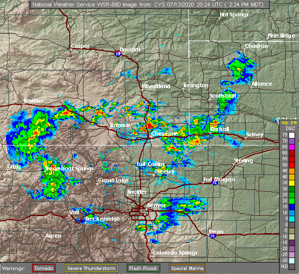 At 225 pm mdt, a severe thunderstorm was located near elk mountain, or 46 miles northwest of laramie, moving east at 35 mph (radar indicated). Hazards include 70 mph wind gusts. Expect considerable tree damage. Damage is likely to mobile homes, roofs, and outbuildings. At 225 pm mdt, a severe thunderstorm was located near elk mountain, or 46 miles northwest of laramie, moving east at 35 mph (radar indicated). Hazards include 70 mph wind gusts. Expect considerable tree damage. Damage is likely to mobile homes, roofs, and outbuildings.
|
| 6/6/2020 3:34 PM MDT |
 At 333 pm mdt, severe thunderstorms were located along a line extending from near shirley basin to 6 miles southeast of rock river, moving northeast at 60 mph (radar indicated). Hazards include 70 mph wind gusts. Expect considerable tree damage. damage is likely to mobile homes, roofs, and outbuildings. locations impacted include, hanna, medicine bow, rock river, elk mountain, battle mountain, shirley basin, brooklyn lake, brooklyn lake campground, libby creek campground, deep creek campground, centennial, nash fork campground, little medicine school, north fork campground and arlington. This includes interstate 80 in wyoming between mile markers 252 and 303. At 333 pm mdt, severe thunderstorms were located along a line extending from near shirley basin to 6 miles southeast of rock river, moving northeast at 60 mph (radar indicated). Hazards include 70 mph wind gusts. Expect considerable tree damage. damage is likely to mobile homes, roofs, and outbuildings. locations impacted include, hanna, medicine bow, rock river, elk mountain, battle mountain, shirley basin, brooklyn lake, brooklyn lake campground, libby creek campground, deep creek campground, centennial, nash fork campground, little medicine school, north fork campground and arlington. This includes interstate 80 in wyoming between mile markers 252 and 303.
|
| 6/6/2020 3:18 PM MDT |
 At 316 pm mdt, severe thunderstorms were located along a line extending from 8 miles west of battle mountain to 7 miles northeast of north fork campground, moving northeast at 70 mph. at 312 pm mdt, 77 mph wind gust was reported at arlington along interstate 80. these are very dangerous storms (trained weather spotters). Hazards include 80 mph wind gusts. Flying debris will be dangerous to those caught without shelter. mobile homes will be heavily damaged. expect considerable damage to roofs, windows, and vehicles. extensive tree damage and power outages are likely. locations impacted include, albany, hanna, medicine bow, rock river, elk mountain, battle mountain, brooklyn lake campground, woods landing-jelm, nash fork campground, boswell creek campground, rob roy reservoir, lake owen, arlington, bobbie thompson campground, shirley basin, brooklyn lake, sugar loaf campground, libby creek campground, bow river campground and illinois creek campground. This includes interstate 80 in wyoming between mile markers 246 and 303. At 316 pm mdt, severe thunderstorms were located along a line extending from 8 miles west of battle mountain to 7 miles northeast of north fork campground, moving northeast at 70 mph. at 312 pm mdt, 77 mph wind gust was reported at arlington along interstate 80. these are very dangerous storms (trained weather spotters). Hazards include 80 mph wind gusts. Flying debris will be dangerous to those caught without shelter. mobile homes will be heavily damaged. expect considerable damage to roofs, windows, and vehicles. extensive tree damage and power outages are likely. locations impacted include, albany, hanna, medicine bow, rock river, elk mountain, battle mountain, brooklyn lake campground, woods landing-jelm, nash fork campground, boswell creek campground, rob roy reservoir, lake owen, arlington, bobbie thompson campground, shirley basin, brooklyn lake, sugar loaf campground, libby creek campground, bow river campground and illinois creek campground. This includes interstate 80 in wyoming between mile markers 246 and 303.
|
| 6/6/2020 3:06 PM MDT | Mesonet station wy19 2.9 nw elk mountain (wydot in carbon county WY, 3 miles SE of Elk Mountain, WY |
| 6/6/2020 2:53 PM MDT |
 At 253 pm mdt, severe thunderstorms were located along a line extending from 12 miles southwest of hanna to near skyline, moving northeast at 60 mph (radar indicated). Hazards include 70 mph wind gusts. Expect considerable tree damage. Damage is likely to mobile homes, roofs, and outbuildings. At 253 pm mdt, severe thunderstorms were located along a line extending from 12 miles southwest of hanna to near skyline, moving northeast at 60 mph (radar indicated). Hazards include 70 mph wind gusts. Expect considerable tree damage. Damage is likely to mobile homes, roofs, and outbuildings.
|
| 9/8/2019 3:30 PM MDT |
 At 329 pm mdt, severe thunderstorms were located along a line extending from 12 miles northeast of seminoe campground to 7 miles southwest of medicine bow, moving north at 35 mph (radar indicated). Hazards include 70 mph wind gusts. Expect considerable tree damage. Damage is likely to mobile homes, roofs, and outbuildings. At 329 pm mdt, severe thunderstorms were located along a line extending from 12 miles northeast of seminoe campground to 7 miles southwest of medicine bow, moving north at 35 mph (radar indicated). Hazards include 70 mph wind gusts. Expect considerable tree damage. Damage is likely to mobile homes, roofs, and outbuildings.
|
| 9/6/2019 4:55 PM MDT |
 The severe thunderstorm warning for central carbon county will expire at 500 pm mdt, the storms which prompted the warning have weakened below severe limits, and have exited the warned area. therefore, the warning will be allowed to expire. however gusty winds to 55 mph are still possible with these thunderstorms. The severe thunderstorm warning for central carbon county will expire at 500 pm mdt, the storms which prompted the warning have weakened below severe limits, and have exited the warned area. therefore, the warning will be allowed to expire. however gusty winds to 55 mph are still possible with these thunderstorms.
|
| 9/6/2019 4:35 PM MDT | Wydot mesonet station halleck ridge along i-8 in carbon county WY, 7.1 miles SE of Elk Mountain, WY |
| 9/6/2019 4:33 PM MDT |
 At 432 pm mdt, severe thunderstorms were located along a line extending from 8 miles northwest of independence rock to 15 miles north of saratoga, moving northeast at 40 mph (numerous reports of 60 to 65 mph wind gusts from weather sensors along interstate 80). Hazards include 70 mph wind gusts. Expect considerable tree damage. damage is likely to mobile homes, roofs, and outbuildings. locations impacted include, rawlins, saratoga, hanna, sinclair, elk mountain, seminoe campground, seminoe dam, separation lake, jack creek campground, bow river campground, muddy gap and teton reservoir. This includes interstate 80 in wyoming between mile markers 200 and 258. At 432 pm mdt, severe thunderstorms were located along a line extending from 8 miles northwest of independence rock to 15 miles north of saratoga, moving northeast at 40 mph (numerous reports of 60 to 65 mph wind gusts from weather sensors along interstate 80). Hazards include 70 mph wind gusts. Expect considerable tree damage. damage is likely to mobile homes, roofs, and outbuildings. locations impacted include, rawlins, saratoga, hanna, sinclair, elk mountain, seminoe campground, seminoe dam, separation lake, jack creek campground, bow river campground, muddy gap and teton reservoir. This includes interstate 80 in wyoming between mile markers 200 and 258.
|
| 9/6/2019 3:56 PM MDT |
 The national weather service in cheyenne has issued a * severe thunderstorm warning for. central carbon county in south central wyoming. until 500 pm mdt. At 355 pm mdt, severe thunderstorms were located along a line extending from green mountain to 9 miles north of jack creek. The national weather service in cheyenne has issued a * severe thunderstorm warning for. central carbon county in south central wyoming. until 500 pm mdt. At 355 pm mdt, severe thunderstorms were located along a line extending from green mountain to 9 miles north of jack creek.
|
| 8/16/2019 4:48 PM MDT |
 At 448 pm mdt, a severe thunderstorm was located 8 miles south of rock river, or 29 miles northwest of laramie, moving east at 65 mph (radar indicated). Hazards include 60 mph wind gusts. Expect damage to roofs, siding, and trees. locations impacted include, rock river, elk mountain, deep creek campground and arlington. This includes interstate 80 in wyoming between mile markers 260 and 287. At 448 pm mdt, a severe thunderstorm was located 8 miles south of rock river, or 29 miles northwest of laramie, moving east at 65 mph (radar indicated). Hazards include 60 mph wind gusts. Expect damage to roofs, siding, and trees. locations impacted include, rock river, elk mountain, deep creek campground and arlington. This includes interstate 80 in wyoming between mile markers 260 and 287.
|
| 8/16/2019 4:34 PM MDT |
 At 434 pm mdt, a severe thunderstorm was located near bow river campground, or 41 miles northwest of laramie, moving east at 65 mph (radar indicated). Hazards include 60 mph wind gusts. expect damage to roofs, siding, and trees At 434 pm mdt, a severe thunderstorm was located near bow river campground, or 41 miles northwest of laramie, moving east at 65 mph (radar indicated). Hazards include 60 mph wind gusts. expect damage to roofs, siding, and trees
|
| 5/6/2019 5:16 PM MDT |
 At 515 pm mdt, severe thunderstorms were located along a line extending from near hanna to near arlington, moving east at 25 mph (radar indicated). Hazards include 60 mph wind gusts and quarter size hail. Hail damage to vehicles is expected. expect wind damage to roofs, siding, and trees. locations impacted include, hanna, medicine bow, elk mountain, battle mountain and arlington. This includes interstate 80 in wyoming between mile markers 250 and 274. At 515 pm mdt, severe thunderstorms were located along a line extending from near hanna to near arlington, moving east at 25 mph (radar indicated). Hazards include 60 mph wind gusts and quarter size hail. Hail damage to vehicles is expected. expect wind damage to roofs, siding, and trees. locations impacted include, hanna, medicine bow, elk mountain, battle mountain and arlington. This includes interstate 80 in wyoming between mile markers 250 and 274.
|
| 5/6/2019 4:55 PM MDT |
 At 454 pm mdt, severe thunderstorms were located along a line extending from 6 miles west of hanna to 6 miles northwest of bow river campground, moving east at 25 mph (radar indicated). Hazards include 60 mph wind gusts and quarter size hail. Hail damage to vehicles is expected. Expect wind damage to roofs, siding, and trees. At 454 pm mdt, severe thunderstorms were located along a line extending from 6 miles west of hanna to 6 miles northwest of bow river campground, moving east at 25 mph (radar indicated). Hazards include 60 mph wind gusts and quarter size hail. Hail damage to vehicles is expected. Expect wind damage to roofs, siding, and trees.
|
| 4/26/2019 6:35 PM MDT |
 At 634 pm mdt, a severe thunderstorm was located near elk mountain, or 45 miles east of rawlins, moving southeast at 50 mph (radar indicated). Hazards include 70 mph wind gusts. Expect considerable tree damage. Damage is likely to mobile homes, roofs, and outbuildings. At 634 pm mdt, a severe thunderstorm was located near elk mountain, or 45 miles east of rawlins, moving southeast at 50 mph (radar indicated). Hazards include 70 mph wind gusts. Expect considerable tree damage. Damage is likely to mobile homes, roofs, and outbuildings.
|
| 4/26/2019 6:30 PM MDT | Wydot mesonet station halleck ridge along i-8 in carbon county WY, 7.2 miles SE of Elk Mountain, WY |
| 8/5/2018 11:37 AM MDT |
 At 1134 am mdt, a severe thunderstorm was located 9 miles north of arlington, or 44 miles northwest of laramie, moving east at 45 mph (automated observation system). Hazards include 70 mph wind gusts and quarter size hail. Hail damage to vehicles is expected. expect considerable tree damage. wind damage is also likely to mobile homes, roofs, and outbuildings. locations impacted include, rock river, elk mountain and arlington. This includes interstate 80 in wyoming between mile markers 248 and 279. At 1134 am mdt, a severe thunderstorm was located 9 miles north of arlington, or 44 miles northwest of laramie, moving east at 45 mph (automated observation system). Hazards include 70 mph wind gusts and quarter size hail. Hail damage to vehicles is expected. expect considerable tree damage. wind damage is also likely to mobile homes, roofs, and outbuildings. locations impacted include, rock river, elk mountain and arlington. This includes interstate 80 in wyoming between mile markers 248 and 279.
|
| 8/5/2018 11:20 AM MDT | Observed at halleck ridge wydot sensor northwest of elk mountai in carbon county WY, 7.2 miles SE of Elk Mountain, WY |
| 8/5/2018 11:16 AM MDT |
 At 1116 am mdt, a severe thunderstorm was located near elk mountain, or 37 miles east of rawlins, moving east at 45 mph (radar indicated). Hazards include 60 mph wind gusts and quarter size hail. Hail damage to vehicles is expected. Expect wind damage to roofs, siding, and trees. At 1116 am mdt, a severe thunderstorm was located near elk mountain, or 37 miles east of rawlins, moving east at 45 mph (radar indicated). Hazards include 60 mph wind gusts and quarter size hail. Hail damage to vehicles is expected. Expect wind damage to roofs, siding, and trees.
|
| 10/14/2016 1:05 PM MDT | Halleck ridge wydot senso in carbon county WY, 7.2 miles SE of Elk Mountain, WY |
| 10/14/2016 12:25 PM MDT | Halleck ridge wydot sensor. sustained wind 45 mp in carbon county WY, 7.2 miles SE of Elk Mountain, WY |
| 7/4/2016 3:00 PM MDT | Halleck ridge by elk mountain sensor. elevation 7550 feet. sustained wind west at 36 mp in carbon county WY, 6.7 miles SE of Elk Mountain, WY |
| 7/3/2016 5:39 PM MDT |
 The severe thunderstorm warning for west central albany and east central carbon counties will expire at 545 pm mdt, the storms which prompted the warning have weakened below severe limits, and no longer pose an immediate threat to life or property. therefore the warning will be allowed to expire. however gusty winds are still possible with these thunderstorms. The severe thunderstorm warning for west central albany and east central carbon counties will expire at 545 pm mdt, the storms which prompted the warning have weakened below severe limits, and no longer pose an immediate threat to life or property. therefore the warning will be allowed to expire. however gusty winds are still possible with these thunderstorms.
|
| 7/3/2016 5:21 PM MDT |
 At 520 pm mdt, severe thunderstorms were located along a line extending from 6 miles northwest of arlington to near bow river campground, moving east at 30 mph (radar indicated). Hazards include 60 mph wind gusts. Expect damage to roofs. siding. and trees. locations impacted include, rock river, elk mountain, nash fork campground, sugar loaf campground, brooklyn lake, deep creek campground, libby creek campground, brooklyn lake campground, bow river campground, arlington, north fork campground and centennial. This includes interstate 80 in wyoming between mile markers 259 and 285. At 520 pm mdt, severe thunderstorms were located along a line extending from 6 miles northwest of arlington to near bow river campground, moving east at 30 mph (radar indicated). Hazards include 60 mph wind gusts. Expect damage to roofs. siding. and trees. locations impacted include, rock river, elk mountain, nash fork campground, sugar loaf campground, brooklyn lake, deep creek campground, libby creek campground, brooklyn lake campground, bow river campground, arlington, north fork campground and centennial. This includes interstate 80 in wyoming between mile markers 259 and 285.
|
| 7/3/2016 5:07 PM MDT |
 At 506 pm mdt, severe thunderstorms were located along a line extending from elk mountain to 9 miles west of bow river campground, moving southeast at 25 mph (radar indicated). Hazards include 60 mph wind gusts. Expect damage to roofs. siding. And trees. At 506 pm mdt, severe thunderstorms were located along a line extending from elk mountain to 9 miles west of bow river campground, moving southeast at 25 mph (radar indicated). Hazards include 60 mph wind gusts. Expect damage to roofs. siding. And trees.
|
| 7/15/2015 6:17 PM MDT |
 At 616 pm mdt, severe thunderstorms were located along a line extending from near little medicine school to near six mile campground, moving east at 25 mph (radar indicated). Hazards include 60 mph wind gusts. these severe thunderstorms have a history of producing wind gusts of 55 to 63 mph. Expect damage to roofs. siding and trees. locations impacted include, albany, medicine bow, rock river, elk mountain, bobbie thompson campground, french creek campground, centennial, ryan park campground, bow river campground, little medicine school, ryan park, woods landing-jelm, lake owen campground, battle mountain, sugar loaf campground, brooklyn lake, deep creek campground, brooklyn lake campground, arlington and evans creek campground. This includes interstate 80 in wyoming between mile markers 259 and 301. At 616 pm mdt, severe thunderstorms were located along a line extending from near little medicine school to near six mile campground, moving east at 25 mph (radar indicated). Hazards include 60 mph wind gusts. these severe thunderstorms have a history of producing wind gusts of 55 to 63 mph. Expect damage to roofs. siding and trees. locations impacted include, albany, medicine bow, rock river, elk mountain, bobbie thompson campground, french creek campground, centennial, ryan park campground, bow river campground, little medicine school, ryan park, woods landing-jelm, lake owen campground, battle mountain, sugar loaf campground, brooklyn lake, deep creek campground, brooklyn lake campground, arlington and evans creek campground. This includes interstate 80 in wyoming between mile markers 259 and 301.
|
| 7/15/2015 5:56 PM MDT |
 The severe thunderstorm warning for eastern carbon county will expire at 600 pm mdt, severe thunderstorm warning 153, issued at 503 pm mdt for carbon county, will expire at 600 pm mdt. remember, a new severe thunderstorm warning, number 154, still remains in effect for western albany county and eastern carbon county until 645 pm mdt. these severe thunderstorms have a history of producing wind gusts of 55 to 63 mph. The severe thunderstorm warning for eastern carbon county will expire at 600 pm mdt, severe thunderstorm warning 153, issued at 503 pm mdt for carbon county, will expire at 600 pm mdt. remember, a new severe thunderstorm warning, number 154, still remains in effect for western albany county and eastern carbon county until 645 pm mdt. these severe thunderstorms have a history of producing wind gusts of 55 to 63 mph.
|
| 7/15/2015 5:53 PM MDT |
 At 551 pm mdt, severe thunderstorms were located along a line extending from near shirley basin to near pearl, moving east at 30 mph (radar indicated). Hazards include 60 mph wind gusts. these storms have a history of producing wind gusts of 55 to 63 mph. Expect damage to roofs. Siding and trees. At 551 pm mdt, severe thunderstorms were located along a line extending from near shirley basin to near pearl, moving east at 30 mph (radar indicated). Hazards include 60 mph wind gusts. these storms have a history of producing wind gusts of 55 to 63 mph. Expect damage to roofs. Siding and trees.
|
| 7/15/2015 5:38 PM MDT |
 At 535 pm mdt, severe thunderstorms were located along a line extending from 16 miles west of shirley basin to 11 miles southwest of hog park campground, moving east at 45 mph (trained weather spotters). Hazards include history of 60 mph wind gusts. Expect damage to roofs. siding and trees. at 443 pm mdt, a wind gust to 62 mph was reported at the rawlins airport. at 516 pm mdt, a wind gust to 56 mph was reported at walcott junction. at 525 pm mdt, a wind gust to 55 mph was reported at dana ridge along interstate 80 east of rawlins. locations impacted include, saratoga, hanna, encampment, elk mountain, grand encampment, seminoe dam, south brush creek campground, seminoe campground, french creek campground, hog park campground, lost creek campground, bottle creek campground, ryan park campground, bow river campground, lincoln park campground, hog park reservoir, ryan park, six mile campground, battle creek campground and battle lake. This includes interstate 80 in wyoming between mile markers 229 and 265. At 535 pm mdt, severe thunderstorms were located along a line extending from 16 miles west of shirley basin to 11 miles southwest of hog park campground, moving east at 45 mph (trained weather spotters). Hazards include history of 60 mph wind gusts. Expect damage to roofs. siding and trees. at 443 pm mdt, a wind gust to 62 mph was reported at the rawlins airport. at 516 pm mdt, a wind gust to 56 mph was reported at walcott junction. at 525 pm mdt, a wind gust to 55 mph was reported at dana ridge along interstate 80 east of rawlins. locations impacted include, saratoga, hanna, encampment, elk mountain, grand encampment, seminoe dam, south brush creek campground, seminoe campground, french creek campground, hog park campground, lost creek campground, bottle creek campground, ryan park campground, bow river campground, lincoln park campground, hog park reservoir, ryan park, six mile campground, battle creek campground and battle lake. This includes interstate 80 in wyoming between mile markers 229 and 265.
|
| 7/15/2015 5:35 PM MDT | Halleck ridge wydot site. sustained 51 mp in carbon county WY, 7.2 miles SE of Elk Mountain, WY |
| 7/15/2015 5:08 PM MDT |
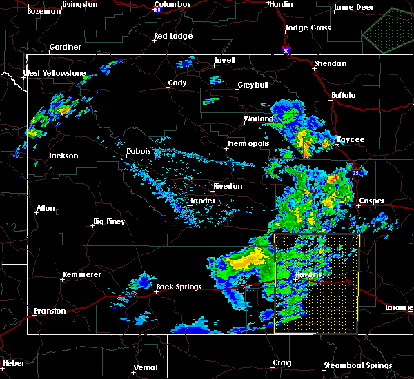 At 505 pm mdt, severe thunderstorms were located along a line extending from 13 miles southeast of independence rock to near savery, moving east at 45 mph (trained weather spotters. at 500 pm mdt...a trained weather spotter in rawlins reported strong winds and tree branches blown down by the winds. at 443 pm mdt, a wind gust to 62 mph was reported at rawlins airport). Hazards include 60 mph wind gusts. Expect damage to roofs. siding and trees. locations impacted include, rawlins, saratoga, hanna, encampment, sinclair, elk mountain, teton reservoir, grand encampment, seminoe dam, little sandstone creek campground, muddy gap, french creek campground, lost creek campground, ryan park campground, bow river campground, separation lake, hog park reservoir, ryan park, haskins creek campground and south brush creek campground. This includes interstate 80 in wyoming between mile markers 200 and 265. At 505 pm mdt, severe thunderstorms were located along a line extending from 13 miles southeast of independence rock to near savery, moving east at 45 mph (trained weather spotters. at 500 pm mdt...a trained weather spotter in rawlins reported strong winds and tree branches blown down by the winds. at 443 pm mdt, a wind gust to 62 mph was reported at rawlins airport). Hazards include 60 mph wind gusts. Expect damage to roofs. siding and trees. locations impacted include, rawlins, saratoga, hanna, encampment, sinclair, elk mountain, teton reservoir, grand encampment, seminoe dam, little sandstone creek campground, muddy gap, french creek campground, lost creek campground, ryan park campground, bow river campground, separation lake, hog park reservoir, ryan park, haskins creek campground and south brush creek campground. This includes interstate 80 in wyoming between mile markers 200 and 265.
|
| 7/15/2015 5:03 PM MDT |
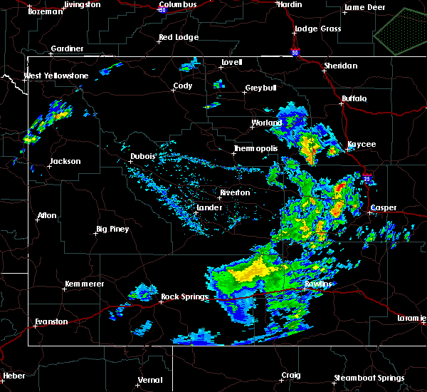 At 502 pm mdt, severe thunderstorms were located along a line extending from 12 miles southeast of independence rock to near savery, moving east at 45 mph (radar indicated). Hazards include 60 mph wind gusts. Expect damage to roofs. Siding and trees. At 502 pm mdt, severe thunderstorms were located along a line extending from 12 miles southeast of independence rock to near savery, moving east at 45 mph (radar indicated). Hazards include 60 mph wind gusts. Expect damage to roofs. Siding and trees.
|
| 6/15/2015 3:08 PM MDT |
 A severe thunderstorm warning remains in effect until 330 pm mdt for east central carbon county. at 306 pm mdt. a severe thunderstorm was located 9 miles southwest of hanna. or 29 miles east of rawlins. moving east at 25 mph. hazard. quarter size hail and 60 mph wind gusts. source. automated weather sensor. Wind gusts approaching 60 mph. A severe thunderstorm warning remains in effect until 330 pm mdt for east central carbon county. at 306 pm mdt. a severe thunderstorm was located 9 miles southwest of hanna. or 29 miles east of rawlins. moving east at 25 mph. hazard. quarter size hail and 60 mph wind gusts. source. automated weather sensor. Wind gusts approaching 60 mph.
|
| 6/15/2015 2:46 PM MDT |
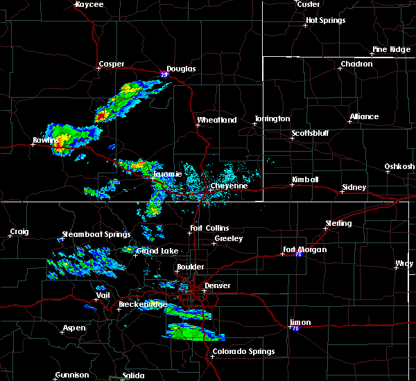 The national weather service in cheyenne has issued a * severe thunderstorm warning for. east central carbon county in south central wyoming. until 330 pm mdt * at 246 pm mdt. Doppler radar indicated a severe thunderstorm capable of producing quarter size hail and damaging winds in excess. The national weather service in cheyenne has issued a * severe thunderstorm warning for. east central carbon county in south central wyoming. until 330 pm mdt * at 246 pm mdt. Doppler radar indicated a severe thunderstorm capable of producing quarter size hail and damaging winds in excess.
|
Hail Maps for Elk Mountain, WY

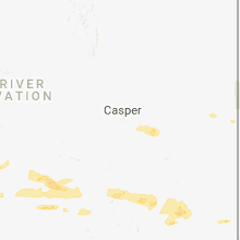
Connect with Interactive Hail Maps