

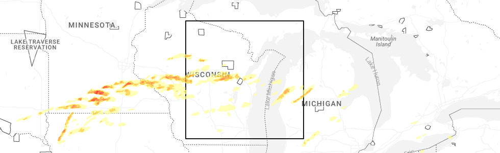
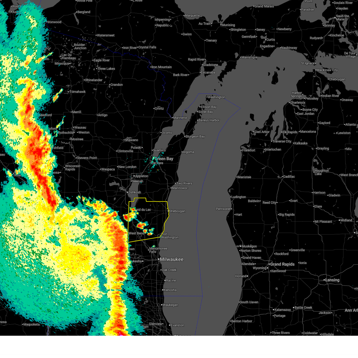
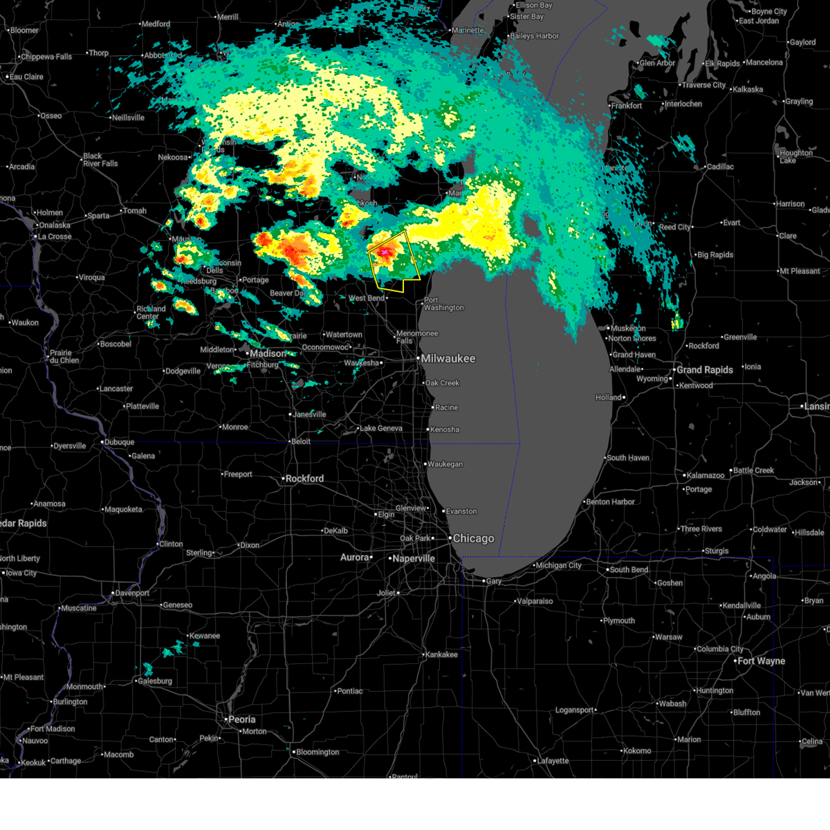
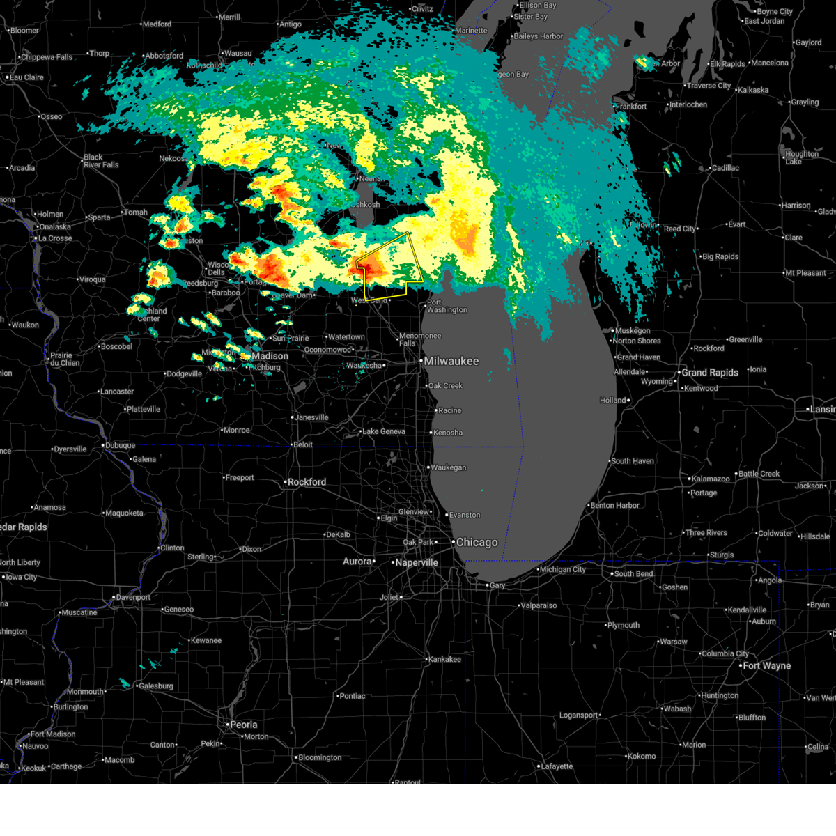
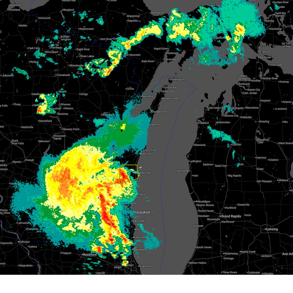
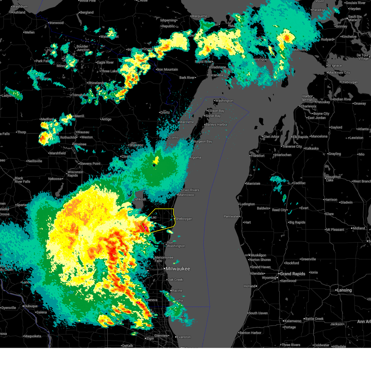
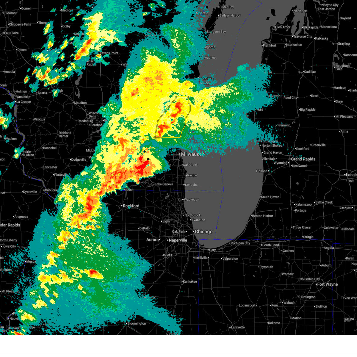
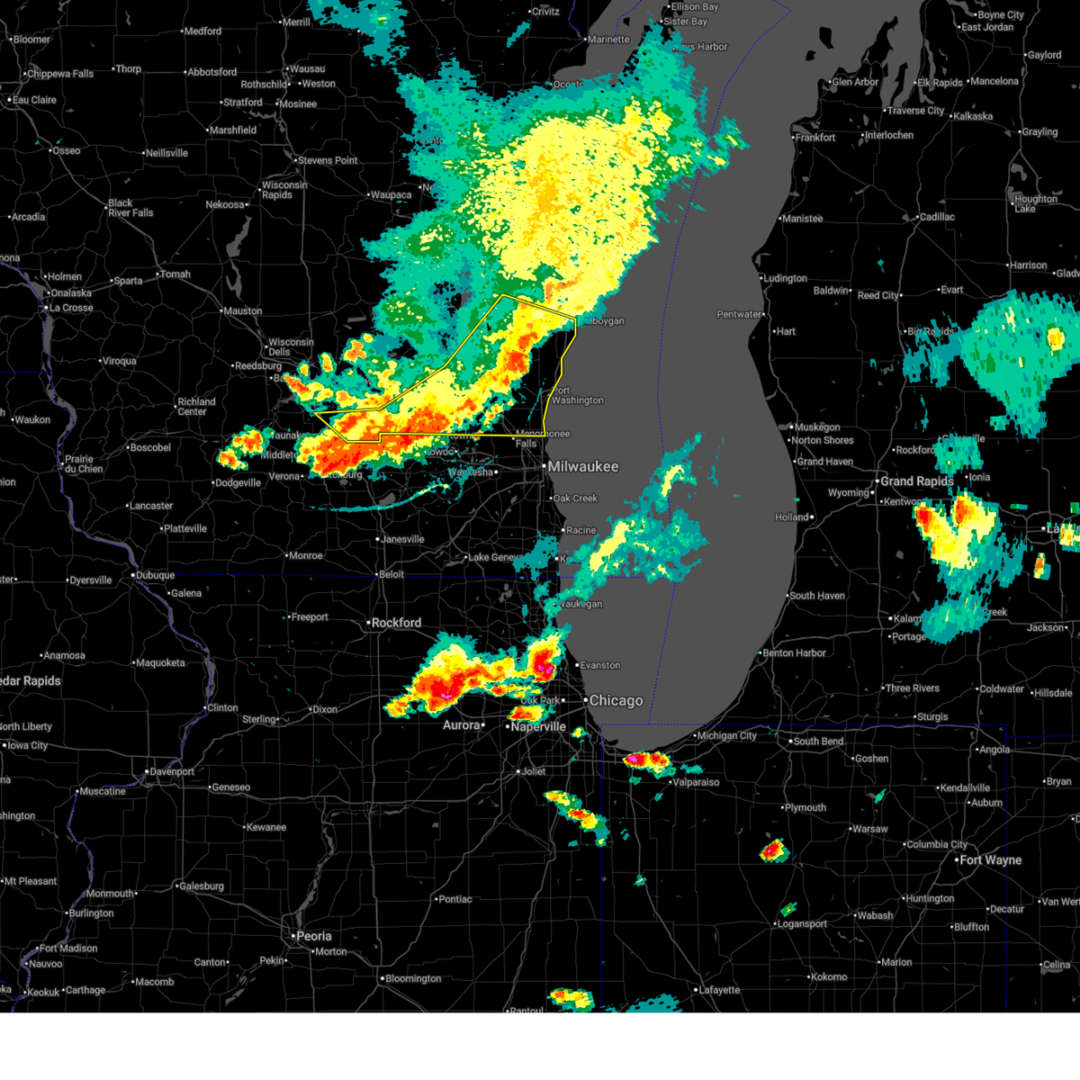
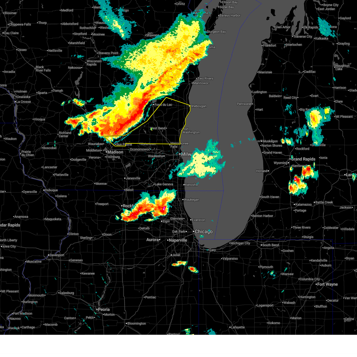
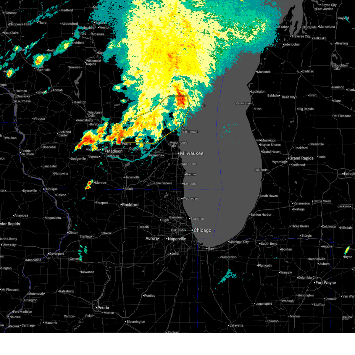
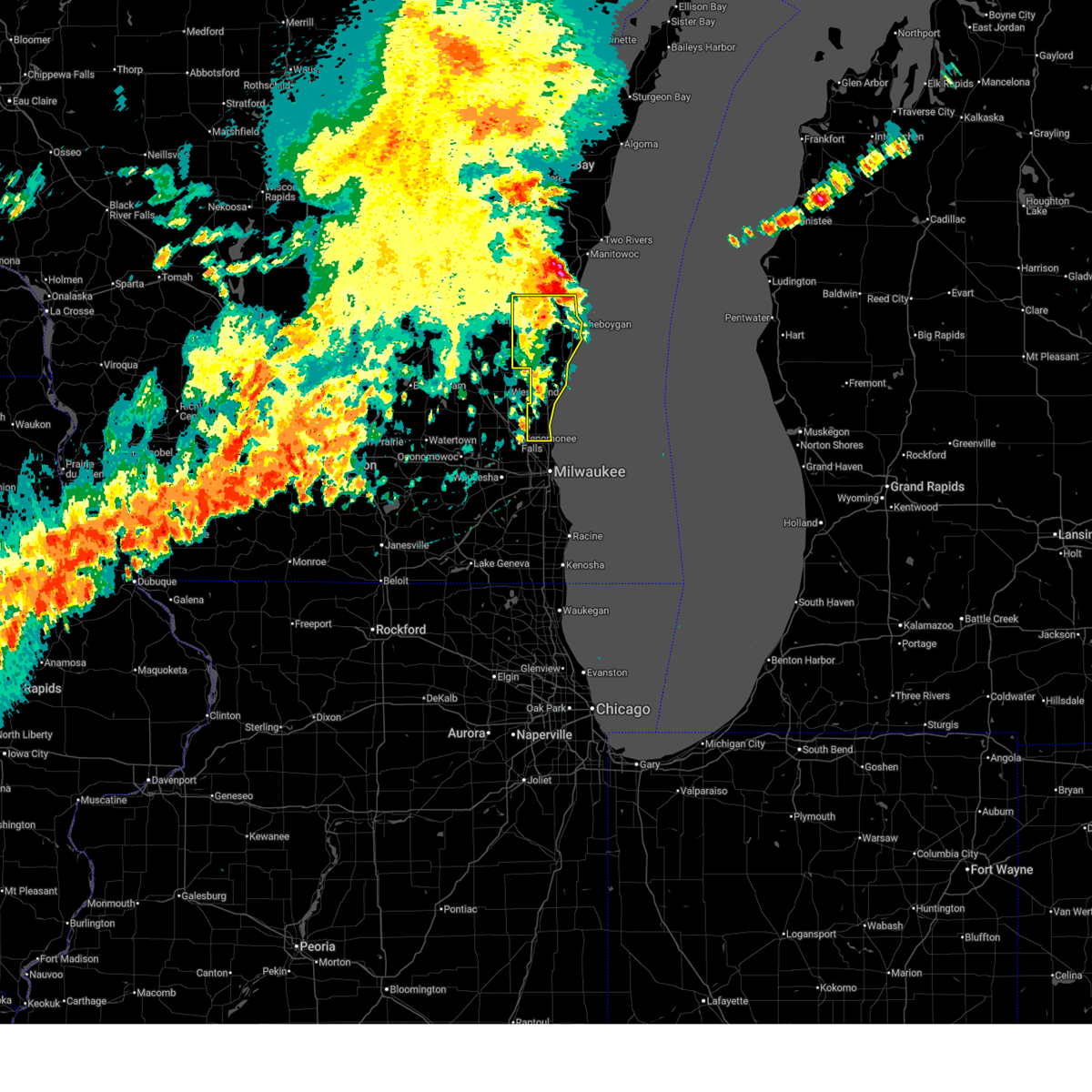
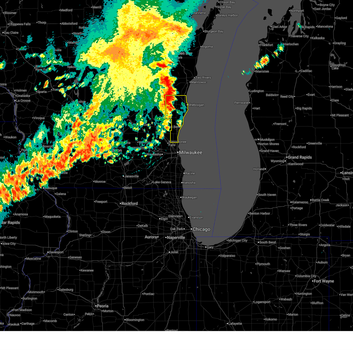
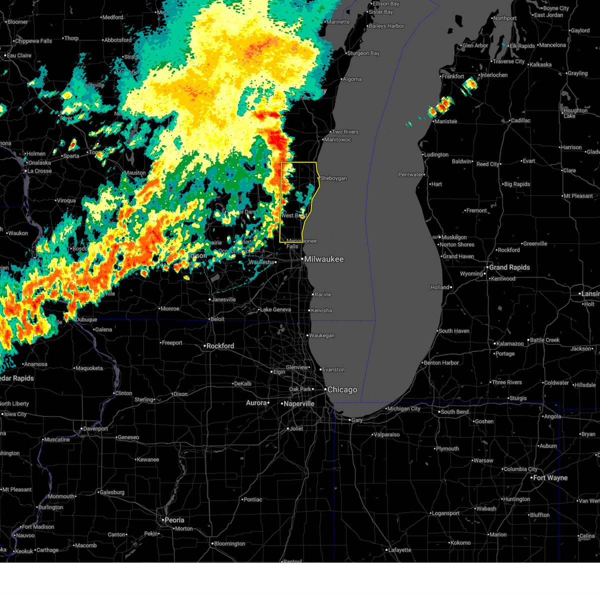
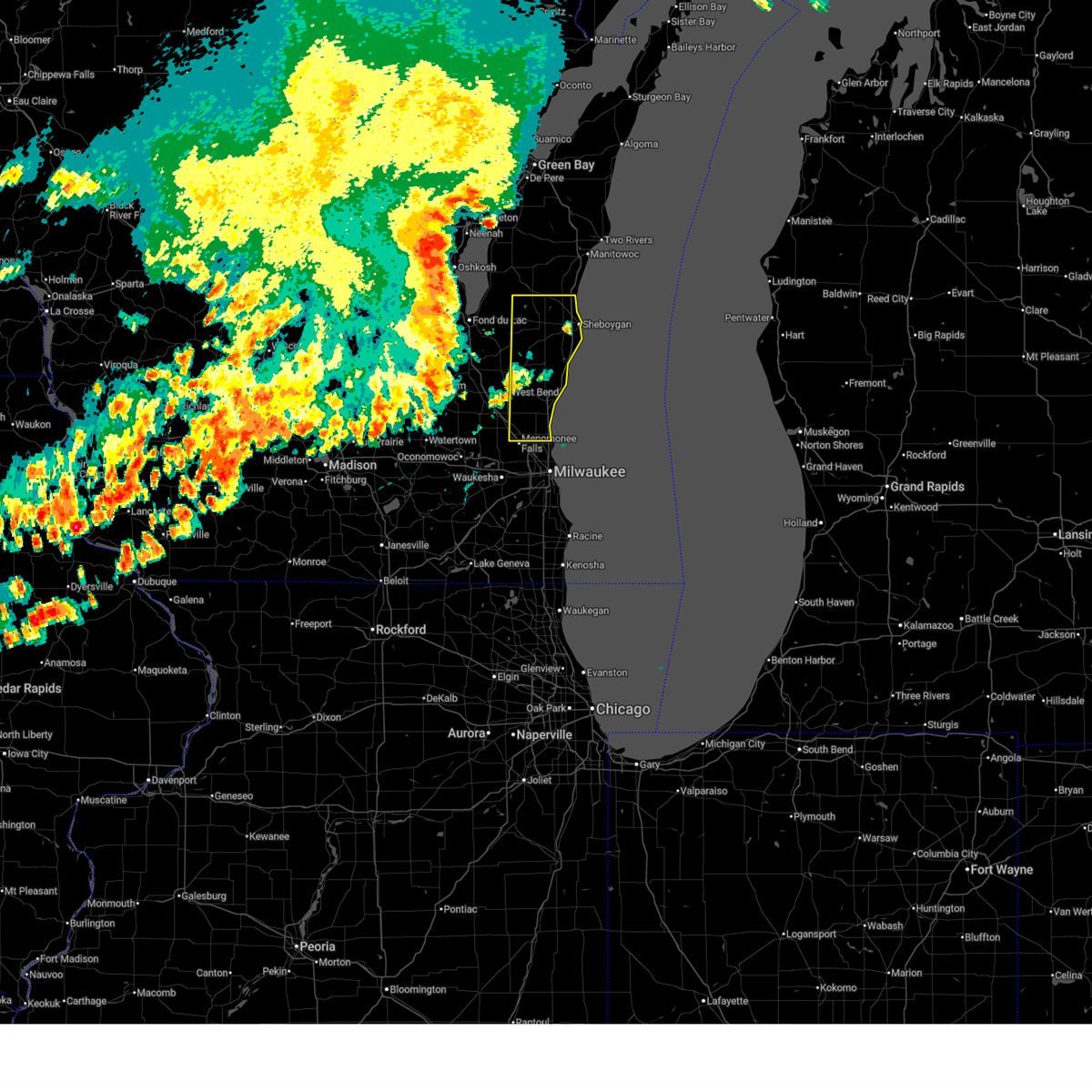
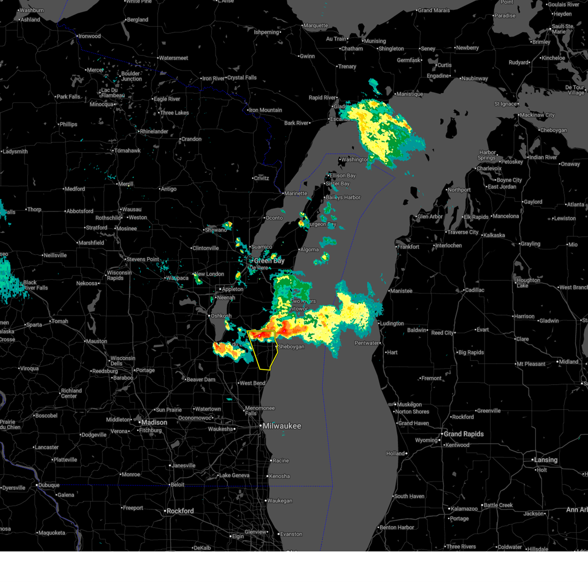
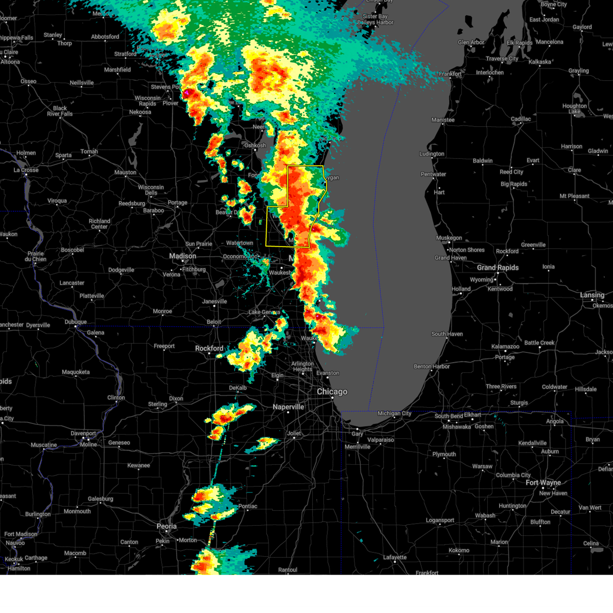
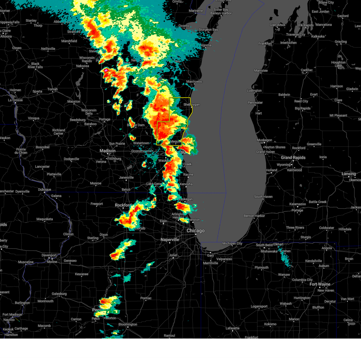
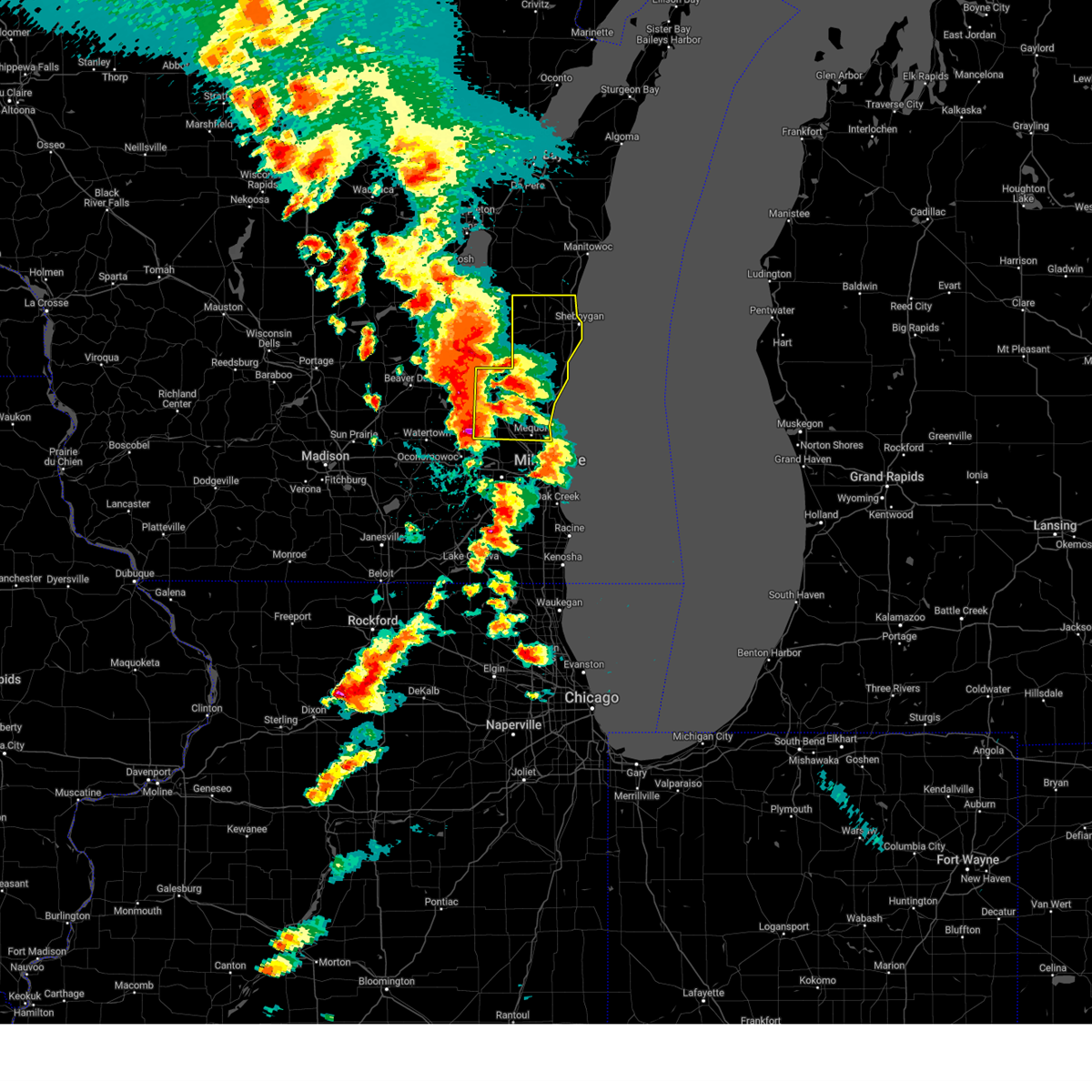
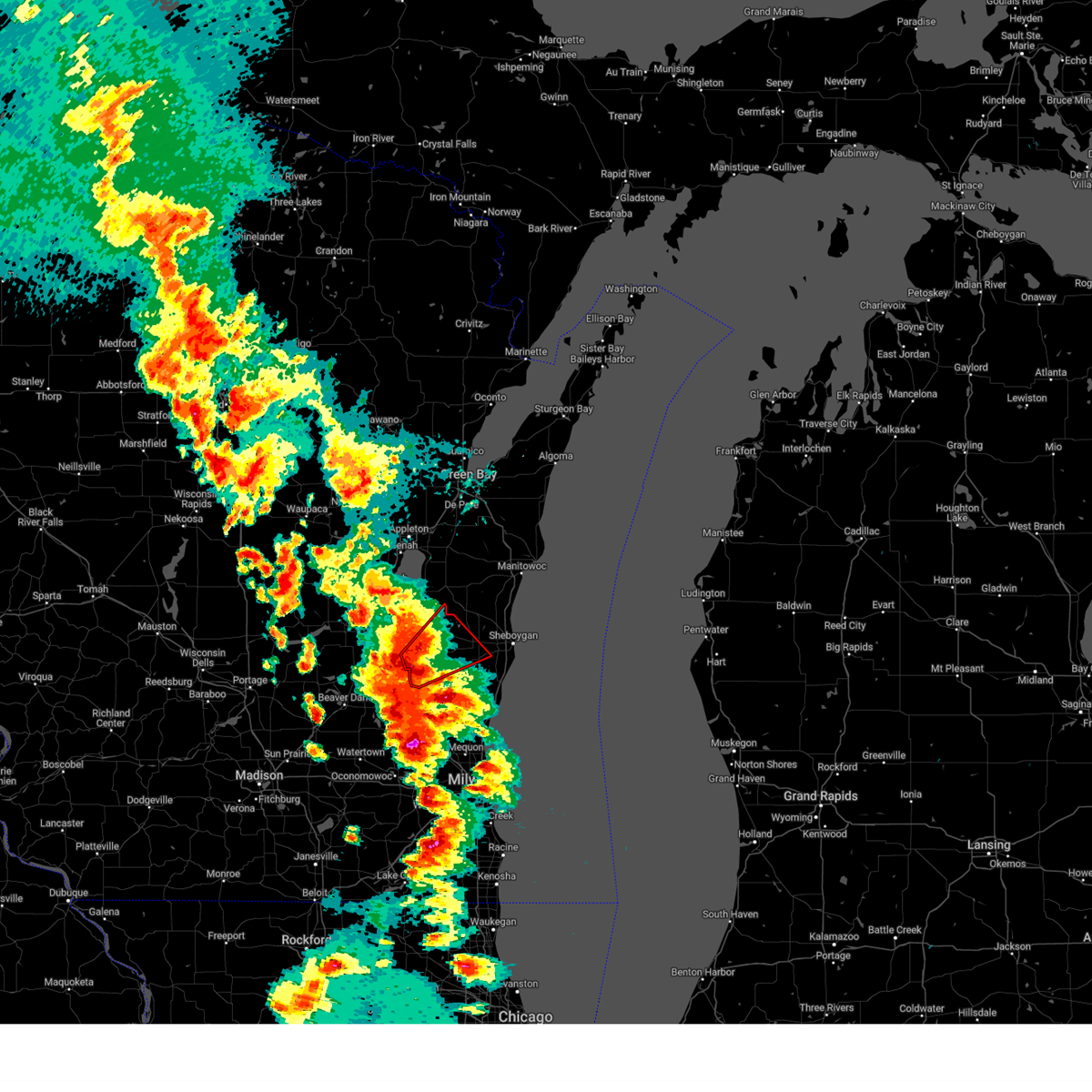
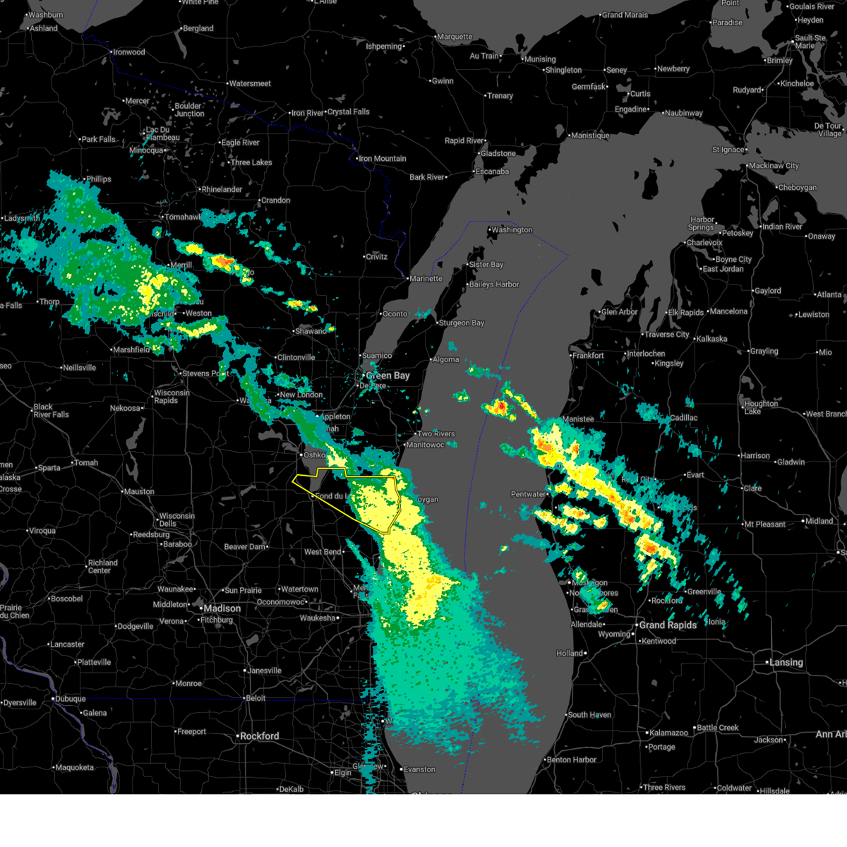
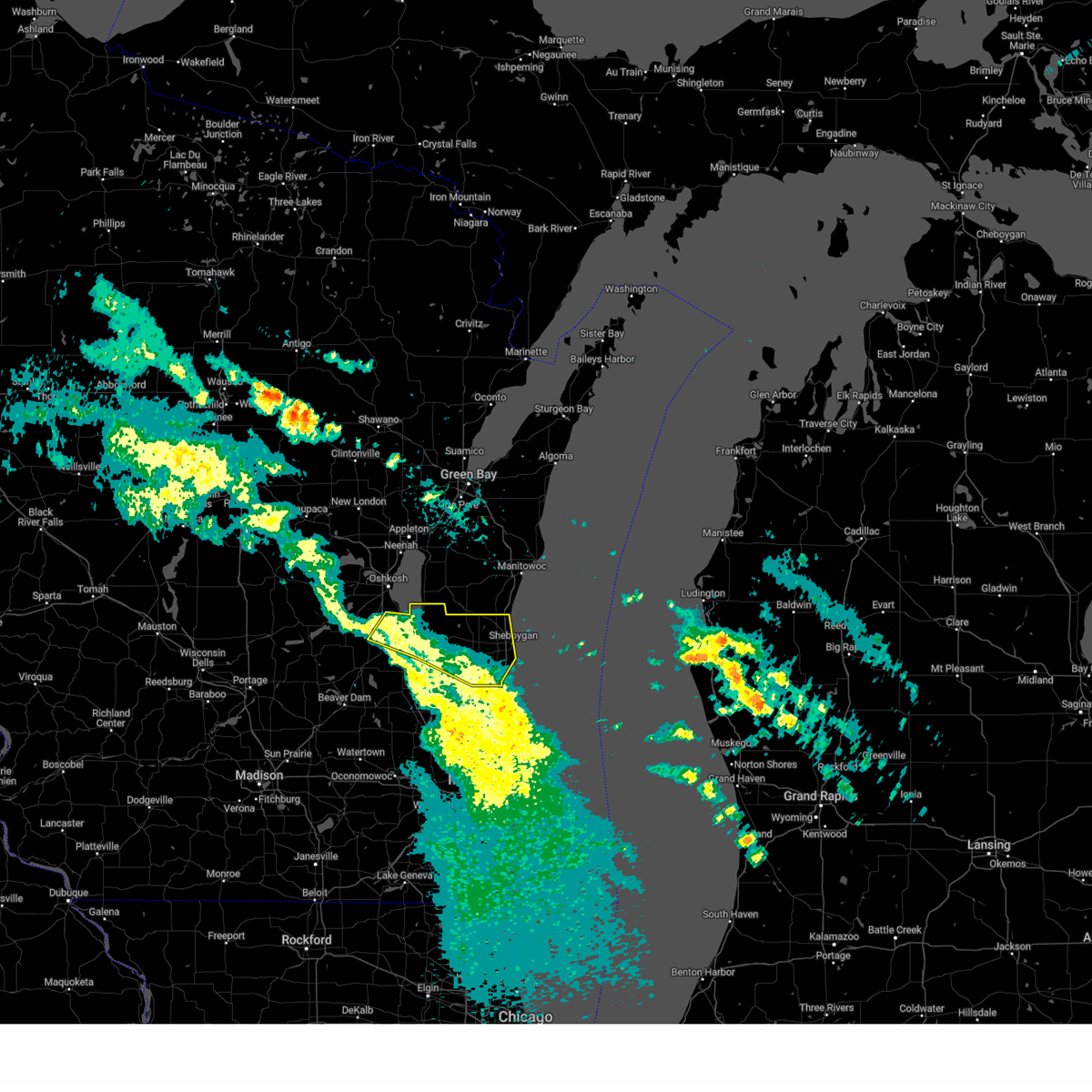
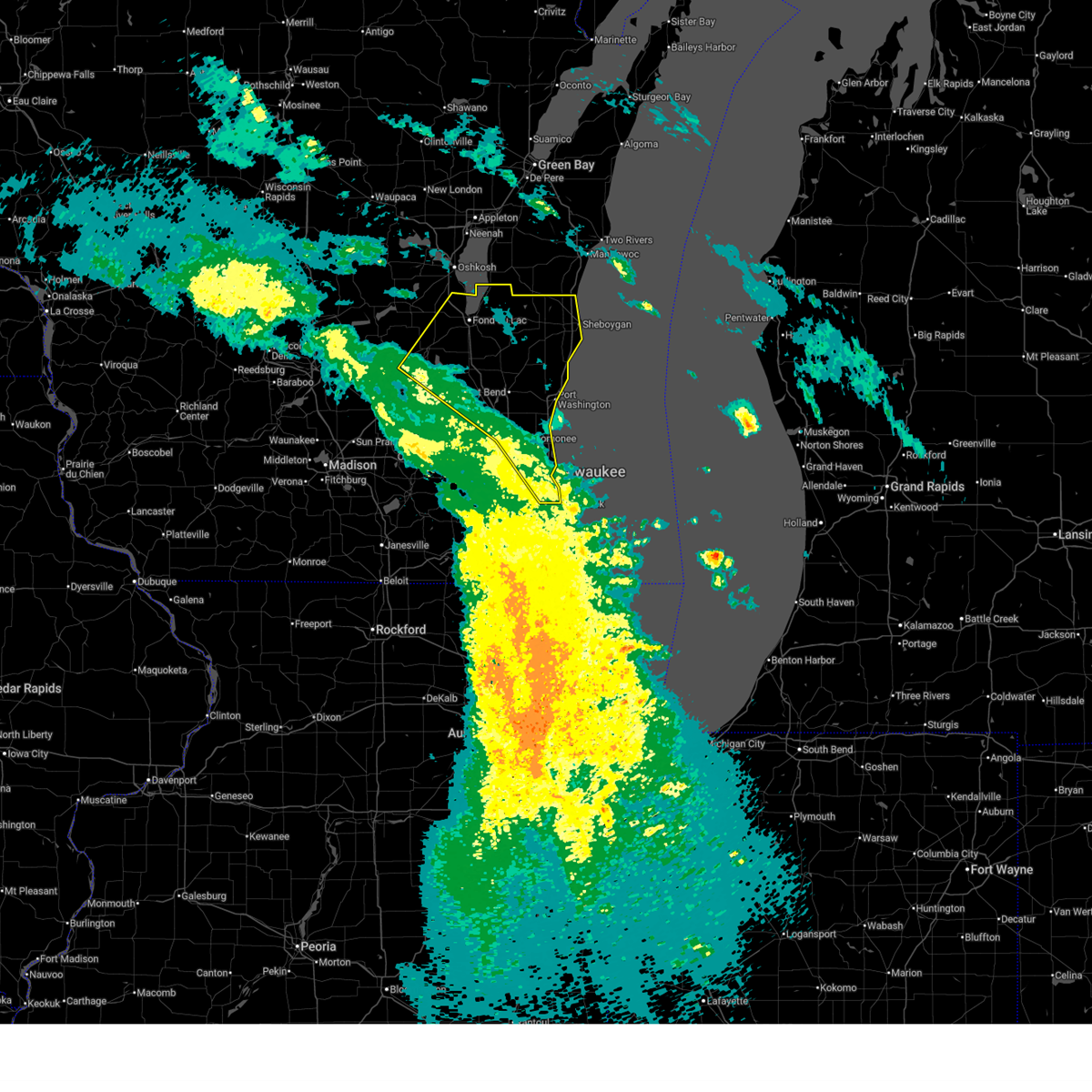
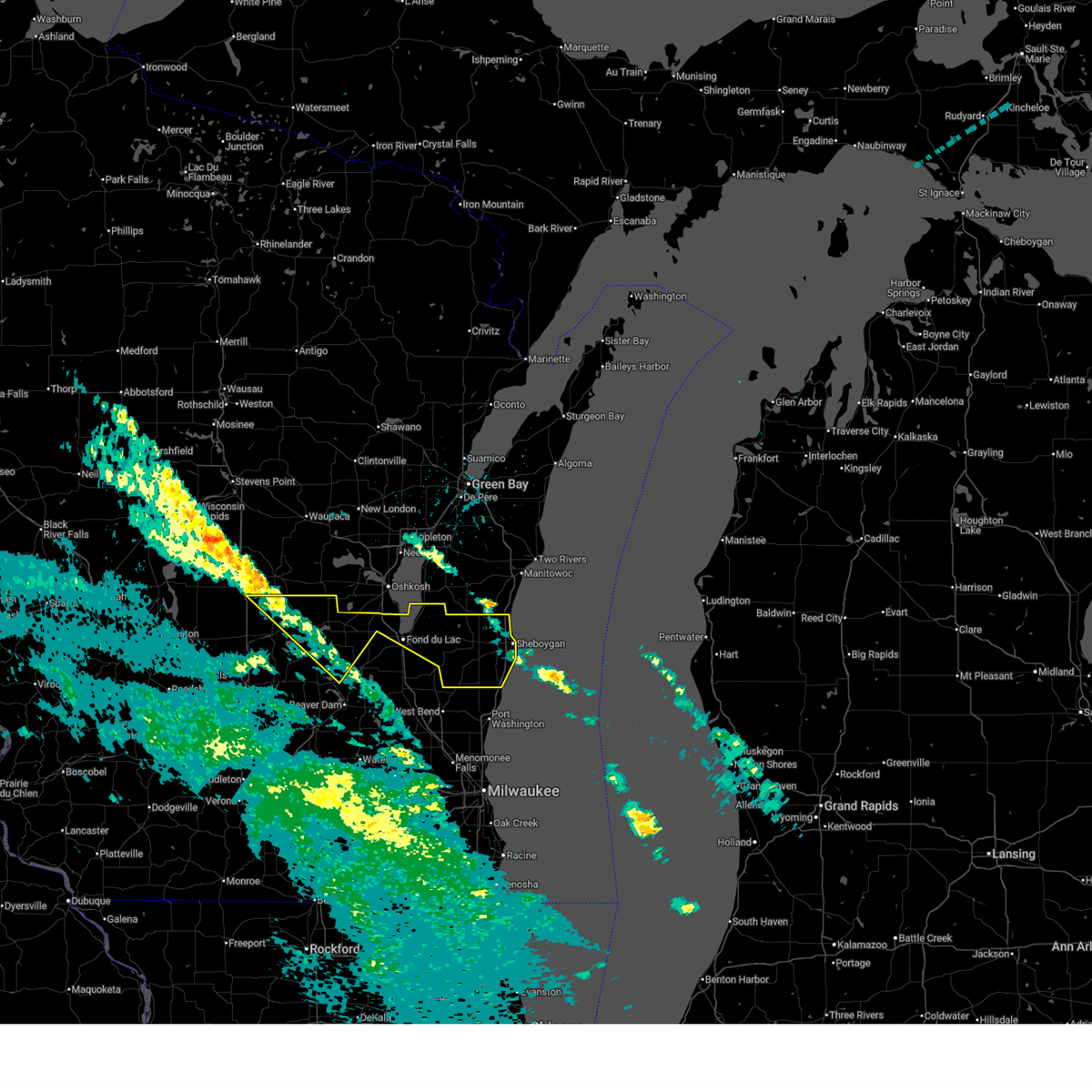
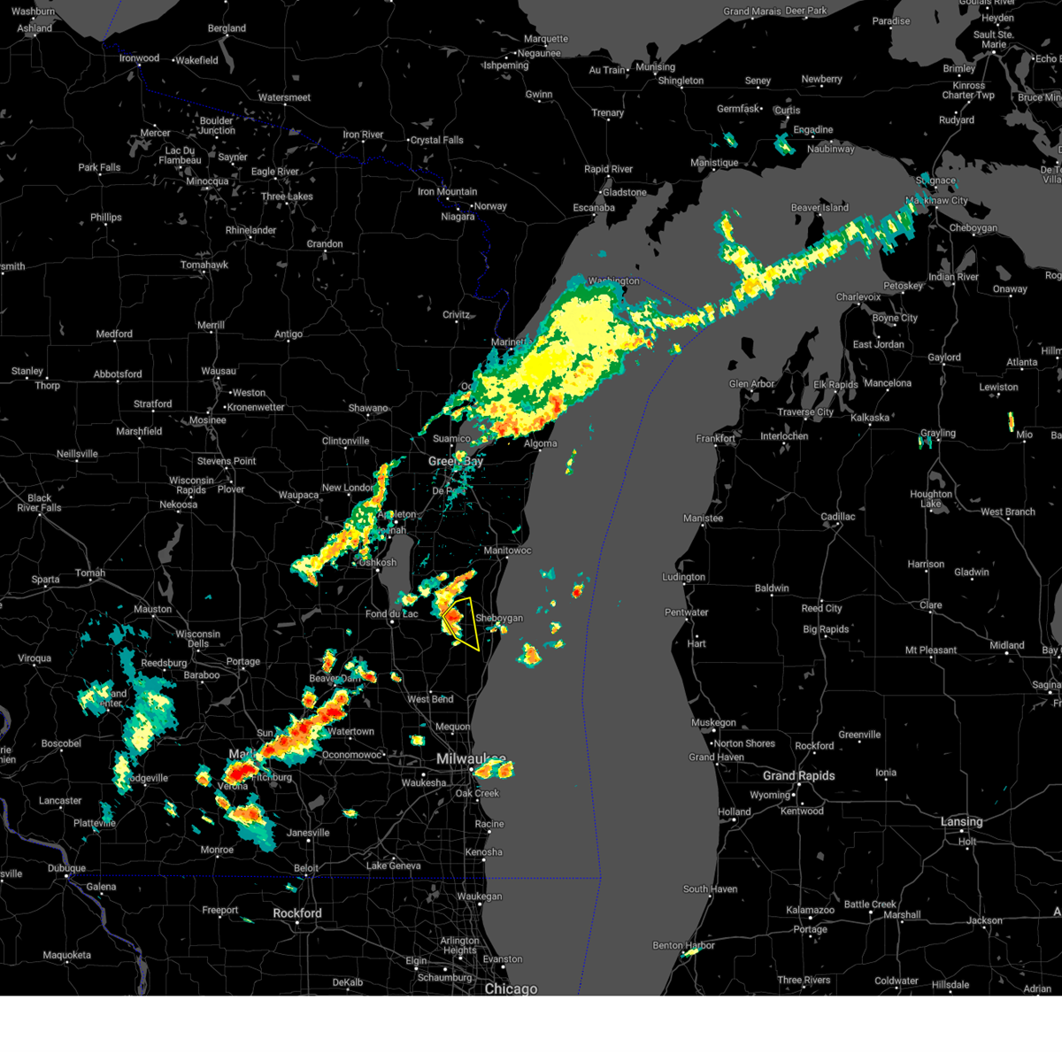
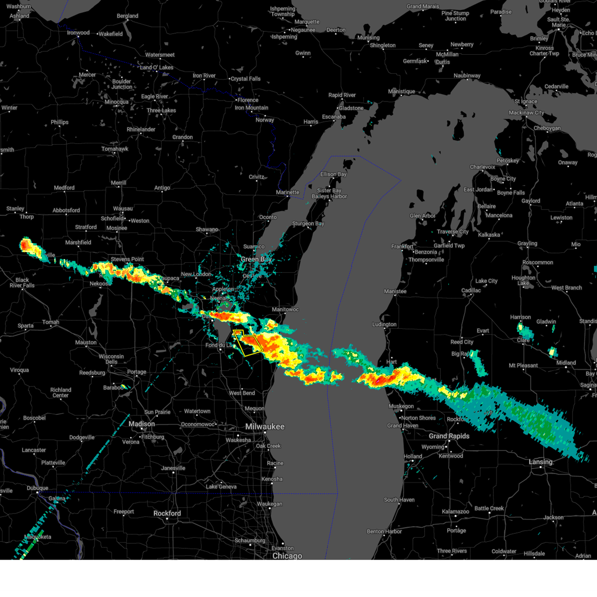
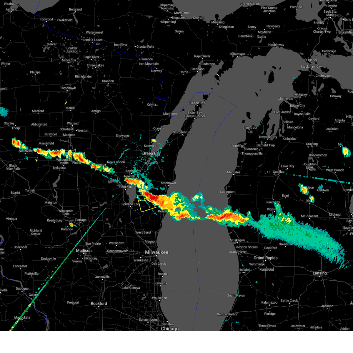
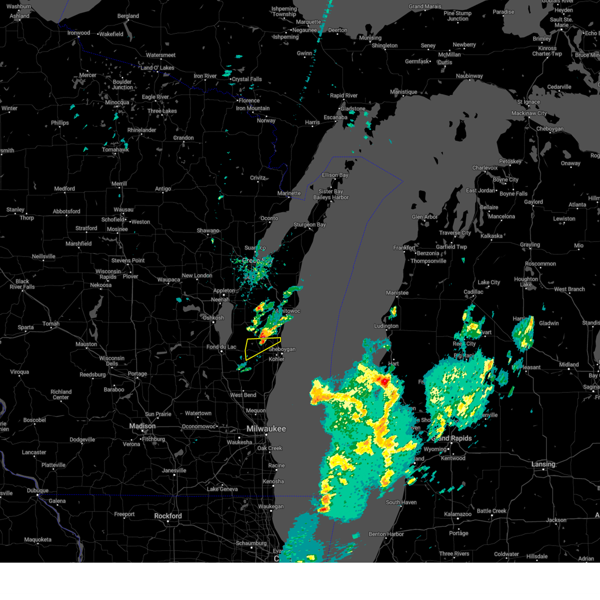
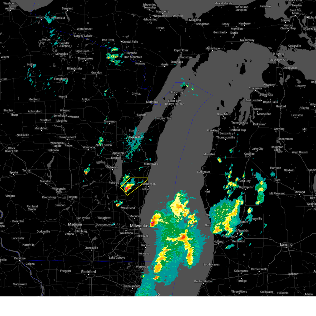
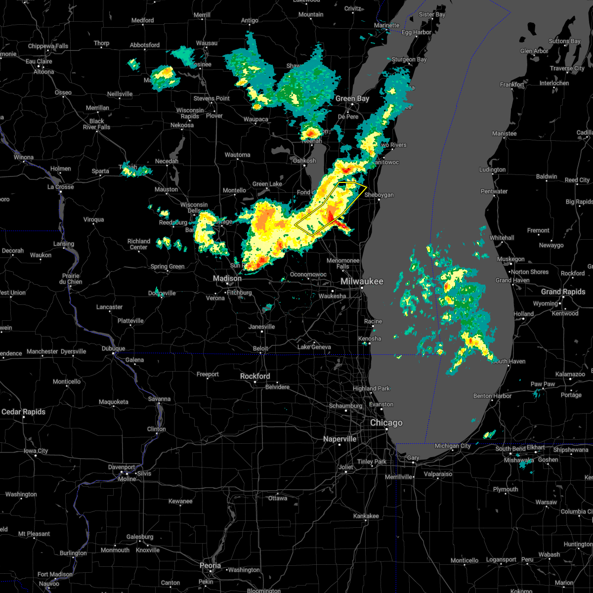
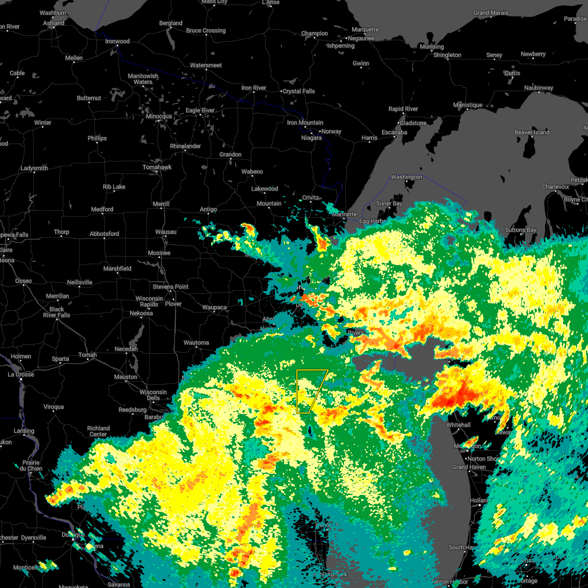
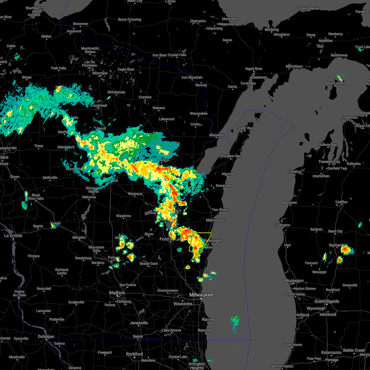
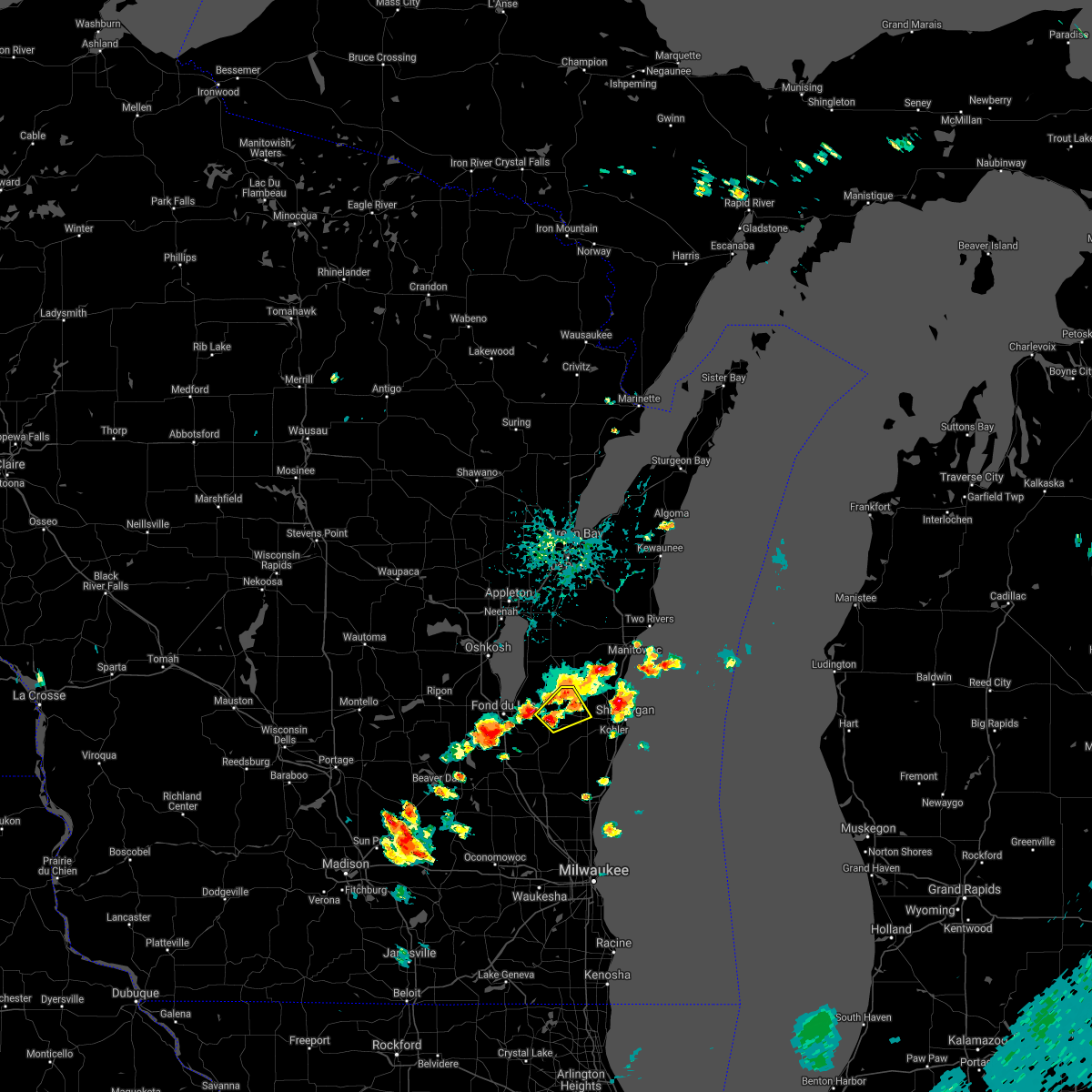
Hail Map for Elkhart Lake, WI
The Elkhart Lake, WI area has had 2 reports of on-the-ground hail by trained spotters, and has been under severe weather warnings 26 times during the past 12 months. Doppler radar has detected hail at or near Elkhart Lake, WI on 37 occasions, including 3 occasions during the past year.
| Name: | Elkhart Lake, WI |
| Where Located: | 47.2 miles S of Green Bay, WI |
| Map: | Google Map for Elkhart Lake, WI |
| Population: | 967 |
| Housing Units: | 706 |
| More Info: | Search Google for Elkhart Lake, WI |
3
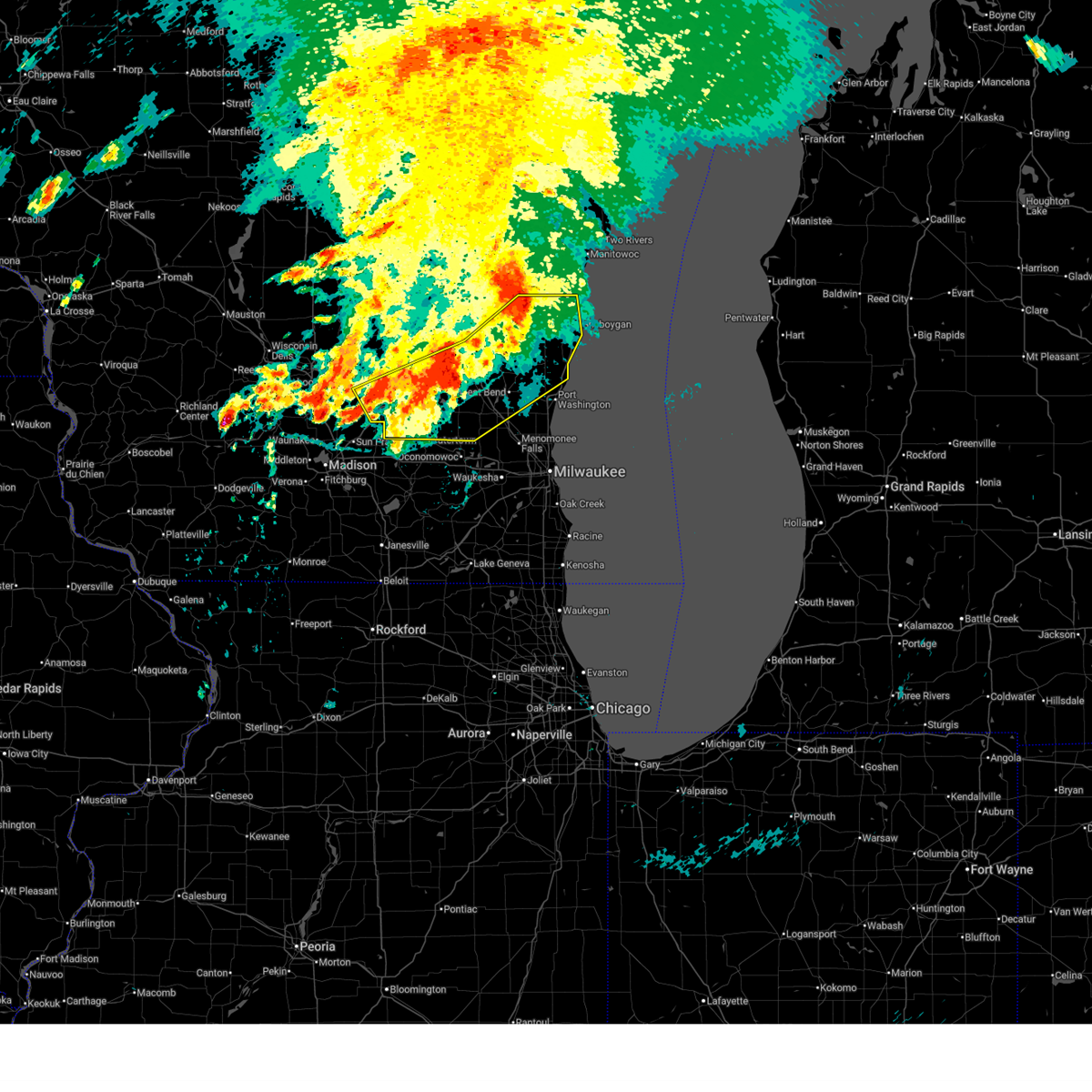
The Top Recent Hail Date for Elkhart Lake, WI is Monday, April 13, 2026 (7th out of 37)
Hail and Wind Damage Spotted near Elkhart Lake, WI
| Date / Time | Report Details |
|---|---|
| 6/11/2026 6:37 PM CDT |
 Svrmkx the national weather service in milwaukee/sullivan has issued a * severe thunderstorm warning for, southeastern fond du lac county in east central wisconsin, sheboygan county in east central wisconsin, * until 715 pm cdt. * at 636 pm cdt, severe thunderstorms were located along a line extending from near plymouth to near iron ridge, moving east at 45 mph (radar indicated). Hazards include 60 mph wind gusts. wind gusts to 62 mph have been reported at the sheboygan airport. expect damage to roofs, siding, and trees Svrmkx the national weather service in milwaukee/sullivan has issued a * severe thunderstorm warning for, southeastern fond du lac county in east central wisconsin, sheboygan county in east central wisconsin, * until 715 pm cdt. * at 636 pm cdt, severe thunderstorms were located along a line extending from near plymouth to near iron ridge, moving east at 45 mph (radar indicated). Hazards include 60 mph wind gusts. wind gusts to 62 mph have been reported at the sheboygan airport. expect damage to roofs, siding, and trees
|
| 6/10/2026 3:30 PM CDT |
 At 329 pm cdt, severe thunderstorms were located along a line extending from northern lake winnebago to near st anna to near plymouth to near newburg, moving east at 55 mph. these are destructive storms for sheboygan, northern washington, and northern ozaukee counties (radar indicated). Hazards include 80 mph wind gusts and penny size hail. Flying debris will be dangerous to those caught without shelter. mobile homes will be heavily damaged. expect considerable damage to roofs, windows, and vehicles. extensive tree damage and power outages are likely. Locations impacted include, sheboygan, fond du lac, west bend, hartford, port washington, plymouth, sheboygan falls, jackson, slinger, saukville, kewaskum, howards grove, oostburg, belgium, fredonia, kohler, cedar grove, campbellsport, random lake, and newburg. At 329 pm cdt, severe thunderstorms were located along a line extending from northern lake winnebago to near st anna to near plymouth to near newburg, moving east at 55 mph. these are destructive storms for sheboygan, northern washington, and northern ozaukee counties (radar indicated). Hazards include 80 mph wind gusts and penny size hail. Flying debris will be dangerous to those caught without shelter. mobile homes will be heavily damaged. expect considerable damage to roofs, windows, and vehicles. extensive tree damage and power outages are likely. Locations impacted include, sheboygan, fond du lac, west bend, hartford, port washington, plymouth, sheboygan falls, jackson, slinger, saukville, kewaskum, howards grove, oostburg, belgium, fredonia, kohler, cedar grove, campbellsport, random lake, and newburg.
|
| 6/10/2026 3:28 PM CDT |
 At 327 pm cdt, severe thunderstorms were located along a line extending from northern lake winnebago to near st anna to near plymouth to near newburg, moving northeast at 55 mph (radar indicated). Hazards include 70 mph wind gusts and penny size hail. Expect considerable tree damage. damage is likely to mobile homes, roofs, and outbuildings. Locations impacted include, sheboygan, fond du lac, west bend, hartford, port washington, plymouth, sheboygan falls, jackson, mayville, slinger, north fond du lac, saukville, kewaskum, howards grove, oostburg, lomira, belgium, fredonia, kohler, and cedar grove. At 327 pm cdt, severe thunderstorms were located along a line extending from northern lake winnebago to near st anna to near plymouth to near newburg, moving northeast at 55 mph (radar indicated). Hazards include 70 mph wind gusts and penny size hail. Expect considerable tree damage. damage is likely to mobile homes, roofs, and outbuildings. Locations impacted include, sheboygan, fond du lac, west bend, hartford, port washington, plymouth, sheboygan falls, jackson, mayville, slinger, north fond du lac, saukville, kewaskum, howards grove, oostburg, lomira, belgium, fredonia, kohler, and cedar grove.
|
| 6/10/2026 2:56 PM CDT |
 Svrmkx the national weather service in milwaukee/sullivan has issued a * severe thunderstorm warning for, northern ozaukee county in southeastern wisconsin, eastern fond du lac county in east central wisconsin, washington county in southeastern wisconsin, northeastern dodge county in southeastern wisconsin, sheboygan county in east central wisconsin, * until 400 pm cdt. * at 256 pm cdt, severe thunderstorms were located along a line extending from near rush lake to near oakfield to near iron ridge to oconomowoc, moving northeast at 55 mph (radar indicated). Hazards include 60 mph wind gusts and penny size hail. expect damage to roofs, siding, and trees Svrmkx the national weather service in milwaukee/sullivan has issued a * severe thunderstorm warning for, northern ozaukee county in southeastern wisconsin, eastern fond du lac county in east central wisconsin, washington county in southeastern wisconsin, northeastern dodge county in southeastern wisconsin, sheboygan county in east central wisconsin, * until 400 pm cdt. * at 256 pm cdt, severe thunderstorms were located along a line extending from near rush lake to near oakfield to near iron ridge to oconomowoc, moving northeast at 55 mph (radar indicated). Hazards include 60 mph wind gusts and penny size hail. expect damage to roofs, siding, and trees
|
| 5/17/2026 2:06 PM CDT |
 The storm which prompted the warning has moved out of the area. therefore, the warning will be allowed to expire. remember, a severe thunderstorm warning still remains in effect for eastern sheboygan county until 2:45 pm. The storm which prompted the warning has moved out of the area. therefore, the warning will be allowed to expire. remember, a severe thunderstorm warning still remains in effect for eastern sheboygan county until 2:45 pm.
|
| 5/17/2026 1:58 PM CDT |
 Svrmkx the national weather service in milwaukee/sullivan has issued a * severe thunderstorm warning for, northeastern sheboygan county in east central wisconsin, * until 245 pm cdt. * at 158 pm cdt, a severe thunderstorm was located near plymouth, moving east at 25 mph (radar indicated). Hazards include 60 mph wind gusts. expect damage to roofs, siding, and trees Svrmkx the national weather service in milwaukee/sullivan has issued a * severe thunderstorm warning for, northeastern sheboygan county in east central wisconsin, * until 245 pm cdt. * at 158 pm cdt, a severe thunderstorm was located near plymouth, moving east at 25 mph (radar indicated). Hazards include 60 mph wind gusts. expect damage to roofs, siding, and trees
|
| 5/17/2026 1:54 PM CDT |
 At 153 pm cdt, a severe thunderstorm was located near plymouth, moving northeast at 35 mph (radar indicated). Hazards include 60 mph wind gusts and penny size hail. Expect damage to roofs, siding, and trees. Locations impacted include, plymouth, random lake, elkhart lake, greenbush, cascade, adell, waldo, glenbeulah, silver creek, batavia, and beechwood. At 153 pm cdt, a severe thunderstorm was located near plymouth, moving northeast at 35 mph (radar indicated). Hazards include 60 mph wind gusts and penny size hail. Expect damage to roofs, siding, and trees. Locations impacted include, plymouth, random lake, elkhart lake, greenbush, cascade, adell, waldo, glenbeulah, silver creek, batavia, and beechwood.
|
| 5/17/2026 1:54 PM CDT |
 the severe thunderstorm warning has been cancelled and is no longer in effect the severe thunderstorm warning has been cancelled and is no longer in effect
|
| 5/17/2026 1:41 PM CDT |
 At 141 pm cdt, a severe thunderstorm was located near campbellsport, or 7 miles northeast of kewaskum, moving northeast at 35 mph (radar indicated). Hazards include 60 mph wind gusts and penny size hail. Expect damage to roofs, siding, and trees. Locations impacted include, plymouth, kewaskum, campbellsport, random lake, elkhart lake, greenbush, cascade, adell, waldo, glenbeulah, silver creek, beechwood, fillmore, dundee, waucousta, boltonville, batavia, town of forest, and new fane. At 141 pm cdt, a severe thunderstorm was located near campbellsport, or 7 miles northeast of kewaskum, moving northeast at 35 mph (radar indicated). Hazards include 60 mph wind gusts and penny size hail. Expect damage to roofs, siding, and trees. Locations impacted include, plymouth, kewaskum, campbellsport, random lake, elkhart lake, greenbush, cascade, adell, waldo, glenbeulah, silver creek, beechwood, fillmore, dundee, waucousta, boltonville, batavia, town of forest, and new fane.
|
| 5/17/2026 1:27 PM CDT |
 Svrmkx the national weather service in milwaukee/sullivan has issued a * severe thunderstorm warning for, southeastern fond du lac county in east central wisconsin, northern washington county in southeastern wisconsin, western sheboygan county in east central wisconsin, * until 215 pm cdt. * at 127 pm cdt, a severe thunderstorm was located near campbellsport, or near kewaskum, moving northeast at 35 mph (radar indicated). Hazards include 60 mph wind gusts and penny size hail. expect damage to roofs, siding, and trees Svrmkx the national weather service in milwaukee/sullivan has issued a * severe thunderstorm warning for, southeastern fond du lac county in east central wisconsin, northern washington county in southeastern wisconsin, western sheboygan county in east central wisconsin, * until 215 pm cdt. * at 127 pm cdt, a severe thunderstorm was located near campbellsport, or near kewaskum, moving northeast at 35 mph (radar indicated). Hazards include 60 mph wind gusts and penny size hail. expect damage to roofs, siding, and trees
|
| 5/16/2026 1:38 AM CDT |
 At 137 am cdt, a severe thunderstorm was located over plymouth, moving northeast at 45 mph (radar indicated). Hazards include quarter size hail. Damage to vehicles is expected. Locations impacted include, sheboygan, plymouth, sheboygan falls, howards grove, oostburg, kohler, elkhart lake, greenbush, cascade, adell, waldo, glenbeulah, haven, beechwood, johnsonville, gibbsville, batavia, and hingham. At 137 am cdt, a severe thunderstorm was located over plymouth, moving northeast at 45 mph (radar indicated). Hazards include quarter size hail. Damage to vehicles is expected. Locations impacted include, sheboygan, plymouth, sheboygan falls, howards grove, oostburg, kohler, elkhart lake, greenbush, cascade, adell, waldo, glenbeulah, haven, beechwood, johnsonville, gibbsville, batavia, and hingham.
|
| 5/16/2026 1:20 AM CDT |
 Svrmkx the national weather service in milwaukee/sullivan has issued a * severe thunderstorm warning for, southeastern fond du lac county in east central wisconsin, sheboygan county in east central wisconsin, * until 200 am cdt. * at 120 am cdt, a severe thunderstorm was located near campbellsport, or 9 miles north of kewaskum, moving northeast at 45 mph (radar indicated). Hazards include quarter size hail. damage to vehicles is expected Svrmkx the national weather service in milwaukee/sullivan has issued a * severe thunderstorm warning for, southeastern fond du lac county in east central wisconsin, sheboygan county in east central wisconsin, * until 200 am cdt. * at 120 am cdt, a severe thunderstorm was located near campbellsport, or 9 miles north of kewaskum, moving northeast at 45 mph (radar indicated). Hazards include quarter size hail. damage to vehicles is expected
|
| 4/17/2026 6:39 PM CDT |
 Svrmkx the national weather service in milwaukee/sullivan has issued a * severe thunderstorm warning for, ozaukee county in southeastern wisconsin, southeastern fond du lac county in east central wisconsin, washington county in southeastern wisconsin, sheboygan county in east central wisconsin, * until 730 pm cdt. * at 639 pm cdt, severe thunderstorms were located along a line extending from plymouth to near slinger, moving northeast at 30 mph (radar indicated). Hazards include 60 mph wind gusts and penny size hail. expect damage to roofs, siding, and trees Svrmkx the national weather service in milwaukee/sullivan has issued a * severe thunderstorm warning for, ozaukee county in southeastern wisconsin, southeastern fond du lac county in east central wisconsin, washington county in southeastern wisconsin, sheboygan county in east central wisconsin, * until 730 pm cdt. * at 639 pm cdt, severe thunderstorms were located along a line extending from plymouth to near slinger, moving northeast at 30 mph (radar indicated). Hazards include 60 mph wind gusts and penny size hail. expect damage to roofs, siding, and trees
|
| 8/16/2025 4:49 PM CDT |
 the severe thunderstorm warning has been cancelled and is no longer in effect the severe thunderstorm warning has been cancelled and is no longer in effect
|
| 8/16/2025 4:03 PM CDT |
 Svrmkx the national weather service in milwaukee/sullivan has issued a * severe thunderstorm warning for, ozaukee county in southeastern wisconsin, southeastern fond du lac county in east central wisconsin, southeastern columbia county in south central wisconsin, northeastern dane county in south central wisconsin, washington county in southeastern wisconsin, dodge county in southeastern wisconsin, sheboygan county in east central wisconsin, * until 500 pm cdt. * at 402 pm cdt, severe thunderstorms were located along a line extending from near north fond du lac to near beaver dam to near deforest, moving southeast at 50 mph (radar indicated). Hazards include 60 mph wind gusts. expect damage to roofs, siding, and trees Svrmkx the national weather service in milwaukee/sullivan has issued a * severe thunderstorm warning for, ozaukee county in southeastern wisconsin, southeastern fond du lac county in east central wisconsin, southeastern columbia county in south central wisconsin, northeastern dane county in south central wisconsin, washington county in southeastern wisconsin, dodge county in southeastern wisconsin, sheboygan county in east central wisconsin, * until 500 pm cdt. * at 402 pm cdt, severe thunderstorms were located along a line extending from near north fond du lac to near beaver dam to near deforest, moving southeast at 50 mph (radar indicated). Hazards include 60 mph wind gusts. expect damage to roofs, siding, and trees
|
| 8/16/2025 12:58 PM CDT |
 The storms which prompted the warning have weakened below severe limits, and no longer pose an immediate threat to life or property. therefore, the warning will be allowed to expire. The storms which prompted the warning have weakened below severe limits, and no longer pose an immediate threat to life or property. therefore, the warning will be allowed to expire.
|
| 8/16/2025 12:36 PM CDT |
 At 1236 pm cdt, severe thunderstorms were located along a line extending from elkhart lake to near kewaskum to near juneau, moving southeast at 40 mph (radar indicated). Hazards include 60 mph wind gusts. Expect damage to roofs, siding, and trees. locations impacted include, sheboygan, west bend, watertown, beaver dam, hartford, plymouth, sheboygan falls, jackson, mayville, slinger, columbus, kewaskum, horicon, howards grove, juneau, oostburg, lomira, belgium, fredonia, and kohler. People attending the dodge county fair in beaver dam should seek safe shelter immediately!. At 1236 pm cdt, severe thunderstorms were located along a line extending from elkhart lake to near kewaskum to near juneau, moving southeast at 40 mph (radar indicated). Hazards include 60 mph wind gusts. Expect damage to roofs, siding, and trees. locations impacted include, sheboygan, west bend, watertown, beaver dam, hartford, plymouth, sheboygan falls, jackson, mayville, slinger, columbus, kewaskum, horicon, howards grove, juneau, oostburg, lomira, belgium, fredonia, and kohler. People attending the dodge county fair in beaver dam should seek safe shelter immediately!.
|
| 8/16/2025 12:04 PM CDT |
 Svrmkx the national weather service in milwaukee/sullivan has issued a * severe thunderstorm warning for, northern ozaukee county in southeastern wisconsin, southeastern fond du lac county in east central wisconsin, southeastern columbia county in south central wisconsin, washington county in southeastern wisconsin, dodge county in southeastern wisconsin, sheboygan county in east central wisconsin, * until 100 pm cdt. * at 1203 pm cdt, severe thunderstorms were located along a line extending from near central lake winnebago to oakfield to near cambria, moving southeast at 40 mph (radar indicated). Hazards include 60 mph wind gusts. expect damage to roofs, siding, and trees Svrmkx the national weather service in milwaukee/sullivan has issued a * severe thunderstorm warning for, northern ozaukee county in southeastern wisconsin, southeastern fond du lac county in east central wisconsin, southeastern columbia county in south central wisconsin, washington county in southeastern wisconsin, dodge county in southeastern wisconsin, sheboygan county in east central wisconsin, * until 100 pm cdt. * at 1203 pm cdt, severe thunderstorms were located along a line extending from near central lake winnebago to oakfield to near cambria, moving southeast at 40 mph (radar indicated). Hazards include 60 mph wind gusts. expect damage to roofs, siding, and trees
|
| 7/16/2025 5:36 PM CDT |
 The storm which prompted the warning has moved out of the area. therefore, the warning will be allowed to expire. a tornado watch remains in effect until 700 pm cdt for east central wisconsin. remember, a severe thunderstorm warning still remains in effect for eastern sheboygan county until 600 pm cdt. The storm which prompted the warning has moved out of the area. therefore, the warning will be allowed to expire. a tornado watch remains in effect until 700 pm cdt for east central wisconsin. remember, a severe thunderstorm warning still remains in effect for eastern sheboygan county until 600 pm cdt.
|
| 7/16/2025 5:10 PM CDT |
 Svrmkx the national weather service in milwaukee/sullivan has issued a * severe thunderstorm warning for, central sheboygan county in east central wisconsin, * until 545 pm cdt. * at 510 pm cdt, a severe thunderstorm was located over plymouth, moving north at 25 mph (radar indicated). Hazards include 60 mph wind gusts. expect damage to roofs, siding, and trees Svrmkx the national weather service in milwaukee/sullivan has issued a * severe thunderstorm warning for, central sheboygan county in east central wisconsin, * until 545 pm cdt. * at 510 pm cdt, a severe thunderstorm was located over plymouth, moving north at 25 mph (radar indicated). Hazards include 60 mph wind gusts. expect damage to roofs, siding, and trees
|
| 6/23/2025 7:36 PM CDT |
 The storms which prompted the warning have weakened below severe limits, and no longer pose an immediate threat to life or property. therefore, the warning will be allowed to expire. a severe thunderstorm watch remains in effect until 900 pm cdt for southeastern and east central wisconsin. The storms which prompted the warning have weakened below severe limits, and no longer pose an immediate threat to life or property. therefore, the warning will be allowed to expire. a severe thunderstorm watch remains in effect until 900 pm cdt for southeastern and east central wisconsin.
|
| 6/23/2025 7:27 PM CDT |
 the severe thunderstorm warning has been cancelled and is no longer in effect the severe thunderstorm warning has been cancelled and is no longer in effect
|
| 6/23/2025 7:27 PM CDT |
 At 727 pm cdt, severe thunderstorms were located along a line extending from near cleveland to bayside, moving east at 45 mph (radar indicated). Hazards include 60 mph wind gusts. Expect damage to roofs, siding, and trees. Locations impacted include, sheboygan, mequon, brown deer, grafton, cedarburg, port washington, plymouth, sheboygan falls, saukville, bayside, thiensville, howards grove, oostburg, belgium, fredonia, kohler, cedar grove, river hills, random lake, and newburg. At 727 pm cdt, severe thunderstorms were located along a line extending from near cleveland to bayside, moving east at 45 mph (radar indicated). Hazards include 60 mph wind gusts. Expect damage to roofs, siding, and trees. Locations impacted include, sheboygan, mequon, brown deer, grafton, cedarburg, port washington, plymouth, sheboygan falls, saukville, bayside, thiensville, howards grove, oostburg, belgium, fredonia, kohler, cedar grove, river hills, random lake, and newburg.
|
| 6/23/2025 7:17 PM CDT |
 At 717 pm cdt, severe thunderstorms were located along a line extending from near camp rokilio scout camp to milwaukee, moving east at 30 mph (radar indicated). Hazards include 60 mph wind gusts. Expect damage to roofs, siding, and trees. Locations impacted include, sheboygan, menomonee falls, west bend, mequon, brown deer, grafton, cedarburg, port washington, plymouth, sheboygan falls, jackson, saukville, bayside, thiensville, howards grove, germantown, oostburg, belgium, fredonia, and kohler. At 717 pm cdt, severe thunderstorms were located along a line extending from near camp rokilio scout camp to milwaukee, moving east at 30 mph (radar indicated). Hazards include 60 mph wind gusts. Expect damage to roofs, siding, and trees. Locations impacted include, sheboygan, menomonee falls, west bend, mequon, brown deer, grafton, cedarburg, port washington, plymouth, sheboygan falls, jackson, saukville, bayside, thiensville, howards grove, germantown, oostburg, belgium, fredonia, and kohler.
|
| 6/23/2025 6:47 PM CDT |
 Svrmkx the national weather service in milwaukee/sullivan has issued a * severe thunderstorm warning for, ozaukee county in southeastern wisconsin, eastern washington county in southeastern wisconsin, sheboygan county in east central wisconsin, * until 745 pm cdt. * at 646 pm cdt, severe thunderstorms were located along a line extending from near central lake winnebago to near lac la belle, moving east at 40 mph (radar indicated). Hazards include 60 mph wind gusts. expect damage to roofs, siding, and trees Svrmkx the national weather service in milwaukee/sullivan has issued a * severe thunderstorm warning for, ozaukee county in southeastern wisconsin, eastern washington county in southeastern wisconsin, sheboygan county in east central wisconsin, * until 745 pm cdt. * at 646 pm cdt, severe thunderstorms were located along a line extending from near central lake winnebago to near lac la belle, moving east at 40 mph (radar indicated). Hazards include 60 mph wind gusts. expect damage to roofs, siding, and trees
|
| 6/19/2025 8:32 PM CDT |
 Svrmkx the national weather service in milwaukee/sullivan has issued a * severe thunderstorm warning for, sheboygan county in east central wisconsin, * until 915 pm cdt. * at 832 pm cdt, a severe thunderstorm was located near howards grove, moving southeast at 35 mph (radar indicated). Hazards include 60 mph wind gusts and penny size hail. expect damage to roofs, siding, and trees Svrmkx the national weather service in milwaukee/sullivan has issued a * severe thunderstorm warning for, sheboygan county in east central wisconsin, * until 915 pm cdt. * at 832 pm cdt, a severe thunderstorm was located near howards grove, moving southeast at 35 mph (radar indicated). Hazards include 60 mph wind gusts and penny size hail. expect damage to roofs, siding, and trees
|
| 5/16/2025 4:36 PM CDT |
 Svrmkx the national weather service in milwaukee/sullivan has issued a * severe thunderstorm warning for, northern sheboygan county in east central wisconsin, * until 500 pm cdt. * at 435 pm cdt, a severe thunderstorm was located over plymouth, moving northeast at 55 mph (radar indicated). Hazards include 60 mph wind gusts. expect damage to roofs, siding, and trees Svrmkx the national weather service in milwaukee/sullivan has issued a * severe thunderstorm warning for, northern sheboygan county in east central wisconsin, * until 500 pm cdt. * at 435 pm cdt, a severe thunderstorm was located over plymouth, moving northeast at 55 mph (radar indicated). Hazards include 60 mph wind gusts. expect damage to roofs, siding, and trees
|
| 5/15/2025 7:41 PM CDT |
 The storms which prompted the warning have moved out of the warned area. therefore, the warning will be allowed to expire. a tornado watch remains in effect until 1000 pm cdt for southeastern and east central wisconsin. The storms which prompted the warning have moved out of the warned area. therefore, the warning will be allowed to expire. a tornado watch remains in effect until 1000 pm cdt for southeastern and east central wisconsin.
|
| 5/15/2025 7:07 PM CDT |
 At 707 pm cdt, severe thunderstorms were located along a line extending from near camp rokilio scout camp to port washington, moving northeast at 40 mph (radar indicated). Hazards include 60 mph wind gusts and quarter size hail. Hail damage to vehicles is expected. expect wind damage to roofs, siding, and trees. Locations impacted include, sheboygan, mequon, grafton, cedarburg, port washington, plymouth, sheboygan falls, saukville, bayside, thiensville, howards grove, oostburg, belgium, fredonia, kohler, cedar grove, random lake, newburg, elkhart lake, and greenbush. At 707 pm cdt, severe thunderstorms were located along a line extending from near camp rokilio scout camp to port washington, moving northeast at 40 mph (radar indicated). Hazards include 60 mph wind gusts and quarter size hail. Hail damage to vehicles is expected. expect wind damage to roofs, siding, and trees. Locations impacted include, sheboygan, mequon, grafton, cedarburg, port washington, plymouth, sheboygan falls, saukville, bayside, thiensville, howards grove, oostburg, belgium, fredonia, kohler, cedar grove, random lake, newburg, elkhart lake, and greenbush.
|
| 5/15/2025 7:07 PM CDT |
 the severe thunderstorm warning has been cancelled and is no longer in effect the severe thunderstorm warning has been cancelled and is no longer in effect
|
| 5/15/2025 6:50 PM CDT |
 At 650 pm cdt, severe thunderstorms were located along a line extending from near st anna to cedarburg, moving northeast at 35 mph (radar indicated). Hazards include 60 mph wind gusts and quarter size hail. Hail damage to vehicles is expected. expect wind damage to roofs, siding, and trees. Locations impacted include, sheboygan, west bend, mequon, hartford, brown deer, grafton, cedarburg, port washington, plymouth, sheboygan falls, jackson, slinger, saukville, bayside, kewaskum, thiensville, howards grove, germantown, oostburg, and belgium. At 650 pm cdt, severe thunderstorms were located along a line extending from near st anna to cedarburg, moving northeast at 35 mph (radar indicated). Hazards include 60 mph wind gusts and quarter size hail. Hail damage to vehicles is expected. expect wind damage to roofs, siding, and trees. Locations impacted include, sheboygan, west bend, mequon, hartford, brown deer, grafton, cedarburg, port washington, plymouth, sheboygan falls, jackson, slinger, saukville, bayside, kewaskum, thiensville, howards grove, germantown, oostburg, and belgium.
|
| 5/15/2025 6:32 PM CDT |
 At 631 pm cdt, severe thunderstorms were located along a line extending from 6 miles southeast of central lake winnebago to campbellsport to near slinger, moving northeast at 40 mph (public reports of two inch hail east of ashippun). Hazards include two inch hail and 60 mph wind gusts. People and animals outdoors will be injured. expect hail damage to roofs, siding, windows, and vehicles. expect wind damage to roofs, siding, and trees. Locations impacted include, sheboygan, west bend, mequon, hartford, brown deer, grafton, cedarburg, port washington, plymouth, sheboygan falls, jackson, slinger, saukville, bayside, kewaskum, thiensville, howards grove, germantown, oostburg, and belgium. At 631 pm cdt, severe thunderstorms were located along a line extending from 6 miles southeast of central lake winnebago to campbellsport to near slinger, moving northeast at 40 mph (public reports of two inch hail east of ashippun). Hazards include two inch hail and 60 mph wind gusts. People and animals outdoors will be injured. expect hail damage to roofs, siding, windows, and vehicles. expect wind damage to roofs, siding, and trees. Locations impacted include, sheboygan, west bend, mequon, hartford, brown deer, grafton, cedarburg, port washington, plymouth, sheboygan falls, jackson, slinger, saukville, bayside, kewaskum, thiensville, howards grove, germantown, oostburg, and belgium.
|
| 5/15/2025 6:26 PM CDT |
 Svrmkx the national weather service in milwaukee/sullivan has issued a * severe thunderstorm warning for, ozaukee county in southeastern wisconsin, washington county in southeastern wisconsin, sheboygan county in east central wisconsin, * until 745 pm cdt. * at 625 pm cdt, severe thunderstorms were located along a line extending from near southern lake winnebago to near campbellsport to near slinger, moving northeast at 40 mph (radar indicated). Hazards include two inch hail and 60 mph wind gusts. People and animals outdoors will be injured. expect hail damage to roofs, siding, windows, and vehicles. Expect wind damage to roofs, siding, and trees. Svrmkx the national weather service in milwaukee/sullivan has issued a * severe thunderstorm warning for, ozaukee county in southeastern wisconsin, washington county in southeastern wisconsin, sheboygan county in east central wisconsin, * until 745 pm cdt. * at 625 pm cdt, severe thunderstorms were located along a line extending from near southern lake winnebago to near campbellsport to near slinger, moving northeast at 40 mph (radar indicated). Hazards include two inch hail and 60 mph wind gusts. People and animals outdoors will be injured. expect hail damage to roofs, siding, windows, and vehicles. Expect wind damage to roofs, siding, and trees.
|
| 5/15/2025 6:23 PM CDT |
 Tormkx the national weather service in milwaukee/sullivan has issued a * tornado warning for, eastern fond du lac county in east central wisconsin, northwestern sheboygan county in east central wisconsin, * until 700 pm cdt. * at 623 pm cdt, a severe thunderstorm capable of producing a tornado was located near campbellsport, or 10 miles north of kewaskum, moving northeast at 40 mph (radar indicated rotation). Hazards include tornado and golf ball size hail. Flying debris will be dangerous to those caught without shelter. mobile homes will be damaged or destroyed. damage to roofs, windows, and vehicles will occur. Tree damage is likely. Tormkx the national weather service in milwaukee/sullivan has issued a * tornado warning for, eastern fond du lac county in east central wisconsin, northwestern sheboygan county in east central wisconsin, * until 700 pm cdt. * at 623 pm cdt, a severe thunderstorm capable of producing a tornado was located near campbellsport, or 10 miles north of kewaskum, moving northeast at 40 mph (radar indicated rotation). Hazards include tornado and golf ball size hail. Flying debris will be dangerous to those caught without shelter. mobile homes will be damaged or destroyed. damage to roofs, windows, and vehicles will occur. Tree damage is likely.
|
| 3/15/2025 2:13 AM CDT |
 the severe thunderstorm warning has been cancelled and is no longer in effect the severe thunderstorm warning has been cancelled and is no longer in effect
|
| 3/15/2025 1:50 AM CDT |
 the severe thunderstorm warning has been cancelled and is no longer in effect the severe thunderstorm warning has been cancelled and is no longer in effect
|
| 3/15/2025 1:50 AM CDT |
 At 150 am cdt, severe thunderstorms were located along a line extending from near southern lake winnebago to near plymouth to 6 miles southeast of oostburg, moving northeast at 45 mph (radar indicated). Hazards include 60 mph wind gusts. Expect damage to roofs, siding, and trees. locations impacted include, adell, haven, southern lake winnebago, eldorado, cedar grove, eden, johnsonville, sheboygan falls, waucousta, calvary, north fond du lac, marytown, van dyne, hingham, st. Cloud, sheboygan, johnsburg, howards grove, cascade, and peebles. At 150 am cdt, severe thunderstorms were located along a line extending from near southern lake winnebago to near plymouth to 6 miles southeast of oostburg, moving northeast at 45 mph (radar indicated). Hazards include 60 mph wind gusts. Expect damage to roofs, siding, and trees. locations impacted include, adell, haven, southern lake winnebago, eldorado, cedar grove, eden, johnsonville, sheboygan falls, waucousta, calvary, north fond du lac, marytown, van dyne, hingham, st. Cloud, sheboygan, johnsburg, howards grove, cascade, and peebles.
|
| 3/15/2025 1:47 AM CDT |
 Svrmkx the national weather service in milwaukee/sullivan has issued a * severe thunderstorm warning for, northeastern fond du lac county in east central wisconsin, sheboygan county in east central wisconsin, * until 230 am cdt. * at 146 am cdt, severe thunderstorms were located along a line extending from near southern lake winnebago to near plymouth to 8 miles southeast of cedar grove, moving northeast at 60 mph (radar indicated). Hazards include 60 mph wind gusts. expect damage to roofs, siding, and trees Svrmkx the national weather service in milwaukee/sullivan has issued a * severe thunderstorm warning for, northeastern fond du lac county in east central wisconsin, sheboygan county in east central wisconsin, * until 230 am cdt. * at 146 am cdt, severe thunderstorms were located along a line extending from near southern lake winnebago to near plymouth to 8 miles southeast of cedar grove, moving northeast at 60 mph (radar indicated). Hazards include 60 mph wind gusts. expect damage to roofs, siding, and trees
|
| 3/15/2025 1:11 AM CDT |
 Svrmkx the national weather service in milwaukee/sullivan has issued a * severe thunderstorm warning for, ozaukee county in southeastern wisconsin, fond du lac county in east central wisconsin, milwaukee county in southeastern wisconsin, northeastern waukesha county in southeastern wisconsin, washington county in southeastern wisconsin, northern dodge county in southeastern wisconsin, sheboygan county in east central wisconsin, * until 200 am cdt. * at 110 am cdt, severe thunderstorms were located along a line extending from near central lake winnebago to near random lake to 9 miles east of whitefish bay, moving northeast at 40 mph (radar indicated). Hazards include 60 mph wind gusts. expect damage to roofs, siding, and trees Svrmkx the national weather service in milwaukee/sullivan has issued a * severe thunderstorm warning for, ozaukee county in southeastern wisconsin, fond du lac county in east central wisconsin, milwaukee county in southeastern wisconsin, northeastern waukesha county in southeastern wisconsin, washington county in southeastern wisconsin, northern dodge county in southeastern wisconsin, sheboygan county in east central wisconsin, * until 200 am cdt. * at 110 am cdt, severe thunderstorms were located along a line extending from near central lake winnebago to near random lake to 9 miles east of whitefish bay, moving northeast at 40 mph (radar indicated). Hazards include 60 mph wind gusts. expect damage to roofs, siding, and trees
|
| 3/15/2025 12:42 AM CDT |
 Svrmkx the national weather service in milwaukee/sullivan has issued a * severe thunderstorm warning for, fond du lac county in east central wisconsin, green lake county in south central wisconsin, northeastern marquette county in south central wisconsin, northern dodge county in southeastern wisconsin, sheboygan county in east central wisconsin, * until 115 am cdt. * at 1242 am cdt, severe thunderstorms were located along a line extending from near wautoma to green lake to near theresa, moving northeast at 60 mph (radar indicated). Hazards include 60 mph wind gusts. expect damage to roofs, siding, and trees Svrmkx the national weather service in milwaukee/sullivan has issued a * severe thunderstorm warning for, fond du lac county in east central wisconsin, green lake county in south central wisconsin, northeastern marquette county in south central wisconsin, northern dodge county in southeastern wisconsin, sheboygan county in east central wisconsin, * until 115 am cdt. * at 1242 am cdt, severe thunderstorms were located along a line extending from near wautoma to green lake to near theresa, moving northeast at 60 mph (radar indicated). Hazards include 60 mph wind gusts. expect damage to roofs, siding, and trees
|
| 7/13/2024 8:51 PM CDT |
 At 851 pm cdt, a severe thunderstorm was located near plymouth, moving east at 30 mph (radar indicated). Hazards include 60 mph wind gusts. Expect damage to roofs, siding, and trees. locations impacted include, sheboygan, plymouth, sheboygan falls, kewaskum, howards grove, oostburg, belgium, fredonia, kohler, cedar grove, campbellsport, random lake, elkhart lake, greenbush, cascade, adell, waldo, wayne, st. Cloud, and glenbeulah. At 851 pm cdt, a severe thunderstorm was located near plymouth, moving east at 30 mph (radar indicated). Hazards include 60 mph wind gusts. Expect damage to roofs, siding, and trees. locations impacted include, sheboygan, plymouth, sheboygan falls, kewaskum, howards grove, oostburg, belgium, fredonia, kohler, cedar grove, campbellsport, random lake, elkhart lake, greenbush, cascade, adell, waldo, wayne, st. Cloud, and glenbeulah.
|
| 7/13/2024 8:51 PM CDT |
 the severe thunderstorm warning has been cancelled and is no longer in effect the severe thunderstorm warning has been cancelled and is no longer in effect
|
| 7/13/2024 8:29 PM CDT |
 At 829 pm cdt, a severe thunderstorm was located 8 miles east of fond du lac, moving east at 30 mph (radar indicated). Hazards include 60 mph wind gusts. Expect damage to roofs, siding, and trees. Locations impacted include, sheboygan, fond du lac, plymouth, sheboygan falls, mayville, north fond du lac, kewaskum, howards grove, oostburg, lomira, belgium, fredonia, kohler, cedar grove, campbellsport, random lake, theresa, oakfield, elkhart lake, and southern lake winnebago. At 829 pm cdt, a severe thunderstorm was located 8 miles east of fond du lac, moving east at 30 mph (radar indicated). Hazards include 60 mph wind gusts. Expect damage to roofs, siding, and trees. Locations impacted include, sheboygan, fond du lac, plymouth, sheboygan falls, mayville, north fond du lac, kewaskum, howards grove, oostburg, lomira, belgium, fredonia, kohler, cedar grove, campbellsport, random lake, theresa, oakfield, elkhart lake, and southern lake winnebago.
|
| 7/13/2024 8:12 PM CDT |
 Svrmkx the national weather service in milwaukee/sullivan has issued a * severe thunderstorm warning for, northern ozaukee county in southeastern wisconsin, fond du lac county in east central wisconsin, northern washington county in southeastern wisconsin, northeastern dodge county in southeastern wisconsin, sheboygan county in east central wisconsin, * until 915 pm cdt. * at 812 pm cdt, a severe thunderstorm was located over fond du lac, moving east at 30 mph (radar indicated). Hazards include 70 mph wind gusts. Expect considerable tree damage. Damage is likely to mobile homes, roofs, and outbuildings. Svrmkx the national weather service in milwaukee/sullivan has issued a * severe thunderstorm warning for, northern ozaukee county in southeastern wisconsin, fond du lac county in east central wisconsin, northern washington county in southeastern wisconsin, northeastern dodge county in southeastern wisconsin, sheboygan county in east central wisconsin, * until 915 pm cdt. * at 812 pm cdt, a severe thunderstorm was located over fond du lac, moving east at 30 mph (radar indicated). Hazards include 70 mph wind gusts. Expect considerable tree damage. Damage is likely to mobile homes, roofs, and outbuildings.
|
| 6/19/2024 3:51 PM CDT |
 At 350 pm cdt, a severe thunderstorm was located over plymouth, moving northeast at 25 mph (radar indicated). Hazards include 60 mph wind gusts. Expect damage to roofs, siding, and trees. Locations impacted include, plymouth, elkhart lake, waldo, glenbeulah, and johnsonville. At 350 pm cdt, a severe thunderstorm was located over plymouth, moving northeast at 25 mph (radar indicated). Hazards include 60 mph wind gusts. Expect damage to roofs, siding, and trees. Locations impacted include, plymouth, elkhart lake, waldo, glenbeulah, and johnsonville.
|
| 6/19/2024 3:38 PM CDT |
 At 338 pm cdt, a severe thunderstorm was located over plymouth, moving northeast at 30 mph (radar indicated). Hazards include 60 mph wind gusts. Expect damage to roofs, siding, and trees. Locations impacted include, plymouth, elkhart lake, greenbush, cascade, waldo, glenbeulah, hingham, and johnsonville. At 338 pm cdt, a severe thunderstorm was located over plymouth, moving northeast at 30 mph (radar indicated). Hazards include 60 mph wind gusts. Expect damage to roofs, siding, and trees. Locations impacted include, plymouth, elkhart lake, greenbush, cascade, waldo, glenbeulah, hingham, and johnsonville.
|
| 6/19/2024 3:38 PM CDT |
 the severe thunderstorm warning has been cancelled and is no longer in effect the severe thunderstorm warning has been cancelled and is no longer in effect
|
| 6/19/2024 3:26 PM CDT |
 Svrmkx the national weather service in milwaukee/sullivan has issued a * severe thunderstorm warning for, east central fond du lac county in east central wisconsin, western sheboygan county in east central wisconsin, * until 400 pm cdt. * at 325 pm cdt, a severe thunderstorm was located 9 miles southwest of plymouth, moving northeast at 30 mph (radar indicated). Hazards include 60 mph wind gusts and penny size hail. expect damage to roofs, siding, and trees Svrmkx the national weather service in milwaukee/sullivan has issued a * severe thunderstorm warning for, east central fond du lac county in east central wisconsin, western sheboygan county in east central wisconsin, * until 400 pm cdt. * at 325 pm cdt, a severe thunderstorm was located 9 miles southwest of plymouth, moving northeast at 30 mph (radar indicated). Hazards include 60 mph wind gusts and penny size hail. expect damage to roofs, siding, and trees
|
| 5/21/2024 9:22 PM CDT |
 Svrmkx the national weather service in milwaukee/sullivan has issued a * severe thunderstorm warning for, eastern fond du lac county in east central wisconsin, sheboygan county in east central wisconsin, * until 1000 pm cdt. * at 921 pm cdt, severe thunderstorms were located along a line extending from 6 miles southeast of central lake winnebago to near kewaskum, moving northeast at 65 mph (trained weather spotters. these storms have a widespread history of producing tree and power line damage, and measured gusts between 60 and 70 mph). Hazards include 70 mph wind gusts and penny size hail. Expect considerable tree damage. Damage is likely to mobile homes, roofs, and outbuildings. Svrmkx the national weather service in milwaukee/sullivan has issued a * severe thunderstorm warning for, eastern fond du lac county in east central wisconsin, sheboygan county in east central wisconsin, * until 1000 pm cdt. * at 921 pm cdt, severe thunderstorms were located along a line extending from 6 miles southeast of central lake winnebago to near kewaskum, moving northeast at 65 mph (trained weather spotters. these storms have a widespread history of producing tree and power line damage, and measured gusts between 60 and 70 mph). Hazards include 70 mph wind gusts and penny size hail. Expect considerable tree damage. Damage is likely to mobile homes, roofs, and outbuildings.
|
| 5/21/2024 9:00 PM CDT |
 Tormkx the national weather service in milwaukee/sullivan has issued a * tornado warning for, northeastern fond du lac county in east central wisconsin, northern sheboygan county in east central wisconsin, * until 930 pm cdt. * at 900 pm cdt, severe thunderstorms capable of producing a tornado were located along a line extending from near chilton to 6 miles southeast of fond du lac, moving northeast at 55 mph (radar indicated rotation). Hazards include tornado. Flying debris will be dangerous to those caught without shelter. mobile homes will be damaged or destroyed. damage to roofs, windows, and vehicles will occur. Tree damage is likely. Tormkx the national weather service in milwaukee/sullivan has issued a * tornado warning for, northeastern fond du lac county in east central wisconsin, northern sheboygan county in east central wisconsin, * until 930 pm cdt. * at 900 pm cdt, severe thunderstorms capable of producing a tornado were located along a line extending from near chilton to 6 miles southeast of fond du lac, moving northeast at 55 mph (radar indicated rotation). Hazards include tornado. Flying debris will be dangerous to those caught without shelter. mobile homes will be damaged or destroyed. damage to roofs, windows, and vehicles will occur. Tree damage is likely.
|
| 8/3/2023 7:14 PM CDT |
 At 713 pm cdt, a severe thunderstorm was located over elkhart lake, or near plymouth, moving southeast at 15 mph (law enforcement). Hazards include 60 mph wind gusts. Expect damage to roofs, siding, and trees. law enforcement reported numerous trees down in elkhart lake. locations impacted include, plymouth, elkhart lake, greenbush, st. cloud, glenbeulah, and town of forest. hail threat, radar indicated max hail size, <. 75 in wind threat, observed max wind gust, 60 mph. At 713 pm cdt, a severe thunderstorm was located over elkhart lake, or near plymouth, moving southeast at 15 mph (law enforcement). Hazards include 60 mph wind gusts. Expect damage to roofs, siding, and trees. law enforcement reported numerous trees down in elkhart lake. locations impacted include, plymouth, elkhart lake, greenbush, st. cloud, glenbeulah, and town of forest. hail threat, radar indicated max hail size, <. 75 in wind threat, observed max wind gust, 60 mph.
|
| 8/3/2023 6:58 PM CDT |
 At 657 pm cdt, a severe thunderstorm was located near st anna, or 10 miles northwest of plymouth, moving southeast at 15 mph (radar indicated). Hazards include 60 mph wind gusts. Expect damage to roofs, siding, and trees. locations impacted include, plymouth, elkhart lake, greenbush, st. cloud, glenbeulah, marytown, and town of forest. hail threat, radar indicated max hail size, <. 75 in wind threat, radar indicated max wind gust, 60 mph. At 657 pm cdt, a severe thunderstorm was located near st anna, or 10 miles northwest of plymouth, moving southeast at 15 mph (radar indicated). Hazards include 60 mph wind gusts. Expect damage to roofs, siding, and trees. locations impacted include, plymouth, elkhart lake, greenbush, st. cloud, glenbeulah, marytown, and town of forest. hail threat, radar indicated max hail size, <. 75 in wind threat, radar indicated max wind gust, 60 mph.
|
| 8/3/2023 6:45 PM CDT | Numerous trees down in elkhart lak in sheboygan county WI, 1.3 miles SW of Elkhart Lake, WI |
| 8/3/2023 6:40 PM CDT |
 At 636 pm cdt, a severe thunderstorm was located near st anna, or 16 miles northwest of plymouth, moving southeast at 15 mph (radar indicated). Hazards include 60 mph wind gusts and quarter size hail. Hail damage to vehicles is expected. Expect wind damage to roofs, siding, and trees. At 636 pm cdt, a severe thunderstorm was located near st anna, or 16 miles northwest of plymouth, moving southeast at 15 mph (radar indicated). Hazards include 60 mph wind gusts and quarter size hail. Hail damage to vehicles is expected. Expect wind damage to roofs, siding, and trees.
|
| 4/20/2023 7:22 PM CDT |
 The severe thunderstorm warning for northern sheboygan county will expire at 730 pm cdt, the storm which prompted the warning has moved out of the area. therefore, the warning will be allowed to expire. a tornado watch remains in effect until 800 pm cdt for east central wisconsin. The severe thunderstorm warning for northern sheboygan county will expire at 730 pm cdt, the storm which prompted the warning has moved out of the area. therefore, the warning will be allowed to expire. a tornado watch remains in effect until 800 pm cdt for east central wisconsin.
|
| 4/20/2023 7:05 PM CDT |
 At 705 pm cdt, a severe thunderstorm was located near elkhart lake, or 7 miles northwest of plymouth, moving northeast at 45 mph (radar indicated). Hazards include 60 mph wind gusts and quarter size hail. Hail damage to vehicles is expected. expect wind damage to roofs, siding, and trees. locations impacted include, plymouth, howards grove, elkhart lake, greenbush, glenbeulah, and johnsonville. hail threat, radar indicated max hail size, 1. 00 in wind threat, radar indicated max wind gust, 60 mph. At 705 pm cdt, a severe thunderstorm was located near elkhart lake, or 7 miles northwest of plymouth, moving northeast at 45 mph (radar indicated). Hazards include 60 mph wind gusts and quarter size hail. Hail damage to vehicles is expected. expect wind damage to roofs, siding, and trees. locations impacted include, plymouth, howards grove, elkhart lake, greenbush, glenbeulah, and johnsonville. hail threat, radar indicated max hail size, 1. 00 in wind threat, radar indicated max wind gust, 60 mph.
|
| 4/20/2023 6:56 PM CDT |
 At 656 pm cdt, a severe thunderstorm was located 8 miles northeast of campbellsport, or 12 miles west of plymouth, moving northeast at 45 mph (radar indicated). Hazards include 60 mph wind gusts and quarter size hail. Hail damage to vehicles is expected. Expect wind damage to roofs, siding, and trees. At 656 pm cdt, a severe thunderstorm was located 8 miles northeast of campbellsport, or 12 miles west of plymouth, moving northeast at 45 mph (radar indicated). Hazards include 60 mph wind gusts and quarter size hail. Hail damage to vehicles is expected. Expect wind damage to roofs, siding, and trees.
|
| 9/25/2022 5:31 PM CDT |
 At 531 pm cdt, severe thunderstorms were located along a line extending from near elkhart lake to near campbellsport to theresa, moving southeast at 40 mph (radar indicated). Hazards include 60 mph wind gusts and nickel size hail. Expect damage to roofs, siding, and trees. locations impacted include, plymouth, mayville, lomira, campbellsport, theresa, elkhart lake, ashford, byron, greenbush, eden, brownsville, st. cloud, glenbeulah, kekoskee, dundee, waucousta, knowles and town of forest. hail threat, radar indicated max hail size, 0. 88 in wind threat, radar indicated max wind gust, 60 mph. At 531 pm cdt, severe thunderstorms were located along a line extending from near elkhart lake to near campbellsport to theresa, moving southeast at 40 mph (radar indicated). Hazards include 60 mph wind gusts and nickel size hail. Expect damage to roofs, siding, and trees. locations impacted include, plymouth, mayville, lomira, campbellsport, theresa, elkhart lake, ashford, byron, greenbush, eden, brownsville, st. cloud, glenbeulah, kekoskee, dundee, waucousta, knowles and town of forest. hail threat, radar indicated max hail size, 0. 88 in wind threat, radar indicated max wind gust, 60 mph.
|
| 9/25/2022 5:29 PM CDT |
 At 529 pm cdt, severe thunderstorms were located along a line extending from near camp rokilio scout camp to 8 miles northwest of random lake to near theresa, moving southeast at 45 mph (radar indicated). Hazards include 60 mph wind gusts and nickel size hail. expect damage to roofs, siding, and trees At 529 pm cdt, severe thunderstorms were located along a line extending from near camp rokilio scout camp to 8 miles northwest of random lake to near theresa, moving southeast at 45 mph (radar indicated). Hazards include 60 mph wind gusts and nickel size hail. expect damage to roofs, siding, and trees
|
| 9/25/2022 5:10 PM CDT |
 At 510 pm cdt, severe thunderstorms were located along a line extending from near southern lake winnebago to fond du lac to near waupun, moving southeast at 40 mph (radar indicated). Hazards include 60 mph wind gusts and nickel size hail. expect damage to roofs, siding, and trees At 510 pm cdt, severe thunderstorms were located along a line extending from near southern lake winnebago to fond du lac to near waupun, moving southeast at 40 mph (radar indicated). Hazards include 60 mph wind gusts and nickel size hail. expect damage to roofs, siding, and trees
|
| 7/24/2022 2:49 AM CDT |
 At 249 am cdt, a severe thunderstorm was located near st anna, or 10 miles northwest of plymouth, moving northeast at 40 mph (radar indicated). Hazards include 60 mph wind gusts. Expect damage to roofs, siding, and trees. locations impacted include, plymouth, elkhart lake, greenbush, cascade, waldo, glenbeulah, silver creek, batavia, beechwood and johnsonville. hail threat, radar indicated max hail size, <. 75 in wind threat, radar indicated max wind gust, 60 mph. At 249 am cdt, a severe thunderstorm was located near st anna, or 10 miles northwest of plymouth, moving northeast at 40 mph (radar indicated). Hazards include 60 mph wind gusts. Expect damage to roofs, siding, and trees. locations impacted include, plymouth, elkhart lake, greenbush, cascade, waldo, glenbeulah, silver creek, batavia, beechwood and johnsonville. hail threat, radar indicated max hail size, <. 75 in wind threat, radar indicated max wind gust, 60 mph.
|
| 7/24/2022 2:26 AM CDT |
 At 226 am cdt, a severe thunderstorm was located near campbellsport, or 9 miles southeast of fond du lac, moving northeast at 40 mph (radar indicated). Hazards include 60 mph wind gusts. expect damage to roofs, siding, and trees At 226 am cdt, a severe thunderstorm was located near campbellsport, or 9 miles southeast of fond du lac, moving northeast at 40 mph (radar indicated). Hazards include 60 mph wind gusts. expect damage to roofs, siding, and trees
|
| 7/23/2022 6:51 PM CDT |
 At 651 pm cdt, severe thunderstorms were located along a line extending from near cleveland to near random lake, moving east at 45 mph (radar indicated). Hazards include 60 mph wind gusts. Expect damage to roofs, siding, and trees. locations impacted include, sheboygan, plymouth, sheboygan falls, howards grove, oostburg, kohler, cedar grove, random lake, elkhart lake, greenbush, cascade, adell, waldo, glenbeulah, haven, silver creek, beechwood, johnsonville, gibbsville and batavia. hail threat, radar indicated max hail size, <. 75 in wind threat, radar indicated max wind gust, 60 mph. At 651 pm cdt, severe thunderstorms were located along a line extending from near cleveland to near random lake, moving east at 45 mph (radar indicated). Hazards include 60 mph wind gusts. Expect damage to roofs, siding, and trees. locations impacted include, sheboygan, plymouth, sheboygan falls, howards grove, oostburg, kohler, cedar grove, random lake, elkhart lake, greenbush, cascade, adell, waldo, glenbeulah, haven, silver creek, beechwood, johnsonville, gibbsville and batavia. hail threat, radar indicated max hail size, <. 75 in wind threat, radar indicated max wind gust, 60 mph.
|
| 7/23/2022 6:17 PM CDT |
 At 616 pm cdt, severe thunderstorms were located along a line extending from near st anna to near lomira, moving east at 45 mph (radar indicated). Hazards include 60 mph wind gusts. expect damage to roofs, siding, and trees At 616 pm cdt, severe thunderstorms were located along a line extending from near st anna to near lomira, moving east at 45 mph (radar indicated). Hazards include 60 mph wind gusts. expect damage to roofs, siding, and trees
|
| 3/5/2022 11:05 PM CST |
 At 1105 pm cst, severe thunderstorms were located along a line extending from near st anna to port washington to near pleasant prairie, moving east at 45 mph (radar indicated). Hazards include 60 mph wind gusts. Expect damage to roofs, siding, and trees. locations impacted include, milwaukee, kenosha, racine, west allis, sheboygan, wauwatosa, greenfield, oak creek, mount pleasant, mequon, south milwaukee, pleasant prairie, cudahy, whitefish bay, greendale, brown deer, grafton, cedarburg, port washington and st. francis. hail threat, radar indicated max hail size, <. 75 in wind threat, radar indicated max wind gust, 60 mph. At 1105 pm cst, severe thunderstorms were located along a line extending from near st anna to port washington to near pleasant prairie, moving east at 45 mph (radar indicated). Hazards include 60 mph wind gusts. Expect damage to roofs, siding, and trees. locations impacted include, milwaukee, kenosha, racine, west allis, sheboygan, wauwatosa, greenfield, oak creek, mount pleasant, mequon, south milwaukee, pleasant prairie, cudahy, whitefish bay, greendale, brown deer, grafton, cedarburg, port washington and st. francis. hail threat, radar indicated max hail size, <. 75 in wind threat, radar indicated max wind gust, 60 mph.
|
| 3/5/2022 10:46 PM CST |
 At 1046 pm cst, severe thunderstorms were located along a line extending from near southern lake winnebago to near west bend to channel lake, moving east at 45 mph (radar indicated). Hazards include 60 mph wind gusts. Expect damage to roofs, siding, and trees. locations impacted include, milwaukee, kenosha, racine, waukesha, west allis, sheboygan, wauwatosa, new berlin, brookfield, greenfield, menomonee falls, oak creek, west bend, mount pleasant, muskego, mequon, south milwaukee, pleasant prairie, cudahy and whitefish bay. hail threat, radar indicated max hail size, <. 75 in wind threat, radar indicated max wind gust, 60 mph. At 1046 pm cst, severe thunderstorms were located along a line extending from near southern lake winnebago to near west bend to channel lake, moving east at 45 mph (radar indicated). Hazards include 60 mph wind gusts. Expect damage to roofs, siding, and trees. locations impacted include, milwaukee, kenosha, racine, waukesha, west allis, sheboygan, wauwatosa, new berlin, brookfield, greenfield, menomonee falls, oak creek, west bend, mount pleasant, muskego, mequon, south milwaukee, pleasant prairie, cudahy and whitefish bay. hail threat, radar indicated max hail size, <. 75 in wind threat, radar indicated max wind gust, 60 mph.
|
| 3/5/2022 10:35 PM CST |
 At 1035 pm cst, severe thunderstorms were located along a line extending from near southern lake winnebago to near slinger to richmond, moving east at 45 mph (radar indicated). Hazards include 60 mph wind gusts. expect damage to roofs, siding, and trees At 1035 pm cst, severe thunderstorms were located along a line extending from near southern lake winnebago to near slinger to richmond, moving east at 45 mph (radar indicated). Hazards include 60 mph wind gusts. expect damage to roofs, siding, and trees
|
| 9/7/2021 10:47 AM CDT |
 At 1046 am cdt, severe thunderstorms were located along a line extending from near cleveland to near elkhart lake to near fond du lac, moving east at 35 mph. golf ball size hail was reported on the south side of fond du lac at 1045 am cdt (public). Hazards include golf ball size hail and 60 mph wind gusts. People and animals outdoors will be injured. expect hail damage to roofs, siding, windows, and vehicles. expect wind damage to roofs, siding, and trees. locations impacted include, sheboygan, fond du lac, plymouth, sheboygan falls, north fond du lac, howards grove, oostburg, kohler, cedar grove, elkhart lake, southern lake winnebago, taycheedah, lamartine, greenbush, eden, mount calvary, cascade, adell, waldo and st. cloud. thunderstorm damage threat, considerable hail threat, observed max hail size, 1. 75 in wind threat, radar indicated max wind gust, 60 mph. At 1046 am cdt, severe thunderstorms were located along a line extending from near cleveland to near elkhart lake to near fond du lac, moving east at 35 mph. golf ball size hail was reported on the south side of fond du lac at 1045 am cdt (public). Hazards include golf ball size hail and 60 mph wind gusts. People and animals outdoors will be injured. expect hail damage to roofs, siding, windows, and vehicles. expect wind damage to roofs, siding, and trees. locations impacted include, sheboygan, fond du lac, plymouth, sheboygan falls, north fond du lac, howards grove, oostburg, kohler, cedar grove, elkhart lake, southern lake winnebago, taycheedah, lamartine, greenbush, eden, mount calvary, cascade, adell, waldo and st. cloud. thunderstorm damage threat, considerable hail threat, observed max hail size, 1. 75 in wind threat, radar indicated max wind gust, 60 mph.
|
| 9/7/2021 10:27 AM CDT |
 At 1026 am cdt, severe thunderstorms were located along a line extending from near st anna to 6 miles east of fond du lac to near oakfield, moving east at 35 mph (radar indicated). Hazards include 60 mph wind gusts and quarter size hail. Hail damage to vehicles is expected. Expect wind damage to roofs, siding, and trees. At 1026 am cdt, severe thunderstorms were located along a line extending from near st anna to 6 miles east of fond du lac to near oakfield, moving east at 35 mph (radar indicated). Hazards include 60 mph wind gusts and quarter size hail. Hail damage to vehicles is expected. Expect wind damage to roofs, siding, and trees.
|
| 8/27/2021 4:07 PM CDT |
 At 407 pm cdt, a severe thunderstorm was located near plymouth, moving east at 15 mph (radar indicated). Hazards include 60 mph wind gusts. expect damage to roofs, siding, and trees At 407 pm cdt, a severe thunderstorm was located near plymouth, moving east at 15 mph (radar indicated). Hazards include 60 mph wind gusts. expect damage to roofs, siding, and trees
|
| 8/10/2021 7:24 PM CDT |
 At 724 pm cdt, severe thunderstorms were located along a line extending from near st anna to near random lake, moving east at 35 mph (radar indicated. trees reported down in the campbellsport area). Hazards include 60 mph wind gusts. expect damage to roofs, siding, and trees At 724 pm cdt, severe thunderstorms were located along a line extending from near st anna to near random lake, moving east at 35 mph (radar indicated. trees reported down in the campbellsport area). Hazards include 60 mph wind gusts. expect damage to roofs, siding, and trees
|
| 8/8/2021 6:07 PM CDT |
 The severe thunderstorm warning for sheboygan county will expire at 615 pm cdt, the storm which prompted the warning has weakened below severe limits, and no longer poses an immediate threat to life or property. therefore, the warning will be allowed to expire. however gusty winds are still possible with this thunderstorm. a severe thunderstorm watch remains in effect until 800 pm cdt for east central wisconsin. The severe thunderstorm warning for sheboygan county will expire at 615 pm cdt, the storm which prompted the warning has weakened below severe limits, and no longer poses an immediate threat to life or property. therefore, the warning will be allowed to expire. however gusty winds are still possible with this thunderstorm. a severe thunderstorm watch remains in effect until 800 pm cdt for east central wisconsin.
|
| 8/8/2021 5:45 PM CDT |
 At 545 pm cdt, a severe thunderstorm was located near plymouth, moving northeast at 30 mph (radar indicated). Hazards include 60 mph wind gusts and nickel size hail. expect damage to roofs, siding, and trees At 545 pm cdt, a severe thunderstorm was located near plymouth, moving northeast at 30 mph (radar indicated). Hazards include 60 mph wind gusts and nickel size hail. expect damage to roofs, siding, and trees
|
| 8/6/2021 4:04 PM CDT |
 At 404 pm cdt, a severe thunderstorm was located 7 miles southwest of elkhart lake, or 8 miles west of plymouth, moving northeast at 15 mph (radar indicated). Hazards include quarter size hail. damage to vehicles is expected At 404 pm cdt, a severe thunderstorm was located 7 miles southwest of elkhart lake, or 8 miles west of plymouth, moving northeast at 15 mph (radar indicated). Hazards include quarter size hail. damage to vehicles is expected
|
| 8/10/2020 4:52 PM CDT |
 The severe thunderstorm warning for northern sheboygan county will expire at 500 pm cdt, the storm which prompted the warning has weakened below severe limits, and no longer poses an immediate threat to life or property. therefore, the warning will be allowed to expire. a severe thunderstorm watch remains in effect until 700 pm cdt for east central wisconsin. The severe thunderstorm warning for northern sheboygan county will expire at 500 pm cdt, the storm which prompted the warning has weakened below severe limits, and no longer poses an immediate threat to life or property. therefore, the warning will be allowed to expire. a severe thunderstorm watch remains in effect until 700 pm cdt for east central wisconsin.
|
| 8/10/2020 4:40 PM CDT |
 At 440 pm cdt, a severe thunderstorm was located over cleveland, or near howards grove, moving east at 30 mph (radar indicated). Hazards include 60 mph wind gusts and quarter size hail. Hail damage to vehicles is expected. expect wind damage to roofs, siding, and trees. Locations impacted include, howards grove, elkhart lake, glenbeulah and haven. At 440 pm cdt, a severe thunderstorm was located over cleveland, or near howards grove, moving east at 30 mph (radar indicated). Hazards include 60 mph wind gusts and quarter size hail. Hail damage to vehicles is expected. expect wind damage to roofs, siding, and trees. Locations impacted include, howards grove, elkhart lake, glenbeulah and haven.
|
| 8/10/2020 4:21 PM CDT |
 At 421 pm cdt, a severe thunderstorm was located near camp rokilio scout camp, or near howards grove, moving east at 25 mph (radar indicated). Hazards include 60 mph wind gusts and quarter size hail. Hail damage to vehicles is expected. Expect wind damage to roofs, siding, and trees. At 421 pm cdt, a severe thunderstorm was located near camp rokilio scout camp, or near howards grove, moving east at 25 mph (radar indicated). Hazards include 60 mph wind gusts and quarter size hail. Hail damage to vehicles is expected. Expect wind damage to roofs, siding, and trees.
|
| 7/28/2020 6:45 PM CDT |
 At 644 pm cdt, severe thunderstorms were located along a line extending from near cleveland to 8 miles northwest of random lake, moving east at 40 mph (radar indicated). Hazards include 60 mph wind gusts. Expect damage to roofs, siding, and trees. Locations impacted include, sheboygan, plymouth, sheboygan falls, howards grove, oostburg, kohler, cedar grove, random lake, elkhart lake, greenbush, cascade, adell, waldo, glenbeulah, haven, beechwood, johnsonville, gibbsville, batavia and hingham. At 644 pm cdt, severe thunderstorms were located along a line extending from near cleveland to 8 miles northwest of random lake, moving east at 40 mph (radar indicated). Hazards include 60 mph wind gusts. Expect damage to roofs, siding, and trees. Locations impacted include, sheboygan, plymouth, sheboygan falls, howards grove, oostburg, kohler, cedar grove, random lake, elkhart lake, greenbush, cascade, adell, waldo, glenbeulah, haven, beechwood, johnsonville, gibbsville, batavia and hingham.
|
| 7/28/2020 6:33 PM CDT |
 At 633 pm cdt, severe thunderstorms were located along a line extending from near camp rokilio scout camp to near campbellsport, moving east at 40 mph (radar indicated). Hazards include 60 mph wind gusts. Expect damage to roofs, siding, and trees. locations impacted include, sheboygan, plymouth, sheboygan falls, howards grove, oostburg, kohler, cedar grove, random lake, elkhart lake, greenbush, cascade, adell, waldo, st. Cloud, glenbeulah, haven, johnsonville, dundee, waucousta and gibbsville. At 633 pm cdt, severe thunderstorms were located along a line extending from near camp rokilio scout camp to near campbellsport, moving east at 40 mph (radar indicated). Hazards include 60 mph wind gusts. Expect damage to roofs, siding, and trees. locations impacted include, sheboygan, plymouth, sheboygan falls, howards grove, oostburg, kohler, cedar grove, random lake, elkhart lake, greenbush, cascade, adell, waldo, st. Cloud, glenbeulah, haven, johnsonville, dundee, waucousta and gibbsville.
|
| 7/28/2020 6:08 PM CDT |
 At 607 pm cdt, severe thunderstorms were located along a line extending from near chilton to near north fond du lac, moving east at 40 mph (radar indicated). Hazards include 60 mph wind gusts. expect damage to roofs, siding, and trees At 607 pm cdt, severe thunderstorms were located along a line extending from near chilton to near north fond du lac, moving east at 40 mph (radar indicated). Hazards include 60 mph wind gusts. expect damage to roofs, siding, and trees
|
| 7/28/2020 4:46 PM CDT |
 At 445 pm cdt, a severe thunderstorm was located near plymouth, moving east at 40 mph (trained weather spotters. at 445 pm, golf ball sized hail was reported at greenbush). Hazards include golf ball size hail and 60 mph wind gusts. People and animals outdoors will be injured. expect hail damage to roofs, siding, windows, and vehicles. expect wind damage to roofs, siding, and trees. Locations impacted include, sheboygan, plymouth, sheboygan falls, howards grove, kohler, elkhart lake, greenbush, glenbeulah, haven and johnsonville. At 445 pm cdt, a severe thunderstorm was located near plymouth, moving east at 40 mph (trained weather spotters. at 445 pm, golf ball sized hail was reported at greenbush). Hazards include golf ball size hail and 60 mph wind gusts. People and animals outdoors will be injured. expect hail damage to roofs, siding, windows, and vehicles. expect wind damage to roofs, siding, and trees. Locations impacted include, sheboygan, plymouth, sheboygan falls, howards grove, kohler, elkhart lake, greenbush, glenbeulah, haven and johnsonville.
|
| 7/28/2020 4:34 PM CDT |
 At 434 pm cdt, a severe thunderstorm was located near st anna, or 9 miles northwest of plymouth, moving east at 40 mph (radar indicated). Hazards include golf ball size hail and 60 mph wind gusts. People and animals outdoors will be injured. expect hail damage to roofs, siding, windows, and vehicles. expect wind damage to roofs, siding, and trees. locations impacted include, sheboygan, plymouth, sheboygan falls, howards grove, kohler, elkhart lake, greenbush, mount calvary, st. Cloud, glenbeulah, haven, johnsonville, pipe, calvary, marytown, johnsburg and town of forest. At 434 pm cdt, a severe thunderstorm was located near st anna, or 9 miles northwest of plymouth, moving east at 40 mph (radar indicated). Hazards include golf ball size hail and 60 mph wind gusts. People and animals outdoors will be injured. expect hail damage to roofs, siding, windows, and vehicles. expect wind damage to roofs, siding, and trees. locations impacted include, sheboygan, plymouth, sheboygan falls, howards grove, kohler, elkhart lake, greenbush, mount calvary, st. Cloud, glenbeulah, haven, johnsonville, pipe, calvary, marytown, johnsburg and town of forest.
|
| 7/28/2020 4:28 PM CDT |
 At 428 pm cdt, a severe thunderstorm was located near st anna, or 13 miles northwest of plymouth, moving east at 40 mph (radar indicated). Hazards include 60 mph wind gusts and quarter size hail. Hail damage to vehicles is expected. expect wind damage to roofs, siding, and trees. locations impacted include, sheboygan, plymouth, sheboygan falls, howards grove, kohler, elkhart lake, greenbush, mount calvary, st. Cloud, glenbeulah, haven, johnsonville, pipe, calvary, marytown, johnsburg and town of forest. At 428 pm cdt, a severe thunderstorm was located near st anna, or 13 miles northwest of plymouth, moving east at 40 mph (radar indicated). Hazards include 60 mph wind gusts and quarter size hail. Hail damage to vehicles is expected. expect wind damage to roofs, siding, and trees. locations impacted include, sheboygan, plymouth, sheboygan falls, howards grove, kohler, elkhart lake, greenbush, mount calvary, st. Cloud, glenbeulah, haven, johnsonville, pipe, calvary, marytown, johnsburg and town of forest.
|
| 7/28/2020 4:20 PM CDT |
 At 420 pm cdt, a severe thunderstorm was located near southern lake winnebago, or 9 miles northeast of fond du lac, moving east at 35 mph (radar indicated). Hazards include 60 mph wind gusts and quarter size hail. Hail damage to vehicles is expected. Expect wind damage to roofs, siding, and trees. At 420 pm cdt, a severe thunderstorm was located near southern lake winnebago, or 9 miles northeast of fond du lac, moving east at 35 mph (radar indicated). Hazards include 60 mph wind gusts and quarter size hail. Hail damage to vehicles is expected. Expect wind damage to roofs, siding, and trees.
|
| 7/9/2020 8:19 PM CDT |
 At 819 pm cdt, severe thunderstorms were located along a line extending from near fond du lac to 13 miles southeast of port washington, moving northeast at 35 mph (radar indicated). Hazards include 60 mph wind gusts and penny size hail. Expect damage to roofs, siding, and trees. locations impacted include, sheboygan, fond du lac, port washington, plymouth, sheboygan falls, saukville, kewaskum, howards grove, oostburg, belgium, fredonia, kohler, cedar grove, campbellsport, random lake, newburg, elkhart lake, southern lake winnebago, taycheedah and ashford. People attending indy car at road america should seek safe shelter immediately!. At 819 pm cdt, severe thunderstorms were located along a line extending from near fond du lac to 13 miles southeast of port washington, moving northeast at 35 mph (radar indicated). Hazards include 60 mph wind gusts and penny size hail. Expect damage to roofs, siding, and trees. locations impacted include, sheboygan, fond du lac, port washington, plymouth, sheboygan falls, saukville, kewaskum, howards grove, oostburg, belgium, fredonia, kohler, cedar grove, campbellsport, random lake, newburg, elkhart lake, southern lake winnebago, taycheedah and ashford. People attending indy car at road america should seek safe shelter immediately!.
|
| 7/9/2020 7:53 PM CDT |
 At 752 pm cdt, severe thunderstorms were located along a line extending from lomira to near fox point, moving northeast at 35 mph (public. numerous trees and powerlines have been reported down with these storms this evening). Hazards include 60 mph wind gusts and penny size hail. expect damage to roofs, siding, and trees At 752 pm cdt, severe thunderstorms were located along a line extending from lomira to near fox point, moving northeast at 35 mph (public. numerous trees and powerlines have been reported down with these storms this evening). Hazards include 60 mph wind gusts and penny size hail. expect damage to roofs, siding, and trees
|
| 6/2/2020 9:19 PM CDT |
 At 918 pm cdt, severe thunderstorms were located along a line extending from 7 miles northeast of sheboygan to near saukville, moving east at 45 mph (radar indicated). Hazards include 60 mph wind gusts and nickel size hail. Expect damage to roofs, siding, and trees. locations impacted include, sheboygan, plymouth, sheboygan falls, howards grove, oostburg, kohler, cedar grove, random lake, elkhart lake, greenbush, cascade, adell, waldo, glenbeulah, haven, silver creek, beechwood, johnsonville, gibbsville and batavia. people attending outdoor testing at prevea in plymouth, and outdoor testing at st. Nicholas in sheboygan should seek safe shelter immediately!. At 918 pm cdt, severe thunderstorms were located along a line extending from 7 miles northeast of sheboygan to near saukville, moving east at 45 mph (radar indicated). Hazards include 60 mph wind gusts and nickel size hail. Expect damage to roofs, siding, and trees. locations impacted include, sheboygan, plymouth, sheboygan falls, howards grove, oostburg, kohler, cedar grove, random lake, elkhart lake, greenbush, cascade, adell, waldo, glenbeulah, haven, silver creek, beechwood, johnsonville, gibbsville and batavia. people attending outdoor testing at prevea in plymouth, and outdoor testing at st. Nicholas in sheboygan should seek safe shelter immediately!.
|
| 6/2/2020 9:03 PM CDT |
 At 902 pm cdt, severe thunderstorms were located along a line extending from howards grove to west bend, moving southeast at 45 mph (radar indicated). Hazards include 60 mph wind gusts and quarter size hail. Hail damage to vehicles is expected. expect wind damage to roofs, siding, and trees. locations impacted include, sheboygan, fond du lac, plymouth, sheboygan falls, howards grove, oostburg, kohler, cedar grove, campbellsport, random lake, elkhart lake, southern lake winnebago, taycheedah, ashford, greenbush, eden, mount calvary, cascade, adell and waldo. people attending outdoor testing at prevea in plymouth, and outdoor testing at st. Nicholas in sheboygan should seek safe shelter immediately!. At 902 pm cdt, severe thunderstorms were located along a line extending from howards grove to west bend, moving southeast at 45 mph (radar indicated). Hazards include 60 mph wind gusts and quarter size hail. Hail damage to vehicles is expected. expect wind damage to roofs, siding, and trees. locations impacted include, sheboygan, fond du lac, plymouth, sheboygan falls, howards grove, oostburg, kohler, cedar grove, campbellsport, random lake, elkhart lake, southern lake winnebago, taycheedah, ashford, greenbush, eden, mount calvary, cascade, adell and waldo. people attending outdoor testing at prevea in plymouth, and outdoor testing at st. Nicholas in sheboygan should seek safe shelter immediately!.
|
| 6/2/2020 8:27 PM CDT |
 At 826 pm cdt, severe thunderstorms were located along a line extending from near camp rokilio scout camp to 6 miles southwest of oakfield, moving east at 45 mph (radar indicated). Hazards include 60 mph wind gusts and quarter size hail. Hail damage to vehicles is expected. Expect wind damage to roofs, siding, and trees. At 826 pm cdt, severe thunderstorms were located along a line extending from near camp rokilio scout camp to 6 miles southwest of oakfield, moving east at 45 mph (radar indicated). Hazards include 60 mph wind gusts and quarter size hail. Hail damage to vehicles is expected. Expect wind damage to roofs, siding, and trees.
|
| 8/29/2019 2:35 PM CDT |
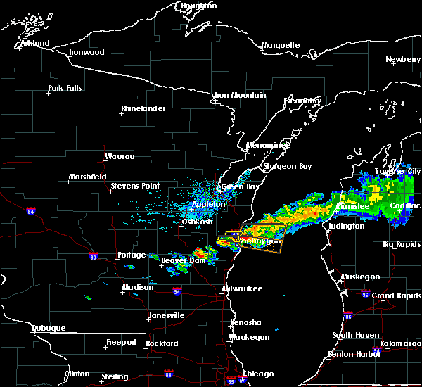 The severe thunderstorm warning for northeastern sheboygan county will expire at 245 pm cdt, the storm which prompted the warning has moved out of the area. therefore, the warning will be allowed to expire. to report severe weather, contact your nearest law enforcement agency. they will relay your report to the national weather service milwaukee/sullivan. The severe thunderstorm warning for northeastern sheboygan county will expire at 245 pm cdt, the storm which prompted the warning has moved out of the area. therefore, the warning will be allowed to expire. to report severe weather, contact your nearest law enforcement agency. they will relay your report to the national weather service milwaukee/sullivan.
|
| 8/29/2019 2:18 PM CDT |
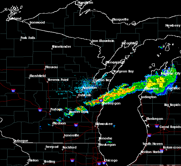 At 218 pm cdt, a severe thunderstorm was located near camp rokilio scout camp, or near howards grove, moving east at 30 mph (radar indicated). Hazards include 60 mph wind gusts and quarter size hail. Hail damage to vehicles is expected. Expect wind damage to roofs, siding, and trees. At 218 pm cdt, a severe thunderstorm was located near camp rokilio scout camp, or near howards grove, moving east at 30 mph (radar indicated). Hazards include 60 mph wind gusts and quarter size hail. Hail damage to vehicles is expected. Expect wind damage to roofs, siding, and trees.
|
| 8/7/2019 8:53 PM CDT |
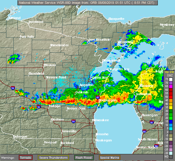 The tornado warning for northwestern sheboygan county will expire at 900 pm cdt, the storm which prompted the warning has weakened below severe limits, and no longer appears capable of producing a tornado. therefore, the warning will be allowed to expire. however small hail, gusty winds and heavy rain are still possible with this thunderstorm. The tornado warning for northwestern sheboygan county will expire at 900 pm cdt, the storm which prompted the warning has weakened below severe limits, and no longer appears capable of producing a tornado. therefore, the warning will be allowed to expire. however small hail, gusty winds and heavy rain are still possible with this thunderstorm.
|
| 8/7/2019 8:50 PM CDT |
 At 849 pm cdt, severe thunderstorms were located along a line extending from sheboygan to near brandon, moving southeast at 50 mph (radar indicated). Hazards include 60 mph wind gusts and quarter size hail. Hail damage to vehicles is expected. Expect wind damage to roofs, siding, and trees. At 849 pm cdt, severe thunderstorms were located along a line extending from sheboygan to near brandon, moving southeast at 50 mph (radar indicated). Hazards include 60 mph wind gusts and quarter size hail. Hail damage to vehicles is expected. Expect wind damage to roofs, siding, and trees.
|
| 8/7/2019 8:43 PM CDT |
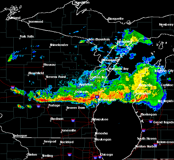 At 842 pm cdt, a severe thunderstorm capable of producing a tornado was located near elkhart lake, or near plymouth, moving east at 30 mph (radar indicated rotation). Hazards include tornado and quarter size hail. Flying debris will be dangerous to those caught without shelter. mobile homes will be damaged or destroyed. damage to roofs, windows, and vehicles will occur. tree damage is likely. this dangerous storm will be near, plymouth around 850 pm cdt. Other locations impacted by this tornadic thunderstorm include glenbeulah and greenbush. At 842 pm cdt, a severe thunderstorm capable of producing a tornado was located near elkhart lake, or near plymouth, moving east at 30 mph (radar indicated rotation). Hazards include tornado and quarter size hail. Flying debris will be dangerous to those caught without shelter. mobile homes will be damaged or destroyed. damage to roofs, windows, and vehicles will occur. tree damage is likely. this dangerous storm will be near, plymouth around 850 pm cdt. Other locations impacted by this tornadic thunderstorm include glenbeulah and greenbush.
|
| 8/7/2019 8:33 PM CDT |
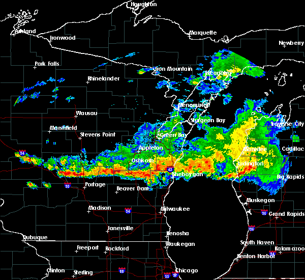 At 832 pm cdt, a severe thunderstorm capable of producing a tornado was located 7 miles southwest of st anna, or 11 miles west of plymouth, moving east at 35 mph (radar indicated rotation). Hazards include tornado and quarter size hail. Flying debris will be dangerous to those caught without shelter. mobile homes will be damaged or destroyed. damage to roofs, windows, and vehicles will occur. tree damage is likely. this dangerous storm will be near, plymouth and elkhart lake around 850 pm cdt. other locations impacted by this tornadic thunderstorm include calvary, glenbeulah, mount calvary, st. Cloud and greenbush. At 832 pm cdt, a severe thunderstorm capable of producing a tornado was located 7 miles southwest of st anna, or 11 miles west of plymouth, moving east at 35 mph (radar indicated rotation). Hazards include tornado and quarter size hail. Flying debris will be dangerous to those caught without shelter. mobile homes will be damaged or destroyed. damage to roofs, windows, and vehicles will occur. tree damage is likely. this dangerous storm will be near, plymouth and elkhart lake around 850 pm cdt. other locations impacted by this tornadic thunderstorm include calvary, glenbeulah, mount calvary, st. Cloud and greenbush.
|
| 8/7/2019 8:20 PM CDT |
 At 820 pm cdt, severe thunderstorms were located along a line extending from near green lake to southern lake winnebago to near chilton, moving southeast at 25 mph (radar indicated). Hazards include 70 mph wind gusts and ping pong ball size hail. People and animals outdoors will be injured. expect hail damage to roofs, siding, windows, and vehicles. expect considerable tree damage. wind damage is also likely to mobile homes, roofs, and outbuildings. locations impacted include, fond du lac, ripon, north fond du lac, rosendale, elkhart lake, southern lake winnebago, taycheedah, mount calvary, st. Cloud, glenbeulah, peebles, pipe, calvary, marytown, johnsburg and west rosendale. At 820 pm cdt, severe thunderstorms were located along a line extending from near green lake to southern lake winnebago to near chilton, moving southeast at 25 mph (radar indicated). Hazards include 70 mph wind gusts and ping pong ball size hail. People and animals outdoors will be injured. expect hail damage to roofs, siding, windows, and vehicles. expect considerable tree damage. wind damage is also likely to mobile homes, roofs, and outbuildings. locations impacted include, fond du lac, ripon, north fond du lac, rosendale, elkhart lake, southern lake winnebago, taycheedah, mount calvary, st. Cloud, glenbeulah, peebles, pipe, calvary, marytown, johnsburg and west rosendale.
|
| 8/7/2019 8:08 PM CDT |
 At 808 pm cdt, severe thunderstorms were located along a line extending from near green lake to near southern lake winnebago to near chilton, moving southeast at 25 mph (radar indicated). Hazards include ping pong ball size hail and 60 mph wind gusts. People and animals outdoors will be injured. expect hail damage to roofs, siding, windows, and vehicles. Expect wind damage to roofs, siding, and trees. At 808 pm cdt, severe thunderstorms were located along a line extending from near green lake to near southern lake winnebago to near chilton, moving southeast at 25 mph (radar indicated). Hazards include ping pong ball size hail and 60 mph wind gusts. People and animals outdoors will be injured. expect hail damage to roofs, siding, windows, and vehicles. Expect wind damage to roofs, siding, and trees.
|
| 6/27/2019 5:42 PM CDT |
 The severe thunderstorm warning for ozaukee, washington and sheboygan counties will expire at 545 pm cdt, the strongest winds with the line of storms has moved out over lake michigan. therefore, the warning will be allowed to expire. however gusty winds of 30 mph to 40 mph are still expected through 6 pm over sheboygan and ozaukee counties. a severe thunderstorm watch remains in effect until 900 pm cdt for southeastern and east central wisconsin. The severe thunderstorm warning for ozaukee, washington and sheboygan counties will expire at 545 pm cdt, the strongest winds with the line of storms has moved out over lake michigan. therefore, the warning will be allowed to expire. however gusty winds of 30 mph to 40 mph are still expected through 6 pm over sheboygan and ozaukee counties. a severe thunderstorm watch remains in effect until 900 pm cdt for southeastern and east central wisconsin.
|
| 6/27/2019 5:14 PM CDT |
 At 513 pm cdt, severe thunderstorms were located along a line extending from near st. nazianz to menomonee falls, moving east at 50 mph (radar indicated). Hazards include 60 mph wind gusts and penny size hail. Expect damage to roofs, siding, and trees. Locations impacted include, sheboygan, menomonee falls, west bend, mequon, hartford, brown deer, grafton, cedarburg, port washington, plymouth, sheboygan falls, jackson, slinger, saukville, bayside, kewaskum, thiensville, howards grove, oostburg and belgium. At 513 pm cdt, severe thunderstorms were located along a line extending from near st. nazianz to menomonee falls, moving east at 50 mph (radar indicated). Hazards include 60 mph wind gusts and penny size hail. Expect damage to roofs, siding, and trees. Locations impacted include, sheboygan, menomonee falls, west bend, mequon, hartford, brown deer, grafton, cedarburg, port washington, plymouth, sheboygan falls, jackson, slinger, saukville, bayside, kewaskum, thiensville, howards grove, oostburg and belgium.
|
| 6/27/2019 4:58 PM CDT |
 At 457 pm cdt, severe thunderstorms were located along a line extending from 6 miles southwest of chilton to merton, moving east at 45 mph (radar indicated). Hazards include 60 mph wind gusts and penny size hail. Expect damage to roofs, siding, and trees. Locations impacted include, sheboygan, menomonee falls, west bend, mequon, hartford, brown deer, grafton, cedarburg, port washington, plymouth, sheboygan falls, jackson, slinger, saukville, bayside, kewaskum, thiensville, howards grove, oostburg and belgium. At 457 pm cdt, severe thunderstorms were located along a line extending from 6 miles southwest of chilton to merton, moving east at 45 mph (radar indicated). Hazards include 60 mph wind gusts and penny size hail. Expect damage to roofs, siding, and trees. Locations impacted include, sheboygan, menomonee falls, west bend, mequon, hartford, brown deer, grafton, cedarburg, port washington, plymouth, sheboygan falls, jackson, slinger, saukville, bayside, kewaskum, thiensville, howards grove, oostburg and belgium.
|
| 6/27/2019 4:29 PM CDT |
 At 429 pm cdt, severe thunderstorms were located along a line extending from 6 miles southwest of oshkosh to watertown, moving east at 55 mph (radar indicated). Hazards include 60 mph wind gusts and penny size hail. expect damage to roofs, siding, and trees At 429 pm cdt, severe thunderstorms were located along a line extending from 6 miles southwest of oshkosh to watertown, moving east at 55 mph (radar indicated). Hazards include 60 mph wind gusts and penny size hail. expect damage to roofs, siding, and trees
|
| 8/28/2018 4:47 PM CDT |
 At 446 pm cdt, severe thunderstorms were located along a line extending from near manitowoc to near oostburg to near jackson, moving east at 50 mph (radar indicated). Hazards include 60 mph wind gusts. Expect damage to roofs, siding, and trees. Locations impacted include, sheboygan, west bend, port washington, plymouth, sheboygan falls, saukville, kewaskum, howards grove, oostburg, belgium, fredonia, kohler, cedar grove, random lake, newburg, elkhart lake, greenbush, cascade, adell and waldo. At 446 pm cdt, severe thunderstorms were located along a line extending from near manitowoc to near oostburg to near jackson, moving east at 50 mph (radar indicated). Hazards include 60 mph wind gusts. Expect damage to roofs, siding, and trees. Locations impacted include, sheboygan, west bend, port washington, plymouth, sheboygan falls, saukville, kewaskum, howards grove, oostburg, belgium, fredonia, kohler, cedar grove, random lake, newburg, elkhart lake, greenbush, cascade, adell and waldo.
|
| 8/28/2018 4:38 PM CDT | Trees down. estimated 60 mph wind. delayed report. time estimated by rada in manitowoc county WI, 7.4 miles SW of Elkhart Lake, WI |
| 8/28/2018 4:38 PM CDT |
 At 438 pm cdt, a severe thunderstorm capable of producing a tornado was located over plymouth, moving east at 60 mph (radar indicated rotation). Hazards include tornado and quarter size hail. Flying debris will be dangerous to those caught without shelter. mobile homes will be damaged or destroyed. damage to roofs, windows, and vehicles will occur. tree damage is likely. Locations impacted include, sheboygan, plymouth, sheboygan falls, howards grove, oostburg, kohler, cedar grove, random lake, elkhart lake, greenbush, cascade, adell, waldo, glenbeulah, haven, silver creek, beechwood, johnsonville, gibbsville and batavia. At 438 pm cdt, a severe thunderstorm capable of producing a tornado was located over plymouth, moving east at 60 mph (radar indicated rotation). Hazards include tornado and quarter size hail. Flying debris will be dangerous to those caught without shelter. mobile homes will be damaged or destroyed. damage to roofs, windows, and vehicles will occur. tree damage is likely. Locations impacted include, sheboygan, plymouth, sheboygan falls, howards grove, oostburg, kohler, cedar grove, random lake, elkhart lake, greenbush, cascade, adell, waldo, glenbeulah, haven, silver creek, beechwood, johnsonville, gibbsville and batavia.
|
| 8/28/2018 4:26 PM CDT |
 At 426 pm cdt, a confirmed tornado was located near campbellsport, or 10 miles north of kewaskum, moving east at 60 mph (weather spotters confirmed tornado. multiple reports of tornadoes have been received with this storm across fond du lac county). Hazards include damaging tornado and quarter size hail. Flying debris will be dangerous to those caught without shelter. mobile homes will be damaged or destroyed. damage to roofs, windows, and vehicles will occur. Tree damage is likely. At 426 pm cdt, a confirmed tornado was located near campbellsport, or 10 miles north of kewaskum, moving east at 60 mph (weather spotters confirmed tornado. multiple reports of tornadoes have been received with this storm across fond du lac county). Hazards include damaging tornado and quarter size hail. Flying debris will be dangerous to those caught without shelter. mobile homes will be damaged or destroyed. damage to roofs, windows, and vehicles will occur. Tree damage is likely.
|
| 8/28/2018 4:15 PM CDT |
 At 414 pm cdt, severe thunderstorms were located along a line extending from 6 miles east of central lake winnebago to lomira to near hustisford, moving east at 50 mph (trained weather spotters. spotters and law enforcement have reported numerous trees down. winds have been estimated to be in excess of 75 mph at times). Hazards include 70 mph wind gusts. Expect considerable tree damage. Damage is likely to mobile homes, roofs, and outbuildings. At 414 pm cdt, severe thunderstorms were located along a line extending from 6 miles east of central lake winnebago to lomira to near hustisford, moving east at 50 mph (trained weather spotters. spotters and law enforcement have reported numerous trees down. winds have been estimated to be in excess of 75 mph at times). Hazards include 70 mph wind gusts. Expect considerable tree damage. Damage is likely to mobile homes, roofs, and outbuildings.
|
| 7/13/2018 5:44 PM CDT |
 At 543 pm cdt, severe thunderstorms were located along a line extending from near elkhart lake to 6 miles east of fond du lac, moving east at 25 mph (radar indicated). Hazards include 60 mph wind gusts and half dollar size hail. Hail damage to vehicles is expected. Expect wind damage to roofs, siding, and trees. At 543 pm cdt, severe thunderstorms were located along a line extending from near elkhart lake to 6 miles east of fond du lac, moving east at 25 mph (radar indicated). Hazards include 60 mph wind gusts and half dollar size hail. Hail damage to vehicles is expected. Expect wind damage to roofs, siding, and trees.
|
| 9/20/2017 9:58 PM CDT |
 At 958 pm cdt, a severe thunderstorm was located over plymouth, moving east at 40 mph (radar indicated). Hazards include 60 mph wind gusts. expect damage to roofs, siding, and trees At 958 pm cdt, a severe thunderstorm was located over plymouth, moving east at 40 mph (radar indicated). Hazards include 60 mph wind gusts. expect damage to roofs, siding, and trees
|
| 8/10/2017 4:37 PM CDT |
 At 437 pm cdt, a severe thunderstorm was located near plymouth, moving northeast at 60 mph (radar indicated). Hazards include 60 mph wind gusts and quarter size hail. Hail damage to vehicles is expected. Expect wind damage to roofs, siding, and trees. At 437 pm cdt, a severe thunderstorm was located near plymouth, moving northeast at 60 mph (radar indicated). Hazards include 60 mph wind gusts and quarter size hail. Hail damage to vehicles is expected. Expect wind damage to roofs, siding, and trees.
|
| 7/15/2017 9:56 PM CDT |
 At 955 pm cdt, a severe thunderstorm was located 7 miles northeast of campbellsport, or 10 miles north of kewaskum, moving south at 30 mph (radar indicated). Hazards include 60 mph wind gusts and penny size hail. Expect damage to roofs, siding, and trees. Locations impacted include, fond du lac, waupun, plymouth, sheboygan falls, north fond du lac, cedar grove, campbellsport, random lake, oakfield, rosendale, elkhart lake, southern lake winnebago, taycheedah, ashford, lamartine, byron, greenbush, eden, mount calvary and cascade. At 955 pm cdt, a severe thunderstorm was located 7 miles northeast of campbellsport, or 10 miles north of kewaskum, moving south at 30 mph (radar indicated). Hazards include 60 mph wind gusts and penny size hail. Expect damage to roofs, siding, and trees. Locations impacted include, fond du lac, waupun, plymouth, sheboygan falls, north fond du lac, cedar grove, campbellsport, random lake, oakfield, rosendale, elkhart lake, southern lake winnebago, taycheedah, ashford, lamartine, byron, greenbush, eden, mount calvary and cascade.
|
| 7/15/2017 9:28 PM CDT |
 At 928 pm cdt, a severe thunderstorm was located near st anna, or 11 miles northeast of fond du lac, moving south at 30 mph (radar indicated). Hazards include 60 mph wind gusts and penny size hail. Expect damage to roofs, siding, and trees. Locations impacted include, sheboygan, fond du lac, waupun, plymouth, sheboygan falls, north fond du lac, howards grove, oostburg, kohler, cedar grove, campbellsport, random lake, oakfield, rosendale, elkhart lake, southern lake winnebago, taycheedah, ashford, lamartine and byron. At 928 pm cdt, a severe thunderstorm was located near st anna, or 11 miles northeast of fond du lac, moving south at 30 mph (radar indicated). Hazards include 60 mph wind gusts and penny size hail. Expect damage to roofs, siding, and trees. Locations impacted include, sheboygan, fond du lac, waupun, plymouth, sheboygan falls, north fond du lac, howards grove, oostburg, kohler, cedar grove, campbellsport, random lake, oakfield, rosendale, elkhart lake, southern lake winnebago, taycheedah, ashford, lamartine and byron.
|
| 7/15/2017 9:09 PM CDT |
 At 908 pm cdt, a severe thunderstorm was located near chilton, or 18 miles northwest of plymouth, moving south at 40 mph (radar indicated). Hazards include 60 mph wind gusts and penny size hail. expect damage to roofs, siding, and trees At 908 pm cdt, a severe thunderstorm was located near chilton, or 18 miles northwest of plymouth, moving south at 40 mph (radar indicated). Hazards include 60 mph wind gusts and penny size hail. expect damage to roofs, siding, and trees
|
| 7/7/2017 5:34 PM CDT |
 At 531 pm cdt, a severe thunderstorm was located over st. nazianz, or 12 miles southwest of manitowoc, moving southeast at 30 mph (law enforcement). Hazards include two inch hail and 70 mph wind gusts. People and animals outdoors will be injured. expect hail damage to roofs, siding, windows, and vehicles. expect considerable tree damage. wind damage is also likely to mobile homes, roofs, and outbuildings. Locations impacted include, sheboygan, plymouth, sheboygan falls, howards grove, oostburg, kohler, cedar grove, elkhart lake, waldo, haven, johnsonville, gibbsville and hingham. At 531 pm cdt, a severe thunderstorm was located over st. nazianz, or 12 miles southwest of manitowoc, moving southeast at 30 mph (law enforcement). Hazards include two inch hail and 70 mph wind gusts. People and animals outdoors will be injured. expect hail damage to roofs, siding, windows, and vehicles. expect considerable tree damage. wind damage is also likely to mobile homes, roofs, and outbuildings. Locations impacted include, sheboygan, plymouth, sheboygan falls, howards grove, oostburg, kohler, cedar grove, elkhart lake, waldo, haven, johnsonville, gibbsville and hingham.
|
| 7/7/2017 5:25 PM CDT |
 At 524 pm cdt, a severe thunderstorm was located over valders, or 13 miles west of manitowoc, moving southeast at 30 mph (radar indicated). Hazards include two inch hail and 70 mph wind gusts. People and animals outdoors will be injured. expect hail damage to roofs, siding, windows, and vehicles. expect considerable tree damage. Wind damage is also likely to mobile homes, roofs, and outbuildings. At 524 pm cdt, a severe thunderstorm was located over valders, or 13 miles west of manitowoc, moving southeast at 30 mph (radar indicated). Hazards include two inch hail and 70 mph wind gusts. People and animals outdoors will be injured. expect hail damage to roofs, siding, windows, and vehicles. expect considerable tree damage. Wind damage is also likely to mobile homes, roofs, and outbuildings.
|
| 6/14/2017 4:36 PM CDT |
 The severe thunderstorm warning for northern sheboygan county will expire at 445 pm cdt, the storm which prompted the warning has weakened below severe limits, and no longer poses an immediate threat to life or property. therefore the warning will be allowed to expire. however gusty winds are still possible with this thunderstorm. a severe thunderstorm watch remains in effect until 800 pm cdt for east central wisconsin. The severe thunderstorm warning for northern sheboygan county will expire at 445 pm cdt, the storm which prompted the warning has weakened below severe limits, and no longer poses an immediate threat to life or property. therefore the warning will be allowed to expire. however gusty winds are still possible with this thunderstorm. a severe thunderstorm watch remains in effect until 800 pm cdt for east central wisconsin.
|
| 6/14/2017 4:26 PM CDT |
 At 426 pm cdt, a severe thunderstorm was located near howards grove, moving northeast at 30 mph (radar indicated). Hazards include 60 mph wind gusts and quarter size hail. Hail damage to vehicles is expected. expect wind damage to roofs, siding, and trees. Locations impacted include, plymouth, sheboygan falls, howards grove, elkhart lake, glenbeulah, haven and johnsonville. At 426 pm cdt, a severe thunderstorm was located near howards grove, moving northeast at 30 mph (radar indicated). Hazards include 60 mph wind gusts and quarter size hail. Hail damage to vehicles is expected. expect wind damage to roofs, siding, and trees. Locations impacted include, plymouth, sheboygan falls, howards grove, elkhart lake, glenbeulah, haven and johnsonville.
|
| 6/14/2017 4:11 PM CDT |
 At 410 pm cdt, a severe thunderstorm was located over elkhart lake, or near plymouth, moving northeast at 30 mph (law enforcement). Hazards include 60 mph wind gusts and quarter size hail. Hail damage to vehicles is expected. Expect wind damage to roofs, siding, and trees. At 410 pm cdt, a severe thunderstorm was located over elkhart lake, or near plymouth, moving northeast at 30 mph (law enforcement). Hazards include 60 mph wind gusts and quarter size hail. Hail damage to vehicles is expected. Expect wind damage to roofs, siding, and trees.
|
| 6/14/2017 3:59 PM CDT |
 At 359 pm cdt, severe thunderstorms were located along a line extending from near st. nazianz to 6 miles north of random lake, moving east at 45 mph (law enforcement). Hazards include 60 mph wind gusts and quarter size hail. Hail damage to vehicles is expected. expect wind damage to roofs, siding, and trees. Locations impacted include, sheboygan, plymouth, sheboygan falls, howards grove, oostburg, kohler, elkhart lake, glenbeulah, haven, johnsonville, gibbsville and hingham. At 359 pm cdt, severe thunderstorms were located along a line extending from near st. nazianz to 6 miles north of random lake, moving east at 45 mph (law enforcement). Hazards include 60 mph wind gusts and quarter size hail. Hail damage to vehicles is expected. expect wind damage to roofs, siding, and trees. Locations impacted include, sheboygan, plymouth, sheboygan falls, howards grove, oostburg, kohler, elkhart lake, glenbeulah, haven, johnsonville, gibbsville and hingham.
|
| 6/14/2017 3:40 PM CDT |
 At 338 pm cdt, severe thunderstorms were located along a line extending from 6 miles northeast of southern lake winnebago to near campbellsport, moving east at 45 mph (radar indicated). Hazards include 60 mph wind gusts and quarter size hail. Hail damage to vehicles is expected. Expect wind damage to roofs, siding, and trees. At 338 pm cdt, severe thunderstorms were located along a line extending from 6 miles northeast of southern lake winnebago to near campbellsport, moving east at 45 mph (radar indicated). Hazards include 60 mph wind gusts and quarter size hail. Hail damage to vehicles is expected. Expect wind damage to roofs, siding, and trees.
|
| 6/12/2017 7:54 PM CDT |
 At 753 pm cdt, severe thunderstorms were located along a line extending from near howards grove to near random lake to mequon, moving east at 15 mph (trained spotters reported). Hazards include 60 mph wind gusts. Expect damage to roofs, siding, and trees. Locations impacted include, sheboygan, mequon, grafton, cedarburg, port washington, plymouth, sheboygan falls, saukville, thiensville, howards grove, oostburg, belgium, fredonia, kohler, cedar grove, random lake, newburg, elkhart lake, cascade and adell. At 753 pm cdt, severe thunderstorms were located along a line extending from near howards grove to near random lake to mequon, moving east at 15 mph (trained spotters reported). Hazards include 60 mph wind gusts. Expect damage to roofs, siding, and trees. Locations impacted include, sheboygan, mequon, grafton, cedarburg, port washington, plymouth, sheboygan falls, saukville, thiensville, howards grove, oostburg, belgium, fredonia, kohler, cedar grove, random lake, newburg, elkhart lake, cascade and adell.
|
| 6/12/2017 7:44 PM CDT |
 At 744 pm cdt, severe thunderstorms were located along a line extending from near howards grove to random lake to near mequon, moving east at 15 mph (radar indicated). Hazards include 60 mph wind gusts. Expect damage to roofs, siding, and trees. Locations impacted include, sheboygan, mequon, brown deer, grafton, cedarburg, port washington, plymouth, sheboygan falls, saukville, bayside, thiensville, howards grove, oostburg, belgium, fredonia, kohler, cedar grove, random lake, newburg and elkhart lake. At 744 pm cdt, severe thunderstorms were located along a line extending from near howards grove to random lake to near mequon, moving east at 15 mph (radar indicated). Hazards include 60 mph wind gusts. Expect damage to roofs, siding, and trees. Locations impacted include, sheboygan, mequon, brown deer, grafton, cedarburg, port washington, plymouth, sheboygan falls, saukville, bayside, thiensville, howards grove, oostburg, belgium, fredonia, kohler, cedar grove, random lake, newburg and elkhart lake.
|
| 6/12/2017 7:38 PM CDT |
 At 737 pm cdt, severe thunderstorms were located along a line extending from near howards grove to random lake to near brown deer, moving east at 50 mph (radar indicated). Hazards include 60 mph wind gusts. expect damage to roofs, siding, and trees At 737 pm cdt, severe thunderstorms were located along a line extending from near howards grove to random lake to near brown deer, moving east at 50 mph (radar indicated). Hazards include 60 mph wind gusts. expect damage to roofs, siding, and trees
|
| 6/12/2017 7:31 PM CDT |
 At 730 pm cdt, severe thunderstorms were located along a line extending from elkhart lake to random lake to near merton, moving east at 65 mph (trained weather spotters). Hazards include 70 mph wind gusts. Expect considerable tree damage. damage is likely to mobile homes, roofs, and outbuildings. locations impacted include, sheboygan, fond du lac, west bend, mequon, hartford, grafton, cedarburg, port washington, plymouth, sheboygan falls, jackson, slinger, saukville, kewaskum, thiensville, howards grove, oostburg, lomira, belgium and fredonia. People attending erin hills golf course, and lenz field house should seek safe shelter immediately!. At 730 pm cdt, severe thunderstorms were located along a line extending from elkhart lake to random lake to near merton, moving east at 65 mph (trained weather spotters). Hazards include 70 mph wind gusts. Expect considerable tree damage. damage is likely to mobile homes, roofs, and outbuildings. locations impacted include, sheboygan, fond du lac, west bend, mequon, hartford, grafton, cedarburg, port washington, plymouth, sheboygan falls, jackson, slinger, saukville, kewaskum, thiensville, howards grove, oostburg, lomira, belgium and fredonia. People attending erin hills golf course, and lenz field house should seek safe shelter immediately!.
|
| 6/12/2017 7:20 PM CDT |
 At 720 pm cdt, severe thunderstorms were located along a line extending from near elkhart lake to 7 miles west of random lake to near hartford, moving east at 55 mph (trained weather spotters). Hazards include 70 mph wind gusts. Expect considerable tree damage. damage is likely to mobile homes, roofs, and outbuildings. locations impacted include, sheboygan, fond du lac, west bend, watertown, mequon, hartford, grafton, cedarburg, port washington, plymouth, sheboygan falls, jackson, mayville, slinger, north fond du lac, saukville, kewaskum, horicon, thiensville and howards grove. People attending erin hills golf course, and lenz field house should seek safe shelter immediately!. At 720 pm cdt, severe thunderstorms were located along a line extending from near elkhart lake to 7 miles west of random lake to near hartford, moving east at 55 mph (trained weather spotters). Hazards include 70 mph wind gusts. Expect considerable tree damage. damage is likely to mobile homes, roofs, and outbuildings. locations impacted include, sheboygan, fond du lac, west bend, watertown, mequon, hartford, grafton, cedarburg, port washington, plymouth, sheboygan falls, jackson, mayville, slinger, north fond du lac, saukville, kewaskum, horicon, thiensville and howards grove. People attending erin hills golf course, and lenz field house should seek safe shelter immediately!.
|
| 6/12/2017 7:06 PM CDT |
 At 706 pm cdt, severe thunderstorms were located along a line extending from near southern lake winnebago to near campbellsport to near watertown, moving east at 55 mph (trained weather spotters). Hazards include 70 mph wind gusts. Expect considerable tree damage. damage is likely to mobile homes, roofs, and outbuildings. locations impacted include, sheboygan, fond du lac, west bend, watertown, mequon, beaver dam, hartford, grafton, cedarburg, port washington, plymouth, sheboygan falls, jackson, mayville, slinger, north fond du lac, saukville, kewaskum, horicon and thiensville. People attending erin hills golf course, and lenz field house should seek safe shelter immediately!. At 706 pm cdt, severe thunderstorms were located along a line extending from near southern lake winnebago to near campbellsport to near watertown, moving east at 55 mph (trained weather spotters). Hazards include 70 mph wind gusts. Expect considerable tree damage. damage is likely to mobile homes, roofs, and outbuildings. locations impacted include, sheboygan, fond du lac, west bend, watertown, mequon, beaver dam, hartford, grafton, cedarburg, port washington, plymouth, sheboygan falls, jackson, mayville, slinger, north fond du lac, saukville, kewaskum, horicon and thiensville. People attending erin hills golf course, and lenz field house should seek safe shelter immediately!.
|
| 6/12/2017 6:58 PM CDT |
 At 658 pm cdt, severe thunderstorms were located along a line extending from southern lake winnebago to lomira to 6 miles northwest of watertown, moving east at 55 mph (radar indicated). Hazards include 70 mph wind gusts. Expect considerable tree damage. damage is likely to mobile homes, roofs, and outbuildings. locations impacted include, sheboygan, fond du lac, west bend, watertown, mequon, beaver dam, hartford, grafton, cedarburg, port washington, plymouth, sheboygan falls, jackson, mayville, slinger, north fond du lac, saukville, kewaskum, horicon and thiensville. People attending erin hills golf course, and lenz field house should seek safe shelter immediately!. At 658 pm cdt, severe thunderstorms were located along a line extending from southern lake winnebago to lomira to 6 miles northwest of watertown, moving east at 55 mph (radar indicated). Hazards include 70 mph wind gusts. Expect considerable tree damage. damage is likely to mobile homes, roofs, and outbuildings. locations impacted include, sheboygan, fond du lac, west bend, watertown, mequon, beaver dam, hartford, grafton, cedarburg, port washington, plymouth, sheboygan falls, jackson, mayville, slinger, north fond du lac, saukville, kewaskum, horicon and thiensville. People attending erin hills golf course, and lenz field house should seek safe shelter immediately!.
|
| 6/12/2017 6:52 PM CDT |
 At 651 pm cdt, severe thunderstorms were located along a line extending from near north fond du lac to 6 miles south of oakfield to 7 miles northeast of waterloo, moving east at 55 mph (radar indicated). Hazards include 70 mph wind gusts. Expect considerable tree damage. Damage is likely to mobile homes, roofs, and outbuildings. At 651 pm cdt, severe thunderstorms were located along a line extending from near north fond du lac to 6 miles south of oakfield to 7 miles northeast of waterloo, moving east at 55 mph (radar indicated). Hazards include 70 mph wind gusts. Expect considerable tree damage. Damage is likely to mobile homes, roofs, and outbuildings.
|
| 3/7/2017 12:50 AM CST |
 At 1249 am cst, severe thunderstorms were located along a line extending from near st. nazianz to mequon, moving east at 60 mph (radar indicated). Hazards include 60 mph wind gusts and penny size hail. Expect damage to roofs, siding, and trees. Locations impacted include, sheboygan, west bend, mequon, brown deer, grafton, cedarburg, port washington, plymouth, sheboygan falls, jackson, saukville, bayside, thiensville, howards grove, oostburg, belgium, fredonia, kohler, cedar grove and random lake. At 1249 am cst, severe thunderstorms were located along a line extending from near st. nazianz to mequon, moving east at 60 mph (radar indicated). Hazards include 60 mph wind gusts and penny size hail. Expect damage to roofs, siding, and trees. Locations impacted include, sheboygan, west bend, mequon, brown deer, grafton, cedarburg, port washington, plymouth, sheboygan falls, jackson, saukville, bayside, thiensville, howards grove, oostburg, belgium, fredonia, kohler, cedar grove and random lake.
|
| 3/7/2017 12:40 AM CST |
 At 1239 am cst, severe thunderstorms were located along a line extending from near st anna to near lannon, moving east at 60 mph (radar indicated). Hazards include 60 mph wind gusts and penny size hail. Expect damage to roofs, siding, and trees. Locations impacted include, sheboygan, west bend, mequon, brown deer, grafton, cedarburg, port washington, plymouth, sheboygan falls, jackson, slinger, saukville, bayside, kewaskum, thiensville, howards grove, oostburg, belgium, fredonia and kohler. At 1239 am cst, severe thunderstorms were located along a line extending from near st anna to near lannon, moving east at 60 mph (radar indicated). Hazards include 60 mph wind gusts and penny size hail. Expect damage to roofs, siding, and trees. Locations impacted include, sheboygan, west bend, mequon, brown deer, grafton, cedarburg, port washington, plymouth, sheboygan falls, jackson, slinger, saukville, bayside, kewaskum, thiensville, howards grove, oostburg, belgium, fredonia and kohler.
|
| 3/7/2017 12:30 AM CST |
 At 1230 am cst, severe thunderstorms were located along a line extending from near st anna to near merton, moving east at 60 mph (radar indicated). Hazards include 60 mph wind gusts and penny size hail. expect damage to roofs, siding, and trees At 1230 am cst, severe thunderstorms were located along a line extending from near st anna to near merton, moving east at 60 mph (radar indicated). Hazards include 60 mph wind gusts and penny size hail. expect damage to roofs, siding, and trees
|
| 8/14/2015 6:03 PM CDT |
 At 602 pm cdt, severe thunderstorms were located along a line extending from near cleveland to near sheboygan falls to near rosendale, and are moving southeast at 45 mph. the automated observing equipment at the sheboygan airport reported wind gusts to 48 mph at 558 pm cdt (radar indicated). Hazards include 60 mph wind gusts and quarter size hail. Hail damage to vehicles is expected. expect wind damage to roofs, siding and trees. these severe storms will be near, plymouth and sheboygan falls around 605 pm cdt. sheboygan around 610 pm cdt. kohler around 615 pm cdt. other locations impacted by these severe thunderstorms include cascade, johnsonville, waldo, haven, greenbush and glenbeulah. those attending the pga championship are in the path of these storms and should prepare for imminent dangerous weather conditions. Seek shelter now!. At 602 pm cdt, severe thunderstorms were located along a line extending from near cleveland to near sheboygan falls to near rosendale, and are moving southeast at 45 mph. the automated observing equipment at the sheboygan airport reported wind gusts to 48 mph at 558 pm cdt (radar indicated). Hazards include 60 mph wind gusts and quarter size hail. Hail damage to vehicles is expected. expect wind damage to roofs, siding and trees. these severe storms will be near, plymouth and sheboygan falls around 605 pm cdt. sheboygan around 610 pm cdt. kohler around 615 pm cdt. other locations impacted by these severe thunderstorms include cascade, johnsonville, waldo, haven, greenbush and glenbeulah. those attending the pga championship are in the path of these storms and should prepare for imminent dangerous weather conditions. Seek shelter now!.
|
| 8/14/2015 5:52 PM CDT |
 At 551 pm cdt, severe thunderstorms were located along a line extending from near cleveland to near sheboygan falls to near rosendale, moving southeast at 55 mph. wind gusts to 55 mph were reported near kiel in southern manitowoc county around 540 pm (radar indicated). Hazards include 60 mph wind gusts and quarter size hail. Hail damage to vehicles is expected. expect wind damage to roofs, siding and trees. these severe storms will be near, sheboygan, plymouth, sheboygan falls, howards grove and kohler around 555 pm cdt. other locations impacted by these severe thunderstorms include johnsburg, mount calvary, greenbush, glenbeulah, dundee, waldo, peebles, taycheedah, waucousta and west rosendale. those attending the pga championship in haven are in the path of these storms and should prepare for imminent dangerous weather conditions. Seek shelter now!. At 551 pm cdt, severe thunderstorms were located along a line extending from near cleveland to near sheboygan falls to near rosendale, moving southeast at 55 mph. wind gusts to 55 mph were reported near kiel in southern manitowoc county around 540 pm (radar indicated). Hazards include 60 mph wind gusts and quarter size hail. Hail damage to vehicles is expected. expect wind damage to roofs, siding and trees. these severe storms will be near, sheboygan, plymouth, sheboygan falls, howards grove and kohler around 555 pm cdt. other locations impacted by these severe thunderstorms include johnsburg, mount calvary, greenbush, glenbeulah, dundee, waldo, peebles, taycheedah, waucousta and west rosendale. those attending the pga championship in haven are in the path of these storms and should prepare for imminent dangerous weather conditions. Seek shelter now!.
|
| 8/14/2015 5:37 PM CDT |
 At 535 pm cdt, severe thunderstorms were located along a line extending from near cleveland to elkhart lake to 6 miles southeast of oshkosh, moving southeast at 50 mph (radar indicated). Hazards include 60 mph wind gusts and quarter size hail. Hail damage to vehicles is expected. expect wind damage to roofs, siding and trees. these severe storms will be near, plymouth and elkhart lake around 540 pm cdt. howards grove around 545 pm cdt. sheboygan, sheboygan falls and kohler around 550 pm cdt. other locations impacted by these severe thunderstorms include johnsburg, mount calvary, greenbush, glenbeulah, dundee, waldo, peebles, taycheedah, waucousta and west rosendale. those attending the pga championship in haven are in the path of these storms and should prepare for imminent dangerous weather conditions. Seek shelter now!. At 535 pm cdt, severe thunderstorms were located along a line extending from near cleveland to elkhart lake to 6 miles southeast of oshkosh, moving southeast at 50 mph (radar indicated). Hazards include 60 mph wind gusts and quarter size hail. Hail damage to vehicles is expected. expect wind damage to roofs, siding and trees. these severe storms will be near, plymouth and elkhart lake around 540 pm cdt. howards grove around 545 pm cdt. sheboygan, sheboygan falls and kohler around 550 pm cdt. other locations impacted by these severe thunderstorms include johnsburg, mount calvary, greenbush, glenbeulah, dundee, waldo, peebles, taycheedah, waucousta and west rosendale. those attending the pga championship in haven are in the path of these storms and should prepare for imminent dangerous weather conditions. Seek shelter now!.
|
| 8/14/2015 5:19 PM CDT |
 At 517 pm cdt, a severe thunderstorm was located over chilton, and near oshkosh, moving south at 45 mph (radar indicated). Hazards include 60 mph wind gusts and nickel size hail. Expect damage to roofs. siding and trees. This severe thunderstorm will remain over mainly rural areas of sheboygan and fond du lac counties, including the following locations, johnsburg, mount calvary, greenbush, glenbeulah, dundee, waldo, peebles, taycheedah, waucousta and west rosendale. At 517 pm cdt, a severe thunderstorm was located over chilton, and near oshkosh, moving south at 45 mph (radar indicated). Hazards include 60 mph wind gusts and nickel size hail. Expect damage to roofs. siding and trees. This severe thunderstorm will remain over mainly rural areas of sheboygan and fond du lac counties, including the following locations, johnsburg, mount calvary, greenbush, glenbeulah, dundee, waldo, peebles, taycheedah, waucousta and west rosendale.
|
| 8/2/2015 5:32 PM CDT |
 At 531 pm cdt, severe thunderstorms were located along a line extending from near cleveland to 8 miles east of campbellsport, moving east at 55 mph. at 530 pm, numerous trees were reported down in the plymouth and mitchell areas (public). Hazards include 70 mph wind gusts and half dollar size hail. Hail damage to vehicles is expected. expect considerable tree damage. wind damage is also likely to mobile homes, roofs and outbuildings. locations impacted include, sheboygan, plymouth, sheboygan falls, howards grove, oostburg, kohler, cedar grove, campbellsport, random lake, elkhart lake, ashford, greenbush, eden, mount calvary, cascade, adell, waldo, st. Cloud, glenbeulah and johnsburg. At 531 pm cdt, severe thunderstorms were located along a line extending from near cleveland to 8 miles east of campbellsport, moving east at 55 mph. at 530 pm, numerous trees were reported down in the plymouth and mitchell areas (public). Hazards include 70 mph wind gusts and half dollar size hail. Hail damage to vehicles is expected. expect considerable tree damage. wind damage is also likely to mobile homes, roofs and outbuildings. locations impacted include, sheboygan, plymouth, sheboygan falls, howards grove, oostburg, kohler, cedar grove, campbellsport, random lake, elkhart lake, ashford, greenbush, eden, mount calvary, cascade, adell, waldo, st. Cloud, glenbeulah and johnsburg.
|
| 8/2/2015 5:23 PM CDT | Swath of large tree damage from elkhart lake to plymout in sheboygan county WI, 0.1 miles SW of Elkhart Lake, WI |
| 8/2/2015 5:21 PM CDT | Quarter sized hail reported 0.1 miles SW of Elkhart Lake, WI, relayed via facebook. |
| 8/2/2015 5:16 PM CDT |
 At 514 pm cdt, severe thunderstorms were located along a line extending from near elkhart lake to 6 miles north of lomira, moving east at 55 mph. at 514 pm cdt quarter sized hail was reported in fond du lac (public). Hazards include 70 mph wind gusts and half dollar size hail. Hail damage to vehicles is expected. expect considerable tree damage. wind damage is also likely to mobile homes, roofs and outbuildings. these severe storms will be near, elkhart lake around 520 pm cdt. sheboygan falls and howards grove around 525 pm cdt. sheboygan and kohler around 530 pm cdt. random lake around 540 pm cdt. cedar grove around 545 pm cdt. oostburg around 550 pm cdt. Other locations impacted by these severe thunderstorms include new fane, adell, johnsburg, mount calvary, greenbush, glenbeulah, ashford, dundee, waldo and gibbsville. At 514 pm cdt, severe thunderstorms were located along a line extending from near elkhart lake to 6 miles north of lomira, moving east at 55 mph. at 514 pm cdt quarter sized hail was reported in fond du lac (public). Hazards include 70 mph wind gusts and half dollar size hail. Hail damage to vehicles is expected. expect considerable tree damage. wind damage is also likely to mobile homes, roofs and outbuildings. these severe storms will be near, elkhart lake around 520 pm cdt. sheboygan falls and howards grove around 525 pm cdt. sheboygan and kohler around 530 pm cdt. random lake around 540 pm cdt. cedar grove around 545 pm cdt. oostburg around 550 pm cdt. Other locations impacted by these severe thunderstorms include new fane, adell, johnsburg, mount calvary, greenbush, glenbeulah, ashford, dundee, waldo and gibbsville.
|
| 8/2/2015 5:02 PM CDT |
 At 502 pm cdt, severe thunderstorms were located along a line extending from 7 miles northwest of st anna to near oakfield, moving east at 55 mph (radar indicated). Hazards include 70 mph wind gusts and half dollar size hail. Hail damage to vehicles is expected. expect considerable tree damage. wind damage is also likely to mobile homes, roofs and outbuildings. severe thunderstorms will be near, elkhart lake around 520 pm cdt. campbellsport around 525 pm cdt. howards grove around 530 pm cdt. sheboygan around 535 pm cdt. random lake around 545 pm cdt. oostburg and cedar grove around 550 pm cdt. Other locations impacted by these severe thunderstorms include new fane, adell, johnsburg, mount calvary, greenbush, glenbeulah, ashford, dundee, waldo and gibbsville. At 502 pm cdt, severe thunderstorms were located along a line extending from 7 miles northwest of st anna to near oakfield, moving east at 55 mph (radar indicated). Hazards include 70 mph wind gusts and half dollar size hail. Hail damage to vehicles is expected. expect considerable tree damage. wind damage is also likely to mobile homes, roofs and outbuildings. severe thunderstorms will be near, elkhart lake around 520 pm cdt. campbellsport around 525 pm cdt. howards grove around 530 pm cdt. sheboygan around 535 pm cdt. random lake around 545 pm cdt. oostburg and cedar grove around 550 pm cdt. Other locations impacted by these severe thunderstorms include new fane, adell, johnsburg, mount calvary, greenbush, glenbeulah, ashford, dundee, waldo and gibbsville.
|
| 8/27/2013 7:50 PM CDT | Tree down on power line near elkart lake causing arcing. time of event estimated by radar. report recived 915 pm cd in sheboygan county WI, 0.1 miles SW of Elkhart Lake, WI |
| 6/27/2013 5:37 PM CDT | Storm damage reported in sheboygan county WI, 0.1 miles SW of Elkhart Lake, WI |
| 6/22/2012 5:07 PM CDT | Half Dollar sized hail reported 2.6 miles W of Elkhart Lake, WI, half dollar size hail reported by sheriff deputy between highways 57 and 67 east of elkhart lake. |
Hail Maps for Elkhart Lake, WI
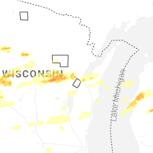
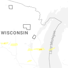


Connect with Interactive Hail Maps