

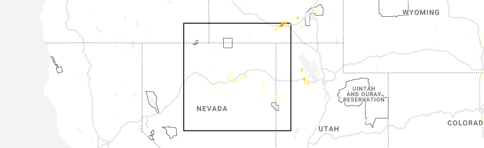
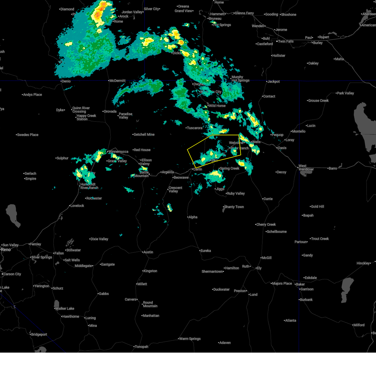
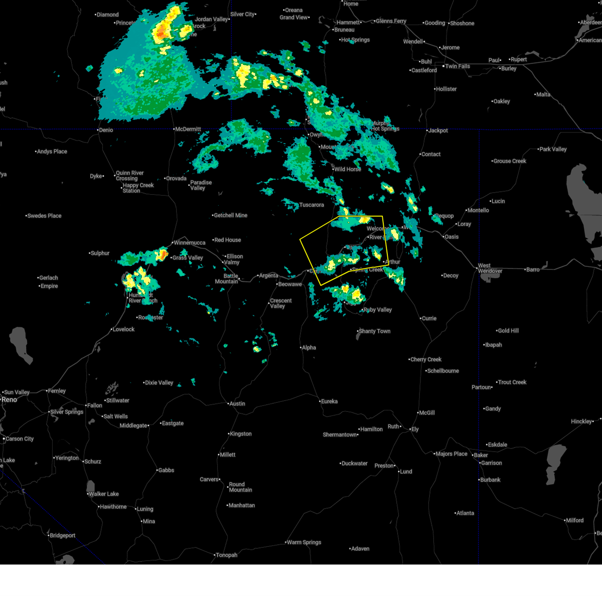
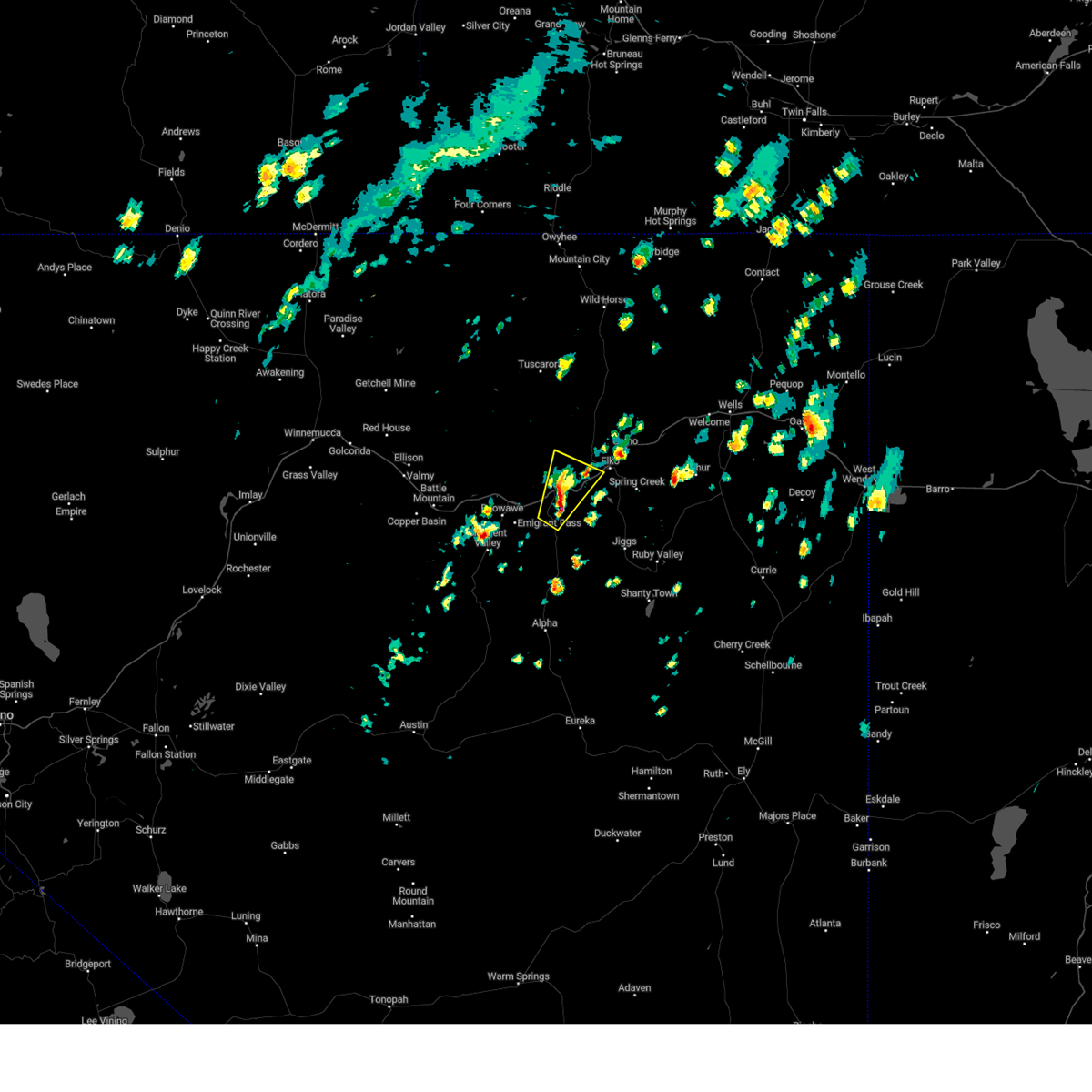
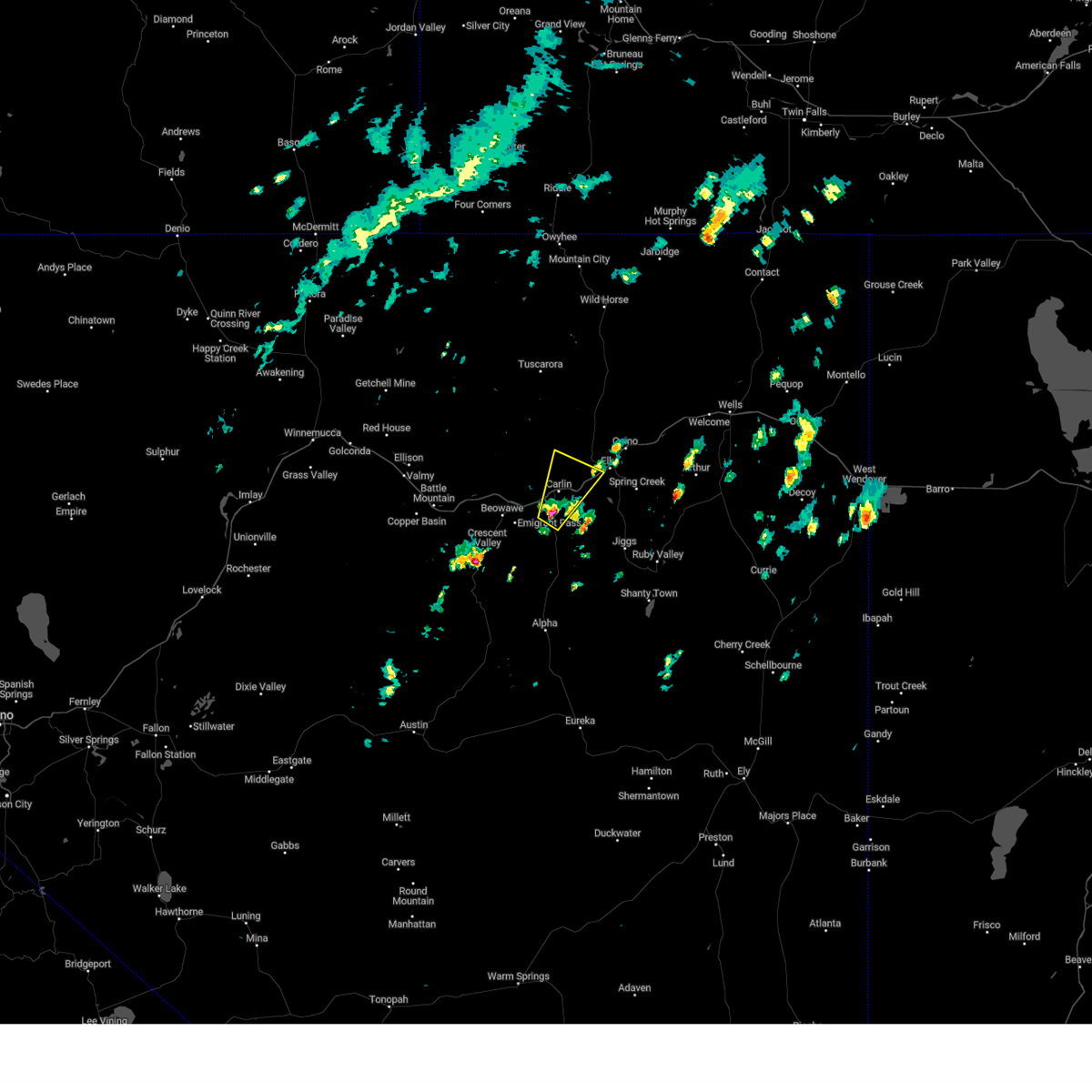
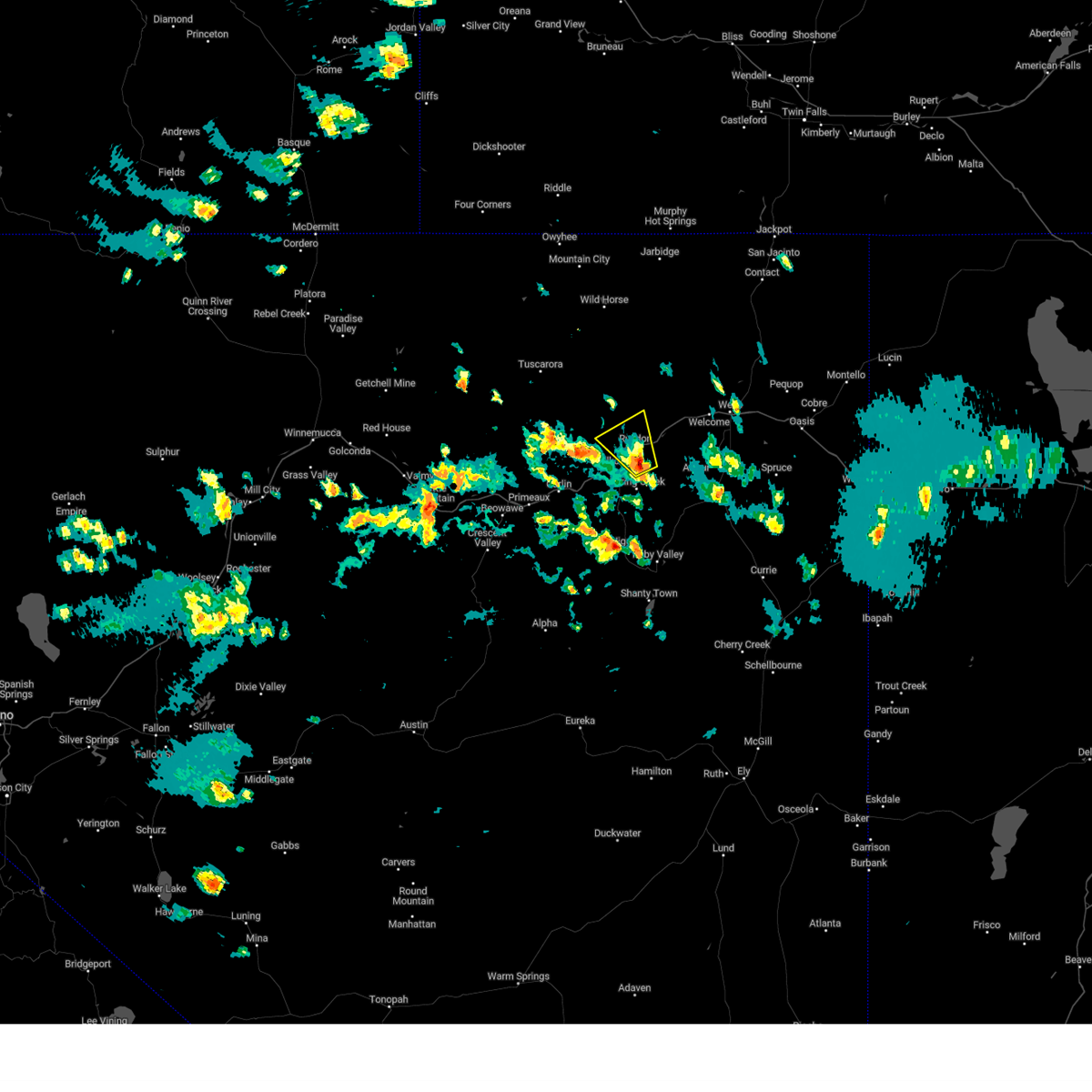
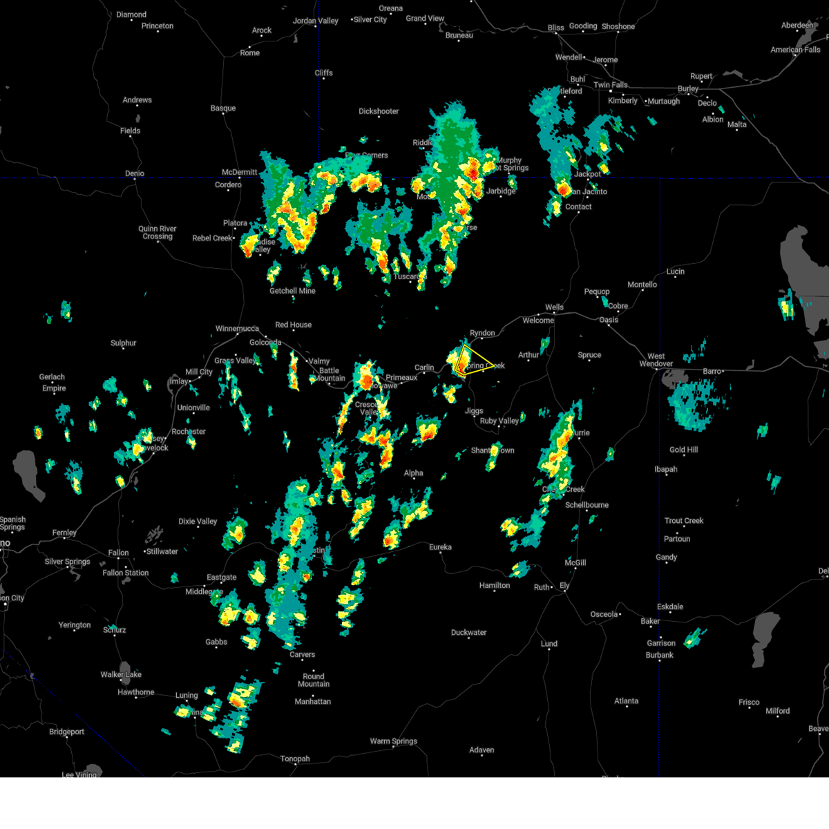
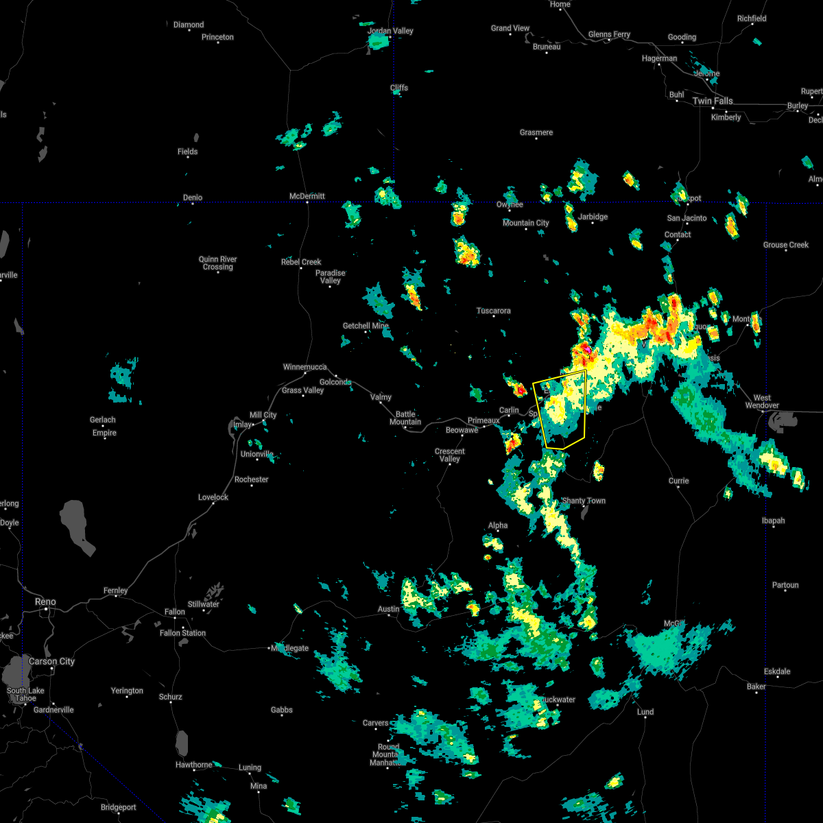
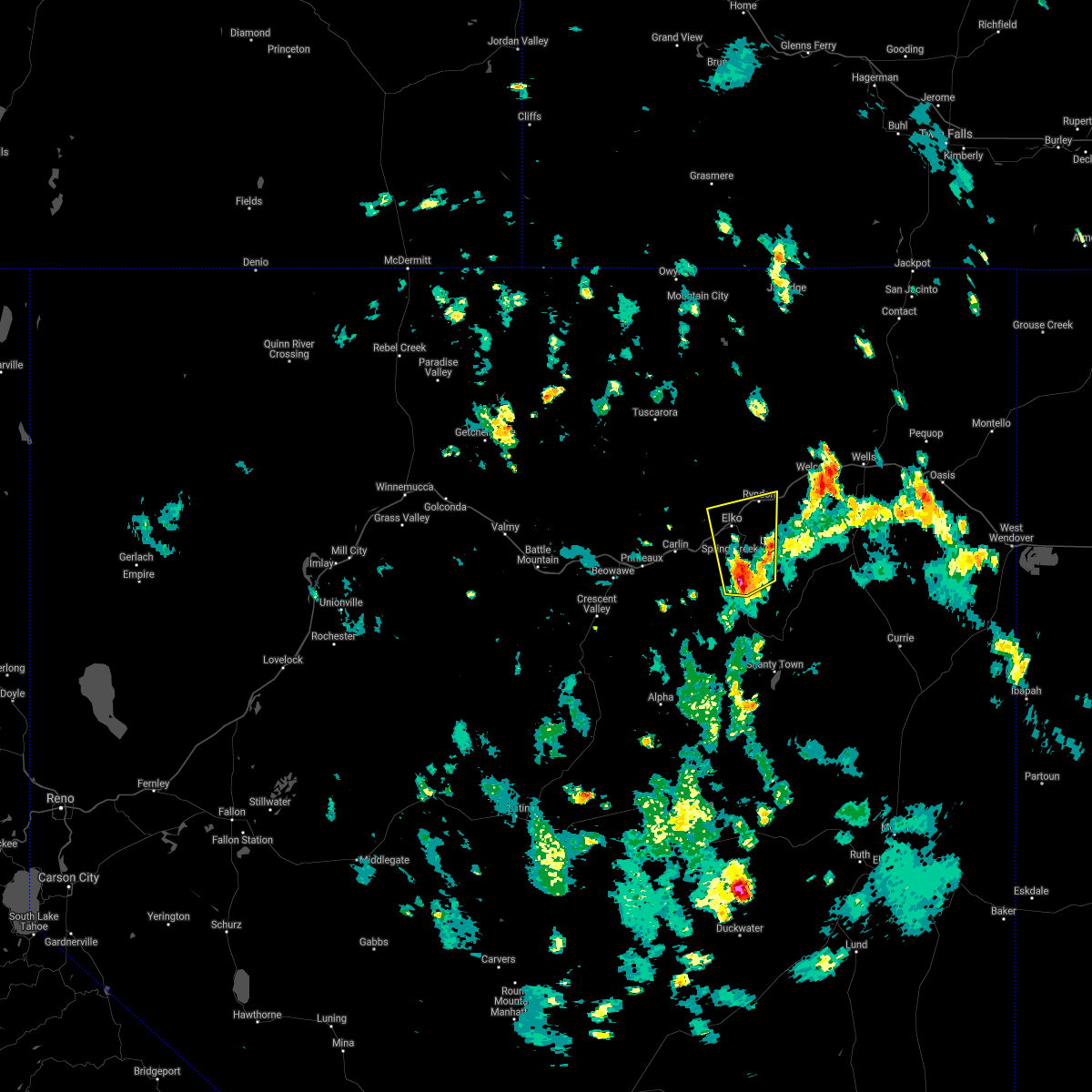
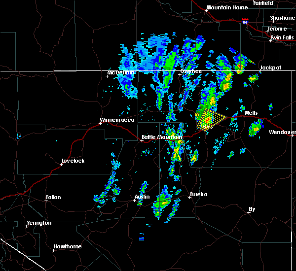
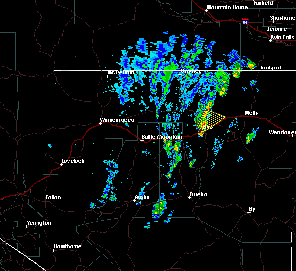
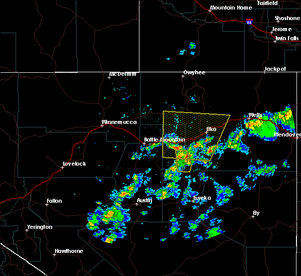
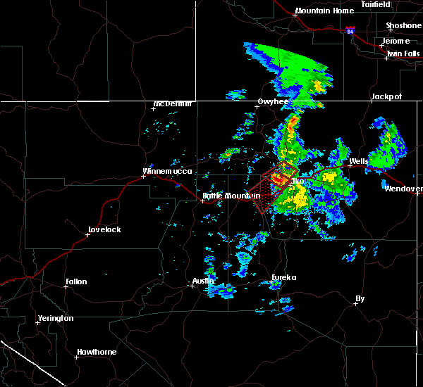
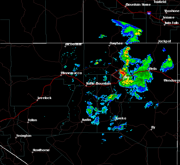
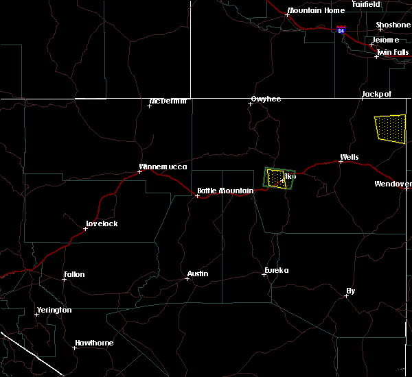
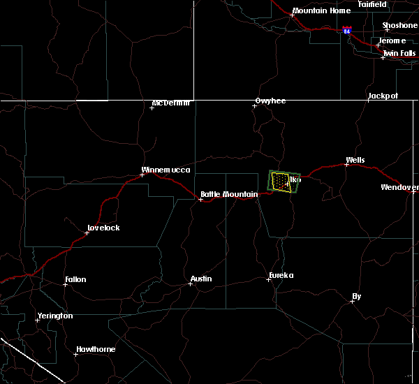
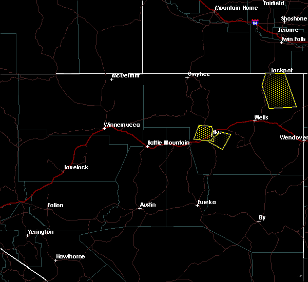
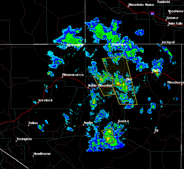
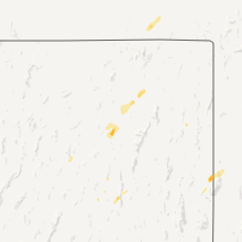
Hail Map for Elko, NV
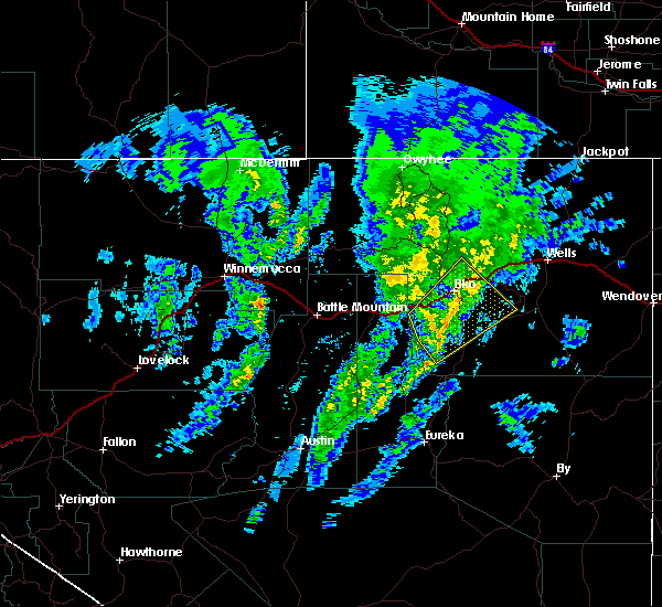
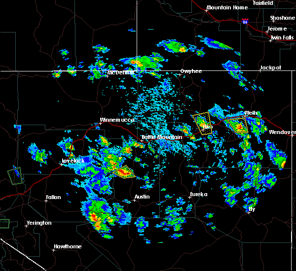
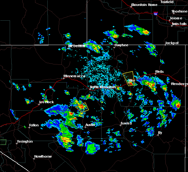
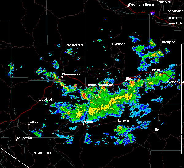
The Elko, NV area has had 1 report of on-the-ground hail by trained spotters, and has been under severe weather warnings 5 times during the past 12 months. Doppler radar has detected hail at or near Elko, NV on 4 occasions.
| Name: | Elko, NV |
| Where Located: | 0.6 miles NNE of Elko, NV |
| Map: | Google Map for Elko, NV |
| Population: | 18297 |
| Housing Units: | 7221 |
| More Info: | Search Google for Elko, NV |
0
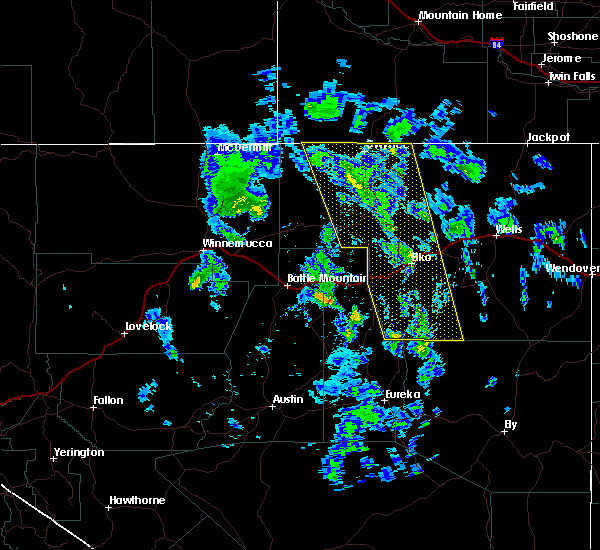
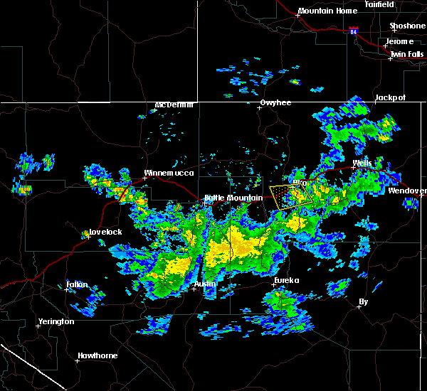
The Top Recent Hail Date for Elko, NV is Wednesday, May 24, 2023 (4th out of 4)
Hail and Wind Damage Spotted near Elko, NV
| Date / Time | Report Details |
|---|---|
| 7/16/2026 3:49 PM PDT |
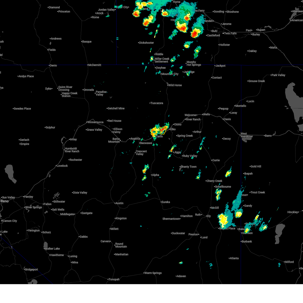 The storm which prompted the warning has weakened below severe limits, and has exited the warned area. therefore, the warning has been allowed to expire. however, small hail, gusty winds and heavy rain are still possible with this thunderstorm. remember, a severe thunderstorm warning still remains in effect for elko county until 4:15pm. The storm which prompted the warning has weakened below severe limits, and has exited the warned area. therefore, the warning has been allowed to expire. however, small hail, gusty winds and heavy rain are still possible with this thunderstorm. remember, a severe thunderstorm warning still remains in effect for elko county until 4:15pm.
|
| 7/16/2026 3:28 PM PDT |
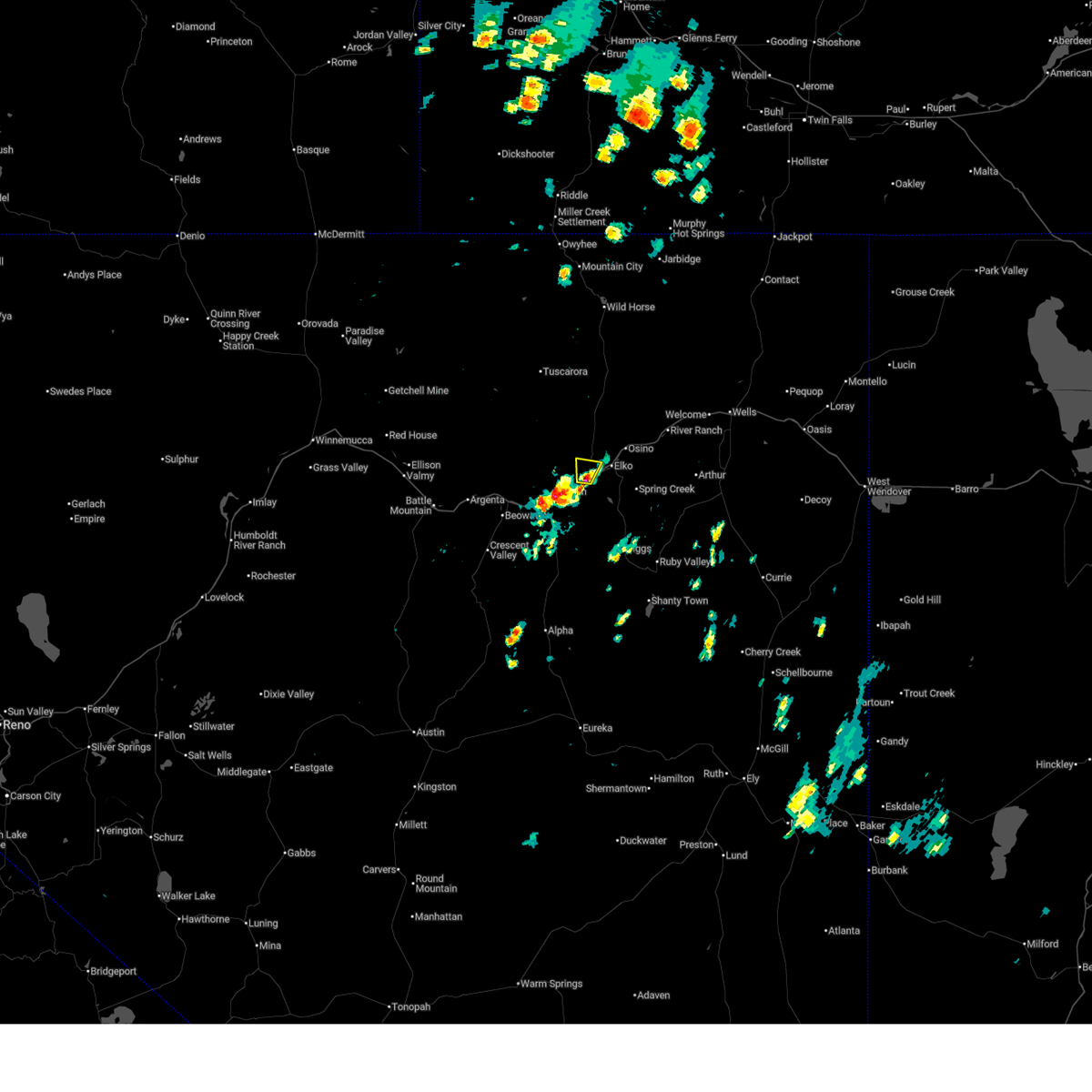 At 328 pm pdt, a severe thunderstorm was located 7 miles west of elko, moving north at 15 mph (radar indicated). Hazards include 60 mph wind gusts and quarter size hail. Hail damage to vehicles is expected. expect wind damage to roofs, siding, and trees. This severe thunderstorm will remain over mainly rural areas of central elko county. At 328 pm pdt, a severe thunderstorm was located 7 miles west of elko, moving north at 15 mph (radar indicated). Hazards include 60 mph wind gusts and quarter size hail. Hail damage to vehicles is expected. expect wind damage to roofs, siding, and trees. This severe thunderstorm will remain over mainly rural areas of central elko county.
|
| 7/16/2026 3:19 PM PDT |
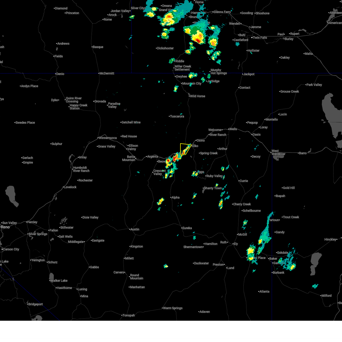 Svrlkn the national weather service in elko nevada has issued a * severe thunderstorm warning for, central elko county in northeastern nevada, * until 345 pm pdt. * at 319 pm pdt, a severe thunderstorm was located 8 miles southwest of elko, moving north at 10 mph (radar indicated). Hazards include 60 mph wind gusts and quarter size hail. Hail damage to vehicles is expected. Expect wind damage to roofs, siding, and trees. Svrlkn the national weather service in elko nevada has issued a * severe thunderstorm warning for, central elko county in northeastern nevada, * until 345 pm pdt. * at 319 pm pdt, a severe thunderstorm was located 8 miles southwest of elko, moving north at 10 mph (radar indicated). Hazards include 60 mph wind gusts and quarter size hail. Hail damage to vehicles is expected. Expect wind damage to roofs, siding, and trees.
|
| 5/28/2026 12:51 PM PDT |
 At 1251 pm pdt, severe thunderstorms were located along a line extending from 8 miles southwest of elko to 6 miles northwest of ruby valley, moving north at 35 mph (radar indicated). Hazards include 60 mph wind gusts. Expect damage to roofs, siding, and trees. Locations impacted include, elko, deeth, ryndon, adobe summit, star valley, and halleck. At 1251 pm pdt, severe thunderstorms were located along a line extending from 8 miles southwest of elko to 6 miles northwest of ruby valley, moving north at 35 mph (radar indicated). Hazards include 60 mph wind gusts. Expect damage to roofs, siding, and trees. Locations impacted include, elko, deeth, ryndon, adobe summit, star valley, and halleck.
|
| 5/28/2026 12:40 PM PDT | Measured 52 knots at wfo elk in elko county NV, 1.7 miles SW of Elko, NV |
| 5/28/2026 12:37 PM PDT |
 Svrlkn the national weather service in elko nevada has issued a * severe thunderstorm warning for, central elko county in northeastern nevada, northern eureka county in north central nevada, * until 115 pm pdt. * at 1237 pm pdt, severe thunderstorms were located along a line extending from 8 miles northwest of south fork to near ruby valley, moving north at 35 mph (radar indicated). Hazards include 60 mph wind gusts. Expect damage to roofs, siding, and trees. Little to no lightning. Svrlkn the national weather service in elko nevada has issued a * severe thunderstorm warning for, central elko county in northeastern nevada, northern eureka county in north central nevada, * until 115 pm pdt. * at 1237 pm pdt, severe thunderstorms were located along a line extending from 8 miles northwest of south fork to near ruby valley, moving north at 35 mph (radar indicated). Hazards include 60 mph wind gusts. Expect damage to roofs, siding, and trees. Little to no lightning.
|
| 8/13/2025 5:11 PM PDT | Station id: d6485 (cwop) name: dw6485 elko elevation: 5230 fee in elko county NV, 12.2 miles SW of Elko, NV |
| 6/9/2024 1:13 PM PDT |
 The storm which prompted the warning has weakened below severe limits, and no longer poses an immediate threat to life or property. therefore, the warning will be allowed to expire. however, gusty winds are still possible with this thunderstorm. The storm which prompted the warning has weakened below severe limits, and no longer poses an immediate threat to life or property. therefore, the warning will be allowed to expire. however, gusty winds are still possible with this thunderstorm.
|
| 6/9/2024 12:48 PM PDT |
 Svrlkn the national weather service in elko nevada has issued a * severe thunderstorm warning for, south central elko county in northeastern nevada, north central eureka county in north central nevada, * until 115 pm pdt. * at 1248 pm pdt, a severe thunderstorm was located near palisade, moving northeast at 15 mph (radar indicated). Hazards include 60 mph wind gusts and penny size hail. expect damage to roofs, siding, and trees Svrlkn the national weather service in elko nevada has issued a * severe thunderstorm warning for, south central elko county in northeastern nevada, north central eureka county in north central nevada, * until 115 pm pdt. * at 1248 pm pdt, a severe thunderstorm was located near palisade, moving northeast at 15 mph (radar indicated). Hazards include 60 mph wind gusts and penny size hail. expect damage to roofs, siding, and trees
|
| 9/1/2023 6:21 PM PDT | Mesonet station dw6485 elko station elevation: 5229 f in elko county NV, 12.2 miles SW of Elko, NV |
| 6/6/2023 3:00 PM PDT |
 At 300 pm pdt, a severe thunderstorm was located over ryndon, moving northwest at 15 mph (radar indicated). Hazards include 60 mph wind gusts and quarter size hail. Hail damage to vehicles is expected. expect wind damage to roofs, siding, and trees. locations impacted include, ryndon. hail threat, radar indicated max hail size, 1. 00 in wind threat, radar indicated max wind gust, 60 mph. At 300 pm pdt, a severe thunderstorm was located over ryndon, moving northwest at 15 mph (radar indicated). Hazards include 60 mph wind gusts and quarter size hail. Hail damage to vehicles is expected. expect wind damage to roofs, siding, and trees. locations impacted include, ryndon. hail threat, radar indicated max hail size, 1. 00 in wind threat, radar indicated max wind gust, 60 mph.
|
| 6/6/2023 2:43 PM PDT |
 At 242 pm pdt, a severe thunderstorm was located near ryndon, moving northwest at 15 mph (radar indicated). Hazards include 60 mph wind gusts and quarter size hail. Hail damage to vehicles is expected. Expect wind damage to roofs, siding, and trees. At 242 pm pdt, a severe thunderstorm was located near ryndon, moving northwest at 15 mph (radar indicated). Hazards include 60 mph wind gusts and quarter size hail. Hail damage to vehicles is expected. Expect wind damage to roofs, siding, and trees.
|
| 5/24/2023 1:24 PM PDT |
 The severe thunderstorm warning for central elko county will expire at 130 pm pdt, the storm which prompted the warning has moved out of the area. therefore, the warning will be allowed to expire with a new warning set to take its place. The severe thunderstorm warning for central elko county will expire at 130 pm pdt, the storm which prompted the warning has moved out of the area. therefore, the warning will be allowed to expire with a new warning set to take its place.
|
| 5/24/2023 1:22 PM PDT |
 At 122 pm pdt, a severe thunderstorm was located near spring creek, moving northeast at 20 mph (radar indicated). Hazards include 60 mph wind gusts and quarter size hail. Hail damage to vehicles is expected. Expect wind damage to roofs, siding, and trees. At 122 pm pdt, a severe thunderstorm was located near spring creek, moving northeast at 20 mph (radar indicated). Hazards include 60 mph wind gusts and quarter size hail. Hail damage to vehicles is expected. Expect wind damage to roofs, siding, and trees.
|
| 5/24/2023 1:14 PM PDT |
 At 113 pm pdt, a severe thunderstorm was located near elko, moving northeast at 15 mph (radar indicated). Hazards include 60 mph wind gusts and quarter size hail. Hail damage to vehicles is expected. expect wind damage to roofs, siding, and trees. locations impacted include, elko, spring creek and lamoille summit. hail threat, radar indicated max hail size, 1. 00 in wind threat, radar indicated max wind gust, 60 mph. At 113 pm pdt, a severe thunderstorm was located near elko, moving northeast at 15 mph (radar indicated). Hazards include 60 mph wind gusts and quarter size hail. Hail damage to vehicles is expected. expect wind damage to roofs, siding, and trees. locations impacted include, elko, spring creek and lamoille summit. hail threat, radar indicated max hail size, 1. 00 in wind threat, radar indicated max wind gust, 60 mph.
|
| 5/24/2023 12:55 PM PDT |
 At 1255 pm pdt, a severe thunderstorm was located near elko, moving northeast at 20 mph (radar indicated). Hazards include 60 mph wind gusts and quarter size hail. Hail damage to vehicles is expected. Expect wind damage to roofs, siding, and trees. At 1255 pm pdt, a severe thunderstorm was located near elko, moving northeast at 20 mph (radar indicated). Hazards include 60 mph wind gusts and quarter size hail. Hail damage to vehicles is expected. Expect wind damage to roofs, siding, and trees.
|
| 5/26/2022 7:00 PM PDT | Microburst of unknown wind speed toppled trees in ryndon and bent a flag pole onto a house in osin in elko county NV, 9.8 miles SW of Elko, NV |
| 5/26/2022 6:25 PM PDT | 64 mph wind gust reported at the nws office in elk in elko county NV, 1.7 miles SW of Elko, NV |
| 7/31/2021 4:09 PM PDT |
 The severe thunderstorm warning for south central elko county will expire at 415 pm pdt, the storm which prompted the warning has weakened below severe limits, and no longer poses an immediate threat to life or property. therefore, the warning will be allowed to expire. however gusty winds and heavy rain are still possible with this thunderstorm. The severe thunderstorm warning for south central elko county will expire at 415 pm pdt, the storm which prompted the warning has weakened below severe limits, and no longer poses an immediate threat to life or property. therefore, the warning will be allowed to expire. however gusty winds and heavy rain are still possible with this thunderstorm.
|
| 7/31/2021 3:24 PM PDT |
 At 324 pm pdt, a severe thunderstorm was located near south fork, moving north at 35 mph (radar indicated). Hazards include 60 mph wind gusts and quarter size hail. Hail damage to vehicles is expected. Expect wind damage to roofs, siding, and trees. At 324 pm pdt, a severe thunderstorm was located near south fork, moving north at 35 mph (radar indicated). Hazards include 60 mph wind gusts and quarter size hail. Hail damage to vehicles is expected. Expect wind damage to roofs, siding, and trees.
|
| 5/17/2021 7:58 PM PDT | Elko airport received a direct hit from a wet microburst. unknown if any damage occurre in elko county NV, 1.6 miles ENE of Elko, NV |
| 6/27/2020 5:46 PM PDT | Asos station keko elko airport aso in elko county NV, 1.8 miles NNE of Elko, NV |
| 6/6/2019 6:50 PM PDT | N7nnv coal mine canyon. elevation 5550 fee in elko county NV, 16.9 miles SW of Elko, NV |
| 7/21/2018 3:40 PM PDT | Scaffolding collapsed from gusty outflow winds between 50 to 55 mph. no injuries but the roadway is blocked. airport also gusted to 51 mph. nws office gusted to 43 knot in elko county NV, 0.9 miles NNW of Elko, NV |
| 5/31/2018 11:41 AM PDT |
 At 1141 am pdt, a severe thunderstorm was located near ryndon, moving northeast at 25 mph (radar indicated). Hazards include 60 mph wind gusts and quarter size hail. Hail damage to vehicles is expected. Expect wind damage to roofs, siding, and trees. At 1141 am pdt, a severe thunderstorm was located near ryndon, moving northeast at 25 mph (radar indicated). Hazards include 60 mph wind gusts and quarter size hail. Hail damage to vehicles is expected. Expect wind damage to roofs, siding, and trees.
|
| 5/31/2018 11:20 AM PDT |
 At 1120 am pdt, a severe thunderstorm was located near ryndon, moving northeast at 35 mph (radar indicated). Hazards include 60 mph wind gusts and quarter size hail. Hail damage to vehicles is expected. Expect wind damage to roofs, siding, and trees. At 1120 am pdt, a severe thunderstorm was located near ryndon, moving northeast at 35 mph (radar indicated). Hazards include 60 mph wind gusts and quarter size hail. Hail damage to vehicles is expected. Expect wind damage to roofs, siding, and trees.
|
| 5/30/2018 2:34 PM PDT |
 At 233 pm pdt, an area of several thunderstorms over northern eureka county and southwest elko county was moring northeast at around 30 mph (radar indicated). Hazards include 60 mph wind gusts and nickel size hail. expect damage to roofs, siding, and trees At 233 pm pdt, an area of several thunderstorms over northern eureka county and southwest elko county was moring northeast at around 30 mph (radar indicated). Hazards include 60 mph wind gusts and nickel size hail. expect damage to roofs, siding, and trees
|
| 5/27/2018 6:56 PM PDT |
 At 654 pm pdt, a severe thunderstorm capable of producing a tornado was located 8 miles northwest of elko, moving southwest at 20 mph (radar indicated rotation). Hazards include tornado and golf ball or larger size hail. Flying debris will be dangerous to those caught without shelter. mobile homes will be damaged or destroyed. damage to roofs, windows, and vehicles will occur. tree damage is likely. this dangerous storm will be near, carlin around 740 pm pdt. Other locations impacted by this tornadic thunderstorm include interstate 80, south area mine and adobe summit. At 654 pm pdt, a severe thunderstorm capable of producing a tornado was located 8 miles northwest of elko, moving southwest at 20 mph (radar indicated rotation). Hazards include tornado and golf ball or larger size hail. Flying debris will be dangerous to those caught without shelter. mobile homes will be damaged or destroyed. damage to roofs, windows, and vehicles will occur. tree damage is likely. this dangerous storm will be near, carlin around 740 pm pdt. Other locations impacted by this tornadic thunderstorm include interstate 80, south area mine and adobe summit.
|
| 5/27/2018 6:34 PM PDT |
 At 633 pm pdt, a severe thunderstorm capable of producing a tornado was located 12 miles northwest of ryndon, moving southwest at 15 mph (radar indicated rotation). Hazards include tornado. Flying debris will be dangerous to those caught without shelter. mobile homes will be damaged or destroyed. damage to roofs, windows, and vehicles will occur. tree damage is likely. This tornadic thunderstorm will remain over mainly rural areas of central elko county, including the following locations: adobe summit and mountain city highway. At 633 pm pdt, a severe thunderstorm capable of producing a tornado was located 12 miles northwest of ryndon, moving southwest at 15 mph (radar indicated rotation). Hazards include tornado. Flying debris will be dangerous to those caught without shelter. mobile homes will be damaged or destroyed. damage to roofs, windows, and vehicles will occur. tree damage is likely. This tornadic thunderstorm will remain over mainly rural areas of central elko county, including the following locations: adobe summit and mountain city highway.
|
| 5/17/2018 3:35 PM PDT |
 The severe thunderstorm warning for southwestern elko county will expire at 345 pm pdt, the storm which prompted the warning has weakened below severe limits, and no longer poses an immediate threat to life or property. therefore the warning will be allowed to expire. however small hail, gusty winds and heavy rain are still possible with this thunderstorm. to report severe weather, contact your nearest law enforcement agency. they will relay your report to the national weather service elko nevada. The severe thunderstorm warning for southwestern elko county will expire at 345 pm pdt, the storm which prompted the warning has weakened below severe limits, and no longer poses an immediate threat to life or property. therefore the warning will be allowed to expire. however small hail, gusty winds and heavy rain are still possible with this thunderstorm. to report severe weather, contact your nearest law enforcement agency. they will relay your report to the national weather service elko nevada.
|
| 5/17/2018 3:13 PM PDT |
 At 313 pm pdt, a severe thunderstorm was located 8 miles northwest of elko, and is nearly stationary (radar indicated). Hazards include 60 mph wind gusts. Expect damage to roofs, siding, and trees. Locations impacted include, elko, adobe summit and lamoille summit. At 313 pm pdt, a severe thunderstorm was located 8 miles northwest of elko, and is nearly stationary (radar indicated). Hazards include 60 mph wind gusts. Expect damage to roofs, siding, and trees. Locations impacted include, elko, adobe summit and lamoille summit.
|
| 5/17/2018 2:44 PM PDT |
 At 243 pm pdt, a severe thunderstorm was located 9 miles northwest of elko, and is nearly stationary (radar indicated). Hazards include 60 mph wind gusts and quarter size hail. Hail damage to vehicles is expected. Expect wind damage to roofs, siding, and trees. At 243 pm pdt, a severe thunderstorm was located 9 miles northwest of elko, and is nearly stationary (radar indicated). Hazards include 60 mph wind gusts and quarter size hail. Hail damage to vehicles is expected. Expect wind damage to roofs, siding, and trees.
|
| 4/27/2018 5:20 PM PDT | Rsois wind sensor measured a wind gust of 57 kt. this was a dry micro-burst which caused the office to switch briefly to generator back up powe in elko county NV, 1.7 miles SW of Elko, NV |
| 8/3/2017 4:00 PM PDT | Strong downburst winds from a collapsing shower put out a measured wind gust of 62 mph and knocked over a large tree. wind was strong enough to pick up ash from the rec in elko county NV, 7.4 miles SW of Elko, NV |
| 6/26/2017 7:39 PM PDT | Tree damage at 158 bullion rd. elko... nv 8980 in elko county NV, 0.9 miles NNW of Elko, NV |
| 6/20/2017 11:20 PM PDT | Mesonet station as326... coal mine canyon n7nnv cwop. showers and storms overhead collapsing with strong outflow winds. gust of 59 mph measured at senso in elko county NV, 16.9 miles SW of Elko, NV |
| 5/6/2017 4:42 PM PDT |
 At 440 pm pdt, a severe thunderstorm was located near south fork, moving north at 30 mph (radar indicated). Hazards include 60 mph wind gusts and penny size hail. these storms have already produced winds over 50 mph at automated sites. expect damage to roofs, siding, and trees At 440 pm pdt, a severe thunderstorm was located near south fork, moving north at 30 mph (radar indicated). Hazards include 60 mph wind gusts and penny size hail. these storms have already produced winds over 50 mph at automated sites. expect damage to roofs, siding, and trees
|
| 5/6/2017 3:44 PM PDT |
 At 343 pm pdt, a severe thunderstorm was located 9 miles west of ryndon, moving north at 45 mph. this storm has produced winds of 57 mph at elko (radar indicated). Hazards include 60 mph wind gusts and penny size hail. Expect damage to roofs, siding, and trees. Winds could blow vehicles off roads. At 343 pm pdt, a severe thunderstorm was located 9 miles west of ryndon, moving north at 45 mph. this storm has produced winds of 57 mph at elko (radar indicated). Hazards include 60 mph wind gusts and penny size hail. Expect damage to roofs, siding, and trees. Winds could blow vehicles off roads.
|
| 5/6/2017 3:40 PM PDT | Gust of 49 kt or 56 mph reported on rsoi in elko county NV, 1.7 miles SW of Elko, NV |
| 5/6/2017 2:09 PM PDT | 51 kt or 59 mph gust reported on rsois. this was produced from a shower's microburs in elko county NV, 1.7 miles SW of Elko, NV |
| 10/30/2016 4:39 PM PDT |
 At 439 pm pdt, doppler radar indicated a severe thunderstorm capable of producing damaging winds in excess of 60 mph. this storm was located 12 miles west of jiggs, and moving northeast at 45 mph. penny size hail may also accompany the damaging winds. At 439 pm pdt, doppler radar indicated a severe thunderstorm capable of producing damaging winds in excess of 60 mph. this storm was located 12 miles west of jiggs, and moving northeast at 45 mph. penny size hail may also accompany the damaging winds.
|
| 7/9/2015 2:11 PM PDT | The severe thunderstorm warning for central elko county will expire at 215 pm pdt, the storm which prompted the warning has weakened below severe limits, and no longer poses an immediate threat to life or property. therefore the warning will be allowed to expire. |
| 7/9/2015 2:09 PM PDT |
 At 207 pm pdt, doppler radar indicated a severe thunderstorm capable of producing quarter size hail and damaging winds in excess of 60 mph. this storm was located 8 miles northwest of ryndon, moving north at 20 mph. dime sized hail (1/2 inch) reported at elko nws office. locations impacted include, elko, ryndon, spring creek and lamoille summit. this includes mile marker 312 osino. At 207 pm pdt, doppler radar indicated a severe thunderstorm capable of producing quarter size hail and damaging winds in excess of 60 mph. this storm was located 8 miles northwest of ryndon, moving north at 20 mph. dime sized hail (1/2 inch) reported at elko nws office. locations impacted include, elko, ryndon, spring creek and lamoille summit. this includes mile marker 312 osino.
|
| 7/9/2015 1:36 PM PDT |
 At 135 pm pdt, doppler radar indicated a severe thunderstorm capable of producing quarter size hail and damaging winds in excess of 60 mph. this storm was located near elko, and moving north at 20 mph. At 135 pm pdt, doppler radar indicated a severe thunderstorm capable of producing quarter size hail and damaging winds in excess of 60 mph. this storm was located near elko, and moving north at 20 mph.
|
| 6/10/2015 5:29 PM PDT |
 At 527 pm pdt, the public and an off duty nws employee reported extremely heavy rains and localized flooding in spring creek. also, small hail was reported in the vicinity of the high school. gusty winds were also reported. please use caution when out driving. take cover until the storm passes if possible. locations impacted include, elko, spring creek, south fork and lamoille summit. this includes mile marker 293 hunter. At 527 pm pdt, the public and an off duty nws employee reported extremely heavy rains and localized flooding in spring creek. also, small hail was reported in the vicinity of the high school. gusty winds were also reported. please use caution when out driving. take cover until the storm passes if possible. locations impacted include, elko, spring creek, south fork and lamoille summit. this includes mile marker 293 hunter.
|
| 6/10/2015 4:53 PM PDT |
 At 451 pm pdt, doppler radar indicated a severe thunderstorm capable of producing quarter size hail and damaging winds in excess of 60 mph. this storm was located near spring creek, and moving west at 10 mph. this is a dangerous situation. take cover now. this storm will also produce torrential rain producing flooding. At 451 pm pdt, doppler radar indicated a severe thunderstorm capable of producing quarter size hail and damaging winds in excess of 60 mph. this storm was located near spring creek, and moving west at 10 mph. this is a dangerous situation. take cover now. this storm will also produce torrential rain producing flooding.
|
| 5/31/2015 4:49 PM PDT | Dry microburst. gusts around 50 mph was also reported on the nw side of elk in elko county NV, 4.2 miles ENE of Elko, NV |
| 8/12/2014 2:30 PM PDT | Half Dollar sized hail reported 1 miles NNE of Elko, NV, several reports of 1 to 1.25 inch hail in elko. pictures were sent that verified the size of the hail. |
| 7/20/2014 3:25 PM PDT | Shingles blown off roof of senior center in elko county NV, 2.1 miles WSW of Elko, NV |
| 7/20/2014 3:10 PM PDT | 1 foot diameter tree branch fell on house in elko county NV, 1.2 miles NW of Elko, NV |
| 5/21/2014 12:50 PM PDT | Trained weather spotter reports rotating wall cloud...verified through video. also shingles and roofing debris were removed from a structure. small hail was also report in elko county NV, 1.9 miles E of Elko, NV |
| 3/6/2013 11:30 AM PST | Wind sensor at elko nws office measured peak wind gust of 59 mp in elko county NV, 1 miles NNE of Elko, NV |
Hail Maps for Elko, NV


Connect with Interactive Hail Maps