

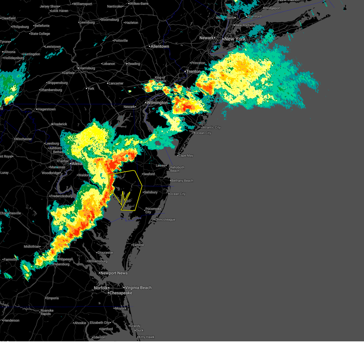
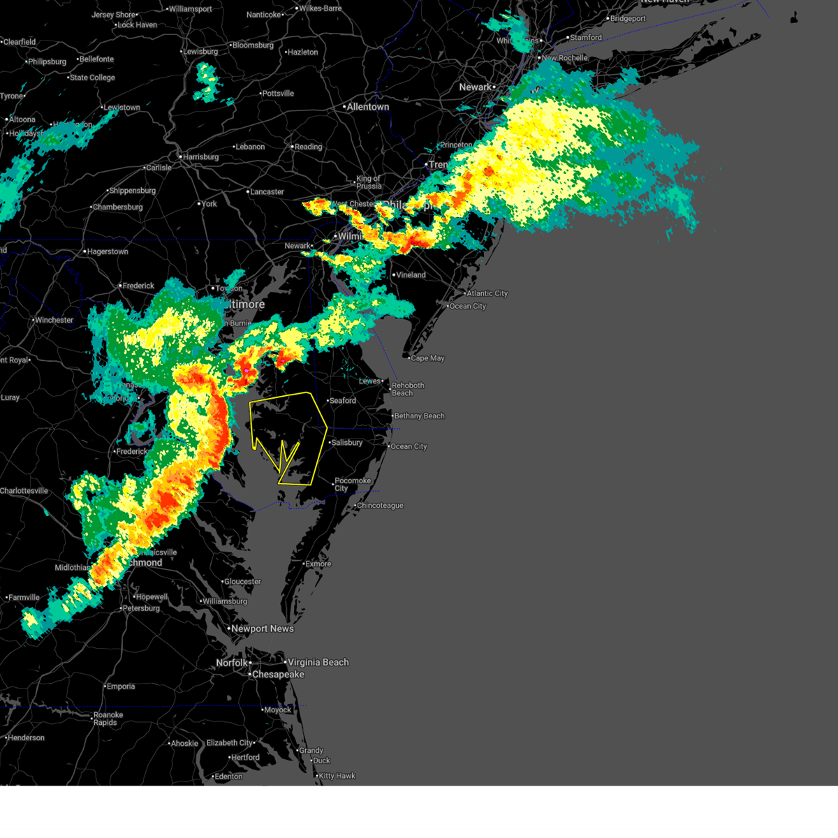
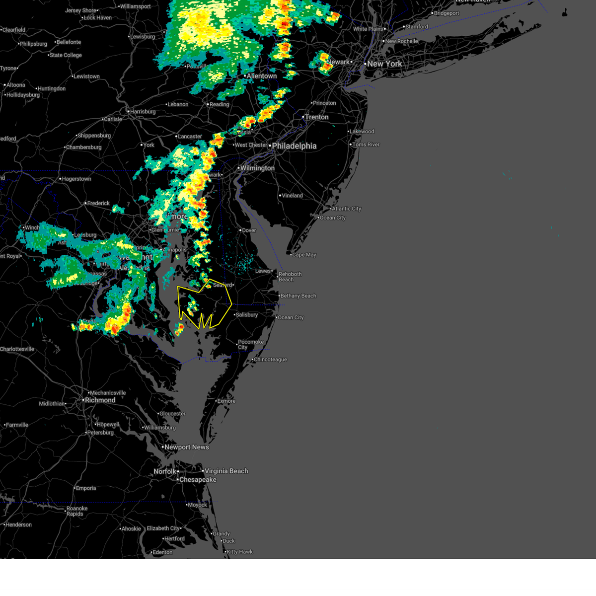
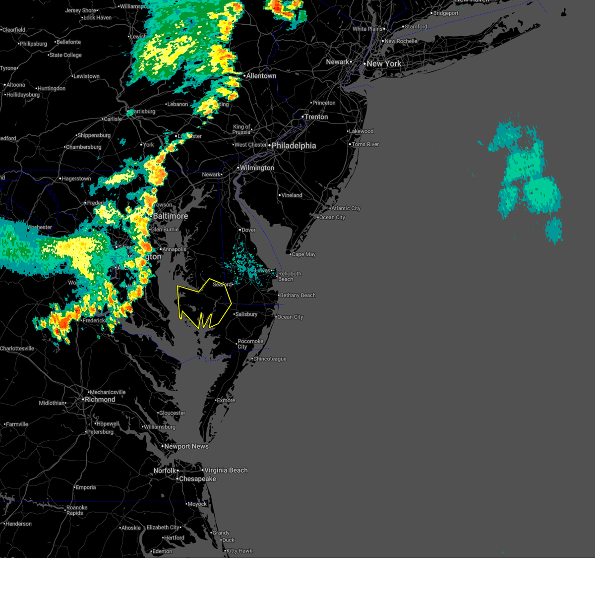
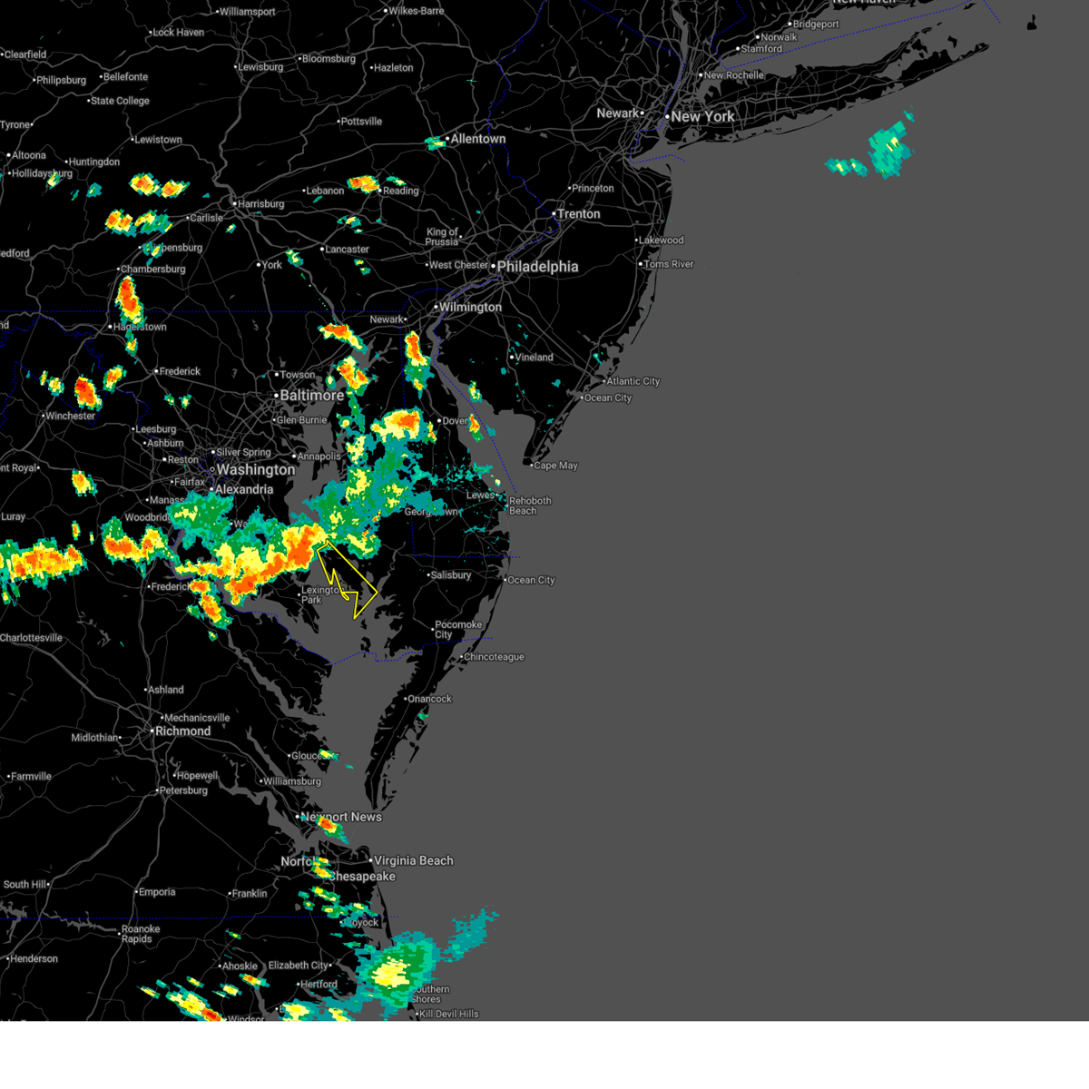
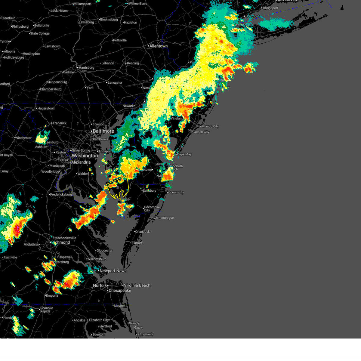
Hail Map for Elliott, MD
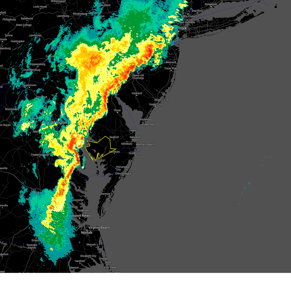
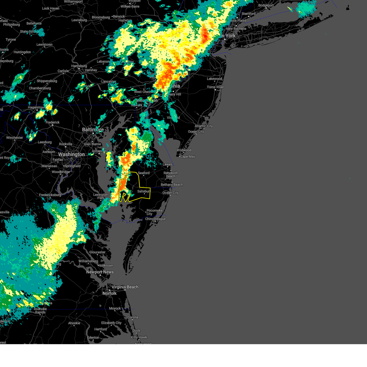
The Elliott, MD area has had 1 report of on-the-ground hail by trained spotters, and has been under severe weather warnings 10 times during the past 12 months. Doppler radar has detected hail at or near Elliott, MD on 24 occasions, including 1 occasion during the past year.
| Name: | Elliott, MD |
| Where Located: | 50.3 miles W of Ocean City, MD |
| Map: | Google Map for Elliott, MD |
| Population: | 52 |
| Housing Units: | 63 |
| More Info: | Search Google for Elliott, MD |
0
The Top Recent Hail Date for Elliott, MD is Thursday, July 31, 2025 (24th out of 24)

Hail and Wind Damage Spotted near Elliott, MD
| Date / Time | Report Details |
|---|---|
| 6/22/2026 7:42 PM EDT |
 At 741 pm edt, severe thunderstorms were located along a line extending from near easton to 8 miles south of cambridge to 9 miles northeast of saint inigoes creek, moving east at 45 mph (radar indicated). Hazards include 60 mph wind gusts. Expect damage to trees and powerlines. these severe storms will be near, cambridge, trappe, and university of maryland center for environmental studies around 745 pm edt. secretary around 750 pm edt. hurlock around 755 pm edt. vienna and deal island around 800 pm edt. federalsburg and sharptown around 805 pm edt. hebron around 810 pm edt. princess anne around 815 pm edt. Other locations impacted by these severe thunderstorms include wetipquin, madison, brookview, eldorado, trinity, church creek, lloyds, mount vernon, linkwood, and galestown. At 741 pm edt, severe thunderstorms were located along a line extending from near easton to 8 miles south of cambridge to 9 miles northeast of saint inigoes creek, moving east at 45 mph (radar indicated). Hazards include 60 mph wind gusts. Expect damage to trees and powerlines. these severe storms will be near, cambridge, trappe, and university of maryland center for environmental studies around 745 pm edt. secretary around 750 pm edt. hurlock around 755 pm edt. vienna and deal island around 800 pm edt. federalsburg and sharptown around 805 pm edt. hebron around 810 pm edt. princess anne around 815 pm edt. Other locations impacted by these severe thunderstorms include wetipquin, madison, brookview, eldorado, trinity, church creek, lloyds, mount vernon, linkwood, and galestown.
|
| 6/22/2026 7:13 PM EDT |
 Svrakq the national weather service in wakefield has issued a * severe thunderstorm warning for, northwestern somerset county in southeastern maryland, western wicomico county in southeastern maryland, dorchester county in southeastern maryland, * until 815 pm edt. * at 713 pm edt, severe thunderstorms were located along a line extending from near chesapeake beach to calvert cliffs to near coles point, moving east at 45 mph (radar indicated). Hazards include 60 mph wind gusts. Expect damage to trees and powerlines. severe thunderstorms will be near, university of maryland center for environmental studies around 735 pm edt. cambridge and trappe around 740 pm edt. hurlock and secretary around 750 pm edt. vienna around 755 pm edt. federalsburg and deal island around 800 pm edt. sharptown around 805 pm edt. Other locations impacted by these severe thunderstorms include wetipquin, madison, brookview, eldorado, trinity, church creek, lloyds, mount vernon, linkwood, and galestown. Svrakq the national weather service in wakefield has issued a * severe thunderstorm warning for, northwestern somerset county in southeastern maryland, western wicomico county in southeastern maryland, dorchester county in southeastern maryland, * until 815 pm edt. * at 713 pm edt, severe thunderstorms were located along a line extending from near chesapeake beach to calvert cliffs to near coles point, moving east at 45 mph (radar indicated). Hazards include 60 mph wind gusts. Expect damage to trees and powerlines. severe thunderstorms will be near, university of maryland center for environmental studies around 735 pm edt. cambridge and trappe around 740 pm edt. hurlock and secretary around 750 pm edt. vienna around 755 pm edt. federalsburg and deal island around 800 pm edt. sharptown around 805 pm edt. Other locations impacted by these severe thunderstorms include wetipquin, madison, brookview, eldorado, trinity, church creek, lloyds, mount vernon, linkwood, and galestown.
|
| 6/11/2026 9:51 PM EDT |
 The storms which prompted the warning have weakened below severe limits, and no longer pose an immediate threat to life or property. therefore, the warning will be allowed to expire. a severe thunderstorm watch remains in effect until midnight edt for southeastern maryland. The storms which prompted the warning have weakened below severe limits, and no longer pose an immediate threat to life or property. therefore, the warning will be allowed to expire. a severe thunderstorm watch remains in effect until midnight edt for southeastern maryland.
|
| 6/11/2026 9:43 PM EDT |
 At 943 pm edt, severe thunderstorms were located along a line extending from sudlersville to harmony to 14 miles north of deal island, moving east at 45 mph (radar indicated). Hazards include 60 mph wind gusts. Expect damage to trees and powerlines. these severe storms will be near, hurlock and vienna around 950 pm edt. sharptown around 955 pm edt. hebron around 1000 pm edt. Other locations impacted by these severe thunderstorms include galestown, green hill, catchpenny, madison, wetipquin, brookview, eldorado, andrews, hudson, and royal oak. At 943 pm edt, severe thunderstorms were located along a line extending from sudlersville to harmony to 14 miles north of deal island, moving east at 45 mph (radar indicated). Hazards include 60 mph wind gusts. Expect damage to trees and powerlines. these severe storms will be near, hurlock and vienna around 950 pm edt. sharptown around 955 pm edt. hebron around 1000 pm edt. Other locations impacted by these severe thunderstorms include galestown, green hill, catchpenny, madison, wetipquin, brookview, eldorado, andrews, hudson, and royal oak.
|
| 6/11/2026 9:03 PM EDT |
 Svrakq the national weather service in wakefield has issued a * severe thunderstorm warning for, western wicomico county in southeastern maryland, dorchester county in southeastern maryland, * until 1000 pm edt. * at 903 pm edt, severe thunderstorms were located along a line extending from near millers island to tilghman island to near greenwell state park, moving east at 45 mph (radar indicated). Hazards include 60 mph wind gusts. Expect damage to trees and powerlines. severe thunderstorms will be near, university of maryland center for environmental studies around 920 pm edt. cambridge around 925 pm edt. secretary around 930 pm edt. hurlock around 935 pm edt. vienna around 945 pm edt. Other locations impacted by these severe thunderstorms include galestown, green hill, catchpenny, madison, wetipquin, brookview, eldorado, andrews, hudson, and royal oak. Svrakq the national weather service in wakefield has issued a * severe thunderstorm warning for, western wicomico county in southeastern maryland, dorchester county in southeastern maryland, * until 1000 pm edt. * at 903 pm edt, severe thunderstorms were located along a line extending from near millers island to tilghman island to near greenwell state park, moving east at 45 mph (radar indicated). Hazards include 60 mph wind gusts. Expect damage to trees and powerlines. severe thunderstorms will be near, university of maryland center for environmental studies around 920 pm edt. cambridge around 925 pm edt. secretary around 930 pm edt. hurlock around 935 pm edt. vienna around 945 pm edt. Other locations impacted by these severe thunderstorms include galestown, green hill, catchpenny, madison, wetipquin, brookview, eldorado, andrews, hudson, and royal oak.
|
| 7/27/2025 3:23 PM EDT |
 Svrakq the national weather service in wakefield has issued a * severe thunderstorm warning for, southwestern dorchester county in southeastern maryland, * until 415 pm edt. * at 323 pm edt, a severe thunderstorm was located over taylors island, moving southeast at 30 mph (radar indicated). Hazards include 60 mph wind gusts. Expect damage to trees and powerlines. This severe thunderstorm will remain over mainly rural areas of southwestern dorchester county, including the following locations, taylors island, crocheron, andrews, wingate, and elliott. Svrakq the national weather service in wakefield has issued a * severe thunderstorm warning for, southwestern dorchester county in southeastern maryland, * until 415 pm edt. * at 323 pm edt, a severe thunderstorm was located over taylors island, moving southeast at 30 mph (radar indicated). Hazards include 60 mph wind gusts. Expect damage to trees and powerlines. This severe thunderstorm will remain over mainly rural areas of southwestern dorchester county, including the following locations, taylors island, crocheron, andrews, wingate, and elliott.
|
| 7/19/2025 9:41 PM EDT |
 Svrakq the national weather service in wakefield has issued a * severe thunderstorm warning for, western wicomico county in southeastern maryland, dorchester county in southeastern maryland, * until 1045 pm edt. * at 940 pm edt, severe thunderstorms were located along a line extending from 6 miles west of university of maryland center for environmental studies to 7 miles southeast of cambridge to 10 miles northeast of deal island, moving northeast at 35 mph (radar indicated). Hazards include 60 mph wind gusts. Expect damage to trees and powerlines. severe thunderstorms will be near, cambridge and university of maryland center for environmental studies around 945 pm edt. vienna around 950 pm edt. hebron and secretary around 955 pm edt. hurlock around 1000 pm edt. sharptown around 1005 pm edt. Other locations impacted by these severe thunderstorms include galestown, catchpenny, wetipquin, madison, brookview, eldorado, royal oak, hudson, church creek, and lloyds. Svrakq the national weather service in wakefield has issued a * severe thunderstorm warning for, western wicomico county in southeastern maryland, dorchester county in southeastern maryland, * until 1045 pm edt. * at 940 pm edt, severe thunderstorms were located along a line extending from 6 miles west of university of maryland center for environmental studies to 7 miles southeast of cambridge to 10 miles northeast of deal island, moving northeast at 35 mph (radar indicated). Hazards include 60 mph wind gusts. Expect damage to trees and powerlines. severe thunderstorms will be near, cambridge and university of maryland center for environmental studies around 945 pm edt. vienna around 950 pm edt. hebron and secretary around 955 pm edt. hurlock around 1000 pm edt. sharptown around 1005 pm edt. Other locations impacted by these severe thunderstorms include galestown, catchpenny, wetipquin, madison, brookview, eldorado, royal oak, hudson, church creek, and lloyds.
|
| 7/8/2025 9:00 PM EDT |
 The storm which prompted the warning has weakened below severe limits, and has exited the warned area. therefore, the warning will be allowed to expire. The storm which prompted the warning has weakened below severe limits, and has exited the warned area. therefore, the warning will be allowed to expire.
|
| 7/8/2025 8:46 PM EDT |
 At 846 pm edt, a severe thunderstorm was located near vienna, or 11 miles southeast of cambridge, moving east at 30 mph (radar indicated). Hazards include 60 mph wind gusts. Expect damage to trees and powerlines. Locations impacted include, crocheron, bucktown, wingate, and linkwood. At 846 pm edt, a severe thunderstorm was located near vienna, or 11 miles southeast of cambridge, moving east at 30 mph (radar indicated). Hazards include 60 mph wind gusts. Expect damage to trees and powerlines. Locations impacted include, crocheron, bucktown, wingate, and linkwood.
|
| 7/8/2025 8:09 PM EDT |
 Svrakq the national weather service in wakefield has issued a * severe thunderstorm warning for, central dorchester county in southeastern maryland, * until 900 pm edt. * at 809 pm edt, a severe thunderstorm was located 8 miles southeast of taylors island, moving east at 30 mph (radar indicated). Hazards include 60 mph wind gusts. Expect damage to trees and powerlines. This severe thunderstorm will remain over mainly rural areas of central dorchester county, including the following locations, andrews, hoopersville, crocheron, honga, church creek, bucktown, wingate, linkwood, and woolford. Svrakq the national weather service in wakefield has issued a * severe thunderstorm warning for, central dorchester county in southeastern maryland, * until 900 pm edt. * at 809 pm edt, a severe thunderstorm was located 8 miles southeast of taylors island, moving east at 30 mph (radar indicated). Hazards include 60 mph wind gusts. Expect damage to trees and powerlines. This severe thunderstorm will remain over mainly rural areas of central dorchester county, including the following locations, andrews, hoopersville, crocheron, honga, church creek, bucktown, wingate, linkwood, and woolford.
|
| 7/1/2025 8:19 PM EDT |
 Svrakq the national weather service in wakefield has issued a * severe thunderstorm warning for, north central somerset county in southeastern maryland, wicomico county in southeastern maryland, dorchester county in southeastern maryland, * until 900 pm edt. * at 818 pm edt, severe thunderstorms were located along a line extending from 7 miles south of tilghman island to 7 miles east of taylors island to 11 miles northwest of deal island, moving east at 35 mph (radar indicated). Hazards include 60 mph wind gusts. expect damage to trees and powerlines Svrakq the national weather service in wakefield has issued a * severe thunderstorm warning for, north central somerset county in southeastern maryland, wicomico county in southeastern maryland, dorchester county in southeastern maryland, * until 900 pm edt. * at 818 pm edt, severe thunderstorms were located along a line extending from 7 miles south of tilghman island to 7 miles east of taylors island to 11 miles northwest of deal island, moving east at 35 mph (radar indicated). Hazards include 60 mph wind gusts. expect damage to trees and powerlines
|
| 7/1/2025 7:56 PM EDT |
 Svrakq the national weather service in wakefield has issued a * severe thunderstorm warning for, dorchester county in southeastern maryland, * until 845 pm edt. * at 754 pm edt, a severe thunderstorm was located over patuxent river naval air station, or over lexington park, moving northeast at 40 mph (radar indicated). Hazards include 60 mph wind gusts. expect damage to trees and powerlines Svrakq the national weather service in wakefield has issued a * severe thunderstorm warning for, dorchester county in southeastern maryland, * until 845 pm edt. * at 754 pm edt, a severe thunderstorm was located over patuxent river naval air station, or over lexington park, moving northeast at 40 mph (radar indicated). Hazards include 60 mph wind gusts. expect damage to trees and powerlines
|
| 7/1/2025 4:53 PM EDT |
 Svrakq the national weather service in wakefield has issued a * severe thunderstorm warning for, northwestern wicomico county in southeastern maryland, dorchester county in southeastern maryland, * until 545 pm edt. * at 453 pm edt, a severe thunderstorm was located 10 miles south of cambridge, moving northeast at 30 mph (radar indicated). Hazards include 60 mph wind gusts. Expect damage to trees and powerlines. this severe thunderstorm will be near, vienna around 510 pm edt. sharptown around 525 pm edt. Other locations impacted by this severe thunderstorm include galestown, mardela springs, brookview, eldorado, woolford, east new market, church creek, bucktown, and linkwood. Svrakq the national weather service in wakefield has issued a * severe thunderstorm warning for, northwestern wicomico county in southeastern maryland, dorchester county in southeastern maryland, * until 545 pm edt. * at 453 pm edt, a severe thunderstorm was located 10 miles south of cambridge, moving northeast at 30 mph (radar indicated). Hazards include 60 mph wind gusts. Expect damage to trees and powerlines. this severe thunderstorm will be near, vienna around 510 pm edt. sharptown around 525 pm edt. Other locations impacted by this severe thunderstorm include galestown, mardela springs, brookview, eldorado, woolford, east new market, church creek, bucktown, and linkwood.
|
| 3/31/2025 9:12 PM EDT |
 Svrakq the national weather service in wakefield has issued a * severe thunderstorm warning for, northwestern wicomico county in southeastern maryland, dorchester county in southeastern maryland, * until 1000 pm edt. * at 911 pm edt, severe thunderstorms were located along a line extending from saint leonard to lusby to near saint marys city, moving northeast at 45 mph (radar indicated). Hazards include 60 mph wind gusts. expect damage to trees and powerlines Svrakq the national weather service in wakefield has issued a * severe thunderstorm warning for, northwestern wicomico county in southeastern maryland, dorchester county in southeastern maryland, * until 1000 pm edt. * at 911 pm edt, severe thunderstorms were located along a line extending from saint leonard to lusby to near saint marys city, moving northeast at 45 mph (radar indicated). Hazards include 60 mph wind gusts. expect damage to trees and powerlines
|
| 7/17/2024 8:50 PM EDT |
 Svrakq the national weather service in wakefield has issued a * severe thunderstorm warning for, wicomico county in southeastern maryland, dorchester county in southeastern maryland, * until 930 pm edt. * at 849 pm edt, severe thunderstorms were located along a line extending from trappe to 7 miles northwest of deal island, moving east at 30 mph (radar indicated). Hazards include 60 mph wind gusts and quarter size hail. Minor damage to vehicles is possible. expect wind damage to trees and powerlines. severe thunderstorms will be near, secretary around 855 pm edt. hurlock around 900 pm edt. vienna around 905 pm edt. federalsburg around 915 pm edt. sharptown around 920 pm edt. Other locations impacted by these severe thunderstorms include galestown, green hill, catchpenny, wetipquin, waterview, brookview, trinity, salisbury-wicomico, eldorado, and royal oak. Svrakq the national weather service in wakefield has issued a * severe thunderstorm warning for, wicomico county in southeastern maryland, dorchester county in southeastern maryland, * until 930 pm edt. * at 849 pm edt, severe thunderstorms were located along a line extending from trappe to 7 miles northwest of deal island, moving east at 30 mph (radar indicated). Hazards include 60 mph wind gusts and quarter size hail. Minor damage to vehicles is possible. expect wind damage to trees and powerlines. severe thunderstorms will be near, secretary around 855 pm edt. hurlock around 900 pm edt. vienna around 905 pm edt. federalsburg around 915 pm edt. sharptown around 920 pm edt. Other locations impacted by these severe thunderstorms include galestown, green hill, catchpenny, wetipquin, waterview, brookview, trinity, salisbury-wicomico, eldorado, and royal oak.
|
| 6/26/2024 10:36 PM EDT | Weatherflow xhpr at lower hooper island measured a peak wind gust of 52 knot in anz543 county MD, 9.9 miles ENE of Elliott, MD |
| 4/15/2024 5:48 PM EDT |
 the severe thunderstorm warning has been cancelled and is no longer in effect the severe thunderstorm warning has been cancelled and is no longer in effect
|
| 4/15/2024 5:18 PM EDT |
 Svrakq the national weather service in wakefield has issued a * severe thunderstorm warning for, northwestern somerset county in southeastern maryland, southwestern wicomico county in southeastern maryland, central dorchester county in southeastern maryland, * until 600 pm edt. * at 518 pm edt, a severe thunderstorm was located 12 miles south of cambridge, moving southeast at 30 mph (radar indicated). Hazards include 60 mph wind gusts and quarter size hail. Minor damage to vehicles is possible. expect wind damage to trees and powerlines. This severe thunderstorm will remain over mainly rural areas of northwestern somerset, southwestern wicomico and central dorchester counties, including the following locations, green hill, catchpenny, wetipquin, oriole, trinity, andrews, royal oak, eden, crocheron, deal island, and allen. Svrakq the national weather service in wakefield has issued a * severe thunderstorm warning for, northwestern somerset county in southeastern maryland, southwestern wicomico county in southeastern maryland, central dorchester county in southeastern maryland, * until 600 pm edt. * at 518 pm edt, a severe thunderstorm was located 12 miles south of cambridge, moving southeast at 30 mph (radar indicated). Hazards include 60 mph wind gusts and quarter size hail. Minor damage to vehicles is possible. expect wind damage to trees and powerlines. This severe thunderstorm will remain over mainly rural areas of northwestern somerset, southwestern wicomico and central dorchester counties, including the following locations, green hill, catchpenny, wetipquin, oriole, trinity, andrews, royal oak, eden, crocheron, deal island, and allen.
|
| 4/3/2024 4:51 PM EDT |
 Svrakq the national weather service in wakefield has issued a * severe thunderstorm warning for, northwestern wicomico county in southeastern maryland, central dorchester county in southeastern maryland, * until 530 pm edt. * at 451 pm edt, a severe thunderstorm was located 12 miles north of deal island, or 15 miles south of cambridge, moving northeast at 60 mph (radar indicated). Hazards include 60 mph wind gusts and quarter size hail. Minor damage to vehicles is possible. expect wind damage to trees and powerlines. this severe thunderstorm will be near, vienna around 500 pm edt. sharptown around 510 pm edt. Other locations impacted by this severe thunderstorm include galestown, wetipquin, brookview, eldorado, andrews, royal oak, crocheron, wingate, mardela springs, and elliott. Svrakq the national weather service in wakefield has issued a * severe thunderstorm warning for, northwestern wicomico county in southeastern maryland, central dorchester county in southeastern maryland, * until 530 pm edt. * at 451 pm edt, a severe thunderstorm was located 12 miles north of deal island, or 15 miles south of cambridge, moving northeast at 60 mph (radar indicated). Hazards include 60 mph wind gusts and quarter size hail. Minor damage to vehicles is possible. expect wind damage to trees and powerlines. this severe thunderstorm will be near, vienna around 500 pm edt. sharptown around 510 pm edt. Other locations impacted by this severe thunderstorm include galestown, wetipquin, brookview, eldorado, andrews, royal oak, crocheron, wingate, mardela springs, and elliott.
|
| 8/15/2023 6:02 PM EDT |
 At 602 pm edt, a severe thunderstorm was located 9 miles southeast of taylors island, moving east at 25 mph (radar indicated). Hazards include 60 mph wind gusts and quarter size hail. Minor damage to vehicles is possible. expect wind damage to trees and powerlines. this severe thunderstorm will remain over mainly rural areas of central dorchester county, including the following locations, bucktown, andrews, and honga. hail threat, radar indicated max hail size, 1. 00 in wind threat, radar indicated max wind gust, 60 mph. At 602 pm edt, a severe thunderstorm was located 9 miles southeast of taylors island, moving east at 25 mph (radar indicated). Hazards include 60 mph wind gusts and quarter size hail. Minor damage to vehicles is possible. expect wind damage to trees and powerlines. this severe thunderstorm will remain over mainly rural areas of central dorchester county, including the following locations, bucktown, andrews, and honga. hail threat, radar indicated max hail size, 1. 00 in wind threat, radar indicated max wind gust, 60 mph.
|
| 8/15/2023 4:22 PM EDT |
 At 422 pm edt, a severe thunderstorm was located near deal island, or 16 miles west of princess anne, moving northeast at 30 mph (radar indicated). Hazards include 60 mph wind gusts and quarter size hail. Minor damage to vehicles is possible. expect wind damage to trees and powerlines. this severe thunderstorm will remain over mainly rural areas of northwestern somerset, southwestern wicomico and central dorchester counties, including the following locations, green hill, catchpenny, wetipquin, oriole, trinity, royal oak, crocheron, dames quarter, allen, and whitehaven. hail threat, radar indicated max hail size, 1. 00 in wind threat, radar indicated max wind gust, 60 mph. At 422 pm edt, a severe thunderstorm was located near deal island, or 16 miles west of princess anne, moving northeast at 30 mph (radar indicated). Hazards include 60 mph wind gusts and quarter size hail. Minor damage to vehicles is possible. expect wind damage to trees and powerlines. this severe thunderstorm will remain over mainly rural areas of northwestern somerset, southwestern wicomico and central dorchester counties, including the following locations, green hill, catchpenny, wetipquin, oriole, trinity, royal oak, crocheron, dames quarter, allen, and whitehaven. hail threat, radar indicated max hail size, 1. 00 in wind threat, radar indicated max wind gust, 60 mph.
|
| 8/15/2023 4:15 PM EDT |
 At 415 pm edt, a severe thunderstorm was located near deal island, or 19 miles west of princess anne, moving northeast at 30 mph (radar indicated). Hazards include ping pong ball size hail and 60 mph wind gusts. People and animals outdoors will be injured. expect hail damage to roofs, siding, windows, and vehicles. expect wind damage to trees and powerlines. this severe thunderstorm will be near, deal island around 420 pm edt. other locations impacted by this severe thunderstorm include green hill, catchpenny, wetipquin, oriole, trinity, royal oak, crocheron, dames quarter, allen, and whitehaven. hail threat, radar indicated max hail size, 1. 50 in wind threat, radar indicated max wind gust, 60 mph. At 415 pm edt, a severe thunderstorm was located near deal island, or 19 miles west of princess anne, moving northeast at 30 mph (radar indicated). Hazards include ping pong ball size hail and 60 mph wind gusts. People and animals outdoors will be injured. expect hail damage to roofs, siding, windows, and vehicles. expect wind damage to trees and powerlines. this severe thunderstorm will be near, deal island around 420 pm edt. other locations impacted by this severe thunderstorm include green hill, catchpenny, wetipquin, oriole, trinity, royal oak, crocheron, dames quarter, allen, and whitehaven. hail threat, radar indicated max hail size, 1. 50 in wind threat, radar indicated max wind gust, 60 mph.
|
| 8/7/2023 8:59 PM EDT |
 At 859 pm edt, severe thunderstorms were located along a line extending from secretary to 8 miles southwest of vienna to 8 miles northwest of deal island, moving east at 45 mph (radar indicated). Hazards include 60 mph wind gusts and quarter size hail. Minor damage to vehicles is possible. expect wind damage to trees and powerlines. severe thunderstorms will be near, hurlock, secretary, and vienna around 905 pm edt. hebron and sharptown around 910 pm edt. delmar around 920 pm edt. salisbury and fruitland around 925 pm edt. salisbury university around 930 pm edt. other locations impacted by these severe thunderstorms include wetipquin, brookview, trinity, eldorado, eden, mount vernon, chesapeake heights, elliott, linkwood, and galestown. hail threat, radar indicated max hail size, 1. 00 in wind threat, radar indicated max wind gust, 60 mph. At 859 pm edt, severe thunderstorms were located along a line extending from secretary to 8 miles southwest of vienna to 8 miles northwest of deal island, moving east at 45 mph (radar indicated). Hazards include 60 mph wind gusts and quarter size hail. Minor damage to vehicles is possible. expect wind damage to trees and powerlines. severe thunderstorms will be near, hurlock, secretary, and vienna around 905 pm edt. hebron and sharptown around 910 pm edt. delmar around 920 pm edt. salisbury and fruitland around 925 pm edt. salisbury university around 930 pm edt. other locations impacted by these severe thunderstorms include wetipquin, brookview, trinity, eldorado, eden, mount vernon, chesapeake heights, elliott, linkwood, and galestown. hail threat, radar indicated max hail size, 1. 00 in wind threat, radar indicated max wind gust, 60 mph.
|
| 7/29/2023 6:32 PM EDT |
 At 632 pm edt, severe thunderstorms were located along a line extending from 6 miles east of milford to near sycamore to 13 miles south of cambridge, moving east at 45 mph (radar indicated). Hazards include 60 mph wind gusts. expect damage to trees and powerlines At 632 pm edt, severe thunderstorms were located along a line extending from 6 miles east of milford to near sycamore to 13 miles south of cambridge, moving east at 45 mph (radar indicated). Hazards include 60 mph wind gusts. expect damage to trees and powerlines
|
| 6/8/2023 11:36 AM EDT |
 At 1136 am edt, a severe thunderstorm was located 10 miles south of cambridge, moving southeast at 10 mph (radar indicated). Hazards include 60 mph wind gusts and quarter size hail. Minor damage to vehicles is possible. expect wind damage to trees and powerlines. this severe thunderstorm will remain over mainly rural areas of southwestern wicomico and central dorchester counties, including the following locations, wetipquin, waterview, andrews, elliott, royal oak, nanticoke, bucktown and bivalve. hail threat, radar indicated max hail size, 1. 00 in wind threat, radar indicated max wind gust, 60 mph. At 1136 am edt, a severe thunderstorm was located 10 miles south of cambridge, moving southeast at 10 mph (radar indicated). Hazards include 60 mph wind gusts and quarter size hail. Minor damage to vehicles is possible. expect wind damage to trees and powerlines. this severe thunderstorm will remain over mainly rural areas of southwestern wicomico and central dorchester counties, including the following locations, wetipquin, waterview, andrews, elliott, royal oak, nanticoke, bucktown and bivalve. hail threat, radar indicated max hail size, 1. 00 in wind threat, radar indicated max wind gust, 60 mph.
|
| 4/6/2023 7:10 PM EDT | Ping Pong Ball sized hail reported 6.6 miles E of Elliott, MD, large hail in crapo... md. |
| 4/6/2023 6:48 PM EDT |
 At 646 pm edt, a severe thunderstorm was located 9 miles east of patuxent river naval air station, or 9 miles east of lexington park, moving east at 30 mph (radar indicated. at 629 pm...patuxent naval air station reported a wind gust of 61 mph with this storm). Hazards include 60 mph wind gusts and quarter size hail. Minor damage to vehicles is possible. expect wind damage to trees and powerlines. this severe thunderstorm will be near, university of maryland eastern shore around 745 pm edt. other locations impacted by this severe thunderstorm include green hill, catchpenny, wetipquin, oriole, trinity, andrews, royal oak, eden, crocheron and honga. hail threat, radar indicated max hail size, 1. 00 in wind threat, radar indicated max wind gust, 60 mph. At 646 pm edt, a severe thunderstorm was located 9 miles east of patuxent river naval air station, or 9 miles east of lexington park, moving east at 30 mph (radar indicated. at 629 pm...patuxent naval air station reported a wind gust of 61 mph with this storm). Hazards include 60 mph wind gusts and quarter size hail. Minor damage to vehicles is possible. expect wind damage to trees and powerlines. this severe thunderstorm will be near, university of maryland eastern shore around 745 pm edt. other locations impacted by this severe thunderstorm include green hill, catchpenny, wetipquin, oriole, trinity, andrews, royal oak, eden, crocheron and honga. hail threat, radar indicated max hail size, 1. 00 in wind threat, radar indicated max wind gust, 60 mph.
|
| 4/1/2023 7:54 PM EDT |
 At 754 pm edt, a severe thunderstorm was located near patuxent river naval air station, or near lexington park, moving east at 55 mph (radar indicated). Hazards include 60 mph wind gusts and penny size hail. Expect damage to trees and powerlines. this severe thunderstorm will be near, princess anne and university of maryland eastern shore around 830 pm edt. other locations impacted by this severe thunderstorm include green hill, catchpenny, wetipquin, waterview, oriole, trinity, andrews, royal oak, crocheron and dames quarter. hail threat, radar indicated max hail size, 0. 75 in wind threat, radar indicated max wind gust, 60 mph. At 754 pm edt, a severe thunderstorm was located near patuxent river naval air station, or near lexington park, moving east at 55 mph (radar indicated). Hazards include 60 mph wind gusts and penny size hail. Expect damage to trees and powerlines. this severe thunderstorm will be near, princess anne and university of maryland eastern shore around 830 pm edt. other locations impacted by this severe thunderstorm include green hill, catchpenny, wetipquin, waterview, oriole, trinity, andrews, royal oak, crocheron and dames quarter. hail threat, radar indicated max hail size, 0. 75 in wind threat, radar indicated max wind gust, 60 mph.
|
| 7/28/2022 5:49 PM EDT |
 At 548 pm edt, a severe thunderstorm was located 8 miles north of deal island, or 12 miles northwest of princess anne, moving east at 20 mph (radar indicated). Hazards include 60 mph wind gusts. Expect damage to trees and powerlines. this severe thunderstorm will be near, princess anne and university of maryland eastern shore around 625 pm edt. westover around 630 pm edt. other locations impacted by this severe thunderstorm include green hill, catchpenny, wetipquin, oriole, trinity, cokesbury, royal oak, eden, dames quarter and allen. hail threat, radar indicated max hail size, <. 75 in wind threat, radar indicated max wind gust, 60 mph. At 548 pm edt, a severe thunderstorm was located 8 miles north of deal island, or 12 miles northwest of princess anne, moving east at 20 mph (radar indicated). Hazards include 60 mph wind gusts. Expect damage to trees and powerlines. this severe thunderstorm will be near, princess anne and university of maryland eastern shore around 625 pm edt. westover around 630 pm edt. other locations impacted by this severe thunderstorm include green hill, catchpenny, wetipquin, oriole, trinity, cokesbury, royal oak, eden, dames quarter and allen. hail threat, radar indicated max hail size, <. 75 in wind threat, radar indicated max wind gust, 60 mph.
|
| 7/21/2022 3:56 PM EDT |
 The severe thunderstorm warning for southwestern dorchester county will expire at 400 pm edt, the storm which prompted the warning has weakened below severe limits, and no longer poses an immediate threat to life or property. therefore, the warning will be allowed to expire. however gusty winds are still possible with this thunderstorm. a severe thunderstorm watch remains in effect until 800 pm edt for southeastern maryland. The severe thunderstorm warning for southwestern dorchester county will expire at 400 pm edt, the storm which prompted the warning has weakened below severe limits, and no longer poses an immediate threat to life or property. therefore, the warning will be allowed to expire. however gusty winds are still possible with this thunderstorm. a severe thunderstorm watch remains in effect until 800 pm edt for southeastern maryland.
|
| 7/21/2022 3:29 PM EDT |
 At 329 pm edt, a severe thunderstorm was located 8 miles northwest of deal island, or 18 miles northeast of saint inigoes creek, moving east at 15 mph (radar indicated). Hazards include 60 mph wind gusts and penny size hail. Expect damage to trees and powerlines. locations impacted include, toddville, crocheron, elliott and wingate. hail threat, radar indicated max hail size, 0. 75 in wind threat, radar indicated max wind gust, 60 mph. At 329 pm edt, a severe thunderstorm was located 8 miles northwest of deal island, or 18 miles northeast of saint inigoes creek, moving east at 15 mph (radar indicated). Hazards include 60 mph wind gusts and penny size hail. Expect damage to trees and powerlines. locations impacted include, toddville, crocheron, elliott and wingate. hail threat, radar indicated max hail size, 0. 75 in wind threat, radar indicated max wind gust, 60 mph.
|
| 7/21/2022 3:16 PM EDT |
 At 316 pm edt, a severe thunderstorm was located 10 miles northwest of deal island, or 15 miles northeast of saint inigoes creek, moving east at 20 mph (radar indicated). Hazards include 60 mph wind gusts. Expect damage to trees and powerlines. this severe thunderstorm will remain over mainly rural areas of southwestern dorchester county, including the following locations, crocheron, elliott and wingate. hail threat, radar indicated max hail size, <. 75 in wind threat, radar indicated max wind gust, 60 mph. At 316 pm edt, a severe thunderstorm was located 10 miles northwest of deal island, or 15 miles northeast of saint inigoes creek, moving east at 20 mph (radar indicated). Hazards include 60 mph wind gusts. Expect damage to trees and powerlines. this severe thunderstorm will remain over mainly rural areas of southwestern dorchester county, including the following locations, crocheron, elliott and wingate. hail threat, radar indicated max hail size, <. 75 in wind threat, radar indicated max wind gust, 60 mph.
|
| 7/12/2022 9:49 PM EDT |
 At 948 pm edt, severe thunderstorms were located along a line extending from near hurlock to 9 miles southwest of hebron to near deal island, moving east at 45 mph (radar indicated). Hazards include 60 mph wind gusts. Expect damage to trees and powerlines. these severe storms will be near, sharptown around 955 pm edt. hebron around 1000 pm edt. fruitland, princess anne and westover around 1005 pm edt. university of maryland eastern shore around 1010 pm edt. west pocomoke around 1015 pm edt. other locations impacted by these severe thunderstorms include wetipquin, brookview, trinity, eldorado, cokesbury, eden, mount vernon, linkwood, green hill and catchpenny. hail threat, radar indicated max hail size, <. 75 in wind threat, radar indicated max wind gust, 60 mph. At 948 pm edt, severe thunderstorms were located along a line extending from near hurlock to 9 miles southwest of hebron to near deal island, moving east at 45 mph (radar indicated). Hazards include 60 mph wind gusts. Expect damage to trees and powerlines. these severe storms will be near, sharptown around 955 pm edt. hebron around 1000 pm edt. fruitland, princess anne and westover around 1005 pm edt. university of maryland eastern shore around 1010 pm edt. west pocomoke around 1015 pm edt. other locations impacted by these severe thunderstorms include wetipquin, brookview, trinity, eldorado, cokesbury, eden, mount vernon, linkwood, green hill and catchpenny. hail threat, radar indicated max hail size, <. 75 in wind threat, radar indicated max wind gust, 60 mph.
|
| 7/12/2022 9:16 PM EDT |
 At 915 pm edt, severe thunderstorms were located along a line extending from near taylors island to 7 miles east of patuxent river naval air station to near lewisetta, moving east at 55 mph (radar indicated). Hazards include 60 mph wind gusts. Expect damage to trees and powerlines. severe thunderstorms will be near, university of maryland center for environmental studies around 925 pm edt. cambridge around 930 pm edt. secretary around 940 pm edt. hurlock around 945 pm edt. vienna around 950 pm edt. fruitland, hebron, sharptown and westover around 955 pm edt. princess anne and university of maryland eastern shore around 1000 pm edt. other locations impacted by these severe thunderstorms include wetipquin, madison, brookview, trinity, eldorado, cokesbury, eden, church creek, lloyds and mount vernon. hail threat, radar indicated max hail size, <. 75 in wind threat, radar indicated max wind gust, 60 mph. At 915 pm edt, severe thunderstorms were located along a line extending from near taylors island to 7 miles east of patuxent river naval air station to near lewisetta, moving east at 55 mph (radar indicated). Hazards include 60 mph wind gusts. Expect damage to trees and powerlines. severe thunderstorms will be near, university of maryland center for environmental studies around 925 pm edt. cambridge around 930 pm edt. secretary around 940 pm edt. hurlock around 945 pm edt. vienna around 950 pm edt. fruitland, hebron, sharptown and westover around 955 pm edt. princess anne and university of maryland eastern shore around 1000 pm edt. other locations impacted by these severe thunderstorms include wetipquin, madison, brookview, trinity, eldorado, cokesbury, eden, church creek, lloyds and mount vernon. hail threat, radar indicated max hail size, <. 75 in wind threat, radar indicated max wind gust, 60 mph.
|
| 6/2/2022 5:50 PM EDT |
 At 549 pm edt, severe thunderstorms were located along a line extending from near easton to near trappe to near taylors island, moving east at 35 mph (radar indicated). Hazards include 70 mph wind gusts and half dollar size hail. Minor damage to vehicles is possible. expect considerable tree damage. wind damage is also likely to mobile homes, roofs, and outbuildings. these severe storms will be near, secretary around 605 pm edt. hurlock around 610 pm edt. vienna around 625 pm edt. other locations impacted by these severe thunderstorms include galestown, brookview, eldorado, andrews, church creek, lloyds, taylors island, woolford, elliott and east new market. thunderstorm damage threat, considerable hail threat, radar indicated max hail size, 1. 25 in wind threat, radar indicated max wind gust, 70 mph. At 549 pm edt, severe thunderstorms were located along a line extending from near easton to near trappe to near taylors island, moving east at 35 mph (radar indicated). Hazards include 70 mph wind gusts and half dollar size hail. Minor damage to vehicles is possible. expect considerable tree damage. wind damage is also likely to mobile homes, roofs, and outbuildings. these severe storms will be near, secretary around 605 pm edt. hurlock around 610 pm edt. vienna around 625 pm edt. other locations impacted by these severe thunderstorms include galestown, brookview, eldorado, andrews, church creek, lloyds, taylors island, woolford, elliott and east new market. thunderstorm damage threat, considerable hail threat, radar indicated max hail size, 1. 25 in wind threat, radar indicated max wind gust, 70 mph.
|
| 6/2/2022 5:31 PM EDT |
 At 530 pm edt, severe thunderstorms were located along a line extending from talbot to near tilghman island to near breezy point, moving east at 30 mph (radar indicated). Hazards include 60 mph wind gusts and quarter size hail. Minor damage to vehicles is possible. expect wind damage to trees and powerlines. severe thunderstorms will be near, taylors island around 550 pm edt. university of maryland center for environmental studies around 555 pm edt. cambridge around 610 pm edt. hurlock and secretary around 615 pm edt. other locations impacted by these severe thunderstorms include galestown, madison, brookview, eldorado, andrews, hudson, church creek, lloyds, taylors island and woolford. hail threat, radar indicated max hail size, 1. 00 in wind threat, radar indicated max wind gust, 60 mph. At 530 pm edt, severe thunderstorms were located along a line extending from talbot to near tilghman island to near breezy point, moving east at 30 mph (radar indicated). Hazards include 60 mph wind gusts and quarter size hail. Minor damage to vehicles is possible. expect wind damage to trees and powerlines. severe thunderstorms will be near, taylors island around 550 pm edt. university of maryland center for environmental studies around 555 pm edt. cambridge around 610 pm edt. hurlock and secretary around 615 pm edt. other locations impacted by these severe thunderstorms include galestown, madison, brookview, eldorado, andrews, hudson, church creek, lloyds, taylors island and woolford. hail threat, radar indicated max hail size, 1. 00 in wind threat, radar indicated max wind gust, 60 mph.
|
| 3/26/2022 6:06 PM EDT | Storm damage reported in anz543 county MD, 6.3 miles NNE of Elliott, MD |
| 9/1/2021 4:09 PM EDT |
 At 409 pm edt, a severe thunderstorm capable of producing a tornado was located 11 miles northwest of deal island, or 16 miles northeast of saint inigoes creek, moving northeast at 60 mph (radar indicated rotation). Hazards include tornado. Flying debris will be dangerous to those caught without shelter. mobile homes will be damaged or destroyed. damage to roofs, windows, and vehicles will occur. tree damage is likely. This tornadic thunderstorm will remain over mainly rural areas of central dorchester county, including the following locations, andrews, wingate and elliott. At 409 pm edt, a severe thunderstorm capable of producing a tornado was located 11 miles northwest of deal island, or 16 miles northeast of saint inigoes creek, moving northeast at 60 mph (radar indicated rotation). Hazards include tornado. Flying debris will be dangerous to those caught without shelter. mobile homes will be damaged or destroyed. damage to roofs, windows, and vehicles will occur. tree damage is likely. This tornadic thunderstorm will remain over mainly rural areas of central dorchester county, including the following locations, andrews, wingate and elliott.
|
| 9/1/2021 2:40 PM EDT |
 At 240 pm edt, a severe thunderstorm was located near deal island, or 15 miles southwest of princess anne, moving north at 45 mph (radar indicated). Hazards include 70 mph wind gusts. Expect considerable tree damage. damage is likely to mobile homes, roofs, and outbuildings. this severe thunderstorm will be near, deal island around 250 pm edt. hebron around 320 pm edt. Other locations impacted by this severe thunderstorm include wetipquin, trinity, eden, kingston, mount vernon, chesapeake heights, green hill, catchpenny, oriole and byrdtown. At 240 pm edt, a severe thunderstorm was located near deal island, or 15 miles southwest of princess anne, moving north at 45 mph (radar indicated). Hazards include 70 mph wind gusts. Expect considerable tree damage. damage is likely to mobile homes, roofs, and outbuildings. this severe thunderstorm will be near, deal island around 250 pm edt. hebron around 320 pm edt. Other locations impacted by this severe thunderstorm include wetipquin, trinity, eden, kingston, mount vernon, chesapeake heights, green hill, catchpenny, oriole and byrdtown.
|
| 8/13/2021 7:43 PM EDT |
 At 743 pm edt, severe thunderstorms were located at taylors island, moving east at 45 mph (radar indicated). Hazards include 60 mph wind gusts. Expect damage to trees and powerlines. these severe storms will be near, university of maryland center for environmental studies around 750 pm edt. cambridge around 755 pm edt. secretary around 805 pm edt. hurlock around 810 pm edt. vienna around 815 pm edt. federalsburg around 820 pm edt. other locations impacted by these severe thunderstorms include madison, brookview, eldorado, andrews, hudson, crocheron, honga, church creek, wingate and lloyds. hail threat, radar indicated max hail size, <. 75 in wind threat, radar indicated max wind gust, 60 mph. At 743 pm edt, severe thunderstorms were located at taylors island, moving east at 45 mph (radar indicated). Hazards include 60 mph wind gusts. Expect damage to trees and powerlines. these severe storms will be near, university of maryland center for environmental studies around 750 pm edt. cambridge around 755 pm edt. secretary around 805 pm edt. hurlock around 810 pm edt. vienna around 815 pm edt. federalsburg around 820 pm edt. other locations impacted by these severe thunderstorms include madison, brookview, eldorado, andrews, hudson, crocheron, honga, church creek, wingate and lloyds. hail threat, radar indicated max hail size, <. 75 in wind threat, radar indicated max wind gust, 60 mph.
|
| 8/13/2021 7:23 PM EDT |
 At 722 pm edt, severe thunderstorms were located along a line extending from near prince frederick to near hollywood, moving east at 45 mph (radar indicated). Hazards include 60 mph wind gusts. Expect damage to trees and powerlines. severe thunderstorms will be near, taylors island around 740 pm edt. university of maryland center for environmental studies around 750 pm edt. cambridge around 755 pm edt. secretary around 805 pm edt. hurlock and vienna around 810 pm edt. other locations impacted by these severe thunderstorms include madison, brookview, eldorado, andrews, hudson, crocheron, honga, church creek, wingate and lloyds. hail threat, radar indicated max hail size, <. 75 in wind threat, radar indicated max wind gust, 60 mph. At 722 pm edt, severe thunderstorms were located along a line extending from near prince frederick to near hollywood, moving east at 45 mph (radar indicated). Hazards include 60 mph wind gusts. Expect damage to trees and powerlines. severe thunderstorms will be near, taylors island around 740 pm edt. university of maryland center for environmental studies around 750 pm edt. cambridge around 755 pm edt. secretary around 805 pm edt. hurlock and vienna around 810 pm edt. other locations impacted by these severe thunderstorms include madison, brookview, eldorado, andrews, hudson, crocheron, honga, church creek, wingate and lloyds. hail threat, radar indicated max hail size, <. 75 in wind threat, radar indicated max wind gust, 60 mph.
|
| 7/21/2021 3:12 PM EDT |
 The severe thunderstorm warning for dorchester county will expire at 315 pm edt, the storms which prompted the warning have weakened below severe limits, and no longer pose an immediate threat to life or property. therefore, the warning will be allowed to expire. however gusty winds, lightning, and heavy downpours are still possible with these thunderstorms. a severe thunderstorm watch remains in effect until 800 pm edt for southeastern maryland. The severe thunderstorm warning for dorchester county will expire at 315 pm edt, the storms which prompted the warning have weakened below severe limits, and no longer pose an immediate threat to life or property. therefore, the warning will be allowed to expire. however gusty winds, lightning, and heavy downpours are still possible with these thunderstorms. a severe thunderstorm watch remains in effect until 800 pm edt for southeastern maryland.
|
| 7/21/2021 2:57 PM EDT |
 At 256 pm edt, severe thunderstorms were located along a line extending from 6 miles west of oxford to 9 miles west of university of maryland center for environmental studies to near taylors island, moving east to southeast at 20 mph (radar indicated). Hazards include 60 mph wind gusts and penny size hail. Expect damage to trees and powerlines. these severe storms will be near, taylors island around 300 pm edt. university of maryland center for environmental studies around 330 pm edt. cambridge around 340 pm edt. secretary around 345 pm edt. Other locations impacted by these severe thunderstorms include madison, brookview, eldorado, andrews, hudson, crocheron, church creek, wingate, lloyds and taylors island. At 256 pm edt, severe thunderstorms were located along a line extending from 6 miles west of oxford to 9 miles west of university of maryland center for environmental studies to near taylors island, moving east to southeast at 20 mph (radar indicated). Hazards include 60 mph wind gusts and penny size hail. Expect damage to trees and powerlines. these severe storms will be near, taylors island around 300 pm edt. university of maryland center for environmental studies around 330 pm edt. cambridge around 340 pm edt. secretary around 345 pm edt. Other locations impacted by these severe thunderstorms include madison, brookview, eldorado, andrews, hudson, crocheron, church creek, wingate, lloyds and taylors island.
|
| 7/21/2021 2:31 PM EDT |
 At 231 pm edt, severe thunderstorms were located along a line extending from 9 miles south of tilghman island to saint leonard, moving east to southeast at 20 mph (radar indicated). Hazards include 60 mph wind gusts and quarter size hail. Minor damage to vehicles is possible. expect wind damage to trees and powerlines. severe thunderstorms will be near, taylors island around 305 pm edt. university of maryland center for environmental studies around 310 pm edt. cambridge around 315 pm edt. Other locations impacted by these severe thunderstorms include madison, brookview, eldorado, andrews, hudson, crocheron, church creek, wingate, lloyds and taylors island. At 231 pm edt, severe thunderstorms were located along a line extending from 9 miles south of tilghman island to saint leonard, moving east to southeast at 20 mph (radar indicated). Hazards include 60 mph wind gusts and quarter size hail. Minor damage to vehicles is possible. expect wind damage to trees and powerlines. severe thunderstorms will be near, taylors island around 305 pm edt. university of maryland center for environmental studies around 310 pm edt. cambridge around 315 pm edt. Other locations impacted by these severe thunderstorms include madison, brookview, eldorado, andrews, hudson, crocheron, church creek, wingate, lloyds and taylors island.
|
| 7/17/2021 8:08 PM EDT | Storm damage reported in anz534 county MD, 9.9 miles ENE of Elliott, MD |
| 7/14/2021 7:22 PM EDT |
 At 722 pm edt, a severe thunderstorm was located 8 miles northwest of deal island, or 17 miles east of saint inigoes creek, moving east at 25 mph (radar indicated). Hazards include 60 mph wind gusts and penny size hail. Expect damage to trees and powerlines. this severe thunderstorm will be near, deal island around 740 pm edt. princess anne around 810 pm edt. Other locations impacted by this severe thunderstorm include green hill, catchpenny, wetipquin, oriole, trinity, fairmount, upper hill, royal oak, crocheron and dames quarter. At 722 pm edt, a severe thunderstorm was located 8 miles northwest of deal island, or 17 miles east of saint inigoes creek, moving east at 25 mph (radar indicated). Hazards include 60 mph wind gusts and penny size hail. Expect damage to trees and powerlines. this severe thunderstorm will be near, deal island around 740 pm edt. princess anne around 810 pm edt. Other locations impacted by this severe thunderstorm include green hill, catchpenny, wetipquin, oriole, trinity, fairmount, upper hill, royal oak, crocheron and dames quarter.
|
| 6/4/2021 3:14 PM EDT |
 At 314 pm edt, a severe thunderstorm was located 9 miles east of chesapeake ranch estates, moving southeast at 25 mph (radar indicated). Hazards include 60 mph wind gusts. Expect damage to trees and powerlines. This severe thunderstorm will remain over mainly rural areas of southwestern dorchester county, including the following locations, crocheron, honga, andrews, wingate and elliott. At 314 pm edt, a severe thunderstorm was located 9 miles east of chesapeake ranch estates, moving southeast at 25 mph (radar indicated). Hazards include 60 mph wind gusts. Expect damage to trees and powerlines. This severe thunderstorm will remain over mainly rural areas of southwestern dorchester county, including the following locations, crocheron, honga, andrews, wingate and elliott.
|
| 6/4/2021 2:55 PM EDT |
 At 254 pm edt, a severe thunderstorm was located near chesapeake ranch estates, moving southeast at 25 mph (radar indicated). Hazards include 60 mph wind gusts and penny size hail. Expect damage to trees and powerlines. this severe thunderstorm will be near, taylors island around 300 pm edt. Other locations impacted by this severe thunderstorm include taylors island, crocheron, honga, andrews and wingate. At 254 pm edt, a severe thunderstorm was located near chesapeake ranch estates, moving southeast at 25 mph (radar indicated). Hazards include 60 mph wind gusts and penny size hail. Expect damage to trees and powerlines. this severe thunderstorm will be near, taylors island around 300 pm edt. Other locations impacted by this severe thunderstorm include taylors island, crocheron, honga, andrews and wingate.
|
| 5/5/2021 3:39 PM EDT |
 The national weather service in wakefield has issued a * severe thunderstorm warning for. western dorchester county in southeastern maryland. until 500 pm edt. At 339 pm edt, a severe thunderstorm was located 7 miles east of breezy point, moving southeast at 30 mph. The national weather service in wakefield has issued a * severe thunderstorm warning for. western dorchester county in southeastern maryland. until 500 pm edt. At 339 pm edt, a severe thunderstorm was located 7 miles east of breezy point, moving southeast at 30 mph.
|
| 5/3/2021 4:00 PM EDT |
 At 400 pm edt, a severe thunderstorm was located 9 miles west of deal island, or 14 miles east of saint inigoes creek, moving northeast at 30 mph (radar indicated). Hazards include 60 mph wind gusts. Expect damage to trees and powerlines. This severe thunderstorm will remain over mainly rural areas of south central dorchester county, including the following locations, crocheron, elliott and wingate. At 400 pm edt, a severe thunderstorm was located 9 miles west of deal island, or 14 miles east of saint inigoes creek, moving northeast at 30 mph (radar indicated). Hazards include 60 mph wind gusts. Expect damage to trees and powerlines. This severe thunderstorm will remain over mainly rural areas of south central dorchester county, including the following locations, crocheron, elliott and wingate.
|
| 11/15/2020 9:37 PM EST |
 The severe thunderstorm warning for western wicomico and dorchester counties will expire at 945 pm est, the storms which prompted the warning have weakened below severe limits, and no longer pose an immediate threat to life or property. therefore, the warning will be allowed to expire. however, gusty winds up to 40 mph will continue across the county as the storms push east. a severe thunderstorm watch remains in effect until 1100 pm est for southeastern maryland. The severe thunderstorm warning for western wicomico and dorchester counties will expire at 945 pm est, the storms which prompted the warning have weakened below severe limits, and no longer pose an immediate threat to life or property. therefore, the warning will be allowed to expire. however, gusty winds up to 40 mph will continue across the county as the storms push east. a severe thunderstorm watch remains in effect until 1100 pm est for southeastern maryland.
|
| 11/15/2020 9:07 PM EST |
 At 907 pm est, severe thunderstorms were located along a line extending from near matthews to near saint marys river, moving east at 45 mph (radar indicated). Hazards include 60 mph wind gusts. Expect damage to trees and powerlines. Locations impacted include, cambridge, hurlock, hebron, sharptown, secretary, vienna, university of maryland center for environmental studies, east new market, mardela springs, galestown, church creek, brookview, eldorado, wetipquin, madison, lloyds, elliott, linkwood, green hill and catchpenny. At 907 pm est, severe thunderstorms were located along a line extending from near matthews to near saint marys river, moving east at 45 mph (radar indicated). Hazards include 60 mph wind gusts. Expect damage to trees and powerlines. Locations impacted include, cambridge, hurlock, hebron, sharptown, secretary, vienna, university of maryland center for environmental studies, east new market, mardela springs, galestown, church creek, brookview, eldorado, wetipquin, madison, lloyds, elliott, linkwood, green hill and catchpenny.
|
| 11/15/2020 8:42 PM EST |
 At 841 pm est, severe thunderstorms were located along a line extending from talbot to near wicomico river, moving east at 45 mph (radar indicated). Hazards include 60 mph wind gusts. Expect damage to trees and powerlines. These severe thunderstorms will remain over mainly rural areas of western wicomico and dorchester counties, including the following locations, galestown, green hill, catchpenny, wetipquin, madison, brookview, eldorado, andrews, royal oak and hudson. At 841 pm est, severe thunderstorms were located along a line extending from talbot to near wicomico river, moving east at 45 mph (radar indicated). Hazards include 60 mph wind gusts. Expect damage to trees and powerlines. These severe thunderstorms will remain over mainly rural areas of western wicomico and dorchester counties, including the following locations, galestown, green hill, catchpenny, wetipquin, madison, brookview, eldorado, andrews, royal oak and hudson.
|
| 8/25/2020 9:08 PM EDT |
 At 907 pm edt, a severe thunderstorm was located near vienna, or 12 miles southeast of cambridge, moving east at 45 mph (radar indicated). Hazards include 60 mph wind gusts. Expect damage to trees and powerlines. this severe thunderstorm will be near, hebron around 925 pm edt. salisbury, fruitland, salisbury university and delmar around 930 pm edt. Other locations impacted by this severe thunderstorm include wetipquin, brookview, trinity, eldorado, church creek, mount vernon, linkwood, galestown, green hill and catchpenny. At 907 pm edt, a severe thunderstorm was located near vienna, or 12 miles southeast of cambridge, moving east at 45 mph (radar indicated). Hazards include 60 mph wind gusts. Expect damage to trees and powerlines. this severe thunderstorm will be near, hebron around 925 pm edt. salisbury, fruitland, salisbury university and delmar around 930 pm edt. Other locations impacted by this severe thunderstorm include wetipquin, brookview, trinity, eldorado, church creek, mount vernon, linkwood, galestown, green hill and catchpenny.
|
| 8/25/2020 8:53 PM EDT |
 At 851 pm edt, a severe thunderstorm was located near university of maryland center for environmental studies, or near cambridge, moving southeast at 30 mph (radar indicated). Hazards include 70 mph wind gusts. Expect considerable tree damage. damage is likely to mobile homes, roofs, and outbuildings. this severe storm will be near, cambridge around 900 pm edt. vienna around 925 pm edt. Other locations impacted by this severe thunderstorm include madison, brookview, eldorado, andrews, hudson, church creek, lloyds, taylors island, woolford and elliott. At 851 pm edt, a severe thunderstorm was located near university of maryland center for environmental studies, or near cambridge, moving southeast at 30 mph (radar indicated). Hazards include 70 mph wind gusts. Expect considerable tree damage. damage is likely to mobile homes, roofs, and outbuildings. this severe storm will be near, cambridge around 900 pm edt. vienna around 925 pm edt. Other locations impacted by this severe thunderstorm include madison, brookview, eldorado, andrews, hudson, church creek, lloyds, taylors island, woolford and elliott.
|
| 8/25/2020 8:29 PM EDT |
 At 829 pm edt, a severe thunderstorm was located 8 miles east of breezy point, moving southeast at 30 mph (radar indicated). Hazards include 60 mph wind gusts. Expect damage to trees and powerlines. this severe thunderstorm will be near, university of maryland center for environmental studies around 855 pm edt. cambridge around 900 pm edt. Other locations impacted by this severe thunderstorm include madison, brookview, eldorado, andrews, hudson, church creek, lloyds, taylors island, woolford and elliott. At 829 pm edt, a severe thunderstorm was located 8 miles east of breezy point, moving southeast at 30 mph (radar indicated). Hazards include 60 mph wind gusts. Expect damage to trees and powerlines. this severe thunderstorm will be near, university of maryland center for environmental studies around 855 pm edt. cambridge around 900 pm edt. Other locations impacted by this severe thunderstorm include madison, brookview, eldorado, andrews, hudson, church creek, lloyds, taylors island, woolford and elliott.
|
| 8/19/2020 10:20 AM EDT |
 At 1020 am edt, a severe thunderstorm was located 9 miles southwest of vienna, or 14 miles southeast of cambridge, moving east at 30 mph (radar indicated). Hazards include 60 mph wind gusts and nickel size hail. Expect damage to trees and powerlines. this severe thunderstorm will be near, vienna around 1035 am edt. hebron and sharptown around 1050 am edt. salisbury around 1055 am edt. delmar around 1100 am edt. Other locations impacted by this severe thunderstorm include galestown, green hill, catchpenny, wetipquin, brookview, eldorado, royal oak, mardela springs, chesapeake heights and elliott. At 1020 am edt, a severe thunderstorm was located 9 miles southwest of vienna, or 14 miles southeast of cambridge, moving east at 30 mph (radar indicated). Hazards include 60 mph wind gusts and nickel size hail. Expect damage to trees and powerlines. this severe thunderstorm will be near, vienna around 1035 am edt. hebron and sharptown around 1050 am edt. salisbury around 1055 am edt. delmar around 1100 am edt. Other locations impacted by this severe thunderstorm include galestown, green hill, catchpenny, wetipquin, brookview, eldorado, royal oak, mardela springs, chesapeake heights and elliott.
|
| 7/28/2020 8:08 PM EDT |
 The severe thunderstorm warning for northwestern somerset, southwestern wicomico and southeastern dorchester counties will expire at 815 pm edt, the storms which prompted the warning have weakened below severe limits, and no longer pose an immediate threat to life or property. therefore, the warning will be allowed to expire. however gusty winds are still possible with these thunderstorms. The severe thunderstorm warning for northwestern somerset, southwestern wicomico and southeastern dorchester counties will expire at 815 pm edt, the storms which prompted the warning have weakened below severe limits, and no longer pose an immediate threat to life or property. therefore, the warning will be allowed to expire. however gusty winds are still possible with these thunderstorms.
|
| 7/28/2020 7:54 PM EDT |
 At 754 pm edt, severe thunderstorms were located along a line extending from 9 miles south of vienna to near tylerton, moving northeast at 20 mph (radar indicated). Hazards include 60 mph wind gusts. Expect damage to trees and powerlines. these severe storms will be near, deal island around 820 pm edt. Other locations impacted by these severe thunderstorms include green hill, wetipquin, mount vernon, royal oak, elliott, monie, crocheron, rumbley, dames quarter and whitehaven. At 754 pm edt, severe thunderstorms were located along a line extending from 9 miles south of vienna to near tylerton, moving northeast at 20 mph (radar indicated). Hazards include 60 mph wind gusts. Expect damage to trees and powerlines. these severe storms will be near, deal island around 820 pm edt. Other locations impacted by these severe thunderstorms include green hill, wetipquin, mount vernon, royal oak, elliott, monie, crocheron, rumbley, dames quarter and whitehaven.
|
| 7/28/2020 7:32 PM EDT |
 At 732 pm edt, severe thunderstorms were located along a line extending from 9 miles north of deal island to near tylerton, moving northeast at 20 mph (radar indicated). Hazards include 60 mph wind gusts. Expect damage to trees and powerlines. severe thunderstorms will be near, deal island around 815 pm edt. Other locations impacted by these severe thunderstorms include green hill, wetipquin, mount vernon, royal oak, elliott, monie, crocheron, rumbley, dames quarter and whitehaven. At 732 pm edt, severe thunderstorms were located along a line extending from 9 miles north of deal island to near tylerton, moving northeast at 20 mph (radar indicated). Hazards include 60 mph wind gusts. Expect damage to trees and powerlines. severe thunderstorms will be near, deal island around 815 pm edt. Other locations impacted by these severe thunderstorms include green hill, wetipquin, mount vernon, royal oak, elliott, monie, crocheron, rumbley, dames quarter and whitehaven.
|
| 7/22/2020 6:07 PM EDT |
 The severe thunderstorm warning for dorchester county will expire at 615 pm edt, the severe thunderstorm which prompted the warning has weakened. therefore, the warning will be allowed to expire. The severe thunderstorm warning for dorchester county will expire at 615 pm edt, the severe thunderstorm which prompted the warning has weakened. therefore, the warning will be allowed to expire.
|
| 7/22/2020 5:35 PM EDT |
 At 535 pm edt, a severe thunderstorm was located near university of maryland center for environmental studies, or near cambridge, moving east at 25 mph (radar indicated). Hazards include 60 mph wind gusts. Expect damage to trees and powerlines. this severe storm will be near, university of maryland center for environmental studies around 540 pm edt. cambridge around 545 pm edt. secretary around 605 pm edt. hurlock and vienna around 620 pm edt. Other locations impacted by this severe thunderstorm include madison, brookview, eldorado, andrews, hudson, church creek, wingate, lloyds, taylors island and woolford. At 535 pm edt, a severe thunderstorm was located near university of maryland center for environmental studies, or near cambridge, moving east at 25 mph (radar indicated). Hazards include 60 mph wind gusts. Expect damage to trees and powerlines. this severe storm will be near, university of maryland center for environmental studies around 540 pm edt. cambridge around 545 pm edt. secretary around 605 pm edt. hurlock and vienna around 620 pm edt. Other locations impacted by this severe thunderstorm include madison, brookview, eldorado, andrews, hudson, church creek, wingate, lloyds, taylors island and woolford.
|
| 7/22/2020 5:12 PM EDT |
 At 511 pm edt, a severe thunderstorm was located near taylors island, moving east at 25 to 30 mph (radar indicated). Hazards include 60 mph wind gusts. Expect damage to trees and powerlines. this severe thunderstorm will be near, taylors island around 520 pm edt. university of maryland center for environmental studies around 540 pm edt. cambridge around 545 pm edt. secretary around 605 pm edt. hurlock and vienna around 615 pm edt. Other locations impacted by this severe thunderstorm include madison, brookview, eldorado, andrews, hudson, church creek, wingate, lloyds, taylors island and woolford. At 511 pm edt, a severe thunderstorm was located near taylors island, moving east at 25 to 30 mph (radar indicated). Hazards include 60 mph wind gusts. Expect damage to trees and powerlines. this severe thunderstorm will be near, taylors island around 520 pm edt. university of maryland center for environmental studies around 540 pm edt. cambridge around 545 pm edt. secretary around 605 pm edt. hurlock and vienna around 615 pm edt. Other locations impacted by this severe thunderstorm include madison, brookview, eldorado, andrews, hudson, church creek, wingate, lloyds, taylors island and woolford.
|
| 2/7/2020 9:38 AM EST |
 At 937 am est, showers with embedded severe thunderstorms were located along a line extending from agner to near vienna to 10 miles west of deal island, moving east to northeast at 50 mph (radar indicated). Hazards include 60 mph wind gusts. Expect damage to trees and powerlines. severe thunderstorms will be near, hurlock and vienna around 945 am est. sharptown around 950 am est. princess anne, university of maryland eastern shore and westover around 1005 am est. salisbury, fruitland and salisbury university around 1015 am est. parsonsburg around 1025 am est. newark around 1030 am est. berlin and ocean pines around 1040 am est. cape isle of wight around 1045 am est. Other locations impacted by these severe thunderstorms include brookview, ocean city municipality, trinity, cokesbury, eden, longridge, mount vernon, chesapeake heights, pittsville and powellville. At 937 am est, showers with embedded severe thunderstorms were located along a line extending from agner to near vienna to 10 miles west of deal island, moving east to northeast at 50 mph (radar indicated). Hazards include 60 mph wind gusts. Expect damage to trees and powerlines. severe thunderstorms will be near, hurlock and vienna around 945 am est. sharptown around 950 am est. princess anne, university of maryland eastern shore and westover around 1005 am est. salisbury, fruitland and salisbury university around 1015 am est. parsonsburg around 1025 am est. newark around 1030 am est. berlin and ocean pines around 1040 am est. cape isle of wight around 1045 am est. Other locations impacted by these severe thunderstorms include brookview, ocean city municipality, trinity, cokesbury, eden, longridge, mount vernon, chesapeake heights, pittsville and powellville.
|
| 11/1/2019 12:17 AM EDT |
 At 1217 am edt, severe thunderstorms were located along a line extending from near hurlock to fair port, moving east at 40 mph (radar indicated). Hazards include 60 mph wind gusts and penny size hail. Expect damage to trees and powerlines. severe thunderstorms will be near, hurlock around 1220 am edt. federalsburg around 1225 am edt. lawsonia around 100 am edt. Other locations impacted by these severe thunderstorms include brookview, trinity, cokesbury, eden, sanford, longridge, mount vernon, chesapeake heights, pittsville and bethel. At 1217 am edt, severe thunderstorms were located along a line extending from near hurlock to fair port, moving east at 40 mph (radar indicated). Hazards include 60 mph wind gusts and penny size hail. Expect damage to trees and powerlines. severe thunderstorms will be near, hurlock around 1220 am edt. federalsburg around 1225 am edt. lawsonia around 100 am edt. Other locations impacted by these severe thunderstorms include brookview, trinity, cokesbury, eden, sanford, longridge, mount vernon, chesapeake heights, pittsville and bethel.
|
| 8/9/2019 5:00 PM EDT |
 At 500 pm edt, a severe thunderstorm was located 11 miles southwest of vienna, or 14 miles northwest of princess anne, moving southeast at 25 mph (radar indicated). Hazards include 60 mph wind gusts and quarter size hail. Minor damage to vehicles is possible. expect wind damage to trees and powerlines. Locations impacted include, fruitland, princess anne, university of maryland eastern shore, whitehaven, wetipquin, trinity, eden, mount vernon, elliott, green hill, catchpenny, oriole, andrews, fairmount, upper hill, royal oak, dames quarter, allen, widgeon and nanticoke. At 500 pm edt, a severe thunderstorm was located 11 miles southwest of vienna, or 14 miles northwest of princess anne, moving southeast at 25 mph (radar indicated). Hazards include 60 mph wind gusts and quarter size hail. Minor damage to vehicles is possible. expect wind damage to trees and powerlines. Locations impacted include, fruitland, princess anne, university of maryland eastern shore, whitehaven, wetipquin, trinity, eden, mount vernon, elliott, green hill, catchpenny, oriole, andrews, fairmount, upper hill, royal oak, dames quarter, allen, widgeon and nanticoke.
|
| 8/9/2019 4:41 PM EDT |
 At 441 pm edt, a severe thunderstorm was located 10 miles south of cambridge, moving southeast at 25 mph (radar indicated). Hazards include 60 mph wind gusts and quarter size hail. Minor damage to vehicles is possible. expect wind damage to trees and powerlines. This severe thunderstorm will remain over mainly rural areas of north central somerset, southwestern wicomico and central dorchester counties, including the following locations, green hill, catchpenny, wetipquin, oriole, trinity, andrews, fairmount, upper hill, royal oak and eden. At 441 pm edt, a severe thunderstorm was located 10 miles south of cambridge, moving southeast at 25 mph (radar indicated). Hazards include 60 mph wind gusts and quarter size hail. Minor damage to vehicles is possible. expect wind damage to trees and powerlines. This severe thunderstorm will remain over mainly rural areas of north central somerset, southwestern wicomico and central dorchester counties, including the following locations, green hill, catchpenny, wetipquin, oriole, trinity, andrews, fairmount, upper hill, royal oak and eden.
|
| 7/17/2019 8:19 PM EDT |
 The national weather service in wakefield has issued a * severe thunderstorm warning for. north central somerset county in southeastern maryland. wicomico county in southeastern maryland. southeastern dorchester county in southeastern maryland. Until 900 pm edt. The national weather service in wakefield has issued a * severe thunderstorm warning for. north central somerset county in southeastern maryland. wicomico county in southeastern maryland. southeastern dorchester county in southeastern maryland. Until 900 pm edt.
|
| 7/17/2019 8:08 PM EDT | Two trees dow in dorchester county MD, 3.9 miles E of Elliott, MD |
| 7/11/2019 8:00 PM EDT | Bishop's head pier in anz543 county MD, 6.3 miles NNE of Elliott, MD |
| 6/29/2019 3:56 PM EDT |
 The severe thunderstorm warning for central dorchester county will expire at 400 pm edt, the storm which prompted the warning has weakened below severe limits, and no longer poses an immediate threat to life or property. therefore, the warning will be allowed to expire. however, heavy rain is still possible with this thunderstorm. to report severe weather, contact your nearest law enforcement agency. they will relay your report to the national weather service in wakefield. The severe thunderstorm warning for central dorchester county will expire at 400 pm edt, the storm which prompted the warning has weakened below severe limits, and no longer poses an immediate threat to life or property. therefore, the warning will be allowed to expire. however, heavy rain is still possible with this thunderstorm. to report severe weather, contact your nearest law enforcement agency. they will relay your report to the national weather service in wakefield.
|
| 6/29/2019 3:46 PM EDT |
 At 346 pm edt, a severe thunderstorm was located 10 miles southeast of taylors island, moving southeast at 15 mph (radar indicated). Hazards include 60 mph wind gusts. Expect damage to trees and powerlines. Locations impacted include, church creek, madison, woolford, andrews, elliott, crocheron, bucktown and wingate. At 346 pm edt, a severe thunderstorm was located 10 miles southeast of taylors island, moving southeast at 15 mph (radar indicated). Hazards include 60 mph wind gusts. Expect damage to trees and powerlines. Locations impacted include, church creek, madison, woolford, andrews, elliott, crocheron, bucktown and wingate.
|
| 6/29/2019 3:33 PM EDT |
 At 333 pm edt, a severe thunderstorm was located 7 miles southeast of taylors island, moving southeast at 20 mph (radar indicated). Hazards include 60 mph wind gusts. expect damage to trees and powerlines At 333 pm edt, a severe thunderstorm was located 7 miles southeast of taylors island, moving southeast at 20 mph (radar indicated). Hazards include 60 mph wind gusts. expect damage to trees and powerlines
|
| 6/2/2019 7:48 PM EDT |
 At 747 pm edt, strong winds out ahead of a line of severe thunderstorms were located along a line extending from near oxford to near taylors island to near chesapeake ranch estates to town creek, moving southeast at 40 mph (radar indicated). Hazards include 60 mph wind gusts. Expect damage to trees and powerlines. severe thunderstorms will be near, cambridge and university of maryland center for environmental studies around 805 pm edt. sharptown and vienna around 830 pm edt. Other locations impacted by these severe thunderstorms include galestown, green hill, catchpenny, wetipquin, madison, brookview, trinity, andrews, royal oak and hudson. At 747 pm edt, strong winds out ahead of a line of severe thunderstorms were located along a line extending from near oxford to near taylors island to near chesapeake ranch estates to town creek, moving southeast at 40 mph (radar indicated). Hazards include 60 mph wind gusts. Expect damage to trees and powerlines. severe thunderstorms will be near, cambridge and university of maryland center for environmental studies around 805 pm edt. sharptown and vienna around 830 pm edt. Other locations impacted by these severe thunderstorms include galestown, green hill, catchpenny, wetipquin, madison, brookview, trinity, andrews, royal oak and hudson.
|
| 4/15/2019 3:06 AM EDT | Storm damage reported in anz534 county MD, 9.9 miles ENE of Elliott, MD |
| 4/8/2019 6:16 PM EDT |
 At 615 pm edt, a severe thunderstorm was located 11 miles southeast of taylors island, moving northeast at 15 mph (radar indicated). Hazards include 60 mph wind gusts and quarter size hail. Minor damage to vehicles is possible. expect wind damage to trees and powerlines. This severe thunderstorm will remain over mainly rural areas of west central wicomico and central dorchester counties, including the following locations, wetipquin, andrews, royal oak, hoopersville, elliott, honga, bucktown, bivalve, wingate and linkwood. At 615 pm edt, a severe thunderstorm was located 11 miles southeast of taylors island, moving northeast at 15 mph (radar indicated). Hazards include 60 mph wind gusts and quarter size hail. Minor damage to vehicles is possible. expect wind damage to trees and powerlines. This severe thunderstorm will remain over mainly rural areas of west central wicomico and central dorchester counties, including the following locations, wetipquin, andrews, royal oak, hoopersville, elliott, honga, bucktown, bivalve, wingate and linkwood.
|
| 7/27/2018 4:56 PM EDT |
 The severe thunderstorm warning for central somerset, southwestern wicomico and south central dorchester counties will expire at 500 pm edt, the storm which prompted the warning has weakened below severe limits, and no longer poses an immediate threat to life or property. therefore, the warning will be allowed to expire. however gusty winds and heavy rain are still possible with this thunderstorm. a severe thunderstorm watch remains in effect until 1000 pm edt for southeastern maryland. to report severe weather, contact your nearest law enforcement agency. they will relay your report to the national weather service in wakefield. The severe thunderstorm warning for central somerset, southwestern wicomico and south central dorchester counties will expire at 500 pm edt, the storm which prompted the warning has weakened below severe limits, and no longer poses an immediate threat to life or property. therefore, the warning will be allowed to expire. however gusty winds and heavy rain are still possible with this thunderstorm. a severe thunderstorm watch remains in effect until 1000 pm edt for southeastern maryland. to report severe weather, contact your nearest law enforcement agency. they will relay your report to the national weather service in wakefield.
|
| 7/27/2018 4:48 PM EDT |
 At 447 pm edt, a severe thunderstorm was located near deal island, or 18 miles southwest of princess anne, moving northeast at 20 mph (radar indicated). Hazards include 60 mph wind gusts. Expect damage to trees and powerlines. Locations impacted include, westover, waterview, oriole, fairmount, upper hill, kingston, manokin, upper fairmount, mount vernon, elliott, nanticoke, monie, bivalve and champ. At 447 pm edt, a severe thunderstorm was located near deal island, or 18 miles southwest of princess anne, moving northeast at 20 mph (radar indicated). Hazards include 60 mph wind gusts. Expect damage to trees and powerlines. Locations impacted include, westover, waterview, oriole, fairmount, upper hill, kingston, manokin, upper fairmount, mount vernon, elliott, nanticoke, monie, bivalve and champ.
|
| 7/27/2018 4:15 PM EDT |
 At 415 pm edt, a severe thunderstorm was located 8 miles east of saint inigoes creek, moving northeast at 20 mph (radar indicated). Hazards include 60 mph wind gusts and quarter size hail. Minor damage to vehicles is possible. Expect wind damage to trees and powerlines. At 415 pm edt, a severe thunderstorm was located 8 miles east of saint inigoes creek, moving northeast at 20 mph (radar indicated). Hazards include 60 mph wind gusts and quarter size hail. Minor damage to vehicles is possible. Expect wind damage to trees and powerlines.
|
| 5/14/2018 8:11 PM EDT |
 At 810 pm edt, severe thunderstorms were located along a line extending from romancoke to near chesapeake ranch estates to near robley, moving east at 50 mph (radar indicated). Hazards include 60 mph wind gusts and quarter size hail. Minor damage to vehicles is possible. expect wind damage to trees and powerlines. severe thunderstorms will be near, hebron around 835 pm edt. salisbury, fruitland and salisbury university around 840 pm edt. Other locations impacted by these severe thunderstorms include wetipquin, madison, brookview, eldorado, trinity, cokesbury, eden, kingston, church creek and lloyds. At 810 pm edt, severe thunderstorms were located along a line extending from romancoke to near chesapeake ranch estates to near robley, moving east at 50 mph (radar indicated). Hazards include 60 mph wind gusts and quarter size hail. Minor damage to vehicles is possible. expect wind damage to trees and powerlines. severe thunderstorms will be near, hebron around 835 pm edt. salisbury, fruitland and salisbury university around 840 pm edt. Other locations impacted by these severe thunderstorms include wetipquin, madison, brookview, eldorado, trinity, cokesbury, eden, kingston, church creek and lloyds.
|
| 7/1/2017 6:22 PM EDT |
 At 621 pm edt, severe thunderstorms were located along a line extending from near smithville to near hurlock to near taylors island, moving east at 45 mph (radar indicated). Hazards include 60 mph wind gusts. Damage to trees and powerlines. severe thunderstorms will be near, hurlock around 625 pm edt. sharptown around 630 pm edt. vienna around 655 pm edt. Other locations impacted by these severe thunderstorms include galestown, mardela springs, brookview, eldorado, andrews, elliott, bucktown and linkwood. At 621 pm edt, severe thunderstorms were located along a line extending from near smithville to near hurlock to near taylors island, moving east at 45 mph (radar indicated). Hazards include 60 mph wind gusts. Damage to trees and powerlines. severe thunderstorms will be near, hurlock around 625 pm edt. sharptown around 630 pm edt. vienna around 655 pm edt. Other locations impacted by these severe thunderstorms include galestown, mardela springs, brookview, eldorado, andrews, elliott, bucktown and linkwood.
|
| 6/19/2017 8:01 PM EDT |
 At 801 pm edt, severe thunderstorms were located along a line extending from 6 miles southwest of cambridge to 14 miles southwest of vienna to 9 miles west of deal island, moving northeast at 50 mph (radar indicated). Hazards include 60 mph wind gusts and quarter size hail. Minor damage to vehicles is possible. expect wind damage to trees and powerlines. severe thunderstorms will be near, vienna around 820 pm edt. hurlock, hebron and sharptown around 825 pm edt. princess anne, university of maryland eastern shore and delmar around 830 pm edt. salisbury, fruitland and salisbury university around 840 pm edt. parsonsburg around 845 pm edt. Other locations impacted by these severe thunderstorms include wetipquin, brookview, eldorado, trinity, eden, longridge, mount vernon, chesapeake heights, pittsville and powellville. At 801 pm edt, severe thunderstorms were located along a line extending from 6 miles southwest of cambridge to 14 miles southwest of vienna to 9 miles west of deal island, moving northeast at 50 mph (radar indicated). Hazards include 60 mph wind gusts and quarter size hail. Minor damage to vehicles is possible. expect wind damage to trees and powerlines. severe thunderstorms will be near, vienna around 820 pm edt. hurlock, hebron and sharptown around 825 pm edt. princess anne, university of maryland eastern shore and delmar around 830 pm edt. salisbury, fruitland and salisbury university around 840 pm edt. parsonsburg around 845 pm edt. Other locations impacted by these severe thunderstorms include wetipquin, brookview, eldorado, trinity, eden, longridge, mount vernon, chesapeake heights, pittsville and powellville.
|
| 6/19/2017 5:28 PM EDT |
 At 527 pm edt, severe thunderstorms were located along a line extending from 8 miles southwest of oxford to 6 miles east of taylors island to 8 miles east of chesapeake ranch estates, moving northeast at 50 mph (radar indicated). Hazards include 60 mph wind gusts. Expect wind damage to trees and powerlines. severe thunderstorms will be near, cambridge and university of maryland center for environmental studies around 535 pm edt. secretary around 545 pm edt. hurlock around 555 pm edt. vienna around 600 pm edt. sharptown around 605 pm edt. Other locations impacted by these severe thunderstorms include galestown, madison, brookview, eldorado, andrews, hudson, honga, church creek, lloyds and mardela springs. At 527 pm edt, severe thunderstorms were located along a line extending from 8 miles southwest of oxford to 6 miles east of taylors island to 8 miles east of chesapeake ranch estates, moving northeast at 50 mph (radar indicated). Hazards include 60 mph wind gusts. Expect wind damage to trees and powerlines. severe thunderstorms will be near, cambridge and university of maryland center for environmental studies around 535 pm edt. secretary around 545 pm edt. hurlock around 555 pm edt. vienna around 600 pm edt. sharptown around 605 pm edt. Other locations impacted by these severe thunderstorms include galestown, madison, brookview, eldorado, andrews, hudson, honga, church creek, lloyds and mardela springs.
|
| 5/5/2017 9:42 AM EDT | Storm damage reported in anz534 county MD, 10.4 miles ENE of Elliott, MD |
| 2/25/2017 5:23 PM EST |
 The severe thunderstorm warning for northwestern wicomico and central dorchester counties will expire at 530 pm est, the severe thunderstorm which prompted the warning has moved out of the warned area. therefore the warning will be allowed to expire. a severe thunderstorm watch remains in effect until 800 pm est for southeastern maryland. The severe thunderstorm warning for northwestern wicomico and central dorchester counties will expire at 530 pm est, the severe thunderstorm which prompted the warning has moved out of the warned area. therefore the warning will be allowed to expire. a severe thunderstorm watch remains in effect until 800 pm est for southeastern maryland.
|
| 2/25/2017 4:55 PM EST |
 At 454 pm est, a severe thunderstorm was located 14 miles southeast of taylors island, moving northeast at 35 mph (radar indicated). Hazards include 60 mph wind gusts and quarter size hail. Hail damage to vehicles is expected. expect wind damage to roofs, siding, and trees. this severe storm will be near, vienna around 530 pm est. other locations impacted by this severe thunderstorm include catchpenny, wetipquin, mardela springs, andrews, royal oak, elliott, bivalve and wingate. precautionary/preparedness actions, for your protection move to an interior room on the lowest floor of a building. please send your reports of hail and or wind damage, including trees or large limbs downed, by calling noaa`s national weather service in wakefield at , 7 5 7, 8 9 9, 2 4 1 5. At 454 pm est, a severe thunderstorm was located 14 miles southeast of taylors island, moving northeast at 35 mph (radar indicated). Hazards include 60 mph wind gusts and quarter size hail. Hail damage to vehicles is expected. expect wind damage to roofs, siding, and trees. this severe storm will be near, vienna around 530 pm est. other locations impacted by this severe thunderstorm include catchpenny, wetipquin, mardela springs, andrews, royal oak, elliott, bivalve and wingate. precautionary/preparedness actions, for your protection move to an interior room on the lowest floor of a building. please send your reports of hail and or wind damage, including trees or large limbs downed, by calling noaa`s national weather service in wakefield at , 7 5 7, 8 9 9, 2 4 1 5.
|
| 8/17/2016 10:29 PM EDT |
 At 1028 pm edt, severe thunderstorms were located along a line extending from 11 miles south of cambridge to near lawsonia, moving east at 30 mph (radar indicated). Hazards include 60 mph wind gusts. Expect damage to roofs. siding. and trees. severe thunderstorms will be near, marion station around 1035 pm edt. vienna around 1050 pm edt. pocomoke city around 1055 pm edt. hebron and sharptown around 1100 pm edt. salisbury around 1105 pm edt. Other locations impacted by these severe thunderstorms include saxis, dames quarter, mappsville, trinity, temperanceville, wetipquin, bloxom, oriole, catchpenny and galestown. At 1028 pm edt, severe thunderstorms were located along a line extending from 11 miles south of cambridge to near lawsonia, moving east at 30 mph (radar indicated). Hazards include 60 mph wind gusts. Expect damage to roofs. siding. and trees. severe thunderstorms will be near, marion station around 1035 pm edt. vienna around 1050 pm edt. pocomoke city around 1055 pm edt. hebron and sharptown around 1100 pm edt. salisbury around 1105 pm edt. Other locations impacted by these severe thunderstorms include saxis, dames quarter, mappsville, trinity, temperanceville, wetipquin, bloxom, oriole, catchpenny and galestown.
|
| 2/24/2016 9:27 PM EST | The severe thunderstorm warning for dorchester county will expire at 930 pm est, the storms which prompted the warning have weakened below severe limits and exited the warned area. therefore, the warning will be allowed to expire. however, gusty winds are still possible with these thunderstorms. |
| 2/24/2016 9:07 PM EST |
 At 906 pm est, doppler radar indicated severe thunderstorms capable of producing quarter size hail and damaging winds in excess of 60 mph. these storms were located along a line extending from taylors island to 11 miles southwest of cambridge to 13 miles northwest of deal island, moving northeast at 55 mph. these severe storms will be near, cambridge and university of maryland center for environmental studies around 915 pm est. secretary around 920 pm est. hurlock around 925 pm est. other locations impacted by these severe thunderstorms include church creek, woolford, madison, bucktown, eldorado, hoopersville, east new market, andrews, linkwood and lloyds. a tornado watch remains in effect until 1100 pm est for southeastern maryland. At 906 pm est, doppler radar indicated severe thunderstorms capable of producing quarter size hail and damaging winds in excess of 60 mph. these storms were located along a line extending from taylors island to 11 miles southwest of cambridge to 13 miles northwest of deal island, moving northeast at 55 mph. these severe storms will be near, cambridge and university of maryland center for environmental studies around 915 pm est. secretary around 920 pm est. hurlock around 925 pm est. other locations impacted by these severe thunderstorms include church creek, woolford, madison, bucktown, eldorado, hoopersville, east new market, andrews, linkwood and lloyds. a tornado watch remains in effect until 1100 pm est for southeastern maryland.
|
| 2/24/2016 8:49 PM EST |
 At 848 pm est, doppler radar indicated a severe thunderstorm capable of producing quarter size hail and damaging winds in excess of 60 mph. this storm was located near saint inigoes creek, and moving northeast at 50 mph. * this severe thunderstorm will be near, cambridge and university of maryland center for environmental studies around 910 pm est. hurlock and secretary around 920 pm est. other locations impacted by this severe thunderstorm include church creek, woolford, madison, bucktown, eldorado, hoopersville, east new market, andrews, linkwood and lloyds. a tornado watch remains in effect until 1100 pm est for southeastern maryland. At 848 pm est, doppler radar indicated a severe thunderstorm capable of producing quarter size hail and damaging winds in excess of 60 mph. this storm was located near saint inigoes creek, and moving northeast at 50 mph. * this severe thunderstorm will be near, cambridge and university of maryland center for environmental studies around 910 pm est. hurlock and secretary around 920 pm est. other locations impacted by this severe thunderstorm include church creek, woolford, madison, bucktown, eldorado, hoopersville, east new market, andrews, linkwood and lloyds. a tornado watch remains in effect until 1100 pm est for southeastern maryland.
|
| 6/23/2015 8:03 PM EDT |
 At 801 pm edt, doppler radar indicated a line of severe thunderstorms capable of producing destructive winds in excess of 60 mph. these storms were located along a line extending from near bridgeville to near federalsburg to near cambridge to near flag harbor, moving southeast at 35 mph. these severe storms will be near, vienna around 810 pm edt. delmar and hebron around 825 pm edt. salisbury, fruitland, salisbury university and parsonsburg around 835 pm edt. other locations impacted by these severe thunderstorms include woolford, chesapeake heights, trinity, wetipquin, madison, taylors island, nanticoke, bucktown, catchpenny and east new market. At 801 pm edt, doppler radar indicated a line of severe thunderstorms capable of producing destructive winds in excess of 60 mph. these storms were located along a line extending from near bridgeville to near federalsburg to near cambridge to near flag harbor, moving southeast at 35 mph. these severe storms will be near, vienna around 810 pm edt. delmar and hebron around 825 pm edt. salisbury, fruitland, salisbury university and parsonsburg around 835 pm edt. other locations impacted by these severe thunderstorms include woolford, chesapeake heights, trinity, wetipquin, madison, taylors island, nanticoke, bucktown, catchpenny and east new market.
|
| 6/23/2015 7:35 PM EDT |
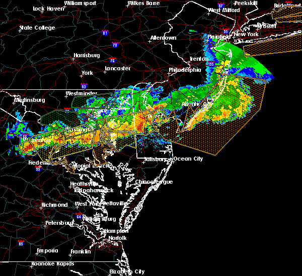 At 732 pm edt, doppler radar indicated a line of severe thunderstorms capable of producing damaging winds in excess of 60 mph. these storms were located along a line extending from queen anne to 6 miles west of tilghman island to near chesapeake beach to 6 miles southwest of dunkirk, and moving southeast at 30 mph. * severe thunderstorms will be near, university of maryland center for environmental studies around 800 pm edt. cambridge around 805 pm edt. secretary around 810 pm edt. hurlock around 820 pm edt. vienna around 825 pm edt. hebron around 835 pm edt. delmar, salisbury, fruitland, and parsonsburg around 840 pm edt. other locations impacted by these severe thunderstorms include woolford, chesapeake heights, trinity, wetipquin, madison, taylors island, nanticoke, bucktown, catchpenny and east new market. At 732 pm edt, doppler radar indicated a line of severe thunderstorms capable of producing damaging winds in excess of 60 mph. these storms were located along a line extending from queen anne to 6 miles west of tilghman island to near chesapeake beach to 6 miles southwest of dunkirk, and moving southeast at 30 mph. * severe thunderstorms will be near, university of maryland center for environmental studies around 800 pm edt. cambridge around 805 pm edt. secretary around 810 pm edt. hurlock around 820 pm edt. vienna around 825 pm edt. hebron around 835 pm edt. delmar, salisbury, fruitland, and parsonsburg around 840 pm edt. other locations impacted by these severe thunderstorms include woolford, chesapeake heights, trinity, wetipquin, madison, taylors island, nanticoke, bucktown, catchpenny and east new market.
|
| 6/18/2015 6:57 PM EDT | At 653 pm edt, doppler radar indicated a severe thunderstorm capable of producing quarter size hail and destructive winds in excess of 70 mph. this storm was located near hoopersville or 8 miles northwest of deal island, , and moving southeast at 30 mph. * this severe thunderstorm will be near, bloodsworth and deal island around 705 pm edt. smith island around 710 pm edt. marion station around 735 pm edt. other locations impacted by this severe thunderstorm include upper fairmount, dames quarter, upper hill, champ, manokin, crocheron, smith island, hopewell, elliott and waterview. |
| 6/18/2015 6:36 PM EDT | At 633 pm edt, doppler radar indicated a line of severe thunderstorms capable of producing quarter size hail and destructive winds in excess of 70 mph. these storms were located along a line extending from cattail island to near chesapeake ranch estates, and moving southeast at 40 mph. * severe thunderstorms will be near, deal island abd bloodsworth island around 700 pm edt. other locations impacted by these severe thunderstorms include honga, upper fairmount, dames quarter, oriole, mount vernon, upper hill, crocheron, manokin, champ and rumbley. |
| 6/18/2015 6:21 PM EDT | At 620 pm edt, doppler radar indicated a line of severe thunderstorms capable of producing quarter size hail and destructive winds in excess of 70 mph. these storms were located along a line extending from just east of taylors island to lusby, moving southeast at 45 mph. these severe thunderstorms will remain over mainly rural areas of dorchester county, including the following locations, church creek, woolford, taylors island, madison, bucktown, east new market, linkwood, hudson, lloyds and eldorado. |
| 6/18/2015 5:55 PM EDT | At 553 pm edt, doppler radar indicated a line of severe thunderstorms capable of producing quarter size hail and destructive winds in excess of 70 mph. these storms were located along a line extending from near tilghman island to near hallowing point, and moving southeast at 40 mph. * severe thunderstorms will be near, university of maryland center for environmental studies around 610 pm edt. cambridge around 615 pm edt. secretary around 620 pm edt. hurlock around 625 pm edt. vienna around 635 pm edt. other locations impacted by these severe thunderstorms include church creek, woolford, taylors island, madison, bucktown, east new market, linkwood, hudson, lloyds and eldorado. |
| 5/22/2014 6:00 PM EDT | Structural damage and resultant fire in dorchester county MD, 11 miles E of Elliott, MD |
| 6/28/2013 6:19 PM EDT | Storm damage reported in anz543 county MD, 6.3 miles NNE of Elliott, MD |
| 6/13/2013 5:30 PM EDT | Multiple trees down on upper hoopers island. tree into house on hoopers is r in dorchester county MD, 11 miles E of Elliott, MD |
| 6/13/2013 4:50 PM EDT | Tree across liners road in dorchester county MD, 7.4 miles SE of Elliott, MD |
| 6/13/2013 4:30 PM EDT | Multiple trees down on upper hoopers island. tree into house on hoopers is. r in dorchester county MD, 11 miles E of Elliott, MD |
| 6/13/2013 4:12 PM EDT | 52 knot gust at bishops hea in dorchester county MD, 5.2 miles NNE of Elliott, MD |
| 6/13/2013 4:12 PM EDT | 52 knot gust at bishops hea in dorchester county MD, 6.3 miles NNE of Elliott, MD |
| 6/13/2013 4:11 PM EDT | Several trees downed a large quonset hut blown 200 yard in dorchester county MD, 6.6 miles E of Elliott, MD |
| 6/13/2013 4:11 PM EDT | Several trees downed...a large quonset hut blown 200 yard in dorchester county MD, 6.6 miles E of Elliott, MD |
| 6/13/2013 4:11 PM EDT | Several trees downed...minor roff damage...a 20x20 quonset hut blown 20 yard in dorchester county MD, 6.6 miles E of Elliott, MD |
| 6/13/2013 4:09 PM EDT | Multiple trees down on upper hoopers island. tree into house on hoopers is. r in dorchester county MD, 11 miles E of Elliott, MD |
| 6/13/2013 4:03 PM EDT | Tree across liners road in dorchester county MD, 7.4 miles SE of Elliott, MD |
| 5/16/2013 6:42 PM EDT | Storm damage reported in anz543 county MD, 6.3 miles NNE of Elliott, MD |
| 7/8/2012 7:11 PM EDT | Bishop head buoy in anz543 county MD, 6.3 miles NNE of Elliott, MD |
Hail Maps for Elliott, MD


Connect with Interactive Hail Maps