

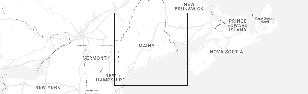
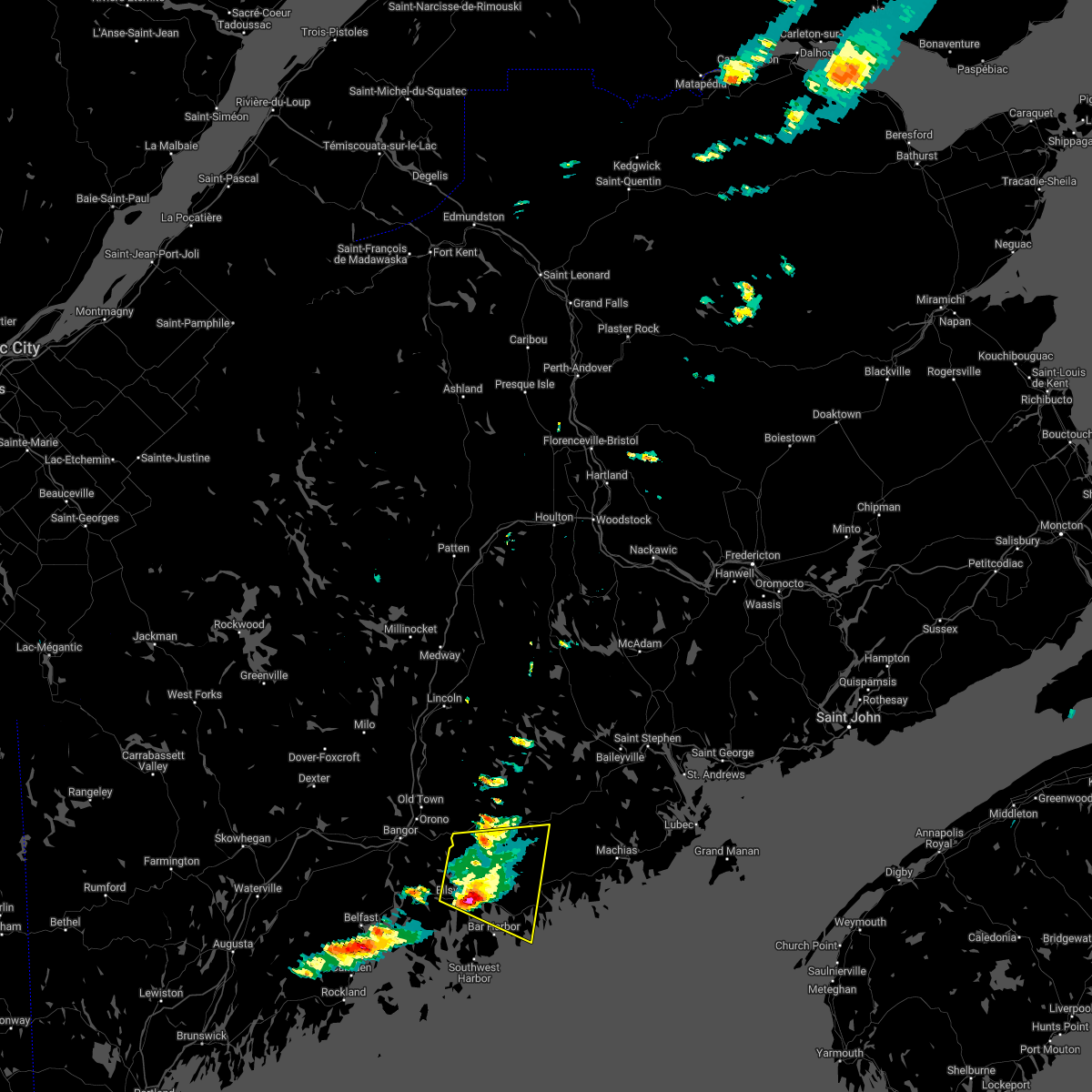
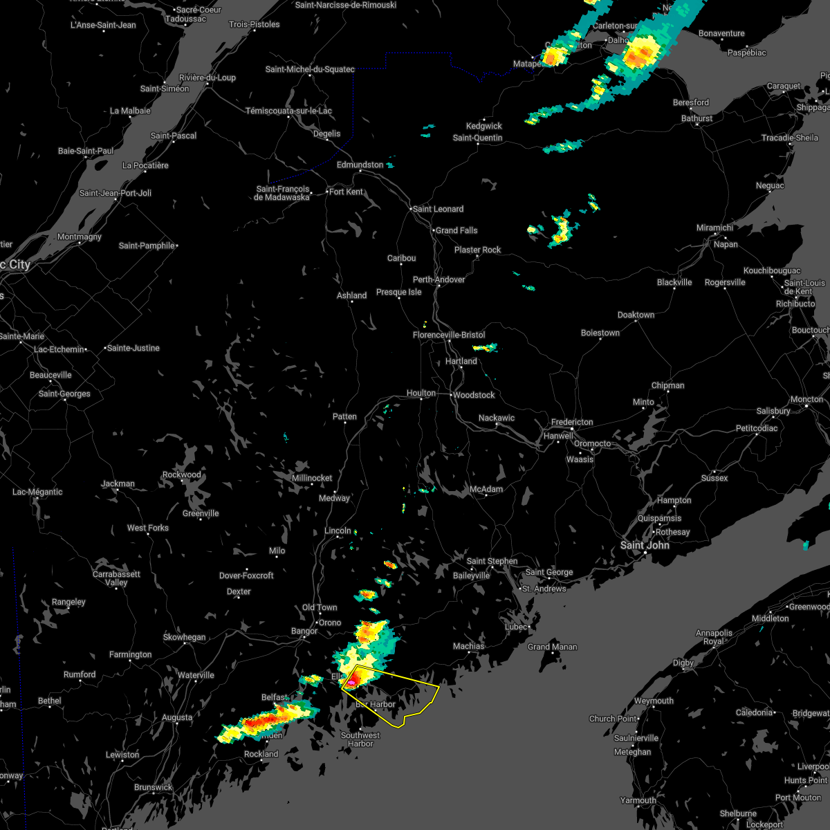
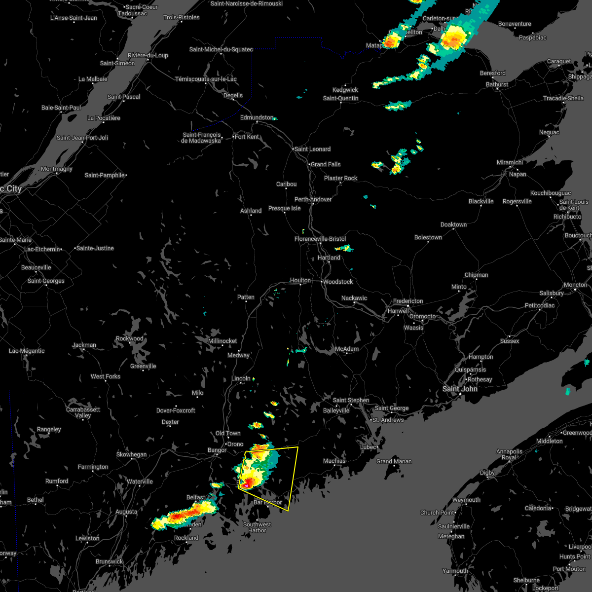
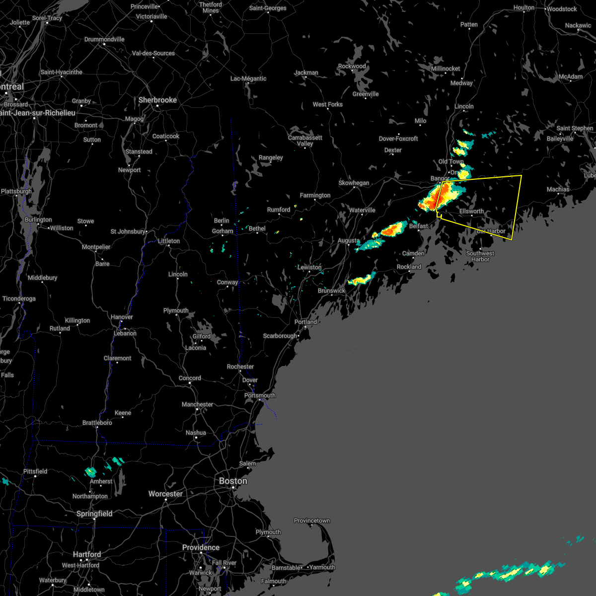
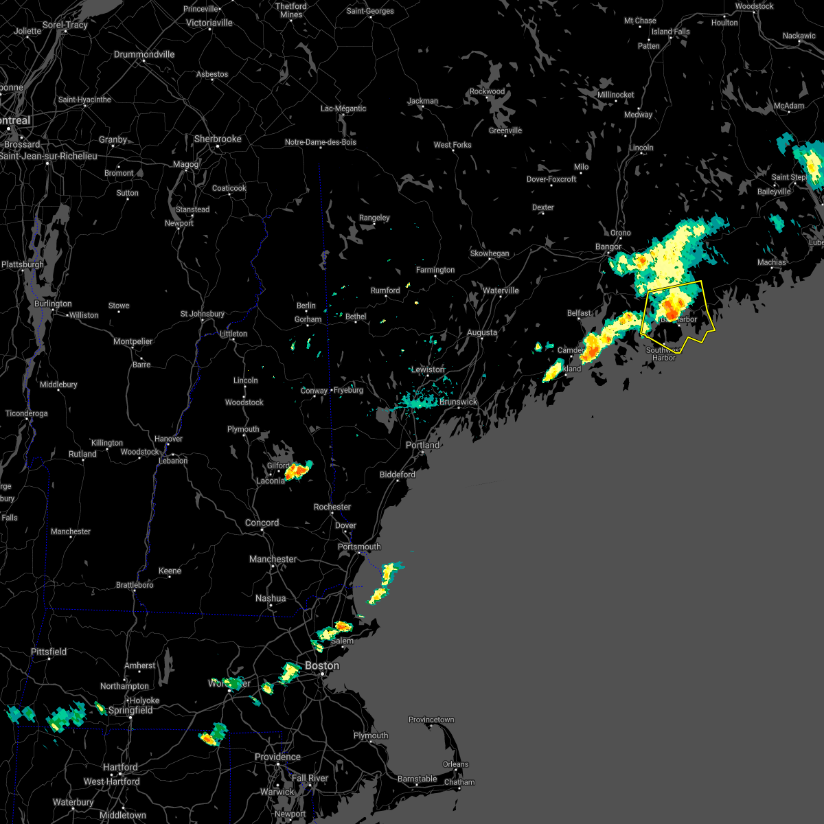
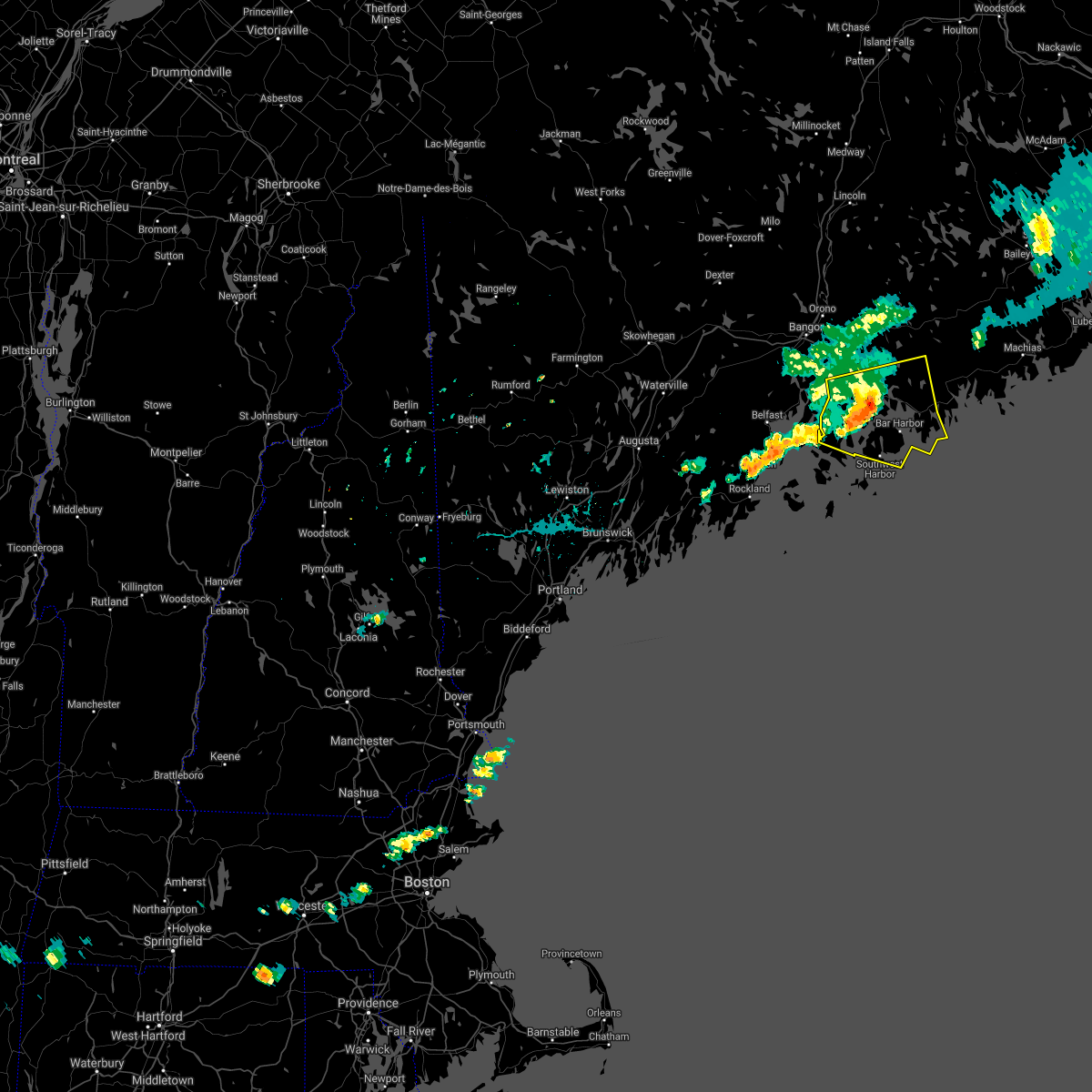
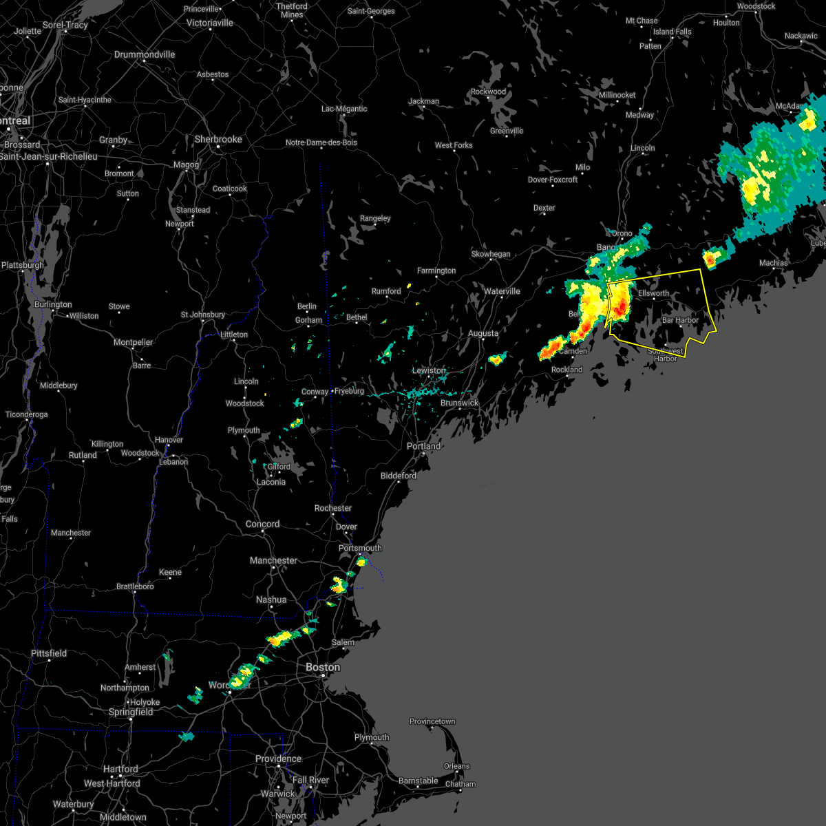
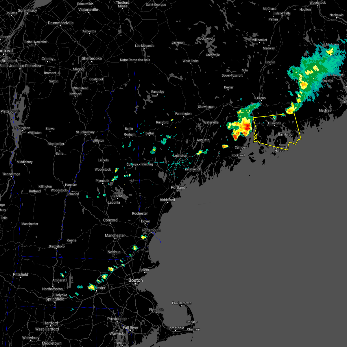
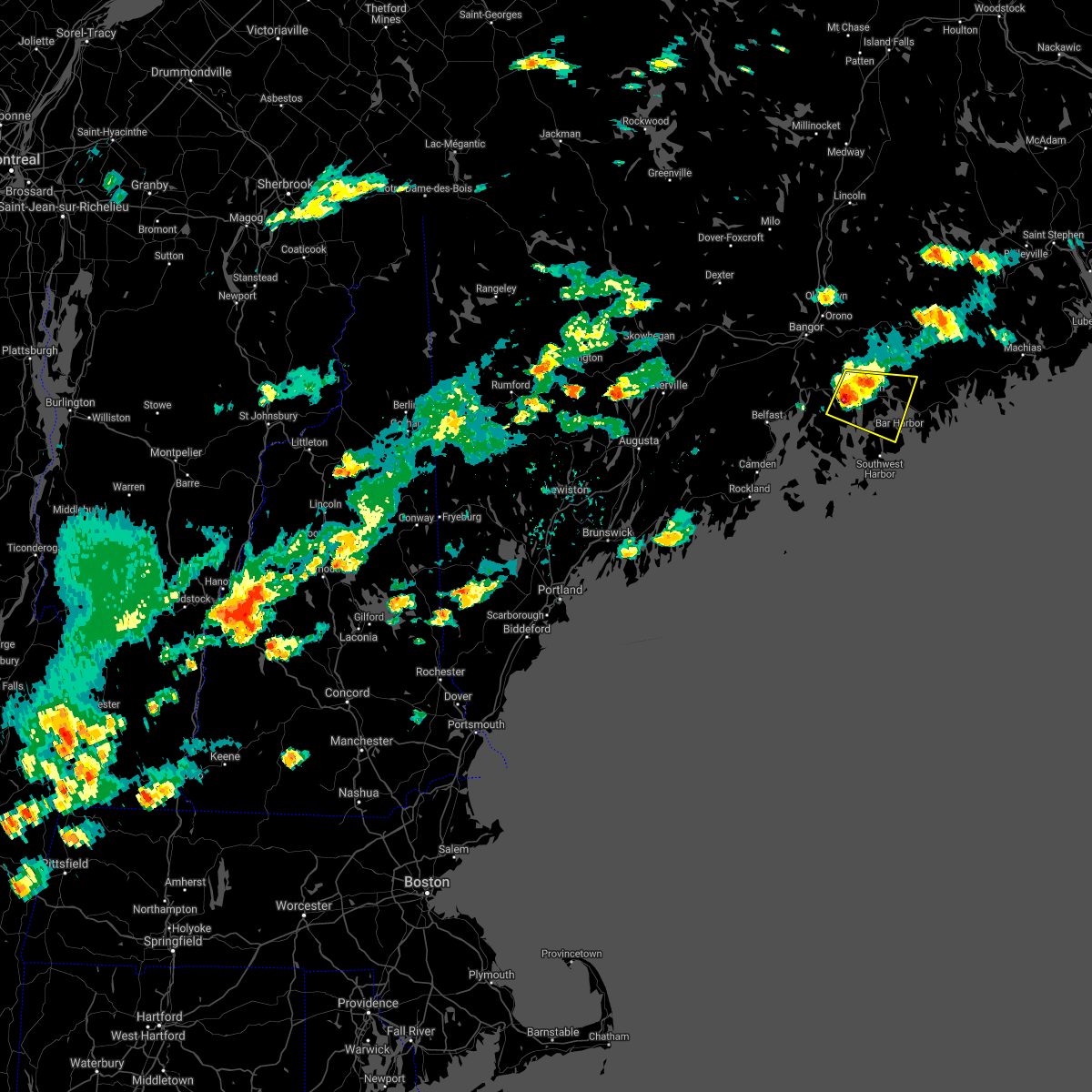
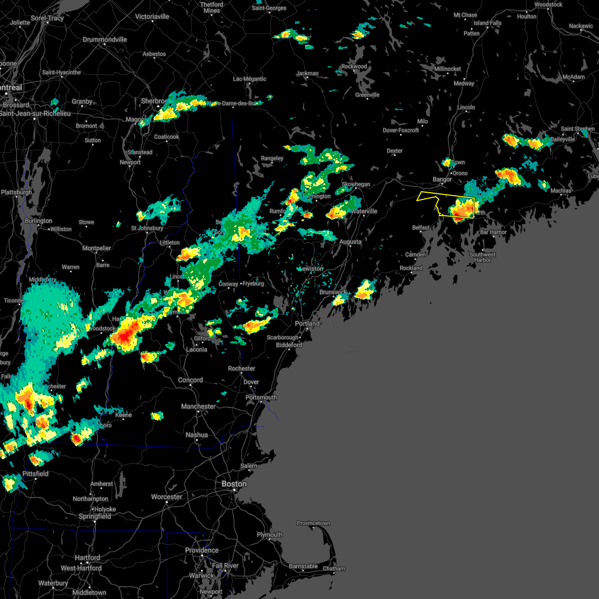
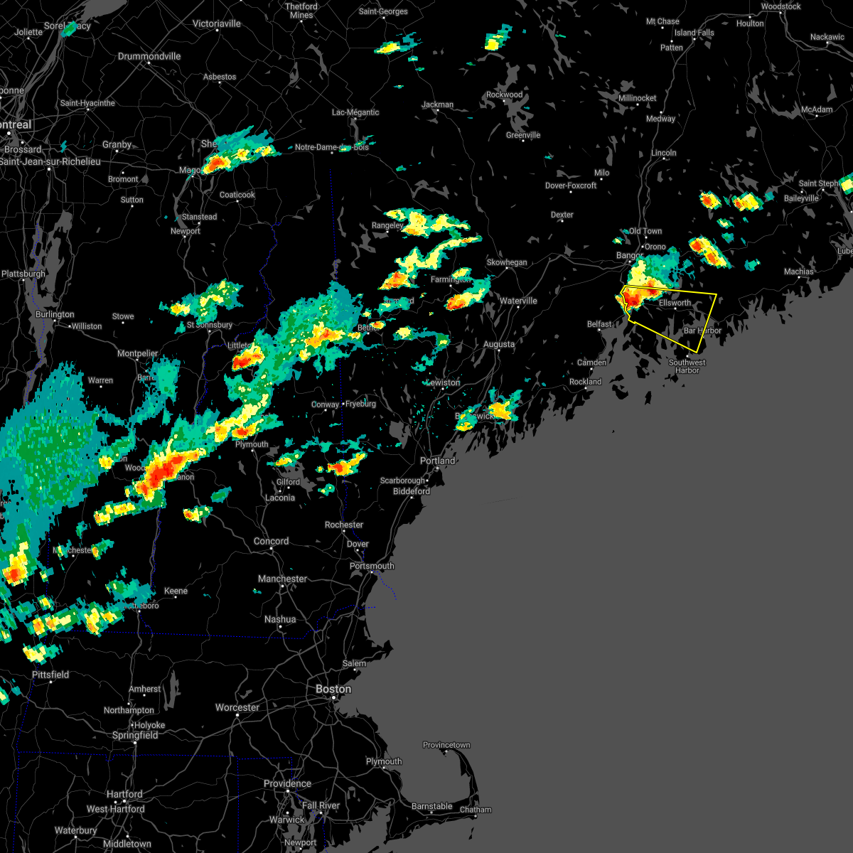
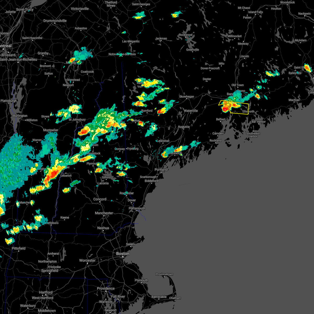
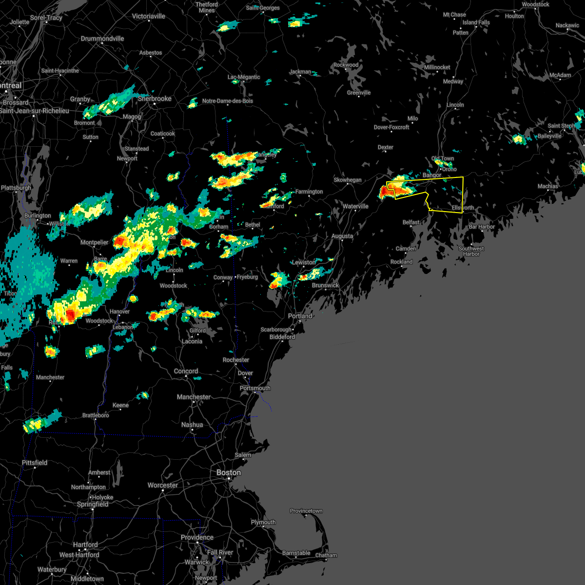
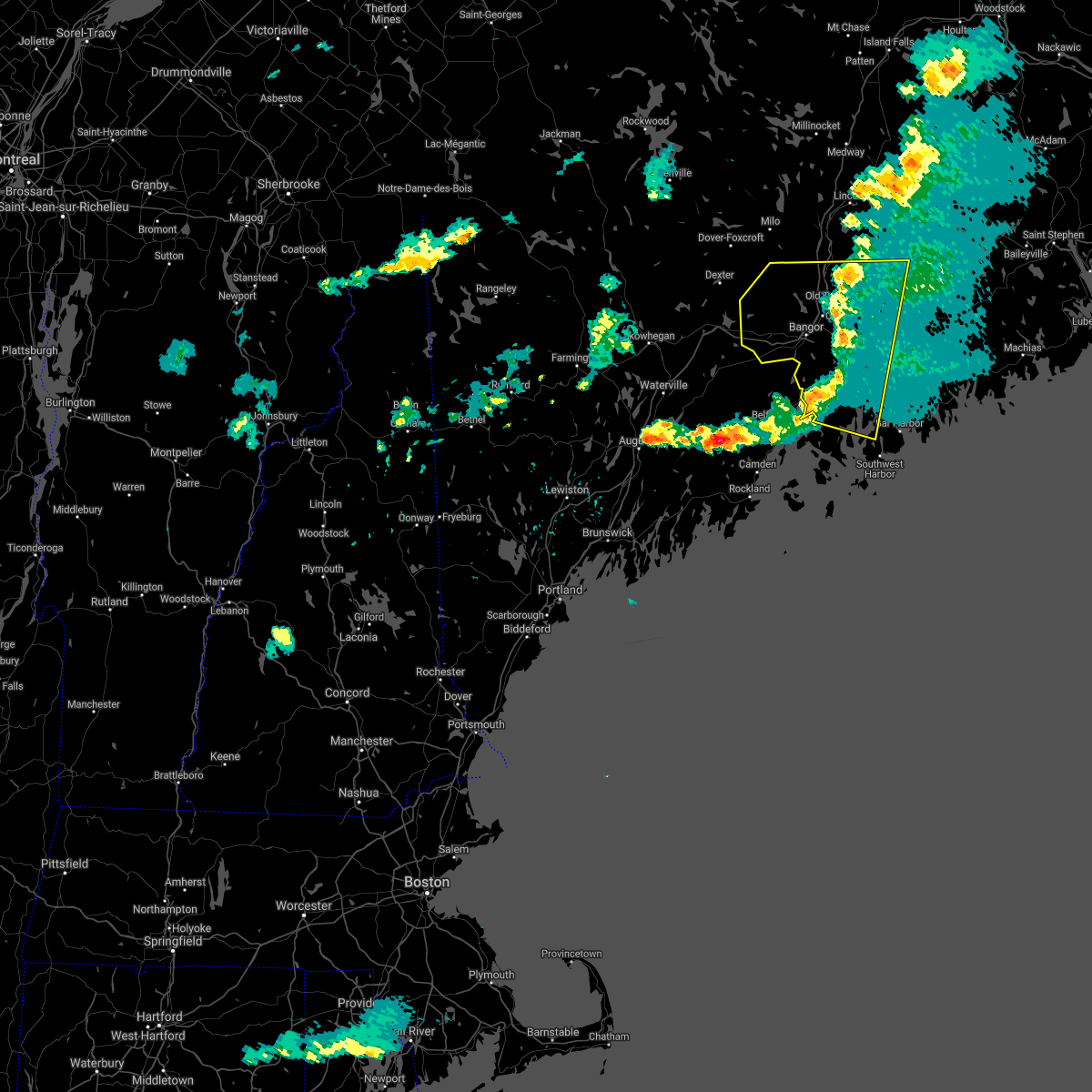
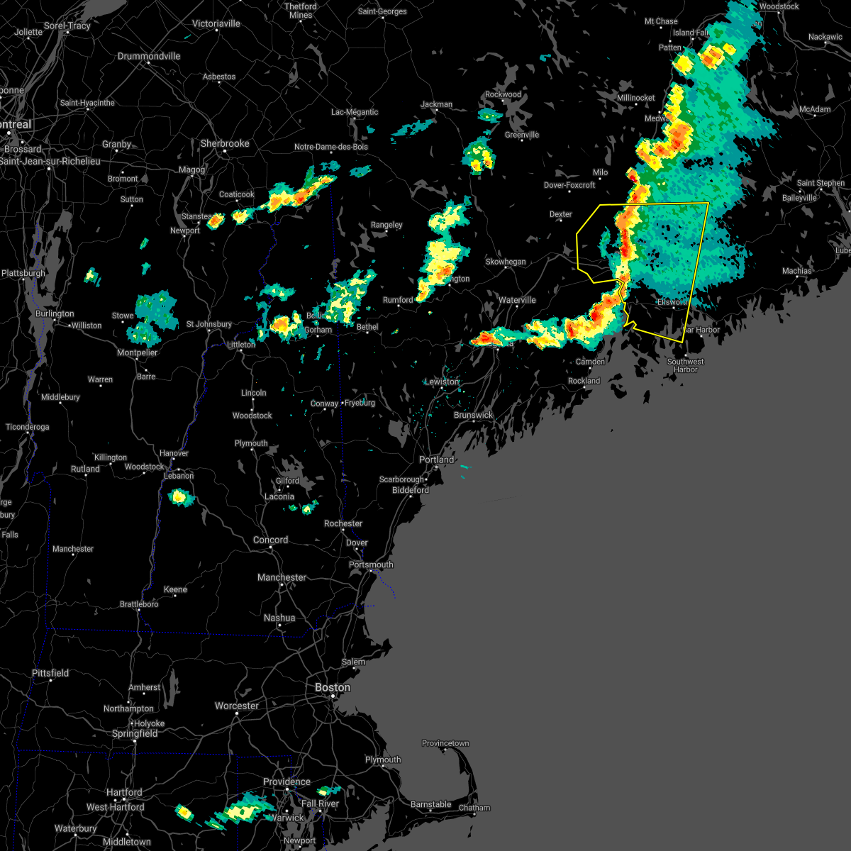
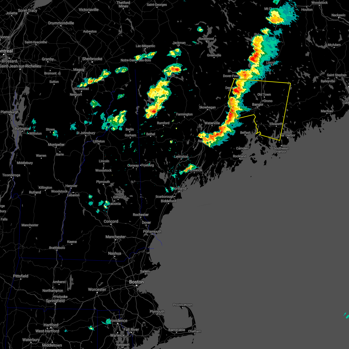
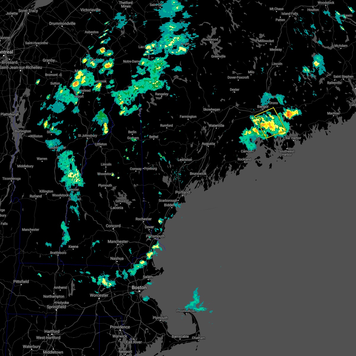
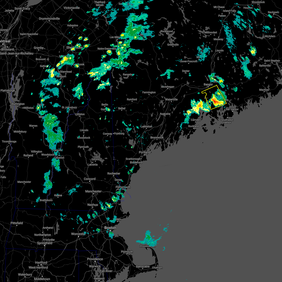
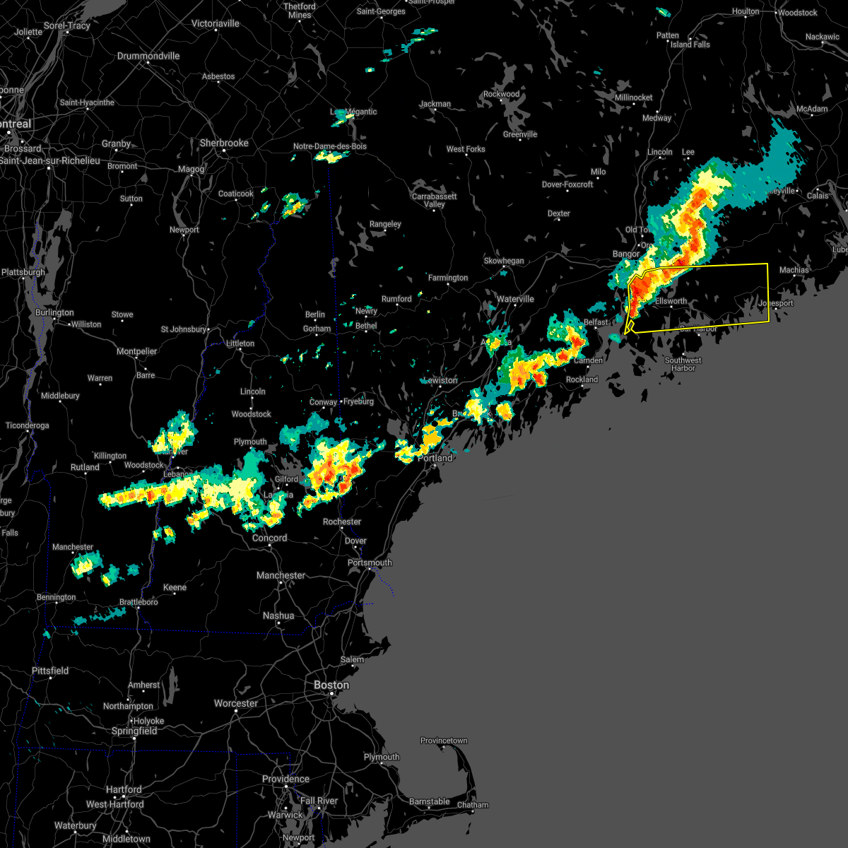
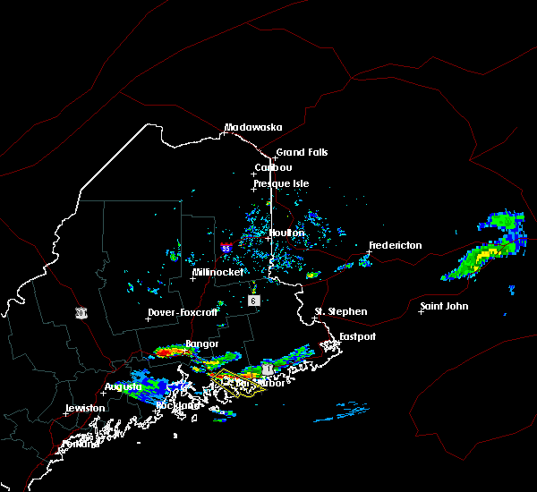
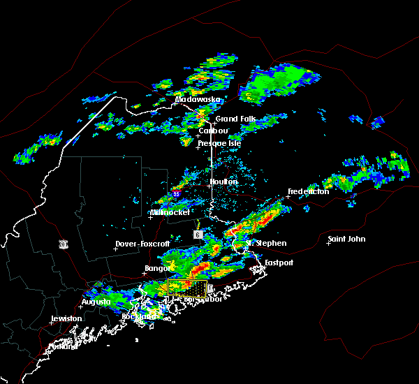
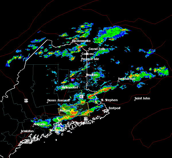
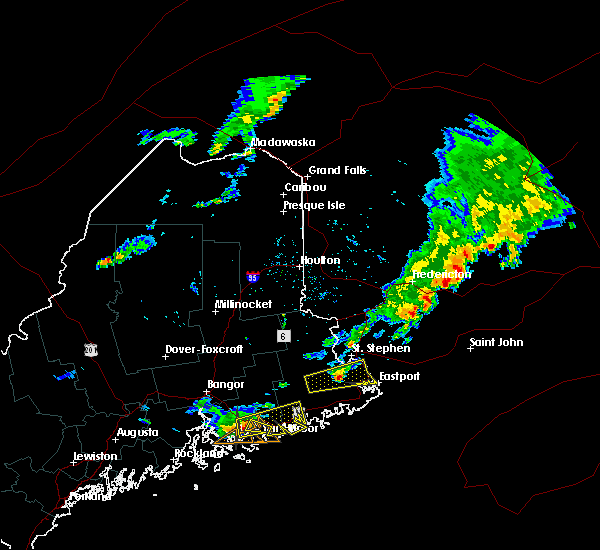
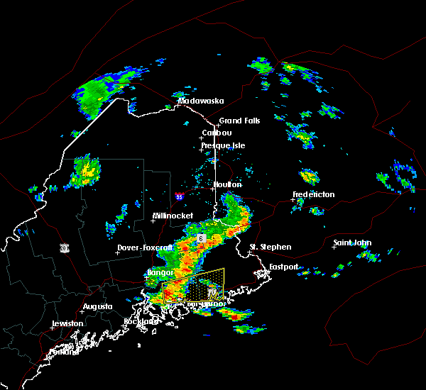
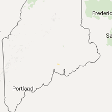
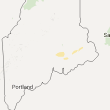
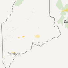
Hail Map for Ellsworth, ME
The Ellsworth, ME area has had 1 report of on-the-ground hail by trained spotters, and has been under severe weather warnings 0 times during the past 12 months. Doppler radar has detected hail at or near Ellsworth, ME on 9 occasions.
| Name: | Ellsworth, ME |
| Where Located: | 20.3 miles SE of Bangor, ME |
| Map: | Google Map for Ellsworth, ME |
| Population: | 7741 |
| Housing Units: | 4240 |
| More Info: | Search Google for Ellsworth, ME |
1
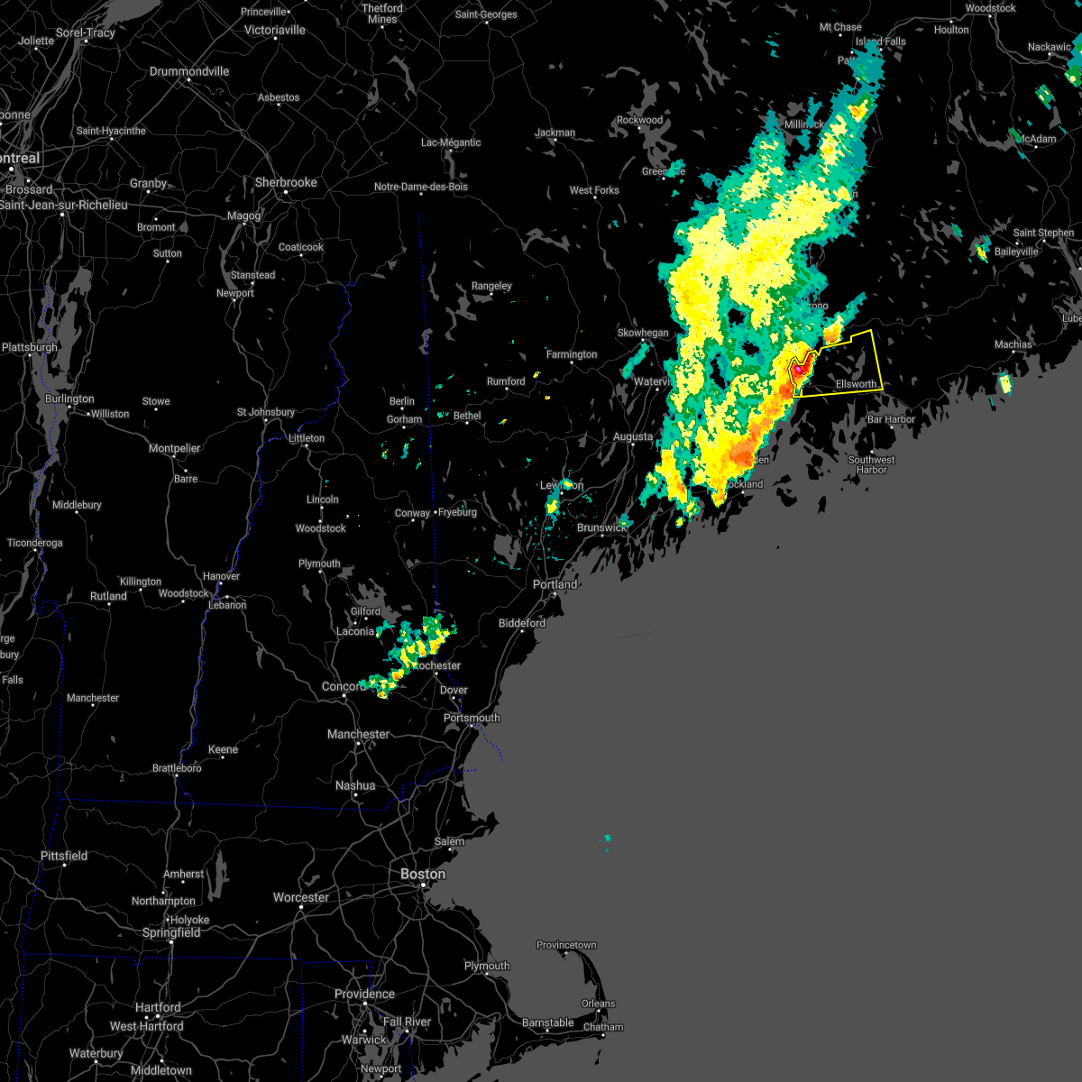
The Top Recent Hail Date for Ellsworth, ME is Saturday, July 2, 2022 (5th out of 9)
Hail and Wind Damage Spotted near Ellsworth, ME
| Date / Time | Report Details |
|---|---|
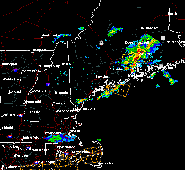
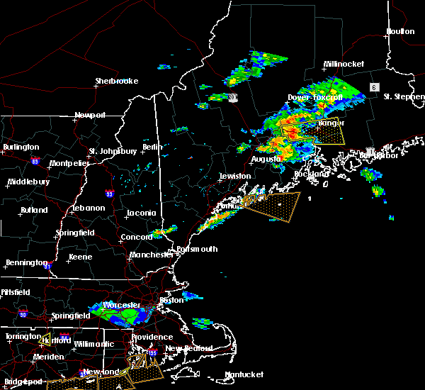
| 7/2/2022 4:27 PM EDT | Quarter sized hail reported 10.8 miles W of Ellsworth, ME, photo showing hail of at least quarter size. time estimated from radar. |
| 7/2/2022 4:27 PM EDT |
 The severe thunderstorm warning for southwestern washington and east central hancock counties will expire at 430 pm edt, the storm which prompted the warning has moved out of the area. therefore, the warning will be allowed to expire. however heavy rain is still possible with this thunderstorm. remember, a severe thunderstorm warning still remains in effect for portions of hancock and washington county. The severe thunderstorm warning for southwestern washington and east central hancock counties will expire at 430 pm edt, the storm which prompted the warning has moved out of the area. therefore, the warning will be allowed to expire. however heavy rain is still possible with this thunderstorm. remember, a severe thunderstorm warning still remains in effect for portions of hancock and washington county.
|
| 7/2/2022 4:25 PM EDT |
 At 425 pm edt, a severe thunderstorm was located 8 miles southeast of ellsworth, moving east at 30 mph (radar indicated). Hazards include 60 mph wind gusts and quarter size hail. Minor hail damage to vehicles is possible. Expect wind damage to trees and power lines. At 425 pm edt, a severe thunderstorm was located 8 miles southeast of ellsworth, moving east at 30 mph (radar indicated). Hazards include 60 mph wind gusts and quarter size hail. Minor hail damage to vehicles is possible. Expect wind damage to trees and power lines.
|
| 7/2/2022 4:20 PM EDT |
 At 419 pm edt, a severe thunderstorm was located 8 miles southwest of deblois, or 9 miles west of cherryfield, moving east at 45 mph (radar indicated). Hazards include 60 mph wind gusts and quarter size hail. Minor hail damage to vehicles is possible. expect wind damage to trees and power lines. locations impacted include, ellsworth, cherryfield, steuben, deblois, hancock, franklin, gouldsboro, trenton, surry, sullivan, clifton, otis, winter harbor, mariaville, eastbrook, waltham, sorrento, amherst, aurora and beddington. hail threat, radar indicated max hail size, 1. 00 in wind threat, radar indicated max wind gust, 60 mph. At 419 pm edt, a severe thunderstorm was located 8 miles southwest of deblois, or 9 miles west of cherryfield, moving east at 45 mph (radar indicated). Hazards include 60 mph wind gusts and quarter size hail. Minor hail damage to vehicles is possible. expect wind damage to trees and power lines. locations impacted include, ellsworth, cherryfield, steuben, deblois, hancock, franklin, gouldsboro, trenton, surry, sullivan, clifton, otis, winter harbor, mariaville, eastbrook, waltham, sorrento, amherst, aurora and beddington. hail threat, radar indicated max hail size, 1. 00 in wind threat, radar indicated max wind gust, 60 mph.
|
| 7/2/2022 3:41 PM EDT |
 At 341 pm edt, a severe thunderstorm was located over bucksport, moving east at 45 mph (radar indicated). Hazards include 60 mph wind gusts and quarter size hail. Minor hail damage to vehicles is possible. Expect wind damage to trees and power lines. At 341 pm edt, a severe thunderstorm was located over bucksport, moving east at 45 mph (radar indicated). Hazards include 60 mph wind gusts and quarter size hail. Minor hail damage to vehicles is possible. Expect wind damage to trees and power lines.
|
| 8/14/2021 3:42 PM EDT |
 The severe thunderstorm warning for central hancock county will expire at 345 pm edt, the storms which prompted the warning have weakened below severe limits. therefore, the warning will be allowed to expire. however small hail, gusty winds and heavy rain are still possible with this thunderstorm. The severe thunderstorm warning for central hancock county will expire at 345 pm edt, the storms which prompted the warning have weakened below severe limits. therefore, the warning will be allowed to expire. however small hail, gusty winds and heavy rain are still possible with this thunderstorm.
|
| 8/14/2021 3:28 PM EDT |
 At 328 pm edt, a severe thunderstorm was located 7 miles southeast of dedham, or 8 miles northwest of ellsworth, moving east at 30 mph (radar indicated). Hazards include 60 mph wind gusts and quarter size hail. Minor hail damage to vehicles is possible. expect wind damage to trees and power lines. locations impacted include, ellsworth, bucksport, dedham, franklin, orland, otis, mariaville and waltham. hail threat, radar indicated max hail size, 1. 00 in wind threat, radar indicated max wind gust, 60 mph. At 328 pm edt, a severe thunderstorm was located 7 miles southeast of dedham, or 8 miles northwest of ellsworth, moving east at 30 mph (radar indicated). Hazards include 60 mph wind gusts and quarter size hail. Minor hail damage to vehicles is possible. expect wind damage to trees and power lines. locations impacted include, ellsworth, bucksport, dedham, franklin, orland, otis, mariaville and waltham. hail threat, radar indicated max hail size, 1. 00 in wind threat, radar indicated max wind gust, 60 mph.
|
| 8/14/2021 3:07 PM EDT |
 At 307 pm edt, a severe thunderstorm was located near bucksport, moving east at 20 mph (radar indicated). Hazards include 60 mph wind gusts and quarter size hail. Minor hail damage to vehicles is possible. Expect wind damage to trees and power lines. At 307 pm edt, a severe thunderstorm was located near bucksport, moving east at 20 mph (radar indicated). Hazards include 60 mph wind gusts and quarter size hail. Minor hail damage to vehicles is possible. Expect wind damage to trees and power lines.
|
| 7/16/2021 3:18 PM EDT |
 At 317 pm edt, a severe thunderstorm was located near bar harbor, moving east at 35 mph (radar indicated). Hazards include 70 mph wind gusts and quarter size hail. Minor hail damage to vehicles is possible. expect considerable tree damage. wind damage is also likely to mobile homes, roofs, and outbuildings. Locations impacted include, ellsworth, bar harbor, steuben, hancock, franklin, gouldsboro, lamoine, trenton, surry, sullivan, winter harbor, sorrento, cranberry isles and somesville. At 317 pm edt, a severe thunderstorm was located near bar harbor, moving east at 35 mph (radar indicated). Hazards include 70 mph wind gusts and quarter size hail. Minor hail damage to vehicles is possible. expect considerable tree damage. wind damage is also likely to mobile homes, roofs, and outbuildings. Locations impacted include, ellsworth, bar harbor, steuben, hancock, franklin, gouldsboro, lamoine, trenton, surry, sullivan, winter harbor, sorrento, cranberry isles and somesville.
|
| 7/16/2021 3:01 PM EDT |
 At 300 pm edt, a severe thunderstorm was located near ellsworth, moving east at 40 mph (radar indicated). Hazards include 70 mph wind gusts and quarter size hail. Minor hail damage to vehicles is possible. expect considerable tree damage. wind damage is also likely to mobile homes, roofs, and outbuildings. Locations impacted include, ellsworth, bar harbor, blue hill, steuben, penobscot township, hancock, franklin, orland, gouldsboro, lamoine, trenton, surry, sullivan, sedgwick, brooksville, brooklin, winter harbor, mariaville, eastbrook and waltham. At 300 pm edt, a severe thunderstorm was located near ellsworth, moving east at 40 mph (radar indicated). Hazards include 70 mph wind gusts and quarter size hail. Minor hail damage to vehicles is possible. expect considerable tree damage. wind damage is also likely to mobile homes, roofs, and outbuildings. Locations impacted include, ellsworth, bar harbor, blue hill, steuben, penobscot township, hancock, franklin, orland, gouldsboro, lamoine, trenton, surry, sullivan, sedgwick, brooksville, brooklin, winter harbor, mariaville, eastbrook and waltham.
|
| 7/16/2021 2:58 PM EDT | Tree snapped and fell onto wires. small fire. time estimated by rada in hancock county ME, 4.8 miles NNW of Ellsworth, ME |
| 7/16/2021 2:40 PM EDT |
 At 240 pm edt, a severe thunderstorm was located near penobscot township, or near blue hill, moving east at 50 mph (radar indicated). Hazards include 60 mph wind gusts and quarter size hail. Minor hail damage to vehicles is possible. expect wind damage to trees and power lines. Locations impacted include, ellsworth, bar harbor, bucksport, blue hill, dedham, castine, steuben, verona island, penobscot township, hancock, franklin, orland, gouldsboro, lamoine, tremont, trenton, surry, penobscot, sullivan and sedgwick. At 240 pm edt, a severe thunderstorm was located near penobscot township, or near blue hill, moving east at 50 mph (radar indicated). Hazards include 60 mph wind gusts and quarter size hail. Minor hail damage to vehicles is possible. expect wind damage to trees and power lines. Locations impacted include, ellsworth, bar harbor, bucksport, blue hill, dedham, castine, steuben, verona island, penobscot township, hancock, franklin, orland, gouldsboro, lamoine, tremont, trenton, surry, penobscot, sullivan and sedgwick.
|
| 7/16/2021 2:23 PM EDT |
 At 223 pm edt, a severe thunderstorm was located near searsport, moving east at 50 mph (radar indicated). Hazards include 60 mph wind gusts and quarter size hail. Minor hail damage to vehicles is possible. Expect wind damage to trees and power lines. At 223 pm edt, a severe thunderstorm was located near searsport, moving east at 50 mph (radar indicated). Hazards include 60 mph wind gusts and quarter size hail. Minor hail damage to vehicles is possible. Expect wind damage to trees and power lines.
|
| 6/30/2021 4:40 PM EDT | Large tree branches snapped via social media. time estimated by rada in hancock county ME, 5.5 miles NNW of Ellsworth, ME |
| 6/30/2021 3:35 PM EDT | Ten... estimated 24 inch dia trees blown over in a straight line. 5 windows blown out of a house and damage to doo in hancock county ME, 14.1 miles W of Ellsworth, ME |
| 6/30/2021 3:30 PM EDT | Corrects previous tstm wnd dmg report from 1 se surry. large tree branches snapped via social media. time estimated by rada in hancock county ME, 5.5 miles NNW of Ellsworth, ME |
| 6/30/2021 3:28 PM EDT |
 At 327 pm edt, a severe thunderstorm was located near ellsworth, moving east at 40 mph (radar indicated). Hazards include 60 mph wind gusts and quarter size hail. Minor hail damage to vehicles is possible. expect wind damage to trees and power lines. Locations impacted include, ellsworth, blue hill, penobscot township, hancock, franklin, lamoine, trenton, surry, sullivan, mariaville, waltham and sorrento. At 327 pm edt, a severe thunderstorm was located near ellsworth, moving east at 40 mph (radar indicated). Hazards include 60 mph wind gusts and quarter size hail. Minor hail damage to vehicles is possible. expect wind damage to trees and power lines. Locations impacted include, ellsworth, blue hill, penobscot township, hancock, franklin, lamoine, trenton, surry, sullivan, mariaville, waltham and sorrento.
|
| 6/30/2021 3:21 PM EDT |
 The severe thunderstorm warning for west central hancock and south central penobscot counties will expire at 330 pm edt, the severe thunderstorm warning has been reissued for portions of hancock county. please refer to that statement for the latest information. a severe thunderstorm watch remains in effect until 700 pm edt for southeastern and east central maine. The severe thunderstorm warning for west central hancock and south central penobscot counties will expire at 330 pm edt, the severe thunderstorm warning has been reissued for portions of hancock county. please refer to that statement for the latest information. a severe thunderstorm watch remains in effect until 700 pm edt for southeastern and east central maine.
|
| 6/30/2021 3:18 PM EDT | Numerous trees down on powerlines along route 1 from orland to ellsworth. time estimated via rada in hancock county ME, 3.2 miles E of Ellsworth, ME |
| 6/30/2021 3:10 PM EDT |
 At 309 pm edt, a severe thunderstorm was located near verona island, or near bucksport, moving east at 40 mph (radar indicated). Hazards include 60 mph wind gusts and quarter size hail. Minor hail damage to vehicles is possible. Expect wind damage to trees and power lines. At 309 pm edt, a severe thunderstorm was located near verona island, or near bucksport, moving east at 40 mph (radar indicated). Hazards include 60 mph wind gusts and quarter size hail. Minor hail damage to vehicles is possible. Expect wind damage to trees and power lines.
|
| 6/30/2021 2:55 PM EDT |
 At 255 pm edt, a severe thunderstorm was located over winterport, or near bucksport, moving east at 40 mph (radar indicated). Hazards include 60 mph wind gusts and quarter size hail. Minor hail damage to vehicles is possible. expect wind damage to trees and power lines. Locations impacted include, ellsworth, bucksport, hampden, dedham, verona island, orrington, holden, orland, newburgh, surry, otis and verona. At 255 pm edt, a severe thunderstorm was located over winterport, or near bucksport, moving east at 40 mph (radar indicated). Hazards include 60 mph wind gusts and quarter size hail. Minor hail damage to vehicles is possible. expect wind damage to trees and power lines. Locations impacted include, ellsworth, bucksport, hampden, dedham, verona island, orrington, holden, orland, newburgh, surry, otis and verona.
|
| 6/30/2021 2:25 PM EDT |
 At 225 pm edt, a severe thunderstorm was located near unity, or 7 miles north of thorndike, moving east at 35 mph (radar indicated). Hazards include 60 mph wind gusts and quarter size hail. Minor hail damage to vehicles is possible. Expect wind damage to trees and power lines. At 225 pm edt, a severe thunderstorm was located near unity, or 7 miles north of thorndike, moving east at 35 mph (radar indicated). Hazards include 60 mph wind gusts and quarter size hail. Minor hail damage to vehicles is possible. Expect wind damage to trees and power lines.
|
| 6/19/2021 4:41 PM EDT |
 The severe thunderstorm warning for central hancock and southwestern penobscot counties will expire at 445 pm edt, the storm which prompted the warning has weakened below severe limits, but frequent cloud to ground lightning and heavy downpours are still likely. therefore, the warning will be allowed to expire. The severe thunderstorm warning for central hancock and southwestern penobscot counties will expire at 445 pm edt, the storm which prompted the warning has weakened below severe limits, but frequent cloud to ground lightning and heavy downpours are still likely. therefore, the warning will be allowed to expire.
|
| 6/19/2021 4:20 PM EDT |
 At 414 pm edt, an area of severe thunderstorms extended from near bradfford to near bucksport, moving southeast at 45 mph (radar indicated). Hazards include 60 mph wind gusts and quarter size hail. Minor hail damage to vehicles is possible. expect wind damage to trees and power lines. Locations impacted include, bangor, old town, ellsworth, bucksport, blue hill, orono, brewer, hampden, hermon, corinth, veazie, dedham, castine, kenduskeag, verona island, penobscot township, indian island, east corinth, grand falls and franklin. At 414 pm edt, an area of severe thunderstorms extended from near bradfford to near bucksport, moving southeast at 45 mph (radar indicated). Hazards include 60 mph wind gusts and quarter size hail. Minor hail damage to vehicles is possible. expect wind damage to trees and power lines. Locations impacted include, bangor, old town, ellsworth, bucksport, blue hill, orono, brewer, hampden, hermon, corinth, veazie, dedham, castine, kenduskeag, verona island, penobscot township, indian island, east corinth, grand falls and franklin.
|
| 6/19/2021 3:44 PM EDT |
 At 343 pm edt, a severe thunderstorm was located near newport, moving southeast at 45 mph (radar indicated). Hazards include 60 mph wind gusts and quarter size hail. Minor hail damage to vehicles is possible. Expect wind damage to trees and power lines. At 343 pm edt, a severe thunderstorm was located near newport, moving southeast at 45 mph (radar indicated). Hazards include 60 mph wind gusts and quarter size hail. Minor hail damage to vehicles is possible. Expect wind damage to trees and power lines.
|
| 5/16/2021 5:09 PM EDT |
 At 507 pm edt, a severe thunderstorm was located 7 miles northeast of penobscot township, or 8 miles east of bucksport, and is nearly stationary (public report of 1 inch hail near toddy pond). Hazards include 60 mph wind gusts and quarter size hail. Minor hail damage to vehicles is possible. expect wind damage to trees and power lines. Locations impacted include, ellsworth, bucksport, blue hill, brewer, hampden, dedham, verona island, penobscot township, orrington, holden, orland, eddington, surry, penobscot, clifton, otis and verona. At 507 pm edt, a severe thunderstorm was located 7 miles northeast of penobscot township, or 8 miles east of bucksport, and is nearly stationary (public report of 1 inch hail near toddy pond). Hazards include 60 mph wind gusts and quarter size hail. Minor hail damage to vehicles is possible. expect wind damage to trees and power lines. Locations impacted include, ellsworth, bucksport, blue hill, brewer, hampden, dedham, verona island, penobscot township, orrington, holden, orland, eddington, surry, penobscot, clifton, otis and verona.
|
| 5/16/2021 4:42 PM EDT |
 At 441 pm edt, a severe thunderstorm was located near penobscot township, or 9 miles east of bucksport, and is nearly stationary (radar indicated). Hazards include 60 mph wind gusts and quarter size hail. Minor hail damage to vehicles is possible. Expect wind damage to trees and power lines. At 441 pm edt, a severe thunderstorm was located near penobscot township, or 9 miles east of bucksport, and is nearly stationary (radar indicated). Hazards include 60 mph wind gusts and quarter size hail. Minor hail damage to vehicles is possible. Expect wind damage to trees and power lines.
|
| 8/25/2020 4:37 PM EDT |
 At 435 pm edt, a severe thunderstorm was located 8 miles southeast of machias, moving east at 50 mph (radar indicated). Hazards include 60 mph wind gusts and quarter size hail. Minor hail damage to vehicles is possible. expect wind damage to trees and power lines. Locations impacted include, ellsworth, bucksport, blue hill, cherryfield, dedham, castine, steuben, harrington, jonesboro, columbia falls, columbia, deblois, penobscot township, centerville, millbridge, hancock, franklin, orland, gouldsboro and lamoine. At 435 pm edt, a severe thunderstorm was located 8 miles southeast of machias, moving east at 50 mph (radar indicated). Hazards include 60 mph wind gusts and quarter size hail. Minor hail damage to vehicles is possible. expect wind damage to trees and power lines. Locations impacted include, ellsworth, bucksport, blue hill, cherryfield, dedham, castine, steuben, harrington, jonesboro, columbia falls, columbia, deblois, penobscot township, centerville, millbridge, hancock, franklin, orland, gouldsboro and lamoine.
|
| 8/25/2020 4:16 PM EDT | Several trees & power lines down in ellsworth. power it out in many location in hancock county ME, 5.5 miles WNW of Ellsworth, ME |
| 8/25/2020 3:59 PM EDT | Several trees & power lines down in tow in hancock county ME, 10.7 miles SSW of Ellsworth, ME |
| 8/25/2020 3:58 PM EDT |
 At 356 pm edt, a severe thunderstorm was located 7 miles south of dedham, or 9 miles east of bucksport, moving east at 50 mph (radar indicated). Hazards include 60 mph wind gusts and quarter size hail. Minor hail damage to vehicles is possible. Expect wind damage to trees and power lines. At 356 pm edt, a severe thunderstorm was located 7 miles south of dedham, or 9 miles east of bucksport, moving east at 50 mph (radar indicated). Hazards include 60 mph wind gusts and quarter size hail. Minor hail damage to vehicles is possible. Expect wind damage to trees and power lines.
|
| 7/27/2020 8:13 PM EDT |
 At 813 pm edt, a severe thunderstorm was located near dedham, or near bucksport, moving east at 25 mph (radar indicated). Hazards include 60 mph wind gusts. Expect damage to trees and power lines. Locations impacted include, ellsworth, bucksport, brewer, dedham, penobscot township, franklin, orrington, holden, orland, trenton, surry, otis, mariaville and waltham. At 813 pm edt, a severe thunderstorm was located near dedham, or near bucksport, moving east at 25 mph (radar indicated). Hazards include 60 mph wind gusts. Expect damage to trees and power lines. Locations impacted include, ellsworth, bucksport, brewer, dedham, penobscot township, franklin, orrington, holden, orland, trenton, surry, otis, mariaville and waltham.
|
| 7/27/2020 7:45 PM EDT |
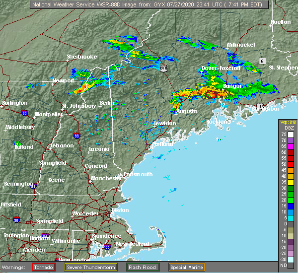 At 744 pm edt, a severe thunderstorm was located near hampden, or 9 miles southwest of bangor, moving southeast at 35 mph (radar indicated). Hazards include 60 mph wind gusts. expect damage to trees and power lines At 744 pm edt, a severe thunderstorm was located near hampden, or 9 miles southwest of bangor, moving southeast at 35 mph (radar indicated). Hazards include 60 mph wind gusts. expect damage to trees and power lines
|
| 7/17/2019 8:10 PM EDT |
 At 810 pm edt, a severe thunderstorm was located near ellsworth, moving southeast at 25 mph (radar indicated). Hazards include 60 mph wind gusts. expect damage to trees and power lines At 810 pm edt, a severe thunderstorm was located near ellsworth, moving southeast at 25 mph (radar indicated). Hazards include 60 mph wind gusts. expect damage to trees and power lines
|
| 7/6/2019 3:39 PM EDT |
 At 338 pm edt, severe thunderstorms were located along a line extending from near indian island to near newport, moving east at 40 mph (radar indicated). Hazards include 60 mph wind gusts. expect damage to trees and power lines At 338 pm edt, severe thunderstorms were located along a line extending from near indian island to near newport, moving east at 40 mph (radar indicated). Hazards include 60 mph wind gusts. expect damage to trees and power lines
|
| 8/16/2018 1:43 AM EDT |
 The severe thunderstorm warning for southern hancock county will expire at 145 am edt, the storm which prompted the warning has weakened below severe limits, but frequent cloud to ground lightning and heavy downpours are still likely. therefore, the warning will be allowed to expire. however gusty winds and heavy rain are still possible with this thunderstorm. to report severe weather, contact your nearest law enforcement agency. they will relay your report to the national weather service caribou maine. The severe thunderstorm warning for southern hancock county will expire at 145 am edt, the storm which prompted the warning has weakened below severe limits, but frequent cloud to ground lightning and heavy downpours are still likely. therefore, the warning will be allowed to expire. however gusty winds and heavy rain are still possible with this thunderstorm. to report severe weather, contact your nearest law enforcement agency. they will relay your report to the national weather service caribou maine.
|
| 8/16/2018 1:24 AM EDT |
 At 121 am edt, a severe thunderstorm was located near ellsworth, moving southeast at 30 mph (radar indicated). Hazards include 60 mph wind gusts and quarter size hail. Minor hail damage to vehicles is possible. expect wind damage to trees and power lines. Locations impacted include, ellsworth, bar harbor, bucksport, blue hill, dedham, verona island, penobscot township, hancock, orland, trenton, surry, sullivan, somesville and verona. At 121 am edt, a severe thunderstorm was located near ellsworth, moving southeast at 30 mph (radar indicated). Hazards include 60 mph wind gusts and quarter size hail. Minor hail damage to vehicles is possible. expect wind damage to trees and power lines. Locations impacted include, ellsworth, bar harbor, bucksport, blue hill, dedham, verona island, penobscot township, hancock, orland, trenton, surry, sullivan, somesville and verona.
|
| 8/16/2018 12:52 AM EDT |
 At 1251 am edt, a severe thunderstorm was located near bucksport, moving southeast at 25 mph (radar indicated). Hazards include 60 mph wind gusts and quarter size hail. Minor hail damage to vehicles is possible. Expect wind damage to trees and power lines. At 1251 am edt, a severe thunderstorm was located near bucksport, moving southeast at 25 mph (radar indicated). Hazards include 60 mph wind gusts and quarter size hail. Minor hail damage to vehicles is possible. Expect wind damage to trees and power lines.
|
| 8/9/2018 2:25 PM EDT |
 At 224 pm edt, a severe thunderstorm was located near dedham, or 12 miles southeast of bangor, moving east at 30 mph (radar indicated). Hazards include 60 mph wind gusts and quarter size hail. Minor hail damage to vehicles is possible. expect wind damage to trees and power lines. Locations impacted include, ellsworth, bucksport, blue hill, brewer, dedham, verona island, penobscot township, franklin, orrington, holden, orland, eddington, surry, clifton, otis, mariaville, waltham, amherst and verona. At 224 pm edt, a severe thunderstorm was located near dedham, or 12 miles southeast of bangor, moving east at 30 mph (radar indicated). Hazards include 60 mph wind gusts and quarter size hail. Minor hail damage to vehicles is possible. expect wind damage to trees and power lines. Locations impacted include, ellsworth, bucksport, blue hill, brewer, dedham, verona island, penobscot township, franklin, orrington, holden, orland, eddington, surry, clifton, otis, mariaville, waltham, amherst and verona.
|
| 8/9/2018 2:06 PM EDT |
 At 205 pm edt, a severe thunderstorm was located over winterport, or near bucksport, moving east at 25 mph (radar indicated). Hazards include 60 mph wind gusts and quarter size hail. Minor hail damage to vehicles is possible. Expect wind damage to trees and power lines. At 205 pm edt, a severe thunderstorm was located over winterport, or near bucksport, moving east at 25 mph (radar indicated). Hazards include 60 mph wind gusts and quarter size hail. Minor hail damage to vehicles is possible. Expect wind damage to trees and power lines.
|
| 8/7/2018 8:05 PM EDT |
 At 804 pm edt, a severe thunderstorm was located over dedham, or 9 miles southeast of bangor, moving east at 40 mph (radar indicated). Hazards include 60 mph wind gusts and quarter size hail. Minor hail damage to vehicles is possible. expect wind damage to trees and power lines. Locations impacted include, ellsworth, bucksport, brewer, dedham, orrington, holden, eddington, orland, bradley, clifton, otis, mariaville, waltham and amherst. At 804 pm edt, a severe thunderstorm was located over dedham, or 9 miles southeast of bangor, moving east at 40 mph (radar indicated). Hazards include 60 mph wind gusts and quarter size hail. Minor hail damage to vehicles is possible. expect wind damage to trees and power lines. Locations impacted include, ellsworth, bucksport, brewer, dedham, orrington, holden, eddington, orland, bradley, clifton, otis, mariaville, waltham and amherst.
|
| 8/7/2018 7:47 PM EDT |
 At 747 pm edt, a severe thunderstorm was located near hampden, or 8 miles southwest of bangor, moving east at 40 mph (radar indicated). Hazards include 60 mph wind gusts and quarter size hail. Minor hail damage to vehicles is possible. Expect wind damage to trees and power lines. At 747 pm edt, a severe thunderstorm was located near hampden, or 8 miles southwest of bangor, moving east at 40 mph (radar indicated). Hazards include 60 mph wind gusts and quarter size hail. Minor hail damage to vehicles is possible. Expect wind damage to trees and power lines.
|
| 8/6/2016 4:10 PM EDT |
 The severe thunderstorm warning for west central hancock and south central penobscot counties will expire at 415 pm edt, the severe thunderstorm which prompted the warning has weakened. moved out of the warned area. therefore, the warning will be allowed to expire. The severe thunderstorm warning for west central hancock and south central penobscot counties will expire at 415 pm edt, the severe thunderstorm which prompted the warning has weakened. moved out of the warned area. therefore, the warning will be allowed to expire.
|
| 8/6/2016 3:52 PM EDT |
 At 352 pm edt, a severe thunderstorm was located over brewer, or over bangor, moving southeast at 20 mph (radar indicated). Hazards include 60 mph wind gusts and quarter size hail. Hail damage to vehicles is expected. Expect wind damage to roofs, siding, and trees. At 352 pm edt, a severe thunderstorm was located over brewer, or over bangor, moving southeast at 20 mph (radar indicated). Hazards include 60 mph wind gusts and quarter size hail. Hail damage to vehicles is expected. Expect wind damage to roofs, siding, and trees.
|
| 7/18/2016 5:00 PM EDT |
 At 500 pm edt, a severe thunderstorm was located over bangor, moving east at 50 mph (radar indicated). Hazards include 60 mph wind gusts and quarter size hail. Hail damage to vehicles is expected. Expect wind damage to roofs, siding, and trees. At 500 pm edt, a severe thunderstorm was located over bangor, moving east at 50 mph (radar indicated). Hazards include 60 mph wind gusts and quarter size hail. Hail damage to vehicles is expected. Expect wind damage to roofs, siding, and trees.
|
| 7/18/2016 4:27 PM EDT |
 At 427 pm edt, severe thunderstorms were located along a line extending from calais to 8 miles southwest of grand lake stream to near dedham, moving east at 30 mph (radar indicated). Hazards include 60 mph wind gusts and quarter size hail. Hail damage to vehicles is expected. Expect wind damage to roofs, siding, and trees. At 427 pm edt, severe thunderstorms were located along a line extending from calais to 8 miles southwest of grand lake stream to near dedham, moving east at 30 mph (radar indicated). Hazards include 60 mph wind gusts and quarter size hail. Hail damage to vehicles is expected. Expect wind damage to roofs, siding, and trees.
|
| 2/25/2016 5:26 AM EST |
 The severe thunderstorm warning for southwestern washington, hancock, southern aroostook and southeastern penobscot counties will expire at 530 am est, the storms which prompted the warning have moved out of the warned area. therefore the warning will be allowed to expire. The severe thunderstorm warning for southwestern washington, hancock, southern aroostook and southeastern penobscot counties will expire at 530 am est, the storms which prompted the warning have moved out of the warned area. therefore the warning will be allowed to expire.
|
| 2/25/2016 4:37 AM EST |
 At 436 am est, severe thunderstorms were located along a line extending from 6 miles north of lincoln to near bar harbor, moving east at 30 mph (radar indicated). Hazards include 60 mph wind gusts. Expect damage to roofs. siding and trees. locations impacted include, lincoln, ellsworth, howland, cherryfield, steuben, columbia, springfield, lakeville, deblois, millbridge, grand falls, licoln township, reed plantation, hancock, franklin, milford, gouldsboro, enfield, lamoine and tremont. This includes interstate 95 between mile markers 222 and 236. At 436 am est, severe thunderstorms were located along a line extending from 6 miles north of lincoln to near bar harbor, moving east at 30 mph (radar indicated). Hazards include 60 mph wind gusts. Expect damage to roofs. siding and trees. locations impacted include, lincoln, ellsworth, howland, cherryfield, steuben, columbia, springfield, lakeville, deblois, millbridge, grand falls, licoln township, reed plantation, hancock, franklin, milford, gouldsboro, enfield, lamoine and tremont. This includes interstate 95 between mile markers 222 and 236.
|
| 2/25/2016 4:03 AM EST |
 At 402 am est, severe thunderstorms were located along a line extending from near milo to near stonington, moving northeast at 45 mph (radar indicated). Hazards include 60 mph wind gusts. Expect damage to roofs. Siding and trees. At 402 am est, severe thunderstorms were located along a line extending from near milo to near stonington, moving northeast at 45 mph (radar indicated). Hazards include 60 mph wind gusts. Expect damage to roofs. Siding and trees.
|
| 8/5/2015 5:41 PM EDT |
 The severe thunderstorm warning for east central hancock and southwestern washington counties will expire at 545 pm edt, the severe thunderstorm which prompted the warning has weakened. therefore the warning will be allowed to expire. The severe thunderstorm warning for east central hancock and southwestern washington counties will expire at 545 pm edt, the severe thunderstorm which prompted the warning has weakened. therefore the warning will be allowed to expire.
|
| 8/5/2015 5:22 PM EDT |
 At 522 pm edt, a severe thunderstorm was located near deblois, or near cherryfield (radar indicated). Hazards include 60 mph wind gusts and quarter size hail. Hail damage to vehicles is expected. expect wind damage to roofs, siding and trees. Locations impacted include, ellsworth, cherryfield, steuben, columbia, deblois, millbridge, hancock, franklin, sullivan, otis, mariaville, eastbrook and waltham. At 522 pm edt, a severe thunderstorm was located near deblois, or near cherryfield (radar indicated). Hazards include 60 mph wind gusts and quarter size hail. Hail damage to vehicles is expected. expect wind damage to roofs, siding and trees. Locations impacted include, ellsworth, cherryfield, steuben, columbia, deblois, millbridge, hancock, franklin, sullivan, otis, mariaville, eastbrook and waltham.
|
| 8/5/2015 5:01 PM EDT |
 At 459 pm edt, a severe thunderstorm was located 11 miles northeast of ellsworth, moving east at 30 mph (radar indicated). Hazards include 60 mph wind gusts and quarter size hail. Hail damage to vehicles is expected. Expect wind damage to roofs, siding and trees. At 459 pm edt, a severe thunderstorm was located 11 miles northeast of ellsworth, moving east at 30 mph (radar indicated). Hazards include 60 mph wind gusts and quarter size hail. Hail damage to vehicles is expected. Expect wind damage to roofs, siding and trees.
|
| 8/1/2015 5:47 PM EDT |
 At 547 pm edt, a severe thunderstorm was located 7 miles northeast of bar harbor, moving east at 40 mph (radar indicated). Hazards include 60 mph wind gusts and quarter size hail. Hail damage to vehicles is expected. expect wind damage to roofs, siding and trees. Locations impacted include, ellsworth, cherryfield, steuben, harrington, columbia, millbridge, hancock, franklin, gouldsboro, trenton, surry, sullivan and winter harbor. At 547 pm edt, a severe thunderstorm was located 7 miles northeast of bar harbor, moving east at 40 mph (radar indicated). Hazards include 60 mph wind gusts and quarter size hail. Hail damage to vehicles is expected. expect wind damage to roofs, siding and trees. Locations impacted include, ellsworth, cherryfield, steuben, harrington, columbia, millbridge, hancock, franklin, gouldsboro, trenton, surry, sullivan and winter harbor.
|
| 8/1/2015 5:16 PM EDT |
 At 516 pm edt, a severe thunderstorm was located over blue hill, moving east at 40 mph (radar indicated). Hazards include 60 mph wind gusts and quarter size hail. Hail damage to vehicles is expected. Expect wind damage to roofs, siding and trees. At 516 pm edt, a severe thunderstorm was located over blue hill, moving east at 40 mph (radar indicated). Hazards include 60 mph wind gusts and quarter size hail. Hail damage to vehicles is expected. Expect wind damage to roofs, siding and trees.
|
| 6/23/2015 9:51 PM EDT |
 At 949 pm edt, a severe thunderstorm was located 7 miles northeast of ellsworth, moving east at 50 mph (radar indicated). Hazards include 60 mph wind gusts and nickel size hail. possible damage to siding and trees At 949 pm edt, a severe thunderstorm was located 7 miles northeast of ellsworth, moving east at 50 mph (radar indicated). Hazards include 60 mph wind gusts and nickel size hail. possible damage to siding and trees
|
| 6/23/2015 9:15 PM EDT |
 At 913 pm edt, a severe thunderstorm was located 7 miles southeast of orono, or 9 miles southeast of old town, moving east at 35 mph (radar indicated). Hazards include 60 mph wind gusts. Damage is possible to siding and trees. Locations impacted include, bangor, old town, ellsworth, bucksport, orono, brewer, hampden, hermon, veazie, dedham, kenduskeag, indian island, glenburn, orrington, holden, milford, levant, eddington, orland and bradley. At 913 pm edt, a severe thunderstorm was located 7 miles southeast of orono, or 9 miles southeast of old town, moving east at 35 mph (radar indicated). Hazards include 60 mph wind gusts. Damage is possible to siding and trees. Locations impacted include, bangor, old town, ellsworth, bucksport, orono, brewer, hampden, hermon, veazie, dedham, kenduskeag, indian island, glenburn, orrington, holden, milford, levant, eddington, orland and bradley.
|
| 6/23/2015 8:47 PM EDT |
 At 846 pm edt, a severe thunderstorm was located 7 miles southwest of hermon, or 12 miles southeast of newport, moving east at 35 mph (radar indicated). Hazards include 60 mph wind gusts. radar indicated some weak rotation with this storm. Damage to roofs. Siding and trees is possible. At 846 pm edt, a severe thunderstorm was located 7 miles southwest of hermon, or 12 miles southeast of newport, moving east at 35 mph (radar indicated). Hazards include 60 mph wind gusts. radar indicated some weak rotation with this storm. Damage to roofs. Siding and trees is possible.
|
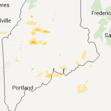
Hail Maps for Ellsworth, ME


Connect with Interactive Hail Maps