

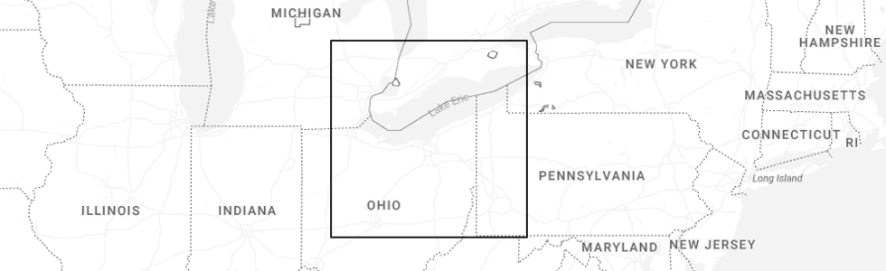
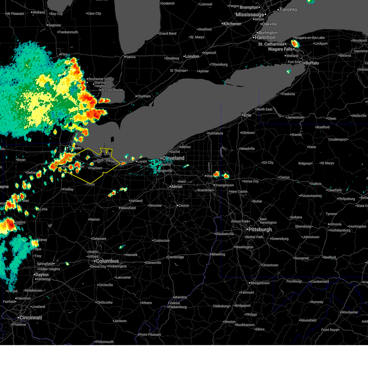
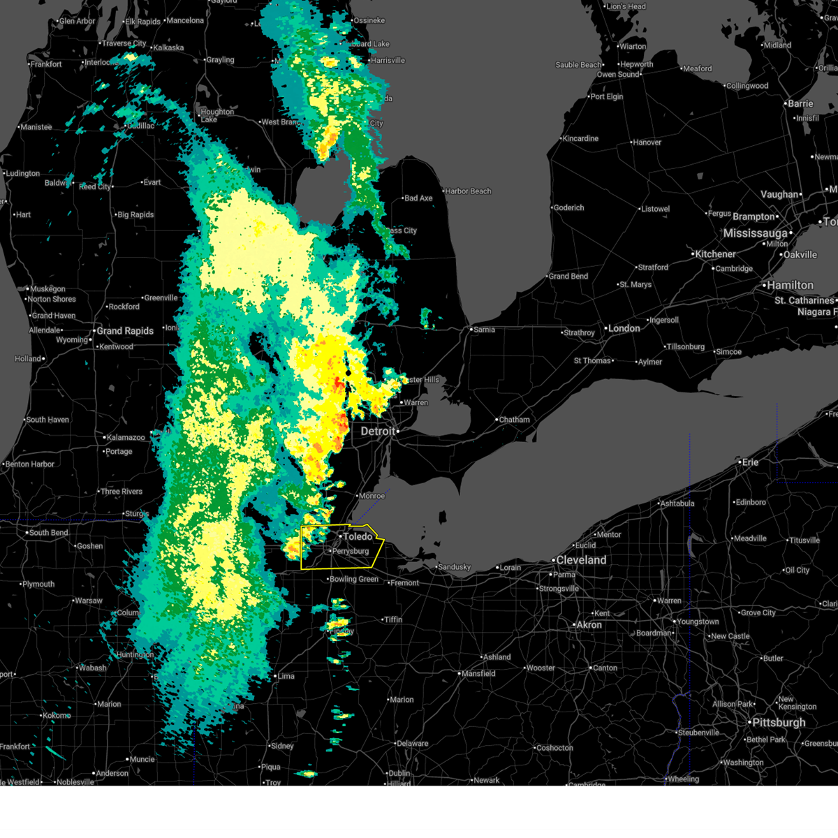
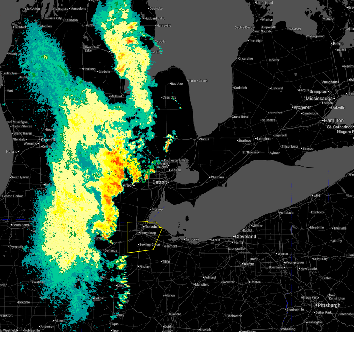
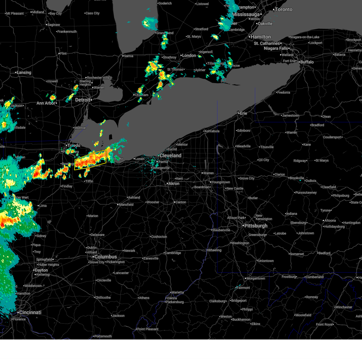
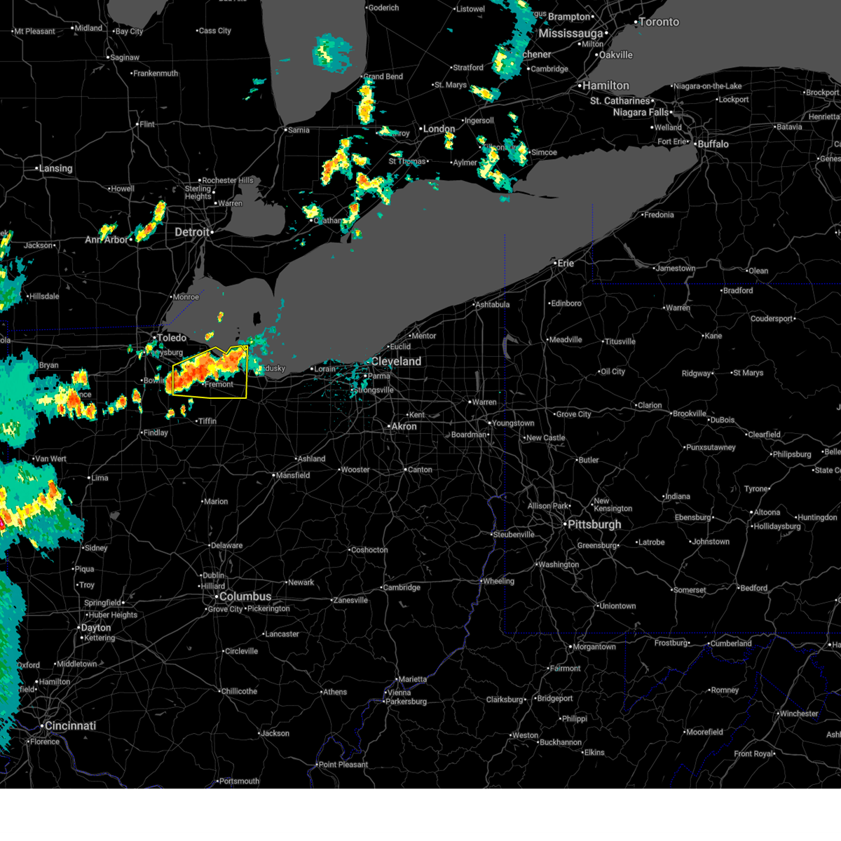
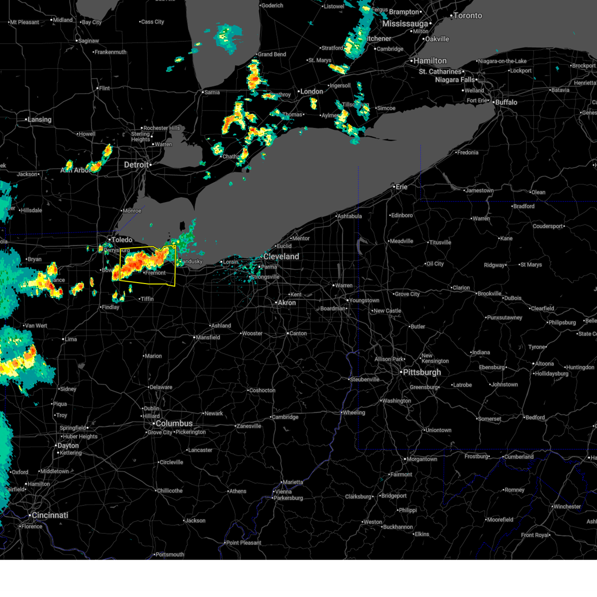
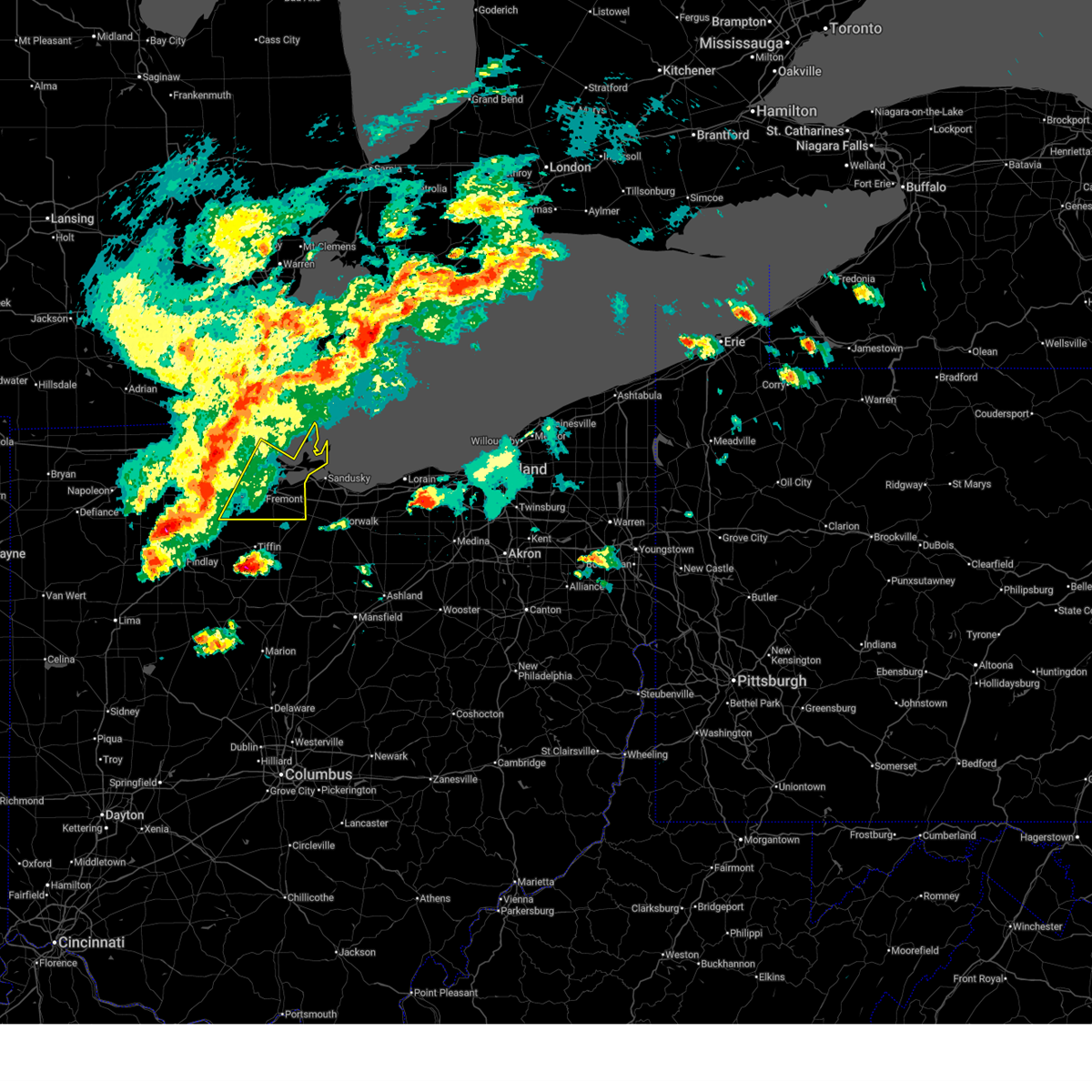
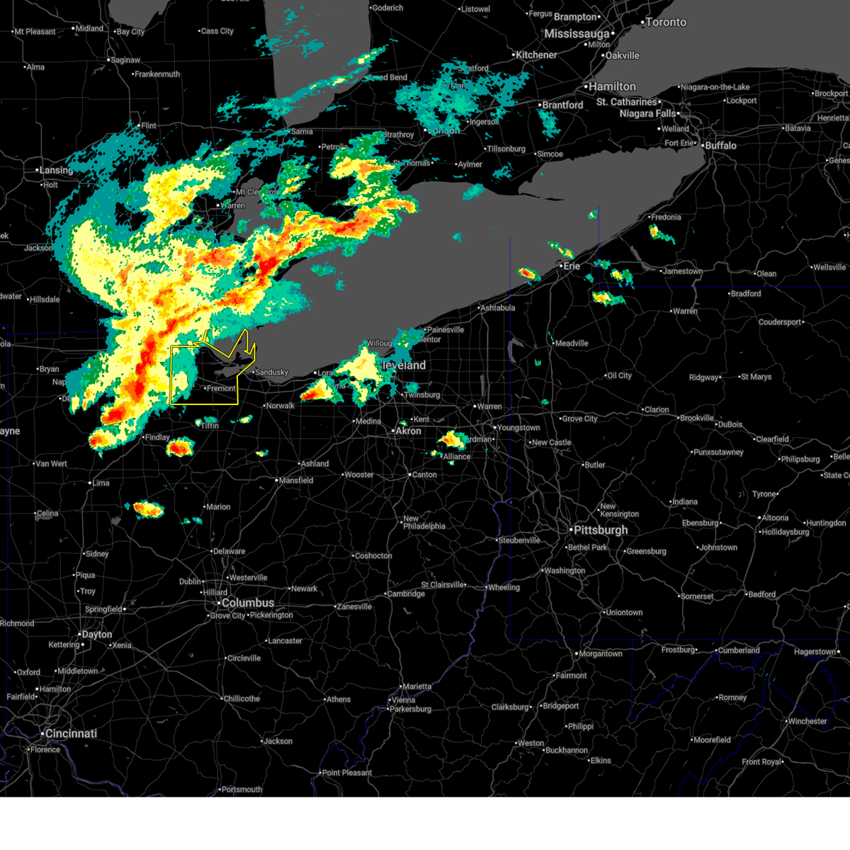
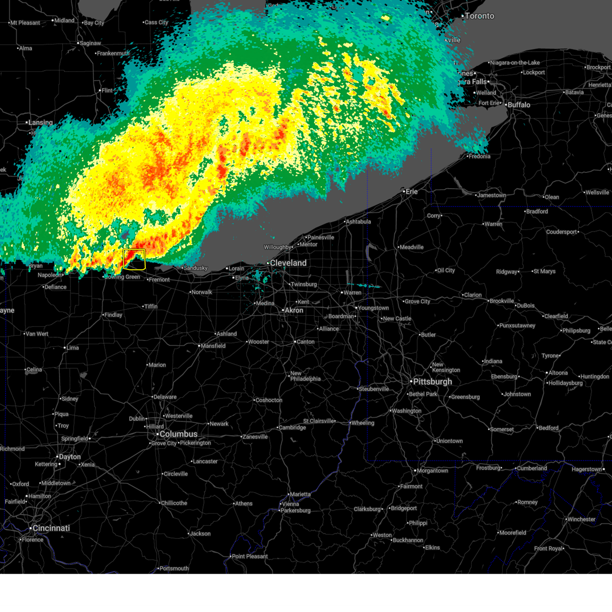
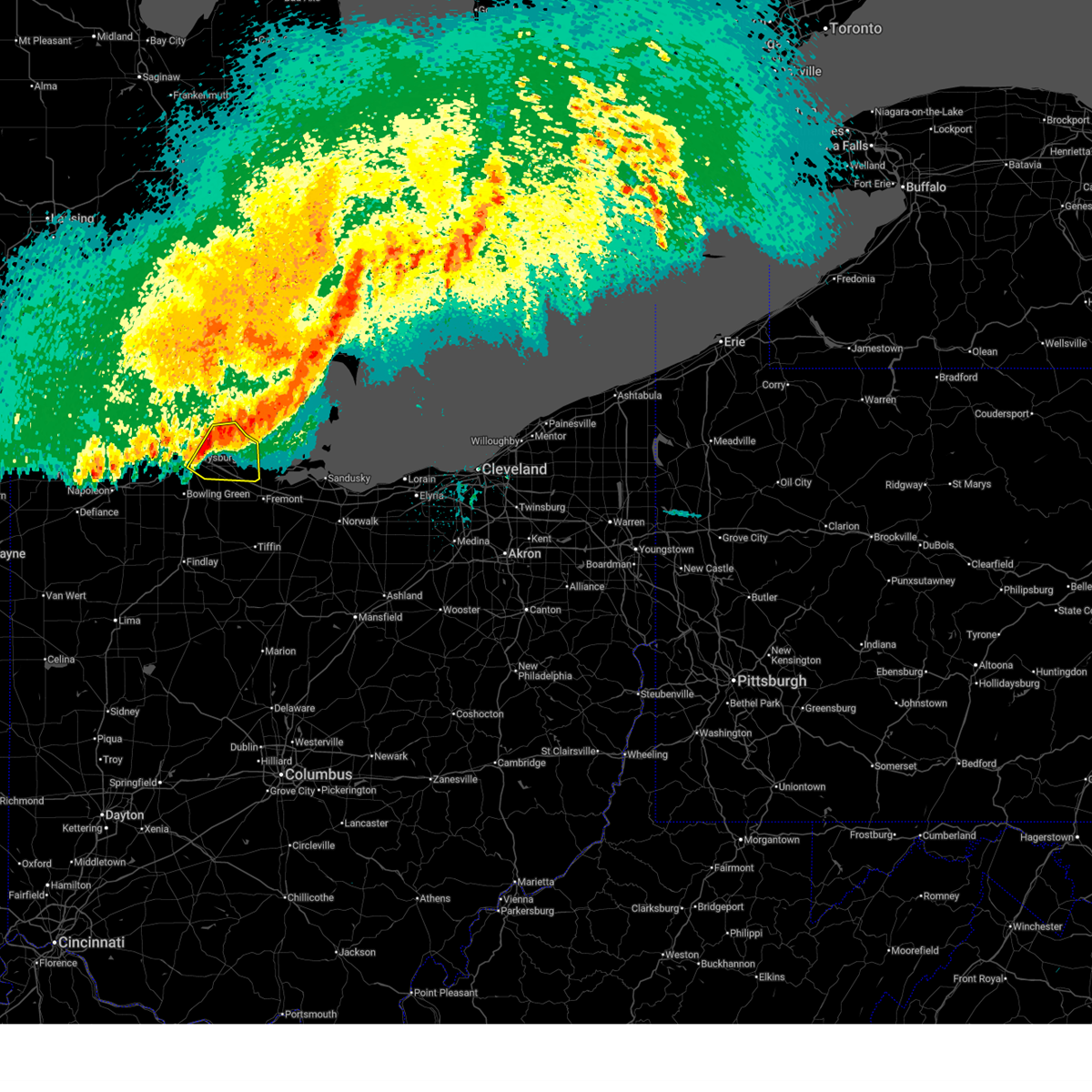
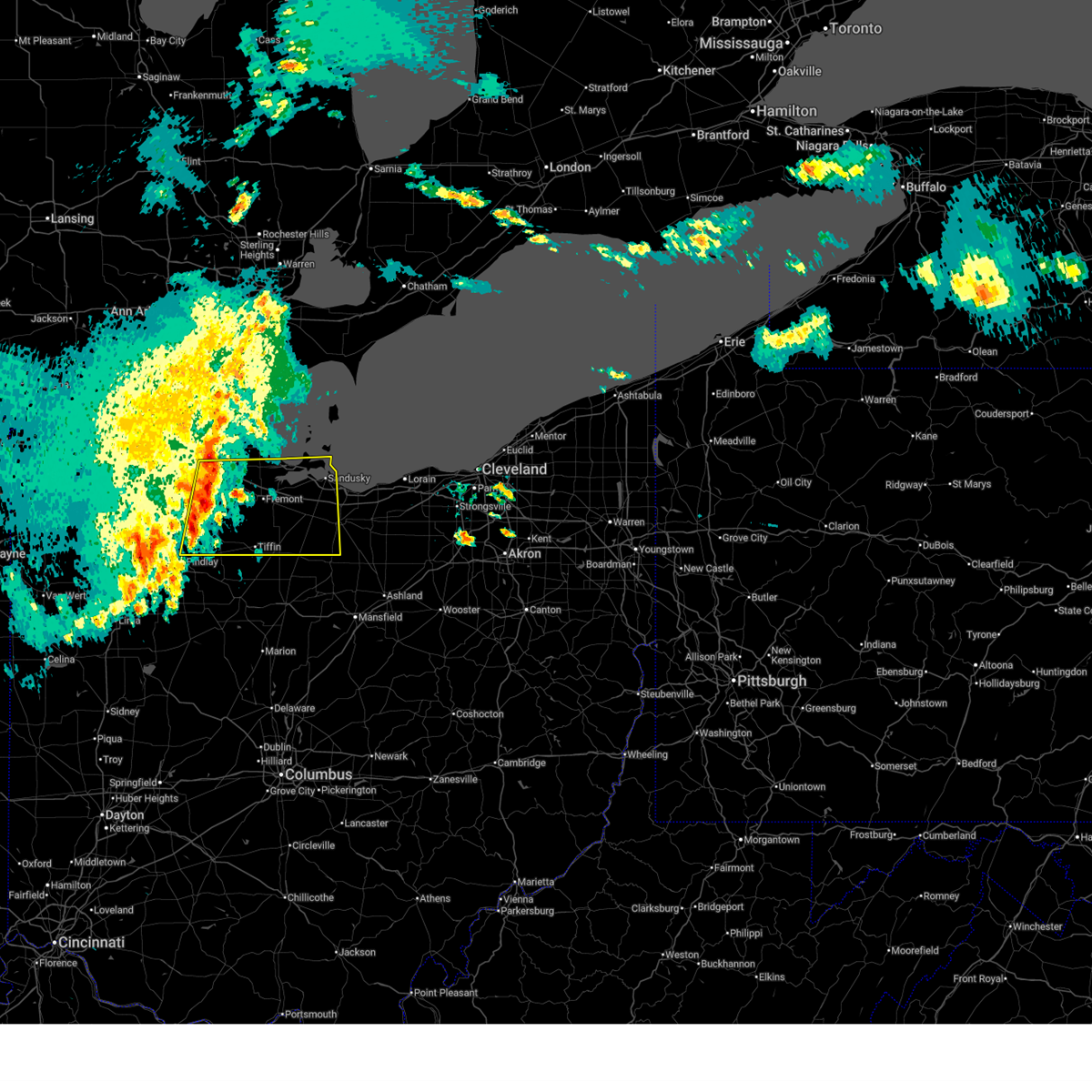
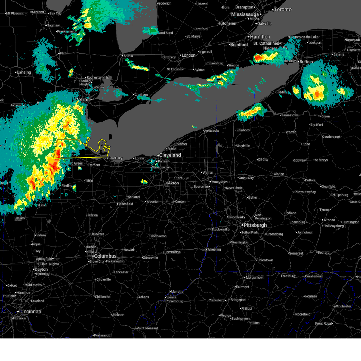
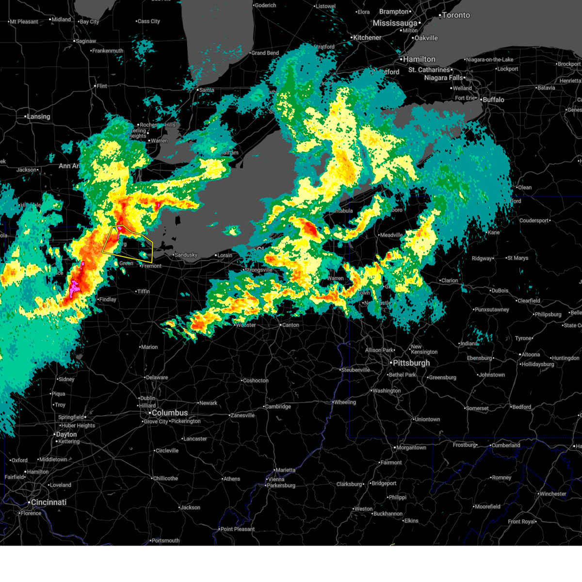
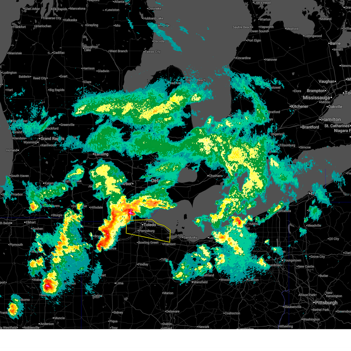
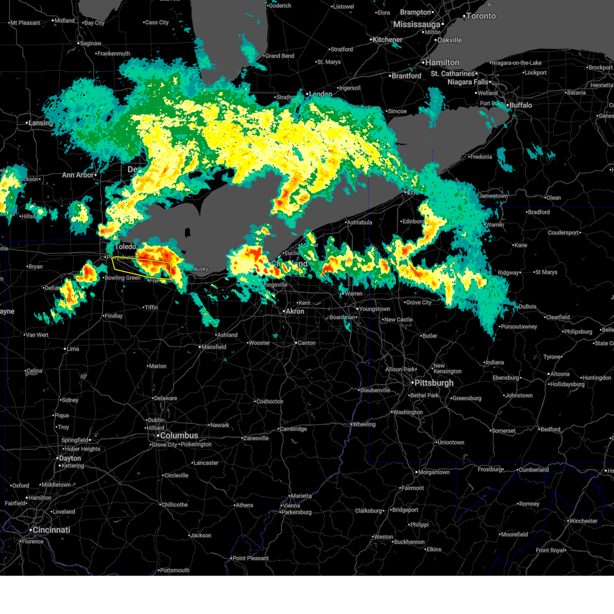
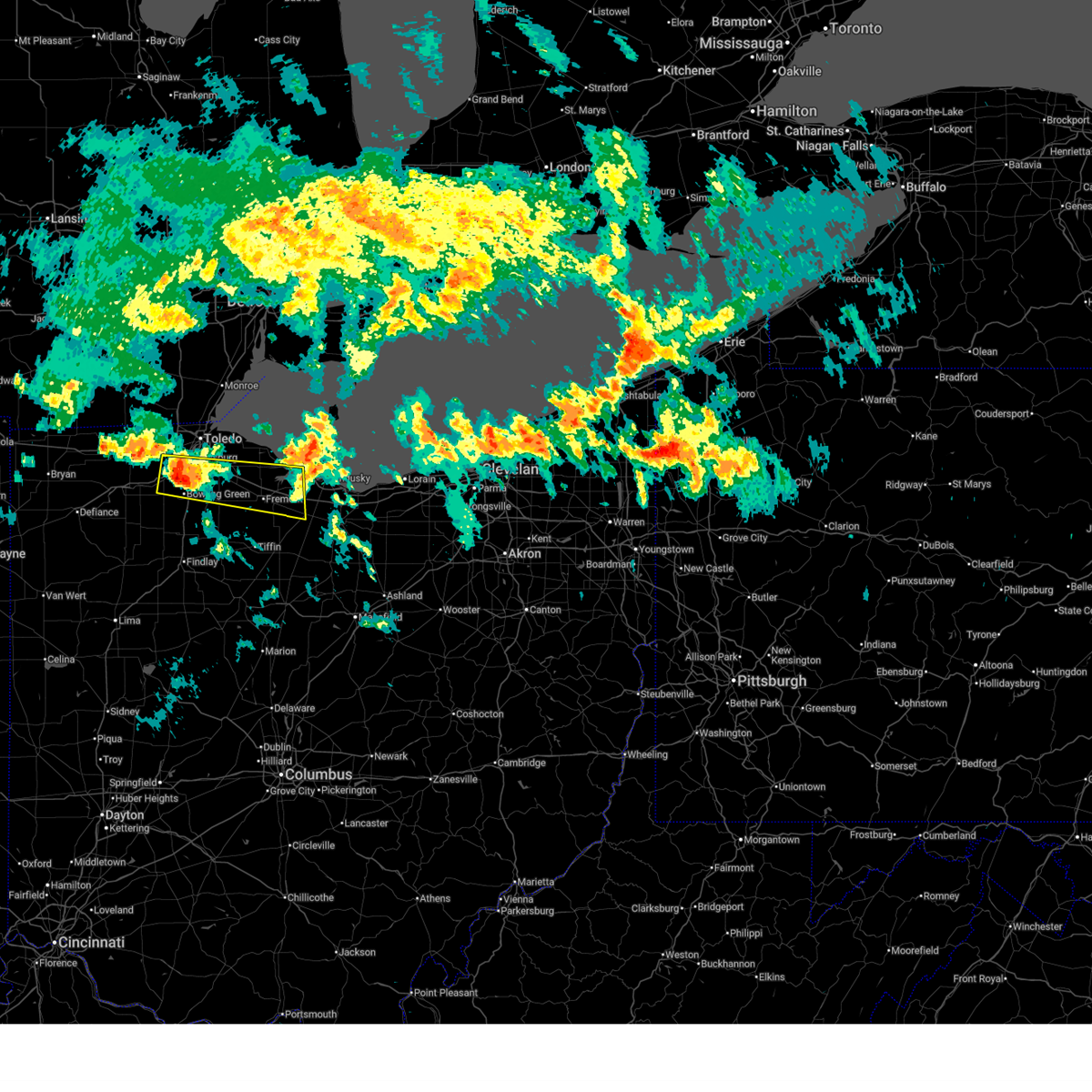
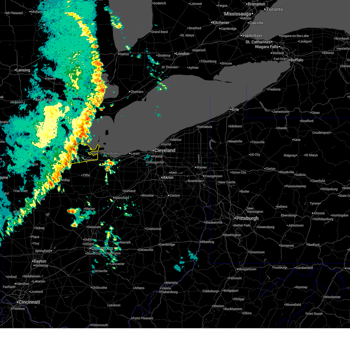
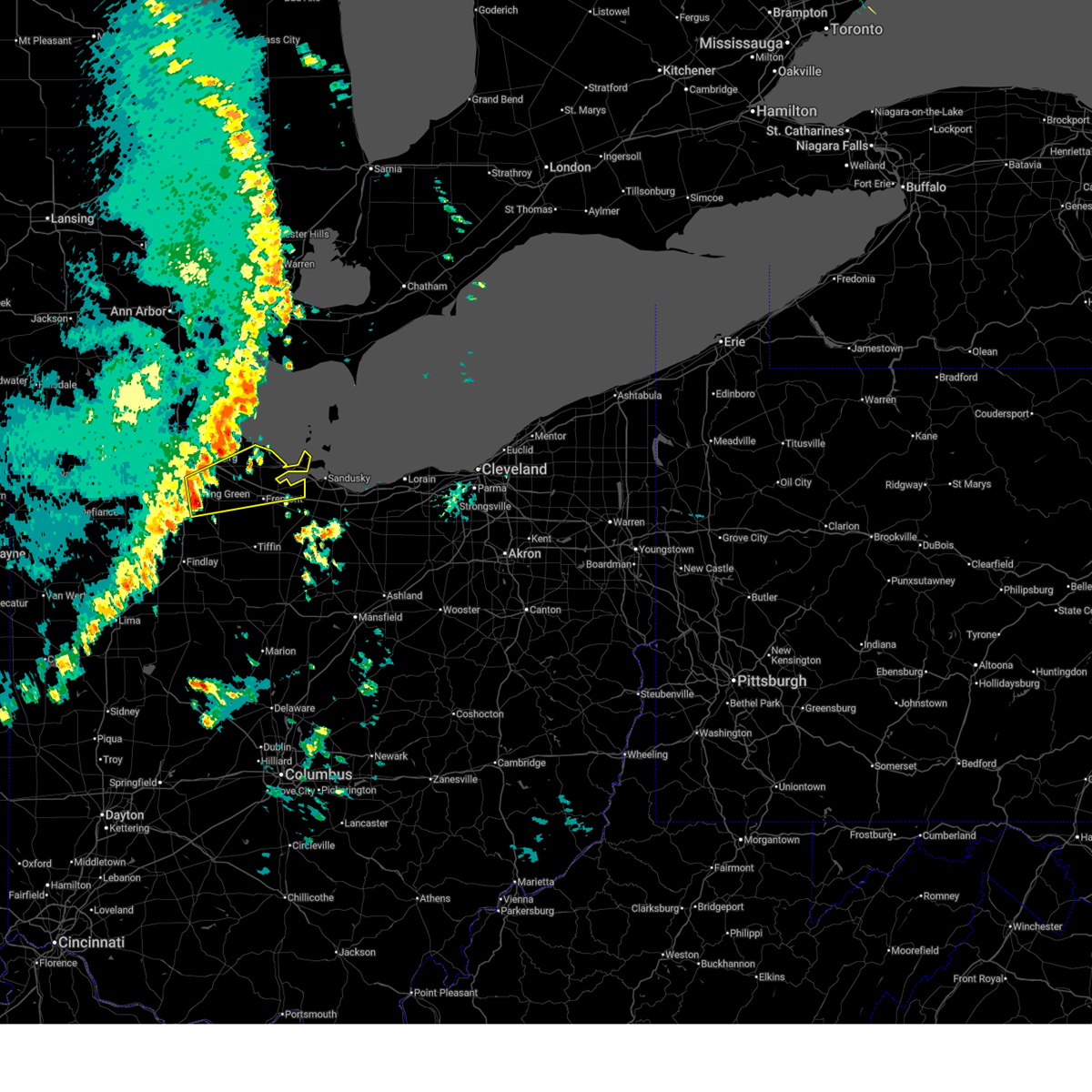
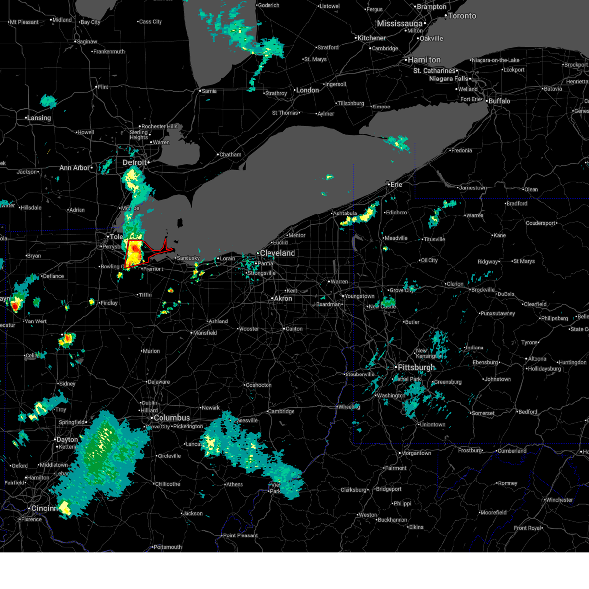
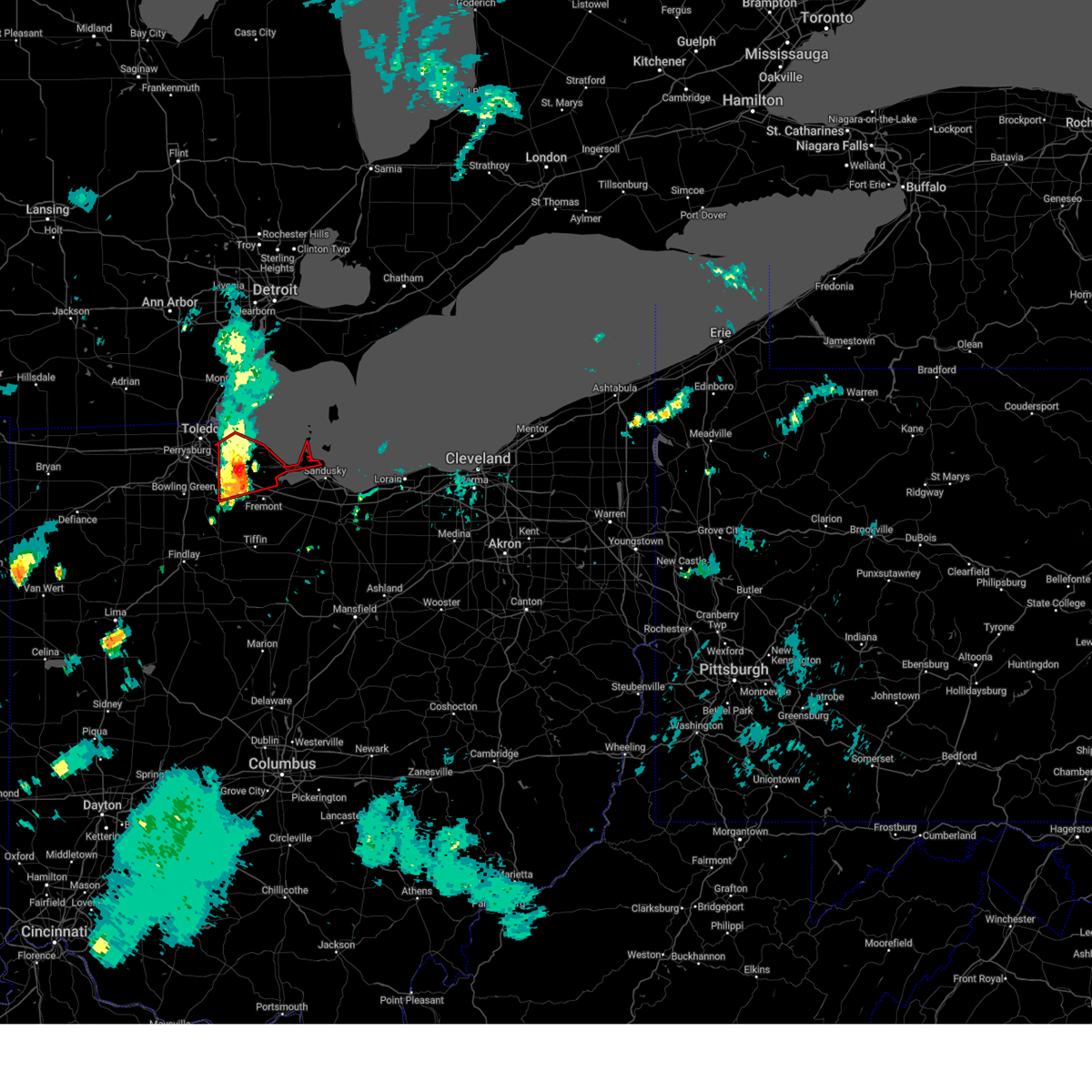
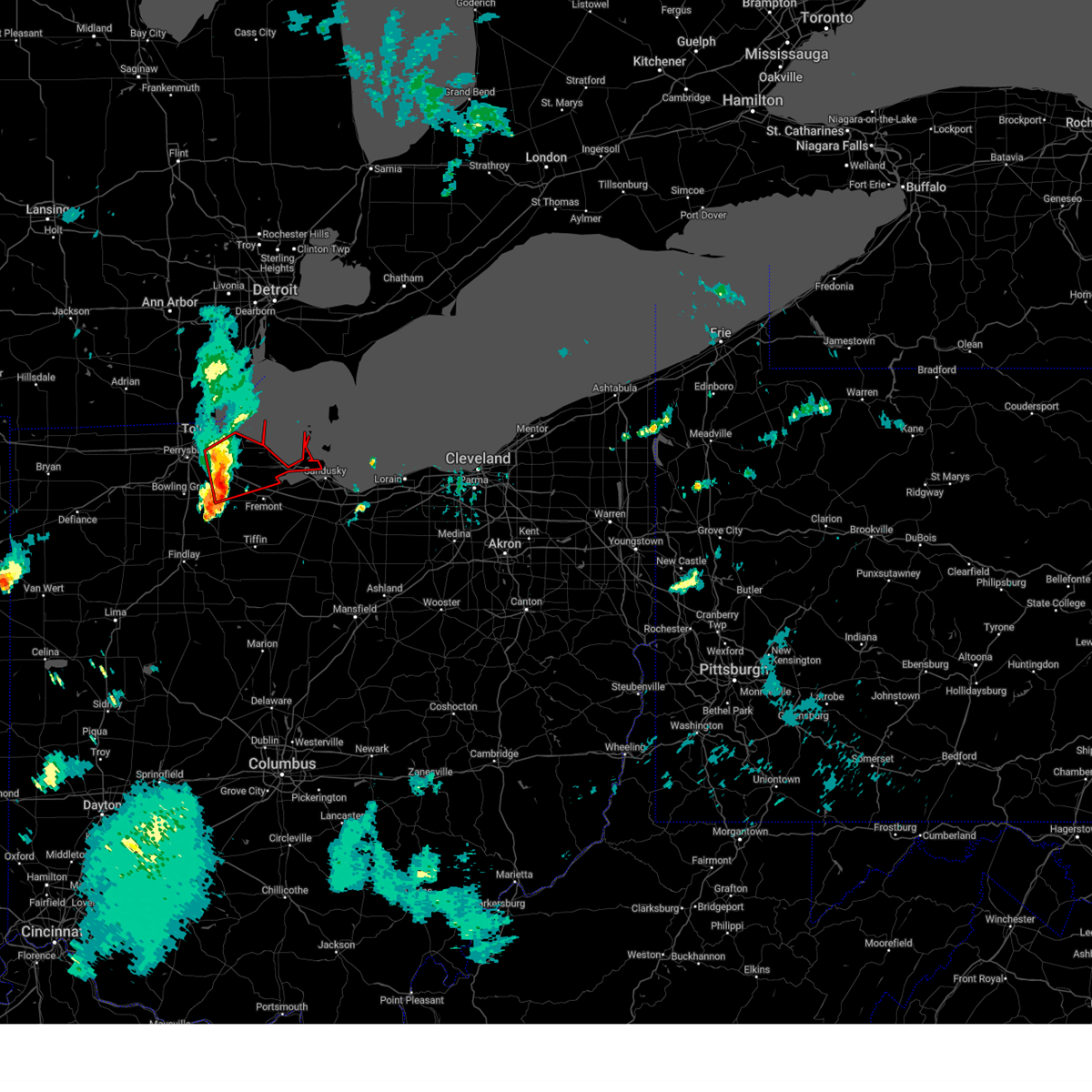
Hail Map for Elmore, OH
The Elmore, OH area has had 0 reports of on-the-ground hail by trained spotters, and has been under severe weather warnings 31 times during the past 12 months. Doppler radar has detected hail at or near Elmore, OH on 36 occasions, including 3 occasions during the past year.
| Name: | Elmore, OH |
| Where Located: | 83.1 miles W of Cleveland, OH |
| Map: | Google Map for Elmore, OH |
| Population: | 1410 |
| Housing Units: | 592 |
| More Info: | Search Google for Elmore, OH |
1
The Top Recent Hail Date for Elmore, OH is Monday, July 27, 2026 (5th out of 36)
Hail and Wind Damage Spotted near Elmore, OH
| Date / Time | Report Details |
|---|---|
| 7/28/2026 2:07 AM EDT |
 At 207 am edt, a severe thunderstorm was located over elmore, or 14 miles northwest of fremont, moving southeast at 45 mph (radar indicated). Hazards include quarter size hail. Minor damage to vehicles is possible. Locations impacted include, oak harbor, gibsonburg, genoa, woodville, elmore, pemberville, millbury, luckey, lindsey, rocky ridge, clay center, williston, bono, and stony ridge. At 207 am edt, a severe thunderstorm was located over elmore, or 14 miles northwest of fremont, moving southeast at 45 mph (radar indicated). Hazards include quarter size hail. Minor damage to vehicles is possible. Locations impacted include, oak harbor, gibsonburg, genoa, woodville, elmore, pemberville, millbury, luckey, lindsey, rocky ridge, clay center, williston, bono, and stony ridge.
|
| 7/28/2026 1:59 AM EDT |
 Svrcle the national weather service in cleveland has issued a * severe thunderstorm warning for, ottawa county in northwestern ohio, northwestern sandusky county in northwestern ohio, northeastern wood county in northwestern ohio, northeastern lucas county in northwestern ohio, * until 245 am edt. * at 159 am edt, a severe thunderstorm was located near genoa, or 11 miles southeast of toledo, moving southeast at 40 mph (radar indicated). Hazards include quarter size hail. minor damage to vehicles is possible Svrcle the national weather service in cleveland has issued a * severe thunderstorm warning for, ottawa county in northwestern ohio, northwestern sandusky county in northwestern ohio, northeastern wood county in northwestern ohio, northeastern lucas county in northwestern ohio, * until 245 am edt. * at 159 am edt, a severe thunderstorm was located near genoa, or 11 miles southeast of toledo, moving southeast at 40 mph (radar indicated). Hazards include quarter size hail. minor damage to vehicles is possible
|
| 7/3/2026 7:12 PM EDT |
 At 711 pm edt, severe thunderstorms were located along a line extending from near castalia to 7 miles south of gibsonburg, moving east at 45 mph (radar indicated). Hazards include 60 mph wind gusts. Expect damage to trees and power lines. Locations impacted include, sandusky, fremont, port clinton, kelleys island, bellevue, clyde, oak harbor, gibsonburg, elmore, green springs, castalia, ballville, catawba island, pemberville, bradner, marblehead, wayne, bettsville, bay view, and risingsun. At 711 pm edt, severe thunderstorms were located along a line extending from near castalia to 7 miles south of gibsonburg, moving east at 45 mph (radar indicated). Hazards include 60 mph wind gusts. Expect damage to trees and power lines. Locations impacted include, sandusky, fremont, port clinton, kelleys island, bellevue, clyde, oak harbor, gibsonburg, elmore, green springs, castalia, ballville, catawba island, pemberville, bradner, marblehead, wayne, bettsville, bay view, and risingsun.
|
| 7/3/2026 6:45 PM EDT |
 Svrcle the national weather service in cleveland has issued a * severe thunderstorm warning for, ottawa county in northwestern ohio, northern seneca county in northwestern ohio, erie county in north central ohio, sandusky county in northwestern ohio, central wood county in northwestern ohio, * until 730 pm edt. * at 645 pm edt, severe thunderstorms were located along a line extending from 7 miles northeast of oak harbor to near bowling green, moving east at 45 mph (radar indicated). Hazards include 60 mph wind gusts. expect damage to trees and power lines Svrcle the national weather service in cleveland has issued a * severe thunderstorm warning for, ottawa county in northwestern ohio, northern seneca county in northwestern ohio, erie county in north central ohio, sandusky county in northwestern ohio, central wood county in northwestern ohio, * until 730 pm edt. * at 645 pm edt, severe thunderstorms were located along a line extending from 7 miles northeast of oak harbor to near bowling green, moving east at 45 mph (radar indicated). Hazards include 60 mph wind gusts. expect damage to trees and power lines
|
| 6/14/2026 2:01 PM EDT |
 At 200 pm edt, a severe thunderstorm was located near port clinton, moving east at 55 mph (radar indicated). Hazards include 60 mph wind gusts and penny size hail. a 59 mph gust was measured in ottawa county near martin. Expect damage to trees and power lines. Locations impacted include, fremont, port clinton, oak harbor, gibsonburg, genoa, woodville, elmore, pemberville, lindsey, rocky ridge, stony prairie, whites landing, and vickery. At 200 pm edt, a severe thunderstorm was located near port clinton, moving east at 55 mph (radar indicated). Hazards include 60 mph wind gusts and penny size hail. a 59 mph gust was measured in ottawa county near martin. Expect damage to trees and power lines. Locations impacted include, fremont, port clinton, oak harbor, gibsonburg, genoa, woodville, elmore, pemberville, lindsey, rocky ridge, stony prairie, whites landing, and vickery.
|
| 6/14/2026 1:33 PM EDT |
 At 132 pm edt, a severe thunderstorm was located near genoa, or 12 miles southeast of toledo, moving east at 40 mph (radar indicated). Hazards include 60 mph wind gusts and penny size hail. Expect damage to trees and power lines. Locations impacted include, toledo, bowling green, fremont, port clinton, perrysburg, oregon, rossford, waterville, northwood, oak harbor, gibsonburg, genoa, woodville, weston, elmore, maumee, walbridge, pemberville, millbury, and haskins. At 132 pm edt, a severe thunderstorm was located near genoa, or 12 miles southeast of toledo, moving east at 40 mph (radar indicated). Hazards include 60 mph wind gusts and penny size hail. Expect damage to trees and power lines. Locations impacted include, toledo, bowling green, fremont, port clinton, perrysburg, oregon, rossford, waterville, northwood, oak harbor, gibsonburg, genoa, woodville, weston, elmore, maumee, walbridge, pemberville, millbury, and haskins.
|
| 6/14/2026 1:15 PM EDT |
 Svrcle the national weather service in cleveland has issued a * severe thunderstorm warning for, ottawa county in northwestern ohio, central sandusky county in northwestern ohio, northern wood county in northwestern ohio, lucas county in northwestern ohio, * until 215 pm edt. * at 115 pm edt, a severe thunderstorm was located over rossford, or near toledo, moving east at 45 mph (radar indicated). Hazards include 60 mph wind gusts and penny size hail. expect damage to trees and power lines Svrcle the national weather service in cleveland has issued a * severe thunderstorm warning for, ottawa county in northwestern ohio, central sandusky county in northwestern ohio, northern wood county in northwestern ohio, lucas county in northwestern ohio, * until 215 pm edt. * at 115 pm edt, a severe thunderstorm was located over rossford, or near toledo, moving east at 45 mph (radar indicated). Hazards include 60 mph wind gusts and penny size hail. expect damage to trees and power lines
|
| 6/12/2026 1:12 AM EDT |
 The storms which prompted the warning have weakened below severe limits, and no longer pose an immediate threat to life or property. therefore, the warning will be allowed to expire. however, gusty winds are still possible with these thunderstorms. a severe thunderstorm watch remains in effect until 500 am edt for northwestern ohio. The storms which prompted the warning have weakened below severe limits, and no longer pose an immediate threat to life or property. therefore, the warning will be allowed to expire. however, gusty winds are still possible with these thunderstorms. a severe thunderstorm watch remains in effect until 500 am edt for northwestern ohio.
|
| 6/12/2026 12:50 AM EDT |
 At 1249 am edt, severe thunderstorms were located along a line extending from near ida to waterville, moving east at 55 mph (radar indicated). Hazards include 60 mph wind gusts. Expect damage to trees and power lines. Locations impacted include, toledo, swanton, perrysburg, oregon, sylvania, rossford, waterville, northwood, whitehouse, genoa, woodville, holland, elmore, maumee, ottawa hills, walbridge, millbury, haskins, luckey, and rocky ridge. At 1249 am edt, severe thunderstorms were located along a line extending from near ida to waterville, moving east at 55 mph (radar indicated). Hazards include 60 mph wind gusts. Expect damage to trees and power lines. Locations impacted include, toledo, swanton, perrysburg, oregon, sylvania, rossford, waterville, northwood, whitehouse, genoa, woodville, holland, elmore, maumee, ottawa hills, walbridge, millbury, haskins, luckey, and rocky ridge.
|
| 6/12/2026 12:20 AM EDT |
 Svrcle the national weather service in cleveland has issued a * severe thunderstorm warning for, ottawa county in northwestern ohio, northwestern sandusky county in northwestern ohio, wood county in northwestern ohio, lucas county in northwestern ohio, * until 115 am edt. * at 1219 am edt, severe thunderstorms were located along a line extending from adrian to near archbold, moving east at 55 mph (radar indicated). Hazards include 60 mph wind gusts. expect damage to trees and power lines Svrcle the national weather service in cleveland has issued a * severe thunderstorm warning for, ottawa county in northwestern ohio, northwestern sandusky county in northwestern ohio, wood county in northwestern ohio, lucas county in northwestern ohio, * until 115 am edt. * at 1219 am edt, severe thunderstorms were located along a line extending from adrian to near archbold, moving east at 55 mph (radar indicated). Hazards include 60 mph wind gusts. expect damage to trees and power lines
|
| 6/9/2026 11:14 PM EDT |
 At 1114 pm edt, a severe thunderstorm was located near port clinton, moving east at 20 mph (radar indicated). Hazards include 60 mph wind gusts. Expect damage to trees and power lines. Locations impacted include, sandusky, fremont, port clinton, oak harbor, gibsonburg, woodville, elmore, castalia, ballville, bay view, lindsey, helena, stony prairie, whites landing, and vickery. At 1114 pm edt, a severe thunderstorm was located near port clinton, moving east at 20 mph (radar indicated). Hazards include 60 mph wind gusts. Expect damage to trees and power lines. Locations impacted include, sandusky, fremont, port clinton, oak harbor, gibsonburg, woodville, elmore, castalia, ballville, bay view, lindsey, helena, stony prairie, whites landing, and vickery.
|
| 6/9/2026 11:02 PM EDT |
 At 1102 pm edt, a severe thunderstorm was located near fremont, moving east at 20 mph (radar indicated). Hazards include 60 mph wind gusts. Expect damage to trees and power lines. Locations impacted include, sandusky, fremont, port clinton, bellevue, clyde, oak harbor, gibsonburg, woodville, elmore, green springs, castalia, ballville, catawba island, bay view, lindsey, rocky ridge, helena, stony prairie, whites landing, and vickery. At 1102 pm edt, a severe thunderstorm was located near fremont, moving east at 20 mph (radar indicated). Hazards include 60 mph wind gusts. Expect damage to trees and power lines. Locations impacted include, sandusky, fremont, port clinton, bellevue, clyde, oak harbor, gibsonburg, woodville, elmore, green springs, castalia, ballville, catawba island, bay view, lindsey, rocky ridge, helena, stony prairie, whites landing, and vickery.
|
| 6/9/2026 10:51 PM EDT |
 Svrcle the national weather service in cleveland has issued a * severe thunderstorm warning for, northwestern huron county in north central ohio, ottawa county in northwestern ohio, erie county in north central ohio, sandusky county in northwestern ohio, * until 1130 pm edt. * at 1051 pm edt, a severe thunderstorm was located near fremont, moving east at 20 mph (radar indicated). Hazards include 60 mph wind gusts. expect damage to trees and power lines Svrcle the national weather service in cleveland has issued a * severe thunderstorm warning for, northwestern huron county in north central ohio, ottawa county in northwestern ohio, erie county in north central ohio, sandusky county in northwestern ohio, * until 1130 pm edt. * at 1051 pm edt, a severe thunderstorm was located near fremont, moving east at 20 mph (radar indicated). Hazards include 60 mph wind gusts. expect damage to trees and power lines
|
| 4/15/2026 4:41 PM EDT |
 At 440 pm edt, severe thunderstorms were located along a line extending from 12 miles north of oak harbor to 6 miles northwest of fremont to 7 miles north of fostoria, moving east at 55 mph (radar indicated). Hazards include 60 mph wind gusts and penny size hail. Expect damage to trees and power lines. Locations impacted include, fremont, port clinton, kelleys island, put-in-bay, bellevue, clyde, oak harbor, gibsonburg, green springs, ballville, catawba island, marblehead, bettsville, bay view, lindsey, rocky ridge, helena, burgoon, stony prairie, and whites landing. At 440 pm edt, severe thunderstorms were located along a line extending from 12 miles north of oak harbor to 6 miles northwest of fremont to 7 miles north of fostoria, moving east at 55 mph (radar indicated). Hazards include 60 mph wind gusts and penny size hail. Expect damage to trees and power lines. Locations impacted include, fremont, port clinton, kelleys island, put-in-bay, bellevue, clyde, oak harbor, gibsonburg, green springs, ballville, catawba island, marblehead, bettsville, bay view, lindsey, rocky ridge, helena, burgoon, stony prairie, and whites landing.
|
| 4/15/2026 4:14 PM EDT |
 Svrcle the national weather service in cleveland has issued a * severe thunderstorm warning for, ottawa county in northwestern ohio, northeastern seneca county in northwestern ohio, sandusky county in northwestern ohio, * until 515 pm edt. * at 414 pm edt, severe thunderstorms were located along a line extending from near toledo to near north baltimore, moving east at 50 mph (radar indicated). Hazards include 70 mph wind gusts and penny size hail. Expect considerable tree damage. Damage is likely to mobile homes, roofs, and outbuildings. Svrcle the national weather service in cleveland has issued a * severe thunderstorm warning for, ottawa county in northwestern ohio, northeastern seneca county in northwestern ohio, sandusky county in northwestern ohio, * until 515 pm edt. * at 414 pm edt, severe thunderstorms were located along a line extending from near toledo to near north baltimore, moving east at 50 mph (radar indicated). Hazards include 70 mph wind gusts and penny size hail. Expect considerable tree damage. Damage is likely to mobile homes, roofs, and outbuildings.
|
| 4/15/2026 3:04 AM EDT |
 At 304 am edt, a severe thunderstorm was located over genoa, or 15 miles southeast of toledo, moving southeast at 35 mph (radar indicated). Hazards include 60 mph wind gusts. Expect damage to trees and power lines. Locations impacted include, oak harbor, genoa, woodville, elmore, rocky ridge, clay center, and williston. At 304 am edt, a severe thunderstorm was located over genoa, or 15 miles southeast of toledo, moving southeast at 35 mph (radar indicated). Hazards include 60 mph wind gusts. Expect damage to trees and power lines. Locations impacted include, oak harbor, genoa, woodville, elmore, rocky ridge, clay center, and williston.
|
| 4/15/2026 2:51 AM EDT |
 At 251 am edt, a severe thunderstorm was located over northwood, or 8 miles southeast of toledo, moving east at 45 mph (radar indicated). Hazards include 60 mph wind gusts. Expect damage to trees and power lines. Locations impacted include, toledo, oregon, rossford, northwood, oak harbor, genoa, woodville, elmore, walbridge, millbury, luckey, rocky ridge, clay center, harbor view, reno beach, williston, bono, and stony ridge. At 251 am edt, a severe thunderstorm was located over northwood, or 8 miles southeast of toledo, moving east at 45 mph (radar indicated). Hazards include 60 mph wind gusts. Expect damage to trees and power lines. Locations impacted include, toledo, oregon, rossford, northwood, oak harbor, genoa, woodville, elmore, walbridge, millbury, luckey, rocky ridge, clay center, harbor view, reno beach, williston, bono, and stony ridge.
|
| 4/15/2026 2:34 AM EDT |
 At 234 am edt, severe thunderstorms were located along a line extending from near oregon to near whitehouse, moving east at 45 mph (radar indicated). Hazards include 60 mph wind gusts. Expect damage to trees and power lines. Locations impacted include, toledo, perrysburg, oregon, rossford, waterville, northwood, whitehouse, oak harbor, genoa, woodville, holland, elmore, maumee, ottawa hills, walbridge, pemberville, millbury, haskins, luckey, and rocky ridge. At 234 am edt, severe thunderstorms were located along a line extending from near oregon to near whitehouse, moving east at 45 mph (radar indicated). Hazards include 60 mph wind gusts. Expect damage to trees and power lines. Locations impacted include, toledo, perrysburg, oregon, rossford, waterville, northwood, whitehouse, oak harbor, genoa, woodville, holland, elmore, maumee, ottawa hills, walbridge, pemberville, millbury, haskins, luckey, and rocky ridge.
|
| 4/15/2026 2:23 AM EDT |
 Svrcle the national weather service in cleveland has issued a * severe thunderstorm warning for, ottawa county in northwestern ohio, northwestern sandusky county in northwestern ohio, northern wood county in northwestern ohio, lucas county in northwestern ohio, * until 330 am edt. * at 223 am edt, a severe thunderstorm was located over swanton, moving east at 45 mph (radar indicated). Hazards include 60 mph wind gusts. expect damage to trees and power lines Svrcle the national weather service in cleveland has issued a * severe thunderstorm warning for, ottawa county in northwestern ohio, northwestern sandusky county in northwestern ohio, northern wood county in northwestern ohio, lucas county in northwestern ohio, * until 330 am edt. * at 223 am edt, a severe thunderstorm was located over swanton, moving east at 45 mph (radar indicated). Hazards include 60 mph wind gusts. expect damage to trees and power lines
|
| 3/31/2026 4:20 PM EDT |
 At 419 pm edt, severe thunderstorms were located along a line extending from 15 miles east of monroe to near port clinton to 7 miles southwest of fremont, moving east at 55 mph (radar indicated). Hazards include 70 mph wind gusts and quarter size hail. Minor damage to vehicles is possible. expect considerable tree damage. wind damage is also likely to mobile homes, roofs, and outbuildings. Locations impacted include, port clinton, kelleys island, put-in-bay, oak harbor, elmore, catawba island, marblehead, bay view, rocky ridge, reno beach, and bono. At 419 pm edt, severe thunderstorms were located along a line extending from 15 miles east of monroe to near port clinton to 7 miles southwest of fremont, moving east at 55 mph (radar indicated). Hazards include 70 mph wind gusts and quarter size hail. Minor damage to vehicles is possible. expect considerable tree damage. wind damage is also likely to mobile homes, roofs, and outbuildings. Locations impacted include, port clinton, kelleys island, put-in-bay, oak harbor, elmore, catawba island, marblehead, bay view, rocky ridge, reno beach, and bono.
|
| 3/31/2026 4:20 PM EDT |
 the severe thunderstorm warning has been cancelled and is no longer in effect the severe thunderstorm warning has been cancelled and is no longer in effect
|
| 3/31/2026 4:18 PM EDT |
 At 418 pm edt, severe thunderstorms were located along a line extending from 7 miles northeast of oak harbor to near fremont to near new riegel, moving east at 50 mph (radar indicated). Hazards include 70 mph wind gusts and quarter size hail. Minor damage to vehicles is possible. expect considerable tree damage. wind damage is also likely to mobile homes, roofs, and outbuildings. Locations impacted include, findlay, sandusky, tiffin, norwalk, fremont, fostoria, port clinton, bellevue, clyde, willard, north baltimore, oak harbor, gibsonburg, genoa, woodville, elmore, green springs, castalia, arcadia, and van buren. At 418 pm edt, severe thunderstorms were located along a line extending from 7 miles northeast of oak harbor to near fremont to near new riegel, moving east at 50 mph (radar indicated). Hazards include 70 mph wind gusts and quarter size hail. Minor damage to vehicles is possible. expect considerable tree damage. wind damage is also likely to mobile homes, roofs, and outbuildings. Locations impacted include, findlay, sandusky, tiffin, norwalk, fremont, fostoria, port clinton, bellevue, clyde, willard, north baltimore, oak harbor, gibsonburg, genoa, woodville, elmore, green springs, castalia, arcadia, and van buren.
|
| 3/31/2026 3:59 PM EDT |
 Svrcle the national weather service in cleveland has issued a * severe thunderstorm warning for, northwestern huron county in north central ohio, ottawa county in northwestern ohio, seneca county in northwestern ohio, erie county in north central ohio, sandusky county in northwestern ohio, eastern wood county in northwestern ohio, northeastern hancock county in northwestern ohio, * until 445 pm edt. * at 358 pm edt, severe thunderstorms were located along a line extending from near luna pier to near van buren, moving east at 55 mph (radar indicated). Hazards include 70 mph wind gusts and penny size hail. Expect considerable tree damage. Damage is likely to mobile homes, roofs, and outbuildings. Svrcle the national weather service in cleveland has issued a * severe thunderstorm warning for, northwestern huron county in north central ohio, ottawa county in northwestern ohio, seneca county in northwestern ohio, erie county in north central ohio, sandusky county in northwestern ohio, eastern wood county in northwestern ohio, northeastern hancock county in northwestern ohio, * until 445 pm edt. * at 358 pm edt, severe thunderstorms were located along a line extending from near luna pier to near van buren, moving east at 55 mph (radar indicated). Hazards include 70 mph wind gusts and penny size hail. Expect considerable tree damage. Damage is likely to mobile homes, roofs, and outbuildings.
|
| 3/31/2026 3:46 PM EDT |
 Svrcle the national weather service in cleveland has issued a * severe thunderstorm warning for, ottawa county in northwestern ohio, northwestern sandusky county in northwestern ohio, northeastern wood county in northwestern ohio, lucas county in northwestern ohio, * until 445 pm edt. * at 346 pm edt, severe thunderstorms were located along a line extending from near temperance to perrysburg to near bowling green, moving northeast at 55 mph (radar indicated). Hazards include 70 mph wind gusts and penny size hail. Expect considerable tree damage. Damage is likely to mobile homes, roofs, and outbuildings. Svrcle the national weather service in cleveland has issued a * severe thunderstorm warning for, ottawa county in northwestern ohio, northwestern sandusky county in northwestern ohio, northeastern wood county in northwestern ohio, lucas county in northwestern ohio, * until 445 pm edt. * at 346 pm edt, severe thunderstorms were located along a line extending from near temperance to perrysburg to near bowling green, moving northeast at 55 mph (radar indicated). Hazards include 70 mph wind gusts and penny size hail. Expect considerable tree damage. Damage is likely to mobile homes, roofs, and outbuildings.
|
| 3/26/2026 7:36 PM EDT |
 At 736 pm edt, a severe thunderstorm was located near oregon, or 13 miles east of toledo, moving east at 65 mph (radar indicated). Hazards include half dollar size hail. People and animals outdoors will be injured. expect damage to roofs, siding, windows, and vehicles. Locations impacted include, toledo, oregon, northwood, oak harbor, genoa, woodville, elmore, walbridge, millbury, luckey, lindsey, rocky ridge, clay center, harbor view, reno beach, williston, bono, and stony ridge. At 736 pm edt, a severe thunderstorm was located near oregon, or 13 miles east of toledo, moving east at 65 mph (radar indicated). Hazards include half dollar size hail. People and animals outdoors will be injured. expect damage to roofs, siding, windows, and vehicles. Locations impacted include, toledo, oregon, northwood, oak harbor, genoa, woodville, elmore, walbridge, millbury, luckey, lindsey, rocky ridge, clay center, harbor view, reno beach, williston, bono, and stony ridge.
|
| 3/26/2026 7:14 PM EDT |
 Svrcle the national weather service in cleveland has issued a * severe thunderstorm warning for, ottawa county in northwestern ohio, northern sandusky county in northwestern ohio, northeastern wood county in northwestern ohio, lucas county in northwestern ohio, * until 800 pm edt. * at 714 pm edt, a severe thunderstorm was located near ottawa lake, or 8 miles southeast of blissfield, moving east at 65 mph (radar indicated). Hazards include 60 mph wind gusts and quarter size hail. Minor damage to vehicles is possible. Expect damage to trees and power lines. Svrcle the national weather service in cleveland has issued a * severe thunderstorm warning for, ottawa county in northwestern ohio, northern sandusky county in northwestern ohio, northeastern wood county in northwestern ohio, lucas county in northwestern ohio, * until 800 pm edt. * at 714 pm edt, a severe thunderstorm was located near ottawa lake, or 8 miles southeast of blissfield, moving east at 65 mph (radar indicated). Hazards include 60 mph wind gusts and quarter size hail. Minor damage to vehicles is possible. Expect damage to trees and power lines.
|
| 3/26/2026 6:13 PM EDT |
 The storm which prompted the warning has weakened below severe limits, and no longer poses an immediate threat to life or property. therefore, the warning will be allowed to expire. however, small hail and heavy rain are still possible with this thunderstorm. a tornado watch remains in effect until 1100 pm edt for northwestern ohio. The storm which prompted the warning has weakened below severe limits, and no longer poses an immediate threat to life or property. therefore, the warning will be allowed to expire. however, small hail and heavy rain are still possible with this thunderstorm. a tornado watch remains in effect until 1100 pm edt for northwestern ohio.
|
| 3/26/2026 6:01 PM EDT |
 the severe thunderstorm warning has been cancelled and is no longer in effect the severe thunderstorm warning has been cancelled and is no longer in effect
|
| 3/26/2026 6:01 PM EDT |
 At 601 pm edt, a severe thunderstorm was located near fremont, moving east at 60 mph (radar indicated). Hazards include 60 mph wind gusts and quarter size hail. Minor damage to vehicles is possible. expect damage to trees and power lines. Locations impacted include, port clinton, oak harbor, genoa, woodville, elmore, walbridge, luckey, lindsey, rocky ridge, whites landing, stony ridge, and vickery. At 601 pm edt, a severe thunderstorm was located near fremont, moving east at 60 mph (radar indicated). Hazards include 60 mph wind gusts and quarter size hail. Minor damage to vehicles is possible. expect damage to trees and power lines. Locations impacted include, port clinton, oak harbor, genoa, woodville, elmore, walbridge, luckey, lindsey, rocky ridge, whites landing, stony ridge, and vickery.
|
| 3/26/2026 5:49 PM EDT |
 At 549 pm edt, a severe thunderstorm was located over woodville, or 13 miles northwest of fremont, moving east at 60 mph (radar indicated). Hazards include 60 mph wind gusts and quarter size hail. Minor damage to vehicles is possible. expect damage to trees and power lines. Locations impacted include, fremont, port clinton, perrysburg, bellevue, clyde, rossford, waterville, whitehouse, oak harbor, gibsonburg, genoa, woodville, elmore, maumee, ballville, pemberville, haskins, luckey, lindsey, and rocky ridge. At 549 pm edt, a severe thunderstorm was located over woodville, or 13 miles northwest of fremont, moving east at 60 mph (radar indicated). Hazards include 60 mph wind gusts and quarter size hail. Minor damage to vehicles is possible. expect damage to trees and power lines. Locations impacted include, fremont, port clinton, perrysburg, bellevue, clyde, rossford, waterville, whitehouse, oak harbor, gibsonburg, genoa, woodville, elmore, maumee, ballville, pemberville, haskins, luckey, lindsey, and rocky ridge.
|
| 3/26/2026 5:32 PM EDT |
 Svrcle the national weather service in cleveland has issued a * severe thunderstorm warning for, ottawa county in northwestern ohio, sandusky county in northwestern ohio, central wood county in northwestern ohio, southwestern lucas county in northwestern ohio, * until 615 pm edt. * at 532 pm edt, a severe thunderstorm was located near waterville, or near bowling green, moving east at 65 mph (radar indicated). Hazards include 60 mph wind gusts and quarter size hail. Minor damage to vehicles is possible. Expect damage to trees and power lines. Svrcle the national weather service in cleveland has issued a * severe thunderstorm warning for, ottawa county in northwestern ohio, sandusky county in northwestern ohio, central wood county in northwestern ohio, southwestern lucas county in northwestern ohio, * until 615 pm edt. * at 532 pm edt, a severe thunderstorm was located near waterville, or near bowling green, moving east at 65 mph (radar indicated). Hazards include 60 mph wind gusts and quarter size hail. Minor damage to vehicles is possible. Expect damage to trees and power lines.
|
| 6/18/2025 7:43 PM EDT | Grain silo destroyed... minor damage to other structures... and tree limbs downed. report noted seeing rotating winds and power flashe in ottawa county OH, 3.6 miles S of Elmore, OH |
| 6/18/2025 7:14 PM EDT |
 Svrcle the national weather service in cleveland has issued a * severe thunderstorm warning for, ottawa county in northwestern ohio, erie county in north central ohio, sandusky county in northwestern ohio, northeastern lucas county in northwestern ohio, * until 830 pm edt. * at 714 pm edt, severe thunderstorms were located along a line extending from near delta to near rawson, moving northeast at 55 mph (radar indicated). Hazards include 60 mph wind gusts. expect damage to trees and power lines Svrcle the national weather service in cleveland has issued a * severe thunderstorm warning for, ottawa county in northwestern ohio, erie county in north central ohio, sandusky county in northwestern ohio, northeastern lucas county in northwestern ohio, * until 830 pm edt. * at 714 pm edt, severe thunderstorms were located along a line extending from near delta to near rawson, moving northeast at 55 mph (radar indicated). Hazards include 60 mph wind gusts. expect damage to trees and power lines
|
| 4/19/2025 7:52 AM EDT |
 Svrcle the national weather service in cleveland has issued a * severe thunderstorm warning for, huron county in north central ohio, richland county in north central ohio, seneca county in northwestern ohio, erie county in north central ohio, sandusky county in northwestern ohio, crawford county in north central ohio, southeastern wood county in northwestern ohio, * until 845 am edt. * at 751 am edt, severe thunderstorms were located along a line extending from fostoria to near upper sandusky to marion, moving northeast at 70 mph (radar indicated). Hazards include 60 mph wind gusts. expect damage to trees and power lines Svrcle the national weather service in cleveland has issued a * severe thunderstorm warning for, huron county in north central ohio, richland county in north central ohio, seneca county in northwestern ohio, erie county in north central ohio, sandusky county in northwestern ohio, crawford county in north central ohio, southeastern wood county in northwestern ohio, * until 845 am edt. * at 751 am edt, severe thunderstorms were located along a line extending from fostoria to near upper sandusky to marion, moving northeast at 70 mph (radar indicated). Hazards include 60 mph wind gusts. expect damage to trees and power lines
|
| 4/3/2025 12:17 AM EDT | Tree down on wires at 400 block of fremont s in ottawa county OH, 0.1 miles SSW of Elmore, OH |
| 4/2/2025 11:54 PM EDT |
 At 1154 pm edt, severe thunderstorms were located along a line extending from near bowling green to near fostoria to near forest, moving northeast at 65 mph (radar indicated). Hazards include 70 mph wind gusts. Expect considerable tree damage. damage is likely to mobile homes, roofs, and outbuildings. Locations impacted include, bowling green, tiffin, fremont, fostoria, perrysburg, oregon, bellevue, clyde, rossford, waterville, northwood, whitehouse, north baltimore, oak harbor, gibsonburg, genoa, woodville, weston, elmore, and green springs. At 1154 pm edt, severe thunderstorms were located along a line extending from near bowling green to near fostoria to near forest, moving northeast at 65 mph (radar indicated). Hazards include 70 mph wind gusts. Expect considerable tree damage. damage is likely to mobile homes, roofs, and outbuildings. Locations impacted include, bowling green, tiffin, fremont, fostoria, perrysburg, oregon, bellevue, clyde, rossford, waterville, northwood, whitehouse, north baltimore, oak harbor, gibsonburg, genoa, woodville, weston, elmore, and green springs.
|
| 4/2/2025 11:43 PM EDT |
 Svrcle the national weather service in cleveland has issued a * severe thunderstorm warning for, ottawa county in northwestern ohio, northwestern seneca county in northwestern ohio, northwestern wyandot county in northwestern ohio, sandusky county in northwestern ohio, wood county in northwestern ohio, hancock county in northwestern ohio, central lucas county in northwestern ohio, * until 1230 am edt. * at 1143 pm edt, severe thunderstorms were located along a line extending from near weston to near van buren to dunkirk, moving northeast at 90 mph (radar indicated). Hazards include 60 mph wind gusts. expect damage to trees and power lines Svrcle the national weather service in cleveland has issued a * severe thunderstorm warning for, ottawa county in northwestern ohio, northwestern seneca county in northwestern ohio, northwestern wyandot county in northwestern ohio, sandusky county in northwestern ohio, wood county in northwestern ohio, hancock county in northwestern ohio, central lucas county in northwestern ohio, * until 1230 am edt. * at 1143 pm edt, severe thunderstorms were located along a line extending from near weston to near van buren to dunkirk, moving northeast at 90 mph (radar indicated). Hazards include 60 mph wind gusts. expect damage to trees and power lines
|
| 3/30/2025 7:57 PM EDT |
 At 757 pm edt, severe thunderstorms were located along a line extending from genoa to gibsonburg to 10 miles north of fostoria, moving east at 45 mph (radar indicated). Hazards include 60 mph wind gusts. Expect damage to trees and power lines. Locations impacted include, fremont, port clinton, oak harbor, gibsonburg, genoa, woodville, elmore, ballville, lindsey, rocky ridge, helena, stony prairie, whites landing, and vickery. At 757 pm edt, severe thunderstorms were located along a line extending from genoa to gibsonburg to 10 miles north of fostoria, moving east at 45 mph (radar indicated). Hazards include 60 mph wind gusts. Expect damage to trees and power lines. Locations impacted include, fremont, port clinton, oak harbor, gibsonburg, genoa, woodville, elmore, ballville, lindsey, rocky ridge, helena, stony prairie, whites landing, and vickery.
|
| 3/30/2025 7:57 PM EDT |
 the severe thunderstorm warning has been cancelled and is no longer in effect the severe thunderstorm warning has been cancelled and is no longer in effect
|
| 3/30/2025 7:40 PM EDT |
 Svrcle the national weather service in cleveland has issued a * severe thunderstorm warning for, ottawa county in northwestern ohio, sandusky county in northwestern ohio, southeastern wood county in northwestern ohio, * until 830 pm edt. * at 740 pm edt, severe thunderstorms were located along a line extending from near bowling green to 12 miles west of gibsonburg to near north baltimore, moving northeast at 45 mph (radar indicated). Hazards include 60 mph wind gusts. expect damage to trees and power lines Svrcle the national weather service in cleveland has issued a * severe thunderstorm warning for, ottawa county in northwestern ohio, sandusky county in northwestern ohio, southeastern wood county in northwestern ohio, * until 830 pm edt. * at 740 pm edt, severe thunderstorms were located along a line extending from near bowling green to 12 miles west of gibsonburg to near north baltimore, moving northeast at 45 mph (radar indicated). Hazards include 60 mph wind gusts. expect damage to trees and power lines
|
| 9/24/2024 7:23 PM EDT |
 Svrcle the national weather service in cleveland has issued a * severe thunderstorm warning for, ottawa county in northwestern ohio, western seneca county in northwestern ohio, western sandusky county in northwestern ohio, wood county in northwestern ohio, northern hancock county in northwestern ohio, * until 815 pm edt. * at 723 pm edt, a severe thunderstorm was located near north baltimore, or 12 miles southwest of bowling green, moving east at 40 mph (radar indicated). Hazards include 60 mph wind gusts and quarter size hail. Minor damage to vehicles is possible. Expect damage to trees and power lines. Svrcle the national weather service in cleveland has issued a * severe thunderstorm warning for, ottawa county in northwestern ohio, western seneca county in northwestern ohio, western sandusky county in northwestern ohio, wood county in northwestern ohio, northern hancock county in northwestern ohio, * until 815 pm edt. * at 723 pm edt, a severe thunderstorm was located near north baltimore, or 12 miles southwest of bowling green, moving east at 40 mph (radar indicated). Hazards include 60 mph wind gusts and quarter size hail. Minor damage to vehicles is possible. Expect damage to trees and power lines.
|
| 9/24/2024 4:25 PM EDT |
 At 424 pm edt, a severe thunderstorm capable of producing a tornado was located over rocky ridge, or 12 miles north of fremont, moving east at 25 mph (public reported a funnel cloud). Hazards include tornado. Flying debris will be dangerous to those caught without shelter. mobile homes will be damaged or destroyed. damage to roofs, windows, and vehicles will occur. tree damage is likely. Locations impacted include, port clinton, oak harbor, gibsonburg, elmore, catawba island, lindsey, and rocky ridge. At 424 pm edt, a severe thunderstorm capable of producing a tornado was located over rocky ridge, or 12 miles north of fremont, moving east at 25 mph (public reported a funnel cloud). Hazards include tornado. Flying debris will be dangerous to those caught without shelter. mobile homes will be damaged or destroyed. damage to roofs, windows, and vehicles will occur. tree damage is likely. Locations impacted include, port clinton, oak harbor, gibsonburg, elmore, catawba island, lindsey, and rocky ridge.
|
| 9/24/2024 4:25 PM EDT |
 the tornado warning has been cancelled and is no longer in effect the tornado warning has been cancelled and is no longer in effect
|
| 9/24/2024 4:15 PM EDT |
 At 415 pm edt, a severe thunderstorm was located over elmore, or 11 miles northwest of fremont, moving northeast at 40 mph (radar indicated). Hazards include 60 mph wind gusts and penny size hail. Expect damage to trees and power lines. Locations impacted include, fremont, oregon, northwood, oak harbor, gibsonburg, genoa, woodville, elmore, ballville, millbury, lindsey, rocky ridge, clay center, helena, stony prairie, reno beach, williston, and bono. At 415 pm edt, a severe thunderstorm was located over elmore, or 11 miles northwest of fremont, moving northeast at 40 mph (radar indicated). Hazards include 60 mph wind gusts and penny size hail. Expect damage to trees and power lines. Locations impacted include, fremont, oregon, northwood, oak harbor, gibsonburg, genoa, woodville, elmore, ballville, millbury, lindsey, rocky ridge, clay center, helena, stony prairie, reno beach, williston, and bono.
|
| 9/24/2024 4:15 PM EDT |
 the severe thunderstorm warning has been cancelled and is no longer in effect the severe thunderstorm warning has been cancelled and is no longer in effect
|
| 9/24/2024 4:13 PM EDT |
 the tornado warning has been cancelled and is no longer in effect the tornado warning has been cancelled and is no longer in effect
|
| 9/24/2024 4:13 PM EDT |
 At 413 pm edt, a severe thunderstorm capable of producing a tornado was located over elmore, or 11 miles northwest of fremont, moving northeast at 30 mph (radar indicated rotation). Hazards include tornado. Flying debris will be dangerous to those caught without shelter. mobile homes will be damaged or destroyed. damage to roofs, windows, and vehicles will occur. tree damage is likely. Locations impacted include, port clinton, oregon, northwood, oak harbor, gibsonburg, genoa, woodville, elmore, catawba island, millbury, lindsey, rocky ridge, clay center, reno beach, williston, and bono. At 413 pm edt, a severe thunderstorm capable of producing a tornado was located over elmore, or 11 miles northwest of fremont, moving northeast at 30 mph (radar indicated rotation). Hazards include tornado. Flying debris will be dangerous to those caught without shelter. mobile homes will be damaged or destroyed. damage to roofs, windows, and vehicles will occur. tree damage is likely. Locations impacted include, port clinton, oregon, northwood, oak harbor, gibsonburg, genoa, woodville, elmore, catawba island, millbury, lindsey, rocky ridge, clay center, reno beach, williston, and bono.
|
| 9/24/2024 4:12 PM EDT | Tree limbs down on west elmore eastern roa in ottawa county OH, 0.1 miles SSW of Elmore, OH |
| 9/24/2024 4:01 PM EDT |
 Torcle the national weather service in cleveland has issued a * tornado warning for, ottawa county in northwestern ohio, northwestern sandusky county in northwestern ohio, northeastern wood county in northwestern ohio, northeastern lucas county in northwestern ohio, * until 445 pm edt. * at 401 pm edt, a severe thunderstorm capable of producing a tornado was located over woodville, or 12 miles northwest of fremont, moving northeast at 35 mph (radar indicated rotation). Hazards include tornado. Flying debris will be dangerous to those caught without shelter. mobile homes will be damaged or destroyed. damage to roofs, windows, and vehicles will occur. Tree damage is likely. Torcle the national weather service in cleveland has issued a * tornado warning for, ottawa county in northwestern ohio, northwestern sandusky county in northwestern ohio, northeastern wood county in northwestern ohio, northeastern lucas county in northwestern ohio, * until 445 pm edt. * at 401 pm edt, a severe thunderstorm capable of producing a tornado was located over woodville, or 12 miles northwest of fremont, moving northeast at 35 mph (radar indicated rotation). Hazards include tornado. Flying debris will be dangerous to those caught without shelter. mobile homes will be damaged or destroyed. damage to roofs, windows, and vehicles will occur. Tree damage is likely.
|
| 9/24/2024 3:58 PM EDT |
 At 358 pm edt, a severe thunderstorm was located near woodville, or 13 miles east of bowling green, moving northeast at 30 mph (radar indicated). Hazards include 60 mph wind gusts and penny size hail. Expect damage to trees and power lines. Locations impacted include, bowling green, fremont, perrysburg, oregon, clyde, rossford, northwood, oak harbor, gibsonburg, genoa, woodville, elmore, green springs, ballville, walbridge, pemberville, millbury, luckey, bradner, and wayne. At 358 pm edt, a severe thunderstorm was located near woodville, or 13 miles east of bowling green, moving northeast at 30 mph (radar indicated). Hazards include 60 mph wind gusts and penny size hail. Expect damage to trees and power lines. Locations impacted include, bowling green, fremont, perrysburg, oregon, clyde, rossford, northwood, oak harbor, gibsonburg, genoa, woodville, elmore, green springs, ballville, walbridge, pemberville, millbury, luckey, bradner, and wayne.
|
| 9/24/2024 3:41 PM EDT |
 Svrcle the national weather service in cleveland has issued a * severe thunderstorm warning for, ottawa county in northwestern ohio, northern seneca county in northwestern ohio, sandusky county in northwestern ohio, wood county in northwestern ohio, northeastern lucas county in northwestern ohio, * until 430 pm edt. * at 340 pm edt, a severe thunderstorm was located near bowling green, moving northeast at 40 mph (radar indicated). Hazards include 60 mph wind gusts and penny size hail. expect damage to trees and power lines Svrcle the national weather service in cleveland has issued a * severe thunderstorm warning for, ottawa county in northwestern ohio, northern seneca county in northwestern ohio, sandusky county in northwestern ohio, wood county in northwestern ohio, northeastern lucas county in northwestern ohio, * until 430 pm edt. * at 340 pm edt, a severe thunderstorm was located near bowling green, moving northeast at 40 mph (radar indicated). Hazards include 60 mph wind gusts and penny size hail. expect damage to trees and power lines
|
| 8/27/2024 8:05 PM EDT |
 At 804 pm edt, a severe thunderstorm was located 7 miles south of gibsonburg, or 9 miles southwest of fremont, moving east at 45 mph (radar indicated). Hazards include 60 mph wind gusts and penny size hail. Expect damage to trees and power lines. Locations impacted include, bowling green, fremont, fostoria, north baltimore, gibsonburg, woodville, weston, elmore, ballville, pemberville, haskins, luckey, bradner, grand rapids, wayne, bloomdale, bettsville, risingsun, cygnet, and lindsey. At 804 pm edt, a severe thunderstorm was located 7 miles south of gibsonburg, or 9 miles southwest of fremont, moving east at 45 mph (radar indicated). Hazards include 60 mph wind gusts and penny size hail. Expect damage to trees and power lines. Locations impacted include, bowling green, fremont, fostoria, north baltimore, gibsonburg, woodville, weston, elmore, ballville, pemberville, haskins, luckey, bradner, grand rapids, wayne, bloomdale, bettsville, risingsun, cygnet, and lindsey.
|
| 8/27/2024 8:05 PM EDT |
 the severe thunderstorm warning has been cancelled and is no longer in effect the severe thunderstorm warning has been cancelled and is no longer in effect
|
| 8/27/2024 7:11 PM EDT |
 Svrcle the national weather service in cleveland has issued a * severe thunderstorm warning for, ottawa county in northwestern ohio, northwestern seneca county in northwestern ohio, western sandusky county in northwestern ohio, wood county in northwestern ohio, lucas county in northwestern ohio, * until 815 pm edt. * at 710 pm edt, a severe thunderstorm was located over swanton, moving southeast at 45 mph (radar indicated). Hazards include 70 mph wind gusts and quarter size hail. Minor damage to vehicles is possible. expect considerable tree damage. Wind damage is also likely to mobile homes, roofs, and outbuildings. Svrcle the national weather service in cleveland has issued a * severe thunderstorm warning for, ottawa county in northwestern ohio, northwestern seneca county in northwestern ohio, western sandusky county in northwestern ohio, wood county in northwestern ohio, lucas county in northwestern ohio, * until 815 pm edt. * at 710 pm edt, a severe thunderstorm was located over swanton, moving southeast at 45 mph (radar indicated). Hazards include 70 mph wind gusts and quarter size hail. Minor damage to vehicles is possible. expect considerable tree damage. Wind damage is also likely to mobile homes, roofs, and outbuildings.
|
| 8/27/2024 6:51 PM EDT |
 Svrcle the national weather service in cleveland has issued a * severe thunderstorm warning for, ottawa county in northwestern ohio, erie county in north central ohio, sandusky county in northwestern ohio, * until 730 pm edt. * at 650 pm edt, severe thunderstorm outflow winds were located along a line extending from 8 miles north of put-in-bay to genoa, moving southeast at 45 mph (radar indicated). Hazards include 60 mph wind gusts. expect damage to trees and power lines Svrcle the national weather service in cleveland has issued a * severe thunderstorm warning for, ottawa county in northwestern ohio, erie county in north central ohio, sandusky county in northwestern ohio, * until 730 pm edt. * at 650 pm edt, severe thunderstorm outflow winds were located along a line extending from 8 miles north of put-in-bay to genoa, moving southeast at 45 mph (radar indicated). Hazards include 60 mph wind gusts. expect damage to trees and power lines
|
| 6/26/2024 12:53 PM EDT | Trees down in elmore 4 miles east of the high school. time estimated from rada in ottawa county OH, 0.9 miles SSE of Elmore, OH |
| 6/26/2024 12:50 PM EDT |
 Svrcle the national weather service in cleveland has issued a * severe thunderstorm warning for, ottawa county in northwestern ohio, * until 130 pm edt. * at 1250 pm edt, a severe thunderstorm was located over elmore, or 12 miles northwest of fremont, moving east at 30 mph (radar indicated). Hazards include 60 mph wind gusts. expect damage to trees and power lines Svrcle the national weather service in cleveland has issued a * severe thunderstorm warning for, ottawa county in northwestern ohio, * until 130 pm edt. * at 1250 pm edt, a severe thunderstorm was located over elmore, or 12 miles northwest of fremont, moving east at 30 mph (radar indicated). Hazards include 60 mph wind gusts. expect damage to trees and power lines
|
| 6/19/2024 8:27 PM EDT |
 the severe thunderstorm warning has been cancelled and is no longer in effect the severe thunderstorm warning has been cancelled and is no longer in effect
|
| 6/19/2024 7:56 PM EDT |
 The storm which prompted the warning has weakened below severe limits, and no longer poses an immediate threat to life or property. therefore, the warning will be allowed to expire. however, gusty winds and heavy rain are still possible with this thunderstorm. remember, a severe thunderstorm warning still remains in effect for portions of wood, seneca, sandusky, and ottawa counties. The storm which prompted the warning has weakened below severe limits, and no longer poses an immediate threat to life or property. therefore, the warning will be allowed to expire. however, gusty winds and heavy rain are still possible with this thunderstorm. remember, a severe thunderstorm warning still remains in effect for portions of wood, seneca, sandusky, and ottawa counties.
|
| 6/19/2024 7:54 PM EDT |
 Svrcle the national weather service in cleveland has issued a * severe thunderstorm warning for, ottawa county in northwestern ohio, northwestern seneca county in northwestern ohio, western sandusky county in northwestern ohio, southeastern wood county in northwestern ohio, * until 845 pm edt. * at 754 pm edt, a severe thunderstorm was located 7 miles north of fostoria, moving northeast at 15 mph (radar indicated). Hazards include 60 mph wind gusts and quarter size hail. Minor damage to vehicles is possible. Expect damage to trees and power lines. Svrcle the national weather service in cleveland has issued a * severe thunderstorm warning for, ottawa county in northwestern ohio, northwestern seneca county in northwestern ohio, western sandusky county in northwestern ohio, southeastern wood county in northwestern ohio, * until 845 pm edt. * at 754 pm edt, a severe thunderstorm was located 7 miles north of fostoria, moving northeast at 15 mph (radar indicated). Hazards include 60 mph wind gusts and quarter size hail. Minor damage to vehicles is possible. Expect damage to trees and power lines.
|
| 6/19/2024 7:22 PM EDT |
 Svrcle the national weather service in cleveland has issued a * severe thunderstorm warning for, ottawa county in northwestern ohio, northwestern seneca county in northwestern ohio, western sandusky county in northwestern ohio, wood county in northwestern ohio, northeastern lucas county in northwestern ohio, * until 800 pm edt. * at 721 pm edt, a severe thunderstorm was located 7 miles southeast of bowling green, moving northeast at 30 mph (radar indicated). Hazards include 60 mph wind gusts and quarter size hail. Minor damage to vehicles is possible. Expect damage to trees and power lines. Svrcle the national weather service in cleveland has issued a * severe thunderstorm warning for, ottawa county in northwestern ohio, northwestern seneca county in northwestern ohio, western sandusky county in northwestern ohio, wood county in northwestern ohio, northeastern lucas county in northwestern ohio, * until 800 pm edt. * at 721 pm edt, a severe thunderstorm was located 7 miles southeast of bowling green, moving northeast at 30 mph (radar indicated). Hazards include 60 mph wind gusts and quarter size hail. Minor damage to vehicles is possible. Expect damage to trees and power lines.
|
| 5/26/2024 6:51 PM EDT |
 At 651 pm edt, severe thunderstorms were located along a line extending from near temperance to near northwood to near fremont, moving north at 35 mph (radar indicated). Hazards include 60 mph wind gusts. Expect damage to trees and power lines. Locations impacted include, toledo, fremont, perrysburg, oregon, sylvania, rossford, northwood, oak harbor, genoa, woodville, holland, elmore, maumee, ottawa hills, walbridge, millbury, luckey, lindsey, rocky ridge, and clay center. At 651 pm edt, severe thunderstorms were located along a line extending from near temperance to near northwood to near fremont, moving north at 35 mph (radar indicated). Hazards include 60 mph wind gusts. Expect damage to trees and power lines. Locations impacted include, toledo, fremont, perrysburg, oregon, sylvania, rossford, northwood, oak harbor, genoa, woodville, holland, elmore, maumee, ottawa hills, walbridge, millbury, luckey, lindsey, rocky ridge, and clay center.
|
| 5/26/2024 6:37 PM EDT |
 At 637 pm edt, severe thunderstorms were located along a line extending from sylvania to near woodville to near green springs, moving northeast at 30 mph (radar indicated). Hazards include 60 mph wind gusts. Expect damage to trees and power lines. Locations impacted include, toledo, bowling green, fremont, swanton, perrysburg, oregon, sylvania, rossford, waterville, northwood, whitehouse, oak harbor, gibsonburg, genoa, woodville, holland, elmore, maumee, ballville, and ottawa hills. At 637 pm edt, severe thunderstorms were located along a line extending from sylvania to near woodville to near green springs, moving northeast at 30 mph (radar indicated). Hazards include 60 mph wind gusts. Expect damage to trees and power lines. Locations impacted include, toledo, bowling green, fremont, swanton, perrysburg, oregon, sylvania, rossford, waterville, northwood, whitehouse, oak harbor, gibsonburg, genoa, woodville, holland, elmore, maumee, ballville, and ottawa hills.
|
| 5/26/2024 6:37 PM EDT |
 the severe thunderstorm warning has been cancelled and is no longer in effect the severe thunderstorm warning has been cancelled and is no longer in effect
|
| 5/26/2024 6:17 PM EDT |
 Svrcle the national weather service in cleveland has issued a * severe thunderstorm warning for, ottawa county in northwestern ohio, northwestern seneca county in northwestern ohio, sandusky county in northwestern ohio, wood county in northwestern ohio, lucas county in northwestern ohio, * until 715 pm edt. * at 617 pm edt, severe thunderstorms were located along a line extending from near swanton to near bloomville, moving north at 40 mph (radar indicated). Hazards include 60 mph wind gusts. expect damage to trees and power lines Svrcle the national weather service in cleveland has issued a * severe thunderstorm warning for, ottawa county in northwestern ohio, northwestern seneca county in northwestern ohio, sandusky county in northwestern ohio, wood county in northwestern ohio, lucas county in northwestern ohio, * until 715 pm edt. * at 617 pm edt, severe thunderstorms were located along a line extending from near swanton to near bloomville, moving north at 40 mph (radar indicated). Hazards include 60 mph wind gusts. expect damage to trees and power lines
|
| 8/24/2023 11:28 PM EDT |
 The severe thunderstorm warning for ottawa, northwestern sandusky, central wood and lucas counties will expire at 1130 pm edt, the storms which prompted the warning have moved out of the area. therefore, the warning will be allowed to expire. a severe thunderstorm watch remains in effect until 300 am edt for north central and northwestern ohio. The severe thunderstorm warning for ottawa, northwestern sandusky, central wood and lucas counties will expire at 1130 pm edt, the storms which prompted the warning have moved out of the area. therefore, the warning will be allowed to expire. a severe thunderstorm watch remains in effect until 300 am edt for north central and northwestern ohio.
|
| 8/24/2023 11:15 PM EDT |
 At 1114 pm edt, a severe thunderstorm capable of producing a tornado was located near oak harbor, or 7 miles north of fremont, moving southeast at 55 mph (radar indicated rotation). Hazards include tornado. Flying debris will be dangerous to those caught without shelter. mobile homes will be damaged or destroyed. damage to roofs, windows, and vehicles will occur. tree damage is likely. this dangerous storm will be near, fremont around 1120 pm edt. clyde and green springs around 1130 pm edt. bellevue around 1135 pm edt. Other locations impacted by this tornadic thunderstorm include whites landing, ballville, bloomingville, vickery, stony prairie and lindsey. At 1114 pm edt, a severe thunderstorm capable of producing a tornado was located near oak harbor, or 7 miles north of fremont, moving southeast at 55 mph (radar indicated rotation). Hazards include tornado. Flying debris will be dangerous to those caught without shelter. mobile homes will be damaged or destroyed. damage to roofs, windows, and vehicles will occur. tree damage is likely. this dangerous storm will be near, fremont around 1120 pm edt. clyde and green springs around 1130 pm edt. bellevue around 1135 pm edt. Other locations impacted by this tornadic thunderstorm include whites landing, ballville, bloomingville, vickery, stony prairie and lindsey.
|
| 8/24/2023 11:09 PM EDT | Several trees snapped and a business sign damaged north of elmore. time estimated via rada in ottawa county OH, 2.2 miles S of Elmore, OH |
| 8/24/2023 11:07 PM EDT |
 At 1106 pm edt, a severe thunderstorm capable of producing a tornado was located near genoa, or 15 miles northwest of fremont, moving southeast at 55 mph (radar indicated rotation). Hazards include tornado. Flying debris will be dangerous to those caught without shelter. mobile homes will be damaged or destroyed. damage to roofs, windows, and vehicles will occur. tree damage is likely. this dangerous storm will be near, oak harbor around 1115 pm edt. fremont around 1120 pm edt. clyde and green springs around 1130 pm edt. bellevue around 1135 pm edt. Other locations impacted by this tornadic thunderstorm include whites landing, rocky ridge, ballville, lindsey, bloomingville, vickery and stony prairie. At 1106 pm edt, a severe thunderstorm capable of producing a tornado was located near genoa, or 15 miles northwest of fremont, moving southeast at 55 mph (radar indicated rotation). Hazards include tornado. Flying debris will be dangerous to those caught without shelter. mobile homes will be damaged or destroyed. damage to roofs, windows, and vehicles will occur. tree damage is likely. this dangerous storm will be near, oak harbor around 1115 pm edt. fremont around 1120 pm edt. clyde and green springs around 1130 pm edt. bellevue around 1135 pm edt. Other locations impacted by this tornadic thunderstorm include whites landing, rocky ridge, ballville, lindsey, bloomingville, vickery and stony prairie.
|
| 8/24/2023 10:57 PM EDT |
 At 1057 pm edt, severe thunderstorms were located along a line extending from 12 miles northwest of put-in-bay to waterville, moving southeast at 65 mph (radar indicated). Hazards include 70 mph wind gusts. Expect considerable tree damage. damage is likely to mobile homes, roofs, and outbuildings. Locations impacted include, toledo, bowling green, port clinton, kelleys island, put-in-bay, perrysburg, oregon, sylvania, rossford, waterville, northwood, whitehouse, oak harbor, gibsonburg, genoa, woodville, holland, weston, elmore and maumee. At 1057 pm edt, severe thunderstorms were located along a line extending from 12 miles northwest of put-in-bay to waterville, moving southeast at 65 mph (radar indicated). Hazards include 70 mph wind gusts. Expect considerable tree damage. damage is likely to mobile homes, roofs, and outbuildings. Locations impacted include, toledo, bowling green, port clinton, kelleys island, put-in-bay, perrysburg, oregon, sylvania, rossford, waterville, northwood, whitehouse, oak harbor, gibsonburg, genoa, woodville, holland, weston, elmore and maumee.
|
| 8/24/2023 10:30 PM EDT |
 At 1029 pm edt, severe thunderstorms were located along a line extending from near carleton to 7 miles southwest of adrian, moving southeast at 65 mph (radar indicated). Hazards include 70 mph wind gusts and penny size hail. Expect considerable tree damage. Damage is likely to mobile homes, roofs, and outbuildings. At 1029 pm edt, severe thunderstorms were located along a line extending from near carleton to 7 miles southwest of adrian, moving southeast at 65 mph (radar indicated). Hazards include 70 mph wind gusts and penny size hail. Expect considerable tree damage. Damage is likely to mobile homes, roofs, and outbuildings.
|
| 8/24/2023 3:01 AM EDT |
 At 301 am edt, severe thunderstorms were located along a line extending from near luna pier to 12 miles north of oak harbor, moving south at 30 mph (radar indicated). Hazards include 60 mph wind gusts and quarter size hail. Minor damage to vehicles is possible. Expect damage to trees and power lines. At 301 am edt, severe thunderstorms were located along a line extending from near luna pier to 12 miles north of oak harbor, moving south at 30 mph (radar indicated). Hazards include 60 mph wind gusts and quarter size hail. Minor damage to vehicles is possible. Expect damage to trees and power lines.
|
| 8/24/2023 1:10 AM EDT |
 The severe thunderstorm warning for ottawa and northeastern lucas counties will expire at 115 am edt, the storms which prompted the warning have weakened below severe limits, and no longer pose an immediate threat to life or property. therefore, the warning will be allowed to expire. however heavy rain is still possible with these thunderstorms. The severe thunderstorm warning for ottawa and northeastern lucas counties will expire at 115 am edt, the storms which prompted the warning have weakened below severe limits, and no longer pose an immediate threat to life or property. therefore, the warning will be allowed to expire. however heavy rain is still possible with these thunderstorms.
|
| 8/24/2023 12:26 AM EDT |
 At 1225 am edt, severe thunderstorms were located along a line extending from 12 miles east of monroe to near port clinton, moving southwest at 30 mph (radar indicated). Hazards include 60 mph wind gusts and quarter size hail. Minor damage to vehicles is possible. Expect damage to trees and power lines. At 1225 am edt, severe thunderstorms were located along a line extending from 12 miles east of monroe to near port clinton, moving southwest at 30 mph (radar indicated). Hazards include 60 mph wind gusts and quarter size hail. Minor damage to vehicles is possible. Expect damage to trees and power lines.
|
| 7/29/2023 4:30 AM EDT |
 At 429 am edt, severe thunderstorms were located along a line extending from near oak harbor to near green springs, moving east at 60 mph (radar indicated). Hazards include 60 mph wind gusts. Expect damage to trees and power lines. locations impacted include, tiffin, fremont, fostoria, oak harbor, elmore, green springs, bloomville, ballville, bettsville, republic, lindsey, rocky ridge, helena, burgoon, bascom, kansas and stony prairie. hail threat, radar indicated max hail size, <. 75 in wind threat, radar indicated max wind gust, 60 mph. At 429 am edt, severe thunderstorms were located along a line extending from near oak harbor to near green springs, moving east at 60 mph (radar indicated). Hazards include 60 mph wind gusts. Expect damage to trees and power lines. locations impacted include, tiffin, fremont, fostoria, oak harbor, elmore, green springs, bloomville, ballville, bettsville, republic, lindsey, rocky ridge, helena, burgoon, bascom, kansas and stony prairie. hail threat, radar indicated max hail size, <. 75 in wind threat, radar indicated max wind gust, 60 mph.
|
| 7/29/2023 4:17 AM EDT |
 At 416 am edt, severe thunderstorms were located along a line extending from woodville to near fostoria, moving east at 55 mph (radar indicated). Hazards include 60 mph wind gusts. Expect damage to trees and power lines. locations impacted include, findlay, tiffin, fremont, fostoria, oak harbor, gibsonburg, genoa, woodville, elmore, green springs, bloomville, arcadia, van buren, ballville, pemberville, luckey, bradner, wayne, bloomdale and bettsville. hail threat, radar indicated max hail size, <. 75 in wind threat, radar indicated max wind gust, 60 mph. At 416 am edt, severe thunderstorms were located along a line extending from woodville to near fostoria, moving east at 55 mph (radar indicated). Hazards include 60 mph wind gusts. Expect damage to trees and power lines. locations impacted include, findlay, tiffin, fremont, fostoria, oak harbor, gibsonburg, genoa, woodville, elmore, green springs, bloomville, arcadia, van buren, ballville, pemberville, luckey, bradner, wayne, bloomdale and bettsville. hail threat, radar indicated max hail size, <. 75 in wind threat, radar indicated max wind gust, 60 mph.
|
| 7/29/2023 3:26 AM EDT |
 At 325 am edt, severe thunderstorms were located along a line extending from near archbold to near defiance, moving east at 60 mph (radar indicated). Hazards include 60 mph wind gusts. expect damage to trees and power lines At 325 am edt, severe thunderstorms were located along a line extending from near archbold to near defiance, moving east at 60 mph (radar indicated). Hazards include 60 mph wind gusts. expect damage to trees and power lines
|
| 7/29/2023 1:13 AM EDT |
 At 113 am edt, severe thunderstorms were located along a line extending from 9 miles east of morenci to near liberty center, moving east at 35 mph (radar indicated). Hazards include 60 mph wind gusts and quarter size hail. Minor damage to vehicles is possible. Expect damage to trees and power lines. At 113 am edt, severe thunderstorms were located along a line extending from 9 miles east of morenci to near liberty center, moving east at 35 mph (radar indicated). Hazards include 60 mph wind gusts and quarter size hail. Minor damage to vehicles is possible. Expect damage to trees and power lines.
|
| 7/26/2023 4:09 PM EDT |
 At 409 pm edt, severe thunderstorms were located along a line extending from 19 miles southeast of grosse ile to 6 miles north of put-in-bay to near oak harbor, moving east at 40 mph (radar indicated). Hazards include 70 mph wind gusts and quarter size hail. Minor damage to vehicles is possible. expect considerable tree damage. wind damage is also likely to mobile homes, roofs, and outbuildings. locations impacted include, port clinton, kelleys island, put-in-bay, oak harbor, elmore, catawba island, marblehead, bay view and rocky ridge. thunderstorm damage threat, considerable hail threat, radar indicated max hail size, 1. 00 in wind threat, radar indicated max wind gust, 70 mph. At 409 pm edt, severe thunderstorms were located along a line extending from 19 miles southeast of grosse ile to 6 miles north of put-in-bay to near oak harbor, moving east at 40 mph (radar indicated). Hazards include 70 mph wind gusts and quarter size hail. Minor damage to vehicles is possible. expect considerable tree damage. wind damage is also likely to mobile homes, roofs, and outbuildings. locations impacted include, port clinton, kelleys island, put-in-bay, oak harbor, elmore, catawba island, marblehead, bay view and rocky ridge. thunderstorm damage threat, considerable hail threat, radar indicated max hail size, 1. 00 in wind threat, radar indicated max wind gust, 70 mph.
|
| 7/26/2023 3:51 PM EDT |
 At 350 pm edt, severe thunderstorms were located along a line extending from 14 miles east of monroe to 8 miles west of put-in-bay to near gibsonburg, moving east at 40 mph (radar indicated). Hazards include 70 mph wind gusts and quarter size hail. Minor damage to vehicles is possible. expect considerable tree damage. wind damage is also likely to mobile homes, roofs, and outbuildings. locations impacted include, port clinton, kelleys island, put-in-bay, oak harbor, genoa, elmore, catawba island, marblehead, bay view, rocky ridge, clay center and williston. thunderstorm damage threat, considerable hail threat, radar indicated max hail size, 1. 00 in wind threat, radar indicated max wind gust, 70 mph. At 350 pm edt, severe thunderstorms were located along a line extending from 14 miles east of monroe to 8 miles west of put-in-bay to near gibsonburg, moving east at 40 mph (radar indicated). Hazards include 70 mph wind gusts and quarter size hail. Minor damage to vehicles is possible. expect considerable tree damage. wind damage is also likely to mobile homes, roofs, and outbuildings. locations impacted include, port clinton, kelleys island, put-in-bay, oak harbor, genoa, elmore, catawba island, marblehead, bay view, rocky ridge, clay center and williston. thunderstorm damage threat, considerable hail threat, radar indicated max hail size, 1. 00 in wind threat, radar indicated max wind gust, 70 mph.
|
| 7/26/2023 3:39 PM EDT |
 At 339 pm edt, severe thunderstorms were located along a line extending from 6 miles northeast of oregon to near woodville to near arcadia, moving east at 35 mph (radar indicated). Hazards include 60 mph wind gusts and quarter size hail. Minor damage to vehicles is possible. Expect damage to trees and power lines. At 339 pm edt, severe thunderstorms were located along a line extending from 6 miles northeast of oregon to near woodville to near arcadia, moving east at 35 mph (radar indicated). Hazards include 60 mph wind gusts and quarter size hail. Minor damage to vehicles is possible. Expect damage to trees and power lines.
|
| 7/26/2023 3:20 PM EDT |
 At 319 pm edt, severe thunderstorms were located along a line extending from near luna pier to 7 miles northeast of genoa to gibsonburg, moving northeast at 35 mph. another line of severe thunderstorms is approaching from the west (radar indicated). Hazards include 60 mph wind gusts. expect damage to trees and power lines At 319 pm edt, severe thunderstorms were located along a line extending from near luna pier to 7 miles northeast of genoa to gibsonburg, moving northeast at 35 mph. another line of severe thunderstorms is approaching from the west (radar indicated). Hazards include 60 mph wind gusts. expect damage to trees and power lines
|
| 7/20/2023 6:42 PM EDT |
 At 641 pm edt, a severe thunderstorm was located near gibsonburg, or 7 miles northwest of fremont, moving east at 40 mph (radar indicated). Hazards include 60 mph wind gusts. Expect damage to trees and power lines. locations impacted include, bowling green, fremont, port clinton, bellevue, clyde, oak harbor, gibsonburg, genoa, woodville, elmore, ballville, catawba island, pemberville, luckey, bradner, marblehead, wayne, bay view, lindsey and rocky ridge. hail threat, radar indicated max hail size, <. 75 in wind threat, radar indicated max wind gust, 60 mph. At 641 pm edt, a severe thunderstorm was located near gibsonburg, or 7 miles northwest of fremont, moving east at 40 mph (radar indicated). Hazards include 60 mph wind gusts. Expect damage to trees and power lines. locations impacted include, bowling green, fremont, port clinton, bellevue, clyde, oak harbor, gibsonburg, genoa, woodville, elmore, ballville, catawba island, pemberville, luckey, bradner, marblehead, wayne, bay view, lindsey and rocky ridge. hail threat, radar indicated max hail size, <. 75 in wind threat, radar indicated max wind gust, 60 mph.
|
| 7/20/2023 6:26 PM EDT |
 At 625 pm edt, a severe thunderstorm was located over genoa, or 13 miles southeast of toledo, moving east at 45 mph (at 618 pm, a 59 mph wind gust was measured at toledo executive airport). Hazards include 60 mph wind gusts and quarter size hail. Minor damage to vehicles is possible. Expect damage to trees and power lines. At 625 pm edt, a severe thunderstorm was located over genoa, or 13 miles southeast of toledo, moving east at 45 mph (at 618 pm, a 59 mph wind gust was measured at toledo executive airport). Hazards include 60 mph wind gusts and quarter size hail. Minor damage to vehicles is possible. Expect damage to trees and power lines.
|
| 6/25/2023 7:00 PM EDT |
 At 700 pm edt, a severe thunderstorm was located near oak harbor, or 8 miles west of port clinton, moving east at 50 mph (radar indicated). Hazards include 60 mph wind gusts and quarter size hail. Minor damage to vehicles is possible. expect damage to trees and power lines. locations impacted include, sandusky, fremont, port clinton, clyde, oak harbor, gibsonburg, elmore, northern milan, castalia, ballville, marblehead, bay view, lindsey, rocky ridge, helena, bloomingville, sandusky south, stony prairie, fairview lanes and whites landing. hail threat, radar indicated max hail size, 1. 00 in wind threat, radar indicated max wind gust, 60 mph. At 700 pm edt, a severe thunderstorm was located near oak harbor, or 8 miles west of port clinton, moving east at 50 mph (radar indicated). Hazards include 60 mph wind gusts and quarter size hail. Minor damage to vehicles is possible. expect damage to trees and power lines. locations impacted include, sandusky, fremont, port clinton, clyde, oak harbor, gibsonburg, elmore, northern milan, castalia, ballville, marblehead, bay view, lindsey, rocky ridge, helena, bloomingville, sandusky south, stony prairie, fairview lanes and whites landing. hail threat, radar indicated max hail size, 1. 00 in wind threat, radar indicated max wind gust, 60 mph.
|
| 6/25/2023 6:36 PM EDT |
 At 636 pm edt, a severe thunderstorm was located near woodville, or 9 miles east of bowling green, moving east at 50 mph (radar indicated). Hazards include 60 mph wind gusts and quarter size hail. Minor damage to vehicles is possible. Expect damage to trees and power lines. At 636 pm edt, a severe thunderstorm was located near woodville, or 9 miles east of bowling green, moving east at 50 mph (radar indicated). Hazards include 60 mph wind gusts and quarter size hail. Minor damage to vehicles is possible. Expect damage to trees and power lines.
|
| 6/15/2023 7:43 PM EDT |
 At 743 pm edt, a severe thunderstorm was located near northern milan, or near norwalk, moving east at 35 mph (radar indicated). Hazards include ping pong ball size hail and 60 mph wind gusts. People and animals outdoors will be injured. expect hail damage to roofs, siding, windows, and vehicles. expect damage to trees and power lines. Locations impacted include, sandusky, norwalk, fremont, western vermilion, vermilion, port clinton, bellevue, clyde, oak harbor, elmore, green springs, northern milan, milan, wakeman, castalia, ballville, monroeville, marblehead, berlin heights and bay view. At 743 pm edt, a severe thunderstorm was located near northern milan, or near norwalk, moving east at 35 mph (radar indicated). Hazards include ping pong ball size hail and 60 mph wind gusts. People and animals outdoors will be injured. expect hail damage to roofs, siding, windows, and vehicles. expect damage to trees and power lines. Locations impacted include, sandusky, norwalk, fremont, western vermilion, vermilion, port clinton, bellevue, clyde, oak harbor, elmore, green springs, northern milan, milan, wakeman, castalia, ballville, monroeville, marblehead, berlin heights and bay view.
|
| 6/15/2023 7:24 PM EDT |
 At 722 pm edt, a severe thunderstorm was located over castalia, or near sandusky, moving east at 40 mph. additional storms are developing near freemont and bellevue (trained weather spotters. there have been numerous reports of large hail and wind damage with this thunderstorms over parts of ottawa and sandusky counties). Hazards include golf ball size hail and 60 mph wind gusts. People and animals outdoors will be injured. expect hail damage to roofs, siding, windows, and vehicles. Expect damage to trees and power lines. At 722 pm edt, a severe thunderstorm was located over castalia, or near sandusky, moving east at 40 mph. additional storms are developing near freemont and bellevue (trained weather spotters. there have been numerous reports of large hail and wind damage with this thunderstorms over parts of ottawa and sandusky counties). Hazards include golf ball size hail and 60 mph wind gusts. People and animals outdoors will be injured. expect hail damage to roofs, siding, windows, and vehicles. Expect damage to trees and power lines.
|
| 4/1/2023 11:42 AM EDT |
 The severe thunderstorm warning for ottawa, seneca, wyandot, sandusky, crawford, wood, eastern hancock and lucas counties will expire at 1145 am edt, the storms which prompted the warning have moved out of the area. therefore, the warning will be allowed to expire. even behind the thunderstorms, gusty winds in excess of 50 mph remain possible early this afternoon. The severe thunderstorm warning for ottawa, seneca, wyandot, sandusky, crawford, wood, eastern hancock and lucas counties will expire at 1145 am edt, the storms which prompted the warning have moved out of the area. therefore, the warning will be allowed to expire. even behind the thunderstorms, gusty winds in excess of 50 mph remain possible early this afternoon.
|
| 4/1/2023 11:25 AM EDT |
 At 1124 am edt, severe thunderstorms were located along a line extending from 7 miles north of oak harbor to near bloomville to near morral, moving east at 70 mph. wind gusts in excess of 50 mph are continuing even after the thunderstorms exit (radar indicated). Hazards include 60 mph wind gusts and penny size hail. Expect damage to trees and power lines. locations impacted include, toledo, findlay, bowling green, tiffin, fremont, fostoria, bucyrus, upper sandusky, port clinton, kelleys island, put-in-bay, perrysburg, oregon, sylvania, galion, bellevue, clyde, rossford, waterville and northwood. hail threat, radar indicated max hail size, 0. 75 in wind threat, radar indicated max wind gust, 60 mph. At 1124 am edt, severe thunderstorms were located along a line extending from 7 miles north of oak harbor to near bloomville to near morral, moving east at 70 mph. wind gusts in excess of 50 mph are continuing even after the thunderstorms exit (radar indicated). Hazards include 60 mph wind gusts and penny size hail. Expect damage to trees and power lines. locations impacted include, toledo, findlay, bowling green, tiffin, fremont, fostoria, bucyrus, upper sandusky, port clinton, kelleys island, put-in-bay, perrysburg, oregon, sylvania, galion, bellevue, clyde, rossford, waterville and northwood. hail threat, radar indicated max hail size, 0. 75 in wind threat, radar indicated max wind gust, 60 mph.
|
| 4/1/2023 11:00 AM EDT |
 At 1059 am edt, severe thunderstorms were located along a line extending from lambertville to 6 miles northeast of forest, moving east at 65 mph. toledo express airport and allen county airport gusted to 56 mph with these storms (radar indicated). Hazards include 60 mph wind gusts. expect damage to trees and power lines At 1059 am edt, severe thunderstorms were located along a line extending from lambertville to 6 miles northeast of forest, moving east at 65 mph. toledo express airport and allen county airport gusted to 56 mph with these storms (radar indicated). Hazards include 60 mph wind gusts. expect damage to trees and power lines
|
| 2/27/2023 3:55 PM EST |
 At 354 pm est, severe thunderstorms were located along a line extending from near deshler to near ottawa to near lima, moving east at 50 mph (radar indicated). Hazards include 60 mph wind gusts. expect damage to trees and power lines At 354 pm est, severe thunderstorms were located along a line extending from near deshler to near ottawa to near lima, moving east at 50 mph (radar indicated). Hazards include 60 mph wind gusts. expect damage to trees and power lines
|
| 8/29/2022 6:56 PM EDT |
 At 654 pm edt, severe thunderstorms were located along a line extending from 12 miles north of oak harbor to 8 miles northeast of fostoria, moving east at 40 mph (trained weather spotters. multiple large tree limbs were recently reported down in western sandusky county. these storms have a history of producing widespread wind damage in northwestern ohio). Hazards include 60 mph wind gusts. Expect damage to trees and power lines. locations impacted include, fremont, port clinton, kelleys island, put-in-bay, bellevue, clyde, oak harbor, gibsonburg, woodville, elmore, green springs, ballville, catawba island, marblehead, bay view, lindsey, rocky ridge, helena, burgoon and stony prairie. hail threat, radar indicated max hail size, <. 75 in wind threat, observed max wind gust, 60 mph. At 654 pm edt, severe thunderstorms were located along a line extending from 12 miles north of oak harbor to 8 miles northeast of fostoria, moving east at 40 mph (trained weather spotters. multiple large tree limbs were recently reported down in western sandusky county. these storms have a history of producing widespread wind damage in northwestern ohio). Hazards include 60 mph wind gusts. Expect damage to trees and power lines. locations impacted include, fremont, port clinton, kelleys island, put-in-bay, bellevue, clyde, oak harbor, gibsonburg, woodville, elmore, green springs, ballville, catawba island, marblehead, bay view, lindsey, rocky ridge, helena, burgoon and stony prairie. hail threat, radar indicated max hail size, <. 75 in wind threat, observed max wind gust, 60 mph.
|
| 8/29/2022 6:24 PM EDT |
 At 623 pm edt, severe thunderstorms were located along a line extending from near oregon to near north baltimore, moving east at 40 mph (trained weather spotters. numerous reports of tree and power-line damage have been received in lucas county). Hazards include 60 mph wind gusts. expect damage to trees and power lines At 623 pm edt, severe thunderstorms were located along a line extending from near oregon to near north baltimore, moving east at 40 mph (trained weather spotters. numerous reports of tree and power-line damage have been received in lucas county). Hazards include 60 mph wind gusts. expect damage to trees and power lines
|
| 7/1/2022 6:00 PM EDT |
 At 559 pm edt, severe thunderstorms were located along a line extending from 6 miles northeast of genoa to near gibsonburg to near fremont, moving east at 35 mph (radar indicated). Hazards include 60 mph wind gusts. expect damage to trees and power lines At 559 pm edt, severe thunderstorms were located along a line extending from 6 miles northeast of genoa to near gibsonburg to near fremont, moving east at 35 mph (radar indicated). Hazards include 60 mph wind gusts. expect damage to trees and power lines
|
| 6/14/2022 2:08 AM EDT |
 At 207 am edt, a severe thunderstorm was located near gibsonburg, or 10 miles east of bowling green, moving southeast at 40 mph (radar indicated). Hazards include 60 mph wind gusts and quarter size hail. Minor damage to vehicles is possible. Expect damage to trees and power lines. At 207 am edt, a severe thunderstorm was located near gibsonburg, or 10 miles east of bowling green, moving southeast at 40 mph (radar indicated). Hazards include 60 mph wind gusts and quarter size hail. Minor damage to vehicles is possible. Expect damage to trees and power lines.
|
| 6/13/2022 10:35 PM EDT |
 The severe thunderstorm warning for ottawa, western sandusky and central wood counties will expire at 1045 pm edt, the storms which prompted the warning have moved out of the area. therefore, the warning will be allowed to expire. however heavy rain is still possible with these thunderstorms. a severe thunderstorm watch remains in effect until 300 am edt for northwestern ohio. The severe thunderstorm warning for ottawa, western sandusky and central wood counties will expire at 1045 pm edt, the storms which prompted the warning have moved out of the area. therefore, the warning will be allowed to expire. however heavy rain is still possible with these thunderstorms. a severe thunderstorm watch remains in effect until 300 am edt for northwestern ohio.
|
| 6/13/2022 10:20 PM EDT |
 At 1020 pm edt, severe thunderstorms were located along a line extending from near bowling green to near north baltimore to near leipsic, moving southeast at 45 mph (radar indicated). Hazards include 60 mph wind gusts and penny size hail. Expect damage to trees and power lines. locations impacted include, bowling green, gibsonburg, genoa, woodville, weston, elmore, pemberville, millbury, luckey, bradner, grand rapids, wayne, risingsun, cygnet, portage, jerry city, clay center, helena, custar and west millgrove. hail threat, radar indicated max hail size, 0. 75 in wind threat, radar indicated max wind gust, 60 mph. At 1020 pm edt, severe thunderstorms were located along a line extending from near bowling green to near north baltimore to near leipsic, moving southeast at 45 mph (radar indicated). Hazards include 60 mph wind gusts and penny size hail. Expect damage to trees and power lines. locations impacted include, bowling green, gibsonburg, genoa, woodville, weston, elmore, pemberville, millbury, luckey, bradner, grand rapids, wayne, risingsun, cygnet, portage, jerry city, clay center, helena, custar and west millgrove. hail threat, radar indicated max hail size, 0. 75 in wind threat, radar indicated max wind gust, 60 mph.
|
| 6/13/2022 10:02 PM EDT |
 At 1002 pm edt, severe thunderstorms were located along a line extending from holland to near weston to near holgate, moving southeast at 45 mph (radar indicated). Hazards include 60 mph wind gusts and penny size hail. Expect damage to trees and power lines. locations impacted include, toledo, bowling green, perrysburg, oregon, rossford, waterville, northwood, whitehouse, gibsonburg, genoa, woodville, holland, weston, elmore, maumee, ottawa hills, walbridge, pemberville, millbury and haskins. hail threat, radar indicated max hail size, 0. 75 in wind threat, radar indicated max wind gust, 60 mph. At 1002 pm edt, severe thunderstorms were located along a line extending from holland to near weston to near holgate, moving southeast at 45 mph (radar indicated). Hazards include 60 mph wind gusts and penny size hail. Expect damage to trees and power lines. locations impacted include, toledo, bowling green, perrysburg, oregon, rossford, waterville, northwood, whitehouse, gibsonburg, genoa, woodville, holland, weston, elmore, maumee, ottawa hills, walbridge, pemberville, millbury and haskins. hail threat, radar indicated max hail size, 0. 75 in wind threat, radar indicated max wind gust, 60 mph.
|
| 6/13/2022 9:38 PM EDT |
 The national weather service in cleveland has issued a * severe thunderstorm warning for. ottawa county in northwestern ohio. western sandusky county in northwestern ohio. wood county in northwestern ohio. Lucas county in northwestern ohio. The national weather service in cleveland has issued a * severe thunderstorm warning for. ottawa county in northwestern ohio. western sandusky county in northwestern ohio. wood county in northwestern ohio. Lucas county in northwestern ohio.
|
| 5/3/2022 6:49 PM EDT |
 At 649 pm edt, a severe thunderstorm was located near fremont, moving northeast at 40 mph (radar indicated). Hazards include 60 mph wind gusts. expect damage to trees and power lines At 649 pm edt, a severe thunderstorm was located near fremont, moving northeast at 40 mph (radar indicated). Hazards include 60 mph wind gusts. expect damage to trees and power lines
|
| 9/14/2021 10:43 PM EDT |
 The severe thunderstorm warning for ottawa, erie, sandusky and southeastern wood counties will expire at 1045 pm edt, the storms which prompted the warning have weakened. therefore, the warning will be allowed to expire. however small hail and gusty winds are still possible with these thunderstorms. to report severe weather, contact your nearest law enforcement agency. they will relay your report to the national weather service cleveland. The severe thunderstorm warning for ottawa, erie, sandusky and southeastern wood counties will expire at 1045 pm edt, the storms which prompted the warning have weakened. therefore, the warning will be allowed to expire. however small hail and gusty winds are still possible with these thunderstorms. to report severe weather, contact your nearest law enforcement agency. they will relay your report to the national weather service cleveland.
|
| 9/14/2021 10:25 PM EDT |
 At 1024 pm edt, severe thunderstorms were located along a line extending from near put-in-bay to elmore, moving east at 30 mph (radar indicated). Hazards include 60 mph wind gusts and penny size hail. Expect damage to trees and power lines. locations impacted include, sandusky, fremont, port clinton, kelleys island, put-in-bay, clyde, oak harbor, gibsonburg, genoa, woodville, elmore, green springs, castalia, ballville, catawba island, pemberville, luckey, bradner, marblehead and wayne. hail threat, radar indicated max hail size, 0. 75 in wind threat, observed max wind gust, 60 mph. At 1024 pm edt, severe thunderstorms were located along a line extending from near put-in-bay to elmore, moving east at 30 mph (radar indicated). Hazards include 60 mph wind gusts and penny size hail. Expect damage to trees and power lines. locations impacted include, sandusky, fremont, port clinton, kelleys island, put-in-bay, clyde, oak harbor, gibsonburg, genoa, woodville, elmore, green springs, castalia, ballville, catawba island, pemberville, luckey, bradner, marblehead and wayne. hail threat, radar indicated max hail size, 0. 75 in wind threat, observed max wind gust, 60 mph.
|
| 9/14/2021 10:15 PM EDT |
 At 1014 pm edt, severe thunderstorms were located along a line extending from 7 miles west of put-in-bay to woodville, moving east at 30 mph (radar indicated). Hazards include 60 mph wind gusts and nickel size hail. Expect damage to trees and power lines. locations impacted include, bowling green, sandusky, fremont, port clinton, kelleys island, put-in-bay, clyde, oak harbor, gibsonburg, genoa, woodville, elmore, green springs, castalia, ballville, catawba island, walbridge, pemberville, millbury and luckey. hail threat, radar indicated max hail size, 0. 88 in wind threat, observed max wind gust, 60 mph. At 1014 pm edt, severe thunderstorms were located along a line extending from 7 miles west of put-in-bay to woodville, moving east at 30 mph (radar indicated). Hazards include 60 mph wind gusts and nickel size hail. Expect damage to trees and power lines. locations impacted include, bowling green, sandusky, fremont, port clinton, kelleys island, put-in-bay, clyde, oak harbor, gibsonburg, genoa, woodville, elmore, green springs, castalia, ballville, catawba island, walbridge, pemberville, millbury and luckey. hail threat, radar indicated max hail size, 0. 88 in wind threat, observed max wind gust, 60 mph.
|
| 9/14/2021 10:01 PM EDT |
 At 1000 pm edt, severe thunderstorms were located along a line extending from 9 miles northeast of oak harbor to near woodville, moving east at 30 mph (radar indicated. at 952 pm edt, a 68 mph wind gust was measured at the toledo executive airport). Hazards include 60 mph wind gusts and nickel size hail. Expect damage to trees and power lines. locations impacted include, bowling green, sandusky, fremont, port clinton, kelleys island, put-in-bay, perrysburg, oregon, clyde, rossford, waterville, northwood, oak harbor, gibsonburg, genoa, woodville, weston, elmore, green springs and castalia. hail threat, radar indicated max hail size, 0. 88 in wind threat, observed max wind gust, 60 mph. At 1000 pm edt, severe thunderstorms were located along a line extending from 9 miles northeast of oak harbor to near woodville, moving east at 30 mph (radar indicated. at 952 pm edt, a 68 mph wind gust was measured at the toledo executive airport). Hazards include 60 mph wind gusts and nickel size hail. Expect damage to trees and power lines. locations impacted include, bowling green, sandusky, fremont, port clinton, kelleys island, put-in-bay, perrysburg, oregon, clyde, rossford, waterville, northwood, oak harbor, gibsonburg, genoa, woodville, weston, elmore, green springs and castalia. hail threat, radar indicated max hail size, 0. 88 in wind threat, observed max wind gust, 60 mph.
|
| 9/14/2021 9:38 PM EDT |
 At 938 pm edt, severe thunderstorms were located along a line extending from 9 miles east of oregon to near perrysburg, moving east at 30 mph (radar indicated). Hazards include 60 mph wind gusts and nickel size hail. expect damage to trees and power lines At 938 pm edt, severe thunderstorms were located along a line extending from 9 miles east of oregon to near perrysburg, moving east at 30 mph (radar indicated). Hazards include 60 mph wind gusts and nickel size hail. expect damage to trees and power lines
|
| 8/11/2021 4:10 PM EDT |
 At 410 pm edt, a severe thunderstorm was located near port clinton, moving east at 45 mph (radar indicated). Hazards include 70 mph wind gusts. Expect considerable tree damage. damage is likely to mobile homes, roofs, and outbuildings. locations impacted include, fremont, port clinton, oregon, bellevue, clyde, oak harbor, gibsonburg, genoa, woodville, elmore, green springs, ballville, lindsey, rocky ridge, clay center, helena, burgoon, stony prairie, reno beach and williston. thunderstorm damage threat, considerable hail threat, radar indicated max hail size, <. 75 in wind threat, radar indicated max wind gust, 70 mph. At 410 pm edt, a severe thunderstorm was located near port clinton, moving east at 45 mph (radar indicated). Hazards include 70 mph wind gusts. Expect considerable tree damage. damage is likely to mobile homes, roofs, and outbuildings. locations impacted include, fremont, port clinton, oregon, bellevue, clyde, oak harbor, gibsonburg, genoa, woodville, elmore, green springs, ballville, lindsey, rocky ridge, clay center, helena, burgoon, stony prairie, reno beach and williston. thunderstorm damage threat, considerable hail threat, radar indicated max hail size, <. 75 in wind threat, radar indicated max wind gust, 70 mph.
|
| 8/11/2021 4:00 PM EDT |
 At 400 pm edt, a severe thunderstorm was located near oak harbor, or 8 miles north of fremont, moving east at 45 mph (radar indicated). Hazards include 70 mph wind gusts. Expect considerable tree damage. damage is likely to mobile homes, roofs, and outbuildings. locations impacted include, toledo, fremont, fostoria, port clinton, oregon, bellevue, clyde, rossford, northwood, oak harbor, gibsonburg, genoa, woodville, elmore, green springs, ballville, walbridge, pemberville, millbury and luckey. thunderstorm damage threat, considerable hail threat, radar indicated max hail size, <. 75 in wind threat, radar indicated max wind gust, 70 mph. At 400 pm edt, a severe thunderstorm was located near oak harbor, or 8 miles north of fremont, moving east at 45 mph (radar indicated). Hazards include 70 mph wind gusts. Expect considerable tree damage. damage is likely to mobile homes, roofs, and outbuildings. locations impacted include, toledo, fremont, fostoria, port clinton, oregon, bellevue, clyde, rossford, northwood, oak harbor, gibsonburg, genoa, woodville, elmore, green springs, ballville, walbridge, pemberville, millbury and luckey. thunderstorm damage threat, considerable hail threat, radar indicated max hail size, <. 75 in wind threat, radar indicated max wind gust, 70 mph.
|
| 8/11/2021 3:37 PM EDT |
 At 337 pm edt, a severe thunderstorm was located near genoa, or 11 miles northeast of bowling green, moving east at 45 mph (radar indicated). Hazards include 60 mph wind gusts. expect damage to trees and power lines At 337 pm edt, a severe thunderstorm was located near genoa, or 11 miles northeast of bowling green, moving east at 45 mph (radar indicated). Hazards include 60 mph wind gusts. expect damage to trees and power lines
|
| 8/11/2021 3:02 AM EDT |
 At 301 am edt, a severe thunderstorm was located 7 miles north of oak harbor, or 13 miles northwest of port clinton, moving northeast at 50 mph (radar indicated). Hazards include 60 mph wind gusts. Expect damage to trees and power lines. locations impacted include, port clinton, kelleys island, put-in-bay, oregon, northwood, oak harbor, gibsonburg, genoa, woodville, elmore, catawba island, marblehead, lindsey, rocky ridge, clay center, reno beach, williston and bono. hail threat, radar indicated max hail size, <. 75 in wind threat, radar indicated max wind gust, 60 mph. At 301 am edt, a severe thunderstorm was located 7 miles north of oak harbor, or 13 miles northwest of port clinton, moving northeast at 50 mph (radar indicated). Hazards include 60 mph wind gusts. Expect damage to trees and power lines. locations impacted include, port clinton, kelleys island, put-in-bay, oregon, northwood, oak harbor, gibsonburg, genoa, woodville, elmore, catawba island, marblehead, lindsey, rocky ridge, clay center, reno beach, williston and bono. hail threat, radar indicated max hail size, <. 75 in wind threat, radar indicated max wind gust, 60 mph.
|
| 8/11/2021 2:40 AM EDT |
 At 239 am edt, a severe thunderstorm was located near genoa, or 13 miles northeast of bowling green, moving northeast at 50 mph (radar indicated). Hazards include 60 mph wind gusts. expect damage to trees and power lines At 239 am edt, a severe thunderstorm was located near genoa, or 13 miles northeast of bowling green, moving northeast at 50 mph (radar indicated). Hazards include 60 mph wind gusts. expect damage to trees and power lines
|
| 7/7/2021 3:25 PM EDT |
 At 325 pm edt, a severe thunderstorm was located 7 miles south of gibsonburg, or 8 miles southwest of fremont, moving northeast at 20 mph (radar indicated). Hazards include 70 mph wind gusts and quarter size hail. Minor damage to vehicles is possible. expect considerable tree damage. wind damage is also likely to mobile homes, roofs, and outbuildings. Locations impacted include, fremont, clyde, gibsonburg, woodville, elmore, green springs, ballville, bettsville, risingsun, lindsey, helena, burgoon, kansas, stony prairie and vickery. At 325 pm edt, a severe thunderstorm was located 7 miles south of gibsonburg, or 8 miles southwest of fremont, moving northeast at 20 mph (radar indicated). Hazards include 70 mph wind gusts and quarter size hail. Minor damage to vehicles is possible. expect considerable tree damage. wind damage is also likely to mobile homes, roofs, and outbuildings. Locations impacted include, fremont, clyde, gibsonburg, woodville, elmore, green springs, ballville, bettsville, risingsun, lindsey, helena, burgoon, kansas, stony prairie and vickery.
|
| 7/7/2021 3:15 PM EDT |
 At 315 pm edt, a severe thunderstorm was located 7 miles northeast of fostoria, moving northeast at 20 mph (radar indicated). Hazards include 70 mph wind gusts and quarter size hail. Minor damage to vehicles is possible. expect considerable tree damage. Wind damage is also likely to mobile homes, roofs, and outbuildings. At 315 pm edt, a severe thunderstorm was located 7 miles northeast of fostoria, moving northeast at 20 mph (radar indicated). Hazards include 70 mph wind gusts and quarter size hail. Minor damage to vehicles is possible. expect considerable tree damage. Wind damage is also likely to mobile homes, roofs, and outbuildings.
|
| 6/21/2021 4:47 AM EDT |
 At 447 am edt, severe thunderstorms were located along a line extending from 15 miles east of oregon to near oak harbor to 6 miles southeast of bowling green, moving east at 60 mph (radar indicated). Hazards include 60 mph wind gusts. Expect damage to trees and power lines. Locations impacted include, port clinton, put-in-bay, oak harbor, gibsonburg, genoa, woodville, elmore, catawba island, marblehead, bay view, lindsey, rocky ridge, clay center and whites landing. At 447 am edt, severe thunderstorms were located along a line extending from 15 miles east of oregon to near oak harbor to 6 miles southeast of bowling green, moving east at 60 mph (radar indicated). Hazards include 60 mph wind gusts. Expect damage to trees and power lines. Locations impacted include, port clinton, put-in-bay, oak harbor, gibsonburg, genoa, woodville, elmore, catawba island, marblehead, bay view, lindsey, rocky ridge, clay center and whites landing.
|
| 6/21/2021 4:35 AM EDT |
 At 435 am edt, severe thunderstorms were located along a line extending from near oregon to genoa to near weston, moving east at 55 mph (radar indicated). Hazards include 60 mph wind gusts. Expect damage to trees and power lines. Locations impacted include, bowling green, port clinton, put-in-bay, oregon, rossford, northwood, oak harbor, gibsonburg, genoa, woodville, elmore, catawba island, walbridge, pemberville, millbury, haskins, luckey, marblehead, bay view and lindsey. At 435 am edt, severe thunderstorms were located along a line extending from near oregon to genoa to near weston, moving east at 55 mph (radar indicated). Hazards include 60 mph wind gusts. Expect damage to trees and power lines. Locations impacted include, bowling green, port clinton, put-in-bay, oregon, rossford, northwood, oak harbor, gibsonburg, genoa, woodville, elmore, catawba island, walbridge, pemberville, millbury, haskins, luckey, marblehead, bay view and lindsey.
|
| 6/21/2021 4:22 AM EDT |
 At 421 am edt, severe thunderstorms were located along a line extending from near carleton to near luna pier to near waterville, moving east at 60 mph (radar indicated). Hazards include 60 mph wind gusts. Expect damage to trees and power lines. Locations impacted include, toledo, bowling green, port clinton, put-in-bay, perrysburg, oregon, rossford, waterville, northwood, whitehouse, oak harbor, gibsonburg, genoa, woodville, holland, elmore, maumee, ottawa hills, catawba island and walbridge. At 421 am edt, severe thunderstorms were located along a line extending from near carleton to near luna pier to near waterville, moving east at 60 mph (radar indicated). Hazards include 60 mph wind gusts. Expect damage to trees and power lines. Locations impacted include, toledo, bowling green, port clinton, put-in-bay, perrysburg, oregon, rossford, waterville, northwood, whitehouse, oak harbor, gibsonburg, genoa, woodville, holland, elmore, maumee, ottawa hills, catawba island and walbridge.
|
| 6/21/2021 3:52 AM EDT |
 At 351 am edt, severe thunderstorms were located along a line extending from near tecumseh to 9 miles southwest of blissfield to 6 miles west of napoleon, moving east at 60 mph (radar indicated). Hazards include 60 mph wind gusts. expect damage to trees and power lines At 351 am edt, severe thunderstorms were located along a line extending from near tecumseh to 9 miles southwest of blissfield to 6 miles west of napoleon, moving east at 60 mph (radar indicated). Hazards include 60 mph wind gusts. expect damage to trees and power lines
|
| 11/15/2020 11:32 AM EST | Multiple trees reported down around the are in ottawa county OH, 0.1 miles SSW of Elmore, OH |
| 11/15/2020 11:09 AM EST |
 At 1108 am est, severe thunderstorms were located along a line extending from near weston to near lima, moving northeast at 55 mph (radar indicated). Hazards include 70 mph wind gusts. Expect considerable tree damage. damage is likely to mobile homes, roofs, and outbuildings. Locations impacted include, toledo, findlay, bowling green, tiffin, fremont, fostoria, port clinton, bluffton, perrysburg, oregon, rossford, northwood, north baltimore, oak harbor, gibsonburg, genoa, woodville, elmore, arcadia and rawson. At 1108 am est, severe thunderstorms were located along a line extending from near weston to near lima, moving northeast at 55 mph (radar indicated). Hazards include 70 mph wind gusts. Expect considerable tree damage. damage is likely to mobile homes, roofs, and outbuildings. Locations impacted include, toledo, findlay, bowling green, tiffin, fremont, fostoria, port clinton, bluffton, perrysburg, oregon, rossford, northwood, north baltimore, oak harbor, gibsonburg, genoa, woodville, elmore, arcadia and rawson.
|
| 11/15/2020 10:48 AM EST |
 At 1048 am est, severe thunderstorms were located along a line extending from near holgate to near cridersville, moving northeast at 55 mph (radar indicated). Hazards include 70 mph wind gusts and penny size hail. Expect considerable tree damage. Damage is likely to mobile homes, roofs, and outbuildings. At 1048 am est, severe thunderstorms were located along a line extending from near holgate to near cridersville, moving northeast at 55 mph (radar indicated). Hazards include 70 mph wind gusts and penny size hail. Expect considerable tree damage. Damage is likely to mobile homes, roofs, and outbuildings.
|
| 10/23/2020 5:47 PM EDT |
 At 546 pm edt, severe thunderstorms were located along a line extending from oak harbor to near vanlue, moving east at 60 mph (radar indicated). Hazards include 70 mph wind gusts and penny size hail. Expect considerable tree damage. damage is likely to mobile homes, roofs, and outbuildings. Locations impacted include, tiffin, fremont, fostoria, upper sandusky, oak harbor, gibsonburg, woodville, forest, elmore, green springs, sycamore, arcadia, vanlue, new riegel, ballville, carey, bradner, wayne, nevada and bettsville. At 546 pm edt, severe thunderstorms were located along a line extending from oak harbor to near vanlue, moving east at 60 mph (radar indicated). Hazards include 70 mph wind gusts and penny size hail. Expect considerable tree damage. damage is likely to mobile homes, roofs, and outbuildings. Locations impacted include, tiffin, fremont, fostoria, upper sandusky, oak harbor, gibsonburg, woodville, forest, elmore, green springs, sycamore, arcadia, vanlue, new riegel, ballville, carey, bradner, wayne, nevada and bettsville.
|
| 10/23/2020 5:28 PM EDT |
 At 527 pm edt, severe thunderstorms were located along a line extending from near woodville to 6 miles east of bluffton, moving east at 45 mph (radar indicated). Hazards include 70 mph wind gusts and penny size hail. these storms have already produced damaging wind gusts in wood and hancock counties. Expect considerable tree damage. damage is likely to mobile homes, roofs, and outbuildings. Locations impacted include, findlay, bowling green, tiffin, fremont, fostoria, upper sandusky, north baltimore, oak harbor, gibsonburg, woodville, mccomb, forest, arlington, elmore, green springs, sycamore, arcadia, rawson, vanlue and van buren. At 527 pm edt, severe thunderstorms were located along a line extending from near woodville to 6 miles east of bluffton, moving east at 45 mph (radar indicated). Hazards include 70 mph wind gusts and penny size hail. these storms have already produced damaging wind gusts in wood and hancock counties. Expect considerable tree damage. damage is likely to mobile homes, roofs, and outbuildings. Locations impacted include, findlay, bowling green, tiffin, fremont, fostoria, upper sandusky, north baltimore, oak harbor, gibsonburg, woodville, mccomb, forest, arlington, elmore, green springs, sycamore, arcadia, rawson, vanlue and van buren.
|
| 10/23/2020 5:22 PM EDT |
 At 521 pm edt, a severe thunderstorm was located 8 miles east of oregon, or 16 miles east of toledo, moving east at 45 mph. another severe thunderstorm was located near oak harbor and was moving northeast at 45 mph (radar indicated). Hazards include 60 mph wind gusts and penny to quarter size hail. Minor damage to vehicles is possible. expect damage to trees and power lines. Locations impacted include, oregon, northwood, oak harbor, genoa, elmore, walbridge, millbury, luckey, rocky ridge, clay center, reno beach, williston, bono and stony ridge. At 521 pm edt, a severe thunderstorm was located 8 miles east of oregon, or 16 miles east of toledo, moving east at 45 mph. another severe thunderstorm was located near oak harbor and was moving northeast at 45 mph (radar indicated). Hazards include 60 mph wind gusts and penny to quarter size hail. Minor damage to vehicles is possible. expect damage to trees and power lines. Locations impacted include, oregon, northwood, oak harbor, genoa, elmore, walbridge, millbury, luckey, rocky ridge, clay center, reno beach, williston, bono and stony ridge.
|
| 10/23/2020 5:15 PM EDT |
 At 514 pm edt, a severe thunderstorm was located near oregon, or 10 miles east of toledo, moving east at 45 mph (radar indicated). Hazards include 60 mph wind gusts and penny size hail. Expect damage to trees and power lines. Locations impacted include, toledo, perrysburg, oregon, rossford, northwood, oak harbor, genoa, elmore, walbridge, millbury, luckey, rocky ridge, clay center, harbor view, reno beach, williston, bono and stony ridge. At 514 pm edt, a severe thunderstorm was located near oregon, or 10 miles east of toledo, moving east at 45 mph (radar indicated). Hazards include 60 mph wind gusts and penny size hail. Expect damage to trees and power lines. Locations impacted include, toledo, perrysburg, oregon, rossford, northwood, oak harbor, genoa, elmore, walbridge, millbury, luckey, rocky ridge, clay center, harbor view, reno beach, williston, bono and stony ridge.
|
| 10/23/2020 5:10 PM EDT |
 At 510 pm edt, severe thunderstorms were located along a line extending from near bowling green to near columbus grove, moving east at 45 mph (radar indicated). Hazards include 60 mph wind gusts and penny size hail. expect damage to trees and power lines At 510 pm edt, severe thunderstorms were located along a line extending from near bowling green to near columbus grove, moving east at 45 mph (radar indicated). Hazards include 60 mph wind gusts and penny size hail. expect damage to trees and power lines
|
| 10/23/2020 5:05 PM EDT |
 At 505 pm edt, a severe thunderstorm was located over rossford, or near toledo, moving east at 35 mph (radar indicated). Hazards include 60 mph wind gusts and penny size hail. expect damage to trees and power lines At 505 pm edt, a severe thunderstorm was located over rossford, or near toledo, moving east at 35 mph (radar indicated). Hazards include 60 mph wind gusts and penny size hail. expect damage to trees and power lines
|
| 7/19/2020 4:13 PM EDT |
 At 413 pm edt, a severe thunderstorm was located near genoa, or 15 miles southeast of toledo, moving east at 25 mph (radar indicated). Hazards include 60 mph wind gusts and penny size hail. expect damage to trees and power lines At 413 pm edt, a severe thunderstorm was located near genoa, or 15 miles southeast of toledo, moving east at 25 mph (radar indicated). Hazards include 60 mph wind gusts and penny size hail. expect damage to trees and power lines
|
| 7/19/2020 3:24 PM EDT |
 At 323 pm edt, a severe thunderstorm was located over rossford, or near toledo, moving east at 35 mph (radar indicated). Hazards include 60 mph wind gusts and penny size hail. expect damage to trees and power lines At 323 pm edt, a severe thunderstorm was located over rossford, or near toledo, moving east at 35 mph (radar indicated). Hazards include 60 mph wind gusts and penny size hail. expect damage to trees and power lines
|
| 7/10/2020 2:03 PM EDT | Tree down across roa in ottawa county OH, 0.8 miles S of Elmore, OH |
| 7/10/2020 1:53 PM EDT |
 At 153 pm edt, severe thunderstorms were located along a line extending from 7 miles east of oregon to 7 miles southwest of fremont, moving northeast at 35 mph (radar indicated). Hazards include 60 mph wind gusts and penny size hail. expect damage to trees and power lines At 153 pm edt, severe thunderstorms were located along a line extending from 7 miles east of oregon to 7 miles southwest of fremont, moving northeast at 35 mph (radar indicated). Hazards include 60 mph wind gusts and penny size hail. expect damage to trees and power lines
|
| 7/8/2020 7:18 PM EDT |
 At 716 pm edt, a severe thunderstorm was located near oak harbor, or 8 miles west of port clinton, moving east at 15 mph (radar indicated). Hazards include 60 mph wind gusts and nickel size hail. Expect damage to trees and power lines. strong winds are moving outward in all directions from the storm due to the very slow motion. very heavy rain producing rainfall rates of one and a half inches of rain an hour can be expected. Locations impacted include, port clinton, put-in-bay, oak harbor, gibsonburg, genoa, woodville, elmore, catawba island, marblehead, lindsey, rocky ridge and clay center. At 716 pm edt, a severe thunderstorm was located near oak harbor, or 8 miles west of port clinton, moving east at 15 mph (radar indicated). Hazards include 60 mph wind gusts and nickel size hail. Expect damage to trees and power lines. strong winds are moving outward in all directions from the storm due to the very slow motion. very heavy rain producing rainfall rates of one and a half inches of rain an hour can be expected. Locations impacted include, port clinton, put-in-bay, oak harbor, gibsonburg, genoa, woodville, elmore, catawba island, marblehead, lindsey, rocky ridge and clay center.
|
| 7/8/2020 7:00 PM EDT | Numerous trees and power lines down. roads closed due to a lot of damag in ottawa county OH, 4.7 miles WSW of Elmore, OH |
| 7/8/2020 6:59 PM EDT |
 At 659 pm edt, a severe thunderstorm was located over oak harbor, or 11 miles north of fremont, moving east at 15 mph (radar indicated). Hazards include 60 mph wind gusts and nickel size hail. expect damage to trees and power lines At 659 pm edt, a severe thunderstorm was located over oak harbor, or 11 miles north of fremont, moving east at 15 mph (radar indicated). Hazards include 60 mph wind gusts and nickel size hail. expect damage to trees and power lines
|
| 6/27/2020 12:37 AM EDT |
 At 1236 am edt, a severe thunderstorm was located 7 miles east of oregon, or 15 miles east of toledo, moving east at 65 mph. a wind gust to 59 mph occurred at the toledo express airport (radar indicated). Hazards include 60 mph wind gusts and quarter size hail. Minor damage to vehicles is possible. expect damage to trees and power lines. Locations impacted include, toledo, sandusky, port clinton, kelleys island, put-in-bay, perrysburg, oregon, sylvania, rossford, waterville, northwood, oak harbor, genoa, woodville, holland, elmore, maumee, ottawa hills, catawba island and walbridge. At 1236 am edt, a severe thunderstorm was located 7 miles east of oregon, or 15 miles east of toledo, moving east at 65 mph. a wind gust to 59 mph occurred at the toledo express airport (radar indicated). Hazards include 60 mph wind gusts and quarter size hail. Minor damage to vehicles is possible. expect damage to trees and power lines. Locations impacted include, toledo, sandusky, port clinton, kelleys island, put-in-bay, perrysburg, oregon, sylvania, rossford, waterville, northwood, oak harbor, genoa, woodville, holland, elmore, maumee, ottawa hills, catawba island and walbridge.
|
| 6/27/2020 12:15 AM EDT |
 At 1213 am edt, a severe thunderstorm was located over holland, or near toledo, moving east at 65 mph. the location of the strongest winds will move east across northern lucas county (radar indicated). Hazards include 70 mph wind gusts and quarter size hail. Minor damage to vehicles is possible. expect considerable tree damage. wind damage is also likely to mobile homes, roofs, and outbuildings. Locations impacted include, toledo, sandusky, port clinton, swanton, kelleys island, put-in-bay, perrysburg, oregon, sylvania, rossford, waterville, northwood, whitehouse, oak harbor, genoa, woodville, holland, elmore, maumee and ottawa hills. At 1213 am edt, a severe thunderstorm was located over holland, or near toledo, moving east at 65 mph. the location of the strongest winds will move east across northern lucas county (radar indicated). Hazards include 70 mph wind gusts and quarter size hail. Minor damage to vehicles is possible. expect considerable tree damage. wind damage is also likely to mobile homes, roofs, and outbuildings. Locations impacted include, toledo, sandusky, port clinton, swanton, kelleys island, put-in-bay, perrysburg, oregon, sylvania, rossford, waterville, northwood, whitehouse, oak harbor, genoa, woodville, holland, elmore, maumee and ottawa hills.
|
| 6/26/2020 11:54 PM EDT |
 At 1153 pm edt, a severe thunderstorm was located near wauseon, moving east at 65 mph (radar indicated). Hazards include 70 mph wind gusts and quarter size hail. Minor damage to vehicles is possible. expect considerable tree damage. Wind damage is also likely to mobile homes, roofs, and outbuildings. At 1153 pm edt, a severe thunderstorm was located near wauseon, moving east at 65 mph (radar indicated). Hazards include 70 mph wind gusts and quarter size hail. Minor damage to vehicles is possible. expect considerable tree damage. Wind damage is also likely to mobile homes, roofs, and outbuildings.
|
| 6/10/2020 6:23 PM EDT |
 The severe thunderstorm warning for ottawa, western sandusky, northeastern wood and northeastern lucas counties will expire at 630 pm edt, the storm which prompted the warning has moved out of the area. therefore, the warning will be allowed to expire. a severe thunderstorm watch remains in effect until 1000 pm edt for northwestern ohio. The severe thunderstorm warning for ottawa, western sandusky, northeastern wood and northeastern lucas counties will expire at 630 pm edt, the storm which prompted the warning has moved out of the area. therefore, the warning will be allowed to expire. a severe thunderstorm watch remains in effect until 1000 pm edt for northwestern ohio.
|
| 6/10/2020 6:05 PM EDT |
 At 605 pm edt, a severe thunderstorm was located over woodville, or 13 miles east of bowling green, moving northeast at 60 mph (radar indicated). Hazards include 70 mph wind gusts and quarter size hail. Minor damage to vehicles is possible. expect considerable tree damage. wind damage is also likely to mobile homes, roofs, and outbuildings. Locations impacted include, toledo, perrysburg, oregon, rossford, northwood, gibsonburg, genoa, woodville, elmore, maumee, ottawa hills, walbridge, pemberville, millbury, haskins, luckey, bradner, wayne, risingsun and clay center. At 605 pm edt, a severe thunderstorm was located over woodville, or 13 miles east of bowling green, moving northeast at 60 mph (radar indicated). Hazards include 70 mph wind gusts and quarter size hail. Minor damage to vehicles is possible. expect considerable tree damage. wind damage is also likely to mobile homes, roofs, and outbuildings. Locations impacted include, toledo, perrysburg, oregon, rossford, northwood, gibsonburg, genoa, woodville, elmore, maumee, ottawa hills, walbridge, pemberville, millbury, haskins, luckey, bradner, wayne, risingsun and clay center.
|
| 6/10/2020 6:03 PM EDT |
 At 603 pm edt, severe thunderstorms were located along a line extending from 6 miles south of gibsonburg to near green springs to near bloomville, moving northeast at 65 mph (radar indicated). Hazards include 70 mph wind gusts and quarter size hail. Minor damage to vehicles is possible. expect considerable tree damage. wind damage is also likely to mobile homes, roofs, and outbuildings. Locations impacted include, sandusky, tiffin, fremont, fostoria, port clinton, bellevue, clyde, oak harbor, gibsonburg, elmore, green springs, bloomville, new riegel, ballville, catawba island, marblehead, bettsville, bay view, risingsun and republic. At 603 pm edt, severe thunderstorms were located along a line extending from 6 miles south of gibsonburg to near green springs to near bloomville, moving northeast at 65 mph (radar indicated). Hazards include 70 mph wind gusts and quarter size hail. Minor damage to vehicles is possible. expect considerable tree damage. wind damage is also likely to mobile homes, roofs, and outbuildings. Locations impacted include, sandusky, tiffin, fremont, fostoria, port clinton, bellevue, clyde, oak harbor, gibsonburg, elmore, green springs, bloomville, new riegel, ballville, catawba island, marblehead, bettsville, bay view, risingsun and republic.
|
| 6/10/2020 5:55 PM EDT |
 At 555 pm edt, a severe thunderstorm was located near woodville, or 9 miles east of bowling green, moving northeast at 70 mph (radar indicated). Hazards include 70 mph wind gusts and quarter size hail. Minor damage to vehicles is possible. expect considerable tree damage. wind damage is also likely to mobile homes, roofs, and outbuildings. Locations impacted include, toledo, bowling green, fostoria, perrysburg, oregon, sylvania, rossford, waterville, northwood, whitehouse, north baltimore, gibsonburg, genoa, woodville, holland, weston, elmore, maumee, ottawa hills and walbridge. At 555 pm edt, a severe thunderstorm was located near woodville, or 9 miles east of bowling green, moving northeast at 70 mph (radar indicated). Hazards include 70 mph wind gusts and quarter size hail. Minor damage to vehicles is possible. expect considerable tree damage. wind damage is also likely to mobile homes, roofs, and outbuildings. Locations impacted include, toledo, bowling green, fostoria, perrysburg, oregon, sylvania, rossford, waterville, northwood, whitehouse, north baltimore, gibsonburg, genoa, woodville, holland, weston, elmore, maumee, ottawa hills and walbridge.
|
| 6/10/2020 5:37 PM EDT |
 At 535 pm edt, a severe thunderstorm was located near vanlue, or 9 miles northwest of upper sandusky, moving northeast at 45 mph (radar indicated). Hazards include 60 mph wind gusts and quarter size hail. Minor damage to vehicles is possible. Expect damage to trees and power lines. At 535 pm edt, a severe thunderstorm was located near vanlue, or 9 miles northwest of upper sandusky, moving northeast at 45 mph (radar indicated). Hazards include 60 mph wind gusts and quarter size hail. Minor damage to vehicles is possible. Expect damage to trees and power lines.
|
| 6/10/2020 5:26 PM EDT |
 At 525 pm edt, a severe thunderstorm was located near north baltimore, or 11 miles southwest of bowling green, moving northeast at 60 mph (radar indicated). Hazards include 70 mph wind gusts and quarter size hail. Minor damage to vehicles is possible. expect considerable tree damage. Wind damage is also likely to mobile homes, roofs, and outbuildings. At 525 pm edt, a severe thunderstorm was located near north baltimore, or 11 miles southwest of bowling green, moving northeast at 60 mph (radar indicated). Hazards include 70 mph wind gusts and quarter size hail. Minor damage to vehicles is possible. expect considerable tree damage. Wind damage is also likely to mobile homes, roofs, and outbuildings.
|
| 5/10/2020 3:59 PM EDT |
 At 358 pm edt, severe thunderstorms were located along a line extending from near deerfield to near fostoria, moving northeast at 35 mph (radar indicated). Hazards include 60 mph wind gusts. Expect damage to trees and power lines. Locations impacted include, toledo, bowling green, tiffin, fremont, fostoria, perrysburg, oregon, sylvania, rossford, waterville, northwood, whitehouse, north baltimore, oak harbor, gibsonburg, genoa, woodville, holland, weston and elmore. At 358 pm edt, severe thunderstorms were located along a line extending from near deerfield to near fostoria, moving northeast at 35 mph (radar indicated). Hazards include 60 mph wind gusts. Expect damage to trees and power lines. Locations impacted include, toledo, bowling green, tiffin, fremont, fostoria, perrysburg, oregon, sylvania, rossford, waterville, northwood, whitehouse, north baltimore, oak harbor, gibsonburg, genoa, woodville, holland, weston and elmore.
|
| 5/10/2020 3:20 PM EDT |
 At 320 pm edt, severe thunderstorms were located along a line extending from 8 miles south of adrian to near belle center, moving east at 40 mph (radar indicated). Hazards include 60 mph wind gusts. expect damage to trees and power lines At 320 pm edt, severe thunderstorms were located along a line extending from 8 miles south of adrian to near belle center, moving east at 40 mph (radar indicated). Hazards include 60 mph wind gusts. expect damage to trees and power lines
|
| 4/7/2020 11:43 PM EDT |
 At 1143 pm edt, severe thunderstorms were located along a line extending from near woodville to 6 miles north of weston, moving southeast at 45 mph (radar indicated). Hazards include 60 mph wind gusts and quarter size hail. Minor damage to vehicles is possible. expect damage to trees and power lines. Locations impacted include, bowling green, fostoria, perrysburg, waterville, whitehouse, north baltimore, gibsonburg, genoa, woodville, weston, elmore, pemberville, haskins, luckey, bradner, grand rapids, wayne, bloomdale, risingsun and cygnet. At 1143 pm edt, severe thunderstorms were located along a line extending from near woodville to 6 miles north of weston, moving southeast at 45 mph (radar indicated). Hazards include 60 mph wind gusts and quarter size hail. Minor damage to vehicles is possible. expect damage to trees and power lines. Locations impacted include, bowling green, fostoria, perrysburg, waterville, whitehouse, north baltimore, gibsonburg, genoa, woodville, weston, elmore, pemberville, haskins, luckey, bradner, grand rapids, wayne, bloomdale, risingsun and cygnet.
|
| 4/7/2020 11:13 PM EDT |
 At 1112 pm edt, severe thunderstorms were located along a line extending from 7 miles southwest of ottawa lake to wauseon, moving southeast at 55 mph (radar indicated). Hazards include ping pong ball size hail and 60 mph wind gusts. People and animals outdoors will be injured. expect hail damage to roofs, siding, windows, and vehicles. Expect damage to trees and power lines. At 1112 pm edt, severe thunderstorms were located along a line extending from 7 miles southwest of ottawa lake to wauseon, moving southeast at 55 mph (radar indicated). Hazards include ping pong ball size hail and 60 mph wind gusts. People and animals outdoors will be injured. expect hail damage to roofs, siding, windows, and vehicles. Expect damage to trees and power lines.
|
| 4/7/2020 10:57 PM EDT |
 The severe thunderstorm warning for ottawa, erie, central sandusky, northeastern wood and northeastern lucas counties will expire at 1100 pm edt, the storms which prompted the warning have weakened below severe limits, and no longer pose an immediate threat to life or property. therefore, the warning will be allowed to expire. however gusty winds and heavy rain are still possible with these thunderstorms. a severe thunderstorm watch remains in effect until 300 am edt for north central and northwestern ohio. The severe thunderstorm warning for ottawa, erie, central sandusky, northeastern wood and northeastern lucas counties will expire at 1100 pm edt, the storms which prompted the warning have weakened below severe limits, and no longer pose an immediate threat to life or property. therefore, the warning will be allowed to expire. however gusty winds and heavy rain are still possible with these thunderstorms. a severe thunderstorm watch remains in effect until 300 am edt for north central and northwestern ohio.
|
| 4/7/2020 10:41 PM EDT |
 At 1040 pm edt, severe thunderstorms were located along a line extending from near put-in-bay to 10 miles north of oak harbor to near toledo, moving south at 30 mph (radar indicated). Hazards include 60 mph wind gusts and penny size hail. Expect damage to trees and power lines. Locations impacted include, toledo, sandusky, fremont, port clinton, kelleys island, put-in-bay, perrysburg, oregon, rossford, northwood, oak harbor, gibsonburg, genoa, woodville, elmore, castalia, catawba island, walbridge, pemberville and millbury. At 1040 pm edt, severe thunderstorms were located along a line extending from near put-in-bay to 10 miles north of oak harbor to near toledo, moving south at 30 mph (radar indicated). Hazards include 60 mph wind gusts and penny size hail. Expect damage to trees and power lines. Locations impacted include, toledo, sandusky, fremont, port clinton, kelleys island, put-in-bay, perrysburg, oregon, rossford, northwood, oak harbor, gibsonburg, genoa, woodville, elmore, castalia, catawba island, walbridge, pemberville and millbury.
|
| 4/7/2020 10:17 PM EDT |
 At 1016 pm edt, severe thunderstorms were located along a line extending from 15 miles southeast of grosse ile to near ottawa lake, moving south at 45 mph (radar indicated). Hazards include 60 mph wind gusts and quarter size hail. Minor damage to vehicles is possible. Expect damage to trees and power lines. At 1016 pm edt, severe thunderstorms were located along a line extending from 15 miles southeast of grosse ile to near ottawa lake, moving south at 45 mph (radar indicated). Hazards include 60 mph wind gusts and quarter size hail. Minor damage to vehicles is possible. Expect damage to trees and power lines.
|
| 9/13/2019 5:49 PM EDT |
 At 548 pm edt, severe thunderstorms were located along a line extending from near port clinton to near fremont to 7 miles south of gibsonburg, moving east at 25 mph (radar indicated). Hazards include 60 mph wind gusts and penny size hail. Expect damage to trees and power lines. Locations impacted include, sandusky, fremont, port clinton, kelleys island, put-in-bay, clyde, oak harbor, gibsonburg, genoa, woodville, elmore, green springs, ballville, catawba island, marblehead, bay view, risingsun, lindsey, rocky ridge and helena. At 548 pm edt, severe thunderstorms were located along a line extending from near port clinton to near fremont to 7 miles south of gibsonburg, moving east at 25 mph (radar indicated). Hazards include 60 mph wind gusts and penny size hail. Expect damage to trees and power lines. Locations impacted include, sandusky, fremont, port clinton, kelleys island, put-in-bay, clyde, oak harbor, gibsonburg, genoa, woodville, elmore, green springs, ballville, catawba island, marblehead, bay view, risingsun, lindsey, rocky ridge and helena.
|
| 9/13/2019 5:27 PM EDT |
 At 527 pm edt, severe thunderstorms were located along a line extending from 12 miles northwest of port clinton to near oak harbor to near gibsonburg, moving east at 30 mph (radar indicated). Hazards include 60 mph wind gusts and penny size hail. Expect damage to trees and power lines. Locations impacted include, sandusky, fremont, port clinton, kelleys island, put-in-bay, clyde, oak harbor, gibsonburg, genoa, woodville, elmore, green springs, ballville, catawba island, marblehead, bay view, risingsun, lindsey, rocky ridge and clay center. At 527 pm edt, severe thunderstorms were located along a line extending from 12 miles northwest of port clinton to near oak harbor to near gibsonburg, moving east at 30 mph (radar indicated). Hazards include 60 mph wind gusts and penny size hail. Expect damage to trees and power lines. Locations impacted include, sandusky, fremont, port clinton, kelleys island, put-in-bay, clyde, oak harbor, gibsonburg, genoa, woodville, elmore, green springs, ballville, catawba island, marblehead, bay view, risingsun, lindsey, rocky ridge and clay center.
|
| 9/13/2019 5:03 PM EDT |
 At 503 pm edt, severe thunderstorms were located along a line extending from 7 miles northeast of oregon to near genoa to near bowling green, moving east at 30 mph (radar indicated). Hazards include 60 mph wind gusts and quarter size hail. Minor damage to vehicles is possible. Expect damage to trees and power lines. At 503 pm edt, severe thunderstorms were located along a line extending from 7 miles northeast of oregon to near genoa to near bowling green, moving east at 30 mph (radar indicated). Hazards include 60 mph wind gusts and quarter size hail. Minor damage to vehicles is possible. Expect damage to trees and power lines.
|
| 8/20/2019 6:12 PM EDT |
 At 611 pm edt, severe thunderstorms were located along a line extending from 6 miles northwest of port clinton to near castalia, moving northeast at 40 mph (radar indicated). Hazards include 60 mph wind gusts and penny size hail. Expect damage to trees and power lines. Locations impacted include, bowling green, fremont, port clinton, perrysburg, bellevue, clyde, oak harbor, gibsonburg, genoa, woodville, weston, elmore, green springs, ballville, pemberville, haskins, luckey, bradner, wayne and cygnet. At 611 pm edt, severe thunderstorms were located along a line extending from 6 miles northwest of port clinton to near castalia, moving northeast at 40 mph (radar indicated). Hazards include 60 mph wind gusts and penny size hail. Expect damage to trees and power lines. Locations impacted include, bowling green, fremont, port clinton, perrysburg, bellevue, clyde, oak harbor, gibsonburg, genoa, woodville, weston, elmore, green springs, ballville, pemberville, haskins, luckey, bradner, wayne and cygnet.
|
| 8/20/2019 5:31 PM EDT |
 The national weather service in cleveland has issued a * severe thunderstorm warning for. ottawa county in northwestern ohio. northern seneca county in northwestern ohio. sandusky county in northwestern ohio. Wood county in northwestern ohio. The national weather service in cleveland has issued a * severe thunderstorm warning for. ottawa county in northwestern ohio. northern seneca county in northwestern ohio. sandusky county in northwestern ohio. Wood county in northwestern ohio.
|
| 8/18/2019 5:13 AM EDT |
 At 435 am edt, severe thunderstorms were located along a line extending from fremont to 7 miles northeast of bloomville, moving northeast at 50 mph (radar indicated). Hazards include 60 mph wind gusts. expect damage to trees and power lines At 435 am edt, severe thunderstorms were located along a line extending from fremont to 7 miles northeast of bloomville, moving northeast at 50 mph (radar indicated). Hazards include 60 mph wind gusts. expect damage to trees and power lines
|
| 8/18/2019 5:00 AM EDT |
 At 459 am edt, severe thunderstorms were located along a line extending from near sandusky to norwalk, moving northeast at 45 mph (radar indicated). Hazards include 60 mph wind gusts. Expect damage to trees and power lines. Locations impacted include, sandusky, norwalk, fremont, western vermilion, port clinton, bellevue, clyde, willard, oak harbor, northern milan, milan, wakeman, castalia, ballville, catawba island, monroeville, marblehead, berlin heights, bay view and north fairfield. At 459 am edt, severe thunderstorms were located along a line extending from near sandusky to norwalk, moving northeast at 45 mph (radar indicated). Hazards include 60 mph wind gusts. Expect damage to trees and power lines. Locations impacted include, sandusky, norwalk, fremont, western vermilion, port clinton, bellevue, clyde, willard, oak harbor, northern milan, milan, wakeman, castalia, ballville, catawba island, monroeville, marblehead, berlin heights, bay view and north fairfield.
|
| 8/15/2019 2:18 PM EDT |
 At 218 pm edt, a severe thunderstorm was located near oak harbor, or 15 miles northwest of fremont, moving east at 10 mph (radar indicated). Hazards include 60 mph wind gusts and quarter size hail. Minor damage to vehicles is possible. Expect damage to trees and power lines. At 218 pm edt, a severe thunderstorm was located near oak harbor, or 15 miles northwest of fremont, moving east at 10 mph (radar indicated). Hazards include 60 mph wind gusts and quarter size hail. Minor damage to vehicles is possible. Expect damage to trees and power lines.
|
| 7/18/2019 3:55 PM EDT |
 The severe thunderstorm warning for ottawa, western sandusky, eastern wood and east central lucas counties will expire at 400 pm edt, the storms which prompted the warning have weakened below severe limits, and have exited the warned area. therefore, the warning will be allowed to expire. however, gusty winds are still possible with these thunderstorms. The severe thunderstorm warning for ottawa, western sandusky, eastern wood and east central lucas counties will expire at 400 pm edt, the storms which prompted the warning have weakened below severe limits, and have exited the warned area. therefore, the warning will be allowed to expire. however, gusty winds are still possible with these thunderstorms.
|
| 7/18/2019 3:41 PM EDT |
 At 340 pm edt, severe thunderstorms were located along a line extending from northwood to 8 miles north of fostoria, moving east at 35 mph (radar indicated). Hazards include 60 mph wind gusts and penny size hail. Expect damage to trees and power lines. Locations impacted include, fremont, perrysburg, oregon, rossford, northwood, oak harbor, gibsonburg, genoa, woodville, elmore, ballville, walbridge, pemberville, millbury, luckey, bradner, wayne, risingsun, lindsey and rocky ridge. At 340 pm edt, severe thunderstorms were located along a line extending from northwood to 8 miles north of fostoria, moving east at 35 mph (radar indicated). Hazards include 60 mph wind gusts and penny size hail. Expect damage to trees and power lines. Locations impacted include, fremont, perrysburg, oregon, rossford, northwood, oak harbor, gibsonburg, genoa, woodville, elmore, ballville, walbridge, pemberville, millbury, luckey, bradner, wayne, risingsun, lindsey and rocky ridge.
|
| 7/18/2019 3:14 PM EDT |
 The national weather service in cleveland has issued a * severe thunderstorm warning for. ottawa county in northwestern ohio. western sandusky county in northwestern ohio. wood county in northwestern ohio. Southern lucas county in northwestern ohio. The national weather service in cleveland has issued a * severe thunderstorm warning for. ottawa county in northwestern ohio. western sandusky county in northwestern ohio. wood county in northwestern ohio. Southern lucas county in northwestern ohio.
|
| 7/10/2019 7:43 PM EDT |
 The severe thunderstorm warning for ottawa, north central seneca, sandusky and east central wood counties will expire at 745 pm edt, the storm which prompted the warning has weakened below severe limits, and no longer poses an immediate threat to life or property. therefore, the warning will be allowed to expire. however heavy rain is still possible with this thunderstorm. The severe thunderstorm warning for ottawa, north central seneca, sandusky and east central wood counties will expire at 745 pm edt, the storm which prompted the warning has weakened below severe limits, and no longer poses an immediate threat to life or property. therefore, the warning will be allowed to expire. however heavy rain is still possible with this thunderstorm.
|
| 7/10/2019 7:35 PM EDT |
 At 735 pm edt, a severe thunderstorm was located over gibsonburg, or 8 miles west of fremont, moving east at 25 mph (radar indicated). Hazards include 60 mph wind gusts. Expect damage to trees and power lines. Locations impacted include, fremont, oak harbor, gibsonburg, woodville, elmore, green springs, ballville, pemberville, bradner, wayne, bettsville, risingsun, lindsey, helena, burgoon, kansas and stony prairie. At 735 pm edt, a severe thunderstorm was located over gibsonburg, or 8 miles west of fremont, moving east at 25 mph (radar indicated). Hazards include 60 mph wind gusts. Expect damage to trees and power lines. Locations impacted include, fremont, oak harbor, gibsonburg, woodville, elmore, green springs, ballville, pemberville, bradner, wayne, bettsville, risingsun, lindsey, helena, burgoon, kansas and stony prairie.
|
| 7/10/2019 7:04 PM EDT |
 The national weather service in cleveland has issued a * severe thunderstorm warning for. ottawa county in northwestern ohio. north central seneca county in northwestern ohio. sandusky county in northwestern ohio. East central wood county in northwestern ohio. The national weather service in cleveland has issued a * severe thunderstorm warning for. ottawa county in northwestern ohio. north central seneca county in northwestern ohio. sandusky county in northwestern ohio. East central wood county in northwestern ohio.
|
| 7/5/2019 9:25 PM EDT |
 The severe thunderstorm warning for ottawa and western sandusky counties will expire at 930 pm edt, the storm which prompted the warning has weakened below severe limits, and no longer poses an immediate threat to life or property. therefore, the warning will be allowed to expire. however, gusty winds and heavy rain are still possible with this thunderstorm. The severe thunderstorm warning for ottawa and western sandusky counties will expire at 930 pm edt, the storm which prompted the warning has weakened below severe limits, and no longer poses an immediate threat to life or property. therefore, the warning will be allowed to expire. however, gusty winds and heavy rain are still possible with this thunderstorm.
|
| 7/5/2019 9:01 PM EDT |
 A severe thunderstorm warning remains in effect until 930 pm edt for ottawa and western sandusky counties. at 901 pm edt, a severe thunderstorm was located over woodville, or 11 miles northwest of fremont, moving east at 10 mph. hazard. 60 mph wind gusts. source. Radar indicated. A severe thunderstorm warning remains in effect until 930 pm edt for ottawa and western sandusky counties. at 901 pm edt, a severe thunderstorm was located over woodville, or 11 miles northwest of fremont, moving east at 10 mph. hazard. 60 mph wind gusts. source. Radar indicated.
|
| 7/5/2019 8:43 PM EDT |
 At 843 pm edt, a severe thunderstorm was located near woodville, or 14 miles east of bowling green, moving east at 5 mph (radar indicated). Hazards include 60 mph wind gusts and quarter size hail. Minor damage to vehicles is possible. Expect damage to trees and power lines. At 843 pm edt, a severe thunderstorm was located near woodville, or 14 miles east of bowling green, moving east at 5 mph (radar indicated). Hazards include 60 mph wind gusts and quarter size hail. Minor damage to vehicles is possible. Expect damage to trees and power lines.
|
| 7/2/2019 9:33 PM EDT |
 At 931 pm edt, severe thunderstorms were located along a line extending from 6 miles north of fostoria to near kenton, moving east at 35 mph (radar indicated. wind damage was recently reported in hancock county near findlay). Hazards include 60 mph wind gusts and penny size hail. Expect damage to trees and power lines. Locations impacted include, findlay, tiffin, fremont, fostoria, upper sandusky, north baltimore, oak harbor, gibsonburg, genoa, woodville, forest, arlington, elmore, sycamore, arcadia, rawson, morral, vanlue, van buren and new riegel. At 931 pm edt, severe thunderstorms were located along a line extending from 6 miles north of fostoria to near kenton, moving east at 35 mph (radar indicated. wind damage was recently reported in hancock county near findlay). Hazards include 60 mph wind gusts and penny size hail. Expect damage to trees and power lines. Locations impacted include, findlay, tiffin, fremont, fostoria, upper sandusky, north baltimore, oak harbor, gibsonburg, genoa, woodville, forest, arlington, elmore, sycamore, arcadia, rawson, morral, vanlue, van buren and new riegel.
|
| 7/2/2019 9:10 PM EDT |
 At 910 pm edt, severe thunderstorms were located along a line extending from near perrysburg to near bluffton, moving east at 35 mph (radar indicated. these storms have had a history of producing 50 to 60 mph winds across northwest ohio this evening). Hazards include 60 mph wind gusts and penny size hail. expect damage to trees and power lines At 910 pm edt, severe thunderstorms were located along a line extending from near perrysburg to near bluffton, moving east at 35 mph (radar indicated. these storms have had a history of producing 50 to 60 mph winds across northwest ohio this evening). Hazards include 60 mph wind gusts and penny size hail. expect damage to trees and power lines
|
| 7/2/2019 7:05 PM EDT |
 The severe thunderstorm warning for northern seneca and sandusky counties will expire at 715 pm edt, the storm which prompted the warning has weakened below severe limits, and no longer poses an immediate threat to life or property. therefore, the warning will be allowed to expire. however gusty winds are still possible with this thunderstorm. The severe thunderstorm warning for northern seneca and sandusky counties will expire at 715 pm edt, the storm which prompted the warning has weakened below severe limits, and no longer poses an immediate threat to life or property. therefore, the warning will be allowed to expire. however gusty winds are still possible with this thunderstorm.
|
| 7/2/2019 6:27 PM EDT |
 At 627 pm edt, a severe thunderstorm was located near fostoria, moving east at 35 mph (radar indicated). Hazards include 60 mph wind gusts and nickel size hail. expect damage to trees and power lines At 627 pm edt, a severe thunderstorm was located near fostoria, moving east at 35 mph (radar indicated). Hazards include 60 mph wind gusts and nickel size hail. expect damage to trees and power lines
|
| 7/2/2019 3:00 PM EDT | Several large trees blown down around elmore. pictures of wind damage from faceboo in ottawa county OH, 0.1 miles SSW of Elmore, OH |
| 7/2/2019 2:58 PM EDT |
 At 258 pm edt, a severe thunderstorm was located 8 miles east of oregon, or 18 miles northwest of port clinton, moving east at 25 mph (radar indicated). Hazards include 60 mph wind gusts and quarter size hail. Minor damage to vehicles is possible. Expect damage to trees and power lines. At 258 pm edt, a severe thunderstorm was located 8 miles east of oregon, or 18 miles northwest of port clinton, moving east at 25 mph (radar indicated). Hazards include 60 mph wind gusts and quarter size hail. Minor damage to vehicles is possible. Expect damage to trees and power lines.
|
| 7/2/2019 2:51 PM EDT |
 At 251 pm edt, a severe thunderstorm was located near oregon, or 16 miles southeast of temperance, moving east at 25 mph (radar indicated). Hazards include 60 mph wind gusts and quarter size hail. Minor damage to vehicles is possible. expect damage to trees and power lines. Locations impacted include, oregon, oak harbor, genoa, woodville, elmore, lindsey, rocky ridge, clay center, reno beach, williston and bono. At 251 pm edt, a severe thunderstorm was located near oregon, or 16 miles southeast of temperance, moving east at 25 mph (radar indicated). Hazards include 60 mph wind gusts and quarter size hail. Minor damage to vehicles is possible. expect damage to trees and power lines. Locations impacted include, oregon, oak harbor, genoa, woodville, elmore, lindsey, rocky ridge, clay center, reno beach, williston and bono.
|
| 7/2/2019 2:29 PM EDT |
 At 228 pm edt, a severe thunderstorm was located over northwood, or 14 miles south of temperance, moving east at 35 mph (radar indicated). Hazards include 60 mph wind gusts and quarter size hail. Minor damage to vehicles is possible. Expect damage to trees and power lines. At 228 pm edt, a severe thunderstorm was located over northwood, or 14 miles south of temperance, moving east at 35 mph (radar indicated). Hazards include 60 mph wind gusts and quarter size hail. Minor damage to vehicles is possible. Expect damage to trees and power lines.
|
| 6/5/2019 3:30 PM EDT |
 At 330 pm edt, severe thunderstorms were located along a line extending from near port clinton to fremont, moving east at 40 mph (radar indicated). Hazards include 60 mph wind gusts and penny size hail. expect damage to trees and power lines At 330 pm edt, severe thunderstorms were located along a line extending from near port clinton to fremont, moving east at 40 mph (radar indicated). Hazards include 60 mph wind gusts and penny size hail. expect damage to trees and power lines
|
| 6/5/2019 3:14 PM EDT |
 At 313 pm edt, a severe thunderstorm was located over oak harbor, or 9 miles north of fremont, moving southeast at 30 mph (radar indicated). Hazards include 60 mph wind gusts and penny size hail. Expect damage to trees and power lines. Locations impacted include, fremont, oak harbor, genoa, woodville, elmore, ballville, lindsey, rocky ridge, clay center, whites landing, vickery and stony prairie. At 313 pm edt, a severe thunderstorm was located over oak harbor, or 9 miles north of fremont, moving southeast at 30 mph (radar indicated). Hazards include 60 mph wind gusts and penny size hail. Expect damage to trees and power lines. Locations impacted include, fremont, oak harbor, genoa, woodville, elmore, ballville, lindsey, rocky ridge, clay center, whites landing, vickery and stony prairie.
|
| 6/5/2019 3:01 PM EDT |
 At 300 pm edt, a severe thunderstorm capable of producing a tornado was located near genoa, or 17 miles northwest of fremont, moving southeast at 30 mph (radar indicated rotation). Hazards include tornado. Flying debris will be dangerous to those caught without shelter. mobile homes will be damaged or destroyed. damage to roofs, windows, and vehicles will occur. Tree damage is likely. At 300 pm edt, a severe thunderstorm capable of producing a tornado was located near genoa, or 17 miles northwest of fremont, moving southeast at 30 mph (radar indicated rotation). Hazards include tornado. Flying debris will be dangerous to those caught without shelter. mobile homes will be damaged or destroyed. damage to roofs, windows, and vehicles will occur. Tree damage is likely.
|
| 6/5/2019 2:43 PM EDT |
 At 243 pm edt, a severe thunderstorm was located over genoa, or 18 miles southeast of temperance, moving southeast at 25 mph (radar indicated). Hazards include 60 mph wind gusts and penny size hail. expect damage to trees and power lines At 243 pm edt, a severe thunderstorm was located over genoa, or 18 miles southeast of temperance, moving southeast at 25 mph (radar indicated). Hazards include 60 mph wind gusts and penny size hail. expect damage to trees and power lines
|
| 6/1/2019 5:33 PM EDT |
 At 532 pm edt, severe thunderstorms were located along a line extending from near fostoria to near weston, moving east at 40 mph (radar indicated). Hazards include 60 mph wind gusts and quarter size hail. Minor damage to vehicles is possible. Expect damage to trees and power lines. At 532 pm edt, severe thunderstorms were located along a line extending from near fostoria to near weston, moving east at 40 mph (radar indicated). Hazards include 60 mph wind gusts and quarter size hail. Minor damage to vehicles is possible. Expect damage to trees and power lines.
|
| 6/1/2019 5:01 PM EDT |
 At 459 pm edt, severe thunderstorms were located along a line extending from near sandusky to near clyde, moving east at 55 mph (radar indicated). Hazards include 60 mph wind gusts and quarter size hail. Minor damage to vehicles is possible. expect damage to trees and power lines. Locations impacted include, lorain, elyria, sandusky, norwalk, fremont, western vermilion, vermilion, port clinton, westlake, north ridgeville, avon lake, amherst, bellevue, grafton, clyde, gibsonburg, woodville, elmore, northern milan and milan. At 459 pm edt, severe thunderstorms were located along a line extending from near sandusky to near clyde, moving east at 55 mph (radar indicated). Hazards include 60 mph wind gusts and quarter size hail. Minor damage to vehicles is possible. expect damage to trees and power lines. Locations impacted include, lorain, elyria, sandusky, norwalk, fremont, western vermilion, vermilion, port clinton, westlake, north ridgeville, avon lake, amherst, bellevue, grafton, clyde, gibsonburg, woodville, elmore, northern milan and milan.
|
| 6/1/2019 4:43 PM EDT |
 The severe thunderstorm warning for ottawa. sandusky and east central wood counties will expire at 445 pm edt. the storms which prompted the warning have weakened below severe limits, and no longer pose an immediate threat to life or property. therefore, the warning will be allowed to expire. A severe thunderstorm watch remains in effect until 1000 pm edt for. The severe thunderstorm warning for ottawa. sandusky and east central wood counties will expire at 445 pm edt. the storms which prompted the warning have weakened below severe limits, and no longer pose an immediate threat to life or property. therefore, the warning will be allowed to expire. A severe thunderstorm watch remains in effect until 1000 pm edt for.
|
| 6/1/2019 4:42 PM EDT |
 At 441 pm edt, severe thunderstorms were located along a line extending from near port clinton to near fremont, moving east at 45 mph (radar indicated). Hazards include 60 mph wind gusts and quarter size hail. Minor damage to vehicles is possible. Expect damage to trees and power lines. At 441 pm edt, severe thunderstorms were located along a line extending from near port clinton to near fremont, moving east at 45 mph (radar indicated). Hazards include 60 mph wind gusts and quarter size hail. Minor damage to vehicles is possible. Expect damage to trees and power lines.
|
| 6/1/2019 4:27 PM EDT |
 At 426 pm edt, severe thunderstorms were located along a line extending from near gibsonburg to 9 miles southwest of woodville, moving east at 45 mph (radar indicated). Hazards include ping pong ball size hail and 60 mph wind gusts. People and animals outdoors will be injured. expect hail damage to roofs, siding, windows, and vehicles. expect damage to trees and power lines. Locations impacted include, bowling green, fremont, port clinton, bellevue, clyde, oak harbor, gibsonburg, genoa, woodville, elmore, green springs, ballville, catawba island, pemberville, luckey, bradner, marblehead, wayne, risingsun and lindsey. At 426 pm edt, severe thunderstorms were located along a line extending from near gibsonburg to 9 miles southwest of woodville, moving east at 45 mph (radar indicated). Hazards include ping pong ball size hail and 60 mph wind gusts. People and animals outdoors will be injured. expect hail damage to roofs, siding, windows, and vehicles. expect damage to trees and power lines. Locations impacted include, bowling green, fremont, port clinton, bellevue, clyde, oak harbor, gibsonburg, genoa, woodville, elmore, green springs, ballville, catawba island, pemberville, luckey, bradner, marblehead, wayne, risingsun and lindsey.
|
| 6/1/2019 3:50 PM EDT |
 At 349 pm edt, severe thunderstorms were located along a line extending from near genoa to 7 miles northeast of bowling green, moving east at 35 mph (radar indicated). Hazards include 60 mph wind gusts and quarter size hail. Minor damage to vehicles is possible. Expect damage to trees and power lines. At 349 pm edt, severe thunderstorms were located along a line extending from near genoa to 7 miles northeast of bowling green, moving east at 35 mph (radar indicated). Hazards include 60 mph wind gusts and quarter size hail. Minor damage to vehicles is possible. Expect damage to trees and power lines.
|
| 5/23/2019 6:58 AM EDT |
 At 658 am edt, severe thunderstorms were located along a line extending from 7 miles northeast of genoa to 7 miles north of fostoria, moving east at 60 mph (radar indicated). Hazards include 60 mph wind gusts. expect damage to trees and power lines At 658 am edt, severe thunderstorms were located along a line extending from 7 miles northeast of genoa to 7 miles north of fostoria, moving east at 60 mph (radar indicated). Hazards include 60 mph wind gusts. expect damage to trees and power lines
|
| 7/26/2018 4:41 PM EDT |
 At 441 pm edt, a severe thunderstorm was located over woodville, or 13 miles east of bowling green, moving east at 40 mph (radar indicated). Hazards include 60 mph wind gusts and quarter size hail. Minor damage to vehicles is possible. Expect damage to trees and power lines. At 441 pm edt, a severe thunderstorm was located over woodville, or 13 miles east of bowling green, moving east at 40 mph (radar indicated). Hazards include 60 mph wind gusts and quarter size hail. Minor damage to vehicles is possible. Expect damage to trees and power lines.
|
| 5/30/2018 6:46 PM EDT |
 At 644 pm edt, severe thunderstorms were located along a line extending from near lambertville to near oregon to near oak harbor, moving north at 35 mph (radar indicated. at 630 pm powerlines were reported down in gibsonburg). Hazards include 60 mph wind gusts. Expect damage to trees and power lines. Locations impacted include, oregon, sylvania, rossford, northwood, genoa, elmore, ottawa hills, walbridge, millbury, rocky ridge, clay center, berkey, harbor view, reno beach, williston and bono. At 644 pm edt, severe thunderstorms were located along a line extending from near lambertville to near oregon to near oak harbor, moving north at 35 mph (radar indicated. at 630 pm powerlines were reported down in gibsonburg). Hazards include 60 mph wind gusts. Expect damage to trees and power lines. Locations impacted include, oregon, sylvania, rossford, northwood, genoa, elmore, ottawa hills, walbridge, millbury, rocky ridge, clay center, berkey, harbor view, reno beach, williston and bono.
|
| 5/30/2018 6:27 PM EDT |
 At 625 pm edt, severe thunderstorms were located along a line extending from near holland to near northwood to near fremont, moving north at 35 mph. the strongest winds appeared near holland in lucas county and near woodville in sandusky county (radar indicated). Hazards include 60 mph wind gusts. Expect damage to trees and power lines. Locations impacted include, bowling green, fremont, swanton, perrysburg, oregon, sylvania, rossford, waterville, northwood, whitehouse, gibsonburg, genoa, woodville, holland, elmore, maumee, ballville, ottawa hills, walbridge and pemberville. At 625 pm edt, severe thunderstorms were located along a line extending from near holland to near northwood to near fremont, moving north at 35 mph. the strongest winds appeared near holland in lucas county and near woodville in sandusky county (radar indicated). Hazards include 60 mph wind gusts. Expect damage to trees and power lines. Locations impacted include, bowling green, fremont, swanton, perrysburg, oregon, sylvania, rossford, waterville, northwood, whitehouse, gibsonburg, genoa, woodville, holland, elmore, maumee, ballville, ottawa hills, walbridge and pemberville.
|
| 5/30/2018 6:04 PM EDT |
 At 603 pm edt, severe thunderstorms were located along a line extending from near mcclure to near bowling green to 7 miles northwest of tiffin, moving north at 40 mph (radar indicated). Hazards include 60 mph wind gusts. expect damage to trees and power lines At 603 pm edt, severe thunderstorms were located along a line extending from near mcclure to near bowling green to 7 miles northwest of tiffin, moving north at 40 mph (radar indicated). Hazards include 60 mph wind gusts. expect damage to trees and power lines
|
| 11/5/2017 4:54 PM EDT |
 The severe thunderstorm warning for ottawa and northwestern sandusky counties will expire at 400 pm est, the storm which prompted the warning has weakened below severe limits, and has exited the warned area. therefore, the warning will be allowed to expire. a tornado watch remains in effect until 700 pm est for northwestern ohio. The severe thunderstorm warning for ottawa and northwestern sandusky counties will expire at 400 pm est, the storm which prompted the warning has weakened below severe limits, and has exited the warned area. therefore, the warning will be allowed to expire. a tornado watch remains in effect until 700 pm est for northwestern ohio.
|
| 11/5/2017 4:35 PM EDT |
 At 335 pm est, a severe thunderstorm was located over oak harbor, or 13 miles west of port clinton, moving east at 40 mph (radar indicated). Hazards include 60 mph wind gusts and penny size hail. Expect damage to trees and power lines. locations impacted include, port clinton, oak harbor, elmore, lindsey and rocky ridge. A tornado watch remains in effect until 700 pm est for northwestern ohio. At 335 pm est, a severe thunderstorm was located over oak harbor, or 13 miles west of port clinton, moving east at 40 mph (radar indicated). Hazards include 60 mph wind gusts and penny size hail. Expect damage to trees and power lines. locations impacted include, port clinton, oak harbor, elmore, lindsey and rocky ridge. A tornado watch remains in effect until 700 pm est for northwestern ohio.
|
| 11/5/2017 4:13 PM EDT |
 The national weather service in cleveland has issued a * severe thunderstorm warning for. ottawa county in northwestern ohio. northwestern sandusky county in northwestern ohio. northeastern wood county in northwestern ohio. Until 400 pm est. The national weather service in cleveland has issued a * severe thunderstorm warning for. ottawa county in northwestern ohio. northwestern sandusky county in northwestern ohio. northeastern wood county in northwestern ohio. Until 400 pm est.
|
| 9/4/2017 7:50 PM EDT |
 At 750 pm edt, severe thunderstorms were located along a line extending from 10 miles northwest of port clinton to oak harbor to woodville, moving east at 40 mph (radar indicated). Hazards include 60 mph wind gusts and penny size hail. Expect damage to trees and power lines. Locations impacted include, port clinton, oak harbor, genoa, woodville, elmore, catawba island, marblehead, lindsey, rocky ridge, clay center and williston. At 750 pm edt, severe thunderstorms were located along a line extending from 10 miles northwest of port clinton to oak harbor to woodville, moving east at 40 mph (radar indicated). Hazards include 60 mph wind gusts and penny size hail. Expect damage to trees and power lines. Locations impacted include, port clinton, oak harbor, genoa, woodville, elmore, catawba island, marblehead, lindsey, rocky ridge, clay center and williston.
|
| 9/4/2017 7:20 PM EDT |
 At 720 pm edt, severe thunderstorms were located along a line extending from 9 miles east of luna pier to oregon to northwood to rossford to near holland, moving east at 40 mph (radar indicated). Hazards include 60 mph wind gusts and quarter size hail. Minor damage to vehicles is possible. Expect damage to trees and power lines. At 720 pm edt, severe thunderstorms were located along a line extending from 9 miles east of luna pier to oregon to northwood to rossford to near holland, moving east at 40 mph (radar indicated). Hazards include 60 mph wind gusts and quarter size hail. Minor damage to vehicles is possible. Expect damage to trees and power lines.
|
| 7/23/2017 5:42 PM EDT |
 At 541 pm edt, severe thunderstorms were located along a line extending from near port clinton to near oak harbor to near elmore, moving east at 30 mph (radar indicated). Hazards include 60 mph wind gusts. expect damage to trees and power lines At 541 pm edt, severe thunderstorms were located along a line extending from near port clinton to near oak harbor to near elmore, moving east at 30 mph (radar indicated). Hazards include 60 mph wind gusts. expect damage to trees and power lines
|
| 7/23/2017 5:24 PM EDT |
 At 523 pm edt, severe thunderstorms were located along a line extending from 9 miles west of put-in-bay to 6 miles northeast of oak harbor to near genoa, moving east at 25 mph (radar indicated). Hazards include 60 mph wind gusts. Expect damage to trees and power lines. Locations impacted include, port clinton, put-in-bay, oak harbor, genoa, elmore, catawba island, millbury, marblehead, rocky ridge and clay center. At 523 pm edt, severe thunderstorms were located along a line extending from 9 miles west of put-in-bay to 6 miles northeast of oak harbor to near genoa, moving east at 25 mph (radar indicated). Hazards include 60 mph wind gusts. Expect damage to trees and power lines. Locations impacted include, port clinton, put-in-bay, oak harbor, genoa, elmore, catawba island, millbury, marblehead, rocky ridge and clay center.
|
| 7/23/2017 5:00 PM EDT |
 At 500 pm edt, a severe thunderstorm was located near oregon, or 12 miles east of toledo, moving southeast at 20 mph (radar indicated). Hazards include 60 mph wind gusts. expect damage to trees and power lines At 500 pm edt, a severe thunderstorm was located near oregon, or 12 miles east of toledo, moving southeast at 20 mph (radar indicated). Hazards include 60 mph wind gusts. expect damage to trees and power lines
|
| 7/7/2017 6:18 AM EDT |
 At 617 am edt, severe thunderstorms were located along a line extending from near woodville to near bowling green to weston to 6 miles west of deshler, moving east at 40 mph (radar indicated). Hazards include 60 mph wind gusts. expect damage to trees and power lines At 617 am edt, severe thunderstorms were located along a line extending from near woodville to near bowling green to weston to 6 miles west of deshler, moving east at 40 mph (radar indicated). Hazards include 60 mph wind gusts. expect damage to trees and power lines
|
| 6/13/2017 7:10 PM EDT |
 At 710 pm edt, a severe thunderstorm was located 7 miles west of gibsonburg, or 9 miles east of bowling green, moving east at 15 mph (radar indicated). Hazards include 60 mph wind gusts and quarter size hail. Minor damage to vehicles is possible. Expect damage to trees and power lines. At 710 pm edt, a severe thunderstorm was located 7 miles west of gibsonburg, or 9 miles east of bowling green, moving east at 15 mph (radar indicated). Hazards include 60 mph wind gusts and quarter size hail. Minor damage to vehicles is possible. Expect damage to trees and power lines.
|
| 6/13/2017 5:47 PM EDT |
 At 547 pm edt, a severe thunderstorm was located 7 miles east of bowling green, moving east at 15 mph (radar indicated). Hazards include 60 mph wind gusts and quarter size hail. Minor damage to vehicles is possible. Expect damage to trees and power lines. At 547 pm edt, a severe thunderstorm was located 7 miles east of bowling green, moving east at 15 mph (radar indicated). Hazards include 60 mph wind gusts and quarter size hail. Minor damage to vehicles is possible. Expect damage to trees and power lines.
|
| 4/30/2017 6:34 PM EDT |
 At 633 pm edt, a severe thunderstorm was located near fremont, moving northeast at 50 mph (radar indicated). Hazards include 60 mph wind gusts and quarter size hail. Hail damage to vehicles is expected. expect wind damage to roofs, siding, and trees. Locations impacted include, fremont, gibsonburg, elmore, ballville, lindsey, helena, burgoon and stony prairie. At 633 pm edt, a severe thunderstorm was located near fremont, moving northeast at 50 mph (radar indicated). Hazards include 60 mph wind gusts and quarter size hail. Hail damage to vehicles is expected. expect wind damage to roofs, siding, and trees. Locations impacted include, fremont, gibsonburg, elmore, ballville, lindsey, helena, burgoon and stony prairie.
|
| 4/30/2017 6:14 PM EDT |
 At 614 pm edt, a severe thunderstorm was located 7 miles north of fostoria, moving northeast at 40 mph (radar indicated). Hazards include 60 mph wind gusts and quarter size hail. Hail damage to vehicles is expected. expect wind damage to roofs, siding, and trees. Locations impacted include, fremont, gibsonburg, woodville, elmore, ballville, pemberville, bradner, wayne, bettsville, risingsun, lindsey, helena, west millgrove, burgoon and stony prairie. At 614 pm edt, a severe thunderstorm was located 7 miles north of fostoria, moving northeast at 40 mph (radar indicated). Hazards include 60 mph wind gusts and quarter size hail. Hail damage to vehicles is expected. expect wind damage to roofs, siding, and trees. Locations impacted include, fremont, gibsonburg, woodville, elmore, ballville, pemberville, bradner, wayne, bettsville, risingsun, lindsey, helena, west millgrove, burgoon and stony prairie.
|
| 4/30/2017 5:55 PM EDT |
 At 554 pm edt, a severe thunderstorm was located 8 miles southeast of bowling green, moving northeast at 50 mph (radar indicated). Hazards include 60 mph wind gusts and quarter size hail. Hail damage to vehicles is expected. Expect wind damage to roofs, siding, and trees. At 554 pm edt, a severe thunderstorm was located 8 miles southeast of bowling green, moving northeast at 50 mph (radar indicated). Hazards include 60 mph wind gusts and quarter size hail. Hail damage to vehicles is expected. Expect wind damage to roofs, siding, and trees.
|
| 3/1/2017 3:59 AM EST |
 At 359 am est, severe thunderstorms were located along a line extending from 14 miles northwest of put-in-bay to 9 miles north of fostoria to near findlay, moving east at 65 mph (radar indicated). Hazards include 60 mph wind gusts and quarter size hail. Hail damage to vehicles is expected. Expect wind damage to roofs, siding, and trees. At 359 am est, severe thunderstorms were located along a line extending from 14 miles northwest of put-in-bay to 9 miles north of fostoria to near findlay, moving east at 65 mph (radar indicated). Hazards include 60 mph wind gusts and quarter size hail. Hail damage to vehicles is expected. Expect wind damage to roofs, siding, and trees.
|
| 3/1/2017 3:43 AM EST |
 At 342 am est, severe thunderstorms were located along a line extending from near oregon to near weston to near columbus grove, moving east at 55 mph (radar indicated). Hazards include 60 mph wind gusts and quarter size hail. Hail damage to vehicles is expected. expect wind damage to roofs, siding, and trees. Locations impacted include, toledo, findlay, bowling green, tiffin, fremont, fostoria, bluffton, perrysburg, oregon, rossford, waterville, northwood, north baltimore, oak harbor, gibsonburg, genoa, woodville, mccomb, weston and arlington. At 342 am est, severe thunderstorms were located along a line extending from near oregon to near weston to near columbus grove, moving east at 55 mph (radar indicated). Hazards include 60 mph wind gusts and quarter size hail. Hail damage to vehicles is expected. expect wind damage to roofs, siding, and trees. Locations impacted include, toledo, findlay, bowling green, tiffin, fremont, fostoria, bluffton, perrysburg, oregon, rossford, waterville, northwood, north baltimore, oak harbor, gibsonburg, genoa, woodville, mccomb, weston and arlington.
|
| 3/1/2017 3:18 AM EST |
 At 317 am est, severe thunderstorms were located along a line extending from 8 miles north of swanton to near holgate to near van wert, moving east at 65 mph (radar indicated). Hazards include 60 mph wind gusts and quarter size hail. Hail damage to vehicles is expected. Expect wind damage to roofs, siding, and trees. At 317 am est, severe thunderstorms were located along a line extending from 8 miles north of swanton to near holgate to near van wert, moving east at 65 mph (radar indicated). Hazards include 60 mph wind gusts and quarter size hail. Hail damage to vehicles is expected. Expect wind damage to roofs, siding, and trees.
|
| 8/27/2016 3:55 PM EDT |
 The severe thunderstorm warning for sandusky and ottawa counties will expire at 400 pm edt, the storms which prompted the warning have weakened below severe limits, and no longer pose an immediate threat to life or property. therefore the warning will be allowed to expire. The severe thunderstorm warning for sandusky and ottawa counties will expire at 400 pm edt, the storms which prompted the warning have weakened below severe limits, and no longer pose an immediate threat to life or property. therefore the warning will be allowed to expire.
|
| 8/27/2016 3:33 PM EDT |
 At 332 pm edt, severe thunderstorms were located along a line extending from 6 miles northeast of oak harbor to 8 miles south of gibsonburg, moving northeast at 35 mph (radar indicated). Hazards include 60 mph wind gusts. Expect damage to roofs. siding and trees. Locations impacted include, fremont, port clinton, bellevue, clyde, oak harbor, gibsonburg, elmore, ballville, lindsey, rocky ridge, helena, burgoon, vickery, stony prairie, whites landing and bono. At 332 pm edt, severe thunderstorms were located along a line extending from 6 miles northeast of oak harbor to 8 miles south of gibsonburg, moving northeast at 35 mph (radar indicated). Hazards include 60 mph wind gusts. Expect damage to roofs. siding and trees. Locations impacted include, fremont, port clinton, bellevue, clyde, oak harbor, gibsonburg, elmore, ballville, lindsey, rocky ridge, helena, burgoon, vickery, stony prairie, whites landing and bono.
|
| 8/27/2016 2:56 PM EDT |
 At 255 pm edt, severe thunderstorms were located along a line extending from near northwood to 7 miles southwest of gibsonburg, moving northeast at 25 mph (radar indicated). Hazards include 60 mph wind gusts and quarter size hail. Hail damage to vehicles is expected. Expect wind damage to roofs, siding and trees. At 255 pm edt, severe thunderstorms were located along a line extending from near northwood to 7 miles southwest of gibsonburg, moving northeast at 25 mph (radar indicated). Hazards include 60 mph wind gusts and quarter size hail. Hail damage to vehicles is expected. Expect wind damage to roofs, siding and trees.
|
| 7/18/2016 4:33 AM EDT |
 At 433 am edt, a severe thunderstorm was located near gibsonburg, or near fremont, moving east at 40 mph (radar indicated). Hazards include 60 mph wind gusts. Expect damage to roofs. Siding and trees. At 433 am edt, a severe thunderstorm was located near gibsonburg, or near fremont, moving east at 40 mph (radar indicated). Hazards include 60 mph wind gusts. Expect damage to roofs. Siding and trees.
|
| 3/27/2016 9:26 PM EDT |
 At 925 pm edt, a severe thunderstorm was located near bowling green, moving northeast at 35 mph. other strong to possibly severe storms were located along a line from southwest of bowling green to near toledo (radar indicated). Hazards include 60 mph wind gusts and quarter size hail. Hail damage to vehicles is expected. expect wind damage to roofs, siding and trees. Locations impacted include, bowling green, perrysburg, oregon, rossford, waterville, northwood, oak harbor, gibsonburg, genoa, woodville, weston, elmore, maumee, walbridge, pemberville, millbury, haskins, luckey, bradner and grand rapids. At 925 pm edt, a severe thunderstorm was located near bowling green, moving northeast at 35 mph. other strong to possibly severe storms were located along a line from southwest of bowling green to near toledo (radar indicated). Hazards include 60 mph wind gusts and quarter size hail. Hail damage to vehicles is expected. expect wind damage to roofs, siding and trees. Locations impacted include, bowling green, perrysburg, oregon, rossford, waterville, northwood, oak harbor, gibsonburg, genoa, woodville, weston, elmore, maumee, walbridge, pemberville, millbury, haskins, luckey, bradner and grand rapids.
|
| 3/27/2016 9:02 PM EDT |
 At 901 pm edt, a severe thunderstorm was located over northwood, or 7 miles southeast of toledo, moving northeast at 30 mph (radar indicated). Hazards include 60 mph wind gusts and quarter size hail. Hail damage to vehicles is expected. Expect wind damage to roofs, siding and trees. At 901 pm edt, a severe thunderstorm was located over northwood, or 7 miles southeast of toledo, moving northeast at 30 mph (radar indicated). Hazards include 60 mph wind gusts and quarter size hail. Hail damage to vehicles is expected. Expect wind damage to roofs, siding and trees.
|
| 9/4/2015 4:10 PM EDT |
 At 409 pm edt, a severe thunderstorm was located near clyde, or near fremont, moving east at 15 mph (radar indicated). Hazards include 60 mph wind gusts and quarter size hail. Hail damage to vehicles is expected. expect wind damage to roofs, siding and trees. Locations impacted include, fremont, bellevue, clyde, gibsonburg, woodville, elmore, green springs, ballville, lindsey, helena, burgoon, vickery, stony prairie and whites landing. At 409 pm edt, a severe thunderstorm was located near clyde, or near fremont, moving east at 15 mph (radar indicated). Hazards include 60 mph wind gusts and quarter size hail. Hail damage to vehicles is expected. expect wind damage to roofs, siding and trees. Locations impacted include, fremont, bellevue, clyde, gibsonburg, woodville, elmore, green springs, ballville, lindsey, helena, burgoon, vickery, stony prairie and whites landing.
|
| 9/4/2015 3:57 PM EDT |
 At 357 pm edt, a severe thunderstorm was located near fremont, moving east at 15 mph (radar indicated). Hazards include 60 mph wind gusts and quarter size hail. Hail damage to vehicles is expected. expect wind damage to roofs, siding and trees. Locations impacted include, fremont, bellevue, clyde, gibsonburg, woodville, elmore, green springs, ballville, lindsey, helena, burgoon, vickery, stony prairie and whites landing. At 357 pm edt, a severe thunderstorm was located near fremont, moving east at 15 mph (radar indicated). Hazards include 60 mph wind gusts and quarter size hail. Hail damage to vehicles is expected. expect wind damage to roofs, siding and trees. Locations impacted include, fremont, bellevue, clyde, gibsonburg, woodville, elmore, green springs, ballville, lindsey, helena, burgoon, vickery, stony prairie and whites landing.
|
| 9/4/2015 3:51 PM EDT |
 At 351 pm edt, a severe thunderstorm was located near gibsonburg, or 7 miles northwest of fremont, moving east at 15 mph (radar indicated). Hazards include 60 mph wind gusts and quarter size hail. Hail damage to vehicles is expected. Expect wind damage to roofs, siding and trees. At 351 pm edt, a severe thunderstorm was located near gibsonburg, or 7 miles northwest of fremont, moving east at 15 mph (radar indicated). Hazards include 60 mph wind gusts and quarter size hail. Hail damage to vehicles is expected. Expect wind damage to roofs, siding and trees.
|
| 9/3/2015 8:29 PM EDT |
 At 829 pm edt, severe thunderstorms were located along a line extending from 15 miles northwest of put-in-bay to 13 miles southeast of luna pier to oregon, moving southeast at 30 mph (radar indicated). Hazards include 60 mph wind gusts and quarter size hail. Hail damage to vehicles is expected. Expect wind damage to roofs, siding and trees. At 829 pm edt, severe thunderstorms were located along a line extending from 15 miles northwest of put-in-bay to 13 miles southeast of luna pier to oregon, moving southeast at 30 mph (radar indicated). Hazards include 60 mph wind gusts and quarter size hail. Hail damage to vehicles is expected. Expect wind damage to roofs, siding and trees.
|
| 6/22/2015 4:43 PM EDT |
 At 443 pm edt, a severe thunderstorm was located over gibsonburg, or 13 miles west of fremont, moving east at 40 mph (radar indicated). Hazards include 60 mph wind gusts and quarter size hail. Hail damage to vehicles is expected. Expect wind damage to roofs, siding and trees. At 443 pm edt, a severe thunderstorm was located over gibsonburg, or 13 miles west of fremont, moving east at 40 mph (radar indicated). Hazards include 60 mph wind gusts and quarter size hail. Hail damage to vehicles is expected. Expect wind damage to roofs, siding and trees.
|
| 6/22/2015 4:24 PM EDT |
 At 423 pm edt, a severe thunderstorm was located near perrysburg, or near bowling green, moving northeast at 55 mph (radar indicated). Hazards include 60 mph wind gusts and quarter size hail. Hail damage to vehicles is expected. Expect wind damage to roofs, siding and trees. At 423 pm edt, a severe thunderstorm was located near perrysburg, or near bowling green, moving northeast at 55 mph (radar indicated). Hazards include 60 mph wind gusts and quarter size hail. Hail damage to vehicles is expected. Expect wind damage to roofs, siding and trees.
|
| 5/27/2015 4:17 PM EDT | At 417 pm edt, a severe thunderstorm was located near gibsonburg, or 12 miles north of fostoria, moving east at 55 mph (radar indicated). Hazards include 60 mph wind gusts and quarter size hail. Hail damage to vehicles is expected. Expect wind damage to roofs, siding and trees. |
| 5/27/2015 4:07 PM EDT | The severe thunderstorm warning for northern sandusky and ottawa counties will expire at 415 pm edt, the storm which prompted the warning has moved out of the area. therefore the warning will be allowed to expire. a severe thunderstorm watch remains in effect until 700 pm edt for northwestern ohio. |
| 5/27/2015 3:44 PM EDT | At 344 pm edt, a severe thunderstorm was located near oak harbor, or 10 miles northwest of fremont, moving east at 45 mph (radar indicated). Hazards include 60 mph wind gusts and quarter size hail. Hail damage to vehicles is expected. Expect wind damage to roofs, siding and trees. |
| 5/27/2015 2:55 PM EDT | At 255 pm edt, a severe thunderstorm was located near oak harbor, or 10 miles northwest of fremont, moving east at 30 mph (radar indicated). Hazards include 60 mph wind gusts and quarter size hail. Hail damage to vehicles is expected. expect wind damage to roofs, siding and trees. Locations impacted include, port clinton, oak harbor, elmore, lindsey and rocky ridge. |
| 5/27/2015 2:51 PM EDT | Tree down near route 10 in ottawa county OH, 2.2 miles SW of Elmore, OH |
| 5/27/2015 2:42 PM EDT | At 242 pm edt, a severe thunderstorm was located over elmore, or 13 miles northwest of fremont, moving northeast at 30 mph (radar indicated). Hazards include 60 mph wind gusts and quarter size hail. Hail damage to vehicles is expected. Expect wind damage to roofs, siding and trees. |
| 5/26/2015 6:42 PM EDT | The severe thunderstorm warning for east central wood, sandusky, northeastern lucas and ottawa counties will expire at 645 pm edt, the storm which prompted the warning has moved out of the area. therefore the warning will be allowed to expire. a severe thunderstorm watch remains in effect until 1100 pm edt for northwestern ohio. |
| 5/26/2015 6:16 PM EDT | At 616 pm edt, a severe thunderstorm was located near fremont, moving northeast at 55 mph (radar indicated). Hazards include 60 mph wind gusts. Expect damage to roofs. Siding and trees. |
| 5/26/2015 5:51 PM EDT | At 550 pm edt, a severe thunderstorm was located over arcadia, or near fostoria, moving northeast at 55 mph (radar indicated). Hazards include 60 mph wind gusts. Expect damage to roofs. Siding and trees. |
| 4/9/2015 8:44 PM EDT | A tornado warning remains in effect for ottawa county until 915 pm edt. at 842 pm edt. a severe thunderstorm capable of producing a tornado was located 6 miles northeast of genoa. and moving east at 40 mph. hazard. tornado and quarter size hail. source. Radar indicated rotation. |
| 4/9/2015 8:34 PM EDT | The national weather service in cleveland has issued a * tornado warning for. ottawa county in northwest ohio. northern sandusky county in northwest ohio. until 915 pm edt * at 831 pm edt. a confirmed tornado was located near genoa. And. |
| 4/9/2015 4:46 PM EDT | The national weather service in cleveland has issued a * severe thunderstorm warning for. northeastern hancock county in northwest ohio. sandusky county in northwest ohio. northern seneca county in northwest ohio. Southern wood county in northwest ohio. |
| 1/1/0001 12:00 AM | Tree limbs down on power line in ottawa county OH, 0.1 miles SSW of Elmore, OH |
| 1/1/0001 12:00 AM | Tree limbs down on power line in ottawa county OH, 0.1 miles SSW of Elmore, OH |
| 1/1/0001 12:00 AM | 2 trees down in ottawa county OH, 0.1 miles SSW of Elmore, OH |
Hail Maps for Elmore, OH
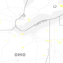
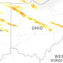
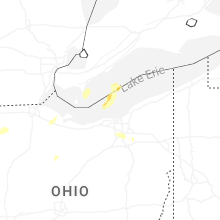


Connect with Interactive Hail Maps