

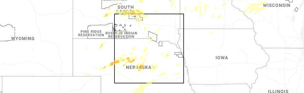
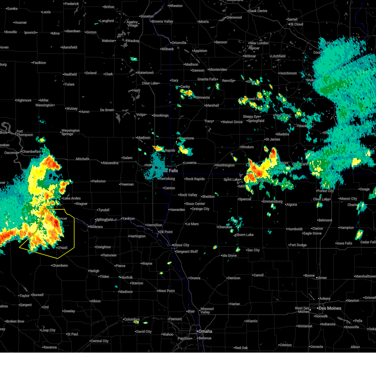
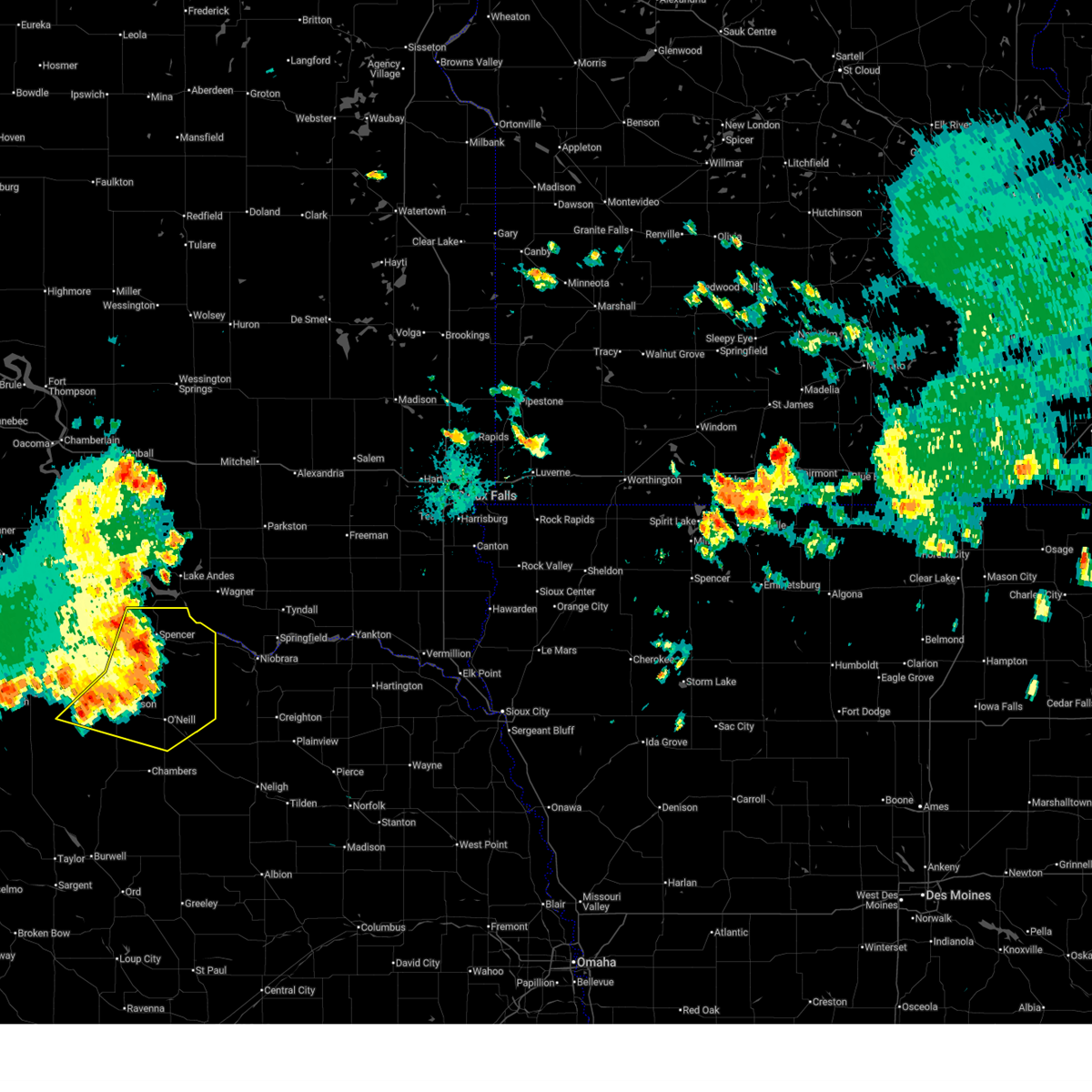
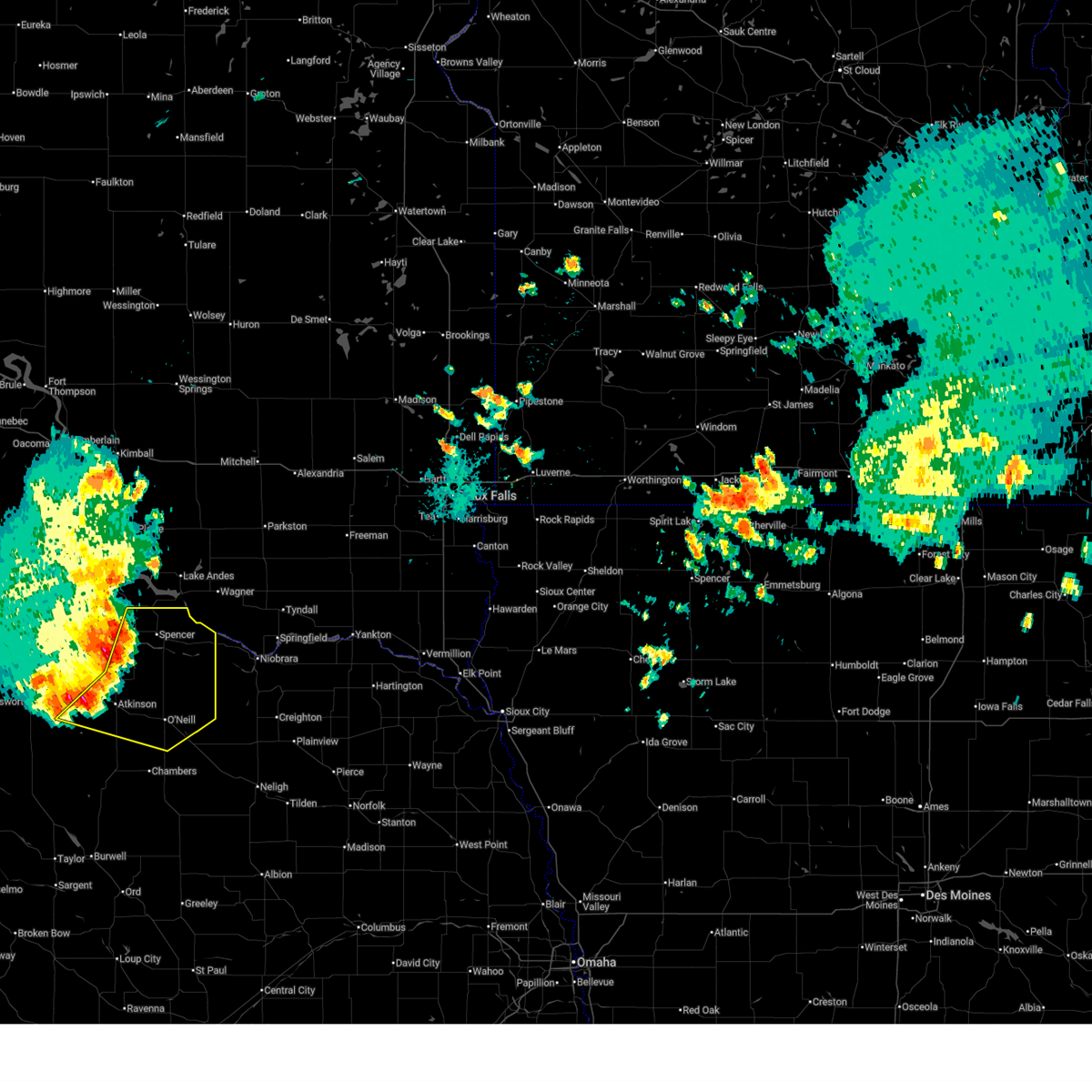
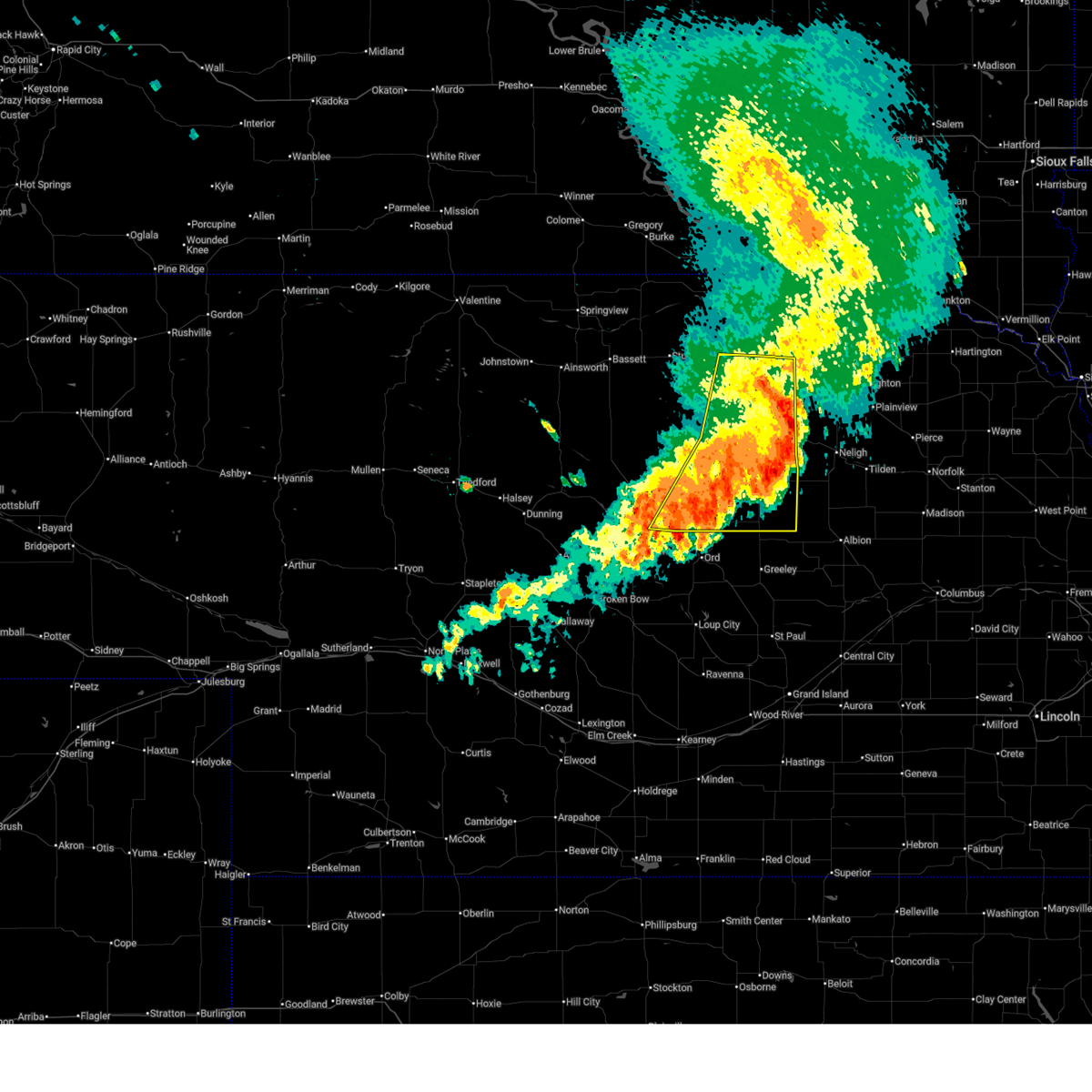
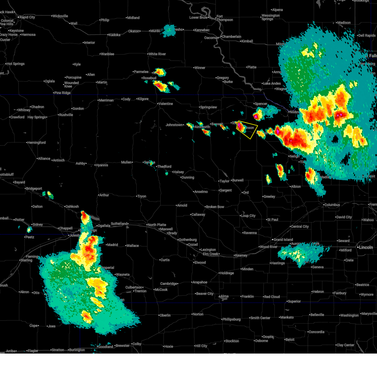
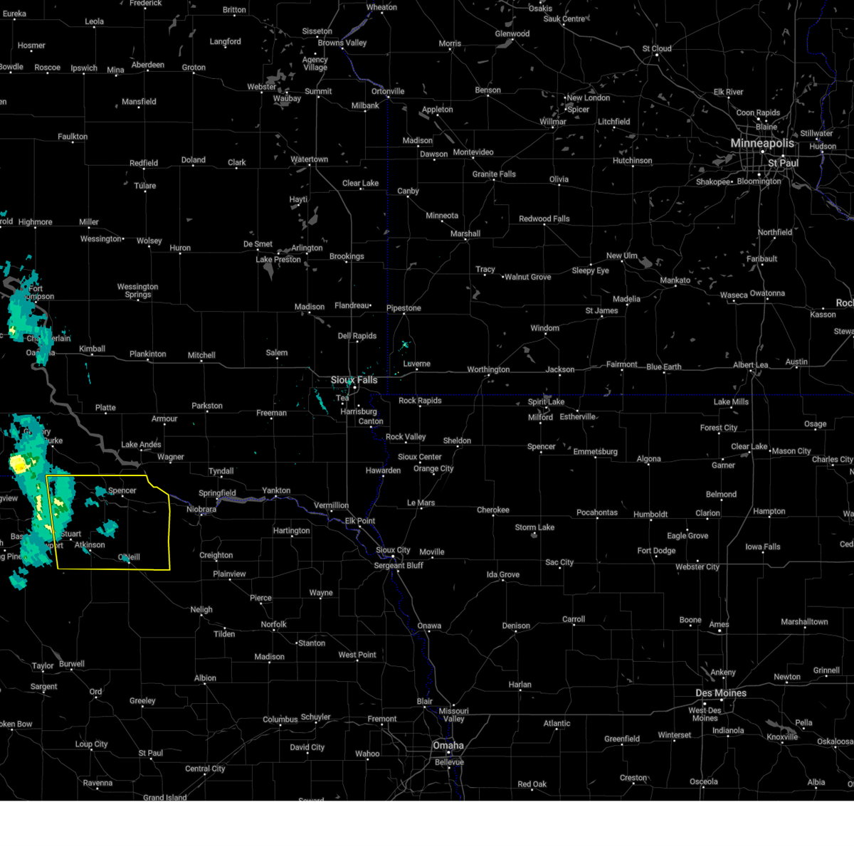
Hail Map for Emmet, NE
The Emmet, NE area has had 5 reports of on-the-ground hail by trained spotters, and has been under severe weather warnings 18 times during the past 12 months. Doppler radar has detected hail at or near Emmet, NE on 63 occasions, including 3 occasions during the past year.
| Name: | Emmet, NE |
| Where Located: | 8.2 miles W of Oneill, NE |
| Map: | Google Map for Emmet, NE |
| Population: | 48 |
| Housing Units: | 24 |
| More Info: | Search Google for Emmet, NE |
1
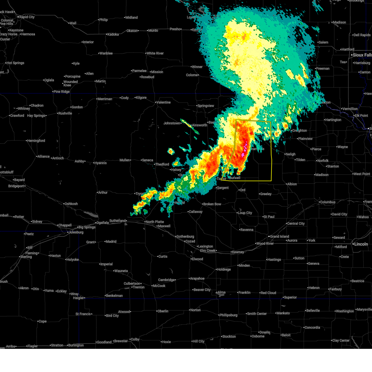
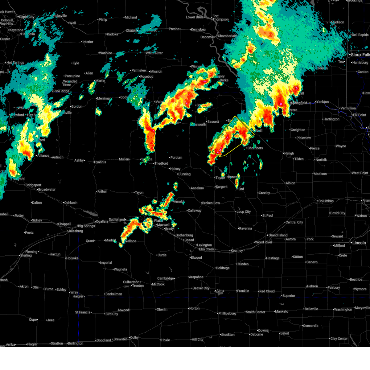
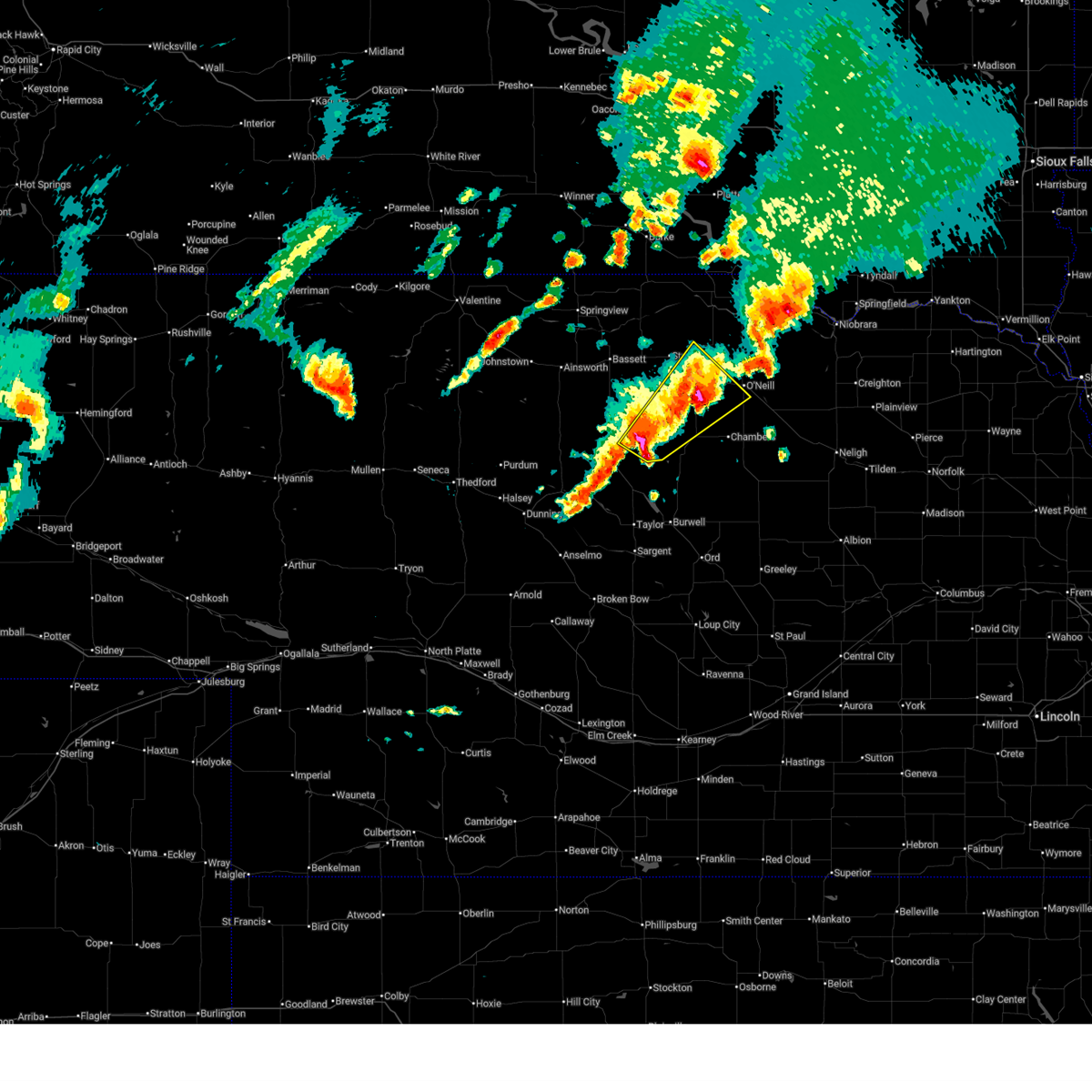
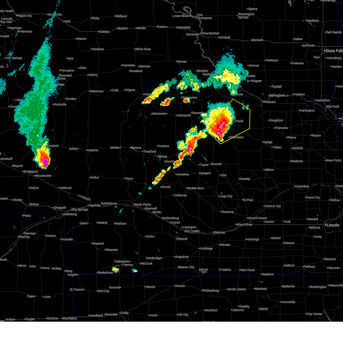
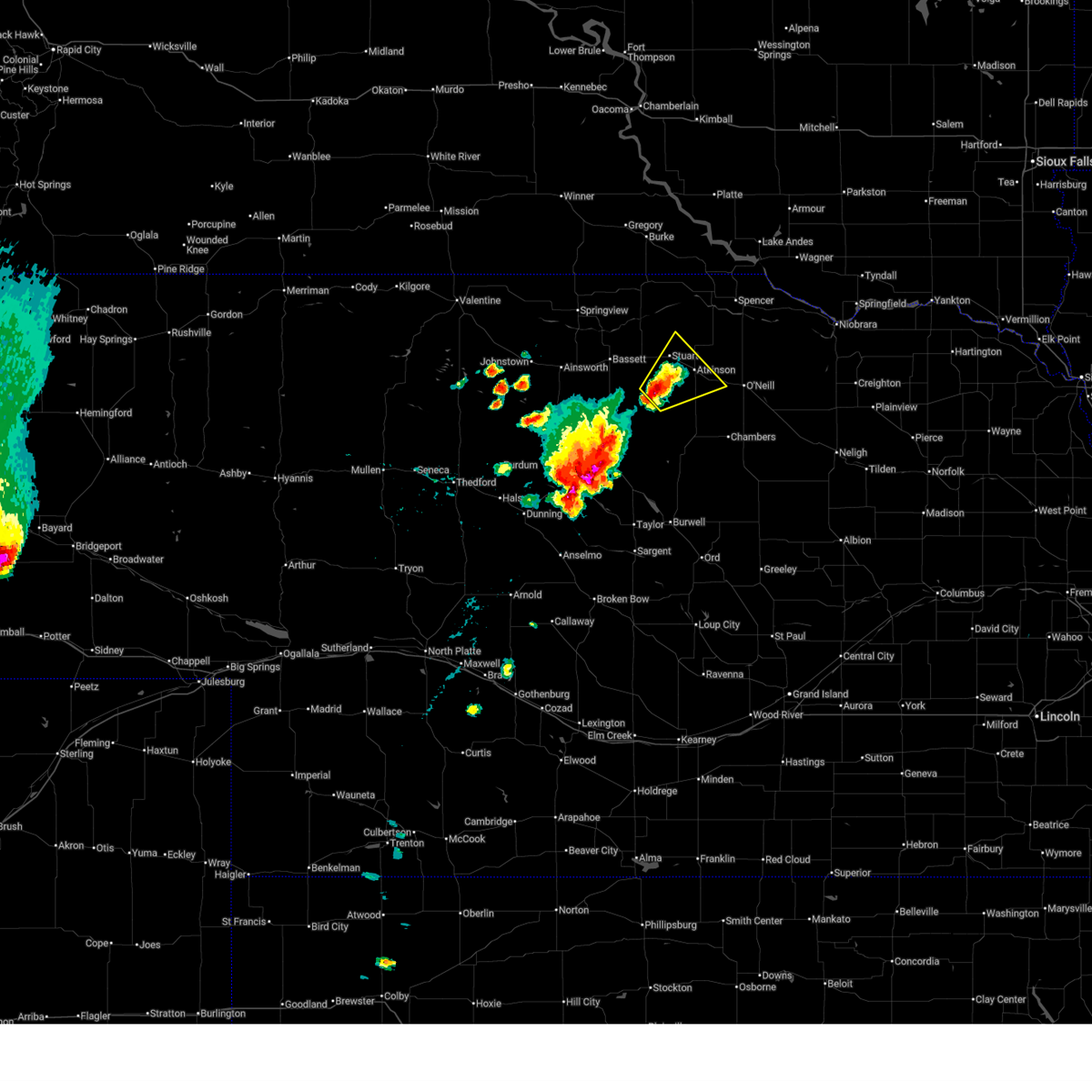
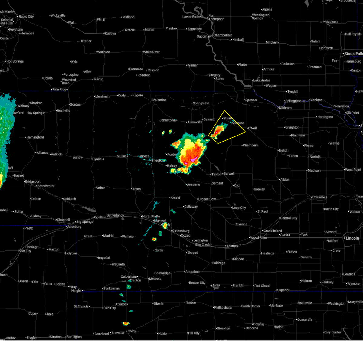
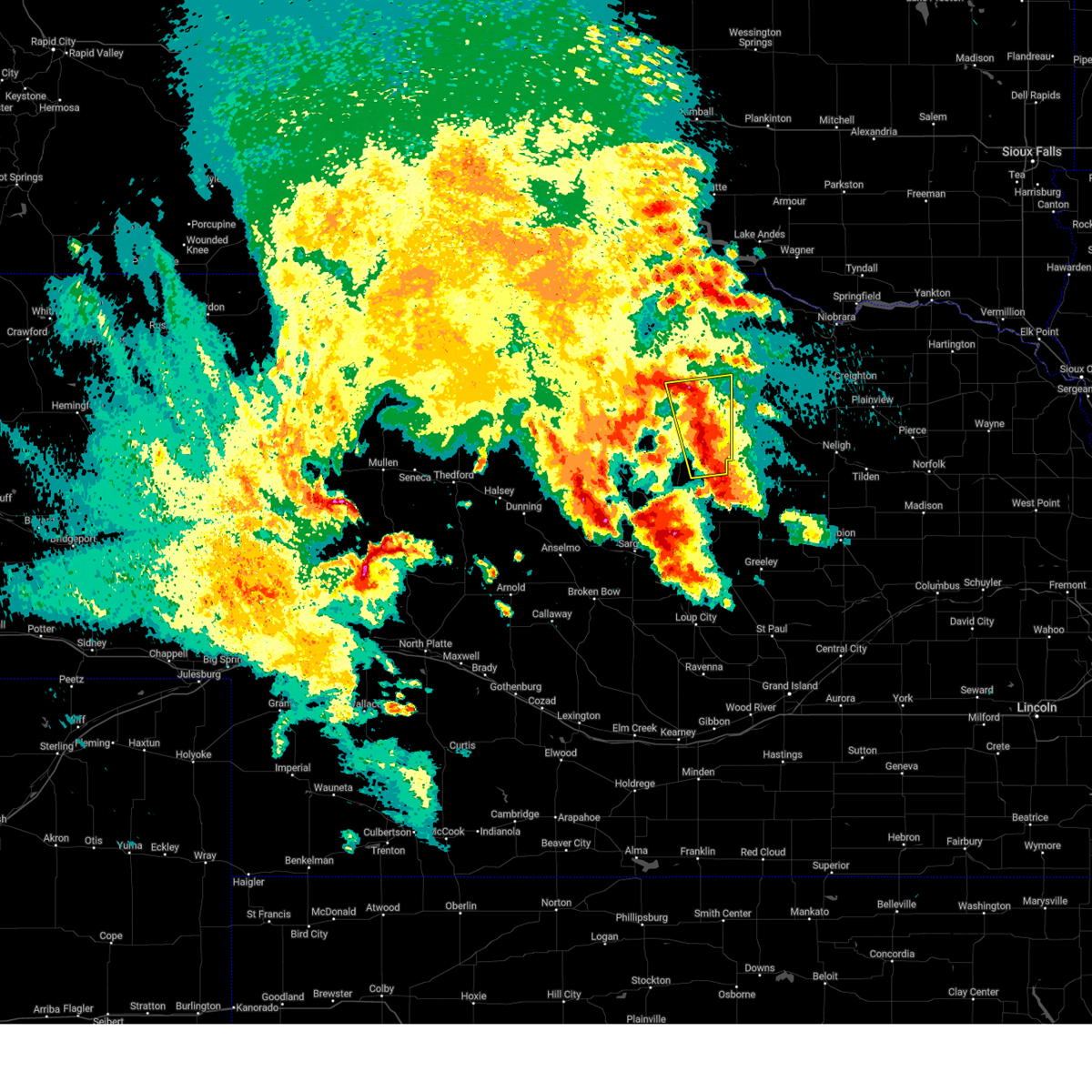
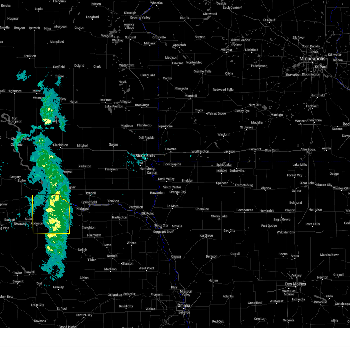
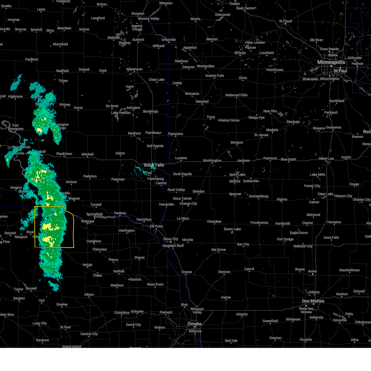
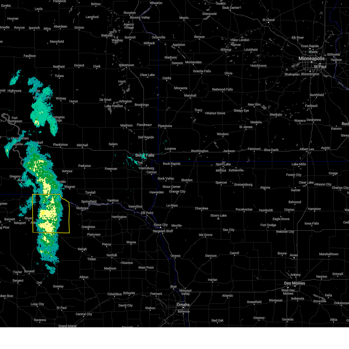
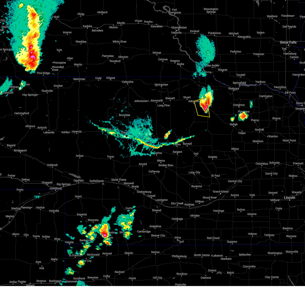
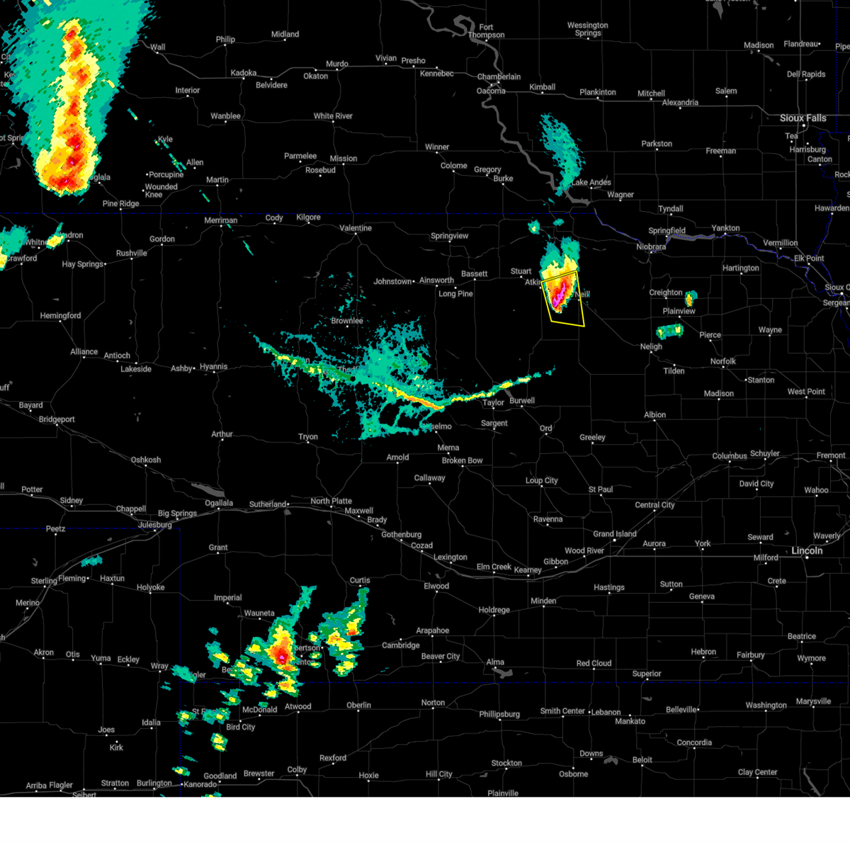
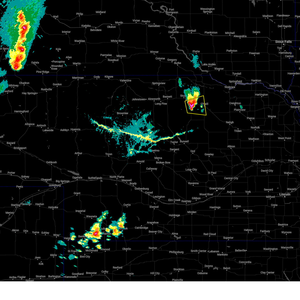
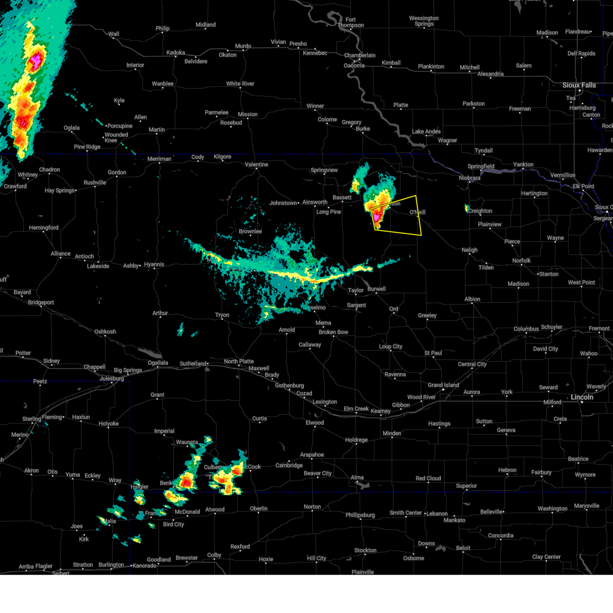
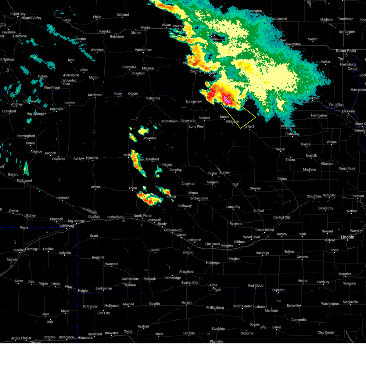
The Top Recent Hail Date for Emmet, NE is Tuesday, June 9, 2026 (25th out of 63)
Hail and Wind Damage Spotted near Emmet, NE
| Date / Time | Report Details |
|---|---|
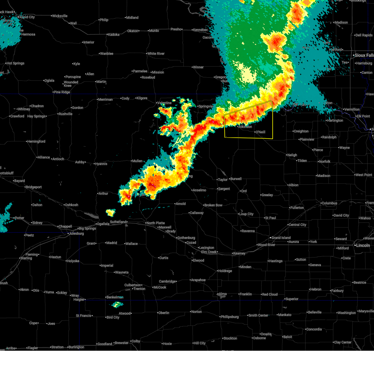
| 6/9/2026 10:09 PM CDT |
 Svrlbf the national weather service in north platte has issued a * severe thunderstorm warning for, northeastern rock county in north central nebraska, northern holt county in north central nebraska, eastern keya paha county in north central nebraska, boyd county in north central nebraska, * until 1100 pm cdt. * at 1008 pm cdt, severe thunderstorms were located along a line extending from near o'neill to 13 miles northeast of atkinson to near newport, moving northeast at 65 mph (radar indicated. at 1004 pm cdt, a 67 mph gust was reported 7 miles southwest of atkinson). Hazards include 70 mph wind gusts. Expect considerable tree damage. Damage is likely to mobile homes, roofs, and outbuildings. Svrlbf the national weather service in north platte has issued a * severe thunderstorm warning for, northeastern rock county in north central nebraska, northern holt county in north central nebraska, eastern keya paha county in north central nebraska, boyd county in north central nebraska, * until 1100 pm cdt. * at 1008 pm cdt, severe thunderstorms were located along a line extending from near o'neill to 13 miles northeast of atkinson to near newport, moving northeast at 65 mph (radar indicated. at 1004 pm cdt, a 67 mph gust was reported 7 miles southwest of atkinson). Hazards include 70 mph wind gusts. Expect considerable tree damage. Damage is likely to mobile homes, roofs, and outbuildings.
|
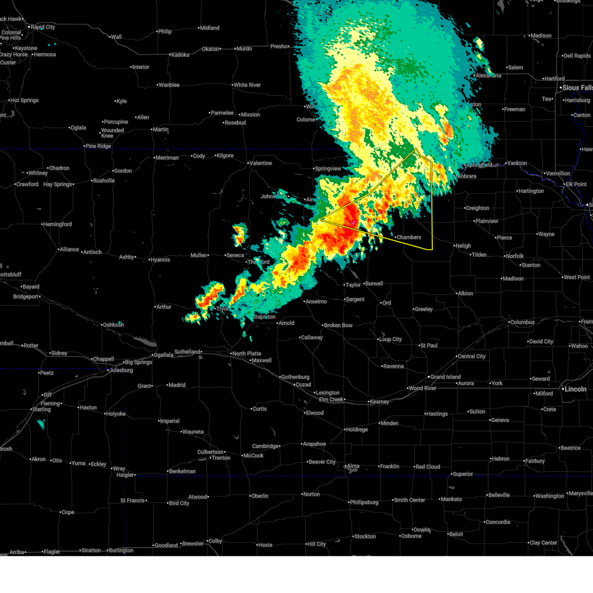
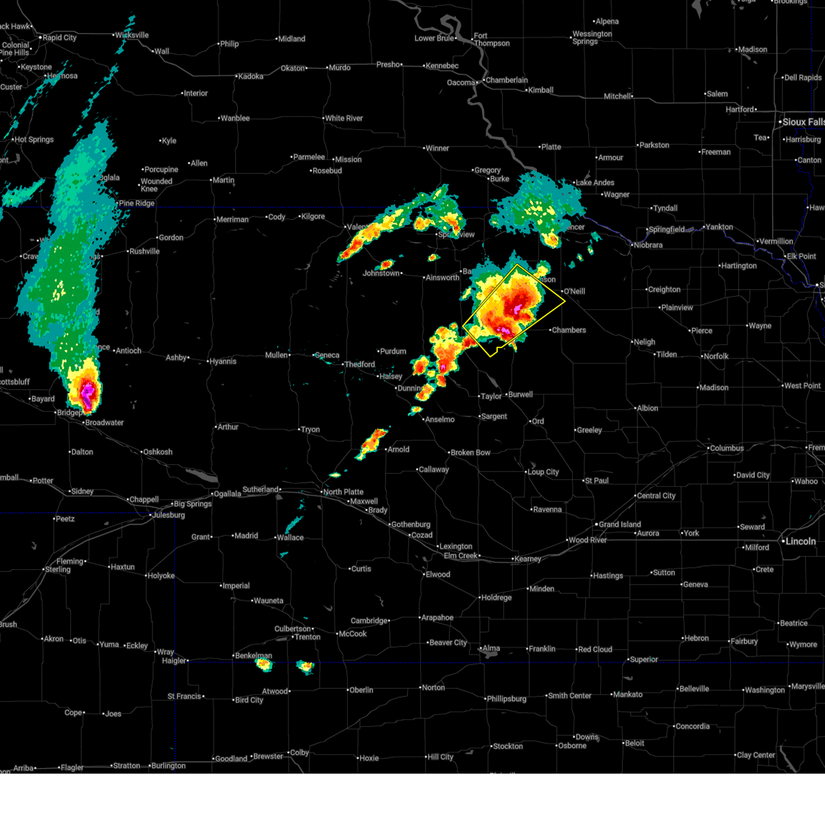
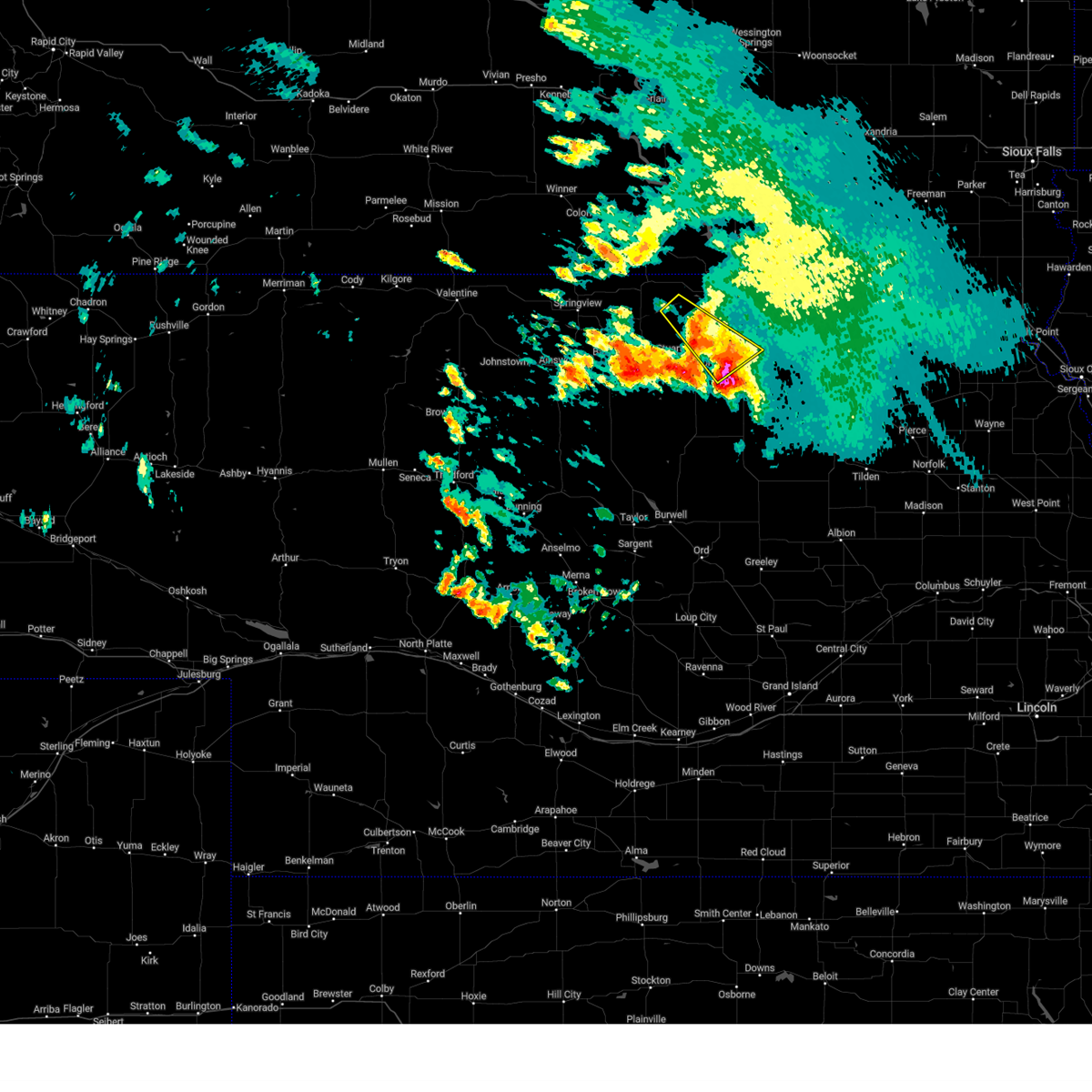
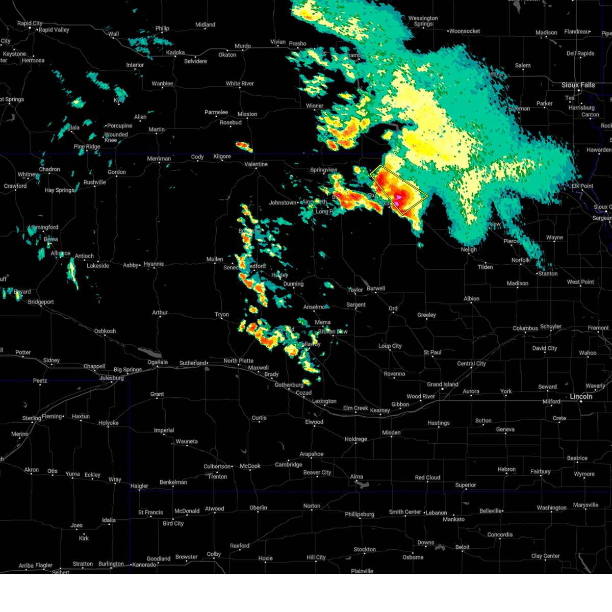
| 6/9/2026 9:53 PM CDT |
 At 952 pm cdt, severe thunderstorms were located along a line extending from 14 miles northeast of rose to 7 miles south of atkinson to 8 miles north of chambers, moving northeast at 55 mph (radar indicated). Hazards include 60 mph wind gusts and nickel size hail. Expect damage to roofs, siding, and trees. locations impacted include, o'neill, bassett, atkinson, stuart, chambers, newport, amelia, emmet, sybrant, twin lakes state wildlife management area, mariaville, pony lake, and midway. this includes the following highways, highway 183 between mile markers 156 and 182. highway 20 between mile markers 258 and 309. Highway 281 between mile markers 175 and 206. At 952 pm cdt, severe thunderstorms were located along a line extending from 14 miles northeast of rose to 7 miles south of atkinson to 8 miles north of chambers, moving northeast at 55 mph (radar indicated). Hazards include 60 mph wind gusts and nickel size hail. Expect damage to roofs, siding, and trees. locations impacted include, o'neill, bassett, atkinson, stuart, chambers, newport, amelia, emmet, sybrant, twin lakes state wildlife management area, mariaville, pony lake, and midway. this includes the following highways, highway 183 between mile markers 156 and 182. highway 20 between mile markers 258 and 309. Highway 281 between mile markers 175 and 206.
|
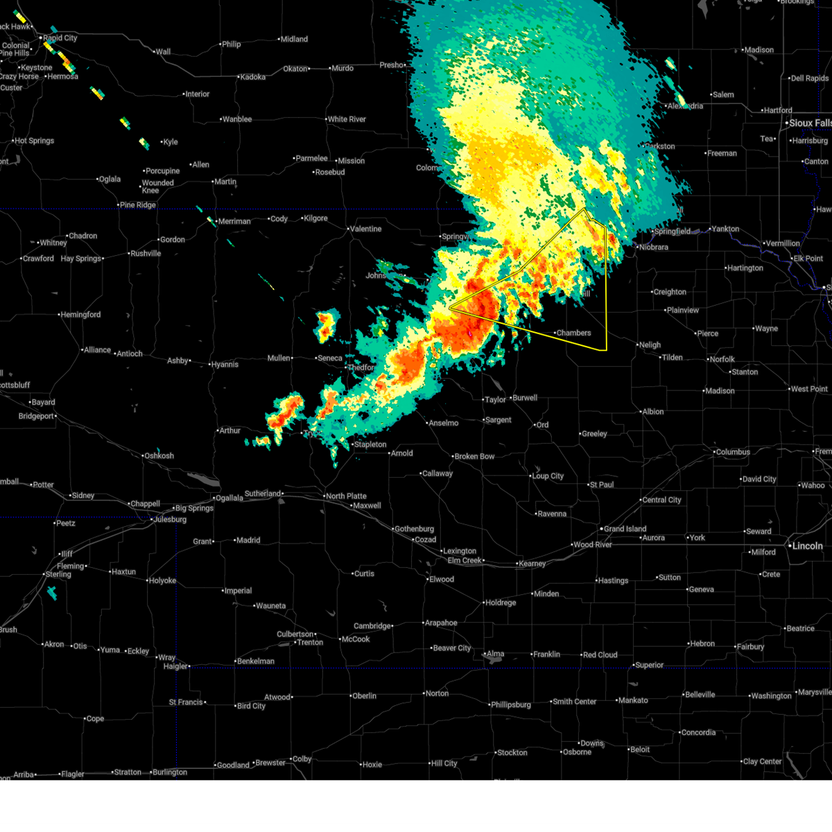
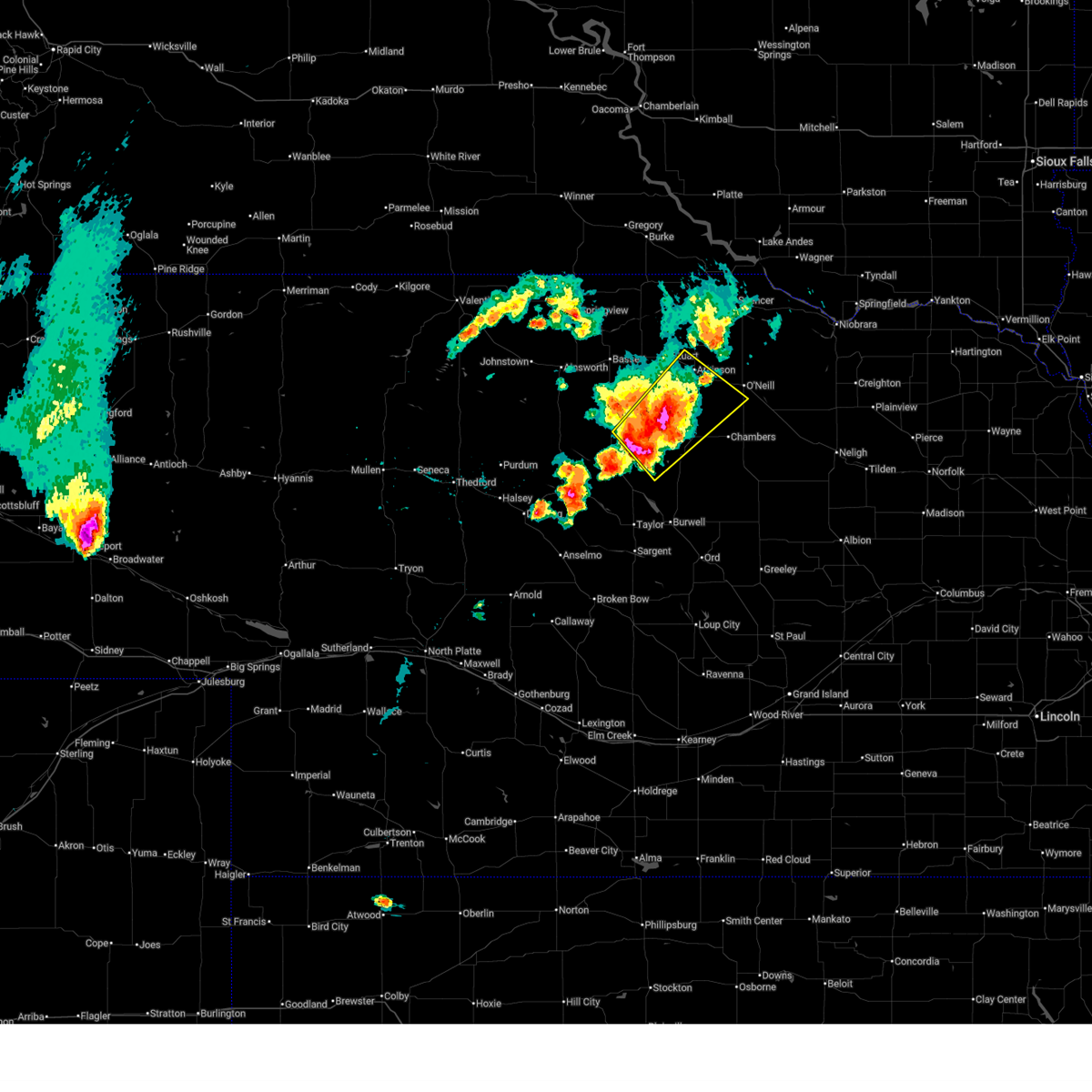
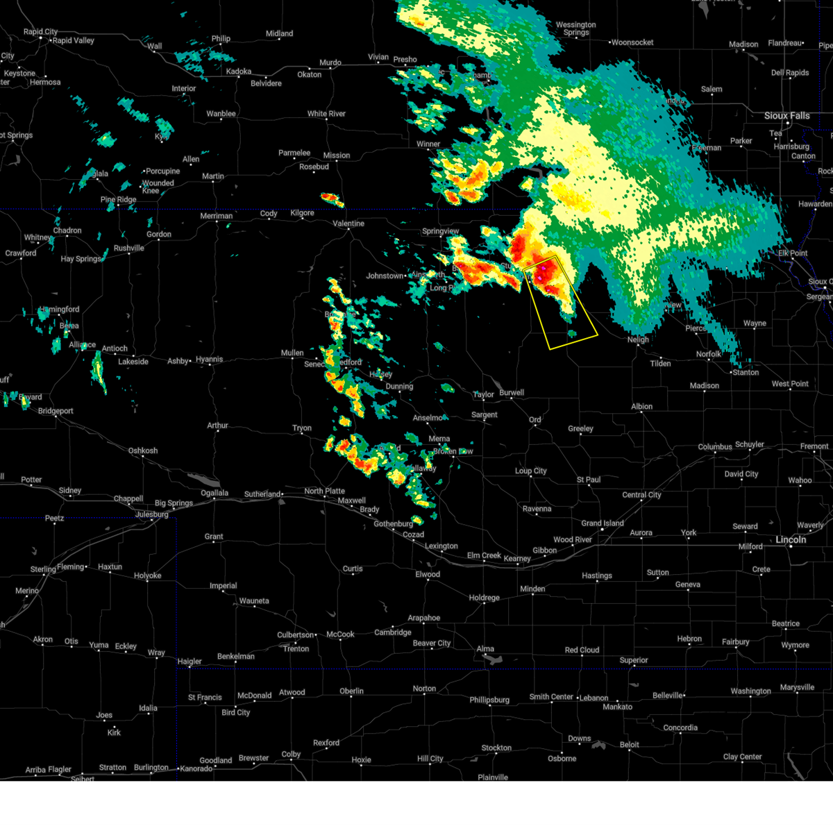
| 6/9/2026 9:24 PM CDT |
 Svrlbf the national weather service in north platte has issued a * severe thunderstorm warning for, rock county in north central nebraska, northeastern loup county in north central nebraska, northern garfield county in north central nebraska, holt county in north central nebraska, northwestern wheeler county in north central nebraska, * until 1015 pm cdt. * at 924 pm cdt, severe thunderstorms were located along a line extending from 14 miles north of calamus reservoir state recreation area to 12 miles southwest of chambers, moving north at 55 mph (radar indicated). Hazards include 60 mph wind gusts and nickel size hail. expect damage to roofs, siding, and trees Svrlbf the national weather service in north platte has issued a * severe thunderstorm warning for, rock county in north central nebraska, northeastern loup county in north central nebraska, northern garfield county in north central nebraska, holt county in north central nebraska, northwestern wheeler county in north central nebraska, * until 1015 pm cdt. * at 924 pm cdt, severe thunderstorms were located along a line extending from 14 miles north of calamus reservoir state recreation area to 12 miles southwest of chambers, moving north at 55 mph (radar indicated). Hazards include 60 mph wind gusts and nickel size hail. expect damage to roofs, siding, and trees
|
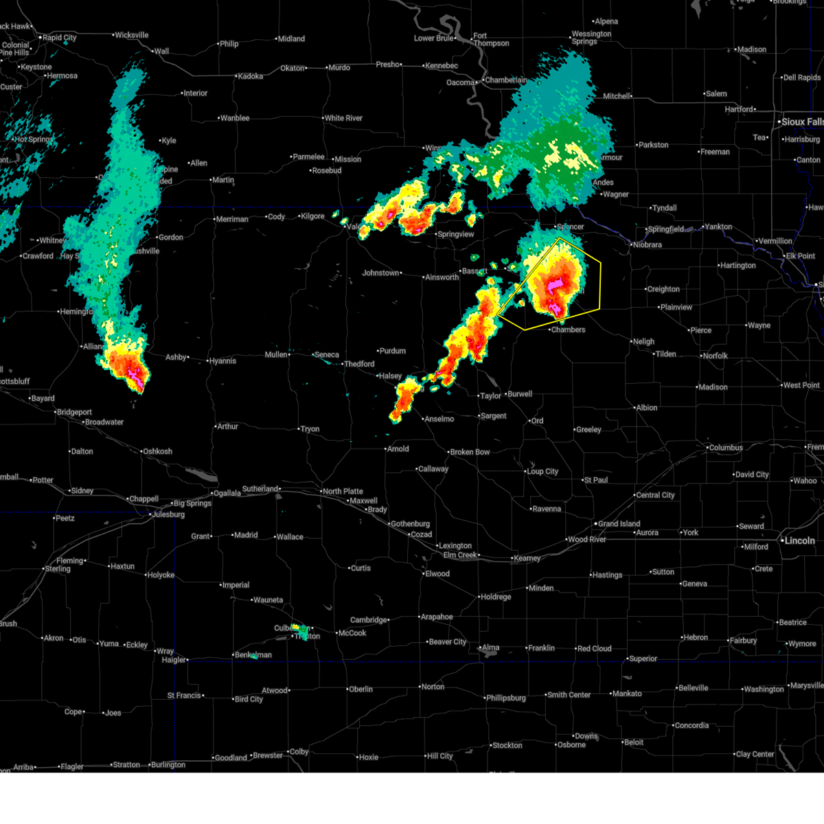
| 8/17/2025 11:35 PM CDT |
 The storms which prompted the warning have weakened below severe limits, and no longer pose an immediate threat to life or property. therefore, the warning will be allowed to expire. however, gusty winds and heavy rain are still possible with these thunderstorms. a severe thunderstorm watch remains in effect until 400 am cdt for north central nebraska. to report severe weather, contact your nearest law enforcement agency. they will relay your report to the national weather service north platte. The storms which prompted the warning have weakened below severe limits, and no longer pose an immediate threat to life or property. therefore, the warning will be allowed to expire. however, gusty winds and heavy rain are still possible with these thunderstorms. a severe thunderstorm watch remains in effect until 400 am cdt for north central nebraska. to report severe weather, contact your nearest law enforcement agency. they will relay your report to the national weather service north platte.
|
| 8/17/2025 11:20 PM CDT |
 At 1120 pm cdt, severe thunderstorms were located along a line extending from near spencer to 13 miles north of o'neill to near atkinson, moving east at 45 mph (radar indicated). Hazards include 60 mph wind gusts and quarter size hail. Hail damage to vehicles is expected. expect wind damage to roofs, siding, and trees. these severe storms will be near, gross around 1125 pm cdt. o'neill and lynch around 1130 pm cdt. other locations impacted by these severe thunderstorms include monowi, bristow, emmet, scottville, inman, redbird state wildlife management area, hull lake state wildlife management area, opportunity, spencer dam, and midway. this includes the following highways, highway 20 between mile markers 278 and 317. highway 281 between mile markers 173 and 223. Highway 12 between mile markers 110 and 144. At 1120 pm cdt, severe thunderstorms were located along a line extending from near spencer to 13 miles north of o'neill to near atkinson, moving east at 45 mph (radar indicated). Hazards include 60 mph wind gusts and quarter size hail. Hail damage to vehicles is expected. expect wind damage to roofs, siding, and trees. these severe storms will be near, gross around 1125 pm cdt. o'neill and lynch around 1130 pm cdt. other locations impacted by these severe thunderstorms include monowi, bristow, emmet, scottville, inman, redbird state wildlife management area, hull lake state wildlife management area, opportunity, spencer dam, and midway. this includes the following highways, highway 20 between mile markers 278 and 317. highway 281 between mile markers 173 and 223. Highway 12 between mile markers 110 and 144.
|
| 8/17/2025 11:02 PM CDT |
 Svrlbf the national weather service in north platte has issued a * severe thunderstorm warning for, east central rock county in north central nebraska, central holt county in north central nebraska, boyd county in north central nebraska, * until 1145 pm cdt. * at 1102 pm cdt, severe thunderstorms were located along a line extending from butte to 10 miles north of atkinson to 10 miles south of newport, moving east at 45 mph (radar indicated). Hazards include 60 mph wind gusts and quarter size hail. Hail damage to vehicles is expected. expect wind damage to roofs, siding, and trees. severe thunderstorms will be near, spencer and atkinson around 1105 pm cdt. gross around 1115 pm cdt. lynch around 1120 pm cdt. o'neill around 1130 pm cdt. other locations impacted by these severe thunderstorms include monowi, bristow, emmet, scottville, inman, redbird state wildlife management area, hull lake state wildlife management area, opportunity, spencer dam, and midway. this includes the following highways, highway 20 between mile markers 278 and 317. highway 281 between mile markers 173 and 223. Highway 12 between mile markers 110 and 144. Svrlbf the national weather service in north platte has issued a * severe thunderstorm warning for, east central rock county in north central nebraska, central holt county in north central nebraska, boyd county in north central nebraska, * until 1145 pm cdt. * at 1102 pm cdt, severe thunderstorms were located along a line extending from butte to 10 miles north of atkinson to 10 miles south of newport, moving east at 45 mph (radar indicated). Hazards include 60 mph wind gusts and quarter size hail. Hail damage to vehicles is expected. expect wind damage to roofs, siding, and trees. severe thunderstorms will be near, spencer and atkinson around 1105 pm cdt. gross around 1115 pm cdt. lynch around 1120 pm cdt. o'neill around 1130 pm cdt. other locations impacted by these severe thunderstorms include monowi, bristow, emmet, scottville, inman, redbird state wildlife management area, hull lake state wildlife management area, opportunity, spencer dam, and midway. this includes the following highways, highway 20 between mile markers 278 and 317. highway 281 between mile markers 173 and 223. Highway 12 between mile markers 110 and 144.
|
| 8/14/2025 1:09 AM CDT |
 The storms which prompted the warning have weakened below severe limits, and have exited the warned area. therefore, the warning will be allowed to expire. The storms which prompted the warning have weakened below severe limits, and have exited the warned area. therefore, the warning will be allowed to expire.
|
| 8/14/2025 12:59 AM CDT |
 At 1258 am cdt, severe thunderstorms were located along a line extending from 9 miles north of page to 6 miles west of clearwater to near ericson, moving east at 35 mph (radar indicated). Hazards include 60 mph wind gusts. Expect damage to roofs, siding, and trees. locations impacted include, o'neill, burwell, ewing, chambers, page, bartlett, ericson, inman, emmet, knievels corner, virginia smith dam, buffalo flats, kent diversion dam state wildlife management area, sunfish lake, cumminsville, four corners, pibel lake state recreation area, opportunity, goose lake state wildlife management area, and deverre. this includes the following highways, highway 20 between mile markers 298 and 328. Highway 281 between mile markers 132 and 193. At 1258 am cdt, severe thunderstorms were located along a line extending from 9 miles north of page to 6 miles west of clearwater to near ericson, moving east at 35 mph (radar indicated). Hazards include 60 mph wind gusts. Expect damage to roofs, siding, and trees. locations impacted include, o'neill, burwell, ewing, chambers, page, bartlett, ericson, inman, emmet, knievels corner, virginia smith dam, buffalo flats, kent diversion dam state wildlife management area, sunfish lake, cumminsville, four corners, pibel lake state recreation area, opportunity, goose lake state wildlife management area, and deverre. this includes the following highways, highway 20 between mile markers 298 and 328. Highway 281 between mile markers 132 and 193.
|
| 8/14/2025 12:25 AM CDT |
 Svrlbf the national weather service in north platte has issued a * severe thunderstorm warning for, southeastern loup county in north central nebraska, garfield county in north central nebraska, southeastern holt county in north central nebraska, wheeler county in north central nebraska, * until 115 am cdt. * at 1225 am cdt, severe thunderstorms were located along a line extending from near atkinson to near chambers to near burwell, moving east at 35 mph (radar indicated). Hazards include 60 mph wind gusts. expect damage to roofs, siding, and trees Svrlbf the national weather service in north platte has issued a * severe thunderstorm warning for, southeastern loup county in north central nebraska, garfield county in north central nebraska, southeastern holt county in north central nebraska, wheeler county in north central nebraska, * until 115 am cdt. * at 1225 am cdt, severe thunderstorms were located along a line extending from near atkinson to near chambers to near burwell, moving east at 35 mph (radar indicated). Hazards include 60 mph wind gusts. expect damage to roofs, siding, and trees
|
| 8/13/2025 11:57 PM CDT |
 The storms which prompted the warning have weakened. therefore, the warning will be allowed to expire. however, gusty winds are still possible with these thunderstorms. a severe thunderstorm watch remains in effect until 100 am cdt for north central nebraska. The storms which prompted the warning have weakened. therefore, the warning will be allowed to expire. however, gusty winds are still possible with these thunderstorms. a severe thunderstorm watch remains in effect until 100 am cdt for north central nebraska.
|
| 8/13/2025 11:49 PM CDT |
 At 1149 pm cdt, severe thunderstorms were located along a line extending from near verdel to near o'neill to 12 miles west of amelia, moving southeast at 25 mph (radar indicated). Hazards include 60 mph wind gusts. Expect damage to roofs, siding, and trees. locations impacted include, o'neill, atkinson, ewing, chambers, lynch, page, gross, amelia, inman, bristow, emmet, monowi, knievels corner, sybrant, scottville, redbird state wildlife management area, pony lake, opportunity, spencer dam, and midway. this includes the following highways, highway 183 between mile markers 166 and 171. highway 20 between mile markers 282 and 328. highway 281 between mile markers 163 and 213. Highway 12 between mile markers 127 and 144. At 1149 pm cdt, severe thunderstorms were located along a line extending from near verdel to near o'neill to 12 miles west of amelia, moving southeast at 25 mph (radar indicated). Hazards include 60 mph wind gusts. Expect damage to roofs, siding, and trees. locations impacted include, o'neill, atkinson, ewing, chambers, lynch, page, gross, amelia, inman, bristow, emmet, monowi, knievels corner, sybrant, scottville, redbird state wildlife management area, pony lake, opportunity, spencer dam, and midway. this includes the following highways, highway 183 between mile markers 166 and 171. highway 20 between mile markers 282 and 328. highway 281 between mile markers 163 and 213. Highway 12 between mile markers 127 and 144.
|
| 8/13/2025 11:09 PM CDT |
 Svrlbf the national weather service in north platte has issued a * severe thunderstorm warning for, central rock county in north central nebraska, holt county in north central nebraska, eastern boyd county in north central nebraska, * until midnight cdt. * at 1108 pm cdt, severe thunderstorms were located along a line extending from near gross to near atkinson to 13 miles north of rose, moving east at 35 mph (public. at 1054 pm 65 mph winds were reported 7 miles west southwest of butte). Hazards include 70 mph wind gusts. Expect considerable tree damage. Damage is likely to mobile homes, roofs, and outbuildings. Svrlbf the national weather service in north platte has issued a * severe thunderstorm warning for, central rock county in north central nebraska, holt county in north central nebraska, eastern boyd county in north central nebraska, * until midnight cdt. * at 1108 pm cdt, severe thunderstorms were located along a line extending from near gross to near atkinson to 13 miles north of rose, moving east at 35 mph (public. at 1054 pm 65 mph winds were reported 7 miles west southwest of butte). Hazards include 70 mph wind gusts. Expect considerable tree damage. Damage is likely to mobile homes, roofs, and outbuildings.
|
| 7/15/2025 7:58 PM CDT |
 The storms which prompted the warning have weakened below severe limits, and no longer pose an immediate threat to life or property. therefore, the warning will be allowed to expire. however, gusty winds and heavy rain are still possible with these thunderstorms. a severe thunderstorm watch remains in effect until 1100 pm cdt for north central nebraska. The storms which prompted the warning have weakened below severe limits, and no longer pose an immediate threat to life or property. therefore, the warning will be allowed to expire. however, gusty winds and heavy rain are still possible with these thunderstorms. a severe thunderstorm watch remains in effect until 1100 pm cdt for north central nebraska.
|
| 7/15/2025 7:08 PM CDT |
 Svrlbf the national weather service in north platte has issued a * severe thunderstorm warning for, central holt county in north central nebraska, southeastern boyd county in north central nebraska, * until 800 pm cdt. * at 708 pm cdt, severe thunderstorms were located along a line extending from atkinson to 14 miles south of lynch to near verdel, moving southeast at 35 mph (radar indicated). Hazards include 60 mph wind gusts. expect damage to roofs, siding, and trees Svrlbf the national weather service in north platte has issued a * severe thunderstorm warning for, central holt county in north central nebraska, southeastern boyd county in north central nebraska, * until 800 pm cdt. * at 708 pm cdt, severe thunderstorms were located along a line extending from atkinson to 14 miles south of lynch to near verdel, moving southeast at 35 mph (radar indicated). Hazards include 60 mph wind gusts. expect damage to roofs, siding, and trees
|
| 7/15/2025 6:41 PM CDT |
 At 640 pm cdt, severe thunderstorms were located along a line extending from near marty to 10 miles south of spencer to newport, moving east at 25 mph (radar indicated). Hazards include 60 mph wind gusts. Expect damage to roofs, siding, and trees. locations impacted include, spencer, atkinson, stuart, butte, lynch, newport, gross, bristow, emmet, dustin, anoka, monowi, scottville, redbird state wildlife management area, hull lake state wildlife management area, spencer dam, midway, parshall bridge state wildlife management area, and anncar. this includes the following highways, highway 20 between mile markers 265 and 301. highway 281 between mile markers 190 and 222. Highway 12 between mile markers 111 and 144. At 640 pm cdt, severe thunderstorms were located along a line extending from near marty to 10 miles south of spencer to newport, moving east at 25 mph (radar indicated). Hazards include 60 mph wind gusts. Expect damage to roofs, siding, and trees. locations impacted include, spencer, atkinson, stuart, butte, lynch, newport, gross, bristow, emmet, dustin, anoka, monowi, scottville, redbird state wildlife management area, hull lake state wildlife management area, spencer dam, midway, parshall bridge state wildlife management area, and anncar. this includes the following highways, highway 20 between mile markers 265 and 301. highway 281 between mile markers 190 and 222. Highway 12 between mile markers 111 and 144.
|
| 7/15/2025 6:12 PM CDT |
 Svrlbf the national weather service in north platte has issued a * severe thunderstorm warning for, northeastern rock county in north central nebraska, northern holt county in north central nebraska, boyd county in north central nebraska, * until 715 pm cdt. * at 612 pm cdt, severe thunderstorms were located along a line extending from 8 miles northwest of gross to near newport, moving southeast at 35 mph (radar indicated). Hazards include 60 mph wind gusts. expect damage to roofs, siding, and trees Svrlbf the national weather service in north platte has issued a * severe thunderstorm warning for, northeastern rock county in north central nebraska, northern holt county in north central nebraska, boyd county in north central nebraska, * until 715 pm cdt. * at 612 pm cdt, severe thunderstorms were located along a line extending from 8 miles northwest of gross to near newport, moving southeast at 35 mph (radar indicated). Hazards include 60 mph wind gusts. expect damage to roofs, siding, and trees
|
| 7/7/2025 7:33 PM CDT |
 At 733 pm cdt, a severe thunderstorm was located near atkinson, or 12 miles northwest of o'neill, moving east at 25 mph (radar indicated). Hazards include 60 mph wind gusts and quarter size hail. Hail damage to vehicles is expected. expect wind damage to roofs, siding, and trees. locations impacted include, atkinson and emmet. this includes the following highways, highway 20 between mile markers 287 and 304. Highway 281 between mile markers 189 and 191. At 733 pm cdt, a severe thunderstorm was located near atkinson, or 12 miles northwest of o'neill, moving east at 25 mph (radar indicated). Hazards include 60 mph wind gusts and quarter size hail. Hail damage to vehicles is expected. expect wind damage to roofs, siding, and trees. locations impacted include, atkinson and emmet. this includes the following highways, highway 20 between mile markers 287 and 304. Highway 281 between mile markers 189 and 191.
|
| 7/7/2025 7:15 PM CDT |
 Svrlbf the national weather service in north platte has issued a * severe thunderstorm warning for, central holt county in north central nebraska, * until 800 pm cdt. * at 715 pm cdt, a severe thunderstorm was located over atkinson, or 17 miles west of o'neill, moving east at 20 mph (radar indicated). Hazards include 60 mph wind gusts and quarter size hail. Hail damage to vehicles is expected. Expect wind damage to roofs, siding, and trees. Svrlbf the national weather service in north platte has issued a * severe thunderstorm warning for, central holt county in north central nebraska, * until 800 pm cdt. * at 715 pm cdt, a severe thunderstorm was located over atkinson, or 17 miles west of o'neill, moving east at 20 mph (radar indicated). Hazards include 60 mph wind gusts and quarter size hail. Hail damage to vehicles is expected. Expect wind damage to roofs, siding, and trees.
|
| 6/22/2025 9:45 PM CDT |
 The storm which prompted the warning has weakened below severe limits, and has exited the warned area. therefore, the warning has been allowed to expire. a severe thunderstorm watch remains in effect until 1100 pm cdt for north central nebraska. to report severe weather, contact your nearest law enforcement agency. they will relay your report to the national weather service north platte. The storm which prompted the warning has weakened below severe limits, and has exited the warned area. therefore, the warning has been allowed to expire. a severe thunderstorm watch remains in effect until 1100 pm cdt for north central nebraska. to report severe weather, contact your nearest law enforcement agency. they will relay your report to the national weather service north platte.
|
| 6/22/2025 8:58 PM CDT |
 Svrlbf the national weather service in north platte has issued a * severe thunderstorm warning for, southeastern rock county in north central nebraska, southwestern holt county in north central nebraska, * until 945 pm cdt. * at 858 pm cdt, a severe thunderstorm was located 13 miles east of rose, or 27 miles north of burwell, moving northeast at 40 mph (radar indicated). Hazards include 60 mph wind gusts and half dollar size hail. Hail damage to vehicles is expected. Expect wind damage to roofs, siding, and trees. Svrlbf the national weather service in north platte has issued a * severe thunderstorm warning for, southeastern rock county in north central nebraska, southwestern holt county in north central nebraska, * until 945 pm cdt. * at 858 pm cdt, a severe thunderstorm was located 13 miles east of rose, or 27 miles north of burwell, moving northeast at 40 mph (radar indicated). Hazards include 60 mph wind gusts and half dollar size hail. Hail damage to vehicles is expected. Expect wind damage to roofs, siding, and trees.
|
| 6/22/2025 7:25 PM CDT |
 At 725 pm cdt, a severe thunderstorm was located near o'neill, moving northeast at 40 mph (radar indicated). Hazards include ping pong ball size hail and 60 mph wind gusts. People and animals outdoors will be injured. expect hail damage to roofs, siding, windows, and vehicles. expect wind damage to roofs, siding, and trees. locations impacted include, o'neill, page, amelia, inman, emmet, opportunity, midway, and scottville. this includes the following highways, highway 20 between mile markers 291 and 327. Highway 281 between mile markers 171 and 207. At 725 pm cdt, a severe thunderstorm was located near o'neill, moving northeast at 40 mph (radar indicated). Hazards include ping pong ball size hail and 60 mph wind gusts. People and animals outdoors will be injured. expect hail damage to roofs, siding, windows, and vehicles. expect wind damage to roofs, siding, and trees. locations impacted include, o'neill, page, amelia, inman, emmet, opportunity, midway, and scottville. this includes the following highways, highway 20 between mile markers 291 and 327. Highway 281 between mile markers 171 and 207.
|
| 6/22/2025 7:07 PM CDT |
 Svrlbf the national weather service in north platte has issued a * severe thunderstorm warning for, central holt county in north central nebraska, * until 745 pm cdt. * at 706 pm cdt, a severe thunderstorm was located 7 miles northeast of amelia, or 14 miles southwest of o'neill, moving northeast at 40 mph (radar indicated). Hazards include ping pong ball size hail and 60 mph wind gusts. People and animals outdoors will be injured. expect hail damage to roofs, siding, windows, and vehicles. Expect wind damage to roofs, siding, and trees. Svrlbf the national weather service in north platte has issued a * severe thunderstorm warning for, central holt county in north central nebraska, * until 745 pm cdt. * at 706 pm cdt, a severe thunderstorm was located 7 miles northeast of amelia, or 14 miles southwest of o'neill, moving northeast at 40 mph (radar indicated). Hazards include ping pong ball size hail and 60 mph wind gusts. People and animals outdoors will be injured. expect hail damage to roofs, siding, windows, and vehicles. Expect wind damage to roofs, siding, and trees.
|
| 6/22/2025 6:54 PM CDT |
 At 653 pm cdt, a severe thunderstorm was located 7 miles northwest of amelia, or 23 miles southwest of o'neill, moving northeast at 30 mph (radar indicated). Hazards include golf ball size hail and 60 mph wind gusts. People and animals outdoors will be injured. expect hail damage to roofs, siding, windows, and vehicles. expect wind damage to roofs, siding, and trees. locations impacted include, atkinson, amelia, emmet, and sybrant. this includes the following highways, highway 20 between mile markers 282 and 302. Highway 281 between mile markers 178 and 179. At 653 pm cdt, a severe thunderstorm was located 7 miles northwest of amelia, or 23 miles southwest of o'neill, moving northeast at 30 mph (radar indicated). Hazards include golf ball size hail and 60 mph wind gusts. People and animals outdoors will be injured. expect hail damage to roofs, siding, windows, and vehicles. expect wind damage to roofs, siding, and trees. locations impacted include, atkinson, amelia, emmet, and sybrant. this includes the following highways, highway 20 between mile markers 282 and 302. Highway 281 between mile markers 178 and 179.
|
| 6/22/2025 6:54 PM CDT |
 the severe thunderstorm warning has been cancelled and is no longer in effect the severe thunderstorm warning has been cancelled and is no longer in effect
|
| 6/22/2025 6:40 PM CDT |
 Svrlbf the national weather service in north platte has issued a * severe thunderstorm warning for, southeastern rock county in north central nebraska, northeastern loup county in north central nebraska, northwestern garfield county in north central nebraska, southwestern holt county in north central nebraska, * until 730 pm cdt. * at 640 pm cdt, a severe thunderstorm was located 13 miles west of amelia, or 29 miles southeast of bassett, moving northeast at 30 mph (radar indicated). Hazards include ping pong ball size hail and 60 mph wind gusts. People and animals outdoors will be injured. expect hail damage to roofs, siding, windows, and vehicles. Expect wind damage to roofs, siding, and trees. Svrlbf the national weather service in north platte has issued a * severe thunderstorm warning for, southeastern rock county in north central nebraska, northeastern loup county in north central nebraska, northwestern garfield county in north central nebraska, southwestern holt county in north central nebraska, * until 730 pm cdt. * at 640 pm cdt, a severe thunderstorm was located 13 miles west of amelia, or 29 miles southeast of bassett, moving northeast at 30 mph (radar indicated). Hazards include ping pong ball size hail and 60 mph wind gusts. People and animals outdoors will be injured. expect hail damage to roofs, siding, windows, and vehicles. Expect wind damage to roofs, siding, and trees.
|
| 6/22/2025 6:27 PM CDT |
 The storm which prompted the warning has weakened below severe limits, and no longer poses an immediate threat to life or property. therefore, the warning will be allowed to expire. a severe thunderstorm watch remains in effect until 1100 pm cdt for north central nebraska. to report severe weather, contact your nearest law enforcement agency. they will relay your report to the national weather service north platte. The storm which prompted the warning has weakened below severe limits, and no longer poses an immediate threat to life or property. therefore, the warning will be allowed to expire. a severe thunderstorm watch remains in effect until 1100 pm cdt for north central nebraska. to report severe weather, contact your nearest law enforcement agency. they will relay your report to the national weather service north platte.
|
| 6/22/2025 6:02 PM CDT |
 At 602 pm cdt, a severe thunderstorm was located 11 miles south of stuart, or 20 miles southeast of bassett, moving northeast at 30 mph (radar indicated). Hazards include 60 mph wind gusts and half dollar size hail. Hail damage to vehicles is expected. expect wind damage to roofs, siding, and trees. locations impacted include, atkinson, stuart, and emmet. This includes highway 20 between mile markers 277 and 299. At 602 pm cdt, a severe thunderstorm was located 11 miles south of stuart, or 20 miles southeast of bassett, moving northeast at 30 mph (radar indicated). Hazards include 60 mph wind gusts and half dollar size hail. Hail damage to vehicles is expected. expect wind damage to roofs, siding, and trees. locations impacted include, atkinson, stuart, and emmet. This includes highway 20 between mile markers 277 and 299.
|
| 6/22/2025 5:47 PM CDT |
 Svrlbf the national weather service in north platte has issued a * severe thunderstorm warning for, east central rock county in north central nebraska, west central holt county in north central nebraska, * until 630 pm cdt. * at 547 pm cdt, a severe thunderstorm was located 17 miles south of newport, or 20 miles southeast of bassett, moving northeast at 30 mph (radar indicated). Hazards include golf ball size hail and 60 mph wind gusts. People and animals outdoors will be injured. expect hail damage to roofs, siding, windows, and vehicles. Expect wind damage to roofs, siding, and trees. Svrlbf the national weather service in north platte has issued a * severe thunderstorm warning for, east central rock county in north central nebraska, west central holt county in north central nebraska, * until 630 pm cdt. * at 547 pm cdt, a severe thunderstorm was located 17 miles south of newport, or 20 miles southeast of bassett, moving northeast at 30 mph (radar indicated). Hazards include golf ball size hail and 60 mph wind gusts. People and animals outdoors will be injured. expect hail damage to roofs, siding, windows, and vehicles. Expect wind damage to roofs, siding, and trees.
|
| 5/14/2025 10:29 PM CDT |
 The storm which prompted the warning has weakened below severe limits, and no longer poses an immediate threat to life or property. therefore, the warning will be allowed to expire. however, heavy rain is still possible with this thunderstorm. a severe thunderstorm watch remains in effect until 300 am cdt for north central nebraska. The storm which prompted the warning has weakened below severe limits, and no longer poses an immediate threat to life or property. therefore, the warning will be allowed to expire. however, heavy rain is still possible with this thunderstorm. a severe thunderstorm watch remains in effect until 300 am cdt for north central nebraska.
|
| 5/14/2025 10:14 PM CDT |
 At 1014 pm cdt, a severe thunderstorm was located near chambers, or 21 miles southwest of o'neill, moving north at 40 mph (radar indicated). Hazards include quarter size hail. Damage to vehicles is expected. locations impacted include, chambers, amelia, emmet, and sunfish lake. This includes highway 20 between mile markers 294 and 303. At 1014 pm cdt, a severe thunderstorm was located near chambers, or 21 miles southwest of o'neill, moving north at 40 mph (radar indicated). Hazards include quarter size hail. Damage to vehicles is expected. locations impacted include, chambers, amelia, emmet, and sunfish lake. This includes highway 20 between mile markers 294 and 303.
|
| 5/14/2025 9:52 PM CDT |
 Svrlbf the national weather service in north platte has issued a * severe thunderstorm warning for, northeastern garfield county in north central nebraska, southwestern holt county in north central nebraska, * until 1030 pm cdt. * at 952 pm cdt, a severe thunderstorm was located near amelia, or 26 miles southwest of o'neill, moving north at 40 mph (radar indicated). Hazards include ping pong ball size hail. People and animals outdoors will be injured. Expect damage to roofs, siding, windows, and vehicles. Svrlbf the national weather service in north platte has issued a * severe thunderstorm warning for, northeastern garfield county in north central nebraska, southwestern holt county in north central nebraska, * until 1030 pm cdt. * at 952 pm cdt, a severe thunderstorm was located near amelia, or 26 miles southwest of o'neill, moving north at 40 mph (radar indicated). Hazards include ping pong ball size hail. People and animals outdoors will be injured. Expect damage to roofs, siding, windows, and vehicles.
|
| 4/21/2025 5:44 PM CDT |
 The storm which prompted the warning has weakened below severe limits, and has exited the warned area. therefore, the warning will be allowed to expire. however, gusty winds are still possible with this thunderstorm. The storm which prompted the warning has weakened below severe limits, and has exited the warned area. therefore, the warning will be allowed to expire. however, gusty winds are still possible with this thunderstorm.
|
| 4/21/2025 5:31 PM CDT |
 the severe thunderstorm warning has been cancelled and is no longer in effect the severe thunderstorm warning has been cancelled and is no longer in effect
|
| 4/21/2025 5:31 PM CDT |
 At 530 pm cdt, a severe thunderstorm was located near spencer, moving east at 35 mph (radar indicated). Hazards include 60 mph wind gusts. Expect damage to roofs, siding, and trees. locations impacted include, o'neill, spencer, atkinson, butte, lynch, gross, bristow, emmet, anoka, monowi, scottville, redbird state wildlife management area, hull lake state wildlife management area, opportunity, spencer dam, midway, dorsey, parshall bridge state wildlife management area, and anncar. this includes the following highways, highway 20 between mile markers 285 and 312. highway 281 between mile markers 181 and 223. Highway 12 between mile markers 102 and 144. At 530 pm cdt, a severe thunderstorm was located near spencer, moving east at 35 mph (radar indicated). Hazards include 60 mph wind gusts. Expect damage to roofs, siding, and trees. locations impacted include, o'neill, spencer, atkinson, butte, lynch, gross, bristow, emmet, anoka, monowi, scottville, redbird state wildlife management area, hull lake state wildlife management area, opportunity, spencer dam, midway, dorsey, parshall bridge state wildlife management area, and anncar. this includes the following highways, highway 20 between mile markers 285 and 312. highway 281 between mile markers 181 and 223. Highway 12 between mile markers 102 and 144.
|
| 4/21/2025 4:43 PM CDT |
 Svrlbf the national weather service in north platte has issued a * severe thunderstorm warning for, northeastern rock county in north central nebraska, northern holt county in north central nebraska, northeastern keya paha county in north central nebraska, boyd county in north central nebraska, * until 545 pm cdt. * at 442 pm cdt, a severe thunderstorm was located 11 miles north of newport, or 17 miles northeast of bassett, moving east at 40 mph (radar indicated). Hazards include 60 mph wind gusts. expect damage to roofs, siding, and trees Svrlbf the national weather service in north platte has issued a * severe thunderstorm warning for, northeastern rock county in north central nebraska, northern holt county in north central nebraska, northeastern keya paha county in north central nebraska, boyd county in north central nebraska, * until 545 pm cdt. * at 442 pm cdt, a severe thunderstorm was located 11 miles north of newport, or 17 miles northeast of bassett, moving east at 40 mph (radar indicated). Hazards include 60 mph wind gusts. expect damage to roofs, siding, and trees
|
| 8/26/2024 5:35 PM CDT |
 Svrlbf the national weather service in north platte has issued a * severe thunderstorm warning for, central holt county in north central nebraska, * until 615 pm cdt. * at 533 pm cdt, a severe thunderstorm was located just west of o'neill, moving east at 35 mph (public). Hazards include tennis ball size hail. People and animals outdoors will be injured. Expect damage to roofs, siding, windows, and vehicles. Svrlbf the national weather service in north platte has issued a * severe thunderstorm warning for, central holt county in north central nebraska, * until 615 pm cdt. * at 533 pm cdt, a severe thunderstorm was located just west of o'neill, moving east at 35 mph (public). Hazards include tennis ball size hail. People and animals outdoors will be injured. Expect damage to roofs, siding, windows, and vehicles.
|
| 8/26/2024 5:25 PM CDT |
 At 524 pm cdt, a severe thunderstorm was located 7 miles west of o'neill, moving east at 35 mph (radar indicated). Hazards include tennis ball size hail. People and animals outdoors will be injured. expect damage to roofs, siding, windows, and vehicles. locations impacted include, o'neill and emmet. this includes the following highways, highway 20 between mile markers 292 and 308. Highway 281 between mile markers 173 and 191. At 524 pm cdt, a severe thunderstorm was located 7 miles west of o'neill, moving east at 35 mph (radar indicated). Hazards include tennis ball size hail. People and animals outdoors will be injured. expect damage to roofs, siding, windows, and vehicles. locations impacted include, o'neill and emmet. this includes the following highways, highway 20 between mile markers 292 and 308. Highway 281 between mile markers 173 and 191.
|
| 8/26/2024 5:20 PM CDT | Baseball sized hail reported 4.2 miles NNE of Emmet, NE |
| 8/26/2024 5:15 PM CDT |
 At 514 pm cdt, a severe thunderstorm was located 7 miles southeast of atkinson, or 12 miles west of o'neill, moving east at 35 mph (radar indicated). Hazards include two inch hail. People and animals outdoors will be injured. expect damage to roofs, siding, windows, and vehicles. locations impacted include, o'neill, atkinson, and emmet. this includes the following highways, highway 20 between mile markers 286 and 308. Highway 281 between mile markers 173 and 191. At 514 pm cdt, a severe thunderstorm was located 7 miles southeast of atkinson, or 12 miles west of o'neill, moving east at 35 mph (radar indicated). Hazards include two inch hail. People and animals outdoors will be injured. expect damage to roofs, siding, windows, and vehicles. locations impacted include, o'neill, atkinson, and emmet. this includes the following highways, highway 20 between mile markers 286 and 308. Highway 281 between mile markers 173 and 191.
|
| 8/26/2024 5:11 PM CDT | Hen Egg sized hail reported 7.8 miles NNE of Emmet, NE |
| 8/26/2024 5:09 PM CDT |
 At 507 pm cdt, a severe thunderstorm was located 4 miles south of atkinson, or 16 miles west of o'neill, moving east at 30 mph (radar indicated). Hazards include golf ball size hail. People and animals outdoors will be injured. expect damage to roofs, siding, windows, and vehicles. locations impacted include, o'neill, atkinson, and emmet. this includes the following highways, highway 20 between mile markers 286 and 308. Highway 281 between mile markers 173 and 191. At 507 pm cdt, a severe thunderstorm was located 4 miles south of atkinson, or 16 miles west of o'neill, moving east at 30 mph (radar indicated). Hazards include golf ball size hail. People and animals outdoors will be injured. expect damage to roofs, siding, windows, and vehicles. locations impacted include, o'neill, atkinson, and emmet. this includes the following highways, highway 20 between mile markers 286 and 308. Highway 281 between mile markers 173 and 191.
|
| 8/26/2024 4:55 PM CDT |
 Svrlbf the national weather service in north platte has issued a * severe thunderstorm warning for, central holt county in north central nebraska, * until 545 pm cdt. * at 455 pm cdt, a severe thunderstorm was located 8 miles southwest of atkinson, or 23 miles west of o'neill, moving east at 25 mph (radar indicated). Hazards include ping pong ball size hail. People and animals outdoors will be injured. Expect damage to roofs, siding, windows, and vehicles. Svrlbf the national weather service in north platte has issued a * severe thunderstorm warning for, central holt county in north central nebraska, * until 545 pm cdt. * at 455 pm cdt, a severe thunderstorm was located 8 miles southwest of atkinson, or 23 miles west of o'neill, moving east at 25 mph (radar indicated). Hazards include ping pong ball size hail. People and animals outdoors will be injured. Expect damage to roofs, siding, windows, and vehicles.
|
| 8/18/2024 6:20 AM CDT |
 The storms which prompted the warning have weakened below severe limits, and no longer pose an immediate threat to life or property. therefore, the warning will be allowed to expire. a severe thunderstorm watch remains in effect until 1000 am cdt for north central nebraska. The storms which prompted the warning have weakened below severe limits, and no longer pose an immediate threat to life or property. therefore, the warning will be allowed to expire. a severe thunderstorm watch remains in effect until 1000 am cdt for north central nebraska.
|
| 8/18/2024 6:12 AM CDT |
 Svrlbf the national weather service in north platte has issued a * severe thunderstorm warning for, southeastern holt county in north central nebraska, * until 700 am cdt. * at 612 am cdt, a severe thunderstorm was located near atkinson, or 12 miles northwest of o'neill, moving south at 35 mph (radar indicated). Hazards include ping pong ball size hail and 60 mph wind gusts. People and animals outdoors will be injured. expect hail damage to roofs, siding, windows, and vehicles. Expect wind damage to roofs, siding, and trees. Svrlbf the national weather service in north platte has issued a * severe thunderstorm warning for, southeastern holt county in north central nebraska, * until 700 am cdt. * at 612 am cdt, a severe thunderstorm was located near atkinson, or 12 miles northwest of o'neill, moving south at 35 mph (radar indicated). Hazards include ping pong ball size hail and 60 mph wind gusts. People and animals outdoors will be injured. expect hail damage to roofs, siding, windows, and vehicles. Expect wind damage to roofs, siding, and trees.
|
| 8/18/2024 6:07 AM CDT |
 At 606 am cdt, a cluster of severe thunderstorms were located 11 miles south of naper and 9 miles northeast of atkinson, moving southeast at 35 mph (radar indicated). Hazards include ping pong ball size hail and 60 mph wind gusts. People and animals outdoors will be injured. expect hail damage to roofs, siding, windows, and vehicles. expect wind damage to roofs, siding, and trees. locations impacted include, emmet, dustin, and midway. this includes the following highways, highway 20 near mile marker 299. Highway 281 between mile markers 191 and 200. At 606 am cdt, a cluster of severe thunderstorms were located 11 miles south of naper and 9 miles northeast of atkinson, moving southeast at 35 mph (radar indicated). Hazards include ping pong ball size hail and 60 mph wind gusts. People and animals outdoors will be injured. expect hail damage to roofs, siding, windows, and vehicles. expect wind damage to roofs, siding, and trees. locations impacted include, emmet, dustin, and midway. this includes the following highways, highway 20 near mile marker 299. Highway 281 between mile markers 191 and 200.
|
| 8/18/2024 5:40 AM CDT |
 Svrlbf the national weather service in north platte has issued a * severe thunderstorm warning for, northwestern holt county in north central nebraska, west central boyd county in north central nebraska, * until 630 am cdt. * at 539 am cdt, a severe thunderstorm was located 9 miles south of naper, or 17 miles west of spencer, moving southeast at 35 mph (radar indicated). Hazards include ping pong ball size hail and 60 mph wind gusts. People and animals outdoors will be injured. expect hail damage to roofs, siding, windows, and vehicles. Expect wind damage to roofs, siding, and trees. Svrlbf the national weather service in north platte has issued a * severe thunderstorm warning for, northwestern holt county in north central nebraska, west central boyd county in north central nebraska, * until 630 am cdt. * at 539 am cdt, a severe thunderstorm was located 9 miles south of naper, or 17 miles west of spencer, moving southeast at 35 mph (radar indicated). Hazards include ping pong ball size hail and 60 mph wind gusts. People and animals outdoors will be injured. expect hail damage to roofs, siding, windows, and vehicles. Expect wind damage to roofs, siding, and trees.
|
| 7/14/2024 3:46 AM CDT |
 The storms which prompted the warning have weakened below severe limits, and have exited the warned area. therefore, the warning has been allowed to expire. however, gusty winds are still possible with these thunderstorms. a severe thunderstorm watch remains in effect until 800 am cdt for north central nebraska. The storms which prompted the warning have weakened below severe limits, and have exited the warned area. therefore, the warning has been allowed to expire. however, gusty winds are still possible with these thunderstorms. a severe thunderstorm watch remains in effect until 800 am cdt for north central nebraska.
|
| 7/14/2024 3:35 AM CDT |
 At 334 am cdt, severe thunderstorms were located along a line extending from 6 miles south of verdel to 6 miles south of o'neill to 13 miles west of amelia, moving southeast at 70 mph. other strong to severe thunderstorms were located over western boyd and northwestern holt county. these storms are capable of producing penny sized hail and 60 mph wind gusts (radar indicated). Hazards include 60 mph wind gusts and penny size hail. Expect damage to roofs, siding, and trees. locations impacted include, o'neill, spencer, atkinson, stuart, butte, chambers, lynch, page, newport, naper, gross, amelia, inman, bristow, emmet, dustin, anoka, monowi, hull lake state wildlife management area, and mariaville. this includes the following highways, highway 20 between mile markers 270 and 328. highway 281 between mile markers 164 and 223. Highway 12 between mile markers 80 and 144. At 334 am cdt, severe thunderstorms were located along a line extending from 6 miles south of verdel to 6 miles south of o'neill to 13 miles west of amelia, moving southeast at 70 mph. other strong to severe thunderstorms were located over western boyd and northwestern holt county. these storms are capable of producing penny sized hail and 60 mph wind gusts (radar indicated). Hazards include 60 mph wind gusts and penny size hail. Expect damage to roofs, siding, and trees. locations impacted include, o'neill, spencer, atkinson, stuart, butte, chambers, lynch, page, newport, naper, gross, amelia, inman, bristow, emmet, dustin, anoka, monowi, hull lake state wildlife management area, and mariaville. this includes the following highways, highway 20 between mile markers 270 and 328. highway 281 between mile markers 164 and 223. Highway 12 between mile markers 80 and 144.
|
| 7/14/2024 3:35 AM CDT |
 the severe thunderstorm warning has been cancelled and is no longer in effect the severe thunderstorm warning has been cancelled and is no longer in effect
|
| 7/14/2024 3:18 AM CDT |
 At 316 am cdt, severe thunderstorms were located along a line extending from near gross to near stuart to 9 miles southeast of long pine, moving southeast at 70 mph. thunderstorms behind the line were entering western boyd and northwestern holt counties and these storms may contain hail up to penny size along with the potential for wind gusts to 60 mph (radar indicated). Hazards include 60 mph wind gusts and penny size hail. Expect damage to roofs, siding, and trees. locations impacted include, o'neill, ainsworth, bassett, spencer, atkinson, stuart, butte, long pine, chambers, lynch, page, newport, naper, gross, amelia, inman, bristow, emmet, dustin, and anoka. this includes the following highways, highway 183 between mile markers 160 and 204. highway 20 between mile markers 242 and 328. highway 281 between mile markers 164 and 223. Highway 12 between mile markers 69 and 144. At 316 am cdt, severe thunderstorms were located along a line extending from near gross to near stuart to 9 miles southeast of long pine, moving southeast at 70 mph. thunderstorms behind the line were entering western boyd and northwestern holt counties and these storms may contain hail up to penny size along with the potential for wind gusts to 60 mph (radar indicated). Hazards include 60 mph wind gusts and penny size hail. Expect damage to roofs, siding, and trees. locations impacted include, o'neill, ainsworth, bassett, spencer, atkinson, stuart, butte, long pine, chambers, lynch, page, newport, naper, gross, amelia, inman, bristow, emmet, dustin, and anoka. this includes the following highways, highway 183 between mile markers 160 and 204. highway 20 between mile markers 242 and 328. highway 281 between mile markers 164 and 223. Highway 12 between mile markers 69 and 144.
|
| 7/14/2024 2:59 AM CDT |
 Svrlbf the national weather service in north platte has issued a * severe thunderstorm warning for, rock county in north central nebraska, northern brown county in north central nebraska, holt county in north central nebraska, eastern keya paha county in north central nebraska, boyd county in north central nebraska, * until 345 am cdt. * at 258 am cdt, severe thunderstorms were located along a line extending from near bonesteel to 11 miles northwest of newport to near johnstown, moving southeast at 60 mph (radar indicated). Hazards include 60 mph wind gusts. expect damage to roofs, siding, and trees Svrlbf the national weather service in north platte has issued a * severe thunderstorm warning for, rock county in north central nebraska, northern brown county in north central nebraska, holt county in north central nebraska, eastern keya paha county in north central nebraska, boyd county in north central nebraska, * until 345 am cdt. * at 258 am cdt, severe thunderstorms were located along a line extending from near bonesteel to 11 miles northwest of newport to near johnstown, moving southeast at 60 mph (radar indicated). Hazards include 60 mph wind gusts. expect damage to roofs, siding, and trees
|
| 6/20/2024 8:59 PM CDT |
 The storm which prompted the warning has weakened below severe limits, and no longer poses an immediate threat to life or property. therefore, the warning will be allowed to expire. a severe thunderstorm watch remains in effect until midnight cdt for north central nebraska. to report severe weather, contact your nearest law enforcement agency. they will relay your report to the national weather service north platte. The storm which prompted the warning has weakened below severe limits, and no longer poses an immediate threat to life or property. therefore, the warning will be allowed to expire. a severe thunderstorm watch remains in effect until midnight cdt for north central nebraska. to report severe weather, contact your nearest law enforcement agency. they will relay your report to the national weather service north platte.
|
| 6/20/2024 8:18 PM CDT |
 Svrlbf the national weather service in north platte has issued a * severe thunderstorm warning for, central holt county in north central nebraska, * until 900 pm cdt. * at 817 pm cdt, a severe thunderstorm was located 9 miles southeast of atkinson, or 13 miles west of o'neill, moving east at 25 mph (radar indicated). Hazards include 60 mph wind gusts and quarter size hail. Hail damage to vehicles is expected. Expect wind damage to roofs, siding, and trees. Svrlbf the national weather service in north platte has issued a * severe thunderstorm warning for, central holt county in north central nebraska, * until 900 pm cdt. * at 817 pm cdt, a severe thunderstorm was located 9 miles southeast of atkinson, or 13 miles west of o'neill, moving east at 25 mph (radar indicated). Hazards include 60 mph wind gusts and quarter size hail. Hail damage to vehicles is expected. Expect wind damage to roofs, siding, and trees.
|
| 7/12/2023 4:01 AM CDT |
 At 400 am cdt, severe thunderstorms were located along a line extending from near verdel to 6 miles south of amelia, moving southeast at 60 mph (radar indicated). Hazards include 70 mph wind gusts. Expect considerable tree damage. Damage is likely to mobile homes, roofs, and outbuildings. At 400 am cdt, severe thunderstorms were located along a line extending from near verdel to 6 miles south of amelia, moving southeast at 60 mph (radar indicated). Hazards include 70 mph wind gusts. Expect considerable tree damage. Damage is likely to mobile homes, roofs, and outbuildings.
|
| 7/12/2023 3:21 AM CDT |
 At 321 am cdt, severe thunderstorms were located along a line extending from 6 miles northwest of butte to 12 miles north of rose, moving east at 60 mph (radar indicated). Hazards include 60 mph wind gusts. expect damage to roofs, siding, and trees At 321 am cdt, severe thunderstorms were located along a line extending from 6 miles northwest of butte to 12 miles north of rose, moving east at 60 mph (radar indicated). Hazards include 60 mph wind gusts. expect damage to roofs, siding, and trees
|
| 5/6/2023 7:09 PM CDT |
 At 708 pm cdt, a severe thunderstorm was located 7 miles southeast of atkinson, or 10 miles west of o`neill, moving east at 35 mph (radar indicated). Hazards include 60 mph wind gusts and quarter size hail. Hail damage to vehicles is expected. expect wind damage to roofs, siding, and trees. locations impacted include, o`neill, o`neill, atkinson, ewing, page, inman, emmet and opportunity. this includes the following highways, highway 20 between mile markers 290 and 328. highway 281 between mile markers 176 and 193. hail threat, radar indicated max hail size, 1. 00 in wind threat, radar indicated max wind gust, 60 mph. At 708 pm cdt, a severe thunderstorm was located 7 miles southeast of atkinson, or 10 miles west of o`neill, moving east at 35 mph (radar indicated). Hazards include 60 mph wind gusts and quarter size hail. Hail damage to vehicles is expected. expect wind damage to roofs, siding, and trees. locations impacted include, o`neill, o`neill, atkinson, ewing, page, inman, emmet and opportunity. this includes the following highways, highway 20 between mile markers 290 and 328. highway 281 between mile markers 176 and 193. hail threat, radar indicated max hail size, 1. 00 in wind threat, radar indicated max wind gust, 60 mph.
|
| 5/6/2023 6:47 PM CDT |
 At 647 pm cdt, a severe thunderstorm was located near atkinson, or 22 miles west of o`neill, moving east at 35 mph (radar indicated). Hazards include 60 mph wind gusts and half dollar size hail. Hail damage to vehicles is expected. expect wind damage to roofs, siding, and trees. locations impacted include, o`neill, o`neill, atkinson, stuart, ewing, page, inman, emmet, opportunity, dorsey and scottville. this includes the following highways, highway 20 between mile markers 278 and 328. highway 281 between mile markers 173 and 198. hail threat, radar indicated max hail size, 1. 25 in wind threat, radar indicated max wind gust, 60 mph. At 647 pm cdt, a severe thunderstorm was located near atkinson, or 22 miles west of o`neill, moving east at 35 mph (radar indicated). Hazards include 60 mph wind gusts and half dollar size hail. Hail damage to vehicles is expected. expect wind damage to roofs, siding, and trees. locations impacted include, o`neill, o`neill, atkinson, stuart, ewing, page, inman, emmet, opportunity, dorsey and scottville. this includes the following highways, highway 20 between mile markers 278 and 328. highway 281 between mile markers 173 and 198. hail threat, radar indicated max hail size, 1. 25 in wind threat, radar indicated max wind gust, 60 mph.
|
| 5/6/2023 6:25 PM CDT |
 At 624 pm cdt, a severe thunderstorm was located near newport, or 10 miles east of bassett, moving east at 35 mph. this storm has a history of producing large hail (radar indicated). Hazards include 60 mph wind gusts and half dollar size hail. Hail damage to vehicles is expected. Expect wind damage to roofs, siding, and trees. At 624 pm cdt, a severe thunderstorm was located near newport, or 10 miles east of bassett, moving east at 35 mph. this storm has a history of producing large hail (radar indicated). Hazards include 60 mph wind gusts and half dollar size hail. Hail damage to vehicles is expected. Expect wind damage to roofs, siding, and trees.
|
| 8/1/2022 7:38 PM CDT |
 At 737 pm cdt, severe thunderstorms were located along a line extending from 10 miles northeast of stuart to 6 miles northeast of atkinson to 9 miles west of o`neill, moving northeast at 30 mph (radar indicated). Hazards include 60 mph wind gusts and quarter size hail. Hail damage to vehicles is expected. Expect wind damage to roofs, siding, and trees. At 737 pm cdt, severe thunderstorms were located along a line extending from 10 miles northeast of stuart to 6 miles northeast of atkinson to 9 miles west of o`neill, moving northeast at 30 mph (radar indicated). Hazards include 60 mph wind gusts and quarter size hail. Hail damage to vehicles is expected. Expect wind damage to roofs, siding, and trees.
|
| 7/16/2022 1:37 PM CDT |
 At 137 pm cdt, a severe thunderstorm was located near o`neill, moving southeast at 20 mph (radar indicated). Hazards include 60 mph wind gusts and quarter size hail. Hail damage to vehicles is expected. expect wind damage to roofs, siding, and trees. locations impacted include, o`neill, o`neill, page, inman, emmet, opportunity, midway and scottville. this includes the following highways, highway 20 between mile markers 300 and 321. highway 281 between mile markers 169 and 203. hail threat, radar indicated max hail size, 1. 00 in wind threat, radar indicated max wind gust, 60 mph. At 137 pm cdt, a severe thunderstorm was located near o`neill, moving southeast at 20 mph (radar indicated). Hazards include 60 mph wind gusts and quarter size hail. Hail damage to vehicles is expected. expect wind damage to roofs, siding, and trees. locations impacted include, o`neill, o`neill, page, inman, emmet, opportunity, midway and scottville. this includes the following highways, highway 20 between mile markers 300 and 321. highway 281 between mile markers 169 and 203. hail threat, radar indicated max hail size, 1. 00 in wind threat, radar indicated max wind gust, 60 mph.
|
| 7/16/2022 1:33 PM CDT |
 At 133 pm cdt, a severe thunderstorm was located near o`neill, moving southeast at 20 mph (radar indicated). Hazards include 60 mph wind gusts and nickel size hail. Expect damage to roofs, siding, and trees. locations impacted include, o`neill, page, inman, emmet, opportunity, midway and scottville. this includes the following highways, highway 20 between mile markers 300 and 321. highway 281 between mile markers 169 and 203. hail threat, radar indicated max hail size, 0. 88 in wind threat, radar indicated max wind gust, 60 mph. At 133 pm cdt, a severe thunderstorm was located near o`neill, moving southeast at 20 mph (radar indicated). Hazards include 60 mph wind gusts and nickel size hail. Expect damage to roofs, siding, and trees. locations impacted include, o`neill, page, inman, emmet, opportunity, midway and scottville. this includes the following highways, highway 20 between mile markers 300 and 321. highway 281 between mile markers 169 and 203. hail threat, radar indicated max hail size, 0. 88 in wind threat, radar indicated max wind gust, 60 mph.
|
| 7/16/2022 1:14 PM CDT |
 At 114 pm cdt, a severe thunderstorm was located 8 miles north of o`neill, moving southeast at 20 mph (radar indicated). Hazards include 60 mph wind gusts and quarter size hail. Hail damage to vehicles is expected. Expect wind damage to roofs, siding, and trees. At 114 pm cdt, a severe thunderstorm was located 8 miles north of o`neill, moving southeast at 20 mph (radar indicated). Hazards include 60 mph wind gusts and quarter size hail. Hail damage to vehicles is expected. Expect wind damage to roofs, siding, and trees.
|
| 7/5/2022 3:26 PM CDT |
 At 325 pm cdt, severe thunderstorms were located along a line extending from verdigre to 7 miles northeast of page to near o`neill, moving southeast at 50 mph (radar indicated). Hazards include 60 mph wind gusts and quarter size hail. Hail damage to vehicles is expected. expect wind damage to roofs, siding, and trees. locations impacted include, o`neill, spencer, o`neill, atkinson, chambers, lynch, page, amelia, inman, bristow, emmet, monowi, scottville, redbird state wildlife management area, opportunity, spencer dam, midway, dorsey and anncar. this includes the following highways, highway 20 between mile markers 285 and 328. highway 281 between mile markers 166 and 213. highway 12 between mile markers 127 and 144. hail threat, radar indicated max hail size, 1. 00 in wind threat, radar indicated max wind gust, 60 mph. At 325 pm cdt, severe thunderstorms were located along a line extending from verdigre to 7 miles northeast of page to near o`neill, moving southeast at 50 mph (radar indicated). Hazards include 60 mph wind gusts and quarter size hail. Hail damage to vehicles is expected. expect wind damage to roofs, siding, and trees. locations impacted include, o`neill, spencer, o`neill, atkinson, chambers, lynch, page, amelia, inman, bristow, emmet, monowi, scottville, redbird state wildlife management area, opportunity, spencer dam, midway, dorsey and anncar. this includes the following highways, highway 20 between mile markers 285 and 328. highway 281 between mile markers 166 and 213. highway 12 between mile markers 127 and 144. hail threat, radar indicated max hail size, 1. 00 in wind threat, radar indicated max wind gust, 60 mph.
|
| 7/5/2022 3:04 PM CDT |
 At 304 pm cdt, severe thunderstorms were located along a line extending from 8 miles south of lynch to 9 miles northwest of o`neill to near stuart, moving south at 50 mph (radar indicated). Hazards include 60 mph wind gusts and quarter size hail. Hail damage to vehicles is expected. Expect wind damage to roofs, siding, and trees. At 304 pm cdt, severe thunderstorms were located along a line extending from 8 miles south of lynch to 9 miles northwest of o`neill to near stuart, moving south at 50 mph (radar indicated). Hazards include 60 mph wind gusts and quarter size hail. Hail damage to vehicles is expected. Expect wind damage to roofs, siding, and trees.
|
| 6/20/2022 4:59 PM CDT |
 At 458 pm cdt, a severe thunderstorm was located near amelia, or 18 miles southwest of o`neill, moving northeast at 50 mph (trained weather spotters). Hazards include 60 mph wind gusts and quarter size hail. Hail damage to vehicles is expected. expect wind damage to roofs, siding, and trees. locations impacted include, atkinson, stuart and emmet. this includes the following highways, highway 20 between mile markers 275 and 305. highway 281 between mile markers 189 and 194. hail threat, radar indicated max hail size, 1. 00 in wind threat, radar indicated max wind gust, 60 mph. At 458 pm cdt, a severe thunderstorm was located near amelia, or 18 miles southwest of o`neill, moving northeast at 50 mph (trained weather spotters). Hazards include 60 mph wind gusts and quarter size hail. Hail damage to vehicles is expected. expect wind damage to roofs, siding, and trees. locations impacted include, atkinson, stuart and emmet. this includes the following highways, highway 20 between mile markers 275 and 305. highway 281 between mile markers 189 and 194. hail threat, radar indicated max hail size, 1. 00 in wind threat, radar indicated max wind gust, 60 mph.
|
| 6/20/2022 4:39 PM CDT |
 At 439 pm cdt, severe thunderstorms were located along a line extending from 12 miles east of rose to 8 miles southwest of amelia, moving north at 50 mph (radar indicated). Hazards include 60 mph wind gusts and quarter size hail. Hail damage to vehicles is expected. Expect wind damage to roofs, siding, and trees. At 439 pm cdt, severe thunderstorms were located along a line extending from 12 miles east of rose to 8 miles southwest of amelia, moving north at 50 mph (radar indicated). Hazards include 60 mph wind gusts and quarter size hail. Hail damage to vehicles is expected. Expect wind damage to roofs, siding, and trees.
|
| 5/30/2022 11:18 AM CDT |
 At 1118 am cdt, a severe thunderstorm was located near o`neill, moving north at 50 mph (radar indicated). Hazards include 60 mph wind gusts and quarter size hail. Hail damage to vehicles is expected. expect wind damage to roofs, siding, and trees. locations impacted include, o`neill, o`neill, atkinson, emmet, midway and scottville. this includes the following highways, highway 20 between mile markers 284 and 312. highway 281 between mile markers 173 and 203. hail threat, radar indicated max hail size, 1. 00 in wind threat, radar indicated max wind gust, 60 mph. At 1118 am cdt, a severe thunderstorm was located near o`neill, moving north at 50 mph (radar indicated). Hazards include 60 mph wind gusts and quarter size hail. Hail damage to vehicles is expected. expect wind damage to roofs, siding, and trees. locations impacted include, o`neill, o`neill, atkinson, emmet, midway and scottville. this includes the following highways, highway 20 between mile markers 284 and 312. highway 281 between mile markers 173 and 203. hail threat, radar indicated max hail size, 1. 00 in wind threat, radar indicated max wind gust, 60 mph.
|
| 5/30/2022 10:56 AM CDT |
 At 1056 am cdt, a severe thunderstorm was located near chambers, or 21 miles southwest of o`neill, moving north at 45 mph (radar indicated). Hazards include ping pong ball size hail and 60 mph wind gusts. People and animals outdoors will be injured. expect hail damage to roofs, siding, windows, and vehicles. Expect wind damage to roofs, siding, and trees. At 1056 am cdt, a severe thunderstorm was located near chambers, or 21 miles southwest of o`neill, moving north at 45 mph (radar indicated). Hazards include ping pong ball size hail and 60 mph wind gusts. People and animals outdoors will be injured. expect hail damage to roofs, siding, windows, and vehicles. Expect wind damage to roofs, siding, and trees.
|
| 5/30/2022 9:43 AM CDT |
 At 943 am cdt, a severe thunderstorm was located 12 miles northeast of rose, or 18 miles south of bassett, moving northeast at 45 mph (radar indicated). Hazards include 60 mph wind gusts and quarter size hail. Hail damage to vehicles is expected. expect wind damage to roofs, siding, and trees. locations impacted include, bassett, spencer, atkinson, stuart, butte, lynch, newport, naper, gross, bristow, emmet, dustin, anoka, monowi, twin lakes state wildlife management area, hull lake state wildlife management area, duff, mariaville, mills and brocksburg. this includes the following highways, highway 183 between mile markers 155 and 182. highway 20 between mile markers 252 and 303. highway 281 between mile markers 188 and 223. highway 12 between mile markers 69 and 144. hail threat, radar indicated max hail size, 1. 00 in wind threat, radar indicated max wind gust, 60 mph. At 943 am cdt, a severe thunderstorm was located 12 miles northeast of rose, or 18 miles south of bassett, moving northeast at 45 mph (radar indicated). Hazards include 60 mph wind gusts and quarter size hail. Hail damage to vehicles is expected. expect wind damage to roofs, siding, and trees. locations impacted include, bassett, spencer, atkinson, stuart, butte, lynch, newport, naper, gross, bristow, emmet, dustin, anoka, monowi, twin lakes state wildlife management area, hull lake state wildlife management area, duff, mariaville, mills and brocksburg. this includes the following highways, highway 183 between mile markers 155 and 182. highway 20 between mile markers 252 and 303. highway 281 between mile markers 188 and 223. highway 12 between mile markers 69 and 144. hail threat, radar indicated max hail size, 1. 00 in wind threat, radar indicated max wind gust, 60 mph.
|
| 5/30/2022 9:31 AM CDT |
 At 931 am cdt, a severe thunderstorm was located over rose, or 24 miles northeast of brewster, moving northeast at 45 mph (radar indicated). Hazards include 60 mph wind gusts and quarter size hail. Hail damage to vehicles is expected. Expect wind damage to roofs, siding, and trees. At 931 am cdt, a severe thunderstorm was located over rose, or 24 miles northeast of brewster, moving northeast at 45 mph (radar indicated). Hazards include 60 mph wind gusts and quarter size hail. Hail damage to vehicles is expected. Expect wind damage to roofs, siding, and trees.
|
| 5/30/2022 12:18 AM CDT |
 At 1218 am cdt, severe thunderstorms were located along a line extending from near new holland to near gross to near o`neill, moving northeast at 55 mph (radar indicated). Hazards include ping pong ball size hail and 60 mph wind gusts. People and animals outdoors will be injured. expect hail damage to roofs, siding, windows, and vehicles. expect wind damage to roofs, siding, and trees. locations impacted include, o`neill, o`neill, ewing, chambers, lynch, page, gross, amelia, inman, bristow, emmet, monowi, knievels corner, scottville, redbird state wildlife management area, sunfish lake, opportunity, goose lake state wildlife management area, midway and dorsey. this includes the following highways, highway 20 between mile markers 298 and 328. highway 281 between mile markers 151 and 209. highway 12 between mile markers 128 and 144. hail threat, radar indicated max hail size, 1. 50 in wind threat, radar indicated max wind gust, 60 mph. At 1218 am cdt, severe thunderstorms were located along a line extending from near new holland to near gross to near o`neill, moving northeast at 55 mph (radar indicated). Hazards include ping pong ball size hail and 60 mph wind gusts. People and animals outdoors will be injured. expect hail damage to roofs, siding, windows, and vehicles. expect wind damage to roofs, siding, and trees. locations impacted include, o`neill, o`neill, ewing, chambers, lynch, page, gross, amelia, inman, bristow, emmet, monowi, knievels corner, scottville, redbird state wildlife management area, sunfish lake, opportunity, goose lake state wildlife management area, midway and dorsey. this includes the following highways, highway 20 between mile markers 298 and 328. highway 281 between mile markers 151 and 209. highway 12 between mile markers 128 and 144. hail threat, radar indicated max hail size, 1. 50 in wind threat, radar indicated max wind gust, 60 mph.
|
| 5/29/2022 11:56 PM CDT |
 At 1155 pm cdt, severe thunderstorms were located along a line extending from 8 miles north of bonesteel to 9 miles southwest of spencer to 8 miles northeast of amelia, moving northeast at 55 mph (radar indicated). Hazards include two inch hail and 60 mph wind gusts. People and animals outdoors will be injured. expect hail damage to roofs, siding, windows, and vehicles. expect wind damage to roofs, siding, and trees. locations impacted include, o`neill, spencer, o`neill, atkinson, stuart, ewing, butte, chambers, lynch, page, naper, gross, amelia, inman, bristow, emmet, dustin, anoka, monowi and hull lake state wildlife management area. this includes the following highways, highway 20 between mile markers 277 and 328. highway 281 between mile markers 151 and 223. highway 12 between mile markers 89 and 144. thunderstorm damage threat, considerable hail threat, radar indicated max hail size, 2. 00 in wind threat, radar indicated max wind gust, 60 mph. At 1155 pm cdt, severe thunderstorms were located along a line extending from 8 miles north of bonesteel to 9 miles southwest of spencer to 8 miles northeast of amelia, moving northeast at 55 mph (radar indicated). Hazards include two inch hail and 60 mph wind gusts. People and animals outdoors will be injured. expect hail damage to roofs, siding, windows, and vehicles. expect wind damage to roofs, siding, and trees. locations impacted include, o`neill, spencer, o`neill, atkinson, stuart, ewing, butte, chambers, lynch, page, naper, gross, amelia, inman, bristow, emmet, dustin, anoka, monowi and hull lake state wildlife management area. this includes the following highways, highway 20 between mile markers 277 and 328. highway 281 between mile markers 151 and 223. highway 12 between mile markers 89 and 144. thunderstorm damage threat, considerable hail threat, radar indicated max hail size, 2. 00 in wind threat, radar indicated max wind gust, 60 mph.
|
| 5/29/2022 11:37 PM CDT |
 At 1136 pm cdt, severe thunderstorms were located along a line extending from near naper to near atkinson to 8 miles southwest of amelia, moving northeast at 55 mph (radar indicated). Hazards include golf ball size hail and 70 mph wind gusts. People and animals outdoors will be injured. expect hail damage to roofs, siding, windows, and vehicles. expect considerable tree damage. Wind damage is also likely to mobile homes, roofs, and outbuildings. At 1136 pm cdt, severe thunderstorms were located along a line extending from near naper to near atkinson to 8 miles southwest of amelia, moving northeast at 55 mph (radar indicated). Hazards include golf ball size hail and 70 mph wind gusts. People and animals outdoors will be injured. expect hail damage to roofs, siding, windows, and vehicles. expect considerable tree damage. Wind damage is also likely to mobile homes, roofs, and outbuildings.
|
| 5/12/2022 3:38 PM CDT |
 At 336 pm cdt, severe thunderstorms were located along a line extending from 8 miles north of atkinson to near o`neill to 8 miles northeast of page, moving northeast at 75 mph. these are destructive storms for holt and boyd counties (o`neill asos gusted to 76 miles per hour at 3:35 pm cdt). Hazards include 80 mph wind gusts and ping pong ball size hail. Flying debris will be dangerous to those caught without shelter. mobile homes will be heavily damaged. expect considerable damage to roofs, windows, and vehicles. extensive tree damage and power outages are likely. locations impacted include, o`neill, spencer, o`neill, atkinson, ewing, butte, lynch, page, gross, inman, bristow, emmet, anoka, monowi, scottville, redbird state wildlife management area, hull lake state wildlife management area, opportunity, spencer dam and midway. this includes the following highways, highway 20 between mile markers 284 and 328. highway 281 between mile markers 166 and 223. highway 12 between mile markers 106 and 144. thunderstorm damage threat, destructive hail threat, radar indicated max hail size, 1. 50 in wind threat, observed max wind gust, 80 mph. At 336 pm cdt, severe thunderstorms were located along a line extending from 8 miles north of atkinson to near o`neill to 8 miles northeast of page, moving northeast at 75 mph. these are destructive storms for holt and boyd counties (o`neill asos gusted to 76 miles per hour at 3:35 pm cdt). Hazards include 80 mph wind gusts and ping pong ball size hail. Flying debris will be dangerous to those caught without shelter. mobile homes will be heavily damaged. expect considerable damage to roofs, windows, and vehicles. extensive tree damage and power outages are likely. locations impacted include, o`neill, spencer, o`neill, atkinson, ewing, butte, lynch, page, gross, inman, bristow, emmet, anoka, monowi, scottville, redbird state wildlife management area, hull lake state wildlife management area, opportunity, spencer dam and midway. this includes the following highways, highway 20 between mile markers 284 and 328. highway 281 between mile markers 166 and 223. highway 12 between mile markers 106 and 144. thunderstorm damage threat, destructive hail threat, radar indicated max hail size, 1. 50 in wind threat, observed max wind gust, 80 mph.
|
| 5/12/2022 3:25 PM CDT |
 At 325 pm cdt, severe thunderstorms were located along a line extending from near atkinson to 8 miles northeast of chambers to near clearwater, moving north at 75 mph (radar indicated). Hazards include 70 mph wind gusts and ping pong ball size hail. People and animals outdoors will be injured. expect hail damage to roofs, siding, windows, and vehicles. expect considerable tree damage. Wind damage is also likely to mobile homes, roofs, and outbuildings. At 325 pm cdt, severe thunderstorms were located along a line extending from near atkinson to 8 miles northeast of chambers to near clearwater, moving north at 75 mph (radar indicated). Hazards include 70 mph wind gusts and ping pong ball size hail. People and animals outdoors will be injured. expect hail damage to roofs, siding, windows, and vehicles. expect considerable tree damage. Wind damage is also likely to mobile homes, roofs, and outbuildings.
|
| 5/12/2022 2:53 PM CDT |
 At 251 pm cdt, severe thunderstorms were located along a line extending from near burwell to 8 miles east of fort hartsuff state park to 8 miles northwest of greeley center, moving northeast at 75 mph (radar indicated). Hazards include 70 mph wind gusts and ping pong ball size hail. People and animals outdoors will be injured. expect hail damage to roofs, siding, windows, and vehicles. expect considerable tree damage. Wind damage is also likely to mobile homes, roofs, and outbuildings. At 251 pm cdt, severe thunderstorms were located along a line extending from near burwell to 8 miles east of fort hartsuff state park to 8 miles northwest of greeley center, moving northeast at 75 mph (radar indicated). Hazards include 70 mph wind gusts and ping pong ball size hail. People and animals outdoors will be injured. expect hail damage to roofs, siding, windows, and vehicles. expect considerable tree damage. Wind damage is also likely to mobile homes, roofs, and outbuildings.
|
| 8/5/2021 6:24 PM CDT |
 The severe thunderstorm warning for southwestern holt county will expire at 630 pm cdt, the storm which prompted the warning has weakened below severe limits, and no longer poses an immediate threat to life or property. therefore, the warning will be allowed to expire. The severe thunderstorm warning for southwestern holt county will expire at 630 pm cdt, the storm which prompted the warning has weakened below severe limits, and no longer poses an immediate threat to life or property. therefore, the warning will be allowed to expire.
|
| 8/5/2021 6:09 PM CDT |
 At 609 pm cdt, a severe thunderstorm was located over atkinson, or 19 miles west of o`neill, moving southeast at 40 mph (radar indicated). Hazards include 70 mph wind gusts and ping pong ball size hail. People and animals outdoors will be injured. expect hail damage to roofs, siding, windows, and vehicles. expect considerable tree damage. wind damage is also likely to mobile homes, roofs, and outbuildings. locations impacted include, o`neill, o`neill, atkinson and emmet. this includes the following highways, highway 20 between mile markers 281 and 308. highway 281 between mile markers 183 and 189. thunderstorm damage threat, considerable hail threat, ${observedhail} max hail size, 1. 50 in wind threat, ${observedwind} max wind gust, 70 mph. At 609 pm cdt, a severe thunderstorm was located over atkinson, or 19 miles west of o`neill, moving southeast at 40 mph (radar indicated). Hazards include 70 mph wind gusts and ping pong ball size hail. People and animals outdoors will be injured. expect hail damage to roofs, siding, windows, and vehicles. expect considerable tree damage. wind damage is also likely to mobile homes, roofs, and outbuildings. locations impacted include, o`neill, o`neill, atkinson and emmet. this includes the following highways, highway 20 between mile markers 281 and 308. highway 281 between mile markers 183 and 189. thunderstorm damage threat, considerable hail threat, ${observedhail} max hail size, 1. 50 in wind threat, ${observedwind} max wind gust, 70 mph.
|
| 8/5/2021 5:49 PM CDT |
 At 548 pm cdt, a severe thunderstorm was located near newport, or 15 miles east of bassett, moving southeast at 40 mph. this is a destructive storm approaching stuart! (radar indicated). Hazards include three inch hail and 70 mph wind gusts. People and animals outdoors will be severely injured. Expect shattered windows, extensive damage to roofs, siding, and vehicles. At 548 pm cdt, a severe thunderstorm was located near newport, or 15 miles east of bassett, moving southeast at 40 mph. this is a destructive storm approaching stuart! (radar indicated). Hazards include three inch hail and 70 mph wind gusts. People and animals outdoors will be severely injured. Expect shattered windows, extensive damage to roofs, siding, and vehicles.
|
| 7/9/2021 9:23 PM CDT |
 At 923 pm cdt, a severe thunderstorm was located 7 miles northeast of amelia, or 15 miles southwest of o`neill, moving southeast at 40 mph (radar indicated). Hazards include 60 mph wind gusts and quarter size hail. Hail damage to vehicles is expected. Expect wind damage to roofs, siding, and trees. At 923 pm cdt, a severe thunderstorm was located 7 miles northeast of amelia, or 15 miles southwest of o`neill, moving southeast at 40 mph (radar indicated). Hazards include 60 mph wind gusts and quarter size hail. Hail damage to vehicles is expected. Expect wind damage to roofs, siding, and trees.
|
| 6/24/2021 12:13 AM CDT |
 At 1212 am cdt, severe thunderstorms were located along a line extending from 8 miles southeast of atkinson to 10 miles south of amelia to near sargent, moving east at 45 mph (public). Hazards include 60 mph wind gusts and quarter size hail. Hail damage to vehicles is expected. expect wind damage to roofs, siding, and trees. locations impacted include, o`neill, burwell, taylor, o`neill, atkinson, stuart, sargent, ewing, chambers, bartlett, ericson, amelia, calamus reservoir state recreation area, inman, milburn, emmet. this includes the following highways, highway 183 between mile markers 115 and 153. highway 20 between mile markers 280 and 328. Highway 281 between mile markers 132 and 196. At 1212 am cdt, severe thunderstorms were located along a line extending from 8 miles southeast of atkinson to 10 miles south of amelia to near sargent, moving east at 45 mph (public). Hazards include 60 mph wind gusts and quarter size hail. Hail damage to vehicles is expected. expect wind damage to roofs, siding, and trees. locations impacted include, o`neill, burwell, taylor, o`neill, atkinson, stuart, sargent, ewing, chambers, bartlett, ericson, amelia, calamus reservoir state recreation area, inman, milburn, emmet. this includes the following highways, highway 183 between mile markers 115 and 153. highway 20 between mile markers 280 and 328. Highway 281 between mile markers 132 and 196.
|
| 6/23/2021 11:40 PM CDT |
 At 1139 pm cdt, severe thunderstorms were located along a line extending from 6 miles south of newport to 8 miles east of rose to 8 miles north of anselmo, moving east at 45 mph (radar indicated). Hazards include 60 mph wind gusts and quarter size hail. Hail damage to vehicles is expected. Expect wind damage to roofs, siding, and trees. At 1139 pm cdt, severe thunderstorms were located along a line extending from 6 miles south of newport to 8 miles east of rose to 8 miles north of anselmo, moving east at 45 mph (radar indicated). Hazards include 60 mph wind gusts and quarter size hail. Hail damage to vehicles is expected. Expect wind damage to roofs, siding, and trees.
|
| 6/23/2021 11:11 PM CDT |
 At 1110 pm cdt, a severe thunderstorm was located near page, or 8 miles southeast of o`neill, moving east at 45 mph (radar indicated). Hazards include 70 mph wind gusts and half dollar size hail. Hail damage to vehicles is expected. expect considerable tree damage. wind damage is also likely to mobile homes, roofs, and outbuildings. locations impacted include, o`neill, o`neill, ewing, chambers, page, inman, emmet, knievels corner, cumminsville, four corners and goose lake state wildlife management area. this includes the following highways, highway 20 between mile markers 291 and 328. Highway 281 between mile markers 144 and 196. At 1110 pm cdt, a severe thunderstorm was located near page, or 8 miles southeast of o`neill, moving east at 45 mph (radar indicated). Hazards include 70 mph wind gusts and half dollar size hail. Hail damage to vehicles is expected. expect considerable tree damage. wind damage is also likely to mobile homes, roofs, and outbuildings. locations impacted include, o`neill, o`neill, ewing, chambers, page, inman, emmet, knievels corner, cumminsville, four corners and goose lake state wildlife management area. this includes the following highways, highway 20 between mile markers 291 and 328. Highway 281 between mile markers 144 and 196.
|
| 6/23/2021 10:53 PM CDT |
 At 1052 pm cdt, a severe thunderstorm was located near o`neill, moving southeast at 35 mph (radar indicated). Hazards include 70 mph wind gusts and half dollar size hail. Hail damage to vehicles is expected. expect considerable tree damage. Wind damage is also likely to mobile homes, roofs, and outbuildings. At 1052 pm cdt, a severe thunderstorm was located near o`neill, moving southeast at 35 mph (radar indicated). Hazards include 70 mph wind gusts and half dollar size hail. Hail damage to vehicles is expected. expect considerable tree damage. Wind damage is also likely to mobile homes, roofs, and outbuildings.
|
| 6/23/2021 10:45 PM CDT |
 At 1045 pm cdt, a severe thunderstorm was located near o`neill, moving southeast at 40 mph (radar indicated). Hazards include 70 mph wind gusts and ping pong ball size hail. People and animals outdoors will be injured. expect hail damage to roofs, siding, windows, and vehicles. expect considerable tree damage. wind damage is also likely to mobile homes, roofs, and outbuildings. locations impacted include, o`neill, o`neill, atkinson, chambers, page, amelia, inman, emmet and opportunity. this includes the following highways, highway 20 between mile markers 281 and 325. Highway 281 between mile markers 155 and 197. At 1045 pm cdt, a severe thunderstorm was located near o`neill, moving southeast at 40 mph (radar indicated). Hazards include 70 mph wind gusts and ping pong ball size hail. People and animals outdoors will be injured. expect hail damage to roofs, siding, windows, and vehicles. expect considerable tree damage. wind damage is also likely to mobile homes, roofs, and outbuildings. locations impacted include, o`neill, o`neill, atkinson, chambers, page, amelia, inman, emmet and opportunity. this includes the following highways, highway 20 between mile markers 281 and 325. Highway 281 between mile markers 155 and 197.
|
| 6/23/2021 10:27 PM CDT |
 At 1027 pm cdt, a severe thunderstorm was located over atkinson, or 14 miles west of o`neill, moving southeast at 40 mph (radar indicated). Hazards include golf ball size hail and 70 mph wind gusts. People and animals outdoors will be injured. expect hail damage to roofs, siding, windows, and vehicles. expect considerable tree damage. Wind damage is also likely to mobile homes, roofs, and outbuildings. At 1027 pm cdt, a severe thunderstorm was located over atkinson, or 14 miles west of o`neill, moving southeast at 40 mph (radar indicated). Hazards include golf ball size hail and 70 mph wind gusts. People and animals outdoors will be injured. expect hail damage to roofs, siding, windows, and vehicles. expect considerable tree damage. Wind damage is also likely to mobile homes, roofs, and outbuildings.
|
| 6/23/2021 10:10 PM CDT |
 At 1010 pm cdt, a severe thunderstorm was located 11 miles north of stuart, or 22 miles west of spencer, moving east at 30 mph (radar indicated). Hazards include two inch hail and 70 mph wind gusts. People and animals outdoors will be injured. expect hail damage to roofs, siding, windows, and vehicles. expect considerable tree damage. wind damage is also likely to mobile homes, roofs, and outbuildings. locations impacted include, atkinson, stuart, butte, newport, naper, emmet, dustin, anoka, hull lake state wildlife management area, mariaville, mills, brocksburg and parshall bridge state wildlife management area. this includes the following highways, highway 20 between mile markers 263 and 298. Highway 12 between mile markers 68 and 118. At 1010 pm cdt, a severe thunderstorm was located 11 miles north of stuart, or 22 miles west of spencer, moving east at 30 mph (radar indicated). Hazards include two inch hail and 70 mph wind gusts. People and animals outdoors will be injured. expect hail damage to roofs, siding, windows, and vehicles. expect considerable tree damage. wind damage is also likely to mobile homes, roofs, and outbuildings. locations impacted include, atkinson, stuart, butte, newport, naper, emmet, dustin, anoka, hull lake state wildlife management area, mariaville, mills, brocksburg and parshall bridge state wildlife management area. this includes the following highways, highway 20 between mile markers 263 and 298. Highway 12 between mile markers 68 and 118.
|
| 6/23/2021 9:47 PM CDT |
 At 947 pm cdt, a severe thunderstorm was located 10 miles north of newport, or 15 miles northeast of bassett, moving east at 30 mph (radar indicated). Hazards include two inch hail and 60 mph wind gusts. People and animals outdoors will be injured. expect hail damage to roofs, siding, windows, and vehicles. Expect wind damage to roofs, siding, and trees. At 947 pm cdt, a severe thunderstorm was located 10 miles north of newport, or 15 miles northeast of bassett, moving east at 30 mph (radar indicated). Hazards include two inch hail and 60 mph wind gusts. People and animals outdoors will be injured. expect hail damage to roofs, siding, windows, and vehicles. Expect wind damage to roofs, siding, and trees.
|
| 8/9/2020 12:11 AM CDT |
 At 1211 am cdt, severe thunderstorms were located along a line extending from near pickstown to 11 miles south of lynch to 12 miles southeast of chambers, moving northeast at 50 mph (radar indicated). Hazards include 60 mph wind gusts and penny size hail. Expect damage to roofs, siding, and trees. locations impacted include, o`neill, spencer, o`neill, ewing, butte, chambers, lynch, page, gross, inman, bristow, emmet, anoka, monowi, knievels corner, scottville, redbird state wildlife management area, opportunity, goose lake state wildlife management area and spencer dam. this includes the following highways, highway 20 between mile markers 299 and 328. highway 281 between mile markers 154 and 223. Highway 12 between mile markers 114 and 144. At 1211 am cdt, severe thunderstorms were located along a line extending from near pickstown to 11 miles south of lynch to 12 miles southeast of chambers, moving northeast at 50 mph (radar indicated). Hazards include 60 mph wind gusts and penny size hail. Expect damage to roofs, siding, and trees. locations impacted include, o`neill, spencer, o`neill, ewing, butte, chambers, lynch, page, gross, inman, bristow, emmet, anoka, monowi, knievels corner, scottville, redbird state wildlife management area, opportunity, goose lake state wildlife management area and spencer dam. this includes the following highways, highway 20 between mile markers 299 and 328. highway 281 between mile markers 154 and 223. Highway 12 between mile markers 114 and 144.
|
| 8/8/2020 11:53 PM CDT |
 At 1153 pm cdt, severe thunderstorms were located along a line extending from 7 miles northeast of butte to 8 miles northwest of o`neill to 13 miles south of chambers, moving northeast at 50 mph (radar indicated). Hazards include 60 mph wind gusts and penny size hail. expect damage to roofs, siding, and trees At 1153 pm cdt, severe thunderstorms were located along a line extending from 7 miles northeast of butte to 8 miles northwest of o`neill to 13 miles south of chambers, moving northeast at 50 mph (radar indicated). Hazards include 60 mph wind gusts and penny size hail. expect damage to roofs, siding, and trees
|
| 7/8/2020 9:18 PM CDT |
 At 917 pm cdt, severe thunderstorms were located along a line extending from near orchard to 11 miles east of chambers to 15 miles northeast of burwell, moving southeast at 35 mph (radar indicated). Hazards include 70 mph wind gusts. Expect considerable tree damage. damage is likely to mobile homes, roofs, and outbuildings. locations impacted include, o`neill, o`neill, ewing, chambers, page, amelia, inman, emmet, knievels corner, buffalo flats, scottville, carson lake, sunfish lake, cumminsville, four corners, opportunity, goose lake state wildlife management area, midway, dorsey and gables. this includes the following highways, highway 20 between mile markers 291 and 328. Highway 281 between mile markers 146 and 205. At 917 pm cdt, severe thunderstorms were located along a line extending from near orchard to 11 miles east of chambers to 15 miles northeast of burwell, moving southeast at 35 mph (radar indicated). Hazards include 70 mph wind gusts. Expect considerable tree damage. damage is likely to mobile homes, roofs, and outbuildings. locations impacted include, o`neill, o`neill, ewing, chambers, page, amelia, inman, emmet, knievels corner, buffalo flats, scottville, carson lake, sunfish lake, cumminsville, four corners, opportunity, goose lake state wildlife management area, midway, dorsey and gables. this includes the following highways, highway 20 between mile markers 291 and 328. Highway 281 between mile markers 146 and 205.
|
| 7/8/2020 8:38 PM CDT |
 The national weather service in north platte has issued a * severe thunderstorm warning for. southeastern rock county in north central nebraska. northern garfield county in north central nebraska. holt county in north central nebraska. Northwestern wheeler county in north central nebraska. The national weather service in north platte has issued a * severe thunderstorm warning for. southeastern rock county in north central nebraska. northern garfield county in north central nebraska. holt county in north central nebraska. Northwestern wheeler county in north central nebraska.
|
| 7/8/2020 8:07 PM CDT |
 At 807 pm cdt, severe thunderstorms were located along a line extending from 10 miles north of stuart to 9 miles southeast of newport to 14 miles northwest of rose, moving east at 40 mph (radar indicated). Hazards include 70 mph wind gusts. Expect considerable tree damage. Damage is likely to mobile homes, roofs, and outbuildings. At 807 pm cdt, severe thunderstorms were located along a line extending from 10 miles north of stuart to 9 miles southeast of newport to 14 miles northwest of rose, moving east at 40 mph (radar indicated). Hazards include 70 mph wind gusts. Expect considerable tree damage. Damage is likely to mobile homes, roofs, and outbuildings.
|
| 7/7/2020 2:57 AM CDT |
 The severe thunderstorm warning for southeastern holt county will expire at 300 am cdt, the storms which prompted the warning have weakened below severe limits, and have mostly exited the warned area. therefore, the warning will be allowed to expire. however gusty winds are still possible with these thunderstorms. a severe thunderstorm watch remains in effect until 800 am cdt for north central nebraska. The severe thunderstorm warning for southeastern holt county will expire at 300 am cdt, the storms which prompted the warning have weakened below severe limits, and have mostly exited the warned area. therefore, the warning will be allowed to expire. however gusty winds are still possible with these thunderstorms. a severe thunderstorm watch remains in effect until 800 am cdt for north central nebraska.
|
| 7/7/2020 2:41 AM CDT |
 At 241 am cdt, severe thunderstorms were located along a line extending from 10 miles north of orchard to near page to 11 miles northeast of amelia, moving southeast at 45 mph (radar indicated). Hazards include 60 mph wind gusts and penny size hail. Expect damage to roofs, siding, and trees. locations impacted include, o`neill, ewing, chambers, page, amelia, inman and emmet. this includes the following highways, highway 20 between mile markers 293 and 328. Highway 281 between mile markers 163 and 190. At 241 am cdt, severe thunderstorms were located along a line extending from 10 miles north of orchard to near page to 11 miles northeast of amelia, moving southeast at 45 mph (radar indicated). Hazards include 60 mph wind gusts and penny size hail. Expect damage to roofs, siding, and trees. locations impacted include, o`neill, ewing, chambers, page, amelia, inman and emmet. this includes the following highways, highway 20 between mile markers 293 and 328. Highway 281 between mile markers 163 and 190.
|
| 7/7/2020 2:22 AM CDT |
 At 221 am cdt, severe thunderstorms were located along a line extending from 10 miles southeast of lynch to near o`neill to atkinson, moving southeast at 30 mph (radar indicated). Hazards include 60 mph wind gusts and penny size hail. Expect damage to roofs, siding, and trees. locations impacted include, o`neill, atkinson, stuart, ewing, chambers, page, amelia, inman, emmet, scottville, opportunity, midway and dorsey. this includes the following highways, highway 20 between mile markers 280 and 328. Highway 281 between mile markers 163 and 202. At 221 am cdt, severe thunderstorms were located along a line extending from 10 miles southeast of lynch to near o`neill to atkinson, moving southeast at 30 mph (radar indicated). Hazards include 60 mph wind gusts and penny size hail. Expect damage to roofs, siding, and trees. locations impacted include, o`neill, atkinson, stuart, ewing, chambers, page, amelia, inman, emmet, scottville, opportunity, midway and dorsey. this includes the following highways, highway 20 between mile markers 280 and 328. Highway 281 between mile markers 163 and 202.
|
| 7/7/2020 1:59 AM CDT |
 At 158 am cdt, severe thunderstorms were located along a line extending from near lynch to 13 miles northeast of atkinson to 6 miles northwest of stuart, moving southeast at 35 mph (radar indicated). Hazards include 70 mph wind gusts and penny size hail. Expect considerable tree damage. Damage is likely to mobile homes, roofs, and outbuildings. At 158 am cdt, severe thunderstorms were located along a line extending from near lynch to 13 miles northeast of atkinson to 6 miles northwest of stuart, moving southeast at 35 mph (radar indicated). Hazards include 70 mph wind gusts and penny size hail. Expect considerable tree damage. Damage is likely to mobile homes, roofs, and outbuildings.
|
| 7/7/2020 1:43 AM CDT |
 At 143 am cdt, severe thunderstorms were located along a line extending from near spencer to 11 miles northeast of stuart to 8 miles east of springview, moving southeast at 60 mph (radar indicated). Hazards include 70 mph wind gusts and penny size hail. Expect considerable tree damage. damage is likely to mobile homes, roofs, and outbuildings. locations impacted include, o`neill, bassett, spencer, springview, atkinson, stuart, butte, lynch, newport, bristow, emmet, dustin, monowi, hull lake state wildlife management area, thomas creek state wildlife management area, mariaville, opportunity, midway and anncar. this includes the following highways, highway 183 between mile markers 173 and 182, and between mile markers 211 and 215. highway 20 between mile markers 255 and 311. highway 281 between mile markers 181 and 217. Highway 12 between mile markers 50 and 51, and between mile markers 106 and 144. At 143 am cdt, severe thunderstorms were located along a line extending from near spencer to 11 miles northeast of stuart to 8 miles east of springview, moving southeast at 60 mph (radar indicated). Hazards include 70 mph wind gusts and penny size hail. Expect considerable tree damage. damage is likely to mobile homes, roofs, and outbuildings. locations impacted include, o`neill, bassett, spencer, springview, atkinson, stuart, butte, lynch, newport, bristow, emmet, dustin, monowi, hull lake state wildlife management area, thomas creek state wildlife management area, mariaville, opportunity, midway and anncar. this includes the following highways, highway 183 between mile markers 173 and 182, and between mile markers 211 and 215. highway 20 between mile markers 255 and 311. highway 281 between mile markers 181 and 217. Highway 12 between mile markers 50 and 51, and between mile markers 106 and 144.
|
| 7/7/2020 1:18 AM CDT |
 At 118 am cdt, severe thunderstorms were located along a line extending from naper to 6 miles southwest of wewela, moving southeast at 45 mph (radar indicated). Hazards include 70 mph wind gusts and penny size hail. Expect considerable tree damage. Damage is likely to mobile homes, roofs, and outbuildings. At 118 am cdt, severe thunderstorms were located along a line extending from naper to 6 miles southwest of wewela, moving southeast at 45 mph (radar indicated). Hazards include 70 mph wind gusts and penny size hail. Expect considerable tree damage. Damage is likely to mobile homes, roofs, and outbuildings.
|
| 6/25/2020 10:51 PM CDT |
 The severe thunderstorm warning for holt and eastern boyd counties will expire at 1100 pm cdt, the storm which prompted the warning has weakened below severe limits, and no longer poses an immediate threat to life or property. therefore, the warning will be allowed to expire. however gusty winds and heavy rain are still possible with this thunderstorm. a severe thunderstorm watch remains in effect until 1100 pm cdt for north central nebraska. The severe thunderstorm warning for holt and eastern boyd counties will expire at 1100 pm cdt, the storm which prompted the warning has weakened below severe limits, and no longer poses an immediate threat to life or property. therefore, the warning will be allowed to expire. however gusty winds and heavy rain are still possible with this thunderstorm. a severe thunderstorm watch remains in effect until 1100 pm cdt for north central nebraska.
|
| 6/25/2020 10:24 PM CDT |
 At 1023 pm cdt, a severe thunderstorm was located over atkinson, or 16 miles west of o`neill, moving northeast at 45 mph (radar indicated). Hazards include 60 mph wind gusts. Expect damage to roofs, siding, and trees. this severe storm will be near, lynch around 1105 pm cdt. Other locations impacted by this severe thunderstorm include monowi, bristow, emmet, scottville, inman, redbird state wildlife management area, hull lake state wildlife management area, opportunity, spencer dam and midway. At 1023 pm cdt, a severe thunderstorm was located over atkinson, or 16 miles west of o`neill, moving northeast at 45 mph (radar indicated). Hazards include 60 mph wind gusts. Expect damage to roofs, siding, and trees. this severe storm will be near, lynch around 1105 pm cdt. Other locations impacted by this severe thunderstorm include monowi, bristow, emmet, scottville, inman, redbird state wildlife management area, hull lake state wildlife management area, opportunity, spencer dam and midway.
|
| 6/25/2020 10:01 PM CDT |
 At 1000 pm cdt, a severe thunderstorm was located 10 miles southwest of atkinson, or 23 miles southeast of bassett, moving northeast at 50 mph (radar indicated). Hazards include 60 mph wind gusts and penny size hail. Expect damage to roofs, siding, and trees. this severe thunderstorm will be near, atkinson around 1010 pm cdt. Other locations impacted by this severe thunderstorm include monowi, bristow, sybrant, emmet, scottville, inman, redbird state wildlife management area, hull lake state wildlife management area, pony lake and opportunity. At 1000 pm cdt, a severe thunderstorm was located 10 miles southwest of atkinson, or 23 miles southeast of bassett, moving northeast at 50 mph (radar indicated). Hazards include 60 mph wind gusts and penny size hail. Expect damage to roofs, siding, and trees. this severe thunderstorm will be near, atkinson around 1010 pm cdt. Other locations impacted by this severe thunderstorm include monowi, bristow, sybrant, emmet, scottville, inman, redbird state wildlife management area, hull lake state wildlife management area, pony lake and opportunity.
|
| 6/8/2020 10:52 PM CDT |
 The severe thunderstorm warning for central holt county will expire at 1100 pm cdt, the storm which prompted the warning has weakened below severe limits, and no longer poses an immediate threat to life or property. therefore, the warning will be allowed to expire. however small hail, gusty winds and heavy rain are still possible with this thunderstorm. a severe thunderstorm watch remains in effect until 200 am cdt for north central nebraska. The severe thunderstorm warning for central holt county will expire at 1100 pm cdt, the storm which prompted the warning has weakened below severe limits, and no longer poses an immediate threat to life or property. therefore, the warning will be allowed to expire. however small hail, gusty winds and heavy rain are still possible with this thunderstorm. a severe thunderstorm watch remains in effect until 200 am cdt for north central nebraska.
|
| 6/8/2020 10:40 PM CDT |
 At 1039 pm cdt, a severe thunderstorm was located 8 miles northwest of o`neill, moving northeast at 45 mph (radar indicated). Hazards include 60 mph wind gusts and half dollar size hail. Hail damage to vehicles is expected. expect wind damage to roofs, siding, and trees. locations impacted include, o`neill, emmet and opportunity. this includes the following highways, highway 20 between mile markers 295 and 310. Highway 281 between mile markers 180 and 199. At 1039 pm cdt, a severe thunderstorm was located 8 miles northwest of o`neill, moving northeast at 45 mph (radar indicated). Hazards include 60 mph wind gusts and half dollar size hail. Hail damage to vehicles is expected. expect wind damage to roofs, siding, and trees. locations impacted include, o`neill, emmet and opportunity. this includes the following highways, highway 20 between mile markers 295 and 310. Highway 281 between mile markers 180 and 199.
|
| 6/8/2020 10:20 PM CDT |
 At 1019 pm cdt, a severe thunderstorm was located 10 miles north of amelia, or 19 miles west of o`neill, moving northeast at 40 mph (radar indicated). Hazards include ping pong ball size hail and 60 mph wind gusts. People and animals outdoors will be injured. expect hail damage to roofs, siding, windows, and vehicles. Expect wind damage to roofs, siding, and trees. At 1019 pm cdt, a severe thunderstorm was located 10 miles north of amelia, or 19 miles west of o`neill, moving northeast at 40 mph (radar indicated). Hazards include ping pong ball size hail and 60 mph wind gusts. People and animals outdoors will be injured. expect hail damage to roofs, siding, windows, and vehicles. Expect wind damage to roofs, siding, and trees.
|
| 6/8/2020 9:57 PM CDT |
 At 957 pm cdt, a severe thunderstorm was located near atkinson, or 18 miles northwest of o`neill, moving northeast at 30 mph (radar indicated). Hazards include tennis ball size hail and 70 mph wind gusts. People and animals outdoors will be injured. expect hail damage to roofs, siding, windows, and vehicles. expect considerable tree damage. Wind damage is also likely to mobile homes, roofs, and outbuildings. At 957 pm cdt, a severe thunderstorm was located near atkinson, or 18 miles northwest of o`neill, moving northeast at 30 mph (radar indicated). Hazards include tennis ball size hail and 70 mph wind gusts. People and animals outdoors will be injured. expect hail damage to roofs, siding, windows, and vehicles. expect considerable tree damage. Wind damage is also likely to mobile homes, roofs, and outbuildings.
|
| 6/6/2020 11:47 AM CDT | Golf Ball sized hail reported 13.6 miles S of Emmet, NE, relayed from media... time estimated by radar. |
| 6/6/2020 11:24 AM CDT |
 The severe thunderstorm warning for central holt county will expire at 1130 am cdt, the storm which prompted the warning has weakened below severe limits, and no longer poses an immediate threat to life or property. therefore, the warning will be allowed to expire. however small hail and gusty winds are still possible with this thunderstorm. The severe thunderstorm warning for central holt county will expire at 1130 am cdt, the storm which prompted the warning has weakened below severe limits, and no longer poses an immediate threat to life or property. therefore, the warning will be allowed to expire. however small hail and gusty winds are still possible with this thunderstorm.
|
| 6/6/2020 10:56 AM CDT |
 At 1056 am cdt, a severe thunderstorm was located 8 miles south of atkinson, or 14 miles west of o`neill, moving northeast at 10 mph (radar indicated). Hazards include 60 mph wind gusts and quarter size hail. Hail damage to vehicles is expected. expect wind damage to roofs, siding, and trees. locations impacted include, o`neill and emmet. this includes the following highways, highway 20 between mile markers 291 and 312. Highway 281 between mile markers 178 and 186. At 1056 am cdt, a severe thunderstorm was located 8 miles south of atkinson, or 14 miles west of o`neill, moving northeast at 10 mph (radar indicated). Hazards include 60 mph wind gusts and quarter size hail. Hail damage to vehicles is expected. expect wind damage to roofs, siding, and trees. locations impacted include, o`neill and emmet. this includes the following highways, highway 20 between mile markers 291 and 312. Highway 281 between mile markers 178 and 186.
|
| 6/6/2020 10:30 AM CDT |
 At 1029 am cdt, a severe thunderstorm was located 10 miles north of amelia, or 16 miles west of o`neill, moving northeast at 15 mph (radar indicated). Hazards include 60 mph wind gusts and half dollar size hail. Hail damage to vehicles is expected. Expect wind damage to roofs, siding, and trees. At 1029 am cdt, a severe thunderstorm was located 10 miles north of amelia, or 16 miles west of o`neill, moving northeast at 15 mph (radar indicated). Hazards include 60 mph wind gusts and half dollar size hail. Hail damage to vehicles is expected. Expect wind damage to roofs, siding, and trees.
|
| 6/6/2020 10:17 AM CDT |
 At 1016 am cdt, a severe thunderstorm was located 8 miles north of amelia, or 17 miles southwest of o`neill, moving northeast at 15 mph (radar indicated). Hazards include ping pong ball size hail and 60 mph wind gusts. People and animals outdoors will be injured. expect hail damage to roofs, siding, windows, and vehicles. expect wind damage to roofs, siding, and trees. locations impacted include, chambers and emmet. This includes highway 20 between mile markers 294 and 302. At 1016 am cdt, a severe thunderstorm was located 8 miles north of amelia, or 17 miles southwest of o`neill, moving northeast at 15 mph (radar indicated). Hazards include ping pong ball size hail and 60 mph wind gusts. People and animals outdoors will be injured. expect hail damage to roofs, siding, windows, and vehicles. expect wind damage to roofs, siding, and trees. locations impacted include, chambers and emmet. This includes highway 20 between mile markers 294 and 302.
|
| 6/6/2020 10:03 AM CDT |
 At 1003 am cdt, a severe thunderstorm was located 7 miles north of amelia, or 20 miles southwest of o`neill, moving northeast at 15 mph (radar indicated). Hazards include 60 mph wind gusts and quarter size hail. Hail damage to vehicles is expected. expect wind damage to roofs, siding, and trees. locations impacted include, chambers, amelia and emmet. This includes highway 20 between mile markers 294 and 302. At 1003 am cdt, a severe thunderstorm was located 7 miles north of amelia, or 20 miles southwest of o`neill, moving northeast at 15 mph (radar indicated). Hazards include 60 mph wind gusts and quarter size hail. Hail damage to vehicles is expected. expect wind damage to roofs, siding, and trees. locations impacted include, chambers, amelia and emmet. This includes highway 20 between mile markers 294 and 302.
|
| 6/6/2020 9:49 AM CDT |
 At 948 am cdt, a severe thunderstorm was located 8 miles northwest of amelia, or 24 miles southwest of o`neill, moving northeast at 15 mph (radar indicated). Hazards include 60 mph wind gusts and quarter size hail. Hail damage to vehicles is expected. expect wind damage to roofs, siding, and trees. locations impacted include, chambers, amelia and emmet. This includes highway 20 between mile markers 295 and 302. At 948 am cdt, a severe thunderstorm was located 8 miles northwest of amelia, or 24 miles southwest of o`neill, moving northeast at 15 mph (radar indicated). Hazards include 60 mph wind gusts and quarter size hail. Hail damage to vehicles is expected. expect wind damage to roofs, siding, and trees. locations impacted include, chambers, amelia and emmet. This includes highway 20 between mile markers 295 and 302.
|
| 6/6/2020 9:29 AM CDT |
 At 929 am cdt, a severe thunderstorm was located 10 miles west of amelia, or 29 miles southeast of bassett, moving east at 15 mph (radar indicated). Hazards include 60 mph wind gusts and quarter size hail. Hail damage to vehicles is expected. Expect wind damage to roofs, siding, and trees. At 929 am cdt, a severe thunderstorm was located 10 miles west of amelia, or 29 miles southeast of bassett, moving east at 15 mph (radar indicated). Hazards include 60 mph wind gusts and quarter size hail. Hail damage to vehicles is expected. Expect wind damage to roofs, siding, and trees.
|
| 5/24/2020 1:38 AM CDT |
 At 138 am cdt, severe thunderstorms were located along a line extending from near gross to near o`neill to 6 miles south of chambers, moving east at 45 mph (radar indicated). Hazards include 60 mph wind gusts and quarter size hail. Hail damage to vehicles is expected. expect wind damage to roofs, siding, and trees. locations impacted include, o`neill, spencer, o`neill, chambers, page, gross, amelia, inman, bristow, emmet, knievels corner, scottville, opportunity, goose lake state wildlife management area, spencer dam, midway and anncar. this includes the following highways, highway 20 between mile markers 292 and 324. highway 281 between mile markers 159 and 223. Highway 12 between mile markers 119 and 134. At 138 am cdt, severe thunderstorms were located along a line extending from near gross to near o`neill to 6 miles south of chambers, moving east at 45 mph (radar indicated). Hazards include 60 mph wind gusts and quarter size hail. Hail damage to vehicles is expected. expect wind damage to roofs, siding, and trees. locations impacted include, o`neill, spencer, o`neill, chambers, page, gross, amelia, inman, bristow, emmet, knievels corner, scottville, opportunity, goose lake state wildlife management area, spencer dam, midway and anncar. this includes the following highways, highway 20 between mile markers 292 and 324. highway 281 between mile markers 159 and 223. Highway 12 between mile markers 119 and 134.
|
| 5/24/2020 1:11 AM CDT |
 At 110 am cdt, severe thunderstorms were located along a line extending from near naper to near stuart to 6 miles southwest of amelia, moving east at 35 mph (radar indicated). Hazards include 60 mph wind gusts and quarter size hail. Hail damage to vehicles is expected. expect wind damage to roofs, siding, and trees. locations impacted include, o`neill, spencer, o`neill, atkinson, stuart, butte, chambers, page, naper, gross, amelia, inman, bristow, emmet, dustin, anoka, hull lake, opportunity, mills and brocksburg. this includes the following highways, highway 20 between mile markers 275 and 324. highway 281 between mile markers 159 and 223. Highway 12 between mile markers 77 and 134. At 110 am cdt, severe thunderstorms were located along a line extending from near naper to near stuart to 6 miles southwest of amelia, moving east at 35 mph (radar indicated). Hazards include 60 mph wind gusts and quarter size hail. Hail damage to vehicles is expected. expect wind damage to roofs, siding, and trees. locations impacted include, o`neill, spencer, o`neill, atkinson, stuart, butte, chambers, page, naper, gross, amelia, inman, bristow, emmet, dustin, anoka, hull lake, opportunity, mills and brocksburg. this includes the following highways, highway 20 between mile markers 275 and 324. highway 281 between mile markers 159 and 223. Highway 12 between mile markers 77 and 134.
|
| 5/24/2020 12:55 AM CDT |
 At 1255 am cdt, severe thunderstorms were located along a line extending from 12 miles southwest of herrick to newport to 14 miles southwest of amelia, moving east at 35 mph (radar indicated). Hazards include 60 mph wind gusts and quarter size hail. Hail damage to vehicles is expected. Expect wind damage to roofs, siding, and trees. At 1255 am cdt, severe thunderstorms were located along a line extending from 12 miles southwest of herrick to newport to 14 miles southwest of amelia, moving east at 35 mph (radar indicated). Hazards include 60 mph wind gusts and quarter size hail. Hail damage to vehicles is expected. Expect wind damage to roofs, siding, and trees.
|
| 8/9/2019 9:40 PM CDT |
 The severe thunderstorm warning for central holt county will expire at 945 pm cdt, the storm which prompted the warning has weakened below severe limits, and no longer poses an immediate threat to life or property. therefore, the warning will be allowed to expire. however gusty winds and heavy rain are still possible with this thunderstorm. a severe thunderstorm watch remains in effect until 100 am cdt for north central nebraska. The severe thunderstorm warning for central holt county will expire at 945 pm cdt, the storm which prompted the warning has weakened below severe limits, and no longer poses an immediate threat to life or property. therefore, the warning will be allowed to expire. however gusty winds and heavy rain are still possible with this thunderstorm. a severe thunderstorm watch remains in effect until 100 am cdt for north central nebraska.
|
| 8/9/2019 9:23 PM CDT |
 At 922 pm cdt, a severe thunderstorm was located 7 miles northwest of o`neill, moving southeast at 35 mph (radar indicated). Hazards include 60 mph wind gusts and quarter size hail. Hail damage to vehicles is expected. expect wind damage to roofs, siding, and trees. locations impacted include, o`neill, o`neill, atkinson, stuart, chambers, page, amelia, inman, emmet, opportunity and midway. this includes the following highways, highway 20 between mile markers 277 and 328. Highway 281 between mile markers 165 and 200. At 922 pm cdt, a severe thunderstorm was located 7 miles northwest of o`neill, moving southeast at 35 mph (radar indicated). Hazards include 60 mph wind gusts and quarter size hail. Hail damage to vehicles is expected. expect wind damage to roofs, siding, and trees. locations impacted include, o`neill, o`neill, atkinson, stuart, chambers, page, amelia, inman, emmet, opportunity and midway. this includes the following highways, highway 20 between mile markers 277 and 328. Highway 281 between mile markers 165 and 200.
|
| 8/9/2019 9:05 PM CDT |
 At 905 pm cdt, a severe thunderstorm was located near atkinson, or 16 miles northwest of o`neill, moving southeast at 35 mph (radar indicated). Hazards include 60 mph wind gusts and quarter size hail. Hail damage to vehicles is expected. expect wind damage to roofs, siding, and trees. locations impacted include, o`neill, o`neill, atkinson, stuart, chambers, page, amelia, inman, emmet, opportunity and midway. this includes the following highways, highway 20 between mile markers 277 and 328. Highway 281 between mile markers 165 and 200. At 905 pm cdt, a severe thunderstorm was located near atkinson, or 16 miles northwest of o`neill, moving southeast at 35 mph (radar indicated). Hazards include 60 mph wind gusts and quarter size hail. Hail damage to vehicles is expected. expect wind damage to roofs, siding, and trees. locations impacted include, o`neill, o`neill, atkinson, stuart, chambers, page, amelia, inman, emmet, opportunity and midway. this includes the following highways, highway 20 between mile markers 277 and 328. Highway 281 between mile markers 165 and 200.
|
| 8/9/2019 8:44 PM CDT |
 At 843 pm cdt, severe thunderstorms were located along a line extending from 12 miles south of spencer to 8 miles north of atkinson to stuart, moving southeast at 35 mph (radar indicated). Hazards include 60 mph wind gusts and quarter size hail. Hail damage to vehicles is expected. Expect wind damage to roofs, siding, and trees. At 843 pm cdt, severe thunderstorms were located along a line extending from 12 miles south of spencer to 8 miles north of atkinson to stuart, moving southeast at 35 mph (radar indicated). Hazards include 60 mph wind gusts and quarter size hail. Hail damage to vehicles is expected. Expect wind damage to roofs, siding, and trees.
|
| 8/7/2019 10:45 PM CDT |
 At 1045 pm cdt, a severe thunderstorm was located 7 miles west of o`neill, moving southeast at 30 mph (radar indicated). Hazards include quarter size hail. Damage to vehicles is expected. locations impacted include, o`neill, o`neill, inman and emmet. this includes the following highways, highway 20 between mile markers 298 and 315. Highway 281 between mile markers 177 and 190. At 1045 pm cdt, a severe thunderstorm was located 7 miles west of o`neill, moving southeast at 30 mph (radar indicated). Hazards include quarter size hail. Damage to vehicles is expected. locations impacted include, o`neill, o`neill, inman and emmet. this includes the following highways, highway 20 between mile markers 298 and 315. Highway 281 between mile markers 177 and 190.
|
| 8/7/2019 10:35 PM CDT |
 At 1034 pm cdt, a severe thunderstorm was located near atkinson, or 12 miles northwest of o`neill, moving southeast at 30 mph (radar indicated). Hazards include half dollar size hail. Damage to vehicles is expected. locations impacted include, o`neill, o`neill, inman and emmet. this includes the following highways, highway 20 between mile markers 295 and 315. Highway 281 between mile markers 177 and 190. At 1034 pm cdt, a severe thunderstorm was located near atkinson, or 12 miles northwest of o`neill, moving southeast at 30 mph (radar indicated). Hazards include half dollar size hail. Damage to vehicles is expected. locations impacted include, o`neill, o`neill, inman and emmet. this includes the following highways, highway 20 between mile markers 295 and 315. Highway 281 between mile markers 177 and 190.
|
| 8/7/2019 10:26 PM CDT |
 At 1026 pm cdt, a severe thunderstorm was located near atkinson, or 16 miles northwest of o`neill, moving southeast at 30 mph (radar indicated). Hazards include half dollar size hail. damage to vehicles is expected At 1026 pm cdt, a severe thunderstorm was located near atkinson, or 16 miles northwest of o`neill, moving southeast at 30 mph (radar indicated). Hazards include half dollar size hail. damage to vehicles is expected
|
| 8/7/2019 12:06 AM CDT |
 At 1205 am cdt, severe thunderstorms were located along a line extending from near o`neill to 10 miles southwest of o`neill to 10 miles northwest of amelia, moving south at 30 mph (radar indicated). Hazards include 60 mph wind gusts and quarter size hail. Hail damage to vehicles is expected. expect wind damage to roofs, siding, and trees. these severe storms will be near, page around 1215 am cdt. amelia around 1225 am cdt. chambers around 1230 am cdt. other locations impacted by these severe thunderstorms include inman and emmet. this includes the following highways, highway 20 between mile markers 277 and 324. Highway 281 between mile markers 165 and 195. At 1205 am cdt, severe thunderstorms were located along a line extending from near o`neill to 10 miles southwest of o`neill to 10 miles northwest of amelia, moving south at 30 mph (radar indicated). Hazards include 60 mph wind gusts and quarter size hail. Hail damage to vehicles is expected. expect wind damage to roofs, siding, and trees. these severe storms will be near, page around 1215 am cdt. amelia around 1225 am cdt. chambers around 1230 am cdt. other locations impacted by these severe thunderstorms include inman and emmet. this includes the following highways, highway 20 between mile markers 277 and 324. Highway 281 between mile markers 165 and 195.
|
| 8/6/2019 11:45 PM CDT |
 At 1145 pm cdt, severe thunderstorms were located along a line extending from 6 miles northeast of o`neill to 6 miles east of atkinson to near stuart, moving southeast at 40 mph (radar indicated). Hazards include 60 mph wind gusts and quarter size hail. Hail damage to vehicles is expected. expect wind damage to roofs, siding, and trees. severe thunderstorms will be near, o`neill around 1200 am cdt. page around 1205 am cdt. amelia around 1215 am cdt. chambers around 1225 am cdt. other locations impacted by these severe thunderstorms include inman and emmet. this includes the following highways, highway 20 between mile markers 277 and 324. Highway 281 between mile markers 165 and 195. At 1145 pm cdt, severe thunderstorms were located along a line extending from 6 miles northeast of o`neill to 6 miles east of atkinson to near stuart, moving southeast at 40 mph (radar indicated). Hazards include 60 mph wind gusts and quarter size hail. Hail damage to vehicles is expected. expect wind damage to roofs, siding, and trees. severe thunderstorms will be near, o`neill around 1200 am cdt. page around 1205 am cdt. amelia around 1215 am cdt. chambers around 1225 am cdt. other locations impacted by these severe thunderstorms include inman and emmet. this includes the following highways, highway 20 between mile markers 277 and 324. Highway 281 between mile markers 165 and 195.
|
| 8/6/2019 11:34 PM CDT |
 At 1134 pm cdt, a severe thunderstorm was located 7 miles northwest of o`neill, moving southeast at 40 mph (radar indicated). Hazards include golf ball size hail and 70 mph wind gusts. People and animals outdoors will be injured. expect hail damage to roofs, siding, windows, and vehicles. expect considerable tree damage. wind damage is also likely to mobile homes, roofs, and outbuildings. this severe storm will be near, o`neill around 1140 pm cdt. other locations impacted by this severe thunderstorm include opportunity, dustin, midway, emmet, scottville, inman and anncar. this includes the following highways, highway 20 between mile markers 276 and 328. highway 281 between mile markers 174 and 206. Highway 12 between mile markers 82 and 99. At 1134 pm cdt, a severe thunderstorm was located 7 miles northwest of o`neill, moving southeast at 40 mph (radar indicated). Hazards include golf ball size hail and 70 mph wind gusts. People and animals outdoors will be injured. expect hail damage to roofs, siding, windows, and vehicles. expect considerable tree damage. wind damage is also likely to mobile homes, roofs, and outbuildings. this severe storm will be near, o`neill around 1140 pm cdt. other locations impacted by this severe thunderstorm include opportunity, dustin, midway, emmet, scottville, inman and anncar. this includes the following highways, highway 20 between mile markers 276 and 328. highway 281 between mile markers 174 and 206. Highway 12 between mile markers 82 and 99.
|
| 8/6/2019 11:25 PM CDT |
 At 1124 pm cdt, severe thunderstorms were located along a line extending from 11 miles south of lynch to 14 miles south of spencer to near stuart, moving south at 40 mph (radar indicated). Hazards include golf ball size hail and 70 mph wind gusts. People and animals outdoors will be injured. expect hail damage to roofs, siding, windows, and vehicles. expect considerable tree damage. wind damage is also likely to mobile homes, roofs, and outbuildings. these severe storms will be near, atkinson around 1140 pm cdt. o`neill and page around 1145 pm cdt. other locations impacted by these severe thunderstorms include bristow, dustin, emmet, scottville, inman, redbird state wildlife management area, hull lake state wildlife management area, opportunity, spencer dam and midway. this includes the following highways, highway 20 between mile markers 276 and 328. highway 281 between mile markers 174 and 223. Highway 12 between mile markers 82 and 131. At 1124 pm cdt, severe thunderstorms were located along a line extending from 11 miles south of lynch to 14 miles south of spencer to near stuart, moving south at 40 mph (radar indicated). Hazards include golf ball size hail and 70 mph wind gusts. People and animals outdoors will be injured. expect hail damage to roofs, siding, windows, and vehicles. expect considerable tree damage. wind damage is also likely to mobile homes, roofs, and outbuildings. these severe storms will be near, atkinson around 1140 pm cdt. o`neill and page around 1145 pm cdt. other locations impacted by these severe thunderstorms include bristow, dustin, emmet, scottville, inman, redbird state wildlife management area, hull lake state wildlife management area, opportunity, spencer dam and midway. this includes the following highways, highway 20 between mile markers 276 and 328. highway 281 between mile markers 174 and 223. Highway 12 between mile markers 82 and 131.
|
| 8/6/2019 11:05 PM CDT |
 At 1104 pm cdt, severe thunderstorms were located along a line extending from lynch to near spencer to 8 miles south of naper, moving south at 40 mph (radar indicated). Hazards include golf ball size hail and 70 mph wind gusts. People and animals outdoors will be injured. expect hail damage to roofs, siding, windows, and vehicles. expect considerable tree damage. wind damage is also likely to mobile homes, roofs, and outbuildings. severe thunderstorms will be near, lynch around 1110 pm cdt. stuart around 1130 pm cdt. atkinson around 1135 pm cdt. o`neill and page around 1145 pm cdt. other locations impacted by these severe thunderstorms include bristow, dustin, emmet, scottville, inman, redbird state wildlife management area, hull lake state wildlife management area, opportunity, spencer dam and midway. this includes the following highways, highway 20 between mile markers 276 and 328. highway 281 between mile markers 174 and 223. Highway 12 between mile markers 82 and 131. At 1104 pm cdt, severe thunderstorms were located along a line extending from lynch to near spencer to 8 miles south of naper, moving south at 40 mph (radar indicated). Hazards include golf ball size hail and 70 mph wind gusts. People and animals outdoors will be injured. expect hail damage to roofs, siding, windows, and vehicles. expect considerable tree damage. wind damage is also likely to mobile homes, roofs, and outbuildings. severe thunderstorms will be near, lynch around 1110 pm cdt. stuart around 1130 pm cdt. atkinson around 1135 pm cdt. o`neill and page around 1145 pm cdt. other locations impacted by these severe thunderstorms include bristow, dustin, emmet, scottville, inman, redbird state wildlife management area, hull lake state wildlife management area, opportunity, spencer dam and midway. this includes the following highways, highway 20 between mile markers 276 and 328. highway 281 between mile markers 174 and 223. Highway 12 between mile markers 82 and 131.
|
| 7/5/2019 4:25 AM CDT |
 The severe thunderstorm warning for southeastern cherry, rock, brown, eastern garfield, holt, central keya paha, southern boyd and wheeler counties will expire at 430 am cdt/330 am mdt/, the storms which prompted the warning have weakened below severe limits, and no longer pose an immediate threat to life or property. therefore, the warning will be allowed to expire. however gusty winds and heavy rain are still possible with these thunderstorms. a severe thunderstorm watch remains in effect until 700 am cdt/600 am mdt/ for north central nebraska. The severe thunderstorm warning for southeastern cherry, rock, brown, eastern garfield, holt, central keya paha, southern boyd and wheeler counties will expire at 430 am cdt/330 am mdt/, the storms which prompted the warning have weakened below severe limits, and no longer pose an immediate threat to life or property. therefore, the warning will be allowed to expire. however gusty winds and heavy rain are still possible with these thunderstorms. a severe thunderstorm watch remains in effect until 700 am cdt/600 am mdt/ for north central nebraska.
|
| 7/5/2019 3:56 AM CDT |
 At 356 am cdt/256 am mdt/, severe thunderstorms were located along a line extending from 8 miles northwest of brownlee to springview to near bartlett, moving northeast at 35 mph (radar indicated). Hazards include 60 mph wind gusts and quarter size hail. Hail damage to vehicles is expected. expect wind damage to roofs, siding, and trees. locations impacted include, ainsworth, bassett, spencer, springview, o`neill, atkinson, stuart, long pine, chambers, lynch, page, bartlett, newport, ericson, johnstown, brownlee, amelia and inman. this includes the following highways, highway 183 between mile markers 156 and 128. highway 20 between mile markers 212 and 324. highway 281 between mile markers 133 and 214. highway 83 between mile markers 169 and 198. Highway 12 between mile markers 38 and 51, between mile markers 53 and 72, and between mile markers 118 and 128. At 356 am cdt/256 am mdt/, severe thunderstorms were located along a line extending from 8 miles northwest of brownlee to springview to near bartlett, moving northeast at 35 mph (radar indicated). Hazards include 60 mph wind gusts and quarter size hail. Hail damage to vehicles is expected. expect wind damage to roofs, siding, and trees. locations impacted include, ainsworth, bassett, spencer, springview, o`neill, atkinson, stuart, long pine, chambers, lynch, page, bartlett, newport, ericson, johnstown, brownlee, amelia and inman. this includes the following highways, highway 183 between mile markers 156 and 128. highway 20 between mile markers 212 and 324. highway 281 between mile markers 133 and 214. highway 83 between mile markers 169 and 198. Highway 12 between mile markers 38 and 51, between mile markers 53 and 72, and between mile markers 118 and 128.
|
| 7/5/2019 3:36 AM CDT |
 At 335 am cdt/235 am mdt/, severe thunderstorms were located along a line extending from 16 miles north of mullen to 7 miles north of long pine to burwell, moving east at 45 mph (radar indicated). Hazards include 60 mph wind gusts and quarter size hail. Hail damage to vehicles is expected. Expect wind damage to roofs, siding, and trees. At 335 am cdt/235 am mdt/, severe thunderstorms were located along a line extending from 16 miles north of mullen to 7 miles north of long pine to burwell, moving east at 45 mph (radar indicated). Hazards include 60 mph wind gusts and quarter size hail. Hail damage to vehicles is expected. Expect wind damage to roofs, siding, and trees.
|
| 6/1/2018 8:11 PM CDT |
 At 811 pm cdt, severe thunderstorms were located along a line extending from 8 miles northeast of atkinson to 7 miles northeast of amelia to 9 miles northeast of calamus reservoir state recreation area, moving east at 35 mph (radar indicated). Hazards include 70 mph wind gusts and ping pong ball size hail. People and animals outdoors will be injured. expect hail damage to roofs, siding, windows, and vehicles. expect considerable tree damage. wind damage is also likely to mobile homes, roofs, and outbuildings. locations impacted include, o`neill, burwell, taylor, atkinson, chambers, ericson, amelia, calamus reservoir state recreation area, emmet, virginia smith dam, hannamon bayou campground, kent diversion dam state wildlife management area, carson lake, sunfish lake, homestead knolls campground, nunda shoal campground, deverre, midway, valley view flat campground and gables. this includes the following highways, highway 183 between mile markers 122 and 125. highway 20 between mile markers 287 and 307. highway 281 between mile markers 184 and 207. A tornado watch remains in effect until 1100 pm cdt for central and north central nebraska. At 811 pm cdt, severe thunderstorms were located along a line extending from 8 miles northeast of atkinson to 7 miles northeast of amelia to 9 miles northeast of calamus reservoir state recreation area, moving east at 35 mph (radar indicated). Hazards include 70 mph wind gusts and ping pong ball size hail. People and animals outdoors will be injured. expect hail damage to roofs, siding, windows, and vehicles. expect considerable tree damage. wind damage is also likely to mobile homes, roofs, and outbuildings. locations impacted include, o`neill, burwell, taylor, atkinson, chambers, ericson, amelia, calamus reservoir state recreation area, emmet, virginia smith dam, hannamon bayou campground, kent diversion dam state wildlife management area, carson lake, sunfish lake, homestead knolls campground, nunda shoal campground, deverre, midway, valley view flat campground and gables. this includes the following highways, highway 183 between mile markers 122 and 125. highway 20 between mile markers 287 and 307. highway 281 between mile markers 184 and 207. A tornado watch remains in effect until 1100 pm cdt for central and north central nebraska.
|
| 6/1/2018 7:44 PM CDT |
 At 743 pm cdt, severe thunderstorms were located along a line extending from near atkinson to near calamus reservoir state recreation area, moving northeast at 30 mph (radar indicated). Hazards include ping pong ball size hail and 60 mph wind gusts. People and animals outdoors will be injured. expect hail damage to roofs, siding, windows, and vehicles. Expect wind damage to roofs, siding, and trees. At 743 pm cdt, severe thunderstorms were located along a line extending from near atkinson to near calamus reservoir state recreation area, moving northeast at 30 mph (radar indicated). Hazards include ping pong ball size hail and 60 mph wind gusts. People and animals outdoors will be injured. expect hail damage to roofs, siding, windows, and vehicles. Expect wind damage to roofs, siding, and trees.
|
| 4/30/2018 7:57 PM CDT |
 At 757 pm cdt, a severe thunderstorm was located near o`neill, moving northeast at 35 mph (radar indicated). Hazards include 60 mph wind gusts and penny size hail. Expect damage to roofs, siding, and trees. locations impacted include, o`neill, o`neill, page, inman, emmet, opportunity and dorsey. this includes the following highways, highway 20 between mile markers 295 and 327. Highway 281 between mile markers 171 and 192. At 757 pm cdt, a severe thunderstorm was located near o`neill, moving northeast at 35 mph (radar indicated). Hazards include 60 mph wind gusts and penny size hail. Expect damage to roofs, siding, and trees. locations impacted include, o`neill, o`neill, page, inman, emmet, opportunity and dorsey. this includes the following highways, highway 20 between mile markers 295 and 327. Highway 281 between mile markers 171 and 192.
|
| 4/30/2018 7:40 PM CDT | Storm damage reported in holt county NE, 1.9 miles ENE of Emmet, NE |
| 4/30/2018 7:37 PM CDT |
 At 737 pm cdt, a severe thunderstorm was located 8 miles southwest of o`neill, moving northeast at 35 mph (radar indicated). Hazards include 60 mph wind gusts and quarter size hail. Hail damage to vehicles is expected. expect wind damage to roofs, siding, and trees. this severe thunderstorm will be near, o`neill and o`neill around 750 pm cdt. other locations impacted by this severe thunderstorm include dorsey, emmet, inman and opportunity. this includes the following highways, highway 20 between mile markers 295 and 327. Highway 281 between mile markers 171 and 192. At 737 pm cdt, a severe thunderstorm was located 8 miles southwest of o`neill, moving northeast at 35 mph (radar indicated). Hazards include 60 mph wind gusts and quarter size hail. Hail damage to vehicles is expected. expect wind damage to roofs, siding, and trees. this severe thunderstorm will be near, o`neill and o`neill around 750 pm cdt. other locations impacted by this severe thunderstorm include dorsey, emmet, inman and opportunity. this includes the following highways, highway 20 between mile markers 295 and 327. Highway 281 between mile markers 171 and 192.
|
| 4/30/2018 7:05 PM CDT |
 At 705 pm cdt, a severe thunderstorm was located near atkinson, or 13 miles west of o`neill, moving northeast at 35 mph (radar indicated). Hazards include 60 mph wind gusts and quarter size hail. Hail damage to vehicles is expected. expect wind damage to roofs, siding, and trees. locations impacted include, atkinson and emmet. this includes the following highways, highway 20 between mile markers 287 and 303. Highway 281 between mile markers 188 and 190. At 705 pm cdt, a severe thunderstorm was located near atkinson, or 13 miles west of o`neill, moving northeast at 35 mph (radar indicated). Hazards include 60 mph wind gusts and quarter size hail. Hail damage to vehicles is expected. expect wind damage to roofs, siding, and trees. locations impacted include, atkinson and emmet. this includes the following highways, highway 20 between mile markers 287 and 303. Highway 281 between mile markers 188 and 190.
|
| 4/30/2018 6:55 PM CDT |
 At 655 pm cdt, a severe thunderstorm was located 10 miles south of atkinson, or 16 miles west of o`neill, moving northeast at 40 mph (radar indicated). Hazards include 60 mph wind gusts and quarter size hail. Hail damage to vehicles is expected. expect wind damage to roofs, siding, and trees. locations impacted include, atkinson and emmet. this includes the following highways, highway 20 between mile markers 286 and 304. Highway 281 between mile markers 187 and 190. At 655 pm cdt, a severe thunderstorm was located 10 miles south of atkinson, or 16 miles west of o`neill, moving northeast at 40 mph (radar indicated). Hazards include 60 mph wind gusts and quarter size hail. Hail damage to vehicles is expected. expect wind damage to roofs, siding, and trees. locations impacted include, atkinson and emmet. this includes the following highways, highway 20 between mile markers 286 and 304. Highway 281 between mile markers 187 and 190.
|
| 4/30/2018 6:44 PM CDT |
 At 644 pm cdt, a severe thunderstorm was located 7 miles northwest of amelia, or 24 miles southwest of o`neill, moving northeast at 35 mph (radar indicated). Hazards include ping pong ball size hail and 60 mph wind gusts. People and animals outdoors will be injured. expect hail damage to roofs, siding, windows, and vehicles. Expect wind damage to roofs, siding, and trees. At 644 pm cdt, a severe thunderstorm was located 7 miles northwest of amelia, or 24 miles southwest of o`neill, moving northeast at 35 mph (radar indicated). Hazards include ping pong ball size hail and 60 mph wind gusts. People and animals outdoors will be injured. expect hail damage to roofs, siding, windows, and vehicles. Expect wind damage to roofs, siding, and trees.
|
| 8/15/2017 12:30 PM CDT |
 At 1229 pm cdt, a severe thunderstorm was located 7 miles west of amelia, or 28 miles southwest of o`neill, moving northeast at 25 mph (radar indicated). Hazards include quarter size hail. damage to vehicles is expected At 1229 pm cdt, a severe thunderstorm was located 7 miles west of amelia, or 28 miles southwest of o`neill, moving northeast at 25 mph (radar indicated). Hazards include quarter size hail. damage to vehicles is expected
|
| 7/26/2017 2:03 AM CDT |
 At 203 am cdt, severe thunderstorms were located along a line extending from 7 miles southwest of o`neill to 9 miles southeast of chambers to 6 miles northwest of ericson, moving east at 35 mph (radar indicated). Hazards include 60 mph wind gusts. Expect damage to roofs, siding, and trees. locations impacted include, o`neill, o`neill, ewing, chambers, page, bartlett, ericson, inman, emmet, knievels corner, buffalo flats, sunfish lake, cumminsville, four corners, goose lake state wildlife management area and gables. this includes the following highways, highway 20 between mile markers 297 and 328. Highway 281 between mile markers 134 and 189. At 203 am cdt, severe thunderstorms were located along a line extending from 7 miles southwest of o`neill to 9 miles southeast of chambers to 6 miles northwest of ericson, moving east at 35 mph (radar indicated). Hazards include 60 mph wind gusts. Expect damage to roofs, siding, and trees. locations impacted include, o`neill, o`neill, ewing, chambers, page, bartlett, ericson, inman, emmet, knievels corner, buffalo flats, sunfish lake, cumminsville, four corners, goose lake state wildlife management area and gables. this includes the following highways, highway 20 between mile markers 297 and 328. Highway 281 between mile markers 134 and 189.
|
| 7/26/2017 1:37 AM CDT |
 At 137 am cdt, severe thunderstorms were located along a line extending from 7 miles west of o`neill to near burwell, moving east at 35 mph (radar indicated). Hazards include 60 mph wind gusts and penny size hail. expect damage to roofs, siding, and trees At 137 am cdt, severe thunderstorms were located along a line extending from 7 miles west of o`neill to near burwell, moving east at 35 mph (radar indicated). Hazards include 60 mph wind gusts and penny size hail. expect damage to roofs, siding, and trees
|
| 7/19/2017 7:31 PM CDT |
 At 730 pm cdt, a severe thunderstorm was located 8 miles northwest of amelia, or 22 miles west of o`neill, moving south at 20 mph (radar indicated). Hazards include ping pong ball size hail and 60 mph wind gusts. People and animals outdoors will be injured. expect hail damage to roofs, siding, windows, and vehicles. expect wind damage to roofs, siding, and trees. locations impacted include, o`neill, o`neill, chambers, page, amelia, inman and emmet. this includes the following highways, highway 20 between mile markers 295 and 323. Highway 281 between mile markers 161 and 185. At 730 pm cdt, a severe thunderstorm was located 8 miles northwest of amelia, or 22 miles west of o`neill, moving south at 20 mph (radar indicated). Hazards include ping pong ball size hail and 60 mph wind gusts. People and animals outdoors will be injured. expect hail damage to roofs, siding, windows, and vehicles. expect wind damage to roofs, siding, and trees. locations impacted include, o`neill, o`neill, chambers, page, amelia, inman and emmet. this includes the following highways, highway 20 between mile markers 295 and 323. Highway 281 between mile markers 161 and 185.
|
| 7/19/2017 7:14 PM CDT |
 At 712 pm cdt, a severe thunderstorm was located 8 miles southwest of atkinson, or 21 miles west of o`neill, moving east at 20 mph (doppler radar indicated). Hazards include ping pong ball size hail and 60 mph wind gusts. People and animals outdoors will be injured. expect hail damage to roofs, siding, windows, and vehicles. Expect wind damage to roofs, siding, and trees. At 712 pm cdt, a severe thunderstorm was located 8 miles southwest of atkinson, or 21 miles west of o`neill, moving east at 20 mph (doppler radar indicated). Hazards include ping pong ball size hail and 60 mph wind gusts. People and animals outdoors will be injured. expect hail damage to roofs, siding, windows, and vehicles. Expect wind damage to roofs, siding, and trees.
|
| 7/19/2017 7:03 PM CDT |
 At 630 pm cdt, a severe thunderstorm was located near atkinson, or 13 miles northwest of o`neill, moving east at 15 mph (trained weather spotters). Hazards include ping pong ball size hail and 60 mph wind gusts. People and animals outdoors will be injured. expect hail damage to roofs, siding, windows, and vehicles. Expect wind damage to roofs, siding, and trees. At 630 pm cdt, a severe thunderstorm was located near atkinson, or 13 miles northwest of o`neill, moving east at 15 mph (trained weather spotters). Hazards include ping pong ball size hail and 60 mph wind gusts. People and animals outdoors will be injured. expect hail damage to roofs, siding, windows, and vehicles. Expect wind damage to roofs, siding, and trees.
|
| 7/19/2017 6:47 PM CDT | Quarter sized hail reported 3.1 miles NW of Emmet, NE |
| 7/19/2017 6:30 PM CDT |
 At 630 pm cdt, a severe thunderstorm was located near atkinson, or 13 miles northwest of o`neill, moving east at 15 mph (trained weather spotters). Hazards include ping pong ball size hail and 60 mph wind gusts. People and animals outdoors will be injured. expect hail damage to roofs, siding, windows, and vehicles. Expect wind damage to roofs, siding, and trees. At 630 pm cdt, a severe thunderstorm was located near atkinson, or 13 miles northwest of o`neill, moving east at 15 mph (trained weather spotters). Hazards include ping pong ball size hail and 60 mph wind gusts. People and animals outdoors will be injured. expect hail damage to roofs, siding, windows, and vehicles. Expect wind damage to roofs, siding, and trees.
|
| 7/19/2017 6:12 PM CDT |
 At 611 pm cdt, severe thunderstorms were located along a line extending from 12 miles north of o`neill to near atkinson, moving east at 15 mph (trained weather spotters). Hazards include ping pong ball size hail. People and animals outdoors will be injured. expect damage to roofs, siding, windows, and vehicles. locations impacted include, o`neill, o`neill, atkinson, emmet, opportunity, scottville and midway. this includes the following highways, highway 20 between mile markers 287 and 309. Highway 281 between mile markers 183 and 200. At 611 pm cdt, severe thunderstorms were located along a line extending from 12 miles north of o`neill to near atkinson, moving east at 15 mph (trained weather spotters). Hazards include ping pong ball size hail. People and animals outdoors will be injured. expect damage to roofs, siding, windows, and vehicles. locations impacted include, o`neill, o`neill, atkinson, emmet, opportunity, scottville and midway. this includes the following highways, highway 20 between mile markers 287 and 309. Highway 281 between mile markers 183 and 200.
|
| 7/19/2017 5:52 PM CDT |
 At 552 pm cdt, severe thunderstorms were located along a line extending from 13 miles north of o`neill to near atkinson, moving east at 15 mph (trained weather spotters). Hazards include ping pong ball size hail. People and animals outdoors will be injured. Expect damage to roofs, siding, windows, and vehicles. At 552 pm cdt, severe thunderstorms were located along a line extending from 13 miles north of o`neill to near atkinson, moving east at 15 mph (trained weather spotters). Hazards include ping pong ball size hail. People and animals outdoors will be injured. Expect damage to roofs, siding, windows, and vehicles.
|
| 7/19/2017 5:30 PM CDT |
 At 529 pm cdt, severe thunderstorms were located along a line extending from near gross to newport, moving east at 10 mph (radar indicated). Hazards include 60 mph wind gusts and quarter size hail. Hail damage to vehicles is expected. expect wind damage to roofs, siding, and trees. locations impacted include, atkinson, stuart, lynch, bristow, emmet, monowi, scottville, redbird state wildlife management area, opportunity, spencer dam, dorsey, midway and anncar. this includes the following highways, highway 20 between mile markers 275 and 305. highway 281 between mile markers 186 and 212. Highway 12 between mile markers 118 and 135. At 529 pm cdt, severe thunderstorms were located along a line extending from near gross to newport, moving east at 10 mph (radar indicated). Hazards include 60 mph wind gusts and quarter size hail. Hail damage to vehicles is expected. expect wind damage to roofs, siding, and trees. locations impacted include, atkinson, stuart, lynch, bristow, emmet, monowi, scottville, redbird state wildlife management area, opportunity, spencer dam, dorsey, midway and anncar. this includes the following highways, highway 20 between mile markers 275 and 305. highway 281 between mile markers 186 and 212. Highway 12 between mile markers 118 and 135.
|
| 7/19/2017 5:00 PM CDT |
 At 458 pm cdt, severe thunderstorms were located along a line extending from 8 miles northeast of butte to 7 miles northeast of bassett, moving east at 20 mph (radar indicated). Hazards include 60 mph wind gusts and quarter size hail. Hail damage to vehicles is expected. Expect wind damage to roofs, siding, and trees. At 458 pm cdt, severe thunderstorms were located along a line extending from 8 miles northeast of butte to 7 miles northeast of bassett, moving east at 20 mph (radar indicated). Hazards include 60 mph wind gusts and quarter size hail. Hail damage to vehicles is expected. Expect wind damage to roofs, siding, and trees.
|
| 7/9/2017 7:22 PM CDT |
 At 722 pm cdt, severe thunderstorms were located along a line extending from 7 miles northwest of o`neill to 12 miles northwest of amelia, moving southeast at 25 mph (radar indicated). Hazards include 70 mph wind gusts and nickel size hail. Expect considerable tree damage. Damage is likely to mobile homes, roofs, and outbuildings. At 722 pm cdt, severe thunderstorms were located along a line extending from 7 miles northwest of o`neill to 12 miles northwest of amelia, moving southeast at 25 mph (radar indicated). Hazards include 70 mph wind gusts and nickel size hail. Expect considerable tree damage. Damage is likely to mobile homes, roofs, and outbuildings.
|
| 7/6/2016 8:56 PM CDT | The severe thunderstorm warning for northern holt and boyd counties will expire at 900 pm cdt, the storms which prompted the warning have moved out of the area. therefore the warning will be allowed to expire. however gusty winds are still possible with these thunderstorms. a severe thunderstorm watch remains in effect until 1000 pm cdt for north central nebraska. |
| 7/6/2016 8:40 PM CDT |
 At 839 pm cdt, severe thunderstorms were located along a line extending from 6 miles south of bonesteel to near spencer to 9 miles northeast of atkinson to near stuart, moving east at 45 mph (radar indicated). Hazards include 70 mph wind gusts. Expect considerable tree damage. damage is likely to mobile homes, roofs, and outbuildings. locations impacted include, spencer, atkinson, stuart, butte, lynch, naper, gross, bristow, emmet, dustin, anoka, scottville, anncar, redbird state wildlife management area, parshall bridge state wildlife management area, hull lake state wildlife management area, spencer dam, midway and opportunity. this includes the following highways, highway 20 between mile markers 276 and 301. Highway 281 between mile markers 188 and 223. At 839 pm cdt, severe thunderstorms were located along a line extending from 6 miles south of bonesteel to near spencer to 9 miles northeast of atkinson to near stuart, moving east at 45 mph (radar indicated). Hazards include 70 mph wind gusts. Expect considerable tree damage. damage is likely to mobile homes, roofs, and outbuildings. locations impacted include, spencer, atkinson, stuart, butte, lynch, naper, gross, bristow, emmet, dustin, anoka, scottville, anncar, redbird state wildlife management area, parshall bridge state wildlife management area, hull lake state wildlife management area, spencer dam, midway and opportunity. this includes the following highways, highway 20 between mile markers 276 and 301. Highway 281 between mile markers 188 and 223.
|
| 7/6/2016 8:16 PM CDT |
 At 816 pm cdt, severe thunderstorms were located along a line extending from 7 miles northwest of naper to 12 miles southwest of butte to stuart to 9 miles southwest of newport, moving east at 45 mph (radar indicated). Hazards include 70 mph wind gusts. Expect considerable tree damage. damage is likely to mobile homes, roofs, and outbuildings. locations impacted include, spencer, atkinson, stuart, butte, lynch, newport, naper, gross, bristow, emmet, dustin, anoka, scottville, anncar, redbird state wildlife management area, parshall bridge state wildlife management area, hull lake state wildlife management area, brocksburg, mariaville and mills. this includes the following highways, highway 20 between mile markers 264 and 301. highway 281 between mile markers 188 and 223. A tornado watch remains in effect until 1000 pm cdt for north central nebraska. At 816 pm cdt, severe thunderstorms were located along a line extending from 7 miles northwest of naper to 12 miles southwest of butte to stuart to 9 miles southwest of newport, moving east at 45 mph (radar indicated). Hazards include 70 mph wind gusts. Expect considerable tree damage. damage is likely to mobile homes, roofs, and outbuildings. locations impacted include, spencer, atkinson, stuart, butte, lynch, newport, naper, gross, bristow, emmet, dustin, anoka, scottville, anncar, redbird state wildlife management area, parshall bridge state wildlife management area, hull lake state wildlife management area, brocksburg, mariaville and mills. this includes the following highways, highway 20 between mile markers 264 and 301. highway 281 between mile markers 188 and 223. A tornado watch remains in effect until 1000 pm cdt for north central nebraska.
|
| 7/6/2016 8:00 PM CDT |
 At 759 pm cdt, severe thunderstorms were located along a line extending from 15 miles southwest of burke to 12 miles northwest of stuart to near newport to 7 miles southeast of long pine, moving east at 45 mph (radar indicated). Hazards include 70 mph wind gusts. Expect considerable tree damage. Damage is likely to mobile homes, roofs, and outbuildings. At 759 pm cdt, severe thunderstorms were located along a line extending from 15 miles southwest of burke to 12 miles northwest of stuart to near newport to 7 miles southeast of long pine, moving east at 45 mph (radar indicated). Hazards include 70 mph wind gusts. Expect considerable tree damage. Damage is likely to mobile homes, roofs, and outbuildings.
|
| 6/29/2016 10:40 PM CDT | The severe thunderstorm warning for eastern blaine, garfield, eastern keya paha, western holt, loup, brown, western boyd and rock counties will expire at 1045 pm cdt, the storms which prompted the warning have moved out of the area. therefore the warning will be allowed to expire. a severe thunderstorm watch remains in effect until 300 am cdt for north central nebraska. |
| 6/29/2016 10:21 PM CDT |
 At 1020 pm cdt, severe thunderstorms were located along a line extending from 7 miles southwest of naper to rose to 7 miles northwest of brewster, moving southeast at 35 mph (radar indicated). Hazards include 60 mph wind gusts. Expect damage to roofs. siding. and trees. locations impacted include, ainsworth, burwell, bassett, spencer, taylor, brewster, atkinson, stuart, butte, long pine, newport, naper, amelia, calamus reservoir state recreation area, rose, emmet, dustin, anoka, kent diversion dam state wildlife management area and anncar. this includes the following highways, highway 183 between mile markers 124 and 204. highway 20 between mile markers 238 and 301. Highway 281 between mile markers 214 and 223. At 1020 pm cdt, severe thunderstorms were located along a line extending from 7 miles southwest of naper to rose to 7 miles northwest of brewster, moving southeast at 35 mph (radar indicated). Hazards include 60 mph wind gusts. Expect damage to roofs. siding. and trees. locations impacted include, ainsworth, burwell, bassett, spencer, taylor, brewster, atkinson, stuart, butte, long pine, newport, naper, amelia, calamus reservoir state recreation area, rose, emmet, dustin, anoka, kent diversion dam state wildlife management area and anncar. this includes the following highways, highway 183 between mile markers 124 and 204. highway 20 between mile markers 238 and 301. Highway 281 between mile markers 214 and 223.
|
| 6/29/2016 10:05 PM CDT |
 At 1004 pm cdt, severe thunderstorms were located along a line extending from 10 miles west of naper to 7 miles northwest of rose to 8 miles southeast of elsmere, moving southeast at 45 mph (radar indicated). Hazards include 60 mph wind gusts. Expect damage to roofs. siding. And trees. At 1004 pm cdt, severe thunderstorms were located along a line extending from 10 miles west of naper to 7 miles northwest of rose to 8 miles southeast of elsmere, moving southeast at 45 mph (radar indicated). Hazards include 60 mph wind gusts. Expect damage to roofs. siding. And trees.
|
| 5/9/2016 11:19 PM CDT |
 At 1119 pm cdt, a severe thunderstorm was located over atkinson, or 17 miles west of oneill, moving east at 5 mph (law enforcement). Hazards include quarter size hail. Damage to vehicles is expected. locations impacted include, atkinson and emmet. This includes highway 20 between mile markers 285 and 300. At 1119 pm cdt, a severe thunderstorm was located over atkinson, or 17 miles west of oneill, moving east at 5 mph (law enforcement). Hazards include quarter size hail. Damage to vehicles is expected. locations impacted include, atkinson and emmet. This includes highway 20 between mile markers 285 and 300.
|
| 5/9/2016 11:08 PM CDT |
 At 1107 pm cdt, a severe thunderstorm was located over atkinson, or 16 miles west of oneill, moving east at 15 mph (radar indicated). Hazards include quarter size hail. damage to vehicles is expected At 1107 pm cdt, a severe thunderstorm was located over atkinson, or 16 miles west of oneill, moving east at 15 mph (radar indicated). Hazards include quarter size hail. damage to vehicles is expected
|
| 7/19/2015 10:58 PM CDT | Large trees brought dow in holt county NE, 1.2 miles ESE of Emmet, NE |
| 7/19/2015 10:57 PM CDT |
 At 1055 pm cdt, a severe thunderstorm was located near emmet, and moving southeast at 20 mph (radar indicated). Hazards include 60 mph wind gusts and quarter size hail. Hail damage to vehicles is expected. expect wind damage to roofs, siding and trees. locations impacted include, oneill and inman. This includes highway 20 between mile markers 290 and 317. At 1055 pm cdt, a severe thunderstorm was located near emmet, and moving southeast at 20 mph (radar indicated). Hazards include 60 mph wind gusts and quarter size hail. Hail damage to vehicles is expected. expect wind damage to roofs, siding and trees. locations impacted include, oneill and inman. This includes highway 20 between mile markers 290 and 317.
|
| 7/19/2015 10:32 PM CDT |
 At 1029 pm cdt, a severe thunderstorm was located near atkinson, and moving southeast at 30 mph (radar indicated). Hazards include 60 mph wind gusts and half dollar size hail. Hail damage to vehicles is expected. Expect wind damage to roofs, siding and trees. At 1029 pm cdt, a severe thunderstorm was located near atkinson, and moving southeast at 30 mph (radar indicated). Hazards include 60 mph wind gusts and half dollar size hail. Hail damage to vehicles is expected. Expect wind damage to roofs, siding and trees.
|
| 7/19/2015 10:01 PM CDT |
 At 958 pm cdt, a severe thunderstorm was located near stuart, and moving southeast at 25 mph (radar indicated). Hazards include 60 mph wind gusts and quarter size hail. Hail damage to vehicles is expected. Expect wind damage to roofs, siding and trees. At 958 pm cdt, a severe thunderstorm was located near stuart, and moving southeast at 25 mph (radar indicated). Hazards include 60 mph wind gusts and quarter size hail. Hail damage to vehicles is expected. Expect wind damage to roofs, siding and trees.
|
| 7/5/2015 11:39 PM CDT |
 The severe thunderstorm warning for east central rock and central holt counties will expire at 1145 pm cdt, the storm which prompted the warning has weakened below severe limits, and no longer poses an immediate threat to life or property. however, heavy rain is still possible with this thunderstorm. The severe thunderstorm warning for east central rock and central holt counties will expire at 1145 pm cdt, the storm which prompted the warning has weakened below severe limits, and no longer poses an immediate threat to life or property. however, heavy rain is still possible with this thunderstorm.
|
| 7/5/2015 11:26 PM CDT |
 At 1125 pm cdt, a severe thunderstorm was located near atkinson, and moving east at 35 mph (radar indicated). Hazards include 60 mph wind gusts. Expect damage to roofs. siding and trees. locations impacted include, atkinson and emmet. This includes highway 20 between mile markers 264 and 304. At 1125 pm cdt, a severe thunderstorm was located near atkinson, and moving east at 35 mph (radar indicated). Hazards include 60 mph wind gusts. Expect damage to roofs. siding and trees. locations impacted include, atkinson and emmet. This includes highway 20 between mile markers 264 and 304.
|
| 7/5/2015 11:20 PM CDT |
 At 1117 pm cdt, a severe thunderstorm was located 6 miles south of stuart, and moving east at 25 mph (radar indicated). Hazards include 60 mph wind gusts and quarter size hail. Hail damage to vehicles is expected. expect wind damage to roofs, siding and trees. locations impacted include, atkinson and emmet. This includes highway 20 between mile markers 264 and 304. At 1117 pm cdt, a severe thunderstorm was located 6 miles south of stuart, and moving east at 25 mph (radar indicated). Hazards include 60 mph wind gusts and quarter size hail. Hail damage to vehicles is expected. expect wind damage to roofs, siding and trees. locations impacted include, atkinson and emmet. This includes highway 20 between mile markers 264 and 304.
|
| 7/5/2015 10:59 PM CDT |
 At 1058 pm cdt, a severe thunderstorm was located 8 miles south of newport, and moving east at 20 mph (radar indicated). Hazards include 60 mph wind gusts and quarter size hail. Hail damage to vehicles is expected. Expect wind damage to roofs, siding and trees. At 1058 pm cdt, a severe thunderstorm was located 8 miles south of newport, and moving east at 20 mph (radar indicated). Hazards include 60 mph wind gusts and quarter size hail. Hail damage to vehicles is expected. Expect wind damage to roofs, siding and trees.
|
| 6/20/2015 3:09 AM CDT |
 The severe thunderstorm warning for northern rock, keya paha, northern holt, northeastern brown and boyd counties will expire at 215 am mdt, the storms which prompted the warning have weakened below severe limits, and no longer pose an immediate threat to life or property. however, gusty winds are still possible with these thunderstorms. The severe thunderstorm warning for northern rock, keya paha, northern holt, northeastern brown and boyd counties will expire at 215 am mdt, the storms which prompted the warning have weakened below severe limits, and no longer pose an immediate threat to life or property. however, gusty winds are still possible with these thunderstorms.
|
| 6/20/2015 2:53 AM CDT |
 At 251 am cdt, a severe thunderstorm was located 9 miles southeast of mills, and moving east at 45 mph (radar indicated). Hazards include 60 mph wind gusts. Expect damage to roofs. siding and trees. locations impacted include, spencer, oneill, stuart, naper, atkinson, butte, anoka, bristow, gross, lynch, emmet, monowi, dustin, hull lake state wildlife management area, parshall bridge state wildlife management area, anncar, spencer dam, midway, scottville and redbird state wildlife management area. this includes highway 20 between mile markers 237 and 309. This includes highway 183 between mile markers 175 and 225. At 251 am cdt, a severe thunderstorm was located 9 miles southeast of mills, and moving east at 45 mph (radar indicated). Hazards include 60 mph wind gusts. Expect damage to roofs. siding and trees. locations impacted include, spencer, oneill, stuart, naper, atkinson, butte, anoka, bristow, gross, lynch, emmet, monowi, dustin, hull lake state wildlife management area, parshall bridge state wildlife management area, anncar, spencer dam, midway, scottville and redbird state wildlife management area. this includes highway 20 between mile markers 237 and 309. This includes highway 183 between mile markers 175 and 225.
|
| 6/20/2015 2:40 AM CDT |
 At 239 am cdt, a severe thunderstorm was located 7 miles southwest of mills, and moving east at 45 mph (radar indicated). Hazards include 60 mph wind gusts. Expect damage to roofs. siding and trees. locations impacted include, spencer, oneill, mills, newport, stuart, naper, atkinson, butte, anoka, bristow, gross, lynch, emmet, monowi, brocksburg, mariaville, dustin, hull lake state wildlife management area, parshall bridge state wildlife management area and anncar. this includes highway 20 between mile markers 237 and 309. This includes highway 183 between mile markers 175 and 225. At 239 am cdt, a severe thunderstorm was located 7 miles southwest of mills, and moving east at 45 mph (radar indicated). Hazards include 60 mph wind gusts. Expect damage to roofs. siding and trees. locations impacted include, spencer, oneill, mills, newport, stuart, naper, atkinson, butte, anoka, bristow, gross, lynch, emmet, monowi, brocksburg, mariaville, dustin, hull lake state wildlife management area, parshall bridge state wildlife management area and anncar. this includes highway 20 between mile markers 237 and 309. This includes highway 183 between mile markers 175 and 225.
|
| 6/20/2015 2:10 AM CDT |
 At 209 am cdt, a severe thunderstorm was located 8 miles west of springview, and moving east at 45 mph (radar indicated). Hazards include 60 mph wind gusts. Expect damage to roofs. Siding and trees. At 209 am cdt, a severe thunderstorm was located 8 miles west of springview, and moving east at 45 mph (radar indicated). Hazards include 60 mph wind gusts. Expect damage to roofs. Siding and trees.
|
| 6/6/2015 8:21 PM CDT | At 818 pm cdt, a severe thunderstorm was located 5 miles northeast of emmet, and moving northeast at 35 mph (radar indicated). Hazards include 60 mph wind gusts and quarter size hail. Hail damage to vehicles is expected. Expect wind damage to roofs, siding and trees. |
| 8/1/2013 2:45 PM CDT | Half Dollar sized hail reported 3.9 miles WNW of Emmet, NE |
Hail Maps for Emmet, NE

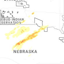
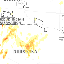


Connect with Interactive Hail Maps