

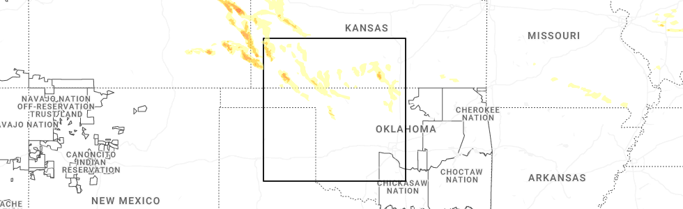
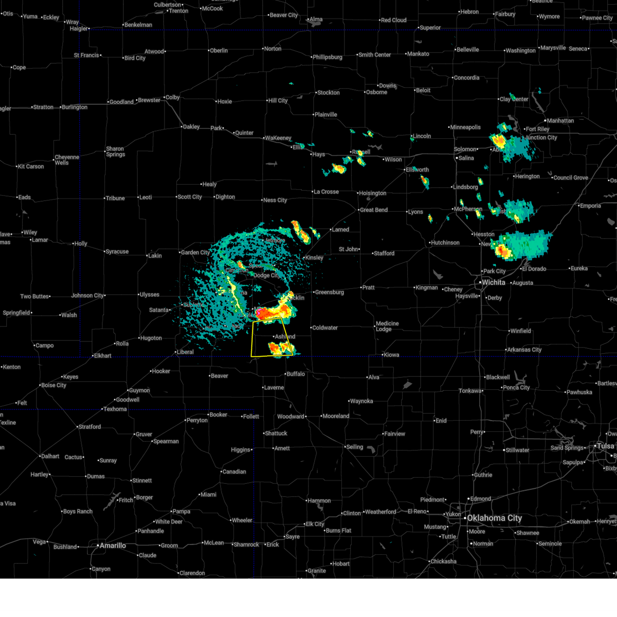
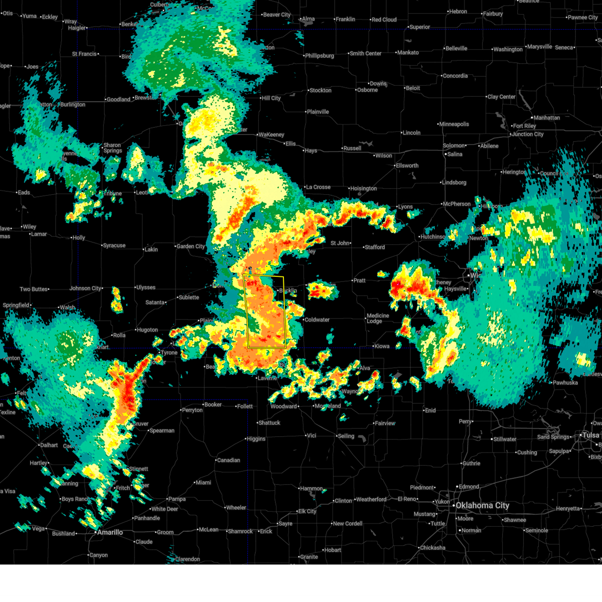
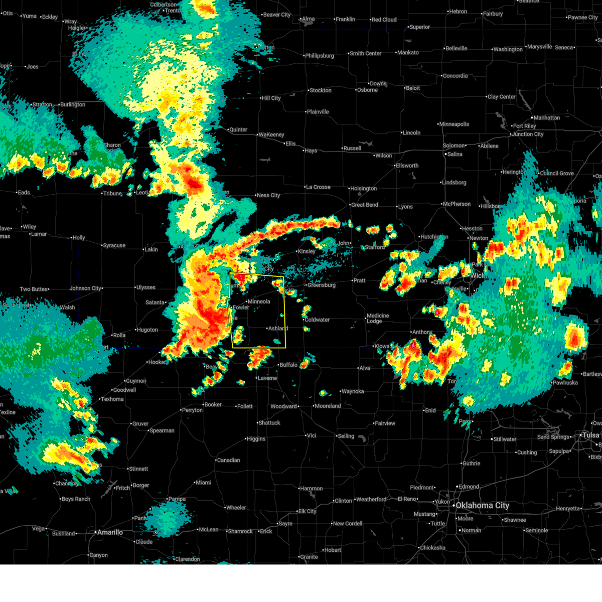
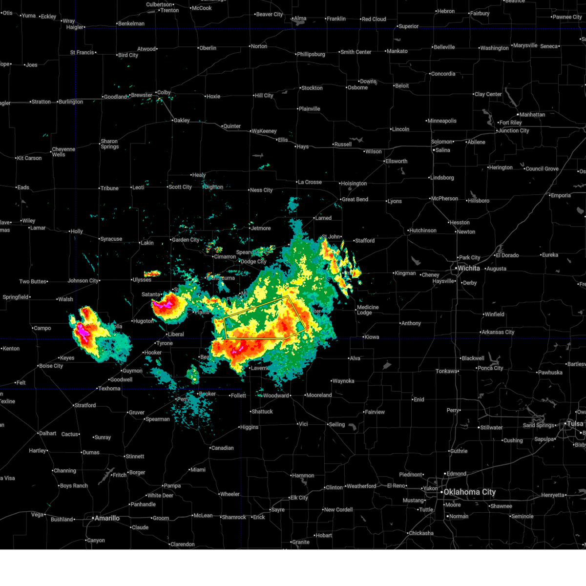
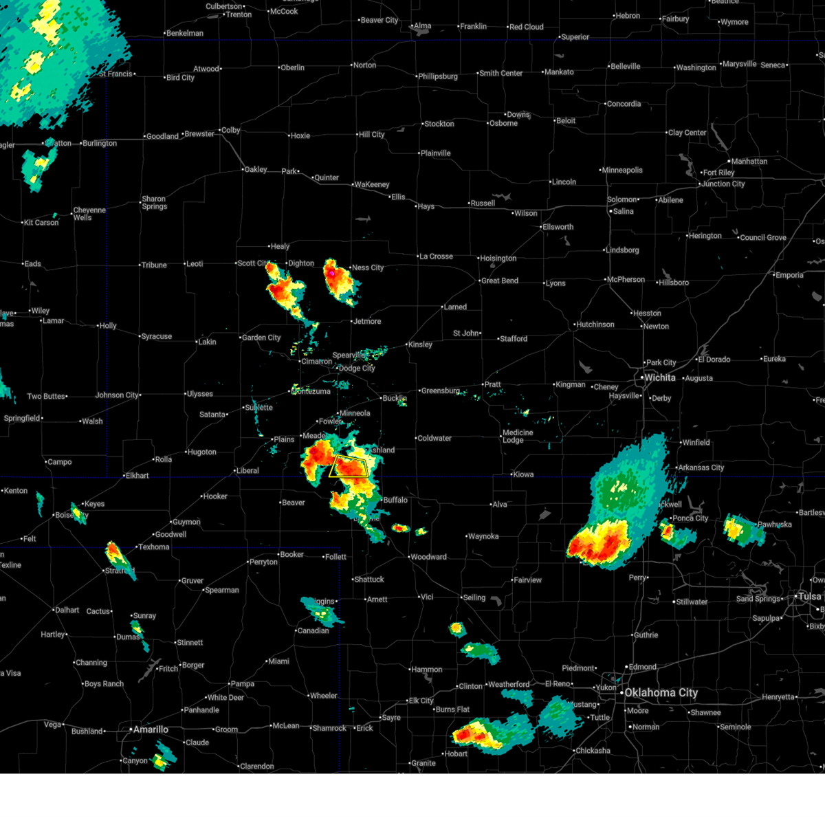
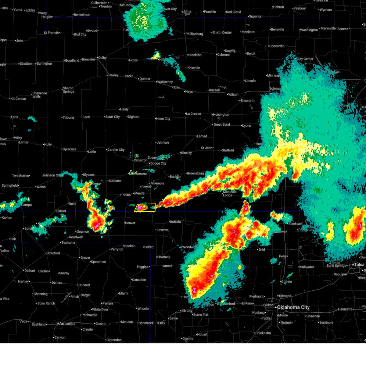
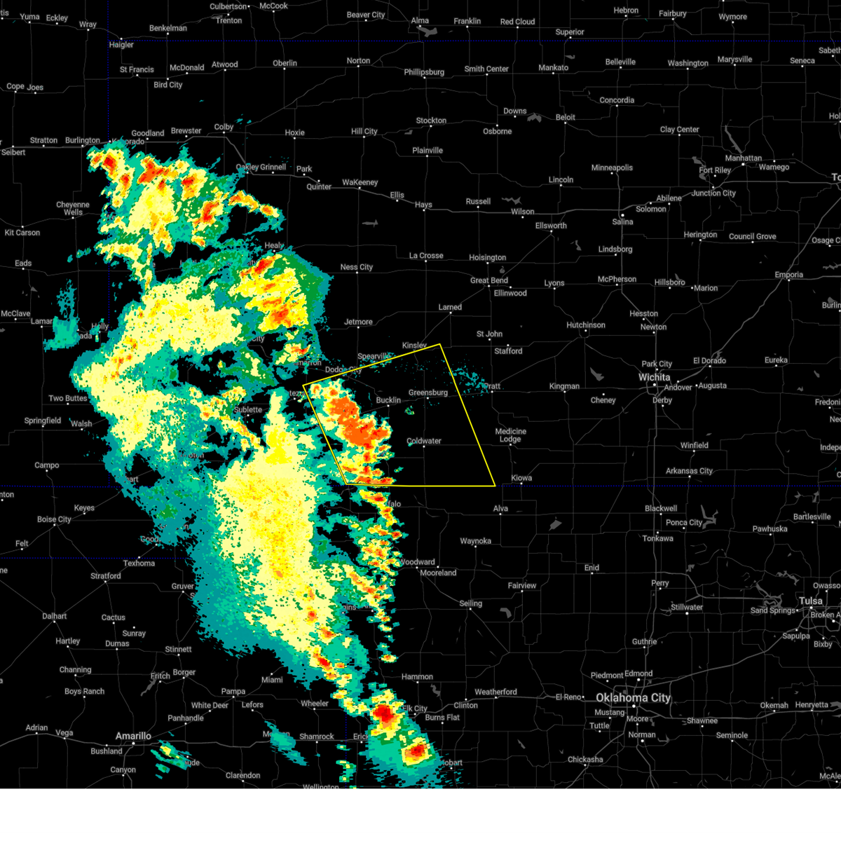
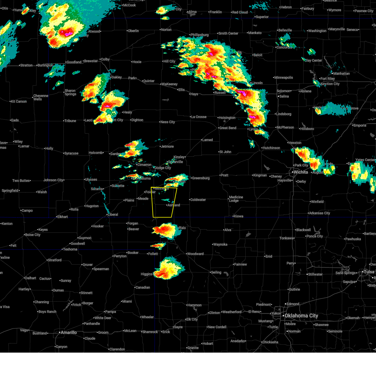
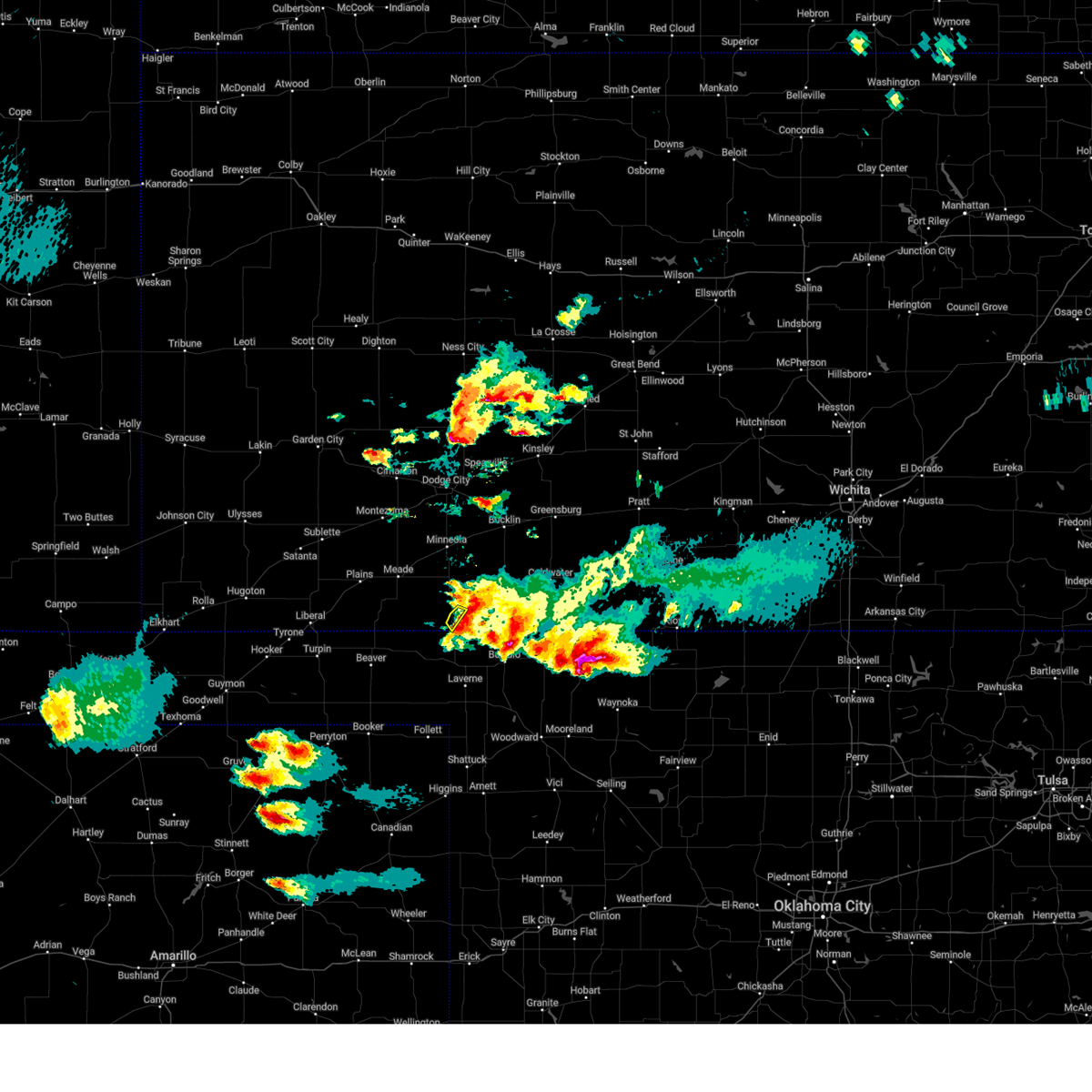
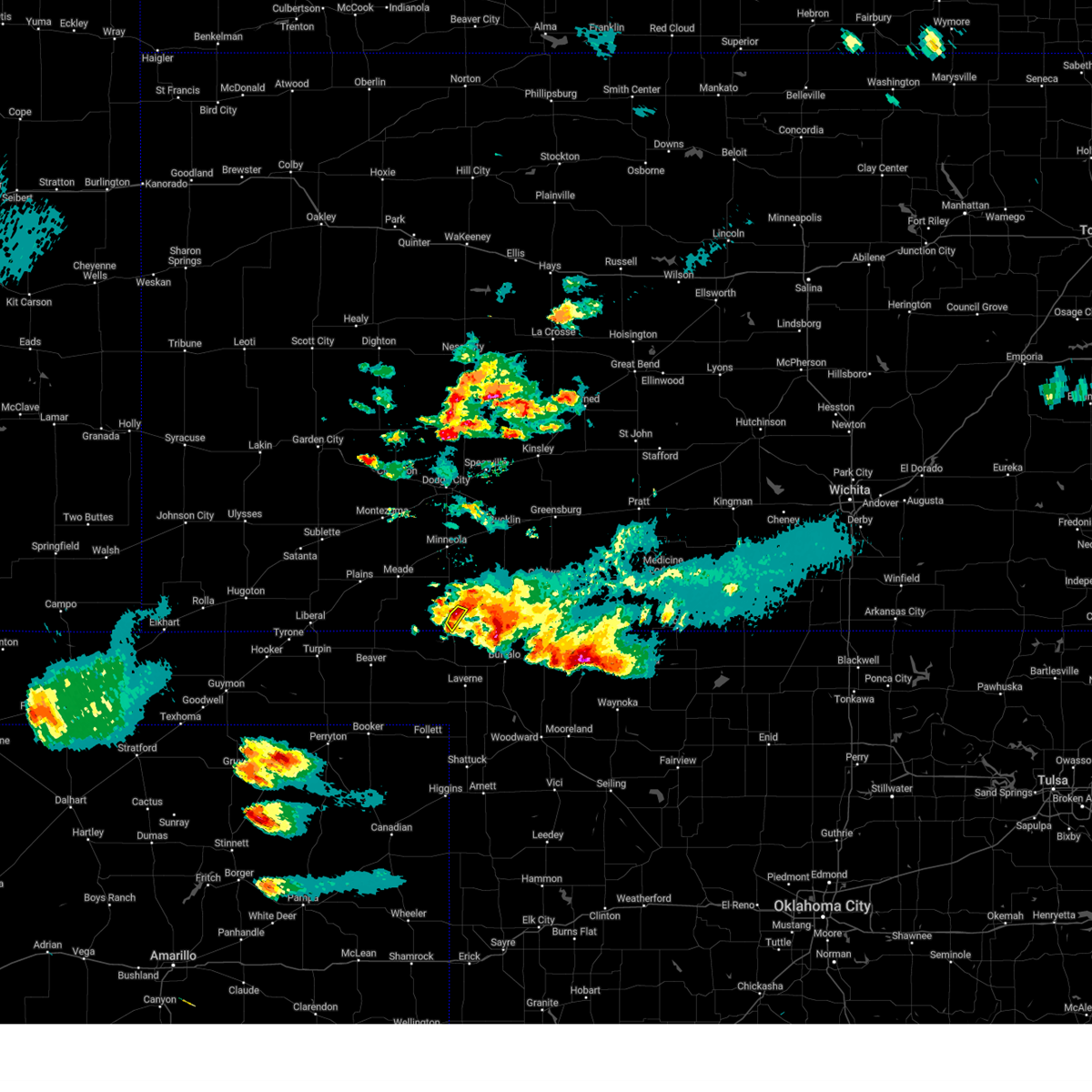
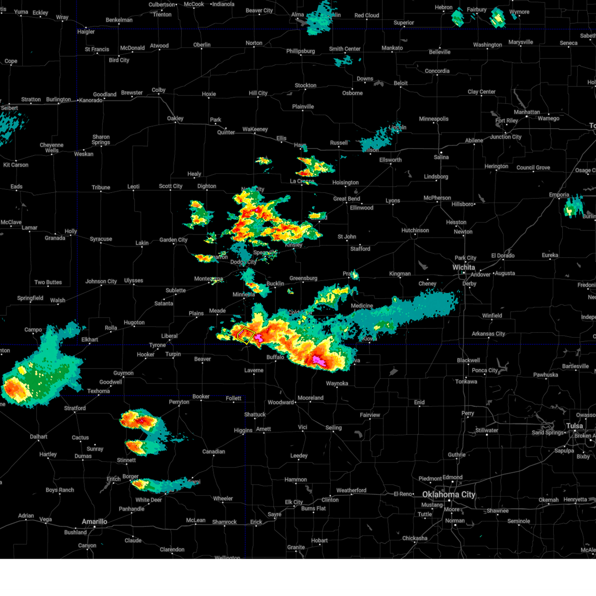
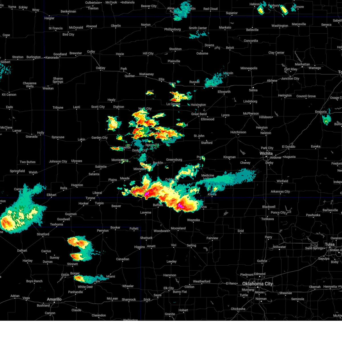
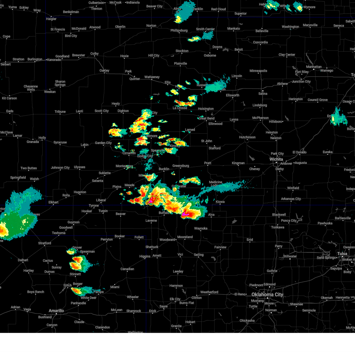
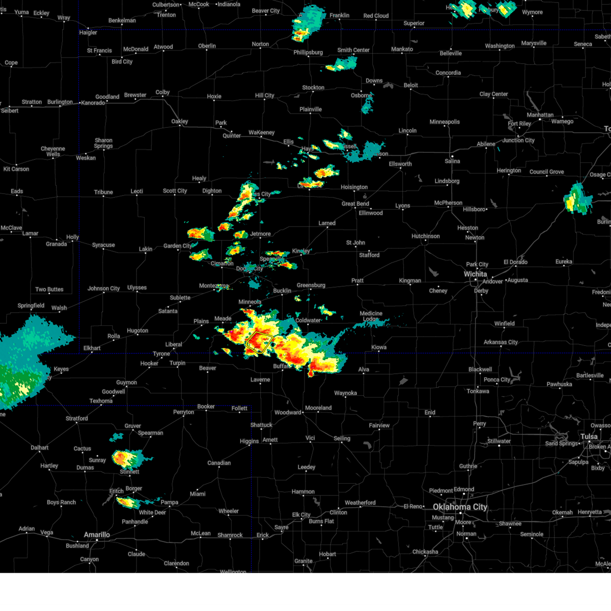
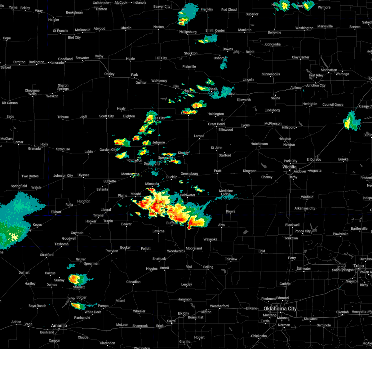
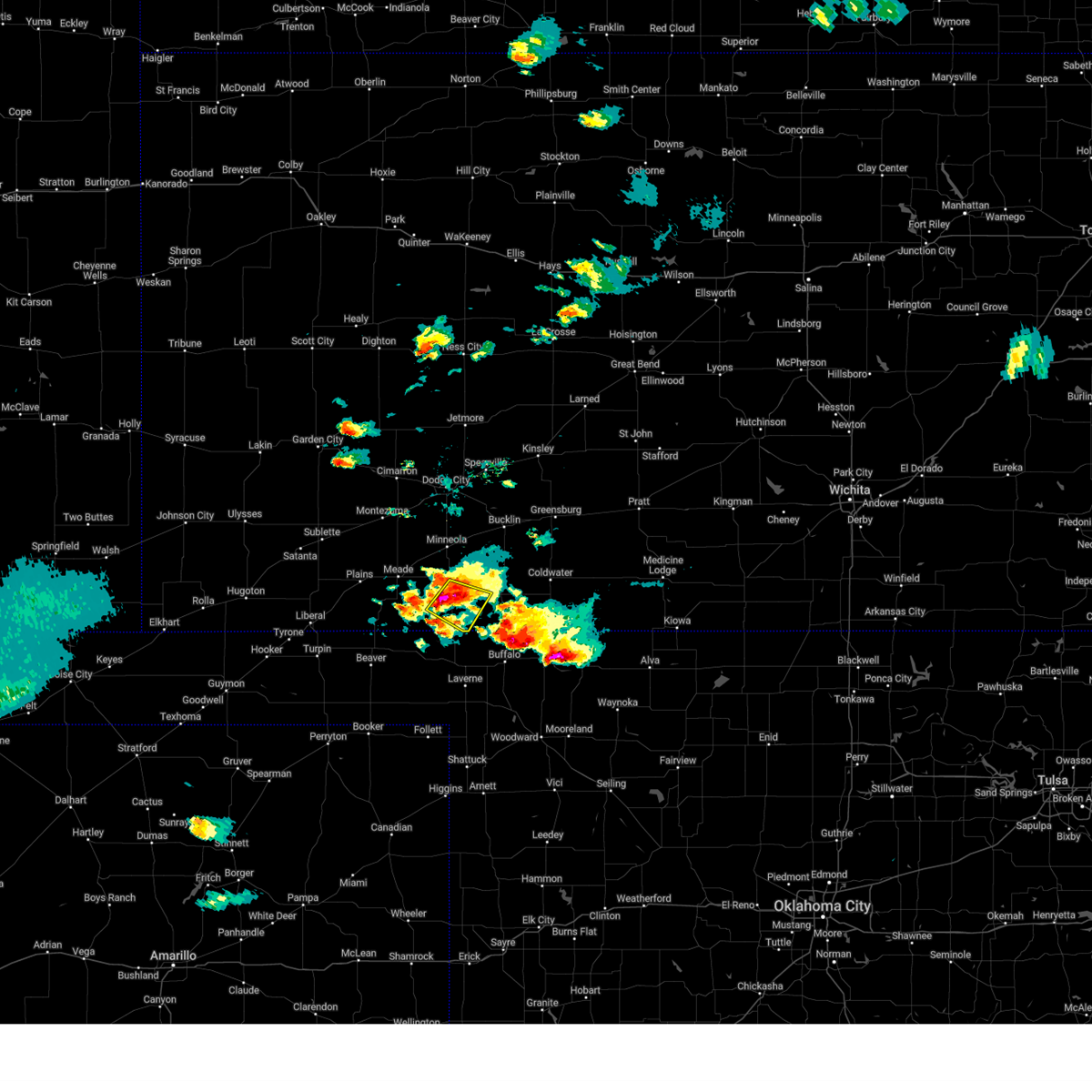
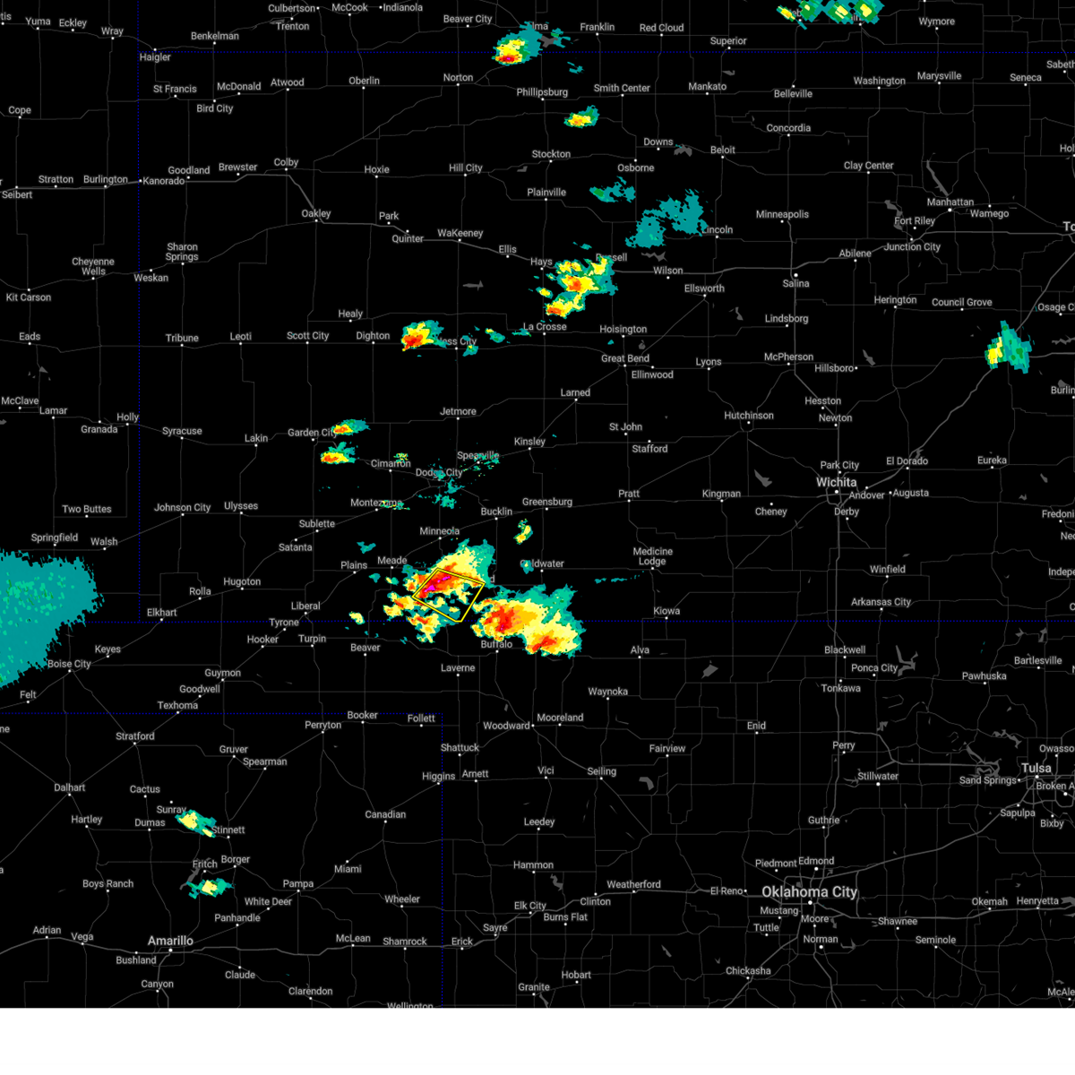
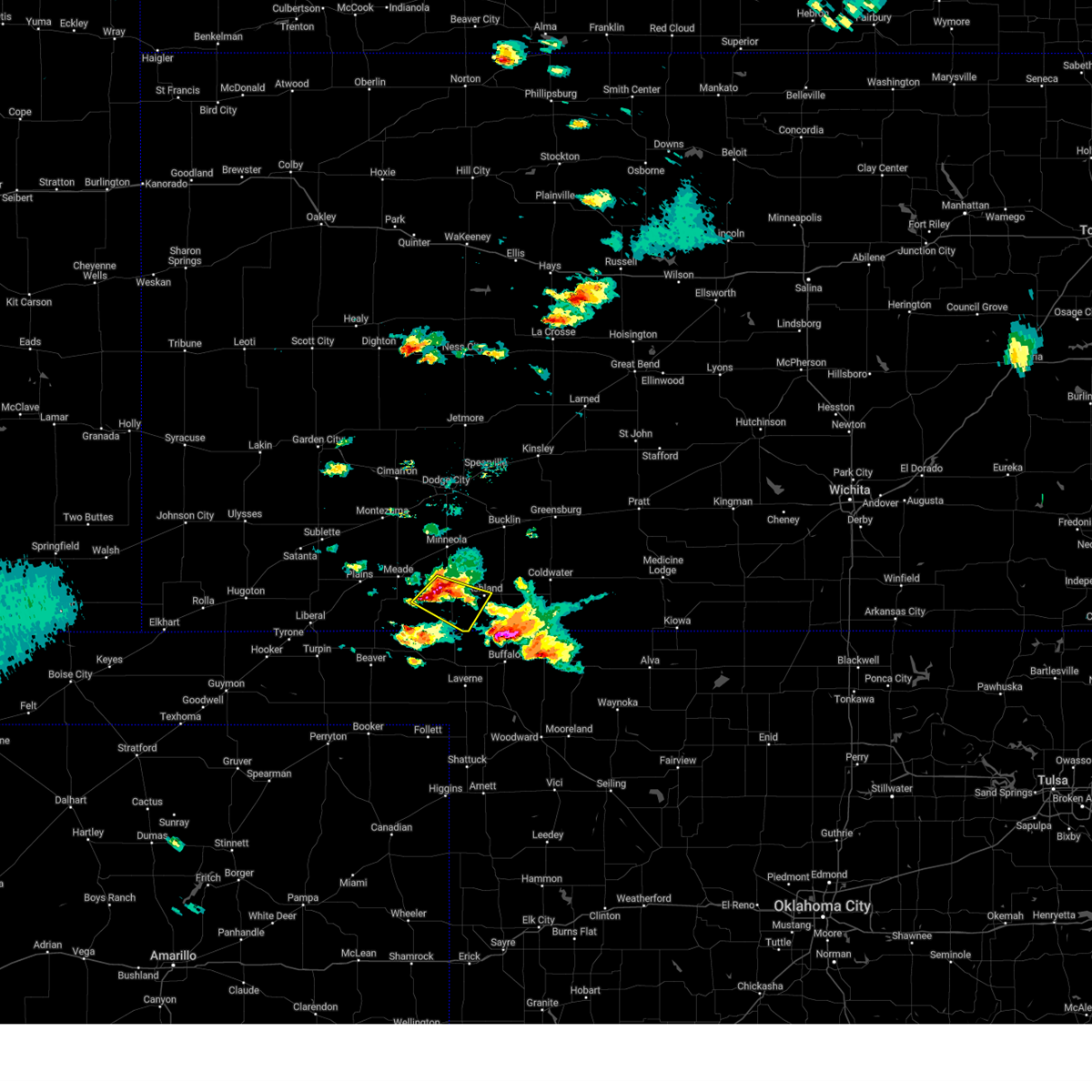
Hail Map for Englewood, KS
The Englewood, KS area has had 16 reports of on-the-ground hail by trained spotters, and has been under severe weather warnings 27 times during the past 12 months. Doppler radar has detected hail at or near Englewood, KS on 93 occasions, including 9 occasions during the past year.
| Name: | Englewood, KS |
| Where Located: | 53 miles NW of Woodward, OK |
| Map: | Google Map for Englewood, KS |
| Population: | 77 |
| Housing Units: | 68 |
| More Info: | Search Google for Englewood, KS |
1
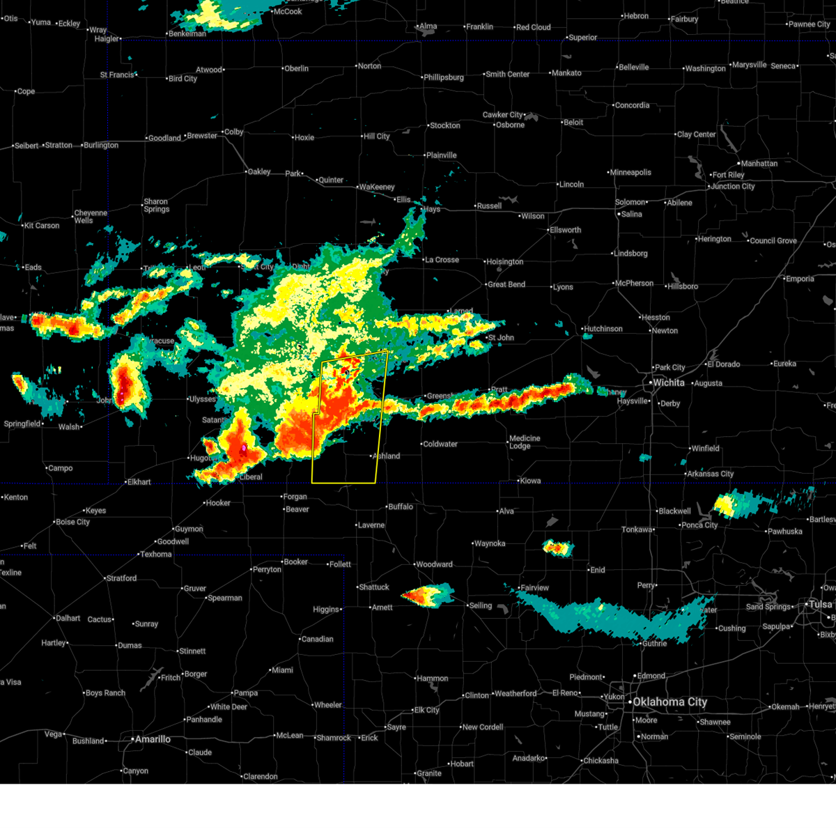
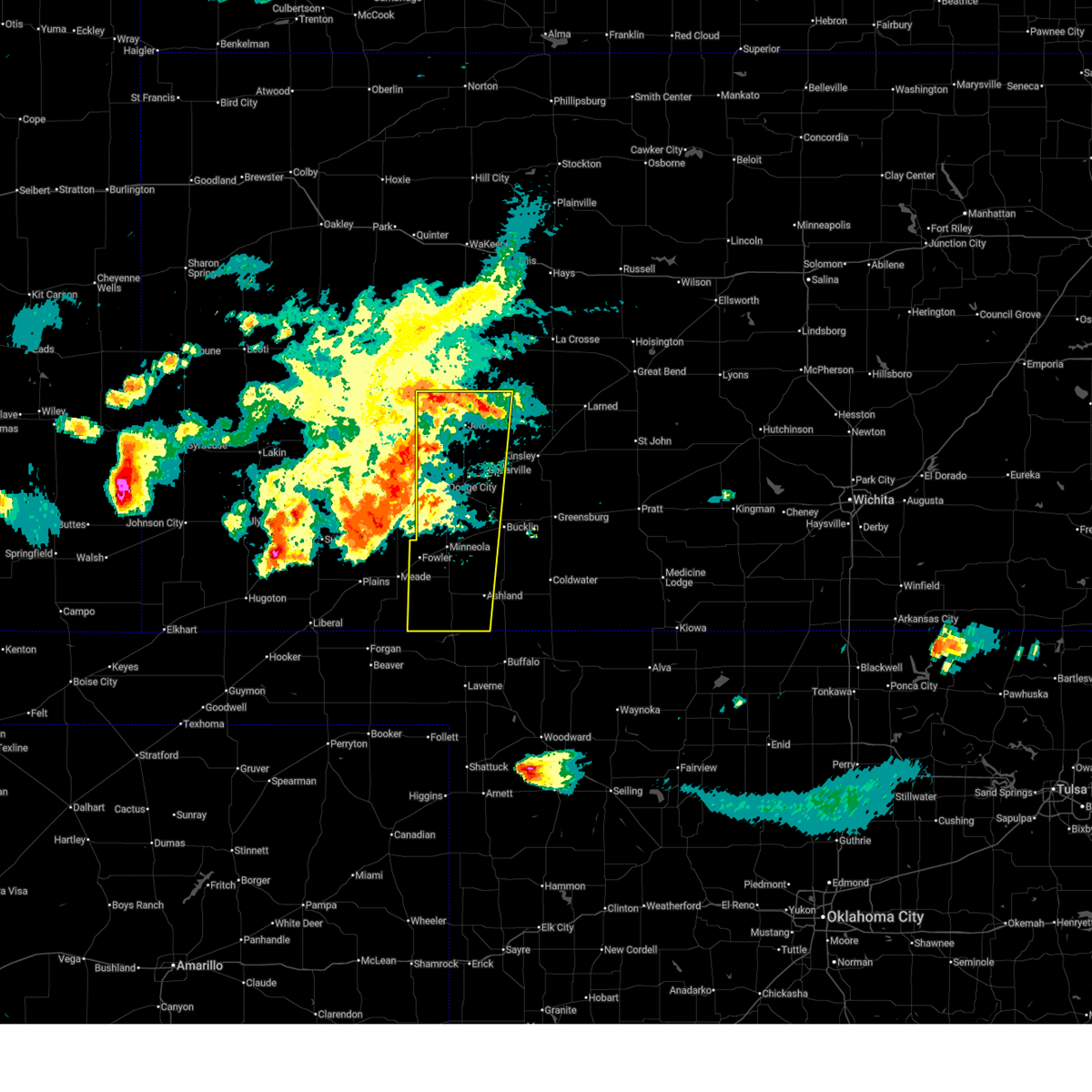
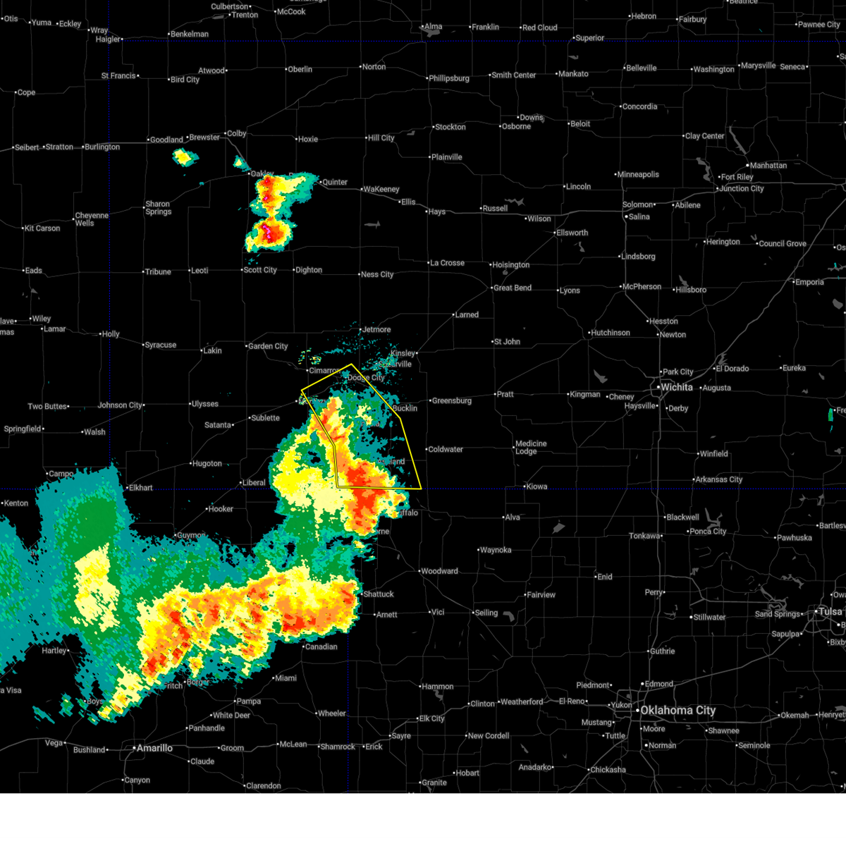
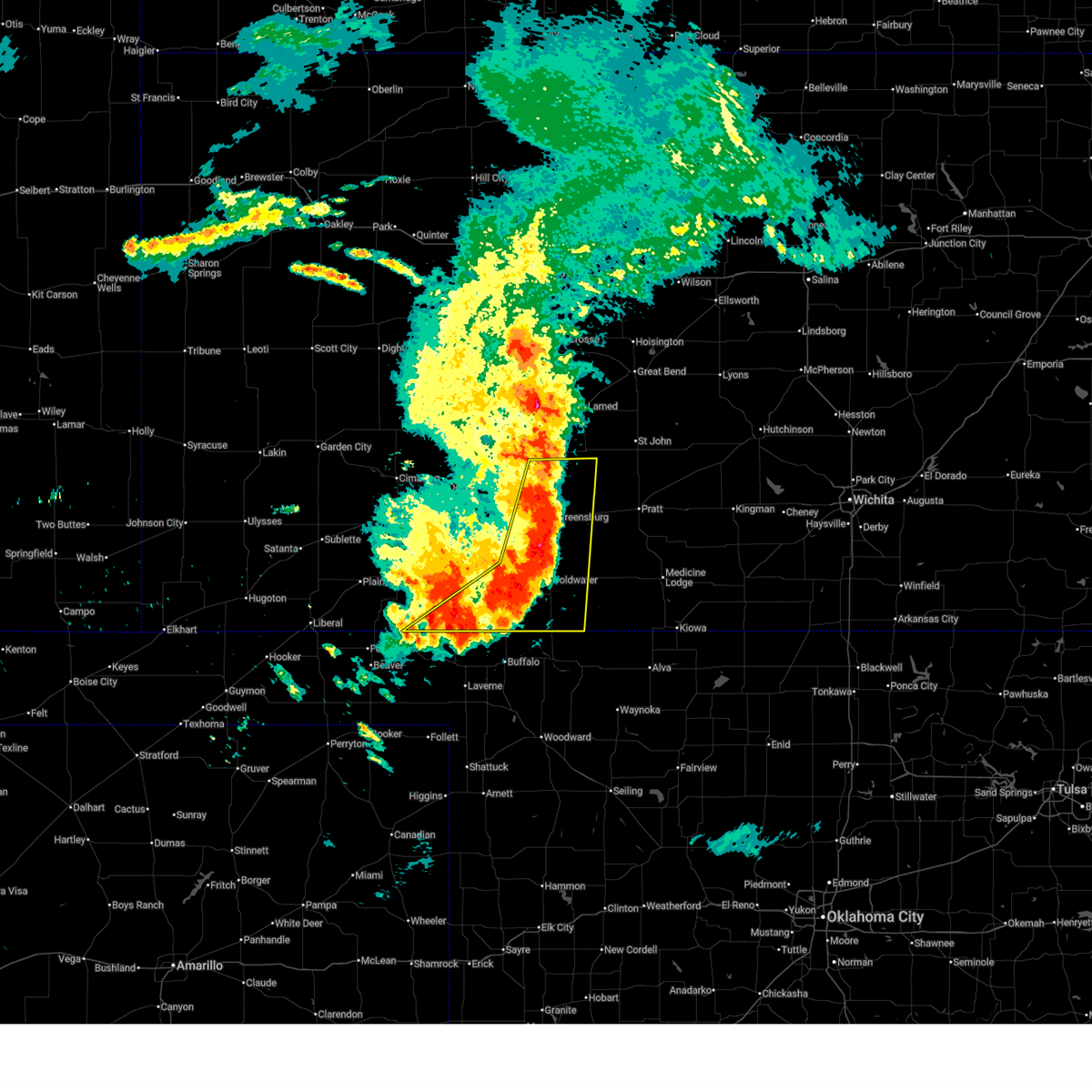
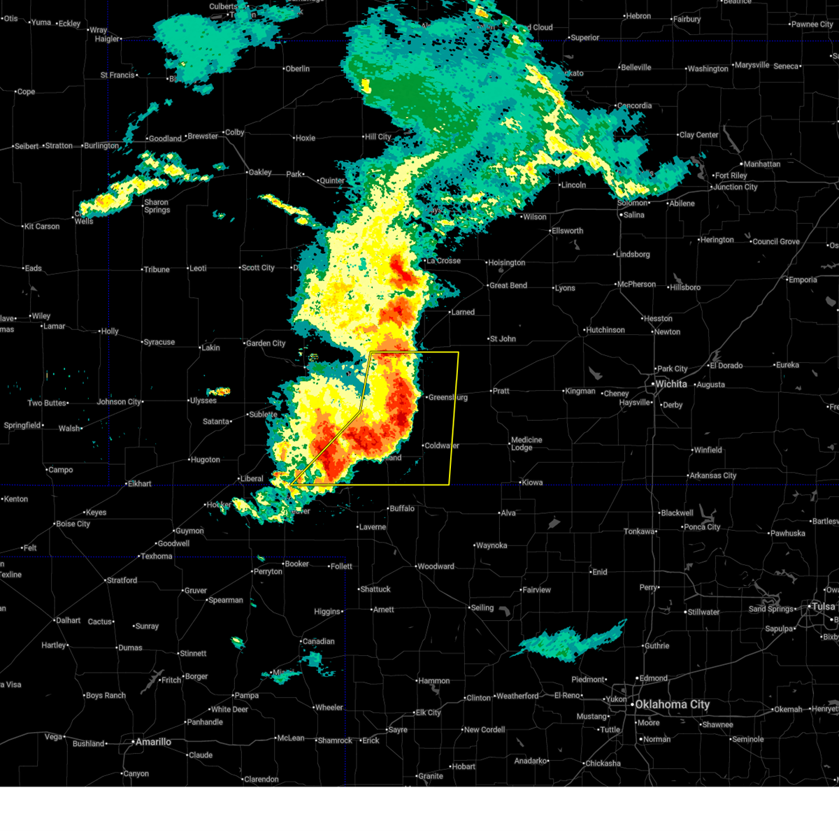
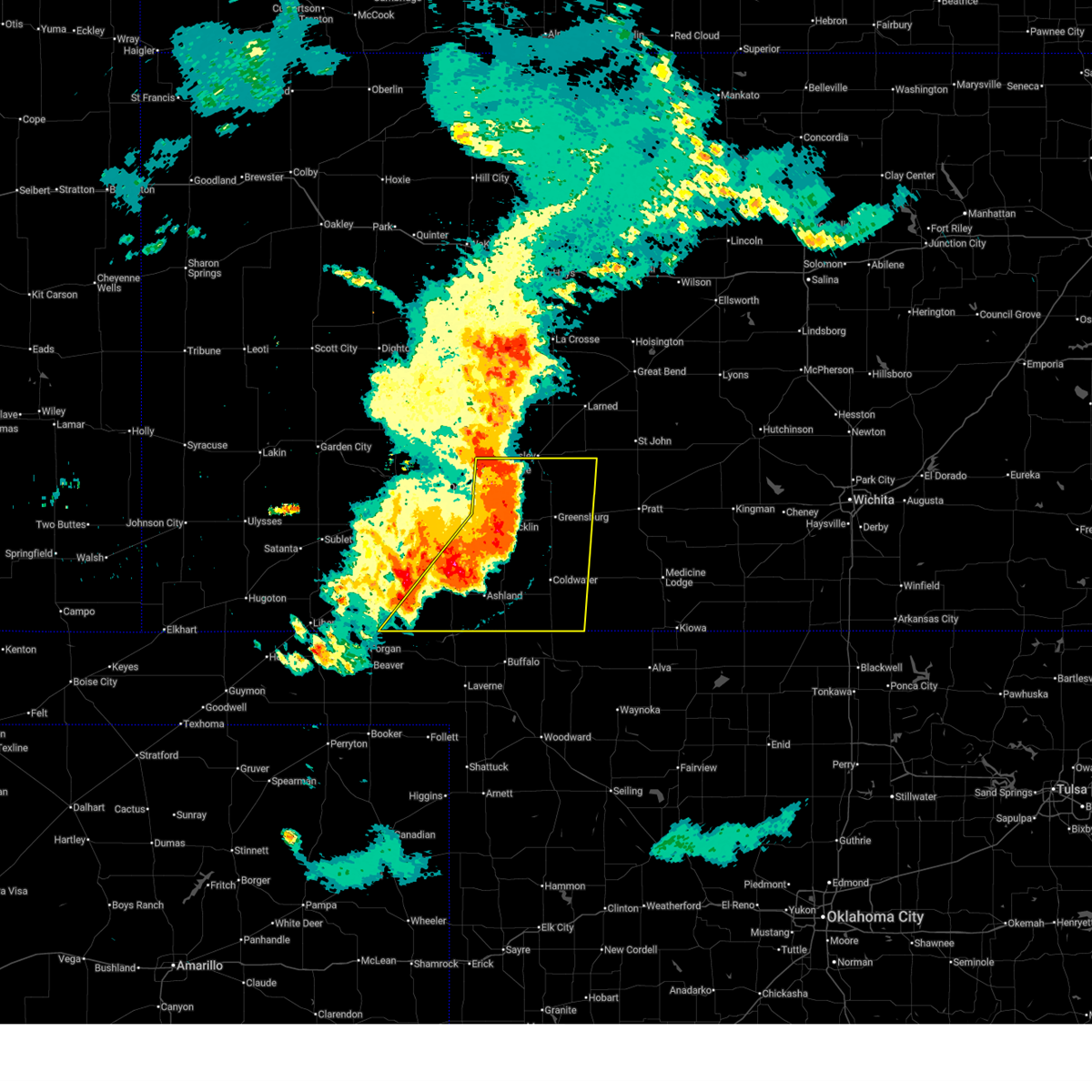
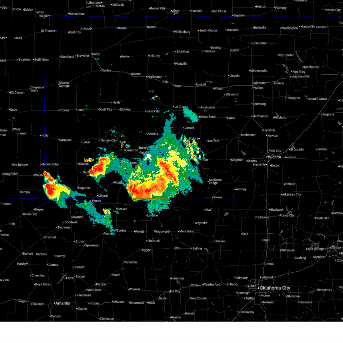
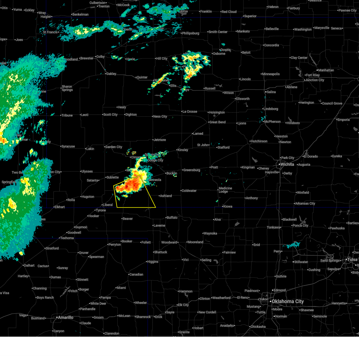
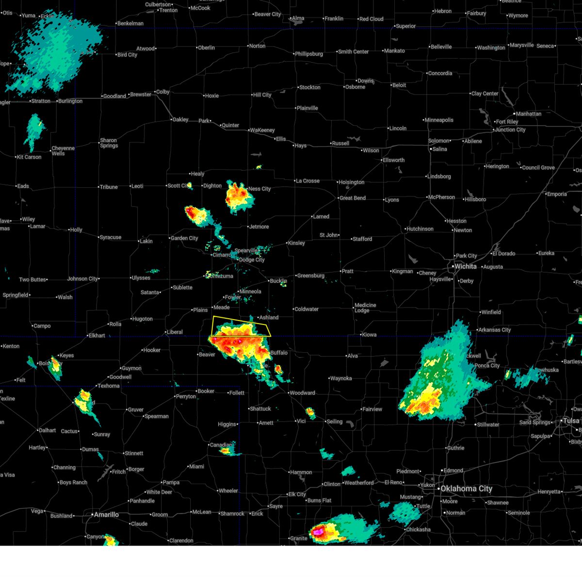
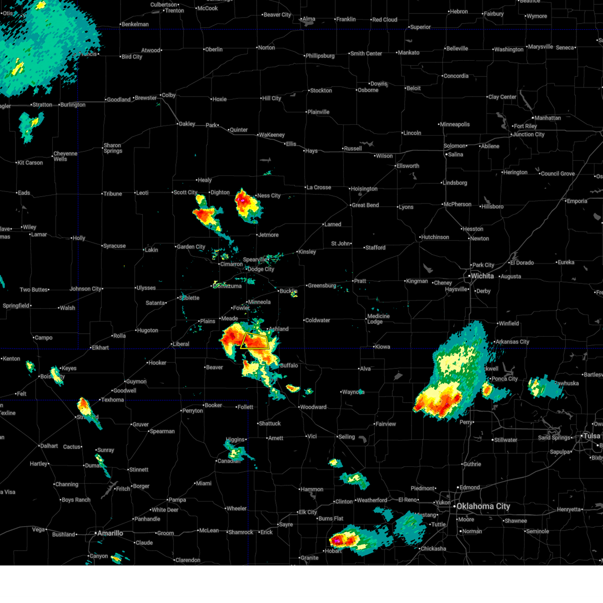
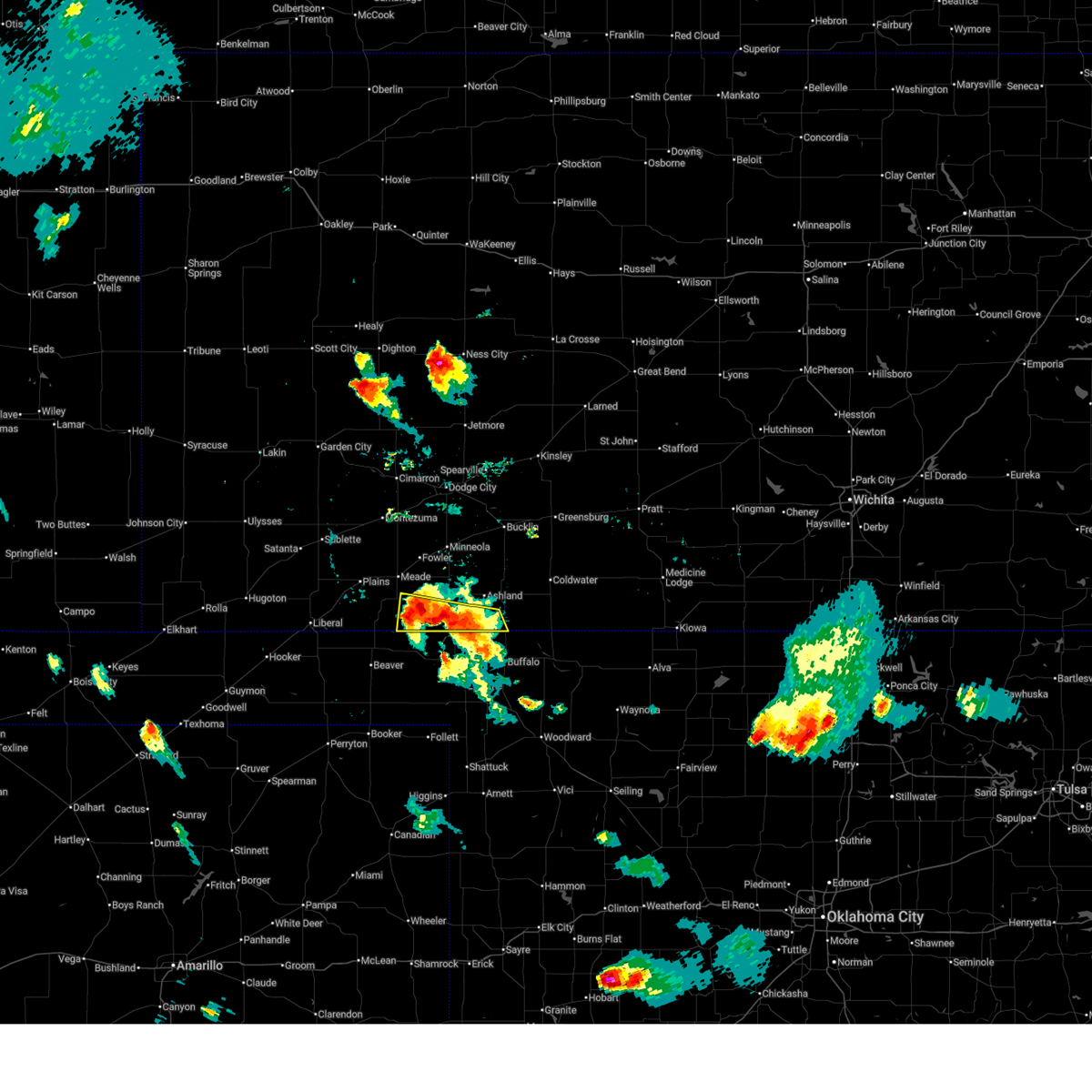
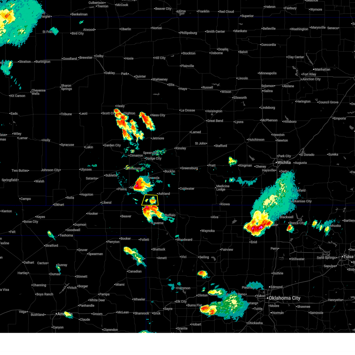
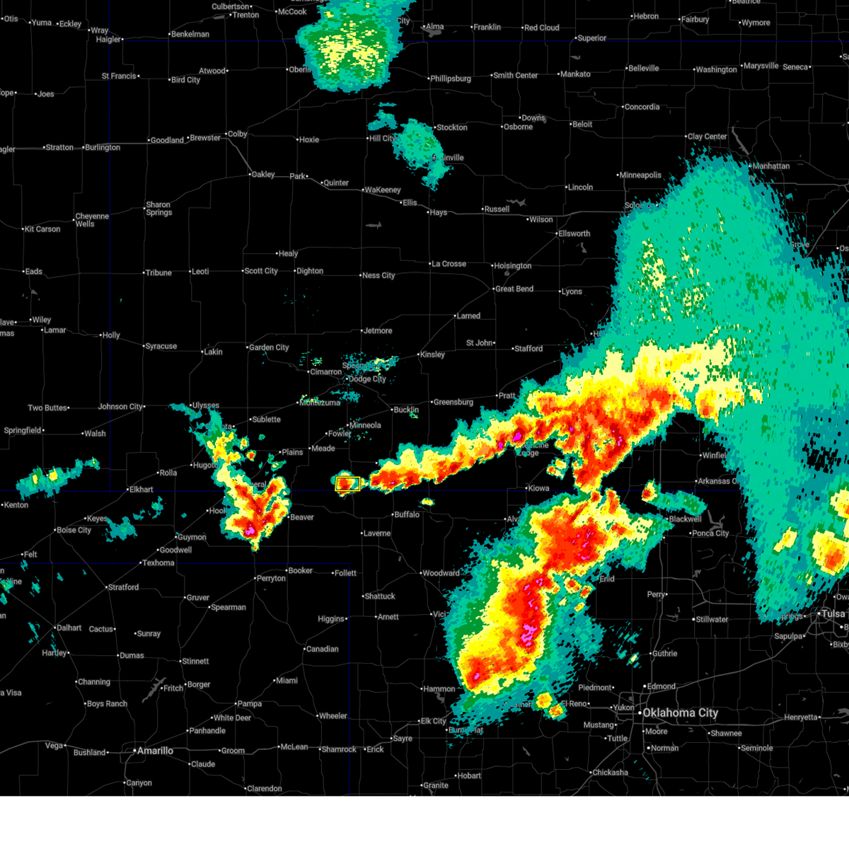
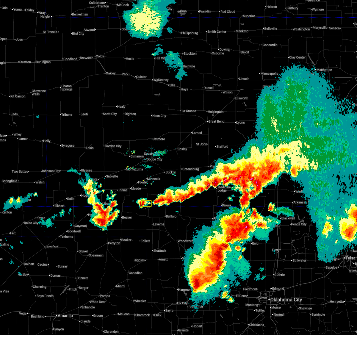
The Top Recent Hail Date for Englewood, KS is Sunday, June 21, 2026 (31st out of 93)
Hail and Wind Damage Spotted near Englewood, KS
| Date / Time | Report Details |
|---|---|
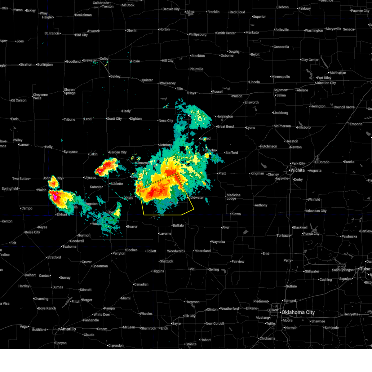
| 6/21/2026 10:13 PM CDT |
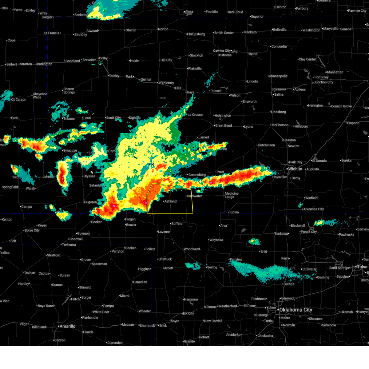 Svrddc the national weather service in dodge city has issued a * severe thunderstorm warning for, comanche county in south central kansas, clark county in southwestern kansas, * until 1100 pm cdt. * at 1012 pm cdt, severe thunderstorms were located along a line extending from near clark state lake to 6 miles south of englewood, moving southeast at 45 mph (radar indicated). Hazards include 70 mph wind gusts and ping pong ball size hail. People and animals outdoors will be injured. expect hail damage to roofs, siding, windows, and vehicles. expect considerable tree damage. wind damage is also likely to mobile homes, roofs, and outbuildings. severe thunderstorms will be near, ashland, englewood, clark state lake, and acres around 1015 pm cdt. sitka around 1030 pm cdt. Other locations in the path of these severe thunderstorms include protection. Svrddc the national weather service in dodge city has issued a * severe thunderstorm warning for, comanche county in south central kansas, clark county in southwestern kansas, * until 1100 pm cdt. * at 1012 pm cdt, severe thunderstorms were located along a line extending from near clark state lake to 6 miles south of englewood, moving southeast at 45 mph (radar indicated). Hazards include 70 mph wind gusts and ping pong ball size hail. People and animals outdoors will be injured. expect hail damage to roofs, siding, windows, and vehicles. expect considerable tree damage. wind damage is also likely to mobile homes, roofs, and outbuildings. severe thunderstorms will be near, ashland, englewood, clark state lake, and acres around 1015 pm cdt. sitka around 1030 pm cdt. Other locations in the path of these severe thunderstorms include protection.
|
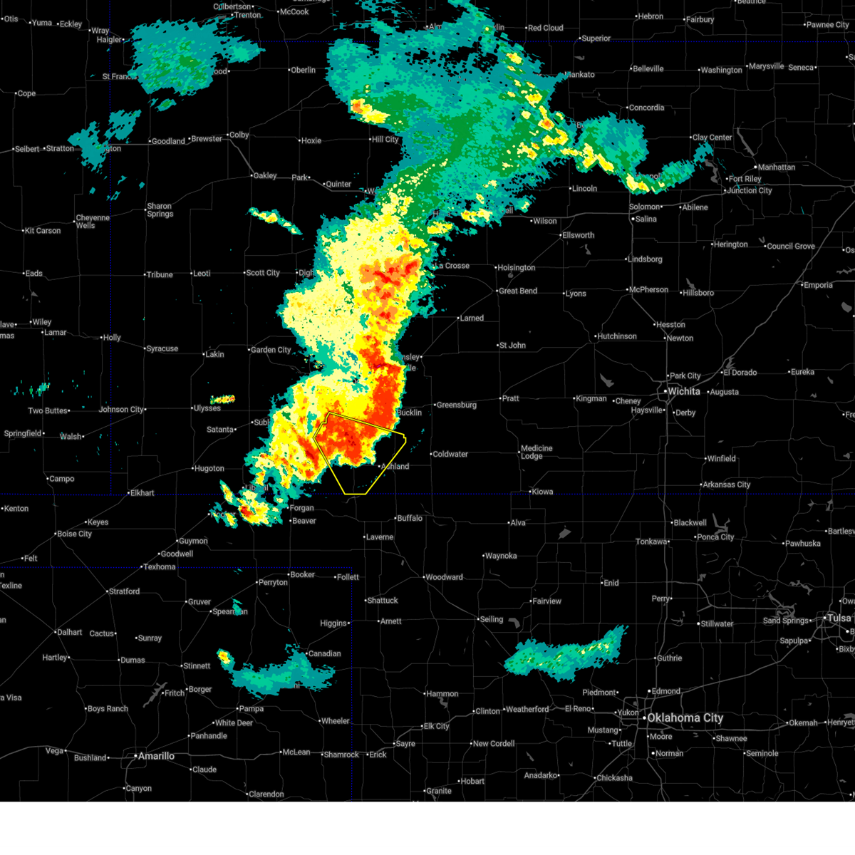
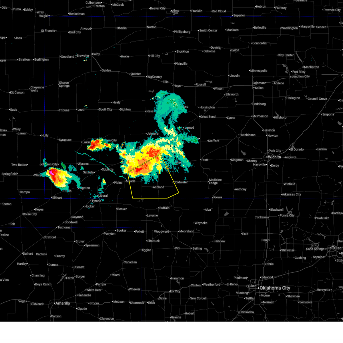
| 6/21/2026 10:05 PM CDT |
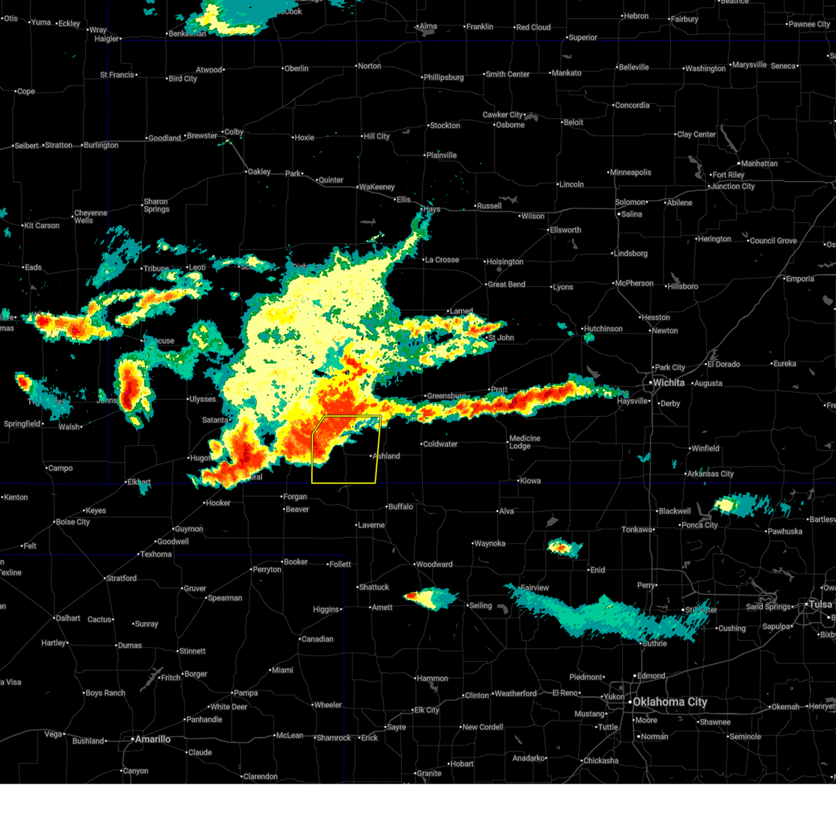 At 1005 pm cdt, a severe thunderstorm was located 8 miles northwest of englewood, moving southeast at 55 mph (radar indicated). Hazards include golf ball size hail and 70 mph wind gusts. People and animals outdoors will be injured. expect hail damage to roofs, siding, windows, and vehicles. expect considerable tree damage. wind damage is also likely to mobile homes, roofs, and outbuildings. Locations impacted include, ashland, minneola, fowler, englewood, clark state lake, and acres. At 1005 pm cdt, a severe thunderstorm was located 8 miles northwest of englewood, moving southeast at 55 mph (radar indicated). Hazards include golf ball size hail and 70 mph wind gusts. People and animals outdoors will be injured. expect hail damage to roofs, siding, windows, and vehicles. expect considerable tree damage. wind damage is also likely to mobile homes, roofs, and outbuildings. Locations impacted include, ashland, minneola, fowler, englewood, clark state lake, and acres.
|
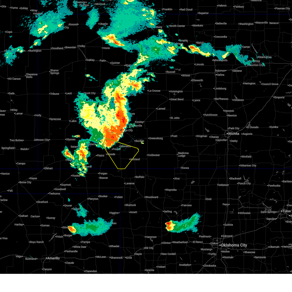
| 6/21/2026 9:48 PM CDT |
 At 948 pm cdt, severe thunderstorms were located along a line extending from near wright to 9 miles southeast of meade, moving southeast at 55 mph (radar indicated). Hazards include 60 mph wind gusts. Expect damage to roofs, siding, and trees. Locations impacted include, minneola, ford, bloom, englewood, kingsdown, clark state lake, ashland and acres. At 948 pm cdt, severe thunderstorms were located along a line extending from near wright to 9 miles southeast of meade, moving southeast at 55 mph (radar indicated). Hazards include 60 mph wind gusts. Expect damage to roofs, siding, and trees. Locations impacted include, minneola, ford, bloom, englewood, kingsdown, clark state lake, ashland and acres.
|
| 6/21/2026 9:23 PM CDT |
 Svrddc the national weather service in dodge city has issued a * severe thunderstorm warning for, ford county in southwestern kansas, hodgeman county in southwestern kansas, eastern meade county in southwestern kansas, clark county in southwestern kansas, * until 1015 pm cdt. * at 923 pm cdt, severe thunderstorms were located along a line extending from near jetmore to ensign, moving southeast at 45 mph (radar indicated). Hazards include 60 mph wind gusts. Expect damage to roofs, siding, and trees. severe thunderstorms will be near, dodge city around 930 pm cdt. wright and ft. dodge around 935 pm cdt. spearville around 940 pm cdt. Other locations in the path of these severe thunderstorms include minneola, bellefont, ford, bloom, kingsdown and clark state lake. Svrddc the national weather service in dodge city has issued a * severe thunderstorm warning for, ford county in southwestern kansas, hodgeman county in southwestern kansas, eastern meade county in southwestern kansas, clark county in southwestern kansas, * until 1015 pm cdt. * at 923 pm cdt, severe thunderstorms were located along a line extending from near jetmore to ensign, moving southeast at 45 mph (radar indicated). Hazards include 60 mph wind gusts. Expect damage to roofs, siding, and trees. severe thunderstorms will be near, dodge city around 930 pm cdt. wright and ft. dodge around 935 pm cdt. spearville around 940 pm cdt. Other locations in the path of these severe thunderstorms include minneola, bellefont, ford, bloom, kingsdown and clark state lake.
|
| 6/13/2026 12:02 AM CDT |
 At 1201 am cdt, severe thunderstorms were located along a line extending from near ensign to near clark state lake to 11 miles south of sitka, moving east at 30 mph (radar indicated). Hazards include 70 mph wind gusts and penny size hail. Expect considerable tree damage. damage is likely to mobile homes, roofs, and outbuildings. these severe storms will be near, bloom, sitka, and clark state lake around 1205 am cdt. Other locations in the path of these severe thunderstorms include protection and kingsdown. At 1201 am cdt, severe thunderstorms were located along a line extending from near ensign to near clark state lake to 11 miles south of sitka, moving east at 30 mph (radar indicated). Hazards include 70 mph wind gusts and penny size hail. Expect considerable tree damage. damage is likely to mobile homes, roofs, and outbuildings. these severe storms will be near, bloom, sitka, and clark state lake around 1205 am cdt. Other locations in the path of these severe thunderstorms include protection and kingsdown.
|
| 6/12/2026 11:57 PM CDT |
 Svrddc the national weather service in dodge city has issued a * severe thunderstorm warning for, southwestern ford county in southwestern kansas, southwestern kiowa county in south central kansas, northeastern meade county in southwestern kansas, western comanche county in south central kansas, southeastern gray county in southwestern kansas, clark county in southwestern kansas, * until 1245 am cdt. * at 1157 pm cdt, severe thunderstorms were located along a line extending from near ensign to near clark state lake to 11 miles south of sitka, moving east at 30 mph (radar indicated). Hazards include 70 mph wind gusts and penny size hail. Expect considerable tree damage. damage is likely to mobile homes, roofs, and outbuildings. severe thunderstorms will be near, ashland, minneola, bloom, sitka, and clark state lake around 1200 am cdt. Other locations in the path of these severe thunderstorms include protection, kingsdown and bucklin. Svrddc the national weather service in dodge city has issued a * severe thunderstorm warning for, southwestern ford county in southwestern kansas, southwestern kiowa county in south central kansas, northeastern meade county in southwestern kansas, western comanche county in south central kansas, southeastern gray county in southwestern kansas, clark county in southwestern kansas, * until 1245 am cdt. * at 1157 pm cdt, severe thunderstorms were located along a line extending from near ensign to near clark state lake to 11 miles south of sitka, moving east at 30 mph (radar indicated). Hazards include 70 mph wind gusts and penny size hail. Expect considerable tree damage. damage is likely to mobile homes, roofs, and outbuildings. severe thunderstorms will be near, ashland, minneola, bloom, sitka, and clark state lake around 1200 am cdt. Other locations in the path of these severe thunderstorms include protection, kingsdown and bucklin.
|
| 6/1/2026 10:26 PM CDT |
 At 1025 pm cdt, severe thunderstorms were located along a line extending from fellsburg to near wilmore to near englewood, moving east at 25 mph (public. at 1022 pm cdt, the public reported 64 mph winds in greensburg ). Hazards include 70 mph wind gusts. Expect considerable tree damage. damage is likely to mobile homes, roofs, and outbuildings. Locations impacted include, coldwater, haviland, protection, sitka, wilmore, trousdale, lake coldwater and belvidere. At 1025 pm cdt, severe thunderstorms were located along a line extending from fellsburg to near wilmore to near englewood, moving east at 25 mph (public. at 1022 pm cdt, the public reported 64 mph winds in greensburg ). Hazards include 70 mph wind gusts. Expect considerable tree damage. damage is likely to mobile homes, roofs, and outbuildings. Locations impacted include, coldwater, haviland, protection, sitka, wilmore, trousdale, lake coldwater and belvidere.
|
| 6/1/2026 10:07 PM CDT |
 At 1005 pm cdt, severe thunderstorms were located along a line extending from near centerview to 10 miles northwest of wilmore to near englewood, moving east at 35 mph (public. at 1000 pm cdt, the public reported 67 mph 4 miles north of minneola). Hazards include 70 mph wind gusts. Expect considerable tree damage. damage is likely to mobile homes, roofs, and outbuildings. these severe storms will be near, ashland, greensburg, englewood, sitka, fellsburg, acres, and centerview around 1010 pm cdt. Other locations in the path of these severe thunderstorms include coldwater, haviland, protection, wilmore, trousdale, belvidere and lake coldwater. At 1005 pm cdt, severe thunderstorms were located along a line extending from near centerview to 10 miles northwest of wilmore to near englewood, moving east at 35 mph (public. at 1000 pm cdt, the public reported 67 mph 4 miles north of minneola). Hazards include 70 mph wind gusts. Expect considerable tree damage. damage is likely to mobile homes, roofs, and outbuildings. these severe storms will be near, ashland, greensburg, englewood, sitka, fellsburg, acres, and centerview around 1010 pm cdt. Other locations in the path of these severe thunderstorms include coldwater, haviland, protection, wilmore, trousdale, belvidere and lake coldwater.
|
| 6/1/2026 9:51 PM CDT |
 Svrddc the national weather service in dodge city has issued a * severe thunderstorm warning for, eastern ford county in southwestern kansas, kiowa county in south central kansas, southeastern meade county in southwestern kansas, comanche county in south central kansas, southern edwards county in south central kansas, clark county in southwestern kansas, * until 1045 pm cdt. * at 949 pm cdt, severe thunderstorms were located along a line extending from near offerle to 7 miles south of sitka, moving east at 25 mph (radar indicated). Hazards include 70 mph wind gusts. Expect considerable tree damage. damage is likely to mobile homes, roofs, and outbuildings. severe thunderstorms will be near, protection and mullinville around 955 pm cdt. Other locations in the path of these severe thunderstorms include coldwater, lake coldwater, greensburg, centerview, buttermilk, wilmore and fellsburg. Svrddc the national weather service in dodge city has issued a * severe thunderstorm warning for, eastern ford county in southwestern kansas, kiowa county in south central kansas, southeastern meade county in southwestern kansas, comanche county in south central kansas, southern edwards county in south central kansas, clark county in southwestern kansas, * until 1045 pm cdt. * at 949 pm cdt, severe thunderstorms were located along a line extending from near offerle to 7 miles south of sitka, moving east at 25 mph (radar indicated). Hazards include 70 mph wind gusts. Expect considerable tree damage. damage is likely to mobile homes, roofs, and outbuildings. severe thunderstorms will be near, protection and mullinville around 955 pm cdt. Other locations in the path of these severe thunderstorms include coldwater, lake coldwater, greensburg, centerview, buttermilk, wilmore and fellsburg.
|
| 6/1/2026 9:40 PM CDT |
 At 939 pm cdt, severe thunderstorms were located along a line extending from near clark state lake to 7 miles northwest of acres, moving east at 35 mph (radar indicated). Hazards include 70 mph wind gusts. Expect considerable tree damage. damage is likely to mobile homes, roofs, and outbuildings. Locations impacted include, ashland and acres. At 939 pm cdt, severe thunderstorms were located along a line extending from near clark state lake to 7 miles northwest of acres, moving east at 35 mph (radar indicated). Hazards include 70 mph wind gusts. Expect considerable tree damage. damage is likely to mobile homes, roofs, and outbuildings. Locations impacted include, ashland and acres.
|
| 6/1/2026 8:57 PM CDT |
 Svrddc the national weather service in dodge city has issued a * severe thunderstorm warning for, southwestern ford county in southwestern kansas, northeastern meade county in southwestern kansas, southeastern gray county in southwestern kansas, clark county in southwestern kansas, * until 1000 pm cdt. * at 857 pm cdt, severe thunderstorms were located along a line extending from 7 miles north of minneola to near fowler, moving southeast at 35 mph (radar indicated). Hazards include 70 mph wind gusts. Expect considerable tree damage. damage is likely to mobile homes, roofs, and outbuildings. severe thunderstorms will be near, minneola and fowler around 900 pm cdt. bloom around 915 pm cdt. Other locations in the path of these severe thunderstorms include clark state lake, ashland, acres and englewood. Svrddc the national weather service in dodge city has issued a * severe thunderstorm warning for, southwestern ford county in southwestern kansas, northeastern meade county in southwestern kansas, southeastern gray county in southwestern kansas, clark county in southwestern kansas, * until 1000 pm cdt. * at 857 pm cdt, severe thunderstorms were located along a line extending from 7 miles north of minneola to near fowler, moving southeast at 35 mph (radar indicated). Hazards include 70 mph wind gusts. Expect considerable tree damage. damage is likely to mobile homes, roofs, and outbuildings. severe thunderstorms will be near, minneola and fowler around 900 pm cdt. bloom around 915 pm cdt. Other locations in the path of these severe thunderstorms include clark state lake, ashland, acres and englewood.
|
| 9/1/2025 4:00 PM CDT |
 the severe thunderstorm warning has been cancelled and is no longer in effect the severe thunderstorm warning has been cancelled and is no longer in effect
|
| 9/1/2025 3:46 PM CDT |
 At 345 pm cdt, a severe thunderstorm was located near acres, moving south at 20 mph (radar indicated). Hazards include 60 mph wind gusts and quarter size hail. Hail damage to vehicles is expected. expect wind damage to roofs, siding, and trees. This severe thunderstorm will remain over mainly rural areas of southern clark county. At 345 pm cdt, a severe thunderstorm was located near acres, moving south at 20 mph (radar indicated). Hazards include 60 mph wind gusts and quarter size hail. Hail damage to vehicles is expected. expect wind damage to roofs, siding, and trees. This severe thunderstorm will remain over mainly rural areas of southern clark county.
|
| 9/1/2025 3:27 PM CDT |
 At 326 pm cdt, a severe thunderstorm was located near ashland, moving south at 20 mph (radar indicated). Hazards include 60 mph wind gusts and half dollar size hail. Hail damage to vehicles is expected. expect wind damage to roofs, siding, and trees. This severe storm will be near, ashland around 330 pm cdt. At 326 pm cdt, a severe thunderstorm was located near ashland, moving south at 20 mph (radar indicated). Hazards include 60 mph wind gusts and half dollar size hail. Hail damage to vehicles is expected. expect wind damage to roofs, siding, and trees. This severe storm will be near, ashland around 330 pm cdt.
|
| 9/1/2025 3:16 PM CDT |
 At 316 pm cdt, a severe thunderstorm was located near ashland, moving south at 20 mph (radar indicated). Hazards include 60 mph wind gusts and quarter size hail. Hail damage to vehicles is expected. expect wind damage to roofs, siding, and trees. this severe storm will be near, ashland around 320 pm cdt. Other locations in the path of this severe thunderstorm include acres. At 316 pm cdt, a severe thunderstorm was located near ashland, moving south at 20 mph (radar indicated). Hazards include 60 mph wind gusts and quarter size hail. Hail damage to vehicles is expected. expect wind damage to roofs, siding, and trees. this severe storm will be near, ashland around 320 pm cdt. Other locations in the path of this severe thunderstorm include acres.
|
| 9/1/2025 3:06 PM CDT |
 Svrddc the national weather service in dodge city has issued a * severe thunderstorm warning for, clark county in southwestern kansas, * until 415 pm cdt. * at 305 pm cdt, a severe thunderstorm was located 8 miles southwest of clark state lake, moving south at 20 mph. this replaces the previous warning for clark county (radar indicated). Hazards include 60 mph wind gusts and quarter size hail. Hail damage to vehicles is expected. expect wind damage to roofs, siding, and trees. this severe thunderstorm will be near, ashland around 320 pm cdt. Other locations in the path of this severe thunderstorm include acres. Svrddc the national weather service in dodge city has issued a * severe thunderstorm warning for, clark county in southwestern kansas, * until 415 pm cdt. * at 305 pm cdt, a severe thunderstorm was located 8 miles southwest of clark state lake, moving south at 20 mph. this replaces the previous warning for clark county (radar indicated). Hazards include 60 mph wind gusts and quarter size hail. Hail damage to vehicles is expected. expect wind damage to roofs, siding, and trees. this severe thunderstorm will be near, ashland around 320 pm cdt. Other locations in the path of this severe thunderstorm include acres.
|
| 8/11/2025 1:05 AM CDT |
 At 104 am cdt, severe thunderstorms were located along a line extending from near kingsdown to 10 miles southeast of acres, moving east at 30 mph (radar indicated). Hazards include 60 mph wind gusts and nickel size hail. Expect damage to roofs, siding, and trees. Locations impacted include, sitka, kingsdown and bucklin. At 104 am cdt, severe thunderstorms were located along a line extending from near kingsdown to 10 miles southeast of acres, moving east at 30 mph (radar indicated). Hazards include 60 mph wind gusts and nickel size hail. Expect damage to roofs, siding, and trees. Locations impacted include, sitka, kingsdown and bucklin.
|
| 8/11/2025 1:05 AM CDT |
 the severe thunderstorm warning has been cancelled and is no longer in effect the severe thunderstorm warning has been cancelled and is no longer in effect
|
| 8/11/2025 12:13 AM CDT |
 Svrddc the national weather service in dodge city has issued a * severe thunderstorm warning for, southern ford county in southwestern kansas, eastern meade county in southwestern kansas, clark county in southwestern kansas, * until 115 am cdt. * at 1213 am cdt, severe thunderstorms were located along a line extending from ensign to 11 miles northwest of englewood, moving east at 30 mph (radar indicated). Hazards include 60 mph wind gusts and nickel size hail. Expect damage to roofs, siding, and trees. severe thunderstorms will be near, minneola and englewood around 1225 am cdt. Other locations in the path of these severe thunderstorms include acres, bloom, ashland, kingsdown and clark state lake. Svrddc the national weather service in dodge city has issued a * severe thunderstorm warning for, southern ford county in southwestern kansas, eastern meade county in southwestern kansas, clark county in southwestern kansas, * until 115 am cdt. * at 1213 am cdt, severe thunderstorms were located along a line extending from ensign to 11 miles northwest of englewood, moving east at 30 mph (radar indicated). Hazards include 60 mph wind gusts and nickel size hail. Expect damage to roofs, siding, and trees. severe thunderstorms will be near, minneola and englewood around 1225 am cdt. Other locations in the path of these severe thunderstorms include acres, bloom, ashland, kingsdown and clark state lake.
|
| 8/3/2025 8:46 PM CDT |
 The storm which prompted the warning has moved out of the area. therefore, the warning has been allowed to expire. however, gusty winds are still possible with this thunderstorm. a severe thunderstorm watch remains in effect until midnight cdt for southwestern kansas. The storm which prompted the warning has moved out of the area. therefore, the warning has been allowed to expire. however, gusty winds are still possible with this thunderstorm. a severe thunderstorm watch remains in effect until midnight cdt for southwestern kansas.
|
| 8/3/2025 8:32 PM CDT |
 At 830 pm cdt, a severe thunderstorm was located very near acres, moving south at 35 mph. this is a destructive storm for southern clark, eastern meade and comnanche counties (radar indicated). Hazards include 80 mph wind gusts and penny size hail. Flying debris will be dangerous to those caught without shelter. mobile homes will be heavily damaged. expect considerable damage to roofs, windows, and vehicles. extensive tree damage and power outages are likely. Locations impacted include, ashland, coldwater, protection, englewood, sitka, lake coldwater, acres, and buttermilk. At 830 pm cdt, a severe thunderstorm was located very near acres, moving south at 35 mph. this is a destructive storm for southern clark, eastern meade and comnanche counties (radar indicated). Hazards include 80 mph wind gusts and penny size hail. Flying debris will be dangerous to those caught without shelter. mobile homes will be heavily damaged. expect considerable damage to roofs, windows, and vehicles. extensive tree damage and power outages are likely. Locations impacted include, ashland, coldwater, protection, englewood, sitka, lake coldwater, acres, and buttermilk.
|
| 8/3/2025 8:32 PM CDT |
 the severe thunderstorm warning has been cancelled and is no longer in effect the severe thunderstorm warning has been cancelled and is no longer in effect
|
| 8/3/2025 8:08 PM CDT |
 At 806 pm cdt, a severe thunderstorm was located 9 miles south of minneola, moving south at 35 mph. this is a destructive storm for ashland, englewood and protection (radar indicated). Hazards include 80 mph wind gusts and penny size hail. Flying debris will be dangerous to those caught without shelter. mobile homes will be heavily damaged. expect considerable damage to roofs, windows, and vehicles. extensive tree damage and power outages are likely. Locations impacted include, ashland, coldwater, bucklin, minneola, fowler, protection, bloom, englewood, sitka, clark state lake, kingsdown, lake coldwater, acres, and buttermilk. At 806 pm cdt, a severe thunderstorm was located 9 miles south of minneola, moving south at 35 mph. this is a destructive storm for ashland, englewood and protection (radar indicated). Hazards include 80 mph wind gusts and penny size hail. Flying debris will be dangerous to those caught without shelter. mobile homes will be heavily damaged. expect considerable damage to roofs, windows, and vehicles. extensive tree damage and power outages are likely. Locations impacted include, ashland, coldwater, bucklin, minneola, fowler, protection, bloom, englewood, sitka, clark state lake, kingsdown, lake coldwater, acres, and buttermilk.
|
| 8/3/2025 7:49 PM CDT |
 Svrddc the national weather service in dodge city has issued a * severe thunderstorm warning for, southeastern ford county in southwestern kansas, southwestern kiowa county in south central kansas, eastern meade county in southwestern kansas, western comanche county in south central kansas, clark county in southwestern kansas, * until 845 pm cdt. * at 748 pm cdt, a severe thunderstorm was located near minneola, moving south at 35 mph. this is a destructive storm for ford, kingsdown, clark state lake (radar indicated). Hazards include 90 mph wind gusts and quarter size hail. You are in a life-threatening situation. flying debris may be deadly to those caught without shelter. mobile homes will be heavily damaged or destroyed. homes and businesses will have substantial roof and window damage. Expect extensive tree damage and power outages. Svrddc the national weather service in dodge city has issued a * severe thunderstorm warning for, southeastern ford county in southwestern kansas, southwestern kiowa county in south central kansas, eastern meade county in southwestern kansas, western comanche county in south central kansas, clark county in southwestern kansas, * until 845 pm cdt. * at 748 pm cdt, a severe thunderstorm was located near minneola, moving south at 35 mph. this is a destructive storm for ford, kingsdown, clark state lake (radar indicated). Hazards include 90 mph wind gusts and quarter size hail. You are in a life-threatening situation. flying debris may be deadly to those caught without shelter. mobile homes will be heavily damaged or destroyed. homes and businesses will have substantial roof and window damage. Expect extensive tree damage and power outages.
|
| 7/16/2025 9:40 PM CDT |
 At 940 pm cdt, severe thunderstorms were located along a line extending from 11 miles northwest of acres to 8 miles southeast of kismet, moving east at 15 mph (radar indicated). Hazards include 70 mph wind gusts. Expect considerable tree damage. damage is likely to mobile homes, roofs, and outbuildings. Locations impacted include, meade, fowler, englewood, meade state park, missler, and plains. At 940 pm cdt, severe thunderstorms were located along a line extending from 11 miles northwest of acres to 8 miles southeast of kismet, moving east at 15 mph (radar indicated). Hazards include 70 mph wind gusts. Expect considerable tree damage. damage is likely to mobile homes, roofs, and outbuildings. Locations impacted include, meade, fowler, englewood, meade state park, missler, and plains.
|
| 7/16/2025 9:40 PM CDT |
 the severe thunderstorm warning has been cancelled and is no longer in effect the severe thunderstorm warning has been cancelled and is no longer in effect
|
| 7/16/2025 9:21 PM CDT |
 Svrddc the national weather service in dodge city has issued a * severe thunderstorm warning for, southwestern ford county in southwestern kansas, northeastern seward county in southwestern kansas, meade county in southwestern kansas, southwestern clark county in southwestern kansas, * until 1015 pm cdt. * at 920 pm cdt, severe thunderstorms were located along a line extending from 11 miles southeast of fowler to near kismet, moving southeast at 15 mph (radar indicated). Hazards include 70 mph wind gusts and penny size hail. Expect considerable tree damage. Damage is likely to mobile homes, roofs, and outbuildings. Svrddc the national weather service in dodge city has issued a * severe thunderstorm warning for, southwestern ford county in southwestern kansas, northeastern seward county in southwestern kansas, meade county in southwestern kansas, southwestern clark county in southwestern kansas, * until 1015 pm cdt. * at 920 pm cdt, severe thunderstorms were located along a line extending from 11 miles southeast of fowler to near kismet, moving southeast at 15 mph (radar indicated). Hazards include 70 mph wind gusts and penny size hail. Expect considerable tree damage. Damage is likely to mobile homes, roofs, and outbuildings.
|
| 7/8/2025 8:35 PM CDT |
 the severe thunderstorm warning has been cancelled and is no longer in effect the severe thunderstorm warning has been cancelled and is no longer in effect
|
| 7/8/2025 8:21 PM CDT |
 the severe thunderstorm warning has been cancelled and is no longer in effect the severe thunderstorm warning has been cancelled and is no longer in effect
|
| 7/8/2025 8:20 PM CDT |
 Svrddc the national weather service in dodge city has issued a * severe thunderstorm warning for, southeastern meade county in southwestern kansas, southern clark county in southwestern kansas, * until 845 pm cdt. * at 819 pm cdt, severe thunderstorms were located along a line extending from 8 miles southeast of acres to 11 miles southeast of meade state park, moving south at 15 mph (radar indicated). Hazards include 60 mph wind gusts and quarter size hail. Hail damage to vehicles is expected. expect wind damage to roofs, siding, and trees. Severe thunderstorms will be near, englewood around 825 pm cdt. Svrddc the national weather service in dodge city has issued a * severe thunderstorm warning for, southeastern meade county in southwestern kansas, southern clark county in southwestern kansas, * until 845 pm cdt. * at 819 pm cdt, severe thunderstorms were located along a line extending from 8 miles southeast of acres to 11 miles southeast of meade state park, moving south at 15 mph (radar indicated). Hazards include 60 mph wind gusts and quarter size hail. Hail damage to vehicles is expected. expect wind damage to roofs, siding, and trees. Severe thunderstorms will be near, englewood around 825 pm cdt.
|
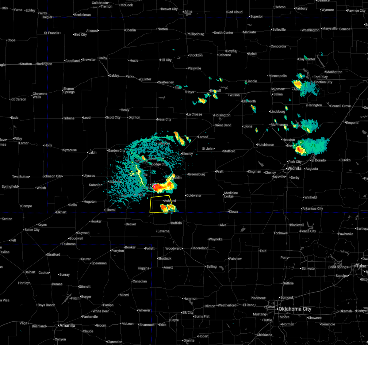
| 7/8/2025 8:15 PM CDT | Quarter sized hail reported 0.9 miles W of Englewood, KS |
| 7/8/2025 8:12 PM CDT |
 At 812 pm cdt, a severe thunderstorm was located near englewood, and is nearly stationary (radar indicated). Hazards include 60 mph wind gusts and quarter size hail. Hail damage to vehicles is expected. expect wind damage to roofs, siding, and trees. Locations impacted include, englewood. At 812 pm cdt, a severe thunderstorm was located near englewood, and is nearly stationary (radar indicated). Hazards include 60 mph wind gusts and quarter size hail. Hail damage to vehicles is expected. expect wind damage to roofs, siding, and trees. Locations impacted include, englewood.
|
| 7/8/2025 7:53 PM CDT |
 Svrddc the national weather service in dodge city has issued a * severe thunderstorm warning for, southwestern clark county in southwestern kansas, * until 845 pm cdt. * at 753 pm cdt, a severe thunderstorm was located near acres, and is nearly stationary (radar indicated). Hazards include golf ball size hail and 60 mph wind gusts. People and animals outdoors will be injured. expect hail damage to roofs, siding, windows, and vehicles. expect wind damage to roofs, siding, and trees. This severe thunderstorm will be near, englewood around 800 pm cdt. Svrddc the national weather service in dodge city has issued a * severe thunderstorm warning for, southwestern clark county in southwestern kansas, * until 845 pm cdt. * at 753 pm cdt, a severe thunderstorm was located near acres, and is nearly stationary (radar indicated). Hazards include golf ball size hail and 60 mph wind gusts. People and animals outdoors will be injured. expect hail damage to roofs, siding, windows, and vehicles. expect wind damage to roofs, siding, and trees. This severe thunderstorm will be near, englewood around 800 pm cdt.
|
| 6/17/2025 10:05 PM CDT |
 The storm which prompted the warning has weakened below severe limits, and no longer poses an immediate threat to life or property. therefore, the warning will be allowed to expire. The storm which prompted the warning has weakened below severe limits, and no longer poses an immediate threat to life or property. therefore, the warning will be allowed to expire.
|
| 6/17/2025 9:51 PM CDT |
 At 951 pm cdt, a severe thunderstorm was located near englewood, moving east at 25 mph (radar indicated). Hazards include 60 mph wind gusts and quarter size hail. Hail damage to vehicles is expected. expect wind damage to roofs, siding, and trees. Locations impacted include, englewood. At 951 pm cdt, a severe thunderstorm was located near englewood, moving east at 25 mph (radar indicated). Hazards include 60 mph wind gusts and quarter size hail. Hail damage to vehicles is expected. expect wind damage to roofs, siding, and trees. Locations impacted include, englewood.
|
| 6/17/2025 9:46 PM CDT |
 At 945 pm cdt, a severe thunderstorm was located near englewood, moving east at 30 mph (radar indicated). Hazards include 60 mph wind gusts and half dollar size hail. Hail damage to vehicles is expected. expect wind damage to roofs, siding, and trees. Locations impacted include, englewood. At 945 pm cdt, a severe thunderstorm was located near englewood, moving east at 30 mph (radar indicated). Hazards include 60 mph wind gusts and half dollar size hail. Hail damage to vehicles is expected. expect wind damage to roofs, siding, and trees. Locations impacted include, englewood.
|
| 6/17/2025 9:34 PM CDT |
 Svrddc the national weather service in dodge city has issued a * severe thunderstorm warning for, southeastern meade county in southwestern kansas, southwestern clark county in southwestern kansas, * until 1015 pm cdt. * at 934 pm cdt, a severe thunderstorm was located 12 miles north of knowles, or 12 miles west of englewood, moving east at 25 mph (radar indicated). Hazards include 60 mph wind gusts and half dollar size hail. Hail damage to vehicles is expected. Expect wind damage to roofs, siding, and trees. Svrddc the national weather service in dodge city has issued a * severe thunderstorm warning for, southeastern meade county in southwestern kansas, southwestern clark county in southwestern kansas, * until 1015 pm cdt. * at 934 pm cdt, a severe thunderstorm was located 12 miles north of knowles, or 12 miles west of englewood, moving east at 25 mph (radar indicated). Hazards include 60 mph wind gusts and half dollar size hail. Hail damage to vehicles is expected. Expect wind damage to roofs, siding, and trees.
|
| 6/2/2025 7:12 PM CDT |
 Svrddc the national weather service in dodge city has issued a * severe thunderstorm warning for, ford county in southwestern kansas, kiowa county in south central kansas, northeastern meade county in southwestern kansas, western barber county in south central kansas, comanche county in south central kansas, southeastern gray county in southwestern kansas, southern edwards county in south central kansas, southwestern pratt county in south central kansas, clark county in southwestern kansas, * until 800 pm cdt. * at 712 pm cdt, severe thunderstorms were located along a line extending from near ft. dodge to near buttermilk, moving east at 50 mph (radar indicated). Hazards include 60 mph wind gusts. Expect damage to roofs, siding, and trees. severe thunderstorms will be near, coldwater, bucklin, protection, ford, wright, and buttermilk around 715 pm cdt. lake coldwater around 720 pm cdt. mullinville and windhorst around 725 pm cdt. wilmore around 730 pm cdt. Other locations in the path of these severe thunderstorms include greensburg, aetna, belvidere, haviland, sun city, centerview and croft. Svrddc the national weather service in dodge city has issued a * severe thunderstorm warning for, ford county in southwestern kansas, kiowa county in south central kansas, northeastern meade county in southwestern kansas, western barber county in south central kansas, comanche county in south central kansas, southeastern gray county in southwestern kansas, southern edwards county in south central kansas, southwestern pratt county in south central kansas, clark county in southwestern kansas, * until 800 pm cdt. * at 712 pm cdt, severe thunderstorms were located along a line extending from near ft. dodge to near buttermilk, moving east at 50 mph (radar indicated). Hazards include 60 mph wind gusts. Expect damage to roofs, siding, and trees. severe thunderstorms will be near, coldwater, bucklin, protection, ford, wright, and buttermilk around 715 pm cdt. lake coldwater around 720 pm cdt. mullinville and windhorst around 725 pm cdt. wilmore around 730 pm cdt. Other locations in the path of these severe thunderstorms include greensburg, aetna, belvidere, haviland, sun city, centerview and croft.
|
| 5/18/2025 5:40 PM CDT |
 Svrddc the national weather service in dodge city has issued a * severe thunderstorm warning for, clark county in southwestern kansas, * until 630 pm cdt. * at 540 pm cdt, a severe thunderstorm was located near rosston, or 10 miles north of laverne, moving north at 55 mph (radar indicated). Hazards include two inch hail. People and animals outdoors will be injured. expect damage to roofs, siding, windows, and vehicles. This severe thunderstorm will be near, ashland around 600 pm cdt. Svrddc the national weather service in dodge city has issued a * severe thunderstorm warning for, clark county in southwestern kansas, * until 630 pm cdt. * at 540 pm cdt, a severe thunderstorm was located near rosston, or 10 miles north of laverne, moving north at 55 mph (radar indicated). Hazards include two inch hail. People and animals outdoors will be injured. expect damage to roofs, siding, windows, and vehicles. This severe thunderstorm will be near, ashland around 600 pm cdt.
|
| 4/24/2025 7:22 PM CDT |
 The storm which prompted the warning has weakened below severe limits, and has exited the warned area. therefore, the warning will be allowed to expire. however, gusty winds and heavy rain are still possible with this thunderstorm. a severe thunderstorm watch remains in effect until midnight cdt for southwestern kansas. The storm which prompted the warning has weakened below severe limits, and has exited the warned area. therefore, the warning will be allowed to expire. however, gusty winds and heavy rain are still possible with this thunderstorm. a severe thunderstorm watch remains in effect until midnight cdt for southwestern kansas.
|
| 4/24/2025 7:16 PM CDT |
 At 715 pm cdt, a severe thunderstorm was located near englewood, moving southeast at 5 mph (radar indicated). Hazards include half dollar size hail. Damage to vehicles is expected. Locations impacted include, englewood. At 715 pm cdt, a severe thunderstorm was located near englewood, moving southeast at 5 mph (radar indicated). Hazards include half dollar size hail. Damage to vehicles is expected. Locations impacted include, englewood.
|
| 4/24/2025 7:04 PM CDT |
 At 703 pm cdt, a severe thunderstorm was located near englewood, moving southeast at 5 mph (radar indicated). Hazards include two inch hail. People and animals outdoors will be injured. expect damage to roofs, siding, windows, and vehicles. Locations impacted include, englewood. At 703 pm cdt, a severe thunderstorm was located near englewood, moving southeast at 5 mph (radar indicated). Hazards include two inch hail. People and animals outdoors will be injured. expect damage to roofs, siding, windows, and vehicles. Locations impacted include, englewood.
|
| 4/24/2025 7:04 PM CDT |
 the severe thunderstorm warning has been cancelled and is no longer in effect the severe thunderstorm warning has been cancelled and is no longer in effect
|
| 4/24/2025 6:52 PM CDT |
 Svrddc the national weather service in dodge city has issued a * severe thunderstorm warning for, southeastern meade county in southwestern kansas, southwestern clark county in southwestern kansas, * until 730 pm cdt. * at 652 pm cdt, a severe thunderstorm was located near englewood, moving southeast at 5 mph (radar indicated). Hazards include two inch hail. People and animals outdoors will be injured. expect damage to roofs, siding, windows, and vehicles. This severe thunderstorm will remain over mainly rural areas of southeastern meade and southwestern clark counties. Svrddc the national weather service in dodge city has issued a * severe thunderstorm warning for, southeastern meade county in southwestern kansas, southwestern clark county in southwestern kansas, * until 730 pm cdt. * at 652 pm cdt, a severe thunderstorm was located near englewood, moving southeast at 5 mph (radar indicated). Hazards include two inch hail. People and animals outdoors will be injured. expect damage to roofs, siding, windows, and vehicles. This severe thunderstorm will remain over mainly rural areas of southeastern meade and southwestern clark counties.
|
| 4/24/2025 6:33 PM CDT |
 At 633 pm cdt, a severe thunderstorm was located very near acres, moving southeast at 10 mph (radar indicated). Hazards include tennis ball size hail. People and animals outdoors will be injured. expect damage to roofs, siding, windows, and vehicles. This severe storm will be near, acres around 640 pm cdt. At 633 pm cdt, a severe thunderstorm was located very near acres, moving southeast at 10 mph (radar indicated). Hazards include tennis ball size hail. People and animals outdoors will be injured. expect damage to roofs, siding, windows, and vehicles. This severe storm will be near, acres around 640 pm cdt.
|
| 4/24/2025 6:28 PM CDT |
 At 628 pm cdt, a severe thunderstorm was located near acres, moving southeast at 10 mph (radar indicated). Hazards include golf ball size hail. People and animals outdoors will be injured. expect damage to roofs, siding, windows, and vehicles. This severe storm will be near, acres around 635 pm cdt. At 628 pm cdt, a severe thunderstorm was located near acres, moving southeast at 10 mph (radar indicated). Hazards include golf ball size hail. People and animals outdoors will be injured. expect damage to roofs, siding, windows, and vehicles. This severe storm will be near, acres around 635 pm cdt.
|
| 4/24/2025 6:18 PM CDT |
 At 617 pm cdt, a severe thunderstorm was located near acres, moving southeast at 10 mph (radar indicated). Hazards include half dollar size hail. Damage to vehicles is expected. This severe storm will be near, acres around 625 pm cdt. At 617 pm cdt, a severe thunderstorm was located near acres, moving southeast at 10 mph (radar indicated). Hazards include half dollar size hail. Damage to vehicles is expected. This severe storm will be near, acres around 625 pm cdt.
|
| 4/24/2025 6:08 PM CDT |
 Svrddc the national weather service in dodge city has issued a * severe thunderstorm warning for, southwestern clark county in southwestern kansas, * until 700 pm cdt. * at 608 pm cdt, a severe thunderstorm was located near acres, moving southeast at 10 mph (radar indicated). Hazards include two inch hail. People and animals outdoors will be injured. expect damage to roofs, siding, windows, and vehicles. This severe thunderstorm will be near, acres around 620 pm cdt. Svrddc the national weather service in dodge city has issued a * severe thunderstorm warning for, southwestern clark county in southwestern kansas, * until 700 pm cdt. * at 608 pm cdt, a severe thunderstorm was located near acres, moving southeast at 10 mph (radar indicated). Hazards include two inch hail. People and animals outdoors will be injured. expect damage to roofs, siding, windows, and vehicles. This severe thunderstorm will be near, acres around 620 pm cdt.
|
| 4/24/2025 5:58 PM CDT |
 At 557 pm cdt, a severe thunderstorm was located near acres, moving southeast at 15 mph (trained weather spotters. at 550 pm, storm spotters reported golf ball sized hail 9 miles northwest of englewood). Hazards include tennis ball size hail. People and animals outdoors will be injured. expect damage to roofs, siding, windows, and vehicles. This severe storm will be near, acres around 600 pm cdt. At 557 pm cdt, a severe thunderstorm was located near acres, moving southeast at 15 mph (trained weather spotters. at 550 pm, storm spotters reported golf ball sized hail 9 miles northwest of englewood). Hazards include tennis ball size hail. People and animals outdoors will be injured. expect damage to roofs, siding, windows, and vehicles. This severe storm will be near, acres around 600 pm cdt.
|
| 4/24/2025 5:50 PM CDT | Golf Ball sized hail reported 8.6 miles SE of Englewood, KS |
| 4/24/2025 5:46 PM CDT |
 At 546 pm cdt, a severe thunderstorm was located near acres, moving southeast at 15 mph (radar indicated). Hazards include tennis ball size hail. People and animals outdoors will be injured. expect damage to roofs, siding, windows, and vehicles. Locations impacted include, acres. At 546 pm cdt, a severe thunderstorm was located near acres, moving southeast at 15 mph (radar indicated). Hazards include tennis ball size hail. People and animals outdoors will be injured. expect damage to roofs, siding, windows, and vehicles. Locations impacted include, acres.
|
| 4/24/2025 5:26 PM CDT |
 Svrddc the national weather service in dodge city has issued a * severe thunderstorm warning for, east central meade county in southwestern kansas, southwestern clark county in southwestern kansas, * until 615 pm cdt. * at 526 pm cdt, a severe thunderstorm was located 9 miles northwest of acres, moving southeast at 15 mph (radar indicated). Hazards include two inch hail. People and animals outdoors will be injured. Expect damage to roofs, siding, windows, and vehicles. Svrddc the national weather service in dodge city has issued a * severe thunderstorm warning for, east central meade county in southwestern kansas, southwestern clark county in southwestern kansas, * until 615 pm cdt. * at 526 pm cdt, a severe thunderstorm was located 9 miles northwest of acres, moving southeast at 15 mph (radar indicated). Hazards include two inch hail. People and animals outdoors will be injured. Expect damage to roofs, siding, windows, and vehicles.
|
| 7/6/2024 11:38 PM CDT |
 At 1138 pm cdt, a severe thunderstorm was located 8 miles west of ashland, moving southeast at 20 mph (radar indicated). Hazards include 60 mph wind gusts and quarter size hail. Hail damage to vehicles is expected. expect wind damage to roofs, siding, and trees. Locations impacted include, ashland, minneola, englewood, clark state lake, and acres. At 1138 pm cdt, a severe thunderstorm was located 8 miles west of ashland, moving southeast at 20 mph (radar indicated). Hazards include 60 mph wind gusts and quarter size hail. Hail damage to vehicles is expected. expect wind damage to roofs, siding, and trees. Locations impacted include, ashland, minneola, englewood, clark state lake, and acres.
|
| 7/6/2024 11:08 PM CDT |
 Svrddc the national weather service in dodge city has issued a * severe thunderstorm warning for, eastern meade county in southwestern kansas, western clark county in southwestern kansas, * until 1215 am cdt. * at 1107 pm cdt, a severe thunderstorm was located 7 miles southeast of fowler, moving southeast at 20 mph (radar indicated). Hazards include 60 mph wind gusts and quarter size hail. Hail damage to vehicles is expected. Expect wind damage to roofs, siding, and trees. Svrddc the national weather service in dodge city has issued a * severe thunderstorm warning for, eastern meade county in southwestern kansas, western clark county in southwestern kansas, * until 1215 am cdt. * at 1107 pm cdt, a severe thunderstorm was located 7 miles southeast of fowler, moving southeast at 20 mph (radar indicated). Hazards include 60 mph wind gusts and quarter size hail. Hail damage to vehicles is expected. Expect wind damage to roofs, siding, and trees.
|
| 7/6/2024 8:38 PM CDT |
 Svrddc the national weather service in dodge city has issued a * severe thunderstorm warning for, kiowa county in south central kansas, meade county in southwestern kansas, northwestern barber county in south central kansas, northern comanche county in south central kansas, southern stafford county in south central kansas, pratt county in south central kansas, clark county in southwestern kansas, * until 945 pm cdt. * at 838 pm cdt, severe thunderstorms were located along a line extending from near macksville to 8 miles northwest of bloom, moving southeast at 45 mph (radar indicated). Hazards include 60 mph wind gusts. Expect damage to roofs, siding, and trees. severe thunderstorms will be near, mullinville, byers, and hopewell around 845 pm cdt. greensburg around 850 pm cdt. haviland, cullison, clark state lake, and wellsford around 855 pm cdt. Other locations in the path of these severe thunderstorms include pratt, coats, belvidere, croft, ashland, sawyer, wilmore, coldwater, protection, sitka, sun city and lake coldwater. Svrddc the national weather service in dodge city has issued a * severe thunderstorm warning for, kiowa county in south central kansas, meade county in southwestern kansas, northwestern barber county in south central kansas, northern comanche county in south central kansas, southern stafford county in south central kansas, pratt county in south central kansas, clark county in southwestern kansas, * until 945 pm cdt. * at 838 pm cdt, severe thunderstorms were located along a line extending from near macksville to 8 miles northwest of bloom, moving southeast at 45 mph (radar indicated). Hazards include 60 mph wind gusts. Expect damage to roofs, siding, and trees. severe thunderstorms will be near, mullinville, byers, and hopewell around 845 pm cdt. greensburg around 850 pm cdt. haviland, cullison, clark state lake, and wellsford around 855 pm cdt. Other locations in the path of these severe thunderstorms include pratt, coats, belvidere, croft, ashland, sawyer, wilmore, coldwater, protection, sitka, sun city and lake coldwater.
|
| 6/15/2024 7:30 PM CDT | Golf Ball sized hail reported 8.6 miles SE of Englewood, KS |
| 6/15/2024 6:44 PM CDT |
 the severe thunderstorm warning has been cancelled and is no longer in effect the severe thunderstorm warning has been cancelled and is no longer in effect
|
| 6/15/2024 6:30 PM CDT |
 the severe thunderstorm warning has been cancelled and is no longer in effect the severe thunderstorm warning has been cancelled and is no longer in effect
|
| 6/15/2024 6:30 PM CDT |
 At 629 pm cdt, a severe thunderstorm was located near englewood, moving east at 20 mph (radar indicated). Hazards include 60 mph wind gusts and quarter size hail. Hail damage to vehicles is expected. expect wind damage to roofs, siding, and trees. Locations impacted include, englewood and acres. At 629 pm cdt, a severe thunderstorm was located near englewood, moving east at 20 mph (radar indicated). Hazards include 60 mph wind gusts and quarter size hail. Hail damage to vehicles is expected. expect wind damage to roofs, siding, and trees. Locations impacted include, englewood and acres.
|
| 6/15/2024 6:20 PM CDT |
 At 620 pm cdt, a severe thunderstorm was located near englewood, moving east at 20 mph (radar indicated). Hazards include 60 mph wind gusts and quarter size hail. Hail damage to vehicles is expected. expect wind damage to roofs, siding, and trees. Locations impacted include, englewood and acres. At 620 pm cdt, a severe thunderstorm was located near englewood, moving east at 20 mph (radar indicated). Hazards include 60 mph wind gusts and quarter size hail. Hail damage to vehicles is expected. expect wind damage to roofs, siding, and trees. Locations impacted include, englewood and acres.
|
| 6/15/2024 6:10 PM CDT |
 Svrddc the national weather service in dodge city has issued a * severe thunderstorm warning for, southeastern meade county in southwestern kansas, southwestern clark county in southwestern kansas, * until 715 pm cdt. * at 609 pm cdt, a severe thunderstorm was located 8 miles west of englewood, moving northeast at 20 mph (radar indicated). Hazards include 60 mph wind gusts and quarter size hail. Hail damage to vehicles is expected. Expect wind damage to roofs, siding, and trees. Svrddc the national weather service in dodge city has issued a * severe thunderstorm warning for, southeastern meade county in southwestern kansas, southwestern clark county in southwestern kansas, * until 715 pm cdt. * at 609 pm cdt, a severe thunderstorm was located 8 miles west of englewood, moving northeast at 20 mph (radar indicated). Hazards include 60 mph wind gusts and quarter size hail. Hail damage to vehicles is expected. Expect wind damage to roofs, siding, and trees.
|
| 6/13/2024 8:43 PM CDT |
 The storms which prompted the warning have moved out of the area. therefore, the warning will be allowed to expire. however, small hail, gusty winds and heavy rain are still possible with these thunderstorms. a severe thunderstorm watch remains in effect until 1100 pm cdt for south central and southwestern kansas. to report severe weather, contact your nearest law enforcement agency. they will relay your report to the national weather service dodge city. The storms which prompted the warning have moved out of the area. therefore, the warning will be allowed to expire. however, small hail, gusty winds and heavy rain are still possible with these thunderstorms. a severe thunderstorm watch remains in effect until 1100 pm cdt for south central and southwestern kansas. to report severe weather, contact your nearest law enforcement agency. they will relay your report to the national weather service dodge city.
|
| 6/13/2024 8:31 PM CDT |
 At 830 pm cdt, severe thunderstorms were located along a line extending from near lake city to near rosston, moving southeast at 40 mph (radar indicated). Hazards include 60 mph wind gusts. Expect damage to roofs, siding, and trees. Locations impacted include, medicine lodge, kiowa, ashland, coldwater, protection, hardtner, hazelton, englewood, sitka, lake city, sun city, wilmore, aetna, lake coldwater, acres, and buttermilk. At 830 pm cdt, severe thunderstorms were located along a line extending from near lake city to near rosston, moving southeast at 40 mph (radar indicated). Hazards include 60 mph wind gusts. Expect damage to roofs, siding, and trees. Locations impacted include, medicine lodge, kiowa, ashland, coldwater, protection, hardtner, hazelton, englewood, sitka, lake city, sun city, wilmore, aetna, lake coldwater, acres, and buttermilk.
|
| 6/13/2024 8:31 PM CDT |
 the severe thunderstorm warning has been cancelled and is no longer in effect the severe thunderstorm warning has been cancelled and is no longer in effect
|
| 6/13/2024 8:10 PM CDT |
 the severe thunderstorm warning has been cancelled and is no longer in effect the severe thunderstorm warning has been cancelled and is no longer in effect
|
| 6/13/2024 8:10 PM CDT |
 At 810 pm cdt, severe thunderstorms were located along a line extending from near coats to near englewood, moving southeast at 40 mph (radar indicated). Hazards include 60 mph wind gusts and quarter size hail. Hail damage to vehicles is expected. expect wind damage to roofs, siding, and trees. Locations impacted include, medicine lodge, kiowa, ashland, coldwater, haviland, protection, hardtner, cullison, hazelton, coats, englewood, sitka, lake city, sun city, wilmore, aetna, wellsford, croft, lake coldwater, and acres. At 810 pm cdt, severe thunderstorms were located along a line extending from near coats to near englewood, moving southeast at 40 mph (radar indicated). Hazards include 60 mph wind gusts and quarter size hail. Hail damage to vehicles is expected. expect wind damage to roofs, siding, and trees. Locations impacted include, medicine lodge, kiowa, ashland, coldwater, haviland, protection, hardtner, cullison, hazelton, coats, englewood, sitka, lake city, sun city, wilmore, aetna, wellsford, croft, lake coldwater, and acres.
|
| 6/13/2024 7:57 PM CDT |
 the severe thunderstorm warning has been cancelled and is no longer in effect the severe thunderstorm warning has been cancelled and is no longer in effect
|
| 6/13/2024 7:57 PM CDT |
 At 757 pm cdt, severe thunderstorms were located along a line extending from near cullison to 11 miles southeast of meade state park, moving southeast at 40 mph (radar indicated). Hazards include 60 mph wind gusts and quarter size hail. Hail damage to vehicles is expected. expect wind damage to roofs, siding, and trees. Locations impacted include, medicine lodge, kiowa, ashland, coldwater, haviland, protection, hardtner, cullison, hazelton, coats, englewood, sitka, lake city, sun city, wilmore, aetna, clark state lake, wellsford, croft, and lake coldwater. At 757 pm cdt, severe thunderstorms were located along a line extending from near cullison to 11 miles southeast of meade state park, moving southeast at 40 mph (radar indicated). Hazards include 60 mph wind gusts and quarter size hail. Hail damage to vehicles is expected. expect wind damage to roofs, siding, and trees. Locations impacted include, medicine lodge, kiowa, ashland, coldwater, haviland, protection, hardtner, cullison, hazelton, coats, englewood, sitka, lake city, sun city, wilmore, aetna, clark state lake, wellsford, croft, and lake coldwater.
|
| 6/13/2024 7:35 PM CDT |
 Svrddc the national weather service in dodge city has issued a * severe thunderstorm warning for, southeastern ford county in southwestern kansas, kiowa county in south central kansas, southern meade county in southwestern kansas, barber county in south central kansas, comanche county in south central kansas, western pratt county in south central kansas, southeastern edwards county in south central kansas, clark county in southwestern kansas, * until 845 pm cdt. * at 735 pm cdt, severe thunderstorms were located along a line extending from near trousdale to near meade state park, moving southeast at 40 mph (radar indicated). Hazards include 60 mph wind gusts and quarter size hail. Hail damage to vehicles is expected. Expect wind damage to roofs, siding, and trees. Svrddc the national weather service in dodge city has issued a * severe thunderstorm warning for, southeastern ford county in southwestern kansas, kiowa county in south central kansas, southern meade county in southwestern kansas, barber county in south central kansas, comanche county in south central kansas, western pratt county in south central kansas, southeastern edwards county in south central kansas, clark county in southwestern kansas, * until 845 pm cdt. * at 735 pm cdt, severe thunderstorms were located along a line extending from near trousdale to near meade state park, moving southeast at 40 mph (radar indicated). Hazards include 60 mph wind gusts and quarter size hail. Hail damage to vehicles is expected. Expect wind damage to roofs, siding, and trees.
|
| 6/9/2024 12:20 AM CDT |
 The storms which prompted the warning have moved out of the area. therefore, the warning will be allowed to expire. however, gusty winds are still possible with these thunderstorms. a severe thunderstorm watch remains in effect until 300 am cdt for south central and southwestern kansas. The storms which prompted the warning have moved out of the area. therefore, the warning will be allowed to expire. however, gusty winds are still possible with these thunderstorms. a severe thunderstorm watch remains in effect until 300 am cdt for south central and southwestern kansas.
|
| 6/8/2024 11:47 PM CDT |
 Svrddc the national weather service in dodge city has issued a * severe thunderstorm warning for, eastern ford county in southwestern kansas, kiowa county in south central kansas, southeastern hodgeman county in southwestern kansas, western comanche county in south central kansas, south central pawnee county in south central kansas, edwards county in south central kansas, clark county in southwestern kansas, * until 1230 am cdt. * at 1147 pm cdt, severe thunderstorms were located along a line extending from near gray to 6 miles south of windhorst to near ashland, moving southeast at 15 mph (radar indicated). Hazards include 70 mph wind gusts and penny size hail. Expect considerable tree damage. damage is likely to mobile homes, roofs, and outbuildings. Severe thunderstorms will be near, ashland, bucklin, offerle, clark state lake, and windhorst around 1150 pm cdt. Svrddc the national weather service in dodge city has issued a * severe thunderstorm warning for, eastern ford county in southwestern kansas, kiowa county in south central kansas, southeastern hodgeman county in southwestern kansas, western comanche county in south central kansas, south central pawnee county in south central kansas, edwards county in south central kansas, clark county in southwestern kansas, * until 1230 am cdt. * at 1147 pm cdt, severe thunderstorms were located along a line extending from near gray to 6 miles south of windhorst to near ashland, moving southeast at 15 mph (radar indicated). Hazards include 70 mph wind gusts and penny size hail. Expect considerable tree damage. damage is likely to mobile homes, roofs, and outbuildings. Severe thunderstorms will be near, ashland, bucklin, offerle, clark state lake, and windhorst around 1150 pm cdt.
|
| 6/3/2024 4:43 AM CDT |
 Svrddc the national weather service in dodge city has issued a * severe thunderstorm warning for, southeastern ford county in southwestern kansas, kiowa county in south central kansas, northwestern barber county in south central kansas, comanche county in south central kansas, western pratt county in south central kansas, southern edwards county in south central kansas, clark county in southwestern kansas, * until 530 am cdt. * at 441 am cdt, severe thunderstorms were located along a line extending from 6 miles east of windhorst to near englewood, moving east at 45 mph (automated equipment. a wind gust of 67 mph was measured at the dodge city airport at 420 am cdt. these storms have a history of producing wind damage). Hazards include 70 mph wind gusts and nickel size hail. Expect considerable tree damage. damage is likely to mobile homes, roofs, and outbuildings. severe thunderstorms will be near, ashland, bucklin, mullinville, and acres around 445 am cdt. sitka around 450 am cdt. greensburg and centerview around 455 am cdt. protection around 500 am cdt. Other locations in the path of these severe thunderstorms include coldwater, lake coldwater, haviland, wilmore, wellsford, buttermilk, cullison, belvidere and croft. Svrddc the national weather service in dodge city has issued a * severe thunderstorm warning for, southeastern ford county in southwestern kansas, kiowa county in south central kansas, northwestern barber county in south central kansas, comanche county in south central kansas, western pratt county in south central kansas, southern edwards county in south central kansas, clark county in southwestern kansas, * until 530 am cdt. * at 441 am cdt, severe thunderstorms were located along a line extending from 6 miles east of windhorst to near englewood, moving east at 45 mph (automated equipment. a wind gust of 67 mph was measured at the dodge city airport at 420 am cdt. these storms have a history of producing wind damage). Hazards include 70 mph wind gusts and nickel size hail. Expect considerable tree damage. damage is likely to mobile homes, roofs, and outbuildings. severe thunderstorms will be near, ashland, bucklin, mullinville, and acres around 445 am cdt. sitka around 450 am cdt. greensburg and centerview around 455 am cdt. protection around 500 am cdt. Other locations in the path of these severe thunderstorms include coldwater, lake coldwater, haviland, wilmore, wellsford, buttermilk, cullison, belvidere and croft.
|
| 6/3/2024 4:36 AM CDT |
 Svrddc the national weather service in dodge city has issued a * severe thunderstorm warning for, southeastern meade county in southwestern kansas, southern clark county in southwestern kansas, * until 515 am cdt. * at 436 am cdt, a severe thunderstorm was located 10 miles west of englewood, moving east at 30 mph (radar indicated). Hazards include 70 mph wind gusts and nickel size hail. Expect considerable tree damage. damage is likely to mobile homes, roofs, and outbuildings. This severe thunderstorm will be near, englewood around 455 am cdt. Svrddc the national weather service in dodge city has issued a * severe thunderstorm warning for, southeastern meade county in southwestern kansas, southern clark county in southwestern kansas, * until 515 am cdt. * at 436 am cdt, a severe thunderstorm was located 10 miles west of englewood, moving east at 30 mph (radar indicated). Hazards include 70 mph wind gusts and nickel size hail. Expect considerable tree damage. damage is likely to mobile homes, roofs, and outbuildings. This severe thunderstorm will be near, englewood around 455 am cdt.
|
| 5/28/2024 10:49 AM CDT |
 Svrddc the national weather service in dodge city has issued a * severe thunderstorm warning for, southwestern clark county in southwestern kansas, * until 1130 am cdt. * at 1049 am cdt, a severe thunderstorm was located very near englewood, moving northeast at 20 mph (radar indicated). Hazards include quarter size hail. Damage to vehicles is expected. this severe thunderstorm will be near, acres around 1055 am cdt. Other locations in the path of this severe thunderstorm include ashland. Svrddc the national weather service in dodge city has issued a * severe thunderstorm warning for, southwestern clark county in southwestern kansas, * until 1130 am cdt. * at 1049 am cdt, a severe thunderstorm was located very near englewood, moving northeast at 20 mph (radar indicated). Hazards include quarter size hail. Damage to vehicles is expected. this severe thunderstorm will be near, acres around 1055 am cdt. Other locations in the path of this severe thunderstorm include ashland.
|
| 5/25/2024 5:25 PM CDT | Quarter sized hail reported 2.9 miles WSW of Englewood, KS |
| 5/25/2024 5:24 PM CDT |
 the severe thunderstorm warning has been cancelled and is no longer in effect the severe thunderstorm warning has been cancelled and is no longer in effect
|
| 5/25/2024 5:24 PM CDT |
 At 524 pm cdt, a severe thunderstorm was located near sitka, moving northeast at 55 mph (radar indicated). Hazards include two inch hail and 60 mph wind gusts. People and animals outdoors will be injured. expect hail damage to roofs, siding, windows, and vehicles. expect wind damage to roofs, siding, and trees. This severe thunderstorm will remain over mainly rural areas of west central comanche and southeastern clark counties. At 524 pm cdt, a severe thunderstorm was located near sitka, moving northeast at 55 mph (radar indicated). Hazards include two inch hail and 60 mph wind gusts. People and animals outdoors will be injured. expect hail damage to roofs, siding, windows, and vehicles. expect wind damage to roofs, siding, and trees. This severe thunderstorm will remain over mainly rural areas of west central comanche and southeastern clark counties.
|
| 5/25/2024 4:54 PM CDT |
 Svrddc the national weather service in dodge city has issued a * severe thunderstorm warning for, southeastern meade county in southwestern kansas, west central comanche county in south central kansas, clark county in southwestern kansas, * until 545 pm cdt. * at 453 pm cdt, a severe thunderstorm was located near englewood, moving northeast at 55 mph (radar indicated). Hazards include two inch hail and 60 mph wind gusts. People and animals outdoors will be injured. expect hail damage to roofs, siding, windows, and vehicles. expect wind damage to roofs, siding, and trees. this severe thunderstorm will be near, englewood around 500 pm cdt. acres around 505 pm cdt. ashland around 510 pm cdt. Other locations in the path of this severe thunderstorm include sitka. Svrddc the national weather service in dodge city has issued a * severe thunderstorm warning for, southeastern meade county in southwestern kansas, west central comanche county in south central kansas, clark county in southwestern kansas, * until 545 pm cdt. * at 453 pm cdt, a severe thunderstorm was located near englewood, moving northeast at 55 mph (radar indicated). Hazards include two inch hail and 60 mph wind gusts. People and animals outdoors will be injured. expect hail damage to roofs, siding, windows, and vehicles. expect wind damage to roofs, siding, and trees. this severe thunderstorm will be near, englewood around 500 pm cdt. acres around 505 pm cdt. ashland around 510 pm cdt. Other locations in the path of this severe thunderstorm include sitka.
|
| 5/19/2024 6:27 PM CDT |
 At 626 pm cdt, severe thunderstorms were located along a line extending from 9 miles northwest of wilmore to near englewood, moving east at 35 mph (radar indicated). Hazards include 70 mph wind gusts and quarter size hail. Hail damage to vehicles is expected. expect considerable tree damage. wind damage is also likely to mobile homes, roofs, and outbuildings. these severe storms will be near, ashland, englewood, sitka, and acres around 630 pm cdt. Protection around 635 pm cdt. At 626 pm cdt, severe thunderstorms were located along a line extending from 9 miles northwest of wilmore to near englewood, moving east at 35 mph (radar indicated). Hazards include 70 mph wind gusts and quarter size hail. Hail damage to vehicles is expected. expect considerable tree damage. wind damage is also likely to mobile homes, roofs, and outbuildings. these severe storms will be near, ashland, englewood, sitka, and acres around 630 pm cdt. Protection around 635 pm cdt.
|
| 5/19/2024 6:27 PM CDT |
 the severe thunderstorm warning has been cancelled and is no longer in effect the severe thunderstorm warning has been cancelled and is no longer in effect
|
| 5/19/2024 6:21 PM CDT |
 the severe thunderstorm warning has been cancelled and is no longer in effect the severe thunderstorm warning has been cancelled and is no longer in effect
|
| 5/19/2024 6:20 PM CDT |
 Svrddc the national weather service in dodge city has issued a * severe thunderstorm warning for, southeastern ford county in southwestern kansas, southern kiowa county in south central kansas, southeastern meade county in southwestern kansas, northwestern barber county in south central kansas, comanche county in south central kansas, clark county in southwestern kansas, * until 645 pm cdt. * at 619 pm cdt, severe thunderstorms were located along a line extending from 10 miles south of greensburg to near englewood, moving east at 35 mph (radar indicated). Hazards include 70 mph wind gusts and quarter size hail. Hail damage to vehicles is expected. expect considerable tree damage. wind damage is also likely to mobile homes, roofs, and outbuildings. severe thunderstorms will be near, ashland, englewood, sitka, and acres around 625 pm cdt. Protection around 635 pm cdt. Svrddc the national weather service in dodge city has issued a * severe thunderstorm warning for, southeastern ford county in southwestern kansas, southern kiowa county in south central kansas, southeastern meade county in southwestern kansas, northwestern barber county in south central kansas, comanche county in south central kansas, clark county in southwestern kansas, * until 645 pm cdt. * at 619 pm cdt, severe thunderstorms were located along a line extending from 10 miles south of greensburg to near englewood, moving east at 35 mph (radar indicated). Hazards include 70 mph wind gusts and quarter size hail. Hail damage to vehicles is expected. expect considerable tree damage. wind damage is also likely to mobile homes, roofs, and outbuildings. severe thunderstorms will be near, ashland, englewood, sitka, and acres around 625 pm cdt. Protection around 635 pm cdt.
|
| 5/19/2024 6:11 PM CDT |
 At 610 pm cdt, severe thunderstorms were located along a line extending from kingsdown to 7 miles northwest of acres, moving east at 25 mph (radar indicated). Hazards include 70 mph wind gusts and half dollar size hail. Hail damage to vehicles is expected. expect considerable tree damage. wind damage is also likely to mobile homes, roofs, and outbuildings. Locations impacted include, clark state lake, ashland and sitka. At 610 pm cdt, severe thunderstorms were located along a line extending from kingsdown to 7 miles northwest of acres, moving east at 25 mph (radar indicated). Hazards include 70 mph wind gusts and half dollar size hail. Hail damage to vehicles is expected. expect considerable tree damage. wind damage is also likely to mobile homes, roofs, and outbuildings. Locations impacted include, clark state lake, ashland and sitka.
|
| 5/19/2024 5:54 PM CDT |
 Svrddc the national weather service in dodge city has issued a * severe thunderstorm warning for, southeastern ford county in southwestern kansas, southern kiowa county in south central kansas, eastern meade county in southwestern kansas, western comanche county in south central kansas, clark county in southwestern kansas, * until 645 pm cdt. * at 554 pm cdt, severe thunderstorms were located along a line extending from near bloom to 9 miles northwest of englewood, moving east at 25 mph (radar indicated). Hazards include 70 mph wind gusts and nickel size hail. Expect considerable tree damage. damage is likely to mobile homes, roofs, and outbuildings. severe thunderstorms will be near, kingsdown around 600 pm cdt. clark state lake around 605 pm cdt. Other locations in the path of these severe thunderstorms include ashland and acres. Svrddc the national weather service in dodge city has issued a * severe thunderstorm warning for, southeastern ford county in southwestern kansas, southern kiowa county in south central kansas, eastern meade county in southwestern kansas, western comanche county in south central kansas, clark county in southwestern kansas, * until 645 pm cdt. * at 554 pm cdt, severe thunderstorms were located along a line extending from near bloom to 9 miles northwest of englewood, moving east at 25 mph (radar indicated). Hazards include 70 mph wind gusts and nickel size hail. Expect considerable tree damage. damage is likely to mobile homes, roofs, and outbuildings. severe thunderstorms will be near, kingsdown around 600 pm cdt. clark state lake around 605 pm cdt. Other locations in the path of these severe thunderstorms include ashland and acres.
|
| 5/3/2024 9:51 PM CDT |
 The storms which prompted the warning have weakened below severe limits, and no longer pose an immediate threat to life or property. therefore, the warning will be allowed to expire. however, gusty winds are still possible with these thunderstorms. a severe thunderstorm watch remains in effect until 1100 pm cdt for south central and southwestern kansas. The storms which prompted the warning have weakened below severe limits, and no longer pose an immediate threat to life or property. therefore, the warning will be allowed to expire. however, gusty winds are still possible with these thunderstorms. a severe thunderstorm watch remains in effect until 1100 pm cdt for south central and southwestern kansas.
|
| 5/3/2024 9:08 PM CDT |
 Svrddc the national weather service in dodge city has issued a * severe thunderstorm warning for, southern ford county in southwestern kansas, eastern meade county in southwestern kansas, southeastern gray county in southwestern kansas, clark county in southwestern kansas, * until 1000 pm cdt. * at 907 pm cdt, severe thunderstorms were located along a line extending from near ensign to near fowler to 7 miles west of englewood, moving east at 40 mph (radar indicated). Hazards include 60 mph wind gusts. Expect damage to roofs, siding, and trees. severe thunderstorms will be near, minneola and englewood around 915 pm cdt. acres around 920 pm cdt. bloom around 925 pm cdt. ashland and clark state lake around 930 pm cdt. kingsdown around 935 pm cdt. sitka around 940 pm cdt. ford around 945 pm cdt. Bucklin around 950 pm cdt. Svrddc the national weather service in dodge city has issued a * severe thunderstorm warning for, southern ford county in southwestern kansas, eastern meade county in southwestern kansas, southeastern gray county in southwestern kansas, clark county in southwestern kansas, * until 1000 pm cdt. * at 907 pm cdt, severe thunderstorms were located along a line extending from near ensign to near fowler to 7 miles west of englewood, moving east at 40 mph (radar indicated). Hazards include 60 mph wind gusts. Expect damage to roofs, siding, and trees. severe thunderstorms will be near, minneola and englewood around 915 pm cdt. acres around 920 pm cdt. bloom around 925 pm cdt. ashland and clark state lake around 930 pm cdt. kingsdown around 935 pm cdt. sitka around 940 pm cdt. ford around 945 pm cdt. Bucklin around 950 pm cdt.
|
| 8/13/2023 8:35 PM CDT |
 At 835 pm cdt, severe thunderstorms were located along a line extending from near knowles to 7 miles northeast of rosston to 12 miles northeast of buffalo to 10 miles south of buttermilk to 10 miles north of freedom, moving north at 30 mph (radar indicated). Hazards include 60 mph wind gusts and quarter size hail. Hail damage to vehicles is expected. expect wind damage to roofs, siding, and trees. severe thunderstorms will be near, buttermilk around 855 pm cdt. other locations in the path of these severe thunderstorms include acres, protection, englewood, ashland, coldwater and lake coldwater. hail threat, radar indicated max hail size, 1. 00 in wind threat, radar indicated max wind gust, 60 mph. At 835 pm cdt, severe thunderstorms were located along a line extending from near knowles to 7 miles northeast of rosston to 12 miles northeast of buffalo to 10 miles south of buttermilk to 10 miles north of freedom, moving north at 30 mph (radar indicated). Hazards include 60 mph wind gusts and quarter size hail. Hail damage to vehicles is expected. expect wind damage to roofs, siding, and trees. severe thunderstorms will be near, buttermilk around 855 pm cdt. other locations in the path of these severe thunderstorms include acres, protection, englewood, ashland, coldwater and lake coldwater. hail threat, radar indicated max hail size, 1. 00 in wind threat, radar indicated max wind gust, 60 mph.
|
| 6/27/2023 9:03 PM CDT |
 At 903 pm cdt, severe thunderstorms were located along a line extending from near wright to 6 miles south of sitka, moving northeast at 35 mph (radar indicated). Hazards include 70 mph wind gusts. Expect considerable tree damage. damage is likely to mobile homes, roofs, and outbuildings. locations impacted include, dodge city, ashland, coldwater, bucklin, spearville, minneola, protection, mullinville, ford, offerle, bloom, englewood, sitka, clark state lake, kingsdown, howell, wright, lake coldwater, bellefont and windhorst. thunderstorm damage threat, considerable hail threat, radar indicated max hail size, <. 75 in wind threat, radar indicated max wind gust, 70 mph. At 903 pm cdt, severe thunderstorms were located along a line extending from near wright to 6 miles south of sitka, moving northeast at 35 mph (radar indicated). Hazards include 70 mph wind gusts. Expect considerable tree damage. damage is likely to mobile homes, roofs, and outbuildings. locations impacted include, dodge city, ashland, coldwater, bucklin, spearville, minneola, protection, mullinville, ford, offerle, bloom, englewood, sitka, clark state lake, kingsdown, howell, wright, lake coldwater, bellefont and windhorst. thunderstorm damage threat, considerable hail threat, radar indicated max hail size, <. 75 in wind threat, radar indicated max wind gust, 70 mph.
|
| 6/27/2023 8:50 PM CDT |
 The severe thunderstorm warning for southwestern ford, eastern meade, southeastern gray and western clark counties will expire at 900 pm cdt, the storms which prompted the warning have moved out of the area. therefore, the warning will be allowed to expire. however gusty winds and heavy rain are still possible with these thunderstorms. a severe thunderstorm watch remains in effect until 900 pm cdt for southwestern kansas. a severe thunderstorm watch also remains in effect until 200 am cdt for southwestern kansas. The severe thunderstorm warning for southwestern ford, eastern meade, southeastern gray and western clark counties will expire at 900 pm cdt, the storms which prompted the warning have moved out of the area. therefore, the warning will be allowed to expire. however gusty winds and heavy rain are still possible with these thunderstorms. a severe thunderstorm watch remains in effect until 900 pm cdt for southwestern kansas. a severe thunderstorm watch also remains in effect until 200 am cdt for southwestern kansas.
|
| 6/27/2023 8:48 PM CDT |
 At 847 pm cdt, severe thunderstorms were located along a line extending from 8 miles north of fowler to 6 miles southeast of englewood, moving east at 45 mph (radar indicated). Hazards include 70 mph wind gusts. Expect considerable tree damage. damage is likely to mobile homes, roofs, and outbuildings. locations impacted include, minneola, fowler, ensign, englewood and acres. thunderstorm damage threat, considerable hail threat, radar indicated max hail size, <. 75 in wind threat, radar indicated max wind gust, 70 mph. At 847 pm cdt, severe thunderstorms were located along a line extending from 8 miles north of fowler to 6 miles southeast of englewood, moving east at 45 mph (radar indicated). Hazards include 70 mph wind gusts. Expect considerable tree damage. damage is likely to mobile homes, roofs, and outbuildings. locations impacted include, minneola, fowler, ensign, englewood and acres. thunderstorm damage threat, considerable hail threat, radar indicated max hail size, <. 75 in wind threat, radar indicated max wind gust, 70 mph.
|
| 6/27/2023 8:38 PM CDT |
 At 838 pm cdt, severe thunderstorms were located along a line extending from 6 miles east of ensign to near englewood, moving northeast at 35 mph (radar indicated). Hazards include 70 mph wind gusts. Expect considerable tree damage. Damage is likely to mobile homes, roofs, and outbuildings. At 838 pm cdt, severe thunderstorms were located along a line extending from 6 miles east of ensign to near englewood, moving northeast at 35 mph (radar indicated). Hazards include 70 mph wind gusts. Expect considerable tree damage. Damage is likely to mobile homes, roofs, and outbuildings.
|
| 6/27/2023 8:28 PM CDT |
 At 827 pm cdt, severe thunderstorms were located along a line extending from 6 miles south of montezuma to 7 miles north of knowles, moving east at 45 mph. these are destructive storms for fowler (radar indicated). Hazards include 80 mph wind gusts. Flying debris will be dangerous to those caught without shelter. mobile homes will be heavily damaged. expect considerable damage to roofs, windows, and vehicles. extensive tree damage and power outages are likely. locations impacted include, meade, montezuma, minneola, fowler, ensign, englewood, meade state park, the haggard elev, missler and acres. thunderstorm damage threat, destructive hail threat, radar indicated max hail size, <. 75 in wind threat, radar indicated max wind gust, 80 mph. At 827 pm cdt, severe thunderstorms were located along a line extending from 6 miles south of montezuma to 7 miles north of knowles, moving east at 45 mph. these are destructive storms for fowler (radar indicated). Hazards include 80 mph wind gusts. Flying debris will be dangerous to those caught without shelter. mobile homes will be heavily damaged. expect considerable damage to roofs, windows, and vehicles. extensive tree damage and power outages are likely. locations impacted include, meade, montezuma, minneola, fowler, ensign, englewood, meade state park, the haggard elev, missler and acres. thunderstorm damage threat, destructive hail threat, radar indicated max hail size, <. 75 in wind threat, radar indicated max wind gust, 80 mph.
|
| 6/27/2023 8:19 PM CDT |
 At 819 pm cdt, severe thunderstorms were located along a line extending from 6 miles southeast of copeland to 8 miles northwest of knowles, moving east at 40 mph (radar indicated). Hazards include 70 mph wind gusts. Expect considerable tree damage. damage is likely to mobile homes, roofs, and outbuildings. locations impacted include, meade, montezuma, minneola, fowler, copeland, ensign, englewood, meade state park, missler, tice, the haggard elev, acres and plains. thunderstorm damage threat, considerable hail threat, radar indicated max hail size, <. 75 in wind threat, radar indicated max wind gust, 70 mph. At 819 pm cdt, severe thunderstorms were located along a line extending from 6 miles southeast of copeland to 8 miles northwest of knowles, moving east at 40 mph (radar indicated). Hazards include 70 mph wind gusts. Expect considerable tree damage. damage is likely to mobile homes, roofs, and outbuildings. locations impacted include, meade, montezuma, minneola, fowler, copeland, ensign, englewood, meade state park, missler, tice, the haggard elev, acres and plains. thunderstorm damage threat, considerable hail threat, radar indicated max hail size, <. 75 in wind threat, radar indicated max wind gust, 70 mph.
|
| 6/27/2023 8:02 PM CDT |
 At 802 pm cdt, severe thunderstorms were located along a line extending from near tice to near forgan, moving east at 45 mph (radar indicated). Hazards include 70 mph wind gusts and nickel size hail. Expect considerable tree damage. Damage is likely to mobile homes, roofs, and outbuildings. At 802 pm cdt, severe thunderstorms were located along a line extending from near tice to near forgan, moving east at 45 mph (radar indicated). Hazards include 70 mph wind gusts and nickel size hail. Expect considerable tree damage. Damage is likely to mobile homes, roofs, and outbuildings.
|
| 6/15/2023 5:56 PM CDT |
 At 555 pm cdt, severe thunderstorms were located along a line extending from 7 miles south of ft. dodge to 10 miles northwest of ashland to near englewood, moving east at 25 mph (radar indicated). Hazards include 70 mph wind gusts and nickel size hail. Expect considerable tree damage. damage is likely to mobile homes, roofs, and outbuildings. Locations impacted include, ashland, bucklin, minneola, ford, bloom, englewood, sitka, clark state lake, kingsdown and acres. At 555 pm cdt, severe thunderstorms were located along a line extending from 7 miles south of ft. dodge to 10 miles northwest of ashland to near englewood, moving east at 25 mph (radar indicated). Hazards include 70 mph wind gusts and nickel size hail. Expect considerable tree damage. damage is likely to mobile homes, roofs, and outbuildings. Locations impacted include, ashland, bucklin, minneola, ford, bloom, englewood, sitka, clark state lake, kingsdown and acres.
|
| 6/15/2023 5:33 PM CDT |
 At 532 pm cdt, severe thunderstorms were located along a line extending from near ensign to near fowler to 10 miles northwest of knowles, moving east at 30 mph (radar indicated). Hazards include 70 mph wind gusts and nickel size hail. Expect considerable tree damage. damage is likely to mobile homes, roofs, and outbuildings. These severe thunderstorms will remain over mainly rural areas of southern ford, eastern meade and clark counties. At 532 pm cdt, severe thunderstorms were located along a line extending from near ensign to near fowler to 10 miles northwest of knowles, moving east at 30 mph (radar indicated). Hazards include 70 mph wind gusts and nickel size hail. Expect considerable tree damage. damage is likely to mobile homes, roofs, and outbuildings. These severe thunderstorms will remain over mainly rural areas of southern ford, eastern meade and clark counties.
|
| 2/26/2023 5:44 PM CST |
 At 544 pm cst, severe thunderstorms were located along a line extending from near kalvesta to 7 miles southeast of meade state park, moving northeast at 45 mph (radar indicated). Hazards include 70 mph wind gusts and quarter size hail. Hail damage to vehicles is expected. expect considerable tree damage. wind damage is also likely to mobile homes, roofs, and outbuildings. These severe thunderstorms will remain over mainly rural areas of western ford, southwestern hodgeman, meade, eastern gray and western clark counties. At 544 pm cst, severe thunderstorms were located along a line extending from near kalvesta to 7 miles southeast of meade state park, moving northeast at 45 mph (radar indicated). Hazards include 70 mph wind gusts and quarter size hail. Hail damage to vehicles is expected. expect considerable tree damage. wind damage is also likely to mobile homes, roofs, and outbuildings. These severe thunderstorms will remain over mainly rural areas of western ford, southwestern hodgeman, meade, eastern gray and western clark counties.
|
| 2/26/2023 5:08 PM CST |
 At 508 pm cst, severe thunderstorms were located along a line extending from near pierceville to near floris, moving northeast at 60 mph (radar indicated). Hazards include 70 mph wind gusts and quarter size hail. Hail damage to vehicles is expected. expect considerable tree damage. wind damage is also likely to mobile homes, roofs, and outbuildings. severe thunderstorms will be near, charleston around 515 pm cst. Other locations in the path of these severe thunderstorms include meade state park and minneola. At 508 pm cst, severe thunderstorms were located along a line extending from near pierceville to near floris, moving northeast at 60 mph (radar indicated). Hazards include 70 mph wind gusts and quarter size hail. Hail damage to vehicles is expected. expect considerable tree damage. wind damage is also likely to mobile homes, roofs, and outbuildings. severe thunderstorms will be near, charleston around 515 pm cst. Other locations in the path of these severe thunderstorms include meade state park and minneola.
|
| 12/12/2022 10:14 PM CST |
 At 1013 pm cst, a severe thunderstorm was located 9 miles west of englewood, moving northeast at 35 mph (radar indicated). Hazards include 60 mph wind gusts and penny size hail. Expect damage to roofs, siding, and trees. locations impacted include, englewood. hail threat, radar indicated max hail size, 0. 75 in wind threat, radar indicated max wind gust, 60 mph. At 1013 pm cst, a severe thunderstorm was located 9 miles west of englewood, moving northeast at 35 mph (radar indicated). Hazards include 60 mph wind gusts and penny size hail. Expect damage to roofs, siding, and trees. locations impacted include, englewood. hail threat, radar indicated max hail size, 0. 75 in wind threat, radar indicated max wind gust, 60 mph.
|
| 12/12/2022 10:06 PM CST |
 At 1005 pm cst, a severe thunderstorm was located 11 miles north of knowles, or 12 miles west of englewood, moving northeast at 35 mph (radar indicated). Hazards include 60 mph wind gusts and quarter size hail. Hail damage to vehicles is expected. expect wind damage to roofs, siding, and trees. this severe thunderstorm will remain over mainly rural areas of southeastern meade and southwestern clark counties. hail threat, radar indicated max hail size, 1. 00 in wind threat, radar indicated max wind gust, 60 mph. At 1005 pm cst, a severe thunderstorm was located 11 miles north of knowles, or 12 miles west of englewood, moving northeast at 35 mph (radar indicated). Hazards include 60 mph wind gusts and quarter size hail. Hail damage to vehicles is expected. expect wind damage to roofs, siding, and trees. this severe thunderstorm will remain over mainly rural areas of southeastern meade and southwestern clark counties. hail threat, radar indicated max hail size, 1. 00 in wind threat, radar indicated max wind gust, 60 mph.
|
| 12/12/2022 9:42 PM CST |
 At 941 pm cst, a severe thunderstorm was located near acres, moving northeast at 40 mph (radar indicated). Hazards include ping pong ball size hail and 60 mph wind gusts. People and animals outdoors will be injured. expect hail damage to roofs, siding, windows, and vehicles. expect wind damage to roofs, siding, and trees. this severe thunderstorm will be near, acres around 945 pm cst. ashland around 1000 pm cst. Other locations in the path of this severe thunderstorm include sitka. At 941 pm cst, a severe thunderstorm was located near acres, moving northeast at 40 mph (radar indicated). Hazards include ping pong ball size hail and 60 mph wind gusts. People and animals outdoors will be injured. expect hail damage to roofs, siding, windows, and vehicles. expect wind damage to roofs, siding, and trees. this severe thunderstorm will be near, acres around 945 pm cst. ashland around 1000 pm cst. Other locations in the path of this severe thunderstorm include sitka.
|
| 12/12/2022 9:35 PM CST |
 At 935 pm cst, a severe thunderstorm was located near englewood, moving northeast at 40 mph (radar indicated). Hazards include 60 mph wind gusts and half dollar size hail. Hail damage to vehicles is expected. expect wind damage to roofs, siding, and trees. Locations impacted include, ashland, englewood and acres. At 935 pm cst, a severe thunderstorm was located near englewood, moving northeast at 40 mph (radar indicated). Hazards include 60 mph wind gusts and half dollar size hail. Hail damage to vehicles is expected. expect wind damage to roofs, siding, and trees. Locations impacted include, ashland, englewood and acres.
|
| 12/12/2022 9:26 PM CST |
 At 926 pm cst, a severe thunderstorm was located near englewood, moving northeast at 30 mph (radar indicated). Hazards include 60 mph wind gusts and quarter size hail. Hail damage to vehicles is expected. expect wind damage to roofs, siding, and trees. Locations impacted include, englewood, acres and ashland. At 926 pm cst, a severe thunderstorm was located near englewood, moving northeast at 30 mph (radar indicated). Hazards include 60 mph wind gusts and quarter size hail. Hail damage to vehicles is expected. expect wind damage to roofs, siding, and trees. Locations impacted include, englewood, acres and ashland.
|
| 12/12/2022 9:07 PM CST |
 At 907 pm cst, a severe thunderstorm was located near knowles, or 11 miles southwest of englewood, moving northeast at 40 mph (radar indicated). Hazards include 60 mph wind gusts and quarter size hail. Hail damage to vehicles is expected. expect wind damage to roofs, siding, and trees. this severe thunderstorm will be near, englewood around 925 pm cst. Other locations in the path of this severe thunderstorm include acres and ashland. At 907 pm cst, a severe thunderstorm was located near knowles, or 11 miles southwest of englewood, moving northeast at 40 mph (radar indicated). Hazards include 60 mph wind gusts and quarter size hail. Hail damage to vehicles is expected. expect wind damage to roofs, siding, and trees. this severe thunderstorm will be near, englewood around 925 pm cst. Other locations in the path of this severe thunderstorm include acres and ashland.
|
| 5/18/2022 11:53 PM CDT |
 At 1153 pm cdt, severe thunderstorms were located along a line extending from 10 miles south of greensburg to 11 miles northeast of buffalo, moving east at 30 mph (radar indicated). Hazards include 60 mph wind gusts. Expect damage to roofs, siding, and trees. locations impacted include, ashland, coldwater, protection, bloom, englewood, sitka, wilmore, clark state lake, lake coldwater, acres, belvidere and buttermilk. hail threat, radar indicated max hail size, <. 75 in wind threat, radar indicated max wind gust, 60 mph. At 1153 pm cdt, severe thunderstorms were located along a line extending from 10 miles south of greensburg to 11 miles northeast of buffalo, moving east at 30 mph (radar indicated). Hazards include 60 mph wind gusts. Expect damage to roofs, siding, and trees. locations impacted include, ashland, coldwater, protection, bloom, englewood, sitka, wilmore, clark state lake, lake coldwater, acres, belvidere and buttermilk. hail threat, radar indicated max hail size, <. 75 in wind threat, radar indicated max wind gust, 60 mph.
|
| 5/18/2022 11:26 PM CDT |
 At 1126 pm cdt, severe thunderstorms were located along a line extending from 6 miles south of bucklin to 11 miles southeast of acres, moving east at 30 mph (radar indicated). Hazards include 60 mph wind gusts. expect damage to roofs, siding, and trees At 1126 pm cdt, severe thunderstorms were located along a line extending from 6 miles south of bucklin to 11 miles southeast of acres, moving east at 30 mph (radar indicated). Hazards include 60 mph wind gusts. expect damage to roofs, siding, and trees
|
| 5/18/2022 11:15 PM CDT |
 At 1115 pm cdt, severe thunderstorms were located along a line extending from 7 miles north of wright to near bloom to near knowles, moving east at 30 mph (radar indicated). Hazards include 70 mph wind gusts. Expect considerable tree damage. damage is likely to mobile homes, roofs, and outbuildings. locations impacted include, clark state lake, kingsdown, spearville, bellefont and windhorst. thunderstorm damage threat, considerable hail threat, radar indicated max hail size, <. 75 in wind threat, radar indicated max wind gust, 70 mph. At 1115 pm cdt, severe thunderstorms were located along a line extending from 7 miles north of wright to near bloom to near knowles, moving east at 30 mph (radar indicated). Hazards include 70 mph wind gusts. Expect considerable tree damage. damage is likely to mobile homes, roofs, and outbuildings. locations impacted include, clark state lake, kingsdown, spearville, bellefont and windhorst. thunderstorm damage threat, considerable hail threat, radar indicated max hail size, <. 75 in wind threat, radar indicated max wind gust, 70 mph.
|
| 5/18/2022 10:42 PM CDT |
 At 1041 pm cdt, severe thunderstorms were located along a line extending from 9 miles southeast of kalvesta to 7 miles north of fowler to 7 miles northeast of forgan, moving east at 30 mph (radar indicated). Hazards include 70 mph wind gusts. Expect considerable tree damage. damage is likely to mobile homes, roofs, and outbuildings. severe thunderstorms will be near, fowler around 1045 pm cdt. minneola around 1100 pm cdt. other locations in the path of these severe thunderstorms include dodge city, bloom, kingsdown, wright, clark state lake, spearville and bellefont. thunderstorm damage threat, considerable hail threat, radar indicated max hail size, <. 75 in wind threat, radar indicated max wind gust, 70 mph. At 1041 pm cdt, severe thunderstorms were located along a line extending from 9 miles southeast of kalvesta to 7 miles north of fowler to 7 miles northeast of forgan, moving east at 30 mph (radar indicated). Hazards include 70 mph wind gusts. Expect considerable tree damage. damage is likely to mobile homes, roofs, and outbuildings. severe thunderstorms will be near, fowler around 1045 pm cdt. minneola around 1100 pm cdt. other locations in the path of these severe thunderstorms include dodge city, bloom, kingsdown, wright, clark state lake, spearville and bellefont. thunderstorm damage threat, considerable hail threat, radar indicated max hail size, <. 75 in wind threat, radar indicated max wind gust, 70 mph.
|
| 5/14/2022 7:37 PM CDT |
 The severe thunderstorm warning for southeastern meade and southern clark counties will expire at 745 pm cdt, the storm which prompted the warning has moved out of the area. therefore, the warning will be allowed to expire. however small hail, gusty winds and heavy rain are still possible with this thunderstorm. a severe thunderstorm watch remains in effect until midnight cdt for south central and southwestern kansas. The severe thunderstorm warning for southeastern meade and southern clark counties will expire at 745 pm cdt, the storm which prompted the warning has moved out of the area. therefore, the warning will be allowed to expire. however small hail, gusty winds and heavy rain are still possible with this thunderstorm. a severe thunderstorm watch remains in effect until midnight cdt for south central and southwestern kansas.
|
| 5/14/2022 6:58 PM CDT | Hen Egg sized hail reported 0.7 miles SSE of Englewood, KS |
| 5/14/2022 6:53 PM CDT |
 At 653 pm cdt, a severe thunderstorm was located near englewood, moving south at 25 mph (radar indicated). Hazards include ping pong ball size hail and 60 mph wind gusts. People and animals outdoors will be injured. expect hail damage to roofs, siding, windows, and vehicles. expect wind damage to roofs, siding, and trees. locations impacted include, ashland, englewood and acres. hail threat, radar indicated max hail size, 1. 50 in wind threat, radar indicated max wind gust, 60 mph. At 653 pm cdt, a severe thunderstorm was located near englewood, moving south at 25 mph (radar indicated). Hazards include ping pong ball size hail and 60 mph wind gusts. People and animals outdoors will be injured. expect hail damage to roofs, siding, windows, and vehicles. expect wind damage to roofs, siding, and trees. locations impacted include, ashland, englewood and acres. hail threat, radar indicated max hail size, 1. 50 in wind threat, radar indicated max wind gust, 60 mph.
|
| 5/14/2022 6:38 PM CDT |
 At 638 pm cdt, a severe thunderstorm was located 10 miles northwest of acres, moving south at 25 mph (radar indicated). Hazards include 60 mph wind gusts and quarter size hail. Hail damage to vehicles is expected. Expect wind damage to roofs, siding, and trees. At 638 pm cdt, a severe thunderstorm was located 10 miles northwest of acres, moving south at 25 mph (radar indicated). Hazards include 60 mph wind gusts and quarter size hail. Hail damage to vehicles is expected. Expect wind damage to roofs, siding, and trees.
|
| 5/10/2022 8:20 PM CDT |
 The severe thunderstorm warning for eastern seward, meade and western clark counties will expire at 830 pm cdt, the storm which prompted the warning has weakened below severe limits, and no longer poses an immediate threat to life or property. therefore, the warning will be allowed to expire. however small hail and gusty winds are still possible with this thunderstorm. The severe thunderstorm warning for eastern seward, meade and western clark counties will expire at 830 pm cdt, the storm which prompted the warning has weakened below severe limits, and no longer poses an immediate threat to life or property. therefore, the warning will be allowed to expire. however small hail and gusty winds are still possible with this thunderstorm.
|
| 5/10/2022 7:48 PM CDT |
 At 748 pm cdt, a severe thunderstorm was located near knowles, or 14 miles northeast of beaver, moving north at 35 mph (radar indicated). Hazards include 60 mph wind gusts and quarter size hail. Hail damage to vehicles is expected. expect wind damage to roofs, siding, and trees. locations impacted include, meade, kismet, englewood, meade state park, missler and plains. hail threat, radar indicated max hail size, 1. 00 in wind threat, radar indicated max wind gust, 60 mph. At 748 pm cdt, a severe thunderstorm was located near knowles, or 14 miles northeast of beaver, moving north at 35 mph (radar indicated). Hazards include 60 mph wind gusts and quarter size hail. Hail damage to vehicles is expected. expect wind damage to roofs, siding, and trees. locations impacted include, meade, kismet, englewood, meade state park, missler and plains. hail threat, radar indicated max hail size, 1. 00 in wind threat, radar indicated max wind gust, 60 mph.
|
| 5/10/2022 7:28 PM CDT |
 At 727 pm cdt, a severe thunderstorm was located 9 miles southeast of beaver, moving north at 45 mph (radar indicated). Hazards include 60 mph wind gusts and nickel size hail. expect damage to roofs, siding, and trees At 727 pm cdt, a severe thunderstorm was located 9 miles southeast of beaver, moving north at 45 mph (radar indicated). Hazards include 60 mph wind gusts and nickel size hail. expect damage to roofs, siding, and trees
|
| 4/27/2022 8:47 PM CDT |
 At 847 pm cdt, severe thunderstorms were located along a line extending from near kingsdown to 6 miles northwest of ashland to near englewood, moving east at 15 mph (radar indicated). Hazards include 60 mph wind gusts. Expect damage to roofs, siding, and trees. these severe storms will be near, clark state lake around 855 pm cdt. other locations in the path of these severe thunderstorms include ashland and acres. hail threat, radar indicated max hail size, <. 75 in wind threat, radar indicated max wind gust, 60 mph. At 847 pm cdt, severe thunderstorms were located along a line extending from near kingsdown to 6 miles northwest of ashland to near englewood, moving east at 15 mph (radar indicated). Hazards include 60 mph wind gusts. Expect damage to roofs, siding, and trees. these severe storms will be near, clark state lake around 855 pm cdt. other locations in the path of these severe thunderstorms include ashland and acres. hail threat, radar indicated max hail size, <. 75 in wind threat, radar indicated max wind gust, 60 mph.
|
| 4/27/2022 8:37 PM CDT |
 At 837 pm cdt, severe thunderstorms were located along a line extending from near kingsdown to near ashland to 7 miles northeast of knowles, moving east at 20 mph (radar indicated). Hazards include 60 mph wind gusts. Expect damage to roofs, siding, and trees. severe thunderstorms will be near, ashland around 845 pm cdt. other locations in the path of these severe thunderstorms include sitka and acres. hail threat, radar indicated max hail size, <. 75 in wind threat, radar indicated max wind gust, 60 mph. At 837 pm cdt, severe thunderstorms were located along a line extending from near kingsdown to near ashland to 7 miles northeast of knowles, moving east at 20 mph (radar indicated). Hazards include 60 mph wind gusts. Expect damage to roofs, siding, and trees. severe thunderstorms will be near, ashland around 845 pm cdt. other locations in the path of these severe thunderstorms include sitka and acres. hail threat, radar indicated max hail size, <. 75 in wind threat, radar indicated max wind gust, 60 mph.
|
| 4/27/2022 8:08 PM CDT |
 At 808 pm cdt, a severe thunderstorm was located near meade state park, moving east at 40 mph (radar indicated). Hazards include 70 mph wind gusts and quarter size hail. Hail damage to vehicles is expected. expect considerable tree damage. Wind damage is also likely to mobile homes, roofs, and outbuildings. At 808 pm cdt, a severe thunderstorm was located near meade state park, moving east at 40 mph (radar indicated). Hazards include 70 mph wind gusts and quarter size hail. Hail damage to vehicles is expected. expect considerable tree damage. Wind damage is also likely to mobile homes, roofs, and outbuildings.
|
| 4/23/2022 3:32 AM CDT |
 At 332 am cdt, severe thunderstorms were located along a line extending from near windhorst to near englewood, moving east at 45 mph (radar indicated). Hazards include 60 mph wind gusts. Expect damage to roofs, siding, and trees. locations impacted include, ashland, sitka and protection. hail threat, radar indicated max hail size, <. 75 in wind threat, radar indicated max wind gust, 60 mph. At 332 am cdt, severe thunderstorms were located along a line extending from near windhorst to near englewood, moving east at 45 mph (radar indicated). Hazards include 60 mph wind gusts. Expect damage to roofs, siding, and trees. locations impacted include, ashland, sitka and protection. hail threat, radar indicated max hail size, <. 75 in wind threat, radar indicated max wind gust, 60 mph.
|
| 4/23/2022 2:42 AM CDT |
 At 241 am cdt, severe thunderstorms were located along a line extending from near the haggard elev to 9 miles southeast of hayne, moving east at 45 mph (radar indicated). Hazards include 60 mph wind gusts. Expect damage to roofs, siding, and trees. severe thunderstorms will be near, the haggard elev around 245 am cdt. ensign around 250 am cdt. meade state park around 300 am cdt. other locations in the path of these severe thunderstorms include ford, englewood, acres, ashland and sitka. hail threat, radar indicated max hail size, <. 75 in wind threat, radar indicated max wind gust, 60 mph. At 241 am cdt, severe thunderstorms were located along a line extending from near the haggard elev to 9 miles southeast of hayne, moving east at 45 mph (radar indicated). Hazards include 60 mph wind gusts. Expect damage to roofs, siding, and trees. severe thunderstorms will be near, the haggard elev around 245 am cdt. ensign around 250 am cdt. meade state park around 300 am cdt. other locations in the path of these severe thunderstorms include ford, englewood, acres, ashland and sitka. hail threat, radar indicated max hail size, <. 75 in wind threat, radar indicated max wind gust, 60 mph.
|
| 10/12/2021 11:14 PM CDT |
 At 1114 pm cdt, severe thunderstorms were located along a line extending from near bloom to near ashland to 7 miles north of rosston, moving east at 50 mph (radar indicated). Hazards include 70 mph wind gusts and penny size hail. Expect considerable tree damage. damage is likely to mobile homes, roofs, and outbuildings. Locations impacted include, sitka, protection, coldwater, buttermilk, lake coldwater and wilmore. At 1114 pm cdt, severe thunderstorms were located along a line extending from near bloom to near ashland to 7 miles north of rosston, moving east at 50 mph (radar indicated). Hazards include 70 mph wind gusts and penny size hail. Expect considerable tree damage. damage is likely to mobile homes, roofs, and outbuildings. Locations impacted include, sitka, protection, coldwater, buttermilk, lake coldwater and wilmore.
|
| 10/12/2021 10:53 PM CDT |
 At 1053 pm cdt, severe thunderstorms were located along a line extending from near bloom to near knowles, moving east at 55 mph (radar indicated). Hazards include 70 mph wind gusts and penny size hail. Expect considerable tree damage. damage is likely to mobile homes, roofs, and outbuildings. severe thunderstorms will be near, bloom around 1100 pm cdt. clark state lake around 1105 pm cdt. Other locations in the path of these severe thunderstorms include wilmore. At 1053 pm cdt, severe thunderstorms were located along a line extending from near bloom to near knowles, moving east at 55 mph (radar indicated). Hazards include 70 mph wind gusts and penny size hail. Expect considerable tree damage. damage is likely to mobile homes, roofs, and outbuildings. severe thunderstorms will be near, bloom around 1100 pm cdt. clark state lake around 1105 pm cdt. Other locations in the path of these severe thunderstorms include wilmore.
|
| 10/12/2021 10:20 PM CDT |
 At 1019 pm cdt, severe thunderstorms were located along a line extending from 13 miles north of jetmore to 8 miles east of ensign to 7 miles northeast of forgan, moving northeast at 60 mph (radar indicated). Hazards include 70 mph wind gusts and quarter size hail. Hail damage to vehicles is expected. expect considerable tree damage. wind damage is also likely to mobile homes, roofs, and outbuildings. severe thunderstorms will be near, dodge city and ft. dodge around 1030 pm cdt. wright around 1035 pm cdt. Other locations in the path of these severe thunderstorms include ford, spearville, windhorst, bellefont and ashland. At 1019 pm cdt, severe thunderstorms were located along a line extending from 13 miles north of jetmore to 8 miles east of ensign to 7 miles northeast of forgan, moving northeast at 60 mph (radar indicated). Hazards include 70 mph wind gusts and quarter size hail. Hail damage to vehicles is expected. expect considerable tree damage. wind damage is also likely to mobile homes, roofs, and outbuildings. severe thunderstorms will be near, dodge city and ft. dodge around 1030 pm cdt. wright around 1035 pm cdt. Other locations in the path of these severe thunderstorms include ford, spearville, windhorst, bellefont and ashland.
|
| 8/20/2021 8:52 PM CDT |
 The severe thunderstorm warning for east central meade and southwestern clark counties will expire at 900 pm cdt, the storm which prompted the warning has weakened below severe limits, and no longer poses an immediate threat to life or property. therefore, the warning will be allowed to expire. however gusty winds and heavy rain are still possible with this thunderstorm. The severe thunderstorm warning for east central meade and southwestern clark counties will expire at 900 pm cdt, the storm which prompted the warning has weakened below severe limits, and no longer poses an immediate threat to life or property. therefore, the warning will be allowed to expire. however gusty winds and heavy rain are still possible with this thunderstorm.
|
| 8/20/2021 8:18 PM CDT |
 At 818 pm cdt, a severe thunderstorm was located 9 miles northwest of englewood, moving east at 10 mph (radar indicated). Hazards include 60 mph wind gusts and quarter size hail. Hail damage to vehicles is expected. Expect wind damage to roofs, siding, and trees. At 818 pm cdt, a severe thunderstorm was located 9 miles northwest of englewood, moving east at 10 mph (radar indicated). Hazards include 60 mph wind gusts and quarter size hail. Hail damage to vehicles is expected. Expect wind damage to roofs, siding, and trees.
|
| 5/5/2021 6:16 PM CDT |
 At 616 pm cdt, a severe thunderstorm was located 7 miles east of meade state park, moving southeast at 40 mph (radar indicated). Hazards include 60 mph wind gusts and half dollar size hail. Hail damage to vehicles is expected. Expect wind damage to roofs, siding, and trees. At 616 pm cdt, a severe thunderstorm was located 7 miles east of meade state park, moving southeast at 40 mph (radar indicated). Hazards include 60 mph wind gusts and half dollar size hail. Hail damage to vehicles is expected. Expect wind damage to roofs, siding, and trees.
|
| 5/2/2021 10:09 PM CDT |
 The severe thunderstorm warning for ford, southern hodgeman, eastern meade and clark counties will expire at 1015 pm cdt, the storms which prompted the warning have weakened below severe limits, and no longer pose an immediate threat to life or property. therefore, the warning will be allowed to expire. however gusty winds are still possible with these thunderstorms. a severe thunderstorm watch remains in effect until midnight cdt for southwestern kansas. The severe thunderstorm warning for ford, southern hodgeman, eastern meade and clark counties will expire at 1015 pm cdt, the storms which prompted the warning have weakened below severe limits, and no longer pose an immediate threat to life or property. therefore, the warning will be allowed to expire. however gusty winds are still possible with these thunderstorms. a severe thunderstorm watch remains in effect until midnight cdt for southwestern kansas.
|
| 5/2/2021 9:57 PM CDT |
 At 956 pm cdt, severe thunderstorms were located along a line extending from 9 miles south of jetmore to near englewood, moving east at 35 mph (radar indicated). Hazards include 60 mph wind gusts and quarter size hail. Hail damage to vehicles is expected. expect wind damage to roofs, siding, and trees. locations impacted include, dodge city, ashland, bucklin, spearville, minneola, fowler, ford, bloom, englewood, sitka, clark state lake, kingsdown, wright, bellefont, windhorst, acres and ft. Dodge. At 956 pm cdt, severe thunderstorms were located along a line extending from 9 miles south of jetmore to near englewood, moving east at 35 mph (radar indicated). Hazards include 60 mph wind gusts and quarter size hail. Hail damage to vehicles is expected. expect wind damage to roofs, siding, and trees. locations impacted include, dodge city, ashland, bucklin, spearville, minneola, fowler, ford, bloom, englewood, sitka, clark state lake, kingsdown, wright, bellefont, windhorst, acres and ft. Dodge.
|
| 5/2/2021 9:36 PM CDT |
 At 936 pm cdt, severe thunderstorms were located along a line extending from 10 miles southeast of kalvesta to 11 miles west of englewood, moving east at 35 mph (radar indicated). Hazards include 60 mph wind gusts and penny size hail. expect damage to roofs, siding, and trees At 936 pm cdt, severe thunderstorms were located along a line extending from 10 miles southeast of kalvesta to 11 miles west of englewood, moving east at 35 mph (radar indicated). Hazards include 60 mph wind gusts and penny size hail. expect damage to roofs, siding, and trees
|
| 3/13/2021 10:50 PM CDT |
 The severe thunderstorm warning for eastern meade and clark counties will expire at 1000 pm cst, the storm which prompted the warning has weakened below severe limits, and no longer poses an immediate threat to life or property. therefore, the warning will be allowed to expire. however small hail, gusty winds and heavy rain are still possible with this thunderstorm. The severe thunderstorm warning for eastern meade and clark counties will expire at 1000 pm cst, the storm which prompted the warning has weakened below severe limits, and no longer poses an immediate threat to life or property. therefore, the warning will be allowed to expire. however small hail, gusty winds and heavy rain are still possible with this thunderstorm.
|
| 3/13/2021 10:35 PM CDT |
 At 935 pm cst, a severe thunderstorm was located 9 miles northwest of englewood, moving northeast at 45 mph (radar indicated). Hazards include 60 mph wind gusts. Expect damage to roofs, siding, and trees. Locations impacted include, ashland, minneola, fowler, englewood, clark state lake and acres. At 935 pm cst, a severe thunderstorm was located 9 miles northwest of englewood, moving northeast at 45 mph (radar indicated). Hazards include 60 mph wind gusts. Expect damage to roofs, siding, and trees. Locations impacted include, ashland, minneola, fowler, englewood, clark state lake and acres.
|
| 3/13/2021 10:16 PM CDT |
 At 916 pm cst, a severe thunderstorm was located near knowles, or 11 miles southwest of englewood, moving north at 55 mph (radar indicated). Hazards include 60 mph wind gusts. expect damage to roofs, siding, and trees At 916 pm cst, a severe thunderstorm was located near knowles, or 11 miles southwest of englewood, moving north at 55 mph (radar indicated). Hazards include 60 mph wind gusts. expect damage to roofs, siding, and trees
|
| 8/10/2020 4:53 PM CDT |
 At 453 pm cdt, a severe thunderstorm was located near englewood, moving northeast at 20 mph (radar indicated). Hazards include 60 mph wind gusts and quarter size hail. Hail damage to vehicles is expected. Expect wind damage to roofs, siding, and trees. At 453 pm cdt, a severe thunderstorm was located near englewood, moving northeast at 20 mph (radar indicated). Hazards include 60 mph wind gusts and quarter size hail. Hail damage to vehicles is expected. Expect wind damage to roofs, siding, and trees.
|
| 8/10/2020 4:24 PM CDT |
 At 424 pm cdt, a severe thunderstorm was located near acres, moving northeast at 15 mph (radar indicated). Hazards include 60 mph wind gusts and nickel size hail. Expect damage to roofs, siding, and trees. Locations impacted include, ashland, englewood, sitka and acres. At 424 pm cdt, a severe thunderstorm was located near acres, moving northeast at 15 mph (radar indicated). Hazards include 60 mph wind gusts and nickel size hail. Expect damage to roofs, siding, and trees. Locations impacted include, ashland, englewood, sitka and acres.
|
| 8/10/2020 4:02 PM CDT |
 At 402 pm cdt, a severe thunderstorm was located near englewood, moving northeast at 15 mph (radar indicated). Hazards include 60 mph wind gusts and quarter size hail. Hail damage to vehicles is expected. Expect wind damage to roofs, siding, and trees. At 402 pm cdt, a severe thunderstorm was located near englewood, moving northeast at 15 mph (radar indicated). Hazards include 60 mph wind gusts and quarter size hail. Hail damage to vehicles is expected. Expect wind damage to roofs, siding, and trees.
|
| 7/29/2020 7:33 PM CDT |
 At 732 pm cdt, the leading edge of severe thunderstorms were located along a line extending from near howell to near ensign to 7 miles south of montezuma, moving southeast at 50 mph (radar indicated). Hazards include 60 mph wind gusts and penny size hail. expect damage to roofs, siding, and trees At 732 pm cdt, the leading edge of severe thunderstorms were located along a line extending from near howell to near ensign to 7 miles south of montezuma, moving southeast at 50 mph (radar indicated). Hazards include 60 mph wind gusts and penny size hail. expect damage to roofs, siding, and trees
|
| 7/13/2020 1:55 AM CDT |
 The severe thunderstorm warning for southern clark county will expire at 200 am cdt, the storm which prompted the warning has weakened below severe limits, and has exited the warned area. therefore, the warning will be allowed to expire. however heavy rain is still possible with this thunderstorm. a severe thunderstorm watch remains in effect until 300 am cdt for southwestern kansas. to report severe weather, contact your nearest law enforcement agency. they will relay your report to the national weather service dodge city. The severe thunderstorm warning for southern clark county will expire at 200 am cdt, the storm which prompted the warning has weakened below severe limits, and has exited the warned area. therefore, the warning will be allowed to expire. however heavy rain is still possible with this thunderstorm. a severe thunderstorm watch remains in effect until 300 am cdt for southwestern kansas. to report severe weather, contact your nearest law enforcement agency. they will relay your report to the national weather service dodge city.
|
| 7/13/2020 1:35 AM CDT |
 At 135 am cdt, a severe thunderstorm was located near englewood, moving east at 15 mph (radar indicated). Hazards include 60 mph wind gusts and quarter size hail. Hail damage to vehicles is expected. expect wind damage to roofs, siding, and trees. Locations impacted include, ashland, englewood, sitka and acres. At 135 am cdt, a severe thunderstorm was located near englewood, moving east at 15 mph (radar indicated). Hazards include 60 mph wind gusts and quarter size hail. Hail damage to vehicles is expected. expect wind damage to roofs, siding, and trees. Locations impacted include, ashland, englewood, sitka and acres.
|
| 7/13/2020 1:20 AM CDT |
 At 119 am cdt, a severe thunderstorm was located near englewood, moving east at 20 mph (radar indicated). Hazards include 60 mph wind gusts and quarter size hail. Hail damage to vehicles is expected. Expect wind damage to roofs, siding, and trees. At 119 am cdt, a severe thunderstorm was located near englewood, moving east at 20 mph (radar indicated). Hazards include 60 mph wind gusts and quarter size hail. Hail damage to vehicles is expected. Expect wind damage to roofs, siding, and trees.
|
| 7/13/2020 12:43 AM CDT |
 The severe thunderstorm warning for southern ford, meade, southwestern comanche, southeastern gray and clark counties will expire at 1245 am cdt, the storms which prompted the warning have weakened below severe limits. therefore, the warning will be allowed to expire. a severe thunderstorm watch remains in effect until 300 am cdt for southwestern kansas. The severe thunderstorm warning for southern ford, meade, southwestern comanche, southeastern gray and clark counties will expire at 1245 am cdt, the storms which prompted the warning have weakened below severe limits. therefore, the warning will be allowed to expire. a severe thunderstorm watch remains in effect until 300 am cdt for southwestern kansas.
|
| 7/13/2020 12:26 AM CDT |
 At 1225 am cdt, severe thunderstorms were located along a line extending from 9 miles southeast of bucklin to near plains, moving southwest at 10 mph (public). Hazards include 60 mph wind gusts and nickel size hail. Expect damage to roofs, siding, and trees. Locations impacted include, meade, ashland, bucklin, minneola, fowler, protection, bloom, englewood, sitka, clark state lake, meade state park, kingsdown, missler and acres. At 1225 am cdt, severe thunderstorms were located along a line extending from 9 miles southeast of bucklin to near plains, moving southwest at 10 mph (public). Hazards include 60 mph wind gusts and nickel size hail. Expect damage to roofs, siding, and trees. Locations impacted include, meade, ashland, bucklin, minneola, fowler, protection, bloom, englewood, sitka, clark state lake, meade state park, kingsdown, missler and acres.
|
| 7/12/2020 11:56 PM CDT |
 At 1155 pm cdt, severe thunderstorms were located along a line extending from near bucklin to near copeland, moving southeast at 35 mph (public. these storms have a history of producing wind gusts to near 60 mph). Hazards include 60 mph wind gusts and nickel size hail. expect damage to roofs, siding, and trees At 1155 pm cdt, severe thunderstorms were located along a line extending from near bucklin to near copeland, moving southeast at 35 mph (public. these storms have a history of producing wind gusts to near 60 mph). Hazards include 60 mph wind gusts and nickel size hail. expect damage to roofs, siding, and trees
|
| 6/21/2020 7:52 PM CDT |
 The severe thunderstorm warning for meade and clark counties will expire at 800 pm cdt, the storms which prompted the warning have weakened below severe limits, and no longer pose an immediate threat to life or property. therefore, the warning will be allowed to expire. however gusty winds and heavy rain are still possible with these thunderstorms. a severe thunderstorm watch remains in effect until 1000 pm cdt for south central and southwestern kansas. The severe thunderstorm warning for meade and clark counties will expire at 800 pm cdt, the storms which prompted the warning have weakened below severe limits, and no longer pose an immediate threat to life or property. therefore, the warning will be allowed to expire. however gusty winds and heavy rain are still possible with these thunderstorms. a severe thunderstorm watch remains in effect until 1000 pm cdt for south central and southwestern kansas.
|
| 6/21/2020 7:18 PM CDT |
 At 718 pm cdt, severe thunderstorms were located along a line extending from ashland to near floris, moving south at 15 mph (radar indicated). Hazards include 60 mph wind gusts and quarter size hail. Hail damage to vehicles is expected. Expect wind damage to roofs, siding, and trees. At 718 pm cdt, severe thunderstorms were located along a line extending from ashland to near floris, moving south at 15 mph (radar indicated). Hazards include 60 mph wind gusts and quarter size hail. Hail damage to vehicles is expected. Expect wind damage to roofs, siding, and trees.
|
| 6/21/2020 6:53 PM CDT |
 At 652 pm cdt, severe thunderstorms were located along a line extending from 8 miles northwest of wilmore to 9 miles east of meade state park, moving south at 20 mph. these are very dangerous storms (radar indicated). Hazards include 80 mph wind gusts and quarter size hail. Flying debris will be dangerous to those caught without shelter. mobile homes will be heavily damaged. expect considerable damage to roofs, windows, and vehicles. extensive tree damage and power outages are likely. Locations impacted include, ashland, coldwater, protection, englewood, sitka, wilmore, lake coldwater, acres and buttermilk. At 652 pm cdt, severe thunderstorms were located along a line extending from 8 miles northwest of wilmore to 9 miles east of meade state park, moving south at 20 mph. these are very dangerous storms (radar indicated). Hazards include 80 mph wind gusts and quarter size hail. Flying debris will be dangerous to those caught without shelter. mobile homes will be heavily damaged. expect considerable damage to roofs, windows, and vehicles. extensive tree damage and power outages are likely. Locations impacted include, ashland, coldwater, protection, englewood, sitka, wilmore, lake coldwater, acres and buttermilk.
|
| 6/21/2020 6:08 PM CDT |
 At 607 pm cdt, severe thunderstorms were located along a line extending from 6 miles northwest of mullinville to near missler, moving southeast at 25 mph. these are very dangerous storms (radar indicated). Hazards include 80 mph wind gusts and quarter size hail. Flying debris will be dangerous to those caught without shelter. mobile homes will be heavily damaged. expect considerable damage to roofs, windows, and vehicles. Extensive tree damage and power outages are likely. At 607 pm cdt, severe thunderstorms were located along a line extending from 6 miles northwest of mullinville to near missler, moving southeast at 25 mph. these are very dangerous storms (radar indicated). Hazards include 80 mph wind gusts and quarter size hail. Flying debris will be dangerous to those caught without shelter. mobile homes will be heavily damaged. expect considerable damage to roofs, windows, and vehicles. Extensive tree damage and power outages are likely.
|
| 6/21/2020 2:50 AM CDT |
 The severe thunderstorm warning for southeastern meade and southwestern clark counties will expire at 300 am cdt, the storm which prompted the warning has weakened below severe limits, and no longer poses an immediate threat to life or property. therefore, the warning will be allowed to expire. however gusty winds and heavy rain are still possible with this thunderstorm. The severe thunderstorm warning for southeastern meade and southwestern clark counties will expire at 300 am cdt, the storm which prompted the warning has weakened below severe limits, and no longer poses an immediate threat to life or property. therefore, the warning will be allowed to expire. however gusty winds and heavy rain are still possible with this thunderstorm.
|
| 6/21/2020 2:13 AM CDT |
 At 213 am cdt, a severe thunderstorm was located 11 miles northwest of englewood, moving south at 20 mph (radar indicated). Hazards include golf ball size hail. People and animals outdoors will be injured. expect damage to roofs, siding, windows, and vehicles. Locations impacted include, englewood. At 213 am cdt, a severe thunderstorm was located 11 miles northwest of englewood, moving south at 20 mph (radar indicated). Hazards include golf ball size hail. People and animals outdoors will be injured. expect damage to roofs, siding, windows, and vehicles. Locations impacted include, englewood.
|
| 6/21/2020 2:02 AM CDT |
 At 202 am cdt, a severe thunderstorm was located 11 miles southeast of fowler, moving south at 20 mph (radar indicated). Hazards include quarter size hail. damage to vehicles is expected At 202 am cdt, a severe thunderstorm was located 11 miles southeast of fowler, moving south at 20 mph (radar indicated). Hazards include quarter size hail. damage to vehicles is expected
|
| 5/7/2020 9:54 PM CDT |
 At 953 pm cdt, a severe thunderstorm was located 8 miles southeast of acres, moving east at 40 mph (radar indicated). Hazards include quarter size hail. Damage to vehicles is expected. Locations impacted include, ashland, englewood, sitka and acres. At 953 pm cdt, a severe thunderstorm was located 8 miles southeast of acres, moving east at 40 mph (radar indicated). Hazards include quarter size hail. Damage to vehicles is expected. Locations impacted include, ashland, englewood, sitka and acres.
|
| 5/7/2020 9:47 PM CDT |
 At 947 pm cdt, a severe thunderstorm was located near englewood, moving east at 40 mph (radar indicated). Hazards include quarter size hail. damage to vehicles is expected At 947 pm cdt, a severe thunderstorm was located near englewood, moving east at 40 mph (radar indicated). Hazards include quarter size hail. damage to vehicles is expected
|
| 8/16/2019 7:06 PM CDT |
 At 706 pm cdt, a severe thunderstorm was located near englewood, moving northeast at 20 mph (radar indicated). Hazards include ping pong ball size hail and 60 mph wind gusts. People and animals outdoors will be injured. expect hail damage to roofs, siding, windows, and vehicles. Expect wind damage to roofs, siding, and trees. At 706 pm cdt, a severe thunderstorm was located near englewood, moving northeast at 20 mph (radar indicated). Hazards include ping pong ball size hail and 60 mph wind gusts. People and animals outdoors will be injured. expect hail damage to roofs, siding, windows, and vehicles. Expect wind damage to roofs, siding, and trees.
|
| 8/13/2019 9:05 PM CDT |
 At 905 pm cdt, severe thunderstorms were located along a line extending from croft to near protection to near englewood, moving southeast at 45 mph (radar indicated). Hazards include 60 mph wind gusts. expect damage to roofs, siding, and trees At 905 pm cdt, severe thunderstorms were located along a line extending from croft to near protection to near englewood, moving southeast at 45 mph (radar indicated). Hazards include 60 mph wind gusts. expect damage to roofs, siding, and trees
|
| 8/13/2019 8:43 PM CDT |
 At 842 pm cdt, severe thunderstorms were located along a line extending from near belpre to 12 miles northwest of coldwater to near fowler, moving southeast at 55 mph (radar indicated). Hazards include 70 mph wind gusts. Expect considerable tree damage. damage is likely to mobile homes, roofs, and outbuildings. Locations impacted include, dodge city, kinsley, ashland, coldwater, bucklin, greensburg, minneola, haviland, fowler, protection, mullinville, ford, offerle, bloom, englewood, sitka, wilmore, fellsburg, wright and wellsford. At 842 pm cdt, severe thunderstorms were located along a line extending from near belpre to 12 miles northwest of coldwater to near fowler, moving southeast at 55 mph (radar indicated). Hazards include 70 mph wind gusts. Expect considerable tree damage. damage is likely to mobile homes, roofs, and outbuildings. Locations impacted include, dodge city, kinsley, ashland, coldwater, bucklin, greensburg, minneola, haviland, fowler, protection, mullinville, ford, offerle, bloom, englewood, sitka, wilmore, fellsburg, wright and wellsford.
|
| 8/13/2019 8:16 PM CDT |
 At 815 pm cdt, severe thunderstorms were located along a line extending from near kinsley to near ford to near ensign, moving southeast at 50 mph (radar indicated). Hazards include 70 mph wind gusts and half dollar size hail. Hail damage to vehicles is expected. expect considerable tree damage. Wind damage is also likely to mobile homes, roofs, and outbuildings. At 815 pm cdt, severe thunderstorms were located along a line extending from near kinsley to near ford to near ensign, moving southeast at 50 mph (radar indicated). Hazards include 70 mph wind gusts and half dollar size hail. Hail damage to vehicles is expected. expect considerable tree damage. Wind damage is also likely to mobile homes, roofs, and outbuildings.
|
| 6/14/2019 10:43 PM CDT |
 At 1043 pm cdt, a severe thunderstorm was located 11 miles northwest of englewood, moving east at 35 mph (radar indicated). Hazards include 60 mph wind gusts and quarter size hail. Hail damage to vehicles is expected. expect wind damage to roofs, siding, and trees. Locations impacted include, englewood. At 1043 pm cdt, a severe thunderstorm was located 11 miles northwest of englewood, moving east at 35 mph (radar indicated). Hazards include 60 mph wind gusts and quarter size hail. Hail damage to vehicles is expected. expect wind damage to roofs, siding, and trees. Locations impacted include, englewood.
|
| 6/14/2019 10:18 PM CDT |
 At 1018 pm cdt, a severe thunderstorm was located 8 miles south of meade state park, moving east at 35 mph (radar indicated). Hazards include 60 mph wind gusts and quarter size hail. Hail damage to vehicles is expected. Expect wind damage to roofs, siding, and trees. At 1018 pm cdt, a severe thunderstorm was located 8 miles south of meade state park, moving east at 35 mph (radar indicated). Hazards include 60 mph wind gusts and quarter size hail. Hail damage to vehicles is expected. Expect wind damage to roofs, siding, and trees.
|
| 6/3/2019 10:25 PM CDT |
 At 1024 pm cdt, severe thunderstorms were located along a line extending from 7 miles north of greensburg to near gate, moving southeast at 15 mph (radar indicated). Hazards include 60 mph wind gusts and nickel size hail. Expect damage to roofs, siding, and trees. Locations impacted include, ashland, bucklin, mullinville, englewood, sitka, clark state lake and acres. At 1024 pm cdt, severe thunderstorms were located along a line extending from 7 miles north of greensburg to near gate, moving southeast at 15 mph (radar indicated). Hazards include 60 mph wind gusts and nickel size hail. Expect damage to roofs, siding, and trees. Locations impacted include, ashland, bucklin, mullinville, englewood, sitka, clark state lake and acres.
|
| 6/3/2019 10:18 PM CDT |
 At 1018 pm cdt, severe thunderstorms were located along a line extending from 7 miles southwest of centerview to 6 miles northeast of gate, moving east at 35 mph (radar indicated). Hazards include 60 mph wind gusts and quarter size hail. Hail damage to vehicles is expected. expect wind damage to roofs, siding, and trees. Locations impacted include, ashland, bucklin, mullinville, englewood, sitka, clark state lake, kingsdown and acres. At 1018 pm cdt, severe thunderstorms were located along a line extending from 7 miles southwest of centerview to 6 miles northeast of gate, moving east at 35 mph (radar indicated). Hazards include 60 mph wind gusts and quarter size hail. Hail damage to vehicles is expected. expect wind damage to roofs, siding, and trees. Locations impacted include, ashland, bucklin, mullinville, englewood, sitka, clark state lake, kingsdown and acres.
|
| 6/3/2019 10:01 PM CDT |
 At 1001 pm cdt, severe thunderstorms were located along a line extending from 7 miles southeast of windhorst to near knowles, moving east at 35 mph (radar indicated). Hazards include 60 mph wind gusts and quarter size hail. Hail damage to vehicles is expected. expect wind damage to roofs, siding, and trees. Locations impacted include, ashland, bucklin, minneola, mullinville, ford, bloom, englewood, sitka, clark state lake, kingsdown and acres. At 1001 pm cdt, severe thunderstorms were located along a line extending from 7 miles southeast of windhorst to near knowles, moving east at 35 mph (radar indicated). Hazards include 60 mph wind gusts and quarter size hail. Hail damage to vehicles is expected. expect wind damage to roofs, siding, and trees. Locations impacted include, ashland, bucklin, minneola, mullinville, ford, bloom, englewood, sitka, clark state lake, kingsdown and acres.
|
| 6/3/2019 9:46 PM CDT |
 At 946 pm cdt, severe thunderstorms were located along a line extending from 7 miles east of ford to near knowles, moving east at 30 mph (radar indicated). Hazards include 60 mph wind gusts and quarter size hail. Hail damage to vehicles is expected. expect wind damage to roofs, siding, and trees. Locations impacted include, ashland, bucklin, minneola, fowler, mullinville, ford, bloom, englewood, sitka, clark state lake, kingsdown and acres. At 946 pm cdt, severe thunderstorms were located along a line extending from 7 miles east of ford to near knowles, moving east at 30 mph (radar indicated). Hazards include 60 mph wind gusts and quarter size hail. Hail damage to vehicles is expected. expect wind damage to roofs, siding, and trees. Locations impacted include, ashland, bucklin, minneola, fowler, mullinville, ford, bloom, englewood, sitka, clark state lake, kingsdown and acres.
|
| 6/3/2019 9:26 PM CDT |
 At 925 pm cdt, severe thunderstorms were located along a line extending from 7 miles southwest of dodge city to near floris, moving southeast at 15 mph (radar indicated). Hazards include 60 mph wind gusts and quarter size hail. Hail damage to vehicles is expected. Expect wind damage to roofs, siding, and trees. At 925 pm cdt, severe thunderstorms were located along a line extending from 7 miles southwest of dodge city to near floris, moving southeast at 15 mph (radar indicated). Hazards include 60 mph wind gusts and quarter size hail. Hail damage to vehicles is expected. Expect wind damage to roofs, siding, and trees.
|
| 6/1/2019 8:19 AM CDT |
 At 757 am cdt, a severe thunderstorm was located near englewood, moving east at 30 mph (radar indicated). Hazards include two inch hail. People and animals outdoors will be injured. Expect damage to roofs, siding, windows, and vehicles. At 757 am cdt, a severe thunderstorm was located near englewood, moving east at 30 mph (radar indicated). Hazards include two inch hail. People and animals outdoors will be injured. Expect damage to roofs, siding, windows, and vehicles.
|
| 6/1/2019 7:57 AM CDT |
 At 757 am cdt, a severe thunderstorm was located near englewood, moving east at 30 mph (radar indicated). Hazards include two inch hail. People and animals outdoors will be injured. Expect damage to roofs, siding, windows, and vehicles. At 757 am cdt, a severe thunderstorm was located near englewood, moving east at 30 mph (radar indicated). Hazards include two inch hail. People and animals outdoors will be injured. Expect damage to roofs, siding, windows, and vehicles.
|
| 6/1/2019 7:49 AM CDT |
 At 749 am cdt, a severe thunderstorm was located 11 miles west of englewood, moving southeast at 25 mph (radar indicated). Hazards include two inch hail. People and animals outdoors will be injured. expect damage to roofs, siding, windows, and vehicles. Locations impacted include, englewood, acres and meade state park. At 749 am cdt, a severe thunderstorm was located 11 miles west of englewood, moving southeast at 25 mph (radar indicated). Hazards include two inch hail. People and animals outdoors will be injured. expect damage to roofs, siding, windows, and vehicles. Locations impacted include, englewood, acres and meade state park.
|
| 6/1/2019 7:36 AM CDT |
 At 736 am cdt, a severe thunderstorm was located 12 miles southeast of meade, moving southeast at 30 mph (radar indicated). Hazards include quarter size hail. Damage to vehicles is expected. Locations impacted include, meade, minneola, fowler, englewood, meade state park, missler and acres. At 736 am cdt, a severe thunderstorm was located 12 miles southeast of meade, moving southeast at 30 mph (radar indicated). Hazards include quarter size hail. Damage to vehicles is expected. Locations impacted include, meade, minneola, fowler, englewood, meade state park, missler and acres.
|
| 6/1/2019 7:11 AM CDT |
 At 710 am cdt, a severe thunderstorm was located near meade, moving east at 25 mph (radar indicated). Hazards include quarter size hail. damage to vehicles is expected At 710 am cdt, a severe thunderstorm was located near meade, moving east at 25 mph (radar indicated). Hazards include quarter size hail. damage to vehicles is expected
|
| 5/26/2019 11:10 PM CDT |
 The severe thunderstorm warning for southern ford, southwestern kiowa, meade, western comanche, southern gray and clark counties will expire at 1115 pm cdt, the storms which prompted the warning have moved out of the area. therefore, the warning will be allowed to expire. however gusty winds are still possible with these thunderstorms. a severe thunderstorm watch remains in effect until 200 am cdt for south central and southwestern kansas. remember, a severe thunderstorm warning still remains in effect for comanche, kiowa, eastern clark and eastern ford counties until midnight. The severe thunderstorm warning for southern ford, southwestern kiowa, meade, western comanche, southern gray and clark counties will expire at 1115 pm cdt, the storms which prompted the warning have moved out of the area. therefore, the warning will be allowed to expire. however gusty winds are still possible with these thunderstorms. a severe thunderstorm watch remains in effect until 200 am cdt for south central and southwestern kansas. remember, a severe thunderstorm warning still remains in effect for comanche, kiowa, eastern clark and eastern ford counties until midnight.
|
| 5/26/2019 10:50 PM CDT |
 At 1050 pm cdt, severe thunderstorms were located along a line extending from 7 miles east of ensign to 7 miles southwest of clark state lake to near laverne, moving east at 55 mph (radar indicated). Hazards include 70 mph wind gusts and nickel size hail. Expect considerable tree damage. damage is likely to mobile homes, roofs, and outbuildings. Locations impacted include, meade, ashland, coldwater, bucklin, minneola, fowler, protection, mullinville, ford, bloom, englewood, sitka, clark state lake, kingsdown, missler, lake coldwater, acres and buttermilk. At 1050 pm cdt, severe thunderstorms were located along a line extending from 7 miles east of ensign to 7 miles southwest of clark state lake to near laverne, moving east at 55 mph (radar indicated). Hazards include 70 mph wind gusts and nickel size hail. Expect considerable tree damage. damage is likely to mobile homes, roofs, and outbuildings. Locations impacted include, meade, ashland, coldwater, bucklin, minneola, fowler, protection, mullinville, ford, bloom, englewood, sitka, clark state lake, kingsdown, missler, lake coldwater, acres and buttermilk.
|
| 5/26/2019 10:22 PM CDT |
 At 1022 pm cdt, severe thunderstorms were located along a line extending from near montezuma to near meade to 9 miles west of slapout, moving east at 50 mph (radar indicated). Hazards include 70 mph wind gusts and nickel size hail. Expect considerable tree damage. Damage is likely to mobile homes, roofs, and outbuildings. At 1022 pm cdt, severe thunderstorms were located along a line extending from near montezuma to near meade to 9 miles west of slapout, moving east at 50 mph (radar indicated). Hazards include 70 mph wind gusts and nickel size hail. Expect considerable tree damage. Damage is likely to mobile homes, roofs, and outbuildings.
|
| 5/25/2019 5:07 PM CDT |
 The severe thunderstorm warning for southeastern meade and western clark counties will expire at 515 pm cdt, the storm which prompted the warning has moved out of the area. therefore, the warning will be allowed to expire. however small hail, gusty winds and heavy rain are still possible with this thunderstorm. a tornado watch remains in effect until 1000 pm cdt for southwestern kansas. The severe thunderstorm warning for southeastern meade and western clark counties will expire at 515 pm cdt, the storm which prompted the warning has moved out of the area. therefore, the warning will be allowed to expire. however small hail, gusty winds and heavy rain are still possible with this thunderstorm. a tornado watch remains in effect until 1000 pm cdt for southwestern kansas.
|
| 5/25/2019 4:45 PM CDT |
 At 445 pm cdt, a severe thunderstorm was located near englewood, moving north at 20 mph (radar indicated). Hazards include 60 mph wind gusts and quarter size hail. Hail damage to vehicles is expected. expect wind damage to roofs, siding, and trees. Locations impacted include, ashland, englewood and acres. At 445 pm cdt, a severe thunderstorm was located near englewood, moving north at 20 mph (radar indicated). Hazards include 60 mph wind gusts and quarter size hail. Hail damage to vehicles is expected. expect wind damage to roofs, siding, and trees. Locations impacted include, ashland, englewood and acres.
|
| 5/25/2019 4:41 PM CDT | Quarter sized hail reported 3.2 miles SE of Englewood, KS, pea to quarter hail with heavy rain. |
| 5/25/2019 4:33 PM CDT |
 At 432 pm cdt, a severe thunderstorm was located near englewood, moving north at 35 mph (radar indicated). Hazards include 60 mph wind gusts and quarter size hail. Hail damage to vehicles is expected. Expect wind damage to roofs, siding, and trees. At 432 pm cdt, a severe thunderstorm was located near englewood, moving north at 35 mph (radar indicated). Hazards include 60 mph wind gusts and quarter size hail. Hail damage to vehicles is expected. Expect wind damage to roofs, siding, and trees.
|
| 5/18/2019 6:34 PM CDT |
 At 633 pm cdt, severe thunderstorms were located along a line extending from near minneola to near ashland, moving east at 35 mph (radar indicated). Hazards include 70 mph wind gusts and half dollar size hail. Hail damage to vehicles is expected. expect considerable tree damage. wind damage is also likely to mobile homes, roofs, and outbuildings. Locations impacted include, ashland, minneola, englewood, sitka, clark state lake and acres. At 633 pm cdt, severe thunderstorms were located along a line extending from near minneola to near ashland, moving east at 35 mph (radar indicated). Hazards include 70 mph wind gusts and half dollar size hail. Hail damage to vehicles is expected. expect considerable tree damage. wind damage is also likely to mobile homes, roofs, and outbuildings. Locations impacted include, ashland, minneola, englewood, sitka, clark state lake and acres.
|
| 5/18/2019 6:08 PM CDT |
 At 608 pm cdt, severe thunderstorms were located along a line extending from near fowler to 8 miles west of englewood, moving east at 30 mph (radar indicated). Hazards include two inch hail and 70 mph wind gusts. People and animals outdoors will be injured. expect hail damage to roofs, siding, windows, and vehicles. expect considerable tree damage. Wind damage is also likely to mobile homes, roofs, and outbuildings. At 608 pm cdt, severe thunderstorms were located along a line extending from near fowler to 8 miles west of englewood, moving east at 30 mph (radar indicated). Hazards include two inch hail and 70 mph wind gusts. People and animals outdoors will be injured. expect hail damage to roofs, siding, windows, and vehicles. expect considerable tree damage. Wind damage is also likely to mobile homes, roofs, and outbuildings.
|
| 7/28/2018 12:29 AM CDT |
 At 1228 am cdt, severe thunderstorms were located along a line extending from 11 miles south of minneola to 4 miles west of acres to 3 miles northeast of gate, moving east at 30 mph (radar indicated). Hazards include 60 mph wind gusts and nickel size hail. Expect damage to roofs, siding, and trees. Locations impacted include, ashland, minneola, englewood, sitka, clark state lake and acres. At 1228 am cdt, severe thunderstorms were located along a line extending from 11 miles south of minneola to 4 miles west of acres to 3 miles northeast of gate, moving east at 30 mph (radar indicated). Hazards include 60 mph wind gusts and nickel size hail. Expect damage to roofs, siding, and trees. Locations impacted include, ashland, minneola, englewood, sitka, clark state lake and acres.
|
| 7/27/2018 11:41 PM CDT |
 At 1140 pm cdt, severe thunderstorms were located along a line extending from 7 miles northeast of missler to 2 miles southeast of meade to 11 miles south of meade state park, moving east at 40 mph (radar indicated). Hazards include ping pong ball size hail and 60 mph wind gusts. People and animals outdoors will be injured. expect hail damage to roofs, siding, windows, and vehicles. Expect wind damage to roofs, siding, and trees. At 1140 pm cdt, severe thunderstorms were located along a line extending from 7 miles northeast of missler to 2 miles southeast of meade to 11 miles south of meade state park, moving east at 40 mph (radar indicated). Hazards include ping pong ball size hail and 60 mph wind gusts. People and animals outdoors will be injured. expect hail damage to roofs, siding, windows, and vehicles. Expect wind damage to roofs, siding, and trees.
|
| 7/25/2018 10:07 PM CDT |
 The severe thunderstorm warning for ford, kiowa, eastern meade, comanche, southwestern edwards and clark counties will expire at 1015 pm cdt, the storms which prompted the warning have weakened below severe limits, and no longer pose an immediate threat to life or property. therefore, the warning will be allowed to expire. however gusty winds and heavy rain are still possible with these thunderstorms. a severe thunderstorm watch remains in effect until 100 am cdt for south central and southwestern kansas. The severe thunderstorm warning for ford, kiowa, eastern meade, comanche, southwestern edwards and clark counties will expire at 1015 pm cdt, the storms which prompted the warning have weakened below severe limits, and no longer pose an immediate threat to life or property. therefore, the warning will be allowed to expire. however gusty winds and heavy rain are still possible with these thunderstorms. a severe thunderstorm watch remains in effect until 100 am cdt for south central and southwestern kansas.
|
| 7/25/2018 9:39 PM CDT |
 At 938 pm cdt, severe thunderstorms were located along a line extending from 6 miles southwest of centerview to 3 miles northwest of bucklin to 4 miles west of dodge city, moving south at 45 mph (radar indicated). Hazards include 70 mph wind gusts and penny size hail. Expect considerable tree damage. damage is likely to mobile homes, roofs, and outbuildings. Locations impacted include, dodge city, ashland, coldwater, bucklin, greensburg, minneola, fowler, protection, mullinville, ford, bloom, englewood, sitka, wilmore, clark state lake, kingsdown, wright, lake coldwater, windhorst and acres. At 938 pm cdt, severe thunderstorms were located along a line extending from 6 miles southwest of centerview to 3 miles northwest of bucklin to 4 miles west of dodge city, moving south at 45 mph (radar indicated). Hazards include 70 mph wind gusts and penny size hail. Expect considerable tree damage. damage is likely to mobile homes, roofs, and outbuildings. Locations impacted include, dodge city, ashland, coldwater, bucklin, greensburg, minneola, fowler, protection, mullinville, ford, bloom, englewood, sitka, wilmore, clark state lake, kingsdown, wright, lake coldwater, windhorst and acres.
|
| 7/25/2018 9:09 PM CDT |
 The national weather service in dodge city has issued a * severe thunderstorm warning for. ford county in southwestern kansas. kiowa county in south central kansas. eastern meade county in southwestern kansas. Comanche county in south central kansas. The national weather service in dodge city has issued a * severe thunderstorm warning for. ford county in southwestern kansas. kiowa county in south central kansas. eastern meade county in southwestern kansas. Comanche county in south central kansas.
|
| 6/24/2018 10:37 PM CDT |
 At 1037 pm cdt, severe thunderstorms were located along a line extending from 2 miles northeast of belvidere to 6 miles southwest of englewood, moving east at 50 mph (radar indicated). Hazards include 70 mph wind gusts and quarter size hail. Hail damage to vehicles is expected. expect considerable tree damage. Wind damage is also likely to mobile homes, roofs, and outbuildings. At 1037 pm cdt, severe thunderstorms were located along a line extending from 2 miles northeast of belvidere to 6 miles southwest of englewood, moving east at 50 mph (radar indicated). Hazards include 70 mph wind gusts and quarter size hail. Hail damage to vehicles is expected. expect considerable tree damage. Wind damage is also likely to mobile homes, roofs, and outbuildings.
|
| 6/24/2018 10:15 PM CDT |
 At 1015 pm cdt, severe thunderstorms were located along a line extending from near clark state lake to 9 miles north of knowles, moving east at 55 mph (radar indicated). Hazards include 70 mph wind gusts and quarter size hail. Hail damage to vehicles is expected. expect considerable tree damage. wind damage is also likely to mobile homes, roofs, and outbuildings. Locations impacted include, meade, ashland, minneola, fowler, englewood, sitka, clark state lake and acres. At 1015 pm cdt, severe thunderstorms were located along a line extending from near clark state lake to 9 miles north of knowles, moving east at 55 mph (radar indicated). Hazards include 70 mph wind gusts and quarter size hail. Hail damage to vehicles is expected. expect considerable tree damage. wind damage is also likely to mobile homes, roofs, and outbuildings. Locations impacted include, meade, ashland, minneola, fowler, englewood, sitka, clark state lake and acres.
|
| 6/24/2018 9:47 PM CDT |
 At 947 pm cdt, severe thunderstorms were located along a line extending from 9 miles south of montezuma to 8 miles north of forgan, moving east at 55 mph (radar indicated). Hazards include 70 mph wind gusts and nickel size hail. Expect considerable tree damage. Damage is likely to mobile homes, roofs, and outbuildings. At 947 pm cdt, severe thunderstorms were located along a line extending from 9 miles south of montezuma to 8 miles north of forgan, moving east at 55 mph (radar indicated). Hazards include 70 mph wind gusts and nickel size hail. Expect considerable tree damage. Damage is likely to mobile homes, roofs, and outbuildings.
|
| 6/24/2018 6:22 AM CDT |
 At 622 am cdt, a severe thunderstorm was located 6 miles south of minneola, moving northeast at 30 mph (radar indicated). Hazards include quarter size hail. damage to vehicles is expected At 622 am cdt, a severe thunderstorm was located 6 miles south of minneola, moving northeast at 30 mph (radar indicated). Hazards include quarter size hail. damage to vehicles is expected
|
| 6/23/2018 11:50 PM CDT |
 At 1150 pm cdt, severe thunderstorms were located along a line extending from 4 miles southwest of garfield to 6 miles southwest of greensburg to 5 miles northwest of acres, moving east at 40 mph (radar indicated). Hazards include 70 mph wind gusts and penny size hail. Expect considerable tree damage. damage is likely to mobile homes, roofs, and outbuildings. Locations impacted include, kinsley, ashland, coldwater, bucklin, greensburg, spearville, haviland, macksville, protection, lewis, mullinville, ford, offerle, bloom, belpre, englewood, sitka, wilmore, fellsburg and wellsford. At 1150 pm cdt, severe thunderstorms were located along a line extending from 4 miles southwest of garfield to 6 miles southwest of greensburg to 5 miles northwest of acres, moving east at 40 mph (radar indicated). Hazards include 70 mph wind gusts and penny size hail. Expect considerable tree damage. damage is likely to mobile homes, roofs, and outbuildings. Locations impacted include, kinsley, ashland, coldwater, bucklin, greensburg, spearville, haviland, macksville, protection, lewis, mullinville, ford, offerle, bloom, belpre, englewood, sitka, wilmore, fellsburg and wellsford.
|
| 6/23/2018 11:37 PM CDT |
 At 1137 pm cdt, severe thunderstorms were located along a line extending from 8 miles south of rozel to near mullinville to 11 miles south of minneola, moving east at 40 mph (radar indicated). Hazards include 70 mph wind gusts and penny size hail. Expect considerable tree damage. damage is likely to mobile homes, roofs, and outbuildings. Locations impacted include, gray, larned, kinsley, ashland, coldwater, bucklin, greensburg, spearville, haviland, macksville, protection, lewis, mullinville, burdett, ford, hanston, offerle, garfield, rozel and bloom. At 1137 pm cdt, severe thunderstorms were located along a line extending from 8 miles south of rozel to near mullinville to 11 miles south of minneola, moving east at 40 mph (radar indicated). Hazards include 70 mph wind gusts and penny size hail. Expect considerable tree damage. damage is likely to mobile homes, roofs, and outbuildings. Locations impacted include, gray, larned, kinsley, ashland, coldwater, bucklin, greensburg, spearville, haviland, macksville, protection, lewis, mullinville, burdett, ford, hanston, offerle, garfield, rozel and bloom.
|
| 6/23/2018 11:16 PM CDT |
 At 1116 pm cdt, severe thunderstorms were located along a line extending from near hanston to 2 miles southeast of ford to near minneola, moving east at 40 mph (radar indicated). Hazards include 70 mph wind gusts and penny size hail. Expect considerable tree damage. Damage is likely to mobile homes, roofs, and outbuildings. At 1116 pm cdt, severe thunderstorms were located along a line extending from near hanston to 2 miles southeast of ford to near minneola, moving east at 40 mph (radar indicated). Hazards include 70 mph wind gusts and penny size hail. Expect considerable tree damage. Damage is likely to mobile homes, roofs, and outbuildings.
|
| 6/22/2018 7:53 PM CDT |
 The severe thunderstorm warning for eastern meade and southwestern clark counties will expire at 800 pm cdt, the storms which prompted the warning have weakened below severe limits, and no longer pose an immediate threat to life or property. therefore, the warning will be allowed to expire. however gusty winds and heavy rain are still possible with these thunderstorms. a severe thunderstorm watch remains in effect until 1100 pm cdt for southwestern kansas. The severe thunderstorm warning for eastern meade and southwestern clark counties will expire at 800 pm cdt, the storms which prompted the warning have weakened below severe limits, and no longer pose an immediate threat to life or property. therefore, the warning will be allowed to expire. however gusty winds and heavy rain are still possible with these thunderstorms. a severe thunderstorm watch remains in effect until 1100 pm cdt for southwestern kansas.
|
| 6/22/2018 7:47 PM CDT |
 At 747 pm cdt, severe thunderstorms were located along a line extending from 3 miles west of minneola to 7 miles west of englewood to 10 miles north of knowles, moving east at 45 mph (radar indicated). Hazards include 60 mph wind gusts and nickel size hail. Expect damage to roofs, siding, and trees. Locations impacted include, fowler, englewood and acres. At 747 pm cdt, severe thunderstorms were located along a line extending from 3 miles west of minneola to 7 miles west of englewood to 10 miles north of knowles, moving east at 45 mph (radar indicated). Hazards include 60 mph wind gusts and nickel size hail. Expect damage to roofs, siding, and trees. Locations impacted include, fowler, englewood and acres.
|
| 6/22/2018 7:30 PM CDT |
 At 730 pm cdt, severe thunderstorms were located along a line extending from 6 miles northwest of acres to 7 miles east of meade state park to 9 miles northwest of knowles, moving southeast at 40 mph (radar indicated). Hazards include 70 mph wind gusts and nickel size hail. Expect considerable tree damage. damage is likely to mobile homes, roofs, and outbuildings. Locations impacted include, meade, fowler, englewood, meade state park, missler, acres and plains. At 730 pm cdt, severe thunderstorms were located along a line extending from 6 miles northwest of acres to 7 miles east of meade state park to 9 miles northwest of knowles, moving southeast at 40 mph (radar indicated). Hazards include 70 mph wind gusts and nickel size hail. Expect considerable tree damage. damage is likely to mobile homes, roofs, and outbuildings. Locations impacted include, meade, fowler, englewood, meade state park, missler, acres and plains.
|
| 6/22/2018 7:07 PM CDT |
 At 706 pm cdt, severe thunderstorms were located along a line extending from 7 miles north of fowler to 3 miles west of kismet, moving south at 35 mph. at 7:00 pm a 72 mph wind gust was reported 10 miles north of liberal. these are very dangerous storms (radar indicated). Hazards include 80 mph wind gusts and nickel size hail. Flying debris will be dangerous to those caught without shelter. mobile homes will be heavily damaged. expect considerable damage to roofs, windows, and vehicles. Extensive tree damage and power outages are likely. At 706 pm cdt, severe thunderstorms were located along a line extending from 7 miles north of fowler to 3 miles west of kismet, moving south at 35 mph. at 7:00 pm a 72 mph wind gust was reported 10 miles north of liberal. these are very dangerous storms (radar indicated). Hazards include 80 mph wind gusts and nickel size hail. Flying debris will be dangerous to those caught without shelter. mobile homes will be heavily damaged. expect considerable damage to roofs, windows, and vehicles. Extensive tree damage and power outages are likely.
|
| 6/19/2018 11:58 PM CDT |
 At 1158 pm cdt, severe thunderstorms were located along a line extending from 7 miles southwest of raymond to 3 miles west of croft to 4 miles north of sitka to 7 miles southeast of englewood, moving south at 40 mph (radar indicated). Hazards include two inch hail and 60 mph wind gusts. People and animals outdoors will be injured. expect hail damage to roofs, siding, windows, and vehicles. Expect wind damage to roofs, siding, and trees. At 1158 pm cdt, severe thunderstorms were located along a line extending from 7 miles southwest of raymond to 3 miles west of croft to 4 miles north of sitka to 7 miles southeast of englewood, moving south at 40 mph (radar indicated). Hazards include two inch hail and 60 mph wind gusts. People and animals outdoors will be injured. expect hail damage to roofs, siding, windows, and vehicles. Expect wind damage to roofs, siding, and trees.
|
| 6/19/2018 11:43 PM CDT |
 At 1122 pm cdt, severe thunderstorms were located along a line extending from 4 miles east of pawnee rock to 6 miles north of greensburg to 6 miles southwest of minneola, moving southeast at 35 mph (radar indicated). Hazards include 70 mph wind gusts. Expect considerable tree damage. damage is likely to mobile homes, roofs, and outbuildings. locations impacted include, pratt, larned, kinsley, st. john, ashland, coldwater, bucklin, greensburg, minneola, haviland, macksville, protection, lewis, mullinville, ford, garfield, rozel, hudson, bloom and cullison. At 1104 pm, a 65 mph wind gust was reported 3 miles west of larned. At 1122 pm cdt, severe thunderstorms were located along a line extending from 4 miles east of pawnee rock to 6 miles north of greensburg to 6 miles southwest of minneola, moving southeast at 35 mph (radar indicated). Hazards include 70 mph wind gusts. Expect considerable tree damage. damage is likely to mobile homes, roofs, and outbuildings. locations impacted include, pratt, larned, kinsley, st. john, ashland, coldwater, bucklin, greensburg, minneola, haviland, macksville, protection, lewis, mullinville, ford, garfield, rozel, hudson, bloom and cullison. At 1104 pm, a 65 mph wind gust was reported 3 miles west of larned.
|
| 6/19/2018 11:23 PM CDT |
 At 1122 pm cdt, severe thunderstorms were located along a line extending from 4 miles east of pawnee rock to 6 miles north of greensburg to 6 miles southwest of minneola, moving southeast at 35 mph (radar indicated). Hazards include 70 mph wind gusts. Expect considerable tree damage. damage is likely to mobile homes, roofs, and outbuildings. locations impacted include, pratt, larned, kinsley, st. john, ashland, coldwater, bucklin, greensburg, minneola, haviland, macksville, protection, lewis, mullinville, ford, garfield, rozel, hudson, bloom and cullison. At 1104 pm, a 65 mph wind gust was reported 3 miles west of larned. At 1122 pm cdt, severe thunderstorms were located along a line extending from 4 miles east of pawnee rock to 6 miles north of greensburg to 6 miles southwest of minneola, moving southeast at 35 mph (radar indicated). Hazards include 70 mph wind gusts. Expect considerable tree damage. damage is likely to mobile homes, roofs, and outbuildings. locations impacted include, pratt, larned, kinsley, st. john, ashland, coldwater, bucklin, greensburg, minneola, haviland, macksville, protection, lewis, mullinville, ford, garfield, rozel, hudson, bloom and cullison. At 1104 pm, a 65 mph wind gust was reported 3 miles west of larned.
|
| 6/19/2018 10:53 PM CDT |
 At 1053 pm cdt, severe thunderstorms were located along a line extending from near la crosse to 2 miles south of offerle to 3 miles northwest of minneola, moving east at 40 mph (radar indicated). Hazards include 70 mph wind gusts. Expect considerable tree damage. Damage is likely to mobile homes, roofs, and outbuildings. At 1053 pm cdt, severe thunderstorms were located along a line extending from near la crosse to 2 miles south of offerle to 3 miles northwest of minneola, moving east at 40 mph (radar indicated). Hazards include 70 mph wind gusts. Expect considerable tree damage. Damage is likely to mobile homes, roofs, and outbuildings.
|
| 6/19/2018 10:39 PM CDT |
 At 1038 pm cdt, the leading edge of severe thunderstorm high winds were located along a line extending from 2 miles southeast of nekoma to 8 miles northwest of offerle to 5 miles south of ensign, moving east at 60 mph (radar indicated). Hazards include 70 mph wind gusts. Expect considerable tree damage. damage is likely to mobile homes, roofs, and outbuildings. Locations impacted include, gray, larned, kinsley, ashland, jetmore, coldwater, bucklin, greensburg, spearville, minneola, haviland, protection, lewis, bazine, mullinville, burdett, ford, hanston, offerle and garfield. At 1038 pm cdt, the leading edge of severe thunderstorm high winds were located along a line extending from 2 miles southeast of nekoma to 8 miles northwest of offerle to 5 miles south of ensign, moving east at 60 mph (radar indicated). Hazards include 70 mph wind gusts. Expect considerable tree damage. damage is likely to mobile homes, roofs, and outbuildings. Locations impacted include, gray, larned, kinsley, ashland, jetmore, coldwater, bucklin, greensburg, spearville, minneola, haviland, protection, lewis, bazine, mullinville, burdett, ford, hanston, offerle and garfield.
|
| 6/19/2018 10:03 PM CDT |
 At 1002 pm cdt, severe thunderstorms were located along a line extending from 5 miles northeast of ransom to 5 miles southeast of kalvesta to 9 miles northwest of tice, moving southeast at 60 mph (radar indicated). Hazards include 70 mph wind gusts and penny size hail. Expect considerable tree damage. Damage is likely to mobile homes, roofs, and outbuildings. At 1002 pm cdt, severe thunderstorms were located along a line extending from 5 miles northeast of ransom to 5 miles southeast of kalvesta to 9 miles northwest of tice, moving southeast at 60 mph (radar indicated). Hazards include 70 mph wind gusts and penny size hail. Expect considerable tree damage. Damage is likely to mobile homes, roofs, and outbuildings.
|
| 6/12/2018 8:24 PM CDT |
 At 823 pm cdt, a nearly stationary line of severe thunderstorms was located from near liberal to englewood (radar indicated). Hazards include 60 mph wind gusts and quarter size hail. Hail damage to vehicles is expected. Expect wind damage to roofs, siding, and trees. At 823 pm cdt, a nearly stationary line of severe thunderstorms was located from near liberal to englewood (radar indicated). Hazards include 60 mph wind gusts and quarter size hail. Hail damage to vehicles is expected. Expect wind damage to roofs, siding, and trees.
|
| 6/12/2018 6:29 PM CDT |
 At 629 pm cdt, a severe thunderstorm was located 11 miles southeast of acres, moving southwest at 5 mph (radar indicated). Hazards include 60 mph wind gusts and quarter size hail. Hail damage to vehicles is expected. expect wind damage to roofs, siding, and trees. Locations impacted include, englewood and acres. At 629 pm cdt, a severe thunderstorm was located 11 miles southeast of acres, moving southwest at 5 mph (radar indicated). Hazards include 60 mph wind gusts and quarter size hail. Hail damage to vehicles is expected. expect wind damage to roofs, siding, and trees. Locations impacted include, englewood and acres.
|
| 6/12/2018 6:00 PM CDT |
 At 559 pm cdt, a severe thunderstorm was located 8 miles south of sitka, moving southwest at 5 mph (radar indicated). Hazards include 60 mph wind gusts and half dollar size hail. Hail damage to vehicles is expected. Expect wind damage to roofs, siding, and trees. At 559 pm cdt, a severe thunderstorm was located 8 miles south of sitka, moving southwest at 5 mph (radar indicated). Hazards include 60 mph wind gusts and half dollar size hail. Hail damage to vehicles is expected. Expect wind damage to roofs, siding, and trees.
|
| 5/30/2018 10:25 PM CDT |
 The severe thunderstorm warning for southeastern meade and southwestern clark counties will expire at 1030 pm cdt, the severe thunderstorm which prompted the warning is weakening below severe limits. therefore, the warning will be allowed to expire. a severe thunderstorm watch remains in effect until 1100 pm cdt for southwestern kansas. a severe thunderstorm watch also remains in effect until 500 am cdt for southwestern kansas. The severe thunderstorm warning for southeastern meade and southwestern clark counties will expire at 1030 pm cdt, the severe thunderstorm which prompted the warning is weakening below severe limits. therefore, the warning will be allowed to expire. a severe thunderstorm watch remains in effect until 1100 pm cdt for southwestern kansas. a severe thunderstorm watch also remains in effect until 500 am cdt for southwestern kansas.
|
| 5/30/2018 10:09 PM CDT |
 At 1008 pm cdt, a severe thunderstorm was located 6 miles west of englewood, moving east at 30 mph (radar indicated). Hazards include 60 mph wind gusts and quarter size hail. Hail damage to vehicles is expected. expect wind damage to roofs, siding, and trees. Locations impacted include, ashland, englewood and acres. At 1008 pm cdt, a severe thunderstorm was located 6 miles west of englewood, moving east at 30 mph (radar indicated). Hazards include 60 mph wind gusts and quarter size hail. Hail damage to vehicles is expected. expect wind damage to roofs, siding, and trees. Locations impacted include, ashland, englewood and acres.
|
| 5/30/2018 9:57 PM CDT |
 At 957 pm cdt, a severe thunderstorm was located 11 miles north of knowles, or 12 miles west of englewood, moving east at 30 mph (radar indicated). Hazards include 60 mph wind gusts and quarter size hail. Hail damage to vehicles is expected. Expect wind damage to roofs, siding, and trees. At 957 pm cdt, a severe thunderstorm was located 11 miles north of knowles, or 12 miles west of englewood, moving east at 30 mph (radar indicated). Hazards include 60 mph wind gusts and quarter size hail. Hail damage to vehicles is expected. Expect wind damage to roofs, siding, and trees.
|
| 5/18/2018 6:46 PM CDT |
 At 646 pm cdt, a severe thunderstorm was located 12 miles southeast of fowler, moving north at 35 mph (radar indicated). Hazards include ping pong ball size hail and 60 mph wind gusts. People and animals outdoors will be injured. expect hail damage to roofs, siding, windows, and vehicles. Expect wind damage to roofs, siding, and trees. At 646 pm cdt, a severe thunderstorm was located 12 miles southeast of fowler, moving north at 35 mph (radar indicated). Hazards include ping pong ball size hail and 60 mph wind gusts. People and animals outdoors will be injured. expect hail damage to roofs, siding, windows, and vehicles. Expect wind damage to roofs, siding, and trees.
|
| 5/18/2018 6:45 PM CDT | Quarter sized hail reported 8.6 miles SE of Englewood, KS |
| 5/13/2018 7:03 PM CDT |
 At 703 pm cdt, a severe thunderstorm was located 6 miles south of meade, moving northeast at 35 mph (radar indicated). Hazards include 70 mph wind gusts and ping pong ball size hail. People and animals outdoors will be injured. expect hail damage to roofs, siding, windows, and vehicles. expect considerable tree damage. wind damage is also likely to mobile homes, roofs, and outbuildings. Locations impacted include, meade, englewood and meade state park. At 703 pm cdt, a severe thunderstorm was located 6 miles south of meade, moving northeast at 35 mph (radar indicated). Hazards include 70 mph wind gusts and ping pong ball size hail. People and animals outdoors will be injured. expect hail damage to roofs, siding, windows, and vehicles. expect considerable tree damage. wind damage is also likely to mobile homes, roofs, and outbuildings. Locations impacted include, meade, englewood and meade state park.
|
| 5/13/2018 6:53 PM CDT |
 At 653 pm cdt, a severe thunderstorm was located 5 miles southeast of meade state park, moving northeast at 35 mph (radar indicated). Hazards include 70 mph wind gusts and half dollar size hail. Hail damage to vehicles is expected. expect considerable tree damage. wind damage is also likely to mobile homes, roofs, and outbuildings. Locations impacted include, meade, englewood and meade state park. At 653 pm cdt, a severe thunderstorm was located 5 miles southeast of meade state park, moving northeast at 35 mph (radar indicated). Hazards include 70 mph wind gusts and half dollar size hail. Hail damage to vehicles is expected. expect considerable tree damage. wind damage is also likely to mobile homes, roofs, and outbuildings. Locations impacted include, meade, englewood and meade state park.
|
| 5/13/2018 6:41 PM CDT |
 At 640 pm cdt, a severe thunderstorm was located 9 miles south of meade state park, moving northeast at 35 mph (radar indicated). Hazards include 70 mph wind gusts and quarter size hail. Hail damage to vehicles is expected. expect considerable tree damage. Wind damage is also likely to mobile homes, roofs, and outbuildings. At 640 pm cdt, a severe thunderstorm was located 9 miles south of meade state park, moving northeast at 35 mph (radar indicated). Hazards include 70 mph wind gusts and quarter size hail. Hail damage to vehicles is expected. expect considerable tree damage. Wind damage is also likely to mobile homes, roofs, and outbuildings.
|
| 5/13/2018 6:26 PM CDT |
 The severe thunderstorm warning for southeastern meade and southwestern clark counties will expire at 630 pm cdt, the severe thunderstorm which prompted the warning has moved out of the warned area. therefore, the warning will be allowed to expire. a severe thunderstorm watch remains in effect until 1100 pm cdt for southwestern kansas. The severe thunderstorm warning for southeastern meade and southwestern clark counties will expire at 630 pm cdt, the severe thunderstorm which prompted the warning has moved out of the warned area. therefore, the warning will be allowed to expire. a severe thunderstorm watch remains in effect until 1100 pm cdt for southwestern kansas.
|
| 5/13/2018 6:21 PM CDT |
 At 621 pm cdt, a severe thunderstorm was located 7 miles west of acres, moving northeast at 30 mph (radar indicated). Hazards include 60 mph wind gusts and quarter size hail. Hail damage to vehicles is expected. Expect wind damage to roofs, siding, and trees. At 621 pm cdt, a severe thunderstorm was located 7 miles west of acres, moving northeast at 30 mph (radar indicated). Hazards include 60 mph wind gusts and quarter size hail. Hail damage to vehicles is expected. Expect wind damage to roofs, siding, and trees.
|
| 5/13/2018 6:10 PM CDT |
 At 610 pm cdt, a severe thunderstorm was located 6 miles northwest of englewood, moving northeast at 30 mph (radar indicated). Hazards include golf ball size hail and 60 mph wind gusts. People and animals outdoors will be injured. expect hail damage to roofs, siding, windows, and vehicles. expect wind damage to roofs, siding, and trees. Locations impacted include, englewood and acres. At 610 pm cdt, a severe thunderstorm was located 6 miles northwest of englewood, moving northeast at 30 mph (radar indicated). Hazards include golf ball size hail and 60 mph wind gusts. People and animals outdoors will be injured. expect hail damage to roofs, siding, windows, and vehicles. expect wind damage to roofs, siding, and trees. Locations impacted include, englewood and acres.
|
| 5/13/2018 5:58 PM CDT |
 At 557 pm cdt, a severe thunderstorm was located 8 miles west of englewood, moving northeast at 35 mph (radar indicated). Hazards include golf ball size hail and 60 mph wind gusts. People and animals outdoors will be injured. expect hail damage to roofs, siding, windows, and vehicles. expect wind damage to roofs, siding, and trees. Locations impacted include, englewood and acres. At 557 pm cdt, a severe thunderstorm was located 8 miles west of englewood, moving northeast at 35 mph (radar indicated). Hazards include golf ball size hail and 60 mph wind gusts. People and animals outdoors will be injured. expect hail damage to roofs, siding, windows, and vehicles. expect wind damage to roofs, siding, and trees. Locations impacted include, englewood and acres.
|
| 5/13/2018 5:45 PM CDT |
 At 544 pm cdt, a severe thunderstorm was located very near knowles, or 16 miles southwest of englewood, moving northeast at 25 mph (radar indicated). Hazards include two inch hail and 70 mph wind gusts. People and animals outdoors will be injured. expect hail damage to roofs, siding, windows, and vehicles. expect considerable tree damage. Wind damage is also likely to mobile homes, roofs, and outbuildings. At 544 pm cdt, a severe thunderstorm was located very near knowles, or 16 miles southwest of englewood, moving northeast at 25 mph (radar indicated). Hazards include two inch hail and 70 mph wind gusts. People and animals outdoors will be injured. expect hail damage to roofs, siding, windows, and vehicles. expect considerable tree damage. Wind damage is also likely to mobile homes, roofs, and outbuildings.
|
| 7/3/2017 4:27 PM CDT |
 The severe thunderstorm warning for southeastern meade and southwestern clark counties will expire at 430 pm cdt, the storm which prompted the warning has weakened below severe limits, and no longer poses an immediate threat to life or property. therefore the warning will be allowed to expire. however small hail is still possible with this thunderstorm. a severe thunderstorm watch remains in effect until 1100 pm cdt for southwestern kansas. The severe thunderstorm warning for southeastern meade and southwestern clark counties will expire at 430 pm cdt, the storm which prompted the warning has weakened below severe limits, and no longer poses an immediate threat to life or property. therefore the warning will be allowed to expire. however small hail is still possible with this thunderstorm. a severe thunderstorm watch remains in effect until 1100 pm cdt for southwestern kansas.
|
| 7/3/2017 4:21 PM CDT |
 At 420 pm cdt, a severe thunderstorm was located 10 miles southeast of meade state lake, or 15 miles south of meade, and is nearly stationary (radar indicated). Hazards include 60 mph wind gusts and quarter size hail. Hail damage to vehicles is expected. expect wind damage to roofs, siding, and trees. Locations impacted include, englewood and acres. At 420 pm cdt, a severe thunderstorm was located 10 miles southeast of meade state lake, or 15 miles south of meade, and is nearly stationary (radar indicated). Hazards include 60 mph wind gusts and quarter size hail. Hail damage to vehicles is expected. expect wind damage to roofs, siding, and trees. Locations impacted include, englewood and acres.
|
| 7/3/2017 4:12 PM CDT |
 At 412 pm cdt, a severe thunderstorm was located 11 miles northwest of knowles, or 18 miles northeast of beaver, moving east at 5 mph (radar indicated). Hazards include ping pong ball size hail and 60 mph wind gusts. People and animals outdoors will be injured. expect hail damage to roofs, siding, windows, and vehicles. expect wind damage to roofs, siding, and trees. Locations impacted include, englewood and acres. At 412 pm cdt, a severe thunderstorm was located 11 miles northwest of knowles, or 18 miles northeast of beaver, moving east at 5 mph (radar indicated). Hazards include ping pong ball size hail and 60 mph wind gusts. People and animals outdoors will be injured. expect hail damage to roofs, siding, windows, and vehicles. expect wind damage to roofs, siding, and trees. Locations impacted include, englewood and acres.
|
| 7/3/2017 3:56 PM CDT |
 At 356 pm cdt, a severe thunderstorm was located 10 miles north of knowles, or 19 miles south of meade, moving southeast at 5 mph (radar indicated). Hazards include two inch hail and 60 mph wind gusts. People and animals outdoors will be injured. expect hail damage to roofs, siding, windows, and vehicles. expect wind damage to roofs, siding, and trees. Locations impacted include, englewood and acres. At 356 pm cdt, a severe thunderstorm was located 10 miles north of knowles, or 19 miles south of meade, moving southeast at 5 mph (radar indicated). Hazards include two inch hail and 60 mph wind gusts. People and animals outdoors will be injured. expect hail damage to roofs, siding, windows, and vehicles. expect wind damage to roofs, siding, and trees. Locations impacted include, englewood and acres.
|
| 7/3/2017 3:46 PM CDT |
 At 346 pm cdt, a severe thunderstorm was located 11 miles north of knowles, or 18 miles south of meade, moving southeast at 5 mph (radar indicated). Hazards include two inch hail and 60 mph wind gusts. People and animals outdoors will be injured. expect hail damage to roofs, siding, windows, and vehicles. expect wind damage to roofs, siding, and trees. Locations impacted include, englewood and acres. At 346 pm cdt, a severe thunderstorm was located 11 miles north of knowles, or 18 miles south of meade, moving southeast at 5 mph (radar indicated). Hazards include two inch hail and 60 mph wind gusts. People and animals outdoors will be injured. expect hail damage to roofs, siding, windows, and vehicles. expect wind damage to roofs, siding, and trees. Locations impacted include, englewood and acres.
|
| 7/3/2017 3:35 PM CDT |
 At 334 pm cdt, a severe thunderstorm was located 12 miles southeast of meade state lake, or 15 miles south of meade, moving east at 15 mph (radar indicated). Hazards include ping pong ball size hail and 60 mph wind gusts. People and animals outdoors will be injured. expect hail damage to roofs, siding, windows, and vehicles. Expect wind damage to roofs, siding, and trees. At 334 pm cdt, a severe thunderstorm was located 12 miles southeast of meade state lake, or 15 miles south of meade, moving east at 15 mph (radar indicated). Hazards include ping pong ball size hail and 60 mph wind gusts. People and animals outdoors will be injured. expect hail damage to roofs, siding, windows, and vehicles. Expect wind damage to roofs, siding, and trees.
|
| 6/29/2017 6:47 PM CDT |
 At 1147 pm cdt, severe thunderstorms were located along a line extending from 6 miles south of ashland to 9 miles southwest of medicine lodge, moving east at 35 mph. these are very dangerous storms (radar indicated). Hazards include baseball size hail and 70 mph wind gusts. People and animals outdoors will be severely injured. expect shattered windows, extensive damage to roofs, siding, and vehicles. Locations impacted include, medicine lodge, kiowa, ashland, coldwater, protection, hardtner, englewood, sitka, lake city, wilmore, deerhead, acres, aetna, buttermilk, lexington, big basin preserve and lake coldwater. At 1147 pm cdt, severe thunderstorms were located along a line extending from 6 miles south of ashland to 9 miles southwest of medicine lodge, moving east at 35 mph. these are very dangerous storms (radar indicated). Hazards include baseball size hail and 70 mph wind gusts. People and animals outdoors will be severely injured. expect shattered windows, extensive damage to roofs, siding, and vehicles. Locations impacted include, medicine lodge, kiowa, ashland, coldwater, protection, hardtner, englewood, sitka, lake city, wilmore, deerhead, acres, aetna, buttermilk, lexington, big basin preserve and lake coldwater.
|
| 6/29/2017 6:29 PM CDT |
 At 1129 pm cdt, severe thunderstorms were located along a line extending from 3 miles northwest of acres to 5 miles southeast of deerhead, moving east at 35 mph (radar indicated). Hazards include two inch hail and 60 mph wind gusts. People and animals outdoors will be injured. expect hail damage to roofs, siding, windows, and vehicles. Expect wind damage to roofs, siding, and trees. At 1129 pm cdt, severe thunderstorms were located along a line extending from 3 miles northwest of acres to 5 miles southeast of deerhead, moving east at 35 mph (radar indicated). Hazards include two inch hail and 60 mph wind gusts. People and animals outdoors will be injured. expect hail damage to roofs, siding, windows, and vehicles. Expect wind damage to roofs, siding, and trees.
|
| 6/29/2017 6:19 PM CDT |
 At 1119 pm cdt, a severe thunderstorm was located 8 miles southeast of wilmore, or 10 miles east of coldwater, moving east at 15 mph (radar indicated). Hazards include two inch hail and 60 mph wind gusts. People and animals outdoors will be injured. expect hail damage to roofs, siding, windows, and vehicles. Expect wind damage to roofs, siding, and trees. At 1119 pm cdt, a severe thunderstorm was located 8 miles southeast of wilmore, or 10 miles east of coldwater, moving east at 15 mph (radar indicated). Hazards include two inch hail and 60 mph wind gusts. People and animals outdoors will be injured. expect hail damage to roofs, siding, windows, and vehicles. Expect wind damage to roofs, siding, and trees.
|
| 6/21/2017 8:08 PM CDT |
 At 808 pm cdt, severe thunderstorms were located along a line extending from near englewood to 9 miles west of knowles to 6 miles northwest of boyd, moving southeast at 40 mph (radar indicated). Hazards include 60 mph wind gusts and penny size hail. Expect damage to roofs, siding, and trees. Locations impacted include, liberal, ashland, kismet, englewood, hayne, acres, meade state lake, arkalon park and big basin preserve. At 808 pm cdt, severe thunderstorms were located along a line extending from near englewood to 9 miles west of knowles to 6 miles northwest of boyd, moving southeast at 40 mph (radar indicated). Hazards include 60 mph wind gusts and penny size hail. Expect damage to roofs, siding, and trees. Locations impacted include, liberal, ashland, kismet, englewood, hayne, acres, meade state lake, arkalon park and big basin preserve.
|
| 6/21/2017 7:38 PM CDT |
 At 738 pm cdt, severe thunderstorms were located along a line extending from 8 miles southeast of fowler to 7 miles southwest of meade state lake to 4 miles northeast of tyrone, moving southeast at 40 mph (radar indicated). Hazards include 60 mph wind gusts and penny size hail. expect damage to roofs, siding, and trees At 738 pm cdt, severe thunderstorms were located along a line extending from 8 miles southeast of fowler to 7 miles southwest of meade state lake to 4 miles northeast of tyrone, moving southeast at 40 mph (radar indicated). Hazards include 60 mph wind gusts and penny size hail. expect damage to roofs, siding, and trees
|
| 6/13/2017 6:35 PM CDT |
 At 635 pm cdt, a severe thunderstorm was located 5 miles west of englewood, or 20 miles southwest of ashland, moving north at 40 mph (radar indicated). Hazards include ping pong ball size hail and 60 mph wind gusts. People and animals outdoors will be injured. expect hail damage to roofs, siding, windows, and vehicles. expect wind damage to roofs, siding, and trees. Locations impacted include, ashland, englewood and acres. At 635 pm cdt, a severe thunderstorm was located 5 miles west of englewood, or 20 miles southwest of ashland, moving north at 40 mph (radar indicated). Hazards include ping pong ball size hail and 60 mph wind gusts. People and animals outdoors will be injured. expect hail damage to roofs, siding, windows, and vehicles. expect wind damage to roofs, siding, and trees. Locations impacted include, ashland, englewood and acres.
|
| 6/13/2017 6:28 PM CDT |
 At 628 pm cdt, a severe thunderstorm was located 7 miles northeast of knowles, or 22 miles northwest of laverne, moving north at 35 mph (radar indicated). Hazards include tennis ball size hail and 70 mph wind gusts. People and animals outdoors will be injured. expect hail damage to roofs, siding, windows, and vehicles. expect considerable tree damage. wind damage is also likely to mobile homes, roofs, and outbuildings. Locations impacted include, ashland, englewood and acres. At 628 pm cdt, a severe thunderstorm was located 7 miles northeast of knowles, or 22 miles northwest of laverne, moving north at 35 mph (radar indicated). Hazards include tennis ball size hail and 70 mph wind gusts. People and animals outdoors will be injured. expect hail damage to roofs, siding, windows, and vehicles. expect considerable tree damage. wind damage is also likely to mobile homes, roofs, and outbuildings. Locations impacted include, ashland, englewood and acres.
|
| 6/13/2017 6:20 PM CDT |
 At 619 pm cdt, a severe thunderstorm was located near knowles, or 16 miles east of beaver, moving north at 40 mph (radar indicated). Hazards include two inch hail and 60 mph wind gusts. People and animals outdoors will be injured. expect hail damage to roofs, siding, windows, and vehicles. Expect wind damage to roofs, siding, and trees. At 619 pm cdt, a severe thunderstorm was located near knowles, or 16 miles east of beaver, moving north at 40 mph (radar indicated). Hazards include two inch hail and 60 mph wind gusts. People and animals outdoors will be injured. expect hail damage to roofs, siding, windows, and vehicles. Expect wind damage to roofs, siding, and trees.
|
| 3/26/2017 6:07 PM CDT |
 The severe thunderstorm warning for southwestern clark county will expire at 615 pm cdt, the storm which prompted the warning has moved out of the area. therefore the warning will be allowed to expire. however gusty winds and heavy rain are still possible with this thunderstorm. The severe thunderstorm warning for southwestern clark county will expire at 615 pm cdt, the storm which prompted the warning has moved out of the area. therefore the warning will be allowed to expire. however gusty winds and heavy rain are still possible with this thunderstorm.
|
| 3/26/2017 5:55 PM CDT |
 At 554 pm cdt, a severe thunderstorm was located 3 miles west of englewood, or 18 miles southwest of ashland, moving east at 15 mph (radar indicated). Hazards include 60 mph wind gusts and quarter size hail. Hail damage to vehicles is expected. expect wind damage to roofs, siding, and trees. Locations impacted include, englewood. At 554 pm cdt, a severe thunderstorm was located 3 miles west of englewood, or 18 miles southwest of ashland, moving east at 15 mph (radar indicated). Hazards include 60 mph wind gusts and quarter size hail. Hail damage to vehicles is expected. expect wind damage to roofs, siding, and trees. Locations impacted include, englewood.
|
| 3/26/2017 5:36 PM CDT |
 At 536 pm cdt, a severe thunderstorm was located 8 miles west of englewood, or 20 miles southeast of meade, moving east at 15 mph (radar indicated). Hazards include 60 mph wind gusts and quarter size hail. Hail damage to vehicles is expected. Expect wind damage to roofs, siding, and trees. At 536 pm cdt, a severe thunderstorm was located 8 miles west of englewood, or 20 miles southeast of meade, moving east at 15 mph (radar indicated). Hazards include 60 mph wind gusts and quarter size hail. Hail damage to vehicles is expected. Expect wind damage to roofs, siding, and trees.
|
| 7/15/2016 7:54 PM CDT |
 The severe thunderstorm warning for southwestern comanche, southeastern clark, southeastern meade, southwestern barber and southwestern kiowa counties will expire at 800 pm cdt, the storms which prompted the warning are slowly weakening below severe limits. wind gusts to 50 mph, heavy rain, small hail and frequent lightning will continue through 830 pm. the severe thunderstorm warning will be allowed to expire at 8 pm. a severe thunderstorm watch remains in effect until 900 pm cdt for southwestern kansas. The severe thunderstorm warning for southwestern comanche, southeastern clark, southeastern meade, southwestern barber and southwestern kiowa counties will expire at 800 pm cdt, the storms which prompted the warning are slowly weakening below severe limits. wind gusts to 50 mph, heavy rain, small hail and frequent lightning will continue through 830 pm. the severe thunderstorm warning will be allowed to expire at 8 pm. a severe thunderstorm watch remains in effect until 900 pm cdt for southwestern kansas.
|
| 7/15/2016 7:37 PM CDT |
 At 737 pm cdt, severe thunderstorms were located along a line extending from 6 miles northwest of protection to 5 miles north of slapout, moving southeast at 40 mph (radar indicated). Hazards include 70 mph wind gusts and nickel size hail. Expect considerable tree damage. damage is likely to mobile homes, roofs, and outbuildings. Locations impacted include, ashland, coldwater, protection, englewood, sitka, acres, buttermilk and lake coldwater. At 737 pm cdt, severe thunderstorms were located along a line extending from 6 miles northwest of protection to 5 miles north of slapout, moving southeast at 40 mph (radar indicated). Hazards include 70 mph wind gusts and nickel size hail. Expect considerable tree damage. damage is likely to mobile homes, roofs, and outbuildings. Locations impacted include, ashland, coldwater, protection, englewood, sitka, acres, buttermilk and lake coldwater.
|
| 7/15/2016 7:32 PM CDT |
 At 732 pm cdt, severe thunderstorms were located along a line extending from 7 miles southeast of englewood to 4 miles southeast of elmwood, moving south at 45 mph (radar indicated). Hazards include 70 mph wind gusts and penny size hail. Expect considerable tree damage. damage is likely to mobile homes, roofs, and outbuildings. widespread significant wind damage has been reported near meade. Locations impacted include, englewood, acres and meade state park. At 732 pm cdt, severe thunderstorms were located along a line extending from 7 miles southeast of englewood to 4 miles southeast of elmwood, moving south at 45 mph (radar indicated). Hazards include 70 mph wind gusts and penny size hail. Expect considerable tree damage. damage is likely to mobile homes, roofs, and outbuildings. widespread significant wind damage has been reported near meade. Locations impacted include, englewood, acres and meade state park.
|
| 7/15/2016 7:16 PM CDT |
 At 716 pm cdt, severe thunderstorms were located along a line extending from 3 miles east of clark state lake to 9 miles southwest of knowles, moving southeast at 40 mph (radar indicated). Hazards include 70 mph wind gusts and penny size hail. Expect considerable tree damage. Damage is likely to mobile homes, roofs, and outbuildings. At 716 pm cdt, severe thunderstorms were located along a line extending from 3 miles east of clark state lake to 9 miles southwest of knowles, moving southeast at 40 mph (radar indicated). Hazards include 70 mph wind gusts and penny size hail. Expect considerable tree damage. Damage is likely to mobile homes, roofs, and outbuildings.
|
| 7/15/2016 6:51 PM CDT |
 At 651 pm cdt, severe thunderstorms were located along a line extending from 7 miles southeast of fowler to 5 miles north of floris, moving south at 45 mph (radar indicated). Hazards include 70 mph wind gusts and penny size hail. Expect considerable tree damage. Damage is likely to mobile homes, roofs, and outbuildings. At 651 pm cdt, severe thunderstorms were located along a line extending from 7 miles southeast of fowler to 5 miles north of floris, moving south at 45 mph (radar indicated). Hazards include 70 mph wind gusts and penny size hail. Expect considerable tree damage. Damage is likely to mobile homes, roofs, and outbuildings.
|
| 5/26/2016 6:21 PM CDT |
 The severe thunderstorm warning for southwestern clark and southeastern meade counties will expire at 630 pm cdt, the storm which prompted the warning has moved out of the area. therefore the warning will be allowed to expire. another severe thunderstorm warning remains in effect for western clark and eastern mead counties. a tornado watch remains in effect until 1000 pm cdt for southwestern kansas. The severe thunderstorm warning for southwestern clark and southeastern meade counties will expire at 630 pm cdt, the storm which prompted the warning has moved out of the area. therefore the warning will be allowed to expire. another severe thunderstorm warning remains in effect for western clark and eastern mead counties. a tornado watch remains in effect until 1000 pm cdt for southwestern kansas.
|
| 5/26/2016 6:08 PM CDT |
 At 607 pm cdt, a severe thunderstorm was located 6 miles northwest of englewood, moving northeast at 35 mph. this is a very dangerous storm (radar indicated). Hazards include three inch hail and 60 mph wind gusts. People and animals outdoors will be severely injured. Expect shattered windows, extensive damage to roofs, siding and vehicles. At 607 pm cdt, a severe thunderstorm was located 6 miles northwest of englewood, moving northeast at 35 mph. this is a very dangerous storm (radar indicated). Hazards include three inch hail and 60 mph wind gusts. People and animals outdoors will be severely injured. Expect shattered windows, extensive damage to roofs, siding and vehicles.
|
| 5/26/2016 5:56 PM CDT |
 At 556 pm cdt, a severe thunderstorm was located 10 miles west of englewood, moving northeast at 20 mph. this is a very dangerous storm (radar indicated). Hazards include grapefruit size hail and 60 mph wind gusts. People and animals outdoors will be severely injured. expect shattered windows, extensive damage to roofs, siding and vehicles. locations impacted include, meade, englewood and acres. A tornado watch remains in effect until 1000 pm cdt for southwestern kansas. At 556 pm cdt, a severe thunderstorm was located 10 miles west of englewood, moving northeast at 20 mph. this is a very dangerous storm (radar indicated). Hazards include grapefruit size hail and 60 mph wind gusts. People and animals outdoors will be severely injured. expect shattered windows, extensive damage to roofs, siding and vehicles. locations impacted include, meade, englewood and acres. A tornado watch remains in effect until 1000 pm cdt for southwestern kansas.
|
| 5/26/2016 5:48 PM CDT |
 At 548 pm cdt, a severe thunderstorm was located 12 miles west of englewood, moving northeast at 25 mph (radar indicated). Hazards include tennis ball size hail and 60 mph wind gusts. People and animals outdoors will be injured. expect hail damage to roofs, siding, windows and vehicles. expect wind damage to roofs, siding and trees. locations impacted include, meade, englewood and acres. A tornado watch remains in effect until 1000 pm cdt for southwestern kansas. At 548 pm cdt, a severe thunderstorm was located 12 miles west of englewood, moving northeast at 25 mph (radar indicated). Hazards include tennis ball size hail and 60 mph wind gusts. People and animals outdoors will be injured. expect hail damage to roofs, siding, windows and vehicles. expect wind damage to roofs, siding and trees. locations impacted include, meade, englewood and acres. A tornado watch remains in effect until 1000 pm cdt for southwestern kansas.
|
| 5/26/2016 5:26 PM CDT |
 At 526 pm cdt, a severe thunderstorm was located 22 miles south of meade state park, moving northeast at 20 mph (radar indicated). Hazards include ping pong ball size hail. People and animals outdoors will be injured. Expect damage to roofs, siding, windows and vehicles. At 526 pm cdt, a severe thunderstorm was located 22 miles south of meade state park, moving northeast at 20 mph (radar indicated). Hazards include ping pong ball size hail. People and animals outdoors will be injured. Expect damage to roofs, siding, windows and vehicles.
|
| 8/4/2015 9:16 PM CDT |
 At 915 pm cdt, a severe thunderstorm was located 4 miles south of minneola, moving south at 30 mph (radar indicated). Hazards include quarter size hail. damage to vehicles is expected At 915 pm cdt, a severe thunderstorm was located 4 miles south of minneola, moving south at 30 mph (radar indicated). Hazards include quarter size hail. damage to vehicles is expected
|
| 7/2/2015 5:14 PM CDT |
 At 513 pm cdt, a severe thunderstorm was located 3 miles southwest of englewood, moving south at 25 mph (radar indicated). Hazards include 60 mph wind gusts and half dollar size hail. Hail damage to vehicles is expected. expect wind damage to roofs, siding and trees. Locations impacted include, englewood and acres. At 513 pm cdt, a severe thunderstorm was located 3 miles southwest of englewood, moving south at 25 mph (radar indicated). Hazards include 60 mph wind gusts and half dollar size hail. Hail damage to vehicles is expected. expect wind damage to roofs, siding and trees. Locations impacted include, englewood and acres.
|
| 7/2/2015 4:42 PM CDT |
 At 442 pm cdt, a severe thunderstorm was located 10 miles northwest of englewood, moving southeast at 30 mph (radar indicated). Hazards include 60 mph wind gusts and quarter size hail. Hail damage to vehicles is expected. Expect wind damage to roofs, siding and trees. At 442 pm cdt, a severe thunderstorm was located 10 miles northwest of englewood, moving southeast at 30 mph (radar indicated). Hazards include 60 mph wind gusts and quarter size hail. Hail damage to vehicles is expected. Expect wind damage to roofs, siding and trees.
|
| 5/9/2015 7:38 PM CDT | At 737 pm cdt, a severe thunderstorm was located 10 miles southeast of meade, moving northeast at 40 mph (radar indicated). Hazards include quarter size hail. Damage to vehicles is expected. locations impacted include, meade, montezuma, minneola, fowler, englewood, missler and meade state park. a tornado watch remains in effect until 1000 pm cdt for southwestern kansas. Possible. |
| 5/9/2015 7:20 PM CDT | At 720 pm cdt, a severe thunderstorm was located 10 miles southeast of meade state park, moving northeast at 30 mph (radar indicated). Hazards include quarter size hail. Damage to vehicles is expected. locations impacted include, meade, montezuma, minneola, fowler, englewood, missler, meade state park and plains. a tornado watch remains in effect until 1000 pm cdt for southwestern kansas. Possible. |
| 5/9/2015 7:09 PM CDT | At 709 pm cdt, a severe thunderstorm was located 8 miles east of meade state park, moving northeast at 40 mph (radar indicated). Hazards include quarter size hail. damage to vehicles is expected |
| 6/22/2014 10:10 PM CDT | Storm damage reported in clark county KS, 12 miles SSE of Englewood, KS |
| 6/22/2014 10:07 PM CDT | Storm damage reported in clark county KS, 12 miles SSE of Englewood, KS |
| 6/22/2014 4:12 PM CDT | Hen Egg sized hail reported 0.2 miles E of Englewood, KS |
| 8/5/2013 6:45 PM CDT | Storm damage reported in clark county KS, 7.6 miles SW of Englewood, KS |
| 5/28/2013 4:30 PM CDT | Two to three inch diameter tree limbs blown dow in clark county KS, 3 miles ESE of Englewood, KS |
| 5/28/2013 4:30 PM CDT | Tree damage reported across the city of englewoo in clark county KS, 0.2 miles E of Englewood, KS |
| 5/28/2013 4:30 PM CDT | Old church in englewood had tin blown off of it. a few old outbuildings were blown down. twelve inch tree branches were broke in clark county KS, 0.2 miles E of Englewood, KS |
| 5/28/2013 4:30 PM CDT | Old barns were damaged. a roof was torn off of a lean-t in clark county KS, 1.4 miles ENE of Englewood, KS |
| 5/30/2012 9:01 PM CDT | Quarter sized hail reported 8.6 miles SE of Englewood, KS |
| 5/29/2012 6:00 PM CDT | Golf Ball sized hail reported 2.7 miles WSW of Englewood, KS |
| 5/29/2012 5:31 PM CDT | Quarter sized hail reported 7.6 miles S of Englewood, KS |
| 4/30/2012 6:18 PM CDT | Quarter sized hail reported 12.2 miles W of Englewood, KS |
| 4/30/2012 5:53 PM CDT | Quarter sized hail reported 7 miles SW of Englewood, KS |
| 4/14/2012 7:27 PM CDT | Quarter sized hail reported 8.6 miles SE of Englewood, KS |
| 4/14/2012 1:45 PM CDT | Hen Egg sized hail reported 8.6 miles SE of Englewood, KS |
| 4/14/2012 1:32 PM CDT | Quarter sized hail reported 8.6 miles SE of Englewood, KS |
Hail Maps for Englewood, KS
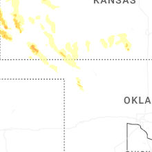
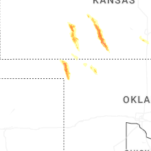
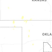
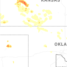
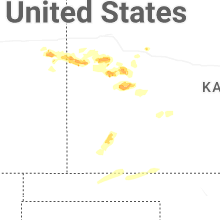
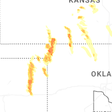
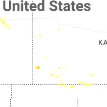
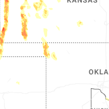
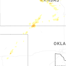
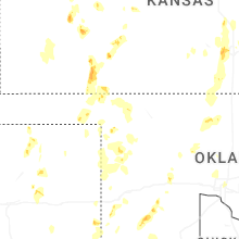
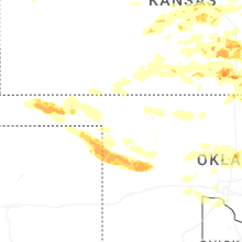
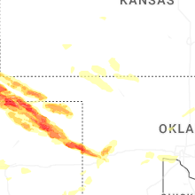
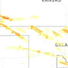
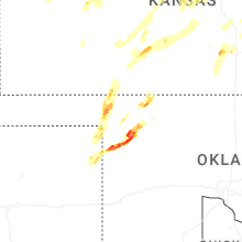
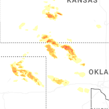


Connect with Interactive Hail Maps