

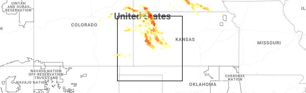
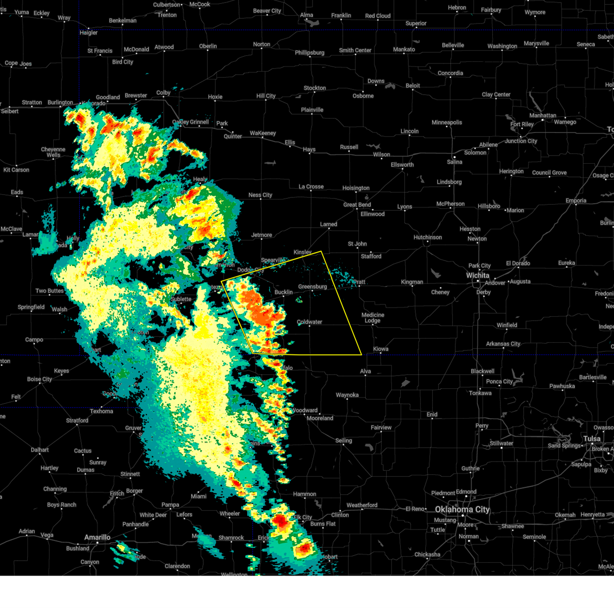
Hail Map for Ensign, KS
The Ensign, KS area has had 13 reports of on-the-ground hail by trained spotters, and has been under severe weather warnings 20 times during the past 12 months. Doppler radar has detected hail at or near Ensign, KS on 84 occasions, including 4 occasions during the past year.
| Name: | Ensign, KS |
| Where Located: | 41.3 miles ESE of Garden City, KS |
| Map: | Google Map for Ensign, KS |
| Population: | 187 |
| Housing Units: | 86 |
| More Info: | Search Google for Ensign, KS |
2
The Top Recent Hail Date for Ensign, KS is Saturday, June 20, 2026 (38th out of 84)
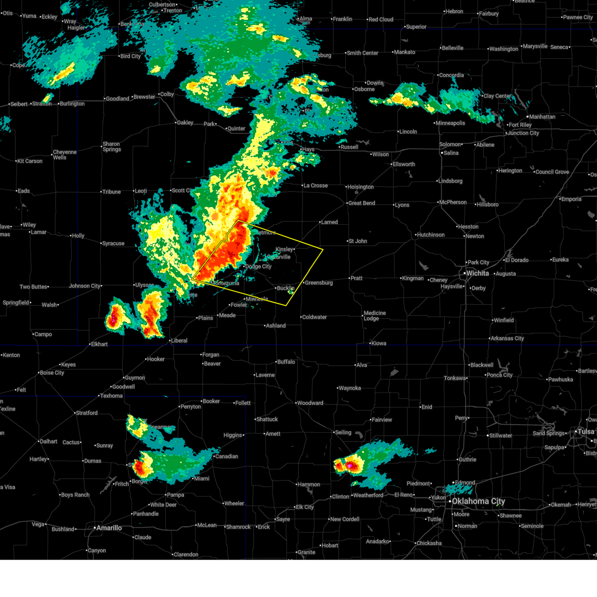
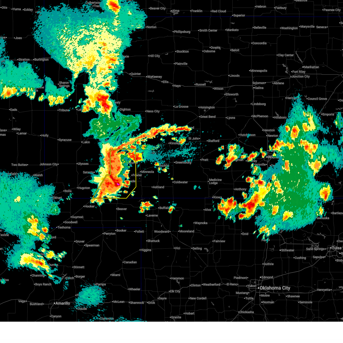
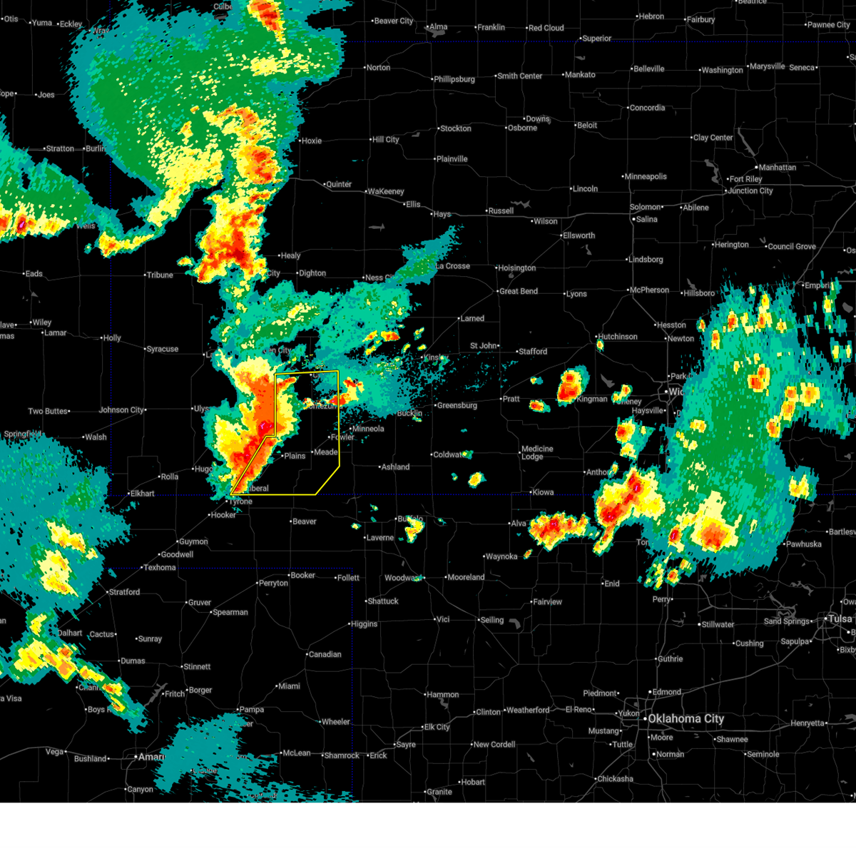
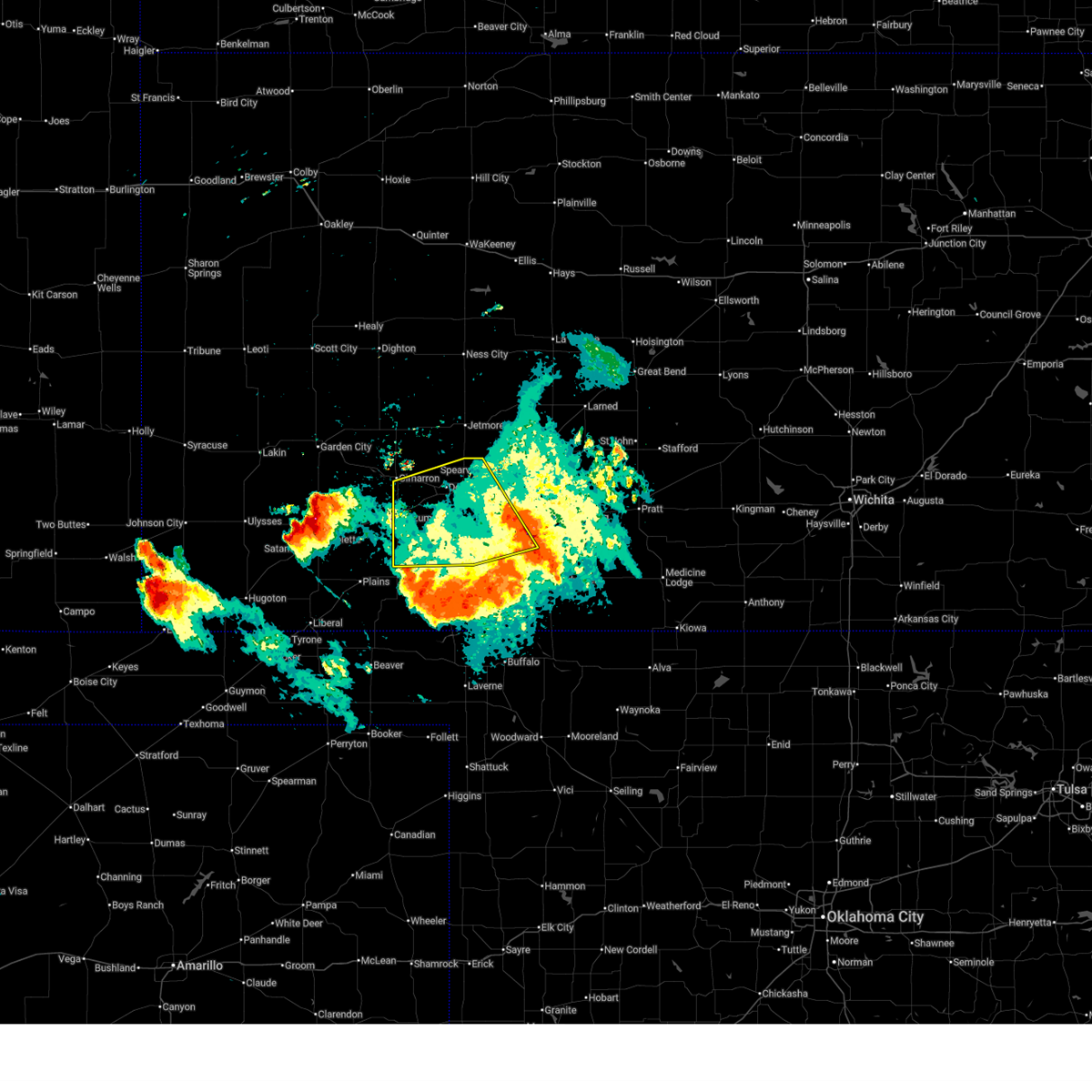
Hail and Wind Damage Spotted near Ensign, KS
| Date / Time | Report Details |
|---|---|
| 6/21/2026 9:14 PM CDT |
 At 914 pm cdt, severe thunderstorms were located along a line extending from near howell to near tice, moving southeast at 30 mph (radar indicated). Hazards include 60 mph wind gusts. Expect damage to roofs, siding, and trees. Locations impacted include, cimarron, sublette, montezuma, copeland, ingalls, ensign, charleston, tice, and the haggard elev. At 914 pm cdt, severe thunderstorms were located along a line extending from near howell to near tice, moving southeast at 30 mph (radar indicated). Hazards include 60 mph wind gusts. Expect damage to roofs, siding, and trees. Locations impacted include, cimarron, sublette, montezuma, copeland, ingalls, ensign, charleston, tice, and the haggard elev.
|
| 6/21/2026 8:54 PM CDT |
 At 853 pm cdt, severe thunderstorms were located along a line extending from 7 miles north of cimarron to near sublette, moving southeast at 40 mph (radar indicated. at 840 pm cdt, an 82 mph wind gust was measured at the garden city regional airport). Hazards include 70 mph wind gusts. Expect considerable tree damage. damage is likely to mobile homes, roofs, and outbuildings. Locations impacted include, cimarron, sublette, copeland, tice, montezuma, ensign and the haggard elev. At 853 pm cdt, severe thunderstorms were located along a line extending from 7 miles north of cimarron to near sublette, moving southeast at 40 mph (radar indicated. at 840 pm cdt, an 82 mph wind gust was measured at the garden city regional airport). Hazards include 70 mph wind gusts. Expect considerable tree damage. damage is likely to mobile homes, roofs, and outbuildings. Locations impacted include, cimarron, sublette, copeland, tice, montezuma, ensign and the haggard elev.
|
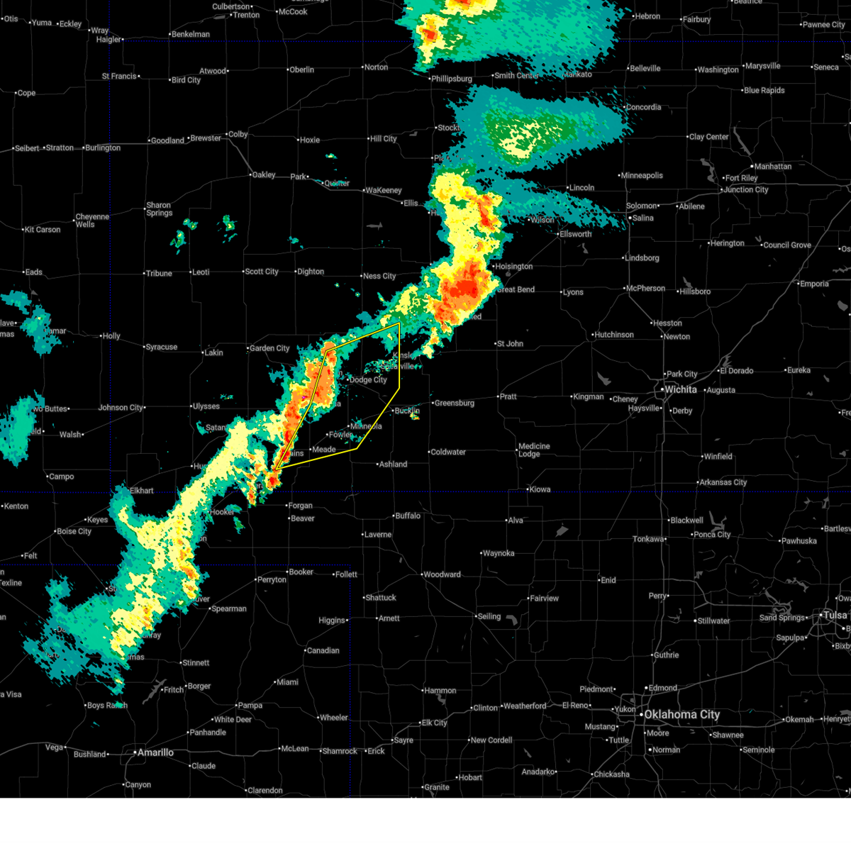
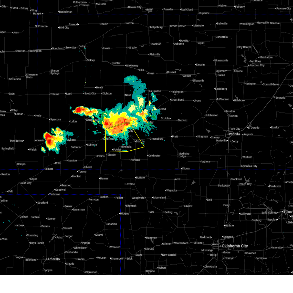
| 6/21/2026 8:38 PM CDT |
 Svrddc the national weather service in dodge city has issued a * severe thunderstorm warning for, south central finney county in southwestern kansas, gray county in southwestern kansas, eastern haskell county in southwestern kansas, * until 930 pm cdt. * at 837 pm cdt, severe thunderstorms were located along a line extending from 8 miles north of charleston to 6 miles southwest of plymell, moving south at 40 mph (radar indicated). Hazards include 60 mph wind gusts and quarter size hail. Hail damage to vehicles is expected. expect wind damage to roofs, siding, and trees. severe thunderstorms will be near, charleston around 845 pm cdt. ingalls around 850 pm cdt. Other locations in the path of these severe thunderstorms include sublette, copeland, tice and montezuma. Svrddc the national weather service in dodge city has issued a * severe thunderstorm warning for, south central finney county in southwestern kansas, gray county in southwestern kansas, eastern haskell county in southwestern kansas, * until 930 pm cdt. * at 837 pm cdt, severe thunderstorms were located along a line extending from 8 miles north of charleston to 6 miles southwest of plymell, moving south at 40 mph (radar indicated). Hazards include 60 mph wind gusts and quarter size hail. Hail damage to vehicles is expected. expect wind damage to roofs, siding, and trees. severe thunderstorms will be near, charleston around 845 pm cdt. ingalls around 850 pm cdt. Other locations in the path of these severe thunderstorms include sublette, copeland, tice and montezuma.
|
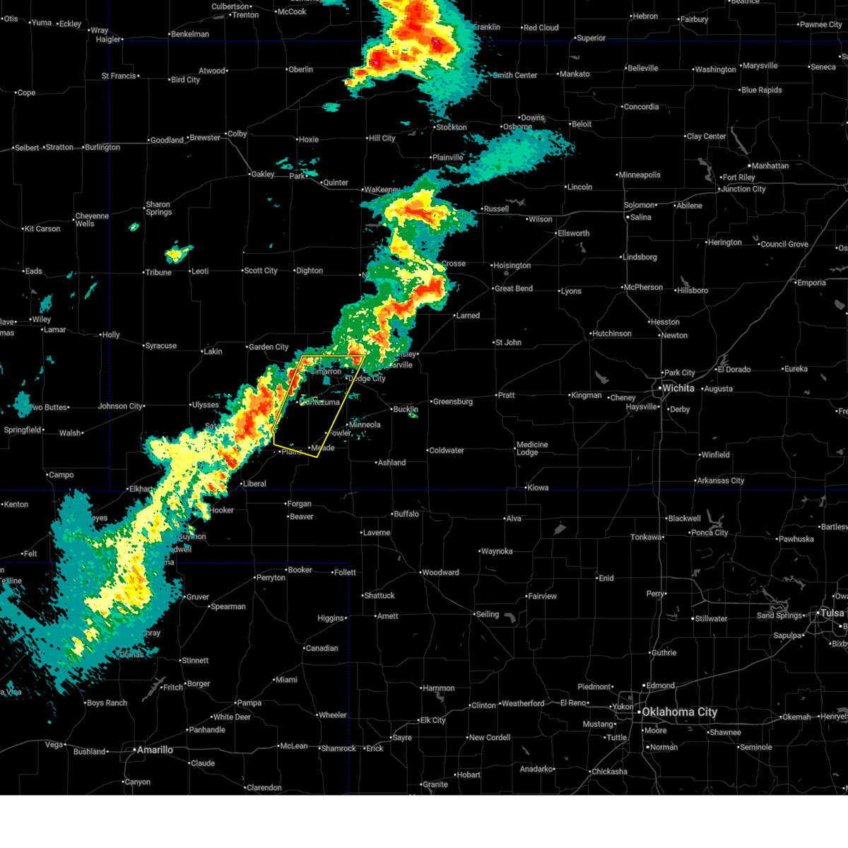
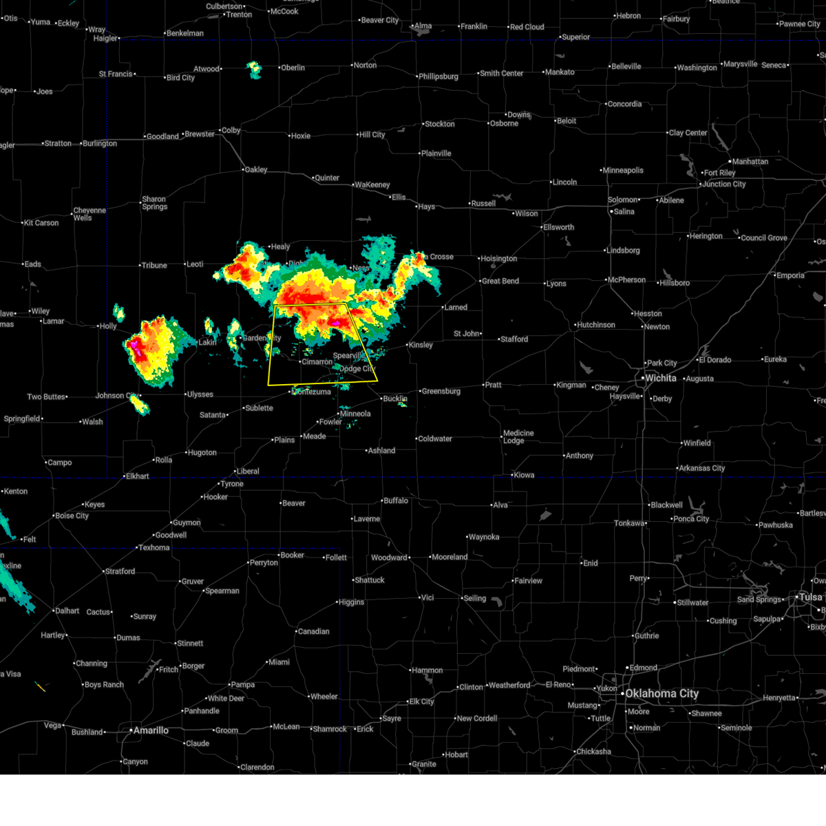
| 6/20/2026 11:11 PM CDT |
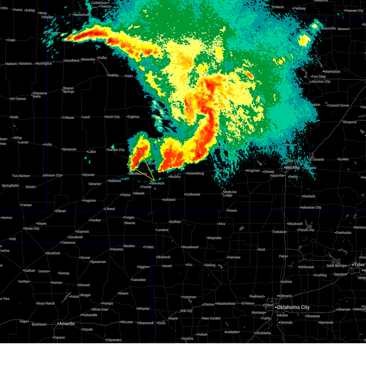 At 1111 pm cdt, a severe thunderstorm was located near cimarron, moving east at 35 mph (public. at 1100 pm cdt, the public reported quarter size hail in ingalls). Hazards include 70 mph wind gusts and quarter size hail. Hail damage to vehicles is expected. expect considerable tree damage. wind damage is also likely to mobile homes, roofs, and outbuildings. Locations impacted include, howell. At 1111 pm cdt, a severe thunderstorm was located near cimarron, moving east at 35 mph (public. at 1100 pm cdt, the public reported quarter size hail in ingalls). Hazards include 70 mph wind gusts and quarter size hail. Hail damage to vehicles is expected. expect considerable tree damage. wind damage is also likely to mobile homes, roofs, and outbuildings. Locations impacted include, howell.
|
| 6/20/2026 10:48 PM CDT |
 Svrddc the national weather service in dodge city has issued a * severe thunderstorm warning for, western ford county in southwestern kansas, southwestern hodgeman county in southwestern kansas, northern gray county in southwestern kansas, * until 1145 pm cdt. * at 1048 pm cdt, a severe thunderstorm was located 7 miles north of charleston, moving southeast at 35 mph (radar indicated). Hazards include 70 mph wind gusts and ping pong ball size hail. People and animals outdoors will be injured. expect hail damage to roofs, siding, windows, and vehicles. expect considerable tree damage. wind damage is also likely to mobile homes, roofs, and outbuildings. this severe thunderstorm will be near, cimarron around 1105 pm cdt. Other locations in the path of this severe thunderstorm include howell. Svrddc the national weather service in dodge city has issued a * severe thunderstorm warning for, western ford county in southwestern kansas, southwestern hodgeman county in southwestern kansas, northern gray county in southwestern kansas, * until 1145 pm cdt. * at 1048 pm cdt, a severe thunderstorm was located 7 miles north of charleston, moving southeast at 35 mph (radar indicated). Hazards include 70 mph wind gusts and ping pong ball size hail. People and animals outdoors will be injured. expect hail damage to roofs, siding, windows, and vehicles. expect considerable tree damage. wind damage is also likely to mobile homes, roofs, and outbuildings. this severe thunderstorm will be near, cimarron around 1105 pm cdt. Other locations in the path of this severe thunderstorm include howell.
|
| 6/13/2026 12:02 AM CDT |
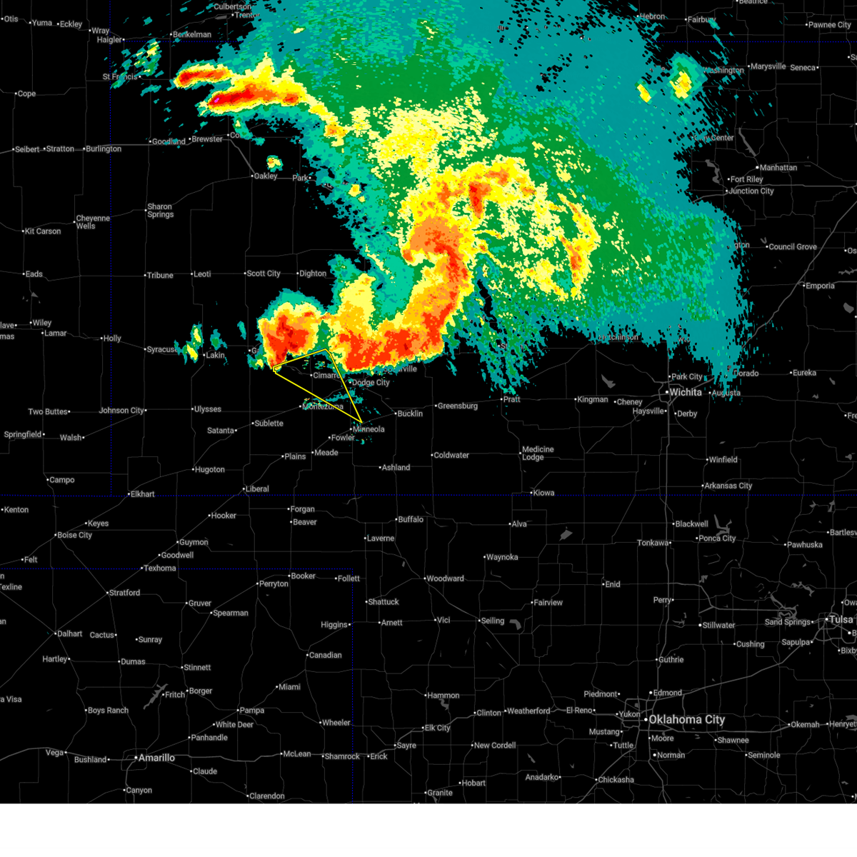
 At 1201 am cdt, severe thunderstorms were located along a line extending from near ensign to near clark state lake to 11 miles south of sitka, moving east at 30 mph (radar indicated). Hazards include 70 mph wind gusts and penny size hail. Expect considerable tree damage. damage is likely to mobile homes, roofs, and outbuildings. these severe storms will be near, bloom, sitka, and clark state lake around 1205 am cdt. Other locations in the path of these severe thunderstorms include protection and kingsdown. At 1201 am cdt, severe thunderstorms were located along a line extending from near ensign to near clark state lake to 11 miles south of sitka, moving east at 30 mph (radar indicated). Hazards include 70 mph wind gusts and penny size hail. Expect considerable tree damage. damage is likely to mobile homes, roofs, and outbuildings. these severe storms will be near, bloom, sitka, and clark state lake around 1205 am cdt. Other locations in the path of these severe thunderstorms include protection and kingsdown.
|
| 6/12/2026 11:57 PM CDT |
 Svrddc the national weather service in dodge city has issued a * severe thunderstorm warning for, southwestern ford county in southwestern kansas, southwestern kiowa county in south central kansas, northeastern meade county in southwestern kansas, western comanche county in south central kansas, southeastern gray county in southwestern kansas, clark county in southwestern kansas, * until 1245 am cdt. * at 1157 pm cdt, severe thunderstorms were located along a line extending from near ensign to near clark state lake to 11 miles south of sitka, moving east at 30 mph (radar indicated). Hazards include 70 mph wind gusts and penny size hail. Expect considerable tree damage. damage is likely to mobile homes, roofs, and outbuildings. severe thunderstorms will be near, ashland, minneola, bloom, sitka, and clark state lake around 1200 am cdt. Other locations in the path of these severe thunderstorms include protection, kingsdown and bucklin. Svrddc the national weather service in dodge city has issued a * severe thunderstorm warning for, southwestern ford county in southwestern kansas, southwestern kiowa county in south central kansas, northeastern meade county in southwestern kansas, western comanche county in south central kansas, southeastern gray county in southwestern kansas, clark county in southwestern kansas, * until 1245 am cdt. * at 1157 pm cdt, severe thunderstorms were located along a line extending from near ensign to near clark state lake to 11 miles south of sitka, moving east at 30 mph (radar indicated). Hazards include 70 mph wind gusts and penny size hail. Expect considerable tree damage. damage is likely to mobile homes, roofs, and outbuildings. severe thunderstorms will be near, ashland, minneola, bloom, sitka, and clark state lake around 1200 am cdt. Other locations in the path of these severe thunderstorms include protection, kingsdown and bucklin.
|
| 6/9/2026 7:27 PM CDT |
 Svrddc the national weather service in dodge city has issued a * severe thunderstorm warning for, ford county in southwestern kansas, southern hodgeman county in southwestern kansas, northern meade county in southwestern kansas, southeastern gray county in southwestern kansas, northwestern clark county in southwestern kansas, * until 800 pm cdt. * at 726 pm cdt, severe thunderstorms were located along a line extending from 9 miles northeast of howell to 7 miles southeast of ensign to near plains, moving northeast at 25 mph (radar indicated). Hazards include 60 mph wind gusts. Expect damage to roofs, siding, and trees. severe thunderstorms will be near, dodge city and missler around 730 pm cdt. meade around 735 pm cdt. fowler and ft. dodge around 740 pm cdt. Wright around 745 pm cdt. Svrddc the national weather service in dodge city has issued a * severe thunderstorm warning for, ford county in southwestern kansas, southern hodgeman county in southwestern kansas, northern meade county in southwestern kansas, southeastern gray county in southwestern kansas, northwestern clark county in southwestern kansas, * until 800 pm cdt. * at 726 pm cdt, severe thunderstorms were located along a line extending from 9 miles northeast of howell to 7 miles southeast of ensign to near plains, moving northeast at 25 mph (radar indicated). Hazards include 60 mph wind gusts. Expect damage to roofs, siding, and trees. severe thunderstorms will be near, dodge city and missler around 730 pm cdt. meade around 735 pm cdt. fowler and ft. dodge around 740 pm cdt. Wright around 745 pm cdt.
|
| 6/9/2026 6:48 PM CDT |
 Svrddc the national weather service in dodge city has issued a * severe thunderstorm warning for, western ford county in southwestern kansas, northern meade county in southwestern kansas, eastern gray county in southwestern kansas, * until 730 pm cdt. * at 648 pm cdt, severe thunderstorms were located along a line extending from near cimarron to near plains, moving east at 25 mph (radar indicated). Hazards include 60 mph wind gusts. Expect damage to roofs, siding, and trees. severe thunderstorms will be near, montezuma around 655 pm cdt. howell and the haggard elev around 700 pm cdt. ensign and missler around 705 pm cdt. Other locations in the path of these severe thunderstorms include dodge city and meade. Svrddc the national weather service in dodge city has issued a * severe thunderstorm warning for, western ford county in southwestern kansas, northern meade county in southwestern kansas, eastern gray county in southwestern kansas, * until 730 pm cdt. * at 648 pm cdt, severe thunderstorms were located along a line extending from near cimarron to near plains, moving east at 25 mph (radar indicated). Hazards include 60 mph wind gusts. Expect damage to roofs, siding, and trees. severe thunderstorms will be near, montezuma around 655 pm cdt. howell and the haggard elev around 700 pm cdt. ensign and missler around 705 pm cdt. Other locations in the path of these severe thunderstorms include dodge city and meade.
|
| 6/9/2026 5:31 PM CDT |
 Svrddc the national weather service in dodge city has issued a * severe thunderstorm warning for, western ford county in southwestern kansas, southwestern hodgeman county in southwestern kansas, northern meade county in southwestern kansas, gray county in southwestern kansas, northwestern clark county in southwestern kansas, * until 615 pm cdt. * at 530 pm cdt, severe thunderstorms were located along a line extending from 7 miles south of kalvesta to near the haggard elev to near missler, moving east at 30 mph (radar indicated). Hazards include 60 mph wind gusts and quarter size hail. Hail damage to vehicles is expected. expect wind damage to roofs, siding, and trees. severe thunderstorms will be near, ensign and howell around 535 pm cdt. dodge city and fowler around 545 pm cdt. other locations in the path of these severe thunderstorms include minneola, ft. Dodge and wright. Svrddc the national weather service in dodge city has issued a * severe thunderstorm warning for, western ford county in southwestern kansas, southwestern hodgeman county in southwestern kansas, northern meade county in southwestern kansas, gray county in southwestern kansas, northwestern clark county in southwestern kansas, * until 615 pm cdt. * at 530 pm cdt, severe thunderstorms were located along a line extending from 7 miles south of kalvesta to near the haggard elev to near missler, moving east at 30 mph (radar indicated). Hazards include 60 mph wind gusts and quarter size hail. Hail damage to vehicles is expected. expect wind damage to roofs, siding, and trees. severe thunderstorms will be near, ensign and howell around 535 pm cdt. dodge city and fowler around 545 pm cdt. other locations in the path of these severe thunderstorms include minneola, ft. Dodge and wright.
|
| 6/9/2026 5:04 PM CDT |
 Svrddc the national weather service in dodge city has issued a * severe thunderstorm warning for, northwestern meade county in southwestern kansas, southern gray county in southwestern kansas, * until 545 pm cdt. * at 504 pm cdt, severe thunderstorms were located along a line extending from near ingalls to near montezuma to 8 miles north of plains, moving east at 30 mph (radar indicated). Hazards include 60 mph wind gusts and penny size hail. Expect damage to roofs, siding, and trees. severe thunderstorms will be near, montezuma around 510 pm cdt. cimarron around 515 pm cdt. the haggard elev around 520 pm cdt. Other locations in the path of these severe thunderstorms include ensign. Svrddc the national weather service in dodge city has issued a * severe thunderstorm warning for, northwestern meade county in southwestern kansas, southern gray county in southwestern kansas, * until 545 pm cdt. * at 504 pm cdt, severe thunderstorms were located along a line extending from near ingalls to near montezuma to 8 miles north of plains, moving east at 30 mph (radar indicated). Hazards include 60 mph wind gusts and penny size hail. Expect damage to roofs, siding, and trees. severe thunderstorms will be near, montezuma around 510 pm cdt. cimarron around 515 pm cdt. the haggard elev around 520 pm cdt. Other locations in the path of these severe thunderstorms include ensign.
|
| 6/1/2026 8:54 PM CDT |
 At 854 pm cdt, severe thunderstorms were located along a line extending from near garfield to near kingsdown, moving east at 35 mph (radar indicated). Hazards include 70 mph wind gusts. Expect considerable tree damage. damage is likely to mobile homes, roofs, and outbuildings. Locations impacted include, dodge city, cimarron, kinsley, jetmore, bucklin, spearville, lewis, mullinville, ford, offerle, ensign, bloom, fellsburg, kingsdown, howell, wright, bellefont, windhorst, the haggard elev, and centerview. At 854 pm cdt, severe thunderstorms were located along a line extending from near garfield to near kingsdown, moving east at 35 mph (radar indicated). Hazards include 70 mph wind gusts. Expect considerable tree damage. damage is likely to mobile homes, roofs, and outbuildings. Locations impacted include, dodge city, cimarron, kinsley, jetmore, bucklin, spearville, lewis, mullinville, ford, offerle, ensign, bloom, fellsburg, kingsdown, howell, wright, bellefont, windhorst, the haggard elev, and centerview.
|
| 6/1/2026 8:24 PM CDT |
 Svrddc the national weather service in dodge city has issued a * severe thunderstorm warning for, ford county in southwestern kansas, western kiowa county in south central kansas, hodgeman county in southwestern kansas, southeastern gray county in southwestern kansas, edwards county in south central kansas, northeastern clark county in southwestern kansas, * until 930 pm cdt. * at 823 pm cdt, severe thunderstorms were located along a line extending from near gray to 9 miles southeast of ensign, moving east at 35 mph. these are destructive storms for ford, kiowa, hodgeman, gray, edwards, and clark counties (radar indicated). Hazards include 80 mph wind gusts and penny size hail. Flying debris will be dangerous to those caught without shelter. mobile homes will be heavily damaged. expect considerable damage to roofs, windows, and vehicles. Extensive tree damage and power outages are likely. Svrddc the national weather service in dodge city has issued a * severe thunderstorm warning for, ford county in southwestern kansas, western kiowa county in south central kansas, hodgeman county in southwestern kansas, southeastern gray county in southwestern kansas, edwards county in south central kansas, northeastern clark county in southwestern kansas, * until 930 pm cdt. * at 823 pm cdt, severe thunderstorms were located along a line extending from near gray to 9 miles southeast of ensign, moving east at 35 mph. these are destructive storms for ford, kiowa, hodgeman, gray, edwards, and clark counties (radar indicated). Hazards include 80 mph wind gusts and penny size hail. Flying debris will be dangerous to those caught without shelter. mobile homes will be heavily damaged. expect considerable damage to roofs, windows, and vehicles. Extensive tree damage and power outages are likely.
|
| 8/11/2025 12:05 AM CDT |
 At 1205 am cdt, severe thunderstorms were located along a line extending from 8 miles southeast of the haggard elev to 6 miles east of meade to 8 miles northeast of forgan, moving east at 60 mph (radar indicated). Hazards include 70 mph wind gusts and penny size hail. Expect considerable tree damage. damage is likely to mobile homes, roofs, and outbuildings. Locations impacted include, liberal, cimarron, meade, montezuma, fowler, kismet, copeland, ensign, meade state park, howell, missler, hayne, the haggard elev, and plains. At 1205 am cdt, severe thunderstorms were located along a line extending from 8 miles southeast of the haggard elev to 6 miles east of meade to 8 miles northeast of forgan, moving east at 60 mph (radar indicated). Hazards include 70 mph wind gusts and penny size hail. Expect considerable tree damage. damage is likely to mobile homes, roofs, and outbuildings. Locations impacted include, liberal, cimarron, meade, montezuma, fowler, kismet, copeland, ensign, meade state park, howell, missler, hayne, the haggard elev, and plains.
|
| 8/10/2025 11:56 PM CDT |
 At 1155 pm cdt, severe thunderstorms were located along a line extending from near montezuma to near missler to 8 miles north of forgan, moving southeast at 30 mph (radar indicated). Hazards include 60 mph wind gusts and penny size hail. Expect damage to roofs, siding, and trees. Locations impacted include, meade, meade state park and fowler. At 1155 pm cdt, severe thunderstorms were located along a line extending from near montezuma to near missler to 8 miles north of forgan, moving southeast at 30 mph (radar indicated). Hazards include 60 mph wind gusts and penny size hail. Expect damage to roofs, siding, and trees. Locations impacted include, meade, meade state park and fowler.
|
| 8/10/2025 11:36 PM CDT |
 Svrddc the national weather service in dodge city has issued a * severe thunderstorm warning for, southwestern ford county in southwestern kansas, eastern seward county in southwestern kansas, meade county in southwestern kansas, gray county in southwestern kansas, * until 1230 am cdt. * at 1135 pm cdt, severe thunderstorms were located along a line extending from near charleston to 8 miles northwest of missler to near hayne, moving east at 25 mph (radar indicated). Hazards include 60 mph wind gusts and penny size hail. Expect damage to roofs, siding, and trees. severe thunderstorms will be near, montezuma and plains around 1140 pm cdt. cimarron and missler around 1150 pm cdt. Other locations in the path of these severe thunderstorms include the haggard elev, meade, meade state park, ensign, fowler and howell. Svrddc the national weather service in dodge city has issued a * severe thunderstorm warning for, southwestern ford county in southwestern kansas, eastern seward county in southwestern kansas, meade county in southwestern kansas, gray county in southwestern kansas, * until 1230 am cdt. * at 1135 pm cdt, severe thunderstorms were located along a line extending from near charleston to 8 miles northwest of missler to near hayne, moving east at 25 mph (radar indicated). Hazards include 60 mph wind gusts and penny size hail. Expect damage to roofs, siding, and trees. severe thunderstorms will be near, montezuma and plains around 1140 pm cdt. cimarron and missler around 1150 pm cdt. Other locations in the path of these severe thunderstorms include the haggard elev, meade, meade state park, ensign, fowler and howell.
|
| 8/3/2025 8:25 PM CDT |
 The severe thunderstorm which prompted the warning has moved out of the warning area. therefore, the warning will be allowed to expire. a severe thunderstorm watch remains in effect until midnight cdt for southwestern kansas. The severe thunderstorm which prompted the warning has moved out of the warning area. therefore, the warning will be allowed to expire. a severe thunderstorm watch remains in effect until midnight cdt for southwestern kansas.
|
| 8/3/2025 7:25 PM CDT |
 Svrddc the national weather service in dodge city has issued a * severe thunderstorm warning for, ford county in southwestern kansas, southwestern kiowa county in south central kansas, northeastern meade county in southwestern kansas, southeastern gray county in southwestern kansas, northern clark county in southwestern kansas, * until 830 pm cdt. * at 725 pm cdt, a severe thunderstorm was located near dodge city, moving south at 30 mph. this is a destructive storm for ford county (radar indicated). Hazards include 90 mph wind gusts and half dollar size hail. You are in a life-threatening situation. flying debris may be deadly to those caught without shelter. mobile homes will be heavily damaged or destroyed. homes and businesses will have substantial roof and window damage. expect extensive tree damage and power outages. This severe thunderstorm will be near, minneola around 745 pm cdt. Svrddc the national weather service in dodge city has issued a * severe thunderstorm warning for, ford county in southwestern kansas, southwestern kiowa county in south central kansas, northeastern meade county in southwestern kansas, southeastern gray county in southwestern kansas, northern clark county in southwestern kansas, * until 830 pm cdt. * at 725 pm cdt, a severe thunderstorm was located near dodge city, moving south at 30 mph. this is a destructive storm for ford county (radar indicated). Hazards include 90 mph wind gusts and half dollar size hail. You are in a life-threatening situation. flying debris may be deadly to those caught without shelter. mobile homes will be heavily damaged or destroyed. homes and businesses will have substantial roof and window damage. expect extensive tree damage and power outages. This severe thunderstorm will be near, minneola around 745 pm cdt.
|
| 8/3/2025 7:24 PM CDT | Tree branches down in tow in gray county KS, 0.2 miles NW of Ensign, KS |
| 8/3/2025 7:24 PM CDT | Wind blew siding and shingles off of buildin in gray county KS, 0.5 miles ENE of Ensign, KS |
| 8/3/2025 6:42 PM CDT |
 Svrddc the national weather service in dodge city has issued a * severe thunderstorm warning for, northern ford county in southwestern kansas, northeastern finney county in southwestern kansas, western hodgeman county in southwestern kansas, northern gray county in southwestern kansas, * until 745 pm cdt. * at 641 pm cdt, a severe thunderstorm was located 10 miles east of kalvesta, moving south at 20 mph (radar indicated). Hazards include golf ball size hail and 70 mph wind gusts. People and animals outdoors will be injured. expect hail damage to roofs, siding, windows, and vehicles. expect considerable tree damage. wind damage is also likely to mobile homes, roofs, and outbuildings. This will impact dodge city days festivities. Svrddc the national weather service in dodge city has issued a * severe thunderstorm warning for, northern ford county in southwestern kansas, northeastern finney county in southwestern kansas, western hodgeman county in southwestern kansas, northern gray county in southwestern kansas, * until 745 pm cdt. * at 641 pm cdt, a severe thunderstorm was located 10 miles east of kalvesta, moving south at 20 mph (radar indicated). Hazards include golf ball size hail and 70 mph wind gusts. People and animals outdoors will be injured. expect hail damage to roofs, siding, windows, and vehicles. expect considerable tree damage. wind damage is also likely to mobile homes, roofs, and outbuildings. This will impact dodge city days festivities.
|
| 7/16/2025 8:01 PM CDT |
 Svrddc the national weather service in dodge city has issued a * severe thunderstorm warning for, southwestern ford county in southwestern kansas, southeastern gray county in southwestern kansas, * until 845 pm cdt. * at 801 pm cdt, a severe thunderstorm was located very near ensign, and is nearly stationary (radar indicated). Hazards include 70 mph wind gusts. Expect considerable tree damage. damage is likely to mobile homes, roofs, and outbuildings. This severe thunderstorm will remain over mainly rural areas of southwestern ford and southeastern gray counties. Svrddc the national weather service in dodge city has issued a * severe thunderstorm warning for, southwestern ford county in southwestern kansas, southeastern gray county in southwestern kansas, * until 845 pm cdt. * at 801 pm cdt, a severe thunderstorm was located very near ensign, and is nearly stationary (radar indicated). Hazards include 70 mph wind gusts. Expect considerable tree damage. damage is likely to mobile homes, roofs, and outbuildings. This severe thunderstorm will remain over mainly rural areas of southwestern ford and southeastern gray counties.
|
| 7/10/2025 8:30 PM CDT |
 Svrddc the national weather service in dodge city has issued a * severe thunderstorm warning for, northwestern ford county in southwestern kansas, southeastern kearny county in southwestern kansas, finney county in southwestern kansas, grant county in southwestern kansas, western hodgeman county in southwestern kansas, gray county in southwestern kansas, haskell county in southwestern kansas, * until 915 pm cdt. * at 830 pm cdt, severe thunderstorms were located along a line extending from near friend to 12 miles south of ulysses, moving east at 40 mph (radar indicated). Hazards include 60 mph wind gusts. Expect damage to roofs, siding, and trees. severe thunderstorms will be near, garden city and hickok around 835 pm cdt. ryus around 840 pm cdt. plymell around 845 pm cdt. Other locations in the path of these severe thunderstorms include satanta, pierceville, sublette and charleston. Svrddc the national weather service in dodge city has issued a * severe thunderstorm warning for, northwestern ford county in southwestern kansas, southeastern kearny county in southwestern kansas, finney county in southwestern kansas, grant county in southwestern kansas, western hodgeman county in southwestern kansas, gray county in southwestern kansas, haskell county in southwestern kansas, * until 915 pm cdt. * at 830 pm cdt, severe thunderstorms were located along a line extending from near friend to 12 miles south of ulysses, moving east at 40 mph (radar indicated). Hazards include 60 mph wind gusts. Expect damage to roofs, siding, and trees. severe thunderstorms will be near, garden city and hickok around 835 pm cdt. ryus around 840 pm cdt. plymell around 845 pm cdt. Other locations in the path of these severe thunderstorms include satanta, pierceville, sublette and charleston.
|
| 7/8/2025 7:04 PM CDT | Hen Egg sized hail reported 7.3 miles NNW of Ensign, KS |
| 7/8/2025 7:00 PM CDT | Golf Ball sized hail reported 6.5 miles N of Ensign, KS |
| 6/2/2025 7:12 PM CDT |
 Svrddc the national weather service in dodge city has issued a * severe thunderstorm warning for, ford county in southwestern kansas, kiowa county in south central kansas, northeastern meade county in southwestern kansas, western barber county in south central kansas, comanche county in south central kansas, southeastern gray county in southwestern kansas, southern edwards county in south central kansas, southwestern pratt county in south central kansas, clark county in southwestern kansas, * until 800 pm cdt. * at 712 pm cdt, severe thunderstorms were located along a line extending from near ft. dodge to near buttermilk, moving east at 50 mph (radar indicated). Hazards include 60 mph wind gusts. Expect damage to roofs, siding, and trees. severe thunderstorms will be near, coldwater, bucklin, protection, ford, wright, and buttermilk around 715 pm cdt. lake coldwater around 720 pm cdt. mullinville and windhorst around 725 pm cdt. wilmore around 730 pm cdt. Other locations in the path of these severe thunderstorms include greensburg, aetna, belvidere, haviland, sun city, centerview and croft. Svrddc the national weather service in dodge city has issued a * severe thunderstorm warning for, ford county in southwestern kansas, kiowa county in south central kansas, northeastern meade county in southwestern kansas, western barber county in south central kansas, comanche county in south central kansas, southeastern gray county in southwestern kansas, southern edwards county in south central kansas, southwestern pratt county in south central kansas, clark county in southwestern kansas, * until 800 pm cdt. * at 712 pm cdt, severe thunderstorms were located along a line extending from near ft. dodge to near buttermilk, moving east at 50 mph (radar indicated). Hazards include 60 mph wind gusts. Expect damage to roofs, siding, and trees. severe thunderstorms will be near, coldwater, bucklin, protection, ford, wright, and buttermilk around 715 pm cdt. lake coldwater around 720 pm cdt. mullinville and windhorst around 725 pm cdt. wilmore around 730 pm cdt. Other locations in the path of these severe thunderstorms include greensburg, aetna, belvidere, haviland, sun city, centerview and croft.
|
| 5/25/2025 5:06 AM CDT |
 At 506 am cdt, severe thunderstorms were located along a line extending from 8 miles south of nekoma to 7 miles north of minneola, moving east at 50 mph (radar indicated). Hazards include 70 mph wind gusts and penny size hail. Expect considerable tree damage. damage is likely to mobile homes, roofs, and outbuildings. Locations impacted include, spearville, burdett, rozel, bellefont, ford, offerle, windhorst, kinsley, ash valley, kingsdown, sanford, bucklin, garfield and frizell. At 506 am cdt, severe thunderstorms were located along a line extending from 8 miles south of nekoma to 7 miles north of minneola, moving east at 50 mph (radar indicated). Hazards include 70 mph wind gusts and penny size hail. Expect considerable tree damage. damage is likely to mobile homes, roofs, and outbuildings. Locations impacted include, spearville, burdett, rozel, bellefont, ford, offerle, windhorst, kinsley, ash valley, kingsdown, sanford, bucklin, garfield and frizell.
|
| 5/25/2025 4:39 AM CDT |
 Svrddc the national weather service in dodge city has issued a * severe thunderstorm warning for, ford county in southwestern kansas, northwestern kiowa county in south central kansas, southeastern ness county in west central kansas, hodgeman county in southwestern kansas, pawnee county in south central kansas, gray county in southwestern kansas, western edwards county in south central kansas, * until 530 am cdt. * at 439 am cdt, severe thunderstorms were located along a line extending from near ness city to near montezuma, moving east at 50 mph (radar indicated). Hazards include 60 mph wind gusts and penny size hail. Expect damage to roofs, siding, and trees. severe thunderstorms will be near, jetmore, ensign, howell, and the haggard elev around 445 am cdt. dodge city around 450 am cdt. hanston around 455 am cdt. other locations in the path of these severe thunderstorms include gray, burdett, wright, ft. Dodge, spearville, ford, rozel, bellefont, offerle, bloom, ash valley, windhorst, sanford, kinsley and kingsdown. Svrddc the national weather service in dodge city has issued a * severe thunderstorm warning for, ford county in southwestern kansas, northwestern kiowa county in south central kansas, southeastern ness county in west central kansas, hodgeman county in southwestern kansas, pawnee county in south central kansas, gray county in southwestern kansas, western edwards county in south central kansas, * until 530 am cdt. * at 439 am cdt, severe thunderstorms were located along a line extending from near ness city to near montezuma, moving east at 50 mph (radar indicated). Hazards include 60 mph wind gusts and penny size hail. Expect damage to roofs, siding, and trees. severe thunderstorms will be near, jetmore, ensign, howell, and the haggard elev around 445 am cdt. dodge city around 450 am cdt. hanston around 455 am cdt. other locations in the path of these severe thunderstorms include gray, burdett, wright, ft. Dodge, spearville, ford, rozel, bellefont, offerle, bloom, ash valley, windhorst, sanford, kinsley and kingsdown.
|
| 8/25/2024 9:07 PM CDT |
 Svrddc the national weather service in dodge city has issued a * severe thunderstorm warning for, western ford county in southwestern kansas, east central gray county in southwestern kansas, * until 1015 pm cdt. * at 907 pm cdt, a severe thunderstorm was located near ensign, moving northeast at 20 mph (radar indicated). Hazards include 60 mph wind gusts and penny size hail. expect damage to roofs, siding, and trees Svrddc the national weather service in dodge city has issued a * severe thunderstorm warning for, western ford county in southwestern kansas, east central gray county in southwestern kansas, * until 1015 pm cdt. * at 907 pm cdt, a severe thunderstorm was located near ensign, moving northeast at 20 mph (radar indicated). Hazards include 60 mph wind gusts and penny size hail. expect damage to roofs, siding, and trees
|
| 7/16/2024 10:07 PM CDT |
 The storms which prompted the warning have weakened below severe limits, and no longer pose an immediate threat to life or property. therefore, the warning will be allowed to expire. however, gusty winds are still possible with these thunderstorms. a severe thunderstorm watch remains in effect until 100 am cdt for southwestern kansas. The storms which prompted the warning have weakened below severe limits, and no longer pose an immediate threat to life or property. therefore, the warning will be allowed to expire. however, gusty winds are still possible with these thunderstorms. a severe thunderstorm watch remains in effect until 100 am cdt for southwestern kansas.
|
| 7/16/2024 10:01 PM CDT |
 At 1001 pm cdt, severe thunderstorms were located along a line extending from near howell to near minneola to near acres, moving southeast at 35 mph (radar indicated). Hazards include 60 mph wind gusts. Expect damage to roofs, siding, and trees. Locations impacted include, minneola, dodge city, bloom, clark state lake and kingsdown. At 1001 pm cdt, severe thunderstorms were located along a line extending from near howell to near minneola to near acres, moving southeast at 35 mph (radar indicated). Hazards include 60 mph wind gusts. Expect damage to roofs, siding, and trees. Locations impacted include, minneola, dodge city, bloom, clark state lake and kingsdown.
|
| 7/16/2024 9:37 PM CDT |
 At 936 pm cdt, severe thunderstorms were located along a line extending from near cimarron to near the haggard elev to near meade, moving east at 35 mph (radar indicated). Hazards include 60 mph wind gusts. Expect damage to roofs, siding, and trees. Locations impacted include, cimarron, meade, montezuma, ingalls, ensign, the haggard elev, and missler. At 936 pm cdt, severe thunderstorms were located along a line extending from near cimarron to near the haggard elev to near meade, moving east at 35 mph (radar indicated). Hazards include 60 mph wind gusts. Expect damage to roofs, siding, and trees. Locations impacted include, cimarron, meade, montezuma, ingalls, ensign, the haggard elev, and missler.
|
| 7/16/2024 9:37 PM CDT |
 the severe thunderstorm warning has been cancelled and is no longer in effect the severe thunderstorm warning has been cancelled and is no longer in effect
|
| 7/16/2024 9:32 PM CDT |
 Svrddc the national weather service in dodge city has issued a * severe thunderstorm warning for, ford county in southwestern kansas, northern meade county in southwestern kansas, southern gray county in southwestern kansas, northern clark county in southwestern kansas, * until 1015 pm cdt. * at 931 pm cdt, severe thunderstorms were located along a line extending from near charleston to near the haggard elev to near meade, moving east at 40 mph. another severe thunderstorm was located near ford, moving south at 20 mph (radar indicated). Hazards include 60 mph wind gusts. Expect damage to roofs, siding, and trees. severe thunderstorms will be near, cimarron, fowler, ingalls, ensign, and the haggard elev around 935 pm cdt. howell around 945 pm cdt. minneola around 950 pm cdt. other locations in the path of these severe thunderstorms include dodge city, bloom and ft. Dodge. Svrddc the national weather service in dodge city has issued a * severe thunderstorm warning for, ford county in southwestern kansas, northern meade county in southwestern kansas, southern gray county in southwestern kansas, northern clark county in southwestern kansas, * until 1015 pm cdt. * at 931 pm cdt, severe thunderstorms were located along a line extending from near charleston to near the haggard elev to near meade, moving east at 40 mph. another severe thunderstorm was located near ford, moving south at 20 mph (radar indicated). Hazards include 60 mph wind gusts. Expect damage to roofs, siding, and trees. severe thunderstorms will be near, cimarron, fowler, ingalls, ensign, and the haggard elev around 935 pm cdt. howell around 945 pm cdt. minneola around 950 pm cdt. other locations in the path of these severe thunderstorms include dodge city, bloom and ft. Dodge.
|
| 7/16/2024 9:14 PM CDT |
 At 914 pm cdt, severe thunderstorms were located along a line extending from near charleston to 6 miles east of copeland to near plains, moving east at 40 mph (radar indicated). Hazards include 70 mph wind gusts. Expect considerable tree damage. damage is likely to mobile homes, roofs, and outbuildings. Locations impacted include, montezuma, ingalls, missler, meade, cimarron, the haggard elev and ensign. At 914 pm cdt, severe thunderstorms were located along a line extending from near charleston to 6 miles east of copeland to near plains, moving east at 40 mph (radar indicated). Hazards include 70 mph wind gusts. Expect considerable tree damage. damage is likely to mobile homes, roofs, and outbuildings. Locations impacted include, montezuma, ingalls, missler, meade, cimarron, the haggard elev and ensign.
|
| 7/16/2024 8:56 PM CDT |
 Svrddc the national weather service in dodge city has issued a * severe thunderstorm warning for, northern seward county in southwestern kansas, southwestern finney county in southwestern kansas, northwestern meade county in southwestern kansas, gray county in southwestern kansas, haskell county in southwestern kansas, * until 945 pm cdt. * at 856 pm cdt, severe thunderstorms were located along a line extending from near plymell to 7 miles northwest of tice to 7 miles west of kismet, moving east at 35 mph (radar indicated). Hazards include 70 mph wind gusts. Expect considerable tree damage. damage is likely to mobile homes, roofs, and outbuildings. severe thunderstorms will be near, plymell and tice around 900 pm cdt. kismet and copeland around 905 pm cdt. plains around 910 pm cdt. pierceville around 915 pm cdt. Other locations in the path of these severe thunderstorms include montezuma, charleston, missler, ingalls, cimarron, meade and the haggard elev. Svrddc the national weather service in dodge city has issued a * severe thunderstorm warning for, northern seward county in southwestern kansas, southwestern finney county in southwestern kansas, northwestern meade county in southwestern kansas, gray county in southwestern kansas, haskell county in southwestern kansas, * until 945 pm cdt. * at 856 pm cdt, severe thunderstorms were located along a line extending from near plymell to 7 miles northwest of tice to 7 miles west of kismet, moving east at 35 mph (radar indicated). Hazards include 70 mph wind gusts. Expect considerable tree damage. damage is likely to mobile homes, roofs, and outbuildings. severe thunderstorms will be near, plymell and tice around 900 pm cdt. kismet and copeland around 905 pm cdt. plains around 910 pm cdt. pierceville around 915 pm cdt. Other locations in the path of these severe thunderstorms include montezuma, charleston, missler, ingalls, cimarron, meade and the haggard elev.
|
| 7/7/2024 2:17 AM CDT |
 Svrddc the national weather service in dodge city has issued a * severe thunderstorm warning for, southwestern ford county in southwestern kansas, northeastern meade county in southwestern kansas, southeastern gray county in southwestern kansas, * until 315 am cdt. * at 216 am cdt, a severe thunderstorm was located near montezuma, moving east at 20 mph (radar indicated). Hazards include 70 mph wind gusts and penny size hail. Expect considerable tree damage. damage is likely to mobile homes, roofs, and outbuildings. this severe thunderstorm will be near, montezuma around 220 am cdt. the haggard elev around 230 am cdt. Other locations in the path of this severe thunderstorm include ensign. Svrddc the national weather service in dodge city has issued a * severe thunderstorm warning for, southwestern ford county in southwestern kansas, northeastern meade county in southwestern kansas, southeastern gray county in southwestern kansas, * until 315 am cdt. * at 216 am cdt, a severe thunderstorm was located near montezuma, moving east at 20 mph (radar indicated). Hazards include 70 mph wind gusts and penny size hail. Expect considerable tree damage. damage is likely to mobile homes, roofs, and outbuildings. this severe thunderstorm will be near, montezuma around 220 am cdt. the haggard elev around 230 am cdt. Other locations in the path of this severe thunderstorm include ensign.
|
| 7/6/2024 10:35 PM CDT |
 At 1034 pm cdt, a severe thunderstorm was located 8 miles north of fowler, moving southeast at 20 mph. this is a destructive storm (radar indicated). Hazards include 80 mph wind gusts and quarter size hail. Flying debris will be dangerous to those caught without shelter. mobile homes will be heavily damaged. expect considerable damage to roofs, windows, and vehicles. extensive tree damage and power outages are likely. Locations impacted include, minneola. At 1034 pm cdt, a severe thunderstorm was located 8 miles north of fowler, moving southeast at 20 mph. this is a destructive storm (radar indicated). Hazards include 80 mph wind gusts and quarter size hail. Flying debris will be dangerous to those caught without shelter. mobile homes will be heavily damaged. expect considerable damage to roofs, windows, and vehicles. extensive tree damage and power outages are likely. Locations impacted include, minneola.
|
| 7/6/2024 10:10 PM CDT |
 Svrddc the national weather service in dodge city has issued a * severe thunderstorm warning for, southwestern ford county in southwestern kansas, northeastern meade county in southwestern kansas, southeastern gray county in southwestern kansas, northwestern clark county in southwestern kansas, * until 1115 pm cdt. * at 1010 pm cdt, a severe thunderstorm was located near the haggard elev, moving southeast at 30 mph. this is a destructive storm (radar indicated). Hazards include 80 mph wind gusts and nickel size hail. Flying debris will be dangerous to those caught without shelter. mobile homes will be heavily damaged. expect considerable damage to roofs, windows, and vehicles. extensive tree damage and power outages are likely. This severe thunderstorm will be near, ensign and the haggard elev around 1015 pm cdt. Svrddc the national weather service in dodge city has issued a * severe thunderstorm warning for, southwestern ford county in southwestern kansas, northeastern meade county in southwestern kansas, southeastern gray county in southwestern kansas, northwestern clark county in southwestern kansas, * until 1115 pm cdt. * at 1010 pm cdt, a severe thunderstorm was located near the haggard elev, moving southeast at 30 mph. this is a destructive storm (radar indicated). Hazards include 80 mph wind gusts and nickel size hail. Flying debris will be dangerous to those caught without shelter. mobile homes will be heavily damaged. expect considerable damage to roofs, windows, and vehicles. extensive tree damage and power outages are likely. This severe thunderstorm will be near, ensign and the haggard elev around 1015 pm cdt.
|
| 7/6/2024 9:53 PM CDT |
 At 953 pm cdt, a severe thunderstorm capable of producing a tornado was located near ingalls, moving southeast at 20 mph (radar indicated rotation). Hazards include tornado and golf ball size hail. Flying debris will be dangerous to those caught without shelter. mobile homes will be damaged or destroyed. damage to roofs, windows, and vehicles will occur. tree damage is likely. This tornadic thunderstorm will remain over mainly rural areas of northeastern gray county. At 953 pm cdt, a severe thunderstorm capable of producing a tornado was located near ingalls, moving southeast at 20 mph (radar indicated rotation). Hazards include tornado and golf ball size hail. Flying debris will be dangerous to those caught without shelter. mobile homes will be damaged or destroyed. damage to roofs, windows, and vehicles will occur. tree damage is likely. This tornadic thunderstorm will remain over mainly rural areas of northeastern gray county.
|
| 7/6/2024 9:33 PM CDT |
 Torddc the national weather service in dodge city has issued a * tornado warning for, central gray county in southwestern kansas, * until 1015 pm cdt. * at 933 pm cdt, a severe thunderstorm capable of producing a tornado was located near charleston, moving east at 30 mph (radar indicated rotation). Hazards include tornado and golf ball size hail. Flying debris will be dangerous to those caught without shelter. mobile homes will be damaged or destroyed. damage to roofs, windows, and vehicles will occur. tree damage is likely. this dangerous storm will be near, ingalls around 940 pm cdt. Cimarron around 945 pm cdt. Torddc the national weather service in dodge city has issued a * tornado warning for, central gray county in southwestern kansas, * until 1015 pm cdt. * at 933 pm cdt, a severe thunderstorm capable of producing a tornado was located near charleston, moving east at 30 mph (radar indicated rotation). Hazards include tornado and golf ball size hail. Flying debris will be dangerous to those caught without shelter. mobile homes will be damaged or destroyed. damage to roofs, windows, and vehicles will occur. tree damage is likely. this dangerous storm will be near, ingalls around 940 pm cdt. Cimarron around 945 pm cdt.
|
| 7/6/2024 8:07 PM CDT |
 Svrddc the national weather service in dodge city has issued a * severe thunderstorm warning for, ford county in southwestern kansas, northern kiowa county in south central kansas, northern meade county in southwestern kansas, gray county in southwestern kansas, edwards county in south central kansas, northwestern clark county in southwestern kansas, * until 915 pm cdt. * at 807 pm cdt, severe thunderstorms were located along a line extending from 7 miles south of burdett to near ensign, moving southeast at 40 mph (radar indicated). Hazards include 60 mph wind gusts and penny size hail. Expect damage to roofs, siding, and trees. severe thunderstorms will be near, dodge city, spearville, offerle, wright, ft. dodge, and bellefont around 815 pm cdt. kinsley around 820 pm cdt. lewis and windhorst around 825 pm cdt. Other locations in the path of these severe thunderstorms include ford, bloom, centerview, bucklin, kingsdown, fellsburg, mullinville, trousdale and greensburg. Svrddc the national weather service in dodge city has issued a * severe thunderstorm warning for, ford county in southwestern kansas, northern kiowa county in south central kansas, northern meade county in southwestern kansas, gray county in southwestern kansas, edwards county in south central kansas, northwestern clark county in southwestern kansas, * until 915 pm cdt. * at 807 pm cdt, severe thunderstorms were located along a line extending from 7 miles south of burdett to near ensign, moving southeast at 40 mph (radar indicated). Hazards include 60 mph wind gusts and penny size hail. Expect damage to roofs, siding, and trees. severe thunderstorms will be near, dodge city, spearville, offerle, wright, ft. dodge, and bellefont around 815 pm cdt. kinsley around 820 pm cdt. lewis and windhorst around 825 pm cdt. Other locations in the path of these severe thunderstorms include ford, bloom, centerview, bucklin, kingsdown, fellsburg, mullinville, trousdale and greensburg.
|
| 6/18/2024 6:46 PM CDT |
 Torddc the national weather service in dodge city has issued a * tornado warning for, northwestern ford county in southwestern kansas, east central gray county in southwestern kansas, * until 730 pm cdt. * at 646 pm cdt, a severe thunderstorm capable of producing a tornado was located near ensign, moving east at 25 mph (radar indicated rotation). Hazards include tornado. Flying debris will be dangerous to those caught without shelter. mobile homes will be damaged or destroyed. damage to roofs, windows, and vehicles will occur. tree damage is likely. this dangerous storm will be near, dodge city around 705 pm cdt. other locations in the path of this tornadic thunderstorm include ft. Dodge. Torddc the national weather service in dodge city has issued a * tornado warning for, northwestern ford county in southwestern kansas, east central gray county in southwestern kansas, * until 730 pm cdt. * at 646 pm cdt, a severe thunderstorm capable of producing a tornado was located near ensign, moving east at 25 mph (radar indicated rotation). Hazards include tornado. Flying debris will be dangerous to those caught without shelter. mobile homes will be damaged or destroyed. damage to roofs, windows, and vehicles will occur. tree damage is likely. this dangerous storm will be near, dodge city around 705 pm cdt. other locations in the path of this tornadic thunderstorm include ft. Dodge.
|
| 6/18/2024 6:39 PM CDT |
 Svrddc the national weather service in dodge city has issued a * severe thunderstorm warning for, southern ford county in southwestern kansas, seward county in southwestern kansas, meade county in southwestern kansas, southern stevens county in southwestern kansas, southern gray county in southwestern kansas, northwestern clark county in southwestern kansas, southeastern haskell county in southwestern kansas, * until 730 pm cdt. * at 639 pm cdt, severe thunderstorms were located along a line extending from near ensign to 12 miles south of hugoton, moving southeast at 10 mph (radar indicated). Hazards include 60 mph wind gusts and quarter size hail. Hail damage to vehicles is expected. expect wind damage to roofs, siding, and trees. Severe thunderstorms will be near, montezuma, ensign, woods, and the haggard elev around 645 pm cdt. Svrddc the national weather service in dodge city has issued a * severe thunderstorm warning for, southern ford county in southwestern kansas, seward county in southwestern kansas, meade county in southwestern kansas, southern stevens county in southwestern kansas, southern gray county in southwestern kansas, northwestern clark county in southwestern kansas, southeastern haskell county in southwestern kansas, * until 730 pm cdt. * at 639 pm cdt, severe thunderstorms were located along a line extending from near ensign to 12 miles south of hugoton, moving southeast at 10 mph (radar indicated). Hazards include 60 mph wind gusts and quarter size hail. Hail damage to vehicles is expected. expect wind damage to roofs, siding, and trees. Severe thunderstorms will be near, montezuma, ensign, woods, and the haggard elev around 645 pm cdt.
|
| 6/18/2024 5:59 PM CDT |
 Svrddc the national weather service in dodge city has issued a * severe thunderstorm warning for, southwestern ford county in southwestern kansas, seward county in southwestern kansas, northern meade county in southwestern kansas, southeastern stevens county in southwestern kansas, southern gray county in southwestern kansas, northwestern clark county in southwestern kansas, eastern haskell county in southwestern kansas, * until 645 pm cdt. * at 559 pm cdt, severe thunderstorms were located along a line extending from near cimarron to 12 miles southeast of feterita, moving southeast at 15 mph (radar indicated). Hazards include 60 mph wind gusts and quarter size hail. Hail damage to vehicles is expected. expect wind damage to roofs, siding, and trees. severe thunderstorms will be near, copeland and woods around 605 pm cdt. Montezuma around 610 pm cdt. Svrddc the national weather service in dodge city has issued a * severe thunderstorm warning for, southwestern ford county in southwestern kansas, seward county in southwestern kansas, northern meade county in southwestern kansas, southeastern stevens county in southwestern kansas, southern gray county in southwestern kansas, northwestern clark county in southwestern kansas, eastern haskell county in southwestern kansas, * until 645 pm cdt. * at 559 pm cdt, severe thunderstorms were located along a line extending from near cimarron to 12 miles southeast of feterita, moving southeast at 15 mph (radar indicated). Hazards include 60 mph wind gusts and quarter size hail. Hail damage to vehicles is expected. expect wind damage to roofs, siding, and trees. severe thunderstorms will be near, copeland and woods around 605 pm cdt. Montezuma around 610 pm cdt.
|
| 6/18/2024 5:40 PM CDT |
 At 540 pm cdt, severe thunderstorms were located along a line extending from 7 miles east of kalvesta to 7 miles north of montezuma, moving east at 15 mph (radar indicated). Hazards include 70 mph wind gusts and penny size hail. Expect considerable tree damage. damage is likely to mobile homes, roofs, and outbuildings. Locations impacted include, cimarron and howell. At 540 pm cdt, severe thunderstorms were located along a line extending from 7 miles east of kalvesta to 7 miles north of montezuma, moving east at 15 mph (radar indicated). Hazards include 70 mph wind gusts and penny size hail. Expect considerable tree damage. damage is likely to mobile homes, roofs, and outbuildings. Locations impacted include, cimarron and howell.
|
| 6/18/2024 5:12 PM CDT |
 Svrddc the national weather service in dodge city has issued a * severe thunderstorm warning for, northwestern ford county in southwestern kansas, southeastern finney county in southwestern kansas, southwestern hodgeman county in southwestern kansas, gray county in southwestern kansas, northeastern haskell county in southwestern kansas, * until 600 pm cdt. * at 511 pm cdt, severe thunderstorms were located along a line extending from near kalvesta to 9 miles southwest of ingalls, moving east at 15 mph (radar indicated). Hazards include 70 mph wind gusts and penny size hail. Expect considerable tree damage. damage is likely to mobile homes, roofs, and outbuildings. severe thunderstorms will be near, ingalls around 515 pm cdt. Cimarron around 520 pm cdt. Svrddc the national weather service in dodge city has issued a * severe thunderstorm warning for, northwestern ford county in southwestern kansas, southeastern finney county in southwestern kansas, southwestern hodgeman county in southwestern kansas, gray county in southwestern kansas, northeastern haskell county in southwestern kansas, * until 600 pm cdt. * at 511 pm cdt, severe thunderstorms were located along a line extending from near kalvesta to 9 miles southwest of ingalls, moving east at 15 mph (radar indicated). Hazards include 70 mph wind gusts and penny size hail. Expect considerable tree damage. damage is likely to mobile homes, roofs, and outbuildings. severe thunderstorms will be near, ingalls around 515 pm cdt. Cimarron around 520 pm cdt.
|
| 6/13/2024 6:50 PM CDT |
 The storms which prompted the warning have moved out of the area. therefore, the warning will be allowed to expire. however, small hail and gusty winds are still possible with these thunderstorms. a severe thunderstorm watch remains in effect until 1100 pm cdt for southwestern kansas. The storms which prompted the warning have moved out of the area. therefore, the warning will be allowed to expire. however, small hail and gusty winds are still possible with these thunderstorms. a severe thunderstorm watch remains in effect until 1100 pm cdt for southwestern kansas.
|
| 6/13/2024 6:20 PM CDT |
 At 619 pm cdt, severe thunderstorms were located along a line extending from near jetmore to near montezuma, moving southeast at 30 mph (radar indicated). Hazards include 60 mph wind gusts. Expect damage to roofs, siding, and trees. locations impacted include, dodge city, cimarron, montezuma, jetmore, spearville, ford, ensign, howell, wright, bellefont, windhorst, the haggard elev, and ft. Dodge. At 619 pm cdt, severe thunderstorms were located along a line extending from near jetmore to near montezuma, moving southeast at 30 mph (radar indicated). Hazards include 60 mph wind gusts. Expect damage to roofs, siding, and trees. locations impacted include, dodge city, cimarron, montezuma, jetmore, spearville, ford, ensign, howell, wright, bellefont, windhorst, the haggard elev, and ft. Dodge.
|
| 6/13/2024 6:20 PM CDT |
 the severe thunderstorm warning has been cancelled and is no longer in effect the severe thunderstorm warning has been cancelled and is no longer in effect
|
| 6/13/2024 6:05 PM CDT |
 At 605 pm cdt, severe thunderstorms were located along a line extending from 11 miles northeast of kalvesta to 7 miles northwest of montezuma, moving southeast at 30 mph (radar indicated). Hazards include 60 mph wind gusts. Expect damage to roofs, siding, and trees. locations impacted include, dodge city, cimarron, montezuma, jetmore, spearville, ingalls, ford, ensign, howell, wright, kalvesta, bellefont, windhorst, the haggard elev, and ft. Dodge. At 605 pm cdt, severe thunderstorms were located along a line extending from 11 miles northeast of kalvesta to 7 miles northwest of montezuma, moving southeast at 30 mph (radar indicated). Hazards include 60 mph wind gusts. Expect damage to roofs, siding, and trees. locations impacted include, dodge city, cimarron, montezuma, jetmore, spearville, ingalls, ford, ensign, howell, wright, kalvesta, bellefont, windhorst, the haggard elev, and ft. Dodge.
|
| 6/13/2024 6:05 PM CDT |
 the severe thunderstorm warning has been cancelled and is no longer in effect the severe thunderstorm warning has been cancelled and is no longer in effect
|
| 6/13/2024 5:47 PM CDT |
 Svrddc the national weather service in dodge city has issued a * severe thunderstorm warning for, ford county in southwestern kansas, eastern finney county in southwestern kansas, hodgeman county in southwestern kansas, gray county in southwestern kansas, northeastern haskell county in southwestern kansas, * until 700 pm cdt. * at 547 pm cdt, severe thunderstorms were located along a line extending from 10 miles north of kalvesta to 8 miles south of pierceville, moving southeast at 35 mph (radar indicated). Hazards include 60 mph wind gusts. expect damage to roofs, siding, and trees Svrddc the national weather service in dodge city has issued a * severe thunderstorm warning for, ford county in southwestern kansas, eastern finney county in southwestern kansas, hodgeman county in southwestern kansas, gray county in southwestern kansas, northeastern haskell county in southwestern kansas, * until 700 pm cdt. * at 547 pm cdt, severe thunderstorms were located along a line extending from 10 miles north of kalvesta to 8 miles south of pierceville, moving southeast at 35 mph (radar indicated). Hazards include 60 mph wind gusts. expect damage to roofs, siding, and trees
|
| 6/8/2024 11:16 PM CDT |
 At 1116 pm cdt, severe thunderstorms were located along a line extending from 13 miles southeast of beeler to 8 miles northeast of cimarron to near plains, moving east at 30 mph (doppler radar). Hazards include 80 mph wind gusts and quarter size hail. Flying debris will be dangerous to those caught without shelter. mobile homes will be heavily damaged. expect considerable damage to roofs, windows, and vehicles. extensive tree damage and power outages are likely. Locations impacted include, montezuma, the haggard elev, ensign, howell, missler and dodge city. At 1116 pm cdt, severe thunderstorms were located along a line extending from 13 miles southeast of beeler to 8 miles northeast of cimarron to near plains, moving east at 30 mph (doppler radar). Hazards include 80 mph wind gusts and quarter size hail. Flying debris will be dangerous to those caught without shelter. mobile homes will be heavily damaged. expect considerable damage to roofs, windows, and vehicles. extensive tree damage and power outages are likely. Locations impacted include, montezuma, the haggard elev, ensign, howell, missler and dodge city.
|
| 6/8/2024 11:10 PM CDT |
 Svrddc the national weather service in dodge city has issued a * severe thunderstorm warning for, ford county in southwestern kansas, northeastern finney county in southwestern kansas, hodgeman county in southwestern kansas, eastern gray county in southwestern kansas, * until midnight cdt. * at 1107 pm cdt, severe thunderstorms were located along a line extending from 12 miles south of beeler to 8 miles south of kalvesta to near the haggard elev, moving east at 35 mph. these are destructive storms for rural areas in northeast gray, northeast finney, northern ford, and southern hodgeman counties (radar indicated). Hazards include 80 mph wind gusts and quarter size hail. Flying debris will be dangerous to those caught without shelter. mobile homes will be heavily damaged. expect considerable damage to roofs, windows, and vehicles. extensive tree damage and power outages are likely. severe thunderstorms will be near, ensign and howell around 1115 pm cdt. dodge city around 1125 pm cdt. other locations in the path of these severe thunderstorms include jetmore, ft. Dodge and wright. Svrddc the national weather service in dodge city has issued a * severe thunderstorm warning for, ford county in southwestern kansas, northeastern finney county in southwestern kansas, hodgeman county in southwestern kansas, eastern gray county in southwestern kansas, * until midnight cdt. * at 1107 pm cdt, severe thunderstorms were located along a line extending from 12 miles south of beeler to 8 miles south of kalvesta to near the haggard elev, moving east at 35 mph. these are destructive storms for rural areas in northeast gray, northeast finney, northern ford, and southern hodgeman counties (radar indicated). Hazards include 80 mph wind gusts and quarter size hail. Flying debris will be dangerous to those caught without shelter. mobile homes will be heavily damaged. expect considerable damage to roofs, windows, and vehicles. extensive tree damage and power outages are likely. severe thunderstorms will be near, ensign and howell around 1115 pm cdt. dodge city around 1125 pm cdt. other locations in the path of these severe thunderstorms include jetmore, ft. Dodge and wright.
|
| 6/8/2024 10:50 PM CDT |
 At 1049 pm cdt, severe thunderstorms were located along a line extending from 13 miles north of kalvesta to near ingalls to satanta, moving east at 30 mph. these are destructive storms for ingalls and cimarron (public report of 93 mph wind gust at 1040 pm cdt 10 miles northwest of kalvesta). Hazards include 90 mph wind gusts and golf ball size hail. You are in a life-threatening situation. flying debris may be deadly to those caught without shelter. mobile homes will be heavily damaged or destroyed. homes and businesses will have substantial roof and window damage. expect extensive tree damage and power outages. these severe storms will be near, sublette, ingalls, and kalvesta around 1055 pm cdt. Other locations in the path of these severe thunderstorms include cimarron, copeland, tice, montezuma, howell, the haggard elev, dodge city and ensign. At 1049 pm cdt, severe thunderstorms were located along a line extending from 13 miles north of kalvesta to near ingalls to satanta, moving east at 30 mph. these are destructive storms for ingalls and cimarron (public report of 93 mph wind gust at 1040 pm cdt 10 miles northwest of kalvesta). Hazards include 90 mph wind gusts and golf ball size hail. You are in a life-threatening situation. flying debris may be deadly to those caught without shelter. mobile homes will be heavily damaged or destroyed. homes and businesses will have substantial roof and window damage. expect extensive tree damage and power outages. these severe storms will be near, sublette, ingalls, and kalvesta around 1055 pm cdt. Other locations in the path of these severe thunderstorms include cimarron, copeland, tice, montezuma, howell, the haggard elev, dodge city and ensign.
|
| 6/8/2024 10:39 PM CDT |
 Svrddc the national weather service in dodge city has issued a * severe thunderstorm warning for, western ford county in southwestern kansas, northern seward county in southwestern kansas, eastern finney county in southwestern kansas, western hodgeman county in southwestern kansas, northern meade county in southwestern kansas, gray county in southwestern kansas, haskell county in southwestern kansas, * until 1130 pm cdt. * at 1038 pm cdt, severe thunderstorms were located along a line extending from 12 miles south of alamota to near charleston to near hickok, moving east at 35 mph. these are destructive storms for charleston, ingalls, kalvesta and cimarron (trained weather spotters reported 83 mph winds in garden city at 1034 cdt). Hazards include 80 mph wind gusts and golf ball size hail. Flying debris will be dangerous to those caught without shelter. mobile homes will be heavily damaged. expect considerable damage to roofs, windows, and vehicles. extensive tree damage and power outages are likely. severe thunderstorms will be near, charleston around 1045 pm cdt. ingalls and kalvesta around 1050 pm cdt. Other locations in the path of these severe thunderstorms include cimarron and sublette. Svrddc the national weather service in dodge city has issued a * severe thunderstorm warning for, western ford county in southwestern kansas, northern seward county in southwestern kansas, eastern finney county in southwestern kansas, western hodgeman county in southwestern kansas, northern meade county in southwestern kansas, gray county in southwestern kansas, haskell county in southwestern kansas, * until 1130 pm cdt. * at 1038 pm cdt, severe thunderstorms were located along a line extending from 12 miles south of alamota to near charleston to near hickok, moving east at 35 mph. these are destructive storms for charleston, ingalls, kalvesta and cimarron (trained weather spotters reported 83 mph winds in garden city at 1034 cdt). Hazards include 80 mph wind gusts and golf ball size hail. Flying debris will be dangerous to those caught without shelter. mobile homes will be heavily damaged. expect considerable damage to roofs, windows, and vehicles. extensive tree damage and power outages are likely. severe thunderstorms will be near, charleston around 1045 pm cdt. ingalls and kalvesta around 1050 pm cdt. Other locations in the path of these severe thunderstorms include cimarron and sublette.
|
| 6/3/2024 4:10 AM CDT |
 At 409 am cdt, severe thunderstorms were located along a line extending from 9 miles northwest of gray to near fowler, moving east at 30 mph (radar indicated). Hazards include 70 mph wind gusts. Expect considerable tree damage. damage is likely to mobile homes, roofs, and outbuildings. locations impacted include, dodge city, gray, jetmore, spearville, minneola, fowler, burdett, ford, hanston, ensign, rozel, bloom, howell, wright, bellefont, the haggard elev, and ft. Dodge. At 409 am cdt, severe thunderstorms were located along a line extending from 9 miles northwest of gray to near fowler, moving east at 30 mph (radar indicated). Hazards include 70 mph wind gusts. Expect considerable tree damage. damage is likely to mobile homes, roofs, and outbuildings. locations impacted include, dodge city, gray, jetmore, spearville, minneola, fowler, burdett, ford, hanston, ensign, rozel, bloom, howell, wright, bellefont, the haggard elev, and ft. Dodge.
|
| 6/3/2024 4:00 AM CDT |
 At 359 am cdt, severe thunderstorms were located along a line extending from near hanston to near meade, moving east at 35 mph (law enforcement, emergency management. these storms have a history of producing wind damage around garden city and ingalls). Hazards include 60 mph wind gusts and nickel size hail. Expect damage to roofs, siding, and trees. locations impacted include, gray, spearville, minneola, hanston, wright, ft. Dodge, burdett, ford, bloom, bellefont and rozel. At 359 am cdt, severe thunderstorms were located along a line extending from near hanston to near meade, moving east at 35 mph (law enforcement, emergency management. these storms have a history of producing wind damage around garden city and ingalls). Hazards include 60 mph wind gusts and nickel size hail. Expect damage to roofs, siding, and trees. locations impacted include, gray, spearville, minneola, hanston, wright, ft. Dodge, burdett, ford, bloom, bellefont and rozel.
|
| 6/3/2024 3:40 AM CDT |
 Svrddc the national weather service in dodge city has issued a * severe thunderstorm warning for, ford county in southwestern kansas, hodgeman county in southwestern kansas, northeastern meade county in southwestern kansas, west central pawnee county in south central kansas, southeastern gray county in southwestern kansas, northwestern edwards county in south central kansas, northwestern clark county in southwestern kansas, * until 430 am cdt. * at 339 am cdt, severe thunderstorms were located along a line extending from 10 miles northwest of jetmore to near plains, moving southeast at 25 mph (law enforcement, emergency management. these storms have a history of producing wind damage). Hazards include 70 mph wind gusts and nickel size hail. Expect considerable tree damage. damage is likely to mobile homes, roofs, and outbuildings. severe thunderstorms will be near, ensign, howell, and the haggard elev around 345 am cdt. jetmore around 350 am cdt. dodge city around 355 am cdt. other locations in the path of these severe thunderstorms include fowler, wright and ft. Dodge. Svrddc the national weather service in dodge city has issued a * severe thunderstorm warning for, ford county in southwestern kansas, hodgeman county in southwestern kansas, northeastern meade county in southwestern kansas, west central pawnee county in south central kansas, southeastern gray county in southwestern kansas, northwestern edwards county in south central kansas, northwestern clark county in southwestern kansas, * until 430 am cdt. * at 339 am cdt, severe thunderstorms were located along a line extending from 10 miles northwest of jetmore to near plains, moving southeast at 25 mph (law enforcement, emergency management. these storms have a history of producing wind damage). Hazards include 70 mph wind gusts and nickel size hail. Expect considerable tree damage. damage is likely to mobile homes, roofs, and outbuildings. severe thunderstorms will be near, ensign, howell, and the haggard elev around 345 am cdt. jetmore around 350 am cdt. dodge city around 355 am cdt. other locations in the path of these severe thunderstorms include fowler, wright and ft. Dodge.
|
| 6/3/2024 3:34 AM CDT |
 At 333 am cdt, severe thunderstorms located along a line extending from near kalvesta to near plains, moving southeast at 40 mph (law enforcement/automated equipment. wind gusts of 60-75 mph have been measured at garden city airport. tree and powerline damage has been reported in garden city). Hazards include 70 mph wind gusts and nickel size hail. Expect considerable tree damage. damage is likely to mobile homes, roofs, and outbuildings. Locations impacted include, cimarron, montezuma, missler, the haggard elev, ensign and howell. At 333 am cdt, severe thunderstorms located along a line extending from near kalvesta to near plains, moving southeast at 40 mph (law enforcement/automated equipment. wind gusts of 60-75 mph have been measured at garden city airport. tree and powerline damage has been reported in garden city). Hazards include 70 mph wind gusts and nickel size hail. Expect considerable tree damage. damage is likely to mobile homes, roofs, and outbuildings. Locations impacted include, cimarron, montezuma, missler, the haggard elev, ensign and howell.
|
| 6/3/2024 3:19 AM CDT |
 Svrddc the national weather service in dodge city has issued a * severe thunderstorm warning for, northwestern ford county in southwestern kansas, northern seward county in southwestern kansas, eastern finney county in southwestern kansas, western hodgeman county in southwestern kansas, northwestern meade county in southwestern kansas, northeastern stevens county in southwestern kansas, gray county in southwestern kansas, haskell county in southwestern kansas, * until 400 am cdt. * at 318 am cdt, severe thunderstorms were located along a line extending from 10 miles northwest of kalvesta to 8 miles northwest of kismet, moving southeast at 40 mph (automated equipment. garden city airport reported a wind gust of 74 mph at 312 am. damaging winds are expected). Hazards include 70 mph wind gusts and nickel size hail. Expect considerable tree damage. damage is likely to mobile homes, roofs, and outbuildings. severe thunderstorms will be near, copeland, ingalls, and kalvesta around 325 am cdt. cimarron and montezuma around 330 am cdt. Other locations in the path of these severe thunderstorms include missler, the haggard elev, ensign and howell. Svrddc the national weather service in dodge city has issued a * severe thunderstorm warning for, northwestern ford county in southwestern kansas, northern seward county in southwestern kansas, eastern finney county in southwestern kansas, western hodgeman county in southwestern kansas, northwestern meade county in southwestern kansas, northeastern stevens county in southwestern kansas, gray county in southwestern kansas, haskell county in southwestern kansas, * until 400 am cdt. * at 318 am cdt, severe thunderstorms were located along a line extending from 10 miles northwest of kalvesta to 8 miles northwest of kismet, moving southeast at 40 mph (automated equipment. garden city airport reported a wind gust of 74 mph at 312 am. damaging winds are expected). Hazards include 70 mph wind gusts and nickel size hail. Expect considerable tree damage. damage is likely to mobile homes, roofs, and outbuildings. severe thunderstorms will be near, copeland, ingalls, and kalvesta around 325 am cdt. cimarron and montezuma around 330 am cdt. Other locations in the path of these severe thunderstorms include missler, the haggard elev, ensign and howell.
|
| 5/19/2024 5:18 PM CDT |
 At 518 pm cdt, severe thunderstorms were located along a line extending from near charleston to near plains, moving northeast at 40 mph (radar indicated). Hazards include 70 mph wind gusts and nickel size hail. Expect considerable tree damage. damage is likely to mobile homes, roofs, and outbuildings. Locations impacted include, meade, sublette, satanta, montezuma, kismet, copeland, ensign, meade state park, ryus, missler, tice, cave, hayne, woods, the haggard elev, and plains. At 518 pm cdt, severe thunderstorms were located along a line extending from near charleston to near plains, moving northeast at 40 mph (radar indicated). Hazards include 70 mph wind gusts and nickel size hail. Expect considerable tree damage. damage is likely to mobile homes, roofs, and outbuildings. Locations impacted include, meade, sublette, satanta, montezuma, kismet, copeland, ensign, meade state park, ryus, missler, tice, cave, hayne, woods, the haggard elev, and plains.
|
| 5/19/2024 4:59 PM CDT |
 At 459 pm cdt, severe thunderstorms were located along a line extending from 6 miles southwest of pierceville to near kismet, moving northeast at 40 mph (radar indicated). Hazards include 70 mph wind gusts and quarter size hail. Hail damage to vehicles is expected. expect considerable tree damage. wind damage is also likely to mobile homes, roofs, and outbuildings. Locations impacted include, copeland, tice, plains, montezuma, missler, the haggard elev and ensign. At 459 pm cdt, severe thunderstorms were located along a line extending from 6 miles southwest of pierceville to near kismet, moving northeast at 40 mph (radar indicated). Hazards include 70 mph wind gusts and quarter size hail. Hail damage to vehicles is expected. expect considerable tree damage. wind damage is also likely to mobile homes, roofs, and outbuildings. Locations impacted include, copeland, tice, plains, montezuma, missler, the haggard elev and ensign.
|
| 5/19/2024 4:44 PM CDT |
 Svrddc the national weather service in dodge city has issued a * severe thunderstorm warning for, seward county in southwestern kansas, grant county in southwestern kansas, meade county in southwestern kansas, eastern stevens county in southwestern kansas, southern gray county in southwestern kansas, haskell county in southwestern kansas, * until 545 pm cdt. * at 444 pm cdt, severe thunderstorms were located along a line extending from near plymell to 8 miles northwest of hayne, moving northeast at 40 mph (radar indicated). Hazards include 70 mph wind gusts and quarter size hail. Hail damage to vehicles is expected. expect considerable tree damage. wind damage is also likely to mobile homes, roofs, and outbuildings. severe thunderstorms will be near, sublette around 450 pm cdt. tice around 455 pm cdt. kismet around 500 pm cdt. Other locations in the path of these severe thunderstorms include copeland, plains, montezuma, missler and the haggard elev. Svrddc the national weather service in dodge city has issued a * severe thunderstorm warning for, seward county in southwestern kansas, grant county in southwestern kansas, meade county in southwestern kansas, eastern stevens county in southwestern kansas, southern gray county in southwestern kansas, haskell county in southwestern kansas, * until 545 pm cdt. * at 444 pm cdt, severe thunderstorms were located along a line extending from near plymell to 8 miles northwest of hayne, moving northeast at 40 mph (radar indicated). Hazards include 70 mph wind gusts and quarter size hail. Hail damage to vehicles is expected. expect considerable tree damage. wind damage is also likely to mobile homes, roofs, and outbuildings. severe thunderstorms will be near, sublette around 450 pm cdt. tice around 455 pm cdt. kismet around 500 pm cdt. Other locations in the path of these severe thunderstorms include copeland, plains, montezuma, missler and the haggard elev.
|
| 5/3/2024 9:51 PM CDT |
 The storms which prompted the warning have weakened below severe limits, and no longer pose an immediate threat to life or property. therefore, the warning will be allowed to expire. however, gusty winds are still possible with these thunderstorms. a severe thunderstorm watch remains in effect until 1100 pm cdt for south central and southwestern kansas. The storms which prompted the warning have weakened below severe limits, and no longer pose an immediate threat to life or property. therefore, the warning will be allowed to expire. however, gusty winds are still possible with these thunderstorms. a severe thunderstorm watch remains in effect until 1100 pm cdt for south central and southwestern kansas.
|
| 5/3/2024 9:50 PM CDT |
 The storms which prompted the warning have weakened below severe limits, and no longer pose an immediate threat to life or property. therefore, the warning will be allowed to expire. however, gusty winds are still possible with these thunderstorms. a severe thunderstorm watch remains in effect until 1100 pm cdt for southwestern kansas. The storms which prompted the warning have weakened below severe limits, and no longer pose an immediate threat to life or property. therefore, the warning will be allowed to expire. however, gusty winds are still possible with these thunderstorms. a severe thunderstorm watch remains in effect until 1100 pm cdt for southwestern kansas.
|
| 5/3/2024 9:31 PM CDT |
 Svrddc the national weather service in dodge city has issued a * severe thunderstorm warning for, northern ford county in southwestern kansas, east central finney county in southwestern kansas, hodgeman county in southwestern kansas, northeastern gray county in southwestern kansas, * until 1000 pm cdt. * at 931 pm cdt, severe thunderstorms were located along a line extending from 13 miles south of beeler to 7 miles south of ft. dodge, moving east at 15 mph (radar indicated). Hazards include 60 mph wind gusts and penny size hail. Expect damage to roofs, siding, and trees. severe thunderstorms will be near, dodge city and ft. dodge around 935 pm cdt. Wright around 940 pm cdt. Svrddc the national weather service in dodge city has issued a * severe thunderstorm warning for, northern ford county in southwestern kansas, east central finney county in southwestern kansas, hodgeman county in southwestern kansas, northeastern gray county in southwestern kansas, * until 1000 pm cdt. * at 931 pm cdt, severe thunderstorms were located along a line extending from 13 miles south of beeler to 7 miles south of ft. dodge, moving east at 15 mph (radar indicated). Hazards include 60 mph wind gusts and penny size hail. Expect damage to roofs, siding, and trees. severe thunderstorms will be near, dodge city and ft. dodge around 935 pm cdt. Wright around 940 pm cdt.
|
| 5/3/2024 9:08 PM CDT |
 Svrddc the national weather service in dodge city has issued a * severe thunderstorm warning for, southern ford county in southwestern kansas, eastern meade county in southwestern kansas, southeastern gray county in southwestern kansas, clark county in southwestern kansas, * until 1000 pm cdt. * at 907 pm cdt, severe thunderstorms were located along a line extending from near ensign to near fowler to 7 miles west of englewood, moving east at 40 mph (radar indicated). Hazards include 60 mph wind gusts. Expect damage to roofs, siding, and trees. severe thunderstorms will be near, minneola and englewood around 915 pm cdt. acres around 920 pm cdt. bloom around 925 pm cdt. ashland and clark state lake around 930 pm cdt. kingsdown around 935 pm cdt. sitka around 940 pm cdt. ford around 945 pm cdt. Bucklin around 950 pm cdt. Svrddc the national weather service in dodge city has issued a * severe thunderstorm warning for, southern ford county in southwestern kansas, eastern meade county in southwestern kansas, southeastern gray county in southwestern kansas, clark county in southwestern kansas, * until 1000 pm cdt. * at 907 pm cdt, severe thunderstorms were located along a line extending from near ensign to near fowler to 7 miles west of englewood, moving east at 40 mph (radar indicated). Hazards include 60 mph wind gusts. Expect damage to roofs, siding, and trees. severe thunderstorms will be near, minneola and englewood around 915 pm cdt. acres around 920 pm cdt. bloom around 925 pm cdt. ashland and clark state lake around 930 pm cdt. kingsdown around 935 pm cdt. sitka around 940 pm cdt. ford around 945 pm cdt. Bucklin around 950 pm cdt.
|
| 5/3/2024 8:34 PM CDT |
 Svrddc the national weather service in dodge city has issued a * severe thunderstorm warning for, eastern seward county in southwestern kansas, meade county in southwestern kansas, southern gray county in southwestern kansas, western clark county in southwestern kansas, southeastern haskell county in southwestern kansas, * until 915 pm cdt. * at 833 pm cdt, severe thunderstorms were located along a line extending from 8 miles southeast of plymell to 8 miles northwest of forgan, moving east at 40 mph (radar indicated). Hazards include 60 mph wind gusts and nickel size hail. Expect damage to roofs, siding, and trees. severe thunderstorms will be near, copeland and plains around 840 pm cdt. meade state park and missler around 845 pm cdt. montezuma around 850 pm cdt. meade around 855 pm cdt. The haggard elev around 900 pm cdt. Svrddc the national weather service in dodge city has issued a * severe thunderstorm warning for, eastern seward county in southwestern kansas, meade county in southwestern kansas, southern gray county in southwestern kansas, western clark county in southwestern kansas, southeastern haskell county in southwestern kansas, * until 915 pm cdt. * at 833 pm cdt, severe thunderstorms were located along a line extending from 8 miles southeast of plymell to 8 miles northwest of forgan, moving east at 40 mph (radar indicated). Hazards include 60 mph wind gusts and nickel size hail. Expect damage to roofs, siding, and trees. severe thunderstorms will be near, copeland and plains around 840 pm cdt. meade state park and missler around 845 pm cdt. montezuma around 850 pm cdt. meade around 855 pm cdt. The haggard elev around 900 pm cdt.
|
| 10/1/2023 3:04 PM CDT |
 At 304 pm cdt, a severe thunderstorm was located near ensign, moving north at 35 mph (radar indicated). Hazards include 60 mph wind gusts. Expect damage to roofs, siding, and trees. this severe thunderstorm will be near, howell around 315 pm cdt. hail threat, radar indicated max hail size, <. 75 in wind threat, radar indicated max wind gust, 60 mph. At 304 pm cdt, a severe thunderstorm was located near ensign, moving north at 35 mph (radar indicated). Hazards include 60 mph wind gusts. Expect damage to roofs, siding, and trees. this severe thunderstorm will be near, howell around 315 pm cdt. hail threat, radar indicated max hail size, <. 75 in wind threat, radar indicated max wind gust, 60 mph.
|
| 9/19/2023 7:41 PM CDT |
 The severe thunderstorm warning for southwestern ford, northeastern meade, east central gray and northwestern clark counties will expire at 745 pm cdt, the storm which prompted the warning has weakened below severe limits, and no longer poses an immediate threat to life or property. therefore, the warning will be allowed to expire. The severe thunderstorm warning for southwestern ford, northeastern meade, east central gray and northwestern clark counties will expire at 745 pm cdt, the storm which prompted the warning has weakened below severe limits, and no longer poses an immediate threat to life or property. therefore, the warning will be allowed to expire.
|
| 9/19/2023 7:21 PM CDT |
 At 721 pm cdt, a severe thunderstorm was located 8 miles southeast of ensign, moving southeast at 5 mph (radar indicated). Hazards include golf ball size hail and 60 mph wind gusts. People and animals outdoors will be injured. expect hail damage to roofs, siding, windows, and vehicles. expect wind damage to roofs, siding, and trees. locations impacted include, ensign. thunderstorm damage threat, considerable hail threat, radar indicated max hail size, 1. 75 in wind threat, radar indicated max wind gust, 60 mph. At 721 pm cdt, a severe thunderstorm was located 8 miles southeast of ensign, moving southeast at 5 mph (radar indicated). Hazards include golf ball size hail and 60 mph wind gusts. People and animals outdoors will be injured. expect hail damage to roofs, siding, windows, and vehicles. expect wind damage to roofs, siding, and trees. locations impacted include, ensign. thunderstorm damage threat, considerable hail threat, radar indicated max hail size, 1. 75 in wind threat, radar indicated max wind gust, 60 mph.
|
| 9/19/2023 7:04 PM CDT |
 At 704 pm cdt, a severe thunderstorm was located 7 miles southeast of ensign, moving southeast at 5 mph (radar indicated). Hazards include golf ball size hail and 60 mph wind gusts. People and animals outdoors will be injured. expect hail damage to roofs, siding, windows, and vehicles. expect wind damage to roofs, siding, and trees. this severe thunderstorm will remain over mainly rural areas of southwestern ford, northeastern meade, east central gray and northwestern clark counties. thunderstorm damage threat, considerable hail threat, radar indicated max hail size, 1. 75 in wind threat, radar indicated max wind gust, 60 mph. At 704 pm cdt, a severe thunderstorm was located 7 miles southeast of ensign, moving southeast at 5 mph (radar indicated). Hazards include golf ball size hail and 60 mph wind gusts. People and animals outdoors will be injured. expect hail damage to roofs, siding, windows, and vehicles. expect wind damage to roofs, siding, and trees. this severe thunderstorm will remain over mainly rural areas of southwestern ford, northeastern meade, east central gray and northwestern clark counties. thunderstorm damage threat, considerable hail threat, radar indicated max hail size, 1. 75 in wind threat, radar indicated max wind gust, 60 mph.
|
| 9/19/2023 7:00 PM CDT | Hen Egg sized hail reported 2.9 miles W of Ensign, KS |
| 9/19/2023 6:19 PM CDT |
 At 618 pm cdt, a severe thunderstorm was located near ensign, moving west at 5 mph (radar indicated). Hazards include 60 mph wind gusts and quarter size hail. Hail damage to vehicles is expected. Expect wind damage to roofs, siding, and trees. At 618 pm cdt, a severe thunderstorm was located near ensign, moving west at 5 mph (radar indicated). Hazards include 60 mph wind gusts and quarter size hail. Hail damage to vehicles is expected. Expect wind damage to roofs, siding, and trees.
|
| 8/8/2023 12:06 AM CDT |
 The severe thunderstorm warning for southwestern ford, northeastern meade and east central gray counties will expire at 1215 am cdt, the severe thunderstorm which prompted the warning is moving out of the warned area and weakening below severe limits. therefore, the warning will be allowed to expire at 1215 am cdt. a severe thunderstorm watch remains in effect until 100 am cdt for southwestern kansas. The severe thunderstorm warning for southwestern ford, northeastern meade and east central gray counties will expire at 1215 am cdt, the severe thunderstorm which prompted the warning is moving out of the warned area and weakening below severe limits. therefore, the warning will be allowed to expire at 1215 am cdt. a severe thunderstorm watch remains in effect until 100 am cdt for southwestern kansas.
|
| 8/7/2023 11:48 PM CDT |
 At 1147 pm cdt, a severe thunderstorm was located near ensign, moving southeast at 35 mph (radar indicated). Hazards include 60 mph wind gusts and quarter size hail. Hail damage to vehicles is expected. expect wind damage to roofs, siding, and trees. locations impacted include, ensign and the haggard elev. hail threat, radar indicated max hail size, 1. 00 in wind threat, radar indicated max wind gust, 60 mph. At 1147 pm cdt, a severe thunderstorm was located near ensign, moving southeast at 35 mph (radar indicated). Hazards include 60 mph wind gusts and quarter size hail. Hail damage to vehicles is expected. expect wind damage to roofs, siding, and trees. locations impacted include, ensign and the haggard elev. hail threat, radar indicated max hail size, 1. 00 in wind threat, radar indicated max wind gust, 60 mph.
|
| 8/7/2023 11:29 PM CDT |
 At 1128 pm cdt, a severe thunderstorm was located near cimarron, moving southeast at 25 mph (radar indicated). Hazards include 60 mph wind gusts and quarter size hail. Hail damage to vehicles is expected. Expect wind damage to roofs, siding, and trees. At 1128 pm cdt, a severe thunderstorm was located near cimarron, moving southeast at 25 mph (radar indicated). Hazards include 60 mph wind gusts and quarter size hail. Hail damage to vehicles is expected. Expect wind damage to roofs, siding, and trees.
|
| 7/21/2023 12:15 AM CDT |
 At 1214 am cdt, a severe thunderstorm was located very near montezuma, moving southeast at 35 mph (radar indicated). Hazards include 60 mph wind gusts and nickel size hail. Expect damage to roofs, siding, and trees. Locations impacted include, cimarron, montezuma, ingalls, ensign and the haggard elev. At 1214 am cdt, a severe thunderstorm was located very near montezuma, moving southeast at 35 mph (radar indicated). Hazards include 60 mph wind gusts and nickel size hail. Expect damage to roofs, siding, and trees. Locations impacted include, cimarron, montezuma, ingalls, ensign and the haggard elev.
|
| 7/21/2023 12:05 AM CDT |
 At 1205 am cdt, a severe thunderstorm was located near montezuma, moving southeast at 35 mph (radar indicated). Hazards include 60 mph wind gusts and nickel size hail. Expect damage to roofs, siding, and trees. Locations impacted include, cimarron, montezuma, copeland, ingalls, ensign, charleston, tice and the haggard elev. At 1205 am cdt, a severe thunderstorm was located near montezuma, moving southeast at 35 mph (radar indicated). Hazards include 60 mph wind gusts and nickel size hail. Expect damage to roofs, siding, and trees. Locations impacted include, cimarron, montezuma, copeland, ingalls, ensign, charleston, tice and the haggard elev.
|
| 7/20/2023 11:41 PM CDT |
 At 1141 pm cdt, a severe thunderstorm was located 8 miles southeast of plymell, moving southeast at 35 mph (radar indicated). Hazards include 60 mph wind gusts and nickel size hail. Expect damage to roofs, siding, and trees. Locations impacted include, cimarron, montezuma, pierceville, copeland, ingalls, ensign, charleston, tice and the haggard elev. At 1141 pm cdt, a severe thunderstorm was located 8 miles southeast of plymell, moving southeast at 35 mph (radar indicated). Hazards include 60 mph wind gusts and nickel size hail. Expect damage to roofs, siding, and trees. Locations impacted include, cimarron, montezuma, pierceville, copeland, ingalls, ensign, charleston, tice and the haggard elev.
|
| 7/20/2023 11:38 PM CDT |
 At 1138 pm cdt, a severe thunderstorm was located near plymell, moving southeast at 35 mph (radar indicated). Hazards include 60 mph wind gusts and nickel size hail. expect damage to roofs, siding, and trees At 1138 pm cdt, a severe thunderstorm was located near plymell, moving southeast at 35 mph (radar indicated). Hazards include 60 mph wind gusts and nickel size hail. expect damage to roofs, siding, and trees
|
| 7/20/2023 5:58 PM CDT |
 At 557 pm cdt, severe thunderstorms were located along a line extending from near hanston to near ensign, moving east at 30 mph (radar indicated). Hazards include 70 mph wind gusts and quarter size hail. Hail damage to vehicles is expected. expect considerable tree damage. wind damage is also likely to mobile homes, roofs, and outbuildings. these severe storms will be near, hanston around 605 pm cdt. other locations in the path of these severe thunderstorms include ft. dodge and kinsley. thunderstorm damage threat, considerable hail threat, radar indicated max hail size, 1. 00 in wind threat, radar indicated max wind gust, 70 mph. At 557 pm cdt, severe thunderstorms were located along a line extending from near hanston to near ensign, moving east at 30 mph (radar indicated). Hazards include 70 mph wind gusts and quarter size hail. Hail damage to vehicles is expected. expect considerable tree damage. wind damage is also likely to mobile homes, roofs, and outbuildings. these severe storms will be near, hanston around 605 pm cdt. other locations in the path of these severe thunderstorms include ft. dodge and kinsley. thunderstorm damage threat, considerable hail threat, radar indicated max hail size, 1. 00 in wind threat, radar indicated max wind gust, 70 mph.
|
| 7/20/2023 5:51 PM CDT |
 At 551 pm cdt, severe thunderstorms were located along a line extending from near hanston to near ensign, moving east at 30 mph (radar indicated). Hazards include 70 mph wind gusts and quarter size hail. Hail damage to vehicles is expected. expect considerable tree damage. wind damage is also likely to mobile homes, roofs, and outbuildings. these severe storms will be near, jetmore around 555 pm cdt. hanston around 600 pm cdt. other locations in the path of these severe thunderstorms include ft. dodge and kinsley. thunderstorm damage threat, considerable hail threat, radar indicated max hail size, 1. 00 in wind threat, radar indicated max wind gust, 70 mph. At 551 pm cdt, severe thunderstorms were located along a line extending from near hanston to near ensign, moving east at 30 mph (radar indicated). Hazards include 70 mph wind gusts and quarter size hail. Hail damage to vehicles is expected. expect considerable tree damage. wind damage is also likely to mobile homes, roofs, and outbuildings. these severe storms will be near, jetmore around 555 pm cdt. hanston around 600 pm cdt. other locations in the path of these severe thunderstorms include ft. dodge and kinsley. thunderstorm damage threat, considerable hail threat, radar indicated max hail size, 1. 00 in wind threat, radar indicated max wind gust, 70 mph.
|
| 7/20/2023 5:45 PM CDT |
 At 545 pm cdt, a severe thunderstorm was located near cimarron, moving southeast at 30 mph (radar indicated). Hazards include two inch hail and 70 mph wind gusts. People and animals outdoors will be injured. expect hail damage to roofs, siding, windows, and vehicles. expect considerable tree damage. wind damage is also likely to mobile homes, roofs, and outbuildings. Locations impacted include, cimarron, ingalls, ensign, the haggard elev and howell. At 545 pm cdt, a severe thunderstorm was located near cimarron, moving southeast at 30 mph (radar indicated). Hazards include two inch hail and 70 mph wind gusts. People and animals outdoors will be injured. expect hail damage to roofs, siding, windows, and vehicles. expect considerable tree damage. wind damage is also likely to mobile homes, roofs, and outbuildings. Locations impacted include, cimarron, ingalls, ensign, the haggard elev and howell.
|
| 7/20/2023 5:42 PM CDT |
 At 542 pm cdt, severe thunderstorms were located along a line extending from near jetmore to near cimarron, moving east at 30 mph (radar indicated). Hazards include two inch hail and 70 mph wind gusts. People and animals outdoors will be injured. expect hail damage to roofs, siding, windows, and vehicles. expect considerable tree damage. wind damage is also likely to mobile homes, roofs, and outbuildings. severe thunderstorms will be near, jetmore around 545 pm cdt. hanston around 555 pm cdt. other locations in the path of these severe thunderstorms include ft. dodge and kinsley. thunderstorm damage threat, considerable hail threat, radar indicated max hail size, 2. 00 in wind threat, radar indicated max wind gust, 70 mph. At 542 pm cdt, severe thunderstorms were located along a line extending from near jetmore to near cimarron, moving east at 30 mph (radar indicated). Hazards include two inch hail and 70 mph wind gusts. People and animals outdoors will be injured. expect hail damage to roofs, siding, windows, and vehicles. expect considerable tree damage. wind damage is also likely to mobile homes, roofs, and outbuildings. severe thunderstorms will be near, jetmore around 545 pm cdt. hanston around 555 pm cdt. other locations in the path of these severe thunderstorms include ft. dodge and kinsley. thunderstorm damage threat, considerable hail threat, radar indicated max hail size, 2. 00 in wind threat, radar indicated max wind gust, 70 mph.
|
| 7/20/2023 5:20 PM CDT |
 At 520 pm cdt, a severe thunderstorm was located near ingalls, moving southeast at 30 mph (radar indicated). Hazards include two inch hail and 70 mph wind gusts. People and animals outdoors will be injured. expect hail damage to roofs, siding, windows, and vehicles. expect considerable tree damage. wind damage is also likely to mobile homes, roofs, and outbuildings. Locations impacted include, cimarron, howell, the haggard elev and ensign. At 520 pm cdt, a severe thunderstorm was located near ingalls, moving southeast at 30 mph (radar indicated). Hazards include two inch hail and 70 mph wind gusts. People and animals outdoors will be injured. expect hail damage to roofs, siding, windows, and vehicles. expect considerable tree damage. wind damage is also likely to mobile homes, roofs, and outbuildings. Locations impacted include, cimarron, howell, the haggard elev and ensign.
|
| 7/20/2023 5:08 PM CDT |
 At 507 pm cdt, a severe thunderstorm was located near charleston, moving southeast at 30 mph. this is a destructive storm for charleston and ingalls (radar indicated). Hazards include baseball size hail and 70 mph wind gusts. People and animals outdoors will be severely injured. expect shattered windows, extensive damage to roofs, siding, and vehicles. this severe thunderstorm will be near, ingalls around 525 pm cdt. Other locations in the path of this severe thunderstorm include cimarron, howell, the haggard elev and ensign. At 507 pm cdt, a severe thunderstorm was located near charleston, moving southeast at 30 mph. this is a destructive storm for charleston and ingalls (radar indicated). Hazards include baseball size hail and 70 mph wind gusts. People and animals outdoors will be severely injured. expect shattered windows, extensive damage to roofs, siding, and vehicles. this severe thunderstorm will be near, ingalls around 525 pm cdt. Other locations in the path of this severe thunderstorm include cimarron, howell, the haggard elev and ensign.
|
| 7/2/2023 9:44 PM CDT |
 At 943 pm cdt, a severe thunderstorm was located near ingalls, moving east at 45 mph (automated equipment. garden city airport measured a wind gust of 57 mph at 930 pm cdt. strong winds will continue to overspread gray county). Hazards include 60 mph wind gusts. Expect damage to roofs, siding, and trees. this severe storm will be near, cimarron around 950 pm cdt. other locations in the path of this severe thunderstorm include howell. hail threat, radar indicated max hail size, <. 75 in wind threat, radar indicated max wind gust, 60 mph. At 943 pm cdt, a severe thunderstorm was located near ingalls, moving east at 45 mph (automated equipment. garden city airport measured a wind gust of 57 mph at 930 pm cdt. strong winds will continue to overspread gray county). Hazards include 60 mph wind gusts. Expect damage to roofs, siding, and trees. this severe storm will be near, cimarron around 950 pm cdt. other locations in the path of this severe thunderstorm include howell. hail threat, radar indicated max hail size, <. 75 in wind threat, radar indicated max wind gust, 60 mph.
|
| 7/2/2023 9:31 PM CDT |
 At 930 pm cdt, a severe thunderstorm was located near pierceville, moving east at 40 mph (automated equipment. a wind gust of 57 mph was measured at garden city airport at 9:27 pm cdt). Hazards include 60 mph wind gusts and penny size hail. Expect damage to roofs, siding, and trees. this severe thunderstorm will be near, charleston around 935 pm cdt. ingalls around 945 pm cdt. other locations in the path of this severe thunderstorm include cimarron and howell. hail threat, radar indicated max hail size, 0. 75 in wind threat, radar indicated max wind gust, 60 mph. At 930 pm cdt, a severe thunderstorm was located near pierceville, moving east at 40 mph (automated equipment. a wind gust of 57 mph was measured at garden city airport at 9:27 pm cdt). Hazards include 60 mph wind gusts and penny size hail. Expect damage to roofs, siding, and trees. this severe thunderstorm will be near, charleston around 935 pm cdt. ingalls around 945 pm cdt. other locations in the path of this severe thunderstorm include cimarron and howell. hail threat, radar indicated max hail size, 0. 75 in wind threat, radar indicated max wind gust, 60 mph.
|
| 6/27/2023 8:50 PM CDT |
 The severe thunderstorm warning for southwestern ford, eastern meade, southeastern gray and western clark counties will expire at 900 pm cdt, the storms which prompted the warning have moved out of the area. therefore, the warning will be allowed to expire. however gusty winds and heavy rain are still possible with these thunderstorms. a severe thunderstorm watch remains in effect until 900 pm cdt for southwestern kansas. a severe thunderstorm watch also remains in effect until 200 am cdt for southwestern kansas. The severe thunderstorm warning for southwestern ford, eastern meade, southeastern gray and western clark counties will expire at 900 pm cdt, the storms which prompted the warning have moved out of the area. therefore, the warning will be allowed to expire. however gusty winds and heavy rain are still possible with these thunderstorms. a severe thunderstorm watch remains in effect until 900 pm cdt for southwestern kansas. a severe thunderstorm watch also remains in effect until 200 am cdt for southwestern kansas.
|
| 6/27/2023 8:48 PM CDT |
 At 847 pm cdt, severe thunderstorms were located along a line extending from 8 miles north of fowler to 6 miles southeast of englewood, moving east at 45 mph (radar indicated). Hazards include 70 mph wind gusts. Expect considerable tree damage. damage is likely to mobile homes, roofs, and outbuildings. locations impacted include, minneola, fowler, ensign, englewood and acres. thunderstorm damage threat, considerable hail threat, radar indicated max hail size, <. 75 in wind threat, radar indicated max wind gust, 70 mph. At 847 pm cdt, severe thunderstorms were located along a line extending from 8 miles north of fowler to 6 miles southeast of englewood, moving east at 45 mph (radar indicated). Hazards include 70 mph wind gusts. Expect considerable tree damage. damage is likely to mobile homes, roofs, and outbuildings. locations impacted include, minneola, fowler, ensign, englewood and acres. thunderstorm damage threat, considerable hail threat, radar indicated max hail size, <. 75 in wind threat, radar indicated max wind gust, 70 mph.
|
| 6/27/2023 8:28 PM CDT |
 At 827 pm cdt, severe thunderstorms were located along a line extending from 6 miles south of montezuma to 7 miles north of knowles, moving east at 45 mph. these are destructive storms for fowler (radar indicated). Hazards include 80 mph wind gusts. Flying debris will be dangerous to those caught without shelter. mobile homes will be heavily damaged. expect considerable damage to roofs, windows, and vehicles. extensive tree damage and power outages are likely. locations impacted include, meade, montezuma, minneola, fowler, ensign, englewood, meade state park, the haggard elev, missler and acres. thunderstorm damage threat, destructive hail threat, radar indicated max hail size, <. 75 in wind threat, radar indicated max wind gust, 80 mph. At 827 pm cdt, severe thunderstorms were located along a line extending from 6 miles south of montezuma to 7 miles north of knowles, moving east at 45 mph. these are destructive storms for fowler (radar indicated). Hazards include 80 mph wind gusts. Flying debris will be dangerous to those caught without shelter. mobile homes will be heavily damaged. expect considerable damage to roofs, windows, and vehicles. extensive tree damage and power outages are likely. locations impacted include, meade, montezuma, minneola, fowler, ensign, englewood, meade state park, the haggard elev, missler and acres. thunderstorm damage threat, destructive hail threat, radar indicated max hail size, <. 75 in wind threat, radar indicated max wind gust, 80 mph.
|
| 6/27/2023 8:19 PM CDT |
 At 819 pm cdt, severe thunderstorms were located along a line extending from 6 miles southeast of copeland to 8 miles northwest of knowles, moving east at 40 mph (radar indicated). Hazards include 70 mph wind gusts. Expect considerable tree damage. damage is likely to mobile homes, roofs, and outbuildings. locations impacted include, meade, montezuma, minneola, fowler, copeland, ensign, englewood, meade state park, missler, tice, the haggard elev, acres and plains. thunderstorm damage threat, considerable hail threat, radar indicated max hail size, <. 75 in wind threat, radar indicated max wind gust, 70 mph. At 819 pm cdt, severe thunderstorms were located along a line extending from 6 miles southeast of copeland to 8 miles northwest of knowles, moving east at 40 mph (radar indicated). Hazards include 70 mph wind gusts. Expect considerable tree damage. damage is likely to mobile homes, roofs, and outbuildings. locations impacted include, meade, montezuma, minneola, fowler, copeland, ensign, englewood, meade state park, missler, tice, the haggard elev, acres and plains. thunderstorm damage threat, considerable hail threat, radar indicated max hail size, <. 75 in wind threat, radar indicated max wind gust, 70 mph.
|
| 6/27/2023 8:02 PM CDT |
 At 802 pm cdt, severe thunderstorms were located along a line extending from near tice to near forgan, moving east at 45 mph (radar indicated). Hazards include 70 mph wind gusts and nickel size hail. Expect considerable tree damage. Damage is likely to mobile homes, roofs, and outbuildings. At 802 pm cdt, severe thunderstorms were located along a line extending from near tice to near forgan, moving east at 45 mph (radar indicated). Hazards include 70 mph wind gusts and nickel size hail. Expect considerable tree damage. Damage is likely to mobile homes, roofs, and outbuildings.
|
| 6/17/2023 7:23 PM CDT |
 At 722 pm cdt, severe thunderstorms were located along a line extending from near garden city to near copeland to 7 miles southeast of hayne, moving east at 45 mph. these are destructive storms for copeland. radar indications of up to 80 mph winds are just west of copeland (radar indicated). Hazards include 80 mph wind gusts and quarter size hail. Flying debris will be dangerous to those caught without shelter. mobile homes will be heavily damaged. expect considerable damage to roofs, windows, and vehicles. Extensive tree damage and power outages are likely. At 722 pm cdt, severe thunderstorms were located along a line extending from near garden city to near copeland to 7 miles southeast of hayne, moving east at 45 mph. these are destructive storms for copeland. radar indications of up to 80 mph winds are just west of copeland (radar indicated). Hazards include 80 mph wind gusts and quarter size hail. Flying debris will be dangerous to those caught without shelter. mobile homes will be heavily damaged. expect considerable damage to roofs, windows, and vehicles. Extensive tree damage and power outages are likely.
|
| 6/15/2023 5:14 PM CDT |
 At 514 pm cdt, severe thunderstorms were located along a line extending from near kalvesta to near ensign, moving northeast at 25 mph (radar indicated). Hazards include 60 mph wind gusts and penny size hail. expect damage to roofs, siding, and trees At 514 pm cdt, severe thunderstorms were located along a line extending from near kalvesta to near ensign, moving northeast at 25 mph (radar indicated). Hazards include 60 mph wind gusts and penny size hail. expect damage to roofs, siding, and trees
|
| 6/15/2023 4:47 PM CDT |
 At 447 pm cdt, severe thunderstorms were located along a line extending from near ingalls to 8 miles north of plains to 6 miles south of hayne, moving east at 30 mph (60 mph gust at the sublette airport at 435 pm). Hazards include 70 mph wind gusts and quarter size hail. Hail damage to vehicles is expected. expect considerable tree damage. wind damage is also likely to mobile homes, roofs, and outbuildings. Locations impacted include, liberal, meade, sublette, satanta, montezuma, kismet, copeland, ensign, meade state park, missler, tice, hayne, the haggard elev and plains. At 447 pm cdt, severe thunderstorms were located along a line extending from near ingalls to 8 miles north of plains to 6 miles south of hayne, moving east at 30 mph (60 mph gust at the sublette airport at 435 pm). Hazards include 70 mph wind gusts and quarter size hail. Hail damage to vehicles is expected. expect considerable tree damage. wind damage is also likely to mobile homes, roofs, and outbuildings. Locations impacted include, liberal, meade, sublette, satanta, montezuma, kismet, copeland, ensign, meade state park, missler, tice, hayne, the haggard elev and plains.
|
| 6/15/2023 4:34 PM CDT |
 At 434 pm cdt, severe thunderstorms were located along a line extending from near charleston to 8 miles north of plains to near liberal, moving east at 20 mph (radar indicated). Hazards include 70 mph wind gusts and quarter size hail. Hail damage to vehicles is expected. expect considerable tree damage. wind damage is also likely to mobile homes, roofs, and outbuildings. severe thunderstorms will be near, missler around 450 pm cdt. other locations in the path of these severe thunderstorms include meade. thunderstorm damage threat, considerable hail threat, radar indicated max hail size, 1. 00 in wind threat, radar indicated max wind gust, 70 mph. At 434 pm cdt, severe thunderstorms were located along a line extending from near charleston to 8 miles north of plains to near liberal, moving east at 20 mph (radar indicated). Hazards include 70 mph wind gusts and quarter size hail. Hail damage to vehicles is expected. expect considerable tree damage. wind damage is also likely to mobile homes, roofs, and outbuildings. severe thunderstorms will be near, missler around 450 pm cdt. other locations in the path of these severe thunderstorms include meade. thunderstorm damage threat, considerable hail threat, radar indicated max hail size, 1. 00 in wind threat, radar indicated max wind gust, 70 mph.
|
| 5/30/2023 10:22 PM CDT |
 The severe thunderstorm warning for western ford, northern seward, southern finney, northern meade, gray, northwestern clark and haskell counties will expire at 1030 pm cdt, the storms which prompted the warning have weakened below severe limits, and no longer pose an immediate threat to life or property. therefore, the warning will be allowed to expire. however gusty winds are still possible with these thunderstorms. a severe thunderstorm watch remains in effect until 1100 pm cdt for southwestern kansas. The severe thunderstorm warning for western ford, northern seward, southern finney, northern meade, gray, northwestern clark and haskell counties will expire at 1030 pm cdt, the storms which prompted the warning have weakened below severe limits, and no longer pose an immediate threat to life or property. therefore, the warning will be allowed to expire. however gusty winds are still possible with these thunderstorms. a severe thunderstorm watch remains in effect until 1100 pm cdt for southwestern kansas.
|
| 5/30/2023 10:04 PM CDT |
 At 1004 pm cdt, severe thunderstorms were located along a line extending from dodge city to montezuma to near sublette, moving southeast at 40 mph (radar indicated). Hazards include 60 mph wind gusts and penny size hail. Expect damage to roofs, siding, and trees. locations impacted include, dodge city, the haggard elev, fowler, kismet and plains. hail threat, radar indicated max hail size, 0. 75 in wind threat, radar indicated max wind gust, 60 mph. At 1004 pm cdt, severe thunderstorms were located along a line extending from dodge city to montezuma to near sublette, moving southeast at 40 mph (radar indicated). Hazards include 60 mph wind gusts and penny size hail. Expect damage to roofs, siding, and trees. locations impacted include, dodge city, the haggard elev, fowler, kismet and plains. hail threat, radar indicated max hail size, 0. 75 in wind threat, radar indicated max wind gust, 60 mph.
|
| 5/30/2023 9:43 PM CDT |
 At 943 pm cdt, severe thunderstorms were located along a line extending from 8 miles north of howell to 9 miles south of charleston to 9 miles north of ryus, moving southeast at 40 mph (radar indicated). Hazards include 70 mph wind gusts and penny size hail. Expect considerable tree damage. damage is likely to mobile homes, roofs, and outbuildings. severe thunderstorms will be near, howell around 955 pm cdt. satanta around 1000 pm cdt. other locations in the path of these severe thunderstorms include dodge city, sublette, montezuma, the haggard elev, tice, fowler, kismet and plains. thunderstorm damage threat, considerable hail threat, radar indicated max hail size, 0. 75 in wind threat, radar indicated max wind gust, 70 mph. At 943 pm cdt, severe thunderstorms were located along a line extending from 8 miles north of howell to 9 miles south of charleston to 9 miles north of ryus, moving southeast at 40 mph (radar indicated). Hazards include 70 mph wind gusts and penny size hail. Expect considerable tree damage. damage is likely to mobile homes, roofs, and outbuildings. severe thunderstorms will be near, howell around 955 pm cdt. satanta around 1000 pm cdt. other locations in the path of these severe thunderstorms include dodge city, sublette, montezuma, the haggard elev, tice, fowler, kismet and plains. thunderstorm damage threat, considerable hail threat, radar indicated max hail size, 0. 75 in wind threat, radar indicated max wind gust, 70 mph.
|
| 5/30/2023 9:20 PM CDT |
 At 919 pm cdt, severe thunderstorms were located along a line extending from 13 miles north of kalvesta to 6 miles north of charleston to 8 miles west of plymell, moving southeast at 40 mph (radar indicated). Hazards include 70 mph wind gusts and penny size hail. Expect considerable tree damage. damage is likely to mobile homes, roofs, and outbuildings. severe thunderstorms will be near, pierceville around 925 pm cdt. plymell around 930 pm cdt. charleston around 935 pm cdt. other locations in the path of these severe thunderstorms include cimarron, ingalls and kalvesta. thunderstorm damage threat, considerable hail threat, radar indicated max hail size, 0. 75 in wind threat, radar indicated max wind gust, 70 mph. At 919 pm cdt, severe thunderstorms were located along a line extending from 13 miles north of kalvesta to 6 miles north of charleston to 8 miles west of plymell, moving southeast at 40 mph (radar indicated). Hazards include 70 mph wind gusts and penny size hail. Expect considerable tree damage. damage is likely to mobile homes, roofs, and outbuildings. severe thunderstorms will be near, pierceville around 925 pm cdt. plymell around 930 pm cdt. charleston around 935 pm cdt. other locations in the path of these severe thunderstorms include cimarron, ingalls and kalvesta. thunderstorm damage threat, considerable hail threat, radar indicated max hail size, 0. 75 in wind threat, radar indicated max wind gust, 70 mph.
|
| 2/26/2023 5:57 PM CST |
 At 555 pm cst, severe thunderstorms were located along a line extending from 6 miles west of jetmore to 12 miles southeast of meade, moving east at 45 mph (radar indicated). Hazards include 70 mph wind gusts and half dollar size hail. Hail damage to vehicles is expected. expect considerable tree damage. wind damage is also likely to mobile homes, roofs, and outbuildings. severe thunderstorms will be near, jetmore around 605 pm cst. Other locations in the path of these severe thunderstorms include hanston, gray, ashland, sitka, rozel, protection and sanford. At 555 pm cst, severe thunderstorms were located along a line extending from 6 miles west of jetmore to 12 miles southeast of meade, moving east at 45 mph (radar indicated). Hazards include 70 mph wind gusts and half dollar size hail. Hail damage to vehicles is expected. expect considerable tree damage. wind damage is also likely to mobile homes, roofs, and outbuildings. severe thunderstorms will be near, jetmore around 605 pm cst. Other locations in the path of these severe thunderstorms include hanston, gray, ashland, sitka, rozel, protection and sanford.
|
| 2/26/2023 5:44 PM CST |
 At 544 pm cst, severe thunderstorms were located along a line extending from near kalvesta to 7 miles southeast of meade state park, moving northeast at 45 mph (radar indicated). Hazards include 70 mph wind gusts and quarter size hail. Hail damage to vehicles is expected. expect considerable tree damage. wind damage is also likely to mobile homes, roofs, and outbuildings. These severe thunderstorms will remain over mainly rural areas of western ford, southwestern hodgeman, meade, eastern gray and western clark counties. At 544 pm cst, severe thunderstorms were located along a line extending from near kalvesta to 7 miles southeast of meade state park, moving northeast at 45 mph (radar indicated). Hazards include 70 mph wind gusts and quarter size hail. Hail damage to vehicles is expected. expect considerable tree damage. wind damage is also likely to mobile homes, roofs, and outbuildings. These severe thunderstorms will remain over mainly rural areas of western ford, southwestern hodgeman, meade, eastern gray and western clark counties.
|
| 2/26/2023 5:08 PM CST |
 At 508 pm cst, severe thunderstorms were located along a line extending from near pierceville to near floris, moving northeast at 60 mph (radar indicated). Hazards include 70 mph wind gusts and quarter size hail. Hail damage to vehicles is expected. expect considerable tree damage. wind damage is also likely to mobile homes, roofs, and outbuildings. severe thunderstorms will be near, charleston around 515 pm cst. Other locations in the path of these severe thunderstorms include meade state park and minneola. At 508 pm cst, severe thunderstorms were located along a line extending from near pierceville to near floris, moving northeast at 60 mph (radar indicated). Hazards include 70 mph wind gusts and quarter size hail. Hail damage to vehicles is expected. expect considerable tree damage. wind damage is also likely to mobile homes, roofs, and outbuildings. severe thunderstorms will be near, charleston around 515 pm cst. Other locations in the path of these severe thunderstorms include meade state park and minneola.
|
| 9/15/2022 7:24 PM CDT |
 The severe thunderstorm warning for northeastern meade and southeastern gray counties will expire at 730 pm cdt, the storms which prompted the warning have is weakening below severe limits and moving out of the warned area. therefore, the warning will be allowed to expire. The severe thunderstorm warning for northeastern meade and southeastern gray counties will expire at 730 pm cdt, the storms which prompted the warning have is weakening below severe limits and moving out of the warned area. therefore, the warning will be allowed to expire.
|
| 9/15/2022 7:16 PM CDT |
 At 715 pm cdt, severe thunderstorms were located along a line extending from near ensign to near meade, moving northeast at 25 mph (radar indicated). Hazards include 60 mph wind gusts and quarter size hail. Hail damage to vehicles is expected. expect wind damage to roofs, siding, and trees. locations impacted include, ensign and the haggard elev. hail threat, radar indicated max hail size, 1. 00 in wind threat, radar indicated max wind gust, 60 mph. At 715 pm cdt, severe thunderstorms were located along a line extending from near ensign to near meade, moving northeast at 25 mph (radar indicated). Hazards include 60 mph wind gusts and quarter size hail. Hail damage to vehicles is expected. expect wind damage to roofs, siding, and trees. locations impacted include, ensign and the haggard elev. hail threat, radar indicated max hail size, 1. 00 in wind threat, radar indicated max wind gust, 60 mph.
|
| 9/15/2022 6:38 PM CDT |
 At 637 pm cdt, severe thunderstorms were located along a line extending from near montezuma to near meade state park, moving east at 25 mph (radar indicated). Hazards include 70 mph wind gusts and nickel size hail. radar indicates widespread blowing dust is occuring. Expect considerable tree damage. damage is likely to mobile homes, roofs, and outbuildings. severe thunderstorms will be near, the haggard elev around 655 pm cdt. other locations in the path of these severe thunderstorms include ensign. thunderstorm damage threat, considerable hail threat, radar indicated max hail size, 0. 88 in wind threat, radar indicated max wind gust, 70 mph. At 637 pm cdt, severe thunderstorms were located along a line extending from near montezuma to near meade state park, moving east at 25 mph (radar indicated). Hazards include 70 mph wind gusts and nickel size hail. radar indicates widespread blowing dust is occuring. Expect considerable tree damage. damage is likely to mobile homes, roofs, and outbuildings. severe thunderstorms will be near, the haggard elev around 655 pm cdt. other locations in the path of these severe thunderstorms include ensign. thunderstorm damage threat, considerable hail threat, radar indicated max hail size, 0. 88 in wind threat, radar indicated max wind gust, 70 mph.
|
| 6/6/2022 8:48 PM CDT |
 At 848 pm cdt, a severe thunderstorm was located very near ft. dodge, moving east at 40 mph (radar indicated). Hazards include two inch hail and 60 mph wind gusts. People and animals outdoors will be injured. expect hail damage to roofs, siding, windows, and vehicles. expect wind damage to roofs, siding, and trees. locations impacted include, ford and windhorst. thunderstorm damage threat, considerable hail threat, radar indicated max hail size, 2. 00 in wind threat, radar indicated max wind gust, 60 mph. At 848 pm cdt, a severe thunderstorm was located very near ft. dodge, moving east at 40 mph (radar indicated). Hazards include two inch hail and 60 mph wind gusts. People and animals outdoors will be injured. expect hail damage to roofs, siding, windows, and vehicles. expect wind damage to roofs, siding, and trees. locations impacted include, ford and windhorst. thunderstorm damage threat, considerable hail threat, radar indicated max hail size, 2. 00 in wind threat, radar indicated max wind gust, 60 mph.
|
| 6/6/2022 8:37 PM CDT | At 837 pm cdt, a severe thunderstorm was located near dodge city, moving east at 40 mph (radar indicated). Hazards include 60 mph wind gusts. Expect damage to roofs, siding, and trees. this severe thunderstorm will be near, ft. dodge around 850 pm cdt. wright around 855 pm cdt. other locations in the path of this severe thunderstorm include ford, windhorst and bucklin. hail threat, radar indicated max hail size, <. 75 in wind threat, radar indicated max wind gust, 60 mph. |
| 6/6/2022 8:26 PM CDT |
 At 826 pm cdt, a severe thunderstorm was located near montezuma, moving east at 30 mph (radar indicated). Hazards include 60 mph wind gusts and penny size hail. Expect damage to roofs, siding, and trees. locations impacted include, cimarron, the haggard elev, ensign and howell. hail threat, radar indicated max hail size, 0. 75 in wind threat, radar indicated max wind gust, 60 mph. At 826 pm cdt, a severe thunderstorm was located near montezuma, moving east at 30 mph (radar indicated). Hazards include 60 mph wind gusts and penny size hail. Expect damage to roofs, siding, and trees. locations impacted include, cimarron, the haggard elev, ensign and howell. hail threat, radar indicated max hail size, 0. 75 in wind threat, radar indicated max wind gust, 60 mph.
|
| 6/6/2022 8:10 PM CDT |
 At 810 pm cdt, a severe thunderstorm was located 9 miles north of copeland, moving east at 30 mph (radar indicated). Hazards include 60 mph wind gusts and penny size hail. Expect damage to roofs, siding, and trees. this severe thunderstorm will be near, montezuma around 825 pm cdt. other locations in the path of this severe thunderstorm include the haggard elev, ensign and howell. hail threat, radar indicated max hail size, 0. 75 in wind threat, radar indicated max wind gust, 60 mph. At 810 pm cdt, a severe thunderstorm was located 9 miles north of copeland, moving east at 30 mph (radar indicated). Hazards include 60 mph wind gusts and penny size hail. Expect damage to roofs, siding, and trees. this severe thunderstorm will be near, montezuma around 825 pm cdt. other locations in the path of this severe thunderstorm include the haggard elev, ensign and howell. hail threat, radar indicated max hail size, 0. 75 in wind threat, radar indicated max wind gust, 60 mph.
|
| 5/18/2022 11:15 PM CDT |
 At 1115 pm cdt, severe thunderstorms were located along a line extending from 7 miles north of wright to near bloom to near knowles, moving east at 30 mph (radar indicated). Hazards include 70 mph wind gusts. Expect considerable tree damage. damage is likely to mobile homes, roofs, and outbuildings. locations impacted include, clark state lake, kingsdown, spearville, bellefont and windhorst. thunderstorm damage threat, considerable hail threat, radar indicated max hail size, <. 75 in wind threat, radar indicated max wind gust, 70 mph. At 1115 pm cdt, severe thunderstorms were located along a line extending from 7 miles north of wright to near bloom to near knowles, moving east at 30 mph (radar indicated). Hazards include 70 mph wind gusts. Expect considerable tree damage. damage is likely to mobile homes, roofs, and outbuildings. locations impacted include, clark state lake, kingsdown, spearville, bellefont and windhorst. thunderstorm damage threat, considerable hail threat, radar indicated max hail size, <. 75 in wind threat, radar indicated max wind gust, 70 mph.
|
| 5/18/2022 10:42 PM CDT |
 At 1041 pm cdt, severe thunderstorms were located along a line extending from 9 miles southeast of kalvesta to 7 miles north of fowler to 7 miles northeast of forgan, moving east at 30 mph (radar indicated). Hazards include 70 mph wind gusts. Expect considerable tree damage. damage is likely to mobile homes, roofs, and outbuildings. severe thunderstorms will be near, fowler around 1045 pm cdt. minneola around 1100 pm cdt. other locations in the path of these severe thunderstorms include dodge city, bloom, kingsdown, wright, clark state lake, spearville and bellefont. thunderstorm damage threat, considerable hail threat, radar indicated max hail size, <. 75 in wind threat, radar indicated max wind gust, 70 mph. At 1041 pm cdt, severe thunderstorms were located along a line extending from 9 miles southeast of kalvesta to 7 miles north of fowler to 7 miles northeast of forgan, moving east at 30 mph (radar indicated). Hazards include 70 mph wind gusts. Expect considerable tree damage. damage is likely to mobile homes, roofs, and outbuildings. severe thunderstorms will be near, fowler around 1045 pm cdt. minneola around 1100 pm cdt. other locations in the path of these severe thunderstorms include dodge city, bloom, kingsdown, wright, clark state lake, spearville and bellefont. thunderstorm damage threat, considerable hail threat, radar indicated max hail size, <. 75 in wind threat, radar indicated max wind gust, 70 mph.
|
| 5/18/2022 10:30 PM CDT |
 At 1030 pm cdt, severe thunderstorms were located along a line extending from near kalvesta to 8 miles southeast of montezuma, moving east at 35 mph (radar indicated). Hazards include 70 mph wind gusts. Expect considerable tree damage. damage is likely to mobile homes, roofs, and outbuildings. locations impacted include, dodge city, cimarron, montezuma, copeland, ingalls, ensign, charleston, tice, howell, wright, the haggard elev and ft. dodge. thunderstorm damage threat, considerable hail threat, radar indicated max hail size, <. 75 in wind threat, radar indicated max wind gust, 70 mph. At 1030 pm cdt, severe thunderstorms were located along a line extending from near kalvesta to 8 miles southeast of montezuma, moving east at 35 mph (radar indicated). Hazards include 70 mph wind gusts. Expect considerable tree damage. damage is likely to mobile homes, roofs, and outbuildings. locations impacted include, dodge city, cimarron, montezuma, copeland, ingalls, ensign, charleston, tice, howell, wright, the haggard elev and ft. dodge. thunderstorm damage threat, considerable hail threat, radar indicated max hail size, <. 75 in wind threat, radar indicated max wind gust, 70 mph.
|
| 5/18/2022 10:02 PM CDT |
 At 1002 pm cdt, severe thunderstorms were located along a line extending from 9 miles northeast of charleston to near copeland, moving east at 30 mph (radar indicated). Hazards include 70 mph wind gusts. Expect considerable tree damage. damage is likely to mobile homes, roofs, and outbuildings. these severe thunderstorms will remain over mainly rural areas of western ford, south central finney, southwestern hodgeman, northwestern meade, gray and northern haskell counties. thunderstorm damage threat, considerable hail threat, radar indicated max hail size, <. 75 in wind threat, radar indicated max wind gust, 70 mph. At 1002 pm cdt, severe thunderstorms were located along a line extending from 9 miles northeast of charleston to near copeland, moving east at 30 mph (radar indicated). Hazards include 70 mph wind gusts. Expect considerable tree damage. damage is likely to mobile homes, roofs, and outbuildings. these severe thunderstorms will remain over mainly rural areas of western ford, south central finney, southwestern hodgeman, northwestern meade, gray and northern haskell counties. thunderstorm damage threat, considerable hail threat, radar indicated max hail size, <. 75 in wind threat, radar indicated max wind gust, 70 mph.
|
| 5/14/2022 5:09 PM CDT |
 The severe thunderstorm warning for southwestern ford and southeastern gray counties will expire at 515 pm cdt, the storm which prompted the warning has weakened below severe limits, and no longer poses an immediate threat to life or property. therefore, the warning will be allowed to expire. however small hail, gusty winds and heavy rain are still possible with this thunderstorm. The severe thunderstorm warning for southwestern ford and southeastern gray counties will expire at 515 pm cdt, the storm which prompted the warning has weakened below severe limits, and no longer poses an immediate threat to life or property. therefore, the warning will be allowed to expire. however small hail, gusty winds and heavy rain are still possible with this thunderstorm.
|
| 5/14/2022 4:58 PM CDT |
 At 458 pm cdt, a severe thunderstorm was located very near the haggard elev, moving southeast at 15 mph (radar indicated). Hazards include 60 mph wind gusts and quarter size hail. Hail damage to vehicles is expected. expect wind damage to roofs, siding, and trees. locations impacted include, montezuma, ensign and the haggard elev. hail threat, radar indicated max hail size, 1. 00 in wind threat, radar indicated max wind gust, 60 mph. At 458 pm cdt, a severe thunderstorm was located very near the haggard elev, moving southeast at 15 mph (radar indicated). Hazards include 60 mph wind gusts and quarter size hail. Hail damage to vehicles is expected. expect wind damage to roofs, siding, and trees. locations impacted include, montezuma, ensign and the haggard elev. hail threat, radar indicated max hail size, 1. 00 in wind threat, radar indicated max wind gust, 60 mph.
|
| 5/14/2022 4:27 PM CDT |
 At 426 pm cdt, a severe thunderstorm was located 7 miles north of montezuma, moving southeast at 20 mph (radar indicated). Hazards include 60 mph wind gusts and half dollar size hail. Hail damage to vehicles is expected. expect wind damage to roofs, siding, and trees. locations impacted include, montezuma, ensign and the haggard elev. hail threat, radar indicated max hail size, 1. 25 in wind threat, radar indicated max wind gust, 60 mph. At 426 pm cdt, a severe thunderstorm was located 7 miles north of montezuma, moving southeast at 20 mph (radar indicated). Hazards include 60 mph wind gusts and half dollar size hail. Hail damage to vehicles is expected. expect wind damage to roofs, siding, and trees. locations impacted include, montezuma, ensign and the haggard elev. hail threat, radar indicated max hail size, 1. 25 in wind threat, radar indicated max wind gust, 60 mph.
|
| 5/14/2022 4:19 PM CDT |
 At 419 pm cdt, a severe thunderstorm was located near ingalls, moving southeast at 25 mph (radar indicated). Hazards include 60 mph wind gusts and quarter size hail. Hail damage to vehicles is expected. Expect wind damage to roofs, siding, and trees. At 419 pm cdt, a severe thunderstorm was located near ingalls, moving southeast at 25 mph (radar indicated). Hazards include 60 mph wind gusts and quarter size hail. Hail damage to vehicles is expected. Expect wind damage to roofs, siding, and trees.
|
| 4/27/2022 6:38 PM CDT |
 At 638 pm cdt, a severe thunderstorm was located very near montezuma, moving east at 20 mph (radar indicated). Hazards include 60 mph wind gusts and quarter size hail. Hail damage to vehicles is expected. Expect wind damage to roofs, siding, and trees. At 638 pm cdt, a severe thunderstorm was located very near montezuma, moving east at 20 mph (radar indicated). Hazards include 60 mph wind gusts and quarter size hail. Hail damage to vehicles is expected. Expect wind damage to roofs, siding, and trees.
|
| 4/23/2022 3:32 AM CDT |
 At 332 am cdt, severe thunderstorms were located along a line extending from near windhorst to near englewood, moving east at 45 mph (radar indicated). Hazards include 60 mph wind gusts. Expect damage to roofs, siding, and trees. locations impacted include, ashland, sitka and protection. hail threat, radar indicated max hail size, <. 75 in wind threat, radar indicated max wind gust, 60 mph. At 332 am cdt, severe thunderstorms were located along a line extending from near windhorst to near englewood, moving east at 45 mph (radar indicated). Hazards include 60 mph wind gusts. Expect damage to roofs, siding, and trees. locations impacted include, ashland, sitka and protection. hail threat, radar indicated max hail size, <. 75 in wind threat, radar indicated max wind gust, 60 mph.
|
| 4/23/2022 2:42 AM CDT |
 At 241 am cdt, severe thunderstorms were located along a line extending from near the haggard elev to 9 miles southeast of hayne, moving east at 45 mph (radar indicated). Hazards include 60 mph wind gusts. Expect damage to roofs, siding, and trees. severe thunderstorms will be near, the haggard elev around 245 am cdt. ensign around 250 am cdt. meade state park around 300 am cdt. other locations in the path of these severe thunderstorms include ford, englewood, acres, ashland and sitka. hail threat, radar indicated max hail size, <. 75 in wind threat, radar indicated max wind gust, 60 mph. At 241 am cdt, severe thunderstorms were located along a line extending from near the haggard elev to 9 miles southeast of hayne, moving east at 45 mph (radar indicated). Hazards include 60 mph wind gusts. Expect damage to roofs, siding, and trees. severe thunderstorms will be near, the haggard elev around 245 am cdt. ensign around 250 am cdt. meade state park around 300 am cdt. other locations in the path of these severe thunderstorms include ford, englewood, acres, ashland and sitka. hail threat, radar indicated max hail size, <. 75 in wind threat, radar indicated max wind gust, 60 mph.
|
| 4/23/2022 1:52 AM CDT |
 At 152 am cdt, severe thunderstorms were located along a line extending from 8 miles northeast of hickok to 11 miles southeast of feterita, moving east at 40 mph (radar indicated). Hazards include 60 mph wind gusts. expect damage to roofs, siding, and trees At 152 am cdt, severe thunderstorms were located along a line extending from 8 miles northeast of hickok to 11 miles southeast of feterita, moving east at 40 mph (radar indicated). Hazards include 60 mph wind gusts. expect damage to roofs, siding, and trees
|
| 10/12/2021 10:22 PM CDT |
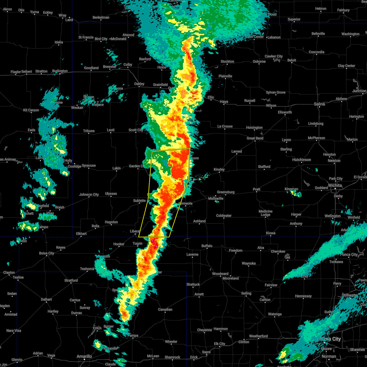 The severe thunderstorm warning for western ford, eastern seward, eastern finney, western hodgeman, meade, gray and eastern haskell counties will expire at 1030 pm cdt, the storms which prompted the warning have moved out of the area. therefore, the warning will be allowed to expire. a tornado watch remains in effect until 1100 pm cdt for southwestern kansas. a tornado watch also remains in effect until 500 am cdt for southwestern kansas. The severe thunderstorm warning for western ford, eastern seward, eastern finney, western hodgeman, meade, gray and eastern haskell counties will expire at 1030 pm cdt, the storms which prompted the warning have moved out of the area. therefore, the warning will be allowed to expire. a tornado watch remains in effect until 1100 pm cdt for southwestern kansas. a tornado watch also remains in effect until 500 am cdt for southwestern kansas.
|
| 10/12/2021 10:20 PM CDT |
 At 1019 pm cdt, severe thunderstorms were located along a line extending from 13 miles north of jetmore to 8 miles east of ensign to 7 miles northeast of forgan, moving northeast at 60 mph (radar indicated). Hazards include 70 mph wind gusts and quarter size hail. Hail damage to vehicles is expected. expect considerable tree damage. wind damage is also likely to mobile homes, roofs, and outbuildings. severe thunderstorms will be near, dodge city and ft. dodge around 1030 pm cdt. wright around 1035 pm cdt. Other locations in the path of these severe thunderstorms include ford, spearville, windhorst, bellefont and ashland. At 1019 pm cdt, severe thunderstorms were located along a line extending from 13 miles north of jetmore to 8 miles east of ensign to 7 miles northeast of forgan, moving northeast at 60 mph (radar indicated). Hazards include 70 mph wind gusts and quarter size hail. Hail damage to vehicles is expected. expect considerable tree damage. wind damage is also likely to mobile homes, roofs, and outbuildings. severe thunderstorms will be near, dodge city and ft. dodge around 1030 pm cdt. wright around 1035 pm cdt. Other locations in the path of these severe thunderstorms include ford, spearville, windhorst, bellefont and ashland.
|
| 10/12/2021 10:08 PM CDT |
 At 1008 pm cdt, severe thunderstorms were located along a line extending from 12 miles south of beeler to near howell to near meade state park, moving northeast at 55 mph (radar indicated). Hazards include 70 mph wind gusts and nickel size hail. Expect considerable tree damage. damage is likely to mobile homes, roofs, and outbuildings. Locations impacted include, howell, dodge city and meade. At 1008 pm cdt, severe thunderstorms were located along a line extending from 12 miles south of beeler to near howell to near meade state park, moving northeast at 55 mph (radar indicated). Hazards include 70 mph wind gusts and nickel size hail. Expect considerable tree damage. damage is likely to mobile homes, roofs, and outbuildings. Locations impacted include, howell, dodge city and meade.
|
| 10/12/2021 9:46 PM CDT |
 At 946 pm cdt, severe thunderstorms were located along a line extending from 9 miles northwest of kalvesta to near montezuma to 6 miles southeast of hayne, moving northeast at 55 mph (radar indicated). Hazards include 70 mph wind gusts and nickel size hail. Expect considerable tree damage. damage is likely to mobile homes, roofs, and outbuildings. severe thunderstorms will be near, montezuma around 950 pm cdt. the haggard elev around 955 pm cdt. ensign around 1000 pm cdt. Other locations in the path of these severe thunderstorms include meade state park, howell, dodge city and meade. At 946 pm cdt, severe thunderstorms were located along a line extending from 9 miles northwest of kalvesta to near montezuma to 6 miles southeast of hayne, moving northeast at 55 mph (radar indicated). Hazards include 70 mph wind gusts and nickel size hail. Expect considerable tree damage. damage is likely to mobile homes, roofs, and outbuildings. severe thunderstorms will be near, montezuma around 950 pm cdt. the haggard elev around 955 pm cdt. ensign around 1000 pm cdt. Other locations in the path of these severe thunderstorms include meade state park, howell, dodge city and meade.
|
| 8/10/2021 7:10 PM CDT |
 At 710 pm cdt, a severe thunderstorm was located very near ensign, moving northeast at 15 mph (radar indicated). Hazards include quarter size hail. Damage to vehicles is expected. this severe storm will be near, ensign around 715 pm cdt. other locations in the path of this severe thunderstorm include howell and dodge city. hail threat, radar indicated max hail size, 1. 00 in wind threat, radar indicated max wind gust, <50 mph. At 710 pm cdt, a severe thunderstorm was located very near ensign, moving northeast at 15 mph (radar indicated). Hazards include quarter size hail. Damage to vehicles is expected. this severe storm will be near, ensign around 715 pm cdt. other locations in the path of this severe thunderstorm include howell and dodge city. hail threat, radar indicated max hail size, 1. 00 in wind threat, radar indicated max wind gust, <50 mph.
|
| 8/10/2021 6:55 PM CDT |
 At 655 pm cdt, a severe thunderstorm was located near the haggard elev, moving northeast at 15 mph (radar indicated). Hazards include quarter size hail. Damage to vehicles is expected. this severe thunderstorm will be near, the haggard elev around 700 pm cdt. ensign around 715 pm cdt. other locations in the path of this severe thunderstorm include howell. hail threat, radar indicated max hail size, 1. 00 in wind threat, radar indicated max wind gust, <50 mph. At 655 pm cdt, a severe thunderstorm was located near the haggard elev, moving northeast at 15 mph (radar indicated). Hazards include quarter size hail. Damage to vehicles is expected. this severe thunderstorm will be near, the haggard elev around 700 pm cdt. ensign around 715 pm cdt. other locations in the path of this severe thunderstorm include howell. hail threat, radar indicated max hail size, 1. 00 in wind threat, radar indicated max wind gust, <50 mph.
|
| 8/7/2021 8:26 PM CDT | Storm damage reported in gray county KS, 0.2 miles NW of Ensign, KS |
| 8/7/2021 8:24 PM CDT |
 At 823 pm cdt, a severe thunderstorm was located very near ensign, moving east at 35 mph (radar indicated). Hazards include 60 mph wind gusts and penny size hail. Expect damage to roofs, siding, and trees. this severe thunderstorm will remain over mainly rural areas of southwestern ford and southeastern gray counties. hail threat, radar indicated max hail size, 0. 75 in wind threat, radar indicated max wind gust, 60 mph. At 823 pm cdt, a severe thunderstorm was located very near ensign, moving east at 35 mph (radar indicated). Hazards include 60 mph wind gusts and penny size hail. Expect damage to roofs, siding, and trees. this severe thunderstorm will remain over mainly rural areas of southwestern ford and southeastern gray counties. hail threat, radar indicated max hail size, 0. 75 in wind threat, radar indicated max wind gust, 60 mph.
|
| 8/7/2021 8:22 PM CDT | Quarter sized hail reported 0.2 miles NW of Ensign, KS |
| 8/7/2021 7:54 PM CDT |
 At 754 pm cdt, a severe thunderstorm was located near montezuma, moving east at 35 mph (radar indicated). Hazards include 60 mph wind gusts and quarter size hail. Hail damage to vehicles is expected. expect wind damage to roofs, siding, and trees. this severe thunderstorm will be near, montezuma around 805 pm cdt. other locations in the path of this severe thunderstorm include the haggard elev, ensign and howell. hail threat, radar indicated max hail size, 1. 00 in wind threat, radar indicated max wind gust, 60 mph. At 754 pm cdt, a severe thunderstorm was located near montezuma, moving east at 35 mph (radar indicated). Hazards include 60 mph wind gusts and quarter size hail. Hail damage to vehicles is expected. expect wind damage to roofs, siding, and trees. this severe thunderstorm will be near, montezuma around 805 pm cdt. other locations in the path of this severe thunderstorm include the haggard elev, ensign and howell. hail threat, radar indicated max hail size, 1. 00 in wind threat, radar indicated max wind gust, 60 mph.
|
| 6/25/2021 7:45 PM CDT |
 At 744 pm cdt, a severe thunderstorm was located very near ensign, moving northeast at 35 mph (radar indicated). Hazards include 60 mph wind gusts and penny size hail. Expect damage to roofs, siding, and trees. This severe thunderstorm will be near, howell around 800 pm cdt. At 744 pm cdt, a severe thunderstorm was located very near ensign, moving northeast at 35 mph (radar indicated). Hazards include 60 mph wind gusts and penny size hail. Expect damage to roofs, siding, and trees. This severe thunderstorm will be near, howell around 800 pm cdt.
|
| 5/26/2021 7:54 PM CDT |
 The severe thunderstorm warning for southeastern gray county will expire at 800 pm cdt, the storm which prompted the warning has weakened below severe limits, and no longer poses an immediate threat to life or property. therefore, the warning will be allowed to expire. however small hail, gusty winds and heavy rain are still possible with this thunderstorm. a tornado watch remains in effect until 200 am cdt for southwestern kansas. The severe thunderstorm warning for southeastern gray county will expire at 800 pm cdt, the storm which prompted the warning has weakened below severe limits, and no longer poses an immediate threat to life or property. therefore, the warning will be allowed to expire. however small hail, gusty winds and heavy rain are still possible with this thunderstorm. a tornado watch remains in effect until 200 am cdt for southwestern kansas.
|
| 5/26/2021 7:40 PM CDT |
 At 740 pm cdt, a severe thunderstorm was located near the haggard elev, moving northeast at 30 mph (radar indicated). Hazards include quarter size hail. Damage to vehicles is expected. Locations impacted include, montezuma, ensign and the haggard elev. At 740 pm cdt, a severe thunderstorm was located near the haggard elev, moving northeast at 30 mph (radar indicated). Hazards include quarter size hail. Damage to vehicles is expected. Locations impacted include, montezuma, ensign and the haggard elev.
|
| 5/26/2021 7:33 PM CDT |
 At 733 pm cdt, a severe thunderstorm was located near montezuma, moving northeast at 30 mph (radar indicated). Hazards include quarter size hail. Damage to vehicles is expected. Locations impacted include, montezuma, fowler, ensign and the haggard elev. At 733 pm cdt, a severe thunderstorm was located near montezuma, moving northeast at 30 mph (radar indicated). Hazards include quarter size hail. Damage to vehicles is expected. Locations impacted include, montezuma, fowler, ensign and the haggard elev.
|
| 5/26/2021 7:30 PM CDT |
 At 730 pm cdt, a severe thunderstorm was located near ensign, moving northeast at 25 mph (radar indicated). Hazards include golf ball size hail and 60 mph wind gusts. People and animals outdoors will be injured. expect hail damage to roofs, siding, windows, and vehicles. Expect wind damage to roofs, siding, and trees. At 730 pm cdt, a severe thunderstorm was located near ensign, moving northeast at 25 mph (radar indicated). Hazards include golf ball size hail and 60 mph wind gusts. People and animals outdoors will be injured. expect hail damage to roofs, siding, windows, and vehicles. Expect wind damage to roofs, siding, and trees.
|
| 5/26/2021 7:25 PM CDT | Quarter sized hail reported 1.2 miles S of Ensign, KS |
| 5/26/2021 7:20 PM CDT |
 At 720 pm cdt, a severe thunderstorm was located 7 miles south of montezuma, moving northeast at 25 mph (radar indicated). Hazards include two inch hail. People and animals outdoors will be injured. expect damage to roofs, siding, windows, and vehicles. Locations impacted include, montezuma, fowler, ensign and the haggard elev. At 720 pm cdt, a severe thunderstorm was located 7 miles south of montezuma, moving northeast at 25 mph (radar indicated). Hazards include two inch hail. People and animals outdoors will be injured. expect damage to roofs, siding, windows, and vehicles. Locations impacted include, montezuma, fowler, ensign and the haggard elev.
|
| 5/26/2021 7:10 PM CDT |
 At 710 pm cdt, a severe thunderstorm was located near copeland, moving northeast at 30 mph (radar indicated). Hazards include quarter size hail. Damage to vehicles is expected. Locations impacted include, montezuma, fowler, copeland, ensign and the haggard elev. At 710 pm cdt, a severe thunderstorm was located near copeland, moving northeast at 30 mph (radar indicated). Hazards include quarter size hail. Damage to vehicles is expected. Locations impacted include, montezuma, fowler, copeland, ensign and the haggard elev.
|
| 5/26/2021 7:06 PM CDT |
 At 706 pm cdt, a severe thunderstorm was located 7 miles south of copeland, moving northeast at 30 mph (radar indicated). Hazards include quarter size hail. Damage to vehicles is expected. this severe thunderstorm will be near, copeland around 715 pm cdt. Other locations in the path of this severe thunderstorm include montezuma, the haggard elev and ensign. At 706 pm cdt, a severe thunderstorm was located 7 miles south of copeland, moving northeast at 30 mph (radar indicated). Hazards include quarter size hail. Damage to vehicles is expected. this severe thunderstorm will be near, copeland around 715 pm cdt. Other locations in the path of this severe thunderstorm include montezuma, the haggard elev and ensign.
|
| 5/24/2021 11:14 PM CDT |
 At 1114 pm cdt, a severe thunderstorm was located near cimarron, moving east at 15 mph (radar indicated). Hazards include 60 mph wind gusts and quarter size hail. Hail damage to vehicles is expected. expect wind damage to roofs, siding, and trees. Locations impacted include, cimarron, ensign, the haggard elev and howell. At 1114 pm cdt, a severe thunderstorm was located near cimarron, moving east at 15 mph (radar indicated). Hazards include 60 mph wind gusts and quarter size hail. Hail damage to vehicles is expected. expect wind damage to roofs, siding, and trees. Locations impacted include, cimarron, ensign, the haggard elev and howell.
|
| 5/24/2021 11:05 PM CDT |
 At 1105 pm cdt, a severe thunderstorm was located near cimarron, moving east at 15 mph (radar indicated). Hazards include 60 mph wind gusts and quarter size hail. Hail damage to vehicles is expected. expect wind damage to roofs, siding, and trees. Locations impacted include, cimarron, ingalls, ensign, the haggard elev and howell. At 1105 pm cdt, a severe thunderstorm was located near cimarron, moving east at 15 mph (radar indicated). Hazards include 60 mph wind gusts and quarter size hail. Hail damage to vehicles is expected. expect wind damage to roofs, siding, and trees. Locations impacted include, cimarron, ingalls, ensign, the haggard elev and howell.
|
| 5/24/2021 10:51 PM CDT |
 At 1051 pm cdt, a severe thunderstorm was located near ingalls, moving east at 15 mph (radar indicated). Hazards include 60 mph wind gusts and quarter size hail. Hail damage to vehicles is expected. expect wind damage to roofs, siding, and trees. Locations impacted include, cimarron, ingalls, ensign, the haggard elev and howell. At 1051 pm cdt, a severe thunderstorm was located near ingalls, moving east at 15 mph (radar indicated). Hazards include 60 mph wind gusts and quarter size hail. Hail damage to vehicles is expected. expect wind damage to roofs, siding, and trees. Locations impacted include, cimarron, ingalls, ensign, the haggard elev and howell.
|
| 5/24/2021 10:40 PM CDT |
 At 1040 pm cdt, a severe thunderstorm was located near ingalls, moving east at 15 mph (radar indicated). Hazards include ping pong ball size hail and 60 mph wind gusts. People and animals outdoors will be injured. expect hail damage to roofs, siding, windows, and vehicles. Expect wind damage to roofs, siding, and trees. At 1040 pm cdt, a severe thunderstorm was located near ingalls, moving east at 15 mph (radar indicated). Hazards include ping pong ball size hail and 60 mph wind gusts. People and animals outdoors will be injured. expect hail damage to roofs, siding, windows, and vehicles. Expect wind damage to roofs, siding, and trees.
|
| 5/5/2021 5:46 PM CDT |
 At 545 pm cdt, a severe thunderstorm was located near dodge city, moving southeast at 30 mph (radar indicated and automated weather station report. a 62 mph wind gust was recorded at dodge city airport at 539 pm). Hazards include 60 mph wind gusts and half dollar size hail. Hail damage to vehicles is expected. expect wind damage to roofs, siding, and trees. locations impacted include, dodge city, ensign and ft. Dodge. At 545 pm cdt, a severe thunderstorm was located near dodge city, moving southeast at 30 mph (radar indicated and automated weather station report. a 62 mph wind gust was recorded at dodge city airport at 539 pm). Hazards include 60 mph wind gusts and half dollar size hail. Hail damage to vehicles is expected. expect wind damage to roofs, siding, and trees. locations impacted include, dodge city, ensign and ft. Dodge.
|
| 5/5/2021 5:41 PM CDT |
 At 539 pm cdt, a severe thunderstorm was located 7 miles southeast of ensign, moving southeast at 25 mph (radar indicated and spotter reported. quarter size hail was reported 2 miles northwest of dodge city at 532 pm). Hazards include 60 mph wind gusts and half dollar size hail. Hail damage to vehicles is expected. Expect wind damage to roofs, siding, and trees. At 539 pm cdt, a severe thunderstorm was located 7 miles southeast of ensign, moving southeast at 25 mph (radar indicated and spotter reported. quarter size hail was reported 2 miles northwest of dodge city at 532 pm). Hazards include 60 mph wind gusts and half dollar size hail. Hail damage to vehicles is expected. Expect wind damage to roofs, siding, and trees.
|
| 5/5/2021 5:10 PM CDT |
 At 510 pm cdt, a severe thunderstorm was located 8 miles north of howell, moving southeast at 30 mph (radar indicated). Hazards include 60 mph wind gusts and quarter size hail. Hail damage to vehicles is expected. Expect wind damage to roofs, siding, and trees. At 510 pm cdt, a severe thunderstorm was located 8 miles north of howell, moving southeast at 30 mph (radar indicated). Hazards include 60 mph wind gusts and quarter size hail. Hail damage to vehicles is expected. Expect wind damage to roofs, siding, and trees.
|
| 8/16/2020 10:02 PM CDT |
 At 1002 pm cdt, outflow winds from thunderstorm was located near cimarron, moving east at 35 mph (radar indicated). Hazards include 60 mph wind gusts. Expect damage to roofs, siding, and trees. Locations impacted include, cimarron, montezuma, copeland, ingalls, ensign, howell and the haggard elev. At 1002 pm cdt, outflow winds from thunderstorm was located near cimarron, moving east at 35 mph (radar indicated). Hazards include 60 mph wind gusts. Expect damage to roofs, siding, and trees. Locations impacted include, cimarron, montezuma, copeland, ingalls, ensign, howell and the haggard elev.
|
| 8/16/2020 9:38 PM CDT |
 At 937 pm cdt, outflow winds from thunderstorms were located near pierceville, moving southeast at 35 mph (radar indicated). Hazards include 60 mph wind gusts. expect damage to roofs, siding, and trees At 937 pm cdt, outflow winds from thunderstorms were located near pierceville, moving southeast at 35 mph (radar indicated). Hazards include 60 mph wind gusts. expect damage to roofs, siding, and trees
|
| 7/29/2020 7:54 PM CDT |
 At 753 pm cdt, the leading edge gust front of severe thunderstorms were located along a line extending from near dodge city to near minneola to near fowler, moving southeast at 50 mph (radar indicated). Hazards include 60 mph wind gusts. Expect damage to roofs, siding, and trees. Locations impacted include, ashland, bucklin, minneola, fowler, ford, ensign, bloom, clark state lake and kingsdown. At 753 pm cdt, the leading edge gust front of severe thunderstorms were located along a line extending from near dodge city to near minneola to near fowler, moving southeast at 50 mph (radar indicated). Hazards include 60 mph wind gusts. Expect damage to roofs, siding, and trees. Locations impacted include, ashland, bucklin, minneola, fowler, ford, ensign, bloom, clark state lake and kingsdown.
|
| 7/29/2020 7:33 PM CDT |
 At 732 pm cdt, the leading edge of severe thunderstorms were located along a line extending from near howell to near ensign to 7 miles south of montezuma, moving southeast at 50 mph (radar indicated). Hazards include 60 mph wind gusts and penny size hail. expect damage to roofs, siding, and trees At 732 pm cdt, the leading edge of severe thunderstorms were located along a line extending from near howell to near ensign to 7 miles south of montezuma, moving southeast at 50 mph (radar indicated). Hazards include 60 mph wind gusts and penny size hail. expect damage to roofs, siding, and trees
|
| 7/29/2020 7:30 PM CDT |
 At 730 pm cdt, severe thunderstorms were located along a line extending from near cimarron to the haggard elev to near montezuma, moving southeast at 45 mph (radar indicated). Hazards include 60 mph wind gusts and penny size hail. Expect damage to roofs, siding, and trees. Locations impacted include, cimarron, montezuma, copeland, ingalls, ensign and the haggard elev. At 730 pm cdt, severe thunderstorms were located along a line extending from near cimarron to the haggard elev to near montezuma, moving southeast at 45 mph (radar indicated). Hazards include 60 mph wind gusts and penny size hail. Expect damage to roofs, siding, and trees. Locations impacted include, cimarron, montezuma, copeland, ingalls, ensign and the haggard elev.
|
| 7/29/2020 7:11 PM CDT |
 At 710 pm cdt, severe thunderstorms were located along a line extending from near charleston to 6 miles southwest of ingalls to 6 miles north of copeland, moving southeast at 40 mph (radar indicated. at 658 pm cdt a 70 mph wind gust was measured at the garden city airport). Hazards include 70 mph wind gusts and penny size hail. Expect considerable tree damage. damage is likely to mobile homes, roofs, and outbuildings. Locations impacted include, cimarron, montezuma, copeland, ingalls, ensign, charleston and the haggard elev. At 710 pm cdt, severe thunderstorms were located along a line extending from near charleston to 6 miles southwest of ingalls to 6 miles north of copeland, moving southeast at 40 mph (radar indicated. at 658 pm cdt a 70 mph wind gust was measured at the garden city airport). Hazards include 70 mph wind gusts and penny size hail. Expect considerable tree damage. damage is likely to mobile homes, roofs, and outbuildings. Locations impacted include, cimarron, montezuma, copeland, ingalls, ensign, charleston and the haggard elev.
|
| 7/29/2020 7:03 PM CDT |
 At 703 pm cdt, severe thunderstorms were located along a line extending from near charleston to 7 miles southeast of pierceville to 9 miles northwest of copeland, moving southeast at 40 mph (radar indicated). Hazards include 60 mph wind gusts and penny size hail. expect damage to roofs, siding, and trees At 703 pm cdt, severe thunderstorms were located along a line extending from near charleston to 7 miles southeast of pierceville to 9 miles northwest of copeland, moving southeast at 40 mph (radar indicated). Hazards include 60 mph wind gusts and penny size hail. expect damage to roofs, siding, and trees
|
| 7/15/2020 12:41 AM CDT |
 The severe thunderstorm warning for western ford, central finney, northwestern meade, gray and northeastern haskell counties will expire at 1245 am cdt, the storms which prompted the warning has weakened below severe limits, and moved out of the warned area. therefore, the warning will be allowed to expire. heavy rainfall and wind gusts to near 50 mph will continue for the next hour. a severe thunderstorm watch remains in effect until 300 am cdt for southwestern kansas. The severe thunderstorm warning for western ford, central finney, northwestern meade, gray and northeastern haskell counties will expire at 1245 am cdt, the storms which prompted the warning has weakened below severe limits, and moved out of the warned area. therefore, the warning will be allowed to expire. heavy rainfall and wind gusts to near 50 mph will continue for the next hour. a severe thunderstorm watch remains in effect until 300 am cdt for southwestern kansas.
|
| 7/15/2020 12:20 AM CDT |
 At 1219 am cdt, severe thunderstorms were located along a line extending from 10 miles north of charleston to 9 miles northwest of acres, moving northeast at 25 mph (radar indicated). Hazards include 60 mph wind gusts. Expect damage to roofs, siding, and trees. locations impacted include, dodge city, garden city, cimarron, montezuma, pierceville, copeland, ingalls, ford, ensign, charleston, howell, wright, plymell, kalvesta, the haggard elev, ft. Dodge and tice. At 1219 am cdt, severe thunderstorms were located along a line extending from 10 miles north of charleston to 9 miles northwest of acres, moving northeast at 25 mph (radar indicated). Hazards include 60 mph wind gusts. Expect damage to roofs, siding, and trees. locations impacted include, dodge city, garden city, cimarron, montezuma, pierceville, copeland, ingalls, ford, ensign, charleston, howell, wright, plymell, kalvesta, the haggard elev, ft. Dodge and tice.
|
| 7/14/2020 11:58 PM CDT |
 At 1158 pm cdt, severe thunderstorms were located along a line extending from near garden city to 10 miles southeast of meade state park, moving east at 25 mph (radar indicated). Hazards include 60 mph wind gusts and penny size hail. expect damage to roofs, siding, and trees At 1158 pm cdt, severe thunderstorms were located along a line extending from near garden city to 10 miles southeast of meade state park, moving east at 25 mph (radar indicated). Hazards include 60 mph wind gusts and penny size hail. expect damage to roofs, siding, and trees
|
| 7/13/2020 12:17 AM CDT |
 At 1217 am cdt, a severe thunderstorm was located near cimarron, moving southeast at 15 mph (radar indicated). Hazards include 60 mph wind gusts and penny size hail. Expect damage to roofs, siding, and trees. locations impacted include, dodge city, cimarron, montezuma, copeland, ford, ensign, howell, wright, the haggard elev and ft. Dodge. At 1217 am cdt, a severe thunderstorm was located near cimarron, moving southeast at 15 mph (radar indicated). Hazards include 60 mph wind gusts and penny size hail. Expect damage to roofs, siding, and trees. locations impacted include, dodge city, cimarron, montezuma, copeland, ford, ensign, howell, wright, the haggard elev and ft. Dodge.
|
| 7/12/2020 11:39 PM CDT |
 At 1139 pm cdt, a severe thunderstorm was located 9 miles north of ingalls, moving southeast at 15 mph (radar indicated). Hazards include 60 mph wind gusts and quarter size hail. Hail damage to vehicles is expected. Expect wind damage to roofs, siding, and trees. At 1139 pm cdt, a severe thunderstorm was located 9 miles north of ingalls, moving southeast at 15 mph (radar indicated). Hazards include 60 mph wind gusts and quarter size hail. Hail damage to vehicles is expected. Expect wind damage to roofs, siding, and trees.
|
| 6/21/2020 6:27 PM CDT |
 The severe thunderstorm warning for ford, southwestern hodgeman and central gray counties will expire at 630 pm cdt, the storms which prompted the warning have weakened below severe limits, and no longer pose an immediate threat to life or property. therefore, the warning will be allowed to expire. however heavy rain is still possible with these thunderstorms. a severe thunderstorm watch remains in effect until 1000 pm cdt for southwestern kansas. The severe thunderstorm warning for ford, southwestern hodgeman and central gray counties will expire at 630 pm cdt, the storms which prompted the warning have weakened below severe limits, and no longer pose an immediate threat to life or property. therefore, the warning will be allowed to expire. however heavy rain is still possible with these thunderstorms. a severe thunderstorm watch remains in effect until 1000 pm cdt for southwestern kansas.
|
| 6/21/2020 5:46 PM CDT |
 At 546 pm cdt, severe thunderstorms were located along a line extending from near windhorst to near the haggard elev, moving southeast at 15 mph (radar indicated). Hazards include 60 mph wind gusts and quarter size hail. Hail damage to vehicles is expected. Expect wind damage to roofs, siding, and trees. At 546 pm cdt, severe thunderstorms were located along a line extending from near windhorst to near the haggard elev, moving southeast at 15 mph (radar indicated). Hazards include 60 mph wind gusts and quarter size hail. Hail damage to vehicles is expected. Expect wind damage to roofs, siding, and trees.
|
| 6/21/2020 5:22 PM CDT |
 At 522 pm cdt, severe thunderstorms were located along a line extending from near spearville to near the haggard elev, moving southeast at 25 mph. these are very dangerous storms (radar indicated). Hazards include 80 mph wind gusts and two inch hail. Flying debris will be dangerous to those caught without shelter. mobile homes will be heavily damaged. expect considerable damage to roofs, windows, and vehicles. extensive tree damage and power outages are likely. locations impacted include, dodge city, cimarron, spearville, pierceville, ingalls, ensign, charleston, howell, wright, bellefont, windhorst, the haggard elev and ft. Dodge. At 522 pm cdt, severe thunderstorms were located along a line extending from near spearville to near the haggard elev, moving southeast at 25 mph. these are very dangerous storms (radar indicated). Hazards include 80 mph wind gusts and two inch hail. Flying debris will be dangerous to those caught without shelter. mobile homes will be heavily damaged. expect considerable damage to roofs, windows, and vehicles. extensive tree damage and power outages are likely. locations impacted include, dodge city, cimarron, spearville, pierceville, ingalls, ensign, charleston, howell, wright, bellefont, windhorst, the haggard elev and ft. Dodge.
|
| 6/21/2020 4:52 PM CDT |
 At 452 pm cdt, severe thunderstorms were located along a line extending from near burdett to near charleston, moving southeast at 35 mph (radar indicated). Hazards include two inch hail and 70 mph wind gusts. People and animals outdoors will be injured. expect hail damage to roofs, siding, windows, and vehicles. expect considerable tree damage. Wind damage is also likely to mobile homes, roofs, and outbuildings. At 452 pm cdt, severe thunderstorms were located along a line extending from near burdett to near charleston, moving southeast at 35 mph (radar indicated). Hazards include two inch hail and 70 mph wind gusts. People and animals outdoors will be injured. expect hail damage to roofs, siding, windows, and vehicles. expect considerable tree damage. Wind damage is also likely to mobile homes, roofs, and outbuildings.
|
| 6/21/2020 3:35 PM CDT |
 At 334 pm cdt, a severe thunderstorm was located near cimarron, moving east at 20 mph (radar indicated). Hazards include ping pong ball size hail and 60 mph wind gusts. People and animals outdoors will be injured. expect hail damage to roofs, siding, windows, and vehicles. Expect wind damage to roofs, siding, and trees. At 334 pm cdt, a severe thunderstorm was located near cimarron, moving east at 20 mph (radar indicated). Hazards include ping pong ball size hail and 60 mph wind gusts. People and animals outdoors will be injured. expect hail damage to roofs, siding, windows, and vehicles. Expect wind damage to roofs, siding, and trees.
|
| 5/24/2020 10:12 PM CDT |
 The severe thunderstorm warning for northwestern ford, southwestern hodgeman and southeastern gray counties will expire at 1015 pm cdt, the storms which prompted the warning have weakened below severe limits, and no longer pose an immediate threat to life or property. therefore, the warning will be allowed to expire. however gusty winds and heavy rain are still possible with these thunderstorms. a severe thunderstorm watch remains in effect until midnight cdt for southwestern kansas. The severe thunderstorm warning for northwestern ford, southwestern hodgeman and southeastern gray counties will expire at 1015 pm cdt, the storms which prompted the warning have weakened below severe limits, and no longer pose an immediate threat to life or property. therefore, the warning will be allowed to expire. however gusty winds and heavy rain are still possible with these thunderstorms. a severe thunderstorm watch remains in effect until midnight cdt for southwestern kansas.
|
| 5/24/2020 10:02 PM CDT |
 At 1002 pm cdt, severe thunderstorms were located along a line extending from 7 miles southwest of jetmore to near dodge city to near the haggard elev, moving east at 20 mph (radar indicated). Hazards include 60 mph wind gusts and nickel size hail. Expect damage to roofs, siding, and trees. locations impacted include, dodge city, montezuma, ensign, the haggard elev, ft. Dodge and howell. At 1002 pm cdt, severe thunderstorms were located along a line extending from 7 miles southwest of jetmore to near dodge city to near the haggard elev, moving east at 20 mph (radar indicated). Hazards include 60 mph wind gusts and nickel size hail. Expect damage to roofs, siding, and trees. locations impacted include, dodge city, montezuma, ensign, the haggard elev, ft. Dodge and howell.
|
| 5/24/2020 9:36 PM CDT |
 At 936 pm cdt, severe thunderstorms were located along a line extending from 8 miles southeast of kalvesta to near howell to 6 miles north of montezuma, moving southeast at 15 mph (radar indicated). Hazards include golf ball size hail and 60 mph wind gusts. People and animals outdoors will be injured. expect hail damage to roofs, siding, windows, and vehicles. Expect wind damage to roofs, siding, and trees. At 936 pm cdt, severe thunderstorms were located along a line extending from 8 miles southeast of kalvesta to near howell to 6 miles north of montezuma, moving southeast at 15 mph (radar indicated). Hazards include golf ball size hail and 60 mph wind gusts. People and animals outdoors will be injured. expect hail damage to roofs, siding, windows, and vehicles. Expect wind damage to roofs, siding, and trees.
|
| 5/21/2020 10:31 PM CDT |
 At 1031 pm cdt, severe thunderstorms were located along a line extending from near cimarron to near copeland, moving east at 25 mph (radar indicated). Hazards include 60 mph wind gusts and quarter size hail. Hail damage to vehicles is expected. Expect wind damage to roofs, siding, and trees. At 1031 pm cdt, severe thunderstorms were located along a line extending from near cimarron to near copeland, moving east at 25 mph (radar indicated). Hazards include 60 mph wind gusts and quarter size hail. Hail damage to vehicles is expected. Expect wind damage to roofs, siding, and trees.
|
| 8/31/2019 4:01 AM CDT |
 At 401 am cdt, a severe thunderstorm was located near ingalls, moving east at 15 mph (radar indicated). Hazards include quarter size hail. Damage to vehicles is expected. Locations impacted include, cimarron and ensign. At 401 am cdt, a severe thunderstorm was located near ingalls, moving east at 15 mph (radar indicated). Hazards include quarter size hail. Damage to vehicles is expected. Locations impacted include, cimarron and ensign.
|
| 8/31/2019 3:47 AM CDT |
 At 328 am cdt, a severe thunderstorm was located 9 miles northwest of montezuma, moving east at 15 mph (radar indicated). Hazards include half dollar size hail. damage to vehicles is expected At 328 am cdt, a severe thunderstorm was located 9 miles northwest of montezuma, moving east at 15 mph (radar indicated). Hazards include half dollar size hail. damage to vehicles is expected
|
| 8/31/2019 3:28 AM CDT |
 At 328 am cdt, a severe thunderstorm was located 9 miles northwest of montezuma, moving east at 15 mph (radar indicated). Hazards include half dollar size hail. damage to vehicles is expected At 328 am cdt, a severe thunderstorm was located 9 miles northwest of montezuma, moving east at 15 mph (radar indicated). Hazards include half dollar size hail. damage to vehicles is expected
|
| 8/13/2019 8:09 PM CDT |
 At 808 pm cdt, severe thunderstorms were located along a line extending from near burdett to near spearville to near ensign, moving south at 50 mph. these are very dangerous storms (radar indicated). Hazards include 80 mph wind gusts and half dollar size hail. Flying debris will be dangerous to those caught without shelter. mobile homes will be heavily damaged. expect considerable damage to roofs, windows, and vehicles. extensive tree damage and power outages are likely. Locations impacted include, dodge city, gray, cimarron, kinsley, jetmore, spearville, lewis, bazine, burdett, ford, hanston, offerle, garfield, mccracken, ensign, rozel, alexander, howell, wright and sanford. At 808 pm cdt, severe thunderstorms were located along a line extending from near burdett to near spearville to near ensign, moving south at 50 mph. these are very dangerous storms (radar indicated). Hazards include 80 mph wind gusts and half dollar size hail. Flying debris will be dangerous to those caught without shelter. mobile homes will be heavily damaged. expect considerable damage to roofs, windows, and vehicles. extensive tree damage and power outages are likely. Locations impacted include, dodge city, gray, cimarron, kinsley, jetmore, spearville, lewis, bazine, burdett, ford, hanston, offerle, garfield, mccracken, ensign, rozel, alexander, howell, wright and sanford.
|
| 8/13/2019 7:47 PM CDT |
 At 746 pm cdt, severe thunderstorms were located along a line extending from near deerfield to near pierceville to 7 miles southeast of kalvesta, moving south at 45 mph (radar indicated). Hazards include 70 mph wind gusts and ping pong ball size hail. People and animals outdoors will be injured. expect hail damage to roofs, siding, windows, and vehicles. expect considerable tree damage. Wind damage is also likely to mobile homes, roofs, and outbuildings. At 746 pm cdt, severe thunderstorms were located along a line extending from near deerfield to near pierceville to 7 miles southeast of kalvesta, moving south at 45 mph (radar indicated). Hazards include 70 mph wind gusts and ping pong ball size hail. People and animals outdoors will be injured. expect hail damage to roofs, siding, windows, and vehicles. expect considerable tree damage. Wind damage is also likely to mobile homes, roofs, and outbuildings.
|
| 8/13/2019 7:29 PM CDT |
 At 728 pm cdt, severe thunderstorms were located along a line extending from near mccracken to 8 miles south of ness city to 8 miles northwest of kalvesta, moving south at 50 mph. these are very dangerous storms (radar indicated). Hazards include 80 mph wind gusts and ping pong ball size hail. Flying debris will be dangerous to those caught without shelter. mobile homes will be heavily damaged. expect considerable damage to roofs, windows, and vehicles. Extensive tree damage and power outages are likely. At 728 pm cdt, severe thunderstorms were located along a line extending from near mccracken to 8 miles south of ness city to 8 miles northwest of kalvesta, moving south at 50 mph. these are very dangerous storms (radar indicated). Hazards include 80 mph wind gusts and ping pong ball size hail. Flying debris will be dangerous to those caught without shelter. mobile homes will be heavily damaged. expect considerable damage to roofs, windows, and vehicles. Extensive tree damage and power outages are likely.
|
| 7/5/2019 7:30 PM CDT |
 At 730 pm cdt, a severe thunderstorm was located 7 miles northeast of ingalls, moving southeast at 15 mph (radar indicated). Hazards include 70 mph wind gusts and penny size hail. Expect considerable tree damage. Damage is likely to mobile homes, roofs, and outbuildings. At 730 pm cdt, a severe thunderstorm was located 7 miles northeast of ingalls, moving southeast at 15 mph (radar indicated). Hazards include 70 mph wind gusts and penny size hail. Expect considerable tree damage. Damage is likely to mobile homes, roofs, and outbuildings.
|
| 6/23/2019 1:40 AM CDT |
 At 139 am cdt, a severe thunderstorm was located near ensign, moving east at 20 mph (emergency management. emergency management reported quarter size hail and winds near 60 mph at ensign at 1:40 am cdt). Hazards include 60 mph wind gusts and half dollar size hail. Hail damage to vehicles is expected. expect wind damage to roofs, siding, and trees. locations impacted include, dodge city, ensign, ft. Dodge and howell. At 139 am cdt, a severe thunderstorm was located near ensign, moving east at 20 mph (emergency management. emergency management reported quarter size hail and winds near 60 mph at ensign at 1:40 am cdt). Hazards include 60 mph wind gusts and half dollar size hail. Hail damage to vehicles is expected. expect wind damage to roofs, siding, and trees. locations impacted include, dodge city, ensign, ft. Dodge and howell.
|
| 6/23/2019 1:37 AM CDT |
 At 136 am cdt, a severe thunderstorm was located near ensign, moving east at 25 mph (radar indicated). Hazards include 60 mph wind gusts and half dollar size hail. large accumulations of hail are possible. Hail damage to vehicles is expected. expect wind damage to roofs, siding, and trees. locations impacted include, dodge city, ensign, ft. Dodge and howell. At 136 am cdt, a severe thunderstorm was located near ensign, moving east at 25 mph (radar indicated). Hazards include 60 mph wind gusts and half dollar size hail. large accumulations of hail are possible. Hail damage to vehicles is expected. expect wind damage to roofs, siding, and trees. locations impacted include, dodge city, ensign, ft. Dodge and howell.
|
| 6/23/2019 1:29 AM CDT | Storm damage reported in gray county KS, 0.2 miles NW of Ensign, KS |
| 6/23/2019 1:29 AM CDT | Quarter sized hail reported 0.2 miles NW of Ensign, KS |
| 6/23/2019 1:28 AM CDT |
 At 128 am cdt, a severe thunderstorm was located very near ensign, moving northeast at 30 mph (radar indicated). Hazards include 60 mph wind gusts and half dollar size hail. Hail damage to vehicles is expected. Expect wind damage to roofs, siding, and trees. At 128 am cdt, a severe thunderstorm was located very near ensign, moving northeast at 30 mph (radar indicated). Hazards include 60 mph wind gusts and half dollar size hail. Hail damage to vehicles is expected. Expect wind damage to roofs, siding, and trees.
|
| 6/23/2019 1:18 AM CDT |
 At 117 am cdt, a severe thunderstorm was located near the haggard elev, moving east at 30 mph (emergency management. emergency management reported ping pong ball sized hail and winds of 70 mph at montezuma at 1:10 am cdt). Hazards include 70 mph wind gusts and ping pong ball size hail. People and animals outdoors will be injured. expect hail damage to roofs, siding, windows, and vehicles. expect considerable tree damage. wind damage is also likely to mobile homes, roofs, and outbuildings. Locations impacted include, cimarron, montezuma, ensign and the haggard elev. At 117 am cdt, a severe thunderstorm was located near the haggard elev, moving east at 30 mph (emergency management. emergency management reported ping pong ball sized hail and winds of 70 mph at montezuma at 1:10 am cdt). Hazards include 70 mph wind gusts and ping pong ball size hail. People and animals outdoors will be injured. expect hail damage to roofs, siding, windows, and vehicles. expect considerable tree damage. wind damage is also likely to mobile homes, roofs, and outbuildings. Locations impacted include, cimarron, montezuma, ensign and the haggard elev.
|
| 6/23/2019 1:11 AM CDT |
 At 110 am cdt, a severe thunderstorm was located very near montezuma, moving east at 25 mph (emergency management reported winds of 70 mph and ping pong ball size hail at montezuma at 1:10 am cdt). Hazards include 70 mph wind gusts and ping pong ball size hail. People and animals outdoors will be injured. expect hail damage to roofs, siding, windows, and vehicles. expect considerable tree damage. Wind damage is also likely to mobile homes, roofs, and outbuildings. At 110 am cdt, a severe thunderstorm was located very near montezuma, moving east at 25 mph (emergency management reported winds of 70 mph and ping pong ball size hail at montezuma at 1:10 am cdt). Hazards include 70 mph wind gusts and ping pong ball size hail. People and animals outdoors will be injured. expect hail damage to roofs, siding, windows, and vehicles. expect considerable tree damage. Wind damage is also likely to mobile homes, roofs, and outbuildings.
|
| 6/19/2019 5:01 PM CDT |
 At 500 pm cdt, a severe thunderstorm was located near ensign, moving southeast at 20 mph (public. the public has reported quarter size hail from this storm). Hazards include 60 mph wind gusts and quarter size hail. Hail damage to vehicles is expected. expect wind damage to roofs, siding, and trees. locations impacted include, dodge city, ensign and ft. Dodge. At 500 pm cdt, a severe thunderstorm was located near ensign, moving southeast at 20 mph (public. the public has reported quarter size hail from this storm). Hazards include 60 mph wind gusts and quarter size hail. Hail damage to vehicles is expected. expect wind damage to roofs, siding, and trees. locations impacted include, dodge city, ensign and ft. Dodge.
|
| 6/19/2019 4:50 PM CDT |
 At 449 pm cdt, a severe thunderstorm was located near howell, moving east at 25 mph (public. the public has reported has reported quarter size hail in dodge city). Hazards include quarter size hail. damage to vehicles is expected At 449 pm cdt, a severe thunderstorm was located near howell, moving east at 25 mph (public. the public has reported has reported quarter size hail in dodge city). Hazards include quarter size hail. damage to vehicles is expected
|
| 6/14/2019 10:24 PM CDT |
 At 1023 pm cdt, a severe thunderstorm was located near minneola, moving east at 40 mph (radar indicated). Hazards include 60 mph wind gusts and quarter size hail. Hail damage to vehicles is expected. expect wind damage to roofs, siding, and trees. Locations impacted include, dodge city, meade, ashland, minneola, fowler, ensign, bloom, clark state lake and the haggard elev. At 1023 pm cdt, a severe thunderstorm was located near minneola, moving east at 40 mph (radar indicated). Hazards include 60 mph wind gusts and quarter size hail. Hail damage to vehicles is expected. expect wind damage to roofs, siding, and trees. Locations impacted include, dodge city, meade, ashland, minneola, fowler, ensign, bloom, clark state lake and the haggard elev.
|
| 6/14/2019 10:08 PM CDT |
 At 1008 pm cdt, a severe thunderstorm was located near fowler, moving east at 40 mph (radar indicated). Hazards include 60 mph wind gusts and quarter size hail. Hail damage to vehicles is expected. Expect wind damage to roofs, siding, and trees. At 1008 pm cdt, a severe thunderstorm was located near fowler, moving east at 40 mph (radar indicated). Hazards include 60 mph wind gusts and quarter size hail. Hail damage to vehicles is expected. Expect wind damage to roofs, siding, and trees.
|
| 6/1/2019 6:38 AM CDT |
 At 637 am cdt, a severe thunderstorm was located near montezuma, moving east at 30 mph (radar indicated). Hazards include quarter size hail. Damage to vehicles is expected. Locations impacted include, montezuma, copeland, ensign and the haggard elev. At 637 am cdt, a severe thunderstorm was located near montezuma, moving east at 30 mph (radar indicated). Hazards include quarter size hail. Damage to vehicles is expected. Locations impacted include, montezuma, copeland, ensign and the haggard elev.
|
| 6/1/2019 6:14 AM CDT |
 At 613 am cdt, a severe thunderstorm was located near copeland, moving east at 35 mph (radar indicated). Hazards include quarter size hail. damage to vehicles is expected At 613 am cdt, a severe thunderstorm was located near copeland, moving east at 35 mph (radar indicated). Hazards include quarter size hail. damage to vehicles is expected
|
| 5/26/2019 10:49 PM CDT |
 At 1048 pm cdt, a severe thunderstorm was located near ensign, moving east at 45 mph (radar indicated). Hazards include 70 mph wind gusts and nickel size hail. Expect considerable tree damage. damage is likely to mobile homes, roofs, and outbuildings. locations impacted include, dodge city, cimarron, montezuma, spearville, ingalls, ford, ensign, charleston, howell, wright, bellefont, windhorst, the haggard elev and ft. Dodge. At 1048 pm cdt, a severe thunderstorm was located near ensign, moving east at 45 mph (radar indicated). Hazards include 70 mph wind gusts and nickel size hail. Expect considerable tree damage. damage is likely to mobile homes, roofs, and outbuildings. locations impacted include, dodge city, cimarron, montezuma, spearville, ingalls, ford, ensign, charleston, howell, wright, bellefont, windhorst, the haggard elev and ft. Dodge.
|
| 5/26/2019 10:35 PM CDT |
 At 1035 pm cdt, a severe thunderstorm was located near montezuma, moving northeast at 50 mph (radar indicated). Hazards include 60 mph wind gusts and nickel size hail. expect damage to roofs, siding, and trees At 1035 pm cdt, a severe thunderstorm was located near montezuma, moving northeast at 50 mph (radar indicated). Hazards include 60 mph wind gusts and nickel size hail. expect damage to roofs, siding, and trees
|
| 5/26/2019 5:15 PM CDT |
 At 514 pm cdt, a severe thunderstorm was located near howell, moving north at 45 mph (radar indicated). Hazards include 60 mph wind gusts and nickel size hail. expect damage to roofs, siding, and trees At 514 pm cdt, a severe thunderstorm was located near howell, moving north at 45 mph (radar indicated). Hazards include 60 mph wind gusts and nickel size hail. expect damage to roofs, siding, and trees
|
| 5/18/2019 6:15 PM CDT |
 At 615 pm cdt, severe thunderstorms were located along a line extending from 7 miles northeast of ingalls to near fowler, moving southeast at 30 mph (radar indicated). Hazards include 60 mph wind gusts and quarter size hail. Hail damage to vehicles is expected. expect wind damage to roofs, siding, and trees. Locations impacted include, dodge city, cimarron, meade, montezuma, minneola, fowler, pierceville, ingalls, ensign, charleston, howell and the haggard elev. At 615 pm cdt, severe thunderstorms were located along a line extending from 7 miles northeast of ingalls to near fowler, moving southeast at 30 mph (radar indicated). Hazards include 60 mph wind gusts and quarter size hail. Hail damage to vehicles is expected. expect wind damage to roofs, siding, and trees. Locations impacted include, dodge city, cimarron, meade, montezuma, minneola, fowler, pierceville, ingalls, ensign, charleston, howell and the haggard elev.
|
| 5/18/2019 5:39 PM CDT |
 At 538 pm cdt, severe thunderstorms were located along a line extending from near pierceville to near meade, moving northeast at 30 mph (radar indicated). Hazards include 60 mph wind gusts and quarter size hail. Hail damage to vehicles is expected. Expect wind damage to roofs, siding, and trees. At 538 pm cdt, severe thunderstorms were located along a line extending from near pierceville to near meade, moving northeast at 30 mph (radar indicated). Hazards include 60 mph wind gusts and quarter size hail. Hail damage to vehicles is expected. Expect wind damage to roofs, siding, and trees.
|
| 5/17/2019 7:57 PM CDT |
 The national weather service in dodge city has issued a * severe thunderstorm warning for. western ford county in southwestern kansas. northeastern meade county in southwestern kansas. southeastern gray county in southwestern kansas. Northwestern clark county in southwestern kansas. The national weather service in dodge city has issued a * severe thunderstorm warning for. western ford county in southwestern kansas. northeastern meade county in southwestern kansas. southeastern gray county in southwestern kansas. Northwestern clark county in southwestern kansas.
|
| 5/6/2019 10:13 PM CDT |
 At 1013 pm cdt, severe thunderstorms were located along a line extending from 11 miles northeast of kalvesta to near wright to near bloom, moving east at 70 mph (radar indicated). Hazards include 60 mph wind gusts and quarter size hail. Hail damage to vehicles is expected. Expect wind damage to roofs, siding, and trees. At 1013 pm cdt, severe thunderstorms were located along a line extending from 11 miles northeast of kalvesta to near wright to near bloom, moving east at 70 mph (radar indicated). Hazards include 60 mph wind gusts and quarter size hail. Hail damage to vehicles is expected. Expect wind damage to roofs, siding, and trees.
|
| 5/6/2019 9:32 PM CDT |
 The national weather service in dodge city has issued a * severe thunderstorm warning for. ford county in southwestern kansas. northeastern finney county in southwestern kansas. hodgeman county in southwestern kansas. Northern meade county in southwestern kansas. The national weather service in dodge city has issued a * severe thunderstorm warning for. ford county in southwestern kansas. northeastern finney county in southwestern kansas. hodgeman county in southwestern kansas. Northern meade county in southwestern kansas.
|
| 5/5/2019 7:14 PM CDT |
 At 714 pm cdt, a severe thunderstorm was located near montezuma, moving east at 20 mph (public). Hazards include two inch hail and 60 mph wind gusts. People and animals outdoors will be injured. expect hail damage to roofs, siding, windows, and vehicles. expect wind damage to roofs, siding, and trees. Locations impacted include, montezuma, ensign and the haggard elev. At 714 pm cdt, a severe thunderstorm was located near montezuma, moving east at 20 mph (public). Hazards include two inch hail and 60 mph wind gusts. People and animals outdoors will be injured. expect hail damage to roofs, siding, windows, and vehicles. expect wind damage to roofs, siding, and trees. Locations impacted include, montezuma, ensign and the haggard elev.
|
| 5/5/2019 6:48 PM CDT |
 The national weather service in dodge city has issued a * severe thunderstorm warning for. southern gray county in southwestern kansas. until 745 pm cdt. At 648 pm cdt, a severe thunderstorm was located very near montezuma, moving east at 30 mph. The national weather service in dodge city has issued a * severe thunderstorm warning for. southern gray county in southwestern kansas. until 745 pm cdt. At 648 pm cdt, a severe thunderstorm was located very near montezuma, moving east at 30 mph.
|
| 5/5/2019 6:28 PM CDT |
 At 628 pm cdt, a severe thunderstorm was located very near the haggard elev, moving southeast at 15 mph (radar indicated). Hazards include 60 mph wind gusts and half dollar size hail. Hail damage to vehicles is expected. expect wind damage to roofs, siding, and trees. Locations impacted include, dodge city, ensign, bloom, the haggard elev and howell. At 628 pm cdt, a severe thunderstorm was located very near the haggard elev, moving southeast at 15 mph (radar indicated). Hazards include 60 mph wind gusts and half dollar size hail. Hail damage to vehicles is expected. expect wind damage to roofs, siding, and trees. Locations impacted include, dodge city, ensign, bloom, the haggard elev and howell.
|
| 5/5/2019 6:10 PM CDT |
 At 609 pm cdt, a severe thunderstorm was located near the haggard elev, moving southeast at 15 mph (radar indicated). Hazards include golf ball size hail and 60 mph wind gusts. People and animals outdoors will be injured. expect hail damage to roofs, siding, windows, and vehicles. Expect wind damage to roofs, siding, and trees. At 609 pm cdt, a severe thunderstorm was located near the haggard elev, moving southeast at 15 mph (radar indicated). Hazards include golf ball size hail and 60 mph wind gusts. People and animals outdoors will be injured. expect hail damage to roofs, siding, windows, and vehicles. Expect wind damage to roofs, siding, and trees.
|
| 9/1/2018 2:34 AM CDT |
 At 234 am cdt, a severe thunderstorm was located very near dodge city, moving northeast at 35 mph (radar indicated). Hazards include 60 mph wind gusts. Expect damage to roofs, siding, and trees. locations impacted include, dodge city, jetmore, spearville, ensign, howell, wright, windhorst and ft. Dodge. At 234 am cdt, a severe thunderstorm was located very near dodge city, moving northeast at 35 mph (radar indicated). Hazards include 60 mph wind gusts. Expect damage to roofs, siding, and trees. locations impacted include, dodge city, jetmore, spearville, ensign, howell, wright, windhorst and ft. Dodge.
|
| 9/1/2018 2:22 AM CDT |
 At 220 am cdt, a severe thunderstorm was located 4 miles northeast of ensign, moving northeast at 35 mph (radar indicated). Hazards include 60 mph wind gusts. expect damage to roofs, siding, and trees At 220 am cdt, a severe thunderstorm was located 4 miles northeast of ensign, moving northeast at 35 mph (radar indicated). Hazards include 60 mph wind gusts. expect damage to roofs, siding, and trees
|
| 7/27/2018 11:09 PM CDT |
 The severe thunderstorm warning for southwestern ford, seward, southern finney, meade, southeastern stevens, gray, eastern haskell and northwestern clark counties will expire at 1115 pm cdt, the storms which prompted the warning have weakened below severe limits, and no longer pose an immediate threat to life or property. therefore, the warning will be allowed to expire. however gusty winds and heavy rain are still possible with these thunderstorms. a severe thunderstorm watch remains in effect until 200 am cdt for southwestern kansas. The severe thunderstorm warning for southwestern ford, seward, southern finney, meade, southeastern stevens, gray, eastern haskell and northwestern clark counties will expire at 1115 pm cdt, the storms which prompted the warning have weakened below severe limits, and no longer pose an immediate threat to life or property. therefore, the warning will be allowed to expire. however gusty winds and heavy rain are still possible with these thunderstorms. a severe thunderstorm watch remains in effect until 200 am cdt for southwestern kansas.
|
| 7/27/2018 10:57 PM CDT |
 At 1056 pm cdt, severe thunderstorms were located along a line extending from 10 miles northwest of montezuma to 9 miles south of copeland to 5 miles north of liberal, moving southeast at 40 mph (radar indicated). Hazards include 60 mph wind gusts. Expect damage to roofs, siding, and trees. Locations impacted include, liberal, cimarron, meade, sublette, satanta, montezuma, minneola, fowler, kismet, copeland, ingalls, ensign, charleston, meade state park, missler, tice, hayne, woods, the haggard elev and plains. At 1056 pm cdt, severe thunderstorms were located along a line extending from 10 miles northwest of montezuma to 9 miles south of copeland to 5 miles north of liberal, moving southeast at 40 mph (radar indicated). Hazards include 60 mph wind gusts. Expect damage to roofs, siding, and trees. Locations impacted include, liberal, cimarron, meade, sublette, satanta, montezuma, minneola, fowler, kismet, copeland, ingalls, ensign, charleston, meade state park, missler, tice, hayne, woods, the haggard elev and plains.
|
| 7/27/2018 10:46 PM CDT |
 At 1046 pm cdt, severe thunderstorms were located along a line extending from 9 miles northwest of montezuma to 3 miles southeast of tice to 3 miles northeast of woods, moving southeast at 50 mph (radar indicated). Hazards include 70 mph wind gusts and penny size hail. Expect considerable tree damage. damage is likely to mobile homes, roofs, and outbuildings. Locations impacted include, liberal, cimarron, meade, sublette, satanta, montezuma, minneola, fowler, pierceville, kismet, moscow, copeland, ingalls, ensign, charleston, meade state park, missler, tice, hayne and ryus. At 1046 pm cdt, severe thunderstorms were located along a line extending from 9 miles northwest of montezuma to 3 miles southeast of tice to 3 miles northeast of woods, moving southeast at 50 mph (radar indicated). Hazards include 70 mph wind gusts and penny size hail. Expect considerable tree damage. damage is likely to mobile homes, roofs, and outbuildings. Locations impacted include, liberal, cimarron, meade, sublette, satanta, montezuma, minneola, fowler, pierceville, kismet, moscow, copeland, ingalls, ensign, charleston, meade state park, missler, tice, hayne and ryus.
|
| 7/27/2018 10:23 PM CDT |
 At 1022 pm cdt, severe thunderstorms were located along a line extending from pierceville to 12 miles southwest of plymell to 5 miles northwest of moscow, moving southeast at 50 mph. these are very dangerous storms (radar indicated). Hazards include 80 mph wind gusts and penny size hail. Flying debris will be dangerous to those caught without shelter. mobile homes will be heavily damaged. expect considerable damage to roofs, windows, and vehicles. Extensive tree damage and power outages are likely. At 1022 pm cdt, severe thunderstorms were located along a line extending from pierceville to 12 miles southwest of plymell to 5 miles northwest of moscow, moving southeast at 50 mph. these are very dangerous storms (radar indicated). Hazards include 80 mph wind gusts and penny size hail. Flying debris will be dangerous to those caught without shelter. mobile homes will be heavily damaged. expect considerable damage to roofs, windows, and vehicles. Extensive tree damage and power outages are likely.
|
| 7/25/2018 10:36 PM CDT |
 The severe thunderstorm warning for southwestern ford, central finney, northwestern meade, gray and eastern haskell counties will expire at 1045 pm cdt, the storm which prompted the warning has weakened below severe limits, and no longer poses an immediate threat to life or property. therefore, the warning will be allowed to expire. however gusty winds and heavy rain are still possible with this thunderstorm. a severe thunderstorm watch remains in effect until 100 am cdt for southwestern kansas. The severe thunderstorm warning for southwestern ford, central finney, northwestern meade, gray and eastern haskell counties will expire at 1045 pm cdt, the storm which prompted the warning has weakened below severe limits, and no longer poses an immediate threat to life or property. therefore, the warning will be allowed to expire. however gusty winds and heavy rain are still possible with this thunderstorm. a severe thunderstorm watch remains in effect until 100 am cdt for southwestern kansas.
|
| 7/25/2018 10:16 PM CDT |
 At 1016 pm cdt, a severe thunderstorm was located 5 miles north of charleston, moving southeast at 20 mph (radar indicated). Hazards include 60 mph wind gusts and penny size hail. Expect damage to roofs, siding, and trees. Locations impacted include, cimarron, montezuma, pierceville, copeland, ingalls, ensign, charleston, tice, kalvesta and the haggard elev. At 1016 pm cdt, a severe thunderstorm was located 5 miles north of charleston, moving southeast at 20 mph (radar indicated). Hazards include 60 mph wind gusts and penny size hail. Expect damage to roofs, siding, and trees. Locations impacted include, cimarron, montezuma, pierceville, copeland, ingalls, ensign, charleston, tice, kalvesta and the haggard elev.
|
| 7/25/2018 9:57 PM CDT |
 At 955 pm cdt, a severe thunderstorm was located 11 miles north of pierceville, moving southeast at 30 mph. this replaces the previous warning for gray county (radar indicated). Hazards include 60 mph wind gusts and quarter size hail. Hail damage to vehicles is expected. Expect wind damage to roofs, siding, and trees. At 955 pm cdt, a severe thunderstorm was located 11 miles north of pierceville, moving southeast at 30 mph. this replaces the previous warning for gray county (radar indicated). Hazards include 60 mph wind gusts and quarter size hail. Hail damage to vehicles is expected. Expect wind damage to roofs, siding, and trees.
|
| 6/24/2018 9:13 PM CDT |
 At 913 pm cdt, severe thunderstorms were located along a line extending from 13 miles north of kalvesta to 5 miles north of howell to near montezuma, moving east at 40 mph (radar indicated). Hazards include 70 mph wind gusts and penny size hail. Expect considerable tree damage. damage is likely to mobile homes, roofs, and outbuildings. Locations impacted include, dodge city, gray, cimarron, montezuma, jetmore, spearville, copeland, ingalls, ford, hanston, ensign, bloom, kingsdown, howell, wright, tice, kalvesta, bellefont, windhorst and the haggard elev. At 913 pm cdt, severe thunderstorms were located along a line extending from 13 miles north of kalvesta to 5 miles north of howell to near montezuma, moving east at 40 mph (radar indicated). Hazards include 70 mph wind gusts and penny size hail. Expect considerable tree damage. damage is likely to mobile homes, roofs, and outbuildings. Locations impacted include, dodge city, gray, cimarron, montezuma, jetmore, spearville, copeland, ingalls, ford, hanston, ensign, bloom, kingsdown, howell, wright, tice, kalvesta, bellefont, windhorst and the haggard elev.
|
| 6/24/2018 8:47 PM CDT |
 At 847 pm cdt, severe thunderstorms were located along a line extending from 14 miles south of dighton to 4 miles northeast of charleston to 6 miles north of tice, moving east at 45 mph (radar indicated). Hazards include 70 mph wind gusts and penny size hail. Expect considerable tree damage. Damage is likely to mobile homes, roofs, and outbuildings. At 847 pm cdt, severe thunderstorms were located along a line extending from 14 miles south of dighton to 4 miles northeast of charleston to 6 miles north of tice, moving east at 45 mph (radar indicated). Hazards include 70 mph wind gusts and penny size hail. Expect considerable tree damage. Damage is likely to mobile homes, roofs, and outbuildings.
|
| 6/24/2018 6:27 AM CDT |
 At 627 am cdt, a severe thunderstorm was located 4 miles north of the haggard elev, moving southeast at 35 mph (radar indicated). Hazards include half dollar size hail. Damage to vehicles is expected. Locations impacted include, dodge city, cimarron, montezuma, ingalls, ensign, charleston, howell and the haggard elev. At 627 am cdt, a severe thunderstorm was located 4 miles north of the haggard elev, moving southeast at 35 mph (radar indicated). Hazards include half dollar size hail. Damage to vehicles is expected. Locations impacted include, dodge city, cimarron, montezuma, ingalls, ensign, charleston, howell and the haggard elev.
|
| 6/24/2018 5:58 AM CDT |
 At 557 am cdt, a severe thunderstorm was located near charleston, moving east at 30 mph (radar indicated). Hazards include 60 mph wind gusts and quarter size hail. Hail damage to vehicles is expected. Expect wind damage to roofs, siding, and trees. At 557 am cdt, a severe thunderstorm was located near charleston, moving east at 30 mph (radar indicated). Hazards include 60 mph wind gusts and quarter size hail. Hail damage to vehicles is expected. Expect wind damage to roofs, siding, and trees.
|
| 6/23/2018 11:02 PM CDT |
 At 1102 pm cdt, severe thunderstorms were located along a line extending from 10 miles north of jetmore to 4 miles west of spearville to 7 miles east of ensign, moving east at 45 mph (radar indicated). Hazards include 70 mph wind gusts and penny size hail. Expect considerable tree damage. damage is likely to mobile homes, roofs, and outbuildings. locations impacted include, dodge city, gray, kinsley, jetmore, bucklin, spearville, mullinville, burdett, ford, hanston, offerle, ensign, rozel, bloom, kingsdown, howell, wright, bellefont, windhorst and ft. Dodge. At 1102 pm cdt, severe thunderstorms were located along a line extending from 10 miles north of jetmore to 4 miles west of spearville to 7 miles east of ensign, moving east at 45 mph (radar indicated). Hazards include 70 mph wind gusts and penny size hail. Expect considerable tree damage. damage is likely to mobile homes, roofs, and outbuildings. locations impacted include, dodge city, gray, kinsley, jetmore, bucklin, spearville, mullinville, burdett, ford, hanston, offerle, ensign, rozel, bloom, kingsdown, howell, wright, bellefont, windhorst and ft. Dodge.
|
| 6/23/2018 10:42 PM CDT |
 At 1042 pm cdt, severe thunderstorms were located along a line extending from near ness city to 8 miles north of dodge city to 3 miles north of the haggard elev, moving east at 40 mph (radar indicated). Hazards include 70 mph wind gusts and nickel size hail. Expect considerable tree damage. Damage is likely to mobile homes, roofs, and outbuildings. At 1042 pm cdt, severe thunderstorms were located along a line extending from near ness city to 8 miles north of dodge city to 3 miles north of the haggard elev, moving east at 40 mph (radar indicated). Hazards include 70 mph wind gusts and nickel size hail. Expect considerable tree damage. Damage is likely to mobile homes, roofs, and outbuildings.
|
| 6/23/2018 10:20 PM CDT |
 At 1017 pm cdt, severe thunderstorms were located along a line extending from 6 miles southeast of beeler to 6 miles northeast of cimarron to 10 miles south of plymell, moving southeast at 40 mph (radar indicated. at 940 pm, a 62 mph wind gust was reported 3 miles south-southeast of dighton). Hazards include 60 mph wind gusts and quarter size hail. Hail damage to vehicles is expected. expect wind damage to roofs, siding, and trees. Locations impacted include, dodge city, cimarron, sublette, satanta, montezuma, jetmore, pierceville, copeland, ingalls, ensign, alamota, charleston, howell, beeler, pendennis, plymell, tice, kalvesta and the haggard elev. At 1017 pm cdt, severe thunderstorms were located along a line extending from 6 miles southeast of beeler to 6 miles northeast of cimarron to 10 miles south of plymell, moving southeast at 40 mph (radar indicated. at 940 pm, a 62 mph wind gust was reported 3 miles south-southeast of dighton). Hazards include 60 mph wind gusts and quarter size hail. Hail damage to vehicles is expected. expect wind damage to roofs, siding, and trees. Locations impacted include, dodge city, cimarron, sublette, satanta, montezuma, jetmore, pierceville, copeland, ingalls, ensign, alamota, charleston, howell, beeler, pendennis, plymell, tice, kalvesta and the haggard elev.
|
| 6/23/2018 9:55 PM CDT |
 The national weather service in dodge city has issued a * severe thunderstorm warning for. northwestern ford county in southwestern kansas. central finney county in southwestern kansas. southwestern ness county in west central kansas. Western hodgeman county in southwestern kansas. The national weather service in dodge city has issued a * severe thunderstorm warning for. northwestern ford county in southwestern kansas. central finney county in southwestern kansas. southwestern ness county in west central kansas. Western hodgeman county in southwestern kansas.
|
| 6/22/2018 7:02 PM CDT |
 At 701 pm cdt, a line of severe thunderstorms was located from 9 miles north of kismet to 6 miles southeast of montezuma, moving east at 35 mph (radar indicated). Hazards include 60 mph wind gusts and nickel size hail. Expect damage to roofs, siding, and trees. Locations impacted include, montezuma, fowler, copeland, ensign, tice, the haggard elev and missler. At 701 pm cdt, a line of severe thunderstorms was located from 9 miles north of kismet to 6 miles southeast of montezuma, moving east at 35 mph (radar indicated). Hazards include 60 mph wind gusts and nickel size hail. Expect damage to roofs, siding, and trees. Locations impacted include, montezuma, fowler, copeland, ensign, tice, the haggard elev and missler.
|
| 6/22/2018 7:00 PM CDT |
 At 700 pm cdt, severe thunderstorms were located along a line extending from 5 miles southwest of garfield to 8 miles southeast of ensign, moving southeast at 45 mph (radar indicated). Hazards include 70 mph wind gusts and penny size hail. Expect considerable tree damage. damage is likely to mobile homes, roofs, and outbuildings. Locations impacted include, dodge city, kinsley, bucklin, greensburg, spearville, minneola, lewis, mullinville, ford, offerle, garfield, ensign, bloom, belpre, fellsburg, clark state lake, kingsdown, howell, wright and bellefont. At 700 pm cdt, severe thunderstorms were located along a line extending from 5 miles southwest of garfield to 8 miles southeast of ensign, moving southeast at 45 mph (radar indicated). Hazards include 70 mph wind gusts and penny size hail. Expect considerable tree damage. damage is likely to mobile homes, roofs, and outbuildings. Locations impacted include, dodge city, kinsley, bucklin, greensburg, spearville, minneola, lewis, mullinville, ford, offerle, garfield, ensign, bloom, belpre, fellsburg, clark state lake, kingsdown, howell, wright and bellefont.
|
| 6/22/2018 6:56 PM CDT |
 At 655 pm cdt, a line of severe thunderstorm was located from 9 miles south of sublette to 3 miles southeast of montezuma, moving east at 35 mph (radar indicated). Hazards include 60 mph wind gusts and nickel size hail. Expect damage to roofs, siding, and trees. Locations impacted include, sublette, satanta, montezuma, fowler, pierceville, copeland, ingalls, ensign, charleston, tice, the haggard elev and missler. At 655 pm cdt, a line of severe thunderstorm was located from 9 miles south of sublette to 3 miles southeast of montezuma, moving east at 35 mph (radar indicated). Hazards include 60 mph wind gusts and nickel size hail. Expect damage to roofs, siding, and trees. Locations impacted include, sublette, satanta, montezuma, fowler, pierceville, copeland, ingalls, ensign, charleston, tice, the haggard elev and missler.
|
| 6/22/2018 6:43 PM CDT |
 At 643 pm cdt, severe thunderstorms were located along a line extending from near rozel to 4 miles northwest of ensign, moving southeast at 50 mph (radar indicated). Hazards include 70 mph wind gusts and nickel size hail. Expect considerable tree damage. damage is likely to mobile homes, roofs, and outbuildings. Locations impacted include, dodge city, gray, cimarron, kinsley, jetmore, bucklin, greensburg, spearville, minneola, lewis, mullinville, burdett, ford, hanston, offerle, garfield, ensign, rozel, bloom and belpre. At 643 pm cdt, severe thunderstorms were located along a line extending from near rozel to 4 miles northwest of ensign, moving southeast at 50 mph (radar indicated). Hazards include 70 mph wind gusts and nickel size hail. Expect considerable tree damage. damage is likely to mobile homes, roofs, and outbuildings. Locations impacted include, dodge city, gray, cimarron, kinsley, jetmore, bucklin, greensburg, spearville, minneola, lewis, mullinville, burdett, ford, hanston, offerle, garfield, ensign, rozel, bloom and belpre.
|
| 6/22/2018 6:39 PM CDT |
 At 639 pm cdt, a line of severe thunderstorm was located from very near moscow to 4 miles west of cimarron, moving east at 35 mph (radar indicated). Hazards include 60 mph wind gusts and quarter size hail. Hail damage to vehicles is expected. expect wind damage to roofs, siding, and trees. Locations impacted include, sublette, satanta, montezuma, fowler, pierceville, moscow, copeland, ingalls, ensign, charleston, missler, plymell, tice, cave and the haggard elev. At 639 pm cdt, a line of severe thunderstorm was located from very near moscow to 4 miles west of cimarron, moving east at 35 mph (radar indicated). Hazards include 60 mph wind gusts and quarter size hail. Hail damage to vehicles is expected. expect wind damage to roofs, siding, and trees. Locations impacted include, sublette, satanta, montezuma, fowler, pierceville, moscow, copeland, ingalls, ensign, charleston, missler, plymell, tice, cave and the haggard elev.
|
| 6/22/2018 6:21 PM CDT |
 At 620 pm cdt, a line of severe thunderstorms was located from 3 miles northwest of moscow to 7 miles east of garden city, moving east at 35 mph (radar indicated). Hazards include 60 mph wind gusts and half dollar size hail. Hail damage to vehicles is expected. Expect wind damage to roofs, siding, and trees. At 620 pm cdt, a line of severe thunderstorms was located from 3 miles northwest of moscow to 7 miles east of garden city, moving east at 35 mph (radar indicated). Hazards include 60 mph wind gusts and half dollar size hail. Hail damage to vehicles is expected. Expect wind damage to roofs, siding, and trees.
|
| 6/22/2018 6:19 PM CDT |
 At 618 pm cdt, severe thunderstorms were located along a line extending from 6 miles south of bazine to 5 miles north of ingalls, moving southeast at 45 mph (radar indicated). Hazards include 70 mph wind gusts and quarter size hail. Hail damage to vehicles is expected. expect considerable tree damage. Wind damage is also likely to mobile homes, roofs, and outbuildings. At 618 pm cdt, severe thunderstorms were located along a line extending from 6 miles south of bazine to 5 miles north of ingalls, moving southeast at 45 mph (radar indicated). Hazards include 70 mph wind gusts and quarter size hail. Hail damage to vehicles is expected. expect considerable tree damage. Wind damage is also likely to mobile homes, roofs, and outbuildings.
|
| 6/19/2018 10:17 PM CDT |
 At 1016 pm cdt, the leading edge of severe thunderstorms were located along a line extending from 4 miles north of jetmore to 3 miles west of howell to 3 miles north of satanta, moving south at 55 mph (radar indicated). Hazards include 70 mph wind gusts and penny size hail. Expect considerable tree damage. damage is likely to mobile homes, roofs, and outbuildings. Locations impacted include, dodge city, cimarron, sublette, ness city, montezuma, jetmore, pierceville, copeland, ingalls, ransom, ensign, charleston, howell, beeler, plymell, arnold and kalvesta. At 1016 pm cdt, the leading edge of severe thunderstorms were located along a line extending from 4 miles north of jetmore to 3 miles west of howell to 3 miles north of satanta, moving south at 55 mph (radar indicated). Hazards include 70 mph wind gusts and penny size hail. Expect considerable tree damage. damage is likely to mobile homes, roofs, and outbuildings. Locations impacted include, dodge city, cimarron, sublette, ness city, montezuma, jetmore, pierceville, copeland, ingalls, ransom, ensign, charleston, howell, beeler, plymell, arnold and kalvesta.
|
| 6/19/2018 9:51 PM CDT |
 At 949 pm cdt, severe thunderstorms were located along a line extending from 2 miles northeast of arnold to 4 miles northwest of kalvesta to 11 miles southwest of plymell, moving southeast at 40 mph (radar indicated and winds measured by automated weather stations). Hazards include 70 mph wind gusts and penny size hail. Expect considerable tree damage. damage is likely to mobile homes, roofs, and outbuildings. locations impacted include, dodge city, garden city, cimarron, holcomb, sublette, ness city, dighton, montezuma, jetmore, pierceville, copeland, ingalls, ransom, ensign, utica, alamota, charleston, howell, shields and beeler. At 935 pm cdt, a 65 mph wind gust was measured by a mesonet station in garden city. At 949 pm cdt, severe thunderstorms were located along a line extending from 2 miles northeast of arnold to 4 miles northwest of kalvesta to 11 miles southwest of plymell, moving southeast at 40 mph (radar indicated and winds measured by automated weather stations). Hazards include 70 mph wind gusts and penny size hail. Expect considerable tree damage. damage is likely to mobile homes, roofs, and outbuildings. locations impacted include, dodge city, garden city, cimarron, holcomb, sublette, ness city, dighton, montezuma, jetmore, pierceville, copeland, ingalls, ransom, ensign, utica, alamota, charleston, howell, shields and beeler. At 935 pm cdt, a 65 mph wind gust was measured by a mesonet station in garden city.
|
| 6/19/2018 9:25 PM CDT |
 At 924 pm cdt, the leading edge of severe thunderstorms were located along a line extending from 5 miles north of shields to 15 miles southeast of friend to 2 miles southeast of lakin, moving southeast at 55 mph (radar indicated and measured winds from automated weather stations). Hazards include 70 mph wind gusts and penny size hail. Expect considerable tree damage. Damage is likely to mobile homes, roofs, and outbuildings. At 924 pm cdt, the leading edge of severe thunderstorms were located along a line extending from 5 miles north of shields to 15 miles southeast of friend to 2 miles southeast of lakin, moving southeast at 55 mph (radar indicated and measured winds from automated weather stations). Hazards include 70 mph wind gusts and penny size hail. Expect considerable tree damage. Damage is likely to mobile homes, roofs, and outbuildings.
|
| 5/29/2018 4:58 PM CDT |
 At 458 pm cdt, a severe thunderstorm was located 4 miles southeast of cimarron, moving northeast at 15 mph (radar indicated). Hazards include two inch hail and 60 mph wind gusts. People and animals outdoors will be injured. expect hail damage to roofs, siding, windows, and vehicles. expect wind damage to roofs, siding, and trees. Locations impacted include, dodge city, ensign and howell. At 458 pm cdt, a severe thunderstorm was located 4 miles southeast of cimarron, moving northeast at 15 mph (radar indicated). Hazards include two inch hail and 60 mph wind gusts. People and animals outdoors will be injured. expect hail damage to roofs, siding, windows, and vehicles. expect wind damage to roofs, siding, and trees. Locations impacted include, dodge city, ensign and howell.
|
| 5/29/2018 4:49 PM CDT |
 At 448 pm cdt, a confirmed tornado was located near ensign, moving east at 25 mph (emergency management confirmed tornado). Hazards include damaging tornado and tennis ball size hail. Flying debris will be dangerous to those caught without shelter. mobile homes will be damaged or destroyed. damage to roofs, windows, and vehicles will occur. tree damage is likely. This tornado will be near, howell around 505 pm cdt. At 448 pm cdt, a confirmed tornado was located near ensign, moving east at 25 mph (emergency management confirmed tornado). Hazards include damaging tornado and tennis ball size hail. Flying debris will be dangerous to those caught without shelter. mobile homes will be damaged or destroyed. damage to roofs, windows, and vehicles will occur. tree damage is likely. This tornado will be near, howell around 505 pm cdt.
|
| 5/29/2018 4:43 PM CDT |
 At 443 pm cdt, a severe thunderstorm capable of producing a tornado was located 3 miles northwest of ensign, moving northeast at 15 mph (radar indicated rotation). Hazards include tornado and tennis ball size hail. Flying debris will be dangerous to those caught without shelter. mobile homes will be damaged or destroyed. damage to roofs, windows, and vehicles will occur. tree damage is likely. this dangerous storm will be near, ensign around 450 pm cdt. Howell around 515 pm cdt. At 443 pm cdt, a severe thunderstorm capable of producing a tornado was located 3 miles northwest of ensign, moving northeast at 15 mph (radar indicated rotation). Hazards include tornado and tennis ball size hail. Flying debris will be dangerous to those caught without shelter. mobile homes will be damaged or destroyed. damage to roofs, windows, and vehicles will occur. tree damage is likely. this dangerous storm will be near, ensign around 450 pm cdt. Howell around 515 pm cdt.
|
| 5/29/2018 4:36 PM CDT |
 At 436 pm cdt, a severe thunderstorm was located 5 miles north of the haggard elev, moving northeast at 15 mph (radar indicated). Hazards include two inch hail and 60 mph wind gusts. People and animals outdoors will be injured. expect hail damage to roofs, siding, windows, and vehicles. Expect wind damage to roofs, siding, and trees. At 436 pm cdt, a severe thunderstorm was located 5 miles north of the haggard elev, moving northeast at 15 mph (radar indicated). Hazards include two inch hail and 60 mph wind gusts. People and animals outdoors will be injured. expect hail damage to roofs, siding, windows, and vehicles. Expect wind damage to roofs, siding, and trees.
|
| 5/28/2018 8:55 PM CDT |
 At 854 pm cdt, a line of severe thunderstorms was located from very near cimarron to near jetmore to near burdett , moving northeast at 40 mph (radar indicated). Hazards include 70 mph wind gusts and quarter size hail. Hail damage to vehicles is expected. expect considerable tree damage. wind damage is also likely to mobile homes, roofs, and outbuildings. locations impacted include, dodge city, gray, larned, cimarron, kinsley, montezuma, jetmore, spearville, lewis, ingalls, burdett, hanston, offerle, garfield, ensign, rozel, belpre, charleston, ash valley and howell. A tornado watch remains in effect until 1000 pm cdt for central kansas. At 854 pm cdt, a line of severe thunderstorms was located from very near cimarron to near jetmore to near burdett , moving northeast at 40 mph (radar indicated). Hazards include 70 mph wind gusts and quarter size hail. Hail damage to vehicles is expected. expect considerable tree damage. wind damage is also likely to mobile homes, roofs, and outbuildings. locations impacted include, dodge city, gray, larned, cimarron, kinsley, montezuma, jetmore, spearville, lewis, ingalls, burdett, hanston, offerle, garfield, ensign, rozel, belpre, charleston, ash valley and howell. A tornado watch remains in effect until 1000 pm cdt for central kansas.
|
| 5/28/2018 8:38 PM CDT |
 At 837 pm cdt, a line of severe thunderstorms was located 5 miles southwest of ingalls, moving east at 35 mph. another line of severe thunderstorms was located from cimarron to jetmore, moving east at 35 mph (radar indicated). Hazards include 70 mph wind gusts and half dollar size hail. Hail damage to vehicles is expected. expect considerable tree damage. Wind damage is also likely to mobile homes, roofs, and outbuildings. At 837 pm cdt, a line of severe thunderstorms was located 5 miles southwest of ingalls, moving east at 35 mph. another line of severe thunderstorms was located from cimarron to jetmore, moving east at 35 mph (radar indicated). Hazards include 70 mph wind gusts and half dollar size hail. Hail damage to vehicles is expected. expect considerable tree damage. Wind damage is also likely to mobile homes, roofs, and outbuildings.
|
| 5/18/2018 6:46 PM CDT |
 At 646 pm cdt, a severe thunderstorm was located 12 miles southeast of fowler, moving north at 35 mph (radar indicated). Hazards include ping pong ball size hail and 60 mph wind gusts. People and animals outdoors will be injured. expect hail damage to roofs, siding, windows, and vehicles. Expect wind damage to roofs, siding, and trees. At 646 pm cdt, a severe thunderstorm was located 12 miles southeast of fowler, moving north at 35 mph (radar indicated). Hazards include ping pong ball size hail and 60 mph wind gusts. People and animals outdoors will be injured. expect hail damage to roofs, siding, windows, and vehicles. Expect wind damage to roofs, siding, and trees.
|
| 6/22/2017 7:34 PM CDT |
 At 733 pm cdt, a severe thunderstorm was located 8 miles south of kalvesta, or 9 miles north of cimarron, moving east at 35 mph (radar indicated). Hazards include 70 mph wind gusts and quarter size hail. Hail damage to vehicles is expected. expect considerable tree damage. wind damage is also likely to mobile homes, roofs, and outbuildings. Locations impacted include, cimarron, ingalls, ensign, charleston, howell, kalvesta and finney state lake. At 733 pm cdt, a severe thunderstorm was located 8 miles south of kalvesta, or 9 miles north of cimarron, moving east at 35 mph (radar indicated). Hazards include 70 mph wind gusts and quarter size hail. Hail damage to vehicles is expected. expect considerable tree damage. wind damage is also likely to mobile homes, roofs, and outbuildings. Locations impacted include, cimarron, ingalls, ensign, charleston, howell, kalvesta and finney state lake.
|
| 6/22/2017 7:17 PM CDT |
 At 717 pm cdt, a severe thunderstorm was located 9 miles north of charleston, or 15 miles northwest of cimarron, moving east at 35 mph (radar indicated. this warning replaces and expands the previous warnings issued for finney, gray, and lane counties). Hazards include 60 mph wind gusts and quarter size hail. Hail damage to vehicles is expected. Expect wind damage to roofs, siding, and trees. At 717 pm cdt, a severe thunderstorm was located 9 miles north of charleston, or 15 miles northwest of cimarron, moving east at 35 mph (radar indicated. this warning replaces and expands the previous warnings issued for finney, gray, and lane counties). Hazards include 60 mph wind gusts and quarter size hail. Hail damage to vehicles is expected. Expect wind damage to roofs, siding, and trees.
|
| 6/21/2017 7:15 PM CDT | Storm damage reported in gray county KS, 0.2 miles NW of Ensign, KS |
| 6/21/2017 7:01 PM CDT |
 At 700 pm cdt, severe thunderstorms were located along a line extending from 9 miles north of dodge city to 6 miles southeast of montezuma, moving southeast at 30 mph (radar indicated). Hazards include 60 mph wind gusts and nickel size hail. expect damage to roofs, siding, and trees At 700 pm cdt, severe thunderstorms were located along a line extending from 9 miles north of dodge city to 6 miles southeast of montezuma, moving southeast at 30 mph (radar indicated). Hazards include 60 mph wind gusts and nickel size hail. expect damage to roofs, siding, and trees
|
| 6/21/2017 6:54 PM CDT |
 At 654 pm cdt, severe thunderstorms were located along a line extending from 6 miles southwest of kalvesta to 6 miles northeast of copeland, moving southeast at 15 mph (radar indicated). Hazards include 60 mph wind gusts and quarter size hail. Hail damage to vehicles is expected. expect wind damage to roofs, siding, and trees. Locations impacted include, cimarron, montezuma, ingalls, ensign, howell and the haggard elevator. At 654 pm cdt, severe thunderstorms were located along a line extending from 6 miles southwest of kalvesta to 6 miles northeast of copeland, moving southeast at 15 mph (radar indicated). Hazards include 60 mph wind gusts and quarter size hail. Hail damage to vehicles is expected. expect wind damage to roofs, siding, and trees. Locations impacted include, cimarron, montezuma, ingalls, ensign, howell and the haggard elevator.
|
| 6/21/2017 6:26 PM CDT |
 At 625 pm cdt, severe thunderstorms were located along a line extending from 7 miles north of kalvesta to 11 miles south of charleston, moving east at 20 mph (radar indicated). Hazards include ping pong ball size hail and 60 mph wind gusts. People and animals outdoors will be injured. expect hail damage to roofs, siding, windows, and vehicles. Expect wind damage to roofs, siding, and trees. At 625 pm cdt, severe thunderstorms were located along a line extending from 7 miles north of kalvesta to 11 miles south of charleston, moving east at 20 mph (radar indicated). Hazards include ping pong ball size hail and 60 mph wind gusts. People and animals outdoors will be injured. expect hail damage to roofs, siding, windows, and vehicles. Expect wind damage to roofs, siding, and trees.
|
| 6/17/2017 8:49 PM CDT |
 At 848 pm cdt, radar indicated two severe thunderstorms, one located just west of minneola, and the other just south of montezuma. both storms are moving southeast at 20 mph. (radar indicated). Hazards include golf ball size hail and 70 mph wind gusts. People and animals outdoors will be injured. expect hail damage to roofs, siding, windows, and vehicles. expect considerable tree damage. wind damage is also likely to mobile homes, roofs, and outbuildings. Locations impacted include, minneola, fowler, ensign, bloom and the haggard elevator. At 848 pm cdt, radar indicated two severe thunderstorms, one located just west of minneola, and the other just south of montezuma. both storms are moving southeast at 20 mph. (radar indicated). Hazards include golf ball size hail and 70 mph wind gusts. People and animals outdoors will be injured. expect hail damage to roofs, siding, windows, and vehicles. expect considerable tree damage. wind damage is also likely to mobile homes, roofs, and outbuildings. Locations impacted include, minneola, fowler, ensign, bloom and the haggard elevator.
|
| 6/17/2017 8:29 PM CDT | Ping Pong Ball sized hail reported 7.2 miles N of Ensign, KS |
| 6/17/2017 8:28 PM CDT |
 At 828 pm cdt, a severe thunderstorm was located 5 miles south of ensign, or 12 miles east of montezuma, moving southeast at 15 mph (radar indicated). Hazards include tennis ball size hail and 70 mph wind gusts. People and animals outdoors will be injured. expect hail damage to roofs, siding, windows, and vehicles. expect considerable tree damage. wind damage is also likely to mobile homes, roofs, and outbuildings. Locations impacted include, minneola, fowler, ensign, bloom and the haggard elevator. At 828 pm cdt, a severe thunderstorm was located 5 miles south of ensign, or 12 miles east of montezuma, moving southeast at 15 mph (radar indicated). Hazards include tennis ball size hail and 70 mph wind gusts. People and animals outdoors will be injured. expect hail damage to roofs, siding, windows, and vehicles. expect considerable tree damage. wind damage is also likely to mobile homes, roofs, and outbuildings. Locations impacted include, minneola, fowler, ensign, bloom and the haggard elevator.
|
| 6/17/2017 8:19 PM CDT |
 At 819 pm cdt, a severe thunderstorm was located 4 miles south of ensign, or 9 miles east of montezuma, moving southeast at 15 mph. this is a very dangerous storm (radar indicated). Hazards include three inch hail and 70 mph wind gusts. People and animals outdoors will be severely injured. expect shattered windows, extensive damage to roofs, siding, and vehicles. Locations impacted include, fowler, ensign and the haggard elevator. At 819 pm cdt, a severe thunderstorm was located 4 miles south of ensign, or 9 miles east of montezuma, moving southeast at 15 mph. this is a very dangerous storm (radar indicated). Hazards include three inch hail and 70 mph wind gusts. People and animals outdoors will be severely injured. expect shattered windows, extensive damage to roofs, siding, and vehicles. Locations impacted include, fowler, ensign and the haggard elevator.
|
| 6/17/2017 8:18 PM CDT |
 At 817 pm cdt, a severe thunderstorm was located 4 miles south of ensign, or 10 miles east of montezuma, moving southeast at 15 mph. this is a very dangerous storm (radar indicated). Hazards include three inch hail and 70 mph wind gusts. People and animals outdoors will be severely injured. Expect shattered windows, extensive damage to roofs, siding, and vehicles. At 817 pm cdt, a severe thunderstorm was located 4 miles south of ensign, or 10 miles east of montezuma, moving southeast at 15 mph. this is a very dangerous storm (radar indicated). Hazards include three inch hail and 70 mph wind gusts. People and animals outdoors will be severely injured. Expect shattered windows, extensive damage to roofs, siding, and vehicles.
|
| 6/17/2017 8:11 PM CDT |
 At 810 pm cdt, a severe thunderstorm was located 4 miles southwest of ensign, or 8 miles east of montezuma, moving southeast at 10 mph. this is a very dangerous storm (radar indicated). Hazards include three inch hail and 70 mph wind gusts. damaging hail is likely. People and animals outdoors will be severely injured. expect shattered windows, extensive damage to roofs, siding, and vehicles. Locations impacted include, cimarron, montezuma, fowler, ensign and the haggard elevator. At 810 pm cdt, a severe thunderstorm was located 4 miles southwest of ensign, or 8 miles east of montezuma, moving southeast at 10 mph. this is a very dangerous storm (radar indicated). Hazards include three inch hail and 70 mph wind gusts. damaging hail is likely. People and animals outdoors will be severely injured. expect shattered windows, extensive damage to roofs, siding, and vehicles. Locations impacted include, cimarron, montezuma, fowler, ensign and the haggard elevator.
|
| 6/17/2017 8:04 PM CDT |
 At 803 pm cdt, a severe thunderstorm was located 5 miles west of ensign, or 7 miles northeast of montezuma, moving southeast at 15 mph. this is a very dangerous storm (radar indicated). Hazards include softball size hail and 70 mph wind gusts. damaging hail is likely. frequent dangerous lightning is expected. People and animals outdoors will be severely injured. expect shattered windows, extensive damage to roofs, siding, and vehicles. Locations impacted include, cimarron, montezuma, fowler, ensign and the haggard elevator. At 803 pm cdt, a severe thunderstorm was located 5 miles west of ensign, or 7 miles northeast of montezuma, moving southeast at 15 mph. this is a very dangerous storm (radar indicated). Hazards include softball size hail and 70 mph wind gusts. damaging hail is likely. frequent dangerous lightning is expected. People and animals outdoors will be severely injured. expect shattered windows, extensive damage to roofs, siding, and vehicles. Locations impacted include, cimarron, montezuma, fowler, ensign and the haggard elevator.
|
| 6/17/2017 7:55 PM CDT |
 At 755 pm cdt, a severe thunderstorm was located 4 miles west of ensign, or 7 miles east of montezuma, moving southeast at 20 mph. this is a very dangerous storm (radar indicated). Hazards include softball size hail and 70 mph wind gusts. People and animals outdoors will be severely injured. expect shattered windows, extensive damage to roofs, siding, and vehicles. Locations impacted include, cimarron, montezuma, fowler, ensign and the haggard elevator. At 755 pm cdt, a severe thunderstorm was located 4 miles west of ensign, or 7 miles east of montezuma, moving southeast at 20 mph. this is a very dangerous storm (radar indicated). Hazards include softball size hail and 70 mph wind gusts. People and animals outdoors will be severely injured. expect shattered windows, extensive damage to roofs, siding, and vehicles. Locations impacted include, cimarron, montezuma, fowler, ensign and the haggard elevator.
|
| 6/17/2017 7:48 PM CDT |
 At 748 pm cdt, a severe thunderstorm was located 6 miles northeast of montezuma, moving southeast at 25 mph. this is a very dangerous storm (radar indicated). Hazards include three inch hail and 70 mph wind gusts. People and animals outdoors will be severely injured. expect shattered windows, extensive damage to roofs, siding, and vehicles. Locations impacted include, cimarron, montezuma, fowler, ensign and the haggard elevator. At 748 pm cdt, a severe thunderstorm was located 6 miles northeast of montezuma, moving southeast at 25 mph. this is a very dangerous storm (radar indicated). Hazards include three inch hail and 70 mph wind gusts. People and animals outdoors will be severely injured. expect shattered windows, extensive damage to roofs, siding, and vehicles. Locations impacted include, cimarron, montezuma, fowler, ensign and the haggard elevator.
|
| 6/17/2017 7:43 PM CDT |
 At 743 pm cdt, a severe thunderstorm was located 5 miles northeast of montezuma, moving southeast at 20 mph (radar indicated). Hazards include 60 mph wind gusts and half dollar size hail. Hail damage to vehicles is expected. Expect wind damage to roofs, siding, and trees. At 743 pm cdt, a severe thunderstorm was located 5 miles northeast of montezuma, moving southeast at 20 mph (radar indicated). Hazards include 60 mph wind gusts and half dollar size hail. Hail damage to vehicles is expected. Expect wind damage to roofs, siding, and trees.
|
| 5/16/2017 4:10 PM CDT |
 At 410 pm cdt, a severe thunderstorm was located 3 miles west of minneola, or 18 miles northeast of meade, moving northeast at 30 mph (radar indicated). Hazards include golf ball size hail and 70 mph wind gusts. People and animals outdoors will be injured. expect hail damage to roofs, siding, windows, and vehicles. expect considerable tree damage. Wind damage is also likely to mobile homes, roofs, and outbuildings. At 410 pm cdt, a severe thunderstorm was located 3 miles west of minneola, or 18 miles northeast of meade, moving northeast at 30 mph (radar indicated). Hazards include golf ball size hail and 70 mph wind gusts. People and animals outdoors will be injured. expect hail damage to roofs, siding, windows, and vehicles. expect considerable tree damage. Wind damage is also likely to mobile homes, roofs, and outbuildings.
|
| 5/16/2017 3:22 PM CDT |
 At 322 pm cdt, a severe thunderstorm was located 4 miles south of cimarron, moving north at 35 mph (radar indicated). Hazards include two inch hail and 60 mph wind gusts. People and animals outdoors will be injured. expect hail damage to roofs, siding, windows, and vehicles. Expect wind damage to roofs, siding, and trees. At 322 pm cdt, a severe thunderstorm was located 4 miles south of cimarron, moving north at 35 mph (radar indicated). Hazards include two inch hail and 60 mph wind gusts. People and animals outdoors will be injured. expect hail damage to roofs, siding, windows, and vehicles. Expect wind damage to roofs, siding, and trees.
|
| 5/16/2017 3:07 PM CDT |
 At 306 pm cdt, a severe thunderstorm was located 5 miles west of ensign, or 6 miles east of montezuma, moving north at 35 mph (radar indicated). Hazards include two inch hail and 60 mph wind gusts. People and animals outdoors will be injured. expect hail damage to roofs, siding, windows, and vehicles. expect wind damage to roofs, siding, and trees. locations impacted include, dodge city, cimarron, montezuma, ingalls, ensign, charleston, howell, rolling hill estates, dodge city regional airport, boot hill casino, the haggard elevator, ford state lake and hain state lake. A tornado watch remains in effect until 1000 pm cdt for southwestern kansas. At 306 pm cdt, a severe thunderstorm was located 5 miles west of ensign, or 6 miles east of montezuma, moving north at 35 mph (radar indicated). Hazards include two inch hail and 60 mph wind gusts. People and animals outdoors will be injured. expect hail damage to roofs, siding, windows, and vehicles. expect wind damage to roofs, siding, and trees. locations impacted include, dodge city, cimarron, montezuma, ingalls, ensign, charleston, howell, rolling hill estates, dodge city regional airport, boot hill casino, the haggard elevator, ford state lake and hain state lake. A tornado watch remains in effect until 1000 pm cdt for southwestern kansas.
|
| 5/16/2017 2:49 PM CDT |
 At 249 pm cdt, a severe thunderstorm was located 8 miles southeast of montezuma, moving northeast at 40 mph (radar indicated). Hazards include tennis ball size hail and 60 mph wind gusts. People and animals outdoors will be injured. expect hail damage to roofs, siding, windows, and vehicles. Expect wind damage to roofs, siding, and trees. At 249 pm cdt, a severe thunderstorm was located 8 miles southeast of montezuma, moving northeast at 40 mph (radar indicated). Hazards include tennis ball size hail and 60 mph wind gusts. People and animals outdoors will be injured. expect hail damage to roofs, siding, windows, and vehicles. Expect wind damage to roofs, siding, and trees.
|
| 3/23/2017 9:24 PM CDT |
 At 924 pm cdt, a severe thunderstorm was located 4 miles southwest of kalvesta, or 14 miles north of cimarron, moving northeast at 50 mph (radar indicated). Hazards include 60 mph wind gusts and quarter size hail. Hail damage to vehicles is expected. expect wind damage to roofs, siding, and trees. Locations impacted include, cimarron, ingalls, ensign and kalvesta. At 924 pm cdt, a severe thunderstorm was located 4 miles southwest of kalvesta, or 14 miles north of cimarron, moving northeast at 50 mph (radar indicated). Hazards include 60 mph wind gusts and quarter size hail. Hail damage to vehicles is expected. expect wind damage to roofs, siding, and trees. Locations impacted include, cimarron, ingalls, ensign and kalvesta.
|
| 3/23/2017 9:05 PM CDT |
 At 904 pm cdt, a severe thunderstorm was located near charleston, or 11 miles west of cimarron, moving northeast at 50 mph (radar indicated). Hazards include up to 70 mph wind gusts and quarter size hail. Hail damage to vehicles is expected. expect considerable tree damage. Wind damage is also likely to mobile homes, roofs, and outbuildings. At 904 pm cdt, a severe thunderstorm was located near charleston, or 11 miles west of cimarron, moving northeast at 50 mph (radar indicated). Hazards include up to 70 mph wind gusts and quarter size hail. Hail damage to vehicles is expected. expect considerable tree damage. Wind damage is also likely to mobile homes, roofs, and outbuildings.
|
| 12/25/2016 9:46 AM CST |
 At 945 am cst, a severe thunderstorm was located 6 miles southeast of ensign, or 14 miles east of montezuma, moving northeast at 30 mph (radar indicated). Hazards include 70 mph wind gusts and nickel size hail. Expect considerable tree damage. Damage is likely to mobile homes, roofs, and outbuildings. At 945 am cst, a severe thunderstorm was located 6 miles southeast of ensign, or 14 miles east of montezuma, moving northeast at 30 mph (radar indicated). Hazards include 70 mph wind gusts and nickel size hail. Expect considerable tree damage. Damage is likely to mobile homes, roofs, and outbuildings.
|
| 7/15/2016 6:28 PM CDT |
 At 627 pm cdt, a severe thunderstorm was located 3 miles north of meade, moving south at 45 mph (radar indicated). Hazards include 70 mph wind gusts and nickel size hail. Expect considerable tree damage. damage is likely to mobile homes, roofs, and outbuildings. winds to near 70 mph are likely. significant tree damage has been reported in montezuma. Locations impacted include, montezuma, fowler, copeland, ensign and the haggard elev. At 627 pm cdt, a severe thunderstorm was located 3 miles north of meade, moving south at 45 mph (radar indicated). Hazards include 70 mph wind gusts and nickel size hail. Expect considerable tree damage. damage is likely to mobile homes, roofs, and outbuildings. winds to near 70 mph are likely. significant tree damage has been reported in montezuma. Locations impacted include, montezuma, fowler, copeland, ensign and the haggard elev.
|
| 7/15/2016 6:09 PM CDT |
 At 608 pm cdt, a severe thunderstorm was located 4 miles southeast of montezuma, moving south at 40 mph (radar indicated). Hazards include 70 mph wind gusts and nickel size hail. Expect considerable tree damage. damage is likely to mobile homes, roofs, and outbuildings. this storm has a history of producing wind gusts of 70 mph. Locations impacted include, montezuma, fowler, copeland, ensign and the haggard elev. At 608 pm cdt, a severe thunderstorm was located 4 miles southeast of montezuma, moving south at 40 mph (radar indicated). Hazards include 70 mph wind gusts and nickel size hail. Expect considerable tree damage. damage is likely to mobile homes, roofs, and outbuildings. this storm has a history of producing wind gusts of 70 mph. Locations impacted include, montezuma, fowler, copeland, ensign and the haggard elev.
|
| 7/15/2016 5:51 PM CDT |
 At 550 pm cdt, a severe thunderstorm was located 7 miles south of ingalls, moving south at 45 mph (radar indicated). Hazards include 70 mph wind gusts and nickel size hail. Expect considerable tree damage. damage is likely to mobile homes, roofs, and outbuildings. Wind gusts of 70 to 80 mph have been observed with this storm. At 550 pm cdt, a severe thunderstorm was located 7 miles south of ingalls, moving south at 45 mph (radar indicated). Hazards include 70 mph wind gusts and nickel size hail. Expect considerable tree damage. damage is likely to mobile homes, roofs, and outbuildings. Wind gusts of 70 to 80 mph have been observed with this storm.
|
| 7/14/2016 7:56 AM CDT |
 The severe thunderstorm warning for southeastern gray, southwestern ford, northwestern clark and northeastern meade counties will expire at 800 am cdt, the storm which prompted the warning has weakened below severe limits, and no longer pose an immediate threat to life or property. therefore, the warning will be allowed to expire. however small. The severe thunderstorm warning for southeastern gray, southwestern ford, northwestern clark and northeastern meade counties will expire at 800 am cdt, the storm which prompted the warning has weakened below severe limits, and no longer pose an immediate threat to life or property. therefore, the warning will be allowed to expire. however small.
|
| 7/14/2016 7:41 AM CDT |
 At 741 am cdt, a severe thunderstorm was located 8 miles southeast of the haggard elev, moving southeast at 20 mph (radar indicated). Hazards include 60 mph wind gusts and quarter size hail. Hail damage to vehicles is expected. expect wind damage to roofs, siding, and trees. Locations impacted include, montezuma, minneola, fowler, ensign and the haggard elev. At 741 am cdt, a severe thunderstorm was located 8 miles southeast of the haggard elev, moving southeast at 20 mph (radar indicated). Hazards include 60 mph wind gusts and quarter size hail. Hail damage to vehicles is expected. expect wind damage to roofs, siding, and trees. Locations impacted include, montezuma, minneola, fowler, ensign and the haggard elev.
|
| 7/14/2016 7:24 AM CDT |
 At 724 am cdt, a severe thunderstorm was located 3 miles southwest of the haggard elev, moving southeast at 30 mph (radar indicated). Hazards include 60 mph wind gusts and quarter size hail. Hail damage to vehicles is expected. Expect wind damage to roofs, siding, and trees. At 724 am cdt, a severe thunderstorm was located 3 miles southwest of the haggard elev, moving southeast at 30 mph (radar indicated). Hazards include 60 mph wind gusts and quarter size hail. Hail damage to vehicles is expected. Expect wind damage to roofs, siding, and trees.
|
| 5/26/2016 5:12 PM CDT |
 At 511 pm cdt, a severe thunderstorm was located very near dodge city, moving northeast at 25 mph (radar indicated). Hazards include quarter size hail. Damage to vehicles is expected. locations impacted include, dodge city, ensign, howell, wright and ft. dodge. A tornado watch remains in effect until 1000 pm cdt for southwestern kansas. At 511 pm cdt, a severe thunderstorm was located very near dodge city, moving northeast at 25 mph (radar indicated). Hazards include quarter size hail. Damage to vehicles is expected. locations impacted include, dodge city, ensign, howell, wright and ft. dodge. A tornado watch remains in effect until 1000 pm cdt for southwestern kansas.
|
| 5/26/2016 5:04 PM CDT |
 At 503 pm cdt, a severe thunderstorm was located 8 miles southwest of dodge city, moving northeast at 25 mph (radar indicated). Hazards include quarter size hail. damage to vehicles is expected At 503 pm cdt, a severe thunderstorm was located 8 miles southwest of dodge city, moving northeast at 25 mph (radar indicated). Hazards include quarter size hail. damage to vehicles is expected
|
| 11/16/2015 9:29 PM CST | The severe thunderstorm warning for east central gray, western ford, northwestern clark, northeastern meade and southwestern hodgeman counties will expire at 930 pm cst, the storm which prompted the warning has moved out of the area. therefore the warning will be allowed to expire. however gusty winds are still possible with this thunderstorm. a tornado watch remains in effect until 300 am cst for southwestern kansas. |
| 11/16/2015 9:21 PM CST |
 At 921 pm cst, a severe thunderstorm was located 5 miles northeast of ensign, moving east at 50 mph (radar indicated). Hazards include 60 mph wind gusts and penny size hail. Expect damage to roofs. siding and trees. locations impacted include, dodge city, ensign and howell. A tornado watch remains in effect until 300 am cst for southwestern kansas. At 921 pm cst, a severe thunderstorm was located 5 miles northeast of ensign, moving east at 50 mph (radar indicated). Hazards include 60 mph wind gusts and penny size hail. Expect damage to roofs. siding and trees. locations impacted include, dodge city, ensign and howell. A tornado watch remains in effect until 300 am cst for southwestern kansas.
|
| 11/16/2015 9:06 PM CST |
 At 906 pm cst, a severe thunderstorm was located 4 miles south of the haggard elev, moving northeast at 70 mph (radar indicated). Hazards include 60 mph wind gusts and penny size hail. Expect damage to roofs. siding and trees. locations impacted include, dodge city, meade, montezuma, fowler, ensign, howell and the haggard elev. A tornado watch remains in effect until 300 am cst for southwestern kansas. At 906 pm cst, a severe thunderstorm was located 4 miles south of the haggard elev, moving northeast at 70 mph (radar indicated). Hazards include 60 mph wind gusts and penny size hail. Expect damage to roofs. siding and trees. locations impacted include, dodge city, meade, montezuma, fowler, ensign, howell and the haggard elev. A tornado watch remains in effect until 300 am cst for southwestern kansas.
|
| 11/16/2015 8:56 PM CST |
 At 856 pm cst, a severe thunderstorm was located 7 miles north of missler, moving northeast at 70 mph (radar indicated). Hazards include 60 mph wind gusts and penny size hail. Expect damage to roofs. Siding and trees. At 856 pm cst, a severe thunderstorm was located 7 miles north of missler, moving northeast at 70 mph (radar indicated). Hazards include 60 mph wind gusts and penny size hail. Expect damage to roofs. Siding and trees.
|
| 11/16/2015 7:08 PM CST |
 At 706 pm cst, a large and extremely dangerous tornado was located 3 miles south of howell, moving north at 45 mph. this is a particularly dangerous situation (radar indicated rotation. at 705 pm a large tornado was reported 3 miles south of howell). Hazards include damaging tornado. Flying debris will be dangerous to those caught without shelter. mobile homes will be damaged or destroyed. damage to roofs, windows and vehicles will occur. tree damage is likely. The tornado will be near, howell around 710 pm cst. At 706 pm cst, a large and extremely dangerous tornado was located 3 miles south of howell, moving north at 45 mph. this is a particularly dangerous situation (radar indicated rotation. at 705 pm a large tornado was reported 3 miles south of howell). Hazards include damaging tornado. Flying debris will be dangerous to those caught without shelter. mobile homes will be damaged or destroyed. damage to roofs, windows and vehicles will occur. tree damage is likely. The tornado will be near, howell around 710 pm cst.
|
| 11/16/2015 6:59 PM CST |
 At 659 pm cst, a large and extremely dangerous tornado was located very near ensign, moving northeast at 40 mph. this is a particularly dangerous situation (radar indicated rotation). Hazards include damaging tornado. Flying debris will be dangerous to those caught without shelter. mobile homes will be damaged or destroyed. damage to roofs, windows and vehicles will occur. tree damage is likely. the tornado will be near, howell around 710 pm cst. Dodge city around 715 pm cst. At 659 pm cst, a large and extremely dangerous tornado was located very near ensign, moving northeast at 40 mph. this is a particularly dangerous situation (radar indicated rotation). Hazards include damaging tornado. Flying debris will be dangerous to those caught without shelter. mobile homes will be damaged or destroyed. damage to roofs, windows and vehicles will occur. tree damage is likely. the tornado will be near, howell around 710 pm cst. Dodge city around 715 pm cst.
|
| 11/16/2015 6:42 PM CST |
 At 641 pm cst, a confirmed large and extremely dangerous tornado was located 6 miles southeast of montezuma, moving northeast at 40 mph. this is a particularly dangerous situation (law enforcement confirmed tornado). Hazards include damaging tornado. Flying debris will be dangerous to those caught without shelter. mobile homes will be damaged or destroyed. damage to roofs, windows and vehicles will occur. tree damage is likely. the tornado will be near, the haggard elev around 650 pm cst. ensign around 700 pm cst. howell around 710 pm cst. Dodge city around 715 pm cst. At 641 pm cst, a confirmed large and extremely dangerous tornado was located 6 miles southeast of montezuma, moving northeast at 40 mph. this is a particularly dangerous situation (law enforcement confirmed tornado). Hazards include damaging tornado. Flying debris will be dangerous to those caught without shelter. mobile homes will be damaged or destroyed. damage to roofs, windows and vehicles will occur. tree damage is likely. the tornado will be near, the haggard elev around 650 pm cst. ensign around 700 pm cst. howell around 710 pm cst. Dodge city around 715 pm cst.
|
| 11/4/2015 9:43 PM CST |
 At 943 pm cst, a severe thunderstorm was located very near the haggard elev, moving northeast at 45 mph (radar indicated). Hazards include 60 mph wind gusts. Expect damage to roofs. Siding and trees. At 943 pm cst, a severe thunderstorm was located very near the haggard elev, moving northeast at 45 mph (radar indicated). Hazards include 60 mph wind gusts. Expect damage to roofs. Siding and trees.
|
| 10/20/2015 4:45 PM CDT |
 At 444 pm cdt, severe thunderstorms were located along a line extending from 5 miles south of pierceville to 6 miles south of cimarron to 4 miles south of ensign, moving northeast at 30 mph (radar indicated). Hazards include 60 mph wind gusts and quarter size hail. Hail damage to vehicles is expected. Expect wind damage to roofs, siding and trees. At 444 pm cdt, severe thunderstorms were located along a line extending from 5 miles south of pierceville to 6 miles south of cimarron to 4 miles south of ensign, moving northeast at 30 mph (radar indicated). Hazards include 60 mph wind gusts and quarter size hail. Hail damage to vehicles is expected. Expect wind damage to roofs, siding and trees.
|
| 8/27/2015 8:21 PM CDT |
 At 821 pm cdt, severe thunderstorms were located along a line extending from 4 miles northeast of ingalls to 6 miles southeast of the haggard elev, moving northeast at 20 mph (radar indicated). Hazards include 70 mph wind gusts and nickel size hail. Expect considerable tree damage. damage is likely to mobile homes, roofs and outbuildings. Locations impacted include, cimarron, ingalls, ensign, howell and the haggard elev. At 821 pm cdt, severe thunderstorms were located along a line extending from 4 miles northeast of ingalls to 6 miles southeast of the haggard elev, moving northeast at 20 mph (radar indicated). Hazards include 70 mph wind gusts and nickel size hail. Expect considerable tree damage. damage is likely to mobile homes, roofs and outbuildings. Locations impacted include, cimarron, ingalls, ensign, howell and the haggard elev.
|
| 8/27/2015 8:03 PM CDT |
 At 803 pm cdt, severe thunderstorms were located along a line extending from near ingalls to 7 miles southeast of montezuma, moving northeast at 20 mph (radar indicated). Hazards include 70 mph wind gusts and penny size hail. Expect considerable tree damage. Damage is likely to mobile homes, roofs and outbuildings. At 803 pm cdt, severe thunderstorms were located along a line extending from near ingalls to 7 miles southeast of montezuma, moving northeast at 20 mph (radar indicated). Hazards include 70 mph wind gusts and penny size hail. Expect considerable tree damage. Damage is likely to mobile homes, roofs and outbuildings.
|
| 8/4/2015 8:12 PM CDT |
 At 810 pm cdt, a severe thunderstorm was located 6 miles north of howell, moving southeast at 30 mph (radar indicated). Hazards include two inch hail and 70 mph wind gusts. People and animals outdoors will be injured. expect hail damage to roofs, siding, windows and vehicles. expect considerable tree damage. wind damage is also likely to mobile homes, roofs and outbuildings. locations impacted include, dodge city, ensign and howell. This storm is on a direct path toward dodge city!. At 810 pm cdt, a severe thunderstorm was located 6 miles north of howell, moving southeast at 30 mph (radar indicated). Hazards include two inch hail and 70 mph wind gusts. People and animals outdoors will be injured. expect hail damage to roofs, siding, windows and vehicles. expect considerable tree damage. wind damage is also likely to mobile homes, roofs and outbuildings. locations impacted include, dodge city, ensign and howell. This storm is on a direct path toward dodge city!.
|
| 8/4/2015 7:44 PM CDT |
 At 744 pm cdt, a severe thunderstorm was located near kalvesta, moving southeast at 45 mph. this is a very dangerous storm (radar indicated). Hazards include 80 mph wind gusts and tennis ball size hail. Flying debris will be dangerous to those caught without shelter. mobile homes will be heavily damaged. expect considerable damage to roofs, windows and vehicles. extensive tree damage and power outages are likely. Locations impacted include, dodge city, cimarron, ensign, howell and kalvesta. At 744 pm cdt, a severe thunderstorm was located near kalvesta, moving southeast at 45 mph. this is a very dangerous storm (radar indicated). Hazards include 80 mph wind gusts and tennis ball size hail. Flying debris will be dangerous to those caught without shelter. mobile homes will be heavily damaged. expect considerable damage to roofs, windows and vehicles. extensive tree damage and power outages are likely. Locations impacted include, dodge city, cimarron, ensign, howell and kalvesta.
|
| 8/4/2015 7:24 PM CDT |
 At 723 pm cdt, severe thunderstorms were located along a line extending from 12 miles northwest of jetmore to 4 miles west of kalvesta to 14 miles north of pierceville, moving south at 30 mph (radar indicated). Hazards include 70 mph wind gusts and ping pong ball size hail. People and animals outdoors will be injured. expect hail damage to roofs, siding, windows and vehicles. expect considerable tree damage. Wind damage is also likely to mobile homes, roofs and outbuildings. At 723 pm cdt, severe thunderstorms were located along a line extending from 12 miles northwest of jetmore to 4 miles west of kalvesta to 14 miles north of pierceville, moving south at 30 mph (radar indicated). Hazards include 70 mph wind gusts and ping pong ball size hail. People and animals outdoors will be injured. expect hail damage to roofs, siding, windows and vehicles. expect considerable tree damage. Wind damage is also likely to mobile homes, roofs and outbuildings.
|
| 7/19/2015 9:50 PM CDT |
 At 950 pm cdt, severe thunderstorms were located along a line extending from 9 miles north of charleston to 7 miles southeast of copeland, moving east at 45 mph. these are very dangerous storms (radar indicated). Hazards include 80 mph wind gusts and nickel size hail. Flying debris will be dangerous to those caught without shelter. mobile homes will be heavily damaged. expect considerable damage to roofs, windows and vehicles. extensive tree damage and power outages are likely. Locations impacted include, dodge city, cimarron, montezuma, pierceville, copeland, ingalls, ensign, charleston, howell, the haggard elev and kalvesta. At 950 pm cdt, severe thunderstorms were located along a line extending from 9 miles north of charleston to 7 miles southeast of copeland, moving east at 45 mph. these are very dangerous storms (radar indicated). Hazards include 80 mph wind gusts and nickel size hail. Flying debris will be dangerous to those caught without shelter. mobile homes will be heavily damaged. expect considerable damage to roofs, windows and vehicles. extensive tree damage and power outages are likely. Locations impacted include, dodge city, cimarron, montezuma, pierceville, copeland, ingalls, ensign, charleston, howell, the haggard elev and kalvesta.
|
| 7/19/2015 9:34 PM CDT |
 At 933 pm cdt, severe thunderstorms were located along a line extending from 15 miles south of dighton to 5 miles north of copeland, moving east at 45 mph (radar indicated). Hazards include 60 mph wind gusts and nickel size hail. Expect damage to roofs. Siding and trees. At 933 pm cdt, severe thunderstorms were located along a line extending from 15 miles south of dighton to 5 miles north of copeland, moving east at 45 mph (radar indicated). Hazards include 60 mph wind gusts and nickel size hail. Expect damage to roofs. Siding and trees.
|
| 6/25/2015 7:39 PM CDT |
 At 739 pm cdt, a severe thunderstorm was located 3 miles west of the haggard elev, moving southeast at 15 mph (radar indicated). Hazards include 60 mph wind gusts and quarter size hail. Hail damage to vehicles is expected. Expect wind damage to roofs, siding and trees. At 739 pm cdt, a severe thunderstorm was located 3 miles west of the haggard elev, moving southeast at 15 mph (radar indicated). Hazards include 60 mph wind gusts and quarter size hail. Hail damage to vehicles is expected. Expect wind damage to roofs, siding and trees.
|
| 6/25/2015 7:22 PM CDT |
 At 722 pm cdt, a severe thunderstorm was located 3 miles south of ensign, moving southeast at 20 mph (radar indicated). Hazards include 60 mph wind gusts and quarter size hail. Hail damage to vehicles is expected. expect wind damage to roofs, siding and trees. Locations impacted include, ensign and the haggard elev. At 722 pm cdt, a severe thunderstorm was located 3 miles south of ensign, moving southeast at 20 mph (radar indicated). Hazards include 60 mph wind gusts and quarter size hail. Hail damage to vehicles is expected. expect wind damage to roofs, siding and trees. Locations impacted include, ensign and the haggard elev.
|
| 6/25/2015 7:18 PM CDT | An irrigation circle was blown dow in gray county KS, 6 miles E of Ensign, KS |
| 6/25/2015 7:05 PM CDT |
 The severe thunderstorm warning for west central ford and east central gray counties will expire at 715 pm cdt, the storm which prompted the warning has moved out of the area. therefore the warning will be allowed to expire. The severe thunderstorm warning for west central ford and east central gray counties will expire at 715 pm cdt, the storm which prompted the warning has moved out of the area. therefore the warning will be allowed to expire.
|
| 6/25/2015 7:01 PM CDT |
 At 701 pm cdt, a severe thunderstorm was located 3 miles northwest of ensign, moving southeast at 20 mph (radar indicated). Hazards include 60 mph wind gusts and quarter size hail. Hail damage to vehicles is expected. Expect wind damage to roofs, siding and trees. At 701 pm cdt, a severe thunderstorm was located 3 miles northwest of ensign, moving southeast at 20 mph (radar indicated). Hazards include 60 mph wind gusts and quarter size hail. Hail damage to vehicles is expected. Expect wind damage to roofs, siding and trees.
|
| 6/25/2015 6:49 PM CDT |
 At 649 pm cdt, a severe thunderstorm was located 5 miles northwest of ensign, moving east at 20 mph (radar indicated). Hazards include 60 mph wind gusts and half dollar size hail. Hail damage to vehicles is expected. Expect wind damage to roofs, siding and trees. At 649 pm cdt, a severe thunderstorm was located 5 miles northwest of ensign, moving east at 20 mph (radar indicated). Hazards include 60 mph wind gusts and half dollar size hail. Hail damage to vehicles is expected. Expect wind damage to roofs, siding and trees.
|
| 5/27/2015 8:46 PM CDT | Storm damage reported in gray county KS, 2.2 miles NE of Ensign, KS |
| 5/27/2015 8:38 PM CDT | At 838 pm cdt, a severe thunderstorm was located near ensign, moving east at 35 mph (radar indicated). Hazards include 60 mph wind gusts and quarter size hail. Hail damage to vehicles is expected. Expect wind damage to roofs, siding and trees. |
| 5/25/2015 2:16 AM CDT | At 215 am cdt, a severe thunderstorm was located 9 miles southwest of ft. dodge, moving northeast at 35 mph (radar indicated). Hazards include 60 mph wind gusts and quarter size hail. Hail damage to vehicles is expected. expect wind damage to roofs, siding and trees. locations impacted include, dodge city, ensign, wright, ft. dodge and howell. A tornado watch remains in effect until 300 am cdt for southwestern kansas. |
| 5/25/2015 2:00 AM CDT | At 200 am cdt, a severe thunderstorm was located 6 miles south of ensign, moving northeast at 35 mph (radar indicated). Hazards include 60 mph wind gusts and quarter size hail. Hail damage to vehicles is expected. expect wind damage to roofs, siding and trees. locations impacted include, dodge city, ensign, wright, howell, ft. dodge and the haggard elev. A tornado watch remains in effect until 300 am cdt for southwestern kansas. |
| 5/25/2015 1:40 AM CDT | Quarter sized hail reported 2.8 miles ENE of Ensign, KS |
| 5/25/2015 1:40 AM CDT | At 139 am cdt, a severe thunderstorm was located 8 miles south of montezuma, moving northeast at 35 mph (radar indicated). Hazards include 60 mph wind gusts and quarter size hail. Hail damage to vehicles is expected. Expect wind damage to roofs, siding and trees. |
| 5/25/2015 1:12 AM CDT | At 112 am cdt, severe thunderstorms were located along a line extending from 6 miles east of ensign to 4 miles northwest of fowler, moving east at 25 mph (radar indicated). Hazards include 60 mph wind gusts and quarter size hail. Hail damage to vehicles is expected. expect wind damage to roofs, siding and trees. locations impacted include, dodge city, montezuma, copeland, ensign and the haggard elev. A tornado watch remains in effect until 300 am cdt for southwestern kansas. |
| 5/25/2015 1:06 AM CDT | At 105 am cdt, severe thunderstorms were located along a line extending from 4 miles east of ensign to 5 miles northwest of fowler, moving east at 25 mph (radar indicated). Hazards include 60 mph wind gusts and quarter size hail. Hail damage to vehicles is expected. expect wind damage to roofs, siding and trees. locations impacted include, dodge city, montezuma, copeland, ensign and the haggard elev. A tornado watch remains in effect until 300 am cdt for southwestern kansas. |
| 5/25/2015 12:53 AM CDT | At 1252 am cdt, severe thunderstorms were located along a line extending from near ensign to 5 miles northeast of missler, moving east at 25 mph (radar indicated). Hazards include 60 mph wind gusts and quarter size hail. Hail damage to vehicles is expected. Expect wind damage to roofs, siding and trees. |
| 5/25/2015 12:40 AM CDT | At 1239 am cdt, severe thunderstorms were located along a line extending from 3 miles northeast of dodge city to 3 miles northwest of missler, moving east at 15 mph (radar indicated). Hazards include 60 mph wind gusts and quarter size hail. Hail damage to vehicles is expected. expect wind damage to roofs, siding and trees. locations impacted include, dodge city, montezuma, spearville, ensign, wright, howell, ft. dodge and the haggard elev. A tornado watch remains in effect until 100 am cdt for southwestern kansas. |
| 5/25/2015 12:14 AM CDT | At 1213 am cdt, severe thunderstorms were located along a line extending from 2 miles northwest of dodge city to 3 miles north of plains, moving east at 15 mph (radar indicated). Hazards include 60 mph wind gusts and quarter size hail. Hail damage to vehicles is expected. Expect wind damage to roofs, siding and trees. |
| 5/24/2015 11:55 PM CDT | At 1155 pm cdt, a confirmed large and extremely dangerous tornado was located very near ensign, moving northeast at 20 mph. this is a particularly dangerous situation (weather spotters confirmed tornado). Hazards include damaging tornado. Flying debris will be dangerous to those caught without shelter. mobile homes will be damaged or destroyed. damage to roofs, windows and vehicles will occur. tree damage is likely. The tornado will be near, ensign around 1200 am cdt. |
| 5/24/2015 11:41 PM CDT | At 1140 pm cdt, a confirmed large and extremely dangerous tornado was located 4 miles south of the haggard elev, moving northeast at 15 mph. this is a particularly dangerous situation (weather spotters confirmed tornado). Hazards include damaging tornado. Flying debris will be dangerous to those caught without shelter. mobile homes will be damaged or destroyed. damage to roofs, windows and vehicles will occur. tree damage is likely. the tornado will be near, the haggard elev around 1150 pm cdt. Ensign around 1200 am cdt. |
| 6/6/2014 8:08 PM CDT | Storm damage reported in gray county KS, 3.9 miles NE of Ensign, KS |
| 6/6/2014 4:55 PM CDT | Quarter sized hail reported 3.9 miles NE of Ensign, KS |
| 5/11/2014 6:29 PM CDT | Storm damage reported in gray county KS, 6.9 miles ESE of Ensign, KS |
| 7/31/2013 4:20 PM CDT | Storm damage reported in gray county KS, 2.1 miles ESE of Ensign, KS |
| 7/31/2013 4:04 PM CDT | A few roof shingles were blown off a house and a one inch tree limb was dow in gray county KS, 5.9 miles ESE of Ensign, KS |
| 6/24/2013 7:37 PM CDT | Quarter sized hail reported 2.9 miles W of Ensign, KS, the hail ranged from nickel to quarter size. |
| 6/24/2013 7:15 PM CDT | Quarter sized hail reported 6.6 miles NE of Ensign, KS |
| 5/30/2012 8:24 PM CDT | Quarter sized hail reported 3.9 miles NE of Ensign, KS |
| 4/29/2012 7:55 PM CDT | Quarter sized hail reported 2.9 miles NW of Ensign, KS |
| 1/1/0001 12:00 AM | The wind was measured with a hand held anemomete in gray county KS, 6.5 miles E of Ensign, KS |
| 1/1/0001 12:00 AM | Storm damage reported in gray county KS, 5.9 miles ESE of Ensign, KS |
Hail Maps for Ensign, KS
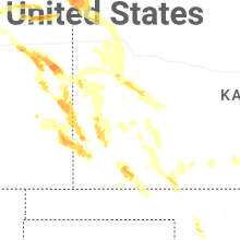
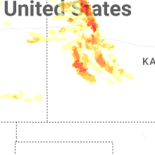
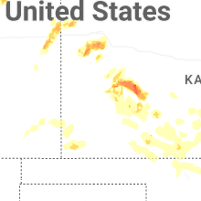
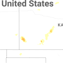
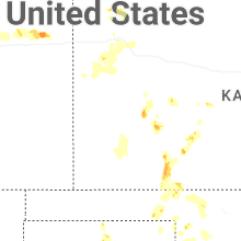
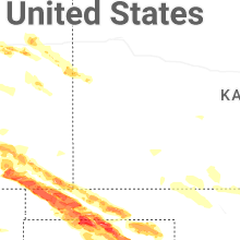


Connect with Interactive Hail Maps