

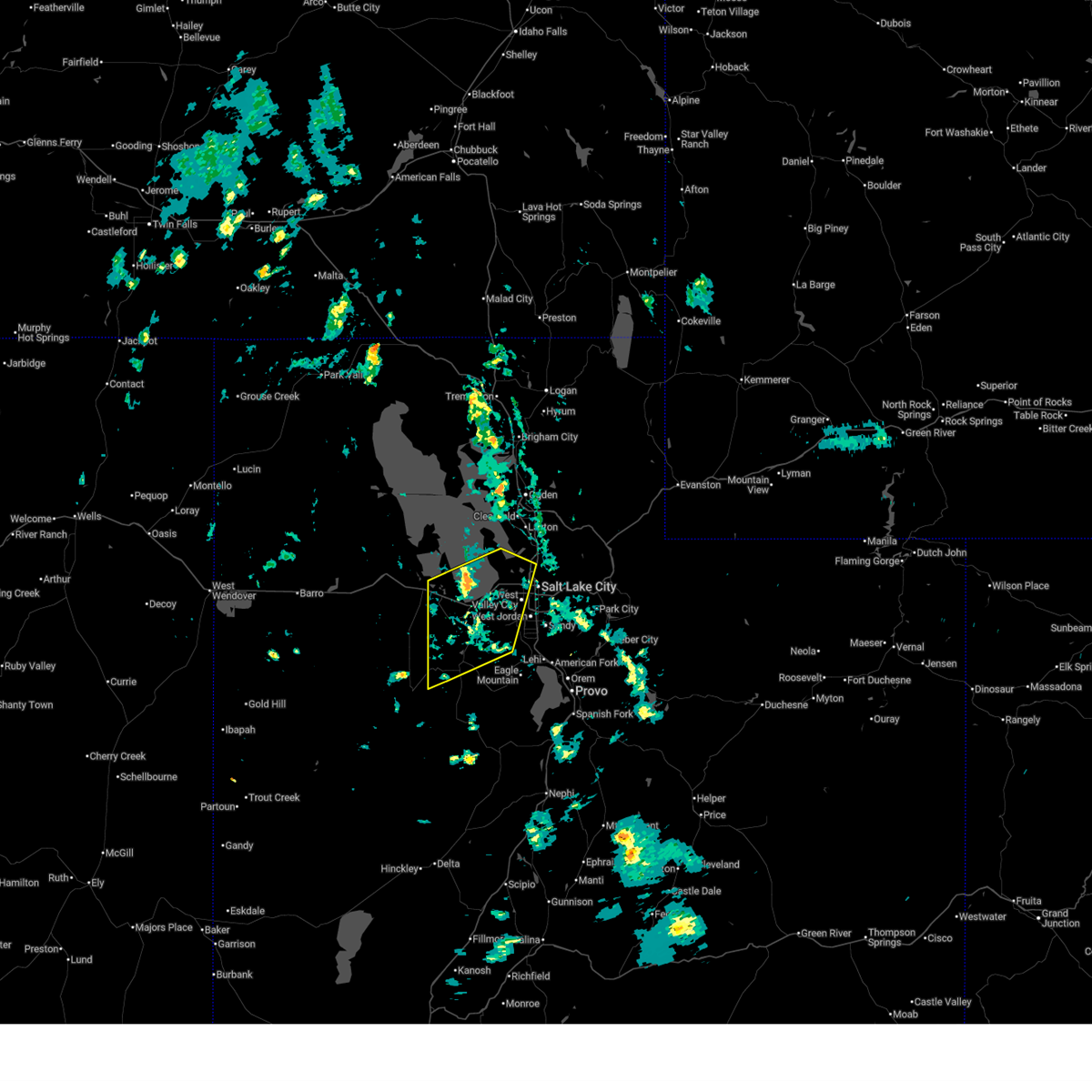
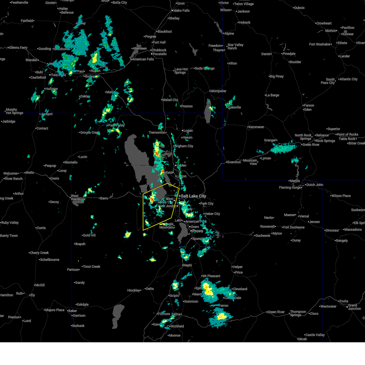
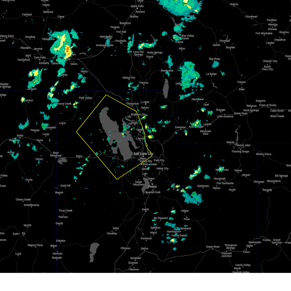
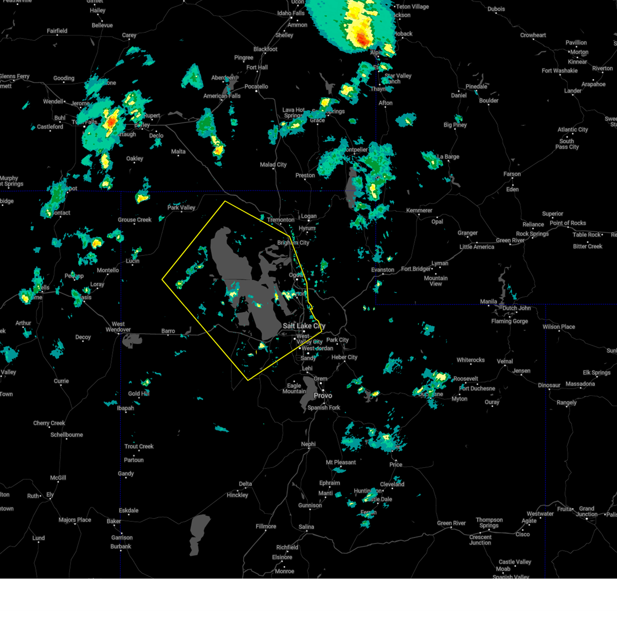
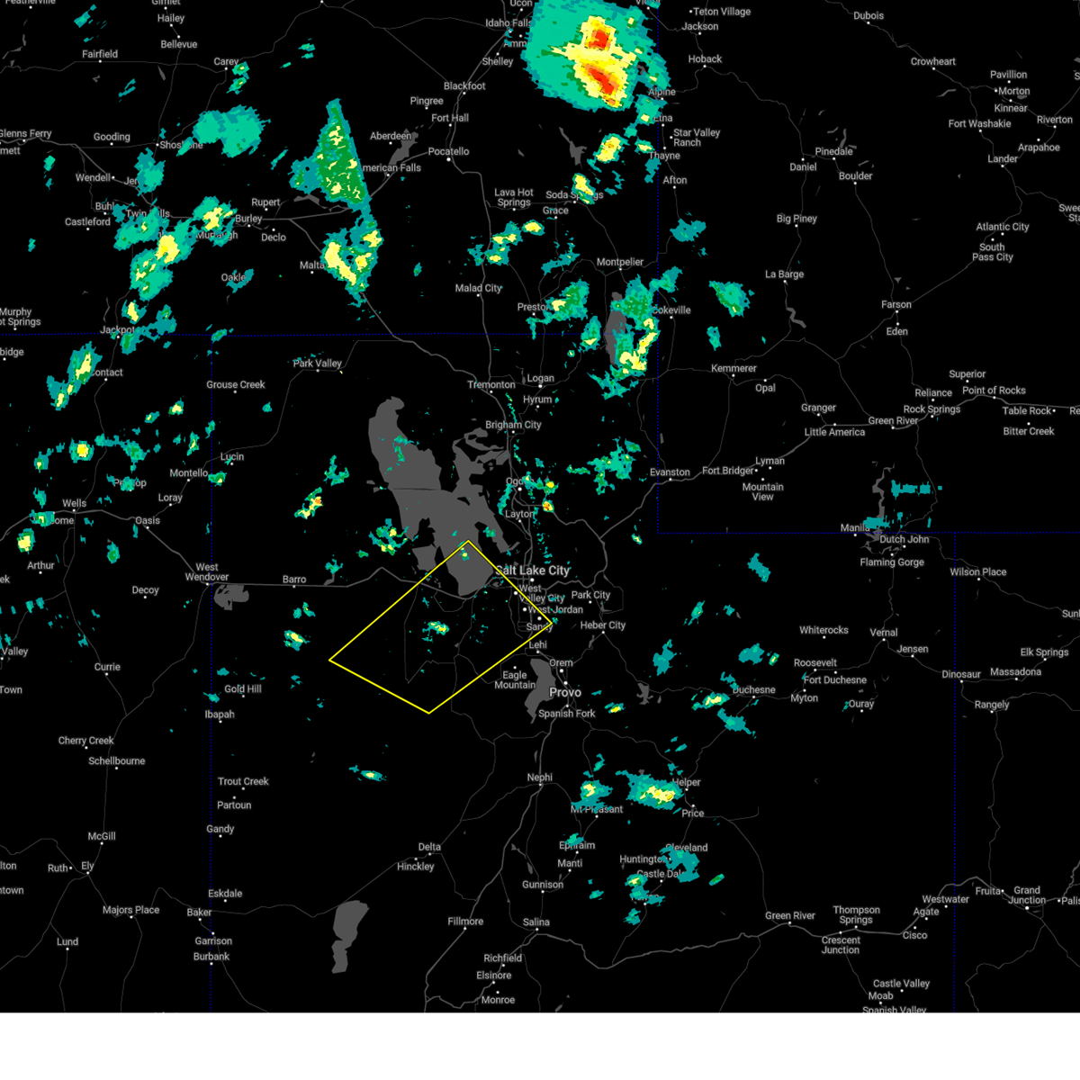
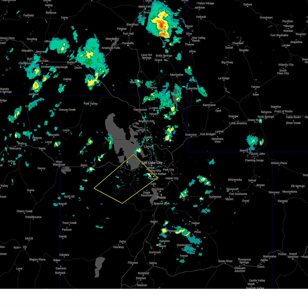
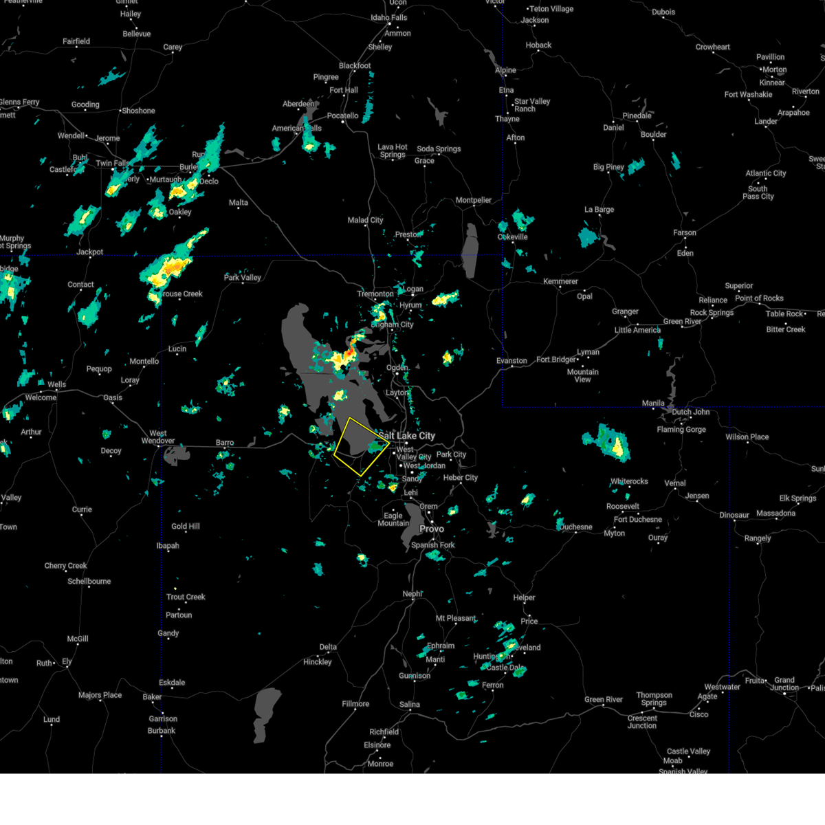
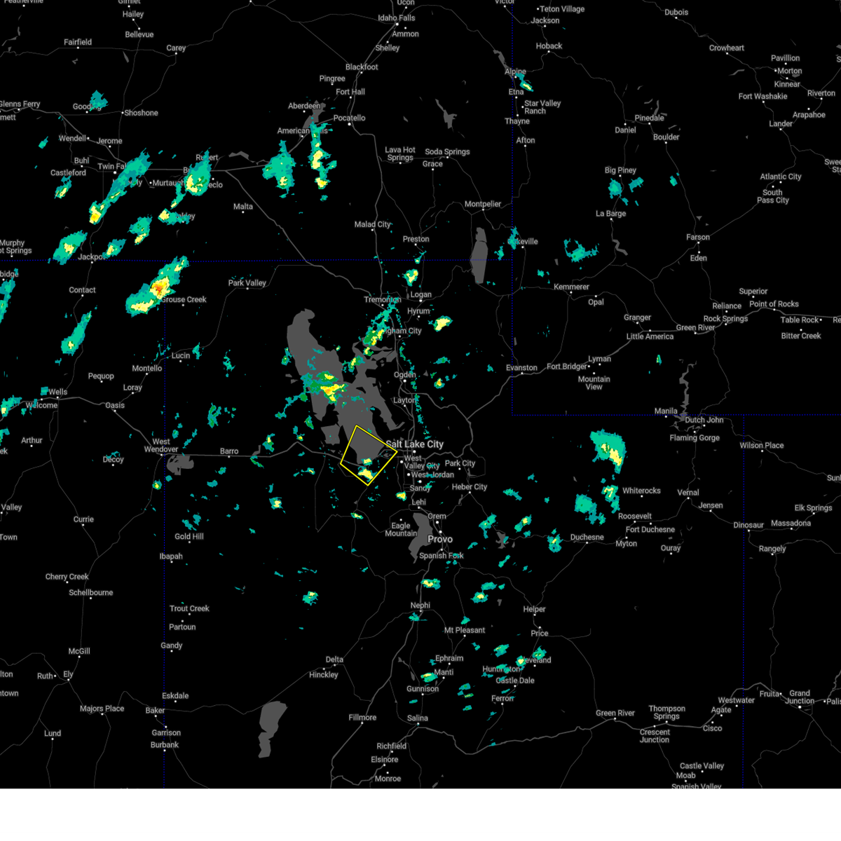
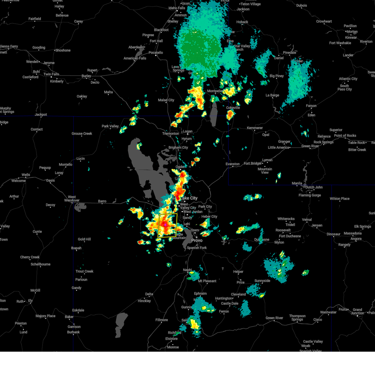
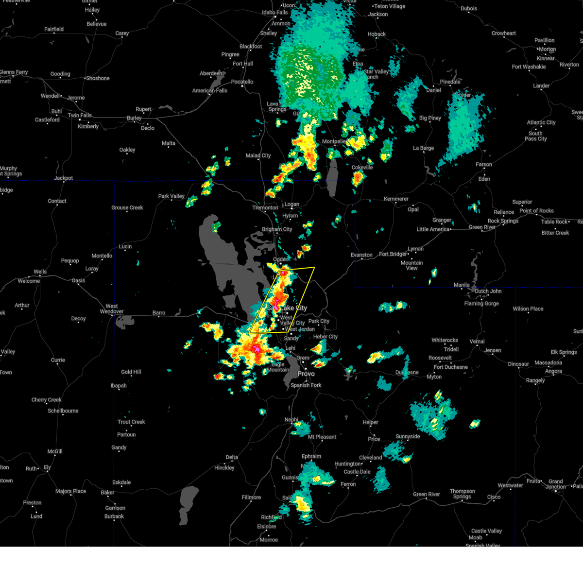
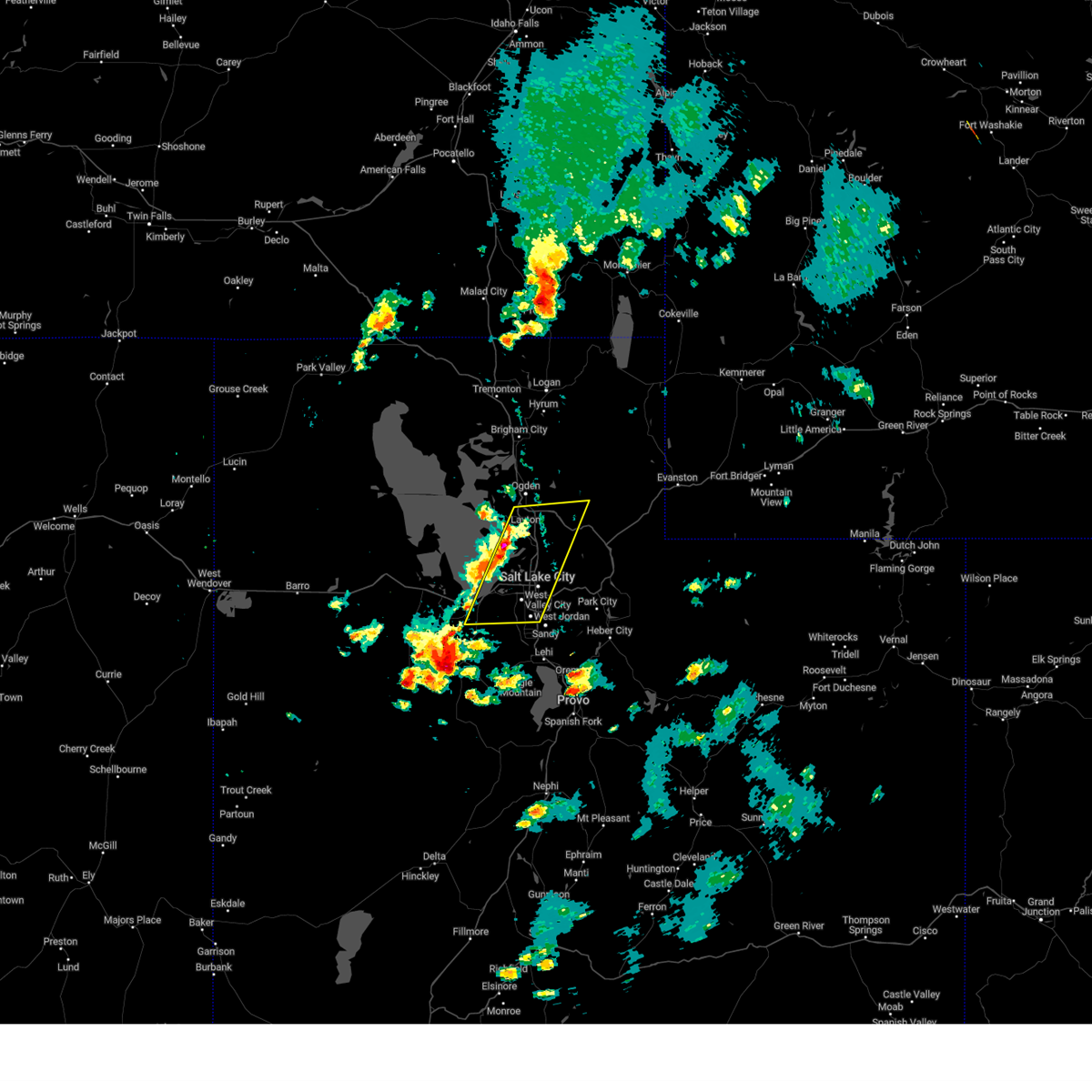
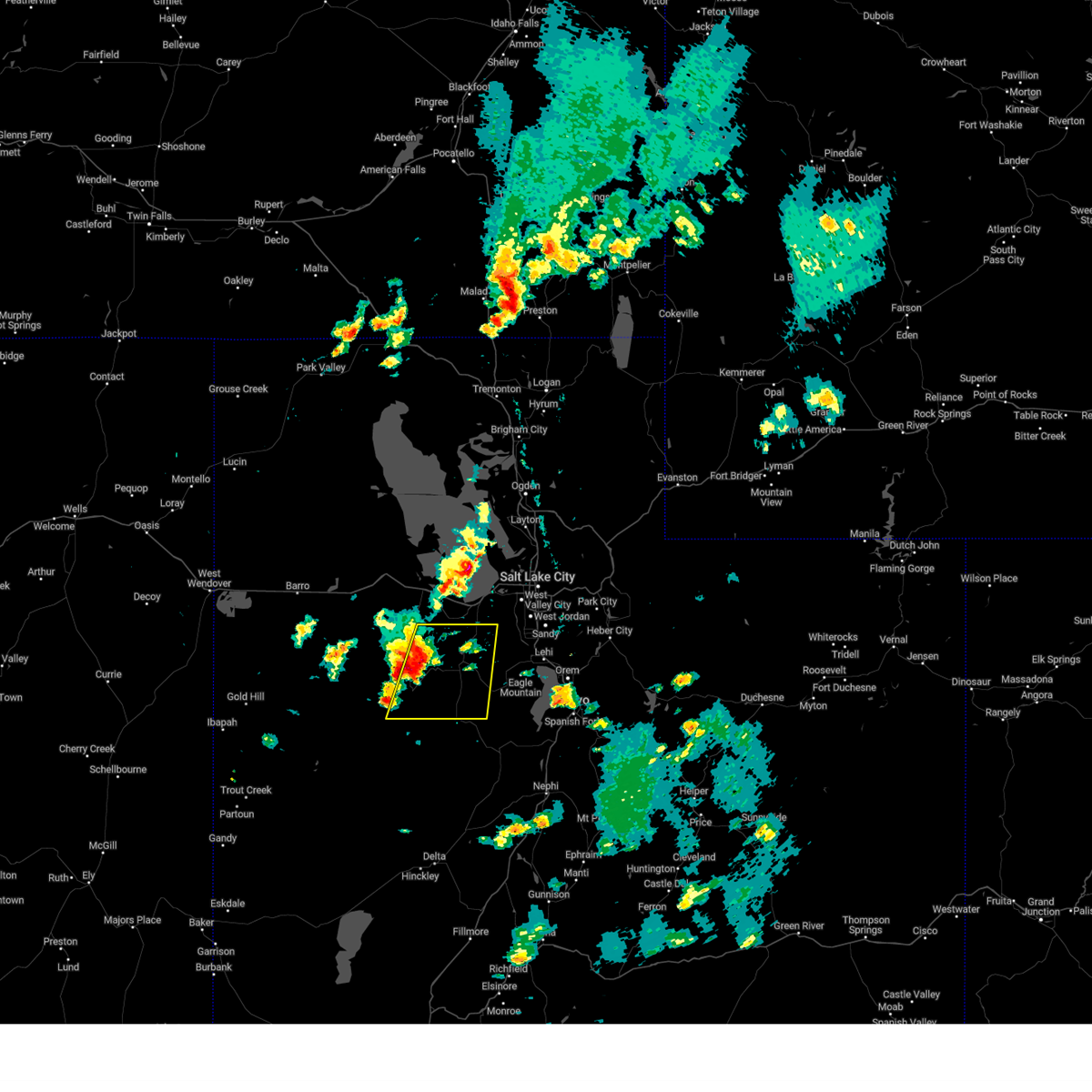
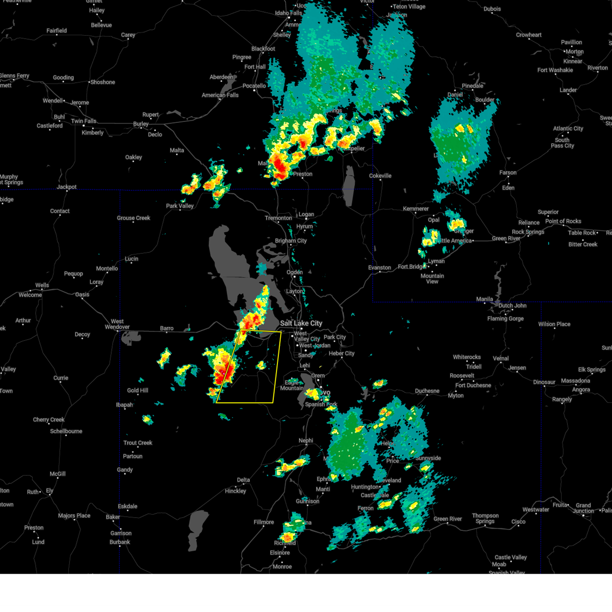
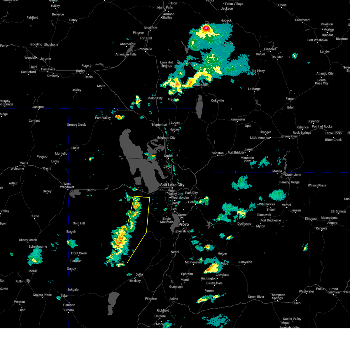
Hail Map for Erda, UT
The Erda, UT area has had 0 reports of on-the-ground hail by trained spotters, and has been under severe weather warnings 2 times during the past 12 months. Doppler radar has detected hail at or near Erda, UT on 16 occasions.
| Name: | Erda, UT |
| Where Located: | 24.5 miles WSW of Salt Lake City, UT |
| Map: | Google Map for Erda, UT |
| Population: | 4642 |
| Housing Units: | 1306 |
| More Info: | Search Google for Erda, UT |
1
The Top Recent Hail Date for Erda, UT is Monday, August 12, 2024 (5th out of 16)

Hail and Wind Damage Spotted near Erda, UT
| Date / Time | Report Details |
|---|---|
| 5/13/2026 3:30 PM MDT |
 The storm which prompted the warning has moved out of the area. therefore, the warning has been allowed to expire. a severe thunderstorm watch remains in effect until 800 pm mdt for northern utah. remember, a severe thunderstorm warning still remains in effect for portions of salt lake and davis counties. The storm which prompted the warning has moved out of the area. therefore, the warning has been allowed to expire. a severe thunderstorm watch remains in effect until 800 pm mdt for northern utah. remember, a severe thunderstorm warning still remains in effect for portions of salt lake and davis counties.
|
| 5/13/2026 3:11 PM MDT |
 Svrslc the national weather service in salt lake city has issued a * severe thunderstorm warning for, western salt lake county in northern utah, southern davis county in northern utah, western utah county in northern utah, east central tooele county in northern utah, * until 330 pm mdt. * at 311 pm mdt, elevated thunderstorms with a history of producing gusty and erratic outflow winds were located near stansbury park, moving northeast at 25 mph (radar indicated). Hazards include 60 mph wind gusts. expect damage to roofs, siding, and trees Svrslc the national weather service in salt lake city has issued a * severe thunderstorm warning for, western salt lake county in northern utah, southern davis county in northern utah, western utah county in northern utah, east central tooele county in northern utah, * until 330 pm mdt. * at 311 pm mdt, elevated thunderstorms with a history of producing gusty and erratic outflow winds were located near stansbury park, moving northeast at 25 mph (radar indicated). Hazards include 60 mph wind gusts. expect damage to roofs, siding, and trees
|
| 5/11/2025 3:45 PM MDT |
 At 344 pm mdt, severe thunderstorms were located along a line extending from 9 miles south of snowville to near east canyon state park, moving east at 45 mph (radar indicated). Hazards include 70 mph wind gusts. Expect considerable tree damage. damage is likely to mobile homes, roofs, and outbuildings. Locations impacted include, salt lake city, west valley city, ogden, layton, murray, bountiful, tooele, farmington, brigham city, grantsville, hill air force base, west jordan, taylorsville, roy, clearfield, kaysville, syracuse, south salt lake, clinton, and north ogden. At 344 pm mdt, severe thunderstorms were located along a line extending from 9 miles south of snowville to near east canyon state park, moving east at 45 mph (radar indicated). Hazards include 70 mph wind gusts. Expect considerable tree damage. damage is likely to mobile homes, roofs, and outbuildings. Locations impacted include, salt lake city, west valley city, ogden, layton, murray, bountiful, tooele, farmington, brigham city, grantsville, hill air force base, west jordan, taylorsville, roy, clearfield, kaysville, syracuse, south salt lake, clinton, and north ogden.
|
| 5/11/2025 3:14 PM MDT |
 Svrslc the national weather service in salt lake city has issued a * severe thunderstorm warning for, western weber county in northern utah, central box elder county in northern utah, northern salt lake county in northern utah, davis county in northern utah, west central morgan county in northern utah, northeastern tooele county in northern utah, * until 400 pm mdt. * at 311 pm mdt, severe thunderstorms were located along a line extending from 20 miles northwest of great salt lake north of the causeway to salt lake valley, moving northeast at 40 mph. widespread gusts in excess of 60 mph have been observed, including isolated gusts up to 75 mph (radar indicated). Hazards include 70 mph wind gusts. Expect considerable tree damage. Damage is likely to mobile homes, roofs, and outbuildings. Svrslc the national weather service in salt lake city has issued a * severe thunderstorm warning for, western weber county in northern utah, central box elder county in northern utah, northern salt lake county in northern utah, davis county in northern utah, west central morgan county in northern utah, northeastern tooele county in northern utah, * until 400 pm mdt. * at 311 pm mdt, severe thunderstorms were located along a line extending from 20 miles northwest of great salt lake north of the causeway to salt lake valley, moving northeast at 40 mph. widespread gusts in excess of 60 mph have been observed, including isolated gusts up to 75 mph (radar indicated). Hazards include 70 mph wind gusts. Expect considerable tree damage. Damage is likely to mobile homes, roofs, and outbuildings.
|
| 5/11/2025 3:04 PM MDT |
 At 304 pm mdt, a severe thunderstorm was located 7 miles southwest of syracuse, or 11 miles southwest of layton, moving northeast at 45 mph (radar indicated). Hazards include 60 mph wind gusts. Expect damage to roofs, siding, and trees. Locations impacted include, salt lake city, west valley city, sandy, murray, tooele, grantsville, dugway english village, west jordan, taylorsville, south jordan, draper, riverton, midvale, herriman, stansbury park, bluffdale, ophir, camp williams, kearns, and tooele army depot. At 304 pm mdt, a severe thunderstorm was located 7 miles southwest of syracuse, or 11 miles southwest of layton, moving northeast at 45 mph (radar indicated). Hazards include 60 mph wind gusts. Expect damage to roofs, siding, and trees. Locations impacted include, salt lake city, west valley city, sandy, murray, tooele, grantsville, dugway english village, west jordan, taylorsville, south jordan, draper, riverton, midvale, herriman, stansbury park, bluffdale, ophir, camp williams, kearns, and tooele army depot.
|
| 5/11/2025 2:38 PM MDT |
 Svrslc the national weather service in salt lake city has issued a * severe thunderstorm warning for, southwestern salt lake county in northern utah, southwestern davis county in northern utah, western utah county in northern utah, southeastern tooele county in northern utah, * until 315 pm mdt. * at 237 pm mdt, a severe thunderstorm was located 11 miles northwest of stansbury park, or 13 miles north of grantsville, moving northeast at 45 mph (radar indicated). Hazards include 60 mph wind gusts. expect damage to roofs, siding, and trees Svrslc the national weather service in salt lake city has issued a * severe thunderstorm warning for, southwestern salt lake county in northern utah, southwestern davis county in northern utah, western utah county in northern utah, southeastern tooele county in northern utah, * until 315 pm mdt. * at 237 pm mdt, a severe thunderstorm was located 11 miles northwest of stansbury park, or 13 miles north of grantsville, moving northeast at 45 mph (radar indicated). Hazards include 60 mph wind gusts. expect damage to roofs, siding, and trees
|
| 5/11/2025 1:28 PM MDT |
 The storm which prompted the warning has moved out of the area. therefore, the warning will be allowed to expire. however gusty winds are still possible with this thunderstorm. a severe thunderstorm watch remains in effect until 800 pm mdt for northern utah. remember, a severe thunderstorm warning still remains in effect for salt lake and davis counties. The storm which prompted the warning has moved out of the area. therefore, the warning will be allowed to expire. however gusty winds are still possible with this thunderstorm. a severe thunderstorm watch remains in effect until 800 pm mdt for northern utah. remember, a severe thunderstorm warning still remains in effect for salt lake and davis counties.
|
| 5/11/2025 1:17 PM MDT |
 At 116 pm mdt, a severe thunderstorm was located 8 miles northwest of magna, or 12 miles northwest of west valley city, moving northeast at 40 mph. gusts to 65 and 63 mph have been reported (radar indicated). Hazards include 65 mph wind gusts. Expect damage to roofs, siding, and trees. Locations impacted include, salt lake city, tooele, stansbury park, magna, great salt lake south of the causeway, lake point, and erda. At 116 pm mdt, a severe thunderstorm was located 8 miles northwest of magna, or 12 miles northwest of west valley city, moving northeast at 40 mph. gusts to 65 and 63 mph have been reported (radar indicated). Hazards include 65 mph wind gusts. Expect damage to roofs, siding, and trees. Locations impacted include, salt lake city, tooele, stansbury park, magna, great salt lake south of the causeway, lake point, and erda.
|
| 5/11/2025 12:59 PM MDT |
 Svrslc the national weather service in salt lake city has issued a * severe thunderstorm warning for, west central salt lake county in northern utah, southwestern davis county in northern utah, east central tooele county in northern utah, * until 130 pm mdt. * at 1258 pm mdt, a severe thunderstorm was located near stansbury park, or near grantsville, moving northeast at 40 mph. gusts to 65 mph have been observed (radar indicated). Hazards include 65 mph wind gusts. expect damage to roofs, siding, and trees Svrslc the national weather service in salt lake city has issued a * severe thunderstorm warning for, west central salt lake county in northern utah, southwestern davis county in northern utah, east central tooele county in northern utah, * until 130 pm mdt. * at 1258 pm mdt, a severe thunderstorm was located near stansbury park, or near grantsville, moving northeast at 40 mph. gusts to 65 mph have been observed (radar indicated). Hazards include 65 mph wind gusts. expect damage to roofs, siding, and trees
|
| 8/13/2024 5:18 PM MDT |
 At 517 pm mdt, severe thunderstorms were located along a line extending from stansbury park to near ophir, moving northeast at 30 mph (radar indicated). Hazards include 60 mph wind gusts and quarter size hail. hail damage to vehicles is possible, as well as wind damage to roofs, siding, and trees locations impacted include, tooele, west jordan, south jordan, eagle mountain, cedar fort, ophir, bingham canyon mine, tooele army depot south, camp williams, tooele army depot, stockton, fairfield, copperton, and erda At 517 pm mdt, severe thunderstorms were located along a line extending from stansbury park to near ophir, moving northeast at 30 mph (radar indicated). Hazards include 60 mph wind gusts and quarter size hail. hail damage to vehicles is possible, as well as wind damage to roofs, siding, and trees locations impacted include, tooele, west jordan, south jordan, eagle mountain, cedar fort, ophir, bingham canyon mine, tooele army depot south, camp williams, tooele army depot, stockton, fairfield, copperton, and erda
|
| 8/13/2024 5:16 PM MDT |
 At 516 pm mdt, severe thunderstorms were located along a line extending from near kaysville to near bingham canyon mine, moving east at 25 mph (radar indicated). Hazards include 60 mph wind gusts and quarter size hail. Hail damage to vehicles is possible, as well as wind damage to roofs, siding, and trees locations impacted include, salt lake city, west valley city, sandy, layton, murray, bountiful, tooele, farmington, morgan, hill air force base, west jordan, taylorsville, south jordan, clearfield, midvale, kaysville, holladay, syracuse, south salt lake, and south ogden. this includes the following highways, interstate 15 between mile markers 296 and 335. interstate 84 between mile markers 84 and 106. Interstate 80 in utah between mile markers 96 and 127. At 516 pm mdt, severe thunderstorms were located along a line extending from near kaysville to near bingham canyon mine, moving east at 25 mph (radar indicated). Hazards include 60 mph wind gusts and quarter size hail. Hail damage to vehicles is possible, as well as wind damage to roofs, siding, and trees locations impacted include, salt lake city, west valley city, sandy, layton, murray, bountiful, tooele, farmington, morgan, hill air force base, west jordan, taylorsville, south jordan, clearfield, midvale, kaysville, holladay, syracuse, south salt lake, and south ogden. this includes the following highways, interstate 15 between mile markers 296 and 335. interstate 84 between mile markers 84 and 106. Interstate 80 in utah between mile markers 96 and 127.
|
| 8/13/2024 4:59 PM MDT |
 Svrslc the national weather service in salt lake city has issued a * severe thunderstorm warning for, south central weber county in northern utah, eastern davis county in northern utah, northwestern salt lake county in northern utah, southwestern morgan county in northern utah, northeastern tooele county in northern utah, * until 530 pm mdt. * at 457 pm mdt, severe thunderstorms were located along a line extending from near layton to stansbury park, moving east at 25 mph (radar indicated). Hazards include 60 mph wind gusts and quarter size hail. the best chance of quarter sized hail is from bountiful to kaysville. hail damage to vehicles is possible, as well as wind damage to roofs, siding, and trees Svrslc the national weather service in salt lake city has issued a * severe thunderstorm warning for, south central weber county in northern utah, eastern davis county in northern utah, northwestern salt lake county in northern utah, southwestern morgan county in northern utah, northeastern tooele county in northern utah, * until 530 pm mdt. * at 457 pm mdt, severe thunderstorms were located along a line extending from near layton to stansbury park, moving east at 25 mph (radar indicated). Hazards include 60 mph wind gusts and quarter size hail. the best chance of quarter sized hail is from bountiful to kaysville. hail damage to vehicles is possible, as well as wind damage to roofs, siding, and trees
|
| 8/13/2024 4:56 PM MDT |
 Svrslc the national weather service in salt lake city has issued a * severe thunderstorm warning for, southwestern salt lake county in northern utah, west central utah county in northern utah, east central tooele county in northern utah, * until 530 pm mdt. * at 455 pm mdt, severe thunderstorms were located along a line extending from near grantsville to 7 miles west of tooele army depot south, moving northeast at 30 mph (radar indicated). Hazards include 60 mph wind gusts and quarter size hail. hail damage to vehicles is possible, as well as wind damage to roofs, siding, and trees Svrslc the national weather service in salt lake city has issued a * severe thunderstorm warning for, southwestern salt lake county in northern utah, west central utah county in northern utah, east central tooele county in northern utah, * until 530 pm mdt. * at 455 pm mdt, severe thunderstorms were located along a line extending from near grantsville to 7 miles west of tooele army depot south, moving northeast at 30 mph (radar indicated). Hazards include 60 mph wind gusts and quarter size hail. hail damage to vehicles is possible, as well as wind damage to roofs, siding, and trees
|
| 8/13/2024 4:34 PM MDT |
 At 433 pm mdt, severe thunderstorms were located along a line extending from 8 miles north of grantsville to 6 miles southeast of dugway english village, moving east at 35 mph (radar indicated). Hazards include 60 mph wind gusts and quarter size hail. Hail damage to vehicles is expected. expect wind damage to roofs, siding, and trees. Locations impacted include, tooele, grantsville, dugway english village, vernon, ophir, tooele army depot, tooele army depot south, skull valley, bingham canyon mine, stockton, rush valley, faust, and erda. At 433 pm mdt, severe thunderstorms were located along a line extending from 8 miles north of grantsville to 6 miles southeast of dugway english village, moving east at 35 mph (radar indicated). Hazards include 60 mph wind gusts and quarter size hail. Hail damage to vehicles is expected. expect wind damage to roofs, siding, and trees. Locations impacted include, tooele, grantsville, dugway english village, vernon, ophir, tooele army depot, tooele army depot south, skull valley, bingham canyon mine, stockton, rush valley, faust, and erda.
|
| 8/13/2024 4:25 PM MDT |
 Svrslc the national weather service in salt lake city has issued a * severe thunderstorm warning for, west central salt lake county in northern utah, western utah county in northern utah, southeastern tooele county in northern utah, * until 500 pm mdt. * at 425 pm mdt, severe thunderstorms were located along a line extending from 9 miles north of grantsville to near dugway english village, moving east at 25 mph (radar indicated). Hazards include 60 mph wind gusts and quarter size hail. Hail damage to vehicles is expected. Expect wind damage to roofs, siding, and trees. Svrslc the national weather service in salt lake city has issued a * severe thunderstorm warning for, west central salt lake county in northern utah, western utah county in northern utah, southeastern tooele county in northern utah, * until 500 pm mdt. * at 425 pm mdt, severe thunderstorms were located along a line extending from 9 miles north of grantsville to near dugway english village, moving east at 25 mph (radar indicated). Hazards include 60 mph wind gusts and quarter size hail. Hail damage to vehicles is expected. Expect wind damage to roofs, siding, and trees.
|
| 8/13/2024 4:22 PM MDT |
 Svrslc the national weather service in salt lake city has issued a * severe thunderstorm warning for, southwestern weber county in northern utah, southeastern box elder county in northern utah, davis county in northern utah, northwestern salt lake county in northern utah, northwestern morgan county in northern utah, northeastern tooele county in northern utah, * until 500 pm mdt. * at 421 pm mdt, severe thunderstorms were located along a line extending from near great salt lake south of the causeway to 9 miles west of grantsville, moving east at 25 mph (radar indicated). Hazards include 60 mph wind gusts and quarter size hail. the best chance of quarter sized hail is currently near the southern end of the great salt lake. hail damage to vehicles is possible, as well as wind damage to roofs, siding, and trees Svrslc the national weather service in salt lake city has issued a * severe thunderstorm warning for, southwestern weber county in northern utah, southeastern box elder county in northern utah, davis county in northern utah, northwestern salt lake county in northern utah, northwestern morgan county in northern utah, northeastern tooele county in northern utah, * until 500 pm mdt. * at 421 pm mdt, severe thunderstorms were located along a line extending from near great salt lake south of the causeway to 9 miles west of grantsville, moving east at 25 mph (radar indicated). Hazards include 60 mph wind gusts and quarter size hail. the best chance of quarter sized hail is currently near the southern end of the great salt lake. hail damage to vehicles is possible, as well as wind damage to roofs, siding, and trees
|
| 8/12/2024 2:47 PM MDT |
 the severe thunderstorm warning has been cancelled and is no longer in effect the severe thunderstorm warning has been cancelled and is no longer in effect
|
| 8/12/2024 2:30 PM MDT |
 Svrslc the national weather service in salt lake city has issued a * severe thunderstorm warning for, east central tooele county in northern utah, * until 300 pm mdt. * at 230 pm mdt, a severe thunderstorm was located near skull valley, or 12 miles southwest of grantsville, moving northeast at 40 mph (radar indicated). Hazards include 60 mph wind gusts and quarter size hail. Hail damage to vehicles is expected. Expect wind damage to roofs, siding, and trees. Svrslc the national weather service in salt lake city has issued a * severe thunderstorm warning for, east central tooele county in northern utah, * until 300 pm mdt. * at 230 pm mdt, a severe thunderstorm was located near skull valley, or 12 miles southwest of grantsville, moving northeast at 40 mph (radar indicated). Hazards include 60 mph wind gusts and quarter size hail. Hail damage to vehicles is expected. Expect wind damage to roofs, siding, and trees.
|
| 8/10/2024 4:20 PM MDT |
 At 419 pm mdt, severe thunderstorms were located along a line extending from near grantsville to 10 miles south of dugway english village to 25 miles southeast of fish springs wildlife refuge, moving east at 30 mph (radar indicated. at 410pm, two gusts to 59 mph were reported near dugway proving ground). Hazards include 60 mph wind gusts. Expect damage to roofs, siding, and trees. Locations impacted include, grantsville, dugway english village, vernon, tooele army depot, skull valley, tooele army depot south, rush valley, and erda. At 419 pm mdt, severe thunderstorms were located along a line extending from near grantsville to 10 miles south of dugway english village to 25 miles southeast of fish springs wildlife refuge, moving east at 30 mph (radar indicated. at 410pm, two gusts to 59 mph were reported near dugway proving ground). Hazards include 60 mph wind gusts. Expect damage to roofs, siding, and trees. Locations impacted include, grantsville, dugway english village, vernon, tooele army depot, skull valley, tooele army depot south, rush valley, and erda.
|
| 8/10/2024 4:07 PM MDT |
 Svrslc the national weather service in salt lake city has issued a * severe thunderstorm warning for, central juab county in central utah, southeastern tooele county in northern utah, * until 430 pm mdt. * at 405 pm mdt, severe thunderstorms were located along a line extending from 9 miles west of grantsville to 11 miles south of dugway english village to 24 miles south of fish springs wildlife refuge, moving east at 30 mph. gusts in excess of 60 mph have been reported (radar indicated). Hazards include 60 mph wind gusts. expect damage to roofs, siding, and trees Svrslc the national weather service in salt lake city has issued a * severe thunderstorm warning for, central juab county in central utah, southeastern tooele county in northern utah, * until 430 pm mdt. * at 405 pm mdt, severe thunderstorms were located along a line extending from 9 miles west of grantsville to 11 miles south of dugway english village to 24 miles south of fish springs wildlife refuge, moving east at 30 mph. gusts in excess of 60 mph have been reported (radar indicated). Hazards include 60 mph wind gusts. expect damage to roofs, siding, and trees
|
| 8/17/2023 5:15 PM MDT |
 At 515 pm mdt, a severe thunderstorm was located over stansbury park, or 8 miles northeast of grantsville, moving northeast at 20 mph (radar indicated). Hazards include 60 mph wind gusts and penny size hail. expect damage to roofs, siding, and trees At 515 pm mdt, a severe thunderstorm was located over stansbury park, or 8 miles northeast of grantsville, moving northeast at 20 mph (radar indicated). Hazards include 60 mph wind gusts and penny size hail. expect damage to roofs, siding, and trees
|
| 8/2/2023 3:32 PM MDT |
 At 331 pm mdt, severe thunderstorms were located along a line extending from tooele to little cottonwood canyon to near daniel, moving northeast at 40 mph (radar indicated. at 320 pm a wind gust to 61 mph was observed in charleston near deer creek reservoir). Hazards include 60 mph wind gusts and penny size hail. Expect damage to roofs, siding, and trees. locations impacted include, salt lake city, west valley city, provo, sandy, murray, tooele, grantsville, park city, heber city, west jordan, orem, taylorsville, south jordan, lehi, draper, riverton, pleasant grove, cottonwood heights, midvale and holladay. this includes the following highways, interstate 15 between mile markers 273 and 309. interstate 80 in utah between mile markers 85 and 152. us route 40 between mile markers 0 and 25. hail threat, radar indicated max hail size, 0. 75 in wind threat, observed max wind gust, 60 mph. At 331 pm mdt, severe thunderstorms were located along a line extending from tooele to little cottonwood canyon to near daniel, moving northeast at 40 mph (radar indicated. at 320 pm a wind gust to 61 mph was observed in charleston near deer creek reservoir). Hazards include 60 mph wind gusts and penny size hail. Expect damage to roofs, siding, and trees. locations impacted include, salt lake city, west valley city, provo, sandy, murray, tooele, grantsville, park city, heber city, west jordan, orem, taylorsville, south jordan, lehi, draper, riverton, pleasant grove, cottonwood heights, midvale and holladay. this includes the following highways, interstate 15 between mile markers 273 and 309. interstate 80 in utah between mile markers 85 and 152. us route 40 between mile markers 0 and 25. hail threat, radar indicated max hail size, 0. 75 in wind threat, observed max wind gust, 60 mph.
|
| 8/2/2023 3:13 PM MDT |
 At 313 pm mdt, severe thunderstorms were located along a line extending from near tooele army depot south to 6 miles northeast of lindon, moving north at 40 mph (radar indicated). Hazards include 70 mph wind gusts and penny size hail. Expect considerable tree damage. damage is likely to mobile homes, roofs, and outbuildings. locations impacted include, salt lake city, west valley city, provo, sandy, murray, tooele, grantsville, park city, heber city, west jordan, orem, taylorsville, south jordan, lehi, draper, riverton, pleasant grove, cottonwood heights, midvale and holladay. this includes the following highways, interstate 15 between mile markers 263 and 309. interstate 80 in utah between mile markers 85 and 152. us route 40 between mile markers 0 and 25. mirror lake highway near mile marker 0. thunderstorm damage threat, considerable hail threat, radar indicated max hail size, 0. 75 in wind threat, observed max wind gust, 70 mph. At 313 pm mdt, severe thunderstorms were located along a line extending from near tooele army depot south to 6 miles northeast of lindon, moving north at 40 mph (radar indicated). Hazards include 70 mph wind gusts and penny size hail. Expect considerable tree damage. damage is likely to mobile homes, roofs, and outbuildings. locations impacted include, salt lake city, west valley city, provo, sandy, murray, tooele, grantsville, park city, heber city, west jordan, orem, taylorsville, south jordan, lehi, draper, riverton, pleasant grove, cottonwood heights, midvale and holladay. this includes the following highways, interstate 15 between mile markers 263 and 309. interstate 80 in utah between mile markers 85 and 152. us route 40 between mile markers 0 and 25. mirror lake highway near mile marker 0. thunderstorm damage threat, considerable hail threat, radar indicated max hail size, 0. 75 in wind threat, observed max wind gust, 70 mph.
|
| 8/2/2023 3:01 PM MDT |
 At 301 pm mdt, severe thunderstorms were located along a line extending from near tooele army depot south to near orem, moving north at 40 mph (radar indicated). Hazards include 70 mph wind gusts and penny size hail. Expect considerable tree damage. Damage is likely to mobile homes, roofs, and outbuildings. At 301 pm mdt, severe thunderstorms were located along a line extending from near tooele army depot south to near orem, moving north at 40 mph (radar indicated). Hazards include 70 mph wind gusts and penny size hail. Expect considerable tree damage. Damage is likely to mobile homes, roofs, and outbuildings.
|
| 7/26/2023 8:39 PM MDT | Top of campground stage ripped off by win in tooele county UT, 4.6 miles NE of Erda, UT |
| 7/19/2023 6:26 PM MDT |
 The severe thunderstorm warning for eastern tooele county will expire at 630 pm mdt, the storms which prompted the warning have weakened below severe limits, and have exited the warned area. therefore, the warning will be allowed to expire. however small hail, gusty winds and heavy rain are still possible with these thunderstorms. The severe thunderstorm warning for eastern tooele county will expire at 630 pm mdt, the storms which prompted the warning have weakened below severe limits, and have exited the warned area. therefore, the warning will be allowed to expire. however small hail, gusty winds and heavy rain are still possible with these thunderstorms.
|
| 7/19/2023 6:04 PM MDT |
 At 603 pm mdt, severe thunderstorms were located along a line extending from delle to 9 miles east of vernon, moving east at 25 mph (radar indicated). Hazards include 60 mph wind gusts and quarter size hail. Hail damage to vehicles is expected. expect wind damage to roofs, siding, and trees. locations impacted include, tooele, grantsville, dugway english village, vernon, ophir, delle, tooele army depot, clive, skull valley, knolls, tooele army depot south, stockton, rush valley and faust. this includes interstate 80 in utah between mile markers 41 and 84. hail threat, radar indicated max hail size, 1. 00 in wind threat, observed max wind gust, 60 mph. At 603 pm mdt, severe thunderstorms were located along a line extending from delle to 9 miles east of vernon, moving east at 25 mph (radar indicated). Hazards include 60 mph wind gusts and quarter size hail. Hail damage to vehicles is expected. expect wind damage to roofs, siding, and trees. locations impacted include, tooele, grantsville, dugway english village, vernon, ophir, delle, tooele army depot, clive, skull valley, knolls, tooele army depot south, stockton, rush valley and faust. this includes interstate 80 in utah between mile markers 41 and 84. hail threat, radar indicated max hail size, 1. 00 in wind threat, observed max wind gust, 60 mph.
|
| 7/19/2023 5:57 PM MDT |
 The severe thunderstorm warning for western salt lake and eastern tooele counties will expire at 600 pm mdt, the storm which prompted the warning has weakened below severe limits, and has exited the warned area. therefore, the warning will be allowed to expire. however small hail, gusty winds and heavy rain are still possible with this thunderstorm. The severe thunderstorm warning for western salt lake and eastern tooele counties will expire at 600 pm mdt, the storm which prompted the warning has weakened below severe limits, and has exited the warned area. therefore, the warning will be allowed to expire. however small hail, gusty winds and heavy rain are still possible with this thunderstorm.
|
| 7/19/2023 5:47 PM MDT |
 At 545 pm mdt, a severe thunderstorm was located near stansbury park, or 7 miles northeast of tooele, moving northeast at 15 mph (trained weather spotters). Hazards include 60 mph wind gusts and half dollar size hail. Hail damage to vehicles is expected. expect wind damage to roofs, siding, and trees. locations impacted include, tooele, stansbury park, lake point and erda. this includes interstate 80 in utah between mile markers 97 and 98. hail threat, observed max hail size, 1. 25 in wind threat, observed max wind gust, 60 mph. At 545 pm mdt, a severe thunderstorm was located near stansbury park, or 7 miles northeast of tooele, moving northeast at 15 mph (trained weather spotters). Hazards include 60 mph wind gusts and half dollar size hail. Hail damage to vehicles is expected. expect wind damage to roofs, siding, and trees. locations impacted include, tooele, stansbury park, lake point and erda. this includes interstate 80 in utah between mile markers 97 and 98. hail threat, observed max hail size, 1. 25 in wind threat, observed max wind gust, 60 mph.
|
| 7/19/2023 5:36 PM MDT |
 At 535 pm mdt, severe thunderstorms were located along a line extending from near clive to near vernon, moving east at 25 mph (radar indicated. wind gusts up to 69 mph have been observed). Hazards include 70 mph wind gusts and quarter size hail. Hail damage to vehicles is expected. expect considerable tree damage. Wind damage is also likely to mobile homes, roofs, and outbuildings. At 535 pm mdt, severe thunderstorms were located along a line extending from near clive to near vernon, moving east at 25 mph (radar indicated. wind gusts up to 69 mph have been observed). Hazards include 70 mph wind gusts and quarter size hail. Hail damage to vehicles is expected. expect considerable tree damage. Wind damage is also likely to mobile homes, roofs, and outbuildings.
|
| 7/19/2023 5:26 PM MDT |
 At 526 pm mdt, a severe thunderstorm was located over tooele, moving northeast at 20 mph (radar indicated). Hazards include 60 mph wind gusts and half dollar size hail. Hail damage to vehicles is expected. Expect wind damage to roofs, siding, and trees. At 526 pm mdt, a severe thunderstorm was located over tooele, moving northeast at 20 mph (radar indicated). Hazards include 60 mph wind gusts and half dollar size hail. Hail damage to vehicles is expected. Expect wind damage to roofs, siding, and trees.
|
| 4/18/2023 11:41 AM MDT | At 1140 am mdt, a severe thunderstorm was located near salt lake city international airport, or near west valley city, moving northeast at 40 mph (public). Hazards include quarter size hail. damage to vehicles is expected |
| 9/21/2022 2:48 PM MDT |
 At 248 pm mdt, a severe thunderstorm was located near bingham canyon mine, or near tooele, moving north at 50 mph (radar indicated). Hazards include 60 mph wind gusts and quarter size hail. Hail damage to vehicles is expected. expect wind damage to roofs, siding, and trees. locations impacted include, salt lake city, west valley city, tooele, west jordan, south jordan, herriman, north salt lake, stansbury park, kearns, salt lake city international airport, magna, bingham canyon mine, oquirrh, copperton, lake point, erda and antelope island state park. this includes interstate 80 in utah between mile markers 96 and 116. hail threat, radar indicated max hail size, 1. 00 in wind threat, radar indicated max wind gust, 60 mph. At 248 pm mdt, a severe thunderstorm was located near bingham canyon mine, or near tooele, moving north at 50 mph (radar indicated). Hazards include 60 mph wind gusts and quarter size hail. Hail damage to vehicles is expected. expect wind damage to roofs, siding, and trees. locations impacted include, salt lake city, west valley city, tooele, west jordan, south jordan, herriman, north salt lake, stansbury park, kearns, salt lake city international airport, magna, bingham canyon mine, oquirrh, copperton, lake point, erda and antelope island state park. this includes interstate 80 in utah between mile markers 96 and 116. hail threat, radar indicated max hail size, 1. 00 in wind threat, radar indicated max wind gust, 60 mph.
|
| 9/21/2022 2:32 PM MDT |
 At 232 pm mdt, a severe thunderstorm was located over ophir, or 13 miles southeast of tooele, moving north at 50 mph (radar indicated). Hazards include 60 mph wind gusts and quarter size hail. Hail damage to vehicles is expected. Expect wind damage to roofs, siding, and trees. At 232 pm mdt, a severe thunderstorm was located over ophir, or 13 miles southeast of tooele, moving north at 50 mph (radar indicated). Hazards include 60 mph wind gusts and quarter size hail. Hail damage to vehicles is expected. Expect wind damage to roofs, siding, and trees.
|
| 7/22/2022 5:26 PM MDT |
 At 525 pm mdt, severe thunderstorms were located along a line extending from 8 miles southeast of great salt lake south of the causeway to near cedar fort, moving east at 30 mph (radar indicated). Hazards include 60 mph wind gusts. expect damage to roofs, siding, and trees At 525 pm mdt, severe thunderstorms were located along a line extending from 8 miles southeast of great salt lake south of the causeway to near cedar fort, moving east at 30 mph (radar indicated). Hazards include 60 mph wind gusts. expect damage to roofs, siding, and trees
|
| 7/22/2022 5:11 PM MDT |
 At 511 pm mdt, severe thunderstorms were located along a line extending from 6 miles east of delle to near stansbury park to 10 miles southeast of tooele army depot south, moving east at 35 mph (radar indicated). Hazards include 60 mph wind gusts. Expect damage to roofs, siding, and trees. locations impacted include, salt lake city, west valley city, sandy, murray, tooele, grantsville, west jordan, taylorsville, south jordan, lehi, draper, riverton, midvale, south salt lake, herriman, eagle mountain, north salt lake, stansbury park, bluffdale and cedar fort. this includes the following highways, interstate 15 between mile markers 280 and 301. interstate 80 in utah between mile markers 64 and 118. hail threat, radar indicated max hail size, <. 75 in wind threat, observed max wind gust, 60 mph. At 511 pm mdt, severe thunderstorms were located along a line extending from 6 miles east of delle to near stansbury park to 10 miles southeast of tooele army depot south, moving east at 35 mph (radar indicated). Hazards include 60 mph wind gusts. Expect damage to roofs, siding, and trees. locations impacted include, salt lake city, west valley city, sandy, murray, tooele, grantsville, west jordan, taylorsville, south jordan, lehi, draper, riverton, midvale, south salt lake, herriman, eagle mountain, north salt lake, stansbury park, bluffdale and cedar fort. this includes the following highways, interstate 15 between mile markers 280 and 301. interstate 80 in utah between mile markers 64 and 118. hail threat, radar indicated max hail size, <. 75 in wind threat, observed max wind gust, 60 mph.
|
| 7/22/2022 4:45 PM MDT |
 At 444 pm mdt, severe thunderstorms were located along a line extending from 7 miles west of delle to 7 miles west of grantsville to near vernon, moving east at 35 mph (radar indicated). Hazards include 60 mph wind gusts. expect damage to roofs, siding, and trees At 444 pm mdt, severe thunderstorms were located along a line extending from 7 miles west of delle to 7 miles west of grantsville to near vernon, moving east at 35 mph (radar indicated). Hazards include 60 mph wind gusts. expect damage to roofs, siding, and trees
|
| 7/17/2022 6:01 PM MDT |
 At 601 pm mdt, severe thunderstorms were located along a line extending from near great salt lake south of the causeway to camp williams, moving east at 25 mph (trained weather spotters). Hazards include 60 mph wind gusts. Expect damage to roofs, siding, and trees. locations impacted include, salt lake city, west valley city, sandy, murray, bountiful, tooele, west jordan, taylorsville, south jordan, draper, riverton, cottonwood heights, midvale, south salt lake, herriman, north salt lake, centerville, woods cross, stansbury park and bluffdale. this includes the following highways, interstate 15 between mile markers 286 and 319. interstate 80 in utah between mile markers 94 and 125. hail threat, radar indicated max hail size, <. 75 in wind threat, radar indicated max wind gust, 60 mph. At 601 pm mdt, severe thunderstorms were located along a line extending from near great salt lake south of the causeway to camp williams, moving east at 25 mph (trained weather spotters). Hazards include 60 mph wind gusts. Expect damage to roofs, siding, and trees. locations impacted include, salt lake city, west valley city, sandy, murray, bountiful, tooele, west jordan, taylorsville, south jordan, draper, riverton, cottonwood heights, midvale, south salt lake, herriman, north salt lake, centerville, woods cross, stansbury park and bluffdale. this includes the following highways, interstate 15 between mile markers 286 and 319. interstate 80 in utah between mile markers 94 and 125. hail threat, radar indicated max hail size, <. 75 in wind threat, radar indicated max wind gust, 60 mph.
|
| 7/17/2022 5:42 PM MDT |
 At 541 pm mdt, severe thunderstorms were located along a line extending from 10 miles south of great salt lake south of the causeway to near tooele army depot, moving east at 30 mph (trained weather spotters). Hazards include 60 mph wind gusts. expect damage to roofs, siding, and trees At 541 pm mdt, severe thunderstorms were located along a line extending from 10 miles south of great salt lake south of the causeway to near tooele army depot, moving east at 30 mph (trained weather spotters). Hazards include 60 mph wind gusts. expect damage to roofs, siding, and trees
|
| 6/19/2022 3:27 PM MDT |
 The severe thunderstorm warning for west central davis and northeastern tooele counties will expire at 330 pm mdt, the storm which prompted the warning has moved out of the area. therefore, the warning will be allowed to expire. however gusty winds are still possible with this thunderstorm. The severe thunderstorm warning for west central davis and northeastern tooele counties will expire at 330 pm mdt, the storm which prompted the warning has moved out of the area. therefore, the warning will be allowed to expire. however gusty winds are still possible with this thunderstorm.
|
| 6/19/2022 3:17 PM MDT |
 At 316 pm mdt, mesonet observations indicated gusty thunderstorm outflow winds located near great salt lake south of the causeway, or 23 miles north of grantsville, moving east at 40 mph (mesonet). Hazards include 60 mph wind gusts. Expect damage to roofs, siding, and trees. locations impacted include, tooele, grantsville, stansbury park, great salt lake south of the causeway, delle, tooele army depot, erda and lake point. this includes interstate 80 in utah between mile markers 57 and 96. hail threat, radar indicated max hail size, <. 75 in wind threat, radar indicated max wind gust, 60 mph. At 316 pm mdt, mesonet observations indicated gusty thunderstorm outflow winds located near great salt lake south of the causeway, or 23 miles north of grantsville, moving east at 40 mph (mesonet). Hazards include 60 mph wind gusts. Expect damage to roofs, siding, and trees. locations impacted include, tooele, grantsville, stansbury park, great salt lake south of the causeway, delle, tooele army depot, erda and lake point. this includes interstate 80 in utah between mile markers 57 and 96. hail threat, radar indicated max hail size, <. 75 in wind threat, radar indicated max wind gust, 60 mph.
|
| 6/19/2022 2:53 PM MDT |
 At 251 pm mdt, a severe thunderstorm was located near delle, or 24 miles northwest of grantsville, moving east at 40 mph (mesonet). Hazards include 60 mph wind gusts and low visibility in blowing dust. expect damage to roofs, siding, and trees At 251 pm mdt, a severe thunderstorm was located near delle, or 24 miles northwest of grantsville, moving east at 40 mph (mesonet). Hazards include 60 mph wind gusts and low visibility in blowing dust. expect damage to roofs, siding, and trees
|
| 5/2/2022 9:32 PM MDT |
 At 931 pm mdt, severe outflow winds from showers were located along a line extending from 6 miles east of uintah to taylorsville to near vernon, moving east at 30 mph (weather station observed). Hazards include 60 mph wind gusts. Expect damage to roofs, siding, and trees. locations impacted include, salt lake city, west valley city, sandy, layton, murray, bountiful, tooele, farmington, morgan, hill air force base, west jordan, taylorsville, south jordan, lehi, draper, riverton, roy, pleasant grove, cottonwood heights and clearfield. this includes the following highways, interstate 15 between mile markers 274 and 338. interstate 84 between mile markers 84 and 109. interstate 80 in utah between mile markers 103 and 140. hail threat, radar indicated max hail size, <. 75 in wind threat, radar indicated max wind gust, 60 mph. At 931 pm mdt, severe outflow winds from showers were located along a line extending from 6 miles east of uintah to taylorsville to near vernon, moving east at 30 mph (weather station observed). Hazards include 60 mph wind gusts. Expect damage to roofs, siding, and trees. locations impacted include, salt lake city, west valley city, sandy, layton, murray, bountiful, tooele, farmington, morgan, hill air force base, west jordan, taylorsville, south jordan, lehi, draper, riverton, roy, pleasant grove, cottonwood heights and clearfield. this includes the following highways, interstate 15 between mile markers 274 and 338. interstate 84 between mile markers 84 and 109. interstate 80 in utah between mile markers 103 and 140. hail threat, radar indicated max hail size, <. 75 in wind threat, radar indicated max wind gust, 60 mph.
|
| 5/2/2022 9:11 PM MDT |
 At 910 pm mdt, severe thunderstorms were located along a line extending from riverdale to near magna to near vernon, moving east at 30 mph (observed gusts to 67 mph at the salt lake airport). Hazards include 70 mph wind gusts. Expect considerable tree damage. Damage is likely to mobile homes, roofs, and outbuildings. At 910 pm mdt, severe thunderstorms were located along a line extending from riverdale to near magna to near vernon, moving east at 30 mph (observed gusts to 67 mph at the salt lake airport). Hazards include 70 mph wind gusts. Expect considerable tree damage. Damage is likely to mobile homes, roofs, and outbuildings.
|
| 5/2/2022 8:25 PM MDT |
 At 824 pm mdt, showers producing severe outflow winds were located along a line extending from 10 miles west of hooper to 11 miles north of grantsville to 15 miles southwest of dugway english village, moving east at 30 mph (weather stations observed). Hazards include 60 mph wind gusts. Expect damage to roofs, siding, and trees. locations impacted include, tooele, grantsville, dugway english village, stansbury park, delle, tooele army depot, skull valley, great salt lake south of the causeway, dugway proving ground test range, stockton, rush valley, hat island, erda, lake point and antelope island state park. this includes interstate 80 in utah between mile markers 67 and 101. hail threat, radar indicated max hail size, <. 75 in wind threat, radar indicated max wind gust, 60 mph. At 824 pm mdt, showers producing severe outflow winds were located along a line extending from 10 miles west of hooper to 11 miles north of grantsville to 15 miles southwest of dugway english village, moving east at 30 mph (weather stations observed). Hazards include 60 mph wind gusts. Expect damage to roofs, siding, and trees. locations impacted include, tooele, grantsville, dugway english village, stansbury park, delle, tooele army depot, skull valley, great salt lake south of the causeway, dugway proving ground test range, stockton, rush valley, hat island, erda, lake point and antelope island state park. this includes interstate 80 in utah between mile markers 67 and 101. hail threat, radar indicated max hail size, <. 75 in wind threat, radar indicated max wind gust, 60 mph.
|
| 5/2/2022 7:58 PM MDT |
 At 758 pm mdt, showers producing severe outflow winds were located along a line extending from 13 miles northwest of great salt lake south of the causeway to delle to near dugway proving ground test range, moving east at 30 mph (weather station observed). Hazards include 60 mph wind gusts. expect damage to roofs, siding, and trees At 758 pm mdt, showers producing severe outflow winds were located along a line extending from 13 miles northwest of great salt lake south of the causeway to delle to near dugway proving ground test range, moving east at 30 mph (weather station observed). Hazards include 60 mph wind gusts. expect damage to roofs, siding, and trees
|
| 8/21/2021 7:28 PM MDT |
 The severe thunderstorm warning for eastern weber, southern rich, salt lake, davis, morgan, northwestern summit and east central tooele counties will expire at 730 pm mdt, the storms which prompted the warning have moved out of the area. therefore, the warning will be allowed to expire. however gusty winds and heavy rain are still possible with these thunderstorms. The severe thunderstorm warning for eastern weber, southern rich, salt lake, davis, morgan, northwestern summit and east central tooele counties will expire at 730 pm mdt, the storms which prompted the warning have moved out of the area. therefore, the warning will be allowed to expire. however gusty winds and heavy rain are still possible with these thunderstorms.
|
| 8/21/2021 7:10 PM MDT |
 At 709 pm mdt, severe thunderstorms were located along a line extending from 6 miles southwest of randolph to 6 miles north of east canyon state park to near ophir, moving east at 40 mph (trained weather spotters). Hazards include 70 mph wind gusts and penny size hail. Expect considerable tree damage. damage is likely to mobile homes, roofs, and outbuildings. locations impacted include, salt lake city, west valley city, sandy, ogden, layton, murray, bountiful, tooele, farmington, park city, morgan, coalville, hill air force base, west jordan, taylorsville, south jordan, draper, riverton, roy and cottonwood heights. this includes the following highways, interstate 15 between mile markers 286 and 342. interstate 84 between mile markers 82 and 119. interstate 80 in utah between mile markers 92 and 196. us route 40 between mile markers 0 and 5. thunderstorm damage threat, considerable hail threat, radar indicated max hail size, 0. 75 in wind threat, observed max wind gust, 70 mph. At 709 pm mdt, severe thunderstorms were located along a line extending from 6 miles southwest of randolph to 6 miles north of east canyon state park to near ophir, moving east at 40 mph (trained weather spotters). Hazards include 70 mph wind gusts and penny size hail. Expect considerable tree damage. damage is likely to mobile homes, roofs, and outbuildings. locations impacted include, salt lake city, west valley city, sandy, ogden, layton, murray, bountiful, tooele, farmington, park city, morgan, coalville, hill air force base, west jordan, taylorsville, south jordan, draper, riverton, roy and cottonwood heights. this includes the following highways, interstate 15 between mile markers 286 and 342. interstate 84 between mile markers 82 and 119. interstate 80 in utah between mile markers 92 and 196. us route 40 between mile markers 0 and 5. thunderstorm damage threat, considerable hail threat, radar indicated max hail size, 0. 75 in wind threat, observed max wind gust, 70 mph.
|
| 8/21/2021 6:40 PM MDT |
 At 639 pm mdt, severe thunderstorms were located along a line extending from 12 miles east of hyrum to farmington to 7 miles southeast of skull valley, moving east at 40 mph (trained weather spotters reported wind gusts to 73 mph with widespread property damage). Hazards include 70 mph wind gusts and penny size hail. Expect considerable tree damage. Damage is likely to mobile homes, roofs, and outbuildings. At 639 pm mdt, severe thunderstorms were located along a line extending from 12 miles east of hyrum to farmington to 7 miles southeast of skull valley, moving east at 40 mph (trained weather spotters reported wind gusts to 73 mph with widespread property damage). Hazards include 70 mph wind gusts and penny size hail. Expect considerable tree damage. Damage is likely to mobile homes, roofs, and outbuildings.
|
| 8/21/2021 6:23 PM MDT |
 At 622 pm mdt, severe thunderstorms were located along a line extending from near hyrum to 7 miles south of syracuse to near skull valley, moving east at 40 mph (trained weather spotters have reported wind gusts to 65 mph and large branches down causing property damage). Hazards include 70 mph wind gusts. Expect considerable tree damage. damage is likely to mobile homes, roofs, and outbuildings. locations impacted include, salt lake city, west valley city, ogden, layton, murray, bountiful, tooele, farmington, brigham city, grantsville, morgan, randolph, hill air force base, dugway english village, west jordan, taylorsville, south jordan, roy, clearfield and midvale. this includes the following highways, interstate 15 between mile markers 299 and 371. interstate 84 between mile markers 82 and 113. interstate 80 in utah between mile markers 48 and 127. thunderstorm damage threat, considerable hail threat, radar indicated max hail size, <. 75 in wind threat, observed max wind gust, 70 mph. At 622 pm mdt, severe thunderstorms were located along a line extending from near hyrum to 7 miles south of syracuse to near skull valley, moving east at 40 mph (trained weather spotters have reported wind gusts to 65 mph and large branches down causing property damage). Hazards include 70 mph wind gusts. Expect considerable tree damage. damage is likely to mobile homes, roofs, and outbuildings. locations impacted include, salt lake city, west valley city, ogden, layton, murray, bountiful, tooele, farmington, brigham city, grantsville, morgan, randolph, hill air force base, dugway english village, west jordan, taylorsville, south jordan, roy, clearfield and midvale. this includes the following highways, interstate 15 between mile markers 299 and 371. interstate 84 between mile markers 82 and 113. interstate 80 in utah between mile markers 48 and 127. thunderstorm damage threat, considerable hail threat, radar indicated max hail size, <. 75 in wind threat, observed max wind gust, 70 mph.
|
| 8/21/2021 6:06 PM MDT |
 At 605 pm mdt, severe thunderstorms were located along a line extending from near wellsville to 7 miles east of great salt lake south of the causeway to 13 miles west of skull valley, moving east at 40 mph (trained weather spotters). Hazards include 70 mph wind gusts. Expect considerable tree damage. Damage is likely to mobile homes, roofs, and outbuildings. At 605 pm mdt, severe thunderstorms were located along a line extending from near wellsville to 7 miles east of great salt lake south of the causeway to 13 miles west of skull valley, moving east at 40 mph (trained weather spotters). Hazards include 70 mph wind gusts. Expect considerable tree damage. Damage is likely to mobile homes, roofs, and outbuildings.
|
| 8/21/2021 5:52 PM MDT |
 At 550 pm mdt, severe thunderstorms were located along a line extending from 11 miles northwest of great salt lake south of the causeway to 11 miles west of skull valley, moving east at 45 mph (trained weather spotters). Hazards include 60 mph wind gusts. Expect damage to roofs, siding, and trees. locations impacted include, salt lake city, west valley city, layton, bountiful, tooele, farmington, grantsville, west jordan, south jordan, kaysville, north salt lake, centerville, woods cross, stansbury park, west bountiful, ophir, kearns, delle, salt lake city international airport and tooele army depot. this includes the following highways, interstate 15 between mile markers 314 and 315, and between mile markers 317 and 330. interstate 80 in utah between mile markers 66 and 117. this lines of storms has a history of producing wind gusts to 65 mph even behind the main area of thunderstorms. hail threat, radar indicated max hail size, <. 75 in wind threat, observed max wind gust, 60 mph. At 550 pm mdt, severe thunderstorms were located along a line extending from 11 miles northwest of great salt lake south of the causeway to 11 miles west of skull valley, moving east at 45 mph (trained weather spotters). Hazards include 60 mph wind gusts. Expect damage to roofs, siding, and trees. locations impacted include, salt lake city, west valley city, layton, bountiful, tooele, farmington, grantsville, west jordan, south jordan, kaysville, north salt lake, centerville, woods cross, stansbury park, west bountiful, ophir, kearns, delle, salt lake city international airport and tooele army depot. this includes the following highways, interstate 15 between mile markers 314 and 315, and between mile markers 317 and 330. interstate 80 in utah between mile markers 66 and 117. this lines of storms has a history of producing wind gusts to 65 mph even behind the main area of thunderstorms. hail threat, radar indicated max hail size, <. 75 in wind threat, observed max wind gust, 60 mph.
|
| 8/21/2021 5:42 PM MDT |
 At 542 pm mdt, severe thunderstorms were located along a line extending from 15 miles northwest of great salt lake south of the causeway to 15 miles west of skull valley, moving east at 45 mph (radar indicated). Hazards include 60 mph wind gusts. expect damage to roofs, siding, and trees At 542 pm mdt, severe thunderstorms were located along a line extending from 15 miles northwest of great salt lake south of the causeway to 15 miles west of skull valley, moving east at 45 mph (radar indicated). Hazards include 60 mph wind gusts. expect damage to roofs, siding, and trees
|
| 8/17/2021 5:19 PM MDT |
 At 517 pm mdt, a severe thunderstorm was located near stansbury park, or 10 miles west of west valley city, moving northeast at 30 mph (radar indicated. at 505 pm a 65 mph wind gust was reported at the great salt lake marina). Hazards include 70 mph wind gusts and quarter size hail. Hail damage to vehicles is expected. expect considerable tree damage. wind damage is also likely to mobile homes, roofs, and outbuildings. locations impacted include, salt lake city, west valley city, layton, bountiful, farmington, grantsville, hill air force base, clearfield, kaysville, syracuse, clinton, north salt lake, centerville, woods cross, stansbury park, south weber, west bountiful, uintah, salt lake city international airport and magna. this includes the following highways, interstate 15 between mile markers 307 and 337. interstate 84 between mile markers 86 and 87. interstate 80 in utah between mile markers 83 and 119. thunderstorm damage threat, considerable hail threat, radar indicated max hail size, 1. 00 in wind threat, observed max wind gust, 70 mph. At 517 pm mdt, a severe thunderstorm was located near stansbury park, or 10 miles west of west valley city, moving northeast at 30 mph (radar indicated. at 505 pm a 65 mph wind gust was reported at the great salt lake marina). Hazards include 70 mph wind gusts and quarter size hail. Hail damage to vehicles is expected. expect considerable tree damage. wind damage is also likely to mobile homes, roofs, and outbuildings. locations impacted include, salt lake city, west valley city, layton, bountiful, farmington, grantsville, hill air force base, clearfield, kaysville, syracuse, clinton, north salt lake, centerville, woods cross, stansbury park, south weber, west bountiful, uintah, salt lake city international airport and magna. this includes the following highways, interstate 15 between mile markers 307 and 337. interstate 84 between mile markers 86 and 87. interstate 80 in utah between mile markers 83 and 119. thunderstorm damage threat, considerable hail threat, radar indicated max hail size, 1. 00 in wind threat, observed max wind gust, 70 mph.
|
| 8/17/2021 5:00 PM MDT |
 At 459 pm mdt, a severe thunderstorm was located over stansbury park, or 7 miles north of tooele, moving northeast at 40 mph (radar indicated). Hazards include 60 mph wind gusts and quarter size hail. Hail damage to vehicles is expected. Expect wind damage to roofs, siding, and trees. At 459 pm mdt, a severe thunderstorm was located over stansbury park, or 7 miles north of tooele, moving northeast at 40 mph (radar indicated). Hazards include 60 mph wind gusts and quarter size hail. Hail damage to vehicles is expected. Expect wind damage to roofs, siding, and trees.
|
| 8/17/2021 4:30 PM MDT |
 At 430 pm mdt, a severe thunderstorm was located 7 miles northwest of grantsville, moving northeast at 40 mph (radar indicated). Hazards include 70 mph wind gusts and quarter size hail. Hail damage to vehicles is expected. expect considerable tree damage. wind damage is also likely to mobile homes, roofs, and outbuildings. locations impacted include, tooele, grantsville, stansbury park, delle, tooele army depot, skull valley, great salt lake south of the causeway, lake point and erda. this includes interstate 80 in utah between mile markers 57 and 101. thunderstorm damage threat, considerable hail threat, radar indicated max hail size, 1. 00 in wind threat, observed max wind gust, 70 mph. At 430 pm mdt, a severe thunderstorm was located 7 miles northwest of grantsville, moving northeast at 40 mph (radar indicated). Hazards include 70 mph wind gusts and quarter size hail. Hail damage to vehicles is expected. expect considerable tree damage. wind damage is also likely to mobile homes, roofs, and outbuildings. locations impacted include, tooele, grantsville, stansbury park, delle, tooele army depot, skull valley, great salt lake south of the causeway, lake point and erda. this includes interstate 80 in utah between mile markers 57 and 101. thunderstorm damage threat, considerable hail threat, radar indicated max hail size, 1. 00 in wind threat, observed max wind gust, 70 mph.
|
| 8/17/2021 4:12 PM MDT |
 At 412 pm mdt, a severe thunderstorm was located 9 miles north of skull valley, or 16 miles west of grantsville, moving east at 40 mph (radar indicated). Hazards include 70 mph wind gusts and quarter size hail. Hail damage to vehicles is expected. expect considerable tree damage. Wind damage is also likely to mobile homes, roofs, and outbuildings. At 412 pm mdt, a severe thunderstorm was located 9 miles north of skull valley, or 16 miles west of grantsville, moving east at 40 mph (radar indicated). Hazards include 70 mph wind gusts and quarter size hail. Hail damage to vehicles is expected. expect considerable tree damage. Wind damage is also likely to mobile homes, roofs, and outbuildings.
|
| 6/5/2020 6:44 PM MDT |
 At 644 pm mdt, severe thunderstorms were located along a line extending from 9 miles southeast of clive to near mill creek canyon, moving north at 45 mph (radar indicated). Hazards include 60 mph wind gusts. Expect damage to roofs, siding, and trees. locations impacted include, salt lake city, west valley city, sandy, murray, bountiful, tooele, grantsville, west jordan, taylorsville, south jordan, draper, riverton, cottonwood heights, midvale, holladay, south salt lake, herriman, north salt lake, centerville and woods cross. this includes the following highways, interstate 15 between mile markers 287 and 321. Interstate 80 in utah between mile markers 52 and 134. At 644 pm mdt, severe thunderstorms were located along a line extending from 9 miles southeast of clive to near mill creek canyon, moving north at 45 mph (radar indicated). Hazards include 60 mph wind gusts. Expect damage to roofs, siding, and trees. locations impacted include, salt lake city, west valley city, sandy, murray, bountiful, tooele, grantsville, west jordan, taylorsville, south jordan, draper, riverton, cottonwood heights, midvale, holladay, south salt lake, herriman, north salt lake, centerville and woods cross. this includes the following highways, interstate 15 between mile markers 287 and 321. Interstate 80 in utah between mile markers 52 and 134.
|
| 6/5/2020 6:06 PM MDT |
 At 605 pm mdt, severe thunderstorms were located along a line extending from near dugway proving ground test range to near lehi, moving north at 45 mph (radar indicated). Hazards include 60 mph wind gusts. expect damage to roofs, siding, and trees At 605 pm mdt, severe thunderstorms were located along a line extending from near dugway proving ground test range to near lehi, moving north at 45 mph (radar indicated). Hazards include 60 mph wind gusts. expect damage to roofs, siding, and trees
|
| 5/30/2020 5:06 PM MDT |
 At 506 pm mdt, a severe thunderstorm was located near bingham canyon mine, or near tooele, moving north at 50 mph (radar indicated). Hazards include 60 mph wind gusts. expect damage to roofs, siding, and trees At 506 pm mdt, a severe thunderstorm was located near bingham canyon mine, or near tooele, moving north at 50 mph (radar indicated). Hazards include 60 mph wind gusts. expect damage to roofs, siding, and trees
|
| 8/8/2019 6:32 PM MDT |
 At 632 pm mdt, a severe thunderstorm was located near cedar fort, or 14 miles southeast of tooele, moving northeast at 35 mph (radar indicated). Hazards include 60 mph wind gusts. Expect damage to roofs, siding, and trees. Locations impacted include, tooele, lehi, eagle mountain, cedar fort, ophir, camp williams, tooele army depot south, tooele army depot, saratoga springs, stockton, rush valley, fairfield and erda. At 632 pm mdt, a severe thunderstorm was located near cedar fort, or 14 miles southeast of tooele, moving northeast at 35 mph (radar indicated). Hazards include 60 mph wind gusts. Expect damage to roofs, siding, and trees. Locations impacted include, tooele, lehi, eagle mountain, cedar fort, ophir, camp williams, tooele army depot south, tooele army depot, saratoga springs, stockton, rush valley, fairfield and erda.
|
| 8/8/2019 6:00 PM MDT |
 At 600 pm mdt, a severe thunderstorm was located near tooele army depot south, or 21 miles east of dugway english village, moving northeast at 35 mph (radar indicated). Hazards include 60 mph wind gusts. expect damage to roofs, siding, and trees At 600 pm mdt, a severe thunderstorm was located near tooele army depot south, or 21 miles east of dugway english village, moving northeast at 35 mph (radar indicated). Hazards include 60 mph wind gusts. expect damage to roofs, siding, and trees
|
| 6/13/2019 6:12 PM MDT |
 At 612 pm mdt, severe thunderstorms were located along a line extending from 21 miles northwest of knolls to 8 miles south of grantsville, moving northeast at 25 mph (radar indicated). Hazards include 60 mph wind gusts and penny size hail. expect damage to roofs, siding, and trees At 612 pm mdt, severe thunderstorms were located along a line extending from 21 miles northwest of knolls to 8 miles south of grantsville, moving northeast at 25 mph (radar indicated). Hazards include 60 mph wind gusts and penny size hail. expect damage to roofs, siding, and trees
|
| 6/6/2019 6:22 PM MDT |
 At 622 pm mdt, severe thunderstorms were located along a line extending from 23 miles west of hooper to 8 miles north of stansbury park, moving northeast at 40 mph (radar indicated). Hazards include 60 mph wind gusts. Expect damage to roofs, siding, and trees. Locations impacted include, stansbury park, magna, hat island, lake point, erda and antelope island state park. At 622 pm mdt, severe thunderstorms were located along a line extending from 23 miles west of hooper to 8 miles north of stansbury park, moving northeast at 40 mph (radar indicated). Hazards include 60 mph wind gusts. Expect damage to roofs, siding, and trees. Locations impacted include, stansbury park, magna, hat island, lake point, erda and antelope island state park.
|
| 6/6/2019 5:55 PM MDT |
 At 554 pm mdt, severe thunderstorms were located along a line extending from 18 miles north of delle to 6 miles west of grantsville, moving northeast at 40 mph (radar indicated). Hazards include 60 mph wind gusts. expect damage to roofs, siding, and trees At 554 pm mdt, severe thunderstorms were located along a line extending from 18 miles north of delle to 6 miles west of grantsville, moving northeast at 40 mph (radar indicated). Hazards include 60 mph wind gusts. expect damage to roofs, siding, and trees
|
| 5/24/2017 6:44 PM MDT |
 At 642 pm mdt, a severe thunderstorm was located 7 miles north of grantsville, moving east at 35 mph (radar indicated). Hazards include 70 mph wind gusts. Damage is likely to mobile homes, roofs, and outbuildings. strong winds will also result in dangerous waves on the great salt lake. Locations impacted include, grantsville, stansbury park, delle, lake point and erda. At 642 pm mdt, a severe thunderstorm was located 7 miles north of grantsville, moving east at 35 mph (radar indicated). Hazards include 70 mph wind gusts. Damage is likely to mobile homes, roofs, and outbuildings. strong winds will also result in dangerous waves on the great salt lake. Locations impacted include, grantsville, stansbury park, delle, lake point and erda.
|
| 5/24/2017 6:28 PM MDT |
 At 628 pm mdt, a severe thunderstorm was located 8 miles northwest of grantsville, moving east at 35 mph (radar indicated). Hazards include 70 mph wind gusts. Expect considerable tree damage. Damage is likely to mobile homes, roofs, and outbuildings. At 628 pm mdt, a severe thunderstorm was located 8 miles northwest of grantsville, moving east at 35 mph (radar indicated). Hazards include 70 mph wind gusts. Expect considerable tree damage. Damage is likely to mobile homes, roofs, and outbuildings.
|
| 12/16/2016 12:00 PM MST |
 At 1154 am mst, doppler radar indicated a line of severe thunderstorms capable of producing damaging winds in excess of 60 mph. these storms were located along a line extending from 8 mile northeast of morgan to 8 miles southwest of vernon, moving southeast at 45 mph. the strongest storms along this line will exist across salt lake, northwest utah and southeast tooele counties through 1215 pm mst. locations impacted include, salt lake city, west valley city, sandy, murray, bountiful, tooele, farmington, park city, morgan, coalville, west jordan, taylorsville, south jordan, lehi, draper, riverton, pleasant grove, cottonwood heights, midvale and kaysville. At 1154 am mst, doppler radar indicated a line of severe thunderstorms capable of producing damaging winds in excess of 60 mph. these storms were located along a line extending from 8 mile northeast of morgan to 8 miles southwest of vernon, moving southeast at 45 mph. the strongest storms along this line will exist across salt lake, northwest utah and southeast tooele counties through 1215 pm mst. locations impacted include, salt lake city, west valley city, sandy, murray, bountiful, tooele, farmington, park city, morgan, coalville, west jordan, taylorsville, south jordan, lehi, draper, riverton, pleasant grove, cottonwood heights, midvale and kaysville.
|
| 12/16/2016 11:40 AM MST |
 At 1138 am mst, doppler radar indicated a line of severe thunderstorms capable of producing damaging winds in excess of 60 mph. these storms were located along a line extending from 14 miles north of morgan to 12 miles south of dugway, and moving southeast at 45 mph. At 1138 am mst, doppler radar indicated a line of severe thunderstorms capable of producing damaging winds in excess of 60 mph. these storms were located along a line extending from 14 miles north of morgan to 12 miles south of dugway, and moving southeast at 45 mph.
|
| 12/16/2016 11:20 AM MST |
 At 1119 am mst, doppler radar indicated a line of severe thunderstorms capable of producing damaging winds in excess of 60 mph. these storms were located along a line extending from north ogden to 6 miles north of dugway, and moving east at 40 mph. At 1119 am mst, doppler radar indicated a line of severe thunderstorms capable of producing damaging winds in excess of 60 mph. these storms were located along a line extending from north ogden to 6 miles north of dugway, and moving east at 40 mph.
|
| 8/7/2015 7:25 PM MDT |
 At 724 pm mdt, doppler radar indicated a line of severe thunderstorms capable of producing destructive winds in excess of 70 mph. these storms were located along a line extending from near south willard to north salt lake, moving east at 30 mph. at 716 mph farmington gusted to 65 mph. locations impacted include, ogden, layton, bountiful, tooele, farmington, brigham city, tremonton, cache, roy, clearfield, kaysville, syracuse, clinton, north ogden, south ogden, north salt lake, centerville, woods cross, washington terrace and stansbury park. At 724 pm mdt, doppler radar indicated a line of severe thunderstorms capable of producing destructive winds in excess of 70 mph. these storms were located along a line extending from near south willard to north salt lake, moving east at 30 mph. at 716 mph farmington gusted to 65 mph. locations impacted include, ogden, layton, bountiful, tooele, farmington, brigham city, tremonton, cache, roy, clearfield, kaysville, syracuse, clinton, north ogden, south ogden, north salt lake, centerville, woods cross, washington terrace and stansbury park.
|
| 8/7/2015 6:54 PM MDT |
 At 652 pm mdt, doppler radar indicated a line of severe thunderstorms capable of producing destructive winds in excess of 70 mph. these storms were located over the central portion of the great salt lake, moving northeast at 45 mph. these storms have recently produced winds in the 60 to 75 mph range as well as copious lightning and brief heavy rainfall. locations impacted include, ogden, layton, bountiful, tooele, farmington, brigham city, grantsville, tremonton, cache, roy, clearfield, kaysville, syracuse, clinton, north ogden, south ogden, north salt lake, centerville, woods cross and washington terrace. At 652 pm mdt, doppler radar indicated a line of severe thunderstorms capable of producing destructive winds in excess of 70 mph. these storms were located over the central portion of the great salt lake, moving northeast at 45 mph. these storms have recently produced winds in the 60 to 75 mph range as well as copious lightning and brief heavy rainfall. locations impacted include, ogden, layton, bountiful, tooele, farmington, brigham city, grantsville, tremonton, cache, roy, clearfield, kaysville, syracuse, clinton, north ogden, south ogden, north salt lake, centerville, woods cross and washington terrace.
|
| 8/7/2015 6:15 PM MDT |
 At 613 pm mdt, doppler radar indicated a line of severe thunderstorms capable of producing quarter size hail and destructive winds in excess of 70 mph. these storms were located over the great salt lake, nearing grantsville, and dugway , and moving northeast at 40 mph. At 613 pm mdt, doppler radar indicated a line of severe thunderstorms capable of producing quarter size hail and destructive winds in excess of 70 mph. these storms were located over the great salt lake, nearing grantsville, and dugway , and moving northeast at 40 mph.
|
| 8/7/2015 6:01 PM MDT |
 At 558 pm mdt, doppler radar indicated a line of severe thunderstorms capable of producing quarter size hail and destructive winds in excess of 70 mph. these storms were located from southwest of lakeside, to delle, to dugway, moving east at 45 mph. these storms have a history of producing winds greater than 70 mph, hail and copious lightning, along with brief heavy rainfall. locations impacted include, interstate 80, tooele, grantsville, dugway, stansbury park, ophir, clive, knolls, delle, stockton, rush valley, hat island, lake point, gunnison island, erda and lakeside. these storms will impact the great salt lake with copious lightning, and damaging winds. boaters should seek the safety of shore until these storms pass. At 558 pm mdt, doppler radar indicated a line of severe thunderstorms capable of producing quarter size hail and destructive winds in excess of 70 mph. these storms were located from southwest of lakeside, to delle, to dugway, moving east at 45 mph. these storms have a history of producing winds greater than 70 mph, hail and copious lightning, along with brief heavy rainfall. locations impacted include, interstate 80, tooele, grantsville, dugway, stansbury park, ophir, clive, knolls, delle, stockton, rush valley, hat island, lake point, gunnison island, erda and lakeside. these storms will impact the great salt lake with copious lightning, and damaging winds. boaters should seek the safety of shore until these storms pass.
|
| 8/7/2015 5:35 PM MDT |
 At 532 pm mdt, doppler radar indicated a line of severe thunderstorms capable of producing large hail up to ping pong ball size and destructive winds in excess of 70 mph. these storms were located in a line from east of lucin, to knolls, to near dugway, moving east at 30 mph. these storms have a history of producing winds greater than 70 mph, hail and copious lightning. locations impacted include, interstate 80, tooele, grantsville, dugway, stansbury park, ophir, clive, knolls, delle, stockton, rush valley, bonneville salt flats, hat island, lake point, gunnison island, erda, lucin and lakeside. these storms will impact the great salt lake with copious lightning, and damaging winds. boaters should seek the safety of shore until these storms pass. At 532 pm mdt, doppler radar indicated a line of severe thunderstorms capable of producing large hail up to ping pong ball size and destructive winds in excess of 70 mph. these storms were located in a line from east of lucin, to knolls, to near dugway, moving east at 30 mph. these storms have a history of producing winds greater than 70 mph, hail and copious lightning. locations impacted include, interstate 80, tooele, grantsville, dugway, stansbury park, ophir, clive, knolls, delle, stockton, rush valley, bonneville salt flats, hat island, lake point, gunnison island, erda, lucin and lakeside. these storms will impact the great salt lake with copious lightning, and damaging winds. boaters should seek the safety of shore until these storms pass.
|
| 8/7/2015 5:21 PM MDT |
 At 519 pm mdt, doppler radar indicated a line of severe thunderstorms capable of producing large hail up to ping pong ball size and destructive winds in excess of 70 mph. these storms were over the salt flats, knolls, and dugway , and moving east at 30 mph. At 519 pm mdt, doppler radar indicated a line of severe thunderstorms capable of producing large hail up to ping pong ball size and destructive winds in excess of 70 mph. these storms were over the salt flats, knolls, and dugway , and moving east at 30 mph.
|
| 6/15/2015 6:37 PM MDT |
 At 637 pm mdt, doppler radar indicated a severe thunderstorm capable of producing damaging winds in excess of 60 mph. this storm was located near tooele, and moving east at 25 mph. At 637 pm mdt, doppler radar indicated a severe thunderstorm capable of producing damaging winds in excess of 60 mph. this storm was located near tooele, and moving east at 25 mph.
|
| 5/18/2015 1:25 PM MDT | At 124 pm mdt, doppler radar indicated a severe thunderstorm capable of producing damaging winds in excess of 60 mph. this storm was located 12 miles southwest of grantsville, and moving northeast at 25 mph. nickel size hail may also accompany the damaging winds. |
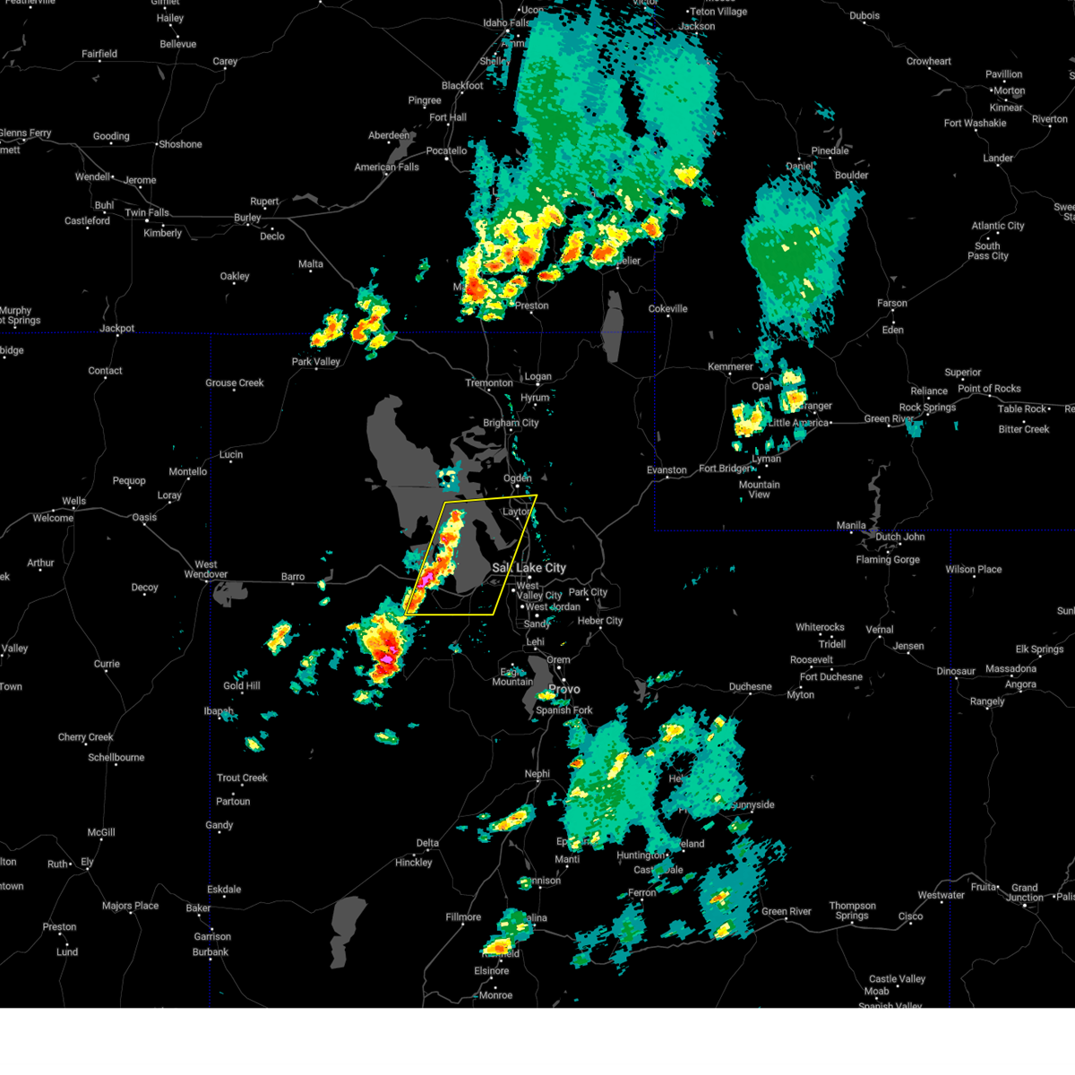
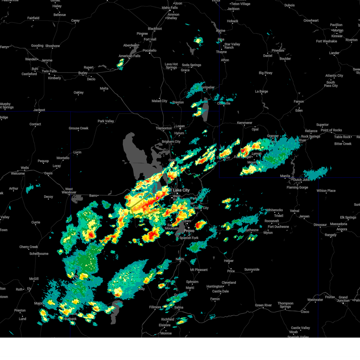
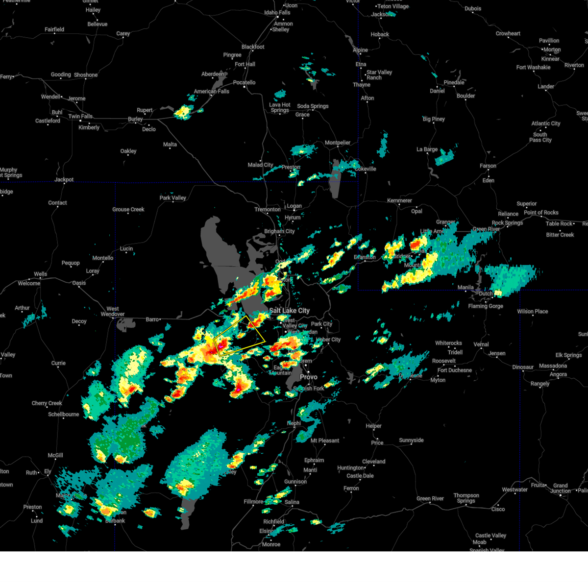
Hail Maps for Erda, UT


Connect with Interactive Hail Maps