

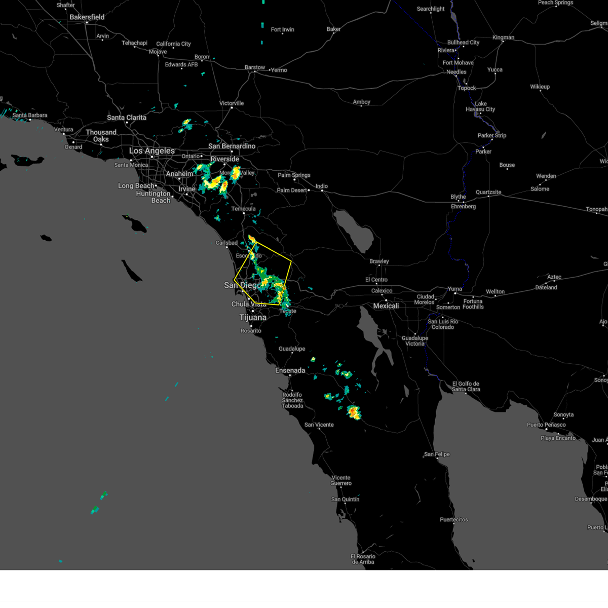
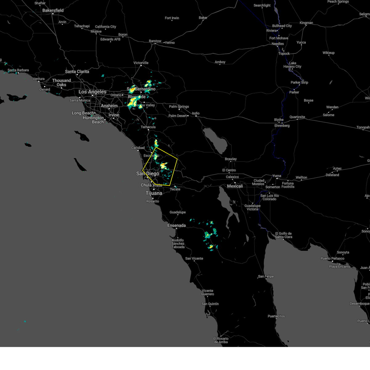
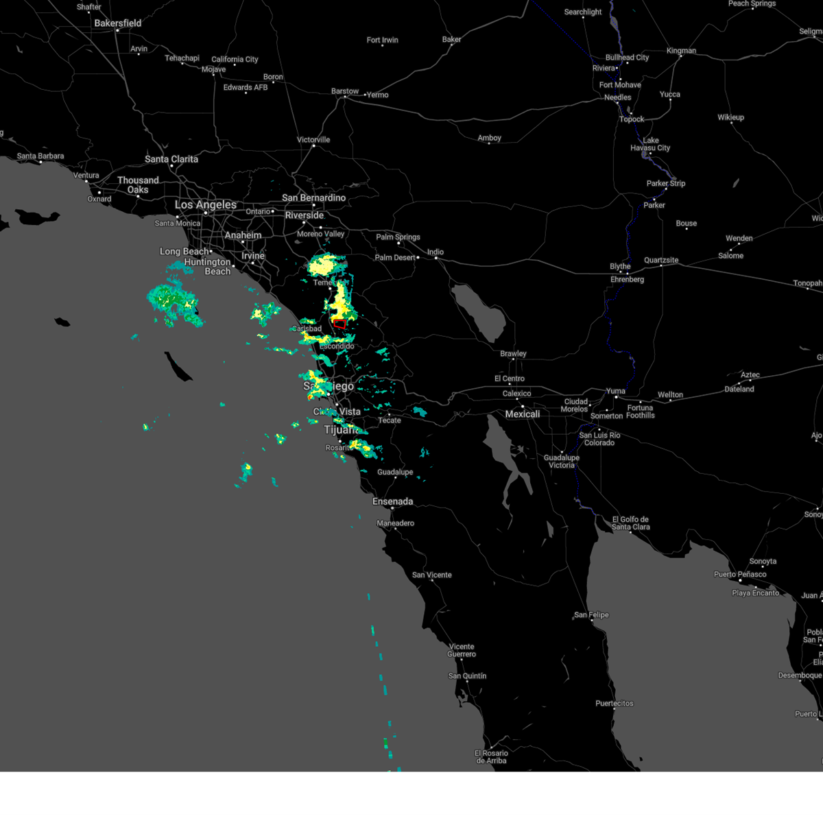
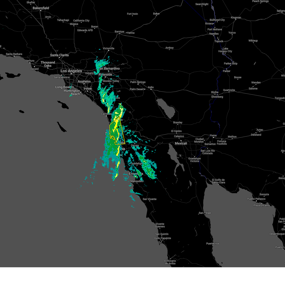
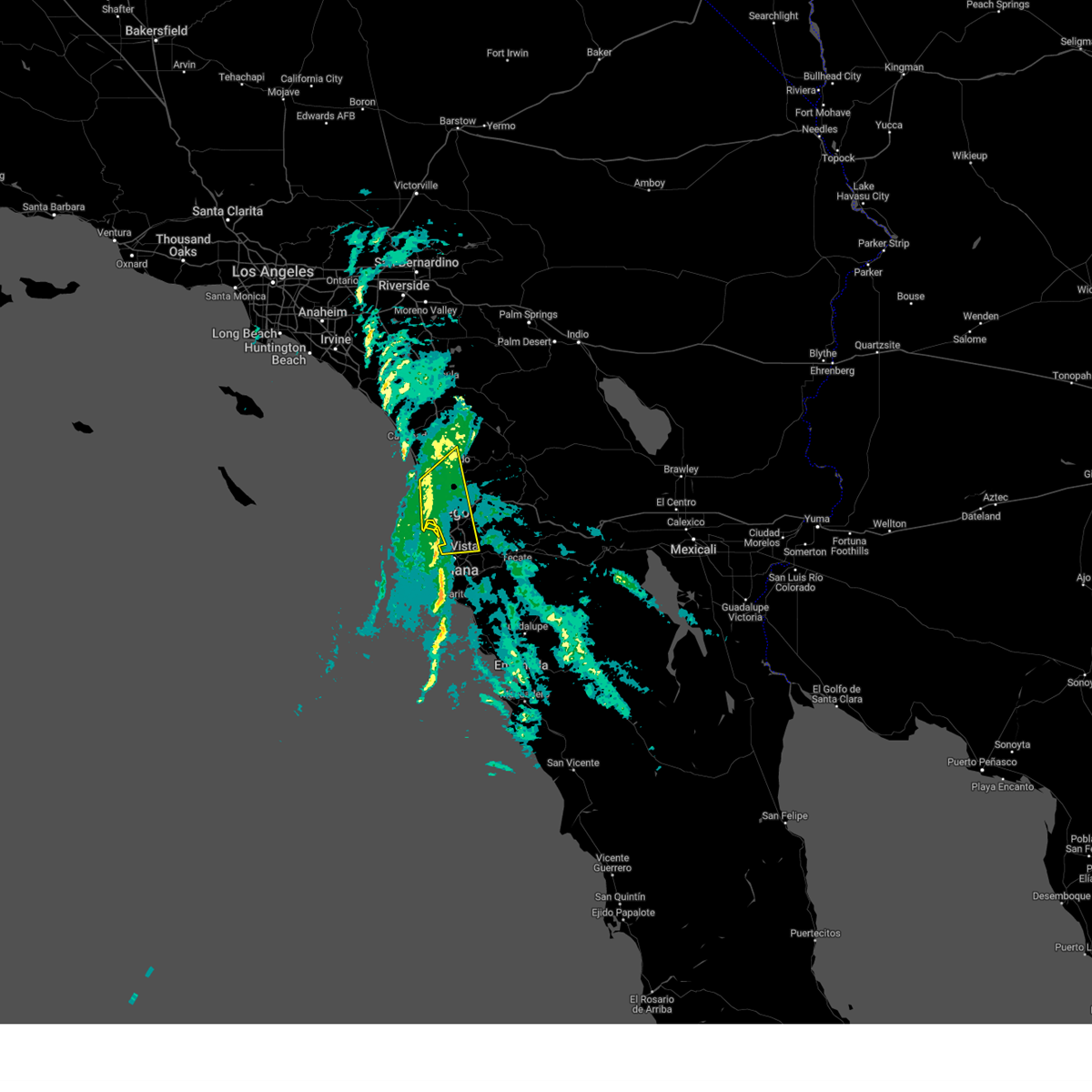
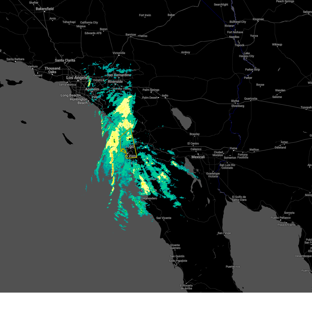
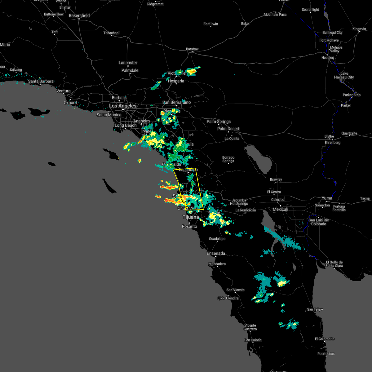
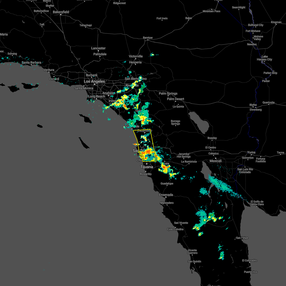
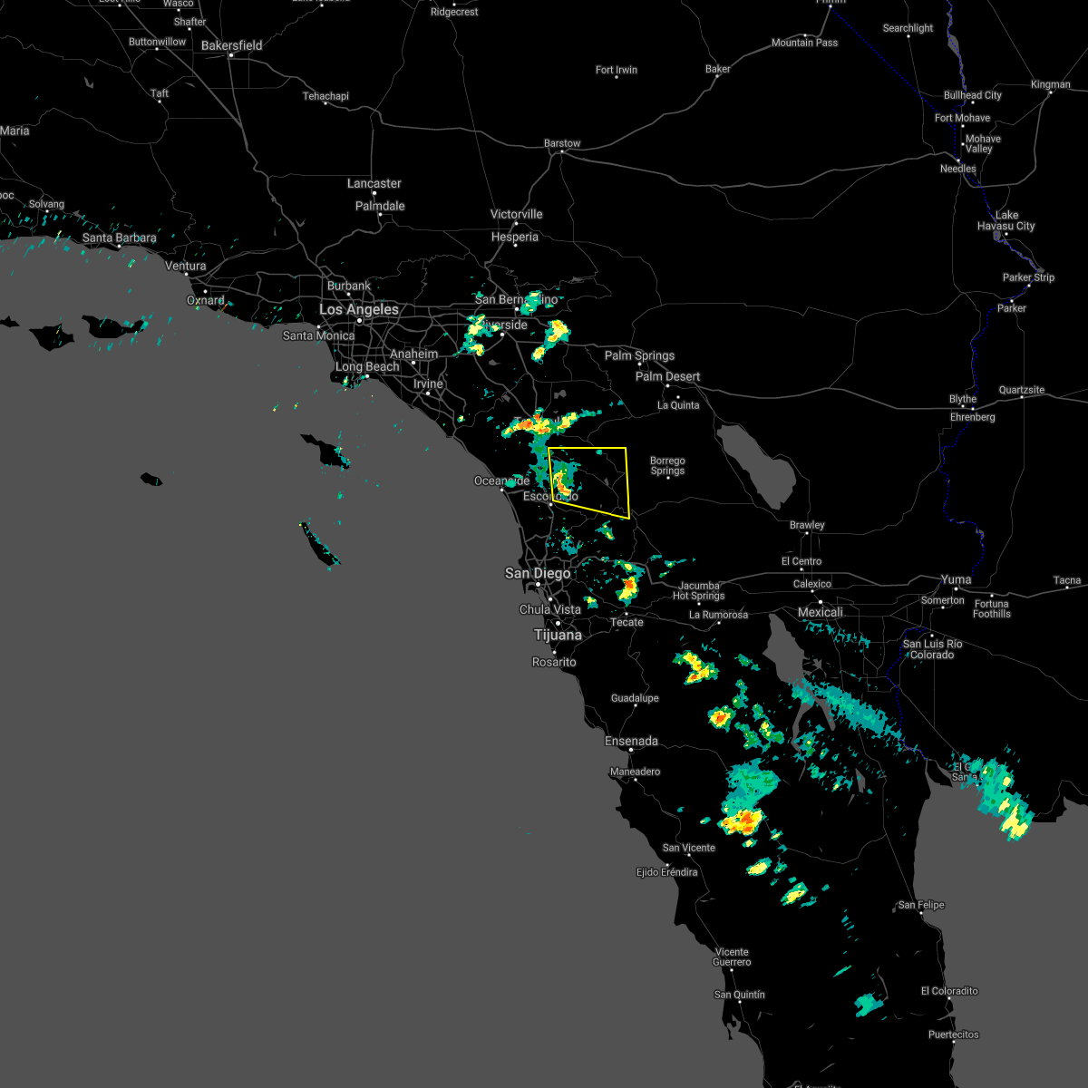
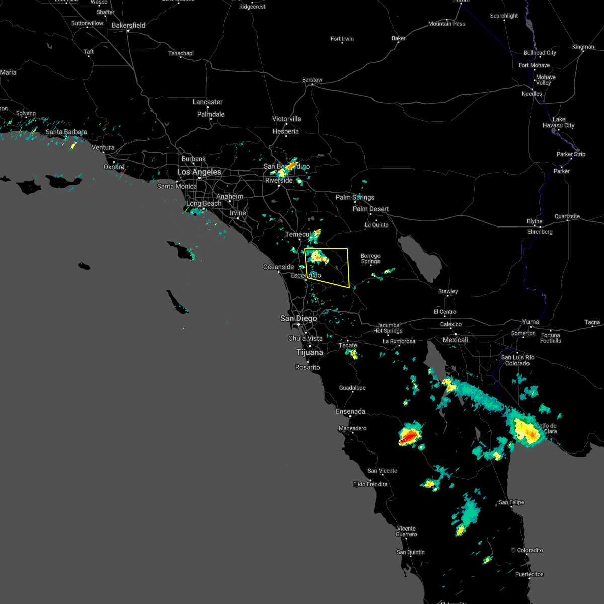
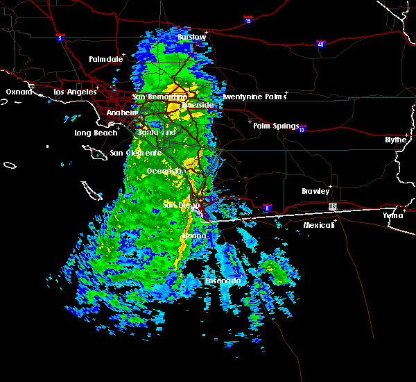
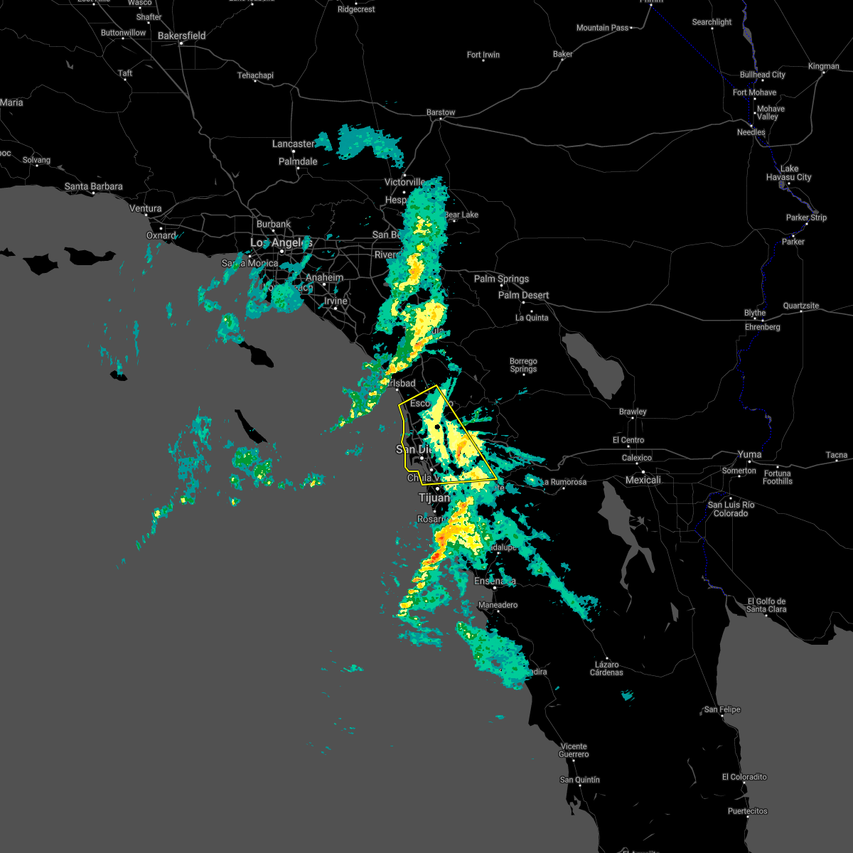
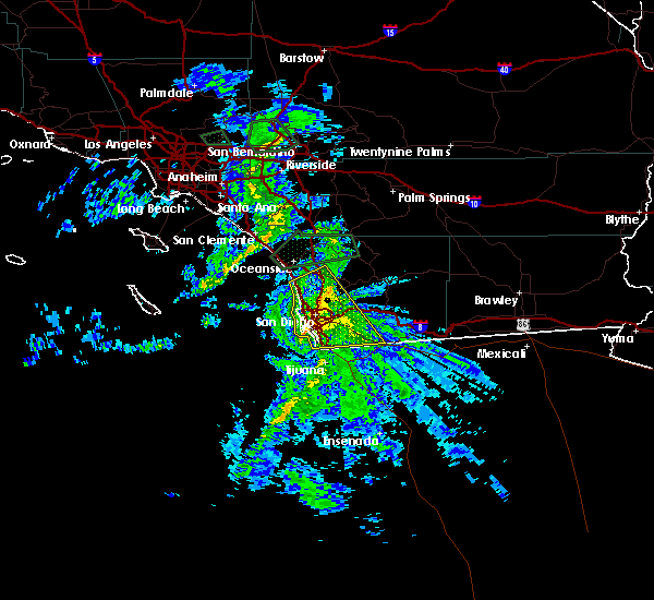
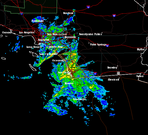
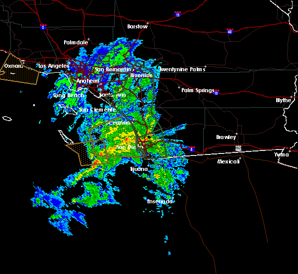
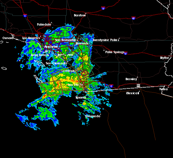
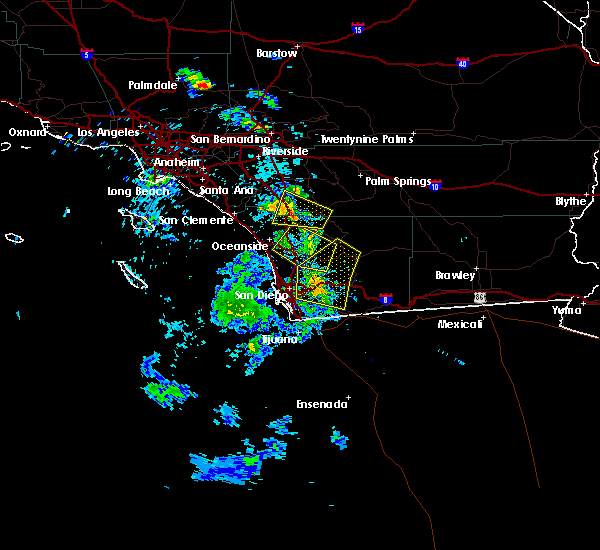
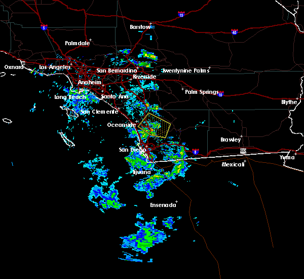
Hail Map for Escondido, CA
The Escondido, CA area has had 0 reports of on-the-ground hail by trained spotters, and has been under severe weather warnings 0 times during the past 12 months. Doppler radar has detected hail at or near Escondido, CA on 1 occasion.
| Name: | Escondido, CA |
| Where Located: | 28.5 miles N of San Diego, CA |
| Map: | Google Map for Escondido, CA |
| Population: | 143911 |
| Housing Units: | 48044 |
| More Info: | Search Google for Escondido, CA |
5
The Top Recent Hail Date for Escondido, CA is Monday, October 4, 2021 (1st out of 1)

Hail and Wind Damage Spotted near Escondido, CA
| Date / Time | Report Details |
|---|---|
| 3/18/2024 1:28 PM PDT |
 At 125 pm pdt, a severe thunderstorm was located over bonita, or over chula vista and just south of alpine, moving south at 25 mph (radar indicated). Hazards include 60 mph wind gusts and penny size hail. wind gusts of 50 to 55 mph have been observed in the warned area near i-8. Expect some damage to roofs, siding, and trees. Locations impacted include, chula vista, el cajon, national city, la mesa, poway, ramona, alpine, mission valley, hillcrest, linda vista, north park, tierrasanta, university city, la jolla, valley center, cuyamaca rancho state park, escondido, santee, lemon grove, and rancho san diego. At 125 pm pdt, a severe thunderstorm was located over bonita, or over chula vista and just south of alpine, moving south at 25 mph (radar indicated). Hazards include 60 mph wind gusts and penny size hail. wind gusts of 50 to 55 mph have been observed in the warned area near i-8. Expect some damage to roofs, siding, and trees. Locations impacted include, chula vista, el cajon, national city, la mesa, poway, ramona, alpine, mission valley, hillcrest, linda vista, north park, tierrasanta, university city, la jolla, valley center, cuyamaca rancho state park, escondido, santee, lemon grove, and rancho san diego.
|
| 3/18/2024 12:54 PM PDT |
 Svrsgx the national weather service in san diego has issued a * severe thunderstorm warning for, southwestern san diego county in southwestern california, * until 200 pm pdt. * at 1253 pm pdt, a severe thunderstorm was located over lakeside, or near el cajon, moving south at 25 mph (radar indicated). Hazards include 60 mph wind gusts and nickel size hail. expect damage to roofs, siding, and trees Svrsgx the national weather service in san diego has issued a * severe thunderstorm warning for, southwestern san diego county in southwestern california, * until 200 pm pdt. * at 1253 pm pdt, a severe thunderstorm was located over lakeside, or near el cajon, moving south at 25 mph (radar indicated). Hazards include 60 mph wind gusts and nickel size hail. expect damage to roofs, siding, and trees
|
| 3/30/2023 10:22 AM PDT |
 At 1021 am pdt, a severe thunderstorm capable of producing a tornado was located over valley center, moving east at 55 mph (radar indicated rotation). Hazards include tornado. Flying debris will be dangerous to those caught without shelter. mobile homes will be damaged or destroyed. damage to roofs, windows, and vehicles will occur. Tree damage is likely. At 1021 am pdt, a severe thunderstorm capable of producing a tornado was located over valley center, moving east at 55 mph (radar indicated rotation). Hazards include tornado. Flying debris will be dangerous to those caught without shelter. mobile homes will be damaged or destroyed. damage to roofs, windows, and vehicles will occur. Tree damage is likely.
|
| 3/21/2023 11:11 AM PDT |
 The severe thunderstorm warning for southwestern san diego county will expire at 1115 am pdt, the storms which prompted the warning have weakened below severe limits, and no longer pose an immediate threat to life or property. therefore, the warning will be allowed to expire. however heavy rain is still possible with these thunderstorms. The severe thunderstorm warning for southwestern san diego county will expire at 1115 am pdt, the storms which prompted the warning have weakened below severe limits, and no longer pose an immediate threat to life or property. therefore, the warning will be allowed to expire. however heavy rain is still possible with these thunderstorms.
|
| 3/21/2023 11:00 AM PDT |
 At 1059 am pdt, severe thunderstorms were located along a line extending from near del mar heights to imperial beach, moving northeast at 40 mph. this warning includes portions of the san diego city limits (radar indicated). Hazards include 60 mph wind gusts. expect damage to roofs, siding, and trees At 1059 am pdt, severe thunderstorms were located along a line extending from near del mar heights to imperial beach, moving northeast at 40 mph. this warning includes portions of the san diego city limits (radar indicated). Hazards include 60 mph wind gusts. expect damage to roofs, siding, and trees
|
| 3/21/2023 10:26 AM PDT |
 At 1026 am pdt, severe thunderstorms were located along a line extending from 8 miles west of mission beach to 17 miles southwest of imperial beach, moving northeast at 40 mph (radar indicated). Hazards include 60 mph wind gusts. expect damage to roofs, siding, and trees At 1026 am pdt, severe thunderstorms were located along a line extending from 8 miles west of mission beach to 17 miles southwest of imperial beach, moving northeast at 40 mph (radar indicated). Hazards include 60 mph wind gusts. expect damage to roofs, siding, and trees
|
| 9/24/2021 4:12 PM PDT |
 The severe thunderstorm warning for southwestern san diego county will expire at 415 pm pdt, the severe thunderstorm which prompted the warning has weakened and moved out of the warned area. therefore, the warning will be allowed to expire. The severe thunderstorm warning for southwestern san diego county will expire at 415 pm pdt, the severe thunderstorm which prompted the warning has weakened and moved out of the warned area. therefore, the warning will be allowed to expire.
|
| 9/24/2021 3:45 PM PDT |
 At 339 pm pdt, a severe thunderstorm was located near downtown san diego, moving west at about 15 mph. so far heavy rainfall and localized flooding has been reported (radar indicated). Hazards include 60 mph wind gusts. Expect damage to roofs, siding, and trees. locations impacted include, chula vista, oceanside, carlsbad, el cajon, vista, encinitas, national city, la mesa, poway and imperial beach. hail threat, radar indicated max hail size, <. 75 in wind threat, radar indicated max wind gust, 60 mph. At 339 pm pdt, a severe thunderstorm was located near downtown san diego, moving west at about 15 mph. so far heavy rainfall and localized flooding has been reported (radar indicated). Hazards include 60 mph wind gusts. Expect damage to roofs, siding, and trees. locations impacted include, chula vista, oceanside, carlsbad, el cajon, vista, encinitas, national city, la mesa, poway and imperial beach. hail threat, radar indicated max hail size, <. 75 in wind threat, radar indicated max wind gust, 60 mph.
|
| 9/24/2021 3:20 PM PDT |
 At 319 pm pdt, a severe thunderstorm was located over lakeside, or near el cajon, moving west at about 15 mph (radar indicated). Hazards include 60 mph wind gusts. expect damage to roofs, siding, and trees At 319 pm pdt, a severe thunderstorm was located over lakeside, or near el cajon, moving west at about 15 mph (radar indicated). Hazards include 60 mph wind gusts. expect damage to roofs, siding, and trees
|
| 9/24/2021 2:13 PM PDT |
 The severe thunderstorm warning for north central san diego county will expire at 215 pm pdt, the severe thunderstorm which prompted the warning has weakened to below severe levels. therefore, the warning will be allowed to expire. The severe thunderstorm warning for north central san diego county will expire at 215 pm pdt, the severe thunderstorm which prompted the warning has weakened to below severe levels. therefore, the warning will be allowed to expire.
|
| 9/24/2021 1:24 PM PDT |
 At 123 pm pdt, a severe thunderstorm was located 7 miles west of palomar mountain state park, or 8 miles north of valley center, moving southwest at 10 mph (radar indicated. a spotter reported up to one-inch diameter hail at birch hill on palomar mountain). Hazards include 60 mph wind gusts and quarter size hail. Hail damage to vehicles is expected. Expect wind damage to roofs, siding, and trees. At 123 pm pdt, a severe thunderstorm was located 7 miles west of palomar mountain state park, or 8 miles north of valley center, moving southwest at 10 mph (radar indicated. a spotter reported up to one-inch diameter hail at birch hill on palomar mountain). Hazards include 60 mph wind gusts and quarter size hail. Hail damage to vehicles is expected. Expect wind damage to roofs, siding, and trees.
|
| 11/28/2019 7:35 PM PST |
 At 734 pm pst, a severe thunderstorm was located near del mar, moving northeast at 25 mph (radar indicated). Hazards include 60 mph wind gusts and penny size hail. expect damage to roofs, siding, and trees At 734 pm pst, a severe thunderstorm was located near del mar, moving northeast at 25 mph (radar indicated). Hazards include 60 mph wind gusts and penny size hail. expect damage to roofs, siding, and trees
|
| 2/2/2019 3:52 PM PST |
 The severe thunderstorm warning for southwestern san diego county will expire at 400 pm pst, the storms which prompted the warning have weakened below severe limits, and have exited the warned area. therefore, the warning will be allowed to expire. gusty west winds up to 45 mph will continue through 6 pm in san diego county with isolated damage to trees and powerlines still possible. The severe thunderstorm warning for southwestern san diego county will expire at 400 pm pst, the storms which prompted the warning have weakened below severe limits, and have exited the warned area. therefore, the warning will be allowed to expire. gusty west winds up to 45 mph will continue through 6 pm in san diego county with isolated damage to trees and powerlines still possible.
|
| 2/2/2019 3:05 PM PST |
 At 301 pm pst, a severe rain squall was located along a line extending from near vista to 20 miles west of imperial beach, moving east at 25 mph. this warning includes portions of the san diego city limits. no thunder or lightning but severe winds are expected with heavy rain through 400 pm (radar indicated). Hazards include up to 60 mph wind gusts. expect damage to roofs, siding, and trees At 301 pm pst, a severe rain squall was located along a line extending from near vista to 20 miles west of imperial beach, moving east at 25 mph. this warning includes portions of the san diego city limits. no thunder or lightning but severe winds are expected with heavy rain through 400 pm (radar indicated). Hazards include up to 60 mph wind gusts. expect damage to roofs, siding, and trees
|
| 2/17/2017 6:35 PM PST |
 At 631 pm pst, national weather service doppler radar indicated a line of severe storms capable of producing damaging winds in excess of 60 mph. the highest threat is from la jolla to del mar and areas a few miles inland. these storms were located along a line extending along the san diego coast to point loma, moving east at 15 mph. very heavy rain is associated with these storms with rainfall up to 0.50 inches per hour. locations impacted include, chula vista, oceanside, carlsbad, el cajon, vista, encinitas, national city, la mesa, poway, north park, point loma, hillcrest, midway district including lindbergh field, downtown san diego and la jolla. At 631 pm pst, national weather service doppler radar indicated a line of severe storms capable of producing damaging winds in excess of 60 mph. the highest threat is from la jolla to del mar and areas a few miles inland. these storms were located along a line extending along the san diego coast to point loma, moving east at 15 mph. very heavy rain is associated with these storms with rainfall up to 0.50 inches per hour. locations impacted include, chula vista, oceanside, carlsbad, el cajon, vista, encinitas, national city, la mesa, poway, north park, point loma, hillcrest, midway district including lindbergh field, downtown san diego and la jolla.
|
| 2/17/2017 5:43 PM PST |
 At 541 pm pst, national weather service doppler radar indicated a line of severe thunderstorms capable of producing damaging winds in excess of 60 mph. these storms were located along a line extending from 20 miles southwest of laguna beach to 40 miles southwest of point loma, and moving east at 25 mph. this intense line of heavy rain and high wind will move into coastal cities between 600 and 630 pm. At 541 pm pst, national weather service doppler radar indicated a line of severe thunderstorms capable of producing damaging winds in excess of 60 mph. these storms were located along a line extending from 20 miles southwest of laguna beach to 40 miles southwest of point loma, and moving east at 25 mph. this intense line of heavy rain and high wind will move into coastal cities between 600 and 630 pm.
|
| 1/20/2017 3:12 PM PST |
 The severe thunderstorm warning for southwestern san diego county will expire at 315 pm pst, the severe thunderstorm/squall which prompted the warning has weakened. therefore the warning will be allowed to expire at 315 pm. winds will remain gusty over the region through this evening and additional strong squalls may redevelop. flooding will continue over the region as heavy rains drain. The severe thunderstorm warning for southwestern san diego county will expire at 315 pm pst, the severe thunderstorm/squall which prompted the warning has weakened. therefore the warning will be allowed to expire at 315 pm. winds will remain gusty over the region through this evening and additional strong squalls may redevelop. flooding will continue over the region as heavy rains drain.
|
| 1/20/2017 2:45 PM PST |
 At 241 pm pst, doppler radar continued to indicated a severe thunderstorm/squall capable of producing damaging winds in excess of 60 mph. this storm was impacting the san diego metro, moving east northeast at 40 mph. currently the area of greatest concern is the southern part of the metro. this storm will likely cause tree damage and local power outages. water spouts are also possible along the coast. locations impacted include, chula vista, el cajon, encinitas, national city, la mesa, poway, north park, point loma, hillcrest, midway district including lindbergh field, downtown san diego, la jolla, imperial beach, coronado and mission valley. At 241 pm pst, doppler radar continued to indicated a severe thunderstorm/squall capable of producing damaging winds in excess of 60 mph. this storm was impacting the san diego metro, moving east northeast at 40 mph. currently the area of greatest concern is the southern part of the metro. this storm will likely cause tree damage and local power outages. water spouts are also possible along the coast. locations impacted include, chula vista, el cajon, encinitas, national city, la mesa, poway, north park, point loma, hillcrest, midway district including lindbergh field, downtown san diego, la jolla, imperial beach, coronado and mission valley.
|
| 1/20/2017 2:28 PM PST | Elfin forest mesonet reported 60 mph wind gus in san diego county CA, 5.8 miles ENE of Escondido, CA |
| 1/20/2017 2:25 PM PST |
 At 221 pm pst, doppler radar indicated a severe thunderstorm/squall capable of producing damaging winds in excess of 60 mph. this storm was rapidly approving the san diego metro, moving east northeast at 40 mph. this storm will likely cause tree damage and local power outages. water spouts will also be possible along the coast. At 221 pm pst, doppler radar indicated a severe thunderstorm/squall capable of producing damaging winds in excess of 60 mph. this storm was rapidly approving the san diego metro, moving east northeast at 40 mph. this storm will likely cause tree damage and local power outages. water spouts will also be possible along the coast.
|
| 3/11/2016 4:26 PM PST |
 At 406 pm pst, doppler radar and trained weather spotters reported a severe thunderstorm producing damaging winds from 50 to 60 mph. this storm extended from valley center southward to chula vista. it was moving rapidly eastward toward the mountains at 40 mph. at 3:52 pm, a wind gust of 54 mph was reported by a spotter in leucadia. solana beach had a wind gust of 44 mph at 4:10 pm. west rancho bernardo had a wind gust of 46 mph at 4:10 pm. locations impacted include, escondido, el cajon, carlsbad, san marcos, la mesa, san diego, chula vista, national city, santee, poway, fallbrook, spring valley, lemon grove, lakeside, rancho san diego and bostonia. At 406 pm pst, doppler radar and trained weather spotters reported a severe thunderstorm producing damaging winds from 50 to 60 mph. this storm extended from valley center southward to chula vista. it was moving rapidly eastward toward the mountains at 40 mph. at 3:52 pm, a wind gust of 54 mph was reported by a spotter in leucadia. solana beach had a wind gust of 44 mph at 4:10 pm. west rancho bernardo had a wind gust of 46 mph at 4:10 pm. locations impacted include, escondido, el cajon, carlsbad, san marcos, la mesa, san diego, chula vista, national city, santee, poway, fallbrook, spring valley, lemon grove, lakeside, rancho san diego and bostonia.
|
| 3/11/2016 3:48 PM PST |
 At 346 pm pst, doppler radar indicated a severe thunderstorm capable of producing damaging winds from 50 to 60 mph. this storm was located off the coast and will move inland through 500 pm. At 346 pm pst, doppler radar indicated a severe thunderstorm capable of producing damaging winds from 50 to 60 mph. this storm was located off the coast and will move inland through 500 pm.
|
| 3/7/2016 9:24 AM PST |
 The severe thunderstorm warning for central san diego county will expire at 930 am pst, the line of severe thunderstorms which prompted the warning has weakened and moved east. therefore the warning will be allowed to expire at 930 am. The severe thunderstorm warning for central san diego county will expire at 930 am pst, the line of severe thunderstorms which prompted the warning has weakened and moved east. therefore the warning will be allowed to expire at 930 am.
|
| 3/7/2016 8:46 AM PST |
 At 845 am pst, doppler radar continued indicated a line of severe thunderstorms capable of producing damaging winds of 45 to 60 mph moving through the san diego county valley and coastal areas. this line of storms was moving east at 35 mph. locations impacted include, san diego, chula vista, el cajon, encinitas, national city, escondido, la mesa, poway, imperial beach and ramona. At 845 am pst, doppler radar continued indicated a line of severe thunderstorms capable of producing damaging winds of 45 to 60 mph moving through the san diego county valley and coastal areas. this line of storms was moving east at 35 mph. locations impacted include, san diego, chula vista, el cajon, encinitas, national city, escondido, la mesa, poway, imperial beach and ramona.
|
| 3/7/2016 8:06 AM PST |
 At 805 am pst, doppler radar indicated a line of severe thunderstorms capable of producing damaging wind gusts of 45 to 60 mph approaching the san diego county coast. this line of storms was located near del mar, and moving east at 35 mph. * locations impacted include but are not limited to, san diego, chula vista, carlsbad, el cajon, encinitas, national city, escondido, la mesa, poway, imperial beach and ramona. At 805 am pst, doppler radar indicated a line of severe thunderstorms capable of producing damaging wind gusts of 45 to 60 mph approaching the san diego county coast. this line of storms was located near del mar, and moving east at 35 mph. * locations impacted include but are not limited to, san diego, chula vista, carlsbad, el cajon, encinitas, national city, escondido, la mesa, poway, imperial beach and ramona.
|
| 3/7/2016 7:58 AM PST |
 The national weather service in san diego has issued a * severe thunderstorm warning for. eastern orange county in southwestern california. san bernardino county in southern california. riverside county in southern california. Northwestern san diego county in southwestern california. The national weather service in san diego has issued a * severe thunderstorm warning for. eastern orange county in southwestern california. san bernardino county in southern california. riverside county in southern california. Northwestern san diego county in southwestern california.
|
| 1/31/2016 3:06 PM PST |
 The severe thunderstorm warning for riverside and western san diego counties will expire at 315 pm pst, the line of storms which prompted the warning have weakened below severe limits, therefore the warning will be allowed to expire. however gusty winds are still possible with these thunderstorms. The severe thunderstorm warning for riverside and western san diego counties will expire at 315 pm pst, the line of storms which prompted the warning have weakened below severe limits, therefore the warning will be allowed to expire. however gusty winds are still possible with these thunderstorms.
|
| 1/31/2016 2:48 PM PST |
 At 245 pm pst, doppler radar indicated a line of severe thunderstorms capable of producing damaging winds. these storms were located along a line extending from near temecula to 9 miles southwest of del mar, moving east at 40 mph. in addition, trained spotters have reported damage to trees and downed power lines. locations impacted include, oceanside, escondido, el cajon, vista, carlsbad, encinitas, temecula, san marcos, santee, poway, fallbrook, lakeside, ramona, bostonia, alpine, solana beach, camp pendleton south, san diego country, camp pendleton north and del mar. At 245 pm pst, doppler radar indicated a line of severe thunderstorms capable of producing damaging winds. these storms were located along a line extending from near temecula to 9 miles southwest of del mar, moving east at 40 mph. in addition, trained spotters have reported damage to trees and downed power lines. locations impacted include, oceanside, escondido, el cajon, vista, carlsbad, encinitas, temecula, san marcos, santee, poway, fallbrook, lakeside, ramona, bostonia, alpine, solana beach, camp pendleton south, san diego country, camp pendleton north and del mar.
|
| 1/31/2016 1:48 PM PST |
 At 145 pm pst, doppler radar indicated a line of severe thunderstorms capable of producing damaging winds in excess of 60 mph. these storms were located along a line extending from 17 miles southwest of san clemente to 44 miles south of avalon, and moving east at 35 mph. At 145 pm pst, doppler radar indicated a line of severe thunderstorms capable of producing damaging winds in excess of 60 mph. these storms were located along a line extending from 17 miles southwest of san clemente to 44 miles south of avalon, and moving east at 35 mph.
|
| 1/6/2016 3:19 PM PST |
 The national weather service in san diego has issued a * severe thunderstorm warning for. central san diego county in southwestern california. until 415 pm pst * at 318 pm pst. doppler radar indicated a severe thunderstorm capable of producing damaging winds in excess of 60 mph. This storm. The national weather service in san diego has issued a * severe thunderstorm warning for. central san diego county in southwestern california. until 415 pm pst * at 318 pm pst. doppler radar indicated a severe thunderstorm capable of producing damaging winds in excess of 60 mph. This storm.
|
| 1/6/2016 2:54 PM PST |
 At 253 pm pst, doppler radar indicated a severe thunderstorm capable of producing a tornado. this dangerous storm was located near escondido, or 8 miles east of encinitas, and moving northeast at 20 mph. At 253 pm pst, doppler radar indicated a severe thunderstorm capable of producing a tornado. this dangerous storm was located near escondido, or 8 miles east of encinitas, and moving northeast at 20 mph.
|
| 1/6/2016 2:23 PM PST |
 At 220 pm pst, doppler radar indicated a line of severe thunderstorm capable of producing damaging winds in excess of 60 mph. these storms were located 14 miles west of del mar to 20 miles west of la jolla, and moving east at 25 mph. these storms are also capable of a brief tornado and hail. these storms will impact coastal cities now through 3 pm, south to point loma and san diego bay. At 220 pm pst, doppler radar indicated a line of severe thunderstorm capable of producing damaging winds in excess of 60 mph. these storms were located 14 miles west of del mar to 20 miles west of la jolla, and moving east at 25 mph. these storms are also capable of a brief tornado and hail. these storms will impact coastal cities now through 3 pm, south to point loma and san diego bay.
|
| 1/6/2016 1:24 PM PST |
 At 118 pm pst, doppler radar indicated a severe thunderstorm capable of producing damaging winds in excess of 60 mph. this storm was located near fallbrook, moving northeast at 20 mph. this severe storm will impact wildomar. another severe storm is producing a waterspout west of carlsbad. this storm will reach the immediate coast between encinitas and oceanside by 140 pm. locations impacted include, oceanside, vista, carlsbad, encinitas, temecula, san marcos, san clemente, san juan capistrano, fallbrook, wildomar, solana beach, camp pendleton south, canyon lake, camp pendleton north, lakeland village, murrieta, valley center, lake san marcos, hidden meadows and bonsall. At 118 pm pst, doppler radar indicated a severe thunderstorm capable of producing damaging winds in excess of 60 mph. this storm was located near fallbrook, moving northeast at 20 mph. this severe storm will impact wildomar. another severe storm is producing a waterspout west of carlsbad. this storm will reach the immediate coast between encinitas and oceanside by 140 pm. locations impacted include, oceanside, vista, carlsbad, encinitas, temecula, san marcos, san clemente, san juan capistrano, fallbrook, wildomar, solana beach, camp pendleton south, canyon lake, camp pendleton north, lakeland village, murrieta, valley center, lake san marcos, hidden meadows and bonsall.
|
| 1/6/2016 1:04 PM PST |
 At 100 pm pst, doppler radar indicated a cluster of severe thunderstorms capable of producing damaging winds in excess of 60 mph. one storm was located over northeastern camp pendleton, and moving northeast at 25 mph. another storm is moving towards fallbrook. a third cell is over open water moving towards oceanside. the potential for a waterspout or brief tornado is possible given the unstable environment. hail is possible with these storms. At 100 pm pst, doppler radar indicated a cluster of severe thunderstorms capable of producing damaging winds in excess of 60 mph. one storm was located over northeastern camp pendleton, and moving northeast at 25 mph. another storm is moving towards fallbrook. a third cell is over open water moving towards oceanside. the potential for a waterspout or brief tornado is possible given the unstable environment. hail is possible with these storms.
|
| 6/30/2015 2:28 PM PDT |
 At 218 pm pdt, doppler radar continued to indicate a severe thunderstorm located over ramona capable of producing damaging winds in excess of 60 mph. this storm was moving west northwest at 15 mph. in addition to the wind threat, frequent cloud to ground lightning will also accompany this storm. locations impacted include, escondido, vista, san marcos, poway, ramona, valley center, lake san marcos and hidden meadows. At 218 pm pdt, doppler radar continued to indicate a severe thunderstorm located over ramona capable of producing damaging winds in excess of 60 mph. this storm was moving west northwest at 15 mph. in addition to the wind threat, frequent cloud to ground lightning will also accompany this storm. locations impacted include, escondido, vista, san marcos, poway, ramona, valley center, lake san marcos and hidden meadows.
|
| 6/30/2015 1:53 PM PDT |
 At 151 pm pdt, doppler radar indicated a severe thunderstorm capable of producing damaging winds in excess of 60 mph. this storm was located 5 miles east of escondido, and moving west northwest at 10 mph. penny size hail may also accompany the damaging winds. At 151 pm pdt, doppler radar indicated a severe thunderstorm capable of producing damaging winds in excess of 60 mph. this storm was located 5 miles east of escondido, and moving west northwest at 10 mph. penny size hail may also accompany the damaging winds.
|
| 2/28/2014 5:05 PM PST | Update to prior report. nbc media showed video showed 6 to 12 inches of flowing water over country club drive. truck driving through closed road harmony grov in san diego county CA, 3.1 miles ENE of Escondido, CA |
| 4/13/2012 4:29 PM PDT | Tree limbs on bear vly pkwy and rt7 in san diego county CA, 1.4 miles SSW of Escondido, CA |
| 4/13/2012 4:02 PM PDT | Live power lines down on mary ln. 1621l tree down on roadway nr mary l in san diego county CA, 1.4 miles SSW of Escondido, CA |
Hail Maps for Escondido, CA

Connect with Interactive Hail Maps