

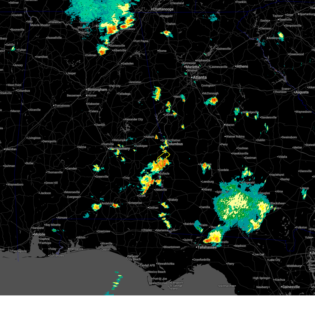
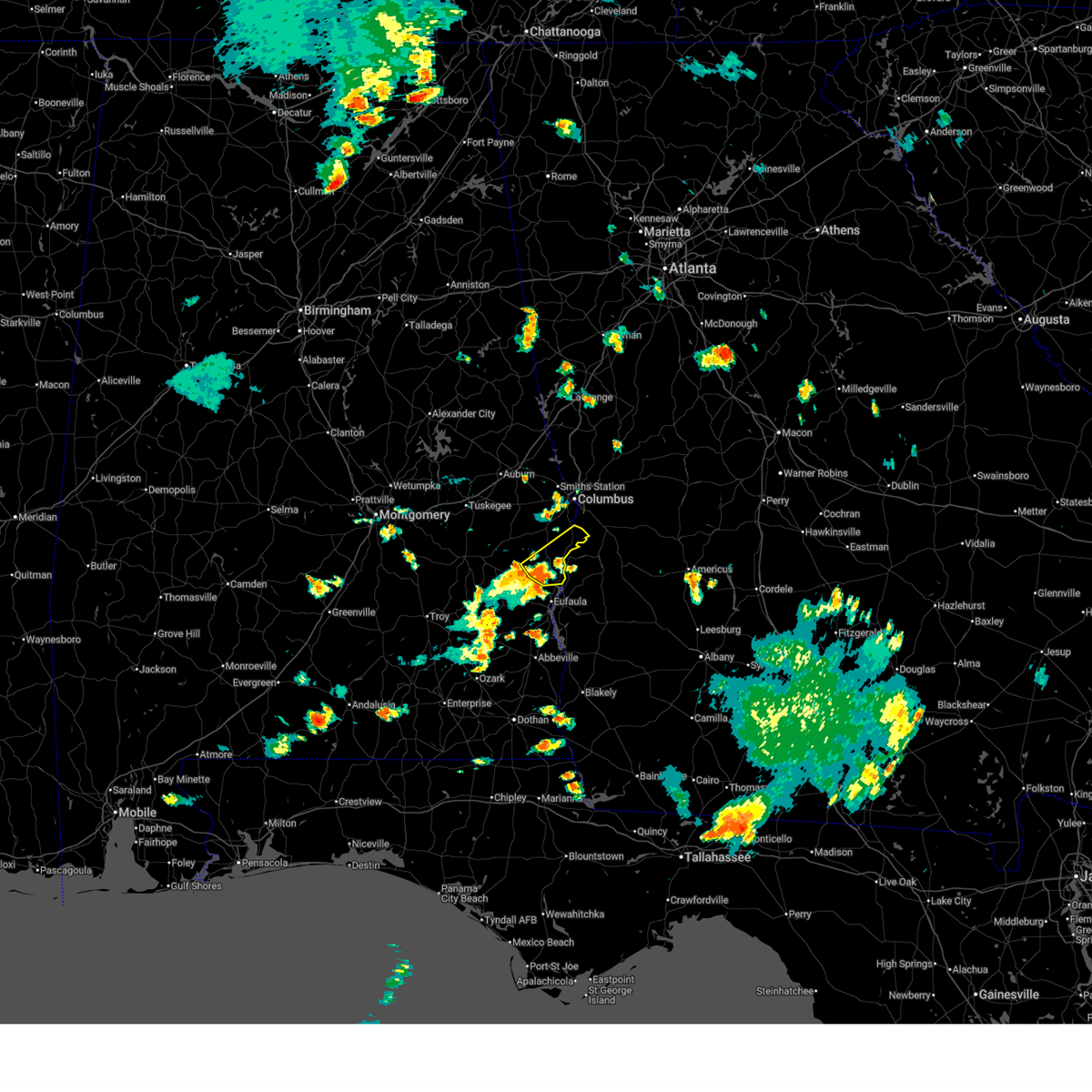
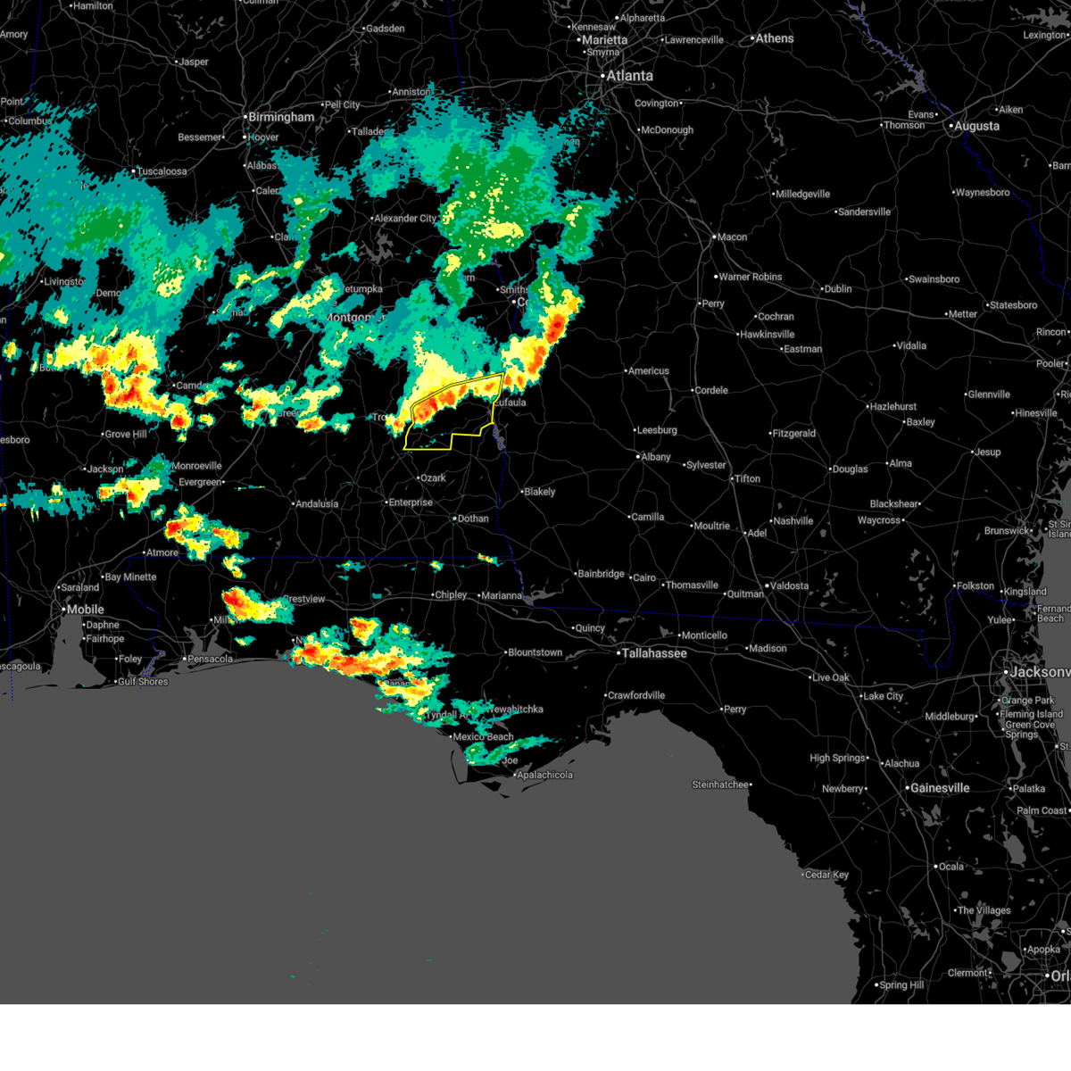
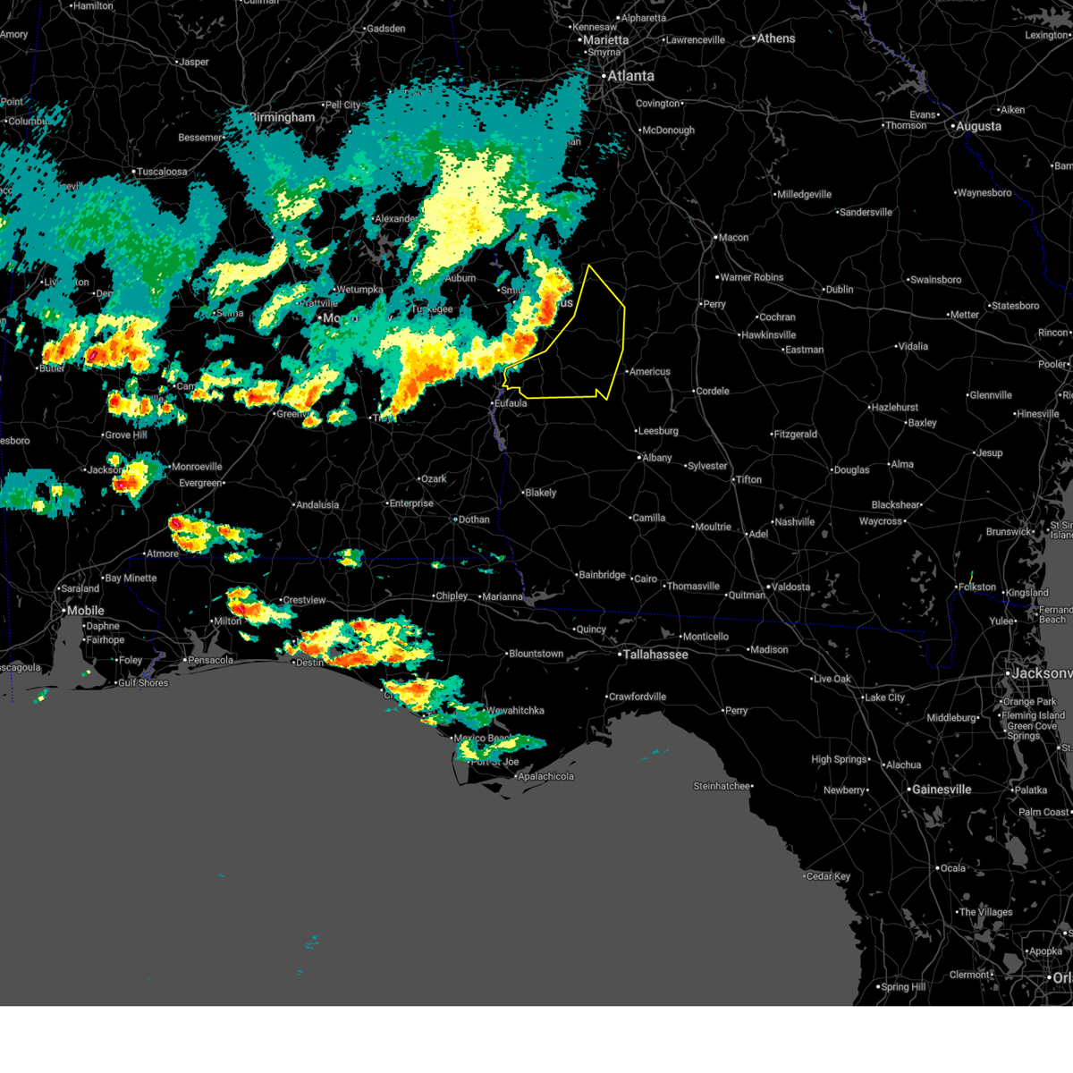
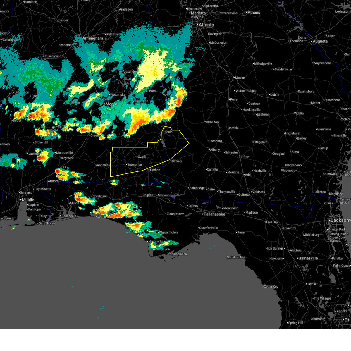
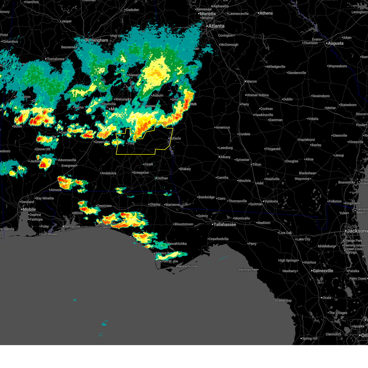
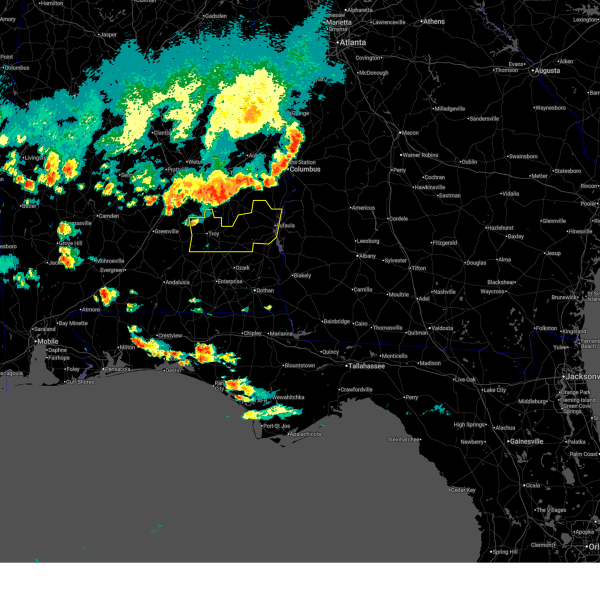
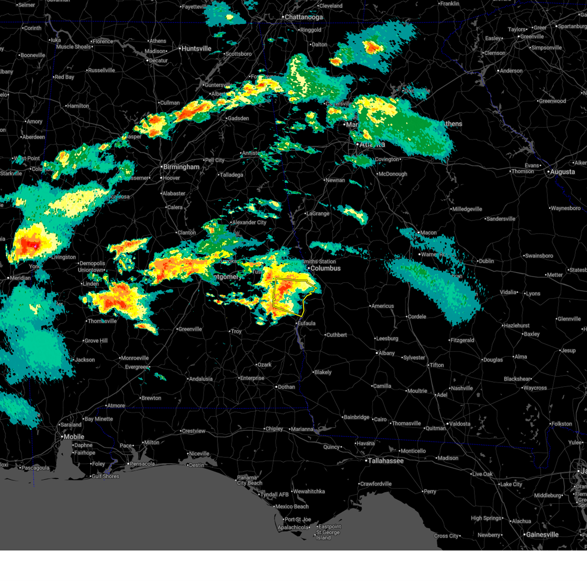
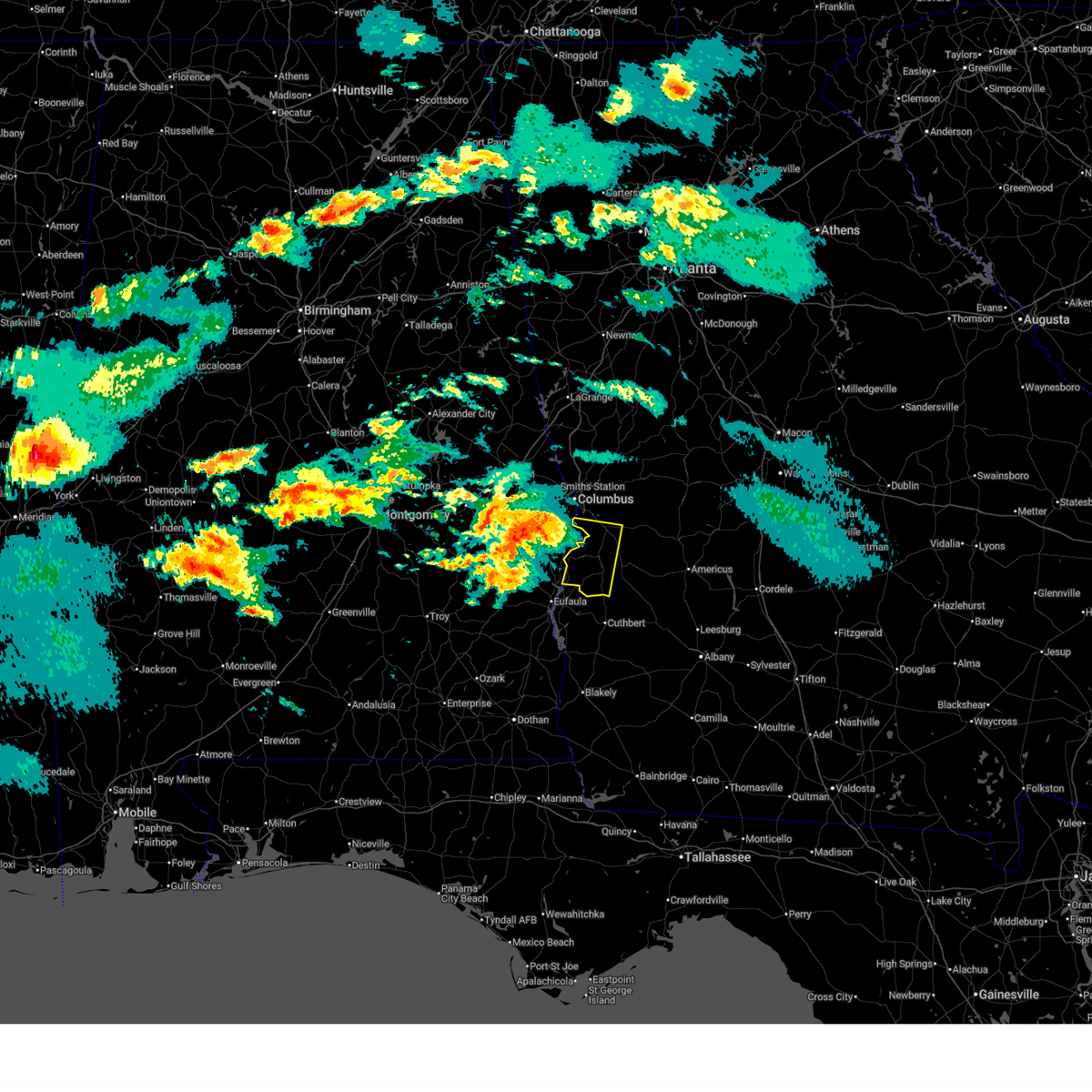
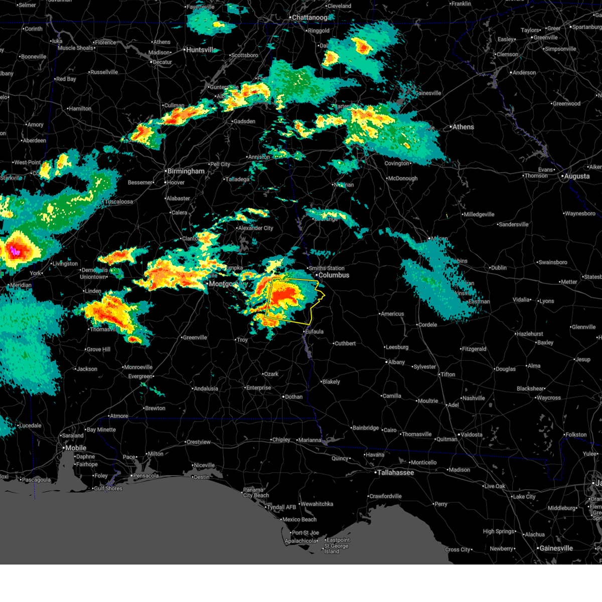
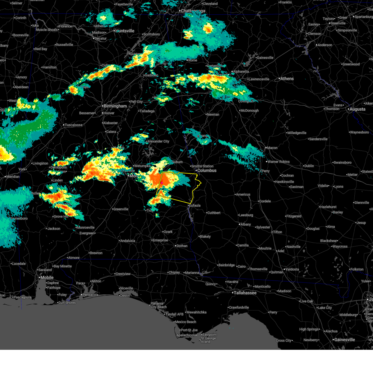
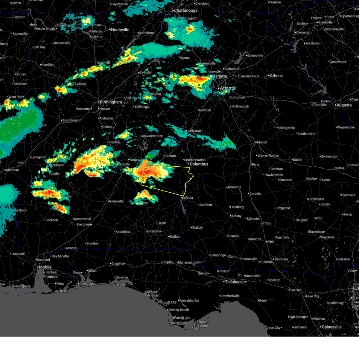
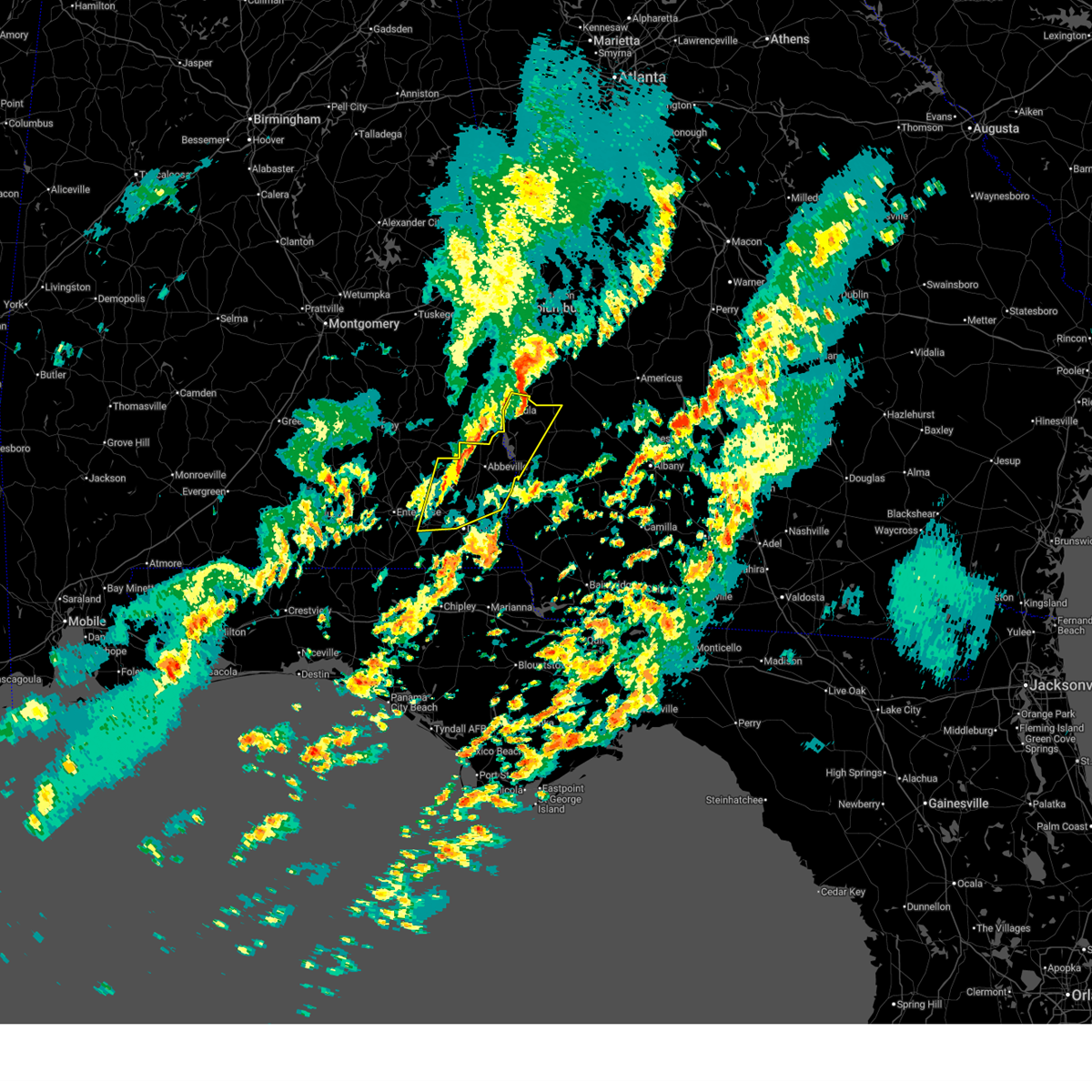
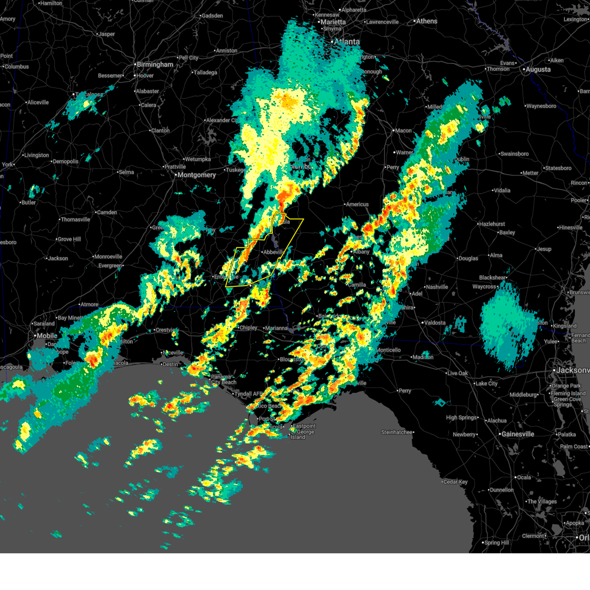
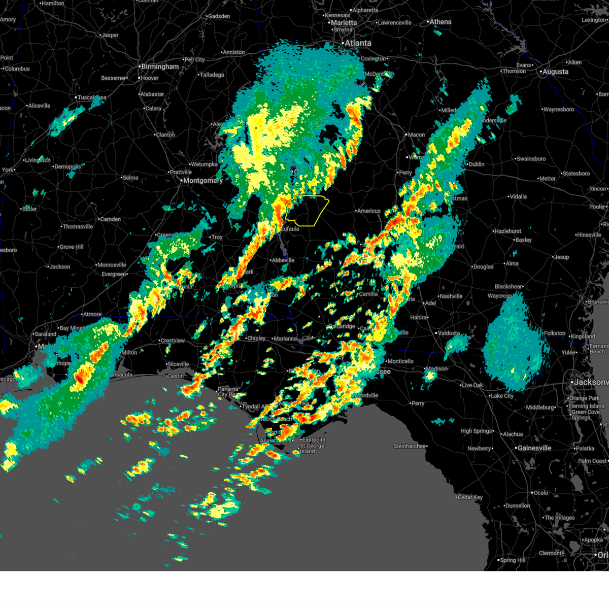
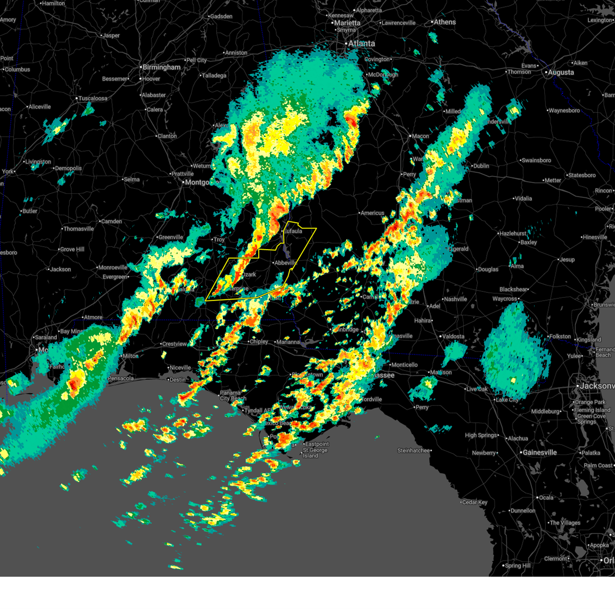
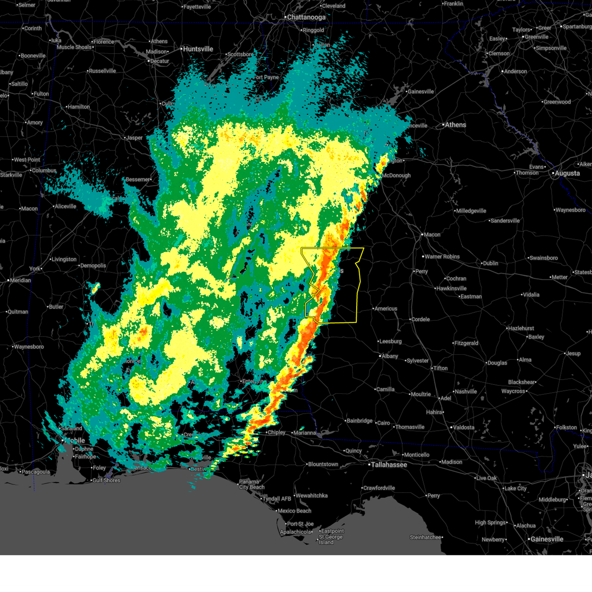
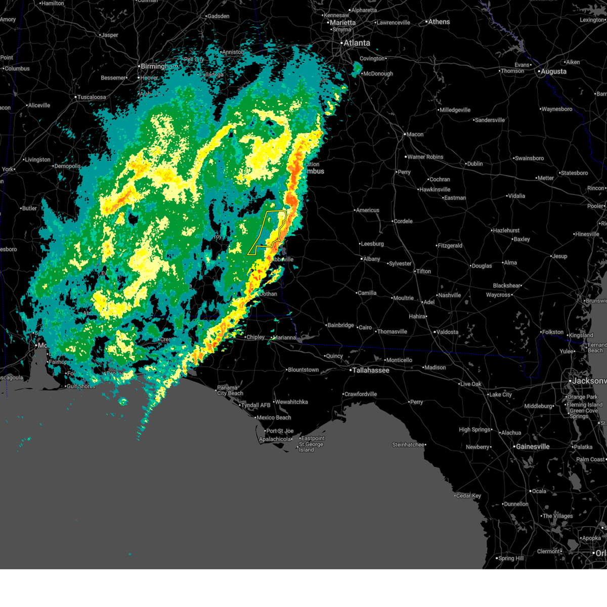
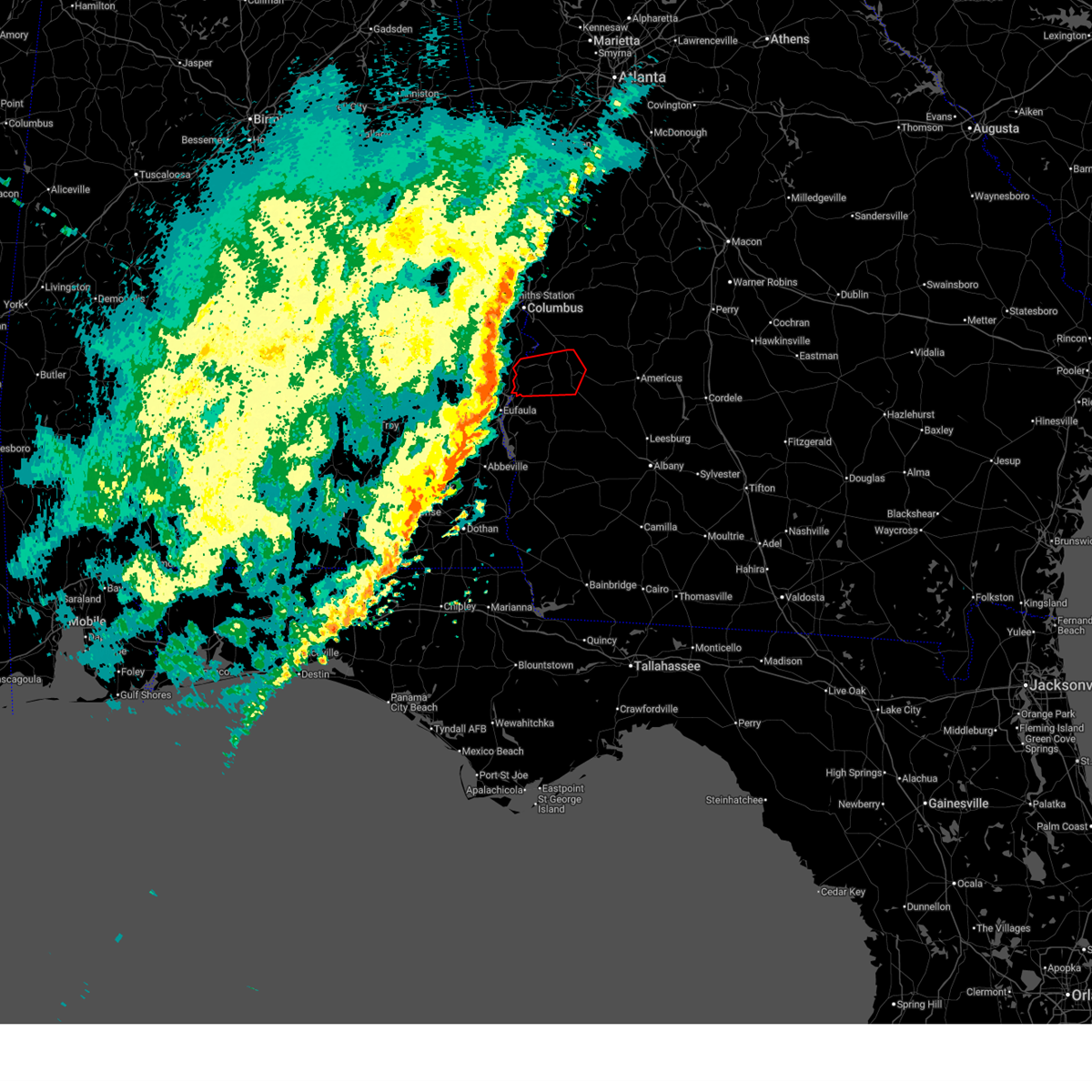
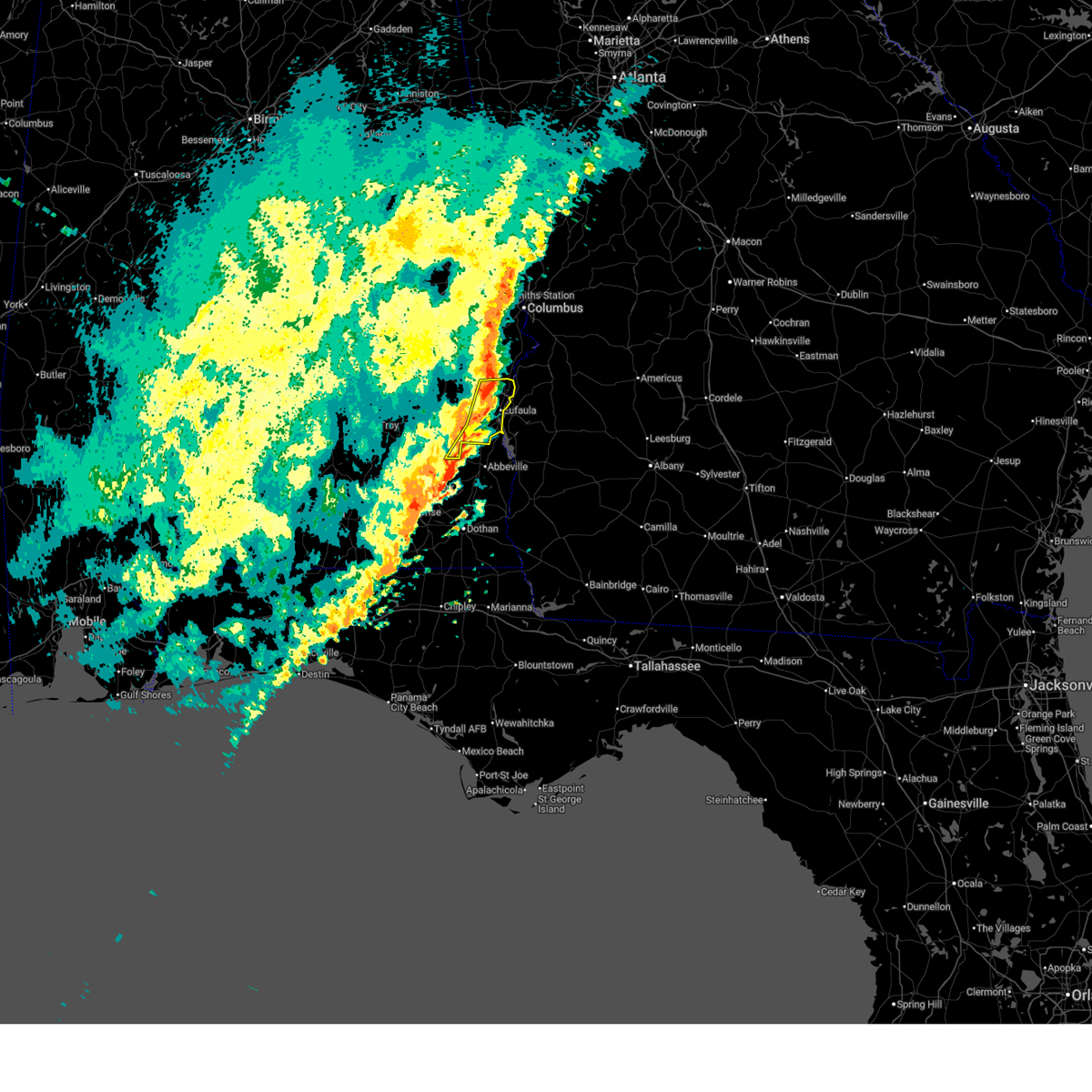
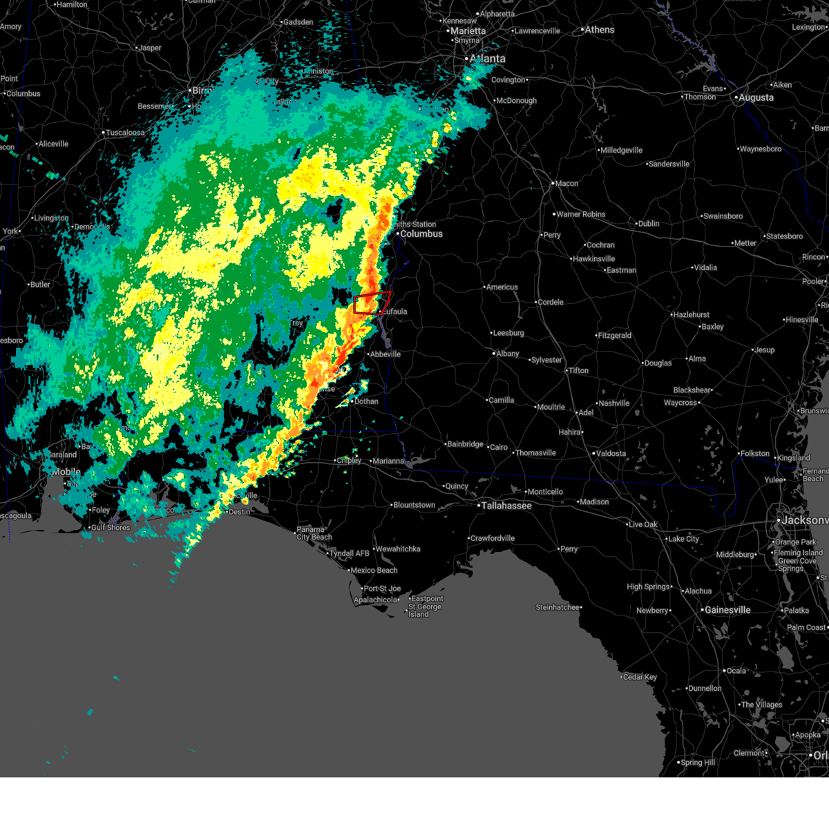
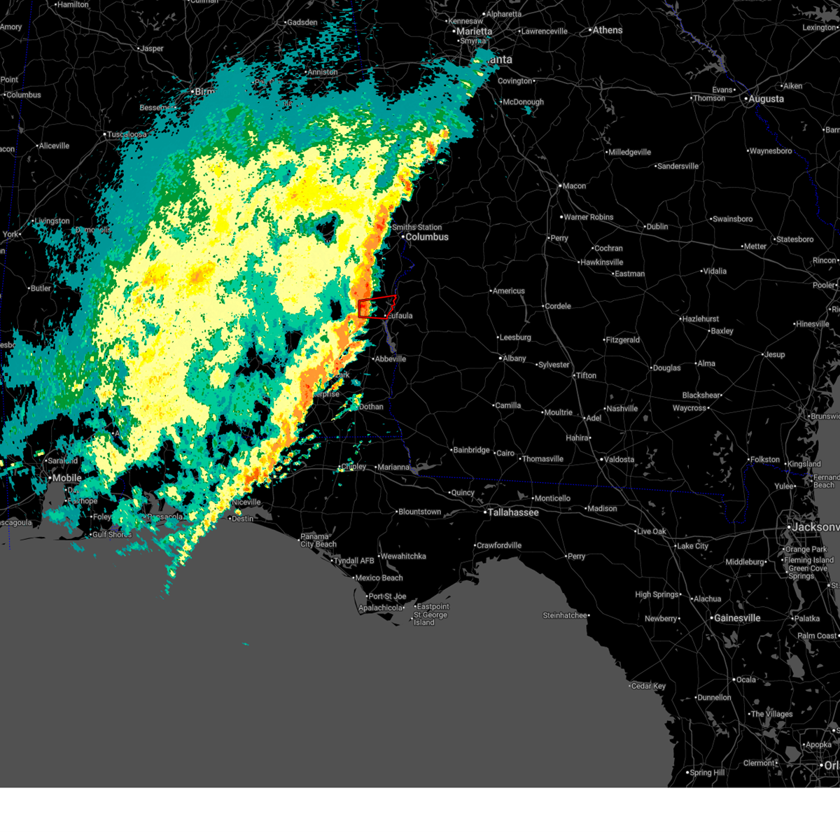
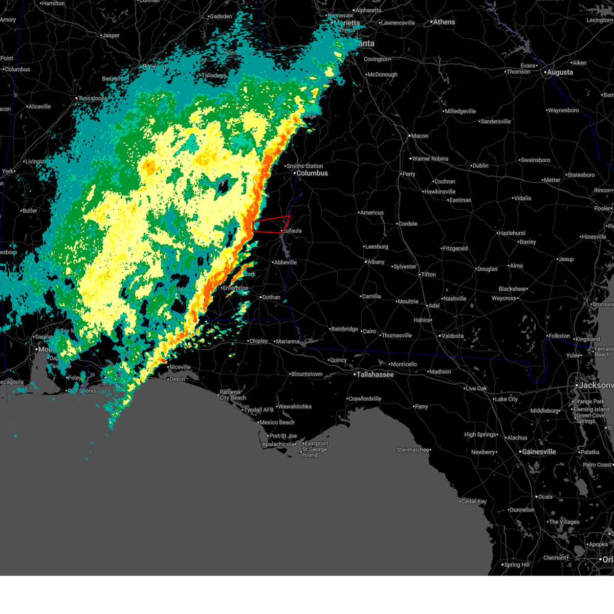
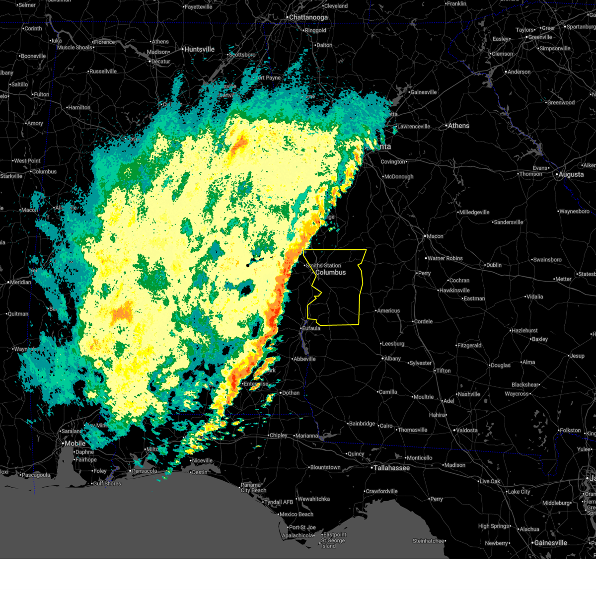
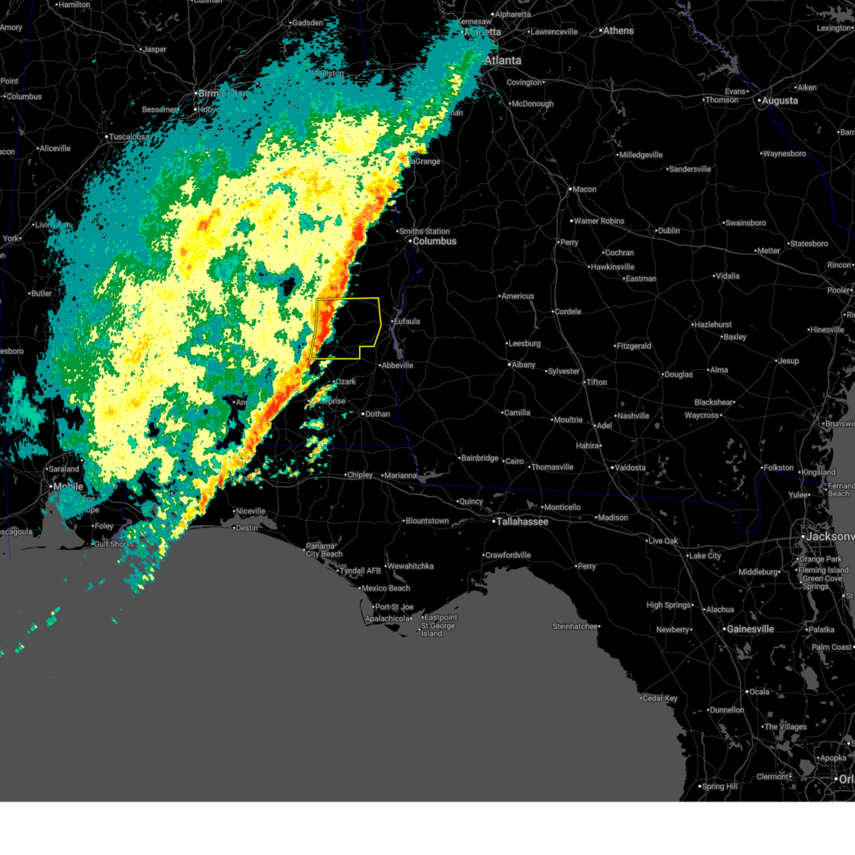
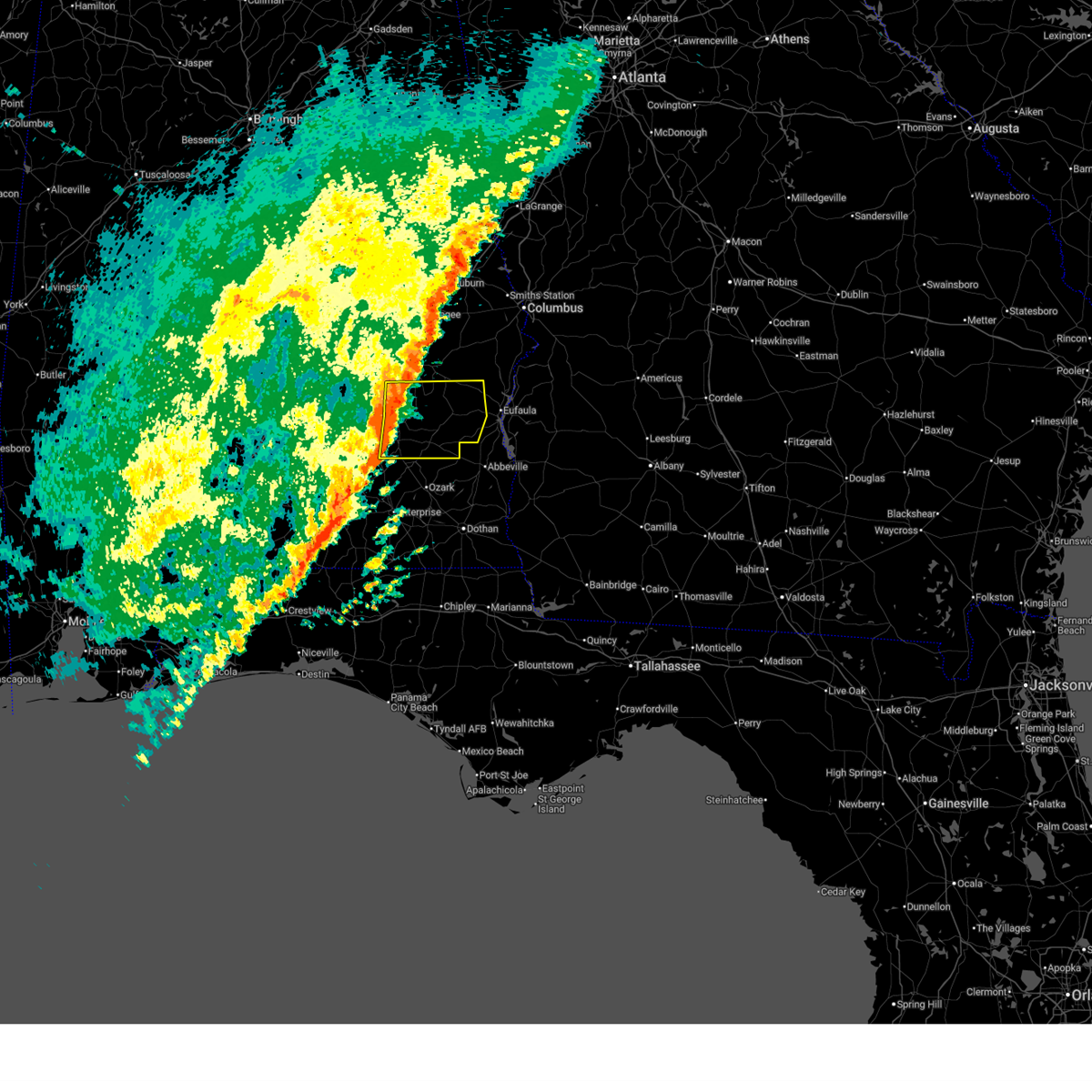
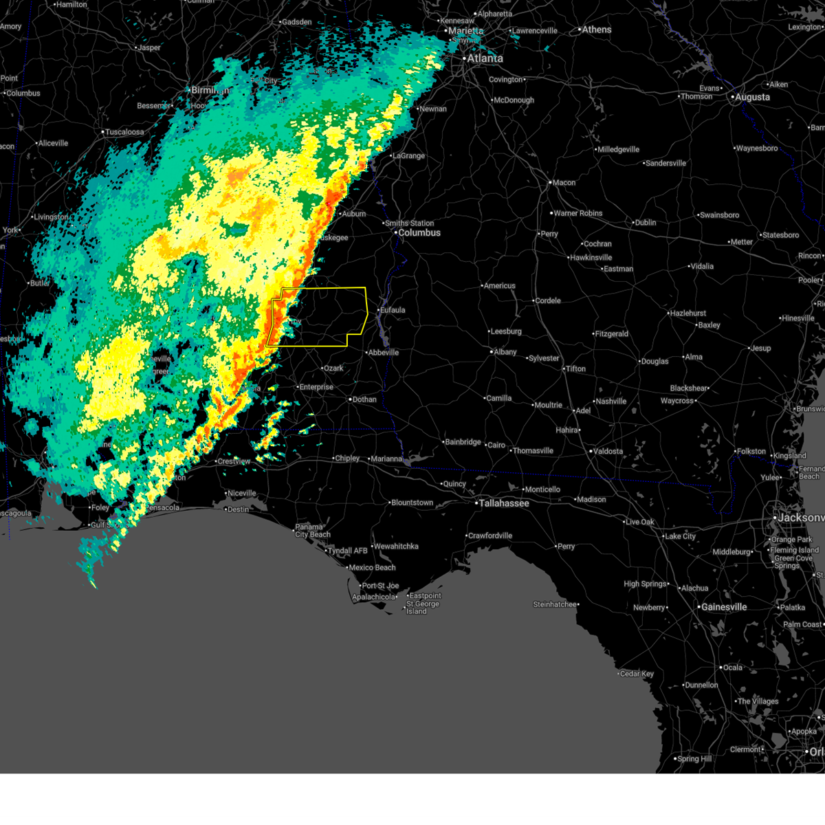
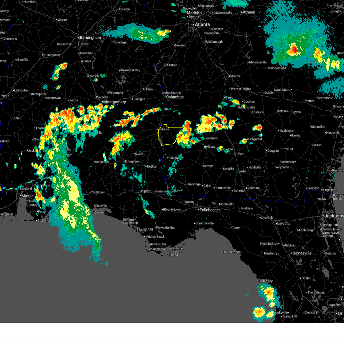
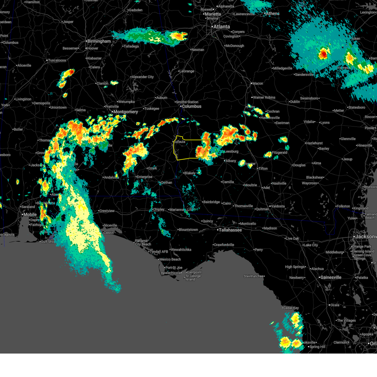
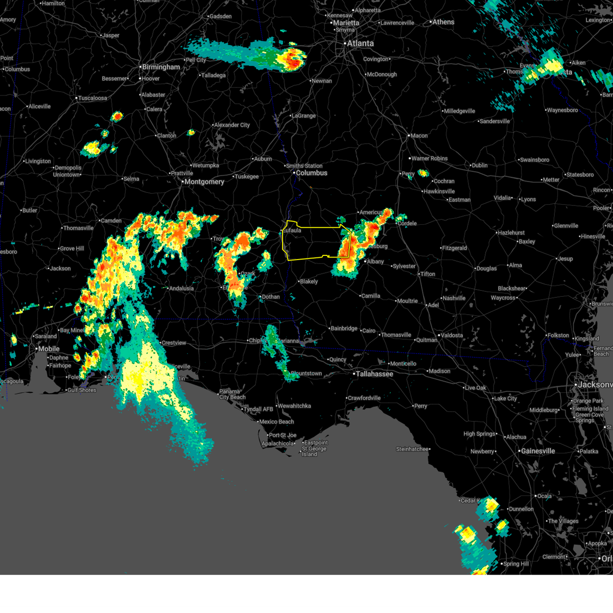
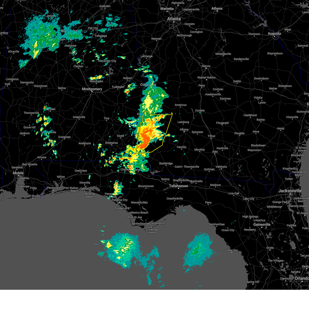
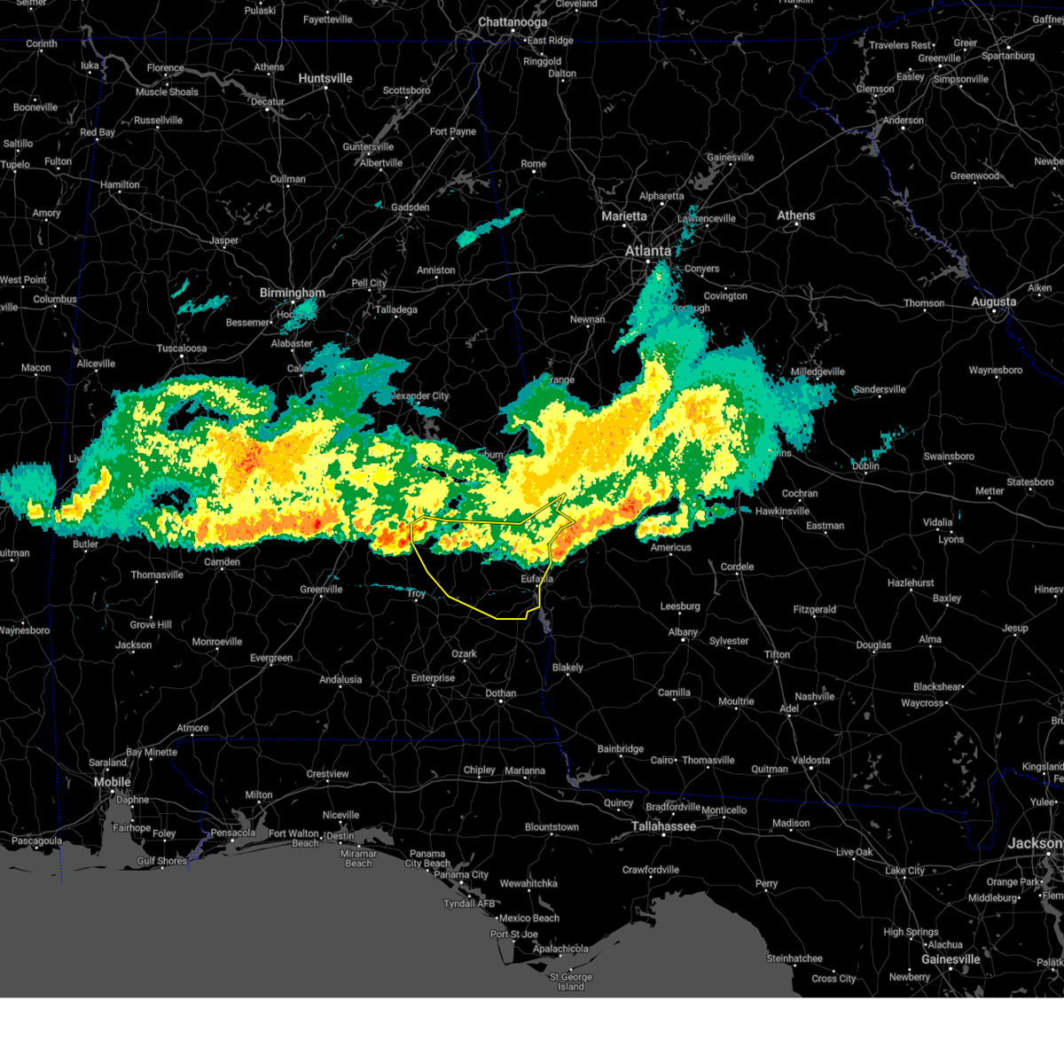
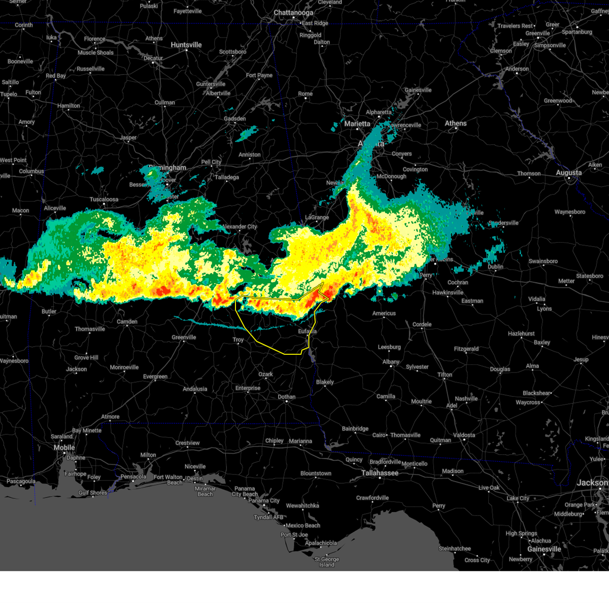
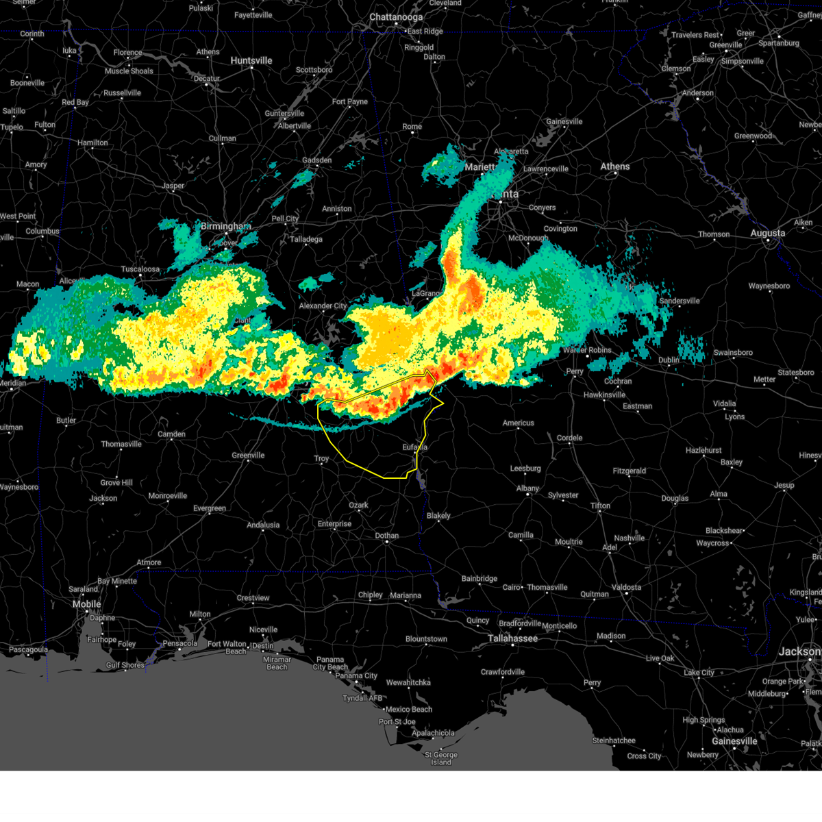
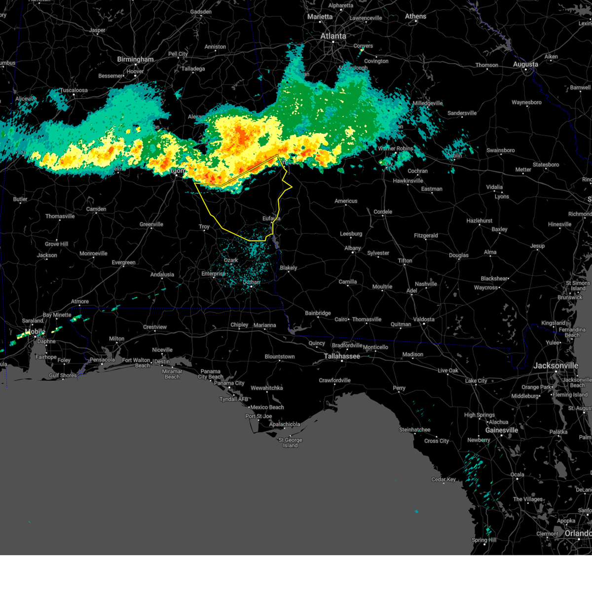
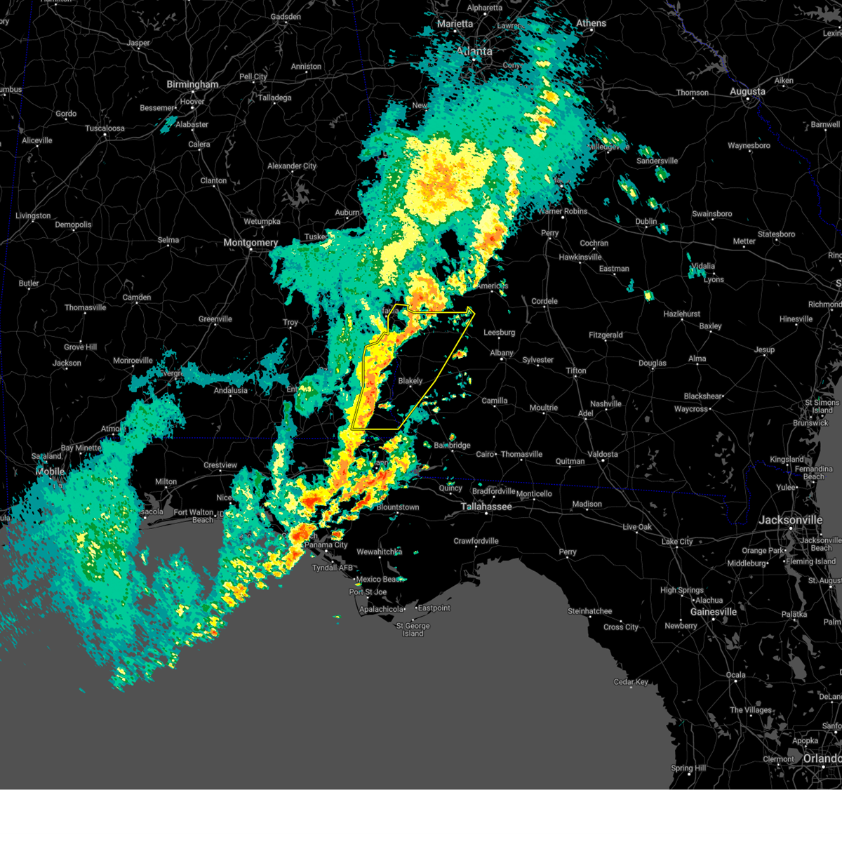
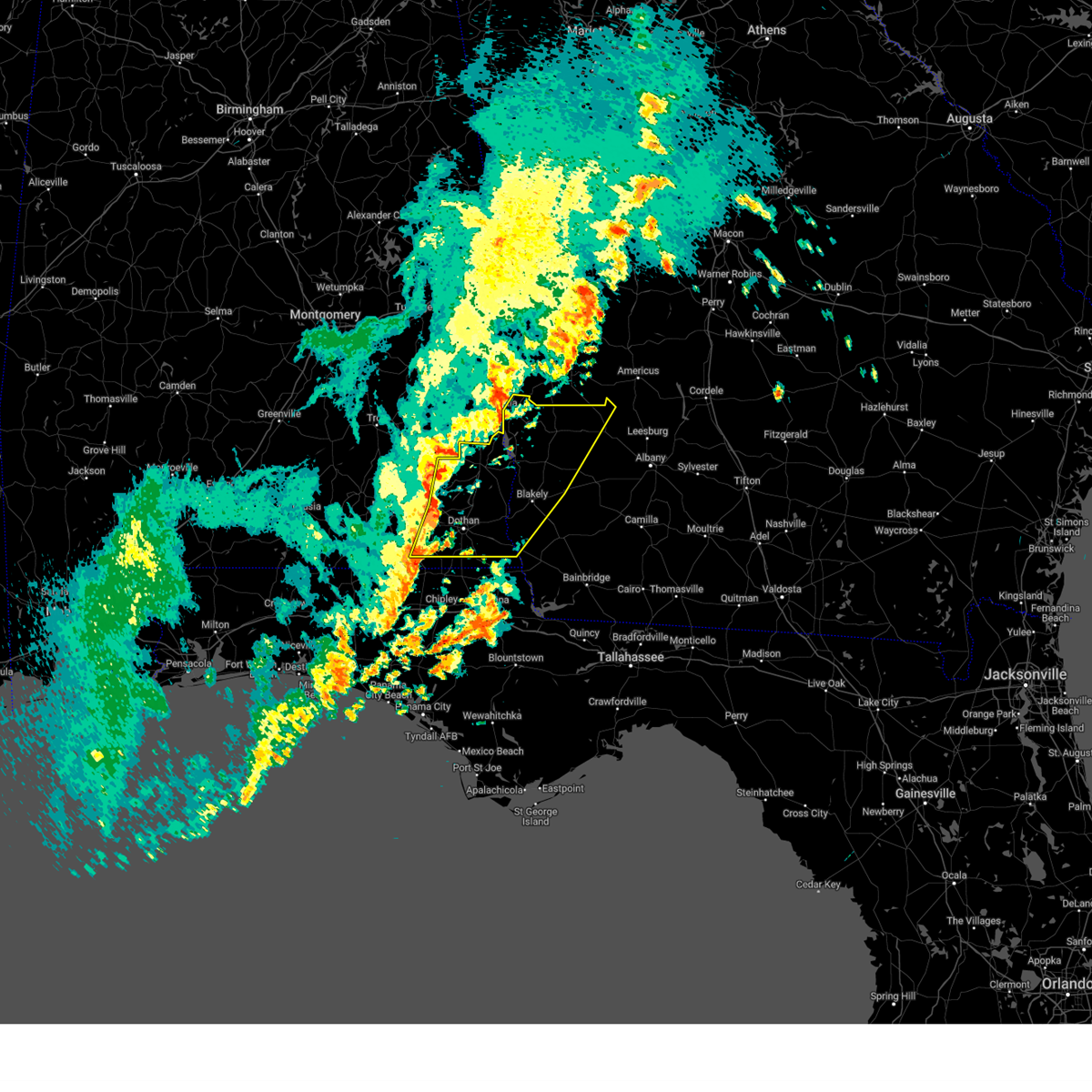
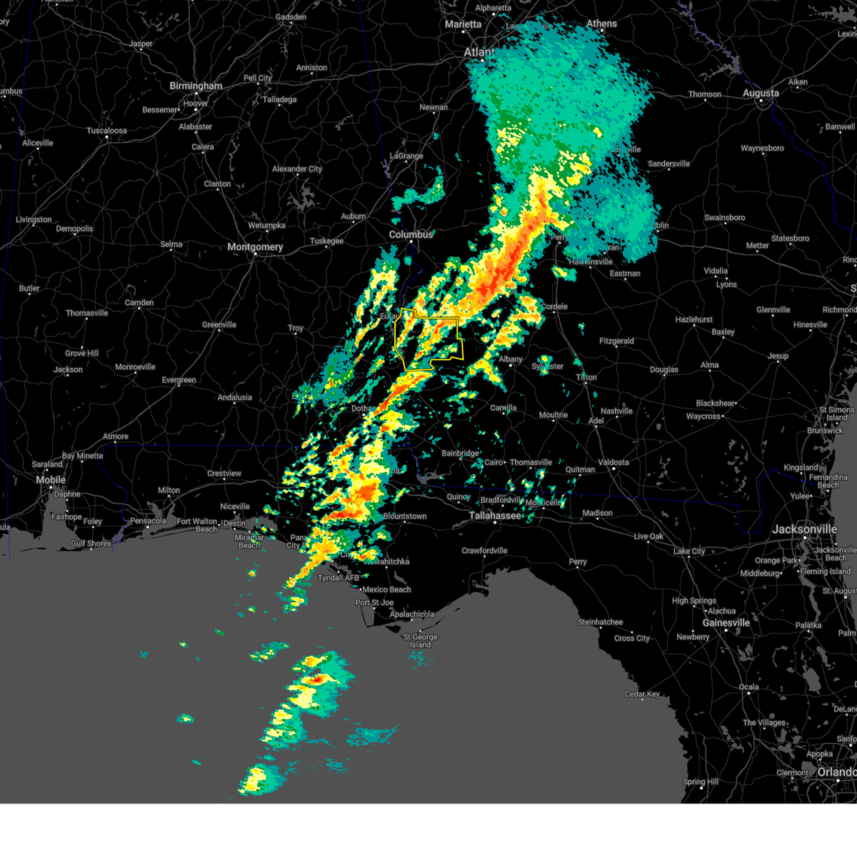
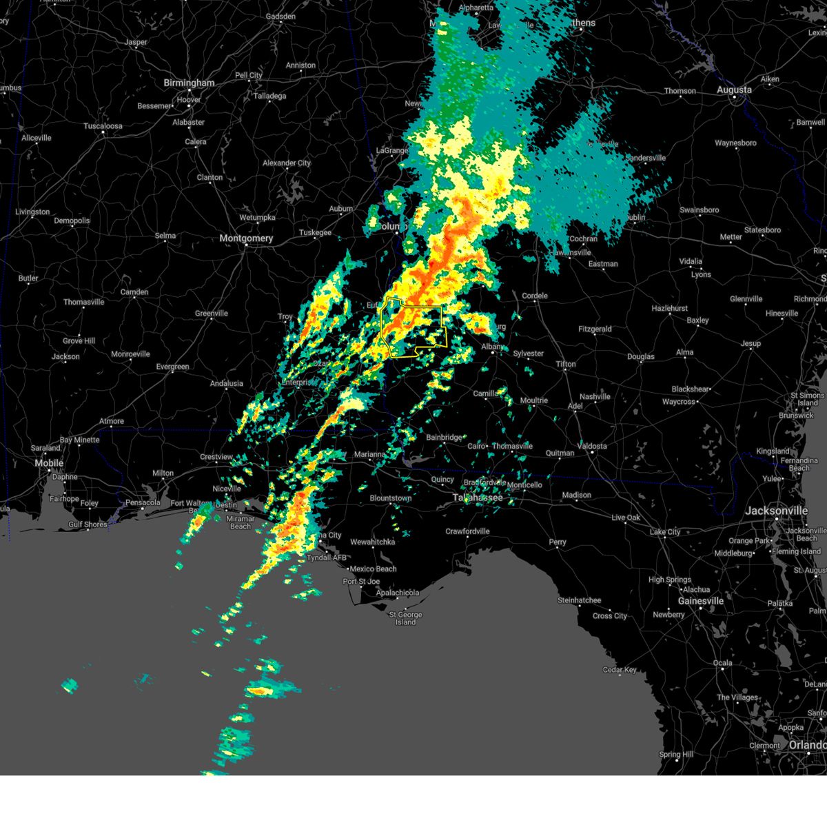
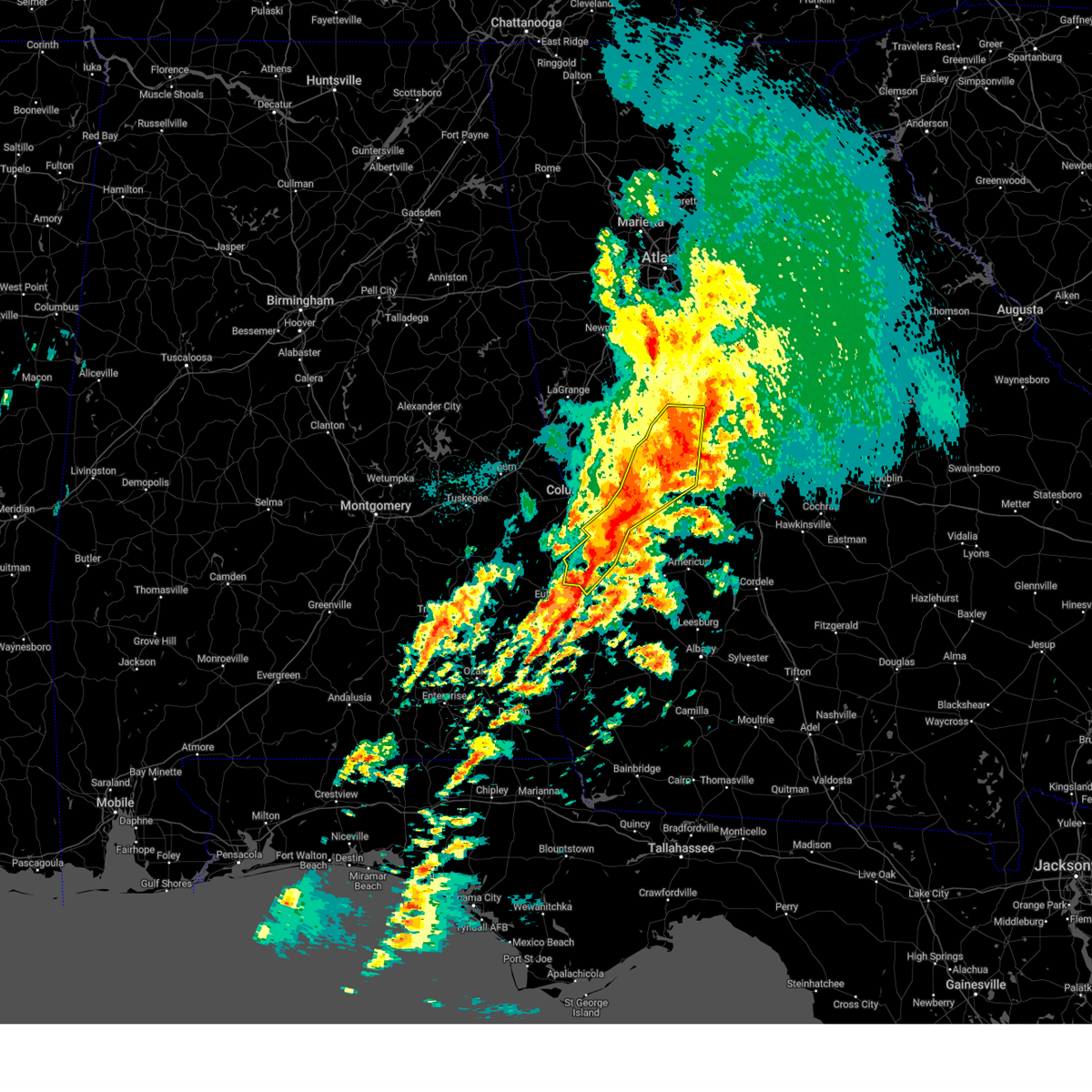
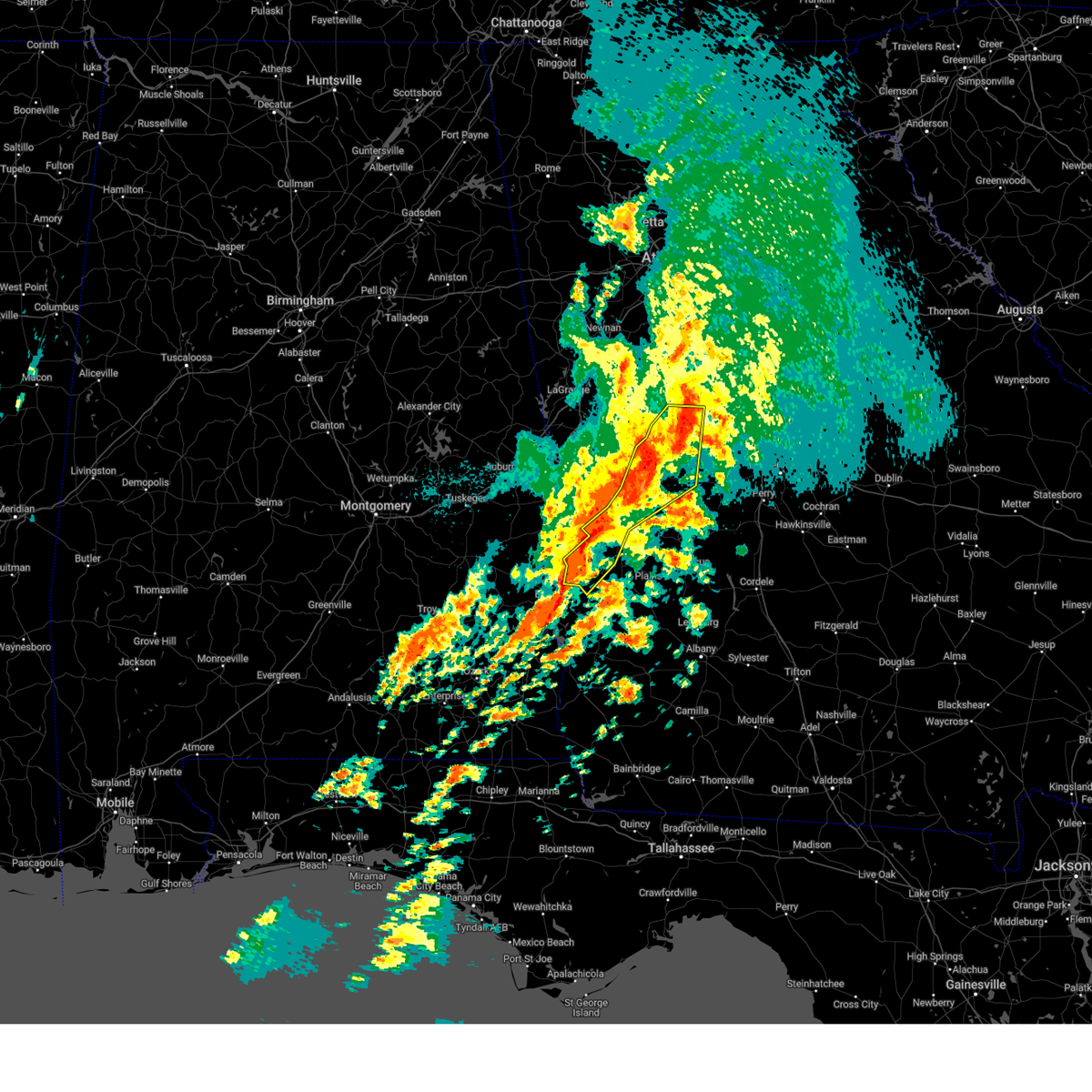
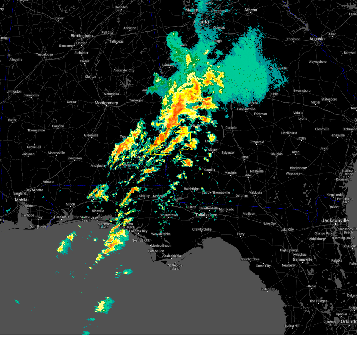
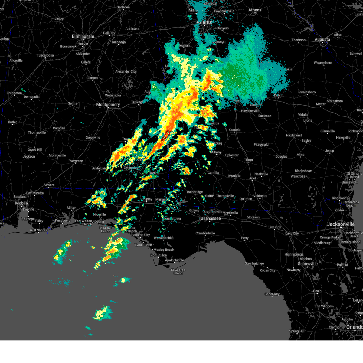
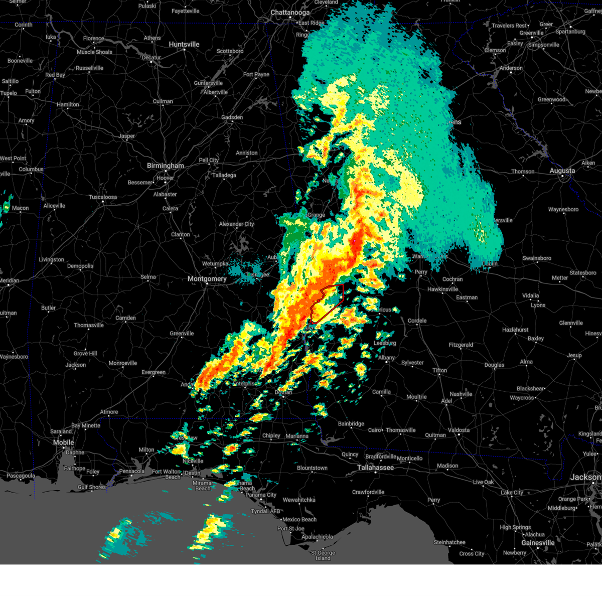
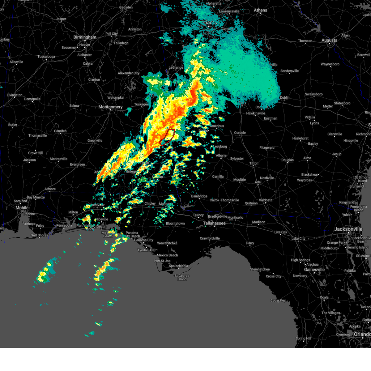
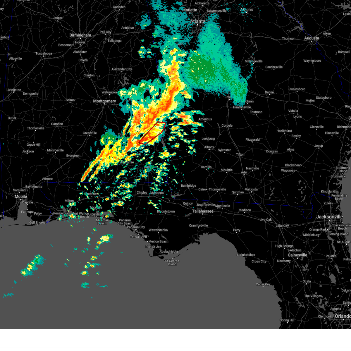
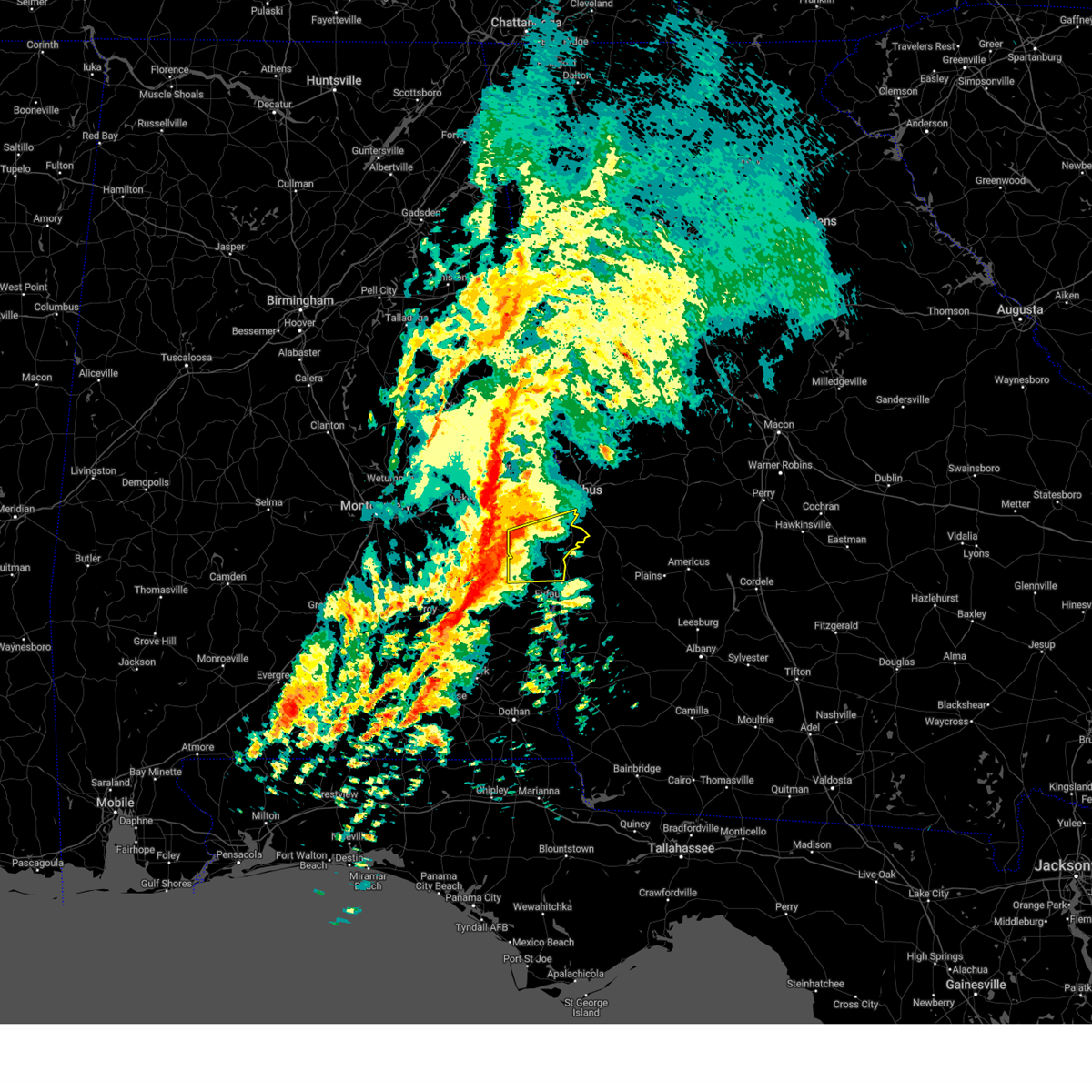
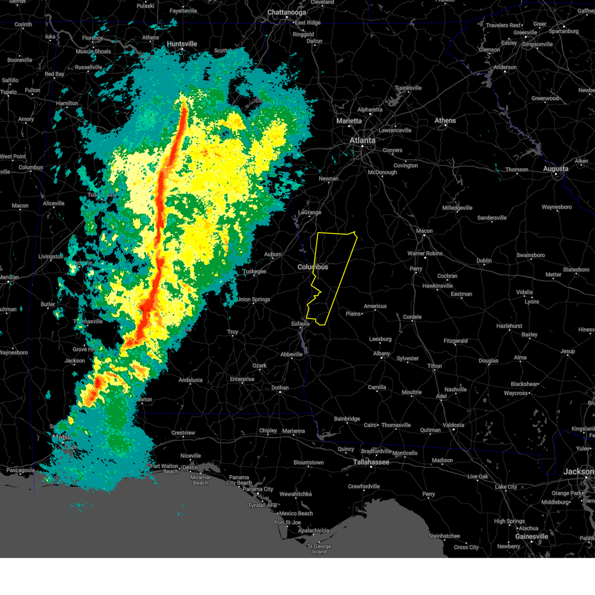
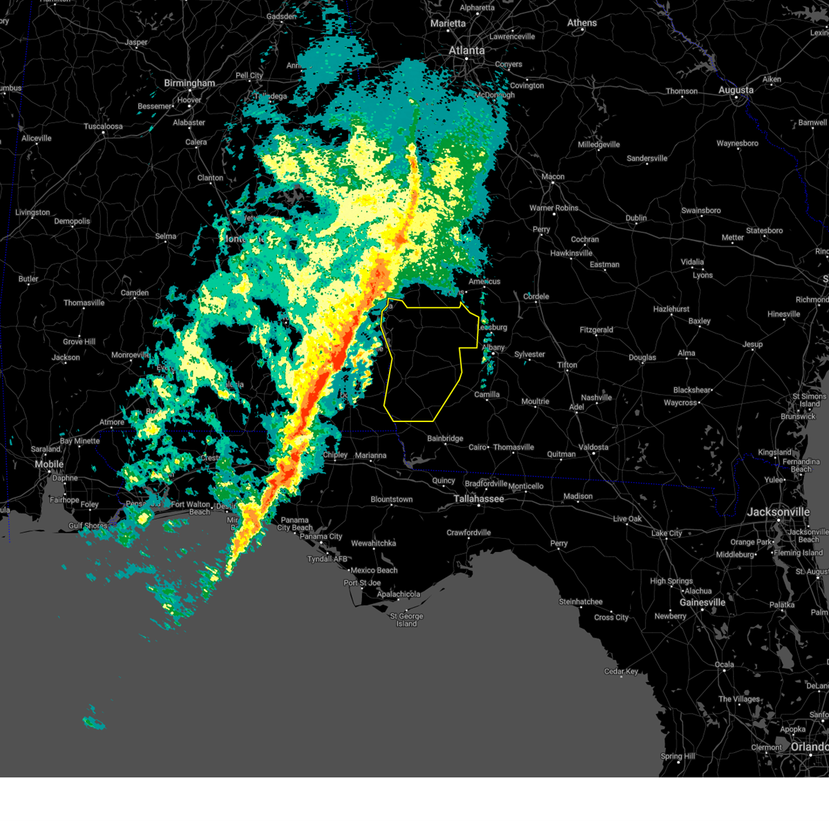
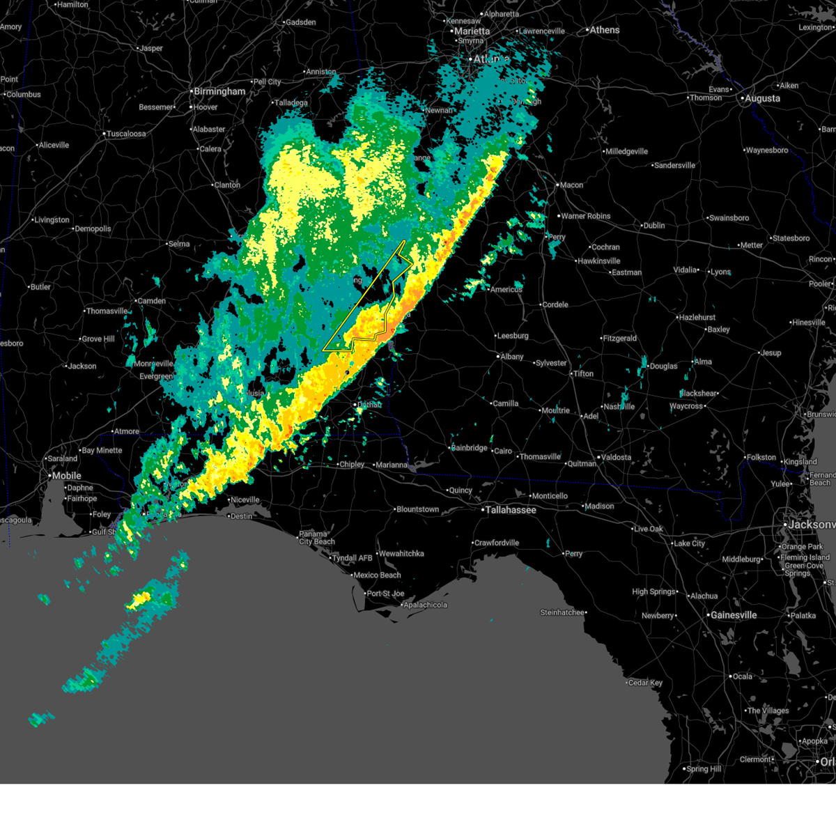
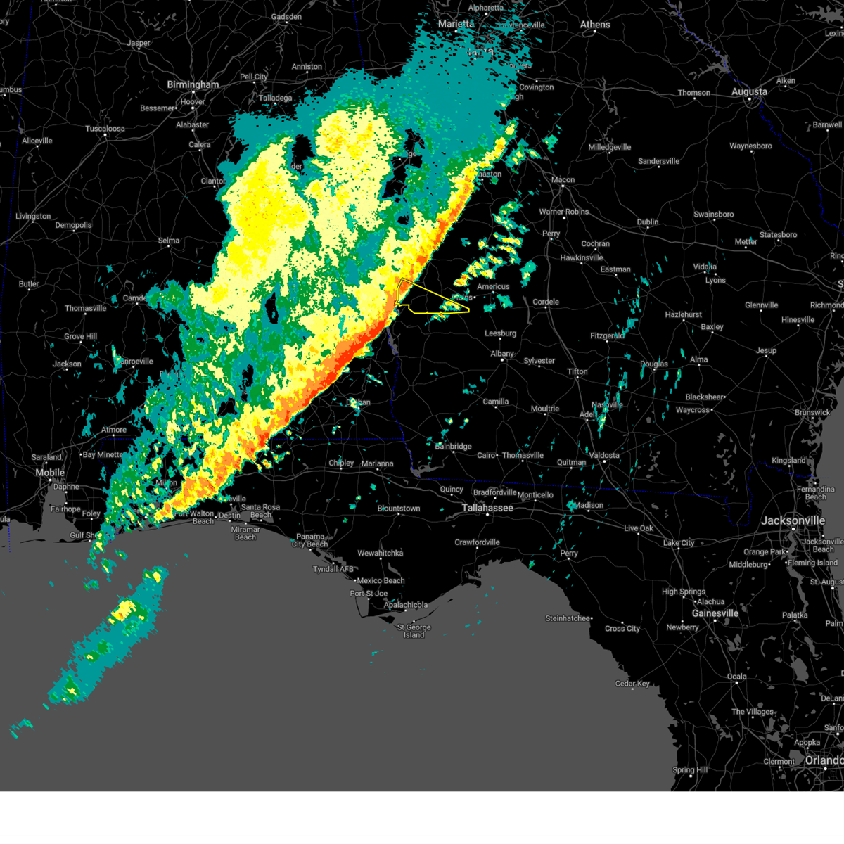
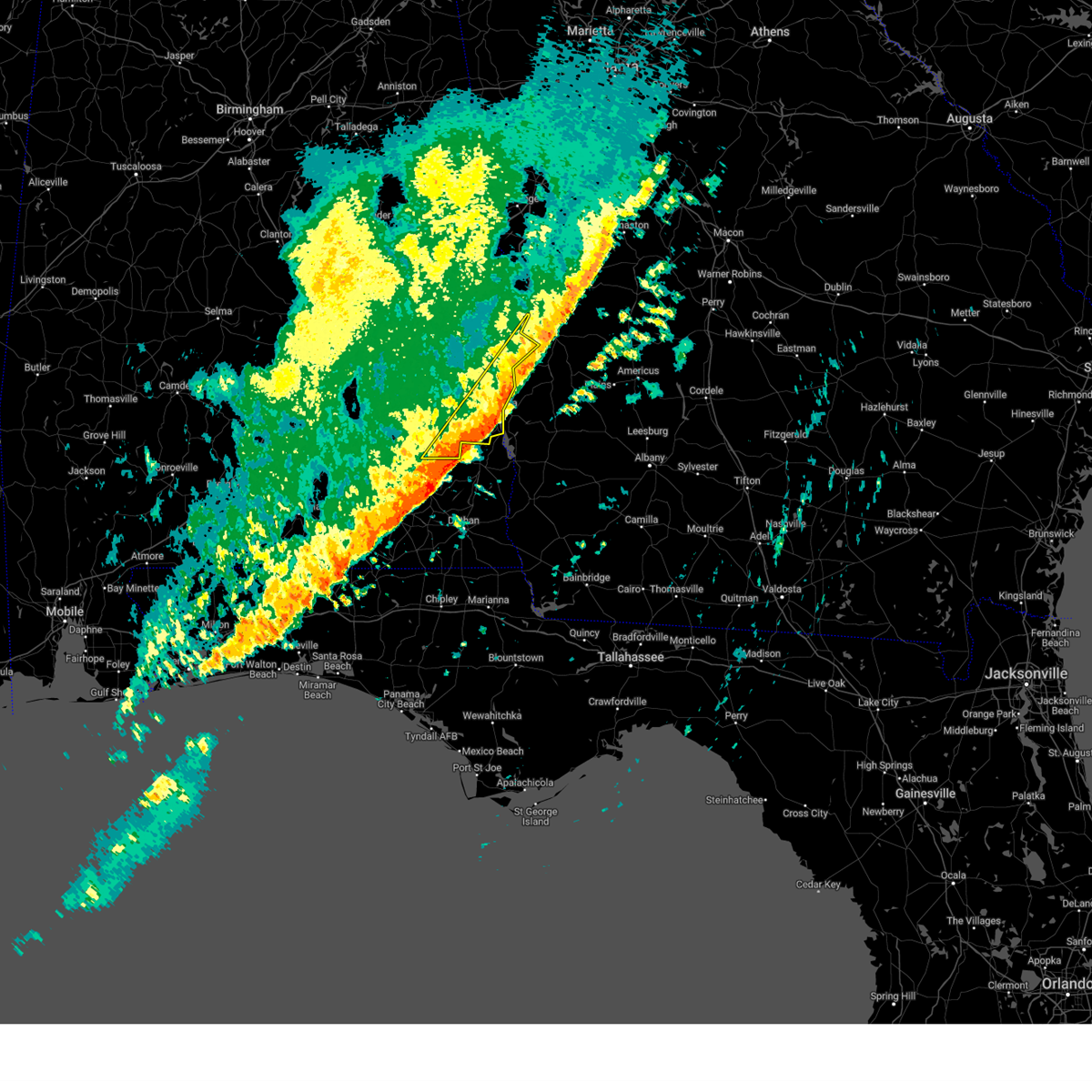
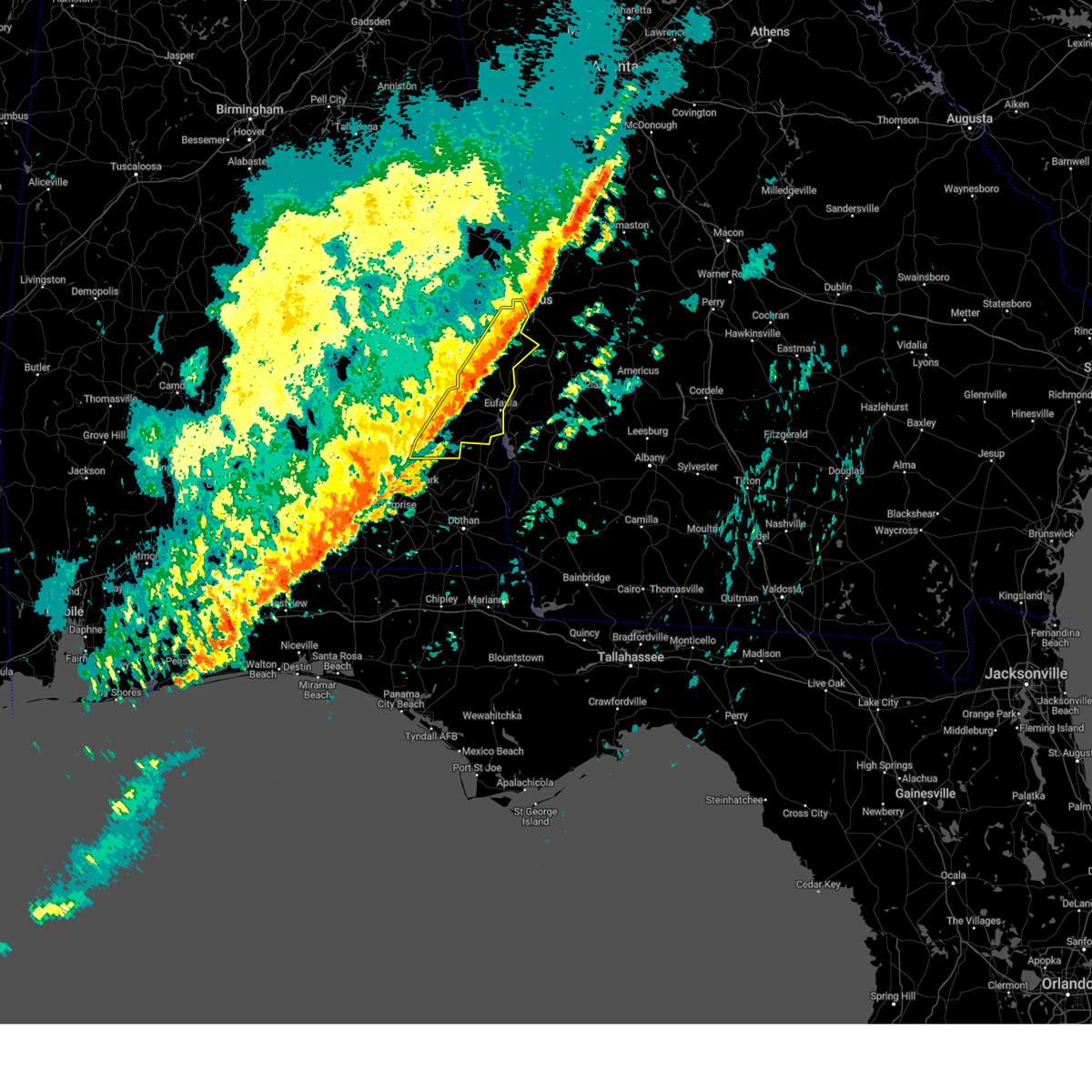
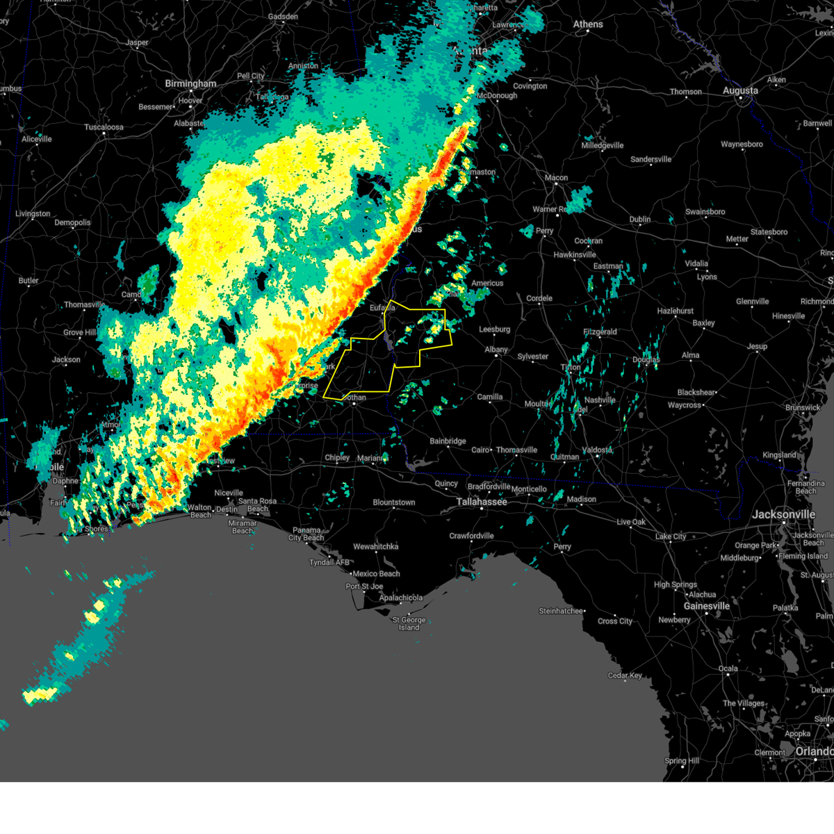
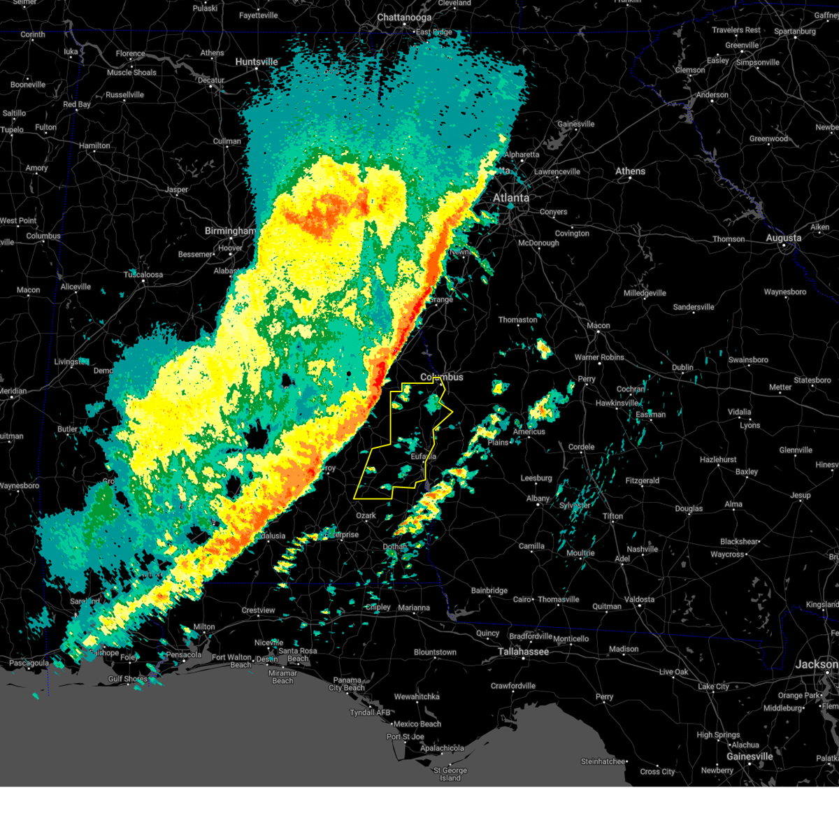
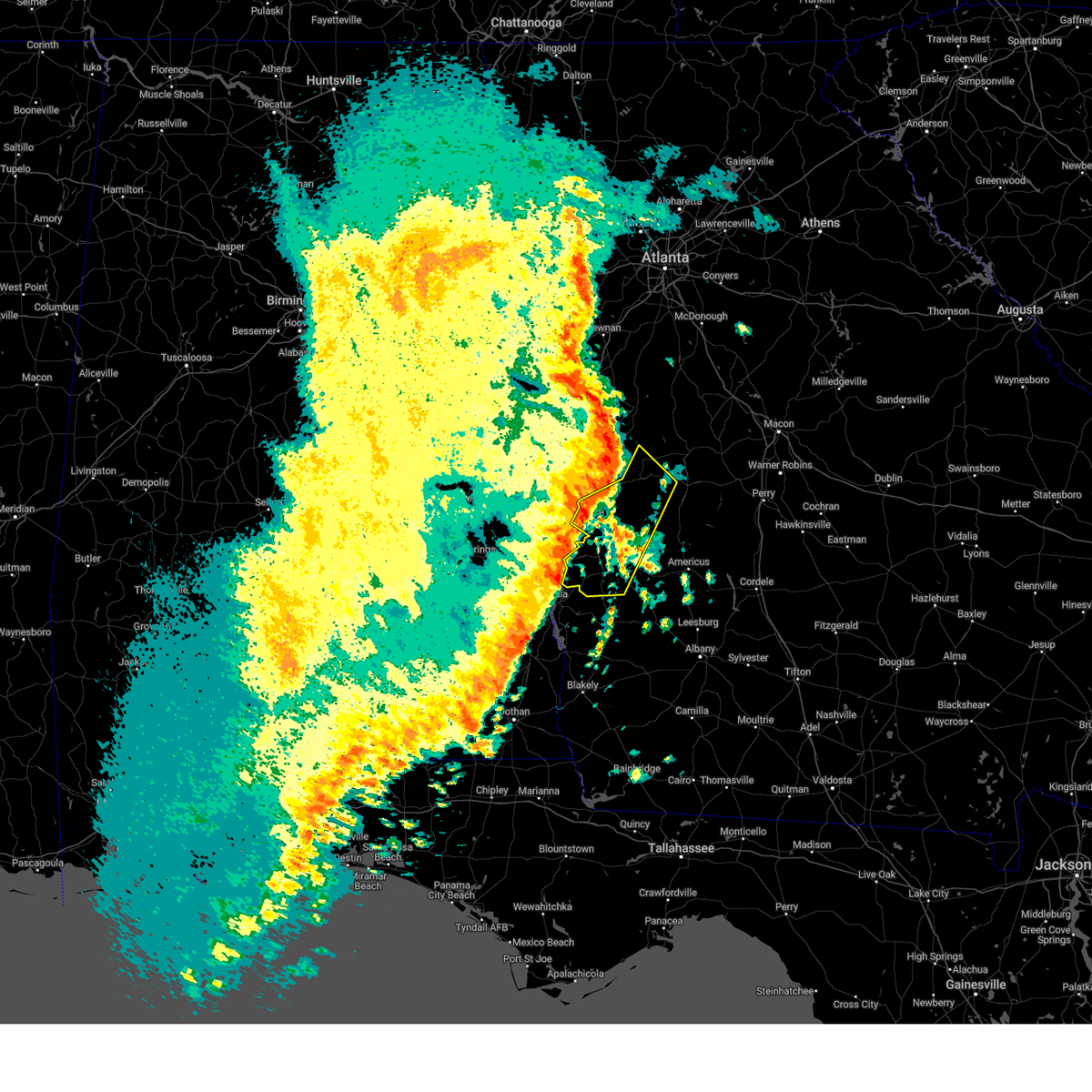
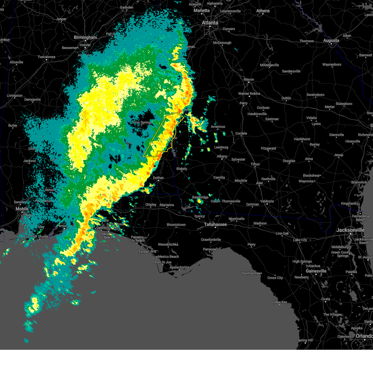
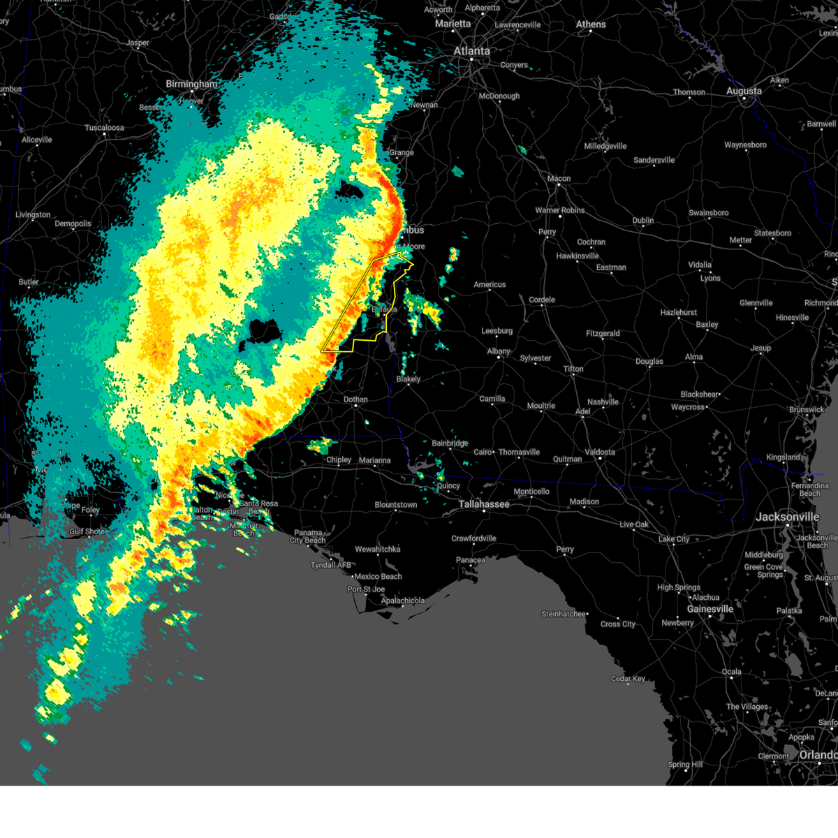
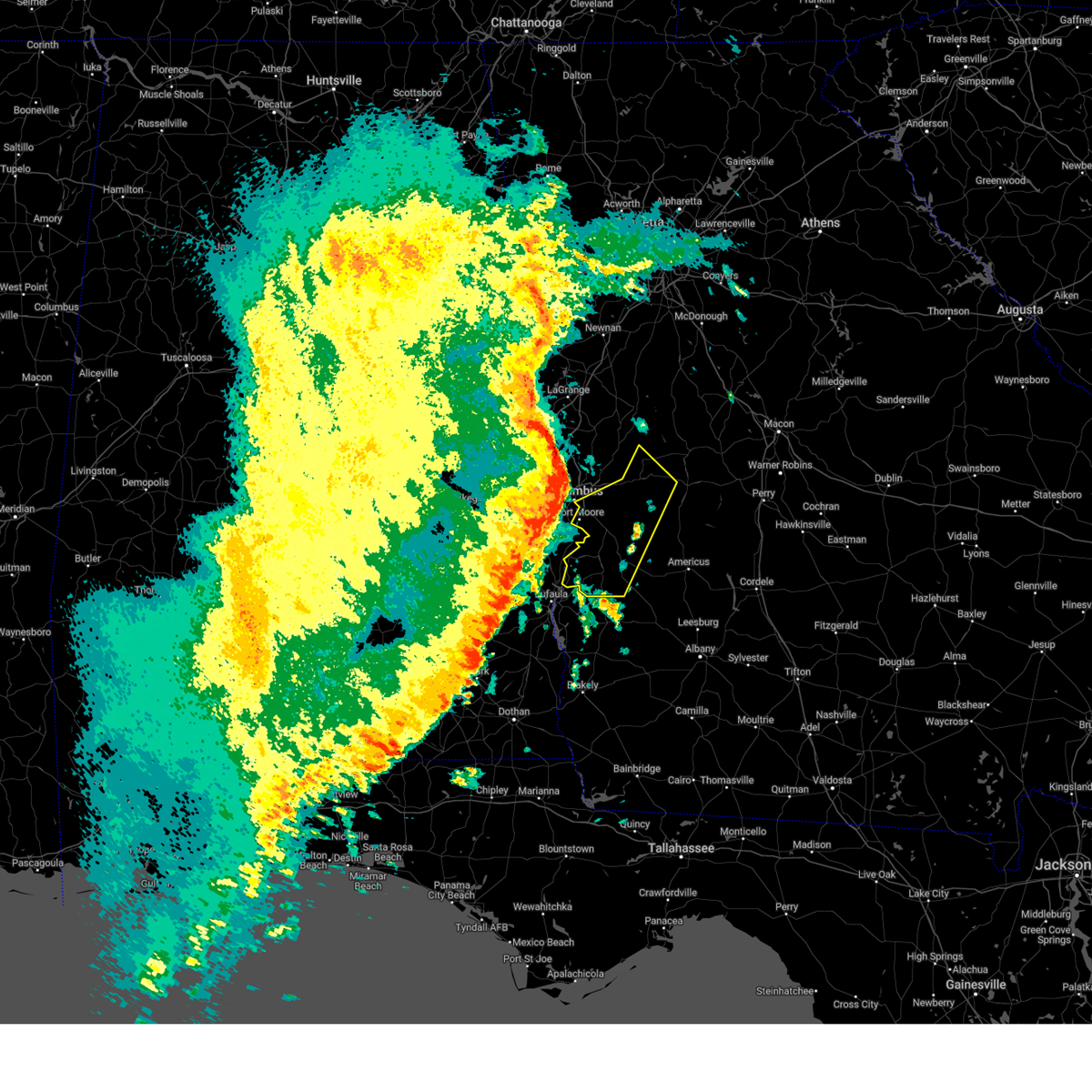
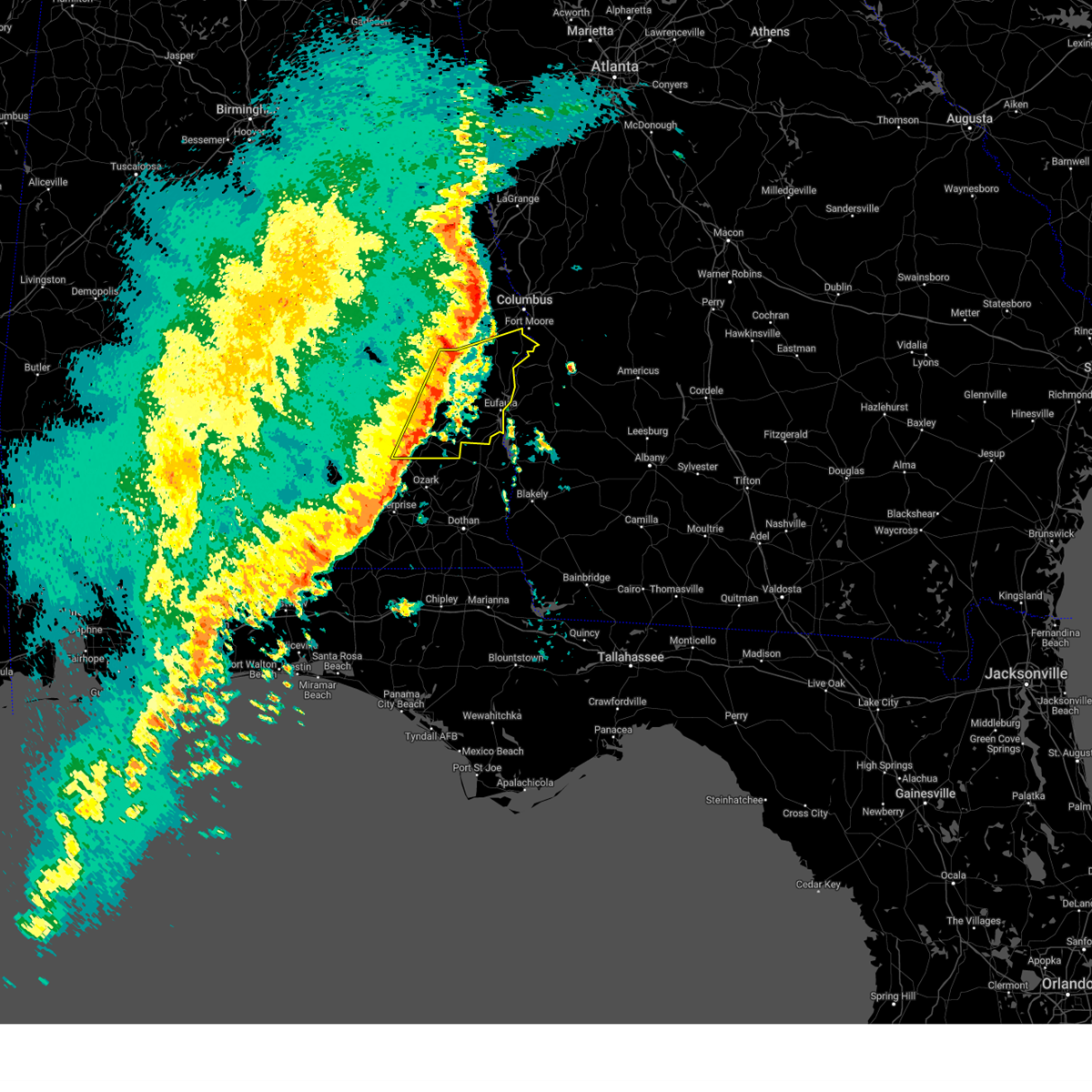
Hail Map for Eufaula, AL
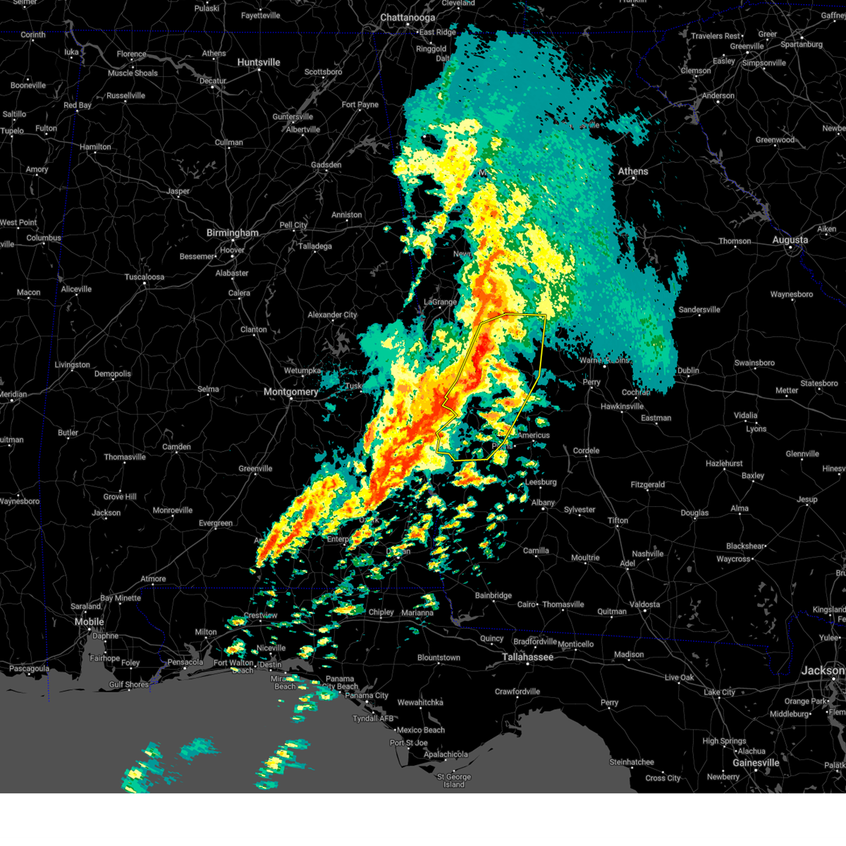
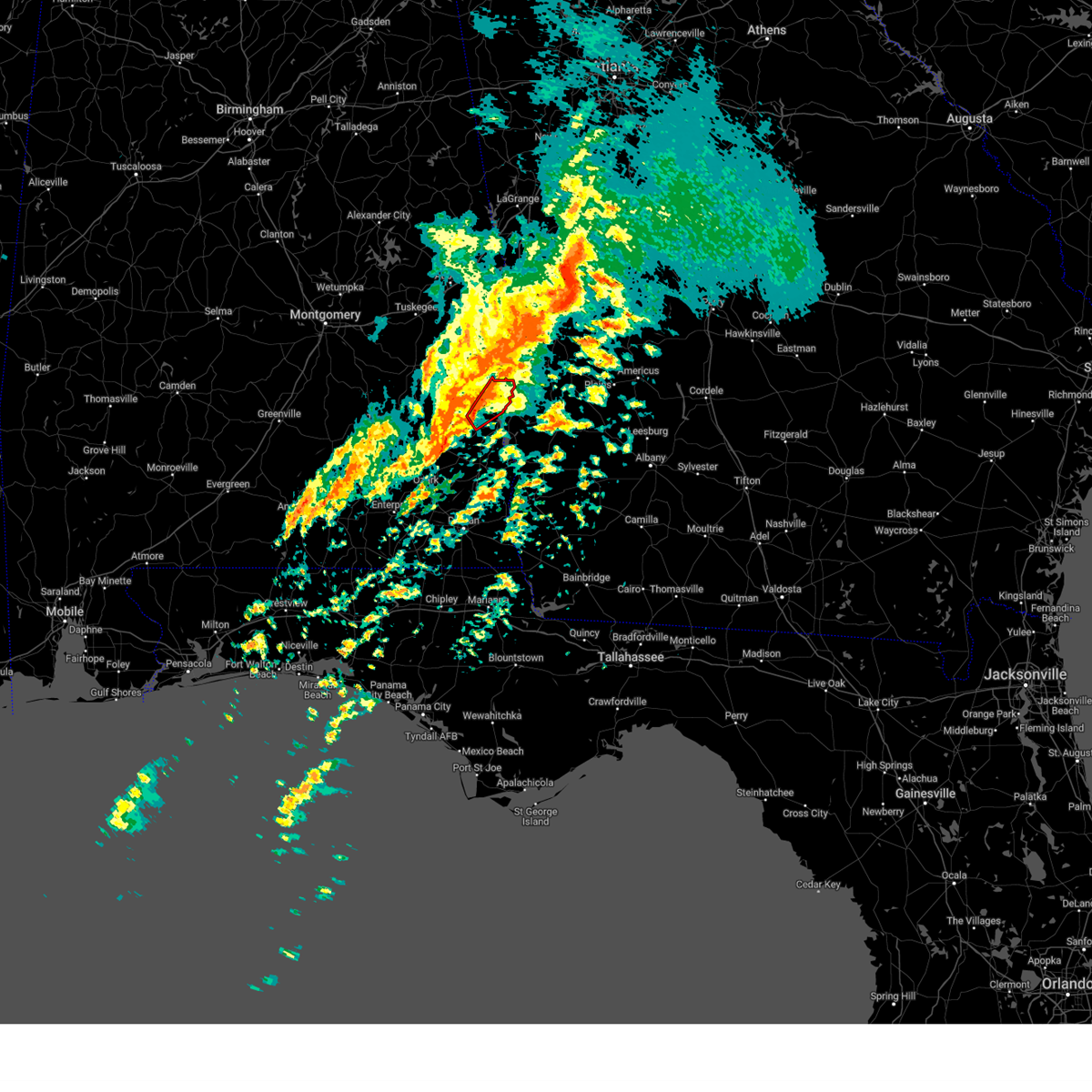
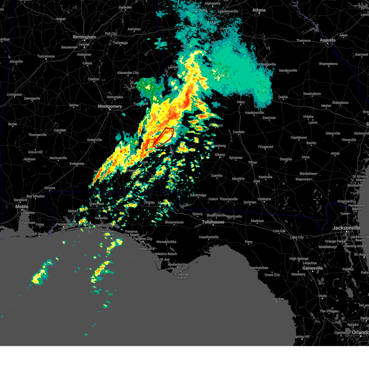
The Eufaula, AL area has had 8 reports of on-the-ground hail by trained spotters, and has been under severe weather warnings 30 times during the past 12 months. Doppler radar has detected hail at or near Eufaula, AL on 106 occasions.
| Name: | Eufaula, AL |
| Where Located: | 53.5 miles SSE of Auburn, AL |
| Map: | Google Map for Eufaula, AL |
| Population: | 13137 |
| Housing Units: | 5829 |
| More Info: | Search Google for Eufaula, AL |
5
The Top Recent Hail Date for Eufaula, AL is Saturday, March 26, 2011 (1st out of 106)

Hail and Wind Damage Spotted near Eufaula, AL
| Date / Time | Report Details |
|---|---|
| 6/22/2026 5:51 PM EDT |
 At 450 pm cdt, severe thunderstorms were located along a line extending from 7 miles southeast of seale to 10 miles northeast of hawkinsville to near lakepoint resort state park, moving east at 35 mph (radar indicated). Hazards include 60 mph wind gusts. Expect damage to roofs, siding, and trees. Locations impacted include, twin springs. At 450 pm cdt, severe thunderstorms were located along a line extending from 7 miles southeast of seale to 10 miles northeast of hawkinsville to near lakepoint resort state park, moving east at 35 mph (radar indicated). Hazards include 60 mph wind gusts. Expect damage to roofs, siding, and trees. Locations impacted include, twin springs.
|
| 6/22/2026 5:34 PM EDT |
 Svrbmx the national weather service in birmingham has issued a * severe thunderstorm warning for, northeastern barbour county in southeastern alabama, southeastern russell county in southeastern alabama, * until 515 pm cdt. * at 433 pm cdt, severe thunderstorms were located along a line extending from near spring hill to near hawkinsville to near eufaula, moving east at 40 mph (radar indicated). Hazards include 60 mph wind gusts. expect damage to roofs, siding, and trees Svrbmx the national weather service in birmingham has issued a * severe thunderstorm warning for, northeastern barbour county in southeastern alabama, southeastern russell county in southeastern alabama, * until 515 pm cdt. * at 433 pm cdt, severe thunderstorms were located along a line extending from near spring hill to near hawkinsville to near eufaula, moving east at 40 mph (radar indicated). Hazards include 60 mph wind gusts. expect damage to roofs, siding, and trees
|
| 6/1/2026 7:18 PM EDT |
 At 718 pm edt, severe thunderstorms were located along a line extending from near brantley to near kimbrough to near benevolence to near bonapartes retreat, moving southeast at 35 mph (radar indicated). Hazards include 60 mph wind gusts and penny size hail. Expect damage to roofs, siding, and trees. Locations impacted include, lumpkin, buena vista, ellaville, preston, richland, plains, weston, putnam, brantley, seminole, murrays crossroads, westville, brooklyn, renfroe, oakland, zellobee, leveretts, troutman, friendship, and sanford. At 718 pm edt, severe thunderstorms were located along a line extending from near brantley to near kimbrough to near benevolence to near bonapartes retreat, moving southeast at 35 mph (radar indicated). Hazards include 60 mph wind gusts and penny size hail. Expect damage to roofs, siding, and trees. Locations impacted include, lumpkin, buena vista, ellaville, preston, richland, plains, weston, putnam, brantley, seminole, murrays crossroads, westville, brooklyn, renfroe, oakland, zellobee, leveretts, troutman, friendship, and sanford.
|
| 6/1/2026 6:07 PM CDT |
 At 607 pm cdt, severe thunderstorms were located along a line extending from near lumpkin to near texasville to 7 miles east of goshen, moving southeast at 40 mph (radar indicated). Hazards include 60 mph wind gusts and quarter size hail. Hail damage to vehicles is expected. expect wind damage to roofs, siding, and trees. Locations impacted include, eufaula, clio, clayton, louisville, blue springs, tyler crossroads, doster, gaino, barbour county public lake dam, blue springs state park, osco, texasville, richards crossroads, white oak, lakepoint resort state park, boot hill, millers ford, batesville, clayton municipal airport, and lugo. At 607 pm cdt, severe thunderstorms were located along a line extending from near lumpkin to near texasville to 7 miles east of goshen, moving southeast at 40 mph (radar indicated). Hazards include 60 mph wind gusts and quarter size hail. Hail damage to vehicles is expected. expect wind damage to roofs, siding, and trees. Locations impacted include, eufaula, clio, clayton, louisville, blue springs, tyler crossroads, doster, gaino, barbour county public lake dam, blue springs state park, osco, texasville, richards crossroads, white oak, lakepoint resort state park, boot hill, millers ford, batesville, clayton municipal airport, and lugo.
|
| 6/1/2026 6:54 PM EDT |
 Svrffc the national weather service in peachtree city has issued a * severe thunderstorm warning for, marion county in west central georgia, southeastern chattahoochee county in west central georgia, stewart county in west central georgia, webster county in west central georgia, schley county in west central georgia, western sumter county in west central georgia, south central talbot county in west central georgia, southwestern taylor county in west central georgia, * until 730 pm edt. * at 649 pm edt, severe thunderstorms were located along a line extending from near baughville to cusseta to near omaha to near hawkinsville, moving southeast at 35 mph (radar indicated). Hazards include 60 mph wind gusts and penny size hail. expect damage to roofs, siding, and trees Svrffc the national weather service in peachtree city has issued a * severe thunderstorm warning for, marion county in west central georgia, southeastern chattahoochee county in west central georgia, stewart county in west central georgia, webster county in west central georgia, schley county in west central georgia, western sumter county in west central georgia, south central talbot county in west central georgia, southwestern taylor county in west central georgia, * until 730 pm edt. * at 649 pm edt, severe thunderstorms were located along a line extending from near baughville to cusseta to near omaha to near hawkinsville, moving southeast at 35 mph (radar indicated). Hazards include 60 mph wind gusts and penny size hail. expect damage to roofs, siding, and trees
|
| 6/1/2026 5:52 PM CDT |
 Svrtae the national weather service in tallahassee has issued a * severe thunderstorm warning for, dale county in southeastern alabama, henry county in southeastern alabama, coffee county in southeastern alabama, northwestern geneva county in southeastern alabama, northwestern houston county in southeastern alabama, clay county in southwestern georgia, randolph county in southwestern georgia, northwestern calhoun county in southwestern georgia, northwestern early county in southwestern georgia, quitman county in southwestern georgia, * until 745 pm edt/645 pm cdt/. * at 652 pm edt/552 pm cdt/, severe thunderstorms were located along a line extending from near cusseta to near lakepoint resort state park to near louisville to near glenwood, moving south at 40 mph (radar indicated). Hazards include 60 mph wind gusts. expect damage to roofs, siding, and trees Svrtae the national weather service in tallahassee has issued a * severe thunderstorm warning for, dale county in southeastern alabama, henry county in southeastern alabama, coffee county in southeastern alabama, northwestern geneva county in southeastern alabama, northwestern houston county in southeastern alabama, clay county in southwestern georgia, randolph county in southwestern georgia, northwestern calhoun county in southwestern georgia, northwestern early county in southwestern georgia, quitman county in southwestern georgia, * until 745 pm edt/645 pm cdt/. * at 652 pm edt/552 pm cdt/, severe thunderstorms were located along a line extending from near cusseta to near lakepoint resort state park to near louisville to near glenwood, moving south at 40 mph (radar indicated). Hazards include 60 mph wind gusts. expect damage to roofs, siding, and trees
|
| 6/1/2026 5:46 PM CDT |
 At 546 pm cdt, severe thunderstorms were located along a line extending from 10 miles northwest of lumpkin to near pickett to near ansley, moving southeast at 40 mph (radar indicated). Hazards include 60 mph wind gusts and quarter size hail. Hail damage to vehicles is expected. expect wind damage to roofs, siding, and trees. Locations impacted include, troy, eufaula, brundidge, clio, goshen, georgetown, clayton, louisville, banks, blue springs, tyler crossroads, richards crossroads, white oak, doster, gaino, comer, barbour county public lake dam, ansley, texasville, and troy municipal airport. At 546 pm cdt, severe thunderstorms were located along a line extending from 10 miles northwest of lumpkin to near pickett to near ansley, moving southeast at 40 mph (radar indicated). Hazards include 60 mph wind gusts and quarter size hail. Hail damage to vehicles is expected. expect wind damage to roofs, siding, and trees. Locations impacted include, troy, eufaula, brundidge, clio, goshen, georgetown, clayton, louisville, banks, blue springs, tyler crossroads, richards crossroads, white oak, doster, gaino, comer, barbour county public lake dam, ansley, texasville, and troy municipal airport.
|
| 6/1/2026 5:23 PM CDT |
 Svrbmx the national weather service in birmingham has issued a * severe thunderstorm warning for, pike county in southeastern alabama, barbour county in southeastern alabama, * until 630 pm cdt. * at 522 pm cdt, severe thunderstorms were located along a line extending from near fort benning/lawson army air fld to near union springs to grady, moving southeast at 40 mph (radar indicated). Hazards include 60 mph wind gusts and quarter size hail. Hail damage to vehicles is expected. Expect wind damage to roofs, siding, and trees. Svrbmx the national weather service in birmingham has issued a * severe thunderstorm warning for, pike county in southeastern alabama, barbour county in southeastern alabama, * until 630 pm cdt. * at 522 pm cdt, severe thunderstorms were located along a line extending from near fort benning/lawson army air fld to near union springs to grady, moving southeast at 40 mph (radar indicated). Hazards include 60 mph wind gusts and quarter size hail. Hail damage to vehicles is expected. Expect wind damage to roofs, siding, and trees.
|
| 5/6/2026 6:22 PM CDT |
 At 622 pm cdt, a severe thunderstorm was located near hurtsboro, moving east at 40 mph (broadcast media). Hazards include 60 mph wind gusts and quarter size hail. Hail damage to vehicles is expected. expect wind damage to roofs, siding, and trees. Locations impacted include, hurtsboro, hawkinsville, russell county sports complex, uchee, spring hill, seale, lakepoint resort state park, rutherford, hatchechubbe, uchee creek, fort mitchell activity center, and twin springs. At 622 pm cdt, a severe thunderstorm was located near hurtsboro, moving east at 40 mph (broadcast media). Hazards include 60 mph wind gusts and quarter size hail. Hail damage to vehicles is expected. expect wind damage to roofs, siding, and trees. Locations impacted include, hurtsboro, hawkinsville, russell county sports complex, uchee, spring hill, seale, lakepoint resort state park, rutherford, hatchechubbe, uchee creek, fort mitchell activity center, and twin springs.
|
| 5/6/2026 7:20 PM EDT |
 Svrffc the national weather service in peachtree city has issued a * severe thunderstorm warning for, southern chattahoochee county in west central georgia, stewart county in west central georgia, * until 800 pm edt. * at 718 pm edt, a severe thunderstorm was located over rutherford, or near hurtsboro, moving east at 40 mph (radar indicated). Hazards include 60 mph wind gusts and quarter size hail. Hail damage to vehicles is expected. Expect wind damage to roofs, siding, and trees. Svrffc the national weather service in peachtree city has issued a * severe thunderstorm warning for, southern chattahoochee county in west central georgia, stewart county in west central georgia, * until 800 pm edt. * at 718 pm edt, a severe thunderstorm was located over rutherford, or near hurtsboro, moving east at 40 mph (radar indicated). Hazards include 60 mph wind gusts and quarter size hail. Hail damage to vehicles is expected. Expect wind damage to roofs, siding, and trees.
|
| 5/6/2026 6:11 PM CDT |
 At 611 pm cdt, a severe thunderstorm was located near hurtsboro, moving east at 40 mph (broadcast media). Hazards include 60 mph wind gusts and quarter size hail. Hail damage to vehicles is expected. expect wind damage to roofs, siding, and trees. Locations impacted include, hurtsboro, midway, hawkinsville, russell county sports complex, uchee, spring hill, seale, comer, guerryton, society hill, lakepoint resort state park, batesville, twin springs, creek stand, rutherford, three notch, hatchechubbe, uchee creek, fort mitchell, and fort mitchell activity center. At 611 pm cdt, a severe thunderstorm was located near hurtsboro, moving east at 40 mph (broadcast media). Hazards include 60 mph wind gusts and quarter size hail. Hail damage to vehicles is expected. expect wind damage to roofs, siding, and trees. Locations impacted include, hurtsboro, midway, hawkinsville, russell county sports complex, uchee, spring hill, seale, comer, guerryton, society hill, lakepoint resort state park, batesville, twin springs, creek stand, rutherford, three notch, hatchechubbe, uchee creek, fort mitchell, and fort mitchell activity center.
|
| 5/6/2026 5:56 PM CDT |
 At 556 pm cdt, a severe thunderstorm was located over guerryton, or 7 miles west of hurtsboro, moving east at 40 mph (broadcast media). Hazards include golf ball size hail and 60 mph wind gusts. People and animals outdoors will be injured. expect hail damage to roofs, siding, windows, and vehicles. expect wind damage to roofs, siding, and trees. Locations impacted include, union springs, hurtsboro, midway, hawkinsville, aberfoil, uchee, spring hill, guerryton, davisville, russell county sports complex, seale, comer, society hill, lakepoint resort state park, warriorstand, twin springs, rutherford, three notch, uchee creek, and sedgefield. At 556 pm cdt, a severe thunderstorm was located over guerryton, or 7 miles west of hurtsboro, moving east at 40 mph (broadcast media). Hazards include golf ball size hail and 60 mph wind gusts. People and animals outdoors will be injured. expect hail damage to roofs, siding, windows, and vehicles. expect wind damage to roofs, siding, and trees. Locations impacted include, union springs, hurtsboro, midway, hawkinsville, aberfoil, uchee, spring hill, guerryton, davisville, russell county sports complex, seale, comer, society hill, lakepoint resort state park, warriorstand, twin springs, rutherford, three notch, uchee creek, and sedgefield.
|
| 5/6/2026 5:38 PM CDT |
 Svrbmx the national weather service in birmingham has issued a * severe thunderstorm warning for, bullock county in southeastern alabama, southeastern macon county in southeastern alabama, northeastern barbour county in southeastern alabama, russell county in southeastern alabama, * until 700 pm cdt. * at 537 pm cdt, a severe thunderstorm was located near franklin field, or 7 miles north of union springs, moving east at 40 mph (broadcast media). Hazards include golf ball size hail and 60 mph wind gusts. People and animals outdoors will be injured. expect hail damage to roofs, siding, windows, and vehicles. Expect wind damage to roofs, siding, and trees. Svrbmx the national weather service in birmingham has issued a * severe thunderstorm warning for, bullock county in southeastern alabama, southeastern macon county in southeastern alabama, northeastern barbour county in southeastern alabama, russell county in southeastern alabama, * until 700 pm cdt. * at 537 pm cdt, a severe thunderstorm was located near franklin field, or 7 miles north of union springs, moving east at 40 mph (broadcast media). Hazards include golf ball size hail and 60 mph wind gusts. People and animals outdoors will be injured. expect hail damage to roofs, siding, windows, and vehicles. Expect wind damage to roofs, siding, and trees.
|
| 3/16/2026 6:33 AM CDT |
 the severe thunderstorm warning has been cancelled and is no longer in effect the severe thunderstorm warning has been cancelled and is no longer in effect
|
| 3/16/2026 6:33 AM CDT |
 At 733 am edt/633 am cdt/, severe thunderstorms were located along a line extending from 8 miles east of lakepoint resort state park to near newton, moving east at 50 mph (radar indicated). Hazards include 60 mph wind gusts and penny size hail. Expect damage to roofs, siding, and trees. Locations impacted include, daleville, abbeville, fort gaines, headland, georgetown, dothan, ozark, fort rucker, midland city, kinsey, newton, webb, pinckard, grimes, newville, napier field, haleburg, shorterville, wire bridge, and hunt field. At 733 am edt/633 am cdt/, severe thunderstorms were located along a line extending from 8 miles east of lakepoint resort state park to near newton, moving east at 50 mph (radar indicated). Hazards include 60 mph wind gusts and penny size hail. Expect damage to roofs, siding, and trees. Locations impacted include, daleville, abbeville, fort gaines, headland, georgetown, dothan, ozark, fort rucker, midland city, kinsey, newton, webb, pinckard, grimes, newville, napier field, haleburg, shorterville, wire bridge, and hunt field.
|
| 3/16/2026 7:20 AM EDT |
 Svrffc the national weather service in peachtree city has issued a * severe thunderstorm warning for, stewart county in west central georgia, northwestern webster county in west central georgia, * until 800 am edt. * at 719 am edt, severe thunderstorms were located along a line extending from near omaha to near eufaula, moving northeast at 50 mph (radar indicated). Hazards include 60 mph wind gusts and penny size hail. expect damage to roofs, siding, and trees Svrffc the national weather service in peachtree city has issued a * severe thunderstorm warning for, stewart county in west central georgia, northwestern webster county in west central georgia, * until 800 am edt. * at 719 am edt, severe thunderstorms were located along a line extending from near omaha to near eufaula, moving northeast at 50 mph (radar indicated). Hazards include 60 mph wind gusts and penny size hail. expect damage to roofs, siding, and trees
|
| 3/16/2026 6:11 AM CDT |
 Svrtae the national weather service in tallahassee has issued a * severe thunderstorm warning for, dale county in southeastern alabama, henry county in southeastern alabama, southeastern coffee county in southeastern alabama, northwestern houston county in southeastern alabama, clay county in southwestern georgia, western randolph county in southwestern georgia, quitman county in southwestern georgia, * until 815 am edt/715 am cdt/. * at 711 am edt/611 am cdt/, severe thunderstorms were located along a line extending from osco to 7 miles southwest of enterprise, moving east at 50 mph (radar indicated). Hazards include 60 mph wind gusts and penny size hail. expect damage to roofs, siding, and trees Svrtae the national weather service in tallahassee has issued a * severe thunderstorm warning for, dale county in southeastern alabama, henry county in southeastern alabama, southeastern coffee county in southeastern alabama, northwestern houston county in southeastern alabama, clay county in southwestern georgia, western randolph county in southwestern georgia, quitman county in southwestern georgia, * until 815 am edt/715 am cdt/. * at 711 am edt/611 am cdt/, severe thunderstorms were located along a line extending from osco to 7 miles southwest of enterprise, moving east at 50 mph (radar indicated). Hazards include 60 mph wind gusts and penny size hail. expect damage to roofs, siding, and trees
|
| 3/12/2026 5:27 AM EDT |
 The storms which prompted the warning have moved out of the area. therefore, the warning will be allowed to expire. however, gusty winds and heavy rain are still possible with these thunderstorms. a tornado watch remains in effect until 800 am edt for west central georgia. remember, a severe thunderstorm warning still remains in effect for eastern muscogee, chattahoochee, and stewart counties as well as talbot, marion, and webster counties. remember, a tornado warning still remains in effect for norther stewart county and northwestern webster county. The storms which prompted the warning have moved out of the area. therefore, the warning will be allowed to expire. however, gusty winds and heavy rain are still possible with these thunderstorms. a tornado watch remains in effect until 800 am edt for west central georgia. remember, a severe thunderstorm warning still remains in effect for eastern muscogee, chattahoochee, and stewart counties as well as talbot, marion, and webster counties. remember, a tornado warning still remains in effect for norther stewart county and northwestern webster county.
|
| 3/12/2026 4:18 AM CDT |
 the severe thunderstorm warning has been cancelled and is no longer in effect the severe thunderstorm warning has been cancelled and is no longer in effect
|
| 3/12/2026 5:08 AM EDT |
 Svrtae the national weather service in tallahassee has issued a * severe thunderstorm warning for, southeastern dale county in southeastern alabama, eastern geneva county in southeastern alabama, houston county in southeastern alabama, henry county in southeastern alabama, clay county in southwestern georgia, randolph county in southwestern georgia, northwestern lee county in southwestern georgia, calhoun county in southwestern georgia, early county in southwestern georgia, quitman county in southwestern georgia, western miller county in southwestern georgia, northwestern baker county in southwestern georgia, terrell county in southwestern georgia, * until 615 am edt/515 am cdt/. * at 508 am edt/408 am cdt/, severe thunderstorms were located along a line extending from 6 miles northeast of georgetown to near headland to near hartford, moving east at 45 mph (radar indicated). Hazards include 60 mph wind gusts. expect damage to roofs, siding, and trees Svrtae the national weather service in tallahassee has issued a * severe thunderstorm warning for, southeastern dale county in southeastern alabama, eastern geneva county in southeastern alabama, houston county in southeastern alabama, henry county in southeastern alabama, clay county in southwestern georgia, randolph county in southwestern georgia, northwestern lee county in southwestern georgia, calhoun county in southwestern georgia, early county in southwestern georgia, quitman county in southwestern georgia, western miller county in southwestern georgia, northwestern baker county in southwestern georgia, terrell county in southwestern georgia, * until 615 am edt/515 am cdt/. * at 508 am edt/408 am cdt/, severe thunderstorms were located along a line extending from 6 miles northeast of georgetown to near headland to near hartford, moving east at 45 mph (radar indicated). Hazards include 60 mph wind gusts. expect damage to roofs, siding, and trees
|
| 3/12/2026 5:07 AM EDT |
 Torffc the national weather service in peachtree city has issued a * tornado warning for, stewart county in west central georgia, west central webster county in west central georgia, * until 545 am edt. * at 507 am edt, a severe thunderstorm capable of producing a tornado was located over florence marina state park, or 14 miles north of georgetown, moving east at 35 mph (radar indicated rotation). Hazards include tornado. Flying debris will be dangerous to those caught without shelter. mobile homes will be damaged or destroyed. damage to roofs, windows, and vehicles will occur. Tree damage is likely. Torffc the national weather service in peachtree city has issued a * tornado warning for, stewart county in west central georgia, west central webster county in west central georgia, * until 545 am edt. * at 507 am edt, a severe thunderstorm capable of producing a tornado was located over florence marina state park, or 14 miles north of georgetown, moving east at 35 mph (radar indicated rotation). Hazards include tornado. Flying debris will be dangerous to those caught without shelter. mobile homes will be damaged or destroyed. damage to roofs, windows, and vehicles will occur. Tree damage is likely.
|
| 3/12/2026 4:06 AM CDT | Power lines down on hwy 431 on barbour creek bridge blocking all four lane in barbour county AL, 2.2 miles NNE of Eufaula, AL |
| 3/12/2026 4:02 AM CDT | Tree down on 5 mile r in barbour county AL, 4.4 miles NE of Eufaula, AL |
| 3/12/2026 4:01 AM CDT |
 At 400 am cdt, severe thunderstorms were located along a line extending from hawkinsville to near osco to near richards crossroads to near texasville, moving east at 40 mph (radar indicated). Hazards include 60 mph wind gusts. Expect damage to roofs, siding, and trees. Locations impacted include, eufaula, hawkinsville, osco, texasville, gaino, richards crossroads, lakepoint resort state park, lugo, baker hill, and twin springs. At 400 am cdt, severe thunderstorms were located along a line extending from hawkinsville to near osco to near richards crossroads to near texasville, moving east at 40 mph (radar indicated). Hazards include 60 mph wind gusts. Expect damage to roofs, siding, and trees. Locations impacted include, eufaula, hawkinsville, osco, texasville, gaino, richards crossroads, lakepoint resort state park, lugo, baker hill, and twin springs.
|
| 3/12/2026 3:55 AM CDT |
 the tornado warning has been cancelled and is no longer in effect the tornado warning has been cancelled and is no longer in effect
|
| 3/12/2026 3:49 AM CDT |
 At 349 am cdt, a severe thunderstorm capable of producing a tornado was located over white oak, or 10 miles west of eufaula, moving east at 40 mph (radar indicated rotation). Hazards include tornado. Flying debris will be dangerous to those caught without shelter. mobile homes will be damaged or destroyed. damage to roofs, windows, and vehicles will occur. tree damage is likely. Locations impacted include, eufaula, white oak, lakepoint resort state park, osco, and lugo. At 349 am cdt, a severe thunderstorm capable of producing a tornado was located over white oak, or 10 miles west of eufaula, moving east at 40 mph (radar indicated rotation). Hazards include tornado. Flying debris will be dangerous to those caught without shelter. mobile homes will be damaged or destroyed. damage to roofs, windows, and vehicles will occur. tree damage is likely. Locations impacted include, eufaula, white oak, lakepoint resort state park, osco, and lugo.
|
| 3/12/2026 3:40 AM CDT |
 Torbmx the national weather service in birmingham has issued a * tornado warning for, east central barbour county in southeastern alabama, * until 430 am cdt. * at 340 am cdt, a severe thunderstorm capable of producing a tornado was located over barbour county public lake dam, or 11 miles southeast of midway, moving east at 40 mph (radar indicated rotation). Hazards include tornado. Flying debris will be dangerous to those caught without shelter. mobile homes will be damaged or destroyed. damage to roofs, windows, and vehicles will occur. Tree damage is likely. Torbmx the national weather service in birmingham has issued a * tornado warning for, east central barbour county in southeastern alabama, * until 430 am cdt. * at 340 am cdt, a severe thunderstorm capable of producing a tornado was located over barbour county public lake dam, or 11 miles southeast of midway, moving east at 40 mph (radar indicated rotation). Hazards include tornado. Flying debris will be dangerous to those caught without shelter. mobile homes will be damaged or destroyed. damage to roofs, windows, and vehicles will occur. Tree damage is likely.
|
| 3/12/2026 4:38 AM EDT |
 Svrffc the national weather service in peachtree city has issued a * severe thunderstorm warning for, marion county in west central georgia, muscogee county in west central georgia, chattahoochee county in west central georgia, stewart county in west central georgia, webster county in west central georgia, southern talbot county in west central georgia, southern harris county in west central georgia, * until 530 am edt. * at 438 am edt, severe thunderstorms were located along a line extending from beulah to near barbour county public lake dam, moving east at 35 mph (radar indicated). Hazards include 60 mph wind gusts and penny size hail. expect damage to roofs, siding, and trees Svrffc the national weather service in peachtree city has issued a * severe thunderstorm warning for, marion county in west central georgia, muscogee county in west central georgia, chattahoochee county in west central georgia, stewart county in west central georgia, webster county in west central georgia, southern talbot county in west central georgia, southern harris county in west central georgia, * until 530 am edt. * at 438 am edt, severe thunderstorms were located along a line extending from beulah to near barbour county public lake dam, moving east at 35 mph (radar indicated). Hazards include 60 mph wind gusts and penny size hail. expect damage to roofs, siding, and trees
|
| 3/12/2026 3:38 AM CDT |
 Svrbmx the national weather service in birmingham has issued a * severe thunderstorm warning for, barbour county in southeastern alabama, * until 430 am cdt. * at 338 am cdt, severe thunderstorms were located along a line extending from near comer to near barbour county public lake dam to near louisville to doster, moving east at 40 mph (radar indicated). Hazards include 60 mph wind gusts. expect damage to roofs, siding, and trees Svrbmx the national weather service in birmingham has issued a * severe thunderstorm warning for, barbour county in southeastern alabama, * until 430 am cdt. * at 338 am cdt, severe thunderstorms were located along a line extending from near comer to near barbour county public lake dam to near louisville to doster, moving east at 40 mph (radar indicated). Hazards include 60 mph wind gusts. expect damage to roofs, siding, and trees
|
| 3/12/2026 3:21 AM CDT |
 At 320 am cdt, severe thunderstorms were located along a line extending from near pickett to near boot hill to near brundidge, moving east at 50 mph (radar indicated). Hazards include 60 mph wind gusts. Expect damage to roofs, siding, and trees. Locations impacted include, brundidge, clio, clayton, louisville, blue springs, tyler crossroads, pickett, blue springs state park, white oak, boot hill, doster, gaino, comer, barbour county public lake dam, texasville, tennille, millers ford, perote, josie, and mount andrew. At 320 am cdt, severe thunderstorms were located along a line extending from near pickett to near boot hill to near brundidge, moving east at 50 mph (radar indicated). Hazards include 60 mph wind gusts. Expect damage to roofs, siding, and trees. Locations impacted include, brundidge, clio, clayton, louisville, blue springs, tyler crossroads, pickett, blue springs state park, white oak, boot hill, doster, gaino, comer, barbour county public lake dam, texasville, tennille, millers ford, perote, josie, and mount andrew.
|
| 3/12/2026 3:10 AM CDT |
 At 310 am cdt, severe thunderstorms were located along a line extending from near linwood to banks to near brundidge, moving east at 50 mph (radar indicated). Hazards include 60 mph wind gusts. Expect damage to roofs, siding, and trees. Locations impacted include, troy, brundidge, clio, clayton, louisville, banks, blue springs, tyler crossroads, pickett, blue springs state park, beans crossroads, linwood, white oak, boot hill, doster, gaino, comer, antioch, barbour county public lake dam, and texasville. At 310 am cdt, severe thunderstorms were located along a line extending from near linwood to banks to near brundidge, moving east at 50 mph (radar indicated). Hazards include 60 mph wind gusts. Expect damage to roofs, siding, and trees. Locations impacted include, troy, brundidge, clio, clayton, louisville, banks, blue springs, tyler crossroads, pickett, blue springs state park, beans crossroads, linwood, white oak, boot hill, doster, gaino, comer, antioch, barbour county public lake dam, and texasville.
|
| 3/12/2026 2:57 AM CDT |
 Svrbmx the national weather service in birmingham has issued a * severe thunderstorm warning for, pike county in southeastern alabama, southern bullock county in southeastern alabama, barbour county in southeastern alabama, * until 345 am cdt. * at 256 am cdt, severe thunderstorms were located along a line extending from near troy municipal airport to troy to 6 miles southeast of goshen, moving east at 50 mph (radar indicated). Hazards include 60 mph wind gusts. expect damage to roofs, siding, and trees Svrbmx the national weather service in birmingham has issued a * severe thunderstorm warning for, pike county in southeastern alabama, southern bullock county in southeastern alabama, barbour county in southeastern alabama, * until 345 am cdt. * at 256 am cdt, severe thunderstorms were located along a line extending from near troy municipal airport to troy to 6 miles southeast of goshen, moving east at 50 mph (radar indicated). Hazards include 60 mph wind gusts. expect damage to roofs, siding, and trees
|
| 6/25/2025 10:51 PM EDT |
 the severe thunderstorm warning has been cancelled and is no longer in effect the severe thunderstorm warning has been cancelled and is no longer in effect
|
| 6/25/2025 10:51 PM EDT |
 At 1051 pm edt, a severe thunderstorm was located over cuthbert, moving west at 20 mph (radar indicated). Hazards include 60 mph wind gusts. Expect damage to roofs, siding, and trees. Locations impacted include, fort gaines, cuthbert, georgetown, wire bridge, bonapartes retreat, standleys store, watson crossroads, crossroads, ricks place, pecan, randolph co a/p, hatcher, morris, jones crossing, bethel, benevolence, springvale, cotton hill, fort gaines-clay airport, and wades. At 1051 pm edt, a severe thunderstorm was located over cuthbert, moving west at 20 mph (radar indicated). Hazards include 60 mph wind gusts. Expect damage to roofs, siding, and trees. Locations impacted include, fort gaines, cuthbert, georgetown, wire bridge, bonapartes retreat, standleys store, watson crossroads, crossroads, ricks place, pecan, randolph co a/p, hatcher, morris, jones crossing, bethel, benevolence, springvale, cotton hill, fort gaines-clay airport, and wades.
|
| 6/25/2025 10:39 PM EDT |
 At 1039 pm edt, a severe thunderstorm was located over cuthbert, moving west at 25 mph (radar indicated). Hazards include 60 mph wind gusts. Expect damage to roofs, siding, and trees. locations impacted include, fort gaines, cuthbert, georgetown, shellman, parrott, walter f. George lock and dam, wire bridge, walter f george lake, bonapartes retreat, standleys store, carnegie, watson crossroads, crossroads, ricks place, pecan, randolph co a/p, chambliss, hatcher, morris, and jones crossing. At 1039 pm edt, a severe thunderstorm was located over cuthbert, moving west at 25 mph (radar indicated). Hazards include 60 mph wind gusts. Expect damage to roofs, siding, and trees. locations impacted include, fort gaines, cuthbert, georgetown, shellman, parrott, walter f. George lock and dam, wire bridge, walter f george lake, bonapartes retreat, standleys store, carnegie, watson crossroads, crossroads, ricks place, pecan, randolph co a/p, chambliss, hatcher, morris, and jones crossing.
|
| 6/25/2025 10:06 PM EDT |
 Svrtae the national weather service in tallahassee has issued a * severe thunderstorm warning for, northern clay county in southwestern georgia, randolph county in southwestern georgia, quitman county in southwestern georgia, terrell county in southwestern georgia, * until 1130 pm edt. * at 1006 pm edt, a severe thunderstorm was located near dawson, moving west at 20 mph (radar indicated). Hazards include 60 mph wind gusts. expect damage to roofs, siding, and trees Svrtae the national weather service in tallahassee has issued a * severe thunderstorm warning for, northern clay county in southwestern georgia, randolph county in southwestern georgia, quitman county in southwestern georgia, terrell county in southwestern georgia, * until 1130 pm edt. * at 1006 pm edt, a severe thunderstorm was located near dawson, moving west at 20 mph (radar indicated). Hazards include 60 mph wind gusts. expect damage to roofs, siding, and trees
|
| 5/27/2025 3:06 PM CDT | Trees and powerlines were downed in eufaula... including barbour ln... south randolph ave... and west broad at doren d in barbour county AL, 0.5 miles N of Eufaula, AL |
| 5/10/2025 2:33 PM EDT |
 Svrtae the national weather service in tallahassee has issued a * severe thunderstorm warning for, eastern henry county in southeastern alabama, northeastern houston county in southeastern alabama, northwestern miller county in southwestern georgia, clay county in southwestern georgia, randolph county in southwestern georgia, calhoun county in southwestern georgia, early county in southwestern georgia, quitman county in southwestern georgia, western terrell county in southwestern georgia, * until 330 pm edt/230 pm cdt/. * at 233 pm edt/133 pm cdt/, severe thunderstorms were located along a line extending from 7 miles southeast of fort gaines to near columbia, moving northeast at 25 mph (radar indicated). Hazards include 60 mph wind gusts and quarter size hail. Hail damage to vehicles is expected. Expect wind damage to roofs, siding, and trees. Svrtae the national weather service in tallahassee has issued a * severe thunderstorm warning for, eastern henry county in southeastern alabama, northeastern houston county in southeastern alabama, northwestern miller county in southwestern georgia, clay county in southwestern georgia, randolph county in southwestern georgia, calhoun county in southwestern georgia, early county in southwestern georgia, quitman county in southwestern georgia, western terrell county in southwestern georgia, * until 330 pm edt/230 pm cdt/. * at 233 pm edt/133 pm cdt/, severe thunderstorms were located along a line extending from 7 miles southeast of fort gaines to near columbia, moving northeast at 25 mph (radar indicated). Hazards include 60 mph wind gusts and quarter size hail. Hail damage to vehicles is expected. Expect wind damage to roofs, siding, and trees.
|
| 4/10/2025 11:41 PM CDT |
 the severe thunderstorm warning has been cancelled and is no longer in effect the severe thunderstorm warning has been cancelled and is no longer in effect
|
| 4/10/2025 11:26 PM CDT |
 At 1126 pm cdt, severe thunderstorms were located along a line extending from near cusseta to near spring hill to franklin field, moving southeast at 45 mph (radar indicated). Hazards include 60 mph wind gusts. Expect damage to roofs, siding, and trees. Locations impacted include, pickett, hawkinsville, millers ford, aberfoil, spring hill, high ridge, louisville, hurtsboro, franklin field, perote, josie, beans crossroads, fort davis, twin springs, guerryton, rutherford, shopton, osco, three notch, and mitchell. At 1126 pm cdt, severe thunderstorms were located along a line extending from near cusseta to near spring hill to franklin field, moving southeast at 45 mph (radar indicated). Hazards include 60 mph wind gusts. Expect damage to roofs, siding, and trees. Locations impacted include, pickett, hawkinsville, millers ford, aberfoil, spring hill, high ridge, louisville, hurtsboro, franklin field, perote, josie, beans crossroads, fort davis, twin springs, guerryton, rutherford, shopton, osco, three notch, and mitchell.
|
| 4/10/2025 11:11 PM CDT |
 the severe thunderstorm warning has been cancelled and is no longer in effect the severe thunderstorm warning has been cancelled and is no longer in effect
|
| 4/10/2025 11:11 PM CDT |
 At 1110 pm cdt, severe thunderstorms were located along a line extending from near fort moore/lawson army air fld to near midway to near shopton, moving southeast at 45 mph (radar indicated). Hazards include 60 mph wind gusts. Expect damage to roofs, siding, and trees. Locations impacted include, pickett, warriorstand, millers ford, high ridge, josie, beans crossroads, fort davis, guerryton, rutherford, shopton, three notch, richards crossroads, uchee creek, white oak, midway, mount andrew, gaino, clayton municipal airport, seale, and comer. At 1110 pm cdt, severe thunderstorms were located along a line extending from near fort moore/lawson army air fld to near midway to near shopton, moving southeast at 45 mph (radar indicated). Hazards include 60 mph wind gusts. Expect damage to roofs, siding, and trees. Locations impacted include, pickett, warriorstand, millers ford, high ridge, josie, beans crossroads, fort davis, guerryton, rutherford, shopton, three notch, richards crossroads, uchee creek, white oak, midway, mount andrew, gaino, clayton municipal airport, seale, and comer.
|
| 4/10/2025 10:56 PM CDT |
 Svrbmx the national weather service in birmingham has issued a * severe thunderstorm warning for, northeastern pike county in southeastern alabama, southeastern lee county in east central alabama, bullock county in southeastern alabama, southeastern macon county in southeastern alabama, east central montgomery county in south central alabama, barbour county in southeastern alabama, russell county in southeastern alabama, * until midnight cdt. * at 1056 pm cdt, severe thunderstorms were located along a line extending from uchee to near union springs to near pike road, moving southeast at 50 mph (radar indicated). Hazards include 60 mph wind gusts. expect damage to roofs, siding, and trees Svrbmx the national weather service in birmingham has issued a * severe thunderstorm warning for, northeastern pike county in southeastern alabama, southeastern lee county in east central alabama, bullock county in southeastern alabama, southeastern macon county in southeastern alabama, east central montgomery county in south central alabama, barbour county in southeastern alabama, russell county in southeastern alabama, * until midnight cdt. * at 1056 pm cdt, severe thunderstorms were located along a line extending from uchee to near union springs to near pike road, moving southeast at 50 mph (radar indicated). Hazards include 60 mph wind gusts. expect damage to roofs, siding, and trees
|
| 3/31/2025 1:47 PM EDT |
 At 147 pm edt/1247 pm cdt/, severe thunderstorms were located along a line extending from near cuthbert to 7 miles northwest of columbia to 6 miles east of graceville, moving east at 45 mph (radar indicated). Hazards include 60 mph wind gusts. Expect damage to roofs, siding, and trees. Locations impacted include, shorterville, parksville, hayes, pecan, rock hill, thomas mill creek, chambliss, hatcher, suttons corner, springvale, fort gaines-clay airport, arlington, georgetown, wades, balkum, howards mill, moores crossroads, yeomans, garnersville, and blakely. At 147 pm edt/1247 pm cdt/, severe thunderstorms were located along a line extending from near cuthbert to 7 miles northwest of columbia to 6 miles east of graceville, moving east at 45 mph (radar indicated). Hazards include 60 mph wind gusts. Expect damage to roofs, siding, and trees. Locations impacted include, shorterville, parksville, hayes, pecan, rock hill, thomas mill creek, chambliss, hatcher, suttons corner, springvale, fort gaines-clay airport, arlington, georgetown, wades, balkum, howards mill, moores crossroads, yeomans, garnersville, and blakely.
|
| 3/31/2025 1:47 PM EDT |
 the severe thunderstorm warning has been cancelled and is no longer in effect the severe thunderstorm warning has been cancelled and is no longer in effect
|
| 3/31/2025 1:22 PM EDT |
 Svrtae the national weather service in tallahassee has issued a * severe thunderstorm warning for, eastern dale county in southeastern alabama, henry county in southeastern alabama, northeastern geneva county in southeastern alabama, houston county in southeastern alabama, northwestern miller county in southwestern georgia, clay county in southwestern georgia, randolph county in southwestern georgia, western calhoun county in southwestern georgia, early county in southwestern georgia, quitman county in southwestern georgia, western terrell county in southwestern georgia, * until 200 pm edt/100 pm cdt/. * at 121 pm edt/1221 pm cdt/, severe thunderstorms were located along a line extending from near clio to 6 miles southwest of new brockton to 10 miles northwest of de funiak springs, moving east at 45 mph (radar indicated). Hazards include 60 mph wind gusts. expect damage to roofs, siding, and trees Svrtae the national weather service in tallahassee has issued a * severe thunderstorm warning for, eastern dale county in southeastern alabama, henry county in southeastern alabama, northeastern geneva county in southeastern alabama, houston county in southeastern alabama, northwestern miller county in southwestern georgia, clay county in southwestern georgia, randolph county in southwestern georgia, western calhoun county in southwestern georgia, early county in southwestern georgia, quitman county in southwestern georgia, western terrell county in southwestern georgia, * until 200 pm edt/100 pm cdt/. * at 121 pm edt/1221 pm cdt/, severe thunderstorms were located along a line extending from near clio to 6 miles southwest of new brockton to 10 miles northwest of de funiak springs, moving east at 45 mph (radar indicated). Hazards include 60 mph wind gusts. expect damage to roofs, siding, and trees
|
| 3/16/2025 3:35 AM EDT |
 The storms which prompted the warning have weakened below severe limits, and no longer pose an immediate threat to life or property. therefore, the warning will be allowed to expire. a tornado watch remains in effect until 400 am edt for southeastern alabama, and southwestern georgia. a tornado watch also remains in effect until 1000 am edt for southwestern georgia. to report severe weather, contact your nearest law enforcement agency. they will relay your report to the national weather service tallahassee. The storms which prompted the warning have weakened below severe limits, and no longer pose an immediate threat to life or property. therefore, the warning will be allowed to expire. a tornado watch remains in effect until 400 am edt for southeastern alabama, and southwestern georgia. a tornado watch also remains in effect until 1000 am edt for southwestern georgia. to report severe weather, contact your nearest law enforcement agency. they will relay your report to the national weather service tallahassee.
|
| 3/16/2025 3:03 AM EDT |
 At 303 am edt, severe thunderstorms were located along a line extending from near richland to 6 miles north of fort gaines, moving east at 40 mph (radar indicated). Hazards include 60 mph wind gusts. Expect damage to roofs, siding, and trees. Locations impacted include, wire bridge, walter f george lake, bonapartes retreat, standleys store, carnegie, watson crossroads, cuthbert, crossroads, ricks place, pecan, shellman, randolph co a/p, bellville, aycock mill, hatcher, morris, jones crossing, martins crossroads, bethel, and benevolence. At 303 am edt, severe thunderstorms were located along a line extending from near richland to 6 miles north of fort gaines, moving east at 40 mph (radar indicated). Hazards include 60 mph wind gusts. Expect damage to roofs, siding, and trees. Locations impacted include, wire bridge, walter f george lake, bonapartes retreat, standleys store, carnegie, watson crossroads, cuthbert, crossroads, ricks place, pecan, shellman, randolph co a/p, bellville, aycock mill, hatcher, morris, jones crossing, martins crossroads, bethel, and benevolence.
|
| 3/16/2025 3:03 AM EDT |
 the severe thunderstorm warning has been cancelled and is no longer in effect the severe thunderstorm warning has been cancelled and is no longer in effect
|
| 3/16/2025 2:41 AM EDT |
 The storms which prompted the warning have weakened below severe limits, and no longer pose an immediate threat to life or property. therefore, the warning will be allowed to expire. a tornado watch remains in effect until 400 am edt for west central georgia. a tornado watch also remains in effect until 1000 am edt for central and west central georgia. The storms which prompted the warning have weakened below severe limits, and no longer pose an immediate threat to life or property. therefore, the warning will be allowed to expire. a tornado watch remains in effect until 400 am edt for west central georgia. a tornado watch also remains in effect until 1000 am edt for central and west central georgia.
|
| 3/16/2025 1:28 AM CDT |
 The storm which prompted the warning has moved out of the area. therefore, the warning will be allowed to expire. a tornado watch remains in effect until 300 am cdt for southeastern alabama. The storm which prompted the warning has moved out of the area. therefore, the warning will be allowed to expire. a tornado watch remains in effect until 300 am cdt for southeastern alabama.
|
| 3/16/2025 2:26 AM EDT |
 At 226 am edt, severe thunderstorms were located along a line extending from near the rock to marion estates to near florence marina state park, moving northeast at 45 mph (radar indicated). Hazards include 60 mph wind gusts. Expect damage to roofs, siding, and trees. Locations impacted include, sunset village, juniper, atwater, geneva, brooklyn, renfroe, oakland, manta, zellobee, omaha, sprewell bluff state park, cusseta, sanford, logtown, howard, sunnyside, jamestown/south fort benning, eelbeck/west fort benning, brantley, and yatesville. At 226 am edt, severe thunderstorms were located along a line extending from near the rock to marion estates to near florence marina state park, moving northeast at 45 mph (radar indicated). Hazards include 60 mph wind gusts. Expect damage to roofs, siding, and trees. Locations impacted include, sunset village, juniper, atwater, geneva, brooklyn, renfroe, oakland, manta, zellobee, omaha, sprewell bluff state park, cusseta, sanford, logtown, howard, sunnyside, jamestown/south fort benning, eelbeck/west fort benning, brantley, and yatesville.
|
| 3/16/2025 2:26 AM EDT |
 the severe thunderstorm warning has been cancelled and is no longer in effect the severe thunderstorm warning has been cancelled and is no longer in effect
|
| 3/16/2025 2:24 AM EDT |
 Svrtae the national weather service in tallahassee has issued a * severe thunderstorm warning for, northern henry county in southeastern alabama, clay county in southwestern georgia, randolph county in southwestern georgia, quitman county in southwestern georgia, * until 345 am edt/245 am cdt/. * at 224 am edt/124 am cdt/, severe thunderstorms were located along a line extending from 6 miles northeast of lakepoint resort state park to 6 miles southeast of blue springs, moving east at 40 mph (radar indicated). Hazards include 60 mph wind gusts. expect damage to roofs, siding, and trees Svrtae the national weather service in tallahassee has issued a * severe thunderstorm warning for, northern henry county in southeastern alabama, clay county in southwestern georgia, randolph county in southwestern georgia, quitman county in southwestern georgia, * until 345 am edt/245 am cdt/. * at 224 am edt/124 am cdt/, severe thunderstorms were located along a line extending from 6 miles northeast of lakepoint resort state park to 6 miles southeast of blue springs, moving east at 40 mph (radar indicated). Hazards include 60 mph wind gusts. expect damage to roofs, siding, and trees
|
| 3/16/2025 1:19 AM CDT |
 At 119 am cdt, a severe thunderstorm capable of producing a tornado was located near osco, or near eufaula, moving east at 45 mph (radar indicated rotation). Hazards include tornado. Flying debris will be dangerous to those caught without shelter. mobile homes will be damaged or destroyed. damage to roofs, windows, and vehicles will occur. tree damage is likely. Locations impacted include, eufaula and lakepoint resort state park. At 119 am cdt, a severe thunderstorm capable of producing a tornado was located near osco, or near eufaula, moving east at 45 mph (radar indicated rotation). Hazards include tornado. Flying debris will be dangerous to those caught without shelter. mobile homes will be damaged or destroyed. damage to roofs, windows, and vehicles will occur. tree damage is likely. Locations impacted include, eufaula and lakepoint resort state park.
|
| 3/16/2025 2:11 AM EDT |
 Torffc the national weather service in peachtree city has issued a * tornado warning for, southern chattahoochee county in west central georgia, northwestern stewart county in west central georgia, * until 245 am edt. * at 211 am edt, a severe thunderstorm capable of producing a tornado was located over lakepoint resort state park, or 9 miles north of georgetown, moving northeast at 55 mph (radar indicated rotation). Hazards include tornado. Flying debris will be dangerous to those caught without shelter. mobile homes will be damaged or destroyed. damage to roofs, windows, and vehicles will occur. Tree damage is likely. Torffc the national weather service in peachtree city has issued a * tornado warning for, southern chattahoochee county in west central georgia, northwestern stewart county in west central georgia, * until 245 am edt. * at 211 am edt, a severe thunderstorm capable of producing a tornado was located over lakepoint resort state park, or 9 miles north of georgetown, moving northeast at 55 mph (radar indicated rotation). Hazards include tornado. Flying debris will be dangerous to those caught without shelter. mobile homes will be damaged or destroyed. damage to roofs, windows, and vehicles will occur. Tree damage is likely.
|
| 3/16/2025 1:07 AM CDT |
 At 107 am cdt, a severe thunderstorm capable of producing a tornado was located over lakepoint resort state park, or 7 miles north of eufaula, moving northeast at 65 mph (radar indicated rotation). Hazards include tornado. Flying debris will be dangerous to those caught without shelter. mobile homes will be damaged or destroyed. damage to roofs, windows, and vehicles will occur. tree damage is likely. Locations impacted include, lakepoint resort state park, osco, lugo, gaino, and eufaula. At 107 am cdt, a severe thunderstorm capable of producing a tornado was located over lakepoint resort state park, or 7 miles north of eufaula, moving northeast at 65 mph (radar indicated rotation). Hazards include tornado. Flying debris will be dangerous to those caught without shelter. mobile homes will be damaged or destroyed. damage to roofs, windows, and vehicles will occur. tree damage is likely. Locations impacted include, lakepoint resort state park, osco, lugo, gaino, and eufaula.
|
| 3/16/2025 1:59 AM EDT |
 Svrffc the national weather service in peachtree city has issued a * severe thunderstorm warning for, marion county in west central georgia, southeastern meriwether county in west central georgia, muscogee county in west central georgia, chattahoochee county in west central georgia, stewart county in west central georgia, upson county in west central georgia, northwestern webster county in west central georgia, west central crawford county in central georgia, western schley county in west central georgia, talbot county in west central georgia, taylor county in west central georgia, southeastern harris county in west central georgia, * until 245 am edt. * at 159 am edt, severe thunderstorms were located along a line extending from raleigh to near eelbeck/west fort benning to lakepoint resort state park, moving east at 40 mph (radar indicated). Hazards include 60 mph wind gusts. expect damage to roofs, siding, and trees Svrffc the national weather service in peachtree city has issued a * severe thunderstorm warning for, marion county in west central georgia, southeastern meriwether county in west central georgia, muscogee county in west central georgia, chattahoochee county in west central georgia, stewart county in west central georgia, upson county in west central georgia, northwestern webster county in west central georgia, west central crawford county in central georgia, western schley county in west central georgia, talbot county in west central georgia, taylor county in west central georgia, southeastern harris county in west central georgia, * until 245 am edt. * at 159 am edt, severe thunderstorms were located along a line extending from raleigh to near eelbeck/west fort benning to lakepoint resort state park, moving east at 40 mph (radar indicated). Hazards include 60 mph wind gusts. expect damage to roofs, siding, and trees
|
| 3/16/2025 12:57 AM CDT |
 At 1257 am cdt, a severe thunderstorm capable of producing a tornado was located over osco, or near eufaula, moving northeast at 65 mph (radar indicated rotation). Hazards include tornado. Flying debris will be dangerous to those caught without shelter. mobile homes will be damaged or destroyed. damage to roofs, windows, and vehicles will occur. tree damage is likely. Locations impacted include, hawkinsville, osco, lugo, gaino, white oak, lakepoint resort state park, and eufaula. At 1257 am cdt, a severe thunderstorm capable of producing a tornado was located over osco, or near eufaula, moving northeast at 65 mph (radar indicated rotation). Hazards include tornado. Flying debris will be dangerous to those caught without shelter. mobile homes will be damaged or destroyed. damage to roofs, windows, and vehicles will occur. tree damage is likely. Locations impacted include, hawkinsville, osco, lugo, gaino, white oak, lakepoint resort state park, and eufaula.
|
| 3/16/2025 12:51 AM CDT |
 At 1251 am cdt, a severe thunderstorm capable of producing a tornado was located over gaino, or 12 miles southwest of eufaula, moving northeast at 60 mph (radar indicated rotation). Hazards include tornado. Flying debris will be dangerous to those caught without shelter. mobile homes will be damaged or destroyed. damage to roofs, windows, and vehicles will occur. tree damage is likely. Locations impacted include, hawkinsville, millers ford, osco, lugo, baker hill, gaino, white oak, lakepoint resort state park, and eufaula. At 1251 am cdt, a severe thunderstorm capable of producing a tornado was located over gaino, or 12 miles southwest of eufaula, moving northeast at 60 mph (radar indicated rotation). Hazards include tornado. Flying debris will be dangerous to those caught without shelter. mobile homes will be damaged or destroyed. damage to roofs, windows, and vehicles will occur. tree damage is likely. Locations impacted include, hawkinsville, millers ford, osco, lugo, baker hill, gaino, white oak, lakepoint resort state park, and eufaula.
|
| 3/16/2025 12:41 AM CDT |
 Torbmx the national weather service in birmingham has issued a * tornado warning for, central barbour county in southeastern alabama, * until 130 am cdt. * at 1241 am cdt, a severe thunderstorm capable of producing a tornado was located over tyler crossroads, or 7 miles east of clio, moving northeast at 55 mph (radar indicated rotation). Hazards include tornado. Flying debris will be dangerous to those caught without shelter. mobile homes will be damaged or destroyed. damage to roofs, windows, and vehicles will occur. Tree damage is likely. Torbmx the national weather service in birmingham has issued a * tornado warning for, central barbour county in southeastern alabama, * until 130 am cdt. * at 1241 am cdt, a severe thunderstorm capable of producing a tornado was located over tyler crossroads, or 7 miles east of clio, moving northeast at 55 mph (radar indicated rotation). Hazards include tornado. Flying debris will be dangerous to those caught without shelter. mobile homes will be damaged or destroyed. damage to roofs, windows, and vehicles will occur. Tree damage is likely.
|
| 3/16/2025 12:38 AM CDT |
 At 1238 am cdt, severe thunderstorms were located along a line extending from near fort moore/lawson army air fld to 7 miles northeast of spring hill to near comer, moving east at 20 mph (radar indicated). Hazards include 60 mph wind gusts. Expect damage to roofs, siding, and trees. Locations impacted include, hawkinsville, spring hill, batesville, uchee creek, fort mitchell, fort mitchell activity center, and twin springs. At 1238 am cdt, severe thunderstorms were located along a line extending from near fort moore/lawson army air fld to 7 miles northeast of spring hill to near comer, moving east at 20 mph (radar indicated). Hazards include 60 mph wind gusts. Expect damage to roofs, siding, and trees. Locations impacted include, hawkinsville, spring hill, batesville, uchee creek, fort mitchell, fort mitchell activity center, and twin springs.
|
| 3/16/2025 12:24 AM CDT |
 At 1224 am cdt, severe thunderstorms were located along a line extending from near fort moore/lawson army air fld to near seale to comer, moving northeast at 50 mph (radar indicated). Hazards include 60 mph wind gusts. Expect damage to roofs, siding, and trees. Locations impacted include, hawkinsville, russell county sports complex, spring hill, batesville, uchee creek, seale, comer, fort mitchell, fort mitchell activity center, and twin springs. At 1224 am cdt, severe thunderstorms were located along a line extending from near fort moore/lawson army air fld to near seale to comer, moving northeast at 50 mph (radar indicated). Hazards include 60 mph wind gusts. Expect damage to roofs, siding, and trees. Locations impacted include, hawkinsville, russell county sports complex, spring hill, batesville, uchee creek, seale, comer, fort mitchell, fort mitchell activity center, and twin springs.
|
| 3/16/2025 12:10 AM CDT |
 At 1210 am cdt, severe thunderstorms were located along a line extending from near uchee to 9 miles southwest of seale to comer, moving northeast at 50 mph (radar indicated). Hazards include 60 mph wind gusts. Expect damage to roofs, siding, and trees. Locations impacted include, rutherford, hawkinsville, russell county sports complex, spring hill, hatchechubbe, batesville, uchee creek, seale, comer, fort mitchell, fort mitchell activity center, and twin springs. At 1210 am cdt, severe thunderstorms were located along a line extending from near uchee to 9 miles southwest of seale to comer, moving northeast at 50 mph (radar indicated). Hazards include 60 mph wind gusts. Expect damage to roofs, siding, and trees. Locations impacted include, rutherford, hawkinsville, russell county sports complex, spring hill, hatchechubbe, batesville, uchee creek, seale, comer, fort mitchell, fort mitchell activity center, and twin springs.
|
| 3/15/2025 11:55 PM CDT |
 Svrbmx the national weather service in birmingham has issued a * severe thunderstorm warning for, northeastern barbour county in southeastern alabama, russell county in southeastern alabama, * until 100 am cdt. * at 1155 pm cdt, severe thunderstorms were located along a line extending from near guerryton to 6 miles northwest of spring hill to near midway, moving northeast at 40 mph (radar indicated). Hazards include 60 mph wind gusts. expect damage to roofs, siding, and trees Svrbmx the national weather service in birmingham has issued a * severe thunderstorm warning for, northeastern barbour county in southeastern alabama, russell county in southeastern alabama, * until 100 am cdt. * at 1155 pm cdt, severe thunderstorms were located along a line extending from near guerryton to 6 miles northwest of spring hill to near midway, moving northeast at 40 mph (radar indicated). Hazards include 60 mph wind gusts. expect damage to roofs, siding, and trees
|
| 3/5/2025 2:03 AM EST |
 The storms which prompted the warning have moved out of the area. therefore, the warning has been allowed to expire. a severe thunderstorm watch remains in effect until 400 am est for west central georgia. The storms which prompted the warning have moved out of the area. therefore, the warning has been allowed to expire. a severe thunderstorm watch remains in effect until 400 am est for west central georgia.
|
| 3/5/2025 1:30 AM EST |
 Svrtae the national weather service in tallahassee has issued a * severe thunderstorm warning for, miller county in southwestern georgia, clay county in southwestern georgia, randolph county in southwestern georgia, northwestern baker county in southwestern georgia, calhoun county in southwestern georgia, early county in southwestern georgia, quitman county in southwestern georgia, terrell county in southwestern georgia, * until 300 am est. * at 129 am est, severe thunderstorms were located along a line extending from near blue springs to near geneva, moving east at 45 mph (radar indicated). Hazards include 60 mph wind gusts. expect damage to roofs, siding, and trees Svrtae the national weather service in tallahassee has issued a * severe thunderstorm warning for, miller county in southwestern georgia, clay county in southwestern georgia, randolph county in southwestern georgia, northwestern baker county in southwestern georgia, calhoun county in southwestern georgia, early county in southwestern georgia, quitman county in southwestern georgia, terrell county in southwestern georgia, * until 300 am est. * at 129 am est, severe thunderstorms were located along a line extending from near blue springs to near geneva, moving east at 45 mph (radar indicated). Hazards include 60 mph wind gusts. expect damage to roofs, siding, and trees
|
| 3/5/2025 1:20 AM EST |
 Svrffc the national weather service in peachtree city has issued a * severe thunderstorm warning for, northwestern marion county in west central georgia, muscogee county in west central georgia, chattahoochee county in west central georgia, stewart county in west central georgia, western talbot county in west central georgia, eastern harris county in west central georgia, * until 200 am est. * at 120 am est, severe thunderstorms were located along a line extending from near stovall to near green island hills to 7 miles east of rutherford, moving northeast at 45 mph (radar indicated). Hazards include 60 mph wind gusts. expect damage to roofs, siding, and trees Svrffc the national weather service in peachtree city has issued a * severe thunderstorm warning for, northwestern marion county in west central georgia, muscogee county in west central georgia, chattahoochee county in west central georgia, stewart county in west central georgia, western talbot county in west central georgia, eastern harris county in west central georgia, * until 200 am est. * at 120 am est, severe thunderstorms were located along a line extending from near stovall to near green island hills to 7 miles east of rutherford, moving northeast at 45 mph (radar indicated). Hazards include 60 mph wind gusts. expect damage to roofs, siding, and trees
|
| 2/16/2025 4:21 AM CST |
 The storms which prompted the warning have moved out of the area. therefore, the warning will be allowed to expire. a tornado watch remains in effect until 600 am cst for southeastern alabama. The storms which prompted the warning have moved out of the area. therefore, the warning will be allowed to expire. a tornado watch remains in effect until 600 am cst for southeastern alabama.
|
| 2/16/2025 5:07 AM EST |
 Svrffc the national weather service in peachtree city has issued a * severe thunderstorm warning for, southern stewart county in west central georgia, southern webster county in west central georgia, * until 600 am est. * at 507 am est, a severe thunderstorm was located near florence marina state park, or 10 miles west of lumpkin, moving southeast at 45 mph (radar indicated). Hazards include 60 mph wind gusts. expect damage to roofs, siding, and trees Svrffc the national weather service in peachtree city has issued a * severe thunderstorm warning for, southern stewart county in west central georgia, southern webster county in west central georgia, * until 600 am est. * at 507 am est, a severe thunderstorm was located near florence marina state park, or 10 miles west of lumpkin, moving southeast at 45 mph (radar indicated). Hazards include 60 mph wind gusts. expect damage to roofs, siding, and trees
|
| 2/16/2025 4:02 AM CST |
 At 402 am cst, severe thunderstorms were located along a line extending from near fort moore/lawson army air fld to blue springs state park, moving east at 55 mph (radar indicated). Hazards include 60 mph wind gusts. Expect damage to roofs, siding, and trees. Locations impacted include, eufaula, clio, clayton, blue springs, tyler crossroads, hawkinsville, gaino, blue springs state park, osco, texasville, richards crossroads, white oak, lakepoint resort state park, millers ford, batesville, twin springs, lugo, baker hill, uchee creek, and fort mitchell. At 402 am cst, severe thunderstorms were located along a line extending from near fort moore/lawson army air fld to blue springs state park, moving east at 55 mph (radar indicated). Hazards include 60 mph wind gusts. Expect damage to roofs, siding, and trees. Locations impacted include, eufaula, clio, clayton, blue springs, tyler crossroads, hawkinsville, gaino, blue springs state park, osco, texasville, richards crossroads, white oak, lakepoint resort state park, millers ford, batesville, twin springs, lugo, baker hill, uchee creek, and fort mitchell.
|
| 2/16/2025 3:48 AM CST |
 At 348 am cst, severe thunderstorms were located along a line extending from columbus to near doster, moving east at 55 mph (radar indicated). Hazards include 60 mph wind gusts. Expect damage to roofs, siding, and trees. Locations impacted include, columbus, phenix city, eufaula, clio, clayton, louisville, blue springs, tyler crossroads, hawkinsville, spring hill, blue springs state park, osco, richards crossroads, white oak, doster, russell county sports complex, gaino, seale, comer, and barbour county public lake dam. At 348 am cst, severe thunderstorms were located along a line extending from columbus to near doster, moving east at 55 mph (radar indicated). Hazards include 60 mph wind gusts. Expect damage to roofs, siding, and trees. Locations impacted include, columbus, phenix city, eufaula, clio, clayton, louisville, blue springs, tyler crossroads, hawkinsville, spring hill, blue springs state park, osco, richards crossroads, white oak, doster, russell county sports complex, gaino, seale, comer, and barbour county public lake dam.
|
| 2/16/2025 4:47 AM EST |
 Svrtae the national weather service in tallahassee has issued a * severe thunderstorm warning for, eastern dale county in southeastern alabama, henry county in southeastern alabama, clay county in southwestern georgia, randolph county in southwestern georgia, quitman county in southwestern georgia, * until 615 am est/515 am cst/. * at 447 am est/347 am cst/, severe thunderstorms were located along a line extending from spring hill to near elba, moving east at 50 mph (radar indicated). Hazards include 60 mph wind gusts. expect damage to roofs, siding, and trees Svrtae the national weather service in tallahassee has issued a * severe thunderstorm warning for, eastern dale county in southeastern alabama, henry county in southeastern alabama, clay county in southwestern georgia, randolph county in southwestern georgia, quitman county in southwestern georgia, * until 615 am est/515 am cst/. * at 447 am est/347 am cst/, severe thunderstorms were located along a line extending from spring hill to near elba, moving east at 50 mph (radar indicated). Hazards include 60 mph wind gusts. expect damage to roofs, siding, and trees
|
| 2/16/2025 3:14 AM CST |
 Svrbmx the national weather service in birmingham has issued a * severe thunderstorm warning for, barbour county in southeastern alabama, russell county in southeastern alabama, * until 430 am cst. * at 313 am cst, severe thunderstorms were located along a line extending from near opelika to near goshen, moving east at 65 mph (radar indicated). Hazards include 70 mph wind gusts. Expect considerable tree damage. Damage is likely to mobile homes, roofs, and outbuildings. Svrbmx the national weather service in birmingham has issued a * severe thunderstorm warning for, barbour county in southeastern alabama, russell county in southeastern alabama, * until 430 am cst. * at 313 am cst, severe thunderstorms were located along a line extending from near opelika to near goshen, moving east at 65 mph (radar indicated). Hazards include 70 mph wind gusts. Expect considerable tree damage. Damage is likely to mobile homes, roofs, and outbuildings.
|
| 12/29/2024 3:58 AM EST |
 At 357 am est, severe thunderstorms were located along a line extending from near box springs to near sand hill to near lakepoint resort state park, moving east at 35 mph (radar indicated). Hazards include 60 mph wind gusts. Expect damage to roofs, siding, and trees. Locations impacted include, lumpkin, buena vista, talbotton, cusseta, richland, junction city, geneva, fort moore, north fort moore, upatoi, brantley, seminole, florence marina state park, westville, juniper, vista terrace, brooklyn, renfroe, oakland, and manta. At 357 am est, severe thunderstorms were located along a line extending from near box springs to near sand hill to near lakepoint resort state park, moving east at 35 mph (radar indicated). Hazards include 60 mph wind gusts. Expect damage to roofs, siding, and trees. Locations impacted include, lumpkin, buena vista, talbotton, cusseta, richland, junction city, geneva, fort moore, north fort moore, upatoi, brantley, seminole, florence marina state park, westville, juniper, vista terrace, brooklyn, renfroe, oakland, and manta.
|
| 12/29/2024 2:52 AM CST |
 the severe thunderstorm warning has been cancelled and is no longer in effect the severe thunderstorm warning has been cancelled and is no longer in effect
|
| 12/29/2024 2:28 AM CST |
 the severe thunderstorm warning has been cancelled and is no longer in effect the severe thunderstorm warning has been cancelled and is no longer in effect
|
| 12/29/2024 2:28 AM CST |
 At 227 am cst, severe thunderstorms were located along a line extending from near seale to near blue springs state park, moving east at 40 mph (radar indicated). Hazards include 60 mph wind gusts. Expect damage to roofs, siding, and trees. Locations impacted include, eufaula, clio, clayton, louisville, blue springs, tyler crossroads, hawkinsville, spring hill, blue springs state park, osco, richards crossroads, white oak, gaino, seale, comer, barbour county public lake dam, texasville, lakepoint resort state park, millers ford, and twin springs. At 227 am cst, severe thunderstorms were located along a line extending from near seale to near blue springs state park, moving east at 40 mph (radar indicated). Hazards include 60 mph wind gusts. Expect damage to roofs, siding, and trees. Locations impacted include, eufaula, clio, clayton, louisville, blue springs, tyler crossroads, hawkinsville, spring hill, blue springs state park, osco, richards crossroads, white oak, gaino, seale, comer, barbour county public lake dam, texasville, lakepoint resort state park, millers ford, and twin springs.
|
| 12/29/2024 3:25 AM EST |
 Svrffc the national weather service in peachtree city has issued a * severe thunderstorm warning for, marion county in west central georgia, central muscogee county in west central georgia, chattahoochee county in west central georgia, stewart county in west central georgia, northwestern webster county in west central georgia, southwestern talbot county in west central georgia, southwestern taylor county in west central georgia, * until 430 am est. * at 325 am est, severe thunderstorms were located along a line extending from ladonia sports complex to near russell county sports complex to white oak, moving east at 45 mph (radar indicated). Hazards include 60 mph wind gusts. expect damage to roofs, siding, and trees Svrffc the national weather service in peachtree city has issued a * severe thunderstorm warning for, marion county in west central georgia, central muscogee county in west central georgia, chattahoochee county in west central georgia, stewart county in west central georgia, northwestern webster county in west central georgia, southwestern talbot county in west central georgia, southwestern taylor county in west central georgia, * until 430 am est. * at 325 am est, severe thunderstorms were located along a line extending from ladonia sports complex to near russell county sports complex to white oak, moving east at 45 mph (radar indicated). Hazards include 60 mph wind gusts. expect damage to roofs, siding, and trees
|
| 12/29/2024 2:11 AM CST |
 At 211 am cst, severe thunderstorms were located along a line extending from near hurtsboro to near ariton, moving east at 40 mph (radar indicated). Hazards include 60 mph wind gusts. Expect damage to roofs, siding, and trees. Locations impacted include, eufaula, brundidge, clio, hurtsboro, midway, clayton, louisville, blue springs, tyler crossroads, pickett, hawkinsville, spring hill, blue springs state park, guerryton, osco, richards crossroads, white oak, boot hill, doster, and gaino. At 211 am cst, severe thunderstorms were located along a line extending from near hurtsboro to near ariton, moving east at 40 mph (radar indicated). Hazards include 60 mph wind gusts. Expect damage to roofs, siding, and trees. Locations impacted include, eufaula, brundidge, clio, hurtsboro, midway, clayton, louisville, blue springs, tyler crossroads, pickett, hawkinsville, spring hill, blue springs state park, guerryton, osco, richards crossroads, white oak, boot hill, doster, and gaino.
|
| 12/29/2024 1:57 AM CST |
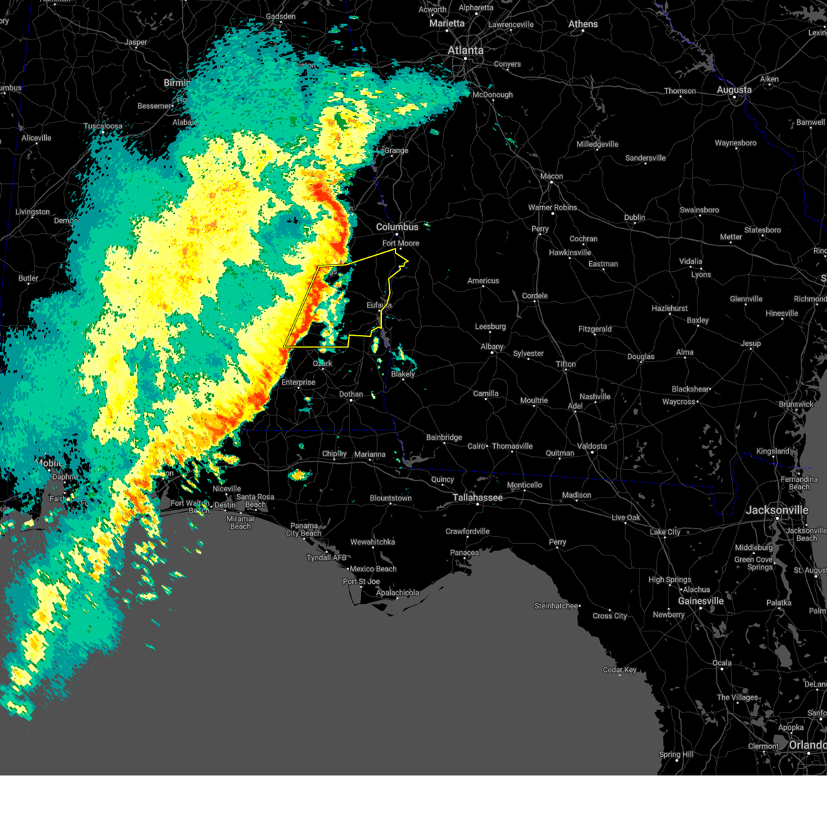 Svrbmx the national weather service in birmingham has issued a * severe thunderstorm warning for, eastern pike county in southeastern alabama, eastern bullock county in southeastern alabama, barbour county in southeastern alabama, southern russell county in southeastern alabama, * until 315 am cst. * at 157 am cst, severe thunderstorms were located along a line extending from near guerryton to 7 miles southwest of brundidge, moving east at 40 mph (radar indicated). Hazards include 60 mph wind gusts. expect damage to roofs, siding, and trees Svrbmx the national weather service in birmingham has issued a * severe thunderstorm warning for, eastern pike county in southeastern alabama, eastern bullock county in southeastern alabama, barbour county in southeastern alabama, southern russell county in southeastern alabama, * until 315 am cst. * at 157 am cst, severe thunderstorms were located along a line extending from near guerryton to 7 miles southwest of brundidge, moving east at 40 mph (radar indicated). Hazards include 60 mph wind gusts. expect damage to roofs, siding, and trees
|
| 8/18/2024 7:23 PM CDT |
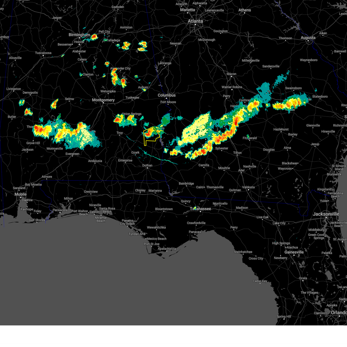 At 723 pm cdt, a severe thunderstorm was located near gaino, or 12 miles southwest of eufaula, moving southeast at 35 mph (radar indicated). Hazards include 60 mph wind gusts and penny size hail. Expect damage to roofs, siding, and trees. Locations impacted include, clayton, osco, texasville, gaino, richards crossroads, white oak, millers ford, and baker hill. At 723 pm cdt, a severe thunderstorm was located near gaino, or 12 miles southwest of eufaula, moving southeast at 35 mph (radar indicated). Hazards include 60 mph wind gusts and penny size hail. Expect damage to roofs, siding, and trees. Locations impacted include, clayton, osco, texasville, gaino, richards crossroads, white oak, millers ford, and baker hill.
|
| 8/18/2024 7:10 PM CDT |
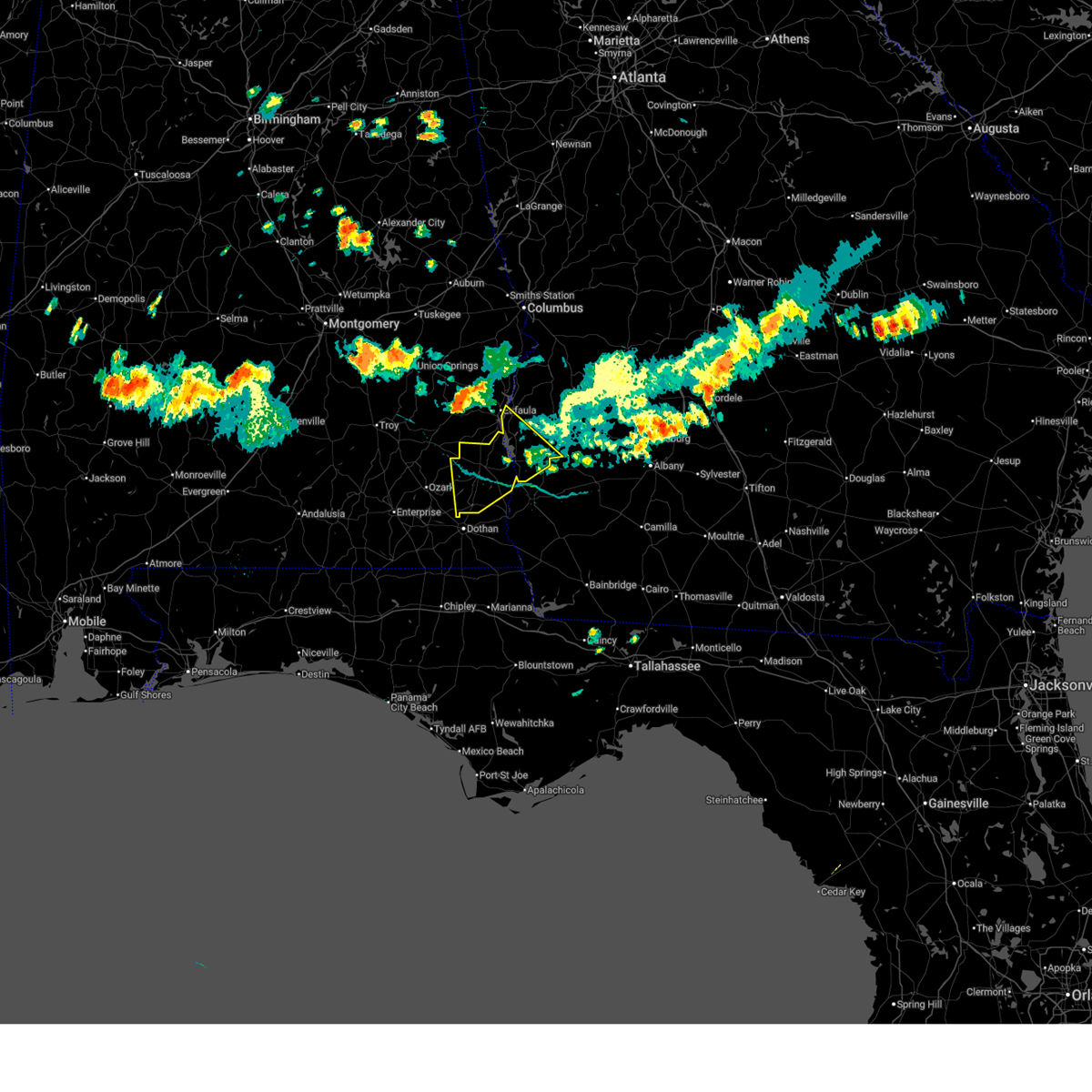 Svrtae the national weather service in tallahassee has issued a * severe thunderstorm warning for, northeastern dale county in southeastern alabama, henry county in southeastern alabama, clay county in southwestern georgia, southwestern randolph county in southwestern georgia, southwestern quitman county in southwestern georgia, * until 900 pm edt/800 pm cdt/. * at 809 pm edt/709 pm cdt/, severe thunderstorms were located along a line extending from near hawkinsville to near clayton, moving southeast at 30 mph (radar indicated). Hazards include 60 mph wind gusts and quarter size hail. Hail damage to vehicles is expected. Expect wind damage to roofs, siding, and trees. Svrtae the national weather service in tallahassee has issued a * severe thunderstorm warning for, northeastern dale county in southeastern alabama, henry county in southeastern alabama, clay county in southwestern georgia, southwestern randolph county in southwestern georgia, southwestern quitman county in southwestern georgia, * until 900 pm edt/800 pm cdt/. * at 809 pm edt/709 pm cdt/, severe thunderstorms were located along a line extending from near hawkinsville to near clayton, moving southeast at 30 mph (radar indicated). Hazards include 60 mph wind gusts and quarter size hail. Hail damage to vehicles is expected. Expect wind damage to roofs, siding, and trees.
|
| 8/18/2024 7:04 PM CDT |
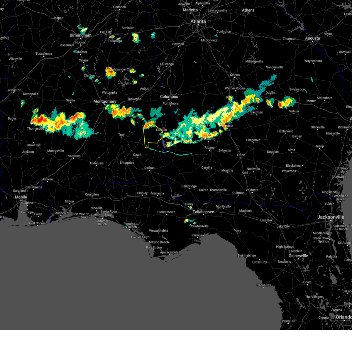 Svrbmx the national weather service in birmingham has issued a * severe thunderstorm warning for, central barbour county in southeastern alabama, * until 745 pm cdt. * at 704 pm cdt, a severe thunderstorm was located over barbour county public lake dam, or 11 miles southeast of midway, moving southeast at 35 mph (radar indicated). Hazards include 60 mph wind gusts and quarter size hail. Hail damage to vehicles is expected. Expect wind damage to roofs, siding, and trees. Svrbmx the national weather service in birmingham has issued a * severe thunderstorm warning for, central barbour county in southeastern alabama, * until 745 pm cdt. * at 704 pm cdt, a severe thunderstorm was located over barbour county public lake dam, or 11 miles southeast of midway, moving southeast at 35 mph (radar indicated). Hazards include 60 mph wind gusts and quarter size hail. Hail damage to vehicles is expected. Expect wind damage to roofs, siding, and trees.
|
| 8/18/2024 7:49 PM EDT |
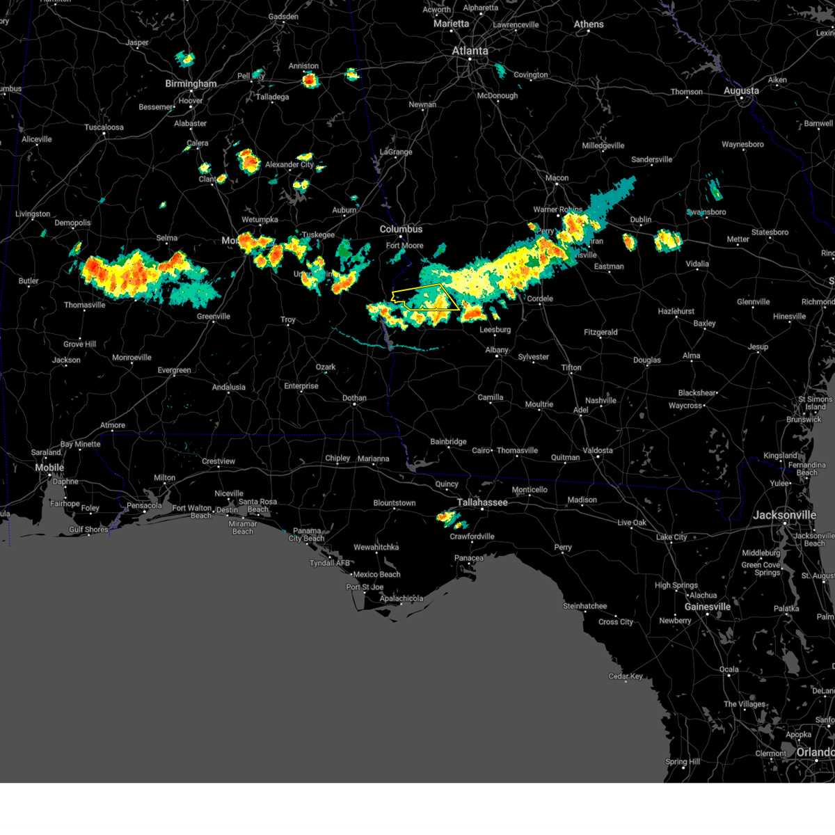 the severe thunderstorm warning has been cancelled and is no longer in effect the severe thunderstorm warning has been cancelled and is no longer in effect
|
| 8/18/2024 7:38 PM EDT |
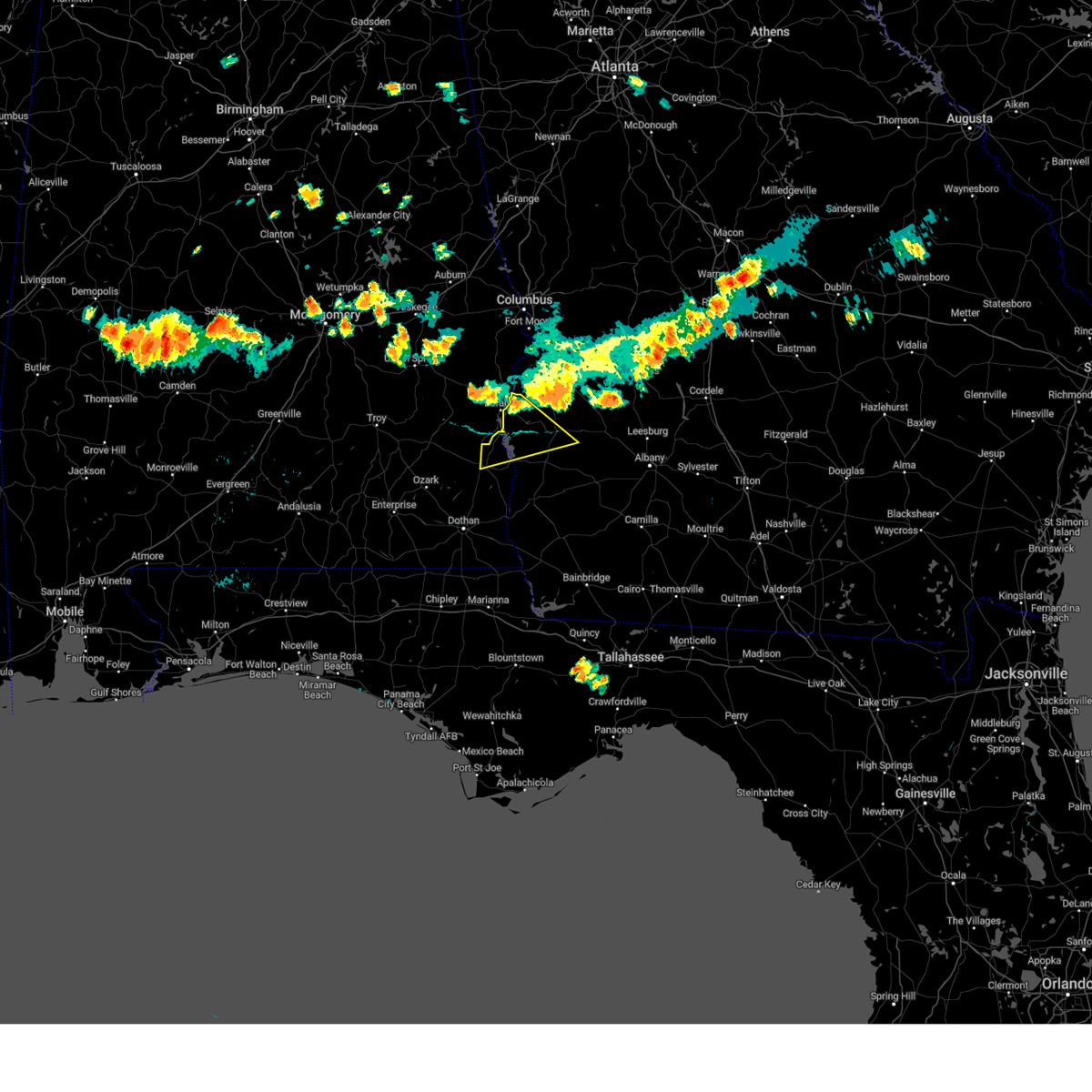 At 737 pm edt/637 pm cdt/, severe thunderstorms were located along a line extending from near weston to near richards crossroads, moving southeast at 30 mph (radar indicated). Hazards include 60 mph wind gusts. Expect damage to roofs, siding, and trees. locations impacted include, abbeville, fort gaines, cuthbert, georgetown, walter f. George lock and dam, wire bridge, walter f george lake, bonapartes retreat, standleys store, watson crossroads, scottsboro crossroads, double bridges, crossroads, ricks place, pecan, randolph co a/p, graball, thomas mill creek, hatcher, and morris. At 737 pm edt/637 pm cdt/, severe thunderstorms were located along a line extending from near weston to near richards crossroads, moving southeast at 30 mph (radar indicated). Hazards include 60 mph wind gusts. Expect damage to roofs, siding, and trees. locations impacted include, abbeville, fort gaines, cuthbert, georgetown, walter f. George lock and dam, wire bridge, walter f george lake, bonapartes retreat, standleys store, watson crossroads, scottsboro crossroads, double bridges, crossroads, ricks place, pecan, randolph co a/p, graball, thomas mill creek, hatcher, and morris.
|
| 8/18/2024 6:21 PM CDT |
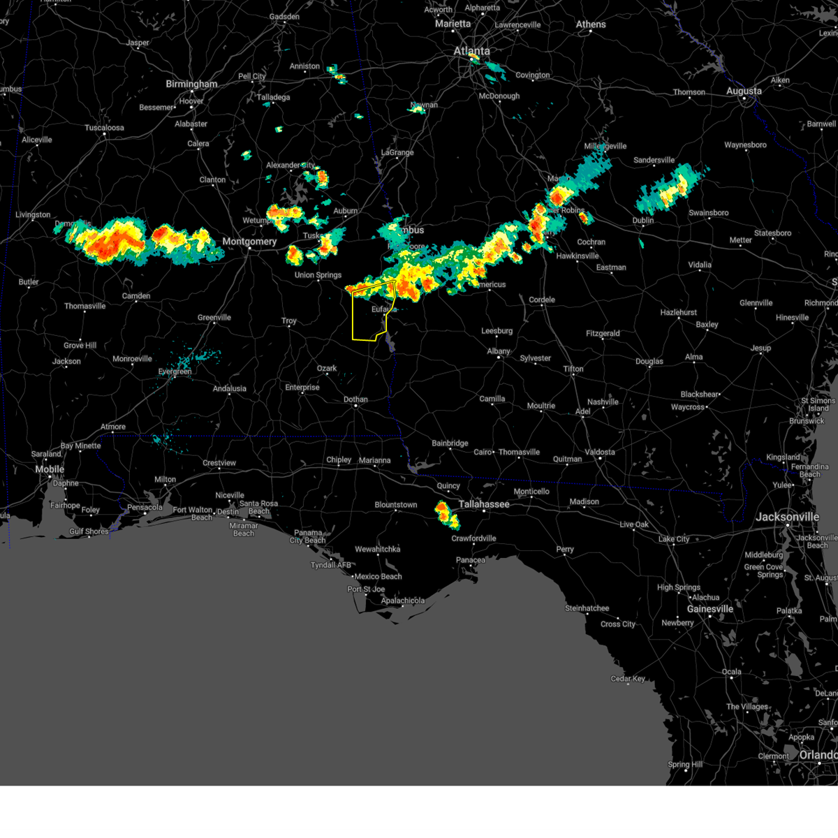 At 621 pm cdt, severe thunderstorms were located along a line extending from 6 miles southwest of lumpkin to eufaula to near barbour county public lake dam, moving south at 35 mph (radar indicated). Hazards include 60 mph wind gusts and penny size hail. Expect damage to roofs, siding, and trees. Locations impacted include, eufaula, clayton, hawkinsville, gaino, comer, osco, richards crossroads, white oak, lakepoint resort state park, spring hill, batesville, twin springs, lugo, and baker hill. At 621 pm cdt, severe thunderstorms were located along a line extending from 6 miles southwest of lumpkin to eufaula to near barbour county public lake dam, moving south at 35 mph (radar indicated). Hazards include 60 mph wind gusts and penny size hail. Expect damage to roofs, siding, and trees. Locations impacted include, eufaula, clayton, hawkinsville, gaino, comer, osco, richards crossroads, white oak, lakepoint resort state park, spring hill, batesville, twin springs, lugo, and baker hill.
|
| 8/18/2024 6:21 PM CDT |
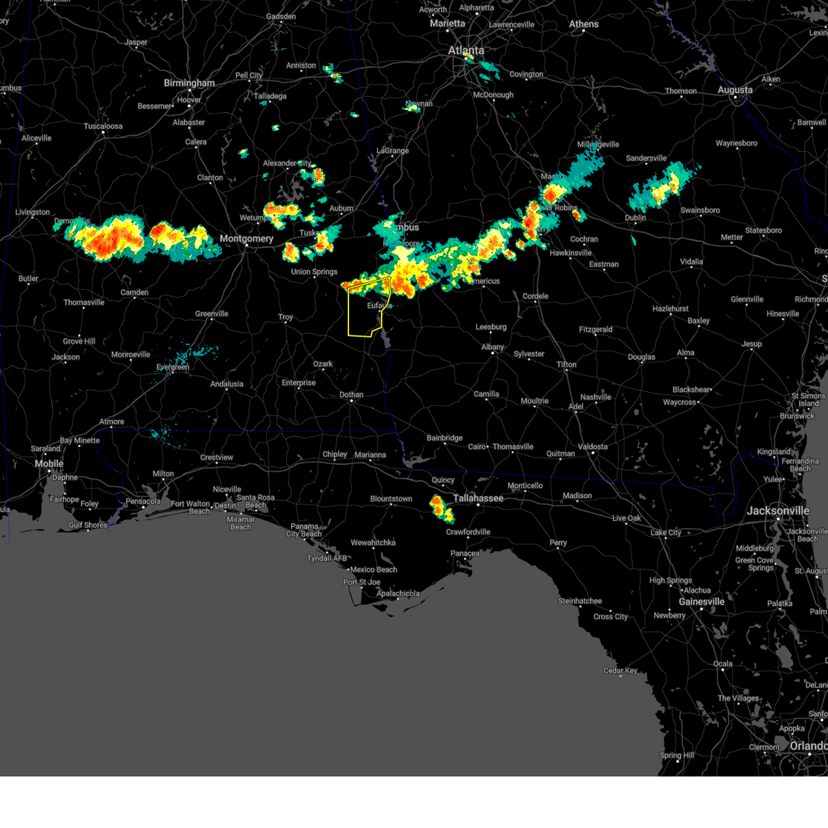 the severe thunderstorm warning has been cancelled and is no longer in effect the severe thunderstorm warning has been cancelled and is no longer in effect
|
| 8/18/2024 7:15 PM EDT |
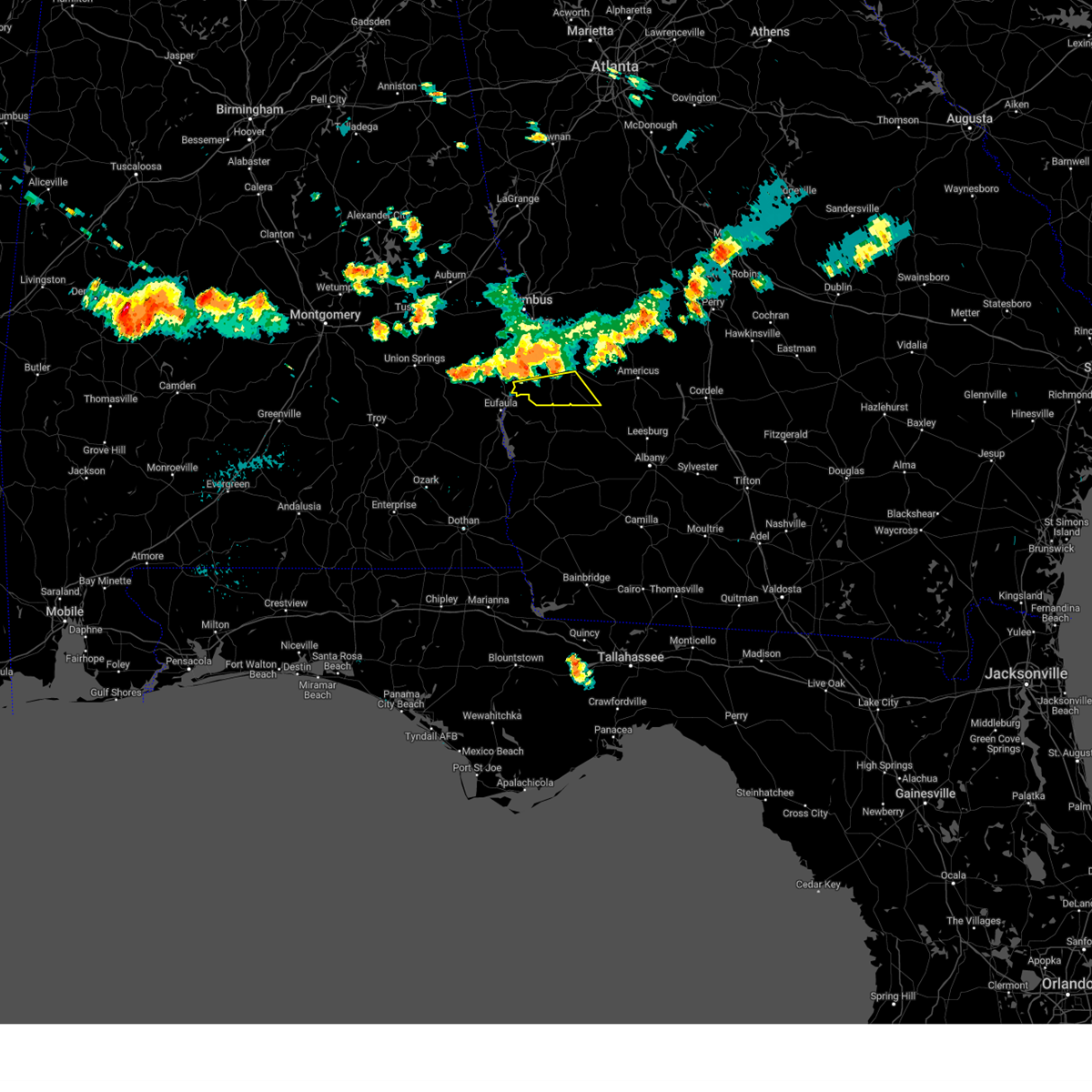 Svrffc the national weather service in peachtree city has issued a * severe thunderstorm warning for, southern stewart county in west central georgia, southwestern webster county in west central georgia, * until 800 pm edt. * at 715 pm edt, severe thunderstorms were located along a line extending from near sanford to near richland, moving south at 30 mph (radar indicated). Hazards include 60 mph wind gusts and penny size hail. expect damage to roofs, siding, and trees Svrffc the national weather service in peachtree city has issued a * severe thunderstorm warning for, southern stewart county in west central georgia, southwestern webster county in west central georgia, * until 800 pm edt. * at 715 pm edt, severe thunderstorms were located along a line extending from near sanford to near richland, moving south at 30 mph (radar indicated). Hazards include 60 mph wind gusts and penny size hail. expect damage to roofs, siding, and trees
|
| 8/18/2024 7:10 PM EDT |
 At 710 pm edt, severe thunderstorms were located along a line extending from church hill to near florence marina state park, moving southeast at 30 mph (radar indicated). Hazards include 60 mph wind gusts. Expect damage to roofs, siding, and trees. Locations impacted include, lumpkin, richland, omaha, charles, westville, brooklyn, louvale, and providence canyon state park. At 710 pm edt, severe thunderstorms were located along a line extending from church hill to near florence marina state park, moving southeast at 30 mph (radar indicated). Hazards include 60 mph wind gusts. Expect damage to roofs, siding, and trees. Locations impacted include, lumpkin, richland, omaha, charles, westville, brooklyn, louvale, and providence canyon state park.
|
| 8/18/2024 7:10 PM EDT |
 the severe thunderstorm warning has been cancelled and is no longer in effect the severe thunderstorm warning has been cancelled and is no longer in effect
|
| 8/18/2024 6:01 PM CDT |
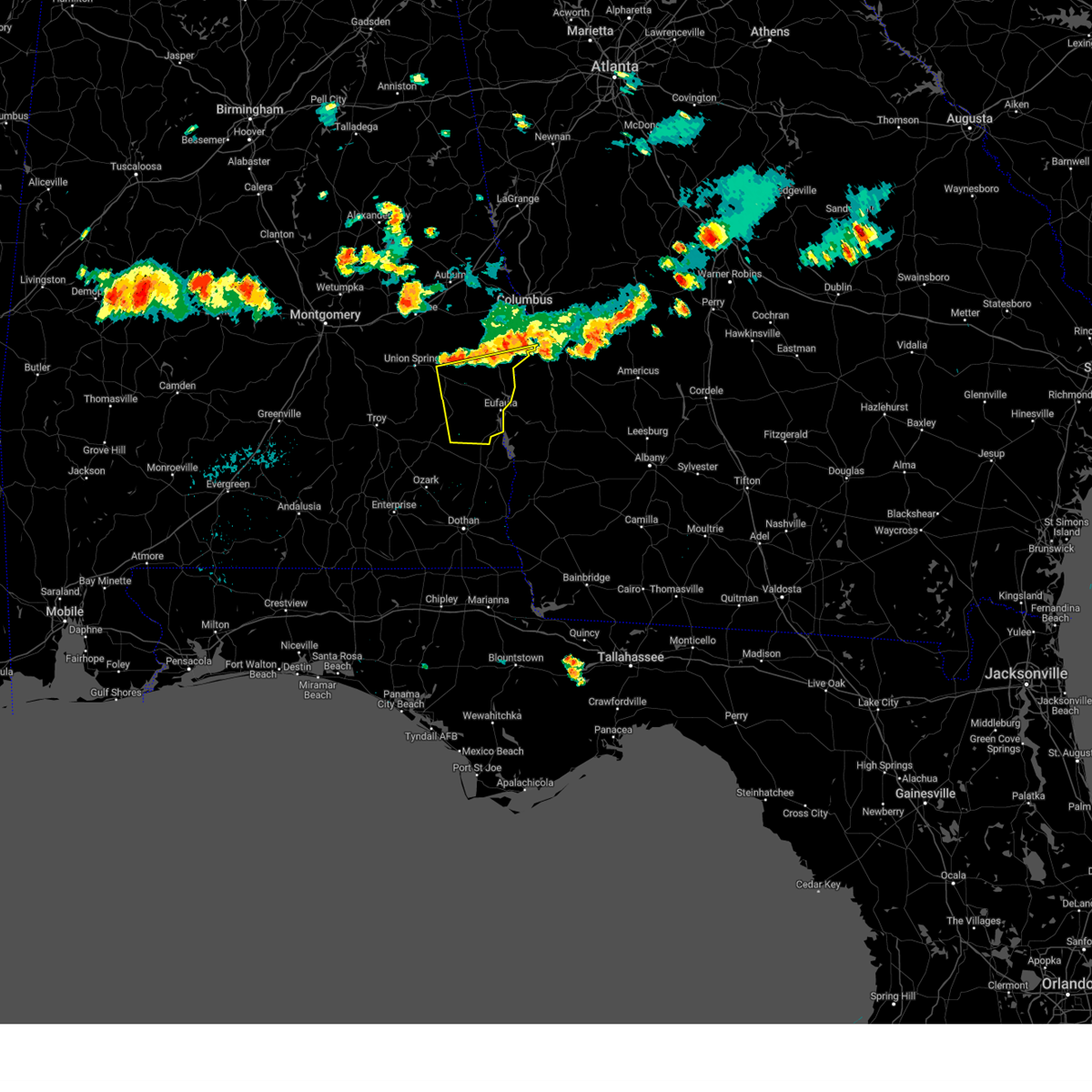 At 601 pm cdt, severe thunderstorms were located along a line extending from 11 miles northwest of lumpkin to hawkinsville to near midway, moving southeast at 35 mph (radar indicated). Hazards include 60 mph wind gusts and quarter size hail. Hail damage to vehicles is expected. expect wind damage to roofs, siding, and trees. Locations impacted include, eufaula, midway, clayton, hawkinsville, spring hill, gaino, comer, barbour county public lake dam, osco, texasville, richards crossroads, white oak, lakepoint resort state park, millers ford, batesville, clayton municipal airport, twin springs, lugo, baker hill, and mount andrew. At 601 pm cdt, severe thunderstorms were located along a line extending from 11 miles northwest of lumpkin to hawkinsville to near midway, moving southeast at 35 mph (radar indicated). Hazards include 60 mph wind gusts and quarter size hail. Hail damage to vehicles is expected. expect wind damage to roofs, siding, and trees. Locations impacted include, eufaula, midway, clayton, hawkinsville, spring hill, gaino, comer, barbour county public lake dam, osco, texasville, richards crossroads, white oak, lakepoint resort state park, millers ford, batesville, clayton municipal airport, twin springs, lugo, baker hill, and mount andrew.
|
| 8/18/2024 6:01 PM CDT |
 the severe thunderstorm warning has been cancelled and is no longer in effect the severe thunderstorm warning has been cancelled and is no longer in effect
|
| 8/18/2024 6:00 PM CDT | A few trees were blown down in far southern russell count in russell county AL, 14.7 miles S of Eufaula, AL |
| 8/18/2024 6:49 PM EDT |
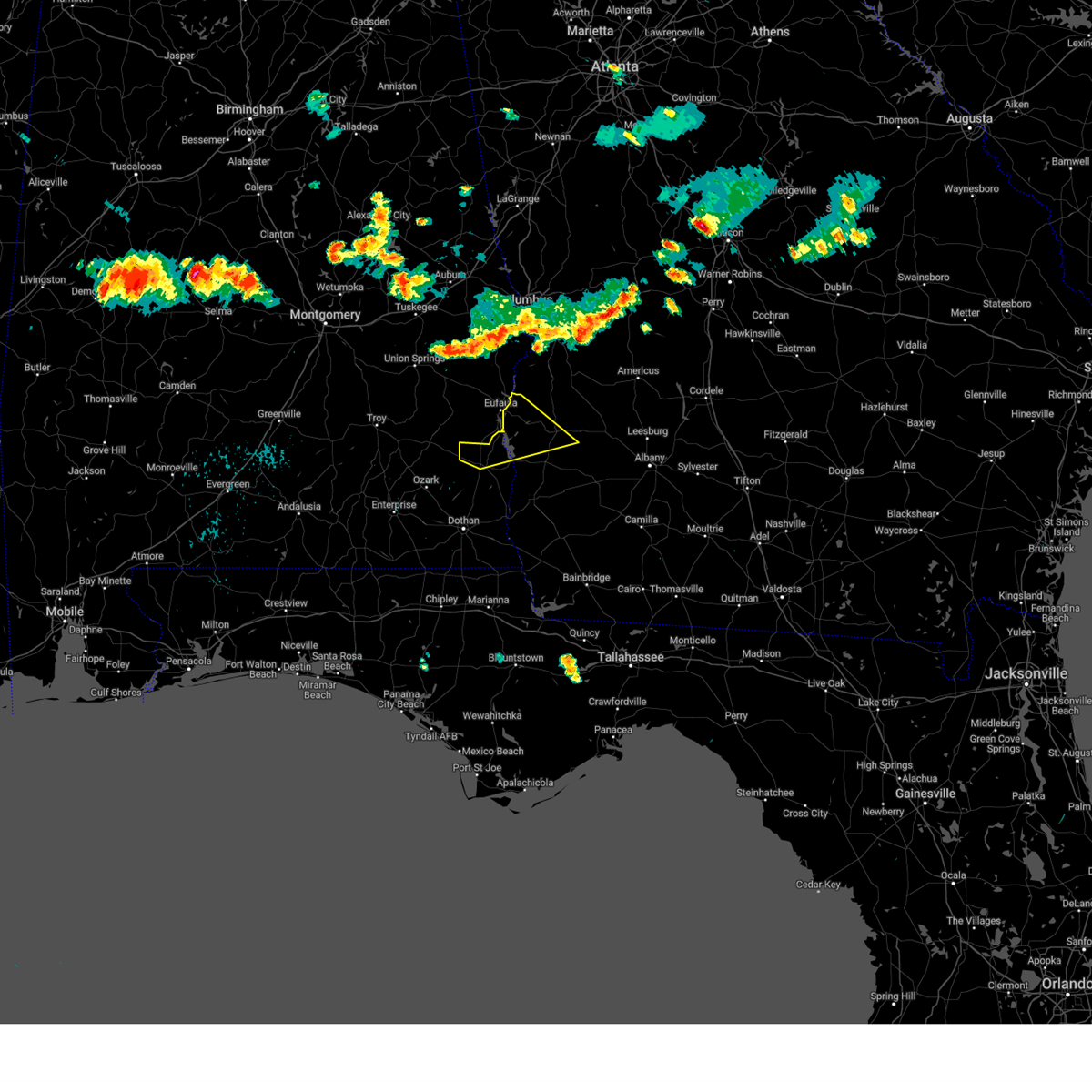 Svrtae the national weather service in tallahassee has issued a * severe thunderstorm warning for, northern henry county in southeastern alabama, northwestern clay county in southwestern georgia, southwestern randolph county in southwestern georgia, quitman county in southwestern georgia, * until 800 pm edt/700 pm cdt/. * at 648 pm edt/548 pm cdt/, severe thunderstorms were located along a line extending from 6 miles southwest of cusseta to midway, moving southeast at 30 mph (radar indicated). Hazards include 60 mph wind gusts and penny size hail. expect damage to roofs, siding, and trees Svrtae the national weather service in tallahassee has issued a * severe thunderstorm warning for, northern henry county in southeastern alabama, northwestern clay county in southwestern georgia, southwestern randolph county in southwestern georgia, quitman county in southwestern georgia, * until 800 pm edt/700 pm cdt/. * at 648 pm edt/548 pm cdt/, severe thunderstorms were located along a line extending from 6 miles southwest of cusseta to midway, moving southeast at 30 mph (radar indicated). Hazards include 60 mph wind gusts and penny size hail. expect damage to roofs, siding, and trees
|
| 8/18/2024 6:46 PM EDT |
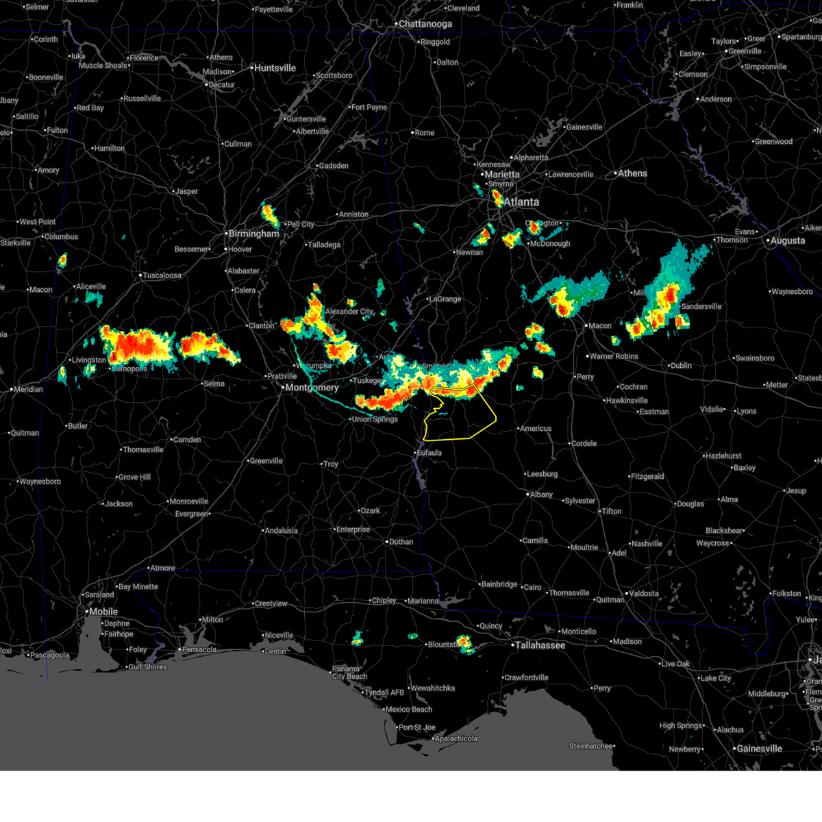 Svrffc the national weather service in peachtree city has issued a * severe thunderstorm warning for, southwestern marion county in west central georgia, chattahoochee county in west central georgia, stewart county in west central georgia, northern webster county in west central georgia, * until 730 pm edt. * at 646 pm edt, severe thunderstorms were located along a line extending from near zellobee to 6 miles southeast of seale, moving southeast at 30 mph (radar indicated). Hazards include 60 mph wind gusts. expect damage to roofs, siding, and trees Svrffc the national weather service in peachtree city has issued a * severe thunderstorm warning for, southwestern marion county in west central georgia, chattahoochee county in west central georgia, stewart county in west central georgia, northern webster county in west central georgia, * until 730 pm edt. * at 646 pm edt, severe thunderstorms were located along a line extending from near zellobee to 6 miles southeast of seale, moving southeast at 30 mph (radar indicated). Hazards include 60 mph wind gusts. expect damage to roofs, siding, and trees
|
| 8/18/2024 5:39 PM CDT |
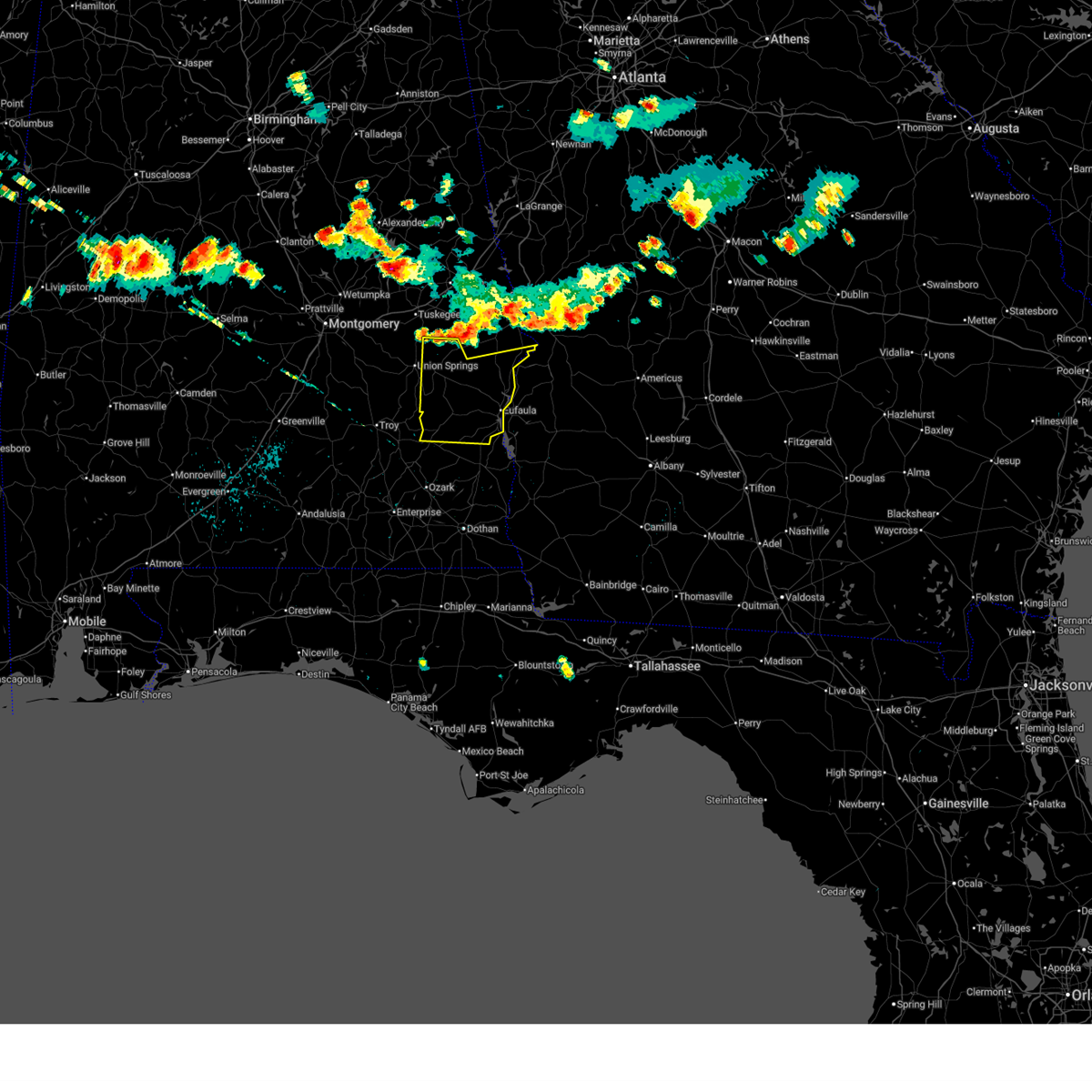 Svrbmx the national weather service in birmingham has issued a * severe thunderstorm warning for, eastern bullock county in southeastern alabama, southeastern macon county in southeastern alabama, barbour county in southeastern alabama, southern russell county in southeastern alabama, * until 645 pm cdt. * at 539 pm cdt, severe thunderstorms were located along a line extending from near seale to near spring hill to near union springs, moving south at 40 mph (radar indicated). Hazards include 70 mph wind gusts and quarter size hail. Hail damage to vehicles is expected. expect considerable tree damage. Wind damage is also likely to mobile homes, roofs, and outbuildings. Svrbmx the national weather service in birmingham has issued a * severe thunderstorm warning for, eastern bullock county in southeastern alabama, southeastern macon county in southeastern alabama, barbour county in southeastern alabama, southern russell county in southeastern alabama, * until 645 pm cdt. * at 539 pm cdt, severe thunderstorms were located along a line extending from near seale to near spring hill to near union springs, moving south at 40 mph (radar indicated). Hazards include 70 mph wind gusts and quarter size hail. Hail damage to vehicles is expected. expect considerable tree damage. Wind damage is also likely to mobile homes, roofs, and outbuildings.
|
| 5/27/2024 7:34 PM CDT |
 At 733 pm cdt, a severe thunderstorm was located over barbour county public lake dam, or 7 miles southeast of midway, moving southeast at 35 mph (radar indicated). Hazards include 60 mph wind gusts and nickel size hail. Expect damage to roofs, siding, and trees. Locations impacted include, midway, clayton, osco, gaino, white oak, comer, barbour county public lake dam, millers ford, batesville, clayton municipal airport, and mount andrew. At 733 pm cdt, a severe thunderstorm was located over barbour county public lake dam, or 7 miles southeast of midway, moving southeast at 35 mph (radar indicated). Hazards include 60 mph wind gusts and nickel size hail. Expect damage to roofs, siding, and trees. Locations impacted include, midway, clayton, osco, gaino, white oak, comer, barbour county public lake dam, millers ford, batesville, clayton municipal airport, and mount andrew.
|
| 5/27/2024 7:12 PM CDT |
 Svrbmx the national weather service in birmingham has issued a * severe thunderstorm warning for, eastern bullock county in southeastern alabama, central barbour county in southeastern alabama, * until 745 pm cdt. * at 712 pm cdt, a severe thunderstorm was located near midway, moving southeast at 30 mph (radar indicated). Hazards include 60 mph wind gusts and nickel size hail. expect damage to roofs, siding, and trees Svrbmx the national weather service in birmingham has issued a * severe thunderstorm warning for, eastern bullock county in southeastern alabama, central barbour county in southeastern alabama, * until 745 pm cdt. * at 712 pm cdt, a severe thunderstorm was located near midway, moving southeast at 30 mph (radar indicated). Hazards include 60 mph wind gusts and nickel size hail. expect damage to roofs, siding, and trees
|
| 5/27/2024 3:12 PM EDT |
 Svrtae the national weather service in tallahassee has issued a * severe thunderstorm warning for, north central clay county in southwestern georgia, randolph county in southwestern georgia, quitman county in southwestern georgia, western terrell county in southwestern georgia, * until 400 pm edt. * at 312 pm edt, a severe thunderstorm was located 9 miles west of cuthbert, moving east at 45 mph (radar indicated). Hazards include 60 mph wind gusts and quarter size hail. Hail damage to vehicles is expected. Expect wind damage to roofs, siding, and trees. Svrtae the national weather service in tallahassee has issued a * severe thunderstorm warning for, north central clay county in southwestern georgia, randolph county in southwestern georgia, quitman county in southwestern georgia, western terrell county in southwestern georgia, * until 400 pm edt. * at 312 pm edt, a severe thunderstorm was located 9 miles west of cuthbert, moving east at 45 mph (radar indicated). Hazards include 60 mph wind gusts and quarter size hail. Hail damage to vehicles is expected. Expect wind damage to roofs, siding, and trees.
|
| 5/25/2024 12:45 PM CDT |
 the severe thunderstorm warning has been cancelled and is no longer in effect the severe thunderstorm warning has been cancelled and is no longer in effect
|
| 5/25/2024 12:36 PM CDT |
 At 1236 pm cdt, a severe thunderstorm was located near clayton, or 11 miles northeast of clio, moving southeast at 30 mph (radar indicated). Hazards include 60 mph wind gusts and penny size hail. Expect damage to roofs, siding, and trees. Locations impacted include, clio, clayton, louisville, blue springs, tyler crossroads, gaino, barbour county public lake dam, blue springs state park, texasville, richards crossroads, white oak, boot hill, millers ford, clayton municipal airport, baker hill, and mount andrew. At 1236 pm cdt, a severe thunderstorm was located near clayton, or 11 miles northeast of clio, moving southeast at 30 mph (radar indicated). Hazards include 60 mph wind gusts and penny size hail. Expect damage to roofs, siding, and trees. Locations impacted include, clio, clayton, louisville, blue springs, tyler crossroads, gaino, barbour county public lake dam, blue springs state park, texasville, richards crossroads, white oak, boot hill, millers ford, clayton municipal airport, baker hill, and mount andrew.
|
| 5/25/2024 12:12 PM CDT |
 Svrbmx the national weather service in birmingham has issued a * severe thunderstorm warning for, barbour county in southeastern alabama, * until 115 pm cdt. * at 1212 pm cdt, a severe thunderstorm was located over pickett, or near midway, moving southeast at 30 mph (radar indicated). Hazards include 60 mph wind gusts and penny size hail. expect damage to roofs, siding, and trees Svrbmx the national weather service in birmingham has issued a * severe thunderstorm warning for, barbour county in southeastern alabama, * until 115 pm cdt. * at 1212 pm cdt, a severe thunderstorm was located over pickett, or near midway, moving southeast at 30 mph (radar indicated). Hazards include 60 mph wind gusts and penny size hail. expect damage to roofs, siding, and trees
|
| 5/10/2024 5:22 AM EDT |
 The storms which prompted the warning have weakened below severe limits, and no longer pose an immediate threat to life or property. therefore, the warning will be allowed to expire. however, gusty winds are still possible with these thunderstorms. a severe thunderstorm watch remains in effect until 600 am edt for west central georgia. The storms which prompted the warning have weakened below severe limits, and no longer pose an immediate threat to life or property. therefore, the warning will be allowed to expire. however, gusty winds are still possible with these thunderstorms. a severe thunderstorm watch remains in effect until 600 am edt for west central georgia.
|
| 5/10/2024 4:01 AM CDT |
 the severe thunderstorm warning has been cancelled and is no longer in effect the severe thunderstorm warning has been cancelled and is no longer in effect
|
| 5/10/2024 3:49 AM CDT |
 At 348 am cdt, severe thunderstorms were located along a line extending from near spring hill to near osco to 6 miles southeast of texasville, moving east at 60 mph (radar indicated). Hazards include 60 mph wind gusts and penny size hail. Expect damage to roofs, siding, and trees. Locations impacted include, eufaula, clayton, blue springs, tyler crossroads, hawkinsville, spring hill, gaino, comer, blue springs state park, osco, texasville, richards crossroads, white oak, lakepoint resort state park, millers ford, batesville, lugo, and baker hill. At 348 am cdt, severe thunderstorms were located along a line extending from near spring hill to near osco to 6 miles southeast of texasville, moving east at 60 mph (radar indicated). Hazards include 60 mph wind gusts and penny size hail. Expect damage to roofs, siding, and trees. Locations impacted include, eufaula, clayton, blue springs, tyler crossroads, hawkinsville, spring hill, gaino, comer, blue springs state park, osco, texasville, richards crossroads, white oak, lakepoint resort state park, millers ford, batesville, lugo, and baker hill.
|
| 5/10/2024 4:49 AM EDT |
 Svrffc the national weather service in peachtree city has issued a * severe thunderstorm warning for, southern stewart county in west central georgia, southwestern webster county in west central georgia, * until 530 am edt. * at 448 am edt, severe thunderstorms were located along a line extending from near spring hill to near hawkinsville to near eufaula to graball, moving east at 60 mph (radar indicated). Hazards include 60 mph wind gusts and penny size hail. expect damage to roofs, siding, and trees Svrffc the national weather service in peachtree city has issued a * severe thunderstorm warning for, southern stewart county in west central georgia, southwestern webster county in west central georgia, * until 530 am edt. * at 448 am edt, severe thunderstorms were located along a line extending from near spring hill to near hawkinsville to near eufaula to graball, moving east at 60 mph (radar indicated). Hazards include 60 mph wind gusts and penny size hail. expect damage to roofs, siding, and trees
|
| 5/10/2024 3:49 AM CDT |
 the severe thunderstorm warning has been cancelled and is no longer in effect the severe thunderstorm warning has been cancelled and is no longer in effect
|
| 5/10/2024 3:46 AM CDT |
 Svrtae the national weather service in tallahassee has issued a * severe thunderstorm warning for, dale county in southeastern alabama, henry county in southeastern alabama, geneva county in southeastern alabama, houston county in southeastern alabama, miller county in southwestern georgia, clay county in southwestern georgia, randolph county in southwestern georgia, calhoun county in southwestern georgia, northern seminole county in southwestern georgia, early county in southwestern georgia, quitman county in southwestern georgia, * until 545 am edt/445 am cdt/. * at 446 am edt/346 am cdt/, severe thunderstorms were located along a line extending from 6 miles south of georgetown to 7 miles west of blakely to 10 miles southeast of ashford, moving northeast at 50 mph (radar indicated). Hazards include 60 mph wind gusts and quarter size hail. Hail damage to vehicles is expected. Expect wind damage to roofs, siding, and trees. Svrtae the national weather service in tallahassee has issued a * severe thunderstorm warning for, dale county in southeastern alabama, henry county in southeastern alabama, geneva county in southeastern alabama, houston county in southeastern alabama, miller county in southwestern georgia, clay county in southwestern georgia, randolph county in southwestern georgia, calhoun county in southwestern georgia, northern seminole county in southwestern georgia, early county in southwestern georgia, quitman county in southwestern georgia, * until 545 am edt/445 am cdt/. * at 446 am edt/346 am cdt/, severe thunderstorms were located along a line extending from 6 miles south of georgetown to 7 miles west of blakely to 10 miles southeast of ashford, moving northeast at 50 mph (radar indicated). Hazards include 60 mph wind gusts and quarter size hail. Hail damage to vehicles is expected. Expect wind damage to roofs, siding, and trees.
|
| 5/10/2024 3:30 AM CDT |
 At 330 am cdt, severe thunderstorms were located along a line extending from midway to near blue springs state park, moving east at 60 mph (radar indicated). Hazards include 70 mph wind gusts and penny size hail. Expect considerable tree damage. damage is likely to mobile homes, roofs, and outbuildings. Locations impacted include, eufaula, clio, midway, clayton, louisville, blue springs, tyler crossroads, pickett, hawkinsville, spring hill, blue springs state park, osco, richards crossroads, white oak, boot hill, doster, gaino, comer, barbour county public lake dam, and texasville. At 330 am cdt, severe thunderstorms were located along a line extending from midway to near blue springs state park, moving east at 60 mph (radar indicated). Hazards include 70 mph wind gusts and penny size hail. Expect considerable tree damage. damage is likely to mobile homes, roofs, and outbuildings. Locations impacted include, eufaula, clio, midway, clayton, louisville, blue springs, tyler crossroads, pickett, hawkinsville, spring hill, blue springs state park, osco, richards crossroads, white oak, boot hill, doster, gaino, comer, barbour county public lake dam, and texasville.
|
| 5/10/2024 3:30 AM CDT |
 the severe thunderstorm warning has been cancelled and is no longer in effect the severe thunderstorm warning has been cancelled and is no longer in effect
|
| 5/10/2024 3:11 AM CDT |
 Svrbmx the national weather service in birmingham has issued a * severe thunderstorm warning for, eastern pike county in southeastern alabama, southern bullock county in southeastern alabama, barbour county in southeastern alabama, * until 415 am cdt. * at 310 am cdt, severe thunderstorms were located along a line extending from near shopton to 7 miles southwest of brundidge, moving east at 60 mph (radar indicated). Hazards include 60 mph wind gusts and penny size hail. expect damage to roofs, siding, and trees Svrbmx the national weather service in birmingham has issued a * severe thunderstorm warning for, eastern pike county in southeastern alabama, southern bullock county in southeastern alabama, barbour county in southeastern alabama, * until 415 am cdt. * at 310 am cdt, severe thunderstorms were located along a line extending from near shopton to 7 miles southwest of brundidge, moving east at 60 mph (radar indicated). Hazards include 60 mph wind gusts and penny size hail. expect damage to roofs, siding, and trees
|
| 5/10/2024 12:37 AM EDT |
 At 1235 am edt, severe thunderstorms were located along a line extending from near friendship to morris, moving east at 60 mph (radar indicated). Hazards include 60 mph wind gusts and quarter size hail. Hail damage to vehicles is expected. expect wind damage to roofs, siding, and trees. Locations impacted include, americus, lumpkin, ellaville, preston, richland, plains, andersonville, weston, seminole, westville, la crosse, brooklyn, renfroe, leveretts, troutman, omaha, friendship, sanford, bumphead, and walls crossing. At 1235 am edt, severe thunderstorms were located along a line extending from near friendship to morris, moving east at 60 mph (radar indicated). Hazards include 60 mph wind gusts and quarter size hail. Hail damage to vehicles is expected. expect wind damage to roofs, siding, and trees. Locations impacted include, americus, lumpkin, ellaville, preston, richland, plains, andersonville, weston, seminole, westville, la crosse, brooklyn, renfroe, leveretts, troutman, omaha, friendship, sanford, bumphead, and walls crossing.
|
| 5/10/2024 12:31 AM EDT |
 the severe thunderstorm warning has been cancelled and is no longer in effect the severe thunderstorm warning has been cancelled and is no longer in effect
|
| 5/10/2024 12:31 AM EDT |
 At 1230 am edt, a severe thunderstorm was located 9 miles northeast of fort gaines, moving southeast at 45 mph (radar indicated). Hazards include 60 mph wind gusts. Expect damage to roofs, siding, and trees. Locations impacted include, fort gaines, cuthbert, georgetown, bellville, bluffton, wire bridge, walter f george lake, bonapartes retreat, standleys store, carnegie, watson crossroads, crossroads, ricks place, pecan, randolph co a/p, hatcher, morris, jones crossing, bethel, and benevolence. At 1230 am edt, a severe thunderstorm was located 9 miles northeast of fort gaines, moving southeast at 45 mph (radar indicated). Hazards include 60 mph wind gusts. Expect damage to roofs, siding, and trees. Locations impacted include, fort gaines, cuthbert, georgetown, bellville, bluffton, wire bridge, walter f george lake, bonapartes retreat, standleys store, carnegie, watson crossroads, crossroads, ricks place, pecan, randolph co a/p, hatcher, morris, jones crossing, bethel, and benevolence.
|
| 5/9/2024 11:18 PM CDT |
 At 1118 pm cdt, severe thunderstorms were located along a line extending from near eufaula to 8 miles south of blue springs to 6 miles north of fort rucker, moving southeast at 45 mph (radar indicated). Hazards include 60 mph wind gusts. Expect damage to roofs, siding, and trees. Locations impacted include, eufaula, clio, louisville, blue springs, tyler crossroads, doster, gaino, blue springs state park, osco, texasville, richards crossroads, lakepoint resort state park, boot hill, millers ford, lugo, and baker hill. At 1118 pm cdt, severe thunderstorms were located along a line extending from near eufaula to 8 miles south of blue springs to 6 miles north of fort rucker, moving southeast at 45 mph (radar indicated). Hazards include 60 mph wind gusts. Expect damage to roofs, siding, and trees. Locations impacted include, eufaula, clio, louisville, blue springs, tyler crossroads, doster, gaino, blue springs state park, osco, texasville, richards crossroads, lakepoint resort state park, boot hill, millers ford, lugo, and baker hill.
|
| 5/9/2024 11:18 PM CDT |
 the severe thunderstorm warning has been cancelled and is no longer in effect the severe thunderstorm warning has been cancelled and is no longer in effect
|
| 5/10/2024 12:04 AM EDT |
 Svrffc the national weather service in peachtree city has issued a * severe thunderstorm warning for, southern marion county in west central georgia, southeastern chattahoochee county in west central georgia, stewart county in west central georgia, webster county in west central georgia, southern schley county in west central georgia, northwestern sumter county in west central georgia, * until 1245 am edt. * at 1202 am edt, severe thunderstorms were located along a line extending from near fort mitchell activity center to near clayton municipal airport in east-central alabama, moving east at 60 mph (radar indicated). Hazards include 60 mph wind gusts and quarter size hail. Hail damage to vehicles is expected. Expect wind damage to roofs, siding, and trees. Svrffc the national weather service in peachtree city has issued a * severe thunderstorm warning for, southern marion county in west central georgia, southeastern chattahoochee county in west central georgia, stewart county in west central georgia, webster county in west central georgia, southern schley county in west central georgia, northwestern sumter county in west central georgia, * until 1245 am edt. * at 1202 am edt, severe thunderstorms were located along a line extending from near fort mitchell activity center to near clayton municipal airport in east-central alabama, moving east at 60 mph (radar indicated). Hazards include 60 mph wind gusts and quarter size hail. Hail damage to vehicles is expected. Expect wind damage to roofs, siding, and trees.
|
| 5/9/2024 11:59 PM EDT |
 Svrtae the national weather service in tallahassee has issued a * severe thunderstorm warning for, central henry county in southeastern alabama, clay county in southwestern georgia, randolph county in southwestern georgia, northwestern early county in southwestern georgia, quitman county in southwestern georgia, * until 1245 am edt/1145 pm cdt/. * at 1159 pm edt/1059 pm cdt/, a severe thunderstorm was located over white oak, or 11 miles west of eufaula, moving southeast at 45 mph (radar indicated). Hazards include 60 mph wind gusts. expect damage to roofs, siding, and trees Svrtae the national weather service in tallahassee has issued a * severe thunderstorm warning for, central henry county in southeastern alabama, clay county in southwestern georgia, randolph county in southwestern georgia, northwestern early county in southwestern georgia, quitman county in southwestern georgia, * until 1245 am edt/1145 pm cdt/. * at 1159 pm edt/1059 pm cdt/, a severe thunderstorm was located over white oak, or 11 miles west of eufaula, moving southeast at 45 mph (radar indicated). Hazards include 60 mph wind gusts. expect damage to roofs, siding, and trees
|
| 5/9/2024 10:37 PM CDT |
 Svrbmx the national weather service in birmingham has issued a * severe thunderstorm warning for, central pike county in southeastern alabama, barbour county in southeastern alabama, * until 1130 pm cdt. * at 1037 pm cdt, severe thunderstorms were located along a line extending from near guerryton to 6 miles southeast of linwood to near troy municipal airport, moving southeast at 50 mph (radar indicated). Hazards include 60 mph wind gusts. expect damage to roofs, siding, and trees Svrbmx the national weather service in birmingham has issued a * severe thunderstorm warning for, central pike county in southeastern alabama, barbour county in southeastern alabama, * until 1130 pm cdt. * at 1037 pm cdt, severe thunderstorms were located along a line extending from near guerryton to 6 miles southeast of linwood to near troy municipal airport, moving southeast at 50 mph (radar indicated). Hazards include 60 mph wind gusts. expect damage to roofs, siding, and trees
|
| 5/9/2024 3:06 PM EDT |
 The storms which prompted the warning have weakened below severe limits, and no longer pose an immediate threat to life or property. therefore, the warning will be allowed to expire. however, gusty winds are still possible with these thunderstorms. a tornado watch remains in effect until 500 pm edt for central and west central georgia. The storms which prompted the warning have weakened below severe limits, and no longer pose an immediate threat to life or property. therefore, the warning will be allowed to expire. however, gusty winds are still possible with these thunderstorms. a tornado watch remains in effect until 500 pm edt for central and west central georgia.
|
| 5/9/2024 2:54 PM EDT |
 At 254 pm edt/154 pm cdt/, a severe thunderstorm was located near eufaula, moving east at 35 mph (radar indicated). Hazards include 60 mph wind gusts and quarter size hail. Hail damage to vehicles is expected. expect wind damage to roofs, siding, and trees. Locations impacted include, cuthbert, georgetown, shellman, wire bridge, bonapartes retreat, standleys store, watson crossroads, crossroads, ricks place, randolph co a/p, hatcher, morris, martins crossroads, benevolence, springvale, cotton hill, wades, days crossroads, springvale station, and pachitla. At 254 pm edt/154 pm cdt/, a severe thunderstorm was located near eufaula, moving east at 35 mph (radar indicated). Hazards include 60 mph wind gusts and quarter size hail. Hail damage to vehicles is expected. expect wind damage to roofs, siding, and trees. Locations impacted include, cuthbert, georgetown, shellman, wire bridge, bonapartes retreat, standleys store, watson crossroads, crossroads, ricks place, randolph co a/p, hatcher, morris, martins crossroads, benevolence, springvale, cotton hill, wades, days crossroads, springvale station, and pachitla.
|
| 5/9/2024 2:35 PM EDT |
 Svrtae the national weather service in tallahassee has issued a * severe thunderstorm warning for, north central henry county in southeastern alabama, northwestern clay county in southwestern georgia, randolph county in southwestern georgia, quitman county in southwestern georgia, * until 345 pm edt/245 pm cdt/. * at 234 pm edt/134 pm cdt/, a severe thunderstorm was located over comer, or 9 miles southeast of midway, moving east at 40 mph (radar indicated). Hazards include 60 mph wind gusts and quarter size hail. Hail damage to vehicles is expected. Expect wind damage to roofs, siding, and trees. Svrtae the national weather service in tallahassee has issued a * severe thunderstorm warning for, north central henry county in southeastern alabama, northwestern clay county in southwestern georgia, randolph county in southwestern georgia, quitman county in southwestern georgia, * until 345 pm edt/245 pm cdt/. * at 234 pm edt/134 pm cdt/, a severe thunderstorm was located over comer, or 9 miles southeast of midway, moving east at 40 mph (radar indicated). Hazards include 60 mph wind gusts and quarter size hail. Hail damage to vehicles is expected. Expect wind damage to roofs, siding, and trees.
|
| 5/9/2024 2:28 PM EDT |
 Svrffc the national weather service in peachtree city has issued a * severe thunderstorm warning for, southern stewart county in west central georgia, webster county in west central georgia, southern sumter county in west central georgia, * until 315 pm edt. * at 227 pm edt, severe thunderstorms were located along a line extending from preston to near troutman to near sanford, moving east at 50 mph (radar indicated). Hazards include 60 mph wind gusts and quarter size hail. Hail damage to vehicles is expected. Expect wind damage to roofs, siding, and trees. Svrffc the national weather service in peachtree city has issued a * severe thunderstorm warning for, southern stewart county in west central georgia, webster county in west central georgia, southern sumter county in west central georgia, * until 315 pm edt. * at 227 pm edt, severe thunderstorms were located along a line extending from preston to near troutman to near sanford, moving east at 50 mph (radar indicated). Hazards include 60 mph wind gusts and quarter size hail. Hail damage to vehicles is expected. Expect wind damage to roofs, siding, and trees.
|
| 4/3/2024 3:14 AM EDT |
 Svrtae the national weather service in tallahassee has issued a * severe thunderstorm warning for, clay county in southwestern georgia, randolph county in southwestern georgia, lee county in southwestern georgia, quitman county in southwestern georgia, terrell county in southwestern georgia, * until 445 am edt. * at 314 am edt, severe thunderstorms were located along a line extending from 7 miles east of lakepoint resort state park to 7 miles northwest of abbeville, moving east at 55 mph (radar indicated). Hazards include 60 mph wind gusts. expect damage to roofs, siding, and trees Svrtae the national weather service in tallahassee has issued a * severe thunderstorm warning for, clay county in southwestern georgia, randolph county in southwestern georgia, lee county in southwestern georgia, quitman county in southwestern georgia, terrell county in southwestern georgia, * until 445 am edt. * at 314 am edt, severe thunderstorms were located along a line extending from 7 miles east of lakepoint resort state park to 7 miles northwest of abbeville, moving east at 55 mph (radar indicated). Hazards include 60 mph wind gusts. expect damage to roofs, siding, and trees
|
| 12/10/2023 3:11 AM EST |
 The tornado warning for northeastern henry, northwestern clay and southwestern quitman counties will expire at 315 am est/215 am cst/, the storm which prompted the warning has weakened below severe limits, and no longer appears capable of producing a tornado. therefore, the warning will be allowed to expire. a tornado watch remains in effect until 900 am est/800 am cst/ for southeastern alabama, and southwestern georgia. The tornado warning for northeastern henry, northwestern clay and southwestern quitman counties will expire at 315 am est/215 am cst/, the storm which prompted the warning has weakened below severe limits, and no longer appears capable of producing a tornado. therefore, the warning will be allowed to expire. a tornado watch remains in effect until 900 am est/800 am cst/ for southeastern alabama, and southwestern georgia.
|
| 12/10/2023 3:02 AM EST |
 At 301 am est/201 am cst/, a severe thunderstorm capable of producing a tornado was located 8 miles south of georgetown, moving northeast at 30 mph (radar indicated rotation). Hazards include tornado. Flying debris will be dangerous to those caught without shelter. mobile homes will be damaged or destroyed. damage to roofs, windows, and vehicles will occur. tree damage is likely. Locations impacted include, coates, wire bridge, bagby state park, bonapartes retreat, hatcher, crossroads, and ricks place. At 301 am est/201 am cst/, a severe thunderstorm capable of producing a tornado was located 8 miles south of georgetown, moving northeast at 30 mph (radar indicated rotation). Hazards include tornado. Flying debris will be dangerous to those caught without shelter. mobile homes will be damaged or destroyed. damage to roofs, windows, and vehicles will occur. tree damage is likely. Locations impacted include, coates, wire bridge, bagby state park, bonapartes retreat, hatcher, crossroads, and ricks place.
|
| 12/10/2023 2:50 AM EST |
 At 250 am est/150 am cst/, a tornado producing storm was located near richards crossroads, or 11 miles north of abbeville, moving northeast at 30 mph (radar confirmed tornado). Hazards include damaging tornado. Flying debris will be dangerous to those caught without shelter. mobile homes will be damaged or destroyed. damage to roofs, windows, and vehicles will occur. tree damage is likely. This tornadic thunderstorm will remain over mainly rural areas of north central henry, northwestern clay and western quitman counties, including the following locations, days crossroads, wire bridge, bonapartes retreat, standleys store, watson crossroads, scottsboro crossroads, double bridges, moores crossroads, crossroads, and ricks place. At 250 am est/150 am cst/, a tornado producing storm was located near richards crossroads, or 11 miles north of abbeville, moving northeast at 30 mph (radar confirmed tornado). Hazards include damaging tornado. Flying debris will be dangerous to those caught without shelter. mobile homes will be damaged or destroyed. damage to roofs, windows, and vehicles will occur. tree damage is likely. This tornadic thunderstorm will remain over mainly rural areas of north central henry, northwestern clay and western quitman counties, including the following locations, days crossroads, wire bridge, bonapartes retreat, standleys store, watson crossroads, scottsboro crossroads, double bridges, moores crossroads, crossroads, and ricks place.
|
| 12/9/2023 9:11 PM EST |
 The severe thunderstorm warning for northwestern clay, northwestern randolph and quitman counties will expire at 915 pm est, the storm which prompted the warning has weakened below severe limits, and no longer poses an immediate threat to life or property. therefore, the warning will be allowed to expire. however, small hail and gusty winds are still possible with this thunderstorm. The severe thunderstorm warning for northwestern clay, northwestern randolph and quitman counties will expire at 915 pm est, the storm which prompted the warning has weakened below severe limits, and no longer poses an immediate threat to life or property. therefore, the warning will be allowed to expire. however, small hail and gusty winds are still possible with this thunderstorm.
|
| 12/9/2023 9:01 PM EST |
 At 901 pm est, a severe thunderstorm was located 9 miles southeast of georgetown, moving northeast at 30 mph (radar indicated). Hazards include 60 mph wind gusts and penny size hail. Expect damage to roofs, siding, and trees. locations impacted include, georgetown, days crossroads, springvale station, wire bridge, bonapartes retreat, standleys store, watson crossroads, moores crossroads, crossroads, ricks place, garnersville, bagby state park, hatcher, morris, springvale, and cotton hill. hail threat, radar indicated max hail size, 0. 75 in wind threat, radar indicated max wind gust, 60 mph. At 901 pm est, a severe thunderstorm was located 9 miles southeast of georgetown, moving northeast at 30 mph (radar indicated). Hazards include 60 mph wind gusts and penny size hail. Expect damage to roofs, siding, and trees. locations impacted include, georgetown, days crossroads, springvale station, wire bridge, bonapartes retreat, standleys store, watson crossroads, moores crossroads, crossroads, ricks place, garnersville, bagby state park, hatcher, morris, springvale, and cotton hill. hail threat, radar indicated max hail size, 0. 75 in wind threat, radar indicated max wind gust, 60 mph.
|
| 12/9/2023 8:50 PM EST |
 At 849 pm est/749 pm cst/, a severe thunderstorm was located near fort gaines, moving northeast at 40 mph (radar indicated). Hazards include 60 mph wind gusts and penny size hail. expect damage to roofs, siding, and trees At 849 pm est/749 pm cst/, a severe thunderstorm was located near fort gaines, moving northeast at 40 mph (radar indicated). Hazards include 60 mph wind gusts and penny size hail. expect damage to roofs, siding, and trees
|
| 8/11/2023 5:09 PM EDT |
 At 508 pm edt/408 pm cdt/, severe thunderstorms were located along a line extending from 9 miles northwest of cuthbert to near fort gaines to near richards crossroads, moving southeast at 55 mph (radar indicated). Hazards include 60 mph wind gusts. expect damage to roofs, siding, and trees At 508 pm edt/408 pm cdt/, severe thunderstorms were located along a line extending from 9 miles northwest of cuthbert to near fort gaines to near richards crossroads, moving southeast at 55 mph (radar indicated). Hazards include 60 mph wind gusts. expect damage to roofs, siding, and trees
|
| 8/11/2023 3:25 PM CDT |
 At 325 pm cdt, a severe thunderstorm was located near spring hill, or near midway, moving southeast at 45 mph (radar indicated). Hazards include 60 mph wind gusts. expect damage to roofs, siding, and trees At 325 pm cdt, a severe thunderstorm was located near spring hill, or near midway, moving southeast at 45 mph (radar indicated). Hazards include 60 mph wind gusts. expect damage to roofs, siding, and trees
|
| 8/11/2023 3:26 PM EDT |
 At 325 pm edt, a severe thunderstorm was located near seale, or 15 miles south of phenix city, moving southeast at 25 mph (radar indicated). Hazards include 60 mph wind gusts and penny size hail. expect damage to roofs, siding, and trees At 325 pm edt, a severe thunderstorm was located near seale, or 15 miles south of phenix city, moving southeast at 25 mph (radar indicated). Hazards include 60 mph wind gusts and penny size hail. expect damage to roofs, siding, and trees
|
| 8/8/2023 5:09 PM EDT |
 The severe thunderstorm warning for henry county in southeastern alabama, clay, randolph, calhoun, northern early and quitman counties in southwestern georgia will expire at 515 pm edt/415 pm cdt/, the storms which prompted the warning have moved out of the area. therefore, the warning will be allowed to expire. a severe thunderstorm watch remains in effect until 900 pm edt/800 pm cdt/ for southeastern alabama, and southwestern georgia. to report severe weather, contact your nearest law enforcement agency. they will relay your report to the national weather service tallahassee. The severe thunderstorm warning for henry county in southeastern alabama, clay, randolph, calhoun, northern early and quitman counties in southwestern georgia will expire at 515 pm edt/415 pm cdt/, the storms which prompted the warning have moved out of the area. therefore, the warning will be allowed to expire. a severe thunderstorm watch remains in effect until 900 pm edt/800 pm cdt/ for southeastern alabama, and southwestern georgia. to report severe weather, contact your nearest law enforcement agency. they will relay your report to the national weather service tallahassee.
|
| 8/8/2023 4:32 PM EDT |
 At 432 pm edt/332 pm cdt/, severe thunderstorms were located along a line extending from 8 miles north of cuthbert to near daleville, moving east at 55 mph (radar indicated). Hazards include 60 mph wind gusts. Expect damage to roofs, siding, and trees. locations impacted include, abbeville, fort gaines, morgan, georgetown, cuthbert, edison, arlington, shellman, newville, bellville, haleburg, bluffton, shorterville, wire bridge, parksville, carnegie, hayes, watson crossroads, scottsboro crossroads and ricks place. hail threat, radar indicated max hail size, <. 75 in wind threat, radar indicated max wind gust, 60 mph. At 432 pm edt/332 pm cdt/, severe thunderstorms were located along a line extending from 8 miles north of cuthbert to near daleville, moving east at 55 mph (radar indicated). Hazards include 60 mph wind gusts. Expect damage to roofs, siding, and trees. locations impacted include, abbeville, fort gaines, morgan, georgetown, cuthbert, edison, arlington, shellman, newville, bellville, haleburg, bluffton, shorterville, wire bridge, parksville, carnegie, hayes, watson crossroads, scottsboro crossroads and ricks place. hail threat, radar indicated max hail size, <. 75 in wind threat, radar indicated max wind gust, 60 mph.
|
| 8/8/2023 3:21 PM CDT | Trees down on bluff creek road and patterson roa in russell county AL, 22 miles SSW of Eufaula, AL |
| 8/8/2023 4:15 PM EDT |
 At 415 pm edt/315 pm cdt/, severe thunderstorms were located along a line extending from near georgetown to 6 miles east of opp, moving east at 30 mph (radar indicated). Hazards include 60 mph wind gusts. Expect damage to roofs, siding, and trees. locations impacted include, abbeville, fort gaines, morgan, georgetown, cuthbert, ozark, fort novosel, edison, arlington, shellman, ariton, newville, bellville, haleburg, bluffton, shorterville, parksville, hayes, camp humming hills and pecan. hail threat, radar indicated max hail size, <. 75 in wind threat, radar indicated max wind gust, 60 mph. At 415 pm edt/315 pm cdt/, severe thunderstorms were located along a line extending from near georgetown to 6 miles east of opp, moving east at 30 mph (radar indicated). Hazards include 60 mph wind gusts. Expect damage to roofs, siding, and trees. locations impacted include, abbeville, fort gaines, morgan, georgetown, cuthbert, ozark, fort novosel, edison, arlington, shellman, ariton, newville, bellville, haleburg, bluffton, shorterville, parksville, hayes, camp humming hills and pecan. hail threat, radar indicated max hail size, <. 75 in wind threat, radar indicated max wind gust, 60 mph.
|
| 8/8/2023 4:15 PM EDT |
 At 414 pm edt, severe thunderstorms were located along a line extending from near seale to near omaha to near lakepoint resort state park in alabama, moving east at 30 mph (radar indicated). Hazards include 60 mph wind gusts and quarter size hail. Hail damage to vehicles is expected. Expect wind damage to roofs, siding, and trees. At 414 pm edt, severe thunderstorms were located along a line extending from near seale to near omaha to near lakepoint resort state park in alabama, moving east at 30 mph (radar indicated). Hazards include 60 mph wind gusts and quarter size hail. Hail damage to vehicles is expected. Expect wind damage to roofs, siding, and trees.
|
| 8/8/2023 3:13 PM CDT |
 At 313 pm cdt, severe thunderstorms were located along a line extending from 8 miles north of hawkinsville to near eufaula to near ariton, moving east at 55 mph (radar indicated). Hazards include 60 mph wind gusts. Expect damage to roofs, siding, and trees. locations impacted include, eufaula, brundidge, clio, clayton, louisville, blue springs, tyler crossroads, hawkinsville, spring hill, gaino, comer, osco, texasville, richards crossroads, white oak, lakepoint resort state park, millers ford, batesville, twin springs and brundidge municipal airport. hail threat, radar indicated max hail size, <. 75 in wind threat, radar indicated max wind gust, 60 mph. At 313 pm cdt, severe thunderstorms were located along a line extending from 8 miles north of hawkinsville to near eufaula to near ariton, moving east at 55 mph (radar indicated). Hazards include 60 mph wind gusts. Expect damage to roofs, siding, and trees. locations impacted include, eufaula, brundidge, clio, clayton, louisville, blue springs, tyler crossroads, hawkinsville, spring hill, gaino, comer, osco, texasville, richards crossroads, white oak, lakepoint resort state park, millers ford, batesville, twin springs and brundidge municipal airport. hail threat, radar indicated max hail size, <. 75 in wind threat, radar indicated max wind gust, 60 mph.
|
| 8/8/2023 2:59 PM CDT |
 At 258 pm cdt, severe thunderstorms were located along a line extending from near spring hill to near brundidge, moving east at 40 mph (radar indicated). Hazards include 60 mph wind gusts. Expect damage to roofs, siding, and trees. locations impacted include, troy, eufaula, brundidge, clio, goshen, clayton, louisville, banks, blue springs, tyler crossroads, pickett, hawkinsville, spring hill, linwood, osco, richards crossroads, white oak, boot hill, gaino and comer. hail threat, radar indicated max hail size, <. 75 in wind threat, radar indicated max wind gust, 60 mph. At 258 pm cdt, severe thunderstorms were located along a line extending from near spring hill to near brundidge, moving east at 40 mph (radar indicated). Hazards include 60 mph wind gusts. Expect damage to roofs, siding, and trees. locations impacted include, troy, eufaula, brundidge, clio, goshen, clayton, louisville, banks, blue springs, tyler crossroads, pickett, hawkinsville, spring hill, linwood, osco, richards crossroads, white oak, boot hill, gaino and comer. hail threat, radar indicated max hail size, <. 75 in wind threat, radar indicated max wind gust, 60 mph.
|
| 8/8/2023 2:45 PM CDT |
 At 344 pm edt/244 pm cdt/, severe thunderstorms were located along a line extending from near davisville to near glenwood, moving east at 50 mph (radar indicated). Hazards include 60 mph wind gusts. expect damage to roofs, siding, and trees At 344 pm edt/244 pm cdt/, severe thunderstorms were located along a line extending from near davisville to near glenwood, moving east at 50 mph (radar indicated). Hazards include 60 mph wind gusts. expect damage to roofs, siding, and trees
|
| 8/8/2023 2:37 PM CDT |
 At 237 pm cdt, severe thunderstorms were located along a line extending from near aberfoil to 8 miles southeast of goshen, moving east at 40 mph (radar indicated). Hazards include 60 mph wind gusts. expect damage to roofs, siding, and trees At 237 pm cdt, severe thunderstorms were located along a line extending from near aberfoil to 8 miles southeast of goshen, moving east at 40 mph (radar indicated). Hazards include 60 mph wind gusts. expect damage to roofs, siding, and trees
|
| 8/6/2023 8:35 PM EDT |
 At 835 pm edt/735 pm cdt/, severe thunderstorms were located along a line extending from near lumpkin to 7 miles southwest of abbeville, moving east at 35 mph (radar indicated). Hazards include 60 mph wind gusts. Expect damage to roofs, siding, and trees. locations impacted include, abbeville, fort gaines, georgetown, cuthbert, shellman, bellville, bluffton, haleburg, shorterville, wire bridge, carnegie, hayes, watson crossroads, scottsboro crossroads, ricks place, pecan, thomas mill creek, phillips crossroads, hatcher and morris. hail threat, radar indicated max hail size, <. 75 in wind threat, radar indicated max wind gust, 60 mph. At 835 pm edt/735 pm cdt/, severe thunderstorms were located along a line extending from near lumpkin to 7 miles southwest of abbeville, moving east at 35 mph (radar indicated). Hazards include 60 mph wind gusts. Expect damage to roofs, siding, and trees. locations impacted include, abbeville, fort gaines, georgetown, cuthbert, shellman, bellville, bluffton, haleburg, shorterville, wire bridge, carnegie, hayes, watson crossroads, scottsboro crossroads, ricks place, pecan, thomas mill creek, phillips crossroads, hatcher and morris. hail threat, radar indicated max hail size, <. 75 in wind threat, radar indicated max wind gust, 60 mph.
|
| 8/6/2023 8:23 PM EDT |
 At 823 pm edt, severe thunderstorms were located along a line extending from near providence canyon state park to near eufaula, moving southeast at 35 mph (radar indicated). Hazards include 60 mph wind gusts and penny size hail. expect damage to roofs, siding, and trees At 823 pm edt, severe thunderstorms were located along a line extending from near providence canyon state park to near eufaula, moving southeast at 35 mph (radar indicated). Hazards include 60 mph wind gusts and penny size hail. expect damage to roofs, siding, and trees
|
| 8/6/2023 7:21 PM CDT |
 At 721 pm cdt, severe thunderstorms were located along a line extending from 8 miles south of fort benning/lawson army air fld to near texasville, moving southeast at 35 mph (radar indicated). Hazards include 60 mph wind gusts. Expect damage to roofs, siding, and trees. locations impacted include, eufaula, clayton, louisville, hawkinsville, gaino, osco, richards crossroads, white oak, lakepoint resort state park, millers ford, twin springs, lugo and baker hill. hail threat, radar indicated max hail size, <. 75 in wind threat, radar indicated max wind gust, 60 mph. At 721 pm cdt, severe thunderstorms were located along a line extending from 8 miles south of fort benning/lawson army air fld to near texasville, moving southeast at 35 mph (radar indicated). Hazards include 60 mph wind gusts. Expect damage to roofs, siding, and trees. locations impacted include, eufaula, clayton, louisville, hawkinsville, gaino, osco, richards crossroads, white oak, lakepoint resort state park, millers ford, twin springs, lugo and baker hill. hail threat, radar indicated max hail size, <. 75 in wind threat, radar indicated max wind gust, 60 mph.
|
| 8/6/2023 7:20 PM CDT | Tree down on patricia l in barbour county AL, 4.3 miles ENE of Eufaula, AL |
| 8/6/2023 7:19 PM CDT | Tree and power lines down on woodhill circl in barbour county AL, 2.4 miles E of Eufaula, AL |
| 8/6/2023 7:09 PM CDT |
 At 708 pm cdt, severe thunderstorms were located along a line extending from fort benning/lawson army air fld to white oak to near beans crossroads, moving southeast at 35 mph (radar indicated). Hazards include 60 mph wind gusts. Expect damage to roofs, siding, and trees. locations impacted include, eufaula, clayton, louisville, pickett, hawkinsville, aberfoil, beans crossroads, shopton, osco, richards crossroads, white oak, boot hill, gaino, lakepoint resort state park, barbour county public lake dam, millers ford, high ridge, perote, twin springs and mount andrew. hail threat, radar indicated max hail size, <. 75 in wind threat, radar indicated max wind gust, 60 mph. At 708 pm cdt, severe thunderstorms were located along a line extending from fort benning/lawson army air fld to white oak to near beans crossroads, moving southeast at 35 mph (radar indicated). Hazards include 60 mph wind gusts. Expect damage to roofs, siding, and trees. locations impacted include, eufaula, clayton, louisville, pickett, hawkinsville, aberfoil, beans crossroads, shopton, osco, richards crossroads, white oak, boot hill, gaino, lakepoint resort state park, barbour county public lake dam, millers ford, high ridge, perote, twin springs and mount andrew. hail threat, radar indicated max hail size, <. 75 in wind threat, radar indicated max wind gust, 60 mph.
|
| 8/6/2023 6:59 PM CDT |
 At 659 pm cdt, severe thunderstorms were located along a line extending from near fort moore/lawson army air fld to barbour county public lake dam to near meadville, moving southeast at 35 mph (radar indicated). Hazards include 60 mph wind gusts. Expect damage to roofs, siding, and trees. locations impacted include, eufaula, clio, meadville, clayton, louisville, banks, pickett, pine level, hawkinsville, aberfoil, beans crossroads, linwood, shopton, osco, richards crossroads, white oak, boot hill, gaino, sprague and lakepoint resort state park. hail threat, radar indicated max hail size, <. 75 in wind threat, radar indicated max wind gust, 60 mph. At 659 pm cdt, severe thunderstorms were located along a line extending from near fort moore/lawson army air fld to barbour county public lake dam to near meadville, moving southeast at 35 mph (radar indicated). Hazards include 60 mph wind gusts. Expect damage to roofs, siding, and trees. locations impacted include, eufaula, clio, meadville, clayton, louisville, banks, pickett, pine level, hawkinsville, aberfoil, beans crossroads, linwood, shopton, osco, richards crossroads, white oak, boot hill, gaino, sprague and lakepoint resort state park. hail threat, radar indicated max hail size, <. 75 in wind threat, radar indicated max wind gust, 60 mph.
|
| 8/6/2023 7:45 PM EDT |
 At 745 pm edt/645 pm cdt/, a severe thunderstorm was located near tyler crossroads, or near clio, moving east at 20 mph (radar indicated). Hazards include 60 mph wind gusts. expect damage to roofs, siding, and trees At 745 pm edt/645 pm cdt/, a severe thunderstorm was located near tyler crossroads, or near clio, moving east at 20 mph (radar indicated). Hazards include 60 mph wind gusts. expect damage to roofs, siding, and trees
|
| 8/6/2023 6:44 PM CDT |
 At 644 pm cdt, severe thunderstorms were located along a line extending from near ladonia to near comer to pine level, moving southeast at 35 mph (radar indicated). Hazards include 60 mph wind gusts. expect damage to roofs, siding, and trees At 644 pm cdt, severe thunderstorms were located along a line extending from near ladonia to near comer to pine level, moving southeast at 35 mph (radar indicated). Hazards include 60 mph wind gusts. expect damage to roofs, siding, and trees
|
| 8/6/2023 2:19 PM CDT |
 At 219 pm cdt, a severe thunderstorm was located near richards crossroads, or 9 miles south of eufaula, moving east at 25 mph (radar indicated). Hazards include 60 mph wind gusts and quarter size hail. Hail damage to vehicles is expected. expect wind damage to roofs, siding, and trees. locations impacted include, richards crossroads, osco, gaino and baker hill. hail threat, radar indicated max hail size, 1. 00 in wind threat, radar indicated max wind gust, 60 mph. At 219 pm cdt, a severe thunderstorm was located near richards crossroads, or 9 miles south of eufaula, moving east at 25 mph (radar indicated). Hazards include 60 mph wind gusts and quarter size hail. Hail damage to vehicles is expected. expect wind damage to roofs, siding, and trees. locations impacted include, richards crossroads, osco, gaino and baker hill. hail threat, radar indicated max hail size, 1. 00 in wind threat, radar indicated max wind gust, 60 mph.
|
| 8/6/2023 1:53 PM CDT |
 At 152 pm cdt, a severe thunderstorm was located over clayton, or 13 miles northeast of clio, moving east at 25 mph (radar indicated). Hazards include 60 mph wind gusts and quarter size hail. Hail damage to vehicles is expected. Expect wind damage to roofs, siding, and trees. At 152 pm cdt, a severe thunderstorm was located over clayton, or 13 miles northeast of clio, moving east at 25 mph (radar indicated). Hazards include 60 mph wind gusts and quarter size hail. Hail damage to vehicles is expected. Expect wind damage to roofs, siding, and trees.
|
| 8/3/2023 6:42 PM CDT |
 At 642 pm cdt, severe thunderstorms were located along a line extending from fort benning/lawson army air fld to hurtsboro to near pickett to beans crossroads, moving southeast at 35 mph (radar indicated). Hazards include 60 mph wind gusts. Expect damage to roofs, siding, and trees. locations impacted include, hurtsboro, midway, clayton, pickett, hawkinsville, aberfoil, spring hill, beans crossroads, guerryton, boot hill, russell county sports complex, seale, comer, barbour county public lake dam, high ridge, perote, twin springs, rutherford, three notch and uchee creek. hail threat, radar indicated max hail size, <. 75 in wind threat, radar indicated max wind gust, 60 mph. At 642 pm cdt, severe thunderstorms were located along a line extending from fort benning/lawson army air fld to hurtsboro to near pickett to beans crossroads, moving southeast at 35 mph (radar indicated). Hazards include 60 mph wind gusts. Expect damage to roofs, siding, and trees. locations impacted include, hurtsboro, midway, clayton, pickett, hawkinsville, aberfoil, spring hill, beans crossroads, guerryton, boot hill, russell county sports complex, seale, comer, barbour county public lake dam, high ridge, perote, twin springs, rutherford, three notch and uchee creek. hail threat, radar indicated max hail size, <. 75 in wind threat, radar indicated max wind gust, 60 mph.
|
| 8/3/2023 6:33 PM CDT |
 At 633 pm cdt, severe thunderstorms were located along a line extending from near phenix city to near guerryton to aberfoil to near beans crossroads, moving southeast at 35 mph (radar indicated). Hazards include 60 mph wind gusts. Expect damage to roofs, siding, and trees. locations impacted include, columbus, phenix city, union springs, hurtsboro, midway, clayton, pickett, hawkinsville, aberfoil, uchee, spring hill, beans crossroads, guerryton, boot hill, russell county sports complex, seale, comer, barbour county public lake dam, ladonia and bibb city. hail threat, radar indicated max hail size, <. 75 in wind threat, radar indicated max wind gust, 60 mph. At 633 pm cdt, severe thunderstorms were located along a line extending from near phenix city to near guerryton to aberfoil to near beans crossroads, moving southeast at 35 mph (radar indicated). Hazards include 60 mph wind gusts. Expect damage to roofs, siding, and trees. locations impacted include, columbus, phenix city, union springs, hurtsboro, midway, clayton, pickett, hawkinsville, aberfoil, uchee, spring hill, beans crossroads, guerryton, boot hill, russell county sports complex, seale, comer, barbour county public lake dam, ladonia and bibb city. hail threat, radar indicated max hail size, <. 75 in wind threat, radar indicated max wind gust, 60 mph.
|
| 8/3/2023 6:25 PM CDT |
 At 624 pm cdt, severe thunderstorms were located along a line extending from ladonia to 7 miles east of davisville to union springs to near beans crossroads, moving south at 30 mph (radar indicated). Hazards include 60 mph wind gusts. Expect damage to roofs, siding, and trees. locations impacted include, columbus, phenix city, union springs, hurtsboro, midway, clayton, pickett, hawkinsville, aberfoil, uchee, spring hill, beans crossroads, guerryton, boot hill, russell county sports complex, seale, comer, barbour county public lake dam, ladonia and bibb city. hail threat, radar indicated max hail size, <. 75 in wind threat, radar indicated max wind gust, 60 mph. At 624 pm cdt, severe thunderstorms were located along a line extending from ladonia to 7 miles east of davisville to union springs to near beans crossroads, moving south at 30 mph (radar indicated). Hazards include 60 mph wind gusts. Expect damage to roofs, siding, and trees. locations impacted include, columbus, phenix city, union springs, hurtsboro, midway, clayton, pickett, hawkinsville, aberfoil, uchee, spring hill, beans crossroads, guerryton, boot hill, russell county sports complex, seale, comer, barbour county public lake dam, ladonia and bibb city. hail threat, radar indicated max hail size, <. 75 in wind threat, radar indicated max wind gust, 60 mph.
|
| 8/3/2023 6:07 PM CDT |
 At 607 pm cdt, severe thunderstorms were located along a line extending from near bleecker to near shopton, moving southeast at 35 mph (radar indicated). Hazards include 60 mph wind gusts. Expect damage to roofs, siding, and trees. locations impacted include, columbus, phenix city, union springs, hurtsboro, midway, clayton, pickett, hawkinsville, aberfoil, uchee, spring hill, beans crossroads, guerryton, boot hill, russell county sports complex, seale, comer, barbour county public lake dam, ladonia and bibb city. hail threat, radar indicated max hail size, <. 75 in wind threat, radar indicated max wind gust, 60 mph. At 607 pm cdt, severe thunderstorms were located along a line extending from near bleecker to near shopton, moving southeast at 35 mph (radar indicated). Hazards include 60 mph wind gusts. Expect damage to roofs, siding, and trees. locations impacted include, columbus, phenix city, union springs, hurtsboro, midway, clayton, pickett, hawkinsville, aberfoil, uchee, spring hill, beans crossroads, guerryton, boot hill, russell county sports complex, seale, comer, barbour county public lake dam, ladonia and bibb city. hail threat, radar indicated max hail size, <. 75 in wind threat, radar indicated max wind gust, 60 mph.
|
| 8/3/2023 5:57 PM CDT |
 At 557 pm cdt, severe thunderstorms were located along a line extending from near bleecker to near pike road, moving southeast at 35 mph (radar indicated). Hazards include 60 mph wind gusts. expect damage to roofs, siding, and trees At 557 pm cdt, severe thunderstorms were located along a line extending from near bleecker to near pike road, moving southeast at 35 mph (radar indicated). Hazards include 60 mph wind gusts. expect damage to roofs, siding, and trees
|
| 7/30/2023 4:25 PM EDT |
 At 424 pm edt/324 pm cdt/, severe thunderstorms were located along a line extending from 8 miles east of georgetown to near abbeville, moving south at 20 mph (radar indicated). Hazards include 60 mph wind gusts. expect damage to roofs, siding, and trees At 424 pm edt/324 pm cdt/, severe thunderstorms were located along a line extending from 8 miles east of georgetown to near abbeville, moving south at 20 mph (radar indicated). Hazards include 60 mph wind gusts. expect damage to roofs, siding, and trees
|
| 7/30/2023 4:05 PM EDT |
 At 405 pm edt, severe thunderstorms were located along a line extending from near seminole to near lakepoint resort state park, moving southeast at 15 mph (radar indicated). Hazards include 60 mph wind gusts. Expect damage to roofs, siding, and trees. locations impacted include, lumpkin, richland, seminole, troutman, omaha, charles, kimbrough, sanford, westville, brooklyn, louvale, and providence canyon state park. hail threat, radar indicated max hail size, <. 75 in wind threat, radar indicated max wind gust, 60 mph. At 405 pm edt, severe thunderstorms were located along a line extending from near seminole to near lakepoint resort state park, moving southeast at 15 mph (radar indicated). Hazards include 60 mph wind gusts. Expect damage to roofs, siding, and trees. locations impacted include, lumpkin, richland, seminole, troutman, omaha, charles, kimbrough, sanford, westville, brooklyn, louvale, and providence canyon state park. hail threat, radar indicated max hail size, <. 75 in wind threat, radar indicated max wind gust, 60 mph.
|
| 7/30/2023 3:51 PM EDT |
 At 350 pm edt, a severe thunderstorm was located near lakepoint resort state park, or 11 miles north of georgetown, moving southeast at 10 mph (radar indicated). Hazards include 60 mph wind gusts. expect damage to roofs, siding, and trees At 350 pm edt, a severe thunderstorm was located near lakepoint resort state park, or 11 miles north of georgetown, moving southeast at 10 mph (radar indicated). Hazards include 60 mph wind gusts. expect damage to roofs, siding, and trees
|
| 7/30/2023 3:42 PM EDT |
 At 342 pm edt, severe thunderstorms were located along a line extending from renfroe to lakepoint resort state park, moving southeast at 15 mph (radar indicated). Hazards include 60 mph wind gusts and quarter size hail. Hail damage to vehicles is expected. Expect wind damage to roofs, siding, and trees. At 342 pm edt, severe thunderstorms were located along a line extending from renfroe to lakepoint resort state park, moving southeast at 15 mph (radar indicated). Hazards include 60 mph wind gusts and quarter size hail. Hail damage to vehicles is expected. Expect wind damage to roofs, siding, and trees.
|
| 7/21/2023 10:06 PM EDT |
 At 906 pm cdt, severe thunderstorms were located along a line extending from near cusseta to 9 miles northwest of lumpkin to 6 miles north of lakepoint resort state park, moving southeast at 30 mph (radar indicated). Hazards include 60 mph wind gusts and penny size hail. Expect damage to roofs, siding, and trees. locations impacted include, eufaula, hawkinsville, spring hill, lakepoint resort state park, lugo, twin springs and rutherford. hail threat, radar indicated max hail size, 0. 75 in wind threat, radar indicated max wind gust, 60 mph. At 906 pm cdt, severe thunderstorms were located along a line extending from near cusseta to 9 miles northwest of lumpkin to 6 miles north of lakepoint resort state park, moving southeast at 30 mph (radar indicated). Hazards include 60 mph wind gusts and penny size hail. Expect damage to roofs, siding, and trees. locations impacted include, eufaula, hawkinsville, spring hill, lakepoint resort state park, lugo, twin springs and rutherford. hail threat, radar indicated max hail size, 0. 75 in wind threat, radar indicated max wind gust, 60 mph.
|
| 7/21/2023 9:57 PM EDT |
 At 957 pm edt, a severe thunderstorm was located near omaha, or 13 miles southwest of cusseta, moving southeast at 10 mph (radar indicated). Hazards include 60 mph wind gusts. expect damage to roofs, siding, and trees At 957 pm edt, a severe thunderstorm was located near omaha, or 13 miles southwest of cusseta, moving southeast at 10 mph (radar indicated). Hazards include 60 mph wind gusts. expect damage to roofs, siding, and trees
|
| 7/21/2023 8:29 PM CDT |
 At 828 pm cdt, severe thunderstorms were located along a line extending from near columbus to seale to near hurtsboro, moving southeast at 30 mph (radar indicated). Hazards include 60 mph wind gusts and penny size hail. expect damage to roofs, siding, and trees At 828 pm cdt, severe thunderstorms were located along a line extending from near columbus to seale to near hurtsboro, moving southeast at 30 mph (radar indicated). Hazards include 60 mph wind gusts and penny size hail. expect damage to roofs, siding, and trees
|
| 6/30/2023 5:21 PM EDT |
 At 521 pm edt, severe thunderstorms were located along a line extending from sanford to near westville to near church hill, moving south at 40 mph (radar indicated). Hazards include 60 mph wind gusts and penny size hail. Expect damage to roofs, siding, and trees. locations impacted include, lumpkin, preston, richland, weston, seminole, charles, kimbrough, florence marina state park, westville, brooklyn, leveretts, troutman, omaha, sanford, centerpoint, dumas, louvale and providence canyon state park. hail threat, radar indicated max hail size, 0. 75 in wind threat, radar indicated max wind gust, 60 mph. At 521 pm edt, severe thunderstorms were located along a line extending from sanford to near westville to near church hill, moving south at 40 mph (radar indicated). Hazards include 60 mph wind gusts and penny size hail. Expect damage to roofs, siding, and trees. locations impacted include, lumpkin, preston, richland, weston, seminole, charles, kimbrough, florence marina state park, westville, brooklyn, leveretts, troutman, omaha, sanford, centerpoint, dumas, louvale and providence canyon state park. hail threat, radar indicated max hail size, 0. 75 in wind threat, radar indicated max wind gust, 60 mph.
|
| 6/30/2023 4:59 PM EDT |
 At 459 pm edt, severe thunderstorms were located along a line extending from near omaha to near brooklyn to buena vista, moving south at 40 mph (radar indicated). Hazards include 60 mph wind gusts and penny size hail. expect damage to roofs, siding, and trees At 459 pm edt, severe thunderstorms were located along a line extending from near omaha to near brooklyn to buena vista, moving south at 40 mph (radar indicated). Hazards include 60 mph wind gusts and penny size hail. expect damage to roofs, siding, and trees
|
| 6/25/2023 9:31 PM EDT |
 At 930 pm edt, severe thunderstorms were located along a line extending from near huntington to near richland to florence marina state park, moving south at 30 mph (radar indicated). Hazards include 60 mph wind gusts. Expect damage to roofs, siding, and trees. locations impacted include, americus, lumpkin, preston, richland, plains, leslie, de soto, weston, desoto, cobb, sumter, lamar, kimbrough, florence marina state park, westville, croxton crossroads, huntington, leveretts, troutman and sanford. hail threat, radar indicated max hail size, <. 75 in wind threat, radar indicated max wind gust, 60 mph. At 930 pm edt, severe thunderstorms were located along a line extending from near huntington to near richland to florence marina state park, moving south at 30 mph (radar indicated). Hazards include 60 mph wind gusts. Expect damage to roofs, siding, and trees. locations impacted include, americus, lumpkin, preston, richland, plains, leslie, de soto, weston, desoto, cobb, sumter, lamar, kimbrough, florence marina state park, westville, croxton crossroads, huntington, leveretts, troutman and sanford. hail threat, radar indicated max hail size, <. 75 in wind threat, radar indicated max wind gust, 60 mph.
|
| 6/25/2023 9:21 PM EDT |
 At 920 pm edt, severe thunderstorms were located along a line extending from new era to near richland to near omaha, moving south at 30 mph (radar indicated). Hazards include 60 mph wind gusts. Expect damage to roofs, siding, and trees. locations impacted include, americus, lumpkin, ellaville, cusseta, preston, richland, plains, leslie, andersonville, de soto, fort moore, desoto, weston, cobb, sumter, lamar, seminole, new era, la crosse and pennington. hail threat, radar indicated max hail size, <. 75 in wind threat, radar indicated max wind gust, 60 mph. At 920 pm edt, severe thunderstorms were located along a line extending from new era to near richland to near omaha, moving south at 30 mph (radar indicated). Hazards include 60 mph wind gusts. Expect damage to roofs, siding, and trees. locations impacted include, americus, lumpkin, ellaville, cusseta, preston, richland, plains, leslie, andersonville, de soto, fort moore, desoto, weston, cobb, sumter, lamar, seminole, new era, la crosse and pennington. hail threat, radar indicated max hail size, <. 75 in wind threat, radar indicated max wind gust, 60 mph.
|
| 6/25/2023 8:53 PM EDT |
 At 853 pm edt, severe thunderstorms were located along a line extending from fountainville to zellobee to fort mitchell, moving south at 30 mph (radar indicated). Hazards include 60 mph wind gusts. expect damage to roofs, siding, and trees At 853 pm edt, severe thunderstorms were located along a line extending from fountainville to zellobee to fort mitchell, moving south at 30 mph (radar indicated). Hazards include 60 mph wind gusts. expect damage to roofs, siding, and trees
|
| 6/19/2023 7:15 AM EDT |
 At 715 am edt/615 am cdt/, severe thunderstorms were located along a line extending from near georgetown to near fort gaines to near headland, moving northeast at 60 mph (radar indicated). Hazards include 60 mph wind gusts. expect damage to roofs, siding, and trees At 715 am edt/615 am cdt/, severe thunderstorms were located along a line extending from near georgetown to near fort gaines to near headland, moving northeast at 60 mph (radar indicated). Hazards include 60 mph wind gusts. expect damage to roofs, siding, and trees
|
| 6/19/2023 6:06 AM CDT |
 At 606 am cdt, severe thunderstorms were located along a line extending from 6 miles east of richards crossroads to near abbeville to headland, moving east at 65 mph (radar indicated). Hazards include 60 mph wind gusts. Expect damage to roofs, siding, and trees. locations impacted include, richards crossroads and baker hill. hail threat, radar indicated max hail size, <. 75 in wind threat, radar indicated max wind gust, 60 mph. At 606 am cdt, severe thunderstorms were located along a line extending from 6 miles east of richards crossroads to near abbeville to headland, moving east at 65 mph (radar indicated). Hazards include 60 mph wind gusts. Expect damage to roofs, siding, and trees. locations impacted include, richards crossroads and baker hill. hail threat, radar indicated max hail size, <. 75 in wind threat, radar indicated max wind gust, 60 mph.
|
| 6/19/2023 5:51 AM CDT |
 At 551 am cdt, severe thunderstorms were located along a line extending from near texasville to 6 miles southeast of blue springs to ozark, moving east at 60 mph (radar indicated). Hazards include 60 mph wind gusts. Expect damage to roofs, siding, and trees. locations impacted include, clio, blue springs, tyler crossroads, texasville, richards crossroads, blue springs state park, millers ford and baker hill. hail threat, radar indicated max hail size, <. 75 in wind threat, radar indicated max wind gust, 60 mph. At 551 am cdt, severe thunderstorms were located along a line extending from near texasville to 6 miles southeast of blue springs to ozark, moving east at 60 mph (radar indicated). Hazards include 60 mph wind gusts. Expect damage to roofs, siding, and trees. locations impacted include, clio, blue springs, tyler crossroads, texasville, richards crossroads, blue springs state park, millers ford and baker hill. hail threat, radar indicated max hail size, <. 75 in wind threat, radar indicated max wind gust, 60 mph.
|
| 6/19/2023 5:33 AM CDT |
 At 533 am cdt, a severe thunderstorm was located over ariton, or 8 miles southwest of clio, moving east at 65 mph (radar indicated). Hazards include 70 mph wind gusts. Expect considerable tree damage. damage is likely to mobile homes, roofs, and outbuildings. locations impacted include, clio, louisville, blue springs, tyler crossroads, doster, texasville, richards crossroads, blue springs state park, boot hill, millers ford and baker hill. thunderstorm damage threat, considerable hail threat, radar indicated max hail size, <. 75 in wind threat, radar indicated max wind gust, 70 mph. At 533 am cdt, a severe thunderstorm was located over ariton, or 8 miles southwest of clio, moving east at 65 mph (radar indicated). Hazards include 70 mph wind gusts. Expect considerable tree damage. damage is likely to mobile homes, roofs, and outbuildings. locations impacted include, clio, louisville, blue springs, tyler crossroads, doster, texasville, richards crossroads, blue springs state park, boot hill, millers ford and baker hill. thunderstorm damage threat, considerable hail threat, radar indicated max hail size, <. 75 in wind threat, radar indicated max wind gust, 70 mph.
|
| 6/19/2023 5:28 AM CDT |
 At 528 am cdt, a severe thunderstorm was located near brundidge, moving east at 65 mph (radar indicated). Hazards include 60 mph wind gusts. expect damage to roofs, siding, and trees At 528 am cdt, a severe thunderstorm was located near brundidge, moving east at 65 mph (radar indicated). Hazards include 60 mph wind gusts. expect damage to roofs, siding, and trees
|
| 6/15/2023 4:35 AM CDT |
 The severe thunderstorm warning for northeastern henry, northwestern clay and southern quitman counties will expire at 545 am edt/445 am cdt/, the storm which prompted the warning has moved out of the area. therefore, the warning will be allowed to expire. however gusty winds and heavy rain are still possible with this thunderstorm. to report severe weather, contact your nearest law enforcement agency. they will relay your report to the national weather service tallahassee. The severe thunderstorm warning for northeastern henry, northwestern clay and southern quitman counties will expire at 545 am edt/445 am cdt/, the storm which prompted the warning has moved out of the area. therefore, the warning will be allowed to expire. however gusty winds and heavy rain are still possible with this thunderstorm. to report severe weather, contact your nearest law enforcement agency. they will relay your report to the national weather service tallahassee.
|
| 6/15/2023 4:09 AM CDT |
 At 509 am edt/409 am cdt/, a severe thunderstorm was located over richards crossroads, or 11 miles north of abbeville, moving east at 50 mph (radar indicated). Hazards include 60 mph wind gusts and quarter size hail. Hail damage to vehicles is expected. Expect wind damage to roofs, siding, and trees. At 509 am edt/409 am cdt/, a severe thunderstorm was located over richards crossroads, or 11 miles north of abbeville, moving east at 50 mph (radar indicated). Hazards include 60 mph wind gusts and quarter size hail. Hail damage to vehicles is expected. Expect wind damage to roofs, siding, and trees.
|
| 6/14/2023 6:23 PM CDT |
 At 623 pm cdt, severe thunderstorms were located along a line extending from near osco to near richards crossroads to near doster, moving east at 65 mph (radar indicated). Hazards include 70 mph wind gusts. Expect considerable tree damage. damage is likely to mobile homes, roofs, and outbuildings. locations impacted include, eufaula, clio, clayton, louisville, blue springs, tyler crossroads, doster, gaino, blue springs state park, osco, texasville, richards crossroads, white oak, millers ford and baker hill. thunderstorm damage threat, considerable hail threat, radar indicated max hail size, <. 75 in wind threat, radar indicated max wind gust, 70 mph. At 623 pm cdt, severe thunderstorms were located along a line extending from near osco to near richards crossroads to near doster, moving east at 65 mph (radar indicated). Hazards include 70 mph wind gusts. Expect considerable tree damage. damage is likely to mobile homes, roofs, and outbuildings. locations impacted include, eufaula, clio, clayton, louisville, blue springs, tyler crossroads, doster, gaino, blue springs state park, osco, texasville, richards crossroads, white oak, millers ford and baker hill. thunderstorm damage threat, considerable hail threat, radar indicated max hail size, <. 75 in wind threat, radar indicated max wind gust, 70 mph.
|
| 6/14/2023 6:15 PM CDT |
 At 614 pm cdt, severe thunderstorms were located along a line extending from near midway to near boot hill to near ariton, moving east at 65 mph. these are destructive storms for clio, louisville, and blue springs state park (radar indicated). Hazards include 80 mph wind gusts. Flying debris will be dangerous to those caught without shelter. mobile homes will be heavily damaged. expect considerable damage to roofs, windows, and vehicles. extensive tree damage and power outages are likely. locations impacted include, eufaula, clio, clayton, louisville, blue springs, tyler crossroads, hawkinsville, spring hill, blue springs state park, osco, richards crossroads, white oak, boot hill, doster, gaino, comer, barbour county public lake dam, texasville, lakepoint resort state park and millers ford. thunderstorm damage threat, destructive hail threat, radar indicated max hail size, <. 75 in wind threat, radar indicated max wind gust, 80 mph. At 614 pm cdt, severe thunderstorms were located along a line extending from near midway to near boot hill to near ariton, moving east at 65 mph. these are destructive storms for clio, louisville, and blue springs state park (radar indicated). Hazards include 80 mph wind gusts. Flying debris will be dangerous to those caught without shelter. mobile homes will be heavily damaged. expect considerable damage to roofs, windows, and vehicles. extensive tree damage and power outages are likely. locations impacted include, eufaula, clio, clayton, louisville, blue springs, tyler crossroads, hawkinsville, spring hill, blue springs state park, osco, richards crossroads, white oak, boot hill, doster, gaino, comer, barbour county public lake dam, texasville, lakepoint resort state park and millers ford. thunderstorm damage threat, destructive hail threat, radar indicated max hail size, <. 75 in wind threat, radar indicated max wind gust, 80 mph.
|
| 6/14/2023 6:13 PM CDT |
 At 613 pm cdt, severe thunderstorms were located along a line extending from near midway to near boot hill to near ariton, moving east at 65 mph (radar indicated). Hazards include 70 mph wind gusts. Expect considerable tree damage. damage is likely to mobile homes, roofs, and outbuildings. locations impacted include, eufaula, clio, clayton, louisville, blue springs, tyler crossroads, hawkinsville, spring hill, blue springs state park, osco, richards crossroads, white oak, boot hill, doster, gaino, comer, barbour county public lake dam, texasville, lakepoint resort state park and millers ford. thunderstorm damage threat, considerable hail threat, radar indicated max hail size, <. 75 in wind threat, radar indicated max wind gust, 70 mph. At 613 pm cdt, severe thunderstorms were located along a line extending from near midway to near boot hill to near ariton, moving east at 65 mph (radar indicated). Hazards include 70 mph wind gusts. Expect considerable tree damage. damage is likely to mobile homes, roofs, and outbuildings. locations impacted include, eufaula, clio, clayton, louisville, blue springs, tyler crossroads, hawkinsville, spring hill, blue springs state park, osco, richards crossroads, white oak, boot hill, doster, gaino, comer, barbour county public lake dam, texasville, lakepoint resort state park and millers ford. thunderstorm damage threat, considerable hail threat, radar indicated max hail size, <. 75 in wind threat, radar indicated max wind gust, 70 mph.
|
| 6/14/2023 5:59 PM CDT |
 At 559 pm cdt, severe thunderstorms were located along a line extending from 6 miles northeast of union springs to near linwood to near goshen, moving east at 60 mph (radar indicated). Hazards include 70 mph wind gusts. Expect considerable tree damage. Damage is likely to mobile homes, roofs, and outbuildings. At 559 pm cdt, severe thunderstorms were located along a line extending from 6 miles northeast of union springs to near linwood to near goshen, moving east at 60 mph (radar indicated). Hazards include 70 mph wind gusts. Expect considerable tree damage. Damage is likely to mobile homes, roofs, and outbuildings.
|
| 6/14/2023 5:03 PM CDT |
 At 502 pm cdt, a severe thunderstorm was located over gaino, or 10 miles southwest of eufaula, moving southeast at 55 mph (radar indicated). Hazards include 60 mph wind gusts and quarter size hail. Hail damage to vehicles is expected. expect wind damage to roofs, siding, and trees. locations impacted include, eufaula, clayton, louisville, osco, texasville, gaino, richards crossroads, white oak, millers ford, baker hill and clayton municipal airport. hail threat, radar indicated max hail size, 1. 00 in wind threat, radar indicated max wind gust, 60 mph. At 502 pm cdt, a severe thunderstorm was located over gaino, or 10 miles southwest of eufaula, moving southeast at 55 mph (radar indicated). Hazards include 60 mph wind gusts and quarter size hail. Hail damage to vehicles is expected. expect wind damage to roofs, siding, and trees. locations impacted include, eufaula, clayton, louisville, osco, texasville, gaino, richards crossroads, white oak, millers ford, baker hill and clayton municipal airport. hail threat, radar indicated max hail size, 1. 00 in wind threat, radar indicated max wind gust, 60 mph.
|
| 6/14/2023 4:16 PM CDT |
 At 416 pm cdt, a severe thunderstorm was located over barbour county public lake dam, or 8 miles southeast of midway, moving east at 55 mph (radar indicated). Hazards include 70 mph wind gusts and half dollar size hail. Hail damage to vehicles is expected. expect considerable tree damage. Wind damage is also likely to mobile homes, roofs, and outbuildings. At 416 pm cdt, a severe thunderstorm was located over barbour county public lake dam, or 8 miles southeast of midway, moving east at 55 mph (radar indicated). Hazards include 70 mph wind gusts and half dollar size hail. Hail damage to vehicles is expected. expect considerable tree damage. Wind damage is also likely to mobile homes, roofs, and outbuildings.
|
| 6/14/2023 4:14 PM CDT |
 At 414 pm cdt, a severe thunderstorm was located over lakepoint resort state park, or near eufaula, moving southeast at 35 mph (radar indicated). Hazards include 70 mph wind gusts and quarter size hail. Hail damage to vehicles is expected. expect considerable tree damage. wind damage is also likely to mobile homes, roofs, and outbuildings. locations impacted include, eufaula, clayton, hawkinsville, spring hill, gaino, comer, barbour county public lake dam, osco, white oak, lakepoint resort state park, boot hill, batesville, clayton municipal airport, twin springs, lugo and mount andrew. thunderstorm damage threat, considerable hail threat, radar indicated max hail size, 1. 00 in wind threat, radar indicated max wind gust, 70 mph. At 414 pm cdt, a severe thunderstorm was located over lakepoint resort state park, or near eufaula, moving southeast at 35 mph (radar indicated). Hazards include 70 mph wind gusts and quarter size hail. Hail damage to vehicles is expected. expect considerable tree damage. wind damage is also likely to mobile homes, roofs, and outbuildings. locations impacted include, eufaula, clayton, hawkinsville, spring hill, gaino, comer, barbour county public lake dam, osco, white oak, lakepoint resort state park, boot hill, batesville, clayton municipal airport, twin springs, lugo and mount andrew. thunderstorm damage threat, considerable hail threat, radar indicated max hail size, 1. 00 in wind threat, radar indicated max wind gust, 70 mph.
|
| 6/14/2023 5:10 PM EDT |
 At 509 pm edt/409 pm cdt/, a severe thunderstorm was located near hawkinsville, or 11 miles northwest of eufaula, moving southeast at 40 mph (radar indicated). Hazards include 60 mph wind gusts and quarter size hail. Hail damage to vehicles is expected. Expect wind damage to roofs, siding, and trees. At 509 pm edt/409 pm cdt/, a severe thunderstorm was located near hawkinsville, or 11 miles northwest of eufaula, moving southeast at 40 mph (radar indicated). Hazards include 60 mph wind gusts and quarter size hail. Hail damage to vehicles is expected. Expect wind damage to roofs, siding, and trees.
|
| 6/14/2023 4:02 PM CDT |
 At 402 pm cdt, a severe thunderstorm was located near hawkinsville, or 11 miles northwest of eufaula, moving southeast at 50 mph (radar indicated). Hazards include 70 mph wind gusts and quarter size hail. Hail damage to vehicles is expected. expect considerable tree damage. wind damage is also likely to mobile homes, roofs, and outbuildings. locations impacted include, eufaula, hurtsboro, clayton, hawkinsville, spring hill, gaino, comer, barbour county public lake dam, osco, white oak, lakepoint resort state park, boot hill, batesville, clayton municipal airport, twin springs, rutherford, lugo and mount andrew. thunderstorm damage threat, considerable hail threat, radar indicated max hail size, 1. 00 in wind threat, radar indicated max wind gust, 70 mph. At 402 pm cdt, a severe thunderstorm was located near hawkinsville, or 11 miles northwest of eufaula, moving southeast at 50 mph (radar indicated). Hazards include 70 mph wind gusts and quarter size hail. Hail damage to vehicles is expected. expect considerable tree damage. wind damage is also likely to mobile homes, roofs, and outbuildings. locations impacted include, eufaula, hurtsboro, clayton, hawkinsville, spring hill, gaino, comer, barbour county public lake dam, osco, white oak, lakepoint resort state park, boot hill, batesville, clayton municipal airport, twin springs, rutherford, lugo and mount andrew. thunderstorm damage threat, considerable hail threat, radar indicated max hail size, 1. 00 in wind threat, radar indicated max wind gust, 70 mph.
|
| 6/14/2023 3:37 PM CDT |
 At 336 pm cdt, a severe thunderstorm was located near spring hill, or 7 miles south of hurtsboro, moving southeast at 45 mph (broadcast media). Hazards include 60 mph wind gusts and quarter size hail. Hail damage to vehicles is expected. Expect wind damage to roofs, siding, and trees. At 336 pm cdt, a severe thunderstorm was located near spring hill, or 7 miles south of hurtsboro, moving southeast at 45 mph (broadcast media). Hazards include 60 mph wind gusts and quarter size hail. Hail damage to vehicles is expected. Expect wind damage to roofs, siding, and trees.
|
| 6/14/2023 2:36 PM CDT |
 The severe thunderstorm warning for east central barbour county will expire at 245 pm cdt, the storm which prompted the warning has moved out of the area. therefore, the warning will be allowed to expire. a tornado watch remains in effect until 500 pm cdt for southeastern alabama. The severe thunderstorm warning for east central barbour county will expire at 245 pm cdt, the storm which prompted the warning has moved out of the area. therefore, the warning will be allowed to expire. a tornado watch remains in effect until 500 pm cdt for southeastern alabama.
|
| 6/14/2023 2:23 PM CDT |
 At 223 pm cdt, a severe thunderstorm was located near osco, or near eufaula, moving east at 35 mph (radar indicated). Hazards include 60 mph wind gusts and quarter size hail. Hail damage to vehicles is expected. Expect wind damage to roofs, siding, and trees. At 223 pm cdt, a severe thunderstorm was located near osco, or near eufaula, moving east at 35 mph (radar indicated). Hazards include 60 mph wind gusts and quarter size hail. Hail damage to vehicles is expected. Expect wind damage to roofs, siding, and trees.
|
| 6/14/2023 12:23 PM CDT |
 The tornado warning for east central barbour county will expire at 1230 pm cdt, the storm which prompted the warning has moved out of the area. therefore, the warning will be allowed to expire. a tornado watch remains in effect until 500 pm cdt for southeastern alabama. The tornado warning for east central barbour county will expire at 1230 pm cdt, the storm which prompted the warning has moved out of the area. therefore, the warning will be allowed to expire. a tornado watch remains in effect until 500 pm cdt for southeastern alabama.
|
| 6/14/2023 12:18 PM CDT |
 At 1218 pm cdt, a confirmed tornado was located over georgetown, moving east at 30 mph (radar confirmed tornado). Hazards include damaging tornado. Flying debris will be dangerous to those caught without shelter. mobile homes will be damaged or destroyed. damage to roofs, windows, and vehicles will occur. tree damage is likely. Locations impacted include, eufaula and lakepoint resort state park. At 1218 pm cdt, a confirmed tornado was located over georgetown, moving east at 30 mph (radar confirmed tornado). Hazards include damaging tornado. Flying debris will be dangerous to those caught without shelter. mobile homes will be damaged or destroyed. damage to roofs, windows, and vehicles will occur. tree damage is likely. Locations impacted include, eufaula and lakepoint resort state park.
|
| 6/14/2023 1:17 PM EDT |
 At 116 pm edt, a confirmed tornado was located over eufaula, moving east at 35 mph (radar confirmed tornado). Hazards include damaging tornado and quarter size hail. Flying debris will be dangerous to those caught without shelter. mobile homes will be damaged or destroyed. damage to roofs, windows, and vehicles will occur. tree damage is likely. this tornado will be near, georgetown around 120 pm edt. Other locations impacted by this tornadic thunderstorm include wire bridge, hatcher, white house, crossroads, benevolence, springvale and wades. At 116 pm edt, a confirmed tornado was located over eufaula, moving east at 35 mph (radar confirmed tornado). Hazards include damaging tornado and quarter size hail. Flying debris will be dangerous to those caught without shelter. mobile homes will be damaged or destroyed. damage to roofs, windows, and vehicles will occur. tree damage is likely. this tornado will be near, georgetown around 120 pm edt. Other locations impacted by this tornadic thunderstorm include wire bridge, hatcher, white house, crossroads, benevolence, springvale and wades.
|
| 6/14/2023 12:16 PM CDT |
 At 1216 pm cdt, a severe thunderstorm capable of producing a tornado was located over georgetown, moving east at 25 mph (radar indicated rotation). Hazards include tornado. Flying debris will be dangerous to those caught without shelter. mobile homes will be damaged or destroyed. damage to roofs, windows, and vehicles will occur. Tree damage is likely. At 1216 pm cdt, a severe thunderstorm capable of producing a tornado was located over georgetown, moving east at 25 mph (radar indicated rotation). Hazards include tornado. Flying debris will be dangerous to those caught without shelter. mobile homes will be damaged or destroyed. damage to roofs, windows, and vehicles will occur. Tree damage is likely.
|
| 6/14/2023 1:15 PM EDT |
 At 115 pm edt, a severe thunderstorm capable of producing a tornado was located over eufaula, moving east at 35 mph (radar indicated rotation). Hazards include tornado and quarter size hail. Flying debris will be dangerous to those caught without shelter. mobile homes will be damaged or destroyed. damage to roofs, windows, and vehicles will occur. tree damage is likely. this dangerous storm will be near, georgetown around 120 pm edt. Other locations impacted by this tornadic thunderstorm include wire bridge, hatcher, white house, crossroads, benevolence, springvale and wades. At 115 pm edt, a severe thunderstorm capable of producing a tornado was located over eufaula, moving east at 35 mph (radar indicated rotation). Hazards include tornado and quarter size hail. Flying debris will be dangerous to those caught without shelter. mobile homes will be damaged or destroyed. damage to roofs, windows, and vehicles will occur. tree damage is likely. this dangerous storm will be near, georgetown around 120 pm edt. Other locations impacted by this tornadic thunderstorm include wire bridge, hatcher, white house, crossroads, benevolence, springvale and wades.
|
| 6/14/2023 12:14 PM CDT |
 At 1213 pm cdt, a severe thunderstorm was located over georgetown, moving east at 35 mph (radar indicated). Hazards include 60 mph wind gusts and quarter size hail. Hail damage to vehicles is expected. expect wind damage to roofs, siding, and trees. locations impacted include, eufaula and lakepoint resort state park. hail threat, radar indicated max hail size, 1. 00 in wind threat, radar indicated max wind gust, 60 mph. At 1213 pm cdt, a severe thunderstorm was located over georgetown, moving east at 35 mph (radar indicated). Hazards include 60 mph wind gusts and quarter size hail. Hail damage to vehicles is expected. expect wind damage to roofs, siding, and trees. locations impacted include, eufaula and lakepoint resort state park. hail threat, radar indicated max hail size, 1. 00 in wind threat, radar indicated max wind gust, 60 mph.
|
| 6/14/2023 11:59 AM CDT |
 At 1152 am cdt, a severe thunderstorm was located near osco, or near eufaula, moving east at 35 mph (radar indicated). Hazards include 60 mph wind gusts and quarter size hail. Hail damage to vehicles is expected. expect wind damage to roofs, siding, and trees. locations impacted include, eufaula, osco, gaino, white oak, lakepoint resort state park, lugo and batesville. hail threat, radar indicated max hail size, 1. 00 in wind threat, radar indicated max wind gust, 60 mph. At 1152 am cdt, a severe thunderstorm was located near osco, or near eufaula, moving east at 35 mph (radar indicated). Hazards include 60 mph wind gusts and quarter size hail. Hail damage to vehicles is expected. expect wind damage to roofs, siding, and trees. locations impacted include, eufaula, osco, gaino, white oak, lakepoint resort state park, lugo and batesville. hail threat, radar indicated max hail size, 1. 00 in wind threat, radar indicated max wind gust, 60 mph.
|
| 6/14/2023 11:36 AM CDT |
 At 1136 am cdt, a severe thunderstorm was located over clayton, or 12 miles southeast of midway, moving east at 35 mph (radar indicated). Hazards include ping pong ball size hail and 60 mph wind gusts. People and animals outdoors will be injured. expect hail damage to roofs, siding, windows, and vehicles. expect wind damage to roofs, siding, and trees. locations impacted include, eufaula, clayton, osco, gaino, white oak, barbour county public lake dam, lakepoint resort state park, lugo, batesville and clayton municipal airport. hail threat, radar indicated max hail size, 1. 50 in wind threat, radar indicated max wind gust, 60 mph. At 1136 am cdt, a severe thunderstorm was located over clayton, or 12 miles southeast of midway, moving east at 35 mph (radar indicated). Hazards include ping pong ball size hail and 60 mph wind gusts. People and animals outdoors will be injured. expect hail damage to roofs, siding, windows, and vehicles. expect wind damage to roofs, siding, and trees. locations impacted include, eufaula, clayton, osco, gaino, white oak, barbour county public lake dam, lakepoint resort state park, lugo, batesville and clayton municipal airport. hail threat, radar indicated max hail size, 1. 50 in wind threat, radar indicated max wind gust, 60 mph.
|
| 6/14/2023 11:24 AM CDT |
 At 1124 am cdt, a severe thunderstorm was located near clayton, or 11 miles south of midway, moving east at 35 mph (radar indicated). Hazards include ping pong ball size hail and 60 mph wind gusts. People and animals outdoors will be injured. expect hail damage to roofs, siding, windows, and vehicles. Expect wind damage to roofs, siding, and trees. At 1124 am cdt, a severe thunderstorm was located near clayton, or 11 miles south of midway, moving east at 35 mph (radar indicated). Hazards include ping pong ball size hail and 60 mph wind gusts. People and animals outdoors will be injured. expect hail damage to roofs, siding, windows, and vehicles. Expect wind damage to roofs, siding, and trees.
|
| 6/13/2023 2:26 PM CDT | At 326 pm edt/226 pm cdt/, severe thunderstorms were located along a line extending from 7 miles southeast of georgetown to near ariton, moving east at 30 mph (radar indicated). Hazards include 60 mph wind gusts and quarter size hail. Hail damage to vehicles is expected. expect wind damage to roofs, siding, and trees. locations impacted include, abbeville, fort gaines, georgetown, ariton, shorterville, wire bridge, hayes, watson crossroads, scottsboro crossroads, ricks place, pecan, thomas mill creek, phillips crossroads, hatcher, morris, bethel, hwy 231 pea river bridge, fort gaines-clay airport, skipperville and hardwickburg. hail threat, radar indicated max hail size, 1. 00 in wind threat, radar indicated max wind gust, 60 mph. |
| 6/13/2023 2:26 PM CDT | At 326 pm edt/226 pm cdt/, severe thunderstorms were located along a line extending from 7 miles southeast of georgetown to near ariton, moving east at 30 mph (radar indicated). Hazards include 60 mph wind gusts and quarter size hail. Hail damage to vehicles is expected. expect wind damage to roofs, siding, and trees. locations impacted include, abbeville, fort gaines, georgetown, ariton, shorterville, wire bridge, hayes, watson crossroads, scottsboro crossroads, ricks place, pecan, thomas mill creek, phillips crossroads, hatcher, morris, bethel, hwy 231 pea river bridge, fort gaines-clay airport, skipperville and hardwickburg. hail threat, radar indicated max hail size, 1. 00 in wind threat, radar indicated max wind gust, 60 mph. |
| 6/13/2023 1:57 PM CDT | A couple of trees down on 5 mile road on the southwest side of eufaul in barbour county AL, 4.4 miles NE of Eufaula, AL |
| 6/13/2023 1:44 PM CDT |
 At 144 pm cdt, a severe thunderstorm was located near clayton, or 13 miles southeast of midway, moving east at 30 mph (radar indicated). Hazards include 60 mph wind gusts and quarter size hail. Hail damage to vehicles is expected. Expect wind damage to roofs, siding, and trees. At 144 pm cdt, a severe thunderstorm was located near clayton, or 13 miles southeast of midway, moving east at 30 mph (radar indicated). Hazards include 60 mph wind gusts and quarter size hail. Hail damage to vehicles is expected. Expect wind damage to roofs, siding, and trees.
|
| 6/13/2023 1:41 PM CDT |
 At 241 pm edt/141 pm cdt/, a severe thunderstorm was located near clio, moving southeast at 25 mph (radar indicated). Hazards include 60 mph wind gusts and quarter size hail. Hail damage to vehicles is expected. Expect wind damage to roofs, siding, and trees. At 241 pm edt/141 pm cdt/, a severe thunderstorm was located near clio, moving southeast at 25 mph (radar indicated). Hazards include 60 mph wind gusts and quarter size hail. Hail damage to vehicles is expected. Expect wind damage to roofs, siding, and trees.
|
| 6/12/2023 11:26 PM EDT |
 The severe thunderstorm warning for central henry, clay, southwestern randolph, northwestern early and western quitman counties will expire at 1130 pm edt/1030 pm cdt/, the storms which prompted the warning have weakened below severe limits, and no longer pose an immediate threat to life or property. therefore, the warning will be allowed to expire. however gusty winds in excess of 40 mph are still possible with these thunderstorms. The severe thunderstorm warning for central henry, clay, southwestern randolph, northwestern early and western quitman counties will expire at 1130 pm edt/1030 pm cdt/, the storms which prompted the warning have weakened below severe limits, and no longer pose an immediate threat to life or property. therefore, the warning will be allowed to expire. however gusty winds in excess of 40 mph are still possible with these thunderstorms.
|
| 6/12/2023 11:06 PM EDT |
 At 1106 pm edt/1006 pm cdt/, severe thunderstorms were located along a line extending from near texasville to 6 miles northwest of columbia, moving northeast at 30 mph (radar indicated). Hazards include 60 mph wind gusts and penny size hail. expect damage to roofs, siding, and trees At 1106 pm edt/1006 pm cdt/, severe thunderstorms were located along a line extending from near texasville to 6 miles northwest of columbia, moving northeast at 30 mph (radar indicated). Hazards include 60 mph wind gusts and penny size hail. expect damage to roofs, siding, and trees
|
| 4/1/2023 12:06 PM CDT |
 At 1206 pm cdt, a severe thunderstorm capable of producing a tornado was located over eufaula, moving east at 40 mph (radar indicated rotation). Hazards include tornado. Flying debris will be dangerous to those caught without shelter. mobile homes will be damaged or destroyed. damage to roofs, windows, and vehicles will occur. tree damage is likely. Locations impacted include, eufaula and osco. At 1206 pm cdt, a severe thunderstorm capable of producing a tornado was located over eufaula, moving east at 40 mph (radar indicated rotation). Hazards include tornado. Flying debris will be dangerous to those caught without shelter. mobile homes will be damaged or destroyed. damage to roofs, windows, and vehicles will occur. tree damage is likely. Locations impacted include, eufaula and osco.
|
| 4/1/2023 11:52 AM CDT |
 At 1152 am cdt, a severe thunderstorm capable of producing a tornado was located over white oak, or 9 miles west of eufaula, moving east at 40 mph (radar indicated rotation). Hazards include tornado. Flying debris will be dangerous to those caught without shelter. mobile homes will be damaged or destroyed. damage to roofs, windows, and vehicles will occur. Tree damage is likely. At 1152 am cdt, a severe thunderstorm capable of producing a tornado was located over white oak, or 9 miles west of eufaula, moving east at 40 mph (radar indicated rotation). Hazards include tornado. Flying debris will be dangerous to those caught without shelter. mobile homes will be damaged or destroyed. damage to roofs, windows, and vehicles will occur. Tree damage is likely.
|
| 3/26/2023 5:00 PM EDT |
 At 500 pm edt, a severe thunderstorm was located over florence marina state park, or 14 miles north of georgetown, moving east at 45 mph (radar indicated). Hazards include golf ball size hail and 60 mph wind gusts. People and animals outdoors will be injured. expect hail damage to roofs, siding, windows, and vehicles. Expect wind damage to roofs, siding, and trees. At 500 pm edt, a severe thunderstorm was located over florence marina state park, or 14 miles north of georgetown, moving east at 45 mph (radar indicated). Hazards include golf ball size hail and 60 mph wind gusts. People and animals outdoors will be injured. expect hail damage to roofs, siding, windows, and vehicles. Expect wind damage to roofs, siding, and trees.
|
| 3/26/2023 3:57 PM CDT |
 At 357 pm cdt, a severe thunderstorm was located 8 miles northeast of hawkinsville, or 15 miles north of eufaula, moving east at 30 mph (radar indicated). Hazards include golf ball size hail and 60 mph wind gusts. People and animals outdoors will be injured. expect hail damage to roofs, siding, windows, and vehicles. expect wind damage to roofs, siding, and trees. locations impacted include, hawkinsville and twin springs. thunderstorm damage threat, considerable hail threat, radar indicated max hail size, 1. 75 in wind threat, radar indicated max wind gust, 60 mph. At 357 pm cdt, a severe thunderstorm was located 8 miles northeast of hawkinsville, or 15 miles north of eufaula, moving east at 30 mph (radar indicated). Hazards include golf ball size hail and 60 mph wind gusts. People and animals outdoors will be injured. expect hail damage to roofs, siding, windows, and vehicles. expect wind damage to roofs, siding, and trees. locations impacted include, hawkinsville and twin springs. thunderstorm damage threat, considerable hail threat, radar indicated max hail size, 1. 75 in wind threat, radar indicated max wind gust, 60 mph.
|
| 3/26/2023 3:46 PM CDT |
 At 346 pm cdt, a severe thunderstorm was located near hawkinsville, or 14 miles southeast of hurtsboro, moving east at 35 mph (radar indicated). Hazards include 60 mph wind gusts and quarter size hail. Hail damage to vehicles is expected. Expect wind damage to roofs, siding, and trees. At 346 pm cdt, a severe thunderstorm was located near hawkinsville, or 14 miles southeast of hurtsboro, moving east at 35 mph (radar indicated). Hazards include 60 mph wind gusts and quarter size hail. Hail damage to vehicles is expected. Expect wind damage to roofs, siding, and trees.
|
| 3/25/2023 6:06 PM EDT |
 At 606 pm edt, a severe thunderstorm was located 7 miles southeast of georgetown, moving northeast at 40 mph (radar indicated). Hazards include 60 mph wind gusts and quarter size hail. Hail damage to vehicles is expected. Expect wind damage to roofs, siding, and trees. At 606 pm edt, a severe thunderstorm was located 7 miles southeast of georgetown, moving northeast at 40 mph (radar indicated). Hazards include 60 mph wind gusts and quarter size hail. Hail damage to vehicles is expected. Expect wind damage to roofs, siding, and trees.
|
| 1/12/2023 4:08 PM CST |
 The severe thunderstorm warning for east central barbour county will expire at 415 pm cst, the storm which prompted the warning has moved out of the area. therefore, the warning will be allowed to expire. a tornado watch remains in effect until 600 pm cst for southeastern alabama. The severe thunderstorm warning for east central barbour county will expire at 415 pm cst, the storm which prompted the warning has moved out of the area. therefore, the warning will be allowed to expire. a tornado watch remains in effect until 600 pm cst for southeastern alabama.
|
| 1/12/2023 4:05 PM CST |
 At 405 pm cst, a severe thunderstorm was located 7 miles south of georgetown, moving east at 55 mph (radar indicated). Hazards include 60 mph wind gusts and quarter size hail. Hail damage to vehicles is expected. expect wind damage to roofs, siding, and trees. this severe thunderstorm will remain over mainly rural areas of east central barbour county. hail threat, radar indicated max hail size, 1. 00 in wind threat, radar indicated max wind gust, 60 mph. At 405 pm cst, a severe thunderstorm was located 7 miles south of georgetown, moving east at 55 mph (radar indicated). Hazards include 60 mph wind gusts and quarter size hail. Hail damage to vehicles is expected. expect wind damage to roofs, siding, and trees. this severe thunderstorm will remain over mainly rural areas of east central barbour county. hail threat, radar indicated max hail size, 1. 00 in wind threat, radar indicated max wind gust, 60 mph.
|
| 1/12/2023 5:03 PM EST |
 At 502 pm est/402 pm cst/, a severe thunderstorm capable of producing a tornado was located near richards crossroads, or 9 miles northwest of fort gaines, moving east at 50 mph (radar indicated rotation). Hazards include tornado and quarter size hail. Flying debris will be dangerous to those caught without shelter. mobile homes will be damaged or destroyed. damage to roofs, windows, and vehicles will occur. tree damage is likely. This tornadic thunderstorm will remain over mainly rural areas of north central henry, northwestern clay and southern quitman counties, including the following locations, days crossroads, bonapartes retreat, standleys store, watson crossroads, double bridges, moores crossroads, ricks place, garnersville, coates and bagby state park. At 502 pm est/402 pm cst/, a severe thunderstorm capable of producing a tornado was located near richards crossroads, or 9 miles northwest of fort gaines, moving east at 50 mph (radar indicated rotation). Hazards include tornado and quarter size hail. Flying debris will be dangerous to those caught without shelter. mobile homes will be damaged or destroyed. damage to roofs, windows, and vehicles will occur. tree damage is likely. This tornadic thunderstorm will remain over mainly rural areas of north central henry, northwestern clay and southern quitman counties, including the following locations, days crossroads, bonapartes retreat, standleys store, watson crossroads, double bridges, moores crossroads, ricks place, garnersville, coates and bagby state park.
|
| 1/12/2023 3:50 PM CST |
 At 350 pm cst, a severe thunderstorm was located over richards crossroads, or 11 miles north of abbeville, moving east at 50 mph (radar indicated). Hazards include 60 mph wind gusts and quarter size hail. Hail damage to vehicles is expected. expect wind damage to roofs, siding, and trees. locations impacted include, richards crossroads and baker hill. hail threat, radar indicated max hail size, 1. 00 in wind threat, radar indicated max wind gust, 60 mph. At 350 pm cst, a severe thunderstorm was located over richards crossroads, or 11 miles north of abbeville, moving east at 50 mph (radar indicated). Hazards include 60 mph wind gusts and quarter size hail. Hail damage to vehicles is expected. expect wind damage to roofs, siding, and trees. locations impacted include, richards crossroads and baker hill. hail threat, radar indicated max hail size, 1. 00 in wind threat, radar indicated max wind gust, 60 mph.
|
| 1/12/2023 3:50 PM CST |
 At 349 pm cst, a confirmed tornado was located near richards crossroads, or 9 miles northwest of abbeville, moving east at 45 mph (radar confirmed tornado). Hazards include damaging tornado. Flying debris will be dangerous to those caught without shelter. mobile homes will be damaged or destroyed. damage to roofs, windows, and vehicles will occur. tree damage is likely. Locations impacted include, richards crossroads. At 349 pm cst, a confirmed tornado was located near richards crossroads, or 9 miles northwest of abbeville, moving east at 45 mph (radar confirmed tornado). Hazards include damaging tornado. Flying debris will be dangerous to those caught without shelter. mobile homes will be damaged or destroyed. damage to roofs, windows, and vehicles will occur. tree damage is likely. Locations impacted include, richards crossroads.
|
| 1/12/2023 3:45 PM CST | Report of damage at bakerhill school road and cr 7 in barbour county AL, 12 miles NE of Eufaula, AL |
| 1/12/2023 3:45 PM CST |
 At 345 pm cst, a severe thunderstorm was located over texasville, or 13 miles northwest of abbeville, moving east at 45 mph (radar indicated). Hazards include 60 mph wind gusts and quarter size hail. Hail damage to vehicles is expected. expect wind damage to roofs, siding, and trees. locations impacted include, richards crossroads, texasville and baker hill. hail threat, radar indicated max hail size, 1. 00 in wind threat, radar indicated max wind gust, 60 mph. At 345 pm cst, a severe thunderstorm was located over texasville, or 13 miles northwest of abbeville, moving east at 45 mph (radar indicated). Hazards include 60 mph wind gusts and quarter size hail. Hail damage to vehicles is expected. expect wind damage to roofs, siding, and trees. locations impacted include, richards crossroads, texasville and baker hill. hail threat, radar indicated max hail size, 1. 00 in wind threat, radar indicated max wind gust, 60 mph.
|
| 1/12/2023 3:40 PM CST |
 At 339 pm cst, a severe thunderstorm was located over texasville, or 10 miles east of clio, moving east at 50 mph (radar indicated). Hazards include 60 mph wind gusts and quarter size hail. Hail damage to vehicles is expected. expect wind damage to roofs, siding, and trees. locations impacted include, eufaula, louisville, blue springs, tyler crossroads, osco, texasville, gaino, richards crossroads, blue springs state park, millers ford and baker hill. hail threat, radar indicated max hail size, 1. 00 in wind threat, radar indicated max wind gust, 60 mph. At 339 pm cst, a severe thunderstorm was located over texasville, or 10 miles east of clio, moving east at 50 mph (radar indicated). Hazards include 60 mph wind gusts and quarter size hail. Hail damage to vehicles is expected. expect wind damage to roofs, siding, and trees. locations impacted include, eufaula, louisville, blue springs, tyler crossroads, osco, texasville, gaino, richards crossroads, blue springs state park, millers ford and baker hill. hail threat, radar indicated max hail size, 1. 00 in wind threat, radar indicated max wind gust, 60 mph.
|
| 1/12/2023 3:39 PM CST |
 At 339 pm cst, a confirmed tornado was located over blue springs, or 8 miles east of clio, moving east at 50 mph (radar confirmed tornado). Hazards include damaging tornado. Flying debris will be dangerous to those caught without shelter. mobile homes will be damaged or destroyed. damage to roofs, windows, and vehicles will occur. tree damage is likely. Locations impacted include, blue springs, tyler crossroads, richards crossroads, blue springs state park and texasville. At 339 pm cst, a confirmed tornado was located over blue springs, or 8 miles east of clio, moving east at 50 mph (radar confirmed tornado). Hazards include damaging tornado. Flying debris will be dangerous to those caught without shelter. mobile homes will be damaged or destroyed. damage to roofs, windows, and vehicles will occur. tree damage is likely. Locations impacted include, blue springs, tyler crossroads, richards crossroads, blue springs state park and texasville.
|
| 1/12/2023 4:38 PM EST |
 At 438 pm est/338 pm cst/, a severe thunderstorm was located over texasville, or 8 miles east of clio, moving east at 55 mph (radar indicated). Hazards include 60 mph wind gusts and quarter size hail. Hail damage to vehicles is expected. Expect wind damage to roofs, siding, and trees. At 438 pm est/338 pm cst/, a severe thunderstorm was located over texasville, or 8 miles east of clio, moving east at 55 mph (radar indicated). Hazards include 60 mph wind gusts and quarter size hail. Hail damage to vehicles is expected. Expect wind damage to roofs, siding, and trees.
|
| 1/12/2023 3:34 PM CST |
 At 334 pm cst, a confirmed tornado was located over blue springs state park, or near clio, moving east at 55 mph (radar confirmed tornado). Hazards include damaging tornado. Flying debris will be dangerous to those caught without shelter. mobile homes will be damaged or destroyed. damage to roofs, windows, and vehicles will occur. tree damage is likely. Locations impacted include, clio, blue springs, tyler crossroads, richards crossroads, blue springs state park and texasville. At 334 pm cst, a confirmed tornado was located over blue springs state park, or near clio, moving east at 55 mph (radar confirmed tornado). Hazards include damaging tornado. Flying debris will be dangerous to those caught without shelter. mobile homes will be damaged or destroyed. damage to roofs, windows, and vehicles will occur. tree damage is likely. Locations impacted include, clio, blue springs, tyler crossroads, richards crossroads, blue springs state park and texasville.
|
| 1/12/2023 3:30 PM CST |
 At 330 pm cst, a severe thunderstorm was located over tyler crossroads, or near clio, moving east at 65 mph (radar indicated). Hazards include 70 mph wind gusts and quarter size hail. Hail damage to vehicles is expected. expect considerable tree damage. wind damage is also likely to mobile homes, roofs, and outbuildings. locations impacted include, eufaula, clio, louisville, blue springs, tyler crossroads, doster, gaino, blue springs state park, osco, texasville, richards crossroads, millers ford and baker hill. thunderstorm damage threat, considerable hail threat, radar indicated max hail size, 1. 00 in wind threat, radar indicated max wind gust, 70 mph. At 330 pm cst, a severe thunderstorm was located over tyler crossroads, or near clio, moving east at 65 mph (radar indicated). Hazards include 70 mph wind gusts and quarter size hail. Hail damage to vehicles is expected. expect considerable tree damage. wind damage is also likely to mobile homes, roofs, and outbuildings. locations impacted include, eufaula, clio, louisville, blue springs, tyler crossroads, doster, gaino, blue springs state park, osco, texasville, richards crossroads, millers ford and baker hill. thunderstorm damage threat, considerable hail threat, radar indicated max hail size, 1. 00 in wind threat, radar indicated max wind gust, 70 mph.
|
| 1/12/2023 3:28 PM CST |
 At 328 pm cst, a confirmed tornado was located over doster, or near clio, moving east at 50 mph (radar confirmed tornado). Hazards include damaging tornado. Flying debris will be dangerous to those caught without shelter. mobile homes will be damaged or destroyed. damage to roofs, windows, and vehicles will occur. tree damage is likely. Locations impacted include, clio, blue springs, tyler crossroads, doster, texasville, richards crossroads and blue springs state park. At 328 pm cst, a confirmed tornado was located over doster, or near clio, moving east at 50 mph (radar confirmed tornado). Hazards include damaging tornado. Flying debris will be dangerous to those caught without shelter. mobile homes will be damaged or destroyed. damage to roofs, windows, and vehicles will occur. tree damage is likely. Locations impacted include, clio, blue springs, tyler crossroads, doster, texasville, richards crossroads and blue springs state park.
|
| 1/12/2023 3:22 PM CST |
 At 322 pm cst, a severe thunderstorm was located over doster, or near clio, moving east at 50 mph (radar indicated). Hazards include 70 mph wind gusts and quarter size hail. Hail damage to vehicles is expected. expect considerable tree damage. wind damage is also likely to mobile homes, roofs, and outbuildings. locations impacted include, eufaula, brundidge, clio, louisville, blue springs, tyler crossroads, doster, gaino, blue springs state park, osco, texasville, richards crossroads, tennille, millers ford and baker hill. thunderstorm damage threat, considerable hail threat, radar indicated max hail size, 1. 00 in wind threat, radar indicated max wind gust, 70 mph. At 322 pm cst, a severe thunderstorm was located over doster, or near clio, moving east at 50 mph (radar indicated). Hazards include 70 mph wind gusts and quarter size hail. Hail damage to vehicles is expected. expect considerable tree damage. wind damage is also likely to mobile homes, roofs, and outbuildings. locations impacted include, eufaula, brundidge, clio, louisville, blue springs, tyler crossroads, doster, gaino, blue springs state park, osco, texasville, richards crossroads, tennille, millers ford and baker hill. thunderstorm damage threat, considerable hail threat, radar indicated max hail size, 1. 00 in wind threat, radar indicated max wind gust, 70 mph.
|
| 1/12/2023 3:17 PM CST |
 At 317 pm cst, a severe thunderstorm capable of producing a tornado was located near ariton, or 8 miles south of brundidge, moving east at 45 mph (radar indicated rotation). Hazards include tornado. Flying debris will be dangerous to those caught without shelter. mobile homes will be damaged or destroyed. damage to roofs, windows, and vehicles will occur. Tree damage is likely. At 317 pm cst, a severe thunderstorm capable of producing a tornado was located near ariton, or 8 miles south of brundidge, moving east at 45 mph (radar indicated rotation). Hazards include tornado. Flying debris will be dangerous to those caught without shelter. mobile homes will be damaged or destroyed. damage to roofs, windows, and vehicles will occur. Tree damage is likely.
|
| 1/12/2023 3:11 PM CST |
 At 311 pm cst, a severe thunderstorm was located 7 miles south of brundidge, moving east at 65 mph (radar indicated). Hazards include 60 mph wind gusts and quarter size hail. Hail damage to vehicles is expected. Expect wind damage to roofs, siding, and trees. At 311 pm cst, a severe thunderstorm was located 7 miles south of brundidge, moving east at 65 mph (radar indicated). Hazards include 60 mph wind gusts and quarter size hail. Hail damage to vehicles is expected. Expect wind damage to roofs, siding, and trees.
|
| 11/30/2022 6:30 AM CST | Trees down on a house in eufaula on monroe street via social medi in barbour county AL, 1.2 miles E of Eufaula, AL |
| 11/30/2022 6:28 AM CST |
 At 628 am cst, a confirmed tornado was located near richards crossroads, or 9 miles south of eufaula, moving east at 45 mph (radar confirmed tornado). Hazards include damaging tornado. Flying debris will be dangerous to those caught without shelter. mobile homes will be damaged or destroyed. damage to roofs, windows, and vehicles will occur. tree damage is likely. This tornadic thunderstorm will remain over mainly rural areas of southeastern barbour county. At 628 am cst, a confirmed tornado was located near richards crossroads, or 9 miles south of eufaula, moving east at 45 mph (radar confirmed tornado). Hazards include damaging tornado. Flying debris will be dangerous to those caught without shelter. mobile homes will be damaged or destroyed. damage to roofs, windows, and vehicles will occur. tree damage is likely. This tornadic thunderstorm will remain over mainly rural areas of southeastern barbour county.
|
| 11/30/2022 6:27 AM CST |
 At 627 am cst, severe thunderstorms were located along a line extending from eufaula to near richards crossroads, moving east at 50 mph (radar indicated). Hazards include 60 mph wind gusts. Expect damage to roofs, siding, and trees. locations impacted include, eufaula. hail threat, radar indicated max hail size, <. 75 in wind threat, radar indicated max wind gust, 60 mph. At 627 am cst, severe thunderstorms were located along a line extending from eufaula to near richards crossroads, moving east at 50 mph (radar indicated). Hazards include 60 mph wind gusts. Expect damage to roofs, siding, and trees. locations impacted include, eufaula. hail threat, radar indicated max hail size, <. 75 in wind threat, radar indicated max wind gust, 60 mph.
|
| 11/30/2022 7:22 AM EST |
 At 722 am est, severe thunderstorms were located along a line extending from near lakepoint resort state park to 7 miles east of richards crossroads to near abbeville, moving east at 40 mph (radar indicated). Hazards include 60 mph wind gusts. expect damage to roofs, siding, and trees At 722 am est, severe thunderstorms were located along a line extending from near lakepoint resort state park to 7 miles east of richards crossroads to near abbeville, moving east at 40 mph (radar indicated). Hazards include 60 mph wind gusts. expect damage to roofs, siding, and trees
|
| 11/30/2022 6:20 AM CST |
 At 620 am cst, a confirmed tornado was located over richards crossroads, or 12 miles southwest of eufaula, moving east at 45 mph (radar confirmed tornado). Hazards include damaging tornado. Flying debris will be dangerous to those caught without shelter. mobile homes will be damaged or destroyed. damage to roofs, windows, and vehicles will occur. tree damage is likely. Locations impacted include, richards crossroads and baker hill. At 620 am cst, a confirmed tornado was located over richards crossroads, or 12 miles southwest of eufaula, moving east at 45 mph (radar confirmed tornado). Hazards include damaging tornado. Flying debris will be dangerous to those caught without shelter. mobile homes will be damaged or destroyed. damage to roofs, windows, and vehicles will occur. tree damage is likely. Locations impacted include, richards crossroads and baker hill.
|
| 11/30/2022 6:14 AM CST |
 At 614 am cst, a severe thunderstorm capable of producing a tornado was located near texasville, or 13 miles northwest of abbeville, moving east at 45 mph (radar indicated rotation). Hazards include tornado. Flying debris will be dangerous to those caught without shelter. mobile homes will be damaged or destroyed. damage to roofs, windows, and vehicles will occur. Tree damage is likely. At 614 am cst, a severe thunderstorm capable of producing a tornado was located near texasville, or 13 miles northwest of abbeville, moving east at 45 mph (radar indicated rotation). Hazards include tornado. Flying debris will be dangerous to those caught without shelter. mobile homes will be damaged or destroyed. damage to roofs, windows, and vehicles will occur. Tree damage is likely.
|
| 11/30/2022 5:52 AM CST |
 At 552 am cst, severe thunderstorms were located along a line extending from near boot hill to doster, moving east at 50 mph (radar indicated). Hazards include 60 mph wind gusts. expect damage to roofs, siding, and trees At 552 am cst, severe thunderstorms were located along a line extending from near boot hill to doster, moving east at 50 mph (radar indicated). Hazards include 60 mph wind gusts. expect damage to roofs, siding, and trees
|
| 8/15/2022 9:45 PM CDT |
 At 944 pm cdt, a severe thunderstorm was located over barbour county public lake dam, or 9 miles southeast of midway, moving southeast at 25 mph (radar indicated). Hazards include 60 mph wind gusts. expect damage to roofs, siding, and trees At 944 pm cdt, a severe thunderstorm was located over barbour county public lake dam, or 9 miles southeast of midway, moving southeast at 25 mph (radar indicated). Hazards include 60 mph wind gusts. expect damage to roofs, siding, and trees
|
| 7/21/2022 5:51 PM CDT |
 At 551 pm cdt, severe thunderstorms were located along a line extending from near lakepoint resort state park to near osco to near midway, moving south at 15 mph (radar indicated). Hazards include 60 mph wind gusts. Expect damage to roofs, siding, and trees. locations impacted include, eufaula, midway, clayton, osco, white oak, comer, barbour county public lake dam, lakepoint resort state park, lugo and batesville. hail threat, radar indicated max hail size, <. 75 in wind threat, radar indicated max wind gust, 60 mph. At 551 pm cdt, severe thunderstorms were located along a line extending from near lakepoint resort state park to near osco to near midway, moving south at 15 mph (radar indicated). Hazards include 60 mph wind gusts. Expect damage to roofs, siding, and trees. locations impacted include, eufaula, midway, clayton, osco, white oak, comer, barbour county public lake dam, lakepoint resort state park, lugo and batesville. hail threat, radar indicated max hail size, <. 75 in wind threat, radar indicated max wind gust, 60 mph.
|
| 7/21/2022 5:27 PM CDT |
 At 527 pm cdt, severe thunderstorms were located along a line extending from near lakepoint resort state park to near hawkinsville to near midway, moving south at 20 mph (radar indicated). Hazards include 60 mph wind gusts. Expect damage to roofs, siding, and trees. locations impacted include, eufaula, midway, clayton, hawkinsville, spring hill, comer, barbour county public lake dam, osco, white oak, lakepoint resort state park, guerryton, batesville, twin springs, lugo and mount andrew. hail threat, radar indicated max hail size, <. 75 in wind threat, radar indicated max wind gust, 60 mph. At 527 pm cdt, severe thunderstorms were located along a line extending from near lakepoint resort state park to near hawkinsville to near midway, moving south at 20 mph (radar indicated). Hazards include 60 mph wind gusts. Expect damage to roofs, siding, and trees. locations impacted include, eufaula, midway, clayton, hawkinsville, spring hill, comer, barbour county public lake dam, osco, white oak, lakepoint resort state park, guerryton, batesville, twin springs, lugo and mount andrew. hail threat, radar indicated max hail size, <. 75 in wind threat, radar indicated max wind gust, 60 mph.
|
| 7/21/2022 5:20 PM CDT | Several trees down along highway 82 near springhill roa in barbour county AL, 7.1 miles SE of Eufaula, AL |
| 7/21/2022 4:59 PM CDT |
 At 459 pm cdt, severe thunderstorms were located along a line extending from 10 miles northeast of lakepoint resort state park to near hurtsboro, moving south at 15 mph (radar indicated). Hazards include 60 mph wind gusts. expect damage to roofs, siding, and trees At 459 pm cdt, severe thunderstorms were located along a line extending from 10 miles northeast of lakepoint resort state park to near hurtsboro, moving south at 15 mph (radar indicated). Hazards include 60 mph wind gusts. expect damage to roofs, siding, and trees
|
| 7/8/2022 4:54 PM CDT | Metal roof structure of a pole barn was blown off and a couple trees also downed at the country club of alabama. photos submitted by the ema. time estimated from rada in barbour county AL, 4.8 miles NNE of Eufaula, AL |
| 6/15/2022 8:38 PM CDT |
 At 838 pm cdt, a severe thunderstorm was located over georgetown, moving west at 15 mph (radar indicated). Hazards include 60 mph wind gusts. expect damage to roofs, siding, and trees At 838 pm cdt, a severe thunderstorm was located over georgetown, moving west at 15 mph (radar indicated). Hazards include 60 mph wind gusts. expect damage to roofs, siding, and trees
|
| 6/15/2022 9:38 PM EDT |
 At 937 pm edt, a severe thunderstorm was located over georgetown, moving west at 25 mph (radar indicated). Hazards include 60 mph wind gusts. Expect damage to roofs, siding, and trees. locations impacted include, georgetown, days crossroads, wire bridge, bonapartes retreat, watson crossroads, moores crossroads, crossroads, ricks place, garnersville, bagby state park, hatcher, morris and cotton hill. hail threat, radar indicated max hail size, <. 75 in wind threat, radar indicated max wind gust, 60 mph. At 937 pm edt, a severe thunderstorm was located over georgetown, moving west at 25 mph (radar indicated). Hazards include 60 mph wind gusts. Expect damage to roofs, siding, and trees. locations impacted include, georgetown, days crossroads, wire bridge, bonapartes retreat, watson crossroads, moores crossroads, crossroads, ricks place, garnersville, bagby state park, hatcher, morris and cotton hill. hail threat, radar indicated max hail size, <. 75 in wind threat, radar indicated max wind gust, 60 mph.
|
| 6/15/2022 9:23 PM EDT |
 At 923 pm edt, a severe thunderstorm was located near cuthbert, moving west at 20 mph (radar indicated). Hazards include 60 mph wind gusts. Expect damage to roofs, siding, and trees. locations impacted include, fort gaines, cuthbert, georgetown, walter f. george lock and dam, wire bridge, walter f george lake, bonapartes retreat, standleys store, watson crossroads, crossroads, ricks place, pecan, randolph co a/p, hatcher, morris, jones crossing, bethel, benevolence, springvale and cotton hill. hail threat, radar indicated max hail size, <. 75 in wind threat, radar indicated max wind gust, 60 mph. At 923 pm edt, a severe thunderstorm was located near cuthbert, moving west at 20 mph (radar indicated). Hazards include 60 mph wind gusts. Expect damage to roofs, siding, and trees. locations impacted include, fort gaines, cuthbert, georgetown, walter f. george lock and dam, wire bridge, walter f george lake, bonapartes retreat, standleys store, watson crossroads, crossroads, ricks place, pecan, randolph co a/p, hatcher, morris, jones crossing, bethel, benevolence, springvale and cotton hill. hail threat, radar indicated max hail size, <. 75 in wind threat, radar indicated max wind gust, 60 mph.
|
| 6/15/2022 8:57 PM EDT |
 At 857 pm edt, a severe thunderstorm was located near shellman, or near cuthbert, moving west at 20 mph (radar indicated). Hazards include 60 mph wind gusts. Expect damage to roofs, siding, and trees. locations impacted include, fort gaines, cuthbert, georgetown, shellman, walter f. george lock and dam, wire bridge, walter f george lake, bonapartes retreat, standleys store, carnegie, watson crossroads, crossroads, ricks place, pecan, randolph co a/p, aycock mill, hatcher, morris, jones crossing and martins crossroads. hail threat, radar indicated max hail size, <. 75 in wind threat, radar indicated max wind gust, 60 mph. At 857 pm edt, a severe thunderstorm was located near shellman, or near cuthbert, moving west at 20 mph (radar indicated). Hazards include 60 mph wind gusts. Expect damage to roofs, siding, and trees. locations impacted include, fort gaines, cuthbert, georgetown, shellman, walter f. george lock and dam, wire bridge, walter f george lake, bonapartes retreat, standleys store, carnegie, watson crossroads, crossroads, ricks place, pecan, randolph co a/p, aycock mill, hatcher, morris, jones crossing and martins crossroads. hail threat, radar indicated max hail size, <. 75 in wind threat, radar indicated max wind gust, 60 mph.
|
| 6/15/2022 8:24 PM EDT |
 At 824 pm edt, a severe thunderstorm was located over dawson, moving west at 15 mph (radar indicated). Hazards include 60 mph wind gusts. expect damage to roofs, siding, and trees At 824 pm edt, a severe thunderstorm was located over dawson, moving west at 15 mph (radar indicated). Hazards include 60 mph wind gusts. expect damage to roofs, siding, and trees
|
| 6/15/2022 6:43 PM CDT | Quarter sized hail reported 6.3 miles NNE of Eufaula, AL, hail up to quarter size reported via social media. a few trees reported down in the same area. |
| 6/15/2022 7:39 PM EDT |
 At 739 pm edt/639 pm cdt/, a severe thunderstorm was located 9 miles north of fort gaines, moving west at 10 mph (radar indicated). Hazards include 60 mph wind gusts and nickel size hail. expect damage to roofs, siding, and trees At 739 pm edt/639 pm cdt/, a severe thunderstorm was located 9 miles north of fort gaines, moving west at 10 mph (radar indicated). Hazards include 60 mph wind gusts and nickel size hail. expect damage to roofs, siding, and trees
|
| 6/15/2022 5:43 PM CDT | Quarter sized hail reported 6.3 miles NNE of Eufaula, AL, corrects previous hail report from 6 s eufaula country club. hail up to quarter size reported via social media. a few trees reported down in the same area. |
| 6/15/2022 5:43 PM CDT |
 At 543 pm cdt, a severe thunderstorm was located near richards crossroads, or 7 miles south of eufaula, moving southwest at 10 mph (radar indicated). Hazards include 60 mph wind gusts and penny size hail. expect damage to roofs, siding, and trees At 543 pm cdt, a severe thunderstorm was located near richards crossroads, or 7 miles south of eufaula, moving southwest at 10 mph (radar indicated). Hazards include 60 mph wind gusts and penny size hail. expect damage to roofs, siding, and trees
|
| 5/22/2022 1:01 PM CDT |
 At 101 pm cdt, a severe thunderstorm was located near russell county sports complex, or 10 miles southwest of phenix city, moving north at 50 mph (radar indicated). Hazards include 60 mph wind gusts and quarter size hail. Hail damage to vehicles is expected. expect wind damage to roofs, siding, and trees. locations impacted include, phenix city, hurtsboro, russell county sports complex, uchee, spring hill, seale, ladonia, twin springs, rutherford, hatchechubbe, uchee creek, fort mitchell, ladonia sports complex, fort mitchell activity center, carter acres, phenix drag strip and parkmanville. hail threat, radar indicated max hail size, 1. 00 in wind threat, radar indicated max wind gust, 60 mph. At 101 pm cdt, a severe thunderstorm was located near russell county sports complex, or 10 miles southwest of phenix city, moving north at 50 mph (radar indicated). Hazards include 60 mph wind gusts and quarter size hail. Hail damage to vehicles is expected. expect wind damage to roofs, siding, and trees. locations impacted include, phenix city, hurtsboro, russell county sports complex, uchee, spring hill, seale, ladonia, twin springs, rutherford, hatchechubbe, uchee creek, fort mitchell, ladonia sports complex, fort mitchell activity center, carter acres, phenix drag strip and parkmanville. hail threat, radar indicated max hail size, 1. 00 in wind threat, radar indicated max wind gust, 60 mph.
|
| 5/22/2022 12:46 PM CDT |
 At 1246 pm cdt, a severe thunderstorm was located 7 miles south of seale, or 12 miles east of hurtsboro, moving north at 50 mph (radar indicated). Hazards include 60 mph wind gusts and quarter size hail. Hail damage to vehicles is expected. expect wind damage to roofs, siding, and trees. locations impacted include, phenix city, hurtsboro, hawkinsville, russell county sports complex, uchee, spring hill, seale, comer, ladonia, lakepoint resort state park, batesville, twin springs, rutherford, hatchechubbe, uchee creek, fort mitchell, ladonia sports complex, fort mitchell activity center, carter acres and phenix drag strip. hail threat, radar indicated max hail size, 1. 00 in wind threat, radar indicated max wind gust, 60 mph. At 1246 pm cdt, a severe thunderstorm was located 7 miles south of seale, or 12 miles east of hurtsboro, moving north at 50 mph (radar indicated). Hazards include 60 mph wind gusts and quarter size hail. Hail damage to vehicles is expected. expect wind damage to roofs, siding, and trees. locations impacted include, phenix city, hurtsboro, hawkinsville, russell county sports complex, uchee, spring hill, seale, comer, ladonia, lakepoint resort state park, batesville, twin springs, rutherford, hatchechubbe, uchee creek, fort mitchell, ladonia sports complex, fort mitchell activity center, carter acres and phenix drag strip. hail threat, radar indicated max hail size, 1. 00 in wind threat, radar indicated max wind gust, 60 mph.
|
| 5/22/2022 1:44 PM EDT |
 At 144 pm edt, severe thunderstorms were located along a line extending from 6 miles east of lakepoint resort state park to 11 miles south of lumpkin to near cuthbert, moving northeast at 40 mph (radar indicated). Hazards include 60 mph wind gusts and penny size hail. expect damage to roofs, siding, and trees At 144 pm edt, severe thunderstorms were located along a line extending from 6 miles east of lakepoint resort state park to 11 miles south of lumpkin to near cuthbert, moving northeast at 40 mph (radar indicated). Hazards include 60 mph wind gusts and penny size hail. expect damage to roofs, siding, and trees
|
| 5/22/2022 1:33 PM EDT |
 At 132 pm edt/1232 pm cdt/, severe thunderstorms were located along a line extending from near georgetown to 6 miles southwest of cuthbert, moving northeast at 35 mph (radar indicated). Hazards include 60 mph wind gusts and penny size hail. Expect damage to roofs, siding, and trees. locations impacted include, georgetown, cuthbert, bellville, wire bridge, bonapartes retreat, standleys store, watson crossroads, crossroads, ricks place, pecan, randolph co a/p, hatcher, morris, jones crossing, bethel, springvale, cotton hill, days crossroads, springvale station and zetto. hail threat, radar indicated max hail size, 0. 75 in wind threat, radar indicated max wind gust, 60 mph. At 132 pm edt/1232 pm cdt/, severe thunderstorms were located along a line extending from near georgetown to 6 miles southwest of cuthbert, moving northeast at 35 mph (radar indicated). Hazards include 60 mph wind gusts and penny size hail. Expect damage to roofs, siding, and trees. locations impacted include, georgetown, cuthbert, bellville, wire bridge, bonapartes retreat, standleys store, watson crossroads, crossroads, ricks place, pecan, randolph co a/p, hatcher, morris, jones crossing, bethel, springvale, cotton hill, days crossroads, springvale station and zetto. hail threat, radar indicated max hail size, 0. 75 in wind threat, radar indicated max wind gust, 60 mph.
|
| 5/22/2022 12:32 PM CDT |
 At 1231 pm cdt, a severe thunderstorm was located over white oak, or 11 miles west of eufaula, moving north at 50 mph (radar indicated). Hazards include 60 mph wind gusts. Expect damage to roofs, siding, and trees. locations impacted include, eufaula, clayton, osco, gaino, white oak, barbour county public lake dam, millers ford, lugo, baker hill, batesville and clayton municipal airport. hail threat, radar indicated max hail size, <. 75 in wind threat, radar indicated max wind gust, 60 mph. At 1231 pm cdt, a severe thunderstorm was located over white oak, or 11 miles west of eufaula, moving north at 50 mph (radar indicated). Hazards include 60 mph wind gusts. Expect damage to roofs, siding, and trees. locations impacted include, eufaula, clayton, osco, gaino, white oak, barbour county public lake dam, millers ford, lugo, baker hill, batesville and clayton municipal airport. hail threat, radar indicated max hail size, <. 75 in wind threat, radar indicated max wind gust, 60 mph.
|
| 5/22/2022 12:30 PM CDT |
 At 1229 pm cdt, a severe thunderstorm was located near hawkinsville, or 8 miles northwest of eufaula, moving north at 50 mph (radar indicated). Hazards include 60 mph wind gusts and quarter size hail. Hail damage to vehicles is expected. Expect wind damage to roofs, siding, and trees. At 1229 pm cdt, a severe thunderstorm was located near hawkinsville, or 8 miles northwest of eufaula, moving north at 50 mph (radar indicated). Hazards include 60 mph wind gusts and quarter size hail. Hail damage to vehicles is expected. Expect wind damage to roofs, siding, and trees.
|
| 5/22/2022 1:18 PM EDT |
 At 118 pm edt/1218 pm cdt/, severe thunderstorms were located along a line extending from near richards crossroads to 7 miles southeast of fort gaines, moving northeast at 40 mph (radar indicated). Hazards include 60 mph wind gusts and penny size hail. Expect damage to roofs, siding, and trees. locations impacted include, abbeville, fort gaines, georgetown, cuthbert, bellville, shorterville, walter f. george lock and dam, wire bridge, walter f george lake, bonapartes retreat, edwin, standleys store, hayes, watson crossroads, scottsboro crossroads, double bridges, crossroads, ricks place, pecan and randolph co a/p. hail threat, radar indicated max hail size, 0. 75 in wind threat, radar indicated max wind gust, 60 mph. At 118 pm edt/1218 pm cdt/, severe thunderstorms were located along a line extending from near richards crossroads to 7 miles southeast of fort gaines, moving northeast at 40 mph (radar indicated). Hazards include 60 mph wind gusts and penny size hail. Expect damage to roofs, siding, and trees. locations impacted include, abbeville, fort gaines, georgetown, cuthbert, bellville, shorterville, walter f. george lock and dam, wire bridge, walter f george lake, bonapartes retreat, edwin, standleys store, hayes, watson crossroads, scottsboro crossroads, double bridges, crossroads, ricks place, pecan and randolph co a/p. hail threat, radar indicated max hail size, 0. 75 in wind threat, radar indicated max wind gust, 60 mph.
|
| 5/22/2022 12:12 PM CDT |
 At 1211 pm cdt, a severe thunderstorm was located over texasville, or 11 miles east of clio, moving north at 50 mph (radar indicated). Hazards include 60 mph wind gusts. Expect damage to roofs, siding, and trees. locations impacted include, eufaula, clayton, blue springs, tyler crossroads, gaino, barbour county public lake dam, blue springs state park, osco, texasville, richards crossroads, white oak, millers ford, batesville, clayton municipal airport, lugo and baker hill. hail threat, radar indicated max hail size, <. 75 in wind threat, radar indicated max wind gust, 60 mph. At 1211 pm cdt, a severe thunderstorm was located over texasville, or 11 miles east of clio, moving north at 50 mph (radar indicated). Hazards include 60 mph wind gusts. Expect damage to roofs, siding, and trees. locations impacted include, eufaula, clayton, blue springs, tyler crossroads, gaino, barbour county public lake dam, blue springs state park, osco, texasville, richards crossroads, white oak, millers ford, batesville, clayton municipal airport, lugo and baker hill. hail threat, radar indicated max hail size, <. 75 in wind threat, radar indicated max wind gust, 60 mph.
|
| 5/22/2022 11:56 AM CDT |
 At 1255 pm edt/1155 am cdt/, severe thunderstorms were located along a line extending from 8 miles northeast of ozark to 7 miles north of columbia, moving northeast at 50 mph (radar indicated). Hazards include 60 mph wind gusts and penny size hail. expect damage to roofs, siding, and trees At 1255 pm edt/1155 am cdt/, severe thunderstorms were located along a line extending from 8 miles northeast of ozark to 7 miles north of columbia, moving northeast at 50 mph (radar indicated). Hazards include 60 mph wind gusts and penny size hail. expect damage to roofs, siding, and trees
|
| 5/22/2022 11:55 AM CDT |
 At 1155 am cdt, a severe thunderstorm was located 10 miles east of ozark, moving north at 50 mph (radar indicated). Hazards include 60 mph wind gusts. expect damage to roofs, siding, and trees At 1155 am cdt, a severe thunderstorm was located 10 miles east of ozark, moving north at 50 mph (radar indicated). Hazards include 60 mph wind gusts. expect damage to roofs, siding, and trees
|
| 4/5/2022 1:54 PM EDT |
 At 154 pm edt, severe thunderstorms were located along a line extending from near north fort benning to omaha to near crossroads, moving east at 45 mph (radar indicated). Hazards include 60 mph wind gusts and quarter size hail. Hail damage to vehicles is expected. expect wind damage to roofs, siding, and trees. Locations impacted include, lumpkin, buena vista, cusseta, preston, richland, fort benning/lawson army air fld, north fort benning, weston, upatoi, bibb city, brantley, seminole, columbus metropolitan airport, oakland, troutman, sanford, benning hills, benning park, edgewood and charles. At 154 pm edt, severe thunderstorms were located along a line extending from near north fort benning to omaha to near crossroads, moving east at 45 mph (radar indicated). Hazards include 60 mph wind gusts and quarter size hail. Hail damage to vehicles is expected. expect wind damage to roofs, siding, and trees. Locations impacted include, lumpkin, buena vista, cusseta, preston, richland, fort benning/lawson army air fld, north fort benning, weston, upatoi, bibb city, brantley, seminole, columbus metropolitan airport, oakland, troutman, sanford, benning hills, benning park, edgewood and charles.
|
| 4/5/2022 1:52 PM EDT |
 At 152 pm edt, a severe thunderstorm capable of producing a tornado was located near lakepoint resort state park, or 8 miles northeast of georgetown, moving northeast at 40 mph (radar indicated rotation). Hazards include tornado and quarter size hail. Flying debris will be dangerous to those caught without shelter. mobile homes will be damaged or destroyed. damage to roofs, windows, and vehicles will occur. tree damage is likely. Locations impacted include, lumpkin, charles, sanford, westville and providence canyon state park. At 152 pm edt, a severe thunderstorm capable of producing a tornado was located near lakepoint resort state park, or 8 miles northeast of georgetown, moving northeast at 40 mph (radar indicated rotation). Hazards include tornado and quarter size hail. Flying debris will be dangerous to those caught without shelter. mobile homes will be damaged or destroyed. damage to roofs, windows, and vehicles will occur. tree damage is likely. Locations impacted include, lumpkin, charles, sanford, westville and providence canyon state park.
|
| 4/5/2022 12:50 PM CDT |
 The tornado warning for east central barbour county will expire at 100 pm cdt, the storm which prompted the warning has moved out of the area. therefore, the warning will be allowed to expire. a tornado watch remains in effect until 200 pm cdt for southeastern alabama. The tornado warning for east central barbour county will expire at 100 pm cdt, the storm which prompted the warning has moved out of the area. therefore, the warning will be allowed to expire. a tornado watch remains in effect until 200 pm cdt for southeastern alabama.
|
| 4/5/2022 12:42 PM CDT |
 At 1242 pm cdt, a severe thunderstorm capable of producing a tornado was located over georgetown, moving east at 45 mph (radar indicated rotation). Hazards include tornado. Flying debris will be dangerous to those caught without shelter. mobile homes will be damaged or destroyed. damage to roofs, windows, and vehicles will occur. tree damage is likely. Locations impacted include, eufaula. At 1242 pm cdt, a severe thunderstorm capable of producing a tornado was located over georgetown, moving east at 45 mph (radar indicated rotation). Hazards include tornado. Flying debris will be dangerous to those caught without shelter. mobile homes will be damaged or destroyed. damage to roofs, windows, and vehicles will occur. tree damage is likely. Locations impacted include, eufaula.
|
| 4/5/2022 1:40 PM EDT |
 At 140 pm edt, a severe thunderstorm capable of producing a tornado was located near lakepoint resort state park, or near eufaula, moving northeast at 45 mph (radar indicated rotation). Hazards include tornado. Flying debris will be dangerous to those caught without shelter. mobile homes will be damaged or destroyed. damage to roofs, windows, and vehicles will occur. tree damage is likely. This tornadic thunderstorm will remain over mainly rural areas of northern quitman county. At 140 pm edt, a severe thunderstorm capable of producing a tornado was located near lakepoint resort state park, or near eufaula, moving northeast at 45 mph (radar indicated rotation). Hazards include tornado. Flying debris will be dangerous to those caught without shelter. mobile homes will be damaged or destroyed. damage to roofs, windows, and vehicles will occur. tree damage is likely. This tornadic thunderstorm will remain over mainly rural areas of northern quitman county.
|
| 4/5/2022 1:39 PM EDT |
 At 139 pm edt, a severe thunderstorm capable of producing a tornado was located over eufaula, moving east at 40 mph (radar indicated rotation). Hazards include tornado and quarter size hail. Flying debris will be dangerous to those caught without shelter. mobile homes will be damaged or destroyed. damage to roofs, windows, and vehicles will occur. Tree damage is likely. At 139 pm edt, a severe thunderstorm capable of producing a tornado was located over eufaula, moving east at 40 mph (radar indicated rotation). Hazards include tornado and quarter size hail. Flying debris will be dangerous to those caught without shelter. mobile homes will be damaged or destroyed. damage to roofs, windows, and vehicles will occur. Tree damage is likely.
|
| 4/5/2022 1:37 PM EDT |
 At 1236 pm cdt, a severe thunderstorm capable of producing a tornado was located over eufaula, moving east at 45 mph (radar indicated rotation). Hazards include tornado. Flying debris will be dangerous to those caught without shelter. mobile homes will be damaged or destroyed. damage to roofs, windows, and vehicles will occur. Tree damage is likely. At 1236 pm cdt, a severe thunderstorm capable of producing a tornado was located over eufaula, moving east at 45 mph (radar indicated rotation). Hazards include tornado. Flying debris will be dangerous to those caught without shelter. mobile homes will be damaged or destroyed. damage to roofs, windows, and vehicles will occur. Tree damage is likely.
|
| 4/5/2022 1:37 PM EDT |
 At 137 pm edt, severe thunderstorms were located along a line extending from phenix city to 6 miles north of hawkinsville to near osco, moving east at 45 mph (radar indicated). Hazards include 60 mph wind gusts and quarter size hail. Hail damage to vehicles is expected. Expect wind damage to roofs, siding, and trees. At 137 pm edt, severe thunderstorms were located along a line extending from phenix city to 6 miles north of hawkinsville to near osco, moving east at 45 mph (radar indicated). Hazards include 60 mph wind gusts and quarter size hail. Hail damage to vehicles is expected. Expect wind damage to roofs, siding, and trees.
|
| 4/5/2022 1:33 PM EDT |
 At 132 pm edt, severe thunderstorms were located along a line extending from 6 miles north of lakepoint resort state park to near gaino, moving east at 60 mph (radar indicated). Hazards include 60 mph wind gusts. expect damage to roofs, siding, and trees At 132 pm edt, severe thunderstorms were located along a line extending from 6 miles north of lakepoint resort state park to near gaino, moving east at 60 mph (radar indicated). Hazards include 60 mph wind gusts. expect damage to roofs, siding, and trees
|
| 4/5/2022 12:27 PM CDT |
 At 1227 pm cdt, severe thunderstorms were located along a line extending from fort benning/lawson army air fld to near fort gaines, moving east at 60 mph (radar indicated). Hazards include 60 mph wind gusts and penny size hail. Expect damage to roofs, siding, and trees. locations impacted include, columbus, phenix city, eufaula, clio, clayton, louisville, tyler crossroads, hawkinsville, spring hill, blue springs state park, osco, richards crossroads, white oak, doster, russell county sports complex, gaino, seale, comer, barbour county public lake dam and ladonia. hail threat, radar indicated max hail size, 0. 75 in wind threat, radar indicated max wind gust, 60 mph. At 1227 pm cdt, severe thunderstorms were located along a line extending from fort benning/lawson army air fld to near fort gaines, moving east at 60 mph (radar indicated). Hazards include 60 mph wind gusts and penny size hail. Expect damage to roofs, siding, and trees. locations impacted include, columbus, phenix city, eufaula, clio, clayton, louisville, tyler crossroads, hawkinsville, spring hill, blue springs state park, osco, richards crossroads, white oak, doster, russell county sports complex, gaino, seale, comer, barbour county public lake dam and ladonia. hail threat, radar indicated max hail size, 0. 75 in wind threat, radar indicated max wind gust, 60 mph.
|
| 4/5/2022 12:09 PM CDT |
 At 1209 pm cdt, severe thunderstorms were located along a line extending from near uchee to near abbeville, moving east at 60 mph (radar indicated). Hazards include 60 mph wind gusts and penny size hail. Expect damage to roofs, siding, and trees. locations impacted include, columbus, phenix city, eufaula, brundidge, clio, hurtsboro, midway, georgetown, clayton, louisville, banks, tyler crossroads, pickett, guerryton, richards crossroads, white oak, doster, gaino, seale and comer. hail threat, radar indicated max hail size, 0. 75 in wind threat, radar indicated max wind gust, 60 mph. At 1209 pm cdt, severe thunderstorms were located along a line extending from near uchee to near abbeville, moving east at 60 mph (radar indicated). Hazards include 60 mph wind gusts and penny size hail. Expect damage to roofs, siding, and trees. locations impacted include, columbus, phenix city, eufaula, brundidge, clio, hurtsboro, midway, georgetown, clayton, louisville, banks, tyler crossroads, pickett, guerryton, richards crossroads, white oak, doster, gaino, seale and comer. hail threat, radar indicated max hail size, 0. 75 in wind threat, radar indicated max wind gust, 60 mph.
|
| 4/5/2022 11:52 AM CDT |
 At 1152 am cdt, severe thunderstorms were located along a line extending from 7 miles north of guerryton to near blue springs state park, moving east at 60 mph (radar indicated). Hazards include 60 mph wind gusts and penny size hail. Expect damage to roofs, siding, and trees. locations impacted include, columbus, phenix city, troy, eufaula, tuskegee, union springs, brundidge, clio, hurtsboro, midway, georgetown, clayton, louisville, banks, tyler crossroads, pickett, lake tuskegee, beans crossroads, guerryton and tuskegee national forest. hail threat, radar indicated max hail size, 0. 75 in wind threat, radar indicated max wind gust, 60 mph. At 1152 am cdt, severe thunderstorms were located along a line extending from 7 miles north of guerryton to near blue springs state park, moving east at 60 mph (radar indicated). Hazards include 60 mph wind gusts and penny size hail. Expect damage to roofs, siding, and trees. locations impacted include, columbus, phenix city, troy, eufaula, tuskegee, union springs, brundidge, clio, hurtsboro, midway, georgetown, clayton, louisville, banks, tyler crossroads, pickett, lake tuskegee, beans crossroads, guerryton and tuskegee national forest. hail threat, radar indicated max hail size, 0. 75 in wind threat, radar indicated max wind gust, 60 mph.
|
| 4/5/2022 11:21 AM CDT | At 1120 am cdt, severe thunderstorms were located along a line extending from near waugh to 8 miles southeast of glenwood, moving east at 60 mph (radar indicated). Hazards include 60 mph wind gusts and penny size hail. expect damage to roofs, siding, and trees |
| 3/23/2022 7:39 AM EDT |
 The severe thunderstorm warning for northwestern clay, west central randolph and quitman counties will expire at 745 am edt, the storm which prompted the warning has moved out of the area. therefore, the warning will be allowed to expire. The severe thunderstorm warning for northwestern clay, west central randolph and quitman counties will expire at 745 am edt, the storm which prompted the warning has moved out of the area. therefore, the warning will be allowed to expire.
|
| 3/23/2022 7:27 AM EDT |
 At 727 am edt, a severe thunderstorm was located 8 miles south of georgetown, moving east at 25 mph (radar indicated). Hazards include 60 mph wind gusts. Expect damage to roofs, siding, and trees. Locations impacted include, georgetown, springvale station, wire bridge, bonapartes retreat, watson crossroads, moores crossroads, crossroads, ricks place, garnersville, hatcher, morris, bethel and cotton hill. At 727 am edt, a severe thunderstorm was located 8 miles south of georgetown, moving east at 25 mph (radar indicated). Hazards include 60 mph wind gusts. Expect damage to roofs, siding, and trees. Locations impacted include, georgetown, springvale station, wire bridge, bonapartes retreat, watson crossroads, moores crossroads, crossroads, ricks place, garnersville, hatcher, morris, bethel and cotton hill.
|
| 3/23/2022 5:56 AM CDT |
 At 656 am edt/556 am cdt/, a severe thunderstorm was located near abbeville, moving northeast at 25 mph (radar indicated). Hazards include 60 mph wind gusts. expect damage to roofs, siding, and trees At 656 am edt/556 am cdt/, a severe thunderstorm was located near abbeville, moving northeast at 25 mph (radar indicated). Hazards include 60 mph wind gusts. expect damage to roofs, siding, and trees
|
| 3/9/2022 5:37 AM CST |
 The tornado warning for northeastern barbour county will expire at 545 am cst, the storm which prompted the warning has weakened below severe limits, and wil be exiting the warned area. therefore, the warning will be allowed to expire. a tornado watch remains in effect until 800 am cst for southeastern alabama. The tornado warning for northeastern barbour county will expire at 545 am cst, the storm which prompted the warning has weakened below severe limits, and wil be exiting the warned area. therefore, the warning will be allowed to expire. a tornado watch remains in effect until 800 am cst for southeastern alabama.
|
| 3/9/2022 6:32 AM EST |
 At 630 am est, a severe thunderstorm was located over lakepoint resort state park, or near eufaula, moving northeast at 35 mph (radar indicated). Hazards include 60 mph wind gusts. expect damage to roofs, siding, and trees At 630 am est, a severe thunderstorm was located over lakepoint resort state park, or near eufaula, moving northeast at 35 mph (radar indicated). Hazards include 60 mph wind gusts. expect damage to roofs, siding, and trees
|
| 3/9/2022 5:23 AM CST |
 At 522 am cst, a severe thunderstorm capable of producing a tornado was located near lakepoint resort state park, or near eufaula, moving northeast at 35 mph (radar indicated rotation). Hazards include tornado. Flying debris will be dangerous to those caught without shelter. mobile homes will be damaged or destroyed. damage to roofs, windows, and vehicles will occur. tree damage is likely. Locations impacted include, lakepoint resort state park, hawkinsville, lugo and twin springs. At 522 am cst, a severe thunderstorm capable of producing a tornado was located near lakepoint resort state park, or near eufaula, moving northeast at 35 mph (radar indicated rotation). Hazards include tornado. Flying debris will be dangerous to those caught without shelter. mobile homes will be damaged or destroyed. damage to roofs, windows, and vehicles will occur. tree damage is likely. Locations impacted include, lakepoint resort state park, hawkinsville, lugo and twin springs.
|
| 3/9/2022 5:05 AM CST |
 At 505 am cst, a confirmed tornado was located over white oak, or 11 miles west of eufaula, moving northeast at 35 mph (radar confirmed tornado). Hazards include damaging tornado. Flying debris will be dangerous to those caught without shelter. mobile homes will be damaged or destroyed. damage to roofs, windows, and vehicles will occur. tree damage is likely. Locations impacted include, eufaula, hawkinsville, osco, gaino, white oak, lakepoint resort state park, lugo and twin springs. At 505 am cst, a confirmed tornado was located over white oak, or 11 miles west of eufaula, moving northeast at 35 mph (radar confirmed tornado). Hazards include damaging tornado. Flying debris will be dangerous to those caught without shelter. mobile homes will be damaged or destroyed. damage to roofs, windows, and vehicles will occur. tree damage is likely. Locations impacted include, eufaula, hawkinsville, osco, gaino, white oak, lakepoint resort state park, lugo and twin springs.
|
| 3/9/2022 4:53 AM CST |
 At 453 am cst, a confirmed tornado was located over clayton, or 13 miles northeast of clio, moving northeast at 30 mph (radar confirmed tornado). Hazards include damaging tornado. Flying debris will be dangerous to those caught without shelter. mobile homes will be damaged or destroyed. damage to roofs, windows, and vehicles will occur. tree damage is likely. Locations impacted include, eufaula, clayton, hawkinsville, osco, gaino, white oak, lakepoint resort state park, lugo, clayton municipal airport and twin springs. At 453 am cst, a confirmed tornado was located over clayton, or 13 miles northeast of clio, moving northeast at 30 mph (radar confirmed tornado). Hazards include damaging tornado. Flying debris will be dangerous to those caught without shelter. mobile homes will be damaged or destroyed. damage to roofs, windows, and vehicles will occur. tree damage is likely. Locations impacted include, eufaula, clayton, hawkinsville, osco, gaino, white oak, lakepoint resort state park, lugo, clayton municipal airport and twin springs.
|
| 3/9/2022 4:47 AM CST |
 At 447 am cst, a severe thunderstorm capable of producing a tornado was located over clayton, or 13 miles northeast of clio, moving northeast at 35 mph (radar indicated rotation). Hazards include tornado. Flying debris will be dangerous to those caught without shelter. mobile homes will be damaged or destroyed. damage to roofs, windows, and vehicles will occur. Tree damage is likely. At 447 am cst, a severe thunderstorm capable of producing a tornado was located over clayton, or 13 miles northeast of clio, moving northeast at 35 mph (radar indicated rotation). Hazards include tornado. Flying debris will be dangerous to those caught without shelter. mobile homes will be damaged or destroyed. damage to roofs, windows, and vehicles will occur. Tree damage is likely.
|
| 5/4/2021 9:24 PM EDT |
 At 924 pm edt/824 pm cdt/, severe thunderstorms were located along a line extending from 7 miles west of buena vista to near ozark, moving east at 45 mph (radar indicated). Hazards include 60 mph wind gusts. Expect damage to roofs, siding, and trees. Locations impacted include, abbeville, fort gaines, georgetown, cuthbert, fort rucker, ozark, shellman, ariton, newville, bellville, haleburg, bluffton, shorterville, hooper stage field, hayes, pecan, thomas mill creek, phillips crossroads, hatcher and suttons corner. At 924 pm edt/824 pm cdt/, severe thunderstorms were located along a line extending from 7 miles west of buena vista to near ozark, moving east at 45 mph (radar indicated). Hazards include 60 mph wind gusts. Expect damage to roofs, siding, and trees. Locations impacted include, abbeville, fort gaines, georgetown, cuthbert, fort rucker, ozark, shellman, ariton, newville, bellville, haleburg, bluffton, shorterville, hooper stage field, hayes, pecan, thomas mill creek, phillips crossroads, hatcher and suttons corner.
|
| 5/4/2021 8:09 PM CDT |
 The severe thunderstorm warning for barbour county will expire at 815 pm cdt, the storms which prompted the warning have weakened below severe limits, and no longer pose an immediate threat to life or property. therefore, the warning will be allowed to expire. however gusty winds and heavy rain are still possible with these thunderstorms. a severe thunderstorm watch remains in effect until midnight cdt for southeastern alabama. to report severe weather, contact your nearest law enforcement agency. they will relay your report to the national weather service birmingham. The severe thunderstorm warning for barbour county will expire at 815 pm cdt, the storms which prompted the warning have weakened below severe limits, and no longer pose an immediate threat to life or property. therefore, the warning will be allowed to expire. however gusty winds and heavy rain are still possible with these thunderstorms. a severe thunderstorm watch remains in effect until midnight cdt for southeastern alabama. to report severe weather, contact your nearest law enforcement agency. they will relay your report to the national weather service birmingham.
|
| 5/4/2021 8:02 PM CDT | Powerlines down on s eufaula ave and dale rd in eufaul in barbour county AL, 0.8 miles NE of Eufaula, AL |
| 5/4/2021 7:58 PM CDT |
 At 758 pm cdt, severe thunderstorms were located along a line extending from 7 miles east of lakepoint resort state park to near ariton, moving southeast at 50 mph (radar indicated). Hazards include 60 mph wind gusts. Expect damage to roofs, siding, and trees. Locations impacted include, eufaula, clio, clayton, louisville, tyler crossroads, doster, gaino, blue springs state park, osco, texasville, richards crossroads, white oak, lakepoint resort state park, millers ford, lugo and baker hill. At 758 pm cdt, severe thunderstorms were located along a line extending from 7 miles east of lakepoint resort state park to near ariton, moving southeast at 50 mph (radar indicated). Hazards include 60 mph wind gusts. Expect damage to roofs, siding, and trees. Locations impacted include, eufaula, clio, clayton, louisville, tyler crossroads, doster, gaino, blue springs state park, osco, texasville, richards crossroads, white oak, lakepoint resort state park, millers ford, lugo and baker hill.
|
| 5/4/2021 7:51 PM CDT | Large tree down on hwy 165 between corcoran rd and the eufaula wildlife preserv in barbour county AL, 10.3 miles SSW of Eufaula, AL |
| 5/4/2021 7:31 PM CDT |
 At 731 pm cdt, severe thunderstorms were located along a line extending from near spring hill to 7 miles southeast of goshen, moving southeast at 50 mph (radar indicated). Hazards include 60 mph wind gusts. a wind gust to 53 mph was recently recorded at the troy airport. wind damage has also been reported with this line of storms. Expect damage to roofs, siding, and trees. Locations impacted include, eufaula, clio, clayton, louisville, tyler crossroads, doster, hawkinsville, spring hill, gaino, comer, barbour county public lake dam, blue springs state park, osco, texasville, richards crossroads, white oak, lakepoint resort state park, boot hill, millers ford and batesville. At 731 pm cdt, severe thunderstorms were located along a line extending from near spring hill to 7 miles southeast of goshen, moving southeast at 50 mph (radar indicated). Hazards include 60 mph wind gusts. a wind gust to 53 mph was recently recorded at the troy airport. wind damage has also been reported with this line of storms. Expect damage to roofs, siding, and trees. Locations impacted include, eufaula, clio, clayton, louisville, tyler crossroads, doster, hawkinsville, spring hill, gaino, comer, barbour county public lake dam, blue springs state park, osco, texasville, richards crossroads, white oak, lakepoint resort state park, boot hill, millers ford and batesville.
|
| 5/4/2021 7:21 PM CDT |
 At 720 pm cdt, severe thunderstorms were located along a line extending from near guerryton to goshen, moving southeast at 50 mph (radar indicated). Hazards include 60 mph wind gusts. high winds and wind damage have been reported with this line of storms. expect damage to roofs, siding, and trees At 720 pm cdt, severe thunderstorms were located along a line extending from near guerryton to goshen, moving southeast at 50 mph (radar indicated). Hazards include 60 mph wind gusts. high winds and wind damage have been reported with this line of storms. expect damage to roofs, siding, and trees
|
| 5/4/2021 8:21 PM EDT |
 At 821 pm edt/721 pm cdt/, severe thunderstorms were located along a line extending from near society hill to near dozier, moving east at 45 mph (radar indicated). Hazards include 60 mph wind gusts. expect damage to roofs, siding, and trees At 821 pm edt/721 pm cdt/, severe thunderstorms were located along a line extending from near society hill to near dozier, moving east at 45 mph (radar indicated). Hazards include 60 mph wind gusts. expect damage to roofs, siding, and trees
|
| 4/24/2021 7:47 PM EDT |
 At 746 pm edt/646 pm cdt/, a severe thunderstorm was located near texasville, or 8 miles northwest of abbeville, moving east at 60 mph (radar indicated). Hazards include 60 mph wind gusts and quarter size hail. Hail damage to vehicles is expected. Expect wind damage to roofs, siding, and trees. At 746 pm edt/646 pm cdt/, a severe thunderstorm was located near texasville, or 8 miles northwest of abbeville, moving east at 60 mph (radar indicated). Hazards include 60 mph wind gusts and quarter size hail. Hail damage to vehicles is expected. Expect wind damage to roofs, siding, and trees.
|
| 4/24/2021 6:12 PM CDT |
 At 612 pm cdt, severe thunderstorms were located along a line extending from clayton to 6 miles northeast of white oak to near hawkinsville, moving east at 60 mph (radar indicated). Hazards include 60 mph wind gusts. expect damage to roofs, siding, and trees At 612 pm cdt, severe thunderstorms were located along a line extending from clayton to 6 miles northeast of white oak to near hawkinsville, moving east at 60 mph (radar indicated). Hazards include 60 mph wind gusts. expect damage to roofs, siding, and trees
|
| 8/10/2020 8:20 PM CDT | Corrects previous tstm wnd dmg report from 1 sse eufaula. a few trees were blown near mccoo schoo in barbour county AL, 0.5 miles N of Eufaula, AL |
| 8/10/2020 9:20 PM EDT |
 At 920 pm edt/820 pm cdt/, a severe thunderstorm was located over georgetown, moving southeast at 25 mph (radar indicated). Hazards include 60 mph wind gusts and quarter size hail. Hail damage to vehicles is expected. Expect wind damage to roofs, siding, and trees. At 920 pm edt/820 pm cdt/, a severe thunderstorm was located over georgetown, moving southeast at 25 mph (radar indicated). Hazards include 60 mph wind gusts and quarter size hail. Hail damage to vehicles is expected. Expect wind damage to roofs, siding, and trees.
|
| 8/10/2020 8:15 PM CDT | A few trees were blown down along gammage roa in barbour county AL, 8.5 miles S of Eufaula, AL |
| 8/10/2020 8:15 PM CDT | A few trees were blown near mccoo schoo in barbour county AL, 0.5 miles N of Eufaula, AL |
| 6/28/2020 8:12 PM EDT |
 At 811 pm edt, doppler radar indicated a severe thunderstorm capable of producing damaging winds in excess of 60 mph. this storm was located near georgetown, and moving east at 30 mph. At 811 pm edt, doppler radar indicated a severe thunderstorm capable of producing damaging winds in excess of 60 mph. this storm was located near georgetown, and moving east at 30 mph.
|
| 6/28/2020 7:08 PM CDT |
 The severe thunderstorm warning for east central barbour county will expire at 715 pm cdt, the storm which prompted the warning has weakened below severe limits, and no longer poses an immediate threat to life or property. therefore, the warning will be allowed to expire. however, gusty winds are still possible with this thunderstorm. to report severe weather, contact your nearest law enforcement agency. they will relay your report to the national weather service birmingham. The severe thunderstorm warning for east central barbour county will expire at 715 pm cdt, the storm which prompted the warning has weakened below severe limits, and no longer poses an immediate threat to life or property. therefore, the warning will be allowed to expire. however, gusty winds are still possible with this thunderstorm. to report severe weather, contact your nearest law enforcement agency. they will relay your report to the national weather service birmingham.
|
| 6/28/2020 7:56 PM EDT |
 At 756 pm edt, a severe thunderstorm was located over lakepoint resort state park, or near georgetown, moving east at 45 mph (radar indicated). Hazards include 60 mph wind gusts and penny size hail. expect damage to roofs, siding, and trees At 756 pm edt, a severe thunderstorm was located over lakepoint resort state park, or near georgetown, moving east at 45 mph (radar indicated). Hazards include 60 mph wind gusts and penny size hail. expect damage to roofs, siding, and trees
|
| 6/28/2020 6:52 PM CDT | Trees down along hwy 8 in barbour county AL, 5.2 miles SE of Eufaula, AL |
| 6/28/2020 6:49 PM CDT |
 At 649 pm cdt, a severe thunderstorm was located over eufaula, moving east at 45 mph (radar indicated). Hazards include 60 mph wind gusts and penny size hail. expect damage to roofs, siding, and trees At 649 pm cdt, a severe thunderstorm was located over eufaula, moving east at 45 mph (radar indicated). Hazards include 60 mph wind gusts and penny size hail. expect damage to roofs, siding, and trees
|
| 5/22/2020 5:27 PM EDT |
 At 527 pm edt, a severe thunderstorm was located near georgetown, moving northeast at 25 mph (radar indicated). Hazards include 60 mph wind gusts and quarter size hail. Hail damage to vehicles is expected. Expect wind damage to roofs, siding, and trees. At 527 pm edt, a severe thunderstorm was located near georgetown, moving northeast at 25 mph (radar indicated). Hazards include 60 mph wind gusts and quarter size hail. Hail damage to vehicles is expected. Expect wind damage to roofs, siding, and trees.
|
| 5/22/2020 5:26 PM EDT |
 At 526 pm edt, severe thunderstorms were located along a line extending from near spring hill to near twin springs to near lakepoint resort state park to hatcher, moving northeast at 15 mph (radar indicated). Hazards include 60 mph wind gusts and quarter size hail. Hail damage to vehicles is expected. Expect wind damage to roofs, siding, and trees. At 526 pm edt, severe thunderstorms were located along a line extending from near spring hill to near twin springs to near lakepoint resort state park to hatcher, moving northeast at 15 mph (radar indicated). Hazards include 60 mph wind gusts and quarter size hail. Hail damage to vehicles is expected. Expect wind damage to roofs, siding, and trees.
|
| 4/20/2020 12:36 AM CDT |
 The severe thunderstorm warning for northeastern houston, clay, western randolph, western early and quitman counties will expire at 145 am edt/1245 am cdt/, the storms which prompted the warning have moved out of the area. therefore, the warning will be allowed to expire. a tornado watch remains in effect until 700 am edt/600 am cdt/ for southeastern alabama, and southwestern georgia. to report severe weather, contact your nearest law enforcement agency. they will relay your report to the national weather service tallahassee. The severe thunderstorm warning for northeastern houston, clay, western randolph, western early and quitman counties will expire at 145 am edt/1245 am cdt/, the storms which prompted the warning have moved out of the area. therefore, the warning will be allowed to expire. a tornado watch remains in effect until 700 am edt/600 am cdt/ for southeastern alabama, and southwestern georgia. to report severe weather, contact your nearest law enforcement agency. they will relay your report to the national weather service tallahassee.
|
| 4/20/2020 12:08 AM CDT |
 At 108 am edt/1208 am cdt/, severe thunderstorms were located along a line extending from near weston to near edison, moving east at 80 mph (radar indicated). Hazards include 70 mph wind gusts. Expect considerable tree damage. damage is likely to mobile homes, roofs, and outbuildings. Locations impacted include, abbeville, fort gaines, headland, dothan, blakely, georgetown, taylor, kinsey, ashford, cowarts, webb, columbia, avon, newville, gordon, bellville, haleburg, bluffton, shorterville and wire bridge. At 108 am edt/1208 am cdt/, severe thunderstorms were located along a line extending from near weston to near edison, moving east at 80 mph (radar indicated). Hazards include 70 mph wind gusts. Expect considerable tree damage. damage is likely to mobile homes, roofs, and outbuildings. Locations impacted include, abbeville, fort gaines, headland, dothan, blakely, georgetown, taylor, kinsey, ashford, cowarts, webb, columbia, avon, newville, gordon, bellville, haleburg, bluffton, shorterville and wire bridge.
|
| 4/20/2020 1:00 AM EDT |
 At 100 am edt, a severe thunderstorm was located near union, or near georgetown, moving east at 65 mph (radar indicated). Hazards include 60 mph wind gusts and penny size hail. expect damage to roofs, siding, and trees At 100 am edt, a severe thunderstorm was located near union, or near georgetown, moving east at 65 mph (radar indicated). Hazards include 60 mph wind gusts and penny size hail. expect damage to roofs, siding, and trees
|
| 4/19/2020 11:56 PM CDT |
 At 1156 pm cdt, severe thunderstorms were located along a line extending from near lakepoint resort state park to near richards crossroads, moving east at 55 mph (radar indicated). Hazards include 70 mph wind gusts. Expect considerable tree damage. damage is likely to mobile homes, roofs, and outbuildings. Locations impacted include, eufaula and lakepoint resort state park. At 1156 pm cdt, severe thunderstorms were located along a line extending from near lakepoint resort state park to near richards crossroads, moving east at 55 mph (radar indicated). Hazards include 70 mph wind gusts. Expect considerable tree damage. damage is likely to mobile homes, roofs, and outbuildings. Locations impacted include, eufaula and lakepoint resort state park.
|
| 4/19/2020 11:55 PM CDT | Trees and power lines down on bulloch circl in barbour county AL, 1.1 miles SE of Eufaula, AL |
| 4/19/2020 11:50 PM CDT | Numerous tress down along hwy 431 in the southern part of the count in barbour county AL, 9.7 miles NNE of Eufaula, AL |
| 4/19/2020 11:46 PM CDT |
 At 1146 pm cdt, severe thunderstorms were located along a line extending from near lakepoint resort state park to near abbeville, moving east at 60 mph. these are very dangerous storms (radar indicated). Hazards include 80 mph wind gusts. Flying debris will be dangerous to those caught without shelter. mobile homes will be heavily damaged. expect considerable damage to roofs, windows, and vehicles. extensive tree damage and power outages are likely. Locations impacted include, eufaula, hawkinsville, osco, gaino, richards crossroads, white oak, lakepoint resort state park, lugo and baker hill. At 1146 pm cdt, severe thunderstorms were located along a line extending from near lakepoint resort state park to near abbeville, moving east at 60 mph. these are very dangerous storms (radar indicated). Hazards include 80 mph wind gusts. Flying debris will be dangerous to those caught without shelter. mobile homes will be heavily damaged. expect considerable damage to roofs, windows, and vehicles. extensive tree damage and power outages are likely. Locations impacted include, eufaula, hawkinsville, osco, gaino, richards crossroads, white oak, lakepoint resort state park, lugo and baker hill.
|
| 4/19/2020 11:37 PM CDT |
 At 1137 pm cdt, severe thunderstorms were located along a line extending from near hawkinsville to near blue springs state park, moving east at 65 mph. these are very dangerous storms (radar indicated). Hazards include 80 mph wind gusts. Flying debris will be dangerous to those caught without shelter. mobile homes will be heavily damaged. expect considerable damage to roofs, windows, and vehicles. extensive tree damage and power outages are likely. Locations impacted include, eufaula, hawkinsville, spring hill, gaino, comer, barbour county public lake dam, osco, richards crossroads, white oak, lakepoint resort state park, batesville, lugo, baker hill and mount andrew. At 1137 pm cdt, severe thunderstorms were located along a line extending from near hawkinsville to near blue springs state park, moving east at 65 mph. these are very dangerous storms (radar indicated). Hazards include 80 mph wind gusts. Flying debris will be dangerous to those caught without shelter. mobile homes will be heavily damaged. expect considerable damage to roofs, windows, and vehicles. extensive tree damage and power outages are likely. Locations impacted include, eufaula, hawkinsville, spring hill, gaino, comer, barbour county public lake dam, osco, richards crossroads, white oak, lakepoint resort state park, batesville, lugo, baker hill and mount andrew.
|
| 4/19/2020 11:16 PM CDT |
 At 1115 pm cdt, severe thunderstorms were located along a line extending from near aberfoil to near ariton, moving east at 65 mph (radar indicated). Hazards include 70 mph wind gusts. Expect considerable tree damage. Damage is likely to mobile homes, roofs, and outbuildings. At 1115 pm cdt, severe thunderstorms were located along a line extending from near aberfoil to near ariton, moving east at 65 mph (radar indicated). Hazards include 70 mph wind gusts. Expect considerable tree damage. Damage is likely to mobile homes, roofs, and outbuildings.
|
| 4/19/2020 11:10 PM CDT |
 At 1210 am edt/1110 pm cdt/, severe thunderstorms were located along a line extending from near banks to near new brockton, moving east at 80 mph (radar indicated). Hazards include 70 mph wind gusts. Expect considerable tree damage. Damage is likely to mobile homes, roofs, and outbuildings. At 1210 am edt/1110 pm cdt/, severe thunderstorms were located along a line extending from near banks to near new brockton, moving east at 80 mph (radar indicated). Hazards include 70 mph wind gusts. Expect considerable tree damage. Damage is likely to mobile homes, roofs, and outbuildings.
|
| 4/13/2020 1:03 AM CDT |
 At 103 am cdt, severe thunderstorms were located along a line extending from 7 miles south of seale to near louisville, moving east at 50 mph (radar indicated). Hazards include 60 mph wind gusts. Expect damage to roofs, siding, and trees. Locations impacted include, eufaula, clayton, hawkinsville, spring hill, gaino, comer, barbour county public lake dam, osco, white oak, lakepoint resort state park, boot hill, batesville, clayton municipal airport, twin springs, lugo and mount andrew. At 103 am cdt, severe thunderstorms were located along a line extending from 7 miles south of seale to near louisville, moving east at 50 mph (radar indicated). Hazards include 60 mph wind gusts. Expect damage to roofs, siding, and trees. Locations impacted include, eufaula, clayton, hawkinsville, spring hill, gaino, comer, barbour county public lake dam, osco, white oak, lakepoint resort state park, boot hill, batesville, clayton municipal airport, twin springs, lugo and mount andrew.
|
| 4/13/2020 1:49 AM EDT |
 At 148 am edt, severe thunderstorms were located along a line extending from near hurtsboro to near goshen, moving east at 50 mph (radar indicated). Hazards include 60 mph wind gusts. expect damage to roofs, siding, and trees At 148 am edt, severe thunderstorms were located along a line extending from near hurtsboro to near goshen, moving east at 50 mph (radar indicated). Hazards include 60 mph wind gusts. expect damage to roofs, siding, and trees
|
| 4/13/2020 12:43 AM CDT |
 At 1243 am cdt, severe thunderstorms were located along a line extending from near guerryton to near banks, moving east at 50 mph (radar indicated). Hazards include 60 mph wind gusts. expect damage to roofs, siding, and trees At 1243 am cdt, severe thunderstorms were located along a line extending from near guerryton to near banks, moving east at 50 mph (radar indicated). Hazards include 60 mph wind gusts. expect damage to roofs, siding, and trees
|
| 4/13/2020 12:40 AM CDT | Trees down on dale rd. near eufaula ave. time estimated by rada in barbour county AL, 1.7 miles NE of Eufaula, AL |
| 3/31/2020 12:50 PM EDT |
 At 1249 pm edt/1149 am cdt/, severe thunderstorms were located along a line extending from 8 miles northeast of georgetown to 7 miles south of abbeville to near daleville, moving east at 50 mph (radar indicated). Hazards include 60 mph wind gusts. expect damage to roofs, siding, and trees At 1249 pm edt/1149 am cdt/, severe thunderstorms were located along a line extending from 8 miles northeast of georgetown to 7 miles south of abbeville to near daleville, moving east at 50 mph (radar indicated). Hazards include 60 mph wind gusts. expect damage to roofs, siding, and trees
|
| 3/31/2020 12:46 PM EDT |
 At 1246 pm edt/1146 am cdt/, a confirmed tornado was located near georgetown, moving east at 50 mph (radar confirmed tornado). Hazards include damaging tornado. Flying debris will be dangerous to those caught without shelter. mobile homes will be damaged or destroyed. damage to roofs, windows, and vehicles will occur. tree damage is likely. this tornado will be near, cuthbert around 105 pm edt. Other locations impacted by this tornadic thunderstorm include springvale station, wire bridge, bonapartes retreat, peterson hill, white house, crossroads, ricks place, garnersville, coates and bagby state park. At 1246 pm edt/1146 am cdt/, a confirmed tornado was located near georgetown, moving east at 50 mph (radar confirmed tornado). Hazards include damaging tornado. Flying debris will be dangerous to those caught without shelter. mobile homes will be damaged or destroyed. damage to roofs, windows, and vehicles will occur. tree damage is likely. this tornado will be near, cuthbert around 105 pm edt. Other locations impacted by this tornadic thunderstorm include springvale station, wire bridge, bonapartes retreat, peterson hill, white house, crossroads, ricks place, garnersville, coates and bagby state park.
|
| 3/31/2020 11:41 AM CDT |
 At 1141 am cdt, a confirmed tornado was located near eufaula, moving east at 45 mph (radar confirmed tornado). Hazards include damaging tornado. Flying debris will be dangerous to those caught without shelter. mobile homes will be damaged or destroyed. damage to roofs, windows, and vehicles will occur. tree damage is likely. Locations impacted include, eufaula. At 1141 am cdt, a confirmed tornado was located near eufaula, moving east at 45 mph (radar confirmed tornado). Hazards include damaging tornado. Flying debris will be dangerous to those caught without shelter. mobile homes will be damaged or destroyed. damage to roofs, windows, and vehicles will occur. tree damage is likely. Locations impacted include, eufaula.
|
| 3/31/2020 12:35 PM EDT |
 At 1235 pm edt/1135 am cdt/, severe thunderstorms capable of producing both tornadoes and extensive straight line wind damage were located near richards crossroads, or 8 miles southwest of eufaula, moving east at 50 mph (radar indicated rotation). Hazards include tornado. Flying debris will be dangerous to those caught without shelter. mobile homes will be damaged or destroyed. damage to roofs, windows, and vehicles will occur. tree damage is likely. these dangerous storms will be near, georgetown around 1250 pm edt. cuthbert around 105 pm edt. Other locations impacted by this tornadic thunderstorm include springvale station, wire bridge, bonapartes retreat, peterson hill, white house, crossroads, ricks place, garnersville, coates and bagby state park. At 1235 pm edt/1135 am cdt/, severe thunderstorms capable of producing both tornadoes and extensive straight line wind damage were located near richards crossroads, or 8 miles southwest of eufaula, moving east at 50 mph (radar indicated rotation). Hazards include tornado. Flying debris will be dangerous to those caught without shelter. mobile homes will be damaged or destroyed. damage to roofs, windows, and vehicles will occur. tree damage is likely. these dangerous storms will be near, georgetown around 1250 pm edt. cuthbert around 105 pm edt. Other locations impacted by this tornadic thunderstorm include springvale station, wire bridge, bonapartes retreat, peterson hill, white house, crossroads, ricks place, garnersville, coates and bagby state park.
|
| 3/31/2020 11:33 AM CDT |
 At 1133 am cdt, a severe thunderstorm capable of producing a tornado was located near gaino, or 9 miles southwest of eufaula, moving east at 45 mph (radar indicated rotation). Hazards include tornado. Flying debris will be dangerous to those caught without shelter. mobile homes will be damaged or destroyed. damage to roofs, windows, and vehicles will occur. Tree damage is likely. At 1133 am cdt, a severe thunderstorm capable of producing a tornado was located near gaino, or 9 miles southwest of eufaula, moving east at 45 mph (radar indicated rotation). Hazards include tornado. Flying debris will be dangerous to those caught without shelter. mobile homes will be damaged or destroyed. damage to roofs, windows, and vehicles will occur. Tree damage is likely.
|
| 3/31/2020 11:27 AM CDT |
 At 1127 am cdt, severe thunderstorms were located along a line extending from white oak to near gaino to near blue springs state park, moving east at 50 mph (radar indicated). Hazards include 60 mph wind gusts. expect damage to roofs, siding, and trees At 1127 am cdt, severe thunderstorms were located along a line extending from white oak to near gaino to near blue springs state park, moving east at 50 mph (radar indicated). Hazards include 60 mph wind gusts. expect damage to roofs, siding, and trees
|
| 3/31/2020 10:50 AM CDT |
 At 1050 am cdt, severe thunderstorms were located along a line extending from near banks to 6 miles southwest of brundidge, moving east at 50 mph (radar indicated). Hazards include 60 mph wind gusts. expect damage to roofs, siding, and trees At 1050 am cdt, severe thunderstorms were located along a line extending from near banks to 6 miles southwest of brundidge, moving east at 50 mph (radar indicated). Hazards include 60 mph wind gusts. expect damage to roofs, siding, and trees
|
| 3/5/2020 5:10 AM CST |
 At 510 am cst, a severe thunderstorm was located near texasville, or 11 miles northwest of abbeville, moving northeast at 70 mph (radar indicated). Hazards include 60 mph wind gusts and quarter size hail. Hail damage to vehicles is expected. expect wind damage to roofs, siding, and trees. Locations impacted include, eufaula, richards crossroads, lakepoint resort state park, osco, texasville and baker hill. At 510 am cst, a severe thunderstorm was located near texasville, or 11 miles northwest of abbeville, moving northeast at 70 mph (radar indicated). Hazards include 60 mph wind gusts and quarter size hail. Hail damage to vehicles is expected. expect wind damage to roofs, siding, and trees. Locations impacted include, eufaula, richards crossroads, lakepoint resort state park, osco, texasville and baker hill.
|
| 3/5/2020 4:59 AM CST |
 At 459 am cst, a severe thunderstorm was located 7 miles south of blue springs state park, or 10 miles northeast of ozark, moving northeast at 70 mph (radar indicated). Hazards include 60 mph wind gusts and half dollar size hail. Hail damage to vehicles is expected. Expect wind damage to roofs, siding, and trees. At 459 am cst, a severe thunderstorm was located 7 miles south of blue springs state park, or 10 miles northeast of ozark, moving northeast at 70 mph (radar indicated). Hazards include 60 mph wind gusts and half dollar size hail. Hail damage to vehicles is expected. Expect wind damage to roofs, siding, and trees.
|
| 3/4/2020 7:43 AM CST |
 At 742 am cst, a severe thunderstorm was located near osco, or 7 miles southwest of eufaula, moving east at 35 mph (emergency management and law enforcement). Hazards include 60 mph wind gusts. Expect damage to roofs, siding, and trees. Locations impacted include, eufaula, hawkinsville, osco, gaino, richards crossroads, lakepoint resort state park, lugo, baker hill and twin springs. At 742 am cst, a severe thunderstorm was located near osco, or 7 miles southwest of eufaula, moving east at 35 mph (emergency management and law enforcement). Hazards include 60 mph wind gusts. Expect damage to roofs, siding, and trees. Locations impacted include, eufaula, hawkinsville, osco, gaino, richards crossroads, lakepoint resort state park, lugo, baker hill and twin springs.
|
| 3/4/2020 7:27 AM CST |
 At 725 am cst, a severe thunderstorm was located over clayton, or 15 miles northeast of clio, moving east at 35 mph (pike county sheriff has reported trees down in and around the city of troy). Hazards include 60 mph wind gusts. expect damage to roofs, siding, and trees At 725 am cst, a severe thunderstorm was located over clayton, or 15 miles northeast of clio, moving east at 35 mph (pike county sheriff has reported trees down in and around the city of troy). Hazards include 60 mph wind gusts. expect damage to roofs, siding, and trees
|
| 3/4/2020 8:27 AM EST |
 At 826 am est/726 am cst/, doppler radar indicated a line of severe thunderstorms capable of producing quarter size hail and damaging winds in excess of 60 mph. these storms were located along a line extending from clayton to near gaino to near texasville to near tyler crossroads, and moving east at 50 mph. At 826 am est/726 am cst/, doppler radar indicated a line of severe thunderstorms capable of producing quarter size hail and damaging winds in excess of 60 mph. these storms were located along a line extending from clayton to near gaino to near texasville to near tyler crossroads, and moving east at 50 mph.
|
| 3/4/2020 7:14 AM CST |
 At 712 am cst, a severe thunderstorm was located near boot hill, or 8 miles north of clio, moving east at 40 mph. pike county sheriff reports trees down around in and around the city of troy. wind damage can be expected with this storm (law enforcement). Hazards include 60 mph wind gusts. Expect damage to roofs, siding, and trees. Locations impacted include, eufaula, brundidge, clio, clayton, louisville, banks, tyler crossroads, gaino, antioch, blue springs state park, osco, texasville, richards crossroads, white oak, boot hill, tanyard, millers ford, clayton municipal airport, monticello and josie. At 712 am cst, a severe thunderstorm was located near boot hill, or 8 miles north of clio, moving east at 40 mph. pike county sheriff reports trees down around in and around the city of troy. wind damage can be expected with this storm (law enforcement). Hazards include 60 mph wind gusts. Expect damage to roofs, siding, and trees. Locations impacted include, eufaula, brundidge, clio, clayton, louisville, banks, tyler crossroads, gaino, antioch, blue springs state park, osco, texasville, richards crossroads, white oak, boot hill, tanyard, millers ford, clayton municipal airport, monticello and josie.
|
| 3/4/2020 7:08 AM CST |
 At 706 am cst, a severe thunderstorm was located near boot hill, or 8 miles north of clio, moving east at 40 mph (radar indicated. at 641 am, a 59 mph wind gust was reported at troy municipal airport). Hazards include 60 mph wind gusts. Expect damage to roofs, siding, and trees. Locations impacted include, eufaula, brundidge, clio, clayton, louisville, banks, tyler crossroads, gaino, antioch, blue springs state park, osco, texasville, richards crossroads, white oak, boot hill, tanyard, millers ford, clayton municipal airport, monticello and josie. At 706 am cst, a severe thunderstorm was located near boot hill, or 8 miles north of clio, moving east at 40 mph (radar indicated. at 641 am, a 59 mph wind gust was reported at troy municipal airport). Hazards include 60 mph wind gusts. Expect damage to roofs, siding, and trees. Locations impacted include, eufaula, brundidge, clio, clayton, louisville, banks, tyler crossroads, gaino, antioch, blue springs state park, osco, texasville, richards crossroads, white oak, boot hill, tanyard, millers ford, clayton municipal airport, monticello and josie.
|
| 3/4/2020 7:03 AM CST |
 At 702 am cst, a severe thunderstorm was located over midway, moving east at 50 mph (radar indicated). Hazards include 60 mph wind gusts. Expect damage to roofs, siding, and trees. Locations impacted include, union springs, midway, pickett, hawkinsville, aberfoil, spring hill, comer, barbour county public lake dam, lakepoint resort state park, batesville, perote, twin springs, lugo, three notch and mount andrew. At 702 am cst, a severe thunderstorm was located over midway, moving east at 50 mph (radar indicated). Hazards include 60 mph wind gusts. Expect damage to roofs, siding, and trees. Locations impacted include, union springs, midway, pickett, hawkinsville, aberfoil, spring hill, comer, barbour county public lake dam, lakepoint resort state park, batesville, perote, twin springs, lugo, three notch and mount andrew.
|
| 3/4/2020 6:52 AM CST |
 At 652 am cst, a severe thunderstorm was located over banks, or 8 miles north of brundidge, moving east at 40 mph (radar indicated). Hazards include 60 mph wind gusts. expect damage to roofs, siding, and trees At 652 am cst, a severe thunderstorm was located over banks, or 8 miles north of brundidge, moving east at 40 mph (radar indicated). Hazards include 60 mph wind gusts. expect damage to roofs, siding, and trees
|
| 3/4/2020 6:42 AM CST |
 At 641 am cst, a severe thunderstorm was located over beans crossroads, or 11 miles southwest of union springs, moving east at 50 mph (radar indicated). Hazards include 60 mph wind gusts. expect damage to roofs, siding, and trees At 641 am cst, a severe thunderstorm was located over beans crossroads, or 11 miles southwest of union springs, moving east at 50 mph (radar indicated). Hazards include 60 mph wind gusts. expect damage to roofs, siding, and trees
|
| 2/6/2020 12:34 PM EST |
 At 1233 pm est, severe thunderstorms were located along a line extending from near jamestown/south fort benning to lugo, moving east at 55 mph (radar indicated). Hazards include 60 mph wind gusts. expect damage to roofs, siding, and trees At 1233 pm est, severe thunderstorms were located along a line extending from near jamestown/south fort benning to lugo, moving east at 55 mph (radar indicated). Hazards include 60 mph wind gusts. expect damage to roofs, siding, and trees
|
| 1/11/2020 5:57 PM EST |
 At 538 pm est/438 pm cst/, severe thunderstorms were located along a line extending from near lakepoint resort state park to 11 miles northwest of headland, moving northeast at 40 mph (radar indicated). Hazards include 60 mph wind gusts. expect damage to roofs, siding, and trees At 538 pm est/438 pm cst/, severe thunderstorms were located along a line extending from near lakepoint resort state park to 11 miles northwest of headland, moving northeast at 40 mph (radar indicated). Hazards include 60 mph wind gusts. expect damage to roofs, siding, and trees
|
| 1/11/2020 5:57 PM EST |
 At 557 pm est/457 pm cst/, severe thunderstorms were located along a line extending from near georgetown to near headland, moving east at 25 mph (radar indicated). Hazards include 70 mph wind gusts. Expect considerable tree damage. damage is likely to mobile homes, roofs, and outbuildings. Locations impacted include, abbeville, fort gaines, headland, georgetown, blakely, cuthbert, columbia, newville, bellville, haleburg, bluffton, shorterville, wire bridge, hayes, watson crossroads, scottsboro crossroads, ricks place, pecan, rock hill and thomas mill creek. At 557 pm est/457 pm cst/, severe thunderstorms were located along a line extending from near georgetown to near headland, moving east at 25 mph (radar indicated). Hazards include 70 mph wind gusts. Expect considerable tree damage. damage is likely to mobile homes, roofs, and outbuildings. Locations impacted include, abbeville, fort gaines, headland, georgetown, blakely, cuthbert, columbia, newville, bellville, haleburg, bluffton, shorterville, wire bridge, hayes, watson crossroads, scottsboro crossroads, ricks place, pecan, rock hill and thomas mill creek.
|
| 1/11/2020 5:57 PM EST |
 At 557 pm est, a severe thunderstorm was located over sanford, or 9 miles northeast of georgetown, moving northeast at 60 mph (radar indicated). Hazards include 60 mph wind gusts. expect damage to roofs, siding, and trees At 557 pm est, a severe thunderstorm was located over sanford, or 9 miles northeast of georgetown, moving northeast at 60 mph (radar indicated). Hazards include 60 mph wind gusts. expect damage to roofs, siding, and trees
|
| 1/11/2020 5:55 PM EST |
 The tornado warning for east central barbour county will expire at 500 pm cst, the storm which prompted the warning has weakened below severe limits, and has exited the warned area. therefore, the warning will be allowed to expire. a tornado watch remains in effect until 800 pm cst for southeastern alabama. The tornado warning for east central barbour county will expire at 500 pm cst, the storm which prompted the warning has weakened below severe limits, and has exited the warned area. therefore, the warning will be allowed to expire. a tornado watch remains in effect until 800 pm cst for southeastern alabama.
|
| 1/11/2020 5:46 PM EST |
 At 446 pm cst, a severe thunderstorm capable of producing a tornado was located over eufaula, moving northeast at 50 mph (radar indicated rotation). Hazards include tornado. Flying debris will be dangerous to those caught without shelter. mobile homes will be damaged or destroyed. damage to roofs, windows, and vehicles will occur. tree damage is likely. Locations impacted include, eufaula. At 446 pm cst, a severe thunderstorm capable of producing a tornado was located over eufaula, moving northeast at 50 mph (radar indicated rotation). Hazards include tornado. Flying debris will be dangerous to those caught without shelter. mobile homes will be damaged or destroyed. damage to roofs, windows, and vehicles will occur. tree damage is likely. Locations impacted include, eufaula.
|
| 1/11/2020 5:43 PM EST |
 At 443 pm cst, a confirmed tornado was located near eufaula, moving northeast at 55 mph (radar confirmed tornado). Hazards include damaging tornado. Flying debris will be dangerous to those caught without shelter. mobile homes will be damaged or destroyed. damage to roofs, windows, and vehicles will occur. tree damage is likely. Locations impacted include, eufaula and osco. At 443 pm cst, a confirmed tornado was located near eufaula, moving northeast at 55 mph (radar confirmed tornado). Hazards include damaging tornado. Flying debris will be dangerous to those caught without shelter. mobile homes will be damaged or destroyed. damage to roofs, windows, and vehicles will occur. tree damage is likely. Locations impacted include, eufaula and osco.
|
| 1/11/2020 5:38 PM EST |
 At 538 pm est/438 pm cst/, severe thunderstorms were located along a line extending from near lakepoint resort state park to 11 miles northwest of headland, moving northeast at 40 mph (radar indicated). Hazards include 60 mph wind gusts. expect damage to roofs, siding, and trees At 538 pm est/438 pm cst/, severe thunderstorms were located along a line extending from near lakepoint resort state park to 11 miles northwest of headland, moving northeast at 40 mph (radar indicated). Hazards include 60 mph wind gusts. expect damage to roofs, siding, and trees
|
| 1/11/2020 4:37 PM CST |
 At 437 pm cst, a severe thunderstorm capable of producing a tornado was located near richards crossroads, or 8 miles southwest of eufaula, moving northeast at 50 mph (radar indicated rotation). Hazards include tornado. Flying debris will be dangerous to those caught without shelter. mobile homes will be damaged or destroyed. damage to roofs, windows, and vehicles will occur. Tree damage is likely. At 437 pm cst, a severe thunderstorm capable of producing a tornado was located near richards crossroads, or 8 miles southwest of eufaula, moving northeast at 50 mph (radar indicated rotation). Hazards include tornado. Flying debris will be dangerous to those caught without shelter. mobile homes will be damaged or destroyed. damage to roofs, windows, and vehicles will occur. Tree damage is likely.
|
| 1/11/2020 4:35 PM CST |
 At 435 pm cst, severe thunderstorms were located along a line extending from near fort benning/lawson army air fld to near richards crossroads, moving northeast at 50 mph (radar indicated). Hazards include 60 mph wind gusts. Expect damage to roofs, siding, and trees. Locations impacted include, eufaula, hawkinsville, osco, texasville, gaino, richards crossroads, white oak, lakepoint resort state park, lugo, baker hill, twin springs and batesville. At 435 pm cst, severe thunderstorms were located along a line extending from near fort benning/lawson army air fld to near richards crossroads, moving northeast at 50 mph (radar indicated). Hazards include 60 mph wind gusts. Expect damage to roofs, siding, and trees. Locations impacted include, eufaula, hawkinsville, osco, texasville, gaino, richards crossroads, white oak, lakepoint resort state park, lugo, baker hill, twin springs and batesville.
|
| 1/11/2020 5:34 PM EST |
 At 533 pm est, severe thunderstorms were located along a line extending from olive branch to eelbeck/west fort benning to fort benning/lawson army air fld to near lakepoint resort state park, moving northeast at 55 mph (radar indicated). Hazards include 60 mph wind gusts. expect damage to roofs, siding, and trees At 533 pm est, severe thunderstorms were located along a line extending from olive branch to eelbeck/west fort benning to fort benning/lawson army air fld to near lakepoint resort state park, moving northeast at 55 mph (radar indicated). Hazards include 60 mph wind gusts. expect damage to roofs, siding, and trees
|
| 1/11/2020 4:21 PM CST |
 At 421 pm cst, severe thunderstorms were located along a line extending from near seale to near blue springs state park, moving northeast at 50 mph (radar indicated). Hazards include 60 mph wind gusts. Expect damage to roofs, siding, and trees. Locations impacted include, eufaula, clio, clayton, louisville, tyler crossroads, hawkinsville, spring hill, gaino, comer, barbour county public lake dam, blue springs state park, osco, texasville, richards crossroads, white oak, lakepoint resort state park, millers ford, batesville, clayton municipal airport and twin springs. At 421 pm cst, severe thunderstorms were located along a line extending from near seale to near blue springs state park, moving northeast at 50 mph (radar indicated). Hazards include 60 mph wind gusts. Expect damage to roofs, siding, and trees. Locations impacted include, eufaula, clio, clayton, louisville, tyler crossroads, hawkinsville, spring hill, gaino, comer, barbour county public lake dam, blue springs state park, osco, texasville, richards crossroads, white oak, lakepoint resort state park, millers ford, batesville, clayton municipal airport and twin springs.
|
| 1/11/2020 4:08 PM CST |
 At 408 pm cst, severe thunderstorms were located along a line extending from near seale to near doster, moving northeast at 50 mph (radar indicated). Hazards include 60 mph wind gusts. Expect damage to roofs, siding, and trees. Locations impacted include, eufaula, clio, clayton, louisville, tyler crossroads, hawkinsville, spring hill, blue springs state park, osco, richards crossroads, white oak, boot hill, doster, gaino, comer, barbour county public lake dam, texasville, lakepoint resort state park, millers ford and twin springs. At 408 pm cst, severe thunderstorms were located along a line extending from near seale to near doster, moving northeast at 50 mph (radar indicated). Hazards include 60 mph wind gusts. Expect damage to roofs, siding, and trees. Locations impacted include, eufaula, clio, clayton, louisville, tyler crossroads, hawkinsville, spring hill, blue springs state park, osco, richards crossroads, white oak, boot hill, doster, gaino, comer, barbour county public lake dam, texasville, lakepoint resort state park, millers ford and twin springs.
|
| 1/11/2020 3:42 PM CST |
 At 342 pm cst, severe thunderstorms were located along a line extending from near hurtsboro to 7 miles north of new brockton, moving northeast at 60 mph (radar indicated). Hazards include 60 mph wind gusts. expect damage to roofs, siding, and trees At 342 pm cst, severe thunderstorms were located along a line extending from near hurtsboro to 7 miles north of new brockton, moving northeast at 60 mph (radar indicated). Hazards include 60 mph wind gusts. expect damage to roofs, siding, and trees
|
| 6/7/2019 3:12 PM EDT |
 At 312 pm edt, severe thunderstorms were located along a line extending from near beans mill to bleecker to near monterey heights to near phenix drag strip to near seale to 8 miles east of rutherford, moving east at 45 mph (radar indicated). Hazards include 60 mph wind gusts. expect damage to roofs, siding, and trees At 312 pm edt, severe thunderstorms were located along a line extending from near beans mill to bleecker to near monterey heights to near phenix drag strip to near seale to 8 miles east of rutherford, moving east at 45 mph (radar indicated). Hazards include 60 mph wind gusts. expect damage to roofs, siding, and trees
|
| 5/9/2019 7:05 PM EDT |
 The severe thunderstorm warning for stewart county will expire at 715 pm edt, the storm which prompted the warning has weakened below severe limits, and no longer poses an immediate threat to life or property. therefore, the warning will be allowed to expire. however small hail, gusty winds and heavy rain are still possible with this thunderstorm. The severe thunderstorm warning for stewart county will expire at 715 pm edt, the storm which prompted the warning has weakened below severe limits, and no longer poses an immediate threat to life or property. therefore, the warning will be allowed to expire. however small hail, gusty winds and heavy rain are still possible with this thunderstorm.
|
| 5/9/2019 6:39 PM EDT |
 At 639 pm edt, a severe thunderstorm was located over twin springs, or 10 miles north of georgetown, moving east at 25 mph (radar indicated). Hazards include 60 mph wind gusts and quarter size hail. Hail damage to vehicles is expected. Expect wind damage to roofs, siding, and trees. At 639 pm edt, a severe thunderstorm was located over twin springs, or 10 miles north of georgetown, moving east at 25 mph (radar indicated). Hazards include 60 mph wind gusts and quarter size hail. Hail damage to vehicles is expected. Expect wind damage to roofs, siding, and trees.
|
| 3/3/2019 5:11 PM EST |
 At 511 pm est/411 pm cst/, severe thunderstorms were located along a line extending from near lumpkin to near abbeville, moving east at 45 mph (radar indicated). Hazards include 60 mph wind gusts. expect damage to roofs, siding, and trees At 511 pm est/411 pm cst/, severe thunderstorms were located along a line extending from near lumpkin to near abbeville, moving east at 45 mph (radar indicated). Hazards include 60 mph wind gusts. expect damage to roofs, siding, and trees
|
| 3/3/2019 5:09 PM EST |
 At 509 pm est, a confirmed tornado was located near lakepoint resort state park, or 10 miles northeast of georgetown, moving east at 50 mph (radar confirmed tornado). Hazards include damaging tornado. Flying debris will be dangerous to those caught without shelter. mobile homes will be damaged or destroyed. damage to roofs, windows, and vehicles will occur. tree damage is likely. This tornadic thunderstorm will remain over mainly rural areas of north central randolph and northern quitman counties. At 509 pm est, a confirmed tornado was located near lakepoint resort state park, or 10 miles northeast of georgetown, moving east at 50 mph (radar confirmed tornado). Hazards include damaging tornado. Flying debris will be dangerous to those caught without shelter. mobile homes will be damaged or destroyed. damage to roofs, windows, and vehicles will occur. tree damage is likely. This tornadic thunderstorm will remain over mainly rural areas of north central randolph and northern quitman counties.
|
| 3/3/2019 4:08 PM CST |
 The tornado warning for east central barbour county will expire at 415 pm cst, the storm which prompted the warning has moved out of the area. therefore, the warning will be allowed to expire. a tornado watch remains in effect until 600 pm cst for southeastern alabama. The tornado warning for east central barbour county will expire at 415 pm cst, the storm which prompted the warning has moved out of the area. therefore, the warning will be allowed to expire. a tornado watch remains in effect until 600 pm cst for southeastern alabama.
|
| 3/3/2019 4:07 PM CST |
 At 407 pm cst, severe thunderstorms were located along a line extending from 10 miles northeast of lakepoint resort state park to 6 miles northwest of ozark, moving northeast at 40 mph (radar indicated). Hazards include 60 mph wind gusts and nickel size hail. Expect damage to roofs, siding, and trees. locations impacted include, eufaula, clio, tyler crossroads, osco, texasville, gaino, richards crossroads, lakepoint resort state park, blue springs state park, millers ford, lugo and baker hill. A tornado watch remains in effect until 600 pm cst for southeastern alabama. At 407 pm cst, severe thunderstorms were located along a line extending from 10 miles northeast of lakepoint resort state park to 6 miles northwest of ozark, moving northeast at 40 mph (radar indicated). Hazards include 60 mph wind gusts and nickel size hail. Expect damage to roofs, siding, and trees. locations impacted include, eufaula, clio, tyler crossroads, osco, texasville, gaino, richards crossroads, lakepoint resort state park, blue springs state park, millers ford, lugo and baker hill. A tornado watch remains in effect until 600 pm cst for southeastern alabama.
|
| 3/3/2019 4:00 PM CST |
 At 400 pm cst, a confirmed large and extremely dangerous tornado was located over lakepoint resort state park, or near eufaula, moving east at 40 mph. this is a particularly dangerous situation. take cover now! (radar confirmed tornado). Hazards include damaging tornado. You are in a life-threatening situation. flying debris may be deadly to those caught without shelter. mobile homes will be destroyed. considerable damage to homes, businesses, and vehicles is likely and complete destruction is possible. Locations impacted include, lakepoint resort state park. At 400 pm cst, a confirmed large and extremely dangerous tornado was located over lakepoint resort state park, or near eufaula, moving east at 40 mph. this is a particularly dangerous situation. take cover now! (radar confirmed tornado). Hazards include damaging tornado. You are in a life-threatening situation. flying debris may be deadly to those caught without shelter. mobile homes will be destroyed. considerable damage to homes, businesses, and vehicles is likely and complete destruction is possible. Locations impacted include, lakepoint resort state park.
|
| 3/3/2019 3:59 PM CST |
 At 359 pm cst, severe thunderstorms were located along a line extending from near lakepoint resort state park to near fort rucker, moving east at 25 mph (radar indicated). Hazards include 60 mph wind gusts and nickel size hail. Expect damage to roofs, siding, and trees. locations impacted include, eufaula, clio, clayton, louisville, tyler crossroads, doster, hawkinsville, gaino, blue springs state park, osco, texasville, richards crossroads, white oak, lakepoint resort state park, millers ford, batesville, lugo and baker hill. A tornado watch remains in effect until 600 pm cst for southeastern alabama. At 359 pm cst, severe thunderstorms were located along a line extending from near lakepoint resort state park to near fort rucker, moving east at 25 mph (radar indicated). Hazards include 60 mph wind gusts and nickel size hail. Expect damage to roofs, siding, and trees. locations impacted include, eufaula, clio, clayton, louisville, tyler crossroads, doster, hawkinsville, gaino, blue springs state park, osco, texasville, richards crossroads, white oak, lakepoint resort state park, millers ford, batesville, lugo and baker hill. A tornado watch remains in effect until 600 pm cst for southeastern alabama.
|
| 3/3/2019 3:58 PM CST |
 At 358 pm cst, a confirmed tornado was located over lakepoint resort state park, or near eufaula, moving east at 60 mph (radar confirmed tornado). Hazards include damaging tornado. Flying debris will be dangerous to those caught without shelter. mobile homes will be damaged or destroyed. damage to roofs, windows, and vehicles will occur. tree damage is likely. Locations impacted include, eufaula, lakepoint resort state park and lugo. At 358 pm cst, a confirmed tornado was located over lakepoint resort state park, or near eufaula, moving east at 60 mph (radar confirmed tornado). Hazards include damaging tornado. Flying debris will be dangerous to those caught without shelter. mobile homes will be damaged or destroyed. damage to roofs, windows, and vehicles will occur. tree damage is likely. Locations impacted include, eufaula, lakepoint resort state park and lugo.
|
| 3/3/2019 4:55 PM EST |
 At 455 pm est, a severe thunderstorm capable of producing a tornado was located over lugo, or near eufaula, moving east at 45 mph (radar indicated rotation). Hazards include tornado. Flying debris will be dangerous to those caught without shelter. mobile homes will be damaged or destroyed. damage to roofs, windows, and vehicles will occur. Tree damage is likely. At 455 pm est, a severe thunderstorm capable of producing a tornado was located over lugo, or near eufaula, moving east at 45 mph (radar indicated rotation). Hazards include tornado. Flying debris will be dangerous to those caught without shelter. mobile homes will be damaged or destroyed. damage to roofs, windows, and vehicles will occur. Tree damage is likely.
|
| 3/3/2019 4:54 PM EST |
 At 453 pm est, severe thunderstorms capable of producing both tornadoes and extensive straight line wind damage were located near hawkinsville, or 7 miles northwest of eufaula, moving east at 50 mph (radar indicated rotation). Hazards include tornado. Flying debris will be dangerous to those caught without shelter. mobile homes will be damaged or destroyed. damage to roofs, windows, and vehicles will occur. tree damage is likely. These dangerous storms will be near, georgetown around 400 pm cst. At 453 pm est, severe thunderstorms capable of producing both tornadoes and extensive straight line wind damage were located near hawkinsville, or 7 miles northwest of eufaula, moving east at 50 mph (radar indicated rotation). Hazards include tornado. Flying debris will be dangerous to those caught without shelter. mobile homes will be damaged or destroyed. damage to roofs, windows, and vehicles will occur. tree damage is likely. These dangerous storms will be near, georgetown around 400 pm cst.
|
| 3/3/2019 3:53 PM CST |
 At 353 pm cst, a confirmed large and extremely dangerous tornado was located near hawkinsville, or 7 miles northwest of eufaula, moving east at 40 mph. this is a particularly dangerous situation. take cover now! (radar confirmed tornado). Hazards include damaging tornado. You are in a life-threatening situation. flying debris may be deadly to those caught without shelter. mobile homes will be destroyed. considerable damage to homes, businesses, and vehicles is likely and complete destruction is possible. Locations impacted include, eufaula, hawkinsville, osco, white oak, comer, lakepoint resort state park, lugo, batesville and twin springs. At 353 pm cst, a confirmed large and extremely dangerous tornado was located near hawkinsville, or 7 miles northwest of eufaula, moving east at 40 mph. this is a particularly dangerous situation. take cover now! (radar confirmed tornado). Hazards include damaging tornado. You are in a life-threatening situation. flying debris may be deadly to those caught without shelter. mobile homes will be destroyed. considerable damage to homes, businesses, and vehicles is likely and complete destruction is possible. Locations impacted include, eufaula, hawkinsville, osco, white oak, comer, lakepoint resort state park, lugo, batesville and twin springs.
|
| 3/3/2019 3:49 PM CST |
 At 349 pm cst, a confirmed tornado was located near hawkinsville, or 9 miles northwest of eufaula, moving east at 55 mph (radar confirmed tornado). Hazards include damaging tornado. Flying debris will be dangerous to those caught without shelter. mobile homes will be damaged or destroyed. damage to roofs, windows, and vehicles will occur. tree damage is likely. Locations impacted include, eufaula, hawkinsville, osco, white oak, comer, lakepoint resort state park, lugo, batesville and twin springs. At 349 pm cst, a confirmed tornado was located near hawkinsville, or 9 miles northwest of eufaula, moving east at 55 mph (radar confirmed tornado). Hazards include damaging tornado. Flying debris will be dangerous to those caught without shelter. mobile homes will be damaged or destroyed. damage to roofs, windows, and vehicles will occur. tree damage is likely. Locations impacted include, eufaula, hawkinsville, osco, white oak, comer, lakepoint resort state park, lugo, batesville and twin springs.
|
| 3/3/2019 3:47 PM CST |
 At 347 pm cst, a severe thunderstorm capable of producing a tornado was located near white oak, or 10 miles northwest of eufaula, moving east at 50 mph (radar indicated rotation). Hazards include tornado. Flying debris will be dangerous to those caught without shelter. mobile homes will be damaged or destroyed. damage to roofs, windows, and vehicles will occur. tree damage is likely. Locations impacted include, eufaula, hawkinsville, osco, white oak, comer, lakepoint resort state park, lugo, batesville and twin springs. At 347 pm cst, a severe thunderstorm capable of producing a tornado was located near white oak, or 10 miles northwest of eufaula, moving east at 50 mph (radar indicated rotation). Hazards include tornado. Flying debris will be dangerous to those caught without shelter. mobile homes will be damaged or destroyed. damage to roofs, windows, and vehicles will occur. tree damage is likely. Locations impacted include, eufaula, hawkinsville, osco, white oak, comer, lakepoint resort state park, lugo, batesville and twin springs.
|
| 3/3/2019 3:46 PM CST |
 At 346 pm cst, severe thunderstorms were located along a line extending from near hawkinsville to near new brockton, moving east at 45 mph (radar indicated). Hazards include 60 mph wind gusts and nickel size hail. Expect damage to roofs, siding, and trees. locations impacted include, eufaula, clio, clayton, louisville, tyler crossroads, doster, hawkinsville, spring hill, gaino, comer, barbour county public lake dam, blue springs state park, osco, texasville, richards crossroads, white oak, lakepoint resort state park, boot hill, millers ford and batesville. A tornado watch remains in effect until 600 pm cst for southeastern alabama. At 346 pm cst, severe thunderstorms were located along a line extending from near hawkinsville to near new brockton, moving east at 45 mph (radar indicated). Hazards include 60 mph wind gusts and nickel size hail. Expect damage to roofs, siding, and trees. locations impacted include, eufaula, clio, clayton, louisville, tyler crossroads, doster, hawkinsville, spring hill, gaino, comer, barbour county public lake dam, blue springs state park, osco, texasville, richards crossroads, white oak, lakepoint resort state park, boot hill, millers ford and batesville. A tornado watch remains in effect until 600 pm cst for southeastern alabama.
|
| 3/3/2019 3:38 PM CST |
 At 338 pm cst, a severe thunderstorm capable of producing a tornado was located over barbour county public lake dam, or 10 miles southeast of midway, moving east at 60 mph (radar indicated rotation). Hazards include tornado. Flying debris will be dangerous to those caught without shelter. mobile homes will be damaged or destroyed. damage to roofs, windows, and vehicles will occur. tree damage is likely. Locations impacted include, eufaula, clayton, hawkinsville, osco, white oak, comer, barbour county public lake dam, lakepoint resort state park, lugo, batesville, clayton municipal airport and twin springs. At 338 pm cst, a severe thunderstorm capable of producing a tornado was located over barbour county public lake dam, or 10 miles southeast of midway, moving east at 60 mph (radar indicated rotation). Hazards include tornado. Flying debris will be dangerous to those caught without shelter. mobile homes will be damaged or destroyed. damage to roofs, windows, and vehicles will occur. tree damage is likely. Locations impacted include, eufaula, clayton, hawkinsville, osco, white oak, comer, barbour county public lake dam, lakepoint resort state park, lugo, batesville, clayton municipal airport and twin springs.
|
| 3/3/2019 3:37 PM CST |
 At 337 pm cst, severe thunderstorms were located along a line extending from near comer to elba, moving southeast at 45 mph (radar indicated). Hazards include 60 mph wind gusts and nickel size hail. Expect damage to roofs, siding, and trees. locations impacted include, eufaula, brundidge, clio, midway, clayton, louisville, banks, tyler crossroads, pickett, hawkinsville, spring hill, blue springs state park, osco, richards crossroads, white oak, boot hill, doster, gaino, comer and barbour county public lake dam. A tornado watch remains in effect until 600 pm cst for southeastern alabama. At 337 pm cst, severe thunderstorms were located along a line extending from near comer to elba, moving southeast at 45 mph (radar indicated). Hazards include 60 mph wind gusts and nickel size hail. Expect damage to roofs, siding, and trees. locations impacted include, eufaula, brundidge, clio, midway, clayton, louisville, banks, tyler crossroads, pickett, hawkinsville, spring hill, blue springs state park, osco, richards crossroads, white oak, boot hill, doster, gaino, comer and barbour county public lake dam. A tornado watch remains in effect until 600 pm cst for southeastern alabama.
|
| 3/3/2019 3:33 PM CST |
 At 333 pm cst, a severe thunderstorm capable of producing a tornado was located near clayton, or 10 miles south of midway, moving east at 45 mph (radar indicated rotation). Hazards include tornado. Flying debris will be dangerous to those caught without shelter. mobile homes will be damaged or destroyed. damage to roofs, windows, and vehicles will occur. tree damage is likely. Locations impacted include, eufaula, clayton, hawkinsville, comer, barbour county public lake dam, osco, white oak, lakepoint resort state park, batesville, clayton municipal airport, twin springs, lugo and mount andrew. At 333 pm cst, a severe thunderstorm capable of producing a tornado was located near clayton, or 10 miles south of midway, moving east at 45 mph (radar indicated rotation). Hazards include tornado. Flying debris will be dangerous to those caught without shelter. mobile homes will be damaged or destroyed. damage to roofs, windows, and vehicles will occur. tree damage is likely. Locations impacted include, eufaula, clayton, hawkinsville, comer, barbour county public lake dam, osco, white oak, lakepoint resort state park, batesville, clayton municipal airport, twin springs, lugo and mount andrew.
|
| 3/3/2019 3:25 PM CST |
 At 325 pm cst, severe thunderstorms were located along a line extending from 6 miles southeast of hurtsboro to 7 miles southeast of brantley, moving east at 55 mph (radar indicated). Hazards include 60 mph wind gusts and nickel size hail. Expect damage to roofs, siding, and trees. locations impacted include, troy, eufaula, brundidge, clio, midway, goshen, clayton, louisville, banks, tyler crossroads, pickett, hawkinsville, aberfoil, spring hill, blue springs state park, guerryton, linwood, osco, richards crossroads and white oak. A tornado watch remains in effect until 600 pm cst for southeastern alabama. At 325 pm cst, severe thunderstorms were located along a line extending from 6 miles southeast of hurtsboro to 7 miles southeast of brantley, moving east at 55 mph (radar indicated). Hazards include 60 mph wind gusts and nickel size hail. Expect damage to roofs, siding, and trees. locations impacted include, troy, eufaula, brundidge, clio, midway, goshen, clayton, louisville, banks, tyler crossroads, pickett, hawkinsville, aberfoil, spring hill, blue springs state park, guerryton, linwood, osco, richards crossroads and white oak. A tornado watch remains in effect until 600 pm cst for southeastern alabama.
|
| 3/3/2019 3:22 PM CST |
 At 322 pm cst, a severe thunderstorm capable of producing a tornado was located near pickett, or 11 miles southwest of midway, moving east at 50 mph (radar indicated rotation). Hazards include tornado. Flying debris will be dangerous to those caught without shelter. mobile homes will be damaged or destroyed. damage to roofs, windows, and vehicles will occur. tree damage is likely. Locations impacted include, eufaula, clayton, pickett, hawkinsville, comer, barbour county public lake dam, osco, white oak, lakepoint resort state park, boot hill, tanyard, batesville, clayton municipal airport, perote, twin springs, lugo and mount andrew. At 322 pm cst, a severe thunderstorm capable of producing a tornado was located near pickett, or 11 miles southwest of midway, moving east at 50 mph (radar indicated rotation). Hazards include tornado. Flying debris will be dangerous to those caught without shelter. mobile homes will be damaged or destroyed. damage to roofs, windows, and vehicles will occur. tree damage is likely. Locations impacted include, eufaula, clayton, pickett, hawkinsville, comer, barbour county public lake dam, osco, white oak, lakepoint resort state park, boot hill, tanyard, batesville, clayton municipal airport, perote, twin springs, lugo and mount andrew.
|
| 3/3/2019 3:15 PM CST |
 At 315 pm cst, a severe thunderstorm capable of producing a tornado was located near linwood, or 12 miles northeast of troy, moving east at 55 mph (radar indicated rotation). Hazards include tornado. Flying debris will be dangerous to those caught without shelter. mobile homes will be damaged or destroyed. damage to roofs, windows, and vehicles will occur. Tree damage is likely. At 315 pm cst, a severe thunderstorm capable of producing a tornado was located near linwood, or 12 miles northeast of troy, moving east at 55 mph (radar indicated rotation). Hazards include tornado. Flying debris will be dangerous to those caught without shelter. mobile homes will be damaged or destroyed. damage to roofs, windows, and vehicles will occur. Tree damage is likely.
|
| 3/3/2019 3:12 PM CST |
 At 312 pm cst, severe thunderstorms were located along a line extending from near guerryton to near brantley, moving east at 40 mph (radar indicated). Hazards include 60 mph wind gusts and nickel size hail. expect damage to roofs, siding, and trees At 312 pm cst, severe thunderstorms were located along a line extending from near guerryton to near brantley, moving east at 40 mph (radar indicated). Hazards include 60 mph wind gusts and nickel size hail. expect damage to roofs, siding, and trees
|
| 1/23/2019 8:56 PM EST |
 At 855 pm est, severe thunderstorms were located along a line extending from near lakepoint resort state park to near kinsey, moving northeast at 45 mph (radar indicated). Hazards include 60 mph wind gusts. expect damage to roofs, siding, and trees At 855 pm est, severe thunderstorms were located along a line extending from near lakepoint resort state park to near kinsey, moving northeast at 45 mph (radar indicated). Hazards include 60 mph wind gusts. expect damage to roofs, siding, and trees
|
| 1/23/2019 7:40 PM CST |
 At 740 pm cst, severe thunderstorms were located along a line extending from eufaula to near richards crossroads, moving east at 35 mph (radar indicated). Hazards include 60 mph wind gusts. Expect damage to roofs, siding, and trees. Locations impacted include, eufaula and richards crossroads. At 740 pm cst, severe thunderstorms were located along a line extending from eufaula to near richards crossroads, moving east at 35 mph (radar indicated). Hazards include 60 mph wind gusts. Expect damage to roofs, siding, and trees. Locations impacted include, eufaula and richards crossroads.
|
| 1/23/2019 7:26 PM CST |
 At 726 pm cst, severe thunderstorms were located along a line extending from near hawkinsville to near osco, moving northeast at 50 mph (radar indicated). Hazards include 60 mph wind gusts. Expect damage to roofs, siding, and trees. Locations impacted include, white oak, hawkinsville, lakepoint resort state park and lugo. At 726 pm cst, severe thunderstorms were located along a line extending from near hawkinsville to near osco, moving northeast at 50 mph (radar indicated). Hazards include 60 mph wind gusts. Expect damage to roofs, siding, and trees. Locations impacted include, white oak, hawkinsville, lakepoint resort state park and lugo.
|
| 1/23/2019 7:25 PM CST |
 At 725 pm cst, severe thunderstorms were located along a line extending from near white oak to texasville, moving east at 35 mph (radar indicated). Hazards include 60 mph wind gusts. Expect damage to roofs, siding, and trees. Locations impacted include, eufaula, richards crossroads, osco, texasville, gaino and baker hill. At 725 pm cst, severe thunderstorms were located along a line extending from near white oak to texasville, moving east at 35 mph (radar indicated). Hazards include 60 mph wind gusts. Expect damage to roofs, siding, and trees. Locations impacted include, eufaula, richards crossroads, osco, texasville, gaino and baker hill.
|
| 1/23/2019 7:14 PM CST |
 At 714 pm cst, severe thunderstorms were located along a line extending from near spring hill to near clayton, moving east at 40 mph (radar indicated). Hazards include 60 mph wind gusts. Expect damage to roofs, siding, and trees. Locations impacted include, clayton, hawkinsville, spring hill, white oak, comer, barbour county public lake dam, lakepoint resort state park, lugo and batesville. At 714 pm cst, severe thunderstorms were located along a line extending from near spring hill to near clayton, moving east at 40 mph (radar indicated). Hazards include 60 mph wind gusts. Expect damage to roofs, siding, and trees. Locations impacted include, clayton, hawkinsville, spring hill, white oak, comer, barbour county public lake dam, lakepoint resort state park, lugo and batesville.
|
| 1/23/2019 7:12 PM CST |
 At 711 pm cst, severe thunderstorms were located along a line extending from near clayton to blue springs state park, moving east at 35 mph (radar indicated). Hazards include 60 mph wind gusts. expect damage to roofs, siding, and trees At 711 pm cst, severe thunderstorms were located along a line extending from near clayton to blue springs state park, moving east at 35 mph (radar indicated). Hazards include 60 mph wind gusts. expect damage to roofs, siding, and trees
|
| 1/23/2019 6:55 PM CST |
 At 655 pm cst, severe thunderstorms were located along a line extending from near midway to boot hill, moving northeast at 60 mph (radar indicated). Hazards include 60 mph wind gusts. expect damage to roofs, siding, and trees At 655 pm cst, severe thunderstorms were located along a line extending from near midway to boot hill, moving northeast at 60 mph (radar indicated). Hazards include 60 mph wind gusts. expect damage to roofs, siding, and trees
|
| 1/19/2019 5:59 PM EST |
 At 559 pm est, a severe thunderstorm capable of producing a tornado was located over georgetown, moving northeast at 35 mph (radar indicated rotation). Hazards include tornado. Flying debris will be dangerous to those caught without shelter. mobile homes will be damaged or destroyed. damage to roofs, windows, and vehicles will occur. tree damage is likely. This tornadic thunderstorm will remain over mainly rural areas of quitman county, including the following locations, wire bridge. At 559 pm est, a severe thunderstorm capable of producing a tornado was located over georgetown, moving northeast at 35 mph (radar indicated rotation). Hazards include tornado. Flying debris will be dangerous to those caught without shelter. mobile homes will be damaged or destroyed. damage to roofs, windows, and vehicles will occur. tree damage is likely. This tornadic thunderstorm will remain over mainly rural areas of quitman county, including the following locations, wire bridge.
|
| 1/4/2019 4:40 AM CST |
 At 539 am est/439 am cst/, a confirmed tornado was located near richards crossroads, or near abbeville, moving northeast at 45 mph (radar confirmed tornado). Hazards include damaging tornado. Flying debris will be dangerous to those caught without shelter. mobile homes will be damaged or destroyed. damage to roofs, windows, and vehicles will occur. tree damage is likely. this tornado will be near, georgetown around 600 am est. Other locations impacted by this tornadic thunderstorm include screamer, coates, wire bridge, bonapartes retreat, thomas mill creek, scottsboro crossroads, hatcher, double bridges, lawrenceville and ricks place. At 539 am est/439 am cst/, a confirmed tornado was located near richards crossroads, or near abbeville, moving northeast at 45 mph (radar confirmed tornado). Hazards include damaging tornado. Flying debris will be dangerous to those caught without shelter. mobile homes will be damaged or destroyed. damage to roofs, windows, and vehicles will occur. tree damage is likely. this tornado will be near, georgetown around 600 am est. Other locations impacted by this tornadic thunderstorm include screamer, coates, wire bridge, bonapartes retreat, thomas mill creek, scottsboro crossroads, hatcher, double bridges, lawrenceville and ricks place.
|
| 1/4/2019 4:37 AM CST |
 At 537 am est/437 am cst/, a severe thunderstorm capable of producing a tornado was located near abbeville, moving northeast at 45 mph (radar indicated rotation). Hazards include tornado. Flying debris will be dangerous to those caught without shelter. mobile homes will be damaged or destroyed. damage to roofs, windows, and vehicles will occur. tree damage is likely. this dangerous storm will be near, georgetown around 605 am est. Other locations impacted by this tornadic thunderstorm include screamer, coates, wire bridge, bonapartes retreat, thomas mill creek, scottsboro crossroads, hatcher, double bridges, lawrenceville and ricks place. At 537 am est/437 am cst/, a severe thunderstorm capable of producing a tornado was located near abbeville, moving northeast at 45 mph (radar indicated rotation). Hazards include tornado. Flying debris will be dangerous to those caught without shelter. mobile homes will be damaged or destroyed. damage to roofs, windows, and vehicles will occur. tree damage is likely. this dangerous storm will be near, georgetown around 605 am est. Other locations impacted by this tornadic thunderstorm include screamer, coates, wire bridge, bonapartes retreat, thomas mill creek, scottsboro crossroads, hatcher, double bridges, lawrenceville and ricks place.
|
| 8/31/2018 7:38 PM EDT |
 The severe thunderstorm warning for northwestern clay, randolph, quitman and central terrell counties will expire at 745 pm edt, the storms which prompted the warning have weakened below severe limits, and no longer pose an immediate threat to life or property. therefore, the warning will be allowed to expire. to report severe weather, contact your nearest law enforcement agency. they will relay your report to the national weather service tallahassee. The severe thunderstorm warning for northwestern clay, randolph, quitman and central terrell counties will expire at 745 pm edt, the storms which prompted the warning have weakened below severe limits, and no longer pose an immediate threat to life or property. therefore, the warning will be allowed to expire. to report severe weather, contact your nearest law enforcement agency. they will relay your report to the national weather service tallahassee.
|
| 8/31/2018 7:21 PM EDT |
 At 721 pm edt, severe thunderstorms were located along a line extending from 8 miles northeast of fort gaines to near smithville, moving north at 40 mph (radar indicated). Hazards include 60 mph wind gusts. expect damage to roofs, siding, and trees At 721 pm edt, severe thunderstorms were located along a line extending from 8 miles northeast of fort gaines to near smithville, moving north at 40 mph (radar indicated). Hazards include 60 mph wind gusts. expect damage to roofs, siding, and trees
|
| 8/6/2018 8:32 PM EDT |
 At 832 pm edt/732 pm cdt/, severe thunderstorms were located along a line extending from near georgetown to 15 miles southwest of newton, moving southwest at 10 mph (radar indicated). Hazards include 60 mph wind gusts. expect damage to roofs, siding, and trees At 832 pm edt/732 pm cdt/, severe thunderstorms were located along a line extending from near georgetown to 15 miles southwest of newton, moving southwest at 10 mph (radar indicated). Hazards include 60 mph wind gusts. expect damage to roofs, siding, and trees
|
| 8/6/2018 8:32 PM EDT |
 The national weather service in tallahassee has issued a * severe thunderstorm warning for. eastern henry county in southeastern alabama. eastern houston county in southeastern alabama. northern decatur county in southwestern georgia. Miller county in southwestern georgia. The national weather service in tallahassee has issued a * severe thunderstorm warning for. eastern henry county in southeastern alabama. eastern houston county in southeastern alabama. northern decatur county in southwestern georgia. Miller county in southwestern georgia.
|
| 7/31/2018 1:50 PM CDT | Minor damage to lakeside building supply & damage to metal roofing at poly-fabricators... inc. also... several trees snapped in adjacent fields behind the businesses. t in barbour county AL, 6.3 miles NNE of Eufaula, AL |
| 7/21/2018 8:42 PM EDT |
 At 841 pm edt, a severe thunderstorm was located 7 miles northeast of georgetown, moving southeast at 40 mph (radar indicated). Hazards include 60 mph wind gusts and penny size hail. expect damage to roofs, siding, and trees At 841 pm edt, a severe thunderstorm was located 7 miles northeast of georgetown, moving southeast at 40 mph (radar indicated). Hazards include 60 mph wind gusts and penny size hail. expect damage to roofs, siding, and trees
|
| 7/21/2018 7:46 PM EDT |
 At 746 pm edt, a severe thunderstorm was located near fort mitchell activity center, or 14 miles south of phenix city, moving southeast at 30 mph (radar indicated). Hazards include 60 mph wind gusts and half dollar size hail. Hail damage to vehicles is expected. Expect wind damage to roofs, siding, and trees. At 746 pm edt, a severe thunderstorm was located near fort mitchell activity center, or 14 miles south of phenix city, moving southeast at 30 mph (radar indicated). Hazards include 60 mph wind gusts and half dollar size hail. Hail damage to vehicles is expected. Expect wind damage to roofs, siding, and trees.
|
| 7/3/2018 9:56 PM EDT |
 At 956 pm edt, a severe thunderstorm was located near louvale, or 9 miles southwest of cusseta, moving west at 25 mph (radar indicated). Hazards include 60 mph wind gusts and quarter size hail. Hail damage to vehicles is expected. expect wind damage to roofs, siding, and trees. Locations impacted include, lumpkin, cusseta, omaha, charles, westville, jamestown/south fort benning, louvale and providence canyon state park. At 956 pm edt, a severe thunderstorm was located near louvale, or 9 miles southwest of cusseta, moving west at 25 mph (radar indicated). Hazards include 60 mph wind gusts and quarter size hail. Hail damage to vehicles is expected. expect wind damage to roofs, siding, and trees. Locations impacted include, lumpkin, cusseta, omaha, charles, westville, jamestown/south fort benning, louvale and providence canyon state park.
|
| 7/3/2018 9:39 PM EDT |
 At 938 pm edt, a severe thunderstorm was located over renfroe, or near cusseta, moving west at 25 mph (radar indicated). Hazards include 60 mph wind gusts and quarter size hail. Hail damage to vehicles is expected. Expect wind damage to roofs, siding, and trees. At 938 pm edt, a severe thunderstorm was located over renfroe, or near cusseta, moving west at 25 mph (radar indicated). Hazards include 60 mph wind gusts and quarter size hail. Hail damage to vehicles is expected. Expect wind damage to roofs, siding, and trees.
|
| 6/28/2018 5:14 PM CDT |
 At 614 pm edt/514 pm cdt/, severe thunderstorms were located along a line extending from 6 miles northeast of hawkinsville to near gaino to near banks to near lowndes county airport, moving southeast at 25 mph (radar indicated). Hazards include 60 mph wind gusts. expect damage to roofs, siding, and trees At 614 pm edt/514 pm cdt/, severe thunderstorms were located along a line extending from 6 miles northeast of hawkinsville to near gaino to near banks to near lowndes county airport, moving southeast at 25 mph (radar indicated). Hazards include 60 mph wind gusts. expect damage to roofs, siding, and trees
|
| 6/28/2018 5:13 PM CDT |
 At 512 pm cdt, severe thunderstorms were located along a line extending from near lakepoint resort state park to near louisville to ansley, moving south at 30 mph (radar indicated). Hazards include 60 mph wind gusts. expect damage to roofs, siding, and trees At 512 pm cdt, severe thunderstorms were located along a line extending from near lakepoint resort state park to near louisville to ansley, moving south at 30 mph (radar indicated). Hazards include 60 mph wind gusts. expect damage to roofs, siding, and trees
|
| 6/28/2018 4:50 PM CDT |
 At 450 pm cdt, severe thunderstorms were located along a line extending from 8 miles southeast of seale to near lapine, moving southeast at 25 mph (radar indicated). Hazards include 60 mph wind gusts. expect damage to roofs, siding, and trees At 450 pm cdt, severe thunderstorms were located along a line extending from 8 miles southeast of seale to near lapine, moving southeast at 25 mph (radar indicated). Hazards include 60 mph wind gusts. expect damage to roofs, siding, and trees
|
| 6/28/2018 4:25 PM CDT |
 At 425 pm cdt, severe thunderstorms were located along a line extending from near smiths to near uchee to montgomery, moving southeast at 35 mph (radar indicated). Hazards include 60 mph wind gusts. expect damage to roofs, siding, and trees At 425 pm cdt, severe thunderstorms were located along a line extending from near smiths to near uchee to montgomery, moving southeast at 35 mph (radar indicated). Hazards include 60 mph wind gusts. expect damage to roofs, siding, and trees
|
| 6/28/2018 4:15 PM EDT |
 At 414 pm edt, the leading edge of a line of severe thunderstorms was located along a line extending from near twin springs to near sanford to parrott, moving south at 35 mph (radar indicated). Hazards include 60 mph wind gusts. Expect damage to roofs, siding, and trees. Locations impacted include, lumpkin, preston, richland, weston, seminole, charles, kimbrough, westville, brooklyn, leveretts, troutman, omaha, sanford, centerpoint, dumas, louvale and providence canyon state park. At 414 pm edt, the leading edge of a line of severe thunderstorms was located along a line extending from near twin springs to near sanford to parrott, moving south at 35 mph (radar indicated). Hazards include 60 mph wind gusts. Expect damage to roofs, siding, and trees. Locations impacted include, lumpkin, preston, richland, weston, seminole, charles, kimbrough, westville, brooklyn, leveretts, troutman, omaha, sanford, centerpoint, dumas, louvale and providence canyon state park.
|
| 6/28/2018 3:06 PM CDT |
 At 306 pm cdt, severe thunderstorms were located along a line extending from near society hill to 9 miles southwest of cusseta, moving southeast at 30 mph (radar indicated). Hazards include 60 mph wind gusts. expect damage to roofs, siding, and trees At 306 pm cdt, severe thunderstorms were located along a line extending from near society hill to 9 miles southwest of cusseta, moving southeast at 30 mph (radar indicated). Hazards include 60 mph wind gusts. expect damage to roofs, siding, and trees
|
| 6/28/2018 3:43 PM EDT |
 The national weather service in peachtree city has issued a * severe thunderstorm warning for. southern marion county in west central georgia. southwestern muscogee county in west central georgia. chattahoochee county in west central georgia. Stewart county in west central georgia. The national weather service in peachtree city has issued a * severe thunderstorm warning for. southern marion county in west central georgia. southwestern muscogee county in west central georgia. chattahoochee county in west central georgia. Stewart county in west central georgia.
|
| 4/22/2018 3:55 PM CDT |
 The tornado warning for east central barbour county will expire at 400 pm cdt, the storm which prompted the warning has weakened below severe limits, and no longer appears capable of producing a tornado. therefore the warning will be allowed to expire. a tornado watch remains in effect until 900 pm cdt for southeastern alabama. The tornado warning for east central barbour county will expire at 400 pm cdt, the storm which prompted the warning has weakened below severe limits, and no longer appears capable of producing a tornado. therefore the warning will be allowed to expire. a tornado watch remains in effect until 900 pm cdt for southeastern alabama.
|
| 4/22/2018 3:52 PM CDT |
 At 352 pm cdt, a severe thunderstorm capable of producing a tornado was located near osco, or near eufaula, moving northeast at 20 mph (radar indicated rotation). Hazards include tornado. Flying debris will be dangerous to those caught without shelter. mobile homes will be damaged or destroyed. damage to roofs, windows, and vehicles will occur. tree damage is likely. Locations impacted include, osco and baker hill. At 352 pm cdt, a severe thunderstorm capable of producing a tornado was located near osco, or near eufaula, moving northeast at 20 mph (radar indicated rotation). Hazards include tornado. Flying debris will be dangerous to those caught without shelter. mobile homes will be damaged or destroyed. damage to roofs, windows, and vehicles will occur. tree damage is likely. Locations impacted include, osco and baker hill.
|
| 4/22/2018 3:48 PM CDT |
 At 348 pm cdt, a severe thunderstorm capable of producing a tornado was located near richards crossroads, or 7 miles southwest of eufaula, moving northeast at 20 mph (radar indicated rotation). Hazards include tornado. Flying debris will be dangerous to those caught without shelter. mobile homes will be damaged or destroyed. damage to roofs, windows, and vehicles will occur. tree damage is likely. Locations impacted include, osco and baker hill. At 348 pm cdt, a severe thunderstorm capable of producing a tornado was located near richards crossroads, or 7 miles southwest of eufaula, moving northeast at 20 mph (radar indicated rotation). Hazards include tornado. Flying debris will be dangerous to those caught without shelter. mobile homes will be damaged or destroyed. damage to roofs, windows, and vehicles will occur. tree damage is likely. Locations impacted include, osco and baker hill.
|
| 4/22/2018 3:43 PM CDT |
 At 343 pm cdt, a severe thunderstorm capable of producing a tornado was located over richards crossroads, or 11 miles southwest of eufaula, moving northeast at 20 mph (radar indicated rotation). Hazards include tornado. Flying debris will be dangerous to those caught without shelter. mobile homes will be damaged or destroyed. damage to roofs, windows, and vehicles will occur. tree damage is likely. Locations impacted include, osco, richards crossroads and baker hill. At 343 pm cdt, a severe thunderstorm capable of producing a tornado was located over richards crossroads, or 11 miles southwest of eufaula, moving northeast at 20 mph (radar indicated rotation). Hazards include tornado. Flying debris will be dangerous to those caught without shelter. mobile homes will be damaged or destroyed. damage to roofs, windows, and vehicles will occur. tree damage is likely. Locations impacted include, osco, richards crossroads and baker hill.
|
| 4/22/2018 3:36 PM CDT |
 At 336 pm cdt, a severe thunderstorm capable of producing a tornado was located over richards crossroads, or 12 miles north of abbeville, moving northeast at 20 mph (radar indicated rotation). Hazards include tornado. Flying debris will be dangerous to those caught without shelter. mobile homes will be damaged or destroyed. damage to roofs, windows, and vehicles will occur. tree damage is likely. Locations impacted include, osco, richards crossroads and baker hill. At 336 pm cdt, a severe thunderstorm capable of producing a tornado was located over richards crossroads, or 12 miles north of abbeville, moving northeast at 20 mph (radar indicated rotation). Hazards include tornado. Flying debris will be dangerous to those caught without shelter. mobile homes will be damaged or destroyed. damage to roofs, windows, and vehicles will occur. tree damage is likely. Locations impacted include, osco, richards crossroads and baker hill.
|
| 4/22/2018 3:25 PM CDT |
 At 325 pm cdt, a severe thunderstorm capable of producing a tornado was located near richards crossroads, or 9 miles northwest of abbeville, moving northeast at 20 mph (radar indicated rotation). Hazards include tornado. Flying debris will be dangerous to those caught without shelter. mobile homes will be damaged or destroyed. damage to roofs, windows, and vehicles will occur. Tree damage is likely. At 325 pm cdt, a severe thunderstorm capable of producing a tornado was located near richards crossroads, or 9 miles northwest of abbeville, moving northeast at 20 mph (radar indicated rotation). Hazards include tornado. Flying debris will be dangerous to those caught without shelter. mobile homes will be damaged or destroyed. damage to roofs, windows, and vehicles will occur. Tree damage is likely.
|
| 7/26/2017 4:55 PM CDT | Gusts est. 40-50 mph. police department says trees and power lines down in eufaula. traffic lights not operational at eufaula ave. & broad st. and randolph ave. & broad in barbour county AL, 0.6 miles ESE of Eufaula, AL |
| 7/26/2017 4:25 PM CDT | Gusts est. 40-50 mph. police department says trees and power lines down in eufaula. traffic lights not operational at eufaula ave. & broad st. and randolph ave. & broad in barbour county AL, 0.6 miles ESE of Eufaula, AL |
| 7/8/2017 2:52 PM EDT |
 At 252 pm edt, a severe thunderstorm was located over georgetown, moving east at 25 mph (radar indicated). Hazards include 60 mph wind gusts and quarter size hail. Hail damage to vehicles is expected. Expect wind damage to roofs, siding, and trees. At 252 pm edt, a severe thunderstorm was located over georgetown, moving east at 25 mph (radar indicated). Hazards include 60 mph wind gusts and quarter size hail. Hail damage to vehicles is expected. Expect wind damage to roofs, siding, and trees.
|
| 5/20/2017 2:56 PM EDT |
 At 256 pm edt, severe thunderstorms were located along a line extending from near twin springs to near friendship, moving north at 25 mph (radar indicated). Hazards include 60 mph wind gusts and quarter size hail. Hail damage to vehicles is expected. Expect wind damage to roofs, siding, and trees. At 256 pm edt, severe thunderstorms were located along a line extending from near twin springs to near friendship, moving north at 25 mph (radar indicated). Hazards include 60 mph wind gusts and quarter size hail. Hail damage to vehicles is expected. Expect wind damage to roofs, siding, and trees.
|
| 4/5/2017 1:17 PM CDT | Two weekend homes had been heavily damaged from fallen trees. several other trees down in the area. possible tornad in barbour county AL, 8.3 miles NNE of Eufaula, AL |
| 4/5/2017 12:07 PM EDT |
 The severe thunderstorm warning for northwestern clay, northwestern randolph and quitman counties will expire at 1215 pm edt, the storm which prompted the warning has moved out of the area. therefore the warning will be allowed to expire. a tornado watch remains in effect until 100 pm edt for southeastern alabama, and southwestern georgia. remember, a tornado warning still remains in effect. The severe thunderstorm warning for northwestern clay, northwestern randolph and quitman counties will expire at 1215 pm edt, the storm which prompted the warning has moved out of the area. therefore the warning will be allowed to expire. a tornado watch remains in effect until 100 pm edt for southeastern alabama, and southwestern georgia. remember, a tornado warning still remains in effect.
|
| 4/5/2017 10:56 AM CDT |
 At 1056 am cdt, a severe thunderstorm was located near clayton, or 11 miles northeast of clio, moving northeast at 50 mph (radar indicated). Hazards include 60 mph wind gusts and quarter size hail. Hail damage to vehicles is expected. Expect wind damage to roofs, siding, and trees. At 1056 am cdt, a severe thunderstorm was located near clayton, or 11 miles northeast of clio, moving northeast at 50 mph (radar indicated). Hazards include 60 mph wind gusts and quarter size hail. Hail damage to vehicles is expected. Expect wind damage to roofs, siding, and trees.
|
| 4/5/2017 11:38 AM EDT |
 At 1137 am edt, a severe thunderstorm was located near osco, or near eufaula, moving northeast at 55 mph (radar indicated). Hazards include ping pong ball size hail and 60 mph wind gusts. People and animals outdoors will be injured. expect hail damage to roofs, siding, windows, and vehicles. Expect wind damage to roofs, siding, and trees. At 1137 am edt, a severe thunderstorm was located near osco, or near eufaula, moving northeast at 55 mph (radar indicated). Hazards include ping pong ball size hail and 60 mph wind gusts. People and animals outdoors will be injured. expect hail damage to roofs, siding, windows, and vehicles. Expect wind damage to roofs, siding, and trees.
|
| 4/5/2017 11:36 AM EDT |
 At 1136 am edt, a severe thunderstorm was located over richards crossroads, or 12 miles north of abbeville, moving east at 35 mph (radar indicated). Hazards include 70 mph wind gusts and ping pong ball size hail. People and animals outdoors will be injured. expect hail damage to roofs, siding, windows, and vehicles. expect considerable tree damage. Wind damage is also likely to mobile homes, roofs, and outbuildings. At 1136 am edt, a severe thunderstorm was located over richards crossroads, or 12 miles north of abbeville, moving east at 35 mph (radar indicated). Hazards include 70 mph wind gusts and ping pong ball size hail. People and animals outdoors will be injured. expect hail damage to roofs, siding, windows, and vehicles. expect considerable tree damage. Wind damage is also likely to mobile homes, roofs, and outbuildings.
|
| 4/5/2017 9:35 AM CDT |
 At 934 am cdt, a severe thunderstorm was located 9 miles south of antioch, or 9 miles southwest of brundidge, moving northeast at 40 mph (radar indicated). Hazards include 60 mph wind gusts and quarter size hail. Hail damage to vehicles is expected. Expect wind damage to roofs, siding, and trees. At 934 am cdt, a severe thunderstorm was located 9 miles south of antioch, or 9 miles southwest of brundidge, moving northeast at 40 mph (radar indicated). Hazards include 60 mph wind gusts and quarter size hail. Hail damage to vehicles is expected. Expect wind damage to roofs, siding, and trees.
|
| 4/5/2017 5:05 AM CDT |
 The severe thunderstorm warning for northern henry, northwestern clay, west central randolph and quitman counties will expire at 615 am edt/515 am cdt/, the storm which prompted the warning has weakened below severe limits, and has exited the warned area. therefore, the warning will be allowed to expire. a severe thunderstorm watch remains in effect until 900 am edt/800 am cdt/ for southeastern alabama, and southwestern georgia. The severe thunderstorm warning for northern henry, northwestern clay, west central randolph and quitman counties will expire at 615 am edt/515 am cdt/, the storm which prompted the warning has weakened below severe limits, and has exited the warned area. therefore, the warning will be allowed to expire. a severe thunderstorm watch remains in effect until 900 am edt/800 am cdt/ for southeastern alabama, and southwestern georgia.
|
| 4/5/2017 4:40 AM CDT |
 At 539 am edt/439 am cdt/, a severe thunderstorm was located 7 miles west of abbeville, moving northeast at 35 mph (radar indicated). Hazards include 60 mph wind gusts and quarter size hail. Hail damage to vehicles is expected. Expect wind damage to roofs, siding, and trees. At 539 am edt/439 am cdt/, a severe thunderstorm was located 7 miles west of abbeville, moving northeast at 35 mph (radar indicated). Hazards include 60 mph wind gusts and quarter size hail. Hail damage to vehicles is expected. Expect wind damage to roofs, siding, and trees.
|
| 4/5/2017 2:54 AM CDT |
 The severe thunderstorm warning for northeastern barbour county will expire at 300 am cdt, the storms which prompted the warning have moved out of the area. therefore the warning will be allowed to expire. a severe thunderstorm watch remains in effect until 800 am cdt for southeastern alabama. The severe thunderstorm warning for northeastern barbour county will expire at 300 am cdt, the storms which prompted the warning have moved out of the area. therefore the warning will be allowed to expire. a severe thunderstorm watch remains in effect until 800 am cdt for southeastern alabama.
|
| 4/5/2017 3:53 AM EDT |
 The severe thunderstorm warning for stewart and northern webster counties will expire at 400 am edt, the severe thunderstorm which prompted the warning has weakened. therefore, the warning will be allowed to expire. however small hail and gusty winds are still possible with this thunderstorm. a severe thunderstorm watch remains in effect until 900 am edt for west central georgia. The severe thunderstorm warning for stewart and northern webster counties will expire at 400 am edt, the severe thunderstorm which prompted the warning has weakened. therefore, the warning will be allowed to expire. however small hail and gusty winds are still possible with this thunderstorm. a severe thunderstorm watch remains in effect until 900 am edt for west central georgia.
|
| 4/5/2017 2:47 AM CDT |
 At 247 am cdt, severe thunderstorms were located along a line extending from near spring hill to lakepoint resort state park, moving northeast at 50 mph (public). Hazards include tennis ball size hail and 60 mph wind gusts. People and animals outdoors will be injured. expect hail damage to roofs, siding, windows, and vehicles. expect wind damage to roofs, siding, and trees. Locations impacted include, eufaula, hawkinsville, barbour county public lake dam, lakepoint resort state park, lugo, batesville and twin springs. At 247 am cdt, severe thunderstorms were located along a line extending from near spring hill to lakepoint resort state park, moving northeast at 50 mph (public). Hazards include tennis ball size hail and 60 mph wind gusts. People and animals outdoors will be injured. expect hail damage to roofs, siding, windows, and vehicles. expect wind damage to roofs, siding, and trees. Locations impacted include, eufaula, hawkinsville, barbour county public lake dam, lakepoint resort state park, lugo, batesville and twin springs.
|
| 4/5/2017 2:41 AM CDT |
 At 241 am cdt, severe thunderstorms were located along a line extending from comer to near lakepoint resort state park, moving northeast at 45 mph (radar indicated). Hazards include tennis ball size hail and 60 mph wind gusts. People and animals outdoors will be injured. expect hail damage to roofs, siding, windows, and vehicles. expect wind damage to roofs, siding, and trees. Locations impacted include, eufaula, hawkinsville, barbour county public lake dam, lakepoint resort state park, lugo, batesville and twin springs. At 241 am cdt, severe thunderstorms were located along a line extending from comer to near lakepoint resort state park, moving northeast at 45 mph (radar indicated). Hazards include tennis ball size hail and 60 mph wind gusts. People and animals outdoors will be injured. expect hail damage to roofs, siding, windows, and vehicles. expect wind damage to roofs, siding, and trees. Locations impacted include, eufaula, hawkinsville, barbour county public lake dam, lakepoint resort state park, lugo, batesville and twin springs.
|
| 4/5/2017 3:40 AM EDT |
 At 339 am edt, a severe thunderstorm was located near georgetown, moving east at 55 mph (radar indicated). Hazards include 60 mph wind gusts and quarter size hail. Hail damage to vehicles is expected. Expect wind damage to roofs, siding, and trees. At 339 am edt, a severe thunderstorm was located near georgetown, moving east at 55 mph (radar indicated). Hazards include 60 mph wind gusts and quarter size hail. Hail damage to vehicles is expected. Expect wind damage to roofs, siding, and trees.
|
| 4/5/2017 2:27 AM CDT |
 At 227 am cdt, a severe thunderstorm was located over white oak, or 13 miles west of eufaula, moving northeast at 60 mph (radar indicated). Hazards include golf ball size hail and 60 mph wind gusts. People and animals outdoors will be injured. expect hail damage to roofs, siding, windows, and vehicles. expect wind damage to roofs, siding, and trees. Locations impacted include, eufaula, clayton, hawkinsville, gaino, barbour county public lake dam, osco, white oak, lakepoint resort state park, millers ford, batesville, clayton municipal airport, twin springs, lugo and baker hill. At 227 am cdt, a severe thunderstorm was located over white oak, or 13 miles west of eufaula, moving northeast at 60 mph (radar indicated). Hazards include golf ball size hail and 60 mph wind gusts. People and animals outdoors will be injured. expect hail damage to roofs, siding, windows, and vehicles. expect wind damage to roofs, siding, and trees. Locations impacted include, eufaula, clayton, hawkinsville, gaino, barbour county public lake dam, osco, white oak, lakepoint resort state park, millers ford, batesville, clayton municipal airport, twin springs, lugo and baker hill.
|
| 4/5/2017 2:15 AM CDT | Quarter sized hail reported 1.1 miles SE of Eufaula, AL, quarter size hail in downtown eufaula. |
| 4/5/2017 2:15 AM CDT | Half Dollar sized hail reported 1.1 miles SE of Eufaula, AL, relayed from a viewer. |
| 4/5/2017 2:13 AM CDT |
 At 213 am cdt, severe thunderstorms were located along a line extending from near clio to near eufaula, moving northeast at 50 mph (radar indicated). Hazards include 60 mph wind gusts and half dollar size hail. Hail damage to vehicles is expected. expect wind damage to roofs, siding, and trees. Locations impacted include, eufaula, clio, clayton, louisville, tyler crossroads, hawkinsville, gaino, barbour county public lake dam, osco, texasville, white oak, lakepoint resort state park, millers ford, batesville, clayton municipal airport, twin springs, lugo and baker hill. At 213 am cdt, severe thunderstorms were located along a line extending from near clio to near eufaula, moving northeast at 50 mph (radar indicated). Hazards include 60 mph wind gusts and half dollar size hail. Hail damage to vehicles is expected. expect wind damage to roofs, siding, and trees. Locations impacted include, eufaula, clio, clayton, louisville, tyler crossroads, hawkinsville, gaino, barbour county public lake dam, osco, texasville, white oak, lakepoint resort state park, millers ford, batesville, clayton municipal airport, twin springs, lugo and baker hill.
|
| 4/5/2017 3:08 AM EDT |
 At 307 am edt, a severe thunderstorm was located over texasville, or 13 miles east of clio, moving northeast at 55 mph (radar indicated). Hazards include 60 mph wind gusts and half dollar size hail. Hail damage to vehicles is expected. Expect wind damage to roofs, siding, and trees. At 307 am edt, a severe thunderstorm was located over texasville, or 13 miles east of clio, moving northeast at 55 mph (radar indicated). Hazards include 60 mph wind gusts and half dollar size hail. Hail damage to vehicles is expected. Expect wind damage to roofs, siding, and trees.
|
| 4/5/2017 2:08 AM CDT |
 At 208 am cdt, a severe thunderstorm was located over osco, or near eufaula, moving northeast at 50 mph. an additional severe thunderstorm is near clio (radar indicated). Hazards include ping pong ball size hail and 60 mph wind gusts. People and animals outdoors will be injured. expect hail damage to roofs, siding, windows, and vehicles. expect wind damage to roofs, siding, and trees. Locations impacted include, eufaula, clio, tyler crossroads, osco, texasville, gaino, richards crossroads, millers ford and baker hill. At 208 am cdt, a severe thunderstorm was located over osco, or near eufaula, moving northeast at 50 mph. an additional severe thunderstorm is near clio (radar indicated). Hazards include ping pong ball size hail and 60 mph wind gusts. People and animals outdoors will be injured. expect hail damage to roofs, siding, windows, and vehicles. expect wind damage to roofs, siding, and trees. Locations impacted include, eufaula, clio, tyler crossroads, osco, texasville, gaino, richards crossroads, millers ford and baker hill.
|
| 4/5/2017 2:04 AM CDT |
 At 203 am cdt, severe thunderstorms were located along a line extending from near ariton to near richards crossroads, moving northeast at 50 mph (radar indicated). Hazards include 60 mph wind gusts and half dollar size hail. Hail damage to vehicles is expected. Expect wind damage to roofs, siding, and trees. At 203 am cdt, severe thunderstorms were located along a line extending from near ariton to near richards crossroads, moving northeast at 50 mph (radar indicated). Hazards include 60 mph wind gusts and half dollar size hail. Hail damage to vehicles is expected. Expect wind damage to roofs, siding, and trees.
|
| 4/5/2017 1:40 AM CDT |
 At 140 am cdt, a severe thunderstorm was located over blue springs state park, or 7 miles southeast of clio, moving northeast at 45 mph (radar indicated). Hazards include ping pong ball size hail and 60 mph wind gusts. People and animals outdoors will be injured. expect hail damage to roofs, siding, windows, and vehicles. expect wind damage to roofs, siding, and trees. Locations impacted include, eufaula, clio, tyler crossroads, osco, texasville, gaino, richards crossroads, blue springs state park, millers ford and baker hill. At 140 am cdt, a severe thunderstorm was located over blue springs state park, or 7 miles southeast of clio, moving northeast at 45 mph (radar indicated). Hazards include ping pong ball size hail and 60 mph wind gusts. People and animals outdoors will be injured. expect hail damage to roofs, siding, windows, and vehicles. expect wind damage to roofs, siding, and trees. Locations impacted include, eufaula, clio, tyler crossroads, osco, texasville, gaino, richards crossroads, blue springs state park, millers ford and baker hill.
|
| 4/5/2017 1:24 AM CDT |
 At 123 am cdt, a severe thunderstorm was located near ozark, moving northeast at 45 mph (radar indicated). Hazards include 60 mph wind gusts and half dollar size hail. Hail damage to vehicles is expected. Expect wind damage to roofs, siding, and trees. At 123 am cdt, a severe thunderstorm was located near ozark, moving northeast at 45 mph (radar indicated). Hazards include 60 mph wind gusts and half dollar size hail. Hail damage to vehicles is expected. Expect wind damage to roofs, siding, and trees.
|
| 4/3/2017 11:42 AM CDT | Large tree fell on a house along broad street in eufaula. time estimated by rada in barbour county AL, 0.6 miles ESE of Eufaula, AL |
| 4/3/2017 11:42 AM CDT | Large tree fell on a house along broad street in eufaula. time estimated by rada in barbour county AL, 0.6 miles ESE of Eufaula, AL |
| 4/3/2017 12:22 PM EDT |
 The severe thunderstorm warning for stewart and webster counties will expire at 1230 pm edt, a severe thunderstorm watch remains in effect until 500 pm edt for west central georgia. remember, a tornado warning still remains in effect for stewart and webster counties. The severe thunderstorm warning for stewart and webster counties will expire at 1230 pm edt, a severe thunderstorm watch remains in effect until 500 pm edt for west central georgia. remember, a tornado warning still remains in effect for stewart and webster counties.
|
| 4/3/2017 11:56 AM EDT |
 At 1153 am edt, a severe thunderstorm was located over sanford, or 8 miles northeast of georgetown, moving northeast at 55 mph (radar indicated). Hazards include 60 mph wind gusts. expect damage to roofs, siding, and trees At 1153 am edt, a severe thunderstorm was located over sanford, or 8 miles northeast of georgetown, moving northeast at 55 mph (radar indicated). Hazards include 60 mph wind gusts. expect damage to roofs, siding, and trees
|
| 4/3/2017 10:42 AM CDT | Trees down on state docks road . power outage reported at eufaula p in barbour county AL, 1.3 miles NNE of Eufaula, AL |
| 4/3/2017 10:42 AM CDT | Reports of trees snapped and uprooted... some trees on homes. some power poles snapped. damage to sheet tin awnings. time estimated by rada in barbour county AL, 0.6 miles ESE of Eufaula, AL |
| 4/3/2017 10:41 AM CDT |
 At 1041 am cdt, severe thunderstorms were located along a line extending from 7 miles northwest of lakepoint resort state park to near hawkinsville to near richards crossroads, moving east at 40 mph (radar indicated). Hazards include 60 mph wind gusts. Expect damage to roofs, siding, and trees. Locations impacted include, eufaula, hawkinsville, osco, richards crossroads, lakepoint resort state park, lugo, baker hill and batesville. At 1041 am cdt, severe thunderstorms were located along a line extending from 7 miles northwest of lakepoint resort state park to near hawkinsville to near richards crossroads, moving east at 40 mph (radar indicated). Hazards include 60 mph wind gusts. Expect damage to roofs, siding, and trees. Locations impacted include, eufaula, hawkinsville, osco, richards crossroads, lakepoint resort state park, lugo, baker hill and batesville.
|
| 4/3/2017 11:28 AM EDT |
 At 1128 am edt, severe thunderstorms were located along a line extending from near white oak to near abbeville, moving northeast at 45 mph (radar indicated). Hazards include 60 mph wind gusts. expect damage to roofs, siding, and trees At 1128 am edt, severe thunderstorms were located along a line extending from near white oak to near abbeville, moving northeast at 45 mph (radar indicated). Hazards include 60 mph wind gusts. expect damage to roofs, siding, and trees
|
| 4/3/2017 10:21 AM CDT |
 At 1021 am cdt, severe thunderstorms were located along a line extending from near spring hill to near comer to near texasville, moving northeast at 45 mph (radar indicated). Hazards include 60 mph wind gusts. Expect damage to roofs, siding, and trees. Locations impacted include, eufaula, clayton, tyler crossroads, hawkinsville, spring hill, gaino, comer, barbour county public lake dam, blue springs state park, osco, texasville, richards crossroads, white oak, lakepoint resort state park, millers ford, batesville, clayton municipal airport, lugo and baker hill. At 1021 am cdt, severe thunderstorms were located along a line extending from near spring hill to near comer to near texasville, moving northeast at 45 mph (radar indicated). Hazards include 60 mph wind gusts. Expect damage to roofs, siding, and trees. Locations impacted include, eufaula, clayton, tyler crossroads, hawkinsville, spring hill, gaino, comer, barbour county public lake dam, blue springs state park, osco, texasville, richards crossroads, white oak, lakepoint resort state park, millers ford, batesville, clayton municipal airport, lugo and baker hill.
|
| 4/3/2017 10:02 AM CDT |
 At 1001 am cdt, severe thunderstorms were located along a line extending from near midway to near pickett to near blue springs state park, moving east at 35 mph (radar indicated). Hazards include 60 mph wind gusts. Expect damage to roofs, siding, and trees. Locations impacted include, eufaula, clio, midway, clayton, louisville, tyler crossroads, pickett, hawkinsville, aberfoil, spring hill, blue springs state park, osco, richards crossroads, white oak, boot hill, doster, gaino, comer, barbour county public lake dam and texasville. At 1001 am cdt, severe thunderstorms were located along a line extending from near midway to near pickett to near blue springs state park, moving east at 35 mph (radar indicated). Hazards include 60 mph wind gusts. Expect damage to roofs, siding, and trees. Locations impacted include, eufaula, clio, midway, clayton, louisville, tyler crossroads, pickett, hawkinsville, aberfoil, spring hill, blue springs state park, osco, richards crossroads, white oak, boot hill, doster, gaino, comer, barbour county public lake dam and texasville.
|
| 4/3/2017 9:40 AM CDT |
 At 940 am cdt, severe thunderstorms were located along a line extending from near beans crossroads to 7 miles northeast of linwood to near ariton, moving east at 40 mph (radar indicated). Hazards include 60 mph wind gusts. expect damage to roofs, siding, and trees At 940 am cdt, severe thunderstorms were located along a line extending from near beans crossroads to 7 miles northeast of linwood to near ariton, moving east at 40 mph (radar indicated). Hazards include 60 mph wind gusts. expect damage to roofs, siding, and trees
|
| 1/21/2017 10:03 AM CST |
 At 1002 am cst, a severe squall line capable of producing both tornadoes and extensive straight line wind damage was located along a line extending from lakepoint resort state park to 6 miles southwest of richards crossroads, moving east at 55 mph (radar indicated rotation). Hazards include tornado. Flying debris will be dangerous to those caught without shelter. mobile homes will be damaged or destroyed. damage to roofs, windows, and vehicles will occur. tree damage is likely. Locations impacted include, eufaula, richards crossroads, osco, lakepoint resort state park, lugo and baker hill. At 1002 am cst, a severe squall line capable of producing both tornadoes and extensive straight line wind damage was located along a line extending from lakepoint resort state park to 6 miles southwest of richards crossroads, moving east at 55 mph (radar indicated rotation). Hazards include tornado. Flying debris will be dangerous to those caught without shelter. mobile homes will be damaged or destroyed. damage to roofs, windows, and vehicles will occur. tree damage is likely. Locations impacted include, eufaula, richards crossroads, osco, lakepoint resort state park, lugo and baker hill.
|
| 1/21/2017 9:53 AM CST |
 At 953 am cst, a severe squall line capable of producing both tornadoes and extensive straight line wind damage was located along a line extending from near hawkinsville to near blue springs state park, moving east at 60 mph (radar indicated rotation). Hazards include tornado. Flying debris will be dangerous to those caught without shelter. mobile homes will be damaged or destroyed. damage to roofs, windows, and vehicles will occur. tree damage is likely. Locations impacted include, eufaula, gaino, texasville, white oak, richards crossroads, osco, hawkinsville, lakepoint resort state park, blue springs state park, millers ford, lugo, baker hill, twin springs and batesville. At 953 am cst, a severe squall line capable of producing both tornadoes and extensive straight line wind damage was located along a line extending from near hawkinsville to near blue springs state park, moving east at 60 mph (radar indicated rotation). Hazards include tornado. Flying debris will be dangerous to those caught without shelter. mobile homes will be damaged or destroyed. damage to roofs, windows, and vehicles will occur. tree damage is likely. Locations impacted include, eufaula, gaino, texasville, white oak, richards crossroads, osco, hawkinsville, lakepoint resort state park, blue springs state park, millers ford, lugo, baker hill, twin springs and batesville.
|
| 1/21/2017 9:46 AM CST |
 At 946 am cst, tornado producing storms were located along a line extending from barbour county public lake dam to near blue springs state park, moving east at 50 mph (radar confirmed tornado). Hazards include damaging tornado. Flying debris will be dangerous to those caught without shelter. mobile homes will be damaged or destroyed. damage to roofs, windows, and vehicles will occur. tree damage is likely. Locations impacted include, eufaula, clio, clayton, louisville, gaino, texasville, white oak, richards crossroads, osco, hawkinsville, barbour county public lake dam, lakepoint resort state park, blue springs state park, tyler crossroads, clayton municipal airport, millers ford, lugo, baker hill, twin springs and batesville. At 946 am cst, tornado producing storms were located along a line extending from barbour county public lake dam to near blue springs state park, moving east at 50 mph (radar confirmed tornado). Hazards include damaging tornado. Flying debris will be dangerous to those caught without shelter. mobile homes will be damaged or destroyed. damage to roofs, windows, and vehicles will occur. tree damage is likely. Locations impacted include, eufaula, clio, clayton, louisville, gaino, texasville, white oak, richards crossroads, osco, hawkinsville, barbour county public lake dam, lakepoint resort state park, blue springs state park, tyler crossroads, clayton municipal airport, millers ford, lugo, baker hill, twin springs and batesville.
|
| 1/21/2017 9:40 AM CST |
 At 1040 am est/940 am cst/, severe thunderstorms were located along a line extending from louisville to near fort rucker, moving east at 65 mph (radar indicated). Hazards include 60 mph wind gusts. expect damage to roofs, siding, and trees At 1040 am est/940 am cst/, severe thunderstorms were located along a line extending from louisville to near fort rucker, moving east at 65 mph (radar indicated). Hazards include 60 mph wind gusts. expect damage to roofs, siding, and trees
|
| 1/21/2017 9:39 AM CST |
 At 939 am cst, tornado producing storms were located along a line extending from near barbour county public lake dam to near doster, moving east at 55 mph (radar confirmed tornado). Hazards include damaging tornado. Flying debris will be dangerous to those caught without shelter. mobile homes will be damaged or destroyed. damage to roofs, windows, and vehicles will occur. tree damage is likely. Locations impacted include, eufaula, clio, clayton, louisville, gaino, texasville, white oak, boot hill, richards crossroads, osco, hawkinsville, doster, barbour county public lake dam, lakepoint resort state park, blue springs state park, tyler crossroads, clayton municipal airport, millers ford, lugo and baker hill. At 939 am cst, tornado producing storms were located along a line extending from near barbour county public lake dam to near doster, moving east at 55 mph (radar confirmed tornado). Hazards include damaging tornado. Flying debris will be dangerous to those caught without shelter. mobile homes will be damaged or destroyed. damage to roofs, windows, and vehicles will occur. tree damage is likely. Locations impacted include, eufaula, clio, clayton, louisville, gaino, texasville, white oak, boot hill, richards crossroads, osco, hawkinsville, doster, barbour county public lake dam, lakepoint resort state park, blue springs state park, tyler crossroads, clayton municipal airport, millers ford, lugo and baker hill.
|
| 1/21/2017 9:36 AM CST |
 At 936 am cst, a severe squall line capable of producing both tornadoes and extensive straight line wind damage was located along a line extending from near pickett to near doster, moving east at 50 mph (radar indicated rotation). Hazards include tornado. Flying debris will be dangerous to those caught without shelter. mobile homes will be damaged or destroyed. damage to roofs, windows, and vehicles will occur. tree damage is likely. Locations impacted include, eufaula, clio, clayton, louisville, gaino, texasville, white oak, boot hill, richards crossroads, osco, hawkinsville, doster, barbour county public lake dam, lakepoint resort state park, blue springs state park, tyler crossroads, clayton municipal airport, millers ford, lugo and baker hill. At 936 am cst, a severe squall line capable of producing both tornadoes and extensive straight line wind damage was located along a line extending from near pickett to near doster, moving east at 50 mph (radar indicated rotation). Hazards include tornado. Flying debris will be dangerous to those caught without shelter. mobile homes will be damaged or destroyed. damage to roofs, windows, and vehicles will occur. tree damage is likely. Locations impacted include, eufaula, clio, clayton, louisville, gaino, texasville, white oak, boot hill, richards crossroads, osco, hawkinsville, doster, barbour county public lake dam, lakepoint resort state park, blue springs state park, tyler crossroads, clayton municipal airport, millers ford, lugo and baker hill.
|
| 1/21/2017 9:23 AM CST |
 At 923 am cst, severe thunderstorms capable of producing both tornadoes and extensive straight line wind damage were located along a line extending from near pickett to 7 miles west of ariton, moving east at 55 mph (radar indicated rotation). Hazards include tornado. Flying debris will be dangerous to those caught without shelter. mobile homes will be damaged or destroyed. damage to roofs, windows, and vehicles will occur. Tree damage is likely. At 923 am cst, severe thunderstorms capable of producing both tornadoes and extensive straight line wind damage were located along a line extending from near pickett to 7 miles west of ariton, moving east at 55 mph (radar indicated rotation). Hazards include tornado. Flying debris will be dangerous to those caught without shelter. mobile homes will be damaged or destroyed. damage to roofs, windows, and vehicles will occur. Tree damage is likely.
|
| 1/2/2017 9:26 PM EST |
 At 926 pm est, a severe thunderstorm was located 9 miles southeast of fort gaines, moving east at 45 mph (radar indicated). Hazards include 60 mph wind gusts. expect damage to roofs, siding, and trees At 926 pm est, a severe thunderstorm was located 9 miles southeast of fort gaines, moving east at 45 mph (radar indicated). Hazards include 60 mph wind gusts. expect damage to roofs, siding, and trees
|
| 9/11/2016 8:01 PM EDT |
 At 800 pm edt/700 pm cdt/, a severe thunderstorm was located 9 miles south of georgetown, moving east at 15 mph (radar indicated). Hazards include 60 mph wind gusts and penny size hail. Expect damage to roofs. siding. and trees. Locations impacted include, moores crossroads, bagby state park, standleys store, garnersville, days crossroads, coates, ricks place, cotton hill, bonapartes retreat and watson crossroads. At 800 pm edt/700 pm cdt/, a severe thunderstorm was located 9 miles south of georgetown, moving east at 15 mph (radar indicated). Hazards include 60 mph wind gusts and penny size hail. Expect damage to roofs. siding. and trees. Locations impacted include, moores crossroads, bagby state park, standleys store, garnersville, days crossroads, coates, ricks place, cotton hill, bonapartes retreat and watson crossroads.
|
| 9/11/2016 7:38 PM EDT |
 At 738 pm edt/638 pm cdt/, a severe thunderstorm was located 7 miles east of richards crossroads, or 7 miles south of eufaula, moving east at 15 mph (radar indicated). Hazards include 60 mph wind gusts and quarter size hail. Hail damage to vehicles is expected. Expect wind damage to roofs, siding, and trees. At 738 pm edt/638 pm cdt/, a severe thunderstorm was located 7 miles east of richards crossroads, or 7 miles south of eufaula, moving east at 15 mph (radar indicated). Hazards include 60 mph wind gusts and quarter size hail. Hail damage to vehicles is expected. Expect wind damage to roofs, siding, and trees.
|
| 7/19/2016 3:22 PM EDT |
 At 322 pm edt/222 pm cdt/, a severe thunderstorm was located over georgetown, moving south at 10 mph (radar indicated). Hazards include 60 mph wind gusts and quarter size hail. Hail damage to vehicles is expected. Expect wind damage to roofs, siding, and trees. At 322 pm edt/222 pm cdt/, a severe thunderstorm was located over georgetown, moving south at 10 mph (radar indicated). Hazards include 60 mph wind gusts and quarter size hail. Hail damage to vehicles is expected. Expect wind damage to roofs, siding, and trees.
|
| 7/6/2016 1:30 PM CDT |
 At 129 pm cdt, a severe thunderstorm was located near hawkinsville, or 14 miles north of eufaula, moving southeast at 15 mph (radar indicated). Hazards include 60 mph wind gusts and quarter size hail. Hail damage to vehicles is expected. expect wind damage to roofs, siding, and trees. Locations impacted include, comer, hawkinsville, spring hill, lakepoint resort state park, lugo, twin springs and batesville. At 129 pm cdt, a severe thunderstorm was located near hawkinsville, or 14 miles north of eufaula, moving southeast at 15 mph (radar indicated). Hazards include 60 mph wind gusts and quarter size hail. Hail damage to vehicles is expected. expect wind damage to roofs, siding, and trees. Locations impacted include, comer, hawkinsville, spring hill, lakepoint resort state park, lugo, twin springs and batesville.
|
| 7/6/2016 1:12 PM CDT |
 At 111 pm cdt, a severe thunderstorm was located near spring hill, or 10 miles southeast of hurtsboro, moving southeast at 15 mph (radar indicated). Hazards include 60 mph wind gusts and quarter size hail. Hail damage to vehicles is expected. Expect wind damage to roofs, siding, and trees. At 111 pm cdt, a severe thunderstorm was located near spring hill, or 10 miles southeast of hurtsboro, moving southeast at 15 mph (radar indicated). Hazards include 60 mph wind gusts and quarter size hail. Hail damage to vehicles is expected. Expect wind damage to roofs, siding, and trees.
|
| 6/17/2016 6:58 PM CDT |
 At 658 pm cdt, severe thunderstorms were located along a line extending from 7 miles east of richards crossroads to doster, moving south at 35 mph (radar indicated). Hazards include 60 mph wind gusts. Expect damage to roofs. siding. and trees. Locations impacted include, clio, louisville, gaino, texasville, richards crossroads, doster, blue springs state park, tyler crossroads, millers ford and baker hill. At 658 pm cdt, severe thunderstorms were located along a line extending from 7 miles east of richards crossroads to doster, moving south at 35 mph (radar indicated). Hazards include 60 mph wind gusts. Expect damage to roofs. siding. and trees. Locations impacted include, clio, louisville, gaino, texasville, richards crossroads, doster, blue springs state park, tyler crossroads, millers ford and baker hill.
|
| 6/17/2016 6:45 PM CDT |
 At 645 pm cdt, severe thunderstorms were located along a line extending from near georgetown to near boot hill, moving southeast at 40 mph (radar indicated). Hazards include 60 mph wind gusts. Expect damage to roofs. siding. and trees. Locations impacted include, eufaula, clio, clayton, louisville, gaino, texasville, white oak, boot hill, richards crossroads, osco, doster, blue springs state park, tyler crossroads, clayton municipal airport, millers ford and baker hill. At 645 pm cdt, severe thunderstorms were located along a line extending from near georgetown to near boot hill, moving southeast at 40 mph (radar indicated). Hazards include 60 mph wind gusts. Expect damage to roofs. siding. and trees. Locations impacted include, eufaula, clio, clayton, louisville, gaino, texasville, white oak, boot hill, richards crossroads, osco, doster, blue springs state park, tyler crossroads, clayton municipal airport, millers ford and baker hill.
|
| 6/17/2016 6:38 PM CDT |
 At 638 pm cdt, severe thunderstorms were located along a line extending from georgetown to near boot hill, moving southeast at 40 mph (radar indicated). Hazards include 60 mph wind gusts. Expect damage to roofs. siding. and trees. Locations impacted include, eufaula, clio, clayton, louisville, gaino, texasville, white oak, boot hill, comer, richards crossroads, osco, hawkinsville, doster, barbour county public lake dam, lakepoint resort state park, blue springs state park, tyler crossroads, clayton municipal airport, mount andrew and millers ford. At 638 pm cdt, severe thunderstorms were located along a line extending from georgetown to near boot hill, moving southeast at 40 mph (radar indicated). Hazards include 60 mph wind gusts. Expect damage to roofs. siding. and trees. Locations impacted include, eufaula, clio, clayton, louisville, gaino, texasville, white oak, boot hill, comer, richards crossroads, osco, hawkinsville, doster, barbour county public lake dam, lakepoint resort state park, blue springs state park, tyler crossroads, clayton municipal airport, mount andrew and millers ford.
|
| 6/17/2016 6:22 PM CDT |
 At 622 pm cdt, severe thunderstorms were located along a line extending from near hawkinsville to near beans crossroads, moving southeast at 40 mph (radar indicated). Hazards include 60 mph wind gusts. Expect damage to roofs. siding. and trees. Locations impacted include, eufaula, clio, clayton, louisville, gaino, texasville, white oak, boot hill, comer, richards crossroads, osco, hawkinsville, doster, barbour county public lake dam, spring hill, lakepoint resort state park, blue springs state park, tyler crossroads, clayton municipal airport and mount andrew. At 622 pm cdt, severe thunderstorms were located along a line extending from near hawkinsville to near beans crossroads, moving southeast at 40 mph (radar indicated). Hazards include 60 mph wind gusts. Expect damage to roofs. siding. and trees. Locations impacted include, eufaula, clio, clayton, louisville, gaino, texasville, white oak, boot hill, comer, richards crossroads, osco, hawkinsville, doster, barbour county public lake dam, spring hill, lakepoint resort state park, blue springs state park, tyler crossroads, clayton municipal airport and mount andrew.
|
| 6/17/2016 6:20 PM CDT |
 At 719 pm edt/619 pm cdt/, severe thunderstorms were located along a line extending from 8 miles south of seale to near gantt, moving southeast at 60 mph (radar indicated). Hazards include 60 mph wind gusts and quarter size hail. Hail damage to vehicles is expected. Expect wind damage to roofs, siding, and trees. At 719 pm edt/619 pm cdt/, severe thunderstorms were located along a line extending from 8 miles south of seale to near gantt, moving southeast at 60 mph (radar indicated). Hazards include 60 mph wind gusts and quarter size hail. Hail damage to vehicles is expected. Expect wind damage to roofs, siding, and trees.
|
| 6/17/2016 6:05 PM CDT |
 At 604 pm cdt, severe thunderstorms were located along a line extending from 6 miles southwest of seale to near aberfoil, moving southeast at 40 mph (radar indicated). Hazards include 60 mph wind gusts. Expect damage to roofs. siding. And trees. At 604 pm cdt, severe thunderstorms were located along a line extending from 6 miles southwest of seale to near aberfoil, moving southeast at 40 mph (radar indicated). Hazards include 60 mph wind gusts. Expect damage to roofs. siding. And trees.
|
| 4/7/2016 1:05 AM CDT |
 At 105 am cdt, a severe thunderstorm capable of producing a tornado was located near richards crossroads, or 8 miles south of eufaula, moving east at 30 mph (radar indicated rotation). Hazards include tornado. Flying debris will be dangerous to those caught without shelter. mobile homes will be damaged or destroyed. damage to roofs, windows, and vehicles will occur. tree damage is likely. Locations impacted include, richards crossroads. At 105 am cdt, a severe thunderstorm capable of producing a tornado was located near richards crossroads, or 8 miles south of eufaula, moving east at 30 mph (radar indicated rotation). Hazards include tornado. Flying debris will be dangerous to those caught without shelter. mobile homes will be damaged or destroyed. damage to roofs, windows, and vehicles will occur. tree damage is likely. Locations impacted include, richards crossroads.
|
| 4/7/2016 12:55 AM CDT |
 At 1255 am cdt, a severe thunderstorm capable of producing a tornado was located near richards crossroads, or 9 miles southwest of eufaula, moving east at 30 mph (radar indicated rotation). Hazards include tornado. Flying debris will be dangerous to those caught without shelter. mobile homes will be damaged or destroyed. damage to roofs, windows, and vehicles will occur. tree damage is likely. Locations impacted include, richards crossroads and baker hill. At 1255 am cdt, a severe thunderstorm capable of producing a tornado was located near richards crossroads, or 9 miles southwest of eufaula, moving east at 30 mph (radar indicated rotation). Hazards include tornado. Flying debris will be dangerous to those caught without shelter. mobile homes will be damaged or destroyed. damage to roofs, windows, and vehicles will occur. tree damage is likely. Locations impacted include, richards crossroads and baker hill.
|
| 4/7/2016 12:37 AM CDT |
 At 1237 am cdt, a severe thunderstorm capable of producing a tornado was located over clayton, or 13 miles northeast of clio, moving east at 30 mph (radar indicated rotation). Hazards include tornado. Flying debris will be dangerous to those caught without shelter. mobile homes will be damaged or destroyed. damage to roofs, windows, and vehicles will occur. tree damage is likely. Locations impacted include, clayton, gaino, richards crossroads, millers ford, baker hill and clayton municipal airport. At 1237 am cdt, a severe thunderstorm capable of producing a tornado was located over clayton, or 13 miles northeast of clio, moving east at 30 mph (radar indicated rotation). Hazards include tornado. Flying debris will be dangerous to those caught without shelter. mobile homes will be damaged or destroyed. damage to roofs, windows, and vehicles will occur. tree damage is likely. Locations impacted include, clayton, gaino, richards crossroads, millers ford, baker hill and clayton municipal airport.
|
| 4/7/2016 12:25 AM CDT |
 At 1225 am cdt, a confirmed tornado was located near boot hill, or 11 miles north of clio, moving east at 30 mph (radar confirmed tornado). Hazards include damaging tornado. Flying debris will be dangerous to those caught without shelter. mobile homes will be damaged or destroyed. damage to roofs, windows, and vehicles will occur. tree damage is likely. Locations impacted include, clayton, gaino, richards crossroads, millers ford, baker hill and clayton municipal airport. At 1225 am cdt, a confirmed tornado was located near boot hill, or 11 miles north of clio, moving east at 30 mph (radar confirmed tornado). Hazards include damaging tornado. Flying debris will be dangerous to those caught without shelter. mobile homes will be damaged or destroyed. damage to roofs, windows, and vehicles will occur. tree damage is likely. Locations impacted include, clayton, gaino, richards crossroads, millers ford, baker hill and clayton municipal airport.
|
| 4/7/2016 12:23 AM CDT |
 At 1223 am cdt, a severe thunderstorm capable of producing a tornado was located near boot hill, or 12 miles north of clio, moving east at 30 mph (radar indicated rotation). Hazards include tornado. Flying debris will be dangerous to those caught without shelter. mobile homes will be damaged or destroyed. damage to roofs, windows, and vehicles will occur. Tree damage is likely. At 1223 am cdt, a severe thunderstorm capable of producing a tornado was located near boot hill, or 12 miles north of clio, moving east at 30 mph (radar indicated rotation). Hazards include tornado. Flying debris will be dangerous to those caught without shelter. mobile homes will be damaged or destroyed. damage to roofs, windows, and vehicles will occur. Tree damage is likely.
|
| 4/7/2016 12:11 AM CDT |
 At 1211 am cdt, a confirmed tornado was located over spring hill, or 12 miles east of midway, moving east at 45 mph (radar confirmed tornado). Hazards include damaging tornado. Flying debris will be dangerous to those caught without shelter. mobile homes will be damaged or destroyed. damage to roofs, windows, and vehicles will occur. tree damage is likely. Locations impacted include, spring hill, hawkinsville and lakepoint resort state park. At 1211 am cdt, a confirmed tornado was located over spring hill, or 12 miles east of midway, moving east at 45 mph (radar confirmed tornado). Hazards include damaging tornado. Flying debris will be dangerous to those caught without shelter. mobile homes will be damaged or destroyed. damage to roofs, windows, and vehicles will occur. tree damage is likely. Locations impacted include, spring hill, hawkinsville and lakepoint resort state park.
|
| 4/6/2016 11:59 PM CDT |
 At 1159 pm cdt, a confirmed tornado was located near midway, moving east at 45 mph (radar confirmed tornado). Hazards include damaging tornado. Flying debris will be dangerous to those caught without shelter. mobile homes will be damaged or destroyed. damage to roofs, windows, and vehicles will occur. tree damage is likely. Locations impacted include, midway, comer, hawkinsville, spring hill, lakepoint resort state park, lugo, batesville and three notch. At 1159 pm cdt, a confirmed tornado was located near midway, moving east at 45 mph (radar confirmed tornado). Hazards include damaging tornado. Flying debris will be dangerous to those caught without shelter. mobile homes will be damaged or destroyed. damage to roofs, windows, and vehicles will occur. tree damage is likely. Locations impacted include, midway, comer, hawkinsville, spring hill, lakepoint resort state park, lugo, batesville and three notch.
|
| 4/6/2016 11:56 PM CDT |
 At 1156 pm cdt, a severe thunderstorm capable of producing a tornado was located over midway, moving east at 45 mph (radar indicated rotation). Hazards include tornado. Flying debris will be dangerous to those caught without shelter. mobile homes will be damaged or destroyed. damage to roofs, windows, and vehicles will occur. Tree damage is likely. At 1156 pm cdt, a severe thunderstorm capable of producing a tornado was located over midway, moving east at 45 mph (radar indicated rotation). Hazards include tornado. Flying debris will be dangerous to those caught without shelter. mobile homes will be damaged or destroyed. damage to roofs, windows, and vehicles will occur. Tree damage is likely.
|
| 3/24/2016 5:45 PM EDT |
 At 544 pm edt, severe thunderstorms were located along a line extending from 6 miles south of georgetown to 7 miles northeast of fort gaines to 10 miles west of edison to 12 miles west of arlington to blakely, moving northeast at 50 mph (radar indicated). Hazards include 60 mph wind gusts. Expect damage to roofs. siding. And trees. At 544 pm edt, severe thunderstorms were located along a line extending from 6 miles south of georgetown to 7 miles northeast of fort gaines to 10 miles west of edison to 12 miles west of arlington to blakely, moving northeast at 50 mph (radar indicated). Hazards include 60 mph wind gusts. Expect damage to roofs. siding. And trees.
|
| 3/24/2016 4:25 PM CDT |
 At 425 pm cdt, severe thunderstorms were located along a line extending from near gaino to richards crossroads to near abbeville, moving east at 45 mph (radar indicated). Hazards include 60 mph wind gusts. Expect damage to roofs. siding. and trees. Locations impacted include, eufaula, gaino, richards crossroads, osco and baker hill. At 425 pm cdt, severe thunderstorms were located along a line extending from near gaino to richards crossroads to near abbeville, moving east at 45 mph (radar indicated). Hazards include 60 mph wind gusts. Expect damage to roofs. siding. and trees. Locations impacted include, eufaula, gaino, richards crossroads, osco and baker hill.
|
| 3/24/2016 4:13 PM CDT |
 At 413 pm cdt, severe thunderstorms were located along a line extending from near louisville to texasville to 8 miles southeast of blue springs state park, moving east at 45 mph (radar indicated). Hazards include 60 mph wind gusts. Expect damage to roofs. siding. and trees. Locations impacted include, eufaula, louisville, gaino, texasville, richards crossroads, osco, millers ford and baker hill. At 413 pm cdt, severe thunderstorms were located along a line extending from near louisville to texasville to 8 miles southeast of blue springs state park, moving east at 45 mph (radar indicated). Hazards include 60 mph wind gusts. Expect damage to roofs. siding. and trees. Locations impacted include, eufaula, louisville, gaino, texasville, richards crossroads, osco, millers ford and baker hill.
|
| 3/24/2016 4:01 PM CDT |
 At 401 pm cdt, severe thunderstorms were located along a line extending from near boot hill to clio to 7 miles south of blue springs state park, moving northeast at 45 mph (radar indicated). Hazards include 60 mph wind gusts. Expect damage to roofs. siding. and trees. Locations impacted include, eufaula, clio, clayton, louisville, gaino, texasville, white oak, richards crossroads, osco, lakepoint resort state park, blue springs state park, tyler crossroads, clayton municipal airport, millers ford, lugo and baker hill. At 401 pm cdt, severe thunderstorms were located along a line extending from near boot hill to clio to 7 miles south of blue springs state park, moving northeast at 45 mph (radar indicated). Hazards include 60 mph wind gusts. Expect damage to roofs. siding. and trees. Locations impacted include, eufaula, clio, clayton, louisville, gaino, texasville, white oak, richards crossroads, osco, lakepoint resort state park, blue springs state park, tyler crossroads, clayton municipal airport, millers ford, lugo and baker hill.
|
| 3/24/2016 3:39 PM CDT |
 At 338 pm cdt, severe thunderstorms were located along a line extending from near antioch to near brundidge to near fort rucker, moving east at 45 mph (radar indicated). Hazards include 60 mph wind gusts and quarter size hail. Hail damage to vehicles is expected. Expect wind damage to roofs, siding, and trees. At 338 pm cdt, severe thunderstorms were located along a line extending from near antioch to near brundidge to near fort rucker, moving east at 45 mph (radar indicated). Hazards include 60 mph wind gusts and quarter size hail. Hail damage to vehicles is expected. Expect wind damage to roofs, siding, and trees.
|
| 3/17/2016 3:50 PM CDT |
 At 449 pm edt/349 pm cdt/, a severe thunderstorm was located near abbeville, moving east at 40 mph (radar indicated). Hazards include 60 mph wind gusts and quarter size hail. Hail damage to vehicles is expected. expect wind damage to roofs, siding, and trees. locations impacted include, abbeville, fort gaines, bellville, scottsboro crossroads, willis crossroads, murphy station, bethel, screamer, morris, graball, bonapartes retreat, hatcher, moores crossroads, bagby state park, standleys store, walter f george lake, zetto, lawrenceville, cotton hill and walter f. George lock and dam. At 449 pm edt/349 pm cdt/, a severe thunderstorm was located near abbeville, moving east at 40 mph (radar indicated). Hazards include 60 mph wind gusts and quarter size hail. Hail damage to vehicles is expected. expect wind damage to roofs, siding, and trees. locations impacted include, abbeville, fort gaines, bellville, scottsboro crossroads, willis crossroads, murphy station, bethel, screamer, morris, graball, bonapartes retreat, hatcher, moores crossroads, bagby state park, standleys store, walter f george lake, zetto, lawrenceville, cotton hill and walter f. George lock and dam.
|
| 3/17/2016 3:27 PM CDT |
 At 427 pm edt/327 pm cdt/, the national weather service has detected a severe thunderstorm capable of producing quarter size hail and damaging winds in excess of 60 mph. this storm was located near abbeville, and moving east at 50 mph. At 427 pm edt/327 pm cdt/, the national weather service has detected a severe thunderstorm capable of producing quarter size hail and damaging winds in excess of 60 mph. this storm was located near abbeville, and moving east at 50 mph.
|
| 2/15/2016 7:18 PM CST | Multiple trees down around the city of eufaula. 4 chicken houses and nearby residence were also damaged on county road 2 in barbour county AL, 0.6 miles ESE of Eufaula, AL |
| 2/15/2016 7:14 PM CST |
 At 714 pm cst, severe thunderstorms were located along a line extending from near lakepoint resort state park to near richards crossroads, moving east at 40 mph (radar indicated). Hazards include 60 mph wind gusts. Expect damage to roofs. Siding and trees. At 714 pm cst, severe thunderstorms were located along a line extending from near lakepoint resort state park to near richards crossroads, moving east at 40 mph (radar indicated). Hazards include 60 mph wind gusts. Expect damage to roofs. Siding and trees.
|
| 2/15/2016 8:14 PM EST |
 At 814 pm est, severe thunderstorms were located along a line extending from 7 miles northeast of lakepoint resort state park to abbeville, moving east at 45 mph (radar indicated). Hazards include 60 mph wind gusts. Expect damage to roofs. Siding and trees. At 814 pm est, severe thunderstorms were located along a line extending from 7 miles northeast of lakepoint resort state park to abbeville, moving east at 45 mph (radar indicated). Hazards include 60 mph wind gusts. Expect damage to roofs. Siding and trees.
|
| 2/15/2016 7:08 PM CST |
 At 806 pm est, a line of severe thunderstorms were located near opelika through central russell county to clayton in alabama, moving northeast at 60 mph (radar indicated). Hazards include 60 mph wind gusts. Expect damage to roofs. siding and trees. Other locations in the warning include but are not limited to lumpkin, hamilton, cusseta, richland, waverly hall, upatoi, fort benning/lawson army air fld, bibb city, north fort benning, edgewood, sanford, eelbeck/west fort benning, kenwood, mountain hill, bartletts ferry dam, fortson, rose hill, lake harding, avondale and benning park. At 806 pm est, a line of severe thunderstorms were located near opelika through central russell county to clayton in alabama, moving northeast at 60 mph (radar indicated). Hazards include 60 mph wind gusts. Expect damage to roofs. siding and trees. Other locations in the warning include but are not limited to lumpkin, hamilton, cusseta, richland, waverly hall, upatoi, fort benning/lawson army air fld, bibb city, north fort benning, edgewood, sanford, eelbeck/west fort benning, kenwood, mountain hill, bartletts ferry dam, fortson, rose hill, lake harding, avondale and benning park.
|
| 2/15/2016 7:03 PM CST |
 At 703 pm cst, severe thunderstorms were located along a line extending from 7 miles northeast of spring hill to near texasville, moving east at 50 mph (radar indicated). Hazards include 60 mph wind gusts. Expect damage to roofs. siding and trees. locations impacted include, eufaula, gaino, texasville, white oak, comer, richards crossroads, osco, hawkinsville, spring hill, lakepoint resort state park, baker hill, lugo and batesville. A tornado watch remains in effect until 900 pm cst for southeastern alabama. At 703 pm cst, severe thunderstorms were located along a line extending from 7 miles northeast of spring hill to near texasville, moving east at 50 mph (radar indicated). Hazards include 60 mph wind gusts. Expect damage to roofs. siding and trees. locations impacted include, eufaula, gaino, texasville, white oak, comer, richards crossroads, osco, hawkinsville, spring hill, lakepoint resort state park, baker hill, lugo and batesville. A tornado watch remains in effect until 900 pm cst for southeastern alabama.
|
| 2/15/2016 6:46 PM CST |
 At 646 pm cst, severe thunderstorms were located along a line extending from near guerryton to near blue springs state park, moving east at 50 mph (radar indicated). Hazards include 60 mph wind gusts. Expect damage to roofs. siding and trees. locations impacted include, eufaula, clio, clayton, louisville, gaino, texasville, white oak, comer, richards crossroads, osco, hawkinsville, barbour county public lake dam, spring hill, lakepoint resort state park, blue springs state park, tyler crossroads, clayton municipal airport, mount andrew, millers ford and lugo. A tornado watch remains in effect until 900 pm cst for southeastern alabama. At 646 pm cst, severe thunderstorms were located along a line extending from near guerryton to near blue springs state park, moving east at 50 mph (radar indicated). Hazards include 60 mph wind gusts. Expect damage to roofs. siding and trees. locations impacted include, eufaula, clio, clayton, louisville, gaino, texasville, white oak, comer, richards crossroads, osco, hawkinsville, barbour county public lake dam, spring hill, lakepoint resort state park, blue springs state park, tyler crossroads, clayton municipal airport, mount andrew, millers ford and lugo. A tornado watch remains in effect until 900 pm cst for southeastern alabama.
|
| 2/15/2016 6:21 PM CST |
 At 621 pm cst, severe thunderstorms were located along a line extending from near franklin field to 9 miles west of ariton, moving east at 50 mph (radar indicated). Hazards include 60 mph wind gusts. Expect damage to roofs. Siding and trees. At 621 pm cst, severe thunderstorms were located along a line extending from near franklin field to 9 miles west of ariton, moving east at 50 mph (radar indicated). Hazards include 60 mph wind gusts. Expect damage to roofs. Siding and trees.
|
| 12/24/2015 3:48 AM EST | At 346 am est, a severe thunderstorm was located near georgetown or about 15 miles west-southwest of lumpkin, moving northeast at 35 mph. weak rotation has been detected in this storm (radar indicated). Hazards include 60 mph wind gusts. Expect damage to roofs. siding and trees. Other locations in the warning include but are not limited to lumpkin, richland, sanford, louvale, providence canyon state park, westville and charles. |
| 12/24/2015 3:47 AM EST | At 347 am est, a severe thunderstorm capable of producing a tornado was located near georgetown, moving northeast at 30 mph (radar indicated rotation). Hazards include tornado. Flying debris will be dangerous to those caught without shelter. mobile homes will be damaged or destroyed. damage to roofs, windows and vehicles will occur. tree damage is likely. This tornadic thunderstorm will remain over mainly rural areas of northern quitman county. |
| 12/24/2015 3:34 AM EST | At 334 am est, a severe thunderstorm capable of producing a tornado was located over eufaula, moving northeast at 30 mph (radar indicated rotation). Hazards include tornado. Flying debris will be dangerous to those caught without shelter. mobile homes will be damaged or destroyed. damage to roofs, windows and vehicles will occur. tree damage is likely. this dangerous storm will be near, georgetown around 340 am est. Other locations impacted by this tornadic thunderstorm include wire bridge and union. |
| 7/23/2015 5:44 PM EDT | Tree down on a powerline south of georgetow in quitman county GA, 3.9 miles NW of Eufaula, AL |
| 7/23/2015 5:36 PM EDT |
 At 536 pm edt /436 pm cdt/, the national weather service has detected a severe thunderstorm capable of producing damaging winds in excess of 60 mph. this storm was located over white oak, or 9 miles west of eufaula, and moving east at 30 mph. At 536 pm edt /436 pm cdt/, the national weather service has detected a severe thunderstorm capable of producing damaging winds in excess of 60 mph. this storm was located over white oak, or 9 miles west of eufaula, and moving east at 30 mph.
|
| 7/18/2015 7:46 PM CDT |
 At 746 pm cdt, a severe thunderstorm was located near texasville, or 11 miles northwest of abbeville, moving southwest at 25 mph (radar indicated). Hazards include 60 mph wind gusts. Expect damage to roofs. siding and trees. Locations impacted include, texasville, richards crossroads, blue springs state park and baker hill. At 746 pm cdt, a severe thunderstorm was located near texasville, or 11 miles northwest of abbeville, moving southwest at 25 mph (radar indicated). Hazards include 60 mph wind gusts. Expect damage to roofs. siding and trees. Locations impacted include, texasville, richards crossroads, blue springs state park and baker hill.
|
| 7/18/2015 7:34 PM CDT | One tree down along white oak church road in barbour county AL, 6.7 miles NNE of Eufaula, AL |
| 7/18/2015 7:33 PM CDT |
 At 733 pm cdt, a severe thunderstorm was located near richards crossroads, or 12 miles north of abbeville, moving southwest at 35 mph (radar indicated). Hazards include 60 mph wind gusts. Expect damage to roofs. Siding and trees. At 733 pm cdt, a severe thunderstorm was located near richards crossroads, or 12 miles north of abbeville, moving southwest at 35 mph (radar indicated). Hazards include 60 mph wind gusts. Expect damage to roofs. Siding and trees.
|
| 7/4/2015 9:14 PM EDT |
 At 913 pm edt, doppler radar indicated a line of severe thunderstorms capable of producing damaging winds in excess of 60 mph. these storms were located along a line extending from 8 miles southwest of lumpkin to 8 miles east of georgetown to 9 miles east of fort gaines to 8 miles north of blakely, moving east at 40 mph. locations impacted include, fort gaines, morgan, cuthbert, georgetown, dawson, edison, shellman, union, parrott, bellville, bluffton, dawson municipal a/p, suttons corner, cordrays mill, springvale, oak hill, springvale station, bethel, shivers mill and herod. At 913 pm edt, doppler radar indicated a line of severe thunderstorms capable of producing damaging winds in excess of 60 mph. these storms were located along a line extending from 8 miles southwest of lumpkin to 8 miles east of georgetown to 9 miles east of fort gaines to 8 miles north of blakely, moving east at 40 mph. locations impacted include, fort gaines, morgan, cuthbert, georgetown, dawson, edison, shellman, union, parrott, bellville, bluffton, dawson municipal a/p, suttons corner, cordrays mill, springvale, oak hill, springvale station, bethel, shivers mill and herod.
|
| 7/4/2015 8:59 PM EDT |
 At 858 pm edt /758 pm cdt/, local law enforcement reported a line of severe thunderstorms producing damaging winds in excess of 60 mph. these storms were located along a line extending from near lakepoint resort state park to near georgetown to fort gaines to 6 miles north of columbia, and moving east at 40 mph. these storms have a history of blowing down trees in southeast alabama. multiple reports of trees down have been received. At 858 pm edt /758 pm cdt/, local law enforcement reported a line of severe thunderstorms producing damaging winds in excess of 60 mph. these storms were located along a line extending from near lakepoint resort state park to near georgetown to fort gaines to 6 miles north of columbia, and moving east at 40 mph. these storms have a history of blowing down trees in southeast alabama. multiple reports of trees down have been received.
|
| 6/9/2015 2:55 PM EDT |
 The severe thunderstorm warning for southern marion, stewart and webster counties will expire at 300 pm edt, the storms which prompted the warning have weakened below severe limits, and no longer pose an immediate threat to life or property. therefore the warning will be allowed to expire. however heavy rain is still possible with these thunderstorms. minor flooding may become an issue if storms continue to cluster in this area. motorists should remember to turn around don`t drown if encountering water on roadways. The severe thunderstorm warning for southern marion, stewart and webster counties will expire at 300 pm edt, the storms which prompted the warning have weakened below severe limits, and no longer pose an immediate threat to life or property. therefore the warning will be allowed to expire. however heavy rain is still possible with these thunderstorms. minor flooding may become an issue if storms continue to cluster in this area. motorists should remember to turn around don`t drown if encountering water on roadways.
|
| 6/9/2015 2:18 PM EDT |
 At 217 pm edt, severe thunderstorms were located along a line extending from 8 miles southeast of cusseta to 8 miles southwest of lumpkin, moving east at 30 mph (radar indicated). Hazards include 60 mph wind gusts and quarter size hail. Hail damage to vehicles is expected. expect wind damage to roofs, siding and trees. Other locations in the warning include but are not limited to lumpkin, preston, richland, weston, seminole, omaha, sanford, florence marina state park, brooklyn, troutman, charles, draneville, church hill, louvale, providence canyon state park, westville, kimbrough, centerpoint, leveretts and dumas. At 217 pm edt, severe thunderstorms were located along a line extending from 8 miles southeast of cusseta to 8 miles southwest of lumpkin, moving east at 30 mph (radar indicated). Hazards include 60 mph wind gusts and quarter size hail. Hail damage to vehicles is expected. expect wind damage to roofs, siding and trees. Other locations in the warning include but are not limited to lumpkin, preston, richland, weston, seminole, omaha, sanford, florence marina state park, brooklyn, troutman, charles, draneville, church hill, louvale, providence canyon state park, westville, kimbrough, centerpoint, leveretts and dumas.
|
| 5/31/2015 5:20 PM CDT | At 519 pm cdt, a severe thunderstorm was located over comer, or 9 miles southeast of midway, moving north at 15 mph (radar indicated). Hazards include 60 mph wind gusts. Expect damage trees. Locations impacted include, clayton, comer, gaino, hawkinsville, white oak, barbour county public lake dam, mount andrew, lugo, batesville and clayton municipal airport. |
| 5/31/2015 5:00 PM CDT | At 500 pm cdt, a severe thunderstorm was located over clayton, or 12 miles south of midway, moving north at 20 mph (radar indicated). Hazards include 60 mph wind gusts. expect damage to trees |
| 4/25/2015 5:55 PM EDT | Quarter sized hail reported 11 miles WNW of Eufaula, AL, quarter size hail in pataula creek between ft. gaines and georgetown. public report to wtvy-tv facebook. |
| 4/25/2015 5:45 PM EDT | Trees and power lines down in quitman county in quitman county GA, 1.8 miles WNW of Eufaula, AL |
| 4/25/2015 4:44 PM CDT | At 444 pm cdt, a severe thunderstorm was located near richards crossroads, or 12 miles southwest of eufaula, moving east at 30 mph (radar indicated). Hazards include 60 mph wind gusts and quarter size hail. Hail damage to vehicles is expected. expect wind damage to roofs, siding and trees. locations impacted include, gaino, richards crossroads and baker hill. 1. 00in. |
| 4/25/2015 4:35 PM CDT | At 412 pm cdt, severe thunderstorms were located along a line extending from near comer to louisville, moving east at 45 mph (radar indicated). Hazards include 60 mph wind gusts and quarter size hail. Hail damage to vehicles is expected. expect wind damage to roofs, siding and trees. locations impacted include, eufaula, clayton, louisville, gaino, white oak, comer, osco, hawkinsville, barbour county public lake dam, spring hill, lakepoint resort state park, clayton municipal airport, mount andrew, millers ford, lugo, baker hill, twin springs and batesville. 1. 00in. |
| 4/25/2015 4:28 PM CDT | At 428 pm cdt, severe thunderstorms were located along a line extending from near louisville to near osco, moving east at 40 mph (radar indicated). Hazards include golf ball size hail and 60 mph wind gusts. People and animals outdoors will be injured. expect hail damage to roofs, siding, windows and vehicles. Expect wind damage to roofs, siding and trees. |
| 4/25/2015 5:26 PM EDT | At 525 pm edt /425 pm cdt/, the national weather service has detected a severe thunderstorm capable of producing quarter size hail and damaging winds in excess of 60 mph. this storm was located near richards crossroads, or 9 miles south of eufaula, and moving northeast at 30 mph. |
| 4/25/2015 5:26 PM EDT | At 525 pm edt /425 pm cdt/, the national weather service has detected a severe thunderstorm capable of producing quarter size hail and damaging winds in excess of 60 mph. this storm was located near richards crossroads, or 9 miles south of eufaula, and moving northeast at 30 mph. |
| 4/25/2015 4:12 PM CDT | At 412 pm cdt, severe thunderstorms were located along a line extending from near comer to louisville, moving east at 45 mph (radar indicated). Hazards include 60 mph wind gusts and quarter size hail. Hail damage to vehicles is expected. expect wind damage to roofs, siding and trees. locations impacted include, eufaula, clayton, louisville, gaino, white oak, comer, osco, hawkinsville, barbour county public lake dam, spring hill, lakepoint resort state park, clayton municipal airport, mount andrew, millers ford, lugo, baker hill, twin springs and batesville. 1. 00in. |
| 4/25/2015 3:43 PM CDT | At 342 pm cdt, a severe thunderstorm was located near boot hill, or 12 miles southwest of midway, moving east at 40 mph (radar indicated). Hazards include 60 mph wind gusts and half dollar size hail. Hail damage to vehicles is expected. Expect wind damage to roofs, siding and trees. |
| 4/19/2015 10:18 AM EDT | The national weather service in tallahassee has issued a * tornado warning for. northeastern henry county in southeastern alabama. clay county in southwestern georgia. southern quitman county in southwestern georgia. Western randolph county in southwestern georgia. |
| 4/19/2015 10:18 AM EDT | The national weather service in tallahassee has issued a * tornado warning for. northeastern henry county in southeastern alabama. clay county in southwestern georgia. southern quitman county in southwestern georgia. Western randolph county in southwestern georgia. |
| 11/23/2014 2:03 PM CST | Trees down near lakepoint resort. possible tornado. per social medi in barbour county AL, 7.3 miles SSW of Eufaula, AL |
| 11/17/2014 6:25 AM CST | Trees and powerlines down near firetower rd and state highway 165 in cottonton. possible tornad in russell county AL, 21.7 miles SSW of Eufaula, AL |
| 7/28/2014 3:00 PM CDT | Several trees were blown down in the white oak community. some of these trees landed on mobile homes. at least 5 homes were damaged. this location is near the henry cou in barbour county AL, 7.5 miles N of Eufaula, AL |
| 6/8/2014 4:13 PM EDT | Several trees were blown down onto state highway 39 in western stewart count in stewart county GA, 13.9 miles SSW of Eufaula, AL |
| 6/8/2014 4:10 PM EDT | Tree down on hatcher road in quitman county GA, 9.4 miles NW of Eufaula, AL |
| 4/11/2013 9:32 PM CDT | A few trees were blown down along county road 8 in barbour county AL, 14.8 miles SE of Eufaula, AL |
| 4/11/2013 9:32 PM CDT | Few trees down along cr 89. time estimated from rada in barbour county AL, 14.8 miles SE of Eufaula, AL |
| 1/30/2013 3:37 PM EST | Several trees down in quitman count in quitman county GA, 1.8 miles WNW of Eufaula, AL |
| 1/30/2013 2:30 PM CST | Trees down along lake drive and willow oaks in eufaula. wind gust estimated around 50 mp in barbour county AL, 0.6 miles ESE of Eufaula, AL |
| 7/29/2012 4:09 PM CDT | Two small trees down near weedon field airpor in barbour county AL, 4.4 miles S of Eufaula, AL |
| 7/29/2012 4:04 PM CDT | Tree down through the windshield of a car on highway 165 north of lakepoint resor in barbour county AL, 10.3 miles SSW of Eufaula, AL |
| 7/17/2012 3:30 PM CDT | Power lines down along barbour lane near eufaul in barbour county AL, 3 miles E of Eufaula, AL |
| 7/6/2012 12:45 PM CDT | Trees down south of eufaula along us43 in barbour county AL, 2.6 miles NNE of Eufaula, AL |
| 7/6/2012 12:50 AM CDT | One large tree was downed as well as numerous large limbs along hwy 95 just before the bridge between ponderosa drive and county road 47 or near the white oak creek rec in barbour county AL, 7.4 miles N of Eufaula, AL |
| 7/6/2012 12:45 AM CDT | Trees down south of eufaula along us43 in barbour county AL, 2.6 miles NNE of Eufaula, AL |
| 6/14/2012 5:05 PM EDT | A few trees and power lines down near highway 39 in northern clay count in clay county GA, 8.8 miles NNW of Eufaula, AL |
| 5/6/2012 1:03 PM CDT | A few trees were blown down along county road 79 near come in barbour county AL, 12.7 miles SE of Eufaula, AL |
| 1/1/0001 12:00 AM | A few trees were blown down near eufaula. winds were estimated around 50 mp in barbour county AL, 0.6 miles ESE of Eufaula, AL |
| 1/1/0001 12:00 AM | Ping Pong Ball sized hail reported 0.6 miles ESE of Eufaula, AL |
| 1/1/0001 12:00 AM | Golf Ball sized hail reported 21.5 miles SSW of Eufaula, AL |
| 1/1/0001 12:00 AM | Hen Egg sized hail reported 0.6 miles ESE of Eufaula, AL |
Hail Maps for Eufaula, AL


Connect with Interactive Hail Maps