

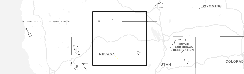
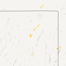
Hail Map for Eureka, NV
The Eureka, NV area has had 1 report of on-the-ground hail by trained spotters, and has been under severe weather warnings 0 times during the past 12 months. Doppler radar has detected hail at or near Eureka, NV on 2 occasions, including 1 occasion during the past year.
| Name: | Eureka, NV |
| Where Located: | 60.2 miles WNW of Ely, NV |
| Map: | Google Map for Eureka, NV |
| Population: | 610 |
| Housing Units: | 346 |
| More Info: | Search Google for Eureka, NV |
5
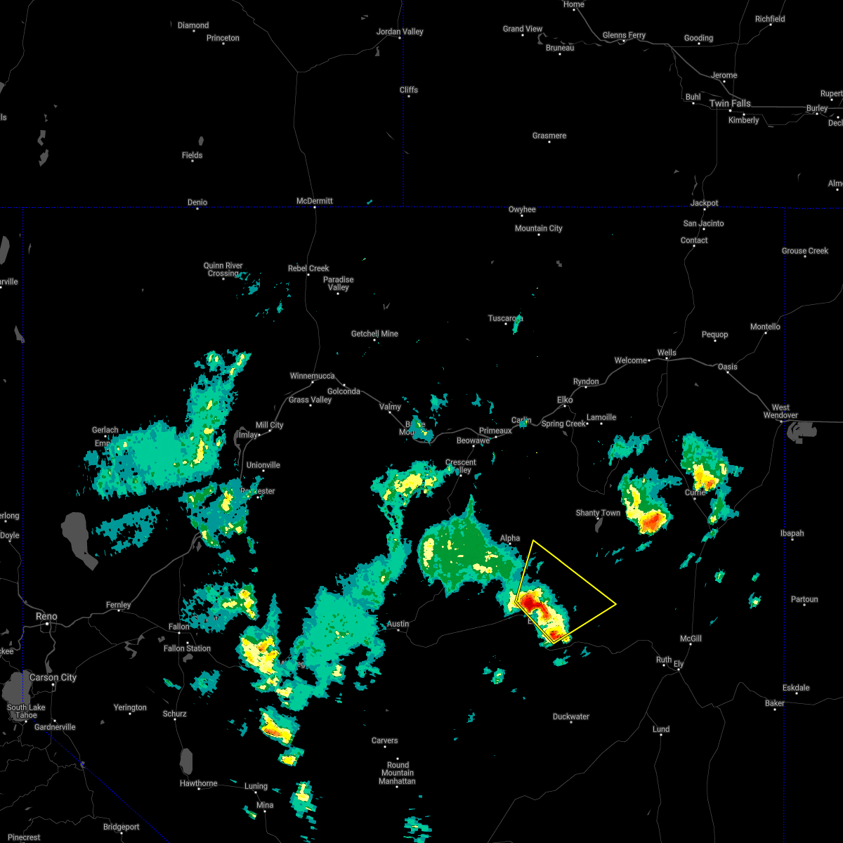
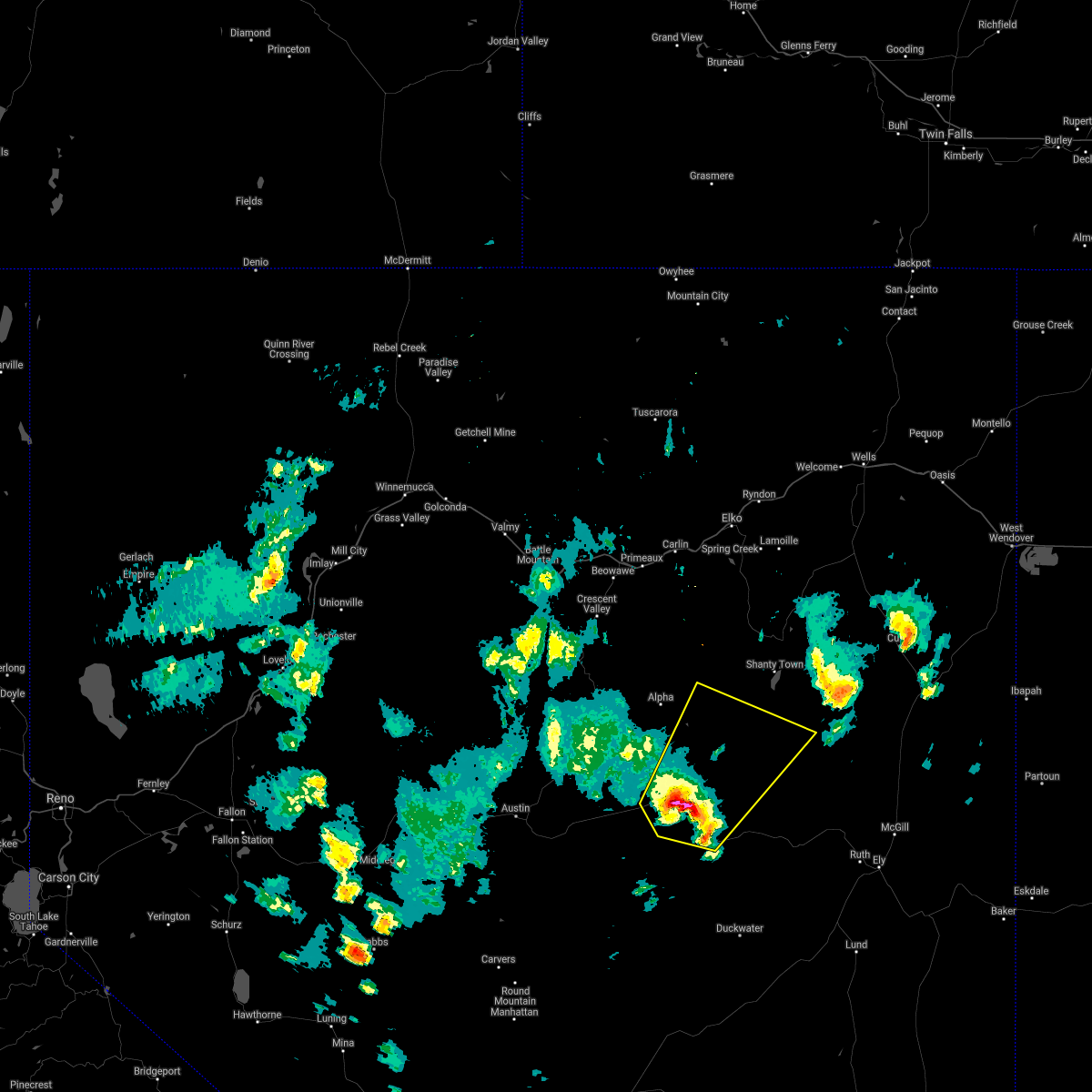
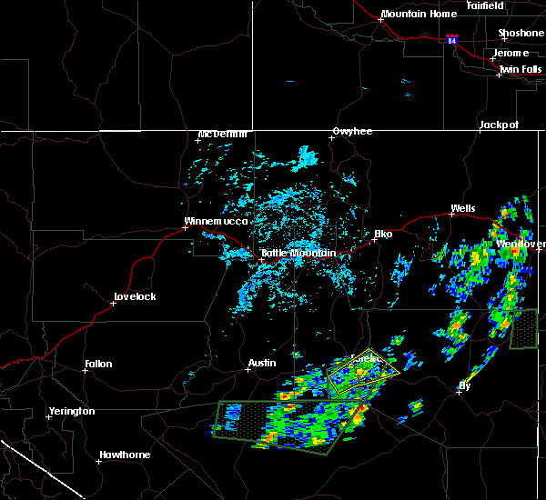
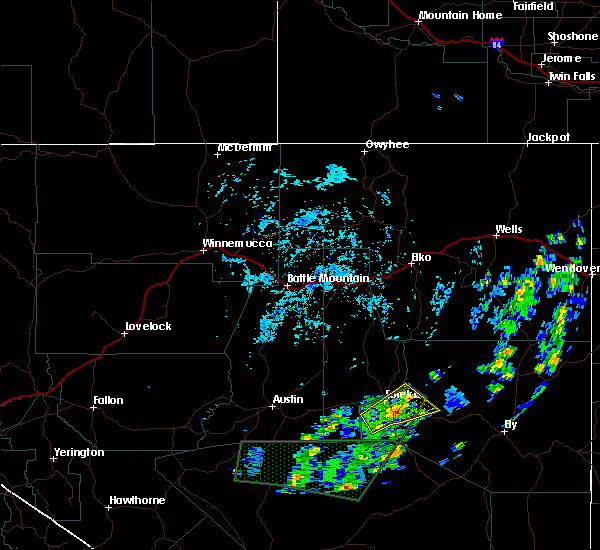
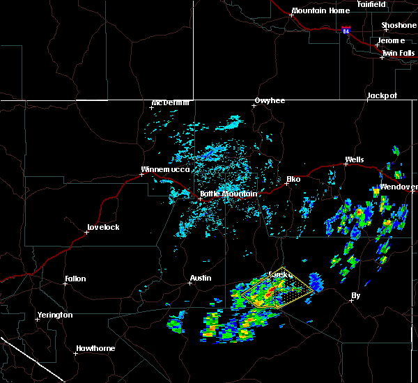
The Top Recent Hail Date for Eureka, NV is Tuesday, May 23, 2023 (1st out of 2)
Hail and Wind Damage Spotted near Eureka, NV
| Date / Time | Report Details |
|---|---|
| 9/3/2023 2:38 PM PDT | Raws coils creek (coin2)... elevation 6745 fee in eureka county NV, 35.9 miles SE of Eureka, NV |
| 7/12/2022 2:38 PM PDT | Awos station kp68 eureka airport asos station elevation: 5952 f in eureka county NV, 6.3 miles SSE of Eureka, NV |
| 7/19/2021 1:39 PM PDT | Mesonet station comn2 combs canyon raws station elevation: 6589 f in eureka county NV, 14.2 miles NE of Eureka, NV |
| 6/30/2021 4:39 PM PDT | Mesonet station comn2 combs canyon raws... elevation 6589 fee in eureka county NV, 14.2 miles NE of Eureka, NV |
| 5/15/2021 4:44 PM PDT | Storm damage reported in eureka county NV, 14.2 miles NE of Eureka, NV |
| 5/15/2021 4:42 PM PDT | Quarter sized hail reported 1.2 miles NW of Eureka, NV |
| 5/15/2021 1:58 PM PDT |
 At 157 pm pdt, a cluster of severe thunderstorms was located over diamond valley, moving northeast at 25 mph (radar indicated). Hazards include 60 mph wind gusts and quarter size hail. Hail damage to vehicles is expected. Expect wind damage to roofs, siding, and trees. At 157 pm pdt, a cluster of severe thunderstorms was located over diamond valley, moving northeast at 25 mph (radar indicated). Hazards include 60 mph wind gusts and quarter size hail. Hail damage to vehicles is expected. Expect wind damage to roofs, siding, and trees.
|
| 5/15/2021 1:34 PM PDT |
 At 133 pm pdt, a severe thunderstorm was located over eureka airport, moving northeast at 40 mph (radar indicated). Hazards include 60 mph wind gusts and quarter size hail. Hail damage to vehicles is expected. Expect wind damage to roofs, siding, and trees. At 133 pm pdt, a severe thunderstorm was located over eureka airport, moving northeast at 40 mph (radar indicated). Hazards include 60 mph wind gusts and quarter size hail. Hail damage to vehicles is expected. Expect wind damage to roofs, siding, and trees.
|
| 7/10/2018 2:25 PM PDT |
 The severe thunderstorm warning for west central white pine and southeastern eureka counties will expire at 230 pm pdt, the storm which prompted the warning has weakened below severe limits, and no longer poses an immediate threat to life or property. therefore, the warning will be allowed to expire. however small hail, gusty winds and heavy rain are still possible with this thunderstorm. The severe thunderstorm warning for west central white pine and southeastern eureka counties will expire at 230 pm pdt, the storm which prompted the warning has weakened below severe limits, and no longer poses an immediate threat to life or property. therefore, the warning will be allowed to expire. however small hail, gusty winds and heavy rain are still possible with this thunderstorm.
|
| 7/10/2018 2:12 PM PDT |
 At 210 pm pdt, a severe thunderstorm was located near pinto summit and eureka, moving north at 10 mph (radar indicated). Hazards include 60 mph wind gusts and penny size hail. Expect damage to roofs, siding, and trees. Locations impacted include, eureka, pinto summit and pancake summit. At 210 pm pdt, a severe thunderstorm was located near pinto summit and eureka, moving north at 10 mph (radar indicated). Hazards include 60 mph wind gusts and penny size hail. Expect damage to roofs, siding, and trees. Locations impacted include, eureka, pinto summit and pancake summit.
|
| 7/10/2018 1:45 PM PDT |
 At 144 pm pdt, a severe thunderstorm was located near pinto summit, moving northeast at 10 mph (radar indicated). Hazards include 60 mph wind gusts and penny size hail. expect damage to roofs, siding, and trees At 144 pm pdt, a severe thunderstorm was located near pinto summit, moving northeast at 10 mph (radar indicated). Hazards include 60 mph wind gusts and penny size hail. expect damage to roofs, siding, and trees
|
| 7/23/2017 6:39 PM PDT | Thunderstorm microburs in eureka county NV, 14.2 miles NE of Eureka, NV |
| 6/19/2017 3:00 PM PDT | Mesonet station eurn... eureka agrime in eureka county NV, 12.3 miles S of Eureka, NV |
| 5/5/2017 4:30 PM PDT | 67 mph gust in diamond valley. member of public called and also reported minor wind damag in eureka county NV, 12.3 miles S of Eureka, NV |
| 6/9/2014 7:26 PM PDT | Dry microburst at eureka airport asos...no lightning... probably no rain reached the groun in eureka county NV, 6.5 miles SSE of Eureka, NV |
| 1/1/0001 12:00 AM | Eureka airport asos -- 5936 amsl in eureka county NV, 6.3 miles SSE of Eureka, NV |
Hail Maps for Eureka, NV

Connect with Interactive Hail Maps