

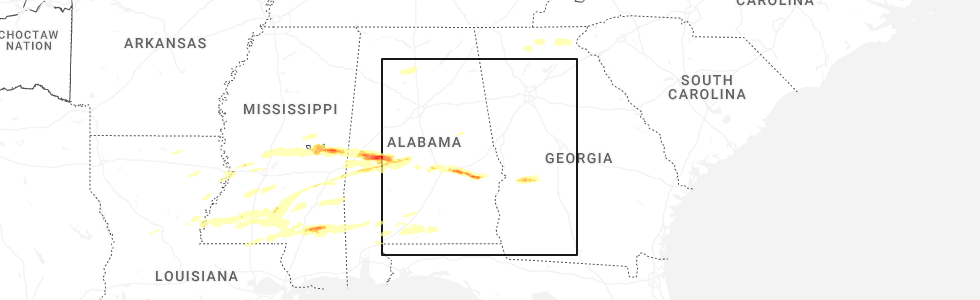
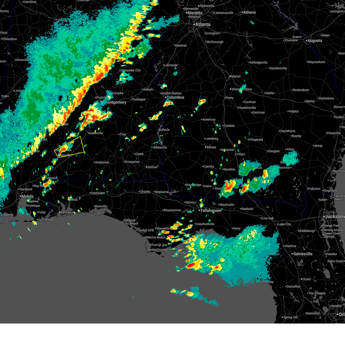
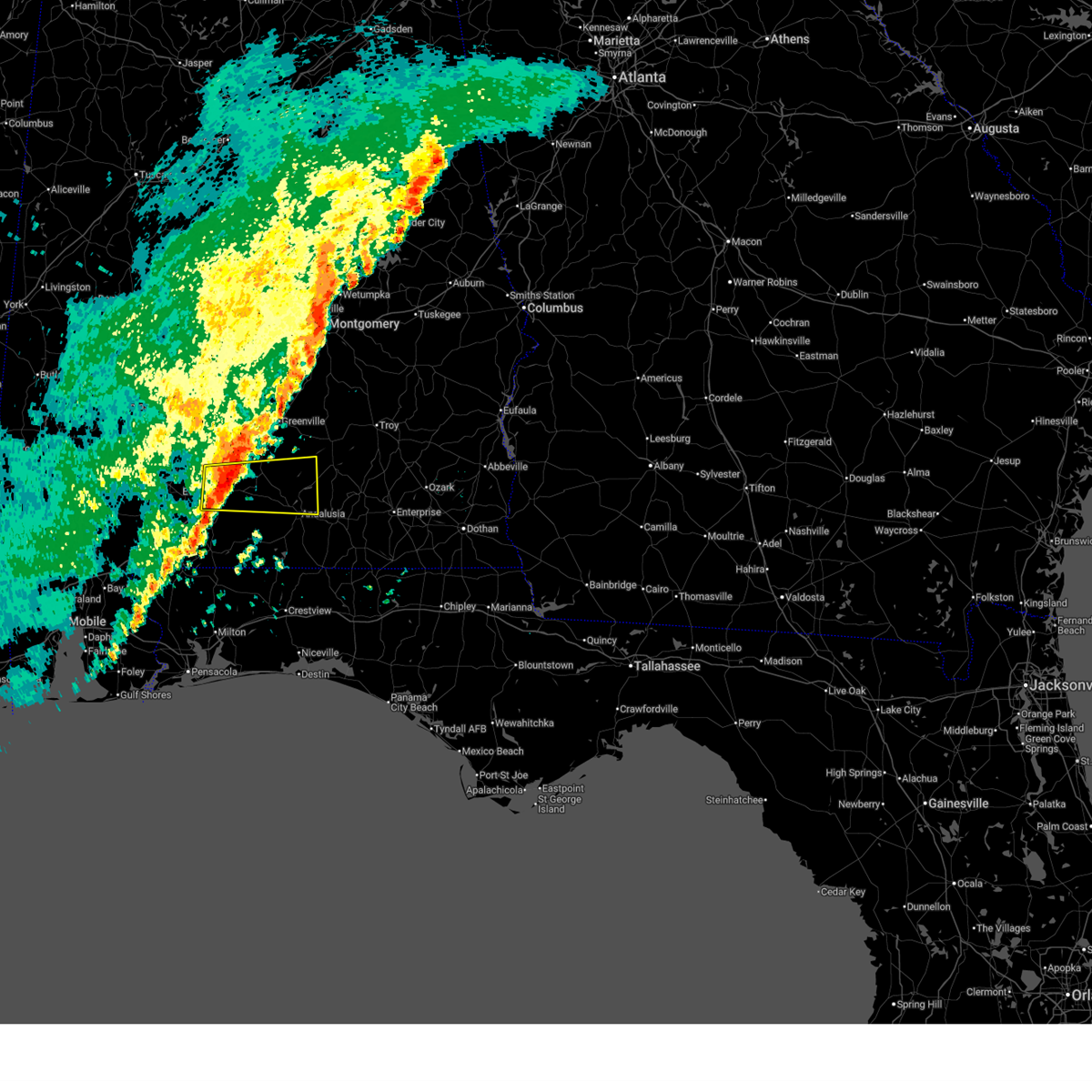
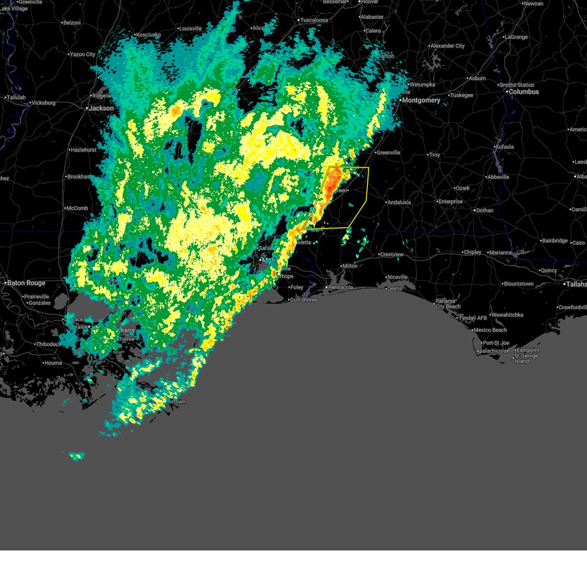
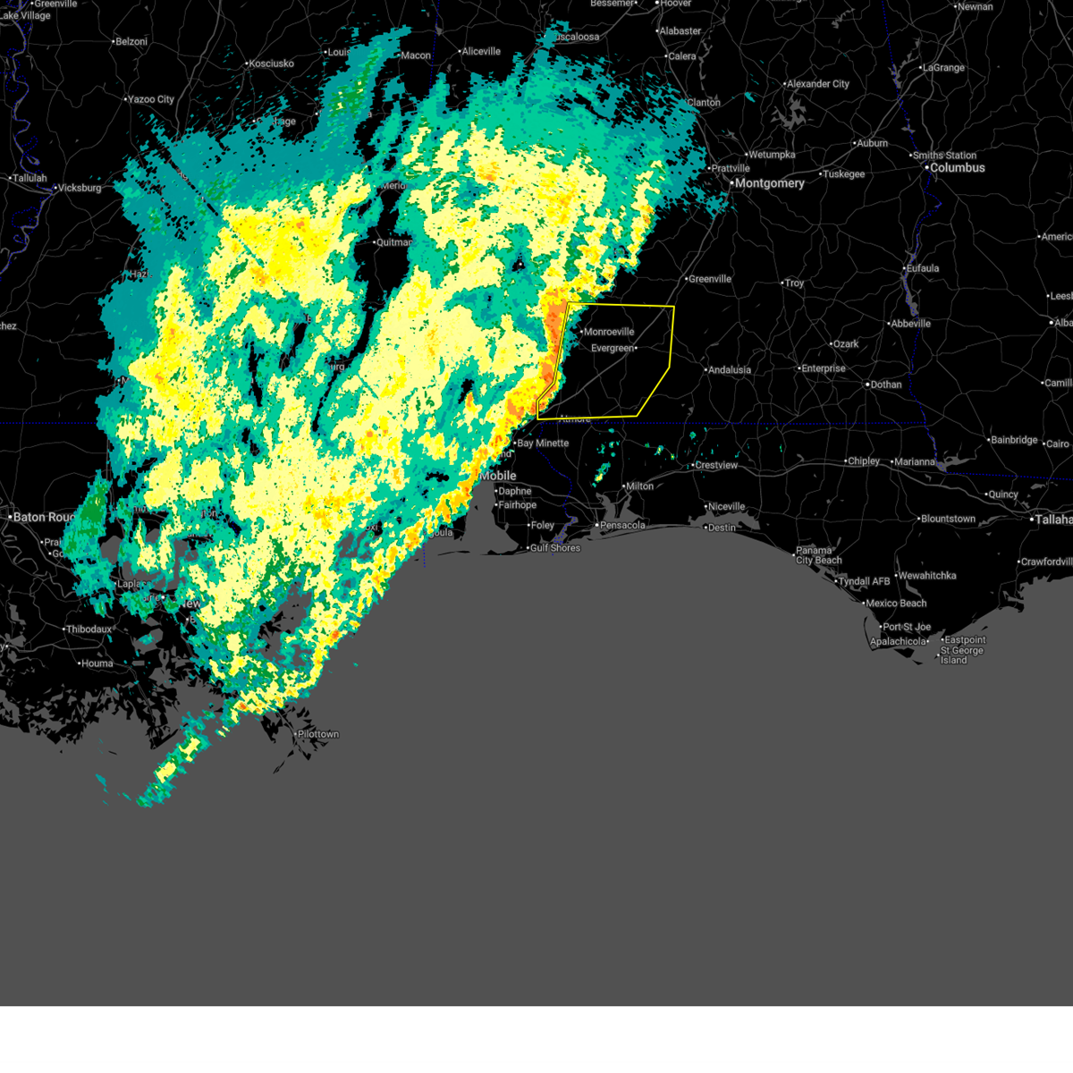
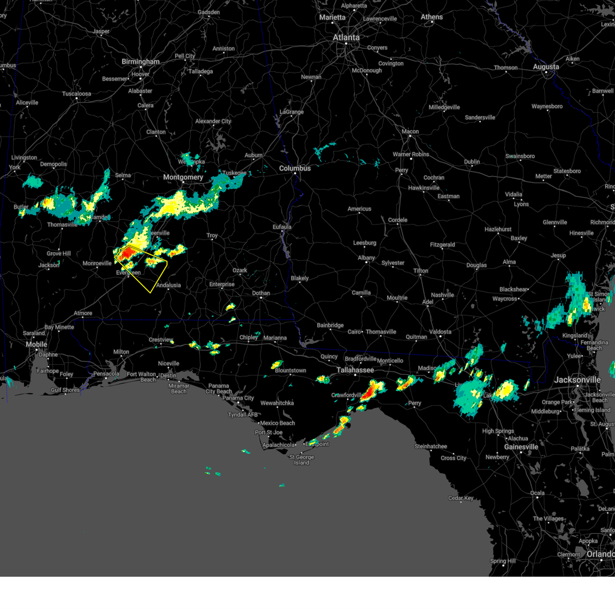
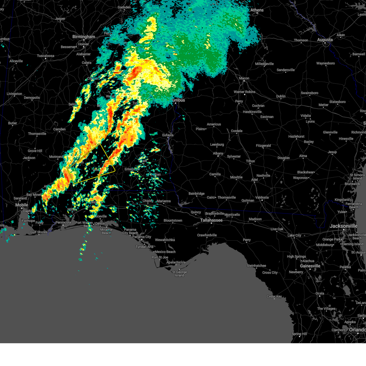
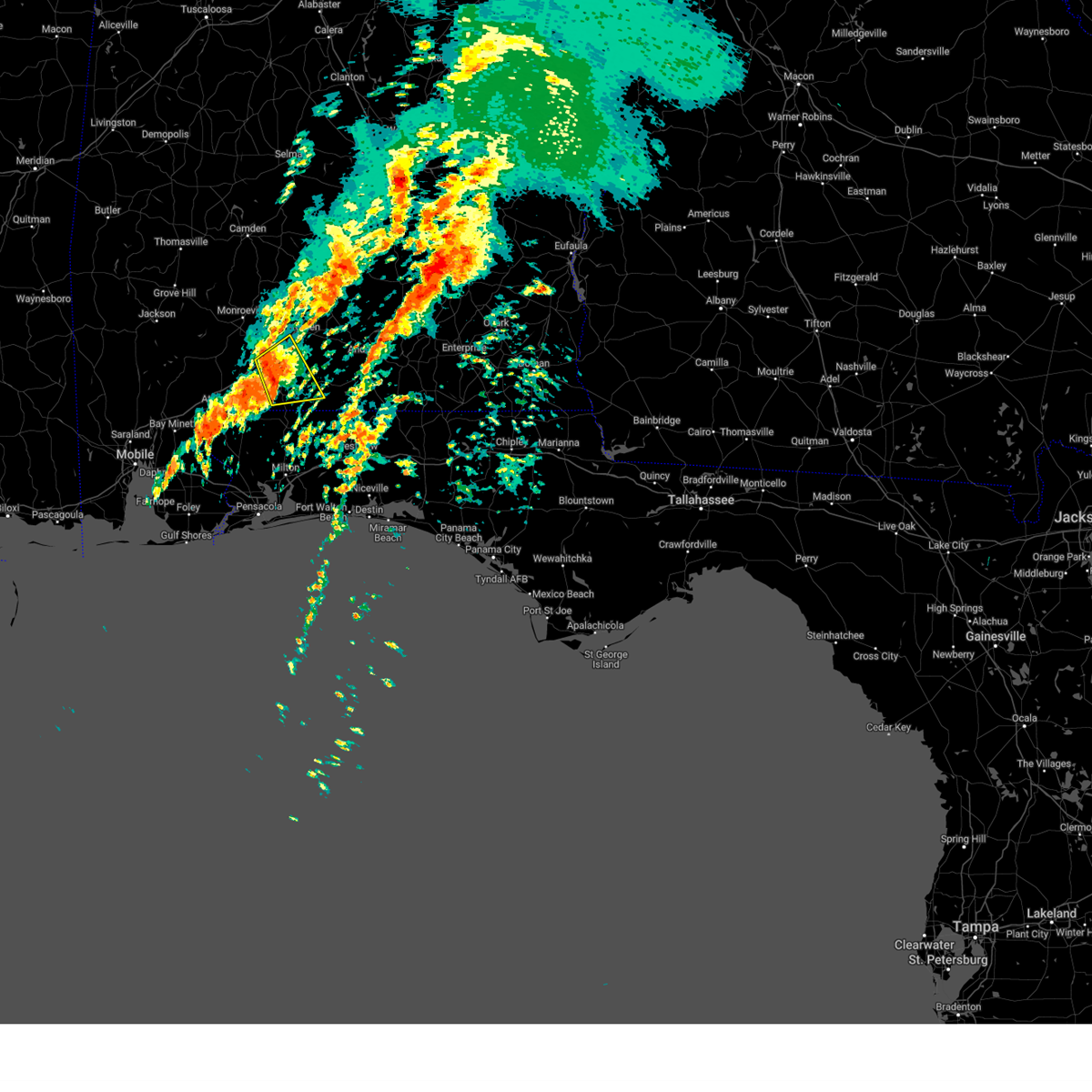
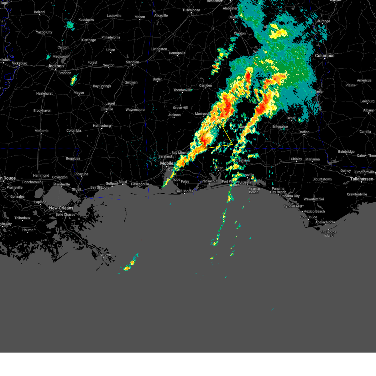
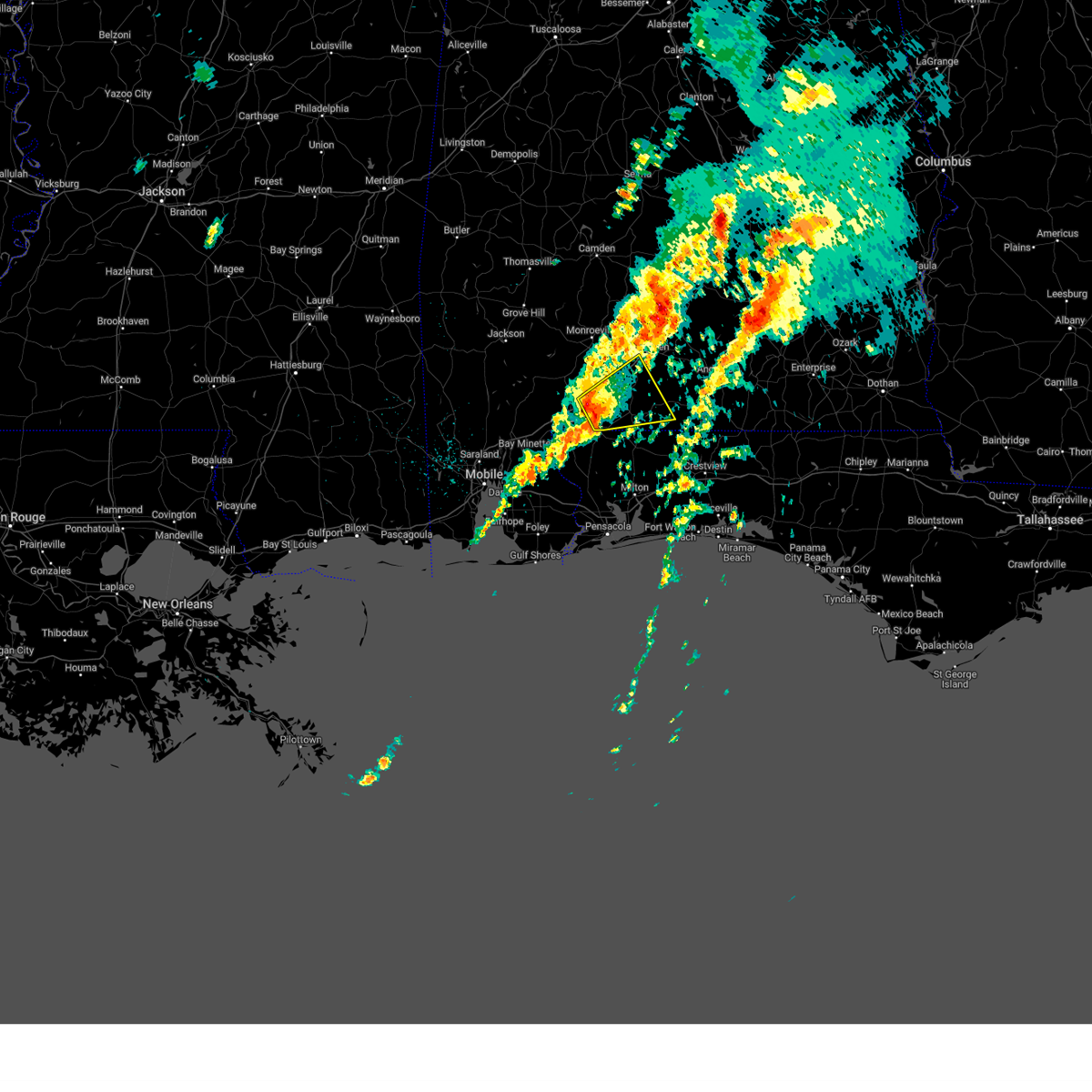
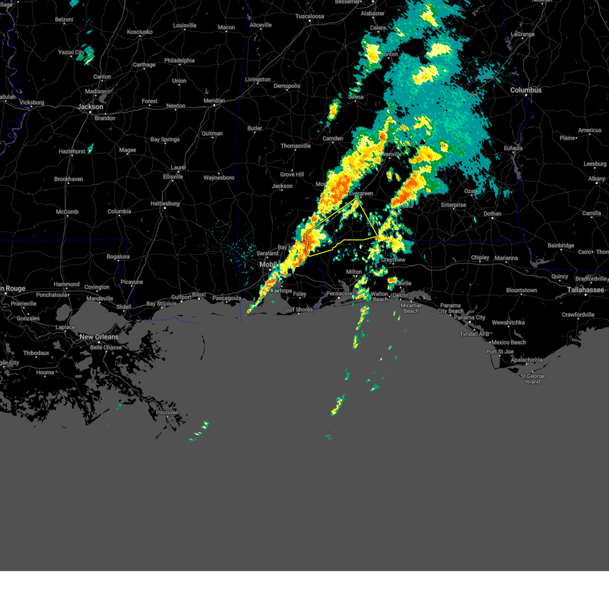
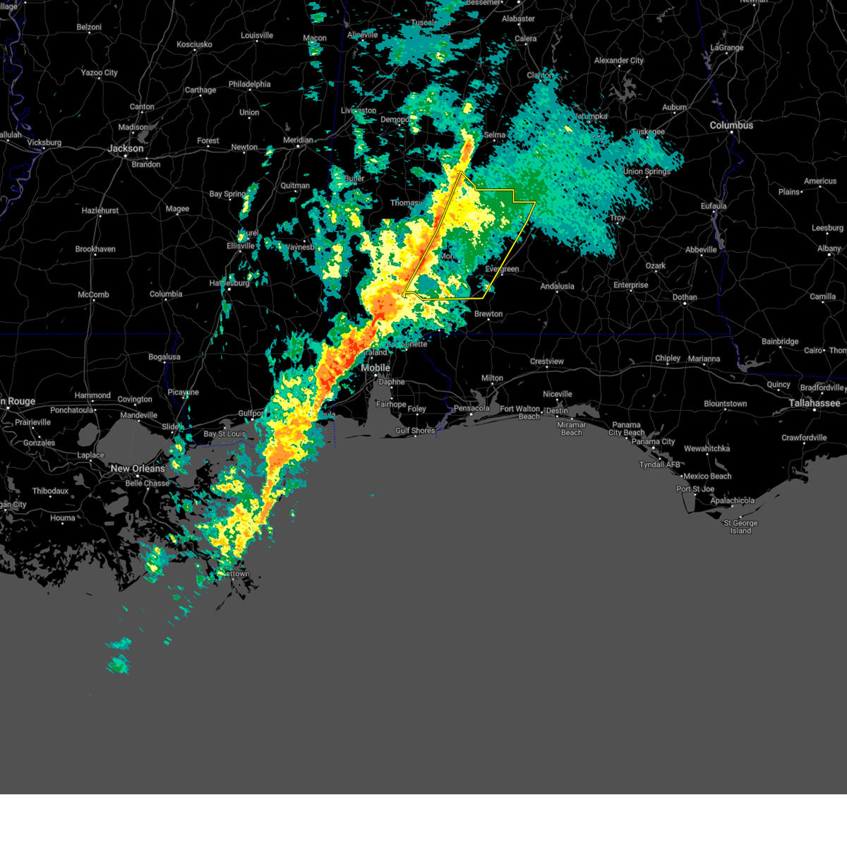
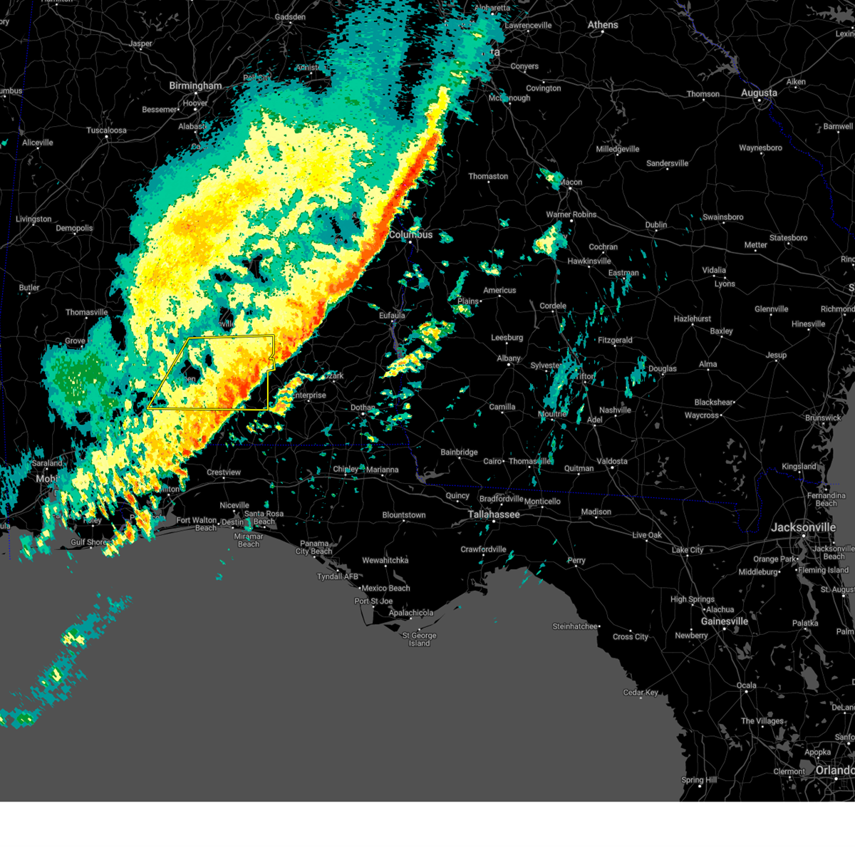
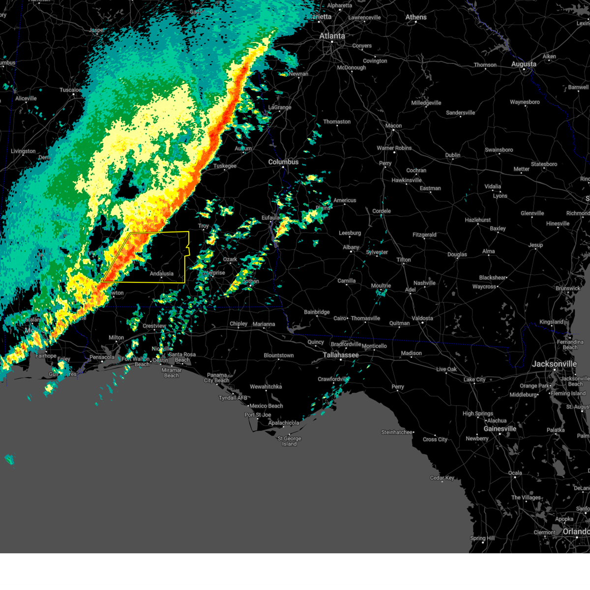
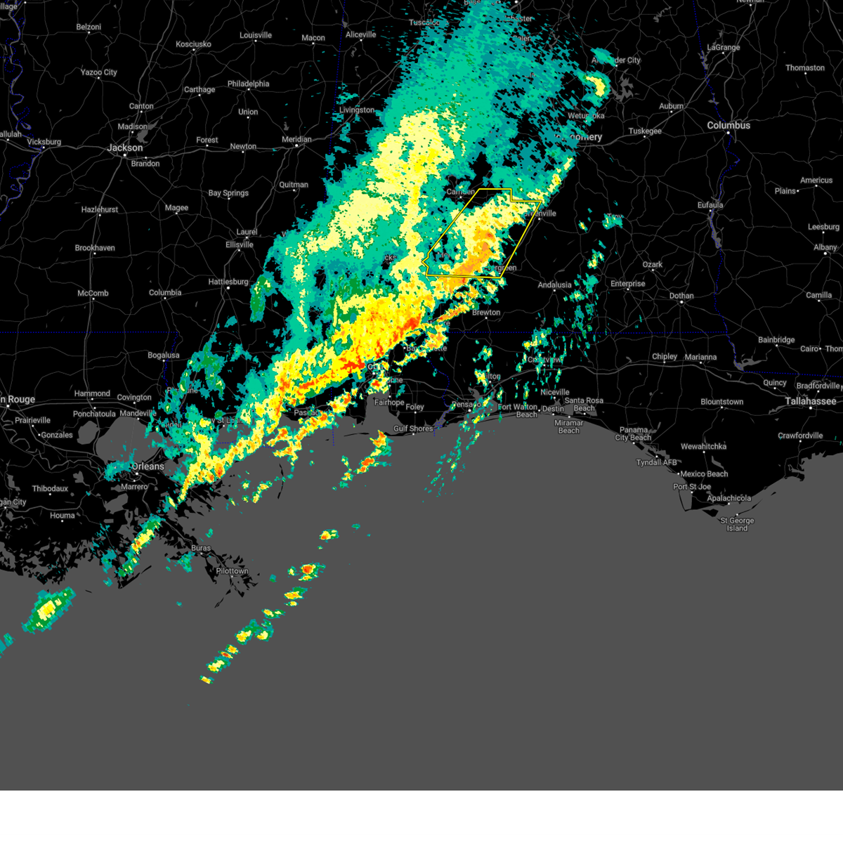
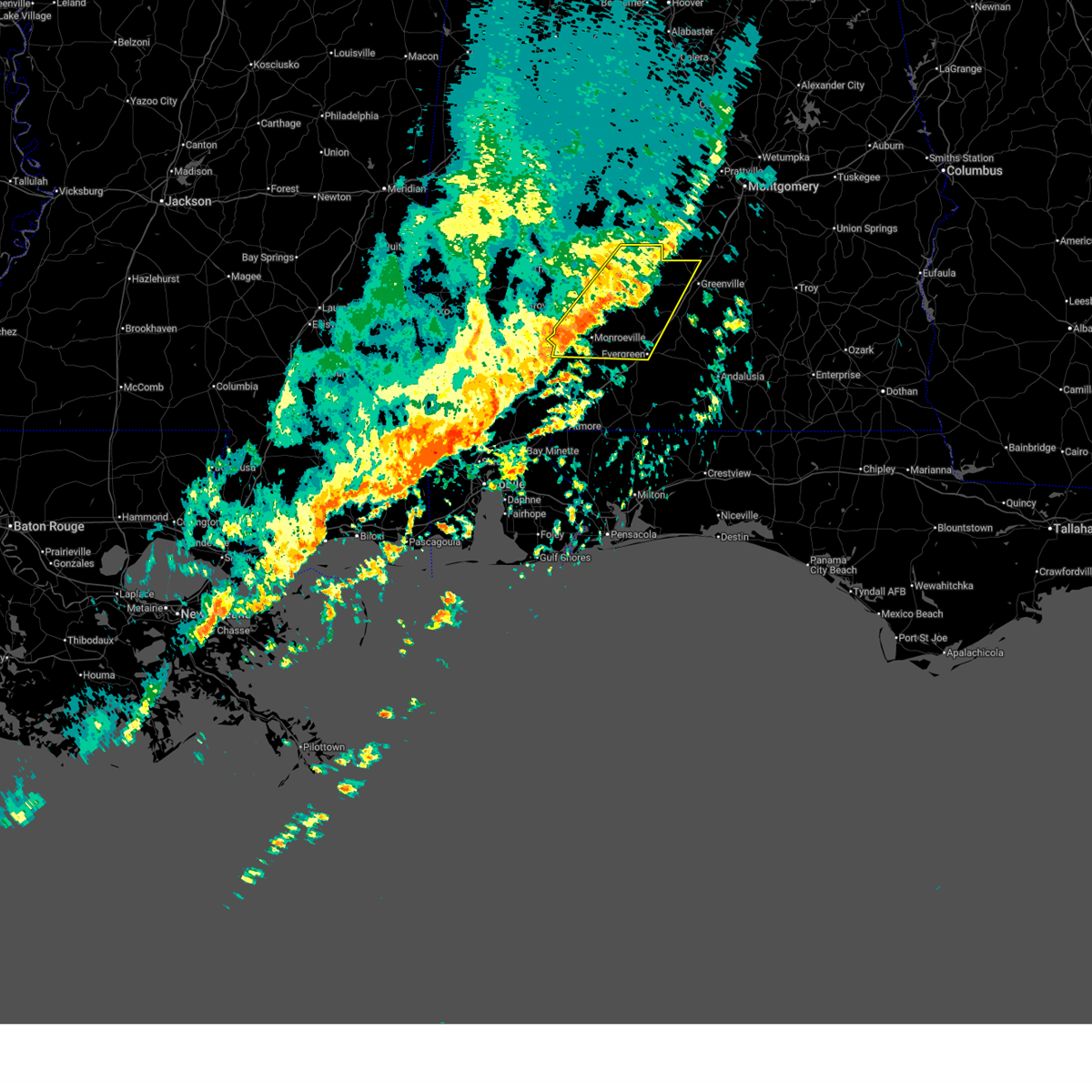
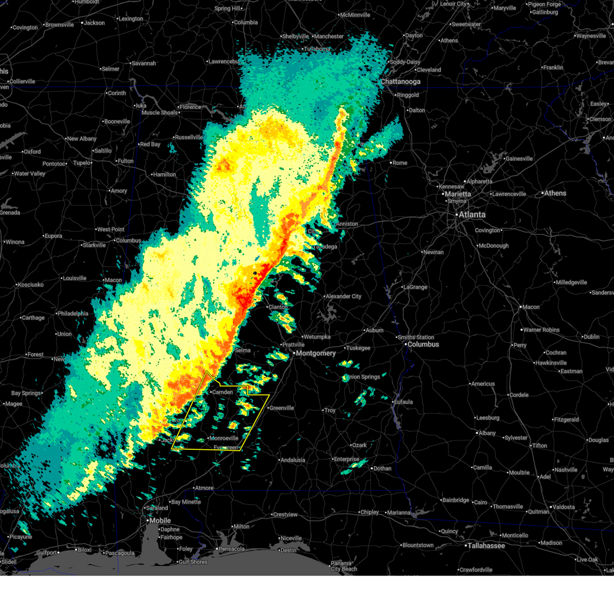
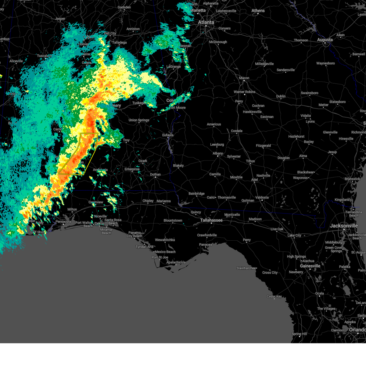
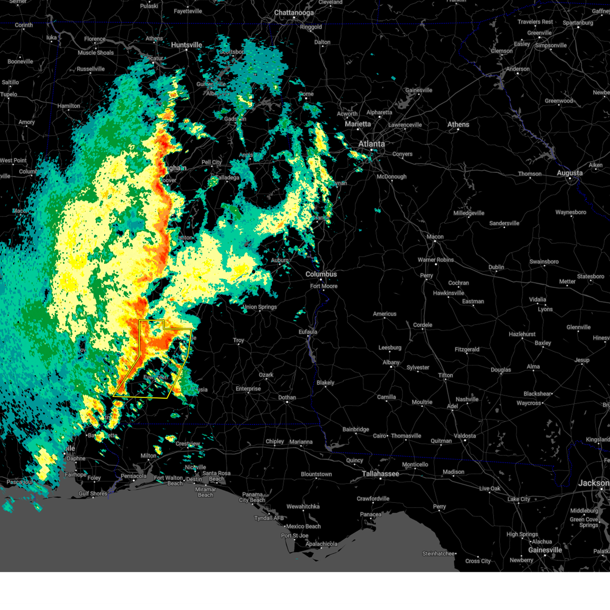
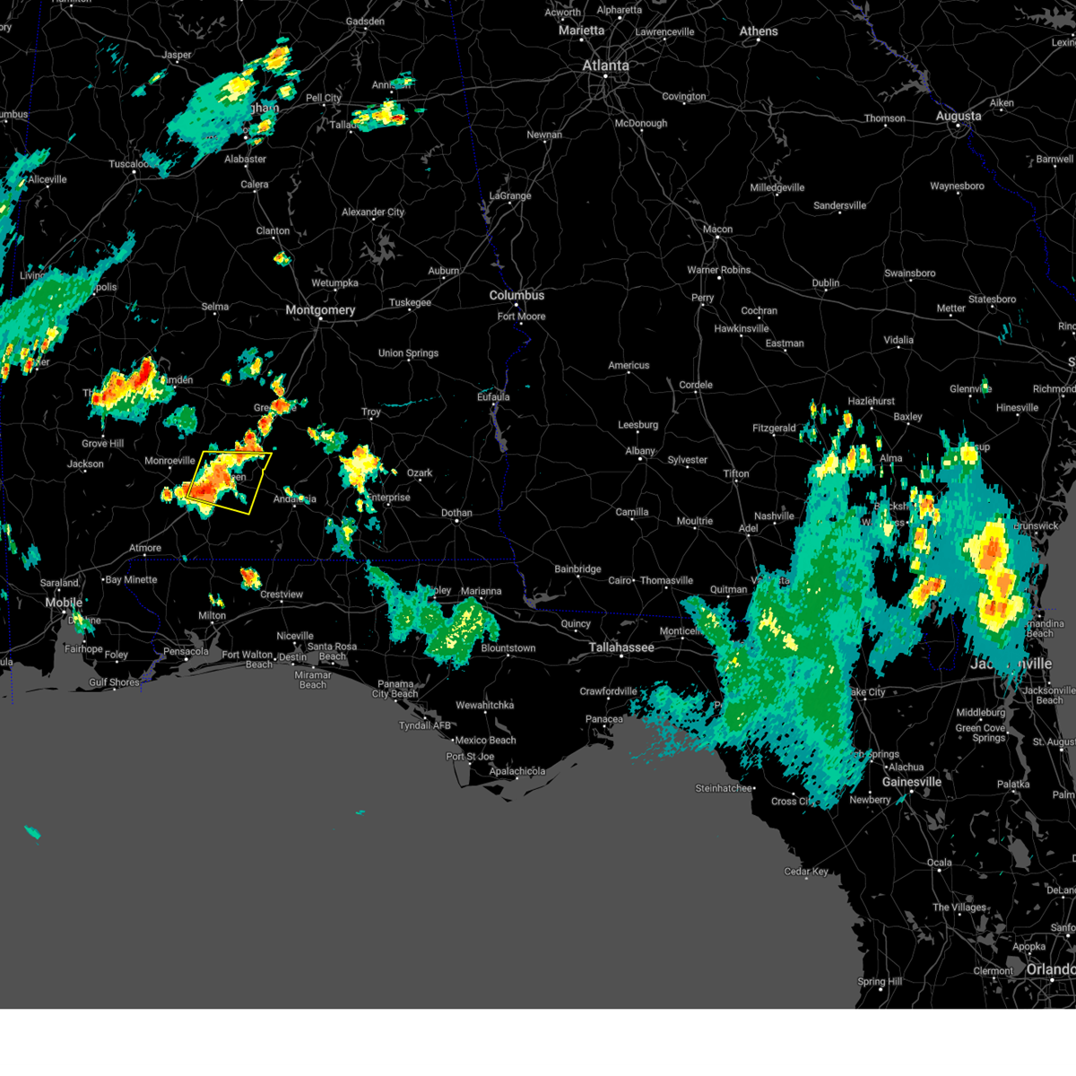
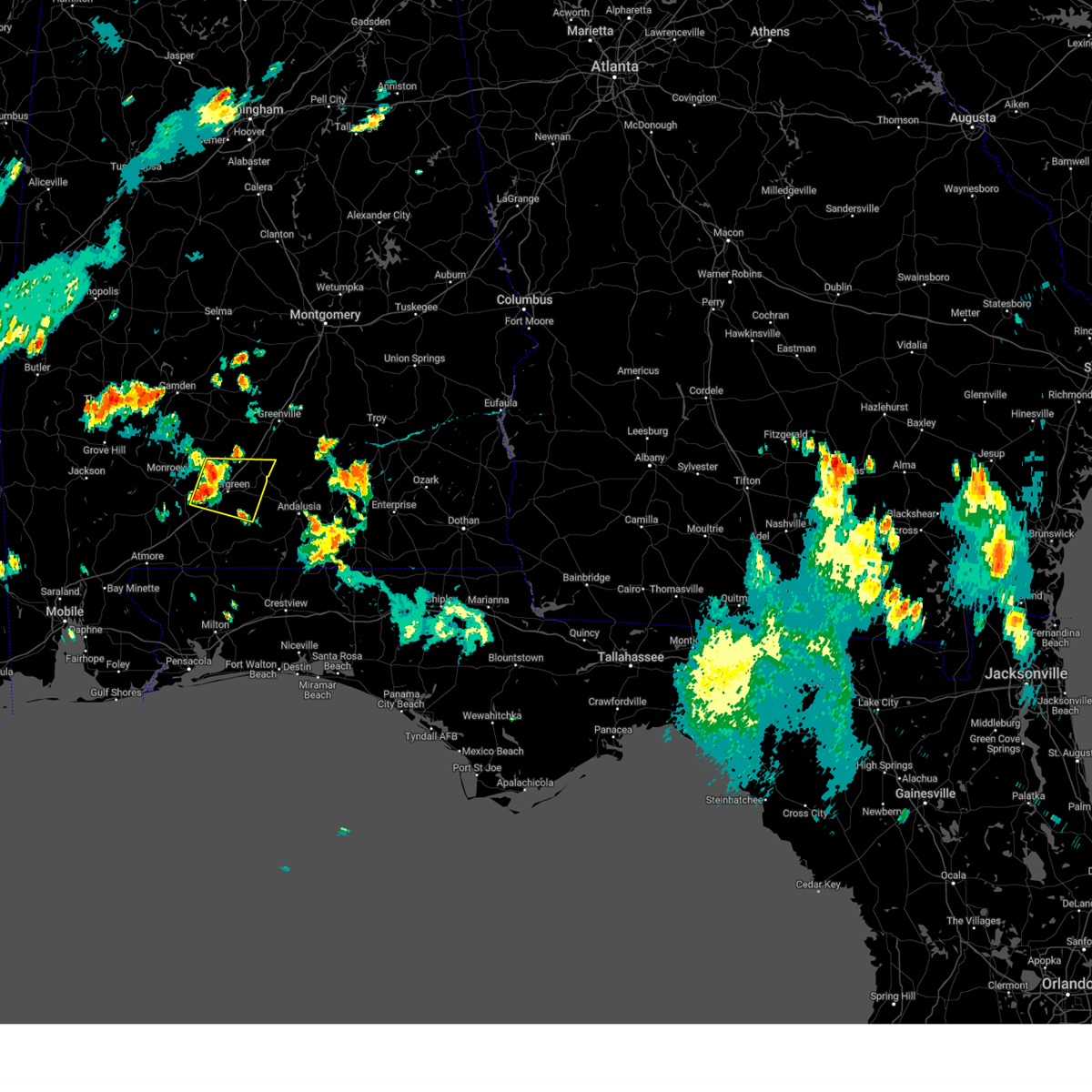
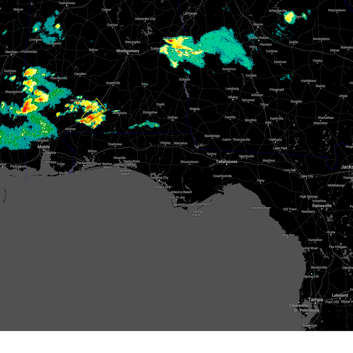
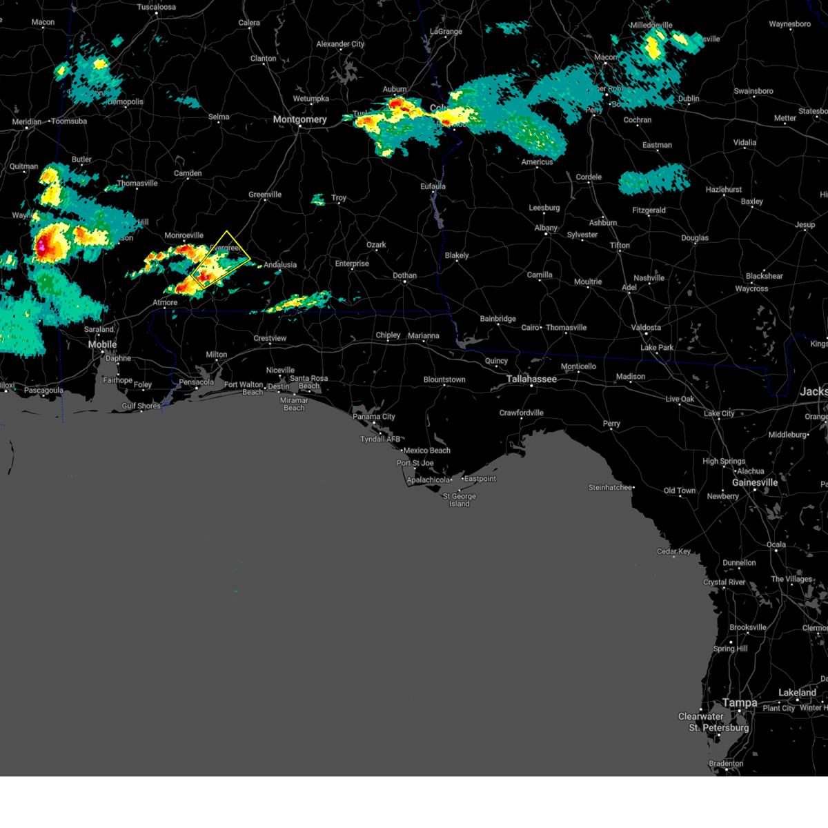
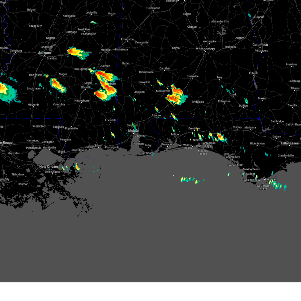
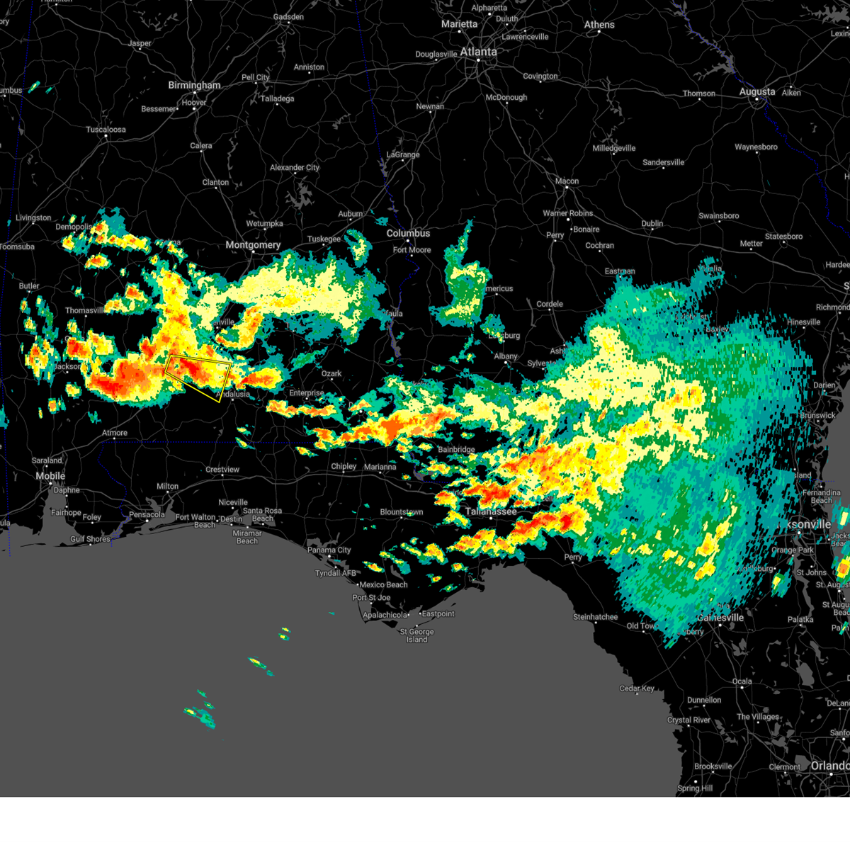
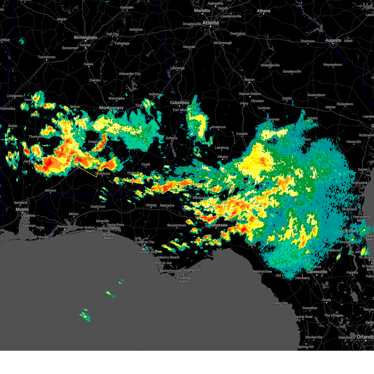
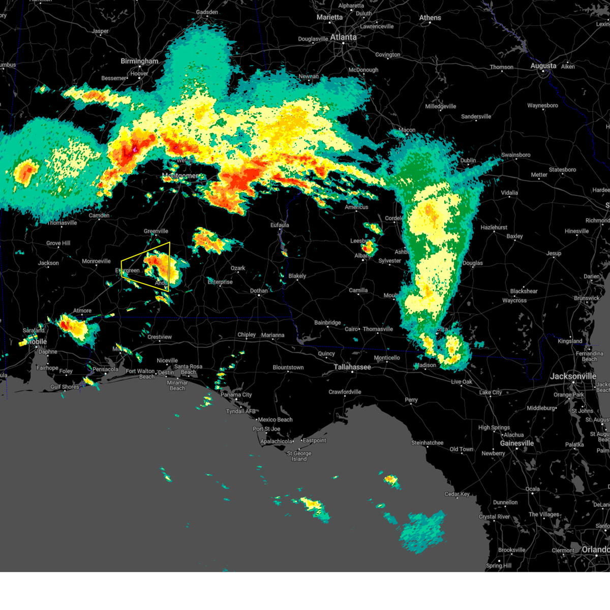
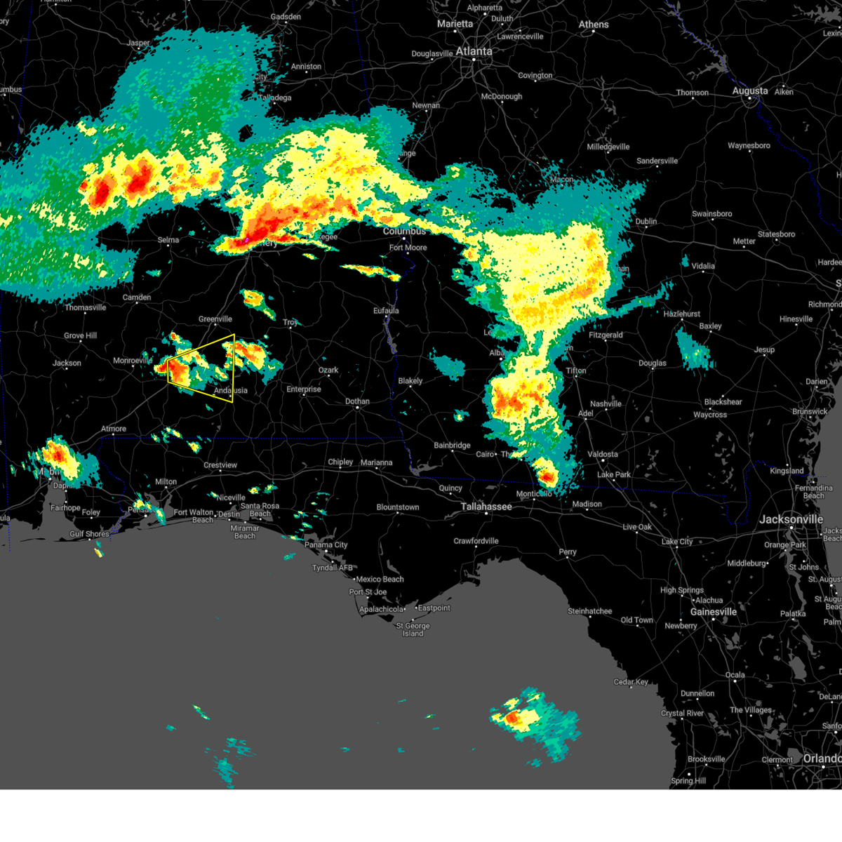
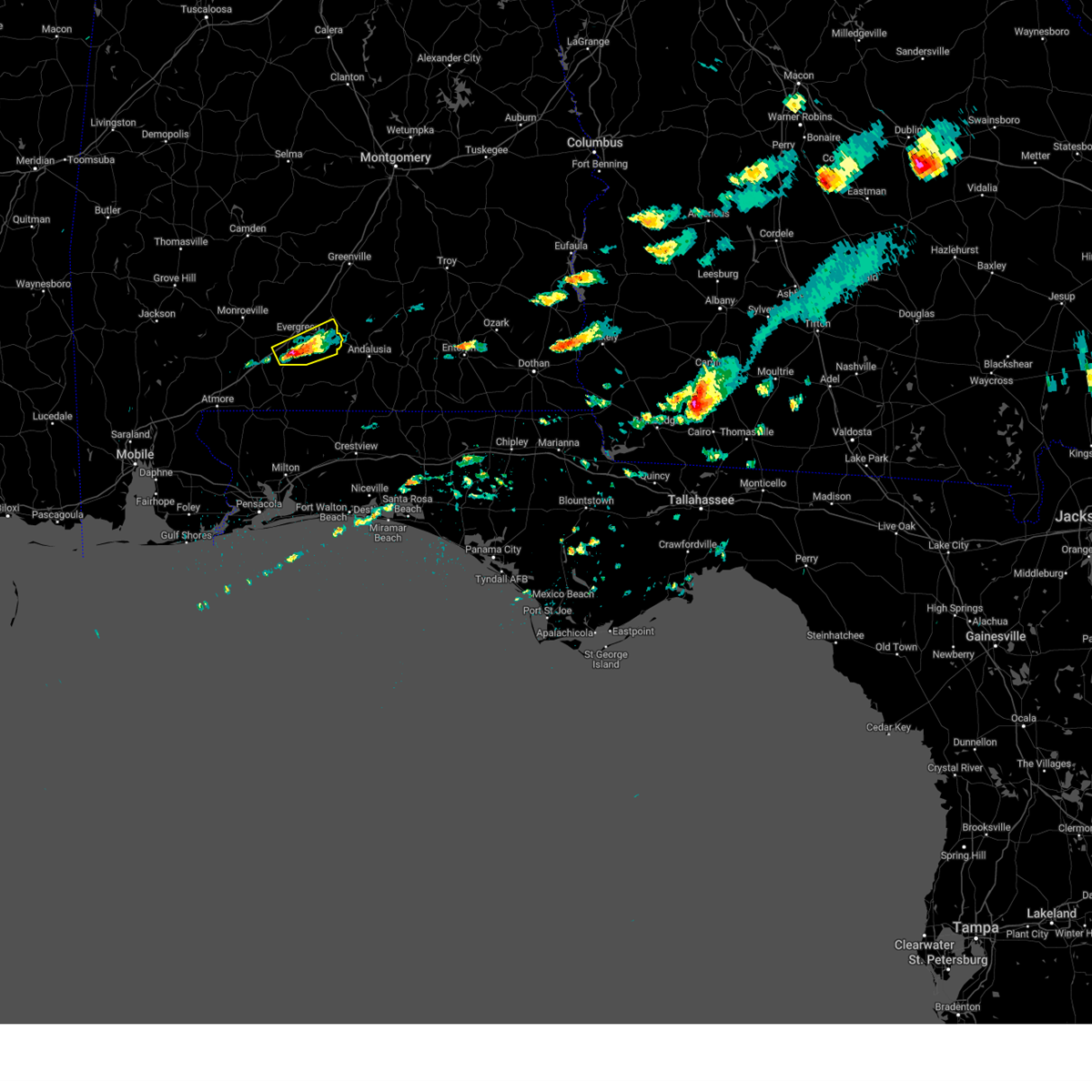
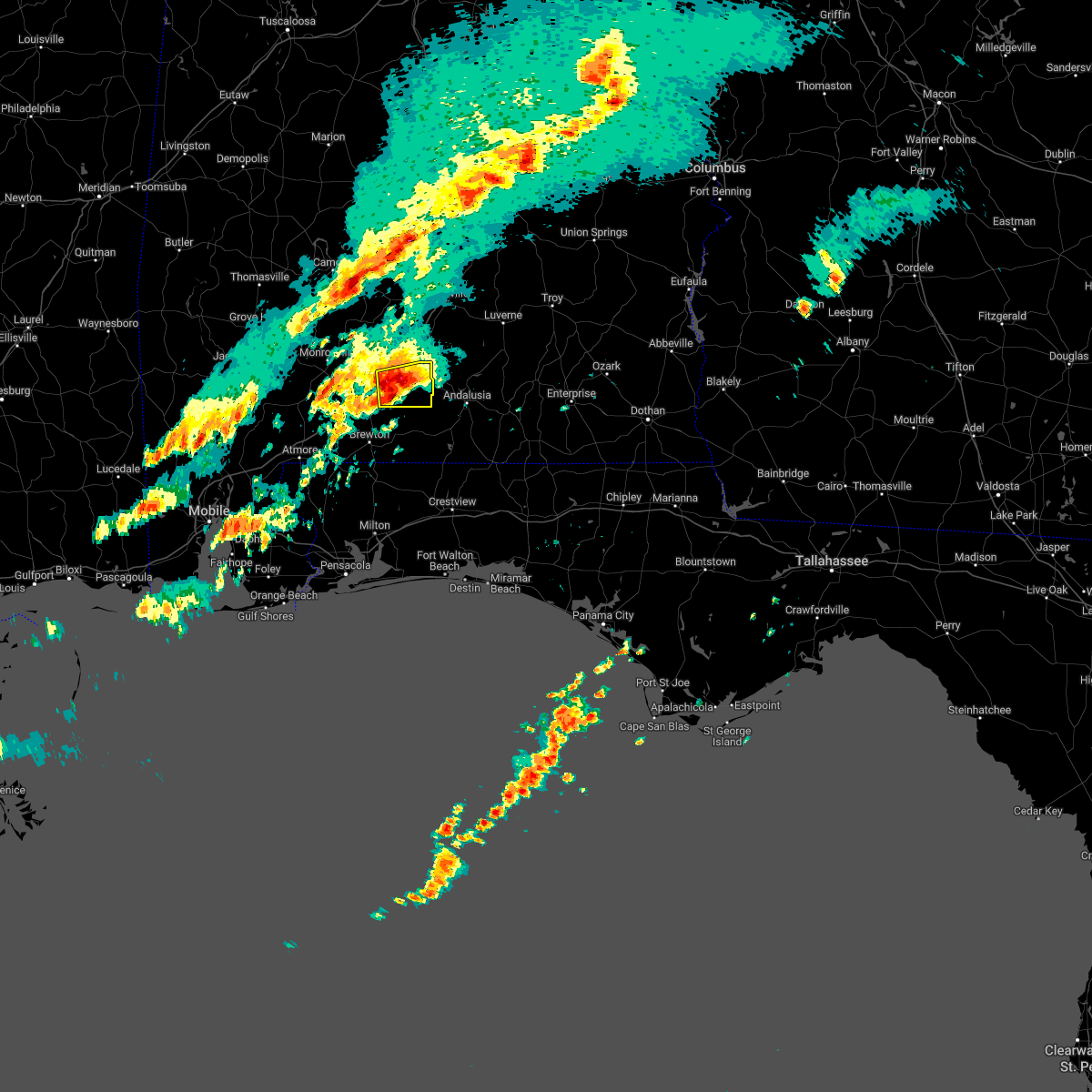
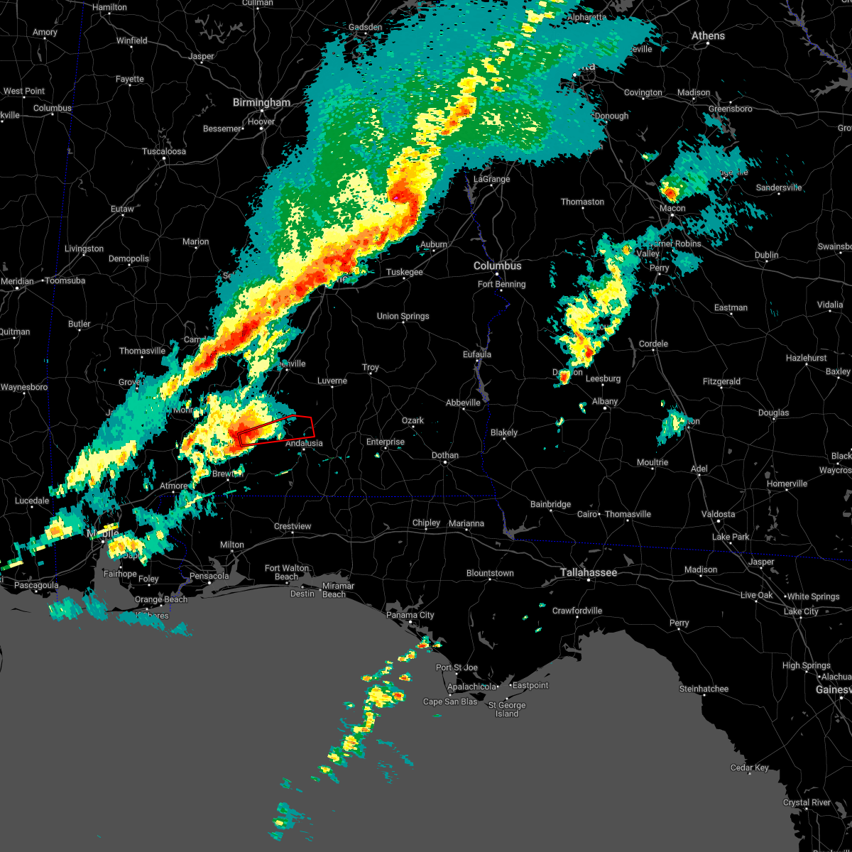
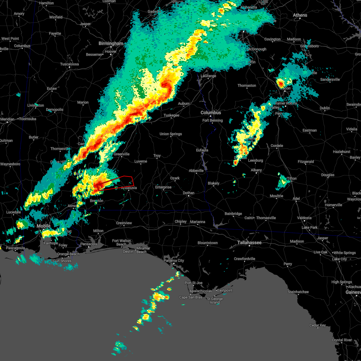
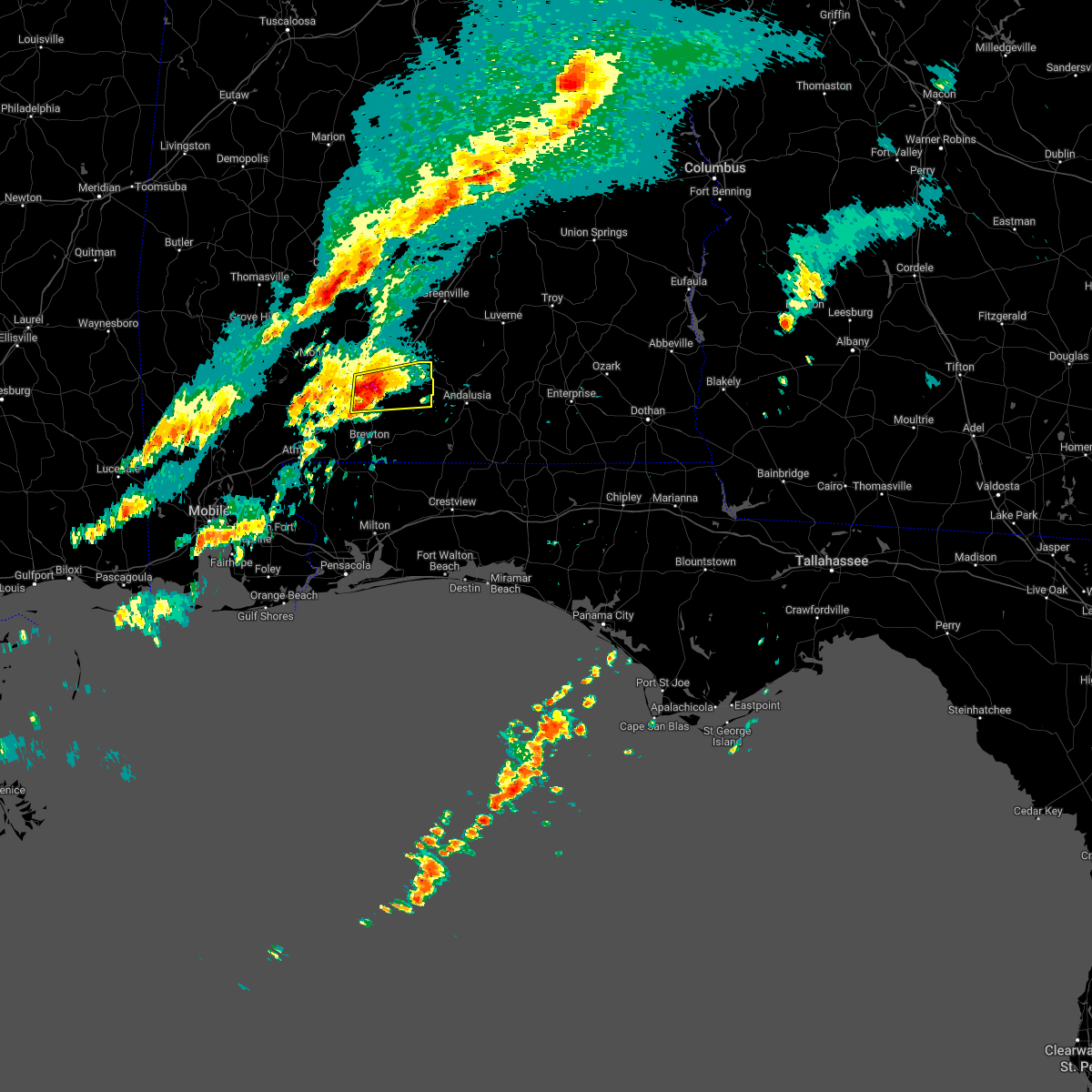
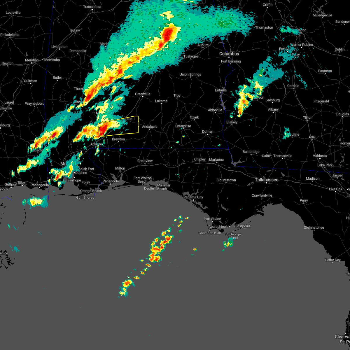
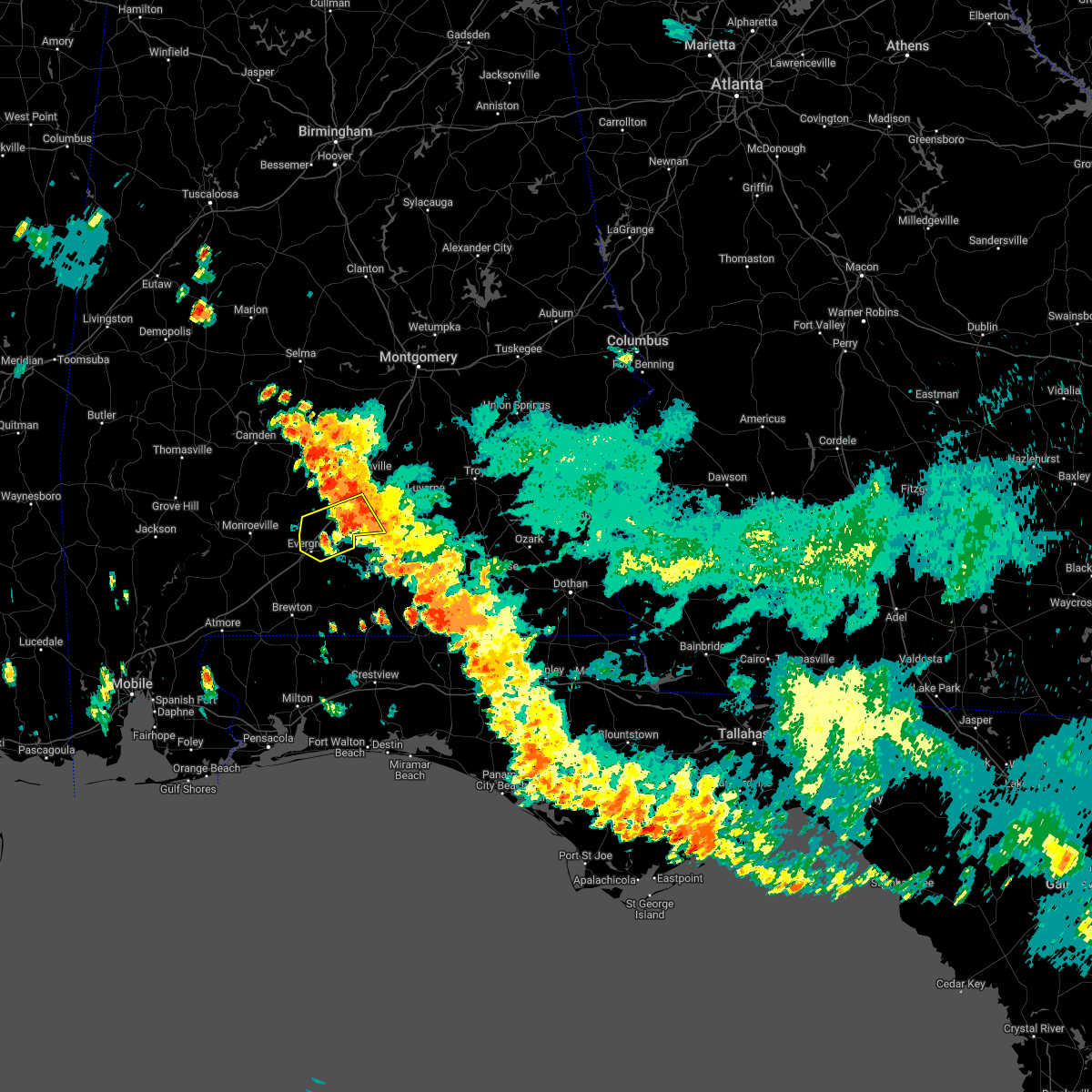
Hail Map for Evergreen, AL
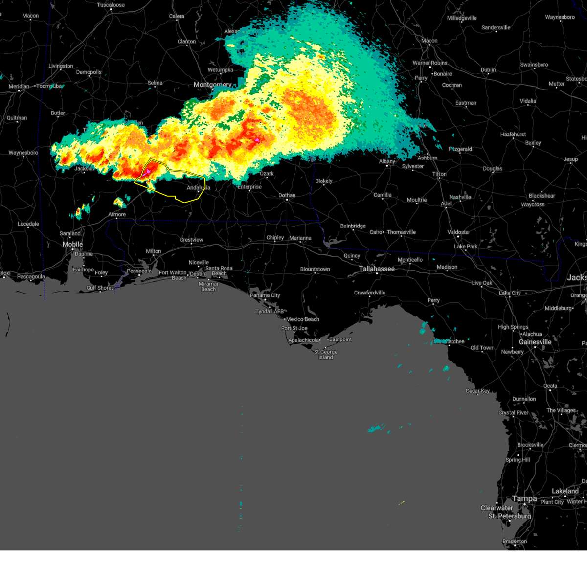
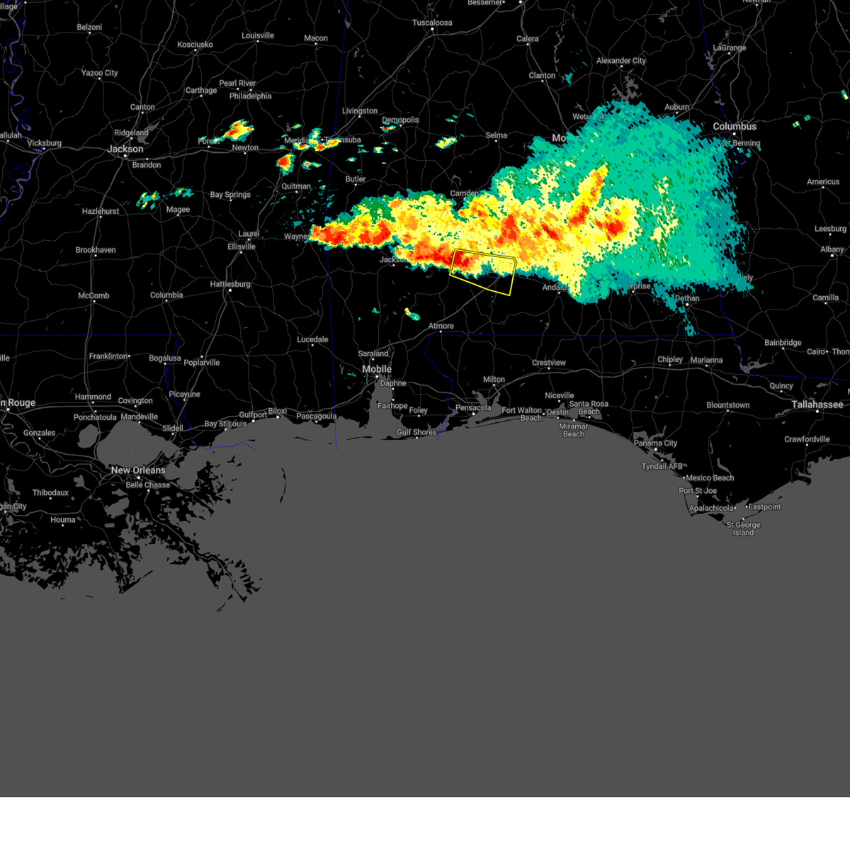
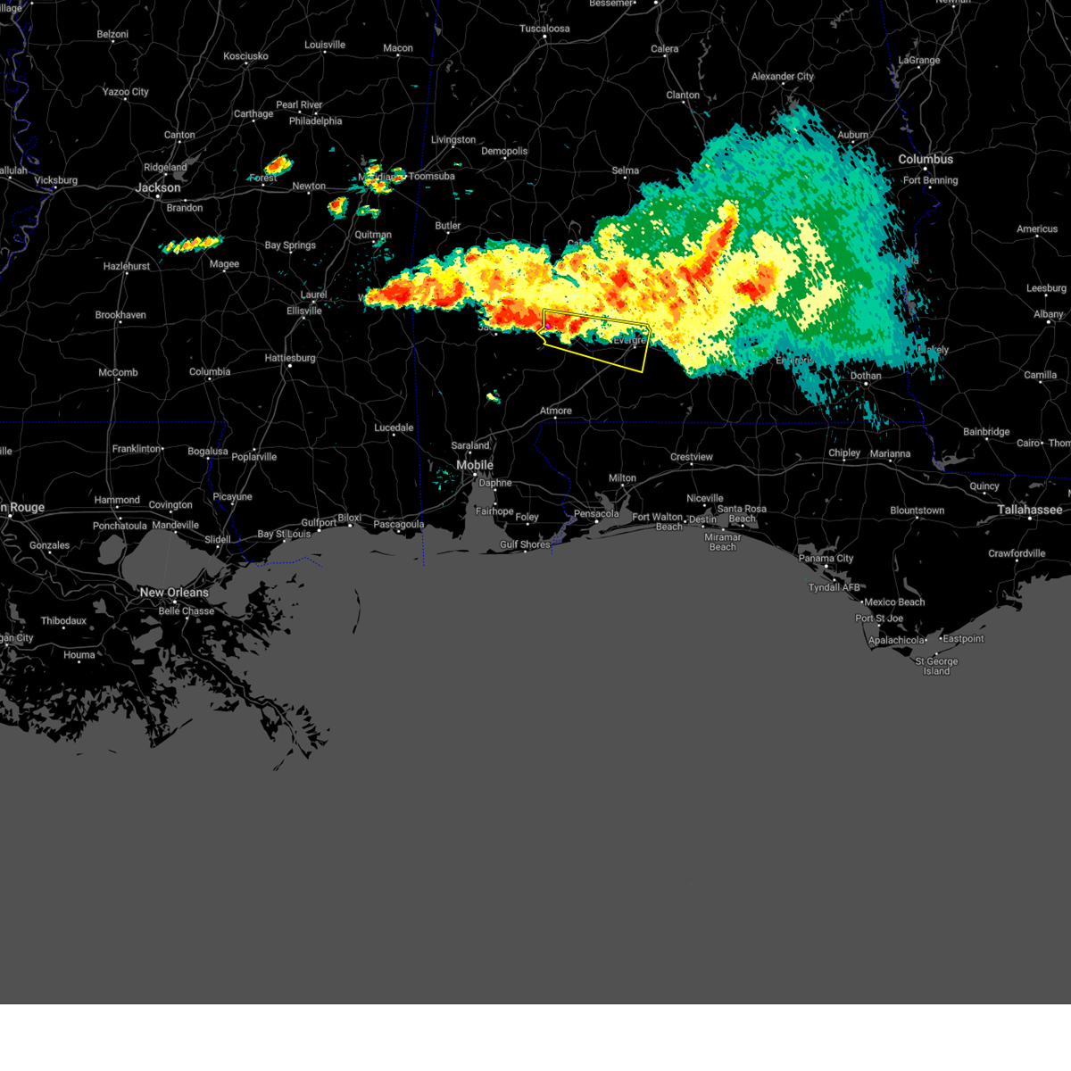
The Evergreen, AL area has had 3 reports of on-the-ground hail by trained spotters, and has been under severe weather warnings 8 times during the past 12 months. Doppler radar has detected hail at or near Evergreen, AL on 55 occasions, including 1 occasion during the past year.
| Name: | Evergreen, AL |
| Where Located: | 43.1 miles SSE of Camden, AL |
| Map: | Google Map for Evergreen, AL |
| Population: | 3944 |
| Housing Units: | 1912 |
| More Info: | Search Google for Evergreen, AL |
0
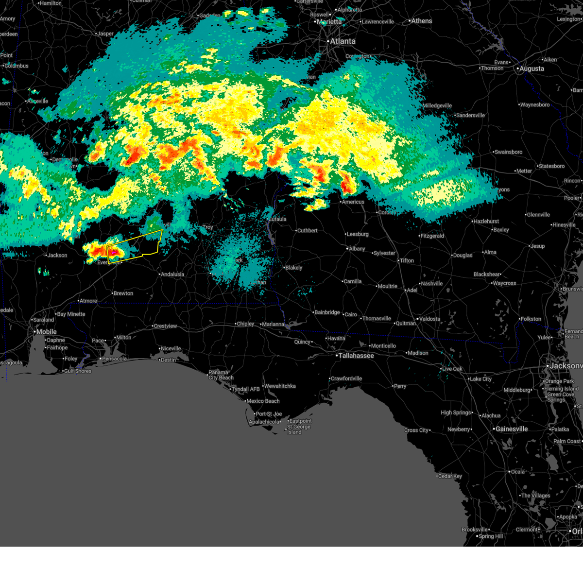
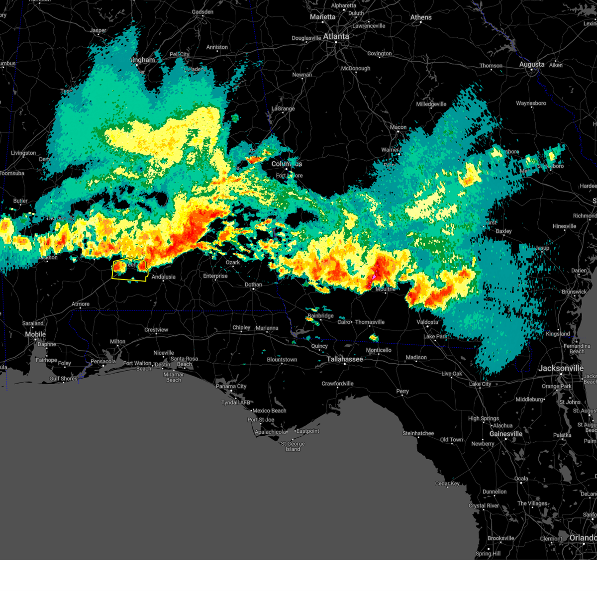
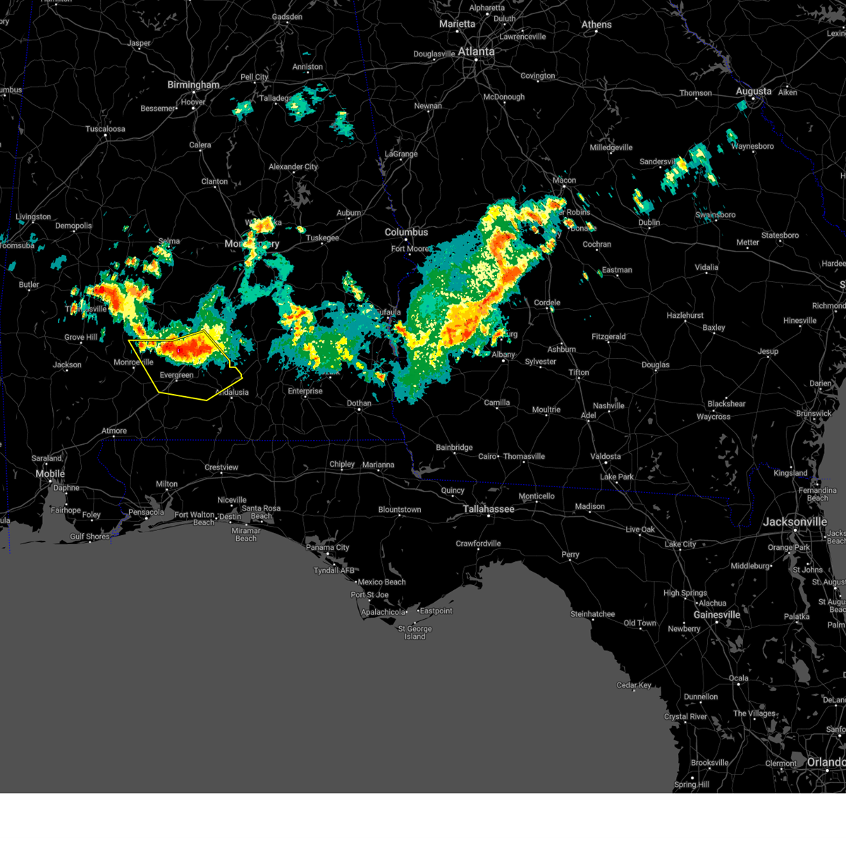
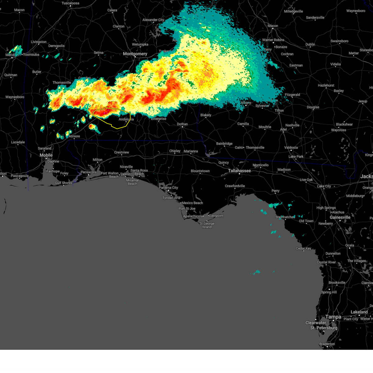
The Top Recent Hail Date for Evergreen, AL is Wednesday, May 6, 2026 (46th out of 55)
Hail and Wind Damage Spotted near Evergreen, AL
| Date / Time | Report Details |
|---|---|
| 5/6/2026 10:23 PM CDT |
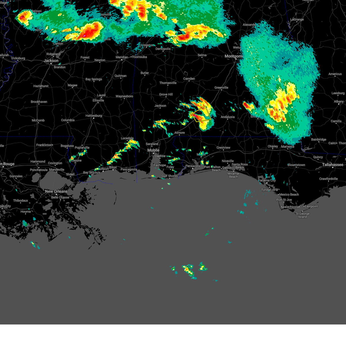
 At 1023 pm cdt, a severe thunderstorm was located 9 miles north of evergreen, moving east at 50 mph (radar indicated). Hazards include ping pong ball size hail and 60 mph wind gusts. People and animals outdoors will be injured. expect hail damage to roofs, siding, windows, and vehicles. expect wind damage to roofs, siding, and trees. Locations impacted include, georgiana and mckenzie. At 1023 pm cdt, a severe thunderstorm was located 9 miles north of evergreen, moving east at 50 mph (radar indicated). Hazards include ping pong ball size hail and 60 mph wind gusts. People and animals outdoors will be injured. expect hail damage to roofs, siding, windows, and vehicles. expect wind damage to roofs, siding, and trees. Locations impacted include, georgiana and mckenzie.
|
| 5/6/2026 10:19 PM CDT |
 Svrmob the national weather service in mobile has issued a * severe thunderstorm warning for, southern butler county in south central alabama, central conecuh county in south central alabama, * until 1100 pm cdt. * at 1019 pm cdt, a severe thunderstorm was located 8 miles northwest of evergreen, moving east at 55 mph (radar indicated). Hazards include 60 mph wind gusts and half dollar size hail. Hail damage to vehicles is expected. Expect wind damage to roofs, siding, and trees. Svrmob the national weather service in mobile has issued a * severe thunderstorm warning for, southern butler county in south central alabama, central conecuh county in south central alabama, * until 1100 pm cdt. * at 1019 pm cdt, a severe thunderstorm was located 8 miles northwest of evergreen, moving east at 55 mph (radar indicated). Hazards include 60 mph wind gusts and half dollar size hail. Hail damage to vehicles is expected. Expect wind damage to roofs, siding, and trees.
|
| 3/16/2026 3:35 AM CDT |
 the severe thunderstorm warning has been cancelled and is no longer in effect the severe thunderstorm warning has been cancelled and is no longer in effect
|
| 3/16/2026 3:35 AM CDT |
 At 335 am cdt, a severe thunderstorm was located 8 miles northwest of i65 and us 84, or 10 miles northwest of evergreen, moving northeast at 40 mph (radar indicated). Hazards include 60 mph wind gusts. Expect damage to roofs, siding, and trees. Locations impacted include, georgiana and mckenzie. At 335 am cdt, a severe thunderstorm was located 8 miles northwest of i65 and us 84, or 10 miles northwest of evergreen, moving northeast at 40 mph (radar indicated). Hazards include 60 mph wind gusts. Expect damage to roofs, siding, and trees. Locations impacted include, georgiana and mckenzie.
|
| 3/16/2026 3:30 AM CDT |
 Svrmob the national weather service in mobile has issued a * severe thunderstorm warning for, southwestern butler county in south central alabama, central monroe county in south central alabama, central conecuh county in south central alabama, * until 415 am cdt. * at 329 am cdt, a severe thunderstorm was located 4 miles northeast of repton, or 9 miles southeast of monroeville, moving northeast at 35 mph (radar indicated). Hazards include 60 mph wind gusts. expect damage to roofs, siding, and trees Svrmob the national weather service in mobile has issued a * severe thunderstorm warning for, southwestern butler county in south central alabama, central monroe county in south central alabama, central conecuh county in south central alabama, * until 415 am cdt. * at 329 am cdt, a severe thunderstorm was located 4 miles northeast of repton, or 9 miles southeast of monroeville, moving northeast at 35 mph (radar indicated). Hazards include 60 mph wind gusts. expect damage to roofs, siding, and trees
|
| 3/12/2026 1:39 AM CDT |
 Svrmob the national weather service in mobile has issued a * severe thunderstorm warning for, southern butler county in south central alabama, southwestern crenshaw county in south central alabama, east central conecuh county in south central alabama, northwestern covington county in south central alabama, * until 230 am cdt. * at 139 am cdt, a severe thunderstorm was located over i65 and us 84, or near evergreen, moving east at 45 mph (radar indicated). Hazards include 60 mph wind gusts. expect damage to roofs, siding, and trees Svrmob the national weather service in mobile has issued a * severe thunderstorm warning for, southern butler county in south central alabama, southwestern crenshaw county in south central alabama, east central conecuh county in south central alabama, northwestern covington county in south central alabama, * until 230 am cdt. * at 139 am cdt, a severe thunderstorm was located over i65 and us 84, or near evergreen, moving east at 45 mph (radar indicated). Hazards include 60 mph wind gusts. expect damage to roofs, siding, and trees
|
| 3/12/2026 1:29 AM CDT |
 At 129 am cdt, severe thunderstorms were located along a line extending from 9 miles east of beatrice to 7 miles west of castleberry to 4 miles northeast of atmore, moving east at 30 mph (radar indicated). Hazards include 60 mph wind gusts. Expect damage to roofs, siding, and trees. Locations impacted include, atmore, brewton, evergreen, east brewton, georgiana, mckenzie, castleberry, repton, riverview, i65 and us 84, and i65 and al 113. At 129 am cdt, severe thunderstorms were located along a line extending from 9 miles east of beatrice to 7 miles west of castleberry to 4 miles northeast of atmore, moving east at 30 mph (radar indicated). Hazards include 60 mph wind gusts. Expect damage to roofs, siding, and trees. Locations impacted include, atmore, brewton, evergreen, east brewton, georgiana, mckenzie, castleberry, repton, riverview, i65 and us 84, and i65 and al 113.
|
| 3/12/2026 12:56 AM CDT |
 Svrmob the national weather service in mobile has issued a * severe thunderstorm warning for, southwestern butler county in south central alabama, central monroe county in south central alabama, escambia county in south central alabama, conecuh county in south central alabama, * until 145 am cdt. * at 1255 am cdt, severe thunderstorms were located along a line extending from 7 miles northwest of peterman to 4 miles southeast of uriah to 7 miles east of stockton, moving east at 40 mph (radar indicated). Hazards include 60 mph wind gusts. expect damage to roofs, siding, and trees Svrmob the national weather service in mobile has issued a * severe thunderstorm warning for, southwestern butler county in south central alabama, central monroe county in south central alabama, escambia county in south central alabama, conecuh county in south central alabama, * until 145 am cdt. * at 1255 am cdt, severe thunderstorms were located along a line extending from 7 miles northwest of peterman to 4 miles southeast of uriah to 7 miles east of stockton, moving east at 40 mph (radar indicated). Hazards include 60 mph wind gusts. expect damage to roofs, siding, and trees
|
| 6/8/2025 1:43 PM CDT |
 Svrmob the national weather service in mobile has issued a * severe thunderstorm warning for, southern butler county in south central alabama, northeastern conecuh county in south central alabama, northwestern covington county in south central alabama, * until 230 pm cdt. * at 142 pm cdt, a severe thunderstorm was located 13 miles southeast of beatrice, or 15 miles north of evergreen, moving southeast at 30 mph (radar indicated). Hazards include 60 mph wind gusts and half dollar size hail. Hail damage to vehicles is expected. Expect wind damage to roofs, siding, and trees. Svrmob the national weather service in mobile has issued a * severe thunderstorm warning for, southern butler county in south central alabama, northeastern conecuh county in south central alabama, northwestern covington county in south central alabama, * until 230 pm cdt. * at 142 pm cdt, a severe thunderstorm was located 13 miles southeast of beatrice, or 15 miles north of evergreen, moving southeast at 30 mph (radar indicated). Hazards include 60 mph wind gusts and half dollar size hail. Hail damage to vehicles is expected. Expect wind damage to roofs, siding, and trees.
|
| 3/15/2025 11:27 PM CDT |
 the severe thunderstorm warning has been cancelled and is no longer in effect the severe thunderstorm warning has been cancelled and is no longer in effect
|
| 3/15/2025 11:20 PM CDT |
 At 1120 pm cdt, a severe thunderstorm was located 10 miles southwest of red level, or 12 miles southeast of evergreen, moving northeast at 55 mph (radar indicated). Hazards include 60 mph wind gusts. Expect damage to roofs, siding, and trees. Locations impacted include, gantt, andalusia, river falls, dozier, mckenzie, red level, heath, and evergreen. At 1120 pm cdt, a severe thunderstorm was located 10 miles southwest of red level, or 12 miles southeast of evergreen, moving northeast at 55 mph (radar indicated). Hazards include 60 mph wind gusts. Expect damage to roofs, siding, and trees. Locations impacted include, gantt, andalusia, river falls, dozier, mckenzie, red level, heath, and evergreen.
|
| 3/15/2025 11:20 PM CDT |
 the severe thunderstorm warning has been cancelled and is no longer in effect the severe thunderstorm warning has been cancelled and is no longer in effect
|
| 3/15/2025 11:13 PM CDT |
 The storm which prompted the warning has moved out of the area. therefore, the warning will be allowed to expire. a tornado watch remains in effect until 300 am cdt for south central alabama. The storm which prompted the warning has moved out of the area. therefore, the warning will be allowed to expire. a tornado watch remains in effect until 300 am cdt for south central alabama.
|
| 3/15/2025 11:05 PM CDT |
 Svrmob the national weather service in mobile has issued a * severe thunderstorm warning for, southeastern butler county in south central alabama, southwestern crenshaw county in south central alabama, northeastern escambia county in south central alabama, southeastern conecuh county in south central alabama, northern covington county in south central alabama, * until 1145 pm cdt. * at 1104 pm cdt, a severe thunderstorm was located 4 miles southeast of castleberry, or 10 miles northeast of brewton, moving northeast at 55 mph (radar indicated). Hazards include 60 mph wind gusts. expect damage to roofs, siding, and trees Svrmob the national weather service in mobile has issued a * severe thunderstorm warning for, southeastern butler county in south central alabama, southwestern crenshaw county in south central alabama, northeastern escambia county in south central alabama, southeastern conecuh county in south central alabama, northern covington county in south central alabama, * until 1145 pm cdt. * at 1104 pm cdt, a severe thunderstorm was located 4 miles southeast of castleberry, or 10 miles northeast of brewton, moving northeast at 55 mph (radar indicated). Hazards include 60 mph wind gusts. expect damage to roofs, siding, and trees
|
| 3/15/2025 10:57 PM CDT |
 At 1057 pm cdt, a severe thunderstorm was located 4 miles northwest of brewton, moving northeast at 55 mph (radar indicated). Hazards include 60 mph wind gusts and nickel size hail. Expect damage to roofs, siding, and trees. Locations impacted include, i65 and us 84, brewton, riverview, castleberry, and east brewton. At 1057 pm cdt, a severe thunderstorm was located 4 miles northwest of brewton, moving northeast at 55 mph (radar indicated). Hazards include 60 mph wind gusts and nickel size hail. Expect damage to roofs, siding, and trees. Locations impacted include, i65 and us 84, brewton, riverview, castleberry, and east brewton.
|
| 3/15/2025 10:44 PM CDT |
 At 1044 pm cdt, a severe thunderstorm was located 5 miles north of flomaton, moving northeast at 55 mph (radar indicated). Hazards include 70 mph wind gusts and quarter size hail. Hail damage to vehicles is expected. expect considerable tree damage. wind damage is also likely to mobile homes, roofs, and outbuildings. Locations impacted include, i65 and us 84, pollard, east brewton, brewton, i65 and al 113, riverview, castleberry, and flomaton. At 1044 pm cdt, a severe thunderstorm was located 5 miles north of flomaton, moving northeast at 55 mph (radar indicated). Hazards include 70 mph wind gusts and quarter size hail. Hail damage to vehicles is expected. expect considerable tree damage. wind damage is also likely to mobile homes, roofs, and outbuildings. Locations impacted include, i65 and us 84, pollard, east brewton, brewton, i65 and al 113, riverview, castleberry, and flomaton.
|
| 3/15/2025 10:44 PM CDT |
 the severe thunderstorm warning has been cancelled and is no longer in effect the severe thunderstorm warning has been cancelled and is no longer in effect
|
| 3/15/2025 10:26 PM CDT |
 Svrmob the national weather service in mobile has issued a * severe thunderstorm warning for, escambia county in south central alabama, south central conecuh county in south central alabama, northwestern escambia county in northwestern florida, * until 1115 pm cdt. * at 1025 pm cdt, a severe thunderstorm was located 6 miles southwest of atmore, moving northeast at 55 mph (radar indicated). Hazards include golf ball size hail and 70 mph wind gusts. People and animals outdoors will be injured. expect hail damage to roofs, siding, windows, and vehicles. expect considerable tree damage. Wind damage is also likely to mobile homes, roofs, and outbuildings. Svrmob the national weather service in mobile has issued a * severe thunderstorm warning for, escambia county in south central alabama, south central conecuh county in south central alabama, northwestern escambia county in northwestern florida, * until 1115 pm cdt. * at 1025 pm cdt, a severe thunderstorm was located 6 miles southwest of atmore, moving northeast at 55 mph (radar indicated). Hazards include golf ball size hail and 70 mph wind gusts. People and animals outdoors will be injured. expect hail damage to roofs, siding, windows, and vehicles. expect considerable tree damage. Wind damage is also likely to mobile homes, roofs, and outbuildings.
|
| 3/4/2025 9:28 PM CST |
 Svrmob the national weather service in mobile has issued a * severe thunderstorm warning for, southern butler county in south central alabama, southeastern monroe county in south central alabama, northwestern escambia county in south central alabama, conecuh county in south central alabama, * until 1030 pm cst. * at 927 pm cst, severe thunderstorms were located along a line extending from monroeville to 6 miles east of uriah to poarch creek reservation, moving northeast at 55 mph (radar indicated). Hazards include 60 mph wind gusts. expect damage to roofs, siding, and trees Svrmob the national weather service in mobile has issued a * severe thunderstorm warning for, southern butler county in south central alabama, southeastern monroe county in south central alabama, northwestern escambia county in south central alabama, conecuh county in south central alabama, * until 1030 pm cst. * at 927 pm cst, severe thunderstorms were located along a line extending from monroeville to 6 miles east of uriah to poarch creek reservation, moving northeast at 55 mph (radar indicated). Hazards include 60 mph wind gusts. expect damage to roofs, siding, and trees
|
| 3/4/2025 8:40 PM CST |
 Svrmob the national weather service in mobile has issued a * severe thunderstorm warning for, northwestern butler county in south central alabama, monroe county in south central alabama, southeastern clarke county in southwestern alabama, eastern wilcox county in south central alabama, central conecuh county in south central alabama, * until 945 pm cst. * at 840 pm cst, severe thunderstorms were located along a line extending from 5 miles north of dannelly reservoir to 7 miles southwest of vredenburgh to 14 miles northeast of calvert, moving east at 40 mph (radar indicated). Hazards include 60 mph wind gusts. expect damage to roofs, siding, and trees Svrmob the national weather service in mobile has issued a * severe thunderstorm warning for, northwestern butler county in south central alabama, monroe county in south central alabama, southeastern clarke county in southwestern alabama, eastern wilcox county in south central alabama, central conecuh county in south central alabama, * until 945 pm cst. * at 840 pm cst, severe thunderstorms were located along a line extending from 5 miles north of dannelly reservoir to 7 miles southwest of vredenburgh to 14 miles northeast of calvert, moving east at 40 mph (radar indicated). Hazards include 60 mph wind gusts. expect damage to roofs, siding, and trees
|
| 2/16/2025 3:27 AM CST |
 The storms which prompted the warning have moved out of the area. therefore, the warning will be allowed to expire. a tornado watch remains in effect until 600 am cst for south central alabama. remember, a severe thunderstorm warning still remains in effect for southern crenshaw and southern covington counties until 345 am. The storms which prompted the warning have moved out of the area. therefore, the warning will be allowed to expire. a tornado watch remains in effect until 600 am cst for south central alabama. remember, a severe thunderstorm warning still remains in effect for southern crenshaw and southern covington counties until 345 am.
|
| 2/16/2025 2:41 AM CST |
 Svrmob the national weather service in mobile has issued a * severe thunderstorm warning for, southern butler county in south central alabama, crenshaw county in south central alabama, northern escambia county in south central alabama, conecuh county in south central alabama, northern covington county in south central alabama, * until 330 am cst. * at 241 am cst, severe thunderstorms were located along a line extending from 5 miles southwest of greenville to 5 miles northwest of castleberry, moving east at 55 mph (radar indicated). Hazards include 60 mph wind gusts. expect damage to roofs, siding, and trees Svrmob the national weather service in mobile has issued a * severe thunderstorm warning for, southern butler county in south central alabama, crenshaw county in south central alabama, northern escambia county in south central alabama, conecuh county in south central alabama, northern covington county in south central alabama, * until 330 am cst. * at 241 am cst, severe thunderstorms were located along a line extending from 5 miles southwest of greenville to 5 miles northwest of castleberry, moving east at 55 mph (radar indicated). Hazards include 60 mph wind gusts. expect damage to roofs, siding, and trees
|
| 2/16/2025 2:30 AM CST |
 The storms which prompted the warning have moved out of the area. therefore, the warning will be allowed to expire. a tornado watch remains in effect until 600 am cst for south central alabama. The storms which prompted the warning have moved out of the area. therefore, the warning will be allowed to expire. a tornado watch remains in effect until 600 am cst for south central alabama.
|
| 2/16/2025 2:10 AM CST |
 the severe thunderstorm warning has been cancelled and is no longer in effect the severe thunderstorm warning has been cancelled and is no longer in effect
|
| 2/16/2025 2:10 AM CST |
 At 209 am cst, severe thunderstorms were located along a line extending from 11 miles southwest of gordonville to 9 miles west of frisco city, moving east at 55 mph (radar indicated). Hazards include 60 mph wind gusts. Expect damage to roofs, siding, and trees. Locations impacted include, i65 and us 84, frisco city, excel, peterman, pine apple, vredenburgh, monroeville, beatrice, evergreen, and repton. At 209 am cst, severe thunderstorms were located along a line extending from 11 miles southwest of gordonville to 9 miles west of frisco city, moving east at 55 mph (radar indicated). Hazards include 60 mph wind gusts. Expect damage to roofs, siding, and trees. Locations impacted include, i65 and us 84, frisco city, excel, peterman, pine apple, vredenburgh, monroeville, beatrice, evergreen, and repton.
|
| 2/16/2025 1:39 AM CST |
 Svrmob the national weather service in mobile has issued a * severe thunderstorm warning for, western butler county in south central alabama, monroe county in south central alabama, east central clarke county in southwestern alabama, wilcox county in south central alabama, central conecuh county in south central alabama, * until 230 am cst. * at 138 am cst, severe thunderstorms were located along a line extending from 5 miles southwest of dannelly reservoir to leroy, moving east at 55 mph (radar indicated). Hazards include 60 mph wind gusts. expect damage to roofs, siding, and trees Svrmob the national weather service in mobile has issued a * severe thunderstorm warning for, western butler county in south central alabama, monroe county in south central alabama, east central clarke county in southwestern alabama, wilcox county in south central alabama, central conecuh county in south central alabama, * until 230 am cst. * at 138 am cst, severe thunderstorms were located along a line extending from 5 miles southwest of dannelly reservoir to leroy, moving east at 55 mph (radar indicated). Hazards include 60 mph wind gusts. expect damage to roofs, siding, and trees
|
| 12/29/2024 12:22 AM CST |
 At 1222 am cst, severe thunderstorms were located along a line extending from 10 miles southwest of gordonville to 5 miles northwest of georgiana to 3 miles southwest of i65 and us 84, moving east at 40 mph (radar indicated). Hazards include 60 mph wind gusts. Expect damage to roofs, siding, and trees. Locations impacted include, mckenzie, i65 and us 84, georgiana, castleberry, greenville, and evergreen. At 1222 am cst, severe thunderstorms were located along a line extending from 10 miles southwest of gordonville to 5 miles northwest of georgiana to 3 miles southwest of i65 and us 84, moving east at 40 mph (radar indicated). Hazards include 60 mph wind gusts. Expect damage to roofs, siding, and trees. Locations impacted include, mckenzie, i65 and us 84, georgiana, castleberry, greenville, and evergreen.
|
| 12/29/2024 12:22 AM CST |
 the severe thunderstorm warning has been cancelled and is no longer in effect the severe thunderstorm warning has been cancelled and is no longer in effect
|
| 12/28/2024 11:48 PM CST |
 Svrmob the national weather service in mobile has issued a * severe thunderstorm warning for, butler county in south central alabama, eastern monroe county in south central alabama, southeastern wilcox county in south central alabama, conecuh county in south central alabama, northwestern covington county in south central alabama, * until 1245 am cst. * at 1148 pm cst, severe thunderstorms were located along a line extending from 10 miles northwest of pine apple to 7 miles east of beatrice to 4 miles south of excel, moving east at 25 mph (radar indicated). Hazards include 60 mph wind gusts. expect damage to roofs, siding, and trees Svrmob the national weather service in mobile has issued a * severe thunderstorm warning for, butler county in south central alabama, eastern monroe county in south central alabama, southeastern wilcox county in south central alabama, conecuh county in south central alabama, northwestern covington county in south central alabama, * until 1245 am cst. * at 1148 pm cst, severe thunderstorms were located along a line extending from 10 miles northwest of pine apple to 7 miles east of beatrice to 4 miles south of excel, moving east at 25 mph (radar indicated). Hazards include 60 mph wind gusts. expect damage to roofs, siding, and trees
|
| 12/28/2024 11:18 PM CST | Numerous trees down in the lyeffion community and north along hwy 83. time estimated by rada in conecuh county AL, 8.8 miles S of Evergreen, AL |
| 6/26/2024 4:12 PM CDT |
 the severe thunderstorm warning has been cancelled and is no longer in effect the severe thunderstorm warning has been cancelled and is no longer in effect
|
| 6/26/2024 3:46 PM CDT |
 Svrmob the national weather service in mobile has issued a * severe thunderstorm warning for, southwestern butler county in south central alabama, central conecuh county in south central alabama, * until 430 pm cdt. * at 346 pm cdt, severe thunderstorms were located along a line extending from 8 miles northwest of evergreen to 6 miles west of i65 and us 84, moving east at 15 mph (radar indicated). Hazards include 60 mph wind gusts and quarter size hail. Hail damage to vehicles is expected. Expect wind damage to roofs, siding, and trees. Svrmob the national weather service in mobile has issued a * severe thunderstorm warning for, southwestern butler county in south central alabama, central conecuh county in south central alabama, * until 430 pm cdt. * at 346 pm cdt, severe thunderstorms were located along a line extending from 8 miles northwest of evergreen to 6 miles west of i65 and us 84, moving east at 15 mph (radar indicated). Hazards include 60 mph wind gusts and quarter size hail. Hail damage to vehicles is expected. Expect wind damage to roofs, siding, and trees.
|
| 4/20/2024 6:47 PM CDT |
 the severe thunderstorm warning has been cancelled and is no longer in effect the severe thunderstorm warning has been cancelled and is no longer in effect
|
| 4/20/2024 6:28 PM CDT |
 Svrmob the national weather service in mobile has issued a * severe thunderstorm warning for, north central escambia county in south central alabama, southeastern conecuh county in south central alabama, * until 715 pm cdt. * at 627 pm cdt, a severe thunderstorm was located 7 miles west of castleberry, or 12 miles north of brewton, moving northeast at 25 mph (radar indicated). Hazards include 60 mph wind gusts and quarter size hail. Hail damage to vehicles is expected. Expect wind damage to roofs, siding, and trees. Svrmob the national weather service in mobile has issued a * severe thunderstorm warning for, north central escambia county in south central alabama, southeastern conecuh county in south central alabama, * until 715 pm cdt. * at 627 pm cdt, a severe thunderstorm was located 7 miles west of castleberry, or 12 miles north of brewton, moving northeast at 25 mph (radar indicated). Hazards include 60 mph wind gusts and quarter size hail. Hail damage to vehicles is expected. Expect wind damage to roofs, siding, and trees.
|
| 1/9/2024 4:59 AM CST |
 At 458 am cst, severe thunderstorms were located along a line extending from 8 miles southeast of pine apple to 7 miles northeast of repton, moving northeast at 60 mph (radar indicated). Hazards include 60 mph wind gusts. Expect damage to roofs, siding, and trees. Locations impacted include, greenville, monroeville, evergreen, frisco city, peterman, georgiana, uriah, mckenzie, castleberry, excel, beatrice, repton, pine apple, i65 and us 84, and i65 and al 113. At 458 am cst, severe thunderstorms were located along a line extending from 8 miles southeast of pine apple to 7 miles northeast of repton, moving northeast at 60 mph (radar indicated). Hazards include 60 mph wind gusts. Expect damage to roofs, siding, and trees. Locations impacted include, greenville, monroeville, evergreen, frisco city, peterman, georgiana, uriah, mckenzie, castleberry, excel, beatrice, repton, pine apple, i65 and us 84, and i65 and al 113.
|
| 1/9/2024 4:32 AM CST |
 At 432 am cst, severe thunderstorms were located along a line extending from 3 miles northwest of peterman to 4 miles north of uriah, moving northeast at 60 mph (radar indicated). Hazards include 60 mph wind gusts. expect damage to roofs, siding, and trees At 432 am cst, severe thunderstorms were located along a line extending from 3 miles northwest of peterman to 4 miles north of uriah, moving northeast at 60 mph (radar indicated). Hazards include 60 mph wind gusts. expect damage to roofs, siding, and trees
|
| 12/10/2023 2:38 AM CST |
 At 238 am cst, a severe thunderstorm was located 7 miles east of i65 and al 113, or 10 miles northwest of brewton, moving east at 30 mph (radar indicated). Hazards include 60 mph wind gusts and quarter size hail. Hail damage to vehicles is expected. Expect wind damage to roofs, siding, and trees. At 238 am cst, a severe thunderstorm was located 7 miles east of i65 and al 113, or 10 miles northwest of brewton, moving east at 30 mph (radar indicated). Hazards include 60 mph wind gusts and quarter size hail. Hail damage to vehicles is expected. Expect wind damage to roofs, siding, and trees.
|
| 6/18/2023 1:01 PM CDT | Trees dow in conecuh county AL, 6.6 miles NNW of Evergreen, AL |
| 6/18/2023 12:56 PM CDT | Tree down on a house with damag in conecuh county AL, 0.4 miles NW of Evergreen, AL |
| 6/18/2023 12:55 PM CDT |
 At 1254 pm cdt, severe thunderstorms were located along a line extending from 6 miles south of pine apple to 3 miles northwest of evergreen to 8 miles west of castleberry, moving southeast at 40 mph (radar indicated). Hazards include 70 mph wind gusts and quarter size hail. Hail damage to vehicles is expected. expect considerable tree damage. Wind damage is also likely to mobile homes, roofs, and outbuildings. At 1254 pm cdt, severe thunderstorms were located along a line extending from 6 miles south of pine apple to 3 miles northwest of evergreen to 8 miles west of castleberry, moving southeast at 40 mph (radar indicated). Hazards include 70 mph wind gusts and quarter size hail. Hail damage to vehicles is expected. expect considerable tree damage. Wind damage is also likely to mobile homes, roofs, and outbuildings.
|
| 6/18/2023 12:46 PM CDT |
 At 1246 pm cdt, severe thunderstorms were located along a line extending from 6 miles north of pine apple to 4 miles northeast of repton, moving east at 55 mph (radar indicated). Hazards include 70 mph wind gusts. Expect considerable tree damage. damage is likely to mobile homes, roofs, and outbuildings. locations impacted include, monroeville, evergreen, frisco city, peterman, georgiana, excel, beatrice, repton, pine apple and i65 and us 84. thunderstorm damage threat, considerable hail threat, radar indicated max hail size, <. 75 in wind threat, radar indicated max wind gust, 70 mph. At 1246 pm cdt, severe thunderstorms were located along a line extending from 6 miles north of pine apple to 4 miles northeast of repton, moving east at 55 mph (radar indicated). Hazards include 70 mph wind gusts. Expect considerable tree damage. damage is likely to mobile homes, roofs, and outbuildings. locations impacted include, monroeville, evergreen, frisco city, peterman, georgiana, excel, beatrice, repton, pine apple and i65 and us 84. thunderstorm damage threat, considerable hail threat, radar indicated max hail size, <. 75 in wind threat, radar indicated max wind gust, 70 mph.
|
| 6/18/2023 12:12 PM CDT |
 At 1211 pm cdt, severe thunderstorms were located along a line extending from 6 miles north of yellow bluff to 6 miles south of whatley, moving east at 55 mph (radar indicated). Hazards include 70 mph wind gusts. Expect considerable tree damage. Damage is likely to mobile homes, roofs, and outbuildings. At 1211 pm cdt, severe thunderstorms were located along a line extending from 6 miles north of yellow bluff to 6 miles south of whatley, moving east at 55 mph (radar indicated). Hazards include 70 mph wind gusts. Expect considerable tree damage. Damage is likely to mobile homes, roofs, and outbuildings.
|
| 6/17/2023 2:04 PM CDT |
 At 203 pm cdt, a severe thunderstorm was located 6 miles west of i65 and us 84, or 9 miles west of evergreen, moving southeast at 25 mph (radar indicated). Hazards include ping pong ball size hail and 60 mph wind gusts. People and animals outdoors will be injured. expect hail damage to roofs, siding, windows, and vehicles. expect wind damage to roofs, siding, and trees. this severe thunderstorm will remain over mainly rural areas of south central conecuh county. hail threat, radar indicated max hail size, 1. 50 in wind threat, radar indicated max wind gust, 60 mph. At 203 pm cdt, a severe thunderstorm was located 6 miles west of i65 and us 84, or 9 miles west of evergreen, moving southeast at 25 mph (radar indicated). Hazards include ping pong ball size hail and 60 mph wind gusts. People and animals outdoors will be injured. expect hail damage to roofs, siding, windows, and vehicles. expect wind damage to roofs, siding, and trees. this severe thunderstorm will remain over mainly rural areas of south central conecuh county. hail threat, radar indicated max hail size, 1. 50 in wind threat, radar indicated max wind gust, 60 mph.
|
| 6/17/2023 1:51 PM CDT |
 At 151 pm cdt, a severe thunderstorm was located 6 miles northeast of repton, or 10 miles southeast of monroeville, moving southeast at 30 mph (radar indicated). Hazards include 60 mph wind gusts and quarter size hail. Hail damage to vehicles is expected. expect wind damage to roofs, siding, and trees. locations impacted include, evergreen, repton and i65 and us 84. hail threat, radar indicated max hail size, 1. 00 in wind threat, radar indicated max wind gust, 60 mph. At 151 pm cdt, a severe thunderstorm was located 6 miles northeast of repton, or 10 miles southeast of monroeville, moving southeast at 30 mph (radar indicated). Hazards include 60 mph wind gusts and quarter size hail. Hail damage to vehicles is expected. expect wind damage to roofs, siding, and trees. locations impacted include, evergreen, repton and i65 and us 84. hail threat, radar indicated max hail size, 1. 00 in wind threat, radar indicated max wind gust, 60 mph.
|
| 6/17/2023 1:34 PM CDT |
 At 132 pm cdt, a severe thunderstorm was located near peterman, or 4 miles north of monroeville, moving southeast at 20 mph (radar indicated). Hazards include 60 mph wind gusts and quarter size hail. Hail damage to vehicles is expected. Expect wind damage to roofs, siding, and trees. At 132 pm cdt, a severe thunderstorm was located near peterman, or 4 miles north of monroeville, moving southeast at 20 mph (radar indicated). Hazards include 60 mph wind gusts and quarter size hail. Hail damage to vehicles is expected. Expect wind damage to roofs, siding, and trees.
|
| 6/16/2023 8:52 PM CDT |
 At 851 pm cdt, severe thunderstorms were located along a line extending from 7 miles southwest of lisman to 4 miles northwest of thomasville to 5 miles southwest of old cahaba park, moving south at 35 mph (radar indicated). Hazards include 60 mph wind gusts and half dollar size hail. Hail damage to vehicles is expected. Expect wind damage to roofs, siding, and trees. At 851 pm cdt, severe thunderstorms were located along a line extending from 7 miles southwest of lisman to 4 miles northwest of thomasville to 5 miles southwest of old cahaba park, moving south at 35 mph (radar indicated). Hazards include 60 mph wind gusts and half dollar size hail. Hail damage to vehicles is expected. Expect wind damage to roofs, siding, and trees.
|
| 6/16/2023 8:40 AM CDT | Emergency manager reports widespread trees and powerlines down throughout the county. time estimated by rada in conecuh county AL, 1 miles WSW of Evergreen, AL |
| 6/16/2023 8:28 AM CDT |
 At 827 am cdt, severe thunderstorms were located along a line extending from near pine apple to 6 miles west of i65 and us 84 to 8 miles southwest of bratt, moving east at 65 mph (radar indicated). Hazards include 70 mph wind gusts and penny size hail. Expect considerable tree damage. Damage is likely to mobile homes, roofs, and outbuildings. At 827 am cdt, severe thunderstorms were located along a line extending from near pine apple to 6 miles west of i65 and us 84 to 8 miles southwest of bratt, moving east at 65 mph (radar indicated). Hazards include 70 mph wind gusts and penny size hail. Expect considerable tree damage. Damage is likely to mobile homes, roofs, and outbuildings.
|
| 6/16/2023 8:03 AM CDT |
 At 802 am cdt, severe thunderstorms were located along a line extending from near yellow bluff to 10 miles west of uriah to 3 miles southeast of creola, moving east at 55 mph (radar indicated). Hazards include 70 mph wind gusts and quarter size hail. Hail damage to vehicles is expected. expect considerable tree damage. Wind damage is also likely to mobile homes, roofs, and outbuildings. At 802 am cdt, severe thunderstorms were located along a line extending from near yellow bluff to 10 miles west of uriah to 3 miles southeast of creola, moving east at 55 mph (radar indicated). Hazards include 70 mph wind gusts and quarter size hail. Hail damage to vehicles is expected. expect considerable tree damage. Wind damage is also likely to mobile homes, roofs, and outbuildings.
|
| 6/15/2023 1:35 PM CDT |
 At 134 pm cdt, a severe thunderstorm was located 5 miles northeast of evergreen, moving southeast at 25 mph (radar indicated). Hazards include 60 mph wind gusts and quarter size hail. Hail damage to vehicles is expected. expect wind damage to roofs, siding, and trees. Locations impacted include, mckenzie and red level. At 134 pm cdt, a severe thunderstorm was located 5 miles northeast of evergreen, moving southeast at 25 mph (radar indicated). Hazards include 60 mph wind gusts and quarter size hail. Hail damage to vehicles is expected. expect wind damage to roofs, siding, and trees. Locations impacted include, mckenzie and red level.
|
| 6/15/2023 1:32 PM CDT | Quarter sized hail reported 7.4 miles S of Evergreen, AL |
| 6/15/2023 1:27 PM CDT | The severe thunderstorm warning for butler, northeastern monroe, western crenshaw, northeastern conecuh and northwestern covington counties will expire at 130 pm cdt, the storms which prompted the warning have moved out of the area. therefore, the warning will be allowed to expire. additional severe thunderstorms continue across central and eastern portions of monroe and conecuh counties. a tornado watch remains in effect until 300 pm cdt for south central alabama. |
| 6/15/2023 1:22 PM CDT |
 At 122 pm cdt, a severe thunderstorm was located 6 miles north of evergreen, moving southeast at 25 mph (radar indicated). Hazards include golf ball size hail and 60 mph wind gusts. People and animals outdoors will be injured. expect hail damage to roofs, siding, windows, and vehicles. Expect wind damage to roofs, siding, and trees. At 122 pm cdt, a severe thunderstorm was located 6 miles north of evergreen, moving southeast at 25 mph (radar indicated). Hazards include golf ball size hail and 60 mph wind gusts. People and animals outdoors will be injured. expect hail damage to roofs, siding, windows, and vehicles. Expect wind damage to roofs, siding, and trees.
|
| 6/15/2023 1:14 PM CDT | Quarter sized hail reported 8.8 miles S of Evergreen, AL, social media video of hail up to quarter size falling. time using radar. |
| 6/15/2023 1:06 PM CDT |
 At 105 pm cdt, severe thunderstorms were located along a line extending from near greenville to 9 miles west of georgiana to 6 miles east of peterman, moving southeast at 45 mph (radar indicated). Hazards include 60 mph wind gusts and quarter size hail. Hail damage to vehicles is expected. expect wind damage to roofs, siding, and trees. locations impacted include, greenville, evergreen, georgiana, mckenzie, red level and rutledge. hail threat, radar indicated max hail size, 1. 00 in wind threat, radar indicated max wind gust, 60 mph. At 105 pm cdt, severe thunderstorms were located along a line extending from near greenville to 9 miles west of georgiana to 6 miles east of peterman, moving southeast at 45 mph (radar indicated). Hazards include 60 mph wind gusts and quarter size hail. Hail damage to vehicles is expected. expect wind damage to roofs, siding, and trees. locations impacted include, greenville, evergreen, georgiana, mckenzie, red level and rutledge. hail threat, radar indicated max hail size, 1. 00 in wind threat, radar indicated max wind gust, 60 mph.
|
| 6/15/2023 12:42 PM CDT |
 At 1242 pm cdt, severe thunderstorms were located along a line extending from 10 miles northeast of pine apple to 6 miles northeast of beatrice to 7 miles south of vredenburgh, moving southeast at 45 mph (radar indicated). Hazards include 60 mph wind gusts and quarter size hail. Hail damage to vehicles is expected. Expect wind damage to roofs, siding, and trees. At 1242 pm cdt, severe thunderstorms were located along a line extending from 10 miles northeast of pine apple to 6 miles northeast of beatrice to 7 miles south of vredenburgh, moving southeast at 45 mph (radar indicated). Hazards include 60 mph wind gusts and quarter size hail. Hail damage to vehicles is expected. Expect wind damage to roofs, siding, and trees.
|
| 6/15/2023 6:36 AM CDT |
 The severe thunderstorm warning for southern butler, southwestern crenshaw, east central conecuh and northwestern covington counties will expire at 645 am cdt, the storm which prompted the warning has weakened below severe limits. therefore, the warning will be allowed to expire. however gusty winds, frequent lightning strikes, and very heavy downpours are still possible with this thunderstorm. a tornado watch remains in effect until 300 pm cdt for south central alabama. The severe thunderstorm warning for southern butler, southwestern crenshaw, east central conecuh and northwestern covington counties will expire at 645 am cdt, the storm which prompted the warning has weakened below severe limits. therefore, the warning will be allowed to expire. however gusty winds, frequent lightning strikes, and very heavy downpours are still possible with this thunderstorm. a tornado watch remains in effect until 300 pm cdt for south central alabama.
|
| 6/15/2023 6:06 AM CDT |
 At 605 am cdt, a severe thunderstorm was located 4 miles north of evergreen, moving east at 40 mph (radar indicated). Hazards include 60 mph wind gusts and quarter size hail. Hail damage to vehicles is expected. Expect wind damage to roofs, siding, and trees. At 605 am cdt, a severe thunderstorm was located 4 miles north of evergreen, moving east at 40 mph (radar indicated). Hazards include 60 mph wind gusts and quarter size hail. Hail damage to vehicles is expected. Expect wind damage to roofs, siding, and trees.
|
| 6/15/2023 4:24 AM CDT |
 At 424 am cdt, a severe thunderstorm was located 6 miles northwest of castleberry, or 10 miles southwest of evergreen, moving east at 30 mph (radar indicated). Hazards include 60 mph wind gusts and quarter size hail. Hail damage to vehicles is expected. expect wind damage to roofs, siding, and trees. locations impacted include, evergreen, castleberry and i65 and us 84. hail threat, radar indicated max hail size, 1. 00 in wind threat, radar indicated max wind gust, 60 mph. At 424 am cdt, a severe thunderstorm was located 6 miles northwest of castleberry, or 10 miles southwest of evergreen, moving east at 30 mph (radar indicated). Hazards include 60 mph wind gusts and quarter size hail. Hail damage to vehicles is expected. expect wind damage to roofs, siding, and trees. locations impacted include, evergreen, castleberry and i65 and us 84. hail threat, radar indicated max hail size, 1. 00 in wind threat, radar indicated max wind gust, 60 mph.
|
| 6/15/2023 3:57 AM CDT |
 At 356 am cdt, a severe thunderstorm was located 7 miles north of i65 and al 113, or 9 miles southeast of frisco city, moving east at 30 mph (radar indicated). Hazards include 60 mph wind gusts and quarter size hail. Hail damage to vehicles is expected. Expect wind damage to roofs, siding, and trees. At 356 am cdt, a severe thunderstorm was located 7 miles north of i65 and al 113, or 9 miles southeast of frisco city, moving east at 30 mph (radar indicated). Hazards include 60 mph wind gusts and quarter size hail. Hail damage to vehicles is expected. Expect wind damage to roofs, siding, and trees.
|
| 6/14/2023 6:02 PM CDT | Quarter sized hail reported 1.9 miles S of Evergreen, AL, bm relayed report of quarter hail in evergreen near i-65 corridor. |
| 6/14/2023 6:02 PM CDT |
 At 601 pm cdt, a severe thunderstorm was located over evergreen, moving east at 35 mph (radar indicated). Hazards include 60 mph wind gusts and quarter size hail. Hail damage to vehicles is expected. Expect wind damage to roofs, siding, and trees. At 601 pm cdt, a severe thunderstorm was located over evergreen, moving east at 35 mph (radar indicated). Hazards include 60 mph wind gusts and quarter size hail. Hail damage to vehicles is expected. Expect wind damage to roofs, siding, and trees.
|
| 6/12/2023 3:38 AM CDT |
 At 337 am cdt, severe thunderstorms were located along a line extending from georgiana to 10 miles north of evergreen to 4 miles southwest of beatrice, moving southeast at 30 mph (radar indicated). Hazards include 60 mph wind gusts and quarter size hail. Hail damage to vehicles is expected. expect wind damage to roofs, siding, and trees. locations impacted include, evergreen, peterman, georgiana, mckenzie, red level, gantt and i65 and us 84. hail threat, radar indicated max hail size, 1. 00 in wind threat, radar indicated max wind gust, 60 mph. At 337 am cdt, severe thunderstorms were located along a line extending from georgiana to 10 miles north of evergreen to 4 miles southwest of beatrice, moving southeast at 30 mph (radar indicated). Hazards include 60 mph wind gusts and quarter size hail. Hail damage to vehicles is expected. expect wind damage to roofs, siding, and trees. locations impacted include, evergreen, peterman, georgiana, mckenzie, red level, gantt and i65 and us 84. hail threat, radar indicated max hail size, 1. 00 in wind threat, radar indicated max wind gust, 60 mph.
|
| 6/12/2023 3:15 AM CDT |
 At 314 am cdt, severe thunderstorms were located along a line extending from 7 miles southeast of pine apple to 9 miles east of beatrice to 4 miles south of vredenburgh, moving southeast at 35 mph (radar indicated). Hazards include 60 mph wind gusts and quarter size hail. Hail damage to vehicles is expected. Expect wind damage to roofs, siding, and trees. At 314 am cdt, severe thunderstorms were located along a line extending from 7 miles southeast of pine apple to 9 miles east of beatrice to 4 miles south of vredenburgh, moving southeast at 35 mph (radar indicated). Hazards include 60 mph wind gusts and quarter size hail. Hail damage to vehicles is expected. Expect wind damage to roofs, siding, and trees.
|
| 4/3/2023 9:28 AM CDT |
 At 928 am cdt, severe thunderstorms were located along a line extending from 10 miles northwest of dozier to near red level to 11 miles south of mckenzie to i65 and us 84, moving east at 35 mph (radar indicated). Hazards include 60 mph wind gusts and nickel size hail. expect damage to roofs, siding, and trees At 928 am cdt, severe thunderstorms were located along a line extending from 10 miles northwest of dozier to near red level to 11 miles south of mckenzie to i65 and us 84, moving east at 35 mph (radar indicated). Hazards include 60 mph wind gusts and nickel size hail. expect damage to roofs, siding, and trees
|
| 4/3/2023 9:11 AM CDT |
 At 911 am cdt, a severe thunderstorm was located 9 miles southwest of mckenzie, or 9 miles east of evergreen, moving east at 40 mph (radar indicated). Hazards include 60 mph wind gusts and nickel size hail. Expect damage to roofs, siding, and trees. Locations impacted include, andalusia, evergreen, river falls, red level, heath, gantt and i65 and us 84. At 911 am cdt, a severe thunderstorm was located 9 miles southwest of mckenzie, or 9 miles east of evergreen, moving east at 40 mph (radar indicated). Hazards include 60 mph wind gusts and nickel size hail. Expect damage to roofs, siding, and trees. Locations impacted include, andalusia, evergreen, river falls, red level, heath, gantt and i65 and us 84.
|
| 4/3/2023 8:46 AM CDT |
 At 846 am cdt, a severe thunderstorm was located 4 miles northwest of i65 and us 84, or 6 miles northwest of evergreen, moving east at 40 mph (radar indicated). Hazards include 60 mph wind gusts and nickel size hail. expect damage to roofs, siding, and trees At 846 am cdt, a severe thunderstorm was located 4 miles northwest of i65 and us 84, or 6 miles northwest of evergreen, moving east at 40 mph (radar indicated). Hazards include 60 mph wind gusts and nickel size hail. expect damage to roofs, siding, and trees
|
| 4/3/2023 8:24 AM CDT |
 At 823 am cdt, a severe thunderstorm was located over monroeville, moving east at 45 mph (radar indicated). Hazards include 60 mph wind gusts and quarter size hail. Hail damage to vehicles is expected. expect wind damage to roofs, siding, and trees. locations impacted include, monroeville, evergreen, frisco city, peterman, excel, repton and i65 and us 84. hail threat, radar indicated max hail size, 1. 00 in wind threat, radar indicated max wind gust, 60 mph. At 823 am cdt, a severe thunderstorm was located over monroeville, moving east at 45 mph (radar indicated). Hazards include 60 mph wind gusts and quarter size hail. Hail damage to vehicles is expected. expect wind damage to roofs, siding, and trees. locations impacted include, monroeville, evergreen, frisco city, peterman, excel, repton and i65 and us 84. hail threat, radar indicated max hail size, 1. 00 in wind threat, radar indicated max wind gust, 60 mph.
|
| 4/3/2023 8:06 AM CDT |
 At 806 am cdt, a severe thunderstorm was located 11 miles northwest of frisco city, moving east at 45 mph (radar indicated). Hazards include 60 mph wind gusts and quarter size hail. Hail damage to vehicles is expected. Expect wind damage to roofs, siding, and trees. At 806 am cdt, a severe thunderstorm was located 11 miles northwest of frisco city, moving east at 45 mph (radar indicated). Hazards include 60 mph wind gusts and quarter size hail. Hail damage to vehicles is expected. Expect wind damage to roofs, siding, and trees.
|
| 3/25/2023 3:47 PM CDT |
 At 347 pm cdt, a severe thunderstorm was located 6 miles southeast of evergreen, moving east at 30 mph (radar indicated). Hazards include ping pong ball size hail and 60 mph wind gusts. People and animals outdoors will be injured. expect hail damage to roofs, siding, windows, and vehicles. expect wind damage to roofs, siding, and trees. this severe thunderstorm will remain over mainly rural areas of southeastern conecuh county. hail threat, radar indicated max hail size, 1. 50 in wind threat, radar indicated max wind gust, 60 mph. At 347 pm cdt, a severe thunderstorm was located 6 miles southeast of evergreen, moving east at 30 mph (radar indicated). Hazards include ping pong ball size hail and 60 mph wind gusts. People and animals outdoors will be injured. expect hail damage to roofs, siding, windows, and vehicles. expect wind damage to roofs, siding, and trees. this severe thunderstorm will remain over mainly rural areas of southeastern conecuh county. hail threat, radar indicated max hail size, 1. 50 in wind threat, radar indicated max wind gust, 60 mph.
|
| 3/25/2023 3:37 PM CDT |
 At 336 pm cdt, a severe thunderstorm was located near castleberry, or 7 miles south of evergreen, moving east at 30 mph (radar indicated). Hazards include 60 mph wind gusts and quarter size hail. Hail damage to vehicles is expected. Expect wind damage to roofs, siding, and trees. At 336 pm cdt, a severe thunderstorm was located near castleberry, or 7 miles south of evergreen, moving east at 30 mph (radar indicated). Hazards include 60 mph wind gusts and quarter size hail. Hail damage to vehicles is expected. Expect wind damage to roofs, siding, and trees.
|
| 1/12/2023 1:58 PM CST |
 At 157 pm cst, a severe thunderstorm was located 5 miles southeast of evergreen, moving east at 50 mph (radar indicated). Hazards include 60 mph wind gusts and half dollar size hail. Hail damage to vehicles is expected. expect wind damage to roofs, siding, and trees. Locations impacted include, evergreen and i65 and us 84. At 157 pm cst, a severe thunderstorm was located 5 miles southeast of evergreen, moving east at 50 mph (radar indicated). Hazards include 60 mph wind gusts and half dollar size hail. Hail damage to vehicles is expected. expect wind damage to roofs, siding, and trees. Locations impacted include, evergreen and i65 and us 84.
|
| 1/12/2023 1:57 PM CST |
 At 157 pm cst, a severe thunderstorm capable of producing a tornado was located 4 miles southeast of evergreen, moving east at 45 mph (radar indicated rotation). Hazards include tornado and half dollar size hail. Flying debris will be dangerous to those caught without shelter. mobile homes will be damaged or destroyed. damage to roofs, windows, and vehicles will occur. tree damage is likely. this dangerous storm will be near, red level around 220 pm cst. Gantt around 230 pm cst. At 157 pm cst, a severe thunderstorm capable of producing a tornado was located 4 miles southeast of evergreen, moving east at 45 mph (radar indicated rotation). Hazards include tornado and half dollar size hail. Flying debris will be dangerous to those caught without shelter. mobile homes will be damaged or destroyed. damage to roofs, windows, and vehicles will occur. tree damage is likely. this dangerous storm will be near, red level around 220 pm cst. Gantt around 230 pm cst.
|
| 1/12/2023 1:56 PM CST | Em reports of trees and power lines down in between castleberry and nymp in conecuh county AL, 6.5 miles N of Evergreen, AL |
| 1/12/2023 1:55 PM CST | Media report of minor structural damage to a plantation home on jay villa rd along with trees down on the property. time estimated based on radar - possible to in conecuh county AL, 5.7 miles N of Evergreen, AL |
| 1/12/2023 1:54 PM CST | Em reports widespread tree damage due to a possible tor around intersections of cr 85... cr 87... and cr 29. numerous large trees uprooted & snapped (some debarking) sh in conecuh county AL, 5.2 miles NNW of Evergreen, AL |
| 1/12/2023 1:51 PM CST |
 At 151 pm cst, a severe thunderstorm capable of producing a tornado was located 4 miles south of i65 and us 84, or 5 miles southwest of evergreen, moving east at 45 mph (radar indicated rotation). Hazards include tornado and quarter size hail. Flying debris will be dangerous to those caught without shelter. mobile homes will be damaged or destroyed. damage to roofs, windows, and vehicles will occur. tree damage is likely. this dangerous storm will be near, red level around 220 pm cst. Gantt around 230 pm cst. At 151 pm cst, a severe thunderstorm capable of producing a tornado was located 4 miles south of i65 and us 84, or 5 miles southwest of evergreen, moving east at 45 mph (radar indicated rotation). Hazards include tornado and quarter size hail. Flying debris will be dangerous to those caught without shelter. mobile homes will be damaged or destroyed. damage to roofs, windows, and vehicles will occur. tree damage is likely. this dangerous storm will be near, red level around 220 pm cst. Gantt around 230 pm cst.
|
| 1/12/2023 1:46 PM CST |
 At 146 pm cst, a severe thunderstorm was located over castleberry, or 8 miles southwest of evergreen, moving east at 50 mph (radar indicated). Hazards include 60 mph wind gusts and quarter size hail. Hail damage to vehicles is expected. expect wind damage to roofs, siding, and trees. Locations impacted include, evergreen, castleberry and i65 and us 84. At 146 pm cst, a severe thunderstorm was located over castleberry, or 8 miles southwest of evergreen, moving east at 50 mph (radar indicated). Hazards include 60 mph wind gusts and quarter size hail. Hail damage to vehicles is expected. expect wind damage to roofs, siding, and trees. Locations impacted include, evergreen, castleberry and i65 and us 84.
|
| 1/12/2023 1:26 PM CST |
 At 125 pm cst, a severe thunderstorm was located 5 miles north of i65 and al 113, or 11 miles south of frisco city, moving east at 50 mph (radar indicated). Hazards include 60 mph wind gusts and quarter size hail. Hail damage to vehicles is expected. Expect wind damage to roofs, siding, and trees. At 125 pm cst, a severe thunderstorm was located 5 miles north of i65 and al 113, or 11 miles south of frisco city, moving east at 50 mph (radar indicated). Hazards include 60 mph wind gusts and quarter size hail. Hail damage to vehicles is expected. Expect wind damage to roofs, siding, and trees.
|
| 11/30/2022 5:17 AM CST |
 At 516 am cst, severe thunderstorms were located along a line extending from 5 miles northwest of rutledge to 6 miles southwest of red level to 5 miles northeast of mccullough, moving east at 60 mph (radar indicated). Hazards include 70 mph wind gusts. Expect considerable tree damage. damage is likely to mobile homes, roofs, and outbuildings. Locations impacted include, andalusia, opp, evergreen, luverne, brantley, river falls, castleberry, red level, rutledge, dozier, heath, gantt, glenwood, petrey, i65 and us 84 and i65 and al 113. At 516 am cst, severe thunderstorms were located along a line extending from 5 miles northwest of rutledge to 6 miles southwest of red level to 5 miles northeast of mccullough, moving east at 60 mph (radar indicated). Hazards include 70 mph wind gusts. Expect considerable tree damage. damage is likely to mobile homes, roofs, and outbuildings. Locations impacted include, andalusia, opp, evergreen, luverne, brantley, river falls, castleberry, red level, rutledge, dozier, heath, gantt, glenwood, petrey, i65 and us 84 and i65 and al 113.
|
| 11/30/2022 4:48 AM CST |
 At 448 am cst, severe thunderstorms were located along a line extending from 7 miles southeast of greenville to 9 miles southeast of evergreen to 3 miles northwest of mccullough, moving east at 60 mph (radar indicated). Hazards include 70 mph wind gusts. Expect considerable tree damage. damage is likely to mobile homes, roofs, and outbuildings. Locations impacted include, andalusia, greenville, opp, evergreen, luverne, frisco city, mccullough, georgiana, uriah, brantley, mckenzie, river falls, castleberry, excel, red level, rutledge, dozier, repton, heath and gantt. At 448 am cst, severe thunderstorms were located along a line extending from 7 miles southeast of greenville to 9 miles southeast of evergreen to 3 miles northwest of mccullough, moving east at 60 mph (radar indicated). Hazards include 70 mph wind gusts. Expect considerable tree damage. damage is likely to mobile homes, roofs, and outbuildings. Locations impacted include, andalusia, greenville, opp, evergreen, luverne, frisco city, mccullough, georgiana, uriah, brantley, mckenzie, river falls, castleberry, excel, red level, rutledge, dozier, repton, heath and gantt.
|
| 11/30/2022 4:37 AM CST | At 436 am cst, severe thunderstorms were located along a line extending from 5 miles southwest of greenville to 3 miles northeast of castleberry to 12 miles northwest of poarch creek reservation, moving east at 55 mph (radar indicated). Hazards include 60 mph wind gusts. expect damage to roofs, siding, and trees |
| 11/30/2022 3:40 AM CST |
 At 340 am cst, severe thunderstorms were located along a line extending from 11 miles northwest of monroeville to 14 miles east of mcintosh, moving east at 45 mph (radar indicated). Hazards include 60 mph wind gusts and quarter size hail. Hail damage to vehicles is expected. Expect wind damage to roofs, siding, and trees. At 340 am cst, severe thunderstorms were located along a line extending from 11 miles northwest of monroeville to 14 miles east of mcintosh, moving east at 45 mph (radar indicated). Hazards include 60 mph wind gusts and quarter size hail. Hail damage to vehicles is expected. Expect wind damage to roofs, siding, and trees.
|
| 11/26/2022 9:35 PM CST |
 At 934 pm cst, a severe thunderstorm was located 4 miles south of castleberry, or 9 miles north of brewton, moving northeast at 55 mph (radar indicated). Hazards include 70 mph wind gusts. Expect considerable tree damage. damage is likely to mobile homes, roofs, and outbuildings. locations impacted include, brewton, evergreen, east brewton, castleberry and riverview. thunderstorm damage threat, considerable hail threat, radar indicated max hail size, <. 75 in wind threat, radar indicated max wind gust, 70 mph. At 934 pm cst, a severe thunderstorm was located 4 miles south of castleberry, or 9 miles north of brewton, moving northeast at 55 mph (radar indicated). Hazards include 70 mph wind gusts. Expect considerable tree damage. damage is likely to mobile homes, roofs, and outbuildings. locations impacted include, brewton, evergreen, east brewton, castleberry and riverview. thunderstorm damage threat, considerable hail threat, radar indicated max hail size, <. 75 in wind threat, radar indicated max wind gust, 70 mph.
|
| 11/26/2022 9:16 PM CST |
 At 916 pm cst, a severe thunderstorm was located over pollard, or near flomaton, moving northeast at 50 mph (radar indicated). Hazards include 70 mph wind gusts. Expect considerable tree damage. Damage is likely to mobile homes, roofs, and outbuildings. At 916 pm cst, a severe thunderstorm was located over pollard, or near flomaton, moving northeast at 50 mph (radar indicated). Hazards include 70 mph wind gusts. Expect considerable tree damage. Damage is likely to mobile homes, roofs, and outbuildings.
|
| 7/21/2022 10:25 PM CDT |
 The severe thunderstorm warning for southwestern butler, monroe, eastern escambia, southwestern wilcox and conecuh counties will expire at 1030 pm cdt, the storms which prompted the warning have weakened below severe limits. therefore, the warning will be allowed to expire. however gusty winds up to 50mph are still possible with these thunderstorms. a severe thunderstorm watch remains in effect until 100 am cdt for south central and southwestern alabama. The severe thunderstorm warning for southwestern butler, monroe, eastern escambia, southwestern wilcox and conecuh counties will expire at 1030 pm cdt, the storms which prompted the warning have weakened below severe limits. therefore, the warning will be allowed to expire. however gusty winds up to 50mph are still possible with these thunderstorms. a severe thunderstorm watch remains in effect until 100 am cdt for south central and southwestern alabama.
|
| 7/21/2022 10:06 PM CDT |
 At 1005 pm cdt, severe thunderstorms were located along a line extending from 11 miles northwest of monroeville to 9 miles east of castleberry to 11 miles southeast of evergreen, moving south at 35 mph (radar indicated). Hazards include 60 mph wind gusts. Expect damage to roofs, siding, and trees. locations impacted include, monroeville, brewton, evergreen, frisco city, peterman, east brewton, georgiana, castleberry, excel, beatrice, vredenburgh, repton, yellow bluff, riverview and i65 and us 84. hail threat, radar indicated max hail size, <. 75 in wind threat, radar indicated max wind gust, 60 mph. At 1005 pm cdt, severe thunderstorms were located along a line extending from 11 miles northwest of monroeville to 9 miles east of castleberry to 11 miles southeast of evergreen, moving south at 35 mph (radar indicated). Hazards include 60 mph wind gusts. Expect damage to roofs, siding, and trees. locations impacted include, monroeville, brewton, evergreen, frisco city, peterman, east brewton, georgiana, castleberry, excel, beatrice, vredenburgh, repton, yellow bluff, riverview and i65 and us 84. hail threat, radar indicated max hail size, <. 75 in wind threat, radar indicated max wind gust, 60 mph.
|
| 7/21/2022 9:36 PM CDT |
 At 936 pm cdt, severe thunderstorms were located along a line extending from 3 miles south of lisman to 7 miles northwest of peterman to 5 miles north of gantt to 6 miles west of ariton, moving south at 35 mph (radar indicated). Hazards include 60 mph wind gusts and quarter size hail. Hail damage to vehicles is expected. expect wind damage to roofs, siding, and trees. locations impacted include, greenville, monroeville, thomasville, camden, butler, grove hill, peterman, georgiana, whatley, pine hill, lisman, mckenzie, red level, beatrice, coffeeville, pennington, vredenburgh, fulton, gilbertown and yellow bluff. hail threat, radar indicated max hail size, 1. 00 in wind threat, radar indicated max wind gust, 60 mph. At 936 pm cdt, severe thunderstorms were located along a line extending from 3 miles south of lisman to 7 miles northwest of peterman to 5 miles north of gantt to 6 miles west of ariton, moving south at 35 mph (radar indicated). Hazards include 60 mph wind gusts and quarter size hail. Hail damage to vehicles is expected. expect wind damage to roofs, siding, and trees. locations impacted include, greenville, monroeville, thomasville, camden, butler, grove hill, peterman, georgiana, whatley, pine hill, lisman, mckenzie, red level, beatrice, coffeeville, pennington, vredenburgh, fulton, gilbertown and yellow bluff. hail threat, radar indicated max hail size, 1. 00 in wind threat, radar indicated max wind gust, 60 mph.
|
| 7/21/2022 9:32 PM CDT |
 At 932 pm cdt, severe thunderstorms were located along a line extending from 5 miles southeast of yellow bluff to 7 miles west of mckenzie to 9 miles northwest of dozier, moving south at 35 mph (radar indicated). Hazards include 60 mph wind gusts. expect damage to roofs, siding, and trees At 932 pm cdt, severe thunderstorms were located along a line extending from 5 miles southeast of yellow bluff to 7 miles west of mckenzie to 9 miles northwest of dozier, moving south at 35 mph (radar indicated). Hazards include 60 mph wind gusts. expect damage to roofs, siding, and trees
|
| 7/21/2022 8:45 PM CDT |
 At 844 pm cdt, severe thunderstorms were located along a line extending from near lauderdale to 7 miles north of yellow bluff to 3 miles northwest of greenville to 6 miles north of troy municipal airport, moving south at 35 mph (public). Hazards include 60 mph wind gusts and quarter size hail. Hail damage to vehicles is expected. expect wind damage to roofs, siding, and trees. locations impacted include, greenville, monroeville, thomasville, luverne, camden, butler, grove hill, peterman, georgiana, whatley, pine hill, brantley, lisman, mckenzie, red level, rutledge, beatrice, dozier, coffeeville and pennington. hail threat, radar indicated max hail size, 1. 00 in wind threat, observed max wind gust, 60 mph. At 844 pm cdt, severe thunderstorms were located along a line extending from near lauderdale to 7 miles north of yellow bluff to 3 miles northwest of greenville to 6 miles north of troy municipal airport, moving south at 35 mph (public). Hazards include 60 mph wind gusts and quarter size hail. Hail damage to vehicles is expected. expect wind damage to roofs, siding, and trees. locations impacted include, greenville, monroeville, thomasville, luverne, camden, butler, grove hill, peterman, georgiana, whatley, pine hill, brantley, lisman, mckenzie, red level, rutledge, beatrice, dozier, coffeeville and pennington. hail threat, radar indicated max hail size, 1. 00 in wind threat, observed max wind gust, 60 mph.
|
| 7/21/2022 8:11 PM CDT |
 At 810 pm cdt, severe thunderstorms were located along a line extending from 4 miles southeast of alamucha to near thomaston to mosses to 5 miles south of pike road, moving south at 35 mph (public). Hazards include 60 mph wind gusts and quarter size hail. Hail damage to vehicles is expected. Expect wind damage to roofs, siding, and trees. At 810 pm cdt, severe thunderstorms were located along a line extending from 4 miles southeast of alamucha to near thomaston to mosses to 5 miles south of pike road, moving south at 35 mph (public). Hazards include 60 mph wind gusts and quarter size hail. Hail damage to vehicles is expected. Expect wind damage to roofs, siding, and trees.
|
| 7/9/2022 3:25 PM CDT |
 At 325 pm cdt, severe thunderstorms were located along a line extending from 5 miles east of repton to 9 miles northeast of i65 and al 113 to 4 miles south of uriah, moving southeast at 10 mph (radar indicated). Hazards include 60 mph wind gusts and quarter size hail. Hail damage to vehicles is expected. Expect wind damage to roofs, siding, and trees. At 325 pm cdt, severe thunderstorms were located along a line extending from 5 miles east of repton to 9 miles northeast of i65 and al 113 to 4 miles south of uriah, moving southeast at 10 mph (radar indicated). Hazards include 60 mph wind gusts and quarter size hail. Hail damage to vehicles is expected. Expect wind damage to roofs, siding, and trees.
|
| 6/14/2022 6:47 PM CDT |
 At 647 pm cdt, a severe thunderstorm was located near mckenzie, or 17 miles south of greenville, moving southwest at 20 mph (radar indicated). Hazards include 60 mph wind gusts. expect damage to roofs, siding, and trees At 647 pm cdt, a severe thunderstorm was located near mckenzie, or 17 miles south of greenville, moving southwest at 20 mph (radar indicated). Hazards include 60 mph wind gusts. expect damage to roofs, siding, and trees
|
| 6/10/2022 4:15 PM CDT |
 At 415 pm cdt, severe thunderstorms were located along a line extending from 5 miles southwest of vredenburgh to 3 miles south of beatrice to 3 miles southeast of peterman to near repton to 3 miles southwest of excel, moving east at 50 mph (radar indicated). Hazards include 60 mph wind gusts and penny size hail. Expect damage to roofs, siding, and trees. locations impacted include, monroeville, evergreen, peterman, georgiana and beatrice. hail threat, radar indicated max hail size, 0. 75 in wind threat, radar indicated max wind gust, 60 mph. At 415 pm cdt, severe thunderstorms were located along a line extending from 5 miles southwest of vredenburgh to 3 miles south of beatrice to 3 miles southeast of peterman to near repton to 3 miles southwest of excel, moving east at 50 mph (radar indicated). Hazards include 60 mph wind gusts and penny size hail. Expect damage to roofs, siding, and trees. locations impacted include, monroeville, evergreen, peterman, georgiana and beatrice. hail threat, radar indicated max hail size, 0. 75 in wind threat, radar indicated max wind gust, 60 mph.
|
| 6/10/2022 3:56 PM CDT |
 At 355 pm cdt, severe thunderstorms were located along a line extending from 9 miles east of fulton to 11 miles northwest of peterman to 4 miles west of monroeville to frisco city to 6 miles northwest of uriah, moving east at 50 mph (radar indicated). Hazards include 60 mph wind gusts and penny size hail. expect damage to roofs, siding, and trees At 355 pm cdt, severe thunderstorms were located along a line extending from 9 miles east of fulton to 11 miles northwest of peterman to 4 miles west of monroeville to frisco city to 6 miles northwest of uriah, moving east at 50 mph (radar indicated). Hazards include 60 mph wind gusts and penny size hail. expect damage to roofs, siding, and trees
|
| 5/6/2022 4:37 AM CDT |
 At 436 am cdt, severe thunderstorms were located along a line extending from 3 miles southwest of repton to 10 miles southeast of excel to 8 miles east of i65 and al 113 to 3 miles north of flomaton, moving northeast at 60 mph (radar indicated). Hazards include 60 mph wind gusts. expect damage to roofs, siding, and trees At 436 am cdt, severe thunderstorms were located along a line extending from 3 miles southwest of repton to 10 miles southeast of excel to 8 miles east of i65 and al 113 to 3 miles north of flomaton, moving northeast at 60 mph (radar indicated). Hazards include 60 mph wind gusts. expect damage to roofs, siding, and trees
|
| 4/17/2022 8:57 PM CDT |
 At 856 pm cdt, a severe thunderstorm was located 10 miles south of pine apple, or 19 miles west of greenville, moving northeast at 25 mph (radar indicated). Hazards include golf ball size hail. People and animals outdoors will be injured. expect damage to roofs, siding, windows, and vehicles. locations impacted include, greenville, monroeville, peterman, georgiana, excel, beatrice, repton and pine apple. thunderstorm damage threat, considerable hail threat, radar indicated max hail size, 1. 75 in wind threat, radar indicated max wind gust, <50 mph. At 856 pm cdt, a severe thunderstorm was located 10 miles south of pine apple, or 19 miles west of greenville, moving northeast at 25 mph (radar indicated). Hazards include golf ball size hail. People and animals outdoors will be injured. expect damage to roofs, siding, windows, and vehicles. locations impacted include, greenville, monroeville, peterman, georgiana, excel, beatrice, repton and pine apple. thunderstorm damage threat, considerable hail threat, radar indicated max hail size, 1. 75 in wind threat, radar indicated max wind gust, <50 mph.
|
| 4/17/2022 8:51 PM CDT |
 At 849 pm cdt, a severe thunderstorm was located 12 miles south of pine apple, or 18 miles north of evergreen, moving northeast at 25 mph. additional storms to the southwest are also likely to produce large hail (radar indicated). Hazards include half dollar size hail. damage to vehicles is expected At 849 pm cdt, a severe thunderstorm was located 12 miles south of pine apple, or 18 miles north of evergreen, moving northeast at 25 mph. additional storms to the southwest are also likely to produce large hail (radar indicated). Hazards include half dollar size hail. damage to vehicles is expected
|
| 4/17/2022 8:37 PM CDT |
 At 836 pm cdt, a severe thunderstorm was located over excel, or over frisco city, moving northeast at 20 mph (radar indicated). Hazards include 60 mph wind gusts and half dollar size hail. this storm has had a history of producing large hail. Hail damage to vehicles is expected. expect wind damage to roofs, siding, and trees. locations impacted include, monroeville, evergreen, frisco city, excel, repton and i65 and us 84. hail threat, radar indicated max hail size, 1. 25 in wind threat, radar indicated max wind gust, 60 mph. At 836 pm cdt, a severe thunderstorm was located over excel, or over frisco city, moving northeast at 20 mph (radar indicated). Hazards include 60 mph wind gusts and half dollar size hail. this storm has had a history of producing large hail. Hail damage to vehicles is expected. expect wind damage to roofs, siding, and trees. locations impacted include, monroeville, evergreen, frisco city, excel, repton and i65 and us 84. hail threat, radar indicated max hail size, 1. 25 in wind threat, radar indicated max wind gust, 60 mph.
|
| 4/17/2022 8:17 PM CDT |
 At 816 pm cdt, a severe thunderstorm was located over uriah, or 10 miles southwest of frisco city, moving northeast at 25 mph (emergency management reported golf ball sized hail in uriah in southern monroe county. this is a dangerous storm and will likely result in hail damage). Hazards include golf ball size hail. People and animals outdoors will be injured. expect damage to roofs, siding, windows, and vehicles. locations impacted include, monroeville, evergreen, frisco city, peterman, uriah, excel, repton and i65 and us 84. thunderstorm damage threat, considerable hail threat, radar indicated max hail size, 1. 75 in wind threat, radar indicated max wind gust, <50 mph. At 816 pm cdt, a severe thunderstorm was located over uriah, or 10 miles southwest of frisco city, moving northeast at 25 mph (emergency management reported golf ball sized hail in uriah in southern monroe county. this is a dangerous storm and will likely result in hail damage). Hazards include golf ball size hail. People and animals outdoors will be injured. expect damage to roofs, siding, windows, and vehicles. locations impacted include, monroeville, evergreen, frisco city, peterman, uriah, excel, repton and i65 and us 84. thunderstorm damage threat, considerable hail threat, radar indicated max hail size, 1. 75 in wind threat, radar indicated max wind gust, <50 mph.
|
| 4/17/2022 8:09 PM CDT |
 At 809 pm cdt, a severe thunderstorm was located 5 miles southwest of uriah, or 15 miles southwest of frisco city, moving northeast at 20 mph (radar indicated). Hazards include 60 mph wind gusts and half dollar size hail. Hail damage to vehicles is expected. Expect wind damage to roofs, siding, and trees. At 809 pm cdt, a severe thunderstorm was located 5 miles southwest of uriah, or 15 miles southwest of frisco city, moving northeast at 20 mph (radar indicated). Hazards include 60 mph wind gusts and half dollar size hail. Hail damage to vehicles is expected. Expect wind damage to roofs, siding, and trees.
|
| 4/13/2022 11:23 PM CDT |
 At 1123 pm cdt, severe thunderstorms were located along a line extending from 12 miles southwest of gordonville to 10 miles northwest of georgiana to 12 miles north of evergreen, moving east at 50 mph (radar indicated). Hazards include 60 mph wind gusts. expect damage to roofs, siding, and trees At 1123 pm cdt, severe thunderstorms were located along a line extending from 12 miles southwest of gordonville to 10 miles northwest of georgiana to 12 miles north of evergreen, moving east at 50 mph (radar indicated). Hazards include 60 mph wind gusts. expect damage to roofs, siding, and trees
|
| 4/13/2022 10:57 PM CDT |
 At 1056 pm cdt, severe thunderstorms were located along a line extending from 5 miles east of dannelly reservoir to 5 miles southwest of beatrice to 14 miles east of mcintosh, moving east at 55 mph (radar indicated). Hazards include 60 mph wind gusts. Expect damage to roofs, siding, and trees. locations impacted include, greenville, monroeville, evergreen, frisco city, peterman, georgiana, uriah, excel, beatrice, vredenburgh, repton, pine apple and i65 and us 84. hail threat, radar indicated max hail size, <. 75 in wind threat, radar indicated max wind gust, 60 mph. At 1056 pm cdt, severe thunderstorms were located along a line extending from 5 miles east of dannelly reservoir to 5 miles southwest of beatrice to 14 miles east of mcintosh, moving east at 55 mph (radar indicated). Hazards include 60 mph wind gusts. Expect damage to roofs, siding, and trees. locations impacted include, greenville, monroeville, evergreen, frisco city, peterman, georgiana, uriah, excel, beatrice, vredenburgh, repton, pine apple and i65 and us 84. hail threat, radar indicated max hail size, <. 75 in wind threat, radar indicated max wind gust, 60 mph.
|
| 4/13/2022 10:37 PM CDT |
 At 1036 pm cdt, severe thunderstorms were located along a line extending from 10 miles south of central mills to 9 miles east of whatley to 3 miles west of mcintosh, moving east at 55 mph (radar indicated). Hazards include 60 mph wind gusts. expect damage to roofs, siding, and trees At 1036 pm cdt, severe thunderstorms were located along a line extending from 10 miles south of central mills to 9 miles east of whatley to 3 miles west of mcintosh, moving east at 55 mph (radar indicated). Hazards include 60 mph wind gusts. expect damage to roofs, siding, and trees
|
| 4/5/2022 11:48 AM CDT |
 At 1148 am cdt, severe thunderstorms were located along a line extending from dozier to bratt, moving east at 40 mph (radar indicated). Hazards include 60 mph wind gusts and quarter size hail. Hail damage to vehicles is expected. expect wind damage to roofs, siding, and trees. Locations impacted include, andalusia, atmore, brewton, evergreen, east brewton, brantley, mckenzie, river falls, castleberry, red level, dozier, heath, gantt, pollard, riverview, i65 and us 84, i65 and cr 1, i65 and al 113 and i65 and al 21. At 1148 am cdt, severe thunderstorms were located along a line extending from dozier to bratt, moving east at 40 mph (radar indicated). Hazards include 60 mph wind gusts and quarter size hail. Hail damage to vehicles is expected. expect wind damage to roofs, siding, and trees. Locations impacted include, andalusia, atmore, brewton, evergreen, east brewton, brantley, mckenzie, river falls, castleberry, red level, dozier, heath, gantt, pollard, riverview, i65 and us 84, i65 and cr 1, i65 and al 113 and i65 and al 21.
|
| 4/5/2022 11:15 AM CDT |
 At 1114 am cdt, severe thunderstorms were located along a line extending from near mckenzie to 7 miles northeast of stockton, moving east at 40 mph (radar indicated). Hazards include 60 mph wind gusts and quarter size hail. Hail damage to vehicles is expected. Expect wind damage to roofs, siding, and trees. At 1114 am cdt, severe thunderstorms were located along a line extending from near mckenzie to 7 miles northeast of stockton, moving east at 40 mph (radar indicated). Hazards include 60 mph wind gusts and quarter size hail. Hail damage to vehicles is expected. Expect wind damage to roofs, siding, and trees.
|
| 4/5/2022 10:51 AM CDT |
 At 1050 am cdt, severe thunderstorms were located along a line extending from lowndes county airport to 9 miles northeast of georgiana to 3 miles north of evergreen to 3 miles southwest of excel, moving east at 45 mph (radar indicated). Hazards include 70 mph wind gusts and quarter size hail. Hail damage to vehicles is expected. expect considerable tree damage. wind damage is also likely to mobile homes, roofs, and outbuildings. Locations impacted include, greenville, monroeville, evergreen, luverne, frisco city, peterman, georgiana, brantley, mckenzie, excel, red level, rutledge, dozier, repton, gantt, glenwood, petrey, i65 and us 84 and highland home. At 1050 am cdt, severe thunderstorms were located along a line extending from lowndes county airport to 9 miles northeast of georgiana to 3 miles north of evergreen to 3 miles southwest of excel, moving east at 45 mph (radar indicated). Hazards include 70 mph wind gusts and quarter size hail. Hail damage to vehicles is expected. expect considerable tree damage. wind damage is also likely to mobile homes, roofs, and outbuildings. Locations impacted include, greenville, monroeville, evergreen, luverne, frisco city, peterman, georgiana, brantley, mckenzie, excel, red level, rutledge, dozier, repton, gantt, glenwood, petrey, i65 and us 84 and highland home.
|
| 4/5/2022 10:23 AM CDT |
 At 1023 am cdt, severe thunderstorms were located along a line extending from 10 miles north of pine apple to 12 miles west of georgiana to 6 miles north of uriah, moving east at 60 mph (radar indicated). Hazards include 70 mph wind gusts and quarter size hail. Hail damage to vehicles is expected. expect considerable tree damage. Wind damage is also likely to mobile homes, roofs, and outbuildings. At 1023 am cdt, severe thunderstorms were located along a line extending from 10 miles north of pine apple to 12 miles west of georgiana to 6 miles north of uriah, moving east at 60 mph (radar indicated). Hazards include 70 mph wind gusts and quarter size hail. Hail damage to vehicles is expected. expect considerable tree damage. Wind damage is also likely to mobile homes, roofs, and outbuildings.
|
| 4/5/2022 9:43 AM CDT |
 At 942 am cdt, severe thunderstorms were located along a line extending from 8 miles northeast of mcintosh to 9 miles east of jackson to 10 miles east of fulton to near pine hill, moving east at 55 mph (radar indicated). Hazards include 70 mph wind gusts and nickel size hail. Expect considerable tree damage. damage is likely to mobile homes, roofs, and outbuildings. Locations impacted include, monroeville, jackson, thomasville, camden, frisco city, grove hill, chatom, peterman, saint stephens, wagarville, leroy, georgiana, whatley, tibbie, pine hill, mckenzie, excel, beatrice, vredenburgh and fulton. At 942 am cdt, severe thunderstorms were located along a line extending from 8 miles northeast of mcintosh to 9 miles east of jackson to 10 miles east of fulton to near pine hill, moving east at 55 mph (radar indicated). Hazards include 70 mph wind gusts and nickel size hail. Expect considerable tree damage. damage is likely to mobile homes, roofs, and outbuildings. Locations impacted include, monroeville, jackson, thomasville, camden, frisco city, grove hill, chatom, peterman, saint stephens, wagarville, leroy, georgiana, whatley, tibbie, pine hill, mckenzie, excel, beatrice, vredenburgh and fulton.
|
| 4/5/2022 9:26 AM CDT |
 At 925 am cdt, severe thunderstorms were located along a line extending from new augusta to near wagarville to grove hill to shawnee, moving east at 70 mph (radar indicated). Hazards include 70 mph wind gusts and nickel size hail. Expect considerable tree damage. Damage is likely to mobile homes, roofs, and outbuildings. At 925 am cdt, severe thunderstorms were located along a line extending from new augusta to near wagarville to grove hill to shawnee, moving east at 70 mph (radar indicated). Hazards include 70 mph wind gusts and nickel size hail. Expect considerable tree damage. Damage is likely to mobile homes, roofs, and outbuildings.
|
| 3/31/2022 12:23 AM CDT |
 At 1223 am cdt, severe thunderstorms were located along a line extending from 11 miles west of lowndes county airport to near pollard, moving east at 35 mph (radar indicated). Hazards include 60 mph wind gusts. expect damage to roofs, siding, and trees At 1223 am cdt, severe thunderstorms were located along a line extending from 11 miles west of lowndes county airport to near pollard, moving east at 35 mph (radar indicated). Hazards include 60 mph wind gusts. expect damage to roofs, siding, and trees
|
| 3/31/2022 12:19 AM CDT |
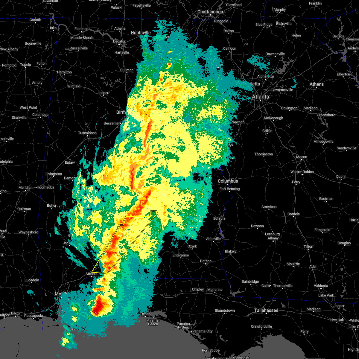 At 1219 am cdt, severe thunderstorms were located along a line extending from 11 miles east of pine apple to 5 miles northwest of pollard, moving east at 35 mph (radar indicated). Hazards include 60 mph wind gusts. Expect damage to roofs, siding, and trees. Locations impacted include, greenville, evergreen, georgiana, castleberry, repton, i65 and us 84, i65 and al 113 and i65 and al 21. At 1219 am cdt, severe thunderstorms were located along a line extending from 11 miles east of pine apple to 5 miles northwest of pollard, moving east at 35 mph (radar indicated). Hazards include 60 mph wind gusts. Expect damage to roofs, siding, and trees. Locations impacted include, greenville, evergreen, georgiana, castleberry, repton, i65 and us 84, i65 and al 113 and i65 and al 21.
|
| 3/30/2022 11:26 PM CDT |
 At 1125 pm cdt, severe thunderstorms were located along a line extending from 10 miles northeast of pine apple to 11 miles west of poarch creek reservation, moving east at 30 mph (radar indicated). Hazards include 60 mph wind gusts. expect damage to roofs, siding, and trees At 1125 pm cdt, severe thunderstorms were located along a line extending from 10 miles northeast of pine apple to 11 miles west of poarch creek reservation, moving east at 30 mph (radar indicated). Hazards include 60 mph wind gusts. expect damage to roofs, siding, and trees
|
| 3/30/2022 10:36 PM CDT |
 At 1036 pm cdt, severe thunderstorms were located along a line extending from 6 miles south of yellow bluff to 11 miles southeast of whatley to 3 miles west of calvert, moving east at 35 mph (radar indicated). Hazards include 70 mph wind gusts. Expect considerable tree damage. Damage is likely to mobile homes, roofs, and outbuildings. At 1036 pm cdt, severe thunderstorms were located along a line extending from 6 miles south of yellow bluff to 11 miles southeast of whatley to 3 miles west of calvert, moving east at 35 mph (radar indicated). Hazards include 70 mph wind gusts. Expect considerable tree damage. Damage is likely to mobile homes, roofs, and outbuildings.
|
| 3/18/2022 10:36 AM CDT |
 At 1035 am cdt, a severe thunderstorm was located 6 miles northwest of brewton, moving east at 40 mph (radar indicated). Hazards include 60 mph wind gusts and quarter size hail. Hail damage to vehicles is expected. Expect wind damage to roofs, siding, and trees. At 1035 am cdt, a severe thunderstorm was located 6 miles northwest of brewton, moving east at 40 mph (radar indicated). Hazards include 60 mph wind gusts and quarter size hail. Hail damage to vehicles is expected. Expect wind damage to roofs, siding, and trees.
|
| 3/18/2022 10:04 AM CDT |
 At 1003 am cdt, a severe thunderstorm was located 4 miles northeast of i65 and al 113, or 14 miles southeast of frisco city, moving northeast at 45 mph (radar indicated). Hazards include 60 mph wind gusts and quarter size hail. Hail damage to vehicles is expected. expect wind damage to roofs, siding, and trees. Locations impacted include, atmore, evergreen, castleberry, repton, i65 and us 84, i65 and al 113 and i65 and al 21. At 1003 am cdt, a severe thunderstorm was located 4 miles northeast of i65 and al 113, or 14 miles southeast of frisco city, moving northeast at 45 mph (radar indicated). Hazards include 60 mph wind gusts and quarter size hail. Hail damage to vehicles is expected. expect wind damage to roofs, siding, and trees. Locations impacted include, atmore, evergreen, castleberry, repton, i65 and us 84, i65 and al 113 and i65 and al 21.
|
| 3/18/2022 9:35 AM CDT |
 At 934 am cdt, a severe thunderstorm was located over i65 and al 21, or 8 miles north of atmore, moving northeast at 45 mph (radar indicated). Hazards include 60 mph wind gusts and quarter size hail. Hail damage to vehicles is expected. Expect wind damage to roofs, siding, and trees. At 934 am cdt, a severe thunderstorm was located over i65 and al 21, or 8 miles north of atmore, moving northeast at 45 mph (radar indicated). Hazards include 60 mph wind gusts and quarter size hail. Hail damage to vehicles is expected. Expect wind damage to roofs, siding, and trees.
|
| 3/9/2022 2:12 AM CST |
 At 212 am cst, a severe thunderstorm capable of producing a tornado was located 4 miles northwest of i65 and us 84, or 7 miles west of evergreen, moving northeast at 45 mph (radar indicated rotation). Hazards include tornado. Flying debris will be dangerous to those caught without shelter. mobile homes will be damaged or destroyed. damage to roofs, windows, and vehicles will occur. tree damage is likely. this dangerous storm will be near, i65 and us 84 around 215 am cst. evergreen around 220 am cst. mckenzie around 240 am cst. Georgiana around 245 am cst. At 212 am cst, a severe thunderstorm capable of producing a tornado was located 4 miles northwest of i65 and us 84, or 7 miles west of evergreen, moving northeast at 45 mph (radar indicated rotation). Hazards include tornado. Flying debris will be dangerous to those caught without shelter. mobile homes will be damaged or destroyed. damage to roofs, windows, and vehicles will occur. tree damage is likely. this dangerous storm will be near, i65 and us 84 around 215 am cst. evergreen around 220 am cst. mckenzie around 240 am cst. Georgiana around 245 am cst.
|
| 3/9/2022 1:58 AM CST |
 At 158 am cst, a severe thunderstorm capable of producing a tornado was located over repton, or 11 miles east of frisco city, moving northeast at 50 mph (radar indicated rotation). Hazards include tornado. Flying debris will be dangerous to those caught without shelter. mobile homes will be damaged or destroyed. damage to roofs, windows, and vehicles will occur. tree damage is likely. this dangerous storm will be near, evergreen and i65 and us 84 around 215 am cst. mckenzie around 235 am cst. Georgiana around 240 am cst. At 158 am cst, a severe thunderstorm capable of producing a tornado was located over repton, or 11 miles east of frisco city, moving northeast at 50 mph (radar indicated rotation). Hazards include tornado. Flying debris will be dangerous to those caught without shelter. mobile homes will be damaged or destroyed. damage to roofs, windows, and vehicles will occur. tree damage is likely. this dangerous storm will be near, evergreen and i65 and us 84 around 215 am cst. mckenzie around 235 am cst. Georgiana around 240 am cst.
|
| 2/3/2022 4:53 PM CST |
 At 452 pm cst, severe thunderstorms were located along a line extending from 5 miles northwest of pine apple to 13 miles east of beatrice to repton, moving northeast at 55 mph (radar indicated). Hazards include 70 mph wind gusts. Expect considerable tree damage. damage is likely to mobile homes, roofs, and outbuildings. Locations impacted include, evergreen, georgiana, mckenzie, repton and i65 and us 84. At 452 pm cst, severe thunderstorms were located along a line extending from 5 miles northwest of pine apple to 13 miles east of beatrice to repton, moving northeast at 55 mph (radar indicated). Hazards include 70 mph wind gusts. Expect considerable tree damage. damage is likely to mobile homes, roofs, and outbuildings. Locations impacted include, evergreen, georgiana, mckenzie, repton and i65 and us 84.
|
| 2/3/2022 4:29 PM CST |
 At 429 pm cst, severe thunderstorms were located along a line extending from 11 miles west of vredenburgh to 8 miles northwest of monroeville to 12 miles northwest of mccullough, moving east at 50 mph (radar indicated). Hazards include 60 mph wind gusts. expect damage to roofs, siding, and trees At 429 pm cst, severe thunderstorms were located along a line extending from 11 miles west of vredenburgh to 8 miles northwest of monroeville to 12 miles northwest of mccullough, moving east at 50 mph (radar indicated). Hazards include 60 mph wind gusts. expect damage to roofs, siding, and trees
|
| 2/3/2022 3:38 PM CST |
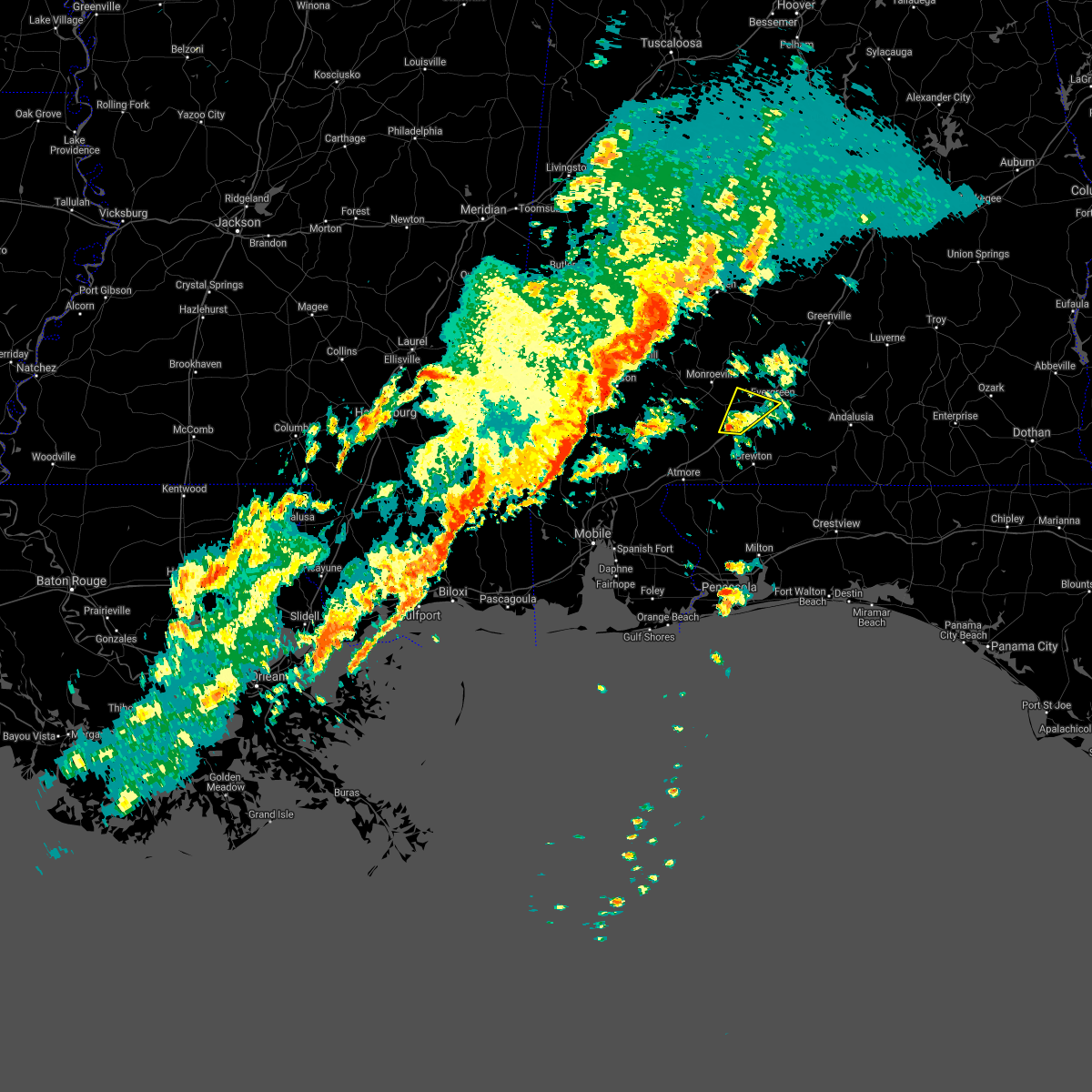 At 337 pm cst, a severe thunderstorm was located 8 miles south of repton, or 14 miles southeast of frisco city, moving northeast at 40 mph (radar indicated). Hazards include 60 mph wind gusts. Expect damage to roofs, siding, and trees. Locations impacted include, evergreen and i65 and us 84. At 337 pm cst, a severe thunderstorm was located 8 miles south of repton, or 14 miles southeast of frisco city, moving northeast at 40 mph (radar indicated). Hazards include 60 mph wind gusts. Expect damage to roofs, siding, and trees. Locations impacted include, evergreen and i65 and us 84.
|
| 2/3/2022 3:28 PM CST |
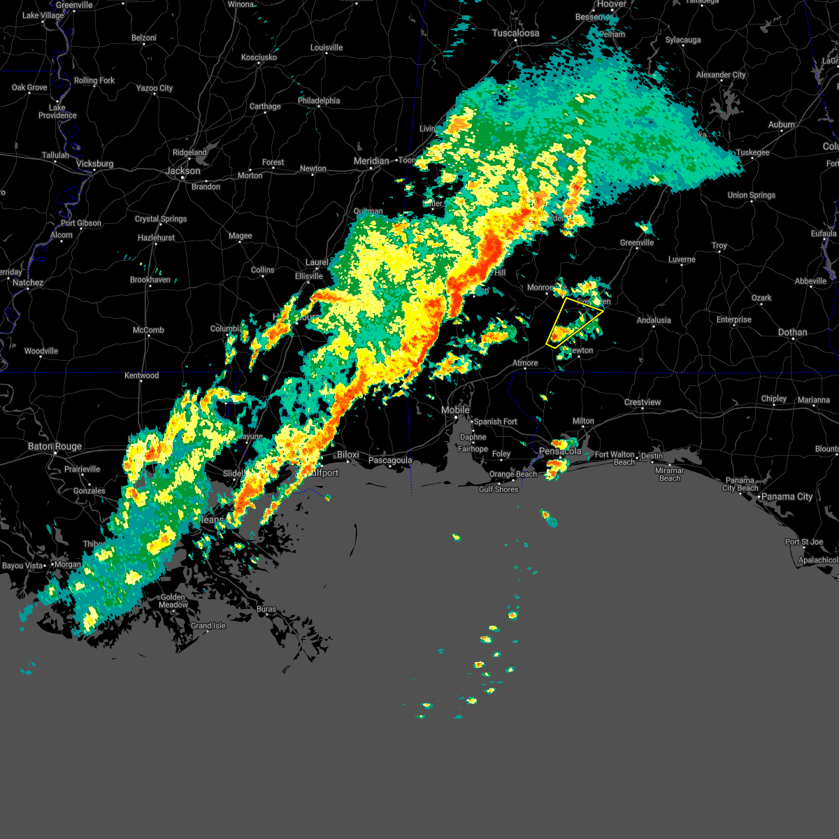 At 328 pm cst, a severe thunderstorm was located over i65 and al 113, or 14 miles northwest of brewton, moving northeast at 35 mph (radar indicated). Hazards include 60 mph wind gusts. Expect damage to roofs, siding, and trees. Locations impacted include, evergreen, i65 and al 113 and i65 and us 84. At 328 pm cst, a severe thunderstorm was located over i65 and al 113, or 14 miles northwest of brewton, moving northeast at 35 mph (radar indicated). Hazards include 60 mph wind gusts. Expect damage to roofs, siding, and trees. Locations impacted include, evergreen, i65 and al 113 and i65 and us 84.
|
| 2/3/2022 3:17 PM CST |
 At 316 pm cst, a severe thunderstorm was located 5 miles southwest of i65 and al 113, or 11 miles northwest of flomaton, moving northeast at 35 mph (radar indicated). Hazards include 60 mph wind gusts. expect damage to roofs, siding, and trees At 316 pm cst, a severe thunderstorm was located 5 miles southwest of i65 and al 113, or 11 miles northwest of flomaton, moving northeast at 35 mph (radar indicated). Hazards include 60 mph wind gusts. expect damage to roofs, siding, and trees
|
| 1/9/2022 4:47 PM CST |
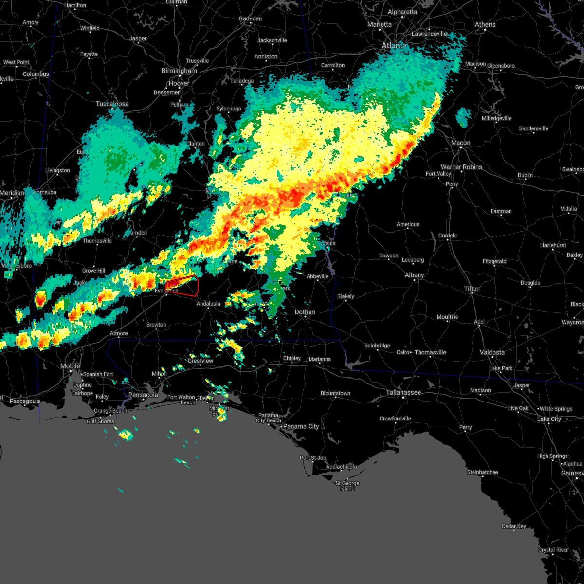 At 446 pm cst, a severe thunderstorm capable of producing a tornado was located 6 miles north of evergreen, moving east at 20 mph (radar indicated rotation). Hazards include tornado and quarter size hail. Flying debris will be dangerous to those caught without shelter. mobile homes will be damaged or destroyed. damage to roofs, windows, and vehicles will occur. tree damage is likely. This dangerous storm will be near, mckenzie around 520 pm cst. At 446 pm cst, a severe thunderstorm capable of producing a tornado was located 6 miles north of evergreen, moving east at 20 mph (radar indicated rotation). Hazards include tornado and quarter size hail. Flying debris will be dangerous to those caught without shelter. mobile homes will be damaged or destroyed. damage to roofs, windows, and vehicles will occur. tree damage is likely. This dangerous storm will be near, mckenzie around 520 pm cst.
|
| 8/30/2021 9:21 AM CDT |
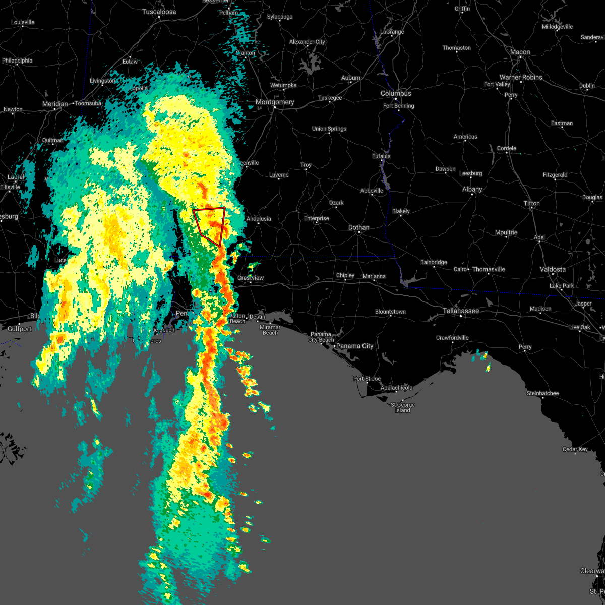 The tornado warning for northeastern escambia and south central conecuh counties will expire at 930 am cdt, the storm which prompted the warning has weakened below severe limits, and has exited the warned area. therefore, the warning will be allowed to expire. a tornado watch remains in effect until 400 pm cdt for south central alabama. The tornado warning for northeastern escambia and south central conecuh counties will expire at 930 am cdt, the storm which prompted the warning has weakened below severe limits, and has exited the warned area. therefore, the warning will be allowed to expire. a tornado watch remains in effect until 400 pm cdt for south central alabama.
|
| 8/30/2021 9:06 AM CDT |
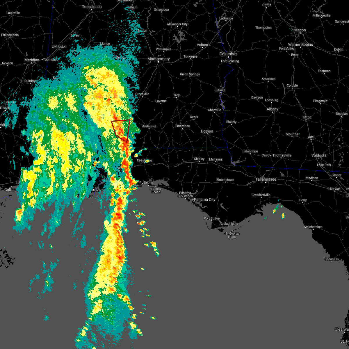 At 906 am cdt, a severe thunderstorm capable of producing a tornado was located over castleberry, or 10 miles southwest of evergreen, moving north at 35 mph (radar indicated rotation). Hazards include tornado. Flying debris will be dangerous to those caught without shelter. mobile homes will be damaged or destroyed. damage to roofs, windows, and vehicles will occur. tree damage is likely. This dangerous storm will be near, evergreen and i65 and us 84 around 920 am cdt. At 906 am cdt, a severe thunderstorm capable of producing a tornado was located over castleberry, or 10 miles southwest of evergreen, moving north at 35 mph (radar indicated rotation). Hazards include tornado. Flying debris will be dangerous to those caught without shelter. mobile homes will be damaged or destroyed. damage to roofs, windows, and vehicles will occur. tree damage is likely. This dangerous storm will be near, evergreen and i65 and us 84 around 920 am cdt.
|
| 8/30/2021 8:53 AM CDT |
 At 852 am cdt, a severe thunderstorm capable of producing a tornado was located 6 miles northeast of brewton, moving north at 35 mph (radar indicated rotation). Hazards include tornado. Flying debris will be dangerous to those caught without shelter. mobile homes will be damaged or destroyed. damage to roofs, windows, and vehicles will occur. tree damage is likely. this dangerous storm will be near, castleberry around 905 am cdt. Evergreen and i65 and us 84 around 920 am cdt. At 852 am cdt, a severe thunderstorm capable of producing a tornado was located 6 miles northeast of brewton, moving north at 35 mph (radar indicated rotation). Hazards include tornado. Flying debris will be dangerous to those caught without shelter. mobile homes will be damaged or destroyed. damage to roofs, windows, and vehicles will occur. tree damage is likely. this dangerous storm will be near, castleberry around 905 am cdt. Evergreen and i65 and us 84 around 920 am cdt.
|
| 8/30/2021 8:40 AM CDT |
 At 839 am cdt, a severe thunderstorm capable of producing a tornado was located over riverview, or near brewton, moving north at 35 mph (radar indicated rotation). Hazards include tornado. Flying debris will be dangerous to those caught without shelter. mobile homes will be damaged or destroyed. damage to roofs, windows, and vehicles will occur. tree damage is likely. this dangerous storm will be near, castleberry around 905 am cdt. Evergreen and i65 and us 84 around 920 am cdt. At 839 am cdt, a severe thunderstorm capable of producing a tornado was located over riverview, or near brewton, moving north at 35 mph (radar indicated rotation). Hazards include tornado. Flying debris will be dangerous to those caught without shelter. mobile homes will be damaged or destroyed. damage to roofs, windows, and vehicles will occur. tree damage is likely. this dangerous storm will be near, castleberry around 905 am cdt. Evergreen and i65 and us 84 around 920 am cdt.
|
| 8/1/2021 9:18 PM CDT |
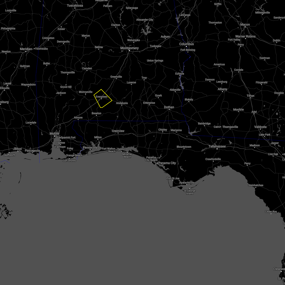 At 918 pm cdt, a severe thunderstorm was located 6 miles northwest of evergreen, moving southeast at 10 mph (radar indicated). Hazards include 60 mph wind gusts. expect damage to roofs, siding, and trees At 918 pm cdt, a severe thunderstorm was located 6 miles northwest of evergreen, moving southeast at 10 mph (radar indicated). Hazards include 60 mph wind gusts. expect damage to roofs, siding, and trees
|
| 6/24/2021 6:40 PM CDT |
 At 638 pm cdt, a severe thunderstorm was located 5 miles west of castleberry, or 12 miles north of brewton, moving southwest at 10 mph (public). Hazards include quarter size hail has been reported northwest of castleberry. Hail damage to vehicles is expected. expect wind damage to roofs, siding, and trees. Locations impacted include, evergreen, castleberry and i65 and us 84. At 638 pm cdt, a severe thunderstorm was located 5 miles west of castleberry, or 12 miles north of brewton, moving southwest at 10 mph (public). Hazards include quarter size hail has been reported northwest of castleberry. Hail damage to vehicles is expected. expect wind damage to roofs, siding, and trees. Locations impacted include, evergreen, castleberry and i65 and us 84.
|
| 6/24/2021 6:25 PM CDT |
 At 625 pm cdt, a severe thunderstorm was located near castleberry, or 11 miles southwest of evergreen, moving southwest at 10 mph (radar indicated). Hazards include 60 mph wind gusts and quarter size hail. Hail damage to vehicles is expected. expect wind damage to roofs, siding, and trees. Locations impacted include, evergreen, castleberry and i65 and us 84. At 625 pm cdt, a severe thunderstorm was located near castleberry, or 11 miles southwest of evergreen, moving southwest at 10 mph (radar indicated). Hazards include 60 mph wind gusts and quarter size hail. Hail damage to vehicles is expected. expect wind damage to roofs, siding, and trees. Locations impacted include, evergreen, castleberry and i65 and us 84.
|
| 6/24/2021 5:58 PM CDT |
 At 558 pm cdt, a severe thunderstorm was located near i65 and us 84, or 5 miles southwest of evergreen, moving southwest at 10 mph (radar indicated). Hazards include 60 mph wind gusts and nickel size hail. expect damage to roofs, siding, and trees At 558 pm cdt, a severe thunderstorm was located near i65 and us 84, or 5 miles southwest of evergreen, moving southwest at 10 mph (radar indicated). Hazards include 60 mph wind gusts and nickel size hail. expect damage to roofs, siding, and trees
|
| 6/19/2021 8:07 AM CDT |
 At 807 am cdt, a severe thunderstorm capable of producing a tornado was located near i65 and us 84, or 5 miles northwest of evergreen, moving north at 50 mph (radar indicated rotation). Hazards include tornado. Flying debris will be dangerous to those caught without shelter. mobile homes will be damaged or destroyed. damage to roofs, windows, and vehicles will occur. tree damage is likely. This tornadic thunderstorm will remain over mainly rural areas of central conecuh county. At 807 am cdt, a severe thunderstorm capable of producing a tornado was located near i65 and us 84, or 5 miles northwest of evergreen, moving north at 50 mph (radar indicated rotation). Hazards include tornado. Flying debris will be dangerous to those caught without shelter. mobile homes will be damaged or destroyed. damage to roofs, windows, and vehicles will occur. tree damage is likely. This tornadic thunderstorm will remain over mainly rural areas of central conecuh county.
|
| 6/19/2021 7:54 AM CDT |
 At 753 am cdt, a confirmed tornado was located over castleberry, or 9 miles southwest of evergreen, moving north at 50 mph (brewton fire department confirmed a tornado near brewton. this tornado is likely still on the ground near castleberry in conecuh county). Hazards include damaging tornado. Flying debris will be dangerous to those caught without shelter. mobile homes will be damaged or destroyed. damage to roofs, windows, and vehicles will occur. tree damage is likely. this tornado will be near, i65 and us 84 around 800 am cdt. Evergreen around 805 am cdt. At 753 am cdt, a confirmed tornado was located over castleberry, or 9 miles southwest of evergreen, moving north at 50 mph (brewton fire department confirmed a tornado near brewton. this tornado is likely still on the ground near castleberry in conecuh county). Hazards include damaging tornado. Flying debris will be dangerous to those caught without shelter. mobile homes will be damaged or destroyed. damage to roofs, windows, and vehicles will occur. tree damage is likely. this tornado will be near, i65 and us 84 around 800 am cdt. Evergreen around 805 am cdt.
|
| 6/19/2021 7:45 AM CDT |
 At 744 am cdt, a confirmed tornado was located 4 miles south of castleberry, or 8 miles north of brewton, moving north at 55 mph (radar confirmed tornado). Hazards include damaging tornado. Flying debris will be dangerous to those caught without shelter. mobile homes will be damaged or destroyed. damage to roofs, windows, and vehicles will occur. tree damage is likely. this tornado will be near, castleberry around 750 am cdt. Evergreen and i65 and us 84 around 800 am cdt. At 744 am cdt, a confirmed tornado was located 4 miles south of castleberry, or 8 miles north of brewton, moving north at 55 mph (radar confirmed tornado). Hazards include damaging tornado. Flying debris will be dangerous to those caught without shelter. mobile homes will be damaged or destroyed. damage to roofs, windows, and vehicles will occur. tree damage is likely. this tornado will be near, castleberry around 750 am cdt. Evergreen and i65 and us 84 around 800 am cdt.
|
| 6/19/2021 7:37 AM CDT |
 At 737 am cdt, a severe thunderstorm capable of producing a tornado was located over riverview, or near brewton, moving north at 50 mph (radar indicated rotation). Hazards include tornado. Flying debris will be dangerous to those caught without shelter. mobile homes will be damaged or destroyed. damage to roofs, windows, and vehicles will occur. tree damage is likely. this dangerous storm will be near, castleberry around 800 am cdt. Evergreen and i65 and us 84 around 810 am cdt. At 737 am cdt, a severe thunderstorm capable of producing a tornado was located over riverview, or near brewton, moving north at 50 mph (radar indicated rotation). Hazards include tornado. Flying debris will be dangerous to those caught without shelter. mobile homes will be damaged or destroyed. damage to roofs, windows, and vehicles will occur. tree damage is likely. this dangerous storm will be near, castleberry around 800 am cdt. Evergreen and i65 and us 84 around 810 am cdt.
|
| 6/7/2021 6:45 PM CDT |
 At 645 pm cdt, a severe thunderstorm was located 9 miles east of peterman, or 14 miles northeast of monroeville, moving north at 20 mph (radar indicated). Hazards include 60 mph wind gusts and penny size hail. expect damage to roofs, siding, and trees At 645 pm cdt, a severe thunderstorm was located 9 miles east of peterman, or 14 miles northeast of monroeville, moving north at 20 mph (radar indicated). Hazards include 60 mph wind gusts and penny size hail. expect damage to roofs, siding, and trees
|
| 5/4/2021 6:58 PM CDT |
 At 657 pm cdt, severe thunderstorms were located along a line extending from 4 miles west of davenport to greenville to georgiana to 8 miles north of evergreen, moving east at 45 mph (radar indicated). Hazards include 60 mph wind gusts. Expect damage to roofs, siding, and trees. Locations impacted include, greenville, luverne, georgiana, brantley, mckenzie, red level, rutledge, dozier, gantt, glenwood, petrey and highland home. At 657 pm cdt, severe thunderstorms were located along a line extending from 4 miles west of davenport to greenville to georgiana to 8 miles north of evergreen, moving east at 45 mph (radar indicated). Hazards include 60 mph wind gusts. Expect damage to roofs, siding, and trees. Locations impacted include, greenville, luverne, georgiana, brantley, mckenzie, red level, rutledge, dozier, gantt, glenwood, petrey and highland home.
|
| 5/4/2021 6:47 PM CDT |
 At 646 pm cdt, severe thunderstorms were located along a line extending from 4 miles southeast of beechwood to 5 miles west of greenville to 8 miles west of georgiana to 11 miles east of peterman, moving east at 45 mph (radar indicated). Hazards include 60 mph wind gusts. Expect damage to roofs, siding, and trees. Locations impacted include, greenville, luverne, georgiana, brantley, mckenzie, red level, rutledge, dozier, gantt, glenwood, petrey and highland home. At 646 pm cdt, severe thunderstorms were located along a line extending from 4 miles southeast of beechwood to 5 miles west of greenville to 8 miles west of georgiana to 11 miles east of peterman, moving east at 45 mph (radar indicated). Hazards include 60 mph wind gusts. Expect damage to roofs, siding, and trees. Locations impacted include, greenville, luverne, georgiana, brantley, mckenzie, red level, rutledge, dozier, gantt, glenwood, petrey and highland home.
|
| 5/4/2021 6:28 PM CDT |
 At 628 pm cdt, severe thunderstorms were located along a line extending from 4 miles southwest of gordonville to 4 miles east of pine apple to 6 miles east of beatrice to peterman, moving east at 45 mph (radar indicated). Hazards include 60 mph wind gusts. expect damage to roofs, siding, and trees At 628 pm cdt, severe thunderstorms were located along a line extending from 4 miles southwest of gordonville to 4 miles east of pine apple to 6 miles east of beatrice to peterman, moving east at 45 mph (radar indicated). Hazards include 60 mph wind gusts. expect damage to roofs, siding, and trees
|
| 5/3/2021 3:21 AM CDT |
 At 320 am cdt, a severe thunderstorm was located 7 miles northeast of evergreen, moving northeast at 45 mph (radar indicated). Hazards include 60 mph wind gusts and quarter size hail. Hail damage to vehicles is expected. expect wind damage to roofs, siding, and trees. Locations impacted include, evergreen, georgiana and mckenzie. At 320 am cdt, a severe thunderstorm was located 7 miles northeast of evergreen, moving northeast at 45 mph (radar indicated). Hazards include 60 mph wind gusts and quarter size hail. Hail damage to vehicles is expected. expect wind damage to roofs, siding, and trees. Locations impacted include, evergreen, georgiana and mckenzie.
|
| 5/3/2021 2:56 AM CDT |
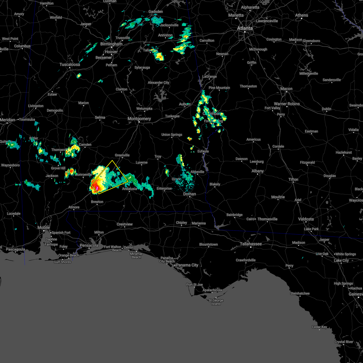 At 256 am cdt, a severe thunderstorm was located near i65 and us 84, or 6 miles southwest of evergreen, moving northeast at 40 mph (radar indicated). Hazards include 60 mph wind gusts and quarter size hail. Hail damage to vehicles is expected. Expect wind damage to roofs, siding, and trees. At 256 am cdt, a severe thunderstorm was located near i65 and us 84, or 6 miles southwest of evergreen, moving northeast at 40 mph (radar indicated). Hazards include 60 mph wind gusts and quarter size hail. Hail damage to vehicles is expected. Expect wind damage to roofs, siding, and trees.
|
| 4/24/2021 7:03 PM CDT |
 At 703 pm cdt, a severe thunderstorm was located 4 miles north of opp, moving east at 50 mph (radar indicated). Hazards include 70 mph wind gusts and ping pong ball size hail. People and animals outdoors will be injured. expect hail damage to roofs, siding, windows, and vehicles. expect considerable tree damage. wind damage is also likely to mobile homes, roofs, and outbuildings. Locations impacted include, andalusia, opp, river falls, red level, heath and gantt. At 703 pm cdt, a severe thunderstorm was located 4 miles north of opp, moving east at 50 mph (radar indicated). Hazards include 70 mph wind gusts and ping pong ball size hail. People and animals outdoors will be injured. expect hail damage to roofs, siding, windows, and vehicles. expect considerable tree damage. wind damage is also likely to mobile homes, roofs, and outbuildings. Locations impacted include, andalusia, opp, river falls, red level, heath and gantt.
|
| 4/24/2021 7:00 PM CDT |
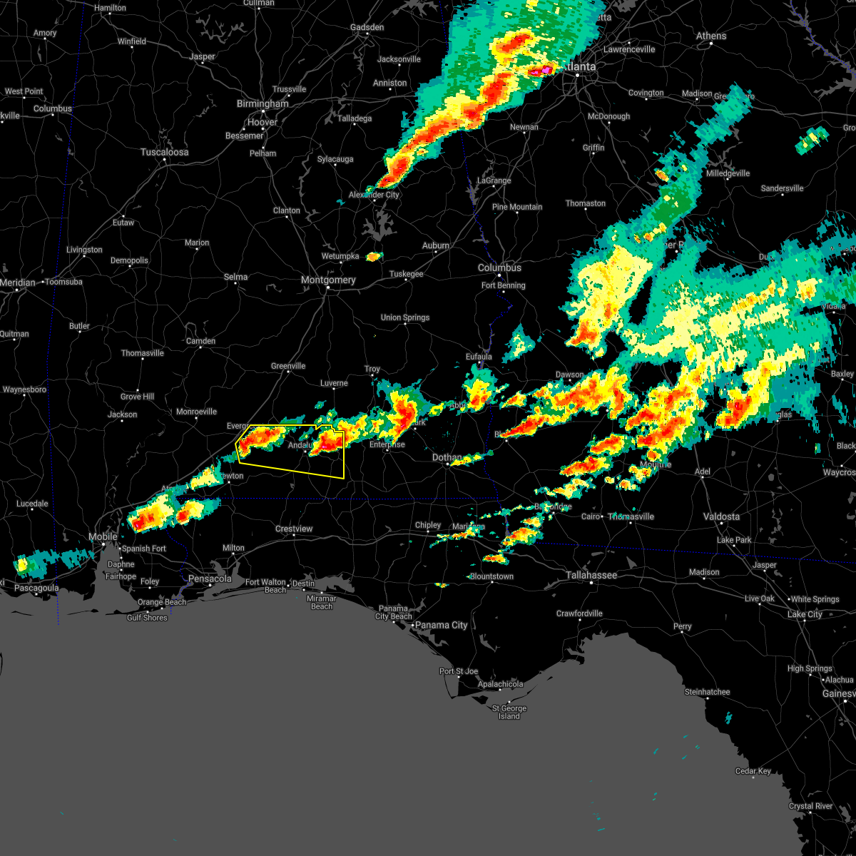 At 659 pm cdt, a severe thunderstorm was located 6 miles northwest of opp, moving east at 50 mph (radar indicated). Hazards include 70 mph wind gusts and quarter size hail. Hail damage to vehicles is expected. expect considerable tree damage. Wind damage is also likely to mobile homes, roofs, and outbuildings. At 659 pm cdt, a severe thunderstorm was located 6 miles northwest of opp, moving east at 50 mph (radar indicated). Hazards include 70 mph wind gusts and quarter size hail. Hail damage to vehicles is expected. expect considerable tree damage. Wind damage is also likely to mobile homes, roofs, and outbuildings.
|
| 4/24/2021 6:29 PM CDT |
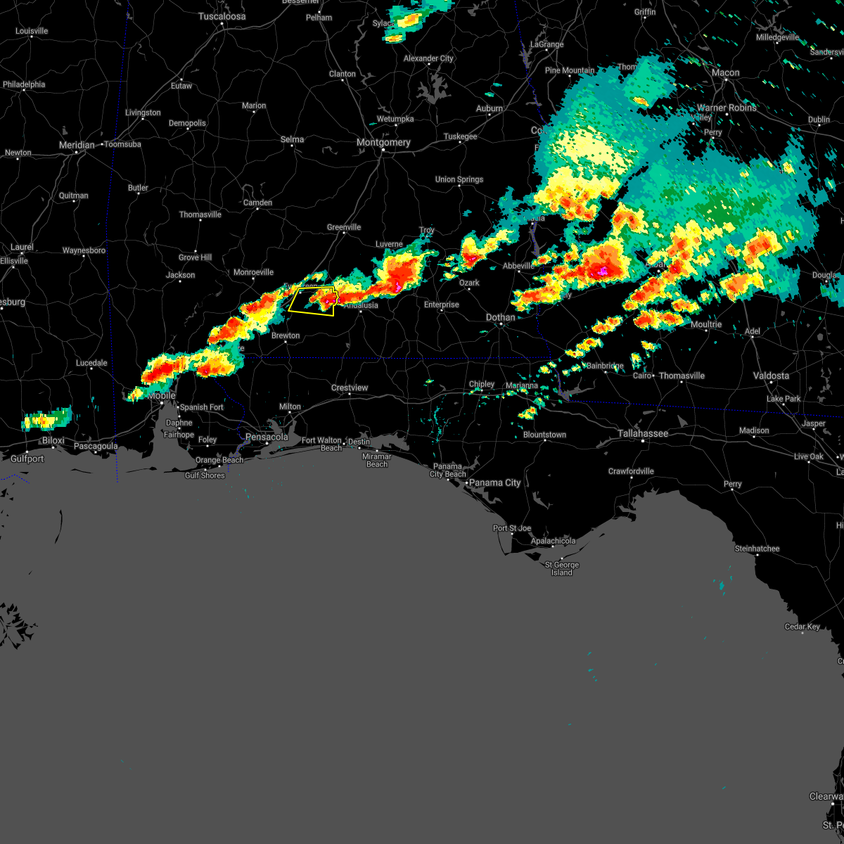 At 629 pm cdt, a severe thunderstorm was located 9 miles southeast of evergreen, moving east at 50 mph (radar indicated). Hazards include golf ball size hail and 60 mph wind gusts. People and animals outdoors will be injured. expect hail damage to roofs, siding, windows, and vehicles. Expect wind damage to roofs, siding, and trees. At 629 pm cdt, a severe thunderstorm was located 9 miles southeast of evergreen, moving east at 50 mph (radar indicated). Hazards include golf ball size hail and 60 mph wind gusts. People and animals outdoors will be injured. expect hail damage to roofs, siding, windows, and vehicles. Expect wind damage to roofs, siding, and trees.
|
| 4/24/2021 6:19 PM CDT |
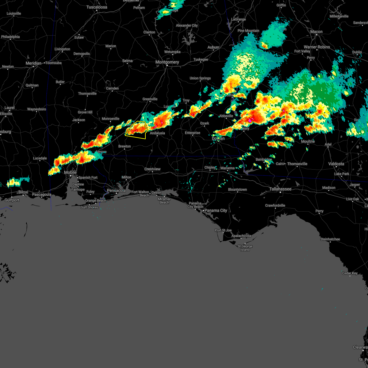 At 619 pm cdt, a severe thunderstorm was located 9 miles southeast of evergreen, moving east at 45 mph (public). Hazards include golf ball size hail and 60 mph wind gusts. People and animals outdoors will be injured. expect hail damage to roofs, siding, windows, and vehicles. expect wind damage to roofs, siding, and trees. Locations impacted include, evergreen. At 619 pm cdt, a severe thunderstorm was located 9 miles southeast of evergreen, moving east at 45 mph (public). Hazards include golf ball size hail and 60 mph wind gusts. People and animals outdoors will be injured. expect hail damage to roofs, siding, windows, and vehicles. expect wind damage to roofs, siding, and trees. Locations impacted include, evergreen.
|
| 4/24/2021 5:59 PM CDT |
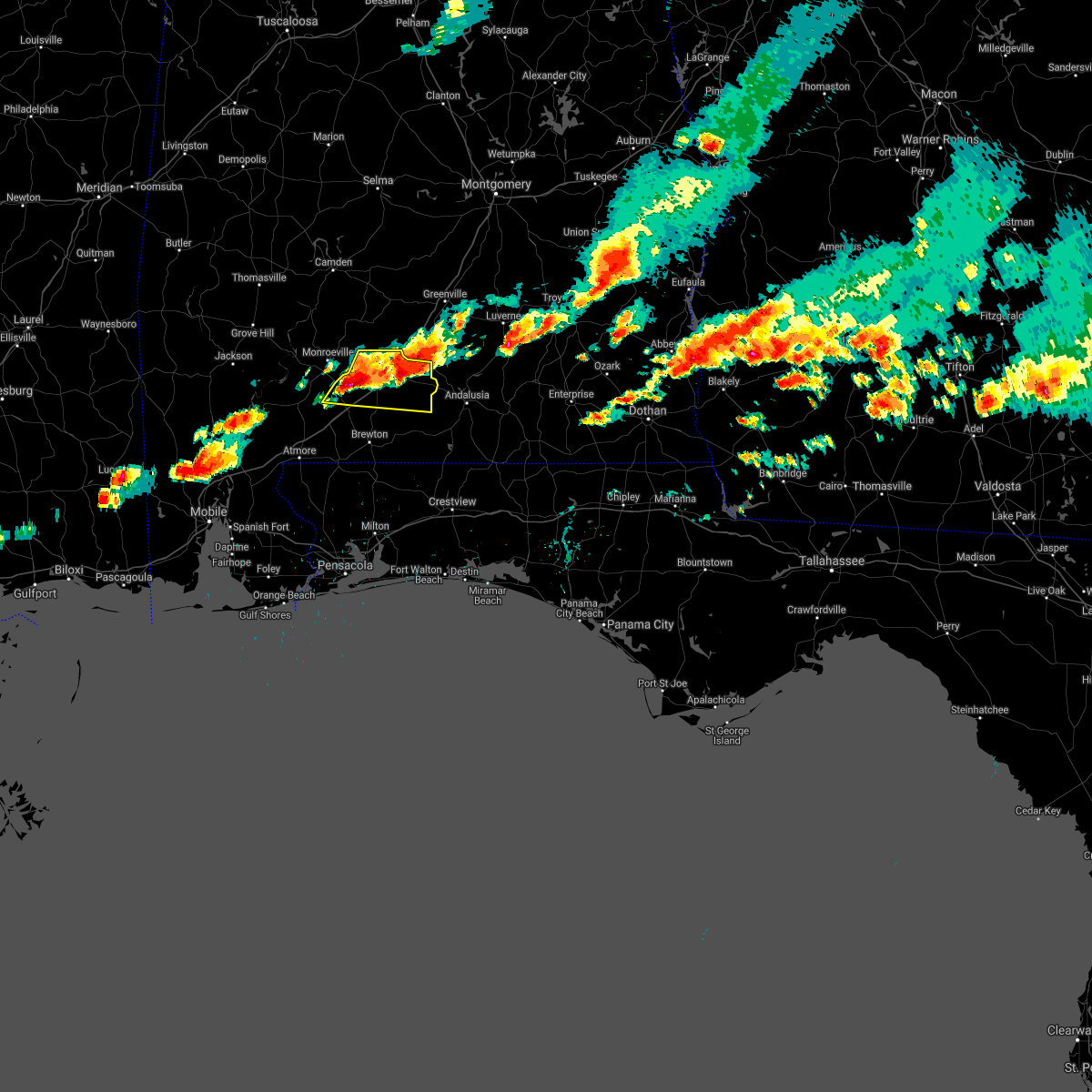 A severe thunderstorm warning remains in effect until 630 pm cdt for conecuh county. at 558 pm cdt, a severe thunderstorm was located over repton, or 8 miles east of frisco city, moving east at 50 mph. hazard. golf ball size hail and 60 mph wind gusts. source. Public. A severe thunderstorm warning remains in effect until 630 pm cdt for conecuh county. at 558 pm cdt, a severe thunderstorm was located over repton, or 8 miles east of frisco city, moving east at 50 mph. hazard. golf ball size hail and 60 mph wind gusts. source. Public.
|
| 4/24/2021 5:34 PM CDT |
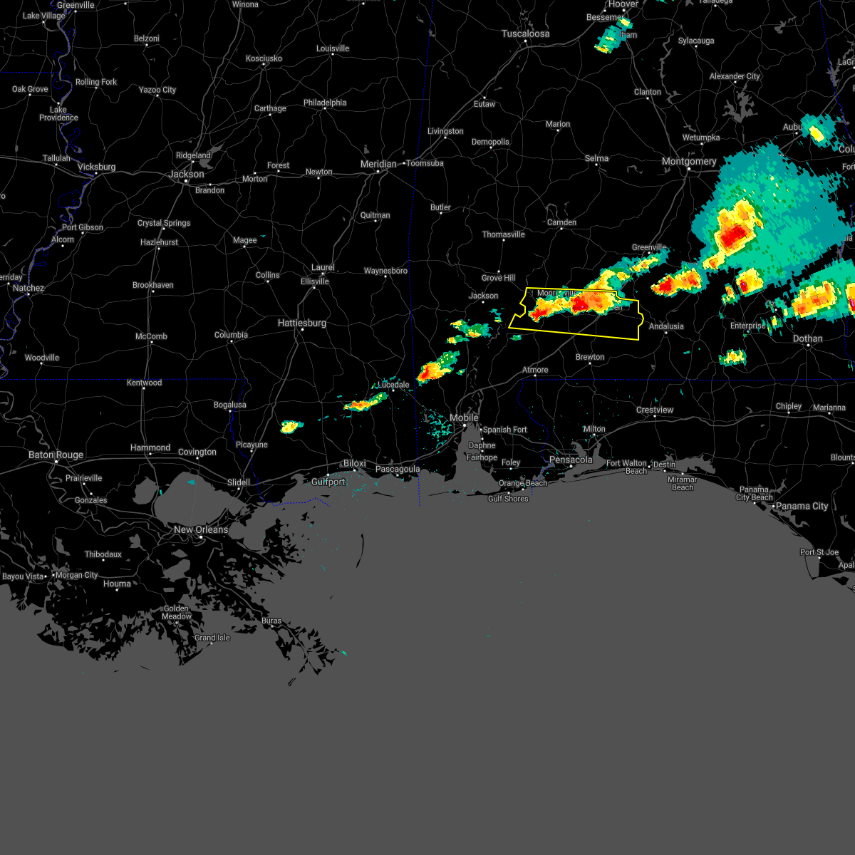 At 533 pm cdt, a severe thunderstorm was located 4 miles north of repton, or 7 miles southeast of monroeville, moving east at 45 mph. this is a very dangerous storm with destructive and life threatening hail (public reported baseball size hail in frisco city at 520 pm cdt). Hazards include baseball size hail and 60 mph wind gusts. People and animals outdoors will be severely injured. expect shattered windows, extensive damage to roofs, siding, and vehicles. Locations impacted include, monroeville, evergreen, frisco city, peterman, castleberry, excel, repton and i65 and us 84. At 533 pm cdt, a severe thunderstorm was located 4 miles north of repton, or 7 miles southeast of monroeville, moving east at 45 mph. this is a very dangerous storm with destructive and life threatening hail (public reported baseball size hail in frisco city at 520 pm cdt). Hazards include baseball size hail and 60 mph wind gusts. People and animals outdoors will be severely injured. expect shattered windows, extensive damage to roofs, siding, and vehicles. Locations impacted include, monroeville, evergreen, frisco city, peterman, castleberry, excel, repton and i65 and us 84.
|
| 4/24/2021 5:24 PM CDT |
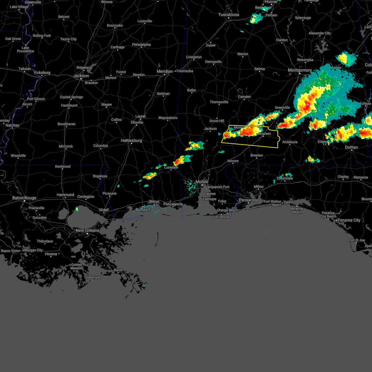 At 524 pm cdt, a severe thunderstorm was located 9 miles northwest of uriah, or 11 miles west of frisco city, moving east at 50 mph (radar indicated). Hazards include golf ball size hail and 60 mph wind gusts. People and animals outdoors will be injured. expect hail damage to roofs, siding, windows, and vehicles. Expect wind damage to roofs, siding, and trees. At 524 pm cdt, a severe thunderstorm was located 9 miles northwest of uriah, or 11 miles west of frisco city, moving east at 50 mph (radar indicated). Hazards include golf ball size hail and 60 mph wind gusts. People and animals outdoors will be injured. expect hail damage to roofs, siding, windows, and vehicles. Expect wind damage to roofs, siding, and trees.
|
| 4/24/2021 3:10 PM CDT |
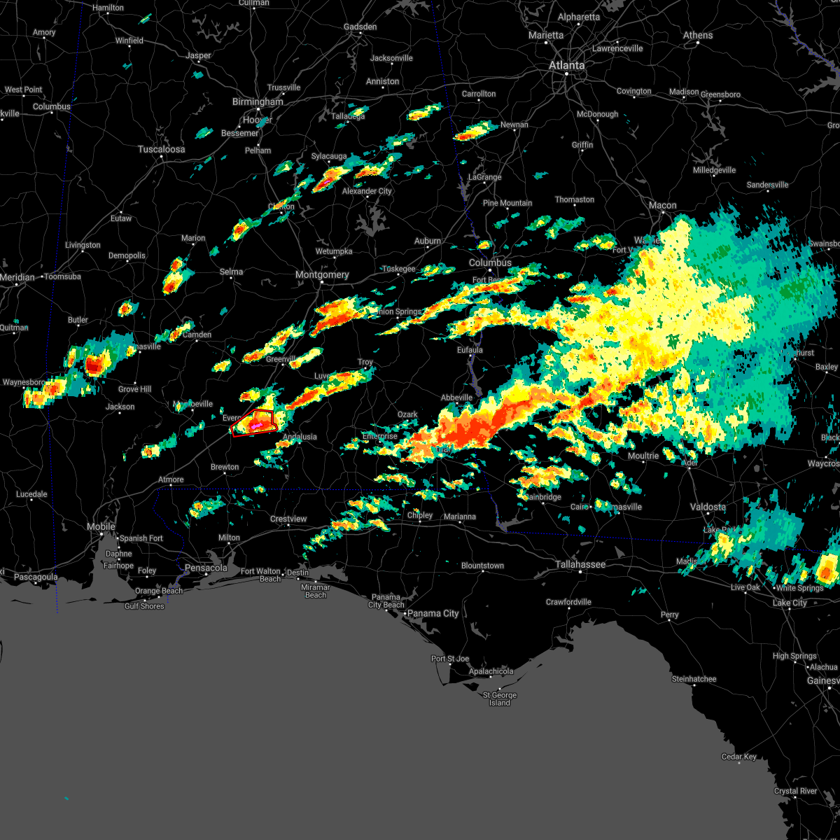 At 310 pm cdt, a severe thunderstorm capable of producing a tornado was located 4 miles east of evergreen, moving east at 50 mph (radar indicated rotation). Hazards include tornado and golf ball size hail. Flying debris will be dangerous to those caught without shelter. mobile homes will be damaged or destroyed. damage to roofs, windows, and vehicles will occur. tree damage is likely. This tornadic thunderstorm will remain over mainly rural areas of east central conecuh county. At 310 pm cdt, a severe thunderstorm capable of producing a tornado was located 4 miles east of evergreen, moving east at 50 mph (radar indicated rotation). Hazards include tornado and golf ball size hail. Flying debris will be dangerous to those caught without shelter. mobile homes will be damaged or destroyed. damage to roofs, windows, and vehicles will occur. tree damage is likely. This tornadic thunderstorm will remain over mainly rural areas of east central conecuh county.
|
| 4/24/2021 3:00 PM CDT |
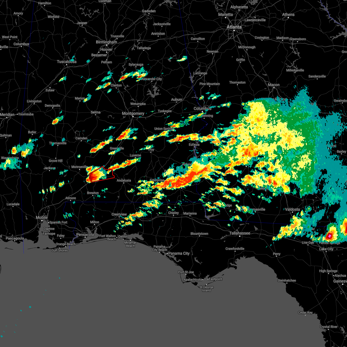 At 300 pm cdt, a severe thunderstorm capable of producing a tornado was located over i65 and us 84, or 4 miles west of evergreen, moving east at 50 mph (radar indicated rotation). Hazards include tornado and tennis ball size hail. Flying debris will be dangerous to those caught without shelter. mobile homes will be damaged or destroyed. damage to roofs, windows, and vehicles will occur. tree damage is likely. This dangerous storm will be near, evergreen around 305 pm cdt. At 300 pm cdt, a severe thunderstorm capable of producing a tornado was located over i65 and us 84, or 4 miles west of evergreen, moving east at 50 mph (radar indicated rotation). Hazards include tornado and tennis ball size hail. Flying debris will be dangerous to those caught without shelter. mobile homes will be damaged or destroyed. damage to roofs, windows, and vehicles will occur. tree damage is likely. This dangerous storm will be near, evergreen around 305 pm cdt.
|
| 4/24/2021 2:52 PM CDT |
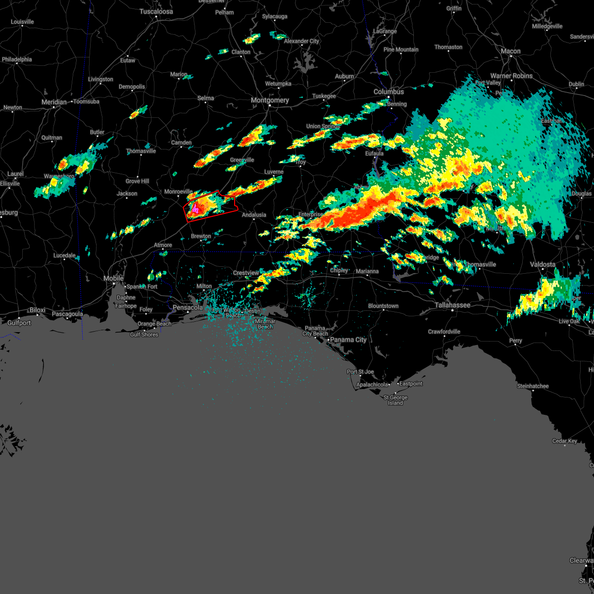 At 251 pm cdt, a severe thunderstorm capable of producing a tornado was located 4 miles east of repton, or 12 miles west of evergreen, moving east at 45 mph (radar indicated rotation). Hazards include tornado and tennis ball size hail. Flying debris will be dangerous to those caught without shelter. mobile homes will be damaged or destroyed. damage to roofs, windows, and vehicles will occur. tree damage is likely. this dangerous storm will be near, i65 and us 84 around 305 pm cdt. Evergreen around 310 pm cdt. At 251 pm cdt, a severe thunderstorm capable of producing a tornado was located 4 miles east of repton, or 12 miles west of evergreen, moving east at 45 mph (radar indicated rotation). Hazards include tornado and tennis ball size hail. Flying debris will be dangerous to those caught without shelter. mobile homes will be damaged or destroyed. damage to roofs, windows, and vehicles will occur. tree damage is likely. this dangerous storm will be near, i65 and us 84 around 305 pm cdt. Evergreen around 310 pm cdt.
|
| 4/24/2021 2:48 PM CDT |
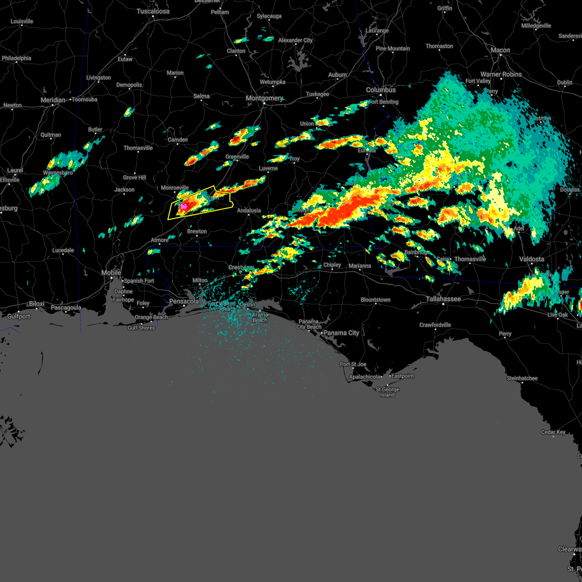 At 247 pm cdt, a severe thunderstorm was located over repton, or 11 miles southeast of monroeville, moving east at 45 mph (radar indicated). Hazards include tennis ball size hail and 70 mph wind gusts. People and animals outdoors will be injured. expect hail damage to roofs, siding, windows, and vehicles. expect considerable tree damage. wind damage is also likely to mobile homes, roofs, and outbuildings. Locations impacted include, evergreen, repton and i65 and us 84. At 247 pm cdt, a severe thunderstorm was located over repton, or 11 miles southeast of monroeville, moving east at 45 mph (radar indicated). Hazards include tennis ball size hail and 70 mph wind gusts. People and animals outdoors will be injured. expect hail damage to roofs, siding, windows, and vehicles. expect considerable tree damage. wind damage is also likely to mobile homes, roofs, and outbuildings. Locations impacted include, evergreen, repton and i65 and us 84.
|
| 4/24/2021 2:43 PM CDT |
 At 243 pm cdt, a severe thunderstorm was located near repton, or 10 miles southeast of frisco city, moving east at 45 mph (radar indicated). Hazards include hen egg size hail and 70 mph wind gusts. People and animals outdoors will be injured. expect hail damage to roofs, siding, windows, and vehicles. expect considerable tree damage. wind damage is also likely to mobile homes, roofs, and outbuildings. Locations impacted include, evergreen, frisco city, uriah, excel, repton and i65 and us 84. At 243 pm cdt, a severe thunderstorm was located near repton, or 10 miles southeast of frisco city, moving east at 45 mph (radar indicated). Hazards include hen egg size hail and 70 mph wind gusts. People and animals outdoors will be injured. expect hail damage to roofs, siding, windows, and vehicles. expect considerable tree damage. wind damage is also likely to mobile homes, roofs, and outbuildings. Locations impacted include, evergreen, frisco city, uriah, excel, repton and i65 and us 84.
|
| 4/24/2021 2:29 PM CDT |
 At 229 pm cdt, a severe thunderstorm was located 5 miles northeast of uriah, or 6 miles south of frisco city, moving east at 50 mph (radar indicated). Hazards include 60 mph wind gusts and quarter size hail. Hail damage to vehicles is expected. Expect wind damage to roofs, siding, and trees. At 229 pm cdt, a severe thunderstorm was located 5 miles northeast of uriah, or 6 miles south of frisco city, moving east at 50 mph (radar indicated). Hazards include 60 mph wind gusts and quarter size hail. Hail damage to vehicles is expected. Expect wind damage to roofs, siding, and trees.
|
| 4/24/2021 1:55 PM CDT |
 At 154 pm cdt, a strong thunderstorm was located 13 miles northeast of calvert, or 19 miles south of jackson, moving east at 40 mph. this storm is intensifying and may become severe as it moves into southern monroe and northeast escambia counties (radar indicated). Hazards include 60 mph wind gusts and quarter size hail. Hail damage to vehicles is expected. expect wind damage to roofs, siding, and trees. Locations impacted include, evergreen, frisco city, mccullough, uriah, castleberry, excel, repton, i65 and us 84 and i65 and al 113. At 154 pm cdt, a strong thunderstorm was located 13 miles northeast of calvert, or 19 miles south of jackson, moving east at 40 mph. this storm is intensifying and may become severe as it moves into southern monroe and northeast escambia counties (radar indicated). Hazards include 60 mph wind gusts and quarter size hail. Hail damage to vehicles is expected. expect wind damage to roofs, siding, and trees. Locations impacted include, evergreen, frisco city, mccullough, uriah, castleberry, excel, repton, i65 and us 84 and i65 and al 113.
|
| 4/24/2021 1:28 PM CDT |
 At 127 pm cdt, a severe thunderstorm was located 7 miles west of uriah, or 17 miles southwest of frisco city, moving east at 60 mph (radar indicated). Hazards include 60 mph wind gusts and quarter size hail. Hail damage to vehicles is expected. expect wind damage to roofs, siding, and trees. Locations impacted include, evergreen, frisco city, mccullough, uriah, castleberry, excel, repton, i65 and us 84 and i65 and al 113. At 127 pm cdt, a severe thunderstorm was located 7 miles west of uriah, or 17 miles southwest of frisco city, moving east at 60 mph (radar indicated). Hazards include 60 mph wind gusts and quarter size hail. Hail damage to vehicles is expected. expect wind damage to roofs, siding, and trees. Locations impacted include, evergreen, frisco city, mccullough, uriah, castleberry, excel, repton, i65 and us 84 and i65 and al 113.
|
| 4/24/2021 1:19 PM CDT |
 At 119 pm cdt, a severe thunderstorm was located 9 miles northeast of calvert, or 19 miles south of jackson, moving east at 45 mph (radar indicated). Hazards include 60 mph wind gusts and quarter size hail. Hail damage to vehicles is expected. Expect wind damage to roofs, siding, and trees. At 119 pm cdt, a severe thunderstorm was located 9 miles northeast of calvert, or 19 miles south of jackson, moving east at 45 mph (radar indicated). Hazards include 60 mph wind gusts and quarter size hail. Hail damage to vehicles is expected. Expect wind damage to roofs, siding, and trees.
|
| 4/24/2021 5:51 AM CDT |
 At 551 am cdt, severe thunderstorms were located along a line extending from 9 miles northwest of georgiana to 3 miles southeast of castleberry to 4 miles west of flomaton, moving east at 45 mph (radar indicated). Hazards include 70 mph wind gusts. Expect considerable tree damage. Damage is likely to mobile homes, roofs, and outbuildings. At 551 am cdt, severe thunderstorms were located along a line extending from 9 miles northwest of georgiana to 3 miles southeast of castleberry to 4 miles west of flomaton, moving east at 45 mph (radar indicated). Hazards include 70 mph wind gusts. Expect considerable tree damage. Damage is likely to mobile homes, roofs, and outbuildings.
|
| 4/24/2021 5:09 AM CDT |
 At 508 am cdt, severe thunderstorms were located along a line extending from 3 miles southeast of whatley to 11 miles northwest of mccullough to 5 miles southwest of i65 and al 225, moving east at 70 mph (radar indicated). Hazards include 70 mph wind gusts. Expect considerable tree damage. Damage is likely to mobile homes, roofs, and outbuildings. At 508 am cdt, severe thunderstorms were located along a line extending from 3 miles southeast of whatley to 11 miles northwest of mccullough to 5 miles southwest of i65 and al 225, moving east at 70 mph (radar indicated). Hazards include 70 mph wind gusts. Expect considerable tree damage. Damage is likely to mobile homes, roofs, and outbuildings.
|
| 4/24/2021 4:53 AM CDT |
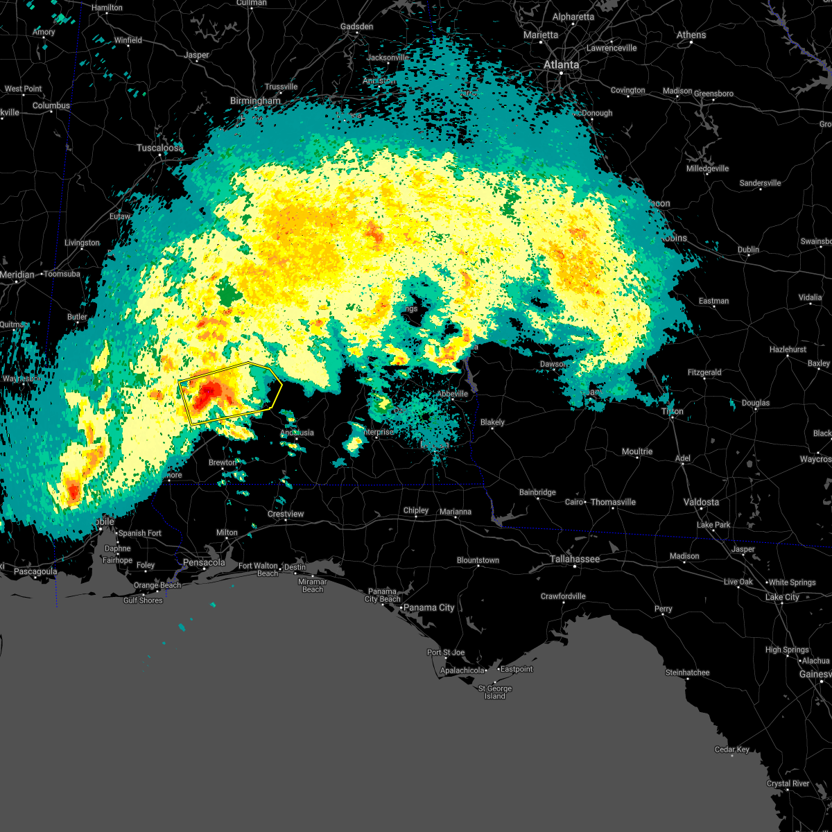 At 452 am cdt, a severe thunderstorm was located 8 miles southeast of beatrice, or 15 miles northeast of monroeville, moving east at 60 mph (radar indicated). Hazards include 60 mph wind gusts and quarter size hail. Hail damage to vehicles is expected. expect wind damage to roofs, siding, and trees. Locations impacted include, monroeville, peterman, georgiana, mckenzie and beatrice. At 452 am cdt, a severe thunderstorm was located 8 miles southeast of beatrice, or 15 miles northeast of monroeville, moving east at 60 mph (radar indicated). Hazards include 60 mph wind gusts and quarter size hail. Hail damage to vehicles is expected. expect wind damage to roofs, siding, and trees. Locations impacted include, monroeville, peterman, georgiana, mckenzie and beatrice.
|
| 4/24/2021 4:31 AM CDT |
 At 430 am cdt, a severe thunderstorm was located 9 miles west of monroeville, moving east at 55 mph (radar indicated). Hazards include 60 mph wind gusts and quarter size hail. Hail damage to vehicles is expected. Expect wind damage to roofs, siding, and trees. At 430 am cdt, a severe thunderstorm was located 9 miles west of monroeville, moving east at 55 mph (radar indicated). Hazards include 60 mph wind gusts and quarter size hail. Hail damage to vehicles is expected. Expect wind damage to roofs, siding, and trees.
|
| 4/10/2021 3:53 AM CDT |
 At 353 am cdt, severe thunderstorms were located along a line extending from 7 miles southwest of belknap to flomaton to midtown mobile to 4 miles northeast of gulf park estates, moving east at 40 mph (radar indicated). Hazards include 60 mph wind gusts and quarter size hail. Hail damage to vehicles is expected. Expect wind damage to roofs, siding, and trees. At 353 am cdt, severe thunderstorms were located along a line extending from 7 miles southwest of belknap to flomaton to midtown mobile to 4 miles northeast of gulf park estates, moving east at 40 mph (radar indicated). Hazards include 60 mph wind gusts and quarter size hail. Hail damage to vehicles is expected. Expect wind damage to roofs, siding, and trees.
|
| 4/10/2021 3:30 AM CDT |
 At 330 am cdt, severe thunderstorms were located along a line extending from 10 miles west of dannelly reservoir to 6 miles southwest of beatrice to 11 miles west of poarch creek reservation to near tanner williams, moving east at 40 mph (radar indicated). Hazards include 60 mph wind gusts. Expect damage to roofs, siding, and trees. Locations impacted include, midtown mobile, downtown mobile, prichard, saraland, bay minette, atmore, monroeville, chickasaw, satsuma, spanish fort, evergreen, camden, creola, century, flomaton, frisco city, loxley, chunchula, stockton and mccullough. At 330 am cdt, severe thunderstorms were located along a line extending from 10 miles west of dannelly reservoir to 6 miles southwest of beatrice to 11 miles west of poarch creek reservation to near tanner williams, moving east at 40 mph (radar indicated). Hazards include 60 mph wind gusts. Expect damage to roofs, siding, and trees. Locations impacted include, midtown mobile, downtown mobile, prichard, saraland, bay minette, atmore, monroeville, chickasaw, satsuma, spanish fort, evergreen, camden, creola, century, flomaton, frisco city, loxley, chunchula, stockton and mccullough.
|
| 4/10/2021 2:59 AM CDT |
 At 259 am cdt, severe thunderstorms were located along a line extending from near magnolia to 9 miles east of whatley to near mount vernon to 4 miles northwest of wade, moving east at 70 mph (radar indicated). Hazards include 60 mph wind gusts. expect damage to roofs, siding, and trees At 259 am cdt, severe thunderstorms were located along a line extending from near magnolia to 9 miles east of whatley to near mount vernon to 4 miles northwest of wade, moving east at 70 mph (radar indicated). Hazards include 60 mph wind gusts. expect damage to roofs, siding, and trees
|
| 3/31/2021 3:40 PM CDT | Tree down across highway 29 near owassa. time estimated based on rada in conecuh county AL, 4.4 miles SSW of Evergreen, AL |
| 3/25/2021 12:16 AM CDT |
 At 1216 am cdt, a severe thunderstorm was located over excel, or 4 miles south of monroeville, moving east at 50 mph (radar indicated). Hazards include 60 mph wind gusts and penny size hail. expect damage to roofs, siding, and trees At 1216 am cdt, a severe thunderstorm was located over excel, or 4 miles south of monroeville, moving east at 50 mph (radar indicated). Hazards include 60 mph wind gusts and penny size hail. expect damage to roofs, siding, and trees
|
| 7/23/2020 2:32 PM CDT |
 At 231 pm cdt, a severe thunderstorm was located near i65 in evergreen, moving northwest at 30 mph (radar indicated). Hazards include 60 mph wind gusts and penny size hail. Expect damage to roofs, siding, and trees. Locations impacted include, evergreen, repton and i65 and us 84. At 231 pm cdt, a severe thunderstorm was located near i65 in evergreen, moving northwest at 30 mph (radar indicated). Hazards include 60 mph wind gusts and penny size hail. Expect damage to roofs, siding, and trees. Locations impacted include, evergreen, repton and i65 and us 84.
|
| 7/23/2020 2:22 PM CDT |
 At 221 pm cdt, a severe thunderstorm was located near evergreen, moving northwest at 30 mph (radar indicated). Hazards include 60 mph wind gusts and penny size hail. Expect damage to roofs, siding, and trees. Locations impacted include, evergreen, repton and i65 and us 84. At 221 pm cdt, a severe thunderstorm was located near evergreen, moving northwest at 30 mph (radar indicated). Hazards include 60 mph wind gusts and penny size hail. Expect damage to roofs, siding, and trees. Locations impacted include, evergreen, repton and i65 and us 84.
|
| 7/23/2020 2:01 PM CDT |
 At 201 pm cdt, a severe thunderstorm was located 10 miles southwest of red level, or 13 miles southeast of evergreen, moving northwest at 25 mph (radar indicated). Hazards include 60 mph wind gusts and penny size hail. expect damage to roofs, siding, and trees At 201 pm cdt, a severe thunderstorm was located 10 miles southwest of red level, or 13 miles southeast of evergreen, moving northwest at 25 mph (radar indicated). Hazards include 60 mph wind gusts and penny size hail. expect damage to roofs, siding, and trees
|
| 7/12/2020 5:57 PM CDT |
 At 556 pm cdt, a cluster of severe thunderstorms was located along a line extending from elba to near andalusia to near castleberry, moving southeast at 45 mph (radar indicated). Hazards include 60 mph wind gusts. expect damage to roofs, siding, and trees At 556 pm cdt, a cluster of severe thunderstorms was located along a line extending from elba to near andalusia to near castleberry, moving southeast at 45 mph (radar indicated). Hazards include 60 mph wind gusts. expect damage to roofs, siding, and trees
|
| 7/12/2020 5:51 PM CDT |
 The severe thunderstorm warning for southwestern butler, central monroe and central conecuh counties will expire at 600 pm cdt, the storm which prompted the warning has moved out of the area. therefore, the warning will be allowed to expire. however, gusty winds and heavy rain are still possible with this thunderstorm. a severe thunderstorm watch remains in effect until 1000 pm cdt for south central and southwestern alabama. The severe thunderstorm warning for southwestern butler, central monroe and central conecuh counties will expire at 600 pm cdt, the storm which prompted the warning has moved out of the area. therefore, the warning will be allowed to expire. however, gusty winds and heavy rain are still possible with this thunderstorm. a severe thunderstorm watch remains in effect until 1000 pm cdt for south central and southwestern alabama.
|
| 7/12/2020 5:38 PM CDT |
 At 537 pm cdt, a severe thunderstorm was located 5 miles northwest of i65 and us 84, or 7 miles northwest of evergreen, moving southeast at 35 mph (radar indicated). Hazards include 60 mph wind gusts and quarter size hail. Hail damage to vehicles is expected. expect wind damage to roofs, siding, and trees. Locations impacted include, monroeville, frisco city, peterman, excel and repton. At 537 pm cdt, a severe thunderstorm was located 5 miles northwest of i65 and us 84, or 7 miles northwest of evergreen, moving southeast at 35 mph (radar indicated). Hazards include 60 mph wind gusts and quarter size hail. Hail damage to vehicles is expected. expect wind damage to roofs, siding, and trees. Locations impacted include, monroeville, frisco city, peterman, excel and repton.
|
| 7/12/2020 5:15 PM CDT |
 At 513 pm cdt, a cluster of severe thunderstorms was located 4 miles northeast of peterman, or 10 miles northeast of monroeville, moving southeast at 35 mph (radar indicated). Hazards include 60 mph wind gusts and quarter size hail. Hail damage to vehicles is expected. Expect wind damage to roofs, siding, and trees. At 513 pm cdt, a cluster of severe thunderstorms was located 4 miles northeast of peterman, or 10 miles northeast of monroeville, moving southeast at 35 mph (radar indicated). Hazards include 60 mph wind gusts and quarter size hail. Hail damage to vehicles is expected. Expect wind damage to roofs, siding, and trees.
|
| 7/3/2020 6:37 PM CDT |
 At 637 pm cdt, a severe thunderstorm was located over castleberry, or 8 miles southwest of evergreen, moving west at 5 mph (radar indicated). Hazards include 60 mph wind gusts and nickel size hail. expect damage to roofs, siding, and trees At 637 pm cdt, a severe thunderstorm was located over castleberry, or 8 miles southwest of evergreen, moving west at 5 mph (radar indicated). Hazards include 60 mph wind gusts and nickel size hail. expect damage to roofs, siding, and trees
|
| 7/3/2020 5:59 PM CDT |
 At 559 pm cdt, a severe thunderstorm was located near evergreen, moving west at 30 mph (radar indicated). Hazards include 60 mph wind gusts and nickel size hail. expect damage to roofs, siding, and trees At 559 pm cdt, a severe thunderstorm was located near evergreen, moving west at 30 mph (radar indicated). Hazards include 60 mph wind gusts and nickel size hail. expect damage to roofs, siding, and trees
|
| 6/24/2020 3:44 PM CDT |
 At 344 pm cdt, a severe thunderstorm was located near castleberry, or 11 miles south of evergreen, moving northeast at 25 mph (radar indicated). Hazards include 60 mph wind gusts. expect damage to roofs, siding, and trees At 344 pm cdt, a severe thunderstorm was located near castleberry, or 11 miles south of evergreen, moving northeast at 25 mph (radar indicated). Hazards include 60 mph wind gusts. expect damage to roofs, siding, and trees
|
| 6/24/2020 3:23 PM CDT |
 The severe thunderstorm warning for southwestern butler, monroe, northeastern clarke, northwestern escambia, wilcox and conecuh counties will expire at 330 pm cdt, the storms which prompted the warning have weakened below severe limits, and no longer pose an immediate threat to life or property. therefore, the warning will be allowed to expire. a severe thunderstorm watch remains in effect until 900 pm cdt for south central and southwestern alabama. The severe thunderstorm warning for southwestern butler, monroe, northeastern clarke, northwestern escambia, wilcox and conecuh counties will expire at 330 pm cdt, the storms which prompted the warning have weakened below severe limits, and no longer pose an immediate threat to life or property. therefore, the warning will be allowed to expire. a severe thunderstorm watch remains in effect until 900 pm cdt for south central and southwestern alabama.
|
| 6/24/2020 2:50 PM CDT |
 At 249 pm cdt, severe thunderstorms were located along a line extending from 7 miles west of fulton to 6 miles northeast of mccullough, moving northeast at 55 mph (radar indicated). Hazards include 60 mph wind gusts. expect damage to roofs, siding, and trees At 249 pm cdt, severe thunderstorms were located along a line extending from 7 miles west of fulton to 6 miles northeast of mccullough, moving northeast at 55 mph (radar indicated). Hazards include 60 mph wind gusts. expect damage to roofs, siding, and trees
|
| 5/27/2020 1:06 PM CDT |
 At 105 pm cdt, severe thunderstorms were located along a line extending from 3 miles northwest of monroeville to near repton to near brewton to 9 miles southeast of jay, moving northeast at 35 mph (radar indicated). Hazards include 60 mph wind gusts. Expect damage to roofs, siding, and trees. Locations impacted include, monroeville, brewton, evergreen, flomaton, frisco city, peterman, east brewton, castleberry, excel, jay, beatrice, repton, pollard, riverview and i65 and us 84. At 105 pm cdt, severe thunderstorms were located along a line extending from 3 miles northwest of monroeville to near repton to near brewton to 9 miles southeast of jay, moving northeast at 35 mph (radar indicated). Hazards include 60 mph wind gusts. Expect damage to roofs, siding, and trees. Locations impacted include, monroeville, brewton, evergreen, flomaton, frisco city, peterman, east brewton, castleberry, excel, jay, beatrice, repton, pollard, riverview and i65 and us 84.
|
| 5/27/2020 12:50 PM CDT |
 At 1249 pm cdt, severe thunderstorms were located along a line extending from 5 miles northwest of frisco city to 6 miles southwest of repton to pollard to 7 miles northwest of point baker, moving northeast at 35 mph (radar indicated). Hazards include 60 mph wind gusts. expect damage to roofs, siding, and trees At 1249 pm cdt, severe thunderstorms were located along a line extending from 5 miles northwest of frisco city to 6 miles southwest of repton to pollard to 7 miles northwest of point baker, moving northeast at 35 mph (radar indicated). Hazards include 60 mph wind gusts. expect damage to roofs, siding, and trees
|
| 4/19/2020 10:11 PM CDT | Local radio station reported trees down i-65 near the owassa communit in conecuh county AL, 5.9 miles SSW of Evergreen, AL |
| 3/31/2020 10:07 AM CDT |
 At 1007 am cdt, severe thunderstorms were located along a line extending from 6 miles northwest of rutledge to 9 miles east of mckenzie to 7 miles southeast of evergreen to mccullough, moving east at 40 mph (radar indicated). Hazards include 70 mph wind gusts and quarter size hail. Hail damage to vehicles is expected. expect considerable tree damage. Wind damage is also likely to mobile homes, roofs, and outbuildings. At 1007 am cdt, severe thunderstorms were located along a line extending from 6 miles northwest of rutledge to 9 miles east of mckenzie to 7 miles southeast of evergreen to mccullough, moving east at 40 mph (radar indicated). Hazards include 70 mph wind gusts and quarter size hail. Hail damage to vehicles is expected. expect considerable tree damage. Wind damage is also likely to mobile homes, roofs, and outbuildings.
|
| 3/31/2020 9:57 AM CDT |
 At 956 am cdt, severe thunderstorms were located along a line extending from 5 miles southeast of greenville to 5 miles northeast of uriah to 3 miles east of mount vernon, moving east at 50 mph (radar indicated). Hazards include 70 mph wind gusts and quarter size hail. Hail damage to vehicles is expected. expect considerable tree damage. wind damage is also likely to mobile homes, roofs, and outbuildings. Locations impacted include, greenville, monroeville, evergreen, frisco city, mccullough, peterman, georgiana, uriah, mount vernon, mckenzie, castleberry, excel, repton, i65 and us 84, i65 and cr 1, highland home, i65 and al 113, i65 and al 21, movico and poarch creek reservation. At 956 am cdt, severe thunderstorms were located along a line extending from 5 miles southeast of greenville to 5 miles northeast of uriah to 3 miles east of mount vernon, moving east at 50 mph (radar indicated). Hazards include 70 mph wind gusts and quarter size hail. Hail damage to vehicles is expected. expect considerable tree damage. wind damage is also likely to mobile homes, roofs, and outbuildings. Locations impacted include, greenville, monroeville, evergreen, frisco city, mccullough, peterman, georgiana, uriah, mount vernon, mckenzie, castleberry, excel, repton, i65 and us 84, i65 and cr 1, highland home, i65 and al 113, i65 and al 21, movico and poarch creek reservation.
|
| 3/31/2020 9:46 AM CDT |
 At 946 am cdt, a severe thunderstorm was located near uriah, or 13 miles southwest of frisco city, moving east at 50 mph (radar indicated). Hazards include 70 mph wind gusts and quarter size hail. Hail damage to vehicles is expected. expect considerable tree damage. wind damage is also likely to mobile homes, roofs, and outbuildings. Locations impacted include, greenville, monroeville, evergreen, frisco city, mccullough, peterman, georgiana, uriah, calvert, mount vernon, mckenzie, castleberry, excel, repton, mcintosh, i65 and us 84, i65 and cr 1, highland home, i65 and al 113 and i65 and al 21. At 946 am cdt, a severe thunderstorm was located near uriah, or 13 miles southwest of frisco city, moving east at 50 mph (radar indicated). Hazards include 70 mph wind gusts and quarter size hail. Hail damage to vehicles is expected. expect considerable tree damage. wind damage is also likely to mobile homes, roofs, and outbuildings. Locations impacted include, greenville, monroeville, evergreen, frisco city, mccullough, peterman, georgiana, uriah, calvert, mount vernon, mckenzie, castleberry, excel, repton, mcintosh, i65 and us 84, i65 and cr 1, highland home, i65 and al 113 and i65 and al 21.
|
| 3/31/2020 9:20 AM CDT |
 At 919 am cdt, severe thunderstorms were located along a line extending from 3 miles southeast of deer park to 7 miles east of mcintosh to monroeville to 4 miles northwest of pine apple, moving east at 55 mph (radar indicated). Hazards include 60 mph wind gusts. expect damage to roofs, siding, and trees At 919 am cdt, severe thunderstorms were located along a line extending from 3 miles southeast of deer park to 7 miles east of mcintosh to monroeville to 4 miles northwest of pine apple, moving east at 55 mph (radar indicated). Hazards include 60 mph wind gusts. expect damage to roofs, siding, and trees
|
| 3/4/2020 8:15 AM CST |
 At 815 am cst, severe thunderstorms were located along a line extending from 3 miles east of evergreen to 8 miles southeast of castleberry to 5 miles east of east brewton, moving east at 50 mph (radar indicated). Hazards include 60 mph wind gusts. Expect damage to roofs, siding, and trees. Locations impacted include, brewton, evergreen, east brewton, river falls, castleberry and red level. At 815 am cst, severe thunderstorms were located along a line extending from 3 miles east of evergreen to 8 miles southeast of castleberry to 5 miles east of east brewton, moving east at 50 mph (radar indicated). Hazards include 60 mph wind gusts. Expect damage to roofs, siding, and trees. Locations impacted include, brewton, evergreen, east brewton, river falls, castleberry and red level.
|
| 3/4/2020 8:06 AM CST |
 At 805 am cst, severe thunderstorms were located along a line extending from i65 and us 84 to 5 miles south of castleberry to 3 miles west of brewton, moving east at 50 mph (radar indicated). Hazards include 60 mph wind gusts. Expect damage to roofs, siding, and trees. Locations impacted include, brewton, evergreen, east brewton, river falls, castleberry, red level and i65 and us 84. At 805 am cst, severe thunderstorms were located along a line extending from i65 and us 84 to 5 miles south of castleberry to 3 miles west of brewton, moving east at 50 mph (radar indicated). Hazards include 60 mph wind gusts. Expect damage to roofs, siding, and trees. Locations impacted include, brewton, evergreen, east brewton, river falls, castleberry, red level and i65 and us 84.
|
| 3/4/2020 7:54 AM CST |
 At 754 am cst, severe thunderstorms were located along a line extending from repton to 4 miles east of i65 and al 113 to 7 miles northwest of flomaton, moving east at 45 mph (radar indicated). Hazards include 60 mph wind gusts. expect damage to roofs, siding, and trees At 754 am cst, severe thunderstorms were located along a line extending from repton to 4 miles east of i65 and al 113 to 7 miles northwest of flomaton, moving east at 45 mph (radar indicated). Hazards include 60 mph wind gusts. expect damage to roofs, siding, and trees
|
| 1/11/2020 2:30 PM CST |
 At 229 pm cst, severe thunderstorms were located along a line extending from near pintlala to 5 miles west of rutledge to 3 miles northwest of red level, moving northeast at 55 mph (public report of multiple trees down in greenville, alabama). Hazards include 70 mph wind gusts. Expect considerable tree damage. damage is likely to mobile homes, roofs, and outbuildings. Locations impacted include, luverne, georgiana, mckenzie, river falls, red level, rutledge, petrey and highland home. At 229 pm cst, severe thunderstorms were located along a line extending from near pintlala to 5 miles west of rutledge to 3 miles northwest of red level, moving northeast at 55 mph (public report of multiple trees down in greenville, alabama). Hazards include 70 mph wind gusts. Expect considerable tree damage. damage is likely to mobile homes, roofs, and outbuildings. Locations impacted include, luverne, georgiana, mckenzie, river falls, red level, rutledge, petrey and highland home.
|
| 1/11/2020 2:04 PM CST |
 At 204 pm cst, severe thunderstorms were located along a line extending from 6 miles west of lowndes county airport to georgiana to near castleberry, moving northeast at 55 mph (radar indicated). Hazards include 70 mph wind gusts. Expect considerable tree damage. damage is likely to mobile homes, roofs, and outbuildings. Locations impacted include, greenville, evergreen, luverne, georgiana, mckenzie, river falls, castleberry, red level, rutledge, petrey, i65 and us 84 and highland home. At 204 pm cst, severe thunderstorms were located along a line extending from 6 miles west of lowndes county airport to georgiana to near castleberry, moving northeast at 55 mph (radar indicated). Hazards include 70 mph wind gusts. Expect considerable tree damage. damage is likely to mobile homes, roofs, and outbuildings. Locations impacted include, greenville, evergreen, luverne, georgiana, mckenzie, river falls, castleberry, red level, rutledge, petrey, i65 and us 84 and highland home.
|
| 1/11/2020 1:54 PM CST |
 At 154 pm cst, severe thunderstorms were located along a line extending from 11 miles northeast of pine apple to 8 miles southwest of georgiana to 5 miles west of castleberry, moving northeast at 55 mph (radar indicated). Hazards include 60 mph wind gusts. expect damage to roofs, siding, and trees At 154 pm cst, severe thunderstorms were located along a line extending from 11 miles northeast of pine apple to 8 miles southwest of georgiana to 5 miles west of castleberry, moving northeast at 55 mph (radar indicated). Hazards include 60 mph wind gusts. expect damage to roofs, siding, and trees
|
| 1/11/2020 1:50 PM CST | Law enforcement reports numerous trees and power lines down throughout conecuh county. numerous power outages in the skinnerton... mixonville... and owassa communitie in conecuh county AL, 7.5 miles SSE of Evergreen, AL |
| 1/11/2020 1:39 PM CST |
 At 139 pm cst, severe thunderstorms were located along a line extending from 9 miles north of pine apple to 9 miles north of i65 and us 84 to 8 miles northeast of i65 and al 113, moving east at 50 mph (radar indicated). Hazards include 60 mph wind gusts. Expect damage to roofs, siding, and trees. Locations impacted include, evergreen, peterman, georgiana, mckenzie, castleberry, beatrice, repton, pine apple and i65 and us 84. At 139 pm cst, severe thunderstorms were located along a line extending from 9 miles north of pine apple to 9 miles north of i65 and us 84 to 8 miles northeast of i65 and al 113, moving east at 50 mph (radar indicated). Hazards include 60 mph wind gusts. Expect damage to roofs, siding, and trees. Locations impacted include, evergreen, peterman, georgiana, mckenzie, castleberry, beatrice, repton, pine apple and i65 and us 84.
|
| 1/11/2020 1:07 PM CST |
 At 107 pm cst, severe thunderstorms were located along a line extending from 10 miles south of central mills to 12 miles northwest of monroeville to 3 miles northeast of uriah, moving northeast at 65 mph (radar indicated). Hazards include 60 mph wind gusts. expect damage to roofs, siding, and trees At 107 pm cst, severe thunderstorms were located along a line extending from 10 miles south of central mills to 12 miles northwest of monroeville to 3 miles northeast of uriah, moving northeast at 65 mph (radar indicated). Hazards include 60 mph wind gusts. expect damage to roofs, siding, and trees
|
| 9/9/2019 6:24 PM CDT |
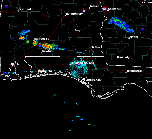 At 623 pm cdt, a severe thunderstorm was located 4 miles northeast of castleberry, or 6 miles south of evergreen, moving northwest at 15 mph (radar indicated). Hazards include 60 mph wind gusts and quarter size hail. Hail damage to vehicles is expected. expect wind damage to roofs, siding, and trees. Locations impacted include, evergreen. At 623 pm cdt, a severe thunderstorm was located 4 miles northeast of castleberry, or 6 miles south of evergreen, moving northwest at 15 mph (radar indicated). Hazards include 60 mph wind gusts and quarter size hail. Hail damage to vehicles is expected. expect wind damage to roofs, siding, and trees. Locations impacted include, evergreen.
|
| 9/9/2019 5:54 PM CDT |
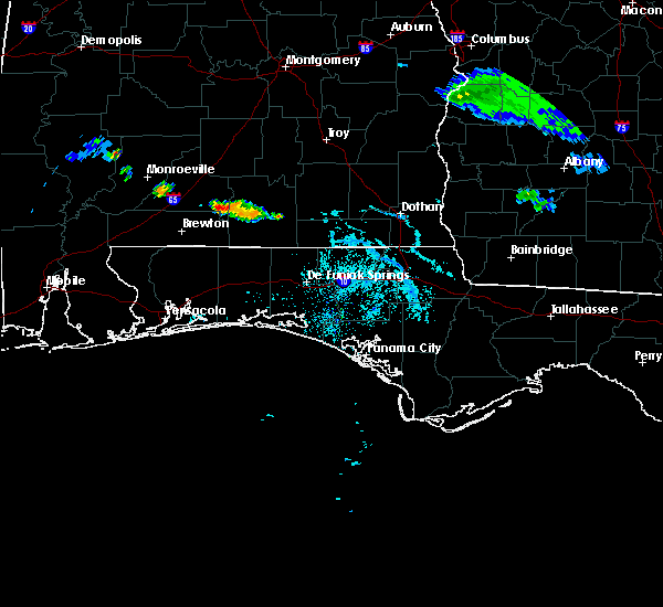 The national weather service in mobile has issued a * severe thunderstorm warning for. northeastern escambia county in south central alabama. southeastern conecuh county in south central alabama. west central covington county in south central alabama. Until 700 pm cdt. The national weather service in mobile has issued a * severe thunderstorm warning for. northeastern escambia county in south central alabama. southeastern conecuh county in south central alabama. west central covington county in south central alabama. Until 700 pm cdt.
|
| 4/19/2019 12:12 AM CDT |
 At 1211 am cdt, a severe thunderstorm was located 6 miles east of evergreen, moving northeast at 50 mph (radar indicated). Hazards include 60 mph wind gusts. expect damage to roofs, siding, and trees At 1211 am cdt, a severe thunderstorm was located 6 miles east of evergreen, moving northeast at 50 mph (radar indicated). Hazards include 60 mph wind gusts. expect damage to roofs, siding, and trees
|
| 4/18/2019 8:53 PM CDT |
 At 852 pm cdt, severe thunderstorms were located along a line extending from 3 miles southwest of greenville to 7 miles east of castleberry, moving east at 35 mph (radar indicated). Hazards include 60 mph wind gusts. Expect damage to roofs, siding, and trees. Locations impacted include, evergreen, georgiana, mckenzie, river falls, castleberry, red level and i65 and us 84. At 852 pm cdt, severe thunderstorms were located along a line extending from 3 miles southwest of greenville to 7 miles east of castleberry, moving east at 35 mph (radar indicated). Hazards include 60 mph wind gusts. Expect damage to roofs, siding, and trees. Locations impacted include, evergreen, georgiana, mckenzie, river falls, castleberry, red level and i65 and us 84.
|
| 4/18/2019 8:24 PM CDT |
 At 824 pm cdt, severe thunderstorms were located along a line extending from 9 miles south of pine apple to 8 miles southwest of castleberry, moving east at 45 mph (radar indicated). Hazards include 60 mph wind gusts. expect damage to roofs, siding, and trees At 824 pm cdt, severe thunderstorms were located along a line extending from 9 miles south of pine apple to 8 miles southwest of castleberry, moving east at 45 mph (radar indicated). Hazards include 60 mph wind gusts. expect damage to roofs, siding, and trees
|
| 4/14/2019 5:16 AM CDT |
 At 516 am cdt, a severe thunderstorm was located near castleberry, or 10 miles north of brewton, moving northeast at 40 mph (radar indicated). Hazards include 60 mph wind gusts. expect damage to roofs, siding, and trees At 516 am cdt, a severe thunderstorm was located near castleberry, or 10 miles north of brewton, moving northeast at 40 mph (radar indicated). Hazards include 60 mph wind gusts. expect damage to roofs, siding, and trees
|
| 3/3/2019 2:23 PM CST |
 At 223 pm cst, severe thunderstorms were located along a line extending from 4 miles west of greenville to 5 miles southwest of excel, moving east at 45 mph (radar indicated). Hazards include 60 mph wind gusts and nickel size hail. expect damage to roofs, siding, and trees At 223 pm cst, severe thunderstorms were located along a line extending from 4 miles west of greenville to 5 miles southwest of excel, moving east at 45 mph (radar indicated). Hazards include 60 mph wind gusts and nickel size hail. expect damage to roofs, siding, and trees
|
| 3/3/2019 2:08 PM CST |
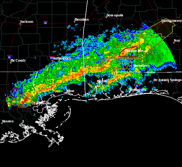 At 208 pm cst, a severe thunderstorm capable of producing a tornado was located over monroeville, moving east at 55 mph (radar indicated rotation). Hazards include tornado and quarter size hail. Flying debris will be dangerous to those caught without shelter. mobile homes will be damaged or destroyed. damage to roofs, windows, and vehicles will occur. tree damage is likely. This tornadic thunderstorm will remain over mainly rural areas of central monroe and central conecuh counties. At 208 pm cst, a severe thunderstorm capable of producing a tornado was located over monroeville, moving east at 55 mph (radar indicated rotation). Hazards include tornado and quarter size hail. Flying debris will be dangerous to those caught without shelter. mobile homes will be damaged or destroyed. damage to roofs, windows, and vehicles will occur. tree damage is likely. This tornadic thunderstorm will remain over mainly rural areas of central monroe and central conecuh counties.
|
| 3/3/2019 1:52 PM CST |
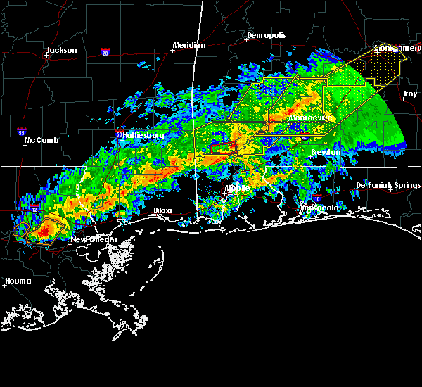 At 152 pm cst, a severe thunderstorm capable of producing a tornado was located 9 miles northwest of frisco city, moving east at 55 mph (radar indicated rotation). Hazards include tornado and quarter size hail. Flying debris will be dangerous to those caught without shelter. mobile homes will be damaged or destroyed. damage to roofs, windows, and vehicles will occur. tree damage is likely. this dangerous storm will be near, frisco city around 200 pm cst. monroeville and excel around 205 pm cst. Peterman around 210 pm cst. At 152 pm cst, a severe thunderstorm capable of producing a tornado was located 9 miles northwest of frisco city, moving east at 55 mph (radar indicated rotation). Hazards include tornado and quarter size hail. Flying debris will be dangerous to those caught without shelter. mobile homes will be damaged or destroyed. damage to roofs, windows, and vehicles will occur. tree damage is likely. this dangerous storm will be near, frisco city around 200 pm cst. monroeville and excel around 205 pm cst. Peterman around 210 pm cst.
|
| 3/3/2019 1:49 PM CST |
 At 149 pm cst, severe thunderstorms were located along a line extending from 8 miles northeast of beatrice to 11 miles northwest of uriah, moving east at 55 mph (radar indicated). Hazards include 60 mph wind gusts and nickel size hail. expect damage to roofs, siding, and trees At 149 pm cst, severe thunderstorms were located along a line extending from 8 miles northeast of beatrice to 11 miles northwest of uriah, moving east at 55 mph (radar indicated). Hazards include 60 mph wind gusts and nickel size hail. expect damage to roofs, siding, and trees
|
| 2/12/2019 10:19 AM CST | Emergency manager reports trees and power lines down in owassa... al along county road 2 in conecuh county AL, 4.4 miles SSW of Evergreen, AL |
| 11/1/2018 8:32 AM CDT |
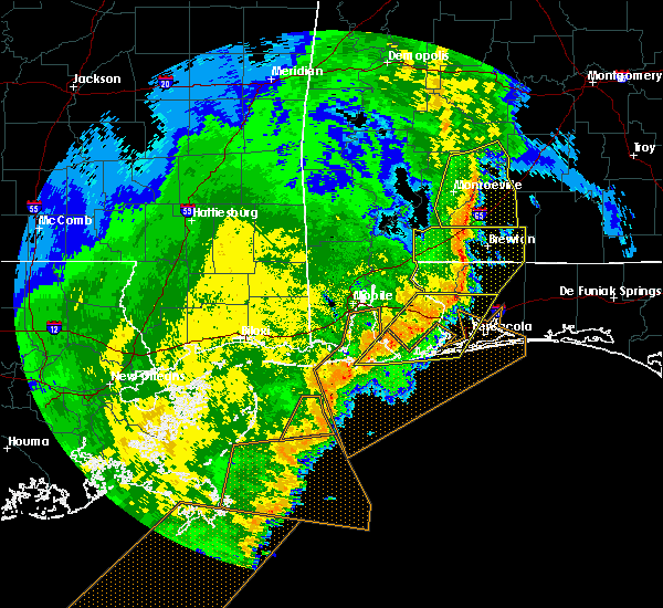 At 830 am cdt, severe thunderstorms were located along a line extending from near beatrice to 7 miles southeast of peterman to 6 miles northeast of i65 and al 113, moving northeast at 45 mph (radar indicated). Hazards include 60 mph wind gusts. Expect damage to roofs, siding, and trees. locations impacted include, monroeville, evergreen, frisco city, peterman, castleberry, excel, beatrice, repton, pine apple and i65 and us 84. A tornado watch remains in effect until 100 pm cdt for south central alabama. At 830 am cdt, severe thunderstorms were located along a line extending from near beatrice to 7 miles southeast of peterman to 6 miles northeast of i65 and al 113, moving northeast at 45 mph (radar indicated). Hazards include 60 mph wind gusts. Expect damage to roofs, siding, and trees. locations impacted include, monroeville, evergreen, frisco city, peterman, castleberry, excel, beatrice, repton, pine apple and i65 and us 84. A tornado watch remains in effect until 100 pm cdt for south central alabama.
|
| 11/1/2018 8:00 AM CDT |
 At 759 am cdt, severe thunderstorms were located along a line extending from 6 miles southeast of fulton to 11 miles west of monroeville to 6 miles west of frisco city, moving northeast at 50 mph (radar indicated). Hazards include 60 mph wind gusts. expect damage to roofs, siding, and trees At 759 am cdt, severe thunderstorms were located along a line extending from 6 miles southeast of fulton to 11 miles west of monroeville to 6 miles west of frisco city, moving northeast at 50 mph (radar indicated). Hazards include 60 mph wind gusts. expect damage to roofs, siding, and trees
|
| 6/28/2018 6:45 PM CDT |
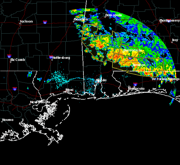 At 644 pm cdt, severe thunderstorms were located from 4 miles southeast of monroeville to near evergreen, moving southeast at 15 mph (radar indicated). Hazards include 60 mph wind gusts. expect damage to roofs, siding, and trees At 644 pm cdt, severe thunderstorms were located from 4 miles southeast of monroeville to near evergreen, moving southeast at 15 mph (radar indicated). Hazards include 60 mph wind gusts. expect damage to roofs, siding, and trees
|
| 6/28/2018 6:30 PM CDT |
 At 628 pm cdt, severe thunderstorms were located along a line extending from 5 miles west of mckenzie to near andalusia to 7 miles south of elba, moving southeast at 30 mph (radar indicated). Hazards include 60 mph wind gusts. Expect damage to roofs, siding, and trees. Locations impacted include, andalusia, opp, georgiana, mckenzie, river falls, red level, dozier, heath and gantt. At 628 pm cdt, severe thunderstorms were located along a line extending from 5 miles west of mckenzie to near andalusia to 7 miles south of elba, moving southeast at 30 mph (radar indicated). Hazards include 60 mph wind gusts. Expect damage to roofs, siding, and trees. Locations impacted include, andalusia, opp, georgiana, mckenzie, river falls, red level, dozier, heath and gantt.
|
| 6/28/2018 6:15 PM CDT | Numerous trees down county-wide. one residence damaged due to lightnin in conecuh county AL, 1 miles WSW of Evergreen, AL |
| 6/28/2018 6:09 PM CDT |
 At 542 pm cdt, severe thunderstorms were located along a line extending from georgiana to 4 miles northwest of dozier to 6 miles northwest of fort rucker, moving southeast at 35 mph (radar indicated). Hazards include 60 mph wind gusts. expect damage to roofs, siding, and trees At 542 pm cdt, severe thunderstorms were located along a line extending from georgiana to 4 miles northwest of dozier to 6 miles northwest of fort rucker, moving southeast at 35 mph (radar indicated). Hazards include 60 mph wind gusts. expect damage to roofs, siding, and trees
|
| 6/28/2018 6:04 PM CDT |
 At 603 pm cdt, a severe thunderstorm was located 9 miles northeast of repton, or 11 miles northwest of evergreen, moving southeast at 20 mph (radar indicated). Hazards include 60 mph wind gusts. expect damage to roofs, siding, and trees At 603 pm cdt, a severe thunderstorm was located 9 miles northeast of repton, or 11 miles northwest of evergreen, moving southeast at 20 mph (radar indicated). Hazards include 60 mph wind gusts. expect damage to roofs, siding, and trees
|
| 6/28/2018 5:43 PM CDT |
 At 542 pm cdt, severe thunderstorms were located along a line extending from georgiana to 4 miles northwest of dozier to 6 miles northwest of fort rucker, moving southeast at 35 mph (radar indicated). Hazards include 60 mph wind gusts. expect damage to roofs, siding, and trees At 542 pm cdt, severe thunderstorms were located along a line extending from georgiana to 4 miles northwest of dozier to 6 miles northwest of fort rucker, moving southeast at 35 mph (radar indicated). Hazards include 60 mph wind gusts. expect damage to roofs, siding, and trees
|
| 6/2/2018 8:04 PM CDT |
 At 803 pm cdt, a severe thunderstorm was located 6 miles southeast of repton, or 12 miles west of evergreen, moving south at 25 mph (radar indicated). Hazards include 60 mph wind gusts and penny size hail. expect damage to roofs, siding, and trees At 803 pm cdt, a severe thunderstorm was located 6 miles southeast of repton, or 12 miles west of evergreen, moving south at 25 mph (radar indicated). Hazards include 60 mph wind gusts and penny size hail. expect damage to roofs, siding, and trees
|
| 6/2/2018 7:57 PM CDT | Trees down southwest of evergreen on old sparta roa in conecuh county AL, 4.4 miles NNE of Evergreen, AL |
| 6/2/2018 7:46 PM CDT |
 At 745 pm cdt, a severe thunderstorm was located 8 miles southeast of evergreen, moving south at 15 mph (radar indicated). Hazards include 60 mph wind gusts and penny size hail. Expect damage to roofs, siding, and trees. Locations impacted include, evergreen, castleberry and red level. At 745 pm cdt, a severe thunderstorm was located 8 miles southeast of evergreen, moving south at 15 mph (radar indicated). Hazards include 60 mph wind gusts and penny size hail. Expect damage to roofs, siding, and trees. Locations impacted include, evergreen, castleberry and red level.
|
| 6/2/2018 7:27 PM CDT | Trees down near the intersection of hwy 84 and hwy 31 east of evergreen... a in conecuh county AL, 6.2 miles W of Evergreen, AL |
| 6/2/2018 7:23 PM CDT |
 At 722 pm cdt, a severe thunderstorm was located 9 miles east of evergreen, moving south at 15 mph (radar indicated). Hazards include 60 mph wind gusts and nickel size hail. expect damage to roofs, siding, and trees At 722 pm cdt, a severe thunderstorm was located 9 miles east of evergreen, moving south at 15 mph (radar indicated). Hazards include 60 mph wind gusts and nickel size hail. expect damage to roofs, siding, and trees
|
| 4/14/2018 10:20 PM CDT |
 The severe thunderstorm warning for southwestern butler, eastern conecuh and northwestern covington counties will expire at 1030 pm cdt, the storm which prompted the warning has weakened below severe limits, and no longer poses an immediate threat to life or property. therefore, the warning will be allowed to expire. however gusty winds and heavy rain are still possible with this thunderstorm. a tornado watch remains in effect until 200 am cdt for south central alabama. The severe thunderstorm warning for southwestern butler, eastern conecuh and northwestern covington counties will expire at 1030 pm cdt, the storm which prompted the warning has weakened below severe limits, and no longer poses an immediate threat to life or property. therefore, the warning will be allowed to expire. however gusty winds and heavy rain are still possible with this thunderstorm. a tornado watch remains in effect until 200 am cdt for south central alabama.
|
| 4/14/2018 10:08 PM CDT |
 At 1008 pm cdt, a severe thunderstorm was located 5 miles north of evergreen, moving northeast at 40 mph (radar indicated). Hazards include 60 mph wind gusts. Expect damage to roofs, siding, and trees. locations impacted include, evergreen, georgiana, mckenzie and i65 and us 84. A tornado watch remains in effect until 200 am cdt for south central alabama. At 1008 pm cdt, a severe thunderstorm was located 5 miles north of evergreen, moving northeast at 40 mph (radar indicated). Hazards include 60 mph wind gusts. Expect damage to roofs, siding, and trees. locations impacted include, evergreen, georgiana, mckenzie and i65 and us 84. A tornado watch remains in effect until 200 am cdt for south central alabama.
|
| 4/14/2018 9:50 PM CDT |
 At 950 pm cdt, a severe thunderstorm was located 6 miles west of i65 and us 84, or 9 miles west of evergreen, moving northeast at 40 mph (radar indicated). Hazards include 60 mph wind gusts and penny size hail. expect damage to roofs, siding, and trees At 950 pm cdt, a severe thunderstorm was located 6 miles west of i65 and us 84, or 9 miles west of evergreen, moving northeast at 40 mph (radar indicated). Hazards include 60 mph wind gusts and penny size hail. expect damage to roofs, siding, and trees
|
| 4/5/2017 10:26 AM CDT |
 At 1026 am cdt, a severe thunderstorm was located near mckenzie, or 11 miles northeast of evergreen, moving east at 40 mph (radar indicated). Hazards include 60 mph wind gusts and quarter size hail. Hail damage to vehicles is expected. Expect wind damage to roofs, siding, and trees. At 1026 am cdt, a severe thunderstorm was located near mckenzie, or 11 miles northeast of evergreen, moving east at 40 mph (radar indicated). Hazards include 60 mph wind gusts and quarter size hail. Hail damage to vehicles is expected. Expect wind damage to roofs, siding, and trees.
|
| 4/5/2017 10:06 AM CDT |
 At 1006 am cdt, a severe thunderstorm was located over evergreen, moving east at 60 mph (radar indicated). Hazards include 70 mph wind gusts and half dollar size hail. Hail damage to vehicles is expected. expect considerable tree damage. wind damage is also likely to mobile homes, roofs, and outbuildings. locations impacted include, evergreen, georgiana, mckenzie, river falls, castleberry, red level and i65 and us 84. A tornado watch remains in effect until noon cdt for south central alabama. At 1006 am cdt, a severe thunderstorm was located over evergreen, moving east at 60 mph (radar indicated). Hazards include 70 mph wind gusts and half dollar size hail. Hail damage to vehicles is expected. expect considerable tree damage. wind damage is also likely to mobile homes, roofs, and outbuildings. locations impacted include, evergreen, georgiana, mckenzie, river falls, castleberry, red level and i65 and us 84. A tornado watch remains in effect until noon cdt for south central alabama.
|
| 4/5/2017 9:54 AM CDT |
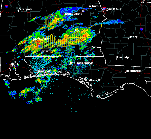 At 954 am cdt, a severe thunderstorm was located near repton, or 12 miles southeast of monroeville, moving east at 60 mph (radar indicated). Hazards include 60 mph wind gusts and half dollar size hail. Hail damage to vehicles is expected. Expect wind damage to roofs, siding, and trees. At 954 am cdt, a severe thunderstorm was located near repton, or 12 miles southeast of monroeville, moving east at 60 mph (radar indicated). Hazards include 60 mph wind gusts and half dollar size hail. Hail damage to vehicles is expected. Expect wind damage to roofs, siding, and trees.
|
| 4/5/2017 9:50 AM CDT |
 At 949 am cdt, severe thunderstorms were located along a line extending from near repton to near uriah to 7 miles northwest of poarch creek reservation, moving east at 15 mph (radar indicated). Hazards include 60 mph wind gusts and half dollar size hail. Hail damage to vehicles is expected. expect wind damage to roofs, siding, and trees. locations impacted include, castleberry, excel, repton and i65 and us 84. A tornado watch remains in effect until noon cdt for south central alabama. At 949 am cdt, severe thunderstorms were located along a line extending from near repton to near uriah to 7 miles northwest of poarch creek reservation, moving east at 15 mph (radar indicated). Hazards include 60 mph wind gusts and half dollar size hail. Hail damage to vehicles is expected. expect wind damage to roofs, siding, and trees. locations impacted include, castleberry, excel, repton and i65 and us 84. A tornado watch remains in effect until noon cdt for south central alabama.
|
| 4/5/2017 9:32 AM CDT |
 At 932 am cdt, severe thunderstorms were located along a line extending from 6 miles south of excel to near uriah to 11 miles west of poarch creek reservation, moving east at 15 mph (radar indicated). Hazards include 60 mph wind gusts and half dollar size hail. Hail damage to vehicles is expected. expect wind damage to roofs, siding, and trees. locations impacted include, uriah, castleberry, excel, repton, i65 and us 84 and i65 and al 113. A tornado watch remains in effect until noon cdt for south central and southwestern alabama. At 932 am cdt, severe thunderstorms were located along a line extending from 6 miles south of excel to near uriah to 11 miles west of poarch creek reservation, moving east at 15 mph (radar indicated). Hazards include 60 mph wind gusts and half dollar size hail. Hail damage to vehicles is expected. expect wind damage to roofs, siding, and trees. locations impacted include, uriah, castleberry, excel, repton, i65 and us 84 and i65 and al 113. A tornado watch remains in effect until noon cdt for south central and southwestern alabama.
|
| 4/5/2017 9:19 AM CDT |
 At 919 am cdt, severe thunderstorms were located along a line extending from near uriah to near mccullough to 11 miles northeast of stockton, moving east at 15 mph (radar indicated). Hazards include 60 mph wind gusts and half dollar size hail. Hail damage to vehicles is expected. Expect wind damage to roofs, siding, and trees. At 919 am cdt, severe thunderstorms were located along a line extending from near uriah to near mccullough to 11 miles northeast of stockton, moving east at 15 mph (radar indicated). Hazards include 60 mph wind gusts and half dollar size hail. Hail damage to vehicles is expected. Expect wind damage to roofs, siding, and trees.
|
| 4/3/2017 8:33 AM CDT | Roof of a covered porch collapsed on spence mcgraw road. numerous trees either blown over or snapped in this are in conecuh county AL, 5.9 miles SW of Evergreen, AL |
| 4/3/2017 8:27 AM CDT | Mulitple trees down on county road 6 near johnsonville in conecuh count in conecuh county AL, 12.2 miles NNW of Evergreen, AL |
| 4/3/2017 8:26 AM CDT |
 At 825 am cdt, severe thunderstorms were located along a line extending from near greenville to 7 miles south of red level to 12 miles southeast of riverview, moving northeast at 40 mph (radar indicated). Hazards include 60 mph wind gusts and quarter size hail. Hail damage to vehicles is expected. Expect wind damage to roofs, siding, and trees. At 825 am cdt, severe thunderstorms were located along a line extending from near greenville to 7 miles south of red level to 12 miles southeast of riverview, moving northeast at 40 mph (radar indicated). Hazards include 60 mph wind gusts and quarter size hail. Hail damage to vehicles is expected. Expect wind damage to roofs, siding, and trees.
|
| 4/3/2017 8:09 AM CDT |
 At 808 am cdt, severe thunderstorms were located along a line extending from near castleberry to near big point, moving east at 30 mph (radar indicated). Hazards include 60 mph wind gusts and quarter size hail. Hail damage to vehicles is expected. Expect wind damage to roofs, siding, and trees. At 808 am cdt, severe thunderstorms were located along a line extending from near castleberry to near big point, moving east at 30 mph (radar indicated). Hazards include 60 mph wind gusts and quarter size hail. Hail damage to vehicles is expected. Expect wind damage to roofs, siding, and trees.
|
| 4/3/2017 8:00 AM CDT |
 At 800 am cdt, severe thunderstorms were located along a line extending from i65 and us 84 to near tanner williams, moving east at 50 mph (radar indicated). Hazards include 60 mph wind gusts and quarter size hail. Hail damage to vehicles is expected. expect wind damage to roofs, siding, and trees. locations impacted include, midtown mobile, downtown mobile, prichard, tillmans corner, saraland, bay minette, atmore, chickasaw, satsuma, evergreen, creola, chunchula, stockton, mccullough, gulfcrest, axis, mount vernon, tanner williams, semmes and repton. a tornado watch remains in effect until 900 am cdt for southwestern alabama, and southeastern mississippi. A tornado watch also remains in effect until 100 pm cdt for south central alabama, and northwestern florida. At 800 am cdt, severe thunderstorms were located along a line extending from i65 and us 84 to near tanner williams, moving east at 50 mph (radar indicated). Hazards include 60 mph wind gusts and quarter size hail. Hail damage to vehicles is expected. expect wind damage to roofs, siding, and trees. locations impacted include, midtown mobile, downtown mobile, prichard, tillmans corner, saraland, bay minette, atmore, chickasaw, satsuma, evergreen, creola, chunchula, stockton, mccullough, gulfcrest, axis, mount vernon, tanner williams, semmes and repton. a tornado watch remains in effect until 900 am cdt for southwestern alabama, and southeastern mississippi. A tornado watch also remains in effect until 100 pm cdt for south central alabama, and northwestern florida.
|
| 4/3/2017 7:26 AM CDT |
 At 725 am cdt, severe thunderstorms were located along a line extending from 7 miles west of frisco city to 8 miles northeast of latimer, moving east at 40 mph (radar indicated). Hazards include 60 mph wind gusts and quarter size hail. Hail damage to vehicles is expected. Expect wind damage to roofs, siding, and trees. At 725 am cdt, severe thunderstorms were located along a line extending from 7 miles west of frisco city to 8 miles northeast of latimer, moving east at 40 mph (radar indicated). Hazards include 60 mph wind gusts and quarter size hail. Hail damage to vehicles is expected. Expect wind damage to roofs, siding, and trees.
|
| 3/30/2017 12:51 PM CDT |
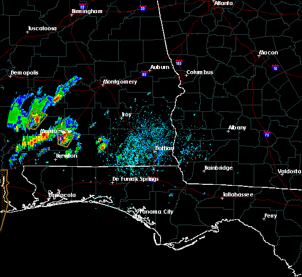 At 1250 pm cdt, a severe thunderstorm was located over evergreen, moving north at 25 mph (radar indicated). Hazards include 60 mph wind gusts and quarter size hail. Hail damage to vehicles is expected. expect wind damage to roofs, siding, and trees. Locations impacted include, evergreen and i65 and us 84. At 1250 pm cdt, a severe thunderstorm was located over evergreen, moving north at 25 mph (radar indicated). Hazards include 60 mph wind gusts and quarter size hail. Hail damage to vehicles is expected. expect wind damage to roofs, siding, and trees. Locations impacted include, evergreen and i65 and us 84.
|
| 3/30/2017 12:40 PM CDT |
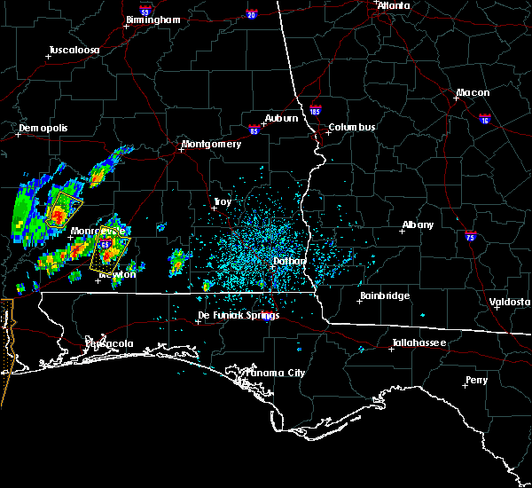 At 1239 pm cdt, a severe thunderstorm was located near castleberry, or near evergreen, moving north at 25 mph (radar indicated). Hazards include 60 mph wind gusts and quarter size hail. Hail damage to vehicles is expected. expect wind damage to roofs, siding, and trees. Locations impacted include, evergreen, castleberry and i65 and us 84. At 1239 pm cdt, a severe thunderstorm was located near castleberry, or near evergreen, moving north at 25 mph (radar indicated). Hazards include 60 mph wind gusts and quarter size hail. Hail damage to vehicles is expected. expect wind damage to roofs, siding, and trees. Locations impacted include, evergreen, castleberry and i65 and us 84.
|
| 3/30/2017 12:29 PM CDT |
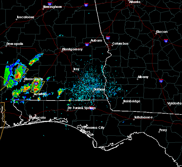 At 1228 pm cdt, a severe thunderstorm was located over castleberry, or 11 miles south of evergreen, moving north at 25 mph (radar indicated). Hazards include 60 mph wind gusts and quarter size hail. Hail damage to vehicles is expected. Expect wind damage to roofs, siding, and trees. At 1228 pm cdt, a severe thunderstorm was located over castleberry, or 11 miles south of evergreen, moving north at 25 mph (radar indicated). Hazards include 60 mph wind gusts and quarter size hail. Hail damage to vehicles is expected. Expect wind damage to roofs, siding, and trees.
|
| 1/22/2017 11:54 AM CST |
 At 1154 am cst, a severe thunderstorm was located over georgiana, or 14 miles south of greenville, moving east at 55 mph (radar indicated). Hazards include 60 mph wind gusts. Expect damage to roofs, siding, and trees. locations impacted include, greenville, evergreen, georgiana, mckenzie, red level, gantt, pine apple and i65 and us 84. A tornado watch remains in effect until 200 pm cst for south central alabama. At 1154 am cst, a severe thunderstorm was located over georgiana, or 14 miles south of greenville, moving east at 55 mph (radar indicated). Hazards include 60 mph wind gusts. Expect damage to roofs, siding, and trees. locations impacted include, greenville, evergreen, georgiana, mckenzie, red level, gantt, pine apple and i65 and us 84. A tornado watch remains in effect until 200 pm cst for south central alabama.
|
| 1/22/2017 11:24 AM CST |
 At 1124 am cst, a severe thunderstorm was located 7 miles southeast of peterman, or 10 miles east of monroeville, moving east at 55 mph (radar indicated). Hazards include 60 mph wind gusts and quarter size hail. Hail damage to vehicles is expected. Expect wind damage to roofs, siding, and trees. At 1124 am cst, a severe thunderstorm was located 7 miles southeast of peterman, or 10 miles east of monroeville, moving east at 55 mph (radar indicated). Hazards include 60 mph wind gusts and quarter size hail. Hail damage to vehicles is expected. Expect wind damage to roofs, siding, and trees.
|
| 1/21/2017 9:53 PM CST |
 The severe thunderstorm warning for central conecuh and northeastern escambia counties will expire at 1000 pm cst, the storm which prompted the warning has moved out of the area. therefore the warning will be allowed to expire. a tornado watch remains in effect until 300 am cst for south central alabama. The severe thunderstorm warning for central conecuh and northeastern escambia counties will expire at 1000 pm cst, the storm which prompted the warning has moved out of the area. therefore the warning will be allowed to expire. a tornado watch remains in effect until 300 am cst for south central alabama.
|
| 1/21/2017 9:31 PM CST |
 At 931 pm cst, severe thunderstorms were located along a line extending from 11 miles north of i65 and us 84 to near evergreen to castleberry, moving east at 55 mph (radar indicated). Hazards include 60 mph wind gusts and half dollar size hail. Hail damage to vehicles is expected. Expect wind damage to roofs, siding, and trees. At 931 pm cst, severe thunderstorms were located along a line extending from 11 miles north of i65 and us 84 to near evergreen to castleberry, moving east at 55 mph (radar indicated). Hazards include 60 mph wind gusts and half dollar size hail. Hail damage to vehicles is expected. Expect wind damage to roofs, siding, and trees.
|
| 1/21/2017 9:30 PM CST |
 At 930 pm cst, a severe thunderstorm was located over evergreen, moving east at 60 mph (radar indicated). Hazards include 60 mph wind gusts and half dollar size hail. Hail damage to vehicles is expected. expect wind damage to roofs, siding, and trees. locations impacted include, evergreen, castleberry and i65 and us 84. A tornado watch remains in effect until 300 am cst for south central alabama. At 930 pm cst, a severe thunderstorm was located over evergreen, moving east at 60 mph (radar indicated). Hazards include 60 mph wind gusts and half dollar size hail. Hail damage to vehicles is expected. expect wind damage to roofs, siding, and trees. locations impacted include, evergreen, castleberry and i65 and us 84. A tornado watch remains in effect until 300 am cst for south central alabama.
|
| 1/21/2017 9:14 PM CST |
 At 914 pm cst, a severe thunderstorm was located near repton, or 10 miles southeast of frisco city, moving northeast at 55 mph (radar indicated). Hazards include 60 mph wind gusts and half dollar size hail. Hail damage to vehicles is expected. Expect wind damage to roofs, siding, and trees. At 914 pm cst, a severe thunderstorm was located near repton, or 10 miles southeast of frisco city, moving northeast at 55 mph (radar indicated). Hazards include 60 mph wind gusts and half dollar size hail. Hail damage to vehicles is expected. Expect wind damage to roofs, siding, and trees.
|
| 1/21/2017 7:51 PM CST |
 At 751 pm cst, a severe thunderstorm was located near pollard, or near flomaton, moving northeast at 50 mph (radar indicated). Hazards include 60 mph wind gusts and half dollar size hail. Hail damage to vehicles is expected. Expect wind damage to roofs, siding, and trees. At 751 pm cst, a severe thunderstorm was located near pollard, or near flomaton, moving northeast at 50 mph (radar indicated). Hazards include 60 mph wind gusts and half dollar size hail. Hail damage to vehicles is expected. Expect wind damage to roofs, siding, and trees.
|
| 1/21/2017 8:18 AM CST | Sheet metal shed blown down... trees uprooted... and fence blown down in lyeffion... al on hwy 8 in conecuh county AL, 7.4 miles S of Evergreen, AL |
| 1/21/2017 8:10 AM CST | Barn destroyed along with shingle damage to a home near the intersection of highway 83 and county road 22. several trees downe in conecuh county AL, 6.3 miles SSE of Evergreen, AL |
| 1/2/2017 6:13 PM CST |
 At 612 pm cst, severe thunderstorms were located along a line extending from 8 miles east of evergreen, to 13 miles southwest of river falls, to 10 miles north of baker, to 9 miles east of roeville, to 9 miles south of warrington, moving east at 45 mph (radar indicated). Hazards include 60 mph wind gusts and nickel size hail. Expect damage to roofs, siding, and trees. locations impacted include, pensacola, ferry pass, brent, west pensacola, wright, fort walton beach, ensley, warrington, crestview, niceville, gonzalez, destin, gulf shores, andalusia, eglin afb, foley, pace, milton, opp and valparaiso. A tornado watch remains in effect until 800 pm cst for south central and southwestern alabama, and northwestern florida. At 612 pm cst, severe thunderstorms were located along a line extending from 8 miles east of evergreen, to 13 miles southwest of river falls, to 10 miles north of baker, to 9 miles east of roeville, to 9 miles south of warrington, moving east at 45 mph (radar indicated). Hazards include 60 mph wind gusts and nickel size hail. Expect damage to roofs, siding, and trees. locations impacted include, pensacola, ferry pass, brent, west pensacola, wright, fort walton beach, ensley, warrington, crestview, niceville, gonzalez, destin, gulf shores, andalusia, eglin afb, foley, pace, milton, opp and valparaiso. A tornado watch remains in effect until 800 pm cst for south central and southwestern alabama, and northwestern florida.
|
| 1/2/2017 5:47 PM CST |
 At 546 pm cst, severe thunderstorms were located along a line extending from 13 miles southeast of beatrice to 7 miles northwest of brewton to near century to near magnolia springs to near fort morgan, moving east at 35 mph (radar indicated). Hazards include 60 mph wind gusts and quarter size hail. Hail damage to vehicles is expected. expect wind damage to roofs, siding, and trees. locations impacted include, downtown mobile, pensacola, ferry pass, brent, west pensacola, ensley, daphne, warrington, fairhope, gonzalez, gulf shores, foley, pace, gulf breeze, brewton, orange beach, spanish fort, goulding, robertsdale and evergreen. A tornado watch remains in effect until 800 pm cst for south central and southwestern alabama, and northwestern florida. At 546 pm cst, severe thunderstorms were located along a line extending from 13 miles southeast of beatrice to 7 miles northwest of brewton to near century to near magnolia springs to near fort morgan, moving east at 35 mph (radar indicated). Hazards include 60 mph wind gusts and quarter size hail. Hail damage to vehicles is expected. expect wind damage to roofs, siding, and trees. locations impacted include, downtown mobile, pensacola, ferry pass, brent, west pensacola, ensley, daphne, warrington, fairhope, gonzalez, gulf shores, foley, pace, gulf breeze, brewton, orange beach, spanish fort, goulding, robertsdale and evergreen. A tornado watch remains in effect until 800 pm cst for south central and southwestern alabama, and northwestern florida.
|
| 1/2/2017 5:42 PM CST |
 At 541 pm cst, severe thunderstorms were located along a line extending from near repton to near brewton to 8 miles east of jay to gulf shores, moving east at 45 mph (radar indicated). Hazards include 60 mph wind gusts and up to quarter size hail. expect damage to roofs, siding, and trees At 541 pm cst, severe thunderstorms were located along a line extending from near repton to near brewton to 8 miles east of jay to gulf shores, moving east at 45 mph (radar indicated). Hazards include 60 mph wind gusts and up to quarter size hail. expect damage to roofs, siding, and trees
|
| 1/2/2017 5:30 PM CST |
 At 528 pm cst, severe thunderstorms were located along a line extending from near beatrice, to near i65 and al 113, to near bratt, to near i10 and i65, to near alabama port, moving east at 45 mph (radar indicated). Hazards include 60 mph wind gusts and quarter size hail. Hail damage to vehicles is expected. expect wind damage to roofs, siding, and trees. locations impacted include, downtown mobile, midtown mobile, pensacola, prichard, ferry pass, brent, west pensacola, ensley, daphne, tillmans corner, warrington, fairhope, gonzalez, gulf shores, bay minette, atmore, foley, pace, monroeville and theodore. A tornado watch remains in effect until 800 pm cst for south central and southwestern alabama, and northwestern florida. At 528 pm cst, severe thunderstorms were located along a line extending from near beatrice, to near i65 and al 113, to near bratt, to near i10 and i65, to near alabama port, moving east at 45 mph (radar indicated). Hazards include 60 mph wind gusts and quarter size hail. Hail damage to vehicles is expected. expect wind damage to roofs, siding, and trees. locations impacted include, downtown mobile, midtown mobile, pensacola, prichard, ferry pass, brent, west pensacola, ensley, daphne, tillmans corner, warrington, fairhope, gonzalez, gulf shores, bay minette, atmore, foley, pace, monroeville and theodore. A tornado watch remains in effect until 800 pm cst for south central and southwestern alabama, and northwestern florida.
|
| 1/2/2017 5:15 PM CST |
 At 513 pm cst, severe thunderstorms were located along a line extending from near beatrice to near uriah to near poarch creek reservation to daphne to near alabama port, moving east at 35 mph (radar indicated). Hazards include 60 mph wind gusts and quarter size hail. Hail damage to vehicles is expected. expect wind damage to roofs, siding, and trees. locations impacted include, downtown mobile, midtown mobile, pensacola, prichard, ferry pass, brent, west pensacola, ensley, daphne, tillmans corner, warrington, fairhope, gonzalez, gulf shores, bay minette, atmore, foley, pace, monroeville and theodore. A tornado watch remains in effect until 800 pm cst for south central and southwestern alabama, and northwestern florida. At 513 pm cst, severe thunderstorms were located along a line extending from near beatrice to near uriah to near poarch creek reservation to daphne to near alabama port, moving east at 35 mph (radar indicated). Hazards include 60 mph wind gusts and quarter size hail. Hail damage to vehicles is expected. expect wind damage to roofs, siding, and trees. locations impacted include, downtown mobile, midtown mobile, pensacola, prichard, ferry pass, brent, west pensacola, ensley, daphne, tillmans corner, warrington, fairhope, gonzalez, gulf shores, bay minette, atmore, foley, pace, monroeville and theodore. A tornado watch remains in effect until 800 pm cst for south central and southwestern alabama, and northwestern florida.
|
| 1/2/2017 4:55 PM CST |
 At 454 pm cst, severe thunderstorms were located along a line extending from 7 miles west of vredenburgh to 13 miles southeast of jackson to 8 miles northeast of stockton to near i10 and i65 to near grand bay, moving east at 35 mph (radar indicated). Hazards include 60 mph wind gusts and quarter size hail. Hail damage to vehicles is expected. Expect wind damage to roofs, siding, and trees. At 454 pm cst, severe thunderstorms were located along a line extending from 7 miles west of vredenburgh to 13 miles southeast of jackson to 8 miles northeast of stockton to near i10 and i65 to near grand bay, moving east at 35 mph (radar indicated). Hazards include 60 mph wind gusts and quarter size hail. Hail damage to vehicles is expected. Expect wind damage to roofs, siding, and trees.
|
| 1/2/2017 2:20 PM CST |
 At 219 pm cst, severe thunderstorms were located along a line extending from 6 miles southeast of beatrice to 8 miles southeast of peterman to 6 miles south of excel to near uriah, moving east at 40 mph (radar indicated). Hazards include 60 mph wind gusts and penny size hail. expect damage to roofs, siding, and trees At 219 pm cst, severe thunderstorms were located along a line extending from 6 miles southeast of beatrice to 8 miles southeast of peterman to 6 miles south of excel to near uriah, moving east at 40 mph (radar indicated). Hazards include 60 mph wind gusts and penny size hail. expect damage to roofs, siding, and trees
|
| 11/30/2016 12:40 PM CST |
 At 1240 pm cst, severe thunderstorms were located along a line extending from i65 and us 84 to 6 miles southeast of castleberry to riverview, moving east at 60 mph (radar indicated). Hazards include 60 mph wind gusts. Expect damage to roofs. siding. And trees. At 1240 pm cst, severe thunderstorms were located along a line extending from i65 and us 84 to 6 miles southeast of castleberry to riverview, moving east at 60 mph (radar indicated). Hazards include 60 mph wind gusts. Expect damage to roofs. siding. And trees.
|
| 8/1/2016 5:58 PM CDT |
 At 558 pm cdt, a severe thunderstorm was located 11 miles north of evergreen, moving south at 10 mph (radar indicated). Hazards include 60 mph wind gusts and penny size hail. Expect damage to roofs. siding. and trees. Locations impacted include, evergreen and i65 and us 84. At 558 pm cdt, a severe thunderstorm was located 11 miles north of evergreen, moving south at 10 mph (radar indicated). Hazards include 60 mph wind gusts and penny size hail. Expect damage to roofs. siding. and trees. Locations impacted include, evergreen and i65 and us 84.
|
| 8/1/2016 5:42 PM CDT |
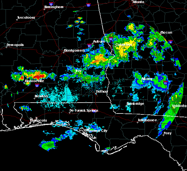 At 542 pm cdt, a severe thunderstorm was located 12 miles southeast of beatrice, or 14 miles north of evergreen, moving south at 15 mph (radar indicated). Hazards include 60 mph wind gusts and penny size hail. Expect damage to roofs. siding. And trees. At 542 pm cdt, a severe thunderstorm was located 12 miles southeast of beatrice, or 14 miles north of evergreen, moving south at 15 mph (radar indicated). Hazards include 60 mph wind gusts and penny size hail. Expect damage to roofs. siding. And trees.
|
| 7/10/2016 3:20 PM CDT |
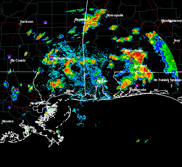 At 317 pm cdt, a severe thunderstorm was located over i65 and us 84, or near evergreen, moving north at 10 mph (public reported trees down across i-65 about 6 miles southwest of evergreen, blocking traffic). Hazards include 60 mph wind gusts and nickel size hail. Expect damage to roofs. siding. and trees. Locations impacted include, evergreen and i65 and us 84. At 317 pm cdt, a severe thunderstorm was located over i65 and us 84, or near evergreen, moving north at 10 mph (public reported trees down across i-65 about 6 miles southwest of evergreen, blocking traffic). Hazards include 60 mph wind gusts and nickel size hail. Expect damage to roofs. siding. and trees. Locations impacted include, evergreen and i65 and us 84.
|
| 7/10/2016 3:02 PM CDT | Trees dwon blocking i-65 6 miles sw of evergreen alabama via twitte in conecuh county AL, 5.8 miles NE of Evergreen, AL |
| 7/10/2016 2:44 PM CDT |
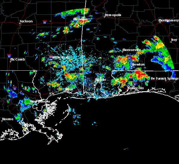 At 244 pm cdt, a severe thunderstorm was located near castleberry, or 7 miles southwest of evergreen, moving north at 10 mph (radar indicated). Hazards include 60 mph wind gusts and nickel size hail. Expect damage to roofs. siding. And trees. At 244 pm cdt, a severe thunderstorm was located near castleberry, or 7 miles southwest of evergreen, moving north at 10 mph (radar indicated). Hazards include 60 mph wind gusts and nickel size hail. Expect damage to roofs. siding. And trees.
|
| 7/6/2016 1:45 PM CDT |
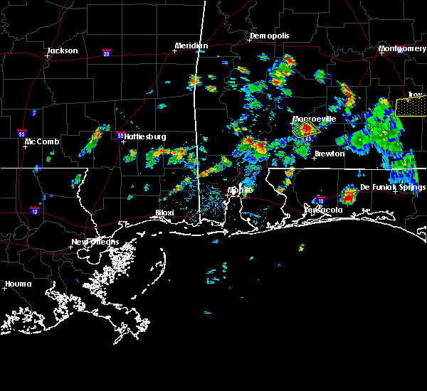 At 144 pm cdt, a severe thunderstorm was located 5 miles northeast of repton, or 10 miles southeast of monroeville, moving northeast at 15 mph (radar indicated). Hazards include 60 mph wind gusts. Expect damage to roofs. siding. and trees. Locations impacted include, repton. At 144 pm cdt, a severe thunderstorm was located 5 miles northeast of repton, or 10 miles southeast of monroeville, moving northeast at 15 mph (radar indicated). Hazards include 60 mph wind gusts. Expect damage to roofs. siding. and trees. Locations impacted include, repton.
|
| 7/6/2016 1:30 PM CDT |
 At 130 pm cdt, a severe thunderstorm was located over repton, or 9 miles southeast of monroeville, moving northeast at 15 mph (radar indicated). Hazards include 60 mph wind gusts. Expect damage to roofs. siding. and trees. Locations impacted include, repton. At 130 pm cdt, a severe thunderstorm was located over repton, or 9 miles southeast of monroeville, moving northeast at 15 mph (radar indicated). Hazards include 60 mph wind gusts. Expect damage to roofs. siding. and trees. Locations impacted include, repton.
|
| 7/6/2016 1:24 PM CDT |
 At 123 pm cdt, doppler radar indicated a severe thunderstorm capable of producing damaging winds in excess of 60 mph. this storm was located over repton, or 8 miles southeast of monroeville, and moving northeast at 15 mph. At 123 pm cdt, doppler radar indicated a severe thunderstorm capable of producing damaging winds in excess of 60 mph. this storm was located over repton, or 8 miles southeast of monroeville, and moving northeast at 15 mph.
|
| 6/17/2016 6:46 PM CDT |
 At 645 pm cdt, severe thunderstorms were located along a line extending from near macedonia to near citronelle to 16 miles north of baker to 9 miles north of new brockton, moving southeast at 45 mph (radar indicated). Hazards include 60 mph wind gusts and nickel size hail. Expect damage to roofs. siding. and trees. Locations impacted include, andalusia, atmore, opp, brewton, citronelle, florala, richton, leakesville, mccullough, deer park, east brewton, uriah, beaumont, brantley, mount vernon, calvert, new augusta, river falls, mclain and castleberry. At 645 pm cdt, severe thunderstorms were located along a line extending from near macedonia to near citronelle to 16 miles north of baker to 9 miles north of new brockton, moving southeast at 45 mph (radar indicated). Hazards include 60 mph wind gusts and nickel size hail. Expect damage to roofs. siding. and trees. Locations impacted include, andalusia, atmore, opp, brewton, citronelle, florala, richton, leakesville, mccullough, deer park, east brewton, uriah, beaumont, brantley, mount vernon, calvert, new augusta, river falls, mclain and castleberry.
|
| 6/17/2016 6:11 PM CDT |
 At 610 pm cdt, severe thunderstorms were located along a line extending from near moss to 6 miles southwest of state line to near castleberry to near goshen, moving southeast at 50 mph (radar indicated). Hazards include 60 mph wind gusts and quarter size hail. Hail damage to vehicles is expected. expect wind damage to roofs, siding, and trees. Locations impacted include, andalusia, atmore, greenville, monroeville, opp, brewton, jackson, waynesboro, citronelle, evergreen, luverne, florala, frisco city, chatom, richton, leakesville, mccullough, peterman, saint stephens and wagarville. At 610 pm cdt, severe thunderstorms were located along a line extending from near moss to 6 miles southwest of state line to near castleberry to near goshen, moving southeast at 50 mph (radar indicated). Hazards include 60 mph wind gusts and quarter size hail. Hail damage to vehicles is expected. expect wind damage to roofs, siding, and trees. Locations impacted include, andalusia, atmore, greenville, monroeville, opp, brewton, jackson, waynesboro, citronelle, evergreen, luverne, florala, frisco city, chatom, richton, leakesville, mccullough, peterman, saint stephens and wagarville.
|
| 6/17/2016 6:00 PM CDT |
 At 559 pm cdt, severe thunderstorms were located along a line extending from bay springs to near buckatunna to near i65 and us 84 to near lapine, moving southeast at 50 mph (radar indicated). Hazards include 60 mph wind gusts and nickel size hail. Expect damage to roofs. siding. And trees. At 559 pm cdt, severe thunderstorms were located along a line extending from bay springs to near buckatunna to near i65 and us 84 to near lapine, moving southeast at 50 mph (radar indicated). Hazards include 60 mph wind gusts and nickel size hail. Expect damage to roofs. siding. And trees.
|
| 6/17/2016 5:26 PM CDT |
 At 523 pm cdt, severe thunderstorms were located along a line extending from near pintlala to near pine apple to near silas to bay springs, moving south at 45 mph (radar indicated. several reports of winds around 60 mph have been received with this line of storms. trees have been blown down in choctaw and clarke counties). Hazards include 60 mph wind gusts and quarter size hail. Hail damage to vehicles is expected. expect wind damage to roofs, siding, and trees. Locations impacted include, greenville, monroeville, jackson, waynesboro, thomasville, luverne, camden, butler, frisco city, grove hill, chatom, peterman, saint stephens, wagarville, leroy, clara, georgiana, whatley, pine hill and mckenzie. At 523 pm cdt, severe thunderstorms were located along a line extending from near pintlala to near pine apple to near silas to bay springs, moving south at 45 mph (radar indicated. several reports of winds around 60 mph have been received with this line of storms. trees have been blown down in choctaw and clarke counties). Hazards include 60 mph wind gusts and quarter size hail. Hail damage to vehicles is expected. expect wind damage to roofs, siding, and trees. Locations impacted include, greenville, monroeville, jackson, waynesboro, thomasville, luverne, camden, butler, frisco city, grove hill, chatom, peterman, saint stephens, wagarville, leroy, clara, georgiana, whatley, pine hill and mckenzie.
|
| 6/17/2016 5:02 PM CDT |
 At 500 pm cdt, severe thunderstorms were located along a line extending from near dannelly field to 10 miles southeast of dannelly reservoir to near butler to near conehatta, moving south at 45 mph. additional severe thunderstorm development is possible ahead of the main line (radar indicated). Hazards include 60 mph wind gusts and quarter size hail. Hail damage to vehicles is expected. Expect wind damage to roofs, siding, and trees. At 500 pm cdt, severe thunderstorms were located along a line extending from near dannelly field to 10 miles southeast of dannelly reservoir to near butler to near conehatta, moving south at 45 mph. additional severe thunderstorm development is possible ahead of the main line (radar indicated). Hazards include 60 mph wind gusts and quarter size hail. Hail damage to vehicles is expected. Expect wind damage to roofs, siding, and trees.
|
| 3/31/2016 11:45 AM CDT |
 At 1144 am cdt, severe thunderstorms were located along a line extending from near i65 and al 41 to i65 and al 113 to near i65 and al 21 to near atmore, moving east at 35 mph (radar indicated). Hazards include 60 mph wind gusts and quarter size hail. Hail damage to vehicles is expected. expect wind damage to roofs, siding, and trees. locations impacted include, atmore, evergreen, castleberry, repton, i65 and al 41, i65 and al 21, i65 and al 113, i65 and cr 6 and i65 and us 84. A tornado watch remains in effect until 200 pm cdt for south central alabama. At 1144 am cdt, severe thunderstorms were located along a line extending from near i65 and al 41 to i65 and al 113 to near i65 and al 21 to near atmore, moving east at 35 mph (radar indicated). Hazards include 60 mph wind gusts and quarter size hail. Hail damage to vehicles is expected. expect wind damage to roofs, siding, and trees. locations impacted include, atmore, evergreen, castleberry, repton, i65 and al 41, i65 and al 21, i65 and al 113, i65 and cr 6 and i65 and us 84. A tornado watch remains in effect until 200 pm cdt for south central alabama.
|
| 3/31/2016 11:29 AM CDT |
 At 1128 am cdt, severe thunderstorms were located along a line extending from near megargel to 6 miles south of uriah to mccullough to near poarch creek reservation, moving east at 35 mph (radar indicated). Hazards include 70 mph wind gusts and quarter size hail. Hail damage to vehicles is expected. expect considerable tree damage. wind damage is also likely to mobile homes, roofs, and outbuildings. locations impacted include, atmore, evergreen, frisco city, excel, castleberry, repton, poarch creek reservation, i65 and al 41, i65 and al 21, megargel, i65 and cr 1, mccullough, i65 and al 113, i65 and cr 6, i65 and us 84 and uriah. A tornado watch remains in effect until 200 pm cdt for southwestern alabama. At 1128 am cdt, severe thunderstorms were located along a line extending from near megargel to 6 miles south of uriah to mccullough to near poarch creek reservation, moving east at 35 mph (radar indicated). Hazards include 70 mph wind gusts and quarter size hail. Hail damage to vehicles is expected. expect considerable tree damage. wind damage is also likely to mobile homes, roofs, and outbuildings. locations impacted include, atmore, evergreen, frisco city, excel, castleberry, repton, poarch creek reservation, i65 and al 41, i65 and al 21, megargel, i65 and cr 1, mccullough, i65 and al 113, i65 and cr 6, i65 and us 84 and uriah. A tornado watch remains in effect until 200 pm cdt for southwestern alabama.
|
| 3/31/2016 11:16 AM CDT |
 At 1116 am cdt, severe thunderstorms were located along a line extending from near excel to near uriah to 6 miles west of mccullough to 7 miles northwest of i65 and cr 47 to 10 miles north of i65 and al 59, moving east at 35 mph (radar indicated). Hazards include 70 mph wind gusts and quarter size hail. Hail damage to vehicles is expected. expect considerable tree damage. wind damage is also likely to mobile homes, roofs, and outbuildings. locations impacted include, atmore, evergreen, frisco city, excel, castleberry, repton, poarch creek reservation, i65 and al 41, i65 and al 21, megargel, i65 and cr 1, mccullough, i65 and al 113, i65 and cr 6, i65 and us 84, i65 and cr 47 and uriah. A tornado watch remains in effect until 200 pm cdt for southwestern alabama. At 1116 am cdt, severe thunderstorms were located along a line extending from near excel to near uriah to 6 miles west of mccullough to 7 miles northwest of i65 and cr 47 to 10 miles north of i65 and al 59, moving east at 35 mph (radar indicated). Hazards include 70 mph wind gusts and quarter size hail. Hail damage to vehicles is expected. expect considerable tree damage. wind damage is also likely to mobile homes, roofs, and outbuildings. locations impacted include, atmore, evergreen, frisco city, excel, castleberry, repton, poarch creek reservation, i65 and al 41, i65 and al 21, megargel, i65 and cr 1, mccullough, i65 and al 113, i65 and cr 6, i65 and us 84, i65 and cr 47 and uriah. A tornado watch remains in effect until 200 pm cdt for southwestern alabama.
|
| 3/31/2016 10:58 AM CDT |
 At 1058 am cdt, severe thunderstorms were located along a line extending from 6 miles west of megargel to 11 miles east of malcolm to 7 miles east of calvert to mount vernon, moving east at 30 mph (radar indicated). Hazards include 70 mph wind gusts and quarter size hail. Hail damage to vehicles is expected. expect considerable tree damage. Wind damage is also likely to mobile homes, roofs, and outbuildings. At 1058 am cdt, severe thunderstorms were located along a line extending from 6 miles west of megargel to 11 miles east of malcolm to 7 miles east of calvert to mount vernon, moving east at 30 mph (radar indicated). Hazards include 70 mph wind gusts and quarter size hail. Hail damage to vehicles is expected. expect considerable tree damage. Wind damage is also likely to mobile homes, roofs, and outbuildings.
|
| 3/24/2016 2:14 PM CDT |
 At 212 pm cdt, severe thunderstorms were located along a line extending from near i65 and cr 7 to 7 miles south of us 29 and cr 43 to near gonzalez, moving east at 60 mph (radar indicated). Hazards include 70 mph wind gusts and penny size hail. Expect considerable tree damage. damage is likely to mobile homes, roofs, and outbuildings. locations impacted include, andalusia, milton, brewton, evergreen, east brewton, century, flomaton, pace, bagdad, molino, georgiana, castleberry, jay, mckenzie, river falls, red level, carolina, heath, gantt and riverview. A tornado watch remains in effect until 700 pm cdt for southwestern alabama, and northwestern florida. At 212 pm cdt, severe thunderstorms were located along a line extending from near i65 and cr 7 to 7 miles south of us 29 and cr 43 to near gonzalez, moving east at 60 mph (radar indicated). Hazards include 70 mph wind gusts and penny size hail. Expect considerable tree damage. damage is likely to mobile homes, roofs, and outbuildings. locations impacted include, andalusia, milton, brewton, evergreen, east brewton, century, flomaton, pace, bagdad, molino, georgiana, castleberry, jay, mckenzie, river falls, red level, carolina, heath, gantt and riverview. A tornado watch remains in effect until 700 pm cdt for southwestern alabama, and northwestern florida.
|
| 3/24/2016 1:46 PM CDT |
 At 145 pm cdt, severe thunderstorms were located along a line extending from near peterman to 7 miles southwest of century to near silverhill, moving east at 50 mph (radar indicated). Hazards include 70 mph wind gusts and penny size hail. Expect considerable tree damage. Damage is likely to mobile homes, roofs, and outbuildings. At 145 pm cdt, severe thunderstorms were located along a line extending from near peterman to 7 miles southwest of century to near silverhill, moving east at 50 mph (radar indicated). Hazards include 70 mph wind gusts and penny size hail. Expect considerable tree damage. Damage is likely to mobile homes, roofs, and outbuildings.
|
| 3/17/2016 4:49 PM CDT |
 At 448 pm cdt, a severe thunderstorm was located 8 miles southeast of pine apple, or 18 miles west of greenville, moving northeast at 30 mph (radar indicated). Hazards include 60 mph wind gusts and quarter size hail. Hail damage to vehicles is expected. expect wind damage to roofs, siding, and trees. Locations impacted include, greenville, georgiana, pine apple, i65 and cr 29, i65 and cr 7, i65 and al 10, i65 and al 185 and i65 and al 106. At 448 pm cdt, a severe thunderstorm was located 8 miles southeast of pine apple, or 18 miles west of greenville, moving northeast at 30 mph (radar indicated). Hazards include 60 mph wind gusts and quarter size hail. Hail damage to vehicles is expected. expect wind damage to roofs, siding, and trees. Locations impacted include, greenville, georgiana, pine apple, i65 and cr 29, i65 and cr 7, i65 and al 10, i65 and al 185 and i65 and al 106.
|
| 3/17/2016 4:32 PM CDT |
 The national weather service in mobile has issued a * severe thunderstorm warning for. north central conecuh county in south central alabama. northeastern monroe county in south central alabama. southeastern wilcox county in south central alabama. Western butler county in south central alabama. The national weather service in mobile has issued a * severe thunderstorm warning for. north central conecuh county in south central alabama. northeastern monroe county in south central alabama. southeastern wilcox county in south central alabama. Western butler county in south central alabama.
|
| 2/15/2016 3:47 PM CST |
 At 346 pm cst, a severe thunderstorm was located near i65 and cr 6, or 12 miles west of evergreen, moving northeast at 40 mph (radar indicated). Hazards include 60 mph wind gusts and quarter size hail. Hail damage to vehicles is expected. expect wind damage to roofs, siding, and trees. locations impacted include, evergreen, i65 and us 84, i65 and al 83 and i65 and cr 6. A tornado watch remains in effect until 900 pm cst for south central alabama. At 346 pm cst, a severe thunderstorm was located near i65 and cr 6, or 12 miles west of evergreen, moving northeast at 40 mph (radar indicated). Hazards include 60 mph wind gusts and quarter size hail. Hail damage to vehicles is expected. expect wind damage to roofs, siding, and trees. locations impacted include, evergreen, i65 and us 84, i65 and al 83 and i65 and cr 6. A tornado watch remains in effect until 900 pm cst for south central alabama.
|
| 2/15/2016 3:23 PM CST |
 At 323 pm cst, a severe thunderstorm was located over i65 and al 113, or 15 miles north of flomaton, moving northeast at 40 mph (radar indicated). Hazards include 60 mph wind gusts and quarter size hail. Hail damage to vehicles is expected. Expect wind damage to roofs, siding, and trees. At 323 pm cst, a severe thunderstorm was located over i65 and al 113, or 15 miles north of flomaton, moving northeast at 40 mph (radar indicated). Hazards include 60 mph wind gusts and quarter size hail. Hail damage to vehicles is expected. Expect wind damage to roofs, siding, and trees.
|
| 2/15/2016 1:53 PM CST |
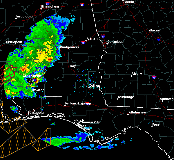 At 153 pm cst, a severe thunderstorm was located over i65 and al 83, or over evergreen, moving northeast at 35 mph (radar indicated). Hazards include 60 mph wind gusts and quarter size hail. Hail damage to vehicles is expected. expect wind damage to roofs, siding, and trees. locations impacted include, evergreen, georgiana, i65 and cr 29, i65 and al 83, i65 and cr 7, i65 and us 84 and i65 and al 106. A tornado watch remains in effect until 900 pm cst for south central alabama. At 153 pm cst, a severe thunderstorm was located over i65 and al 83, or over evergreen, moving northeast at 35 mph (radar indicated). Hazards include 60 mph wind gusts and quarter size hail. Hail damage to vehicles is expected. expect wind damage to roofs, siding, and trees. locations impacted include, evergreen, georgiana, i65 and cr 29, i65 and al 83, i65 and cr 7, i65 and us 84 and i65 and al 106. A tornado watch remains in effect until 900 pm cst for south central alabama.
|
| 2/15/2016 1:33 PM CST |
 At 132 pm cst, a severe thunderstorm was located over i65 and cr 6, or 9 miles southwest of evergreen, moving northeast at 40 mph (radar indicated). Hazards include 60 mph wind gusts and quarter size hail. Hail damage to vehicles is expected. Expect wind damage to roofs, siding, and trees. At 132 pm cst, a severe thunderstorm was located over i65 and cr 6, or 9 miles southwest of evergreen, moving northeast at 40 mph (radar indicated). Hazards include 60 mph wind gusts and quarter size hail. Hail damage to vehicles is expected. Expect wind damage to roofs, siding, and trees.
|
| 1/21/2016 11:46 PM CST | At 1146 pm cst, severe thunderstorms were located along a line extending from 5 miles southeast of evergreen to 6 miles northeast of brewton to 3 miles southeast of riverview to 3 miles west of whitfield, moving east to northeast at 55 mph (radar indicated). Hazards include 60 mph wind gusts. Expect damage to roofs. Siding and trees. |
| 1/21/2016 11:46 PM CST | At 1146 pm cst, severe thunderstorms were located along a line extending from 5 miles southeast of evergreen to 6 miles northeast of brewton to 3 miles southeast of riverview to 3 miles west of whitfield, moving east to northeast at 55 mph (radar indicated). Hazards include 60 mph wind gusts. Expect damage to roofs. Siding and trees. |
| 1/21/2016 11:39 PM CST | At 1139 pm cst, severe thunderstorms were located along a line extending from i65 and al 83 to 3 miles northeast of castleberry to 6 miles north of brewton to near riverview, moving northeast at 100 mph (radar indicated). Hazards include 60 mph wind gusts. Expect damage to roofs. siding and trees. locations impacted include, brewton, evergreen, east brewton, castleberry, i65 and us 84 and i65 and al 83. A tornado watch remains in effect until 300 am cst for south central alabama. |
| 1/21/2016 11:24 PM CST | At 1124 pm cst, severe thunderstorms were located along a line extending from 3 miles south of repton to 4 miles southeast of i65 and al 41 to century to 5 miles northwest of molino, moving northeast at 60 mph (radar indicated). Hazards include 60 mph wind gusts. Expect damage to roofs. siding and trees. locations impacted include, brewton, evergreen, east brewton, century, castleberry, i65 and al 41, i65 and al 83, i65 and cr 6 and i65 and us 84. A tornado watch remains in effect until 300 am cst for south central alabama. |
| 1/21/2016 11:05 PM CST | At 1105 pm cst, severe thunderstorms were located along a line extending from 5 miles southeast of uriah to 5 miles east of i65 and al 21 to 12 miles northwest of molino to 7 miles east of loxley, moving northeast at 60 mph (radar indicated). Hazards include 60 mph wind gusts. Expect damage to roofs. Siding and trees. |
| 12/28/2015 9:24 AM CST |
 At 922 am cst, a severe thunderstorm was located just southeast of castleberry, or 11 miles south of evergreen, moving north at 45 mph (radar indicated). Hazards include 60 mph wind gusts. Expect damage to roofs. siding and trees. locations impacted include, brewton, evergreen, east brewton, castleberry, riverview, pollard and i65 and us 84. A tornado watch remains in effect until noon cst for south central alabama. At 922 am cst, a severe thunderstorm was located just southeast of castleberry, or 11 miles south of evergreen, moving north at 45 mph (radar indicated). Hazards include 60 mph wind gusts. Expect damage to roofs. siding and trees. locations impacted include, brewton, evergreen, east brewton, castleberry, riverview, pollard and i65 and us 84. A tornado watch remains in effect until noon cst for south central alabama.
|
| 12/28/2015 8:59 AM CST |
 At 859 am cst, a severe thunderstorm capable of producing damaging winds over 60 mph was located near riverview, or near east brewton, and moving north at 45 mph. At 859 am cst, a severe thunderstorm capable of producing damaging winds over 60 mph was located near riverview, or near east brewton, and moving north at 45 mph.
|
| 12/28/2015 8:16 AM CST |
 At 815 am cst, a severe thunderstorm capable of producing a tornado was located near molino, moving north at 50 mph (radar indicated rotation). Hazards include tornado. Flying debris will be dangerous to those caught without shelter. mobile homes will be damaged or destroyed. damage to roofs, windows and vehicles will occur. tree damage is likely. this dangerous storm will be near, century around 825 am cst. flomaton and jay around 830 am cst. pollard around 835 am cst. brewton around 840 am cst. i65 and al 41 around 855 am cst. castleberry and i65 and cr 6 around 900 am cst. i65 and us 84 around 905 am cst. Evergreen and i65 and al 83 around 910 am cst. At 815 am cst, a severe thunderstorm capable of producing a tornado was located near molino, moving north at 50 mph (radar indicated rotation). Hazards include tornado. Flying debris will be dangerous to those caught without shelter. mobile homes will be damaged or destroyed. damage to roofs, windows and vehicles will occur. tree damage is likely. this dangerous storm will be near, century around 825 am cst. flomaton and jay around 830 am cst. pollard around 835 am cst. brewton around 840 am cst. i65 and al 41 around 855 am cst. castleberry and i65 and cr 6 around 900 am cst. i65 and us 84 around 905 am cst. Evergreen and i65 and al 83 around 910 am cst.
|
| 4/25/2015 3:48 PM CDT | At 346 pm cdt, a line of severe thunderstorms capable of producing quarter size hail and damaging winds over 60 mph was located along a line extending from near i65 and cr 29 to 6 miles south of castleberry to jay, and moving east at 20 mph. |
| 4/25/2015 3:48 PM CDT | At 346 pm cdt, a line of severe thunderstorms capable of producing quarter size hail and damaging winds over 60 mph was located along a line extending from near i65 and cr 29 to 6 miles south of castleberry to jay, and moving east at 20 mph. |
| 6/28/2013 2:05 PM CDT | Trees down along hwy 2 in conecuh county AL, 5 miles N of Evergreen, AL |
| 6/17/2013 4:45 PM CDT | State trooper reported multiple trees and limbs down in the lyeffion area. time estimate in conecuh county AL, 7.5 miles SSE of Evergreen, AL |
| 6/14/2012 6:42 PM CDT | The evergreen middleton field asos recorded a 59 mph wind gust at 642 pm cd in conecuh county AL, 4.5 miles ENE of Evergreen, AL |
| 1/1/0001 12:00 AM | Ema director reports numerous trees down and power outages across the count in conecuh county AL, 0.9 miles WNW of Evergreen, AL |
| 1/1/0001 12:00 AM | Trees and power lines down in conecuh county AL, 0.9 miles WNW of Evergreen, AL |
Hail Maps for Evergreen, AL
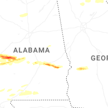
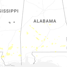
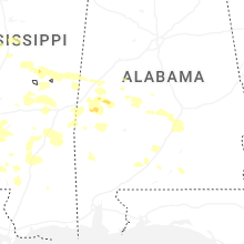


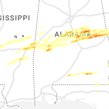


Connect with Interactive Hail Maps