

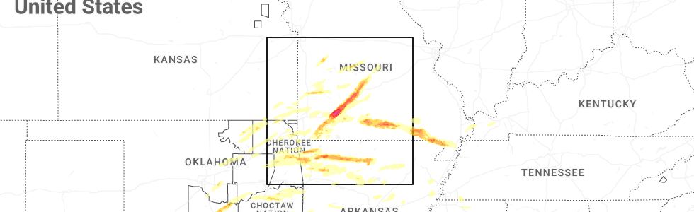
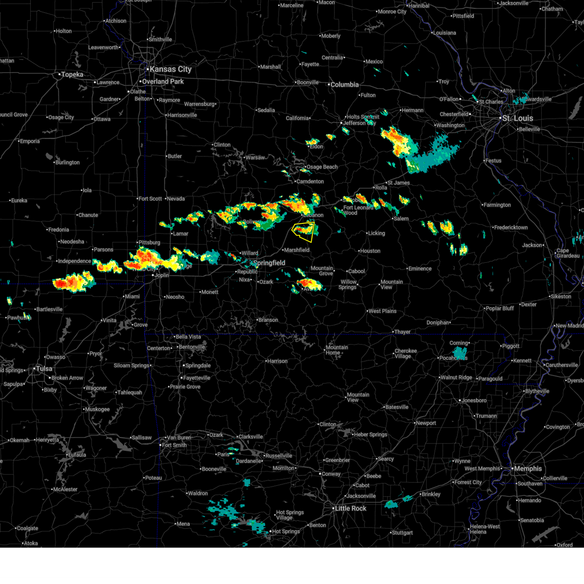
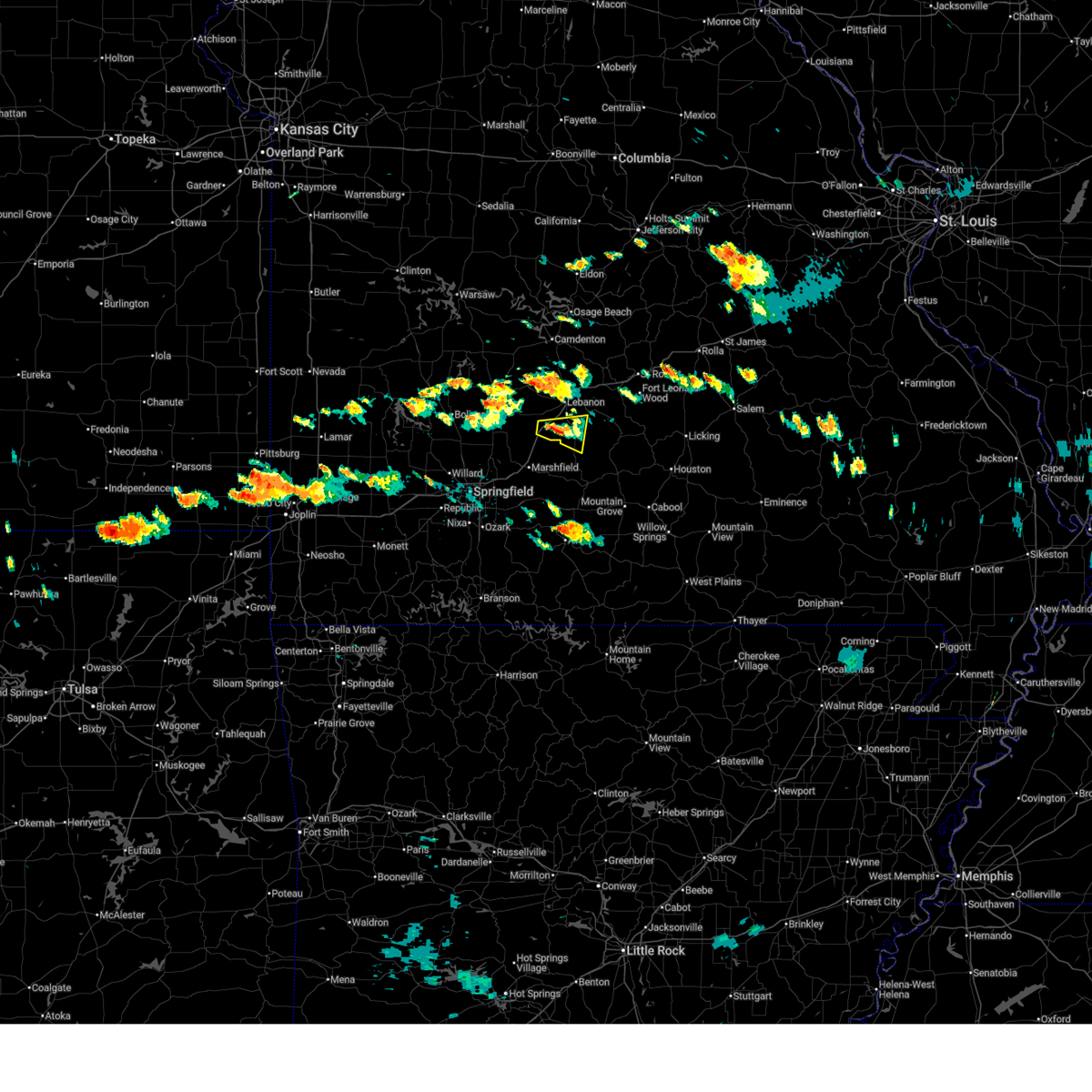
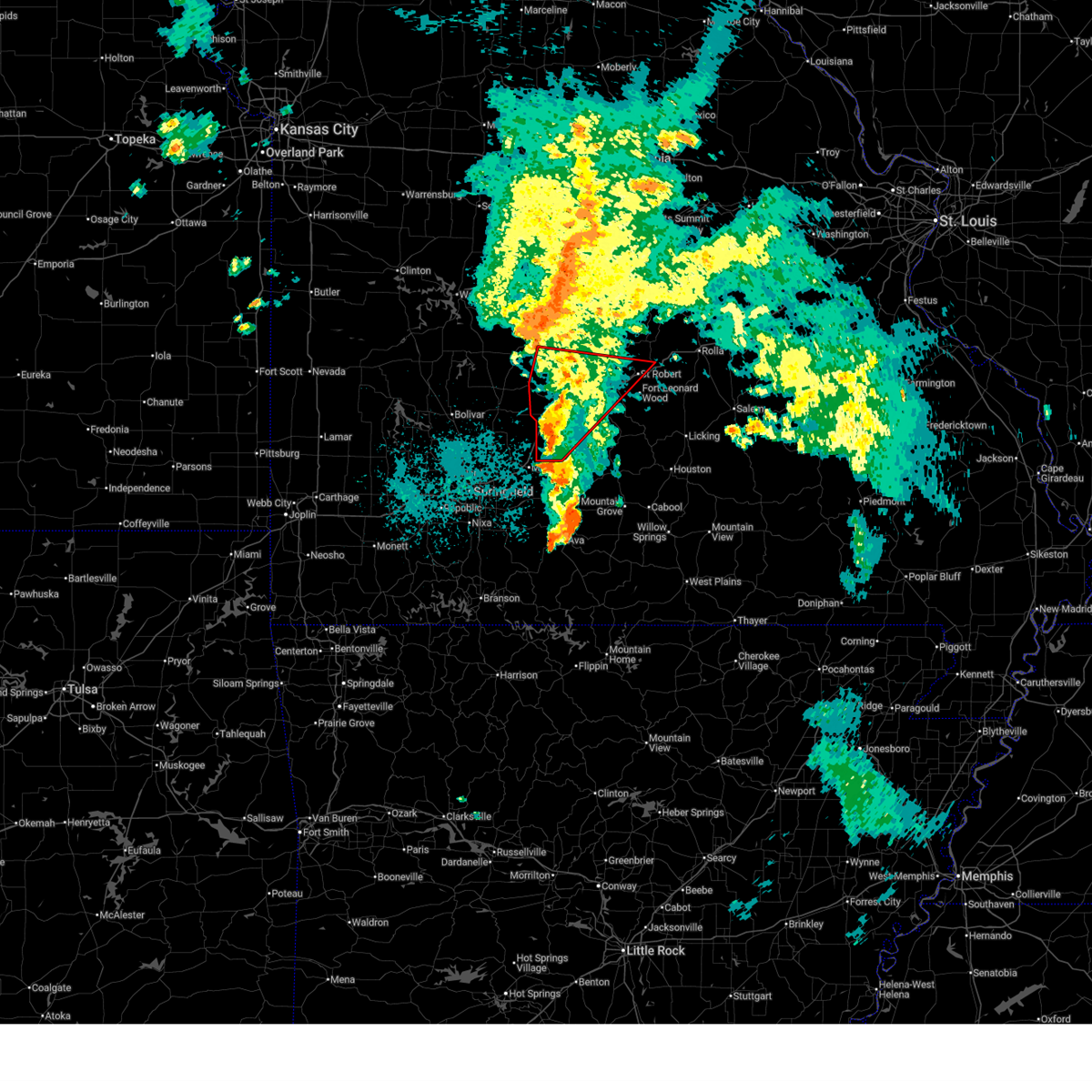
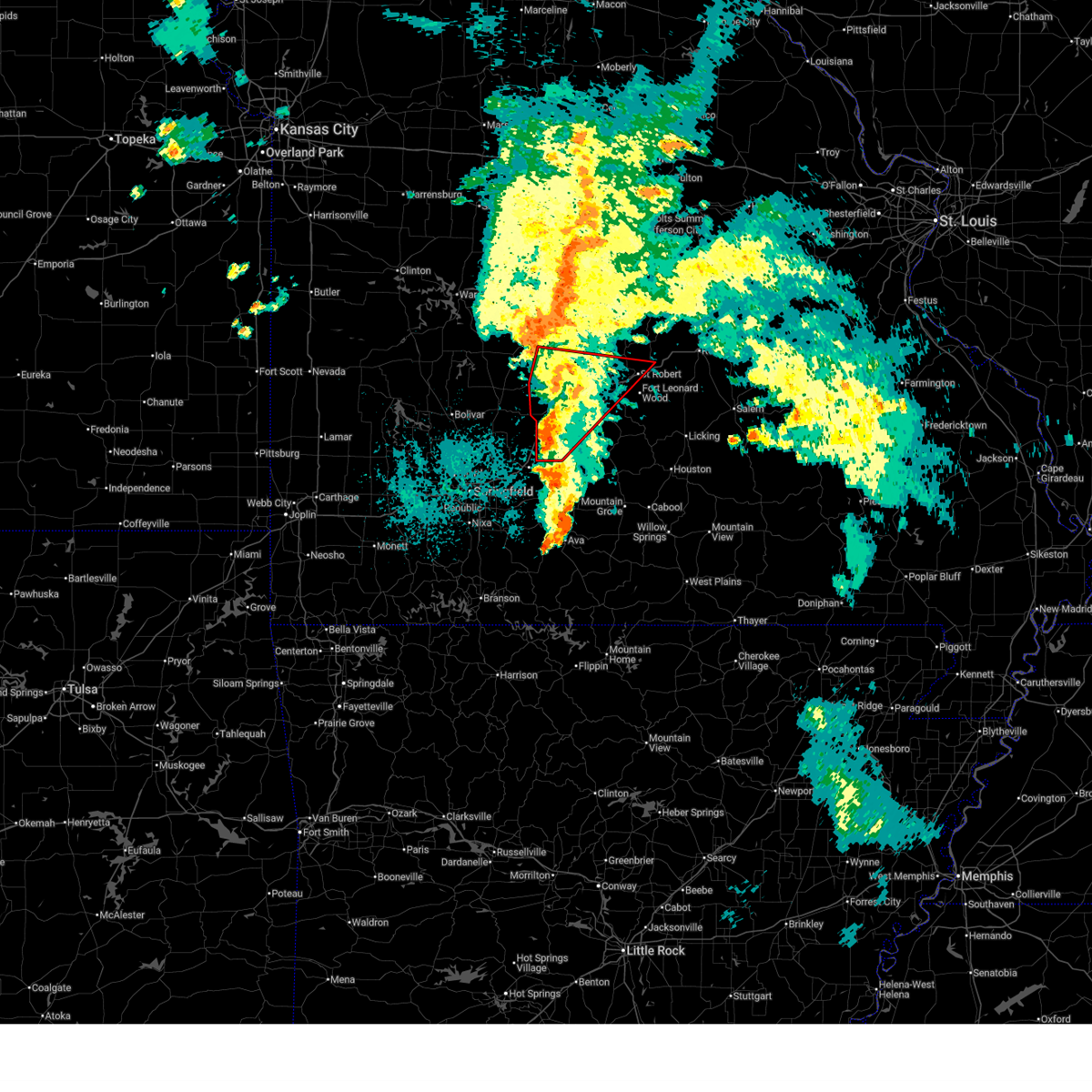
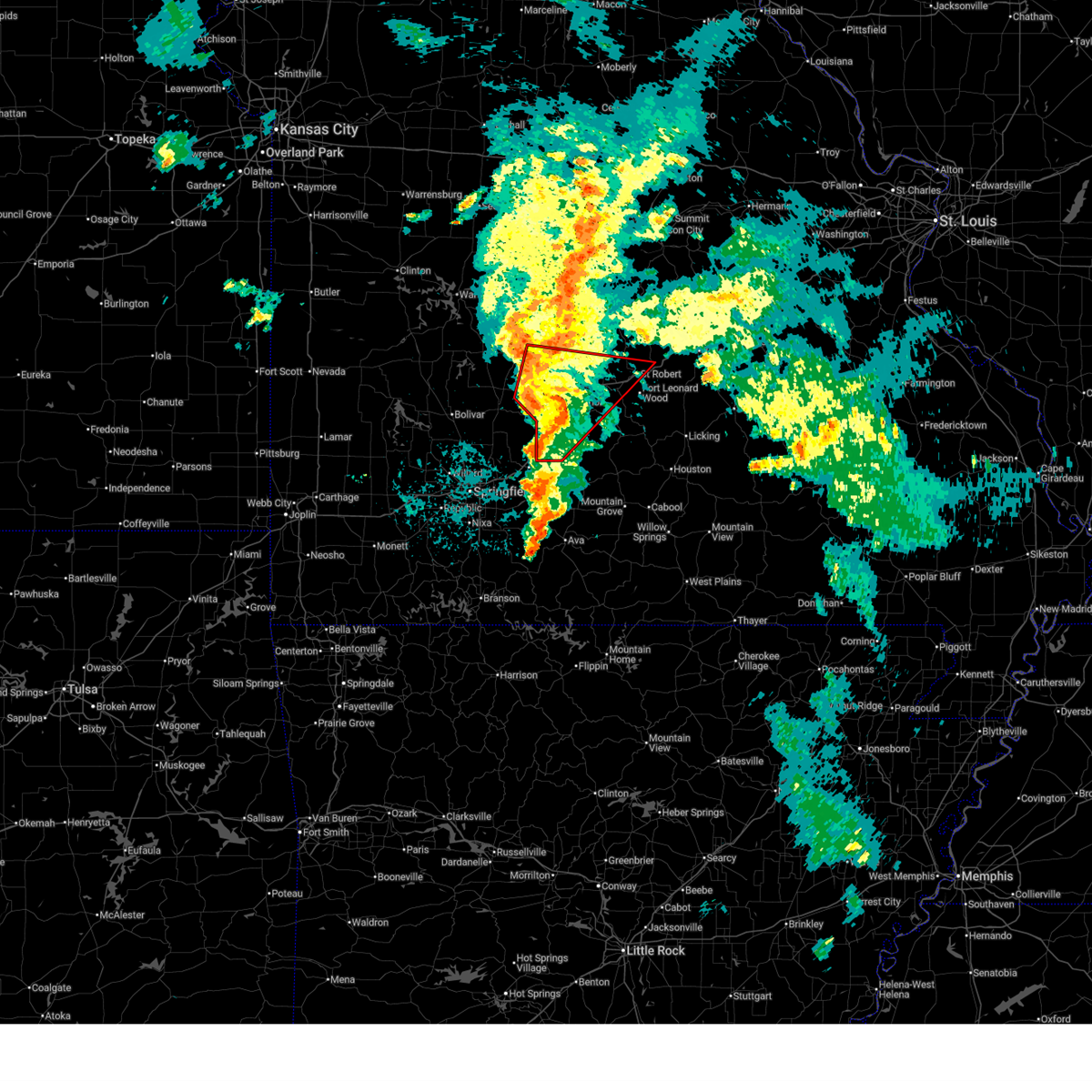
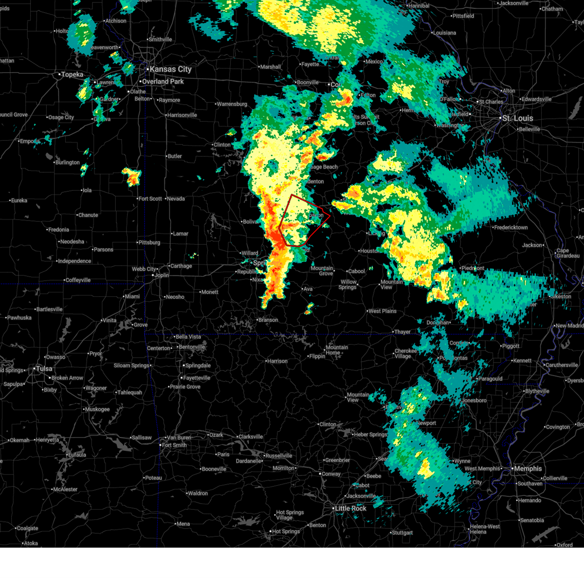
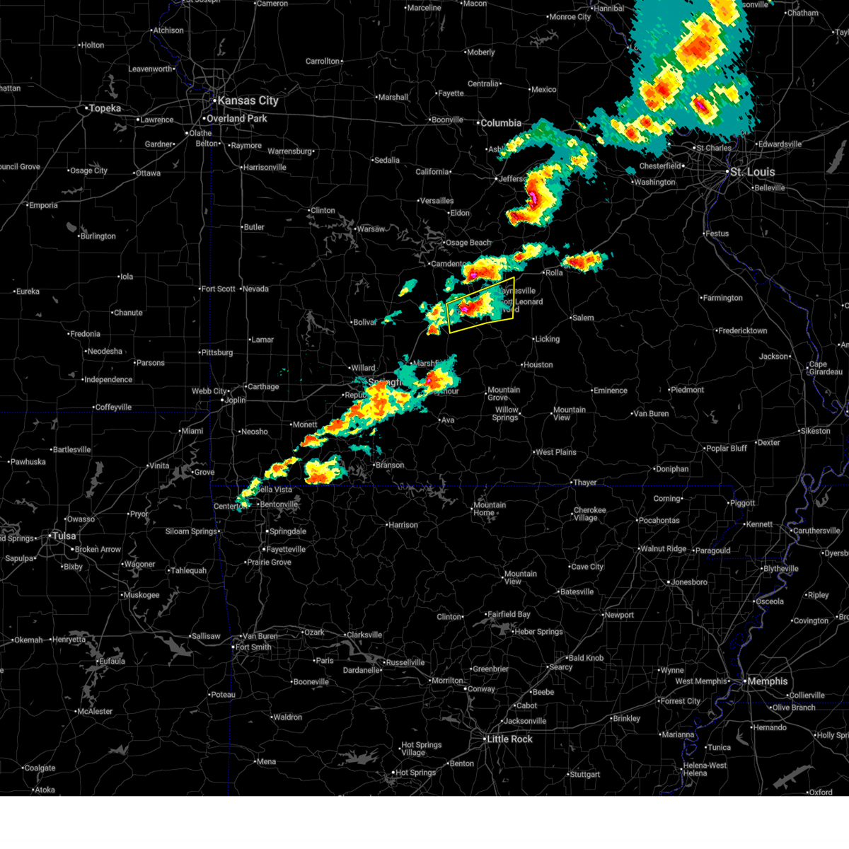
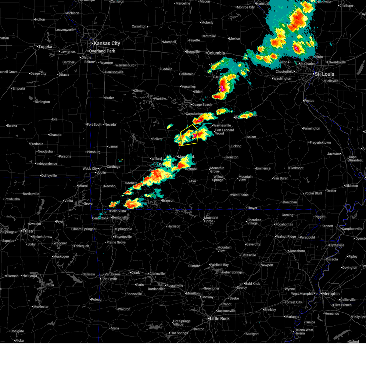
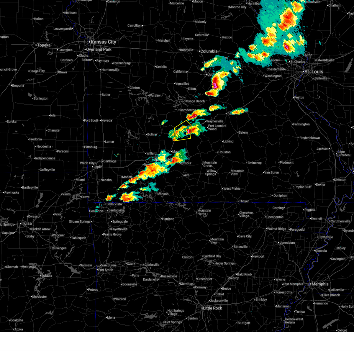
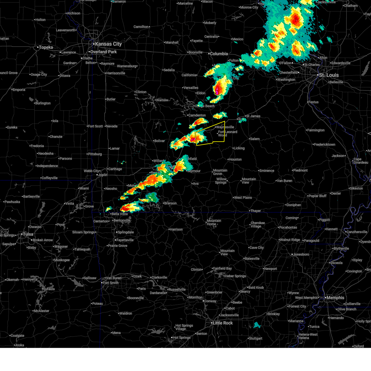
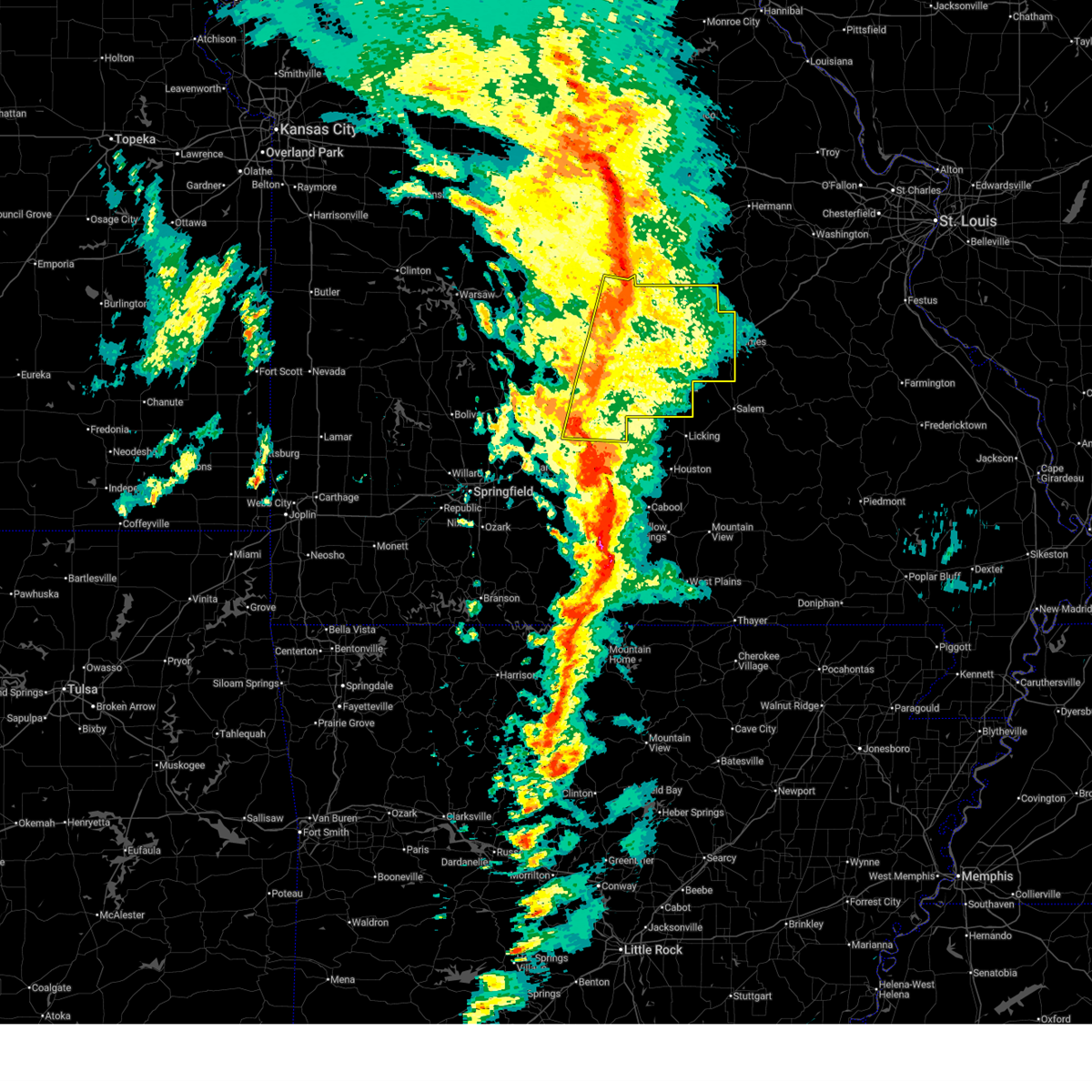
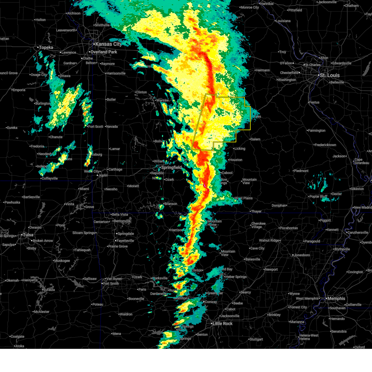
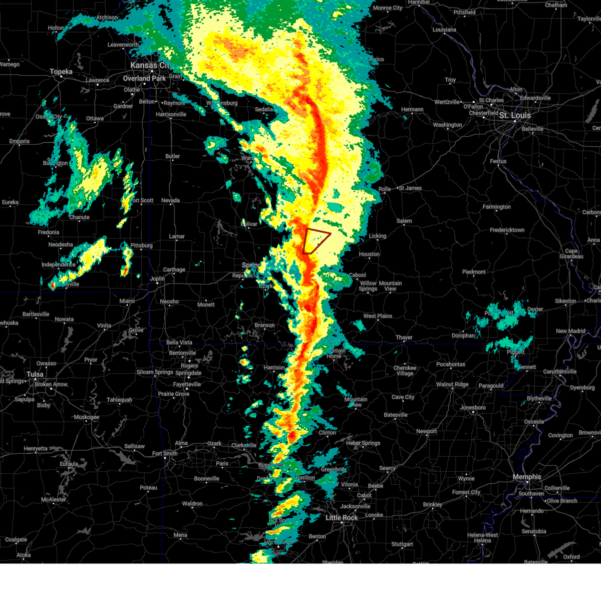
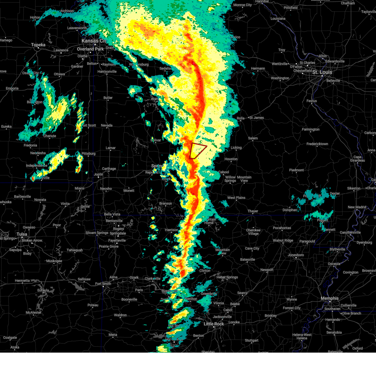
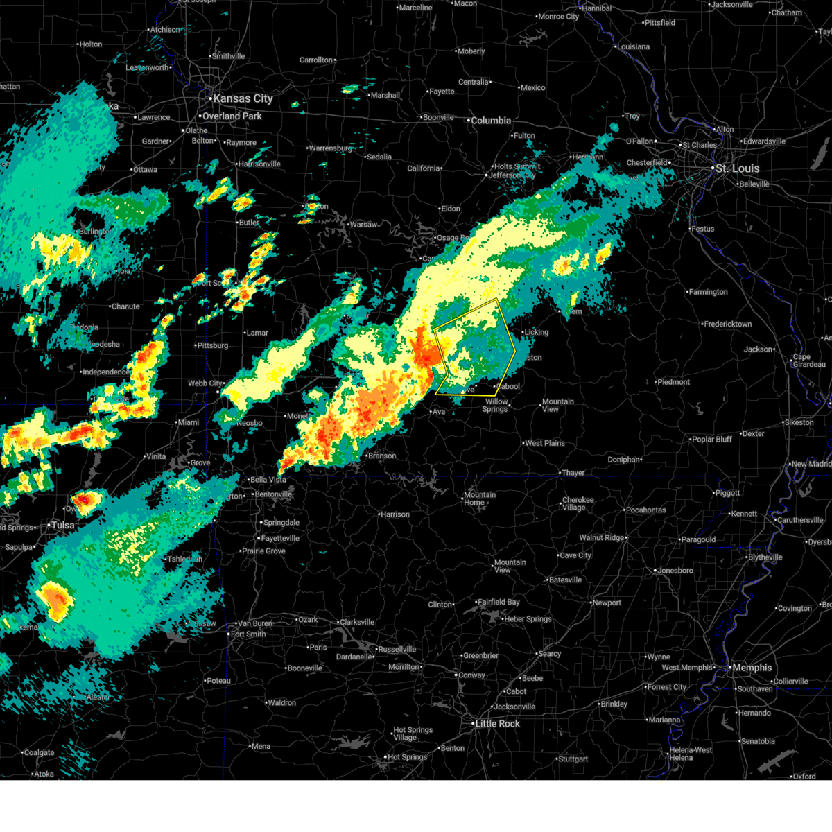
Hail Map for Evergreen, MO
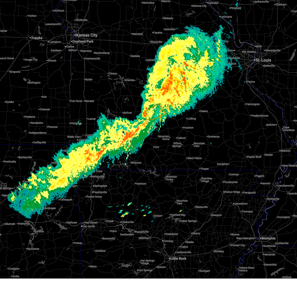
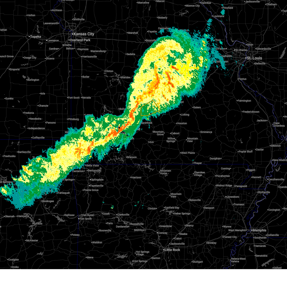
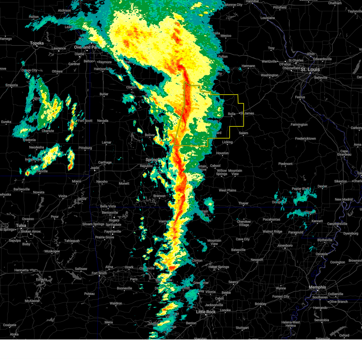
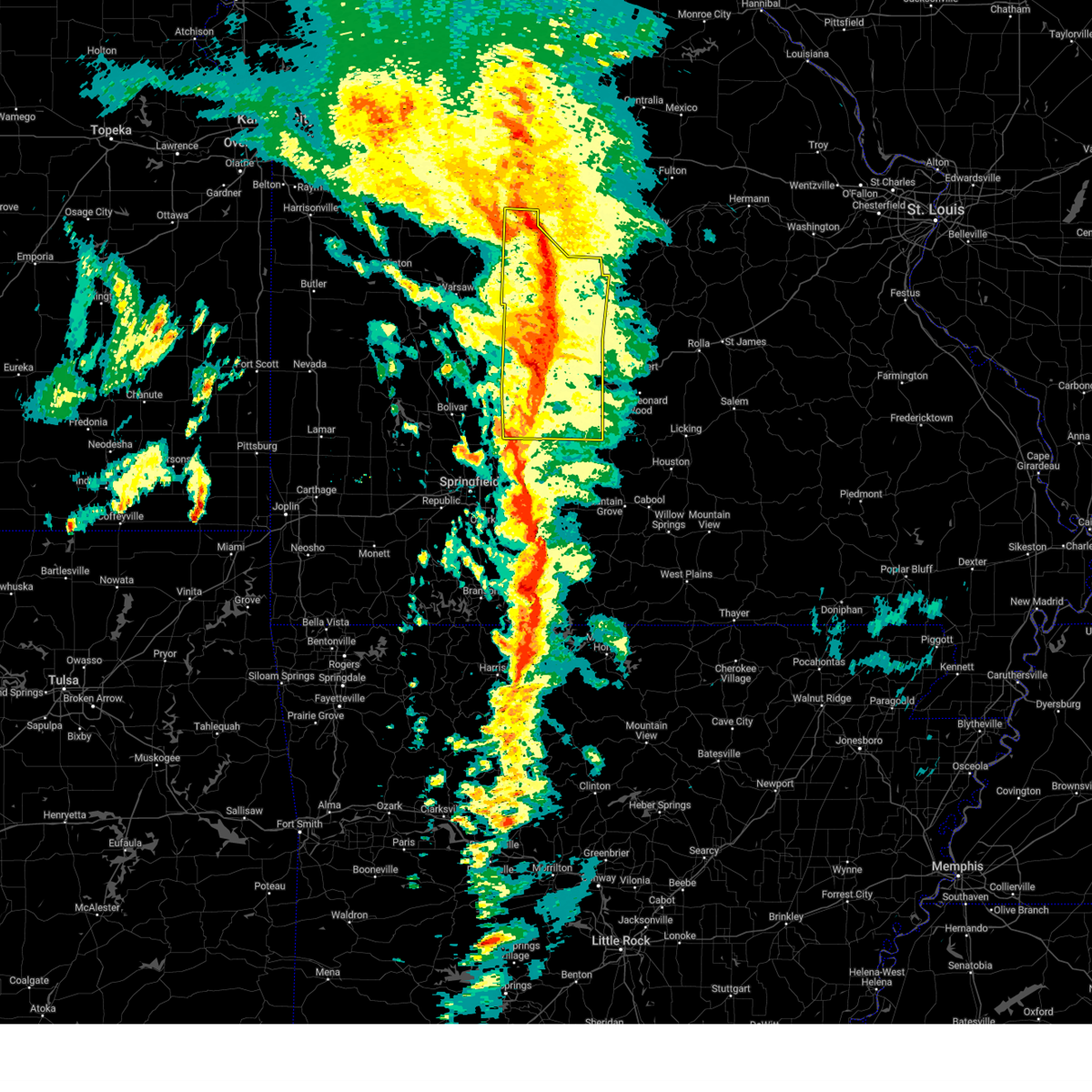
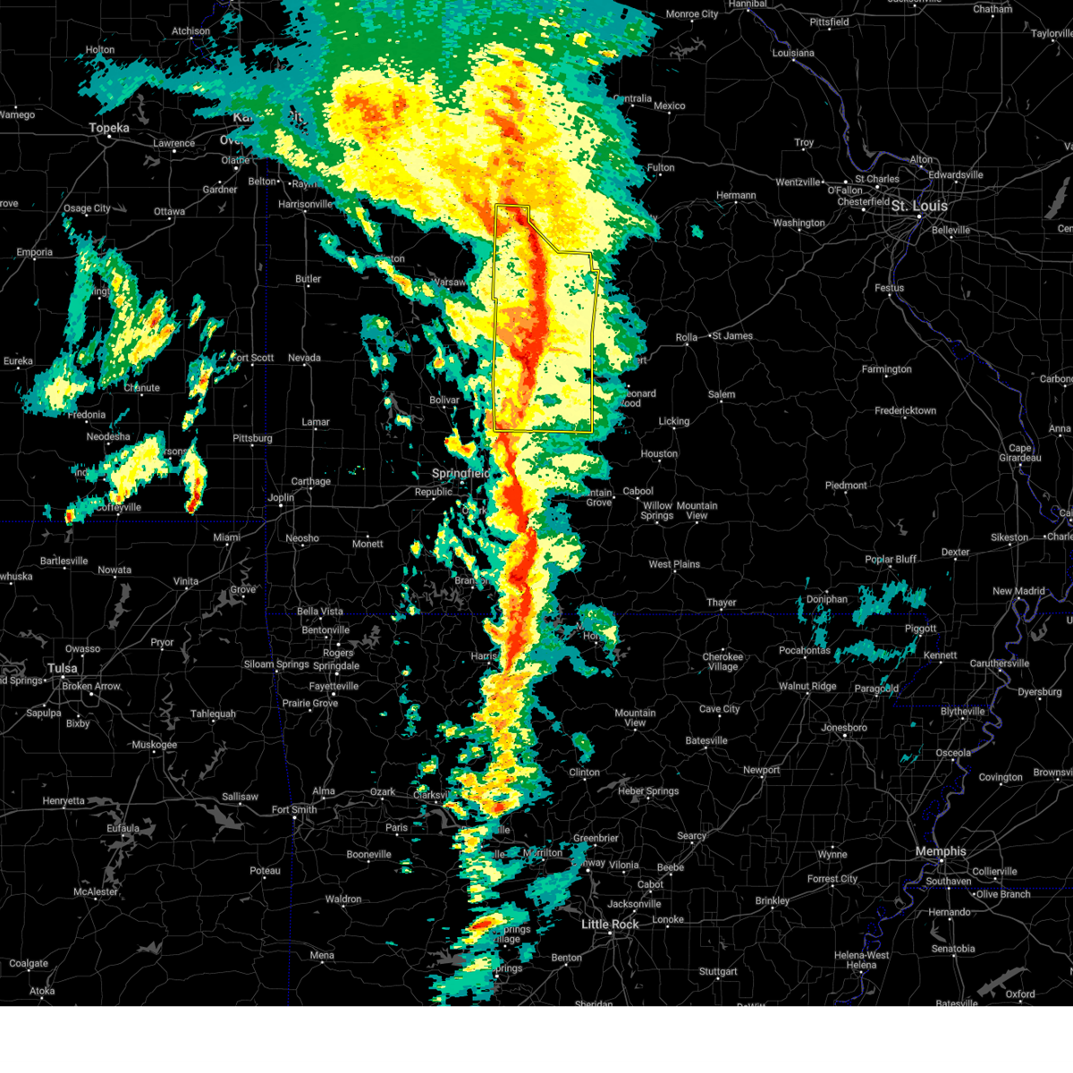
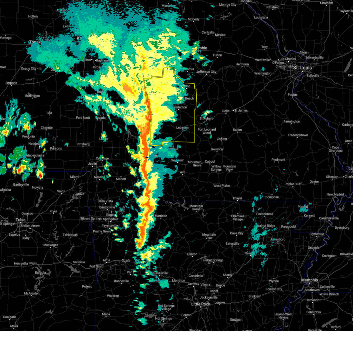
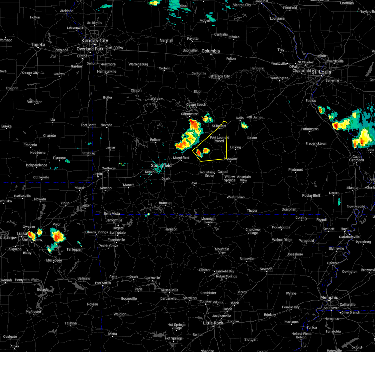
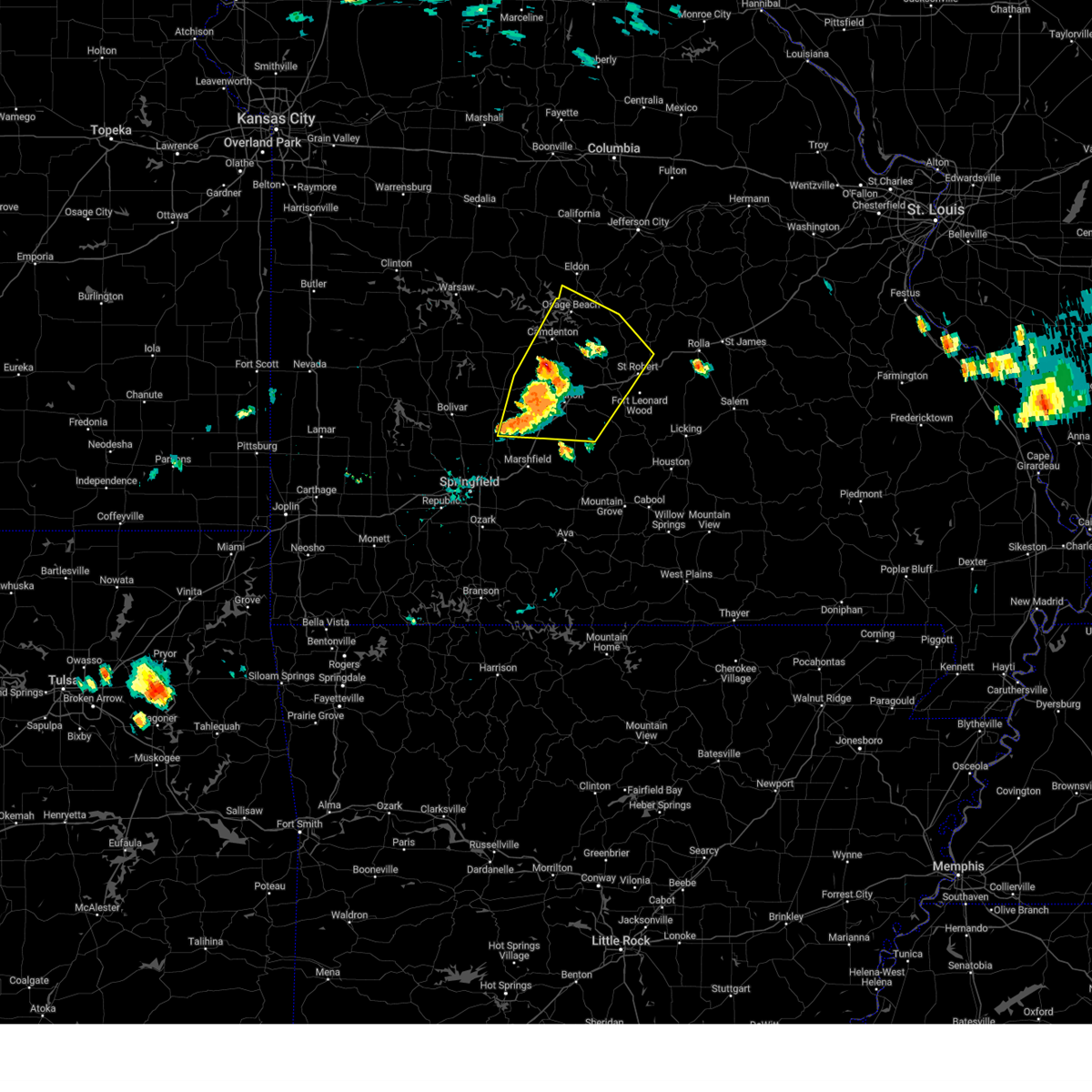
The Evergreen, MO area has had 15 reports of on-the-ground hail by trained spotters, and has been under severe weather warnings 32 times during the past 12 months. Doppler radar has detected hail at or near Evergreen, MO on 80 occasions, including 5 occasions during the past year.
| Name: | Evergreen, MO |
| Where Located: | 45.4 miles ENE of Springfield, MO |
| Map: | Google Map for Evergreen, MO |
| Population: | 28 |
| Housing Units: | 13 |
| More Info: | Search Google for Evergreen, MO |
1
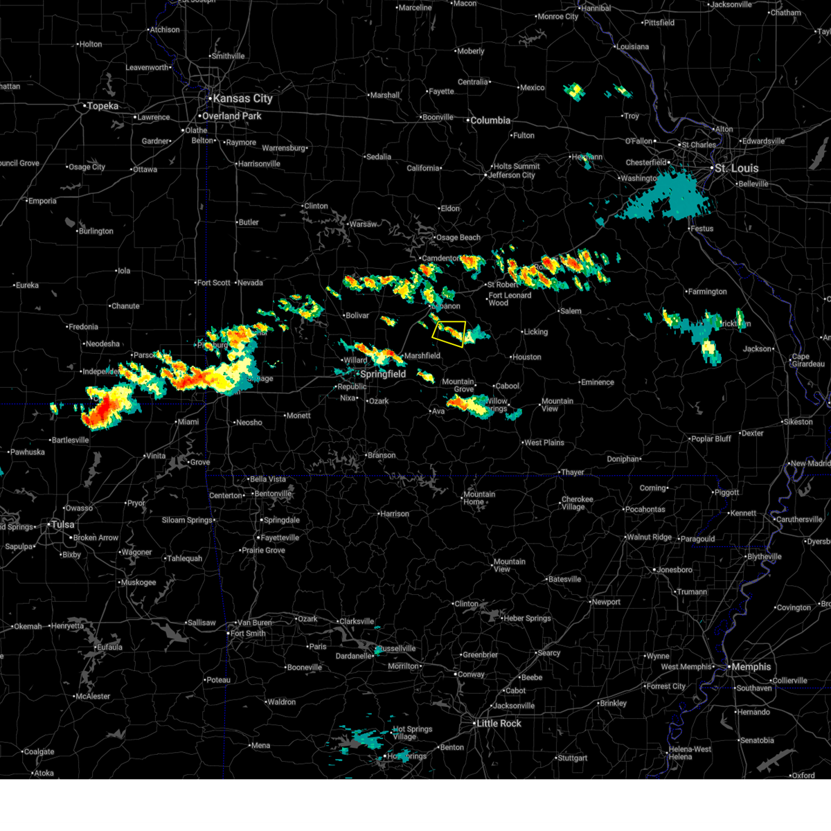
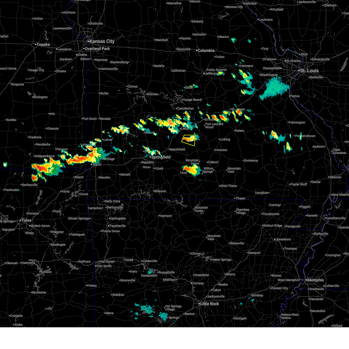
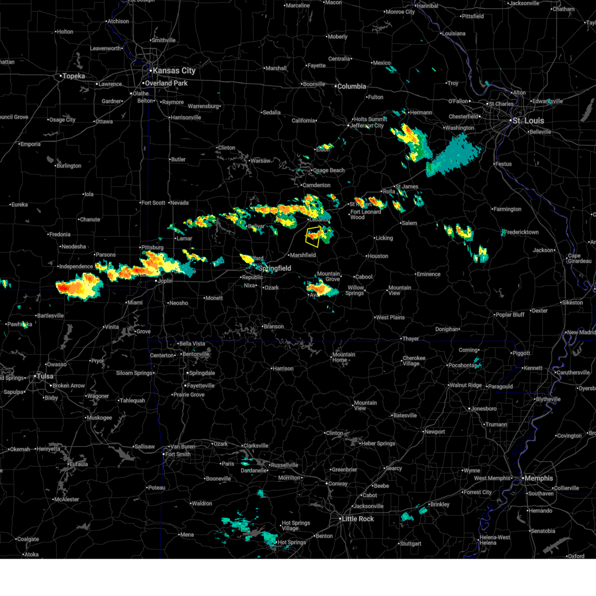
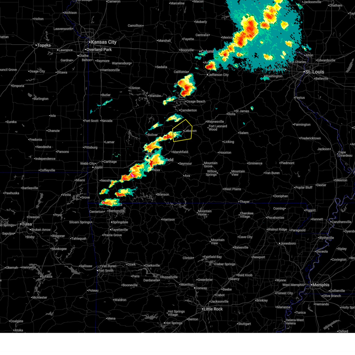
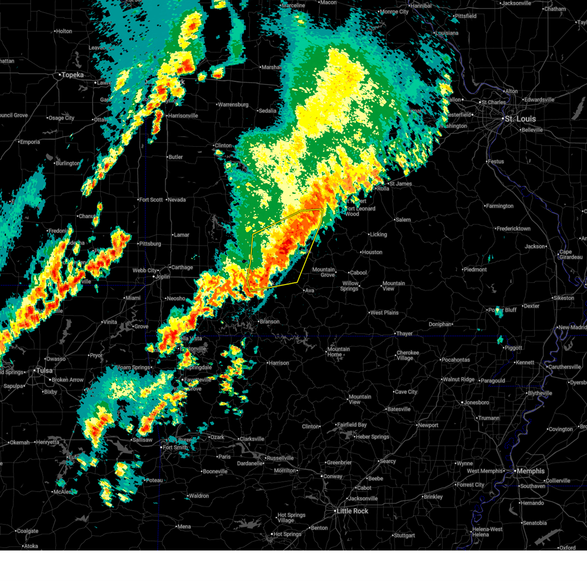
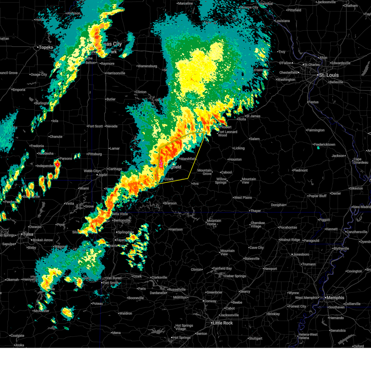
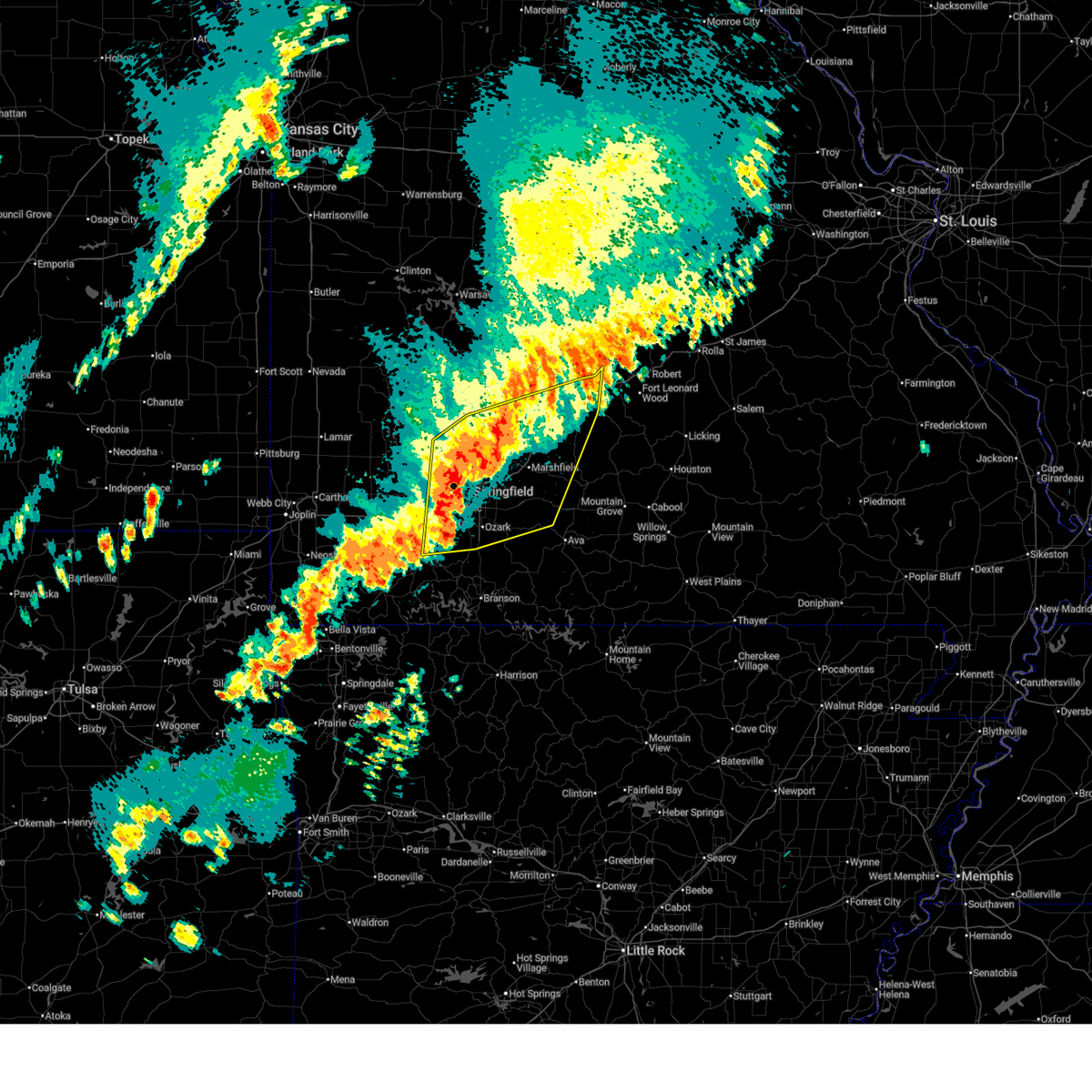
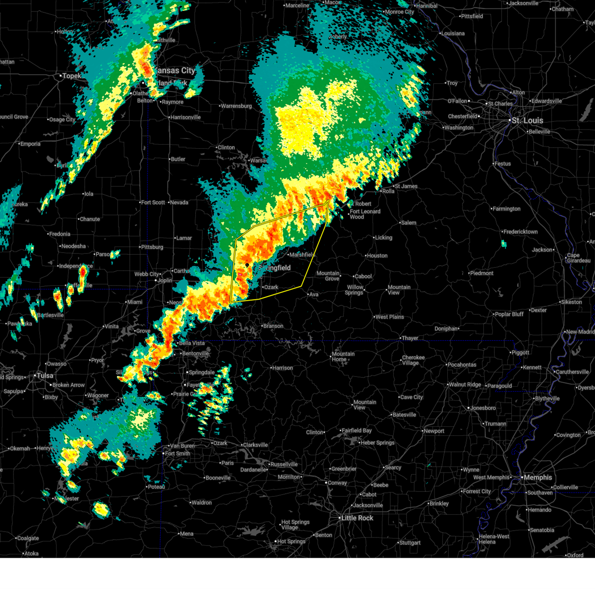
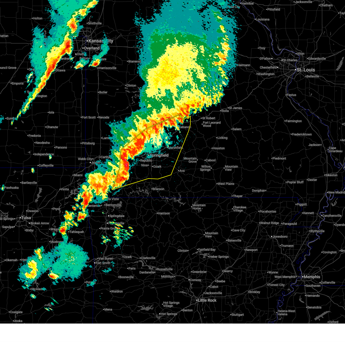
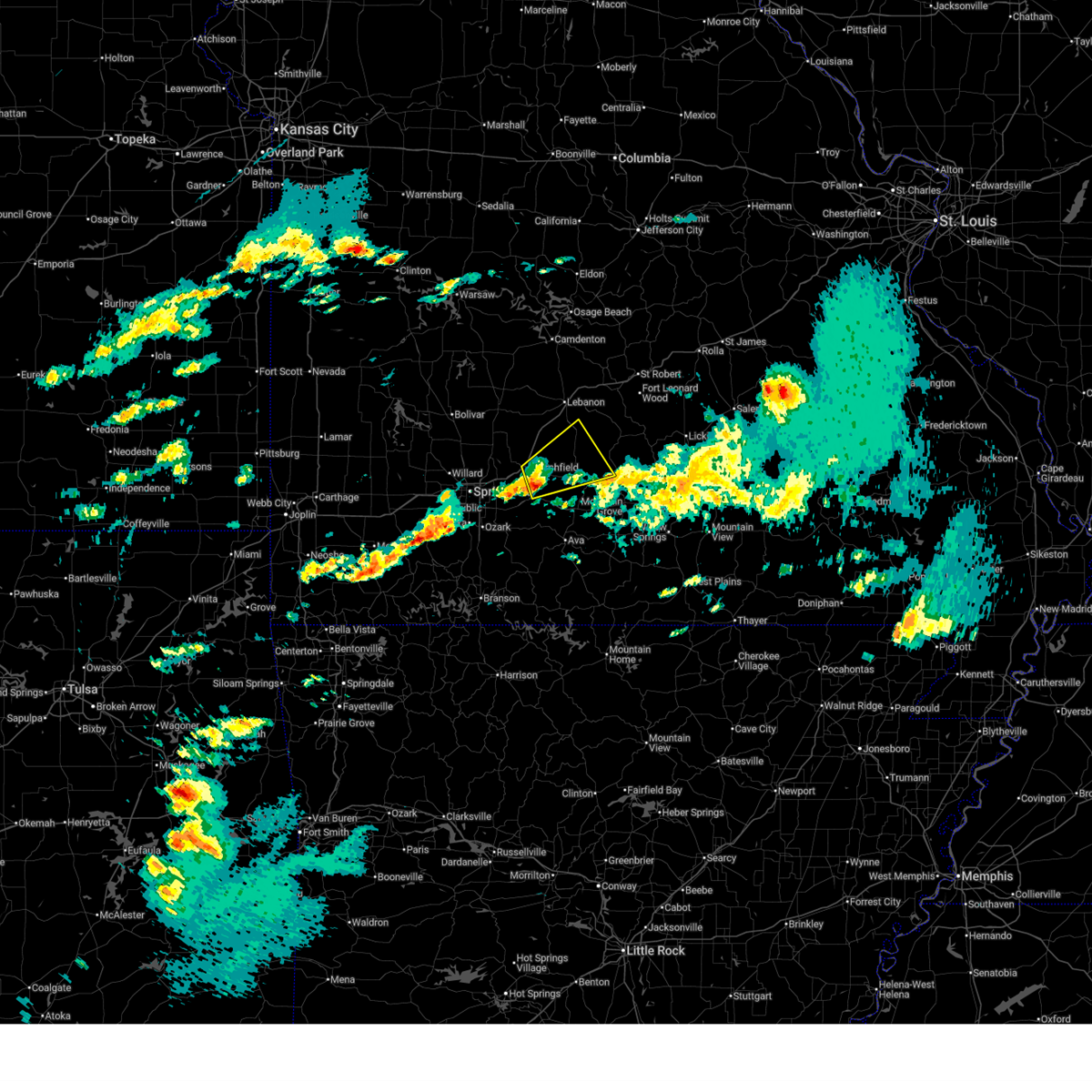
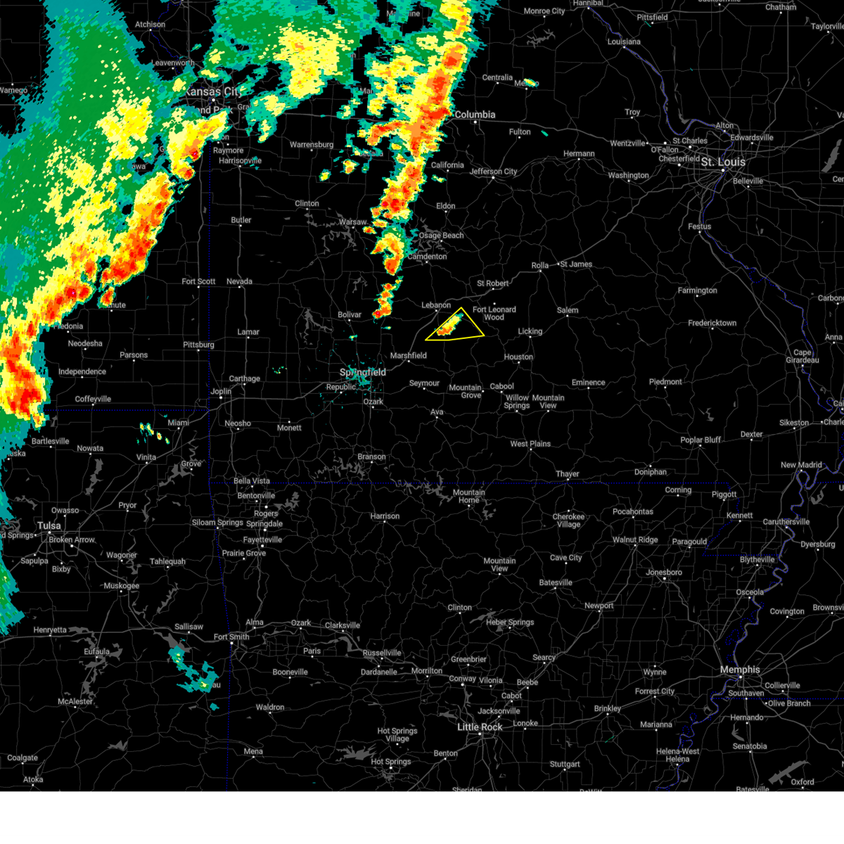
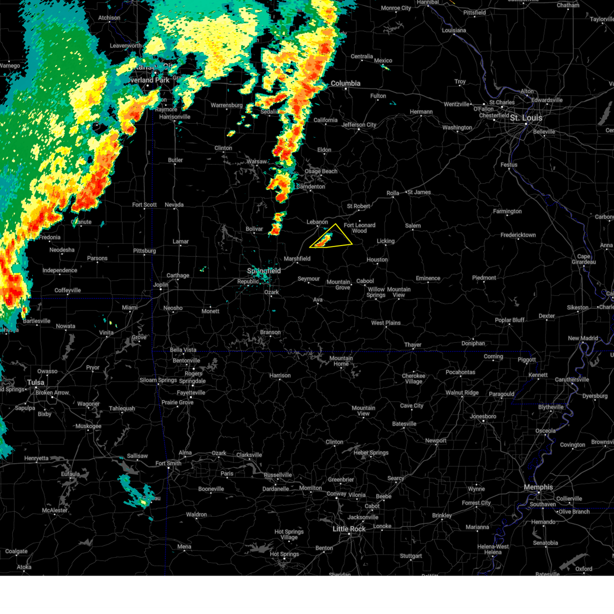
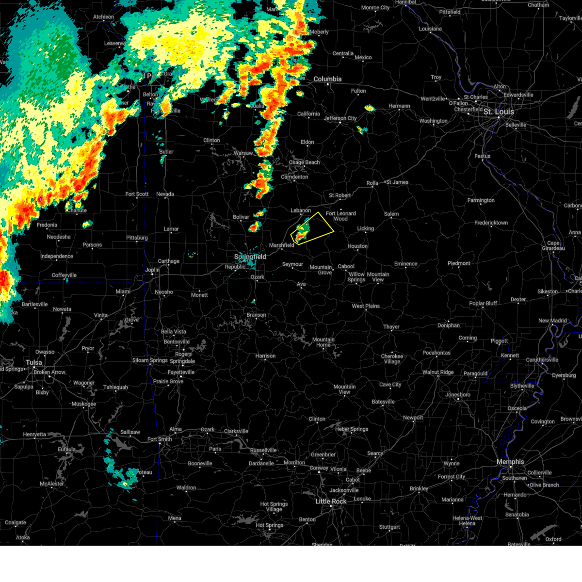
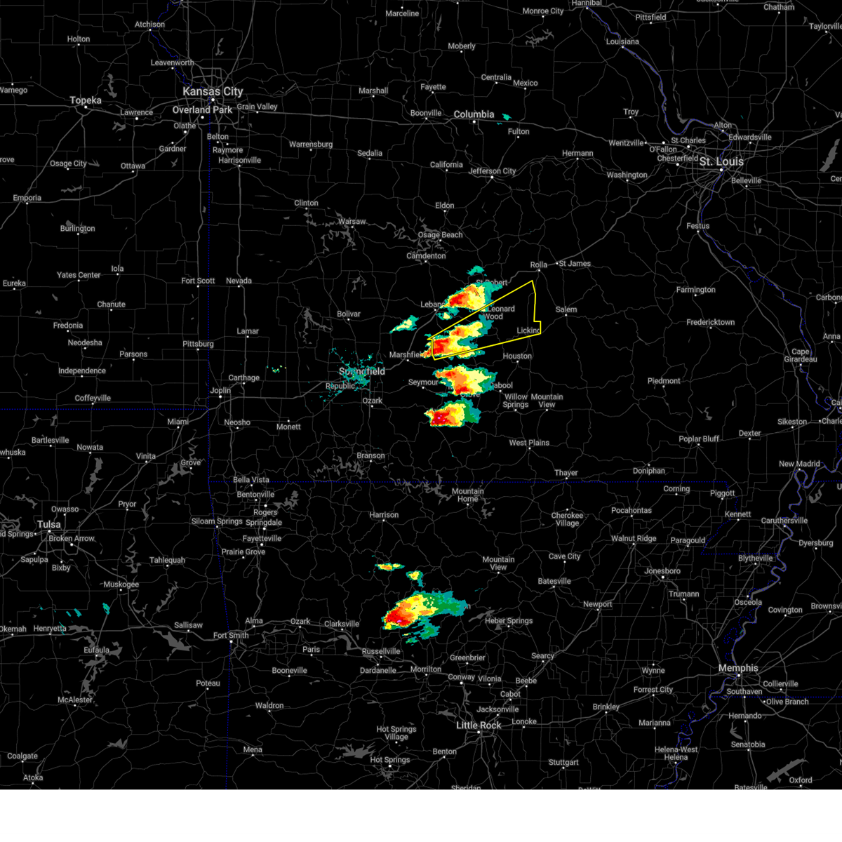
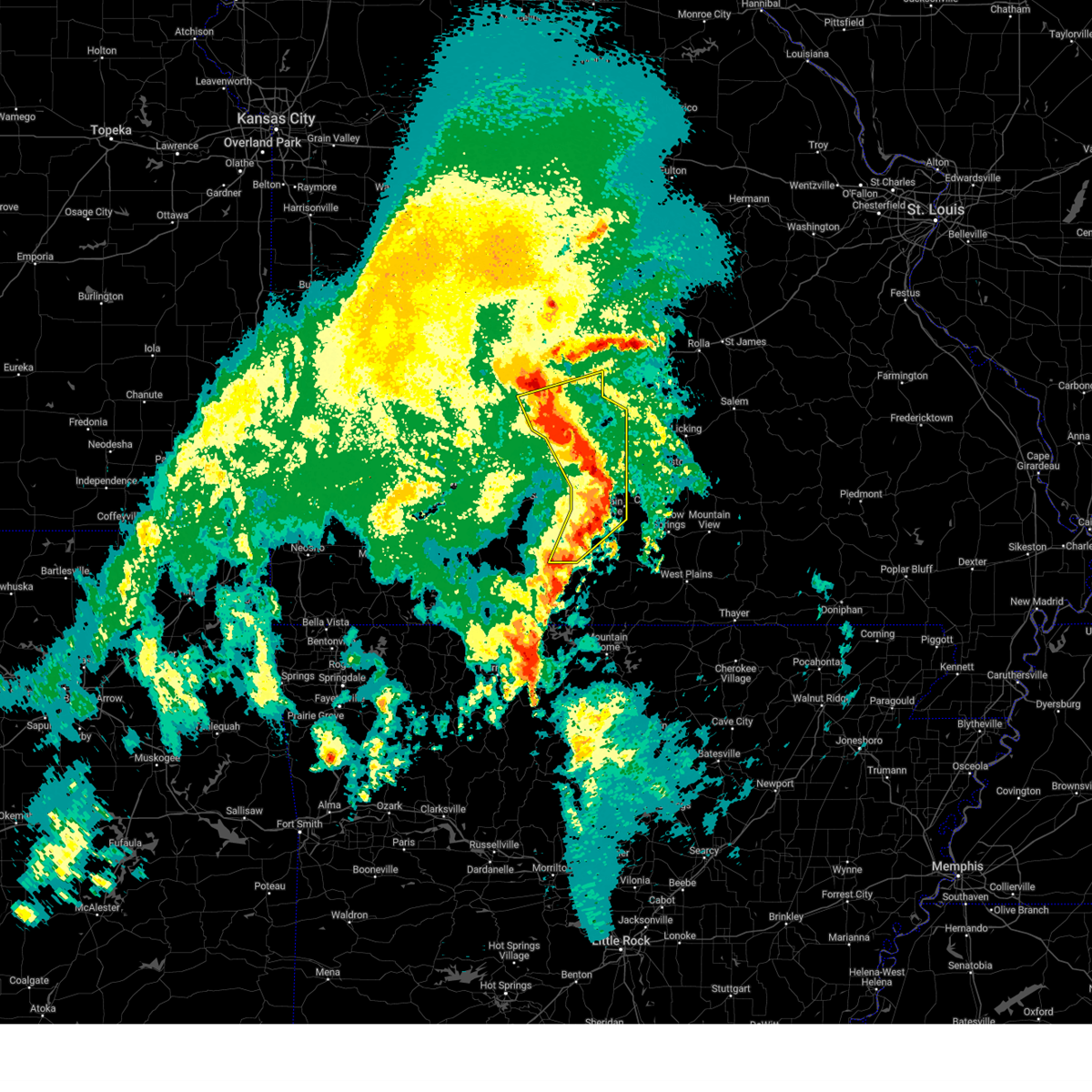
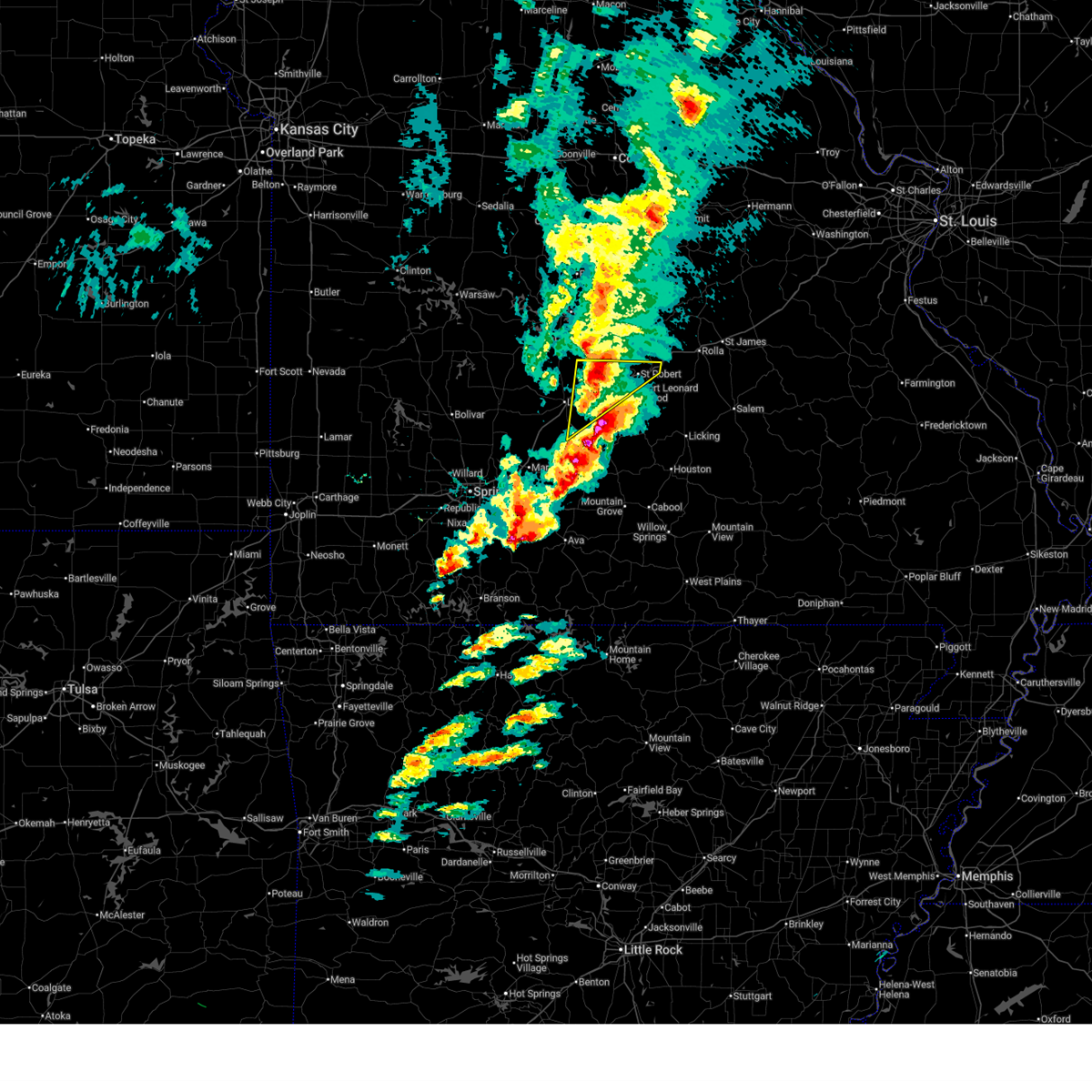
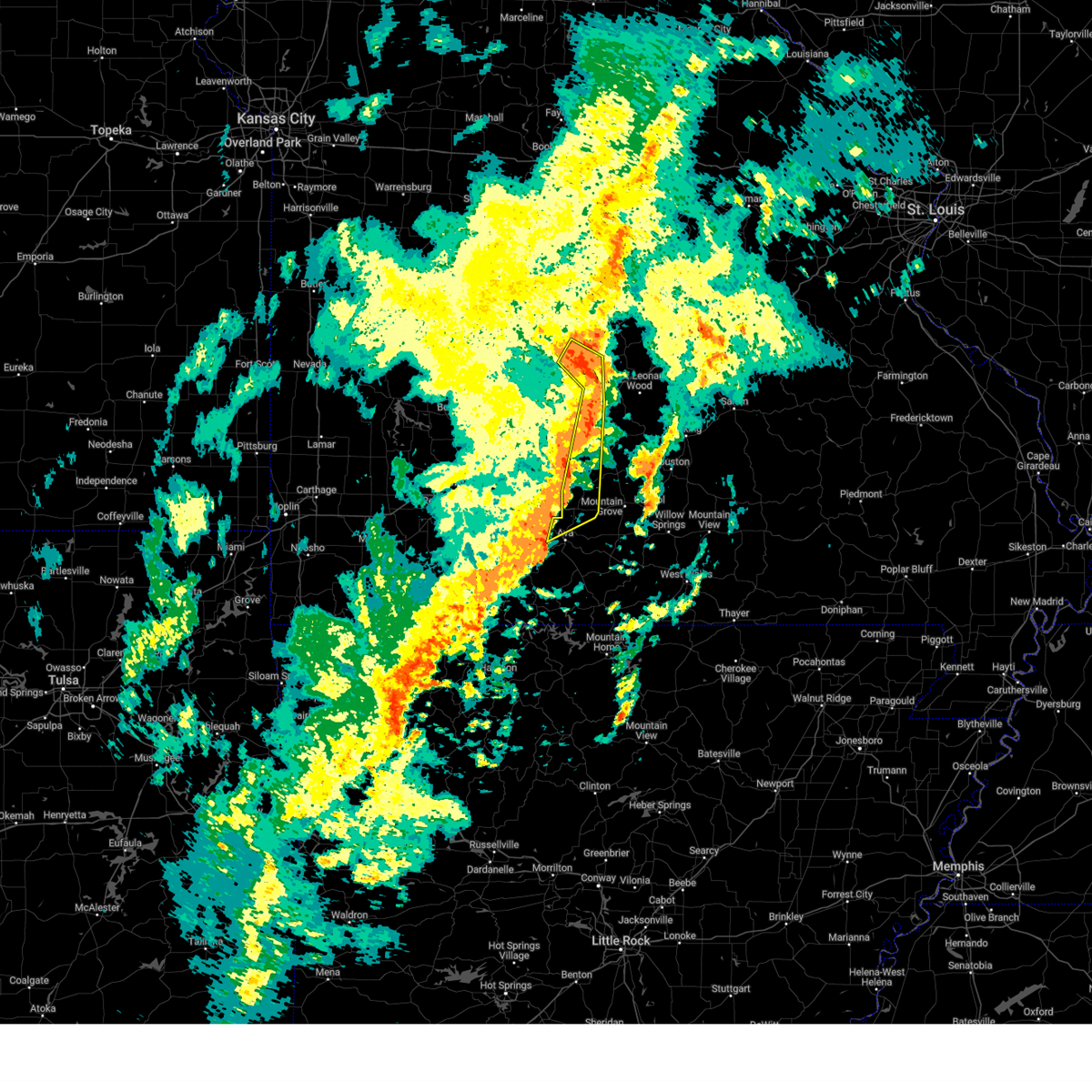
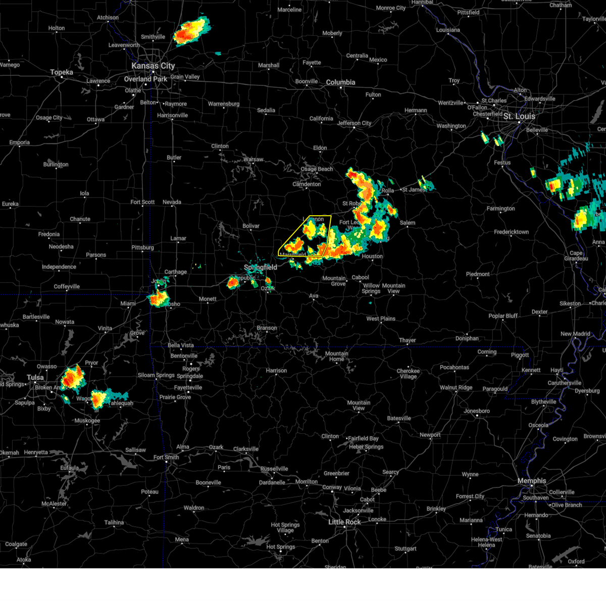
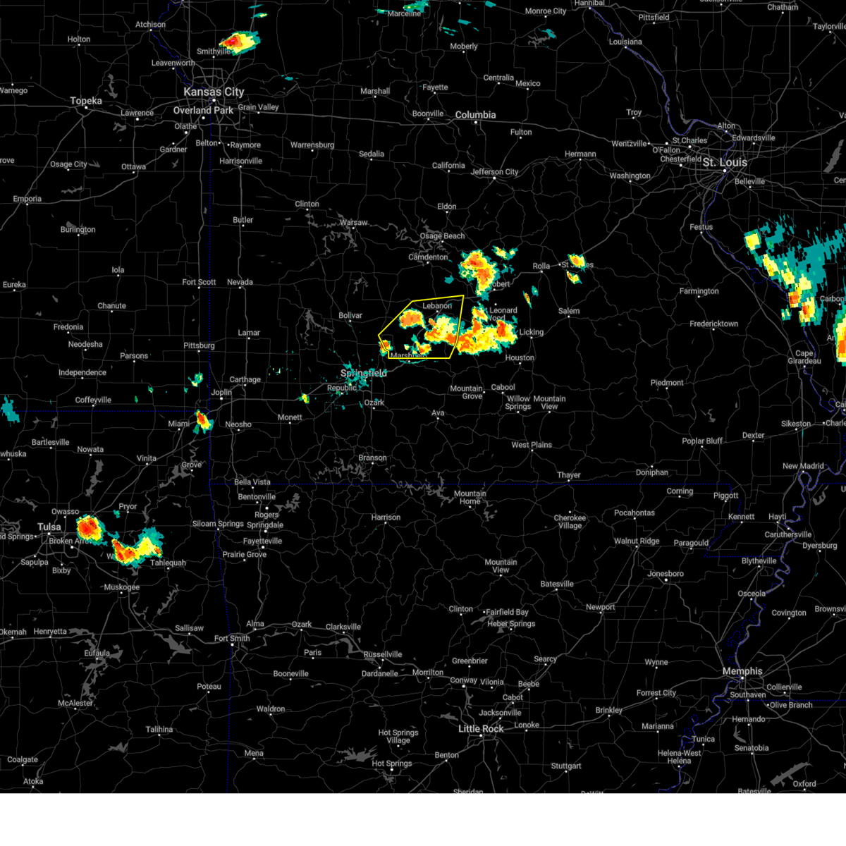
The Top Recent Hail Date for Evergreen, MO is Tuesday, April 28, 2026 (27th out of 80)
Hail and Wind Damage Spotted near Evergreen, MO
| Date / Time | Report Details |
|---|---|
| 6/26/2026 6:57 PM CDT |
 the severe thunderstorm warning has been cancelled and is no longer in effect the severe thunderstorm warning has been cancelled and is no longer in effect
|
| 6/26/2026 6:30 PM CDT |
 Svrsgf the national weather service in springfield has issued a * severe thunderstorm warning for, north central wright county in southwestern missouri, southeastern laclede county in southwestern missouri, * until 715 pm cdt. * at 630 pm cdt, a severe thunderstorm was located 12 miles south of lebanon, moving east at 20 mph (radar indicated). Hazards include 60 mph wind gusts. expect damage to roofs, siding, and trees Svrsgf the national weather service in springfield has issued a * severe thunderstorm warning for, north central wright county in southwestern missouri, southeastern laclede county in southwestern missouri, * until 715 pm cdt. * at 630 pm cdt, a severe thunderstorm was located 12 miles south of lebanon, moving east at 20 mph (radar indicated). Hazards include 60 mph wind gusts. expect damage to roofs, siding, and trees
|
| 6/26/2026 6:15 PM CDT |
 At 615 pm cdt, a severe thunderstorm was located 10 miles east of conway, or 11 miles south of lebanon, moving east at 30 mph (radar indicated). Hazards include 60 mph wind gusts. Expect damage to roofs, siding, and trees. Locations impacted include, morgan and twin bridges. At 615 pm cdt, a severe thunderstorm was located 10 miles east of conway, or 11 miles south of lebanon, moving east at 30 mph (radar indicated). Hazards include 60 mph wind gusts. Expect damage to roofs, siding, and trees. Locations impacted include, morgan and twin bridges.
|
| 6/26/2026 5:54 PM CDT |
 At 554 pm cdt, a severe thunderstorm was located near conway, or 10 miles southwest of lebanon, moving east at 25 mph (radar indicated). Hazards include 60 mph wind gusts. Expect damage to roofs, siding, and trees. locations impacted include, morgan and twin bridges. This includes interstate 44 between mile markers 118 and 120. At 554 pm cdt, a severe thunderstorm was located near conway, or 10 miles southwest of lebanon, moving east at 25 mph (radar indicated). Hazards include 60 mph wind gusts. Expect damage to roofs, siding, and trees. locations impacted include, morgan and twin bridges. This includes interstate 44 between mile markers 118 and 120.
|
| 6/26/2026 5:46 PM CDT |
 Svrsgf the national weather service in springfield has issued a * severe thunderstorm warning for, northwestern wright county in southwestern missouri, southwestern laclede county in southwestern missouri, * until 630 pm cdt. * at 545 pm cdt, a severe thunderstorm was located near conway, or 10 miles southwest of lebanon, moving east at 20 mph (radar indicated). Hazards include 60 mph wind gusts. expect damage to roofs, siding, and trees Svrsgf the national weather service in springfield has issued a * severe thunderstorm warning for, northwestern wright county in southwestern missouri, southwestern laclede county in southwestern missouri, * until 630 pm cdt. * at 545 pm cdt, a severe thunderstorm was located near conway, or 10 miles southwest of lebanon, moving east at 20 mph (radar indicated). Hazards include 60 mph wind gusts. expect damage to roofs, siding, and trees
|
| 6/21/2026 10:50 AM CDT |
 The storms which prompted the warning have weakened below severe limits, and no longer pose an immediate threat to life or property. therefore, the warning will be allowed to expire. The storms which prompted the warning have weakened below severe limits, and no longer pose an immediate threat to life or property. therefore, the warning will be allowed to expire.
|
| 6/21/2026 10:35 AM CDT |
 Svrsgf the national weather service in springfield has issued a * severe thunderstorm warning for, southern laclede county in southwestern missouri, * until 1100 am cdt. * at 1034 am cdt, severe thunderstorms were located along a line extending from 10 miles southeast of buffalo to near conway to near niangua, moving northeast at 65 mph (radar indicated). Hazards include 60 mph wind gusts. expect damage to roofs, siding, and trees Svrsgf the national weather service in springfield has issued a * severe thunderstorm warning for, southern laclede county in southwestern missouri, * until 1100 am cdt. * at 1034 am cdt, severe thunderstorms were located along a line extending from 10 miles southeast of buffalo to near conway to near niangua, moving northeast at 65 mph (radar indicated). Hazards include 60 mph wind gusts. expect damage to roofs, siding, and trees
|
| 6/7/2026 9:35 PM CDT |
 The storms which prompted the warning have weakened below severe limits, and no longer appear capable of producing a tornado. therefore, the warning will be allowed to expire. a tornado watch remains in effect until 1000 pm cdt for central and southwestern missouri. The storms which prompted the warning have weakened below severe limits, and no longer appear capable of producing a tornado. therefore, the warning will be allowed to expire. a tornado watch remains in effect until 1000 pm cdt for central and southwestern missouri.
|
| 6/7/2026 9:26 PM CDT |
 At 926 pm cdt, severe thunderstorms capable of producing tornadoes were located along a line extending from 10 miles southeast of camdenton to 7 miles west of richland, moving northeast at 40 mph (radar indicated rotation). Hazards include tornado. Flying debris will be dangerous to those caught without shelter. mobile homes will be damaged or destroyed. damage to roofs, windows, and vehicles will occur. tree damage is likely. locations impacted include, northern fort leonard wood, lebanon, bennett spring state park, ha ha tonka state park, waynesville, st. robert, richland, morgan, conway, niangua, phillipsburg, stoutland, bennett springs, twin bridges, eldridge, sleeper, laquey, rader, swedeborg, and decaturville. This includes interstate 44 between mile markers 110 and 160. At 926 pm cdt, severe thunderstorms capable of producing tornadoes were located along a line extending from 10 miles southeast of camdenton to 7 miles west of richland, moving northeast at 40 mph (radar indicated rotation). Hazards include tornado. Flying debris will be dangerous to those caught without shelter. mobile homes will be damaged or destroyed. damage to roofs, windows, and vehicles will occur. tree damage is likely. locations impacted include, northern fort leonard wood, lebanon, bennett spring state park, ha ha tonka state park, waynesville, st. robert, richland, morgan, conway, niangua, phillipsburg, stoutland, bennett springs, twin bridges, eldridge, sleeper, laquey, rader, swedeborg, and decaturville. This includes interstate 44 between mile markers 110 and 160.
|
| 6/7/2026 9:07 PM CDT |
 Torsgf the national weather service in springfield has issued a * tornado warning for, northeastern webster county in southwestern missouri, northeastern dallas county in southwestern missouri, northwestern wright county in southwestern missouri, laclede county in southwestern missouri, southern pulaski county in central missouri, southern camden county in central missouri, * until 945 pm cdt. * at 907 pm cdt, severe thunderstorms capable of producing a tornado were located along a line extending from 15 miles north of conway to lebanon, moving northeast at 30 mph (radar indicated rotation). Hazards include tornado. Flying debris will be dangerous to those caught without shelter. mobile homes will be damaged or destroyed. damage to roofs, windows, and vehicles will occur. Tree damage is likely. Torsgf the national weather service in springfield has issued a * tornado warning for, northeastern webster county in southwestern missouri, northeastern dallas county in southwestern missouri, northwestern wright county in southwestern missouri, laclede county in southwestern missouri, southern pulaski county in central missouri, southern camden county in central missouri, * until 945 pm cdt. * at 907 pm cdt, severe thunderstorms capable of producing a tornado were located along a line extending from 15 miles north of conway to lebanon, moving northeast at 30 mph (radar indicated rotation). Hazards include tornado. Flying debris will be dangerous to those caught without shelter. mobile homes will be damaged or destroyed. damage to roofs, windows, and vehicles will occur. Tree damage is likely.
|
| 6/7/2026 8:29 PM CDT |
 Torsgf the national weather service in springfield has issued a * tornado warning for, northeastern webster county in southwestern missouri, southeastern dallas county in southwestern missouri, northwestern wright county in southwestern missouri, laclede county in southwestern missouri, * until 915 pm cdt. * at 829 pm cdt, severe thunderstorms capable of producing both tornadoes and extensive straight line wind damage were located along a line extending from near conway to near niangua, moving northeast at 35 mph (radar indicated rotation). Hazards include tornado. Flying debris will be dangerous to those caught without shelter. mobile homes will be damaged or destroyed. damage to roofs, windows, and vehicles will occur. Tree damage is likely. Torsgf the national weather service in springfield has issued a * tornado warning for, northeastern webster county in southwestern missouri, southeastern dallas county in southwestern missouri, northwestern wright county in southwestern missouri, laclede county in southwestern missouri, * until 915 pm cdt. * at 829 pm cdt, severe thunderstorms capable of producing both tornadoes and extensive straight line wind damage were located along a line extending from near conway to near niangua, moving northeast at 35 mph (radar indicated rotation). Hazards include tornado. Flying debris will be dangerous to those caught without shelter. mobile homes will be damaged or destroyed. damage to roofs, windows, and vehicles will occur. Tree damage is likely.
|
| 4/28/2026 12:23 PM CDT |
 Svrsgf the national weather service in springfield has issued a * severe thunderstorm warning for, northeastern dallas county in southwestern missouri, western laclede county in southwestern missouri, northwestern pulaski county in central missouri, southern camden county in central missouri, * until 100 pm cdt. * at 1222 pm cdt, a severe thunderstorm was located near conway, or 11 miles east of buffalo, moving northeast at 60 mph. this is a destructive storm for areas along i-44 through areas around lebanon (radar indicated). Hazards include baseball size hail. People and animals outdoors will be severely injured. expect shattered windows, extensive damage to roofs, siding, and vehicles. this severe thunderstorm will be near, lebanon around 1230 pm cdt. richland around 1250 pm cdt. other locations impacted by this severe thunderstorm include lake of the ozarks, bennett spring state park, ha ha tonka state park, stoutland, bennett springs, twin bridges, windyville, eldridge, leadmine, and sleeper. This includes interstate 44 near mile marker 119, and between mile markers 121 and 145. Svrsgf the national weather service in springfield has issued a * severe thunderstorm warning for, northeastern dallas county in southwestern missouri, western laclede county in southwestern missouri, northwestern pulaski county in central missouri, southern camden county in central missouri, * until 100 pm cdt. * at 1222 pm cdt, a severe thunderstorm was located near conway, or 11 miles east of buffalo, moving northeast at 60 mph. this is a destructive storm for areas along i-44 through areas around lebanon (radar indicated). Hazards include baseball size hail. People and animals outdoors will be severely injured. expect shattered windows, extensive damage to roofs, siding, and vehicles. this severe thunderstorm will be near, lebanon around 1230 pm cdt. richland around 1250 pm cdt. other locations impacted by this severe thunderstorm include lake of the ozarks, bennett spring state park, ha ha tonka state park, stoutland, bennett springs, twin bridges, windyville, eldridge, leadmine, and sleeper. This includes interstate 44 near mile marker 119, and between mile markers 121 and 145.
|
| 4/27/2026 6:06 PM CDT |
 The storm which prompted the warning has weakened below severe limits, and has exited the warned area. therefore, the warning will be allowed to expire. however, gusty winds are still possible with this thunderstorm. a tornado watch remains in effect until 900 pm cdt for southwestern missouri. The storm which prompted the warning has weakened below severe limits, and has exited the warned area. therefore, the warning will be allowed to expire. however, gusty winds are still possible with this thunderstorm. a tornado watch remains in effect until 900 pm cdt for southwestern missouri.
|
| 4/27/2026 5:58 PM CDT |
 At 558 pm cdt, a severe thunderstorm was located near lebanon, moving east at 30 mph (radar indicated). Hazards include 60 mph wind gusts and quarter size hail. Hail damage to vehicles is expected. expect wind damage to roofs, siding, and trees. locations impacted include, lebanon and twin bridges. This includes interstate 44 between mile markers 119 and 134. At 558 pm cdt, a severe thunderstorm was located near lebanon, moving east at 30 mph (radar indicated). Hazards include 60 mph wind gusts and quarter size hail. Hail damage to vehicles is expected. expect wind damage to roofs, siding, and trees. locations impacted include, lebanon and twin bridges. This includes interstate 44 between mile markers 119 and 134.
|
| 4/27/2026 5:53 PM CDT |
 At 553 pm cdt, a severe thunderstorm was located 10 miles south of richland, or 13 miles east of lebanon, moving east at 35 mph (radar indicated). Hazards include golf ball size hail and 60 mph wind gusts. People and animals outdoors will be injured. expect hail damage to roofs, siding, windows, and vehicles. expect wind damage to roofs, siding, and trees. locations impacted include, fort leonard wood, waynesville, st. robert, twin bridges, laquey, devil's elbow, dry knob, and falcon. This includes interstate 44 near mile marker 134, near mile marker 136, and between mile markers 138 and 168. At 553 pm cdt, a severe thunderstorm was located 10 miles south of richland, or 13 miles east of lebanon, moving east at 35 mph (radar indicated). Hazards include golf ball size hail and 60 mph wind gusts. People and animals outdoors will be injured. expect hail damage to roofs, siding, windows, and vehicles. expect wind damage to roofs, siding, and trees. locations impacted include, fort leonard wood, waynesville, st. robert, twin bridges, laquey, devil's elbow, dry knob, and falcon. This includes interstate 44 near mile marker 134, near mile marker 136, and between mile markers 138 and 168.
|
| 4/27/2026 5:52 PM CDT |
 At 552 pm cdt, a severe thunderstorm was located 7 miles south of lebanon, moving east at 55 mph (radar indicated). Hazards include 60 mph wind gusts and half dollar size hail. Hail damage to vehicles is expected. expect wind damage to roofs, siding, and trees. locations impacted include, lebanon, bennett spring state park, phillipsburg, twin bridges, and sleeper. This includes interstate 44 between mile markers 114 and 140. At 552 pm cdt, a severe thunderstorm was located 7 miles south of lebanon, moving east at 55 mph (radar indicated). Hazards include 60 mph wind gusts and half dollar size hail. Hail damage to vehicles is expected. expect wind damage to roofs, siding, and trees. locations impacted include, lebanon, bennett spring state park, phillipsburg, twin bridges, and sleeper. This includes interstate 44 between mile markers 114 and 140.
|
| 4/27/2026 5:52 PM CDT |
 the severe thunderstorm warning has been cancelled and is no longer in effect the severe thunderstorm warning has been cancelled and is no longer in effect
|
| 4/27/2026 5:43 PM CDT |
 Svrsgf the national weather service in springfield has issued a * severe thunderstorm warning for, southeastern laclede county in southwestern missouri, southern pulaski county in central missouri, * until 630 pm cdt. * at 542 pm cdt, a severe thunderstorm was located near lebanon, moving east at 50 mph (radar indicated). Hazards include two inch hail and 60 mph wind gusts. People and animals outdoors will be injured. expect hail damage to roofs, siding, windows, and vehicles. Expect wind damage to roofs, siding, and trees. Svrsgf the national weather service in springfield has issued a * severe thunderstorm warning for, southeastern laclede county in southwestern missouri, southern pulaski county in central missouri, * until 630 pm cdt. * at 542 pm cdt, a severe thunderstorm was located near lebanon, moving east at 50 mph (radar indicated). Hazards include two inch hail and 60 mph wind gusts. People and animals outdoors will be injured. expect hail damage to roofs, siding, windows, and vehicles. Expect wind damage to roofs, siding, and trees.
|
| 4/27/2026 5:37 PM CDT |
 At 537 pm cdt, a severe thunderstorm was located near lebanon, moving east at 30 mph (emergency management). Hazards include golf ball size hail and 60 mph wind gusts. People and animals outdoors will be injured. expect hail damage to roofs, siding, windows, and vehicles. expect wind damage to roofs, siding, and trees. locations impacted include, lebanon, bennett spring state park, conway, phillipsburg, bennett springs, twin bridges, and sleeper. This includes interstate 44 between mile markers 112 and 140. At 537 pm cdt, a severe thunderstorm was located near lebanon, moving east at 30 mph (emergency management). Hazards include golf ball size hail and 60 mph wind gusts. People and animals outdoors will be injured. expect hail damage to roofs, siding, windows, and vehicles. expect wind damage to roofs, siding, and trees. locations impacted include, lebanon, bennett spring state park, conway, phillipsburg, bennett springs, twin bridges, and sleeper. This includes interstate 44 between mile markers 112 and 140.
|
| 4/27/2026 5:14 PM CDT |
 Svrsgf the national weather service in springfield has issued a * severe thunderstorm warning for, east central dallas county in southwestern missouri, western laclede county in southwestern missouri, * until 615 pm cdt. * at 513 pm cdt, a severe thunderstorm was located 7 miles southeast of buffalo, moving northeast at 30 mph (radar indicated). Hazards include ping pong ball size hail and 60 mph wind gusts. People and animals outdoors will be injured. expect hail damage to roofs, siding, windows, and vehicles. Expect wind damage to roofs, siding, and trees. Svrsgf the national weather service in springfield has issued a * severe thunderstorm warning for, east central dallas county in southwestern missouri, western laclede county in southwestern missouri, * until 615 pm cdt. * at 513 pm cdt, a severe thunderstorm was located 7 miles southeast of buffalo, moving northeast at 30 mph (radar indicated). Hazards include ping pong ball size hail and 60 mph wind gusts. People and animals outdoors will be injured. expect hail damage to roofs, siding, windows, and vehicles. Expect wind damage to roofs, siding, and trees.
|
| 4/26/2026 10:30 PM CDT |
 Svrsgf the national weather service in springfield has issued a * severe thunderstorm warning for, eastern laclede county in southwestern missouri, southwestern pulaski county in central missouri, northwestern texas county in south central missouri, * until 1130 pm cdt. * at 1030 pm cdt, a severe thunderstorm was located near lebanon, moving east at 30 mph. this is a destructive storm for lebanon, ft leonard wood, laquey (radar indicated). Hazards include baseball size hail and 60 mph wind gusts. People and animals outdoors will be severely injured. Expect shattered windows, extensive damage to roofs, siding, and vehicles. Svrsgf the national weather service in springfield has issued a * severe thunderstorm warning for, eastern laclede county in southwestern missouri, southwestern pulaski county in central missouri, northwestern texas county in south central missouri, * until 1130 pm cdt. * at 1030 pm cdt, a severe thunderstorm was located near lebanon, moving east at 30 mph. this is a destructive storm for lebanon, ft leonard wood, laquey (radar indicated). Hazards include baseball size hail and 60 mph wind gusts. People and animals outdoors will be severely injured. Expect shattered windows, extensive damage to roofs, siding, and vehicles.
|
| 4/26/2026 10:10 PM CDT |
 At 1009 pm cdt, a severe thunderstorm was located near lebanon, moving east at 30 mph. this is a destructive storm for lebanon county (trained weather spotters). Hazards include baseball size hail and 60 mph wind gusts. People and animals outdoors will be severely injured. expect shattered windows, extensive damage to roofs, siding, and vehicles. locations impacted include, lebanon, morgan, conway, phillipsburg, and twin bridges. This includes interstate 44 between mile markers 112 and 133. At 1009 pm cdt, a severe thunderstorm was located near lebanon, moving east at 30 mph. this is a destructive storm for lebanon county (trained weather spotters). Hazards include baseball size hail and 60 mph wind gusts. People and animals outdoors will be severely injured. expect shattered windows, extensive damage to roofs, siding, and vehicles. locations impacted include, lebanon, morgan, conway, phillipsburg, and twin bridges. This includes interstate 44 between mile markers 112 and 133.
|
| 4/26/2026 9:54 PM CDT |
 Svrsgf the national weather service in springfield has issued a * severe thunderstorm warning for, southeastern dallas county in southwestern missouri, southwestern laclede county in southwestern missouri, * until 1045 pm cdt. * at 953 pm cdt, a severe thunderstorm was located near conway, or 11 miles southwest of lebanon, moving east at 40 mph (radar indicated). Hazards include two inch hail and 60 mph wind gusts. People and animals outdoors will be injured. expect hail damage to roofs, siding, windows, and vehicles. Expect wind damage to roofs, siding, and trees. Svrsgf the national weather service in springfield has issued a * severe thunderstorm warning for, southeastern dallas county in southwestern missouri, southwestern laclede county in southwestern missouri, * until 1045 pm cdt. * at 953 pm cdt, a severe thunderstorm was located near conway, or 11 miles southwest of lebanon, moving east at 40 mph (radar indicated). Hazards include two inch hail and 60 mph wind gusts. People and animals outdoors will be injured. expect hail damage to roofs, siding, windows, and vehicles. Expect wind damage to roofs, siding, and trees.
|
| 3/7/2026 12:21 AM CST |
 The storms which prompted the warning have weakened below severe limits, and no longer pose an immediate threat to life or property. therefore, the warning will be allowed to expire. a tornado watch remains in effect until 100 am cst for southwestern missouri. to report severe weather, contact your nearest law enforcement agency. they will relay your report to the national weather service springfield. The storms which prompted the warning have weakened below severe limits, and no longer pose an immediate threat to life or property. therefore, the warning will be allowed to expire. a tornado watch remains in effect until 100 am cst for southwestern missouri. to report severe weather, contact your nearest law enforcement agency. they will relay your report to the national weather service springfield.
|
| 3/7/2026 12:06 AM CST |
 the severe thunderstorm warning has been cancelled and is no longer in effect the severe thunderstorm warning has been cancelled and is no longer in effect
|
| 3/7/2026 12:06 AM CST |
 At 1206 am cst, severe thunderstorms were located along a line extending from near lebanon to near fordland to near sparta, moving east at 45 mph (radar indicated). Hazards include 60 mph wind gusts and penny size hail. Expect damage to roofs, siding, and trees. locations impacted include, springfield, nixa, ozark, lebanon, bennett spring state park, marshfield, rogersville, strafford, seymour, sparta, morgan, fair grove, highlandville, fremont hills, fordland, conway, pleasant hope, niangua, duncan, and diggins. This includes interstate 44 between mile markers 76 and 133. At 1206 am cst, severe thunderstorms were located along a line extending from near lebanon to near fordland to near sparta, moving east at 45 mph (radar indicated). Hazards include 60 mph wind gusts and penny size hail. Expect damage to roofs, siding, and trees. locations impacted include, springfield, nixa, ozark, lebanon, bennett spring state park, marshfield, rogersville, strafford, seymour, sparta, morgan, fair grove, highlandville, fremont hills, fordland, conway, pleasant hope, niangua, duncan, and diggins. This includes interstate 44 between mile markers 76 and 133.
|
| 3/6/2026 11:48 PM CST |
 At 1148 pm cst, severe thunderstorms were located along a line extending from 8 miles east of buffalo to 7 miles east of fair grove to near highlandville to near galena, moving northeast at 60 mph (radar indicated). Hazards include 60 mph wind gusts and penny size hail. Expect damage to roofs, siding, and trees. locations impacted include, springfield, nixa, ozark, republic, lebanon, bennett spring state park, marshfield, battlefield, willard, buffalo, rogersville, strafford, clever, seymour, sparta, morgan, crane, fair grove, billings, and highlandville. This includes interstate 44 between mile markers 61 and 143. At 1148 pm cst, severe thunderstorms were located along a line extending from 8 miles east of buffalo to 7 miles east of fair grove to near highlandville to near galena, moving northeast at 60 mph (radar indicated). Hazards include 60 mph wind gusts and penny size hail. Expect damage to roofs, siding, and trees. locations impacted include, springfield, nixa, ozark, republic, lebanon, bennett spring state park, marshfield, battlefield, willard, buffalo, rogersville, strafford, clever, seymour, sparta, morgan, crane, fair grove, billings, and highlandville. This includes interstate 44 between mile markers 61 and 143.
|
| 3/6/2026 11:48 PM CST |
 the severe thunderstorm warning has been cancelled and is no longer in effect the severe thunderstorm warning has been cancelled and is no longer in effect
|
| 3/6/2026 11:25 PM CST |
 Svrsgf the national weather service in springfield has issued a * severe thunderstorm warning for, webster county in southwestern missouri, dallas county in southwestern missouri, northwestern wright county in southwestern missouri, northwestern douglas county in southwestern missouri, christian county in southwestern missouri, laclede county in southwestern missouri, southern polk county in southwestern missouri, northern stone county in southwestern missouri, northern barry county in southwestern missouri, lawrence county in southwestern missouri, greene county in southwestern missouri, southeastern dade county in southwestern missouri, * until 1230 am cst. * at 1125 pm cst, severe thunderstorms were located along a line extending from 7 miles north of pleasant hope to near willard to near crane to near cassville, moving northeast at 60 mph (radar indicated). Hazards include 70 mph wind gusts. Expect considerable tree damage. Damage is likely to mobile homes, roofs, and outbuildings. Svrsgf the national weather service in springfield has issued a * severe thunderstorm warning for, webster county in southwestern missouri, dallas county in southwestern missouri, northwestern wright county in southwestern missouri, northwestern douglas county in southwestern missouri, christian county in southwestern missouri, laclede county in southwestern missouri, southern polk county in southwestern missouri, northern stone county in southwestern missouri, northern barry county in southwestern missouri, lawrence county in southwestern missouri, greene county in southwestern missouri, southeastern dade county in southwestern missouri, * until 1230 am cst. * at 1125 pm cst, severe thunderstorms were located along a line extending from 7 miles north of pleasant hope to near willard to near crane to near cassville, moving northeast at 60 mph (radar indicated). Hazards include 70 mph wind gusts. Expect considerable tree damage. Damage is likely to mobile homes, roofs, and outbuildings.
|
| 3/4/2026 6:43 PM CST |
 Svrsgf the national weather service in springfield has issued a * severe thunderstorm warning for, northeastern webster county in southwestern missouri, northern wright county in southwestern missouri, south central laclede county in southwestern missouri, * until 715 pm cst. * at 643 pm cst, a severe thunderstorm was located 7 miles northeast of diggins, or 9 miles southeast of marshfield, moving northeast at 45 mph (radar indicated). Hazards include quarter size hail. damage to vehicles is expected Svrsgf the national weather service in springfield has issued a * severe thunderstorm warning for, northeastern webster county in southwestern missouri, northern wright county in southwestern missouri, south central laclede county in southwestern missouri, * until 715 pm cst. * at 643 pm cst, a severe thunderstorm was located 7 miles northeast of diggins, or 9 miles southeast of marshfield, moving northeast at 45 mph (radar indicated). Hazards include quarter size hail. damage to vehicles is expected
|
| 3/4/2026 8:23 AM CST |
 At 823 am cst, a severe thunderstorm was located 14 miles south of lebanon, moving northeast at 40 mph (radar indicated). Hazards include ping pong ball size hail. People and animals outdoors will be injured. expect damage to roofs, siding, windows, and vehicles. Locations impacted include, twin bridges, competition, lynchburg, dry knob, and falcon. At 823 am cst, a severe thunderstorm was located 14 miles south of lebanon, moving northeast at 40 mph (radar indicated). Hazards include ping pong ball size hail. People and animals outdoors will be injured. expect damage to roofs, siding, windows, and vehicles. Locations impacted include, twin bridges, competition, lynchburg, dry knob, and falcon.
|
| 3/4/2026 8:14 AM CST |
 Svrsgf the national weather service in springfield has issued a * severe thunderstorm warning for, northwestern wright county in southwestern missouri, southeastern laclede county in southwestern missouri, * until 845 am cst. * at 814 am cst, a severe thunderstorm was located 10 miles east of niangua, or 15 miles east of marshfield, moving northeast at 40 mph (radar indicated). Hazards include quarter size hail. damage to vehicles is expected Svrsgf the national weather service in springfield has issued a * severe thunderstorm warning for, northwestern wright county in southwestern missouri, southeastern laclede county in southwestern missouri, * until 845 am cst. * at 814 am cst, a severe thunderstorm was located 10 miles east of niangua, or 15 miles east of marshfield, moving northeast at 40 mph (radar indicated). Hazards include quarter size hail. damage to vehicles is expected
|
| 3/4/2026 8:11 AM CST | Quarter sized hail reported 10.2 miles N of Evergreen, MO, broadcast media submitted photo of hailstone next to animal cracker. estimated 1 inch based on measurement of similar animal cracker at nws office. |
| 10/18/2025 10:31 AM CDT | Quarter sized hail reported 8 miles SW of Evergreen, MO, hail to the size of quarters fell southwest of dry knob. |
| 6/3/2025 5:07 PM CDT |
 The storm which prompted the warning has weakened below severe limits, and no longer poses an immediate threat to life or property. therefore, the warning will be allowed to expire. to report severe weather, contact your nearest law enforcement agency. they will relay your report to the national weather service springfield. The storm which prompted the warning has weakened below severe limits, and no longer poses an immediate threat to life or property. therefore, the warning will be allowed to expire. to report severe weather, contact your nearest law enforcement agency. they will relay your report to the national weather service springfield.
|
| 6/3/2025 4:49 PM CDT |
 the severe thunderstorm warning has been cancelled and is no longer in effect the severe thunderstorm warning has been cancelled and is no longer in effect
|
| 6/3/2025 4:49 PM CDT |
 At 449 pm cdt, a severe thunderstorm was located 11 miles south of lebanon, moving northeast at 25 mph (radar indicated). Hazards include 60 mph wind gusts and quarter size hail. Hail damage to vehicles is expected. expect wind damage to roofs, siding, and trees. Locations impacted include, morgan, twin bridges, dry knob, and falcon. At 449 pm cdt, a severe thunderstorm was located 11 miles south of lebanon, moving northeast at 25 mph (radar indicated). Hazards include 60 mph wind gusts and quarter size hail. Hail damage to vehicles is expected. expect wind damage to roofs, siding, and trees. Locations impacted include, morgan, twin bridges, dry knob, and falcon.
|
| 6/3/2025 4:36 PM CDT |
 Svrsgf the national weather service in springfield has issued a * severe thunderstorm warning for, northeastern webster county in southwestern missouri, northwestern wright county in southwestern missouri, southeastern laclede county in southwestern missouri, * until 515 pm cdt. * at 435 pm cdt, a severe thunderstorm was located 10 miles east of conway, or 14 miles south of lebanon, moving northeast at 30 mph (radar indicated). Hazards include 60 mph wind gusts and quarter size hail. Hail damage to vehicles is expected. Expect wind damage to roofs, siding, and trees. Svrsgf the national weather service in springfield has issued a * severe thunderstorm warning for, northeastern webster county in southwestern missouri, northwestern wright county in southwestern missouri, southeastern laclede county in southwestern missouri, * until 515 pm cdt. * at 435 pm cdt, a severe thunderstorm was located 10 miles east of conway, or 14 miles south of lebanon, moving northeast at 30 mph (radar indicated). Hazards include 60 mph wind gusts and quarter size hail. Hail damage to vehicles is expected. Expect wind damage to roofs, siding, and trees.
|
| 5/16/2025 12:46 PM CDT |
 Svrsgf the national weather service in springfield has issued a * severe thunderstorm warning for, northern wright county in southwestern missouri, southeastern laclede county in southwestern missouri, southeastern pulaski county in central missouri, northwestern texas county in south central missouri, southwestern phelps county in east central missouri, * until 130 pm cdt. * at 1246 pm cdt, a severe thunderstorm was located 12 miles east of niangua, or 15 miles south of lebanon, moving northeast at 60 mph (radar indicated). Hazards include half dollar size hail. damage to vehicles is expected Svrsgf the national weather service in springfield has issued a * severe thunderstorm warning for, northern wright county in southwestern missouri, southeastern laclede county in southwestern missouri, southeastern pulaski county in central missouri, northwestern texas county in south central missouri, southwestern phelps county in east central missouri, * until 130 pm cdt. * at 1246 pm cdt, a severe thunderstorm was located 12 miles east of niangua, or 15 miles south of lebanon, moving northeast at 60 mph (radar indicated). Hazards include half dollar size hail. damage to vehicles is expected
|
| 4/29/2025 10:30 AM CDT |
 At 1030 am cdt, severe thunderstorms were located along a line extending from near lebanon to 15 miles north of hartville to near mountain grove to 12 miles southeast of ava, moving east at 50 mph (emergency management). Hazards include 70 mph wind gusts and quarter size hail. Hail damage to vehicles is expected. expect considerable tree damage. wind damage is also likely to mobile homes, roofs, and outbuildings. locations impacted include, dawson, competition, windyville, mansfield, manes, brushyknob, lynchburg, grovespring, sleeper, falcon, stoutland, norwood, morgan, rader, squires, long lane, graff, ava, hartville, and lebanon. This includes interstate 44 between mile markers 113 and 144. At 1030 am cdt, severe thunderstorms were located along a line extending from near lebanon to 15 miles north of hartville to near mountain grove to 12 miles southeast of ava, moving east at 50 mph (emergency management). Hazards include 70 mph wind gusts and quarter size hail. Hail damage to vehicles is expected. expect considerable tree damage. wind damage is also likely to mobile homes, roofs, and outbuildings. locations impacted include, dawson, competition, windyville, mansfield, manes, brushyknob, lynchburg, grovespring, sleeper, falcon, stoutland, norwood, morgan, rader, squires, long lane, graff, ava, hartville, and lebanon. This includes interstate 44 between mile markers 113 and 144.
|
| 4/29/2025 10:16 AM CDT |
 Svrsgf the national weather service in springfield has issued a * severe thunderstorm warning for, northern dallas county in southwestern missouri, northeastern wright county in southwestern missouri, southwestern dent county in south central missouri, laclede county in southwestern missouri, pulaski county in central missouri, texas county in south central missouri, southwestern phelps county in east central missouri, southern camden county in central missouri, * until 1115 am cdt. * at 1015 am cdt, severe thunderstorms were located along a line extending from 9 miles south of macks creek to 6 miles east of conway to near hartville to near mansfield to 7 miles south of ava, moving east at 55 mph (emergency management). Hazards include 70 mph wind gusts and quarter size hail. Hail damage to vehicles is expected. expect considerable tree damage. Wind damage is also likely to mobile homes, roofs, and outbuildings. Svrsgf the national weather service in springfield has issued a * severe thunderstorm warning for, northern dallas county in southwestern missouri, northeastern wright county in southwestern missouri, southwestern dent county in south central missouri, laclede county in southwestern missouri, pulaski county in central missouri, texas county in south central missouri, southwestern phelps county in east central missouri, southern camden county in central missouri, * until 1115 am cdt. * at 1015 am cdt, severe thunderstorms were located along a line extending from 9 miles south of macks creek to 6 miles east of conway to near hartville to near mansfield to 7 miles south of ava, moving east at 55 mph (emergency management). Hazards include 70 mph wind gusts and quarter size hail. Hail damage to vehicles is expected. expect considerable tree damage. Wind damage is also likely to mobile homes, roofs, and outbuildings.
|
| 4/29/2025 10:04 AM CDT |
 At 1003 am cdt, severe thunderstorms were located along a line extending from buffalo to near niangua to near seymour to 7 miles east of taneyville, moving northeast at 60 mph (emergency management). Hazards include 70 mph wind gusts and quarter size hail. Hail damage to vehicles is expected. expect considerable tree damage. wind damage is also likely to mobile homes, roofs, and outbuildings. locations impacted include, dawson, competition, windyville, elkland, mansfield, manes, brushyknob, march, lynchburg, grovespring, sleeper, falcon, stoutland, norwood, morgan, rome, rader, squires, long lane, and seymour. This includes interstate 44 between mile markers 91 and 144. At 1003 am cdt, severe thunderstorms were located along a line extending from buffalo to near niangua to near seymour to 7 miles east of taneyville, moving northeast at 60 mph (emergency management). Hazards include 70 mph wind gusts and quarter size hail. Hail damage to vehicles is expected. expect considerable tree damage. wind damage is also likely to mobile homes, roofs, and outbuildings. locations impacted include, dawson, competition, windyville, elkland, mansfield, manes, brushyknob, march, lynchburg, grovespring, sleeper, falcon, stoutland, norwood, morgan, rome, rader, squires, long lane, and seymour. This includes interstate 44 between mile markers 91 and 144.
|
| 4/29/2025 10:04 AM CDT |
 the severe thunderstorm warning has been cancelled and is no longer in effect the severe thunderstorm warning has been cancelled and is no longer in effect
|
| 4/29/2025 9:40 AM CDT |
 Svrsgf the national weather service in springfield has issued a * severe thunderstorm warning for, webster county in southwestern missouri, southern dallas county in southwestern missouri, wright county in southwestern missouri, western douglas county in southwestern missouri, eastern christian county in southwestern missouri, southeastern polk county in southwestern missouri, laclede county in southwestern missouri, eastern greene county in southwestern missouri, * until 1045 am cdt. * at 940 am cdt, severe thunderstorms were located along a line extending from near morrisville to near strafford to near rogersville to near hollister, moving east at 55 mph. these are destructive storms for strafford and marshfield (emergency management). Hazards include 80 mph wind gusts and quarter size hail. Flying debris will be dangerous to those caught without shelter. mobile homes will be heavily damaged. expect considerable damage to roofs, windows, and vehicles. Extensive tree damage and power outages are likely. Svrsgf the national weather service in springfield has issued a * severe thunderstorm warning for, webster county in southwestern missouri, southern dallas county in southwestern missouri, wright county in southwestern missouri, western douglas county in southwestern missouri, eastern christian county in southwestern missouri, southeastern polk county in southwestern missouri, laclede county in southwestern missouri, eastern greene county in southwestern missouri, * until 1045 am cdt. * at 940 am cdt, severe thunderstorms were located along a line extending from near morrisville to near strafford to near rogersville to near hollister, moving east at 55 mph. these are destructive storms for strafford and marshfield (emergency management). Hazards include 80 mph wind gusts and quarter size hail. Flying debris will be dangerous to those caught without shelter. mobile homes will be heavily damaged. expect considerable damage to roofs, windows, and vehicles. Extensive tree damage and power outages are likely.
|
| 4/20/2025 5:16 PM CDT |
 At 516 pm cdt, severe thunderstorms were located along a line extending from near new bloomfield to near westphalia to 17 miles south of norwood, moving northeast at 60 mph (public). Hazards include 60 mph wind gusts and nickel size hail. Expect damage to roofs, siding, and trees. locations impacted include, competition, crocker, beulah, lynchburg, sleeper, richland, falcon, stoutland, laquey, st. robert, rolla, edgar springs, vienna, iberia, ozark springs, st. elizabeth, rosati, fort leonard wood, brinktown, and st. james. This includes interstate 44 between mile markers 132 and 169, and between mile markers 171 and 200. At 516 pm cdt, severe thunderstorms were located along a line extending from near new bloomfield to near westphalia to 17 miles south of norwood, moving northeast at 60 mph (public). Hazards include 60 mph wind gusts and nickel size hail. Expect damage to roofs, siding, and trees. locations impacted include, competition, crocker, beulah, lynchburg, sleeper, richland, falcon, stoutland, laquey, st. robert, rolla, edgar springs, vienna, iberia, ozark springs, st. elizabeth, rosati, fort leonard wood, brinktown, and st. james. This includes interstate 44 between mile markers 132 and 169, and between mile markers 171 and 200.
|
| 4/20/2025 5:16 PM CDT |
 the severe thunderstorm warning has been cancelled and is no longer in effect the severe thunderstorm warning has been cancelled and is no longer in effect
|
| 4/20/2025 5:10 PM CDT |
 The tornado threat has diminished and the tornado warning has been cancelled. however, large hail and damaging winds remain likely and a severe thunderstorm warning remains in effect for the area. a tornado watch remains in effect until 700 pm cdt for southwestern missouri. The tornado threat has diminished and the tornado warning has been cancelled. however, large hail and damaging winds remain likely and a severe thunderstorm warning remains in effect for the area. a tornado watch remains in effect until 700 pm cdt for southwestern missouri.
|
| 4/20/2025 5:00 PM CDT |
 At 500 pm cdt, a severe thunderstorm capable of producing a tornado was located 9 miles east of niangua, or 14 miles northeast of marshfield, moving northeast at 50 mph (radar indicated rotation). Hazards include tornado. Flying debris will be dangerous to those caught without shelter. mobile homes will be damaged or destroyed. damage to roofs, windows, and vehicles will occur. tree damage is likely. locations impacted include, morgan, twin bridges, and rader. This includes interstate 44 near mile marker 121. At 500 pm cdt, a severe thunderstorm capable of producing a tornado was located 9 miles east of niangua, or 14 miles northeast of marshfield, moving northeast at 50 mph (radar indicated rotation). Hazards include tornado. Flying debris will be dangerous to those caught without shelter. mobile homes will be damaged or destroyed. damage to roofs, windows, and vehicles will occur. tree damage is likely. locations impacted include, morgan, twin bridges, and rader. This includes interstate 44 near mile marker 121.
|
| 4/20/2025 4:54 PM CDT |
 Svrsgf the national weather service in springfield has issued a * severe thunderstorm warning for, maries county in central missouri, southeastern dallas county in southwestern missouri, miller county in central missouri, laclede county in southwestern missouri, pulaski county in central missouri, phelps county in east central missouri, eastern camden county in central missouri, southeastern morgan county in central missouri, * until 600 pm cdt. * at 453 pm cdt, severe thunderstorms were located along a line extending from mcgirk to 9 miles south of hickory hill to 14 miles northwest of gainesville, moving northeast at 55 mph (public). Hazards include 70 mph wind gusts and nickel size hail. Expect considerable tree damage. Damage is likely to mobile homes, roofs, and outbuildings. Svrsgf the national weather service in springfield has issued a * severe thunderstorm warning for, maries county in central missouri, southeastern dallas county in southwestern missouri, miller county in central missouri, laclede county in southwestern missouri, pulaski county in central missouri, phelps county in east central missouri, eastern camden county in central missouri, southeastern morgan county in central missouri, * until 600 pm cdt. * at 453 pm cdt, severe thunderstorms were located along a line extending from mcgirk to 9 miles south of hickory hill to 14 miles northwest of gainesville, moving northeast at 55 mph (public). Hazards include 70 mph wind gusts and nickel size hail. Expect considerable tree damage. Damage is likely to mobile homes, roofs, and outbuildings.
|
| 4/20/2025 4:49 PM CDT |
 Torsgf the national weather service in springfield has issued a * tornado warning for, northeastern webster county in southwestern missouri, northwestern wright county in southwestern missouri, southwestern laclede county in southwestern missouri, * until 515 pm cdt. * at 448 pm cdt, a severe thunderstorm capable of producing a tornado was located near niangua, or 7 miles east of marshfield, moving northeast at 55 mph (radar indicated rotation). Hazards include tornado. Flying debris will be dangerous to those caught without shelter. mobile homes will be damaged or destroyed. damage to roofs, windows, and vehicles will occur. Tree damage is likely. Torsgf the national weather service in springfield has issued a * tornado warning for, northeastern webster county in southwestern missouri, northwestern wright county in southwestern missouri, southwestern laclede county in southwestern missouri, * until 515 pm cdt. * at 448 pm cdt, a severe thunderstorm capable of producing a tornado was located near niangua, or 7 miles east of marshfield, moving northeast at 55 mph (radar indicated rotation). Hazards include tornado. Flying debris will be dangerous to those caught without shelter. mobile homes will be damaged or destroyed. damage to roofs, windows, and vehicles will occur. Tree damage is likely.
|
| 4/20/2025 4:41 PM CDT |
 At 440 pm cdt, severe thunderstorms were located along a line extending from near bunceton to near village of four seasons to 10 miles west of ava, moving northeast at 55 mph (radar indicated). Hazards include 70 mph wind gusts and quarter size hail. Hail damage to vehicles is expected. expect considerable tree damage. wind damage is also likely to mobile homes, roofs, and outbuildings. locations impacted include, competition, osage beach, florence, tunas, pumpkin center, sleeper, freedom, tuscumbia, old linn creek, barnumton, linn creek, syracuse, decaturville, lake of the ozarks state park, plad, long lane, brumley, lake of the ozarks, bagnell, and eldridge. This includes interstate 44 between mile markers 110 and 144. At 440 pm cdt, severe thunderstorms were located along a line extending from near bunceton to near village of four seasons to 10 miles west of ava, moving northeast at 55 mph (radar indicated). Hazards include 70 mph wind gusts and quarter size hail. Hail damage to vehicles is expected. expect considerable tree damage. wind damage is also likely to mobile homes, roofs, and outbuildings. locations impacted include, competition, osage beach, florence, tunas, pumpkin center, sleeper, freedom, tuscumbia, old linn creek, barnumton, linn creek, syracuse, decaturville, lake of the ozarks state park, plad, long lane, brumley, lake of the ozarks, bagnell, and eldridge. This includes interstate 44 between mile markers 110 and 144.
|
| 4/20/2025 4:41 PM CDT |
 the severe thunderstorm warning has been cancelled and is no longer in effect the severe thunderstorm warning has been cancelled and is no longer in effect
|
| 4/20/2025 3:58 PM CDT |
 Svrsgf the national weather service in springfield has issued a * severe thunderstorm warning for, eastern hickory county in central missouri, dallas county in southwestern missouri, benton county in central missouri, miller county in central missouri, eastern polk county in southwestern missouri, laclede county in southwestern missouri, camden county in central missouri, morgan county in central missouri, * until 500 pm cdt. * at 354 pm cdt, severe thunderstorms were located along a line extending from near lincoln to 10 miles northwest of buffalo to 6 miles northwest of roberson hollow, moving northeast at 55 mph (radar indicated). Hazards include 70 mph wind gusts and quarter size hail. Hail damage to vehicles is expected. expect considerable tree damage. Wind damage is also likely to mobile homes, roofs, and outbuildings. Svrsgf the national weather service in springfield has issued a * severe thunderstorm warning for, eastern hickory county in central missouri, dallas county in southwestern missouri, benton county in central missouri, miller county in central missouri, eastern polk county in southwestern missouri, laclede county in southwestern missouri, camden county in central missouri, morgan county in central missouri, * until 500 pm cdt. * at 354 pm cdt, severe thunderstorms were located along a line extending from near lincoln to 10 miles northwest of buffalo to 6 miles northwest of roberson hollow, moving northeast at 55 mph (radar indicated). Hazards include 70 mph wind gusts and quarter size hail. Hail damage to vehicles is expected. expect considerable tree damage. Wind damage is also likely to mobile homes, roofs, and outbuildings.
|
| 4/18/2025 11:10 PM CDT |
 Svrsgf the national weather service in springfield has issued a * severe thunderstorm warning for, wright county in southwestern missouri, southeastern laclede county in southwestern missouri, southeastern pulaski county in central missouri, western texas county in south central missouri, * until 1145 pm cdt. * at 1109 pm cdt, severe thunderstorms were located along a line extending from 10 miles southeast of lebanon to near hartville to near mansfield, moving east at 45 mph (radar indicated). Hazards include 70 mph wind gusts and penny size hail. Expect considerable tree damage. Damage is likely to mobile homes, roofs, and outbuildings. Svrsgf the national weather service in springfield has issued a * severe thunderstorm warning for, wright county in southwestern missouri, southeastern laclede county in southwestern missouri, southeastern pulaski county in central missouri, western texas county in south central missouri, * until 1145 pm cdt. * at 1109 pm cdt, severe thunderstorms were located along a line extending from 10 miles southeast of lebanon to near hartville to near mansfield, moving east at 45 mph (radar indicated). Hazards include 70 mph wind gusts and penny size hail. Expect considerable tree damage. Damage is likely to mobile homes, roofs, and outbuildings.
|
| 3/22/2025 11:25 PM CDT |
 At 1125 pm cdt, a severe thunderstorm was located 11 miles east of lebanon, moving east at 40 mph (radar indicated). Hazards include ping pong ball size hail and 60 mph wind gusts. People and animals outdoors will be injured. expect hail damage to roofs, siding, windows, and vehicles. expect wind damage to roofs, siding, and trees. Locations impacted include, plato, twin bridges, lynchburg, dry knob, falcon, and fort leonard wood. At 1125 pm cdt, a severe thunderstorm was located 11 miles east of lebanon, moving east at 40 mph (radar indicated). Hazards include ping pong ball size hail and 60 mph wind gusts. People and animals outdoors will be injured. expect hail damage to roofs, siding, windows, and vehicles. expect wind damage to roofs, siding, and trees. Locations impacted include, plato, twin bridges, lynchburg, dry knob, falcon, and fort leonard wood.
|
| 3/22/2025 11:08 PM CDT |
 Svrsgf the national weather service in springfield has issued a * severe thunderstorm warning for, southern laclede county in southwestern missouri, southwestern pulaski county in central missouri, northwestern texas county in south central missouri, * until midnight cdt. * at 1108 pm cdt, a severe thunderstorm was located over lebanon, moving east at 40 mph (radar indicated). Hazards include ping pong ball size hail and 60 mph wind gusts. People and animals outdoors will be injured. expect hail damage to roofs, siding, windows, and vehicles. Expect wind damage to roofs, siding, and trees. Svrsgf the national weather service in springfield has issued a * severe thunderstorm warning for, southern laclede county in southwestern missouri, southwestern pulaski county in central missouri, northwestern texas county in south central missouri, * until midnight cdt. * at 1108 pm cdt, a severe thunderstorm was located over lebanon, moving east at 40 mph (radar indicated). Hazards include ping pong ball size hail and 60 mph wind gusts. People and animals outdoors will be injured. expect hail damage to roofs, siding, windows, and vehicles. Expect wind damage to roofs, siding, and trees.
|
| 3/22/2025 10:48 PM CDT |
 Svrsgf the national weather service in springfield has issued a * severe thunderstorm warning for, east central dallas county in southwestern missouri, southwestern laclede county in southwestern missouri, * until 1115 pm cdt. * at 1048 pm cdt, a severe thunderstorm was located 8 miles east of buffalo, moving east at 65 mph (radar indicated). Hazards include 60 mph wind gusts and half dollar size hail. Hail damage to vehicles is expected. Expect wind damage to roofs, siding, and trees. Svrsgf the national weather service in springfield has issued a * severe thunderstorm warning for, east central dallas county in southwestern missouri, southwestern laclede county in southwestern missouri, * until 1115 pm cdt. * at 1048 pm cdt, a severe thunderstorm was located 8 miles east of buffalo, moving east at 65 mph (radar indicated). Hazards include 60 mph wind gusts and half dollar size hail. Hail damage to vehicles is expected. Expect wind damage to roofs, siding, and trees.
|
| 3/14/2025 7:10 PM CDT |
 At 709 pm cdt, a severe thunderstorm was located over richland, or 9 miles west of waynesville, moving northeast at 55 mph (radar indicated). Hazards include golf ball size hail and 70 mph wind gusts. People and animals outdoors will be injured. expect hail damage to roofs, siding, windows, and vehicles. expect considerable tree damage. wind damage is also likely to mobile homes, roofs, and outbuildings. locations impacted include, stoutland, laquey, twin bridges, st. robert, devil's elbow, ozark springs, sleeper, dry knob, waynesville, richland, and fort leonard wood. This includes interstate 44 between mile markers 132 and 168. At 709 pm cdt, a severe thunderstorm was located over richland, or 9 miles west of waynesville, moving northeast at 55 mph (radar indicated). Hazards include golf ball size hail and 70 mph wind gusts. People and animals outdoors will be injured. expect hail damage to roofs, siding, windows, and vehicles. expect considerable tree damage. wind damage is also likely to mobile homes, roofs, and outbuildings. locations impacted include, stoutland, laquey, twin bridges, st. robert, devil's elbow, ozark springs, sleeper, dry knob, waynesville, richland, and fort leonard wood. This includes interstate 44 between mile markers 132 and 168.
|
| 3/14/2025 7:10 PM CDT |
 the severe thunderstorm warning has been cancelled and is no longer in effect the severe thunderstorm warning has been cancelled and is no longer in effect
|
| 3/14/2025 6:58 PM CDT |
 the severe thunderstorm warning has been cancelled and is no longer in effect the severe thunderstorm warning has been cancelled and is no longer in effect
|
| 3/14/2025 6:40 PM CDT |
 Svrsgf the national weather service in springfield has issued a * severe thunderstorm warning for, northeastern webster county in southwestern missouri, east central dallas county in southwestern missouri, laclede county in southwestern missouri, central pulaski county in central missouri, southeastern camden county in central missouri, * until 730 pm cdt. * at 640 pm cdt, a severe thunderstorm was located near conway, or 8 miles southwest of lebanon, moving northeast at 55 mph (radar indicated). Hazards include golf ball size hail and 70 mph wind gusts. People and animals outdoors will be injured. expect hail damage to roofs, siding, windows, and vehicles. expect considerable tree damage. Wind damage is also likely to mobile homes, roofs, and outbuildings. Svrsgf the national weather service in springfield has issued a * severe thunderstorm warning for, northeastern webster county in southwestern missouri, east central dallas county in southwestern missouri, laclede county in southwestern missouri, central pulaski county in central missouri, southeastern camden county in central missouri, * until 730 pm cdt. * at 640 pm cdt, a severe thunderstorm was located near conway, or 8 miles southwest of lebanon, moving northeast at 55 mph (radar indicated). Hazards include golf ball size hail and 70 mph wind gusts. People and animals outdoors will be injured. expect hail damage to roofs, siding, windows, and vehicles. expect considerable tree damage. Wind damage is also likely to mobile homes, roofs, and outbuildings.
|
| 3/14/2025 6:11 PM CDT |
 Svrsgf the national weather service in springfield has issued a * severe thunderstorm warning for, northern webster county in southwestern missouri, southeastern dallas county in southwestern missouri, southwestern laclede county in southwestern missouri, * until 715 pm cdt. * at 610 pm cdt, a severe thunderstorm was located over strafford, moving northeast at 55 mph (radar indicated). Hazards include 70 mph wind gusts and ping pong ball size hail. People and animals outdoors will be injured. expect hail damage to roofs, siding, windows, and vehicles. expect considerable tree damage. Wind damage is also likely to mobile homes, roofs, and outbuildings. Svrsgf the national weather service in springfield has issued a * severe thunderstorm warning for, northern webster county in southwestern missouri, southeastern dallas county in southwestern missouri, southwestern laclede county in southwestern missouri, * until 715 pm cdt. * at 610 pm cdt, a severe thunderstorm was located over strafford, moving northeast at 55 mph (radar indicated). Hazards include 70 mph wind gusts and ping pong ball size hail. People and animals outdoors will be injured. expect hail damage to roofs, siding, windows, and vehicles. expect considerable tree damage. Wind damage is also likely to mobile homes, roofs, and outbuildings.
|
| 11/4/2024 7:38 PM CST |
 the severe thunderstorm warning has been cancelled and is no longer in effect the severe thunderstorm warning has been cancelled and is no longer in effect
|
| 11/4/2024 7:38 PM CST |
 At 738 pm cst, severe thunderstorms were located along a line extending from 12 miles southeast of camdenton to near richland to 19 miles southeast of lebanon to 8 miles northwest of hartville to near mansfield, moving northeast at 55 mph (radar indicated). Hazards include 60 mph wind gusts. Expect damage to roofs, siding, and trees. locations impacted include, richland, mansfield, hartville, stoutland, twin bridges, competition, grovespring, dry knob, montreal, wet glaize, and odin. This includes interstate 44 between mile markers 137 and 144. At 738 pm cst, severe thunderstorms were located along a line extending from 12 miles southeast of camdenton to near richland to 19 miles southeast of lebanon to 8 miles northwest of hartville to near mansfield, moving northeast at 55 mph (radar indicated). Hazards include 60 mph wind gusts. Expect damage to roofs, siding, and trees. locations impacted include, richland, mansfield, hartville, stoutland, twin bridges, competition, grovespring, dry knob, montreal, wet glaize, and odin. This includes interstate 44 between mile markers 137 and 144.
|
| 11/4/2024 7:21 PM CST |
 At 721 pm cst, severe thunderstorms were located along a line extending from 15 miles south of camdenton to lebanon to 8 miles northwest of ava, moving northeast at 60 mph (radar indicated). Hazards include 60 mph wind gusts. Expect damage to roofs, siding, and trees. locations impacted include, lebanon, seymour, richland, morgan, mansfield, hartville, duncan, stoutland, twin bridges, competition, eldridge, grovespring, sleeper, rader, decaturville, dry knob, montreal, wet glaize, and odin. This includes interstate 44 between mile markers 120 and 144. At 721 pm cst, severe thunderstorms were located along a line extending from 15 miles south of camdenton to lebanon to 8 miles northwest of ava, moving northeast at 60 mph (radar indicated). Hazards include 60 mph wind gusts. Expect damage to roofs, siding, and trees. locations impacted include, lebanon, seymour, richland, morgan, mansfield, hartville, duncan, stoutland, twin bridges, competition, eldridge, grovespring, sleeper, rader, decaturville, dry knob, montreal, wet glaize, and odin. This includes interstate 44 between mile markers 120 and 144.
|
| 11/4/2024 7:21 PM CST |
 the severe thunderstorm warning has been cancelled and is no longer in effect the severe thunderstorm warning has been cancelled and is no longer in effect
|
| 11/4/2024 7:05 PM CST |
 Svrsgf the national weather service in springfield has issued a * severe thunderstorm warning for, eastern webster county in southwestern missouri, southeastern dallas county in southwestern missouri, western wright county in southwestern missouri, northwestern douglas county in southwestern missouri, laclede county in southwestern missouri, southeastern camden county in central missouri, * until 745 pm cst. * at 705 pm cst, severe thunderstorms were located along a line extending from 6 miles east of buffalo to near conway to 8 miles southeast of sparta, moving northeast at 55 mph (radar indicated). Hazards include 60 mph wind gusts. expect damage to roofs, siding, and trees Svrsgf the national weather service in springfield has issued a * severe thunderstorm warning for, eastern webster county in southwestern missouri, southeastern dallas county in southwestern missouri, western wright county in southwestern missouri, northwestern douglas county in southwestern missouri, laclede county in southwestern missouri, southeastern camden county in central missouri, * until 745 pm cst. * at 705 pm cst, severe thunderstorms were located along a line extending from 6 miles east of buffalo to near conway to 8 miles southeast of sparta, moving northeast at 55 mph (radar indicated). Hazards include 60 mph wind gusts. expect damage to roofs, siding, and trees
|
| 8/15/2024 8:35 PM CDT |
 the severe thunderstorm warning has been cancelled and is no longer in effect the severe thunderstorm warning has been cancelled and is no longer in effect
|
| 8/15/2024 8:35 PM CDT |
 At 834 pm cdt, a severe thunderstorm was located near conway, or 10 miles northeast of marshfield, moving east at 25 mph (radar indicated). Hazards include 60 mph wind gusts and quarter size hail. Hail damage to vehicles is expected. expect wind damage to roofs, siding, and trees. locations impacted include, morgan, conway, niangua, twin bridges, grovespring, and rader. This includes interstate 44 between mile markers 107 and 112. At 834 pm cdt, a severe thunderstorm was located near conway, or 10 miles northeast of marshfield, moving east at 25 mph (radar indicated). Hazards include 60 mph wind gusts and quarter size hail. Hail damage to vehicles is expected. expect wind damage to roofs, siding, and trees. locations impacted include, morgan, conway, niangua, twin bridges, grovespring, and rader. This includes interstate 44 between mile markers 107 and 112.
|
| 8/15/2024 8:16 PM CDT |
 At 815 pm cdt, a severe thunderstorm was located near conway, or 13 miles south of lebanon, moving east at 40 mph (radar indicated). Hazards include 60 mph wind gusts and quarter size hail. Hail damage to vehicles is expected. expect wind damage to roofs, siding, and trees. locations impacted include, lebanon, morgan, conway, niangua, phillipsburg, twin bridges, elkland, rader, and grovespring. This includes interstate 44 between mile markers 101 and 136, and near mile marker 140. At 815 pm cdt, a severe thunderstorm was located near conway, or 13 miles south of lebanon, moving east at 40 mph (radar indicated). Hazards include 60 mph wind gusts and quarter size hail. Hail damage to vehicles is expected. expect wind damage to roofs, siding, and trees. locations impacted include, lebanon, morgan, conway, niangua, phillipsburg, twin bridges, elkland, rader, and grovespring. This includes interstate 44 between mile markers 101 and 136, and near mile marker 140.
|
| 8/15/2024 7:52 PM CDT |
 Svrsgf the national weather service in springfield has issued a * severe thunderstorm warning for, northern webster county in southwestern missouri, southern dallas county in southwestern missouri, northwestern wright county in southwestern missouri, southwestern laclede county in southwestern missouri, * until 845 pm cdt. * at 752 pm cdt, a severe thunderstorm was located 9 miles northeast of fair grove, or 11 miles northwest of marshfield, moving northeast at 25 mph (radar indicated). Hazards include 60 mph wind gusts and quarter size hail. Hail damage to vehicles is expected. Expect wind damage to roofs, siding, and trees. Svrsgf the national weather service in springfield has issued a * severe thunderstorm warning for, northern webster county in southwestern missouri, southern dallas county in southwestern missouri, northwestern wright county in southwestern missouri, southwestern laclede county in southwestern missouri, * until 845 pm cdt. * at 752 pm cdt, a severe thunderstorm was located 9 miles northeast of fair grove, or 11 miles northwest of marshfield, moving northeast at 25 mph (radar indicated). Hazards include 60 mph wind gusts and quarter size hail. Hail damage to vehicles is expected. Expect wind damage to roofs, siding, and trees.
|
| 8/15/2024 7:42 PM CDT |
 At 741 pm cdt, a severe thunderstorm was located 10 miles north of conway, or 11 miles west of lebanon, moving east at 45 mph (radar indicated). Hazards include 60 mph wind gusts and quarter size hail. Hail damage to vehicles is expected. expect wind damage to roofs, siding, and trees. locations impacted include, northern fort leonard wood, lebanon, lake of the ozarks state park, bennett spring state park, ha ha tonka state park, waynesville, st. robert, richland, morgan, crocker, conway, iberia, phillipsburg, stoutland, bennett springs, brumley, twin bridges, windyville, march, and sleeper. This includes interstate 44 between mile markers 110 and 160. At 741 pm cdt, a severe thunderstorm was located 10 miles north of conway, or 11 miles west of lebanon, moving east at 45 mph (radar indicated). Hazards include 60 mph wind gusts and quarter size hail. Hail damage to vehicles is expected. expect wind damage to roofs, siding, and trees. locations impacted include, northern fort leonard wood, lebanon, lake of the ozarks state park, bennett spring state park, ha ha tonka state park, waynesville, st. robert, richland, morgan, crocker, conway, iberia, phillipsburg, stoutland, bennett springs, brumley, twin bridges, windyville, march, and sleeper. This includes interstate 44 between mile markers 110 and 160.
|
| 8/15/2024 7:28 PM CDT |
 At 728 pm cdt, severe thunderstorms were located along a line extending from 10 miles southeast of osage beach to 8 miles north of richland to near crocker, moving east at 35 mph (radar indicated). Hazards include 60 mph wind gusts and quarter size hail. Hail damage to vehicles is expected. expect wind damage to roofs, siding, and trees. locations impacted include, northern fort leonard wood, lebanon, lake of the ozarks, lake of the ozarks state park, ha ha tonka state park, bennett spring state park, waynesville, osage beach, st. robert, camdenton, village of four seasons, richland, lake ozark, morgan, crocker, conway, iberia, sunrise beach, linn creek, and phillipsburg. This includes interstate 44 between mile markers 110 and 160. At 728 pm cdt, severe thunderstorms were located along a line extending from 10 miles southeast of osage beach to 8 miles north of richland to near crocker, moving east at 35 mph (radar indicated). Hazards include 60 mph wind gusts and quarter size hail. Hail damage to vehicles is expected. expect wind damage to roofs, siding, and trees. locations impacted include, northern fort leonard wood, lebanon, lake of the ozarks, lake of the ozarks state park, ha ha tonka state park, bennett spring state park, waynesville, osage beach, st. robert, camdenton, village of four seasons, richland, lake ozark, morgan, crocker, conway, iberia, sunrise beach, linn creek, and phillipsburg. This includes interstate 44 between mile markers 110 and 160.
|
| 8/15/2024 7:11 PM CDT |
 Svrsgf the national weather service in springfield has issued a * severe thunderstorm warning for, northeastern wright county in southwestern missouri, southeastern laclede county in southwestern missouri, northwestern texas county in south central missouri, southern pulaski county in central missouri, * until 800 pm cdt. * at 711 pm cdt, a severe thunderstorm was located 15 miles north of hartville, or 17 miles southeast of lebanon, moving east at 35 mph (radar indicated). Hazards include 60 mph wind gusts and quarter size hail. Hail damage to vehicles is expected. Expect wind damage to roofs, siding, and trees. Svrsgf the national weather service in springfield has issued a * severe thunderstorm warning for, northeastern wright county in southwestern missouri, southeastern laclede county in southwestern missouri, northwestern texas county in south central missouri, southern pulaski county in central missouri, * until 800 pm cdt. * at 711 pm cdt, a severe thunderstorm was located 15 miles north of hartville, or 17 miles southeast of lebanon, moving east at 35 mph (radar indicated). Hazards include 60 mph wind gusts and quarter size hail. Hail damage to vehicles is expected. Expect wind damage to roofs, siding, and trees.
|
| 8/15/2024 7:03 PM CDT |
 At 702 pm cdt, severe thunderstorms were located along a line extending from near camdenton to 15 miles south of osage beach to 10 miles north of lebanon, moving northeast at 25 mph (radar indicated). Hazards include ping pong ball size hail and 60 mph wind gusts. People and animals outdoors will be injured. expect hail damage to roofs, siding, windows, and vehicles. expect wind damage to roofs, siding, and trees. locations impacted include, northern fort leonard wood, lebanon, lake of the ozarks, lake of the ozarks state park, ha ha tonka state park, bennett spring state park, waynesville, osage beach, st. robert, camdenton, village of four seasons, richland, lake ozark, morgan, crocker, conway, iberia, sunrise beach, linn creek, and phillipsburg. This includes interstate 44 between mile markers 110 and 160. At 702 pm cdt, severe thunderstorms were located along a line extending from near camdenton to 15 miles south of osage beach to 10 miles north of lebanon, moving northeast at 25 mph (radar indicated). Hazards include ping pong ball size hail and 60 mph wind gusts. People and animals outdoors will be injured. expect hail damage to roofs, siding, windows, and vehicles. expect wind damage to roofs, siding, and trees. locations impacted include, northern fort leonard wood, lebanon, lake of the ozarks, lake of the ozarks state park, ha ha tonka state park, bennett spring state park, waynesville, osage beach, st. robert, camdenton, village of four seasons, richland, lake ozark, morgan, crocker, conway, iberia, sunrise beach, linn creek, and phillipsburg. This includes interstate 44 between mile markers 110 and 160.
|
| 8/15/2024 6:58 PM CDT |
 Svrsgf the national weather service in springfield has issued a * severe thunderstorm warning for, dallas county in southwestern missouri, southern miller county in central missouri, laclede county in southwestern missouri, northwestern pulaski county in central missouri, camden county in central missouri, * until 800 pm cdt. * at 657 pm cdt, severe thunderstorms were located along a line extending from near camdenton to 14 miles east of macks creek to 8 miles north of lebanon, moving northeast at 25 mph (radar indicated). Hazards include 60 mph wind gusts and quarter size hail. Hail damage to vehicles is expected. Expect wind damage to roofs, siding, and trees. Svrsgf the national weather service in springfield has issued a * severe thunderstorm warning for, dallas county in southwestern missouri, southern miller county in central missouri, laclede county in southwestern missouri, northwestern pulaski county in central missouri, camden county in central missouri, * until 800 pm cdt. * at 657 pm cdt, severe thunderstorms were located along a line extending from near camdenton to 14 miles east of macks creek to 8 miles north of lebanon, moving northeast at 25 mph (radar indicated). Hazards include 60 mph wind gusts and quarter size hail. Hail damage to vehicles is expected. Expect wind damage to roofs, siding, and trees.
|
| 7/4/2024 11:51 PM CDT |
 The storms which prompted the warning have weakened below severe limits, and have exited the warned area. therefore, the warning will be allowed to expire. however, gusty winds are still possible with these thunderstorms. The storms which prompted the warning have weakened below severe limits, and have exited the warned area. therefore, the warning will be allowed to expire. however, gusty winds are still possible with these thunderstorms.
|
| 7/4/2024 11:50 PM CDT |
 The storms which prompted the warning have weakened below severe limits, and have exited the warned area. therefore, the warning will be allowed to expire. however, gusty winds are still possible with these thunderstorms. The storms which prompted the warning have weakened below severe limits, and have exited the warned area. therefore, the warning will be allowed to expire. however, gusty winds are still possible with these thunderstorms.
|
| 7/4/2024 11:18 PM CDT |
 Svrsgf the national weather service in springfield has issued a * severe thunderstorm warning for, northeastern webster county in southwestern missouri, east central dallas county in southwestern missouri, northwestern wright county in southwestern missouri, laclede county in southwestern missouri, northwestern texas county in south central missouri, southwestern pulaski county in central missouri, * until midnight cdt. * at 1115 pm cdt, severe thunderstorms were located along a line extending from 9 miles north of conway to near lebanon, moving northeast at 40 mph (radar indicated). Hazards include 60 mph wind gusts and penny size hail. expect damage to roofs, siding, and trees Svrsgf the national weather service in springfield has issued a * severe thunderstorm warning for, northeastern webster county in southwestern missouri, east central dallas county in southwestern missouri, northwestern wright county in southwestern missouri, laclede county in southwestern missouri, northwestern texas county in south central missouri, southwestern pulaski county in central missouri, * until midnight cdt. * at 1115 pm cdt, severe thunderstorms were located along a line extending from 9 miles north of conway to near lebanon, moving northeast at 40 mph (radar indicated). Hazards include 60 mph wind gusts and penny size hail. expect damage to roofs, siding, and trees
|
| 7/4/2024 11:15 PM CDT |
 Svrsgf the national weather service in springfield has issued a * severe thunderstorm warning for, northeastern webster county in southwestern missouri, east central dallas county in southwestern missouri, laclede county in southwestern missouri, southwestern pulaski county in central missouri, * until midnight cdt. * at 1115 pm cdt, severe thunderstorms were located along a line extending from 9 miles north of conway to near lebanon, moving northeast at 40 mph (radar indicated). Hazards include 60 mph wind gusts and penny size hail. expect damage to roofs, siding, and trees Svrsgf the national weather service in springfield has issued a * severe thunderstorm warning for, northeastern webster county in southwestern missouri, east central dallas county in southwestern missouri, laclede county in southwestern missouri, southwestern pulaski county in central missouri, * until midnight cdt. * at 1115 pm cdt, severe thunderstorms were located along a line extending from 9 miles north of conway to near lebanon, moving northeast at 40 mph (radar indicated). Hazards include 60 mph wind gusts and penny size hail. expect damage to roofs, siding, and trees
|
| 6/14/2024 12:47 AM CDT |
 Svrsgf the national weather service in springfield has issued a * severe thunderstorm warning for, northeastern dallas county in southwestern missouri, laclede county in southwestern missouri, southern camden county in central missouri, * until 145 am cdt. * at 1247 am cdt, severe thunderstorms were located along a line extending from near village of four seasons to near camdenton to 6 miles northeast of urbana, moving south at 30 mph (radar indicated). Hazards include 60 mph wind gusts and penny size hail. expect damage to roofs, siding, and trees Svrsgf the national weather service in springfield has issued a * severe thunderstorm warning for, northeastern dallas county in southwestern missouri, laclede county in southwestern missouri, southern camden county in central missouri, * until 145 am cdt. * at 1247 am cdt, severe thunderstorms were located along a line extending from near village of four seasons to near camdenton to 6 miles northeast of urbana, moving south at 30 mph (radar indicated). Hazards include 60 mph wind gusts and penny size hail. expect damage to roofs, siding, and trees
|
| 6/9/2024 1:19 AM CDT |
 Svrsgf the national weather service in springfield has issued a * severe thunderstorm warning for, northeastern wright county in southwestern missouri, southeastern laclede county in southwestern missouri, northwestern texas county in south central missouri, southwestern pulaski county in central missouri, * until 200 am cdt. * at 119 am cdt, a severe thunderstorm was located 7 miles southeast of lebanon, moving east at 30 mph (radar indicated). Hazards include 60 mph wind gusts and quarter size hail. Hail damage to vehicles is expected. Expect wind damage to roofs, siding, and trees. Svrsgf the national weather service in springfield has issued a * severe thunderstorm warning for, northeastern wright county in southwestern missouri, southeastern laclede county in southwestern missouri, northwestern texas county in south central missouri, southwestern pulaski county in central missouri, * until 200 am cdt. * at 119 am cdt, a severe thunderstorm was located 7 miles southeast of lebanon, moving east at 30 mph (radar indicated). Hazards include 60 mph wind gusts and quarter size hail. Hail damage to vehicles is expected. Expect wind damage to roofs, siding, and trees.
|
| 6/8/2024 7:37 PM CDT |
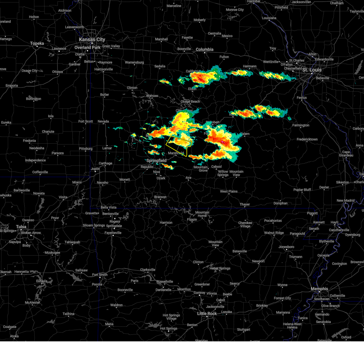 the severe thunderstorm warning has been cancelled and is no longer in effect the severe thunderstorm warning has been cancelled and is no longer in effect
|
| 6/8/2024 7:23 PM CDT |
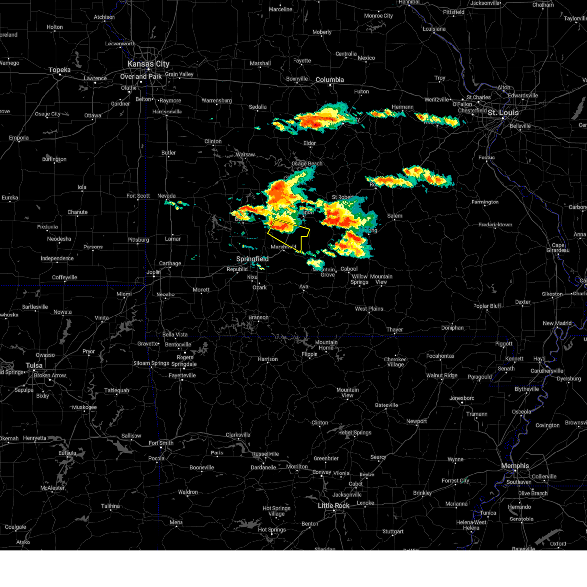 Svrsgf the national weather service in springfield has issued a * severe thunderstorm warning for, northeastern webster county in southwestern missouri, southeastern dallas county in southwestern missouri, southwestern laclede county in southwestern missouri, * until 800 pm cdt. * at 723 pm cdt, a severe thunderstorm was located 8 miles west of conway, or 9 miles southeast of buffalo, moving southeast at 30 mph (radar indicated). Hazards include 60 mph wind gusts and half dollar size hail. Hail damage to vehicles is expected. Expect wind damage to roofs, siding, and trees. Svrsgf the national weather service in springfield has issued a * severe thunderstorm warning for, northeastern webster county in southwestern missouri, southeastern dallas county in southwestern missouri, southwestern laclede county in southwestern missouri, * until 800 pm cdt. * at 723 pm cdt, a severe thunderstorm was located 8 miles west of conway, or 9 miles southeast of buffalo, moving southeast at 30 mph (radar indicated). Hazards include 60 mph wind gusts and half dollar size hail. Hail damage to vehicles is expected. Expect wind damage to roofs, siding, and trees.
|
| 5/26/2024 5:53 PM CDT |
 the severe thunderstorm warning has been cancelled and is no longer in effect the severe thunderstorm warning has been cancelled and is no longer in effect
|
| 5/26/2024 5:53 PM CDT |
 At 552 pm cdt, severe thunderstorms were located along a line extending from waynesville to 9 miles east of lebanon to near conway, moving east at 40 mph (radar indicated). Hazards include ping pong ball size hail and 60 mph wind gusts. People and animals outdoors will be injured. expect hail damage to roofs, siding, windows, and vehicles. expect wind damage to roofs, siding, and trees. locations impacted include, lebanon, bennett spring state park, morgan, conway, phillipsburg, stoutland, twin bridges, sleeper, dry knob, and falcon. This includes interstate 44 between mile markers 111 and 147. At 552 pm cdt, severe thunderstorms were located along a line extending from waynesville to 9 miles east of lebanon to near conway, moving east at 40 mph (radar indicated). Hazards include ping pong ball size hail and 60 mph wind gusts. People and animals outdoors will be injured. expect hail damage to roofs, siding, windows, and vehicles. expect wind damage to roofs, siding, and trees. locations impacted include, lebanon, bennett spring state park, morgan, conway, phillipsburg, stoutland, twin bridges, sleeper, dry knob, and falcon. This includes interstate 44 between mile markers 111 and 147.
|
| 5/26/2024 5:45 PM CDT |
 Svrsgf the national weather service in springfield has issued a * severe thunderstorm warning for, northeastern webster county in southwestern missouri, northern wright county in southwestern missouri, southeastern laclede county in southwestern missouri, northwestern texas county in south central missouri, * until 645 pm cdt. * at 545 pm cdt, a severe thunderstorm was located over niangua, or near marshfield, moving east at 35 mph (radar indicated). Hazards include golf ball size hail and 60 mph wind gusts. People and animals outdoors will be injured. expect hail damage to roofs, siding, windows, and vehicles. Expect wind damage to roofs, siding, and trees. Svrsgf the national weather service in springfield has issued a * severe thunderstorm warning for, northeastern webster county in southwestern missouri, northern wright county in southwestern missouri, southeastern laclede county in southwestern missouri, northwestern texas county in south central missouri, * until 645 pm cdt. * at 545 pm cdt, a severe thunderstorm was located over niangua, or near marshfield, moving east at 35 mph (radar indicated). Hazards include golf ball size hail and 60 mph wind gusts. People and animals outdoors will be injured. expect hail damage to roofs, siding, windows, and vehicles. Expect wind damage to roofs, siding, and trees.
|
| 5/26/2024 5:33 PM CDT |
 the severe thunderstorm warning has been cancelled and is no longer in effect the severe thunderstorm warning has been cancelled and is no longer in effect
|
| 5/26/2024 5:33 PM CDT |
 At 532 pm cdt, severe thunderstorms were located along a line extending from near richland to near lebanon to near buffalo, moving east at 40 mph (radar indicated). Hazards include ping pong ball size hail and 60 mph wind gusts. People and animals outdoors will be injured. expect hail damage to roofs, siding, windows, and vehicles. expect wind damage to roofs, siding, and trees. locations impacted include, lebanon, bennett spring state park, buffalo, morgan, conway, phillipsburg, stoutland, bennett springs, twin bridges, windyville, eldridge, leadmine, sleeper, falcon, plad, long lane, and dry knob. This includes interstate 44 between mile markers 112 and 147. At 532 pm cdt, severe thunderstorms were located along a line extending from near richland to near lebanon to near buffalo, moving east at 40 mph (radar indicated). Hazards include ping pong ball size hail and 60 mph wind gusts. People and animals outdoors will be injured. expect hail damage to roofs, siding, windows, and vehicles. expect wind damage to roofs, siding, and trees. locations impacted include, lebanon, bennett spring state park, buffalo, morgan, conway, phillipsburg, stoutland, bennett springs, twin bridges, windyville, eldridge, leadmine, sleeper, falcon, plad, long lane, and dry knob. This includes interstate 44 between mile markers 112 and 147.
|
| 5/26/2024 5:23 PM CDT |
 Svrsgf the national weather service in springfield has issued a * severe thunderstorm warning for, southeastern hickory county in central missouri, dallas county in southwestern missouri, northeastern polk county in southwestern missouri, laclede county in southwestern missouri, west central pulaski county in central missouri, southwestern camden county in central missouri, * until 615 pm cdt. * at 523 pm cdt, severe thunderstorms were located along a line extending from near richland to 6 miles west of lebanon to near buffalo, moving east at 40 mph (radar indicated). Hazards include ping pong ball size hail and 60 mph wind gusts. People and animals outdoors will be injured. expect hail damage to roofs, siding, windows, and vehicles. Expect wind damage to roofs, siding, and trees. Svrsgf the national weather service in springfield has issued a * severe thunderstorm warning for, southeastern hickory county in central missouri, dallas county in southwestern missouri, northeastern polk county in southwestern missouri, laclede county in southwestern missouri, west central pulaski county in central missouri, southwestern camden county in central missouri, * until 615 pm cdt. * at 523 pm cdt, severe thunderstorms were located along a line extending from near richland to 6 miles west of lebanon to near buffalo, moving east at 40 mph (radar indicated). Hazards include ping pong ball size hail and 60 mph wind gusts. People and animals outdoors will be injured. expect hail damage to roofs, siding, windows, and vehicles. Expect wind damage to roofs, siding, and trees.
|
| 5/26/2024 4:38 AM CDT |
 The storms which prompted the warning have weakened below severe limits, and no longer pose an immediate threat to life or property. therefore, the warning will be allowed to expire. however, small hail and gusty winds are still possible with these thunderstorms. a tornado watch remains in effect until 1000 am cdt for central and southwestern missouri. The storms which prompted the warning have weakened below severe limits, and no longer pose an immediate threat to life or property. therefore, the warning will be allowed to expire. however, small hail and gusty winds are still possible with these thunderstorms. a tornado watch remains in effect until 1000 am cdt for central and southwestern missouri.
|
| 5/26/2024 4:28 AM CDT |
 the severe thunderstorm warning has been cancelled and is no longer in effect the severe thunderstorm warning has been cancelled and is no longer in effect
|
| 5/26/2024 4:28 AM CDT |
 At 428 am cdt, severe thunderstorms were located along a line extending from 11 miles southeast of macks creek to near buffalo to near ash grove, moving east at 50 mph (radar indicated). Hazards include 60 mph wind gusts and quarter size hail. Hail damage to vehicles is expected. expect wind damage to roofs, siding, and trees. locations impacted include, lebanon, bolivar, bennett spring state park, marshfield, willard, buffalo, morgan, fair grove, conway, polk, pleasant hope, urbana, niangua, morrisville, phillipsburg, stoutland, halfway, bennett springs, louisburg, and twin bridges. This includes interstate 44 between mile markers 97 and 144. At 428 am cdt, severe thunderstorms were located along a line extending from 11 miles southeast of macks creek to near buffalo to near ash grove, moving east at 50 mph (radar indicated). Hazards include 60 mph wind gusts and quarter size hail. Hail damage to vehicles is expected. expect wind damage to roofs, siding, and trees. locations impacted include, lebanon, bolivar, bennett spring state park, marshfield, willard, buffalo, morgan, fair grove, conway, polk, pleasant hope, urbana, niangua, morrisville, phillipsburg, stoutland, halfway, bennett springs, louisburg, and twin bridges. This includes interstate 44 between mile markers 97 and 144.
|
| 5/26/2024 4:04 AM CDT |
 Svrsgf the national weather service in springfield has issued a * severe thunderstorm warning for, southeastern hickory county in central missouri, northern webster county in southwestern missouri, dallas county in southwestern missouri, southeastern cedar county in southwestern missouri, polk county in southwestern missouri, laclede county in southwestern missouri, northern greene county in southwestern missouri, eastern dade county in southwestern missouri, * until 445 am cdt. * at 403 am cdt, severe thunderstorms were located along a line extending from 6 miles southeast of urbana to near pleasant hope to near everton, moving east at 50 mph (radar indicated). Hazards include 60 mph wind gusts and quarter size hail. Hail damage to vehicles is expected. Expect wind damage to roofs, siding, and trees. Svrsgf the national weather service in springfield has issued a * severe thunderstorm warning for, southeastern hickory county in central missouri, northern webster county in southwestern missouri, dallas county in southwestern missouri, southeastern cedar county in southwestern missouri, polk county in southwestern missouri, laclede county in southwestern missouri, northern greene county in southwestern missouri, eastern dade county in southwestern missouri, * until 445 am cdt. * at 403 am cdt, severe thunderstorms were located along a line extending from 6 miles southeast of urbana to near pleasant hope to near everton, moving east at 50 mph (radar indicated). Hazards include 60 mph wind gusts and quarter size hail. Hail damage to vehicles is expected. Expect wind damage to roofs, siding, and trees.
|
| 5/24/2024 4:46 PM CDT |
 At 446 pm cdt, a severe thunderstorm was located 17 miles southwest of fort leonard wood, moving east at 25 mph (radar indicated). Hazards include 60 mph wind gusts and half dollar size hail. Hail damage to vehicles is expected. expect wind damage to roofs, siding, and trees. Locations impacted include, southern fort leonard wood, plato, twin bridges, competition, roby, lynchburg, falcon, and success. At 446 pm cdt, a severe thunderstorm was located 17 miles southwest of fort leonard wood, moving east at 25 mph (radar indicated). Hazards include 60 mph wind gusts and half dollar size hail. Hail damage to vehicles is expected. expect wind damage to roofs, siding, and trees. Locations impacted include, southern fort leonard wood, plato, twin bridges, competition, roby, lynchburg, falcon, and success.
|
| 5/24/2024 4:31 PM CDT |
 Svrsgf the national weather service in springfield has issued a * severe thunderstorm warning for, northern wright county in southwestern missouri, southeastern laclede county in southwestern missouri, northwestern texas county in south central missouri, southeastern pulaski county in central missouri, * until 515 pm cdt. * at 430 pm cdt, a severe thunderstorm was located 13 miles southeast of lebanon, moving east at 25 mph (radar indicated). Hazards include 60 mph wind gusts and half dollar size hail. Hail damage to vehicles is expected. Expect wind damage to roofs, siding, and trees. Svrsgf the national weather service in springfield has issued a * severe thunderstorm warning for, northern wright county in southwestern missouri, southeastern laclede county in southwestern missouri, northwestern texas county in south central missouri, southeastern pulaski county in central missouri, * until 515 pm cdt. * at 430 pm cdt, a severe thunderstorm was located 13 miles southeast of lebanon, moving east at 25 mph (radar indicated). Hazards include 60 mph wind gusts and half dollar size hail. Hail damage to vehicles is expected. Expect wind damage to roofs, siding, and trees.
|
| 5/7/2024 1:57 AM CDT |
 At 156 am cdt, severe thunderstorms were located along a line extending from near high point to near richland to 7 miles north of hartville, moving northeast at 50 mph (radar indicated). Hazards include 60 mph wind gusts. Expect damage to roofs, siding, and trees. locations impacted include, southwestern fort leonard wood, lebanon, lake of the ozarks, lake of the ozarks state park, waynesville, eldon, osage beach, richland, lake ozark, morgan, crocker, iberia, st. elizabeth, tuscumbia, stoutland, eugene, olean, bagnell, brumley, and twin bridges. This includes interstate 44 between mile markers 120 and 157. At 156 am cdt, severe thunderstorms were located along a line extending from near high point to near richland to 7 miles north of hartville, moving northeast at 50 mph (radar indicated). Hazards include 60 mph wind gusts. Expect damage to roofs, siding, and trees. locations impacted include, southwestern fort leonard wood, lebanon, lake of the ozarks, lake of the ozarks state park, waynesville, eldon, osage beach, richland, lake ozark, morgan, crocker, iberia, st. elizabeth, tuscumbia, stoutland, eugene, olean, bagnell, brumley, and twin bridges. This includes interstate 44 between mile markers 120 and 157.
|
| 5/7/2024 1:57 AM CDT |
 the severe thunderstorm warning has been cancelled and is no longer in effect the severe thunderstorm warning has been cancelled and is no longer in effect
|
| 5/7/2024 1:24 AM CDT |
 Svrsgf the national weather service in springfield has issued a * severe thunderstorm warning for, northeastern webster county in southwestern missouri, northwestern wright county in southwestern missouri, miller county in central missouri, laclede county in southwestern missouri, western pulaski county in central missouri, camden county in central missouri, morgan county in central missouri, * until 230 am cdt. * at 123 am cdt, severe thunderstorms were located along a line extending from 6 miles west of tipton to 7 miles north of conway to near fordland, moving northeast at 50 mph (radar indicated). Hazards include 60 mph wind gusts. expect damage to roofs, siding, and trees Svrsgf the national weather service in springfield has issued a * severe thunderstorm warning for, northeastern webster county in southwestern missouri, northwestern wright county in southwestern missouri, miller county in central missouri, laclede county in southwestern missouri, western pulaski county in central missouri, camden county in central missouri, morgan county in central missouri, * until 230 am cdt. * at 123 am cdt, severe thunderstorms were located along a line extending from 6 miles west of tipton to 7 miles north of conway to near fordland, moving northeast at 50 mph (radar indicated). Hazards include 60 mph wind gusts. expect damage to roofs, siding, and trees
|
| 5/7/2024 1:17 AM CDT |
 At 116 am cdt, severe thunderstorms were located along a line extending from near otterville to 7 miles northwest of conway to near rogersville, moving northeast at 55 mph (radar indicated). Hazards include 60 mph wind gusts. Expect damage to roofs, siding, and trees. locations impacted include, lebanon, lake of the ozarks, lake of the ozarks state park, ha ha tonka state park, bennett spring state park, marshfield, mountain grove, eldon, osage beach, camdenton, buffalo, rogersville, versailles, village of four seasons, seymour, richland, lake ozark, morgan, mansfield, and stover. This includes interstate 44 between mile markers 91 and 148. At 116 am cdt, severe thunderstorms were located along a line extending from near otterville to 7 miles northwest of conway to near rogersville, moving northeast at 55 mph (radar indicated). Hazards include 60 mph wind gusts. Expect damage to roofs, siding, and trees. locations impacted include, lebanon, lake of the ozarks, lake of the ozarks state park, ha ha tonka state park, bennett spring state park, marshfield, mountain grove, eldon, osage beach, camdenton, buffalo, rogersville, versailles, village of four seasons, seymour, richland, lake ozark, morgan, mansfield, and stover. This includes interstate 44 between mile markers 91 and 148.
|
| 5/7/2024 1:17 AM CDT |
 the severe thunderstorm warning has been cancelled and is no longer in effect the severe thunderstorm warning has been cancelled and is no longer in effect
|
| 5/7/2024 12:40 AM CDT |
 Svrsgf the national weather service in springfield has issued a * severe thunderstorm warning for, hickory county in central missouri, webster county in southwestern missouri, dallas county in southwestern missouri, wright county in southwestern missouri, benton county in central missouri, western miller county in central missouri, laclede county in southwestern missouri, northwestern pulaski county in central missouri, camden county in central missouri, morgan county in central missouri, * until 130 am cdt. * at 1240 am cdt, severe thunderstorms were located along a line extending from 8 miles northwest of warsaw to near bolivar to 8 miles southwest of crane, moving northeast at 60 mph (radar indicated). Hazards include 60 mph wind gusts. expect damage to roofs, siding, and trees Svrsgf the national weather service in springfield has issued a * severe thunderstorm warning for, hickory county in central missouri, webster county in southwestern missouri, dallas county in southwestern missouri, wright county in southwestern missouri, benton county in central missouri, western miller county in central missouri, laclede county in southwestern missouri, northwestern pulaski county in central missouri, camden county in central missouri, morgan county in central missouri, * until 130 am cdt. * at 1240 am cdt, severe thunderstorms were located along a line extending from 8 miles northwest of warsaw to near bolivar to 8 miles southwest of crane, moving northeast at 60 mph (radar indicated). Hazards include 60 mph wind gusts. expect damage to roofs, siding, and trees
|
| 4/1/2024 11:40 PM CDT |
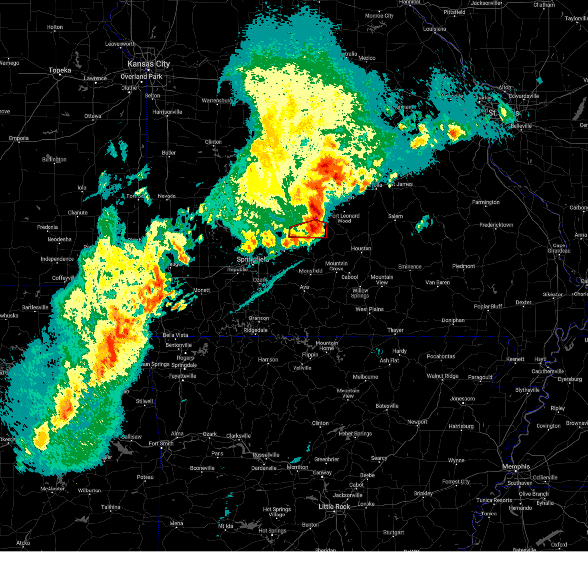 The tornadic thunderstorm which prompted the warning has moved out of the warned area. therefore, the warning will be allowed to expire. a tornado watch remains in effect until 300 am cdt for southwestern missouri. The tornadic thunderstorm which prompted the warning has moved out of the warned area. therefore, the warning will be allowed to expire. a tornado watch remains in effect until 300 am cdt for southwestern missouri.
|
| 4/1/2024 11:20 PM CDT |
 Svrsgf the national weather service in springfield has issued a * severe thunderstorm warning for, northeastern webster county in southwestern missouri, northern wright county in southwestern missouri, laclede county in southwestern missouri, northern texas county in south central missouri, pulaski county in central missouri, western phelps county in east central missouri, southeastern camden county in central missouri, * until midnight cdt. * at 1120 pm cdt, severe thunderstorms were located along a line extending from 9 miles southeast of osage beach to 8 miles east of niangua, moving east at 50 mph (radar indicated). Hazards include 60 mph wind gusts and quarter size hail. Hail damage to vehicles is expected. Expect wind damage to roofs, siding, and trees. Svrsgf the national weather service in springfield has issued a * severe thunderstorm warning for, northeastern webster county in southwestern missouri, northern wright county in southwestern missouri, laclede county in southwestern missouri, northern texas county in south central missouri, pulaski county in central missouri, western phelps county in east central missouri, southeastern camden county in central missouri, * until midnight cdt. * at 1120 pm cdt, severe thunderstorms were located along a line extending from 9 miles southeast of osage beach to 8 miles east of niangua, moving east at 50 mph (radar indicated). Hazards include 60 mph wind gusts and quarter size hail. Hail damage to vehicles is expected. Expect wind damage to roofs, siding, and trees.
|
| 4/1/2024 11:14 PM CDT |
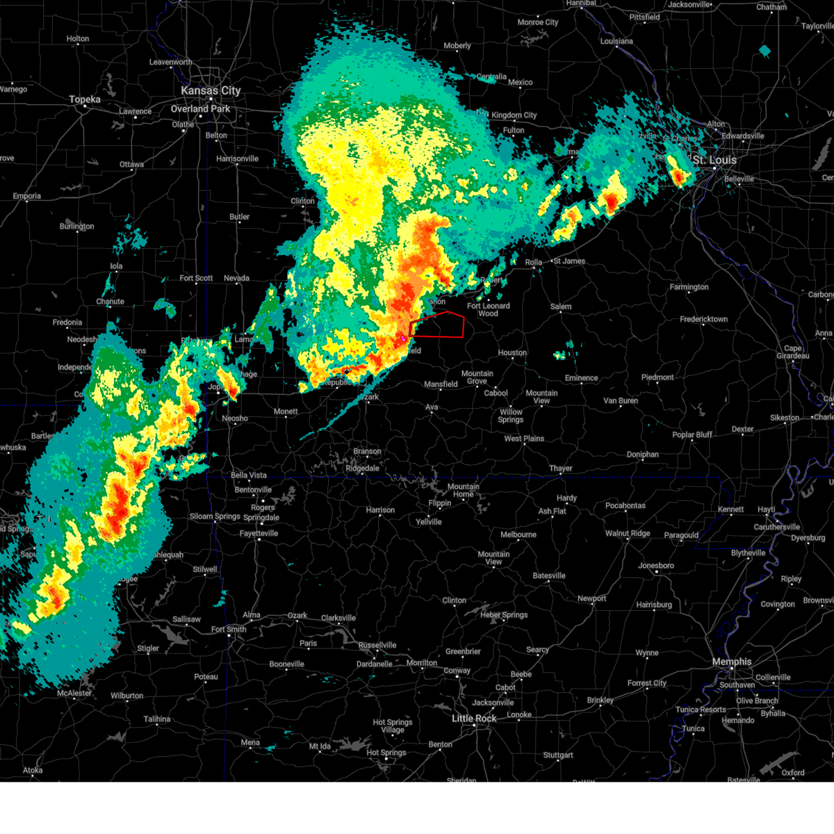 Torsgf the national weather service in springfield has issued a * tornado warning for, southern laclede county in southwestern missouri, * until 1145 pm cdt. * at 1114 pm cdt, a severe thunderstorm capable of producing a tornado was located near conway, or 11 miles southwest of lebanon, moving east at 40 mph (radar indicated rotation). Hazards include tornado and ping pong ball size hail. Flying debris will be dangerous to those caught without shelter. mobile homes will be damaged or destroyed. damage to roofs, windows, and vehicles will occur. Tree damage is likely. Torsgf the national weather service in springfield has issued a * tornado warning for, southern laclede county in southwestern missouri, * until 1145 pm cdt. * at 1114 pm cdt, a severe thunderstorm capable of producing a tornado was located near conway, or 11 miles southwest of lebanon, moving east at 40 mph (radar indicated rotation). Hazards include tornado and ping pong ball size hail. Flying debris will be dangerous to those caught without shelter. mobile homes will be damaged or destroyed. damage to roofs, windows, and vehicles will occur. Tree damage is likely.
|
| 4/1/2024 8:08 PM CDT |
 The tornado threat has diminished and the tornado warning has been cancelled. however, large hail and damaging winds remain likely and a severe thunderstorm warning remains in effect for the area. however, small hail and gusty winds are still possible with this thunderstorm. a tornado watch remains in effect until 1100 pm cdt for southwestern missouri. a tornado watch also remains in effect until midnight cdt for central and southwestern missouri. The tornado threat has diminished and the tornado warning has been cancelled. however, large hail and damaging winds remain likely and a severe thunderstorm warning remains in effect for the area. however, small hail and gusty winds are still possible with this thunderstorm. a tornado watch remains in effect until 1100 pm cdt for southwestern missouri. a tornado watch also remains in effect until midnight cdt for central and southwestern missouri.
|
| 4/1/2024 7:58 PM CDT |
 the severe thunderstorm warning has been cancelled and is no longer in effect the severe thunderstorm warning has been cancelled and is no longer in effect
|
| 4/1/2024 7:58 PM CDT |
 At 757 pm cdt, a severe thunderstorm was located 9 miles northeast of buffalo, moving east at 50 mph. this is a destructive storm for lebanon missouri (emergency management). Hazards include baseball size hail and 70 mph wind gusts. People and animals outdoors will be severely injured. expect shattered windows, extensive damage to roofs, siding, and vehicles. locations impacted include, lebanon, bennett spring state park, buffalo, stoutland, bennett springs, twin bridges, windyville, pumpkin center, sleeper, falcon, plad, long lane, and dry knob. This includes interstate 44 between mile markers 117 and 119, and between mile markers 121 and 144. At 757 pm cdt, a severe thunderstorm was located 9 miles northeast of buffalo, moving east at 50 mph. this is a destructive storm for lebanon missouri (emergency management). Hazards include baseball size hail and 70 mph wind gusts. People and animals outdoors will be severely injured. expect shattered windows, extensive damage to roofs, siding, and vehicles. locations impacted include, lebanon, bennett spring state park, buffalo, stoutland, bennett springs, twin bridges, windyville, pumpkin center, sleeper, falcon, plad, long lane, and dry knob. This includes interstate 44 between mile markers 117 and 119, and between mile markers 121 and 144.
|
| 4/1/2024 7:56 PM CDT |
 At 756 pm cdt, a severe thunderstorm capable of producing a tornado was located near buffalo, moving east at 50 mph (radar indicated rotation). Hazards include tornado and baseball size hail. Flying debris will be dangerous to those caught without shelter. mobile homes will be damaged or destroyed. damage to roofs, windows, and vehicles will occur. tree damage is likely. locations impacted include, lebanon, bennett spring state park, buffalo, bennett springs, windyville, plad, long lane, sleeper, dry knob, and falcon. This includes interstate 44 near mile marker 119, and between mile markers 121 and 144. At 756 pm cdt, a severe thunderstorm capable of producing a tornado was located near buffalo, moving east at 50 mph (radar indicated rotation). Hazards include tornado and baseball size hail. Flying debris will be dangerous to those caught without shelter. mobile homes will be damaged or destroyed. damage to roofs, windows, and vehicles will occur. tree damage is likely. locations impacted include, lebanon, bennett spring state park, buffalo, bennett springs, windyville, plad, long lane, sleeper, dry knob, and falcon. This includes interstate 44 near mile marker 119, and between mile markers 121 and 144.
|
| 4/1/2024 7:56 PM CDT |
 the tornado warning has been cancelled and is no longer in effect the tornado warning has been cancelled and is no longer in effect
|
| 4/1/2024 7:45 PM CDT |
 Torsgf the national weather service in springfield has issued a * tornado warning for, central dallas county in southwestern missouri, east central polk county in southwestern missouri, laclede county in southwestern missouri, * until 815 pm cdt. * at 744 pm cdt, a severe thunderstorm capable of producing a tornado was located over buffalo, moving east at 50 mph (radar indicated rotation). Hazards include tornado and baseball size hail. Flying debris will be dangerous to those caught without shelter. mobile homes will be damaged or destroyed. damage to roofs, windows, and vehicles will occur. Tree damage is likely. Torsgf the national weather service in springfield has issued a * tornado warning for, central dallas county in southwestern missouri, east central polk county in southwestern missouri, laclede county in southwestern missouri, * until 815 pm cdt. * at 744 pm cdt, a severe thunderstorm capable of producing a tornado was located over buffalo, moving east at 50 mph (radar indicated rotation). Hazards include tornado and baseball size hail. Flying debris will be dangerous to those caught without shelter. mobile homes will be damaged or destroyed. damage to roofs, windows, and vehicles will occur. Tree damage is likely.
|
| 4/1/2024 7:35 PM CDT |
 Svrsgf the national weather service in springfield has issued a * severe thunderstorm warning for, dallas county in southwestern missouri, northeastern polk county in southwestern missouri, laclede county in southwestern missouri, * until 830 pm cdt. * at 733 pm cdt, a severe thunderstorm was located 9 miles northeast of bolivar, moving east at 60 mph. this is a destructive storm for half way buffalo and lebenon missouri areas (emergency management. large hail and damaging winds have been reported with this storm). Hazards include baseball size hail and 70 mph wind gusts. People and animals outdoors will be severely injured. Expect shattered windows, extensive damage to roofs, siding, and vehicles. Svrsgf the national weather service in springfield has issued a * severe thunderstorm warning for, dallas county in southwestern missouri, northeastern polk county in southwestern missouri, laclede county in southwestern missouri, * until 830 pm cdt. * at 733 pm cdt, a severe thunderstorm was located 9 miles northeast of bolivar, moving east at 60 mph. this is a destructive storm for half way buffalo and lebenon missouri areas (emergency management. large hail and damaging winds have been reported with this storm). Hazards include baseball size hail and 70 mph wind gusts. People and animals outdoors will be severely injured. Expect shattered windows, extensive damage to roofs, siding, and vehicles.
|
| 8/13/2023 11:56 PM CDT |
 At 1155 pm cdt, severe thunderstorms were located along a line extending from near crocker to 8 miles south of richland to near conway, moving southeast at 40 mph (radar indicated). Hazards include 60 mph wind gusts and penny size hail. Expect damage to roofs, siding, and trees. locations impacted include, fort leonard wood, lebanon, waynesville, st. robert, richland, dixon, morgan, crocker, stoutland, plato, twin bridges, competition, devil`s elbow, lynchburg, falcon, laquey, swedeborg, ozark springs, jerome and dry knob. This includes interstate 44 near mile marker 120, between mile markers 138 and 169, and between mile markers 171 and 176. At 1155 pm cdt, severe thunderstorms were located along a line extending from near crocker to 8 miles south of richland to near conway, moving southeast at 40 mph (radar indicated). Hazards include 60 mph wind gusts and penny size hail. Expect damage to roofs, siding, and trees. locations impacted include, fort leonard wood, lebanon, waynesville, st. robert, richland, dixon, morgan, crocker, stoutland, plato, twin bridges, competition, devil`s elbow, lynchburg, falcon, laquey, swedeborg, ozark springs, jerome and dry knob. This includes interstate 44 near mile marker 120, between mile markers 138 and 169, and between mile markers 171 and 176.
|
| 8/13/2023 11:40 PM CDT |
 At 1139 pm cdt, severe thunderstorms were located along a line extending from 10 miles west of iberia to 9 miles north of lebanon to 8 miles east of buffalo, moving southeast at 40 mph (radar indicated). Hazards include 60 mph wind gusts and penny size hail. expect damage to roofs, siding, and trees At 1139 pm cdt, severe thunderstorms were located along a line extending from 10 miles west of iberia to 9 miles north of lebanon to 8 miles east of buffalo, moving southeast at 40 mph (radar indicated). Hazards include 60 mph wind gusts and penny size hail. expect damage to roofs, siding, and trees
|
| 7/17/2023 6:52 PM CDT |
 At 649 pm cdt, a severe thunderstorm was located 7 miles west of lebanon, moving south at 35 mph. this is a destructive storm for areas west of lebanon and the conway and niangua areas (radar indicated. at 645 pm, two inch hail was reported south of bennett springs state park). Hazards include baseball size hail and 70 mph wind gusts. People and animals outdoors will be severely injured. Expect shattered windows, extensive damage to roofs, siding, and vehicles. At 649 pm cdt, a severe thunderstorm was located 7 miles west of lebanon, moving south at 35 mph. this is a destructive storm for areas west of lebanon and the conway and niangua areas (radar indicated. at 645 pm, two inch hail was reported south of bennett springs state park). Hazards include baseball size hail and 70 mph wind gusts. People and animals outdoors will be severely injured. Expect shattered windows, extensive damage to roofs, siding, and vehicles.
|
| 7/17/2023 3:08 PM CDT |
 At 307 pm cdt, a severe thunderstorm was located 7 miles south of lebanon, moving south at 30 mph (radar indicated). Hazards include ping pong ball size hail and 60 mph wind gusts. People and animals outdoors will be injured. expect hail damage to roofs, siding, windows, and vehicles. expect wind damage to roofs, siding, and trees. locations impacted include, southwestern fort leonard wood, lebanon, bennett spring state park, morgan, conway, phillipsburg, bennett springs, twin bridges, competition, lynchburg, sleeper, falcon and dry knob. this includes interstate 44 between mile markers 112 and 140. hail threat, radar indicated max hail size, 1. 50 in wind threat, radar indicated max wind gust, 60 mph. At 307 pm cdt, a severe thunderstorm was located 7 miles south of lebanon, moving south at 30 mph (radar indicated). Hazards include ping pong ball size hail and 60 mph wind gusts. People and animals outdoors will be injured. expect hail damage to roofs, siding, windows, and vehicles. expect wind damage to roofs, siding, and trees. locations impacted include, southwestern fort leonard wood, lebanon, bennett spring state park, morgan, conway, phillipsburg, bennett springs, twin bridges, competition, lynchburg, sleeper, falcon and dry knob. this includes interstate 44 between mile markers 112 and 140. hail threat, radar indicated max hail size, 1. 50 in wind threat, radar indicated max wind gust, 60 mph.
|
| 7/17/2023 2:58 PM CDT |
 At 258 pm cdt, a severe thunderstorm was located near lebanon, moving southeast at 25 mph (radar indicated). Hazards include golf ball size hail and 70 mph wind gusts. People and animals outdoors will be injured. expect hail damage to roofs, siding, windows, and vehicles. expect considerable tree damage. wind damage is also likely to mobile homes, roofs, and outbuildings. locations impacted include, southwestern fort leonard wood, lebanon, bennett spring state park, morgan, conway, phillipsburg, bennett springs, twin bridges, competition, lynchburg, sleeper, falcon and dry knob. this includes interstate 44 between mile markers 112 and 140. thunderstorm damage threat, considerable hail threat, radar indicated max hail size, 1. 75 in wind threat, radar indicated max wind gust, 70 mph. At 258 pm cdt, a severe thunderstorm was located near lebanon, moving southeast at 25 mph (radar indicated). Hazards include golf ball size hail and 70 mph wind gusts. People and animals outdoors will be injured. expect hail damage to roofs, siding, windows, and vehicles. expect considerable tree damage. wind damage is also likely to mobile homes, roofs, and outbuildings. locations impacted include, southwestern fort leonard wood, lebanon, bennett spring state park, morgan, conway, phillipsburg, bennett springs, twin bridges, competition, lynchburg, sleeper, falcon and dry knob. this includes interstate 44 between mile markers 112 and 140. thunderstorm damage threat, considerable hail threat, radar indicated max hail size, 1. 75 in wind threat, radar indicated max wind gust, 70 mph.
|
| 7/17/2023 2:35 PM CDT |
 At 235 pm cdt, a severe thunderstorm was located 11 miles northwest of lebanon, moving southeast at 15 mph (radar indicated). Hazards include golf ball size hail and 60 mph wind gusts. People and animals outdoors will be injured. expect hail damage to roofs, siding, windows, and vehicles. Expect wind damage to roofs, siding, and trees. At 235 pm cdt, a severe thunderstorm was located 11 miles northwest of lebanon, moving southeast at 15 mph (radar indicated). Hazards include golf ball size hail and 60 mph wind gusts. People and animals outdoors will be injured. expect hail damage to roofs, siding, windows, and vehicles. Expect wind damage to roofs, siding, and trees.
|
| 7/13/2023 12:35 AM CDT |
 At 1235 am cdt, a severe thunderstorm was located near conway, or 10 miles south of lebanon, moving southeast at 45 mph (radar indicated). Hazards include 60 mph wind gusts and quarter size hail. Hail damage to vehicles is expected. expect wind damage to roofs, siding, and trees. locations impacted include, bennett spring state park, morgan, conway, phillipsburg, twin bridges, rader and long lane. this includes interstate 44 between mile markers 108 and 123. hail threat, radar indicated max hail size, 1. 00 in wind threat, radar indicated max wind gust, 60 mph. At 1235 am cdt, a severe thunderstorm was located near conway, or 10 miles south of lebanon, moving southeast at 45 mph (radar indicated). Hazards include 60 mph wind gusts and quarter size hail. Hail damage to vehicles is expected. expect wind damage to roofs, siding, and trees. locations impacted include, bennett spring state park, morgan, conway, phillipsburg, twin bridges, rader and long lane. this includes interstate 44 between mile markers 108 and 123. hail threat, radar indicated max hail size, 1. 00 in wind threat, radar indicated max wind gust, 60 mph.
|
| 7/13/2023 12:13 AM CDT |
 At 1213 am cdt, a severe thunderstorm was located 8 miles north of conway, or 10 miles west of lebanon, moving southeast at 25 mph (radar indicated). Hazards include ping pong ball size hail and 60 mph wind gusts. People and animals outdoors will be injured. expect hail damage to roofs, siding, windows, and vehicles. Expect wind damage to roofs, siding, and trees. At 1213 am cdt, a severe thunderstorm was located 8 miles north of conway, or 10 miles west of lebanon, moving southeast at 25 mph (radar indicated). Hazards include ping pong ball size hail and 60 mph wind gusts. People and animals outdoors will be injured. expect hail damage to roofs, siding, windows, and vehicles. Expect wind damage to roofs, siding, and trees.
|
| 4/20/2023 2:29 PM CDT |
 At 229 pm cdt, severe thunderstorms were located along a line extending from 7 miles east of lebanon to 9 miles northwest of hartville to diggins, moving east at 35 mph (radar indicated). Hazards include 60 mph wind gusts and quarter size hail. Hail damage to vehicles is expected. expect wind damage to roofs, siding, and trees. these severe storms will be near, mansfield around 255 pm cdt. hartville around 300 pm cdt. other locations impacted by these severe thunderstorms include morgan, duncan, twin bridges, competition, manes, rader, lynchburg, grovespring, dry knob and falcon. this includes interstate 44 between mile markers 124 and 132, and between mile markers 138 and 144. hail threat, radar indicated max hail size, 1. 00 in wind threat, radar indicated max wind gust, 60 mph. At 229 pm cdt, severe thunderstorms were located along a line extending from 7 miles east of lebanon to 9 miles northwest of hartville to diggins, moving east at 35 mph (radar indicated). Hazards include 60 mph wind gusts and quarter size hail. Hail damage to vehicles is expected. expect wind damage to roofs, siding, and trees. these severe storms will be near, mansfield around 255 pm cdt. hartville around 300 pm cdt. other locations impacted by these severe thunderstorms include morgan, duncan, twin bridges, competition, manes, rader, lynchburg, grovespring, dry knob and falcon. this includes interstate 44 between mile markers 124 and 132, and between mile markers 138 and 144. hail threat, radar indicated max hail size, 1. 00 in wind threat, radar indicated max wind gust, 60 mph.
|
| 4/20/2023 1:50 PM CDT |
 At 150 pm cdt, severe thunderstorms were located along a line extending from 7 miles southwest of conway to near strafford to near ozark, moving northeast at 45 mph (radar indicated). Hazards include 60 mph wind gusts and quarter size hail. Hail damage to vehicles is expected. expect wind damage to roofs, siding, and trees. severe thunderstorms will be near, marshfield and conway around 200 pm cdt. niangua around 205 pm cdt. fordland around 210 pm cdt. lebanon, seymour and diggins around 220 pm cdt. other locations impacted by these severe thunderstorms include morgan, dawson, duncan, phillipsburg, twin bridges, competition, manes, lynchburg, graff and grovespring. this includes interstate 44 between mile markers 110 and 144. hail threat, radar indicated max hail size, 1. 00 in wind threat, radar indicated max wind gust, 60 mph. At 150 pm cdt, severe thunderstorms were located along a line extending from 7 miles southwest of conway to near strafford to near ozark, moving northeast at 45 mph (radar indicated). Hazards include 60 mph wind gusts and quarter size hail. Hail damage to vehicles is expected. expect wind damage to roofs, siding, and trees. severe thunderstorms will be near, marshfield and conway around 200 pm cdt. niangua around 205 pm cdt. fordland around 210 pm cdt. lebanon, seymour and diggins around 220 pm cdt. other locations impacted by these severe thunderstorms include morgan, dawson, duncan, phillipsburg, twin bridges, competition, manes, lynchburg, graff and grovespring. this includes interstate 44 between mile markers 110 and 144. hail threat, radar indicated max hail size, 1. 00 in wind threat, radar indicated max wind gust, 60 mph.
|
| 4/15/2023 5:04 PM CDT |
 At 504 pm cdt, severe thunderstorms were located along a line extending from 13 miles east of conway to near hartville to near mansfield, moving east at 45 mph (radar indicated). Hazards include 60 mph wind gusts and quarter size hail. Hail damage to vehicles is expected. expect wind damage to roofs, siding, and trees. locations impacted include, southwestern fort leonard wood, mountain grove, cabool, mansfield, dawson, norwood, hartville, duncan, huggins, plato, competition, manes, bucyrus, lynchburg, graff, grovespring, success, roby, odin and bendavis. hail threat, radar indicated max hail size, 1. 00 in wind threat, radar indicated max wind gust, 60 mph. At 504 pm cdt, severe thunderstorms were located along a line extending from 13 miles east of conway to near hartville to near mansfield, moving east at 45 mph (radar indicated). Hazards include 60 mph wind gusts and quarter size hail. Hail damage to vehicles is expected. expect wind damage to roofs, siding, and trees. locations impacted include, southwestern fort leonard wood, mountain grove, cabool, mansfield, dawson, norwood, hartville, duncan, huggins, plato, competition, manes, bucyrus, lynchburg, graff, grovespring, success, roby, odin and bendavis. hail threat, radar indicated max hail size, 1. 00 in wind threat, radar indicated max wind gust, 60 mph.
|
| 4/15/2023 4:54 PM CDT |
 At 453 pm cdt, severe thunderstorms were located along a line extending from 7 miles northeast of niangua to near hartville to near seymour, moving east at 45 mph (radar indicated). Hazards include 60 mph wind gusts and quarter size hail. Hail damage to vehicles is expected. Expect wind damage to roofs, siding, and trees. At 453 pm cdt, severe thunderstorms were located along a line extending from 7 miles northeast of niangua to near hartville to near seymour, moving east at 45 mph (radar indicated). Hazards include 60 mph wind gusts and quarter size hail. Hail damage to vehicles is expected. Expect wind damage to roofs, siding, and trees.
|
| 4/5/2023 5:52 AM CDT |
 At 552 am cdt, severe thunderstorms were located along a line extending from 8 miles north of fair grove to near strafford to near clever, moving northeast at 65 mph (radar indicated). Hazards include 60 mph wind gusts and quarter size hail. Hail damage to vehicles is expected. Expect wind damage to roofs, siding, and trees. At 552 am cdt, severe thunderstorms were located along a line extending from 8 miles north of fair grove to near strafford to near clever, moving northeast at 65 mph (radar indicated). Hazards include 60 mph wind gusts and quarter size hail. Hail damage to vehicles is expected. Expect wind damage to roofs, siding, and trees.
|
| 4/5/2023 5:17 AM CDT |
 At 516 am cdt, a severe thunderstorm was located 8 miles north of pleasant hope, or 9 miles east of bolivar, moving east at 65 mph (public. half dollar size hail was reported with this storm). Hazards include 60 mph wind gusts and half dollar size hail. Hail damage to vehicles is expected. Expect wind damage to roofs, siding, and trees. At 516 am cdt, a severe thunderstorm was located 8 miles north of pleasant hope, or 9 miles east of bolivar, moving east at 65 mph (public. half dollar size hail was reported with this storm). Hazards include 60 mph wind gusts and half dollar size hail. Hail damage to vehicles is expected. Expect wind damage to roofs, siding, and trees.
|
| 2/27/2023 2:58 AM CST |
 At 258 am cst, severe thunderstorms were located along a line extending from lebanon to 7 miles east of niangua to near seymour to 10 miles southwest of ava, moving northeast at 55 mph (radar indicated). Hazards include 60 mph wind gusts. Expect damage to roofs, siding, and trees. locations impacted include, lebanon, ava, seymour, morgan, mansfield, conway, norwood, hartville, niangua, duncan, diggins, phillipsburg, stoutland, twin bridges, competition, brushyknob, grovespring, rome, rader and goodhope. This includes interstate 44 between mile markers 110 and 143. At 258 am cst, severe thunderstorms were located along a line extending from lebanon to 7 miles east of niangua to near seymour to 10 miles southwest of ava, moving northeast at 55 mph (radar indicated). Hazards include 60 mph wind gusts. Expect damage to roofs, siding, and trees. locations impacted include, lebanon, ava, seymour, morgan, mansfield, conway, norwood, hartville, niangua, duncan, diggins, phillipsburg, stoutland, twin bridges, competition, brushyknob, grovespring, rome, rader and goodhope. This includes interstate 44 between mile markers 110 and 143.
|
| 2/27/2023 2:31 AM CST |
 At 231 am cst, severe thunderstorms were located along a line extending from 6 miles northeast of fair grove to near rogersville to 6 miles south of sparta to forsyth, moving northeast at 55 mph (radar indicated). Hazards include 60 mph wind gusts. expect damage to roofs, siding, and trees At 231 am cst, severe thunderstorms were located along a line extending from 6 miles northeast of fair grove to near rogersville to 6 miles south of sparta to forsyth, moving northeast at 55 mph (radar indicated). Hazards include 60 mph wind gusts. expect damage to roofs, siding, and trees
|
| 2/16/2023 1:31 AM CST |
 At 131 am cst, severe thunderstorms were located along a line extending from 9 miles south of richland to 10 miles northwest of houston to 12 miles north of cabool to 10 miles south of mountain grove, moving northeast at 55 mph (radar indicated). Hazards include 60 mph wind gusts and penny size hail. Expect damage to roofs, siding, and trees. locations impacted include, mountain grove, dawson, norwood, hartville, twin bridges, competition, manes, brushyknob, lynchburg, graff, falcon, vanzant and dry knob. hail threat, radar indicated max hail size, 0. 75 in wind threat, radar indicated max wind gust, 60 mph. At 131 am cst, severe thunderstorms were located along a line extending from 9 miles south of richland to 10 miles northwest of houston to 12 miles north of cabool to 10 miles south of mountain grove, moving northeast at 55 mph (radar indicated). Hazards include 60 mph wind gusts and penny size hail. Expect damage to roofs, siding, and trees. locations impacted include, mountain grove, dawson, norwood, hartville, twin bridges, competition, manes, brushyknob, lynchburg, graff, falcon, vanzant and dry knob. hail threat, radar indicated max hail size, 0. 75 in wind threat, radar indicated max wind gust, 60 mph.
|
| 2/16/2023 1:11 AM CST |
 At 110 am cst, severe thunderstorms were located along a line extending from 7 miles south of lebanon to 7 miles east of hartville to near norwood to 9 miles southeast of ava, moving northeast at 50 mph (radar indicated). Hazards include 60 mph wind gusts and penny size hail. Expect damage to roofs, siding, and trees. locations impacted include, mountain grove, ava, morgan, mansfield, conway, dawson, norwood, hartville, twin bridges, competition, manes, brushyknob, lynchburg, graff, grovespring, falcon, vanzant and dry knob. This includes interstate 44 near mile marker 144. At 110 am cst, severe thunderstorms were located along a line extending from 7 miles south of lebanon to 7 miles east of hartville to near norwood to 9 miles southeast of ava, moving northeast at 50 mph (radar indicated). Hazards include 60 mph wind gusts and penny size hail. Expect damage to roofs, siding, and trees. locations impacted include, mountain grove, ava, morgan, mansfield, conway, dawson, norwood, hartville, twin bridges, competition, manes, brushyknob, lynchburg, graff, grovespring, falcon, vanzant and dry knob. This includes interstate 44 near mile marker 144.
|
| 2/16/2023 1:02 AM CST |
 At 101 am cst, severe thunderstorms were located along a line extending from conway to near hartville to near mansfield to 12 miles south of ava, moving northeast at 60 mph (radar indicated). Hazards include 60 mph wind gusts and penny size hail. expect damage to roofs, siding, and trees At 101 am cst, severe thunderstorms were located along a line extending from conway to near hartville to near mansfield to 12 miles south of ava, moving northeast at 60 mph (radar indicated). Hazards include 60 mph wind gusts and penny size hail. expect damage to roofs, siding, and trees
|
| 8/29/2022 3:12 PM CDT |
 At 311 pm cdt, a severe thunderstorm was located 8 miles northeast of lebanon, moving southeast at 20 mph (radar indicated). Hazards include 60 mph wind gusts and quarter size hail. Hail damage to vehicles is expected. Expect wind damage to roofs, siding, and trees. At 311 pm cdt, a severe thunderstorm was located 8 miles northeast of lebanon, moving southeast at 20 mph (radar indicated). Hazards include 60 mph wind gusts and quarter size hail. Hail damage to vehicles is expected. Expect wind damage to roofs, siding, and trees.
|
| 8/20/2022 7:53 PM CDT | Report of wind damage to an outbuilding in grovespring. time estimated from rada in wright county MO, 10.2 miles N of Evergreen, MO |
| 8/3/2022 8:19 PM CDT |
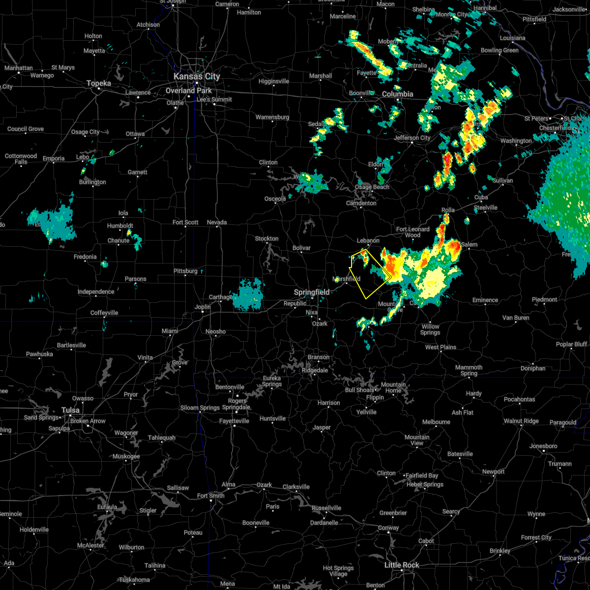 At 819 pm cdt, a severe thunderstorm was located over conway, or 12 miles southwest of lebanon, moving southeast at 30 mph (radar indicated). Hazards include 60 mph wind gusts and quarter size hail. Hail damage to vehicles is expected. Expect wind damage to roofs, siding, and trees. At 819 pm cdt, a severe thunderstorm was located over conway, or 12 miles southwest of lebanon, moving southeast at 30 mph (radar indicated). Hazards include 60 mph wind gusts and quarter size hail. Hail damage to vehicles is expected. Expect wind damage to roofs, siding, and trees.
|
| 8/3/2022 7:21 PM CDT |
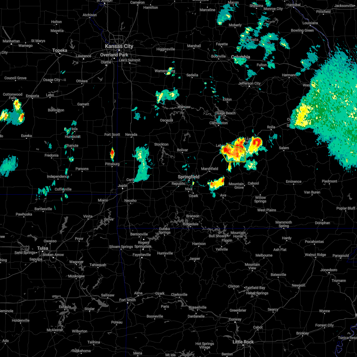 At 720 pm cdt, a severe thunderstorm was located near lebanon, moving southeast at 25 mph (emergency management. at 707pm a barn was destroyed and a roof was damaged near the intersection of highway 64 and highway aa). Hazards include 60 mph wind gusts and penny size hail. Expect damage to roofs, siding, and trees. locations impacted include, lebanon, twin bridges, competition, lynchburg, dry knob, falcon, this includes interstate 44 between mile markers 123 and 131. hail threat, radar indicated max hail size, 0. 75 in wind threat, observed max wind gust, 60 mph. At 720 pm cdt, a severe thunderstorm was located near lebanon, moving southeast at 25 mph (emergency management. at 707pm a barn was destroyed and a roof was damaged near the intersection of highway 64 and highway aa). Hazards include 60 mph wind gusts and penny size hail. Expect damage to roofs, siding, and trees. locations impacted include, lebanon, twin bridges, competition, lynchburg, dry knob, falcon, this includes interstate 44 between mile markers 123 and 131. hail threat, radar indicated max hail size, 0. 75 in wind threat, observed max wind gust, 60 mph.
|
| 8/3/2022 6:56 PM CDT |
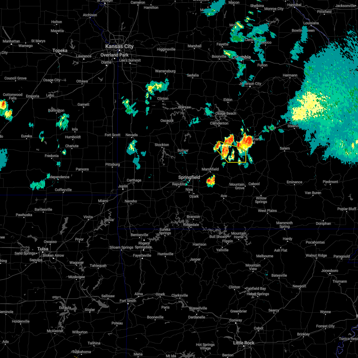 At 656 pm cdt, a severe thunderstorm was located 7 miles northwest of lebanon, moving southeast at 30 mph (radar indicated). Hazards include 60 mph wind gusts and quarter size hail. Hail damage to vehicles is expected. Expect wind damage to roofs, siding, and trees. At 656 pm cdt, a severe thunderstorm was located 7 miles northwest of lebanon, moving southeast at 30 mph (radar indicated). Hazards include 60 mph wind gusts and quarter size hail. Hail damage to vehicles is expected. Expect wind damage to roofs, siding, and trees.
|
| 8/2/2022 3:38 PM CDT |
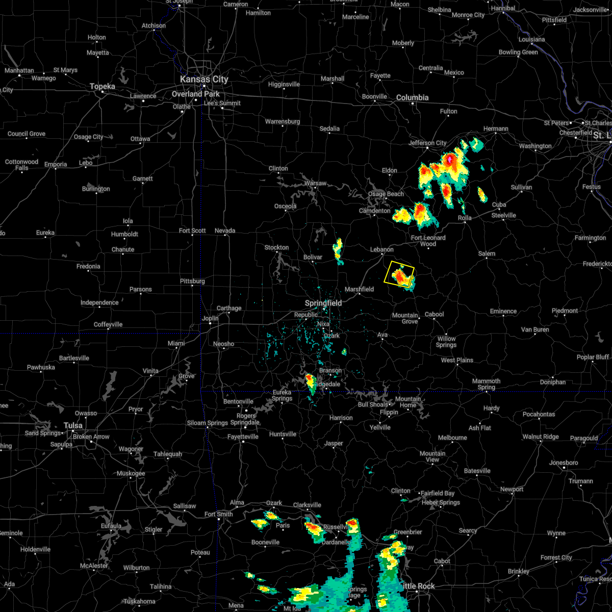 At 338 pm cdt, a severe thunderstorm was located 15 miles southeast of lebanon, and is nearly stationary (radar indicated). Hazards include 60 mph wind gusts. expect damage to roofs, siding, and trees At 338 pm cdt, a severe thunderstorm was located 15 miles southeast of lebanon, and is nearly stationary (radar indicated). Hazards include 60 mph wind gusts. expect damage to roofs, siding, and trees
|
| 5/21/2022 2:16 AM CDT |
 At 215 am cdt, a severe thunderstorm was located 13 miles southeast of lebanon, moving northeast at 45 mph (radar indicated). Hazards include 60 mph wind gusts and quarter size hail. Hail damage to vehicles is expected. Expect wind damage to roofs, siding, and trees. At 215 am cdt, a severe thunderstorm was located 13 miles southeast of lebanon, moving northeast at 45 mph (radar indicated). Hazards include 60 mph wind gusts and quarter size hail. Hail damage to vehicles is expected. Expect wind damage to roofs, siding, and trees.
|
| 5/19/2022 2:10 PM CDT |
 At 209 pm cdt, severe thunderstorms were located along a line extending from 10 miles south of lebanon to 10 miles north of hartville to near seymour, moving east at 30 mph (radar indicated). Hazards include 60 mph wind gusts and quarter size hail. Hail damage to vehicles is expected. Expect wind damage to roofs, siding, and trees. At 209 pm cdt, severe thunderstorms were located along a line extending from 10 miles south of lebanon to 10 miles north of hartville to near seymour, moving east at 30 mph (radar indicated). Hazards include 60 mph wind gusts and quarter size hail. Hail damage to vehicles is expected. Expect wind damage to roofs, siding, and trees.
|
| 5/19/2022 2:09 PM CDT |
 At 208 pm cdt, a severe thunderstorm was located near hartville, or 18 miles east of marshfield, moving east at 30 mph (radar indicated). Hazards include 60 mph wind gusts and quarter size hail. Hail damage to vehicles is expected. expect wind damage to roofs, siding, and trees. locations impacted include, marshfield, morgan, conway, niangua, duncan, phillipsburg, twin bridges, rader, grovespring, odin, northview, this includes interstate 44 between mile markers 95 and 108, and between mile markers 112 and 122. hail threat, radar indicated max hail size, 1. 00 in wind threat, radar indicated max wind gust, 60 mph. At 208 pm cdt, a severe thunderstorm was located near hartville, or 18 miles east of marshfield, moving east at 30 mph (radar indicated). Hazards include 60 mph wind gusts and quarter size hail. Hail damage to vehicles is expected. expect wind damage to roofs, siding, and trees. locations impacted include, marshfield, morgan, conway, niangua, duncan, phillipsburg, twin bridges, rader, grovespring, odin, northview, this includes interstate 44 between mile markers 95 and 108, and between mile markers 112 and 122. hail threat, radar indicated max hail size, 1. 00 in wind threat, radar indicated max wind gust, 60 mph.
|
| 5/19/2022 1:53 PM CDT |
 At 150 pm cdt, a severe thunderstorm was located near niangua, or 8 miles east of marshfield, moving east at 20 mph. a second severe thunderstorm was located over western webster county, moving east around 40 mph (public. this storm produced quarter size hail near northview). Hazards include 60 mph wind gusts and quarter size hail. Hail damage to vehicles is expected. expect wind damage to roofs, siding, and trees. locations impacted include, marshfield, morgan, conway, niangua, duncan, phillipsburg, twin bridges, elkland, grovespring, northview, rader, long lane, charity, odin, this includes interstate 44 between mile markers 90 and 122. hail threat, radar indicated max hail size, 1. 00 in wind threat, radar indicated max wind gust, 60 mph. At 150 pm cdt, a severe thunderstorm was located near niangua, or 8 miles east of marshfield, moving east at 20 mph. a second severe thunderstorm was located over western webster county, moving east around 40 mph (public. this storm produced quarter size hail near northview). Hazards include 60 mph wind gusts and quarter size hail. Hail damage to vehicles is expected. expect wind damage to roofs, siding, and trees. locations impacted include, marshfield, morgan, conway, niangua, duncan, phillipsburg, twin bridges, elkland, grovespring, northview, rader, long lane, charity, odin, this includes interstate 44 between mile markers 90 and 122. hail threat, radar indicated max hail size, 1. 00 in wind threat, radar indicated max wind gust, 60 mph.
|
| 5/19/2022 1:24 PM CDT |
 At 124 pm cdt, a severe thunderstorm was located over marshfield, moving east at 30 mph (radar indicated). Hazards include 60 mph wind gusts and quarter size hail. Hail damage to vehicles is expected. Expect wind damage to roofs, siding, and trees. At 124 pm cdt, a severe thunderstorm was located over marshfield, moving east at 30 mph (radar indicated). Hazards include 60 mph wind gusts and quarter size hail. Hail damage to vehicles is expected. Expect wind damage to roofs, siding, and trees.
|
| 5/14/2022 7:19 PM CDT |
 At 719 pm cdt, a severe thunderstorm was located 10 miles southeast of lebanon, moving southwest at 15 mph (radar indicated). Hazards include 60 mph wind gusts and quarter size hail. Hail damage to vehicles is expected. expect wind damage to roofs, siding, and trees. locations impacted include, morgan, twin bridges, competition, hail threat, radar indicated max hail size, 1. 00 in wind threat, radar indicated max wind gust, 60 mph. At 719 pm cdt, a severe thunderstorm was located 10 miles southeast of lebanon, moving southwest at 15 mph (radar indicated). Hazards include 60 mph wind gusts and quarter size hail. Hail damage to vehicles is expected. expect wind damage to roofs, siding, and trees. locations impacted include, morgan, twin bridges, competition, hail threat, radar indicated max hail size, 1. 00 in wind threat, radar indicated max wind gust, 60 mph.
|
| 5/14/2022 6:42 PM CDT |
 At 642 pm cdt, a severe thunderstorm was located 11 miles southeast of lebanon, moving southwest at 10 mph (radar indicated). Hazards include 60 mph wind gusts and quarter size hail. Hail damage to vehicles is expected. Expect wind damage to roofs, siding, and trees. At 642 pm cdt, a severe thunderstorm was located 11 miles southeast of lebanon, moving southwest at 10 mph (radar indicated). Hazards include 60 mph wind gusts and quarter size hail. Hail damage to vehicles is expected. Expect wind damage to roofs, siding, and trees.
|
| 5/14/2022 6:09 PM CDT |
 At 609 pm cdt, a severe thunderstorm was located 10 miles west of fort leonard wood, and is nearly stationary (radar indicated). Hazards include 60 mph wind gusts and half dollar size hail. Hail damage to vehicles is expected. expect wind damage to roofs, siding, and trees. locations impacted include, southwestern fort leonard wood, plato, competition, lynchburg, dry knob, falcon, hail threat, radar indicated max hail size, 1. 25 in wind threat, radar indicated max wind gust, 60 mph. At 609 pm cdt, a severe thunderstorm was located 10 miles west of fort leonard wood, and is nearly stationary (radar indicated). Hazards include 60 mph wind gusts and half dollar size hail. Hail damage to vehicles is expected. expect wind damage to roofs, siding, and trees. locations impacted include, southwestern fort leonard wood, plato, competition, lynchburg, dry knob, falcon, hail threat, radar indicated max hail size, 1. 25 in wind threat, radar indicated max wind gust, 60 mph.
|
| 5/14/2022 6:05 PM CDT |
 At 605 pm cdt, a severe thunderstorm was located 10 miles west of fort leonard wood, and is nearly stationary (radar indicated). Hazards include 60 mph wind gusts and quarter size hail. Hail damage to vehicles is expected. Expect wind damage to roofs, siding, and trees. At 605 pm cdt, a severe thunderstorm was located 10 miles west of fort leonard wood, and is nearly stationary (radar indicated). Hazards include 60 mph wind gusts and quarter size hail. Hail damage to vehicles is expected. Expect wind damage to roofs, siding, and trees.
|
| 5/4/2022 10:59 PM CDT | Highway z at the elk creek low water crossing is closed due to water over the roadwa in wright county MO, 10.3 miles NW of Evergreen, MO |
| 4/21/2022 7:11 PM CDT |
 At 711 pm cdt, a severe thunderstorm was located 11 miles southeast of lebanon, moving east at 30 mph (radar indicated). Hazards include 60 mph wind gusts and quarter size hail. Hail damage to vehicles is expected. expect wind damage to roofs, siding, and trees. locations impacted include, lebanon, morgan, twin bridges, competition, lynchburg, dry knob, falcon, this includes interstate 44 between mile markers 120 and 123. hail threat, radar indicated max hail size, 1. 00 in wind threat, radar indicated max wind gust, 60 mph. At 711 pm cdt, a severe thunderstorm was located 11 miles southeast of lebanon, moving east at 30 mph (radar indicated). Hazards include 60 mph wind gusts and quarter size hail. Hail damage to vehicles is expected. expect wind damage to roofs, siding, and trees. locations impacted include, lebanon, morgan, twin bridges, competition, lynchburg, dry knob, falcon, this includes interstate 44 between mile markers 120 and 123. hail threat, radar indicated max hail size, 1. 00 in wind threat, radar indicated max wind gust, 60 mph.
|
| 4/21/2022 6:57 PM CDT |
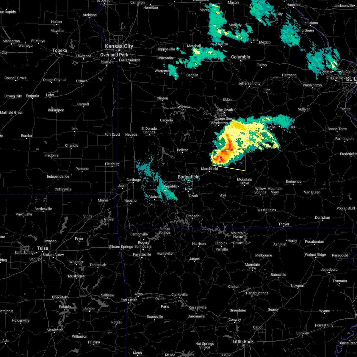 At 656 pm cdt, a severe thunderstorm was located 9 miles east of conway, or 11 miles south of lebanon, moving east at 25 mph (radar indicated). Hazards include ping pong ball size hail and 60 mph wind gusts. People and animals outdoors will be injured. expect hail damage to roofs, siding, windows, and vehicles. expect wind damage to roofs, siding, and trees. locations impacted include, lebanon, morgan, conway, phillipsburg, twin bridges, competition, manes, rader, lynchburg, grovespring, dry knob, falcon, this includes interstate 44 between mile markers 110 and 123. hail threat, radar indicated max hail size, 1. 50 in wind threat, radar indicated max wind gust, 60 mph. At 656 pm cdt, a severe thunderstorm was located 9 miles east of conway, or 11 miles south of lebanon, moving east at 25 mph (radar indicated). Hazards include ping pong ball size hail and 60 mph wind gusts. People and animals outdoors will be injured. expect hail damage to roofs, siding, windows, and vehicles. expect wind damage to roofs, siding, and trees. locations impacted include, lebanon, morgan, conway, phillipsburg, twin bridges, competition, manes, rader, lynchburg, grovespring, dry knob, falcon, this includes interstate 44 between mile markers 110 and 123. hail threat, radar indicated max hail size, 1. 50 in wind threat, radar indicated max wind gust, 60 mph.
|
| 4/21/2022 6:40 PM CDT |
 The tornado warning for northern webster, southeastern dallas, northwestern wright and southwestern laclede counties will expire at 645 pm cdt, the tornado threat has diminished and the tornado warning has been cancelled. however, large hail and damaging winds remain likely and a severe thunderstorm warning remains in effect for the area. The tornado warning for northern webster, southeastern dallas, northwestern wright and southwestern laclede counties will expire at 645 pm cdt, the tornado threat has diminished and the tornado warning has been cancelled. however, large hail and damaging winds remain likely and a severe thunderstorm warning remains in effect for the area.
|
| 4/21/2022 6:39 PM CDT |
 At 638 pm cdt, a severe thunderstorm was located near conway, or 13 miles northeast of marshfield, moving east at 30 mph (radar indicated). Hazards include ping pong ball size hail and 60 mph wind gusts. People and animals outdoors will be injured. expect hail damage to roofs, siding, windows, and vehicles. Expect wind damage to roofs, siding, and trees. At 638 pm cdt, a severe thunderstorm was located near conway, or 13 miles northeast of marshfield, moving east at 30 mph (radar indicated). Hazards include ping pong ball size hail and 60 mph wind gusts. People and animals outdoors will be injured. expect hail damage to roofs, siding, windows, and vehicles. Expect wind damage to roofs, siding, and trees.
|
| 4/21/2022 6:16 PM CDT |
 At 615 pm cdt, a severe thunderstorm capable of producing a tornado was located 7 miles northwest of marshfield, moving east at 15 mph (radar indicated rotation). Hazards include tornado and ping pong ball size hail. Flying debris will be dangerous to those caught without shelter. mobile homes will be damaged or destroyed. damage to roofs, windows, and vehicles will occur. tree damage is likely. Locations impacted include, marshfield, morgan, conway, niangua, duncan, twin bridges, elkland, rader, this includes interstate 44 between mile markers 100 and 113. At 615 pm cdt, a severe thunderstorm capable of producing a tornado was located 7 miles northwest of marshfield, moving east at 15 mph (radar indicated rotation). Hazards include tornado and ping pong ball size hail. Flying debris will be dangerous to those caught without shelter. mobile homes will be damaged or destroyed. damage to roofs, windows, and vehicles will occur. tree damage is likely. Locations impacted include, marshfield, morgan, conway, niangua, duncan, twin bridges, elkland, rader, this includes interstate 44 between mile markers 100 and 113.
|
| 4/21/2022 5:58 PM CDT |
 At 558 pm cdt, a severe thunderstorm capable of producing a tornado was located 8 miles northeast of fair grove, or 11 miles northwest of marshfield, moving east at 20 mph (radar indicated rotation). Hazards include tornado and golf ball size hail. Flying debris will be dangerous to those caught without shelter. mobile homes will be damaged or destroyed. damage to roofs, windows, and vehicles will occur. Tree damage is likely. At 558 pm cdt, a severe thunderstorm capable of producing a tornado was located 8 miles northeast of fair grove, or 11 miles northwest of marshfield, moving east at 20 mph (radar indicated rotation). Hazards include tornado and golf ball size hail. Flying debris will be dangerous to those caught without shelter. mobile homes will be damaged or destroyed. damage to roofs, windows, and vehicles will occur. Tree damage is likely.
|
| 4/21/2022 5:36 PM CDT |
 At 536 pm cdt, a severe thunderstorm capable of producing a tornado was located near pleasant hope, or 10 miles south of buffalo, moving east at 30 mph (radar indicated rotation). Hazards include tornado and golf ball size hail. Flying debris will be dangerous to those caught without shelter. mobile homes will be damaged or destroyed. damage to roofs, windows, and vehicles will occur. Tree damage is likely. At 536 pm cdt, a severe thunderstorm capable of producing a tornado was located near pleasant hope, or 10 miles south of buffalo, moving east at 30 mph (radar indicated rotation). Hazards include tornado and golf ball size hail. Flying debris will be dangerous to those caught without shelter. mobile homes will be damaged or destroyed. damage to roofs, windows, and vehicles will occur. Tree damage is likely.
|
| 4/15/2022 4:57 PM CDT |
 The severe thunderstorm warning for southeastern laclede county will expire at 500 pm cdt, the storm which prompted the warning has weakened below severe limits, and no longer poses an immediate threat to life or property. therefore, the warning will be allowed to expire. a severe thunderstorm watch remains in effect until 1000 pm cdt for south central and southwestern missouri. to report severe weather, contact your nearest law enforcement agency. they will relay your report to the national weather service springfield. The severe thunderstorm warning for southeastern laclede county will expire at 500 pm cdt, the storm which prompted the warning has weakened below severe limits, and no longer poses an immediate threat to life or property. therefore, the warning will be allowed to expire. a severe thunderstorm watch remains in effect until 1000 pm cdt for south central and southwestern missouri. to report severe weather, contact your nearest law enforcement agency. they will relay your report to the national weather service springfield.
|
| 4/15/2022 4:45 PM CDT |
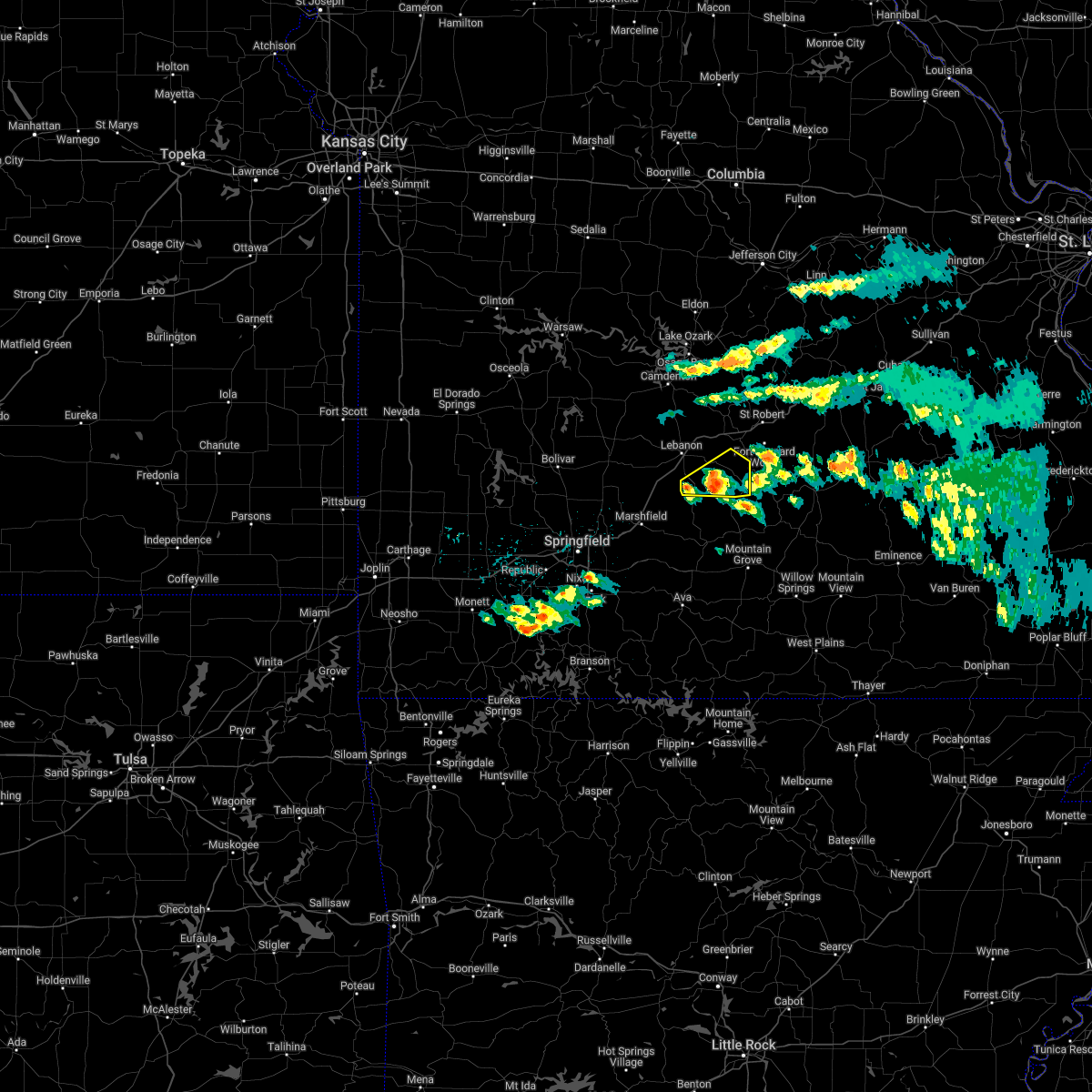 At 444 pm cdt, a severe thunderstorm was located 15 miles southeast of lebanon, moving east at 60 mph (radar indicated). Hazards include 60 mph wind gusts and quarter size hail. Hail damage to vehicles is expected. expect wind damage to roofs, siding, and trees. locations impacted include, twin bridges, competition, lynchburg, dry knob, falcon, hail threat, radar indicated max hail size, 1. 00 in wind threat, radar indicated max wind gust, 60 mph. At 444 pm cdt, a severe thunderstorm was located 15 miles southeast of lebanon, moving east at 60 mph (radar indicated). Hazards include 60 mph wind gusts and quarter size hail. Hail damage to vehicles is expected. expect wind damage to roofs, siding, and trees. locations impacted include, twin bridges, competition, lynchburg, dry knob, falcon, hail threat, radar indicated max hail size, 1. 00 in wind threat, radar indicated max wind gust, 60 mph.
|
| 4/15/2022 4:35 PM CDT |
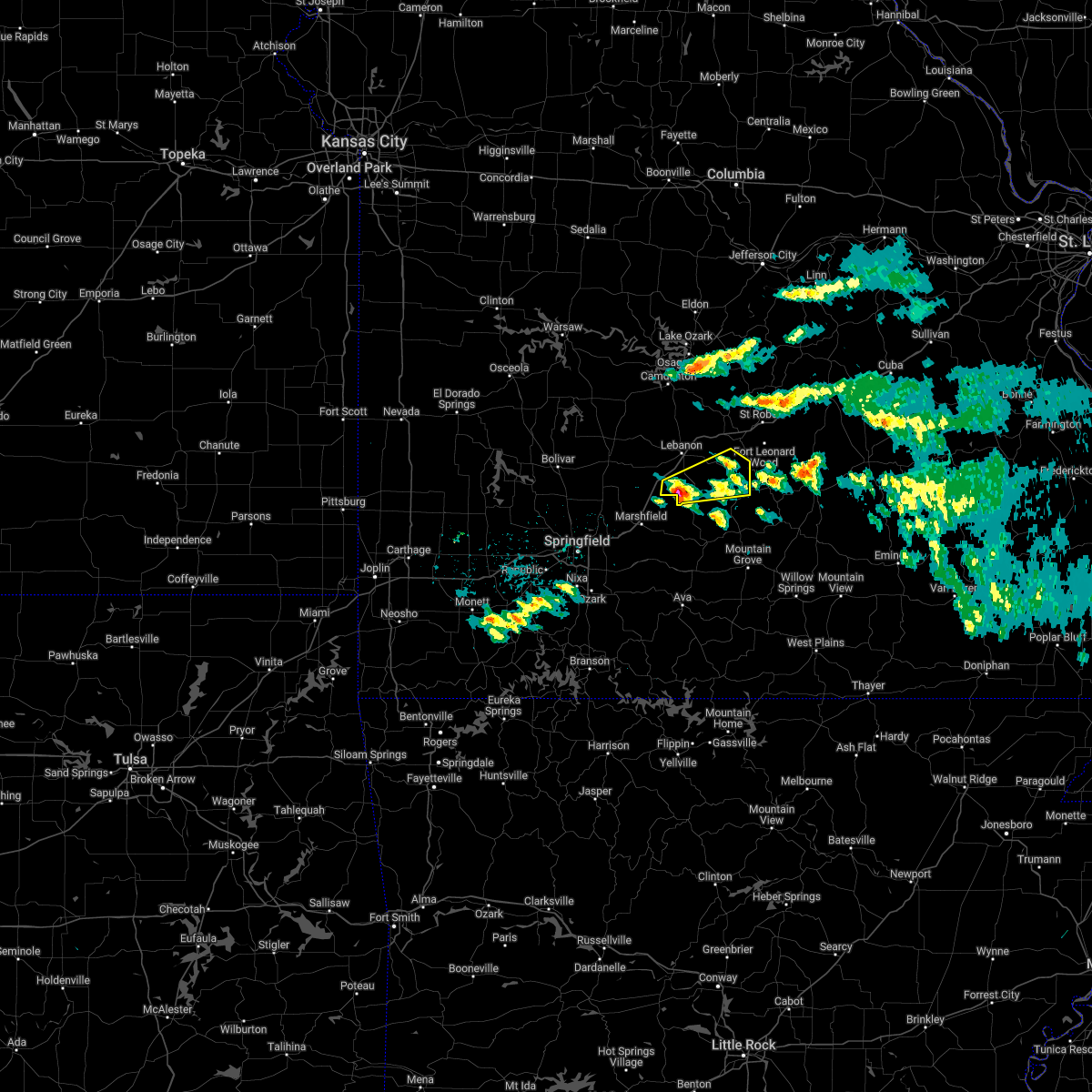 At 434 pm cdt, a severe thunderstorm was located 10 miles south of lebanon, moving east at 60 mph (public). Hazards include 60 mph wind gusts and half dollar size hail. Hail damage to vehicles is expected. expect wind damage to roofs, siding, and trees. locations impacted include, morgan, phillipsburg, twin bridges, competition, lynchburg, dry knob, falcon, this includes interstate 44 near mile marker 120. hail threat, observed max hail size, 1. 25 in wind threat, radar indicated max wind gust, 60 mph. At 434 pm cdt, a severe thunderstorm was located 10 miles south of lebanon, moving east at 60 mph (public). Hazards include 60 mph wind gusts and half dollar size hail. Hail damage to vehicles is expected. expect wind damage to roofs, siding, and trees. locations impacted include, morgan, phillipsburg, twin bridges, competition, lynchburg, dry knob, falcon, this includes interstate 44 near mile marker 120. hail threat, observed max hail size, 1. 25 in wind threat, radar indicated max wind gust, 60 mph.
|
| 4/15/2022 4:25 PM CDT |
 At 424 pm cdt, a severe thunderstorm was located near conway, or 11 miles northeast of marshfield, moving east at 60 mph (public reported half dollar size hail in elkland). Hazards include golf ball size hail and 60 mph wind gusts. People and animals outdoors will be injured. expect hail damage to roofs, siding, windows, and vehicles. expect wind damage to roofs, siding, and trees. locations impacted include, morgan, conway, phillipsburg, twin bridges, competition, rader, lynchburg, dry knob, falcon, this includes interstate 44 between mile markers 105 and 109, and between mile markers 112 and 121. thunderstorm damage threat, considerable hail threat, observed max hail size, 1. 75 in wind threat, radar indicated max wind gust, 60 mph. At 424 pm cdt, a severe thunderstorm was located near conway, or 11 miles northeast of marshfield, moving east at 60 mph (public reported half dollar size hail in elkland). Hazards include golf ball size hail and 60 mph wind gusts. People and animals outdoors will be injured. expect hail damage to roofs, siding, windows, and vehicles. expect wind damage to roofs, siding, and trees. locations impacted include, morgan, conway, phillipsburg, twin bridges, competition, rader, lynchburg, dry knob, falcon, this includes interstate 44 between mile markers 105 and 109, and between mile markers 112 and 121. thunderstorm damage threat, considerable hail threat, observed max hail size, 1. 75 in wind threat, radar indicated max wind gust, 60 mph.
|
| 4/15/2022 4:21 PM CDT |
 At 420 pm cdt, a severe thunderstorm was located near conway, or 8 miles north of marshfield, moving east at 60 mph (radar indicated). Hazards include 60 mph wind gusts and quarter size hail. Hail damage to vehicles is expected. Expect wind damage to roofs, siding, and trees. At 420 pm cdt, a severe thunderstorm was located near conway, or 8 miles north of marshfield, moving east at 60 mph (radar indicated). Hazards include 60 mph wind gusts and quarter size hail. Hail damage to vehicles is expected. Expect wind damage to roofs, siding, and trees.
|
| 4/11/2022 3:10 AM CDT |
 The severe thunderstorm warning for northeastern webster and laclede counties will expire at 315 am cdt, the storms which prompted the warning have weakened below severe limits, and no longer pose an immediate threat to life or property. therefore, the warning will be allowed to expire. however small hail and gusty winds are still possible with these thunderstorms. a severe thunderstorm watch remains in effect until 400 am cdt for central and southwestern missouri. The severe thunderstorm warning for northeastern webster and laclede counties will expire at 315 am cdt, the storms which prompted the warning have weakened below severe limits, and no longer pose an immediate threat to life or property. therefore, the warning will be allowed to expire. however small hail and gusty winds are still possible with these thunderstorms. a severe thunderstorm watch remains in effect until 400 am cdt for central and southwestern missouri.
|
| 4/11/2022 2:59 AM CDT |
 At 258 am cdt, severe thunderstorms were located along a line extending from 10 miles west of lebanon to conway to near marshfield, moving northeast at 35 mph (radar indicated). Hazards include 60 mph wind gusts and quarter size hail. Hail damage to vehicles is expected. expect wind damage to roofs, siding, and trees. locations impacted include, lebanon, bennett spring state park, morgan, conway, phillipsburg, stoutland, twin bridges, rader, sleeper, dry knob, this includes interstate 44 between mile markers 106 and 109, and between mile markers 112 and 142. hail threat, radar indicated max hail size, 1. 00 in wind threat, radar indicated max wind gust, 60 mph. At 258 am cdt, severe thunderstorms were located along a line extending from 10 miles west of lebanon to conway to near marshfield, moving northeast at 35 mph (radar indicated). Hazards include 60 mph wind gusts and quarter size hail. Hail damage to vehicles is expected. expect wind damage to roofs, siding, and trees. locations impacted include, lebanon, bennett spring state park, morgan, conway, phillipsburg, stoutland, twin bridges, rader, sleeper, dry knob, this includes interstate 44 between mile markers 106 and 109, and between mile markers 112 and 142. hail threat, radar indicated max hail size, 1. 00 in wind threat, radar indicated max wind gust, 60 mph.
|
| 4/11/2022 2:37 AM CDT |
 At 236 am cdt, severe thunderstorms were located along a line extending from near buffalo to 7 miles northeast of fair grove to strafford, moving northeast at 35 mph (radar indicated). Hazards include 60 mph wind gusts and quarter size hail. Hail damage to vehicles is expected. Expect wind damage to roofs, siding, and trees. At 236 am cdt, severe thunderstorms were located along a line extending from near buffalo to 7 miles northeast of fair grove to strafford, moving northeast at 35 mph (radar indicated). Hazards include 60 mph wind gusts and quarter size hail. Hail damage to vehicles is expected. Expect wind damage to roofs, siding, and trees.
|
| 10/24/2021 7:13 PM CDT |
 At 713 pm cdt, a severe thunderstorm was located near strafford, moving east at 45 mph (radar indicated). Hazards include 60 mph wind gusts and quarter size hail. Hail damage to vehicles is expected. Expect wind damage to roofs, siding, and trees. At 713 pm cdt, a severe thunderstorm was located near strafford, moving east at 45 mph (radar indicated). Hazards include 60 mph wind gusts and quarter size hail. Hail damage to vehicles is expected. Expect wind damage to roofs, siding, and trees.
|
| 6/27/2021 3:15 PM CDT |
 At 315 pm cdt, severe thunderstorms were located along a line extending from 9 miles southeast of lebanon to 18 miles southwest of fort leonard wood to 15 miles northeast of hartville, moving northeast at 40 mph (radar indicated). Hazards include 60 mph wind gusts and penny size hail. Expect damage to roofs, siding, and trees. Locations impacted include, fort leonard wood, waynesville, plato, twin bridges, competition, laquey, roby, manes, lynchburg, dry knob, falcon, this includes interstate 44 between mile markers 141 and 155. At 315 pm cdt, severe thunderstorms were located along a line extending from 9 miles southeast of lebanon to 18 miles southwest of fort leonard wood to 15 miles northeast of hartville, moving northeast at 40 mph (radar indicated). Hazards include 60 mph wind gusts and penny size hail. Expect damage to roofs, siding, and trees. Locations impacted include, fort leonard wood, waynesville, plato, twin bridges, competition, laquey, roby, manes, lynchburg, dry knob, falcon, this includes interstate 44 between mile markers 141 and 155.
|
| 6/27/2021 2:59 PM CDT |
 At 259 pm cdt, severe thunderstorms were located along a line extending from 15 miles east of conway to 18 miles east of niangua to 8 miles northeast of hartville, moving northeast at 40 mph (radar indicated). Hazards include 60 mph wind gusts and penny size hail. expect damage to roofs, siding, and trees At 259 pm cdt, severe thunderstorms were located along a line extending from 15 miles east of conway to 18 miles east of niangua to 8 miles northeast of hartville, moving northeast at 40 mph (radar indicated). Hazards include 60 mph wind gusts and penny size hail. expect damage to roofs, siding, and trees
|
| 6/27/2021 2:41 PM CDT |
 At 240 pm cdt, severe thunderstorms were located along a line extending from 9 miles southeast of niangua to near hartville to near mansfield, moving northeast at 45 mph (radar indicated). Hazards include 60 mph wind gusts and quarter size hail. Hail damage to vehicles is expected. expect wind damage to roofs, siding, and trees. Locations impacted include, mountain grove, mansfield, dawson, norwood, hartville, duncan, plato, twin bridges, competition, manes, lynchburg, graff, grovespring, odin, bendavis,. At 240 pm cdt, severe thunderstorms were located along a line extending from 9 miles southeast of niangua to near hartville to near mansfield, moving northeast at 45 mph (radar indicated). Hazards include 60 mph wind gusts and quarter size hail. Hail damage to vehicles is expected. expect wind damage to roofs, siding, and trees. Locations impacted include, mountain grove, mansfield, dawson, norwood, hartville, duncan, plato, twin bridges, competition, manes, lynchburg, graff, grovespring, odin, bendavis,.
|
| 6/27/2021 2:23 PM CDT |
 At 221 pm cdt, a severe thunderstorm was located near mansfield, or 11 miles north of ava, moving northeast at 40 mph (radar indicated). Hazards include 60 mph wind gusts and quarter size hail. Hail damage to vehicles is expected. expect wind damage to roofs, siding, and trees. this storm will impact highway 60 west of mansfield by 230 pm cdt. Locations impacted include, mountain grove, ava, seymour, mansfield, dawson, norwood, hartville, duncan, diggins, plato, twin bridges, competition, manes, lynchburg, graff, grovespring, odin, bendavis,. At 221 pm cdt, a severe thunderstorm was located near mansfield, or 11 miles north of ava, moving northeast at 40 mph (radar indicated). Hazards include 60 mph wind gusts and quarter size hail. Hail damage to vehicles is expected. expect wind damage to roofs, siding, and trees. this storm will impact highway 60 west of mansfield by 230 pm cdt. Locations impacted include, mountain grove, ava, seymour, mansfield, dawson, norwood, hartville, duncan, diggins, plato, twin bridges, competition, manes, lynchburg, graff, grovespring, odin, bendavis,.
|
| 6/27/2021 2:17 PM CDT |
 At 216 pm cdt, severe thunderstorms were located along a line extending from near diggins to near mansfield to near ava, moving northeast at 40 mph (radar indicated). Hazards include 60 mph wind gusts and penny size hail. expect damage to roofs, siding, and trees At 216 pm cdt, severe thunderstorms were located along a line extending from near diggins to near mansfield to near ava, moving northeast at 40 mph (radar indicated). Hazards include 60 mph wind gusts and penny size hail. expect damage to roofs, siding, and trees
|
| 6/11/2021 6:55 PM CDT |
 At 654 pm cdt, severe thunderstorms were located along a line extending from near osage beach to 6 miles southeast of macks creek to near buffalo, moving southeast at 25 mph (radar indicated). Hazards include 60 mph wind gusts and half dollar size hail. Hail damage to vehicles is expected. Expect wind damage to roofs, siding, and trees. At 654 pm cdt, severe thunderstorms were located along a line extending from near osage beach to 6 miles southeast of macks creek to near buffalo, moving southeast at 25 mph (radar indicated). Hazards include 60 mph wind gusts and half dollar size hail. Hail damage to vehicles is expected. Expect wind damage to roofs, siding, and trees.
|
| 5/27/2021 1:02 PM CDT |
 At 102 pm cdt, severe thunderstorms were located along a line extending from 14 miles west of richland to 7 miles southeast of lebanon to 9 miles east of conway, moving east at 40 mph (radar indicated). Hazards include 70 mph wind gusts and quarter size hail. Hail damage to vehicles is expected. expect considerable tree damage. wind damage is also likely to mobile homes, roofs, and outbuildings. Locations impacted include, fort leonard wood, lebanon, waynesville, morgan, stoutland, twin bridges, competition, laquey, lynchburg, sleeper, dry knob, falcon, this includes interstate 44 between mile markers 117 and 155. At 102 pm cdt, severe thunderstorms were located along a line extending from 14 miles west of richland to 7 miles southeast of lebanon to 9 miles east of conway, moving east at 40 mph (radar indicated). Hazards include 70 mph wind gusts and quarter size hail. Hail damage to vehicles is expected. expect considerable tree damage. wind damage is also likely to mobile homes, roofs, and outbuildings. Locations impacted include, fort leonard wood, lebanon, waynesville, morgan, stoutland, twin bridges, competition, laquey, lynchburg, sleeper, dry knob, falcon, this includes interstate 44 between mile markers 117 and 155.
|
| 5/27/2021 12:24 PM CDT |
 The national weather service in springfield has issued a * severe thunderstorm warning for. laclede county in southwestern missouri. southern pulaski county in central missouri. until 130 pm cdt. At 1223 pm cdt, severe thunderstorms were located along a line. The national weather service in springfield has issued a * severe thunderstorm warning for. laclede county in southwestern missouri. southern pulaski county in central missouri. until 130 pm cdt. At 1223 pm cdt, severe thunderstorms were located along a line.
|
| 11/14/2020 7:53 PM CST |
 At 753 pm cst, severe thunderstorms were located along a line extending from near rich fountain to near richland to conway, moving northeast at 45 mph (radar indicated). Hazards include 70 mph wind gusts and quarter size hail. Hail damage to vehicles is expected. expect considerable tree damage. wind damage is also likely to mobile homes, roofs, and outbuildings. locations impacted include, northwestern fort leonard wood, lebanon, marshfield, waynesville, st. Robert, rogersville, richland, dixon, belle, morgan, crocker, fordland, conway, vienna, niangua, phillipsburg, stoutland, twin bridges, elkland, grovespring, this includes interstate 44 between mile markers 91 and 132, between mile markers 136 and 169, and between mile markers 171 and 176. At 753 pm cst, severe thunderstorms were located along a line extending from near rich fountain to near richland to conway, moving northeast at 45 mph (radar indicated). Hazards include 70 mph wind gusts and quarter size hail. Hail damage to vehicles is expected. expect considerable tree damage. wind damage is also likely to mobile homes, roofs, and outbuildings. locations impacted include, northwestern fort leonard wood, lebanon, marshfield, waynesville, st. Robert, rogersville, richland, dixon, belle, morgan, crocker, fordland, conway, vienna, niangua, phillipsburg, stoutland, twin bridges, elkland, grovespring, this includes interstate 44 between mile markers 91 and 132, between mile markers 136 and 169, and between mile markers 171 and 176.
|
| 11/14/2020 7:33 PM CST |
 At 733 pm cst, severe thunderstorms were located along a line extending from 8 miles west of freeburg to near lebanon to 6 miles northeast of fair grove, moving northeast at 45 mph (radar indicated). Hazards include 60 mph wind gusts and quarter size hail. Hail damage to vehicles is expected. Expect wind damage to roofs, siding, and trees. At 733 pm cst, severe thunderstorms were located along a line extending from 8 miles west of freeburg to near lebanon to 6 miles northeast of fair grove, moving northeast at 45 mph (radar indicated). Hazards include 60 mph wind gusts and quarter size hail. Hail damage to vehicles is expected. Expect wind damage to roofs, siding, and trees.
|
| 11/14/2020 6:45 PM CST |
 At 645 pm cst, severe thunderstorms were located along a line extending from near camdenton to near pleasant hope, moving east at 40 mph (radar indicated). Hazards include 60 mph wind gusts and quarter size hail. Hail damage to vehicles is expected. Expect wind damage to roofs, siding, and trees. At 645 pm cst, severe thunderstorms were located along a line extending from near camdenton to near pleasant hope, moving east at 40 mph (radar indicated). Hazards include 60 mph wind gusts and quarter size hail. Hail damage to vehicles is expected. Expect wind damage to roofs, siding, and trees.
|
| 5/4/2020 2:24 PM CDT |
 At 223 pm cdt, severe thunderstorms were located along a line extending from 8 miles south of richland to 12 miles east of conway to near marshfield, moving southeast at 50 mph. these are very dangerous storms (trained weather spotters in lebanon reports buildings destroyed and substantial tree damage). Hazards include 80 mph wind gusts and ping pong ball size hail. Flying debris will be dangerous to those caught without shelter. mobile homes will be heavily damaged. expect considerable damage to roofs, windows, and vehicles. extensive tree damage and power outages are likely. Locations impacted include, southwestern fort leonard wood, lebanon, bennett spring state park, marshfield, waynesville, mountain grove, seymour, richland, morgan, mansfield, conway, dawson, norwood, hartville, niangua, duncan, phillipsburg, stoutland, bennett springs, twin bridges, this includes interstate 44 between mile markers 98 and 156. At 223 pm cdt, severe thunderstorms were located along a line extending from 8 miles south of richland to 12 miles east of conway to near marshfield, moving southeast at 50 mph. these are very dangerous storms (trained weather spotters in lebanon reports buildings destroyed and substantial tree damage). Hazards include 80 mph wind gusts and ping pong ball size hail. Flying debris will be dangerous to those caught without shelter. mobile homes will be heavily damaged. expect considerable damage to roofs, windows, and vehicles. extensive tree damage and power outages are likely. Locations impacted include, southwestern fort leonard wood, lebanon, bennett spring state park, marshfield, waynesville, mountain grove, seymour, richland, morgan, mansfield, conway, dawson, norwood, hartville, niangua, duncan, phillipsburg, stoutland, bennett springs, twin bridges, this includes interstate 44 between mile markers 98 and 156.
|
| 5/4/2020 2:11 PM CDT |
 At 211 pm cdt, severe thunderstorms were located along a line extending from 8 miles northeast of lebanon to near conway to near fair grove, moving southeast at 50 mph (radar indicated). Hazards include ping pong ball size hail and 60 to 70 mph wind gusts. People and animals outdoors will be injured. expect hail damage to roofs, siding, windows, and vehicles. Expect wind damage to roofs, siding, and trees. At 211 pm cdt, severe thunderstorms were located along a line extending from 8 miles northeast of lebanon to near conway to near fair grove, moving southeast at 50 mph (radar indicated). Hazards include ping pong ball size hail and 60 to 70 mph wind gusts. People and animals outdoors will be injured. expect hail damage to roofs, siding, windows, and vehicles. Expect wind damage to roofs, siding, and trees.
|
| 1/10/2020 6:47 PM CST |
 At 647 pm cst, severe thunderstorms were located along a line extending from near iberia to 7 miles south of richland to 14 miles southwest of fort leonard wood to near hartville, moving east at 80 mph (radar indicated). Hazards include 60 mph wind gusts and quarter size hail. Hail damage to vehicles is expected. expect wind damage to roofs, siding, and trees. Locations impacted include, lebanon, lake of the ozarks, lake of the ozarks state park, ha ha tonka state park, camdenton, richland, morgan, dawson, hartville, linn creek, stoutland, twin bridges, competition, manes, lynchburg, grovespring, sleeper, falcon, freedom, decaturville, this includes interstate 44 between mile markers 121 and 144. At 647 pm cst, severe thunderstorms were located along a line extending from near iberia to 7 miles south of richland to 14 miles southwest of fort leonard wood to near hartville, moving east at 80 mph (radar indicated). Hazards include 60 mph wind gusts and quarter size hail. Hail damage to vehicles is expected. expect wind damage to roofs, siding, and trees. Locations impacted include, lebanon, lake of the ozarks, lake of the ozarks state park, ha ha tonka state park, camdenton, richland, morgan, dawson, hartville, linn creek, stoutland, twin bridges, competition, manes, lynchburg, grovespring, sleeper, falcon, freedom, decaturville, this includes interstate 44 between mile markers 121 and 144.
|
| 1/10/2020 6:29 PM CST |
 At 629 pm cst, severe thunderstorms were located along a line extending from near camdenton to 7 miles southwest of lebanon to 6 miles southeast of conway to diggins, moving northeast at 80 mph (radar indicated). Hazards include 60 mph wind gusts and quarter size hail. Hail damage to vehicles is expected. Expect wind damage to roofs, siding, and trees. At 629 pm cst, severe thunderstorms were located along a line extending from near camdenton to 7 miles southwest of lebanon to 6 miles southeast of conway to diggins, moving northeast at 80 mph (radar indicated). Hazards include 60 mph wind gusts and quarter size hail. Hail damage to vehicles is expected. Expect wind damage to roofs, siding, and trees.
|
| 1/10/2020 6:22 PM CST |
 At 622 pm cst, severe thunderstorms were located along a line extending from near lebanon to 11 miles east of conway to 9 miles west of hartville, moving northeast at 55 mph (radar indicated). Hazards include 60 mph wind gusts and quarter size hail. Hail damage to vehicles is expected. expect wind damage to roofs, siding, and trees. Locations impacted include, lebanon, bennett spring state park, marshfield, rogersville, seymour, morgan, fordland, conway, hartville, niangua, duncan, diggins, phillipsburg, stoutland, twin bridges, competition, elkland, grovespring, sleeper, falcon, this includes interstate 44 between mile markers 91 and 143. At 622 pm cst, severe thunderstorms were located along a line extending from near lebanon to 11 miles east of conway to 9 miles west of hartville, moving northeast at 55 mph (radar indicated). Hazards include 60 mph wind gusts and quarter size hail. Hail damage to vehicles is expected. expect wind damage to roofs, siding, and trees. Locations impacted include, lebanon, bennett spring state park, marshfield, rogersville, seymour, morgan, fordland, conway, hartville, niangua, duncan, diggins, phillipsburg, stoutland, twin bridges, competition, elkland, grovespring, sleeper, falcon, this includes interstate 44 between mile markers 91 and 143.
|
| 1/10/2020 5:45 PM CST |
 At 545 pm cst, severe thunderstorms were located along a line extending from near fair grove to near strafford to near ozark, moving northeast at 55 mph (radar indicated). Hazards include 70 mph wind gusts and quarter size hail. Hail damage to vehicles is expected. expect considerable tree damage. Wind damage is also likely to mobile homes, roofs, and outbuildings. At 545 pm cst, severe thunderstorms were located along a line extending from near fair grove to near strafford to near ozark, moving northeast at 55 mph (radar indicated). Hazards include 70 mph wind gusts and quarter size hail. Hail damage to vehicles is expected. expect considerable tree damage. Wind damage is also likely to mobile homes, roofs, and outbuildings.
|
| 10/21/2019 1:52 AM CDT |
 At 152 am cdt, a severe squall line capable of producing both tornadoes and extensive straight line wind damage was located near conway, or 11 miles northeast of marshfield, moving northeast at 50 mph (radar indicated rotation). Hazards include tornado. Flying debris will be dangerous to those caught without shelter. mobile homes will be damaged or destroyed. damage to roofs, windows, and vehicles will occur. tree damage is likely. Locations impacted include, marshfield, morgan, conway, niangua, phillipsburg, twin bridges, rader, this includes interstate 44 between mile markers 100 and 109, and between mile markers 112 and 123. At 152 am cdt, a severe squall line capable of producing both tornadoes and extensive straight line wind damage was located near conway, or 11 miles northeast of marshfield, moving northeast at 50 mph (radar indicated rotation). Hazards include tornado. Flying debris will be dangerous to those caught without shelter. mobile homes will be damaged or destroyed. damage to roofs, windows, and vehicles will occur. tree damage is likely. Locations impacted include, marshfield, morgan, conway, niangua, phillipsburg, twin bridges, rader, this includes interstate 44 between mile markers 100 and 109, and between mile markers 112 and 123.
|
| 10/21/2019 1:50 AM CDT |
 At 150 am cdt, a severe thunderstorm was located 8 miles east of niangua, or 11 miles east of marshfield, moving east at 50 mph (radar indicated). Hazards include 60 mph wind gusts and nickel size hail. Expect damage to roofs, siding, and trees. Locations impacted include, marshfield, seymour, morgan, conway, hartville, niangua, duncan, diggins, phillipsburg, twin bridges, competition, grovespring, rader, odin, this includes interstate 44 between mile markers 100 and 109, and between mile markers 112 and 115, and near mile marker 120. At 150 am cdt, a severe thunderstorm was located 8 miles east of niangua, or 11 miles east of marshfield, moving east at 50 mph (radar indicated). Hazards include 60 mph wind gusts and nickel size hail. Expect damage to roofs, siding, and trees. Locations impacted include, marshfield, seymour, morgan, conway, hartville, niangua, duncan, diggins, phillipsburg, twin bridges, competition, grovespring, rader, odin, this includes interstate 44 between mile markers 100 and 109, and between mile markers 112 and 115, and near mile marker 120.
|
| 10/21/2019 1:28 AM CDT |
 At 127 am cdt, severe thunderstorms capable of producing both tornadoes and extensive straight line wind damage were located near strafford, moving northeast at 50 mph (radar indicated rotation). Hazards include tornado. Flying debris will be dangerous to those caught without shelter. mobile homes will be damaged or destroyed. damage to roofs, windows, and vehicles will occur. Tree damage is likely. At 127 am cdt, severe thunderstorms capable of producing both tornadoes and extensive straight line wind damage were located near strafford, moving northeast at 50 mph (radar indicated rotation). Hazards include tornado. Flying debris will be dangerous to those caught without shelter. mobile homes will be damaged or destroyed. damage to roofs, windows, and vehicles will occur. Tree damage is likely.
|
| 10/21/2019 1:18 AM CDT |
 At 118 am cdt, a severe thunderstorm was located near strafford, moving east at 55 mph (radar indicated). Hazards include 70 mph wind gusts and nickel size hail. Expect considerable tree damage. Damage is likely to mobile homes, roofs, and outbuildings. At 118 am cdt, a severe thunderstorm was located near strafford, moving east at 55 mph (radar indicated). Hazards include 70 mph wind gusts and nickel size hail. Expect considerable tree damage. Damage is likely to mobile homes, roofs, and outbuildings.
|
| 8/26/2019 11:12 PM CDT |
 The severe thunderstorm warning for northern webster, wright and southern laclede counties will expire at 1115 pm cdt, the storms which prompted the warning have moved out of the area. therefore, the warning will be allowed to expire. however gusty winds are still possible with these thunderstorms. a severe thunderstorm watch remains in effect until 600 am cdt for south central and southwestern missouri. The severe thunderstorm warning for northern webster, wright and southern laclede counties will expire at 1115 pm cdt, the storms which prompted the warning have moved out of the area. therefore, the warning will be allowed to expire. however gusty winds are still possible with these thunderstorms. a severe thunderstorm watch remains in effect until 600 am cdt for south central and southwestern missouri.
|
| 8/26/2019 10:41 PM CDT |
 At 1041 pm cdt, severe thunderstorms were located along a line extending from 10 miles southwest of lebanon to near conway to near marshfield, moving east at 40 mph. one cell in particular near phillipsburg is being monitored for possible tornado development (radar indicated). Hazards include 70 mph wind gusts and penny size hail. Expect considerable tree damage. damage is likely to mobile homes, roofs, and outbuildings. Locations impacted include, marshfield, morgan, dawson, hartville, niangua, duncan, phillipsburg, twin bridges, competition, manes, lynchburg, grovespring, graff, falcon, rader, odin, this includes interstate 44 between mile markers 94 and 108, and between mile markers 118 and 120. At 1041 pm cdt, severe thunderstorms were located along a line extending from 10 miles southwest of lebanon to near conway to near marshfield, moving east at 40 mph. one cell in particular near phillipsburg is being monitored for possible tornado development (radar indicated). Hazards include 70 mph wind gusts and penny size hail. Expect considerable tree damage. damage is likely to mobile homes, roofs, and outbuildings. Locations impacted include, marshfield, morgan, dawson, hartville, niangua, duncan, phillipsburg, twin bridges, competition, manes, lynchburg, grovespring, graff, falcon, rader, odin, this includes interstate 44 between mile markers 94 and 108, and between mile markers 118 and 120.
|
| 8/26/2019 10:29 PM CDT |
 At 1029 pm cdt, severe thunderstorms were located along a line extending from 12 miles north of niangua to near conway to near marshfield, moving east at 45 mph (radar indicated). Hazards include 70 mph wind gusts and penny size hail. Expect considerable tree damage. Damage is likely to mobile homes, roofs, and outbuildings. At 1029 pm cdt, severe thunderstorms were located along a line extending from 12 miles north of niangua to near conway to near marshfield, moving east at 45 mph (radar indicated). Hazards include 70 mph wind gusts and penny size hail. Expect considerable tree damage. Damage is likely to mobile homes, roofs, and outbuildings.
|
| 8/26/2019 10:19 PM CDT |
 At 1016 pm cdt, the severe thunderstorm that had developed near long land has tracked eastward into laclede county and diminished in intensity. however additional strong to severe cells are developing over southwest dallas county and will track back into the western sections of the warned area southward into northern webster county (radar indicated). Hazards include 60 mph wind gusts and half dollar size hail. Hail damage to vehicles is expected. expect wind damage to roofs, siding, and trees. Locations impacted include, lebanon, bennett spring state park, morgan, conway, phillipsburg, twin bridges, long lane, sleeper, dry knob, this includes interstate 44 between mile markers 110 and 143. At 1016 pm cdt, the severe thunderstorm that had developed near long land has tracked eastward into laclede county and diminished in intensity. however additional strong to severe cells are developing over southwest dallas county and will track back into the western sections of the warned area southward into northern webster county (radar indicated). Hazards include 60 mph wind gusts and half dollar size hail. Hail damage to vehicles is expected. expect wind damage to roofs, siding, and trees. Locations impacted include, lebanon, bennett spring state park, morgan, conway, phillipsburg, twin bridges, long lane, sleeper, dry knob, this includes interstate 44 between mile markers 110 and 143.
|
| 8/26/2019 10:01 PM CDT |
 The national weather service in springfield has issued a * severe thunderstorm warning for. southeastern dallas county in southwestern missouri. western laclede county in southwestern missouri. until 1030 pm cdt. At 1001 pm cdt, a severe thunderstorm was located 8 miles north of. The national weather service in springfield has issued a * severe thunderstorm warning for. southeastern dallas county in southwestern missouri. western laclede county in southwestern missouri. until 1030 pm cdt. At 1001 pm cdt, a severe thunderstorm was located 8 miles north of.
|
| 7/10/2019 12:27 PM CDT |
 At 1227 pm cdt, severe thunderstorms were located along a line extending from 10 miles south of macks creek to 11 miles southwest of lebanon to near conway, moving east at 20 mph (radar indicated). Hazards include 60 mph wind gusts. expect damage to roofs, siding, and trees At 1227 pm cdt, severe thunderstorms were located along a line extending from 10 miles south of macks creek to 11 miles southwest of lebanon to near conway, moving east at 20 mph (radar indicated). Hazards include 60 mph wind gusts. expect damage to roofs, siding, and trees
|
| 5/21/2019 3:23 PM CDT |
 At 323 pm cdt, severe thunderstorms were located along a line extending from 9 miles east of conway to 9 miles northwest of hartville, moving northeast at 55 mph (radar indicated). Hazards include 60 mph wind gusts and nickel size hail. expect damage to roofs, siding, and trees At 323 pm cdt, severe thunderstorms were located along a line extending from 9 miles east of conway to 9 miles northwest of hartville, moving northeast at 55 mph (radar indicated). Hazards include 60 mph wind gusts and nickel size hail. expect damage to roofs, siding, and trees
|
| 5/21/2019 3:08 PM CDT |
 At 308 pm cdt, severe thunderstorms were located along a line extending from 13 miles north of niangua to near conway, moving northeast at 60 mph (radar indicated). Hazards include 60 mph wind gusts and quarter size hail. Hail damage to vehicles is expected. Expect wind damage to roofs, siding, and trees. At 308 pm cdt, severe thunderstorms were located along a line extending from 13 miles north of niangua to near conway, moving northeast at 60 mph (radar indicated). Hazards include 60 mph wind gusts and quarter size hail. Hail damage to vehicles is expected. Expect wind damage to roofs, siding, and trees.
|
| 5/20/2019 11:48 PM CDT |
 At 1123 pm cdt, severe thunderstorms were located along a line extending from 12 miles southeast of camdenton to near lebanon to 13 miles east of conway to 9 miles northwest of hartville, moving east at 45 mph (radar indicated). Hazards include 60 mph wind gusts and penny size hail. expect damage to roofs, siding, and trees At 1123 pm cdt, severe thunderstorms were located along a line extending from 12 miles southeast of camdenton to near lebanon to 13 miles east of conway to 9 miles northwest of hartville, moving east at 45 mph (radar indicated). Hazards include 60 mph wind gusts and penny size hail. expect damage to roofs, siding, and trees
|
| 5/20/2019 11:27 PM CDT | 18 inch trees dow in wright county MO, 10.2 miles N of Evergreen, MO |
| 5/20/2019 11:24 PM CDT |
 At 1123 pm cdt, severe thunderstorms were located along a line extending from 12 miles southeast of camdenton to near lebanon to 13 miles east of conway to 9 miles northwest of hartville, moving east at 45 mph (radar indicated). Hazards include 60 mph wind gusts and penny size hail. expect damage to roofs, siding, and trees At 1123 pm cdt, severe thunderstorms were located along a line extending from 12 miles southeast of camdenton to near lebanon to 13 miles east of conway to 9 miles northwest of hartville, moving east at 45 mph (radar indicated). Hazards include 60 mph wind gusts and penny size hail. expect damage to roofs, siding, and trees
|
| 5/20/2019 11:18 PM CDT |
 At 1117 pm cdt, severe thunderstorms were located along a line extending from near lebanon to 19 miles northeast of niangua to 7 miles east of conway, moving northeast at 55 mph (radar indicated). Hazards include 60 mph wind gusts and penny size hail. Expect damage to roofs, siding, and trees. Locations impacted include, lebanon, bennett spring state park, morgan, phillipsburg, twin bridges, sleeper, dry knob, falcon, this includes interstate 44 between mile markers 117 and 137. At 1117 pm cdt, severe thunderstorms were located along a line extending from near lebanon to 19 miles northeast of niangua to 7 miles east of conway, moving northeast at 55 mph (radar indicated). Hazards include 60 mph wind gusts and penny size hail. Expect damage to roofs, siding, and trees. Locations impacted include, lebanon, bennett spring state park, morgan, phillipsburg, twin bridges, sleeper, dry knob, falcon, this includes interstate 44 between mile markers 117 and 137.
|
| 5/20/2019 11:01 PM CDT |
 At 1101 pm cdt, severe thunderstorms were located along a line extending from 8 miles east of buffalo to near conway to near marshfield, moving northeast at 55 mph (radar indicated). Hazards include 60 mph wind gusts and penny size hail. expect damage to roofs, siding, and trees At 1101 pm cdt, severe thunderstorms were located along a line extending from 8 miles east of buffalo to near conway to near marshfield, moving northeast at 55 mph (radar indicated). Hazards include 60 mph wind gusts and penny size hail. expect damage to roofs, siding, and trees
|
| 5/18/2019 4:52 PM CDT |
 At 449 pm cdt, severe thunderstorms were located along a line extending from 16 miles north of hartville to near bakersfield, moving east at 45 mph (radar indicated). Hazards include 60 mph wind gusts. an area of rotation and possible tornado potential exists near mountain grove moving into texas county. Expect damage to roofs, siding, and trees. Locations impacted include, southwestern fort leonard wood, west plains, mountain grove, willow springs, cabool, houston, dawson, norwood, hartville, pomona, bakersfield, south fork, brandsville, huggins, plato, twin bridges, competition, manes, tecumseh, pottersville, this includes interstate 44 between mile markers 133 and 152. At 449 pm cdt, severe thunderstorms were located along a line extending from 16 miles north of hartville to near bakersfield, moving east at 45 mph (radar indicated). Hazards include 60 mph wind gusts. an area of rotation and possible tornado potential exists near mountain grove moving into texas county. Expect damage to roofs, siding, and trees. Locations impacted include, southwestern fort leonard wood, west plains, mountain grove, willow springs, cabool, houston, dawson, norwood, hartville, pomona, bakersfield, south fork, brandsville, huggins, plato, twin bridges, competition, manes, tecumseh, pottersville, this includes interstate 44 between mile markers 133 and 152.
|
| 5/18/2019 4:26 PM CDT |
 The severe thunderstorm warning for hickory, northern webster, dallas, northwestern wright, southeastern benton, western laclede, eastern polk, eastern greene and southwestern camden counties will expire at 430 pm cdt, the storms which prompted the warning have weakened below severe limits, and no longer pose an immediate threat to life or property. therefore, the warning will be allowed to expire. however gusty winds are still possible with these thunderstorms. a tornado watch remains in effect until 500 pm cdt for central and southwestern missouri. The severe thunderstorm warning for hickory, northern webster, dallas, northwestern wright, southeastern benton, western laclede, eastern polk, eastern greene and southwestern camden counties will expire at 430 pm cdt, the storms which prompted the warning have weakened below severe limits, and no longer pose an immediate threat to life or property. therefore, the warning will be allowed to expire. however gusty winds are still possible with these thunderstorms. a tornado watch remains in effect until 500 pm cdt for central and southwestern missouri.
|
| 5/18/2019 4:25 PM CDT |
 At 425 pm cdt, severe thunderstorms were located along a line extending from near conway to near gainesville, moving east at 30 mph (radar indicated). Hazards include 60 mph wind gusts. expect damage to roofs, siding, and trees At 425 pm cdt, severe thunderstorms were located along a line extending from near conway to near gainesville, moving east at 30 mph (radar indicated). Hazards include 60 mph wind gusts. expect damage to roofs, siding, and trees
|
| 5/18/2019 4:03 PM CDT |
 At 403 pm cdt, severe thunderstorms were located along a line extending from near wheatland to near urbana to near buffalo to near strafford, moving northeast at 50 mph (radar indicated). Hazards include 60 mph wind gusts. Expect damage to roofs, siding, and trees. Locations impacted include, northeastern springfield, lebanon, pomme de terre lake, pomme de terre state park, bennett spring state park, marshfield, buffalo, strafford, morgan, fair grove, pittsburg, conway, polk, hermitage, urbana, niangua, wheatland, macks creek, preston, cross timbers, this includes interstate 44 between mile markers 81 and 124. At 403 pm cdt, severe thunderstorms were located along a line extending from near wheatland to near urbana to near buffalo to near strafford, moving northeast at 50 mph (radar indicated). Hazards include 60 mph wind gusts. Expect damage to roofs, siding, and trees. Locations impacted include, northeastern springfield, lebanon, pomme de terre lake, pomme de terre state park, bennett spring state park, marshfield, buffalo, strafford, morgan, fair grove, pittsburg, conway, polk, hermitage, urbana, niangua, wheatland, macks creek, preston, cross timbers, this includes interstate 44 between mile markers 81 and 124.
|
| 5/18/2019 3:51 PM CDT |
 A severe thunderstorm warning remains in effect until 430 pm cdt for hickory. northern webster. dallas. northwestern wright. southeastern benton. western laclede. polk. eastern greene. southeastern st. clair and southwestern camden counties. At 350 pm cdt, severe thunderstorms were located along a line extending from weaubleau to 11 miles east of humansville to 7 miles. A severe thunderstorm warning remains in effect until 430 pm cdt for hickory. northern webster. dallas. northwestern wright. southeastern benton. western laclede. polk. eastern greene. southeastern st. clair and southwestern camden counties. At 350 pm cdt, severe thunderstorms were located along a line extending from weaubleau to 11 miles east of humansville to 7 miles.
|
| 5/18/2019 3:38 PM CDT |
 At 337 pm cdt, severe thunderstorms were located along a line extending from near humansville to near fair play to near morrisville to near pleasant hope to springfield, moving northeast at 50 mph (radar indicated). Hazards include 60 mph wind gusts. expect damage to roofs, siding, and trees At 337 pm cdt, severe thunderstorms were located along a line extending from near humansville to near fair play to near morrisville to near pleasant hope to springfield, moving northeast at 50 mph (radar indicated). Hazards include 60 mph wind gusts. expect damage to roofs, siding, and trees
|
| 4/18/2019 2:17 AM CDT |
 At 217 am cdt, severe thunderstorms were located along a line extending from near laurie to near lebanon to 9 miles north of hartville, moving northeast at 55 mph (radar indicated). Hazards include 60 mph wind gusts. Expect damage to roofs, siding, and trees. Locations impacted include, lebanon, lake of the ozarks, lake of the ozarks state park, ha ha tonka state park, osage beach, camdenton, village of four seasons, richland, sunrise beach, linn creek, stoutland, twin bridges, competition, manes, lynchburg, sleeper, falcon, freedom, hurricane deck, old linn creek, this includes interstate 44 between mile markers 127 and 144. At 217 am cdt, severe thunderstorms were located along a line extending from near laurie to near lebanon to 9 miles north of hartville, moving northeast at 55 mph (radar indicated). Hazards include 60 mph wind gusts. Expect damage to roofs, siding, and trees. Locations impacted include, lebanon, lake of the ozarks, lake of the ozarks state park, ha ha tonka state park, osage beach, camdenton, village of four seasons, richland, sunrise beach, linn creek, stoutland, twin bridges, competition, manes, lynchburg, sleeper, falcon, freedom, hurricane deck, old linn creek, this includes interstate 44 between mile markers 127 and 144.
|
| 4/18/2019 1:43 AM CDT |
 At 142 am cdt, severe thunderstorms were located along a line extending from near hermitage to near buffalo to near strafford, moving east at 60 mph (radar indicated). Hazards include 70 mph wind gusts. Expect considerable tree damage. Damage is likely to mobile homes, roofs, and outbuildings. At 142 am cdt, severe thunderstorms were located along a line extending from near hermitage to near buffalo to near strafford, moving east at 60 mph (radar indicated). Hazards include 70 mph wind gusts. Expect considerable tree damage. Damage is likely to mobile homes, roofs, and outbuildings.
|
| 3/24/2019 5:17 PM CDT | Quarter sized hail reported 9.6 miles N of Evergreen, MO, report of quarter sized hail east of grovespring... mo. |
| 3/24/2019 5:03 PM CDT | Quarter sized hail reported 10.1 miles N of Evergreen, MO, report of quarter sized hail near hwy 5 and route h. |
| 12/1/2018 2:04 AM CST |
 At 202 am cst, severe thunderstorms were located along a line extending from 8 miles northeast of macks creek to 10 miles west of richland to 12 miles east of lebanon to 16 miles south of fort leonard wood, moving northeast at 65 mph (law enforcement. these storms have a history of producing wind damage around buffalo). Hazards include 60 mph wind gusts. Expect damage to roofs, siding, and trees. locations impacted include, lebanon, stoutland, twin bridges, competition, eldridge, lynchburg, sleeper, dry knob, falcon, this includes interstate 44 between mile markers 124 and 143. A tornado watch remains in effect until 500 am cst for south central and southwestern missouri. At 202 am cst, severe thunderstorms were located along a line extending from 8 miles northeast of macks creek to 10 miles west of richland to 12 miles east of lebanon to 16 miles south of fort leonard wood, moving northeast at 65 mph (law enforcement. these storms have a history of producing wind damage around buffalo). Hazards include 60 mph wind gusts. Expect damage to roofs, siding, and trees. locations impacted include, lebanon, stoutland, twin bridges, competition, eldridge, lynchburg, sleeper, dry knob, falcon, this includes interstate 44 between mile markers 124 and 143. A tornado watch remains in effect until 500 am cst for south central and southwestern missouri.
|
| 12/1/2018 1:52 AM CST |
 At 151 am cst, severe thunderstorms were located along a line extending from near macks creek to near lebanon to 17 miles east of conway to 13 miles north of mountain grove, moving northeast at 65 mph (law enforcement. these storms have a long history of producing wind damage to trees and structures across southern missouri). Hazards include 60 mph wind gusts. Expect damage to roofs, siding, and trees. locations impacted include, lebanon, bennett spring state park, mountain grove, morgan, conway, dawson, phillipsburg, stoutland, twin bridges, competition, eldridge, manes, lynchburg, grovespring, graff, sleeper, falcon, dry knob, this includes interstate 44 between mile markers 112 and 143. A tornado watch remains in effect until 500 am cst for south central and southwestern missouri. At 151 am cst, severe thunderstorms were located along a line extending from near macks creek to near lebanon to 17 miles east of conway to 13 miles north of mountain grove, moving northeast at 65 mph (law enforcement. these storms have a long history of producing wind damage to trees and structures across southern missouri). Hazards include 60 mph wind gusts. Expect damage to roofs, siding, and trees. locations impacted include, lebanon, bennett spring state park, mountain grove, morgan, conway, dawson, phillipsburg, stoutland, twin bridges, competition, eldridge, manes, lynchburg, grovespring, graff, sleeper, falcon, dry knob, this includes interstate 44 between mile markers 112 and 143. A tornado watch remains in effect until 500 am cst for south central and southwestern missouri.
|
| 12/1/2018 1:24 AM CST |
 At 123 am cst, severe thunderstorms were located along a line extending from near pleasant hope to marshfield to seymour to 8 miles east of ava, moving northeast at 65 mph (law enforcement. these storms have a long history of producing wind damage). Hazards include 60 mph wind gusts. expect damage to roofs, siding, and trees At 123 am cst, severe thunderstorms were located along a line extending from near pleasant hope to marshfield to seymour to 8 miles east of ava, moving northeast at 65 mph (law enforcement. these storms have a long history of producing wind damage). Hazards include 60 mph wind gusts. expect damage to roofs, siding, and trees
|
| 8/19/2018 8:58 PM CDT |
 The severe thunderstorm warning for laclede, western pulaski and southeastern camden counties will expire at 900 pm cdt, the storms which prompted the warning have weakened below severe limits, and no longer pose an immediate threat to life or property. therefore, the warning will be allowed to expire. however gusty winds are still possible with these thunderstorms. a tornado watch remains in effect until 1100 pm cdt for central and southwestern missouri. to report severe weather, contact your nearest law enforcement agency. they will relay your report to the national weather service springfield. The severe thunderstorm warning for laclede, western pulaski and southeastern camden counties will expire at 900 pm cdt, the storms which prompted the warning have weakened below severe limits, and no longer pose an immediate threat to life or property. therefore, the warning will be allowed to expire. however gusty winds are still possible with these thunderstorms. a tornado watch remains in effect until 1100 pm cdt for central and southwestern missouri. to report severe weather, contact your nearest law enforcement agency. they will relay your report to the national weather service springfield.
|
| 8/19/2018 8:49 PM CDT |
 At 848 pm cdt, severe thunderstorms were located along a line extending from 9 miles southeast of osage beach to 12 miles east of conway, moving northeast at 20 mph (radar indicated). Hazards include 60 mph wind gusts. Expect damage to roofs, siding, and trees. locations impacted include, southwestern fort leonard wood, lebanon, richland, morgan, phillipsburg, stoutland, twin bridges, eldridge, sleeper, falcon, laquey, decaturville, ozark springs, dry knob, montreal, wet glaize, this includes interstate 44 between mile markers 116 and 153. A tornado watch remains in effect until 1100 pm cdt for central and southwestern missouri. At 848 pm cdt, severe thunderstorms were located along a line extending from 9 miles southeast of osage beach to 12 miles east of conway, moving northeast at 20 mph (radar indicated). Hazards include 60 mph wind gusts. Expect damage to roofs, siding, and trees. locations impacted include, southwestern fort leonard wood, lebanon, richland, morgan, phillipsburg, stoutland, twin bridges, eldridge, sleeper, falcon, laquey, decaturville, ozark springs, dry knob, montreal, wet glaize, this includes interstate 44 between mile markers 116 and 153. A tornado watch remains in effect until 1100 pm cdt for central and southwestern missouri.
|
| 8/19/2018 8:31 PM CDT |
 A severe thunderstorm warning remains in effect until 900 pm cdt for northeastern webster. laclede. western pulaski and southeastern camden counties. At 831 pm cdt, severe thunderstorms were located along a line extending from 8 miles southeast of camdenton to 10 miles southeast of lebanon, moving east at 35 mph. A severe thunderstorm warning remains in effect until 900 pm cdt for northeastern webster. laclede. western pulaski and southeastern camden counties. At 831 pm cdt, severe thunderstorms were located along a line extending from 8 miles southeast of camdenton to 10 miles southeast of lebanon, moving east at 35 mph.
|
| 8/19/2018 8:01 PM CDT |
 At 801 pm cdt, severe thunderstorms were located along a line extending from 10 miles south of macks creek to near conway, moving northeast at 40 mph (radar indicated). Hazards include 60 mph wind gusts. expect damage to roofs, siding, and trees At 801 pm cdt, severe thunderstorms were located along a line extending from 10 miles south of macks creek to near conway, moving northeast at 40 mph (radar indicated). Hazards include 60 mph wind gusts. expect damage to roofs, siding, and trees
|
| 6/26/2018 5:35 PM CDT |
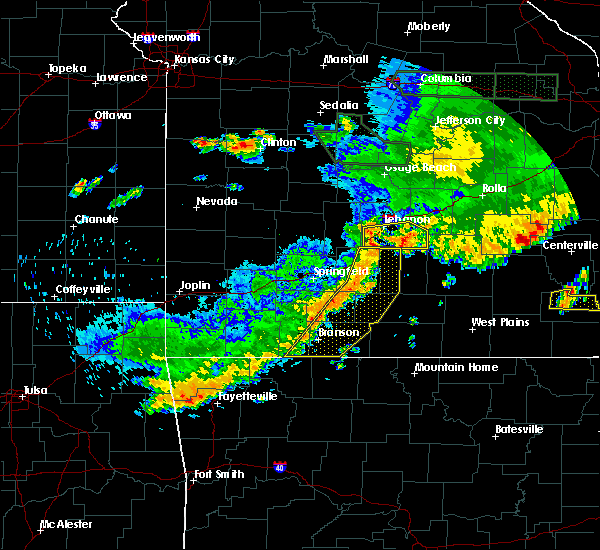 At 535 pm cdt, a severe thunderstorm was located near conway, or 8 miles southwest of lebanon, moving east at 40 mph (radar indicated). Hazards include 60 mph wind gusts. expect damage to roofs, siding, and trees At 535 pm cdt, a severe thunderstorm was located near conway, or 8 miles southwest of lebanon, moving east at 40 mph (radar indicated). Hazards include 60 mph wind gusts. expect damage to roofs, siding, and trees
|
| 5/19/2018 9:09 AM CDT | Ping Pong Ball sized hail reported 10.2 miles N of Evergreen, MO |
| 1/21/2018 10:18 PM CST | Large tree limbs down at residence just northeast of grovesprin in wright county MO, 9.4 miles N of Evergreen, MO |
| 10/22/2017 1:50 AM CDT |
 At 150 am cdt, severe thunderstorms were located along a line extending from near niangua to near seymour to 6 miles west of ava, moving east at 35 mph (radar indicated). Hazards include 60 mph wind gusts. expect damage to roofs, siding, and trees At 150 am cdt, severe thunderstorms were located along a line extending from near niangua to near seymour to 6 miles west of ava, moving east at 35 mph (radar indicated). Hazards include 60 mph wind gusts. expect damage to roofs, siding, and trees
|
| 6/30/2017 1:11 AM CDT |
 The severe thunderstorm warning for northeastern webster, northern wright and laclede counties will expire at 615 am cdt, the storms which prompted the warning have weakened below severe limits, and no longer pose an immediate threat to life or property. therefore the warning will be allowed to expire. however gusty winds are still possible with these thunderstorms. a severe thunderstorm watch remains in effect until 1000 am cdt for central, south central and southwestern missouri. The severe thunderstorm warning for northeastern webster, northern wright and laclede counties will expire at 615 am cdt, the storms which prompted the warning have weakened below severe limits, and no longer pose an immediate threat to life or property. therefore the warning will be allowed to expire. however gusty winds are still possible with these thunderstorms. a severe thunderstorm watch remains in effect until 1000 am cdt for central, south central and southwestern missouri.
|
| 6/30/2017 1:00 AM CDT |
 At 559 am cdt, severe thunderstorms were located along a line extending from 6 miles north of lebanon to 20 miles northeast of niangua to 9 miles east of conway, moving east at 45 mph (radar indicated). Hazards include 60 mph wind gusts. Expect damage to roofs, siding, and trees. Locations impacted include, lebanon, bennett spring state park, morgan, conway, niangua, phillipsburg, stoutland, bennett springs, twin bridges, competition, lynchburg, grovespring, sleeper, falcon, rader, dry knob, manes, this includes interstate 44 near mile marker 108, and between mile markers 112 and 143. At 559 am cdt, severe thunderstorms were located along a line extending from 6 miles north of lebanon to 20 miles northeast of niangua to 9 miles east of conway, moving east at 45 mph (radar indicated). Hazards include 60 mph wind gusts. Expect damage to roofs, siding, and trees. Locations impacted include, lebanon, bennett spring state park, morgan, conway, niangua, phillipsburg, stoutland, bennett springs, twin bridges, competition, lynchburg, grovespring, sleeper, falcon, rader, dry knob, manes, this includes interstate 44 near mile marker 108, and between mile markers 112 and 143.
|
| 6/30/2017 12:35 AM CDT |
 At 535 am cdt, severe thunderstorms were located along a line extending from 10 miles northeast of buffalo to 6 miles northwest of conway to 11 miles northwest of niangua, moving east at 45 mph (radar indicated). Hazards include 60 mph wind gusts. expect damage to roofs, siding, and trees At 535 am cdt, severe thunderstorms were located along a line extending from 10 miles northeast of buffalo to 6 miles northwest of conway to 11 miles northwest of niangua, moving east at 45 mph (radar indicated). Hazards include 60 mph wind gusts. expect damage to roofs, siding, and trees
|
| 5/27/2017 3:51 PM CDT |
 The severe thunderstorm warning for webster, wright, laclede, pulaski, western texas, southwestern phelps and southeastern camden counties will expire at 400 pm cdt, the storms which prompted the warning have moved out of the area. therefore the warning will be allowed to expire. a tornado watch remains in effect until 700 pm cdt for central, south central, southwestern and east central missouri. severe thunderstorm and tornado warnings remain in effect for areas to the east of this warning. The severe thunderstorm warning for webster, wright, laclede, pulaski, western texas, southwestern phelps and southeastern camden counties will expire at 400 pm cdt, the storms which prompted the warning have moved out of the area. therefore the warning will be allowed to expire. a tornado watch remains in effect until 700 pm cdt for central, south central, southwestern and east central missouri. severe thunderstorm and tornado warnings remain in effect for areas to the east of this warning.
|
| 5/27/2017 3:28 PM CDT |
 At 327 pm cdt, severe thunderstorms were located along a line extending from 9 miles southwest of iberia to fort leonard wood to 13 miles north of mountain grove to 6 miles west of mansfield, moving east at 60 mph (emergency management. numerous reports of wind damage have been received with this line of storms). Hazards include 70 mph wind gusts and half dollar size hail. Hail damage to vehicles is expected. expect considerable tree damage. wind damage is also likely to mobile homes, roofs, and outbuildings. locations impacted include, fort leonard wood, lebanon, ha ha tonka state park, marshfield, waynesville, mountain grove, st. robert, licking, houston, seymour, richland, dixon, morgan, mansfield, crocker, fordland, conway, dawson, norwood, hartville, this includes interstate 44 between mile markers 99 and 108, between mile markers 117 and 169, and between mile markers 171 and 174. persons within the severe thunderstorm warning should remain alert for potential tornado warnings. A tornado watch remains in effect until 700 pm cdt for central, south central, southwestern and east central missouri. At 327 pm cdt, severe thunderstorms were located along a line extending from 9 miles southwest of iberia to fort leonard wood to 13 miles north of mountain grove to 6 miles west of mansfield, moving east at 60 mph (emergency management. numerous reports of wind damage have been received with this line of storms). Hazards include 70 mph wind gusts and half dollar size hail. Hail damage to vehicles is expected. expect considerable tree damage. wind damage is also likely to mobile homes, roofs, and outbuildings. locations impacted include, fort leonard wood, lebanon, ha ha tonka state park, marshfield, waynesville, mountain grove, st. robert, licking, houston, seymour, richland, dixon, morgan, mansfield, crocker, fordland, conway, dawson, norwood, hartville, this includes interstate 44 between mile markers 99 and 108, between mile markers 117 and 169, and between mile markers 171 and 174. persons within the severe thunderstorm warning should remain alert for potential tornado warnings. A tornado watch remains in effect until 700 pm cdt for central, south central, southwestern and east central missouri.
|
| 5/27/2017 3:21 PM CDT |
 At 320 pm cdt, severe thunderstorms were located along a line extending from 10 miles northwest of richland to 9 miles west of fort leonard wood to 11 miles northeast of hartville to 9 miles east of sparta, moving east at 55 mph (emergency management. numerous reports of wind damage and large hail have been received with this line of storms). Hazards include 60 mph wind gusts and half dollar size hail. Hail damage to vehicles is expected. expect wind damage to roofs, siding, and trees. locations impacted include, fort leonard wood, lebanon, ha ha tonka state park, marshfield, waynesville, mountain grove, st. robert, licking, houston, seymour, richland, dixon, morgan, mansfield, crocker, fordland, conway, dawson, norwood, hartville, this includes interstate 44 between mile markers 99 and 108, between mile markers 117 and 169, and between mile markers 171 and 174. A tornado watch remains in effect until 700 pm cdt for central, south central, southwestern and east central missouri. At 320 pm cdt, severe thunderstorms were located along a line extending from 10 miles northwest of richland to 9 miles west of fort leonard wood to 11 miles northeast of hartville to 9 miles east of sparta, moving east at 55 mph (emergency management. numerous reports of wind damage and large hail have been received with this line of storms). Hazards include 60 mph wind gusts and half dollar size hail. Hail damage to vehicles is expected. expect wind damage to roofs, siding, and trees. locations impacted include, fort leonard wood, lebanon, ha ha tonka state park, marshfield, waynesville, mountain grove, st. robert, licking, houston, seymour, richland, dixon, morgan, mansfield, crocker, fordland, conway, dawson, norwood, hartville, this includes interstate 44 between mile markers 99 and 108, between mile markers 117 and 169, and between mile markers 171 and 174. A tornado watch remains in effect until 700 pm cdt for central, south central, southwestern and east central missouri.
|
| 5/27/2017 3:15 PM CDT | Golf Ball sized hail reported 10.2 miles N of Evergreen, MO, golf ball size hail with snapped trees. |
| 5/27/2017 3:04 PM CDT |
 At 303 pm cdt, a tornado producing storm was located 7 miles southeast of lebanon, moving east at 50 mph (radar confirmed tornado). Hazards include damaging tornado and half dollar size hail. Flying debris will be dangerous to those caught without shelter. mobile homes will be damaged or destroyed. damage to roofs, windows, and vehicles will occur. Tree damage is likely. At 303 pm cdt, a tornado producing storm was located 7 miles southeast of lebanon, moving east at 50 mph (radar confirmed tornado). Hazards include damaging tornado and half dollar size hail. Flying debris will be dangerous to those caught without shelter. mobile homes will be damaged or destroyed. damage to roofs, windows, and vehicles will occur. Tree damage is likely.
|
| 5/27/2017 3:02 PM CDT |
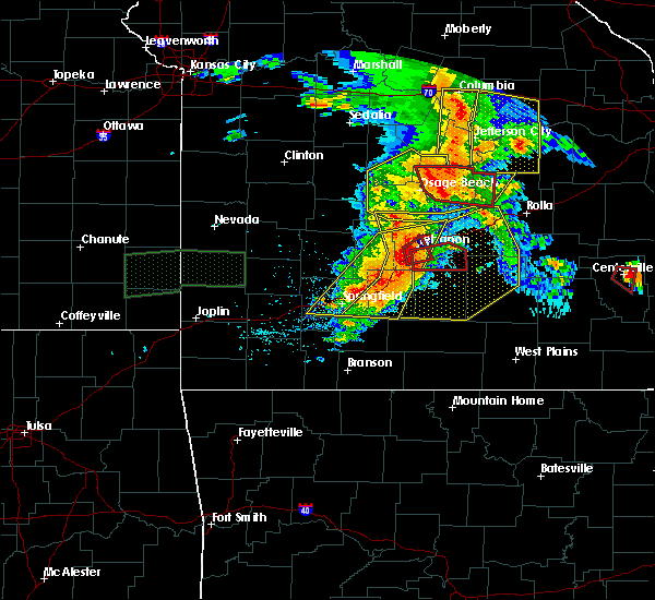 At 301 pm cdt, a confirmed tornado was located near lebanon, moving east at 40 mph (radar confirmed tornado). Hazards include damaging tornado and half dollar size hail. Flying debris will be dangerous to those caught without shelter. mobile homes will be damaged or destroyed. damage to roofs, windows, and vehicles will occur. tree damage is likely. Locations impacted include, lebanon, twin bridges, this includes interstate 44 between mile markers 118 and 132. At 301 pm cdt, a confirmed tornado was located near lebanon, moving east at 40 mph (radar confirmed tornado). Hazards include damaging tornado and half dollar size hail. Flying debris will be dangerous to those caught without shelter. mobile homes will be damaged or destroyed. damage to roofs, windows, and vehicles will occur. tree damage is likely. Locations impacted include, lebanon, twin bridges, this includes interstate 44 between mile markers 118 and 132.
|
| 5/27/2017 3:00 PM CDT |
 At 300 pm cdt, severe thunderstorms were located along a line extending from near macks creek to near lebanon to 7 miles east of niangua to ozark, moving east at 55 mph (emergency management). Hazards include 60 mph wind gusts and half dollar size hail. Hail damage to vehicles is expected. Expect wind damage to roofs, siding, and trees. At 300 pm cdt, severe thunderstorms were located along a line extending from near macks creek to near lebanon to 7 miles east of niangua to ozark, moving east at 55 mph (emergency management). Hazards include 60 mph wind gusts and half dollar size hail. Hail damage to vehicles is expected. Expect wind damage to roofs, siding, and trees.
|
| 5/27/2017 2:56 PM CDT |
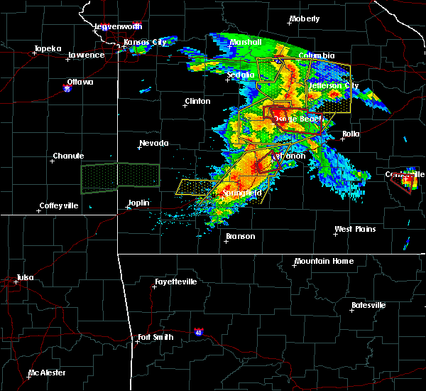 At 256 pm cdt, a severe thunderstorm capable of producing a tornado was located near conway, or 8 miles southwest of lebanon, moving east at 40 mph (radar indicated rotation). Hazards include tornado and half dollar size hail. Flying debris will be dangerous to those caught without shelter. mobile homes will be damaged or destroyed. damage to roofs, windows, and vehicles will occur. tree damage is likely. Locations impacted include, lebanon, phillipsburg, twin bridges, this includes interstate 44 between mile markers 115 and 132. At 256 pm cdt, a severe thunderstorm capable of producing a tornado was located near conway, or 8 miles southwest of lebanon, moving east at 40 mph (radar indicated rotation). Hazards include tornado and half dollar size hail. Flying debris will be dangerous to those caught without shelter. mobile homes will be damaged or destroyed. damage to roofs, windows, and vehicles will occur. tree damage is likely. Locations impacted include, lebanon, phillipsburg, twin bridges, this includes interstate 44 between mile markers 115 and 132.
|
| 5/27/2017 2:45 PM CDT |
 At 245 pm cdt, a severe thunderstorm capable of producing a tornado was located 8 miles northwest of conway, or 10 miles southeast of buffalo, moving east at 40 mph (radar indicated rotation). Hazards include tornado and half dollar size hail. Flying debris will be dangerous to those caught without shelter. mobile homes will be damaged or destroyed. damage to roofs, windows, and vehicles will occur. Tree damage is likely. At 245 pm cdt, a severe thunderstorm capable of producing a tornado was located 8 miles northwest of conway, or 10 miles southeast of buffalo, moving east at 40 mph (radar indicated rotation). Hazards include tornado and half dollar size hail. Flying debris will be dangerous to those caught without shelter. mobile homes will be damaged or destroyed. damage to roofs, windows, and vehicles will occur. Tree damage is likely.
|
| 5/27/2017 2:44 PM CDT |
 At 243 pm cdt, severe thunderstorms were located along a line extending from 10 miles northwest of lebanon to near battlefield, moving east at 40 mph (public. tree damage was reported with these storms in the pleasant hope area along the polk and greene county line). Hazards include 60 mph wind gusts and half dollar size hail. Hail damage to vehicles is expected. expect wind damage to roofs, siding, and trees. locations impacted include, springfield, republic, lebanon, bennett spring state park, marshfield, battlefield, willard, buffalo, rogersville, strafford, seymour, morgan, fair grove, fordland, conway, pleasant hope, niangua, brookline, diggins, phillipsburg, this includes interstate 44 between mile markers 64 and 140. A tornado watch remains in effect until 700 pm cdt for central and southwestern missouri. At 243 pm cdt, severe thunderstorms were located along a line extending from 10 miles northwest of lebanon to near battlefield, moving east at 40 mph (public. tree damage was reported with these storms in the pleasant hope area along the polk and greene county line). Hazards include 60 mph wind gusts and half dollar size hail. Hail damage to vehicles is expected. expect wind damage to roofs, siding, and trees. locations impacted include, springfield, republic, lebanon, bennett spring state park, marshfield, battlefield, willard, buffalo, rogersville, strafford, seymour, morgan, fair grove, fordland, conway, pleasant hope, niangua, brookline, diggins, phillipsburg, this includes interstate 44 between mile markers 64 and 140. A tornado watch remains in effect until 700 pm cdt for central and southwestern missouri.
|
| 5/27/2017 2:33 PM CDT |
 At 232 pm cdt, severe thunderstorms were located along a line extending from 11 miles northeast of buffalo to near republic, moving east at 40 mph (radar indicated). Hazards include 60 mph wind gusts and half dollar size hail. Hail damage to vehicles is expected. Expect wind damage to roofs, siding, and trees. At 232 pm cdt, severe thunderstorms were located along a line extending from 11 miles northeast of buffalo to near republic, moving east at 40 mph (radar indicated). Hazards include 60 mph wind gusts and half dollar size hail. Hail damage to vehicles is expected. Expect wind damage to roofs, siding, and trees.
|
| 5/26/2017 5:35 AM CDT |
 At 534 am cdt, severe thunderstorms were located along a line extending from 8 miles east of camdenton to near lebanon to 16 miles southwest of fort leonard wood, moving east at 40 mph (radar indicated). Hazards include quarter size hail. Damage to vehicles is expected. Locations impacted include, lebanon, lake of the ozarks, lake of the ozarks state park, ha ha tonka state park, osage beach, camdenton, richland, linn creek, stoutland, twin bridges, competition, eldridge, lynchburg, sleeper, falcon, freedom, decaturville, dry knob, montreal, wet glaize, this includes interstate 44 between mile markers 125 and 144. At 534 am cdt, severe thunderstorms were located along a line extending from 8 miles east of camdenton to near lebanon to 16 miles southwest of fort leonard wood, moving east at 40 mph (radar indicated). Hazards include quarter size hail. Damage to vehicles is expected. Locations impacted include, lebanon, lake of the ozarks, lake of the ozarks state park, ha ha tonka state park, osage beach, camdenton, richland, linn creek, stoutland, twin bridges, competition, eldridge, lynchburg, sleeper, falcon, freedom, decaturville, dry knob, montreal, wet glaize, this includes interstate 44 between mile markers 125 and 144.
|
| 5/26/2017 5:14 AM CDT |
 At 514 am cdt, severe thunderstorms were located along a line extending from near macks creek to 11 miles east of conway, moving east at 50 mph (radar indicated). Hazards include quarter size hail. Damage to vehicles is expected. Locations impacted include, lebanon, lake of the ozarks, lake of the ozarks state park, ha ha tonka state park, bennett spring state park, osage beach, camdenton, richland, morgan, macks creek, linn creek, phillipsburg, stoutland, bennett springs, twin bridges, competition, lynchburg, sleeper, falcon, freedom, this includes interstate 44 between mile markers 116 and 144. At 514 am cdt, severe thunderstorms were located along a line extending from near macks creek to 11 miles east of conway, moving east at 50 mph (radar indicated). Hazards include quarter size hail. Damage to vehicles is expected. Locations impacted include, lebanon, lake of the ozarks, lake of the ozarks state park, ha ha tonka state park, bennett spring state park, osage beach, camdenton, richland, morgan, macks creek, linn creek, phillipsburg, stoutland, bennett springs, twin bridges, competition, lynchburg, sleeper, falcon, freedom, this includes interstate 44 between mile markers 116 and 144.
|
| 5/26/2017 5:03 AM CDT |
 At 501 am cdt, severe thunderstorms were located along a line extending from 7 miles east of urbana to conway, moving east at 40 mph (radar indicated). Hazards include quarter size hail. Damage to vehicles is expected. locations impacted include, lebanon, lake of the ozarks, lake of the ozarks state park, ha ha tonka state park, bennett spring state park, osage beach, camdenton, richland, morgan, conway, sunrise beach, macks creek, linn creek, phillipsburg, stoutland, bennett springs, climax springs, twin bridges, competition, windyville, this includes interstate 44 between mile markers 109 and 144. These storms have a history of producing quarter sized hail. At 501 am cdt, severe thunderstorms were located along a line extending from 7 miles east of urbana to conway, moving east at 40 mph (radar indicated). Hazards include quarter size hail. Damage to vehicles is expected. locations impacted include, lebanon, lake of the ozarks, lake of the ozarks state park, ha ha tonka state park, bennett spring state park, osage beach, camdenton, richland, morgan, conway, sunrise beach, macks creek, linn creek, phillipsburg, stoutland, bennett springs, climax springs, twin bridges, competition, windyville, this includes interstate 44 between mile markers 109 and 144. These storms have a history of producing quarter sized hail.
|
| 5/26/2017 4:46 AM CDT |
 At 445 am cdt, severe thunderstorms were located along a line extending from near hermitage to buffalo, moving east at 55 mph (radar indicated). Hazards include quarter size hail. damage to vehicles is expected At 445 am cdt, severe thunderstorms were located along a line extending from near hermitage to buffalo, moving east at 55 mph (radar indicated). Hazards include quarter size hail. damage to vehicles is expected
|
| 5/19/2017 10:28 PM CDT |
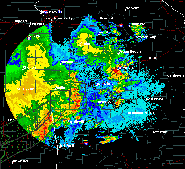 At 1027 pm cdt, severe thunderstorms were located along a line extending from near lebanon to 16 miles east of conway to 6 miles north of hartville, moving northeast at 40 mph (radar indicated). Hazards include 60 mph wind gusts and penny size hail. Expect damage to roofs, siding, and trees. locations impacted include, lebanon, morgan, twin bridges, competition, sleeper, dry knob, this includes interstate 44 between mile markers 117 and 136. A tornado watch remains in effect until 500 am cdt for southwestern missouri. At 1027 pm cdt, severe thunderstorms were located along a line extending from near lebanon to 16 miles east of conway to 6 miles north of hartville, moving northeast at 40 mph (radar indicated). Hazards include 60 mph wind gusts and penny size hail. Expect damage to roofs, siding, and trees. locations impacted include, lebanon, morgan, twin bridges, competition, sleeper, dry knob, this includes interstate 44 between mile markers 117 and 136. A tornado watch remains in effect until 500 am cdt for southwestern missouri.
|
| 5/19/2017 10:15 PM CDT |
 At 1015 pm cdt, severe thunderstorms were located along a line extending from near lebanon to 12 miles southeast of conway to 7 miles west of hartville, moving northeast at 40 mph (radar indicated). Hazards include 60 mph wind gusts and nickel size hail. Expect damage to roofs, siding, and trees. locations impacted include, lebanon, bennett spring state park, marshfield, morgan, conway, niangua, duncan, phillipsburg, twin bridges, competition, elkland, manes, grovespring, sleeper, rader, long lane, dry knob, charity, odin, this includes interstate 44 between mile markers 96 and 136. A tornado watch remains in effect until 500 am cdt for southwestern missouri. At 1015 pm cdt, severe thunderstorms were located along a line extending from near lebanon to 12 miles southeast of conway to 7 miles west of hartville, moving northeast at 40 mph (radar indicated). Hazards include 60 mph wind gusts and nickel size hail. Expect damage to roofs, siding, and trees. locations impacted include, lebanon, bennett spring state park, marshfield, morgan, conway, niangua, duncan, phillipsburg, twin bridges, competition, elkland, manes, grovespring, sleeper, rader, long lane, dry knob, charity, odin, this includes interstate 44 between mile markers 96 and 136. A tornado watch remains in effect until 500 am cdt for southwestern missouri.
|
| 5/19/2017 9:44 PM CDT |
 At 944 pm cdt, severe thunderstorms were located along a line extending from 8 miles north of marshfield to near diggins to 6 miles south of fordland, moving northeast at 40 mph (radar indicated). Hazards include 60 mph wind gusts and quarter size hail. Hail damage to vehicles is expected. Expect wind damage to roofs, siding, and trees. At 944 pm cdt, severe thunderstorms were located along a line extending from 8 miles north of marshfield to near diggins to 6 miles south of fordland, moving northeast at 40 mph (radar indicated). Hazards include 60 mph wind gusts and quarter size hail. Hail damage to vehicles is expected. Expect wind damage to roofs, siding, and trees.
|
| 5/19/2017 5:50 PM CDT |
 The severe thunderstorm warning for northern webster, northern wright, laclede and camden counties will expire at 600 pm cdt, the storms which prompted the warning have moved out of the area. therefore the warning will be allowed to expire. however heavy rain is still possible with these thunderstorms. a tornado watch remains in effect until 1000 pm cdt for central, south central and southwestern missouri. The severe thunderstorm warning for northern webster, northern wright, laclede and camden counties will expire at 600 pm cdt, the storms which prompted the warning have moved out of the area. therefore the warning will be allowed to expire. however heavy rain is still possible with these thunderstorms. a tornado watch remains in effect until 1000 pm cdt for central, south central and southwestern missouri.
|
| 5/19/2017 5:03 PM CDT |
 At 502 pm cdt, severe thunderstorms were located along a line extending from 6 miles southeast of weaubleau to 6 miles southeast of urbana to 8 miles west of conway to near fordland, moving northeast at 60 mph (radar indicated). Hazards include 60 mph wind gusts. expect damage to roofs, siding, and trees At 502 pm cdt, severe thunderstorms were located along a line extending from 6 miles southeast of weaubleau to 6 miles southeast of urbana to 8 miles west of conway to near fordland, moving northeast at 60 mph (radar indicated). Hazards include 60 mph wind gusts. expect damage to roofs, siding, and trees
|
| 4/29/2017 3:33 AM CDT |
 At 332 am cdt, severe thunderstorms were located along a line extending from 7 miles southeast of niangua to near ava, moving northeast at 45 mph (radar indicated). Hazards include 60 mph wind gusts and quarter size hail. Hail damage to vehicles is expected. Expect wind damage to roofs, siding, and trees. At 332 am cdt, severe thunderstorms were located along a line extending from 7 miles southeast of niangua to near ava, moving northeast at 45 mph (radar indicated). Hazards include 60 mph wind gusts and quarter size hail. Hail damage to vehicles is expected. Expect wind damage to roofs, siding, and trees.
|
| 4/4/2017 9:46 PM CDT |
 At 946 pm cdt, severe thunderstorms were located along a line extending from 9 miles southwest of richland to 12 miles southwest of fort leonard wood to 17 miles southeast of lebanon to near hartville, moving east at 40 mph (radar indicated). Hazards include 60 mph wind gusts and quarter size hail. Hail damage to vehicles is expected. expect wind damage to roofs, siding, and trees. Locations impacted include, hartville, stoutland, twin bridges, competition, manes, lynchburg, graff, grovespring, falcon, odin, this includes interstate 44 between mile markers 138 and 143. At 946 pm cdt, severe thunderstorms were located along a line extending from 9 miles southwest of richland to 12 miles southwest of fort leonard wood to 17 miles southeast of lebanon to near hartville, moving east at 40 mph (radar indicated). Hazards include 60 mph wind gusts and quarter size hail. Hail damage to vehicles is expected. expect wind damage to roofs, siding, and trees. Locations impacted include, hartville, stoutland, twin bridges, competition, manes, lynchburg, graff, grovespring, falcon, odin, this includes interstate 44 between mile markers 138 and 143.
|
| 4/4/2017 9:27 PM CDT |
 At 927 pm cdt, severe thunderstorms were located along a line extending from lebanon to 16 miles east of conway to 8 miles east of niangua to 7 miles west of hartville, moving northeast at 35 mph (radar indicated). Hazards include 60 mph wind gusts and quarter size hail. Hail damage to vehicles is expected. expect wind damage to roofs, siding, and trees. Locations impacted include, lebanon, bennett spring state park, morgan, hartville, duncan, stoutland, twin bridges, competition, manes, lynchburg, graff, grovespring, sleeper, falcon, dry knob, odin, this includes interstate 44 between mile markers 121 and 143. At 927 pm cdt, severe thunderstorms were located along a line extending from lebanon to 16 miles east of conway to 8 miles east of niangua to 7 miles west of hartville, moving northeast at 35 mph (radar indicated). Hazards include 60 mph wind gusts and quarter size hail. Hail damage to vehicles is expected. expect wind damage to roofs, siding, and trees. Locations impacted include, lebanon, bennett spring state park, morgan, hartville, duncan, stoutland, twin bridges, competition, manes, lynchburg, graff, grovespring, sleeper, falcon, dry knob, odin, this includes interstate 44 between mile markers 121 and 143.
|
| 4/4/2017 8:54 PM CDT |
 At 854 pm cdt, severe thunderstorms were located along a line extending from 6 miles south of buffalo to near niangua to near diggins, moving east at 40 mph (radar indicated). Hazards include 60 mph wind gusts and quarter size hail. Hail damage to vehicles is expected. Expect wind damage to roofs, siding, and trees. At 854 pm cdt, severe thunderstorms were located along a line extending from 6 miles south of buffalo to near niangua to near diggins, moving east at 40 mph (radar indicated). Hazards include 60 mph wind gusts and quarter size hail. Hail damage to vehicles is expected. Expect wind damage to roofs, siding, and trees.
|
| 3/29/2017 8:48 PM CDT |
 At 848 pm cdt, a severe thunderstorm was located 8 miles southeast of lebanon, moving north at 55 mph (radar indicated). Hazards include 60 mph wind gusts and quarter size hail. Hail damage to vehicles is expected. Expect wind damage to roofs, siding, and trees. At 848 pm cdt, a severe thunderstorm was located 8 miles southeast of lebanon, moving north at 55 mph (radar indicated). Hazards include 60 mph wind gusts and quarter size hail. Hail damage to vehicles is expected. Expect wind damage to roofs, siding, and trees.
|
| 3/9/2017 3:45 PM CST |
 At 345 pm cst, a severe thunderstorm was located 7 miles east of lebanon, moving east at 50 mph (public. quarter size hail was reported in lebanon with this storm). Hazards include 60 mph wind gusts and half dollar size hail. Hail damage to vehicles is expected. expect wind damage to roofs, siding, and trees. Locations impacted include, lebanon, twin bridges, sleeper, dry knob, this includes interstate 44 between mile markers 121 and 144. At 345 pm cst, a severe thunderstorm was located 7 miles east of lebanon, moving east at 50 mph (public. quarter size hail was reported in lebanon with this storm). Hazards include 60 mph wind gusts and half dollar size hail. Hail damage to vehicles is expected. expect wind damage to roofs, siding, and trees. Locations impacted include, lebanon, twin bridges, sleeper, dry knob, this includes interstate 44 between mile markers 121 and 144.
|
| 3/9/2017 3:25 PM CST |
 At 324 pm cst, a severe thunderstorm was located 9 miles west of lebanon, moving east at 35 mph (radar indicated). Hazards include ping pong ball size hail and 55 mph wind gusts. People and animals outdoors will be injured. expect hail damage to roofs, siding, windows, and vehicles. expect wind damage to roofs, siding, and trees. Locations impacted include, lebanon, bennett spring state park, bennett springs, twin bridges, sleeper, dry knob, this includes interstate 44 near mile marker 119, and between mile markers 121 and 144. At 324 pm cst, a severe thunderstorm was located 9 miles west of lebanon, moving east at 35 mph (radar indicated). Hazards include ping pong ball size hail and 55 mph wind gusts. People and animals outdoors will be injured. expect hail damage to roofs, siding, windows, and vehicles. expect wind damage to roofs, siding, and trees. Locations impacted include, lebanon, bennett spring state park, bennett springs, twin bridges, sleeper, dry knob, this includes interstate 44 near mile marker 119, and between mile markers 121 and 144.
|
| 3/9/2017 3:00 PM CST |
 At 300 pm cst, a severe thunderstorm was located near buffalo, moving east at 45 mph (radar indicated). Hazards include 60 mph wind gusts and quarter size hail. Hail damage to vehicles is expected. Expect wind damage to roofs, siding, and trees. At 300 pm cst, a severe thunderstorm was located near buffalo, moving east at 45 mph (radar indicated). Hazards include 60 mph wind gusts and quarter size hail. Hail damage to vehicles is expected. Expect wind damage to roofs, siding, and trees.
|
| 3/6/2017 11:58 PM CST |
 At 1158 pm cst, severe thunderstorms were located along a line extending from fort leonard wood to 7 miles west of ava, moving southeast at 45 mph (radar indicated). Hazards include 70 mph wind gusts and quarter size hail. Hail damage to vehicles is expected. expect considerable tree damage. Wind damage is also likely to mobile homes, roofs, and outbuildings. At 1158 pm cst, severe thunderstorms were located along a line extending from fort leonard wood to 7 miles west of ava, moving southeast at 45 mph (radar indicated). Hazards include 70 mph wind gusts and quarter size hail. Hail damage to vehicles is expected. expect considerable tree damage. Wind damage is also likely to mobile homes, roofs, and outbuildings.
|
| 3/6/2017 11:37 PM CST |
 At 1137 pm cst, severe thunderstorms were located along a line extending from 16 miles southwest of fort leonard wood to 7 miles southeast of seymour, moving east at 55 mph (radar indicated). Hazards include 70 mph wind gusts and quarter size hail. Hail damage to vehicles is expected. expect considerable tree damage. wind damage is also likely to mobile homes, roofs, and outbuildings. locations impacted include, springfield, nixa, ozark, fort leonard wood, lebanon, marshfield, battlefield, waynesville, mountain grove, rogersville, strafford, clever, seymour, sparta, morgan, mansfield, fremont hills, fordland, conway, dawson, this includes interstate 44 between mile markers 81 and 109, near mile marker 112, between mile markers 120 and 121, and between mile markers 141 and 153. A tornado watch remains in effect until 300 am cst for central, south central, southwestern and east central missouri. At 1137 pm cst, severe thunderstorms were located along a line extending from 16 miles southwest of fort leonard wood to 7 miles southeast of seymour, moving east at 55 mph (radar indicated). Hazards include 70 mph wind gusts and quarter size hail. Hail damage to vehicles is expected. expect considerable tree damage. wind damage is also likely to mobile homes, roofs, and outbuildings. locations impacted include, springfield, nixa, ozark, fort leonard wood, lebanon, marshfield, battlefield, waynesville, mountain grove, rogersville, strafford, clever, seymour, sparta, morgan, mansfield, fremont hills, fordland, conway, dawson, this includes interstate 44 between mile markers 81 and 109, near mile marker 112, between mile markers 120 and 121, and between mile markers 141 and 153. A tornado watch remains in effect until 300 am cst for central, south central, southwestern and east central missouri.
|
| 3/6/2017 11:02 PM CST |
 At 1102 pm cst, severe thunderstorms were located along a line extending from 7 miles north of conway to springfield, moving east at 55 mph (public. numerous reports of wind damage, trees down, and power outages have been reported with these storms). Hazards include 70 mph wind gusts and quarter size hail. Hail damage to vehicles is expected. expect considerable tree damage. Wind damage is also likely to mobile homes, roofs, and outbuildings. At 1102 pm cst, severe thunderstorms were located along a line extending from 7 miles north of conway to springfield, moving east at 55 mph (public. numerous reports of wind damage, trees down, and power outages have been reported with these storms). Hazards include 70 mph wind gusts and quarter size hail. Hail damage to vehicles is expected. expect considerable tree damage. Wind damage is also likely to mobile homes, roofs, and outbuildings.
|
| 3/6/2017 10:46 PM CST |
 At 1045 pm cst, severe thunderstorms were located along a line extending from buffalo to near willard, moving east at 65 mph (law enforcement. the springfield airport just measured a 65 mph wind gusts with these storms. numerous reports of wind damage to structures and trees down with these storms). Hazards include 70 mph wind gusts and quarter size hail. Hail damage to vehicles is expected. expect considerable tree damage. wind damage is also likely to mobile homes, roofs, and outbuildings. locations impacted include, springfield, nixa, ozark, republic, lebanon, bolivar, bennett spring state park, marshfield, battlefield, willard, buffalo, strafford, clever, ash grove, fair grove, billings, fremont hills, conway, polk, pleasant hope, this includes interstate 44 between mile markers 53 and 142. A tornado watch remains in effect until 300 am cst for central and southwestern missouri. At 1045 pm cst, severe thunderstorms were located along a line extending from buffalo to near willard, moving east at 65 mph (law enforcement. the springfield airport just measured a 65 mph wind gusts with these storms. numerous reports of wind damage to structures and trees down with these storms). Hazards include 70 mph wind gusts and quarter size hail. Hail damage to vehicles is expected. expect considerable tree damage. wind damage is also likely to mobile homes, roofs, and outbuildings. locations impacted include, springfield, nixa, ozark, republic, lebanon, bolivar, bennett spring state park, marshfield, battlefield, willard, buffalo, strafford, clever, ash grove, fair grove, billings, fremont hills, conway, polk, pleasant hope, this includes interstate 44 between mile markers 53 and 142. A tornado watch remains in effect until 300 am cst for central and southwestern missouri.
|
| 3/6/2017 10:19 PM CST |
 At 1019 pm cst, severe thunderstorms were located along a line extending from humansville to 6 miles south of greenfield, moving east at 60 mph (radar indicated). Hazards include 70 mph wind gusts and quarter size hail. Hail damage to vehicles is expected. expect considerable tree damage. Wind damage is also likely to mobile homes, roofs, and outbuildings. At 1019 pm cst, severe thunderstorms were located along a line extending from humansville to 6 miles south of greenfield, moving east at 60 mph (radar indicated). Hazards include 70 mph wind gusts and quarter size hail. Hail damage to vehicles is expected. expect considerable tree damage. Wind damage is also likely to mobile homes, roofs, and outbuildings.
|
| 3/1/2017 12:57 AM CST |
 At 1256 am cst, severe thunderstorms were located along a line extending from 11 miles north of lebanon to 7 miles southwest of buffalo, moving east at 100 mph (radar indicated). Hazards include 60 mph wind gusts and quarter size hail. Hail damage to vehicles is expected. expect wind damage to roofs, siding, and trees. these severe storms will be near, conway around 105 am cst. lebanon around 115 am cst. other locations impacted by these severe thunderstorms include bennett spring state park, morgan, phillipsburg, stoutland, bennett springs, twin bridges, windyville, eldridge, march and sleeper. this includes interstate 44 between mile markers 110 and 143. A tornado watch remains in effect until 400 am cst for central, south central and southwestern missouri. At 1256 am cst, severe thunderstorms were located along a line extending from 11 miles north of lebanon to 7 miles southwest of buffalo, moving east at 100 mph (radar indicated). Hazards include 60 mph wind gusts and quarter size hail. Hail damage to vehicles is expected. expect wind damage to roofs, siding, and trees. these severe storms will be near, conway around 105 am cst. lebanon around 115 am cst. other locations impacted by these severe thunderstorms include bennett spring state park, morgan, phillipsburg, stoutland, bennett springs, twin bridges, windyville, eldridge, march and sleeper. this includes interstate 44 between mile markers 110 and 143. A tornado watch remains in effect until 400 am cst for central, south central and southwestern missouri.
|
| 3/1/2017 12:48 AM CST |
 At 1248 am cst, a severe thunderstorm was located near buffalo, moving east at 60 mph (radar indicated). Hazards include 60 mph wind gusts and quarter size hail. Hail damage to vehicles is expected. expect wind damage to roofs, siding, and trees. this severe thunderstorm will be near, lebanon around 115 am cst. other locations impacted by this severe thunderstorm include bennett spring state park, morgan, phillipsburg, stoutland, halfway, bennett springs, twin bridges, windyville, eldridge and march. this includes interstate 44 between mile markers 110 and 143. A tornado watch remains in effect until 400 am cst for central, south central and southwestern missouri. At 1248 am cst, a severe thunderstorm was located near buffalo, moving east at 60 mph (radar indicated). Hazards include 60 mph wind gusts and quarter size hail. Hail damage to vehicles is expected. expect wind damage to roofs, siding, and trees. this severe thunderstorm will be near, lebanon around 115 am cst. other locations impacted by this severe thunderstorm include bennett spring state park, morgan, phillipsburg, stoutland, halfway, bennett springs, twin bridges, windyville, eldridge and march. this includes interstate 44 between mile markers 110 and 143. A tornado watch remains in effect until 400 am cst for central, south central and southwestern missouri.
|
| 10/19/2016 2:36 PM CDT | Quarter sized hail reported 10.8 miles WNW of Evergreen, MO |
| 10/19/2016 2:28 PM CDT |
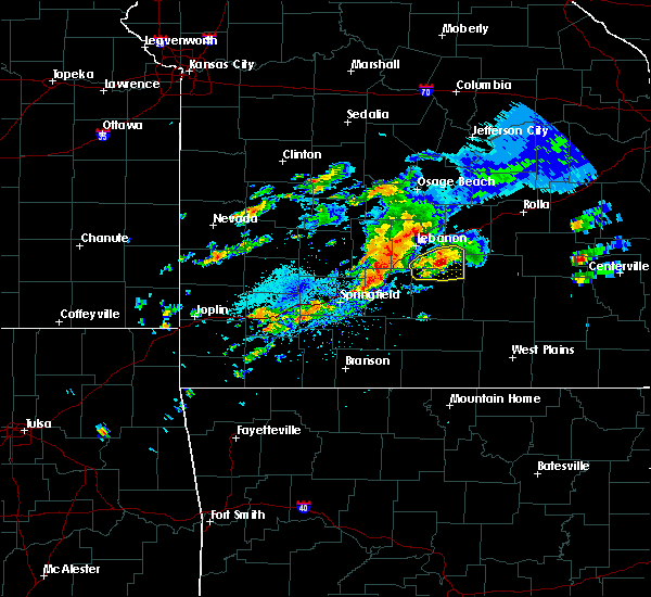 A severe thunderstorm warning remains in effect until 245 pm cdt for southeastern laclede county. at 228 pm cdt. a severe thunderstorm was located 15 miles southeast of lebanon. moving east at 25 mph. hazard. 60 mph wind gusts and quarter size hail. source. Radar indicated. A severe thunderstorm warning remains in effect until 245 pm cdt for southeastern laclede county. at 228 pm cdt. a severe thunderstorm was located 15 miles southeast of lebanon. moving east at 25 mph. hazard. 60 mph wind gusts and quarter size hail. source. Radar indicated.
|
| 10/19/2016 2:07 PM CDT |
 At 207 pm cdt, a severe thunderstorm was located 11 miles east of conway, or 14 miles south of lebanon, moving east at 30 mph (radar indicated). Hazards include 60 mph wind gusts and quarter size hail. Hail damage to vehicles is expected. expect wind damage to roofs, siding, and trees. Locations impacted include, morgan, twin bridges, lynchburg, falcon, grovespring, dry knob, competition,. At 207 pm cdt, a severe thunderstorm was located 11 miles east of conway, or 14 miles south of lebanon, moving east at 30 mph (radar indicated). Hazards include 60 mph wind gusts and quarter size hail. Hail damage to vehicles is expected. expect wind damage to roofs, siding, and trees. Locations impacted include, morgan, twin bridges, lynchburg, falcon, grovespring, dry knob, competition,.
|
| 10/19/2016 1:50 PM CDT |
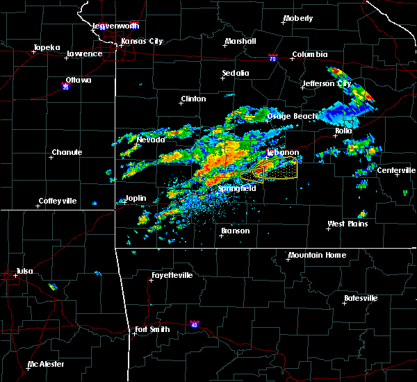 At 150 pm cdt, a severe thunderstorm was located near conway, or 12 miles northeast of marshfield, moving east at 30 mph (radar indicated). Hazards include 60 mph wind gusts and half dollar size hail. Hail damage to vehicles is expected. Expect wind damage to roofs, siding, and trees. At 150 pm cdt, a severe thunderstorm was located near conway, or 12 miles northeast of marshfield, moving east at 30 mph (radar indicated). Hazards include 60 mph wind gusts and half dollar size hail. Hail damage to vehicles is expected. Expect wind damage to roofs, siding, and trees.
|
| 8/25/2016 8:38 PM CDT |
 At 838 pm cdt, severe thunderstorms were located along a line extending from near lebanon to near conway to near niangua, moving east at 15 mph (radar indicated). Hazards include 60 mph wind gusts and nickel size hail. Expect damage to roofs. siding. and trees. Locations impacted include, lebanon, morgan, conway, niangua, phillipsburg, twin bridges, rader, this includes interstate 44 between mile markers 102 and 130. At 838 pm cdt, severe thunderstorms were located along a line extending from near lebanon to near conway to near niangua, moving east at 15 mph (radar indicated). Hazards include 60 mph wind gusts and nickel size hail. Expect damage to roofs. siding. and trees. Locations impacted include, lebanon, morgan, conway, niangua, phillipsburg, twin bridges, rader, this includes interstate 44 between mile markers 102 and 130.
|
| 8/25/2016 8:10 PM CDT |
 At 809 pm cdt, severe thunderstorms were located along a line extending from 10 miles west of lebanon to near conway to 9 miles northeast of fair grove, moving east at 15 mph (radar indicated). Hazards include 60 mph wind gusts. Expect damage to roofs. siding. And trees. At 809 pm cdt, severe thunderstorms were located along a line extending from 10 miles west of lebanon to near conway to 9 miles northeast of fair grove, moving east at 15 mph (radar indicated). Hazards include 60 mph wind gusts. Expect damage to roofs. siding. And trees.
|
| 8/3/2016 5:55 PM CDT |
 The severe thunderstorm warning for southwestern laclede county will expire at 600 pm cdt, the storm which prompted the warning has weakened below severe limits, and no longer pose an immediate threat to life or property. therefore the warning will be allowed to expire. however gusty winds are still possible with this thunderstorm. to report severe weather, contact your nearest law enforcement agency. they will relay your report to the national weather service springfield. The severe thunderstorm warning for southwestern laclede county will expire at 600 pm cdt, the storm which prompted the warning has weakened below severe limits, and no longer pose an immediate threat to life or property. therefore the warning will be allowed to expire. however gusty winds are still possible with this thunderstorm. to report severe weather, contact your nearest law enforcement agency. they will relay your report to the national weather service springfield.
|
| 8/3/2016 5:32 PM CDT |
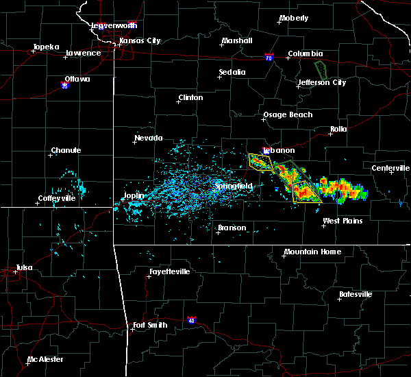 At 532 pm cdt, a severe thunderstorm was located near lebanon, moving southeast at 10 mph (radar indicated). Hazards include 60 mph wind gusts and quarter size hail. Hail damage to vehicles is expected. Expect wind damage to roofs, siding, and trees. At 532 pm cdt, a severe thunderstorm was located near lebanon, moving southeast at 10 mph (radar indicated). Hazards include 60 mph wind gusts and quarter size hail. Hail damage to vehicles is expected. Expect wind damage to roofs, siding, and trees.
|
| 7/7/2016 7:53 AM CDT |
 At 753 am cdt, severe thunderstorms were located along a line extending from 6 miles southwest of belle to near richland to 8 miles northeast of pleasant hope, moving southeast at 30 mph (radar indicated). Hazards include 60 mph wind gusts. Expect damage to roofs. siding. and trees. locations impacted include, rolla, fort leonard wood, lebanon, bennett spring state park, waynesville, st. robert, st. James, buffalo, richland, dixon, belle, morgan, crocker, conway, doolittle, vienna, newburg, urbana, edgar springs, phillipsburg, this includes interstate 44 between mile markers 110 and 169, and between mile markers 171 and 200. At 753 am cdt, severe thunderstorms were located along a line extending from 6 miles southwest of belle to near richland to 8 miles northeast of pleasant hope, moving southeast at 30 mph (radar indicated). Hazards include 60 mph wind gusts. Expect damage to roofs. siding. and trees. locations impacted include, rolla, fort leonard wood, lebanon, bennett spring state park, waynesville, st. robert, st. James, buffalo, richland, dixon, belle, morgan, crocker, conway, doolittle, vienna, newburg, urbana, edgar springs, phillipsburg, this includes interstate 44 between mile markers 110 and 169, and between mile markers 171 and 200.
|
| 7/7/2016 7:09 AM CDT |
 At 708 am cdt, severe thunderstorms were located along a line extending from near hickory hill to near camdenton to near urbana, moving southeast at 60 mph (law enforcement). Hazards include 60 mph wind gusts. Expect damage to roofs. siding. And trees. At 708 am cdt, severe thunderstorms were located along a line extending from near hickory hill to near camdenton to near urbana, moving southeast at 60 mph (law enforcement). Hazards include 60 mph wind gusts. Expect damage to roofs. siding. And trees.
|
| 6/30/2016 6:40 PM CDT |
 At 640 pm cdt, severe thunderstorms were located along a line extending from 6 miles northeast of lebanon to 12 miles north of conway, moving southeast at 40 mph (radar indicated). Hazards include 60 mph wind gusts. Expect damage to roofs. siding. and trees. Locations impacted include, lebanon, bennett spring state park, stoutland, twin bridges, sleeper, falcon, dry knob, laquey, this includes interstate 44 near mile marker 119, and between mile markers 121 and 152. At 640 pm cdt, severe thunderstorms were located along a line extending from 6 miles northeast of lebanon to 12 miles north of conway, moving southeast at 40 mph (radar indicated). Hazards include 60 mph wind gusts. Expect damage to roofs. siding. and trees. Locations impacted include, lebanon, bennett spring state park, stoutland, twin bridges, sleeper, falcon, dry knob, laquey, this includes interstate 44 near mile marker 119, and between mile markers 121 and 152.
|
| 6/30/2016 6:26 PM CDT |
 At 625 pm cdt, severe thunderstorms were located along a line extending from 9 miles west of richland to 13 miles northeast of buffalo, moving southeast at 35 mph (radar indicated). Hazards include 60 mph wind gusts. Expect damage to roofs. siding. and trees. Locations impacted include, lebanon, bennett spring state park, waynesville, richland, stoutland, bennett springs, twin bridges, laquey, sleeper, falcon, ozark springs, dry knob, eldridge, wet glaize, this includes interstate 44 near mile marker 119, and between mile markers 121 and 155. At 625 pm cdt, severe thunderstorms were located along a line extending from 9 miles west of richland to 13 miles northeast of buffalo, moving southeast at 35 mph (radar indicated). Hazards include 60 mph wind gusts. Expect damage to roofs. siding. and trees. Locations impacted include, lebanon, bennett spring state park, waynesville, richland, stoutland, bennett springs, twin bridges, laquey, sleeper, falcon, ozark springs, dry knob, eldridge, wet glaize, this includes interstate 44 near mile marker 119, and between mile markers 121 and 155.
|
| 6/30/2016 6:13 PM CDT |
 At 612 pm cdt, severe thunderstorms were located along a line extending from 6 miles south of camdenton to 13 miles northeast of buffalo, moving southeast at 45 mph (radar indicated). Hazards include 60 mph wind gusts. Expect damage to roofs. siding. And trees. At 612 pm cdt, severe thunderstorms were located along a line extending from 6 miles south of camdenton to 13 miles northeast of buffalo, moving southeast at 45 mph (radar indicated). Hazards include 60 mph wind gusts. Expect damage to roofs. siding. And trees.
|
| 6/15/2016 4:54 AM CDT | The severe thunderstorm warning for central dallas, laclede and southern camden counties will expire at 500 am cdt, the storms which prompted the warning have weakened below severe limits, and no longer pose an immediate threat to life or property. therefore the warning will be allowed to expire. however gusty winds and heavy rain are still possible with these thunderstorms. to report severe weather, contact your nearest law enforcement agency. they will relay your report to the national weather service springfield. |
| 6/15/2016 4:29 AM CDT |
 At 427 am cdt, severe thunderstorms were located along a line extending from near camdenton to 12 miles southeast of macks creek to 7 miles east of buffalo, moving east at 35 mph (radar indicated). Hazards include 60 mph wind gusts and penny size hail. Expect damage to roofs. siding. and trees. Locations impacted include, lebanon, lake of the ozarks, ha ha tonka state park, bennett spring state park, lake of the ozarks state park, camdenton, buffalo, richland, macks creek, linn creek, phillipsburg, stoutland, bennett springs, louisburg, twin bridges, tunas, branch, plad, decaturville, dry knob, this includes interstate 44 between mile markers 115 and 144. At 427 am cdt, severe thunderstorms were located along a line extending from near camdenton to 12 miles southeast of macks creek to 7 miles east of buffalo, moving east at 35 mph (radar indicated). Hazards include 60 mph wind gusts and penny size hail. Expect damage to roofs. siding. and trees. Locations impacted include, lebanon, lake of the ozarks, ha ha tonka state park, bennett spring state park, lake of the ozarks state park, camdenton, buffalo, richland, macks creek, linn creek, phillipsburg, stoutland, bennett springs, louisburg, twin bridges, tunas, branch, plad, decaturville, dry knob, this includes interstate 44 between mile markers 115 and 144.
|
| 6/15/2016 4:06 AM CDT |
 At 405 am cdt, severe thunderstorms were located along a line extending from 15 miles southwest of laurie to near macks creek to near buffalo, moving east at 35 mph (radar indicated). Hazards include 60 mph wind gusts and quarter size hail. Hail damage to vehicles is expected. Expect wind damage to roofs, siding, and trees. At 405 am cdt, severe thunderstorms were located along a line extending from 15 miles southwest of laurie to near macks creek to near buffalo, moving east at 35 mph (radar indicated). Hazards include 60 mph wind gusts and quarter size hail. Hail damage to vehicles is expected. Expect wind damage to roofs, siding, and trees.
|
| 7/24/2015 8:23 PM CDT |
 At 821 pm cdt, severe thunderstorms were located along a line extending from 7 miles north of pleasant hope to 12 miles east of pleasant hope to 14 miles southeast of conway, and moving south at 45 mph (emergency management. these storms have a history of producing wind damage across laclede, dallas counties and northwestern wright counties). Hazards include 70 mph wind gusts and nickel size hail. Expect considerable tree damage. damage is likely to mobile homes, roofs and outbuildings. locations impacted include, buffalo, conway and pleasant hope. interstate 44 between mile markers 102 and 116 will also be impacted by severe thunderstorms. A severe thunderstorm watch remains in effect until midnight cdt saturday morning for southwest missouri. At 821 pm cdt, severe thunderstorms were located along a line extending from 7 miles north of pleasant hope to 12 miles east of pleasant hope to 14 miles southeast of conway, and moving south at 45 mph (emergency management. these storms have a history of producing wind damage across laclede, dallas counties and northwestern wright counties). Hazards include 70 mph wind gusts and nickel size hail. Expect considerable tree damage. damage is likely to mobile homes, roofs and outbuildings. locations impacted include, buffalo, conway and pleasant hope. interstate 44 between mile markers 102 and 116 will also be impacted by severe thunderstorms. A severe thunderstorm watch remains in effect until midnight cdt saturday morning for southwest missouri.
|
| 7/24/2015 8:07 PM CDT |
 At 805 pm cdt, severe thunderstorms were located along a line extending from 8 miles west of buffalo to 10 miles southeast of buffalo to 13 miles southeast of conway, and moving south at 40 mph (emergency management. these storms have downed power lines and trees throughout portions of dallas and laclede counties). Hazards include 70 mph wind gusts and nickel size hail. Expect considerable tree damage. damage is likely to mobile homes, roofs and outbuildings. locations impacted include, buffalo, conway and pleasant hope. this warning also includes bennett spring state park. Interstate 44 between mile markers 102 and 123 will also be impacted by severe thunderstorms. At 805 pm cdt, severe thunderstorms were located along a line extending from 8 miles west of buffalo to 10 miles southeast of buffalo to 13 miles southeast of conway, and moving south at 40 mph (emergency management. these storms have downed power lines and trees throughout portions of dallas and laclede counties). Hazards include 70 mph wind gusts and nickel size hail. Expect considerable tree damage. damage is likely to mobile homes, roofs and outbuildings. locations impacted include, buffalo, conway and pleasant hope. this warning also includes bennett spring state park. Interstate 44 between mile markers 102 and 123 will also be impacted by severe thunderstorms.
|
| 7/24/2015 7:54 PM CDT |
 At 752 pm cdt, severe thunderstorms were located along a line extending from 11 miles northwest of buffalo to buffalo to 10 miles east of conway, and moving south at 45 mph (radar indicated). Hazards include 70 mph wind gusts and nickel size hail. Expect considerable tree damage. damage is likely to mobile homes, roofs and outbuildings. locations impacted include, buffalo, conway and pleasant hope. this warning also includes bennett spring state park. interstate 44 between mile markers 102 and 123 will also be impacted by severe thunderstorms. A severe thunderstorm watch remains in effect until midnight cdt saturday morning for southwest missouri. At 752 pm cdt, severe thunderstorms were located along a line extending from 11 miles northwest of buffalo to buffalo to 10 miles east of conway, and moving south at 45 mph (radar indicated). Hazards include 70 mph wind gusts and nickel size hail. Expect considerable tree damage. damage is likely to mobile homes, roofs and outbuildings. locations impacted include, buffalo, conway and pleasant hope. this warning also includes bennett spring state park. interstate 44 between mile markers 102 and 123 will also be impacted by severe thunderstorms. A severe thunderstorm watch remains in effect until midnight cdt saturday morning for southwest missouri.
|
| 7/24/2015 7:40 PM CDT |
 At 739 pm cdt, severe thunderstorms were located along a line extending from 24 miles northwest of buffalo to 8 miles northeast of buffalo to 15 miles northeast of conway, and moving south at 40 mph (radar indicated). Hazards include 60 mph wind gusts and nickel size hail. Expect damage to roofs. Siding and trees. At 739 pm cdt, severe thunderstorms were located along a line extending from 24 miles northwest of buffalo to 8 miles northeast of buffalo to 15 miles northeast of conway, and moving south at 40 mph (radar indicated). Hazards include 60 mph wind gusts and nickel size hail. Expect damage to roofs. Siding and trees.
|
| 7/14/2015 11:47 AM CDT |
 At 1143 am cdt, severe thunderstorms were located along a line extending from conway to rogersville, and moving east at 45 mph (trained weather spotters. several large trees have been reported down in greene and polk counties. winds were estimated to be around 60 mph). Hazards include 60 mph wind gusts and nickel size hail. Expect damage to roofs. Siding and trees. At 1143 am cdt, severe thunderstorms were located along a line extending from conway to rogersville, and moving east at 45 mph (trained weather spotters. several large trees have been reported down in greene and polk counties. winds were estimated to be around 60 mph). Hazards include 60 mph wind gusts and nickel size hail. Expect damage to roofs. Siding and trees.
|
| 7/2/2015 12:39 AM CDT |
 The severe thunderstorm warning for dallas, extreme northeastern wright, southeastern st. clair, polk, laclede, hickory and eastern cedar counties will expire at 1245 am cdt, the line of storms which prompted the warning has weakened below severe limits, and no longer poses an immediate threat to life or property. however, gusty winds and heavy rain are still possible with these thunderstorms. a severe thunderstorm watch remains in effect until 400 am cdt thursday morning for southeast kansas and southwestern missouri. The severe thunderstorm warning for dallas, extreme northeastern wright, southeastern st. clair, polk, laclede, hickory and eastern cedar counties will expire at 1245 am cdt, the line of storms which prompted the warning has weakened below severe limits, and no longer poses an immediate threat to life or property. however, gusty winds and heavy rain are still possible with these thunderstorms. a severe thunderstorm watch remains in effect until 400 am cdt thursday morning for southeast kansas and southwestern missouri.
|
| 7/2/2015 12:20 AM CDT |
 At 1217 am cdt, severe thunderstorms were located along a line extending from humansville to 18 miles southeast of lebanon, and moving south southeast at 25 mph (radar indicated). Hazards include 60 mph wind gusts and nickel size hail. Expect damage to roofs. siding and trees. locations impacted include, bolivar, buffalo, conway, extreme southwestern fort leonard wood, fair play, hermitage, humansville, lebanon, stockton, urbana, weaubleau and wheatland. this warning also includes bennett spring state park, pomme de terre lake, pomme de terre state park, stockton lake and truman lake. interstate 44 between mile markers 109 and 143 will also be impacted by severe thunderstorms. A severe thunderstorm watch remains in effect until 400 am cdt thursday morning for southeast kansas and southwestern missouri. At 1217 am cdt, severe thunderstorms were located along a line extending from humansville to 18 miles southeast of lebanon, and moving south southeast at 25 mph (radar indicated). Hazards include 60 mph wind gusts and nickel size hail. Expect damage to roofs. siding and trees. locations impacted include, bolivar, buffalo, conway, extreme southwestern fort leonard wood, fair play, hermitage, humansville, lebanon, stockton, urbana, weaubleau and wheatland. this warning also includes bennett spring state park, pomme de terre lake, pomme de terre state park, stockton lake and truman lake. interstate 44 between mile markers 109 and 143 will also be impacted by severe thunderstorms. A severe thunderstorm watch remains in effect until 400 am cdt thursday morning for southeast kansas and southwestern missouri.
|
| 7/1/2015 11:50 PM CDT |
 At 1148 pm cdt, severe thunderstorms were located along a line extending from weaubleau to 19 miles southeast of fort leonard wood, and moving southeast at 25 mph (radar indicated). Hazards include 60 mph wind gusts and quarter size hail. Hail damage to vehicles is expected. Expect wind damage to roofs, siding and trees. At 1148 pm cdt, severe thunderstorms were located along a line extending from weaubleau to 19 miles southeast of fort leonard wood, and moving southeast at 25 mph (radar indicated). Hazards include 60 mph wind gusts and quarter size hail. Hail damage to vehicles is expected. Expect wind damage to roofs, siding and trees.
|
| 7/1/2015 10:48 PM CDT |
 At 1045 pm cdt, severe thunderstorms were located along a line extending from 7 miles northwest of wheatland to 7 miles west of macks creek to 13 miles southeast of camdenton, and moving south at 35 mph (radar indicated). Hazards include 60 mph wind gusts and quarter size hail. Hail damage to vehicles is expected. Expect wind damage to roofs, siding and trees. At 1045 pm cdt, severe thunderstorms were located along a line extending from 7 miles northwest of wheatland to 7 miles west of macks creek to 13 miles southeast of camdenton, and moving south at 35 mph (radar indicated). Hazards include 60 mph wind gusts and quarter size hail. Hail damage to vehicles is expected. Expect wind damage to roofs, siding and trees.
|
| 7/1/2015 5:06 AM CDT |
 The severe thunderstorm warning for southern dallas, northern wright, webster, southern laclede and eastern greene counties will expire at 515 am cdt, the line of storms which prompted the warning has weakened below severe limits, and no longer poses an immediate threat to life or property. however, gusty winds are still possible with these thunderstorms. The severe thunderstorm warning for southern dallas, northern wright, webster, southern laclede and eastern greene counties will expire at 515 am cdt, the line of storms which prompted the warning has weakened below severe limits, and no longer poses an immediate threat to life or property. however, gusty winds are still possible with these thunderstorms.
|
| 7/1/2015 4:48 AM CDT |
 At 445 am cdt, severe thunderstorms were located along a line extending from 15 miles north of hartville to strafford, and moving southeast at 45 mph (radar indicated). Hazards include 60 mph wind gusts. Expect damage to roofs. siding and trees. locations impacted include, conway, diggins, fair grove, fordland, hartville, marshfield, niangua, northeastern springfield, rogersville and strafford. Interstate 44 between mile markers 76 and 121 will also be impacted by severe thunderstorms. At 445 am cdt, severe thunderstorms were located along a line extending from 15 miles north of hartville to strafford, and moving southeast at 45 mph (radar indicated). Hazards include 60 mph wind gusts. Expect damage to roofs. siding and trees. locations impacted include, conway, diggins, fair grove, fordland, hartville, marshfield, niangua, northeastern springfield, rogersville and strafford. Interstate 44 between mile markers 76 and 121 will also be impacted by severe thunderstorms.
|
| 7/1/2015 4:28 AM CDT |
 At 426 am cdt, severe thunderstorms were located along a line extending from 12 miles northeast of conway to 7 miles west of fair grove, and moving southeast at 45 mph (radar indicated). Hazards include 60 mph wind gusts. Expect damage to roofs. Siding and trees. At 426 am cdt, severe thunderstorms were located along a line extending from 12 miles northeast of conway to 7 miles west of fair grove, and moving southeast at 45 mph (radar indicated). Hazards include 60 mph wind gusts. Expect damage to roofs. Siding and trees.
|
| 7/1/2015 4:19 AM CDT |
 At 415 am cdt, severe thunderstorms were located along a line extending from 11 miles northeast of lebanon to pleasant hope to 6 miles southwest of fair play, and moving southeast at 35 mph (radar indicated). Hazards include 60 mph wind gusts. Expect damage to roofs. siding and trees. locations impacted include, bolivar, buffalo, conway, fair grove, fair play, lebanon, morrisville and pleasant hope. this warning also includes bennett spring state park and stockton lake. Interstate 44 between mile markers 106 and 142 will also be impacted by severe thunderstorms. At 415 am cdt, severe thunderstorms were located along a line extending from 11 miles northeast of lebanon to pleasant hope to 6 miles southwest of fair play, and moving southeast at 35 mph (radar indicated). Hazards include 60 mph wind gusts. Expect damage to roofs. siding and trees. locations impacted include, bolivar, buffalo, conway, fair grove, fair play, lebanon, morrisville and pleasant hope. this warning also includes bennett spring state park and stockton lake. Interstate 44 between mile markers 106 and 142 will also be impacted by severe thunderstorms.
|
| 7/1/2015 3:54 AM CDT |
 At 352 am cdt, severe thunderstorms were located along a line extending from camdenton to bolivar to stockton, and moving southeast at 35 mph (radar indicated). Hazards include 60 mph wind gusts. Expect damage to roofs. Siding and trees. At 352 am cdt, severe thunderstorms were located along a line extending from camdenton to bolivar to stockton, and moving southeast at 35 mph (radar indicated). Hazards include 60 mph wind gusts. Expect damage to roofs. Siding and trees.
|
| 6/28/2015 8:46 PM CDT | A couple of trees down and a hay barn damaged in the vicinity of highway m/h and parks creek roa in wright county MO, 10.9 miles N of Evergreen, MO |
| 6/28/2015 8:23 PM CDT |
 The severe thunderstorm warning for northern wright, west central texas and southern laclede counties will expire at 830 pm cdt, the storm which prompted the warning has weakened below severe limits, and no longer poses an immediate threat to life or property. however, small hail and gusty winds are still possible with this thunderstorm. a severe thunderstorm watch remains in effect until 100 am cdt monday morning for southeast kansas and southern missouri. The severe thunderstorm warning for northern wright, west central texas and southern laclede counties will expire at 830 pm cdt, the storm which prompted the warning has weakened below severe limits, and no longer poses an immediate threat to life or property. however, small hail and gusty winds are still possible with this thunderstorm. a severe thunderstorm watch remains in effect until 100 am cdt monday morning for southeast kansas and southern missouri.
|
| 6/28/2015 8:07 PM CDT |
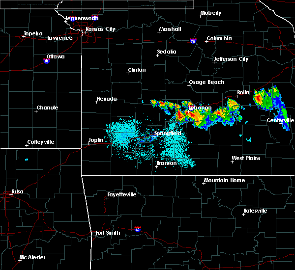 At 804 pm cdt, a severe thunderstorm was located 7 miles southeast of lebanon, and moving southeast at 35 mph (radar indicated). Hazards include 60 mph wind gusts and quarter size hail. Hail damage to vehicles is expected. expect wind damage to roofs, siding and trees. locations impacted include, lebanon. interstate 44 between mile markers 118 and 125 will also be impacted by the severe thunderstorm. A severe thunderstorm watch remains in effect until 100 am cdt monday morning for southeast kansas and southern missouri. At 804 pm cdt, a severe thunderstorm was located 7 miles southeast of lebanon, and moving southeast at 35 mph (radar indicated). Hazards include 60 mph wind gusts and quarter size hail. Hail damage to vehicles is expected. expect wind damage to roofs, siding and trees. locations impacted include, lebanon. interstate 44 between mile markers 118 and 125 will also be impacted by the severe thunderstorm. A severe thunderstorm watch remains in effect until 100 am cdt monday morning for southeast kansas and southern missouri.
|
| 6/28/2015 7:52 PM CDT |
 At 750 pm cdt, a severe thunderstorm was located near lebanon, and moving southeast at 35 mph (radar indicated). Hazards include 60 mph wind gusts and quarter size hail. Hail damage to vehicles is expected. expect wind damage to roofs, siding and trees. locations impacted include, lebanon. interstate 44 between mile markers 118 and 132 will also be impacted by the severe thunderstorm. A severe thunderstorm watch remains in effect until 100 am cdt monday morning for southeast kansas and southern missouri. At 750 pm cdt, a severe thunderstorm was located near lebanon, and moving southeast at 35 mph (radar indicated). Hazards include 60 mph wind gusts and quarter size hail. Hail damage to vehicles is expected. expect wind damage to roofs, siding and trees. locations impacted include, lebanon. interstate 44 between mile markers 118 and 132 will also be impacted by the severe thunderstorm. A severe thunderstorm watch remains in effect until 100 am cdt monday morning for southeast kansas and southern missouri.
|
| 6/28/2015 7:38 PM CDT |
 At 736 pm cdt, severe thunderstorms were located along a line extending from 5 miles northwest of lebanon to 12 miles east of lebanon, and moving southeast at 45 mph (radar indicated). Hazards include 60 mph wind gusts and quarter size hail. Hail damage to vehicles is expected. Expect wind damage to roofs, siding and trees. At 736 pm cdt, severe thunderstorms were located along a line extending from 5 miles northwest of lebanon to 12 miles east of lebanon, and moving southeast at 45 mph (radar indicated). Hazards include 60 mph wind gusts and quarter size hail. Hail damage to vehicles is expected. Expect wind damage to roofs, siding and trees.
|
| 6/26/2015 5:13 AM CDT | The severe thunderstorm warning for southern dallas, dade, northern webster, southern polk, western miller, laclede, northern greene and eastern camden counties will expire at 515 am cdt, the line of storms which prompted the warning has weakened below severe limits, and no longer poses an immediate threat to life or property. however, gusty winds and heavy rain are still possible with these thunderstorms. a severe thunderstorm watch remains in effect until 900 am cdt friday morning for portions of southeast kansas and southern missouri. |
| 6/26/2015 4:51 AM CDT |
 At 449 am cdt, severe thunderstorms were located along a line extending from 10 miles east of lakeland to lebanon to 9 miles northeast of fair grove to greenfield, and moving southeast at 30 mph (radar indicated). Hazards include 60 mph wind gusts. Expect damage to roofs. siding and trees. locations impacted include, ash grove, bolivar, buffalo, camdenton, conway, eldon, everton, fair grove, fair play, greenfield, lake ozark, lakeland, lebanon, lockwood, marshfield, morrisville, niangua, osage beach, pleasant hope, village of four seasons, walnut grove and willard. this warning also includes bennett spring state park, ha ha tonka state park, lake of the ozarks state park, lake of the ozarks and stockton lake. Interstate 44 between mile markers 94 and 142 will also be impacted by severe thunderstorms. At 449 am cdt, severe thunderstorms were located along a line extending from 10 miles east of lakeland to lebanon to 9 miles northeast of fair grove to greenfield, and moving southeast at 30 mph (radar indicated). Hazards include 60 mph wind gusts. Expect damage to roofs. siding and trees. locations impacted include, ash grove, bolivar, buffalo, camdenton, conway, eldon, everton, fair grove, fair play, greenfield, lake ozark, lakeland, lebanon, lockwood, marshfield, morrisville, niangua, osage beach, pleasant hope, village of four seasons, walnut grove and willard. this warning also includes bennett spring state park, ha ha tonka state park, lake of the ozarks state park, lake of the ozarks and stockton lake. Interstate 44 between mile markers 94 and 142 will also be impacted by severe thunderstorms.
|
| 6/26/2015 4:10 AM CDT |
 At 407 am cdt, severe thunderstorms were located along a line extending from 10 miles northwest of eldon to 12 miles southwest of camdenton to 8 miles northeast of bolivar to 21 miles north of lockwood, and moving southeast at 30 mph (radar indicated). Hazards include 60 mph wind gusts and penny size hail. Expect damage to roofs. Siding and trees. At 407 am cdt, severe thunderstorms were located along a line extending from 10 miles northwest of eldon to 12 miles southwest of camdenton to 8 miles northeast of bolivar to 21 miles north of lockwood, and moving southeast at 30 mph (radar indicated). Hazards include 60 mph wind gusts and penny size hail. Expect damage to roofs. Siding and trees.
|
| 5/17/2015 3:24 AM CDT | At 323 am cdt, severe thunderstorms were located along a line extending from 5 miles north of eldon to 10 miles northwest of richland to 23 miles southwest of fort leonard wood, and moving east at 45 mph (radar indicated). Hazards include 60 mph wind gusts. Expect damage to roofs. Siding and trees. |
| 5/17/2015 3:12 AM CDT | At 310 am cdt, severe thunderstorms were located along a line extending from 6 miles northeast of laurie to 7 miles south of camdenton to 7 miles southwest of lebanon, and moving east at 50 mph (radar indicated). Hazards include 60 mph wind gusts and penny size hail. Expect damage to roofs. siding and trees. locations impacted include, camdenton, conway, eldon, lake ozark, lakeland, laurie, lebanon, osage beach and village of four seasons. this warning also includes bennett spring state park, ha ha tonka state park, lake of the ozarks state park and lake of the ozarks. interstate 44 between mile markers 109 and 143 will also be impacted by severe thunderstorms. 0. 75in. |
| 5/17/2015 2:33 AM CDT | At 231 am cdt, severe thunderstorms were located along a line extending from 19 miles west of laurie to 20 miles west of conway, and moving east at 50 mph. these storms have a history of producing wind damage (radar indicated). Hazards include 60 mph wind gusts and penny size hail. Expect damage to roofs. Siding and trees. |
| 4/21/2015 5:14 PM CDT | At 513 pm cdt, a severe thunderstorm was located over south central laclede county, and moving east at 35 mph (radar indicated). Hazards include 60 mph wind gusts and quarter size hail. Hail damage to vehicles is expected. expect wind damage to roofs, siding and trees. locations impacted include, competition and morgan. 1. 00in. |
| 4/21/2015 4:56 PM CDT | At 453 pm cdt, a severe thunderstorm was located near conway, and moving east at 35 mph (radar indicated). Hazards include 60 mph wind gusts and quarter size hail. Hail damage to vehicles is expected. Expect wind damage to roofs, siding and trees. |
| 4/21/2015 4:14 PM CDT | At 412 pm cdt, a severe thunderstorm was located over southwestern laclede county, and moving east at 35 mph (public. quarter size hail was reported in phillisburg covering the ground). Hazards include 60 mph wind gusts and quarter size hail. Hail damage to vehicles is expected. expect wind damage to roofs, siding and trees. locations impacted include, morgan, phillipsburg and twin bridges. interstate 44 between mile markers 112 and 120 will also be impacted by the severe thunderstorm. 1. 00in. |
| 4/21/2015 3:55 PM CDT | At 354 pm cdt, a severe thunderstorm was located over eastern dallas county, and moving east at 40 mph (radar indicated). Hazards include 60 mph wind gusts and quarter size hail. Hail damage to vehicles is expected. Expect wind damage to roofs, siding and trees. |
| 4/2/2015 4:09 PM CDT | A tornado warning remains in effect for laclede county until 430 pm cdt. at 407 pm cdt. a severe thunderstorm capable of producing a tornado was located 4 miles east northeast of twin bridges. and moving east at 35 mph. hazard. Tornado and quarter size hail. |
| 4/2/2015 4:01 PM CDT | A tornado warning remains in effect for laclede county until 430 pm cdt. at 358 pm cdt. a severe thunderstorm capable of producing a tornado was located 3 miles northwest of twin bridges. and moving east at 35 mph. hazard. Tornado and quarter size hail. |
| 4/2/2015 3:51 PM CDT | The national weather service in springfield has issued a * tornado warning for. laclede county in southwest missouri. until 430 pm cdt * at 349 pm cdt. a severe thunderstorm capable of producing a tornado was located 31 miles west of fort leonard wood. And moving. |
| 4/2/2015 3:40 PM CDT | The national weather service in springfield has issued a * severe thunderstorm warning for. laclede county in southwest missouri. until 430 pm cdt * at 337 pm cdt. a severe thunderstorm was located 7 miles southwest of lebanon. And moving east at 30 mph. |
| 4/1/2015 5:53 PM CDT | The national weather service in springfield has issued a * severe thunderstorm warning for. laclede county in southwest missouri. until 700 pm cdt * at 552 pm cdt. a severe thunderstorm was located 3 miles west of bennett spring state park. And moving east at 30 mph. |
| 4/1/2015 5:31 PM CDT | A severe thunderstorm warning remains in effect for laclede county until 615 pm cdt. at 530 pm cdt. a severe thunderstorm was located near lebanon. and moving northeast at 25 mph. hazard. quarter size hail. source. Radar indicated. |
| 4/1/2015 5:09 PM CDT | The national weather service in springfield has issued a * severe thunderstorm warning for. laclede county in southwest missouri. until 615 pm cdt * at 507 pm cdt. a severe thunderstorm was located 7 miles west of conway. And moving northeast at 25 mph. |
| 3/24/2015 6:54 PM CDT | A severe thunderstorm warning remains in effect for eastern laclede county until 715 pm cdt. at 652 pm cdt. a severe thunderstorm was located near lebanon. and moving east at 55 mph. hazard. quarter size hail. source. emergency management. Quarter size hail was reported 2. |
| 3/24/2015 6:31 PM CDT | The national weather service in springfield has issued a * severe thunderstorm warning for. laclede county in southwest missouri. until 715 pm cdt * at 629 pm cdt. a severe thunderstorm was located 11 miles northwest of conway. And moving east at 60 mph. |
| 6/7/2014 8:26 AM CDT | Public estimated at least 60 mp in wright county MO, 10.2 miles N of Evergreen, MO |
| 5/20/2013 9:04 PM CDT | Half Dollar sized hail reported 8.2 miles N of Evergreen, MO |
| 5/20/2013 8:04 PM CDT | Half Dollar sized hail reported 8.2 miles N of Evergreen, MO |
| 8/16/2012 3:41 PM CDT | Storm damage reported in wright county MO, 10.2 miles N of Evergreen, MO |
| 7/29/2012 3:45 PM CDT | Thunderstorm wind gust blew wooden shed over on its side. porch roof damaged. several three inch tree branches broken of in wright county MO, 7 miles NNW of Evergreen, MO |
| 7/29/2012 3:35 PM CDT | Several large trees reported uprooted in the vicinity of smittle cave road. several buildings were damaged and pieces of buildings were blown into the roa in wright county MO, 6.7 miles N of Evergreen, MO |
| 1/1/0001 12:00 AM | Small trees damaged...also damage to corn field in wright county MO, 10.2 miles N of Evergreen, MO |
| 1/1/0001 12:00 AM | Severe thunderstorm wind gusts snapped a large tree three miles north of grovesprin in wright county MO, 7.5 miles NNE of Evergreen, MO |
| 1/1/0001 12:00 AM | Golf Ball sized hail reported 9.2 miles NNW of Evergreen, MO |
| 1/1/0001 12:00 AM | Quarter sized hail reported 10.2 miles N of Evergreen, MO, public reports quarter sized hail |
| 1/1/0001 12:00 AM | Quarter sized hail reported 10.2 miles N of Evergreen, MO |
| 1/1/0001 12:00 AM | Quarter sized hail reported 10.2 miles N of Evergreen, MO |
| 1/1/0001 12:00 AM | Quarter sized hail reported 10.2 miles N of Evergreen, MO |
| 1/1/0001 12:00 AM | Quarter sized hail reported 10.2 miles N of Evergreen, MO |
Hail Maps for Evergreen, MO


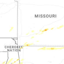
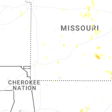


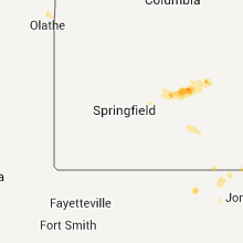


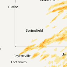


Connect with Interactive Hail Maps