

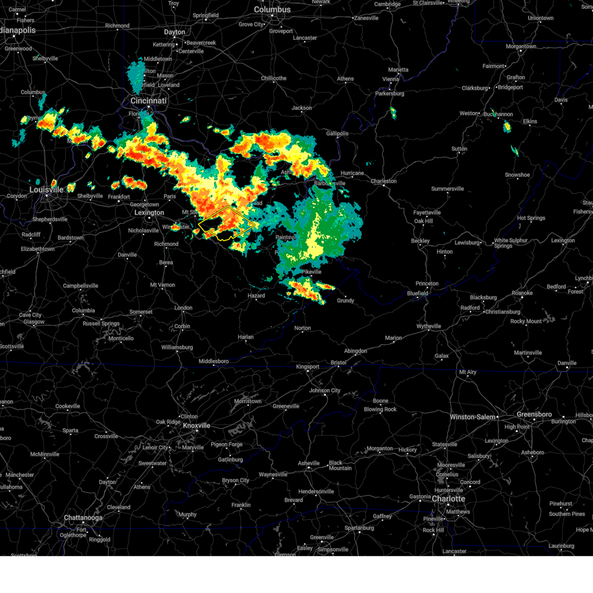
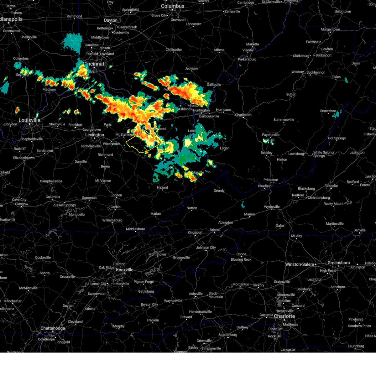
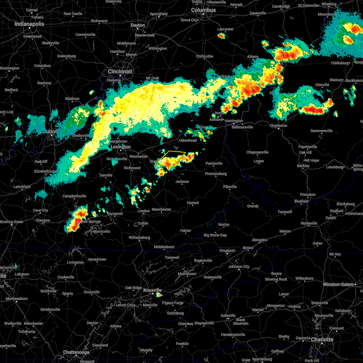
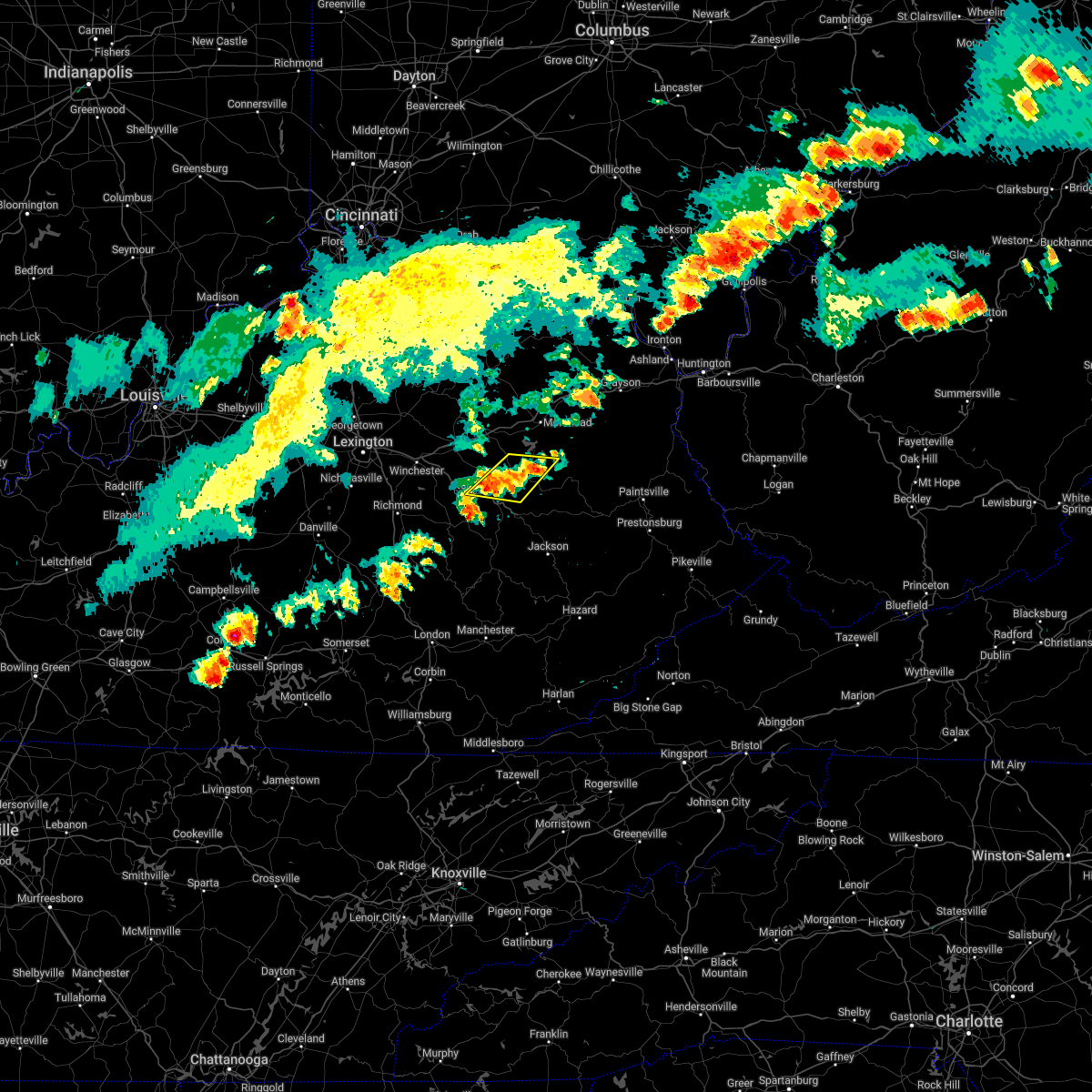
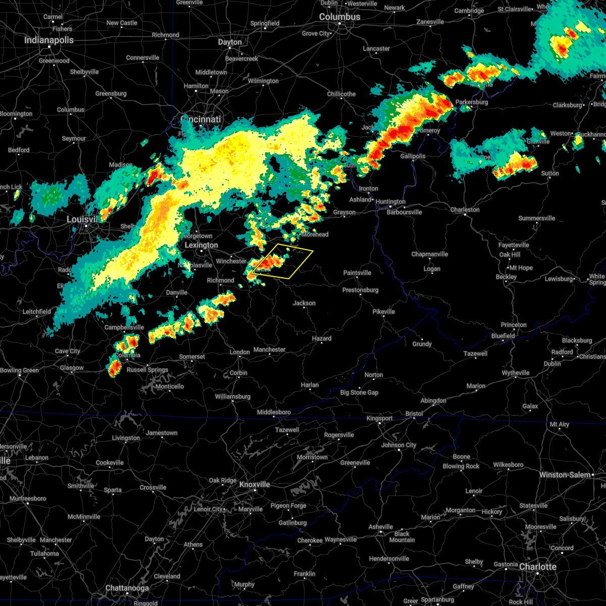
Hail Map for Ezel, KY
The Ezel, KY area has had 4 reports of on-the-ground hail by trained spotters, and has been under severe weather warnings 34 times during the past 12 months. Doppler radar has detected hail at or near Ezel, KY on 45 occasions, including 2 occasions during the past year.
| Name: | Ezel, KY |
| Where Located: | 32 miles ENE of Irvine, KY |
| Map: | Google Map for Ezel, KY |
| Population: | 235 |
| Housing Units: | 97 |
| More Info: | Search Google for Ezel, KY |
4
The Top Recent Hail Date for Ezel, KY is Sunday, July 2, 2023 (10th out of 45)

Hail and Wind Damage Spotted near Ezel, KY
| Date / Time | Report Details |
|---|---|
| 4/2/2024 10:27 AM EDT |
 The storm which prompted the warning has weakened below severe limits, and no longer appears capable of producing a tornado. therefore, the warning will be allowed to expire. however gusty winds are still possible with this thunderstorm. a tornado watch remains in effect until noon edt for southeastern and east central kentucky. to report severe weather, contact your nearest law enforcement agency. they will relay your report to the national weather service jackson ky. remember, a severe thunderstorm warning still remains in effect. The storm which prompted the warning has weakened below severe limits, and no longer appears capable of producing a tornado. therefore, the warning will be allowed to expire. however gusty winds are still possible with this thunderstorm. a tornado watch remains in effect until noon edt for southeastern and east central kentucky. to report severe weather, contact your nearest law enforcement agency. they will relay your report to the national weather service jackson ky. remember, a severe thunderstorm warning still remains in effect.
|
| 4/2/2024 10:24 AM EDT |
 the severe thunderstorm warning has been cancelled and is no longer in effect the severe thunderstorm warning has been cancelled and is no longer in effect
|
| 4/2/2024 10:24 AM EDT |
 At 1023 am edt, severe thunderstorms were located along a line extending from rush to malaga, moving east at 70 mph (radar indicated). Hazards include 60 mph wind gusts. Expect damage to roofs, siding, and trees. Locations impacted include, lewis and hendricks. At 1023 am edt, severe thunderstorms were located along a line extending from rush to malaga, moving east at 70 mph (radar indicated). Hazards include 60 mph wind gusts. Expect damage to roofs, siding, and trees. Locations impacted include, lewis and hendricks.
|
| 4/2/2024 10:15 AM EDT | Tree across the road on hwy 460. info. found via social medi in morgan county KY, 0.2 miles NW of Ezel, KY |
| 4/2/2024 10:13 AM EDT |
 At 1012 am edt, a severe thunderstorm capable of producing a tornado was located over valeria, or 7 miles north of campton, moving southeast at 50 mph (radar indicated rotation). Hazards include tornado. Flying debris will be dangerous to those caught without shelter. mobile homes will be damaged or destroyed. damage to roofs, windows, and vehicles will occur. tree damage is likely. Locations impacted include, payton, caney and burkhart. At 1012 am edt, a severe thunderstorm capable of producing a tornado was located over valeria, or 7 miles north of campton, moving southeast at 50 mph (radar indicated rotation). Hazards include tornado. Flying debris will be dangerous to those caught without shelter. mobile homes will be damaged or destroyed. damage to roofs, windows, and vehicles will occur. tree damage is likely. Locations impacted include, payton, caney and burkhart.
|
| 4/2/2024 10:13 AM EDT |
 the tornado warning has been cancelled and is no longer in effect the tornado warning has been cancelled and is no longer in effect
|
| 4/2/2024 10:12 AM EDT |
 The storms which prompted the warning are continuing to affect southeastern portions of the originally warned area and a downstream warning has been issued. please refer to that bulletin for further details. a tornado watch remains in effect until noon edt for southeastern and east central kentucky. remember, a severe thunderstorm warning still remains in effect for eastern powell county in east central kentucky, morgan county in southeastern kentucky, southeastern bath county in east central kentucky, east central estill county in east central kentucky, menifee county in east central kentucky, north central breathitt county in southeastern kentucky, northwestern magoffin county in southeastern kentucky, north central lee county in southeastern kentucky, southeastern rowan county in east central kentucky, wolfe county in southeastern kentucky, and elliott county in east central kentucky until 1045 am. The storms which prompted the warning are continuing to affect southeastern portions of the originally warned area and a downstream warning has been issued. please refer to that bulletin for further details. a tornado watch remains in effect until noon edt for southeastern and east central kentucky. remember, a severe thunderstorm warning still remains in effect for eastern powell county in east central kentucky, morgan county in southeastern kentucky, southeastern bath county in east central kentucky, east central estill county in east central kentucky, menifee county in east central kentucky, north central breathitt county in southeastern kentucky, northwestern magoffin county in southeastern kentucky, north central lee county in southeastern kentucky, southeastern rowan county in east central kentucky, wolfe county in southeastern kentucky, and elliott county in east central kentucky until 1045 am.
|
| 4/2/2024 10:04 AM EDT |
 Svrjkl the national weather service in jackson ky has issued a * severe thunderstorm warning for, eastern powell county in east central kentucky, morgan county in southeastern kentucky, southeastern bath county in east central kentucky, east central estill county in east central kentucky, menifee county in east central kentucky, north central breathitt county in southeastern kentucky, northwestern magoffin county in southeastern kentucky, north central lee county in southeastern kentucky, southeastern rowan county in east central kentucky, wolfe county in southeastern kentucky, elliott county in east central kentucky, * until 1045 am edt. * at 1004 am edt, severe thunderstorms were located along a line extending from near olive hill to patsey, moving east at 75 mph (radar indicated). Hazards include 70 mph wind gusts. Expect considerable tree damage. damage is likely to mobile homes, roofs, and outbuildings. severe thunderstorms will be near, west liberty around 1010 am edt. simpson around 1015 am edt. harper around 1020 am edt. Hendricks around 1025 am edt. Svrjkl the national weather service in jackson ky has issued a * severe thunderstorm warning for, eastern powell county in east central kentucky, morgan county in southeastern kentucky, southeastern bath county in east central kentucky, east central estill county in east central kentucky, menifee county in east central kentucky, north central breathitt county in southeastern kentucky, northwestern magoffin county in southeastern kentucky, north central lee county in southeastern kentucky, southeastern rowan county in east central kentucky, wolfe county in southeastern kentucky, elliott county in east central kentucky, * until 1045 am edt. * at 1004 am edt, severe thunderstorms were located along a line extending from near olive hill to patsey, moving east at 75 mph (radar indicated). Hazards include 70 mph wind gusts. Expect considerable tree damage. damage is likely to mobile homes, roofs, and outbuildings. severe thunderstorms will be near, west liberty around 1010 am edt. simpson around 1015 am edt. harper around 1020 am edt. Hendricks around 1025 am edt.
|
| 4/2/2024 9:56 AM EDT |
 At 956 am edt, severe thunderstorms were located along a line extending from near head of grassy to willow tree, moving east at 65 mph (radar indicated). Hazards include 70 mph wind gusts and penny size hail. Expect considerable tree damage. damage is likely to mobile homes, roofs, and outbuildings. these severe storms will be near, morehead around 1000 am edt. beattyville around 1005 am edt. airedale around 1010 am edt. Other locations impacted by these severe thunderstorms include fainville. At 956 am edt, severe thunderstorms were located along a line extending from near head of grassy to willow tree, moving east at 65 mph (radar indicated). Hazards include 70 mph wind gusts and penny size hail. Expect considerable tree damage. damage is likely to mobile homes, roofs, and outbuildings. these severe storms will be near, morehead around 1000 am edt. beattyville around 1005 am edt. airedale around 1010 am edt. Other locations impacted by these severe thunderstorms include fainville.
|
| 4/2/2024 9:54 AM EDT |
 Torjkl the national weather service in jackson ky has issued a * tornado warning for, northeastern powell county in east central kentucky, southeastern montgomery county in east central kentucky, southwestern morgan county in southeastern kentucky, south central bath county in east central kentucky, menifee county in east central kentucky, wolfe county in southeastern kentucky, * until 1030 am edt. * at 953 am edt, a severe thunderstorm capable of producing a tornado was located over means, or 7 miles west of frenchburg, moving southeast at 50 mph (radar indicated rotation). Hazards include tornado. Flying debris will be dangerous to those caught without shelter. mobile homes will be damaged or destroyed. damage to roofs, windows, and vehicles will occur. tree damage is likely. this dangerous storm will be near, frenchburg around 1000 am edt. pomeroyton around 1005 am edt. gosneyville around 1010 am edt. Other locations in the path of this tornadic thunderstorm include murphyfork, helechawa and payton. Torjkl the national weather service in jackson ky has issued a * tornado warning for, northeastern powell county in east central kentucky, southeastern montgomery county in east central kentucky, southwestern morgan county in southeastern kentucky, south central bath county in east central kentucky, menifee county in east central kentucky, wolfe county in southeastern kentucky, * until 1030 am edt. * at 953 am edt, a severe thunderstorm capable of producing a tornado was located over means, or 7 miles west of frenchburg, moving southeast at 50 mph (radar indicated rotation). Hazards include tornado. Flying debris will be dangerous to those caught without shelter. mobile homes will be damaged or destroyed. damage to roofs, windows, and vehicles will occur. tree damage is likely. this dangerous storm will be near, frenchburg around 1000 am edt. pomeroyton around 1005 am edt. gosneyville around 1010 am edt. Other locations in the path of this tornadic thunderstorm include murphyfork, helechawa and payton.
|
| 4/2/2024 9:50 AM EDT |
 At 950 am edt, severe thunderstorms were located along a line extending from near camp dix to kimbrell, moving east at 75 mph (radar indicated). Hazards include 70 mph wind gusts and penny size hail. Expect considerable tree damage. damage is likely to mobile homes, roofs, and outbuildings. these severe storms will be near, morehead around 955 am edt. wellington around 1000 am edt. campton around 1005 am edt. Other locations impacted by these severe thunderstorms include noland. At 950 am edt, severe thunderstorms were located along a line extending from near camp dix to kimbrell, moving east at 75 mph (radar indicated). Hazards include 70 mph wind gusts and penny size hail. Expect considerable tree damage. damage is likely to mobile homes, roofs, and outbuildings. these severe storms will be near, morehead around 955 am edt. wellington around 1000 am edt. campton around 1005 am edt. Other locations impacted by these severe thunderstorms include noland.
|
| 4/2/2024 9:43 AM EDT |
 At 942 am edt, severe thunderstorms were located along a line extending from near muses mills to near harris ferry, moving east at 60 mph (radar indicated). Hazards include 60 mph wind gusts and quarter size hail. Hail damage to vehicles is expected. expect wind damage to roofs, siding, and trees. these severe storms will be near, morehead around 950 am edt. campsites in the indian creek area of the daniel boone national forrest around 955 am edt. wellington around 1000 am edt. beattyville around 1005 am edt. airedale around 1010 am edt. Other locations impacted by these severe thunderstorms include noland. At 942 am edt, severe thunderstorms were located along a line extending from near muses mills to near harris ferry, moving east at 60 mph (radar indicated). Hazards include 60 mph wind gusts and quarter size hail. Hail damage to vehicles is expected. expect wind damage to roofs, siding, and trees. these severe storms will be near, morehead around 950 am edt. campsites in the indian creek area of the daniel boone national forrest around 955 am edt. wellington around 1000 am edt. beattyville around 1005 am edt. airedale around 1010 am edt. Other locations impacted by these severe thunderstorms include noland.
|
| 4/2/2024 9:31 AM EDT |
 Svrjkl the national weather service in jackson ky has issued a * severe thunderstorm warning for, powell county in east central kentucky, montgomery county in east central kentucky, northwestern morgan county in southeastern kentucky, bath county in east central kentucky, estill county in east central kentucky, menifee county in east central kentucky, northern lee county in southeastern kentucky, fleming county in east central kentucky, rowan county in east central kentucky, western wolfe county in southeastern kentucky, northwestern elliott county in east central kentucky, * until 1015 am edt. * at 930 am edt, severe thunderstorms were located along a line extending from cowan to 8 miles south of nicholasville, moving east at 85 mph (radar indicated). Hazards include 60 mph wind gusts and quarter size hail. Hail damage to vehicles is expected. expect wind damage to roofs, siding, and trees. severe thunderstorms will be near, mount sterling around 935 am edt. odessa around 940 am edt. owingsville around 945 am edt. marshall around 950 am edt. Other locations in the path of these severe thunderstorms include morehead and frenchburg. Svrjkl the national weather service in jackson ky has issued a * severe thunderstorm warning for, powell county in east central kentucky, montgomery county in east central kentucky, northwestern morgan county in southeastern kentucky, bath county in east central kentucky, estill county in east central kentucky, menifee county in east central kentucky, northern lee county in southeastern kentucky, fleming county in east central kentucky, rowan county in east central kentucky, western wolfe county in southeastern kentucky, northwestern elliott county in east central kentucky, * until 1015 am edt. * at 930 am edt, severe thunderstorms were located along a line extending from cowan to 8 miles south of nicholasville, moving east at 85 mph (radar indicated). Hazards include 60 mph wind gusts and quarter size hail. Hail damage to vehicles is expected. expect wind damage to roofs, siding, and trees. severe thunderstorms will be near, mount sterling around 935 am edt. odessa around 940 am edt. owingsville around 945 am edt. marshall around 950 am edt. Other locations in the path of these severe thunderstorms include morehead and frenchburg.
|
| 3/6/2024 10:07 AM EST |
 Torjkl the national weather service in jackson ky has issued a * this is a test message. tornado warning for, montgomery county in east central kentucky, mccreary county in south central kentucky, rowan county in east central kentucky, morgan county in southeastern kentucky, bath county in east central kentucky, leslie county in southeastern kentucky, estill county in east central kentucky, pulaski county in south central kentucky, rockcastle county in south central kentucky, clay county in southeastern kentucky, elliott county in east central kentucky, wayne county in south central kentucky, harlan county in southeastern kentucky, knox county in southeastern kentucky, owsley county in southeastern kentucky, jackson county in southeastern kentucky, knott county in southeastern kentucky, floyd county in southeastern kentucky, whitley county in south central kentucky, menifee county in east central kentucky, lee county in southeastern kentucky, fleming county in east central kentucky, wolfe county in southeastern kentucky, powell county in east central kentucky, laurel county in south central kentucky, martin county in northeastern kentucky, bell county in southeastern kentucky, johnson county in northeastern kentucky, letcher county in southeastern kentucky, perry county in southeastern kentucky, breathitt county in southeastern kentucky, pike county in southeastern kentucky, magoffin county in southeastern kentucky, * this is a test message. until 1030 am est. * this is a test message. repeat, this is a test tornado warning message. there is no severe weather occuring at this time. this test warning message is part of the annual kentucky tornado drill. if this were an actual severe weather event, you would be given information about the hazard. the national weather service, kentucky emergency management angency, and the kentucky weather preparedness committee, encourges the use of this time to activate and review your severe weather safety plans. repeating, this has been a test tornado warning message for the 2024 kentucky tornado drill. this concludes the test. * this is a test message. Torjkl the national weather service in jackson ky has issued a * this is a test message. tornado warning for, montgomery county in east central kentucky, mccreary county in south central kentucky, rowan county in east central kentucky, morgan county in southeastern kentucky, bath county in east central kentucky, leslie county in southeastern kentucky, estill county in east central kentucky, pulaski county in south central kentucky, rockcastle county in south central kentucky, clay county in southeastern kentucky, elliott county in east central kentucky, wayne county in south central kentucky, harlan county in southeastern kentucky, knox county in southeastern kentucky, owsley county in southeastern kentucky, jackson county in southeastern kentucky, knott county in southeastern kentucky, floyd county in southeastern kentucky, whitley county in south central kentucky, menifee county in east central kentucky, lee county in southeastern kentucky, fleming county in east central kentucky, wolfe county in southeastern kentucky, powell county in east central kentucky, laurel county in south central kentucky, martin county in northeastern kentucky, bell county in southeastern kentucky, johnson county in northeastern kentucky, letcher county in southeastern kentucky, perry county in southeastern kentucky, breathitt county in southeastern kentucky, pike county in southeastern kentucky, magoffin county in southeastern kentucky, * this is a test message. until 1030 am est. * this is a test message. repeat, this is a test tornado warning message. there is no severe weather occuring at this time. this test warning message is part of the annual kentucky tornado drill. if this were an actual severe weather event, you would be given information about the hazard. the national weather service, kentucky emergency management angency, and the kentucky weather preparedness committee, encourges the use of this time to activate and review your severe weather safety plans. repeating, this has been a test tornado warning message for the 2024 kentucky tornado drill. this concludes the test. * this is a test message.
|
| 8/25/2023 5:50 PM EDT |
 The severe thunderstorm warning for southeastern montgomery, northwestern morgan, southeastern bath, menifee and southwestern rowan counties will expire at 600 pm edt, the storm which prompted the warning has weakened below severe limits, and no longer poses an immediate threat to life or property. therefore, the warning will be allowed to expire. however gusty winds and heavy rain are still possible with this thunderstorm. The severe thunderstorm warning for southeastern montgomery, northwestern morgan, southeastern bath, menifee and southwestern rowan counties will expire at 600 pm edt, the storm which prompted the warning has weakened below severe limits, and no longer poses an immediate threat to life or property. therefore, the warning will be allowed to expire. however gusty winds and heavy rain are still possible with this thunderstorm.
|
| 8/25/2023 5:34 PM EDT |
 At 534 pm edt, a severe thunderstorm was located over mariba, or over frenchburg, moving southeast at 35 mph (radar indicated). Hazards include 60 mph wind gusts and penny size hail. Expect damage to roofs, siding, and trees. locations impacted include, wellington, pomeroyton and maytown. hail threat, radar indicated max hail size, 0. 75 in wind threat, radar indicated max wind gust, 60 mph. At 534 pm edt, a severe thunderstorm was located over mariba, or over frenchburg, moving southeast at 35 mph (radar indicated). Hazards include 60 mph wind gusts and penny size hail. Expect damage to roofs, siding, and trees. locations impacted include, wellington, pomeroyton and maytown. hail threat, radar indicated max hail size, 0. 75 in wind threat, radar indicated max wind gust, 60 mph.
|
| 8/25/2023 5:14 PM EDT |
 At 514 pm edt, a severe thunderstorm was located over olympia springs, or near frenchburg, moving southeast at 25 mph (radar indicated). Hazards include 60 mph wind gusts and penny size hail. Expect damage to roofs, siding, and trees. this severe thunderstorm will be near, sudith around 520 pm edt. rothwell around 525 pm edt. frenchburg around 530 pm edt. other locations in the path of this severe thunderstorm include mariba, wellington and stoll. hail threat, radar indicated max hail size, 0. 75 in wind threat, radar indicated max wind gust, 60 mph. At 514 pm edt, a severe thunderstorm was located over olympia springs, or near frenchburg, moving southeast at 25 mph (radar indicated). Hazards include 60 mph wind gusts and penny size hail. Expect damage to roofs, siding, and trees. this severe thunderstorm will be near, sudith around 520 pm edt. rothwell around 525 pm edt. frenchburg around 530 pm edt. other locations in the path of this severe thunderstorm include mariba, wellington and stoll. hail threat, radar indicated max hail size, 0. 75 in wind threat, radar indicated max wind gust, 60 mph.
|
| 8/25/2023 2:21 PM EDT |
 The severe thunderstorm warning for east central powell, west central morgan, menifee and northwestern wolfe counties will expire at 230 pm edt, the storm which prompted the warning has weakened below severe limits, and no longer poses an immediate threat to life or property. therefore, the warning will be allowed to expire. however gusty winds are still possible with this thunderstorm. The severe thunderstorm warning for east central powell, west central morgan, menifee and northwestern wolfe counties will expire at 230 pm edt, the storm which prompted the warning has weakened below severe limits, and no longer poses an immediate threat to life or property. therefore, the warning will be allowed to expire. however gusty winds are still possible with this thunderstorm.
|
| 8/25/2023 2:06 PM EDT |
 At 206 pm edt, a severe thunderstorm was located over mariba, or near frenchburg, moving southeast at 15 mph (radar indicated). Hazards include 60 mph wind gusts and quarter size hail. Hail damage to vehicles is expected. expect wind damage to roofs, siding, and trees. this severe storm will be near, denniston around 215 pm edt. other locations in the path of this severe thunderstorm include wellington, stoll, valeria, maytown and gosneyville. hail threat, radar indicated max hail size, 1. 00 in wind threat, radar indicated max wind gust, 60 mph. At 206 pm edt, a severe thunderstorm was located over mariba, or near frenchburg, moving southeast at 15 mph (radar indicated). Hazards include 60 mph wind gusts and quarter size hail. Hail damage to vehicles is expected. expect wind damage to roofs, siding, and trees. this severe storm will be near, denniston around 215 pm edt. other locations in the path of this severe thunderstorm include wellington, stoll, valeria, maytown and gosneyville. hail threat, radar indicated max hail size, 1. 00 in wind threat, radar indicated max wind gust, 60 mph.
|
| 8/25/2023 1:55 PM EDT |
 At 155 pm edt, a severe thunderstorm was located over tabor, or over frenchburg, moving southeast at 15 mph (radar indicated). Hazards include 60 mph wind gusts and quarter size hail. Hail damage to vehicles is expected. expect wind damage to roofs, siding, and trees. this severe thunderstorm will be near, mariba around 205 pm edt. denniston around 215 pm edt. other locations in the path of this severe thunderstorm include wellington, stoll and maytown. hail threat, radar indicated max hail size, 1. 00 in wind threat, radar indicated max wind gust, 60 mph. At 155 pm edt, a severe thunderstorm was located over tabor, or over frenchburg, moving southeast at 15 mph (radar indicated). Hazards include 60 mph wind gusts and quarter size hail. Hail damage to vehicles is expected. expect wind damage to roofs, siding, and trees. this severe thunderstorm will be near, mariba around 205 pm edt. denniston around 215 pm edt. other locations in the path of this severe thunderstorm include wellington, stoll and maytown. hail threat, radar indicated max hail size, 1. 00 in wind threat, radar indicated max wind gust, 60 mph.
|
| 7/29/2023 7:50 AM EDT |
 At 749 am edt, a severe thunderstorm was located over valeria, or 7 miles north of campton, moving east at 45 mph (radar indicated). Hazards include 60 mph wind gusts. Expect damage to roofs, siding, and trees. locations impacted include, murphyfork, rexville and payton. hail threat, radar indicated max hail size, <. 75 in wind threat, radar indicated max wind gust, 60 mph. At 749 am edt, a severe thunderstorm was located over valeria, or 7 miles north of campton, moving east at 45 mph (radar indicated). Hazards include 60 mph wind gusts. Expect damage to roofs, siding, and trees. locations impacted include, murphyfork, rexville and payton. hail threat, radar indicated max hail size, <. 75 in wind threat, radar indicated max wind gust, 60 mph.
|
| 7/29/2023 7:34 AM EDT |
 At 733 am edt, a severe thunderstorm was located over tabor, or near frenchburg, moving east at 30 mph (radar indicated). Hazards include 60 mph wind gusts. Expect damage to roofs, siding, and trees. this severe thunderstorm will be near, mariba around 745 am edt. wellington around 750 am edt. other locations in the path of this severe thunderstorm include maytown and murphyfork. hail threat, radar indicated max hail size, <. 75 in wind threat, radar indicated max wind gust, 60 mph. At 733 am edt, a severe thunderstorm was located over tabor, or near frenchburg, moving east at 30 mph (radar indicated). Hazards include 60 mph wind gusts. Expect damage to roofs, siding, and trees. this severe thunderstorm will be near, mariba around 745 am edt. wellington around 750 am edt. other locations in the path of this severe thunderstorm include maytown and murphyfork. hail threat, radar indicated max hail size, <. 75 in wind threat, radar indicated max wind gust, 60 mph.
|
| 7/18/2023 4:47 PM EDT |
 At 445 pm edt, severe thunderstorms were located along a line extending from near triplett to wagner to near ratlitt to red river gorge, moving northeast at 45 mph (radar indicated). Hazards include 60 mph wind gusts and quarter size hail. Hail damage to vehicles is expected. expect wind damage to roofs, siding, and trees. severe thunderstorms will be near, farley around 450 pm edt. maytown around 455 pm edt. pelfrey around 500 pm edt. henry around 505 pm edt. other locations in the path of these severe thunderstorms include west liberty and lenox. hail threat, radar indicated max hail size, 1. 00 in wind threat, radar indicated max wind gust, 60 mph. At 445 pm edt, severe thunderstorms were located along a line extending from near triplett to wagner to near ratlitt to red river gorge, moving northeast at 45 mph (radar indicated). Hazards include 60 mph wind gusts and quarter size hail. Hail damage to vehicles is expected. expect wind damage to roofs, siding, and trees. severe thunderstorms will be near, farley around 450 pm edt. maytown around 455 pm edt. pelfrey around 500 pm edt. henry around 505 pm edt. other locations in the path of these severe thunderstorms include west liberty and lenox. hail threat, radar indicated max hail size, 1. 00 in wind threat, radar indicated max wind gust, 60 mph.
|
| 7/18/2023 4:18 PM EDT |
 At 416 pm edt, severe thunderstorms were located along a line extending from vaughns mill to furnace to whynot to vincent, moving east at 45 mph (radar indicated). Hazards include 60 mph wind gusts. Expect damage to roofs, siding, and trees. these severe storms will be near, rogers chapel around 420 pm edt. other locations in the path of these severe thunderstorms include booneville, lone, campton, baptist and fivemile. hail threat, radar indicated max hail size, <. 75 in wind threat, radar indicated max wind gust, 60 mph. At 416 pm edt, severe thunderstorms were located along a line extending from vaughns mill to furnace to whynot to vincent, moving east at 45 mph (radar indicated). Hazards include 60 mph wind gusts. Expect damage to roofs, siding, and trees. these severe storms will be near, rogers chapel around 420 pm edt. other locations in the path of these severe thunderstorms include booneville, lone, campton, baptist and fivemile. hail threat, radar indicated max hail size, <. 75 in wind threat, radar indicated max wind gust, 60 mph.
|
| 7/18/2023 4:03 PM EDT |
 At 403 pm edt, severe thunderstorms were located along a line extending from near fox to weedon to wagersville to turkey foot, moving northeast at 45 mph (radar indicated). Hazards include 60 mph wind gusts. Expect damage to roofs, siding, and trees. severe thunderstorms will be near, pryse around 410 pm edt. ida may around 415 pm edt. stanton around 420 pm edt. other locations in the path of these severe thunderstorms include lombard, campsites in the indian creek area of the daniel boone national forrest and campton. hail threat, radar indicated max hail size, <. 75 in wind threat, radar indicated max wind gust, 60 mph. At 403 pm edt, severe thunderstorms were located along a line extending from near fox to weedon to wagersville to turkey foot, moving northeast at 45 mph (radar indicated). Hazards include 60 mph wind gusts. Expect damage to roofs, siding, and trees. severe thunderstorms will be near, pryse around 410 pm edt. ida may around 415 pm edt. stanton around 420 pm edt. other locations in the path of these severe thunderstorms include lombard, campsites in the indian creek area of the daniel boone national forrest and campton. hail threat, radar indicated max hail size, <. 75 in wind threat, radar indicated max wind gust, 60 mph.
|
| 7/2/2023 8:40 PM EDT | Tree reported down over highway 1010 near mile marker 2. this would have been near the intersection of blackwater rd. time estimated by rada in morgan county KY, 1.5 miles NNE of Ezel, KY |
| 7/2/2023 8:32 PM EDT |
 At 831 pm edt, severe thunderstorms were located along a line extending from near rothwell to standing rock to shade, moving east at 40 mph (radar indicated). Hazards include 60 mph wind gusts. Expect damage to roofs, siding, and trees. severe thunderstorms will be near, frenchburg around 835 pm edt. ratlitt around 840 pm edt. campton around 845 pm edt. fincastle around 850 pm edt. other locations in the path of these severe thunderstorms include kellacey and simpson. hail threat, radar indicated max hail size, <. 75 in wind threat, radar indicated max wind gust, 60 mph. At 831 pm edt, severe thunderstorms were located along a line extending from near rothwell to standing rock to shade, moving east at 40 mph (radar indicated). Hazards include 60 mph wind gusts. Expect damage to roofs, siding, and trees. severe thunderstorms will be near, frenchburg around 835 pm edt. ratlitt around 840 pm edt. campton around 845 pm edt. fincastle around 850 pm edt. other locations in the path of these severe thunderstorms include kellacey and simpson. hail threat, radar indicated max hail size, <. 75 in wind threat, radar indicated max wind gust, 60 mph.
|
| 7/2/2023 6:12 PM EDT |
 The severe thunderstorm warning for menifee, northern lee, southeastern fleming, rowan, wolfe, southeastern powell, morgan, central bath, northwestern johnson, southeastern estill, northwestern breathitt, northwestern magoffin and elliott counties will expire at 615 pm edt, the storms which prompted the warning have moved out of the area. therefore, the warning will be allowed to expire. however, a new warning has been reissued. a severe thunderstorm watch remains in effect until midnight edt for southeastern, northeastern and east central kentucky. The severe thunderstorm warning for menifee, northern lee, southeastern fleming, rowan, wolfe, southeastern powell, morgan, central bath, northwestern johnson, southeastern estill, northwestern breathitt, northwestern magoffin and elliott counties will expire at 615 pm edt, the storms which prompted the warning have moved out of the area. therefore, the warning will be allowed to expire. however, a new warning has been reissued. a severe thunderstorm watch remains in effect until midnight edt for southeastern, northeastern and east central kentucky.
|
| 7/2/2023 6:11 PM EDT |
 At 610 pm edt, severe thunderstorms were located along a line extending from near blairs mills to lenox to lykins to moct to oakdale, moving east at 40 mph (radar indicated). Hazards include 60 mph wind gusts and nickel size hail. Expect damage to roofs, siding, and trees. severe thunderstorms will be near, elamton around 615 pm edt. jackson around 620 pm edt. mason around 625 pm edt. press around 630 pm edt. other locations in the path of these severe thunderstorms include keaton and waldo. hail threat, radar indicated max hail size, 0. 88 in wind threat, radar indicated max wind gust, 60 mph. At 610 pm edt, severe thunderstorms were located along a line extending from near blairs mills to lenox to lykins to moct to oakdale, moving east at 40 mph (radar indicated). Hazards include 60 mph wind gusts and nickel size hail. Expect damage to roofs, siding, and trees. severe thunderstorms will be near, elamton around 615 pm edt. jackson around 620 pm edt. mason around 625 pm edt. press around 630 pm edt. other locations in the path of these severe thunderstorms include keaton and waldo. hail threat, radar indicated max hail size, 0. 88 in wind threat, radar indicated max wind gust, 60 mph.
|
| 7/2/2023 5:53 PM EDT |
 At 552 pm edt, severe thunderstorms were located along a line extending from ramey to omer to baptist to booth to doe creek, moving east at 35 mph (radar indicated). Hazards include 70 mph wind gusts and quarter size hail. Hail damage to vehicles is expected. expect considerable tree damage. wind damage is also likely to mobile homes, roofs, and outbuildings. Locations impacted include, henry, west liberty, morehead, simpson, fincastle and williba. At 552 pm edt, severe thunderstorms were located along a line extending from ramey to omer to baptist to booth to doe creek, moving east at 35 mph (radar indicated). Hazards include 70 mph wind gusts and quarter size hail. Hail damage to vehicles is expected. expect considerable tree damage. wind damage is also likely to mobile homes, roofs, and outbuildings. Locations impacted include, henry, west liberty, morehead, simpson, fincastle and williba.
|
| 7/2/2023 5:35 PM EDT |
 At 534 pm edt, severe thunderstorms were located along a line extending from odessa to mariba to see, moving east at 45 mph (radar indicated). Hazards include 70 mph wind gusts and quarter size hail. Hail damage to vehicles is expected. expect considerable tree damage. wind damage is also likely to mobile homes, roofs, and outbuildings. severe thunderstorms will be near, wellington around 540 pm edt. ebon around 545 pm edt. campton around 550 pm edt. Other locations in the path of these severe thunderstorms include licking river, morehead and elamton. At 534 pm edt, severe thunderstorms were located along a line extending from odessa to mariba to see, moving east at 45 mph (radar indicated). Hazards include 70 mph wind gusts and quarter size hail. Hail damage to vehicles is expected. expect considerable tree damage. wind damage is also likely to mobile homes, roofs, and outbuildings. severe thunderstorms will be near, wellington around 540 pm edt. ebon around 545 pm edt. campton around 550 pm edt. Other locations in the path of these severe thunderstorms include licking river, morehead and elamton.
|
| 6/26/2023 8:56 PM EDT |
 At 855 pm edt, a severe thunderstorm was located over lizzielane, or 7 miles south of west liberty, moving southeast at 40 mph (radar indicated). Hazards include 60 mph wind gusts and penny size hail. Expect damage to roofs, siding, and trees. this severe storm will be near, lewis around 900 pm edt. hail threat, radar indicated max hail size, 0. 75 in wind threat, radar indicated max wind gust, 60 mph. At 855 pm edt, a severe thunderstorm was located over lizzielane, or 7 miles south of west liberty, moving southeast at 40 mph (radar indicated). Hazards include 60 mph wind gusts and penny size hail. Expect damage to roofs, siding, and trees. this severe storm will be near, lewis around 900 pm edt. hail threat, radar indicated max hail size, 0. 75 in wind threat, radar indicated max wind gust, 60 mph.
|
| 6/26/2023 8:49 PM EDT |
 At 848 pm edt, a severe thunderstorm was located over pekin, or 8 miles southwest of west liberty, moving southeast at 40 mph (radar indicated). Hazards include 60 mph wind gusts and penny size hail. Expect damage to roofs, siding, and trees. this severe thunderstorm will be near, demund around 855 pm edt. payton around 900 pm edt. lewis around 905 pm edt. hail threat, radar indicated max hail size, 0. 75 in wind threat, radar indicated max wind gust, 60 mph. At 848 pm edt, a severe thunderstorm was located over pekin, or 8 miles southwest of west liberty, moving southeast at 40 mph (radar indicated). Hazards include 60 mph wind gusts and penny size hail. Expect damage to roofs, siding, and trees. this severe thunderstorm will be near, demund around 855 pm edt. payton around 900 pm edt. lewis around 905 pm edt. hail threat, radar indicated max hail size, 0. 75 in wind threat, radar indicated max wind gust, 60 mph.
|
| 6/26/2023 8:38 PM EDT |
 At 837 pm edt, a severe thunderstorm was located over woodsbend, or near west liberty, moving southeast at 40 mph (radar indicated). Hazards include 60 mph wind gusts and penny size hail. Expect damage to roofs, siding, and trees. this severe storm will be near, liberty road around 840 pm edt. other locations in the path of this severe thunderstorm include west liberty and cottle. hail threat, radar indicated max hail size, 0. 75 in wind threat, radar indicated max wind gust, 60 mph. At 837 pm edt, a severe thunderstorm was located over woodsbend, or near west liberty, moving southeast at 40 mph (radar indicated). Hazards include 60 mph wind gusts and penny size hail. Expect damage to roofs, siding, and trees. this severe storm will be near, liberty road around 840 pm edt. other locations in the path of this severe thunderstorm include west liberty and cottle. hail threat, radar indicated max hail size, 0. 75 in wind threat, radar indicated max wind gust, 60 mph.
|
| 6/26/2023 8:22 PM EDT |
 At 822 pm edt, a severe thunderstorm was located over big woods, or 7 miles east of frenchburg, moving southeast at 40 mph (radar indicated). Hazards include 60 mph wind gusts and penny size hail. Expect damage to roofs, siding, and trees. this severe thunderstorm will be near, dan around 825 pm edt. kellacey around 830 pm edt. henry around 835 pm edt. licking river around 840 pm edt. other locations in the path of this severe thunderstorm include west liberty. hail threat, radar indicated max hail size, 0. 75 in wind threat, radar indicated max wind gust, 60 mph. At 822 pm edt, a severe thunderstorm was located over big woods, or 7 miles east of frenchburg, moving southeast at 40 mph (radar indicated). Hazards include 60 mph wind gusts and penny size hail. Expect damage to roofs, siding, and trees. this severe thunderstorm will be near, dan around 825 pm edt. kellacey around 830 pm edt. henry around 835 pm edt. licking river around 840 pm edt. other locations in the path of this severe thunderstorm include west liberty. hail threat, radar indicated max hail size, 0. 75 in wind threat, radar indicated max wind gust, 60 mph.
|
| 3/3/2023 4:20 PM EST |
 The severe thunderstorm warning for northwestern morgan, southeastern bath, eastern menifee, southeastern fleming, rowan, northwestern wolfe and western elliott counties will expire at 430 pm est, the storms which prompted the warning have moved out of the area. therefore, the warning will be allowed to expire. however gusty winds are still possible with these thunderstorms. a tornado watch remains in effect until 500 pm est for east central kentucky. a tornado watch also remains in effect until 700 pm est for southeastern and east central kentucky. The severe thunderstorm warning for northwestern morgan, southeastern bath, eastern menifee, southeastern fleming, rowan, northwestern wolfe and western elliott counties will expire at 430 pm est, the storms which prompted the warning have moved out of the area. therefore, the warning will be allowed to expire. however gusty winds are still possible with these thunderstorms. a tornado watch remains in effect until 500 pm est for east central kentucky. a tornado watch also remains in effect until 700 pm est for southeastern and east central kentucky.
|
| 3/3/2023 4:06 PM EST |
 At 406 pm est, severe thunderstorms were located along a line extending from near wallingford to bluestone to maytown, moving northeast at 55 mph (radar indicated). Hazards include 70 mph wind gusts and penny size hail. Expect considerable tree damage. damage is likely to mobile homes, roofs, and outbuildings. locations impacted include, morehead, henry, west liberty and wrigley. thunderstorm damage threat, considerable hail threat, radar indicated max hail size, 0. 75 in wind threat, radar indicated max wind gust, 70 mph. At 406 pm est, severe thunderstorms were located along a line extending from near wallingford to bluestone to maytown, moving northeast at 55 mph (radar indicated). Hazards include 70 mph wind gusts and penny size hail. Expect considerable tree damage. damage is likely to mobile homes, roofs, and outbuildings. locations impacted include, morehead, henry, west liberty and wrigley. thunderstorm damage threat, considerable hail threat, radar indicated max hail size, 0. 75 in wind threat, radar indicated max wind gust, 70 mph.
|
| 3/3/2023 3:48 PM EST |
 At 348 pm est, severe thunderstorms were located along a line extending from near odessa to cornwell to pilot, moving northeast at 75 mph (radar indicated). Hazards include 70 mph wind gusts and penny size hail. Expect considerable tree damage. damage is likely to mobile homes, roofs, and outbuildings. severe thunderstorms will be near, hillsboro around 355 pm est. salt lick around 400 pm est. scranton around 405 pm est. other locations in the path of these severe thunderstorms include bangor, pelfrey and vale. thunderstorm damage threat, considerable hail threat, radar indicated max hail size, 0. 75 in wind threat, radar indicated max wind gust, 70 mph. At 348 pm est, severe thunderstorms were located along a line extending from near odessa to cornwell to pilot, moving northeast at 75 mph (radar indicated). Hazards include 70 mph wind gusts and penny size hail. Expect considerable tree damage. damage is likely to mobile homes, roofs, and outbuildings. severe thunderstorms will be near, hillsboro around 355 pm est. salt lick around 400 pm est. scranton around 405 pm est. other locations in the path of these severe thunderstorms include bangor, pelfrey and vale. thunderstorm damage threat, considerable hail threat, radar indicated max hail size, 0. 75 in wind threat, radar indicated max wind gust, 70 mph.
|
| 1/12/2023 10:56 AM EST |
 The severe thunderstorm warning for southwestern morgan, west central magoffin and central wolfe counties will expire at 1100 am est, the storm which prompted the warning has weakened below severe limits, and no longer poses an immediate threat to life or property. therefore, the warning will be allowed to expire. however gusty winds are still possible with this thunderstorm. a severe thunderstorm watch remains in effect until 400 pm est for southeastern and east central kentucky. to report severe weather, contact your nearest law enforcement agency. they will relay your report to the national weather service jackson ky. The severe thunderstorm warning for southwestern morgan, west central magoffin and central wolfe counties will expire at 1100 am est, the storm which prompted the warning has weakened below severe limits, and no longer poses an immediate threat to life or property. therefore, the warning will be allowed to expire. however gusty winds are still possible with this thunderstorm. a severe thunderstorm watch remains in effect until 400 pm est for southeastern and east central kentucky. to report severe weather, contact your nearest law enforcement agency. they will relay your report to the national weather service jackson ky.
|
| 1/12/2023 10:44 AM EST |
 At 1043 am est, a severe thunderstorm was located over murphyfork, or 8 miles southwest of west liberty, moving east at 55 mph (radar indicated). Hazards include 60 mph wind gusts. Expect damage to roofs, siding, and trees. this severe storm will be near, malone around 1050 am est. Other locations in the path of this severe thunderstorm include west liberty. At 1043 am est, a severe thunderstorm was located over murphyfork, or 8 miles southwest of west liberty, moving east at 55 mph (radar indicated). Hazards include 60 mph wind gusts. Expect damage to roofs, siding, and trees. this severe storm will be near, malone around 1050 am est. Other locations in the path of this severe thunderstorm include west liberty.
|
| 1/12/2023 10:31 AM EST |
 At 1031 am est, a severe thunderstorm was located over calaboose, or near campton, moving east at 55 mph (radar indicated). Hazards include 60 mph wind gusts. Expect damage to roofs, siding, and trees. this severe thunderstorm will be near, gosneyville around 1035 am est. murphyfork around 1040 am est. grassy creek around 1045 am est. west liberty around 1050 am est. other locations in the path of this severe thunderstorm include cottle. hail threat, radar indicated max hail size, <. 75 in wind threat, radar indicated max wind gust, 60 mph. At 1031 am est, a severe thunderstorm was located over calaboose, or near campton, moving east at 55 mph (radar indicated). Hazards include 60 mph wind gusts. Expect damage to roofs, siding, and trees. this severe thunderstorm will be near, gosneyville around 1035 am est. murphyfork around 1040 am est. grassy creek around 1045 am est. west liberty around 1050 am est. other locations in the path of this severe thunderstorm include cottle. hail threat, radar indicated max hail size, <. 75 in wind threat, radar indicated max wind gust, 60 mph.
|
| 1/12/2023 10:07 AM EST |
 At 1006 am est, a severe thunderstorm was located over cottage furnace, or near irvine, moving east at 55 mph (radar indicated). Hazards include 60 mph wind gusts. Expect damage to roofs, siding, and trees. this severe thunderstorm will be near, furnace around 1010 am est. rogers chapel around 1015 am est. natural bridge s. p. around 1020 am est. red river gorge around 1025 am est. Other locations in the path of this severe thunderstorm include valeria. At 1006 am est, a severe thunderstorm was located over cottage furnace, or near irvine, moving east at 55 mph (radar indicated). Hazards include 60 mph wind gusts. Expect damage to roofs, siding, and trees. this severe thunderstorm will be near, furnace around 1010 am est. rogers chapel around 1015 am est. natural bridge s. p. around 1020 am est. red river gorge around 1025 am est. Other locations in the path of this severe thunderstorm include valeria.
|
| 7/12/2022 4:50 PM EDT |
 The severe thunderstorm warning for southwestern morgan and southeastern menifee counties will expire at 500 pm edt, the storm which prompted the warning has weakened below severe limits, and no longer poses an immediate threat to life or property. therefore, the warning will be allowed to expire. The severe thunderstorm warning for southwestern morgan and southeastern menifee counties will expire at 500 pm edt, the storm which prompted the warning has weakened below severe limits, and no longer poses an immediate threat to life or property. therefore, the warning will be allowed to expire.
|
| 7/12/2022 4:44 PM EDT |
 At 444 pm edt, a severe thunderstorm was located over omer, or 7 miles west of west liberty, moving east at 30 mph (radar indicated). Hazards include 60 mph wind gusts and quarter size hail. Hail damage to vehicles is expected. expect wind damage to roofs, siding, and trees. this severe storm will be near, henry around 450 pm edt. liberty road around 455 pm edt. other locations in the path of this severe thunderstorm include west liberty. hail threat, radar indicated max hail size, 1. 00 in wind threat, radar indicated max wind gust, 60 mph. At 444 pm edt, a severe thunderstorm was located over omer, or 7 miles west of west liberty, moving east at 30 mph (radar indicated). Hazards include 60 mph wind gusts and quarter size hail. Hail damage to vehicles is expected. expect wind damage to roofs, siding, and trees. this severe storm will be near, henry around 450 pm edt. liberty road around 455 pm edt. other locations in the path of this severe thunderstorm include west liberty. hail threat, radar indicated max hail size, 1. 00 in wind threat, radar indicated max wind gust, 60 mph.
|
| 7/12/2022 4:35 PM EDT |
 At 434 pm edt, a severe thunderstorm was located over artville, or 7 miles east of frenchburg, moving east at 30 mph (radar indicated). Hazards include 60 mph wind gusts and quarter size hail. Hail damage to vehicles is expected. expect wind damage to roofs, siding, and trees. this severe storm will be near, ebon around 440 pm edt. omer around 445 pm edt. other locations in the path of this severe thunderstorm include henry, liberty road and west liberty. hail threat, radar indicated max hail size, 1. 00 in wind threat, radar indicated max wind gust, 60 mph. At 434 pm edt, a severe thunderstorm was located over artville, or 7 miles east of frenchburg, moving east at 30 mph (radar indicated). Hazards include 60 mph wind gusts and quarter size hail. Hail damage to vehicles is expected. expect wind damage to roofs, siding, and trees. this severe storm will be near, ebon around 440 pm edt. omer around 445 pm edt. other locations in the path of this severe thunderstorm include henry, liberty road and west liberty. hail threat, radar indicated max hail size, 1. 00 in wind threat, radar indicated max wind gust, 60 mph.
|
| 7/12/2022 4:28 PM EDT |
 At 428 pm edt, a severe thunderstorm was located over mariba, or near frenchburg, moving east at 30 mph (radar indicated). Hazards include 60 mph wind gusts and quarter size hail. Hail damage to vehicles is expected. expect wind damage to roofs, siding, and trees. this severe thunderstorm will be near, wellington around 435 pm edt. artville around 440 pm edt. omer around 445 pm edt. other locations in the path of this severe thunderstorm include henry, licking river and west liberty. hail threat, radar indicated max hail size, 1. 00 in wind threat, radar indicated max wind gust, 60 mph. At 428 pm edt, a severe thunderstorm was located over mariba, or near frenchburg, moving east at 30 mph (radar indicated). Hazards include 60 mph wind gusts and quarter size hail. Hail damage to vehicles is expected. expect wind damage to roofs, siding, and trees. this severe thunderstorm will be near, wellington around 435 pm edt. artville around 440 pm edt. omer around 445 pm edt. other locations in the path of this severe thunderstorm include henry, licking river and west liberty. hail threat, radar indicated max hail size, 1. 00 in wind threat, radar indicated max wind gust, 60 mph.
|
| 7/6/2022 6:12 PM EDT |
 The severe thunderstorm warning for southeastern powell, morgan, western owsley, estill, northeastern jackson, menifee, lee, wolfe and elliott counties will expire at 615 pm edt, the storms which prompted the warning have weakened below severe limits, and no longer pose an immediate threat to life or property. therefore, the warning will be allowed to expire. a severe thunderstorm watch remains in effect until 700 pm edt for southeastern and east central kentucky. to report severe weather, contact your nearest law enforcement agency. they will relay your report to the national weather service jackson ky. remember, a severe thunderstorm warning still remains in effect for portions of southern estill, lee, northeastern jackson, and northwestern owsley county until 6:35 pm edt. The severe thunderstorm warning for southeastern powell, morgan, western owsley, estill, northeastern jackson, menifee, lee, wolfe and elliott counties will expire at 615 pm edt, the storms which prompted the warning have weakened below severe limits, and no longer pose an immediate threat to life or property. therefore, the warning will be allowed to expire. a severe thunderstorm watch remains in effect until 700 pm edt for southeastern and east central kentucky. to report severe weather, contact your nearest law enforcement agency. they will relay your report to the national weather service jackson ky. remember, a severe thunderstorm warning still remains in effect for portions of southern estill, lee, northeastern jackson, and northwestern owsley county until 6:35 pm edt.
|
| 7/6/2022 6:00 PM EDT |
 At 600 pm edt, severe thunderstorms were located along a line extending from little sandy to wind cave, moving southeast at 30 mph (radar indicated). Hazards include 60 mph wind gusts and nickel size hail. Expect damage to roofs, siding, and trees. Locations impacted include, sandy hook, wild dog and elkfork. At 600 pm edt, severe thunderstorms were located along a line extending from little sandy to wind cave, moving southeast at 30 mph (radar indicated). Hazards include 60 mph wind gusts and nickel size hail. Expect damage to roofs, siding, and trees. Locations impacted include, sandy hook, wild dog and elkfork.
|
| 7/6/2022 5:50 PM EDT |
 At 550 pm edt, a severe thunderstorm capable of producing a tornado was located over denniston, or near frenchburg, moving east at 35 mph (radar indicated rotation). Hazards include tornado. Flying debris will be dangerous to those caught without shelter. mobile homes will be damaged or destroyed. damage to roofs, windows, and vehicles will occur. tree damage is likely. Locations impacted include, ezel, mize and rexville. At 550 pm edt, a severe thunderstorm capable of producing a tornado was located over denniston, or near frenchburg, moving east at 35 mph (radar indicated rotation). Hazards include tornado. Flying debris will be dangerous to those caught without shelter. mobile homes will be damaged or destroyed. damage to roofs, windows, and vehicles will occur. tree damage is likely. Locations impacted include, ezel, mize and rexville.
|
| 7/6/2022 5:42 PM EDT |
 At 541 pm edt, severe thunderstorms were located along a line extending from elliottville to jinks, moving southeast at 30 mph (radar indicated). Hazards include 60 mph wind gusts and nickel size hail. Expect damage to roofs, siding, and trees. severe thunderstorms will be near, wagner store around 545 pm edt. fannin valley around 550 pm edt. lytten around 555 pm edt. sandy hook around 600 pm edt. Other locations in the path of these severe thunderstorms include new zion and wild dog. At 541 pm edt, severe thunderstorms were located along a line extending from elliottville to jinks, moving southeast at 30 mph (radar indicated). Hazards include 60 mph wind gusts and nickel size hail. Expect damage to roofs, siding, and trees. severe thunderstorms will be near, wagner store around 545 pm edt. fannin valley around 550 pm edt. lytten around 555 pm edt. sandy hook around 600 pm edt. Other locations in the path of these severe thunderstorms include new zion and wild dog.
|
| 7/6/2022 5:38 PM EDT |
 At 538 pm edt, a severe thunderstorm capable of producing a tornado was located over tabor, or near frenchburg, moving east at 35 mph (radar indicated rotation). Hazards include tornado. Flying debris will be dangerous to those caught without shelter. mobile homes will be damaged or destroyed. damage to roofs, windows, and vehicles will occur. tree damage is likely. this dangerous storm will be near, mariba around 550 pm edt. wellington around 555 pm edt. Other locations in the path of this tornadic thunderstorm include ezel, pekin and mize. At 538 pm edt, a severe thunderstorm capable of producing a tornado was located over tabor, or near frenchburg, moving east at 35 mph (radar indicated rotation). Hazards include tornado. Flying debris will be dangerous to those caught without shelter. mobile homes will be damaged or destroyed. damage to roofs, windows, and vehicles will occur. tree damage is likely. this dangerous storm will be near, mariba around 550 pm edt. wellington around 555 pm edt. Other locations in the path of this tornadic thunderstorm include ezel, pekin and mize.
|
| 7/6/2022 1:10 PM EDT |
 At 109 pm edt, severe thunderstorms were located along a line extending from frenchburg to rogers chapel to fox, moving east at 20 mph (radar indicated). Hazards include 60 mph wind gusts and nickel size hail. Expect damage to roofs, siding, and trees. severe thunderstorms will be near, frenchburg around 115 pm edt. mariba around 120 pm edt. north irvine around 125 pm edt. other locations in the path of these severe thunderstorms include irvine, ravenna and rogers. hail threat, radar indicated max hail size, 0. 88 in wind threat, radar indicated max wind gust, 60 mph. At 109 pm edt, severe thunderstorms were located along a line extending from frenchburg to rogers chapel to fox, moving east at 20 mph (radar indicated). Hazards include 60 mph wind gusts and nickel size hail. Expect damage to roofs, siding, and trees. severe thunderstorms will be near, frenchburg around 115 pm edt. mariba around 120 pm edt. north irvine around 125 pm edt. other locations in the path of these severe thunderstorms include irvine, ravenna and rogers. hail threat, radar indicated max hail size, 0. 88 in wind threat, radar indicated max wind gust, 60 mph.
|
| 7/5/2022 2:20 PM EDT |
 At 220 pm edt, severe thunderstorms were located along a line extending from near davisport to adele, moving southeast at 35 mph (radar indicated). Hazards include 60 mph wind gusts. expect damage to roofs, siding, and trees At 220 pm edt, severe thunderstorms were located along a line extending from near davisport to adele, moving southeast at 35 mph (radar indicated). Hazards include 60 mph wind gusts. expect damage to roofs, siding, and trees
|
| 6/22/2022 7:41 PM EDT |
 The severe thunderstorm warning for morgan, west central johnson, north central breathitt, magoffin and wolfe counties will expire at 745 pm edt, the storms which prompted the warning have weakened below severe limits, and no longer pose an immediate threat to life or property. therefore, the warning will be allowed to expire. a severe thunderstorm watch remains in effect until midnight edt for southeastern, northeastern and east central kentucky. The severe thunderstorm warning for morgan, west central johnson, north central breathitt, magoffin and wolfe counties will expire at 745 pm edt, the storms which prompted the warning have weakened below severe limits, and no longer pose an immediate threat to life or property. therefore, the warning will be allowed to expire. a severe thunderstorm watch remains in effect until midnight edt for southeastern, northeastern and east central kentucky.
|
| 6/22/2022 7:29 PM EDT |
 At 729 pm edt, severe thunderstorms were located along a line extending from dingus to gilmore, moving east at 40 mph (radar indicated). Hazards include 60 mph wind gusts. Expect damage to roofs, siding, and trees. these severe storms will be near, silverhill around 735 pm edt. win around 740 pm edt. other locations in the path of these severe thunderstorms include puncheon and foraker. hail threat, radar indicated max hail size, <. 75 in wind threat, radar indicated max wind gust, 60 mph. At 729 pm edt, severe thunderstorms were located along a line extending from dingus to gilmore, moving east at 40 mph (radar indicated). Hazards include 60 mph wind gusts. Expect damage to roofs, siding, and trees. these severe storms will be near, silverhill around 735 pm edt. win around 740 pm edt. other locations in the path of these severe thunderstorms include puncheon and foraker. hail threat, radar indicated max hail size, <. 75 in wind threat, radar indicated max wind gust, 60 mph.
|
| 6/22/2022 7:28 PM EDT |
 The severe thunderstorm warning for northeastern powell, west central morgan, southeastern bath, menifee and northwestern wolfe counties will expire at 730 pm edt, the storm which prompted the warning has weakened below severe limits, and no longer poses an immediate threat to life or property. therefore, the warning will be allowed to expire. a severe thunderstorm watch remains in effect until midnight edt for southeastern and east central kentucky. The severe thunderstorm warning for northeastern powell, west central morgan, southeastern bath, menifee and northwestern wolfe counties will expire at 730 pm edt, the storm which prompted the warning has weakened below severe limits, and no longer poses an immediate threat to life or property. therefore, the warning will be allowed to expire. a severe thunderstorm watch remains in effect until midnight edt for southeastern and east central kentucky.
|
| 6/22/2022 7:20 PM EDT |
 At 720 pm edt, severe thunderstorms were located along a line extending from lenox to trent, moving east at 40 mph (radar indicated). Hazards include 60 mph wind gusts. Expect damage to roofs, siding, and trees. severe thunderstorms will be near, elamton around 725 pm edt. silverhill around 730 pm edt. burkhart around 735 pm edt. dale around 740 pm edt. other locations in the path of these severe thunderstorms include eugene. hail threat, radar indicated max hail size, <. 75 in wind threat, radar indicated max wind gust, 60 mph. At 720 pm edt, severe thunderstorms were located along a line extending from lenox to trent, moving east at 40 mph (radar indicated). Hazards include 60 mph wind gusts. Expect damage to roofs, siding, and trees. severe thunderstorms will be near, elamton around 725 pm edt. silverhill around 730 pm edt. burkhart around 735 pm edt. dale around 740 pm edt. other locations in the path of these severe thunderstorms include eugene. hail threat, radar indicated max hail size, <. 75 in wind threat, radar indicated max wind gust, 60 mph.
|
| 6/22/2022 7:12 PM EDT |
 At 711 pm edt, a severe thunderstorm was located over mariba, or near frenchburg, moving east at 35 mph (radar indicated). Hazards include 60 mph wind gusts. Expect damage to roofs, siding, and trees. this severe storm will be near, wellington around 715 pm edt. other locations in the path of this severe thunderstorm include korea, ebon and zag. hail threat, radar indicated max hail size, <. 75 in wind threat, radar indicated max wind gust, 60 mph. At 711 pm edt, a severe thunderstorm was located over mariba, or near frenchburg, moving east at 35 mph (radar indicated). Hazards include 60 mph wind gusts. Expect damage to roofs, siding, and trees. this severe storm will be near, wellington around 715 pm edt. other locations in the path of this severe thunderstorm include korea, ebon and zag. hail threat, radar indicated max hail size, <. 75 in wind threat, radar indicated max wind gust, 60 mph.
|
| 6/22/2022 6:59 PM EDT |
 At 658 pm edt, a severe thunderstorm was located over fagan, or near frenchburg, moving east at 35 mph (radar indicated). Hazards include 60 mph wind gusts. Expect damage to roofs, siding, and trees. this severe thunderstorm will be near, frenchburg around 710 pm edt. denniston around 715 pm edt. other locations in the path of this severe thunderstorm include wellington, ebon and kellacey. hail threat, radar indicated max hail size, <. 75 in wind threat, radar indicated max wind gust, 60 mph. At 658 pm edt, a severe thunderstorm was located over fagan, or near frenchburg, moving east at 35 mph (radar indicated). Hazards include 60 mph wind gusts. Expect damage to roofs, siding, and trees. this severe thunderstorm will be near, frenchburg around 710 pm edt. denniston around 715 pm edt. other locations in the path of this severe thunderstorm include wellington, ebon and kellacey. hail threat, radar indicated max hail size, <. 75 in wind threat, radar indicated max wind gust, 60 mph.
|
| 6/17/2022 1:10 PM EDT |
 The severe thunderstorm warning for northeastern powell, southeastern montgomery, western morgan, south central bath, menifee, south central rowan and northern wolfe counties will expire at 115 pm edt, the storm which prompted the warning has moved out of the area. therefore, the warning will be allowed to expire. a new warning has been issued. a severe thunderstorm watch remains in effect until 300 pm edt for southeastern and east central kentucky. The severe thunderstorm warning for northeastern powell, southeastern montgomery, western morgan, south central bath, menifee, south central rowan and northern wolfe counties will expire at 115 pm edt, the storm which prompted the warning has moved out of the area. therefore, the warning will be allowed to expire. a new warning has been issued. a severe thunderstorm watch remains in effect until 300 pm edt for southeastern and east central kentucky.
|
| 6/17/2022 12:57 PM EDT | Corrects time of previous tstm wnd dmg report from wellington. numerous trees were blown down in and around wellington and throughout the county. a few power outages we in menifee county KY, 3.7 miles ESE of Ezel, KY |
| 6/17/2022 12:56 PM EDT | Trees were blown down in ezel including onto 2 mobile home in morgan county KY, 0.4 miles ENE of Ezel, KY |
| 6/17/2022 12:44 PM EDT |
 At 1244 pm edt, a severe thunderstorm was located over cornwell, or near frenchburg, moving east at 40 mph (radar indicated). Hazards include 70 mph wind gusts and penny size hail. Expect considerable tree damage. damage is likely to mobile homes, roofs, and outbuildings. this severe thunderstorm will be near, frenchburg around 1250 pm edt. mariba around 1255 pm edt. wellington around 100 pm edt. other locations in the path of this severe thunderstorm include ezel, murphyfork and henry. thunderstorm damage threat, considerable hail threat, radar indicated max hail size, 0. 75 in wind threat, radar indicated max wind gust, 70 mph. At 1244 pm edt, a severe thunderstorm was located over cornwell, or near frenchburg, moving east at 40 mph (radar indicated). Hazards include 70 mph wind gusts and penny size hail. Expect considerable tree damage. damage is likely to mobile homes, roofs, and outbuildings. this severe thunderstorm will be near, frenchburg around 1250 pm edt. mariba around 1255 pm edt. wellington around 100 pm edt. other locations in the path of this severe thunderstorm include ezel, murphyfork and henry. thunderstorm damage threat, considerable hail threat, radar indicated max hail size, 0. 75 in wind threat, radar indicated max wind gust, 70 mph.
|
| 6/17/2022 11:57 AM EDT | Numerous trees were blown down in and around wellington and throughout the county. a few power outages were ongoing at 830 pm ed in menifee county KY, 3.7 miles ESE of Ezel, KY |
| 5/3/2022 9:01 PM EDT |
 At 900 pm edt, a severe thunderstorm was located over knowlton, or near stanton, moving east at 55 mph (radar indicated). Hazards include 60 mph wind gusts. Expect damage to roofs, siding, and trees. this severe storm will be near, nada around 905 pm edt. other locations in the path of this severe thunderstorm include campsites in the indian creek area of the daniel boone national forrest, wellington and ezel. hail threat, radar indicated max hail size, <. 75 in wind threat, radar indicated max wind gust, 60 mph. At 900 pm edt, a severe thunderstorm was located over knowlton, or near stanton, moving east at 55 mph (radar indicated). Hazards include 60 mph wind gusts. Expect damage to roofs, siding, and trees. this severe storm will be near, nada around 905 pm edt. other locations in the path of this severe thunderstorm include campsites in the indian creek area of the daniel boone national forrest, wellington and ezel. hail threat, radar indicated max hail size, <. 75 in wind threat, radar indicated max wind gust, 60 mph.
|
| 5/3/2022 8:49 PM EDT |
 At 848 pm edt, a severe thunderstorm was located over sandhill, or near irvine, moving east at 55 mph (radar indicated). Hazards include 60 mph wind gusts. Expect damage to roofs, siding, and trees. this severe thunderstorm will be near, cottage furnace around 855 pm edt. knowlton around 900 pm edt. lombard around 905 pm edt. other locations in the path of this severe thunderstorm include campsites in the indian creek area of the daniel boone national forrest and red river gorge. hail threat, radar indicated max hail size, <. 75 in wind threat, radar indicated max wind gust, 60 mph. At 848 pm edt, a severe thunderstorm was located over sandhill, or near irvine, moving east at 55 mph (radar indicated). Hazards include 60 mph wind gusts. Expect damage to roofs, siding, and trees. this severe thunderstorm will be near, cottage furnace around 855 pm edt. knowlton around 900 pm edt. lombard around 905 pm edt. other locations in the path of this severe thunderstorm include campsites in the indian creek area of the daniel boone national forrest and red river gorge. hail threat, radar indicated max hail size, <. 75 in wind threat, radar indicated max wind gust, 60 mph.
|
| 1/1/2022 3:13 PM EST |
 The severe thunderstorm warning for northwestern morgan, southeastern menifee and north central wolfe counties will expire at 315 pm est, the storm which prompted the warning has moved out of menifee and wolfe counties. therefore, the warning will be allowed to expire there. a new warning has been issued for central morgan county until 330 pm. please refer to that bullentin for further details. remember, a severe thunderstorm warning still remains in effect for central morgan county until 330 pm. The severe thunderstorm warning for northwestern morgan, southeastern menifee and north central wolfe counties will expire at 315 pm est, the storm which prompted the warning has moved out of menifee and wolfe counties. therefore, the warning will be allowed to expire there. a new warning has been issued for central morgan county until 330 pm. please refer to that bullentin for further details. remember, a severe thunderstorm warning still remains in effect for central morgan county until 330 pm.
|
| 1/1/2022 2:55 PM EST |
 At 254 pm est, a severe thunderstorm was located over woodsbend, or near west liberty, moving east at 55 mph (radar indicated). Hazards include 60 mph wind gusts. Expect damage to roofs, siding, and trees. this severe storm will be near, lick branch around 300 pm est. lenox around 305 pm est. hail threat, radar indicated max hail size, <. 75 in wind threat, radar indicated max wind gust, 60 mph. At 254 pm est, a severe thunderstorm was located over woodsbend, or near west liberty, moving east at 55 mph (radar indicated). Hazards include 60 mph wind gusts. Expect damage to roofs, siding, and trees. this severe storm will be near, lick branch around 300 pm est. lenox around 305 pm est. hail threat, radar indicated max hail size, <. 75 in wind threat, radar indicated max wind gust, 60 mph.
|
| 1/1/2022 2:40 PM EST |
 At 240 pm est, a severe thunderstorm was located over campsites in the indian creek area of the daniel boone national forrest, or near frenchburg, moving east at 50 mph (radar indicated). Hazards include 60 mph wind gusts. Expect damage to roofs, siding, and trees. this severe thunderstorm will be near, denniston around 245 pm est. wellington around 250 pm est. omer around 255 pm est. henry around 300 pm est. Other locations in the path of this severe thunderstorm include west liberty and lenox. At 240 pm est, a severe thunderstorm was located over campsites in the indian creek area of the daniel boone national forrest, or near frenchburg, moving east at 50 mph (radar indicated). Hazards include 60 mph wind gusts. Expect damage to roofs, siding, and trees. this severe thunderstorm will be near, denniston around 245 pm est. wellington around 250 pm est. omer around 255 pm est. henry around 300 pm est. Other locations in the path of this severe thunderstorm include west liberty and lenox.
|
| 6/21/2021 3:00 PM EDT |
 At 300 pm edt, a severe thunderstorm was located over slade, or 7 miles southeast of stanton, moving east at 40 mph (radar indicated). Hazards include 60 mph wind gusts. Expect damage to roofs, siding, and trees. this severe thunderstorm will be near, koomer ridge campground around 305 pm edt. red river gorge around 310 pm edt. calaboose around 315 pm edt. Toliver around 320 pm edt. At 300 pm edt, a severe thunderstorm was located over slade, or 7 miles southeast of stanton, moving east at 40 mph (radar indicated). Hazards include 60 mph wind gusts. Expect damage to roofs, siding, and trees. this severe thunderstorm will be near, koomer ridge campground around 305 pm edt. red river gorge around 310 pm edt. calaboose around 315 pm edt. Toliver around 320 pm edt.
|
| 6/21/2021 2:35 PM EDT |
 At 234 pm edt, a severe thunderstorm was located over yocum, or near west liberty, moving northeast at 30 mph (radar indicated). Hazards include 60 mph wind gusts and nickel size hail. Expect damage to roofs, siding, and trees. This severe thunderstorm will remain over mainly rural areas of northwestern morgan, eastern menifee, south central rowan and north central wolfe counties. At 234 pm edt, a severe thunderstorm was located over yocum, or near west liberty, moving northeast at 30 mph (radar indicated). Hazards include 60 mph wind gusts and nickel size hail. Expect damage to roofs, siding, and trees. This severe thunderstorm will remain over mainly rural areas of northwestern morgan, eastern menifee, south central rowan and north central wolfe counties.
|
| 6/21/2021 2:08 PM EDT |
 At 208 pm edt, a severe thunderstorm was located over pomeroyton, or 7 miles southeast of frenchburg, moving northeast at 30 mph (radar indicated). Hazards include 60 mph wind gusts and nickel size hail. Expect damage to roofs, siding, and trees. this severe thunderstorm will be near, wellington around 215 pm edt. artville around 220 pm edt. ebon around 225 pm edt. Other locations in the path of this severe thunderstorm include henry, dehart and blaze. At 208 pm edt, a severe thunderstorm was located over pomeroyton, or 7 miles southeast of frenchburg, moving northeast at 30 mph (radar indicated). Hazards include 60 mph wind gusts and nickel size hail. Expect damage to roofs, siding, and trees. this severe thunderstorm will be near, wellington around 215 pm edt. artville around 220 pm edt. ebon around 225 pm edt. Other locations in the path of this severe thunderstorm include henry, dehart and blaze.
|
| 6/18/2021 11:37 PM EDT |
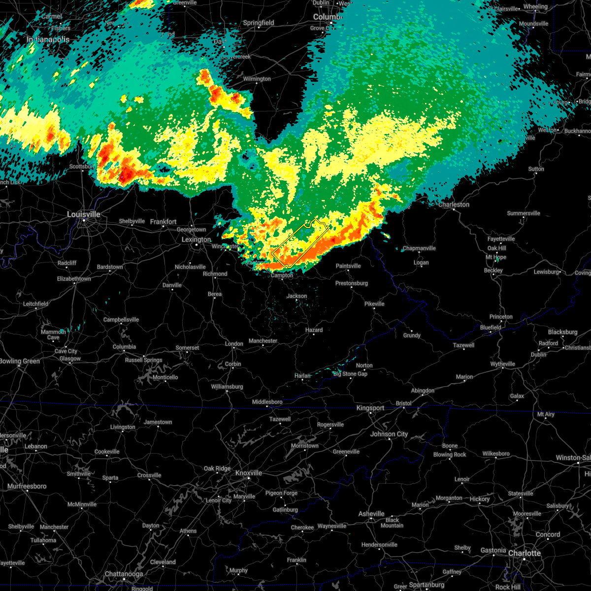 The severe thunderstorm warning for northwestern morgan, southeastern bath, eastern menifee, southeastern rowan and western elliott counties will expire at 1145 pm edt, the worst of the storm which prompted the warning has moved out of the area. therefore, the warning will be allowed to expire. however gusty winds are still possible with this thunderstorm. a severe thunderstorm watch remains in effect until 300 am edt for southeastern and east central kentucky. remember, a severe thunderstorm warning still remains in effect for southeast elloitt county until 12:15 am edt. The severe thunderstorm warning for northwestern morgan, southeastern bath, eastern menifee, southeastern rowan and western elliott counties will expire at 1145 pm edt, the worst of the storm which prompted the warning has moved out of the area. therefore, the warning will be allowed to expire. however gusty winds are still possible with this thunderstorm. a severe thunderstorm watch remains in effect until 300 am edt for southeastern and east central kentucky. remember, a severe thunderstorm warning still remains in effect for southeast elloitt county until 12:15 am edt.
|
| 6/18/2021 11:27 PM EDT |
 At 1126 pm edt, a severe thunderstorm was located over kellacey, or near west liberty, moving southeast at 45 mph (radar indicated). Hazards include 60 mph wind gusts. Expect damage to roofs, siding, and trees. This severe thunderstorm will remain over mainly rural areas of northwestern morgan, southeastern bath, eastern menifee, southeastern rowan and western elliott counties. At 1126 pm edt, a severe thunderstorm was located over kellacey, or near west liberty, moving southeast at 45 mph (radar indicated). Hazards include 60 mph wind gusts. Expect damage to roofs, siding, and trees. This severe thunderstorm will remain over mainly rural areas of northwestern morgan, southeastern bath, eastern menifee, southeastern rowan and western elliott counties.
|
| 6/18/2021 11:25 PM EDT |
 At 1125 pm edt, a severe thunderstorm was located over pomp, or near west liberty, moving southeast at 55 mph (radar indicated). Hazards include 60 mph wind gusts and penny size hail. Expect damage to roofs, siding, and trees. this severe thunderstorm will be near, lenox around 1130 pm edt. florress around 1135 pm edt. cisco around 1140 pm edt. perlie around 1145 pm edt. Other locations in the path of this severe thunderstorm include salyersville and ivyton. At 1125 pm edt, a severe thunderstorm was located over pomp, or near west liberty, moving southeast at 55 mph (radar indicated). Hazards include 60 mph wind gusts and penny size hail. Expect damage to roofs, siding, and trees. this severe thunderstorm will be near, lenox around 1130 pm edt. florress around 1135 pm edt. cisco around 1140 pm edt. perlie around 1145 pm edt. Other locations in the path of this severe thunderstorm include salyersville and ivyton.
|
| 6/18/2021 10:56 PM EDT |
 At 1056 pm edt, a severe thunderstorm was located over slate valley, or near owingsville, moving southeast at 45 mph (radar indicated). Hazards include 60 mph wind gusts and penny size hail. Expect damage to roofs, siding, and trees. this severe thunderstorm will be near, marshall around 1100 pm edt. salt lick around 1105 pm edt. young springs around 1110 pm edt. yale around 1115 pm edt. Other locations in the path of this severe thunderstorm include big woods and kellacey. At 1056 pm edt, a severe thunderstorm was located over slate valley, or near owingsville, moving southeast at 45 mph (radar indicated). Hazards include 60 mph wind gusts and penny size hail. Expect damage to roofs, siding, and trees. this severe thunderstorm will be near, marshall around 1100 pm edt. salt lick around 1105 pm edt. young springs around 1110 pm edt. yale around 1115 pm edt. Other locations in the path of this severe thunderstorm include big woods and kellacey.
|
| 4/8/2021 7:11 PM EDT |
 At 711 pm edt, a severe thunderstorm was located over williba, or 7 miles south of campton, moving northeast at 35 mph (radar indicated). Hazards include 60 mph wind gusts and half dollar size hail. Hail damage to vehicles is expected. Expect wind damage to roofs, siding, and trees. At 711 pm edt, a severe thunderstorm was located over williba, or 7 miles south of campton, moving northeast at 35 mph (radar indicated). Hazards include 60 mph wind gusts and half dollar size hail. Hail damage to vehicles is expected. Expect wind damage to roofs, siding, and trees.
|
| 4/8/2021 6:28 PM EDT |
 At 627 pm edt, a severe thunderstorm was located over denniston, or near frenchburg, moving northeast at 40 mph (radar indicated). Hazards include 60 mph wind gusts and quarter size hail. Hail damage to vehicles is expected. expect wind damage to roofs, siding, and trees. Locations impacted include, frenchburg, wellington, campsites in the indian creek area of the daniel boone national forrest, stoll, rothwell, red river gorge, denniston, pekin, omer, dan, fagan and maytown. At 627 pm edt, a severe thunderstorm was located over denniston, or near frenchburg, moving northeast at 40 mph (radar indicated). Hazards include 60 mph wind gusts and quarter size hail. Hail damage to vehicles is expected. expect wind damage to roofs, siding, and trees. Locations impacted include, frenchburg, wellington, campsites in the indian creek area of the daniel boone national forrest, stoll, rothwell, red river gorge, denniston, pekin, omer, dan, fagan and maytown.
|
| 4/8/2021 6:14 PM EDT |
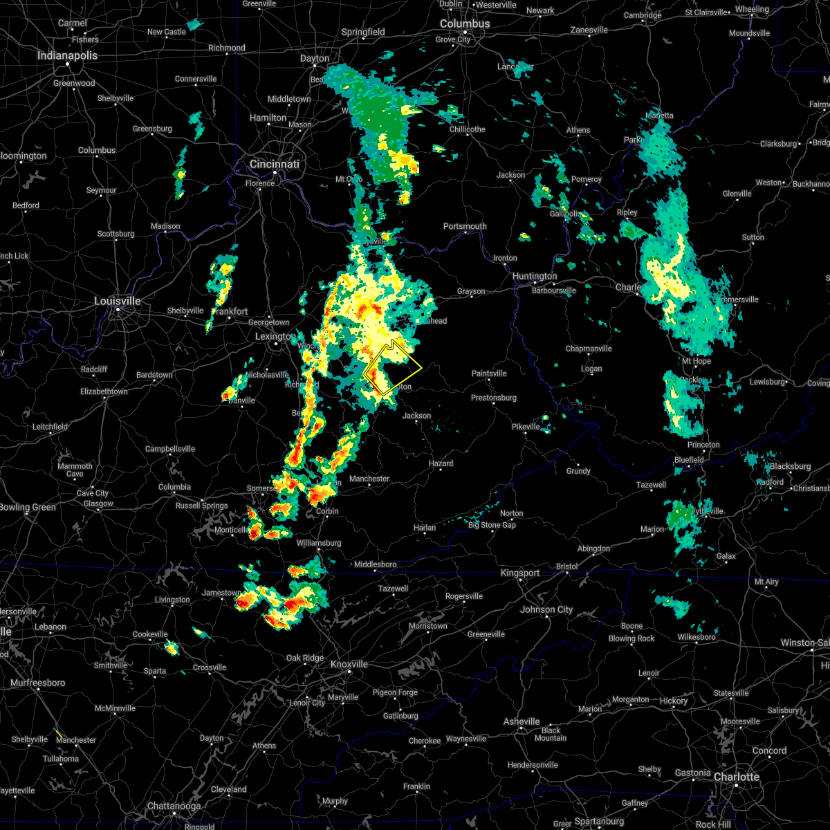 At 614 pm edt, a severe thunderstorm was located over haystack, or 8 miles south of frenchburg, moving northeast at 40 mph (radar indicated). Hazards include 60 mph wind gusts and quarter size hail. Hail damage to vehicles is expected. Expect wind damage to roofs, siding, and trees. At 614 pm edt, a severe thunderstorm was located over haystack, or 8 miles south of frenchburg, moving northeast at 40 mph (radar indicated). Hazards include 60 mph wind gusts and quarter size hail. Hail damage to vehicles is expected. Expect wind damage to roofs, siding, and trees.
|
| 4/8/2021 5:40 PM EDT |
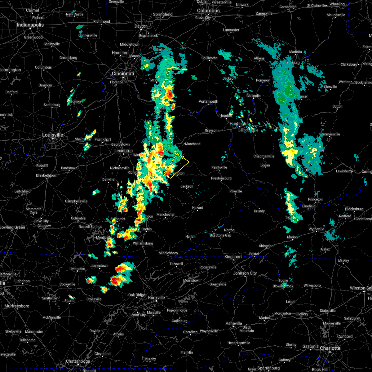 At 540 pm edt, a severe thunderstorm was located over koomer ridge campground, or 7 miles northwest of campton, moving northeast at 30 mph (radar indicated). Hazards include 60 mph wind gusts and half dollar size hail. Hail damage to vehicles is expected. Expect wind damage to roofs, siding, and trees. At 540 pm edt, a severe thunderstorm was located over koomer ridge campground, or 7 miles northwest of campton, moving northeast at 30 mph (radar indicated). Hazards include 60 mph wind gusts and half dollar size hail. Hail damage to vehicles is expected. Expect wind damage to roofs, siding, and trees.
|
| 5/3/2020 6:55 PM EDT |
 The severe thunderstorm warning for southeastern bath, northwestern morgan and menifee counties will expire at 700 pm edt, the storm which prompted the warning has moved out of the area. therefore, the warning will be allowed to expire. a new warning has been issued further ahead of the storm. a severe thunderstorm watch remains in effect until 1100 pm edt for southeastern and east central kentucky. The severe thunderstorm warning for southeastern bath, northwestern morgan and menifee counties will expire at 700 pm edt, the storm which prompted the warning has moved out of the area. therefore, the warning will be allowed to expire. a new warning has been issued further ahead of the storm. a severe thunderstorm watch remains in effect until 1100 pm edt for southeastern and east central kentucky.
|
| 5/3/2020 6:52 PM EDT |
 At 652 pm edt, a severe thunderstorm was located over cat creek, or over stanton, moving east at 35 mph (radar indicated). Hazards include 60 mph wind gusts and quarter size hail. Hail damage to vehicles is expected. expect wind damage to roofs, siding, and trees. this severe thunderstorm will be near, bowen around 655 pm edt. lombard around 700 pm edt. campsites in the indian creek area of the daniel boone national forrest around 705 pm edt. tabor around 710 pm edt. Mariba around 715 pm edt. At 652 pm edt, a severe thunderstorm was located over cat creek, or over stanton, moving east at 35 mph (radar indicated). Hazards include 60 mph wind gusts and quarter size hail. Hail damage to vehicles is expected. expect wind damage to roofs, siding, and trees. this severe thunderstorm will be near, bowen around 655 pm edt. lombard around 700 pm edt. campsites in the indian creek area of the daniel boone national forrest around 705 pm edt. tabor around 710 pm edt. Mariba around 715 pm edt.
|
| 5/3/2020 6:51 PM EDT |
 At 651 pm edt, a severe thunderstorm was located over wellington, or 7 miles southeast of frenchburg, moving southeast at 40 mph (radar indicated). Hazards include 60 mph wind gusts and quarter size hail. Hail damage to vehicles is expected. Expect wind damage to roofs, siding, and trees. At 651 pm edt, a severe thunderstorm was located over wellington, or 7 miles southeast of frenchburg, moving southeast at 40 mph (radar indicated). Hazards include 60 mph wind gusts and quarter size hail. Hail damage to vehicles is expected. Expect wind damage to roofs, siding, and trees.
|
| 5/3/2020 6:42 PM EDT |
 At 642 pm edt, a severe thunderstorm was located over scranton, or near frenchburg, moving east at 45 mph (radar indicated). Hazards include 60 mph wind gusts and penny size hail. Expect damage to roofs, siding, and trees. Locations impacted include, west liberty, frenchburg, henry, wellington, zag, greear, mize, stoll, rothwell, denniston, pekin and liberty road. At 642 pm edt, a severe thunderstorm was located over scranton, or near frenchburg, moving east at 45 mph (radar indicated). Hazards include 60 mph wind gusts and penny size hail. Expect damage to roofs, siding, and trees. Locations impacted include, west liberty, frenchburg, henry, wellington, zag, greear, mize, stoll, rothwell, denniston, pekin and liberty road.
|
| 5/3/2020 6:30 PM EDT |
 At 630 pm edt, a severe thunderstorm was located near hope, or near frenchburg, moving east at 45 mph (radar indicated). Hazards include 60 mph wind gusts and penny size hail. Expect damage to roofs, siding, and trees. Locations impacted include, mount sterling, west liberty, frenchburg, henry, jeffersonville, camargo, wellington, zag, clay lick, cornwell, rothwell and olympia springs. At 630 pm edt, a severe thunderstorm was located near hope, or near frenchburg, moving east at 45 mph (radar indicated). Hazards include 60 mph wind gusts and penny size hail. Expect damage to roofs, siding, and trees. Locations impacted include, mount sterling, west liberty, frenchburg, henry, jeffersonville, camargo, wellington, zag, clay lick, cornwell, rothwell and olympia springs.
|
| 5/3/2020 6:20 PM EDT |
 At 620 pm edt, a severe thunderstorm was located over lower spencer, or near mount sterling, moving east at 45 mph (radar indicated). Hazards include 60 mph wind gusts and penny size hail. Expect damage to roofs, siding, and trees. Locations impacted include, mount sterling, west liberty, owingsville, frenchburg, marshall, henry, jeffersonville, camargo, wellington, salt lick, zag and clay lick. At 620 pm edt, a severe thunderstorm was located over lower spencer, or near mount sterling, moving east at 45 mph (radar indicated). Hazards include 60 mph wind gusts and penny size hail. Expect damage to roofs, siding, and trees. Locations impacted include, mount sterling, west liberty, owingsville, frenchburg, marshall, henry, jeffersonville, camargo, wellington, salt lick, zag and clay lick.
|
| 5/3/2020 6:11 PM EDT |
 At 611 pm edt, a severe thunderstorm was located over prewitt, or over mount sterling, moving east at 40 mph (radar indicated). Hazards include 60 mph wind gusts and penny size hail. expect damage to roofs, siding, and trees At 611 pm edt, a severe thunderstorm was located over prewitt, or over mount sterling, moving east at 40 mph (radar indicated). Hazards include 60 mph wind gusts and penny size hail. expect damage to roofs, siding, and trees
|
| 4/9/2020 12:23 AM EDT |
 At 1222 am edt, severe thunderstorms were located along a line extending from near greenbo lake to near stark to oggs station, moving east at 40 mph (radar indicated). Hazards include 60 mph wind gusts and nickel size hail. Expect damage to roofs, siding, and trees. Locations impacted include, west liberty, sandy hook, frenchburg, henry, jeffersonville, camargo, wellington, campsites in the indian creek area of the daniel boone national forrest, zag, levee, moon and florress. At 1222 am edt, severe thunderstorms were located along a line extending from near greenbo lake to near stark to oggs station, moving east at 40 mph (radar indicated). Hazards include 60 mph wind gusts and nickel size hail. Expect damage to roofs, siding, and trees. Locations impacted include, west liberty, sandy hook, frenchburg, henry, jeffersonville, camargo, wellington, campsites in the indian creek area of the daniel boone national forrest, zag, levee, moon and florress.
|
| 4/9/2020 12:06 AM EDT |
 At 1206 am edt, severe thunderstorms were located along a line extending from 8 miles west of load to haldeman to mount sterling, moving southeast at 40 mph (radar indicated). Hazards include 60 mph wind gusts and nickel size hail. expect damage to roofs, siding, and trees At 1206 am edt, severe thunderstorms were located along a line extending from 8 miles west of load to haldeman to mount sterling, moving southeast at 40 mph (radar indicated). Hazards include 60 mph wind gusts and nickel size hail. expect damage to roofs, siding, and trees
|
| 6/23/2019 8:07 PM EDT |
 At 807 pm edt, a severe thunderstorm was located over brandy, or near morehead, moving east at 30 mph (radar indicated). Hazards include 60 mph wind gusts. expect damage to roofs, siding, and trees At 807 pm edt, a severe thunderstorm was located over brandy, or near morehead, moving east at 30 mph (radar indicated). Hazards include 60 mph wind gusts. expect damage to roofs, siding, and trees
|
| 6/5/2019 9:53 PM EDT |
 At 952 pm edt, severe thunderstorms were located along a line extending from isonville to west liberty to valeria, moving east at 55 mph (radar indicated). Hazards include 60 mph wind gusts and penny size hail. Expect damage to roofs, siding, and trees. Locations impacted include, west liberty, sandy hook, frenchburg, henry, lewis, jeffersonville, wellington, campsites in the indian creek area of the daniel boone national forrest, zag, moon, florress and cornwell. At 952 pm edt, severe thunderstorms were located along a line extending from isonville to west liberty to valeria, moving east at 55 mph (radar indicated). Hazards include 60 mph wind gusts and penny size hail. Expect damage to roofs, siding, and trees. Locations impacted include, west liberty, sandy hook, frenchburg, henry, lewis, jeffersonville, wellington, campsites in the indian creek area of the daniel boone national forrest, zag, moon, florress and cornwell.
|
| 6/5/2019 9:29 PM EDT |
 At 929 pm edt, severe thunderstorms were located along a line extending from crix to near ratlitt to near bean, moving east at 55 mph (radar indicated). Hazards include 60 mph wind gusts and penny size hail. expect damage to roofs, siding, and trees At 929 pm edt, severe thunderstorms were located along a line extending from crix to near ratlitt to near bean, moving east at 55 mph (radar indicated). Hazards include 60 mph wind gusts and penny size hail. expect damage to roofs, siding, and trees
|
| 6/5/2019 7:39 PM EDT |
 At 713 pm edt, a severe thunderstorm was located over kellacey, or near west liberty, moving southeast at 30 mph (radar indicated). Hazards include 60 mph wind gusts and quarter size hail. Hail damage to vehicles is expected. expect wind damage to roofs, siding, and trees. Locations impacted include, west liberty, henry, lewis, lenox, malone, zag, greear, mize, florress, rexville, stacy fork and lick branch. At 713 pm edt, a severe thunderstorm was located over kellacey, or near west liberty, moving southeast at 30 mph (radar indicated). Hazards include 60 mph wind gusts and quarter size hail. Hail damage to vehicles is expected. expect wind damage to roofs, siding, and trees. Locations impacted include, west liberty, henry, lewis, lenox, malone, zag, greear, mize, florress, rexville, stacy fork and lick branch.
|
| 6/5/2019 7:13 PM EDT |
 At 713 pm edt, a severe thunderstorm was located over kellacey, or near west liberty, moving southeast at 30 mph (radar indicated). Hazards include 60 mph wind gusts and quarter size hail. Hail damage to vehicles is expected. expect wind damage to roofs, siding, and trees. Locations impacted include, west liberty, henry, lewis, lenox, malone, zag, greear, mize, florress, rexville, stacy fork and lick branch. At 713 pm edt, a severe thunderstorm was located over kellacey, or near west liberty, moving southeast at 30 mph (radar indicated). Hazards include 60 mph wind gusts and quarter size hail. Hail damage to vehicles is expected. expect wind damage to roofs, siding, and trees. Locations impacted include, west liberty, henry, lewis, lenox, malone, zag, greear, mize, florress, rexville, stacy fork and lick branch.
|
| 6/5/2019 6:58 PM EDT |
 At 657 pm edt, a severe thunderstorm was located over big woods, or 7 miles northeast of frenchburg, moving southeast at 30 mph (radar indicated). Hazards include golf ball size hail and 60 mph wind gusts. People and animals outdoors will be injured. expect hail damage to roofs, siding, windows, and vehicles. Expect wind damage to roofs, siding, and trees. At 657 pm edt, a severe thunderstorm was located over big woods, or 7 miles northeast of frenchburg, moving southeast at 30 mph (radar indicated). Hazards include golf ball size hail and 60 mph wind gusts. People and animals outdoors will be injured. expect hail damage to roofs, siding, windows, and vehicles. Expect wind damage to roofs, siding, and trees.
|
| 8/6/2018 6:26 PM EDT |
 The severe thunderstorm warning for northwestern morgan and east central menifee counties will expire at 630 pm edt, the storm which prompted the warning has weakened below severe limits, and no longer poses an immediate threat to life or property. therefore, the warning will be allowed to expire. however heavy rain is still possible with this thunderstorm. The severe thunderstorm warning for northwestern morgan and east central menifee counties will expire at 630 pm edt, the storm which prompted the warning has weakened below severe limits, and no longer poses an immediate threat to life or property. therefore, the warning will be allowed to expire. however heavy rain is still possible with this thunderstorm.
|
| 8/6/2018 6:15 PM EDT |
 At 614 pm edt, a severe thunderstorm was located over kellacey, or 9 miles northwest of west liberty, moving east at 30 mph (radar indicated). Hazards include 60 mph wind gusts. Expect damage to roofs, siding, and trees. Locations impacted include, west liberty, henry, wellington, malone, zag, greear, lick branch, index, denniston, pekin, liberty road and omer. At 614 pm edt, a severe thunderstorm was located over kellacey, or 9 miles northwest of west liberty, moving east at 30 mph (radar indicated). Hazards include 60 mph wind gusts. Expect damage to roofs, siding, and trees. Locations impacted include, west liberty, henry, wellington, malone, zag, greear, lick branch, index, denniston, pekin, liberty road and omer.
|
| 8/6/2018 5:56 PM EDT |
 At 555 pm edt, a severe thunderstorm was located over ratlitt, or near frenchburg, moving east at 30 mph (radar indicated). Hazards include 60 mph wind gusts. expect damage to roofs, siding, and trees At 555 pm edt, a severe thunderstorm was located over ratlitt, or near frenchburg, moving east at 30 mph (radar indicated). Hazards include 60 mph wind gusts. expect damage to roofs, siding, and trees
|
| 7/20/2018 5:29 PM EDT |
 A severe thunderstorm warning remains in effect until 545 pm edt for morgan. eastern menifee. southeastern rowan. northeastern wolfe and elliott counties. at 528 pm edt, severe thunderstorms were located along a line extending from near farley to well station, moving east at 50 mph. hazard. 60 mph wind gusts and penny size hail. A severe thunderstorm warning remains in effect until 545 pm edt for morgan. eastern menifee. southeastern rowan. northeastern wolfe and elliott counties. at 528 pm edt, severe thunderstorms were located along a line extending from near farley to well station, moving east at 50 mph. hazard. 60 mph wind gusts and penny size hail.
|
| 7/20/2018 4:57 PM EDT |
 At 456 pm edt, severe thunderstorms were located along a line extending from moore`s ferry to campsites in the indian creek area of the daniel boone national forrest, moving east at 55 mph (radar indicated). Hazards include 70 mph wind gusts and penny size hail. Expect considerable tree damage. Damage is likely to mobile homes, roofs, and outbuildings. At 456 pm edt, severe thunderstorms were located along a line extending from moore`s ferry to campsites in the indian creek area of the daniel boone national forrest, moving east at 55 mph (radar indicated). Hazards include 70 mph wind gusts and penny size hail. Expect considerable tree damage. Damage is likely to mobile homes, roofs, and outbuildings.
|
| 5/31/2018 4:44 PM EDT |
 At 444 pm edt, severe thunderstorms were located along a line extending from marshall to ratlitt to red river gorge to patsey, moving east at 45 mph (radar indicated). Hazards include 60 mph wind gusts and penny size hail. expect damage to roofs, siding, and trees At 444 pm edt, severe thunderstorms were located along a line extending from marshall to ratlitt to red river gorge to patsey, moving east at 45 mph (radar indicated). Hazards include 60 mph wind gusts and penny size hail. expect damage to roofs, siding, and trees
|
| 4/3/2018 11:14 PM EDT |
 At 1114 pm edt, severe thunderstorms were located along a line extending from blaze to daysboro, moving east at 50 mph (radar indicated). Hazards include 60 mph wind gusts. Expect damage to roofs, siding, and trees. Locations impacted include, west liberty, sandy hook, campton, henry, lewis, zag, moon, florress, leeco, lick branch, pekin, omer, pine ridge, wonnie, panama, ezel, ever, cottle, perlie and gordon ford. At 1114 pm edt, severe thunderstorms were located along a line extending from blaze to daysboro, moving east at 50 mph (radar indicated). Hazards include 60 mph wind gusts. Expect damage to roofs, siding, and trees. Locations impacted include, west liberty, sandy hook, campton, henry, lewis, zag, moon, florress, leeco, lick branch, pekin, omer, pine ridge, wonnie, panama, ezel, ever, cottle, perlie and gordon ford.
|
| 4/3/2018 10:53 PM EDT |
 At 1053 pm edt, severe thunderstorms were located along a line extending from tabor to leeco, moving east at 50 mph (radar indicated). Hazards include 60 mph wind gusts. expect damage to roofs, siding, and trees At 1053 pm edt, severe thunderstorms were located along a line extending from tabor to leeco, moving east at 50 mph (radar indicated). Hazards include 60 mph wind gusts. expect damage to roofs, siding, and trees
|
| 6/23/2017 9:00 PM EDT | Trees down blocking us 460w near murphy fork roa in morgan county KY, 4.5 miles WNW of Ezel, KY |
| 6/23/2017 8:51 PM EDT |
 At 851 pm edt, a severe thunderstorm was located over grannie, or near campton, moving southeast at 30 mph (radar indicated). Hazards include 60 mph wind gusts. expect damage to roofs, siding, and trees At 851 pm edt, a severe thunderstorm was located over grannie, or near campton, moving southeast at 30 mph (radar indicated). Hazards include 60 mph wind gusts. expect damage to roofs, siding, and trees
|
| 5/27/2017 4:53 PM EDT |
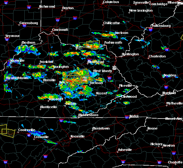 The severe thunderstorm warning for northern powell, southeastern montgomery, west central morgan and menifee counties will expire at 500 pm edt, the storm which prompted the warning has weakened below severe limits, and no longer poses an immediate threat to life or property. therefore the warning will be allowed to expire. however heavy rain and dangerous lightning is still possible with this thunderstorm. a severe thunderstorm watch remains in effect until 1000 pm edt for southeastern and east central kentucky. The severe thunderstorm warning for northern powell, southeastern montgomery, west central morgan and menifee counties will expire at 500 pm edt, the storm which prompted the warning has weakened below severe limits, and no longer poses an immediate threat to life or property. therefore the warning will be allowed to expire. however heavy rain and dangerous lightning is still possible with this thunderstorm. a severe thunderstorm watch remains in effect until 1000 pm edt for southeastern and east central kentucky.
|
| 5/27/2017 4:51 PM EDT |
 At 451 pm edt, a severe thunderstorm was located over booth, or near campton, moving northeast at 10 mph (radar indicated). Hazards include 60 mph wind gusts and quarter size hail. Hail damage to vehicles is expected. Expect wind damage to roofs, siding, and trees. At 451 pm edt, a severe thunderstorm was located over booth, or near campton, moving northeast at 10 mph (radar indicated). Hazards include 60 mph wind gusts and quarter size hail. Hail damage to vehicles is expected. Expect wind damage to roofs, siding, and trees.
|
| 5/27/2017 4:36 PM EDT |
 At 436 pm edt, a severe thunderstorm was located over mariba, or near frenchburg, moving east at 35 mph (radar indicated). Hazards include 60 mph wind gusts and quarter size hail. Hail damage to vehicles is expected. expect wind damage to roofs, siding, and trees. Locations impacted include, stanton, frenchburg, jeffersonville, clay city, wellington, campsites in the indian creek area of the daniel boone national forrest, means, bowen, stoll, cornwell, rothwell, denniston, waltersville, fagan, virden, tabor, rosslyn, ratlitt, scranton and mariba. At 436 pm edt, a severe thunderstorm was located over mariba, or near frenchburg, moving east at 35 mph (radar indicated). Hazards include 60 mph wind gusts and quarter size hail. Hail damage to vehicles is expected. expect wind damage to roofs, siding, and trees. Locations impacted include, stanton, frenchburg, jeffersonville, clay city, wellington, campsites in the indian creek area of the daniel boone national forrest, means, bowen, stoll, cornwell, rothwell, denniston, waltersville, fagan, virden, tabor, rosslyn, ratlitt, scranton and mariba.
|
| 5/27/2017 4:12 PM EDT |
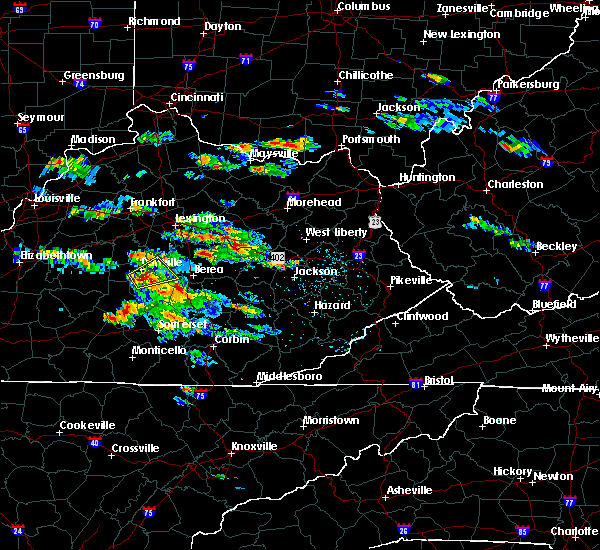 At 411 pm edt, a severe thunderstorm was located over stanton, moving east at 35 mph (radar indicated). Hazards include 60 mph wind gusts and quarter size hail. Hail damage to vehicles is expected. Expect wind damage to roofs, siding, and trees. At 411 pm edt, a severe thunderstorm was located over stanton, moving east at 35 mph (radar indicated). Hazards include 60 mph wind gusts and quarter size hail. Hail damage to vehicles is expected. Expect wind damage to roofs, siding, and trees.
|
| 5/18/2017 5:15 PM EDT |
 At 515 pm edt, a severe thunderstorm was located over grassy creek, or near west liberty, moving northeast at 30 mph (radar indicated). Hazards include 60 mph wind gusts and quarter size hail. Hail damage to vehicles is expected. Expect wind damage to roofs, siding, and trees. At 515 pm edt, a severe thunderstorm was located over grassy creek, or near west liberty, moving northeast at 30 mph (radar indicated). Hazards include 60 mph wind gusts and quarter size hail. Hail damage to vehicles is expected. Expect wind damage to roofs, siding, and trees.
|
| 5/18/2017 4:58 PM EDT |
 At 457 pm edt, a severe thunderstorm was located over trent, or near campton, moving northeast at 65 mph (radar indicated). Hazards include 60 mph wind gusts and quarter size hail. Hail damage to vehicles is expected. expect wind damage to roofs, siding, and trees. Locations impacted include, campton, lower gilmore, mize, lexie, rexville, baptist, daysboro, pekin, hollonville, omer, pine ridge, sellars, toliver, gilmore, lee city, panama, payton, trent, hazel green and stillwater. At 457 pm edt, a severe thunderstorm was located over trent, or near campton, moving northeast at 65 mph (radar indicated). Hazards include 60 mph wind gusts and quarter size hail. Hail damage to vehicles is expected. expect wind damage to roofs, siding, and trees. Locations impacted include, campton, lower gilmore, mize, lexie, rexville, baptist, daysboro, pekin, hollonville, omer, pine ridge, sellars, toliver, gilmore, lee city, panama, payton, trent, hazel green and stillwater.
|
| 5/18/2017 4:42 PM EDT |
 At 442 pm edt, a severe thunderstorm was located over zoe, or near beattyville, moving northeast at 45 mph (radar indicated). Hazards include 60 mph wind gusts and quarter size hail. Hail damage to vehicles is expected. Expect wind damage to roofs, siding, and trees. At 442 pm edt, a severe thunderstorm was located over zoe, or near beattyville, moving northeast at 45 mph (radar indicated). Hazards include 60 mph wind gusts and quarter size hail. Hail damage to vehicles is expected. Expect wind damage to roofs, siding, and trees.
|
| 4/29/2017 7:46 PM EDT |
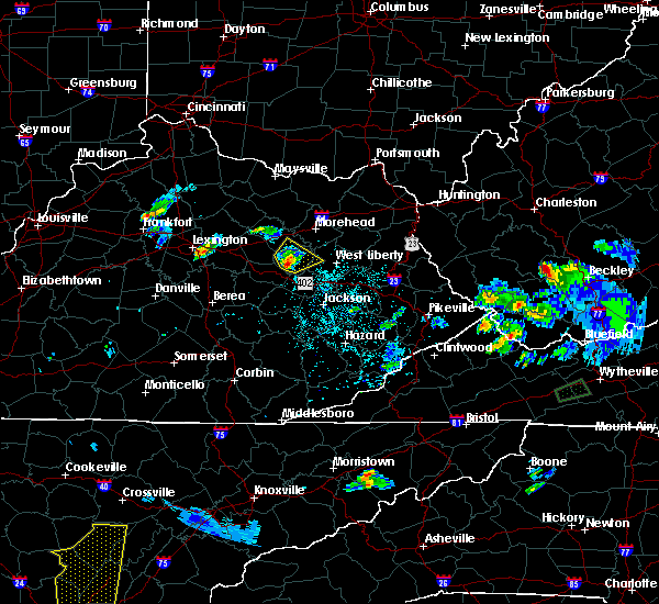 At 745 pm edt, a severe thunderstorm was located over tabor, or over frenchburg, moving northeast at 30 mph (radar indicated). Hazards include 60 mph wind gusts and half dollar size hail. Hail damage to vehicles is expected. expect wind damage to roofs, siding, and trees. Locations impacted include, frenchburg, wellington, campsites in the indian creek area of the daniel boone national forrest, clay lick, stoll, cornwell, rothwell, olympia springs, denniston, young springs, omer, dan, fagan, tabor, ratlitt, sudith, scranton, artville, mariba and pomeroyton. At 745 pm edt, a severe thunderstorm was located over tabor, or over frenchburg, moving northeast at 30 mph (radar indicated). Hazards include 60 mph wind gusts and half dollar size hail. Hail damage to vehicles is expected. expect wind damage to roofs, siding, and trees. Locations impacted include, frenchburg, wellington, campsites in the indian creek area of the daniel boone national forrest, clay lick, stoll, cornwell, rothwell, olympia springs, denniston, young springs, omer, dan, fagan, tabor, ratlitt, sudith, scranton, artville, mariba and pomeroyton.
|
| 4/29/2017 7:27 PM EDT |
 At 727 pm edt, a severe thunderstorm was located over lombard, or near stanton, moving northeast at 30 mph (radar indicated). Hazards include 60 mph wind gusts and half dollar size hail. Hail damage to vehicles is expected. Expect wind damage to roofs, siding, and trees. At 727 pm edt, a severe thunderstorm was located over lombard, or near stanton, moving northeast at 30 mph (radar indicated). Hazards include 60 mph wind gusts and half dollar size hail. Hail damage to vehicles is expected. Expect wind damage to roofs, siding, and trees.
|
| 4/5/2017 9:16 PM EDT |
 At 915 pm edt, a severe thunderstorm was located over bangor, or 10 miles northeast of frenchburg, moving northeast at 55 mph (radar indicated). Hazards include 70 mph wind gusts and quarter size hail. Hail damage to vehicles is expected. expect considerable tree damage. wind damage is also likely to mobile homes, roofs, and outbuildings. locations impacted include, west liberty, henry, wellington, zag, greear, stoll, yale, index, denniston, pekin, liberty road, omer, bangor, dehart, ratlitt, zilpo, scranton, mariba, pomeroyton and ezel. A tornado watch remains in effect until 1000 pm edt for southeastern and east central kentucky. At 915 pm edt, a severe thunderstorm was located over bangor, or 10 miles northeast of frenchburg, moving northeast at 55 mph (radar indicated). Hazards include 70 mph wind gusts and quarter size hail. Hail damage to vehicles is expected. expect considerable tree damage. wind damage is also likely to mobile homes, roofs, and outbuildings. locations impacted include, west liberty, henry, wellington, zag, greear, stoll, yale, index, denniston, pekin, liberty road, omer, bangor, dehart, ratlitt, zilpo, scranton, mariba, pomeroyton and ezel. A tornado watch remains in effect until 1000 pm edt for southeastern and east central kentucky.
|
| 4/5/2017 8:57 PM EDT |
 At 857 pm edt, a severe thunderstorm was located over campsites in the indian creek area of the daniel boone national forrest, or near frenchburg, moving northeast at 55 mph (radar indicated). Hazards include 70 mph wind gusts and quarter size hail. Hail damage to vehicles is expected. expect considerable tree damage. Wind damage is also likely to mobile homes, roofs, and outbuildings. At 857 pm edt, a severe thunderstorm was located over campsites in the indian creek area of the daniel boone national forrest, or near frenchburg, moving northeast at 55 mph (radar indicated). Hazards include 70 mph wind gusts and quarter size hail. Hail damage to vehicles is expected. expect considerable tree damage. Wind damage is also likely to mobile homes, roofs, and outbuildings.
|
| 3/1/2017 10:03 AM EST | Two large pine trees downe in morgan county KY, 1.9 miles NW of Ezel, KY |
| 3/1/2017 9:07 AM EST |
 At 907 am est, severe thunderstorms were located along a line extending from liberty road to gentry to olin, moving east at 55 mph. these are very dangerous storms (radar indicated). Hazards include 90 mph wind gusts. You are in a life-threatening situation. flying debris may be deadly to those caught without shelter. mobile homes will be heavily damaged or destroyed. homes and businesses will have substantial roof and window damage. expect extensive tree damage and power outages. Locations impacted include, west liberty, jackson, salyersville, beattyville, mckee, campton, booneville, mason, simpson, henry, lewis, fincastle, turin, zag, travellers rest, florress, southfork, lick branch, cowcreek and shop branch. At 907 am est, severe thunderstorms were located along a line extending from liberty road to gentry to olin, moving east at 55 mph. these are very dangerous storms (radar indicated). Hazards include 90 mph wind gusts. You are in a life-threatening situation. flying debris may be deadly to those caught without shelter. mobile homes will be heavily damaged or destroyed. homes and businesses will have substantial roof and window damage. expect extensive tree damage and power outages. Locations impacted include, west liberty, jackson, salyersville, beattyville, mckee, campton, booneville, mason, simpson, henry, lewis, fincastle, turin, zag, travellers rest, florress, southfork, lick branch, cowcreek and shop branch.
|
| 3/1/2017 9:03 AM EST | Two large pine trees downe in morgan county KY, 1.9 miles NW of Ezel, KY |
| 3/1/2017 8:54 AM EST |
 At 854 am est, severe thunderstorms were located along a line extending from dan to mount olive to dudley station, moving east at 60 mph (radar indicated). Hazards include 60 mph wind gusts. expect damage to roofs, siding, and trees At 854 am est, severe thunderstorms were located along a line extending from dan to mount olive to dudley station, moving east at 60 mph (radar indicated). Hazards include 60 mph wind gusts. expect damage to roofs, siding, and trees
|
| 7/8/2016 1:19 PM EDT |
 At 117 pm edt, a severe thunderstorm was located over hazel green, or 9 miles northeast of campton, moving southeast at 50 mph (radar indicated). Hazards include 60 mph wind gusts. Expect damage to roofs. siding. And trees. At 117 pm edt, a severe thunderstorm was located over hazel green, or 9 miles northeast of campton, moving southeast at 50 mph (radar indicated). Hazards include 60 mph wind gusts. Expect damage to roofs. siding. And trees.
|
| 7/8/2016 1:17 PM EDT |
 At 117 pm edt, a severe thunderstorm was located over pekin, or 7 miles southwest of west liberty, moving east at 45 mph (radar indicated). Hazards include 60 mph wind gusts. Expect damage to roofs. siding. and trees. Locations impacted include, west liberty, henry, wellington, gordon ford, white oak, crockett, grayfox, elna, mima, quod, wrigley, ever, relief, lenox, liberty road, pomp, barnrock, silverhill, denniston and ezel. At 117 pm edt, a severe thunderstorm was located over pekin, or 7 miles southwest of west liberty, moving east at 45 mph (radar indicated). Hazards include 60 mph wind gusts. Expect damage to roofs. siding. and trees. Locations impacted include, west liberty, henry, wellington, gordon ford, white oak, crockett, grayfox, elna, mima, quod, wrigley, ever, relief, lenox, liberty road, pomp, barnrock, silverhill, denniston and ezel.
|
| 7/8/2016 1:01 PM EDT |
 At 100 pm edt, a severe thunderstorm was located over scranton, or near frenchburg, moving east at 65 mph (radar indicated). Hazards include 60 mph wind gusts. Expect damage to roofs. siding. And trees. At 100 pm edt, a severe thunderstorm was located over scranton, or near frenchburg, moving east at 65 mph (radar indicated). Hazards include 60 mph wind gusts. Expect damage to roofs. siding. And trees.
|
| 7/8/2016 12:46 PM EDT |
 At 1245 pm edt, a severe thunderstorm was located over means, or 8 miles northeast of stanton, moving east at 55 mph (radar indicated). Hazards include 60 mph wind gusts. Expect damage to roofs. siding. and trees. this severe storm will be near, rothwell and fagan around 1250 pm edt. frenchburg, campsites in the indian creek area of the daniel boone national forest, tabor, ratlitt and sudith around 1255 pm edt. this includes the following highways, bert t. combs mountain parkway between mile markers 12 and 18. Interstate 64 in eastern kentucky between mile markers 107 and 121. At 1245 pm edt, a severe thunderstorm was located over means, or 8 miles northeast of stanton, moving east at 55 mph (radar indicated). Hazards include 60 mph wind gusts. Expect damage to roofs. siding. and trees. this severe storm will be near, rothwell and fagan around 1250 pm edt. frenchburg, campsites in the indian creek area of the daniel boone national forest, tabor, ratlitt and sudith around 1255 pm edt. this includes the following highways, bert t. combs mountain parkway between mile markers 12 and 18. Interstate 64 in eastern kentucky between mile markers 107 and 121.
|
| 7/8/2016 12:29 PM EDT |
 At 1226 pm edt, a severe thunderstorm was located near wades mill, or 8 miles west of mount sterling, moving east at 55 mph (radar indicated). Hazards include 60 mph wind gusts. Expect damage to roofs. siding. and trees. this severe thunderstorm will be near, grassy lick around 1230 pm edt. mount sterling and camargo around 1235 pm edt. jeffersonville and howards mill around 1240 pm edt. owingsville and cedar groves around 1245 pm edt. olympia springs and olympia around 1250 pm edt. frenchburg and moore`s ferry around 1255 pm edt and zilpo and farmers around 100 pm edt. other locations impacted by this severe thunderstorm include lakeview heights, sewell shop and bunker hill. this includes the following highways, bert t. combs mountain parkway between mile markers 12 and 18. Interstate 64 in eastern kentucky between mile markers 105 and 138. At 1226 pm edt, a severe thunderstorm was located near wades mill, or 8 miles west of mount sterling, moving east at 55 mph (radar indicated). Hazards include 60 mph wind gusts. Expect damage to roofs. siding. and trees. this severe thunderstorm will be near, grassy lick around 1230 pm edt. mount sterling and camargo around 1235 pm edt. jeffersonville and howards mill around 1240 pm edt. owingsville and cedar groves around 1245 pm edt. olympia springs and olympia around 1250 pm edt. frenchburg and moore`s ferry around 1255 pm edt and zilpo and farmers around 100 pm edt. other locations impacted by this severe thunderstorm include lakeview heights, sewell shop and bunker hill. this includes the following highways, bert t. combs mountain parkway between mile markers 12 and 18. Interstate 64 in eastern kentucky between mile markers 105 and 138.
|
| 6/23/2016 6:15 PM EDT |
 At 614 pm edt, a severe thunderstorm was located over hope, or 7 miles south of owingsville, moving east at 55 mph (radar indicated). Hazards include 70 mph wind gusts. Expect considerable tree damage. damage is likely to mobile homes, roofs, and outbuildings. locations impacted include, mount sterling, frenchburg, jeffersonville, camargo, wellington, campsites in the indian creek area of the daniel boone national forest, lower spencer, stoll, tabor, preston, ewington, walkers crossing, hope, murphyfork, stepstone, denniston, prewitt, ezel, cedar groves and coons station. this includes interstate 64 in eastern kentucky between mile markers 107 and 117. A tornado watch remains in effect until 1000 pm edt for southeastern and east central kentucky. At 614 pm edt, a severe thunderstorm was located over hope, or 7 miles south of owingsville, moving east at 55 mph (radar indicated). Hazards include 70 mph wind gusts. Expect considerable tree damage. damage is likely to mobile homes, roofs, and outbuildings. locations impacted include, mount sterling, frenchburg, jeffersonville, camargo, wellington, campsites in the indian creek area of the daniel boone national forest, lower spencer, stoll, tabor, preston, ewington, walkers crossing, hope, murphyfork, stepstone, denniston, prewitt, ezel, cedar groves and coons station. this includes interstate 64 in eastern kentucky between mile markers 107 and 117. A tornado watch remains in effect until 1000 pm edt for southeastern and east central kentucky.
|
| 6/23/2016 6:02 PM EDT |
 At 602 pm edt, a severe thunderstorm was located over mount sterling, moving east at 55 mph (radar indicated). Hazards include 70 mph wind gusts. Expect considerable tree damage. Damage is likely to mobile homes, roofs, and outbuildings. At 602 pm edt, a severe thunderstorm was located over mount sterling, moving east at 55 mph (radar indicated). Hazards include 70 mph wind gusts. Expect considerable tree damage. Damage is likely to mobile homes, roofs, and outbuildings.
|
| 6/21/2016 3:26 PM EDT |
 The severe thunderstorm warning for menifee, northwestern morgan, south central rowan and southeastern bath counties will expire at 330 pm edt, the storm which prompted the warning has weakened below severe limits, and no longer pose an immediate threat to life or property. therefore the warning will be allowed to expire. however gusty winds are still possible with this thunderstorm. a severe thunderstorm watch remains in effect until 1000 pm edt for southeastern and east central kentucky. The severe thunderstorm warning for menifee, northwestern morgan, south central rowan and southeastern bath counties will expire at 330 pm edt, the storm which prompted the warning has weakened below severe limits, and no longer pose an immediate threat to life or property. therefore the warning will be allowed to expire. however gusty winds are still possible with this thunderstorm. a severe thunderstorm watch remains in effect until 1000 pm edt for southeastern and east central kentucky.
|
| 6/21/2016 3:16 PM EDT |
 At 315 pm edt, a severe thunderstorm was located over korea, or 7 miles east of frenchburg, moving southeast at 40 mph (radar indicated). Hazards include 60 mph wind gusts. Expect damage to roofs. siding. and trees. Locations impacted include, frenchburg, wellington, dan, yale, stoll, zilpo, big woods, bangor, korea, rothwell, paragon, sudith, artville, mariba, ebon, pomeroyton, scranton, ratlitt and denniston. At 315 pm edt, a severe thunderstorm was located over korea, or 7 miles east of frenchburg, moving southeast at 40 mph (radar indicated). Hazards include 60 mph wind gusts. Expect damage to roofs. siding. and trees. Locations impacted include, frenchburg, wellington, dan, yale, stoll, zilpo, big woods, bangor, korea, rothwell, paragon, sudith, artville, mariba, ebon, pomeroyton, scranton, ratlitt and denniston.
|
| 6/21/2016 3:04 PM EDT |
 At 303 pm edt, a severe thunderstorm was located over sudith, or near frenchburg, moving southeast at 40 mph (radar indicated). Hazards include 60 mph wind gusts. Expect damage to roofs. siding. and trees. Locations impacted include, frenchburg, wellington, salt lick, dan, yale, stoll, zilpo, big woods, bangor, korea, rothwell, paragon, sudith, artville, mariba, ebon, olympia springs, young springs, pomeroyton and scranton. At 303 pm edt, a severe thunderstorm was located over sudith, or near frenchburg, moving southeast at 40 mph (radar indicated). Hazards include 60 mph wind gusts. Expect damage to roofs. siding. and trees. Locations impacted include, frenchburg, wellington, salt lick, dan, yale, stoll, zilpo, big woods, bangor, korea, rothwell, paragon, sudith, artville, mariba, ebon, olympia springs, young springs, pomeroyton and scranton.
|
| 6/21/2016 2:56 PM EDT |
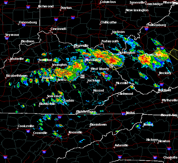 At 256 pm edt, a severe thunderstorm was located over olympia springs, or 7 miles southeast of owingsville, moving southeast at 40 mph (radar indicated). Hazards include 60 mph wind gusts. Expect damage to roofs. siding. And trees. At 256 pm edt, a severe thunderstorm was located over olympia springs, or 7 miles southeast of owingsville, moving southeast at 40 mph (radar indicated). Hazards include 60 mph wind gusts. Expect damage to roofs. siding. And trees.
|
| 6/15/2016 9:56 PM EDT |
 The severe thunderstorm warning for menifee, morgan, central wolfe, northwestern magoffin, north central breathitt, elliott, rowan and southeastern bath counties will expire at 1000 pm edt, the storms which prompted the warning have weakened below severe limits, and no longer pose an immediate threat to life or property. therefore the warning will be allowed to expire. The severe thunderstorm warning for menifee, morgan, central wolfe, northwestern magoffin, north central breathitt, elliott, rowan and southeastern bath counties will expire at 1000 pm edt, the storms which prompted the warning have weakened below severe limits, and no longer pose an immediate threat to life or property. therefore the warning will be allowed to expire.
|
| 6/15/2016 9:27 PM EDT |
 At 927 pm edt, severe thunderstorms were located along a line extending from near triplett to cogswell to cornwell, moving southeast at 40 mph (radar indicated). Hazards include 60 mph wind gusts. Expect damage to roofs. siding. And trees. At 927 pm edt, severe thunderstorms were located along a line extending from near triplett to cogswell to cornwell, moving southeast at 40 mph (radar indicated). Hazards include 60 mph wind gusts. Expect damage to roofs. siding. And trees.
|
| 5/10/2016 7:36 PM EDT |
 At 736 pm edt, a severe thunderstorm was located over flat, or near campton, moving northeast at 35 mph (radar indicated). Hazards include 60 mph wind gusts and quarter size hail. Hail damage to vehicles is expected. Expect wind damage to roofs, siding, and trees. At 736 pm edt, a severe thunderstorm was located over flat, or near campton, moving northeast at 35 mph (radar indicated). Hazards include 60 mph wind gusts and quarter size hail. Hail damage to vehicles is expected. Expect wind damage to roofs, siding, and trees.
|
| 5/1/2016 6:08 PM EDT |
 At 608 pm edt, a severe thunderstorm was located over gosneyville, or near campton, moving east at 35 mph (radar indicated). Hazards include 60 mph wind gusts and quarter size hail. Hail damage to vehicles is expected. Expect wind damage to roofs, siding, and trees. At 608 pm edt, a severe thunderstorm was located over gosneyville, or near campton, moving east at 35 mph (radar indicated). Hazards include 60 mph wind gusts and quarter size hail. Hail damage to vehicles is expected. Expect wind damage to roofs, siding, and trees.
|
| 4/27/2016 12:02 AM EDT |
 At 1201 am edt, severe thunderstorms were located along a line extending from scranton to lower buffalo, moving east at 40 mph (radar indicated). Hazards include 60 mph wind gusts. Expect damage to roofs. siding. and trees. locations impacted include, beattyville, frenchburg, campton, booneville, fincastle, wellington, campsites in the indian creek area of the daniel boone national forest, lane, willow shoals, cressmont, stoll, vada, lerose, ida may, st. helens, zachariah, koomer ridge campground, rogers, airedale and blaze. this includes bert t. Combs mountain parkway between mile markers 26 and 51. At 1201 am edt, severe thunderstorms were located along a line extending from scranton to lower buffalo, moving east at 40 mph (radar indicated). Hazards include 60 mph wind gusts. Expect damage to roofs. siding. and trees. locations impacted include, beattyville, frenchburg, campton, booneville, fincastle, wellington, campsites in the indian creek area of the daniel boone national forest, lane, willow shoals, cressmont, stoll, vada, lerose, ida may, st. helens, zachariah, koomer ridge campground, rogers, airedale and blaze. this includes bert t. Combs mountain parkway between mile markers 26 and 51.
|
| 4/26/2016 11:32 PM EDT |
 At 1132 pm edt, severe thunderstorms were located along a line extending from upper spencer to alcorn, moving east at 40 mph (radar indicated). Hazards include 60 mph wind gusts. Expect damage to roofs. siding. And trees. At 1132 pm edt, severe thunderstorms were located along a line extending from upper spencer to alcorn, moving east at 40 mph (radar indicated). Hazards include 60 mph wind gusts. Expect damage to roofs. siding. And trees.
|
| 7/19/2015 5:36 PM EDT |
 At 535 pm edt, a severe thunderstorm was located over omer, or 8 miles west of west liberty, moving east at 30 mph (radar indicated). Hazards include 60 mph wind gusts and penny size hail. Expect damage to roofs. Siding and trees. At 535 pm edt, a severe thunderstorm was located over omer, or 8 miles west of west liberty, moving east at 30 mph (radar indicated). Hazards include 60 mph wind gusts and penny size hail. Expect damage to roofs. Siding and trees.
|
| 7/14/2015 6:49 PM EDT | Large limbs and parts of trees on hwy 101 in morgan county KY, 0.2 miles NW of Ezel, KY |
| 7/14/2015 6:43 PM EDT |
 At 642 pm edt, a severe thunderstorm was located over mariba, or near frenchburg, moving southeast at 40 mph (radar indicated). Hazards include ping pong size hail and 70 mph wind gusts. People and animals outdoors will be injured. expect hail damage to roofs, siding, windows and vehicles. expect considerable tree damage. wind damage is also likely to mobile homes, roofs and outbuildings. locations impacted include, frenchburg, wellington, malaga, maytown, stoll, tabor, rothwell, gilmore, gosneyville, burkhart, murphyfork, baptist, sellars, calaboose, denniston, trent, ezel, cedar groves, rosefork and cornwell. this includes bert t. Combs mountain parkway between mile markers 46 and 61. At 642 pm edt, a severe thunderstorm was located over mariba, or near frenchburg, moving southeast at 40 mph (radar indicated). Hazards include ping pong size hail and 70 mph wind gusts. People and animals outdoors will be injured. expect hail damage to roofs, siding, windows and vehicles. expect considerable tree damage. wind damage is also likely to mobile homes, roofs and outbuildings. locations impacted include, frenchburg, wellington, malaga, maytown, stoll, tabor, rothwell, gilmore, gosneyville, burkhart, murphyfork, baptist, sellars, calaboose, denniston, trent, ezel, cedar groves, rosefork and cornwell. this includes bert t. Combs mountain parkway between mile markers 46 and 61.
|
| 7/14/2015 6:38 PM EDT |
 At 638 pm edt, a severe thunderstorm was located over ratlitt, or over frenchburg, moving southeast at 35 mph (radar indicated). Hazards include quarter size hail and 60 mph wind gusts. Hail damage to vehicles is expected. expect wind damage to roofs, siding and trees. locations impacted include, frenchburg, wellington, malaga, maytown, stoll, tabor, rothwell, gilmore, gosneyville, burkhart, murphyfork, baptist, sellars, calaboose, denniston, trent, ezel, cedar groves, rosefork and cornwell. this includes bert t. Combs mountain parkway between mile markers 46 and 61. At 638 pm edt, a severe thunderstorm was located over ratlitt, or over frenchburg, moving southeast at 35 mph (radar indicated). Hazards include quarter size hail and 60 mph wind gusts. Hail damage to vehicles is expected. expect wind damage to roofs, siding and trees. locations impacted include, frenchburg, wellington, malaga, maytown, stoll, tabor, rothwell, gilmore, gosneyville, burkhart, murphyfork, baptist, sellars, calaboose, denniston, trent, ezel, cedar groves, rosefork and cornwell. this includes bert t. Combs mountain parkway between mile markers 46 and 61.
|
| 7/14/2015 6:27 PM EDT |
 At 626 pm edt, severe thunderstorms were located along a line extending from near blaine to near culver to near isonville to near crockett to pomp to near big woods, moving southeast at 55 mph (radar indicated). Hazards include quarter size hail and 60 mph wind gusts. Hail damage to vehicles is expected. expect wind damage to roofs, siding and trees. locations impacted include, morehead, paintsville, west liberty, prestonsburg, salyersville, sandy hook, marshall, mason, henry, lewis, salt lick, brownlow, gordon ford, kerz, bruin, lenox, ballot, elsie, plutarch and liberty road. this includes the following highways, bert t. combs mountain parkway between mile markers 61 and 76. interstate 64 in eastern kentucky between mile markers 129 and 139. kentucky highway 3 in floyd county between mile markers 3 and 4. kentucky highway 3 in johnson county u. s. Highway 23 in johnson county between mile markers 0 and 16. At 626 pm edt, severe thunderstorms were located along a line extending from near blaine to near culver to near isonville to near crockett to pomp to near big woods, moving southeast at 55 mph (radar indicated). Hazards include quarter size hail and 60 mph wind gusts. Hail damage to vehicles is expected. expect wind damage to roofs, siding and trees. locations impacted include, morehead, paintsville, west liberty, prestonsburg, salyersville, sandy hook, marshall, mason, henry, lewis, salt lick, brownlow, gordon ford, kerz, bruin, lenox, ballot, elsie, plutarch and liberty road. this includes the following highways, bert t. combs mountain parkway between mile markers 61 and 76. interstate 64 in eastern kentucky between mile markers 129 and 139. kentucky highway 3 in floyd county between mile markers 3 and 4. kentucky highway 3 in johnson county u. s. Highway 23 in johnson county between mile markers 0 and 16.
|
| 7/14/2015 6:12 PM EDT |
 The national weather service in jackson ky has issued a * severe thunderstorm warning for. menifee county in east central kentucky. central montgomery county in east central kentucky. southwestern morgan county in southeastern kentucky. Western bath county in east central kentucky. The national weather service in jackson ky has issued a * severe thunderstorm warning for. menifee county in east central kentucky. central montgomery county in east central kentucky. southwestern morgan county in southeastern kentucky. Western bath county in east central kentucky.
|
| 7/14/2015 6:12 PM EDT |
 At 612 pm edt, a severe thunderstorm was located over flat creek, or near owingsville, moving southeast at 35 mph (radar indicated). Hazards include quarter size hail and 60 mph wind gusts. Hail damage to vehicles is expected. Expect wind damage to roofs, siding and trees. At 612 pm edt, a severe thunderstorm was located over flat creek, or near owingsville, moving southeast at 35 mph (radar indicated). Hazards include quarter size hail and 60 mph wind gusts. Hail damage to vehicles is expected. Expect wind damage to roofs, siding and trees.
|
| 7/14/2015 5:54 PM EDT |
 At 554 pm edt, severe thunderstorms were located along a line extending from olive hill to near head of grassy to near waltz to near cranston to grange city to sherburne, moving southeast at 55 mph (radar indicated). Hazards include quarter size hail and 60 mph wind gusts. Hail damage to vehicles is expected. Expect wind damage to roofs, siding and trees. At 554 pm edt, severe thunderstorms were located along a line extending from olive hill to near head of grassy to near waltz to near cranston to grange city to sherburne, moving southeast at 55 mph (radar indicated). Hazards include quarter size hail and 60 mph wind gusts. Hail damage to vehicles is expected. Expect wind damage to roofs, siding and trees.
|
| 7/13/2015 3:42 PM EDT |
 At 341 pm edt, severe thunderstorms were located along a line extending from near blaine to dehart to stanton, moving southeast at 55 mph (radar indicated). Hazards include 70 mph wind gusts and penny size hail. Expect considerable tree damage. Damage is likely to mobile homes, roofs and outbuildings. At 341 pm edt, severe thunderstorms were located along a line extending from near blaine to dehart to stanton, moving southeast at 55 mph (radar indicated). Hazards include 70 mph wind gusts and penny size hail. Expect considerable tree damage. Damage is likely to mobile homes, roofs and outbuildings.
|
| 7/13/2015 3:34 PM EDT |
 At 334 pm edt, severe thunderstorms were located along a line extending from near webbville to lytten to dan to clay city to near westbend, moving southeast at 55 mph (radar indicated). Hazards include 70 mph wind gusts and penny size hail. Expect considerable tree damage. damage is likely to mobile homes, roofs and outbuildings. locations impacted include, mount sterling, morehead, paintsville, west liberty, stanton, salyersville, owingsville, sandy hook, frenchburg, campton, marshall, mason, henry, lewis, jeffersonville, camargo, wellington, sharpsburg, salt lick and brownlow. this includes the following highways, bert t. combs mountain parkway between mile markers 24 and 76. interstate 64 in eastern kentucky between mile markers 105 and 148. u. s. Highway 23 in johnson county between mile markers 6 and 16. At 334 pm edt, severe thunderstorms were located along a line extending from near webbville to lytten to dan to clay city to near westbend, moving southeast at 55 mph (radar indicated). Hazards include 70 mph wind gusts and penny size hail. Expect considerable tree damage. damage is likely to mobile homes, roofs and outbuildings. locations impacted include, mount sterling, morehead, paintsville, west liberty, stanton, salyersville, owingsville, sandy hook, frenchburg, campton, marshall, mason, henry, lewis, jeffersonville, camargo, wellington, sharpsburg, salt lick and brownlow. this includes the following highways, bert t. combs mountain parkway between mile markers 24 and 76. interstate 64 in eastern kentucky between mile markers 105 and 148. u. s. Highway 23 in johnson county between mile markers 6 and 16.
|
| 7/13/2015 3:15 PM EDT |
 At 314 pm edt, severe thunderstorms were located along a line extending from olive hill to young springs to near mount sterling to grassy lick, moving southeast at 60 mph (radar indicated). Hazards include 60 mph wind gusts and penny size hail. Expect damage to roofs. Siding and trees. At 314 pm edt, severe thunderstorms were located along a line extending from olive hill to young springs to near mount sterling to grassy lick, moving southeast at 60 mph (radar indicated). Hazards include 60 mph wind gusts and penny size hail. Expect damage to roofs. Siding and trees.
|
| 7/12/2015 7:29 PM EDT |
 At 728 pm edt, a severe thunderstorm was located over ezel, or 9 miles west of west liberty, moving southeast at 25 mph (radar indicated). Hazards include 60 mph wind gusts and penny size hail. Expect damage to roofs. siding and trees. Locations impacted include, west liberty, frenchburg, henry, lewis, wellington, dan, maytown, stoll, big woods, lizzielane, kellacey, gosneyville, stacy fork, greear, liberty road, murphyfork, denniston, panama, mize and ezel. At 728 pm edt, a severe thunderstorm was located over ezel, or 9 miles west of west liberty, moving southeast at 25 mph (radar indicated). Hazards include 60 mph wind gusts and penny size hail. Expect damage to roofs. siding and trees. Locations impacted include, west liberty, frenchburg, henry, lewis, wellington, dan, maytown, stoll, big woods, lizzielane, kellacey, gosneyville, stacy fork, greear, liberty road, murphyfork, denniston, panama, mize and ezel.
|
| 7/12/2015 7:07 PM EDT |
 At 707 pm edt, a severe thunderstorm was located over ratlitt, or near frenchburg, moving southeast at 25 mph (radar indicated). Hazards include half dollar size hail and 60 mph wind gusts. Hail damage to vehicles is expected. Expect wind damage to roofs, siding and trees. At 707 pm edt, a severe thunderstorm was located over ratlitt, or near frenchburg, moving southeast at 25 mph (radar indicated). Hazards include half dollar size hail and 60 mph wind gusts. Hail damage to vehicles is expected. Expect wind damage to roofs, siding and trees.
|
| 7/10/2015 1:35 PM EDT | Tree fell across phone line on highway 20 in morgan county KY, 4.5 miles WNW of Ezel, KY |
| 7/10/2015 1:20 PM EDT |
 At 119 pm edt, severe thunderstorms were located along a line extending from farmers to yale to denniston to slade, moving east at 45 mph (radar indicated). Hazards include 70 mph wind gusts. Expect considerable tree damage. Damage is likely to mobile homes, roofs and outbuildings. At 119 pm edt, severe thunderstorms were located along a line extending from farmers to yale to denniston to slade, moving east at 45 mph (radar indicated). Hazards include 70 mph wind gusts. Expect considerable tree damage. Damage is likely to mobile homes, roofs and outbuildings.
|
| 7/10/2015 1:17 PM EDT |
 At 115 pm edt, severe thunderstorms were located along a line extending from near pecks ridge to near hillsboro to midland to frenchburg to bowen, moving east at 45 mph (radar indicated). Hazards include 70 mph wind gusts. Expect considerable tree damage. damage is likely to mobile homes, roofs and outbuildings. locations impacted include, morehead, stanton, flemingsburg, frenchburg, marshall, clay city, wellington, salt lick, grange city, vaughns mill, elizaville, pecks ridge, stoll, odessa, blaze, vale, lombard, denniston, ezel and yale. this includes the following highways, bert t. combs mountain parkway between mile markers 17 and 32. Interstate 64 in eastern kentucky between mile markers 125 and 148. At 115 pm edt, severe thunderstorms were located along a line extending from near pecks ridge to near hillsboro to midland to frenchburg to bowen, moving east at 45 mph (radar indicated). Hazards include 70 mph wind gusts. Expect considerable tree damage. damage is likely to mobile homes, roofs and outbuildings. locations impacted include, morehead, stanton, flemingsburg, frenchburg, marshall, clay city, wellington, salt lick, grange city, vaughns mill, elizaville, pecks ridge, stoll, odessa, blaze, vale, lombard, denniston, ezel and yale. this includes the following highways, bert t. combs mountain parkway between mile markers 17 and 32. Interstate 64 in eastern kentucky between mile markers 125 and 148.
|
| 7/10/2015 12:47 PM EDT |
 At 1246 pm edt, severe thunderstorms were located along a line extending from 8 miles southwest of cynthiana to near paris to judy to near klondike to near harris ferry, moving east at 50 mph (radar indicated). Hazards include 70 mph wind gusts. Expect considerable tree damage. damage is likely to mobile homes, roofs and outbuildings. locations impacted include, mount sterling, morehead, stanton, flemingsburg, owingsville, frenchburg, marshall, jeffersonville, camargo, clay city, wellington, sharpsburg, salt lick, grange city, vaughns mill, elizaville, pecks ridge, lower spencer, stoll and bethel. this includes the following highways, bert t. combs mountain parkway between mile markers 13 and 32. Interstate 64 in eastern kentucky between mile markers 105 and 148. At 1246 pm edt, severe thunderstorms were located along a line extending from 8 miles southwest of cynthiana to near paris to judy to near klondike to near harris ferry, moving east at 50 mph (radar indicated). Hazards include 70 mph wind gusts. Expect considerable tree damage. damage is likely to mobile homes, roofs and outbuildings. locations impacted include, mount sterling, morehead, stanton, flemingsburg, owingsville, frenchburg, marshall, jeffersonville, camargo, clay city, wellington, sharpsburg, salt lick, grange city, vaughns mill, elizaville, pecks ridge, lower spencer, stoll and bethel. this includes the following highways, bert t. combs mountain parkway between mile markers 13 and 32. Interstate 64 in eastern kentucky between mile markers 105 and 148.
|
| 7/10/2015 12:24 PM EDT |
 At 1223 pm edt, severe thunderstorms were located along a line extending from 13 miles northwest of georgetown to near paris to 6 miles west of winchester to near nicholasville, moving east at 45 mph (radar indicated). Hazards include 70 mph wind gusts. Expect considerable tree damage. Damage is likely to mobile homes, roofs and outbuildings. At 1223 pm edt, severe thunderstorms were located along a line extending from 13 miles northwest of georgetown to near paris to 6 miles west of winchester to near nicholasville, moving east at 45 mph (radar indicated). Hazards include 70 mph wind gusts. Expect considerable tree damage. Damage is likely to mobile homes, roofs and outbuildings.
|
| 7/9/2015 3:38 PM EDT |
 At 337 pm edt, a severe thunderstorm was located near salyersville, moving east at 55 mph (radar indicated). Hazards include 60 mph wind gusts. Expect damage to roofs. siding and trees. locations impacted include, west liberty, salyersville, mason, lewis, cornelia, gordon ford, williams, cisco, white oak, hager, seiltz, bethanna, cutuno, elsie, plutarch, liberty road, epson, holliday, kernie and sellars. this includes bert t. Combs mountain parkway between mile markers 59 and 76. At 337 pm edt, a severe thunderstorm was located near salyersville, moving east at 55 mph (radar indicated). Hazards include 60 mph wind gusts. Expect damage to roofs. siding and trees. locations impacted include, west liberty, salyersville, mason, lewis, cornelia, gordon ford, williams, cisco, white oak, hager, seiltz, bethanna, cutuno, elsie, plutarch, liberty road, epson, holliday, kernie and sellars. this includes bert t. Combs mountain parkway between mile markers 59 and 76.
|
| 7/9/2015 3:27 PM EDT |
 At 326 pm edt, a severe thunderstorm was located 11 miles south of west liberty, moving east at 55 mph (radar indicated). Hazards include 60 mph wind gusts. Expect damage to roofs. siding and trees. locations impacted include, west liberty, salyersville, campton, mason, simpson, lewis, cornelia, sewell, gordon ford, lane, white oak, seiltz, vancleve, bethanna, cutuno, elsie, plutarch, liberty road, murphyfork and epson. this includes bert t. Combs mountain parkway between mile markers 45 and 76. At 326 pm edt, a severe thunderstorm was located 11 miles south of west liberty, moving east at 55 mph (radar indicated). Hazards include 60 mph wind gusts. Expect damage to roofs. siding and trees. locations impacted include, west liberty, salyersville, campton, mason, simpson, lewis, cornelia, sewell, gordon ford, lane, white oak, seiltz, vancleve, bethanna, cutuno, elsie, plutarch, liberty road, murphyfork and epson. this includes bert t. Combs mountain parkway between mile markers 45 and 76.
|
| 7/9/2015 3:06 PM EDT |
 At 305 pm edt, a severe thunderstorm was located over rogers, or near campton, moving east at 50 mph (radar indicated). Hazards include 60 mph wind gusts. Expect damage to roofs. Siding and trees. At 305 pm edt, a severe thunderstorm was located over rogers, or near campton, moving east at 50 mph (radar indicated). Hazards include 60 mph wind gusts. Expect damage to roofs. Siding and trees.
|
| 6/29/2015 5:19 PM EDT |
 At 518 pm edt, a severe thunderstorm was located over ebon, or 9 miles west of west liberty, and is nearly stationary (radar indicated). Hazards include quarter size hail and 60 mph wind gusts. Hail damage to vehicles is expected. expect wind damage to roofs, siding and trees. locations impacted include, west liberty, henry, lewis, gordon ford, steele, maytown, williams, white oak, zag, kellacey, elamton, wrigley, stacy fork, lenox, blaze, greear, liberty road, pomp, panama and mize. A tornado watch remains in effect until 900 pm edt for southeastern kentucky. At 518 pm edt, a severe thunderstorm was located over ebon, or 9 miles west of west liberty, and is nearly stationary (radar indicated). Hazards include quarter size hail and 60 mph wind gusts. Hail damage to vehicles is expected. expect wind damage to roofs, siding and trees. locations impacted include, west liberty, henry, lewis, gordon ford, steele, maytown, williams, white oak, zag, kellacey, elamton, wrigley, stacy fork, lenox, blaze, greear, liberty road, pomp, panama and mize. A tornado watch remains in effect until 900 pm edt for southeastern kentucky.
|
| 6/29/2015 5:08 PM EDT |
 At 508 pm edt, a severe thunderstorm was located over korea, or near frenchburg, moving east at 30 mph (radar indicated). Hazards include quarter size hail and 60 mph wind gusts. Hail damage to vehicles is expected. Expect wind damage to roofs, siding and trees. At 508 pm edt, a severe thunderstorm was located over korea, or near frenchburg, moving east at 30 mph (radar indicated). Hazards include quarter size hail and 60 mph wind gusts. Hail damage to vehicles is expected. Expect wind damage to roofs, siding and trees.
|
| 4/8/2015 10:12 PM EDT | The severe thunderstorm warning for central morgan and northwestern magoffin counties will expire at 1015 pm edt. the storm which prompted the warning has weakened below severe limits and exited the warned area. Therefore the warning will be allowed to expire. |
| 4/8/2015 9:59 PM EDT | A severe thunderstorm warning remains in effect until 1015 pm edt for central morgan and northwestern magoffin counties. at 958 pm edt. a severe thunderstorm was located over murphyfork. or 8 miles southwest of west liberty. moving east at 30 mph. hazard. quarter size hail and 60 mph wind gusts. source. Radar indicated. |
| 4/8/2015 9:32 PM EDT | The national weather service in jackson ky has issued a * severe thunderstorm warning for. central morgan county in southeastern kentucky. northeastern wolfe county in southeastern kentucky. northwestern magoffin county in southeastern kentucky. Until 1015 pm edt. |
| 4/7/2015 8:07 PM EDT | A severe thunderstorm warning remains in effect until 815 pm edt for northeastern lee. menifee. powell. eastern montgomery. northwestern morgan. southern bath. western wolfe. east central estill and southern rowan counties. at 807 pm edt. Severe thunderstorms were located along a line extending from moore`s ferry to near young springs to cornwell to. |
| 4/7/2015 7:53 PM EDT | A severe thunderstorm warning remains in effect until 815 pm edt for northeastern lee. menifee. powell. montgomery. northwestern morgan. southern bath. western wolfe. central estill and southern rowan counties. at 752 pm edt. Severe thunderstorms were located along a line extending from near owingsville to olympia to near camargo to near. |
| 4/7/2015 7:23 PM EDT | The national weather service in jackson ky has issued a * severe thunderstorm warning for. northeastern lee county in southeastern kentucky. menifee county in east central kentucky. powell county in east central kentucky. Montgomery county in east central kentucky. |
| 4/3/2015 5:33 PM EDT | A severe thunderstorm warning remains in effect until 545 pm edt for menifee. montgomery. northwestern morgan. southeastern bath and southeastern rowan counties. at 533 pm edt. a severe thunderstorm was located over hope. or near frenchburg. moving east at 60 mph. hazard. Quarter size hail and 60 mph wind gusts. |
| 4/3/2015 5:33 PM EDT | A severe thunderstorm warning remains in effect until 545 pm edt for menifee. montgomery. northwestern morgan. southeastern bath and southeastern rowan counties. at 533 pm edt. a severe thunderstorm was located over hope. or near frenchburg. moving east at 60 mph. hazard. Quarter size hail and 60 mph wind gusts. |
| 4/3/2015 5:33 PM EDT | A severe thunderstorm warning remains in effect until 545 pm edt for menifee. montgomery. northwestern morgan. southeastern bath and southeastern rowan counties. at 533 pm edt. a severe thunderstorm was located over hope. or near frenchburg. moving east at 60 mph. hazard. Quarter size hail and 60 mph wind gusts. |
| 4/3/2015 5:22 PM EDT | The national weather service in jackson ky has issued a * severe thunderstorm warning for. menifee county in east central kentucky. montgomery county in east central kentucky. northwestern morgan county in southeastern kentucky. Southern bath county in east central kentucky. |
| 10/7/2014 6:30 PM EDT | Half Dollar sized hail reported 3.7 miles ESE of Ezel, KY |
| 9/2/2014 5:15 PM EDT | Two trees dow in menifee county KY, 3.7 miles ESE of Ezel, KY |
| 8/21/2014 3:16 PM EDT | Tree down on hwy 156 in menifee county KY, 3.7 miles ESE of Ezel, KY |
| 9/2/2012 5:00 PM EDT | Huge limb from tree down. time estimated from rada in morgan county KY, 0.2 miles NW of Ezel, KY |
| 7/24/2012 2:20 PM EDT | Trees down on highway 77 in morgan county KY, 0.2 miles NW of Ezel, KY |
| 7/24/2012 2:20 PM EDT | 1 tree down on bryant fork roa in morgan county KY, 2.8 miles NW of Ezel, KY |
| 7/24/2012 2:17 PM EDT | One tree down on highway 772...one mile down from highway 46 in morgan county KY, 1.8 miles SW of Ezel, KY |
| 7/18/2012 10:45 AM EDT | A few trees blown dow in morgan county KY, 0.2 miles NW of Ezel, KY |
| 7/1/2012 9:15 PM EDT | Trees down around the big woods and wellington area in menifee county KY, 3.7 miles ESE of Ezel, KY |
| 7/1/2012 8:15 PM EDT | Larch branches are down in yar in morgan county KY, 0.2 miles NW of Ezel, KY |
| 7/1/2012 8:15 PM EDT | Large branches are down in yar in morgan county KY, 0.2 miles NW of Ezel, KY |
| 7/1/2012 7:50 PM EDT | Trees down around the big woods and wellington area in menifee county KY, 3.7 miles ESE of Ezel, KY |
| 6/29/2012 7:10 PM EDT | Numerous trees down in and around eze in morgan county KY, 0.2 miles NW of Ezel, KY |
| 6/29/2012 7:04 PM EDT | Deputy director reports trees and power lines down throughout menifee county. first reports came in shortly after 7 pm from around the wellington and big woods are in menifee county KY, 3.7 miles ESE of Ezel, KY |
| 6/29/2012 7:00 PM EDT | Numerous trees down in and around eze in morgan county KY, 0.2 miles NW of Ezel, KY |
| 1/1/0001 12:00 AM | Golf Ball sized hail reported 3.7 miles ESE of Ezel, KY |
| 1/1/0001 12:00 AM | Half Dollar sized hail reported 0.2 miles NW of Ezel, KY, occurred on tabernacle road. large limbs down. limbs damaged guttering on home. |
| 1/1/0001 12:00 AM | Large limbs down in yard. limbs damaged guttering on home. damaged occurred on tabernacle r in morgan county KY, 0.2 miles NW of Ezel, KY |
| 1/1/0001 12:00 AM | Wind caved in a 12 foot section of one in morgan county KY, 0.2 miles NW of Ezel, KY |
| 1/1/0001 12:00 AM | Trees down onto hwy 1693. time estimated from rada in menifee county KY, 3.9 miles SSE of Ezel, KY |
| 1/1/0001 12:00 AM | Trees down in eze in morgan county KY, 0.2 miles NW of Ezel, KY |
| 1/1/0001 12:00 AM | Trees down in maytow in morgan county KY, 3.2 miles NNE of Ezel, KY |
| 1/1/0001 12:00 AM | Numerous trees down along highway 88 in morgan county KY, 1 miles E of Ezel, KY |
| 1/1/0001 12:00 AM | Half Dollar sized hail reported 5 miles WNW of Ezel, KY |
Hail Maps for Ezel, KY


Connect with Interactive Hail Maps