

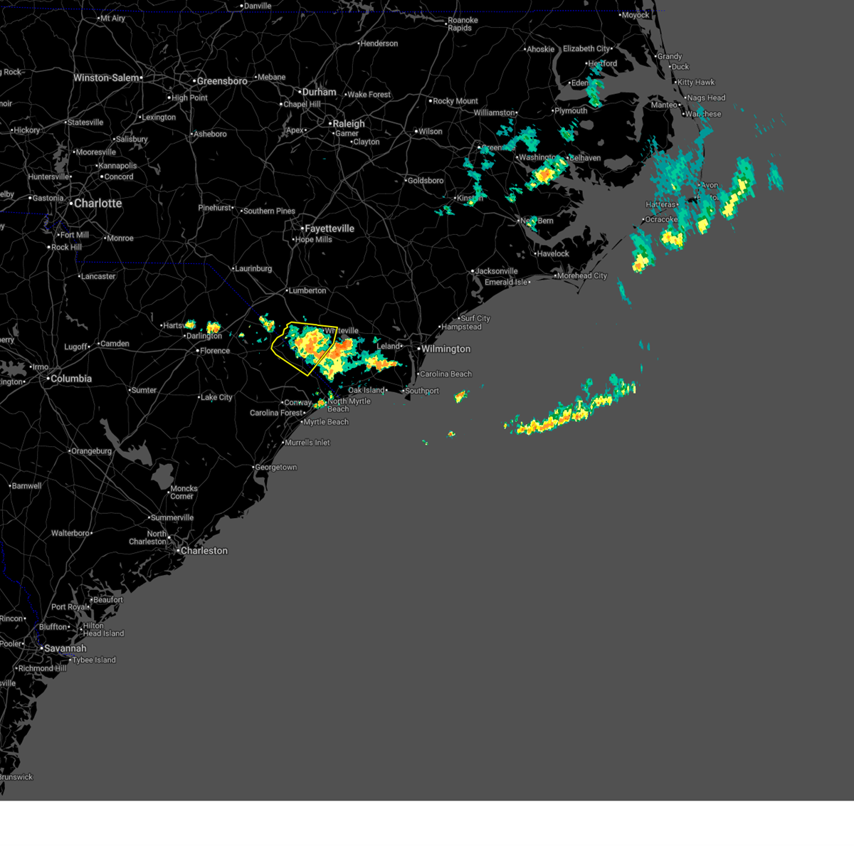
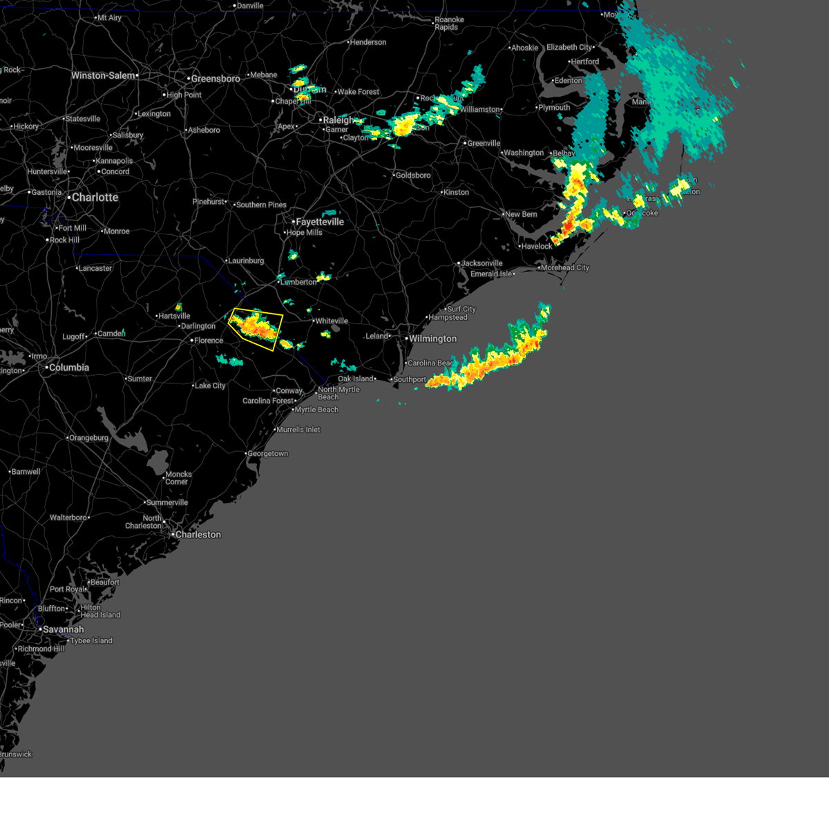
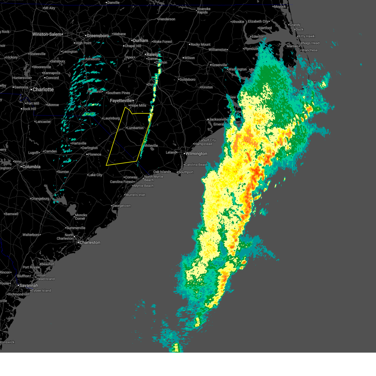
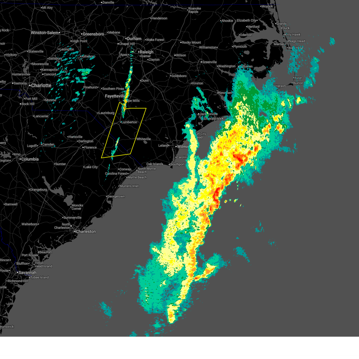
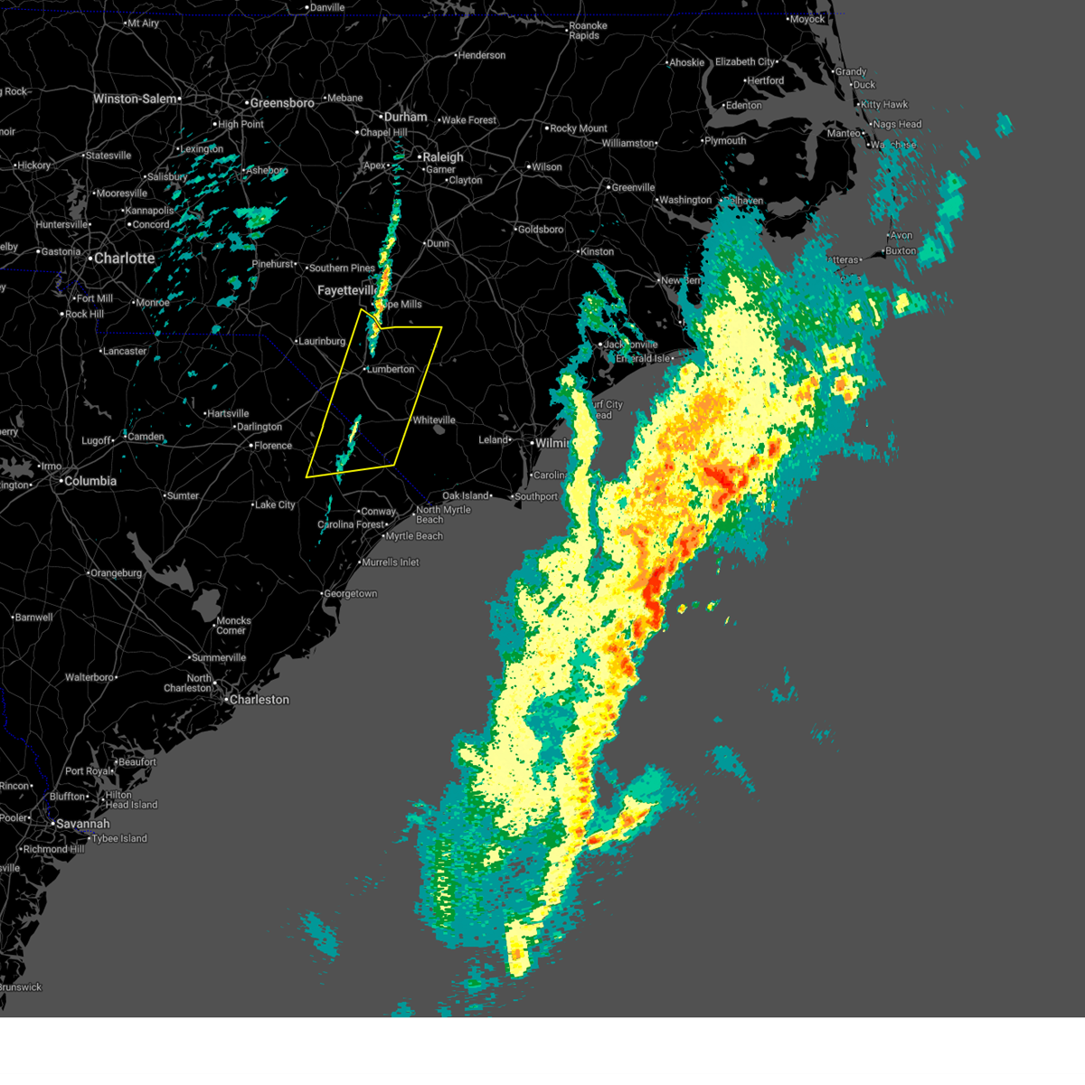
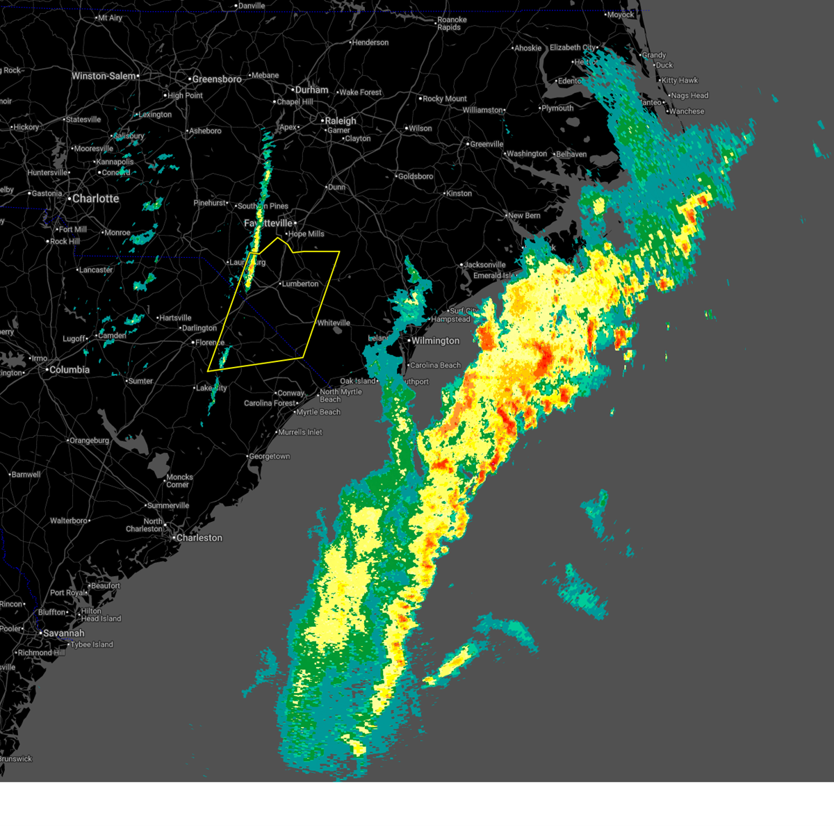
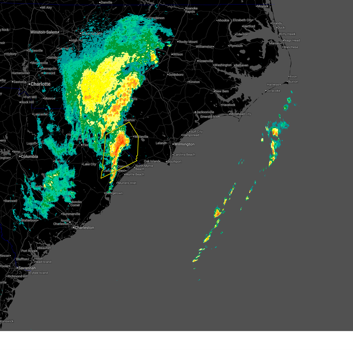
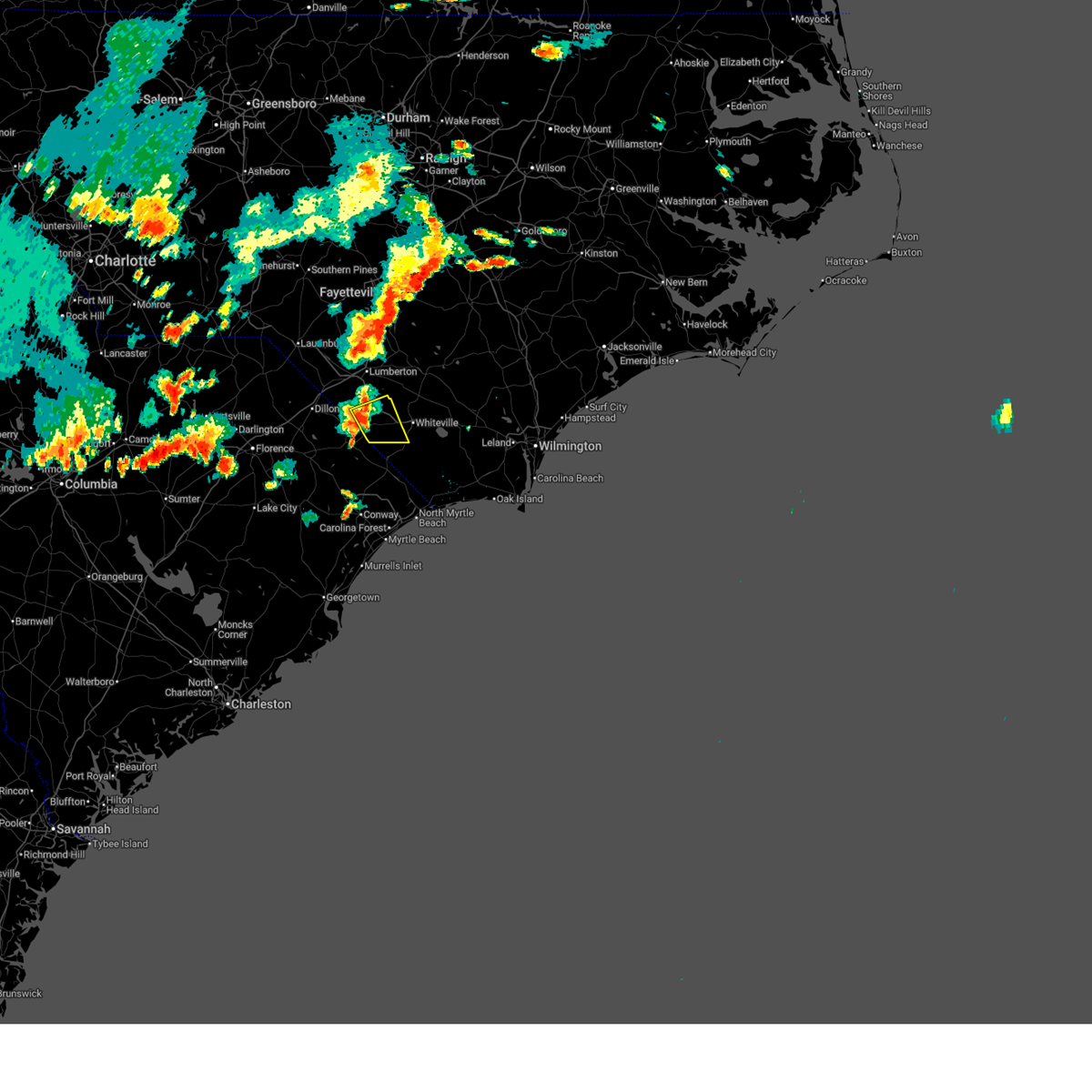
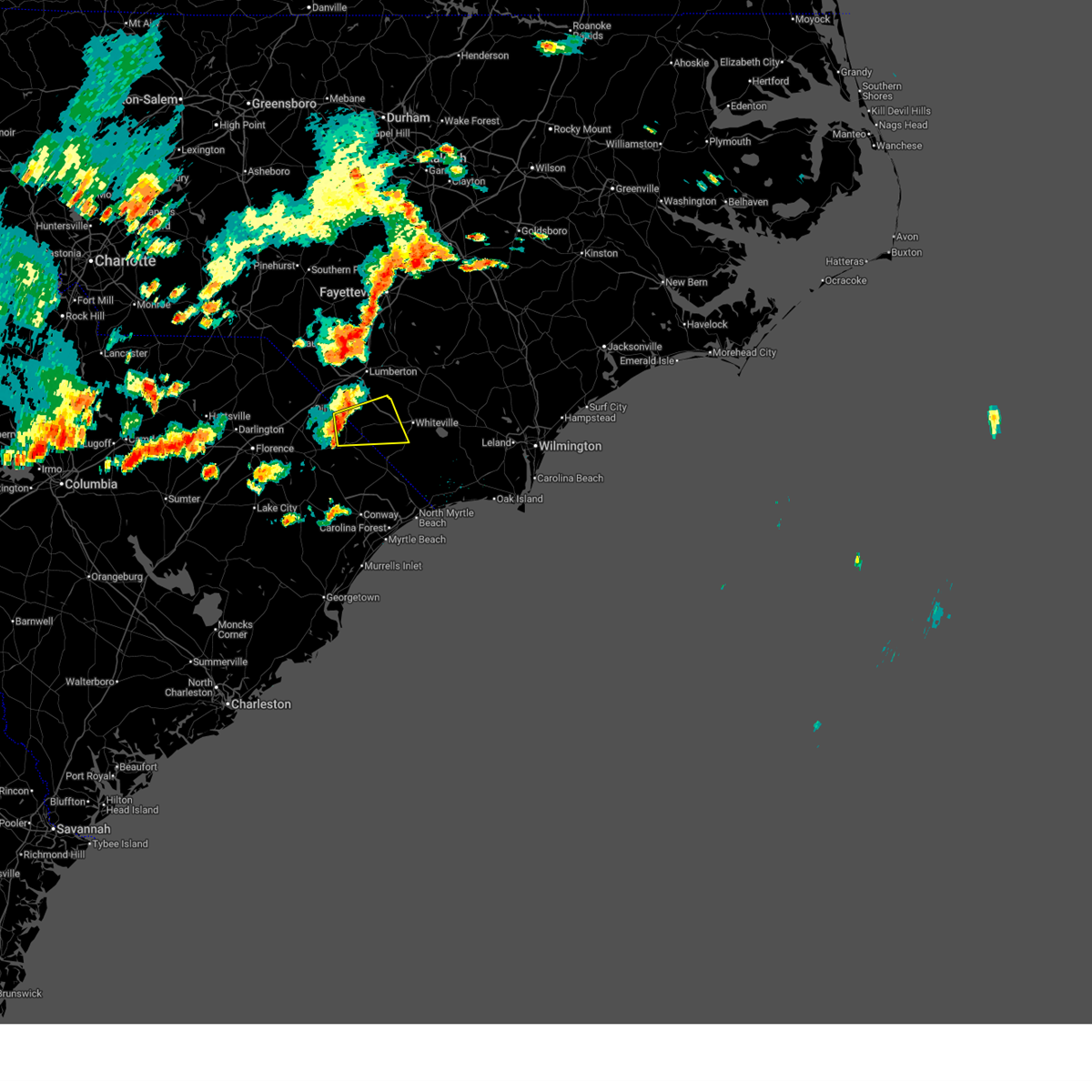
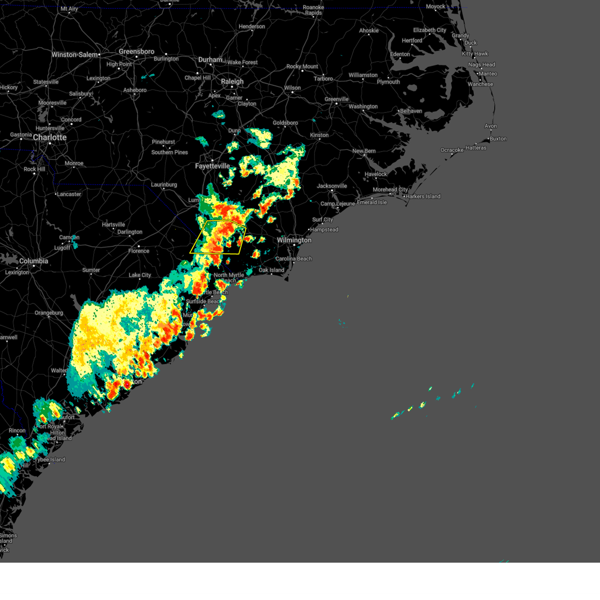
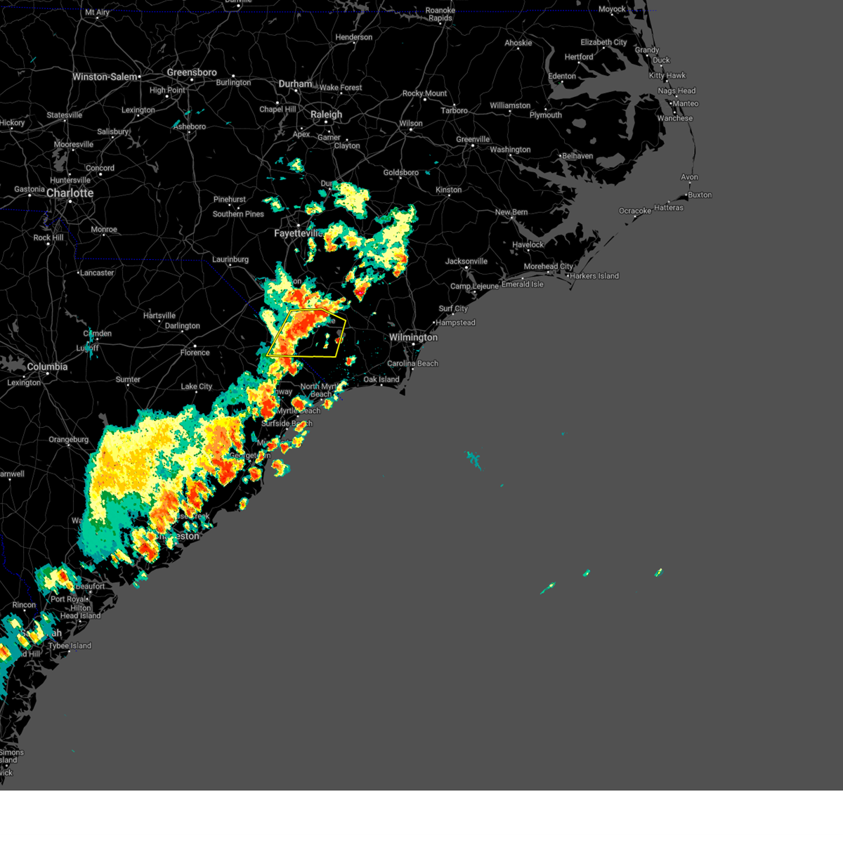
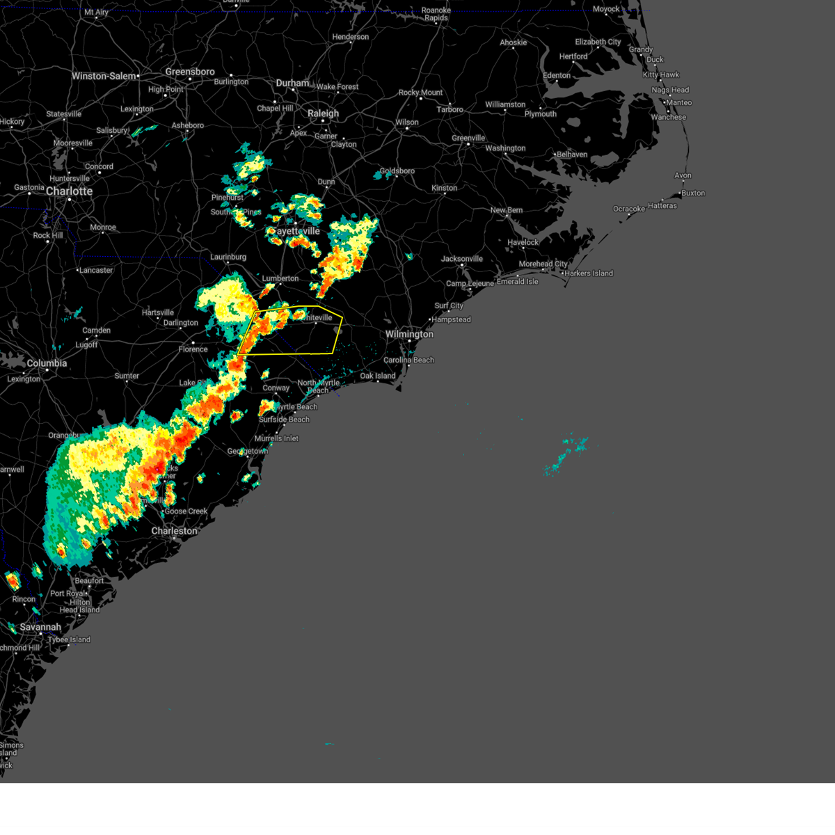
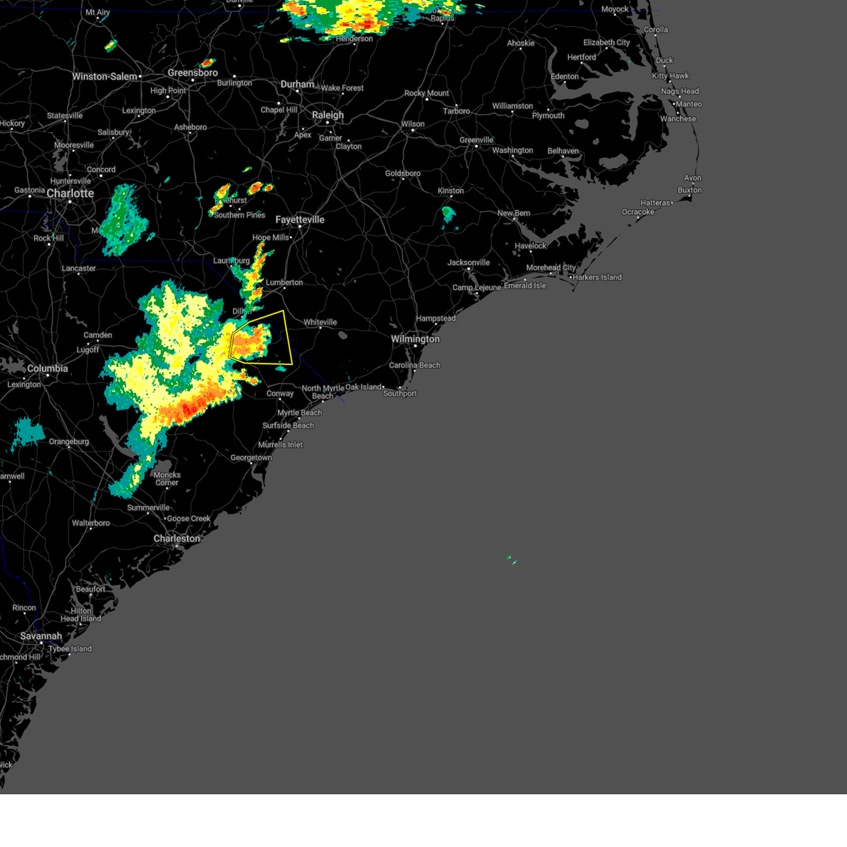
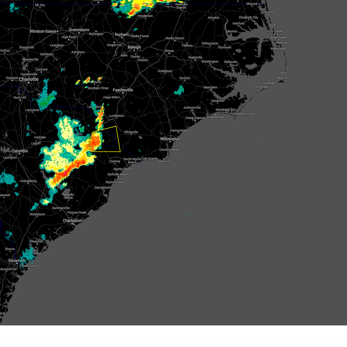
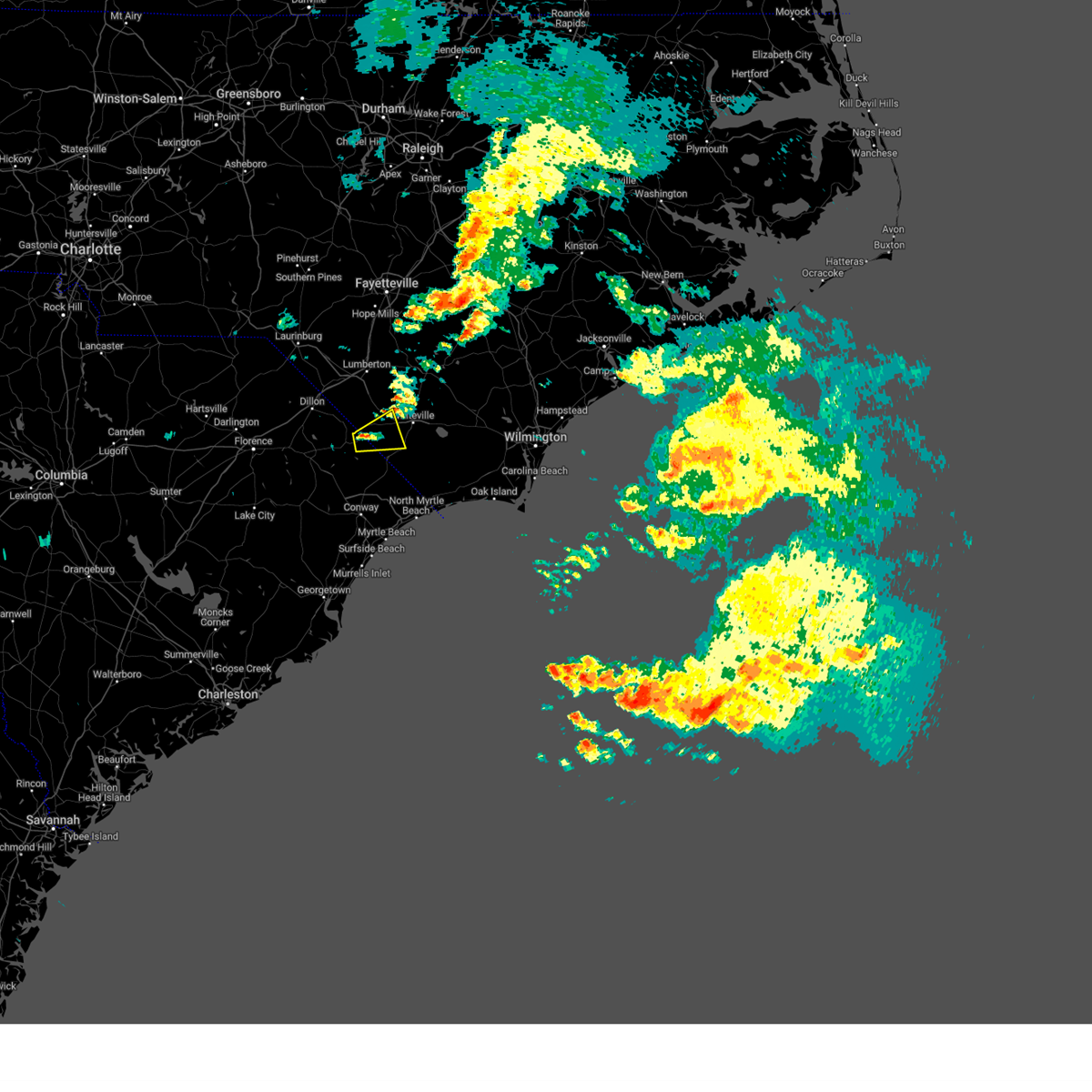
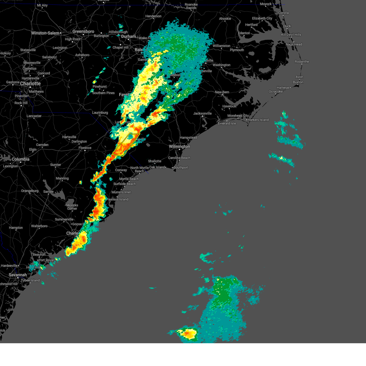
Hail Map for Fair Bluff, NC
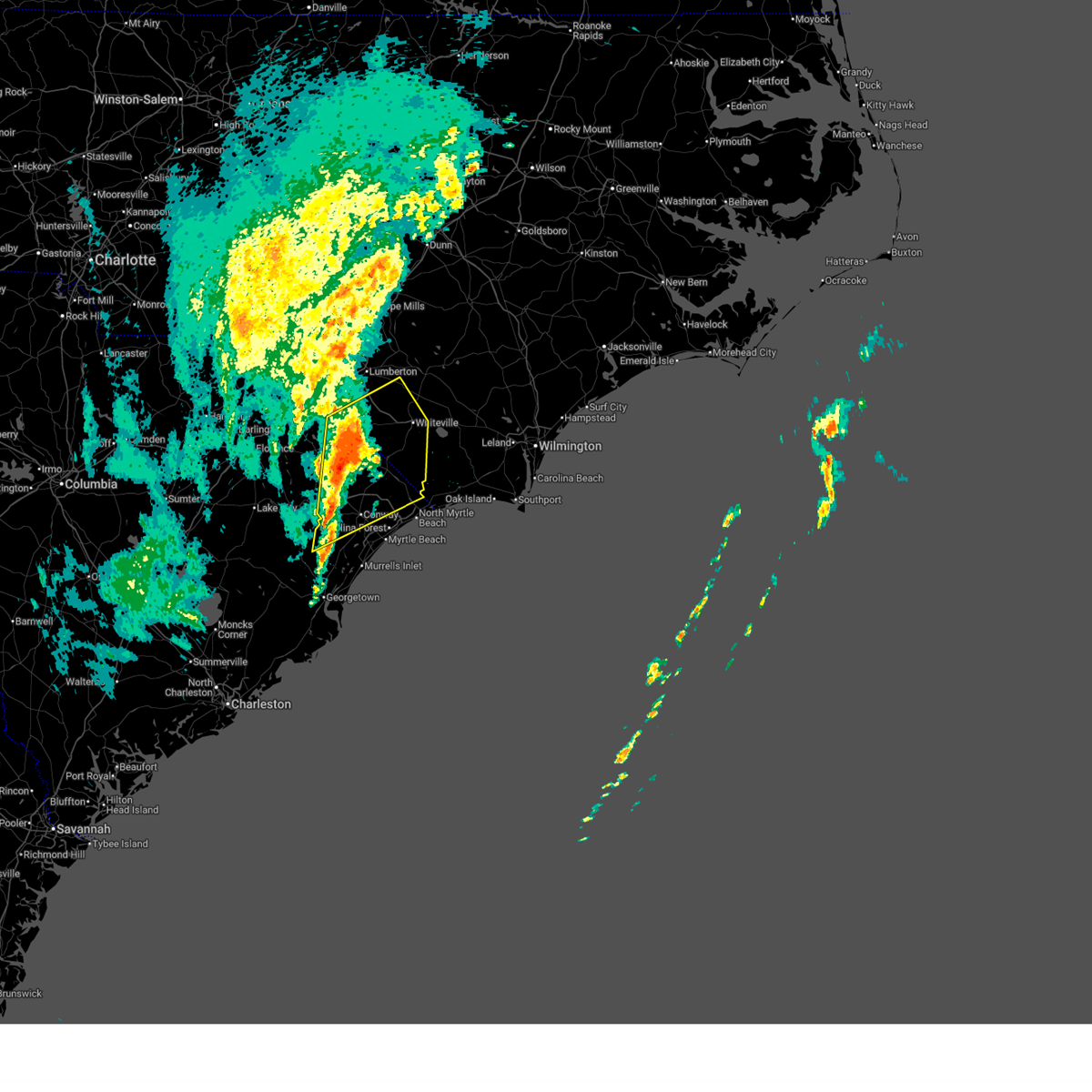
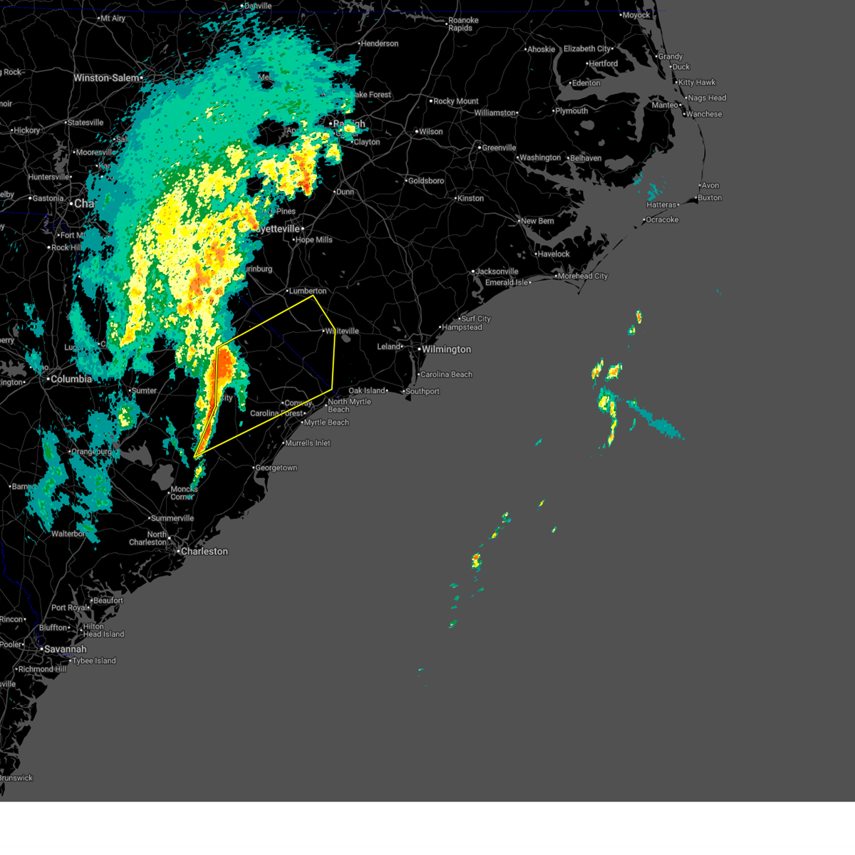
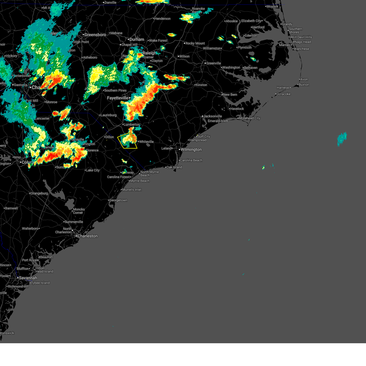
The Fair Bluff, NC area has had 2 reports of on-the-ground hail by trained spotters, and has been under severe weather warnings 21 times during the past 12 months. Doppler radar has detected hail at or near Fair Bluff, NC on 46 occasions, including 2 occasions during the past year.
| Name: | Fair Bluff, NC |
| Where Located: | 62.7 miles W of Wilmington, NC |
| Map: | Google Map for Fair Bluff, NC |
| Population: | 951 |
| Housing Units: | 526 |
| More Info: | Search Google for Fair Bluff, NC |
0
The Top Recent Hail Date for Fair Bluff, NC is Monday, May 11, 2026 (46th out of 46)

Hail and Wind Damage Spotted near Fair Bluff, NC
| Date / Time | Report Details |
|---|---|
| 6/23/2026 8:22 PM EDT |
 The storm which prompted the warning has weakened below severe limits, and no longer poses an immediate threat to life or property. therefore, the warning will be allowed to expire. The storm which prompted the warning has weakened below severe limits, and no longer poses an immediate threat to life or property. therefore, the warning will be allowed to expire.
|
| 6/23/2026 8:09 PM EDT |
 At 809 pm edt, a severe thunderstorm was located over clarendon, or 9 miles southwest of whiteville, moving east at 30 mph (radar indicated). Hazards include 60 mph wind gusts. Expect wind damage to trees and power lines. Locations impacted include, whiteville, tabor city, loris, chadbourn, fair bluff, hallsboro, cherry grove, redbug, mollie, sidney, southeastern community college, clarendon, williams, green sea, goretown, brunswick, cerro gordo, and columbus regional healthcare system. At 809 pm edt, a severe thunderstorm was located over clarendon, or 9 miles southwest of whiteville, moving east at 30 mph (radar indicated). Hazards include 60 mph wind gusts. Expect wind damage to trees and power lines. Locations impacted include, whiteville, tabor city, loris, chadbourn, fair bluff, hallsboro, cherry grove, redbug, mollie, sidney, southeastern community college, clarendon, williams, green sea, goretown, brunswick, cerro gordo, and columbus regional healthcare system.
|
| 6/23/2026 7:49 PM EDT |
 At 748 pm edt, a severe thunderstorm was located over cherry grove, or 15 miles east of mullins, moving east at 30 mph (radar indicated). Hazards include 60 mph wind gusts and penny size hail. Expect wind damage to trees and power lines. Locations impacted include, whiteville, tabor city, loris, chadbourn, fair bluff, lake view, hallsboro, cherry grove, redbug, mollie, sidney, southeastern community college, clarendon, williams, kemper, green sea, goretown, brunswick, cerro gordo, and marietta. At 748 pm edt, a severe thunderstorm was located over cherry grove, or 15 miles east of mullins, moving east at 30 mph (radar indicated). Hazards include 60 mph wind gusts and penny size hail. Expect wind damage to trees and power lines. Locations impacted include, whiteville, tabor city, loris, chadbourn, fair bluff, lake view, hallsboro, cherry grove, redbug, mollie, sidney, southeastern community college, clarendon, williams, kemper, green sea, goretown, brunswick, cerro gordo, and marietta.
|
| 6/23/2026 7:49 PM EDT |
 the severe thunderstorm warning has been cancelled and is no longer in effect the severe thunderstorm warning has been cancelled and is no longer in effect
|
| 6/23/2026 7:26 PM EDT |
 Svrilm the national weather service in wilmington has issued a * severe thunderstorm warning for, south central robeson county in southeastern north carolina, western columbus county in southeastern north carolina, southeastern dillon county in northeastern south carolina, north central horry county in northeastern south carolina, northeastern marion county in northeastern south carolina, * until 830 pm edt. * at 726 pm edt, a severe thunderstorm was located over lake view, or 8 miles northeast of mullins, moving east at 25 mph (radar indicated). Hazards include 60 mph wind gusts and penny size hail. expect wind damage to trees and power lines Svrilm the national weather service in wilmington has issued a * severe thunderstorm warning for, south central robeson county in southeastern north carolina, western columbus county in southeastern north carolina, southeastern dillon county in northeastern south carolina, north central horry county in northeastern south carolina, northeastern marion county in northeastern south carolina, * until 830 pm edt. * at 726 pm edt, a severe thunderstorm was located over lake view, or 8 miles northeast of mullins, moving east at 25 mph (radar indicated). Hazards include 60 mph wind gusts and penny size hail. expect wind damage to trees and power lines
|
| 6/23/2026 7:01 PM EDT |
 At 701 pm edt, a severe thunderstorm was located over kemper, or 7 miles north of mullins, moving east at 25 mph (radar indicated). Hazards include 60 mph wind gusts and penny size hail. Expect wind damage to trees and power lines. Locations impacted include, dillon, mullins, latta, fair bluff, lake view, fork, zion, floydale, smithboro, kemper, nichols, marietta, and mcleod medical center. At 701 pm edt, a severe thunderstorm was located over kemper, or 7 miles north of mullins, moving east at 25 mph (radar indicated). Hazards include 60 mph wind gusts and penny size hail. Expect wind damage to trees and power lines. Locations impacted include, dillon, mullins, latta, fair bluff, lake view, fork, zion, floydale, smithboro, kemper, nichols, marietta, and mcleod medical center.
|
| 6/23/2026 6:47 PM EDT |
 At 647 pm edt, a severe thunderstorm was located over floydale, or 7 miles southeast of dillon, moving east at 25 mph (radar indicated). Hazards include 60 mph wind gusts and penny size hail. Expect wind damage to trees and power lines. Locations impacted include, dillon, mullins, latta, fair bluff, lake view, sellers, fork, zion, oak grove, floydale, smithboro, kemper, nichols, marietta, and mcleod medical center. At 647 pm edt, a severe thunderstorm was located over floydale, or 7 miles southeast of dillon, moving east at 25 mph (radar indicated). Hazards include 60 mph wind gusts and penny size hail. Expect wind damage to trees and power lines. Locations impacted include, dillon, mullins, latta, fair bluff, lake view, sellers, fork, zion, oak grove, floydale, smithboro, kemper, nichols, marietta, and mcleod medical center.
|
| 6/23/2026 6:30 PM EDT |
 Svrilm the national weather service in wilmington has issued a * severe thunderstorm warning for, south central robeson county in southeastern north carolina, west central columbus county in southeastern north carolina, southern dillon county in northeastern south carolina, northwestern horry county in northeastern south carolina, northeastern marion county in northeastern south carolina, * until 730 pm edt. * at 630 pm edt, a severe thunderstorm was located over latta, or near dillon, moving east at 25 mph (radar indicated). Hazards include 60 mph wind gusts and penny size hail. expect wind damage to trees and power lines Svrilm the national weather service in wilmington has issued a * severe thunderstorm warning for, south central robeson county in southeastern north carolina, west central columbus county in southeastern north carolina, southern dillon county in northeastern south carolina, northwestern horry county in northeastern south carolina, northeastern marion county in northeastern south carolina, * until 730 pm edt. * at 630 pm edt, a severe thunderstorm was located over latta, or near dillon, moving east at 25 mph (radar indicated). Hazards include 60 mph wind gusts and penny size hail. expect wind damage to trees and power lines
|
| 5/11/2026 2:16 PM EDT |
 Svrilm the national weather service in wilmington has issued a * severe thunderstorm warning for, southwestern columbus county in southeastern north carolina, northwestern horry county in northeastern south carolina, northeastern marion county in northeastern south carolina, * until 315 pm edt. * at 216 pm edt, a severe thunderstorm was located over mullins, moving east at 30 mph (radar indicated). Hazards include 60 mph wind gusts and quarter size hail. Minor hail damage to vehicles is possible. Expect wind damage to trees and power lines. Svrilm the national weather service in wilmington has issued a * severe thunderstorm warning for, southwestern columbus county in southeastern north carolina, northwestern horry county in northeastern south carolina, northeastern marion county in northeastern south carolina, * until 315 pm edt. * at 216 pm edt, a severe thunderstorm was located over mullins, moving east at 30 mph (radar indicated). Hazards include 60 mph wind gusts and quarter size hail. Minor hail damage to vehicles is possible. Expect wind damage to trees and power lines.
|
| 3/16/2026 7:21 PM EDT |
 The warning will be allowed to expire. however, gusty winds are still possible. please send your reports of wind damage, including trees or large limbs downed, by calling the national weather service office in wilmington at 1 800 697 3901. The warning will be allowed to expire. however, gusty winds are still possible. please send your reports of wind damage, including trees or large limbs downed, by calling the national weather service office in wilmington at 1 800 697 3901.
|
| 3/16/2026 6:50 PM EDT |
 At 649 pm edt, showers producing strong winds were located along a line extending from tobermory to 6 miles southeast of gapway, moving east at 40 mph (lumberton airport reported a peak wind gust of 58 mph). Hazards include 60 mph wind gusts. Expect wind damage to trees and power lines. locations impacted include, lumberton, whiteville, mullins, elizabethtown, fairmont, tabor city, st. Pauls, chadbourn, bladenboro, fair bluff, lake view, boardman, rex, ammon, hestertown, rains, southeastern community college, white oak, galivants ferry, and smiths. At 649 pm edt, showers producing strong winds were located along a line extending from tobermory to 6 miles southeast of gapway, moving east at 40 mph (lumberton airport reported a peak wind gust of 58 mph). Hazards include 60 mph wind gusts. Expect wind damage to trees and power lines. locations impacted include, lumberton, whiteville, mullins, elizabethtown, fairmont, tabor city, st. Pauls, chadbourn, bladenboro, fair bluff, lake view, boardman, rex, ammon, hestertown, rains, southeastern community college, white oak, galivants ferry, and smiths.
|
| 3/16/2026 6:50 PM EDT |
 the severe thunderstorm warning has been cancelled and is no longer in effect the severe thunderstorm warning has been cancelled and is no longer in effect
|
| 3/16/2026 6:17 PM EDT |
 Svrilm the national weather service in wilmington has issued a * severe thunderstorm warning for, robeson county in southeastern north carolina, western bladen county in southeastern north carolina, northwestern columbus county in southeastern north carolina, central florence county in northeastern south carolina, dillon county in northeastern south carolina, northwestern horry county in northeastern south carolina, marion county in northeastern south carolina, * until 730 pm edt. * at 616 pm edt, showers producing strong wind gusts were located along a line extending from near antioch to dillon to near blue brick, moving east at 35 mph (radar indicated. at 5:53 pm the florence airport reported a gust of 58 mph). Hazards include 60 mph wind gusts. expect wind damage to trees and power lines Svrilm the national weather service in wilmington has issued a * severe thunderstorm warning for, robeson county in southeastern north carolina, western bladen county in southeastern north carolina, northwestern columbus county in southeastern north carolina, central florence county in northeastern south carolina, dillon county in northeastern south carolina, northwestern horry county in northeastern south carolina, marion county in northeastern south carolina, * until 730 pm edt. * at 616 pm edt, showers producing strong wind gusts were located along a line extending from near antioch to dillon to near blue brick, moving east at 35 mph (radar indicated. at 5:53 pm the florence airport reported a gust of 58 mph). Hazards include 60 mph wind gusts. expect wind damage to trees and power lines
|
| 3/12/2026 12:39 PM EDT |
 The storms which prompted the warning have weakened below severe limits, and no longer pose an immediate threat to life or property. therefore, the warning will be allowed to expire. however, gusty winds are still possible with these thunderstorms. a severe thunderstorm watch remains in effect until 500 pm edt for southeastern north carolina, and northeastern south carolina. please send your reports of hail or wind damage, including trees or large limbs downed, by calling the national weather service office in wilmington at 1 800 697 3901. The storms which prompted the warning have weakened below severe limits, and no longer pose an immediate threat to life or property. therefore, the warning will be allowed to expire. however, gusty winds are still possible with these thunderstorms. a severe thunderstorm watch remains in effect until 500 pm edt for southeastern north carolina, and northeastern south carolina. please send your reports of hail or wind damage, including trees or large limbs downed, by calling the national weather service office in wilmington at 1 800 697 3901.
|
| 3/12/2026 12:24 PM EDT |
 At 1224 pm edt, severe thunderstorms were located along a line extending from near fairmont to 7 miles west of green sea to near outland, moving northeast at 55 mph (radar indicated). Hazards include 60 mph wind gusts. Expect wind damage to trees and power lines. Locations impacted include, conway, whiteville, mullins, red hill, horry, tabor city, loris, chadbourn, bladenboro, bethel, fair bluff, lake view, hickory grove, boardman, nixonville, southeastern community college, galivants ferry, sidney, clarendon, and longs. At 1224 pm edt, severe thunderstorms were located along a line extending from near fairmont to 7 miles west of green sea to near outland, moving northeast at 55 mph (radar indicated). Hazards include 60 mph wind gusts. Expect wind damage to trees and power lines. Locations impacted include, conway, whiteville, mullins, red hill, horry, tabor city, loris, chadbourn, bladenboro, bethel, fair bluff, lake view, hickory grove, boardman, nixonville, southeastern community college, galivants ferry, sidney, clarendon, and longs.
|
| 3/12/2026 12:24 PM EDT |
 the severe thunderstorm warning has been cancelled and is no longer in effect the severe thunderstorm warning has been cancelled and is no longer in effect
|
| 3/12/2026 12:00 PM EDT |
 Svrilm the national weather service in wilmington has issued a * severe thunderstorm warning for, southeastern robeson county in southeastern north carolina, southwestern bladen county in southeastern north carolina, columbus county in southeastern north carolina, eastern florence county in northeastern south carolina, north central georgetown county in northeastern south carolina, southeastern dillon county in northeastern south carolina, horry county in northeastern south carolina, marion county in northeastern south carolina, northeastern williamsburg county in northeastern south carolina, * until 1245 pm edt. * at 1159 am edt, severe thunderstorms were located along a line extending from near sellers to near kingsburg to near trio, moving northeast at 55 mph (radar indicated). Hazards include 60 mph wind gusts. expect wind damage to trees and power lines Svrilm the national weather service in wilmington has issued a * severe thunderstorm warning for, southeastern robeson county in southeastern north carolina, southwestern bladen county in southeastern north carolina, columbus county in southeastern north carolina, eastern florence county in northeastern south carolina, north central georgetown county in northeastern south carolina, southeastern dillon county in northeastern south carolina, horry county in northeastern south carolina, marion county in northeastern south carolina, northeastern williamsburg county in northeastern south carolina, * until 1245 pm edt. * at 1159 am edt, severe thunderstorms were located along a line extending from near sellers to near kingsburg to near trio, moving northeast at 55 mph (radar indicated). Hazards include 60 mph wind gusts. expect wind damage to trees and power lines
|
| 7/31/2025 6:43 PM EDT |
 The storm which prompted the warning has weakened below severe limits, and has exited the warned area. therefore, the warning will be allowed to expire. please send your reports of hail or wind damage, including trees or large limbs downed, by calling the national weather service office in wilmington at 1 800 697 3901. The storm which prompted the warning has weakened below severe limits, and has exited the warned area. therefore, the warning will be allowed to expire. please send your reports of hail or wind damage, including trees or large limbs downed, by calling the national weather service office in wilmington at 1 800 697 3901.
|
| 7/31/2025 6:16 PM EDT |
 At 615 pm edt, a severe thunderstorm was located near fair bluff, or 16 miles west of whiteville, moving east at 30 mph (radar indicated). Hazards include 60 mph wind gusts. Expect wind damage to trees and power lines. Locations impacted include, chadbourn, fair bluff, boardman, cherry grove, evergreen, barnesville, southeastern community college, and cerro gordo. At 615 pm edt, a severe thunderstorm was located near fair bluff, or 16 miles west of whiteville, moving east at 30 mph (radar indicated). Hazards include 60 mph wind gusts. Expect wind damage to trees and power lines. Locations impacted include, chadbourn, fair bluff, boardman, cherry grove, evergreen, barnesville, southeastern community college, and cerro gordo.
|
| 7/31/2025 6:16 PM EDT |
 the severe thunderstorm warning has been cancelled and is no longer in effect the severe thunderstorm warning has been cancelled and is no longer in effect
|
| 7/31/2025 5:59 PM EDT |
 Svrilm the national weather service in wilmington has issued a * severe thunderstorm warning for, southeastern robeson county in southeastern north carolina, northwestern columbus county in southeastern north carolina, southeastern dillon county in northeastern south carolina, north central horry county in northeastern south carolina, northeastern marion county in northeastern south carolina, * until 645 pm edt. * at 559 pm edt, a severe thunderstorm was located over lake view, or 10 miles northeast of mullins, moving east at 30 mph (radar indicated). Hazards include 60 mph wind gusts. expect wind damage to trees and power lines Svrilm the national weather service in wilmington has issued a * severe thunderstorm warning for, southeastern robeson county in southeastern north carolina, northwestern columbus county in southeastern north carolina, southeastern dillon county in northeastern south carolina, north central horry county in northeastern south carolina, northeastern marion county in northeastern south carolina, * until 645 pm edt. * at 559 pm edt, a severe thunderstorm was located over lake view, or 10 miles northeast of mullins, moving east at 30 mph (radar indicated). Hazards include 60 mph wind gusts. expect wind damage to trees and power lines
|
| 6/8/2025 1:43 PM EDT |
 The storms which prompted the warning have moved out of the area. therefore, the warning will be allowed to expire. a severe thunderstorm watch remains in effect until 500 pm edt for southeastern north carolina, and northeastern south carolina. please send your reports of hail and/or wind damage, including trees or large limbs downed, by calling the national weather service office in wilmington at 1-800-697-3901. The storms which prompted the warning have moved out of the area. therefore, the warning will be allowed to expire. a severe thunderstorm watch remains in effect until 500 pm edt for southeastern north carolina, and northeastern south carolina. please send your reports of hail and/or wind damage, including trees or large limbs downed, by calling the national weather service office in wilmington at 1-800-697-3901.
|
| 6/8/2025 1:28 PM EDT |
 At 127 pm edt, severe thunderstorms were located along a line extending from near elkton to near chadbourn to green sea, moving east at 40 mph (radar indicated). Hazards include 60 mph wind gusts and quarter size hail. Minor hail damage to vehicles is possible. expect wind damage to trees and power lines. Locations impacted include, whiteville, tabor city, chadbourn, bethel, lake waccamaw, fair bluff, boardman, hallsboro, nakina, cherry grove, redbug, old dock, mollie, sidney, southeastern community college, clarendon, williams, evergreen, crusoe island, and green sea. At 127 pm edt, severe thunderstorms were located along a line extending from near elkton to near chadbourn to green sea, moving east at 40 mph (radar indicated). Hazards include 60 mph wind gusts and quarter size hail. Minor hail damage to vehicles is possible. expect wind damage to trees and power lines. Locations impacted include, whiteville, tabor city, chadbourn, bethel, lake waccamaw, fair bluff, boardman, hallsboro, nakina, cherry grove, redbug, old dock, mollie, sidney, southeastern community college, clarendon, williams, evergreen, crusoe island, and green sea.
|
| 6/8/2025 1:28 PM EDT |
 the severe thunderstorm warning has been cancelled and is no longer in effect the severe thunderstorm warning has been cancelled and is no longer in effect
|
| 6/8/2025 12:58 PM EDT |
 Svrilm the national weather service in wilmington has issued a * severe thunderstorm warning for, southeastern robeson county in southeastern north carolina, columbus county in southeastern north carolina, southeastern dillon county in northeastern south carolina, northwestern horry county in northeastern south carolina, northeastern marion county in northeastern south carolina, * until 145 pm edt. * at 1257 pm edt, a severe thunderstorm was located near fair bluff, or 8 miles northeast of mullins, moving east at 40 mph (radar indicated). Hazards include 60 mph wind gusts and quarter size hail. Minor hail damage to vehicles is possible. Expect wind damage to trees and power lines. Svrilm the national weather service in wilmington has issued a * severe thunderstorm warning for, southeastern robeson county in southeastern north carolina, columbus county in southeastern north carolina, southeastern dillon county in northeastern south carolina, northwestern horry county in northeastern south carolina, northeastern marion county in northeastern south carolina, * until 145 pm edt. * at 1257 pm edt, a severe thunderstorm was located near fair bluff, or 8 miles northeast of mullins, moving east at 40 mph (radar indicated). Hazards include 60 mph wind gusts and quarter size hail. Minor hail damage to vehicles is possible. Expect wind damage to trees and power lines.
|
| 2/16/2025 10:30 AM EST |
 The storms which prompted the warning have weakened below severe limits, and no longer pose an immediate threat to life or property. therefore, the warning has been allowed to expire. a severe thunderstorm watch remains in effect until 300 pm est for southeastern north carolina. please send your reports of hail and/or wind damage, including trees or large limbs downed, by calling the national weather service office in wilmington at 1-800-697-3901. The storms which prompted the warning have weakened below severe limits, and no longer pose an immediate threat to life or property. therefore, the warning has been allowed to expire. a severe thunderstorm watch remains in effect until 300 pm est for southeastern north carolina. please send your reports of hail and/or wind damage, including trees or large limbs downed, by calling the national weather service office in wilmington at 1-800-697-3901.
|
| 2/16/2025 10:12 AM EST |
 At 1011 am est, severe thunderstorms were located along a line extending from 6 miles northeast of ammon to abbottsburg to near cherry grove, moving east at 45 mph (radar indicated). Hazards include 60 mph wind gusts. Expect wind damage to trees and power lines. Locations impacted include, marion, whiteville, mullins, elizabethtown, tabor city, chadbourn, bladenboro, lake waccamaw, fair bluff, boardman, hallsboro, bladen community college, ammon, nakina, redbug, council, southeastern community college, williams, carvers, and abbottsburg. At 1011 am est, severe thunderstorms were located along a line extending from 6 miles northeast of ammon to abbottsburg to near cherry grove, moving east at 45 mph (radar indicated). Hazards include 60 mph wind gusts. Expect wind damage to trees and power lines. Locations impacted include, marion, whiteville, mullins, elizabethtown, tabor city, chadbourn, bladenboro, lake waccamaw, fair bluff, boardman, hallsboro, bladen community college, ammon, nakina, redbug, council, southeastern community college, williams, carvers, and abbottsburg.
|
| 2/16/2025 9:35 AM EST |
 Svrilm the national weather service in wilmington has issued a * severe thunderstorm warning for, eastern robeson county in southeastern north carolina, bladen county in southeastern north carolina, columbus county in southeastern north carolina, southeastern dillon county in northeastern south carolina, northwestern horry county in northeastern south carolina, northern marion county in northeastern south carolina, * until 1030 am est. * at 935 am est, severe thunderstorms were located along a line extending from near tobermory to fairmont to near marion, moving east at 45 mph (radar indicated). Hazards include 60 mph wind gusts. expect wind damage to trees and power lines Svrilm the national weather service in wilmington has issued a * severe thunderstorm warning for, eastern robeson county in southeastern north carolina, bladen county in southeastern north carolina, columbus county in southeastern north carolina, southeastern dillon county in northeastern south carolina, northwestern horry county in northeastern south carolina, northern marion county in northeastern south carolina, * until 1030 am est. * at 935 am est, severe thunderstorms were located along a line extending from near tobermory to fairmont to near marion, moving east at 45 mph (radar indicated). Hazards include 60 mph wind gusts. expect wind damage to trees and power lines
|
| 7/17/2024 9:14 PM EDT |
 the severe thunderstorm warning has been cancelled and is no longer in effect the severe thunderstorm warning has been cancelled and is no longer in effect
|
| 7/17/2024 9:03 PM EDT |
 At 903 pm edt, a severe thunderstorm was located over mullins, moving east at 35 mph (radar indicated). Hazards include 60 mph wind gusts and penny size hail. Expect wind damage to trees and power lines. Locations impacted include, marion, mullins, fair bluff, lake view, fork, zion, gapway, barnesville, rains, floydale, smithboro, kemper, green sea, nichols, marietta, and carolinas hospital system - marion. At 903 pm edt, a severe thunderstorm was located over mullins, moving east at 35 mph (radar indicated). Hazards include 60 mph wind gusts and penny size hail. Expect wind damage to trees and power lines. Locations impacted include, marion, mullins, fair bluff, lake view, fork, zion, gapway, barnesville, rains, floydale, smithboro, kemper, green sea, nichols, marietta, and carolinas hospital system - marion.
|
| 7/17/2024 8:53 PM EDT |
 At 853 pm edt, a severe thunderstorm was located near marion, moving east at 30 mph (radar indicated). Hazards include 60 mph wind gusts and penny size hail. Expect wind damage to trees and power lines. Locations impacted include, marion, dillon, mullins, latta, fair bluff, lake view, sellers, galivants ferry, fork, blue brick, zion, gapway, barnesville, rains, floydale, smithboro, kemper, green sea, nichols, and marietta. At 853 pm edt, a severe thunderstorm was located near marion, moving east at 30 mph (radar indicated). Hazards include 60 mph wind gusts and penny size hail. Expect wind damage to trees and power lines. Locations impacted include, marion, dillon, mullins, latta, fair bluff, lake view, sellers, galivants ferry, fork, blue brick, zion, gapway, barnesville, rains, floydale, smithboro, kemper, green sea, nichols, and marietta.
|
| 7/17/2024 8:53 PM EDT |
 the severe thunderstorm warning has been cancelled and is no longer in effect the severe thunderstorm warning has been cancelled and is no longer in effect
|
| 7/17/2024 8:49 PM EDT |
 Svrilm the national weather service in wilmington has issued a * severe thunderstorm warning for, south central robeson county in southeastern north carolina, western columbus county in southeastern north carolina, north central florence county in northeastern south carolina, southern dillon county in northeastern south carolina, northwestern horry county in northeastern south carolina, marion county in northeastern south carolina, * until 930 pm edt. * at 849 pm edt, a severe thunderstorm was located near marion, moving east at 30 mph (radar indicated). Hazards include 60 mph wind gusts and penny size hail. expect wind damage to trees and power lines Svrilm the national weather service in wilmington has issued a * severe thunderstorm warning for, south central robeson county in southeastern north carolina, western columbus county in southeastern north carolina, north central florence county in northeastern south carolina, southern dillon county in northeastern south carolina, northwestern horry county in northeastern south carolina, marion county in northeastern south carolina, * until 930 pm edt. * at 849 pm edt, a severe thunderstorm was located near marion, moving east at 30 mph (radar indicated). Hazards include 60 mph wind gusts and penny size hail. expect wind damage to trees and power lines
|
| 5/14/2024 8:27 PM EDT |
 The storm which prompted the warning continues to weaken and should fall below severe limits by 830 pm edt, the time it expires. please send your reports of hail and/or wind damage, including trees or large limbs downed, by calling the national weather service office in wilmington at 1-800-697-3901. The storm which prompted the warning continues to weaken and should fall below severe limits by 830 pm edt, the time it expires. please send your reports of hail and/or wind damage, including trees or large limbs downed, by calling the national weather service office in wilmington at 1-800-697-3901.
|
| 5/14/2024 7:53 PM EDT |
 Torilm the national weather service in wilmington has issued a * tornado warning for, northwestern columbus county in southeastern north carolina, northern horry county in northeastern south carolina, * until 830 pm edt. * at 752 pm edt, a severe thunderstorm capable of producing a tornado was located near fair bluff, or 14 miles east of mullins, moving east at 20 mph (radar indicated rotation). Hazards include tornado. Flying debris will be dangerous to those caught without shelter. mobile homes will be damaged or destroyed. damage to roofs, windows, and vehicles will occur. tree damage is likely. this dangerous storm will be near, cherry grove around 800 pm edt. Other locations impacted by this tornadic thunderstorm include cerro gordo. Torilm the national weather service in wilmington has issued a * tornado warning for, northwestern columbus county in southeastern north carolina, northern horry county in northeastern south carolina, * until 830 pm edt. * at 752 pm edt, a severe thunderstorm capable of producing a tornado was located near fair bluff, or 14 miles east of mullins, moving east at 20 mph (radar indicated rotation). Hazards include tornado. Flying debris will be dangerous to those caught without shelter. mobile homes will be damaged or destroyed. damage to roofs, windows, and vehicles will occur. tree damage is likely. this dangerous storm will be near, cherry grove around 800 pm edt. Other locations impacted by this tornadic thunderstorm include cerro gordo.
|
| 5/14/2024 7:45 PM EDT |
 Svrilm the national weather service in wilmington has issued a * severe thunderstorm warning for, northwestern columbus county in southeastern north carolina, northern horry county in northeastern south carolina, * until 830 pm edt. * at 745 pm edt, a severe thunderstorm was located near fair bluff, or 12 miles east of mullins, moving east at 20 mph (radar indicated). Hazards include 60 mph wind gusts. expect wind damage to trees and power lines Svrilm the national weather service in wilmington has issued a * severe thunderstorm warning for, northwestern columbus county in southeastern north carolina, northern horry county in northeastern south carolina, * until 830 pm edt. * at 745 pm edt, a severe thunderstorm was located near fair bluff, or 12 miles east of mullins, moving east at 20 mph (radar indicated). Hazards include 60 mph wind gusts. expect wind damage to trees and power lines
|
| 5/10/2024 5:41 PM EDT |
 Svrilm the national weather service in wilmington has issued a * severe thunderstorm warning for, western brunswick county in southeastern north carolina, columbus county in southeastern north carolina, eastern dillon county in northeastern south carolina, northeastern northern horry county in northeastern south carolina, * until 645 pm edt. * at 540 pm edt, severe thunderstorms were located along a line extending from near evergreen to near kemper, moving east at 40 mph (radar indicated). Hazards include 60 mph wind gusts and penny size hail. expect wind damage to trees and power lines Svrilm the national weather service in wilmington has issued a * severe thunderstorm warning for, western brunswick county in southeastern north carolina, columbus county in southeastern north carolina, eastern dillon county in northeastern south carolina, northeastern northern horry county in northeastern south carolina, * until 645 pm edt. * at 540 pm edt, severe thunderstorms were located along a line extending from near evergreen to near kemper, moving east at 40 mph (radar indicated). Hazards include 60 mph wind gusts and penny size hail. expect wind damage to trees and power lines
|
| 5/10/2024 5:32 PM EDT |
 The storm which prompted the warning has weakened and the warning has been allowed to expire. however, gusty winds are still possible with this thunderstorm. a severe thunderstorm watch remains in effect until 900 pm edt for southeastern north carolina, and northeastern south carolina. please send your reports of hail and/or wind damage, including trees or large limbs downed, by calling the national weather service office in wilmington at 1-800-697-3901. The storm which prompted the warning has weakened and the warning has been allowed to expire. however, gusty winds are still possible with this thunderstorm. a severe thunderstorm watch remains in effect until 900 pm edt for southeastern north carolina, and northeastern south carolina. please send your reports of hail and/or wind damage, including trees or large limbs downed, by calling the national weather service office in wilmington at 1-800-697-3901.
|
| 5/10/2024 5:17 PM EDT |
 At 517 pm edt, a severe thunderstorm was located over kemper, or 9 miles north of mullins, moving southeast at 45 mph (radar indicated). Hazards include 60 mph wind gusts and quarter size hail. Minor hail damage to vehicles is possible. expect wind damage to trees and power lines. this severe storm will be near, lake view and kemper around 520 pm edt. Other locations impacted by this severe thunderstorm include nichols and marietta. At 517 pm edt, a severe thunderstorm was located over kemper, or 9 miles north of mullins, moving southeast at 45 mph (radar indicated). Hazards include 60 mph wind gusts and quarter size hail. Minor hail damage to vehicles is possible. expect wind damage to trees and power lines. this severe storm will be near, lake view and kemper around 520 pm edt. Other locations impacted by this severe thunderstorm include nichols and marietta.
|
| 5/10/2024 5:04 PM EDT |
 At 503 pm edt, a severe thunderstorm was located over dillon, moving southeast at 40 mph (radar indicated). Hazards include 70 mph wind gusts and quarter size hail. Minor hail damage to vehicles is possible. expect considerable tree damage. wind damage is also likely to mobile homes, roofs, and outbuildings. this severe storm will be near, floydale around 510 pm edt. lake view and kemper around 515 pm edt. Other locations impacted by this severe thunderstorm include nichols, marietta, and mcleod medical center. At 503 pm edt, a severe thunderstorm was located over dillon, moving southeast at 40 mph (radar indicated). Hazards include 70 mph wind gusts and quarter size hail. Minor hail damage to vehicles is possible. expect considerable tree damage. wind damage is also likely to mobile homes, roofs, and outbuildings. this severe storm will be near, floydale around 510 pm edt. lake view and kemper around 515 pm edt. Other locations impacted by this severe thunderstorm include nichols, marietta, and mcleod medical center.
|
| 5/10/2024 4:49 PM EDT |
 Svrilm the national weather service in wilmington has issued a * severe thunderstorm warning for, southern robeson county in southeastern north carolina, dillon county in northeastern south carolina, northern marion county in northeastern south carolina, * until 530 pm edt. * at 449 pm edt, a severe thunderstorm was located over bingham, or 9 miles west of dillon, moving southeast at 40 mph (radar indicated). Hazards include 60 mph wind gusts and quarter size hail. Minor hail damage to vehicles is possible. Expect wind damage to trees and power lines. Svrilm the national weather service in wilmington has issued a * severe thunderstorm warning for, southern robeson county in southeastern north carolina, dillon county in northeastern south carolina, northern marion county in northeastern south carolina, * until 530 pm edt. * at 449 pm edt, a severe thunderstorm was located over bingham, or 9 miles west of dillon, moving southeast at 40 mph (radar indicated). Hazards include 60 mph wind gusts and quarter size hail. Minor hail damage to vehicles is possible. Expect wind damage to trees and power lines.
|
| 5/8/2024 7:40 PM EDT |
 The storms which prompted the warning have weakened below severe limits, and no longer pose an immediate threat to life or property. therefore, the warning will be allowed to expire. a severe thunderstorm watch remains in effect until 1000 pm edt for southeastern north carolina, and northeastern south carolina. please send your reports of hail and/or wind damage, including trees or large limbs downed, by calling the national weather service office in wilmington at 1-800-697-3901. The storms which prompted the warning have weakened below severe limits, and no longer pose an immediate threat to life or property. therefore, the warning will be allowed to expire. a severe thunderstorm watch remains in effect until 1000 pm edt for southeastern north carolina, and northeastern south carolina. please send your reports of hail and/or wind damage, including trees or large limbs downed, by calling the national weather service office in wilmington at 1-800-697-3901.
|
| 5/8/2024 7:37 PM EDT |
 The storms which prompted the warning have weakened below severe limits. therefore, the warning will be allowed to expire. a severe thunderstorm watch remains in effect until 1000 pm edt for southeastern north carolina. please send your reports of hail and/or wind damage, including trees or large limbs downed, by calling the national weather service office in wilmington at 1-800-697-3901. The storms which prompted the warning have weakened below severe limits. therefore, the warning will be allowed to expire. a severe thunderstorm watch remains in effect until 1000 pm edt for southeastern north carolina. please send your reports of hail and/or wind damage, including trees or large limbs downed, by calling the national weather service office in wilmington at 1-800-697-3901.
|
| 5/8/2024 7:22 PM EDT |
 At 722 pm edt, severe thunderstorms were located along a line extending from near kemper to near marion to near new hope, moving east at 45 mph (radar indicated). Hazards include 60 mph wind gusts and quarter size hail. Minor hail damage to vehicles is possible. expect wind damage to trees and power lines. Locations impacted include, florence, marion, dillon, lake city, mullins, timmonsville, latta, pamplico, lamar, quinby, lake view, sellers, fork, blue brick, zion, hamer, mars bluff, south of the border, gapway, and cartersville. At 722 pm edt, severe thunderstorms were located along a line extending from near kemper to near marion to near new hope, moving east at 45 mph (radar indicated). Hazards include 60 mph wind gusts and quarter size hail. Minor hail damage to vehicles is possible. expect wind damage to trees and power lines. Locations impacted include, florence, marion, dillon, lake city, mullins, timmonsville, latta, pamplico, lamar, quinby, lake view, sellers, fork, blue brick, zion, hamer, mars bluff, south of the border, gapway, and cartersville.
|
| 5/8/2024 7:16 PM EDT |
 At 716 pm edt, severe thunderstorms were located along a line extending from 9 miles northeast of jerome to bladen community college to near fair bluff, moving southeast at 40 mph (radar indicated). Hazards include 60 mph wind gusts and quarter size hail. Minor hail damage to vehicles is possible. expect wind damage to trees and power lines. Locations impacted include, lumberton, whiteville, elizabethtown, fairmont, chadbourn, bladenboro, fair bluff, boardman, bladen community college, ammon, butters, hestertown, southeastern community college, robeson community college, white oak, carvers, smiths, howellsville, abbottsburg, and tolarsville. At 716 pm edt, severe thunderstorms were located along a line extending from 9 miles northeast of jerome to bladen community college to near fair bluff, moving southeast at 40 mph (radar indicated). Hazards include 60 mph wind gusts and quarter size hail. Minor hail damage to vehicles is possible. expect wind damage to trees and power lines. Locations impacted include, lumberton, whiteville, elizabethtown, fairmont, chadbourn, bladenboro, fair bluff, boardman, bladen community college, ammon, butters, hestertown, southeastern community college, robeson community college, white oak, carvers, smiths, howellsville, abbottsburg, and tolarsville.
|
| 5/8/2024 7:01 PM EDT |
 Svrilm the national weather service in wilmington has issued a * severe thunderstorm warning for, robeson county in southeastern north carolina, bladen county in southeastern north carolina, northwestern columbus county in southeastern north carolina, * until 745 pm edt. * at 701 pm edt, severe thunderstorms were located along a line extending from 6 miles southeast of fayetteville to howellsville to near lake view, moving southeast at 40 mph (radar indicated). Hazards include 60 mph wind gusts and quarter size hail. Minor hail damage to vehicles is possible. Expect wind damage to trees and power lines. Svrilm the national weather service in wilmington has issued a * severe thunderstorm warning for, robeson county in southeastern north carolina, bladen county in southeastern north carolina, northwestern columbus county in southeastern north carolina, * until 745 pm edt. * at 701 pm edt, severe thunderstorms were located along a line extending from 6 miles southeast of fayetteville to howellsville to near lake view, moving southeast at 40 mph (radar indicated). Hazards include 60 mph wind gusts and quarter size hail. Minor hail damage to vehicles is possible. Expect wind damage to trees and power lines.
|
| 5/8/2024 6:55 PM EDT |
 At 655 pm edt, severe thunderstorms were located along a line extending from near minturn to near mars bluff to near cartersville, moving east at 40 mph (radar indicated). Hazards include ping pong ball size hail and 60 mph wind gusts. People and animals outdoors will be injured. expect hail damage to roofs, siding, windows, and vehicles. expect wind damage to trees and power lines. Locations impacted include, florence, marion, dillon, lake city, darlington, mullins, timmonsville, latta, pamplico, lamar, quinby, lake view, sellers, blue brick, hamer, brownsville, darlington raceway, swift creek, rains, and floyd. At 655 pm edt, severe thunderstorms were located along a line extending from near minturn to near mars bluff to near cartersville, moving east at 40 mph (radar indicated). Hazards include ping pong ball size hail and 60 mph wind gusts. People and animals outdoors will be injured. expect hail damage to roofs, siding, windows, and vehicles. expect wind damage to trees and power lines. Locations impacted include, florence, marion, dillon, lake city, darlington, mullins, timmonsville, latta, pamplico, lamar, quinby, lake view, sellers, blue brick, hamer, brownsville, darlington raceway, swift creek, rains, and floyd.
|
| 5/8/2024 6:40 PM EDT |
 Svrilm the national weather service in wilmington has issued a * severe thunderstorm warning for, southwestern robeson county in southeastern north carolina, florence county in northeastern south carolina, dillon county in northeastern south carolina, darlington county in northeastern south carolina, marion county in northeastern south carolina, southern marlboro county in northeastern south carolina, * until 745 pm edt. * at 639 pm edt, severe thunderstorms were located along a line extending from near dunbar to near florence darlington technical college main campus to elliott, moving east at 40 mph (radar indicated). Hazards include 60 mph wind gusts and quarter size hail. Minor hail damage to vehicles is possible. Expect wind damage to trees and power lines. Svrilm the national weather service in wilmington has issued a * severe thunderstorm warning for, southwestern robeson county in southeastern north carolina, florence county in northeastern south carolina, dillon county in northeastern south carolina, darlington county in northeastern south carolina, marion county in northeastern south carolina, southern marlboro county in northeastern south carolina, * until 745 pm edt. * at 639 pm edt, severe thunderstorms were located along a line extending from near dunbar to near florence darlington technical college main campus to elliott, moving east at 40 mph (radar indicated). Hazards include 60 mph wind gusts and quarter size hail. Minor hail damage to vehicles is possible. Expect wind damage to trees and power lines.
|
| 4/20/2024 7:42 PM EDT |
 the severe thunderstorm warning has been cancelled and is no longer in effect the severe thunderstorm warning has been cancelled and is no longer in effect
|
| 4/20/2024 7:42 PM EDT |
 At 742 pm edt, a severe thunderstorm was located 7 miles west of green sea, or 11 miles southeast of mullins, moving southeast at 35 mph (radar indicated). Hazards include 70 mph wind gusts and ping pong ball size hail. People and animals outdoors will be injured. expect hail damage to roofs, siding, windows, and vehicles. expect considerable tree damage. wind damage is also likely to mobile homes, roofs, and outbuildings. Locations impacted include, conway, mullins, horry, tabor city, loris, fair bluff, galivants ferry, homewood, adrian, cherry grove, gapway, brittons neck, sidney, rains, clarendon, bayboro, allsbrook, green sea, aynor, and nichols. At 742 pm edt, a severe thunderstorm was located 7 miles west of green sea, or 11 miles southeast of mullins, moving southeast at 35 mph (radar indicated). Hazards include 70 mph wind gusts and ping pong ball size hail. People and animals outdoors will be injured. expect hail damage to roofs, siding, windows, and vehicles. expect considerable tree damage. wind damage is also likely to mobile homes, roofs, and outbuildings. Locations impacted include, conway, mullins, horry, tabor city, loris, fair bluff, galivants ferry, homewood, adrian, cherry grove, gapway, brittons neck, sidney, rains, clarendon, bayboro, allsbrook, green sea, aynor, and nichols.
|
| 4/20/2024 7:23 PM EDT |
 Svrilm the national weather service in wilmington has issued a * severe thunderstorm warning for, west central columbus county in southeastern north carolina, southeastern dillon county in northeastern south carolina, northwestern horry county in northeastern south carolina, central marion county in northeastern south carolina, * until 815 pm edt. * at 722 pm edt, a severe thunderstorm was located over mullins, moving southeast at 35 mph (radar indicated). Hazards include 60 mph wind gusts and quarter size hail. Minor hail damage to vehicles is possible. Expect wind damage to trees and power lines. Svrilm the national weather service in wilmington has issued a * severe thunderstorm warning for, west central columbus county in southeastern north carolina, southeastern dillon county in northeastern south carolina, northwestern horry county in northeastern south carolina, central marion county in northeastern south carolina, * until 815 pm edt. * at 722 pm edt, a severe thunderstorm was located over mullins, moving southeast at 35 mph (radar indicated). Hazards include 60 mph wind gusts and quarter size hail. Minor hail damage to vehicles is possible. Expect wind damage to trees and power lines.
|
| 4/20/2024 5:57 PM EDT |
 the severe thunderstorm warning has been cancelled and is no longer in effect the severe thunderstorm warning has been cancelled and is no longer in effect
|
| 4/20/2024 5:57 PM EDT |
 At 556 pm edt, a severe thunderstorm was located near abbottsburg, or 7 miles north of whiteville, moving southeast at 35 mph (radar indicated). Hazards include 60 mph wind gusts and quarter size hail. Minor hail damage to vehicles is possible. expect wind damage to trees and power lines. Locations impacted include, whiteville, elizabethtown, rowan, chadbourn, bladenboro, fair bluff, boardman, carvers, abbottsburg, lisbon, cherry grove, lagoon, elkton, emerson, council, southeastern community college, evergreen, brunswick, clarkton, and cerro gordo. At 556 pm edt, a severe thunderstorm was located near abbottsburg, or 7 miles north of whiteville, moving southeast at 35 mph (radar indicated). Hazards include 60 mph wind gusts and quarter size hail. Minor hail damage to vehicles is possible. expect wind damage to trees and power lines. Locations impacted include, whiteville, elizabethtown, rowan, chadbourn, bladenboro, fair bluff, boardman, carvers, abbottsburg, lisbon, cherry grove, lagoon, elkton, emerson, council, southeastern community college, evergreen, brunswick, clarkton, and cerro gordo.
|
| 4/20/2024 5:15 PM EDT |
 Svrilm the national weather service in wilmington has issued a * severe thunderstorm warning for, northwestern pender county in southeastern north carolina, southeastern robeson county in southeastern north carolina, bladen county in southeastern north carolina, northwestern columbus county in southeastern north carolina, * until 630 pm edt. * at 513 pm edt, severe thunderstorms were located along a line extending from ammon to lumberton, moving southeast at 30 mph (public. golf ball size hail was recently reported near pembroke). Hazards include ping pong ball size hail and 60 mph wind gusts. People and animals outdoors will be injured. expect hail damage to roofs, siding, windows, and vehicles. Expect wind damage to trees and power lines. Svrilm the national weather service in wilmington has issued a * severe thunderstorm warning for, northwestern pender county in southeastern north carolina, southeastern robeson county in southeastern north carolina, bladen county in southeastern north carolina, northwestern columbus county in southeastern north carolina, * until 630 pm edt. * at 513 pm edt, severe thunderstorms were located along a line extending from ammon to lumberton, moving southeast at 30 mph (public. golf ball size hail was recently reported near pembroke). Hazards include ping pong ball size hail and 60 mph wind gusts. People and animals outdoors will be injured. expect hail damage to roofs, siding, windows, and vehicles. Expect wind damage to trees and power lines.
|
| 1/9/2024 5:45 PM EST |
 At 544 pm est, severe thunderstorms were located along a line extending from 9 miles north of rex to near hampton plantation state park, moving east at 45 mph (radar indicated). Hazards include 60 mph wind gusts. expect wind damage to trees and power lines At 544 pm est, severe thunderstorms were located along a line extending from 9 miles north of rex to near hampton plantation state park, moving east at 45 mph (radar indicated). Hazards include 60 mph wind gusts. expect wind damage to trees and power lines
|
| 12/17/2023 2:02 PM EST |
 At 202 pm est, a severe thunderstorm was located over nakina, or 15 miles south of whiteville, moving northeast at 55 mph (radar indicated). Hazards include 60 mph wind gusts. expect wind damage to trees and power lines At 202 pm est, a severe thunderstorm was located over nakina, or 15 miles south of whiteville, moving northeast at 55 mph (radar indicated). Hazards include 60 mph wind gusts. expect wind damage to trees and power lines
|
| 10/20/2023 7:44 PM EDT |
 At 744 pm edt, a severe thunderstorm was located near fair bluff, or 9 miles northeast of mullins, moving east at 45 mph (radar indicated). Hazards include 60 mph wind gusts. expect wind damage to trees and power lines At 744 pm edt, a severe thunderstorm was located near fair bluff, or 9 miles northeast of mullins, moving east at 45 mph (radar indicated). Hazards include 60 mph wind gusts. expect wind damage to trees and power lines
|
| 8/15/2023 6:10 PM EDT |
 The severe thunderstorm warning for southeastern robeson and southeastern dillon counties will expire at 615 pm edt, the storm which prompted the warning has weakened below severe limits, and has exited the warned area. therefore, the warning will be allowed to expire. however, gusty winds are still possible with this thunderstorm. a severe thunderstorm watch remains in effect until 100 am edt for southeastern north carolina. The severe thunderstorm warning for southeastern robeson and southeastern dillon counties will expire at 615 pm edt, the storm which prompted the warning has weakened below severe limits, and has exited the warned area. therefore, the warning will be allowed to expire. however, gusty winds are still possible with this thunderstorm. a severe thunderstorm watch remains in effect until 100 am edt for southeastern north carolina.
|
| 8/15/2023 5:57 PM EDT |
 At 557 pm edt, a severe thunderstorm was located over barnesville, or 15 miles south of lumberton, moving east at 20 mph (radar indicated). Hazards include 60 mph wind gusts and quarter size hail. Minor hail damage to vehicles is possible. expect wind damage to trees and power lines. locations impacted include, fairmont, lake view, boardman, kemper, barnesville, marietta, proctorville, mcdonald, orrum, and raynham. hail threat, radar indicated max hail size, 1. 00 in wind threat, radar indicated max wind gust, 60 mph. At 557 pm edt, a severe thunderstorm was located over barnesville, or 15 miles south of lumberton, moving east at 20 mph (radar indicated). Hazards include 60 mph wind gusts and quarter size hail. Minor hail damage to vehicles is possible. expect wind damage to trees and power lines. locations impacted include, fairmont, lake view, boardman, kemper, barnesville, marietta, proctorville, mcdonald, orrum, and raynham. hail threat, radar indicated max hail size, 1. 00 in wind threat, radar indicated max wind gust, 60 mph.
|
| 8/15/2023 5:41 PM EDT |
 At 541 pm edt, a severe thunderstorm was located near fairmont, or 12 miles east of dillon, moving east at 20 mph (radar indicated). Hazards include 60 mph wind gusts and quarter size hail. Minor hail damage to vehicles is possible. Expect wind damage to trees and power lines. At 541 pm edt, a severe thunderstorm was located near fairmont, or 12 miles east of dillon, moving east at 20 mph (radar indicated). Hazards include 60 mph wind gusts and quarter size hail. Minor hail damage to vehicles is possible. Expect wind damage to trees and power lines.
|
| 8/7/2023 8:40 PM EDT |
 The severe thunderstorm warning for bladen, southeastern robeson, northwestern columbus, southern dillon, northwestern horry and northern marion counties will expire at 845 pm edt, the storm which prompted the warning has weakened below severe limits, and has exited the warned area. therefore, the warning will be allowed to expire. however, gusty winds are still possible with this thunderstorm. a severe thunderstorm watch remains in effect until midnight edt for southeastern north carolina, and northeastern south carolina. remember, a severe thunderstorm warning still remains in effect for northern and central horry county until 9:15 pm edt. The severe thunderstorm warning for bladen, southeastern robeson, northwestern columbus, southern dillon, northwestern horry and northern marion counties will expire at 845 pm edt, the storm which prompted the warning has weakened below severe limits, and has exited the warned area. therefore, the warning will be allowed to expire. however, gusty winds are still possible with this thunderstorm. a severe thunderstorm watch remains in effect until midnight edt for southeastern north carolina, and northeastern south carolina. remember, a severe thunderstorm warning still remains in effect for northern and central horry county until 9:15 pm edt.
|
| 8/7/2023 8:22 PM EDT |
 At 820 pm edt, a severe thunderstorm was located near evergreen, or 8 miles northwest of whiteville, moving southeast at 45 mph. a tornado warning remains in effect for central marion and central horry county until 8:45 pm edt (radar indicated). Hazards include 60 mph wind gusts and penny size hail. Expect wind damage to trees and power lines. locations impacted include, marion, dillon, whiteville, mullins, elizabethtown, fairmont, tabor city, chadbourn, bladenboro, latta, fair bluff, lake view, sellers, boardman, blue brick, hallsboro, ammon, hestertown, rains, and southeastern community college. hail threat, radar indicated max hail size, 0. 75 in wind threat, radar indicated max wind gust, 60 mph. At 820 pm edt, a severe thunderstorm was located near evergreen, or 8 miles northwest of whiteville, moving southeast at 45 mph. a tornado warning remains in effect for central marion and central horry county until 8:45 pm edt (radar indicated). Hazards include 60 mph wind gusts and penny size hail. Expect wind damage to trees and power lines. locations impacted include, marion, dillon, whiteville, mullins, elizabethtown, fairmont, tabor city, chadbourn, bladenboro, latta, fair bluff, lake view, sellers, boardman, blue brick, hallsboro, ammon, hestertown, rains, and southeastern community college. hail threat, radar indicated max hail size, 0. 75 in wind threat, radar indicated max wind gust, 60 mph.
|
| 8/7/2023 7:41 PM EDT |
 At 741 pm edt, a severe thunderstorm was located over elrod, or 13 miles southwest of red springs, moving southeast at 45 mph (radar indicated). Hazards include 60 mph wind gusts and penny size hail. expect wind damage to trees and power lines At 741 pm edt, a severe thunderstorm was located over elrod, or 13 miles southwest of red springs, moving southeast at 45 mph (radar indicated). Hazards include 60 mph wind gusts and penny size hail. expect wind damage to trees and power lines
|
| 7/14/2023 5:13 PM EDT |
 The severe thunderstorm warning for west central columbus, southeastern dillon, northwestern horry and northeastern marion counties will expire at 515 pm edt, the storm which prompted the warning is weakening. therefore, the warning will be allowed to expire. however, gusty winds, frequent lightning and heavy rain are still expected. to report severe weather, contact your nearest law enforcement agency. they will relay your report to the national weather service wilmington. The severe thunderstorm warning for west central columbus, southeastern dillon, northwestern horry and northeastern marion counties will expire at 515 pm edt, the storm which prompted the warning is weakening. therefore, the warning will be allowed to expire. however, gusty winds, frequent lightning and heavy rain are still expected. to report severe weather, contact your nearest law enforcement agency. they will relay your report to the national weather service wilmington.
|
| 7/14/2023 4:45 PM EDT |
 At 444 pm edt, a severe thunderstorm was located 7 miles east of gapway, or 8 miles east of mullins, moving southeast at 20 mph (radar indicated). Hazards include 60 mph wind gusts and nickel size hail. Expect wind damage to trees and power lines. locations impacted include, mullins, tabor city, fair bluff, galivants ferry, cherry grove, gapway, sidney, clarendon, williams, green sea, aynor, nichols and cerro gordo. hail threat, radar indicated max hail size, 0. 88 in wind threat, radar indicated max wind gust, 60 mph. At 444 pm edt, a severe thunderstorm was located 7 miles east of gapway, or 8 miles east of mullins, moving southeast at 20 mph (radar indicated). Hazards include 60 mph wind gusts and nickel size hail. Expect wind damage to trees and power lines. locations impacted include, mullins, tabor city, fair bluff, galivants ferry, cherry grove, gapway, sidney, clarendon, williams, green sea, aynor, nichols and cerro gordo. hail threat, radar indicated max hail size, 0. 88 in wind threat, radar indicated max wind gust, 60 mph.
|
| 7/14/2023 4:14 PM EDT |
 At 413 pm edt, a severe thunderstorm was located near mullins, moving southeast at 15 mph (radar indicated). Hazards include 60 mph wind gusts. expect wind damage to trees and power lines At 413 pm edt, a severe thunderstorm was located near mullins, moving southeast at 15 mph (radar indicated). Hazards include 60 mph wind gusts. expect wind damage to trees and power lines
|
| 4/22/2023 5:56 PM EDT |
 At 554 pm edt, severe thunderstorms were located along a line extending from evergreen to cerro gordo to 4 miles east of nichols, moving east at 30 mph (radar indicated). Hazards include 60 mph wind gusts and nickel size hail. Expect wind damage to trees and power lines. locations impacted include, chadbourn, fair bluff, evergreen, cherry grove and cerro gordo. hail threat, radar indicated max hail size, 0. 88 in wind threat, radar indicated max wind gust, 60 mph. At 554 pm edt, severe thunderstorms were located along a line extending from evergreen to cerro gordo to 4 miles east of nichols, moving east at 30 mph (radar indicated). Hazards include 60 mph wind gusts and nickel size hail. Expect wind damage to trees and power lines. locations impacted include, chadbourn, fair bluff, evergreen, cherry grove and cerro gordo. hail threat, radar indicated max hail size, 0. 88 in wind threat, radar indicated max wind gust, 60 mph.
|
| 4/22/2023 5:40 PM EDT |
 At 539 pm edt, severe thunderstorms were located along a line extending from mullins to evergreen, moving east at 25 mph (radar indicated). Hazards include 60 mph wind gusts and nickel size hail. Expect wind damage to trees and power lines. locations impacted include, mullins, chadbourn, fair bluff, lake view, boardman, cherry grove, gapway, barnesville, kemper, evergreen, nichols, cerro gordo, marietta, proctorville and orrum. hail threat, radar indicated max hail size, 0. 88 in wind threat, radar indicated max wind gust, 60 mph. At 539 pm edt, severe thunderstorms were located along a line extending from mullins to evergreen, moving east at 25 mph (radar indicated). Hazards include 60 mph wind gusts and nickel size hail. Expect wind damage to trees and power lines. locations impacted include, mullins, chadbourn, fair bluff, lake view, boardman, cherry grove, gapway, barnesville, kemper, evergreen, nichols, cerro gordo, marietta, proctorville and orrum. hail threat, radar indicated max hail size, 0. 88 in wind threat, radar indicated max wind gust, 60 mph.
|
| 4/22/2023 5:32 PM EDT |
 At 531 pm edt, severe thunderstorms were located along a line extending from near proctorville and marietta to kemper and marion, moving east at 30 mph (radar indicated). Hazards include 60 mph wind gusts and nickel size hail. Expect wind damage to trees and power lines. locations impacted include, marion, mullins, fairmont, chadbourn, fair bluff, lake view, boardman, fork, zion, cherry grove, gapway, barnesville, smithboro, kemper, evergreen, nichols, cerro gordo, marietta, proctorville and orrum. hail threat, radar indicated max hail size, 0. 88 in wind threat, radar indicated max wind gust, 60 mph. At 531 pm edt, severe thunderstorms were located along a line extending from near proctorville and marietta to kemper and marion, moving east at 30 mph (radar indicated). Hazards include 60 mph wind gusts and nickel size hail. Expect wind damage to trees and power lines. locations impacted include, marion, mullins, fairmont, chadbourn, fair bluff, lake view, boardman, fork, zion, cherry grove, gapway, barnesville, smithboro, kemper, evergreen, nichols, cerro gordo, marietta, proctorville and orrum. hail threat, radar indicated max hail size, 0. 88 in wind threat, radar indicated max wind gust, 60 mph.
|
| 4/22/2023 5:04 PM EDT |
 At 504 pm edt, severe thunderstorms were located along a line extending from near sellers to near south of the border, moving east at 30 mph (radar indicated). Hazards include 60 mph wind gusts and nickel size hail. expect wind damage to trees and power lines At 504 pm edt, severe thunderstorms were located along a line extending from near sellers to near south of the border, moving east at 30 mph (radar indicated). Hazards include 60 mph wind gusts and nickel size hail. expect wind damage to trees and power lines
|
| 8/15/2022 7:51 PM EDT |
 At 750 pm edt, a severe thunderstorm capable of producing a tornado was located near evergreen, or 14 miles west of whiteville, moving southeast at 25 mph (radar indicated rotation). Hazards include tornado. Flying debris will be dangerous to those caught without shelter. mobile homes will be damaged or destroyed. damage to roofs, windows, and vehicles will occur. tree damage is likely. this dangerous storm will be near, cherry grove around 800 pm edt. chadbourn and southeastern community college around 810 pm edt. whiteville, clarendon, williams and sidney around 815 pm edt. Other locations impacted by this tornadic thunderstorm include brunswick, cerro gordo and columbus regional healthcare system. At 750 pm edt, a severe thunderstorm capable of producing a tornado was located near evergreen, or 14 miles west of whiteville, moving southeast at 25 mph (radar indicated rotation). Hazards include tornado. Flying debris will be dangerous to those caught without shelter. mobile homes will be damaged or destroyed. damage to roofs, windows, and vehicles will occur. tree damage is likely. this dangerous storm will be near, cherry grove around 800 pm edt. chadbourn and southeastern community college around 810 pm edt. whiteville, clarendon, williams and sidney around 815 pm edt. Other locations impacted by this tornadic thunderstorm include brunswick, cerro gordo and columbus regional healthcare system.
|
| 7/22/2022 5:13 PM EDT |
 The severe thunderstorm warning for southern robeson, dillon, northeastern marion and southeastern marlboro counties will expire at 515 pm edt, the storm which prompted the warning has weakened below severe limits, and no longer poses an immediate threat to life or property. therefore, the warning will be allowed to expire. The severe thunderstorm warning for southern robeson, dillon, northeastern marion and southeastern marlboro counties will expire at 515 pm edt, the storm which prompted the warning has weakened below severe limits, and no longer poses an immediate threat to life or property. therefore, the warning will be allowed to expire.
|
| 7/22/2022 4:47 PM EDT |
 At 446 pm edt, a severe thunderstorm was located over minturn, or 7 miles northwest of dillon, moving east at 55 mph (radar indicated). Hazards include 60 mph wind gusts. expect wind damage to trees and power lines At 446 pm edt, a severe thunderstorm was located over minturn, or 7 miles northwest of dillon, moving east at 55 mph (radar indicated). Hazards include 60 mph wind gusts. expect wind damage to trees and power lines
|
| 6/17/2022 9:06 PM EDT |
 At 905 pm edt, severe thunderstorms were located along a line extending from murray town to near exum to near pee dee crossroads, moving southeast at 45 mph (radar indicated). Hazards include 60 mph wind gusts. Expect wind damage to trees and power lines. locations impacted include, conway, leland, whiteville, burgaw, red hill, horry, iredell, rowan, tabor city, loris, chadbourn, bethel, johnsonville, lake waccamaw, northwest, sandyfield, hickory grove, penderlea, makatoka and maple hill. hail threat, radar indicated max hail size, <. 75 in wind threat, radar indicated max wind gust, 60 mph. At 905 pm edt, severe thunderstorms were located along a line extending from murray town to near exum to near pee dee crossroads, moving southeast at 45 mph (radar indicated). Hazards include 60 mph wind gusts. Expect wind damage to trees and power lines. locations impacted include, conway, leland, whiteville, burgaw, red hill, horry, iredell, rowan, tabor city, loris, chadbourn, bethel, johnsonville, lake waccamaw, northwest, sandyfield, hickory grove, penderlea, makatoka and maple hill. hail threat, radar indicated max hail size, <. 75 in wind threat, radar indicated max wind gust, 60 mph.
|
| 6/17/2022 8:46 PM EDT |
 At 845 pm edt, severe thunderstorms were located along a line extending from near penderlea to near redbug to near gresham, moving southeast at 45 mph (radar indicated). Hazards include 60 mph wind gusts. expect wind damage to trees and power lines At 845 pm edt, severe thunderstorms were located along a line extending from near penderlea to near redbug to near gresham, moving southeast at 45 mph (radar indicated). Hazards include 60 mph wind gusts. expect wind damage to trees and power lines
|
| 6/17/2022 8:15 PM EDT |
 At 814 pm edt, severe thunderstorms were located along a line extending from 9 miles northwest of harrells to near claussen, moving southeast at 35 mph (radar indicated). Hazards include 60 mph wind gusts. expect wind damage to trees and power lines At 814 pm edt, severe thunderstorms were located along a line extending from 9 miles northwest of harrells to near claussen, moving southeast at 35 mph (radar indicated). Hazards include 60 mph wind gusts. expect wind damage to trees and power lines
|
| 5/16/2022 8:30 PM EDT |
 At 830 pm edt, severe thunderstorms were located along a line extending from abbottsburg to 6 miles southwest of fair bluff, moving east at 25 mph (radar indicated). Hazards include 60 mph wind gusts. Expect wind damage to trees and power lines. locations impacted include, whiteville, elizabethtown, chadbourn, bladenboro, fair bluff, bladen community college, abbottsburg, lisbon, cherry grove, sidney, elkton, emerson, southeastern community college, clarendon, williams, evergreen, brunswick, clarkton, white lake and cerro gordo. hail threat, radar indicated max hail size, <. 75 in wind threat, radar indicated max wind gust, 60 mph. At 830 pm edt, severe thunderstorms were located along a line extending from abbottsburg to 6 miles southwest of fair bluff, moving east at 25 mph (radar indicated). Hazards include 60 mph wind gusts. Expect wind damage to trees and power lines. locations impacted include, whiteville, elizabethtown, chadbourn, bladenboro, fair bluff, bladen community college, abbottsburg, lisbon, cherry grove, sidney, elkton, emerson, southeastern community college, clarendon, williams, evergreen, brunswick, clarkton, white lake and cerro gordo. hail threat, radar indicated max hail size, <. 75 in wind threat, radar indicated max wind gust, 60 mph.
|
| 5/16/2022 8:15 PM EDT |
 At 815 pm edt, severe thunderstorms were located along a line extending from near butters to fair bluff, moving east at 30 mph (radar indicated). Hazards include 60 mph wind gusts. expect wind damage to trees and power lines At 815 pm edt, severe thunderstorms were located along a line extending from near butters to fair bluff, moving east at 30 mph (radar indicated). Hazards include 60 mph wind gusts. expect wind damage to trees and power lines
|
| 4/5/2022 8:56 PM EDT |
 The severe thunderstorm warning for south central robeson, eastern florence, northeastern georgetown, dillon, horry, marion and northeastern williamsburg counties will expire at 900 pm edt, the storm which prompted the warning has moved out of the area. therefore, the warning will be allowed to expire. a tornado watch remains in effect until midnight edt for southeastern north carolina, and northeastern south carolina. The severe thunderstorm warning for south central robeson, eastern florence, northeastern georgetown, dillon, horry, marion and northeastern williamsburg counties will expire at 900 pm edt, the storm which prompted the warning has moved out of the area. therefore, the warning will be allowed to expire. a tornado watch remains in effect until midnight edt for southeastern north carolina, and northeastern south carolina.
|
| 4/5/2022 8:29 PM EDT |
 At 829 pm edt, a severe thunderstorm was located over outland, or 20 miles west of conway, moving east at 55 mph (radar indicated). Hazards include 60 mph wind gusts. expect wind damage to trees and power lines At 829 pm edt, a severe thunderstorm was located over outland, or 20 miles west of conway, moving east at 55 mph (radar indicated). Hazards include 60 mph wind gusts. expect wind damage to trees and power lines
|
| 1/3/2022 7:07 AM EST |
 The severe thunderstorm warning for robeson, western bladen, western columbus, eastern georgetown, southeastern dillon, horry and eastern marion counties will expire at 715 am est, the storms which prompted the warning have moved out of the area. therefore, the warning will be allowed to expire. however gusty winds are still possible with these thunderstorms. a tornado watch remains in effect until 1100 am est for southeastern north carolina, and northeastern south carolina. remember, a severe thunderstorm warning still remains in effect for portions of central and eastern bladen, eastern columbus, and extreme northeastern horry county. The severe thunderstorm warning for robeson, western bladen, western columbus, eastern georgetown, southeastern dillon, horry and eastern marion counties will expire at 715 am est, the storms which prompted the warning have moved out of the area. therefore, the warning will be allowed to expire. however gusty winds are still possible with these thunderstorms. a tornado watch remains in effect until 1100 am est for southeastern north carolina, and northeastern south carolina. remember, a severe thunderstorm warning still remains in effect for portions of central and eastern bladen, eastern columbus, and extreme northeastern horry county.
|
| 1/3/2022 6:41 AM EST |
 At 640 am est, severe thunderstorms were located along a line extending from near rowland to near plantersville, moving east at 40 mph (radar indicated). Hazards include 60 mph wind gusts. Expect wind damage to trees and power lines. locations impacted include, myrtle beach, lumberton, conway, georgetown, debordieu colony, mullins, surfside beach, red springs, pawleys island, murrells inlet, garden city, north myrtle beach airport, myrtle beach airport, yawkey south island, winyah bay entrance, socastee, red hill, horry, pembroke and fairmont. hail threat, radar indicated max hail size, <. 75 in wind threat, observed max wind gust, 60 mph. At 640 am est, severe thunderstorms were located along a line extending from near rowland to near plantersville, moving east at 40 mph (radar indicated). Hazards include 60 mph wind gusts. Expect wind damage to trees and power lines. locations impacted include, myrtle beach, lumberton, conway, georgetown, debordieu colony, mullins, surfside beach, red springs, pawleys island, murrells inlet, garden city, north myrtle beach airport, myrtle beach airport, yawkey south island, winyah bay entrance, socastee, red hill, horry, pembroke and fairmont. hail threat, radar indicated max hail size, <. 75 in wind threat, observed max wind gust, 60 mph.
|
| 1/3/2022 6:16 AM EST |
 At 615 am est, severe thunderstorms were located along a line extending from near minturn to near warsaw, moving east at 40 mph (radar indicated). Hazards include 60 mph wind gusts. Expect wind damage to trees and power lines. locations impacted include, myrtle beach, lumberton, conway, georgetown, marion, dillon, debordieu colony, mullins, surfside beach, red springs, pawleys island, murrells inlet, garden city, north myrtle beach airport, myrtle beach airport, yawkey south island, winyah bay entrance, socastee, red hill and horry. hail threat, radar indicated max hail size, <. 75 in wind threat, radar indicated max wind gust, 60 mph. At 615 am est, severe thunderstorms were located along a line extending from near minturn to near warsaw, moving east at 40 mph (radar indicated). Hazards include 60 mph wind gusts. Expect wind damage to trees and power lines. locations impacted include, myrtle beach, lumberton, conway, georgetown, marion, dillon, debordieu colony, mullins, surfside beach, red springs, pawleys island, murrells inlet, garden city, north myrtle beach airport, myrtle beach airport, yawkey south island, winyah bay entrance, socastee, red hill and horry. hail threat, radar indicated max hail size, <. 75 in wind threat, radar indicated max wind gust, 60 mph.
|
| 1/3/2022 5:48 AM EST |
 At 548 am est, severe thunderstorms were located along a line extending from near mont clare to near trio, moving east at 40 mph (radar indicated). Hazards include 60 mph wind gusts. expect wind damage to trees and power lines At 548 am est, severe thunderstorms were located along a line extending from near mont clare to near trio, moving east at 40 mph (radar indicated). Hazards include 60 mph wind gusts. expect wind damage to trees and power lines
|
| 9/8/2021 4:47 PM EDT |
 At 447 pm edt, a severe thunderstorm was located over evergreen, or 12 miles west of whiteville, moving northeast at 25 mph (radar indicated). Hazards include 60 mph wind gusts and nickel size hail. expect wind damage to trees and power lines At 447 pm edt, a severe thunderstorm was located over evergreen, or 12 miles west of whiteville, moving northeast at 25 mph (radar indicated). Hazards include 60 mph wind gusts and nickel size hail. expect wind damage to trees and power lines
|
| 8/1/2021 5:41 PM EDT |
 The severe thunderstorm warning for columbus and northern horry counties will expire at 545 pm edt, the storms which prompted the warning have moved out of the area. therefore, the warning will be allowed to expire. however gusty winds and heavy rain are still possible with these thunderstorms. a severe thunderstorm watch remains in effect until 800 pm edt for southeastern north carolina, and northeastern south carolina. The severe thunderstorm warning for columbus and northern horry counties will expire at 545 pm edt, the storms which prompted the warning have moved out of the area. therefore, the warning will be allowed to expire. however gusty winds and heavy rain are still possible with these thunderstorms. a severe thunderstorm watch remains in effect until 800 pm edt for southeastern north carolina, and northeastern south carolina.
|
| 8/1/2021 5:12 PM EDT |
 The severe thunderstorm warning for southeastern robeson, southeastern dillon and northern marion counties will expire at 515 pm edt, the storms which prompted the warning have moved out of the warned area. therefore, the warning will be allowed to expire. however gusty winds and heavy rain are still possible with these thunderstorms. a severe thunderstorm watch remains in effect until 800 pm edt for southeastern north carolina, and northeastern south carolina. The severe thunderstorm warning for southeastern robeson, southeastern dillon and northern marion counties will expire at 515 pm edt, the storms which prompted the warning have moved out of the warned area. therefore, the warning will be allowed to expire. however gusty winds and heavy rain are still possible with these thunderstorms. a severe thunderstorm watch remains in effect until 800 pm edt for southeastern north carolina, and northeastern south carolina.
|
| 8/1/2021 4:59 PM EDT |
 At 459 pm edt, severe thunderstorms were located along a line extending from evergreen to near gapway, moving east at 55 mph (radar indicated). Hazards include 60 mph wind gusts. expect wind damage to trees and power lines At 459 pm edt, severe thunderstorms were located along a line extending from evergreen to near gapway, moving east at 55 mph (radar indicated). Hazards include 60 mph wind gusts. expect wind damage to trees and power lines
|
| 8/1/2021 4:53 PM EDT |
 At 452 pm edt, severe thunderstorms were located along a line extending from near smiths to near kemper, moving east at 50 mph (radar indicated). Hazards include 60 mph wind gusts. Expect wind damage to trees and power lines. Locations impacted include, lumberton, marion, dillon, mullins, fairmont, latta, fair bluff, lake view, boardman, fork, zion, hestertown, gapway, smiths, barnesville, floydale, smithboro, kemper, nichols and marietta. At 452 pm edt, severe thunderstorms were located along a line extending from near smiths to near kemper, moving east at 50 mph (radar indicated). Hazards include 60 mph wind gusts. Expect wind damage to trees and power lines. Locations impacted include, lumberton, marion, dillon, mullins, fairmont, latta, fair bluff, lake view, boardman, fork, zion, hestertown, gapway, smiths, barnesville, floydale, smithboro, kemper, nichols and marietta.
|
| 8/1/2021 4:29 PM EDT |
 At 429 pm edt, severe thunderstorms were located along a line extending from near pembroke to near blue brick, moving east at 50 mph (radar indicated). Hazards include 60 mph wind gusts. expect wind damage to trees and power lines At 429 pm edt, severe thunderstorms were located along a line extending from near pembroke to near blue brick, moving east at 50 mph (radar indicated). Hazards include 60 mph wind gusts. expect wind damage to trees and power lines
|
| 7/18/2021 5:22 PM EDT |
 At 522 pm edt, severe thunderstorms were located along a line extending from near little rock to boardman, moving northeast at 45 mph (radar indicated). Hazards include 60 mph wind gusts and penny size hail. Expect wind damage to trees and power lines. Locations impacted include, dillon, fair bluff, lake view, bingham, hamer, kemper, little rock, barnesville, minturn, marietta and mcleod medical center. At 522 pm edt, severe thunderstorms were located along a line extending from near little rock to boardman, moving northeast at 45 mph (radar indicated). Hazards include 60 mph wind gusts and penny size hail. Expect wind damage to trees and power lines. Locations impacted include, dillon, fair bluff, lake view, bingham, hamer, kemper, little rock, barnesville, minturn, marietta and mcleod medical center.
|
| 7/18/2021 5:08 PM EDT |
 At 507 pm edt, severe thunderstorms were located along a line extending from near sellers to near mullins, moving northeast at 40 mph (radar indicated). Hazards include 60 mph wind gusts and penny size hail. Expect wind damage to trees and power lines. Locations impacted include, marion, dillon, mullins, latta, fair bluff, lake view, sellers, fork, blue brick, zion, hamer, gapway, rains, oak grove, barnesville, bingham, floydale, smithboro, kemper and little rock. At 507 pm edt, severe thunderstorms were located along a line extending from near sellers to near mullins, moving northeast at 40 mph (radar indicated). Hazards include 60 mph wind gusts and penny size hail. Expect wind damage to trees and power lines. Locations impacted include, marion, dillon, mullins, latta, fair bluff, lake view, sellers, fork, blue brick, zion, hamer, gapway, rains, oak grove, barnesville, bingham, floydale, smithboro, kemper and little rock.
|
| 7/18/2021 4:56 PM EDT |
 At 456 pm edt, severe thunderstorms were located along a line extending from near francis marion university to near gapway, moving northeast at 40 mph (radar indicated). Hazards include 60 mph wind gusts and penny size hail. expect wind damage to trees and power lines At 456 pm edt, severe thunderstorms were located along a line extending from near francis marion university to near gapway, moving northeast at 40 mph (radar indicated). Hazards include 60 mph wind gusts and penny size hail. expect wind damage to trees and power lines
|
| 6/10/2021 8:12 PM EDT |
 At 812 pm edt, a severe thunderstorm was located near fair bluff, or 15 miles west of whiteville, moving east at 30 mph (radar indicated). Hazards include 60 mph wind gusts and nickel size hail. Expect wind damage to trees and power lines. Locations impacted include, whiteville, chadbourn, fair bluff, cherry grove, southeastern community college, brunswick and cerro gordo. At 812 pm edt, a severe thunderstorm was located near fair bluff, or 15 miles west of whiteville, moving east at 30 mph (radar indicated). Hazards include 60 mph wind gusts and nickel size hail. Expect wind damage to trees and power lines. Locations impacted include, whiteville, chadbourn, fair bluff, cherry grove, southeastern community college, brunswick and cerro gordo.
|
| 6/10/2021 7:58 PM EDT |
 At 758 pm edt, a severe thunderstorm was located near fair bluff, or 11 miles northeast of mullins, moving east at 30 mph (radar indicated). Hazards include 60 mph wind gusts and quarter size hail. Minor hail damage to vehicles is possible. Expect wind damage to trees and power lines. At 758 pm edt, a severe thunderstorm was located near fair bluff, or 11 miles northeast of mullins, moving east at 30 mph (radar indicated). Hazards include 60 mph wind gusts and quarter size hail. Minor hail damage to vehicles is possible. Expect wind damage to trees and power lines.
|
| 6/10/2021 7:49 PM EDT |
 At 749 pm edt, a severe thunderstorm was located over francis marion university, or 9 miles east of florence, moving east at 25 mph (radar indicated). Hazards include 60 mph wind gusts and quarter size hail. Minor hail damage to vehicles is possible. expect wind damage to trees and power lines. Locations impacted include, mullins, lake view, fork, floydale, zion, smithboro, kemper, nichols and marietta. At 749 pm edt, a severe thunderstorm was located over francis marion university, or 9 miles east of florence, moving east at 25 mph (radar indicated). Hazards include 60 mph wind gusts and quarter size hail. Minor hail damage to vehicles is possible. expect wind damage to trees and power lines. Locations impacted include, mullins, lake view, fork, floydale, zion, smithboro, kemper, nichols and marietta.
|
| 6/10/2021 7:37 PM EDT |
 The national weather service in wilmington has issued a * severe thunderstorm warning for. south central robeson county in southeastern north carolina. southeastern dillon county in northeastern south carolina. northwestern horry county in northeastern south carolina. Northeastern marion county in northeastern south carolina. The national weather service in wilmington has issued a * severe thunderstorm warning for. south central robeson county in southeastern north carolina. southeastern dillon county in northeastern south carolina. northwestern horry county in northeastern south carolina. Northeastern marion county in northeastern south carolina.
|
| 9/25/2020 6:42 PM EDT |
 The tornado warning for south central robeson and southeastern dillon counties will expire at 645 pm edt, the storm which prompted the warning has moved out of the area. therefore, the warning will be allowed to expire. The tornado warning for south central robeson and southeastern dillon counties will expire at 645 pm edt, the storm which prompted the warning has moved out of the area. therefore, the warning will be allowed to expire.
|
| 9/25/2020 6:42 PM EDT |
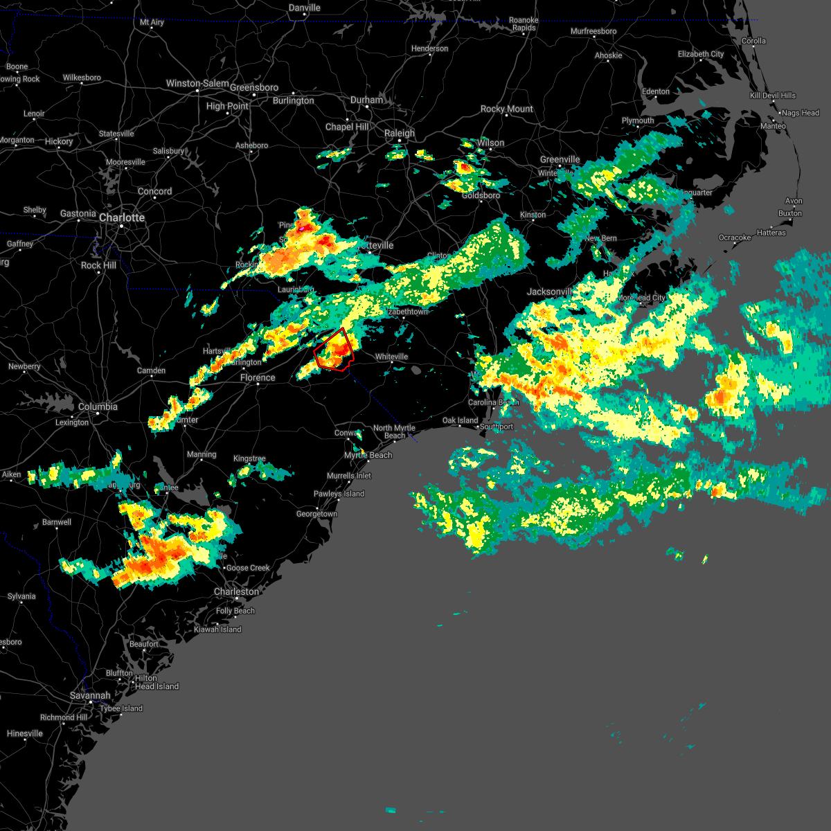 The tornado warning for south central robeson and southeastern dillon counties will expire at 645 pm edt, the storm which prompted the warning has moved out of the area. therefore, the warning will be allowed to expire. The tornado warning for south central robeson and southeastern dillon counties will expire at 645 pm edt, the storm which prompted the warning has moved out of the area. therefore, the warning will be allowed to expire.
|
| 9/25/2020 6:30 PM EDT |
 At 628 pm edt, a severe thunderstorm capable of producing a tornado was located near kemper, or 8 miles east of dillon, moving east at 20 mph (radar indicated rotation). Hazards include tornado. Expect damage to mobile homes, roofs, and vehicles. this dangerous storm will be near, lake view around 635 pm edt. fairmont around 655 pm edt. barnesville around 700 pm edt. Other locations impacted by this tornadic thunderstorm include marietta. At 628 pm edt, a severe thunderstorm capable of producing a tornado was located near kemper, or 8 miles east of dillon, moving east at 20 mph (radar indicated rotation). Hazards include tornado. Expect damage to mobile homes, roofs, and vehicles. this dangerous storm will be near, lake view around 635 pm edt. fairmont around 655 pm edt. barnesville around 700 pm edt. Other locations impacted by this tornadic thunderstorm include marietta.
|
| 9/25/2020 6:30 PM EDT |
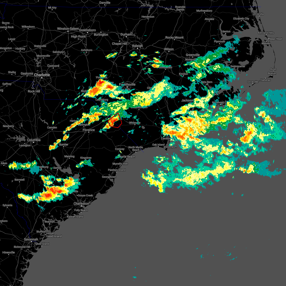 At 628 pm edt, a severe thunderstorm capable of producing a tornado was located near kemper, or 8 miles east of dillon, moving east at 20 mph (radar indicated rotation). Hazards include tornado. Expect damage to mobile homes, roofs, and vehicles. this dangerous storm will be near, lake view around 635 pm edt. fairmont around 655 pm edt. barnesville around 700 pm edt. Other locations impacted by this tornadic thunderstorm include marietta. At 628 pm edt, a severe thunderstorm capable of producing a tornado was located near kemper, or 8 miles east of dillon, moving east at 20 mph (radar indicated rotation). Hazards include tornado. Expect damage to mobile homes, roofs, and vehicles. this dangerous storm will be near, lake view around 635 pm edt. fairmont around 655 pm edt. barnesville around 700 pm edt. Other locations impacted by this tornadic thunderstorm include marietta.
|
| 9/25/2020 6:14 PM EDT |
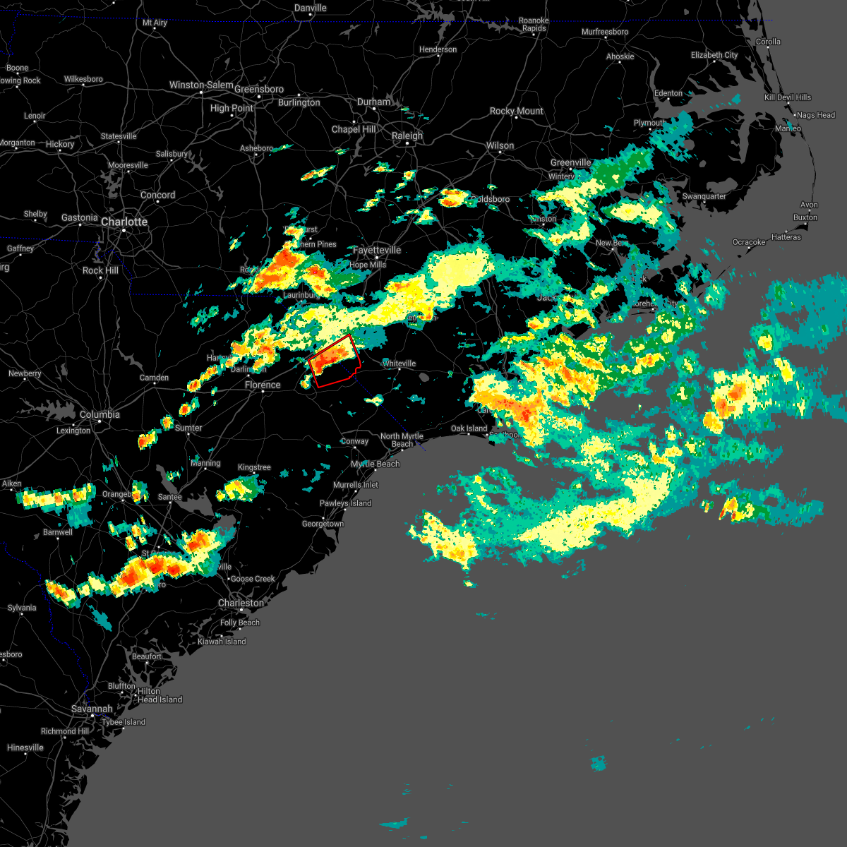 At 614 pm edt, a severe thunderstorm capable of producing a tornado was located near floydale, or near dillon, moving east at 25 mph (radar indicated rotation). Hazards include tornado. Expect damage to mobile homes, roofs, and vehicles. this dangerous storm will be near, kemper around 630 pm edt. lake view around 635 pm edt. fairmont and barnesville around 645 pm edt. Other locations impacted by this tornadic thunderstorm include marietta and mcleod medical center. At 614 pm edt, a severe thunderstorm capable of producing a tornado was located near floydale, or near dillon, moving east at 25 mph (radar indicated rotation). Hazards include tornado. Expect damage to mobile homes, roofs, and vehicles. this dangerous storm will be near, kemper around 630 pm edt. lake view around 635 pm edt. fairmont and barnesville around 645 pm edt. Other locations impacted by this tornadic thunderstorm include marietta and mcleod medical center.
|
| 5/5/2020 10:00 PM EDT | Quarter sized hail reported 0.5 miles WNW of Fair Bluff, NC, quarter size hail reported in fair bluff... nc |
| 5/5/2020 9:24 PM EDT |
 The severe thunderstorm warning for southeastern robeson, western bladen and northwestern columbus counties will expire at 930 pm edt, the storms which prompted the warning have weakened below severe limits, and no longer pose an immediate threat to life or property. therefore, the warning will be allowed to expire. however small hail and gusty winds are still possible with these thunderstorms. a severe thunderstorm watch remains in effect until 1100 pm edt for southeastern north carolina. a severe thunderstorm watch also remains in effect until 100 am edt for southeastern north carolina. The severe thunderstorm warning for southeastern robeson, western bladen and northwestern columbus counties will expire at 930 pm edt, the storms which prompted the warning have weakened below severe limits, and no longer pose an immediate threat to life or property. therefore, the warning will be allowed to expire. however small hail and gusty winds are still possible with these thunderstorms. a severe thunderstorm watch remains in effect until 1100 pm edt for southeastern north carolina. a severe thunderstorm watch also remains in effect until 100 am edt for southeastern north carolina.
|
| 5/5/2020 9:15 PM EDT |
 At 915 pm edt, severe thunderstorms were located along a line extending from near ruskin to near fair bluff, moving east at 40 mph (radar indicated). Hazards include 60 mph wind gusts and quarter size hail. Minor hail damage to vehicles is possible. expect wind damage to trees and power lines. locations impacted include, elizabethtown, fairmont, bladenboro, fair bluff, boardman, smiths, bladen community college, abbottsburg, butters, barnesville, ruskin, white oak, evergreen, clarkton, white lake, dublin, cerro gordo, marietta, proctorville and orrum. People attending bladen county hospital outdoor tent facilities may be affected by this storm and are urged to follow the precautionary measures of the onsite officials. At 915 pm edt, severe thunderstorms were located along a line extending from near ruskin to near fair bluff, moving east at 40 mph (radar indicated). Hazards include 60 mph wind gusts and quarter size hail. Minor hail damage to vehicles is possible. expect wind damage to trees and power lines. locations impacted include, elizabethtown, fairmont, bladenboro, fair bluff, boardman, smiths, bladen community college, abbottsburg, butters, barnesville, ruskin, white oak, evergreen, clarkton, white lake, dublin, cerro gordo, marietta, proctorville and orrum. People attending bladen county hospital outdoor tent facilities may be affected by this storm and are urged to follow the precautionary measures of the onsite officials.
|
| 5/5/2020 8:53 PM EDT |
 At 853 pm edt, severe thunderstorms were located along a line extending from duart to 6 miles northwest of kemper, moving east at 40 mph (radar indicated). Hazards include 60 mph wind gusts and quarter size hail. Minor hail damage to vehicles is possible. Expect wind damage to trees and power lines. At 853 pm edt, severe thunderstorms were located along a line extending from duart to 6 miles northwest of kemper, moving east at 40 mph (radar indicated). Hazards include 60 mph wind gusts and quarter size hail. Minor hail damage to vehicles is possible. Expect wind damage to trees and power lines.
|
| 4/13/2020 8:27 AM EDT |
 At 827 am edt, a severe thunderstorm was located near ammon, or 13 miles north of elizabethtown, moving northeast at 65 mph (radar indicated). Hazards include 70 mph wind gusts. Expect considerable tree damage. damage is likely to mobile homes, roofs, and outbuildings. locations impacted include, whiteville, elizabethtown, chadbourn, bladenboro, fair bluff, boardman, bladen community college, ammon, butters, southeastern community college, white oak, abbottsburg, lisbon, cherry grove, lagoon, elkton, emerson, ruskin, evergreen and clarkton. People attending bladen county hospital outdoor tent facilities should seek safe shelter immediately!. At 827 am edt, a severe thunderstorm was located near ammon, or 13 miles north of elizabethtown, moving northeast at 65 mph (radar indicated). Hazards include 70 mph wind gusts. Expect considerable tree damage. damage is likely to mobile homes, roofs, and outbuildings. locations impacted include, whiteville, elizabethtown, chadbourn, bladenboro, fair bluff, boardman, bladen community college, ammon, butters, southeastern community college, white oak, abbottsburg, lisbon, cherry grove, lagoon, elkton, emerson, ruskin, evergreen and clarkton. People attending bladen county hospital outdoor tent facilities should seek safe shelter immediately!.
|
| 4/13/2020 7:53 AM EDT |
 At 752 am edt, a severe thunderstorm was located near lumberton, moving northeast at 90 mph (radar indicated). Hazards include 70 mph wind gusts. Expect considerable tree damage. Damage is likely to mobile homes, roofs, and outbuildings. At 752 am edt, a severe thunderstorm was located near lumberton, moving northeast at 90 mph (radar indicated). Hazards include 70 mph wind gusts. Expect considerable tree damage. Damage is likely to mobile homes, roofs, and outbuildings.
|
| 9/5/2019 7:41 AM EDT |
 At 741 am edt, a severe thunderstorm capable of producing a tornado was located over allsbrook, or 14 miles northeast of conway, moving west at 40 mph (radar indicated rotation). Hazards include tornado. Flying debris will be dangerous to those caught without shelter. mobile homes will be damaged or destroyed. damage to roofs, windows, and vehicles will occur. tree damage is likely. Locations impacted include, mullins, tabor city, loris, fair bluff, lake view, cherry grove, gapway, kemper, goretown, bayboro, allsbrook, green sea, nichols, marion and loris community hospital. At 741 am edt, a severe thunderstorm capable of producing a tornado was located over allsbrook, or 14 miles northeast of conway, moving west at 40 mph (radar indicated rotation). Hazards include tornado. Flying debris will be dangerous to those caught without shelter. mobile homes will be damaged or destroyed. damage to roofs, windows, and vehicles will occur. tree damage is likely. Locations impacted include, mullins, tabor city, loris, fair bluff, lake view, cherry grove, gapway, kemper, goretown, bayboro, allsbrook, green sea, nichols, marion and loris community hospital.
|
| 9/5/2019 7:25 AM EDT |
 The national weather service in wilmington has issued a * tornado warning for. southwestern brunswick county in southeastern north carolina. southwestern columbus county in southeastern north carolina. southeastern dillon county in northeastern south carolina. Northern horry county in northeastern south carolina. The national weather service in wilmington has issued a * tornado warning for. southwestern brunswick county in southeastern north carolina. southwestern columbus county in southeastern north carolina. southeastern dillon county in northeastern south carolina. Northern horry county in northeastern south carolina.
|
| 9/5/2019 7:25 AM EDT |
 At 725 am edt, a severe thunderstorm capable of producing a tornado was located near goretown, or 11 miles northwest of little river, moving northwest at 55 mph (radar indicated rotation). Hazards include tornado. Flying debris will be dangerous to those caught without shelter. mobile homes will be damaged or destroyed. damage to roofs, windows, and vehicles will occur. tree damage is likely. this dangerous storm will be near, tabor city, loris and allsbrook around 735 am edt. green sea and bayboro around 740 am edt. cherry grove around 745 am edt. mullins, gapway and kemper around 800 am edt. other locations impacted by this tornadic thunderstorm include nichols, carolinas hospital system - marion and loris community hospital. This includes sc highway 31 between mile markers 23 and 24. At 725 am edt, a severe thunderstorm capable of producing a tornado was located near goretown, or 11 miles northwest of little river, moving northwest at 55 mph (radar indicated rotation). Hazards include tornado. Flying debris will be dangerous to those caught without shelter. mobile homes will be damaged or destroyed. damage to roofs, windows, and vehicles will occur. tree damage is likely. this dangerous storm will be near, tabor city, loris and allsbrook around 735 am edt. green sea and bayboro around 740 am edt. cherry grove around 745 am edt. mullins, gapway and kemper around 800 am edt. other locations impacted by this tornadic thunderstorm include nichols, carolinas hospital system - marion and loris community hospital. This includes sc highway 31 between mile markers 23 and 24.
|
| 6/22/2019 7:00 PM EDT |
 At 659 pm edt, severe thunderstorms were located along a line extending from evergreen to near galivants ferry, moving southeast at 50 mph (radar indicated). Hazards include 60 mph wind gusts and quarter size hail. Minor hail damage to vehicles is possible. Expect wind damage to trees and power lines. At 659 pm edt, severe thunderstorms were located along a line extending from evergreen to near galivants ferry, moving southeast at 50 mph (radar indicated). Hazards include 60 mph wind gusts and quarter size hail. Minor hail damage to vehicles is possible. Expect wind damage to trees and power lines.
|
| 6/22/2019 6:14 PM EDT |
 At 614 pm edt, severe thunderstorms were located along a line extending from raemon to brownsville, moving southeast at 60 mph (public). Hazards include 60 mph wind gusts and quarter size hail. Minor hail damage to vehicles is possible. Expect wind damage to trees and power lines. At 614 pm edt, severe thunderstorms were located along a line extending from raemon to brownsville, moving southeast at 60 mph (public). Hazards include 60 mph wind gusts and quarter size hail. Minor hail damage to vehicles is possible. Expect wind damage to trees and power lines.
|
| 6/20/2019 6:02 PM EDT |
 At 602 pm edt, severe thunderstorms were located along a line extending from whiteville to loris, moving east at 40 mph (radar indicated). Hazards include 60 mph wind gusts and quarter size hail. Expect wind damage to trees and power lines. Locations impacted include, whiteville, horry, tabor city, loris, chadbourn, fair bluff, hallsboro, adrian, redbug, southeastern community college, williams, goretown, galivants ferry, cherry grove, mollie, sidney, clarendon, bayboro, allsbrook and green sea. At 602 pm edt, severe thunderstorms were located along a line extending from whiteville to loris, moving east at 40 mph (radar indicated). Hazards include 60 mph wind gusts and quarter size hail. Expect wind damage to trees and power lines. Locations impacted include, whiteville, horry, tabor city, loris, chadbourn, fair bluff, hallsboro, adrian, redbug, southeastern community college, williams, goretown, galivants ferry, cherry grove, mollie, sidney, clarendon, bayboro, allsbrook and green sea.
|
| 6/20/2019 5:23 PM EDT |
 At 522 pm edt, severe thunderstorms were located along a line extending from near lake view to near galivants ferry, moving east at 40 mph (radar indicated). Hazards include 60 mph wind gusts and quarter size hail. expect wind damage to trees and power lines At 522 pm edt, severe thunderstorms were located along a line extending from near lake view to near galivants ferry, moving east at 40 mph (radar indicated). Hazards include 60 mph wind gusts and quarter size hail. expect wind damage to trees and power lines
|
| 5/31/2019 8:02 PM EDT |
 At 801 pm edt, severe thunderstorms were located along a line extending from 6 miles east of dillon to 16 miles south of lumberton to near mullins, moving northeast at 60 mph (radar indicated). Hazards include 60 mph wind gusts and quarter size hail. Minor hail damage to vehicles is possible. Expect wind damage to trees and powerlines. At 801 pm edt, severe thunderstorms were located along a line extending from 6 miles east of dillon to 16 miles south of lumberton to near mullins, moving northeast at 60 mph (radar indicated). Hazards include 60 mph wind gusts and quarter size hail. Minor hail damage to vehicles is possible. Expect wind damage to trees and powerlines.
|
| 4/19/2019 4:48 PM EDT |
 At 448 pm edt, severe thunderstorms were located along a line extending from near abbottsburg to north myrtle beach, moving east at 50 mph (radar indicated). Hazards include 60 mph wind gusts. Expect wind damage to trees and power lines. Locations impacted include, north myrtle beach, whiteville, sunset beach, ocean isle beach, little river, north myrtle beach airport, cherry grove inlet, iredell, carolina shores, tabor city, loris, chadbourn, calabash, bethel, lake waccamaw, fair bluff, boardman, hallsboro, exum and longwood. At 448 pm edt, severe thunderstorms were located along a line extending from near abbottsburg to north myrtle beach, moving east at 50 mph (radar indicated). Hazards include 60 mph wind gusts. Expect wind damage to trees and power lines. Locations impacted include, north myrtle beach, whiteville, sunset beach, ocean isle beach, little river, north myrtle beach airport, cherry grove inlet, iredell, carolina shores, tabor city, loris, chadbourn, calabash, bethel, lake waccamaw, fair bluff, boardman, hallsboro, exum and longwood.
|
| 4/19/2019 4:27 PM EDT |
 At 427 pm edt, severe thunderstorms were located along a line extending from near boardman to near nixonville, moving northeast at 80 mph (radar indicated). Hazards include 60 mph wind gusts. expect wind damage to trees and power lines At 427 pm edt, severe thunderstorms were located along a line extending from near boardman to near nixonville, moving northeast at 80 mph (radar indicated). Hazards include 60 mph wind gusts. expect wind damage to trees and power lines
|
| 4/19/2019 4:15 PM EDT | Media reports trees in the roadway at intersection of rough and ready and hinson crossroads near fair bluff... nc. time estimated via rada in columbus county NC, 3.3 miles W of Fair Bluff, NC |
| 4/19/2019 4:02 PM EDT |
 At 402 pm edt, severe thunderstorms were located along a line extending from 6 miles east of mullins to pawleys island, moving northeast at 55 mph (radar indicated). Hazards include 70 mph wind gusts. Expect considerable tree damage. damage is likely to mobile homes, roofs, and outbuildings. Locations impacted include, myrtle beach, conway, georgetown, debordieu colony, surfside beach, pawleys island, myrtle beach airport, murrells inlet, socastee, red hill, garden city, horry, tabor city, loris, chadbourn, jackson, johnsonville, fair bluff, hemingway and hickory grove. At 402 pm edt, severe thunderstorms were located along a line extending from 6 miles east of mullins to pawleys island, moving northeast at 55 mph (radar indicated). Hazards include 70 mph wind gusts. Expect considerable tree damage. damage is likely to mobile homes, roofs, and outbuildings. Locations impacted include, myrtle beach, conway, georgetown, debordieu colony, surfside beach, pawleys island, myrtle beach airport, murrells inlet, socastee, red hill, garden city, horry, tabor city, loris, chadbourn, jackson, johnsonville, fair bluff, hemingway and hickory grove.
|
| 4/19/2019 3:41 PM EDT |
 At 341 pm edt, severe thunderstorms were located along a line extending from gresham to near santee coastal reserve, moving northeast at 75 mph (radar indicated). Hazards include 70 mph wind gusts. Expect considerable tree damage. Damage is likely to mobile homes, roofs, and outbuildings. At 341 pm edt, severe thunderstorms were located along a line extending from gresham to near santee coastal reserve, moving northeast at 75 mph (radar indicated). Hazards include 70 mph wind gusts. Expect considerable tree damage. Damage is likely to mobile homes, roofs, and outbuildings.
|
| 4/19/2019 3:39 PM EDT |
 At 339 pm edt, severe thunderstorms were located along a line extending from 7 miles west of laurinburg to rains, moving northeast at 65 mph (radar indicated). Hazards include 70 mph wind gusts. Expect considerable tree damage. Damage is likely to mobile homes, roofs, and outbuildings. At 339 pm edt, severe thunderstorms were located along a line extending from 7 miles west of laurinburg to rains, moving northeast at 65 mph (radar indicated). Hazards include 70 mph wind gusts. Expect considerable tree damage. Damage is likely to mobile homes, roofs, and outbuildings.
|
| 12/28/2018 4:43 PM EST |
 At 443 pm est, severe thunderstorms were located along a line extending from near duart to fair bluff, moving northeast at 45 mph (radar indicated). Hazards include 60 mph wind gusts. expect wind damage to trees and power lines At 443 pm est, severe thunderstorms were located along a line extending from near duart to fair bluff, moving northeast at 45 mph (radar indicated). Hazards include 60 mph wind gusts. expect wind damage to trees and power lines
|
| 9/16/2018 12:55 PM EDT |
 At 1255 pm edt, a severe thunderstorm capable of producing a tornado was located over allsbrook, or 11 miles northeast of conway, moving north at 35 mph. a second severe thunderstorm capable of producing a tornado was located 2 miles southwest of tabor city, nc, also moving north at 35 mph (radar indicated rotation). Hazards include tornado. Flying debris will be dangerous to those caught without shelter. mobile homes will be damaged or destroyed. damage to roofs, windows, and vehicles will occur. tree damage is likely. Locations impacted include, loris, fair bluff, cherry grove, allsbrook, green sea, cerro gordo and loris community hospital. At 1255 pm edt, a severe thunderstorm capable of producing a tornado was located over allsbrook, or 11 miles northeast of conway, moving north at 35 mph. a second severe thunderstorm capable of producing a tornado was located 2 miles southwest of tabor city, nc, also moving north at 35 mph (radar indicated rotation). Hazards include tornado. Flying debris will be dangerous to those caught without shelter. mobile homes will be damaged or destroyed. damage to roofs, windows, and vehicles will occur. tree damage is likely. Locations impacted include, loris, fair bluff, cherry grove, allsbrook, green sea, cerro gordo and loris community hospital.
|
| 9/16/2018 12:54 PM EDT |
 At 1253 pm edt, a severe thunderstorm capable of producing a tornado was located over allsbrook, or 13 miles northeast of conway, moving north at 35 mph. a second thunderstorm, also capable of producing a tornado was located near allsbrook, also moving north at 35 mph (radar indicated rotation). Hazards include tornado. Flying debris will be dangerous to those caught without shelter. mobile homes will be damaged or destroyed. damage to roofs, windows, and vehicles will occur. tree damage is likely. Locations impacted include, loris, fair bluff, cherry grove, allsbrook, green sea, cerro gordo and loris community hospital. At 1253 pm edt, a severe thunderstorm capable of producing a tornado was located over allsbrook, or 13 miles northeast of conway, moving north at 35 mph. a second thunderstorm, also capable of producing a tornado was located near allsbrook, also moving north at 35 mph (radar indicated rotation). Hazards include tornado. Flying debris will be dangerous to those caught without shelter. mobile homes will be damaged or destroyed. damage to roofs, windows, and vehicles will occur. tree damage is likely. Locations impacted include, loris, fair bluff, cherry grove, allsbrook, green sea, cerro gordo and loris community hospital.
|
| 9/16/2018 12:41 PM EDT |
 At 1240 pm edt, a large tornado was indicated by radar near hickory grove, or 9 miles northeast of conway, moving north at 35 mph. this is a particularly dangerous situation. take cover now! (radar indicated rotation). Hazards include damaging tornado. You are in a life-threatening situation. flying debris may be deadly to those caught without shelter. mobile homes will be destroyed. Considerable damage to homes, businesses, and vehicles is likely and complete destruction is possible. At 1240 pm edt, a large tornado was indicated by radar near hickory grove, or 9 miles northeast of conway, moving north at 35 mph. this is a particularly dangerous situation. take cover now! (radar indicated rotation). Hazards include damaging tornado. You are in a life-threatening situation. flying debris may be deadly to those caught without shelter. mobile homes will be destroyed. Considerable damage to homes, businesses, and vehicles is likely and complete destruction is possible.
|
| 6/24/2018 9:23 PM EDT |
 At 842 pm edt, a severe thunderstorm was located near fair bluff, or 8 miles northeast of mullins, moving southeast at 15 mph (radar indicated). Hazards include 60 mph wind gusts. expect damage trees and power lines At 842 pm edt, a severe thunderstorm was located near fair bluff, or 8 miles northeast of mullins, moving southeast at 15 mph (radar indicated). Hazards include 60 mph wind gusts. expect damage trees and power lines
|
| 6/24/2018 9:23 PM EDT |
 A severe thunderstorm warning remains in effect until 930 pm edt for west central columbus and north central horry counties. at 922 pm edt, a severe thunderstorm was located over cherry grove, or 15 miles east of mullins, moving southeast at 15 mph. hazard. 60 mph wind gusts. source. Radar indicated. A severe thunderstorm warning remains in effect until 930 pm edt for west central columbus and north central horry counties. at 922 pm edt, a severe thunderstorm was located over cherry grove, or 15 miles east of mullins, moving southeast at 15 mph. hazard. 60 mph wind gusts. source. Radar indicated.
|
| 6/24/2018 8:43 PM EDT |
 At 842 pm edt, a severe thunderstorm was located near fair bluff, or 8 miles northeast of mullins, moving southeast at 15 mph (radar indicated). Hazards include 60 mph wind gusts. expect damage trees and power lines At 842 pm edt, a severe thunderstorm was located near fair bluff, or 8 miles northeast of mullins, moving southeast at 15 mph (radar indicated). Hazards include 60 mph wind gusts. expect damage trees and power lines
|
| 6/18/2018 5:57 PM EDT |
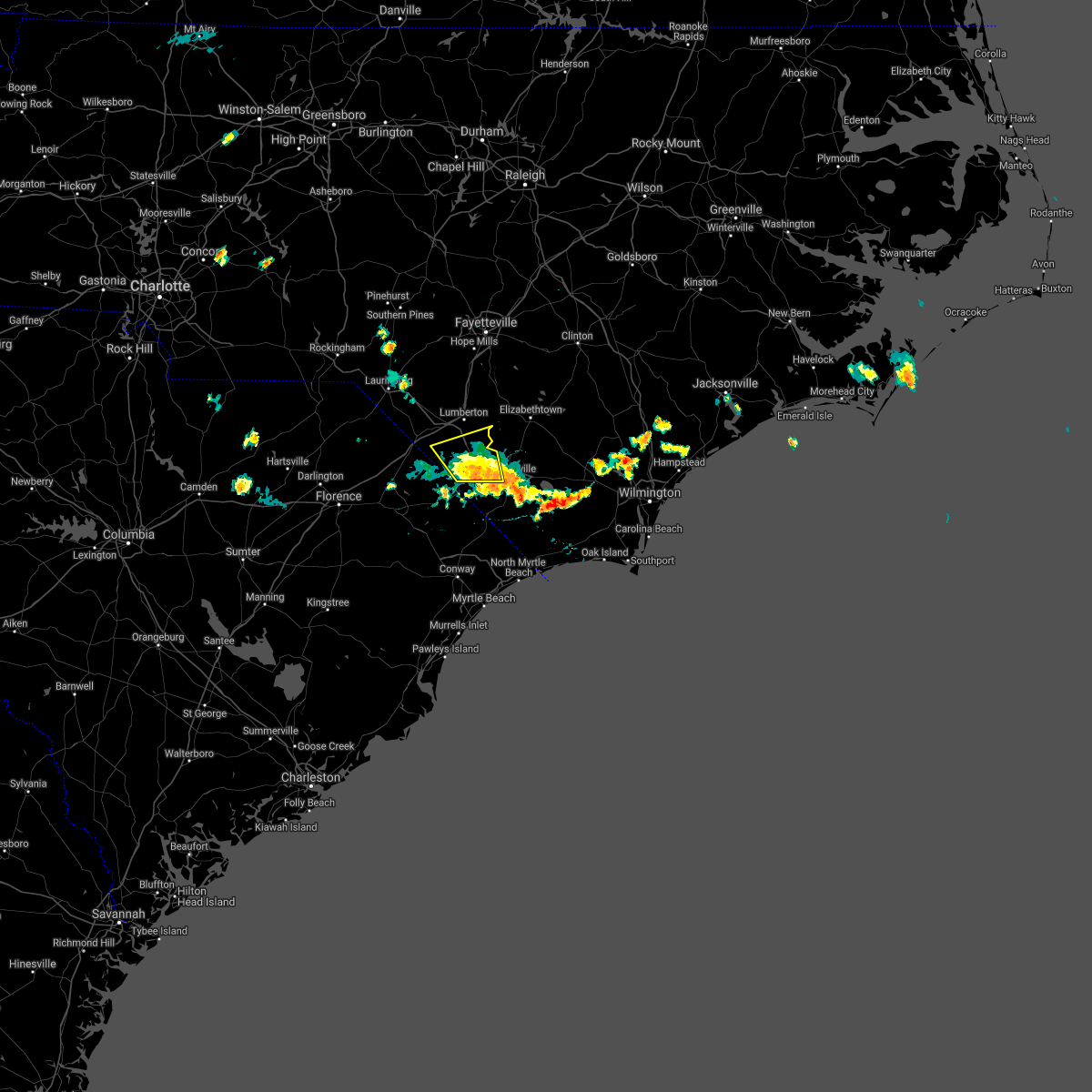 The severe thunderstorm warning for southeastern robeson and northwestern columbus counties will expire at 600 pm edt. the storm which prompted the warning has moved out of the area. therefore, the warning will be allowed to expire. however gusty winds are still possible with this thunderstorm. A special weather statement is valid for areas south of the expiring warning. The severe thunderstorm warning for southeastern robeson and northwestern columbus counties will expire at 600 pm edt. the storm which prompted the warning has moved out of the area. therefore, the warning will be allowed to expire. however gusty winds are still possible with this thunderstorm. A special weather statement is valid for areas south of the expiring warning.
|
| 6/18/2018 5:31 PM EDT |
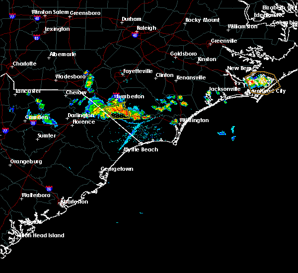 At 530 pm edt, a severe thunderstorm was located over barnesville, or 13 miles south of lumberton, moving south at 25 mph (law enforcement). Hazards include 60 mph wind gusts. Expect damage trees and power lines. locations impacted include, fairmont, chadbourn, fair bluff, boardman, barnesville, evergreen, southeastern community college, cerro gordo, proctorville and orrum. This includes us route 74 between mile markers 367 and 387. At 530 pm edt, a severe thunderstorm was located over barnesville, or 13 miles south of lumberton, moving south at 25 mph (law enforcement). Hazards include 60 mph wind gusts. Expect damage trees and power lines. locations impacted include, fairmont, chadbourn, fair bluff, boardman, barnesville, evergreen, southeastern community college, cerro gordo, proctorville and orrum. This includes us route 74 between mile markers 367 and 387.
|
| 6/18/2018 4:54 PM EDT |
 At 454 pm edt, severe thunderstorms were located along a line extending from hestertown to near minturn, moving southwest at 20 mph (radar indicated). Hazards include 60 mph wind gusts. expect damage trees and power lines At 454 pm edt, severe thunderstorms were located along a line extending from hestertown to near minturn, moving southwest at 20 mph (radar indicated). Hazards include 60 mph wind gusts. expect damage trees and power lines
|
| 3/1/2018 5:57 PM EST |
 The severe thunderstorm warning for western bladen. southeastern robeson. western columbus and northwestern horry counties will expire at 600 pm est. the storms which prompted the warning have moved out of the area. Therefore the warning will be allowed to expire at 6 pm est. The severe thunderstorm warning for western bladen. southeastern robeson. western columbus and northwestern horry counties will expire at 600 pm est. the storms which prompted the warning have moved out of the area. Therefore the warning will be allowed to expire at 6 pm est.
|
| 3/1/2018 5:36 PM EST |
 At 534 pm est, severe thunderstorms were located along a line extending from near jerome to dublin, cerro gordo, and north of galivants ferry, moving east at 50 mph (radar indicated). Hazards include 60 mph wind gusts. Expect damage to trees and power lines, especially in the areas that receive the highest winds. this line of storms has a history of producing wind damage. Locations impacted include, whiteville, elizabethtown, tabor city, loris, chadbourn, bladenboro, fair bluff, boardman, ammon, goretown, white oak, smiths, abbottsburg, mollie and sidney. At 534 pm est, severe thunderstorms were located along a line extending from near jerome to dublin, cerro gordo, and north of galivants ferry, moving east at 50 mph (radar indicated). Hazards include 60 mph wind gusts. Expect damage to trees and power lines, especially in the areas that receive the highest winds. this line of storms has a history of producing wind damage. Locations impacted include, whiteville, elizabethtown, tabor city, loris, chadbourn, bladenboro, fair bluff, boardman, ammon, goretown, white oak, smiths, abbottsburg, mollie and sidney.
|
| 3/1/2018 5:22 PM EST |
 At 521 pm est, severe thunderstorms were located along a line extending from near tolarsville to proctorville, nichols, and rains, moving east at 50 to 55 mph (radar indicated). Hazards include 60 mph wind gusts. Expect downed trees and power lines in the areas that receive the strongest winds. locations impacted include, lumberton, marion, whiteville, mullins, elizabethtown, fairmont, tabor city, loris, st. Pauls, chadbourn, bladenboro, fair bluff, lake view, boardman, ammon, hestertown, white oak, smiths and howellsville. At 521 pm est, severe thunderstorms were located along a line extending from near tolarsville to proctorville, nichols, and rains, moving east at 50 to 55 mph (radar indicated). Hazards include 60 mph wind gusts. Expect downed trees and power lines in the areas that receive the strongest winds. locations impacted include, lumberton, marion, whiteville, mullins, elizabethtown, fairmont, tabor city, loris, st. Pauls, chadbourn, bladenboro, fair bluff, lake view, boardman, ammon, hestertown, white oak, smiths and howellsville.
|
| 3/1/2018 5:04 PM EST |
 At 502 pm est, severe thunderstorms were located along a line extending from near parkton to rowland to near latta to just southwest of sellers, moving east at 40 to 50 mph (radar indicated). Hazards include 60 mph wind gusts. expect downed trees and power lines with the strongest winds At 502 pm est, severe thunderstorms were located along a line extending from near parkton to rowland to near latta to just southwest of sellers, moving east at 40 to 50 mph (radar indicated). Hazards include 60 mph wind gusts. expect downed trees and power lines with the strongest winds
|
| 8/23/2017 8:03 PM EDT |
 At 802 pm edt, severe thunderstorms were located along a line extending from sidney to near bayboro, moving southeast at 20 mph (radar indicated). Hazards include 60 mph wind gusts and quarter size hail. Minor hail damage to vehicles is possible. expect wind damage to trees and power lines. locations impacted include, marion, whiteville, mullins, elizabethtown, rowan, tabor city, chadbourn, bladenboro, lake waccamaw, fair bluff, sandyfield, boardman, hallsboro, rains, southeastern community college, carvers, galivants ferry, lisbon, sidney and elkton. This includes us route 74 between mile markers 375 and 417. At 802 pm edt, severe thunderstorms were located along a line extending from sidney to near bayboro, moving southeast at 20 mph (radar indicated). Hazards include 60 mph wind gusts and quarter size hail. Minor hail damage to vehicles is possible. expect wind damage to trees and power lines. locations impacted include, marion, whiteville, mullins, elizabethtown, rowan, tabor city, chadbourn, bladenboro, lake waccamaw, fair bluff, sandyfield, boardman, hallsboro, rains, southeastern community college, carvers, galivants ferry, lisbon, sidney and elkton. This includes us route 74 between mile markers 375 and 417.
|
| 8/23/2017 7:10 PM EDT |
 At 710 pm edt, severe thunderstorms were located along a line extending from near barnesville to near zion, moving southeast at 20 mph (radar indicated). Hazards include 60 mph wind gusts and quarter size hail. Minor hail damage to vehicles is possible. Expect wind damage to trees and power lines. At 710 pm edt, severe thunderstorms were located along a line extending from near barnesville to near zion, moving southeast at 20 mph (radar indicated). Hazards include 60 mph wind gusts and quarter size hail. Minor hail damage to vehicles is possible. Expect wind damage to trees and power lines.
|
| 7/23/2017 6:05 PM EDT |
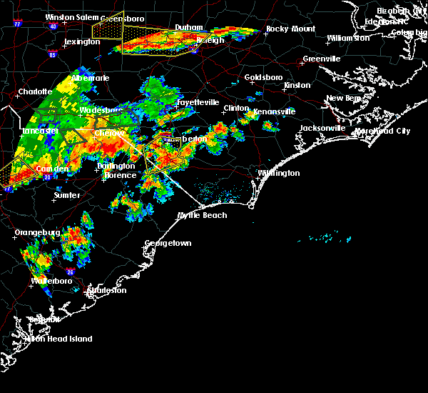 At 605 pm edt, a severe thunderstorm was located over barnesville, or 17 miles south of lumberton, moving north at 5 to 10 mph (radar indicated). Hazards include 60 mph wind gusts and nickel size hail. expect damage trees and power lines At 605 pm edt, a severe thunderstorm was located over barnesville, or 17 miles south of lumberton, moving north at 5 to 10 mph (radar indicated). Hazards include 60 mph wind gusts and nickel size hail. expect damage trees and power lines
|
| 7/7/2017 8:34 PM EDT |
 At 833 pm edt, a severe thunderstorm was located over chadbourn, moving northeast at 30 mph. a second severe thunderstorm was located 2 miles east of tabor city, also moving northeast at 30 mph (radar indicated). Hazards include 60 mph wind gusts and penny size hail. Expect damage trees and power lines. locations impacted include, whiteville, tabor city, chadbourn, fair bluff, boardman, cherry grove, sidney, southeastern community college, clarendon, williams, evergreen, green sea, brunswick, cerro gordo and columbus regional healthcare system. This includes us route 74 between mile markers 375 and 393. At 833 pm edt, a severe thunderstorm was located over chadbourn, moving northeast at 30 mph. a second severe thunderstorm was located 2 miles east of tabor city, also moving northeast at 30 mph (radar indicated). Hazards include 60 mph wind gusts and penny size hail. Expect damage trees and power lines. locations impacted include, whiteville, tabor city, chadbourn, fair bluff, boardman, cherry grove, sidney, southeastern community college, clarendon, williams, evergreen, green sea, brunswick, cerro gordo and columbus regional healthcare system. This includes us route 74 between mile markers 375 and 393.
|
| 7/7/2017 8:22 PM EDT |
 At 821 pm edt, a severe thunderstorm was located near cherry grove, or 12 miles west of whiteville, moving east at 35 mph (radar indicated). Hazards include 60 mph wind gusts and penny size hail. expect damage trees and power lines At 821 pm edt, a severe thunderstorm was located near cherry grove, or 12 miles west of whiteville, moving east at 35 mph (radar indicated). Hazards include 60 mph wind gusts and penny size hail. expect damage trees and power lines
|
| 5/28/2017 7:04 PM EDT |
 At 703 pm edt, a severe thunderstorm was located near cherry grove, or 12 miles west of whiteville, moving east at 35 mph (radar indicated). Hazards include 60 mph wind gusts and quarter size hail. Minor hail damage to vehicles is possible. expect wind damage to trees and power lines. locations impacted include, whiteville, tabor city, chadbourn, fair bluff, boardman, cherry grove, mollie, sidney, southeastern community college, clarendon, williams, evergreen, brunswick, cerro gordo and columbus regional healthcare system. This includes us route 74 between mile markers 375 and 393. At 703 pm edt, a severe thunderstorm was located near cherry grove, or 12 miles west of whiteville, moving east at 35 mph (radar indicated). Hazards include 60 mph wind gusts and quarter size hail. Minor hail damage to vehicles is possible. expect wind damage to trees and power lines. locations impacted include, whiteville, tabor city, chadbourn, fair bluff, boardman, cherry grove, mollie, sidney, southeastern community college, clarendon, williams, evergreen, brunswick, cerro gordo and columbus regional healthcare system. This includes us route 74 between mile markers 375 and 393.
|
| 5/28/2017 6:36 PM EDT |
 At 636 pm edt, a severe thunderstorm was located over lake view, or 9 miles northeast of mullins, moving east at 25 mph (radar indicated). Hazards include 60 mph wind gusts and quarter size hail. Minor hail damage to vehicles is possible. Expect wind damage to trees and power lines. At 636 pm edt, a severe thunderstorm was located over lake view, or 9 miles northeast of mullins, moving east at 25 mph (radar indicated). Hazards include 60 mph wind gusts and quarter size hail. Minor hail damage to vehicles is possible. Expect wind damage to trees and power lines.
|
| 5/5/2017 4:30 AM EDT |
 At 430 am edt, severe thunderstorms were located along a line extending from robeson community college to near fair bluff, moving northeast at 50 mph (radar indicated). Hazards include 60 mph wind gusts. Expect damage trees and power lines. locations impacted include, lumberton, whiteville, elizabethtown, tabor city, st. pauls, chadbourn, bladenboro, fair bluff, boardman, bladen community college, ammon, butters, hestertown, white oak, smiths, howellsville, lisbon and abbottsburg. this includes the following highways, interstate 74 mile marker 213 and near mile marker 214. interstate 95 in north carolina between mile markers 17 and 37. us route 74 between mile markers 365 and 395. A tornado watch remains in effect until 900 am edt for southeastern north carolina, and northeastern south carolina. At 430 am edt, severe thunderstorms were located along a line extending from robeson community college to near fair bluff, moving northeast at 50 mph (radar indicated). Hazards include 60 mph wind gusts. Expect damage trees and power lines. locations impacted include, lumberton, whiteville, elizabethtown, tabor city, st. pauls, chadbourn, bladenboro, fair bluff, boardman, bladen community college, ammon, butters, hestertown, white oak, smiths, howellsville, lisbon and abbottsburg. this includes the following highways, interstate 74 mile marker 213 and near mile marker 214. interstate 95 in north carolina between mile markers 17 and 37. us route 74 between mile markers 365 and 395. A tornado watch remains in effect until 900 am edt for southeastern north carolina, and northeastern south carolina.
|
| 5/5/2017 4:11 AM EDT |
 At 411 am edt, severe thunderstorms were located along a line extending from near fairmont to 7 miles northeast of galivants ferry, moving northeast at 50 mph (radar indicated). Hazards include 60 mph wind gusts. expect damage trees and power lines At 411 am edt, severe thunderstorms were located along a line extending from near fairmont to 7 miles northeast of galivants ferry, moving northeast at 50 mph (radar indicated). Hazards include 60 mph wind gusts. expect damage trees and power lines
|
| 4/5/2017 5:42 PM EDT |
 At 542 pm edt, a severe thunderstorm was located near boardman, or 11 miles southeast of lumberton, moving northeast at 35 mph (radar indicated). Hazards include 60 mph wind gusts and quarter size hail. Hail damage to vehicles is expected. expect wind damage to roofs, siding, and trees. locations impacted include, lumberton, whiteville, chadbourn, bladenboro, fair bluff, boardman, bladen community college, butters, hestertown, southeastern community college, smiths, howellsville, abbottsburg, elkton, barnesville, emerson, evergreen, barker ten mile, clarkton and dublin. this includes the following highways, interstate 74 between mile markers 212 and 208, and between mile markers 209 and 210, and near mile marker 214. interstate 95 in north carolina between mile markers 12 and 21. us route 74 between mile markers 365 and 396. A tornado watch remains in effect until 800 pm edt for southeastern north carolina, and northeastern south carolina. At 542 pm edt, a severe thunderstorm was located near boardman, or 11 miles southeast of lumberton, moving northeast at 35 mph (radar indicated). Hazards include 60 mph wind gusts and quarter size hail. Hail damage to vehicles is expected. expect wind damage to roofs, siding, and trees. locations impacted include, lumberton, whiteville, chadbourn, bladenboro, fair bluff, boardman, bladen community college, butters, hestertown, southeastern community college, smiths, howellsville, abbottsburg, elkton, barnesville, emerson, evergreen, barker ten mile, clarkton and dublin. this includes the following highways, interstate 74 between mile markers 212 and 208, and between mile markers 209 and 210, and near mile marker 214. interstate 95 in north carolina between mile markers 12 and 21. us route 74 between mile markers 365 and 396. A tornado watch remains in effect until 800 pm edt for southeastern north carolina, and northeastern south carolina.
|
| 4/5/2017 5:29 PM EDT |
 At 529 pm edt, a severe thunderstorm was located over barnesville, or 13 miles south of lumberton, moving northeast at 35 mph (radar indicated). Hazards include 60 mph wind gusts and quarter size hail. Hail damage to vehicles is expected. expect wind damage to roofs, siding, and trees. locations impacted include, lumberton, whiteville, fairmont, chadbourn, bladenboro, fair bluff, boardman, bladen community college, butters, hestertown, southeastern community college, smiths, howellsville, abbottsburg, elkton, barnesville, emerson, evergreen, barker ten mile and clarkton. this includes the following highways, interstate 74 between mile markers 212 and 208, and between mile markers 209 and 210, and near mile marker 214. interstate 95 in north carolina between mile markers 1 and 21. us route 74 between mile markers 365 and 396. A tornado watch remains in effect until 800 pm edt for southeastern north carolina, and northeastern south carolina. At 529 pm edt, a severe thunderstorm was located over barnesville, or 13 miles south of lumberton, moving northeast at 35 mph (radar indicated). Hazards include 60 mph wind gusts and quarter size hail. Hail damage to vehicles is expected. expect wind damage to roofs, siding, and trees. locations impacted include, lumberton, whiteville, fairmont, chadbourn, bladenboro, fair bluff, boardman, bladen community college, butters, hestertown, southeastern community college, smiths, howellsville, abbottsburg, elkton, barnesville, emerson, evergreen, barker ten mile and clarkton. this includes the following highways, interstate 74 between mile markers 212 and 208, and between mile markers 209 and 210, and near mile marker 214. interstate 95 in north carolina between mile markers 1 and 21. us route 74 between mile markers 365 and 396. A tornado watch remains in effect until 800 pm edt for southeastern north carolina, and northeastern south carolina.
|
| 4/5/2017 5:02 PM EDT |
 At 502 pm edt, a severe thunderstorm was located over floydale, or near dillon, moving northeast at 35 mph (radar indicated). Hazards include 60 mph wind gusts and quarter size hail. Hail damage to vehicles is expected. Expect wind damage to roofs, siding, and trees. At 502 pm edt, a severe thunderstorm was located over floydale, or near dillon, moving northeast at 35 mph (radar indicated). Hazards include 60 mph wind gusts and quarter size hail. Hail damage to vehicles is expected. Expect wind damage to roofs, siding, and trees.
|
| 3/21/2017 11:58 PM EDT |
 At 1158 pm edt, a severe thunderstorm was located over bingham, or 8 miles west of dillon, moving east at 25 mph (radar indicated). Hazards include 60 mph wind gusts and quarter size hail. Hail damage to vehicles is expected. Expect wind damage to roofs, siding, and trees. At 1158 pm edt, a severe thunderstorm was located over bingham, or 8 miles west of dillon, moving east at 25 mph (radar indicated). Hazards include 60 mph wind gusts and quarter size hail. Hail damage to vehicles is expected. Expect wind damage to roofs, siding, and trees.
|
| 7/19/2016 9:50 PM EDT |
 At 949 pm edt, a severe thunderstorm was located over hestertown, or near lumberton, moving south at 20 mph (trained weather spotters). Hazards include 60 mph wind gusts and penny size hail. Expect damage to roofs. siding. and trees. locations impacted include, lumberton, dillon, red springs, pembroke, fairmont, maxton, st. Pauls, chadbourn, latta, rowland, fair bluff, lake view, boardman, kemper, howellsville, tolarsville, little rock, hamer, wakulla and elrod. At 949 pm edt, a severe thunderstorm was located over hestertown, or near lumberton, moving south at 20 mph (trained weather spotters). Hazards include 60 mph wind gusts and penny size hail. Expect damage to roofs. siding. and trees. locations impacted include, lumberton, dillon, red springs, pembroke, fairmont, maxton, st. Pauls, chadbourn, latta, rowland, fair bluff, lake view, boardman, kemper, howellsville, tolarsville, little rock, hamer, wakulla and elrod.
|
| 7/19/2016 8:56 PM EDT |
 At 856 pm edt, a severe thunderstorm was located over howellsville, or near lumberton, moving south at 25 mph (radar indicated). Hazards include 60 mph wind gusts and quarter size hail. Hail damage to vehicles is expected. Expect wind damage to roofs, siding, and trees. At 856 pm edt, a severe thunderstorm was located over howellsville, or near lumberton, moving south at 25 mph (radar indicated). Hazards include 60 mph wind gusts and quarter size hail. Hail damage to vehicles is expected. Expect wind damage to roofs, siding, and trees.
|
| 7/11/2016 8:15 PM EDT |
 At 815 pm edt, a severe thunderstorm was located over cherry grove, or 13 miles east of mullins, moving east at 45 mph (radar indicated). Hazards include 60 mph wind gusts and quarter size hail. Hail damage to vehicles is expected. Expect wind damage to roofs, siding, and trees. At 815 pm edt, a severe thunderstorm was located over cherry grove, or 13 miles east of mullins, moving east at 45 mph (radar indicated). Hazards include 60 mph wind gusts and quarter size hail. Hail damage to vehicles is expected. Expect wind damage to roofs, siding, and trees.
|
| 7/11/2016 7:52 PM EDT |
 At 752 pm edt, a severe thunderstorm was located over kemper, or 9 miles southeast of dillon, moving east at 45 mph (radar indicated). Hazards include 60 mph wind gusts and penny size hail. Expect damage to roofs. siding. and trees. Locations impacted include, lumberton, marion, dillon, mullins, fairmont, latta, rowland, fair bluff, lake view, sellers, boardman, kemper, smithboro, blue brick, little rock, fork, hamer, oak grove, cherry grove and purvis. At 752 pm edt, a severe thunderstorm was located over kemper, or 9 miles southeast of dillon, moving east at 45 mph (radar indicated). Hazards include 60 mph wind gusts and penny size hail. Expect damage to roofs. siding. and trees. Locations impacted include, lumberton, marion, dillon, mullins, fairmont, latta, rowland, fair bluff, lake view, sellers, boardman, kemper, smithboro, blue brick, little rock, fork, hamer, oak grove, cherry grove and purvis.
|
| 7/11/2016 7:43 PM EDT |
 At 743 pm edt, a severe thunderstorm was located over latta, or near dillon, moving east at 65 mph (radar indicated). Hazards include 70 mph wind gusts and penny size hail. Expect considerable tree damage. damage is likely to mobile homes, roofs, and outbuildings. Locations impacted include, lumberton, marion, dillon, mullins, fairmont, latta, rowland, fair bluff, lake view, sellers, boardman, kemper, bingham, smithboro, blue brick, little rock, minturn, fork, hamer and oak grove. At 743 pm edt, a severe thunderstorm was located over latta, or near dillon, moving east at 65 mph (radar indicated). Hazards include 70 mph wind gusts and penny size hail. Expect considerable tree damage. damage is likely to mobile homes, roofs, and outbuildings. Locations impacted include, lumberton, marion, dillon, mullins, fairmont, latta, rowland, fair bluff, lake view, sellers, boardman, kemper, bingham, smithboro, blue brick, little rock, minturn, fork, hamer and oak grove.
|
| 7/11/2016 7:21 PM EDT |
 At 721 pm edt, a severe thunderstorm was located near oak grove, or 14 miles west of dillon, moving east at 40 mph (radar indicated). Hazards include 70 mph wind gusts and quarter size hail. Hail damage to vehicles is expected. expect considerable tree damage. Wind damage is also likely to mobile homes, roofs, and outbuildings. At 721 pm edt, a severe thunderstorm was located near oak grove, or 14 miles west of dillon, moving east at 40 mph (radar indicated). Hazards include 70 mph wind gusts and quarter size hail. Hail damage to vehicles is expected. expect considerable tree damage. Wind damage is also likely to mobile homes, roofs, and outbuildings.
|
| 7/11/2016 4:56 PM EDT |
 At 456 pm edt, a severe thunderstorm was located near williams, or near whiteville, moving southeast at 30 mph (radar indicated). Hazards include 60 mph wind gusts and quarter size hail. Hail damage to vehicles is expected. expect wind damage to roofs, siding, and trees. Locations impacted include, whiteville, tabor city, chadbourn, lake waccamaw, fair bluff, sandyfield, council, redbug, southeastern community college, williams, hallsboro, elkton, emerson, sidney, clarendon, cherry grove, brunswick, bolton, east arcadia and cerro gordo. At 456 pm edt, a severe thunderstorm was located near williams, or near whiteville, moving southeast at 30 mph (radar indicated). Hazards include 60 mph wind gusts and quarter size hail. Hail damage to vehicles is expected. expect wind damage to roofs, siding, and trees. Locations impacted include, whiteville, tabor city, chadbourn, lake waccamaw, fair bluff, sandyfield, council, redbug, southeastern community college, williams, hallsboro, elkton, emerson, sidney, clarendon, cherry grove, brunswick, bolton, east arcadia and cerro gordo.
|
| 7/11/2016 4:41 PM EDT |
 At 441 pm edt, severe thunderstorms were located along a line extending from near council to near redbug to near cherry grove, and are nearly stationary (radar indicated). Hazards include 60 mph wind gusts and quarter size hail. Hail damage to vehicles is expected. expect wind damage to roofs, siding, and trees. Locations impacted include, whiteville, tabor city, chadbourn, lake waccamaw, fair bluff, sandyfield, council, redbug, southeastern community college, williams, hallsboro, elkton, carvers, emerson, sidney, clarendon, cherry grove, brunswick, bolton and east arcadia. At 441 pm edt, severe thunderstorms were located along a line extending from near council to near redbug to near cherry grove, and are nearly stationary (radar indicated). Hazards include 60 mph wind gusts and quarter size hail. Hail damage to vehicles is expected. expect wind damage to roofs, siding, and trees. Locations impacted include, whiteville, tabor city, chadbourn, lake waccamaw, fair bluff, sandyfield, council, redbug, southeastern community college, williams, hallsboro, elkton, carvers, emerson, sidney, clarendon, cherry grove, brunswick, bolton and east arcadia.
|
| 7/11/2016 4:23 PM EDT |
 At 423 pm edt, a severe thunderstorm was located near hallsboro, or near whiteville, moving east at 15 mph (radar indicated). Hazards include 60 mph wind gusts and quarter size hail. Hail damage to vehicles is expected. Expect wind damage to roofs, siding, and trees. At 423 pm edt, a severe thunderstorm was located near hallsboro, or near whiteville, moving east at 15 mph (radar indicated). Hazards include 60 mph wind gusts and quarter size hail. Hail damage to vehicles is expected. Expect wind damage to roofs, siding, and trees.
|
| 7/9/2016 12:24 AM EDT |
 At 1223 am edt, a severe thunderstorm was located over brooksville, or near little river, moving southeast at 60 mph (radar indicated). Hazards include 60 mph wind gusts and penny size hail. Expect damage to roofs. siding. and trees. Locations impacted include, whiteville, mullins, horry, tabor city, loris, chadbourn, fair bluff, lake view, boardman, allsbrook, williams, hallsboro, kemper, smithboro, mollie, galivants ferry, fork, rains, gapway and clarendon. At 1223 am edt, a severe thunderstorm was located over brooksville, or near little river, moving southeast at 60 mph (radar indicated). Hazards include 60 mph wind gusts and penny size hail. Expect damage to roofs. siding. and trees. Locations impacted include, whiteville, mullins, horry, tabor city, loris, chadbourn, fair bluff, lake view, boardman, allsbrook, williams, hallsboro, kemper, smithboro, mollie, galivants ferry, fork, rains, gapway and clarendon.
|
| 7/9/2016 12:19 AM EDT |
 At 1218 am edt, a severe thunderstorm was located over longs, or 9 miles northwest of little river, moving southeast at 40 mph (radar indicated). Hazards include 60 mph wind gusts and penny size hail. Expect damage to roofs. siding. and trees. Locations impacted include, whiteville, mullins, horry, tabor city, loris, chadbourn, fair bluff, lake view, boardman, allsbrook, williams, hallsboro, kemper, smithboro, mollie, galivants ferry, fork, rains, gapway and clarendon. At 1218 am edt, a severe thunderstorm was located over longs, or 9 miles northwest of little river, moving southeast at 40 mph (radar indicated). Hazards include 60 mph wind gusts and penny size hail. Expect damage to roofs. siding. and trees. Locations impacted include, whiteville, mullins, horry, tabor city, loris, chadbourn, fair bluff, lake view, boardman, allsbrook, williams, hallsboro, kemper, smithboro, mollie, galivants ferry, fork, rains, gapway and clarendon.
|
| 7/8/2016 11:57 PM EDT |
 At 1156 pm edt, a severe thunderstorm was located near cherry grove, or 12 miles east of mullins, moving southeast at 60 mph (radar indicated). Hazards include 60 mph wind gusts and penny size hail. Expect damage to roofs. siding. and trees. Locations impacted include, lumberton, marion, dillon, whiteville, mullins, horry, fairmont, tabor city, loris, chadbourn, latta, fair bluff, lake view, sellers, boardman, allsbrook, williams, hallsboro, smithboro and mollie. At 1156 pm edt, a severe thunderstorm was located near cherry grove, or 12 miles east of mullins, moving southeast at 60 mph (radar indicated). Hazards include 60 mph wind gusts and penny size hail. Expect damage to roofs. siding. and trees. Locations impacted include, lumberton, marion, dillon, whiteville, mullins, horry, fairmont, tabor city, loris, chadbourn, latta, fair bluff, lake view, sellers, boardman, allsbrook, williams, hallsboro, smithboro and mollie.
|
| 7/8/2016 11:29 PM EDT |
 At 1128 pm edt, a severe thunderstorm was located over little rock, or near dillon, moving southeast at 60 mph (radar indicated). Hazards include 60 mph wind gusts and penny size hail. Expect damage to roofs. siding. And trees. At 1128 pm edt, a severe thunderstorm was located over little rock, or near dillon, moving southeast at 60 mph (radar indicated). Hazards include 60 mph wind gusts and penny size hail. Expect damage to roofs. siding. And trees.
|
| 7/8/2016 11:19 PM EDT |
 At 1118 pm edt, a severe thunderstorm was located near hestertown, or near lumberton, moving east at 50 mph (emergency management has reported trees down with this activity). Hazards include 60 mph wind gusts and quarter size hail. Hail damage to vehicles is expected. expect wind damage to roofs, siding, and trees. locations impacted include, lumberton, bennettsville, dillon, red springs, pembroke, fairmont, maxton, mccoll, st. Pauls, latta, rowland, fair bluff, lake view, clio, boardman, howellsville, tolarsville, minturn, hamer and wakulla. At 1118 pm edt, a severe thunderstorm was located near hestertown, or near lumberton, moving east at 50 mph (emergency management has reported trees down with this activity). Hazards include 60 mph wind gusts and quarter size hail. Hail damage to vehicles is expected. expect wind damage to roofs, siding, and trees. locations impacted include, lumberton, bennettsville, dillon, red springs, pembroke, fairmont, maxton, mccoll, st. Pauls, latta, rowland, fair bluff, lake view, clio, boardman, howellsville, tolarsville, minturn, hamer and wakulla.
|
| 7/8/2016 10:35 PM EDT |
 At 1034 pm edt, a severe thunderstorm was located near clio, or near bennettsville, moving east, southeast at 40 mph (radar indicated). Hazards include 60 mph wind gusts and quarter size hail. Hail damage to vehicles is expected. Expect wind damage to roofs, siding, and trees. At 1034 pm edt, a severe thunderstorm was located near clio, or near bennettsville, moving east, southeast at 40 mph (radar indicated). Hazards include 60 mph wind gusts and quarter size hail. Hail damage to vehicles is expected. Expect wind damage to roofs, siding, and trees.
|
| 7/7/2016 6:30 PM EDT | Tree across ice plant rd off hwy 7 in columbus county NC, 3.5 miles WSW of Fair Bluff, NC |
| 7/7/2016 6:28 PM EDT |
 At 627 pm edt, severe thunderstorms were located along a line extending from near fair bluff to tabor city to near adrian, moving east at 45 mph (radar indicated). Hazards include 60 to 70 mph wind gusts and frequent cloud to ground lightning. Expect considerable tree damage. damage is likely to mobile homes, roofs, and outbuildings where the wind gusts are strongest. Locations impacted include, tabor city, loris, chadbourn, fair bluff, lake view, allsbrook, williams, mollie, galivants ferry, clarendon, goretown, adrian, green sea and bayboro. At 627 pm edt, severe thunderstorms were located along a line extending from near fair bluff to tabor city to near adrian, moving east at 45 mph (radar indicated). Hazards include 60 to 70 mph wind gusts and frequent cloud to ground lightning. Expect considerable tree damage. damage is likely to mobile homes, roofs, and outbuildings where the wind gusts are strongest. Locations impacted include, tabor city, loris, chadbourn, fair bluff, lake view, allsbrook, williams, mollie, galivants ferry, clarendon, goretown, adrian, green sea and bayboro.
|
| 7/7/2016 6:10 PM EDT |
 At 609 pm edt, severe thunderstorms were located along a line extending from lake view to 6 miles east of gapway to near galivants ferry, moving east at 40 mph. these thunderstorms have a history of producing damaging winds (radar indicated). Hazards include 70 mph wind gusts. Expect considerable tree damage. Damage is likely to mobile homes, roofs, and outbuildings. At 609 pm edt, severe thunderstorms were located along a line extending from lake view to 6 miles east of gapway to near galivants ferry, moving east at 40 mph. these thunderstorms have a history of producing damaging winds (radar indicated). Hazards include 70 mph wind gusts. Expect considerable tree damage. Damage is likely to mobile homes, roofs, and outbuildings.
|
| 6/24/2016 4:58 PM EDT |
 At 457 pm edt, a severe thunderstorm was located near tabor city, or 15 miles southwest of whiteville, moving east at 30 mph (radar indicated). Hazards include 60 mph wind gusts and quarter size hail. Hail damage to vehicles is expected. expect wind damage to roofs, siding, and trees. Locations impacted include, marion, whiteville, mullins, horry, fairmont, tabor city, loris, chadbourn, bethel, lake waccamaw, fair bluff, lake view, hickory grove, sellers, boardman, allsbrook, williams, hallsboro, smithboro and mollie. At 457 pm edt, a severe thunderstorm was located near tabor city, or 15 miles southwest of whiteville, moving east at 30 mph (radar indicated). Hazards include 60 mph wind gusts and quarter size hail. Hail damage to vehicles is expected. expect wind damage to roofs, siding, and trees. Locations impacted include, marion, whiteville, mullins, horry, fairmont, tabor city, loris, chadbourn, bethel, lake waccamaw, fair bluff, lake view, hickory grove, sellers, boardman, allsbrook, williams, hallsboro, smithboro and mollie.
|
| 6/24/2016 4:41 PM EDT |
 The severe thunderstorm warning for northwestern columbus, southeastern robeson, north central horry, northeastern marion and dillon counties will expire at 445 pm edt, a new severe thunderstorm warning has been issued for portions of the same area. that warning is in effect until 530 pm. The severe thunderstorm warning for northwestern columbus, southeastern robeson, north central horry, northeastern marion and dillon counties will expire at 445 pm edt, a new severe thunderstorm warning has been issued for portions of the same area. that warning is in effect until 530 pm.
|
| 6/24/2016 4:35 PM EDT |
 At 434 pm edt, severe thunderstorms were located across dillon, marion, and robeson counties, moving east at 30 mph (radar indicated). Hazards include 60 mph wind gusts and quarter size hail. Hail damage to vehicles is expected. Expect wind damage to roofs, siding, and trees. At 434 pm edt, severe thunderstorms were located across dillon, marion, and robeson counties, moving east at 30 mph (radar indicated). Hazards include 60 mph wind gusts and quarter size hail. Hail damage to vehicles is expected. Expect wind damage to roofs, siding, and trees.
|
| 6/24/2016 4:32 PM EDT |
 At 431 pm edt, a severe thunderstorm was located near floydale, or near dillon, moving east at 30 mph. other severe thunderstorms were located across dillon county (radar indicated). Hazards include 60 mph wind gusts and quarter size hail. Hail damage to vehicles is expected. expect wind damage to roofs, siding, and trees. Locations impacted include, dillon, mullins, latta, fair bluff, lake view, sellers, boardman, kemper, bingham, smithboro, little rock, fork, hamer, oak grove, cherry grove, barnesville, evergreen, floydale, zion and nichols. At 431 pm edt, a severe thunderstorm was located near floydale, or near dillon, moving east at 30 mph. other severe thunderstorms were located across dillon county (radar indicated). Hazards include 60 mph wind gusts and quarter size hail. Hail damage to vehicles is expected. expect wind damage to roofs, siding, and trees. Locations impacted include, dillon, mullins, latta, fair bluff, lake view, sellers, boardman, kemper, bingham, smithboro, little rock, fork, hamer, oak grove, cherry grove, barnesville, evergreen, floydale, zion and nichols.
|
| 6/24/2016 4:30 PM EDT | Trees down in fair bluff on hwy 904. vehicle in ditc in columbus county NC, 1.1 miles W of Fair Bluff, NC |
| 6/24/2016 4:00 PM EDT |
 At 400 pm edt, a severe thunderstorm was located over brownsville, or 11 miles west of dillon, moving east at 30 mph. other severe thunderstorms were moving across dillon county (radar indicated). Hazards include 60 mph wind gusts and quarter size hail. Hail damage to vehicles is expected. expect wind damage to roofs, siding, and trees. Locations impacted include, dillon, mullins, latta, fair bluff, lake view, sellers, boardman, kemper, bingham, smithboro, little rock, fork, hamer, oak grove, cherry grove, barnesville, brownsville, evergreen, floydale and mechanicsville. At 400 pm edt, a severe thunderstorm was located over brownsville, or 11 miles west of dillon, moving east at 30 mph. other severe thunderstorms were moving across dillon county (radar indicated). Hazards include 60 mph wind gusts and quarter size hail. Hail damage to vehicles is expected. expect wind damage to roofs, siding, and trees. Locations impacted include, dillon, mullins, latta, fair bluff, lake view, sellers, boardman, kemper, bingham, smithboro, little rock, fork, hamer, oak grove, cherry grove, barnesville, brownsville, evergreen, floydale and mechanicsville.
|
| 6/24/2016 3:45 PM EDT |
 At 345 pm edt, a severe thunderstorm was located near brownsville, or 12 miles northeast of darlington, moving east at 30 mph. other severe thunderstorms were developing across dillon county (radar indicated). Hazards include 60 mph wind gusts and quarter size hail. Hail damage to vehicles is expected. Expect wind damage to roofs, siding, and trees. At 345 pm edt, a severe thunderstorm was located near brownsville, or 12 miles northeast of darlington, moving east at 30 mph. other severe thunderstorms were developing across dillon county (radar indicated). Hazards include 60 mph wind gusts and quarter size hail. Hail damage to vehicles is expected. Expect wind damage to roofs, siding, and trees.
|
| 5/3/2016 4:43 PM EDT |
 At 443 pm edt, a severe thunderstorm was located near barnesville, or 12 miles south of lumberton, moving east at 25 mph (radar indicated). Hazards include 60 mph wind gusts and quarter size hail. Hail damage to vehicles is expected. Expect wind damage to roofs, siding, and trees. At 443 pm edt, a severe thunderstorm was located near barnesville, or 12 miles south of lumberton, moving east at 25 mph (radar indicated). Hazards include 60 mph wind gusts and quarter size hail. Hail damage to vehicles is expected. Expect wind damage to roofs, siding, and trees.
|
| 7/2/2015 7:21 PM EDT |
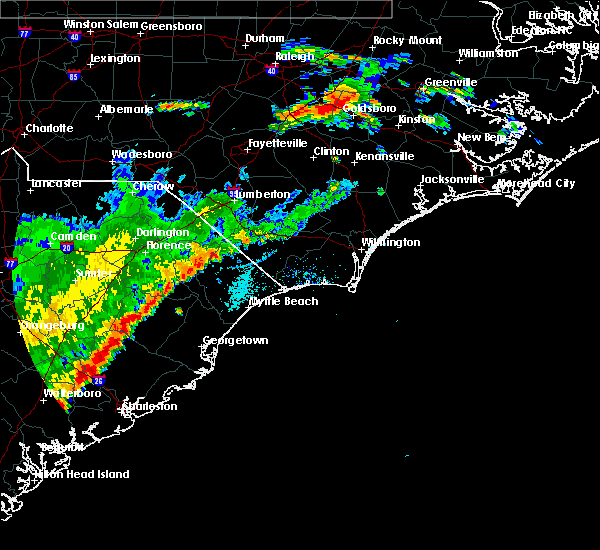 The severe thunderstorm warning for northwestern columbus county will expire at 730 pm edt, the storm which prompted the warning has weakened below severe limits, and no longer poses an immediate threat to life or property. therefore the warning will be allowed to expire. The severe thunderstorm warning for northwestern columbus county will expire at 730 pm edt, the storm which prompted the warning has weakened below severe limits, and no longer poses an immediate threat to life or property. therefore the warning will be allowed to expire.
|
| 7/2/2015 7:18 PM EDT |
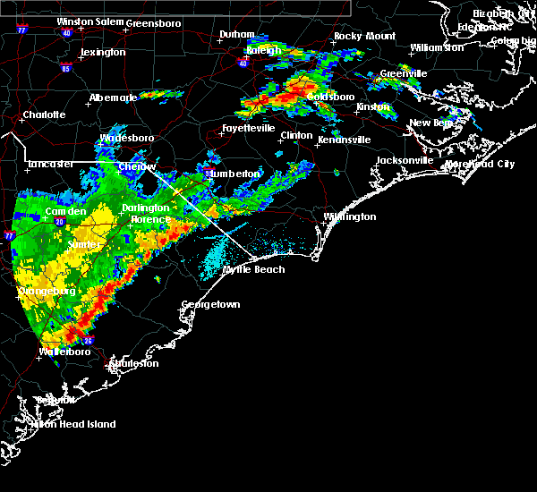 At 717 pm edt, doppler radar indicated a severe thunderstorm capable of producing damaging winds in excess of 60 mph. this storm was located near cherry grove, or 13 miles west of whiteville, moving east at 10 mph. locations impacted include, fair bluff, cherry grove and cerro gordo. this includes us route 74 between mile markers 378 and 380. At 717 pm edt, doppler radar indicated a severe thunderstorm capable of producing damaging winds in excess of 60 mph. this storm was located near cherry grove, or 13 miles west of whiteville, moving east at 10 mph. locations impacted include, fair bluff, cherry grove and cerro gordo. this includes us route 74 between mile markers 378 and 380.
|
| 7/2/2015 6:47 PM EDT |
 At 647 pm edt, doppler radar indicated a severe thunderstorm capable of producing damaging winds in excess of 60 mph. this storm was located near cherry grove, or 13 miles west of whiteville, moving east at 20 mph. nickel size hail may also accompany the damaging winds. locations impacted include, fair bluff, lake view, kemper, barnesville, cherry grove, nichols, cerro gordo and marietta. this includes us route 74 between mile markers 379 and 380. At 647 pm edt, doppler radar indicated a severe thunderstorm capable of producing damaging winds in excess of 60 mph. this storm was located near cherry grove, or 13 miles west of whiteville, moving east at 20 mph. nickel size hail may also accompany the damaging winds. locations impacted include, fair bluff, lake view, kemper, barnesville, cherry grove, nichols, cerro gordo and marietta. this includes us route 74 between mile markers 379 and 380.
|
| 7/2/2015 6:47 PM EDT |
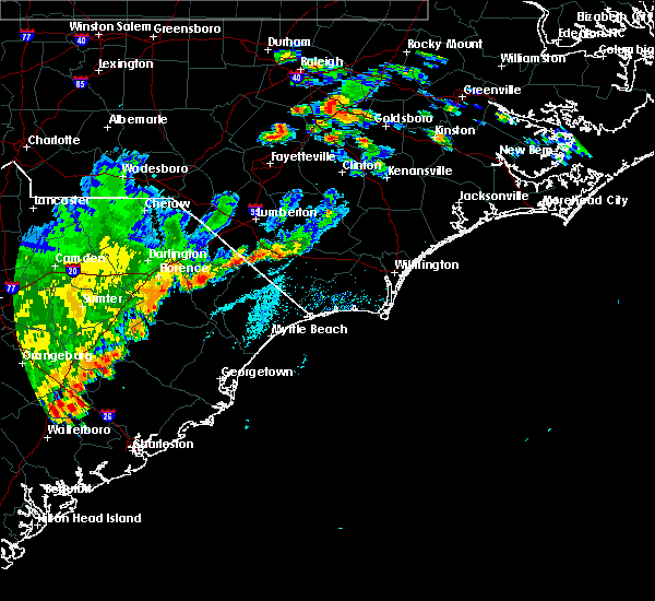 At 647 pm edt, doppler radar indicated a severe thunderstorm capable of producing damaging winds in excess of 60 mph. this storm was located near cherry grove, or 13 miles west of whiteville, moving east at 20 mph. nickel size hail may also accompany the damaging winds. locations impacted include, fair bluff, lake view, kemper, barnesville, cherry grove, nichols, cerro gordo and marietta. this includes us route 74 between mile markers 379 and 380. At 647 pm edt, doppler radar indicated a severe thunderstorm capable of producing damaging winds in excess of 60 mph. this storm was located near cherry grove, or 13 miles west of whiteville, moving east at 20 mph. nickel size hail may also accompany the damaging winds. locations impacted include, fair bluff, lake view, kemper, barnesville, cherry grove, nichols, cerro gordo and marietta. this includes us route 74 between mile markers 379 and 380.
|
| 7/2/2015 6:30 PM EDT |
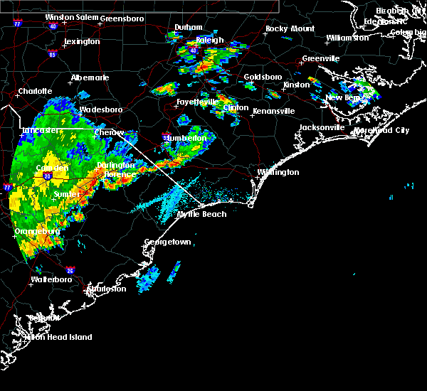 At 630 pm edt, doppler radar indicated a severe thunderstorm capable of producing quarter size hail and damaging winds in excess of 60 mph. this storm was located over lake view, or 11 miles northeast of mullins, and moving east at 20 mph. At 630 pm edt, doppler radar indicated a severe thunderstorm capable of producing quarter size hail and damaging winds in excess of 60 mph. this storm was located over lake view, or 11 miles northeast of mullins, and moving east at 20 mph.
|
| 7/2/2015 6:25 PM EDT |
 At 625 pm edt, doppler radar indicated a severe thunderstorm capable of producing damaging winds in excess of 60 mph. this storm was located near chadbourn, or 11 miles west of whiteville, moving east at 30 mph. locations impacted include, whiteville, tabor city, chadbourn, bladenboro, fair bluff, boardman, southeastern community college, barnesville, abbottsburg, evergreen, elkton, emerson, clarendon, cherry grove, brunswick, clarkton, cerro gordo, marietta, orrum and columbus regional healthcare system. this includes us route 74 between mile markers 372 and 394. At 625 pm edt, doppler radar indicated a severe thunderstorm capable of producing damaging winds in excess of 60 mph. this storm was located near chadbourn, or 11 miles west of whiteville, moving east at 30 mph. locations impacted include, whiteville, tabor city, chadbourn, bladenboro, fair bluff, boardman, southeastern community college, barnesville, abbottsburg, evergreen, elkton, emerson, clarendon, cherry grove, brunswick, clarkton, cerro gordo, marietta, orrum and columbus regional healthcare system. this includes us route 74 between mile markers 372 and 394.
|
| 7/2/2015 5:49 PM EDT |
 At 549 pm edt, doppler radar indicated a severe thunderstorm capable of producing quarter size hail and damaging winds in excess of 60 mph. this storm was located over barnesville, or 13 miles south of lumberton, and moving east at 15 mph. At 549 pm edt, doppler radar indicated a severe thunderstorm capable of producing quarter size hail and damaging winds in excess of 60 mph. this storm was located over barnesville, or 13 miles south of lumberton, and moving east at 15 mph.
|
| 6/27/2015 9:27 PM EDT | The severe thunderstorm warning for southern bladen, southwestern brunswick, southeastern robeson, columbus and central horry counties will expire at 930 pm edt, the storm which prompted the warning has weakened below severe limits, and no longer poses an immediate threat to life or property. therefore the warning will be allowed to expire. however gusty winds are still possible with this thunderstorm. |
| 6/27/2015 9:27 PM EDT | The severe thunderstorm warning for southern bladen, southwestern brunswick, southeastern robeson, columbus and central horry counties will expire at 930 pm edt, the storm which prompted the warning has weakened below severe limits, and no longer poses an immediate threat to life or property. therefore the warning will be allowed to expire. however gusty winds are still possible with this thunderstorm. |
| 6/27/2015 9:07 PM EDT |
 At 906 pm edt, doppler radar indicated a severe thunderstorm capable of producing quarter size hail and damaging winds in excess of 60 mph. this storm was located over chadbourn, or near whiteville. this storm was nearly stationary. locations impacted include, whiteville, shallotte, sunset beach, ocean isle beach, little river, iredell, carolina shores, tabor city, loris, chadbourn, calabash, bladenboro, bethel, lake waccamaw, fair bluff, boardman, lagoon, allsbrook, williams and hallsboro. this includes the following highways, us route 74 between mile markers 366 and 413. us route 17 in brunswick county between mile markers 1 and 15. At 906 pm edt, doppler radar indicated a severe thunderstorm capable of producing quarter size hail and damaging winds in excess of 60 mph. this storm was located over chadbourn, or near whiteville. this storm was nearly stationary. locations impacted include, whiteville, shallotte, sunset beach, ocean isle beach, little river, iredell, carolina shores, tabor city, loris, chadbourn, calabash, bladenboro, bethel, lake waccamaw, fair bluff, boardman, lagoon, allsbrook, williams and hallsboro. this includes the following highways, us route 74 between mile markers 366 and 413. us route 17 in brunswick county between mile markers 1 and 15.
|
| 6/27/2015 8:44 PM EDT |
 At 843 pm edt, doppler radar indicated a severe thunderstorm capable of producing quarter size hail and damaging winds in excess of 60 mph. this storm was located near lake view, or 8 miles northeast of mullins, and moving east at 50 mph. At 843 pm edt, doppler radar indicated a severe thunderstorm capable of producing quarter size hail and damaging winds in excess of 60 mph. this storm was located near lake view, or 8 miles northeast of mullins, and moving east at 50 mph.
|
| 4/19/2015 8:25 PM EDT | At 757 pm edt, doppler radar indicated a line of severe thunderstorms capable of producing damaging winds in excess of 60 mph. these storms were located along a line extending from near wakulla to kemper to near brittons neck, moving northeast at 30 mph. locations impacted include, lumberton, whiteville, mullins, red springs, pembroke, fairmont, tabor city, st. pauls, chadbourn, johnsonville, lake waccamaw, rowland, fair bluff, lake view, boardman, williams, hallsboro, howellsville, tolarsville and galivants ferry. # this includes the following highways, interstate 74 between mile markers 212 and 214. interstate 95 in north carolina between mile markers 1 and 38. us route 74 between mile markers 365 and 404. |
| 4/19/2015 8:25 PM EDT | At 825 pm edt, doppler radar indicated a line of severe thunderstorms capable of producing damaging winds in excess of 60 mph. these storms were located along a line extending from 6 miles west of fayetteville to near boardman to near green sea, moving northeast at 50 mph. locations impacted include, lumberton, whiteville, red springs, fairmont, tabor city, st. pauls, chadbourn, lake waccamaw, fair bluff, boardman, williams, hallsboro, howellsville, tolarsville, rex, clarendon, cherry grove, smiths, redbug and southeastern community college. # this includes the following highways, interstate 74 between mile markers 212 and 207, and between mile markers 209 and 210, and near mile marker 214. interstate 95 in north carolina between mile markers 11 and 38. us route 74 between mile markers 365 and 404. |
| 4/19/2015 7:59 PM EDT | At 718 pm edt, doppler radar indicated a line of severe thunderstorms capable of producing damaging winds in excess of 60 mph. these storms were located along a line extending from near bennettsville to kingsburg, and moving northeast at 50 mph. |
| 4/19/2015 7:59 PM EDT | A severe thunderstorm warning remains in effect until 845 pm edt for robeson. northwestern columbus. northeastern marion. southeastern dillon. southeastern florence and northwestern horry counties. at 757 pm edt. Doppler radar indicated a line of severe thunderstorms capable of producing damaging winds in excess of 60. |
| 4/19/2015 7:19 PM EDT | The national weather service in wilmington nc has issued a * severe thunderstorm warning for. robeson county in southeastern north carolina. northwestern columbus county in southeastern north carolina. marion county in northeastern south carolina. Dillon county in northeastern south carolina. |
| 4/19/2015 7:19 PM EDT | At 718 pm edt, doppler radar indicated a line of severe thunderstorms capable of producing damaging winds in excess of 60 mph. these storms were located along a line extending from near bennettsville to kingsburg, and moving northeast at 50 mph. |
| 5/23/2012 4:26 PM EDT | Golf Ball sized hail reported 1.1 miles W of Fair Bluff, NC, quarter to golfball size hail reported in fair bluff. |
Hail Maps for Fair Bluff, NC
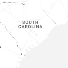

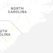
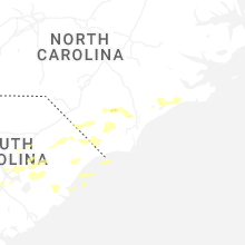
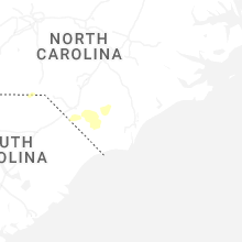
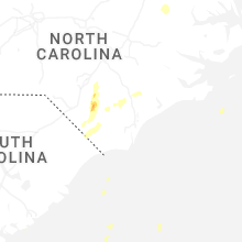


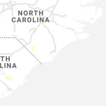


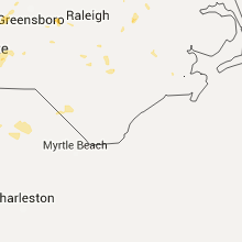


Connect with Interactive Hail Maps