

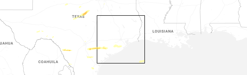
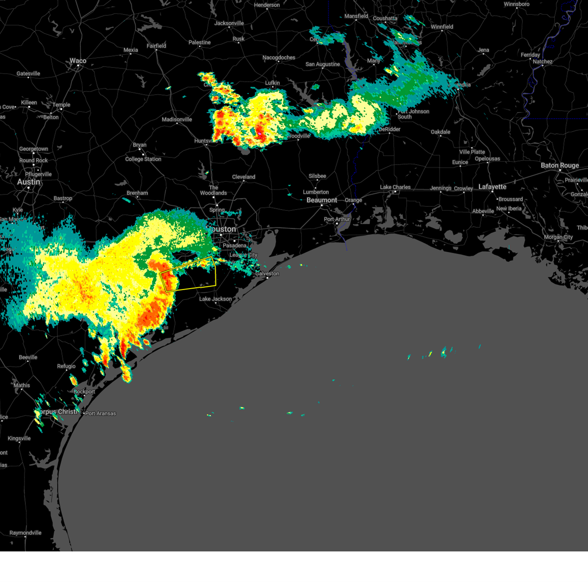
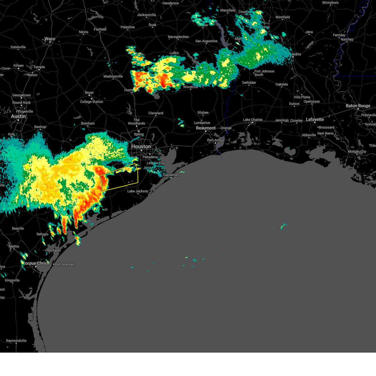
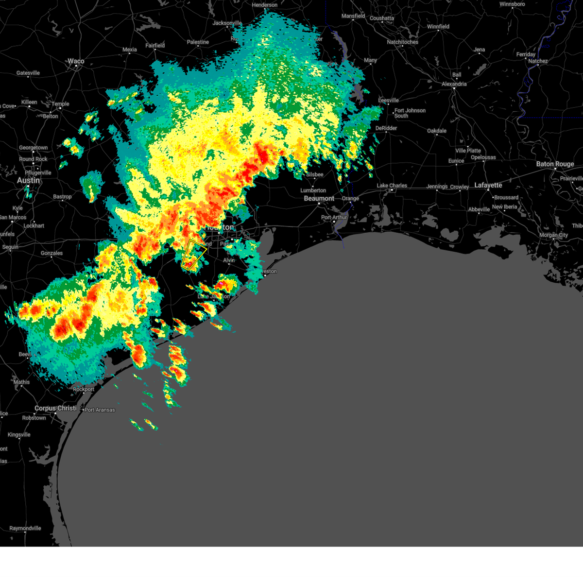
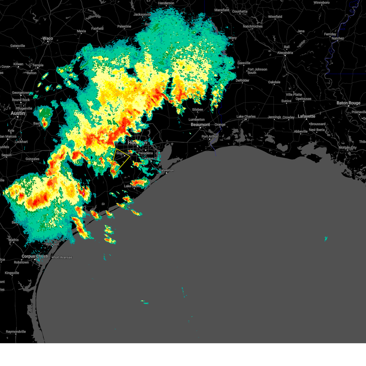
Hail Map for Fairchilds, TX
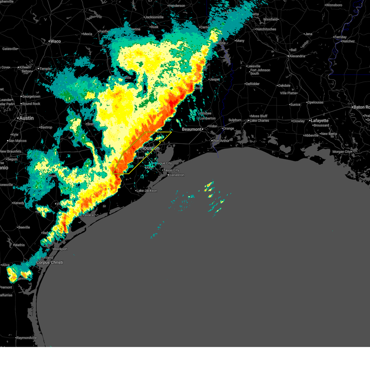
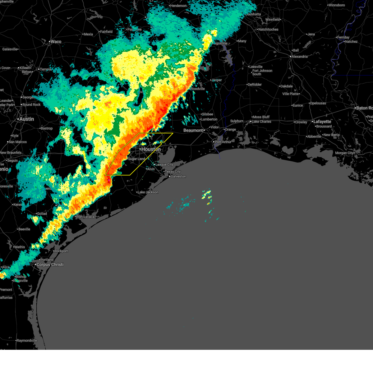
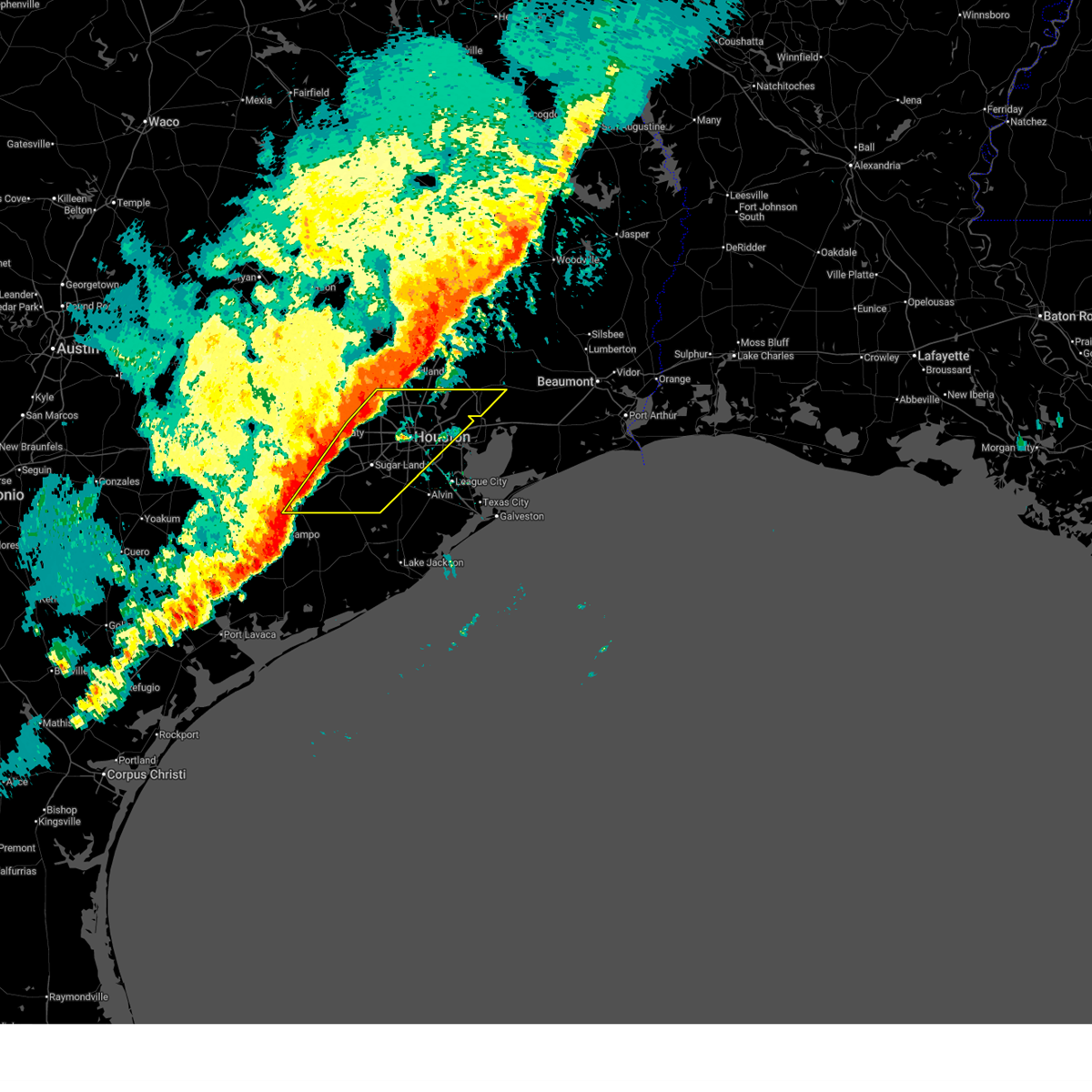
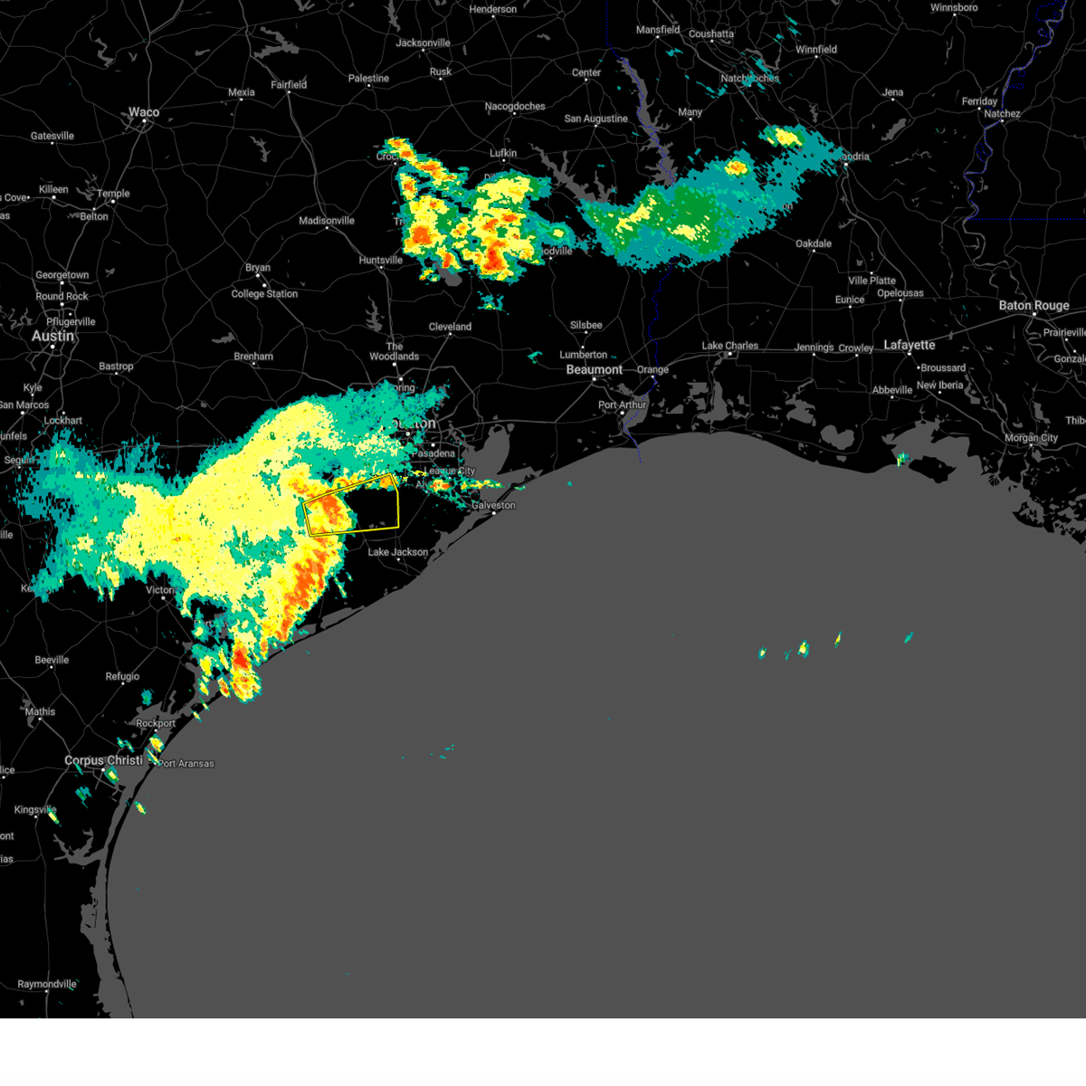
The Fairchilds, TX area has had 0 reports of on-the-ground hail by trained spotters, and has been under severe weather warnings 12 times during the past 12 months. Doppler radar has detected hail at or near Fairchilds, TX on 40 occasions, including 1 occasion during the past year.
| Name: | Fairchilds, TX |
| Where Located: | 32.5 miles SW of Houston, TX |
| Map: | Google Map for Fairchilds, TX |
| Population: | 763 |
| Housing Units: | 272 |
| More Info: | Search Google for Fairchilds, TX |
0
The Top Recent Hail Date for Fairchilds, TX is Saturday, February 14, 2026 (34th out of 40)
Hail and Wind Damage Spotted near Fairchilds, TX
| Date / Time | Report Details |
|---|---|
| 6/2/2026 5:24 PM CDT |
 Svrhgx the national weather service in league city has issued a * severe thunderstorm warning for, central fort bend county in southeastern texas, southern waller county in southeastern texas, west central harris county in southeastern texas, * until 600 pm cdt. * at 524 pm cdt, a severe thunderstorm was located over pecan grove, moving south at 15 mph (radar indicated). Hazards include 60 mph wind gusts and quarter size hail. Hail damage to vehicles is expected. Expect wind damage to roofs, siding, and trees. Svrhgx the national weather service in league city has issued a * severe thunderstorm warning for, central fort bend county in southeastern texas, southern waller county in southeastern texas, west central harris county in southeastern texas, * until 600 pm cdt. * at 524 pm cdt, a severe thunderstorm was located over pecan grove, moving south at 15 mph (radar indicated). Hazards include 60 mph wind gusts and quarter size hail. Hail damage to vehicles is expected. Expect wind damage to roofs, siding, and trees.
|
| 5/23/2026 5:17 AM CDT |
 Svrhgx the national weather service in league city has issued a * severe thunderstorm warning for, northeastern fort bend county in southeastern texas, northern brazoria county in southeastern texas, south central harris county in southeastern texas, * until 545 am cdt. * at 517 am cdt, a severe thunderstorm was located over southwestern riverstone, or over first colony, moving northeast at 35 mph (radar indicated). Hazards include 60 mph wind gusts and penny size hail. expect damage to roofs, siding, and trees Svrhgx the national weather service in league city has issued a * severe thunderstorm warning for, northeastern fort bend county in southeastern texas, northern brazoria county in southeastern texas, south central harris county in southeastern texas, * until 545 am cdt. * at 517 am cdt, a severe thunderstorm was located over southwestern riverstone, or over first colony, moving northeast at 35 mph (radar indicated). Hazards include 60 mph wind gusts and penny size hail. expect damage to roofs, siding, and trees
|
| 2/14/2026 6:44 PM CST |
 The storms which prompted the warning have moved out of the area. therefore, the warning will be allowed to expire. a tornado watch remains in effect until 900 pm cst for southeastern texas. to report severe weather, contact your nearest law enforcement agency. they will relay your report to the national weather service league city. remember, a severe thunderstorm warning still remains in effect for for this storm downstream of this warning until 745 pm!. The storms which prompted the warning have moved out of the area. therefore, the warning will be allowed to expire. a tornado watch remains in effect until 900 pm cst for southeastern texas. to report severe weather, contact your nearest law enforcement agency. they will relay your report to the national weather service league city. remember, a severe thunderstorm warning still remains in effect for for this storm downstream of this warning until 745 pm!.
|
| 2/14/2026 6:30 PM CST |
 At 629 pm cst, severe thunderstorms were located along a line extending from near lake houston to east little york / homestead to neartown / montrose to central southwest to near riverstone to 6 miles southeast of needville, moving east at 45 mph (radar indicated). Hazards include 60 mph wind gusts. Expect damage to roofs, siding, and trees. Locations impacted include, northwestern pasadena, pearland, sugar land, northwestern baytown, missouri city, deer park, southeastern rosenberg, stafford, south houston, bellaire, humble, west university place, galena park, jacinto city, southern liberty, dayton, northwestern manvel, hunters creek village, bunker hill village, and piney point village. At 629 pm cst, severe thunderstorms were located along a line extending from near lake houston to east little york / homestead to neartown / montrose to central southwest to near riverstone to 6 miles southeast of needville, moving east at 45 mph (radar indicated). Hazards include 60 mph wind gusts. Expect damage to roofs, siding, and trees. Locations impacted include, northwestern pasadena, pearland, sugar land, northwestern baytown, missouri city, deer park, southeastern rosenberg, stafford, south houston, bellaire, humble, west university place, galena park, jacinto city, southern liberty, dayton, northwestern manvel, hunters creek village, bunker hill village, and piney point village.
|
| 2/14/2026 6:30 PM CST |
 the severe thunderstorm warning has been cancelled and is no longer in effect the severe thunderstorm warning has been cancelled and is no longer in effect
|
| 2/14/2026 6:15 PM CST |
 the severe thunderstorm warning has been cancelled and is no longer in effect the severe thunderstorm warning has been cancelled and is no longer in effect
|
| 2/14/2026 6:15 PM CST |
 At 615 pm cst, severe thunderstorms were located along a line extending from humble to acres home to westchase to sugar land to near greatwood to near boling-iago, moving east at 40 mph (radar indicated). Hazards include 60 mph wind gusts. Expect damage to roofs, siding, and trees. Locations impacted include, northwestern pasadena, pearland, sugar land, northwestern baytown, missouri city, deer park, rosenberg, stafford, south houston, bellaire, humble, west university place, richmond, galena park, jacinto city, southern liberty, jersey village, dayton, northwestern manvel, and hunters creek village. At 615 pm cst, severe thunderstorms were located along a line extending from humble to acres home to westchase to sugar land to near greatwood to near boling-iago, moving east at 40 mph (radar indicated). Hazards include 60 mph wind gusts. Expect damage to roofs, siding, and trees. Locations impacted include, northwestern pasadena, pearland, sugar land, northwestern baytown, missouri city, deer park, rosenberg, stafford, south houston, bellaire, humble, west university place, richmond, galena park, jacinto city, southern liberty, jersey village, dayton, northwestern manvel, and hunters creek village.
|
| 2/14/2026 6:00 PM CST |
 Svrhgx the national weather service in league city has issued a * severe thunderstorm warning for, northeastern wharton county in southeastern texas, fort bend county in southeastern texas, northwestern brazoria county in southeastern texas, southwestern liberty county in southeastern texas, southeastern waller county in southeastern texas, harris county in southeastern texas, * until 645 pm cst. * at 600 pm cst, severe thunderstorms were located along a line extending from near willowbrook to near addicks park ten to near cinco ranch to near wharton, moving east at 45 mph (radar indicated). Hazards include 60 mph wind gusts. expect damage to roofs, siding, and trees Svrhgx the national weather service in league city has issued a * severe thunderstorm warning for, northeastern wharton county in southeastern texas, fort bend county in southeastern texas, northwestern brazoria county in southeastern texas, southwestern liberty county in southeastern texas, southeastern waller county in southeastern texas, harris county in southeastern texas, * until 645 pm cst. * at 600 pm cst, severe thunderstorms were located along a line extending from near willowbrook to near addicks park ten to near cinco ranch to near wharton, moving east at 45 mph (radar indicated). Hazards include 60 mph wind gusts. expect damage to roofs, siding, and trees
|
| 10/25/2025 3:50 AM CDT | At 350 am cdt, severe thunderstorms were located along a line extending from near woodbranch to macgregor to near fairchilds, moving east at 25 mph (radar indicated). Hazards include 60 mph wind gusts and nickel size hail. Expect damage to roofs, siding, and trees. Locations impacted include, pasadena, pearland, sugar land, northwestern baytown, missouri city, northwestern friendswood, deer park, southeastern rosenberg, alvin, stafford, south houston, bellaire, humble, west university place, richmond, galena park, jacinto city, jersey village, dayton, and manvel. |
| 10/25/2025 3:50 AM CDT | the severe thunderstorm warning has been cancelled and is no longer in effect |
| 10/25/2025 3:17 AM CDT | Svrhgx the national weather service in league city has issued a * severe thunderstorm warning for, east central wharton county in southeastern texas, northwestern galveston county in southeastern texas, fort bend county in southeastern texas, southeastern montgomery county in southeastern texas, northwestern chambers county in southeastern texas, north central brazoria county in southeastern texas, southwestern liberty county in southeastern texas, harris county in southeastern texas, * until 400 am cdt. * at 317 am cdt, severe thunderstorms were located along a line extending from near hurricane harbor splashtown to sugar land to 6 miles west of needville, moving east at 25 mph (radar indicated). Hazards include 60 mph wind gusts and nickel size hail. expect damage to roofs, siding, and trees |
| 10/25/2025 2:30 AM CDT | Svrhgx the national weather service in league city has issued a * severe thunderstorm warning for, east central colorado county in southeastern texas, northeastern wharton county in southeastern texas, eastern austin county in southeastern texas, southeastern grimes county in southeastern texas, southeastern washington county in southeastern texas, central fort bend county in southeastern texas, southwestern montgomery county in southeastern texas, waller county in southeastern texas, western harris county in southeastern texas, * until 315 am cdt. * at 230 am cdt, severe thunderstorms were located along a line extending from near navasota to near pine island to 7 miles southwest of sealy, moving east at 45 mph (radar indicated). Hazards include 60 mph wind gusts and nickel size hail. expect damage to roofs, siding, and trees |
| 5/30/2025 10:05 AM CDT |
 The storm which prompted the warning has weakened below severe limits, and no longer poses an immediate threat to life or property. therefore, the warning will be allowed to expire. The storm which prompted the warning has weakened below severe limits, and no longer poses an immediate threat to life or property. therefore, the warning will be allowed to expire.
|
| 5/30/2025 9:52 AM CDT |
 At 952 am cdt, a severe thunderstorm was located near needville, or 13 miles south of rosenberg, moving east at 40 mph (radar indicated). Hazards include 60 mph wind gusts and quarter size hail. Hail damage to vehicles is expected. expect wind damage to roofs, siding, and trees. Locations impacted include, needville, iowa colony, holiday lakes, fairchilds, bonney, thompsons, brazos bend state park, sienna, boling-iago, juliff, damon, and rosharon. At 952 am cdt, a severe thunderstorm was located near needville, or 13 miles south of rosenberg, moving east at 40 mph (radar indicated). Hazards include 60 mph wind gusts and quarter size hail. Hail damage to vehicles is expected. expect wind damage to roofs, siding, and trees. Locations impacted include, needville, iowa colony, holiday lakes, fairchilds, bonney, thompsons, brazos bend state park, sienna, boling-iago, juliff, damon, and rosharon.
|
| 5/30/2025 9:42 AM CDT |
 At 942 am cdt, a severe thunderstorm was located near boling-iago, or 10 miles east of wharton, moving east at 30 mph (radar indicated). Hazards include 60 mph wind gusts and quarter size hail. Hail damage to vehicles is expected. expect wind damage to roofs, siding, and trees. Locations impacted include, wharton, needville, iowa colony, holiday lakes, fairchilds, bonney, thompsons, sienna, brazos bend state park, boling-iago, juliff, damon, and rosharon. At 942 am cdt, a severe thunderstorm was located near boling-iago, or 10 miles east of wharton, moving east at 30 mph (radar indicated). Hazards include 60 mph wind gusts and quarter size hail. Hail damage to vehicles is expected. expect wind damage to roofs, siding, and trees. Locations impacted include, wharton, needville, iowa colony, holiday lakes, fairchilds, bonney, thompsons, sienna, brazos bend state park, boling-iago, juliff, damon, and rosharon.
|
| 5/30/2025 9:28 AM CDT |
 Svrhgx the national weather service in league city has issued a * severe thunderstorm warning for, southeastern wharton county in southeastern texas, southern fort bend county in southeastern texas, northwestern brazoria county in southeastern texas, north central matagorda county in southeastern texas, * until 1015 am cdt. * at 928 am cdt, a severe thunderstorm was located near boling-iago, or near wharton, moving east at 40 mph (radar indicated). Hazards include 60 mph wind gusts and quarter size hail. Hail damage to vehicles is expected. Expect wind damage to roofs, siding, and trees. Svrhgx the national weather service in league city has issued a * severe thunderstorm warning for, southeastern wharton county in southeastern texas, southern fort bend county in southeastern texas, northwestern brazoria county in southeastern texas, north central matagorda county in southeastern texas, * until 1015 am cdt. * at 928 am cdt, a severe thunderstorm was located near boling-iago, or near wharton, moving east at 40 mph (radar indicated). Hazards include 60 mph wind gusts and quarter size hail. Hail damage to vehicles is expected. Expect wind damage to roofs, siding, and trees.
|
| 12/25/2024 1:21 AM CST |
 At 121 am cst, a severe thunderstorm was located near pleak, or near rosenberg, moving northeast at 25 mph (radar indicated). Hazards include quarter size hail. Damage to vehicles is expected. Locations impacted include, sugar land, missouri city, eastern rosenberg, stafford, richmond, first colony, pecan grove, needville, pleak, fairchilds, thompsons, greatwood, new territory, fifth street, riverstone, and four corners. At 121 am cst, a severe thunderstorm was located near pleak, or near rosenberg, moving northeast at 25 mph (radar indicated). Hazards include quarter size hail. Damage to vehicles is expected. Locations impacted include, sugar land, missouri city, eastern rosenberg, stafford, richmond, first colony, pecan grove, needville, pleak, fairchilds, thompsons, greatwood, new territory, fifth street, riverstone, and four corners.
|
| 12/25/2024 12:48 AM CST |
 Svrhgx the national weather service in league city has issued a * severe thunderstorm warning for, central fort bend county in southeastern texas, * until 130 am cst. * at 1248 am cst, a severe thunderstorm was located near needville, or 13 miles east of wharton, moving northeast at 25 mph (radar indicated). Hazards include half dollar size hail. damage to vehicles is expected Svrhgx the national weather service in league city has issued a * severe thunderstorm warning for, central fort bend county in southeastern texas, * until 130 am cst. * at 1248 am cst, a severe thunderstorm was located near needville, or 13 miles east of wharton, moving northeast at 25 mph (radar indicated). Hazards include half dollar size hail. damage to vehicles is expected
|
| 7/8/2024 3:37 AM CDT |
 Torhgx the national weather service in league city has issued a * tornado warning for, southeastern fort bend county in southeastern texas, northern brazoria county in southeastern texas, * until 400 am cdt. * at 337 am cdt, a severe thunderstorm capable of producing a tornado was located near sienna, or 7 miles southwest of fresno, moving west at 50 mph (radar indicated rotation). Hazards include tornado. Flying debris will be dangerous to those caught without shelter. mobile homes will be damaged or destroyed. damage to roofs, windows, and vehicles will occur. tree damage is likely. this dangerous storm will be near, rosenberg, pleak, fairchilds, and thompsons around 345 am cdt. needville around 350 am cdt. Other locations impacted by this tornadic thunderstorm include juliff. Torhgx the national weather service in league city has issued a * tornado warning for, southeastern fort bend county in southeastern texas, northern brazoria county in southeastern texas, * until 400 am cdt. * at 337 am cdt, a severe thunderstorm capable of producing a tornado was located near sienna, or 7 miles southwest of fresno, moving west at 50 mph (radar indicated rotation). Hazards include tornado. Flying debris will be dangerous to those caught without shelter. mobile homes will be damaged or destroyed. damage to roofs, windows, and vehicles will occur. tree damage is likely. this dangerous storm will be near, rosenberg, pleak, fairchilds, and thompsons around 345 am cdt. needville around 350 am cdt. Other locations impacted by this tornadic thunderstorm include juliff.
|
| 5/31/2024 7:00 AM CDT | At 658 am cdt, severe thunderstorms were located along a line extending from near plum grove to near fairchilds, moving southeast at 45 mph (radar indicated). Hazards include 60 mph wind gusts and nickel size hail. Expect damage to roofs, siding, and trees. Locations impacted include, pasadena, pearland, sugar land, missouri city, eastern conroe, deer park, rosenberg, stafford, south houston, bellaire, humble, west university place, richmond, galena park, jacinto city, cleveland, northwestern manvel, hunters creek village, bunker hill village, and piney point village. |
| 5/31/2024 6:46 AM CDT |
 Svrhgx the national weather service in league city has issued a * severe thunderstorm warning for, fort bend county in southeastern texas, eastern montgomery county in southeastern texas, southwestern san jacinto county in southeastern texas, northwestern brazoria county in southeastern texas, northwestern liberty county in southeastern texas, southeastern walker county in southeastern texas, central harris county in southeastern texas, * until 715 am cdt. * at 645 am cdt, severe thunderstorms were located along a line extending from near splendora to near beasley, moving southeast at around 45 mph (radar indicated). Hazards include 60 mph wind gusts and penny size hail. expect damage to roofs, siding, and trees Svrhgx the national weather service in league city has issued a * severe thunderstorm warning for, fort bend county in southeastern texas, eastern montgomery county in southeastern texas, southwestern san jacinto county in southeastern texas, northwestern brazoria county in southeastern texas, northwestern liberty county in southeastern texas, southeastern walker county in southeastern texas, central harris county in southeastern texas, * until 715 am cdt. * at 645 am cdt, severe thunderstorms were located along a line extending from near splendora to near beasley, moving southeast at around 45 mph (radar indicated). Hazards include 60 mph wind gusts and penny size hail. expect damage to roofs, siding, and trees
|
| 5/31/2024 6:22 AM CDT |
 Svrhgx the national weather service in league city has issued a * severe thunderstorm warning for, central trinity county in southeastern texas, east central colorado county in southeastern texas, northeastern wharton county in southeastern texas, southeastern austin county in southeastern texas, northwestern fort bend county in southeastern texas, central montgomery county in southeastern texas, western san jacinto county in southeastern texas, east central houston county in southeastern texas, southeastern waller county in southeastern texas, west central polk county in southeastern texas, southeastern walker county in southeastern texas, central harris county in southeastern texas, * until 645 am cdt. * at 621 am cdt, severe thunderstorms were located along a line extending from near point blank to near eagle lake, moving southeast at around 50 mph (radar indicated). Hazards include 60 mph wind gusts and penny size hail. expect damage to roofs, siding, and trees Svrhgx the national weather service in league city has issued a * severe thunderstorm warning for, central trinity county in southeastern texas, east central colorado county in southeastern texas, northeastern wharton county in southeastern texas, southeastern austin county in southeastern texas, northwestern fort bend county in southeastern texas, central montgomery county in southeastern texas, western san jacinto county in southeastern texas, east central houston county in southeastern texas, southeastern waller county in southeastern texas, west central polk county in southeastern texas, southeastern walker county in southeastern texas, central harris county in southeastern texas, * until 645 am cdt. * at 621 am cdt, severe thunderstorms were located along a line extending from near point blank to near eagle lake, moving southeast at around 50 mph (radar indicated). Hazards include 60 mph wind gusts and penny size hail. expect damage to roofs, siding, and trees
|
| 4/10/2024 3:59 AM CDT |
 the severe thunderstorm warning has been cancelled and is no longer in effect the severe thunderstorm warning has been cancelled and is no longer in effect
|
| 4/10/2024 3:38 AM CDT |
 At 338 am cdt, severe thunderstorms were located along a line extending from near fresno to bonney to near bailey's prairie, moving east at 50 mph (radar indicated). Hazards include 60 mph wind gusts. Expect damage to roofs, siding, and trees. Locations impacted include, pearland, sugar land, missouri city, rosenberg, lake jackson, alvin, angleton, stafford, richmond, clute, manvel, west columbia, sweeny, fresno, first colony, pecan grove, greater hobby area, richwood, brazoria, and needville. At 338 am cdt, severe thunderstorms were located along a line extending from near fresno to bonney to near bailey's prairie, moving east at 50 mph (radar indicated). Hazards include 60 mph wind gusts. Expect damage to roofs, siding, and trees. Locations impacted include, pearland, sugar land, missouri city, rosenberg, lake jackson, alvin, angleton, stafford, richmond, clute, manvel, west columbia, sweeny, fresno, first colony, pecan grove, greater hobby area, richwood, brazoria, and needville.
|
| 4/10/2024 3:23 AM CDT |
 Svrhgx the national weather service in league city has issued a * severe thunderstorm warning for, east central wharton county in southeastern texas, fort bend county in southeastern texas, brazoria county in southeastern texas, north central matagorda county in southeastern texas, south central harris county in southeastern texas, * until 415 am cdt. * at 323 am cdt, severe thunderstorms were located along a line extending from riverstone to near brazos bend state park to near west columbia, moving east at 35 mph (radar indicated). Hazards include 70 mph wind gusts. Expect considerable tree damage. Damage is likely to mobile homes, roofs, and outbuildings. Svrhgx the national weather service in league city has issued a * severe thunderstorm warning for, east central wharton county in southeastern texas, fort bend county in southeastern texas, brazoria county in southeastern texas, north central matagorda county in southeastern texas, south central harris county in southeastern texas, * until 415 am cdt. * at 323 am cdt, severe thunderstorms were located along a line extending from riverstone to near brazos bend state park to near west columbia, moving east at 35 mph (radar indicated). Hazards include 70 mph wind gusts. Expect considerable tree damage. Damage is likely to mobile homes, roofs, and outbuildings.
|
| 3/16/2024 3:18 AM CDT |
 At 318 am cdt, a severe thunderstorm was located near brazos bend state park, or 14 miles southeast of rosenberg, moving east at 30 mph. this is a destructive storm for portions of southern fort bend and northwestern brazoria counties (radar indicated). Hazards include baseball size hail and 60 mph wind gusts. People and animals outdoors will be severely injured. expect shattered windows, extensive damage to roofs, siding, and vehicles. Locations impacted include, fairchilds, brazos bend state park, and damon. At 318 am cdt, a severe thunderstorm was located near brazos bend state park, or 14 miles southeast of rosenberg, moving east at 30 mph. this is a destructive storm for portions of southern fort bend and northwestern brazoria counties (radar indicated). Hazards include baseball size hail and 60 mph wind gusts. People and animals outdoors will be severely injured. expect shattered windows, extensive damage to roofs, siding, and vehicles. Locations impacted include, fairchilds, brazos bend state park, and damon.
|
| 3/16/2024 3:14 AM CDT |
 At 313 am cdt, a severe thunderstorm with a confirmed history of producing large hail was located near fairchilds, or 12 miles south of rosenberg, moving east at 30 mph. this is a destructive storm for portions of southern fort bend and northwestern brazoria counties (radar indicated). Hazards include baseball size hail and 60 mph wind gusts. People and animals outdoors will be severely injured. expect shattered windows, extensive damage to roofs, siding, and vehicles. Locations impacted include, needville, pleak, fairchilds, brazos bend state park, and damon. At 313 am cdt, a severe thunderstorm with a confirmed history of producing large hail was located near fairchilds, or 12 miles south of rosenberg, moving east at 30 mph. this is a destructive storm for portions of southern fort bend and northwestern brazoria counties (radar indicated). Hazards include baseball size hail and 60 mph wind gusts. People and animals outdoors will be severely injured. expect shattered windows, extensive damage to roofs, siding, and vehicles. Locations impacted include, needville, pleak, fairchilds, brazos bend state park, and damon.
|
| 3/16/2024 3:07 AM CDT |
 Svrhgx the national weather service in league city has issued a * severe thunderstorm warning for, southeastern fort bend county in southeastern texas, northwestern brazoria county in southeastern texas, * until 330 am cdt. * at 306 am cdt, a severe thunderstorm was located over needville, or 10 miles south of rosenberg, moving east at 30 mph (law enforcement in ft bend county has reported golf ball sized hail associated with this storm). Hazards include two inch hail and 60 mph wind gusts. People and animals outdoors will be injured. expect hail damage to roofs, siding, windows, and vehicles. Expect wind damage to roofs, siding, and trees. Svrhgx the national weather service in league city has issued a * severe thunderstorm warning for, southeastern fort bend county in southeastern texas, northwestern brazoria county in southeastern texas, * until 330 am cdt. * at 306 am cdt, a severe thunderstorm was located over needville, or 10 miles south of rosenberg, moving east at 30 mph (law enforcement in ft bend county has reported golf ball sized hail associated with this storm). Hazards include two inch hail and 60 mph wind gusts. People and animals outdoors will be injured. expect hail damage to roofs, siding, windows, and vehicles. Expect wind damage to roofs, siding, and trees.
|
| 3/16/2024 2:47 AM CDT |
 At 247 am cdt, a severe thunderstorm was located over kendleton, or 11 miles southwest of rosenberg, moving east at 25 mph (radar indicated). Hazards include two inch hail and 60 mph wind gusts. People and animals outdoors will be injured. expect hail damage to roofs, siding, windows, and vehicles. expect wind damage to roofs, siding, and trees. Locations impacted include, rosenberg, needville, pleak, beasley, kendleton, and cumings. At 247 am cdt, a severe thunderstorm was located over kendleton, or 11 miles southwest of rosenberg, moving east at 25 mph (radar indicated). Hazards include two inch hail and 60 mph wind gusts. People and animals outdoors will be injured. expect hail damage to roofs, siding, windows, and vehicles. expect wind damage to roofs, siding, and trees. Locations impacted include, rosenberg, needville, pleak, beasley, kendleton, and cumings.
|
| 3/16/2024 2:42 AM CDT |
 Svrhgx the national weather service in league city has issued a * severe thunderstorm warning for, northeastern wharton county in southeastern texas, southwestern fort bend county in southeastern texas, * until 315 am cdt. * at 241 am cdt, a severe thunderstorm was located over kendleton, or 10 miles northeast of wharton, moving east at 25 mph (radar indicated). Hazards include ping pong ball size hail and 60 mph wind gusts. People and animals outdoors will be injured. expect hail damage to roofs, siding, windows, and vehicles. Expect wind damage to roofs, siding, and trees. Svrhgx the national weather service in league city has issued a * severe thunderstorm warning for, northeastern wharton county in southeastern texas, southwestern fort bend county in southeastern texas, * until 315 am cdt. * at 241 am cdt, a severe thunderstorm was located over kendleton, or 10 miles northeast of wharton, moving east at 25 mph (radar indicated). Hazards include ping pong ball size hail and 60 mph wind gusts. People and animals outdoors will be injured. expect hail damage to roofs, siding, windows, and vehicles. Expect wind damage to roofs, siding, and trees.
|
| 3/15/2024 5:26 PM CDT |
 Svrhgx the national weather service in league city has issued a * severe thunderstorm warning for, south central fort bend county in southeastern texas, west central brazoria county in southeastern texas, * until 600 pm cdt. * at 526 pm cdt, a severe thunderstorm was located near needville, or 12 miles south of rosenberg, moving southeast at 30 mph (radar indicated). Hazards include two inch hail and 60 mph wind gusts. People and animals outdoors will be injured. expect hail damage to roofs, siding, windows, and vehicles. Expect wind damage to roofs, siding, and trees. Svrhgx the national weather service in league city has issued a * severe thunderstorm warning for, south central fort bend county in southeastern texas, west central brazoria county in southeastern texas, * until 600 pm cdt. * at 526 pm cdt, a severe thunderstorm was located near needville, or 12 miles south of rosenberg, moving southeast at 30 mph (radar indicated). Hazards include two inch hail and 60 mph wind gusts. People and animals outdoors will be injured. expect hail damage to roofs, siding, windows, and vehicles. Expect wind damage to roofs, siding, and trees.
|
| 3/15/2024 5:15 PM CDT |
 At 514 pm cdt, a severe thunderstorm was located over needville, or 9 miles south of rosenberg, moving east at 20 mph (radar indicated). Hazards include golf ball size hail and 60 mph wind gusts. People and animals outdoors will be injured. expect hail damage to roofs, siding, windows, and vehicles. expect wind damage to roofs, siding, and trees. Locations impacted include, southern sugar land, southeastern rosenberg, needville, pleak, fairchilds, beasley, thompsons, brazos bend state park, greatwood, and western riverstone. At 514 pm cdt, a severe thunderstorm was located over needville, or 9 miles south of rosenberg, moving east at 20 mph (radar indicated). Hazards include golf ball size hail and 60 mph wind gusts. People and animals outdoors will be injured. expect hail damage to roofs, siding, windows, and vehicles. expect wind damage to roofs, siding, and trees. Locations impacted include, southern sugar land, southeastern rosenberg, needville, pleak, fairchilds, beasley, thompsons, brazos bend state park, greatwood, and western riverstone.
|
| 3/15/2024 5:15 PM CDT |
 the severe thunderstorm warning has been cancelled and is no longer in effect the severe thunderstorm warning has been cancelled and is no longer in effect
|
| 3/15/2024 5:02 PM CDT |
 Svrhgx the national weather service in league city has issued a * severe thunderstorm warning for, northeastern wharton county in southeastern texas, southwestern fort bend county in southeastern texas, northwestern brazoria county in southeastern texas, * until 530 pm cdt. * at 502 pm cdt, a severe thunderstorm was located near needville, or 9 miles southwest of rosenberg, moving east at 20 mph (radar indicated). Hazards include 60 mph wind gusts and half dollar size hail. Hail damage to vehicles is expected. Expect wind damage to roofs, siding, and trees. Svrhgx the national weather service in league city has issued a * severe thunderstorm warning for, northeastern wharton county in southeastern texas, southwestern fort bend county in southeastern texas, northwestern brazoria county in southeastern texas, * until 530 pm cdt. * at 502 pm cdt, a severe thunderstorm was located near needville, or 9 miles southwest of rosenberg, moving east at 20 mph (radar indicated). Hazards include 60 mph wind gusts and half dollar size hail. Hail damage to vehicles is expected. Expect wind damage to roofs, siding, and trees.
|
| 3/15/2024 3:44 PM CDT |
 At 343 pm cdt, a severe thunderstorm was located near pleak, or near rosenberg, moving northeast at 20 mph (radar indicated). Hazards include 60 mph wind gusts and quarter size hail. Hail damage to vehicles is expected. expect wind damage to roofs, siding, and trees. Locations impacted include, western pearland, sugar land, missouri city, rosenberg, stafford, richmond, town west, pecan grove, first colony, fresno, mission bend, meadows place, arcola, pleak, fairchilds, thompsons, sienna, new territory, four corners, and greatwood. At 343 pm cdt, a severe thunderstorm was located near pleak, or near rosenberg, moving northeast at 20 mph (radar indicated). Hazards include 60 mph wind gusts and quarter size hail. Hail damage to vehicles is expected. expect wind damage to roofs, siding, and trees. Locations impacted include, western pearland, sugar land, missouri city, rosenberg, stafford, richmond, town west, pecan grove, first colony, fresno, mission bend, meadows place, arcola, pleak, fairchilds, thompsons, sienna, new territory, four corners, and greatwood.
|
| 3/15/2024 3:44 PM CDT |
 the severe thunderstorm warning has been cancelled and is no longer in effect the severe thunderstorm warning has been cancelled and is no longer in effect
|
| 3/15/2024 3:33 PM CDT |
 At 332 pm cdt, a severe thunderstorm was located over thompsons, or near first colony, moving east at 40 mph (radar indicated). Hazards include 60 mph wind gusts and half dollar size hail. Hail damage to vehicles is expected. expect wind damage to roofs, siding, and trees. Locations impacted include, sugar land, missouri city, rosenberg, stafford, richmond, town west, pecan grove, first colony, fresno, mission bend, meadows place, arcola, pleak, fairchilds, beasley, thompsons, sienna, new territory, four corners, and greatwood. At 332 pm cdt, a severe thunderstorm was located over thompsons, or near first colony, moving east at 40 mph (radar indicated). Hazards include 60 mph wind gusts and half dollar size hail. Hail damage to vehicles is expected. expect wind damage to roofs, siding, and trees. Locations impacted include, sugar land, missouri city, rosenberg, stafford, richmond, town west, pecan grove, first colony, fresno, mission bend, meadows place, arcola, pleak, fairchilds, beasley, thompsons, sienna, new territory, four corners, and greatwood.
|
| 3/15/2024 3:33 PM CDT |
 the severe thunderstorm warning has been cancelled and is no longer in effect the severe thunderstorm warning has been cancelled and is no longer in effect
|
| 3/15/2024 3:23 PM CDT |
 Svrhgx the national weather service in league city has issued a * severe thunderstorm warning for, northeastern wharton county in southeastern texas, central fort bend county in southeastern texas, northern brazoria county in southeastern texas, south central harris county in southeastern texas, * until 400 pm cdt. * at 322 pm cdt, a severe thunderstorm was located near pleak, or near rosenberg, moving east at 40 mph (radar indicated). Hazards include 60 mph wind gusts and quarter size hail. Hail damage to vehicles is expected. Expect wind damage to roofs, siding, and trees. Svrhgx the national weather service in league city has issued a * severe thunderstorm warning for, northeastern wharton county in southeastern texas, central fort bend county in southeastern texas, northern brazoria county in southeastern texas, south central harris county in southeastern texas, * until 400 pm cdt. * at 322 pm cdt, a severe thunderstorm was located near pleak, or near rosenberg, moving east at 40 mph (radar indicated). Hazards include 60 mph wind gusts and quarter size hail. Hail damage to vehicles is expected. Expect wind damage to roofs, siding, and trees.
|
| 6/4/2023 1:26 AM CDT |
 At 125 am cdt, severe thunderstorms were located along a line extending from near splashtown to memorial park to fairchilds, moving east at 25 mph (radar indicated). Hazards include 60 mph wind gusts and quarter size hail. Hail damage to vehicles is expected. expect wind damage to roofs, siding, and trees. Locations impacted include, pasadena, pearland, sugar land, northwestern baytown, missouri city, deer park, eastern rosenberg, stafford, south houston, bellaire, humble, west university place, richmond, galena park, tomball, jacinto city, jersey village, manvel, hunters creek village and bunker hill village. At 125 am cdt, severe thunderstorms were located along a line extending from near splashtown to memorial park to fairchilds, moving east at 25 mph (radar indicated). Hazards include 60 mph wind gusts and quarter size hail. Hail damage to vehicles is expected. expect wind damage to roofs, siding, and trees. Locations impacted include, pasadena, pearland, sugar land, northwestern baytown, missouri city, deer park, eastern rosenberg, stafford, south houston, bellaire, humble, west university place, richmond, galena park, tomball, jacinto city, jersey village, manvel, hunters creek village and bunker hill village.
|
| 6/4/2023 1:12 AM CDT |
 At 111 am cdt, severe thunderstorms were located along a line extending from near hooks airport to greater uptown to near needville, moving east at 25 mph (radar indicated). Hazards include 60 mph wind gusts and quarter size hail. Hail damage to vehicles is expected. Expect wind damage to roofs, siding, and trees. At 111 am cdt, severe thunderstorms were located along a line extending from near hooks airport to greater uptown to near needville, moving east at 25 mph (radar indicated). Hazards include 60 mph wind gusts and quarter size hail. Hail damage to vehicles is expected. Expect wind damage to roofs, siding, and trees.
|
| 4/21/2023 4:06 AM CDT |
 At 405 am cdt, severe thunderstorms were located along a line extending from new territory to near thompsons to 6 miles southwest of brazos bend state park, moving east at 45 mph (radar indicated). Hazards include 60 mph wind gusts and penny size hail. expect damage to roofs, siding, and trees At 405 am cdt, severe thunderstorms were located along a line extending from new territory to near thompsons to 6 miles southwest of brazos bend state park, moving east at 45 mph (radar indicated). Hazards include 60 mph wind gusts and penny size hail. expect damage to roofs, siding, and trees
|
| 4/21/2023 3:46 AM CDT |
 At 346 am cdt, severe thunderstorms were located along a line extending from needville to 7 miles southeast of boling-iago to 6 miles northwest of van vleck to near markham, moving east at 50 mph (radar indicated). Hazards include 60 mph wind gusts and penny size hail. Expect damage to roofs, siding, and trees. locations impacted include, bay city, wharton, needville, fairchilds, kendleton, markham, van vleck, boling-iago, damon, hungerford and danevang. hail threat, radar indicated max hail size, 0. 75 in wind threat, radar indicated max wind gust, 60 mph. At 346 am cdt, severe thunderstorms were located along a line extending from needville to 7 miles southeast of boling-iago to 6 miles northwest of van vleck to near markham, moving east at 50 mph (radar indicated). Hazards include 60 mph wind gusts and penny size hail. Expect damage to roofs, siding, and trees. locations impacted include, bay city, wharton, needville, fairchilds, kendleton, markham, van vleck, boling-iago, damon, hungerford and danevang. hail threat, radar indicated max hail size, 0. 75 in wind threat, radar indicated max wind gust, 60 mph.
|
| 4/21/2023 3:27 AM CDT |
 At 326 am cdt, severe thunderstorms were located along a line extending from near kendleton to near wharton to 6 miles south of pierce to 9 miles east of ganado, moving east at 45 mph (radar indicated). Hazards include 60 mph wind gusts and penny size hail. expect damage to roofs, siding, and trees At 326 am cdt, severe thunderstorms were located along a line extending from near kendleton to near wharton to 6 miles south of pierce to 9 miles east of ganado, moving east at 45 mph (radar indicated). Hazards include 60 mph wind gusts and penny size hail. expect damage to roofs, siding, and trees
|
| 1/24/2023 1:57 PM CST |
 The severe thunderstorm warning for central fort bend and southwestern harris counties will expire at 200 pm cst, the storm which prompted the warning has moved out of the area. therefore, the warning will be allowed to expire. however gusty winds are still possible. a tornado watch remains in effect until 600 pm cst for southeastern texas. The severe thunderstorm warning for central fort bend and southwestern harris counties will expire at 200 pm cst, the storm which prompted the warning has moved out of the area. therefore, the warning will be allowed to expire. however gusty winds are still possible. a tornado watch remains in effect until 600 pm cst for southeastern texas.
|
| 1/24/2023 1:36 PM CST |
 At 135 pm cst, a severe thunderstorm was located over northern rosenberg, moving northeast at 50 mph (radar indicated). Hazards include 60 mph wind gusts and quarter size hail. Hail damage to vehicles is expected. expect wind damage to roofs, siding, and trees. Locations impacted include, sugar land, missouri city, rosenberg, stafford, bellaire, west university place, richmond, hunters creek village, bunker hill village, piney point village, mission bend, town west, pecan grove, eldridge / west oaks, spring branch west, first colony, addicks park ten, spring branch north, spring valley and astrodome area. At 135 pm cst, a severe thunderstorm was located over northern rosenberg, moving northeast at 50 mph (radar indicated). Hazards include 60 mph wind gusts and quarter size hail. Hail damage to vehicles is expected. expect wind damage to roofs, siding, and trees. Locations impacted include, sugar land, missouri city, rosenberg, stafford, bellaire, west university place, richmond, hunters creek village, bunker hill village, piney point village, mission bend, town west, pecan grove, eldridge / west oaks, spring branch west, first colony, addicks park ten, spring branch north, spring valley and astrodome area.
|
| 1/24/2023 1:24 PM CST |
 At 123 pm cst, a severe thunderstorm was located near kendleton, or 10 miles southwest of rosenberg, moving northeast at 50 mph (radar indicated). Hazards include 60 mph wind gusts and quarter size hail. Hail damage to vehicles is expected. Expect wind damage to roofs, siding, and trees. At 123 pm cst, a severe thunderstorm was located near kendleton, or 10 miles southwest of rosenberg, moving northeast at 50 mph (radar indicated). Hazards include 60 mph wind gusts and quarter size hail. Hail damage to vehicles is expected. Expect wind damage to roofs, siding, and trees.
|
| 5/25/2022 2:08 AM CDT |
 At 207 am cdt, severe thunderstorms were located along a line extending from wallis to near east bernard to 7 miles northwest of wharton, moving east at 25 mph (radar indicated). Hazards include 60 mph wind gusts. expect damage to roofs, siding, and trees At 207 am cdt, severe thunderstorms were located along a line extending from wallis to near east bernard to 7 miles northwest of wharton, moving east at 25 mph (radar indicated). Hazards include 60 mph wind gusts. expect damage to roofs, siding, and trees
|
| 3/22/2022 6:54 AM CDT |
 At 654 am cdt, severe thunderstorms were located along a line extending from missouri city to 6 miles northwest of bonney to west columbia, moving east at 45 mph (radar indicated). Hazards include 60 mph wind gusts. Expect damage to roofs, siding, and trees. locations impacted include, pearland, alvin, manvel, fresno, arcola, iowa colony, fairchilds, liverpool, bonney, thompsons, sienna plantation, brazos bend state park, juliff, damon and rosharon. hail threat, radar indicated max hail size, <. 75 in wind threat, radar indicated max wind gust, 60 mph. At 654 am cdt, severe thunderstorms were located along a line extending from missouri city to 6 miles northwest of bonney to west columbia, moving east at 45 mph (radar indicated). Hazards include 60 mph wind gusts. Expect damage to roofs, siding, and trees. locations impacted include, pearland, alvin, manvel, fresno, arcola, iowa colony, fairchilds, liverpool, bonney, thompsons, sienna plantation, brazos bend state park, juliff, damon and rosharon. hail threat, radar indicated max hail size, <. 75 in wind threat, radar indicated max wind gust, 60 mph.
|
| 3/22/2022 6:53 AM CDT |
 The severe thunderstorm warning for central fort bend, south central montgomery, northern brazoria and central harris counties will expire at 700 am cdt, the storms which prompted the warning have moved out of the area. therefore, the warning will be allowed to expire. however heavy rain is still possible with these thunderstorms. a tornado watch remains in effect until 800 am cdt for southeastern texas. to report severe weather, contact your nearest law enforcement agency. they will relay your report to the national weather service league city. The severe thunderstorm warning for central fort bend, south central montgomery, northern brazoria and central harris counties will expire at 700 am cdt, the storms which prompted the warning have moved out of the area. therefore, the warning will be allowed to expire. however heavy rain is still possible with these thunderstorms. a tornado watch remains in effect until 800 am cdt for southeastern texas. to report severe weather, contact your nearest law enforcement agency. they will relay your report to the national weather service league city.
|
| 3/22/2022 6:29 AM CDT |
 At 628 am cdt, severe thunderstorms were located along a line extending from fairchilds to 8 miles southeast of needville to van vleck, moving east at 40 mph (radar indicated). Hazards include 60 mph wind gusts. expect damage to roofs, siding, and trees At 628 am cdt, severe thunderstorms were located along a line extending from fairchilds to 8 miles southeast of needville to van vleck, moving east at 40 mph (radar indicated). Hazards include 60 mph wind gusts. expect damage to roofs, siding, and trees
|
| 3/22/2022 6:25 AM CDT |
 At 624 am cdt, severe thunderstorms were located along a line extending from tomball to addicks park ten to rosenberg, moving northeast at 40 mph (radar indicated). Hazards include 70 mph wind gusts. Expect considerable tree damage. damage is likely to mobile homes, roofs, and outbuildings. locations impacted include, northwestern pearland, sugar land, missouri city, eastern rosenberg, stafford, south houston, bellaire, humble, west university place, katy, richmond, galena park, tomball, jacinto city, jersey village, hunters creek village, bunker hill village, piney point village, downtown houston and greenway / upper kirby area. thunderstorm damage threat, considerable hail threat, radar indicated max hail size, <. 75 in wind threat, radar indicated max wind gust, 70 mph. At 624 am cdt, severe thunderstorms were located along a line extending from tomball to addicks park ten to rosenberg, moving northeast at 40 mph (radar indicated). Hazards include 70 mph wind gusts. Expect considerable tree damage. damage is likely to mobile homes, roofs, and outbuildings. locations impacted include, northwestern pearland, sugar land, missouri city, eastern rosenberg, stafford, south houston, bellaire, humble, west university place, katy, richmond, galena park, tomball, jacinto city, jersey village, hunters creek village, bunker hill village, piney point village, downtown houston and greenway / upper kirby area. thunderstorm damage threat, considerable hail threat, radar indicated max hail size, <. 75 in wind threat, radar indicated max wind gust, 70 mph.
|
| 3/22/2022 5:57 AM CDT |
 At 556 am cdt, severe thunderstorms were located along a line extending from near hockley to near fulshear to near kendleton, moving northeast at 40 mph (radar indicated). Hazards include 60 mph wind gusts. expect damage to roofs, siding, and trees At 556 am cdt, severe thunderstorms were located along a line extending from near hockley to near fulshear to near kendleton, moving northeast at 40 mph (radar indicated). Hazards include 60 mph wind gusts. expect damage to roofs, siding, and trees
|
| 5/18/2021 9:51 PM CDT |
 At 951 pm cdt, severe thunderstorms were located along a line extending from fairbanks / northwest crossing to near sienna plantation, moving east at 40 mph (radar indicated). Hazards include 60 mph wind gusts. expect damage to roofs, siding, and trees At 951 pm cdt, severe thunderstorms were located along a line extending from fairbanks / northwest crossing to near sienna plantation, moving east at 40 mph (radar indicated). Hazards include 60 mph wind gusts. expect damage to roofs, siding, and trees
|
| 5/18/2021 9:10 PM CDT |
 At 910 pm cdt, severe thunderstorms were located along a line extending from pine island to brookshire to near east bernard, moving east at 30 mph (radar indicated). Hazards include 60 mph wind gusts and quarter size hail. Hail damage to vehicles is expected. Expect wind damage to roofs, siding, and trees. At 910 pm cdt, severe thunderstorms were located along a line extending from pine island to brookshire to near east bernard, moving east at 30 mph (radar indicated). Hazards include 60 mph wind gusts and quarter size hail. Hail damage to vehicles is expected. Expect wind damage to roofs, siding, and trees.
|
| 1/6/2021 4:56 PM CST |
 At 456 pm cst, a severe thunderstorm was located over fairchilds, or 8 miles south of rosenberg, moving east at 40 mph (radar indicated). Hazards include 60 mph wind gusts and quarter size hail. Hail damage to vehicles is expected. Expect wind damage to roofs, siding, and trees. At 456 pm cst, a severe thunderstorm was located over fairchilds, or 8 miles south of rosenberg, moving east at 40 mph (radar indicated). Hazards include 60 mph wind gusts and quarter size hail. Hail damage to vehicles is expected. Expect wind damage to roofs, siding, and trees.
|
| 1/6/2021 4:20 PM CST |
 At 420 pm cst, a severe thunderstorm was located near pierce, or near wharton, moving east at 35 mph (radar indicated). Hazards include 60 mph wind gusts. expect damage to roofs, siding, and trees At 420 pm cst, a severe thunderstorm was located near pierce, or near wharton, moving east at 35 mph (radar indicated). Hazards include 60 mph wind gusts. expect damage to roofs, siding, and trees
|
| 10/23/2020 2:25 PM CDT |
 At 222 pm cdt, thunderstorms along a cold front have produced a outflow producing winds up to 60 mph. this boundary was located along a line extending from atascocita to hidden valley to near westbranch to katy, moving south at 30 mph (radar indicated). Hazards include 60 mph wind gusts. expect damage to roofs, siding, and trees At 222 pm cdt, thunderstorms along a cold front have produced a outflow producing winds up to 60 mph. this boundary was located along a line extending from atascocita to hidden valley to near westbranch to katy, moving south at 30 mph (radar indicated). Hazards include 60 mph wind gusts. expect damage to roofs, siding, and trees
|
| 5/27/2020 5:58 PM CDT |
 The severe thunderstorm warning for northeastern wharton and southwestern fort bend counties will expire at 600 pm cdt, the storm which prompted the warning has weakened below severe limits, and no longer poses an immediate threat to life or property. therefore, the warning will be allowed to expire. however small hail and gusty winds are still possible with this thunderstorm. a severe thunderstorm watch remains in effect until 900 pm cdt for southeastern texas. The severe thunderstorm warning for northeastern wharton and southwestern fort bend counties will expire at 600 pm cdt, the storm which prompted the warning has weakened below severe limits, and no longer poses an immediate threat to life or property. therefore, the warning will be allowed to expire. however small hail and gusty winds are still possible with this thunderstorm. a severe thunderstorm watch remains in effect until 900 pm cdt for southeastern texas.
|
| 5/27/2020 5:34 PM CDT |
 At 534 pm cdt, a severe thunderstorm was located over kendleton, or 9 miles northeast of wharton, moving southeast at 35 mph (radar indicated). Hazards include up to ping pong ball size hail and 60 mph wind gusts. People and animals outdoors will be injured. expect hail damage to roofs, siding, windows, and vehicles. Expect wind damage to roofs, siding, and trees. At 534 pm cdt, a severe thunderstorm was located over kendleton, or 9 miles northeast of wharton, moving southeast at 35 mph (radar indicated). Hazards include up to ping pong ball size hail and 60 mph wind gusts. People and animals outdoors will be injured. expect hail damage to roofs, siding, windows, and vehicles. Expect wind damage to roofs, siding, and trees.
|
| 5/27/2020 4:28 PM CDT |
 At 428 pm cdt, severe thunderstorms were located along a line extending from near nome to liberty to 6 miles northwest of dayton to near woodbranch to near the woodlands to near tomball to near jersey village to near katy to near brookshire to 9 miles north of eagle lake, moving southeast at 20 mph (radar indicated). Hazards include 60 mph wind gusts. expect damage to roofs, siding, and trees At 428 pm cdt, severe thunderstorms were located along a line extending from near nome to liberty to 6 miles northwest of dayton to near woodbranch to near the woodlands to near tomball to near jersey village to near katy to near brookshire to 9 miles north of eagle lake, moving southeast at 20 mph (radar indicated). Hazards include 60 mph wind gusts. expect damage to roofs, siding, and trees
|
| 5/16/2020 3:11 AM CDT |
 The severe thunderstorm warning for central fort bend county will expire at 315 am cdt, the storm which prompted the warning has weakened below severe limits, and no longer poses an immediate threat to life or property. therefore, the warning will be allowed to expire. however gusty winds and heavy rain are still possible with this thunderstorm. a severe thunderstorm watch remains in effect until 500 am cdt for southeastern texas. to report severe weather, contact your nearest law enforcement agency. they will relay your report to the national weather service league city. The severe thunderstorm warning for central fort bend county will expire at 315 am cdt, the storm which prompted the warning has weakened below severe limits, and no longer poses an immediate threat to life or property. therefore, the warning will be allowed to expire. however gusty winds and heavy rain are still possible with this thunderstorm. a severe thunderstorm watch remains in effect until 500 am cdt for southeastern texas. to report severe weather, contact your nearest law enforcement agency. they will relay your report to the national weather service league city.
|
| 5/16/2020 2:52 AM CDT |
 At 252 am cdt, a severe thunderstorm was located near pleak, or near rosenberg, moving east at 40 mph (radar indicated). Hazards include 60 mph wind gusts. expect damage to roofs, siding, and trees At 252 am cdt, a severe thunderstorm was located near pleak, or near rosenberg, moving east at 40 mph (radar indicated). Hazards include 60 mph wind gusts. expect damage to roofs, siding, and trees
|
| 4/29/2020 5:29 AM CDT |
 At 528 am cdt, severe thunderstorms continued with a gust front located along a line extending from near stowell to near san leon to near alvin to near brazos bend state park to near east bernard, moving south at 45 mph (radar indicated. this line of storms has a history of producing measured gusts over 50 mph and small hail). Hazards include 60 mph wind gusts and penny size hail. Expect damage to roofs, siding, and trees. Locations impacted include, pasadena, pearland, league city, sugar land, baytown, missouri city, galveston causeway, galveston island west end, texas city, friendswood, la porte, deer park, rosenberg, lake jackson, alvin, angleton, dickinson, stafford, south houston and bellaire. At 528 am cdt, severe thunderstorms continued with a gust front located along a line extending from near stowell to near san leon to near alvin to near brazos bend state park to near east bernard, moving south at 45 mph (radar indicated. this line of storms has a history of producing measured gusts over 50 mph and small hail). Hazards include 60 mph wind gusts and penny size hail. Expect damage to roofs, siding, and trees. Locations impacted include, pasadena, pearland, league city, sugar land, baytown, missouri city, galveston causeway, galveston island west end, texas city, friendswood, la porte, deer park, rosenberg, lake jackson, alvin, angleton, dickinson, stafford, south houston and bellaire.
|
| 4/29/2020 5:18 AM CDT |
 At 516 am cdt, severe thunderstorms were located along a line extending from near winnie to near shoreacres to near pearland to thompsons to near wallis, moving south at 45 mph (radar indicated. this storm has produced a gust to 56 mph at hobby airport, along with reports of small hail). Hazards include 60 mph wind gusts and penny size hail. Expect damage to roofs, siding, and trees. Locations impacted include, pasadena, pearland, league city, sugar land, baytown, missouri city, galveston island west end, galveston causeway, texas city, friendswood, la porte, deer park, rosenberg, lake jackson, alvin, angleton, dickinson, stafford, south houston and bellaire. At 516 am cdt, severe thunderstorms were located along a line extending from near winnie to near shoreacres to near pearland to thompsons to near wallis, moving south at 45 mph (radar indicated. this storm has produced a gust to 56 mph at hobby airport, along with reports of small hail). Hazards include 60 mph wind gusts and penny size hail. Expect damage to roofs, siding, and trees. Locations impacted include, pasadena, pearland, league city, sugar land, baytown, missouri city, galveston island west end, galveston causeway, texas city, friendswood, la porte, deer park, rosenberg, lake jackson, alvin, angleton, dickinson, stafford, south houston and bellaire.
|
| 4/29/2020 4:59 AM CDT |
 The national weather service in league city has issued a * severe thunderstorm warning for. eastern austin county in southeastern texas. galveston county in southeastern texas. fort bend county in southeastern texas. Brazoria county in southeastern texas. The national weather service in league city has issued a * severe thunderstorm warning for. eastern austin county in southeastern texas. galveston county in southeastern texas. fort bend county in southeastern texas. Brazoria county in southeastern texas.
|
| 4/28/2020 1:21 PM CDT |
 At 119 pm cdt, a severe thunderstorm was located near fairchilds, or 11 miles south of rosenberg, and is nearly stationary. this continues to be a dangerous storm and is producing torrential rainfall and frequent lightning (radar indicated). Hazards include 60 mph wind gusts and quarter size hail. Hail damage to vehicles is expected. expect wind damage to roofs, siding, and trees. Locations impacted include, western rosenberg, needville, pleak, fairchilds, beasley, kendleton, brazos bend state park, damon and hungerford. At 119 pm cdt, a severe thunderstorm was located near fairchilds, or 11 miles south of rosenberg, and is nearly stationary. this continues to be a dangerous storm and is producing torrential rainfall and frequent lightning (radar indicated). Hazards include 60 mph wind gusts and quarter size hail. Hail damage to vehicles is expected. expect wind damage to roofs, siding, and trees. Locations impacted include, western rosenberg, needville, pleak, fairchilds, beasley, kendleton, brazos bend state park, damon and hungerford.
|
| 4/28/2020 1:15 PM CDT |
 At 114 pm cdt, a severe thunderstorm was located near fairchilds, or 10 miles south of rosenberg, and is nearly stationary (radar indicated). Hazards include 60 mph wind gusts and quarter size hail. Hail damage to vehicles is expected. Expect wind damage to roofs, siding, and trees. At 114 pm cdt, a severe thunderstorm was located near fairchilds, or 10 miles south of rosenberg, and is nearly stationary (radar indicated). Hazards include 60 mph wind gusts and quarter size hail. Hail damage to vehicles is expected. Expect wind damage to roofs, siding, and trees.
|
| 4/19/2020 1:26 PM CDT |
 At 125 pm cdt, a severe thunderstorm was located 8 miles southwest of boling-iago, or 10 miles south of wharton, moving east at 30 mph (radar indicated). Hazards include 60 mph wind gusts and half dollar size hail. Hail damage to vehicles is expected. Expect wind damage to roofs, siding, and trees. At 125 pm cdt, a severe thunderstorm was located 8 miles southwest of boling-iago, or 10 miles south of wharton, moving east at 30 mph (radar indicated). Hazards include 60 mph wind gusts and half dollar size hail. Hail damage to vehicles is expected. Expect wind damage to roofs, siding, and trees.
|
| 6/6/2019 6:56 PM CDT |
 At 655 pm cdt, a severe thunderstorm was located near brazos state park moving east at 30 mph (radar indicated). Hazards include 60 mph wind gusts and quarter size hail. Hail damage to vehicles is expected. expect wind damage to roofs, siding, and trees. Locations impacted include, alvin, southern manvel, danbury, arcola, iowa colony, fairchilds, bonney, thompsons, greatwood, sienna plantation, brazos bend state park, juliff and rosharon. At 655 pm cdt, a severe thunderstorm was located near brazos state park moving east at 30 mph (radar indicated). Hazards include 60 mph wind gusts and quarter size hail. Hail damage to vehicles is expected. expect wind damage to roofs, siding, and trees. Locations impacted include, alvin, southern manvel, danbury, arcola, iowa colony, fairchilds, bonney, thompsons, greatwood, sienna plantation, brazos bend state park, juliff and rosharon.
|
| 6/6/2019 6:28 PM CDT |
 At 626 pm cdt, a severe thunderstorm was located over southeastern rosenberg, moving east at 30 mph. this storm has had a history of damaging winds (radar indicated). Hazards include 60 mph wind gusts and quarter size hail. Hail damage to vehicles is expected. Expect wind damage to roofs, siding, and trees. At 626 pm cdt, a severe thunderstorm was located over southeastern rosenberg, moving east at 30 mph. this storm has had a history of damaging winds (radar indicated). Hazards include 60 mph wind gusts and quarter size hail. Hail damage to vehicles is expected. Expect wind damage to roofs, siding, and trees.
|
| 5/9/2019 9:04 PM CDT |
 At 903 pm cdt, a severe thunderstorm was located 7 miles southwest of boling-iago, or 12 miles southeast of wharton, moving northeast at 25 mph (radar indicated). Hazards include half dollar size hail. damage to vehicles is expected At 903 pm cdt, a severe thunderstorm was located 7 miles southwest of boling-iago, or 12 miles southeast of wharton, moving northeast at 25 mph (radar indicated). Hazards include half dollar size hail. damage to vehicles is expected
|
| 5/7/2019 4:37 PM CDT |
 The severe thunderstorm warning for central fort bend county will expire at 445 pm cdt, the storm which prompted the warning has weakened below severe limits, and no longer poses an immediate threat to life or property. therefore, the warning will be allowed to expire. however gusty winds and heavy rain are still possible with this thunderstorm. to report severe weather, contact your nearest law enforcement agency. they will relay your report to the national weather service league city. The severe thunderstorm warning for central fort bend county will expire at 445 pm cdt, the storm which prompted the warning has weakened below severe limits, and no longer poses an immediate threat to life or property. therefore, the warning will be allowed to expire. however gusty winds and heavy rain are still possible with this thunderstorm. to report severe weather, contact your nearest law enforcement agency. they will relay your report to the national weather service league city.
|
| 5/7/2019 4:14 PM CDT |
 At 414 pm cdt, a severe thunderstorm was located over fairchilds, or 7 miles southeast of rosenberg, moving west at 5 mph (radar indicated). Hazards include 60 mph wind gusts. expect damage to roofs, siding, and trees At 414 pm cdt, a severe thunderstorm was located over fairchilds, or 7 miles southeast of rosenberg, moving west at 5 mph (radar indicated). Hazards include 60 mph wind gusts. expect damage to roofs, siding, and trees
|
| 5/4/2019 1:27 AM CDT |
 At 127 am cdt, a severe thunderstorm was located near thompsons, or 9 miles southwest of first colony, moving east at 35 mph (radar indicated). Hazards include 70 mph wind gusts. Expect considerable tree damage. damage is likely to mobile homes, roofs, and outbuildings. Locations impacted include, sugar land, missouri city, rosenberg, stafford, richmond, first colony, fresno, needville, pleak, fairchilds, beasley, thompsons, greatwood, new territory, fifth street, sienna plantation, brazos bend state park, fort bend houston, cumings and damon. At 127 am cdt, a severe thunderstorm was located near thompsons, or 9 miles southwest of first colony, moving east at 35 mph (radar indicated). Hazards include 70 mph wind gusts. Expect considerable tree damage. damage is likely to mobile homes, roofs, and outbuildings. Locations impacted include, sugar land, missouri city, rosenberg, stafford, richmond, first colony, fresno, needville, pleak, fairchilds, beasley, thompsons, greatwood, new territory, fifth street, sienna plantation, brazos bend state park, fort bend houston, cumings and damon.
|
| 5/4/2019 1:25 AM CDT |
 At 124 am cdt, a severe thunderstorm capable of producing a tornado was located over fairchilds, or near rosenberg, moving east at 35 mph (radar indicated rotation). Hazards include tornado. Flying debris will be dangerous to those caught without shelter. mobile homes will be damaged or destroyed. damage to roofs, windows, and vehicles will occur. tree damage is likely. this dangerous storm will be near, greatwood around 135 am cdt. first colony and thompsons around 140 am cdt. Sienna plantation and fifth street around 145 am cdt. At 124 am cdt, a severe thunderstorm capable of producing a tornado was located over fairchilds, or near rosenberg, moving east at 35 mph (radar indicated rotation). Hazards include tornado. Flying debris will be dangerous to those caught without shelter. mobile homes will be damaged or destroyed. damage to roofs, windows, and vehicles will occur. tree damage is likely. this dangerous storm will be near, greatwood around 135 am cdt. first colony and thompsons around 140 am cdt. Sienna plantation and fifth street around 145 am cdt.
|
| 5/4/2019 1:13 AM CDT |
 At 113 am cdt, a severe thunderstorm was located near needville, or 7 miles south of rosenberg, moving east at 35 mph (radar indicated). Hazards include 70 mph wind gusts. Expect considerable tree damage. Damage is likely to mobile homes, roofs, and outbuildings. At 113 am cdt, a severe thunderstorm was located near needville, or 7 miles south of rosenberg, moving east at 35 mph (radar indicated). Hazards include 70 mph wind gusts. Expect considerable tree damage. Damage is likely to mobile homes, roofs, and outbuildings.
|
| 5/3/2019 3:08 PM CDT |
 At 307 pm cdt, a severe thunderstorm was located over kendleton, or 10 miles northeast of wharton, moving east at 15 mph (radar indicated). Hazards include quarter size hail. damage to vehicles is expected At 307 pm cdt, a severe thunderstorm was located over kendleton, or 10 miles northeast of wharton, moving east at 15 mph (radar indicated). Hazards include quarter size hail. damage to vehicles is expected
|
| 4/13/2019 2:58 PM CDT |
 At 258 pm cdt, a severe thunderstorm was located over fairchilds, or near rosenberg, moving northeast at 45 mph (radar indicated). Hazards include 60 mph wind gusts and half dollar size hail. Hail damage to vehicles is expected. Expect wind damage to roofs, siding, and trees. At 258 pm cdt, a severe thunderstorm was located over fairchilds, or near rosenberg, moving northeast at 45 mph (radar indicated). Hazards include 60 mph wind gusts and half dollar size hail. Hail damage to vehicles is expected. Expect wind damage to roofs, siding, and trees.
|
| 4/7/2019 11:45 AM CDT |
 At 1144 am cdt, severe thunderstorms were located along a line extending from near brookshire to 6 miles southwest of brazos bend state park, moving northeast at 50 mph. in excess of 70 mph winds approaching southern fort bend county (radar indicated). Hazards include 60 mph wind gusts. Expect damage to roofs, siding, and trees. Locations impacted include, sugar land, southwestern missouri city, rosenberg, lake jackson, angleton, stafford, eastern bay city, katy, freeport, richmond, clute, wharton, sealy, prairie view, brookshire, west columbia, sweeny, surfside beach, mission bend and town west. At 1144 am cdt, severe thunderstorms were located along a line extending from near brookshire to 6 miles southwest of brazos bend state park, moving northeast at 50 mph. in excess of 70 mph winds approaching southern fort bend county (radar indicated). Hazards include 60 mph wind gusts. Expect damage to roofs, siding, and trees. Locations impacted include, sugar land, southwestern missouri city, rosenberg, lake jackson, angleton, stafford, eastern bay city, katy, freeport, richmond, clute, wharton, sealy, prairie view, brookshire, west columbia, sweeny, surfside beach, mission bend and town west.
|
| 4/7/2019 11:23 AM CDT |
 At 1122 am cdt, severe thunderstorms were located along a line extending from near east bernard to near van vleck, moving northeast at 50 mph (radar indicated). Hazards include 60 mph wind gusts. expect damage to roofs, siding, and trees At 1122 am cdt, severe thunderstorms were located along a line extending from near east bernard to near van vleck, moving northeast at 50 mph (radar indicated). Hazards include 60 mph wind gusts. expect damage to roofs, siding, and trees
|
| 2/26/2019 5:44 PM CST |
 At 543 pm cst, a severe thunderstorm was located near needville, or 13 miles east of wharton, moving east at 20 mph (radar indicated). Hazards include ping pong ball size hail. People and animals outdoors will be injured. expect damage to roofs, siding, windows, and vehicles. Locations impacted include, needville, fairchilds, boling-iago and damon. At 543 pm cst, a severe thunderstorm was located near needville, or 13 miles east of wharton, moving east at 20 mph (radar indicated). Hazards include ping pong ball size hail. People and animals outdoors will be injured. expect damage to roofs, siding, windows, and vehicles. Locations impacted include, needville, fairchilds, boling-iago and damon.
|
| 2/26/2019 5:29 PM CST |
 At 529 pm cst, a severe thunderstorm was located near boling-iago, or 7 miles east of wharton, moving east at 20 mph (radar indicated). Hazards include quarter size hail. damage to vehicles is expected At 529 pm cst, a severe thunderstorm was located near boling-iago, or 7 miles east of wharton, moving east at 20 mph (radar indicated). Hazards include quarter size hail. damage to vehicles is expected
|
| 2/26/2019 5:20 PM CST |
 At 520 pm cst, a severe thunderstorm was located near wharton, moving east at 20 mph (radar indicated). Hazards include half dollar size hail. Damage to vehicles is expected. Locations impacted include, rosenberg, needville, pleak and fairchilds. At 520 pm cst, a severe thunderstorm was located near wharton, moving east at 20 mph (radar indicated). Hazards include half dollar size hail. Damage to vehicles is expected. Locations impacted include, rosenberg, needville, pleak and fairchilds.
|
| 2/26/2019 5:11 PM CST |
 At 511 pm cst, a severe thunderstorm was located over wharton, moving east at 20 mph. the initial storm that prompted this warning has weakened. however, another storm is developing and moving into the warned area. therefore, the warning will continue for this new storm (radar indicated). Hazards include quarter size hail. Damage to vehicles is expected. Locations impacted include, rosenberg, wharton, needville, pleak, fairchilds and hungerford. At 511 pm cst, a severe thunderstorm was located over wharton, moving east at 20 mph. the initial storm that prompted this warning has weakened. however, another storm is developing and moving into the warned area. therefore, the warning will continue for this new storm (radar indicated). Hazards include quarter size hail. Damage to vehicles is expected. Locations impacted include, rosenberg, wharton, needville, pleak, fairchilds and hungerford.
|
| 2/26/2019 4:54 PM CST |
 At 453 pm cst, a severe thunderstorm was located near wharton, moving east at 25 mph (radar indicated. at 4:15 pm, quarter-size hail was reported at new taiton). Hazards include quarter size hail. damage to vehicles is expected At 453 pm cst, a severe thunderstorm was located near wharton, moving east at 25 mph (radar indicated. at 4:15 pm, quarter-size hail was reported at new taiton). Hazards include quarter size hail. damage to vehicles is expected
|
| 8/27/2017 12:15 PM CDT |
 At 1214 pm cdt, a confirmed tornado was located over needville, or 10 miles south of rosenberg, moving north at 25 mph. this was located near fm 442 and 360 (law enforcement confirmed tornado). Hazards include damaging tornado. Flying debris will be dangerous to those caught without shelter. mobile homes will be damaged or destroyed. damage to roofs, windows, and vehicles will occur. Tree damage is likely. At 1214 pm cdt, a confirmed tornado was located over needville, or 10 miles south of rosenberg, moving north at 25 mph. this was located near fm 442 and 360 (law enforcement confirmed tornado). Hazards include damaging tornado. Flying debris will be dangerous to those caught without shelter. mobile homes will be damaged or destroyed. damage to roofs, windows, and vehicles will occur. Tree damage is likely.
|
| 8/27/2017 5:19 AM CDT |
 At 519 am cdt, a severe thunderstorm capable of producing a tornado was located near brazos bend state park, or 12 miles north of west columbia, moving north at 20 mph (radar indicated rotation). Hazards include tornado. Flying debris will be dangerous to those caught without shelter. mobile homes will be damaged or destroyed. damage to roofs, windows, and vehicles will occur. Tree damage is likely. At 519 am cdt, a severe thunderstorm capable of producing a tornado was located near brazos bend state park, or 12 miles north of west columbia, moving north at 20 mph (radar indicated rotation). Hazards include tornado. Flying debris will be dangerous to those caught without shelter. mobile homes will be damaged or destroyed. damage to roofs, windows, and vehicles will occur. Tree damage is likely.
|
| 8/27/2017 4:58 AM CDT |
 At 458 am cdt, a severe thunderstorm capable of producing a tornado was located 7 miles northwest of west columbia, moving north at 30 mph (radar indicated rotation). Hazards include tornado. Flying debris will be dangerous to those caught without shelter. mobile homes will be damaged or destroyed. damage to roofs, windows, and vehicles will occur. Tree damage is likely. At 458 am cdt, a severe thunderstorm capable of producing a tornado was located 7 miles northwest of west columbia, moving north at 30 mph (radar indicated rotation). Hazards include tornado. Flying debris will be dangerous to those caught without shelter. mobile homes will be damaged or destroyed. damage to roofs, windows, and vehicles will occur. Tree damage is likely.
|
| 8/27/2017 3:29 AM CDT |
 At 329 am cdt, a severe thunderstorm capable of producing a tornado was located 7 miles northwest of west columbia, moving north at 35 mph (radar indicated rotation). Hazards include tornado. Flying debris will be dangerous to those caught without shelter. mobile homes will be damaged or destroyed. damage to roofs, windows, and vehicles will occur. Tree damage is likely. At 329 am cdt, a severe thunderstorm capable of producing a tornado was located 7 miles northwest of west columbia, moving north at 35 mph (radar indicated rotation). Hazards include tornado. Flying debris will be dangerous to those caught without shelter. mobile homes will be damaged or destroyed. damage to roofs, windows, and vehicles will occur. Tree damage is likely.
|
| 8/26/2017 6:44 PM CDT |
 At 644 pm cdt, a severe thunderstorm capable of producing a tornado was located near fairchilds, or near rosenberg, moving north at 30 mph (radar indicated rotation). Hazards include tornado. Flying debris will be dangerous to those caught without shelter. mobile homes will be damaged or destroyed. damage to roofs, windows, and vehicles will occur. Tree damage is likely. At 644 pm cdt, a severe thunderstorm capable of producing a tornado was located near fairchilds, or near rosenberg, moving north at 30 mph (radar indicated rotation). Hazards include tornado. Flying debris will be dangerous to those caught without shelter. mobile homes will be damaged or destroyed. damage to roofs, windows, and vehicles will occur. Tree damage is likely.
|
| 8/26/2017 6:37 PM CDT |
 At 636 pm cdt, a severe thunderstorm capable of producing a tornado was located near fairchilds, or 8 miles southeast of rosenberg, moving north at 35 mph. additional thunderstorms within this line may also be capable of brief tornadoes (radar indicated rotation). Hazards include tornado. Flying debris will be dangerous to those caught without shelter. mobile homes will be damaged or destroyed. damage to roofs, windows, and vehicles will occur. tree damage is likely. Locations impacted include, rosenberg, katy, richmond, brookshire, pecan grove, southwestern eldridge / west oaks, needville, fulshear, pleak, simonton, fairchilds, pattison, cinco ranch, weston lakes, cumings, new territory and greatwood. At 636 pm cdt, a severe thunderstorm capable of producing a tornado was located near fairchilds, or 8 miles southeast of rosenberg, moving north at 35 mph. additional thunderstorms within this line may also be capable of brief tornadoes (radar indicated rotation). Hazards include tornado. Flying debris will be dangerous to those caught without shelter. mobile homes will be damaged or destroyed. damage to roofs, windows, and vehicles will occur. tree damage is likely. Locations impacted include, rosenberg, katy, richmond, brookshire, pecan grove, southwestern eldridge / west oaks, needville, fulshear, pleak, simonton, fairchilds, pattison, cinco ranch, weston lakes, cumings, new territory and greatwood.
|
| 8/26/2017 6:18 PM CDT |
 At 617 pm cdt, a severe thunderstorm capable of producing tornadoes was moving north at 35 mph. thunderstorms capable of producing tornadoes were located 14 miles southeast of sugar land and 10 miles west of sugar land respectively (radar indicated rotation). Hazards include tornado. Flying debris will be dangerous to those caught without shelter. mobile homes will be damaged or destroyed. damage to roofs, windows, and vehicles will occur. Tree damage is likely. At 617 pm cdt, a severe thunderstorm capable of producing tornadoes was moving north at 35 mph. thunderstorms capable of producing tornadoes were located 14 miles southeast of sugar land and 10 miles west of sugar land respectively (radar indicated rotation). Hazards include tornado. Flying debris will be dangerous to those caught without shelter. mobile homes will be damaged or destroyed. damage to roofs, windows, and vehicles will occur. Tree damage is likely.
|
| 8/25/2017 10:36 PM CDT |
 The tornado warning for central fort bend county will expire at 1045 pm cdt, the storm which prompted the warning has weakened below severe limits, and no longer appears capable of producing a tornado. therefore the warning will be allowed to expire. a tornado watch remains in effect until 200 am cdt for southeastern texas. The tornado warning for central fort bend county will expire at 1045 pm cdt, the storm which prompted the warning has weakened below severe limits, and no longer appears capable of producing a tornado. therefore the warning will be allowed to expire. a tornado watch remains in effect until 200 am cdt for southeastern texas.
|
| 8/25/2017 10:23 PM CDT |
 At 1023 pm cdt, a severe thunderstorm capable of producing a tornado was located near brazos bend state park, or 13 miles south of first colony, moving northwest at 40 mph (radar indicated rotation). Hazards include tornado. Flying debris will be dangerous to those caught without shelter. mobile homes will be damaged or destroyed. damage to roofs, windows, and vehicles will occur. Tree damage is likely. At 1023 pm cdt, a severe thunderstorm capable of producing a tornado was located near brazos bend state park, or 13 miles south of first colony, moving northwest at 40 mph (radar indicated rotation). Hazards include tornado. Flying debris will be dangerous to those caught without shelter. mobile homes will be damaged or destroyed. damage to roofs, windows, and vehicles will occur. Tree damage is likely.
|
| 8/25/2017 9:38 PM CDT |
 At 938 pm cdt, a severe thunderstorm capable of producing a tornado was located over brazos bend state park, or 14 miles south of first colony, moving northwest at 45 mph (radar indicated rotation). Hazards include tornado. Flying debris will be dangerous to those caught without shelter. mobile homes will be damaged or destroyed. damage to roofs, windows, and vehicles will occur. Tree damage is likely. At 938 pm cdt, a severe thunderstorm capable of producing a tornado was located over brazos bend state park, or 14 miles south of first colony, moving northwest at 45 mph (radar indicated rotation). Hazards include tornado. Flying debris will be dangerous to those caught without shelter. mobile homes will be damaged or destroyed. damage to roofs, windows, and vehicles will occur. Tree damage is likely.
|
| 8/25/2017 6:28 PM CDT |
 At 626 pm cdt, a severe thunderstorm capable of producing a tornado was located near west columbia, moving northwest at 40 mph (radar indicated rotation). Hazards include tornado. Flying debris will be dangerous to those caught without shelter. mobile homes will be damaged or destroyed. damage to roofs, windows, and vehicles will occur. tree damage is likely. Locations impacted include, northwestern angleton, west columbia, needville, holiday lakes, pleak, fairchilds, bailey`s prairie, boling-iago and damon. At 626 pm cdt, a severe thunderstorm capable of producing a tornado was located near west columbia, moving northwest at 40 mph (radar indicated rotation). Hazards include tornado. Flying debris will be dangerous to those caught without shelter. mobile homes will be damaged or destroyed. damage to roofs, windows, and vehicles will occur. tree damage is likely. Locations impacted include, northwestern angleton, west columbia, needville, holiday lakes, pleak, fairchilds, bailey`s prairie, boling-iago and damon.
|
| 8/25/2017 6:13 PM CDT |
 At 612 pm cdt, a severe thunderstorm capable of producing a tornado was located over bailey`s prairie, or near west columbia, moving northwest at 40 mph. another severe thunderstorm capable of producing a tornado was located near west columbia, moving northwest at 40 mph (radar indicated rotation). Hazards include tornado. Flying debris will be dangerous to those caught without shelter. mobile homes will be damaged or destroyed. damage to roofs, windows, and vehicles will occur. Tree damage is likely. At 612 pm cdt, a severe thunderstorm capable of producing a tornado was located over bailey`s prairie, or near west columbia, moving northwest at 40 mph. another severe thunderstorm capable of producing a tornado was located near west columbia, moving northwest at 40 mph (radar indicated rotation). Hazards include tornado. Flying debris will be dangerous to those caught without shelter. mobile homes will be damaged or destroyed. damage to roofs, windows, and vehicles will occur. Tree damage is likely.
|
| 5/23/2017 7:55 PM CDT |
 At 754 pm cdt, a severe thunderstorm was located near west columbia, moving southeast at 65 mph. golf ball size has been reported near reading road and fm 762 (radar indicated). Hazards include 70 mph wind gusts and nickel size hail. Expect considerable tree damage. damage is likely to mobile homes, roofs, and outbuildings. Locations impacted include, southwestern pearland, southwestern league city, sugar land, missouri city, southwestern friendswood, southeastern rosenberg, lake jackson, alvin, angleton, stafford, santa fe, richmond, manvel, west columbia, sweeny, first colony, fresno, pecan grove, richwood and brazoria. At 754 pm cdt, a severe thunderstorm was located near west columbia, moving southeast at 65 mph. golf ball size has been reported near reading road and fm 762 (radar indicated). Hazards include 70 mph wind gusts and nickel size hail. Expect considerable tree damage. damage is likely to mobile homes, roofs, and outbuildings. Locations impacted include, southwestern pearland, southwestern league city, sugar land, missouri city, southwestern friendswood, southeastern rosenberg, lake jackson, alvin, angleton, stafford, santa fe, richmond, manvel, west columbia, sweeny, first colony, fresno, pecan grove, richwood and brazoria.
|
| 5/23/2017 7:49 PM CDT |
 At 748 pm cdt, a severe thunderstorm was located 8 miles southwest of brazos bend state park, or 12 miles northwest of west columbia, moving southeast at 65 mph. very strong winds will effect the communities of fresno and arcola (radar indicated). Hazards include 70 mph wind gusts and nickel size hail. Expect considerable tree damage. damage is likely to mobile homes, roofs, and outbuildings. Locations impacted include, southwestern pearland, southwestern league city, sugar land, missouri city, southwestern friendswood, southeastern rosenberg, lake jackson, alvin, angleton, stafford, santa fe, richmond, manvel, west columbia, sweeny, first colony, fresno, pecan grove, richwood and brazoria. At 748 pm cdt, a severe thunderstorm was located 8 miles southwest of brazos bend state park, or 12 miles northwest of west columbia, moving southeast at 65 mph. very strong winds will effect the communities of fresno and arcola (radar indicated). Hazards include 70 mph wind gusts and nickel size hail. Expect considerable tree damage. damage is likely to mobile homes, roofs, and outbuildings. Locations impacted include, southwestern pearland, southwestern league city, sugar land, missouri city, southwestern friendswood, southeastern rosenberg, lake jackson, alvin, angleton, stafford, santa fe, richmond, manvel, west columbia, sweeny, first colony, fresno, pecan grove, richwood and brazoria.
|
| 5/23/2017 7:42 PM CDT |
 At 742 pm cdt, a severe thunderstorm was located over needville, or 12 miles south of rosenberg, moving southeast at 65 mph (radar indicated). Hazards include 60 mph wind gusts and nickel size hail. expect damage to roofs, siding, and trees At 742 pm cdt, a severe thunderstorm was located over needville, or 12 miles south of rosenberg, moving southeast at 65 mph (radar indicated). Hazards include 60 mph wind gusts and nickel size hail. expect damage to roofs, siding, and trees
|
| 5/23/2017 7:39 PM CDT |
 At 738 pm cdt, a severe thunderstorm was located near fairchilds, or near rosenberg, moving southeast at 55 mph. a 61 mph wind gust was reported in rosenberg (radar indicated). Hazards include 60 mph wind gusts and quarter size hail. Hail damage to vehicles is expected. expect wind damage to roofs, siding, and trees. Locations impacted include, sugar land, missouri city, rosenberg, stafford, richmond, town west, pecan grove, first colony, mission bend, southwestern eldridge / west oaks, fresno, meadows place, needville, fulshear, pleak, fairchilds, beasley, kendleton, thompsons and westbury. At 738 pm cdt, a severe thunderstorm was located near fairchilds, or near rosenberg, moving southeast at 55 mph. a 61 mph wind gust was reported in rosenberg (radar indicated). Hazards include 60 mph wind gusts and quarter size hail. Hail damage to vehicles is expected. expect wind damage to roofs, siding, and trees. Locations impacted include, sugar land, missouri city, rosenberg, stafford, richmond, town west, pecan grove, first colony, mission bend, southwestern eldridge / west oaks, fresno, meadows place, needville, fulshear, pleak, fairchilds, beasley, kendleton, thompsons and westbury.
|
| 5/23/2017 7:31 PM CDT |
 At 730 pm cdt, a severe thunderstorm capable of producing a tornado was located over northwestern rosenberg, moving southeast at 50 mph (radar indicated rotation). Hazards include tornado and quarter size hail. Flying debris will be dangerous to those caught without shelter. mobile homes will be damaged or destroyed. damage to roofs, windows, and vehicles will occur. tree damage is likely. Locations impacted include, southwestern sugar land, rosenberg, richmond, pecan grove, pleak, fairchilds, beasley, thompsons, cumings, greatwood and new territory. At 730 pm cdt, a severe thunderstorm capable of producing a tornado was located over northwestern rosenberg, moving southeast at 50 mph (radar indicated rotation). Hazards include tornado and quarter size hail. Flying debris will be dangerous to those caught without shelter. mobile homes will be damaged or destroyed. damage to roofs, windows, and vehicles will occur. tree damage is likely. Locations impacted include, southwestern sugar land, rosenberg, richmond, pecan grove, pleak, fairchilds, beasley, thompsons, cumings, greatwood and new territory.
|
| 5/23/2017 7:27 PM CDT |
 At 725 pm cdt, a severe thunderstorm was located near orchard, or 7 miles west of rosenberg, moving southeast at 55 mph. an off duty nws meteorologist reported 60mph winds, tree limbs and fences down near sealy (radar indicated). Hazards include 60 mph wind gusts and quarter size hail. Hail damage to vehicles is expected. expect wind damage to roofs, siding, and trees. Locations impacted include, sugar land, missouri city, rosenberg, stafford, katy, richmond, brookshire, town west, pecan grove, first colony, mission bend, southwestern eldridge / west oaks, fresno, meadows place, needville, east bernard, wallis, fulshear, pleak and simonton. At 725 pm cdt, a severe thunderstorm was located near orchard, or 7 miles west of rosenberg, moving southeast at 55 mph. an off duty nws meteorologist reported 60mph winds, tree limbs and fences down near sealy (radar indicated). Hazards include 60 mph wind gusts and quarter size hail. Hail damage to vehicles is expected. expect wind damage to roofs, siding, and trees. Locations impacted include, sugar land, missouri city, rosenberg, stafford, katy, richmond, brookshire, town west, pecan grove, first colony, mission bend, southwestern eldridge / west oaks, fresno, meadows place, needville, east bernard, wallis, fulshear, pleak and simonton.
|
| 5/23/2017 7:18 PM CDT |
 At 717 pm cdt, a severe thunderstorm capable of producing a tornado was located over simonton, or 9 miles south of brookshire, moving southeast at 50 mph (radar indicated rotation). Hazards include tornado and quarter size hail. Flying debris will be dangerous to those caught without shelter. mobile homes will be damaged or destroyed. damage to roofs, windows, and vehicles will occur. Tree damage is likely. At 717 pm cdt, a severe thunderstorm capable of producing a tornado was located over simonton, or 9 miles south of brookshire, moving southeast at 50 mph (radar indicated rotation). Hazards include tornado and quarter size hail. Flying debris will be dangerous to those caught without shelter. mobile homes will be damaged or destroyed. damage to roofs, windows, and vehicles will occur. Tree damage is likely.
|
| 5/23/2017 7:14 PM CDT |
 At 714 pm cdt, a severe thunderstorm was located over wallis, or 9 miles southwest of brookshire, moving southeast at 50 mph (radar indicated). Hazards include 60 mph wind gusts and quarter size hail. Hail damage to vehicles is expected. Expect wind damage to roofs, siding, and trees. At 714 pm cdt, a severe thunderstorm was located over wallis, or 9 miles southwest of brookshire, moving southeast at 50 mph (radar indicated). Hazards include 60 mph wind gusts and quarter size hail. Hail damage to vehicles is expected. Expect wind damage to roofs, siding, and trees.
|
| 2/20/2017 5:09 AM CST |
 At 509 am cst, severe thunderstorms were located along a line extending from 10 miles east of columbus to 7 miles east of eagle lake to 6 miles northwest of wharton, moving northeast at 45 mph (radar indicated). Hazards include 60 mph wind gusts. expect damage to roofs, siding, and trees At 509 am cst, severe thunderstorms were located along a line extending from 10 miles east of columbus to 7 miles east of eagle lake to 6 miles northwest of wharton, moving northeast at 45 mph (radar indicated). Hazards include 60 mph wind gusts. expect damage to roofs, siding, and trees
|
| 2/14/2017 8:26 AM CST |
 At 825 am cst, a confirmed tornado was located over greatwood, or near first colony, moving northeast at 45 mph (weather spotters confirmed tornado earlier). Hazards include damaging tornado. Flying debris will be dangerous to those caught without shelter. mobile homes will be damaged or destroyed. damage to roofs, windows, and vehicles will occur. tree damage is likely. Locations impacted include, sugar land, missouri city, rosenberg, stafford, richmond, southwestern manvel, fresno, first colony, pecan grove, meadows place, needville, arcola, iowa colony, pleak, fairchilds, beasley, thompsons, brazos bend state park, brays oaks and new territory. At 825 am cst, a confirmed tornado was located over greatwood, or near first colony, moving northeast at 45 mph (weather spotters confirmed tornado earlier). Hazards include damaging tornado. Flying debris will be dangerous to those caught without shelter. mobile homes will be damaged or destroyed. damage to roofs, windows, and vehicles will occur. tree damage is likely. Locations impacted include, sugar land, missouri city, rosenberg, stafford, richmond, southwestern manvel, fresno, first colony, pecan grove, meadows place, needville, arcola, iowa colony, pleak, fairchilds, beasley, thompsons, brazos bend state park, brays oaks and new territory.
|
| 2/14/2017 8:14 AM CST |
 At 813 am cst, a confirmed tornado was located over fairchilds, or 7 miles south of rosenberg, moving east at 50 mph (weather spotters confirmed tornado). Hazards include damaging tornado. large area of damaging winds in excess of 50 knots as well. Flying debris will be dangerous to those caught without shelter. mobile homes will be damaged or destroyed. damage to roofs, windows, and vehicles will occur. tree damage is likely. Locations impacted include, sugar land, missouri city, rosenberg, stafford, richmond, southwestern manvel, fresno, first colony, pecan grove, meadows place, needville, arcola, iowa colony, pleak, fairchilds, beasley, thompsons, brazos bend state park, brays oaks and new territory. At 813 am cst, a confirmed tornado was located over fairchilds, or 7 miles south of rosenberg, moving east at 50 mph (weather spotters confirmed tornado). Hazards include damaging tornado. large area of damaging winds in excess of 50 knots as well. Flying debris will be dangerous to those caught without shelter. mobile homes will be damaged or destroyed. damage to roofs, windows, and vehicles will occur. tree damage is likely. Locations impacted include, sugar land, missouri city, rosenberg, stafford, richmond, southwestern manvel, fresno, first colony, pecan grove, meadows place, needville, arcola, iowa colony, pleak, fairchilds, beasley, thompsons, brazos bend state park, brays oaks and new territory.
|
| 2/14/2017 7:55 AM CST |
 At 754 am cst, a severe thunderstorm capable of producing a tornado was located near kendleton, or near wharton, moving east at 30 mph (radar indicated rotation). Hazards include tornado. Flying debris will be dangerous to those caught without shelter. mobile homes will be damaged or destroyed. damage to roofs, windows, and vehicles will occur. tree damage is likely. Valentines day tents may be upended. At 754 am cst, a severe thunderstorm capable of producing a tornado was located near kendleton, or near wharton, moving east at 30 mph (radar indicated rotation). Hazards include tornado. Flying debris will be dangerous to those caught without shelter. mobile homes will be damaged or destroyed. damage to roofs, windows, and vehicles will occur. tree damage is likely. Valentines day tents may be upended.
|
| 2/14/2017 7:25 AM CST |
 At 724 am cst, severe thunderstorms were located along a line extending from near wallis to near lolita, moving east at 30 mph (radar indicated). Hazards include 60 mph wind gusts. expect damage to roofs, siding, and trees At 724 am cst, severe thunderstorms were located along a line extending from near wallis to near lolita, moving east at 30 mph (radar indicated). Hazards include 60 mph wind gusts. expect damage to roofs, siding, and trees
|
| 4/27/2016 5:18 AM CDT |
 At 518 am cdt, severe thunderstorms were located along a line extending from lake houston dam to south park to near first colony, moving southeast at 40 mph (radar indicated). Hazards include 60 mph wind gusts. Expect damage to roofs. siding. And trees. At 518 am cdt, severe thunderstorms were located along a line extending from lake houston dam to south park to near first colony, moving southeast at 40 mph (radar indicated). Hazards include 60 mph wind gusts. Expect damage to roofs. siding. And trees.
|
| 4/13/2016 1:41 AM CDT |
 At 141 am cdt, severe thunderstorms were located along a line extending from spring branch central to fairchilds to near needville to near boling-iago, moving east at 45 mph (radar indicated). Hazards include 60 mph wind gusts and quarter size hail. Hail damage to vehicles is expected. Expect wind damage to roofs, siding, and trees. At 141 am cdt, severe thunderstorms were located along a line extending from spring branch central to fairchilds to near needville to near boling-iago, moving east at 45 mph (radar indicated). Hazards include 60 mph wind gusts and quarter size hail. Hail damage to vehicles is expected. Expect wind damage to roofs, siding, and trees.
|
| 4/13/2016 1:33 AM CDT |
 At 133 am cdt, severe thunderstorms were located along a line extending from 7 miles east of hockley to near cypress to westbranch to sugar land to pleak, moving east at 60 mph (radar indicated). Hazards include 60 mph wind gusts and quarter size hail. Hail damage to vehicles is expected. expect wind damage to roofs, siding, and trees. Locations impacted include, sugar land, missouri city, rosenberg, stafford, bellaire, west university place, richmond, tomball, jersey village, hunters creek village, bunker hill village, piney point village, astrodome area, spring valley, fourth ward, town west, pecan grove, first colony, spring branch west and neartown / montrose. At 133 am cdt, severe thunderstorms were located along a line extending from 7 miles east of hockley to near cypress to westbranch to sugar land to pleak, moving east at 60 mph (radar indicated). Hazards include 60 mph wind gusts and quarter size hail. Hail damage to vehicles is expected. expect wind damage to roofs, siding, and trees. Locations impacted include, sugar land, missouri city, rosenberg, stafford, bellaire, west university place, richmond, tomball, jersey village, hunters creek village, bunker hill village, piney point village, astrodome area, spring valley, fourth ward, town west, pecan grove, first colony, spring branch west and neartown / montrose.
|
| 4/13/2016 12:59 AM CDT |
 At 1259 am cdt, severe thunderstorms were located along a line extending from 8 miles southwest of pine island to 7 miles northwest of pattison to brookshire to near orchard to 10 miles northwest of wharton, moving east at 60 mph (radar indicated). Hazards include 60 mph wind gusts and quarter size hail. Hail damage to vehicles is expected. Expect wind damage to roofs, siding, and trees. At 1259 am cdt, severe thunderstorms were located along a line extending from 8 miles southwest of pine island to 7 miles northwest of pattison to brookshire to near orchard to 10 miles northwest of wharton, moving east at 60 mph (radar indicated). Hazards include 60 mph wind gusts and quarter size hail. Hail damage to vehicles is expected. Expect wind damage to roofs, siding, and trees.
|
| 8/11/2015 7:20 PM CDT |
 At 717 pm cdt, doppler radar indicated a line of severe thunderstorms capable of producing damaging winds in excess of 60 mph. these storms were situated roughly along a line from near rosenberg to egypt to nada, moving southwest at 20 mph. locations impacted include, southern rosenberg, wharton, needville, east bernard, pleak, fairchilds, beasley, kendleton, orchard, thompsons, boling-iago, brazos bend state park, sienna plantation, greatwood, hungerford, egypt and damon. At 717 pm cdt, doppler radar indicated a line of severe thunderstorms capable of producing damaging winds in excess of 60 mph. these storms were situated roughly along a line from near rosenberg to egypt to nada, moving southwest at 20 mph. locations impacted include, southern rosenberg, wharton, needville, east bernard, pleak, fairchilds, beasley, kendleton, orchard, thompsons, boling-iago, brazos bend state park, sienna plantation, greatwood, hungerford, egypt and damon.
|
| 8/11/2015 6:58 PM CDT |
 At 657 pm cdt, doppler radar indicated a line of severe thunderstorms capable of producing damaging winds in excess of 60 mph. these storms stretched from league city to richmond to beasley, moving southwest at 20 mph. At 657 pm cdt, doppler radar indicated a line of severe thunderstorms capable of producing damaging winds in excess of 60 mph. these storms stretched from league city to richmond to beasley, moving southwest at 20 mph.
|
| 8/11/2015 6:19 PM CDT |
 At 618 pm cdt, doppler radar indicated a line of severe thunderstorms capable of producing damaging winds in excess of 60 mph. these storms were located along a line extending from deer park to mission bend to simonton, and moving southwest at 15 mph. At 618 pm cdt, doppler radar indicated a line of severe thunderstorms capable of producing damaging winds in excess of 60 mph. these storms were located along a line extending from deer park to mission bend to simonton, and moving southwest at 15 mph.
|
| 5/26/2015 2:28 AM CDT | At 227 am cdt, doppler radar indicated a severe thunderstorm capable of producing quarter size hail and damaging winds in excess of 60 mph. this storm was located over wharton, and moving northeast at 35 mph. |
| 5/24/2015 5:39 AM CDT | At 535 am cdt, doppler radar indicated a line of severe thunderstorms capable of producing damaging winds in excess of 60 mph. these storms were located along a line extending from near bellville to near san felipe to kendleton to 7 miles west of sargent to 25 miles southeast of matagorda, moving east northeast at 20 mph. the segment of the line between bellville to simonton to wallis appears to be bowing out which signals potentially damaging winds as the line pushes through austin, waller, northern fort bend and western harris counties. locations impacted include, sugar land, missouri city, rosenberg, lake jackson, angleton, stafford, eastern bay city, katy, freeport, richmond, clute, sealy, hempstead, prairie view, brookshire, bellville, west columbia, sweeny, surfside beach and town west. |
| 5/24/2015 5:16 AM CDT | At 516 am cdt, doppler radar indicated a line of severe thunderstorms capable of producing damaging winds in excess of 60 mph. these storms were located along a line extending from near bellville to near sealy to near kendleton to 11 miles west of sargent to 23 miles southeast of matagorda, and moving northeast at 20 mph. |
| 5/24/2015 4:20 AM CDT | At 419 am cdt, doppler radar indicated a line of severe thunderstorms capable of producing damaging winds in excess of 60 mph. these storms were located along a line extending from near weimar to 7 miles west of eagle lake to 13 miles northwest of wharton to 8 miles southwest of el campo to 17 miles east of port oconnor, and moving east northeast at 40 mph. |
| 4/26/2015 6:16 PM CDT | At 615 pm cdt, doppler radar indicated a severe thunderstorm capable of producing quarter size hail and destructive winds in excess of 70 mph. this storm was located near boling-lago, or 14 miles northwest of west columbia, and moving east at 35 mph. |
| 4/26/2015 5:51 PM CDT | At 551 pm cdt, doppler radar indicated a severe thunderstorm capable of producing half dollar size hail and destructive winds in excess of 70 mph. this storm was located near kendleton, or 8 miles northeast of wharton, and moving east at 40 mph. |
| 4/25/2015 10:18 AM CDT | At 1017 am cdt, doppler radar indicated a severe thunderstorm capable of producing damaging winds in excess of 60 mph. this storm was located near fairchilds, or 8 miles southeast of rosenberg, and moving east at 55 mph. penny size hail may also accompany the damaging winds. |
| 4/25/2015 7:50 AM CDT | At 749 am cdt, doppler radar indicated a line of severe thunderstorms capable of producing damaging winds in excess of 60 mph. these storms were located along a line extending from rosenberg to near brazos bend state park to 8 miles southeast of fairchilds, moving east at 50 mph. locations impacted include, pearland, southwestern league city, sugar land, missouri city, friendswood, rosenberg, alvin, stafford, south houston, richmond, manvel, astrodome area, meadows, fresno, pecan grove, first colony, greater hobby area, western south belt / ellington, meadows place and needville. |
| 4/25/2015 7:36 AM CDT | At 735 am cdt, doppler radar indicated a line of severe thunderstorms capable of producing damaging winds in excess of 60 mph. these storms were located along a line extending from richmond to needville to near wharton, and moving east at 50 mph. |
| 4/19/2015 7:29 PM CDT | At 729 pm cdt, doppler radar indicated a severe thunderstorm capable of producing quarter size hail. this storm was located over fulshear, or near brookshire, and moving southeast at 25 mph. |
| 4/17/2015 6:56 PM CDT | At 655 pm cdt, doppler radar indicated a line of severe thunderstorms capable of producing damaging winds in excess of 60 mph. these storms were located along a line extending from near east bernard to near brazoria, and moving northeast at 35 mph. |
| 4/16/2015 10:36 PM CDT | At 1034 pm cdt, doppler radar indicated a severe thunderstorm capable of producing quarter size hail and damaging winds in excess of 60 mph. this storm was located over thompsons, or near first colony, moving east at 20 mph. 60 mph wind and nickel size hail has been reported with this storm in the richmond area. locations impacted include, southwestern pearland, sugar land, missouri city, rosenberg, richmond, northwestern manvel, first colony, fresno, pecan grove, arcola, iowa colony, pleak, fairchilds, thompsons, brazos bend state park, sienna plantation, new territory, greatwood, cumings and fifth street. a tornado watch remains in effect until midnight cdt for southeastern texas. |
| 4/16/2015 10:14 PM CDT | At 1012 pm cdt, doppler radar indicated a severe thunderstorm capable of producing quarter size hail and damaging winds in excess of 60 mph. this storm was located near rosenberg, and moving east at 20 mph. |
| 4/16/2015 9:45 PM CDT | At 944 pm cdt, doppler radar indicated a severe thunderstorm capable of producing quarter size hail and damaging winds in excess of 60 mph. this storm was located near orchard, or 7 miles northwest of rosenberg, and moving east at 35 mph. |
Hail Maps for Fairchilds, TX
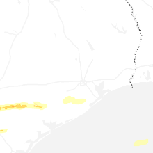


Connect with Interactive Hail Maps